
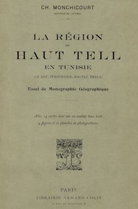
La région du Haut Tell en Tunisie (le Kef, Téboursouk, Mactar, Thala) : essai…
QR code
"La région du Haut Tell en Tunisie (le Kef, Téboursouk, Mactar, Thala)" by Ch. Monchicourt is a geographical monograph written in the early 20th century. It examines the High Tell of northwestern Tunisia through physical and human geography, clarifying terrain, climate, water systems, vegetation, agriculture, and settlement around Kef, Téboursouk, Mactar, and Thala. A key aim is to define and subdivide the Tell in relation to the Friguia, Sahel, and Sahara, drawing
on extensive fieldwork, maps, and historical sources. The opening of the monograph presents a detailed bibliographic survey (Arabic historians, European travelers, scientific reports, geology, climate, flora and fauna, agriculture, cartography), notes the patchy meteorological records, and explains the author’s reliance on multi-year field exploration and local testimony. It then launches the introduction by unpacking the shifting meanings of Ifriqia/Friguia from medieval sources to modern usage, recasting Friguia as the cereal-and-grassland country defined by reliable rains. Monchicourt analyzes “tell” as a clayey soil kept moist by ample precipitation and “sra” as high, cold, arable plateaus, concluding that the Tell is the region where such soils dominate; he contrasts this with the coastal Sahel (olive country) and the more arid Sahara, and proposes a rational tripartite division (Tell, Steppe, Sahara) based on rainfall, rejecting the vague “Hauts-Plateaux.” He subdivides the Tunisian Tell into a humid Tell Septentrional, a western high Haut-Tell, and an eastern lower Tell Inférieur, distinguishes the contrasting sections of the Medjerda valley, and sketches the northern Tell’s three faces: the forested Kroumirie, the surrounding cereal lands (Béja region, Regba/Dakhlat/Mateur plains), and the Bizerte littoral focused on maritime trade and olives. (This is an automatically generated summary.)
Download for free
For your e-reader or reading app — Kindle, Kobo, Apple Books, Calibre etc.
Kindle → Use Send-to-Kindle
- Download the EPUB3 file above
- Upload it on the Amazon site your Kindle is registered with: amazon.com/sendtokindle for the US, amazon.co.uk/sendtokindle for the UK etc.
- It appears on your Kindle and in the Kindle app
Kobo, Nook etc. → Transfer via USB
- Download the EPUB3 file on your computer
- Connect your e-reader by USB and tap "Connect" on its screen
- Drag the file onto the e-reader drive
Phone, Tablet or Computer → Online or Reading App
Easiest: read online in your browser. Nothing to install.
Or use a reading app:
- Find and install one you like, for example Apple Books, ReadEra or Thorium Reader
- Download the EPUB3 file above
- Open it in the app
More help: iPhone / iPad · Android · Computer
Other formats & older devices
There may be more files related to this item.
About this eBook
| Author | Monchicourt, Charles, 1873-1937 |
|---|---|
| Title | La région du Haut Tell en Tunisie (le Kef, Téboursouk, Mactar, Thala) : essai de monographie géographique |
| Alternate Title | La région du Haut-Tell en Tunisie (le Kef, Téboursouk, Mactar, Thala) : essai de monographie géographique |
| Original Publication | Paris: Librairie Armand Collin, 1913. |
| Credits | Galo Flordelis |
| Language | French |
| LoC Class | DT: History: General and Eastern Hemisphere: Africa |
| Subject | Tunisia -- Geography |
| Category | Text |
| eBook-No. | 78720 |
| ISBN (HTML) | 979-8-238-78720-6 |
| Release Date | May 21, 2026 |
| Copyright | Public domain in the USA. |
| Downloads | 483 downloads in the last 30 days. |
Project Gutenberg eBooks are always free!