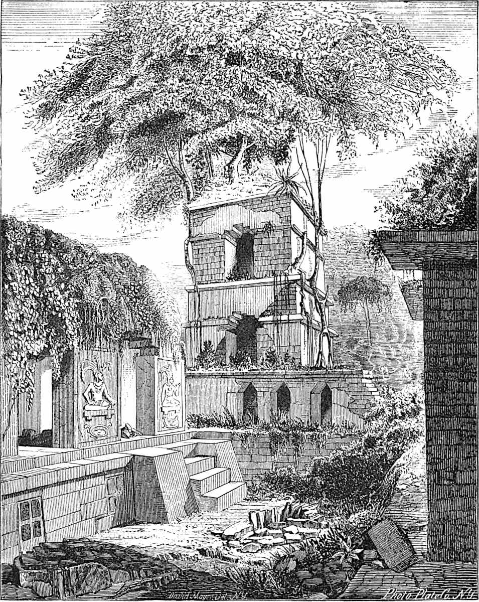
Court and Tower of the Palace, Palenque. (After
Waldeck.)
THE growing interest in the origin, migrations and life of the races of American Antiquity has led me to believe that the subjects considered in these pages would meet with the favorable attention of the public and of the specialist in this field. With such a conviction I present this volume, realizing the difficulties which attend any efforts to elucidate such dark problems. Yet I cannot conceal my satisfaction that the age of North American Antiquity is not all darkness, but on the contrary is rapidly growing radiant with light, while a host of patient searchers for its truths roll up the obscuring curtain. The recent discoveries by Geo. Smith, Cesnola, and Schliemann naturally cause us to turn with national pride to the rich antiquarian fields in our own land. Very satisfactory results have been obtained within a few years in the exploration of Mound-works and the Cliff-dwellings of the West. A just view of the civilization of the builders of these remains, however, requires that it be considered in connection with the traditional history and civilization of the ancient races of Mexico and Central America, so marked was the influence of the ancient peoples of this continent upon each other.
viii
Regarding this to be important, I have endeavored to present a comprehensive view of the civilization of the Mound-builders, Cliff-dwellers, and Pueblos, and to bring to the attention of the reader the traditional history and architectural remains of the Mayas of Yucatan and the Nahuas of Mexico. Only the probable origin and the most remote period of the growth of these latter peoples could receive attention within the limits prescribed for this work, since it is my design that this volume shall serve as a manual of information relating to the earliest period of North-American Antiquity, and as an introduction to Ancient American History. My material relating to the Mound-builders has been drawn almost entirely from the Smithsonian Reports, the Proceedings of scientific societies, and private memoirs. Still it is but justice to one honored co-laborer in the same field, Col. J. W. Foster, to say that his excellent work, The Pre-Historic Races of the U. S., has been of great service in our investigation of this subject. Although his sources of information have been, with few exceptions, before me, my appreciation of his work is attested by my constant reference to it. Nevertheless, the wonderful advances which have been made in Mound-exploration since the issue of the Pre-Historic Races, called for a fresh treatment of the subject.
On the Mayas and Nahuas the following manuscript works in the possession of the Congressional Library at Washington were consulted, and yielded valuable material:
Las Casas: Historia Apologética de las Indias occidentals, 4 vols. folio.
Las Casas: Historia de Indias, 4 vols. folio.
Panes (D. Diego): Fragmentos de Historia de Nueva España, folio.
ix
Echevarria y Veitia: Historia del origen de gentes que poblaron la America Septentrional, 1755, 3 vols. folio (about one-fourth of the work is published in Kingsborough’s Mex. Antiq., vol. viii).
Escalante in Teniente (Jose Cortes): Memoria sobre las Provincias del Norte de Nueva España 1799, folio.
Duran (Diego): Historia Antigua de la Nueva España 1585, 3 vols. folio (part of the work has been published in Mexico).
These, together with the large number of printed books relating to America in the Congressional Library added to works in my possession, afforded an ample field for research.
I must express my appreciation of the courteous attentions of the accomplished Librarian of Congress, the Hon. A. R. Spofford, who together with his assistants did everything possible to facilitate my investigations. To the uniform and friendly interest which Mr. Spofford has manifested in my work, its successful completion is largely due. The substantial assistance which I received from the lamented Professor Joseph Henry—the record of whose kindly offices to his fellowmen can never be written—was invaluable to me. Besides placing the latest material at my disposal, he generously furnished most of the engravings in this work relating to the Mound-builders. Dr. Charles Rau, also of the Smithsonian Institution, has placed me under obligations for valued services. To Professor F. V. Hayden and to the painstaking offices of Mr. James Stevenson of the U. S. Geological and Geographical Survey of the Territories, I am indebted for the engravings as well as the sources of information relating to the Cliff-dwellers. The Hon. J. R. Bartlett, of Providence, R. I., with equal generosity has conferred like favors. Prof. F. W. Putnam, of the Peabody Museum of Americanx Archæology and Ethnology at Cambridge, Mass., and his courteous assistants, Mr. Carr and Miss Smith, have provided me with valuable engravings and reports. Robert Clarke, Esq., and Mr. E. Gest, of Cincinnati, have also sent me engravings, and the former in particular has conferred frequent favors. Professor Ph. Valentini, of Albion, N. Y., with rare liberality, contributed interesting material relating to the Nahua Calendar. To Mr. Stephen Salisbury, Jr., of Worcester, Mass., Dr. R. J. Farquharson, of the Davenport Academy of Sciences, Rev. S. D. Peet, editor of the American Antiquarian, Cleveland, O., and to A. J. Conant, Esq., of St. Louis, Mo., I am indebted for the interest they have manifested, and for the material which they have brought to my attention.
Señor Orozco y Berra, of the City of Mexico, the distinguished author of the Geografía de las lenguas Mexicanas, has from time to time freely made important suggestions concerning some of the problems under consideration. To my friend the Rev. John W. Butler, of the City of Mexico, whose intelligent efforts in my behalf have been unremitting, I have special reason to be thankful. To all these generous friends I must be permitted here to express my deep sense of gratitude for their favors.
However, this pleasant task would be but half performed were I to omit the recognition of the unselfish friendship of the justly eminent author of the Native Races of the Pacific States. Mr. Hubert Howe Bancroft, whose rare erudition and breadth of thought are only surpassed by his magnanimity of nature and manliness of spirit, with a liberality which has scarce a parallel in authorship, sent me the majority of the engravings illustrative of the Maya and Nahua architecture and sculpture, used in the fourth volume of the Native Races. To this I may add the no less valuable encouragement which he so heartily gave duringxi the progress of my work. Although some of my investigations were prosecuted before the publication of the Native Races, and though all of Mr. Bancroft’s sources relating to subjects which have received our mutual attention were before me and underwent a critical examination at my hands, it is but fair to state that the assistance which I derived from the Native Races has been of incalculable service in the preparation of this volume. If in any place I have omitted to render full credit to Mr. Bancroft, and to that imperishable monument of learning and industry, his great work, the omission has been due to inadvertence rather than intention. My obligations to Mr. Bancroft can never be discharged, nor can the kind attentions of Mr. Henry L. Oak, of the Bancroft Library, San Francisco, be forgotten.
Still my examination of the sources has not always led me to the same conclusions as were reached by the author of the Native Races. This may be owing to our different standpoints of observation, or possibly to an inappreciable bias in my own mind. It is, however, but justice to myself to say that this work has been prosecuted to its completion with the spirit of inquiry rather than of advocacy, and is the embodiment of an honest search for the truth.
Columbus, O., November, 1879.
THIS, the third edition of “The North Americans of Antiquity,” has been carefully revised and new facts incorporated. In this connection I take the opportunity of thankfully acknowledging the kindly reception and marked consideration which this work has enjoyed at the hands of specialists, of learned Societies in both America and Europe, and from the University of Leipzig.
Columbus, Ohio, September, 1881.
xvi
ON that eventful morning nearly four centuries ago, when the spell of uncertainty and mystery which enshrouded the Atlantic was broken, and the darkness of the deep vanished with the darkness of the night, the illustrious admiral discovered a world populated with beings like himself. They were male and female, with all the physical characteristics common to the rest of mankind, and differed from the Spaniards only in that their skin was of a copper hue, and their cheek bones more prominent. They were tattooed and wore their straight black hair, cut short above the ears, with a few unshorn locks falling upon their shoulders.[1] These naked uncivilized men and women were the 22same in their physical type with those discovered subsequently on the islands and the main land by the Cabots, Vespucius, Verrezano, and Cartier. To rehearse their descriptions of the natives whom they first met would be but to repeat the experience and observations of Columbus. Nearly five centuries earlier the Norse adventurer Thorwald Ericson (1002 A.D.) encountered natives on the New England coast, corresponding in appearance, habits, and condition to those who occupied the country when colonized by the first settlers. To these natives they gave the name of Skrellings, from skraekja, a name which they had previously applied to the Eskimo, meaning to cry out.[2] Thorfin Karlsefne, who also reached the New England coast four years later than Thorwald, describes the natives as sallow-colored and ill-looking, having ugly heads of hair, large eyes and broad cheeks. They came in canoes to his ships for the purposes of trade, and though peaceable at first, soon exhibited hostility and treachery.[3] It is probable that these Skrellings were North American Indians, who had interbred with the Atlantic Coast Eskimo. How long the red man’s occupation of the country antedated its discovery by the Scandinavians is uncertain. His traditions are worthless on that subject. His chronology of moons and cycles is an incoherent and contradictory jumble. Nor does he know any more certainly from whence he came. It would seem that his race came by installments, if it came at all, and that he was just as far advanced in the arts of hunting and war and domestic life on the day in which he first possessed himself of the soil, as on that in which he was driven from it by the European. Only under the fostering care of the white man has he shown any improvement, and that has been of such an uncertain character as to amount to proof of his incapacity for self-civilization. The Indian, 23measured by his low condition in the scale of progress from the extremest barbarism towards semi-civilization, belongs to what is known as the flint age (old-stone or Palæolithic) in Europe, in which the rudest flint implements seem to have been the chief auxiliaries which he possessed with which to supplement and assist his hands in securing a livelihood or to protect his person and family from ferocious beasts. Perhaps we may more properly place him in a position midway between the flint and24 the stone ages (new-stone or Neolithic), for he no doubt was possessed of polished stone implements of a limited number and variety. Whether made by his own hands or by those of his predecessors is uncertain.[4] In thus assigning the Indian his place in the scale by which man’s state of barbarism or degree of civilization has been measured by scholars in Europe, we do not pretend to claim for him the antiquity of the man of the flint age in any other part of the globe.[5]
25
26
Dr. Abbott, of New Jersey, in an extended treatment of the Stone Age in his own State, has shown many evidences of the protracted occupancy of the Atlantic States by a people whose weapons resemble those of ancient man in Europe. Col. Charles Whittlesey has called attention to the discovery of Indian remains in the “Shelter Cave,” near Elyria, Ohio, and also in a cave near Louisville, Kentucky, where the conditions seemed to point to an interment as long ago as two thousand years, but the evidences both as to the remains having been those of the red man and the period of burial are too uncertain to be of any service in the construction of a theory.[6]
27
The eras or ages which have been observed to mark the different stages of the development of pre-historic man in Europe (in the manufacture of implements and the construction of places of abode), are apparently reversed in America.
The Neolithic and Bronze ages preceded the Palæolithic at least in the Mississippi Basin—not that the last inhabitants deteriorated and lost the higher arts which are well known to have been cultivated upon the same soil occupied by them, but that they were preceded by a race possessed of no inferior civilization, who were not their ancestors, but a distinct people with a capacity for progress, for the exercise of government, for the erection of magnificent architectural monuments, and possessed of a respectable knowledge of geometrical principles. The remains of this mysterious people known as the mound-builders are spread over thousands of square miles of the United States, and it is a question whether the antiquarian is more surprised at the greatness of their number than in many instances at the immensity of their proportions. The entire valley region of the Missouri, Mississippi and Ohio rivers with that of their affluents was occupied by this remarkable people—presenting us with a parallel to the ancient civilization which flourished in the earliest times on the watercourses of the old world. The geographical distribution of these mounds may be described in general terms with a view to the territory occupied by them in the United States, as central, western, and southern.
The publication of the valuable works of Squier and Davis, 28of Dr. Lapham and those of Mr. Squier alone, in which the remains of these regions are described, was like a revelation which brought to light the wonders of an entombed civilization.[7] In treating of the mounds geographically, we find no evidences of this people having reached the Atlantic seaboard, unless we except the great shell-heaps found in various localities on the coast, and of which we will speak further on. It is true that in South Carolina a few vestiges of their residence are found on the Wateree River near Camden, and in the mountainous regions of North Carolina,[8] where they wrought mica mines for the mineral which they prized as precious, and which so often accompanies the remains of their dead. No authentic remains of the Mound-Builders are found in the New England States, nor even in the State of New York. In the former, we have an isolated mound in the valley of the Kennebec in Maine, and dim outlines of enclosures near Sanborn and Concord in New Hampshire, but there is no certainty of their being the work of this people.[9] In the latter, it was at first supposed that the remains found in the western portion of the State were uniform in their plan of construction with the works of the Ohio valley; but Mr. Squier pronounces them to be purely the work of Red Indians. This conclusion should not be viewed as final, even though Cusick’s vague statement (in Schoolcraft, vol. v) that the Iroquois “were 29compelled to build fortifications in order to save themselves from the devouring monsters” lends it an air of plausibility. Either people may have been their builders. Col. Whittlesey would assign these fort-like structures, differing from the more southern enclosures in that they were surrounded by trenches on their outside, while the latter uniformly have the trench on the inside of the enclosure, to a people anterior to the Red Indian and perhaps contemporaneous with the Mound-builders, but distinct from either.[10] A quite reasonable view is that of Dr. Foster, that they are the frontier works of the Mound-builders, adapted to the purposes of defence against the sudden irruptions of hostile tribes. He remarks, “If our country were to become a desolation, the future antiquary would find the sea-coast studded with fortifications of a complex form, and as he penetrated to the interior they would disappear altogether.”[11] It is probable that these defences belong to the last period of the Mound-builders’ residence on the lakes, and were erected when the more warlike peoples of the North who drove them from their cities first made their appearance. Passing along the boundary of the Mound-builders’ territory towards the west, we find the great lakes in all cases to have served as its limit on the north. Mr. Henry Gillman has described in several publications[12] his exploration of mounds in Michigan and the lakes. One of the richest mounds in relics and human remains is known as “the Great Mound of the River Rouge,” situated on the stream from which it takes its name, near the Detroit River and about four and a half miles from the centre of the city of Detroit. The mound now measures twenty feet in height, and must originally have measured 300 feet in length by 200 in width, though the removal of large quantities of sand from it has greatly reduced its proportions and destroyed many valuable relics. Many other 30mounds surrounding it have also been removed. The most remarkable result of the exploration was the discovery of tibiæ flattened to an extreme degree, such as is peculiar to platycnemic man. A circular mound in the vicinity yielded even more remarkable specimens of this singular flattening or compression. Two specimens presented unprecedented proportions; the transverse diameter of one shaft being 0.42 and the other 0.40 of the antero-posterior diameter. The circular mound yielded eleven skeletons besides a large number of burial vases and stone implements of all descriptions peculiar to the mounds. Of the crania from this mound we shall speak in Chapter IV. In 1872, Mr. Gillman examined a remarkable group of tumuli situated at the head of St. Clair River. These mostly stand on the shores of Lake Huron. The relics, besides human remains, consisted of pieces of mica, and necklaces of beads of the teeth of the moose alternating with well-wrought beads of copper. The same peculiarity of flattened tibiæ was markedly prominent in the remains.[13] The same investigator has examined mounds at Ottawa Point, Michigan, near the mouth of the Oqueoc River, at Point La Barbe in the Straits of Mackinac, and at Beaver Harbor on Beaver Island in Lake Michigan. Excepting ancient copper mines, no known works extend as far north as Lake Superior anywhere in the central region. Farther to the North-west, however, the works of the same people are comparatively numerous. Dr. Foster quotes a British Columbia newspaper, without giving either name or date, as authority for the discovery of a large number of mounds, seemingly the works of the same people who built farther east and south.[14] On the Butte Prairies 31of Oregon Wilkes and his exploring expedition discovered thousands of similar mounds.[15]
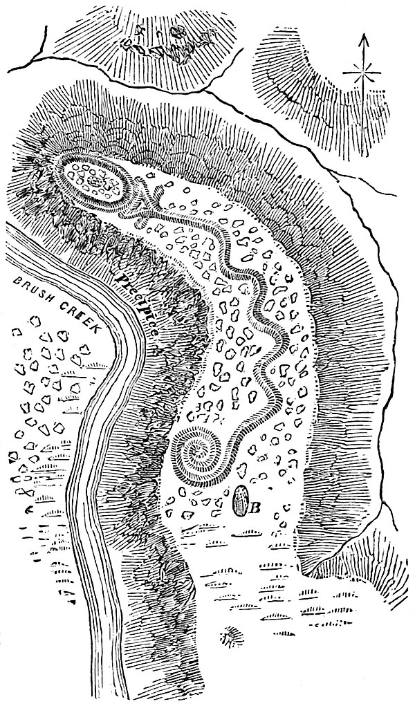
Lewis and Clarke, in the Journal of their expedition up the Missouri River, describe the remains of fortifications on Bonhomme Islands at as early a date as 1804–5–6, but until recently their statements have been received with a degree of doubt.[16] This doubt has, however, been fully set at rest by the members of the United States Geological Surveying Expedition of 1872. Not only has it been shown that works exist at Bonhomme’s Island, but all the way up through the Yellowstone region and on the upper tributaries of the Missouri mounds are found in profusion.[17] Dr. C. Thomas, of the above-named expedition, 32made interesting discoveries in Dakota Territory, near the Northern Pacific Railroad crossing of the James River. Mounds were examined giving evidence of perhaps greater antiquity than those common in the interior of the country, if their contents be depended upon as furnishing a means of test.[18] The Missouri 33valley seems to have been one of the most populous branches of the wide-spread Mound-builder country. The valleys of its affluents, the Platte and Kansas rivers, also furnish evidence that these streams served as the channels into which flowed a part of the tide of population which either descended or ascended the Missouri. The Mississippi and Ohio river valleys, however, formed the great central arteries of the Mound-builder domain. In Wisconsin we find the northern central limit of their works; occasionally on the western shores of Lake Michigan, but in great numbers in the southern counties of the State, and especially on the lower Wisconsin River. The peculiar and fantastic forms of most of these mounds have led some writers to suppose that they belonged to a different race from that which occupied the valleys to the south. Instead of the usual type of the pyramid and circle, these remains mostly represent animals, or birds, or men. Still Dr. Lapham, who has described them fully in his admirable work[19] on the Antiquities of Wisconsin, concluded that sufficient resemblances between these remains and those of the south exist to ascribe to them a common origin. A few instances of the circle and square are found in association with the animal mounds, while in Ohio, on Brush Creek in Adams 34County, the “Great Serpent,” and the “Alligator” in Licking County furnish proof that either the same people built them or at least the same impulses, religious or otherwise, actuated the people of both districts. The former of the above figures is well described by its name, “with its head conforming to the crest of a hill, and its body winding back for 700 feet in graceful undulations, terminating in a triple coil at the tail.” The length of the latter “from the point of the nose following the curves of the tail to the tip, is about 250 feet, the breadth of the body forty feet and the length of the legs or paws each thirty-six feet.”[20] Until recently no effigy mounds were believed exist further south than 35Ohio; however, Mr. C. C. Jones, Jr., in the Smithsonian Report for 1877 has shown this to be a mistake. Mr. Jones describes an eagle-shaped stone mound north of Eatonton, in Putnam Co., Georgia, of the following dimensions: Height of tumulus at the breast of the bird, seven or eight feet; length from the top of the head to the extremity of the tail, 102 feet; distance from tip to tip of the wings, 120 feet; greatest expanse of tail, 38 feet. A careful regard to the proportions of the bird are shown. A similar stone mound, of nearly the same proportions, was found near Lawrence Ferry on the Oconee River in Putnam County. In this instance a circle of stones encloses the effigy. At Trenton, Wisconsin, and in many other places examined by Dr. Lapham, cruciform works were found, some of which were constructed with the arms extending toward the cardinal points.[21] Instances of extinct or unknown animal forms occur occasionally: one instance is that of an animal somewhat resembling a monkey, having a body of about 160 feet in length, while the tail describes a semicircle and measures alone 320 feet.[22] The most remarkable instance of the kind, however, is that of the big elephant mound found a few miles below the mouth of the Wisconsin River, so perfect in its proportions and complete in its representations of an elephant that its builders must have been well acquainted with all the physical characteristics of the animal which they delineated.[23] This fact suggests the inquiry whether these people were Asiatic in origin and penetrated to the interior of the country before their recollections of the elephant were forgotten, or whether they were contemporaneous with36 the mastodon of North America? In the remarkable works at Aztlan, Dr. Lapham finds not only resemblances to the Ohio antiquities, but striking analogies with those of Mexico.[24]
37
Across the Mississippi in Minnesota and Iowa, the predominant type of circular tumuli prevail, extending throughout the latter State to the Missouri. There are evidences that the Upper Missouri region was connected with that of the Upper Mississippi by settlements occupying the intervening country. Mounds are found even in the valley of the Red River of the North.[25]
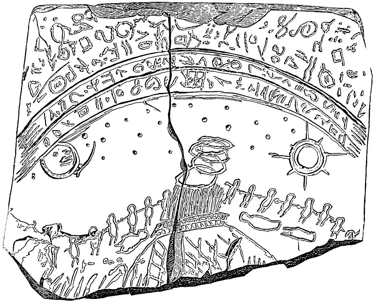
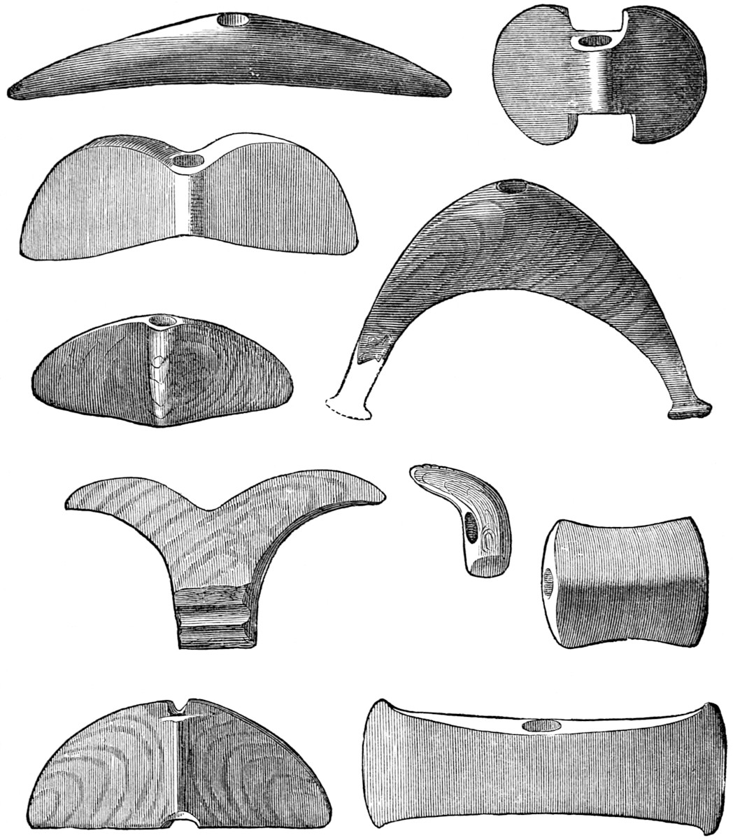
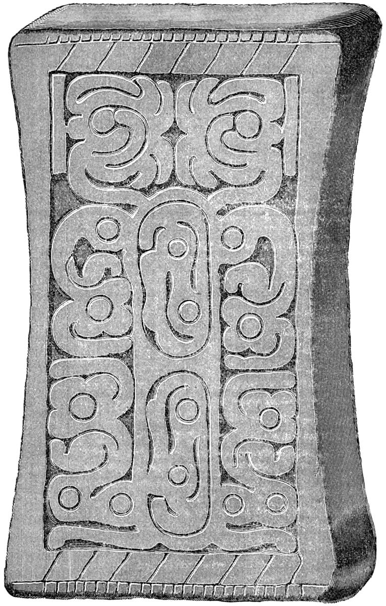
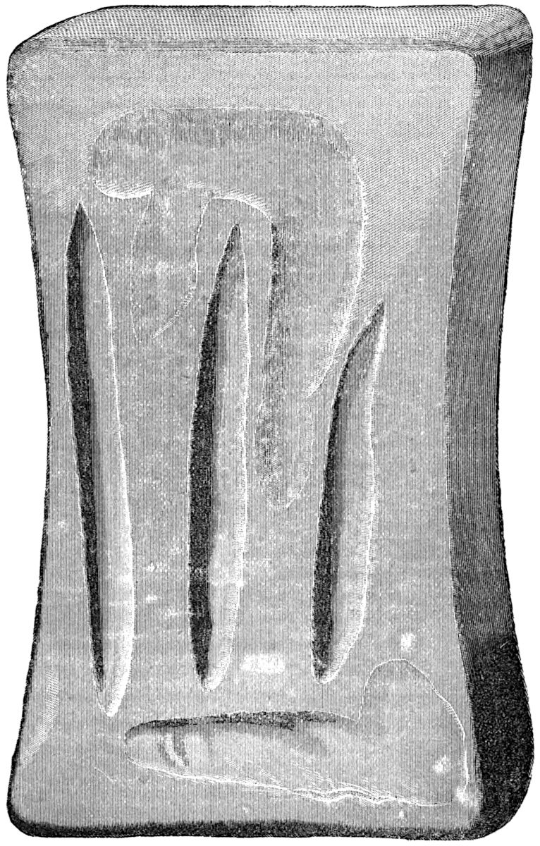
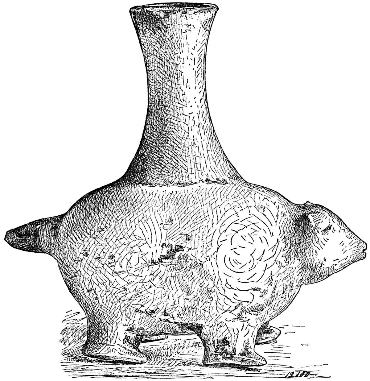
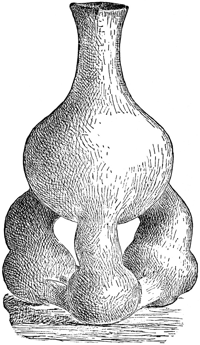
Eastern Iowa, especially in the neighborhood of Davenport, has furnished some of the most interesting mounds that have yet been examined. Several gentlemen—especially Rev. Mr. Gass—of the Davenport Academy of Sciences have within a couple of years recovered a number of fine specimens of copper axes, nearly all wrapped in Mound-builder’s cloth. This cloth had been “preserved by the antiseptic action of the salts of copper, in all probability of the carbonates. In all specimens one thread of the warp is double or twisted, and there are about four to the one-fourth of an inch.”[26] Stone pipes of excellent workmanship carved to represent various animals were found. Pottery, copper beads in considerable numbers, mica and sea-shells (Pyrula and Cassis), one which had an internal capacity of 152 cubic inches, or five and one-half pints, were among the relics recovered. Most of the human remains were much decayed; although some, among them a skull, were preserved. The character of the Altar mound in this group is rather unusual. Within the mound hewn rectangular stones were laid upon one another with perfect regularity, so as to break joints, forming something resembling the exterior appearance of a chimney. 38We are not aware of any similarly shaped altar ever having been discovered in the mounds. The most remarkable discovery of all, however, was made January 10, 1877, by Rev. Mr. Gass and his assistants in one of the mounds which previously had been examined in part. Two tablets of coal slate covered with a variety of figures and hieroglyphics were found.[27] One 39of these, the larger, is of a most interesting character. On one side, as will be seen in the accompanying cut, a number of persons with hands joined have formed a semicircle around a mound, upon which a fire has been kindled, probably for the purpose of sacrifice, or for converting into a hardened and water-proof covering the layer of clay which may have been spread over the remains of some distinguished personage beneath. The presence of a layer of baked clay above human remains in so many Ohio mounds leads to this conjecture. The three prostrate human figures may be those of wives or servants of the deceased, to be sacrificed upon his grave, as has been the custom from the remotest times in India and among many savage tribes. The conspicuousness of the sun, moon, and stars, suggest even40 a sadder thought, that perhaps it may be purely a religious ceremony in which human victims are being offered to the heavenly bodies. Sabine worship, which spread throughout the entire length of the continent, is known to have been accompanied with the most horrid rites. Above the arch of the firmament are hieroglyphics which if deciphered no doubt would tell of the nature of this and other similar scenes. On the reverse side of the tablet is a rude representation of a hunting scene in which various animals, such as the buffalo cow, deer, bear, etc., etc., are figured. It has been conjectured that a large animal in the upper left-hand corner may be a mammoth, but there is little ground for the supposition. The scene is probably a representation of the exploits of the person buried in the mound. The smaller tablet is evidently a calendar stone with signs of the zodiac regularly marked upon it; of this calendar we shall speak in a future chapter. The above conjectures as to the significance of the representations on these tablets are based upon the supposition that they are genuine and not the work of an impostor, of which we cannot refrain from expressing a slight suspicion. That Rev. Mr. Gass has given a true account of his discovery there cannot be the slightest doubt—that he and his co-laborers in the work of excavation believe them to be genuine is equally certain.
Descending to the interior, we find the heart of the Mound-builder country in Illinois, Indiana and Ohio. It is uncertain whether its vital centre was in Southern Illinois or in Ohio—probably the former because of its geographical situation with reference to the mouths of the Missouri and Ohio Rivers. To enter upon a detailed description of the antiquities of this remarkable region would alone more than occupy the entire limits which we have prescribed for this work. This undertaking has already been well performed by Atwater, Squier and Davis, Foster, Baldwin, and many others. We shall therefore confine our remarks to notices of the most conspicuous remains and the general peculiarities of Mound-builder architecture. This people possessed a due appreciation of the physical advantages of certain localities for their cities. The site of St. Louis was formerly covered with mounds, one of which was thirty-five feet high,41 while in the American bottom on the Illinois side of the river their number approximates two hundred. In a group of sixty or more, lying between Alton and East St. Louis, stands the most magnificent of all the Mound-builders’ works, the great Mound of Cahokia, which rises to a height of ninety-seven feet and extends its huge mass in the form of a parallelogram, with sides measuring 700 and 500 feet respectively. On the south-west42 there was a terrace 160 by 300 feet, reached by means of a graded way. The summit of the pyramid is truncated, affording a platform of 200 by 450 feet. Upon this platform stands a conical mound ten feet high. Dr. Foster remarks: “It is probable that upon this platform was reared a capacious temple, within whose walls the high-priests gathered from different quarters at stated seasons, celebrating their mystic rites, whilst the swarming multitude below looked up with mute adoration.”[28] When we consider the analogy between the general features of this pyramid and that on which the temple of Mexico was situated, it is not unnatural to reflect that Cahokia may have served as the prototype of the more magnificent structure which was so often deluged with the blood of its thousands of human victims. The temple of Mexico and many others of its type may have been the embodiment of the same principles of architecture employed at Cahokia, but carried to greater perfection under the more favorable conditions afforded in the valley of Anahuac, or precisely the reverse may be true. Such speculations are, however, more easily set forth than sustained. Dr. Foster, through a mistake, states that the monster mound has been removed. This, we are happy to say, is not the case.[29]
43
Numerous interesting explorations have been conducted recently in Illinois with rich results. Among the most notable of these are the discoveries of Mr. Henry R. Howland, reported in a paper read before the Buffalo Society of Natural Sciences, March, 1877 (Bulletin of the Buffalo Soc. of Nat. Sc., vol. iii., p. 204 et seq.). In January, 1876, Mr. Howland witnessed the removal of a mound near Mitchell Station in the American Bottom. In a stratum four or five feet from the base, composed chiefly of human bones, a large quantity of matting and a number of copper relics were disclosed to view. The matting was a coarse vegetable cane-like fibre simply woven, without twisting. Among the articles wrapped in the matting were several miniature tortoise shells formed of copper. They were of beaten copper of one sixty-fourth of an inch in thickness, the largest being but two and one-eighth inches in length. “A narrow flange or rim, about five thirty-secondths of an inch in width, is neatly turned at the base, and over the entire outer surface the curious markings peculiar to the tortoise shell are carefully produced by indentation—the entire workmanship evincing a delicate skill of which we have never before found traces in any discovered remains of the arts of the Mound-builders.” These shells were covered with several wrappings, the first and nearest to the shell proving to be of vegetable fibre, the second of a dark-brown color; when placed under the microscope and examined by Dr. G. J. Engleman and Sir Joseph Hooker, proved to be a very fine cloth woven from animal hair—of the rabbit and possibly of the deer. The third envelope was made from the intestine of some animal. The lower jaws of deer were discovered in which the forward part containing the teeth were encased in thin copper and wrapped in the fine hair-cloth just described. From holes bored in the back of each jaw, it is inferred that the articles were suspended from the neck as totems or badges of authority. Three wooden spool-like objects were found in the same place, partially plated with thin copper. Copper rods or needles from fourteen to eighteen inches in length, a beautiful shell necklace, and a spear head of chert a foot long, were also discovered. Among the rest were several sea-shells (Busycon Perversum), evidently brought from the Gulf a thousand miles distant. In the summer of 1874,44 Mr. H. R. Enoch, of Rockford, Ill., discovered a tablet in a mound situated on the bank of Rock River, five miles south of Rockford. The “Rockford Tablet” created quite a sensation at first because it was thought to bear upon its face several symbols found upon the Mexican Calendar stone. However, a thorough investigation of its claims prove it to be a fraud, no doubt placed in the mound where discovered for the purpose of deception. Mr. J. Moody of Mendota, Ill., in referring to the twelve symbols of the tablet said to be Mexican, remarks: “Six are nearly exact counterparts of that number of Lybian characters which I find represented in Priest’s American Antiquities. * * * From a comparison of the Rockford Tablet with the plates in the work referred to above, the inference is almost irresistible that the engraver had a copy of Priest’s American Antiquities before him while doing his work.” (See Congrès International des Américanistes, Luxembourg, 1877. Tome ii, p. 160.)
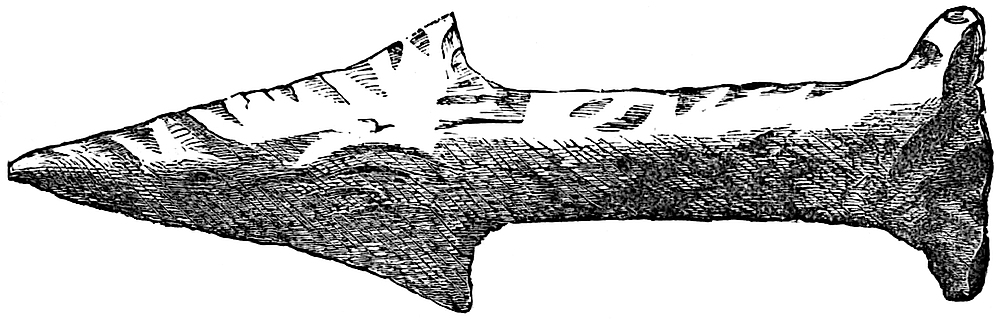
The same sagacity which chose the neighborhood of St. Louis for these works, covered the site of Cincinnati with an extensive system of circumvallations and mounds. Almost the entire space now occupied by the city was utilized by the mysterious builders in the construction of embankments and tumuli built upon the most accurate geometrical principles, and evincing keen military foresight.[30] Dr. Daniel Drake described these works in 1815, and many others subsequently.[31] The most important discovery made among these remains was that of the “Cincinnati Tablet” in 1841. This singular relic was taken from a large mound formerly thirty-five feet high, removed at the above date from the extension of Mound Street across Fifth 45Street. When found, it was lying on a level with the original surface under the skull of a much decayed skeleton, with two polished, pointed bones about seven inches long, and a bed of charcoal and ashes. This stone in all probability served the double purpose of a record of the calendar and a scale for46 measurement.[32] Mr. E. Gest, the courteous owner of the tablet, provided the accompanying cuts expressly for this work, regarding them as the first correct representations of the stone.
47
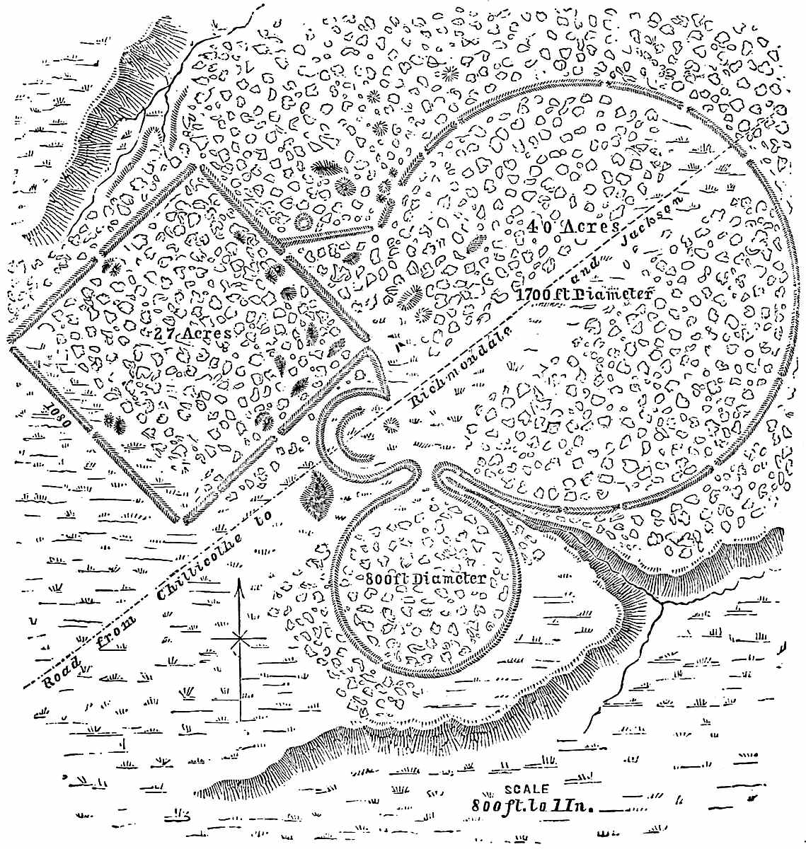
The vast number as well as the magnitude of the works found in the State of Ohio, have surprised the most careless and indifferent observers. It is estimated by the most conservative, and Messrs. Squier and Davis among them, that the number of tumuli 48in Ohio equals 10,000, and the number of enclosures 1000 or 1500. In Ross County alone, 100 enclosures and upwards of 500 mounds have been examined. Some of the works exhibit fine engineering skill; such, for instance, are those near Liberty, Ohio, where two embankments, each forming a perfect circle, are found in conjunction with a perfect square. The larger circle measures 1700 feet in diameter and contains forty acres, while the smaller has a diameter of 800 feet. The square contains twenty-seven acres and measures 1080 feet on each side. One49 set of works in Pike County consists of a circle enclosing a square, the four corners of which each touch the circular embankment. The opening or doorway through the circle is opposite the opening in the square. Prof. E. B. Andrews found a conical mound enclosed by a circle, the base of the mound reaching to the edge of the ditch outside of which is the circular wall. The mound was located on the Hocking River, nine miles northward of Lancaster, Ohio (see Tenth Ann. Rep. of Peabody Mus. of Arch. and Eth., p. 51). The works at Hopetown, near Chillicothe, present several combinations of the square and circle. The two principal figures of these works are a square and circle—each containing exactly twenty acres. The discovery of these geometrical combinations—executed with such precision—in many parts of the country, lead to the belief that the Mound-builders were one people spread over a large territory, possessed of the same institutions, religion, and perhaps one government. These facts are highly important as shedding light upon the50 degree of their civilization. The evidence is ample that they were possessed of regular scales of measurement, of the means of determining angles and of computing the area to be enclosed by a square and circle, so that the space enclosed by these figures standing side by side might exactly correspond. In a word, their scientific and mathematical knowledge was of a very respectable order.
The military works of the Mound-builders, other than those previously mentioned as existing on the Lakes and in Western New York State, are of a twofold character, consisting first of fortified eminences, of which an instance is found in Butler County, Ohio, where 16³⁄₁₀ acres are walled in on the summit of a hill, and the entrance to the enclosure guarded by a complicated system of covered ways. On Paint Creek, Ross County, a remarkable stone work encloses 140 acres, in the centre of which was an artificial lake, probably to supply water in case of a siege. Perhaps the most remarkable fortification left by the51 Mound-builders is that known as Fort Ancient, Ohio, on the Little Miami River, forty-two miles north-east of Cincinnati. The specialist is already familiar with the oft-quoted description of the Survey by Prof. Locke, made in 1843. We will therefore only refer to a few of the measurements contained in that description. “The work occupies a terrace on the left bank of the river, two hundred and thirty feet above its waters. The place is naturally a strong one, being a peninsula defended by two ravines, which, originating on the east side, near to each other, diverging and sweeping around, enter the Miami, the one above, the other below the work. The Miami itself, with its precipitous bank of two hundred feet, defends the western side.” * * * “The whole circuit of this work is between four and five miles. The number of cubic yards of excavation may be approximately estimated at 628,800”. The embankment stands in many places twenty feet in perpendicular height. The most interesting and valuable paper on this work is that by Mr. L. M. Hosea, of Cincinnati, in the Quarterly Journal of Science (Cincinnati), October, 1874, p. 289 et seq. This writer observes that it has often been remarked that the form of Fort Ancient resembles a rude outline of the continent of North and South America. None of the mounds contained in the enclosure have yielded any relics of special interest. The greatest possible diversity of opinion exists concerning the antiquity of the abandonment of the works. Judges Dunlevy and Force, the latter in his memoir on the Mound-builders,[33] estimate the period as a thousand 52years, while Mr. Hosea thinks several thousand years would be required to produce the numerous little hillocks and depressions which mark the spot where trees have grown, fallen and decayed. Reasoning from other data, we are inclined to the more conservative opinion of Judge Force as altogether the safer. Fort Ancient, which could have held a garrison of 60,000 men with their families and provisions, was one of a line of fortifications which extend across the State and served to check the incursion of the savages of the North in their descent upon the Mound-builder country.
The second class of military works, which are exceedingly numerous on all the watercourses—existing not only on the Ohio and Mississippi, but on all their tributaries, especially on the Muskingum, Scioto, Miami, Wabash, Illinois, Kentucky, and minor streams—are mounds which served as outlooks. These were always placed in positions to command extended views, and from which signals could be given to still others of the same character, or probably to settlements remote from the watercourses.
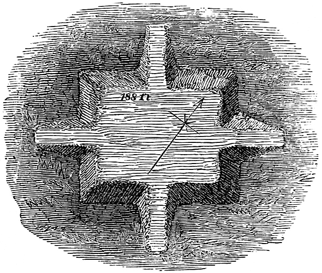
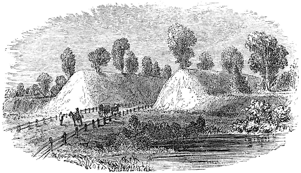
A system of these works no doubt formerly existed on the Great Miami River extending north of Dayton, Ohio, southward to the Ohio River, and connected with the great settlement on the site of Cincinnati and with the high bluffs on the Kentucky shore. The great Mound at Miamisburgh, ten miles south of Dayton, formed a part of this chain. This monster mound is sixty-eight feet high and 852 feet in circumference, and may have served the double purpose of a signal station and the base of a small edifice devoted to astronomical or religious purposes. There is little doubt that the Mound-builders in the latter period of their occupancy of this region, when apprehensive of danger from their enemies, employed a system of signal telegraph by which communication was had, through means of the watch-fire or the torch, between localities as distant as those now occupied by Cincinnati and Dayton. Only a few minutes were necessary by means of such a perfected system in which to transmit a signal fifty or one hundred miles. Squier and Davis remark on this subject: “There seems to have existed a system of defences extending from the sources of the Alleghany and53 Susquehanna in New York, diagonally across the country, through Central and Northern Ohio to the Wabash. Within this range the works which are regarded as defensive are largest and most numerous.” The signal system we have reason to believe was employed throughout the entire extent of this range of works. The majority of the enclosures found in the Ohio and Mississippi valleys are presumed not to have been designed for military purposes, since the trench is usually inside of the embankment. However, instances of the trench being outside of the parapet occur in Southern Ohio.[34] The most magnificent Mound-builder remains in Ohio are the extensive and intricate works near Newark in Licking County. The survey made by Col. Whittlesey and published in the Ancient Monuments of the Mississippi Valley, is the most reliable as well as the fullest source of our information concerning their magnitude, though the plan has been corrected considerably by more recent surveys. These works occupy an area of two miles square, and formerly consisted of twelve miles of embankment. The spacious gateways—one of which has embankments on both sides measuring thirty-five feet in height from the bottom of the interior trench—the labyrinthine system of avenues, the strangely-shaped mounds, one of which resembles a huge bird-track with a middle toe 155 feet in length and the remaining two each 110 feet in length—together with the solitude of the ancient forest which entombed this buried city, we confess impressed us with a sense of wonderment and that strange perplexity which an insoluble mystery exercises over the mind. We can appreciate the remark of Mr. Squier in his description: “Here covered with the gigantic 54trees of a primitive forest, the work truly presents a grand and impressive appearance; and in entering the ancient avenue for the first time, the visitor does not fail to experience a sensation of awe, such as he might feel in passing the portals of an Egyptian temple, or in gazing upon the ruins of Petra of the Desert.” It is estimated that a force of thousands of men assisted by modern appliances and implements as well as horse-power, which the Mound-builder did not possess, would require several months in which to construct these works.[35] At Marietta a most interesting system of works exist, covering an area three-fourths of a mile long and half a mile broad. These occupy the river terrace or second bottom at the confluence of the Muskingum River with the Ohio, and present analogies with the works further south and with those of Mexico.[36] Two irregular squares inclose fifty and twenty-seven acres respectively. The walls of the larger are between five and six feet high and from twenty to thirty feet wide at the base. Within an enclosure are four truncated pyramids or platforms, one of which, the largest, is 188 feet long, 132 feet wide, and only 10 feet high, with a graded way reaching to its summit, as have also two of the other pyramids. No one can look at these structures without seeing the force of Lewis H. Morgan’s Pueblo theory,[37] which makes these mounds or flattened pyramidal elevations the foundation for edifices of a perishable nature; constructed perhaps of hewn wood, but not of a combination of the adobe and wood as he supposes, since no material for such a combination is found in the Ohio valley.[38] The most elevated of the Marietta works is an elliptical mound thirty feet high, enclosed by an embankment.
55
The most recent and satisfactory exploration of mounds in Ohio, was that conducted by Prof. E. B. Andrews for the Peabody56 Museum of American Archæology and Ethnology, and published in the Tenth Annual Report of the Trustees (Cambridge, 1877). The mounds examined are in Fairfield, Perry, Athens, and Hocking Counties. In Fairfield County they were all located upon hills and commanded extensive views. Their contents indicated great age, being much decayed. At New Lexington in Perry County, ancient flint diggings, unquestionably worked by the Mound-builders, were examined, many of the pits being six to eight feet deep. In Athens County, on Wolf Plain, situated in Athens and Dover Townships, several circles and nineteen conical mounds are found. One of the latter measures forty feet high, with a diameter of 170 feet, and contains 437.742 cubic feet. Another, known as the Beard Mound, was excavated, and the interesting fact discovered that in its construction the dirt had been “thrown down in small quantities—averaging about a peck—as if from a basket.” Prof. Andrews is of the opinion that the mound was a long time in building, “for we find,” he remarks, “at many different levels, the proof that grasses and other vegetation grew rankly upon the earth heap and were buried by the dirt.” In a neighboring mound known as the George Connett Mound, under a bed of charcoal five feet below the summit, a skeleton was found in a box or coffin, enclosed by timbers. The upper part of the coffin and middle of the body had been destroyed by fire. A circle of five hundred copper beads was found around the body. A copper instrument resembling a calker’s chisel, measuring 141 mm. in length, width at flattened end, 52 mm., diameter of cylindrical part, 20 mm. The instrument was formed from sheet copper, beaten with such care that no traces of the hammer are visible. “The edges are brought together and united very closely by a slight overlap.” Professor Andrews describes and figures a piece of leather ornamented with oval copper beads taken from a point eight feet below the surface of a mound designated as the “school-house mound.” The original piece measured eight or ten inches square, but unfortunately fell into the hands of bystanders, who tore it in pieces for relics. The Professor regards the curiosity as of Mound-builder origin, and57 thinks it belonged to an ornamented dress. We cannot detail these interesting explorations here, and must dismiss them with the deduction that in certain cases the cremation of the bodies found in mounds was accidental, caused by the heat penetrating through a layer of earth on which a fire had been kindled. In other instances, the body seems to have been burned intentionally, and the ashes and charred bones heaped together in the centre of the mound. Some clay and stone tubes of fine workmanship were obtained. The same document above cited contains a valuable paper by Mr. Lucian Carr on his interesting exploration of a mound in Lee County, Virginia.
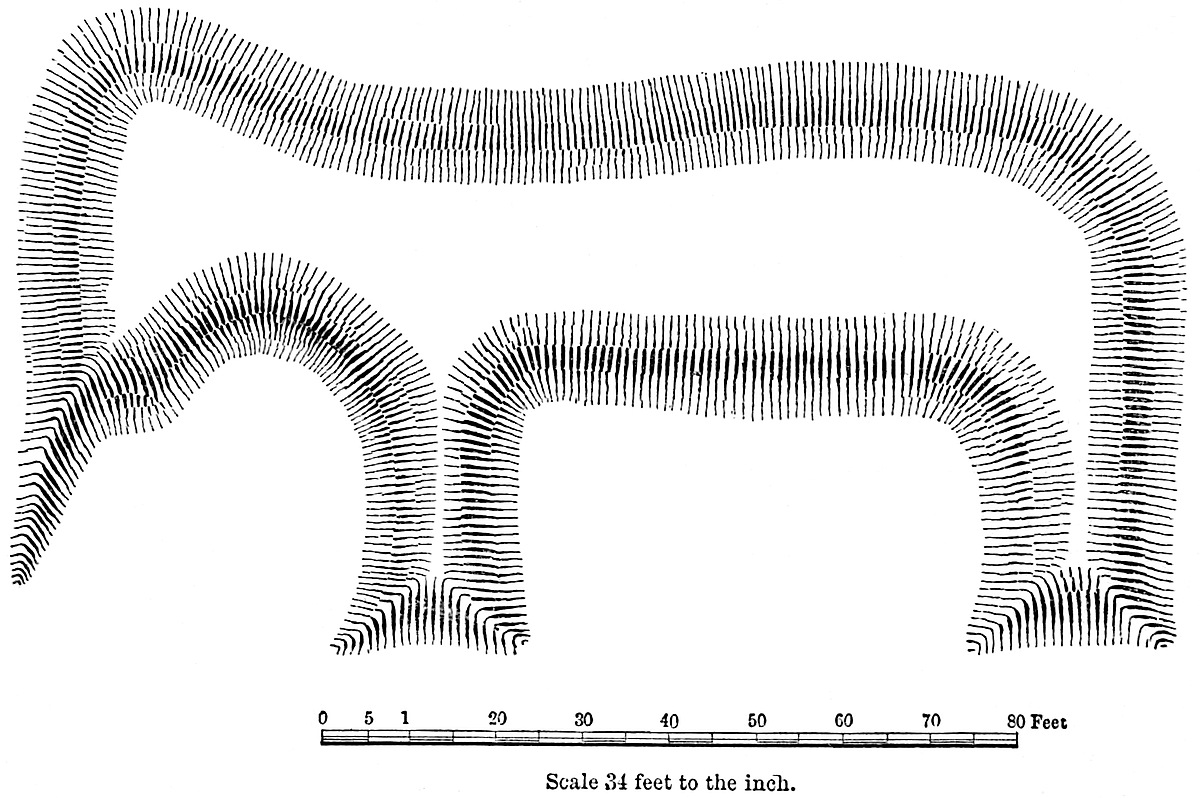
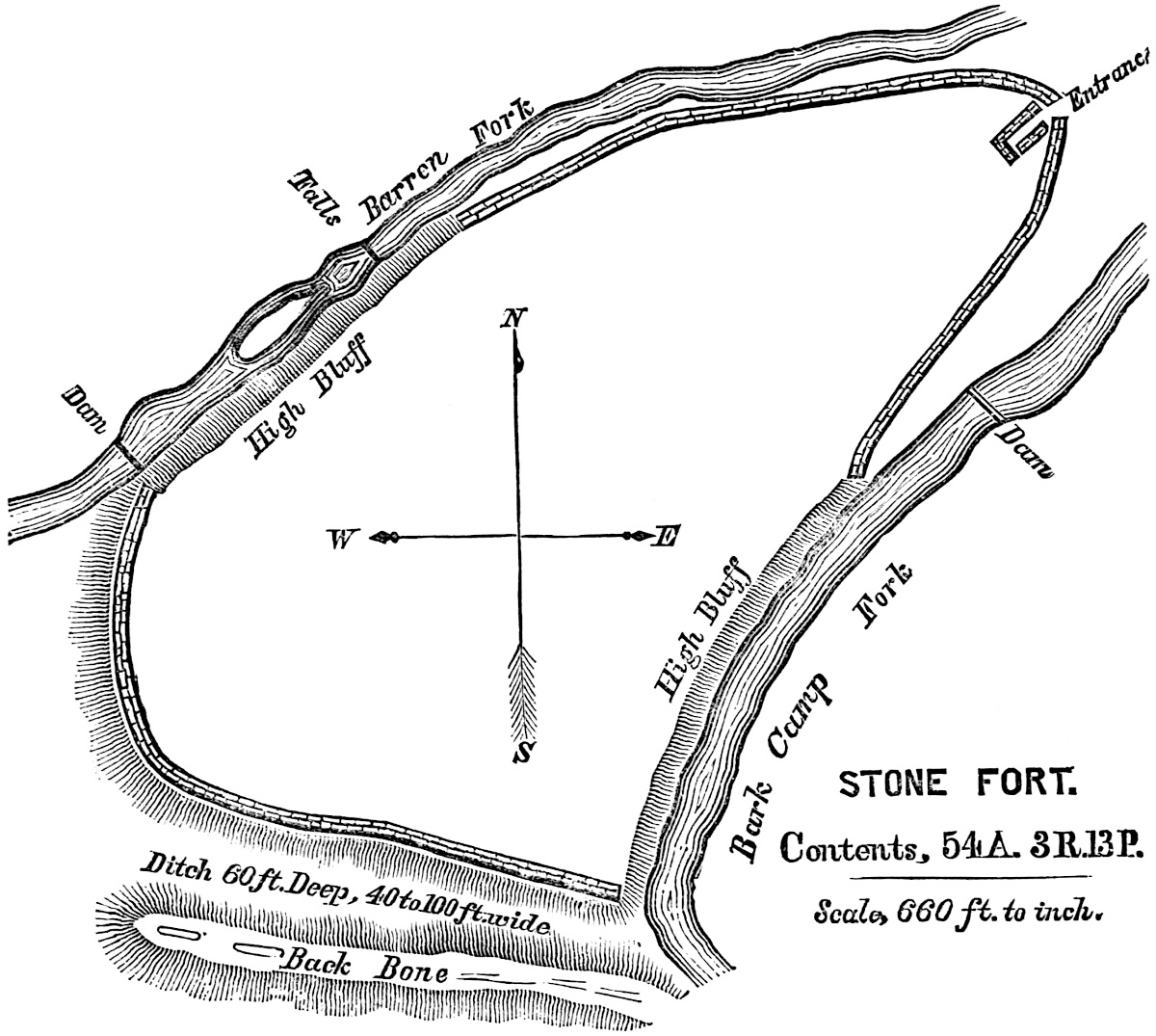
Grave Creek Mound, situated twelve miles below Wheeling in West Virginia, is the Monster work of the Ohio Valley. It measures seventy feet in height and nine hundred feet in circumference. Its form is that of a truncated cone, the flattened area on the top being fifty feet in diameter.[39] The States of Indiana[40] and Illinois formed with Ohio a portion of the great centre of the Mound-builder country, as the remains found on the watercourses58 of both States testify. The valleys of the Wabash, Kankakee, Illinois and Saline Rivers were the once populous dwelling-places of a thrifty and industrious people who have left thousands of structures behind them.[41] The Alleghany Mountains, the natural limit of the great Mississippi basin, appears to have served as the eastern and south-eastern boundary of the Mound-builder country. In Western New York, Western Pennsylvania, West Virginia, and in all of Kentucky and Tennessee, their remains are numerous and in some instances imposing. In Tennessee especially, the works of the Mound-builders are of the most interesting character. Prof. Joseph Jones, of the University of New Orleans, has by his thorough 59and recent explorations under the patronage of the Smithsonian Institution, brought to light very interesting materials for the study of the history of this people. The works of defence in the shape of stone forts, by some thought to be peculiar to New York and the lake boundaries, with occasional exceptions in the Ohio Valley, have been found to abound in Coffee and other counties. One very perfect example of this kind of fortification, but very imperfectly described and figured by Haywood,[42] is that known as the stone fort near Manchester, Tenn. This enclosure, containing over fifty-four acres, has been minutely described by Prof. Jones.[43] In the accompanying cut the reader will obtain a pretty clear idea of the form of this fort. The wall, which varies from four to ten feet in height, is composed of loose rocks gathered apparently from the bed of the streams below, and the vicinity. The ditch shown in the cut at the rear of the works was probably designed to convey water from one creek to the other. The entrance is quite complicated and constitutes the most remarkable feature of the fortification.
60
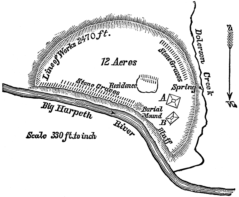
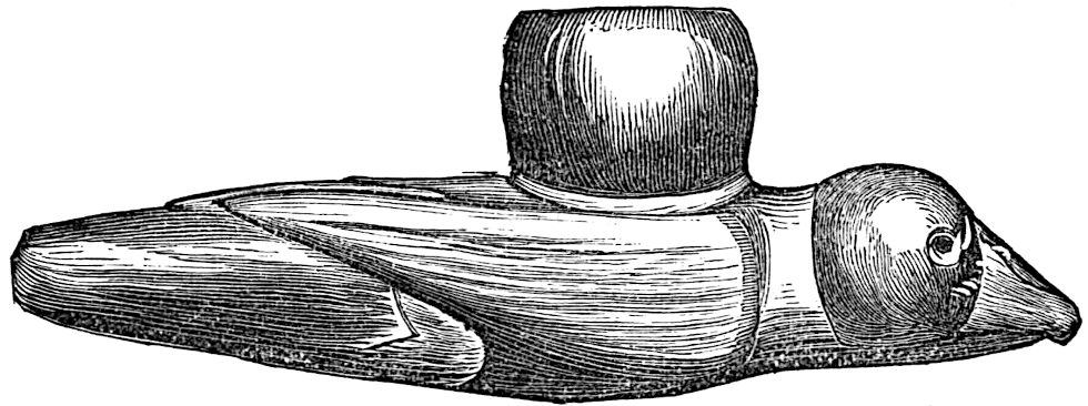
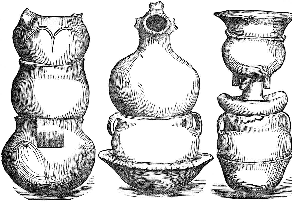
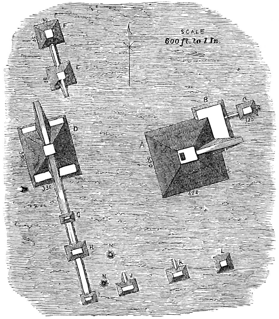
One peculiarity of burial noticeable in this locality, and one which evidently indicates progression when we come to compare these people with those farther north, is the fact that the ancient race of Tennessee buried their dead in rude stone coffins or cists, constructed of flat pieces of limestone or slaty sandstone which abound in the central portions of the State. In most of the mounds this mode of burial prevailed, but was not confined to them, for outside of the mounds in many enclosures a large number of stone graves occur. Of the class of “Stone-grave Burial Mounds”, one situated twelve miles from Nashville, near Brentwood, is worthy of mention. This mound was about forty-five feet in diameter by twelve feet high, and contained one hundred skeletons. These were mostly in stone graves, which were constructed in ranges one above another, three or four deep. The lower graves were short and square, containing bones that had apparently been deposited after the flesh had been removed. The upper graves were full length and contained remains in which the bones occupied their natural relation to each other. The workmanship both of the mound and stone cists was of the most perfect character. The lids of the upper stone cists were so arranged as to present a perfectly rounded, sloping rock surface. The mound was situated on the eastern slope of a beautiful hill, covered with a heavy growth of the native forest. In a large and carefully constructed stone tomb, Prof. Jones discovered the skeleton of an aged individual of immense length, having toothless jaw bones. In a grave occupied by a skeleton of a female, a small compartment or stone box was found near the head, separated from the main coffin by stone slabs, in which was the skeleton of an infant. It should be added that in the square or short graves so often met with, the61 skull was placed in the centre and the other bones arranged around it.[44] Numerous stone graves not covered by mounds were found on the Cumberland River opposite the mouth of Lick Branch, surrounding a chain of four mounds. A similar graveyard was found on the same bank of the Cumberland, a mile and a half farther down. Others were met with on White Creek, nine miles from Nashville, at Sycamore in Cheatham County; at Brentwood, in White County near Sparta, and along the tributaries of the Cumberland and Tennessee Rivers at short intervals. At Oldtown on the Big Harpeth, is an extensive and remarkable collection of stone graves. All these burial grounds seem to be those of the people who constructed the mounds, for most of the mounds examined contained stone 62graves, not in their upper strata, but on the level of the surrounding land. A mound opposite Nashville, on the east bank of the Cumberland River, of great interest, was examined. Prof. Jones is convinced that it formerly served as the site or base of a temple. Its dimensions were one hundred feet in diameter by only ten feet high. In the centre of the mound and only three feet from its surface the Professor uncovered a large sacrificial vase or altar, forty-three inches in diameter, composed of a mixture of clay and river-shells. The rim of this flat earthen vessel or sacrificial altar was three inches in height and appeared mathematically circular. The surface of the “altar” was covered by a layer of ashes about one inch in thickness. The antlers and jaw-bone of a deer were found resting on the surface of the altar, and it is probable that part of the animal had been consumed as a sacrifice. The whole had been carefully covered with three feet of earth and the ashes preserved. In this mound rude sarcophagi were ranged around this sacred centre with the heads toward the altar and the feet toward the circumference of the circle, while the directions of the bodies were those of radii. Those bodies near the altar were ornamented with numerous beads of sea-shell and bone. In a carefully constructed stone63 sarcophagus, in which the face of the skeleton was turned toward the setting sun, the beautiful shell ornament shown in the cut, measuring 4.4 inches in diameter, was found lying on the breast-bone of the skeleton. It was made from some large shell derived from the sea-coast. Of the numerous interesting places examined by Prof. Jones, the site of Oldtown, on the Big Harpeth River, about six miles south-west of Franklyn, Tennessee, is worthy of special attention. The plan of the works and their general dimensions will be seen in the cut. At present, the crescent-shaped wall of 2470 feet in extent is but from two to six feet in height, having been reduced to its present condition by the plowshare. Thirty years ago it is said to have been so steep that it was impossible to ride a horse over it. Within the enclosure are two pyramidal mounds; the larger is one hundred and twelve by sixty-five feet and eleven feet high, and the smaller, seventy by sixty feet by nine feet high; also a small burial mound measuring thirty by twenty feet and 2.5 feet high. Another burial mound is covered by the residence of the owner, Mr. Thomas Brown. Many curiously-shaped clay vessels were obtained at these works by the explorers. Some of the vases were fashioned into effigies of frogs and various animals, and one64 vase obtained by Mr. Brown in excavating for the foundation for his residence, had a neck terminating in two human heads. Some of the vessels from Oldtown are figured in the cut.

The art of painting seems to have been extensively practised by the mound people of Tennessee, not only in the decoration of pottery, but in representing ideal conceptions, which they spread out in extensive pictures upon the smooth faces of rocky65 walls overhanging the rivers. The material generally used was red ochre. Prof. Jones says: “The painting representing the sun on the rocks overhanging the Big Harpeth River, about three miles below the road which crosses this stream and connects Nashville and Charlotte, can be seen for a distance of four miles, and it is probable that the worshippers of the sun assembled before this high place for the performance of their sacred rites.”[45] The Professor’s vast collection of relics in stone and clay, including several images, we cannot here describe. We refer the reader to the Memoir itself. The Professor has clearly shown that the Mound-builder people and the Indians were distinct, and has set at rest a question upon which some few doubts were still entertained by a certain school of Archæologists, which has really never been very strong. The connection with or identity of the Mound-builders and the Toltics or the same family of people is also shown satisfactorily. We will add that the Professor is disposed to consider the Natchez as the connecting link between the Mound-builders and the Nahuas. We regard the Memoir one of the most important which has ever appeared on the subject of mound exploration. The rich collection of crania will be referred to in a future chapter.

In September, 1877, Prof. F. W. Putnam and Mr. Edwin Curtiss, also a party under Major Powell excavated a large number of mounds and stone graves, mostly in the neighborhood of Nashville, Tennessee. The results were substantially the same as those obtained by Prof. Jones. Prof. Putnam found within an earthwork near Lebanon, in Wilson County, sixty miles east of Nashville, what he considers to be the remains of dwellings66 of the Mound-builders. There were circular ridges of earth varying from a few inches to a little over three feet in height, with diameters ranging from ten to fifty feet. Within these enclosures, a few inches below the surface, hard floors, upon which fires had been made, were discovered. Under these floors, in many instances, infants and children had been buried, while the adults had been interred in a neighboring mound. Accompanying the skeletons of the children, many beautiful vessels of strange and artistic forms were found (cuts of three of these were67 kindly furnished by Prof. Putnam for this work), all evincing the tenderness with which the offspring of this people were regarded. Prof. Putnam examined nineteen of the earth-circles, which he adds, “proved to my satisfaction that the ridges were formed by the decay of the walls of a circular dwelling. * * * These houses had probably consisted of a frail circular structure, the decay of which would only leave a slight elevation, the formation of the ridge being assisted by the refuse from the house.”[46]
Colonies of Mound-builders seem to have passed the great natural barrier into North Carolina and left remains in Marion County, while still others penetrated into South Carolina and built on the Wateree River. In March, 1873, Mr. Jas. R. Page examined several mounds in Washington and Issaquena Counties in the State of Mississippi. One mound explored in Washington68 County on the old bank of the Mississippi River, was a truncated cone eighty feet in diameter by forty feet high. A mound in the neighborhood, only eleven feet high, yielded rich returns for the labors of excavation. A white oak on its summit measured thirty-six inches in diameter. This mound yielded twelve skeletons with their crania. The group was in a sitting69 posture around a circle, with their faces looking toward its centre. Directly in front of the mouth of each skeleton were placed two or three vessels of pottery, beautifully ornamented with etchings and graceful lines. The object of the vessels, placed in such near proximity to the mouths of the buried remains, can only be conjectured. We regret that no measurements of the crania are given, and what is more, we deplore the loss of most of the crania in the course of their transportation.[47] Mr. W. Marshall Anderson, of Circleville, Ohio, examined Mounds in Issaquena County, Miss., with interesting results; in one mound 70opened, not far from its outer edge, three skeletons were found buried in a standing position, as though they had acted as the guards of a more distinguished person deposited in the centre. Penetrating the mound still farther by means of a trench, Mr. Anderson reached a large deposit of ashes and burnt earth. Near the centre of the mound and five feet above the level of the earth, upwards of twenty-five unbroken specimens of fine pottery were discovered. At the very centre three individuals had been buried apparently in great state, with all the insignia of their important positions in life. These were ornaments, urns, vases, beads, and arrow-points; while adjoining the heads of each were food and drinking vessels. Not far removed from these, two skeletons were found with bowls placed upon their heads like helmets. Mr. Anderson is the possessor of a very remarkable stone disk obtained for him by Dr. Robinson from a Issaquena mound near Lake Washington, Miss. The disk is nearly eight and a half inches in diameter and three-quarters of an inch thick, of fine-grained sandstone. The device which it bears upon its face is composed of two entwined rattlesnakes. A trifling ornamental border is graven on the reverse side of the disk. When found it was broken in two pieces. Mr. Anderson, in comparing its strange device to the Aztec Calendar Stone, remarks: “Here are the eighteen pipes of the border corresponding to the eighteen months of the year, but the twenty days of the month and the five intercalaries are not to be found. The thirteen hieroglyphical figures, and the four zodiacal signs, which as multiples give the fifty-two years of the Aztec cycle, are also absent on the Mississippi stone.”[48] The serpent-symbol appears to have played its part among the Mound-builders, as well as in Mexico and Central America. The great serpent of Adams County, Ohio, is the most extensive delineation of the all-important symbol on the continent. Out of eighteen engraved circular plates made of the shell of the Pyrula and taken from Brakebill and Lick Creek Mounds in East Tennessee (and now deposited in the Peabody Museum of Archæology) thirteen bear the device of a rattlesnake. In one of the mounds of “Mound City,” Ross County, Ohio, several small tablets representing the rattlesnake were unearthed, while other mounds in the same locality yielded pipes bearing the same representation.[49]
71
On the Southern Mississippi, in the area embraced between the termination of the Cumberland Mountains near Florence and Tuscumbia in Alabama and the mouth of Big Black River, this people left numerous works, many of which were of a remarkable character.[50] The whole region bordering on the tributaries of the Tombigbee, the country through which the Wolf River flows and that watered by the Yazoo River and its affluents, was densely populated by the same people who built mounds in the Ohio Valley. Mr. Fontaine describes the mounds of this region and of the Tennessee River Valley as being most frequently of the truncated pyramidal type, and refers to one (seen by him in 1847) seventy feet high, covering an acre of ground. It is remarkable that the entire valley of the great river from Cairo to the mouth of Pointe à la Hache, fifty miles below New Orleans, is thickly studded with mounds.[51] As at Cahokia the 72Monarch Mound occupied a space equal to six acres, so at Seltzertown, Mississippi, we have another immense mound covering nearly the same area. Its dimensions are: length, about six hundred feet; breadth, four hundred feet at the base; height, forty feet, with a summit nearly four acres in area, reached by means of a graded way. The structure lies with its greatest length nearly due east and west. Upon the platform summit are three conical mounds, one at each end and the third in the centre. The mound at the western extremity of the summit rises to a height of nearly forty feet, while the one at the opposite extreme does not fall far short of the same altitude. This would give a total height of eighty feet above the level of the base. Both of these mounds are truncated. Eight other mounds of minor proportions are observable. The most remarkable feature connected with this mound is a wall of sun-dried bricks, built two feet thick, as its support on the northern side. These were filled with grass rushes and leaves, while some of the bricks of great size used in angular tumuli which mark the corners of the mound, retain the impressions of human hands.[52] The Mound-builders were certainly numerous in the Gulf States east of the Mississippi. On the Etowah River in Alabama a mound seventy-five feet high and twelve hundred feet in diameter at the base, has a graded avenue leading to its flattened summit. It has close affinities to the Mexican and Yucatan mounds.[53] M. F. Stephenson describes a group of ten mounds near Cartersville, Georgia, on the Etowah River, the principal one of which is eighty feet high and one hundred and fifty feet square on the top. A stone idol, gold beads, mica mirrors, translucent quartz beautifully wrought, and many relics of interest were here discovered. He also describes three chambers hewn out of the solid rock at the falls of Little River, near the Alabama line; while at Nacooche the crest of a conical hill was cut off at fifty feet from its base, leaving a platform top with an area of an acre and a half. Two sides are quite precipitous, but the others are protected by a ditch and wall. Two other instances of the stone wall are mentioned. First at Yond Mountain, four thousand feet high of solid granite, and perpendicular on all sides except a small space which is protected by a stone wall of artificial construction. The second instance is quite similar, occurring at Stone Mountain, which reaches a height of 2360 feet.[54] These natural eminences no doubt were utilized for the purposes of worship or observation, just as many natural hills in Mexico were graded and shaped symmetrically to serve similar uses.
73
Wm. McKinley, Esq., has described and surveyed additional works in Georgia of quite a remarkable character, on Sapelio Island in McIntosh County and on Dry Creek in Sacred Grove, Early County. But the most lofty work of all, the giant of the mounds, is the pyramid of Kolee Mokee in the same county, reaching a height of ninety-five feet and having a circumference at its base of 1128 feet. Its form is that of a parallelogram, 350 feet long and 214 wide. The plane on the summit measures 181 feet in length by 82½ feet in width.[55] In Florida the works of the Mound-builders have been extensively examined by Prof. Jeffries Wyman, to whose labors we shall refer in the next chapter. Dr. A. Mitchell made some interesting explorations in 1848 on Amelia Island, and was rewarded by the recovery of some well-marked mound crania.[56]
Returning to the confluence of the Missouri with the Mississippi, the point at which we left the western boundary of the Mound-builder country in order to treat the characteristics of its central region, we find mounds, as we previously stated, in great numbers in the neighborhood of St. Louis. In the valley of the St. Francis River, mounds that have been explored have yielded 74many rich relics, artistic water vessels, vases and statuettes. In Green County, Missouri, N. Lat. 37° 20´ and 16° Long, west of Washington City, is a very remarkable truncated conical mound which has only been externally surveyed. This mound is 60 feet high, 350 feet in diameter at the base, and 130 feet in diameter on the top. It is surrounded by a trench (except about twenty feet at the north) about two hundred feet wide and four feet deep. On the north the excavation is seven or eight feet deep.[57] These trenches served a double purpose—that of furnishing material for the construction of the mound, and when completed, of providing an impassable moat filled with water, that neither enemies nor the rabble might approach the sacred mount.[58] In Phillips County, Prof. Cox discovered an ancient fortification near Helena, built like a part of the Seltzertown mound, of sun-dried bricks; stems and leaves of the cane were used instead of straw in making the bricks.[59]
75
Professor Swallow, in company with a number of scientific gentlemen, opened a large mound in Lewis’ Prairie, west of New Madrid, Missouri (in December, 1856), in which he found a great collection of earthen dishes and vases. The mound was elliptical in form, measuring 900 feet in periphery at the base, 570 feet at the top and twenty feet in height. The remarkable feature of the mound was that it contained a room formed of poles, lathed with split cane and plastered with clay both inside and out, forming a solid mass. “Over this room was built the earthwork of the mound, so that when it was completed the room was in its centre. The earthwork was then coated with the plaster, and over all nature formed a soil. This mud plastering was left rough on the outside of the room, but smooth on the inside, which was painted with red ochre.”[60] Some of the plastering was burned as red and hard as brick, while other parts were only sun-dried. Professor Swallow believes the mounds of the region to be very ancient. On mounds and neighboring embankments a sycamore tree twenty-eight feet in circumference, three feet above the ground, a black-walnut twenty-six feet in circumference, a white ash twelve feet and a chestnut oak eleven feet in circumference were observed. In addition to these evidences of age, the Professor states that six feet of stratified sands and clays have formed around the mounds since they were deserted. (See Eighth Annual Report of Peabody Museum, pp. 16 et seq. Cambridge, 1875.)
76
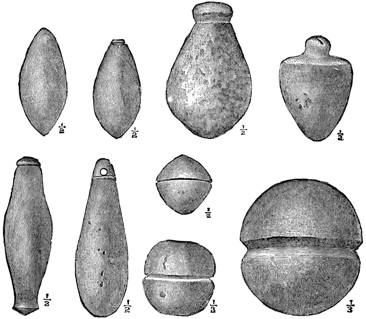
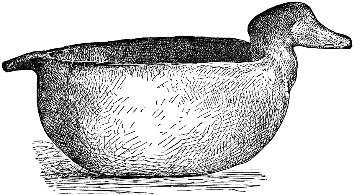
Mr. A. J. Conant, in a very able paper published in the Transactions of the St. Louis Academy of Sciences for April 5, 1876, has more fully described the mound works near New Madrid. On the western bank of the Bayou St. John, partly in a cypress swamp covered with heavy timber and partly on adjacent prairie land, an earthwork encloses an area of about fifty acres. In this enclosure are three large mounds, one of which is pyramidal in form and still has traces of a graded way. An ancient well is discernible near it. A circular mound at the opposite end of the enclosure is estimated by Mr. Conant to have afforded a place of burial for a thousand individuals. The bodies were buried with their heads pointing toward the centre of the mound. A gourd-shaped vase, a small jug or drinking vessel, and an earthen pan or platter was found with each skeleton. The mouths of the vases were fashioned into the form of the head of some bird or the figure of some animal or of a human female. In depressions about three feet deep, within the enclosure, remains of burnt clay ovens were found. Fire-places were disclosed, as well as fragments of earthen vessels capable of holding ten or twelve gallons. The veritable kitchens of the Mound-builders, with their furniture, seem to have been brought to light. In front of the enclosure and projecting out into the bayou, are tongues of land about thirty feet long by ten or fifteen feet in width, and about the same distance apart, “resembling upon a small scale the wharves of a seaport town.” Mr. Conant pronounces them artificial, and that when employed by these builders, the present cypress swamp was the channel of a river. The multitude of mound works which are scattered over the entire south-eastern portion of Missouri indicate that the region “was once inhabited by a population so numerous, that in comparison its present occupants are only as the scattered pioneers of a newly-settled country.”[61]
77
Prof. C. G. Forshey in Foster’s Pre-Historic Races, presents most valuable information relative to the mounds in the south-west. His observations convince us that the State of Louisiana and the valleys of the Arkansas and Red Rivers were not only the most thickly populated wing of the Mound-builder domain, but also furnish us with remains presenting affinities with the great works of Mexico so striking that no doubt can longer exist that the same people were the architects of both. He describes works, some of them of immense proportions, on the Mississippi fifty 78miles above Vicksburg; on Walnut Bayou; the south-west bend of Lake St. Joseph, and at Trinity in the parish of Catahoula, Louisiana. On the east bank of the Little River, a couple of miles above its mouth, where it empties into Lake Ocalohoola, stands a bluff walled with roughly hewn stone. The same writer observed a mound near Natchez twenty-five feet high, standing isolated in a swamp. This mound is one among many in different parts of the lower Mississippi region surmounted by comparatively younger trees than are found on the remains farther north. Works occur in the Atchafalaya basin, in the rear of Baton Rouge, on the uplands of Lake Pontchartrain and on the banks of Bayou Gros Tête. A remarkable group of truncated pyramids, peculiarly Mexican in their style of architecture, exist in Madison Parish, Louisiana, and are figured in Squier and Davis and copied by Foster.[62] It is needless to discuss the fact that the works of the Mound-builders exist in considerable numbers in Texas, extending across the Rio Grande into Mexico, establishing an unmistakable relationship as well as actual union between the truncated pyramids of the Mississippi Valley and the Tocalli of Mexico and the countries further south.[63] There can be no doubt as to the unity of the origin of the works in both countries. There are evidences also that the most recent works of Louisiana and Texas do not compare in antiquity with any found in the Ohio Valley, showing it to be altogether probable that the Mound-builders occupied the Lower Mississippi Valley and Gulf coast for a considerable period after they were driven from the northern and central region by their enemies.[64] 79Several recent writers, with no more proof than that obsidian from Mexico has been found in the mounds, have confidently expressed the belief that the Mound-builders entered the Mississippi Valley and the Central Region from the South. This was based also on the assumption that no remains were found in the North-west. It, however, is proper to note here the marks of architectural progression observable in the geographical distribution of ancient works. Men all around the world have been mound or pyramid builders. To attempt to demonstrate this well-known fact to an intelligent reader by citing the customs of antiquity and the works of the present great Asiatic nations, would seem little less than pedantry rather than the work of serious investigation. The religious idea in man, whether observed in the darkest heathenism or partially enlightened civilization, has always associated a place of sanctuary with the conditions of elevation and separateness. It matters not whether you apply the rule to the practices of the most obscure antiquity, where a hill or natural eminence was the sanctuary of an idol, the residence of a god, or examine the motives which prompt 80the erection of the dome of a St. Paul or a St. Peter’s, or coming nearer home, analyze the reasons for the construction of the ordinary church spire, the same inexplicable intuition is found at the bottom of them all. The simple mound so common in the northern and central region of the United States, represents probably the first attempts at the imitation of nature in providing a place of worship. In the absence of hills and natural eminences on great plains like the prairies of the North-west (for instance in such cases as are cited on pages 28 and 29), nothing would be more natural than the construction of an artificial hillock, especially if the elements and nature were the objects of worship. The next step might have been again a copy or an imitation, but instead of choosing a subject from inanimate nature, an advance is made in the artistic scale, and the animal kingdom furnishes not only one but varied models for reproduction. The custom among savage tribes of personifying the deity, of dressing him up in some form, tangible and visible, was especially characteristic of the mythology of the Nahua nations of Mexico. It is not necessary to go to Egypt, or India, or China to find animals of various kinds dedicated to and associated with the national gods, for in the Maya and Nahua mythologies, as well as in the traditions of some of the wild tribes of the Pacific coast, the serpent, the coyote, the beaver and the buzzard play an active part. The erection of religious structures representing animals no doubt sacred to the Mound-builders, was carried on to a remarkable extent in Wisconsin. These strange works probably indicate the second step in their scale of architectural progression. In the Ohio Valley, while the ordinary mound is found in great numbers, and a few instances of animal mounds occur, three new architectural features present themselves in marked prominence, all of which are artistically in advance of those existing in the North and North-west. These are the enclosures, the truncated mounds, and principally the truncated pyramids, all of which are a departure from the strict imitation of nature, and exhibit the gradual growth of the architectural idea and the outcropping of the notion of utility. South of the Ohio Valley the animal mounds81 disappear altogether and the truncated mounds grow less common, while the truncated pyramid, the highest artistic form, with its complicated system of graded ways and its nice geometrical proportions, becomes the all predominant type of structure. In the Lower Mississippi Valley, in some cases, as we have observed, dried brick were used in the walls and angles of pyramids of the most perfect type. Stone was also employed in a few instances. Here we find the transition to Southern Mexico complete. No break exists in the architectural chain.
Squier and Davis (and Foster as well as most other writers have followed their example) classified the works of the Mound-builders as follows:
I. |
Enclosures | For Defence. Sacred. Miscellaneous. |
|
II. |
Mounds | Of Sacrifice. For Temple-Sites. Of Sepulture. Of Observation. |
To this some have added mounds for residence.
It does not fall within the scope of this work to treat of the specific character and uses of the works of the Mound-builders,82 but rather to note their extent and indications of age with relation to their bearing on the antiquity of man in this country. Some of the arts and manufactures of the Mound-builders are set forth in the illustrations interspersed throughout the chapter.[65] A few of the cuts figure objects found upon the surface. Yet it is not improbable that a due proportion of these objects were of Mound-builder origin.
The domestic arts appear the most advanced of any among this ancient people. Pottery of respectable quality and of varied patterns is abundant among their remains. Coarse cloth woven of vegetable fibre, and in some instances partly made of hair, has been discovered in mounds in several localities. Shell and copper beads for the purposes of ornamentation were made in great numbers. Copper axes of good quality have occasionally been exhumed. Copper and bone needles with well-drilled eyes were made by them. They wove baskets and coarse matting. They carved pipes in stone or moulded them in clay, sometimes in fantastic forms, while again they fashioned them with rare skill into the perfect effigies of animals and birds, or possibly ornamented them with likenesses of their own faces. With 83the exception of a few observations on the altar and sepulchral mounds, we refrain from a further treatment of the works above classified, as having no particular bearing on the question in hand, and refer the reader to the works of Squier and Davis, and also to that of Dr. Foster, already often quoted. Of the Altar or Sacrificial Mounds, the first-named authors remark: The general characteristics of this class of mounds are: 1. That they occur only within the vicinity of the enclosures or sacred places; 2. That they are stratified; 3. That they contain symmetrical altars of burned clay or stone, on which were deposited various remains which in all cases have been more or less subjected to the action of fire.[66] The same authors present the following 84section of a mound examined by them at Mound City, near Chillicothe, Ohio, which is a fair sample of the usual stratification observed in altar mounds.[67] The altar which this mound contained was a parallelogram measuring 8 × 10 feet at its base and 4 × 6 feet at its top. It was only eighteen inches in height, and contained a basin with a dip of nine inches. In this basin were found fine ashes, fragments of pottery and shell beads. A reference to the figure shows that the sand-stratum is semicircular, with its extremities resting on the outer sides of the altar. The skeleton shown in the figure designates a point three feet below the apex of the mound where two well-preserved skeletons were found. The strata were disturbed for their burial evidently at a considerable period after the construction of the mound. This is a fair example of the “intrusive burial” practised in the mounds by Red Indians. The same authors found some of these altars rich in relics; one especially in the vicinity of the above-described mound contained nearly two hundred pipes carved in stone. Also a considerable number of pearl and shell beads and copper ornaments covered with silver. It is quite probable that the copper was from their Lake Superior mines, as they alone are known to yield deposits of silver with copper. The same peculiarity was observed with reference to the copper ornaments and implements found in the Marietta works. The pipes secured in this mound were much calcined by heat, and considerable copper had been fused in the basin of the altar. In some of the mounds examined large collections were obtained, and in some instances, articles made of obsidian, which it is believed could be procured nowhere nearer than the Mexican mountains of Cerro Gordo, or the region west of the Rocky Mountains.[68]
85
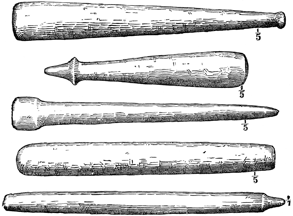
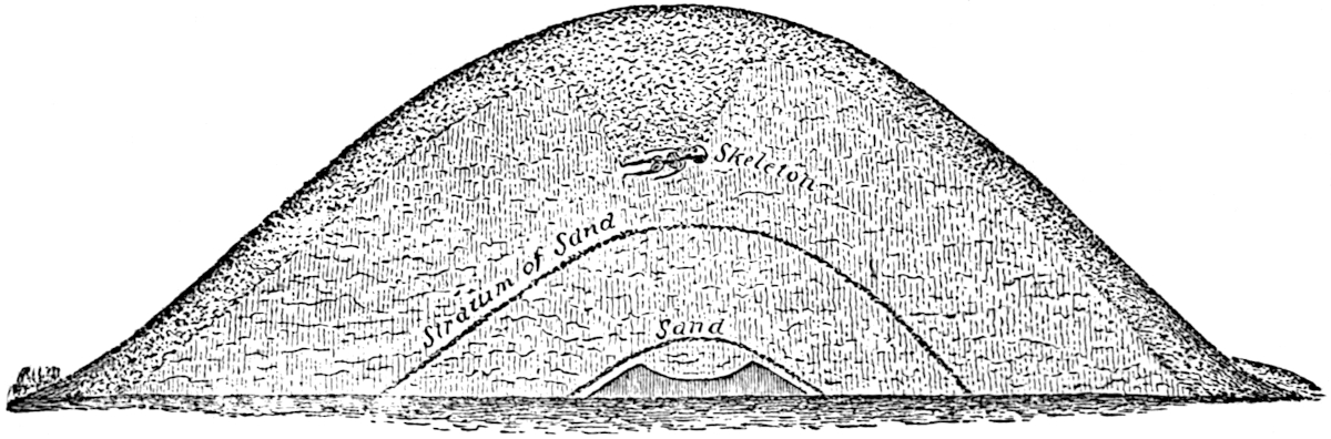
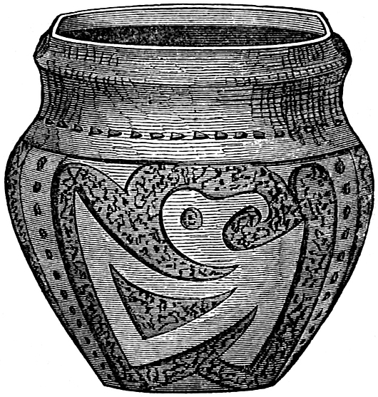
The evidences are abundant that some mysterious rites were performed at the altar mounds; cremation only may have been practised, but we fear that even more awful and heart-sickening ceremonies took place upon these altars as well as upon the high temple sites in which human victims may have been offered to appease the elements or the sun or moon by their death agonies. What splendid ceremonial, what mystic rites administered by a national priesthood in the presence of a devout multitude may have accompanied these horrible sacrifices, are beyond even the limits of conjecture. Besides cremation, inhumation was also 86practised extensively. Multitudes of mounds were devoted either partly or exclusively to such uses. Mr. Tomlinson, the owner87 of the Grave Creek Mound, who sank a shaft from its original summit to its centre, and intercepted it by a tunnel along the surface of the ground, speaking of the latter excavation, remarks: “At the distance of one hundred and eleven feet we came to a vault, which had been excavated before the mound was commenced, eight by twelve feet and seven in depth. Along each side and across the ends, upright timbers had been placed, which supported timbers thrown across the vault as a ceiling. These timbers were covered with loose unhewn stone, common to the neighborhood. The timbers had rotted and tumbled into the vault. * * * In this vault were two human skeletons, one of which had no ornaments, the other was surrounded by six hundred and fifty ivory (shell) beads, and an ivory (bone) ornament six inches long.” Thirty-five feet above the bottom vault another was found containing a skeleton decorated with copper rings, plates of mica and shell disks. The number of disks cut from the shell known as the Buscycon perversum and collected by the excavators was 2350; of mica 250 specimens, and of the little shell known as Marginella apicina, 500; all of which had been pierced and strung as beads. Ten skeletons were subsequently found together upon enlarging the horizontal tunnel. Ashes, charcoal and burnt bones were also discovered in large masses. Though this was the largest of this class of mounds, still the general characteristics of the contents are the same in all of them, and are usually disposed in the same relative position to each other.[69] One of the most interesting explorations of sepulchral mounds was that conducted in the autumn of 1865 by Professor O. C. Marsh, assisted by Mr. Geo. P. Russell, of Salem, Mass., in what is known as the “Taylor Mound,” situated two and a half miles south of Newark, Ohio. The mound was ten feet high and eighty feet in diameter, and was surmounted by a forest of oak trees ranging from two and a half to eight 88feet in thickness, while the decaying trunks of a former growth were lying upon the ground. The mound was excavated from the apex downward. Five feet from the surface a pipe and a tube of stone unknown in Ohio were found. Seven feet from the top, in a thin white layer of earth, a string of more than one hundred beads of native copper were found around the neck of a child about three years old. The salts of the copper had preserved the cord of vegetable fibre on which they were strung. The beads were about one-fourth of an inch in length and one-third in diameter. They evidently had been hammered out of the metal in its original state, and the workmanship displayed no inferior skill. One foot deeper the remains of two adults, male and female, were found carefully buried in layers of bark, their heads towards the east, and the body of the female resting upon that of the male skeleton. Immediately above these were found a considerable number of charred human bones and the evidences of cremation or human sacrifice in honor to the couple (probably man and wife) below. The Professor even expresses the fear that the wife—who appears to have been about thirty years of age—may have been put to death and buried above the remains of her deceased consort. A foot deeper the party found another layer of charcoal, ashes and charred bones, similar to the above, and immediately beneath it a carefully-buried skeleton, much decomposed, lying in a white layer of earth, and with its head toward the east. A few inches below this skeleton several carelessly-buried skeletons were found near the natural level of the earth. Below the natural surface a cist six feet long, three feet wide and two feet deep was found containing the remains of eight or more skeletons, which seem to have been imperfect when buried. The remains had been thrown into the grave in a careless and perhaps hasty manner. In the grave were found nine lance and arrow-heads of flint. Six small hand-axes, one of them of hematite and the others of compact greenstone or diorite, a small hatchet of hematite, a flint chisel and scraper, fine needles or bodkins made of the metatarsal bones of the common deer, a whistle made from the tooth of a young bear, and spoons cut from the shells of river mussels. A rude vessel of89 clay was found, but broken, while several bones of animals, all but two of existing species in Ohio at present, were discovered; though it is worthy of remark that the remains of the deer were of a size seldom attained by the species at the present day. All the skulls found in the mound were broken, and all but two so badly decayed that no effort was made to preserve them. These two were of small size showing the vertical occiput, prominent vertex and large inter-parietal diameter. There is abundant evidence that the mound had never been disturbed by Indians.[70]
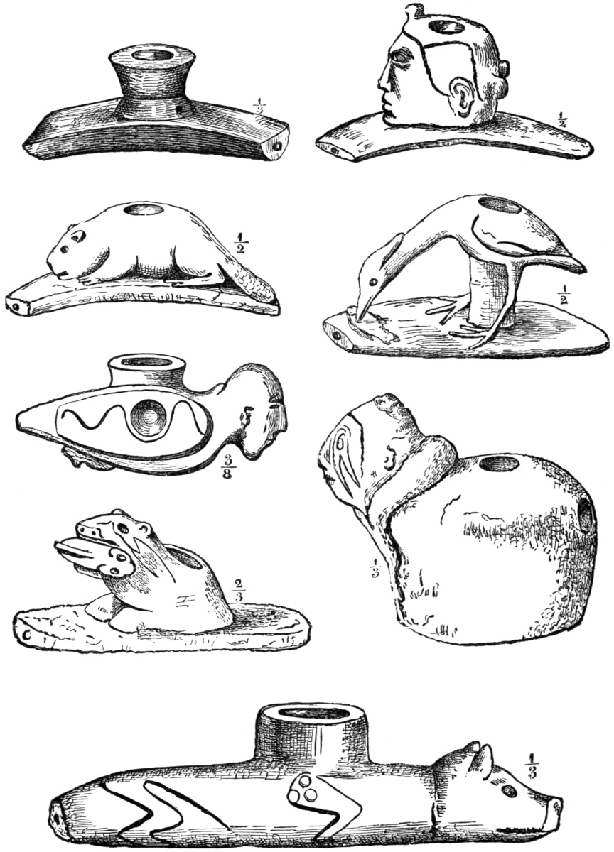
One of the best evidences which we have of the systematic government and habits of the Mound-builders, together with the comparatively advanced state of the practical arts among them, is found in the ancient copper mines of the Lake Superior Region so extensively operated by them at quite a remote period.[71] These were first discovered by Mr. S. O. Knapp, agent of the Minnesota Mining Company, in 1848. One excavation explored by this gentleman was thirty feet deep, filled with clay and a mass of mouldering vegetable matter. Eighteen feet from the surface he found a mass of copper ten feet long, three feet wide and two feet thick, weighing over six tons. By digging around this great lump of metal, he observed that it was resting on “a cob-work of round logs or skids six or eight inches in diameter, the ends of which showed plainly the strokes of a small axe or cutting tool about two and a half inches in width”. The wood, from its exposure to moisture, had lost all its consistency, and opposed no more resistance to a knife-blade than would ordinary 90peat. After having raised the mass of copper over five feet along the foot wall of the lode on the timbers by means of wedges, the ancient miners had abandoned the task. The walls of the mine still show the marks of fire; charcoal and stone mauls were taken from this and similar excavations. The largest of these mauls weighed thirty-six pounds and was encircled by a double groove around its centre. Withes were probably wound in these grooves by which two men could wield the maul very91 effectively. The number of smaller hammers of greenstone and porphyry removed from these works by Mr. Knapp exceeded ten cart-loads. In one of the pits a rude oak ladder was found, made by trimming the branches of a tree at a distance from the trunk to leave a sufficient foothold. Wooden levers, preserved beneath the water, were also of frequent occurrence. A copper maul, shaped by pounding in a cold state, and weighing upwards of twenty pounds, was found in this locality, as well as many well-formed copper implements designed for various purposes. Upon a mound of rubbish near one of the excavations, Messrs. Foster and Whitney saw a pine stump ten feet in circumference—the trunk having been broken fifteen feet from the ground—which must have grown and died after the earth was thrown up. Mr. Knapp mentions a hemlock which he found growing on a heap of rubbish which had 395 rings of annual growth. Fallen and decayed trees of a previous generation were found lying across the pits. In front of the Waterbury mine are blocks of stone weighing two and three tons which had been removed by the ancient miners from the shaft, and when observed by Colonel Whittlesey, they were covered by a forest growth of the full size and kind common to the neighboring region. Under a pile of rubbish the remains of a trough of cedar bark was brought to light and had been used to carry off water baled from the mine by means of wooden bowls, some of which were preserved by water in the mines. Mr. S. W. Hill communicated to Dr. Foster in 1872 the discovery of mining pits in Isle Royal, measuring fifty feet in depth.[72] In the Ontonagon region for thirty miles traces of the ancient miners abound. The idea that the Indians formerly worked these mines was abandoned shortly after their discovery. They possess no tradition of copper mines, nor did their ancestors visited by the Jesuit Fathers in the early part of 92the seventeenth century obtain any intelligence of mines, though they penetrated this region in 1660. They often mention the occurrence of loose masses of copper found in the shape of boulders, but could learn nothing from the Indians as to their origin. It is quite certain that no traditions were current among them on the subject. “Instead,” says Col. Whittlesey, “of viewing copper as an object of every day use, they regarded it as a sacred Manitou, and carefully preserved pieces of it wrapped up in skin in their lodges for many years; and this custom has been continued to modern times.”[73] Father Allouez, in his Relation, has described this custom.[74] Father Dablon, who shortly afterward visited the Lake Superior tribes, has described their superstitions concerning an island where the missionaries first met with copper.[75] That the Mound-builders were these ancient 93miners, there is abundant evidence. Col. Whittlesey has described a collection of copper implements from Carp River containing pieces of native silver, such as have often been found in the Ohio mounds.[76] We have already referred to this peculiarity of the Lake Superior copper. The use of copper by the Mound-builders was very general all the way from Wisconsin to the Gulf, and the labor involved in a journey of a thousand miles from the Ohio Valley to the copper regions, the toil of the summer’s mining, and the tedious transportation of the metal to their homes upon their backs, and by means of an imperfect system of navigation, indicates either industry and resolution such as no savage Indian ever possessed, or a condition of servitude in which thousands occupied a position of abject slavery.
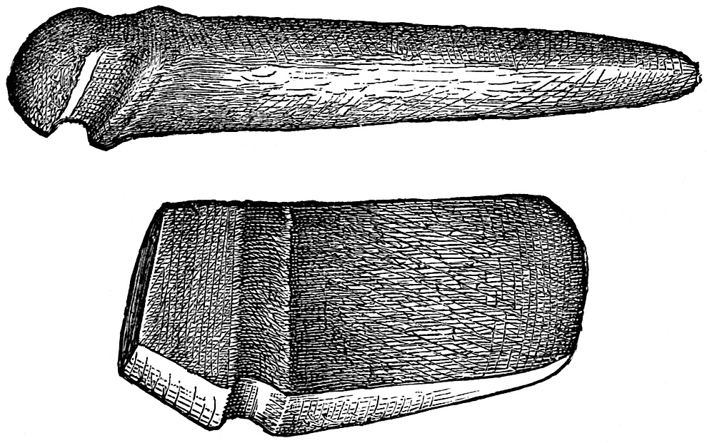
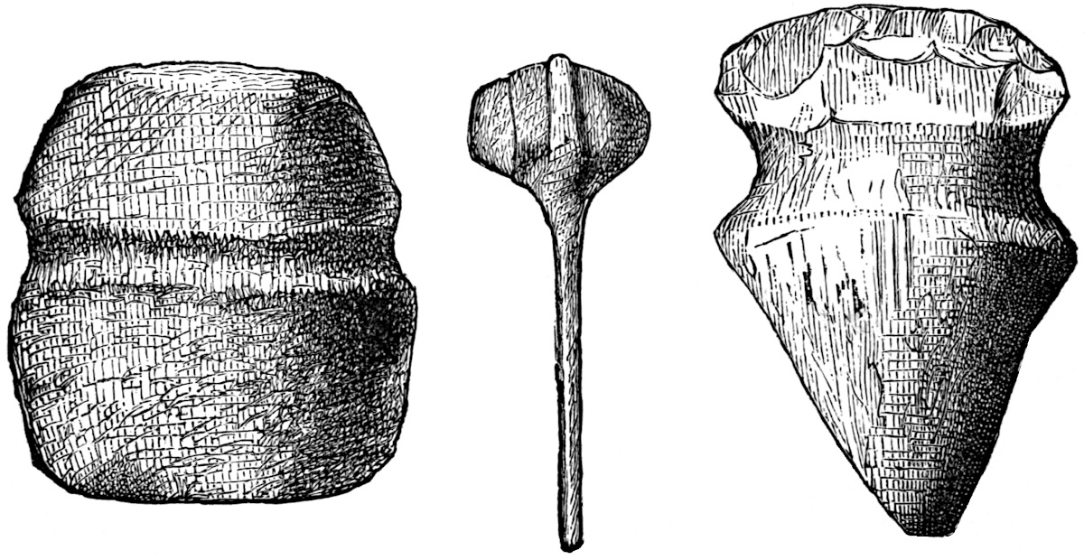
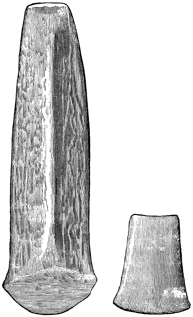
No permanent abodes were erected by the miners in this region, no mounds were constructed, but the indications all point to a summer’s residence only and a return to the south with the accumulation of their toil when the severities of winter approached. Frederick von Hellwald expresses it as his opinion that the Mexicans obtained all their copper from the Lake Superior94 mines, and adds that no evidences exist that copper was mined in Mexico or Central America prior to the Spanish Conquest.[77] Humboldt affirms that various metals were mined by the Mexicans, but does not specify copper.[78] Col. Whittlesey and Prof. Andrews estimate that in the ancient Lake Superior mines worked by the Mound-builders, the removed metal would aggregate a length of one hundred and fifty miles in veins of varying thickness. This fact certainly indicates that great supplies were transported southward.
This remarkable people was evidently possessed of the beginnings of science; at least if the Davenport and Cincinnati tablets are genuine, astronomy must have received considerable attention at their hands. In the former tablet we observe a cycle divided into twelve months (which, however, is so modern and coincides so strictly with our division as to excite suspicion of fraud), while in the latter we have the number 368 as the sum of the products of the longer and shorter lines, suggestive of an approximation to the number of days in a year. Other supposed astronomical instruments have been discovered 96in the mounds of Ohio, and several of these, antique tubes, telescope devices, were discovered in the course of excavations made in 1842 in the most easterly of the Elizabethtown group, West Virginia. Mr. Schoolcraft makes the following statement concerning them: “Several tubes of stone were disclosed, the precise object of which has been the subject of various opinions. The longest measured twelve inches, the shortest eight. Three of them were carved out of steatite, being skillfully cut and polished. The diameter of the tube externally was one inch and four-tenths; the bore eight-tenths of an inch. By placing the eye at the diminished end, the extraneous light is shut from the pupil, and distant objects are more clearly discerned.”[79] A silver figure found in Peru represents a man in the act of studying the heavens through one of these tubes, and Captain Dupaix saw a stone in Mexico bearing the figure of a man sculptured on its side in the act of using a similar tube.[80]
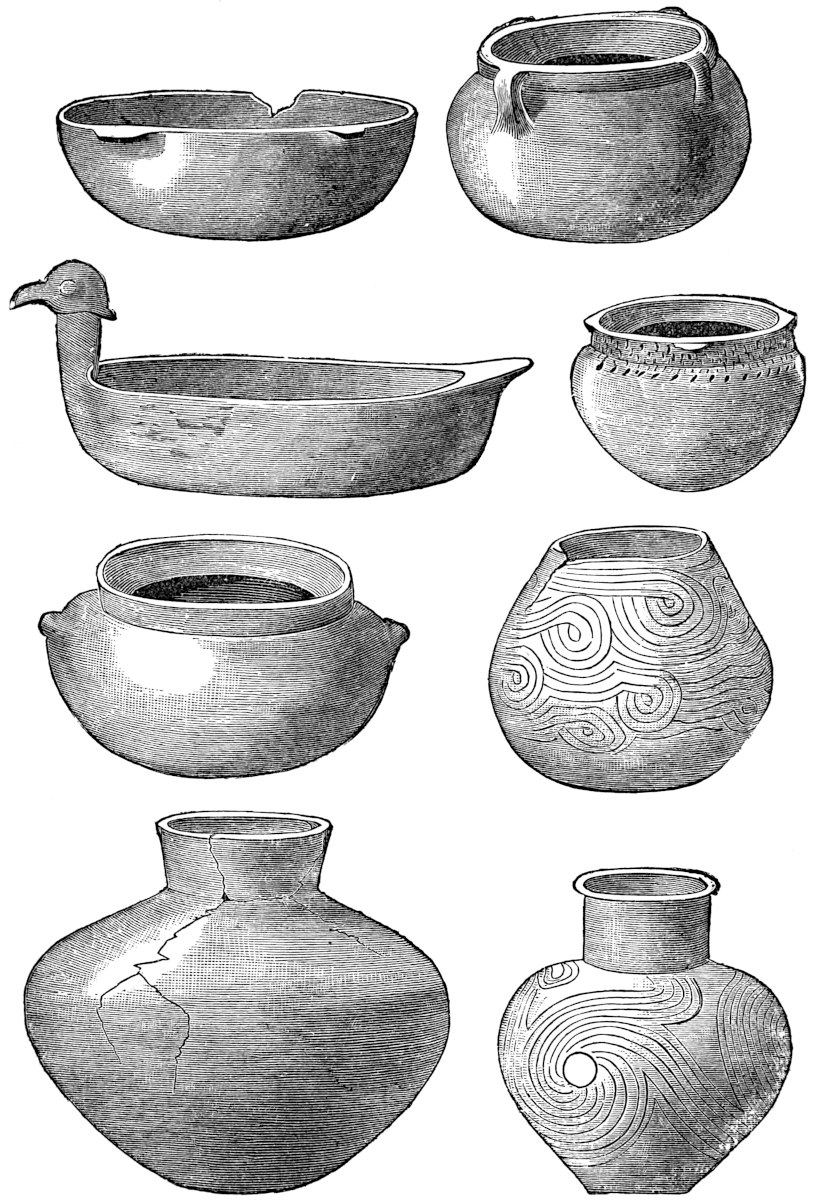
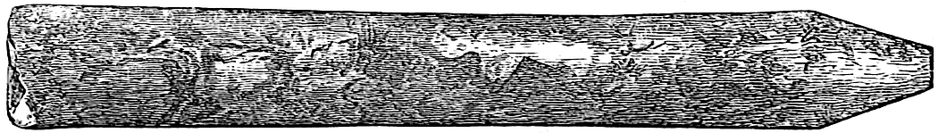
With reference to the civilization of the Mound-builders, however much writers may differ, we think the following conclusions may be safely accepted: That they came into the 97country in comparatively small numbers at first (if they were not Autochthones, and there is no substantial proof that the Mound-builders were such), and during their residence in the territory occupied by the United States they became extremely populous. Their settlements were widespread, as the extent of their remains indicate. The magnitude of their works, some of which approximate the proportions of Egyptian pyramids, testify to the architectural talent of the people and the fact that they had developed a system of government which controlled the labor of multitudes, whether of subjects or slaves. They were an agricultural people, as the extensive ancient garden-beds found in Wisconsin and Missouri indicate. Their manufactures afford proof that they had attained a respectable degree of advancement, and show that they understood the advantages of the98 division of labor.[81] Their domestic utensils, the cloth of which they made their clothing, and the artistic vessels met with everywhere in the mounds, point to the development of home culture and domestic industry. There is no reason for believing that the people who wrought stone and clay into perfect effigies of animals have not left us sculptures of their own faces in the images exhumed from the mounds.
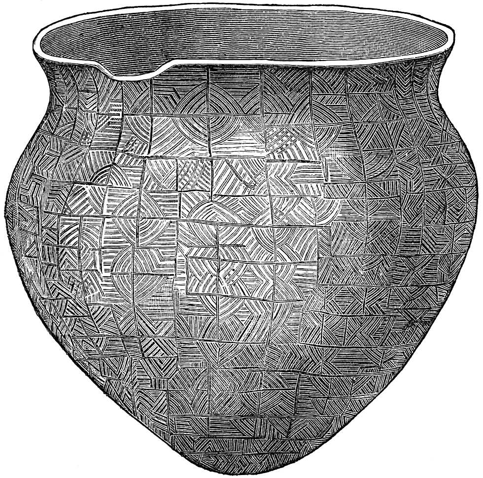
They mined copper, which they wrought into implements of war, into ornaments and articles for domestic use. They quarried mica for mirrors and other purposes.[82] They furthermore worked flint and salt mines. They probably possessed some astronomical knowledge, though to what extent is unknown.
99
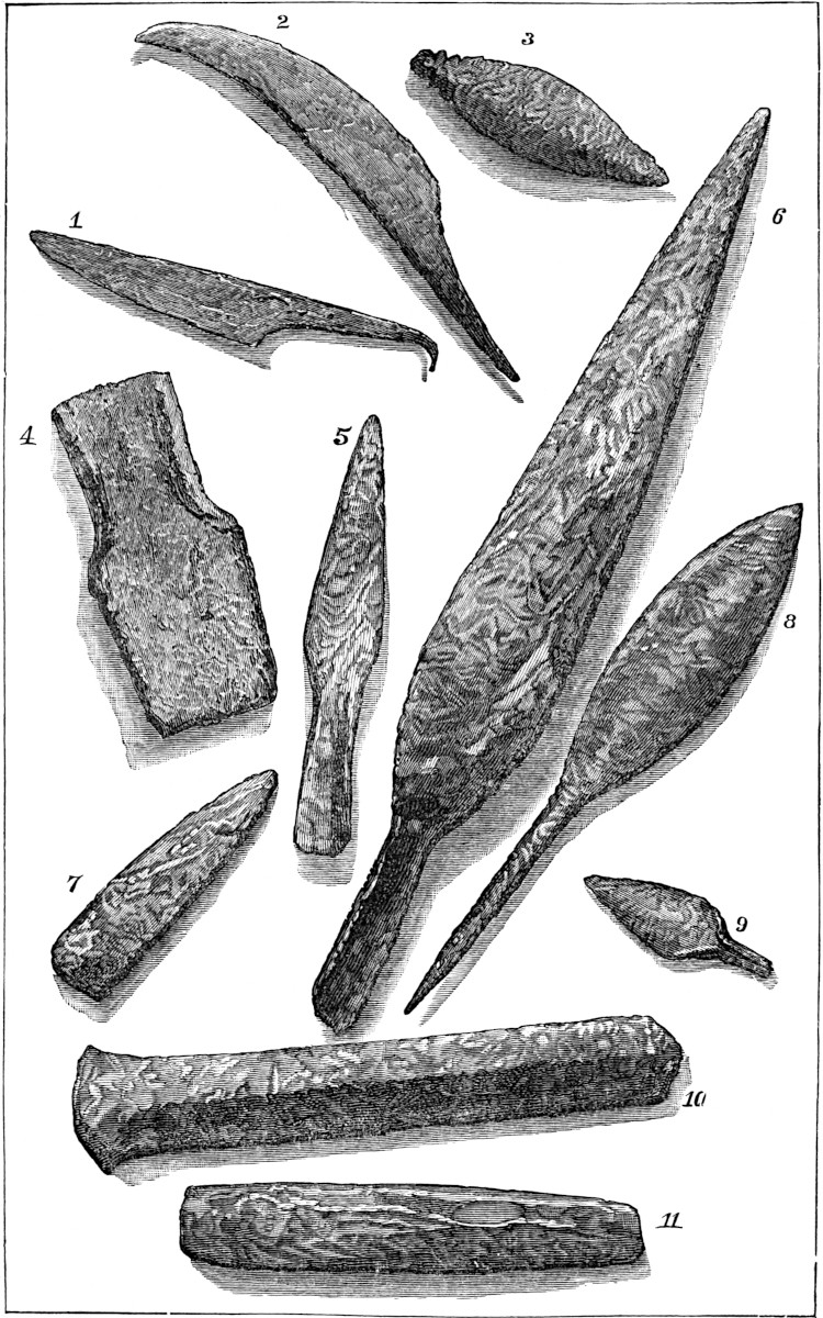
Their trade, as Dr. Rau has shown, was widespread, extending probably from Lake Superior to the Gulf, and possibly to Mexico.[83] They constructed canals by which lake systems were 100united, a fact which Mr. Conant has recently shown to be well established in Missouri.[84] Their defences were numerous and constructed with reference to strategic principles, while their system of signals placed on lofty summits, visible from their settlements and communicating with the great watercourses at immense distances, rival the signal systems in use at the beginning of the present century. Their religion seems to have been attended with the same ceremonies in all parts of their domain. That its rites were celebrated with great demonstrations is certain. The sun and moon probably were the all-important deities, to whom sacrifices (possibly human) were offered. We have already alluded to the development in architecture and art which marked the possible transition of this people from north to south. Here we see but the rude beginnings of a civilization which no doubt subsequently unfolded in its fuller glory in the valley of Anahuac, and spreading southward engrafted a new life upon the wreck of Xibalba. Though there is no evidence that the Mound-builders were indigenous, we must admit that their civilization was purely such—the natural product of climate and the conditions surrounding them.[85]
AT the opening of the preceding chapter we made some allusions to the supposed antiquity of the Red Indian, a subject of growing archæological significance, though as yet it affords us rather unsatisfactory evidence, scientifically considered, relative to the problem of man’s antiquity on this continent. Quite different, however, is the estimate which we place on data left us by the people of the mounds. The question of the antiquity of the Mound-builders is one which cannot be accurately determined; no chronometric scale can be applied to the uncertain record which they have left behind them. Their history is a sealed book, and the approximate date of their first occupancy of the Mississippi Basin is as uncertain as the period of man’s origin. However, certain data present themselves for our consideration which lead us to conclude that a few thousand years, three or four perhaps, and possibly even less time, is all that is required in which to account for their growth into a nation and the moderate advancement which they made toward civilization. As to when the Mound-builders left this country, is another question, and102 can be approximated more closely. It is a well-known fact that no tradition was ever found among the Indians as to the origin or the purpose for which the mounds were constructed. They described them as having been found by their ancestors in the same condition in which we now see them, and clothed, if not with the same, at least with a growth of vegetation similar to that which covers them to-day. It is true the Iroquois, who are supposed to have reached the lake regions and the Ohio Valley some time previous to the Algonquins, had certain vague traditions of a people whom they called the “Allighewi;” but there seems to be nothing in those indefinite allusions which would associate that unknown people with the mounds. Still, Indian tradition is nearly valueless in determining this question, since any fact, however grave, was soon forgotten by a people so savage and unsettled. The tribes of the lake region, says Dr. Lapham in his Antiquities, so soon forgot the visit of the Jesuit Fathers that their descendants a few generations later had no tradition of the event. The same is true of the Indians of the Mississippi Valley with reference to De Soto’s expedition, “which must,” remarks Dr. Foster, “have impressed their ancestors with dread at the sight of horses ridden by men, and the sound of fire-arms, which they must have likened to thunder. Sir John Lubbock states that the New Zealanders at the time of Captain Cook’s visit had forgotten altogether Tasman’s visit, made less than one hundred and thirty years before.”[86] Another 103argument for the construction of the mounds at a remote period, and which is certainly of little more value than Indian tradition, is that which supposes the Mound-builders to have erected works on the lowest of the river terraces existing at the time of their occupancy of the country. Much stress has been laid on the fact that no works have been found on the lowest-formed of the river terraces which mark the subsidence of the western rivers. “And as there is no good reason,” remarks Mr. Baldwin, “why their builders should have avoided erecting them on that terrace while they raised them promiscuously on all the others, it follows, not unreasonably, that this terrace has been formed since the works were erected.”[87] To any one familiar with the great rise and fall which takes place annually in the water-level of the Ohio and Mississippi and all of their tributaries, the fallacy of such an argument is at once apparent. We must at least allow that the Mound-builders learned by experience, just as animals do, even if we could deny them a very high order of intelligence. Little time could have elapsed after their advent to these valleys before they observed the impracticability of erecting mounds or enclosures on most of the alluvial bottoms bordering these streams. The raging torrents which sometimes sweep through the valleys of the central basin, uprooting the largest trees, carrying away natural embankments, forming immense deposits of new alluvium, submerging miles of adjacent country, and in many ways changing its physical conformation, would in a few years obliterate104 any traces of earthworks built within their reach.[88] Far more certain data, however, is furnished in the arborescent vegetation which covers many of the works, with which to measure part of the period during which they have remained unoccupied, though we are left in uncertainty as to the remoteness of their abandonment. The annular rings of a tree present us indisputable evidence as to its age.[89] It is evident that the forests which cover these remains have grown up since they were vacated, as no difference exists between them and the surrounding vegetation—no break exists in the density of the forests in the immediate vicinity of the works. The oldest of the trees found upon the works present eight hundred annual rings, indicating as many years of growth.[90] This cannot, however, be set down as the limit of the period of their abandonment, since, as it seems that this country was open and mostly unwooded in the sections thickly settled by the Mound-builders, a considerable time would be requisite for the slow encroachments of a forest, even when the trees which now stand upon the mounds may have been preceded105 by trees of other species or by two or three generations of their own.[91] The age of the trees on the mound-works in the Ohio Valley or farther north, rarely exceeds five hundred or six hundred years, and such cases as that cited by Sir Charles Lyell are the exceptions. Farther south, in the Mississippi Valley and near the Gulf, they are still younger than those at the north.[92] So noticeable is this that we are led to think the Gulf coast may have been occupied by the Mound-builders for a couple of centuries after they were driven by their enemies from the country north of the mouths of the Missouri and Ohio Rivers. The condition of skeletons found in the mounds indicate an antiquity which they furnish us no means of measuring. It is not to be presumed that all human remains discovered in excavating the works were interred immediately previous to the abandonment of the country. Some of them may belong to the middle or beginning of the period of their residence in the territory occupied by the United States. Human remains taken from the mounds, perhaps furnish us better evidence of the long residence of the Mound-builders in this country than any other data in our possession. It suffices to say that few Mound-builder crania have been recovered in a condition to be of any service to science; although of late years, several valuable collections 106have been made. The preservation of the skeletons depends greatly on the composition of the soil in which they are found. The Loess has afforded well-preserved remains, however, with the gelatinous matter leached out. The crania of the sandy loam of river bottoms, on the other hand, are in all cases so far decayed upon discovery that the greatest precautions fail to prevent them from crumbling to dust when exposed to the light and air. Mastodon bones, on the contrary, recovered from peat swamps, and much older than any of the remains of the Mound-builders, are found to have retained so much of their gelatinous matter as to furnish a nourishing soup.[93] To these evidences may be added the testimony derived from the ancient ruins which points to long-continued occupation and to a considerable lapse of time since their abandonment.
How long the Mound-builders occupied the country north of the Gulf of Mexico it is impossible in the present state of science to determine. Some authors conjecture that they were here two thousand years; that we think would be time enough, though after all it is but conjecture. It seems to us, however, that the time of the abandonment of their works may be more closely approximated. A thousand or two years may have elapsed since they vacated the Ohio Valley, and a period embracing seven or eight centuries may have passed since they retired from the Gulf coast. As an evidence of a large population having existed in this country at a former period, we have immense shell-heaps artificially collected, extending along the Atlantic coast from Nova Scotia to Florida, on the Gulf coast and up the river valleys through nearly all of the Southern States. It is difficult to assign the formation of these vast remains to any definite period or to any particular people. Though of the same character as the Kjökken-Möddings (Kitchen-Middens) of the Danish, they furnish no indications of so great an antiquity. This has been shown by Dr. Jeffries Wyman in his researches in Maine and Massachusetts.[94] Sir Charles Lyell made an examination of a shell-bank on St. Simon’s Island, near the mouth of the Allamaha107 River, Georgia, so extensive that it covers ten acres to a depth varying from five to ten feet.[95] Dr. Brinton has described immense accumulations in Florida. On Amelia Island, shells exist to the depth of three feet over an area 150 yards wide and a quarter of a mile long. Notable instances of a similar kind are Turtle Mound near Smyrna—a mass of oyster shells thirty feet thick—and a shell-bank on Crystal River four miles from its mouth, reaching a height of forty feet.[96] Dr. Wyman carefully examined many of the fresh-water shell-heaps of Florida and obtained pretty satisfactory results.[97] Near the Silver spring upon a shell-heap covering nearly twenty acres, stand several live-oaks of immense size, the largest of which measured between twenty-six and twenty-seven feet in circumference. Excavations under this monster, taken together with its position on the side of the shell-bank, proved it to be of more recent origin than the latter. Prof. Wyman, by allowing twelve rings to the inch and granting it a semi-diameter of fifty inches, estimated that it was not less than six hundred years old. Of course the shell-bank may have existed a long time before any vegetation appeared upon it. The 108crania of the shell-banks of Florida differ from those of the Mound-builders in greater thickness as well as greater mean capacity.[98] In his Fresh-water Shell-Mounds of the St. John’s River, and in his memoir on Human Remains in the Shell-heaps of the St. John’s River (Seventh Annual Report of Peabody Museum, pp. 26 et seq.), Dr. Wyman reports having discovered the startling fact that cannibalism prevailed among the barbarous people of the shell-banks. In the Peabody Museum a collection of human bones taken from the shell-banks by Dr. Wyman are arranged to illustrate this sad discovery. It is possible that this people had some relationship to the Caribs. Prof. Forshey has described in brief the vast extent and proportions of the marine shell-banks of the Gulf coast, and the shores of the bayous, lakes and lagoons where Guathodon shells are found. Those of Louisiana, especially near New Orleans, are remarkable, but have yielded no remains, except broken pottery, flint flakes and stone hatchets. A shell-bank at Grand Lake, on the Teche, however, upon which great live-oaks are growing, situated fifteen miles inland, from which the sea has receded since its formation, “yielded unique specimens of axes of hæmatitic iron-ore and glazed pottery.”[99] Probably the most remote shell-bank from the sea containing marine shells, occurs on the Alabama River, fifty miles inland.[100] Fresh-water shell-banks, other than those examined in Florida, furnish evidences of slow accumulation and indicate a comparatively remote antiquity for their origin. On Stalling’s Island, in the Savannah River, two hundred miles above its mouth, is a shell-bank three hundred feet in length by one hundred and twenty feet in width, with an average depth of 109over fifteen feet.[101] In the American Bottom and on many of the tributaries of the Mississippi, shell-banks occur, composed of varieties of the Unios and Anodons. A remarkable example of such accumulation is the well-known shell-bank a mile and a half south of New Harmony, Indiana, and situated on a high hill 170 feet above the level of an arm of the Wabash River. The bank covers an area of a quarter of an acre, and has attracted the attention of eminent scientists like Leasure, Say, Lyell and others, but nothing of value was developed that would refer the construction of this and similar banks to any people more ancient than the Mound-builders.[102] On the Pacific coast, great numbers of shell-banks exist, but contain nothing different from those in other parts of the country. (See Researches in the Kjökken Möddings of the Coast of Oregon and of the Santa Barbara Islands and Adjacent Mainland, by Paul Schumacher. Bulletin of U. S. Geol. and Geog. Survey, vol. iii, No. 1.) There can be little doubt but these strange and vast accumulations indicating the presence of an extinct population, had a remote beginning, and have been added to from time to time by different peoples, removed from each other both by the diversities of race and the lapse of time.
A trifle more than a decade ago the treatment of the subject of this chapter would have called for a discussion of the antiquity of the magnificent architectural remains of Southern Mexico, and of the still older ruins of the Maya civilization in Yucatan, and the branches of that people in Central America; but the indefatigable labor which has been bestowed by several eminent antiquarians upon the ancient history of the civilized nations of the New World previous to its discovery by Europeans, has transferred this part of the subject to another field; has elevated it from the uncertain position it occupied in archæology to a place in the realm of history. It is true that it is difficult to draw the line between tradition and history, and especially so in this case; but as tradition does not conflict with 110archæology in its bearing on the ancient civilization of Tropical America, it is better than nothing; certainly archæology thus far has amounted to little more than nothing in revealing the approximate period of the origin of these remains. While it has done much towards verifying tradition and assisted largely in its interpretation, it has not been adequate to the task of solving the age of these remains. Tradition, on the contrary, and we might almost say history, carries us back three thousand years, if not farther, as the period when man—whether the first here or not—appeared upon the Western Continent. The discussion of this part of our subject will be given in a future chapter. Too much doubt exists with reference to the stupendous remains of Peru, especially in the neighborhood of Lake Titicaca, Tiahuanaco, Old Huanaco, and Grau-Chimu, as to whether they antedated the arrival of the Incas by a great lapse of time, to admit of a serious discussion here. Nothing of a scientific character is available as yet upon which even to base conjecture. Rivero and Tschudi, it is true, have treated the subject, and their work has been often quoted, but after all it amounts to but little more than a description of the remains, which serves the good end of exciting interest in the subject. The antiquities and legendary history of the Peruvians have so recently been treated with such ability by Mr. E. G. Squier, that the South American civilization needs no attention in this connection.
In considering the question as to how long man has inhabited this continent, his influence upon nature cannot be overlooked. In the animal kingdom, certain animals were domesticated by the aborigines from so remote a period that scarcely any of their species, as in the case of the lama of Peru, were to be found in a state of unrestrained freedom at the advent of the Spaniards. In the vegetable kingdom more abundant testimony of the same nature is presented. A plant must be subjected to the transforming influences of cultivation for a long time before it becomes so changed as no longer to be identified with the wild species, and infinitely longer before it becomes entirely dependent upon cultivation for propagation. Yet we find that both of these facts have been accomplished with reference to the maize, tobacco,111 cotton, quinoa and mandico plants; and the only species of palm cultivated by the South American Indians, that known as the Gulielma speciosa, has lost through that culture its original nut-like seed, and is dependent upon the hands of its cultivators for its life.[103] Alluding to the above-named plants, Dr. Brinton remarks: “Several are sure to perish unless fostered by human care. What numberless ages does this suggest? How many centuries elapsed ere man thought of cultivating Indian corn? How many more ere it had spread over nearly a hundred degrees of latitude and lost all resemblance to its original form?”[104] Certainly this class of evidence, though furnishing no chronometric scale, points us to an antiquity for man on this continent more venerable than that suggested either by tumuli or architectural remains. The peculiar value of this argument rests in the fact that with the exception of cotton, none of the plants indicated 112have ever been cultivated by any other people than the aborigines of America, and could not have matured their characteristics of dependence in the old world, and been brought hither through the channel of immigration.
Back of the age of man’s monuments of an architectural character, beyond the beginning of the first existing shell-heap, and at a time probably more remote than the first cultivation of maize, it has been supposed that man occupied the Western Continent as a contemporary with the mastodon, megalonyx and other extinct animals. Our information in this department is entirely dependent upon the revelations of geological science. Unfortunately very little data which may be termed truly scientific has been brought to light. While considerable seeming testimony to man’s antiquity on this continent has been produced from a geologic quarter, still it mostly has been of an unscientific character. Fossils and human remains are said to have been discovered in localities and in associations that if the statements of those who found them could be relied on, would give man an antiquity here as great as in the valley of the Somme or in the bone caves of Belgium, France, and England. In the instances alluded to, it is not so often feared that the veracity of discoverers is doubtful as that their general lack of acquaintance with the science should make them liable to error. Where a competent geologist is not present to examine a fossil in situ, and report intelligently upon its position and surroundings, the case must remain open to suspicion. Unfortunately for science, this is precisely the weak point in most of the reputed “finds” which are cited as evidence in this field. In 1848, Count Pourtales found in Florida, according to Agassiz, a human jaw and teeth, and bones of the foot, embedded in a calcareous conglomerate forming a part of a coral reef. This reef, according to Agassiz, may be 135,000 years old, and the human remains at least ten thousand years.[105] This statement has been accepted as reliable by Sir Charles Lyell,[106] Daniel Wilson,[107] and other noted scientific gentlemen. Count Pourtales, however, makes a statement113 which materially alters the case. He says: “The human jaws and other bones found by myself in Florida in 1848, were not in a coral formation, but in a fresh-water sandstone on the shore of Lake Monroe, associated with fresh-water shells or species still living in the lakes (Paulina, Ampullaria, etc.). No date can be assigned to the formation of that deposit, at least from present observation.”[108] Human remains were found a number of years ago embedded in the solid rock in the island of Guadaloupe. “But more careful investigation proved the rock to be a concretionary limestone formed from the detritus of corals and shells.”[109] This rock was ascertained to have been one of very rapid formation.
Sir Charles Lyell, in his Travels in America in 1842, expressed the opinion that certain human remains found embedded in the solid rock near the town of St. Paul on the Santos River, Brazil, were of great antiquity.[110] Subsequently referring to the memoir of Dr. Meigs on the shell-heap of which the rock was a part,[111] he expresses the opinion that shells were brought to the place and heaped up over the remains, and “were bound together in a solid stone by the infiltration of carbonate of lime, and the mound may therefore be of no higher antiquity than those above alluded to on the Ohio.”[112] In a few instances it has been alleged that the remains of man have been found associated with the remains of the mastodon and other extinct animals. More than thirty years ago Dr. Dickson of Natchez discovered the pelvic bone of a man, the os innominatum, mingled with the bones of extinct animals (megalonyx and mylodon). This discovery was made two and one-half miles from Natchez, at the bottom of what is known as Bernard’s Bayou, an immense ravine from thirty to sixty feet deep and several miles long, formed by the convulsions of the earthquake of 1811–12. This bone is now in the possession of the Academy of Natural Sciences of Philadelphia. Sir Charles Lyell visited the spot where it was discovered 114in 1846, and made a careful examination of the bone then in the possession of Dr. Dickson, and also explored the “Mammoth Ravine.” He discusses the case as follows: “It appeared to be quite in the same state of preservation and was of the same black color as the other fossils, and was believed to have come like them from a depth of about thirty feet from the surface. In my Second Visit to America in 1846,[113] I suggested as a possible explanation of this association of a human bone with remains of a mastodon and megalonyx, that the former may possibly have been derived from the vegetable soil at the top of the cliff, where, as the remains of extinct mammalia were dislodged from a lower position, and both may have fallen into the same heap or talus at the bottom of the ravine, the pelvic bone might, I conceived, have acquired its black color from having lain for years or centuries in a dark superficial peaty soil common in that region. I was informed that there were many human bones in old Indian graves in the same district stained of as black a dye.” * * * “No doubt, had the pelvic bone belonged to any recent mammifier other than man, such a theory would never have been resorted to; but so long as we have only one isolated case, and are without the testimony of a geologist who was present to behold the bone when still engaged in the matrix, and to extract it with his own hands, it is allowable to suspend our judgment as to the high antiquity of the fossil”.[114] Both Dr. Joseph Leidy[115] and Prof. C. G. Forshey,[116] who have examined the case, agree with the above. A few years ago a fragment of 115matting composed of the outer bark of the southern cane (Arundinaria macrosperma) was discovered on Petit Anse Island in Vermillion Bay, Louisiana, in connection with the remains of a fossil elephant. This island, containing about five thousand acres, is the locality of an extraordinary mine of rock salt, discovered and worked considerably during the late rebellion. The salt is found in nearly all parts of the island at the depth of fifteen or twenty feet below the surface of the soil. The matting was discovered near the surface of the salt, and about two feet above it were the remains of an elephant, including the tusks. Prof. Henry was the first to call public attention to the matter in a notice based on the verbal statements of T. F. Cleu, Esq., who presented a specimen of the matting to the Smithsonian Institution.[117] In 1867, Prof. E. W. Hilgard and Dr. E. Fontaine, secretary of the New Orleans Academy of Sciences, examined the locality. We regret to say that the report made by the latter is so confused in its use of terms and so conflicting in its statements as to be of no service to science.[118] Prof. Hilgard is, on the contrary, clear on the subject. He considers the heap in which the matting, elephant bones, and subsequently pottery in great profusion, were found, “A mass of detritus washed down from the surrounding hills.” “The pottery,” he remarks, “at some points form veritable strata three and six inches thick.” He then adds in a note that “it is very positively stated that mastodon bones were found considerably above some of the human relics. In a detrital mass, however, this cannot be considered a crucial test.”[119] Dr. Foster, after citing the above, interposes the objection, “That in an island whose area is less than eight miles square, there would be few floods of sufficient power to transport such heavy bones as the tusks and molars of mastodons to any considerable distance.”[120] Certainly the question is an open one, and in its 116present unsettled status proves nothing. The same uncertainty attaches itself to the discoveries of Dr. Lund, the distinguished Swedish naturalist, made many years ago in the bone caves of Minas Geraes, Brazil. This indefatigable investigator examined more than eight hundred caverns, and in only six were human remains found. In one instance out of the six, the remains were associated with the bones of animals now extinct, but the original stratification had been disturbed, and the presumption is that it was a case of comparatively recent interment.[121]
The most remarkable instance of the supposed, or we might be allowed in this case to say pretended discovery of human remains in association with those of extinct animals, is that set forth by Dr. Koch. This collector of curiosities described his discovery of a mastodon giganteus in 1839 in Gasconade County, Missouri, at a spot on the Bourbeuse River, first in a newspaper article of January 1839, and cited in the American Journal of Science and Arts.[122] And a second time in the St. Louis Commercial Bulletin of June 25, 1839, which article was also noticed in the above Journal.[123] This article was signed “A. Koch, Proprietor of the St. Louis Museum.” Subsequently he published descriptions in pamphlets, which unfortunately did not always convey the same impressions.[124] Dr. Koch, after referring to the discovery of a back and hip bone of this remarkable animal, 117gives the following description: “I immediately commenced opening a much larger space; the first layer of earth was a vegetable mould, then a blue clay, then sand and blue clay. I found a large quantity of pieces of rocks, weighing from two to twenty-five pounds each, evidently thrown there with the intention of hitting some object. It is necessary to remark that not the least sign of rocks or gravel is to be found nearer than from four or five hundred yards, and that these pieces were broken from larger rocks, and consequently carried here for some express purpose. After passing through these rocks I came to a layer of vegetable mould; on the surface of this was found the first blue bone, with this a spear and axe; the spear corresponds precisely with our common Indian spear; the axe is different from any I have seen. Also on this earth were ashes nearly from six inches to one foot in depth, intermixed with burned wood and burned bones, broken spears, axes, knives, etc. The fire appeared to have been the largest on the head and neck of the animal, as the ashes and coals were much deeper here than in the rest of the body; the skull was quite perfect, but so much burned that it crumbled to dust on the least touch; two feet from this was found two teeth broken off from the jaw, but mashed entirely to pieces. By putting them together, they showed the animal to have been much larger than any heretofore discovered. It appeared by the situation of the skeleton, that the animal had been sunk with its hind feet in the mud and water, and, unable to extricate itself, had fallen on its right side, and in that situation was found and killed as above described; consequently the hind and fore-feet on the right side were sunk deeper in the mud, and thereby saved from the effects of the fire; therefore I was able to preserve the whole of the hind foot to the very last joint, and the fore foot, all but some few small bones that were too much decayed to be worth saving. Also between the rocks that had sunk through the ashes, were found large pieces of skin that appeared like fresh-tanned sole leather, strongly impregnated with the lye from the ashes; and a great many of the sinews and arteries were plain to be seen on the earth and rocks, but in such a state as not to be moved except118 in small pieces the size of a hand, which are now preserved in spirits.” “Should any doubts arise in the mind of the reader of the correctness of the above statement, he can be referred to more than twenty witnesses who were present at the time of digging.”[125] Subsequent accounts agree substantially with the above except that we never again hear of the “large pieces of skin,” the “sinews and arteries,” “which are now preserved in spirits.” The presumption is that the author, upon mature reflection, arrived at the conclusion that in reality he had seen nothing of the kind, and in fact had never preserved such relics in spirits.
Dr. Koch made a second discovery about one year subsequently in Benton County, Missouri, in the bottom of the Pomme-de-Terre River, at about ten miles above its junction with the Osage River. His description is as follows: “The second trace of human existence with these animals I found during the excavation of the Missourium. There was embedded immediately under the femur or hind-leg bone of this animal, an arrow-head of rose-colored flint, resembling those used by the American Indians, but of larger size. This was the only arrow-head immediately with the skeleton; but in the same strata, at a distance of five or six feet, in a horizontal direction, four more arrow-heads were found. Three of these were of the same formation as the preceding. The fourth was of very rude workmanship. One of the last-mentioned three was of agate, the others of blue flint. These arrow-heads are indisputably the work of human hands. I examined the deposit in which they were embedded, and raised them out of their embedment with my own hands. The original stratum on which this river flowed at the time it was inhabited by the Missourium theristocaulodon and up to the time of its destruction, was of the upper green sand. On the surface of this stratum, and partly mingled with it, was the deposit of the before-described skeleton. The next stratum is from three to four feet in thickness, and consisted of 119a brown alluvium of the Eocene region, and was composed of vegetable matters of a tropical production. It contained all the remainder of the skeleton.” “Most of these vegetables were in a great state of preservation and consisted of a large quantity of cypress burs, wood and bark, tropical cane, ferns, palmetto leaves, several stumps of trees, and even the greater part of a flower of the strelitzia class, which when destroyed was not full blown. There was no sign or indication of any very large trees; the cypresses that were discovered being the largest that were growing here at the time. These various matters had been torn up by their roots and twisted and split into a thousand pieces apparently by lightning combined with a tremendous tempest or tornado; and all were involved in one common ruin. Several veins of iron pyrites ran through the stratum.” “The next over this formation was a layer of plastic clay of the Eocene region, also with iron pyrites. It was three feet in thickness; over this a layer of conglomerate from nine to eighteen inches in thickness; over this a layer of marl of the Pliocene region, from three to four feet in thickness; next, a second conglomerate from nine to eighteen inches in thickness. This was succeeded by a layer of yellow clay of the Pliocene; over this a third layer of conglomerate from nine to eighteen inches in thickness, and at last the present surface, consisting of brownish clay mingled with a few pebbles, and covered with large oak, maple, and elm trees, which were, as near as I could ascertain, from eighty to one hundred years old. In the centre of the above-mentioned deposit was a large spring which appeared to rise from the very bowels of the earth, as it was never affected by the severest rain, nor did it become lower by the longest draught.”[126] The preceding accounts were presented to the St. Louis Academy of Sciences in a special paper several years later (1857).[127]
Dr. Foster is inclined to believe that Dr. Koch was not mistaken in his claimed discovery, having arrived at that opinion by pointedly questioning him on the subject a short time before 120his (Koch’s) death.[128] Charles Rau is also of the opinion that he was truthful.[129] Mr. J. D. Dana, however, discusses the case as follows: “In the account of the second case above cited Dr. Koch says that the Missourium was embedded in a brown alluvium of the Eocene region resting on the ‘upper green sand;’ that next over it was plastic clay of the ‘Eocene region’ and beds of the ‘Pliocene region.’ He thus makes his Missourium to have come from the lower tertiary, and from a bed just above the green sand (cretaceous) when actually from quartenary beds; and he uses the terms Eocene and Pliocene, as if he had no familiarity with geological facts or language. The earlier pamphlet of 1840 avoids this bad geology, ‘the upper green sand,’ in that being called simply quicksand and the other beds merely beds of clay and conglomerate. All the pamphlets sustain the conclusion that Dr. Koch knew almost nothing of geology, and that what he gradually picked up from intercourse with geologists, he generally made much of but seldom was able to use rightly.”[130] The same critic says: “In zoological knowledge he was equally deficient,” and cites the fact of the discoverer recognizing the resemblance to the mastodon, still makes the animal an inhabitant of the watercourses like the hippopotamus; states that his food “consisted as much of vegetables as of flesh, although he undoubtedly consumed a great abundance of the latter,” and makes the marvelous revelation that he “was capable of feeding himself with his fore-foot after the manner of the beaver or otter.” Mr. Dana continues: “He says that one arrow-head lay ‘immediately under the femur or thigh-bone,’ and he further states in his later article of 1857, that ‘he carefully thought to investigate the point as to its having been brought thither after the deposit of the bone’ and decided against it. The observation and conclusion would have been more satisfactory had the author been a better observer.”121 “The descriptions of the deposits in Gasconade County containing the remains of an animal the principal part of which was consumed by fire is a still more unsatisfactory basis for a safe conclusion as to age. But in the article of 1857, he says that the layer of ashes, etc., ‘was covered by strata or alluvial deposits consisting of clay, sand and soil, from eight to nine feet thick, forming the bottom of the Bourbeuse (River) in general,’ which seems to make it almost certain that the beds were of quite recent origin.”[131] Mr. Dana considers Dr. Koch’s evidence as “very doubtful.”[132] Dr. Foster has figured a fossil which, for a better name, he has designated as a “stone hatchet,” from the modified drift of Jersey County, Illinois.[133] He is positive as to the position in which it was found, but has doubt as to its human origin. The probabilities are that its peculiar shape is due to its exposure to atmospheric agents. He remarks, however: “On the whole, I will not positively assert that this specimen is of human workmanship, but I affirm that if it had been recovered from a plowed field I should have unhesitatingly said it was an Indian hatchet.” In the Proceedings of the Philadelphia Academy of Sciences for July, 1859, Dr. Holmes describes the occurrence of fragments of pottery in close proximity with the bones of the mastodon and megatherium, on the Ashley River in South Carolina. The case, however, has not been considered authentic by scientific men. Dr. Holmes is possibly mistaken.[134] Col. Charles Whittlesey, in 1838, saw at 122Portsmouth, Ohio, on the Ohio River, remains of ancient fire-places situated eighteen to twenty feet above low water and about fifteen feet below the surface. He states, “at low water and thence up to a height of twelve or fifteen feet is a bed of sand and transported gravel, containing pebbles of quartz, granite, sandstone and limestone, derived partly from the adjacent Carboniferous and Devonian rocks and partly from the northern drift, the upper part much the coarsest. On this is a layer of blue quicksand from one to five feet thick, in which is a timber-bed including large numbers of the trunks, branches, stumps and leaves of trees, such as are now growing on the Ohio, principally birch, black-ash, oak and hickory. Over the dirt-bed is the usually loamy yellow clay of the valley, fifteen to thirty feet thick, on which are very extensive works of the Mound-builders. In and near the bottom of this undisturbed homogeneous river-loam I saw two places where fire had been built on a circular collection of small stones, a part of which were then embedded in the bank.”[135] Near these fire-places the writer of the above found the membranous covering of common river shells (the Unios). We think that no geologist familiar with the constant changes of the Ohio River bed, will consider that the conditions surrounding these ancient fire-places warrant us in assigning them a much greater antiquity than we attach to the Mound-builders’ works in the neighborhood. In 1846, Sir Charles Lyell, when at New Orleans, made an estimate of the time required to account for the immense annual deposit of the Mississippi River in the neighborhood of its delta. From a computation based on certain data, which assumed the area of the alluvial plain which is the result of those deposits, to equal 30,000 square miles, several hundred feet thick in some places, he estimated that probably 100,000 years would be requisite.[136] Subsequently, during the process of excavating for the New Orleans Gas Works, it was found necessary to cut through four 123buried cypress forests. At the depth of sixteen feet and on the fourth forest level, a human skeleton distinctly of the Indian type,[137] was found under the roots of a cypress tree, together with burnt wood. Dr. Dowler, dividing the history of the delta into, 1. The epoch of grasses or aquatic plants; 2. That of the cypress (Taxodium distichum) basins, and 3. That of the live-oak platform, tabulates the age of the strata overlying the skeleton as follows:
| Epoch of aquatic plants | 1,500 |
years |
| Epoch of the cypress basin, in which he assumes only two successive growths | 11,400 |
„ |
| Epoch of live-oak platform | 1,500 |
„ |
——— |
||
| Total | 14,400 |
years |
The basis for his estimate of the age of the cypress basins was the computed age of the trees of the fourth level, ten feet in diameter and probably reaching 5,700 years.[138] Sir Charles Lyell in a later work, though still adhering to his former estimate of the time required in which to form the delta, cannot accept Dr. Dowler’s great antiquity for the remains.[139] The question in hand of course involves the question of the antiquity of the deposit where the skeleton was found, which is well-nigh identical with the vexed question of the age of the delta. The very diversity of opinion on this subject precludes the possibility of its consideration here. We will content ourselves by citing two estimates in addition to those already given. Professor Edward Hitchcock calculated that the entire delta embraced a bulk of matter equal to 2,720 cubic miles, for the deposit of which he thought 14,204 years necessary.[140] Humphries and Abbot think that both the area and thickness of the deposit have been overstated, and instead of 30,000 square miles for the former, they 124claim only 19,450. As to the latter, they estimate the thickness of the alluvial matter as but twenty-five feet on the river banks along the St. Francis swamp; thirty-five along the Yazoo swamp, and continuing of uniform thickness to Baton Rouge; while the artesian well at New Orleans showed it in that locality to reach a point forty feet below the level of the Gulf. These authors base their calculations as to the age of the deposits on the following ascertained facts: the total yearly contributions of the river equal a prism two hundred and sixty-eight feet in height, with a base of one mile square; two hundred and sixty-two feet is the supposed mean yearly advance of the river; the original mouth of the Mississippi was near the afflux of the Bayou Plaquemine, and has hence progressed two hundred and twenty miles since it began to empty its deposits into the Gulf. Supposing these data to be correct, they estimate that only four thousand four hundred years have elapsed since that period.[141] This would give the skeleton alluded to a comparatively recent origin. We are inclined to believe that the above estimate assigns a period for the formation of the delta as much too short as that of Sir Charles was too long. As to the antiquity of the skeleton, probably Dr. Foster’s solution of the question is as near correct as any that ever may be proposed: “Thus, then, with these carefully-observed computations before us, we are not prepared to accept the high antiquity assigned by Dr. Dowler to the human remains found beneath the surface at New Orleans. What he regards as four buried forests which once flourished on the spot, may be nothing more than driftwood brought down the river in former times which became embedded in the silts and sediments which were deposited on what was then the floor of the Gulf.”[142]
If all the indications were verified, we should be justified in assigning man a much greater antiquity in the Rocky Mountain region and on the Pacific slope than in any other part of North America. Mr. E. L. Berthoud collected numerous stone implements in what he considers to be tertiary gravel on Crow Creek and in the region of the South Platte River, Lat. 40 N., Long. 104 W. 125Two shells secured in the same locality by him have been pronounced a corbicula and a rangia respectively, and are thought to belong to the older Pliocene or possibly to the Miocene.[143] The evidence in this case is, however, unsatisfactory, and cannot be admitted to be of scientific value without further authentication.
In 1857 a portion of a human cranium was found associated with bones of the mastodon at the depth of one hundred and eighty feet below the surface in a mining shaft at Table Mountain, California. Dr. C. F. Winslow sent this fragment to the Boston Natural History Society, but no importance was attached to it, since no other evidence other than that furnished by workmen in the mine could be obtained. Subsequently, when an entire skull was reported to have been found in the gold drift near Angelos in Calaveras County, in a shaft one hundred and fifty feet deep, the intelligent portion of the community pronounced the finder guilty of a scientific fraud, and it is not yet a certainty that their decision was incorrect. However, Professor Whitney, of the State Geological Survey, upon hearing of the case examined the mine, and found that the shaft passed through five beds of lava and volcanic tufa and four beds of auriferous gravel. It was in one of these beds that the skull was said to have been found. Some of the cemented gravel was still adhering to the skull when it came into the Professor’s possession, and Professor Wyman, to whom it was submitted subsequently, refers to the difficulty which he had in removing the incrustation. Professor Whitney, on the testimony of the possessor of the skull, pronounced it an authentic “find,” and while his decision has been acquiesced in by a number of scientific gentlemen of repute, Professor Wyman among them, still the great majority, we believe, are unwilling to rest their faith on such slender evidence. Though no crack was apparent through which the skull might have fallen from the surface, such might have existed at an earlier period. In a region which is the product of volcanic action there is room for suspicion, especially in cases like both of these, where, as Sir Charles Lyell has said, no geologist was 126present at the moment of discovery to see the fossil in situ and extricate it with his own hands from the matrix which contained it.
President Edward Orton, of the Ohio State University, recently called our attention to the discovery of relics of human workmanship found many years ago near Waynesville, Ohio, at the depth of over twelve feet below the surface. Dr. Robert Furnas, a clergyman of the Society of Friends, courteously furnished us the following statement: “The relic was obtained about the year 1824. It was in the process of digging a well for my grandfather. My father, then twenty-one years of age, was performing the work of excavation, when at the depth of thirteen or fourteen feet he came to a dark mould about two feet deep, on the top of which was lying a thimble and a piece of coarse cloth six inches wide and a yard long. The outer edge containing the fringe showing the end of the chain or warp at the end of the fabric and point of fastening in weaving.” “The removal above after passing through the soil consisted of solid clay of a yellowish-brown color. The farm was purchased by my grandfather in 1803, and occupied by him to the time of his death in 1863. He was the pioneer of the place, having settled there in an unbroken forest. The location is on the top of the hill on the east side of the Little Miami River forty or fifty feet above the level of the stream. The cloth soon lost all traces of texture on coming in contact with the air. The thimble was in a pretty good state of preservation.”[144] Professor Orton, who has examined the locality and studied the case in hand, expressed the opinion to us that it was not only authentic, but (while not amounting to absolute proof) seemed to associate man’s works with a deposit which has furnished remains of the mastodon. The Professor considers the dark mould referred to as that upon which the relics were lying to be of an inter-glacial vegetable deposit peculiar to Southern Ohio, and once constituting an ancient surface of the land inhabited with animal life.[145] The 127cloth from its coarse character bears a resemblance to that of the mounds, while its length of just a yard is suggestive of more modern measurements.[146]
Dr. C. C. Abbott has unquestionably discovered many palæolithic implements in the glacial drift in the valley of the Delaware River near Trenton, New Jersey. Among a number of rude implements from the undisturbed gravel of the region is a spear-head, found six feet from the surface, on the site of the Lutheran Church, Broad Street, Trenton, N. J. The circumstances surrounding it were such as to justify the conclusion that the weapon had not gotten into its position where found “subsequently to the deposition of the containing layer of pebbles.” Subsequent investigation has brought to light sixty well finished flint implements, all of them from what appears to be undisturbed drift. Some of the relics have as many as from twenty to forty planes of cleavage, all equally weathered. The specimens are not unlike their neolithic counterparts taken from the aboriginal graves and stone cists of Tennessee.[147] Dr. Abbott concludes that the gravel, boulders, and rude implements associated with them were deposited by ice-rafts on the descent of a glacier down the valley, and that man more rude and ancient than the red Indian dwelt at the foot of the glacier, being driven south by its advance and following it again to the 128north upon its return.[148] Professors Shaler and Pumpelly, however, while considering the deposit as of glacial origin, think it was subsequently modified by water-action. Dr. Abbott, with great fairness, admits that, “Inasmuch as such subsequent action may have occurred long after the final deposition of the gravel, as true glacial drift, the antiquity of the contained stone implements is proportionately lessened.” Professor Shaler, after a partial examination of the locality, remarks that “if these remains are really those of man, they prove the existence of inter-glacial man on this part of our shore.”[149] Dr. Abbott and Prof. Aug. R. Grote believe that the Eskimo is the surviving representative of paleolithic and glacial man in North America. The latter believes that man reached this continent during the Pliocene, and before the ice-period had interfered with a warm climate in the north.[150] Recently Dr. Abbott has said: “It may be that, as investigations are carried further, it will result not so much in proving man of very great antiquity, as in showing how much more recent than usually supposed was the final disappearance of the glacier.”[151] On page 30 we referred to mounds examined in the North-west, N. lat. 47°, W. long. 98° 38´, by General H. W. Thomas.[152] In these mounds crania indicating a very low type of intelligence were discovered—in form resembling skulls of the great Gibbon monkey.[153] From the standpoint of the development129 theory (and by this we do not mean evolution, but that progression which takes place when a savage advances from his low state toward civilization), the evidences are abundant that man is older by far on the Western side of the continent and perhaps in the North-west, than elsewhere in the new world. Though this discovery by General Thomas does not reach back in antiquity to geologic times, still it cannot be denied that a considerable period must have elapsed before low-type crania of the North-west could have developed into the crania of the Ohio Valley Mounds. Professor James Orton, in commenting on the investigations of Wilson on the coast of Equador, refers to the discovery of gold, copper and stone vestiges of a former population in the system of terraces traced from the coast through the province of Esmeraldas to Quito. He remarks: “In all cases these relics are situated below high-tide mark, in a bed of marine sediment, from which he (Wilson) infers that this part of the country formerly stood higher above the sea. If this be true, vast must be the antiquity of these remains, for the upheaval and subsidence of the coast is exceedingly slow.”[154] The antiquity of man in Europe is an established fact, but how 130remote is a question which science as yet fails to answer. When geologic research opens up Central Asia, no doubt man will be found to have existed there a long period anterior to his advent in Europe. But for the decadence of Arabic glory and learning we should now probably be in possession of a fund of information concerning that region as well as of man’s early history. Were the discovery of the human skull in the gold drift of California an authentic case, we should have strong reasons for supposing a remote intercourse existed between Asia and the Pacific coast. It is quite certain the crania of the North-west Mounds, as compared with those of the Mississippi region, clearly point to that fact. We have seen that as yet no truly scientific proof of man’s great antiquity in America exists. This conclusion is concurred in by most eminent authorities.[155] At present we are probably not warranted in claiming for him a much longer residence on this continent than that assigned him by Sir John Lubbock, namely, 3,000 years. Future research may develop the fact that man is as old here as in Europe, and that he was contemporaneous with the Mastodon. As the case stands in the present state of knowledge, it furnishes strong presumptive evidence that man is not autochthonic here, but exotic, having originated in the old world, perhaps thousands of years prior to reaching the new.
VARIOUS perplexing problems presented themselves to the minds of the discoverers of the new continent for solution, as well as to their immediate successors, which were greatly intensified by the dogmatic teaching of the times. The status of science in the Middle Ages was defined from time to time by some ecclesiastical utterance without any reference to the phenomena of nature or the revelations of accidental discovery. We say accidental, for no designed or systematic investigation was so much as tolerated, much less encouraged by friendly recognition. This unfortunate antagonism to progress had its foundation chiefly in ignorance, and its origin in the misinterpretation and perversion of Sacred Scripture.
Two questions, especially in view of the dogmatic utterances of the day, presented grave difficulties to the minds of the discoverers and their successors in the New World. “Is the world a sphere?” “Are the Inhabitants of the Indias of a common origin with the rest of mankind?” These were the most serious problems that forced themselves upon their consideration. As132 long ago as 280 B. C., the investigations of Aristarchus of Samos, though not accepted by antiquity, suggested an affirmative answer to the first question. But the Fathers of the Church had spoken authoritatively on this subject at quite an early day, and consequently left no room for speculation. St. Augustine discusses the question as follows: “But as to the fable that there are antipodes, that is to say, men on the opposite side of the earth, where the sun rises when it sets to us, men who walk with their feet opposite ours, that is on no ground credible. And, indeed, it is not affirmed that this has been learned by historical knowledge, but by scientific conjecture, on the ground that the earth is suspended within the cavity of the sky, and that it has as much room on the one side of it as on the other; hence they say that the part which is beneath us must also be inhabited. But they do not remark that although it be supposed or scientifically demonstrated that the world is of a round and spherical form, yet it does not follow that the other side of the earth is bare of water; or even though it be bare, does it immediately follow that it is peopled. For Scripture, which proves the truth of its historical statements by the accomplishment of its prophecies, gives no false information; and it is too absurd to say that some men might have taken ship and traversed the whole wide ocean, and crossed from this world to the other, and that thus even the inhabitants of that distant region are descended from that one first man.”[156]
Though, during the kalifate of Al-Mamoun (A.D. 813–833) Arabic learning had well-nigh demonstrated the globular form of the earth and determined its circumference, according to their measurements, to be about 24,000 miles, still not a man in Christendom ventured to advocate the theory for almost half a dozen 133centuries, such was the power of the ban put upon investigation which ran counter to the pre-expressed opinions of a dark age. The theories of Tascanelli and the observations of Columbus on the polar star prepared the way for the great triumph achieved by De Gama in 1497–8, in his voyage around the Cape of Good Hope; and the question of the globular form of the earth was forever set at rest twenty-two years afterwards by the voyage of Magellan.[157] When it was definitely determined that America was a continent of itself and not the eastern extremity of India, the fact that it was inhabited gave rise to speculations which have since been often repeated. Through an unaccountable misapprehension, not only the questions of the origin of the Americans, but the manner of their separation from the rest of the race, together with the routes they pursued in reaching the new world—all were thought to be capable of solution by the light of Scripture. The education of the early writers enables us to account for the intolerance with which they looked upon any other solution of the problem than that which alone would conform to the teachings of the church.[158]
It is true that the natural nobility of character possessed by such writers as Las Casas, Duran and a few others, tempered the fanaticism which had been inculcated by education, and enabled 134them to furnish invaluable information concerning the real condition and traditions of the so-called Indians. But, upon the other hand, there were great numbers of blind, unscrupulous ecclesiastics who either destroyed outright the manuscripts and picture-writing of the natives, committing them to the flames, or so warping tradition in order that it might conform to their mistaken theology, that in many cases the most precious information is irretrievably lost. Such men could hardly be expected to have treated calmly and with any degree of liberality the question before us—one which has so often been asked, but as yet never satisfactorily answered, and one which in the present state of knowledge cannot be.[159]
The unanimity with which the most celebrated writers on the Americans during three centuries following the discovery, fixed upon a solution of the problem, will be best illustrated in the following pages: One of the most ingenious and at the same time most calmly expressed opinions on the origin problem is that recorded by Father Duran, a native of Tezcuco in Mexico, in his History of New Spain, written in the year 1585.[160] 135He was convinced that the natives had a foreign origin, and that they performed a long journey of many years duration in their migration to the new world. He arrived at these conclusions on account of several considerations, some of which are as follows: The natives had no definite knowledge of their origin, some claiming to have proceeded from fountains and springs of water, others that they were natives of certain caves, and others that they were created by the gods, while all admit that they had come from other lands. Furthermore, they preserved in their traditions and pictures the memory of a journey in which they had suffered hunger, thirst, nakedness and all manner of afflictions, “with which,” he adds, “my opinion and supposition is confirmed that these natives are of the ten tribes of Israel that Salmanasar, king of the Assyrians, made prisoners and carried to Assyria in the time of Hoshea, king of Israel, and in the time of Hezekiah, king of Jerusalem, as can be seen in the fourth Book of the Kings, seventeenth chapter, where it says that Israel was carried away from their land to Assyria, etc., from whence, says Esdras, in Book Fourth, chapter third, they went to live in a land, remote and separated, which had never been inhabited, to which they had a long and tedious journey of a year and a half, for which reason it is supposed these people are found in all the islands and lands of the ocean constituting the Occident.”[161] The preceding opinion was concurred in 136by many Spanish writers; but the first English writer to support the theory was Thorowgood, in his work entitled, Jewes in America.[162] L’Estrange, who replied to this work, controverted the theory of the lost tribes of Israel, but concluded that Shem was the progenitor of the Americans; that he was ninety-eight years old at the time of the flood, and was not present at the building of Babel.[163] “Thus far,” he quaintly remarks, “have I offered my week conceptions, first, how America may be collected to have bin first planted, not denying the Jewes leave to goe into America, but not admitting them to be the chief or prime planters thereof, for I am of opinion, that the Americans originated before the captivity of the ten tribes, even from Shem’s near progeny.”[164] Garcia presents an argument in favor of the same theory, based upon the presence of Scripture names in Peru and Yucatan. He is positive that the word Peru has the same meaning as Ophir, the name of the grandson of Heber, from whom the Hebrews derive their name. In Yucatan he also finds the name Ioctan, identical with that of Ophir’s father.[165] 137However, with a determination not to be surpassed by any other theorist who might assume the unity of the race as the basis of his conjectures, he offers a plan for populating the new world so comprehensive that no room was left for originality in any who might follow him in the same field. Hispaniola, Cuba and neighboring isles, he believed to have been peopled by the Carthaginians. The natives of other parts proceeded from the ten lost tribes; others from the people whom Ophir commanded to colonize Peru; others from the people living in the isle Atlantis; others from regions adjoining that island, and by means of it passed to America; others from the Greeks; others from the Phœnicians, and still others from the Chinese and Tartars.[166] Lescarbot cites five opinions on the subject, all based more or less on scriptural authority, and adds his own that the Americans were the descendants of Noah. He thinks it not impossible for voyagers to have reached the western continent when Solomon’s ships were sent on voyages of three years’ duration.[167] Herrera, with characteristic soberness, states that because of the lack of knowledge concerning the proximity of the continents at the “ends of the earth” he is unable to say positively from whom the natives were descended, but it seems most reasonable to him to suppose that they are the descendants of men who passed to the West Indies by the proximity of the land.[168] Villagutierre reiterates the same opinion, believing that Noah’s descendants were able to reach the new world either by land in some unknown quarter, or by swimming, or by embarking in canoes and balsas, for short distances. He supposes that animals reached the new continent in the first two ways.[169] Torquemada, after a long discussion of the subject, falls in with this view, adding, however, the opinion that, because of their color, they in all probability were descended from the sons and grandsons of Ham.[170] Pineda adopts substantially the preceding opinion, but improves upon it somewhat by pointing out the particular branch of the family of Ham, to which we may trace the origin of the first Americans. For some reason, perhaps no more apparent to himself than us, he designates Naphtuhim, son of Mezraim and grandson of Ham, as their progenitor. He thinks that the colonization was accomplished soon after the confusion of tongues, and may have been effected in any of the numerous ways we have previously mentioned. He cites the tradition of Votan as a proof.[171] Siguenza y Gongora and Sister Agnes de la Cruz, according to Clavigero, were the authors of this opinion, who further designated Egypt as the starting-point for that important expedition of colonists.[172]
138
Echevarria y Veitia treats the subject fully, tracing it through the traditions of the people. He cites their creation and flood myths, their account of the building of the Tower of Babel and the confusion of tongues, their dispersion upon the face of the earth, and the passage of seven families to the new world (to Hue hue Tlappalan) by means of balsas, with which they crossed rivers and arms of the sea which they encountered in their journey. Though minute in his details, he does nothing more in this respect than other important writers to whom we shall refer in a further chapter, except that his computations by means of the Mexican calendar have enabled him to assign dates to some of these occurrences, which, though they probably are not accurate, are at least interesting. His study of the Mexican paintings convinces him that the natives had a foreign origin.[173] The same author 139in a part of his work refers to the giants as the first inhabitants of the country, but fails to state whether they came from the old world or not.[174] Ulloa thinks Noah’s long and aimless voyage in the ark was not without fruit to the science of navigation. It gave confidence to his immediate descendants, who no doubt were enterprising enough to construct similar vessels and undertake voyages in them. These, falling in with adverse winds and treacherous currents, were driven to strange islands and even to the new world, and being unable to return, became the first colonists in these remote regions. He thinks the custom of eating raw fish, common to the American tribes, was acquired during long sea voyages.[175] The Abbé Domenech’s opinion has been cited by Mr. Bancroft in his summary of the views of this class of writers; we presume, however, only for the amusement of the reader.[176] The Abbé, less than a score of years ago, committed himself to the ludicrous and antiquated theory that Ophir had colonized Peru.[177] Clavigero considers the creation, flood, and Babel myths of the natives sufficient evidence of unity of origin. He, however, believes that the migration to this continent began at a very early period.[178]
140
These few writers pretty well represent the opinions of their numerous contemporaries who, though they wrote voluminously enough on this subject, added nothing to what we have noted. The opinions of modern writers are as diverse as those of Garcia, and only surpass him in the ingenuity with which they press their favorite theories. Very little has been done in this field 141with a true scientific spirit. Each has been an advocate rather than an inquirer; has had his theory to prove sometimes at the expense of reason and fact, and it is remarkable that the majority of works written by such advocates have presented the familiar anomaly of more learning than of probability. It is scarcely the province of this work to discuss these well-known productions of imaginative and too often credulous writers. To more than refer to them would be to lose sight for the time of the object before us.
The claims for the Pre-Columbian colonization of this continent of course include most of those already mentioned, and properly are of two classes: First, those which fix the period of colonization remote enough to account for the old civilization or some phases of it. Second, those which avowedly are too recent to have accomplished that civilization. Of the first-named class there are about a dozen thoroughly elaborated claims, while of the second there are less than half that number. Mr. Warden years ago treated them all in a manner and with a fullness which has not been excelled by any more recent writer.[179] Though it is due to Mr. Bancroft to say that never before has the subject been so exhaustively handled in our own language as by him.[180] As nothing new has been developed in this field of speculation since Mr. Bancroft, and we might add since Mr. Warden treated it, and as nothing could be contributed either to the sciences of ethnology or archæology by a repetition of the old discussion here, for we have our doubts whether any of the claims can ever be substantiated at all, we will content ourselves with the simple enumeration of the theories. A theory which rivals in antiquity, if Egyptian chronology is reliable, the claims of the Fathers that the immediate descendants of Noah peopled the new world shortly after the deluge, is that which seeks to establish the truth of the tradition told to Solon by the Egyptian priests of Psenophis, Sonchis, Heliopolis and Sais concerning the ancient 142island Atlantis. Critias, whose grandfather had heard the tradition from Solon, communicated it to Socrates. Plato first committed it to writing, and states that the events which it described occurred nine thousand Egyptian years before Solon heard it. After speaking of the “Atlantic Sea,” the priest adds “that sea was indeed navigable, and had an island fronting that mouth which you call the Pillars of Hercules; and this island was larger than Libya and Asia put together, and there was a passage hence for travellers of that day to the rest of the islands, as well as from those islands to the whole opposite continent that surrounds the real sea. For as respects what is within the mouth here mentioned, it appears to be a bay with a kind of narrow entrance, and that sea is indeed a true sea, and the land that entirely surrounds it may truly and most correctly be called a continent.” The priest concludes his account with the statement that an earthquake in a single night buried the entire island and its inhabitants. This mysterious island has been sought for in every quarter of the globe; but the fact that part of the description seems applicable to the West Indies and the Gulf of Mexico, has led theorists to place its submerged shores between that locality and the Cape Verde or Canary groups. It is claimed that this imaginary land bridge, this backbone of earth and rock, may have once been the connecting link between the two continents. The claim has had many champions, but none so celebrated as the lamented Abbé Brasseur de Bourbourg. The labors of this learned Américaniste are too well known to require comment.[181] The Codex Chimalpopoca, a Nahua MS. of anonymous authorship, which served the Abbé as the chief 143authority for the Toltec Period of his Histoire des Nations Civilisées, is the basis upon which he rests the advocacy of his “Atlantic Theory.” This singular Codex, which appears to the eyes of the uninitiated to be only “A History of the Kingdoms of Culhuacan and Mexico,” he considers susceptible of an allegorical interpretation, in which he reads the history and fate of that first of the continents, on whose soil originated all civilization and whose inhabitants were the genii of the arts, the origin of which are without even a tradition.[182]
The popularity of the Jewish theory at an early date has been indicated by our citations from some of the Spanish missionaries. Garcia, after a seven years residence in Peru, wrote his work for the purpose of proving conclusively that the Jews had been the chief colonists of the continent at an early date. He elaborated the argument set forth by Father Duran,[183] which is founded on passages in Esdras, but proceeded to prop up this theory with a catalogue of analogies between the Jews and Americans, some of which are so remote from each other that the very attempt to assimilate them is simply puerile. Garcia has had many disciples, some of whom have been no more critical than himself.[184] The illustrious advocate of the Jewish colonization of America was that indefatigable antiquary, Lord Kingsborough. No more masterly, no abler and more exhaustive defence was ever made in behalf of a hopeless and even baseless claim than his; and as the result, the historian and antiquary has placed at his disposal fac-simile prints of most of the important hieroglyphic MSS. of Mexican authorship deposited in the various libraries of Europe, as well as pictures of the architecture and stone records common to ancient America. We must confess that the work itself, with its curious plates, its maze of 144notes and references, its masterly and novel discoveries of analogies, though many of them are imaginary, is to us, after prolonged examination, as much of a riddle as the great and improbable theory which it seeks to establish.[185] Closely allied to the theory of the ten lost tribes, is the claim set forth in that pretentious fraud, the Book of Mormon, which attributes the colonization of North America, soon after the confusion of tongues, to a people called Jaredites, who, by divine guidance, reached our shores in eight vessels, and developed a high state of civilization on our soil. These first colonists, however, became extinct about six centuries B.C., because of their social sins. The Jaredites were followed by a second colony, this time of Israelites, who left Jerusalem in the first year of the reign of Zedekiah, King of Juda. They reached the Indian Ocean by following the shores of the Red Sea, where they built a vessel which bore them across the Pacific to the western coast of South America. Having arrived in the new land of promise, they separated into two parties, called Nephites and Laminites respectively, after their leaders. They grew to be great nations and colonized North America also. Religious strife sprang up between the two nations because of the wickedness of the Laminites; the Nephites, however, adhered to their religious traditions and the worship of the true God. Christ appeared in the new world and by his ministrations converted many of both peoples to Him. But towards the close of the fourth century of our era, both Laminites and Nephites backslid in faith and became involved in a war with each other which resulted in the extermination of the latter people. The numerous tumuli scattered over the face of the country cover the remains of the hundreds of thousands of warriors who fell in their deadly strife. Mormon and his son Morani, the last of the Nephites who escaped by concealment, deposited by divine command the annals of their ancestors, the Book of Mormon written on tablets, in the hill of Cumorah, Ontario County, New York, in the vicinity of which the last battle of these relentless enemies took place.[186] The 145claim, of course, merits mention only on the ground of its romantic character, and not on the supposition for a moment that it contains a grain of truth. The Phœnician and Carthaginian colonization of this continent has been much discussed and credited by a larger number of Americanists than any other theory, except that which refers the original population to those parts of Asia adjacent to Alaska. This claim is based on the maritime achievements of that nation of navigators. The three-year voyages of Hiram and Solomon’s fleet to Ophir and Tarshish, has often been made to do service for this theory. Ophir has most frequently been placed by its advocates in Hayti or Peru.[187] Such speculations, however, are incapable of proof, and are scarcely deserving of sober consideration. The theory itself is one of the few that command respectful attention, since tradition, history, and many facts in natural science, seem to point to its probability.[188] Mr. Bancroft refers at some length to the voyage of Hanno, a Carthaginian navigator, whose exploits beyond the pillars of Hercules, with a fleet of sixty ships and thirty thousand men, is recorded in his Periplus.[189] With true critical insight, Mr. Bancroft rejects the opinion that Hanno reached America, and thinks he only coasted along the shores of Africa.[190] The only tradition preserved by the Americans is that of the mysterious Votan, whom some have sought to assign to a Phœnician nativity.[191] Of late years the theory of the Phœnician colonization has failed to receive its share of support from new writers. This is owing probably to the fact that the labors of Mr. George Jones, embodied in his 146Original History of Ancient America Founded on the Ruins of Antiquity; the Identity of the Aborigines with the People of Tyrus and Israel, and the Introduction of Christianity by the Apostle St. Thomas,[192] may have rendered all such support unnecessary. It is more probable, however, that the assumption and credulity displayed in this extraordinary work have discouraged any critical writer from aspiring to the honor of having his name transmitted to posterity as an advocate of the Phœnician theory, side by side with that of the author of the Original History. We have no space to devote to so positive a writer, except to state that he colonizes America with a remnant of the inhabitants of Tyre who escaped from their island-city when it was besieged by Alexander the Great in 332 B. C. They sailed out beyond the Pillars of Hercules to their colonies in the Canaries, whence the trade-winds bore them across the Atlantic to the shores of Florida. Ezekiel xxvii. 26, is quoted as proof: “Thy rowers have brought thee into great waters; the east wind hath broken thee in the midst of the seas.”[193] The theory that the ancient Americans descended from the Greeks has been incidentally advocated by several authors, most of the arguments being based upon supposed Greek inscriptions. Two advocates of the theory are, however, quite decided in its defence, namely, Mr. Pidegeon[194] and Mr. Lafitau.[195] The latter 147believing that the ancient inhabitants of the Grecian archipelago were driven from their country by Og, king of Bashan, supposes the inhabitants of the new world descended from that people, and cites numerous analogies of a political and social nature.[196] No claim has been advanced, we believe, which advocates an actual Egyptian colonization of the new world, but strong arguments have been used to show that the architecture and sculpture of Central America and Mexico have been influenced from Egypt, if not attributable directly to Egyptian artisans. These arguments are based on the resemblance between the gigantic pyramids, the sculptured obelisks, and the numerous idols of these pre-historic countries and those of Egypt. It requires no practised eye to trace a resemblance in general features, though it must be said that the details of American architecture and sculpture, are peculiarly original in design.[197] The principal advocate of the theory, Delafield, has furnished many comparisons, but we think no argument has been presented sufficiently supported by facts to prove that American architecture and sculpture had any other than an indigenous origin.[198] Turning westward our attention is arrested by the probability of the theory which claims that this continent was peopled with the Tartars and nations occupying the regions of North-western Asia. No one can consider the natural certainty of long-continued communication between the two continents at Behring’s Straits without being impressed with the truth that that narrow channel served probably as the first highway between the old world and the new, and vice versa. Certainly a part of the ancient population of America came upon our soil at that quarter. Mr. Bancroft remarks: “The customs, manner 148of life, and physical appearance of the natives on both sides of the straits are identical, as a multitude of witnesses testify, and it seems absurd to argue the question from any point. Of course, Behring’s Strait may have served to admit other nations besides the people inhabiting its shores into America, and in such cases there is more room for discussion.”[199] Nearly as plausible is the theory which claims that if the original population of this continent were not Japanese, at least a considerable infusion of Japanese blood into the original stock has taken place from time to time, either by intentional colonization or by the accidents incident to navigation. The great number of shipwrecks which are continually being cast upon our Pacific coast by the Japanese current or Kuro-suvo are constant and substantial witnesses to the reasonableness of the claim.[200]
The Chinese colonization theory, unfortunately, does not date far enough back to account for the oldest American civilization. It is nevertheless remote enough, were it proven true, to considerably antedate the Aztec and Inca periods. Upwards of a century ago the learned French sinologist Deguignes announced that he had found in the writings of early Chinese historians the statement that in the fifth century of our era certain adventurers of their race had discovered a country which they called Fusang.[201] He further expressed it as his opinion that the country described must be Western America, and probably Mexico. The original document on which the Chinese historians base their statements was the report of a Buddhist missionary named Hoei-Shin, who in the year 499 A.D., claims to have returned from a long journey of discovery to the remote and unknown east. This report, whatever may be its intrinsic value, was accepted as true by the Chinese, and found its way into the history of Li yan tcheon—written at the beginning of the seventh century of our era. In 1491841, Dr. Neumann, Professor of Oriental Languages and History at Munich, after a residence of a couple of years at Canton, published a translation of the narrative of Hoei-Shin with comments upon it.[202] A few of the most striking passages of the account given by this Buddhist missionary are as follows: “Fusang is about 20,000 Chinese li in an easterly direction from Tahan and east of the Middle Kingdom.[203] Many Fusang trees grow there whose leaves resemble the Dryanda cordifolia; the sprouts, on the contrary, resemble those of the bamboo tree, and are eaten by the inhabitants of the land. The fruit is like a pear in form, but is red. From the bark they prepare a sort of linen which they use for clothing, and also a sort of ornamental stuff. The houses are built of wooden beams; fortified and walled places are there unknown. They have written characters in this land, and prepare paper from the bark of the Fusang. The people have no weapons and make no wars, but in the arrangement of the kingdom, they have a northern and southern prison. Trifling offenders are lodged in the southern prison, but those confined for greater offences in the northern. The name of the king is pronounced Ichi. The color of his clothes changes with the different years. The horns of the oxen are so large that they hold ten bushels. They use them to contain all manner of things. Horses, oxen, and stags are harnessed to their wagons. Stags are used here as cattle are used in the Middle Kingdom, and from the milk of the hind they make butter. No iron is found in the land; but copper, gold, and silver are not prized, and do not serve as a medium of exchange in the market. Marriage is determined upon in the following manner: the suitor builds himself a hut before the door of the house where the one longed for dwells, and waters and cleans the ground every evening.150 When a year has passed by, if the maiden is not inclined to marry him he departs; should she be willing it is completed. In earlier times these people lived not according to the laws of Buddha, but it happened that in the second year—named ‘Great Light’ of Song (A.D. 458)—five beggar-monks from the kingdom of Kipin went to this land, extended over it the religion of Buddha, and with it his early writings and images. They instructed the people in the principles of monastic life, and so changed their manners.”[204] Dr. Neumann does not claim that the Chinese Fusang tree is identical with the Maguay plant, but that the resemblance between it and the great numbers of the latter found in Mexico suggested a name for the country to the discoverer. The uncertainty as to the distance, arising out of our inability to determine what was considered the length of a Chinese li in the fifth century, is of course an obstacle to the satisfactory solution of the question. The amusing and preposterous statement as to the size of the horns of oxen is no argument against the general truth of the narrative, since we have no data from which to determine the capacity of the measure, the name of which is here translated bushel, since the widest possible difference exists between the ancient and modern Chinese tables of measurement. The references to horses and oxen are perplexing, and give the narrative the air either of imposture or mistake, since both were brought to America first by the Spaniards.[205] The argument by the opponents of this theory that Fusang was Japan stands on a very slender foundation, since at a very early period, centuries before our era, Japan afforded naval stations for Chinese ships.[206] Klaproth, and later Dr. E. Bretschneider, designated the island of Tarakai, known as Saghalien on our maps, as the Fusang of Hoei-Schin.[207] 151M. D’Eichthal and Professor Neumann have both made able arguments in defence of the authenticity and reasonableness of this claim, but there are too many uncertainties about it to admit of its unqualified acceptance. We are more disposed to give credence to the theory that the Chinese discovered America at a very early day, than to attach much importance to the particular account of that discovery by Hoei-Shin. The theory is a good one, with an abundance of geographical and ethnological testimony in its favor.[208]
Closely allied to the Chinese theory is that so enthusiastically advocated by Ranking, who maintains that the Mongol emperor Kublai Khan, in the thirteenth century sent a large fleet against Japan, but that the vast armada was destroyed by a tempest, and a portion of its ships were wrecked on the shores of Peru.[209] The first Inca he believes was the son of Kublai Khan. It is a well-known fact that the Mongol fleet was dispersed by a storm, but there are grave objections to the opinion that any of the vessels were cast upon the shores of South America. No tradition was found among the Peruvians only three centuries later concerning the Incas or any other people having reached their shores by the accident of shipwreck, or who could be identified as of Asiatic origin. It is true the Incas may have designed to keep their human origin as well as their misfortunes a secret, that they might the better set up their claim to imperial and divine honors among the people whom they sought to subjugate by that most powerful ally to ambition—superstition. Mr. Ranking wrote a very plausible book, but often fell into errors of credulity and unrestrained enthusiasm which leaves many of his statements open to suspicion. The theory cannot be accepted 152without additional and more satisfactory proof.[210] Should it prove to be true, it certainly cannot throw light upon the origin of the population, but only on a phase of civilization. Humboldt, Tschudi, Viollet-le-Duc, Count Stolberg and other writers have pointed out striking analogies between the religion of Southern Asia, especially of India and that of Mexico.[211] If the argument from analogy is to be relied on, there is abundant reason to believe that Buddhism in a modified form had permeated the religious systems of the new world with its mystic element besides grafting upon them some of its better and more humane institutions.
These are all the colonization claims worth mentioning, which date back far enough to account for the ancient civilization. Of the second class (those too recent to have made much impression on the existing state of things) there are three. The earliest of these as to date, is the claim which credits the Irish with the colonization of the Atlantic coast from North Carolina to Florida. “White-Man’s Land,” so often located in this country, is no doubt imaginary. The obscure and unsatisfactory chronicle which forms the basis of this claim destroys its own authority by the statement that White-Man’s Land was six days’ sail from Ireland.[212] Another legend set forth by Broughton, which claims that St. Patrick preached the Gospel in the “Isles of America,” carries its own refutation upon its 153face by the use of the word America in its text.[213] The Scandinavian discovery of America is a well-known fact, and requires no discussion here. The Codex Flatioiensis, as expounded by the learned Prof. Rafn in the Antiquitates Americanæ, has, no doubt, set at rest the whole matter. Humboldt, in reviewing the evidence upon which the claim is founded, sums it up in these words: “The discovery of the northern part of America by the Northmen cannot be disputed. The length of the voyage, the direction in which they sailed, the time of the sun’s rising and setting, are accurately given. While the caliphate of Bagdad was still flourishing under the Abbassides, and while the rule of the Samanides, so favorable to poetry, still flourished in Persia, America was discovered about the year 1000 by Lief, son of Eric the Red, at about 41½° north latitude.” No evidence of a substantial character has been produced to show that the Scandinavians left any impress upon the American civilization. It is true, Brasseur de Bourbourg, when he first began his labors in the field of American archæology expressed such an opinion, but we believe he never repeated it in the latter years of his life.[214] The learned Abbé was guilty of many contradictions, and this may be considered one of them. The most positive claims in this direction are advanced by two recent authors, M. Gravier[215] and Prof. Anderson,[216] the former attributing the Aztec civilization to Norse influence. He cites the discovery in Brazil of an ancient city near Bahia, in which was found the statue of a man pointing with his forefinger to the North Pole; of course, according to M. Gravier, he was a Northman.[217] Several authorities for 154the discovery of Norse remains in the United States might be cited, but the unwarrantable arguments of most of them add nothing to the already established fact of Norse colonization in the tenth century of our era. Another Pre-Columbian claim to the discovery of America is that which declares Madoc-Ap-owen and his Welsh countrymen to have reached this continent in 1170 A.D. The chronicle on which the claim is based, is wanting in authority. A translation of it, taken from a history of Wales by Dr. Powell, was published by Hakluyt, in 1589. As this claim can have no relation to our subject, we refrain from a discussion of it here.[218] The only remaining theory, and probably the most important of all, because of its purely scientific character, which presents itself for our consideration, is that which not only considers the civilization of ancient America to have been indigenous, but also claims the inhabitants themselves to have been autochthonic; in a word, that by process of evolution or in some other way, the first Americans were either developed from a lower order in the animal kingdom or were created on the soil of this continent. As the latter theory involves a denial of the unity of the race, it requires a separate and critical examination.
THE want of evidence for the theories which designate particular nations as the first colonizers of the Western Continent, long ago produced a feeling of distrust, which led some to repudiate all claims for the foreign origin of the first inhabitants of this continent. This theory, which claims for the most ancient inhabitants an autochthonic origin, has had from time to time among its advocates some of the most respectable ethnologists. The character of their attainments, and in many cases their arguments in behalf of this most remarkable hypothesis, command the respect of all who are interested in this fascinating field of speculation.
At first it was maintained that the Creator had placed an original pair of human beings here, as Scripture teaches that He did in the old world.[219] Other writers equally confident that the 156first ancestors of the American race were indigenous, have not so definitely expressed themselves as to the manner of their origin.[220] The most recent phase of the autochthonic theory is that which designates evolution as the means by which the continent was populated with human beings, developed from its own fauna. This latter question is now the most absorbing of all that occupy 157the attention of the American Anthropologists. But to go back to the separate creation view, we find it expressed in general and unscientific utterances at first, mostly based on the hasty observation of travellers who, in many cases, had little knowledge of anthropologic or ethnic principles. In fact, the subject was not fairly discussed and its advocacy based on satisfactory investigation until the justly celebrated Dr. Samuel G. Morton, of Philadelphia, issued his Crania Americana, containing the results of the most diligent researches on the skulls of the Mound-builders, Mexicans, Peruvians, and many of the known tribes of the Red Indians. In the face of abundant proof among the crania of his own splendid collection, and contrary to the testimony of his numerous measurements, which have often since been used against his theory, this diligent investigator arrived at the conclusion that the Americans were a distinct race, originated in this continent, having a uniform cranial type (excepting only the Eskimo), from the Arctic Circle to Patagonia.
A division, however, of this supposed homogeneous race was made by this author into Toltecan and Barbarous nations; the former appellative comprising all the semi-civilized peoples, while the latter embraced the wild tribes. All were believed to have had the same origin and to belong to the same cranial type. “It is curious to observe, however,” remarks Dr. Morton, “that the Barbarous nations possess a larger brain by five and a half cubic inches than the Toltecans; while, on the other hand, the Toltecans possess a greater relative capacity of the anterior chamber of the skull in the proportion of 42.3 to 41.8. Again the coronal region, though absolutely greater in the Barbarous tribes, is rather larger in proportion in the semi-civilized tribes; and the facial-angle is much the same in both, and may be assumed for the race at 75°.”[221] In conclusion, the author is of the opinion that the facts contained in his work tend to sustain the following propositions: (1) “That the American race differs essentially from all others, not excepting the Mongolian; nor do the feeble analogies of language, and the more obvious ones in civil and religious institutions and the arts, denote anything beyond 158casual or colonial communication with the Asiatic nations; and even these analogies may perhaps be accounted for, as Humboldt suggested, in the mere coincidence arising from similar wants and impulses in nations inhabiting similar latitudes.” (2) “That the American nations, excepting the Polar tribes, are one race and one species, but of two great families which resemble each other in physical, but differ in intellectual character.” (3) “That the cranial remains discovered in the mounds, from Peru to Wisconsin, belong to the same race and probably to the Toltecan family.”[222] Among the several ethnologists and naturalists who accepted without question the conclusions reached by Morton, the chief was Agassiz, who adopted them as auxiliary to his theory of the correspondence of human life with certain associations in the animal kingdom.[223] They served as a sure foundation, 159so far as this continent is concerned, for his opinion that the races originated in nations. “We maintain,” says the eminent naturalist, “that, like all organized beings, mankind cannot have originated in single individuals, but must have been created in that numerical harmony which is characteristic of each species. Men must have originated in nations, as the bees have originated in swarms, and as the different social plants have covered the extensive tracts over which they have naturally spread.”[224] This view has been enlarged upon by Messrs. Nott and Gliddon, who argue that, “if it be conceded that there were two primitive pairs of human beings, no reason can be assigned why there may not have been hundreds.”[225] The uniqueness of the so-called American race not only fails of proof, but is positively disproven by the measurements of crania accompanying Morton’s plates, and any thoughtful person cannot avoid surprise that so distinguished a scholar as Agassiz should have committed himself to a theory without first submitting it to a crucial test. That there is a great variety of type observable among the crania figured by Morton, even a superficial examination will show, while a more careful classification presents several facts of interest. For this classification we consider the simple division of the crania into long and short skulls sufficient. The question of other divisions has been often discussed, but with Mr. Huxley we content ourselves with the simplest classification. Referring to a particular instance, he says, “taking the antero-posterior diameter as 100, 160the transverse diameter varies from 98 or 99 to 62. The number which thus expresses the proportion of the transverse to the longitudinal diameter of the brain-case is called the cephalic index. Those people who possess crania with a cephalic index of 80 and above are called brachycephali (short-skulled), those with a lower index are dolichocephali (long-skulled).”[226] Dr. Meigs, while accepting the classification into long and short skulls, admits that it is open to the objection that it forces into either and opposite classes crania closely related to each other in type and measurement.[227] Yet it must be admitted, that in proportion as arbitrary divisions are increased, these difficulties are multiplied, and that this simple, twofold classification presents the fewest.[228] In the following tables, which contain all the measurements accompanying the plates in the Crania Americana, the cephalic index is placed in the left-hand column. That a wide difference of type is apparent between the extremes of the dolichocephalic and brachycephalic measurements, certainly cannot be denied.
161
(A) DOLICHOCEPHALIC CRANIA, SCALE OF CLASSIFICATION LESS THAN 80 TO 100. |
||||||||||||
|---|---|---|---|---|---|---|---|---|---|---|---|---|
| Cephalic Index, proportion of the Parietal to the Longitudinal Diam. (the latter assumed as 100). | ||||||||||||
| No. of Plate in Morton’s Work. | ||||||||||||
| Longitudinal Diameter. | ||||||||||||
| Parietal Diameter. | ||||||||||||
| Vertical Diameter. | ||||||||||||
| Frontal Diameter. | ||||||||||||
| Extreme Length of Head and Face. | ||||||||||||
| Inter-Mastoid Arch. | ||||||||||||
| Inter-Mastoid Line. | ||||||||||||
| Occipito-Frontal Arch. | ||||||||||||
| Horizontal Periphery. | ||||||||||||
| Interior Capacity.* | ||||||||||||
| Cap. of Anterior Chamber.* |
||||||||||||
| 66. | II |
6.9 | 4.6 | 4.3 | 3.7 | 7.5 | .... |
.... |
.... |
.... |
64. | 17. |
| 72.6 | IV |
7.3 | 5.3 | 5.3 | 4.3 | 8.2 | 14. | 4.3 | 15. | 19.8 | 81.5 | 31.5 |
| 67 | V |
6.7 | 4.5 | 4.1 | 4.1 | 8.8 | 11.5 | 3.6 | 14.2 | 18. | 65.5 | 19.7 |
| 75.2 | XVIII |
6.9 | 5.2 | 5.4 | 4.2 | .... |
14.5 | 4.1 | 14. | 19.2 | 78. | 30. |
| 78.9 | XXIII |
7.1 | 5.6 | 5.5 | 4.7 | .... |
15. | 4.1 | 14.8 | 20.3 | 89. | 52.? |
| 73.6 | XXV |
7.2 | 5.3 | 5.3 | 4.3 | .... |
14.1 | 4.5 | 14.7 | 19.1 | 82. | 35. |
| 79.4 | XXVII |
6.8 | 5.4 | 5.5 | 4.3 | .... |
15. | 4.4 | 14.3 | 20.1 | 81.5 | .... |
| 78. | XXVIII |
7.3 | 5.8 | 5.5 | 4.8 | .... |
15.1 | 4.6 | 14.2 | 20.9 | 94. | 43. |
| 75.3 | XXX |
7.3 | 5.5 | 5.5 | 4.3 | .... |
14.6 | 4.6 | 14.9 | 21. | 90. | 33.5 |
| 73. | XXXIV |
7.8 | 5.7 | 5.3 | 4.4 | .... |
16.8 | 4. | 15.8 | 22.1 | 98. | 35.5 |
| 72.4 | XXXIII |
6.9 | 5. | 5.3 | 4.2 | .... |
14.3 | 3.9 | 14.4 | 19.8 | 71. | 26. |
| 78.5 | XXXII |
7. | 5.5 | 5.1 | 4.6 | .... |
14.4 | 4.2 | 14.5 | 20. | 78.5 | 33. |
| 65.4 | XXXV |
7.8 | 5.1 | 5.4 | 4.2 | .... |
14.2 | 4.5 | 15.5 | 20.8 | 93.5 | 35. |
| 72. | XXXVI |
7.5 | 5.6 | 5.8 | 4.1 | .... |
14.4 | 4.3 | 14.9 | 20.8 | 92.5 | 36. |
| 73.6 | XXXVII |
7.2 | 5.8 | 5.5 | 4.3 | .... |
15. | 4.4 | 14.2 | 19.8 | 74. | 32.5 |
| 76. | XL |
7.1 | 5.4 | 5.1 | 4.3 | .... |
13.8 | 4.3 | 14. | 19.9 | 77. | 38.? |
| 79.4 | LI |
7.3 | 5.8 | 5.4 | 4.4 | .... |
14.6 | 4.2 | 14.1 | 20.3 | 86.5 | .... |
| 74.6 | LII |
7.1 | 5.3 | 5.5 | 4.8 | .... |
14.6 | 4.2 | 14.6 | 20. | 85.5 | .... |
| 79.7 | LXI |
7.1 | 5.6 | 5.5 | 4.6 | .... |
15.5 | 4.1 | 15. | 20.2 | 87. | .... |
| 75.7 | LXIV |
7. | 5.3 | 5.1 | 4.8 | .... |
14.6 | 4. | 14. | 20.2 | .... | |
| 79. | LXV |
7.2 | 5.7 | 5.1 | 4.5 | .... |
.... |
.... |
.... |
.... |
.... |
.... |
| 78.2 | LXVI |
6.9 | 5.4 | 5.4 | 4.1 | .... |
15. | 4.1 | 14.2 | 19.5 | 84.5 | 32.5 |
| 74.7 | .... | 7.1 | 5.3 | 5.2 | 4.3 | .... |
14.4 | 4.2 | 14.5 | 19.9 | 82.6 | 32.8 |
* In cubic inches, the remaining measurements
in lineal inches. |
||||||||||||
(A) DOLICHOCEPHALIC CRANIA, SCALE OF CLASSIFICATION LESS THAN 80 TO 100. (Continued) |
|||||
|---|---|---|---|---|---|
| Cephalic Index, proportion of the Parietal to the Longitudinal Diam. (the latter assumed as 100). | |||||
| No. of Plate in Morton’s Work. | |||||
| Cap. of Posterior Chamber.* | |||||
| Cap. of Coronal Region. | |||||
| Facial Angle. | |||||
| REMARKS. | |||||
| 66. | II |
47. | .... |
.... |
Peruvian Child from Atacama (ancient). |
| 72.6 | IV |
50. | 16.2 | 73° |
Ancient Peruvian Cemetery near Arica. |
| 67 | V |
45.7 | 12.7 | 61° |
Ancient Peruvian. |
| 75.2 | XVIII |
48. | 14.2 | 76° |
Female Skull from Acapacingo, Mexico. Supposed Ancient Tiahuica. |
| 78.9 | XXIII |
37.? | 19.? | 78° |
Seminole Warrior from Florida. |
| 73.6 | XXV |
47. | 12.2 | 77° |
Cherokee Warrior. |
| 79.4 | XXVII |
.... |
.... |
75° |
Uchee. |
| 78. | XXVIII |
51. | 14.7 | 84° |
Chippeway (Algonquin-Lenapé). |
| 75.3 | XXX |
56.5 | 13.5 | 75° |
Miami Chief (Algonquin-Lenapé). |
| 73. | XXXIV |
62.5 | 19. | 80° |
Potowatamie (Algonquin-Lenapé). |
| 72.4 | XXXIII |
45. | 80° |
Naumkeag from Massachusetts. | |
| 78.5 | XXXII |
45.5 | 16.2 | 76° |
Female Lenapé or Delaware. |
| 65.4 | XXXV |
58.5 | 11.5 | 78° |
Cayuga Chief 150 years old (Iroquois). |
| 72. | XXXVI |
56.5 | 18.4 | 74° |
Oneida (Iroquois). |
| 73.6 | XXXVII |
41.5 | 9.5 | 78° |
Huron Chief. |
| 76. | XL |
44.? | 18.2 | 78° |
Black Foot. |
| 79.4 | LI |
.... |
.... |
76° |
Supposed Mound-builder, Circleville Mound. |
| 74.6 | LII |
.... |
.... |
79° |
Supposed Mound-builder from a Mississippi River Mound. |
| 79.7 | LXI |
.... |
.... |
80° |
From Ancient Tomb, Ottumba, Mexico. |
| 75.7 | LXIV |
.... |
.... |
70° |
Charib of Venezuela. |
| 79. | LXV |
.... |
.... |
.... |
Charib of St. Vincent. |
| 78.2 | LXVI |
52. | 19. | 76° |
Arucanian Chief, Chili. |
| 74.7 | .... | 49.2 | 15.3 | 76° | Mean. |
* In cubic inches, the remaining measurements
in lineal inches. |
|||||
162
(B) BRACHYCEPHALIC CRANIA, SCALE OF CLASSIFICATION, 80 AND
UPWARDS TO 100. |
||||||||||||
|---|---|---|---|---|---|---|---|---|---|---|---|---|
| Cephalic Index, proportion of the Parietal to the Longitudinal Diam. (the latter assumed as 100). | ||||||||||||
| No. of Plate in Morton’s Work. | ||||||||||||
| Longitudinal Diameter. | ||||||||||||
| Parietal Diameter. | ||||||||||||
| Vertical Diameter. | ||||||||||||
| Frontal Diameter. | ||||||||||||
| Extreme Length of Head and Face. | ||||||||||||
| Inter-Mastoid Arch. | ||||||||||||
| Inter-Mastoid Line. | ||||||||||||
| Occipito-Frontal Arch. | ||||||||||||
| Horizontal Periphery. | ||||||||||||
| Interior Capacity.* | ||||||||||||
| Cap. of Anterior Chamber.* |
||||||||||||
| 66. | II |
6.9 | 4.6 | 4.3 | 3.7 | 7.5 | .... |
.... |
.... |
.... |
64. | 17. |
| 80. | III |
6.5 | 5.2 | 5.1 | 4.3 | 8.3 | 14.5 | 4. | 13.8 | 18.5 | 72.5 | 26. |
| 83. | VI |
6.5 | 5.4 | 5.2 | 4.4 | .... |
14.6 | 4. | 14.4 | 19.5 | 67.5 | 28.5 |
| 100. | VII |
5.4 | 5.4 | 4.6 | 4. | .... |
.... |
.... |
.... |
.... |
61. | .... |
| 98. | VIII & IX |
6.8 | 5.7 | 5.1 | 4.4 | .... |
14.5 | 4.1 | 12.7 | 18.4 | 71.7 | 28.7 |
| 98.3 | XI |
6.1 | 6. | 5.5 | 4.7 | .... |
16. | 4.5 | 14.1 | 19.5 | 83. | 33.5 |
| 89.5 | XI A |
6.7 | 6. | 5.6 | 4.5 | .... |
16.2 | 4.5 | 14.5 | 20.2 | 89. | 34. |
| 92. | XI B |
6.3 | 5.8 | 5.3 | 4.5 | .... |
15. | 4. | 13.2 | 19. | 76.5 | 30. |
| 98.3 | XI C |
6. | 5.9 | 5. | 4.4 | .... |
15.5 | 4. | 13.2 | 19. | 77. | 28. |
| 81.6 | XI D |
6.5 | 5.5 | 5.6 | 4.6 | .... |
14.8 | 4.5 | 13.6 | 19.5 | 68.5 | 33 |
| 80. | XVI |
7.1 | 5.7 | 5.2 | 4.4 | .... |
15.9 | 4. | 14. | 20.5 | 83. | 39. |
| 80. | XVII |
6.8 | 5.5 | 6. | 4.6 | .... |
15.6 | 4.4 | 14.6 | 19.9 | 89.5 | 33.5 |
| 80. | XVII A |
6.6 | 5.3 | 5.2 | 4.3 | .... |
14.6 | 4.1 | 13.6 | 19. | 74. | 28. |
| 89. | XVIII |
6.4 | 5.7 | 5.4 | 4.5 | .... |
14.6 | 4.5 | 13.5 | 20.2 | 77. | 30. |
| 80. | XIX |
6.9 | 6.6 | 5.9 | 4.2 | .... |
15.5 | 4.3 | 14. | 20. | 85. | 39.2 |
| 80. | XXII |
7.3 | 5.9 | 5.8 | 4.6 | .... |
15.9 | 4.4 | 15.3 | 20.7 | 93. | 35.5 |
| 84.3 | XXIV |
7. | 5.9 | 5.8 | 4.5 | .... |
14.7 | 4.6 | 14.2 | 20.5 | 91.5 | 44. |
| 81.4 | XXVI |
7. | 5.7 | 5.3 | 4.6 | .... |
15.3 | 4.5 | 14.4 | 20.8 | 94.7 | 42.5 |
| 82.3 | XXIX |
6.8 | 5.6 | 5.5 | 4.2 | .... |
14.7 | 4.1 | 14.1 | 19.9 | 86.5 | 36.5 |
| 81.3 | XXXI |
7. | 5.9 | 5.5 | 4.7 | .... |
15.3 | 4.7 | 14.2 | 20.9 | 91.5 | 40. |
| 81.8 | XXXVIII |
6.6 | 5.4 | 4.9 | 4.4 | .... |
13.7 | 4.3 | 13. | 19.1 | 70.5 | 31. |
| 85. | XXXIX |
6.7 | 5.7 | 5.4 | 4.2 | .... |
14.7 | 4.4 | 13.5 | 19.8 | 85. | 36. |
| 90. | XLI |
6.5 | 5.9 | 5.3 | 4.6 | .... |
15.1 | 4.1 | 13.4 | 19.5 | 83. | 37.5 |
| 80.5 | XLII |
6.7 | 5.4 | 5.3 | 4.4 | .... |
14. | 4.2 | 14. | 19.4 | 74. | 33. |
| 88. | XLIII |
6.7 | 5.9 | 4.6 | 4.7 | 8.3 | 14.2 | 4. | 12.9 | 20. | 69. | 32.5 |
| 96. | XLIV |
6.2 | 6. | 5.3 | 4.6 | .... |
14.4 | 4.2 | 13.4 | 19. | 70. | 30. |
| 91.3 | XLV |
6.9 | 6.3 | 4.8 | 4.9 | 8.5 | 15.7 | 4. | 14. | 21. | 92. | 34. |
| 89.2 | XLVI |
6.7 | 6. | 4.5 | 5. | 8.3 | 14.9 | 4.2 | 13. | 19.8 | 78. | 26. |
| 92.6 | XLVII |
6.8 | 6.3 | 4.9 | 5.2 | 8.8 | 14.8 | 4.3 | 13. | 20.4 | 87. | 35.5 |
| 87.8 | XLVIII |
6.6 | 5.8 | 5. | 4.8 | 7.9 | 14.2 | 4.2 | 13. | 19.5 | 79. | 36.5 |
| 87. | XLIX |
7. | 6.1 | 4.1 | 4.9 | 8.8 | 13.9 | 4. | 12.7 | 20.2 | 75. | 28. |
| 99.9 | LIII |
6.6? | 6. | 5. | .... |
.... |
.... |
.... |
.... |
.... |
.... |
.... |
| 111.8 | LIV |
5.9 | 6.6 | 5.1 | 4.4 | .... |
15.6 | 4.4 | 12.4 | 19.6 | 80. | .... |
| 84.5 | LV |
6.6 | 5.6 | 5.6 | 4.1 | .... |
15.2 | 4.4 | 14. | 19.5 | 87.5 | .... |
| 87. | LVI |
6.2 | 5.4 | 4.9 | 4.3 | .... |
14.6 | 3.8 | 13.3 | 18.5 | 74.5 | 30. |
| 81.1 | LVII |
6.9 | 5.6 | 5.1 | 4.4 | .... |
15.3 | 4.3 | 14. | 19.7 | 79. | 29.5 |
| 86.1 | LVIII |
6.5 | 5.6 | 5. | 4.5 | .... |
14.7 | 3.8 | 13.2 | 19.2 | 76.5 | 34. |
| 84. | LIX |
6.3 | 5.3 | 5.4 | 4.4 | .... |
14.3 | 4.2 | 13.5 | 19.2 | 74. | .... |
| 89.3 | LX |
6.6 | 5.3 | 5.4 | 4.4 | .... |
14. | 4. | 14. | 19.3 | 76. | .... |
| 80.6 | LXII |
6.7 | 5.4 | 5.5 | 4.3 | .... |
14.5 | 4.1 | 14. | 19.3 | 81. | 35.2 |
| 80.6 | LXVIII |
6.7 | 5.4 | 4.9 | 4.7 | .... |
14.2 | 4.9 | 13.4 | 19.5 | 77. | 32. |
| 87. | .... |
6.8 | 5.7 | 5.1 | 4.5 | .... |
14.6 | 4.2 | 13.9 | 19.5 | 79.5 | 37.1 |
| Forty Skulls.* In cubic inches, the remaining measurements in lineal inches. | ||||||||||||
(B) BRACHYCEPHALIC CRANIA, SCALE OF CLASSIFICATION, 80 AND
UPWARDS TO 100. (Continued) |
|||||
|---|---|---|---|---|---|
| Cephalic Index, proportion of the Parietal to the Longitudinal Diam. (the latter assumed as 100). | |||||
| No. of Plate in Morton’s Work. | |||||
| Cap. of Posterior Chamber.* | |||||
| Cap. of Coronal Region. | |||||
| Facial Angle. | |||||
| REMARKS. | |||||
| 66. | II |
47. | .... |
.... |
Peruvian Child from Atacama (ancient). |
| 80. | III |
46.5 | 14.7 | 68° |
Ancient Peruvian from Lake Titicaca. |
| 83. | VI |
39. | 10.2 | 76° |
Chimuyan, Peru. |
| 100. | VII |
.... |
.... |
.... |
Inca Peruvian Child. |
| 98. | VIII & IX |
43. | 11.4 | 75° |
Inca Peruvian Female from Temple of Sun, near Lima. |
| 98.3 | XI |
49.5 | 15.7 | 81° |
Inca Peruvian from Temple of the Sun. |
| 89.5 | XI A |
55.5 | 20.5 | 80° |
Inca Peruvian from Temple of the Sun. |
| 92. | XI B |
46.5 | 12.2 | 80° |
Inca Peruvian from Temple of the Sun. |
| 98.3 | XI C |
49. | 11.3 | 80° |
Inca Peruvian from Temple of the Sun. |
| 81.6 | XI D |
35.5 | .... |
75° |
Inca Peruvian from Temple of the Sun. |
| 80. | XVI |
44. | 17.5 | 72° |
Ancient Mexican from Cerro de Quesilas. |
| 80. | XVII |
56. | 19.5 | 80° |
Ancient Mexican from Tacuba. |
| 80. | XVII A |
46. | 11.5 | 77° |
Mexican Indian from Pamas tribe. |
| 89. | XVIII |
47. | .... |
78° |
From an Ancient Tomb near Mexico. |
| 80. | XIX |
45.7 | 13.2 | 71° |
Chetimaches from Cemetery in St. Mary’s parish, Louisiana. |
| 80. | XXII |
57.5 | 25. | 72° |
Seminole Warrior. |
| 84.3 | XXIV |
47.5 | 18.1 | 81° |
Seminole. |
| 81.4 | XXVI |
52.2 | 15.6 | 72° |
Skull of the Chief of the Creek Indians. |
| 82.3 | XXIX |
50. | 15.5 | 79° |
Menominee Female (Algonquin-Lenapé). |
| 81.3 | XXXI |
51.5 | 12.7 | 82° |
Ottogamie (Algonquin-Lenapé). |
| 81.8 | XXXVIII |
39.5 | 10.6 | 75° |
Pawnee Female from the Platte River. |
| 85. | XXXIX |
49. | 16.6 | 77° |
Dakota Warrior. |
| 90. | XLI |
45.5 | 14.1 | 77° |
Osage. |
| 80.5 | XLII |
41. | 14. | 76° |
Chinouk (natural form). |
| 16388. | XLIII |
36.5 | 9.9 | 72° |
Chinouk (artificially flattened). |
| 96. | XLIV |
40. | .... |
70° |
Klalstonl of Oregon, (artificially flattened). |
| 91.3 | XLV |
58. | 19.3 | 73° |
Killemook Chief. Oregon (artificially flattened). |
| 89.2 | XLVI |
59. | 8.7 | 70° |
Clalsap, Columbia River (artificially flattened). |
| 92.6 | XLVII |
51.5 | 11.2 | 68° |
Kalapooyah, on Oregon River (artificial). |
| 87.8 | XLVIII |
42.6 | .... |
70° |
Clickitat from Columbia River (artificially flat.) |
| 87. | XLIX |
47. | 6.2 | 66° |
Cowalitek, Columbia River (artificially flattened). |
| 99.9 | LIII |
.... |
.... |
78° |
Grave Creek Mound. |
| 111.8 | LIV |
.... |
.... |
72° |
From an Alabama River Mound. Supposed Natchez (flattened). |
| 84.5 | LV |
.... |
.... |
80° |
Skull from a Mound in Tennessee. |
| 87. | LVI |
44.5 | 14.5 | 71° |
Skull from a Mound at Santa Peru. |
| 81.1 | LVII |
49.5 | 14.1 | 72° |
Skull from a Tumulus in the Valley of Rimac, Peru. |
| 86.1 | LVIII |
42.5 | 13.7 | 74° |
Mound Skull, Valley of Rimac, Peru. |
| 84. | LIX |
.... |
.... |
76° |
From an Ancient Tomb at Ottumba, Mexico. |
| 89.3 | LX |
.... |
.... |
77° |
From Ancient Tomb, Ottumba, Mexico. |
| 80.6 | LXII |
45.7 | 18. | 76° |
Skull from a Cave at Golconda, Illinois. |
| 80.6 | LXVIII |
45. | 11.9 | 72° |
Arucanian Chief from Chili. |
| 87. | .... |
45. | 14.2 | 75°31´ | Mean. |
| Forty Skulls.* In cubic inches, the remaining measurements in lineal inches. | |||||
164
It will be observed that the widest range is found between the proportions of the skull of the Cayuga chief 100 years old (Plate XXXV) with a cephalic index of only 65.4, and those of some of the Peruvian crania having a cephalic index of over 98. The supposed Natchez skull (Plate LIV) is so artificially flattened as to exclude it from the calculation. The mean cephalic index of each of the tables exhibits a well-defined type of the long and the short skull respectively. The former 74.7 and the latter 87 are both far enough removed from the dividing line (80) to leave no doubt that the types are distinct and separate. Additional data, materially strengthening the conclusion of the variety of types found among American crania, has been furnished by that eminent authority Dr. Daniel Wilson.[229] The following table of measurements in inches is based upon his extensive researches:
| No. of Crania in each Class. |
Description of Crania. | Mean Longitudinal Diameter. |
Mean Parietal Diameter. |
Cephalic Index. |
|---|---|---|---|---|
8 |
Mound Crania (two from Morton, four undoubtedly from the mounds). | 6.54 |
5.67 |
86.7 |
12 |
Cave Crania. | 6.62 |
5.78 |
85.7 |
29 |
Peruvian Brachycephalic Crania. | 5.97 |
5.12 |
85.7 |
16 |
Peruvian Dolichocephalic Crania. | 6.49 |
4.95 |
76.2 |
8 |
Mexican Dolichocephalic Crania. | 7.05 |
5.41 |
76.7 |
7 |
Mexican Brachycephalic Crania. | 6.56 |
5.51 |
84.0 |
31 |
Dolichocephalic Crania of Am. Indians. | 7.24 |
5.47 |
75.5 |
22 |
Brachycephalic Crania of Am. Indians. | 6.62 |
5.45 |
82.3 |
12 |
Living Algonquins, Brachycephalæ. | 7.25 |
6.00 |
82.7 |
39 |
West Canadian Hurons (male). | 7.39 |
5.50 |
74.4 |
It requires no careful examination of these figures to observe that the type of skull among the American aborigines, ancient or modern, was in no sense constant, since among the same tribes long and short skulls occur in almost equal numbers. This fact is especially true among the savage Indians. Among the semi-civilized nations, however, as among the Peruvians and Mexicans, the long and short skulls mark the successive existence and destruction of distinct peoples having physiological characteristics peculiar to themselves. The Peruvian elongated crania are always found with large-boned skeletons having strong hands, while the short or rounded crania accompany very small bones, such as were unable to endure labor like the building of pyramids and the erection of such edifices as are found in Peru.[230]
165
It is with the utmost deference to the genius, and with full recognition of the valuable researches of Dr. Morton, that we disagree with his conclusions and pronounce his theory without foundation in fact. There is no evidence furnished by the measurement of crania that an American race, as unique in itself and distinct from the rest of mankind, ever existed.[231] One of the most interesting studies connected with these tables, as well as other measurements made more recently, is the question of relationship between the various semi-civilized peoples of the ancient 166period. First and most naturally the type of the mound crania attracts attention, and calls for comparisons with the Indian type and with that of the remarkable people of the more southern civilization.
The “Scioto Mound” skull figured by Dr. Davis in Plates xlvii and xlviii of The Ancient Monuments of the Mississippi Valley, was pronounced by Dr. Morton in Dr. Meigs’ catalogue of the human crania in the collection of the Academy of Natural Sciences of Philadelphia, as “perhaps the most admirably formed head of the American race hitherto discovered.”
The most important measurements are as follows:
| Longitudinal diameter | 6.5 |
inches. |
| Parietal „ | 6.0 |
„ |
| Vertical „ | 6.2 |
„ |
| Inter-mastoid arch | 16.0 |
„ |
| Horizontal circumference | 19.8 |
„ |
—— |
||
| Cephalic index | 92.3 |
„ |
The chief features as pointed out by the above-named author, are: the elevated vertex, flattened occiput, great inter-parietal diameter, ponderous bony structure, salient nose, large jaws and broad face. These he pronounces to be characteristics of the American cranium. Dr. Wilson has shown that Dr. Morton has contradicted his own previous definition of what that type is as well as the description given by Humboldt.[232] The propriety of selecting any single cranium as typical of the Mound-builders would be as questionable in this connection as it was for Dr. Morton and the authors of the Types of Mankind to designate the Scioto Mound skull as a type of the American cranium. Until within a few years but few genuine mound skulls were 167accessible, and considerable suspicion was reasonably attached to the genuineness of several, including three or four of the so-called mound skulls in the Crania Americana. Recent explorations have brought to light a large number, of unquestioned genuineness. The Peabody Museum alone possesses 300, and of these 200 were exhumed by Prof. F. W. Putnam.
From a number of measurements only is it possible for us to approximate the type of the mound skull. We have already referred to the low type skulls secured by Gen. H. W. Thomas from a mound in Dakota Territory.[233] Unfortunately we are without measurements, but from the description we observe that the forehead is decidedly receding, and the orbital ridges are excessively developed. The inferior maxillary is of unusual prominence and much more massive, as is the entire bony structure, than in the common Indian cranium. Another cranium of similar characteristic was exhumed from the great mound on the River Rouge near its junction with the Detroit River, Michigan, by Mr. Henry Gillman. From this mound several crania were taken, of which one (though evidently adult) presented the hitherto, I think I may say, unprecedented feature of its capacity being only fifty-six cubic inches. The mean given by Morton and Meigs of the Indian cranium is eighty-four cubic inches, the minimum being sixty-nine cubic inches. This cranium, forwarded with other relics to the Peabody Museum, presents (though in no wise deformed) the further peculiarity of having the ridges for the attachment of the temporal muscle only .75 of an inch apart, in this respect resembling the cranium of the chimpanzee. It is rarely that in human crania those ridges approach each other within a distance of two inches, while they vary from that to four inches apart.[234] Eight crania were exhumed by Mr. Gillman from the great mound on Rouge River, which furnished him the following measurements:
168
| No. | |||||||||
|---|---|---|---|---|---|---|---|---|---|
| Capacity (Approximate).[235] | |||||||||
| Circumference. | |||||||||
| Length. | |||||||||
| Breadth. | |||||||||
| Height. | |||||||||
| Breadth of Frontal. | |||||||||
| Index of Breadth. | |||||||||
| Index of Height. | |||||||||
| Index of Foramen Magnum. |
|||||||||
1.[236] |
18.65 |
19.00 |
7.30 |
6.00 |
5.35 |
4.02 |
.822 |
.733 |
.465 |
2.[237] |
18.10 |
19.50 |
7.30 |
5.20 |
5.60 |
3.60 |
.712 |
.767 |
.547 |
3. |
18.00 |
19.50 |
7.00 |
5.40 |
5.60 |
3.95 |
.777 |
.800 |
.500 |
4. |
18.47 |
.... |
7.20 |
5.40 |
5.77 |
4.07 |
.763 |
.801 |
.479 |
5.[238] |
16.54 |
18.50 |
6.90 |
4.70 |
4.94 |
3.74 |
.681 |
.716 |
.... |
6.[239] |
18.23 |
22.40 |
6.80 |
5.80 |
5.63 |
4.63 |
.853 |
.828 |
.397 |
7.[240] |
18.82 |
.... |
7.60 |
5.62 |
5.60 |
4.01 |
.739 |
.736 |
.473 |
8. |
15.93 |
18.00 |
5.35 |
5.03 |
5.55 |
4.08 |
.940 |
1.037 |
.605 |
Means. |
17.84 |
19.48 |
6.93 |
5.40 |
5.50 |
4.01 |
.786 |
.802 |
.495 |
| No. | ||||||||
|---|---|---|---|---|---|---|---|---|
| Frontal Arch. | ||||||||
| Parietal Arch. | ||||||||
| Occipital Arch. | ||||||||
| Longitudinal Arch. | ||||||||
| Length of Frontal. | ||||||||
| Length of Parietal. | ||||||||
| Length of Occipital. | ||||||||
| Zygomatic Diameter. |
||||||||
1.[236] |
12.15 |
12.00 |
11.65 |
14.00 |
5.50 |
4.40 |
4.10 |
.... |
2.[237] |
11.80 |
12.75 |
11.50 |
15.35 |
4.95 |
5.50 |
4.90 |
4.20 |
3. |
12.65 |
12.20 |
10.30 |
14.60 |
5.00 |
4.75 |
4.85 |
.... |
4. |
12.10 |
12.00 |
11.10 |
13.45 |
4.75 |
5.40 |
4.30 |
.... |
5.[238] |
11.20 |
10.25 |
11.30 |
13.95 |
4.50 |
4.75 |
4.70 |
5.00 |
6.[239] |
11.10 |
13.15 |
11.00 |
14.85 |
5.40 |
4.60 |
4.85 |
5.00 |
7.[240] |
11.50 |
.... |
.... |
.... |
5.10 |
.... |
.... |
.... |
8. |
11.90 |
12.80 |
11.30 |
13.90 |
4.90 |
4.90 |
4.10 |
.... |
Means. |
11.80 |
12.16 |
11.16 |
14.30 |
5.01 |
4.90 |
4.54 |
4.93 |
Note.—The fragments of a cranium, consisting chiefly of a very retreating frontal, and presenting traits of a low and brutal character, reminding one of the Neanderthal skull, were found underneath the above tabulated crania.
169
We observe that only three of these crania are brachycephalic, while the remaining five, and the mean of all, fall under the class of dolichocephalic crania, according to our classification. Mr. Gillman would call some of them Orthocephalic, and the mean of the eight crania giving a cephalic index of .786 and .802 as an index of height might properly be so classified. The same gentleman exhumed from an ancient mound on Chambers Island, Green Bay, Wisconsin, six crania, which as to type were equally divided into long and short skulls, while the mean cephalic index, .817, assigned them to the brachycephalic class. The long skulls were not far removed, however, from the dividing line between the classes (.80). The energetic and intelligent labors of Dr. R. J. Farquharson of the Davenport, Iowa, Academy of Sciences, has placed within our reach measurements upon twenty-five mound crania.[241] The following are the most important measurements in inches:
| CRANIA. | |||||
|---|---|---|---|---|---|
| Horizontal Circumference. | |||||
| Longitudinal Diameter. | |||||
| Transverse Diameter. | |||||
| Internal Capacity. | |||||
| Cephalic Index or Ratio of Diameter. |
|||||
| Mean of Nine Crania from Albany, Ill. | 19.8 |
6.8 |
5.1 |
68. |
.768 |
| Mean of Eleven from Rock River, Ill. | 20.15 |
7.0 |
5.4 |
74.48 |
.771 |
| Mean of Four from Henry County, Ill. | 19.5 |
7.0 |
5.2 |
74.47 |
.743 |
| One from Davenport | 19.5 |
7.0 |
5.25 |
76.20 |
.752 |
This table introduces a new feature into the investigation in hand; the brachycephalic or the near approximation to the short skull is displaced by a mean cephalic index of .758, indicating the well-marked dolichocephalic type. The mean internal capacity 73.3 inches falls considerably below the mean of mound crania as measured by Squier and Davis, Wilson and others, from localities farther south.
170
The mean results of Dr. Farquharson’s measurements[242] show a greater vertical than transverse diameter, a peculiarity of most Mississippi mound skulls, distinguishing them from Peruvian crania. In the Ohio Valley the brachycephalic type is quite decided, though the general features of high receding forehead, flattened occiput, and great transverse diameter, establish their relationship to all other North American mound crania yet discovered. Three Ohio Valley mound skulls, as to the genuineness of which no suspicion can be entertained, namely the Scioto Mound cranium and two crania from the Grave Creek Mound, give the following measurements in the mean: Longitudinal 171diameter, 6.5 inches; parietal diameter, 6 inches; vertical diameter, 5.5 inches, and 90.7 as their cephalic index. The mean internal capacity, though not obtainable with any degree of accuracy, in this instance is no doubt from eight to ten cubic inches greater than in the Davenport crania. With the general characteristics alike, minor differences may in most instances be attributed to artificial pressure. A valuable collection of mound crania was made in Kentucky for the Smithsonian Institution and the Peabody Museum, by Mr. S. S. Lyon, and is thoroughly reliable as a basis for measurements. Professor Wyman, in the Fourth Annual Report of the Peabody Museum, describes them as follows: “The twenty-four crania measured (Table VIII) show a mean capacity of 1313 cubic centimetres, which is greater than that of the Peruvians, but less than that of the North American Indians generally (viz., 1376 cubic centimetres, or 84 cubic inches). They differ also from those of the ordinary Indians in being lighter, less massive, in having the rough surface for muscular attachments less strongly marked. * * * In proportions they present a very considerable variation among themselves. Assuming the length of the skull to be 1.000, the breadth ranges from 0.712 to 0.950 of the length. The average proportion is 0.857, which places them in the short-headed group.”
We have already called attention to the extensive and thorough work performed by Professor Joseph Jones in Tennessee, the report of which was published in 1876 by the Smithsonian Institution in a “contribution” entitled Explorations of the Aboriginal Remains of Tennessee. Professor Jones secured above a hundred mound and stone grave crania, mostly in the valley of the Cumberland and on the banks of the Big Harpeth River. Some of the skeletons accompanying these crania were of gigantic stature, a fact which is at variance with the opinion that they were related to the diminutive race of Inca Peruvians.[243] On the contrary, however, a strong argument for the relationship172 between the Mound-builders and the Peruvians is found in the frequent occurrence of the Inca-bone (os inca) so-called, on the mound crania.[244] Mr. Henry Gillman found this same bone in one of the crania exhumed by him from the great mound of Rouge River, Michigan, with a disposition to its formation in several others.[245] Professor Jones is convinced of the unity of the mound race throughout the entire Mississippi Basin. The following table of measurements, published in the Antiquities of Tennessee, is one of the most valuable which has yet been prepared:
| Number of Cranium. | ||||||||||||
|---|---|---|---|---|---|---|---|---|---|---|---|---|
| Facial Angle in Degrees. | ||||||||||||
| Internal Capacity in Cubic Inches. | ||||||||||||
| Longitudinal Diameter in Inches. | ||||||||||||
| Parietal Diameter. | ||||||||||||
| Frontal Diameter. | ||||||||||||
| Vertical Diameter. | ||||||||||||
| Inter-Mastoid Arch. | ||||||||||||
| Inter-Mastoid Line. | ||||||||||||
| Occipito-Frontal Arch. | ||||||||||||
| Horizontal Periphery. | ||||||||||||
| Diameter of Head and Face. |
||||||||||||
| Zygomatic Diameter. |
||||||||||||
1 |
76.5 |
75. |
6.3 |
5.4 |
4.3 |
5.5 |
15. |
5. |
13.5 |
19. |
7.5 |
5.1 |
2 |
80. |
78. |
6. |
5.6 |
4.4 |
5.4 |
14.6 |
5.1 |
13.2 |
18.9 |
7.2 |
5.2 |
3 |
75. |
78. |
6.1 |
5.7 |
4.3 |
5.6 |
15. |
5.2 |
13. |
19. |
7.3 |
5.3 |
4 |
.... |
82. |
6.2 |
5.7 |
4.1 |
5.5 |
15.2 |
5.4 |
14. |
19. |
.... |
5.2 |
5 |
77. |
84. |
6.5 |
5.8 |
4.4 |
5.8 |
15.5 |
5.2 |
14.3 |
19.9 |
7.4 |
5.3 |
6 |
76. |
68. |
6.4 |
4.9 |
3.9 |
5.5 |
13.9 |
4.5 |
13.8 |
18.2 |
7.1 |
4.6 |
7 |
81. |
103. |
7. |
5.9 |
4.8 |
6.4 |
16.8 |
5.3 |
15.7 |
20.8 |
7.8 |
5.5 |
8 |
80. |
80. |
6.6 |
5.6 |
4.3 |
5.5 |
15. |
4.6 |
13.8 |
19.3 |
7.2 |
5.2 |
9 |
78. |
79. |
7. |
5.2 |
3.9 |
5.8 |
14.7 |
4.6 |
15.2 |
19.5 |
7.4 |
5. |
10 |
81. |
76. |
6.3 |
6. |
4.4 |
5.4 |
15.7 |
4.6 |
13.8 |
19.4 |
6.8 |
5.3 |
11 |
80. |
90. |
6.9 |
5.6 |
4.3 |
6. |
15.7 |
4.8 |
14.8 |
20.3 |
7.6 |
5.5 |
12 |
77. |
80. |
6.8 |
5.2 |
4.1 |
5.8 |
15. |
4.7 |
14.4 |
19.5 |
7.8 |
5.2 |
13 |
82. |
81. |
6.9 |
5.5 |
4.3 |
5.7 |
15. |
4.8 |
14. |
19.6 |
7.8 |
5. |
14 |
.... |
92. |
6.1 |
6.4 |
4.4 |
6. |
16.5 |
5.4 |
13.8 |
19.8 |
.... |
.... |
15 |
.... |
79. |
6.1 |
5.8 |
4.6 |
5.5 |
15. |
4.8 |
13.4 |
18.9 |
.... |
.... |
16 |
.... |
.... |
7.2 |
5.7 |
4.6 |
5.9 |
16. |
4.6 |
15.2 |
20.8 |
.... |
.... |
17 |
.... |
.... |
6.1 |
5.5 |
4.1 |
4.5 |
14. |
.... |
13.6 |
19. |
.... |
.... |
18 |
.... |
.... |
6.5 |
5.8 |
4.5 |
4.6 |
15. |
.... |
.... |
19.4 |
.... |
.... |
19 |
82. |
79.2 |
6.7 |
5.5 |
4.2 |
5.5 |
15. |
4.4 |
13.5 |
19.1 |
7.8 |
5.2 |
20 |
75. |
81.4 |
6.5 |
5.7 |
4. |
5.6 |
14.4 |
5. |
13.3 |
19.2 |
7.1 |
5.3 |
21 |
82. |
80.5 |
6.4 |
5.9 |
4.6 |
5.7 |
15. |
4.9 |
14. |
19. |
7.3 |
5.4 |
Max. |
82. |
103. |
7.2 |
6.4 |
4.8 |
6.4 |
16.8 |
5.4 |
15.7 |
20.8 |
7.8 |
5.5 |
Min. |
75. |
68. |
6. |
4.9 |
3.9 |
4.5 |
13.9 |
4.4 |
13. |
18.2 |
6.8 |
4.6 |
Mean |
78.8 |
81.44 |
6.5 |
5.68 |
4.21 |
5.56 |
15.0 |
4.57 |
13.88 |
19.8 |
7.4 |
5.2 |
The most noticeable feature in the table aside from the mean cephalic index .874 is the great internal capacity of cranium No. 7, which was found in a stone grave in a mound near Nashville, with a skeleton over six feet long. The occiput is but slightly flattened, and the general contour of the head is symmetrically 173oval. Morton gives as the mean internal capacity of fifty-two Caucasian skulls 87 cubic inches; the largest of the series measured 109 cubic inches, and the smallest 75 cubic inches. This remarkable cranium gives an internal capacity of 103 cubic inches, vastly above the mean European skull, and only falling six cubic inches below the largest measured by Morton. As we observed a considerable increase in capacity in the Scioto Mound cranium, with its ninety cubic inches, over the crania of the north-west and north, of Michigan and Davenport, so here a most remarkable advance upon the capacity of the Scioto cranium is presented. The evidence of considerable development in the size of the cranium in this same race is clear; and taken with other testimony, such as the great improvement in art and architecture, indicates probably a movement from north to south, and that the mound race was older in the former region than in the latter.
In September, 1877, Prof. F. W. Putnam and Mr. Edwin Curtiss exhumed sixty-seven crania from stone graves located in the neighborhood of Nashville, Tennessee. These crania were measured by Miss Jennie Smith and Mr. Lucian Carr, and the latter has tabulated and described them in the Eleventh Annual Report of the Peabody Museum (pp. 361 et seq., Cambridge, 1878). As some interesting features occur in the tables, we insert here Mr. Carr’s mean measurements. It will be observed that the classification in this instance is threefold, besides the distinct position assigned to the “much flattened” crania.
| Number of Crania. | ||||||||||
|---|---|---|---|---|---|---|---|---|---|---|
| Capacity. | ||||||||||
| Length. | ||||||||||
| Breadth. | ||||||||||
| Height. | ||||||||||
| Index of Breadth. | ||||||||||
| Index of Height. | ||||||||||
| Width of Frontal. | ||||||||||
| Index of Breadth. | ||||||||||
2 |
5 |
5 |
3 |
5 |
||||||
1 |
Dolichocephali | 5 |
1325 |
184 |
132 |
142 |
.716 |
.775 |
94 |
.730 and under. |
6 |
18 |
16 |
11 |
18 |
||||||
2 |
Orthocephali | 18 |
1346 |
172 |
134 |
141 |
.775 |
.819 |
89 |
.740 @ .800 |
15 |
29 |
28 |
18 |
29 |
||||||
3 |
Brachycephali | 29 |
1284 |
165 |
141 |
142 |
.856 |
.865 |
90 |
.800 @ .900 |
7 |
15 |
15 |
8 |
15 |
||||||
4 |
Much Flattened | 15 |
1461 |
156 |
152 |
145 |
.973 |
.907 |
93 |
.900 and over. |
174Mr. Carr calls attention to the fact that while the classified crania as a whole are brachycephali, still from twenty-three to thirty-three per cent. of the whole cannot be considered as falling within that group. Whether the five dolichocephali in the table belonged to the same race cannot be determined. They were buried together, for Prof. Putnam found a long and a short skull side by side in the same grave. Mr. A. J. Conant (see Commonwealth of Missouri, St. Louis, 1877, 8vo, pp. 106–7) discovered in a mound in South-eastern Missouri two crania belonging to skeletons buried in regular order, with a large number of other skeletons at the bottom of the mound, which differed strangely from all others found in that locality. The forehead was entirely wanting, and the contour of the top of one of the skulls was almost flat. It closely resembles the Neanderthal skull. Mr. Conant thought it at first to be an intrusive burial, but careful examination proved it to have been placed in position before the building of the mound, and to have been interred with as much care as was bestowed upon any of the other occupants of the mound. Vases, drinking vessels and food-pans accompanied it as they did all the other skeletons.
Mr. Carr thinks such crania as he has pointed out belonged to individuals who were conquered in war, or adopted or introduced into the tribe by intermarriage. Mr. Conant considers that the low type cranium which he discovered belonged to a very ancient race, the predecessors of the Mound-builders, and not far removed from the palæolithic races of Europe.
The mound skulls are readily distinguishable from those of the Red Indian. Only in the Davenport crania and the five dolichocephali from Tennessee do we see any approximation as to form. However, the remaining characteristics of the Davenport crania establish the fact that they belonged to people of the mounds. In our classification of Dr. Morton’s measurements, it will be observed that only two supposed mound skulls appear among the dolichocephali (long skulls, A), and too much doubt is attached to their genuineness to admit of their use in drawing inferences. All the remainder belong to the savage tribes except three Peruvians of the ancient race of the region of Titicaca. 175In the table of brachycephali but few of the savage tribes are represented, except those which practice artificial compression to the extent of deformity. The mound skull as compared with the Inca Peruvian presents few resemblances, except that both generally belong to the brachycephalic class, and the singular and important fact already mentioned that the Inca bone has been found in North American mound crania. It is possible that when more extensive research is made, this distinguishing feature may lead to the conclusion that the races were one or closely related. On the other hand, the massive bony structure of some of the mound crania does not correspond with the facial bones of the Inca crania, which are very light and delicate. Prof. Wilson has pointed out the additional fact that the vertical diameter of the Peruvian short crania is not so great as that of the mound and Mexican short skulls, but a reference to the Professor’s own tables shows that the mean difference amounts only to thirty-seven-hundredths of an inch, altogether too small a variation to serve as the basis for ethnic generalizations.[246] Few if any similarities can be traced between the dolichocephali of Peru and the brachycephalic Mound-builders, the only resemblances being the heavy bony structure possessed in common by both races. The crania of the dolichocephali of Peru are pronounced of a Mongol cast and form, and are in every respect unlike the mound crania. Turning our attention, however, to the ancient Mexican crania, we find, so far as we are able to judge from the limited number of skulls which have come into the possession of ethnologists, a parallelism in measurements and resemblance in the various distinctive features, such as flattened occiput, broad transverse diameter, retreating forehead, strong bony structure, and a remarkable agreement in vertical diameter with those of the mounds of the Mississippi Basin, which point unmistakably to the closest relationship. Seven Mexican brachycephali measured by Prof. Wilson in the Boston and Philadelphia collections previously referred to, gave a mean vertical diameter of 5.55 inches.[247] Four Mound-builder 176crania measured by the same investigation gave precisely the same result, while the remaining measurements varied from each other but slightly. In confirmation of this result it is worthy of notice that the mean vertical diameter of the twenty-one mound and stone grave crania from Tennessee varied from that of the Mexican crania by only one one-hundredth of an inch (5.56).
When Dr. Morton began his investigations, he was disposed to recognize the existence of distinct races, represented by the dolichocephalic and brachycephalic crania of Peru.[248] But in later years, and at a period subsequent to the issue of his justly celebrated work, he concluded that the Peruvian elongated head was the product of artificial compression and not the distinguishing mark of an ancient race which long antedated the Incas.[249] Prof. Wilson has thoroughly discussed this subject, and from a series of investigations, conducted on a much more extensive scale than those of Dr. Morton, he has shown conclusively that the distinguished craniologist was quite mistaken as to the facts upon which he based his later views.[250] Much valuable information was afforded Prof. Wilson by the researches and collections of John H. Blake, Esq., made during that gentleman’s residence in Peru, as well as the extensive collection of Dr. J. C. Warren of Boston. Prof. Wilson points out the essential difference between the compressed and the naturally dolichocephalic cranium in these words: “Few who have had extensive opportunities of minutely examining and comparing normal and artificially formed crania, will, I think, be prepared to dispute the fact that the latter are rarely, if ever, symmetrical. The application of 177pressure on the head of the living child can easily be made to change its natural contour, but it cannot give to its artificial proportions that harmonious repetition of corresponding developments on opposite sides which may be assumed as the normal condition of the unmodified cranium. But in so extreme a case as the conversion of a brachycephalic head averaging about 6.3 inches longitudinal diameter by 5.3 inches parietal diameter into a dolichocephalic head of 7.3 by 4.9 inches diameter, the retention of anything like the normal symmetrical proportions is impossible. Yet the dolichocephalic Peruvian crania present no such abnormal irregularities as could give plausibility to the theory of their form being an artificial one, while peculiarities in the facial proportions confirm the idea that it is of ethnic origin and not the product of deformation.” Besides these differences there are peculiarities of a structural nature sufficient in themselves to distinguish the Peruvian long from the short crania. The former is small, narrow and decidedly long; the forehead is low and retreating, and two-thirds of the brain-cavity lies behind the occipital foramen. The superior maxillary is protruding and holds the incisor teeth obliquely. The weight of the bony structure also exceeds that in the brachycephalic. Though both classes are found artificially compressed, yet they are always distinguishable from each other. One of the best illustrations of this fact, and one already used by Prof. Wilson, is afforded in contrasting two dolichocephalic crania, both obtained by Mr. Blake in his explorations of the ancient cemeteries of Arica and Atacama. Both are evidently of children; one is in its normal condition, symmetrical, and when viewed from above presents the outlines of a graceful oval form, while the other was subjected to such compression as to throw the volume of the brain backward and to greatly deform the frontal bone.[251] A slight tendency to assume the dog-shaped head of the Chinooks of the Columbia River is manifest, where deformation is carried to such an extent as to produce monstrosities. However, even then, the normal brachycephalic type of skull of the Chinooks is not 178transformed to the dolichocephalic, since the base of the cranium remains comparatively unaffected while distension takes place in a posterior and upward direction. Mr. Squier in his Peru (p. 580, Appendix), has shown that circular compression produces a symmetrical effect in the same direction.
The custom of artificially flattening the head has, upon investigation, been shown not to be peculiar alone to the aborigines of America, but to have been practised by many of the semi-civilized peoples of antiquity in different parts of Europe and Asia. Hippocrates, in his treatise De Aëre, Aquis, et Locis, has described this savage practice among a people whom he calls Machrocephali, supposed to have inhabited the region near the Palus Mæotis, in the vicinity of the Caucasus. He says, “The custom stood thus: as soon as the child was born, they immediately fashioned its soft and tender head with their hands, and by the use of bandages and proper arts, forced it to grow lengthwise, by which the spherical figure of the head was prevented and the length increased.” Strabo refers to a people occupying a portion of Western Asia, who were addicted to the same custom and had foreheads projecting beyond their beards.[252] Pliny places them in Asia Minor,[253] while Pomponius Mela places the Machrocephali on the Bosphorus.[254] Blumenbach has figured in his first decade, a compressed skull obtained by him from Russia and probably originally from one of the tumuli of the Crimean Bosphorus, where it is supposed to have been exhumed during the Russian occupation. In 1843, Rathke figured and described in Müller’s Archiv für Anatomie, another example of the compressed human crania, obtained from an ancient grave near Kertsch in the Crimea. In 1820, Count August von Brenner obtained on his estate at Fuersbrunn near Grafenegg in Austria, a skull of similar characteristics. This was, upon examination, decided to have belonged to an Avarian Hun. Prof. Retzius described it in the Proceedings of the Royal Academy of Sciences of Stockholm in 1844, adducing arguments to 179strengthen that supposition. Dr. Tschudi, however, conceived the idea that it might have been a Peruvian skull which had been brought to Europe as a curiosity during the reign of Charles V. and afterwards thrown aside. His communication appeared in Müller’s Archiv für Anatomie. The opinion of the learned traveller was, however, subsequently reversed by the discovery at Atzgersdorf, near Vienna, of another and similar cranium. More recently others have come to light at the Village of St. Roman in Savoy, and in the Valley of the Doubs near Mandense. Dr. Fitzinger has probably investigated this subject with more thoroughness than any other writer, and has shown in his articles in the Transactions of the Imperial Academy of Vienna, that this custom was native to the Scythian region in the vicinity of the Mœtian Moor, and prevailed in the Caucasus and along the shores of the Black and Caspian seas and the Bosphorus. Among the most interesting relics cited as sustaining his views is an ancient medal struck in commemoration of the destruction of Aquileia by Attila the Hun in A.D. 452, and bearing the bust of that “Scourge of God.” The head represented in profile is of precisely the same shape as those of the other Avir skulls, having a flattened form in a vertical and oblique direction. Thierry in his Attila has traced the origin of the custom of flattening the skull, to the Huns, who, descending from their home upon the steppes of Northern Asia, left their remains upon many a field in Europe. One of these deformed skulls was discovered in 1856 by J. Hudson Barclay, in a large cavern near the Damascus Gate at Jerusalem. The skeleton was of unusually large size and decayed, but the skull, which was pretty well-preserved, was brought to this country and is preserved in the collection of the Academy of Natural Sciences of Philadelphia.[255] Dr. J. Atkinson Meigs concluded, upon careful examination, that its occiput had been flattened by pressure during childhood. The testimony of Dr. Tschudi, rendered180 undesignedly, amounts to the best of evidence of the transition of this custom from the eastern shores of Asia to Peru, and this isolated instance has been strengthened beyond question or doubt by the abundant proof which has been brought to light since attention was directed to the subject.[256]
In referring to the methods by which artificial compression was brought about in America, Prof. Wilson remarks: “Trifling as it may appear, it is not without interest to have the fact brought under our notice by the disclosures of ancient barrows and cysts, that the same practice of nursing the child and carrying it about, bound to a flat cradle-board, prevailed in Britain and the North of Europe long before the first notices of written history reveal the presence of man beyond the Baltic or the English Channel, and that in all probability the same custom prevailed continuously from the shores of the German Ocean to Behring Straits.”[257] Dr. L. A. Gosse testifies to the prevalence of the same custom among the Caledonians and Scandinavians of the earliest times,[258] and Dr. Thurman has treated the same peculiarity of the early Anglo-Saxon.[259] It is a matter of no little surprise to the inquirer in this field to learn that this system of skull distortion introduced into Southern Europe by the Asiatic hordes which overran it in the fifth century has been perpetuated, though somewhat modified, and at present is in 181vogue in the south of France.[260] The distinguished Dr. Foville, in charge of the Asylum for Insane in the Department Seine-Inférieure and Charenton, has figured this process in his work on the Anatomy of the Nervous System, as well as a number of skulls which have striking Peruvian resemblances. The artificial form in this case is produced by the use of peculiar head-dresses or bandages.[261] The Egyptians placed a pillow under the neck and not for the head; hence the elongated crania characteristic of the race, and it is not a little remarkable that the Feejee Islanders have the same custom at the present day. The Kankas of the Sandwich Islands produce the flattened occiput by supporting the infant’s head always in the palm of the hand.[262] The South Sea Islanders have a flattened occiput, as Pickering describes it, projecting but slightly beyond the line of the neck.[263] Prof. Wilson comments upon this fact as follows: “Traces of purposed deformation of the head among the islanders of the Pacific, have an additional interest in their relation to one possible source of the South American population by Oceanic migration, suggested by philological and other independent evidence. But for our present purpose the peculiar value of these modified skulls lies in the disclosures of influences operating alike undesignedly, and with a well-defined purpose, in producing the very same cranial conformation among races occupying the British Islands in ages long anterior to earliest history, and among the savage tribes of America and the simple islanders of the Pacific in the present day.”[264] It is a well-known fact that flattening the skull has prevailed from the earliest times in most parts of the American Continent, especially on the Pacific coast. From the extreme north to Southern Peru, flattening the skulls was regarded as an artistic improvement on nature and was practised 182with a maternal solicitude, if we judge from the customs of the modern Chinooks, deserving of a higher aim. More centrally and toward the Atlantic border the custom was not so carefully and generally practised, unless we may except the case of the Natchez, who carried it to almost the extreme reached at present by the Columbia River tribes. The object of this strange transformation is believed to have been twofold, “to give,” as Torquemada supposes, in referring to the Peruvians, “a fierce appearance in war,” and to obtain the mark of a royal and dominant race, a fashion which seems to have been transmitted without a variation, from its Mongol source. The Chinooks consider it the mark of superiority, and will not permit the tribes subject to them to practise it. Mr. Paul Cane, has illustrated this subject with drawings made during his visit to the Columbia and Vancouver’s Island, while Dr. Pickering, Mr. Hale and others, have described the hideous and beastly aspect of the singular people practising the deformation. Skull flattening among the American tribes may be classified as intentional and unintentional. To the class of intentionally 183flattened skulls we may assign those of the twenty or more tribes of the North-west coast, the Natchez, the ancient Mayas, the Peruvians, and some of the more central and eastern South American tribes. The North-western flatheads subject the head of a child during the first eight or ten months of its life to pressure produced by means of a cradle or cradle-board, provided with a board which rests upon the forehead and tied down upon it by means of cords extending to the foot of the cradle, while the other end is connected to the head of the cradle with a hingelike attachment.
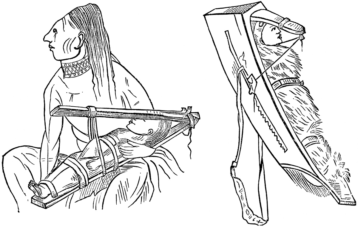
The Natchez produced the artificial form by bandaging the infant’s head to a well-cushioned cradle-board by means of strips of deer-skin.[265] The Caribs bandaged the head with pieces of wool, and gave it a very quadrangular shape. The Choctaws produced artificial compression by means of a bag of sand.[266] The unintentional flattening of the skull arose from the quite general use of the cradle-board without any board for pressure, or the custom common among many American tribes of the mother suckling the child over her shoulder, a practice widely prevalent in Africa and among savage nations. In the former instance it is but reasonable to suppose that the form of a tender and pliable skull would be modified more or less by the shape of the hard cradle-board, and by the position in which it was placed upon its rest. This fact accounts for the slight occipital compression of the mound skulls and also for the irregularity of the flattening in many cases. The latter process, that of nursing the child from its position on the shoulder or back would no doubt subject the head to a slight pressure, perhaps in most cases in a lateral direction.
The general prevalence of the unnatural custom of flattening the skull on the eastern border-land of Europe and among the numerous tribes of the western coast of America, together with its presence in Polynesia as a connecting link, we think justifies us in concluding that it originated among the wild hordes of the northern steppes of Asia, from which centre it spread in lines of 184radiation until it reached the remote localities in which recent research has found it.[267] This fact is suggestive of a remote intercourse between peoples separated by seas and mountains, if it does not serve as an argument for the unity and common origin of the human family.
A careful examination of the remains of the pre-historic races other than the measurement of crania has contributed largely to our fund of information concerning their life and habits. Science has rendered us pretty familiar with some of the diseases to which they were subject. Dr. Farquharson has described a singular manifestation of disease of the cervical vertebræ, shown in a peculiar roughening of the articular surfaces, and also by a true or bony anchylosis of these points. He concludes that the people of the mounds must have been possessed of a considerable degree of civilization and facilities for the care of the sick during a long period, in order to have effected the cure which the condition of the bones indicate had taken place.[268] One of the most alarming discoveries, however, is that which apparently shows the general prevalence of syphilis. That this loathsome disease was common 185among the various tribes of Equinoctial America is attested to by the discoverers and their successors, and has been much commented upon, and held by some authors to have been of American origin. The most recent supporter of this view is Professor Jones, to whom we have already referred.[269] He found in most of the mounds which he explored in Tennessee bones bearing syphilitic nodes, and believes them to be the oldest traces of the disease in existence. Dr. Farquharson made similar discoveries in the Iowa and Illinois mounds. Prof. Putnam, however, attributes the nodes to other diseases. That flattening of the leg-bone or tibia, peculiar to pre-historic man in Europe, and perhaps the result of rugged exertion in climbing mountains and traversing the country with that rapidity which the chase required where the horse is wanting, is more noticeable in the remains of some of the Mound-builders than in any other people. This peculiarity of the tibia called platycnemism, is probably a provision of nature, securing a firmer and better defined process upon which the muscles of the leg could fasten themselves, and its prominence among the people of the mounds indicates the possession of great pedestrian powers.[270]
The singular custom of perforating the skull after death (and 186possibly during life) is shown to have been in vogue by the discovery of a number of crania at the River Rouge Mound in Michigan with artificial apertures. No light as yet has been thrown upon the significance of this strange practice.[271] The nearest approach to the natural condition and characteristic physiognomy of the pre-historic inhabitants of this continent, is observable in the Peruvian mummies collected in latitude 18° 30´ S., on the shore of the Bay of Chacota, near Arica, by Mr. Blake, and transferred by him to Boston. Many others have since been exhumed, and though embalmed and buried in a climate which preserves the brightest colors of the garments with which they were enshrouded, still the shrivelled condition of the corpses furnishes us the assurance that their type of features can never be truly recovered from nature. Dr. Morton has figured the head of one of these mummies in Plate I of the Crania Americana, from which the physiognomy may be partially restored by the aid of a vivid imagination. Notwithstanding the temptation which presents itself, and one which has been sufficiently indulged already, it would certainly be idle to speculate as to what that type might have been. However, one feature of the Peruvian mummies has been preserved true to life, and is of the greatest value in determining ethnic relations. The silicious sand and marl of the plain southward of Arica, where the most remarkable cemeteries are situated, is slightly impregnated with common salt as well as nitrate and sulphate of soda. These conditions, together with the dry atmosphere rivalling that of Egypt, and in which fleshy matter dries without putrefaction, the human hair has been perfectly preserved, and comes to us as one of the best evidences of the diversity of the American races yet produced. In general it is a lightish brown, and of a fineness of texture which equals that of the Anglo-Saxon race.[272] Straight, coarse, black hair is 187universally characteristic of the Red Indians, and is known to be one of the last marks of race to disappear in intermarriage with Europeans. The ancient Peruvians appear, from numerous examples of hair found in their tombs, to have been an auburn-haired race. Garcilasso, who had an opportunity of seeing the body of the king Viracocha, describes the hair of that monarch as snow-white.[273] Haywood has described the discovery at the beginning of this century of three mummies in a cave on the south side of the Cumberland River, near the dividing line of Smith and Wilson Counties in Tennessee. They were buried in baskets, as Humboldt has described some of the Peruvians to bury, and the color of their skin was said to be fair and white, and their hair auburn and of a fine texture.[274] The same author refers to several instances of the discovery of mummies in the limestone and saltpetre caves of Tennessee with light yellowish hair.[275] Prof. Jones supposes that the light color of these so-called mummies of Tennessee and Kentucky was due to the action of lime and saltpetre.[276]
We have every reason to believe that the men of the mounds were capable of executing in sculptures reliable representations of animate objects. The perfection of the stone carvings, as well as the terra-cotta moulded figures of animals and birds obtained from the mounds, have excited the wonder and admiration of their discoverers. It was evidently a favorite pastime for those primitive artists to reproduce the human features, for effigies and masks have often been exhumed together with other sculptures. The perfection of the animal representations furnish us the assurance that their sculptures of the human face were equally true to nature.[277] The accompanying figures of sculpture 188and masks together with those found in the sculpture of the Mayas and Nahuas, shown in a future chapter, furnish us with a twofold argument: first, that an American type of physiognomy as such did not exist; that, upon the contrary, it was as variable and diversified as can now be found among the peoples 189of Europe or elsewhere; second, that a strong resemblance between some of the sculptures of the mounds and those of Mexico exist. It is a remarkable fact that those of Palenque furnish the most striking likeness to those of the Mississippi Valley.[278] There is, perhaps, no means of ascertaining of what color the pre-historic Americans were, certainly not of the Mound-builders; but judging from the great variety of tints and shades that prevail among the wild tribes of North America alone, we may conclude that no argument in favor of an American race can be based upon color.[279]
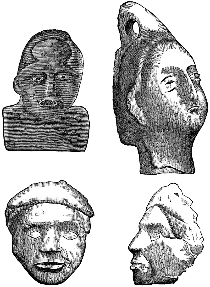
The Menominees, sometimes called the “White Indians,” formerly occupied the region bordering on Lake Michigan, around Green Bay. The whiteness of these Indians, which is compared to that of white mulattoes, early attracted the attention of the Jesuit missionaries, and has often been commented upon by travellers.[280] While it is true that hybridity has done much to lighten the color of many of the tribes, still the peculiarity of the complexion of this people has been marked from the first time a European encountered them. Almost every shade, from the ash color of the Menominees, through the cinnamon red, copper and bronze tints, may be found among the tribes formerly occupying the territory east of the Mississippi—the remnants of some of which are now in the Indian Territory and others in the North-west—until we reach the dark-skinned Kaws of Kansas, who are nearly as black as the negro. The Indians in Mexico are known as the “black people,” an appellation designed to be 190descriptive of their color. Viollet le Duc is of the opinion that the builders of the great remains in Southern Mexico and Yucatan belonged to two different branches of the human family, a light-skinned and dark-skinned race respectively.[281] The variety of complexion is as great in South America as among the tribes of the northern portion of the continent.
Probably one of the most incontrovertible arguments against American ethnic unity is that which rests upon the unparalleled diversity of language which meets the philologist everywhere. The monosyllable and the most remarkable polysyllables known to the linguist; synthetic and analytic families of speech, simplicity and complexity of expression, all seem to have sprung up and developed into permanent and in some cases beautiful and grammatical systems side by side with each other until the Babel of the Pentateuch is realized in the indescribable confusion of tongues. The actual number of American languages and dialects is as yet unascertained, but is estimated at nearly thirteen hundred, six hundred of which Mr. Bancroft has classified in his third volume of the Native Races of the Pacific States. It is true that the American languages present a few features quite peculiar to themselves (which will be treated hereafter), but as language is never constant, is not a pyramid with its unchanging architectural plan, but is a plant which passes through such transitions in the process of its growth as to lose entirely some of the elements which it possessed at first, so we may as reasonably expect that in the course of time certain peculiarities incident to certain climatic conditions, certain phases of nature and certain types of civilization, should develop themselves as distinguishing features of the speech of the continent. The very fact that language is unstable—is a matter of growth—renders the argument that these peculiarities indicate unity of the American race valueless; while, on the other hand, the fact that here we have a greater number and variety of languages than is to be found in any of the other grand divisions of the earth, is strong evidence of a diversity more radical than that which simply arises 191from tribal affiliations. In view of the wide differences existing between the native Americans themselves in every feature which admits of being subjected to a scientific test, we are forced to the conclusion, solely resting on the evidence in the case, that the theory of American ethnic unity is a delusion, an infatuating theory which served only to blind its advocates as to the plain facts, and led them into grave errors which will become all the more palpable as scientific investigation progresses.
As yet no substantial reason for considering the ancient occupant of this continent as peculiar in himself, and as unlike the rest of mankind, has been set forth. Nothing in the American’s physical organization points to an origin different from that to which each of the species of the genus homo may be assigned. Whatever truth there may be in the diverse origin of the black and white race, the separate creation theory, in so far as it maintains that the Creator originated upon the soil of this continent a peculiar and separate race of men, must in the eyes of this age of criticism lack evidence, and be assigned to its place with thousands of others which from time immemorial have been contributing to the construction of a foundation reef which will ultimately rise like a bold headland above the dark waters of uncertainty into the realm of truth.
A few students of American Anthropology have solved the question of the origin of the ancient population upon the hypothesis of its having developed from a lower order in the animal kingdom, itself indigenous to the Western Continent. One of the most distinguished representatives of this school, perhaps, is Frederick von Hellwald of Vienna, who states his views as follows: “I am unable to give in my adhesion to the theory which assumes that the original seat of the human races must be sought in higher Asia or somewhere else, whence mankind are supposed to have spread themselves gradually over the whole globe; an assumption which is contradicted in the most decisive manner by the peopling of the new world. It is impossible to enter here into all the hypotheses which have been framed for the explanation of a fact so perplexing to the Biblical students of the sixteenth century, and of course later times; it is enough 192to say that thus far not one of them have been found to correspond even approximately to the demands of science, and that theory is probably in every point of view the most tenable and exact which assumes that man, like the plant, a mundane being, made his appearance generally upon earth when our planet had reached that stage of its development which unites in itself the conditions of man’s existence. In conformity with this view, I regard the American as an Autochthon.”[282] This subject resolves itself into two questions: (1) Is the origin of the human race by the processes of development from a lower order of animal an ascertained fact? (2) If so, does the American continent furnish any species of ape or any known fauna from which man could have developed? It is taken for granted that the reader is fully familiar with Darwinism (the origin of species by means of natural selection, the joint result of the independent researches of Darwin and Wallace) and Lamarckism (the theory of man’s descent from the ape),[283] both of which have been so enthusiastically advocated by Spencer, Huxley, Hæckel and many others. Their works and the magnificent array of facts which their patient researches have accumulated command our admiration, even if full assent cannot be given to all their conclusions.
The first question: Is the origin of the human race by the processes of development from a lower order of animal an ascertained fact? would at first seem to require a lengthy discussion at our hands. But in a special work on a subject altogether foreign to the question, such a discussion would certainly be out of place. Even if this were not true, the above question as stated requires no discussion. We believe that no advocate of the hypothesis of evolution could be found so sanguine or so unguarded, who would come forward and answer the question in the affirmative. On the contrary, we believe the question would call forth an honest negative from the great body of scientists who hold to the hypothesis of evolution. Obstinacy 193alone could deny that the groups of facts which have been brought to our knowledge, the occasional well-marked transitional forms[284] which are turning up, the unquestionable tendency in species to vary, and possibly of their varieties slowly to form new species under modified surroundings, point to a principle, a law in nature, which may be characterized as the law of development or evolution. But on the other hand, the hypothesis that such a law exists, or, if you please, the fact that it exists, does not imply that it is universal in its application or that it has extended through all the realm of nature. Indeed, pure justice to the advocates of the hypothesis requires the statement that they have never made such a claim.[285] The fact that such eminent scientists as Mivart and Wallace deny the development of man from a lower order, is sufficient evidence that the hypothesis in its widest bearing is not accepted by all, much less is an ascertained “fact.” It appears, therefore, that the first question being unsettled, and as yet incapable of solution, the argument turns upon the second question: Does the American Continent furnish any species of ape or any known fauna from which man could have developed? Before answering the question in the light of present knowledge, it will be of interest to note the reply made by the late Professor Joseph Henry to the view of Frederick von Hellwald, quoted on a preceding page. His estimate of the probabilities of man developing from the lower orders of animals in more than one locality on the globe is expressed as follows: “The spontaneous generation of either plants or animals, although a legitimate subject of scientific inquiry, is as yet an unverified hypothesis. If, however, we assume the fact that a living being will be spontaneously produced when all the physical conditions necessary to its existence are present, we must allow that in the case of man, with his complex and refined organization, the fortuitous assembly of the multiform conditions 194required for his appearance would be extremely rare, and from the doctrine of probabilities could scarcely occur more than at one time and in one place on our planet; and further, that this place would most probably be somewhere in the northern temperate zone. Again, the Caucasian variety of man presents the highest physical development of the human family; and as we depart either to the north or south, from the latitude assumed as the origin of the human race in Asia, we meet with a lower and lower type until at the north we encounter the Esquimaux, and at the south the Bosjesman and the Tierra Fuegian. The derivation of these varieties from the original stock is philosophically explained on the principle of the variety in the offspring of the same parents, and the better adaptation and consequent chance of life of some of these to the new conditions of existence in a more northern or southern latitude.”[286] As a direct answer to the question, however, we can do nothing more than refer to the opinions of the two greatest advocates of evolution. “In order to form a judgment on this head,” says Mr. Darwin, “with reference to man, we must glance at the classification of the Simiadæ. This family is divided by almost all naturalists into the Catarhine group, or old world monkeys, all of which are characterized (as the name expresses) by the peculiar structure of the nostrils, and by having four pre-molars in each jaw; and into the Platyrhine group or new world monkeys (including two very distinct sub-groups), all of which are characterized by differently constructed nostrils and by having six molars in each jaw. Some other small differences might be mentioned. Now man unquestionably belongs, in his dentition, in the structure of his nostrils, and in some other respects, to the Catarhine or old world division; nor does he resemble the Platyrhines more closely than the Catarhines in any characters, excepting in a few of not much importance and apparently of an adaptive nature. Therefore, it would be against all probability to suppose that some ancient new world species had varied, and had thus produced a man-like creature with all the distinctive characters 195proper to the old world division, losing at the same time all its own distinctive characters. There can, consequently, hardly be a doubt that man is an offshoot from the old world Simian stem, and that under a genealogical point of view he must be classed with the Catarhine division.”[287] Such was Mr. Darwin’s opinion in 1871; and that the views of evolutionists have not changed since that time as to this question, we call attention to the words of the distinguished Professor Hæckel in his History of Creation, which are as follows: “Probably America was first peopled from North-eastern Asia by the same tribe of Mongols from whom the Polar men (Hyperboreans and Esquimaux) have also branched. This tribe first spread in North America, and from thence migrated over the isthmus of Central America down to South America, at the extreme south of which the species degenerated very much by adaptation to the very unfavorable conditions of existence. But it is also possible that Mongols and Polynesians emigrated from the west and mixed with the former tribe. In any case the aborigines of America came over from the old world, and did not, as some suppose, in any way originate out of American apes. Catarhine or narrow-nosed apes never at any period existed in America.”[288] The same argument holds good if it be ascertained that both man and apes developed from a common ancestor. With these authoritative utterances from the most celebrated representatives of the development school, we shall rest the fanciful hypothesis of the autochthonic origin of the ancient American population. Some who may not concur in our opinion as to the question of man’s development from lower animal forms, may be willing to admit that the Americans had an old world origin, which certainly, in the light of facts, is the 196only rational view.[289] The unity of the human family is a theory, if not a fact, which is supported by a mass of testimony of the most diversified character. The habits and customs, the sympathies, the wants and fears, the simpler arts, as well as most bodily proportions, point to a relationship which finds its easiest explanation in a unity of origin. It is chiefly, however, in the ruder arts that this correspondence of style or type is observable. No better illustration of this offers itself than the similarity of form or forms in which flint arrow-heads are found in all parts of the world. It would be impossible for the most expert archæologists to assign a promiscuous collection of flint weapons to the various quarters of the globe from which they may have been gathered, simply on the ground of characteristic forms.[290] The common methods of producing fire by means of friction, employed with but slight variation among people the most remotely separated,[291] is an inexplicable fact, except on the ground of an early community of residence or identical inventive genius. The universality of certain architectural forms such as the pyramid, and the singular fact that they have generally been used for places of sepulture, offers an argument in the same direction. The fact indicates either an early community of residence or identity of mental organization. The physical resemblances of all races in certain stable features which have never been known to change, indicate a divergence from a common centre—from one type. The slight differences in the type of skull which characterize some nations 197from others, is no argument against original unity, since those peculiarities are certainly of more recent origin than the unknown events which at a remote period scattered men over the face of the earth.[292] Probably no difference between the races of men has been considered so essential as that of color, for none has furnished such reasonable ground for the views of polygenists as the marked contrast between the African and Caucasian types. Years ago the view that color was the result of tropical climate was abandoned,[293] for the Eskimo and Lapps are almost as dark as many Africans, and their residence under the arctic circle has continued from a remote antiquity. Upon the other hand every variation in color, from the darkest to the lightest possible shades, exist among African tribes. The antiquity of the negro type as we now see it, is unquestionably considerable. As proof of this we have the oft-referred to argument from Egyptian paintings. In a temple at Beyt-el-Welee, in Nubia, constructed in the reign of Rameses II, is a painting which has been reproduced by Bonomi, in which a negro kneels at the feet of Sethos I, father and predecessor of Rameses II. All the peculiarities of the Negroid type are conspicuous; the blackness of the color, the thickness of lips, flatness of nose and woolliness of hair which pertain to the African of to-day are unquestionably present.[294] The painting representing this remarkable ethnic fact is 3200 years old, dating from 1400 years before Christ. The Duke of Argyll, on the authority of Prof. Lepsius, states that in earlier representations of the negro, referable to the “Twelfth Dynasty” or about 1900 B. C., the negro color is strongly marked, but not the negro features.[295] It is a question whether this fact indicates a transition from one type to another, or whether the painting is a true representation of 198the Nubians, who are known not to have flat noses or projecting lips. It is supposed also that the unskillfulness of the artists may account for the absence of the typal lines.[296] Hieroglyphic writings have been found dating about 2000 years B. C., in which mention is made of the employment of Negro or black troops by an Egyptian king in the prosecution of a great war.[297] At that remote period, when Abraham was almost the sole representative of the Jewish race, the negro type had multiplied and developed into strong tribes, which were important factors in the military contests of the oldest of powers—the Egyptian.
Notwithstanding this seeming permanence of type, it is well known that of all physical conditions, color is the most liable to change in every organism. Many animals under domestication change their color entirely.[298] In our Southern States it was observed that house-slaves of the third generation presented quite a markedly different appearance from field slaves.[299] This was owing as much, no doubt, to different food and different habits of life as to protection from the sun, though many different races have quite the same color while their habits of life are as different as well could be imagined. Of this class, the Eskimo, Chinese, and Fuegeans are examples. However, the fact that color is variable even in a slight degree, indicates that considerable if not radical changes might be brought about during a great length of time. Mr. Darwin has furnished the most rational solution of the question, which he describes briefly 199as follows: “Various facts which I have elsewhere given, prove that the color of the skin and hair is sometimes correlated in a surprising manner with a complete immunity from the action of certain vegetable poisons and from the attack of parasites. Hence it occurred to me that negroes and other dark races might have acquired their dark tints by the darker individuals escaping during a long series of generations from the deadly influence of the miasmas of their native countries.”[300] This doctrine of the survival of only the fittest, while all the weaker and perhaps lighter complexioned individuals of a race gradually succumbed to the deadly influence of climate, no doubt will explain the origin of the dark races, known to enjoy a special immunity against yellow and other fevers.[301] At all events, the formation of the distinctive features of races requires a great lapse of time. The geologist asks for time in which to account for the formation of strata, and the intelligent world now grants it to him without limit, and just as reasonably may the ethnologist ask for time in which to account for the formation of racial types.[302] Nor need the most literal interpreter of Genesis object to this demand on the ground of any conflict with the letter even of the historic narrative of the Pentateuch. The accepted chronology, based on Archbishop Usher’s interpretation, is no part of the text of Genesis. It is purely the product of his inadvertence and the blindness of many others of his school of Biblical chronologists. It is evident that the rules of interpretation applied to the tenth 200chapter of Genesis, according to which the names of the descendants of Noah’s sons are taken to represent individuals only, cannot hold. The probabilities are that they represent considerable tribes or nations. This probability is an established fact in the sixteenth and subsequent verses. In the fifteenth verse we learn that Canaan, the grandson of Noah, “begat Sidon, his first-born, and Heth.” Here the writer seems to refer to individuals, but it is probable that he alludes even to the origin of tribes. In the sixteenth verse we are not left in doubt on the subject, for there he no longer speaks of individuals or generations but of the growth of nations. He immediately adds after the above quotation, “and [begat] the Jebusite, and the Amorite, and the Girgasite, and the Hivite, and the Arkite, and the Sinite,” etc., etc.[303] The account makes no pretensions at chronology or at furnishing data for any system, and the constructions put upon its condensed account of the origin and growth of nations during an indefinite lapse of time by short-sighted interpreters, are unwarranted and certainly do injustice to the oldest of our histories. When we go back of the birth of Christ two thousand years—to the time of Abraham—this is as far as we can tread with certainty in the light of History. This period has been aptly designated by the Duke of Argyll as “Time absolute.” But when we go back of 2000 B. C., we are compelled to walk in a twilight glimmer, with only the dim rays from occasional cuneiform inscriptions, and the condensed accounts contained in Genesis, falling across our uncertain pathway. This period the above able writer has chosen to call “Time relative,” and the probabilities are that its measure is double if not treble that of the portion of “Time absolute” which precedes the Christian Era. An additional fact in this connection which strengthens the preceding is, that the three most ancient versions of the Pentateuch—the Hebrew, the Samaritan and the Septuagint—vary considerably in their statements as to the ages of many of the patriarchs at the birth of their sons. So wide is the difference 201in this respect between the Hebrew and Septuagint versions that their chronologies cannot be reconciled at all, the latter allowing a period of eight hundred years more than the former from Adam to Abraham; such being the case, it is impossible to arrive at the time of the flood or the origin of the race. These contradictions in versions, however, do not in any way impeach the historic authority of the Pentateuch, since it is in no sense a chronology any more than it is a work on geographic or astronomic science. The known antiquity of Egypt and China, to say nothing of the facts revealed by geology concerning man’s antiquity, can never be reconciled with Usher’s system, which is in no sense the true chronology of any known version of the Pentateuch.[304]
In this chapter we have seen that there is nothing to indicate that the Americans owe their origin to a special act of creation, and further, if they originated by the process of development (for which there is no sufficient evidence), that it was not upon the American continent. We are supported in these conclusions by the most respectable writers on American Ethnology[305] and 202Antiquities. That the American population is of old world origin there can be little doubt; but from whence it came, and to what particular people or peoples it owes its birth, is quite another question.[306] That view seems open to least objections which maintains that the Western Continent received its population at a comparatively early period in the history of the race, before the peoples of Western Europe and Eastern Asia had assumed their present national characteristics or fully developed their religious and social customs.[307]
THE most ancient civilization on this continent, judging from the combined testimony of tradition, records, and architectural remains, was that which grew up under the favorable climate and geographical surroundings which the Central American Region southward of the Isthmus of Tehuantepec afforded. The great Maya family with its numerous branches, each in time developing its own dialect if not its own peculiar language, at an early date fixed itself in the fertile valley of the River Usumasinta, and produced a civilization which was old and ripe when the Toltecs came in contact with it. Here in this picturesque valley region in Tabasco and Chiapas we may look for the cradle of American civilization. Under the shadow of the magnificent and mysterious ruins of Palenque a people grew to power who spread into Guatemala and Honduras, northward toward Anahuac and southward into Yucatan, and for a period of probably twenty-five centuries exercised a sway which, at one time, excited the envy and fear of its neighbors. We are fully204 aware of the uncertainty which attaches itself to tradition in general, and of the caution with which it should be accepted in treating of the foundations of history; but still, with reference to the origin and growth of old world nations, nothing better offers itself in many instances than suspicious legends. The histories of the Egyptians, the Trojans, the Greeks, and of even ancient Rome rests on no surer footing. It is certain that while the legendary history of any nation may be confused, exaggerated, and besides full of breaks, still there are some main and fundamental facts out of which it has grown, and this we think is especially true of the new world traditions. Clavigero says: “The Chiapanese have been the first peoplers of the new world, if we give credit to their traditions. They say that Votan, the grandson of that respectable old man who built the great ark to save himself and family from the deluge, and one of those who undertook the building of that lofty edifice which was to reach up to heaven, went by express command of the Lord to people that land. They say also that the first people came from the quarter of the north, and that when they arrived at Soconusco, they separated, some going to inhabit the country of Nicaragua and others remaining in Chiapas.”[308] The tradition of Votan, the founder of the Maya culture, though somewhat warped, probably by having passed through priestly hands, is nevertheless one of the most valuable pieces of information which we have concerning the ancient Americans. Without it our knowledge of the origin of the Mayas would be a hopeless blank, and the ruins of Palenque would be more a mystery than ever. According to this tradition, Votan came from the East, from Valum Chivim, by the way of Valum Votan, from across the sea, by divine command, to apportion the land of the new continent to seven families which he brought with him. It appears that he had been preceded in America by two others named Igh and Imox, if the researches of the Abbé Brasseur de Bourbourg can be relied upon. In the Tzendal calendar, Votan’s name appears as that of the third day, while Igh and Imox are 205the first and second respectively. If, as is supposed, the names represent the true succession of the Maya chiefs, there is some ground for the Abbé’s view.[309] The doubtful portions of the tradition which may be interpolations are the ambiguous assertions that he saw the Tower of Babel, and was present at the building of Solomon’s temple. Probably the remains only of the former structure may be referred to.
With these contradictions we have nothing to do, as they do not in any way affect the subsequent history of the Votanites, or interfere with the probability of their old world origin. To attempt to designate the point from which Votan started or the means by which he reached the new world, would be the height of folly. Votan is said to have made four journeys to the land of his nativity. His achievements in the new world were, however, as great as those of any of the heroes of antiquity. His great city was named “Nachan,” (city of the serpents), from his own race, which was named Chan, a serpent. This Nachan is unquestionably identified with Palenque. The date of his journey is placed at 1000 years B. C.[310] The kingdom of the serpents206 flourished so rapidly that Votan founded three tributary monarchies whose capitals were Tulan, Mayapan, and Chiquimula.[311] The former is supposed to have been situated about two leagues east of the town of Ococingo; Mayapan is well-known to have been the capital of Yucatan, and Chiquimula is thought to have been Copan in Honduras.[312] One of the great works of this hero was the excavation of a tunnel or ‘snake hole’ from Zuqui to Tzequil. He also deposited a great treasure at Huehuetan, in Soconusco, which he left under the vigilant care of a guard, directed by one of the most honorable women of the land. Finally, he wrote a book in which he recorded his deeds and offered proof of his being a Chane (or serpent). This ancient document, which is claimed to have been written by one of Votan’s descendants, of the eighth or ninth generation and not by himself,[313] was in the Tzendal language, a dialect or branch of the Maya, spoken in Chiapas and around Palenque. Its history is, however, quite checkered, and the information which it contained comes very indirectly. For generations the Votanic document was scrupulously guarded by the people of Tacoaloya, in Soconusco, but was finally discovered by Francisco Nuñez de la Vega, Bishop of Chiapas. In the preamble of his Constituciones, § xxx,[314] he claims to have read this document, but it is probable that only a copy, still in the Tzendal language but written in Latin characters, had come into his possession.[315] He fails to give any definite information from the document except the most general statements with reference to Votan’s place in the calendar, and his having seen the Tower of Babel, at which each people was given a new language. He states that he could have made more revelations of the history of Votan from this 207document but for bringing up the old idolatry of the people and perpetuating it. With the zeal of a true Vandal, the bishop committed the dangerous documents, together with the treasure which he claims Votan to have buried in the dark-house, to the flames in 1691. There seems to have been other copies, however, of this remarkable manuscript, for about the close of the eighteenth century, Dr. Paul Felix Cabrera was shown a document in the possession of Don Ramon de Ordoñez y Aguiar, a resident of Ciudad Real in Chiapas, which purported to be the Votanic memoir.[316] Ordoñez, at the time, was engaged upon the composition of his work on the “History of the Heaven and Earth.”[317] It appears that Cabrera was admitted to the confidence of Ordoñez, and availed himself of a few facts communicated to him by the latter, which he supplemented by drawing from his imagination for the rest of his account.[318] Brasseur de Bourbourg accuses Cabrera of seriously misrepresenting Ordoñez and of warping his account.[319] The following, which is Cabrera’s account208 may be of interest to the reader: “He (Votan) states that he conducted seven families from Valum Votan to this continent and assigned lands to them; that he is the third of the Votans; that having determined to travel until he arrived at the root of Heaven, in order to discover his relations, the Culebras, and make himself known to them, he made four voyages to Chivim (which he expressed by repeating four times from Valum Votan to Valum Chivim, from Valum Chivim to Valum Votan); that he arrived in Spain, and that he went to Rome; that he saw the great house of God building; that he went by the road which his brethren, the Culebras, had bored; that he marked it, and that he passed by the houses of the thirteen Culebras. He relates that in returning from one of his voyages he found seven other families of the Tzequil nation who had joined the first inhabitants, and recognized in them the same origin as his own, that is, of the Culebras. He speaks of the place where they built the first town, which, from its founders, received the name of Tzequil; he affirms the having taught them refinement of manners in the use of the table, table-cloth, dishes, basins, cups, and napkins; they taught him the knowledge of God and of his worship; his first ideas of a king and of obedience to Him; that he was chosen captain of all those united families.” It is not necessary for us to point out the hand of the interpolator in this account; it is sufficiently apparent. However, its obnoxious prominence need not destroy our faith in the general facts of the account. The interpretation of the document we submit to the reader with the simple reminder that the symbol of life and power among the Central Americans and Mexicans has ever been a serpent, a fact which may have derived its significance from the meaning of the name of the Votanites together with the power attained by Palenque.[320] Votan’s followers were called 209Tzequites by their predecessors, probably by the descendants of Igh and Imox, the signification of which term is ‘men with petticoats.’ The Tzendal traditions refer always to the city of Nachan as the capital of the kingdom of the Chanes or Serpents, and the most significant feature of the traditional names of this people is the fact that the name Culhua, applied by the Nahua nations and especially by the Toltecs to a powerful people who had preceeded them at the south, is the exact equivalent of Chanes; the same is true of Culhuacan.[321] The Abbé Brasseur de Bourbourg obtained a copy of the fragmentary MS. of Ordoñez, which he informs us was written in two separate parts in quarto, at different times. The first or mythological part exists in a copy owned by the Abbé.[322] The second or historical part, if ever written, has never reached the light, and from the description 210of its contents found in the first part, we should think that the author might have made a rather imaginative historian.[323] While some of the details of the Votanic tradition are not worthy of a moment’s consideration, it is quite certain that in the general facts we have a key to the origin of what all Americanists agree in pronouncing the oldest civilization on this continent, one which was gray and already declining when the Toltecs entered Mexico. There is not the slightest evidence that it originated in any other place than in Chiapas, where it is found, and extended itself into Guatemala, Yucatan, and possibly branched northward in a colony as remote as Culhuacan. Sr. Orozco y Berra has found fifteen languages or dialects to be related to the Maya language, a fact which indicates the age and extent of that remarkable civilization.[324] Sr. Orozco is convinced from linguistic and other researches, that the inhabitants of Cuba and others of the West India Islands were Mayas, and points out the intermediate location of Cuba between Florida and Yucatan. He thinks the earliest home of the Mayas on this 211continent was on the Atlantic coast of the United States, from whence they emigrated to Cuba and thence to Yucatan.[325] Though we are not fully satisfied that the Mayas ever occupied Florida, it is quite likely that the islands of the Gulf were inhabited by them at an early day. The culture hero Votan is a mystery, and to arrive at his true character or office is simply an impossibility. For those disposed to speculate, there is abundant opportunity.[326] The most interesting traditionary history which has been discovered is that of the Quichés of Guatemala. By the name Quiché, in this immediate connection, we do not mean to speak of that people after they became amalgamated with the Nahua nations from Central Mexico, but as a branch of the great Maya monarchy, in all probability located at first at Tulha or Tula, which, it is believed, was situated near Ococingo. At first, we think, the Quichés developed their own institutions, dialects, etc., as one of the allied powers associated with the capital city Nachan, but gradually assumed an individuality which became distinctive, until a rivalry between the capital and its allied neighbor sprang up, which ultimately ended in the overthrow of the former. Sr. Pimentel, on the authority of an ancient author, states that the name Quiché was applied to the first empire of Palenque and signified many trees. It was employed by the “innumerable families of different nations which composed it, to symbolize its various branches.”[327] The tradition of their origin states that they came from the far East, across immense tracts of land and water; that in their former home they had multiplied considerably and lived without civilization, and with but few wants; they paid no tribute, spoke a common language, did not bow down to wood and stone, but lifting their eyes toward heaven, observed the will of their 212Creator, they attended with respect to the rising of the sun, and saluted with their invocations the Morning Star; with loving and obedient hearts they addressed their prayers to Heaven for the gift of offspring. “Hail, Creator and Maker! regard us, attend us. Heart of Heaven, Heart of the Earth, do not forsake us, do not leave us. God of Heaven and Earth, Heart of Heaven, Heart of Earth, consider our posterity always. Accord us repose, a glorious repose, peace and prosperity, justice, life and our being. Grant to us, O Hurakan, enlightened and fruitful, Thou who comprehendest all things great and small.”[328] In the Popol Vuh, the sacred book of the Quichés, we are enabled to arrive more closely at the cosmogony and worship of that remarkable people.[329] The reader may not be prepared for the irreconcilable contradictions and for the obscure and figurative language in which 213this work abounds; but with the remembrance that all nations of antiquity delighted in the use of figures, parabolic disguises and personifications under which the truth was couched, we may be able to profit by even the seeming foolishness and confusion of the Quiché record. The strange, wild poetry of the Quichés, can only be fully enjoyed by pursuing the unabridged accounts for which we regret we have not space.[330] In the order of the Quiché creation, the heavens were first formed and their boundaries fixed by the Creator and Former, by whom all move and breathe, by whom all nations enjoy their wisdom and civilization. At first there was no man or animal or bird or fish or green herb—nothing but the firmament existed, the face of the earth was not yet to be seen, only the peaceful sea and the whole expanse of heaven. Silence pervaded all; not even the sea murmured; there was nothing but immobility and silence in the darkness—in the night.[331] The Creator, the Former, the Dominator—the feathered serpent—those that engender, those that give being, moved upon the water as a glowing light. Their name is Gucumatz, heart of heaven—God. “Earth,” they said, and in an instant it was formed and rose like a vapor cloud; immediately the plains and mountains arose and the cypress and pine appeared. Then Gucumatz was filled with joy, and cried out, “Blessed be thy coming, O Heart of Heaven, Hurakan, thunderbolt!”[332] Animals were next formed, but because they could not praise their Maker they were doomed to become objects of prey. Four creations of men then followed. The first man was made of clay, but he had no intelligence and he was consumed in the water. Upon a second trial a man and a woman were made of a sort of pith, but they too were unsatisfactory experiments; though they had life and peopled the earth, they were very inferior, 214living like beasts and forgetting the Heart of Heaven. The Creator then destroyed them with a flood of resin, allowing only a few to escape, that now exist as little apes in the woods. The persons of the Godhead, enveloped in the darkness which enshrouded a desolated world, counseled concerning the creation of a more perfect order, and as a result they formed four perfect men named: Balam-Quitzé, Balam-Agab, Mahucutah, and Iqi-Balam. These men were miraculously formed of white and yellow maize, and the Creator was content with his labors. “Verily, at last, were there found men worthy of their origin and their destiny; verily, at last, did the gods look upon beings who could see with their eyes and handle with their hands and understand with their hearts, grand of countenance and broad of limb, the four sires of our race stood up under the white rays of the morning star—sole light as yet of the primeval world—stood up and looked. Their great clear eyes swept rapidly over all; they saw the woods and rocks, the lakes and the sea, the mountains and the valleys, and the heavens that were above all; and they comprehended all and admired exceedingly. Then they returned thanks to those who had made the world and all therein was: we offer up our thanks, twice—yea, verily, thrice; we have received life, we speak, we walk, we taste, we hear and understand, we know both that which is near and that which is far off, we see all things, great and small, in all the heaven and earth. Thanks, then, Maker and Former, Father and Mother of our life, we have been created—we are.”[333] These four creatures were considered too perfect by the gods, and in order that their omniscience might be destroyed, they breathed a cloud of mist over their vision. To each of these men wives were made while they slept. A fourth creation seems to have taken place by which the ancestors of other races were formed.
215
The account which the Popol Vuh furnishes of the migrations of the ancient Quichés is somewhat confused, and it is scarcely possible to hope that the locations named should ever be fully identified. Their worship was at first purely spiritual. “Only they gazed up into heaven, not knowing what they had come so far to do.” In their original home, wherever that might have been, they grew weary of this kind of service—of watching for “the rising of the sun”—by which it seems they meant the coming of temporal power. The four men then forsook their abode and journeyed to Tulan-Zuiva, the seven caves or seven ravines. Here they found gods; to each of the four men a different deity was assigned. To Balam-Quitzé the god Tohil was given; to Balam-Agab the god Avilix; and to Mahucutah, the god Hacavitz; and though the fourth man Iqi-Balam also received a god, no special account is taken of him, since the latter of the four men left no progeny. The journey to Tulan is said to have been a very long one. Doubtless in this account we have an allusion to one of those modifications in religious notions which seems to have often attended a change of residence in early times. The abstract worship of the Creator is supplanted by the more material and ceremonial worship of intermediate deities (demi-gods). Tulan is described as a much colder climate than the eastern and tropical land which they had forsaken, and the god Tohil came to their relief by the creation of fire. But incessant rains, accompanied with hail, extinguished all their fires, which were again kindled repeatedly by the fire-god. Tulan was an unfavorable locality for permanent abode—rains, extreme cold, dampness, famine prevailed, and the peculiar misfortune of the confusion of tongues there befell them. No longer were the brother propagators of the race able to communicate with each other. “At Tulan there was as yet no sun,” is the significant but perplexing language of the narrative. At last Tulan, the mysterious land of the “seven-caves,” was forsaken, and under the leadership of Tohil the people began a migration which was attended with indescribable hardships and famine itself. Their way led through dense forests, over high mountains, a long sea passage, and by a rough and pebbly shore. We are, however, told that the sea was parted for their passage. Their tribulations were at an end when at last they arrived at a beautiful mountain, which they named after their god Hacavitz. Here they were informed that the sun would appear, and, as a216 consequence, the four progenitors of the race and all the people rejoiced. Here was everything beauteous and gladdening. The morning star shed forth a resplendent brightness, and the sun itself at last appeared, though then it had not the warmth which it possessed at a later day. Before the light of the sun, however, the gods Tohil, Avilix and Hacavitz, together with the tiger and lion and reptiles, were changed into stone. To interpret this paragraph, which is greatly condensed, is a difficult undertaking, still there are certain facts which seem to serve as the basis of intelligent speculation. The language is extremely figurative throughout the entire narrative, and especially so here. Their worship of the morning star at an early period seems to connect them with the Mediterranean peoples of the old world. The allusions to the sun not yet having come may be retrospective, indicating that the worship of the sun had not been adopted at that early day, or it may indicate that the period of national strength had not dawned. The fact that the morning star shone more brilliantly on Mt. Hacavitz than at Tulan (the seven caves), may mean either that the worship of the star was more splendidly celebrated, or it may have reference to an astronomical fact, that the star itself was more luminous, and furnish evidence in harmony with the statements of the narrative that Mt. Hacavitz was a more southern location than the tempestuous Tulan. The petrifaction of the three tribal gods may have been the result of an age of peace and prosperity which offered an opportunity for developing their cultus; or, upon the other hand, if the coming of the sun refers to the advent of a new religion, that which is known to have prevailed among the Nahuas, the old gods may have been sculptured in stone, that their national character and deeds might not be forgotten before the increasing importance of the new faith. There they instituted sacrifices of beasts to the three stone gods Tohil, Avilix and Hacavitz; they even drew blood from their own bodies and offered it to them. Finally, not content with these, the first four men, led by Balam-Quitzé, instituted human sacrifices. Captives were taken from neighboring tribes, kidnapping was practised extensively, until the hostility of their neighbors217 broke forth into open war. The contest, however, resulted favorably to the Quichés, and the surrounding tribes became subject to the victorious power. In Hacavitz they composed a national song called the Kamucu (“we see”)—a memorial of their misfortunes in Tulan—a lament for the loss of so many of their people in that unfortunate locality. This loss is described as occasioned by a portion of their race being left behind, rather than as the result of the misfortunes which attended them there. At last, at the noon-day of their national glory, it came to pass that the ancestors of their race, Balam-Quitzé, Balam-Agab, Mahucutah and Iqi-Balam, died—the men who came from the east, from across the sea, died—and their remains were enveloped in a great bundle and preserved as memorials of the ancestors of the race.[334] Then the Quichés sang the sad Kamucu, and mourned the loss of their leaders and that portion of their race which they left behind them in Tulan.
The definite location of Tulan is almost out of the question; it may only be conjectured. We have already stated, on the authority of Ordiñez, that there was a Tulan near Ococingo.[335] The Cakchiquel MS., known only through the writings of Brasseur de Bourbourg, but evidently a document containing the same facts as those stated in the Popol Vuh, gives the following information concerning Tulan: “Four persons came from Tulan, from the direction of the rising sun—that is one Tulan. There is another Tulan in Xibalbay, and another where the sun sets, and it is there that we came; and in the direction of the setting sun there is another, where is the god; so that there are four Tulans; and it is where the sun sets that we came to Tulan, 218from the other side of the sea where this Tulan is; and it is there that we were conceived and begotten by our mothers and our fathers.”[336] From this it appears that two of these Tulans were not upon the continent at all; one in the east across the sea, the birthplace of the race; another an imaginary locality somewhere toward the region of the setting sun, where the deity dwells; another Tulan is pretty certainly located in Chiapas near the capital of Xibalba; with this place, however, they do not state that they had any relationship, but another Tulan where the sun sets is designated as the locality to which they came from across the sea. Mr. Bancroft confounds the Tulan of their misfortunes with that which was located near Xibalba; but this view is plainly wrong, since the climatic surroundings of the Chiapan Tulan are quite the opposite of those described as prevailing at that Tulan where fire was so necessary. In the Tulan to which they journeyed they suffered from cold, and their god Tohil, whom they received there, gave them fire. Señor Orozco y Berra quite positively identifies this Tulan with the Toltec capital Tollan, north of Anahuac, and certainly with reason.[337] There their tongues were changed, there the Nahua language was encountered. No doubt that in the first period of the Toltec power in Tollan, the Maya-Quichés who had migrated northward from some locality in the Usumacinta region and intermingled with the Nahuas, sharing in their worship and appropriating certain elements of language, migrated southward to the elevated regions of Vera-Paz and founded a Quiché power in Guatemala.
Upon the downfall of the Toltec monarchy in the eleventh century, no doubt many noble Toltec families forsook the unfortunate and fallen capital and founded in Guatemala the Quiché-Cakchiquel monarchy, composed of Maya and Toltec elements, which spread itself southward in colonies and branches into various parts of Central America, and flourished with such 219power and fame at the time of the Conquest. It is not the province of this work to take up the annals of this or any other people, but only to treat of their most primitive period. The gap in Quiché history between that which we have been treating and the period of the Annals is considerable, and no document has yet been discovered which will fill it with the wanting record. Mr. Bancroft has placed the annals within the reach of the English reader in his fifth volume. Mt. Hacavitz was the point at which the scattered tribes collected and formed the nucleus of the subsequently powerful monarchy in Guatemala of which Utatlan was the capital. The two places may have been identical. Several facts point to the early association of the ancestors of the Quichés with the Nahuas who subsequently figure so conspicuously as Toltecs and Aztecs. The tribes which migrated northward were called Yaqui (according to the Popol Vuh), and the name ethnographically has the same meaning as Nahuatl.[338] The Quichés applied the name to the inhabitants of Mexico. The god Tohil was called by the Yaqui tribes Yolcuat Quitzalcuat while the Quichés were in Tulan. Quetzalcoatl, of whom we shall speak more fully hereafter, was the greatest of the Nahua divinities.[339] The Aztecs and Toltecs as well as the Quichés came from the “Seven Caves,” that Tulan which seems to have been the early home of the two great families speaking radically different languages—the Maya and the Nahua. The statement so often met with that Tulan was across the sea is perplexing. Can we look for it upon some of the islands of the Gulf or Caribbean Sea? or are we to look upon the reference to the sea passage as an earlier event in the history of both peoples, which because of the lack of records has been confounded with some of the adventures of the march toward the northern Tulan, which was undertaken at least by the Mayas and possibly by the Nahuas from their common home in the Usumacinta valley? We are inclined, in the light of a large margin of testimony, to accept the latter view, and consider the Tulan of the Chiapan region to have been the early home of both peoples—the primitive220 one of the Mayas and the adopted one of the Nahuas—after leaving Hue Hue Tlappalan, the accidental centre to which in their wanderings they converged, and in which they met; here in an age of simpler manners they lived in the enjoyment of peace, preserving each their own institutions and language, though considerably influencing each other’s customs. The Tulan of this Central American region may have been confounded in name and characteristics with the original home of each race “across the sea.”
The Quiché record furnishes us with the account of an epoch in the early Quiché history which we are justified in characterizing as their heroic period. It occupies the same place in their history as the Trojan war in the history of Greece. The tradition of the fall of Xibalba, the terror of its neighbors, the power which by its enemies was called infernal, is a heroic composition founded on a combination of events as mysterious and wonderful as those contained in the Iliad itself. To locate the events in their proper place, to assign them their true period, is attended with as many difficulties as attend the Homeric history. The authorities differ as to the proper chronologic order of the record. The Popol Vuh, both in the Ximinez and Brasseur editions, give the narrative to which we have reference immediately after the destruction of the men made of pith or wood—the result of the first creation. Mr. Bancroft is somewhat indifferent about the order and follows the narrative. Brasseur de Bourbourg, however, considers that chronologically the narrative follows the third creation, that of the four founders of the Quiché race.[340] If we look upon the so-called creations as simply tribal origins and not as mythical accounts of the origin of man, there is room for the heroic period before the days of the four ancestors of the Quichés; but if, on the contrary, the two creations preceding that of Balam-Quitzé and his associates are mythical, are the legendary accounts of a fancied order in creation and not the origin of tribes, the view taken by the Abbé is the only one which can be accepted. The question cannot at present be definitely settled. If we resort to the latter view, that of the 221Abbé, it is necessary for us to suppose that the long reign of Balam-Quitzé, Balam-Agab, Mahucutah and Iqi-Balam is that of a line, a dynasty, and not of individuals—which is altogether probable. Brasseur supposes the time of which the tradition speaks to have been about fifteen centuries before the Spanish conquest, and thinks Copan was the capital of a province called Payaqui (“in the Yaqui,” which we have seen was the name of the Nahuas), and that this capital, otherwise known as Chiquimula, owed its origin to a warrior known as Balam, who introduced human sacrifices. His authority is the Isagoge Historico MS. cited by Pelaez, to whose work we have already referred.[341] To attempt to determine upon the time definitely would be a hopeless undertaking. The mysterious tradition with its confused statements and allegorical allusions we will attempt to condense into intelligible shape. This has already been accomplished by Mr. Bancroft, and his version greatly facilitates our efforts in the same direction.
The second division of the Popol Vuh contains the account of two attempts at the overthrow of the great Xibalban monarchy, founded by Votan. The first of these proved unsuccessful and fatal to the enemies of the great power; the second, undertaken by the descendants of the defeated chieftains, resulted in the downfall of the empire of the Serpents or Votanites, and in the revenge of the death of the unsuccessful warriors. The account is provokingly figurative; different allies of each of the powers being spoken of as owls, wild beasts, rabbits, deer, rats, lice, ants, etc., a custom which has always prevailed among savage and semi-civilized nations. Savages of the forests are usually referred to as wild beasts in early tradition. Xibalba is so hated by its enemies that its usual title is the “infernal regions.”[342] Torquemada refers to it as hell, and its king as the king of the “shades.”[343] The hatred was intense, and the worst 222invectives were mild in the estimation of the enemies of the no doubt oppressive power. We have already given the account of creation in which Gucumatz (the Plumed Serpent) figured conspicuously. He, however, is seen to have acted at the word of Hurakan (“Heart of Heaven”). The closing paragraphs of the first division of the Popol Vuh give some of the exploits of the young heroes Hunahpu and Xbalanque, who figure as the defendants of the worship of the Heart of Heaven. A certain Vucub-Cakix, who assumed to be the sun and god of the people, and who in his pride offended the Heart of Heaven, fell at their avenging hands. His sons Zipacna and Cabrakan, whose pride was as offensive to Hurakan as had been their father’s, shared the same fate; though the brothers lost four hundred of their allies in the undertaking, by Zipanca toppling over a house upon them while they were rejoicing at his supposed death in a pit in which they had buried him.
The second division of the account reverts to events which preceded those in the closing paragraphs of the first division by one or more generations. The exploits of the ancestors of the brothers are narrated. Xpiyacoc and Xmucane, grandparents of the sun and moon, had two sons, Hunhunahpu and Vukub Hunahpu. The former of these sons married, and to him were born also two sons, Hunbatz and Hunchouen, who grew up to be wise and skillful and great artists. With all these persons Hurakan, the Heart of Heaven, communicated through his messenger Voc. At last Hunhunahpu and Vukub Hunahpu undertook a journey toward Xibalba, playing ball as they went, by which we understand that they set out upon a march of conquest. Upon hearing of their approach, Hun Came and Vukub Came, kings of Xibalba, sent them a challenge to a game of ball by four messengers who were called owls. From the ball-ground of Nimxab Carchah (now the name of an Indian town in Vera Paz), they followed the messengers down the steep road to Xibalba, crossing rivers and ravines and a bloody stream. After arriving at the royal palace, and during the process of arranging for the contest in which their strength should be tried, they were so unfortunate as first to be made the subjects of ridicule for the223 whole court, then put to torture, and afterwards were cruelly and it seems treacherously murdered. The head of Hunhunahpu was hung upon a tree, which at once became overgrown with gourds so as to hide the head of the unfortunate chief. Notwithstanding the royal decree that no one should approach the tree, Xquiq, a virgin princess, a Xibalban, determined to taste its forbidden fruit, and in an hour of solitude was in the act of reaching forth to pluck it, when Hunhunahpu spat into her hand and she immaculately conceived. Her condition was discovered by her father, who delivered her to the owls, the royal messengers, to be put to death. By bribing her executioners she escaped and went to the dwelling of the old grandmother Xmucane, who upon the death of Hunhunahpu’s wife had taken charge of his sons, the youthful Hunbatz and Hunchouen. Xquiq, by miraculous performances, satisfied Xmucane that Hunhunahpu was the father of her unborn children, and was received into her home. The Xibalban virgin brought forth twin sons in the house of the enemies of her country. These she named Hunahpu and Xbalanque. From the very first their lot with their great-grandmother was a hard one. Their half-brothers Hunbatz and Hunchouen treated them harshly, but in time the twins revenged themselves by changing the former into monkeys, and succeeding to their artistic skill and musical fame.
Various exploits of the twin brothers are narrated, chiefly—as we would interpret the figurative language—with the more savage tribes of the forests and mountains. From one of their captives whom they call a rat, they learned of the expedition of their father and uncle, and were brought into possession of their ball implements. The old ball-ground (probably battle-ground) of their fathers was resorted to by Hunahpu and Xbalanque, and when the Xibalban monarchs, Hun Came and Vukub Came, heard of their purposes, they were angered and sent a challenge to them as they had done to their ancestors. The message was delivered at the great-grandmother’s home, and the two chieftains, upon being acquainted with the news, returned to bid both mother and grandmother farewell. Before taking final leave, they planted in the centre of the house (probably the court) each224 a cane, which was endowed with the singular attribute of revealing to the family the fortunes of each of the brothers. The life and fate of each cane was inseparably connected with that of Hunahpu and Xbalanque. On their route to Xibalba the bloody river was passed and a stream called Papuhya; but, more wise than their predecessors, they took cunning precautions not to be deceived and sacrificed by the Xibalban monarchs. For this purpose, it is said, they sent an animal called Xan before them, equipped with a hair from Hunahpu’s leg, with which he pricked the princes and by their exclamations learned their names. Thus they detected the artificial wooden men whom we are told deceived their ancestors and made them the objects of ridicule.
By this strange personification we think we may understand that the father and the uncle of the two young heroes had treated with a couple of irresponsible Xibalbans who had been sent out to meet them, with the pretence that they were the kings, and when they had induced their enemies to enter the city, the true monarchs seized them and repudiated the action of the so-called wooden men, avowing no responsibility for their pledges. Hunahpu and Xbalanque avoided two other artifices of which their ancestors were the victims; one of these was a seat on a red-hot stone under the pretence that it was the seat of honor; the other was an ordeal in the “House of Gloom.”[344] The angry Xibalban kings then met them in a game of ball, but suffered a defeat. Hun Came and Vukub Came then requested the victors to give them four bouquets of flowers, which request was granted, the fortunate brothers themselves bearing them to the defeated kings. At their instance, however, the guards of the royal gardens committed Hunahpu and Xbalanque to the house of lances—the second of five ordeals common at Xibalba. Scarcely had this been done before a swarm of ants—allies of the brothers—came to their rescue, entered the royal gardens, bribed the lancers, released their leaders and punished the owls—guards of the Xibalban kings—by splitting their lips. The defeated 225monarchs began to realize the seriousness of the contest which was being waged against them. Hunahpu and Xbalanque were then subjected to ordeals in the houses of cold, of tigers, and of fire respectively, but without suffering harm. As we proceed, the account becomes more figurative than ever. In the next ordeal in the house of bats, we are told that Hunahpu’s head was cut off by the ruler of the bats, who, it seems, was recognized as of super-terrestrial origin. Strange to say, this violent proceeding did not prove fatal to Hunahpu; the animals assembled, came to the heroes’ relief, and by the strategic skill of the turtle and rabbit, at a great game of ball, the brothers came out of all the Xibalban ordeals unharmed.
The next act was designed as the beginning of the end of the great struggle. Xibalba had failed because the brutes were not its allies. The brothers were determined to show the haughty rival their personal greatness, and resorted to the use of their magical arts. After proper instructions to their sorcerers, Xulu and Pacam, Hunahpu and Xbalanque mounted a funeral pyre and endured a voluntary death. But their ashes and bones which were thrown into a river, rose instantly into life, assuming the shape of young men. Five days subsequent to this wonderful event they appeared in the form of man-fishes; and on the day following, the sorcery was complete, for the brothers now presented themselves in the form of “ragged old men, dancing, burning and restoring houses, killing and restoring each other to life, and performing other wonderful things. They were induced to exhibit their skill before the princes of Xibalba, killing and resuscitating the king’s dog, burning and restoring the royal palace. Then a man was made the subject of their art. Hunahpu was cut in pieces and brought to life by Xbalanque. Finally the monarchs of Xibalba wanted to experience personally the temporary death; Hun Came the highest was first killed, then Vukub Came, but life was not restored to them.”[345] The twin sons of the unfortunate Xibalban virgin, an outcast from her home, triumphed, their father and uncle were avenged, the warlike Xibalbans—the fierce, frightful-looking, owl-like, 226faithless, hypocritical tyrants, black and white, and with painted faces, as they are described—were overthrown forever. The ancestors of the victorious chieftains were then deified and given places in the sun and moon; while their allies, the enemies of Xibalba, were made stars in the firmament.
To interpret fully this figurative account requires further knowledge, which it is hoped ultimately may come to light. The beheading of Hunahpu in the house of bats may signify the loss of the most important division of his army; for when the “animals” came to his relief—by which we understand the less civilized tribes of the country—he obtained a victory. The closing paragraphs of the account indicate that a long and tiresome warfare brought the brothers repeated victories, but not the entire overthrow of Xibalba; and that stratagem was resorted to—a stratagem no more improbable or difficult to understand than that of the wooden horse said to have been used by the Greeks at Troy. The stratagem was at last successful, and Xibalba, of the Votanites—we suppose the empire of the Chanes—fell. The war seems to have been one of religion in part, for Hurakan, “Heart of Heaven,” inspired the contest, and Gucumatz, “the Plumed Serpent,” one of his associate though minor deities, was the god of Hunahpu and Xbalanque. The wicked Xibalbans were puffed up against the Heart of Heaven, would not accept the true faith, and hence their overthrow before the advancing power of a new religion.[346] It is certain that the conquerors of Xibalba (which was no doubt Palenque) were near neighbors, who had been closely allied to the great power. Bancroft is of the opinion that they were the Tzequiles, who arrived during Votan’s absence and introduced new ideas of government and religion among his people.[347] Garcia Pelaez, in his Memorias, agrees with Juarros in calling them Carthaginians, and states that they arrived in that region about four hundred years before Christ, founded Tulan, the present Ococingo, and overthrew ancient Culhuacan or Palenque.[348] Brasseur de Bourbourg says 227that the Nahuas, coming into Mexico by sea at the south [i. e., in the south central region] slowly moved toward the north, to the regions bordering on California, and also spreading their civilization across the Usumacinta River, went into Yucatan and even Guatemala. This he thinks occurred in the year 174 of our era; Xibalba was at the height of her power, but was overthrown in the revolution and conquest.[349] While we do not attach much certainty to the Abbé’s date, still we think that the fall of Xibalba was due to Nahua influences brought to bear upon the ancestors of the Quichés. The old religion and civilization of the Votanites were compelled to yield to the vigorous and warlike power which brought with it a religion which has ever commended itself to the senses and impulses of semi-civilized peoples. The worship of the sun-symbol of the Heart of Heaven was destined to supplant all other faiths.
It will be remembered that Quetzalcoatl was the leader and deity of the Nahuas, and that in their language his name signified “plumed serpent,” while Gucumatz, leader and patron deity of the Xibalban conquerors has precisely the same significance in the Quiché language. Utatlan upon the Guatemalian highlands was doubtless the point from which the allied forces under the brothers descended the precipitous road to the Usumacinta region below. It is probable that the Nahuas had lived for some time in the country, had reached it in their migrations by water along the Gulf coast, and spread their population to quarters 228both north and south of the point at which they entered. They may have been permitted to settle in the country without molestation, and in time to have united their forces with the rivals of Xibalba for the overthrow of a power which was the dread of the entire Central American region. The crumbling though wonderful ruins of Palenque are the sole vestiges which are left to us of a grand capital and noble empire, and these offer us nothing but the sealed histories which are graven in hieroglyphics upon its walls. Subsequently the Maya-Quiché nations divided and extended their language in three directions; one division journeyed toward Guatemala, another toward Mexico, and another into Yucatan; the latter region has ever remained a peculiarly Maya country. Las Casas states that some of the Guatemalians had a legend of their origin, to the effect that a divine pair of beings had thirteen sons (but by comparison with other authors, namely, Roman in Garcia, and Bancroft, vol. iii, pp. 74–5, it is clear that the writer designed to write three—tres—instead of thirteen—trece), or rather three sons. The eldest was puffed up in his own conceit, and attempted to create man against the will of his parents, but failed, except that he was able to produce vessels of the meaner sort. The younger sons, who exhibited quite a different spirit, were granted the privilege, and after creating the sun and moon and stars, created the first man and woman, the progenitors of the human race.[350] Las Casas adds, “They 229have among them knowledge of the flood and of the end of the world. They call it ‘butic,’ a name which signifies a flood of many waters. They also believe that another ‘butic’ and judgment will come, not of water but of fire. They hold that certain persons who escaped from the flood populated their land; these were called the Great Father and Great Mother.”[351] In Yucatan the origin traditions point directly to an eastern and foreign source for the population. The early writers report that the natives believed their ancestors to have crossed the sea by a passage which was opened for them.[352] It was also believed that part of the population came into the country from the West. Lizana says that the smaller portion of the population, the “little descent,” came from the East, while the greater portion, “the great descent,” came from the West.[353] Cogolludo disagrees with this view, and considers the eastern colony as the larger; a view which is not likely to be true. The author himself is not quite certain as to what he thinks upon the subject, and contradicts himself squarely on the same page, as to the direction from which Zamna, the Yucatanic culture-hero, is said to have come.[354] Señor Orozco y Berra, thinks that the Yucatanic population came from the north-east (from Florida), by way of Cuba and the islands adjacent.[355] The culture-hero, Zamna, the author of all civilization in Yucatan, is described as the teacher of letters and the leader of the people from their ancient home. His relation to the people and his office of priest and deity combined—the fact that he was the leader of a colony from the East, that he named all the divisions of the land, all the towns, coasts, bays and rivers—identifies him with Votan or rather with one of his disciples or associates. Cogolludo’s statement, first that 230he came from the West, may be true of the direction from which he came into Yucatan; and the statement that he came from the East, may refer to the original migration by which he in company with Votan reached Chiapas and from thence entered the peninsula on the north-east. He was the founder of the capital city of Mayapan, and after a long life died and was buried at Izamal.[356] This became a shrine for pilgrims and was visited for centuries afterwards by religious devotees in large numbers. Zamna is supposed to have founded the oldest royal house in Yucatan—that of the Cocomes.[357] The second culture-hero, of whom mention is made by all the early writers, was Cukulcan (meaning plumed serpent, precisely the same as Quetzalcoatl), who entered the country from the West and settled at Chichen-Itza.[358] Landa is not certain whether he preceded or followed the Itzas. His celibacy, general purity of morals, and the advanced character of his teachings, seem to identify him with the Nahua culture-hero, Quetzalcoatl, and it is believed, with reason, that he appeared in Yucatan after his mysterious disappearance in the province of Goazacoalco. For some unknown reason, Cukulcan left Chichen-Itza after a residence there of ten years. Herrera states that he had two brothers who remained in Chichen-Itza, while Cukulcan went to Mayapan. He describes all as practising the purest asceticism. After the disappearance of Cukulcan, temples were erected to his memory and he was worshiped as a god.[359] The date of his residence in Yucatan is a matter of considerable dispute, Cogolludo placing it in the twelfth century, Herrera in the ninth, Brasseur de Bourbourg in the eleventh, and Bancroft in the second. To fix dates on no 231better data than such legends is folly. It is probable, however, that Cukulcan was the culture-hero Quetzalcoatl, who was the teacher of the Nahua nations and figured as the introducer of the fine arts, of purity of morals, of confessional ceremonies and a humane and enlightened system of religion at Cholula, and afterwards disappeared toward the East upon the waters of the Gulf. With the rule of the Cocomes and the annals of that remarkable branch of the Chiapan family, composed of Maya and Nahua elements known as the Tutul Xius, we have nothing to do in this work.[360] Las Casas, in examining the doctrine of Hunab Ku, “the only God” among the Yucatecoes, who is described as the father of Zamna, discovered a most striking Christ myth; one which conforms so closely to the gospel account of Christ’s birth and ministry that we must conclude that either some foreigner must have been cast upon the coast after the Christian era began, bringing the gospel with him, or that one of two views is true, namely, that the Fathers fabricated the story, or that the natives, expecting favor of their conquerors, endeavored to harmonize their belief with that which was being taught them. Las Casas tells us of their belief in a Trinity consisting of Izona, the Father; Bacab, the Son, and Echuah, the Holy Ghost.[361] The Son was born of the Virgin Chibirias, and was rejected of men, was scourged and crucified on a tree with cross-arms; he descended into the regions of the dead, but rose again on the third day, and finally ascended to heaven. In fact the story is the Apostles’ Creed without the “Credo,” and is probably as much the work of the credulous and imaginative Spanish Fathers as of the designing natives. The story ought to be repudiated without question. It only remains for us to submit the question to the reader, whether the Maya peoples are not of transatlantic origin, as we believe the facts in this chapter indicate.
IN considering the origin of the Nahua nations, especially of the Toltecs and Aztecs, it is common to look upon the former as the first inhabitants of Mexico. Such a conclusion is, however, erroneous, since the Toltecs were preceded in Central-Southern Mexico, and even in Anahuac, both by people of different extraction from themselves and by scattering tribes of their own linguistic family, the Nahua. Of the former class, the most conspicuous are the so-called Quinametin (or Quinames), otherwise known as giants. These fierce and powerful people were encountered by the Olmecs, the first Nahuas to colonize the region north of the Isthmus of Tehuantepec. All the early writers refer to them in terms which indicate that they were disposed to accept the existence of a race of giants as a fact. Veytia and Clavigero, however, are convinced that the report is not to be accepted literally. The widest possible difference of opinion as to their origin and relationship to existing tribes prevails233 with different authors. All agree, however, that they were the first inhabitants of the country. These cruel monsters, addicted to the most disgusting vices, the terror of the immigrating peoples, at last met their fate, according to Ixtlilxochitl, in a great convulsion of nature which shook the earth and caused the mountains and volcanoes to swallow up and kill them.[362] It is probable that this account was figurative. Duran says they were destroyed by the Tlascaltecs while eating.[363] Veytia attributes the destruction to the Olmec chiefs, who made a feast for their enemies and when they were stupid and drunken fell upon them and slew them. We think that in this allusion to the giants, “the first inhabitants of the land,” we see the Votanic colonists from Xibalba that are supposed to have penetrated Anahuac at an early day. They may not have carried any special degree of refinement with them from their old home, and if they did, they probably lapsed into a state of semi-barbarism. Their power as a people, their enmity to the immigrants, and their traditional connection with the hated and all-powerful Xibalba, may have won for them the name of giants because of the fear that was entertained of them; or, as Mr. Bancroft thinks, they may not have been savages at all, but a civilized branch of the Xibalbans, carrying on the warfare in the North which had been waged farther South.[364] It is quite probable that we have here a figurative allusion, from a Nahua standpoint, to the fall of the Xibalban power itself—the new-world Babylon, which, like the old, may have met its fate during a drunken revel.[365]
234
To the tribes which figured conspicuously in Mexico prior to the Toltecs and not related to the Nahuas, we may add the Miztecs and Zapotecs, whose language, though not Maya, is in some respects similar to it, while the architectural remains and traditional origin of this people associates them with the Nahuas. Their civilization in Oajaca rivalled that of the Aztecs in its degree of advancement.[366] The Totonacs were formerly, according to Torquemada, of Nahua extraction; but the authority in the face of linguistic difficulties is doubtful.[367] According to Torquemada’s claim, they were the builders of the temple of the sun and moon at Teotihuacan near Lake Tezcuco.[368] The Huastecs of northern Vera Cruz were a Maya branch of the power at the south; they mark the most northern point reached by the Maya tongue. Of the Nahua predecessors of the Toltecs in Mexico the Olmecs and Xicalancas were the most important. They were the forerunners of the great nations which followed. According to Ixtlilxochitl, these people—which are conceded to be one—occupied the new world in the third age; they came from the East in ships or barks to the land of Potonchan, which they commenced to populate, and on the shores of the River Atoyac, between the Ciudad de los Angeles and Cholula, they found some giants who had escaped the calamity which overtook that race in the second age of the world.[369] Here then comes the destruction of the giants referred to above. The first settlement of the Olmecs and Xicalancas in Mexico is supposed to have been on the site of the ancient city of Xicalanco at the point which still bears the name, at the entrance of the Laguna de Terminos, while a second city, built probably a little later, was 235situated on the coast a short distance below Vera Cruz; the entire region bore the name of Anahuac Xicalanco.[370] The first great exploit of the Olmec chiefs, the destruction of the giants, we observe was performed at some distance from their earliest settlement. The state of Puebla became their chosen ground, and quite soon after the above achievement they undertook the building of the famous tower of Cholula, which is so closely allied in its traditional history with the Tower of Babel. Several authors state that the erection of the pyramid of Cholula was done in memory of the erection of the tower of Babel, at which it is claimed the ancestors of the Olmec chiefs were present. Boturini is probably one of the most sanguine advocates of this view.[371] Others consider that the knowledge which the ancestors of this people transmitted to them with reference to Babel, in time became associated with the Cholula edifice and confounded with its history.
The Toltecs possessed a deluge tradition, which we will notice hereafter, which unquestionably had reference to a very general and devastating flood; perhaps the scriptural one, but it is clear, as we think we have the authority to show, that the Cholula pyramid and its origin had no relation to that tradition, though so often confounded with it and the tower referred to by the Nahua chroniclers. The generally accepted origin of the pyramid is as follows: from the great cataclysm which destroyed the giants, seven of that race of monsters escaped by shutting themselves up in a mountain cavern. After the waters subsided, Xelhua, one of their number, went to Cholula and began the construction of this pyramid “to escape a second flood, should another occur,” according to Kingsborough, or as a “memorial of the mountain called Tlaloc which had sheltered 236him,” according to Pedro de los Rios. The bricks which were manufactured at the foot of the Sierra de Cocotl were transported to Cholula by being passed through the hands of a file of men extending between the two localities. But the angered gods seeing the presumption of mortals, smote both the tower and its architects with thunderbolts and stopped their work.[372] Lord Kingsborough so intimately connects the erection of the tower with the Toltec deluge legend as to derive Xelhua, the builder of the tower, from the Toltecs rather than from the race of giants, by claiming that he escaped from the deluge with Paticatle the Mexican Noah in an ark, and adds that when the tower was destroyed and the tongues of the builders confounded, Xelhua led a colony to the new world. This last will serve as a specimen of how the Cholula legend has been misunderstood and confounded with the tower of Babel. Father Duran in his MS.,[373] Historia Antigua de la Nueva España, 1585 A. D., quotes from the lips of a native of Cholula, over an hundred years old, a version of the legend which assigns quite a different object for building the Pyramid, one which shows that it never was erected as a memorial of Babel nor ever had any reference to an escape from any flood either past or in anticipation. It is as follows: “In the beginning before the light of the sun had been created, this land was in obscurity and darkness and void of any created thing; all was a plain without hill or elevation, encircled in every part by water without tree or created thing; and immediately after the light and the sun arose in the east, there appeared gigantic men of deformed stature, and possessed the land, who desiring to see the nativity of the sun as well as his occident, proposed to go and seek them. Dividing themselves into two parties, some journeyed toward the West and others toward the East; these travelled until the sea cut off their road, whereupon they determined to return to the place from which 237they started, and arriving at this place (Cholula), not finding the means of reaching the sun, enamored of his light and beauty, they determined to build a tower so high that its summit should reach the sky. Having collected material for the purpose, they found a very adhesive clay and bitumen, with which they speedily commenced to build the tower, and having reared it to the greatest possible altitude, so that they say it reached to the sky, the Lord of the Heavens, enraged, said to the inhabitants of the sky, ‘Have you observed how they of the earth have built a high and haughty tower to mount hither, being enamored of the light of the sun and his beauty? Come! and confound them; because it is not right that they of the earth, living in the flesh, should mingle with us.’ Immediately at that very instant the inhabitants of the sky sallied forth like flashes of lightning; they destroyed the edifice and divided and scattered its builders to all parts of the earth.”[374] This account, the most ancient on record, makes no reference to a flood, and is quite distinct from the Mexican deluge tradition. Its value as an interpreter of the tendency of the American tribes not only of the United States and Mexico, but of both Americas, to erect mounds and truncated pyramids is not inconsiderable, since it confirms the opinion long entertained that they were connected with sun-worship. The great culture-hero, Quetzalcoatl, the white saintly personage from the East, said to have been the leader of the Nahuas, appeared during the Olmec rule, and to his honor the Cholulans erected a temple upon the pyramid which their countrymen or predecessors had failed to complete.[375] Quetzalcoatl was, however, no tribal hero, but was so intimately identified with the institutions and civilization of the entire Nahua race that we purposely defer a consideration of his character at present in order that we may hasten to the traditional origin of the Toltecs.
238
It is not our purpose to go back to the several traditions of the creation of man, preserved in as many localities in Mexico, each with its own variations, but simply to take up tradition where it first relates to the Toltec families. We are fully aware of the wide range of opinion with reference to what properly constitutes this tradition, and of the irreconcilable variations in dates and numeric details among the several Spanish writers. Probably all will agree that the native writer Ixtlilxochitl, who inherited the rich collection of royal archives and hieroglyphic paintings belonging to his ancestors (and which fortunately escaped the wholesale vandalism of the conquerors), though both contradictory and negligent, has furnished us the most reliable narrative which has yet been brought to light. Without attempting to correct or unravel his chronology, we simply translate his account of the origin of the Toltecs. Speaking of the first age of the world, the pre-diluvial period, he says: “It is found in the histories of the Toltecs that this age and first world as they call it, lasted 1716 years; that men were destroyed by tremendous rains and lightning from the sky, and even all the land without the exception of anything, and the highest mountains, were covered up and submerged in water ‘caxtolmoletlti,’ or fifteen cubits, and here they add other fables of how men came to multiply from the few who escaped from this destruction in a ‘toptlipetlacali,’ that this word nearly signifies a close chest; and how after men had multiplied they erected a very high ‘zacuali,’ which is to say a tower of great height, in order to take refuge in it, should the second world (age) be destroyed. Presently their languages were confused; and not able to understand each other, they went to different parts of the earth. The Toltecs, consisting of seven friends with their wives, who understood the same language, came to these parts, having first passed great land and seas, having lived in caves, and having endured great hardships in order to reach this land, which they found good and fertile for their habitation; and relate that they wandered one hundred and four years through different parts of the world before they reached Hue hue Tlapalan, which was in Ce Tecpatl, five hundred and twenty years after the flood. Seventeen hundred239 and fifteen years after the flood, there was a terrible hurricane that carried away trees, mounds, houses and the largest edifices, notwithstanding which many men and women escaped principally in caves and places where the great hurricane could not reach them. A few days having passed, they set out to see what had become of the earth, when they found it all covered and populated with monkeys. All this time they were in darkness without seeing the light of the sun nor the moon that the wind had brought them. The Indians invented a fable which says that men were changed into monkeys. * * * One hundred and fifty-eight years after the great hurricane and 4994 from the creation of the world, there was another destruction of this land, which was of the Quinametin, giants who lived in New Spain, which destruction was a great trembling of the earth, which swallowed up and killed them, the mountains and volcanoes burst upon them, that for a certainty none should escape. At the same time many of the Toltecs perished and the Chichimecs their neighbors. That was in the year Ce Tecpatl; and this age they call Tlachilonatnip, that is to say, sun [or age] of earth.”[376] Here follows an account of the construction of the calendar by the assembly of Lords in Hue hue Tlapalan in the year 5097 of the creation of the world and 104 after the destruction of the giants.
The singular agreement of this account with the Mosaic description, in some of its details, such as the height attained by the waters above the mountains, the escape of certain persons in an ark, and the erection of a high tower, together with the subsequent confusion of tongues, Lord Kingsborough is convinced furnishes proof that the Toltecs were of Jewish descent.[377] While we are not prepared to believe the sanguine speculations of that eminent author in this case, still one of two views must be true: either the Toltecs were of old world origin, and at a remote period treasured up among their traditional histories notices of the Mosaic deluge, traditions of which are so generally 240current among the Asiatic nations, or the Mexican traditions of local inundation were warped by the teachings of the Spanish priests in a degree beyond any precedent in history or reasonable expectation, and that within a comparatively few years after the conquest. Our authority in this case is a native of Tezcuco, a son of the queen; and because of his acquaintance with both the hieroglyphic writings and the Castilian, served as interpreter to the viceroy. His Relacions were composed from the archives of his family and compared with the testimony of the oldest and best informed natives. It does not seem to us that the sense of historic integrity cultivated to so nice a point at Tezcuco, where the censorial council, just prior to the advent of the conquerors, punished with death any who should willfully pervert the truth, could have so sadly degenerated that Ixtlilxochitl and the venerable natives who were conscious of the representations contained in his work, should proclaim a falsehood which would not meet with contradiction.[378] We are aware that this author’s chronology is an inextricable maze of contradictions which cannot be unravelled or reconstructed. The Toltec families, seven in number, are, however, said to have reached Hue hue Tlapalan five hundred and twenty years after the flood. The journey, however, occupied only one hundred and four years of that time. Their wanderings, attended with severe experiences, nakedness, and hunger and cold, were over many lands, across expanses of sea and through untold hardships.[379]
The date of the migration to Hue hue Tlapalan cannot be approximated from available data, but it is evident that Ixtlilxochitl fixes it at 520 years after the flood, or 2236 years after the creation—a period which must have antedated the Christian era by a score of centuries or more, even if we accept his chronology, which (on p. 322 of his Relacions), implies that more than five thousand years elapsed between the creation and the birth 241of Christ. The Codex Chimalpopoca, a Nahua record written in Spanish letters, which occupies probably the same relation to early Mexican history that the Popol Vuh does to the Maya history, has been made known to us through the writings of Brasseur de Bourbourg, but as yet it has not been published. Ixtlilxochitl was the copyist of this document, and of course used it in composing his Relacions. Mr. Bancroft has attempted to collect from scattered passages, taken from the Codex Chimalpopoca and found in Brasseur’s writings, a continuous narrative, but with little success. “The division of the earth,” by the sun, “six times four hundred, plus one hundred, plus thirteen years ago to-day, the twenty-second of May, 1558;” in other words, in the year 955 B. C., is a date obtained which seems to refer to the division of the land among the followers of Votan.[380] In the Popol Vuh, Gucumatz (whose name signifies plumed serpent) is described as going in search of maize, while the Codex Chimalpopoca describes Quetzalcoatl, whose name is identical in meaning with that of Gucumatz, as entering upon the same undertaking, though under somewhat different circumstances, and states that when he had found it, he brought it to Tamoanchan.[381] We shall see hereafter that Sahagun locates Tamoanchan in Tabasco, a fact of considerable value in studying the Toltec migration. The reader will not, however, associate Quetzalcoatl with the above date, since such is not the purport of the record. The Chimalpopoca implies that Quetzalcoatl afterwards becoming obnoxious to his companions forsook them, a statement noted by Mr. Bancroft, though its full value does not seem to have been observed by that author.[382] The account clearly refers to the role of Quetzalcoatl among the Quichés, when he was known as Gucumatz, and prior to his appearance among the Olmec (Nahua) tribes. It indicates that the Codex Chimalpopoca account of the discovery of maize is purely Quiché, and has no reference to the Nahuas whatever. The search for maize by the 242plumed serpent, call him by either his Quiché or Nahua name if you wish, was prior to the advent of that remarkable personage among the Nahuas. The reputed discovery we consider nothing more than a figurative allusion to the introduction of agriculture by this culture-hero, the knowledge of which he afterwards communicated to the Nahuas at Tamoanchan. If these inferences are true, the Codex Chimalpopoca, so far as we are acquainted with its contents, can render us no assistance with reference to the question in hand. We will now return to the beginning of the subject and cite additional authorities, chief among them Sahagun. In the introduction to his Historia General, in speaking of the origin of this people, he expresses the opinion that it is impossible to definitely determine more than that they report “that all the natives came from seven caves, and that these seven caves are the seven ships or galleys in which the first populators of the land came.” He adds, “The first people came to populate this land from towards Florida, and came coasting and disembarked at the port of Pánuco, which they called Panco, which signifies a place to which they come who pass the water. This people came in quest of the terrestrial paradise, and were known by the name Tamoanchan, by which they mean, ‘we seek our home.’ They settled around the highest mountains that they found. In coming toward the midday to find the terrestrial paradise, they did not err, because it is the opinion of the knowing that it is under the equinoctial line.”[383] The above account is rendered more definite in the following passage from his third volume:[384] “Countless years ago the first settlers arrived in these parts of New Spain—which is nearly another world—coming with ships by sea, approached a port at the North, and because they disembarked there, it is called Panutla or Panaoia, place where they arrive who come by the sea; at present it is corruptly called Pantlan. From that port they commenced to journey by 243the shores of the sea, ever beholding the snow-capped Sierras and the volcanoes, until they came to the province of Guatemala, being guided by their priest who carried with him their god, with whom he always counseled concerning what he should do. They settled down in Tamoanchan, where they were a long time, and never ceased to have their wise men or prophets, called Amoxoaqui, which signifies ‘men learned in the ancient paintings,’ who, although they came at the same time, did not remain with the rest in Tamoanchan, for leaving them there, they re-embarked and took with them all the paintings of the rites and mechanic arts which they had brought.” The account continues by stating that the priests informed their companions before leaving them, that their God had made them masters of the land, and that they should inhabit it and await his return. The priests then departed towards the East with their idol wrapped in blankets. Whereupon the people invented judicial astrology and the art of interpreting dreams. They there also constructed the calendar which was followed during the time of the Toltecs, Mexicans, Tepanecs and Chichimecs. The first migratory movement was to Teotihuacan, where they erected two mountains in honor of the sun and moon. Here they elected their rulers and buried their princes, erecting mounds over their graves. This seems to have become their holy city. The main power which had remained for a long time in Tamoanchan was changed to Xumiltepec. From this latter place they, however, at the instance of their priests, started again on their migrations. First going to Teotihuacan in order to choose their wise men. Notwithstanding the remarks of Sahagun that the seven caves were the seven ships in which the first settlers came to New Spain, he here affirms that in the course of their migration they came to the valley of the seven caves. How long they remained in this national centre we have no means of knowing, but eventually their god told them to retrace their steps, which they did, going to Tollancingo (Tulancingo) and finally to Tulan (Tollan). Ixtlilxochitl, if he can be relied upon (and if he is unreliable we might as well give up the task of tracing the early history of this or any other244 Mexican people) shows clearly that the ancestors of the Toltecs were possessed of certain traditions which point to an Asiatic origin; that at a remote period they set out from that common home of so many peoples, possessing the same traditions, in search of a suitable country in which to live; that after one hundred and four years occupied in traversing broad lands and seas, they arrived in a country called Hue hue Tlapalan. This event, according to his chronology, must have occurred upwards of twenty centuries before Christ. He tells us also that in Hue hue Tlapalan, the Toltecs regulated their calendar. Sahagun says that countless years ago the first inhabitants of the country (Mexico) came by sea from the direction of Florida on the North, and landing at Pánuco, journeyed down the coast to Guatemala (which is supposed to have embraced Chiapas and perhaps Tabasco, though such is only the conjecture of an earnest advocate of the Southern location of Hue hue Tlapalan, i. e., Mr. Bancroft) where they established a city called Tamoanchan—there the calendar was regulated or corrected. Whether this was the same construction of the calendar referred to by Ixtlilxochitl as having taken place in Hue hue Tlapalan is questionable. If positive proof of the identity of these occurrences could be produced, the identity of Tamoanchan and Hue hue Tlapalan would be complete, and the disputed location of the latter would be fixed in the Chiapan region or the country of the Xibalbans. The fact that Quetzalcoatl brought maize to Tamoanchan seems to indicate a comparative proximity of that country to the Southern region where that culture-hero figured so conspicuously under the Quiché name of Gucumatz. If no other testimony need be introduced the disputed locality might be fixed as above indicated. However, the contradictory records of Ixtlilxochitl, which we are now about to cite, unsettle this conclusion. The Toltec migration from Hue hue Tlapalan is briefly as follows: Three hundred and thirty-eight years after Christ a revolt occurred among the Toltecs in Hue hue Tlapalan, in which two rebel princes attempted to depose the legitimate successor to the throne. These rebel chiefs, named Chalcatzin and Tlacamihtzin respectively, were unsuccessful, and245 together with five other chiefs and their numerous allies and people, were driven out of their city Tlachicatzin in Hue hue Tlapalan. After a journey of sixty leagues, they arrived at a place which they called Tlapallanconco, or Little Tlapalan. Their departure from their old home did not occur till they had withstood a contest of eight years—or, according to Veytia, thirteen years—duration.[385] At Tlapallanconco they lived three years, at the end of which time there arose among them a great astrologer, named Hueman or Huematzin, who counseled them to forsake the land of their misfortunes and journey toward the rising sun, where there was a happy land formerly occupied by Quinames, but now depopulated. This advice seeming good they set out on their journey at the end of the three years, or eleven years after leaving Hue hue Tlapalan. After traveling twelve days and accomplishing seventy leagues they arrived at Hueyxalan, and remained there four years. From thence a twenty days journey toward the East, or according to Veytia, toward the West, and of one hundred leagues in length, brought them to Xalisco, near the sea-shore. Here they remained eight years. Twenty days journey and 100 leagues more brought them to Chimalhuacan on the coast opposite certain islands, where they resided five years. Eighteen days or 80 leagues traversed toward the East, and they arrived at Toxpan, where they dwelt five years more. Proceeding eastward twenty days’ journey or 100 leagues, they came to Quiyahuitztlan Anahuac, 246situated on the coast. Here they were obliged to pass inlets of the sea in boats. During a six years’ sojourn at this point, they suffered many hardships. An eighteen days’ journey or 80 leagues brought them to Zacatlan where they dwelt seven years. From thence they journeyed eighty leagues to Totzapan and dwelt there six years. They next journeyed to Tepetla, distant twenty-eight days, or 140 leagues, where they dwelt seven years. Eighteen days’ journey or 80 leagues brought them to Mazatepec, where they remained eight years, and a similar journey brought them to Ziuhcohuatl where they tarried also eight years. Turning northward from this unknown point, they journeyed twenty days or 100 leagues and halted at Yztachuexucha, where they dwelt twenty-six years. At last, after a journey of eighteen days or eighty leagues, they arrived at Tulancingo (Tulantzinco, or Tollantzinco) a name already familiar to us. Here the Toltecs emerge from what has been to us an unknown wilderness without geographic guide-post or even a polar star by which to reckon. Their itinerary, full of so many gaps and inconsistencies, its frequent omission of the directions traversed, with its starting-point so indefinitely located, is meaningless and confusing, and so far as the reader is concerned, practically begins nowhere and ends in nothing. At Tulancingo they remained eighteen years, living in a house sufficiently large to accommodate them all. Their knowledge of architecture must have been quite advanced to have enabled them to construct such an edifice. The third year after their arrival at Tulancingo, marked a Toltec age of 104 years from the time they left their home in Hue hue Tlapalan. Finally, eighteen years having elapsed, they transferred the capital to Tollan, afterwards the centre of the Toltec empire. Tollan is stated to have been eastward of Tulancingo (in all probability a mistake).[386] In this migration 247we have a distance of 1150 leagues traversed; the first two moves, aggregating 130 leagues, is in an unknown direction; the next advance is 100 leagues in an easterly direction, according to one author, and westerly according to another; however, it is agreed that the point was on the sea-shore. The next move of 100 leagues is still along the sea-shore, but the direction is not stated. We then have two advances amounting to 180 leagues, in an easterly direction. The confusion is completed in the following advances, aggregating 460 leagues in unknown directions. Of the remaining 180 leagues, 100 were traveled in a northern direction, while the remaining 80 leagues were taken toward an unknown quarter. It is quite plain to any one, that the distances traversed in the directions stated could not be traced consistently with the geography of Mexico and Central America, upon the assumption that Tamoanchan and Hue hue Tlapalan are identical and situated in the Rio Usumacinta region. The itinerary would carry the emigrants far out upon the Gulf of Mexico. It is evident that a broader territory than that of Southern Mexico and Central America is required for the realization of such distances. The account of the migration is no doubt faulty; but even if we disregard the gaps, it presents insuperable difficulties when applied to the South-Mexican region. It is manifest that Sahagun and Ixtlilxochitl refer to different migrations. The former to the Olmecs, who came by sea to Pánuco and thence to Tabasco, from which they migrated north to Teotihuacan. The latter narrates the wanderings of the Toltecs who subsequently came into Mexico by land. If this distinction is borne in mind, much of the obscurity attending the subject is cleared away. We are inclined to think that the accounts of the two distinct migrations have become confused, and the details of one substituted for the details of the other. Every one familiar with the study of traditional histories is aware of this danger, or even more, this tendency among semi-civilized peoples. No better illustration of this fact can be presented than the sad confusion which has been wrought by nearly every writer who has attempted to describe the two distinct personages in Mexican history, known by the name of Quetzalcoatl. Only248 Sahagun of all the early writers has seemed to have any clear conception of their individual and independent attributes. The demi-god, and the Toltec king, and the achievements of each, have been made to change places so often by Spanish writers, that the result has, with each new treatment of the subject, been confusion worse confounded. Sahagun’s account of the arrival of the Nahuas in ships, from the direction of Florida, their landing in Pánuco, their journey toward Guatemala, their residence in Tamoanchan (probably somewhere in the Chiapan region) and their subsequent migration northward to Teotihuacan with its well-known pyramids, and finally their removal to Tollan, north of the City of Mexico, by the way of Tolancingo, is a straightforward account which finds support in the best of evidence, both of a material and linguistic character. Sr. Orozco y Berra has clearly shown by linguistic testimony that the Nahua nations entered the country somewhere between the nineteenth and twenty-first degrees of north latitude, on the Gulf coast, migrated southward to a point seventeen and one-half degrees north latitude, almost to the Chiapan region, and then retracing their steps northward, almost to a point opposite Vera Cruz, they crossed Mexico to the Pacific coast, along which they extended their language northward nearly to the twenty-seventh degree north latitude.[387] Sahagun says nothing of Hue hue Tlapalan in his account of the migration from Tamoanchan to Tollan or from Chiapas to Anahuac, for his account refers to the Olmecs, the first Nahuas to reach Mexico.
Mr. John H. Becker, of Berlin, in an able paper addressed to the Congrès des Américainistes at Luxembourg (Compte Rendu de la Seconde Session, tom. i, pp. 325–50), after offering plausible arguments for the identification of Tulan Zuiva of the Quichés, Hue hue Tlapalan of the Toltecs, Amaquemecan of the Chichimecs, and Oztotlan of the Aztecs, with the region of the upper Rio Grande del Norte and Rio Colorado—the land of the ravines, of grottoes, and of cañons—attempts to 249trace the Toltec migration as given by Ixtlilxochitl. His interesting solution of the difficult problem is as follows: “The Toltecs driven out of Hue hue Tlapalan by civil wars (towards the end of the fourth century of our era?) move in a westerly direction sixty leagues to Tlapalanconco (northern Sinaloa and Sonora on the Rio Yaqui, where distinct traces of the Nahua language exist?); thence, after eleven years, they go to Hueyxalan, seventy leagues distant (perhaps the northern part of Durango, where the Tepehuana language shows strong Nahua affinities); thence to Xalisco on the coast, one hundred leagues distant; thence to Chimalhuacan Atenco on the coast opposite some islands, one hundred leagues (opposite the islands in the southern end of the Gulf of California)? In that case they did undoubtedly suffer a reverse in Xalisco (where they touched upon the more thickly populated and civilized country, and by which they were forced to retire); thence eastward eighty leagues to Toxpan (in the neighborhood of the Laguna de Tlahuila and on the upper Sabina River). In that country there is even now a tribe of Tochos, and the Tarahumara language there spoken, shows distinct affinities to the Nahua tongue; thence eastward one hundred leagues to Quahuitzlan Anahuac, on the coast with inlets—the coast-land of the state of Tamaulipas, on the Gulf of Mexico? About this locality there can scarcely be a doubt, since this eastern coast country and the eastern plateau bore the general name Quetzalapan or Huitzilapan, until the Nahuas took possession of them, when the plateau was designated as Huitznahuac, and the name above given would be the natural one to apply to the coast, since while nahuac (an) means simply the Nahualand, Anahuac (an) means the ‘Nahua land on the water,’ while Quahuitzlan is the old name retained in order to distinguish this Anahuac on the Gulf coast from the Anahuac around the Mexican lakes. Here they ‘suffered great hardships,’ and finally went westward eighty leagues to Zacatlan (the northern part of the State of Zacatecas?); from there eighty leagues to Totzapan, probably again in the neighborhood of Toxpan before mentioned (where the Tusanes are located even to-day); thence one hundred and forty leagues to250 Tepetla (the extraordinary distance shows that at last they gained a decisive victory, and broke through the frontier of the more civilized country which they had hitherto felt). Tepetla, mountainland, must consequently be sought in the neighborhood of the high mountains of Anahuac; thence eighty leagues to Mazatepec (the mountain of the Mazahuas, skirting the valley of Mexico towards north and west); thence eighty leagues to Ziuhcohuatl, where they probably suffered another defeat, for they move full one hundred leagues northward to Yztachuechucha, and stop there twenty-three years, a sufficient time to raise another generation of warriors; thence eighty leagues to Tollantzingo, and then finally to ‘Tollan,’ the capital of their future empire, which if Ixtlilxochitl’s dates can be trusted, they built about 500 B. C., on the site of a former city of the Otomis.” This ingenious and thoughtful review of the route commends itself to all who are interested in this subject. Mr. Becker considers that one great argument for the correctness of the starting-point which he has chosen is “the fact that even the distances as given by Ixtlilxochitl agree with the actual situation of the various localities here indicated.” Ixtlilxochitl, obscure as he is, gives in another part of his work an additional account, besides the one we have already quoted, which greatly strengthens our conviction that the Toltecs came into Mexico from the north, and confirms the investigations of both Mr. Becker and of Sr. Orozco. The account is as follows: “In this fourth age there came to this land of Anahuac, which is at present called New Spain, those of the Toltec nations who, according to the accounts of their histories, were expelled from their land, and after having navigated and coasted on the South Sea along various lands as far as the present California, they came to what is called Huitlapalan, that which at present they call after Cortés. This locality they passed in the year called Ce Tecpatl, which was in the year 387 of the incarnation of our Lord. Having coasted the land of Xalisco, and all the coast of the south, they set out from the port of Huatulco, and went through various lands as far as the province of Tochtepec, situated on the coast of the North Sea, and having traversed and viewed it they came to stop in the province of Tulantzinco,251 having left some people in most of their stopping-places in order to populate them.”[388]
It will be observed that in this migration part of the same general route above referred to, along the Pacific coast nearly opposite the extremity of the California peninsula, and then returning southward and inland, is clearly marked out. The Pacific ocean, called the South Sea, seems to have facilitated their movements northward. Xalisco was coasted, and the entire width of Mexico traversed, the Gulf of Mexico reached (Sea of the North), and finally Tolancingo chosen as a suitable home. It will be observed that the Huitlapalan named above is not identical with Hue hue Tlapalan, the earliest home of the nations. Mr. Bancroft has apparently confounded the two names, and endeavors to find in the Tlapallan de Cortés (so named because of Cortés’ expedition to a Tlapallan) the ancient Hue hue Tlapalan.[389] The Abbé Brasseur de Bourbourg attempts precisely the same thing. The investigations of both these writers on this point are interesting, though without any result, unless unintentionally to strengthen the above distinction between Huitlapalan and Hue hue Tlapalan. Substantially the facts are as follows: Pedro de Alvarado, writing from Santiago or old Guatemala to Cortés in 1524, refers to Tlapallan as fifteen days march inland, and Mr. Bancroft thinks that the name must have been applied to a region corresponding to either Honduras, Peten or Tabasco. Cortés’ name was affixed to a Tlapallan said to lie towards Ihueras or Ibueras, the former name of Honduras, because of his expedition to that country. The Abbé says the name was applied to a region between the tributaries of the Rio Usumacinta and Honduras. Finally, the fact that the second Quetzalcoatl, when he embarked on the Gulf coast near the Goazacoalco River, announced his intention of going to Tlapallan, is cited as proof that the name was applied to a southern locality.[390] 252The entire argument is perfectly satisfactory in locating a Tlapallan in the Usumacinta region, but it does not have the slightest value in proving that Hue hue Tlapalan was identical with that locality. On the other hand, Cabrera, in referring to the ancient country of the Toltecs, calls it Hue Hue Tlapalan, and states that the simple name was Tlapallan, but that it was called Hue hue—old—to distinguish it from three other Tlapalans which they founded in the new districts which they came to inhabit. This statement is confirmed by Torquemada.[391] It is therefore probable that Bancroft’s and Brasseur’s investigations were all expended on one or more of these three Tlapalans. The undoubted residence of a tribe of the Nahuas (Olmecs) in the Tabasco region for a considerable period—one which is measured relatively in the language of Sahugun between the “countless years ago when they arrived from towards Florida” and their departure towards Anahuac in the fourth or fifth century—has led many writers to suppose that they were of southern origin, notwithstanding the statement of Sahagun, Ixtlilxochitl and all the early writers to the contrary. Supposing that the sweeping assumption of the northern origin so persistently adhered to by native and Spanish writers is nothing but a priestly fabrication, be admitted, simply that our attention may be turned to other testimony, still the evidence is against the southern origin theory. The material relics of Honduras and Nicaragua absolutely disprove the positive supposition that they were ever the work of the people who figured in Anahuac, and no transition from one style of sculpture to the other has ever been discovered, nor could be imagined. An examination of the first few chapters of Mr. Bancroft’s fourth volume and the works from which it has been drawn will fully satisfy the reader of this fact. The evidence from the linguistic standpoint is even more satisfactory, since the Nahua language as spoken in Central America, in the states of San Salvador and Nicaragua, is dialectic, indicating a fragmentary migration southward.[392]
253
It has been the common custom of Spanish writers and those who followed them down to the middle of this century, to locate Hue hue Tlapalan on the Californian coast. Vater and Humboldt from their standpoints of investigation fell in with this view. The former, basing his convictions on seeming linguistic affinities in the north-west, which, while they are quite significant, indicative of Nahua influences if not of Nahua residence, are too few to prove any lengthy sojourn. Humboldt based his opinion chiefly on the traditions and certain ethnological and geographical facts. Buschmann[393] has completely overthrown the arguments of Vater in his series of works on American languages, while Mr. Bancroft has shown conclusively that there are no material remains assignable to the Toltecs to be found on the Californian coast or the adjoining region.[394] When he asserts, however, that there are no remains farther north than California, he overlooks a well-known fact. We refer to the mounds of Oregon and their extension eastward into the Yellowstone and North Missouri River region. The most reasonable conjecture as to the locality of Hue hue Tlapalan is that which places it in the Mississippi Valley, and assigns the works of our Mound-builders to the Nahua nations. In previous chapters we have shown the close resemblance of the mound crania to the ancient Mexican, and have pointed out the gradual transition from the rude and simple mounds of the north to the truncated pyramid of the south, constructed on strict geometrical principles, having one or more graded ways, and so closely resembling the Mexican teocallis. Besides the testimony of Sahagun that the first settlers of Mexico came from towards Florida, and the universal report of a northern origin prevalent among the Aztecs at the time of the conquest, there are other evidences of a racial identity common to Mound-builders and Mexicans, such as pottery, sculptured254 portraitures of the facial type, indications of commercial intercourse between the two countries, such as the discovery of Mexican obsidian in the mounds of the Ohio Valley, and the probability that both worshipped the sun and offered human sacrifices.[395]
With the Toltec annals proper we have nothing to do; only the most primitive period of the growth of this people concerns us here, and that period is conceded to have closed with the establishment of the great capital at Tollan, on the site of the present village of Tula, thirty miles north-west of the city of Mexico. Seven years after the arrival of the Toltecs in Tollan, the government was a theocratic republic, with the seven chiefs who had conducted them thither acting as their rulers, under the advice of the venerable Huemen. Finally, in the beginning of the eighth century, somewhere between 710 and 720 A.D., the republic was changed into a monarchy and the throne given to the son of their dreaded enemies and former neighbors, the warlike Chichimecs, as a peace-offering, on condition that the Toltecs should always be a free people and in no way tributary to the Chichimecs. The history of the Toltec monarchy during the three and a half centuries of its duration to the final overthrow of Tollan (1062 A.D.) as well as the power of the remarkable people who built the ancient capital, has often been sketched, and for us to repeat what has been recorded in almost every language of modern Europe, would add nothing to the cause of science. This part of ancient American history, so replete with the romantic and marvellous, so confusing at times, because of our ignorance of many geographic and archæologic features entering into it (which, in time, will probably be brought to light), so saddening because of its stories of wholesale misfortunes to a people whose civilization rivalled that of Europe in the middle ages; and yet, after all, so fresh and novel, must 255continue to receive increased attention, if only as a means of recreation to the student of history, wearied with the beaten paths from Rome to Greece, and from Greece to Rome. Mr. Bancroft has given an excellent resumé of the annals of the Toltec period, accompanying it with an ample literary apparatus in the notes. During the last century of the Toltec power, Anahuac was overrun by the incursions of a fierce and dreaded people—the Chichimecs. These semi-barbarians, taking advantage of the internal dissensions in the Toltec monarchy, became a powerful factor, either on their own part or in the hands of the enemies of Tollan, in the overthrow of the empire. In the Toltec traditions we read of the Chichimecs being their neighbors in Hue hue Tlapalan.[396] In the annals as given in Ixtlilxochitl, Torquemada and many writers, the Chichimecs are represented as having pursued and annoyed the Toltecs, to have followed them up in their wanderings. This probably is not literally true, but their arrival upon the borders of Anahuac, soon after its occupation by the Toltecs, is quite certain. It has been common to consider the Chichimecs as a Nahua people, and even so critical a writer as Mr. Bancroft adopts this popular error. As long ago as 1855, Sr. Francisco Pimentel undertook to show the mistake into which many had fallen, and in his Lenguas Indigenas de Mexico (published in 1862), has furnished conclusive proof that the Chichimecs originally spoke a different language from the Nahua nations, but subsequently adopted the Nahua tongue, on the principle set forth by Balbi: “It is not the language of the conquering people that invariably dominates, but that which is most regular and cultured.” On the testimony of Torquemada,[397] Ixtlilxochitl[398] and Juan Bautista Pomar,[399] Sr. Pimentel shows that the Chichimec language was once distinct and different from the Nahua, and that these people came under the civilizing influences of the Toltecs during their golden age, but in their declining period availed themselves 256of the opportunity of possessing their country and advanced civilization.[400] If the Chichimecs were the neighbors of the Toltecs in Hue hue Tlapalan, it is reasonable to expect some light on the situation of that disputed locality in the Chichimec traditions; but in this expectation we are disappointed. There is no mention of that ancient home of the Nahuas, nor of any route pursued in their migrations. Amaquemecan is the only name which is applied to their most primitive land or history; one of the cities which they occupied at some remote period seems to have borne the name. When the Toltecs sent to the Chichimecs for their first king, they were, according to Ixtlilxochitl, in the neighborhood of Panuco. Panes describes them as having passed the sea, and, according to their reckoning, in the year Five Tolti to have arrived at the seven caves. Thence they journeyed to Amacatepeque, and certain persons left that province to go to Tepenec, which is to say “the Mountain of Echo.”[401] Ixtlilxochitl and some other authors derive them from Chicomoztoc, a rendezvous of the nations, which has been located by Clavigero at about twenty miles south of Zacatecas but is considered by Duran and Acosta as identical with Aztlan in the region of Florida.[402] It is impossible to determine either the starting-point or route of this people, who subsequently became amalgamated with the scattered Toltecs after the fall of Tollan, and whose rule in Anahuac may properly be dated from the (1062) middle of the eleventh until nearly the middle of the fifteenth (1431) century.
A few years after the Chichimec power was established there came from the North (at least their last move is admitted to have been from that quarter) six tribes of Nahuatlacas, who arrived in the country adjoining Tollan. There were altogether seven tribes, namely, the Xochimilcos, Chalcas, Tepanecs, Tlahuicas, Acolhuas, Tlascatecs and Aztecs or Mexicans. The latter people, however, had separated themselves from the remaining 257six tribes at Chicomoztoc and did not reach Anahuac until about 1196 A.D. These people all acted as tributary to the Chichimecs at first; and of the seven tribes, two eventually arose to great political importance, the Tlascatecs who founded an independent republic, and the Aztecs whose empire has been the wonder of students of antiquity and the subject of histories as romantic as the purest fiction. Some authors add a number of tribal names to those already given as belonging to fragments of the Nahuatlaca family, but the probability is that these minor and unimportant tribes were offshoots from the others, after their arrival on the central plateau. The representative branch of all the Nahuatlacas was the Aztec nation, who separated from their brethren in Chicomoztoc, and whose arrival at the Lake region of Mexico, is dated subsequent to that of the other tribes. All of these tribes are said to have come from the unknown Aztlan, their early home. The question of its locality has been as much a subject of controversy as the location of Hue hue Tlapalan, since, in fact, the question is possibly one and the same, for the Nahua speaking people who migrated into Mexico at intervals, extending over a period of a thousand years, must have had a common origin. Aztlan is described by Duran as a most attractive land and the presumption is that the Nahuas were forcibly driven from their fair heritage by the gradual encroachments of their enemies. The account of this delightful country given by Cueuhcoatl to the elder Montezuma, is as follows: “Our fathers dwelt in that happy and prosperous place which they called Aztlan, which means “whiteness.” In this place there is a great mountain in the middle of the water, which is called Culhuacan, because it has the point somewhat turned over toward the bottom, and for this cause it is called Culhuacan, which means “crooked mountain.” In this mountain were some openings, or caves or hollows, where our fathers and ancestors dwelt for many years; there, under this name Mexitin and Aztec, they had much repose; there they enjoyed a great plenty of geese; of all species of marine birds and water fowls; enjoyed the song and melody of birds with yellow crests; enjoyed many kinds of large and beautiful fish; enjoyed the freshness258 of trees that were upon those shores, and fountains enclosed with elders, and savins (junipers) and aldertrees, both large and beautiful. They went about in canoes, and made furrows in which they planted maize, red-peppers, tomatoes, beans and all kinds of seed that we eat.”[403] The location of Aztlan is not a philosophical question for our consideration, since scarcely sufficient data of a definite character are available on which to base a process of reasoning. The report common among the Aztecs was that they had come from the North, and this was no doubt true of the final move prior to their settlement in Anahuac, but whether it was true of their starting-point and the general course of the Aztec migration, is a question which cannot be satisfactorily answered. Most Spanish writers and others of the earlier school, locate Aztlan directly north of the present boundary line of Mexico,[404] others again California,[405] while some favor the North-western Mexican States.[406] A recent school of Americanists assign Aztlan a southern location, placing it in the Central American region.[407] Duran and Brasseur de Bourbourg,259 both celebrated authorities, on the other hand locate Aztlan in the United States; the former in Florida, by which we are to understand the region of the Gulf States,[408] while the latter simply expresses the conviction that Aztlan was situated to the north-east of California.[409]
The Aztec migration and the itinerary as generally accepted demands consideration before forming any judgment on the location of Aztlan. In this primitive abode we are told that each year the Aztecs crossed a great river or channel to Teo-Culhuacan for the purpose of offering sacrifices in honor of their god Tetzauch. But it happened that a bird appeared to Huitziton, one of the greatest of their chiefs (whom Bancroft thinks was identical with Mecitl or Mexi—hence the name Mexicans), and constantly reiterated the word tihui, tihui, meaning “let us go, let us go.” This singular occurrence was interpreted by Huitziton as a command from the gods for them to seek a new country, and after persuading the chief Tecpatzin to his view, the divine oracle was announced to the people. Accordingly, in the year 1064, according to some authors,[410] or in 1090 according to others,[411] or a century later than the first-named date according to some of the interpreters of the Aztec migration maps, the Nahuatlaca tribes left their ancient home and entered upon one of those strange and aimless journeys so characteristic of semi-civilized and superstitious peoples. The Aztec migration as given by several authorities is scarcely more satisfactory than that of the Toltecs, nor can any additional light be thrown on the route pursued until Sr. Orozco y Berra publishes the results of his critical examination of the subject.[412] The unimportance of the itinerary in the solution of any question is apparent, since it contributes but little to our knowledge of the location of Aztlan.
260
Mr. Bancroft has greatly facilitated the comparison of the lists of stations as given by different authors, in a note of great length on pp. 322–4, thus presenting to the eye at a glance the diversity of opinion which meets the reader of this subject. As an example, we select two or three of the itineraries, simply to show the wide range that opinion has taken on the subject. According to Veytia, the tribes left Aztlan in I Tecpatl, 1064 A.D., and one hundred and four years afterwards reached Chicomoztoc, where they dwelt nine years; the subsequent stations and the duration of their sojourn in each as follows: Cohuatlicamac three years, Matlahuacallan six, Apanco five, Chimalco six, Pipiolcomic three, Tollan six, Cohuactepec (Coatepec) three, Atlitlalacayan two, Atotonilco one, Tepexic five, Apasco three, Tozonpanco seven, Tizayocan one, Ecatepec one, Tolpetlac three, Chimalpan four, Cohuatitlan two, Huexachtitlan three, Tecpayocan three, Tepeyacac (Guadalupe) three, Pantitlan two, and thence to Chapultepec, arriving in 1298, after a journey of one hundred and eighty-five years, reckoning an additional forty-nine years for their stay at Michoachan.[413] According to Tezozomoc, the stations are as follows: Aztlan, Culhuacan, Jalisco, Mechoacan, Malinalco (Lake Patzcuaro), Ocopipilla, Acahualcingo, Coatepec (in Tonalan), Atlitlanquin, or Atitalaquia, Tequisquiac, Atengo, Tzompan, Cuachilgo, Xaltocan, and Lake Chnamitl, Eycoac, Ecatepc, Aculhuacan, Tultepetlac, Huixachtitlan, Tecpayuca (in two Calli), Atepetlac, Coatlayauhcan, Tetepanco, Acolnahuac, Popotla (Tacuba), Chapultepec in two Tochtli.[414] Clavigero states that they left Aztlan in 1160, crossed the Colorado River, stayed three years in Hucicolhuacan, went east to Chicomoztoc, reached Tula in 1196, and finally Chapultepec in 1245.[415] Acosta, Herrera and Duran state that Nahuatlaca tribes left Aztlan in 820 A.D., and eighty years later reached Mexico; that the Aztecs, however, did not start until 1122 A.D.[416] Duran identifies Aztlan 261with Teo-Culhuacan, and locates it towards our Mississippi Valley. He in common with other writers identifies Chicomostoc with the seven caves.[417]
The Tarascos, though speaking a different language, are said to have separated from the Nahuatlacas at Michoacan. They describe the route to the seven caves as across a sea, which they passed in balsas and the trunks of trees.[418] This statement may be of some value in locating that disputed rendezvous of so many tribes; and certainly is more important than a mass of groundless speculation. The next source of interest in this connection is the much perverted and sadly misunderstood migration map first published by Gemelli Carreri, in Churchill’s collection of voyages (vol. iv). Humboldt has given an interpretation which, with the exception of that part which connects it with a deluge and Colhuacan, “the Ararat of the Mexicans,” is generally received.[419]
262
Gemelli Carreri, Humboldt and many others were quite certain that they could read in this map the account of the Mosaic deluge.[420] Don José Fernando Ramirez, of the Mexican Museum, however, pointed out the fact that the Gemelli Carreri map, copied from one owned by Sigüenza, and published by Humboldt, Clavigero and Kingsborough, was in each case incorrectly represented, and states that the copy contained in the Atlas of Garcia y Cubas is the first correct reproduction of the original presented to the public.[421] Sr. Ramirez explains away the illusion of the Mexican Ararat and deluge in a manner both simple and conclusive.[422] The dove with commas proceeding from its 263beak, is not talking, nor giving tongues, but is repeating the word tihui, “let us go,” referring to the legend already cited, of the bird in Aztlan incessantly uttering this word in the hearing of Huitziton the chief. A little bird called tihuitochan is still heard in Mexico, having a note which is interpreted by the common people to mean the same as their ancestors interpreted it in Aztlan. Sr. Ramirez is convinced that the map referred to is only a record of the wanderings of the Aztecs among the lakes of the Mexican Valley, and that it has no reference whatever to any deluge, not even to one of the former traditional destructions of the world found in the Nahua cosmogony. Mr. Bancroft has added the valuable argument that the story of Cox-cox and the deluge is only the product of false interpretation, or else some of the earlier writers would have been acquainted with the legend. On the contrary, Olmos, Sahagun, Motolinia, Mendieta, Ixtlilxochitl, and Camergo are all silent with regard to it. The mountain and boat and their several adjuncts are found to be nothing but hieroglyphics for proper names.
264
Chalco Lake is, in the opinion of Señor Ramirez, the point of departure for the fifteen chiefs at the end of their first cycle. His interpretation of the Boturini map of the migration results in the same conclusion. The fifteen chiefs left their island home, passing through Coloacan (Colhuacan, according to Gondra’s interpretation) as their second station. It appears that the first move and point of departure are both unknown, and no satisfactory solution of the question has yet been offered. The prevailing tradition that it is in the north has been perplexing, since no material remains undoubtedly attributable to the Aztecs are found north of the central plateau of Mexico, nor indeed in the territories of the United States. If we adopt the general theory that the Aztecs came from the Mississippi Valley, possibly the original home of the Nahuas, occupied by the Olmecs prior to their arrival at Panuco and their descent into the Chiapan region, and by the Toltecs before their migration to Anahuac, we have a theory which agrees with the testimony of Duran and Sahagun, and seems to find support in the pyramidal mounds of the Lower Mississippi, which we have already seen are almost as perfect in their plan and construction as those found in Mexico, which do not furnish evidence of as great antiquity as those of the Ohio and Missouri Valleys. According to most accounts, a considerable period elapses between their departure and their arrival at Chicomoztoc—the seven caves. According to Veytia it was 104 years, but Brasseur adopts twenty-six years, which is also the opinion of the majority of writers. Chicomoztoc has some features which remind us of the Tulan Zuiva of the Quichés—their seven caves, from which so many tribes derived their origin. Chicomoztoc is the point at which the six Nahuatlaca tribes separated from the Aztecs, and thence proceeded to the Mexican lake region. It is quite probable that a considerable distance may have been traversed in this interval of twenty-six years, a distance which could have brought the Aztecs from a comparatively northern latitude to the Chiapan region. Opposed to this, however, is the fact that the Tulan Zuiva of the Quichés was in a cold, inhospitable region, no doubt at the North. Mr. Bancroft suggests that the first part of the migration265 tradition may refer vaguely back to the events which followed the Toltecs’ destruction.[423] We have already referred to the tendency to confusion in histories that are chiefly traditional. In opposition to the view that Aztlan and Chicomoztoc were remote from each of these, we have the statement of Duran[424] that these caves are in Teo-Culhuacan, otherwise called Aztlan, which implies that both Teo-Culhuacan and Chicomoztoc were points in the region of Aztlan. Every year it was the custom of the Aztecs, while in Aztlan, to cross a river or channel to Teo-Culhuacan in order to sacrifice to their god Tetzauh, and after their arrival at Chicomoztoc they continued the occupation of boatmen, which they had followed while in Aztlan.[425] By way of summary, then, we may venture the following: 1. Viewed from the standpoint of Sr. Ramirez, Aztlan may be located somewhere not far distant from Chalco Lake. The islands which it encircles may correspond to the description of the ancient home of the Aztecs, given by Duran as quoted on page 257 and described as Culhuacan. Teo-Culhuacan, where the Aztecs sacrificed yearly, may be the city of Culhuacan situated in that neighborhood. As additional testimony we have the fact that most of the stations named in the migrations can be located in the Central Mexican region. The report that they came from the north may refer only to the scattering of the Nahua or Toltec people from Tollan, just north of the valley. 2. The statements of all the writers that the Aztecs came from the north, the fact that Duran and Sahagun assign the primitive Nahua home to the region of Florida, and the prevalence of mounds and shell-heaps in great numbers in the Gulf States, together with the extension of those mounds through Texas into Mexico, may warrant the opinion that Aztlan was in the Mississippi Valley, or, looking in another direction, the rock or cave dwellings recently discovered in Southern Utah and the Rocky Mountain region (of which we shall give a description in the next chapter) may indicate the locality of the 266ancient and much-sought-for land. The identity in meaning of Chicomoztoc (seven caves) and Tulan Zuiva (seven caves) together with the fact that both places in Quiché and Nahua history were the point of separation for many tribes, is a singular coincidence, if they are not one and the same. In the preceding chapter we have seen that Tulan Zuiva of the Quichés was in a northern or at least a colder climate, where they suffered greatly for want of fire, a fact of no little significance. On the other hand Teo-Culhuacan, the place of yearly sacrifice, may have been a city of the Chiapan region, since Sahagun located Tamoanchan the first city of the Nahuas (Olmec) after their arrival from Florida in Mexico, somewhere in the Usumacinta Valley. It is possible that a large number of the immigrants remained behind the company which migrated northward to Teotihuacan and thence to the seven caves, subsequently uniting with the Toltecs at Tollan. This view has had quite a number of advocates.[426] We will not undertake, in the present state of knowledge on the subject, to decide which of these 267three claims is the true one, if either one of them is correct. Our only wish is to furnish the reader a margin for his choice. It seems to us that it would be unscientific to attempt to decide a question based upon such slender and contradictory data.
It is unnecessary for us to follow the Aztecs farther in their history. The magnificent empire of the Montezumas, with its advanced civilization, but at the same time cursed with its horrid worship, in which thousands of human victims bathed the altars of Mexico yearly with their life-blood, has been described and its glory handed down to history by that most graceful and romantic of American writers, William H. Prescott. We cannot, however, dismiss this the most primitive period of the growth of the Nahua nations without a reference to the reputed author of the higher phases of their civilization. We refer to that semi-mythical and semi-divine personage, Quetzalcoatl. The numerous legends concerning this culture-hero, scattered chronologically over hundreds of years of Nahua history, may have originated in the life and character of some noted personage—the leader and civilizer of the most ancient branches of the Nahua family, or in the personification of an ideal deity, a nature-god whose chief attribute, whose distinguishing office, was the fertilization of the earth, the revivification of the slumbering forces in nature and consequently the author of prosperity, agriculture, and the arts of peace. In either case the name of the original Quetzalcoatl, were he either man or deity, was eventually inherited by a line of individuals who became the priests of his worship, or the representatives of his teachings, and the inculcators of the most humane and noble principles which entered into the ancient civilization. Without entering into a lengthy discussion of the probabilities in the case, we give the substance of the traditions, arranged in what appears to us not only the most consistent, but also the proper order. We have already acquainted the reader with the meaning of Quetzalcoatl, namely, “plumed serpent.”
From the distant East, from the fabulous Hue hue Tlapalan, this mysterious personage came to Tulla, and became the patron268 god and high-priest of the ancestors of the Toltecs.[427] He is described as having been a white man, with a strong formation of body, broad forehead, large eyes, and flowing beard. He wore a mitre on his head, and was dressed in a long, white robe, reaching to his feet, and covered with red crosses. In his hand he held a sickle. His habits were ascetic; he never married, was most chaste and pure in his life, and is said to have endured penance in a neighboring mountain, not for its effects upon himself, but as an example to others. Some have here found a parallel for Christ’s temptation. He condemned sacrifices, except of fruits and flowers, and was known as the god of peace; for when addressed on the subject of war, he is reported to have stopped his ears with his fingers.[428]
Quetzalcoatl was skilled in many arts, having invented gem-cutting and metal-casting. He furthermore originated letters and invented the Mexican calendar. The legend which describes the latter states that the gods, having made men, thought it advisable that their creatures should have some means of reckoning time, and of regulating the order of religious ceremonies. Therefore two of these celestial personages, one of them a goddess, called Quetzalcoatl to counsel with them, and the three contrived a system which they recorded on tables, each bearing a single sign. That sign, however, was accompanied with all necessary explanations of its meaning. It is noticeable that the goddess was assigned the privilege of writing the first sign, and that she chose a serpent as her favorite symbol.
Some accounts represent that Huemac was the temporal king, or at least associated with Quetzalcoatl in the government; the latter occupying the priestly as well as the kingly office. Sahagun 269calls the associate ruler Vemac. At all events, Quetzalcoatl had an enemy, the deity Tezcatlipoca, whose worship was quite opposite in its character to that of Quetzalcoatl, being sanguine and celebrated with horrid human sacrifices. A struggle ensued in Tulla (Tollan) between the opposing systems which resulted favorably to the bloody deity and the faction who sought to establish his worship in preference to the peaceful and ascetic service of Quetzalcoatl.
Tezcatlipoca, envious of the magnificence enjoyed by Quetzalcoatl, determined upon his destruction. His first appearance at Tulla was in the rôle of a great ball-player, and Quetzalcoatl, being very fond of the game, engaged in play with him, when suddenly he transformed himself into a tiger, occasioning a panic among the spectators, in which great numbers were crowded over a precipice into a river, where they perished. Again the vicious god appeared at Tulla. This time he presented himself at the door of Quetzalcoatl’s palace in the guise of an old man, and asked permission of the servants to see their master. They attempted to drive him away, saying that their god was ill. At last, because of his importunities, they obtained leave to admit him.
Tezcatlipoca entered, and seeing the sick deity, asked about his health, and announced that he had brought him a medicine which would ease his body, compose his mind, and prepare him for the journey which Fate had decreed that he must undertake.[429] Quetzalcoatl received the sorcerer kindly, inquiring anxiously as to the journey and the land of his destiny. His deceiver told him that the name of the land was Tullan Tlapalan, where his youth would be renewed, and that he must visit it without delay. The sick king was moved greatly by the words of the sorcerer, and was prevailed upon to taste the intoxicating medicine which he pressed to his lips. At once he felt his malady healed, and the desire to depart fixed itself in his mind.
“Drink again!” exclaimed the old sorcerer; and again the 270god-king pressed the cup to his lips, and drank till the thought of departure became indelible, chained his reason, and speedily drove him a wanderer from his palace and kingdom.
Upon leaving Tulla, driven from his kingdom by the vicious enmity of Tezcatlipoca, he ordered his palaces of gold, and silver, and turquoise, and precious stones, to be set on fire. The myriads of rich-plumed songsters that made the air of the capital melodious with song accompanied him on his journey, pipers playing on pipes preceded him, and the flowers by the way are said to have given forth unusual volumes of perfume at his approach.
After journeying one hundred leagues southward, he rested, near a city of Anahuac, under a great tree, and as a memorial of the event, he cast stones at the tree, lodging them in its trunk.[430]
He then proceeded still farther southward in the same valley, until he came to a mountain, two leagues distant from the city of Mexico. Here he pressed his hands upon a rock on which he rested, and left their prints imbedded in it, where they remained visible down to a very recent date. He then turned eastward to Cholula, where he was received with greatest reverence.[431] The great pyramid was erected to his honor. With his advent the spirit of peace settled down upon the city. War was not known during his sojourn within it. The reign of Saturn repeated itself. The enemies of the Cholulans came with perfect safety to his temple, and many wealthy princes of other countries erected temples to his honor in the city of his choice.[432]
Here the silversmith, the sculptor, the artist, and the architect, we are led to believe, from the testimony of both tradition and remains, flourished under the patronage of the grand god-king.
However, after twenty years had elapsed, that subtile, feverish draught received from the hand of Tezcatlipoca away back in Tulla, like an old poison in the veins, renewed its power. Again his people, his palaces, and his pyramidal temple were 271forsaken, that he might start on his long and final journey.[433] He told his priests that the mysterious Tlapalla was his destination, and turning toward the East, proceeded on his way until he reached the sea at a point a few miles south of Vera Cruz. Here he bestowed his blessing upon four young men, who accompanied him from Cholula, and commanded them to go back to their homes, bearing the promise to his people that he would return to them, and again set up his kingdom among them. Then, embarking in a canoe made of serpent-skins, he sailed away into the East.[434]
The Cholulans, out of respect to Quetzalcoatl, placed the government in the hands of the recipients of his blessing. His statue was placed in a sanctuary on the pyramid, but in a reclining position, representing a state of repose, with the understanding that it shall be placed upon its feet when the god returns. When Cortés landed, they believed their hopes realized, sacrificed a man to him, and sprinkled the blood of the unhappy victim upon the conqueror and his companions.[435]
Father Sahagun, when on his journey to Mexico, was everywhere asked if he had not come from Tlapalla.[436] No wonder when the fleet of Cortés hove in sight on the horizon, almost in the same place where Quetzalcoatl’s bark had disappeared, that the Mexican, who had been waiting centuries for the prince of peace to return, believed his waiting to be at an end. No wonder that he inquired of the distant and mysterious Tlapalla. In this state of expectancy we find a most natural and fruitful soil for the operations of the Spanish conquerors.
Such is the form into which the mass of legends concerning 272Quetzalcoatl have been woven. There is scarcely a doubt, however, that it is a matter of growth—is the accumulation of several centuries. The name Quetzalcoatl (Nahua), Gucumatz (Quiché) and Cukulcan (Maya), translated “feathered” or “plumed” or “winged” serpent, may originally have been applied to an intelligent princely foreigner who was cast upon the shores of the Central American region, and who introduced the art of casting metals, and especially taught agriculture. His doctrines of peace and virtue may have been sufficiently wide-spread to have brought about the prosperity which is ascribed to his age. From this standpoint we would consider him at first to have cast his lot among the descendants of Votan, otherwise known as the “Serpents,” from which occurrence he may have received his name of “Feathered Serpent.” On pages 241–42 we referred to the statements of the Codex Chimalpopoca, that Quetzalcoatl, becoming obnoxious to his companions, who seem to be Quichés, forsook them. The account also states that he afterwards brought maize to Tamoanchan (the city of the Nahuas). Our next account of him describes him as figuring among the Olmecs at Cholula. This realistic view of the tradition applies to the first Quetzalcoatl, who may have been an actual man. While entertaining this view, we must not forget that centuries prior to this period (which we may as well assign to the first or second century as to any other date), the Quichés possessed the ideal of such a personage whom they considered a deity, who figures so actively in their cosmogony under the name of Gucumatz. This deity was the vivifying force in nature, the bringer of the gentle south winds, the god of the harvest and of the air. He was best symbolized to the mind of the savage by the vernal shower and the return of spring.
The serpent was everywhere considered an emblem of the vernal shower, and was thought to be in some way instrumental in bringing it, together with its refreshing and fructifying influences. So here, in the name of Quetzalcoatl, we find a progressive step indicated in the workings of the mind, an advance from the lower figure of the serpent alone to that of an aërial combination, which, while it contained all the virtues of273 the serpent, is lifted to a higher element—that from which the shower falls. The feathery vapor-clouds of summer are but the plumes or wings of the shower which the serpent symbolized.
At last when a teacher of agriculture and the mechanic arts, so conducive of prosperity and plenty, appeared—an individual who discovers maize and directs the process of its reproduction and guards an improvident people against want and famine, the attributes of the god are recognized as dwelling in him, the ideal vaguely represented by the vernal shower is concreted, is become incarnate, is presented in a shape more comprehensible to the untaught mind, and at once the name, reverence and worship of the god are attached to the man, the culture-hero. This we believe to be the simplest interpretation of the origin of the worship of Quetzalcoatl. A priesthood appears to have been founded who perpetuated the doctrines of this deified man. That part of the legend which relates to Tulla (Tollan) with the expulsion of the king and that which followed, properly belongs to Ceacatl, surnamed Quetzalcoatl, Toltec king of Tollan, who ascended the throne about 873.[437] The father of this monarch had been cruelly murdered, and in his early boyhood Ceacatl is said to have wreaked a terrible vengeance on the murderer of his father, after which he concealed himself for about twenty years. At about the above-named date he reappeared, and established his claims to the throne. He espoused the religion of Quetzalcoatl, and the peace which followed brought great prosperity. Human sacrifices were forbidden, and a golden age seemed to dawn in which Tollan exceeded all the cities of the Mexican valley in importance and wealth. But a rivalry at once sprang up between the priests of the bloody god Tezcatlipoca, worshipped in Culhuacan and at Teotihuacan, and those of the peaceful and humane Quetzalcoatl, which resulted in the voluntary departure of the Pontiff king, to whom the name of his god was attached. The contest between the two sects is symbolized in the legend by the tricks of Tezcatlipoca. Quetzalcoatl was received at Cholula, where he remained some years, but was 274at last driven away before the leader of the Tezcatlipoca faction, namely, King Huemac, who advanced upon the peaceful king with a strong army. Quetzalcoatl again voluntarily withdrew, rather than occasion the bloodshed of his subjects. It is probable that he ultimately reached Yucatan and figured there in his old character under the name of Cukulcan.[438]
IN the State of Chihuahua, Mexico, and in our Territories of Arizona,
New Mexico, Utah and the State of Colorado, a class of remains are
found, wholly unlike those of the Mayas, Nahuas, or Mound-builders,
though in some instances they are associated with earthworks resembling
those of the latter race. The style of architecture is unlike that of
any other people on either continent, and though varying considerably
in its individual examples, still present certain marked and general
features which leave little room for doubt that the peoples of the
Pueblos and the Cliffs were the same. The earliest discovered of
this class of remains are known as the Casas Grandes, situated at
about half a mile from the modern town of the same name, in the
fertile valley of the Casas Grandes or San Migual River in Northern
Chihuahua. These ruins have often been described second-hand and their
nature is well-known to persons interested in this field of inquiry.
Of the above-named class of descriptions, the latest and best is
by Mr. Bancroft, who has added a276 bibliographical apparatus to his
account.[439] We will, therefore, confine our discussion of this group
of remains to the essential facts as given by Mr. J. R. Bartlett, whose
account of his researches is quite full and satisfactory.[440] These
facts we will give as briefly as possible, preferring to devote our
space to the new material composing the latter part of the chapter.
Several of the early writers refer to the Casas Grandes as one of the
Aztec stations; but a little intelligent study of the characteristics
of the ruins, especially in the light of recent explorations in
the Territories, is likely to dissipate such an opinion. The first
examination of the ruins of which any reliable record is left, was by
Sr. Escudero, in 1819, published in his Noticias Estadísticas del
Estado de Chihuahua. A contributor to the Album Mexicano
(tom. i, pp. 374–5) furnished a good account of the ruins as he
found them in 1842. None of the hasty sketches subsequently made by
several writers are worth a reference until we come to the excellent
description written by Mr. Bartlett in 1851, while acting as United
States Commissioner, in fixing the United States and Mexican boundary
line. The Casas Grandes, according to Mr. Bartlett, are built of adobe
or mud, in large quadrangular blocks measuring about twenty-two inches
in thickness by three feet or more in length. The irregularity of the
length of the blocks, however, seemed to indicate that they had been
formed on the wall, in situ, by means of a box open at the ends,
which, when the block dried, was moved along to mould a fresh block.
The mud is filled with coarse gravel from the plateau, which gives
greater hardness to the material. The Casas face the cardinal points
and consist of erect and fallen walls, ranging from five to thirty
feet in height. The accumulation of rubbish is, however, considerable,
and if the highest standing walls rest upon a common level with the
lowest, they will measure from forty to fifty feet in height. The
edifice was discovered in ruins by the conquerors, and could not have
been occupied for a century, at the 277least calculation, prior to its
discovery. It is, therefore, reasonable to presume that all the walls
now standing were originally much higher than at present. It appears
that the outer portions of the edifices were the lowest, and not more
than one story in height, while the central ones were from three to
six stories. The central or inner walls are better preserved, partly
by their greater thickness—five feet at the base—and partly by the
heaps of ruined walls which have fallen around them. Once prostrate,
the blocks absorb the water, and in a few years are reduced to a mass
of mud and gravel. It was with difficulty that Mr. Bartlett traced all
the outlines of the buildings; but close examination revealed the fact
that three lofty edifices were connected into one by means of a low
range of buildings, one storey high, which may have merely inclosed
intervening courts. The total length of this continuous edifice was
at least 800 feet by 250 feet wide. A regular and continuous wall was
observed on the south side, while the eastern and western fronts, with
their projecting walls, were very irregular. The question of the exact
number of stories is not capable of solution, as no vestige of timbers
or wood now remains. The explorer could not even detect a trace of
any cavities where the floor-timbers had been inserted in the walls,
so decayed and washed was their condition. Many doorways remained,
but the lintels having decayed, the tops had fallen in. Clavigero
states that the edifice had “three floors with a terrace above them
and without any entrance to the under floor, so that a scaling ladder
is necessary.” García Condé confirms this statement as to the three
stories besides a roof,[441] while both authors consider this to have
been a station on the Aztec migration. Certainly, no architectural
analogies with the remains farther south justify this opinion. Mr.
Bartlett was unable to obtain but a partial plan of the Casas Grandes.
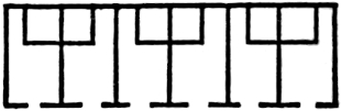 PART OF GROUND PLAN OF CASAS GRANDES CHIHUAHUA.
One class of apartments, however, attracted his especial attention,
from the fact that they were evidently designed for granaries. They
were arranged along one 278of the main walls, and measured twenty feet in
length by ten in breadth. They were connected by doorways “with a small
inclosure or pen in one corner, three or four feet high.” Numerous long
and narrow apartments, too contracted for sleeping or dwelling-rooms,
lighted by circular apertures in the upper walls, are supposed to have
been devoted to the same use. Large inclosures, too extensive in their
dimensions ever to have been roofed, evidently were used as courts.
Two hundred feet west of the Casas, on the plateau, are the remains of
a building about 150 feet square, divided into compartments, as shown
in the accompanying plan:
PART OF GROUND PLAN OF CASAS GRANDES CHIHUAHUA.
One class of apartments, however, attracted his especial attention,
from the fact that they were evidently designed for granaries. They
were arranged along one 278of the main walls, and measured twenty feet in
length by ten in breadth. They were connected by doorways “with a small
inclosure or pen in one corner, three or four feet high.” Numerous long
and narrow apartments, too contracted for sleeping or dwelling-rooms,
lighted by circular apertures in the upper walls, are supposed to have
been devoted to the same use. Large inclosures, too extensive in their
dimensions ever to have been roofed, evidently were used as courts.
Two hundred feet west of the Casas, on the plateau, are the remains of
a building about 150 feet square, divided into compartments, as shown
in the accompanying plan:
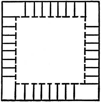 GROUND PLAN OF ONE OF THE CASAS GRANDES AT CHIHUAHUA.
Between this edifice and the main building,
are three mounds of loose stones about fifteen feet high, which the
explorers did not have time to open. For a distance of twenty leagues
and covering an area of ten leagues wide along the Casas Grandes and
Janos Rivers, according to García Condé, are ruins resembling small
mounds, from which jars, pottery in various forms, painted with white,
blue and scarlet colors, corn-grinders (metates), and stone-axes have
been taken. If this region was ever occupied by the Aztecs, even
temporarily, this latter class of remains might more properly be
attributed to them, than the Casas Grandes. Innumerable fragments of
pottery, superior to that now manufactured by the Mexicans, are strewn
everywhere in the neighborhood of the Casas Grandes. The decoration is
in black, red or brown, on a white or reddish ground. Several graceful
and highly artistic vases have been collected about the ruins, and
stone metates, nicely hewn, have been recovered in perfect condition.
On the summit of the highest mountain, ten miles south-west of the
ruins, stands an ancient fortress of stone, the walls of which are
said by the writer in the Album Mexicano to have been from
eighteen to twenty feet thick. The fort, which is attributed to the
occupants of the Casas Grandes, was two or three stories, and in the
centre had a high mound for the purposes of observation. Clavigero, who
describes the fort and all of the ruins from hearsay,279 falls into the
error of supposing the Casas to have also been constructed of stone. A
short distance from the point where the 111° (meridian) of longitude
crosses the Gila River, in Southern Arizona, in the valley occupied
farther westward by the Pima villages, stands the most famous ruin of
all the Western remains. The Casa Grande, otherwise named the Casa de
Montezuma, has attracted the attention of and furnished a fruitful
subject for most writers on Mexican antiquity, the majority of whom,
however, have contributed nothing to our knowledge of the history or
uses of the edifice. Of describers at second-hand, Mr. Bancroft has
cited thirty-four authors, according to our reckoning, and to this
number the reader must add that author’s account and ours. This fact
is an admonition to us to confine ourselves to the briefest possible
statement of facts, for certainly the thirty-sixth repetition of
the accounts furnished by two or three original explorers would be
altogether inexcusable, were it not for the inseparable relation of the
Gila Casas to the remains to be described farther on. Mr. Bancroft has
treated the bibliography of the subject in his usually comprehensive
manner,[442] and it only remains for us to refer the reader to the
original descriptions. The first of these was written by Padre Mange,
the secretary of Padre Kino, on the latter’s tour of visitation to
the missions of the region in 1697.[443] Lieutenant C. M. Bernal, of
the same expedition, adds also a description.[444] Padre Sedelmair,
who visited the ruin in 1744, copies literally Mange’s description
in his account of the Casas.[445] Father Font, who, in company with
Father Garcés, made an expedition conducted by Captain Anza to the
Gila and the missions farther north, left a diary—now preserved in
the original, in the archives at Guadalajara—from which Mr. Bartlett
translated and published an extensive description280 of the Casas.[446]
Of later writers, only four wrote from personal observation, namely,
Emory[447] and Johnston,[448] of General Kearney’s Military Expedition
to California in 1846; Bartlett[449] in 1852, and Ross Browne in
1863.[450] These are the only original sources of information on the
Casa Grande of the Gila, of which Bartlett’s account may be said to
be the best. However, Bancroft has contributed much to facilitate the
study of the subject by his addition of a full literary apparatus.
GROUND PLAN OF ONE OF THE CASAS GRANDES AT CHIHUAHUA.
Between this edifice and the main building,
are three mounds of loose stones about fifteen feet high, which the
explorers did not have time to open. For a distance of twenty leagues
and covering an area of ten leagues wide along the Casas Grandes and
Janos Rivers, according to García Condé, are ruins resembling small
mounds, from which jars, pottery in various forms, painted with white,
blue and scarlet colors, corn-grinders (metates), and stone-axes have
been taken. If this region was ever occupied by the Aztecs, even
temporarily, this latter class of remains might more properly be
attributed to them, than the Casas Grandes. Innumerable fragments of
pottery, superior to that now manufactured by the Mexicans, are strewn
everywhere in the neighborhood of the Casas Grandes. The decoration is
in black, red or brown, on a white or reddish ground. Several graceful
and highly artistic vases have been collected about the ruins, and
stone metates, nicely hewn, have been recovered in perfect condition.
On the summit of the highest mountain, ten miles south-west of the
ruins, stands an ancient fortress of stone, the walls of which are
said by the writer in the Album Mexicano to have been from
eighteen to twenty feet thick. The fort, which is attributed to the
occupants of the Casas Grandes, was two or three stories, and in the
centre had a high mound for the purposes of observation. Clavigero, who
describes the fort and all of the ruins from hearsay,279 falls into the
error of supposing the Casas to have also been constructed of stone. A
short distance from the point where the 111° (meridian) of longitude
crosses the Gila River, in Southern Arizona, in the valley occupied
farther westward by the Pima villages, stands the most famous ruin of
all the Western remains. The Casa Grande, otherwise named the Casa de
Montezuma, has attracted the attention of and furnished a fruitful
subject for most writers on Mexican antiquity, the majority of whom,
however, have contributed nothing to our knowledge of the history or
uses of the edifice. Of describers at second-hand, Mr. Bancroft has
cited thirty-four authors, according to our reckoning, and to this
number the reader must add that author’s account and ours. This fact
is an admonition to us to confine ourselves to the briefest possible
statement of facts, for certainly the thirty-sixth repetition of
the accounts furnished by two or three original explorers would be
altogether inexcusable, were it not for the inseparable relation of the
Gila Casas to the remains to be described farther on. Mr. Bancroft has
treated the bibliography of the subject in his usually comprehensive
manner,[442] and it only remains for us to refer the reader to the
original descriptions. The first of these was written by Padre Mange,
the secretary of Padre Kino, on the latter’s tour of visitation to
the missions of the region in 1697.[443] Lieutenant C. M. Bernal, of
the same expedition, adds also a description.[444] Padre Sedelmair,
who visited the ruin in 1744, copies literally Mange’s description
in his account of the Casas.[445] Father Font, who, in company with
Father Garcés, made an expedition conducted by Captain Anza to the
Gila and the missions farther north, left a diary—now preserved in
the original, in the archives at Guadalajara—from which Mr. Bartlett
translated and published an extensive description280 of the Casas.[446]
Of later writers, only four wrote from personal observation, namely,
Emory[447] and Johnston,[448] of General Kearney’s Military Expedition
to California in 1846; Bartlett[449] in 1852, and Ross Browne in
1863.[450] These are the only original sources of information on the
Casa Grande of the Gila, of which Bartlett’s account may be said to
be the best. However, Bancroft has contributed much to facilitate the
study of the subject by his addition of a full literary apparatus.
From all of these we draw the facts without further citation. Two and a half miles south of the Gila, on a slightly elevated plateau, stands the remains of the Casa Grande surrounded with a growth of mesquite trees. The ascent from the river bottom is so slight and gradual that its former inhabitants had constructed acequias between the river and the buildings. Mr. Bartlett found three edifices within a space of one hundred and fifty yards. The larger one only was in a fair state of preservation. Its four outer walls and most of the inner ones were standing. Three storeys were plainly marked by the ends of the beams remaining in the walls or by the cavities which they once occupied. No doubt the building was one story, at least, higher than this indicated, as the upper walls have crumbled away considerably and filled the first story with disintegrated adobe and a mass of rubbish. The central portion or tower furthermore rises eight or ten feet higher than the outer walls, and may have formed another story above the main building. At their base, the walls are between four or five feet in thickness, rising perpendicular on the inside, but on the outside tapering towards the top in a curved line.
The material of the walls consists of blocks of adobe, prepared as in
the Casas Grandes of Chihuahua, in position on the walls, probably
in boxes two feet high and four feet long; after the mud had dried
sufficiently, the box was moved further along the walls and refilled.
Some difference of opinion has existed as 281to the color of the mud
employed, though all admit it to be that of the surrounding valley.
Mr. Bancroft gives some attention to this point, and observes that
Bernal pronounced it “white clay,” and that according to Johnston it
is also white with an admixture of lime from the vicinity. Mr. Hutton,
a civil engineer who had thoroughly examined them, reported to Mr.
Simpson that the surrounding earth was of a reddish color, but the
admixture of pebbles with the mud gave the Casa a whitish appearance in
certain reflections. Mr. Bancroft seeks by this argument to identify
this building with Castañeda’s Chichilticale, which is described as
having been built of red earth.[451] The outer sides of the walls were
finished with a plaster similar to that which composed the blocks,
but the inner side was covered with hard finish of such fine quality
that when visited they still retained their polish after centuries of
exposure. It is estimated that the edifice must have stood a hundred
years at least prior to its discovery by the Spaniards. The inner walls
are slightly thinner than the outer ones, and divide the building
into five apartments, as shown in Mr. Bartlett’s ground plan. The
building measures fifty feet in length by forty in width.
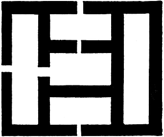 Ground Plan.
The three central rooms indicated are each about eight by fourteen feet, while
those at each end of the edifice are ten by about thirty-two feet. The
doorways indicated in the plan are three feet wide by five feet high,
except that in the western façade, which is only two feet wide and
seven or eight feet high. The main part of the edifice was 282probably
thirty feet high, while the tower rose still ten feet higher. Padre
Kino found a floor in an adjoining ruin still perfect, the supporting
timbers of which were round and about five inches in diameter, while
the floor proper was formed by placing cross-sticks on the joist and
covering them with a layer of adobe. Mr. Browne observed the marks of
a blunt axe still plainly visible in the timbers of cedar or sabine
which had been thus employed, while their charred ends furnish the
only clue to the cause of the ruin of the edifice, a fact suggestive
of the ravages of the savage Apaches. No stairways or other means of
ascent were discovered, and it is inferred that ladders were employed
upon the outside as among the modern Pueblos. Near the main building,
to the south-west, Mr. Bartlett discovered another Casa in ruins,
and with difficulty traced its ground plan; while a third was so
completely decayed as to leave no certain outline of its form. To the
north-west about two hundred yards, was a circular embankment eighty
or one hundred yards in circumference, which Mr. Bartlett supposes to
have been used as a stock inclosure. A few yards farther north Mr.
Johnston observed a terrace, two hundred by three hundred feet and
five feet high, and having a summit platform seventy-two feet square,
from which an excellent view of the valley is afforded. This monument
is unlike any other found among the New Mexican remains. The entire
valley is strewn with heaps of rubbish and ruined adobe edifices, which
indicate that once the whole region was thickly populated by this
remarkable people. Mr. Bartlett found broken metates (corn-grinders),
and innumerable fragments of pottery painted tastefully with red,
white, lead color, and black. The figures were geometrical, and many
of the vessels had been decorated on the inside—a practice not in
vogue with the modern peoples of the Gila Valley. The finish was also
far superior to that of modern pottery. The Casa Grande, when last
observed by Mr. Browne, was fast going to pieces, the moisture having
undermined some parts of the outer walls, which were only kept erect by
their great thickness. In 1873, Mr. Bancroft learned that the edifice
was still standing, but it is evident that it must soon share the fate
of its fallen283 neighbors. It is certain that this Pueblo civilization
spread itself over a large tract of country north of the Gila Valley
in the basin of the Rio Salado or Salinas, the principal tributary of
the Gila. Numerous buildings similar to those previously described,
have been noticed by different writers on the Rio Salado and its
tributaries. The ruins of large edifices surrounded by smaller ones are
described by Sedelmair (discovered in 1744) as standing between the
Gila and Salado.[452]
Ground Plan.
The three central rooms indicated are each about eight by fourteen feet, while
those at each end of the edifice are ten by about thirty-two feet. The
doorways indicated in the plan are three feet wide by five feet high,
except that in the western façade, which is only two feet wide and
seven or eight feet high. The main part of the edifice was 282probably
thirty feet high, while the tower rose still ten feet higher. Padre
Kino found a floor in an adjoining ruin still perfect, the supporting
timbers of which were round and about five inches in diameter, while
the floor proper was formed by placing cross-sticks on the joist and
covering them with a layer of adobe. Mr. Browne observed the marks of
a blunt axe still plainly visible in the timbers of cedar or sabine
which had been thus employed, while their charred ends furnish the
only clue to the cause of the ruin of the edifice, a fact suggestive
of the ravages of the savage Apaches. No stairways or other means of
ascent were discovered, and it is inferred that ladders were employed
upon the outside as among the modern Pueblos. Near the main building,
to the south-west, Mr. Bartlett discovered another Casa in ruins,
and with difficulty traced its ground plan; while a third was so
completely decayed as to leave no certain outline of its form. To the
north-west about two hundred yards, was a circular embankment eighty
or one hundred yards in circumference, which Mr. Bartlett supposes to
have been used as a stock inclosure. A few yards farther north Mr.
Johnston observed a terrace, two hundred by three hundred feet and
five feet high, and having a summit platform seventy-two feet square,
from which an excellent view of the valley is afforded. This monument
is unlike any other found among the New Mexican remains. The entire
valley is strewn with heaps of rubbish and ruined adobe edifices, which
indicate that once the whole region was thickly populated by this
remarkable people. Mr. Bartlett found broken metates (corn-grinders),
and innumerable fragments of pottery painted tastefully with red,
white, lead color, and black. The figures were geometrical, and many
of the vessels had been decorated on the inside—a practice not in
vogue with the modern peoples of the Gila Valley. The finish was also
far superior to that of modern pottery. The Casa Grande, when last
observed by Mr. Browne, was fast going to pieces, the moisture having
undermined some parts of the outer walls, which were only kept erect by
their great thickness. In 1873, Mr. Bancroft learned that the edifice
was still standing, but it is evident that it must soon share the fate
of its fallen283 neighbors. It is certain that this Pueblo civilization
spread itself over a large tract of country north of the Gila Valley
in the basin of the Rio Salado or Salinas, the principal tributary of
the Gila. Numerous buildings similar to those previously described,
have been noticed by different writers on the Rio Salado and its
tributaries. The ruins of large edifices surrounded by smaller ones are
described by Sedelmair (discovered in 1744) as standing between the
Gila and Salado.[452]
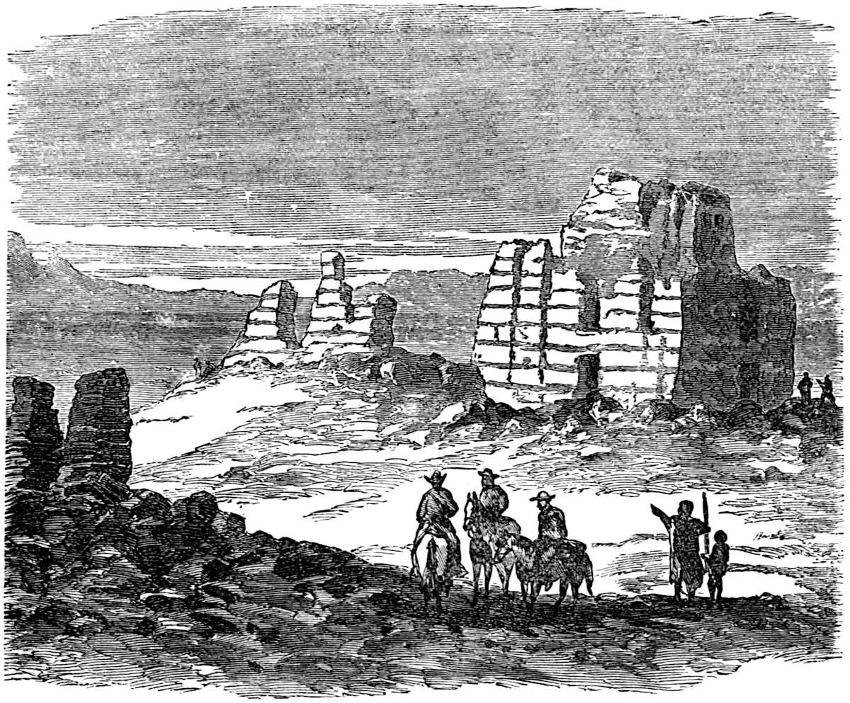
Velarde has also cited the remains of similar structures at the junction of Salado and Verde and of the Salado and Gila.[453] We cannot refer to all of the remains reported in this region, 284especially since most of them are indescribable and shapeless heaps of ruins. One edifice, however, was observed by Mr. Bartlett, two hundred feet in length by sixty or eighty feet in width; and from the accumulation of debris, it is estimated that the edifice must have been three or four stories in height. This was but one of several similar heaps of ruins observed in the immediate vicinity. This locality, distant thirty-five miles from the river’s mouth, was evidently at one time the site of a populous city. The remains of numerous works, probably of a public character, such as irrigating canals—one of which is now more than twenty feet wide and four feet deep and several miles long, in the construction of which it was necessary to cut down the bank of the plateau—occur in considerable numbers. The whole region is strewn with fragments of broken pottery of fine workmanship.[454] M. Leroux, in 1854, discovered on the Rio Verde ruins of stone houses and regular fortifications which did not appear to have been occupied for centuries. The walls were of solid masonry of rectangular form, usually from twenty to thirty paces in length, and the style of architecture similar to that of the Casa Grande of the Gila. Still there was sufficient resemblance to the Pueblos of the Moquis to indicate a transition from the southern to the northern style of Pueblo dwelling. The sudden change in the material employed—that from adobe to stone in large blocks, well hewn—is rather remarkable. The ruins are found with more or less continuity between Fort McDowell and Prescott.[455] Mr. Bancroft, after citing the above, expresses regret at his inability to secure information in the possession of officers in the Arizona service.[456]
Lieutenant Whipple describes extensive ruins on the small streams forming the head-waters of the Rio Verde. Both stone and adobe structures were numerous, and the walls usually were found to be about five feet thick.[457] Emory has described some 285Pueblo buildings of singular structure on the upper Gila and its tributaries; most interesting of these is one with a labyrinthine plan of inner circular walls. The region also abounds in rock inscriptions of a rude though no doubt conventional character.[458] It is quite natural to suppose that remains of this ancient people would have been found extensively on the greatest river of the region—the Colorado. Mr. Bancroft passes the subject with the statement that “no relics of antiquity are reported by reliable authorities,” and fitly explains that it is unlikely, in view of the peculiarity of the region, that none will ever be found in the immediate vicinity of the river.[459] Whipple and his associates state that “upon the lower part of the Rio Colorado no traces of permanent dwellings have been discovered.”[460]
Since the publication of Mr. Bancroft’s fourth volume, the public has been made acquainted with the details of Major J. W. Powell’s exploration of the Grand Cañon of the Colorado.[461] The descent of the river was accomplished by the Major and his companions in the summer of 1869, amid dangers so appalling and privations so distressing, that we need not hesitate in pronouncing it an exhibition of heroism having few parallels in the history of exploration. The Major has since repeated his perilous journey of which we have enjoyed the pleasure of a verbal description in part from the explorer himself. Groups of ruins were discovered in the gloomy depths of the Grand Cañon at three different points. In referring to them we will reverse the order in which they were discovered. A hundred or more miles (for we are unable to estimate the distance from the account) above the Virgen River, where the granite walls rise perpendicularly from the water’s edge thousands of feet, the cañon widened somewhat and a considerable group of ruined buildings were discovered on a terrace of trap. There had evidently286 been quite a village in that solitary spot, shut in by hundreds of miles of granite walls either up or down the river’s course. Mealing stones and fragments of broken pottery were scattered about the ruins, and so many beautiful flint chips that the discoverers conjectured that it might have been the home of an ancient arrow-maker. Major Powell found on a natural shelf in the rock, back of the ruin, a globular basket, badly broken, and so decayed that when taken up it fell to pieces.[462] Some distance farther up the river, the grim walls of more than a mile in height parted to admit the clear waters of a stream named by the explorers “Bright Angel River.” In a little gulch above the creek the foundations of two or three Pueblo houses were discovered. They were built of irregular cut stones, laid in mortar. An old, deeply-worn mealing stone and a great quantity of pottery were found, and old trails were observed worn into the rock.[463]
It cannot fail, however, to excite the wonder of the reader to learn that Major Powell found ruined pueblos hundreds of miles 287farther up that dismal, almost subterranean river. Not far below the foot of the Cataract Cañon, and a considerable distance above Escalante River, in Southern Utah, the explorers discovered on a wall two hundred feet above the river, but removed from the water by a narrow plain, an old stone house of good masonry. The stones were laid in mortar with much regularity. It had been a three-story building, the first of which still remained in good condition, the second being much broken, and but little being left of the third. Flint chips, beautiful arrow-heads and broken pottery abounded in the vicinity. The faces of the cliffs were also covered with etchings. Fifteen miles farther down the river another group was discovered, the principal building of which was in the shape of an L, with five rooms on the ground floor; one in the angle and two in each wing. In the centre of the angle there was a deep excavation, doubtless an underground chamber for religious services, known as an Estufa. Major Powell considers these remains the work of a branch of the people now occupying the province of Tusayan in northern Arizona. These Moqui peoples will be noticed farther on. In the neighborhood of the last-named ruin, the Major found a tall, pyramidal work of nature, formed by smooth rock-mounds, rising one above another. On climbing this he observed that this natural eminence had been used as an outlook by the people of the Pueblo. A stairway cut in the rock by human hands and an old ladder resting against a perpendicular rock were discovered.[464]
The Colorado Chiquito and its tributaries flows through the very heart of the Pueblo country. One hundred miles above its junction with the Rio Colorado, Whipple, Sitgreaves and others, found numerous ruins, crowning nearly every prominent point in the valley. The pottery of the region is unlike that usually met with, in that it is ornamented with 288impressions and raised work, instead of being painted.[465] Forty miles farther up the river colossal ruins were discovered standing on the summit of a sandstone bluff. The walls, such as remained standing, were ten feet thick, while the building measured 360 feet in length by 120 in width.[466] With the exception of the remains of stone-houses, at the junction of the Rio Puerco with the Colorado Chiquito, the only aboriginal remains reported are pottery, scattered arrow-heads and numerous rock inscriptions. The next tributary of the Colorado Chiquito—the Zuñi River—is celebrated because of its ancient and modern Pueblo structures. For fifty miles from the mouth of the Zuñi, the antiquarian who could, might read the history of this ancient people, spread out upon the imperishable cliffs—the parchment of Nature’s children. Within eight miles of the inhabited Pueblo towns, numerous ruins are encountered.[467] Here, within a few miles, the almost mythical “seven cities of Cibola,” described by Coronado in 1540, and by Marco de Niça the year previous, are demonstrated to have been situated.[468] Zuñi itself is the Granada of the devoted and romantic conquerors. In the centre of a plain upon a commanding eminence, stands the inhabited Pueblo of Zuñi. Its frontage is upon the river of the same name, while but a short distance in the background, the mesa terminates in tall cliffs of metamorphic rock several hundred feet high. The town is built in blocks, with terrace-shaped houses, usually three stories high, in which the lower stories do service as the platform for those immediately following them. Access is obtained by means of ladders reaching to the roof or terrace, formed upon the first story of each of the houses. The town is very compactly built, many of the streets passing under the upper stories of houses. The whole is divided into four squares, and the houses in each are continuously joined 289together. The building material employed is stone, plastered with mud.[469] A little more than two miles south-east of Zuñi, the ancient ruined Pueblo of the same name is situated on an elevated mesa of a mile in width, the precipitous descent from which, upon all sides, measures a thousand feet. The ruins of old Zuñi are surrounded with a growth of cedars, and cover several acres of ground. The walls, constructed of small sandstone blocks laid in mud-mortar, are only eighteen inches thick and are sadly dilapidated from age, only twelve feet marking their highest point of present elevation. Still, there is a deeper mystery about this antiquated ruin, for beneath the walls now standing, others are found of a more ancient city, whose walls were six feet thick, which perished either of age or by the hand of the destroyer, before the present was begun. The ascent to the ruin is a winding and difficult path, guarded with stone battlements at different points. At a sacred spring near Zuñi, Whipple found vases standing inverted upon an adobe wall. “Many of these were white, well-proportioned, and of elegant forms. Upon their inner and outward surfaces they were curiously painted to represent frogs, tadpoles, tortoises, butterflies, and rattlesnakes.” The tufted snakes on one of the vases are pronounced almost unique in America.[470] Twelve miles above Zuñi, at Ojo del Pescado, four or five ruined towns are found, but so badly decayed as to furnish little clue to their plan. Two of them, however, are constructed elliptically around a spring, and present a circumference of about 800 to 1000 feet. Two-thirds of a mile down the river, ruined pueblos in a fair state of preservation, with two stories standing, are described as covering an area of 150 by 200 yards. At the time of Möllhausen’s visit, the roofs and fire-places were in quite good condition.[471] 290A square estufa, still under roof, and numerous rock inscriptions, were observed. In this instance we are furnished with abundant evidence that the destruction of this people never was a wholesale one, but that gradually they are succumbing to their unpropitious surroundings—a land which is fast becoming a howling wilderness, with its scourging sands and roaming savage Bedouin—the Apaches. One more locality in this region merits attention. Eighteen miles south-east of the sources of the Zuñi River, stands a sandstone rock three hundred feet high, which at a distance resembles a Moorish fortress. The Spaniards named it El Moro. It is also known as “Inscription Rock,” because of the Spanish and Indian inscriptions which cover its smooth face. Simpson has copied some of them, which is quite fortunate, since later explorers have found many of them almost effaced. The ruins of two buildings are found on the summit, which is reached by a difficult path. The large group is in the form of a rectangle, measuring 307 by 206 feet. The walls, faced with sandstone blocks, remain standing to the height of six and eight feet. The other group is separated from the first by a deep ravine, and is found upon the very brink of the outer precipice. A circular estufa thirty-one feet in diameter was also noticed. Cedar timbers were found in the walls, and broken pottery in abundance.[472] About one hundred miles in a north north-easterly direction from Zuñi, in longitude 108° and latitude 36°, the most remarkable of the pueblo ruins are situated. These are on the north bank of the Chaco River, a tributary of the Rio San Juan, a stream the affluents of which are noted for a greater number of pueblo and cliff-dwellers’ ruins than are found elsewhere. Lieutenant Simpson has described the ruins of the Chaco, eleven in number, occurring within a distance of twenty-five miles. The first of these met with in 291coming from the south is called at present (we presume in the absence of the knowledge of the true name) the Pueblo Pintado. The most remarkable feature of this great structure is the beauty and precision of the masonry. The fine, hard gray sandstone blocks are quite uniformly three inches in thickness and are laid without mortar, always breaking joints. The crevices between the ends of the blocks are filled with very thin pieces of stone, not over a quarter of an inch thick. The walls of the pueblo now standing, are at their greatest height, thirty feet, and furnish evidence from the marks of the floor-timbers that the building was three stories. The walls are between two and three feet thick at the base, though this is diminished with each succeeding story by a jog of a few inches, upon which the flooring timbers rest. These are from six to eleven inches in diameter, always of uniform size in the same room. On these beams small round sticks are laid transversely, and these in turn covered with thin cedar strips, lying transversely of the round sticks. In some rooms the chinks in the floor were filled with small stones and the whole covered with a layer of mortar. One room, however, had a floor of smooth cedar boards, seven inches wide and three-quarters of an inch thick. The edges and ends were squarely cut, and their smooth surfaces indicate that they were polished by being rubbed with flat stones. The size of these ruins may be better understood when we state that five buildings measured in circumference respectively 872, 700, 1700, 1300 and 1300 feet; while the number of rooms, still well-defined on the ground floor of each, is 72, 99, 112, 124 and 139. Some of these buildings undoubtedly had as high as a thousand rooms, while the smallest of them probably contained half that number. The smallest apartments are five feet square, while the largest are eight by fourteen feet. The ground plan of the buildings of this valley have three tiers of rooms, while one building, the Pueblo Bonito, has four tiers of apartments. The usual form of the buildings corresponds to three sides of a rectangle, with the fourth (one of the long sides of the figure) left unbuilt (except that in some cases it was inclosed by a semicircular stone wall), thus affording a partially enclosed court of large dimensions.292 The exterior walls are in all cases perpendicular, thus differing from the pueblos farther south. The terracing in the Chaco structures is upon the inside (court side) of the buildings.
In some of the buildings, however, the angles of the quadrangle are rounded, and in one instance—that of the Peñasca Blanco—the structure is elliptical. From the nature of the plan of any of these buildings it is evident that many of the apartments on the ground floor were dark, and were probably used for granaries and store-rooms. There are no doors whatever in the outer walls, and no windows except in the upper stories. Windows and doors opening into the courts are, on the contrary, numerous in all the stories but the first. The doors are quite small, in many cases not exceeding two and a half feet square. The lintels of the doors and windows are in most cases stone slabs, but in some instances are small round timbers tied together with withes. A remarkable feature of the construction is the presence of the Yucatan arch formed of overlapping stones, illustrations of which may be seen in our next chapter. Dr. Hammond, a companion of Lieutenant Simpson, has minutely described a room of very perfect finish.[473] Each edifice was provided with the sacred estufa, and some of the houses had as many as seven, circular in form, excavated several feet deep in the earth and enclosed with circular walls. One in the Pueblo Bonito was of remarkable size, having been sixty feet in diameter, extending twelve feet below the surface and rising two or three stories high. Lieutenant Simpson found in close proximity to one of the ruins an excavation in the cliff which had been enclosed with a front wall of well-laid stone and mortar, thus associating one of the simplest of the cave-dwellings to which we shall refer presently, with one of the most extensive and perfect of the Pueblo buildings; a fact of no little value in identifying the architects of both as one and the same.[474] This introduces293 us to another class of ruins, which, with a couple of exceptions, were not discovered prior to the summer of 1874. We refer to the cliff-dwellings, the most remarkable habitations ever occupied by man. The descriptions of them seem more suitable to form parts of the most romantic works of fiction than of sober and scientific memoirs from the pens of government explorers. One hundred miles westward from the ruins of the Chaco lies the Chelly Valley or Cañon. The Chelly is one of the tributaries of the Rio San Juan from the south, having its source in the Navajo country. The Chelly Cañon is described as from one hundred and fifty to nine hundred feet wide, with perpendicular sides between three hundred and five hundred feet high. Simpson in 1849 found several caves built up in front with stone and mortar in a side cañon. About four miles from its foot or mouth he observed on a shelf fifty feet high, accessible only by ladders, a stone ruin, the plan of which resembles that of the Chaco Valley pueblos, except that it was constructed on a considerably smaller scale. Three miles further up the cañon a double ruin of an extraordinary nature was discovered. At the base of the cañon stood an ancient pueblo in ruins, but with parts of the first and second stories still erect. Fifty feet in a perpendicular line, above and immediately back of the first edifice, in a shelf, or in the mouth of a cavern in the cañon’s walls, stood another building constructed of sandstone and mortar, and measuring one hundred and forty-five by forty-five feet, with walls eighteen feet high still standing. Broken pottery was plentiful, as around all the ruins we have described. The building was lighted by square windows and provided with a circular estufa.[475]
The most surprising results in all the history of archæological exploration in this country were obtained in September, 1874, by a party connected with the United States Geological and 294Geographical Survey Corps. This party was composed of only three persons, Mr. W. H. Jackson and Mr. Ingersoll with their guide, Captain John Moss, a resident of La Plata, who possessed both a knowledge of the country and an acquaintance with the language of the Indians. In the south-western corner of Colorado, the cañons of two of the tributaries of the San Juan were examined, namely, the valleys of the Rivers Mancos and McElmo.[476] The former stream rises among the western foothills of the Sierra La Plata, and flows south-westerly through fertile valleys to a great table-land known as the “Mesa Verde,” thence to the San Juan near the crossing of the boundary lines of the four territories. In the upper valley of the Mancos, between the mountains and the mesa, groups of undistinguishable ruins were discovered in great numbers. An examination of the shapeless heaps revealed foundations composed of great square blocks of adobe. The great multitude of these heaps of masonry overgrown with pines indicates a general and unsparing destruction of the houses of the people who once inhabited the valley, at the hands of their enemies. The cañon through the Mesa Verde is quite uniformly two hundred yards wide, with perpendicular walls of grayish cretaceous sandstone ranging from six hundred to one thousand feet in height. Numbers of the mounds of ruined adobe were met with at each advance into the cañon, and upon promontories jutting out towards the stream, remains of stone walls were seen as high as fifty feet from the river’s bed. Every step revealed great quantities of broken pottery, and with this statement we will let the subject of these fragmentary relics of the by-gone civilization rest for the present.
One of the first cliff houses discovered by the explorers is a most interesting structure, the position of which, over six hundred feet from the bottom of the cañon in a niche of the wall, 295furnishes a significant commentary on the straits to which this sorely-pressed people were driven by their enemies. Five hundred feet of the ascent to this aërial dwelling was comparatively easy, but a hundred feet of almost perpendicular wall confronted the party, up which they could never have climbed but for the fact that they found a series of steps cut in the face of the rock leading up to the ledge upon which the house was built.
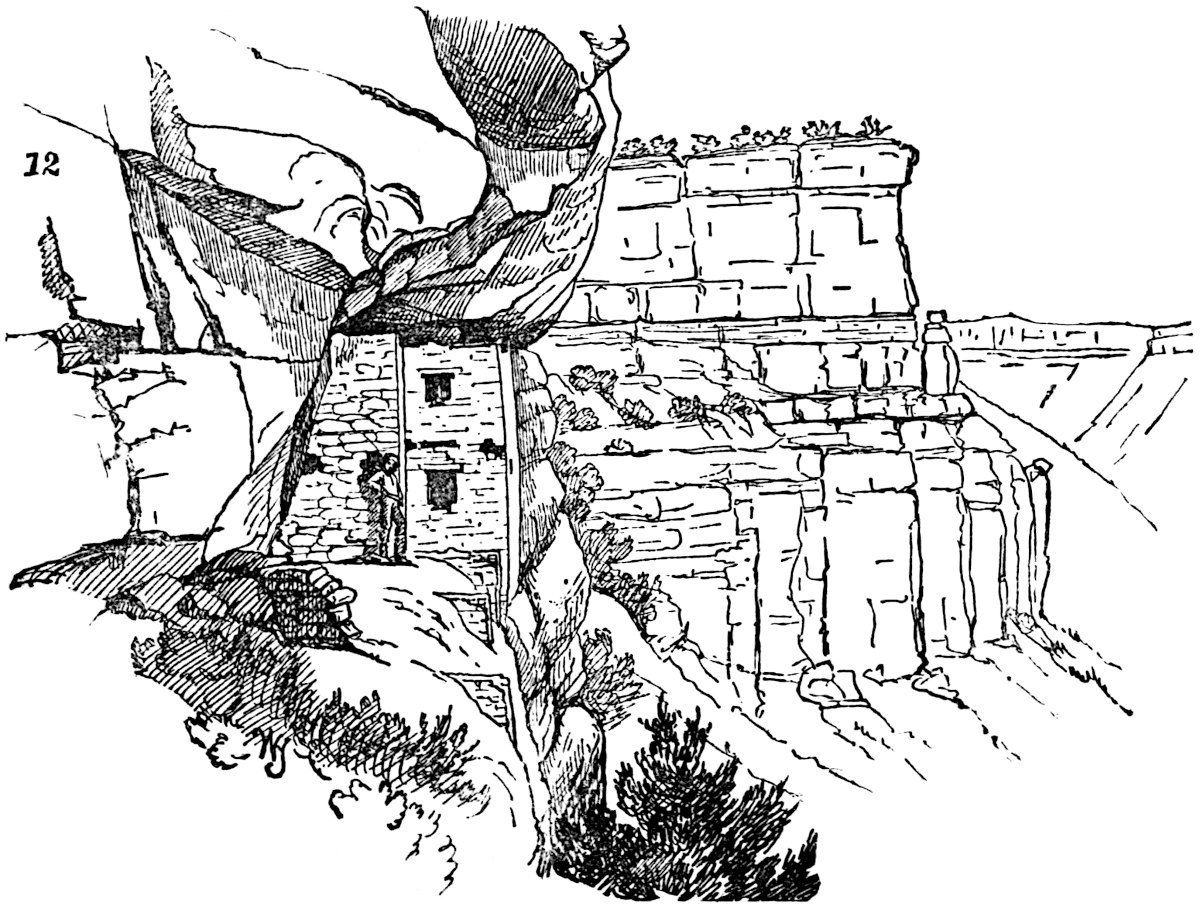
This ledge was ten feet wide by twenty feet in length, with a a vertical space between it and the overhanging rock of fifteen feet. The house occupied only half this space, the remainder having been used as an esplanade, and once was inclosed by a balustrade resting on abutments, built partly upon the sloping face of the precipice below. The house was but twelve feet high and two-storied. Though the walls did not reach up to the rock above, it is uncertain whether it ever had any other roof. The ground plan showed a front room of six by nine feet in dimensions, in the rear of which were two smaller rooms, each296 measuring five by seven feet. The left-hand room projected along the cliff, beyond the front room, in the form of an L. The rock of the cliff served as the rear wall of the house. The cedar beams upon which the upper floor had rested had nearly all disappeared. The door opening on the esplanade was but twenty by thirty inches in size, while a window in the same story was but twelve inches square. A window in the upper story, which commands an extended view down the cañon, corresponded in dimensions and position with the door below. The lintels of the window were small straight cedar sticks laid close together, upon which the stones rested. Opposite this window was another and smaller one, opening into a semicircular cistern, formed by a wall inclosing the angle formed by the side wall of the house against the rock, and holding about two and a half hogsheads. The bottom of the reservoir was reached by descending on a series of cedar pegs about one foot apart, and leading downward from the window. The workmanship of the structure was of a superior order; the perpendiculars were true ones and the angles carefully squared. The mortar used was of a grayish white color, very compact and adhesive. Some little taste was evinced by the occupants of this human swallow’s nest. The front rooms were plastered smoothly with a thin layer of firm adobe cement, colored a deep maroon, while a white band, eight inches wide, had been painted around the room at both floor and ceiling. An examination of the immediate vicinity revealed the ruins of half a dozen similar dwellings in the ledges of the cliffs, some of them occupying positions the inaccessibility of which must ever be a wonder, when considered as places of residence for human beings. Half-way down the cañon, one of Mr. Jackson’s party discovered a rather remarkable watch-tower, which, because of the accumulations of débris, he was not able to accurately measure, though approximate figures were given. Since his visit, the tower has been thoroughly examined by Mr. W. H. Holmes, to whose work in this field we will refer on a future page. Mr. Holmes’ measurements and ground-plan are, therefore, substituted for those of Mr. Jackson.
The diameter of the outer wall is forty-three feet, that297 of the inner, twenty-five feet. The outer wall is still standing to the height of twelve feet at one point, and is in a fair state of preservation, with a thickness of twenty-one inches, and has the stones dressed to the curve. The ring-shaped space between the inner and outer wall is estimated to have contained ten compartments, two of which at present have complete walls. No door or window was observed in the outer wall, and it is supposed that access was obtained by means of a ladder. Two nearly rectangular openings were found connecting the outer apartments with the central part of the tower, which no doubt was used as an estufa.[477] Mr. Jackson, after leaving the tower which Mr. Holmes has so fully described (of which the above is but a condensed account), saw similar towers on a somewhat 298smaller scale. His next discovery in the face of the vertical rock, which here ran up from the bottom of the cañon and at a height of from fifty to one hundred feet, were a number of nest-like habitations, one of which is figured in the cut.
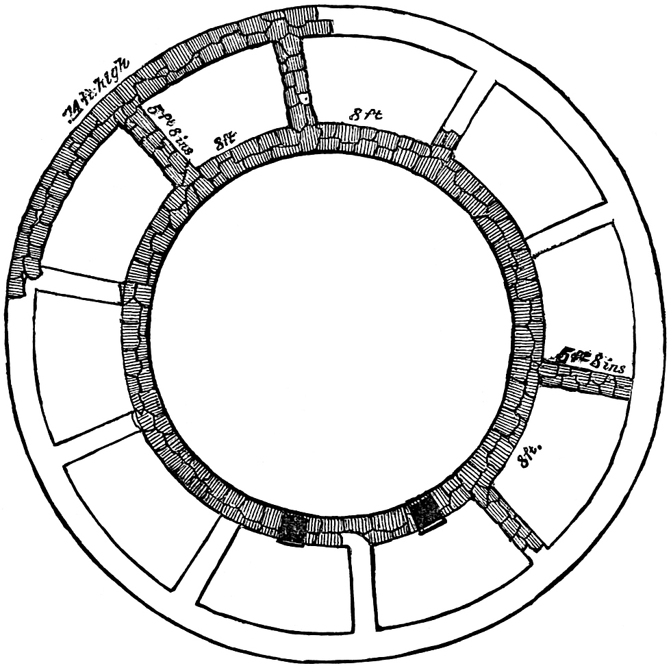
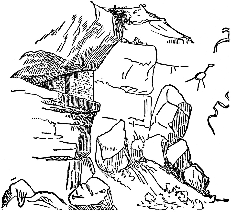
The cliff-house in this case was reached by its occupants from the top of the cañon. The walls are pronounced as firm as the rock upon which they were built. The stones were very regular in size, and the chinking-in of small chips of stone rendered the surface of the wall remarkably smooth and well finished. The dwelling measured fifteen feet in length, five feet in width, and six feet in height. A short distance below this little dwelling, five or six cave-like crevices were found walled up in front with very perfect walls, rendered smooth by chinking. Three miles farther down the cañon, the party discovered at heights ranging from six hundred and eight hundred feet above their heads, some curious and unique little dwellings sandwiched in among the crevices of the horizontal strata of the rock of299 which the bluff was composed. Access to the summit of the bluff, a thousand feet high, was obtained by a circuitous path through a side cañon, and the houses themselves could only be reached at the utmost peril—of being precipitated to the bottom of the dizzy abyss—by crawling along a ledge twenty inches wide and only high enough for a man in a creeping position. This led to the wider shelf on which the houses rested. The perfection of the finish was especially noticeable in one of these houses, which was but fifteen feet long and seven feet high, with a side wall running back in a semicircular sweep. In every instance the party found the elevated cliff-houses situated on the western side of the cañon with their outlook toward the east, while the buildings at the bottom of the cañon were indiscriminately built on both sides of the river.
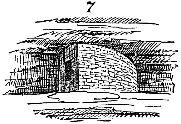
A circular watch-tower, which may be said to serve as a fair type of others met with at irregular intervals, is shown in the cut (p. 300). The tower remained standing to a height of twenty feet. Its diameter measured twelve feet and the thickness of the walls sixteen inches, the stones being of uniform size and smoothly dressed to the curve of the circle. A rectangular structure, divided into two apartments, each about fifteen feet square, once joined the tower, but now is in ruins, all but the foundation. It is supposed that this edifice was built over a large subterranean keep or place of defence. The exploring party here emerged from the cañon, and could discern, as they glanced down the valley of the Rio Mancos, which now turned towards the west, mounds of shapeless ruins at short distances from one another as far as the eye could reach.
Bearing around the Mesa to the west, the party encamped upon the site of the most extensive mass of ruins yet found in300 United States territory, “known as the Aztec Springs.” As Mr. Jackson’s description is but partial, we defer the treatment of this locality until we take up the explorations of Mr. Holmes, already mentioned. Four miles distant from “Aztec Springs,” the party reached a river-bed, dry during most of the year, and known as the McElmo, which, when it flows at all, empties into the San Juan farther to the west. On the mesa, above this river-bed, a tower resembling that first met in the Mancos was observed, but of much greater size, having a diameter of fifty feet. Adjoining the tower were the ruins of large subdivided buildings resembling the community dwellings of the Moquis and the old ruins of the Chaco. This group of ruins was very extensive and complicated, literally occupying all the available space in the vicinity.
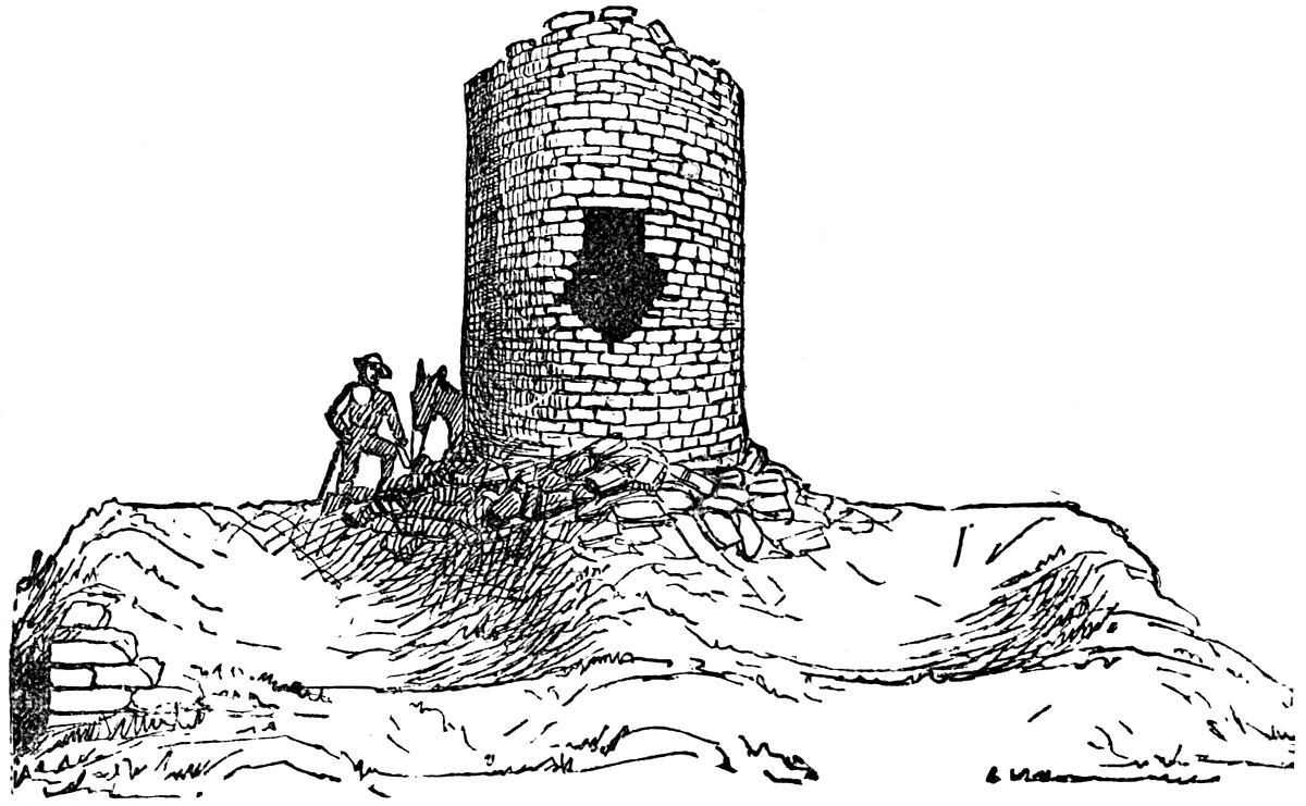
Half a dozen miles down the cañon of the McElmo, several of the little nest-like dwellings peculiar to the Mancos were seen perched forty or fifty feet above the valley. A couple of miles beyond these, the tower shown in the cut (p. 301) was discovered standing on the summit of a great block of sandstone forty feet high, and detached from the bluff back of it.
301
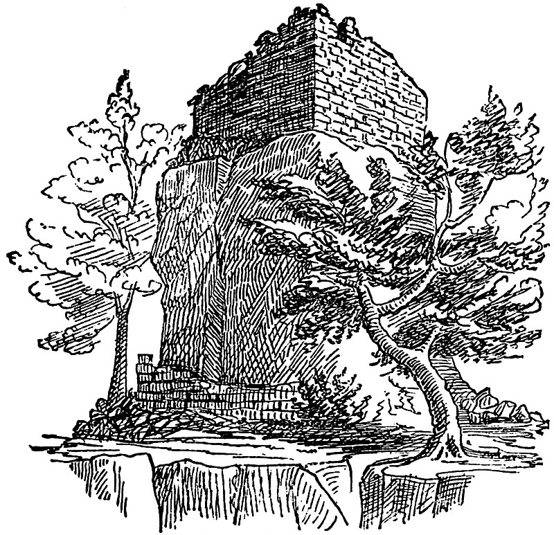
The building which surmounts this rocky pedestal is square and about fifteen feet high at present. Windows open toward the north and east, the directions from which the enemies of this people, according to tradition, came down upon them. A wall at the base of the rock is mostly in ruins and covered with débris from the building above. Immediately beyond this point the boundary line into Utah was crossed, and two or three miles distant the party came upon a very interesting group, a historic spot in the career of this ancient race. In the centre of the widening valley stands a solitary butte of dark-red sandstone, upon a perfectly smooth floor of the same, dipping gently towards the centre of the valley. This butte or cristone is about one hundred feet high and three hundred feet in length, of irregular form. All around the rock are remains of stone walls which indicate an extensive structure and complicated system of walls and towers. At the back of the rock two remains attract special attention. One wall forming the corner of a building near the base of the rock, seems to have served as an approach302 to the larger house up in the side of the butte. This structure is about eighteen feet in length and twelve feet in height, nearly reaching to the top of the rock. Part of the walls have fallen, but those standing show a finish surpassing those of any structure previously discovered in the region. In front is a single aperture eighteen by twenty-four inches. On top of the rock are remains of masonry, but too badly ruined to indicate their original form. All the crevices and irregularities in the faces of the butte had been smoothly walled up; it is supposed, to make its ascent impossible. In the vicinity a tower with a rounded corner and twelve feet in diameter by twenty feet high stood in a dry creek bed.
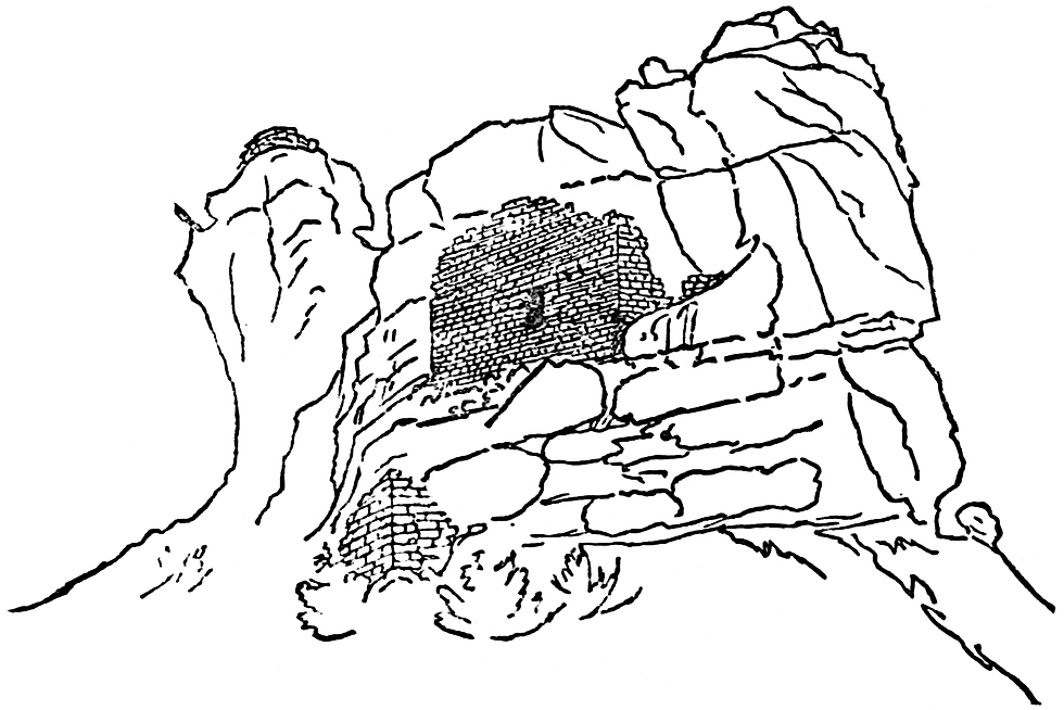
We remarked that this was a historic locality, as certainly it was if the legend obtained by Captain Moss from an old man among the Moquis is reliable. Mr. Ingersoll has rendered it in the New York Tribune for November 3d, 1874, as follows: “Formerly, the aborigines inhabited all this country we had been over as far west as the head-waters of the San Juan, as far north as the Rio Dolores, west some distance into Utah, and south and south-west throughout Arizona and on down into Mexico. They had lived there from time immemorial—since the earth was a303 small island, which augmented as its inhabitants multiplied. They cultivated the valley, fashioned whatever utensils and tools they needed very neatly and handsomely out of clay and wood and stone, not knowing any of the useful metals; built their homes and kept their flocks and herds in the fertile river-bottoms, and worshipped the sun. They were an eminently peaceful and prosperous people, living by agriculture rather than by the chase. About a thousand years ago, however, they were visited by savage strangers from the North, whom they treated hospitably. Soon these visits became more frequent and annoying. Then their troublesome neighbors—ancestors of the present Utes—began to forage upon them, and, at last, to massacre them and devastate their farms; so, to save their lives at least, they built houses high upon the cliffs where they could store food and hide away till the raiders left. But one summer the invaders did not go back to their mountains as the people expected, but brought their families with them and settled down. So, driven from their homes and lands, starving in their little niches on the high cliffs, they could only steal away during the night, and wander across the cheerless uplands. To one who has traveled these steppes, such a flight seems terrible, and the mind hesitates to picture the suffering of the sad fugitives. At the Cristone they halted and probably found friends, for the rocks and caves are full of the nests of these human wrens and swallows. Here they collected, erected stone fortifications and watch-towers, dug reservoirs in the rocks to hold a supply of water, which in all cases is precarious in this latitude, and once more stood at bay. Their foes came, and for one long month fought and were beaten back, and returned day after day to the attack as merciless and inevitable as the tide. Meanwhile, the families of the defenders were evacuating and moving south, and bravely did their protectors shield them till they were all safely a hundred miles away. The besiegers were beaten back and went away. But the narrative tells us that the hollows of the rocks were filled to the brim with the mingled blood of conquerors and conquered, and red veins of it ran down into the cañon. It was such a victory as they could not afford to gain again, and they were glad,304 when the long fight was over, to follow their wives and little ones to the south. There, in the deserts of Arizona, on well-nigh unapproachable isolated bluffs, they built new towns, and their few descendants, the Moquis, live in them to this day, preserving more carefully and purely the history and veneration of their forefathers than their skill or wisdom. It was from one of their old men that this traditional sketch was obtained.” In a side cañon, a tower eighteen feet high was seen perched on a huge block of sandstone which had fallen from the top of the mesa and lodged on a projecting shelf of rock, midway from top or bottom. Eight or ten miles westward of the McElmo, Mr. Jackson and his party discovered on a stream known as the Hovenweep, the ruins of a city. Mr. Jackson’s description is as follows: “The stream referred to sweeps the foot of a rocky sandstone ledge, some forty or fifty feet in height, upon which is built the highest and better-preserved portion of the settlement. Its semicircular sweep conforms to the ledge, each little house of the outer circle being built close upon its edge. Below the level of these upper houses some ten or twelve feet, and within the semicircular sweep, are seven distinctly marked depressions, each separated from the other by rocky débris, the lower or first series probably of small community houses. Upon either flank, and founded upon rocks, are buildings similar in size and in other respects to the large ones on the line above. As paced off,305 the upper or convex surface measured one hundred yards in length. Each little apartment is small and narrow, averaging six feet in width and eight feet in length, the walls being eighteen inches in thickness. The stones of which the entire group is built are dressed to nearly uniform size and laid in mortar. A peculiar feature here is in the round corners, one at least appearing upon nearly every little house. They are turned with considerable care and skill, being true curves solidly bound together.”
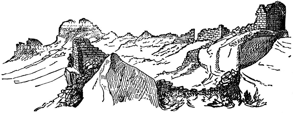
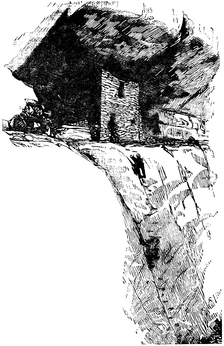
Here the labors of Mr. Jackson’s party ended for the year 1874, but the work was again resumed in July of the following year with even richer results. Two parties were put in the field by the Government Surveying Corps, one headed by Mr. Jackson and the other by Mr. W. H. Holmes, geologists of the San Juan division of the survey for 1875. I am indebted to Prof. Hayden, United States geologist-in-charge, for the memoirs prepared by these gentlemen, with the accompanying illustrations.[478] The reader has already become acquainted with the general character of the remains of the cliff-dwellers, and it will not be necessary to repeat the descriptions of buildings or ruins similar to those already described in these pages. We shall therefore cite only the more remarkable ruins discovered by the above-named explorers. Mr. Jackson was accompanied on his second tour, by Mr. E. A. Barber, naturalist and correspondent of the New York Herald, with Harry Lee as guide and interpreter. The party resumed their labors in the arid, waterless region around the Hovenweep, and in fact the same barren characteristics are peculiar to the whole basin of the San Juan. The whole region is rapidly drying up and fast becoming a desert. Down the cañon from the pueblo of the Hovenweep, broken towers and rock shelters were passed in rapid succession. Seven miles distant from their starting-point, they found on the western side of the valley three elevated benches ranging one above another in the face of a jutting promontory, each of which contained 306houses (see illustration, page 307). The first bench was reached by climbing over a sloping mass of débris to a height of one hundred feet from the base of the cliff, while the upper benches were only accessible by means of a niche stairway similar to the one shown in the figure.
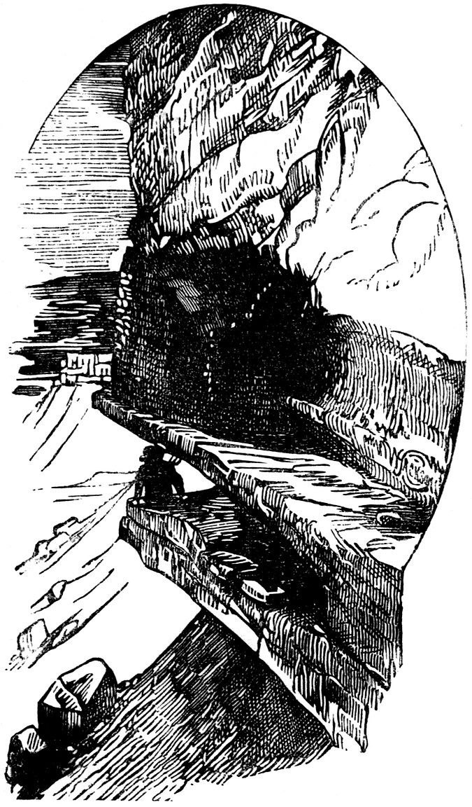
Ruins and masses of charcoal were found at the base of the rock. Numerous adobe foundations, probably of wooden buildings, always circular in form and ranging from fifteen to twenty-five feet in diameter, were met with a short distance down the cañon.307 Near the junction of the Hovenweep and McElmo cañons an inscription covers sixty feet of the face of a large rock. The figures are those of men, goats, lizards, and hieroglyphic signs. As the party proceeded in the cañon they met rock shelters and enclosures, the latter on the top of the mesa in which slabs of stone three by five feet in size were set on end. Mr. Jackson reports that a party connected with the survey corps discovered near the head of the Hovenweep, on a ledge three hundred feet long by fifty feet wide, one-third of the distance from the top of the cañon, some forty houses crowded along the shelf all in a row. On the San Juan west of the mouth of the Montezuma Cañon, upon a bench fifty feet high, Mr. Jackson found a quadrangular structure of peculiar design, as shown in the cut on page 308.
“We see that it is arranged very nearly at right angles to the river, its greatest depth on the left, where it runs back one hundred and twenty feet; the front sweeps back in a diagonal line, so that the right-hand side is only thirty-two feet in depth. The back wall is one hundred and fifty-eight feet long, and at right angles to the two sides. In the centre of the building, looking out upon the river, is an open space seventy-five feet wide, and averaging forty feet in depth, its depressed centre308 divided nearly equally by a ridge running through it at right angles to the river. We judged it to have been an open court, because there was not the least vestige of a wall in front, or on the ridge through the centre, while upon the other three sides they were perfectly distinct; although it is difficult to explain why it should have been hollowed out in the manner shown in the plan. Back of this court is a series of seven apartments of equal size, springing in a perfect arch from the heavy wall facing the court, leaving a semicircular space in the centre, forty-five feet across its greatest diameter. Each one is fifteen feet in length, and the same in width across its centre, the walls somewhat irregular in thickness, but averaging twenty inches, compact, and well laid. On the left are three rooms extending across the whole width of the building, each averaging forty-five by forty feet square; on the right only one was discernible. Back of the circle, our impression was that the walls diverged in the manner shown in the plan, although there is so much confusion resulting from the heaping up of the débris that much must be left to conjecture. There is also a slight shadow of doubt in regard to the wall facing the river on the right; it is barely possible that it extended somewhat farther out, although309 there is here a steep inclination to the brink of the bluff, and that it has become entirely obliterated by its foundations giving way. The remains of the wall above, however, led us to believe that it had been originally built in the way it is shown in the plan. Extreme massiveness is indicated throughout the whole structure by the amount of débris about the line of the walls, forming long rounded mounds four to five feet high, with the stone-work cropping out, twenty to twenty-four inches in thickness.”
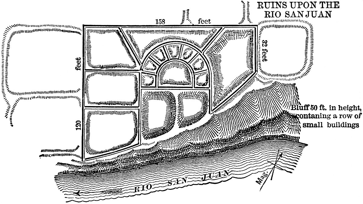
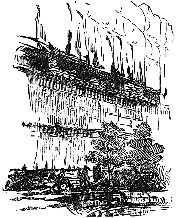
In the face of the bluff immediately under this ruin and upon a recessed bench three hundred feet long was a row of little rock-shelters, with just enough room on the ledge in front of them to admit of a promenade the entire length of the shelf. All down the valley of the San Juan, rock shelters and dwellings similar to the group shown in the cut, were met with.
In this instance the houses were situated sixty feet above the trail without any visible means of access. If ladders were used, they were made of timber taller than any of the trees now growing in the valley. Twelve miles below the Montezuma the party discovered really one of the most picturesque and wonderful of all the cliff-dwellings. On the opposite side of the river, where the bluff was two hundred feet high, near the top of the cliff, they observed a deeply receding cave with an opening nearly circular “two hundred feet in diameter, divided equally between the two kinds of rocks, reaching, within a few feet, the top of the bluff above and the level of the valley below. It runs back in a semicircular sweep to a depth of one310 hundred feet; the top is a perfect half dome, and the lower half only less so from the accumulation of débris and the thick brushy foliage, the cool dampness of its shadowed interior, where the sun never touches, favoring a luxuriant growth. A stratum of harder rock across the central line of the cave has left a bench running around its entire half circle, upon which is built the row of buildings which caught our attention half a mile away.”
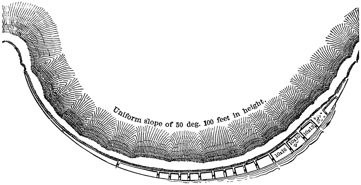
“It will be seen that the houses occupy the left-hand or eastern half of the cave, for the reason, probably, that the ledge was wider on that side, and the wall back of it receded in such a manner as to give considerable additional room for the second floor, or for the upper part of the one-story rooms. It is about fifty feet from the outer edge in to the first building, a small structure sixteen feet long, three feet wide at the outer end, and four at the opposite end; the walls, standing only four feet on the highest remaining corner, were nearly all tumbled in. Then came an open space eleven feet wide and nine deep, that served probably as a sort of workshop. Four holes were drilled into the smooth rock floor, about six feet equidistantly apart, each from six to ten inches deep and five in diameter, as perfectly round as though drilled by machinery. We can reasonably311 assume that these people were familiar with the art of weaving, and that it was here they worked at the loom, the drilled holes supporting its posts. At b, in this open space, are a number of grooves worn into the rock in various places, caused by the artificers of the little town in shaping and polishing their stone implements. The main building comes next, occupying the widest portion of the ledge, which gives an average width of ten feet inside; it is forty-eight feet long outside, and twelve high, divided inside into three rooms, the first two thirteen and a half feet each in length, and the third sixteen feet, divided into two stories, the lower and upper five feet in height. The joist holes did not penetrate through the walls, being inserted about six inches, half the thickness. The beams rested upon the sloping back-wall, which receded far enough to make the upper rooms312 about square. Window-like apertures afforded communication between each room, all through the second story, excepting that which opened out to the back of the cave. There was also one window in each lower room, about twelve inches square, looking out toward the open country, and in the upper rooms several small apertures not more than three inches wide were pierced through the wall, hardly more than peep-holes. The walls of the large building continued back in an unbroken line one hundred and thirty feet farther, with an average height of eight feet, and divided into eleven apartments, with communicating apertures through all. The first room was nine and a half feet wide, the others dwindling down gradually to only four feet in width at the other extremity. The rooms were of unequal length, the following being their inside measurements, commencing from the outer end, viz.: 12½, 9½, 8, 7½, 9, 10, 8, 7, 7, 8, 31 feet; the ledge then runs along, gradually narrowing, fifty feet farther, where another wall occurs across it, after which it soon merges into the smooth wall of the cave. The first of these rooms had an aperture leading outward large enough to crawl through; the wall around it had been broken away so that its exact size could not be determined; all the others, of which there were about two to each room, were mere peep-holes, about three inches in diameter, and generally pierced through the wall at a downward angle.” The apartments were well plastered, and in one or two places even the delicate lines on the thumbs and fingers of the plasterers had been plainly retained. At one point an entire hand had left its impress in the cement.
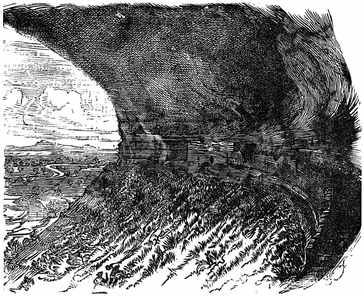
All these marks indicated that the hands of these people were much smaller than those of the explorers, and it is supposed that they were those of women and children. A circular hollow place, all begrimed and blackened by smoke, seemed to indicate the locality of a common kitchen. The surroundings of this little community of that ancient people indicated that they were well-to-do, and were probably the lords of the neighboring country. From their home in this elevated gallery, under313 nature’s arching roof of rock, they were in a position to give defiance to their enemies and enjoy the pursuit of their pastoral occupations. This unique residence was named by the explorers the Casa del Eco. Over the plateau westward, the remains of this ancient people were numerous and of the same general character as already described. The party after reaching the Cañon of the Chelly (the stream flowing, as already stated, into the San Juan from the south) found several circular caves averaging about one hundred feet in diameter and containing the ruins of old houses.
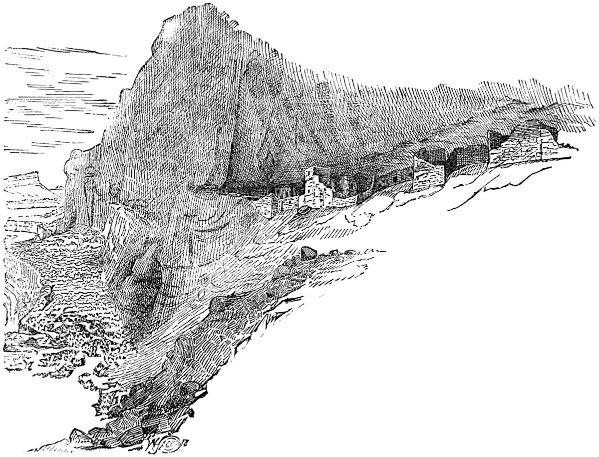
About five miles southward from the San Juan, and in a valley of the Chelly, a cave-village of considerable extent was discovered, perched upon a recessed bench about seventy feet above the valley, and overhung by a solid wall of massive sandstone, extending up over two hundred feet farther. Mr.314 Jackson describes it in detail as follows: “The left-hand side of the bench supporting the buildings sweeps back in a sharp curve about eighty feet under the bluff, and then gradually comes to the front again until, on the extreme right hand, the buildings are built upon a mass of débris, but partially protected overhead. The total length over the solidly built portion of the town is five hundred and forty-five feet, with a greater width in no place of more than forty feet. There are somewhere in the neighborhood of seventy-five rooms upon the ground-plan, with some uncertainty existing as to many of the subdivisions on the right; but in the cave-built portion every apartment was distinctly marked. Midway in the town is a circular room of heavily and solidly built masonry, that was probably meant for an estufa or council-hall; that is, if we can reasonably assume any similarity in the methods of building or worship to those of the pueblos of New Mexico. Starting from this estufa is a narrow passage running back of the line of houses on the left to a two-story group, where it ends abruptly, further access being had through the back row of rooms, or over the roofs of the lower front row, probably the latter, for it is likely that these roofs served as a platform from which to enter the rooms back of it. At the extreme end a still higher ledge occurs, with the overhanging wall coming down close over it, its outer edge enclosed by a wall, and a little store-room in its farther corner; it was reserved, probably, as an out-door working-room. All the buildings of this half are of one story, with the exception of one group, the residence probably of the chief or of some other important family in the community. The rooms just back of it are the store-rooms of the family, where the corn and squashes were put away for the winter’s consumption. Near these store-rooms, there are two half-round enclosures of stone-work, that are very likely the remains of small reservoirs or springs. The rock back of them is dug out beneath, and had, even in the dry season, when we were there, a damp appearance, as though water was not far removed, and might easily be coaxed to the surface. The front line of wall of this left side of the town is315 built upon a steep angle of smooth rock, with the interior of the apartments filled up with earth so as to make their floors level, bringing them a little below the passage-way. In two or three instances the front wall has given way, precipitating all but the back wall to the bottom of the cliffs. Holes have been drilled into the rock in a few places beneath the walls, evidently to assist in retaining them in their places. The whole front of this portion of the town is without an aperture, save very small windows, and is perfectly inaccessible, both from the solidity of the wall and the precipitous nature of the foundation-rock beneath it. Admittance was probably gained from near the circular building in the centre, by ladders or any other well-guarded approach over the rocks.”
Two miles down the Cañon of the Chelly, below the mouth of the fertile Cañon Bonito Chiquito, the house figured on page 306 was found with its niched stairway cut in the face of the rock. The house is two-storied, twenty feet in height, the lower story of which is eighteen by ten feet square, divided into two rooms. A natural reservoir of water was found in the rock only twenty rods distant. Eight miles up the Chelly they came to the cave Pueblo, seen by Simpson and mentioned on page 293. From this point it was but forty miles to the inhabited Moquis town Tegua. The explorers after visiting that interesting place returned northward again to the San Juan, reaching Epsom Creek, a tributary of the same from the north, a short distance from the mouth of the Chelly Cañon. Among a number of remains found in the Cañon of Epsom Creek, one in particular is of interest; this was the remnant of a square tower, of most perfect masonry, built upon a point of rock entirely inaccessible to the explorers.
A few miles farther up the Epsom Valley, the ruins of quite a town were discovered. “It lay upon both sides of a small, dry ravine, some twenty or thirty rods back from the bed of the creek, and consisted of a main rectangular mass sixty by one hundred feet, occupying quite an elevation, dominating all the others. Just below it and close upon the edge of the ravine, was a round tower, twenty-five feet in diameter; and seventy-five316 below that, and also close to the ravine, was a square building, twenty-feet across, nearly obscured by a thicket of piñon-trees, growing about it. On the opposite bank were two small round towers, each fifteen feet in diameter, with two oblong structures between, twelve by fifteen feet square; at right angles to these four, which were arranged in a straight line, another square building occurred, the same size as the one just opposite on the other bank.” The surroundings of this ancient village are described as truly picturesque and the valley fertile, contrasting considerably with the Chelly Cañon. The exploring party followed the Epsom to a point thirty miles above the San Juan, and in the head cañons between it and the Montezuma found themselves in the midst of ruins which mark the former presence of a dense population. No ruins were found near the Sierra Abajo nor in the great basin lying between it and the Sierra La Sal. In the deep cañon of the Montezuma (fifteen hundred feet deep), cliff-dwellings and other remains were found in great numbers. Cave-shelters, with the orifice of the oval and circular crevices in the rocks walled up with neat masonry and accessible by means of niche-steps for the hands and feet, leading up the perpendicular cliff to the little nest-like houses above, were especially numerous. In one of these a skeleton was found, but examination proved it to be that of a Navajo, and quite certainly not that of one of the ancient residents. At different points midway down the cañon, narrow promontories jut out into the valley a hundred yards or more, ranging from twenty to one hundred feet in height. Within a distance of sixteen miles,317 eighteen of these were observed, covered with ruins of massive stone-built structures. They were rectangular in form, ranging from one hundred by two hundred feet, down to thirty by forty feet in size. We cannot devote further attention to the vast number of ruins found by Mr. Jackson and party in the Montezuma Valley, except to note the curious little house shown in the cut.
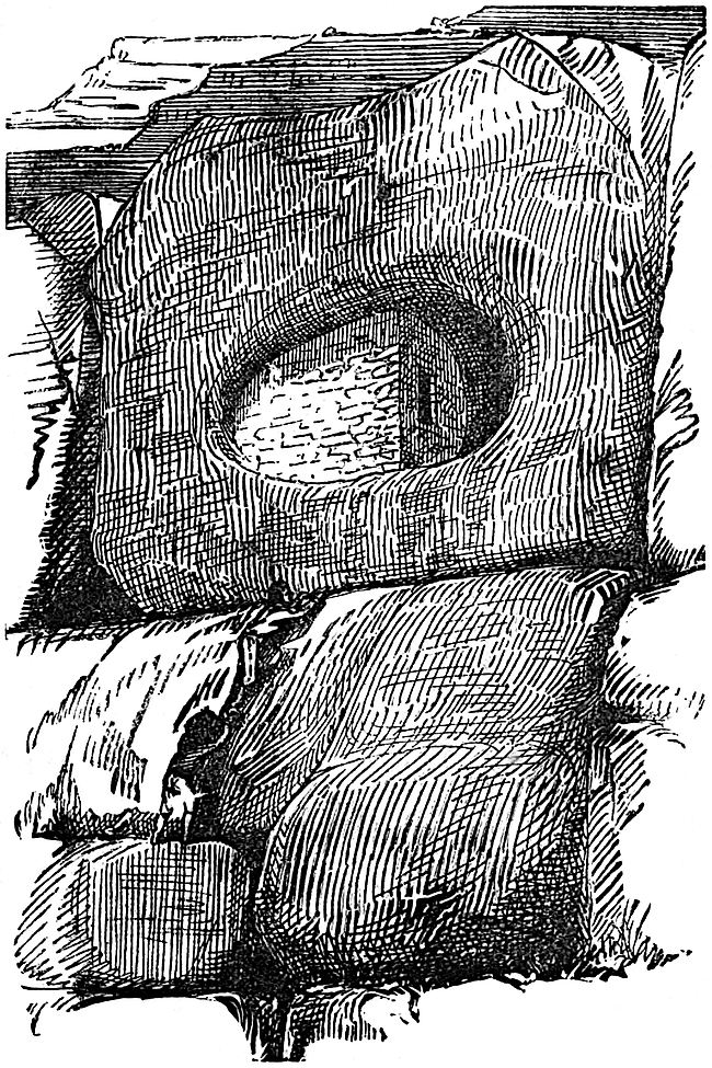
Among a colony of these cave-dwellings, occurring at the first bend of the West Montezuma, a dozen miles above its junction with the east fork, this one commands attention as much for the neatness and perfection of its masonry as for the snug little cave in which its architect lodged it. A block of sandstone resting on the edge of the mesa bench fifty feet above the valley, had a deep oval hole worn in it by the winds and sands. This was occupied by the little house, ten feet long, six feet high and five feet deep; a space, however, was reserved at one end to serve as a platform from which to enter.
In addition to the explorations of Mr. Jackson and party, Mr. W. H. Holmes of the Geological and Geographical Survey, was also assigned the duty of examining ancient remains in the valley of the Upper San Juan, during the summer of 1875.[479] 318Mr. Holmes and party examined an area of nearly six thousand square miles, chiefly in Colorado on the San Juan and its tributaries. Most of the ruins met with were of the same general character and description as those examined by Mr. Jackson, and to repeat in detail the majority of descriptions contained in Mr. Holmes’ memoir, would be to weary the reader with repetitions without affording additional advantage. However, a few remarkable ruins described by Mr. Holmes command our attention. The first of these which may be pronounced unique in this section of the country, and quite unlike anything met with thus far in the exploration, is situated on the Rio La Plata, about twenty-five miles above its junction with the San Juan. The remains of an extensive village with structures of various forms, are scattered upon a terrace some twenty feet above the river-bed. The distribution of the works viewed in connection with plans upon which they were constructed are suggestive of the remains of the mound-builders of the Ohio valley. The forms are chiefly rectangular and circular, one or two seem to have been elliptical while a number have consisted of irregular groups of apartments. All now lie in ruins with their outlines marked by ridges of débris composed of earth, water-worn pebbles, and small fragments of sandstone. The walls of the main structure are still prominently defined, while those of a circular enclosure, used probably as an estufa, are standing to the height of four feet. Three hundred feet directly north of this enclosure is a truncated rectangular mound nine feet high, measuring fifty by eighty feet. In one of the angles of the east end are the remains of what may have been a tower rising above the platform of the mound. One hundred feet north of this mound is a rectangular enclosure measuring sixty by one hundred feet. Its wall ranges from four to six feet in height. The ruins of a wall extending between the mound and the enclosure, indicate that they were once connected. A system of works joined these to a range of low hills, lying to the north. Southward from the large central circle are earthworks and ruins covering an area of fifteen thousand square feet. A large number of small circles and mounds occupy the southern extremity of the terrace. It319 is impossible to account for the sudden change in the plan of works so contiguous to those of a well-marked pueblo origin. On the San Juan River, thirty-five miles below the mouth of the La Plata and ten miles above the Mancos, Mr. Holmes observed an interesting combination of cave-shelters and towers united in a system for giving signals upon the approach of the enemy. In the face of a vertical bluff thirty-five feet high and about half way from the trail below, caves had been quarried or weathered in considerable numbers in the shales which constitute one of the strata in the bluff. A hard platform of rock formed the floor, and afforded sufficient protection for a narrow platform in front of these openings. Immediately above these caves upon the summit of the bluffs, a system of ruined circular towers, enclosed by semicircular walls with the open side of the semicircle facing the precipice, was observed. The caves were accessible from the valley below only by means of ladders, and the towers in turn only by ladders from the caves through the open side of their semicircular enclosures. The walls of these enclosures presented no openings to the plateau above, and it is inferred that the towers which they enclosed served as outlooks from which the sentinel could signal the people who were engaged in tilling the valley below to flee to their cave-shelters at the approach of the enemy, and when too closely pressed by an enemy upon the plateau the sentinel himself could make his retreat by means of his ladder to the caves beneath.
The most remarkable cliff-dwellings, discovered by Mr. Holmes, are shown in the cut.
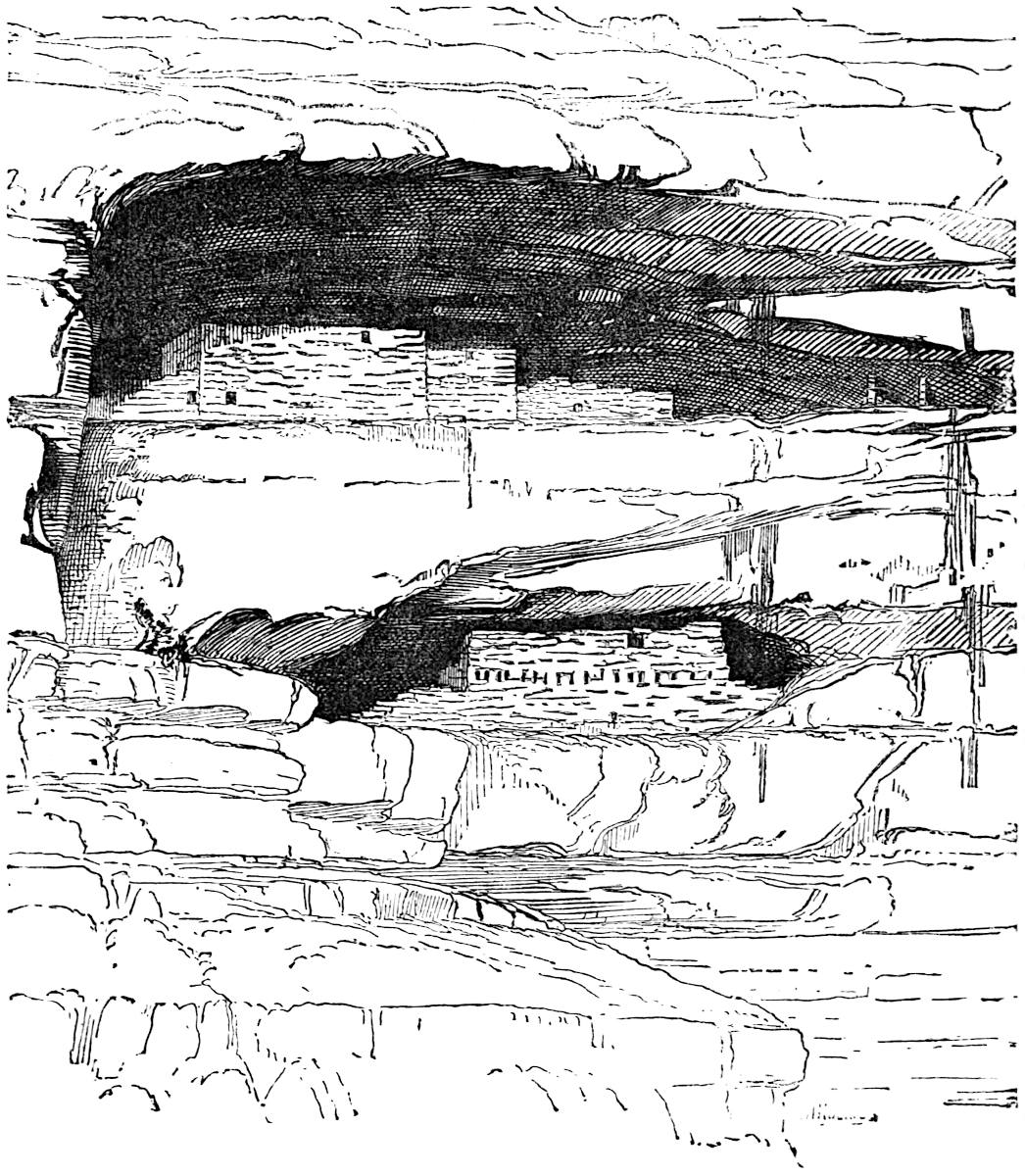
These extraordinary fortresses, lodged in caves eight hundred feet above the level of the valley, are situated in the cañon of the Mancos, a few miles from its mouth. The first five hundred feet of the ascent from the level of the stream, is over a rough cliff-broken slope, the remainder of massive sandstone, full of niches and caves. The upper house is situated in a deep cavern with overhanging roof about one hundred feet from the cliff’s top. The front wall of the house is built upon the very edge of the giddy precipice. The larger house is lodged in a niche or cave thirty feet below. The lower house was easily accessible. The320 wall was built flush with the precipice and remained standing to a height of fourteen feet at the highest point, though other portions had crumbled away considerably. The house occupied the entire floor of the niche, which measures sixty feet long by fifteen feet wide. Mr. Holmes described these structures as follows; of the first he says:
322
“The arrangement of the apartments is quite complicated and curious, and will be more readily understood by a reference to the ground-plan (figure 1). The precipice line or front edge of the niche-floor, extends from a to b. From this the broken cliffs and slopes reach down to the trail and river, as shown in the accompanying profile (figure 3). The line b c d represents the deepest part of the recess, against which the walls are built. To the right of b, the shelf ceases, and the vertical face of rock is unbroken. At the left, beyond a, the edge is not so abrupt, and the cliffs below are so broken that one can ascend with ease. Above, the roof comes forward and curves upward, as seen in the profile.
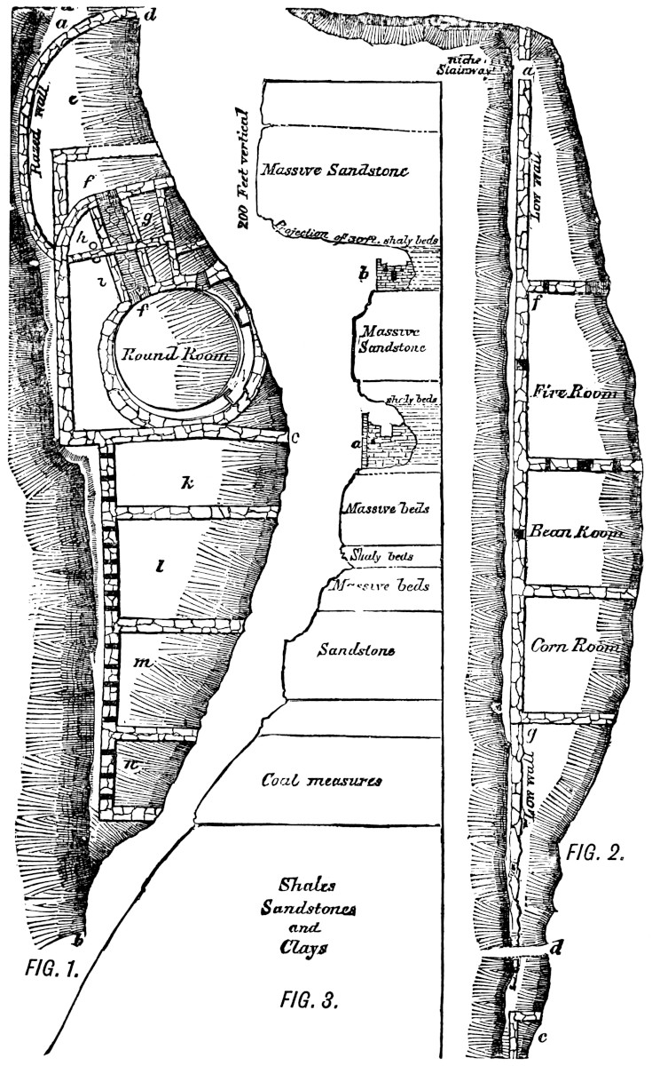
“The most striking feature of this structure is the round-room, which occurs about the middle of the ruin and inside of a large rectangular apartment. * * * Its walls are not high and not entirely regular, and the inside is curiously fashioned with offsets and box-like projections. It is plastered smoothly, and bears considerable evidence of having been used, although I observed no traces of fire. The entrance to this chamber is rather extraordinary, and further attests the peculiar importance attached to it by the builders, and their evident desire to secure it from all possibility of intrusion. A walled and covered passage-way, f, f, of solid masonry, ten feet of which is still intact, leads from an outer chamber through the small intervening apartments into the circular one. It is possible that this originally extended to the outer wall, and was entered from the outside. If so, the person desiring to visit the estufa would have to enter an aperture about twenty-two inches high by thirty wide, and crawl, in the most abject manner possible, through a tube-like passage-way nearly twenty-feet in length. My first impression was that this peculiarly-constructed doorway was a precaution against enemies, and that it was probably the only means of entrance to the interior of the house; but I am now inclined to think this hardly probable, and conclude that it was rather designed to render a sacred chamber as free as possible from profane intrusion. The apartments l, k, m, n, do not require any especial description, as they are quite plain and almost empty.323 The partition walls have never been built up to the ceiling of the niche, and the inmates, in passing from one apartment to another, have climbed over. The row of apertures indicated in the main front wall are about five feet from the floor, and were doubtless entered for the insertion of beams, although there is no evidence that a second floor has at any time existed. In that part of the ruin about the covered passage-way, the walls are complicated, and the plan can hardly be made out, while the curved wall enclosing the apartment e is totally overthrown. * * * * The rock-face between this ruin and the one above is smooth and vertical, but by passing along the ledge a few yards to the left a sloping face was found, up which a stairway of small niches had been cut; by means of these, an active person, unincumbered, could ascend with safety. On reaching the top, one finds himself in the very doorway of the upper house (a, figure 2) without standing-room outside of the wall, and one can imagine that an enemy would stand but little chance of reaching and entering such a fortress if defended, even by women and children alone. The position of this ruin is one of unparalleled security, both from enemies and from the elements. The almost vertical cliff descends abruptly from the front wall, and the immense arched roof of solid stone projects forward fifteen or twenty feet beyond the house (see section, figure 3). At the right the ledge ceases, and at the left stops short against a massive vertical wall. The niche-stairway affords the only possible means of approach.
“The house occupies the entire floor of the niche, which is about one hundred and twenty feet long by ten in depth at the deepest part. The front wall to the right and left of the doorway is quite low, portions having doubtless fallen off. The higher wall f g is about thirty feet long, and from ten to twelve feet high, while a very low rude wall extends along the more inaccessible part of the ledge, and terminates at the extreme right in a small enclosure, as seen in the plan at c.
“In the first apartment entered, there were evidences of fire, the walls and ceiling being blackened with smoke. In the second, a member of the party, by digging in the rubbish,324 obtained a quantity of beans, and in the third a number of grains of corn; hence the names given. There are two small windows in the front wall, and doorways communicate between rooms separated by high partitions.
“The walls of these houses are built in the usual manner, and average about a foot in thickness.
“The upper house seems to be in a rather unfinished state, looking as if stone and mortar had run short. And when one considers that these materials must have been brought from far below by means of ropes, or carried in small quantities up the dangerous stairway, the only wonder is that it was ever brought to its present degree of finish.”
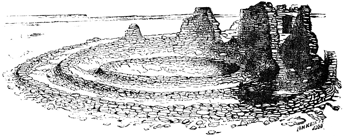
The ruins of a triple-walled tower with fourteen sectional apartments between the outer and second walls were examined near the McElmo. One of these sectional apartments was still standing to the height of twelve feet.
We have already referred to the group of ruins at Aztec Springs near the divide between the McElmo and the lower Mancos tributaries. “These ruins,” says Mr. Holmes, “form the most imposing pile of masonry yet found in Colorado. The whole group covers an area of about four hundred and eighty thousand square feet, and has an average depth of from three to four feet.” The accompanying plan, with the measurements and 326dimensions indicated upon it, precludes the necessity of a detailed description.
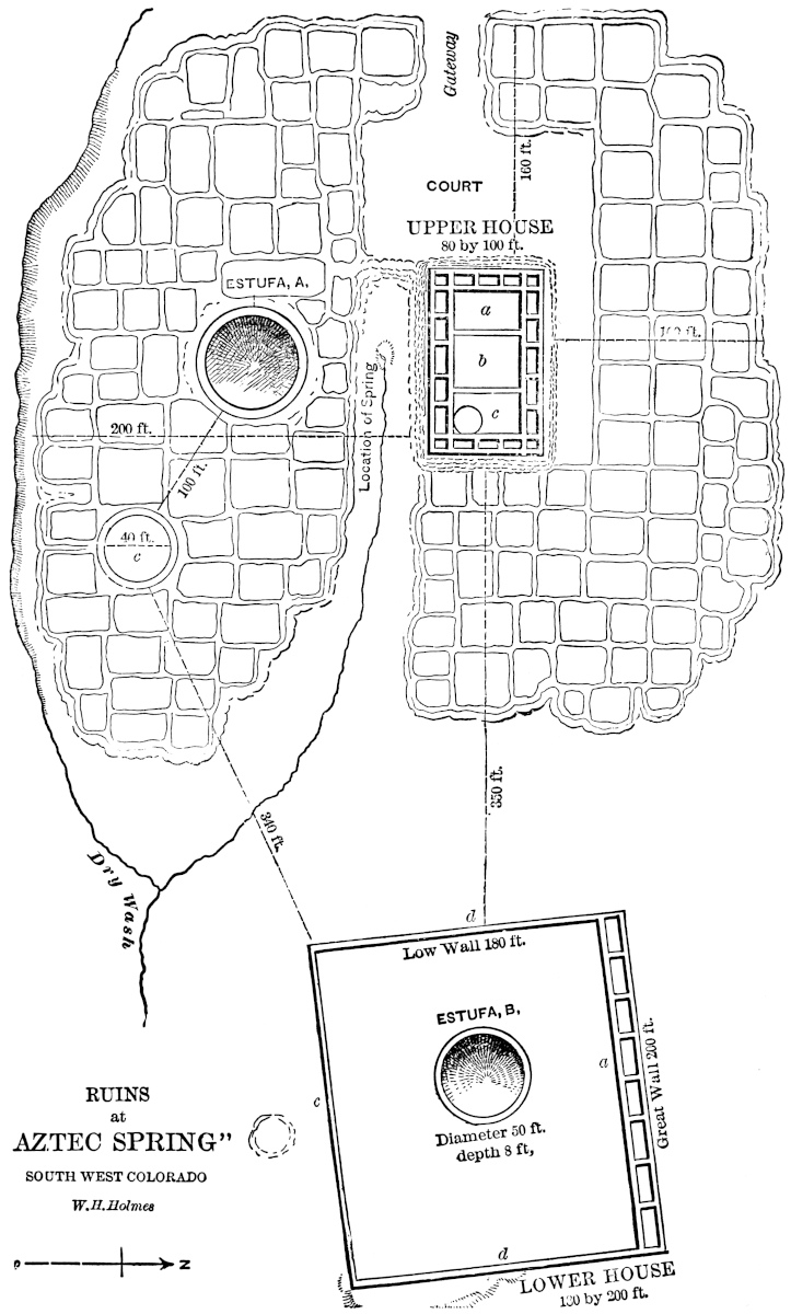
The walls are twenty-six inches thick, and in some cases are built double. The whole resembles in plan one of the ruined pueblos of the Chaco, with the addition that it was designed to be an impregnable fortress.
The plate from Mr. Jackson’s memoir shows specimens of pottery collected during his explorations among the cliff-dwellings. The pieces a and b are of modern make, and were obtained among the Moquis of Tegua. The ware and finish of both these vessels are far inferior as compared with the ancient fragments.
We have quoted on a previous page Mr. Ingersoll’s rendering of the romantic legend which tells in few words the sad history of the ancient architects of these aërial abodes. We have observed that, according to this account, the remnant of this people who escaped the destruction visited upon the cliff-dwellers by the warlike Utes fled to the South—to the deserts of Arizona—and built the present Moqui towns. We have already stated that Mr. Jackson’s party found it necessary to travel forty miles due southward from the ruins of the Chaco Cañon in order to reach Tegua, the nearest of the Moqui settlements.
It may be a matter of some interest to the reader, after having studied
the cliff architecture, to be introduced into one of the habitations
now occupied by the descendants of that remarkable people. Lieutenant
Ives, who visited the Moqui towns in 1858, has furnished an interesting
account of their general characteristics, from which we take condensed
extracts: “As the sun went down,” says Lieutenant Ives, “and the
confused glare and mirage disappeared, I discovered with the spy-glass
two of the Moqui towns eight or ten miles distant, upon the edge of a
high bluff overhanging the opposite side of the valley. They were built
close to the edge of the precipice. The outlines of the closely-packed
structures looked in the distance like the towers and battlements of a
castle, and their commanding position enhanced the picturesque effect.”
“The face of the bluff, on the summit of which the town was perched,
was cut up and irregular. We were led through a passage that327 wound
among some low hillocks of sand and rock that extended half-way to the
top. It did not seem possible, while ascending through the sand-hills,
that a spring could be found in such a dry-looking place; but presently
a crowd was seen collecting upon a mound before a small plateau, in
the centre of which was a circular reservoir fifty feet in diameter,
lined with masonry and filled with pure cold water. The basin was fed
by a pipe connecting with some source of supply upon the summit of the
mesa. Continuing to ascend, we came to another reservoir, smaller, but
of more elaborate construction and finish. From this the guide said
they got their drinking water,328 the other reservoir being intended for
animals. Between the two the face of the bluff had been ingeniously
converted into terraces. These were faced with neat masonry, and
contained gardens, each surrounded with a raised edge so as to retain
water upon the surface. Pipes from the reservoir permitted them at any
time to be irrigated. Peach trees were growing upon the terraces and in
the hollow below. A long flight of stone steps with sharp turns that
could be easily defended was built into the face of the precipice,
and led from the upper reservoir to the foot of the town. The scene,
rendered animated by the throngs of Indians in their gayly-colored
dresses, was one of the most remarkable I had ever witnessed.” “Without
giving us time to admire the scene, the Indians led us to a ladder
planted against the centre of the front face of the pueblo. The town is
nearly square and surrounded by a stone wall fifteen feet high, the top
of which forms a landing extending around the whole. Flights of stone
steps led from the first to a second landing, upon which the doors of
the houses open. Mounting the stairway opposite to the ladder, the
chief crossed to the nearest door and ushered us into a low apartment,
from which two or three others opened towards the interior of the
dwelling.” “The room was fifteen feet by ten; the walls were made of
adobes; the partitions of substantial beams, the floor laid with clay.
In one corner were a fireplace and a chimney. Everything was clean and tidy.
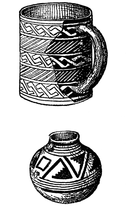 Skins, bows and arrows, quivers, antlers, blankets, articles of
clothing and ornament, were hanging from the walls or arranged upon
shelves. Vases, flat dishes, and gourds filled with meal or water,
were standing along on one side of the room. At the other end was a
trough divided into compartments, in each of which was a sloping stone
slab two or three feet square, for grinding corn upon. In a recess of
an inner room was piled a goodly store of corn in the ear. I noticed,
among other things, a reed musical instrument with a bell-shaped end
like a clarionet and a pair of painted drum-sticks tipped with gaudy feathers.”
Skins, bows and arrows, quivers, antlers, blankets, articles of
clothing and ornament, were hanging from the walls or arranged upon
shelves. Vases, flat dishes, and gourds filled with meal or water,
were standing along on one side of the room. At the other end was a
trough divided into compartments, in each of which was a sloping stone
slab two or three feet square, for grinding corn upon. In a recess of
an inner room was piled a goodly store of corn in the ear. I noticed,
among other things, a reed musical instrument with a bell-shaped end
like a clarionet and a pair of painted drum-sticks tipped with gaudy feathers.”
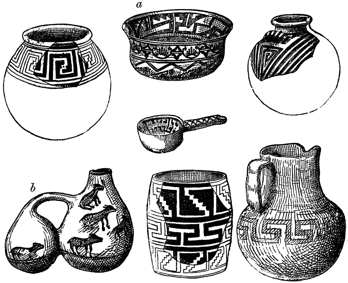
“We learned that there were seven towns; that the name of that which we were visiting was Mooshahneh. A second smaller town was half a mile distant; two miles distant was a329 third. * * * Five or six miles to the north-east a bluff was pointed out as the location of three others; and we were informed that the last of the seven, Oraybe, was still further distant on the trail towards the great river.”
“Each pueblo is built around a rectangular court, in which we suppose are the springs that furnish the supply to the reservoirs. The exterior walls, which are of stone, have no openings,330 and would have to be scaled or battered down before access could be gained to the interior. The successive stories are set back one behind the other. The lower ones are reached through trap-doors from the first landing. The houses are three rooms deep, and open upon the interior court. The arrangement is as strong and compact as well could be devised, but as the court is common and the landings are separated by no partitions, it involves a certain community of residence.”
In describing the gardens of Oraybe, distant eight or nine miles, he remarks:
“At the foot [of the bluff] was a reservoir and a broad road winding up the steep ascent. On either side the bluffs were cut into terraces, and laid out into gardens similar to those seen at Mooshahneh, and like them irrigated from an upper reservoir. The whole reflected great credit upon Moqui ingenuity and skill in the department of engineering. The walls of the terraces and reservoirs were of partly-dressed stone, well and strongly built, and the irrigating pipes conveniently arranged. The little gardens were neatly laid out. * * * The walls of the terraces and the gardens themselves are kept in good order and preservation. The stone and earth for construction and repairs they carry in blankets upon their shoulders from the valley below.”[480]
Mr. Bancroft has furnished the reader descriptions of several of the New Mexican group of pueblos, which he has extracted from the reports of various travelers. We do not consider it necessary to repeat accounts so generally accessible.[481] The New Mexican group, situated on the Rio Grande del Norte and its tributaries, is the most numerous in inhabited pueblos, but as they differ little if at all from those of the Moquis, further treatment of them is unnecessary. The pueblos which are and have been inhabited during the nineteenth century number about twenty, some of which are well known to have been occupied by the ancestors of their present inhabitants when first visited by 331the Spaniards. The best specimen of inhabited pueblos is that of Taos, situated on one of the northern forks of the river which gives it its name. There are two large houses, each between three and four hundred feet long by one hundred and fifty wide, situated on opposite sides of a small creek, and tradition states that formerly they were connected by a bridge. They are five and six stories high.
Besides the inhabited towns there are a number now unoccupied and fast going to decay. The names of these are given with slight variations by different writers; the following, however, are generally agreed upon: Pecos, Quivira, Valverda, San Lázaro, San Marcos, San Cristóbal, Socorro, Senacu, Abó, Quarra, Rita, Poblazon, old San Filipe, and old Zuñi.[482] The most important of all these ruins is Pecos, one of the sacred cities of the pueblos. Here the everlasting fire dedicated to their god Montezuma was kept burning from time immemorial down to the abandonment of the town, which occurred some time during the second quarter of the present century. The reader will remember, however, that the culture-god of the Pueblos and the Aztec monarch are in no sense to be associated with each other, since it is quite certain that they were not confounded in the mythology of the worshippers of the deity. Whether the Pueblos, Cliff-dwellers, etc., were ever in any way related to the Aztecs or any Nahua people is difficult to determine. Certainly there is no architectural nor traditional evidence that they were. When the Spaniards under Coronado traversed the region in 1540 A. D., no reports of inter-communication between the two peoples seem to have been current. Father Escalante, who in 1776 visited many of the pueblos, and mentions many ruins not since located, as well as many inhabited towns now in ruins, found nothing to really substantiate the “Aztec theory.”[483] On the contrary, substantial arguments can 332be presented for the intimate relationship of the Nahuas and some of the Pueblos.
In the tenth chapter of this work will be found the basis of linguistic affinities between the Nahua and Moqui languages, though none is claimed between the Nahua and New Mexican Pueblos. Mr. Becker, in his memoir addressed to the Congrès des Américanistes at Luxembourg, refers to Camergo’s account of the migration of the Teo-Chichimecs, the allies of the Toltecs, and to his statement that they came from Amaquetepic (“the mountains of the Amaques”), and expresses the belief that the words Amaques and Moquis are identical. Mr. Becker considers the “A” prefix of the former to be an abbreviation of the Nahua “atl” water, and Amaqui would mean the Maqui or Moqui living by the water, just as Acolhuas means Culhuas near the water and Anahuac, the Nahua land on the water. The tradition of the Moquis distinctly states that they formerly lived on the river at the north-east of their present home. The reader will remember that the Quichés called the Nahuas Yaqui, the name of a river of Sinaloa and Sonora where marked traces of the Nahua language are found, and the supposed locality of the first Toltec station. Is it not possible that Yaqui is a dialectic modification of Maqui or Moqui? It has been observed in the pages of this chapter that in more than one instance ruined pueblos were composed of either red adobe or had been painted, a circumstance which had won for them such a designation as “Red-house” or “Pueblo-pintado,” etc. Furthermore, the red glare of the desert north of the Moqui settlements has received the name of the “Painted desert.” The fact that Hue hue Tlapalan signifies “old red land” is suggestive that this locality may have been the mysterious rendezvous of the Toltecs. The Moquis like the Nahuas are sun-worshippers, though the ceremonial of both people differ considerably.
Besides the mound-works observed on the upper San Juan by Mr. Holmes associated with the work of the Cliff-dwellers, recent exploration has shown that combinations of mound and pueblo features of architecture exist in Utah. Dr. C. C. Parry found in a mound on the St. Clara River in Southern Utah very fine333 specimens of Pueblo pottery, and other articles which clearly identify its architects with the people of the cliffs or with the village builders at the South.[484] The recent exploration of several mounds in southern Utah by Dr. Edward Palmer fully confirms this conclusion. In Kane County, Utah, the same explorer discovered among a number of articles of apparent Moqui make in a cave-shelter, a shovel of horn having a blade fourteen inches long by five inches wide. Among the articles was a pair of shoes made of the fibre of the Yucca, which in style, shape, manner of braiding, etc., closely resemble shoes made of the leaves of the Typa found by Prof. F. W. Putnam in a cave in Kentucky.[485]
The mound examined by Mr. Barrand on the west fork of the Little Sioux of Dakota, and found to contain a large interior circular chamber, probably was the work of the ancestors of this western branch of the mound-building people.[486] The circular chamber was much like an estufa.
The many-sided culture-hero of the Pueblos, Montezuma, is the centre of a group of the most poetic myths found in Ancient American Mythology. The Pueblos believed in a supreme being, a good spirit, so exalted and worthy of reverence that his name was considered too sacred to mention, as, with the ancient Hebrews, Jehovah’s was the “unmentionable name.” Nevertheless Montezuma was the equal of this great spirit, and was often considered identical with the sun. The variety of aspects in which Montezuma is presented to us is due to the fact that each tribe of Pueblos had its particular legends concerning his birth and achievements. Many places in New Mexico claim the honor of his nativity at a period long before those village builders were acquainted with the arts of architecture, which have since given them their distinguishing name. In fact, this culture-god was none other than the genius who introduced the knowledge of building among them.[487] Some traditions,334 however, make him the ancestor and even the creator of the race; others, its prophet, leader and lawgiver. Mr. Bancroft says, “Under restrictions, we may fairly regard him as the Melchizedek, the Moses, and the Messiah of these Pueblo-desert wanderers from an Egypt that history is ignorant of, and whose name even tradition whispers not. He taught his people how to build cities with tall houses, to construct Estufas, or semi-sacred sweat-houses, and to kindle and guard the sacred fire.” It has been aptly remarked by Mr. Tyler, that Montezuma was the great “somebody” of the tribe to whom the qualities and achievements of every other were attributed.
Fremont gives an account of the birth of the hero, in which his mother is declared to have been a woman of exquisite beauty, admired and sought for by all men. She was the recipient of rich presents of corn and skins from her admirers, yet she refused the hands of all her suitors. A famine soon occurred, and great distress followed. Now the fastidious beauty showed herself to be a lady of charitable spirit and tender heart. She opened her granaries, in which all her presents had been stored, and out of their abundance relieved the wants of the poor. The offerings of love were made to perform their mission a second time. At last, when the pure and plenteous rains again brought fertility to the earth, the summer shower fell upon the Pueblo goddess, and she gave birth to a son, the immortal Montezuma. The intelligent chief of the Papagoes, whose people occupy the territory between the Santa Cruz River and the Gulf of California, related a legend of the origin and offices of Montezuma, which, while it surprises the reader with its close resemblances to some leading points in the Hebrew and Chaldean genesis and deluge accounts, still is conspicuous for its inconsistencies, and in its closing statements for the absence of any knowledge of time or order.[488]
335
In substance it is as follows: The Great Spirit, having made all things—sky, earth, and the living creatures which inhabit it—descended into the earth for the purpose of creating man also. Digging in the earth, he found clay, such as a potter uses; this he carried back with him to his celestial abode, and dropped it again from the sky into the pit from which he had dug it. Instantly Montezuma, the genius of life, sprang from the pit, and became a partner in the creation of other men. The Apaches were the next formed, and were so wild that they severally ran away as fast as created. Those were golden days which followed the birth of the race; the sun was very much nearer the earth than now, and his grateful presence rendered clothing useless. A common language between all men, shared even by beasts, was one of the strongest possible bonds of peace.
But at last this paradisiacal age was ended by a great deluge in which all men and living creatures perished. Only Montezuma and his friend, the coyote—a prairie-wolf—escaped. This wonderful animal, with semi-divine attributes, plays a remarkable part in the religion of many of the Pacific tribes, and furnishes us a parallel in our Occidental mythology with the half-human, half-brute combinations of Greco-Roman mythology. The coyote, gifted with prophetic powers, had foretold the approach of this great calamity, and Montezuma, heeding the warning, had built him a boat, which he kept in readiness on the summit of Santa Rosa. His sagacious friend, the coyote, also escaped in an ark made from a gigantic cane which grew by a river’s side; having gnawed it down and crawled into it, he stopped up the ends with gum, and escaped. When the waters subsided, the two met again on dry ground. Montezuma then employed the coyote on several wearisome excursions in order to discover the extent of the land, which developed the fact that upon the east and south and west the water yet remained. Only on the north was there land.
The Great Spirit and Montezuma again created men and animals, and the former committed to his partner in the work the duties of governing the new race. These were, however, neglected by Montezuma, who became puffed up with pride, and336 permitted all manner of wickedness to prevail. The Great Spirit remonstrated with him, even descending to the earth for the purpose of moving his faithless and haughty vicegerent to restore order, but with no avail. Then, returning to his abode in heaven, he pushed the sun back to a remote part of the sky as a punishment on the race. At this, Montezuma became enraged, collected the tribes around him, and set about the construction of a house which should reach heaven. The builders had already completed several apartments, lined with gold and silver and precious stones, and progressed to a point which encouraged all to believe that their defiant purpose would be accomplished, when the Great Spirit smote it to the earth amid the crash of his thunder. Here the account becomes very confused—a great leap is made from Montezuma the culture-hero to Montezuma the emperor, and the two become confounded.
The legend states that upon the defeat of his rebellious scheme, Montezuma still hardened his heart, and caused the sacred images to be dragged through the streets for the derision of the villagers; the temples were desecrated, and defiance to the Supreme declared. As a punishment, the Great Spirit caused an insect to fly toward the east to an unknown land, to bring the Spaniards, who utterly destroyed him.
The post-diluvian part of this story presents the hero in quite another light than that generally accepted by most of the Pueblo tribes, in which he is represented as having been the very model of goodness and beneficence—the founder of their cities, of which Acoma was the first and Pecos the second. Before taking his departure from his people, he prophesied that they should suffer from drought and from the oppressions of a strange nation, but promised them to return as their deliverer. He then planted a tree upside down, and bade them preserve the sacred fire notwithstanding their misfortunes, until the tree fell, at which time he would return with a white race, who would destroy all their enemies and bring back the fertile showers.
It is said that this tree fell from its place as the American army entered Santa Fé, in 1846. In the cramped, subterranean estufa, the Pueblo fed the sacred fire burning in the basin of a337 small altar. It was a warrior’s vigil, for by turns their heroes descended into its suffocating atmosphere, thick with smoke, and charged with carbonic acid, to wait often for two successive days and nights without refreshment, often even until death relieved the guard.[489]
For generations these strange architects and faithful priests have waited for the return of their god—looked for him to come with the sun, and descend by the column of smoke which rose from the sacred fire. As of old the Israelitish watcher upon Mount Seir replied to the inquiry, “What of the night?” “The morning cometh,” so the Pueblo sentinel mounts the house-top at Pecos, and gazes wistfully into the east for the golden appearance, for the rapturous vision of his redeemer, for Montezuma’s return; and, though no ray of light meets his watching eye, his never-failing faith, with cruel deception, replies, “The morning cometh.”[490]
Explorations among the Pueblos.—In the summer of 1879 the Smithsonian Institution undertook a thorough and extensive examination of the Pueblo civilization of New Mexico and Arizona. Major Powell sent an expedition to New Mexico in charge of Mr. James Stevenson, and a large collection illustrative of the manners and customs of the Pueblos was made. Mr. F. H. Cushing was especially fortunate in obtaining minute information concerning their traditions, rites, and ceremonies. The work of investigation is still in progress, and at this writing (September, 1881) an expedition is in the field. A full report will ultimately be published. During the latter half of the year 1880 Mr. Baudelier, the eminent Mexican scholar, visited Taos, and prepared a paper on that interesting locality for the Archæological Institute of America, under whose patronage his exploration was conducted. During a residence of two months in the Pueblo of Cochití, occupied by a branch of the Queres tribe, Mr. Baudelier made a thorough study of the institutions of that interesting people. See Second Ann. Report of Arch. Inst. of Amer.
WITHOUT pretending to furnish an exhaustive treatment of the subject proposed for this chapter, we desire to make observations on some phases of the development of American civilization in the Pre-Historic period. One of the most natural fruits of the study of the arts and customs of any people, is a disposition on the part of the investigator to institute a comparison with corresponding features of civilization in all parts of the world. Unfortunately this disposition has led many writers on America into wild and fanciful speculations, which tend only to deceive the reader and add nothing to true investigation. In a few instances pronounced old world analogies have339 been proven to exist in ancient American institutions and arts, but their number bears a small ratio to the multitude of fancied analogies which never existed, except in the imaginations of their discoverers. To discuss the subject in hand without transcending the limits of the period which is treated in previous chapters, namely, the Primitive period—that which antedates the era of the annals of those ancient peoples, is a somewhat difficult task, since the question of dates is a very uncertain one in the absence of any sufficient key to the hieroglyphic and picture records. The customs and political organization, together with the Aztec civilization, have been often treated, and by none better than our own Prescott and Bancroft. The repetition of their labors here would be highly superfluous. We shall, however, ask the attention of the reader to some considerations upon the following divisions of the subject:
1. Architecture. 2. Sculpture and Hieroglyphics. 3. Chronological and Astronomical Knowledge. 4. Religious Analogies.
Architecture.—The works of the Mound-builders and Pueblos have already been described and their transitional forms or stages noted. To seek for parallelisms or analogies between the Mound-builders and the people of Asia because mounds are common to both continents, or to seek to identify them with the people of Northern Europe because the shell-heaps of our sea-board resemble those of Denmark, would certainly be an unjustifiable use of the imagination, in anything like a serious discussion of the question. We have no disposition to speculate on this subject, since such speculation cannot furnish any satisfactory results. Certain resemblances between American and Hindoo-mounds have been supposed to exist, but the resemblance, if any, proves nothing.[491] That more fruitful and wonderful field of ancient architecture in Central America, Yucatan and Mexico, furnishes abundant opportunity for the discussion of our subject. Detailed descriptions of the remains found in different localities 340have been given by travelers, artists and authors, the latter availing themselves of several accounts and instituting comparisons between the statements of different explorers. Such works, savoring somewhat of the critical, cannot be underrated, since their development of the true facts has contributed largely to our knowledge of the subject. It has been generally the rule for writers to undertake the description of remains in a particular locality and treat them in detail, thus presenting to the mind a pleasant picture of the whole, together with the relation of parts. This is certainly a satisfactory plan to many readers, but it seems to us that such a course is unnecessary, after it has been once pursued by the explorer. By repetitions nothing is gained, unless the work of classification (by which certain architectural forms and methods are woven into a style and their variations noted) receives attention. In preceding chapters we have treated of the Maya, the Quiché, and the Nahua peoples, and in this, it is our purpose to briefly note the main features of their styles of architecture, sculpture, etc., as indicated in the divisions above laid down.
Maya Architecture furnishes evidence of growth, and may be classified into the Chiapan or ancient and the Yucatanic or modified styles. The Chiapan or ancient style is exhibited in the imposing remains of Palenque, with which the reader is supposed to be already familiar, from the descriptions of several explorers.[492] Palenque is situated in the Usumacinta River region in Chiapas, on a small stream sometimes called the Otolum, a tributary of the Tulija, which is itself a branch of the Usumacinta. The ruins are situated in a small valley of the foothills, from which rise the high table-lands of the interior. They are known as the Palace, with a pyramidal base measuring two hundred and sixty by three hundred and ten feet and forty feet high; Temple of the three Tablets; Temple of the Beau Relief; Temple of the Cross, and Temple of the Sun. The 341most conspicuous feature of the architecture employed, and seen in most of the Central American structures, is the massive pyramidal foundation. The sides of the pyramid of the Palenque palace are faced with regular blocks of hewn stone, with extensive flights of stairs, upon the east and north leading to its summit.[493] Mr. Bancroft has analyzed the structure of the American pyramid in a philosophical way, and no doubt has in part explained its object. “I think,” he remarks, “that perhaps with a view to raise this place or temple above the waters of the stream, four thick walls, possibly more, were built up perpendicularly from the ground to the desired height; then, after the completion of the walls, to strengthen them, or during the progress of the work to facilitate the raising of the stones, the interior was filled with earth, and the exterior graded with the same material, the whole being subsequently faced with hewn stone.”[494]
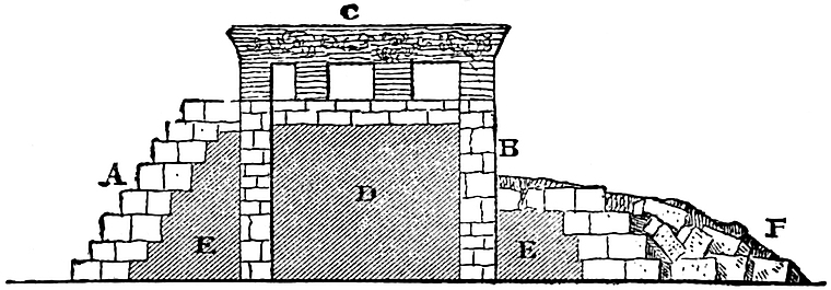
In the above cut Mr. Bancroft illustrates his opinion. Stephens and Waldeck, who excavated from the summit downwards, imply that the interior D is of earth. Twenty years later Charnay found a perpendicular wall on the eastern side, quite contrary to the observations of all previous travelers. Mr. Bancroft accounts for this on the supposition that the stone facing, loosened by the growth of trees which covered it, had fallen from B to F, and that the earth which filled the sides at E E had been washed away by the rain and left the perpendicular wall 342exposed at B. Such a supposition we consider to be perfectly probable in view of the rapid dilapidation of the ruins since Dupaix’s visit in 1806. The ancient model thus established in the construction of this, perhaps oldest of existing American cities, may have determined the style of many similar edifices. A plan of the palace has been furnished by several authors.[495] The accompanying restoration from Armin’s Das Heutige Mexiko, employed by Mr. Bancroft, may serve to give an idea of the proportions of the structure. The edifice occupies the entire summit platform of the pyramid except a narrow passage-way around the edge, and measures 228 feet by 182, and about 30 feet in height. The doorways, of which there are forty in the outer wall, are wider than the piers intervening between them, and were constructed originally with flat wooden lintels, all of which have disappeared. The main architectural features will 343be observed in the accompanying plate from Waldeck. The lower right-hand figure shows the angle of the foundations of one of the interior buildings and the manner in which the stones were laid. The left-hand figure affords a sectional view of the eastern stairway descending from the principal corridor into the grand court. It will be observed that the height of the steps considerably exceeds their width. Waldeck illustrates this singular disproportion by a diagram in which a native is represented as sitting upon the stairway. The perpendicular face of a step is shown to be considerably higher than the Indian’s knee, and must have measured two feet. The upper left-hand figures represent the forms of niches, which are of frequent occurrence. The T shaped niche is the representative of a numerous class so resembling the Egyptian tau or cross as to excite no little interest in its origin. M. Waldeck found the marks of lamp-black upon the tops of some of them, and supposes them to have344 held torches which illuminated the corridors; others, which extend through the walls, may have served for the purposes of ventilation; while others perhaps contained idols.[496] The right-hand upper figures represent the highly artistic double cornices employed. Nothing of a definite nature is known of the style of roof with which the palace was covered, since every vestige of it has disappeared. Castañeda represents it as sloping and plastered, while Dupaix refers to it as consisting of large stone flags, carefully joined together.[497]
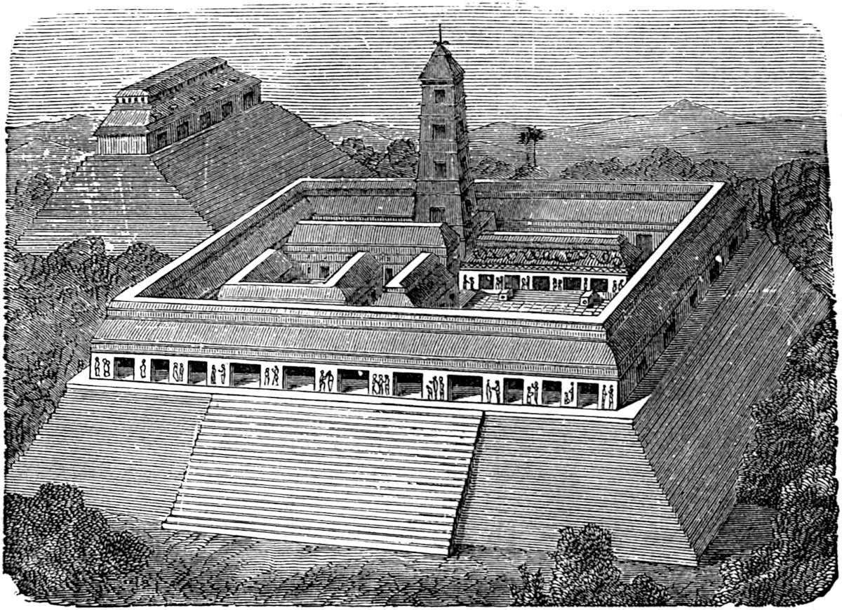
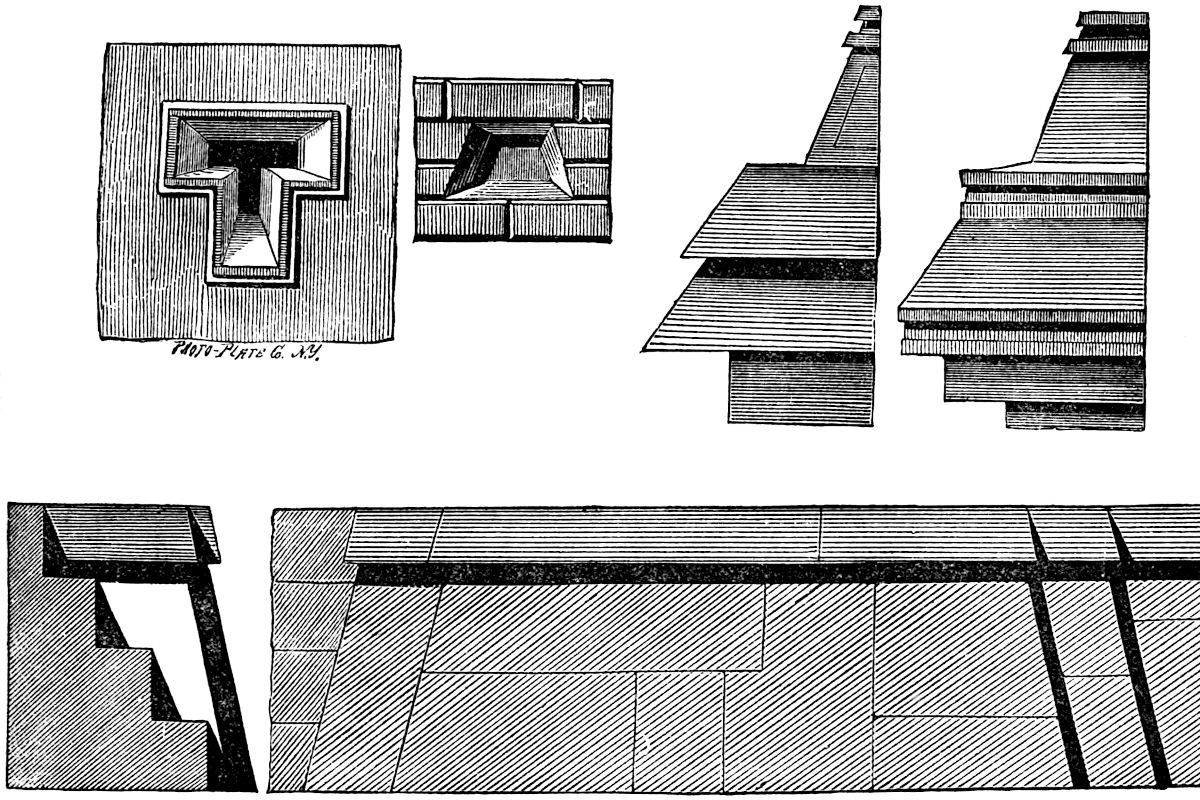
The neighboring buildings, such as the Temple of the Three Tablets, the Temple of the Cross, and the Temple of the Sun, each have well-preserved roofs of masonry, which are quite remarkable. The first of these stands upon its lofty pyramidal base, measuring one hundred and ten feet on the slope, with continuous steps on all sides. The temple, which is thirty-five feet high, is crowned with a sloping ornamental roof of great beauty. Stephens illustrated the temple in several views, subsequently copied by Bancroft.[498] The roof is divided into three parts; the lower section recedes from the cornice with a gentle slope, and resembles the corresponding section of a French or Mansard roof. The stucco decorations of this lower section, which is also painted, add considerably to the general effect. Five solid square projections with perpendicular faces suggestive of the attic windows of a modern French roof are found on this section, corresponding to the several doors of the temple immediately below. The second section, which slopes back at a more acute angle, is of solid masonry. The crowning section seems to have been purely ornamental, consisting of a line of pillars of stone and mortar, eighteen inches high and twelve inches apart, surmounted by a layer of flat stones with projecting sides. The Temple of the Cross and Temple of the Sun both have roof-structures which may be described as resembling a lattice-work of stone.
The most interesting feature of Palenque architecture is 345the arch, of which there are two styles, if one of them may be classed as an arch at all; of this we have doubts. The style to which we allude is that which has been designated as the Yucatan arch. A section of the double corridor of the palace furnishes an example as shown in the cut from Mr. Bancroft’s work.
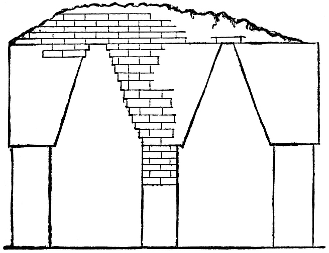
This so-called arch is nothing more than the approach of two walls toward each other in straight lines, nearly forming an acute angle at the top. These inclining walls are constructed of overlapping stones, with a small surface of exposed ceiling, produced by a lintel-like covering. The principal doorway, which is eighteen feet high, is constructed in the form of a trefoil arch, while niches or depressions of the same trefoil form are ranged along the inclined face of the gallery on each side of the entrance. This arch is suggestive of the Moorish pattern, though the latter probably is the more modern. The accompanying cut—a photographic reduction from Waldeck—will convey a clear idea of its form.
The tower situated in the southern court is considered by Waldeck as the crowning work of all. The frontispiece is a photographic reduction from Waldeck’s drawing, and no doubt indicates the true number of its stories, as well as the remarkable growth of vegetation upon its roof. The descent of the little roots and tendrils of the trees above in quest of nourishment, furnish a striking illustration of the luxuriant vegetable growth which pervades the region. The very air is laden with life, though the remains of man’s handicraft and power are but the lifeless monuments of his vanished glory. The gentle evening breeze which plays upon the tendrils stretching themselves down the tower’s wall, produces a soft melodious sound, resembling346 that of the Æolian harp, and gives rise to the apprehension in the minds of the natives that the place is enchanted.[499]
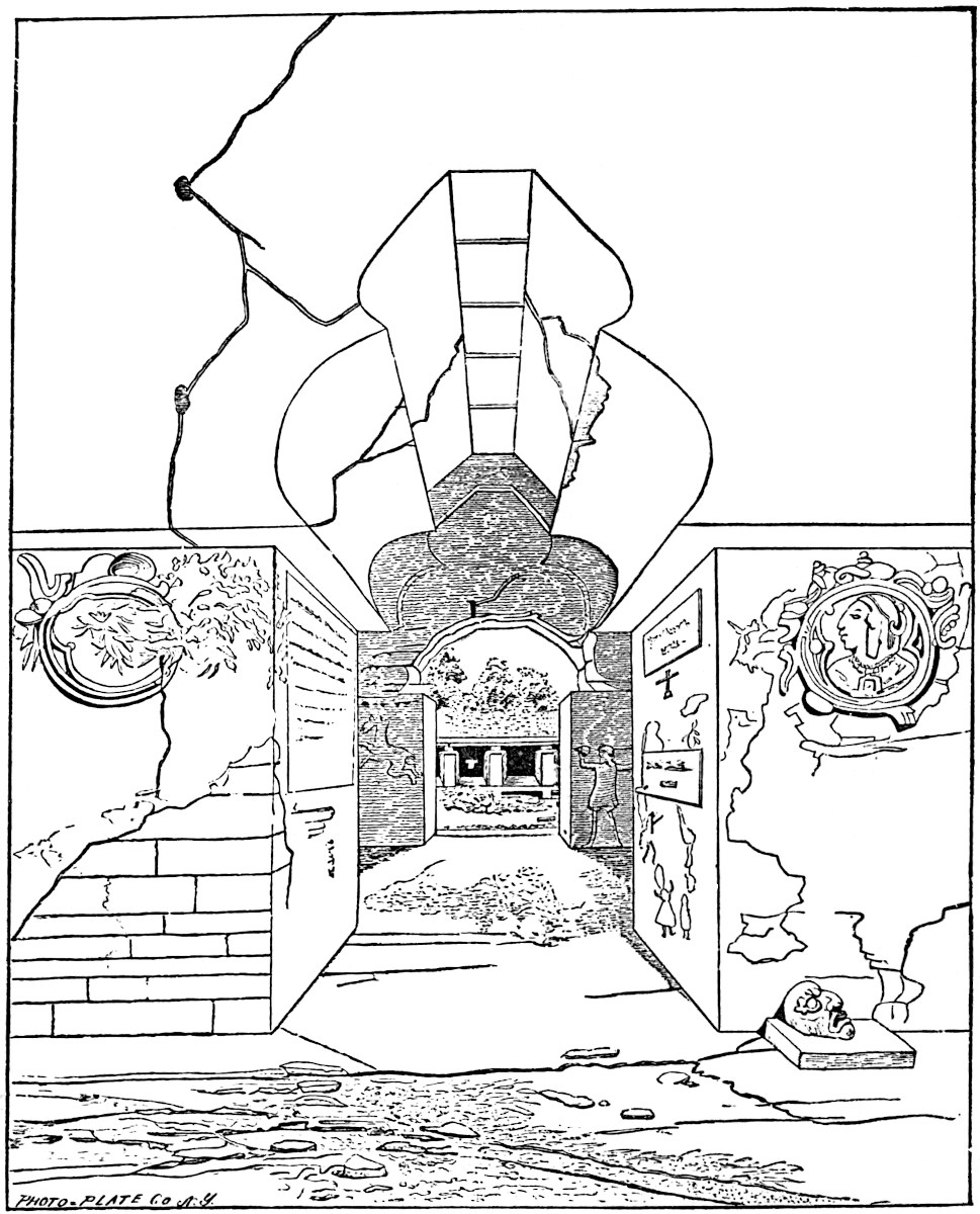
The second division of Maya architecture, namely, the Yucatan or modified style, presents some variations from the ancient 347or Chiapan. Probably the most remarkable group of ruins in that richest of American architectural fields—Yucatan—is situated at Uxmal, in Lat. 20° 27′ 30″, thirty-five miles south of Merida. The reader is of course acquainted with the detail of the survey of this remarkable city of antiquity through the work of Stephens and Catherwood.[500] These indefatigable explorers examined about forty ruined cities, nearly all of which were previously unknown to others than the natives, and many of them were unknown at Merida, the capital of the country. While these travelers are pre-eminently the explorers of Yucatan, there are others whose services have been of great value in the same field.[501]
Mr. Bancroft has divided the architectural remains in Yucatan into four groups, classifying them geographically. We do not consider it necessary to follow such a course, nor enter into the detailed description of any group, but will content ourselves by simply noting any variations from the Palenque models. At Uxmal our attention is at once arrested by the irregular pyramidal base of the building known as the Casa del Gobernador. The base of the pyramid is a figure of an irregular rectangular form. The northern and eastern sides of the base are equal, and measure about six hundred feet each; the southern and western are, however, irregular. As all the angles are right angles, and two contiguous sides are equal, it will be understood that the figure of the base would have been a square, but for the irregularity of the remaining two sides. These irregularities fall within the figure of the square. The pyramid is terraced, the first promenade when observed being but three feet from the ground. The second terrace rises from 348this to a height of twenty feet, and supports a platform with sides 545 feet in length. A trifle west of the centre of this platform rises the third terrace, nineteen feet high, and supporting the summit platform, measuring about 100 by 360 feet, with an elevation above the ground of upwards of forty feet.[502] The pyramid is composed of fragments of limestone thrown together, but with the terraces substantially faced with walls of regular and smoothly-hewn limestone-blocks, laid in mortar 349which has become intensely hard. The corners of the pyramid differ from those usually met with in that they are rounded. The terrace walls incline slightly toward the centre of the pyramid. The second platform was reached by a long inclined plain on the south side one hundred feet wide. A regular stairway with thirty-five steps, and one hundred and thirty feet wide, furnished the means of ascent from the second platform to the summit. The crowning feature of the structure is the Casa del Gobernador, a characteristic Yucatan building, measuring three hundred and twenty-two feet long but only thirty-nine feet wide. The Casa is surrounded by a promenade thirty feet wide, and in its interior contains two parallel rows of apartments (a plan of which is given by Mr. Stephens).[503] A sectional view of the Casa resembles the sectional view of the palace corridors at Palenque, except that in the arches conspicuous in the latter, the irregularities produced by the square overlapping stones (which are filled up to an even surface by mortar and plastering), are avoided in Yucatan, by the overlapping stones of the arch being dressed carefully to the angle of inclination of the wall or ceiling, thus presenting a smooth surface. The roof is formed by filling in the space between the tops of the arches and between the arches and the outer walls with stone, up to the desired level; after which a perfectly flat covering of well-cut stones is laid over the whole, having a neat though small projecting cornice, as will be observed in the accompanying cut from Bancroft’s work. The rear wall is about nine feet thick and perfectly solid. The comparative modernness of the building may be realized when we state that Mr. Stephens found the top of each doorway supported by a heavy beam of zapote-wood. One of these, which was elaborately and beautifully carved, and measuring ten feet long and ten by twenty inches wide, he brought to New York, where, unfortunately, it was destroyed by fire with the remainder of his collection. It is presumed that the zapote-wood was prized for its rarity, as it is not found at present 350near Uxmal. Inside of and above the doors of the Casa were stone rings, which occur frequently in Yucatec structures, and are supposed to have supported curtains for closing the doorways. Stephens presents in a cut (page 346) a view of the imposing and elegant front looking toward the south.[504]
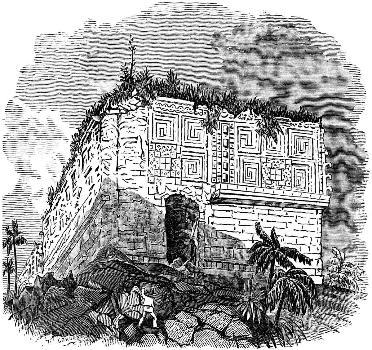
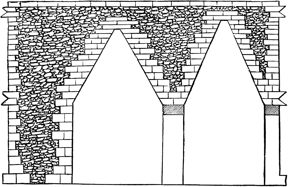
Of the several Uxmal edifices, one especially demands attention as representing the highest state of ancient architecture and sculpture in America. This is known as the Casa de Monjas, or Nunnery, and is situated nearly three hundred yards north of the Casa del Gobernador, on a pyramid with three terraces, and measuring three hundred and fifty feet square at its base. On the summit platform, only nineteen feet above the level of the ground, stand four of the characteristic Yucatan buildings upon four sides of a nearly square court. The northern building does not stand quite parallel to the building on the opposite side of the court. The plan from Stephens will present clearly the arrangement of the apartments, in which it will be observed that of the eighty-eight rooms contained in the Casa de Monjas, not more than two apartments open into each other, except in 351one instance, which occurs in the eastern front.[505] The court formed by these long narrow edifices measures 258 by 214 feet, and according to M. Waldeck was paved with 43,660 blocks of stone six inches square. In the centre stood the fragments of a rude column similar to others observed in the Casa del Gobernador.[506]
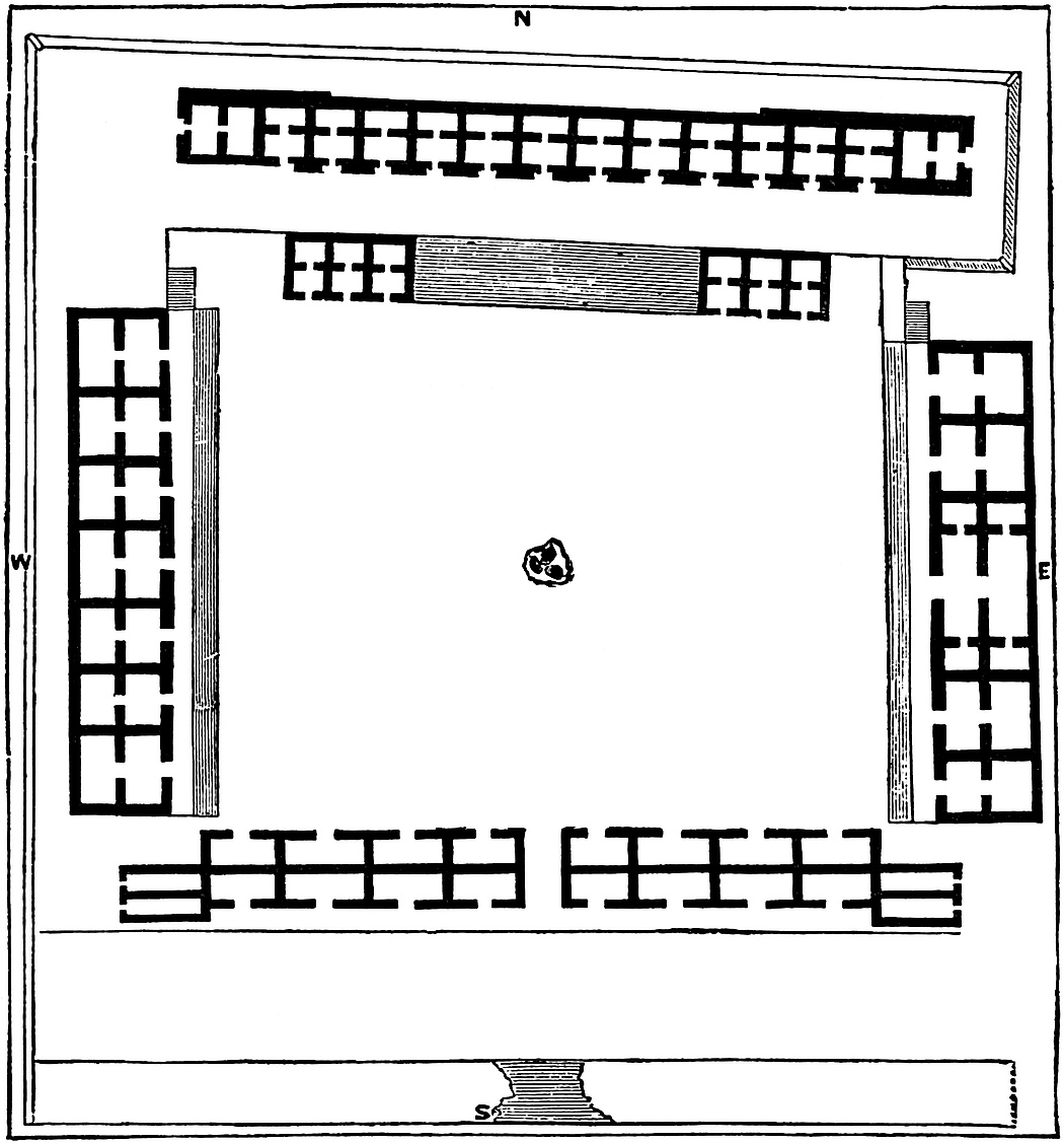
A cut of one of the beautifully sculptured façades of the Casa 352de Monjas will be found on a future page. Near the Casa de Monjas stands the pyramid and edifice generally known as the Casa del Adivino or Prophet’s house, and named by M. Waldeck the Pyramid de Kingsborough. The pyramid rises to a height of 80 feet from a base of 155 by 235 feet. The corners are rounded, and the sides, which are carefully faced with cubical blocks of stone, rise so steep that the ascent and descent by the grand stairway on the eastern face is giddy and dangerous. The stairway measuring one hundred and two feet on the slope is inclined at an angle of eighty degrees.[507]
About a dozen miles south-eastward from Uxmal are the remains of the ancient city known as Kabah, where ruins quite similar and nearly as extensive as those already described are found. However, new architectural features here meet the observer. In one instance the structure which surmounts a terraced pyramid is square, instead of long and narrow as at Uxmal. The inner rooms of the edifice have floors two feet higher than the floors of the outer rooms, and are entered by two stone steps. In one instance these were cut from a single block with the lower step in the form of a scroll. At Kabah we meet with an entirely new feature in Maya architecture, and the reader’s acquaintance with the terraced casas, of the New Mexican region, will supply the lack of an illustration at this point. In the style of building referred to, the pyramid instead of serving as a foundation for the building, serves as a central support around which the house with its receding stories, one above another, is built. The first story of the building referred to is built upon the ground, with the perpendicular sides of a mound for its rear wall. Just above, on a level with the roof of the first story on the platform of the first terrace of the mound, stands the second story, with the roof of the first serving as a promenade in front of it, while the third story rests upon the second platform of the mound. The platforms or roofs of the first and second stories are reached by means of a stone 353stairway supported upon a half arch. The first story is accessible from the ground by doorways. The interior apartments are constructed on the model of the Yucatec arch. Here, however, lintels of stone are met with, supported in the centre by rude stone columns surmounted by square capitals. These buildings are of large proportions, equalling any we have thus far described. The decorations of the edifices were considered by Mr. Stephens equal to those of any known era, even when tried by the severest rules of art.[508] At Zayi, one of the finest illustrations of this style of architecture is to be seen in what is known as the Casa Grande. The dimensions of the Casa Grande are as follows: lower story, 120 by 265 feet; the second story, 60 by 220 feet; and the third, resting on the summit platform of the mound, 18 by 150 feet; a stairway thirty-two feet wide furnishes a means of ascent to the third story on the front, while a narrow stairway leads to the second story at the rear. Round columns both in doorways and the façade constitute the chief variation from the styles already observed. An “elephant trunk” ornament protruding from the cornice (also found on Casa del Gobernador and the Casa de Monjas at Uxmal) is a marked feature of decoration. It is unnecessary for us to say that its presence has given rise to much speculation as to its origin. M. Waldeck has given the figure the name which we have applied to it, and perhaps with some reason.[509]
At Labná ruins of a curious and extraordinary nature exist, though far gone in decay. The accompanying cut, employed in Stephens’, Baldwin’s and Bancroft’s works, will serve to show the extravagant decoration lavished upon the cornices of the edifices. At Chichen-Itza, the so-called “Nunnery” is supported by a solid mass of masonry, with perpendicular walls. 355The dimensions of this base are one hundred and twelve by one hundred and sixty feet and forty-two feet high. This was crowned by a building having two receding stories. The great pyramid of Chichen is celebrated for the solid stone balustrade which guards its northern stairway of ninety steps, forty-four feet wide. These balustrades terminate in colossal serpent heads, ten feet long.[510] Both at Chichen and at Mayapan circular structures are met with and are figured by Stephens.[511] The same author has described the rectangular watch-towers of Tuloom, which rise majestically amid the extensive ruins of the ancient city of the same name, situated upon the eastern coast in latitude 20° 10´. At Tuloom, Mr. Stephens (its only describer), found the first walled city in Yucatan. He believes it to have been occupied long after the conquest, and probably was one of the cities whose many towers met the gaze of the wondering Spaniards, who beheld them as they coasted along the shore.[512]
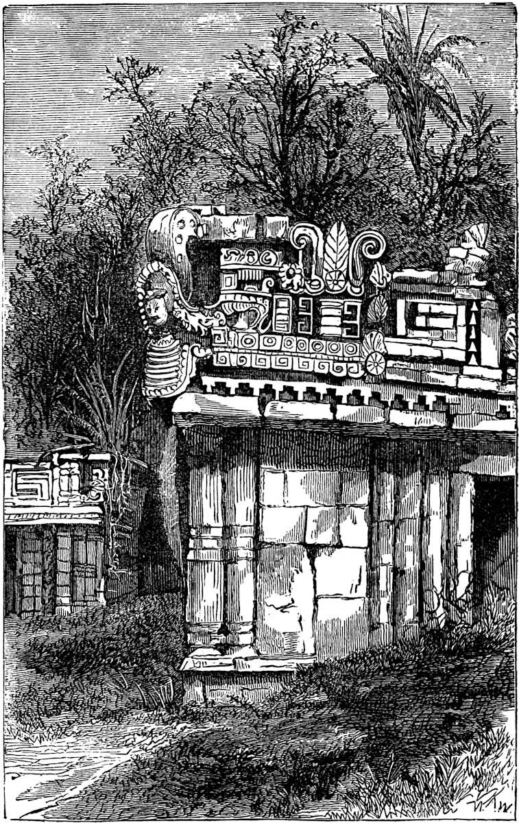
Quiché Architecture.—The propriety of classifying the great ruins of Honduras and Guatemala as Quiché in their origin and style, may be questioned by some of our readers. It must be admitted that great contrasts in style are found in this region, which was occupied by the powerful kingdom of the Quichés and Cakchiquels, at the time of the conquest. However, it is probable that the ancient Quichés (who, as we have already seen, at an early day developed a religion and literature), were the authors of the more ancient cities, like Copan and Quirigua. The Quiché-Cakchiquels of more modern times were quite another people, whose institutions, language, and no doubt their architecture, had been largely influenced by Nahua people from the Mexican plateau. Utatlan, the magnificent capital of this modern and mixed people, was in the height of its glory just before the blighting power of the conquerors laid it in ruins. As ours is not an attempt at the history of discovery, we omit entirely that interesting feature in the treatment of antiquities, 356and call attention at once to the features conspicuous in Quiché architecture. The ancient city known as Copan, on the eastern bank of a river of the same name, in latitude 14° 45´ and longitude 90° 52´ in Honduras, and four leagues from the Guatemala line, is interesting in furnishing material for study in this department. It is probably the most ancient city on the continent. Copan no doubt could successfully contend with Palenque for the palm of antiquity. It is again to the indefatigable Stephens and the skillful Catherwood that we are most indebted for our knowledge of these ruins.[513] The period of the abandonment of Copan is a question with reference to which we possess too few data to render an intelligent decision concerning it. Following the example of Stephens and Bancroft, we first introduce the account of Fuentes contained in Juarros.[514] “In the year 1700, the great circus of Copan still remained entire. This was a circular space, surrounded by stone pyramids about 357six yards high and very well constructed; at the base of these pyramids were figures, both male and female, of very excellent sculpture, which then retained the colors they had been enameled with; and what was not less remarkable, the whole of them were habited in the Castilian costume. In the middle of this area, elevated above a flight of steps, was the place of sacrifice. The same author (Fuentes) relates that, a short distance from the circus, there was a portal constructed of stone, on the columns of which were the figures of men, likewise represented in Spanish habits, with hose, ruff round the neck, sword, cap, and short cloak. On entering the gateway there are two fine stone pyramids, moderately large and lofty, from which is suspended a hammock that contains two human figures, one of each sex, clothed in the Indian style. Astonishment is forcibly excited in viewing this structure, because, large as it is, there is no appearance of the component parts being joined together; and although entirely of stone and of an enormous weight, it may be put in motion by the slightest impulse of the hand. Not far from this hammock is the cave of Tibulca; this appears like a temple of great size hollowed out of the base of a hill, and adorned with columns having bases, pedestals, capitals and crowns, all accurately adjusted according to architectural principles; at the sides are numerous windows faced with stone exquisitely wrought. All these circumstances lead to a belief that there must have been some intercourse between the inhabitants of the old and new world at very remote periods.” The swinging stone hammock is probably a work of the fancy rather than that of the artist’s hand, though the padre at Gualan told Stephens that he had seen it, and an Indian remembered to have heard his grandfather speak of it. None of these remarkable remains have been identified with certainty, though it is not improbable that they might be discovered if the heavy growth of vegetation were removed by a conflagration and explorers to extend their observations farther from the banks of the Rio Copan. According to Stephens’ survey, a wall encloses a rectangular area measuring about nine hundred by sixteen hundred feet. The principal group of buildings is designated358 as the temple. It is built of heavy blocks of cut stone, with walls of about twenty-five feet in thickness, and when examined they were between sixty and ninety feet high on the river’s bank. The temple measured six hundred and twenty-four feet north and south by eight hundred and nine feet east and west. The general feature of the ruin is that of an immense pyramidal terrace, with a platform elevated about seventy feet above the ground. The river side of the terrace is perpendicular, while the remaining sides are sloping; viewing the ruin from this general platform seventy feet high, depressions such as amphitheatre-like courts descend from it in some instances thirty or forty feet, or about half way to the level of the ground, while above the level of the general platform pyramidal structures rise to a considerable height, in one instance one hundred and twenty-two feet. It is difficult to conceive of what might have been the nature of the superstructure, if any surmounted the general platform. It is probable that for the purposes of assembly the amphitheatres with their sloping sides may have answered every purpose, while the pyramids may have been surmounted by temples now in ruins. Of the sculptured columns of this locality we will speak farther on. Utatlan, the former capital of the modern Quiché kingdom, would naturally be selected as a point at which to seek for remains of the newer Quiché styles of architecture. The conquerors, however, left little that can serve as the basis for architectural study. The city was surrounded by a deep ravine or barranca, which can be crossed at only one point, and there long lines of stone fortifications still guard the passage. A fortress, called El Resguardo, is among these works. It rises one hundred and twenty feet high in the form of a terraced pyramid, with a stone wall plastered with cement enclosing its summit platform, on which a circular tower provided with a stairway was built. Only fragmentary walls of the Quiché palaces remain; their dimensions were eleven hundred by twenty-two hundred feet, and nothing but their cement covered floors have survived the vandalism of the conquerors and the architects of the modern town; the latter having carried away the upper portions for building purposes.359 A pyramidal structure near by, known as El Sacrificatorio, presents no architectural contrasts to pyramids already described. Its stairway, composed of nineteen steps each eight inches broad and seventeen inches high, is characteristically Central American.[515] In the province of Vera Paz, especially in the Rabinal Valley, Brasseur de Bourbourg observed numbers of tumuli, resembling those of the Mississippi Valley both in material and structure. These were especially prevalent in the neighborhood of the villages, and sometimes were associated with pyramidal structures equal in finish to any we have described. The name cakhay, “red houses,” is generally applied to these tumuli.[516]
Nahua Architecture.—It would be quite impossible for us to devote that space to this subject which the number of remains would justify, and the presentation of the typal features of the architecture of that interesting family of nations will be all that we shall here attempt; of geographical and detailed treatments there are several on the different departments of the subject.[517] In the pages which follow we will select a few examples of Nahua architecture in order to illustrate our subject, but we would state that many equally important works, though perhaps presenting no new features, have been purposely passed by unnoticed. In a preceding chapter we referred to those intermediate nations which occupied the transition position between the Mayas and Nahuas. The Miztecs, Zapotecs and others, were probably a mixed people, related in different degrees to both of the great families on the north and south of them. Oajaca and Guerrero were the homes of these peoples, where they developed their own civilization and styles of art in channels distinct from those of their neighbors. The isthmus of Tehuantepec presents some interesting remains, chief among 360which we may cite two stone pyramids situated three leagues west of the city of Tehuantepec. One of these measures fifty-five by one hundred and twenty feet at the base and thirty by sixty-six feet on the summit. A grand stairway composed of forty steps and thirty feet in width leads up the western slope. The summit is also made accessible by smaller stairways on the north and south sides. The lower of the four terraces composing the structure, is perpendicular; the others have inclined walls. On the face of the second terrace were four ranges of flat stones, one above another, extending entirely around the pyramid and furnishing a series of shelves, devoted no doubt to some sacred or sacrificial use. The whole structure was plastered with a cement, colored brilliantly by red ochre. The adjoining pyramid presents an architectural novelty in its gracefully curved sides. Castañeda has sketched and Dupaix described it. The height of the pyramid is over fifty feet while its general dimensions are about the same as those of its neighbor. In close proximity to the pyramids, altar-like structures were observed, one of which was composed of eight circular stones, like mill-stones, placed one above another. The base measured ten and a half feet, but the summit only four and a half feet; the height measures twelve feet.[518] Numerous earthen tumuli resembling those of the Mississippi Valley were observed by the German traveler Müller, scattered over the region, especially to the south-east.[519] The most important group of ruins in Oajoca is that at Mitla, situated about thirty miles south-east of the capital of the State. This is probably the finest group of remains north of the isthmus of Tehauntepec. Still they are not purely Nahua in their style, being, according to tradition, the work of the Zapotecs. This group has been described several times by explorers, whose accounts have differed considerably in value. The most important of these are the descriptions 361and drawings by Dupaix and Castañeda, made in 1806, and the description and valuable photographs by Charnay, the latest explorer of this group, whose work was performed in 1859.[520]
The mitla ruins are distributed into four groups of buildings (generally called palaces or temples) and two pyramids. The principal edifice is described as follows: three low oblong mounds only six or eight feet high but surmounted by stone buildings, enclose a court. The court measures 130 by 120 feet. The eastern and western buildings are in a fallen and ruined condition. The northern building, however, presents a singular example of ancient grandeur. The southern portion measures 36 by 130 feet, and the northern 61 feet square. The edifice is about eighteen feet high, having walls varying from four to nine feet in thickness. The accompanying cut, a photographic reduction of Charnay’s photograph, gives a correct idea of the western façade of the northern building.[521]
The walls of this edifice are constructed in a somewhat novel manner, their interior portions being nothing more than clay intermixed with stones, thus furnishing a poor substitute for the cement and stone filling in the inner parts of Yucatanic walls. However, the exterior facing of the walls is of hewn stone blocks 362cut in different forms and sizes, and so set in relation to each other as to present examples of perhaps the finest variety of grecques found in any structure in the world.[522] Two layers of large stone blocks form the base of the palace, from which rises buttresses and a framework of stone, filled in with panels of mosaic, in patterns as described. We pronounce these grecque patterns mosaics, because of the manner of their structure. They are not of the nature of sculpture, since each pattern, with all its regularity, is composed of small brick-shaped blocks of stone built into the wall, mosaic-like, thus forming the graceful patterns shown in the cut. No trace of mortar has been found at Mitla. The inner surface of the wall in the northern building was smoothly plastered without any ornament. Six round stone columns standing in line occupy the centre of the apartment, and no doubt supported a roof of wood or stone, but more probably of the former.[523] The cut in Baldwin’s work, copied by 363Bancroft showing the interior of the apartment and the six columns, conveys an incorrect impression as to the form of the columns and the character of the walls, as is proven by Charnay’s photograph.[524] The façades of the inner court of the northern wing of the palace are finished with mosaics of great beauty. Four or five feet of the wall is plain at the bottom except that the plastering was evidently frescoed in various colors. The remainder of the wall is decorated with bands of mosaic grecques, as shown in the cut, which is a fac-simile of Charnay’s photograph engraven for Mr. Bancroft’s work. We should not fail to note the use of immense stones in the base, framework and lintels of the southern wing of the building. One of these is of granite, sixteen or nineteen feet long, with the pattern of the adjacent grecques sculptured on its face. None of the other buildings at Mitla present any architectural contrasts to the one already described, and require no special attention. Under a temple on the south-west side of the one we have just referred to, is a subterranean gallery, constructed in the form of a cross. The opening is at the base of the mound upon which the temple stands. The arms of the cross pointing toward the East, North and West, are each twelve feet long, five and a half feet wide, and six and a half feet high. The southern arm is, however, about twenty feet long, and not more than four feet high throughout most of its length. Near the centre of the cross (which 364lies directly under the centre of the temple above) a flight of four steps descends in the southern arm of the cross to a lower level, so that the southern arm of the passage is somewhat lower than the others. The entire subterranean chamber was roofed with large flat stones reaching from side to side. The walls, besides being painted red, were ornamented with panels of mosaic, but of a ruder style than that of the superstructure, which is suggestive of an earlier period in the growth of the art. A circular pillar resting on a square base, and called by the natives “the pillar of death,” because of the belief entertained among them that whoever embraced it would immediately die, supports the large flagstone which covers the intersection of the galleries. An immense fortification over a mile in circumference and with stone walls six feet thick and eighteen feet high crowns the summit of a hill, which stands three-fourths of a league south-west of Mitla. The place was inaccessible except on the side toward the village where the wall was double. Castañeda has delineated and Bancroft copied the plan of this fortress.[525]
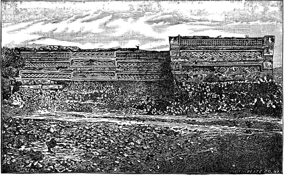
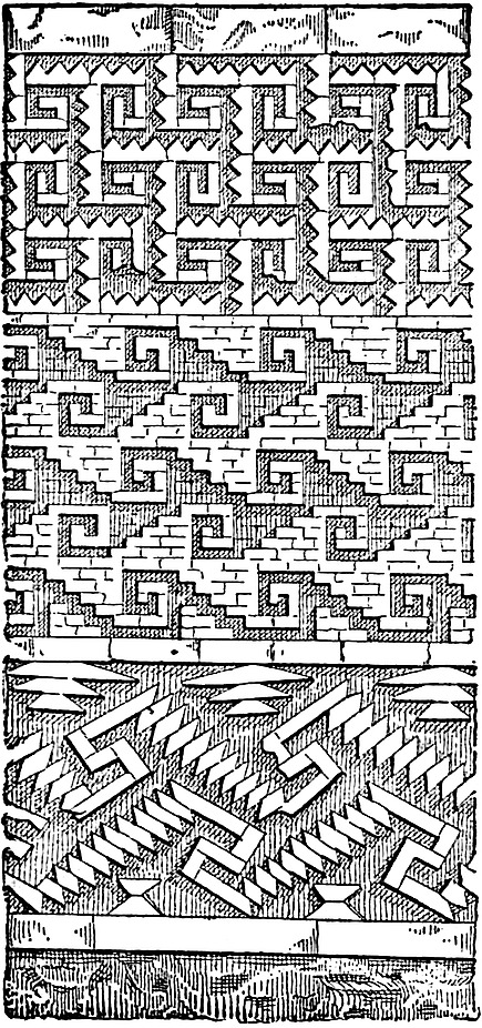
Passing into the state of Vera Cruz, the attention of the observer is arrested by great numbers of mounds of all the varieties peculiar to the Mississippi Valley. Excavations have yielded pottery of burnt clay, idols, and flint and stone weapons, as well as implements of agriculture, but no trace of iron or copper is recorded. As the Nahuas are said by Duran and Sahagun to have landed on the Gulf coast not far north of this region, and to have traversed it in their wanderings southward, and since the tradition derives them from Florida, it is not improbable that here we see the continuation of the works of the lower Mississippi.[526]
Of several interesting specimens of ancient architecture in the state of Vera Cruz we have selected a few examples. At Puente 365Nacional the remarkable pyramid shown in the cut is situated. It was described by J. M. Esteva in the Museo Mexicano in 1843. The pyramid is six stories high, and the eastern side is faced by a grand stairway in the form of a cross. Mr. Bancroft has described it, employing the accompanying cut. At Centla, twenty-five or thirty miles north of Cordova, a series of remarkable fortifications were discovered in 1821, which have been most thoroughly described by Sr. Sartorius, who visited the locality in 1833, but whose account was not published until 1869.[527]
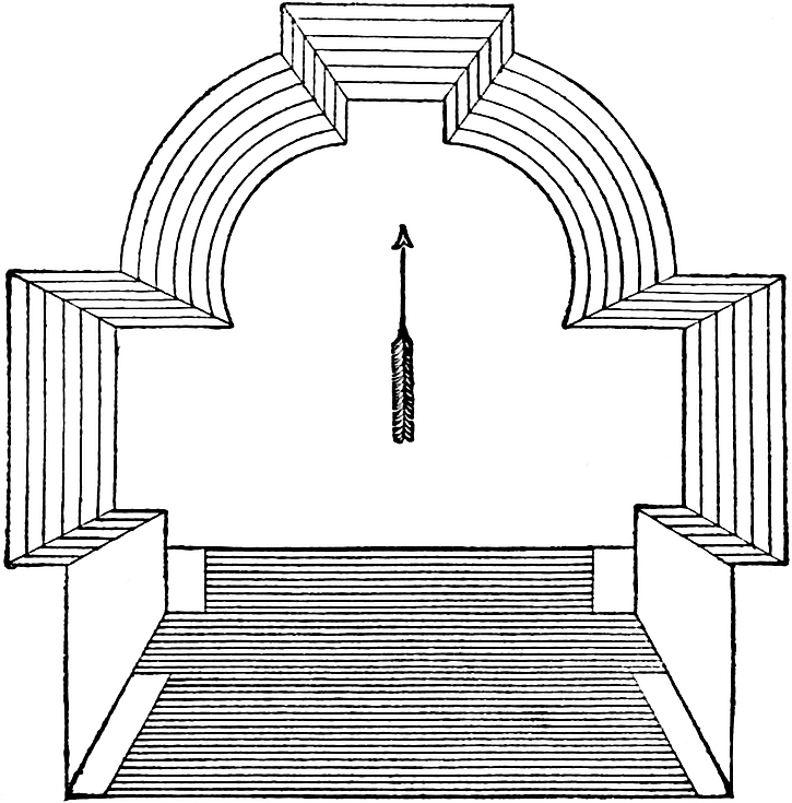
The most notable fortification is situated at a narrow pass between two ravines, with perpendicular walls several hundred feet deep. The distance between the precipices at this point is only twenty-eight feet. The defensive works consist of several pyramidal structures built of stone and mortar. The largest of these has three terraces rising from the rear until they approach a perpendicular wall, fronting a narrow passage-way only three feet wide. This perpendicular wall is surmounted with parapets and loop-holes for defence. A pyramid on the opposite side of the passage-way, the platform of which is reached by a single flight of steps, is possessed of the same defensive features, with the addition of a ditch at its front eleven feet wide excavated in the solid rock to a depth of five and a half feet. The object 366of the fortress seems to have been the protection of an oval-shaped tract of fertile land containing about four hundred acres, lying between the barrancas. At the opposite end of the oval tract, the precipices approach so closely to each other as to leave a narrow passage of only three feet in width, which also is guarded by stone walls. Of numerous pyramids in the region, the one figured in the cut (from Bancroft’s work) is pronounced by Sr. Sartorius as typical of all of them.[528]
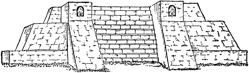
Half a league below the town of Huatusco, Dupaix discovered a remarkable pyramid crowning a hill on a slope of which was also a group of ruins called the Pueblo Viejo. This structure known as El Castillo, measures sixty-six feet in height, though there is some uncertainty as to the size of the base.[529] Dupaix’s text states it to be two hundred and twenty-one feet square, but Mr. Bancroft calls attention to the fact that Castañeda’s drawing makes it about seventy-five feet square. The pyramid in three terraces measures thirty-seven feet high. The superstructure is in three stories, with a single doorway in the lowest. This seems to have been the only opening through the walls of the castle, which were eight feet thick; we presume, however, only at their base, as their exterior shows a sloping rather than a perpendicular surface. The lowest story forms a single apartment with three pillars in the centre supporting the 367beams of the floor above. Portions of the beams were visible when Dupaix visited the locality. The walls of the castle are of rubble made of stone and mortar, as in the Yucatan structures, having stone facings. The exterior of the castle proper was coated with polished plaster and ornamented with panels containing regular rows of round stones embedded in the coating. Some unimportant fragments of sculpture in stone and terra-cotta were found in the ruin. El Castillo is of special interest because of the well-preserved condition of its superstructure. About one hundred and fifty or sixty miles north-west of the city of Vera Cruz, the German artist Nebel found a group of ruins known as those of Tusapan, buried in a dense forest at the foot of the Cordillera. The only structure which remains standing closely resembles the pyramid above described, except that the walls of the pyramid are not terraced, and the tower surmounting the pyramid is built with a single story. The only opening in the tower is the doorway at the head of the stairway. The interior contains a single apartment twelve feet square. The ceiling is said to have been arched or pointed, but Herr Nebel has failed to furnish definite information as to whether the arch was of overlapping stones or not, an oversight of an unpardonable character, since it would be of greatest interest to know whether the Maya arch existed so far north. The pyramid is described as thirty feet square, and built of irregular blocks of limestone, which was probably covered with a coat of the plastering generally employed and so polished in its appearance.[530] One remaining structure in the State of Vera Cruz merits special attention, namely, the pyramid of Papantla. This pyramid, known as El Tajin, “the thunderbolt,” is situated in a dense forest near the modern town of Papantla, which lies about forty miles east of Tusapan. There is a wide divergence of expression as to the dimensions of the pyramid. Herr Nebel, however, makes the base something368 over ninety feet square and the height fifty-four feet. The pyramid is seven stories high and apparently solid, except the topmost story which contained interior departments. This crowning structure is now sadly dilapidated. Dupaix’s statement, copied by Humboldt, that the material of the pyramid is porphyry, cut in immense blocks, appears to be an error, since later exploration has revealed the fact that the pyramid was constructed of regularly cut blocks of sandstone laid in mortar, and coated with a hard, smooth cement, three inches thick. A stairway on the eastern front is divided as well as being guarded by solid stone balustrades.[531]
For Nahua monuments of the purest type we naturally turn to Anahuac the home of Toltec and Aztec art during its most advanced period of development. But alas! the hand of the conqueror and the zeal of the fanatic have robbed irretrievably the antiquarian and the student of the history of architecture and art, of the best and noblest remains of that strangely interesting civilization. Our attention is naturally directed to the architecture of that ancient religious centre—Cholula—the origin of which, together with that of its great pyramid, we have described in a previous chapter. We have already seen that the prime object for erecting the immense pile, according to Duran, was the worship of the sun, and not to afford a refuge from a deluge as has been generally supposed. The pyramid of Cholula is situated in the eastern portion of a village to which it has given its name, and is reached by a ride of about ten miles westward from the city of Puebla de los Angelos. The magnificent temple upon its summit dedicated to Quetzalcoatl, fell a prey to the destroying vengeance of Cortez, who no doubt was enraged at the stubborn resistance 369with which he was met by the devoted natives, in a hard-fought battle at the foot and upon the slopes of the pyramid. Of the large number of descriptions, either made from personal observation or written from a comparison of accounts, none surpass that of Humboldt, which was the result of a careful survey, performed in 1803. Humboldt’s drawing, however, was a restoration and not a picture of the condition of the shrub-grown hill as he saw it.[532] The pyramid, according to Humboldt, measures at the base six hundred and thirty-nine metres or a trifle more than fourteen hundred and twenty-eight feet square; in other words, about forty-four acres. The base is shown by Humboldt to be more than twice as large as that of Cheops. Humboldt and Dupaix give its height as fifty-four metres or one hundred and seventy-seven feet; Mayer says it is two hundred and four feet; Tylor, two hundred and five feet, and Heller[533] states that its summit platform covers an area of 13,285 square feet. Its height is somewhat greater than that of the pyramid of Mycerinus. Humboldt compares it to a mass of brick, covering a square four times as large as the Place Vendôme and twice the height of the Louvre. He considers it of the same type as the temple of Jupiter Bélus—the pyramids of Meïdoùn Dahchoùr, and the group of Sakharah in Egypt. This great monument was constructed in four equal terraces of small sun-dried bricks, laid in a mortar which has been pronounced by some a mixture of clay with fragments of stones and pottery, by others a cement intermixed with small pieces of porphyry and limestone. Herr Heller discovered that the entire structure had been covered 370with a coating of cement composed of lime, sand and mortar.[534] The present appearance of the pyramid is sufficient to induce the opinion that it was originally a natural eminence faced up with adobes in terraces, in accordance with the architectural idea, but its position in the centre of a plain, together with the revelations as to its contents, disclosed by the construction of the Pueblo road through one corner of its base, furnish partial if not conclusive proof that it was entirely of artificial construction. The excavation revealed the perfect regularity with which the bricks were laid in the interior, and brought to light a tomb containing two skeletons, two basalt figures, a collection of pottery and other articles not described. Humboldt has fully described this chamber, which was constructed with stone walls supported by cypress timbers. No doorway could be found opening into the tomb.
At Xochicalco, the “hill” or “castle of flowers,” situated seventy-five miles south-west from the city of Mexico and distant from Cuernavaca fifteen miles in nearly the same direction, are found the most remarkable specimens of ancient Mexican architecture north of the isthmus of Tehuantepec. The most important descriptions of the ruins are by Alzate y Ramirez,[535] Humboldt,[536] Dupaix and Castañeda,[537] Nebel,[538] and one prepared by the authority of the Mexican government.[539]
371
These ruins are both beneath and upon a natural hill of oval form measuring about two miles in circumference and from three hundred to four hundred feet in height, authorities differing considerably on this point. At the foot of the hill on its northern side, are the entrances of two tunnels, one of which extends to a point eighty-two feet from the edge of the hill, where it terminates abruptly. The second tunnel penetrates the solid limestone of the hill in the form of a square gallery nine and a half feet high and broad, extending inward for several hundred feet and branching into several auxiliary galleries, which terminate in some instances abruptly. The floors are paved with small blocks of stone, to a thickness of a foot and a half; masonry in some places support the sides, and all the interior surface shows traces of red paint upon the polished cement coating with which it was finished. The principal gallery, after turning a right angle toward the left and extending some hundred feet in a straight line, enlarges into a subterranean chamber eighty feet long by about sixty feet in width. Two circular columns of living rock were left in making the excavation as supports for the roof. The most singular feature connected with the chamber is the perfectly circular excavation found at its south-east angle, or that corner of the room diagonally opposite to the corner at which the passage-way enters it. This circular apartment is only about six feet in diameter, and while it is no deeper than the adjoining chamber, rises above its ceiling in a dome-shaped roof, lined with stones hewn in curved blocks. The curve of this dome-like ceiling corresponds with that of a well-proportioned Gothic arch. At the apex of the dome, a round hole ten inches in diameter extends vertically upwards; some suppose to the pyramid above, but a moment’s calculation suffices to show that in view of the considerable diameter of the hill and the comparatively short distance from the chamber to its exterior slope, such is impossible. The exterior of the hill presents a most wonderful display of masonry. Its entire circuit is compassed with five terraces of well-laid stone and mortar, faced with perpendicular walls. Each terrace of masonry is about seventy feet in height, and is constructed in an irregular line,372 forming sharp angles, like the bastions of a fortress; each wall supporting the terraces rises above the level of their respective platforms in parapets, evidently for defence. The pavements of the platforms are of stone and inclined slightly toward the south-west, with a view to draining off the rainfall. Dupaix is the only explorer who mentions the means of ascent, which he describes as a roadway eight feet wide, leading to the summit. The summit platform measures 285 by 328 feet, and is surrounded by a wall which is perpendicular on the inside, and on the outside conforms to the slope of the terrace wall of which it is an extension. This parapet, built of stones without mortar, rises five and a half feet above the plaza, and is two feet and nine inches thick, we presume at its top, since the outer slope of the terrace would make a difference between the top and bottom. Near the centre of the plaza stands the base of a pyramid which presents some remarkable architectural contrasts from anything we have thus far described. Its sides face the cardinal points,373 and measure sixty-five feet from east to west, and fifty-eight feet from north to south. One of the façades, the northern, according to Nebel, and the western, according to the Mexican Government Survey in the Revista, is cut in two in the centre by an opening twenty feet wide, where it is supposed a stairway formerly led to the superstructure. The cut from Nebel, and reproduced by Mr. Bancroft, shows the façade to the left of the opening, as the observer faces the pyramid.
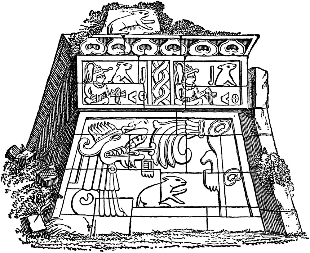
The great granite or porphyritic stones which constitute the facing of the pyramid, some of them eleven feet in length and three feet in height, must have been brought to the summit of the hill at the expense of great labor, especially since they must have been transported from a considerable distance, no such material being found within a circuit of many leagues. The stones were laid without mortar, and so nicely that it is said the joints are scarcely perceptible. Fragments of a ruined superstructure surmount the pyramid. The foundation walls of the second story were two feet and three inches from the edge of the cornice below it, except on the west where the space was four and a half feet wide. In 1755, so say the inhabitants of the vicinity, the structure was yet complete, having five receding stories like the first, and probably reaching a height of sixty-five feet. On its crowning summit, on the eastern side, stood a large throne-like block of stone, ornamented with elaborate sculptures. The second story foundations indicate the position of three doorways at the head of the grand stairway, and the account in the Revista describes an apartment twenty-two feet square observable at the summit of the first story, but now filled with fragments of stone. Mr. Bancroft suggests that from this apartment there may have been some means of communication with the subterranean galleries already described. The colossal sculpture on the face of the pyramid will receive our attention on a future page.[540]
374
The general description given above, together with the reported character of the superstructure of this magnificent monument, calls to mind the main features of the great teocalli dedicated to the bloody god Huitzilopochtli in the Aztec capital called Tenochtitlan or Mexico. This blood-stained temple upon whose altars smoked the hearts of countless human victims, is supposed to have occupied the site of the cathedral fronting the Plaza Mayor of the modern city of Mexico. Not a vestige of that terraced pyramid has survived the destructive hand of fanaticism and the transforming work of man and nature which have been going on ever since upon the old site of the capital of the Montezumas. It is said to have been built in five stories, with flights of steps affording access to the summit; but each flight was so constructed with reference to the platform at its top, as to require almost a complete circuit of the building before the next flight could be reached. It was necessary, therefore, in order to reach the summit platform, to pass four times around the pyramid. It is supposed that this was intended to display to better advantage the solemn processions of the priests as their long train mounted gradually the sides of the edifice. The specialist is already familiar with the descriptions by Bernal Diaz, whose particular extravagance of statement renders his work altogether unreliable. Also with the accounts by Torquemada, Gomera, Cortez and Clavigero. The reader has no doubt acquainted himself with the main facts in the writings of the graceful and imaginative Prescott, whose seeming romance, The History of the Conquest of Mexico, has been proven by recent and reliable investigation to have approached much nearer to fact than to fiction. Mr. Tylor, after careful exploration, has expressed in his “Anahuac” his surprise and satisfaction at what he considers to be the proof of Mr. Prescott’s general correctness of statement as to the extent of the Aztec capital and the probable character of its edifices.[541]
For a description of the palaces of Mexico and Chapultepec, the museums, mansions of the nobles, the pavements and aqueducts375 of that buried city, we refer the reader who has not access to the sources, to the admirable account by Prescott, especially since it more properly belongs to the province of history (now that all traces of them have disappeared) than to that of archæology.[542]
Of many interesting localities where architectural remains still exist, we select one more in the Central region, to illustrate our subject. The ancient religious city of the early Nahuas, Teotihuacan, with its famous pyramids—the traditional origin of which we have already noted[543]—deserves our attention. The city of the gods has had many describers, from the illustrious Humboldt to the observant and philosophical Mr. Tylor. The most complete description, however, is that given in the report of a scientific commission appointed by the Mexican government in 1864, containing accurate plans and views.[544] Sr. Antonio Garcia y Cubas, a member of the commission, subsequently published a most interesting memoir on the pyramids of Teotihuacan, entitled Ensayo de un Estudio comparativo entre las Pirámides Egípcias y Mexicanas (Mexico, 1871). The analogies between Teotihuacan and Egyptian pyramids receive the greater share of attention, though some valuable facts not mentioned in the report of the commission are here made known. Mr. Bancroft has reproduced the main features of the report of the Mexican Commission and compared it with previous researches, thus presenting the reader with probably the best critical version of the exploration of Teotihuacan, to be found in any language.[545] The cut reduced from Almaraz for Mr. Bancroft’s work shows the plan of the Teotihuacan monuments on a scale of about twenty-five hundred and fifty feet to an inch.
376
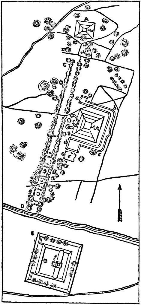
The pyramid marked A in the plan is known as Metztli Itzacual, which is interpreted “House of the Moon.” It measures 156 metres or 512 feet from east to west by 130 metres or 426 feet from north to south. According to Almarez, its height is 42 metres or 137 feet, but Sr. Garcia y Cubas, who took his measurement on the opposite side of the pyramid from that measured by Almaraz, says that it is 46 metres or 150 feet high. The summit platform, according to Garcia y Cubas, is six metres or nineteen and a half feet square; quite a discrepancy is here observable between the estimated area given by Beaufoy and copied by Mr. Bancroft as thirty-six by sixty feet, and this actual measurement. The sides of the pyramid nearly face the cardinal points. The eastern slope is 31° 30′, while the southern is somewhat steeper, being 36°. The slope on the east seems to have been unbroken except by a zigzag roadway, leading to the summit. The remaining sides are plainly marked by the remains of three terraces, one of which is still about three feet wide. Humboldt and Tylor both speak of remains of stairways of which no mention is made by the Government Commission. Most observers have described the pyramids as faced with hewn stone, but the commissioners on the contrary found them coated with successive layers of different conglomerates as follows: “1st, small stones from eight to twelve inches in diameter, with mud forming a layer of about thirty-two inches; 2d, fragments of volcanic tufa, as large as a man’s fist, also in mud, to the thickness of sixteen inches; 3d, small grains of tetzontli (a porous volcanic rock) of the size of peas, with mud, twenty-eight inches thick; 4th, a very thin and smooth coat of pure lime mortar.377 These layers are repeated in the same order nine times and are parallel to the slopes of the pyramid, which would make the thickness of the superficial facing about sixty feet.”[546] On the southern slope, sixty-nine feet from the base, according to Almarez, a gallery large enough to admit a man crawling on hands and knees, extends inward on an incline, a distance of twenty-five feet, and terminates in two square wells or chambers, each five feet square, and one of them fifteen feet deep. Mr. Löwenstern, according to Mr. Bancroft, states that “the gallery is a hundred and fifty-seven feet long, increasing in height to over six feet and a half, as it penetrates the pyramid; that the well is over six feet square, extending apparently down to the base and up to the summit; and that other cross galleries are blocked up by débris!” It is probable that these remarkable galleries never existed, except in Mr. Löwenstern’s imagination, since Sr. Almarez in the report of the official survey pronounces the tunnel already described as simply excavations by treasure-hunters. The pyramid B of the plan, situated five hundred and seventy-five yards south of the House of the Moon, is called Tonatiuh Itzacual, or “House of the Sun.” This pyramid requires no description, except to give its dimensions, since in all other respects it is precisely similar 378to the House of the Moon. The House of the Sun, according to the measurement of Sr. Garcia y Cubas, which is the most recent, is at the base 232 metres or 761 feet by 220 metres or 722 feet. Its height is 66 metres or 216 feet, while the summit platform measures 18 by 32 metres or 59 by 105 feet. Both this pyramid and the preceding have each a small mound on one of their sides near their base. In the latter instance this mound seems connected with an avenue of mounds just west of it. An embankment marked a, b, c, d, one hundred and thirty feet wide on the summit and twenty feet high, widening out at the extremities into platforms, extends around three sides of the “House of the Sun.” Across the Rio San Juan, and at the distance of twelve hundred and fifty yards southward of the “House of the Sun,” stands the Texcalpa or “citadel.” This is a quadrangular enclosure, measuring on its exterior twelve hundred and forty-six by thirteen hundred and thirty-eight feet. The embankments are of enormous strength, being two hundred and sixty-two feet thick by thirty-three feet high, except on the western side, which is but sixteen feet high. The enclosure is divided unequally by a wall as strong as that upon the sides. On the centre of this wall stands a pyramid ninety-two feet high. At its base are two small mounds besides one in the western enclosure, while fourteen others averaging twenty feet in height are arranged with regularity upon the summit of the enclosing wall. An avenue two hundred and fifty feet wide formed by mounds and measuring two hundred and fifty rods in length, extends from a point south of the “House of the Moon” to the river, as is shown from C to D, in the plan. The avenue is cut up into compartments by six cross embankments, a rather strange feature for which no explanation has been afforded. These mounds are mostly conical, built of fragments of stone and clay, and some of them reach a height of thirty feet. The native traditions call it Micaotli, which may indicate that they were designed for the purposes of sepulture. Almaraz, who excavated one of the multitude of mounds or tlalteles in the vicinity, found four walls meeting at right angles, though a little inclined and forming a small square. Connected with this were steps, at the top of379 which four other walls enclosed a little room, supposed to have been a tomb. The natives describe the discovery of a stone box in one of the mounds containing a skull, with about such a collection of trinkets as is commonly met with in the stone graves of Tennessee. Mayer describes a massive stone column, ten feet long and four feet square, cut from a single block. This resembles the elaborate capitol of a column resting on a base with scarcely a shaft intervening. It is called the fainting stone by the natives, who believe that whoever sits on it is sure to faint instantly.
One additional group of ruins, as yet unclassified with any of the types we have described, merits our attention. This group is known as Los Edificios of Quemada, situated in southern Zacatecas north of the Central plateau and probably the home of the Chichimecs.[547] Mr. Bancroft has attempted to reconstruct the unsatisfactory accounts of the several explorers of Quemada, but with little success. We therefore decline adding another comparative failure to the list of literature on these ruins. Some general observations, however, may not be out of place. The Cerro de los Edificios is a natural eminence about half a mile long and between one hundred and two hundred yards wide, except at its southern extremity where it increases to a width of five hundred yards. The authorities differ as to its height, one saying from two to three hundred feet, and another eight to nine hundred feet above the plain. Ancient roads well paved radiate in various directions from the hill, some of them 380extending a distance of five or six miles. The northern brow of the hill, where the descent is not so precipitous as at the other points, is guarded by a stone wall, as are all other points where the precipitous sides do not offer a sufficient barrier to an intruder from without. The surface of the hill is quite uneven, and these irregularities have been formed into terraces supported by stone walls. Foundations have thus been secured for a multitude of structures, some of them perfectly pyramidal and others consisting of quadrangular enclosures or squares, terraced and having steps descending to the court within, where pyramidal structures of stone are found. On the eastern terrace of the Cerro, a round pillar, eighteen feet high and nineteen feet in circumference, stands in proximity to a wall of as great height as the pillar. Traces of nine similar pillars are visible, and the probability is that they formed part of a balcony or perhaps a portico. Adjoining this wall is an enclosure measuring 138 by 100 feet, in which are eleven pillars in line, each seventeen feet in circumference and as high as an adjacent wall, namely eighteen feet. The distance from the wall is twenty-three feet, and the presumption is that the pillars supported a roof. There are no doorways, properly so called, since the doorways are large quadrangular openings extending to the full height of the halls. No windows were discovered anywhere. The material is gray porphyry from hills across an intervening valley, and the mortar is reddish clay, mixed with straw, and is of poor quality. Sculpture, hieroglyphics, pottery, human remains, idols, arrow-heads, and obsidian fragments are totally wanting, thus presenting a strange contrast with all other Mexican ruins. Nevertheless, the massiveness of the fortifications, the height and great thickness of the walls, none of which are less than eight feet thick and in one instance over twenty, the extensive system of paved roads, besides great elevated stone causeways running through the city, the size of the enclosed squares, one of which contains six acres, all indicate that this might have been the capital city of a powerful people, a people whose architectural affinities with all others that we are acquainted with are very few, and whose contrasts are numerous. Certainly the type and execution of the masonry, though381 massive, is more primitive than found elsewhere in Mexico. We do not mean that it is more ancient, for such cannot be true, but inferior to that in other parts of Mexico and the Central American region. The arch of overlapping stones is entirely wanting, and but for the round columns without either base or capitol, the steps toward advancement in the art would only be those common to that generally vigorous and warlike period which, in the history of every people, has preceded a higher civilization. Mr. Bancroft has published Burghes’ plan of Quemada but to little purpose, since the descriptive matter available does not contain a reference to more than one-fourth of the many structures indicated.
In the course of the chapter, we have indicated the principal resemblances and contrasts between the various styles treated. The pyramidal structure we have found employed by both Mayas and Nahuas, with certain modifications and with such resemblances as would seem to indicate that both peoples had been originally, or at an early day, near neighbors, and that the younger people, at least the more recent in their occupancy of Mexico and Central America, the Nahuas, may have copied the pyramid in its perfected form from the Mayas. We have noted some difference between the ancient and modern Maya styles. In the ancient or Chiapan, the irregularities in the face of the pyramid caused by constructing it of tiers of rectangular stones were filled with mortar, and an even surface produced. In the modern or Yucatec style the blocks of stone-facing are bevelled to the angle of the slope. Furthermore, in some instances the corners of the pyramids were rounded. At Palenque the superstructures were of only one story, while Yucatec structures were often formed of three receding stories. Of the Copan ruins little can be said intelligently, except that the pyramid combined with the terrace is all-pervading, but still is not unlike the Palenque style in its main features. The Nahua architecture offers a great variety of styles, but at the same time the pyramidal structure is the fundamental feature of all kinds of structures. Mitla offers an exception to this rule, but there are doubts as to whether Mitla may be classified as a Nahua382 ruin at all. The early writers devoted much of their attention to seeming old world resemblances in ancient American architecture, but their speculations in most cases were puerile and trivial. Mr. Stephens, with the experience which the careful study and observation of old world monuments afforded him, strongly denies that any such analogies are to be found among the Maya groups.[548] M. Viollet-le-Duc considers the monuments of Mexico, especially those of Maya origin, to have been influenced by white and yellow races, the former of the Aryan from the north-east, the latter the Turanian from the north-west. He seems to find some analogy between ancient Japanese temples (and quotes a description from Charlevoix, Histoire du Japan, ed. 1754, tom. i, chap. x, p. 171) and those of ancient America. He thinks that the style of architecture at Uxmal indicates clearly that the first structures were of wood and resembled the style prevalent in Japan. However, the wooden structures more properly originated with the white races, while the use of stucco is characteristic of the Turanian or Yellow races of the north-west. He thinks it certain that Mitla and Palenque were influenced by a white race.[549] Señor Garcia y Cubas has attempted to prove in a careful argument that the pyramids of Teotihuacan were built for the same purposes as were the pyramids of Egypt. He considers the analogy established in eleven particulars, as follows: the site chosen is the same; the structures are oriented with slight variation, the line through the centres of the pyramids is in the astronomical meridian; the construction in grades and steps is the same; in both cases the larger pyramids are dedicated to the sun; the Nile has a “valley of the dead,” as in Teotihuacan there is a “street of the dead;” some monuments of each class have the nature of fortifications; the smaller mounds are of the same nature and for the same purpose; both pyramids have a small mound joined to one of their faces; the openings discovered in the Pyramid of the Moon are also found in some Egyptian pyramids; the interior arrangement383 of the pyramids is analogous.[550] Mr. Delafield by a less systematic argument advocates the same theory. However, his capability to discern analogies is not confined to a single structure, since in the pyramid of Cholula and the teocalli of the city of Mexico he finds a counterpart to the temple of Belus at Babylon, as described by Herodotus. The walls around the hill at Xochicalco explain the use of similar embankments at Circleville and Marietta in Ohio, while the order of the apartments at Mitla bears a striking analogy to the arrangements of apartments in the temples of upper Egypt. This and much more Mr. Delafield has been able to discover, but unfortunately only with certainty to his own mind.[551] Löwenstern is equally certain that the American monuments were not constructed by a nation analogous to that which built the pyramids of Egypt.[552] Ranking, on the other hand, finds that Teotihuacan was named after the illustrious dead buried beneath its pyramids, as was the custom in Egypt, but in this instance the name is analogous to that of Thiautcan or Khan, the name of the grand Khan of the Monguls and Tartars who occupied the throne of China at the time of Sir John Mandeville’s visit to Pekin in the fourteenth century; and as at Teotihuacan and among the Monguls the sun and moon were worshipped, so, according to Ranking, those American monuments are attributable to Mongul architects.[553] It would be easy for us to continue the citation of these fancied analogies, but it is no doubt already apparent to the reader that they are generally of too trivial a character to serve the ends of science, and we therefore dismiss their further consideration.[554]
384
Sculpture and Hieroglyphics.—The mound sculpture, as has been observed in the cuts illustrating a previous chapter of this work, though comparatively rude in most cases, still, in a few instances, is quite remarkable as affording true representations of animals and possibly of the human face. Considerable progress in the art of ornamentation in terra-cotta is displayed on many of the vases and burial urns exhumed from the mounds. Many of the lines, figures and borders traced in relief and sometimes in taglio on those vessels indicate not only that a sense of the beautiful was present, but that it had been cultivated to a considerable extent. The same remarks apply to the pottery of the Pueblos and Cliff-dwellers. At Palenque, however, the student of art meets with no mean attempts at delineating the human form—in fact, the success obtained in this difficult field alone characterized the work of the Palenque artists. It is presumed that nearly all of the piers separating the doorways in the eastern wall of the palace were ornamented with stucco bas-reliefs. Two out of six of the best preserved are shown in the following cuts. The most remarkable feature of the first (Fig. 1, reduced from Waldeck for Bancroft’s work) is the cranial type, deformed to a shocking degree, probably by artificial pressure, so generally employed by the ancient American races. Possibly it is but a caricature.
385
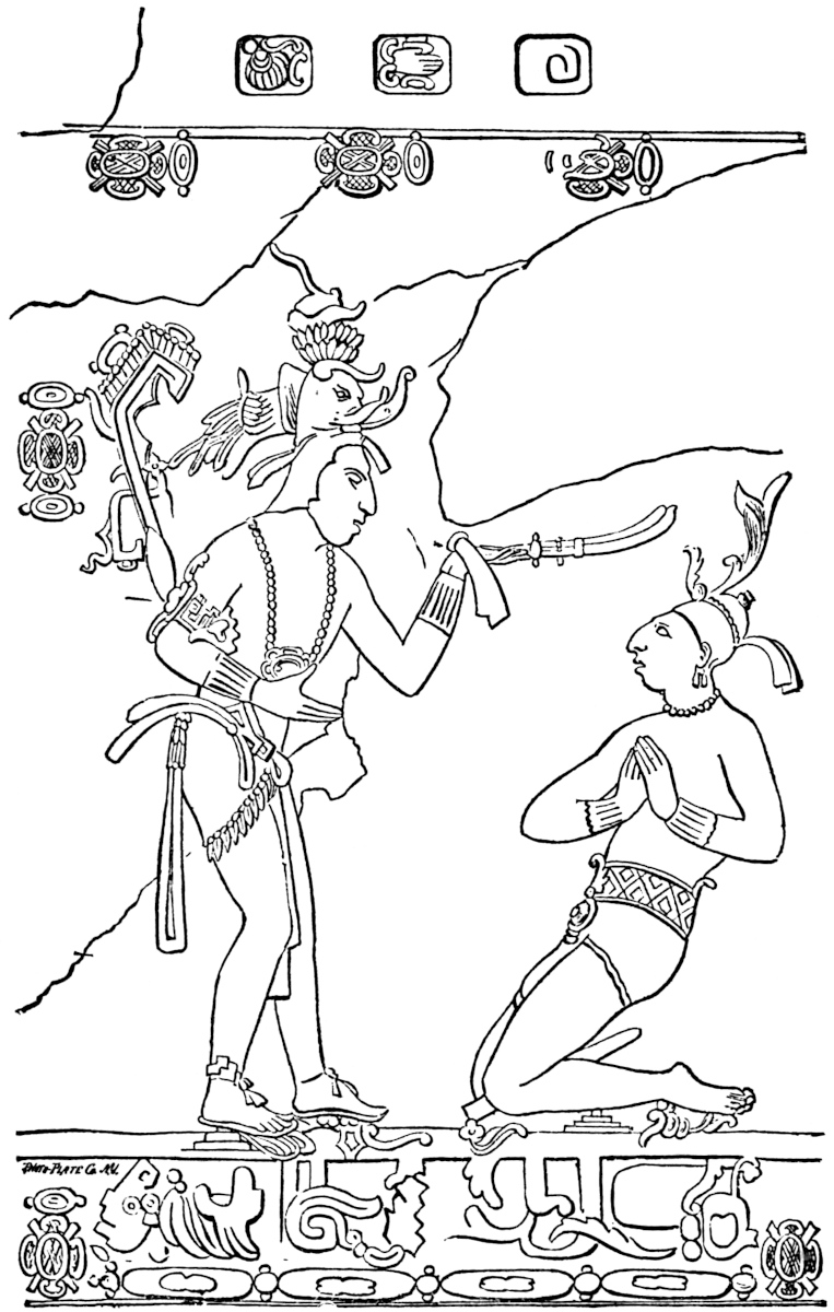
Fig. 2 (a photographic reduction from Waldeck) presents us with a subject which has called forth no little discussion. The “elephant’s trunk” which protrudes from the elaborate head-dress of the priest has been thought to indicate386 an Asiatic influence.[555] We have already referred to the frequent occurrence of the “elephant trunk” ornament in Yucatan. The hieroglyphic signs at the top and on the faces of these reliefs no doubt hold locked up in their mysterious symbols the history of the scene.
In all of these reliefs the flattened cranial type is present, and no doubt represents the ideal of beauty among those ancient people. The stuccoes appear to have been moulded upon the undercoating of cement after it had become hard. The brush of the painter was then employed in its final embellishment.[556] Adjacent to the eastern stairway leading downward into the main court of the palace are great stone slabs, forming a surface on each side of the steps fifty feet long by eleven feet high. Waldeck, Stephens and Bancroft furnish views of gigantic human figures sculptured in low relief upon these surfaces. Both the attitudes and expressions portrayed indicate that the groups represented are either captives or possibly victims for sacrifice.[557] On the opposite side of the court, and on the stone face of the balustrade of a stairway, two figures, male and female, are sculptured, which, according to Waldeck, are of the Caucasian type. The same artist has shown the beautiful grecques which adorn the panels of the cornice.[558] Waldeck and Bancroft have figured a remarkable stone tablet of elliptical form, in which a princely personage is represented as sitting cross-legged on a chair formed of a double-headed animal, pronounced by Stephens to resemble a leopard. Catherword’s plate, in Morelet’s Travels, shows an ornament suspended from the neck of the chief figure resembling an effigy of the sun, while in Waldeck’s drawing the Egyptian 387Tau is graven upon the ornament.[559] The accompanying cut shows Waldeck’s drawing (employed by Mr. Bancroft).
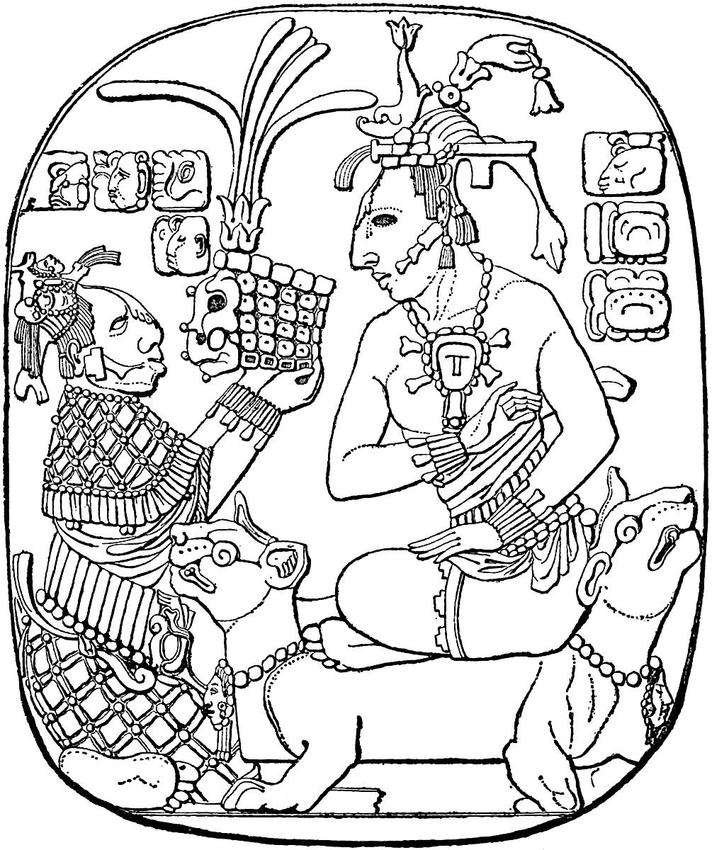
Four hundred yards south of the palace stands the ruins of a pyramid and temple, which, at the time of Dupaix’s and of Waldeck’s visits were in a good state of preservation, but quite dilapidated when seen by Charnay. The temple faces the east, and on the western wall of its inner apartment, itself facing the eastern light, is found (or rather was, for it has now entirely disappeared) the most beautiful specimen of stucco relief in America. M. Waldeck, with the critical insight of an experienced388 artist, declares it “worthy to be compared to the most beautiful works of the age of Augustus.” He therefore named the temple the Beau Relief. The above cut is a reduction from Waldeck’s drawing used in Mr. Bancroft’s work, and is very389 accurate. However, the peculiar beauty of Waldeck’s drawing is such that it must be seen in order to be fully appreciated.
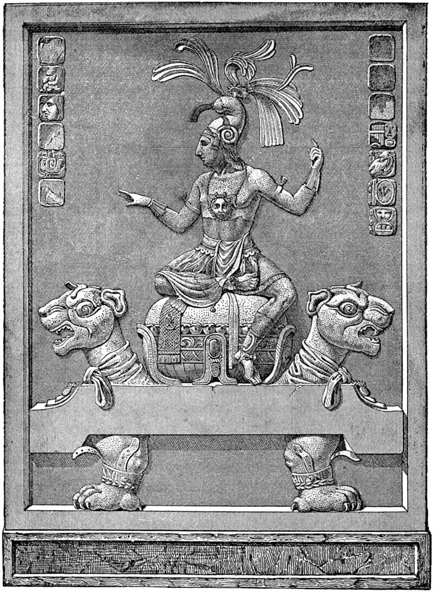
It is scarcely necessary for us to call the reader’s attention to the details of this picture, in which correctness of design and graceful outlines predominate to such an extent that we may safely pronounce the beautiful youth who sits enthroned on his elaborate and artistic throne, the American Apollo. In the original drawing the grace of the arms and wrists is truly matchless, and the chest muscles are displayed in the most perfect manner. The embroidered girdle and folded drapery of the figure, as well as the drapery around the leopards’ necks, are arranged with taste. The head-dress is not unlike a Roman helmet in form, with the addition of numerous plumes. The sandals of the feet are secured by a cord and rosette, while ornaments on the animals’ ankles seem secured by leather straps. The engraving does not do justice to the face-like ornament suspended by the string of pearls upon the youth’s breast. In the original drawing it is quite beautiful, and of a female cast.[560]
The next subject of interest to the student of sculpture is found in the Temple of the Cross, in the inmost sanctuary of all, and is known as the Tablet of the Cross. Three stones cover most of the surface of the rear wall of the sanctum sanctorum, and present an area six feet four inches high by ten feet eight inches wide. The central of the three stones bears the celebrated sculpture of the cross which has excited so much interest and comment, to say nothing of speculation as to its origin. The cut is a photographic reduction from Waldeck’s drawing. A priest and priestess appear to be offering an infant to an ugly bird which stands perched upon the cross. The infant’s face is completely hid by a fantastic mask or cap. The expression of pain on the faces of the officiating personages is very marked. The symmetry of proportion employed in the sculpture is conceded by all observers. The two lateral stones (the left-hand one being shown in our cut) are covered with hieroglyphics, 390which begin at the left-hand upper corner with a large capital letter. Some one had removed the central stone from its position prior to Waldeck’s visit, and conveyed it to a point in the forest not far distant. Stephens also found it in the same locality. By referring to the hieroglyphic tablet at the left of the cross391 it will be observed that just below the large initial letter or word is a threefold hieroglyphic, while seven others in the same column are double. This would indicate, we should think, that the characters were read from the top downwards, though it is possible that the lines were read horizontally, each line beginning with a capital as in poetry.[561]
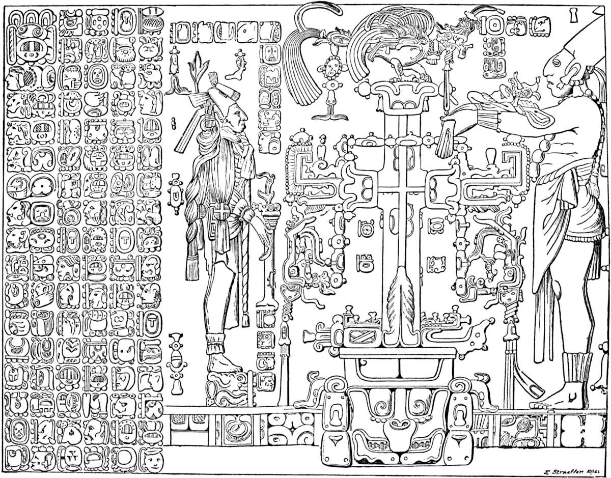
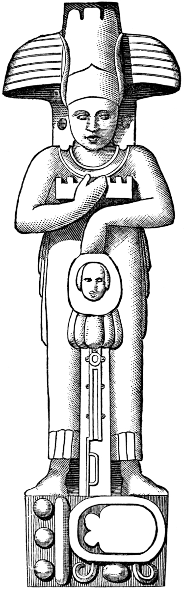
On either side of the doorway opening to the inner sanctuary of the Cross, were originally two male figures sculptured in low-relief on stone; one of them, which appears to represent an aged royal person, is beautifully clad in a leopard’s skin, while the opposite figure, designed probably to represent youthful manhood, is arrayed in what may be an elaborate military dress and plumed crest of magnificent character. He wears what appears to be a cuirass about his shoulders and chest. These tablets were removed to the village of Santo Domingo years ago and set up in a modern house, where they were offered to M. Waldeck on the sole condition that he should marry one of the proprietresses, though he at the time was more than sixty-four years of age. Stephens could have obtained them by purchasing the house in which they had 392been placed, but did not.[562] On the slope of the pyramid of the Cross, M. Waldeck found two statues just alike, one of which was unfortunately broken; the other, subsequently sketched by Catherwood, is shown in the cut, a photographic reduction from Waldeck. These statues were ten and a half feet high, though two and a half feet of their length, not shown in the cut, formed a tenon by which they were embedded in the floor of the pyramidal surface, where Waldeck supposes they stood supporting a platform about twenty feet square, in front of the central doorway. These are the only statues ever found at Palenque; but it is doubted whether they can be technically called statues, since the back is of rough stone, and unsculptured. They probably rested against a wall and served as supports for an upper roof or floor, as indicated by Waldeck. The head-dress has been pronounced Egyptian by all who have seen it.[563]
In the temple of the Sun, in a position precisely corresponding to that occupied by the tablet of the cross, stands a somewhat similar tablet cut in low-relief on three slabs covering an area of eight by nine feet. The figure of the cross in this instance is displaced by a hideous face or mask supposed to represent the sun, supported by a framework resting on the shoulders of crouching men. The priest and priestess occupy the same positions as occupied by them in the tablet of the cross. Each is in the act of presenting a child with masked face to the sun, and each is standing upon the back of a kneeling slave. The lateral tablets are covered with columns or rows of hieroglyphics, as in the tablet of the cross.[564] The stuccoed roofs and piers of both the temples—Cross and Sun—may be truly pronounced works of art of a high order. On the former, Stephens observed busts and heads approaching the Greek models in symmetry of contour and perfectness of proportion. M. Waldeck has preserved393 in his magnificent drawings some of these figures, which are certainly sufficient to prove beyond controversy, that the ancient Palenqueans were a cultivated and artistic people. In passing to Uxmal the transition is from delineations of the human figure to the elegant and superabundant exterior ornamentation of edifices, and from stucco to stone as the material employed. The human figure, however, when it is represented, is in statuary of a high order. The artists of Uxmal did not improve upon the Palenque models so much in the design as in the execution of their subjects. Uxmal statuary approximates more closely to what properly may be called statuary, being cut more nearly “in the round” and having less unfinished back surface than the Palenque statue. The elegant square panels of grecques and frets which compose the cornice of the Casa del Gobernador, delineated in the works of Stephens, Baldwin and Bancroft, are a marvel of beauty, which must excite the admiration of the most indifferent student of this subject. The ornamentation of this great cornice, equal to one-third the height of the building, is cut on blocks of stone and inserted in the wall with the utmost precision, so that every line matches, and the graceful arabesques and bas-reliefs, which sometimes cover several blocks with a single figure, are unbroken by apparent joints. The grandest specimens of American ornamental sculpture are, however, to be seen on the inner fronts of the four buildings of the Casa de Monjas, a plan of which is given on page 351 of this work. It will be remembered that these fronts face the court around which the buildings were constructed. The court front of the eastern building is probably one of the most tasteful and interesting specimens of sculpture to be met with in America.[565] M. Waldeck considers that it presents an appearance of grandeur of which it would be difficult to give an idea, while Stephens considers its chasteness of design a great relief from the gorgeous masses of other façades. The cornice over the central doorway and the corners of the eastern court 394façade are ornamented with ugly masks and “elephant trunks” protruding from them, as in the Governor’s home.[566] If the preceding façade is the most generally admired of those at Uxmal, “the most magnificent and beautiful front in America” is that of the Serpent Temple, or western court façade of the Nunnery, as is shown in the accompanying engraving, which is a photographic reduction of Waldeck’s drawing employed in Mr. Bancroft’s work.
Sun Symbol.
The marked feature of the sculpture is the formation of square panels by the intertwined bodies of two huge stone serpents with monster heads, surmounted by plumes and enclosing between the jaws of each a human face. A head and tail as shown above occupy opposite extremes of the front. This may be a representation of the plumed serpent of the Central American mythology. The stone lattice-work (a feature of Uxmal sculpture) underlying the serpents and covering the panels 395formed by their folds, is more complicated and beautiful than any other in America. At regular intervals large grecques or arabesques, with their connecting bars lengthened to the width of the entire sculptured portion of the façade, are distributed. Several panels are ornamented with life-sized human figures, while each panel contains a human face, some of which are as beautiful as the Greek models. The upper cornice is ornamented, as are all the other cornices of the Nunnery, with what are supposed to be Sun symbols, one of which is shown in the cut, reduced photographically from Waldeck’s drawing. The appended “feathers” are almost Assyrian in their type, while the double triangle within the circle is certainly an ancient symbol in the old world.
The “elephant trunks” and rude masks employed as ornaments above the doorways of the other fronts, are also numerous here. Since M. Waldeck’s visit portions of this wonderful example of ancient decorative art have fallen.[567] The northern building of the court offers no sculptured contrasts with the other buildings, except that above the upper cornice, thirteen turrets, each seventeen feet high and ten feet wide, are distributed at regular intervals, and are also covered with sculpture resembling the grecques of the Serpent temple. Most of the sculptures at Uxmal were probably painted, as traces of various colors were observed in sheltered localities. The rich sculptures of the prophet’s house were painted blue, red, yellow and white, according to M. Waldeck. The Mayas no doubt employed the brush freely, and in some instances with skill. In the gymnasium at Chichen-Itza, Stephens grew enthusiastic 396over the exceedingly fine series of paintings in bright colors, which cover the walls of one of the chambers. Many of the pictures have been destroyed by the falling of the plaster upon which they were painted. In this series of pictures, battles, processions, houses, trees and a variety of objects are represented—blue, red, yellow and green are the colors employed, though the human figures are painted reddish brown.[568] At Chichen, as elsewhere, the favorite subject for the Maya sculpture was the serpent. A colossal serpent balustrade is one of the wonders of this interesting place.
Dr. Augustus Le Plongeon, during the last quarter of the year 1875, made an extensive exploration of Chichen-Itza. The reports of his discoveries seem at first well-nigh fabulous, though their authenticity is so well attested as to leave no room for doubt. Mr. Stephen Salisbury, Jr., of Worcester, Massachusetts, has in several memoirs of intense interest and unusual scientific value, communicated the progress and results of Dr. Le Plongeon’s exploration in Yucatan to the American Antiquarian Society. Mr. Salisbury has also presented the explorer’s original memoirs, accompanied by photographs made at Chichen-Itza and on the Islands of Cozumel and Mugeres. These valuable documents have reached the public in Mr. Salisbury’s publications entitled, (1.) The Mayas, the Sources of their History (Worcester, 1877, with heliotype reproductions of the photos); (2.) Maya Archæology (Worcester, 1879, with heliotype reproductions of photos and drawings).[569] In these pages we are impressed with the fact that the darkness which has so long enveloped the antiquity of Yucatan is soon to be displaced by the noon-day of scientific investigation. Still we cannot refrain from expressing the regret that Dr. Le Plongeon’s enthusiasm is so apparent in his reports. A judicial frame of mind, as well as the calmness which accompanies it, are requisites both for scientific397 work and the inspiration of confidence in the reader. Notwithstanding this, our views have been most happily expressed by the committee of the American Antiquarian Society, to whom was entrusted the publication of Dr. Le Plongeon’s memoirs. Their statement is as follows: “The successes of Du Chaillu, Schliemann, and of Stanley, are remarkable instances of triumphant results in cases where enthusiasm had been supposed to lack the guidance of wisdom. If earnest men are willing to take the risks of personal research in hazardous regions, or exercise their ingenuity and their scholarship in attempting to solve historical or archæological problems, we may accept thankfully the information they give, without first demanding in all cases unquestionable evidence or absolute demonstration.”
Dr. Le Plongeon says of the columns at Chichen, “the base is formed by the head of Cukulcan, the shaft by the body of the serpent, with its feathers beautifully carved to the very chapter. On the chapters of the columns that support the portico, at the entrance of the castle in Chichen-Itza, may be seen the carved figures of long bearded men, with upraised hands, in the act of worshipping sacred trees. They forcibly recall to mind the same worship in Assyria.” In consequence of the successful interpretation of certain hieroglyphic inscriptions at Chichen, the explorer and his wife (who accompanied him in his perilous enterprise), learned that the statue of Chaac Mol, or Balam, (the tiger king), the greatest of the Itza monarchs, had been buried below the surface of the ground at a certain point, distant four hundred yards from the palace. The first result of excavation in the locality indicated was the discovery of a sculptured tiger of colossal size, having a human head, which, unfortunately, was broken off. Several slabs bearing sculptures of tigers and birds of prey in relief were unearthed. A pedestal supporting the sculptured tiger apparently had once occupied the spot, and its destruction had left a mound of débris. Seven metres below the surface of this mound a rough stone urn containing a little dust was secured, and upon it an earthen cover. This was near the head of the statue of Chaac Mol, which was next398 disclosed. The statue is of a white calcareous stone, one metre fifty-five centimetres long, one metre fifteen centimetres in height, and eighty centimetres wide, and weighed fifty kilos. The statue represents the reclining figure of a man, who is naked except that he is adorned with a head-dress, with bracelets, garters of feathers, and sandals similar to those found upon the mummies of the ancient Guanchies of the Canary Islands.
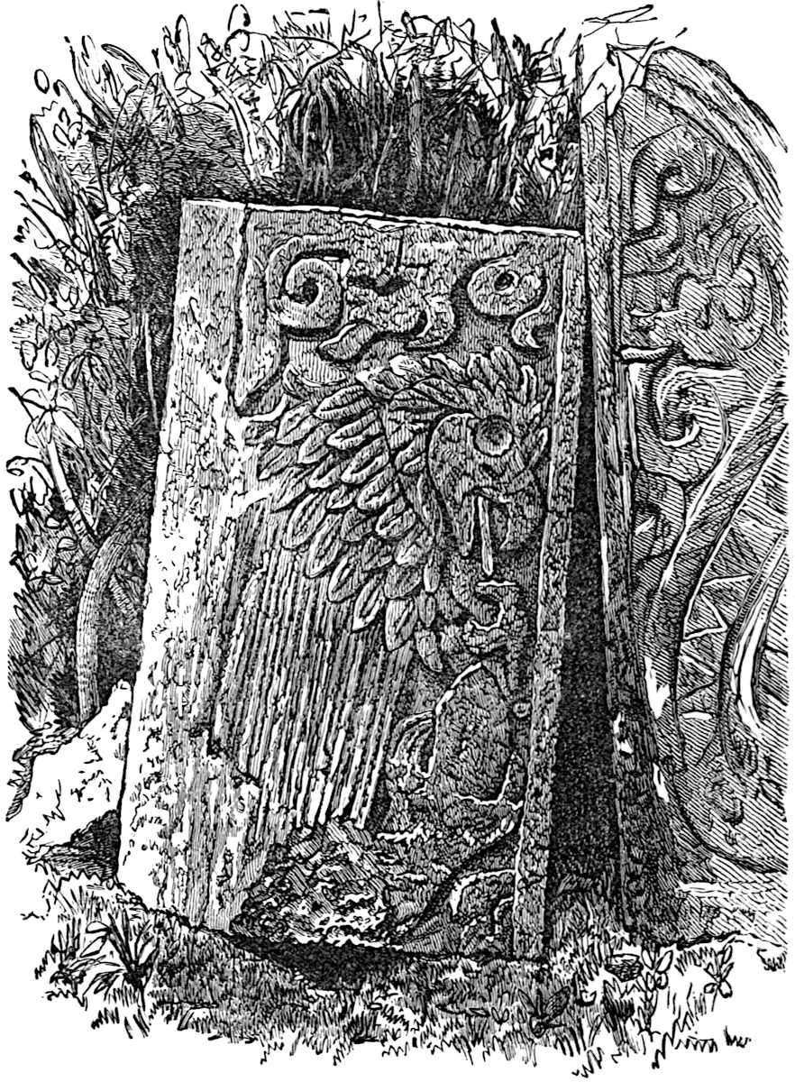
The statue of Chaac Mol was seized by Mexican officials and sent to the capital. Our friend, the Rev. John W. Butler, of399 the city of Mexico, writes to us (letter received October 10, 1878) concerning the statue: “It is just as represented. It may be seen in the National Museum, just opposite its exact duplicate, which was found under the Plaza of the city of Mexico, some years ago. What is the meaning of this? The tribe whose king (or god) it was, must have migrated southward, for the one excavated in Mexico shows greater age than the one from Yucatan.” In reply we would say that the evidences400 are sufficient that the Maya civilization once extended farther north than the city of Mexico, but the conquests of the Nahuas drove that ancient people no doubt to abandon their northern territory and to confine themselves to their lands farther south.
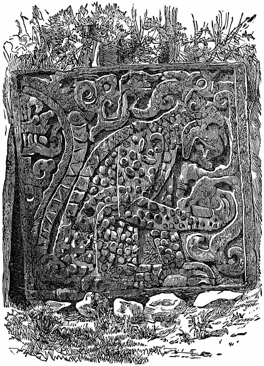
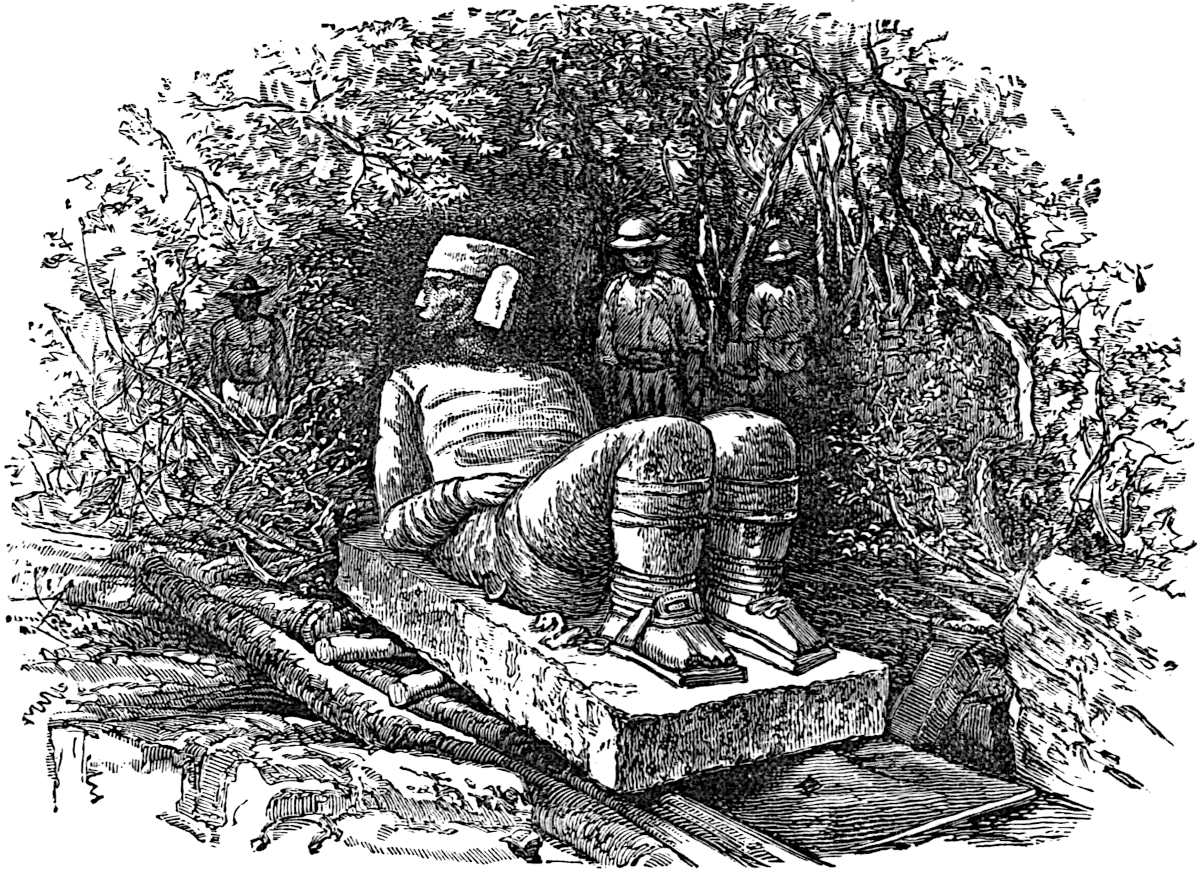
Dr. Le Plongeon, in speaking of the historical value of the statue, says Chaac Mol was one of the three brothers whom tradition declares were the co-rulers of Yucatan at a very ancient period. Chaac Mol and his beautiful queen Kinich-Kakmó were the powerful sovereigns of the kingdom of Chichen-Itza. Aac, one of the brothers, becoming enamored of his sister-in-law Kinich-Kakmó, slew Chaac Mol that he might make her his wife. The funeral-chamber, the mural paintings, the statues, and the monument of the murdered king found by the explorer, were memorials of the sad event which the faithful queen caused to be executed by the artisans and artists of the royal401 city. Dr. Le Plongeon remarks: “In the funeral-chamber, the terrible altercation between Aac and Chaac Mol, which had its termination in the murder of the latter by his brother, is represented by large figures, three-fourths life size. There Aac is painted holding three spears in his hands, typical of the three wounds he inflicted on the back of his brother. These wounds are indicated on the statue of the dying tiger (symbol of Chaac Mol) by two holes near the lumbar region, and one under the left scapula, proving that the blow was aimed at the heart from behind. The two wounds are also marked by two holes near each other in the lumbar region, on the bas-relief of the tiger eating a human heart that adorned the Chaac Mol mausoleum (see sculptured slab on page 398).”[570]
Mr. Stephen Salisbury, Jr., in his Maya Archæology, has reproduced one of Dr. and Mrs. Le Plongeon’s tracings of a mural painting in the funeral-chamber of the Chaac Mol monument at Chichen-Itza. Through the courtesy of Mr. Salisbury we have been permitted to copy it for this work. The Doctor interprets it as representing the queen Kinich-Kakmó when a child consulting an H-Men, one of the Maya wise men or astrologers, in order to know her destiny. The prediction is based upon the lines produced by fire on the shell of an armadillo or turtle, and is expressed in the colors of the elaborate scroll proceeding from the throat of the H-Men. Referring to his tracings of mural paintings at Chichen-Itza, Dr. Le Plongeon says “they represent war scenes with javelins flying in all directions, warriors fighting, shouting, assuming all sorts of athletic positions, scenes from domestic life, marriage ceremonies, temples with complete domes, proving that the Itza architects were acquainted with the circular arch, but made use of the triangular probably because it was the custom and style of architecture of the time and country.”[571] Besides the sculptures of long-bearded men seen by the explorer at Chichen-Itza mentioned on a preceding 403page, were tall figures of people with small heads, thick lips, and curly short hair or wool, regarded as negroes. “We always see them as standard or parasol bearers, but never engaged in actual warfare.”[572] He pronounces the features of the long-bearded men pictured on the walls of the queen’s chambers to be Assyrian in their type. On the Isla Mugeres (in the latter part of the year 1876), Dr. Le Plongeon exhumed portions of a female figure in terra-cotta, which indicate an advanced state of art among the ancient Mayas. The fragments of the statue, consisting of the head and feet, were probably attached to the front of a brasero or incense-burner used at the shrine of the Maya Venus, located on the southern extremity of the island. It was immediately in front of this shrine, visited by Cordova in 1516,[573] that the remains of the statue were found buried in the sand. The expression of the face is cruel and savage, the nostrils are perforated and also the pupils of the eyes. The teeth are filed as those of the statue Chaac Mol are said to be. The head is surmounted by a head-dress eight inches high. The fragments of this statue are now in the possession of Mr. Salisbury.[574]
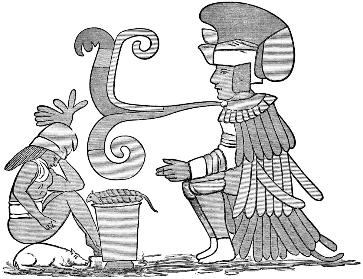
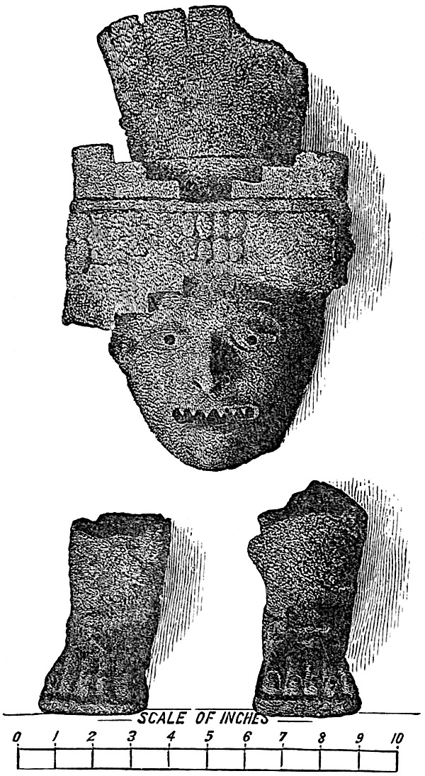
404
Through the courtesy of the owner we are enabled to present a photographic reduction of the relics in the preceding cut.
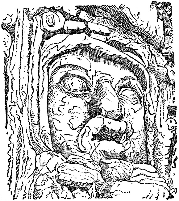
At Izamel, the burial-place of the culture-hero Zamna, a remarkable example of aboriginal sculpture is found upon the side of a mound now enclosed in a private court-yard. This specimen of art, known as the Cara gigantesca, or gigantic face, measures seven feet in width and seven feet eight inches in height. “The features were first rudely formed by small rough stones, fixed in the side of the mound by means of mortar, and afterwards perfected with a stucco so hard that it has successfully resisted for centuries the action of air and water.” The accompanying cut from Mr. Bancroft’s work will show the type of features.
The subject of Maya sculpture is almost a limitless one, but we trust that the above-cited examples may give the reader a comprehensive acquaintance with the existing types. The sculpture of Copan is no less remarkable than its architecture. In fact, every object bore the skillful marks of the graver’s chisel. The great number of sculptured obelisks, pillars and idols have been the wonder of every reader of Mr. Stephens’ description. Since his work is so generally known, we refrain from presenting more than one example of Copan art. In the accompanying cut employed in Mr. Bancroft’s work the elaborateness of the sculpture will be observed, and may well be pronounced a marvel of aboriginal art.
405
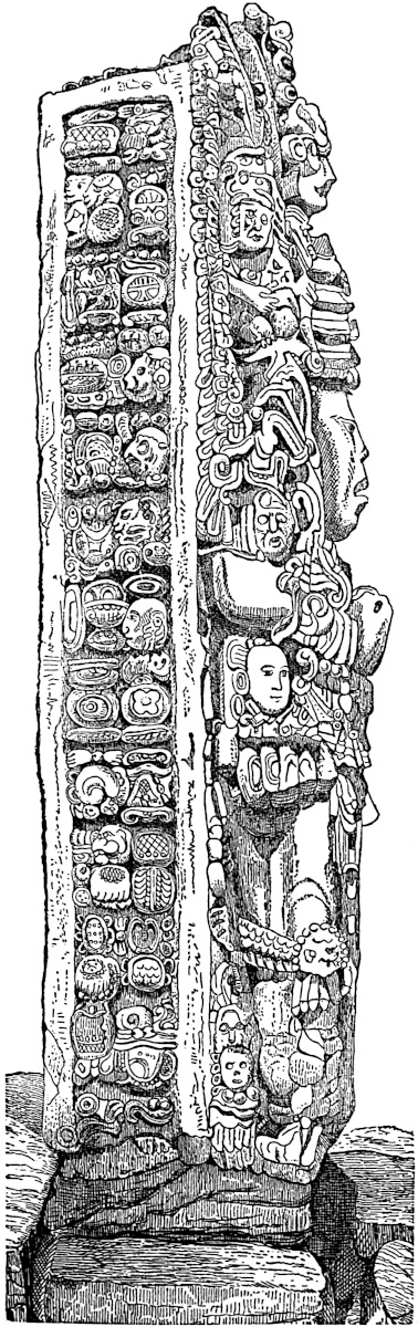
But for the perfectly horizontal position of the eyes, the aspect of some of the faces represented by Stephens would strike us as having a Mongolian cast. The magnificently sculptured hieroglyphics which cover the sides and backs of these huge idols, no doubt could tell the sealed story of Copan’s greatness and the attributes of its many gods, were the key once discovered. Everything is covered with these significant symbols, differing slightly from those at Palenque; but who will read them? In the court of the temple, a solid block of stone six feet square and four feet high, resting on four globular stones was sketched by Catherwood, and pronounced an altar by Stephens. Sixteen figures in profile, with turbaned heads, breast-plates, and each seated cross-legged on hieroglyphic-like cushions, are sculptured in low-relief, four figures being on each side of the block. The top of the altar is covered with thirty-six squares of hieroglyphics, shown in a cut on a future page. Besides numbers of masks, effigies and rows of death’s heads at Copan,406 there are sculptures of the face which we may believe to have been portraits. The Copan sculpture is generally admitted to be of a high order, and Stephens thinks it unsurpassed in Egypt. The receding forehead of most of the portraits have excited general interest, and are believed to be delineations of the priestly or aristocratic type. No weapons are sculptured at Copan, but on the contrary altars abound in considerable numbers, especially in front of the sculptured obelisks or idols. The presumption is therefore strong that this was a religious centre, unmolested by any enemy, and undisturbed by the alarm of war.[575]
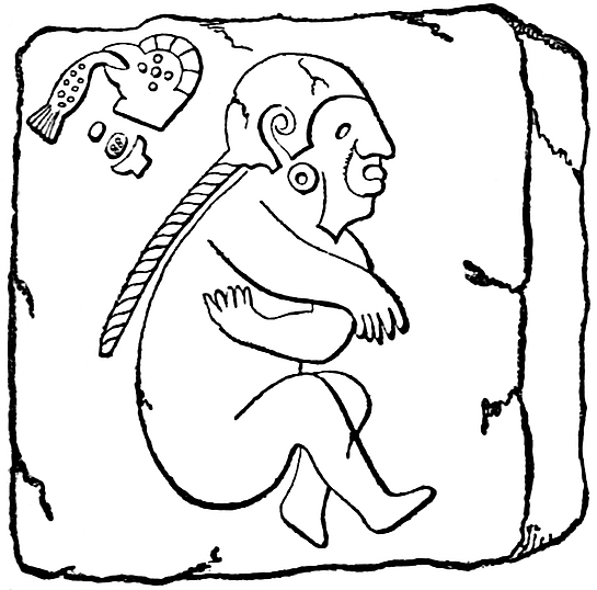
Nahua Sculpture.—The Nahua sculpture is not of as high an order nor of as frequent occurrence as that of the Mayas. At Monte Alban in Oajaca, in a gallery within a mound, Castañeda sketched the sculptured profile shown in the accompanying cut, employed in Mr. Bancroft’s work. It is cut upon the face of a granite block about three feet square, and is interesting because of the Chinese-like queue which hangs from the figure’s head. At Mitla the grecques and arabesques which cover the façades of the several edifices are not sculptured, except in cases where large stones serve as lintels over doorways. On them the running borders are sculptured in low-relief, while the remainder of the profuse ornamentation is of the nature of mosaic work, being built into the wall.
Several minor objects of sculpture found in the States of Oajaca and Vera Cruz might be cited, but their interest for the reader would be too insignificant to justify a description.[576] One 407of the principal objects of this class and much superior to any of the others is a grotesque fountain cut in the living rock at Tusapan. The statue is that of a woman in a kneeling posture, and measures nineteen feet in height. The waters of a neighboring spring formerly ran into a basin formed among the plumes of the female’s head-dress, from which it found its way through the entire length of the figure, and flowed forth from beneath her skirts.[577] At Panuco the traditional point of the arrival of the Nahuas, several rude limestone statues were found, some of which have been figured in the Journal of the London Geographical Society, by Mr. Vetch, one of which is copied by Mr. Bancroft.[578] The marked features of these statues is the elaborateness of the style of head-dress worn. We cannot see that they are far removed in their style from similar statues dug from mounds in the Mississippi Valley. In the State of Puebla, at various points, especially at Tepexe el Viejo, at Tepeaca, and at Quanhquelchula, minor sculptures of animals, birds, reptiles, monsters, etc., were observed by Dupaix.[579] Rattlesnakes were found plentiful both in sculptures and in a state of nature. At Cuernavaca, in the State of Mexico, numerous boulder-sculptures, finely executed in low-relief, exist. Dupaix has figured and Bancroft copied one in particular, showing a beautiful coat-of-arms, sculptured on the smooth face of a huge boulder. A circle of arrows and Maltese cross which compose them, are all symbolical of power.[580] Similar coats-of-arms were 408observed in the State of Puebla. Probably the most remarkable sculpture found in the country occupied by the Nahuas, is that upon the walls of the pyramid of Xochicalco, illustrated on a preceding page.[581] Most of the sculptures are of colossal dragons’ heads, which occur at each of the corners. Human figures, seated cross-legged and holding something like the Assyrian sun symbol in the left are found on the frieze, though some observers have considered this figure to be that of a curved cross-hilted sword, a weapon never employed by the Nahuas. The elaborate head-dresses and strings of enormous pearls worn by the seated figures bear a striking resemblance to the stuccoes of Palenque. At Xochimilco on the western shore of Lake Chalco, Dupaix found several interesting specimens of ancient sculpture.[582] The most celebrated article of Aztec sculpture, unquestionably, is the calendar-stone, which, together with the so-called sacrificial stone and the idol Teoyaomiqui, was in December, 1790, dug up in the Plaza Mayor, in the city of Mexico, on the supposed site of the great teocalli, destroyed by the conquerors. The calendar-stone, now built into the wall of the cathedral, where it can be seen by all passers-by, is a rectangular block of porphyry, thirteen feet one inch square and three feet three inches thick, and of the enormous estimated weight of twenty-four tons. The sculptured portion of the block, on the exposed face, is contained in a circle, eleven feet one inch and four-fifths of an inch in diameter. The regularity and geometrical precision with which the figures are executed called forth enthusiastic admiration from Humboldt, and has been the source of equal wonderment to many later observers. Our cut is a reproduction of Charnay’s photograph, by means of the photo-engraving process, and may be relied upon as absolutely correct. Prescott considers that the original weight of the block before it was mutilated must have been nearly fifty tons; and as no similar stone is found within a radius of twenty-five miles of Mexico, that it must have been brought from the mountains beyond Lake Chalco.[583] Some remarks upon the 409Aztec calendar will be found in the following chapter. The sacrificial stone is a cylindrical block of porphyry, nine feet ten inches in diameter and three feet seven inches thick, and is now lying in the courtyard of the University of Mexico. If the reader will imagine the border of the calendar-stone outside of the eight triangular points removed entirely, will substitute a concave basin in the place of the central face or sun, also instead of all the calendar signs intervening between the face and the circle, upon which the base of the four principal triangular figures rest, will imagine the existence of several concentric 410circles not unlike strings of beads, he will have a general idea of the top of the stone. We should not omit to state that a groove or channel leads from the central basin to the outer circumference. The use of the stone is a matter of controversy, Humboldt considering it the gladiatorial stone, Gama a calendar-stone, and Tylor that it was an altar on which animals were sacrificed. Fifteen groups of two human figures, each dressed in the insignia of royalty, are sculptured around its circumference. Bancroft, as well as several others, give cuts of the stone and sculptures. The horrid monster Teoyaomiqui—goddess of death—is sculptured in high-relief on a block of porphyry ten feet high and six feet wide and thick. Probably no mythology nor all the mythologies of the world besides could produce so hideous and unsightly a combination of reptile, human and infernal forms, as make up the three sides of this idol.[584] Mr. Bancroft first figured the beautiful earthen burial vase dug up in the Plaza Tlatelulco and sketched by Col. Mayer. It is twenty-two inches high and fifteen and a half inches in diameter; a closely fitting lid most chastely sculptured covered it, as will be seen in the accompanying cut.
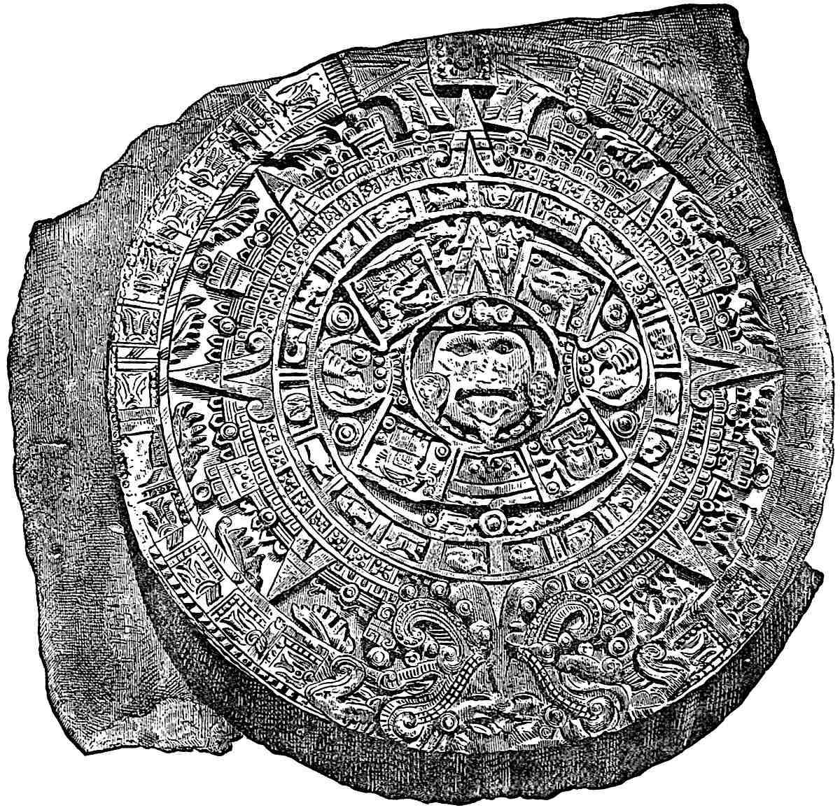
Among the elegant sculptures upon one of its sides is a comely face surmounted by a crown, from each side of which project wings of the same character as were employed to symbolize the sun among the Assyrians.[585] The original is pronounced one of the 411finest relics preserved in the Mexican Museum. M. Waldeck has figured many beautiful examples of Mexican ceramic art preserved in the above collection as well as in others. The finest specimens of ancient terra-cotta work of which we have any412 knowledge are shown in the cut, photographically reduced from Waldeck’s plate.[586]
No description can convey any idea of their beauty. The upper left-hand vase, it will be observed, is supported on three feet, each perforated by a perfect Maltese Cross. The central lower vase, of remarkable symmetry, is distinguished by the perfect crux ansata which adorns its side. The lower right and left hand figures are different views of a swinging lamp. These vases cannot but command the admiration of all who see them. M. Waldeck has delineated with remarkable artistic skill three specimens of Mexican mosaic work now in the Christy collection in London. One of these beautiful relics is shown in the cut, reduced from Waldeck’s colored plate for Mr. Bancroft’s work.
However, the cut conveys but a faint idea of its beauty, especially of the handle. The blade is of semi-translucent chalcedony from the volcanic regions of Mexico, while the handle is a most artistic mosaic of bright green turquoise, malachite, and white and red shells. The blade is of a light straw-colored tint, and is mortised in the handle, which is wrapped nearest to the blade with what appears to be a golden braid. Mr. Bancroft remarks “it is certainly most extraordinary to find a people still in the stone age, as is proved by the blade, able to execute so perfect a piece of work as the handle exhibits.”[587] Among the few 413relics recovered at Tula, the ancient Toltec capital Tollan, the column shown in the cut (from Mr. Bancroft’s work) is very interesting, both for its sculpture and for the exhibition it affords of the manner in which the Toltecs formed their columns, namely, by fastening the sections together by means of circular tenons. The largest block measures four feet long by two and a half in diameter.
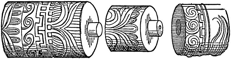
Our National Museum at Washington contains numerous fine specimens of Mexican terra-cotta ware, some of which have been figured recently in Dr. Charles Rau’s “Archæological Collection of the U. S. National Museum.”[588] Two large vases in particular demand attention. These were brought to the United States by General Alfred Gibbs at the close of the Mexican war, and are shown in the cut.
The upper vase, which is thirteen and a half inches high, is very elaborately wrought, being surrounded with ten female figures in relief, each alternate figure bearing a child on the left arm. It is noticeable that the head-dresses of the figures holding the children are more elaborate than those of the remaining figures. The second or lower vase, Dr. Rau considers equal to many Etruscan or Greek vases in gracefulness of outline. “The vessel may be compared to a pitcher with two handles, standing opposite each other, and with two mouths projecting between them.” Among the terra-cotta images of Mexican origin in the National Museum the two shown in the cut are of interest. The left-hand figure is that of a woman pressing her hands upon her ears. The face represents an aged 415individual. The Museum possesses almost an exact duplicate of this image. The right-hand figure is much smaller and is hollow, enclosing a clay ball, and was probably used as a rattle. It is scarcely necessary for us to remark that the seeming analogies between the Maya (Central American) sculpture and that of Egypt have often been noted. Juarros, in speaking of Palenque art, says: “The hieroglyphics, symbols and emblems which have been discovered in the temples, bear so strong a resemblance to those of the Egyptians, as to encourage the supposition that a colony of that nation may have founded the416 city of Palenque or Culhuacan.”[589] Giordan found, as he thought, the most striking analogies between the Central American remains, as well as those of Mexico, and those of the Egyptians. The idols and monuments he considers of the same form in both countries, while the hieroglyphics of Palenque do not differ from those of ancient Thebes.[590] Señor Melgar, in a communication to the Mexican Geographical Society, has called attention to the frequent occurrence of the (Τ) tau at Palenque, and has more studiously advocated the early relationship of the Palenqueans to Egypt than any other reliable writer.[591] He cites Dupaix’s Third Expedition, page 77 and plates 26 and 27, where in the first figure is a goddess with a necklace supporting a tau like medallion to which the explorer adds the remark that such is “the symbol in Egypt of reproduction or abundance.” In the second plate he finds an altar dedicated expressly to the tau. He considers that the cultus of this, the symbol of the active principle in nature, prevailed in Mexico in many places. Señor Melgar also refers to two idols found south of the city of Mexico, “in one of which two symbols were united, namely, the Cosmogonic egg, symbolical of creation, and two faces, symbols of the generative principle. The other symbolized creation in the bursting forth of an egg. These symbols are not found in the Aztec mythology, but belong to the Indian, Egyptian, Greek, Persian, Japanese and other cosmogonies.” This, the Señor considers proof that these peoples were the primitive colonists of that region, and seeks to sustain his views by references to the Dharma Sastra of Manou and the Zend Avesta. The reader has no doubt been surprised at the frequent occurrence of the [Τ]-shaped niches in the Palenque palace, and has observed the same symbol employed on some of the hieroglyphics of the Tablet of the Cross. The Egyptian tau, one of the members of the Crux ansata, is certainly present at Palenque, but whether it was derived from any one of the Mediterranean peoples who 417employed it, cannot be ascertained. Among the Egyptians it signified “life,” as is shown by the best Egyptologists.[592] The tau was usually surmounted by a roundlet, though such was not always the case. On a stele from Korasabad, an eagle-headed man is depicted as holding the oval in one hand and the cross in the other.[593] M. Mariette recently, while exploring the ancient temple of Denderah, discovered the sacred symbol in a niche of the holy of holies. It is probable that this emblem was the central object of interest in these inner precincts of the temple, as it was preserved with scrupulous care as the hidden wisdom.[594] Macrobius tells us that the crux ansata was the hieroglyphic sign of Osiris or the Sun,[595] but other writers inform us that it was an ancient symbol of majesty and divinity, and so employed in a modified form in the hands of Brahma, Vishnu and Siva.[596] The associations of the tau in Central America are such as to lead us to believe that it may have had a significance analogous to that which it possessed on the shores of the Mediterranean, the Nile, and the Ganges. The Palenque Cross tablet is a most singular work of American antiquity, and though Mr. Stephens attempted to prove that no analogy exists between it and Egyptian sculptures, still Mr. Bancroft has shown that the former was unfortunate in his selection of Egyptian specimens for the purpose of comparison, since marked analogies between the sculpture of the Vocal Memnon of Thebes and the top of the fallen obelisk at Carnac and the Palenque Tablets exist.[597]
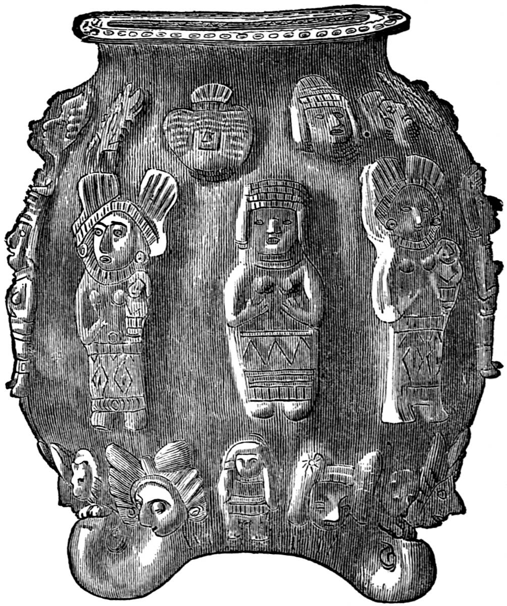
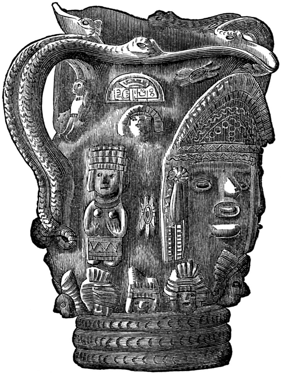
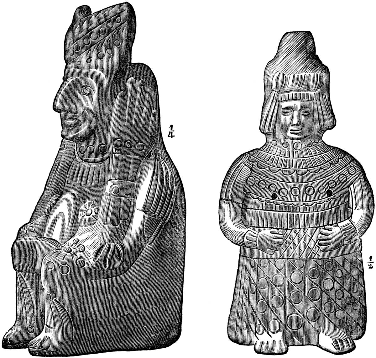
418
It has been argued that the Egyptian and Palenque sculpture resemble each other in that both are generally in profile; but the trivialness of the reasoning will be at once apparent. On the contrary, Mr. Bancroft remarks, “Sculpture in Egypt is for the most part in intaglio, in America it is usually in relief.” Notwithstanding the oft-repeated assertion that a resemblance between Egyptian and Maya hieroglyphics exist, no one of the Egyptologists so successful in their chosen field have been able to decipher the Maya writing. It is not improbable that the Palenque and Copan civilization received its first impulse from some of the peoples of the southern or eastern shores of the Mediterranean, but from which it would be impossible to say even if we were certain that such was the case. Whatever of a foreign character it may have had at first has been mostly lost in the independent development of new and original characteristics, the natural outgrowth of new wants and new conditions, arising through the lapse of many centuries. The latter remark we think may be applied with even more certainty to the Nahua civilization as displayed in its sculpture. All through Mexico the favorite subject for the Toltec or Aztec sculptor was the serpent, generally the rattlesnake. Mr. Bancroft in his 419fourth volume has given numerous examples of this fact. Serpent sculpture was also common among the Mayas, but to a less extent, and it is not improbable that the symbol entered into their art through the Quichés—a mixed people composed of Mayas and Nahuas. We have already observed the same disposition to sculpture the rattlesnake among the Mound-builders. In the great serpent upwards of a thousand feet in length on Brush Creek, Adams County, Ohio, we find a striking analogy to the tendency of Mexican art. Furthermore, the great serpent grasps in its jaws (if they may be so called) an immense oval figure of precisely the shape of an egg, and “the combined figure is regarded as a symbolical illustration of the Oriental cosmological idea of the serpent and the egg.” We have seen in the remarks of Señor Melgar that two examples of the egg possessing precisely the same significance which is attached to it in Eastern Asia were found near the City of Mexico. The part which the serpent symbol plays in the south and east Asiatic sculpture and mythology is probably well known to the reader; and if not, a perusal of Maurace’s Indian Antiquities or Moor’s Hindu Pantheon will satisfy him that it occupied a place equally important among Nahuas and Hindoos. The great serpent in Ohio may be a connecting link between the art of both Mexicans and Asiatics. In the course of independent development which the Nahuas underwent during thousands of years, the cosmological symbol of the egg may have been lost and supplanted by that of the serpent alone, the emblem of the life principle in both America and Asia. However, we may safely close these speculations with the conclusion that though the Mayas and Nahuas were probably descendants of foreign stock, their civilization, so far as we are able to judge from their arts, was indigenous—developed upon our soil, and offering but few analogies to any other.
Hieroglyphics.—No well authenticated Mound-builder hieroglyphics have as yet come to light. The Grave Creek Mound tablet we believe is now shown unquestionably to be an archæological fraud. The Cincinnati tablet figured in our first chapter seems to bear some symbolic signs upon its face, but no resemblance420 can be traced between them and any other known hieroglyphic signs. The Davenport tablet if genuine is of great interest in that it abounds in hieroglyphics, some of which are not unlike some of the signs employed by the Aztecs; besides, the element of picture-writing so common to that people plays a prominent part on both sides of that mysterious stone. Col. Charles Whittlesey, in the second chapter of his Report to the Centennial Commission of Ohio (already cited), has figured and described rock sculpture near Barnesville, Newark, Independence, Amherst and Wellsville, most of which are of the lowest grade of savage art, and we think can only be attributed to the red Indian.
Mr. W. H. Holmes has furnished specimens of picture-writing of a rude character found engraven in the rocks of the cañon of the Rio Mancos and San Juan, but there is no evidence that they are or are not the work of the Cliff-dwellers whose works abound upon neighboring rocks.[598] We have already called attention to the tablets of hieroglyphics at Palenque, Copan and in Yucatan, a specimen of which is shown in a cut on page 390. The accompanying cut, employed by Stevens, Baldwin and Bancroft, show the thirty-six squares of hieroglyphics engraven upon the top of a Copan altar.
In addition to these stone and stucco records, the Mayas had books, which Bishop Landa describes as written on a large leaf doubled in folds and enclosed between two boards which they ornamented; they wrote on both sides of the paper, in columns accommodated to the folds; the paper they made from the roots of trees, and coated it with a white varnish on which one could write well. These books were called Analtees, a word which, according to Villagutierre, signifies the same as history.[599] Bishop Landa confesses to having burned a great number of the Maya books because they contained nothing in which were not superstitions and falsities of the devil.[600] Bancroft has quoted from Peter Martyr a description of these books, which conveys the additional 421information that they were written on many leaves joined together but folded so that when opened two pages are presented to view.[601] Three of the Maya manuscripts are known to have escaped the vandalism of the early Fathers. These are, first, the Mexican MS. No. 2 of the Imperial Library at Paris, called by Rosny the Codex Peresianus, which has been photographed by order of the French government, but we believe is still unedited. The second, the Dresden Codex, in the Royal Library at Dresden, a complete copy of which was published by Lord Kingsborough. It is a Maya, and not an Aztec MS., as is proven by its marked resemblance to the tablets of Palenque and Copan, a fact pointed 422out by Mr. Stephens, though at the date of his exploration everything was pronounced Aztec.[602] The third, the Manuscript Troano, found by Brasseur de Bourbourg at Madrid in 1865 in the possession of Señor Tro y Ortolano, from whom it derives its name, is a Maya MS. of unknown origin and history. The French government and the Commission Scientifique du Mexique reproduced it in fac-simile by means of chromo-lithography, and Brasseur, with the expenditure of great labor, attempted to translate part of it, which he has published; but in a subsequent work he confesses that he began his reading at the wrong end of the manuscript, which, as Mr. Bancroft humorously remarks, was a “trifling error perhaps in the opinion of the enthusiastic Abbé, but a somewhat serious one as it appears to scientific men.”[603] Mr. Bancroft has reproduced a page of the MS. Troano in his work, and accompanied it with a condensed account from the Abbé’s description as follows: “The original is written on a strip of maguey paper about fourteen feet long and nine inches wide, the surface of which is covered with a whitish varnish, on which the figures are painted in black, red, blue and brown. It is folded fan-like in thirty-five folds, presenting when shut much the appearance of a modern large octavo volume. The hieroglyphics cover both sides of the paper, and the writing is consequently divided into seventy pages, each about five by nine inches, having been apparently executed after the paper was folded, so that the folding does not interfere with the written matter. * * * The regular lines of written characters are uniformly in black, while the pictorial portions, of what may perhaps be considered representative signs, are in red and brown, chiefly the former, and the blue appears for the most part as a background in some of the pages.”[604] Notwithstanding the bigoted spirit exhibited by 423Bishop Landa in his destruction of the native Maya books in the presence of their sorrowful and helpless owners, he did one act of service for the antiquarian, which will ever entitle him to the gratitude of every student of ancient American civilization. That act was the record which he made of the Maya hieroglyphic alphabet. The Bishop has left us scarcely two and a half octavo pages (of his work as edited by Brasseur de Bourbourg) upon this important subject, yet it is the only known key to the mysteries of Palenque, Copan and the numerous inscriptions found in Yucatan. His explanation of the manner in which letters are combined into words is not clear, and though Mr. Bancroft has translated it literally and introduced parenthetic explanations, still the sense is not very apparent. Brasseur de Bourbourg in his French translation has not succeeded much better, and complains of Landa’s style as being untranslatable. One important fact, however, is deducible from the Bishop’s remarks and example, namely, that the Maya letters were formed into words in much the same order as in the English and other languages which read from the left to the right.[605] Landa’s alphabet is given in the accompanying cut which is an exact photographic reproduction of the original.
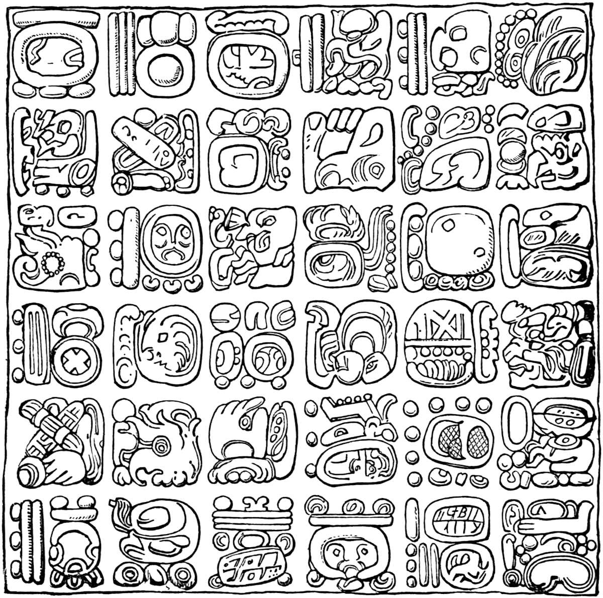
Landa adds nothing after this table except the remark: “Of the letters which here fail, this language is wanting and has others added of ours, for other things of which they have need, and already they do not use these characters of theirs, especially 425the young people who have learned ours.”[606] Landa has left us other hieroglyphic signs, relating to the Maya months and days, which will be given in the next chapter. Many of the hieroglyphics in his alphabet are plainly recognizable in the three Maya MSS. which we have named, though it is quite certain that other signs, which are wanting in his list, are found not only in the MSS. but also among the inscriptions of the several localities we have already described. Besides the attempts made by Brasseur de Bourbourg to decipher the Maya writing, three Américanistes in particular have bestowed labor upon the subject. These are Mr. Wm. Bollaert,[607] M. Hyacinthe de Charencey,[608] and M. Leon de Rosny,[609] the latter of whom is the honorable president of the Société Américaine de France.
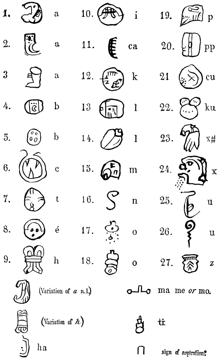
By means of Landa’s key, Mr. Bollaert obtained encouraging results from hieroglyphics figured in Stephens’ works. In that author’s Yucatan, vol. ii, page 292, is seen a sculptured figure with hieroglyphics represented on the upper part of the door called Akatzeeb at Chichen-Itza. This tablet is examined by Mr. Bollaert with the following result: “The figure (male) is nude; the cap is like those on the figures at Kabab, and has an ornament round the neck; the large crucible-form before him contains fire, in which some small animal is being burnt or sacrificed. Comparing the hieroglyphs on either side of the figure with the Maya key, I get the following words: Ahau, ‘king’; oc, ‘leg’; Muluc, ‘to unite’; ik, ‘courage’; cib, ‘copal’; eznab, ‘magician’; no, ‘frog’; which may mean that the magician has in the crucible a frog to be sacrificed, in which copal as incense is used. The two lines of hieroglyphs give something like the following: Kings must die—they have 426courage, and after death are united to those who went before them. The king is with his fathers; the chief and his family burn copal and mourn for his death.”[610] On the tablet of the cross at Palenque, Mr. Bollaert found in squares eznab, “magician”; dz, “a hand”; the “aspiration sign” ⋃; and a part of zip, “tree.” Among the hieroglyphs he traced ahau, “king”; zip, “tree”; akbal, “a plant”; pax, “a musical instrument.” Mr. Bollaert has attempted to read several other inscriptions with no more satisfactory results.[611] One or two of the same scholar’s attempts with the Dresden Codex yield the following: We come to thy presence to implore. The young female implores before the deity, she weeps but has courage. In a group representing a king and a young female, he reads: She has made a vow about the king to the magician, the king is happy. Again: The sacred bird chel is sacrificed, there is weeping; the bride weeps for the bird, she makes a vow or prays for the king, she offers a tortoise, a great feast is given.[612] M. de Charencey translates the hieroglyph found just above the child which is being offered to the bird on the tablet of the cross at Palenque, by the word Hunabku, “the only holy one.” He also finds the name of Kukulcan and eznab, “magician,” the name of a month.[613] M. de Rosny in his able essay on the decipherment of the hieratic writings of Central America has undertaken the solution of this interesting and perplexing problem in a scientific manner, and we have the fullest confidence that his system constructed on Landa’s key will open to us the books and inscriptions of the Mayas. But two of the four parts which constitute the work have been published, still we think sufficient data has been placed at the hands of scholars by M. de Rosny to justify the opinion that if the remainder of his essay should never appear, the work of interpreting some of the Maya writings might be carried on with reasonable certainty. Landa’s key contains seventy-one signs (twenty for the days, eighteen for the months, and thirty-three427 in the alphabet.) M. de Rosny, by a careful examination of all the hieratic texts of the Mayas which are known, has discovered more than seven hundred different signs. Of this number he has deciphered and classified four hundred and thirty-nine as follows: Alphabetic signs, including Landa’s (of which all the others are but varieties), two hundred and sixty-two; signs of the days, one hundred and fifty-nine; and the eighteen signs of the months given by Landa. All these signs are classified in a double folio plate (Pl. XIII) which we believe deserves to be regarded as the larger portion of the much-sought-for Maya Rosetta stone. Considerable difference of opinion has existed as to the direction in which the hieroglyphics should be read. Brasseur held the view that the proper order was from right to left, and that the beginning of a book was where our books end. This mistake brought down the ridicule of scholars upon the Abbé’s head, when it was discovered that he had begun at the wrong end to translate the Troano MS. Mr. Bollaert says, “I have read from the bottom upwards and from right to left.”[614] Dr. Brinton[615] has suggested some such order as the following arrangement of the word marvellous:
M. de Rosny has shown that the statement of Landa and the fact that the human faces shown in the hieroglyphs look toward the left, indicate that the signs should be read from left to right.[616] In rare cases this order is reversed, as is seen on a couple of leaves of the Codex Peresianus. There are, no doubt, numerous instances in which the signs are arranged in perpendicular columns, and the order in which such columns are to be read is not the same in all manuscripts. In the Maya inscriptions and manuscripts, the “illustrations” or pictorial figures are interwoven428 with the alphabetic signs forming an important part of the writing. In many cases a page of MS. (as shown in Rosny’s plates) is divided into sections or squares, in which the hieroglyphics are inseparably connected with grotesque figures which accompany them and form a part of the writing. M. de Rosny has undertaken the classification and interpretation of all these figures which are found in the existing Maya MSS. This doubtless will prove an important auxiliary to the table of signs already alluded to. We may reasonably expect that since M. de Rosny has shown the extensive character of the Maya phonetic and symbolic alphabet, he will furnish us examples of its application in the practical interpretation of the hieroglyphics, in the latter part of his work. Recently Dr. Ph. Valentini has pronounced the Landa alphabet a Spanish fabrication, of later date than the conquest. See Proceedings of Amer. Antiquarian Soc. for April, 1880.
We do not deem it necessary to assure the reader that while the Aztec
picture-writing was not as far advanced in the scale of graphic
development as the system employed by the Mayas, still it was an
accurate means of communication and of recording events. The “scribes”
of the Mexicans were an educated class of men, who with strictest
accuracy painted in hieroglyphic symbols the record of national,
historic and traditional affairs, as well as the tribute rolls, the
calendar with its feast days, the stated services of the gods, the
genealogical tables of noble and royal personages, and even the
customs of the humble classes. No doubt many educated persons who did
not belong to the priestly and lettered class, were acquainted with
the system employed, and many others understood it sufficiently to
recognize calendar and feast signs. The Aztec books were painted mostly
on cotton cloth, prepared skins and maguey paper, and when not rolled
were folded fan-like and bound with thin wooden covers, like the Maya
books. The priests who accompanied the conquerors and immediately
followed them, mistook the pictured figures painted in these books to
be representations of heathen deities, and consequently inaugurated a
system of wholesale destruction of all the picture-writing. Las Casas
informs us that they were429 actuated by the fear that in matters of
religion the existence of these books would be injurious. The infamous
crime committed against the cause of knowledge and the irreparable
injury done to the natives, their successors, and to students of
history for all time, by the destruction of those valuable MSS., must
ever remain an unerasable blot upon the name of the early church in
Mexico, and must be ranked with the worst deeds of Goths and Vandals.
Juan de Zumárraga, the chief of these sacrilegious destroyers who
committed the annals of the Mexican States publicly to the flames
in his tour of the principal cities of the country, will ever be
remembered with proper contempt. Fortunately, many of the MSS. were
hidden by their owners and have since come to light; the greater
number of these, however, were tribute rolls, which, down to the last
century, played an important part in the Mexican courts of justice.
Prescott informs us that “until late in the last century, there was
a professor in the University of Mexico especially devoted to the
study of the national picture-writing. But as this was with a view to
legal proceedings, his information probably was limited to deciphering
titles.” In the course of time the priests became acquainted with the
harmless nature of the hieroglyphics, through their use by the natives
in their making confessions and in recording the Lord’s prayer. Many
documents written since the conquest were provided by their authors
with a Spanish translation or with an explanation in Aztec written
with Spanish letters. Many of these are in existence, and with a few
authentic documents, written previous to the conquest, are preserved
in public and private libraries of Europe and this country, the finest
collection of which is that of the National Museum of the University
of Mexico. The reader is no doubt already familiar with the splendid
fac-similes of several Mexican MSS. published in Lord Kingsborough’s
work. Mr. Bancroft has concisely narrated the events and vicissitudes
which have attended the transmission of some of these documents through
the hands of successive owners to their present depositories.[617]
430Several writers on hieroglyphic systems, and the above author among
them, have classified the progressive steps of picture-writing into
representative, symbolic, and phonetic. Of these,
the first is by far the simplest, and has invariably preceded the
others in the development of the graphic art. It was natural for the
savage to represent an object by a picture, in which that object was
surrounded with certain conditions; at first the entire object was
pictured, but subsequently only a portion of the object, as in the
case of a bird, the head or foot or wing in the more advanced stages
of art, would be substituted for the object itself. In symbolic
picture-writing, we find an attempt at representing abstract ideas and
actions. Some quality or attribute of a person is portrayed by means of
the representative process, by symbols which would naturally seem to
suggest the distinguishing characteristic of the person or occasion. A
certain Aztec festival might be symbolized by the conventional calendar
sign, an altar, a flint knife held by a human hand, and a smoking human
heart. Phonetic picture-writing is, of course, dependent upon the
sounds of the language for which it is designed. Its province is to
represent those sounds by pictures of objects in whose names the sounds
occur. Words, syllables and elementary sounds which are represented
by alphabets, are thus gradually evolved in the progression which
follows. Mr. Bancroft, by a most ingenious example, has illustrated
this principle as applied to our own language. “According to this
system,” he says, “the  signifies successively
the word ‘hand,’ the syllable ‘hand’ in handsome, the sound ‘ha’ in
happy, the aspiration ‘h’ in head, and finally, by simplifying its
form or writing it rapidly, the
becomes
signifies successively
the word ‘hand,’ the syllable ‘hand’ in handsome, the sound ‘ha’ in
happy, the aspiration ‘h’ in head, and finally, by simplifying its
form or writing it rapidly, the
becomes  and then the ‘h’ of the alphabet.”[618] The
Aztecs never reached the last stage of phonetic development, namely,
the alphabet. They, however, employed the system in the syllabic
formation of words to a very considerable extent. The priests soon
found the natives applying their art of writing to the record of the
standard expressions employed in teaching the new faith. Amen was
431expressed by the sign of water, atl associated with a maguey
plant, metl which united gave the word atl-metl, or after
the ever present Aztec termination tl is stricken off, we have
a-me, an approximation to our word Amen. Mr. Bancroft gives also
the following example of the manner in which the name Teocaltitlan was
expressed by this syllabic-phonetic writing: “It is written in one of
the manuscripts of the Boturini collection by a pictured pair of lips,
tentli, for the syllable te; footsteps, symbolic of a
road, otli for o; a house, calli for cal;
and teeth, tlantli for tlanti, being a common connective
syllable.” We think the reader will find a clearer illustration in the
word Chapultepec, which literally means “hill of the grasshopper.”
By reference to the Aztec migration map which has been published by
several authors[619] (the most correct copy accessible to the general
reader is that by Bancroft).[620] A hill surmounted by a grasshopper
will be observed among the figures. The same representation in
different form will be seen in Boturini’s picture-map of the migration.
Chapultepec is well known as the royal hill, a short distance west of
the city of Mexico, celebrated as the country residence of Montezuma.
Numerous similar examples might be selected from the migration maps
of this combination of the three methods employed. Proper names were
always expressed in a similar manner. An example of the representative
and symbolic stages of the picture-writing of the Aztecs has been given
by Mr. Bancroft from the Codex Mendoza in Kingsborough.[621] We
here reproduce the plate used in the Native Races. It describes
four steps or periods in the education of children; each period is
supposed to refer to a particular year. In the upper left-hand group
we see a father (fig. 3) punishing his son by holding him over the
fumes of burning chile (fig. 5); in the right-hand group the mother
threatens her daughter with similar punishment. In the second group
(figs. 12–13), a father punishes his son by exposing him 432bound hand
and foot on the damp ground. A bad boy twelve years of age, according
to Aztec custom was always punished in this way, and his punishment
lasted during an entire day. A433 disobedient girl of the same age was
obliged to rise in the night and sweep the whole house, as is shown
in the right-hand group, or, as no tear is seen in her eye, she may
be learning. At the age of eight years children were only shown the
instrument of punishment; at ten they were pricked with maguey thorns,
or if still unruly, were whipped. The above groups show the methods
employed during the eleventh and twelfth years, after which age a child
was supposed to be pretty well disciplined. In the third group a father
directs his boys (fig. 21) how to transport wood, both upon the back
and in the canoe, while the mother teaches the daughter (fig. 23) to
make tortillas and use the mealing stone and other utensils (figs. 25,
26, 28); the tortillas are also represented (fig. 27). In the fourth
group the son learns the use of the fish-net and the daughter that of
the loom. The allowance of tortillas apportioned to the children at the
ages represented are shown in figs. 2, 8, 11, 16, 20, 24, 30 and 34.
The remaining figures are not representative, but symbolic. The small
circles (figs. 1, 10, 19, 29) are numerals indicating that the child
was successively eleven, twelve, thirteen and fourteen years of age. A
circle or dot was always used for a unit. The comma-like figure issuing
from the mouth of the parent is the symbol of speech. The tears in the
children’s eyes need no explanation. The singular figure (17) above
the girl in the second group is said to be symbolical of night, and to
indicate that the sweeping was required in the night.
and then the ‘h’ of the alphabet.”[618] The
Aztecs never reached the last stage of phonetic development, namely,
the alphabet. They, however, employed the system in the syllabic
formation of words to a very considerable extent. The priests soon
found the natives applying their art of writing to the record of the
standard expressions employed in teaching the new faith. Amen was
431expressed by the sign of water, atl associated with a maguey
plant, metl which united gave the word atl-metl, or after
the ever present Aztec termination tl is stricken off, we have
a-me, an approximation to our word Amen. Mr. Bancroft gives also
the following example of the manner in which the name Teocaltitlan was
expressed by this syllabic-phonetic writing: “It is written in one of
the manuscripts of the Boturini collection by a pictured pair of lips,
tentli, for the syllable te; footsteps, symbolic of a
road, otli for o; a house, calli for cal;
and teeth, tlantli for tlanti, being a common connective
syllable.” We think the reader will find a clearer illustration in the
word Chapultepec, which literally means “hill of the grasshopper.”
By reference to the Aztec migration map which has been published by
several authors[619] (the most correct copy accessible to the general
reader is that by Bancroft).[620] A hill surmounted by a grasshopper
will be observed among the figures. The same representation in
different form will be seen in Boturini’s picture-map of the migration.
Chapultepec is well known as the royal hill, a short distance west of
the city of Mexico, celebrated as the country residence of Montezuma.
Numerous similar examples might be selected from the migration maps
of this combination of the three methods employed. Proper names were
always expressed in a similar manner. An example of the representative
and symbolic stages of the picture-writing of the Aztecs has been given
by Mr. Bancroft from the Codex Mendoza in Kingsborough.[621] We
here reproduce the plate used in the Native Races. It describes
four steps or periods in the education of children; each period is
supposed to refer to a particular year. In the upper left-hand group
we see a father (fig. 3) punishing his son by holding him over the
fumes of burning chile (fig. 5); in the right-hand group the mother
threatens her daughter with similar punishment. In the second group
(figs. 12–13), a father punishes his son by exposing him 432bound hand
and foot on the damp ground. A bad boy twelve years of age, according
to Aztec custom was always punished in this way, and his punishment
lasted during an entire day. A433 disobedient girl of the same age was
obliged to rise in the night and sweep the whole house, as is shown
in the right-hand group, or, as no tear is seen in her eye, she may
be learning. At the age of eight years children were only shown the
instrument of punishment; at ten they were pricked with maguey thorns,
or if still unruly, were whipped. The above groups show the methods
employed during the eleventh and twelfth years, after which age a child
was supposed to be pretty well disciplined. In the third group a father
directs his boys (fig. 21) how to transport wood, both upon the back
and in the canoe, while the mother teaches the daughter (fig. 23) to
make tortillas and use the mealing stone and other utensils (figs. 25,
26, 28); the tortillas are also represented (fig. 27). In the fourth
group the son learns the use of the fish-net and the daughter that of
the loom. The allowance of tortillas apportioned to the children at the
ages represented are shown in figs. 2, 8, 11, 16, 20, 24, 30 and 34.
The remaining figures are not representative, but symbolic. The small
circles (figs. 1, 10, 19, 29) are numerals indicating that the child
was successively eleven, twelve, thirteen and fourteen years of age. A
circle or dot was always used for a unit. The comma-like figure issuing
from the mouth of the parent is the symbol of speech. The tears in the
children’s eyes need no explanation. The singular figure (17) above
the girl in the second group is said to be symbolical of night, and to
indicate that the sweeping was required in the night.
For most interesting specimens of Aztec picture-writing as well as their supposed explanation, we refer the reader to the Gemelli Carreri and Boturini Migration maps in the Atlas of Garcia y Cubas, or in the second volume of Mr. Bancroft’s work, which are the only places where they are to be found correctly reproduced. Mr. Delafield sought to find an analogy between the Aztec and Egyptian hieroglyphic systems on no other ground than that both were representative, symbolic and phonetic, a most wonderful discovery indeed.[622] Notwithstanding this fact, 434and many similar efforts, no marked analogy between the Aztec picture-writing and the hieroglyphic systems of any other peoples has yet been pointed out.[623]
Map of Yucatan.—We have found it impossible in this chapter to convey any adequate idea of the number and extent of the ruins scattered over Central America and Mexico. Only by reference to an accurately prepared map, having distinctness and detail, can a proper understanding of this interesting field be reached. Maps of Northern and Central Mexico alone, meeting the requirements, have for some time been accessible, but a reliable map of Yucatan and of neighboring States has long been a desideratum. This great want has recently been supplied by the publication in New York of a rare specimen of cartography, bearing the title, Mapa de la Peninsula de Yucatan, compilado por Joaquin Hübbe y Andres Azuar Perez y revisado y aumentado con datos importantes por C. Hermann Berendt, 1878—size, 28 × 36 inches. Stephens, in his work on Yucatan, indicated the sites of many remains discovered by him; but Señor Perez has for the first time brought before us a view of the whole field, including Yucatan and Campeachy, together with the greater part of Tabasco and Belize, and portions of Guatemala and Chiapas, showing, by means of appropriate symbols, the great number of known ruins. The map has met with merited approval from the American Antiquarian Society, and has been reproduced in Dr. A. Petermann’s Mittheilungen aus Justus Perthes Geographische Anstalt, Gotha, Band 25, No. VI, 1879.
Chronology and Calendar Systems.—No tablet or relic of Mound-builder origin has yet been discovered, which can be said to give any clue to the system of chronology employed by that people. Several supposed calendar stones have been found, such, for instance, as the Cincinnati Tablet referred to in Chapter I, and the Tablet from Mississippi in the possession of Wm. Marshall Anderson, Esq., of Circleville, Ohio. However, their character is only a matter of conjecture, since no progress whatever has been made toward evolving any system from them. Farther south, on the soil where a higher civilization flourished, we meet with two calendar systems, which, while they have several points of resemblance, are quite distinct from each other.
The first of these, the Maya, is probably the most ancient. Bishop Landa is our chief authority in this field, though Don Juan Pio Perez, a more recent writer, also familiar with the436 Maya language, has furnished us some material.[624] Bishop Landa informs us that the Mayas had a year of 365 days and 6 hours divided into months (a month being called a U) in two ways, first into months of thirty days each, and second, into eighteen months of twenty days each. As the Bishop makes no explanation of the former statement, we are unable to determine whether the months of thirty days each were employed in Yucatan prior to the conquest, or not, but we are rather inclined to the opinion that they were not.
The month of twenty days was called the Uinal-Hun-ekeh, and might commence on any of the days represented by the hieroglyphics in the left-hand column of the table of days. These months were eighteen in number, thus making a year of 360 days. The Mayas, however, corrected the error by adding five intercalary437 days and six hours to the 360 days; and once every four years, Landa informs us, they counted 366 days a year. The five supplementary days were considered unlucky, and were known as the “nameless days” because they were never called by any438 particular designation. The accompanying cut is a photographic reproduction of Landa’s plate, and shows accurately the Maya days in their proper order.[625] (Page 436.)
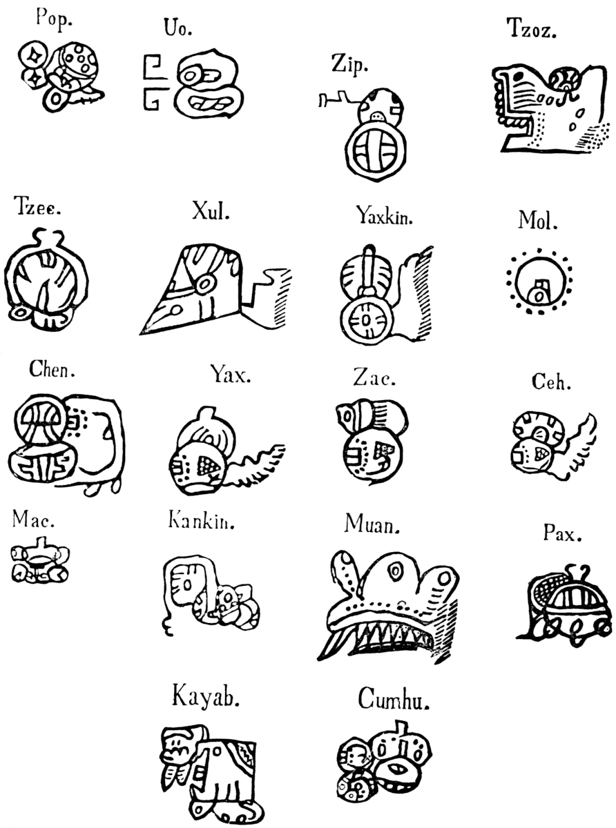
Though the intercalary days were “nameless” and characterized as the “bed or chamber of the year,” “the mother of the year,” “bed of creation,” “travail of the year,” “lying days,” or “bad days,” etc., still five of the above twenty were reckoned for them in regular order.
The year began on a day corresponding to our 16th of July—“a date,” as Mr. Bancroft observes, “which varies only forty-four hours from the time when the sun passes the zenith—an approximation as accurate as could be expected from observation made without instruments.”[626]
The Maya months as figured in Landa’s work are shown in the accompanying photo-engraving. (Page 437.)
The translation of the names of the days and months is somewhat uncertain. The following equivalents are the same as those given by Señor Perez, except in a few instances where Brasseur and Rosny have made corrections.
Though these translations may seem uninteresting by themselves, they are of great value when taken in connection with Landa’s alphabet and M. de Rosny’s interpretations. They must ever be important factors in attempts to translate the inscriptions and codices.
Another division of time among the Mayas of a complicated character was the Katun or Cycle of 52 years. The Katun was composed of four periods (indictions or weeks) of 13 years each, enumerated by a system of reckoning kept simultaneously with the current reckoning of days, months and years. The mode of computing the Katunes was, according to Landa and440 Perez, briefly as follows:[628] The year was divided into twenty-eight periods of thirteen days each. These periods for convenience have been called weeks, and the number of days of which each is composed may have been suggested by the number of days embraced in the moon’s increase, and decrease, twenty-six days constituting about the actual time in which the moon is seen above the horizon during each lunation.[629] The weeks were divided off by counting thirteen days from the beginning of the list of days shown on page 436, Kan constituting the first day of the first week and according to usage applying its name to the weeks. The week was consequently called by the name of the day on which it began. Caban being the fourteenth day of the current month, became the first day of another week; but as not enough days remain to complete it, the enumeration is begun again and continued down to Muluc, the sixth day of the next month. Oc, the seventh day, then becomes the starting point for another week, which assumes its name, and thus the computation is carried on ad infinitum. A numeral preceded each day designating its position in the week. The people of Yucatan painted a small circle in which they placed the four hieroglyphics of the initial days which constitute the left-hand column of signs given on page 436. Kan was placed in the east, Muluc in the north, Ix in the west and Cauac in the south. These signs were termed the “carriers of the years” because no month or year could begin on any of the twenty days, but on one of these. Since twenty days constitute a current month, it is apparent that every month in a given year must begin with the same day. However, the introduction of the five intercalary days at the end of the year, changed the initial day on which the months of the different years began. In reckoning the Katun it is further observed that the numeral which indicates the day of the week (of thirteen days) which falls upon the first of a given month, varies. Supposing the month to begin on Kan and the numeral of the first day to be 1, the numerals indicative 441of the days of the week (composed of thirteen days) falling on Kan throughout the eighteen months, would be, 8, 9, 3, 10, 4, 11, 5, 12, 6, 13, 7, 1, 8, 2, 9, 3.
The Katun year consisted, as we have seen, of twenty-eight weeks of thirteen days each, and one additional day, making in all 365 days. If the year commenced with number one of the week, the additional day (the 365th) caused it to end on the same number. The ensuing year would then begin with number two, and so on through the thirteen numbers of the week, as follows: 1. Kan, 2. Muluc, 3. Ix, 4. Cauac, 5. Kan, 6. Muluc, 7. Ix, 8. Cauac, 9. Kan, 10. Muluc, 11. Ix, 12. Cauac, 13. Kan, thus completing an indiction or week of years. The same combination of names and numerals can only occur after the lapse of the Katun or cycle comprising four of these indictions or fifty-two years. Not only the years of the week, but also the indictions themselves were named by the four initial symbols. The first indiction of each Katun being named Kan, the second Muluc, the third Ix, and the fourth Cauac. The completion of a Katun or fifty-two years was celebrated with feasts and rejoicings as an event of great moment. A monument was reared as a memorial of the event. It is not impossible that the great number of pillars, observed by Stephens at Chichen-Itza were of this character, serving as landmarks to Maya chronology.[630]
A third division of time employed by the Mayas was the great cycle of 312 years, composed, according to Señor Perez,[631] of thirteen periods of time, each embracing twenty-four years. Each of these thirteen periods was called an Ahau Katun, and was divided into two parts. The first part, embracing twenty years, was enclosed in a square and called Amaytum lamayte, or lamaytum; and the other part of four years, which formed as it were a pedestal for the first, was called Chek oc Katun, or lath oc Katun, meaning “stool” or “pedestal.” He affirms that the latter were intercalated, therefore believed to be unfortunate as were the five supplementary days of the year. This may account 442for their not being reckoned with the Ahau Katun by any other writer. Just here lies the discrepancy which has created most of the confusion in the investigation of this subject. However, if we accept the statement of Señor Perez, that the Ahau Katun embraced twenty-four years instead of the testimony of every other writer that it included but twenty years, we shall have moderately fair sailing until we split upon the rock of his inaccuracies as to dates. He tells us that these periods took their name from Ahau, the second of those years that began in Cauac, and from the order of the numerals accompanying those days would succeed each other according to the numbers 13, 11, 9, 7, 5, 3, 1, 12, 10, 8, 6, 4, 2. The Indians established the number 13 Ahau as the first, because some great event happened in that year. If the 13 Ahau Katun began on a second day of the year, it must have been the year which began on 12 Cauac, and the 12th of the indiction. The next or the 11 Ahau would commence in the year 10 Cauac, which combination in its rotation would happen after a lapse of twenty-four years. The third or 9 Ahau would begin in 8 Cauac twenty-four years later, in illustration of which we follow out the rotation of the four names of the years, Kan, Muluc, Ix and Cauac, through the indictions of thirteen years each, until we have noted the numerals accompanying them during twenty-four years. Our starting point will be the commencement of the second Ahau Katun on the second day of 10 Cauac.
| Year of 13 Year Indiction. | |||||
|---|---|---|---|---|---|
| Name of Year. | |||||
| Year of Period of 24 Years. | |||||
| Year of 13 Year Indiction. | |||||
| Name of Year. | |||||
| Year of Period of 24 Years. | |||||
10 |
Cauac | 1 |
9 |
Cauac | 13 |
11 |
Kan | 2 |
10 |
Kan | 14 |
12 |
Muluc | 3 |
11 |
Muluc | 15 |
13 |
Ix | 4 |
12 |
Ix | 16 |
1 |
Cauac | 5 |
13 |
Cauac | 17 |
2 |
Kan | 6 |
1 |
Kan | 18 |
3 |
Muluc | 7 |
2 |
Muluc | 19 |
4 |
Ix | 8 |
3 |
Ix | 20 |
5 |
Cauac | 9 |
4 |
Cauac | 21 |
6 |
Kan | 10 |
5 |
Kan | 22 |
7 |
Muluc | 11 |
6 |
Muluc | 23 |
8 |
Ix | 12 |
7 |
Ix | 24 |
8 |
Cauac | 1st of a new period. |
|||
443
As above stated the new Ahau Katun begins in the year 8 Cauac, and as it invariably began on the second day of the year, that day would be 9 Ahau, as Ahau is the next letter in the alphabet after Cauac. An extension of the table will show that the next period will begin in 6 Cauac on 7 Ahau, and so on in the order of the numerals given above. Thirteen Ahau Katunes, as previously stated, constituted a great cycle of three hundred and twelve years. Sr. Perez states that according to all sources of information, confirmed by the testimony of Don Cosme de Burgos, one of the conquerors and a writer (but whose observations have been lost), the year 1392 A.D. corresponded to the Maya year 7 Cauac, and as the second day of that year was the beginning of an era of twenty-four years, it must have been 8 Ahau Katun. By dividing off the time between that date and the beginning of the present century into periods of twenty-four years each, and extending a table of the rotation of the four names of the years, the reader will observe that 13 Ahau will fall in the year 1800; 11 Ahau in 1824; 9 Ahau in 1848; 7 Ahau in 1872, and 5 Ahau in 1896, three hundred and twelve years intervening before this, and any similar combination of Ahau Katunes either have occurred or can be repeated. This would be highly satisfactory if Sr. Perez could be relied upon in this particular, which is doubtful. We are sorry to say that he is certainly chargeable with inaccuracies, which impair the value of his whole system. Most conspicuous of these is one pointed out by Mr. Bancroft, to which we refer the reader below. Señor Perez sets about the verification of his system by citing the death of a notable personage named Ahpula. He states that Ahpula died in the sixth year of 13 Ahau, when the first day of the year was 4 Kan, on the day 9 Imix, the eighteenth of the month Zip. It is seen that 13 Ahau is the second day of the year 12 Cauac which falls in the year 1488, also that the year 1493 is the sixth from the beginning of 13 Ahau, and that its first day is 4 Kan, which is the title of the year. The day is the eighteenth of the month Zip, corresponding to the eleventh of September. The statement is also made that this date fell on 9 Imix. This is tested as follows:444 The first month of that year commenced on 4 Kan, which combination names the year. The number (of the week of thirteen days) is found by adding seven to the number of the first day of each month successively. The number of the first day of the first month, Pop, in this case being 4, the number of the first day of the second month (Uo) would be 4 + 7 = 11, and that of the first day of the third month (Zip) would be 11 + 7 = 18, but as the week consists of but thirteen days, that number must be substracted, leaving 5 Kan as the first day of Zip. If Zip begins on the twenty-fifth of August, the day 9 Imix will be found to correspond both with the eighteenth of Zip and the eleventh of September, if the Katun week of thirteen days is counted off regularly, beginning with 5 Kan. Sr. Perez is correct enough in his calculations, but unfortunately his system of twenty-four years to the Ahau Katun or his informant as to the correspondence of the Ahau Katunes with our chronology (no doubt the latter) is incorrect, since the Maya manuscript furnished and translated by Perez and published in the works of Stephens and Landa, states explicitly that Ahpula died in A.D. 1536, instead of 1493 (incorrectly printed 1403 in Bancroft’s work), a date which is irreconcilable with the system of twenty-four years to the Ahau, reckoned from 1392 as a starting point. Neither will the statement of Landa that the year 1541 corresponded with the beginning of 11 Ahau relieve the difficulty, but rather increases it, since it will neither harmonize with the date of Ahpula’s death given in the MS. nor with the system by Perez. Furthermore, while Landa gives the same succession of numerals for the recurrence of the Ahaus, he states that they embraced but twenty years each, thus making it impossible for the combinations of names and numerals to correspond to the order which he lays down for their succession. Landa is no doubt incorrect in his statement. Sr. Perez is at least consistent in his adaptation of the length of the Ahau Katun to the order of numerals given by Landa and others. Recently, M. Delaporte, a member of the Société Américaine de France, has, by a series of extended calculations, vindicated the correctness of the statement of Sr. Perez,445 that the Ahau Katun embraced twenty-four years. M. de Rosny agrees with M. Delaporte in his conclusions. The fault of Perez, probably, lies in his adaptation of the Ahaus to our chronology, and in carelessness. Amidst these discrepancies it is impossible to fix accurately the dates of the Maya history, though they can be approximated.[632] Señor Perez cites Boturini as stating that the day introduced every four years to compensate for the annual loss of six hours, was observed by counting the symbol for the three hundred and sixty-fifth day twice, as the Romans did with their bissextile days, thus leaving the order undisturbed.[633]
The Nahua Calendar system closely resembles that of the Mayas, a fact which adds to the abundant proof that both civilizations had grown up under nearly the same influences, and that they had largely affected each other. If the trifling differences of a few writers concerning some of the details of the Aztec calendar be overlooked, and the best authorities (together with a little exercise of judgment) be followed, the system becomes comparatively simple. Sahagun, Leon y Gama, Humboldt, Veytia, Galatin, McCulloch, Müller, Bancroft, Chavero, and Prof. Valentini, are the authorities to whom we refer the reader.[634]
446
The Mexican Calendar contains divisions as follows: The age, called huehuetiliztli, embraced two cycles of fifty-two years each, thus equalizing one hundred and four years. The cycle of fifty-two years was named xiuhmolpilli, xiuhmolpia, and xiuhtlalpilli, signifying the “binding up of the years” and consisted of four periods of thirteen years each. These periods or indictions were called “knots,” while the single years were called xihuitl or “new grass,” because anciently, before the invention of the calendar, the Nahuas were only able to distinguish the revolution of the years by the annual appearance of fresh vegetation and new grass. The age was but little used, the cycle being the common measure for long periods. The years in a given cycle were designated as among the Mayas, by means of the consecutive rotation of four signs, each accompanied with a numeral. The signs were tochtli, “rabbit”; acatl, “cane”; tecpatl, “flint,” and calli, “house.” The following table illustrates the rotation occurring in one cycle:
| 1st Tlalpilli. | 2d Tlalpilli. | 3d Tlalpilli. | 4th Tlalpilli. | ||||
|---|---|---|---|---|---|---|---|
| Names of Years. | Names of Years Translated. | Names of Years. | Names of Years Translated. | Names of Years. | Names of Years Translated. | Names of Years. | Names of Years Translated. |
| Ce Tochtli | 1. Rabbit. | Ce Acatl | 1. Cane. | Ce Tecpatl | 1. Flint. | Ce Calli | 1. House. |
| Ome Acatl | 2. Cane. | Ome Tecpatl | 2. Flint. | Ome Calli | 2. House. | Ome Tochtli | 2. Rabbit |
| Yey Tecpatl | 3. Flint. | Yey Calli | 3. House. | Yey Tochtli | 3. Rabbit. | Yey Acatl | 3. Cane. |
| Nahui Calli | 4. House. | Nahui Tochtli | 4. Rabbit. | Nahui Acatl | 4. Cane. | Nahui Tecpatl | 4. Flint. |
| Macuilli Tochtli | 5. Rabbit. | Macuilli Acatl | 5. Cane. | Macuilli Tecpatl | 5. Flint. | Macuilli Calli | 5. House. |
| Chicoace Acatl | 6. Cane. | Chicoace Tecpatl | 6. Flint. | Chicoace Calli | 6. House | Chicoace Tochtli | 6. Rabbit. |
| Chicome Tecpatl | 7. Flint. | Chicome Calli | 7. House. | Chicome Tochtli | 7. Rabbit. | Chicome Acatl | 7. Cane. |
| Chico y Calli | 8. House. | Chico y Tochtli | 8. Rabbit. | Chico y Acatl | 8. Cane. | Chico y Tecpatl | 8. Flint. |
| Chico Nahui Tochtli | 9. Rabbit. | Chico Nahui Acatl | 9. Cane. | Chico Nahui Tecpatl | 9. Flint. | Chico Nahui Calli | 9. House. |
| Matlactli Acatl | 10. Cane. | Matlactli Tecpatl | 10. Flint. | Matlactli Calli | 10. House. | Matlactli Tochtli | 10. Rabbit. |
| Matlactli occe Tecpatl | 11. Flint. | Matlactli occe Calli | 11. House. | Matlactli occe Tochtli | 11. Rabbit. | Matlactli occe Acatl | 11. Cane. |
| Matlactli omome Calli | 12. House. | Matlactli omome Tochtli | 12. Rabbit. | Matlactli omome Acatl | 12. Cane. | Matlactli omome Tecpatl | 12. Flint. |
| Matlactli omey Tochtli | 13. Rabbit. | Matlactli omey Acatl | 13. Cane. | Matlactli omey Tecpatl | 13. Flint. | Matlactli omey Calli | 13. House. |
447
As in the Maya rotation of years no confusion could occur, so with the Mexican, as the same combination could be made only once in fifty-two years. The cycles themselves were distinguished by numbers. Confusion is liable to arise in studying the early writers, since the Toltecs and Aztecs began their reckoning on different signs, the former on Tecpatl, and the latter on Tochtli. The year consisted of eighteen months of twenty days each, to which were added five days called nemontemi or “unlucky days.” Every superstition seemed to centre in the nemontemi, for no business of importance nor enterprise of the most insignificant character would be undertaken upon these days. Both the names of the months and the particular month which served to begin the year, as well as the date of the first day of the year, have been fruitful subjects of controversy between authors. Mr. Bancroft has tabulated the names given by twenty-one writers, and shown the disagreements existing between them.[635] The dates for the first day of the year range between the ninth of January and the tenth of April. Gama, Humboldt and Gallatin, by careful calculations, have shown that the first year of a Nahua cycle commenced on the thirty-first day of December, old style, or on the ninth day of January, new style, with the month Titill and the day Cipactli.[636]
The names and order of the months, together with their etymologies, as adopted by Mr. Bancroft, are as follows: 1. Titill, meaning “our mother,” according to Boturini, or “fire,” according to Cabrera; 2. Itzcalli, translated “regeneration” by Boturini, “skill” by the Codex Vaticanus, and the “sprouting of the grass” by Veytia; 3. Atlcahualco, meaning the “abating of the waters.” Another name (Quahuillehua) applied to this month signified “burning of the mountains,” referring to the forests; 4. Tlacaxipehualiztli, is translated “the flaying of the people.” Another name applied to this month, Cohuailhuitl, means the “feast of the snake”; 5. Tozoztontli is rendered “small fast” or “penance”; 6. Hueytozoztli, 448means “great fast” or “penance”; 7. Toxcatl, a “necklace”; 8. Etzalqualiztli, “bean stew” or “maize gruel”; 9. Tecuilhuitzintli, “small feast of the Lord”; 10. Hueytecuilhuitl, “great feast of the Lord”; 11. Miccailhuitzintli, translated “small feast of the dead”; 12. Hueymiccailhuitl, “great feast of the dead”; 13. Ochpaniztli, “cleaning of the streets”; 14. Teotleco, “arrival of the gods.” The names Pachtli, “moss hanging from trees,” and Pachtontli, “humiliation,” were often applied to this month; 15. Hueypachtli, “great feast of humiliation,” sometimes called Tepeilhuitl, “feast of the mountains”; 16. Quecholli, “peacock”; 17. Panquetzuliztli, “the raising of flags and banners”; 18. Atemoztli, means the “drying up of the waters.”
The month, consisting of twenty days, was divided into four weeks of five days each. Mr. Bancroft states that each of the weeks began with one of the four signs—Tochtli, Calli, Tecpatl or Acatl, used to designate the years; but his own engraving of the Aztec month, and the order of the days on the Calendar-Stone, contradict this statement.[637] The following are the days in their proper order, with their translations affixed: 1. Cipactli, “sea-animal,” “sword-fish,” or “serpent with harpoons.” 2. Ehacatl, “wind.” 3. Calli, “house.” 4. Cuetzpalin, “lizard.” 5. Coatl, “snake.” 6. Miquiztli, “death.” 7. Mazatl, “deer.” 8. Tochtli, “rabbit.” 9. Atl, “water.” 10. Itzcuintli, “dog.” 11. Ozomatli, “monkey.” 12. Mollinalli, “brushwood” or “tangled grass.” 13. Acatl, “cane.” 14. Ocelotl, “tiger.” 15. Quanhtli, “eagle.” 16. Cozcaquauhtli, “vulture.” 17. Ollin, “movement.” 18. Tecpatl, “flint.” 19. Quahuitl, “rain.” 20. Xochitl, “flower.”
The day was divided into sixteen hours.[638] Sahagun and several authors state that the loss of six hours in each Aztec year was counterbalanced by the addition of a day every four years. Gama demonstrates this to be a mistake, and states that they added twelve and a half days at the close of every cycle of 449fifty-two years. Mr. Bancroft cites this fact, and states the time added to have been thirteen days.[639]
The Nahuas had also a ritual calendar, for the purpose of reckoning their religious feasts, which was altogether different from the civil system, except that it employed the twenty days, the year of 365 days, and at the end of a cycle added the thirteen days to compensate for the time lost during that period.[640] The year consisted of two parts, the first composed of twenty weeks of thirteen days each (for there were no months in the ritual year) making 260 altogether. This portion of the year was called Meztli pohualli or the “lunar computation,” from the fact that half of the time during which the moon is visible is thirteen days. The smaller part, composed of 105 days reckoned by a continuation of the periods of thirteen days, was called Toualpohualli or “solar computation.”[641] The days were numbered from one up to thirteen, the fourteenth day of the first solar month being counted the first of another lunar week, and thus the reckoning continued. However, it will be observed that the same number would fall twice on one name in the course of a year; accordingly accompanying signs were provided for the regular names of days. The duplication could not occur if the second division embraced 104 days instead of 105.
The distinguishing signs were nine in number, called quecholli, “lords of the night.” They were as follows: Tletl, “fire”; Tecpatl, “flint”; Xochitl, “flower”; Centeotl, “goddess of maize”; Miquiztli, “death”; Atl, “water”; Tlazolteotl, “goddess of love”; Tepeyollotli, “a mountain deity”; Quiahuitl, “rain,” the god Tlaloc. The lords of the night, though reckoned from the first of the year, were not mentioned except in connection with the 105 days of the second division.
The reader will more clearly understand the relation of the 450two systems to each other by constructing a table of four parallel columns. In the left-hand column place the months of one year, numbering the days of each month in order, but beginning on the ninth day of January. In the second column place the names of the Mexican months, numbering the days of each month from one to twenty in regular order. In the third column place the names of the Mexican days, twenty in number, repeating them in their regular rotation throughout the year, but in addition prefix to the names such numerals as will fall opposite to each in the process of dividing them off into thirteens. These divisions into thirteens represent the ritual weeks. Acatl being the 13th day of the month will end the first week of the year, and Ocelotl being the 14th day of the month will constitute the 1st day of the second week. In the fourth column place the nine signs of the “lords of the night” in regular order. Divide the year into periods of nines, and it will be found that the same combination of days of the month (twenty days), of days of the week (thirteen days), and the “lords of the night,” will not recur for a considerable period.
The most remarkable embodiment of this complex system is found in the symbols and concentric zones graven upon the face of the Calendar Stone, described in the last chapter. The interpretation of its mysterious disk was partly accomplished by the learned antiquarian Leon y Gama; Gallatin, and after him Bancroft presented those investigations to the public. In 1875 (Nov.), Don Alfredo Chevero, of the Liceo Hidalgo of Mexico, published his Calendario Azteca, in which it was shown that many of Gama’s interpretations would have to be abandoned. It was proven that the “Calendar Stone” was a sun-disk or stone of sacrifice, and that Gama had pursued his investigations with a mistaken view of its character. Chevero’s account of the history of the stone is full and satisfactory, Duran being the authority cited. An interpretation of some of the concentric zones, two in particular, is attempted with a result somewhat different from that obtained by any other investigator. Recently, Prof. Ph. Valentini, by the light of his extensive researches into Nahua literature, has compelled the sun-disk to give up its secrets. The452 illustration on the preceding page is a reproduction of a pen-and-ink drawing made by the Professor from the most recent and correct photograph which has been made of the Calendar Stone. It was kindly furnished for this work. The same conclusion concerning the character of the stone was reached independently by both Chevero and Valentini. The latter’s account of the stone and its history is drawn from Tezozomoc, and though agreeing in the main facts with Duran’s account as rendered by Chevero, bears the evidence upon its face of independent research.[642] The originality of Prof. Valentini is vindicated in his masterly interpretation of all the zones of the Calendar Stone. Whether the interpretation will ever give way to some other is a question of the future, though it is probable that it will not.
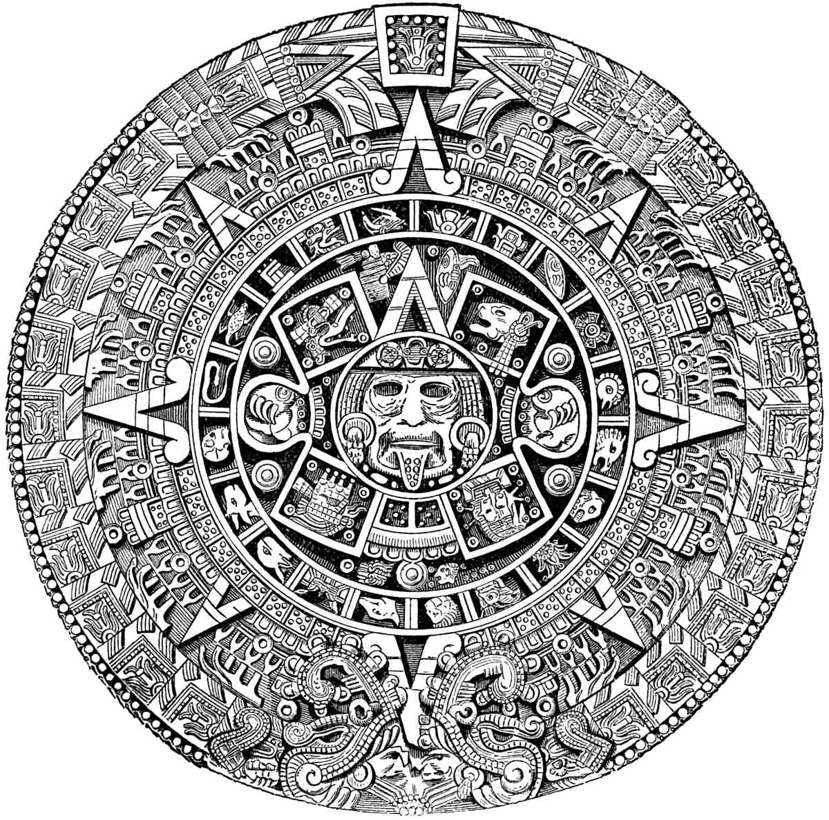
We are indebted to Professor Valentini for a communication on the History of the Calendar Stone, condensed from his unpublished MS. Description and Interpretation of the Mexican Calendar Stone. An extract from the communication is as follows: “King Axayacatl of Mexico, 1466–1480, the builder of the large pyramid, at the approach of the last year of the national cycle (1479), ordered the altar standing on the platform of the pyramid to be covered with a stone disk, the surface of which was to be sculptured with the image of the Sun-god, and, as the text says, ‘to be surrounded by all the national deities’ (see Alvaro de Tezozomoc, 1598, Chronica Mexicana, Ternaux-Compans, vol. i, chap. xlvii, pp. 249 et seq.). A large slab, carried for the purpose from the quarries of Cuyoacan, when rolled over the bridge of Xoloc, crushed this structure, fell to the bottom of the lake and remained there. Another slab was broken and a new bridge built, and 50,000 Indians succeeded in transporting the slab to the foot of the pyramid, where the sculptor accomplished his task to the satisfaction of the king. The cyclical festival of the sun (1479) was celebrated, and on the disk which now had been inserted into the surface of the sacrificial altar, thousands of captives were slaughtered. The king is said to have overworked 453himself, slaying one hundred of the victims, and feasting upon their flesh and blood—that very soon after he died in consequence of these exertions. In the year 1512, Montezuma II, for reasons unknown, expressed the wish to replace the altar cover, which his father had consecrated, by a new and still larger one. The people, horrified and out of patience with the bloody proceedings connected with these consecration festivals of sacrificial disks, contrived to let the slab, brought expressly for the purpose, fall into the lake again, pretending as an excuse, that the stone had spoken and said that it was to go back to the quarry. Montezuma, superstitious as he was, took the accident for a bad augury, desisted from his plan, and left the stone in its place. We may thus infer that it was our disk on which, in the year 1520, those Spaniards of Cortes’ troops which were made captives had been immolated, and the screams and cries of whom reached the ears of their comrades, and as Bernal Diaz narrates, ‘filled their hearts with the most awful forebodings.’ Cortez demolished the pyramid, and with its débris filled the canals of the city. The disk was preserved, for we know from Duran, who wrote a Historia de la N. España, 1588, that he and many of his fellow-citizens had often been standing before this disk admiring it, until the Archbishop Montufar, scandalized by the existence of such a barbarous relic, caused it to be buried in the immediate neighborhood of the Metropolitan cathedral in the year 1551. This procedure was forgotten; so much so, that when this disk was disinterred in the year 1790, even Gama the archæologist and its later interpreter, had not the remotest idea what purpose it could have served, for the manuscript chronicles of Duran and Tezozomoc still slumbered in the dust of the archives. The viceroy, Reviellagigedo, ordered the disk to be fitted into the outer wall of one of the towers of the cathedral. There it is to this day.”
We now ask your attention to the stone itself. The central circle contains the face of the Sun-god bedecked with ornaments, earrings, and jeweled lip. In the next zone we observe four large parallelograms containing hieroglyphic signs: Nahui Ocelotl, Nahui Ehecatl, Nahui Quahuitl and Nahui Atl. Between the454 upper and lower enclosures on both sides of the central disk are circular figures containing hieroglyphics resembling claws, said to represent two ancient astrologers, man and wife, who, according to the early writers, invented the calendar. These four signs are identical with the days on which, according to the traditions, the world was destroyed at four different times. These destructions mark four ages represented by the signs of the day on which they occurred. These ages were also called suns. The first destruction occurred in Ce Acatl, and is represented by the sign Nahui Ocelotl, or 4 Tigre, seen in the upper right-hand tablet. The small figure above and towards the left is the sign for 1. Tecpatl, a feast-day kept by the Aztecs in memory of the first destruction. The second tablet bears the symbol for Ehecatl or Wind, in memory of the destruction of the world by hurricane, which occurred in the year Ce Tecpatl or Nahui (4) Ehecatl. Between the tablet and the triangular figure to the right is a sculpture in which a broken wall with towers appears. The sign 1. Calli is associated with it, indicating a ritualistic feast-day kept on that sign. The third tablet bears the symbol of the rain-god Tlaloc, in memory of the destruction of the world from frequent rains. The last tablet represents the fourth destruction by a flood on Nahui Atl in the year Ce Calli.
The faces of Cox-Cox, the Mexican Noah, and his wife are delineated in the picture. The symbol for water is seen immediately below the faces. Between the two lower tablets, two small quadrilateral enclosures will be observed, each containing five round points, supposed to mean 10 Ollin (the sun being called ollin tonatiuh). Below the lower tablets and almost in contact with the next concentric circle are the hieroglyphics 1. Quiahuitl and 2. Ozomatli. The first, namely 10 Ollin, corresponds with our twenty-second of September in the first year of a cycle, and its hieroglyphic on this astronomical disk represents the autumnal equinox. At the extreme top of the Calendar Stone is a central figure, well known to be the hieroglyphic for 13 Acatl. This fact known, the interpretation of the two remaining symbols is easy. In the year 13 Acatl, the day 1. Quiahuitl would correspond to our twenty-second of March,455 and represent the vernal equinox. In the same year 2. Ozomatli would correspond with our twenty-second of June, or summer solstice. Thus it is that the stone speaks and testifies to the astronomical knowledge of the Aztecs, the accuracy of which casts into the shade the imperfect Julian Calendar in use by Europeans at the time of the conquest. In the next zone, encircling that which contains the tablets of the cosmological ages, are twenty enclosures, containing the symbols of the twenty days. The triangular pointer which extends upwards from the crest of the sun-face indicates the dividing line between the first and last days of the month. Cipactli, whose hieroglyphic stands at the left of the pointer is unquestionably distinguished as the first day of the month. The second symbol to the left is that of the second day Ehecatl, wind, the third Calli, house, the fourth Cuetzpalin, lizard, the fifth snake, and so on to the end of the list. In the next zone we find a succession of small squares, each enclosing five round points. The circle is divided into four parts by four large triangular pointers or gnomons. In each division of the zone are ten squares containing five points each, or in the four, we have 200 points. Gama states that the space for sixty additional points is occupied by the feet or curves of the large indices. By experiment it is found that the mean of the space occupied by the feet of the pointers is equal to the width of one and a half of the square enclosures. Eight times this space gives us twelve squares with sixty points. Thus we have the ritualistic division or lunar reckoning (Metzli pohualli) of 260 days. In the next zone the symbols of the remaining 105 days or solar reckoning of the ritualistic year is found. Eight pointers divide the circle; the six upper divisions of which contain each ten figures resembling a grain of maize, while the two lower divisions have but five figures in each. This gives us seventy figures. Under each limb of the pointers is space for one and a half of the figures, giving twenty-four more or ninety-four in all. The space of ten additional figures is occupied by the helm-plumes of the heads which are figured at the lower margin of the stone. This gives us 104 figures, or one less than the required number. It will be remembered that the five intercalary days456 called the nemontemi, or unlucky days, though reckoned in regular order at the close of each year, were considered separate and apart from it. The artist who executed the Calendar Stone has carried out this custom in placing the figures of the nemontemi between the tablets of the two last destructions of nature, where they will be found by themselves. It will be observed that four of the signs correspond to those wanting under the lower pointer and the adjacent plumes, with this further departure from the general plan of the design, that the central figure or maize grain corresponds to the space between the limbs of the great pointer below. Here, then, we have the missing symbol, and are able to find the 105 hieroglyphics of days for the lesser division of the year. The two zones consequently represent the complete year of 365 days.
The most conspicuous of the remaining zones is the outer, and last of all. The attention is asked to one of the twenty-four quadrangular figures composing it. The Mexican Codices in the Kingsborough collection furnish similar symbols for the cycle of 52 years.[643] The ancient Mexicans had a superstition that in the last night of the 52d year of their cycle the sun would destroy the world. Consequently, at every recurrence of the eventful night, all fires were extinguished, the people clothed themselves in mourning, and forming a long procession, repaired to a neighboring mountain, where at midnight a priest sacrificed a man in their presence. A second priest placed a round block of dry wood over the ghastly wound from which the heart had 457been torn; while a third, kneeling over the corpse, rested a hard shaft or stick upon the block, revolving it between his two hands with pressure until the friction produced fire. This was considered a promise from the god that the destruction of the world would be postponed until another cycle had elapsed.[644] A moment’s observation will disclose the fire symbol in the hieroglyphics for the cycle as delineated on the stone; the perpendicular shaft with handles, surrounded by flames and smoke, rising from a hole below. In the same zone, above, we have two groups of pleats or bow-like figures, which are clearly proven to be the symbol for the binding of two 52-year cycles into an age.[645]
The zone immediately within the one we have been considering, contains the symbols of the rain-god Tlaloc. No writer has as yet given a satisfactory explanation of the plumed head at the bottom of the stone. It will be readily seen that the two serpent heads, plumed, and with extended jaws, armed above and below with great fangs, enclose two human faces. These are but the heads of the serpents whose bodies constitute the outer zone of the disk and terminate in the triangular points above.
If the reader will but turn to our cut of the serpent temple at Uxmal (p. 394), the same symbol of Cukulcan or Quetzalcoatl, the feathered serpent, will be seen. Dr. Le Plongeon, in his recent researches, is convinced that Uxmal was built, or more properly rebuilt, by Nahua invaders, who afterwards became amalgamated with the Mayas.[646] Most of the Mexican historians represent Quetzalcoatl as the founder of the Nahua civilization. Torquemada states that he was their leader when they first arrived in Mexico.[647] If the “Feathered Serpent” was the founder 458of their institutions, it was not inappropriate for the Aztec artist to place the hero’s face at the bottom of the stone, and represent the symbols of the cycles as huge scales upon his body, since the influence of the civilization which he established had been felt throughout their entire history. To return to Prof. Valentini’s investigations, it will be observed that there are twenty-four of the cycle symbols, two of which are nearly hidden under the helm-plumes. The product of 24 and 52 gives us a period of 1248 years. But what have we to do with this result? The triangular-shaped figures which point to the central tablet cut at the top of the stone, indicate that we must make a calculation, and it remains for us to interpret that symbol. It is recognizable as the sign Acatl accompanied by the number thirteen; a year which, according to the authentic tables of reduction, corresponds to the year 1479 A.D.; a date which is confirmed as being the year in which the Calendar Stone was finished and set up in the great pyramid of Mexico by the statement of the native writer Tezozomoc, that its author, King Axayacatl, became ill from his exertions at the tragic celebrations of the completion of the temple and lived scarcely a year, at the same time fixing the date of his death in 1480. If we subtract 1248 years from the known date 1479 A.D., we have the year 231 A.D.; a date which no doubt marks the beginning of the national era of the Nahuas, and probably designates the year of their arrival in Mexico by the ports of Tampico, Xicalanco and Bacalar. Thus it is that the uncertainty of the traditions relating to the obscure events of early Nahua history is removed, and we are enabled to settle upon the third century of our era as the period when the great migration took place. We will say more than Professor Valentini or his predecessor; we believe this to be the date of the migration from Hue hue Tlapalan, the country of the Mound-builders of the Mississippi valley, and we further think we are sustained in this view both by the early writers and by the condition of the mounds and shell-heaps of the United States. At first thought, it would seem that the year 231 might be the date in which the astrologers assembled in Hue hue Tlapalan for the correction of the calendar (a fact to which we have previously459 referred), but it is distinctly stated that the assembly convened in the year 1 Tecpatl; a date which, according to the received reduction tables, corresponds to the year 29 B. C.
Humboldt by an elaborate discussion has satisfactorily shown the relative likeness of the Nahua Calendar to that of Asia. He cites the fact that the Chinese, Japanese, Calmouks, Mongols, Mantchoux and other hordes of Tartars have cycles of sixty years duration, divided into five brief periods of twelve years each. The method of citing a date by means of signs and numbers is quite similar with Asiatics and Mexicans.[648] He further shows satisfactorily that the majority of the names of the twenty days employed by the Aztecs are those of a zodiac used since the most remote antiquity among the peoples of Eastern Asia.[649] Cabrera thinks he finds analogies between the Mexican and Egyptian calendars. Adopting the view of several writers (Acosta, Clavigero and others) that the Mexican year began on the 26th of February, he finds the date to correspond to the beginning of the Egyptian year. He also observes that both peoples intercalated five days at the close of their year.[650] M. Jomard, quoted by Delafield, denies that the Egyptians intercalated, but believes sufficient analogies exist to prove a common origin for the Theban and Mexican calendars;[651] his argument, however, is worthless, as are many others of a similar character.
Religious Analogies.—In contrast with the obscure subject of the calendar requiring such close attention, we present to the reader a few of the analogies supposed to exist between Mexican and other religious systems. The majority of our references will be made more with a view to satisfying curiosity than for the establishment of a theory. Argument from analogy is at best unscientific—it proves nothing. It is a matter of surprise how much has been written to establish the theory that the Mexicans 460were descendants of the Jews both in race and religion. Mr. Bancroft has collected many of Lord Kingsborough’s arguments in proof of the theory to which he devoted his fortune and sacrificed his life. We have done a similar work with a somewhat different arrangement, and call the attention of the reader to some of the fanciful and we must add mirth-provoking analogies to which the great Americanist attached so much importance. “The Mexicans spoke of their god as the invisible and incorporeal Unity, and they furthermore believed man to be created in his image.”[652] He states further that the doctrine of the trinity was also held by them.[653] He considers that Eden and the temptation were portrayed by the American artists. “The Toltecs had paintings of a garden with a single tree standing in the midst, one especially drawn on coarse paper of the Aloe, round the root of which tree is entwined a serpent, whose head appearing above the foliage displays the features and countenance of a woman. * * * Torquemada admits the existence of this tradition amongst them, and agrees with the Indian historians who affirm this was the first woman in the world who had children, and from whom all mankind are descended.”[654]
Lord Kingsborough is no doubt warranted in holding that the Nahuas were of old world origin at a very remote period prior to their having developed any special tribal characteristics, because of their singular and we think certain knowledge of the Mosaic deluge; but he is not justified in claiming for them any particular relationship to the Jewish or any Shemitic people.[655]
461
In a preceding chapter we have given the deluge tradition from Ixtlilxochitl, who states that the waters rose fifteen cubits (caxtolmoletltli) above the highest mountains, and that a few escaped in a close chest (toptlipetlacali), and after men had multiplied, they erected a very high zacuali or tower, in order to take refuge in it should the world be again destroyed. He further states that then their speech was confused, so that they could not understand each other, and that they dispersed to different parts of the earth.[656] Whether the native historian of Tezcuco who gives us this account, so remarkable for its similarity to the Mosaic, was influenced by Spanish priests and warped from the truth, we are not prepared to affirm at this distant day, since such an assumption would strike the very keystone from the arch upon which all historical evidence rests. Much of the aversion to the view that the Mexican deluge legends are authentic and of old world origin, has been generated by the unscientific and presumptuous style of most of its advocates. Lord Kingsborough himself is ever ready to catch at a straw, and out of customs the most remote to evolve an analogy. Nevertheless, we are not at liberty to reject the Mexican deluge legend as a fable without assuming the burden of proof.[657] Remarkable parallels (?) in the history of both Jews and Mexicans are thought to be discovered by the sanguine Kingsborough. Of a number, two or three specimens will suffice. Hue hue Tlapalan is claimed to have been situated on the Californian coast since the Gulf of California until a late period was called the red river or gulf, a 462name they brought with them.[658] Again: “As the Israelites were conducted from Egypt by Moses and Aaron who were accompanied by their sister Miriam, so the Aztecs departed from Aztlan under the guidance of Huitziton and Tecpalzin, the former of whom is named by Acosta and Herrera, Mixi, attended likewise by their sister Quilaztli, or as she is otherwise named Chimalman or Malinatli, both of which names have some resemblance to Miriam as Mixi has to Moses.”[659] “The destruction of the rebellious Kohra (Gen. xvi) is repeated after the arrival of the Mexicans at Tulan, who, enchanted with the land, were unwilling to go further in search of their promised land. They murmured at Huitzilopochtli, and suffered a dreadful punishment at his hands that night by the death of every one who had rebelled against his will.”[660]
Lord Kingsborough discovers in a Mexican painting in the Bodleian library, a symbol resembling the jaw-bone of an ass, from the side of which water flows forth. This, of course, commemorated the story of Sampson.[661] Among the conspicuous doctrines held by both Jews and Mexicans, we note that the latter believed their children to be the gift of Tezcatlipoca as the former ascribed them to the favor of Jehovah.[662] The doctrine of sin and atonement was held by the Mexicans. Confession and sacrifice of atonement were common, for “half the offerings represented in the Mexican paintings were trespass-offerings, or sacrifices for the commission of sins.”[663] “The Mexicans, like the Jews, were accustomed to do penance by sitting on the ground, in which posture their priests are often represented in the Mexican paintings.”[664] “The Mexicans were as punctilious about washings and ablutions as the Jews.”[665] Baptism was considered the means of regeneration in Yucatan,[666] and was practised by the Mexicans as a religious ceremony.[667] Both peoples had 463devils and the leprosy,[668] both considered women who died in child-bed as worthy of honor as soldiers who fall in battle.[669] The doctrine of hell, according to the most orthodox theology, was held by the Mexicans.[670] Both Jews and Mexicans believed in the resurrection of the body and the immortality of the soul.[671] The latter people sprinkled the face of a corpse with water as a baptism after death.[672] Numerous analogies are found to exist between the Mosaic and the religious code of the Mexicans, as in profanity, sabbath-keeping, disobedience to parents, the smiting of a servant to death, and in the punishment by stoning of persons guilty of fornication and adultery.[673] Kingsborough maintains that circumcision was performed on the eighth day, declaring it to have “prevailed thousands of leagues along the coast of the Atlantic, amongst nations very remote from each other, and who spoke very different languages.”[674] Both peoples had a mutual disgust for swine flesh, and refused to eat the 464blood of any animal.[675] The latter statement is altogether unwarranted in fact. The ceremonial of both peoples have many features in common. As the Jews killed the paschal lamb in the evening, so the Mexicans offered up their sacrifices at night.[676] The Jews in Mexico substituted llamas for sheep in their sacrifices.[677] Both Jews and Mexicans worshipped toward the east, or toward their chief temples, and both called the south by the designation of “right-hand of the world.”[678] Both burned incense toward the four corners of the earth.[679] As David leaped and danced before the ark of the Lord, so did the Mexican monarchs before their idols.[680] Both peoples had an ark, and Duran states that in the ark of the Aztecs which figured so prominently in their migration, was the image of their invisible god.[681] Numerous analogies relating to astrology, omens, witchcraft, dreams, etc., are recorded.[682] References to prophecy are not wanting: Quetzalcoatl predicted the destruction of the temple of Cholula, furnishing a parallel to Christ’s prophecy of the destruction of the temple.[683] In the Mexican mythology, by means of an active imagination, he finds an allusion to the “stone which was carved without hands.”[684] A tiger represented in the Bologna MS. he supposes to be the lion of the tribe of Juda—the Jews of the New World having metamorphosed it into a tiger.[685] Kingsborough supposes that the crosses found in Mexico may have been carried there by Irish monks, “especially,” he adds, “as M. de Humboldt informs us that the first Spanish monks and missionaries gravely discussed the question of whether Quetzalcoatl was an Irishman.”[686] The fanaticism of the eminent Americanist, however, reaches its culmination in his supposed discovery of analogies to Christ in Mexican mythology. The story of the virgin, the annunciation, and the identity of 465Christ and Quetzalcoatl, are clearly discernible to his practised eye.[687] Christ stilled the tempest, and, like Quetzalcoatl, was god of the air.[688] In Yucatan, in the priestly fable of Bacab, he finds a complete and true account of the trinity.[689] It is hardly necessary for us to remark that these ingenious comparisons, tinged with a coloring of fanaticism and yet so full of interest, are useless to the cause of science and prove nothing. With the single exception of the remarkable tradition of the deluge and its literal correspondence in detail to the Mosaic account, we must dismiss the multitude of supposed analogies between Mexican and Hebrew traditions, customs and religion, which Kingsborough and others have discovered, as either imaginary or accidental.[690]
The hypothesis that the Nahua religion may have received some of its characteristics from India is altogether plausible and not without support in resemblances. The cosmological conception of the egg and serpent is found, as previously stated, on Brush Creek, in Adams County, Ohio. It certainly comes to us from Asiatic India. Serpent worship, not only among the people of the mounds but especially of Mexico, is the 466most patent fact revealed to us in ancient American sculpture. “Humboldt thinks he sees in the snake cut in pieces, the famous serpent Kaliya or Kalinaga, conquered by Vishnu, when he took the form of Krishna, and in the Mexican Toua-tiuh, the Hindu Krushna, sung of in the Bhagavata-Purana.”[691] Count Stolberg and Tschudi have both made arguments in favor of this view.[692] Humboldt characterizes Quetzalcoatl as the Buddha of the Mexicans, the founder of the monastic establishments resembling those of Thibet and Western Asia.[693] He further considers the flood of which they speak, identical with that of which traditions are preserved by the Hindoos, the Chinese, and the Shemitic peoples.
Advocates of Scandinavian analogies in religion are not wanting. Although Viollet-le-Duc finds parallels existing between the Brahmanistic ideas of divinity and passages of the Popol Vuh, still he is of the opinion that the strongest resemblances have been found to exist between the religious customs of the Scandinavians and those recorded in the Popol Vuh.[694] Humboldt remarks, “we have fixed the special attention of our readers upon this Votan or Wodan, an American who appears of the same family with the Wods or Odins of the Goths and of the peoples of Celtic origin. Since, according to the learned researches of Sir William Jones, Odin and Buddha are probably the same person, it is curious to see the names of Bondvar, Wodansdag and Votan designating in India, Scandinavia, and in Mexico, the day of a brief period.”[695]
Lafitau, in his Mœurs des Sauvages, is as enthusiastic in his advocacy of the theory that the ancient Americans derived their religion from the Greeks, as Kingsborough is certain that it was of Jewish origin. He devotes his fourth chapter, and furnishes numerous illustrations, in support of his view.[696] Our limited space precludes the possibility of presenting in full the analogies467 discovered by the Abbé Brasseur de Bourbourg between the Mexican deities and those of Greece and Egypt. If we hesitate sometimes in accepting his conclusions, we cannot but wonder at his erudition and his zeal in research. He calls attention to the fact that the cult of Pan and Hermes were identical in Greece, and refers to Maia, a personification of the earth, and the mother of the Hermes having been the consort of Zeus or Pan himself. So in Mexico he finds Pan in the person of Cipactoual, who, under the name of Cuextecatl, has for his consort Maia or Maiaoel. This god was adored in all parts of Mexico and Central America, and at Panuco or Panco, literally Panopolis, the Spaniards found upon their entrance into Mexico, superb temples and images of Pan.[697] The names of both Pan and Maia enter extensively into the Maya vocabulary, Maia being the same as Maya, the principal name of the peninsula, and pan, making Mayapan, the ancient capital. In the Nahua language pan or pani signifies “equality to that which is above,” and Pantecatl was the progenitor of all beings. The Abbé has little difficulty in proving the identity of Zamna, Hunab-ku and other Maya deities, with the gods of Greece.[698] In the name of the Egyptian god Horus, he finds the significance of hurricane, or in the dialects of the Antilles, huracan or urogan, the god Hurakan of the Quichés. Also in the Egyptian hieroglyphic symbol which Salvolini found equivalent to the phonetic K, namely, the singular reptile Uraeus, which resembles a serpent in an erect position with an enlarged body, and employed extensively as a decoration in hair of the Egyptian deities and the Pharaohs; he sees the emblem of Quetzalcoatl (Ketzalcohuatl) the feathered-serpent, called Gukumatz in Quiché, and Kukulcan in Maya. The same symbol is represented on the Egyptian monuments with a feather rising from the serpent’s crest.[699] It would be easy to pursue these ingenious comparisons through a number of pages, but we question their value in throwing any light on the subject in hand. The reader will find them 468scattered in profusion through the voluminous writings of the learned Abbé. It is sufficient to say that most of the seeming analogies between the new and old world religions cannot be other than accidental, since it is probable that the aborigines entered our continent at a very remote antiquity, long before the religions with which theirs have been so persistently compared, took on their distinctive features. If after they were separated from the rest of the world by seas and mountains, the Americans developed religious systems presenting analogies to those of other lands, it furnishes us but another proof of the common parentage and brotherhood of the race, of the universal outgoing of the human mind after the deity, and the sameness of mental operations and processes under the same given conditions.[700]
LANGUAGE in aboriginal America may be pronounced a mystery of mysteries and a Babel of Babels. Mr. Bancroft has catalogued nearly six hundred distinct languages, existing between northern Alaska and the Isthmus of Panama. Many of these, however, scarcely deserve to be called more than dialects; while each has its individuality, it is true that all have certain characteristics in common, a fact which by some has been considered sufficient ground for belief in the unity of the American race, a hypothesis which is by no means tenable. The geographical division and intermixture of languages, for instance, in California, is without a parallel elsewhere in the world. By the accidents attendant upon savage life, resulting from ceaseless hostilities and the frequent inroads of tribes upon their neighbors, a nation has often been scattered in fragments, and its refugees, separated into small bands, have taken up their residence in the470 midst of other tribes at localities far removed from their central home. In a generation or two a modification of the parent speech has been brought about by the surrounding influences, all of which vary in the several localities in which the refugees have found their new homes. New tribes thus formed, soon become unintelligible to their brothers, who have developed a dialect under different influences from theirs. When we consider that for thousands of years this wholesale division and subdivision of tribes and languages has been going on, as the result of ceaseless hostilities, we can easily account for the multitude of languages and dialects on the one hand, and the existence of a thread of unity or similarity on the other, said to run through them all. Supposing the continent to have received its population from several different quarters, the natural expectation would be that in the course of time this process of general intermixture would result in developing in each language much that was common to the others—hence the foundation for the hypothesis of their unity of origin. In the study of American languages it has often been a matter of surprise that their structure and expressiveness indicates a degree of perfection far in advance of the civilization out of which they had sprung. This superiority, we think, can be accounted for on the principle, first, that the evolution of languages on this continent has been more active and constant here than elsewhere, though unfortunately not always operating under favorable conditions; and second, that in the frequent catastrophes which have resulted from inter-tribal warfare, even in language, the law of the survival of the fittest is apparent, in the preservation of those etymological forms and principles of structure which are most useful. We by no means agree with the eminent philologist Dr. W. Farrar, F.R.S., chaplain to the Queen, and others who, taking but a partial and second-hand view of American languages, pronounce their elaborateness a childish excess, and their vaunted wealth a concealment of their poverty.[701] An examination of the poems of Nezahualcoyotl, king of Tezcuco, recorded by Ixtlilxochitl, will afford sufficient 471proof of the expressiveness and richness of the Aztec language.[702] The song on the “Mutability of Life” and the ode on the tyrant Tezozomoc have often been translated and admired.[703] One of the leading characteristics of American language, it has been said, is “agglutination,” but we must add that the term employed is not sufficiently comprehensive. “Agglutination,” says Farrar, “may be described as that principle of linguistic structure which consists in the mere placing of unaltered roots side by side; as when to express ‘discipline’ the Chinese say ‘law-soldier,’ or for ‘elders’ ‘father-mother,’ or for ‘enjoyment’ ‘luxury-play-food-clothes.’”[704]
The term polysynthesis, the synthesis of many words into one, with a little explanation will describe the characteristic, so prominent, to which we allude. In their polysynthesis, the syllables or words which are compressed into one long word, no longer retain their individual forms, but are clipped and altered so as to be scarcely recognizable. A sentence by this process of fusion is compressed into a single long word. Dr. Farrar cites the following example from the Aztec: achichillacachocan, means “the place where people weep because the water is red.” The component parts are: atl “water,” chichiltic “red,” tlacatl “man,” chorea “weep,” all of which have nearly lost their identity in the inflection and contraction necessary in the synthesis.[705] As in the Aryan and other families, Grimm’s system of Lautverschiebung—sound changing, or shunting—better known by Prof. Max Müller’s designation as “Grimm’s law” prevails, so there are groups or families in northern Mexico pointed out by Buschmann to which this law is clearly applicable. No doubt the number of relationships already established between aboriginal languages, as the result of classification, will be greatly augmented when, 472if ever, the subject receives special attention.[706] Mr. Bancroft classifies the languages in his catalogue under three great families, namely, the Tinneh, Aztec and Maya. The first, which covers the territory around the northern extremity of the Rocky Mountains, and sends its offshoots as far south as northern Mexico, only concerns us incidentally in treating the ancient languages of North America.[707] The two families (and their far-reaching branches) in which we are interested, are the Maya and the Aztec, the latter the survivor of the speech of the Nahuas.
To the Maya, or rather, the Maya-Quiché stock, no doubt belongs the greatest antiquity assignable to any language or languages on the continent. The mother tongue, the Maya, prevails throughout all of Yucatan, and together with its dialects extends itself over Tabasco, Chiapas and Guatemala, and is even present in the states of Tamaulipas and Vera Cruz, in the Huastic and Totonac languages. Numerous catalogues of the branches of this family have been made, but the most recent, and we think the most complete, is one constructed in 1876 on Señor Pimentel’s classification by the Mexican scholar, Señor Garcia y Cubas. It is as follows: 1. Yucateco or Maya; 2. Punctunc; 3. Lacandon or Xochinel; 4. Peten or Itzae; 5. Chañabal, Comiteco, Jocolobal; 6. Chol or Mopan; 7. Chorti or Chorte. 8. Cakchi, Caichi, Cachi or Cakgi; 9. Ixil, Izil; 10. Coxoh; 11. Quiché, Utlatec; 12. Zutuhil, Zutugil, Atiteca, Zacapula; 13. Cachiquel, Cachiquil; 14. Tzotzil, Zotzil, Tzinanteco, Cinanteco; 15. Tzendal, Zendal; 16. Mame, Mem, Zaklohpakap; 17. Poconchi, Pocoman; 18. Atche, Atchi; 19. Huastic, and probably 20. the Haytian, Quizqueja or Itis, with their affinities, the Cuban, Boriguan and Jamaican languages.[708]
473
The author of the above list has compensated us for its length by giving each of the names with its variation in orthography according to different writers. The classification is altogether superior to any other. The Maya is of peculiar interest to us, especially since within the territory over which it extends are found the most celebrated architectural remains known to Central American archæology. The majority of the sculptured tablets which are preserved are no doubt in the Maya or some of its dialects. What is most satisfactory to us, is the probability that the language is spoken to-day by the mass of the native population of Yucatan as it was anciently, for says Señor Pimentel, “the Indians have preserved this idiom with such tenacity that to this day they will speak no other,” and he adds that it is necessary for the whites to address them in their own tongue in order to communicate with them.[709]
Señor Orozco y Berra furnishes us evidence that little change has taken place in the language since the earliest times, in the statement that all the geographical names of the peninsula are Maya, which is considered proof in his judgment that the Mayas were the first occupants of the country.[710] It is but a reasonable expectation, therefore, that at no distant day, by the aid of Landa’s alphabet, the inscriptions will be compelled to reveal their mysterious contents. The Tzendal, the language in which Votan is said to have written a history of the foundation of his city, and still spoken near the ruins of Palenque, is said to have been the oldest of American languages, but linguistic investigations have proven that it is an offshoot from the Maya, the mother tongue.[711] It is probable that the Maya was first planted at some point in the territory which it now occupies, and gradually extended its domain until its colonies reached northern Vera Cruz and southern Nicaragua. Whether at any time it was the 474language of a people inhabiting central and southern Mexico at a date anterior to the arrival of the Nahuas, is unknown though probable. Señor Orozco y Berra has shown by linguistic studies that probably the Mayas occupied the Atlantic seaboard of the United States, having in their migration passed from the Floridian peninsula to Cuba and thence to the other Caribbean isles, and to Yucatan. He states that the Mayas possess traditions of a northern home from which they passed by means of the islands of the Gulf to Yucatan. Both he and Señor Pimentel agree that the languages of the West Indies belong to the Maya family.[712]
The characteristics of the Maya-Quiché languages are; flexibility, expressiveness, vigor, approximating harshness, yet on the contrary rich and musical in sound. The Maya itself has more than once been compared to the Greek, and even said to be derived from it. Dr. Le Plongeon, who for four years has been exploring the ruins of Yucatan and especially of Chichen-Itza, writes thus in connection with the discovery of a well-sculptured bear’s head at Uxmal: “When did bears inhabit the peninsula? Strange to say, the Maya does not furnish the name for bear. Yet one-third of this tongue is pure Greek. Who brought the dialect of Homer to America? Or who took to Greece that of the Mayas? Greek is the offspring of the Sanscrit. Is Maya? Or are they coeval? A clue for ethnologists to follow the migrations of the human family on this old continent. Did the bearded men whose portraits are carved on the massive pillars of the fortress at Chichen-Itza, belong to the Mayan nations? The Maya is not devoid of words from the Assyrian.”[713] He does not hesitate to say that “the Maya, containing words from almost every language, ancient or modern, is well worth the attention of philologists,” a statement which might with but little breach of propriety be made as well concerning almost any other language. In referring to its antiquity, the writer says, “I must 475speak of that language which has survived unaltered through the vicissitudes of the nations that spoke it thousands of years ago, and is yet the general tongue in Yucatan—the Maya. There can be no doubt that this is one of the most ancient languages on earth. It was used by a people that lived at least 6000 years ago, as proved by the Katuns, to record the history of their rulers, the dogmas of their religion, on the walls of their palaces, on the façades of their temples.”[714] The Mexican scholar, Señor Melgar, is convinced that he sees resemblances between the names employed by the Chiapenecs in their calendar, and the Hebrew, and furnishes comparative lists to sustain his hopeless theory.[715]
476
The speculations of the Abbé Brasseur de Bourbourg are none the less remarkable and about equally as plausible as those of Dr. Le Plongeon or Señor Melgar. The Abbé after years of study among the peoples of Central America, was convinced beyond a doubt that a marked relationship existed between the Quiché-Cakchiquel and Zutugil and the languages of the north of Europe. He considers the evidence sufficient that peoples speaking the Germanic and Scandinavian languages migrated to Central America and infused their idioms into the Maya.[716]
With Mr. Bancroft we agree that no value can be attached to these speculations, until impartial comparisons are made by scholars who have no theories to substantiate. It is worthy of note that several eminent scholars have observed the remarkable similarity of grammatical structure between the Central American and certain transatlantic languages, especially the Basque[717] 477and some of the languages of Western Africa.[718] Dr. Le Plongeon, after several years spent amid the antiquities of Peru and in the study of the Quichua language, says, “The Quichua contains many words that seem closely allied to the dialects spoken by the nations inhabiting the regions called to-day Central America, and the Maya tongue.” In referring to the mural paintings at Chichen-Itza, he further remarks, “By comparing them with those of the Quichuas, I cannot but believe that Manco’s ancestors emigrated from Xilbalba or Mayapan, carrying with them the notions of the northern country.”[719] Interesting as these speculations are, they must be received with allowance and viewed with doubt, until thorough linguistic researches test their value.
The most important features of Maya grammar are as follows: The letters of the alphabet are, a b c ɔ e, ch, ch, h, i, k, l, m, n, o, p, p, ó, pp, t, th, tz, u, x, y, y, z. The letter ɔ is pronounced like the English dj, h is not aspirated, th is hard, and the k guttural. Much of the beauty of the pronunciation depends on the elision of certain vowels and consonants, as for instance instead of ma in kati they say min kati, or instead of ti ca otoch they would say ti c otoch. The plural is distinguished from the singular by the addition of ob (those). Verbs ending in an take tac in the plural. The masculine of rational beings 478is denoted by the prefix ab, the feminine by ix. The words xibil and chupul, signifying male and female respectively, are used to express the gender of animals. The case of nouns is determined by their position in the sentence and their relation to the prepositions, the most frequent of the latter being ti, which has various significations. Adjectives accompanying substantives always precede them, but the number is only expressed by the substantive. The comparative is formed by adding l to the adjective, sometimes il, and prefixing u or y the pronoun of the third person. The superlative is formed by prefixing hach to the positive.
The Maya pronouns are as follows:
| Personal Pronouns. | Possessives. | Reciprocals. | |||
|---|---|---|---|---|---|
| Ten, en, | I | In, u, | Mine. | Inba, | Myself. |
| Tech, ech, | Thou. | A, au, | Thine. | Aba, | Thyself. |
| Lay, laylo, lo, | He, that. | U, i, | His, of that. | Uba, | Himself. |
| Toon, on, | We. | Ca, | Ours. | Caba, | Ourselves. |
| Teex, ex, | You. | Aex, auex, | Yours. | Abaex, | Yourselves. |
| Loob, ob, | They, those. | Uob, yob, | Of those. | Ubaob, | Themselves. |
The verb has four conjugations and that of the auxiliary teni, to be, the present tense of which is the same as the personal pronouns given in the left hand column, Ten, Tech, etc. The other cases are as follows: Imperfect, Ten cuchi; Perfect, Ten hi; Pluperfect, Ten hi-ilicuchi; Future, Bin ten-ac; Future perfect, Ten hi-ili coshom; Imperative, Ten-ac; Subjunctive present, Ten-ac en; Imperfect, Hi ten-ac.
The verb Nacal, to ascend, of the first conjugation, is inflected as follows:
Singular, 1st per., Nacal in cah; 2d per., Nacal a cah; 3d per., Nacal u cah.
Plural, 1st per., Nacal ca cah; 2d per., Nacal a-cah-ex; 3d per., Nacal-u-cah-ob.
The Imperfect, Nacal in cah-cuchi; Perfect, Nac-en; Pluperfect, Nacen ili cuchi; Future, Bin nacac-en; Future perfect, Nacen ili-cuchom; Imperative, Nacen.
In the state of Oajaca and occupying the western portion of the Isthmus of Tehuantepec, in a position intermediate between the Maya on the one hand and the Nahua on the other, is found the ancient family of languages known as the Mizteco-Zapotec, the various dialects of which are spoken to this day by the natives occupying those regions. No tradition throws any light on the origin of this group, nor do any affiliations in vocabulary or grammmatical structure seem to exist between them and any other family, American or foreign. The Miztec language is exceedingly difficult to acquire, being characterized by words of extraordinary length. The Zapotec on the contrary, with its several dialects, is elegant, sonorous, and less difficult.[721]
The language pre-eminent above all others in Mexico for its territorial extent, for the refinement and civilization which it 480represented, and its own inherent beauty and elegance, is known as the Nahua or Aztec, or more modernly the Mexican. It was the language of the Toltecs and of their advanced civilization, and after them of the seven tribes of Nahuatlacas, that in the year 1196 established themselves in the Mexican plateau. The Aztecs, one of these tribes, in the course of events gaining the ascendency, gave their name to the language which their conquests speedily extended over a territory four hundred leagues in length, and in width from the Gulf to the Pacific, in the latitude of the capital. The Aztec tongue prevailed continuously from a point on the Gulf of California, under the twenty-sixth parallel of latitude south-easterly to Rios Goatzacoalco and Tobasco; and southward to the fifteenth parallel, extending along the coast of San Salvador and appearing in the interior of Nicaragua. Its dialectical extension north of Mexico we will consider on a future page. Twenty languages besides the Aztec are said to have been spoken throughout Montezuma’s empire, but the Aztec alone was recognized as the official and classic tongue. The Chichimecs are said to have spoken a language of their own, until the ruler Techotlalatzin commanded them to learn the Mexican.[722] Mr. Bancroft is of the opinion that the Nahua was the original language of the Chichimecs, and consequently does not agree with Señor Pimentel who advocates the opposite view, and, we think, sustains it.[723] The copiousness and grace of the Aztec has furnished a theme for many Spanish writers whose praises have found an echo in the works of our most able scholars and historians. If the Maya has been compared to the Greek, the Aztec has often been likened to the Latin, not in structure or vocabulary, but in its relation to ancient American civilization, in its expressiveness, politeness, its capacity for the sublime, and for the romantic coloring with which it is able to clothe that which is humble and even insignificant. “It was the court language,” says Mr. 481Bancroft, “of American civilization, the Latin of medieval and the French of modern times.”[724]
The Nahua attained its highest development during the century preceding the conquest in the schools of oratory, poetry and history, established at Tezcuco, to which the sons of nobles were sent, as much to acquire the purity of the idiom as the science which they taught.[725] Señor Orozco y Berra says that the difference existing between the ancient Nahua and the modern, may be compared to that difference observed between the Castilian of the Romance of the Cid and that of the present day.[726]
The outlines of the Aztec grammar are briefly as follows: The alphabet contains the letters a, ch, e, h, i, k, l, m, n, o, p, t, tl, tz, u, v, x, y, z, but lacks our consonants b, d, f, r, g, s. No word commences with l. The a is clear; ch before a vowel is pronounced as in Spanish, but before a consonant or when final it differs somewhat; e is clear; h is moderately aspirated and soft, but strong when it precedes u; t is omitted except when it comes between two l’s. The tl in the middle of a word is soft as in Spanish, but at the end is pronounced tle, the e being half mute. The pronunciation of tz is similar to the Spanish s, but stronger. The v is pronounced by the women as in Spanish and French, but by the men like hu in Spanish; x, soft like the English sh, and z like the Spanish s, but not quite so hissing.[727]
482
By composition, words containing sixteen syllables are formed, though many simple words are quite long. We have already explained the process of polysynthesis or compounding by means of clipping the syllables and words with a view to brevity and euphony. The following example furnished by Pimentel and copied by Mr. Bancroft, further illustrates the principle: tlazotli, esteemed or loved; maviztik, honored or reverenced; teopixki, priest; tatli, father, and no, mine, furnishes as a result: notlazomaviztcopixkatatzin, “my esteemed father and reverend priest.” An example of the termination tzin, signifying respect, is presented in this word. Several illustrations of the same principle are furnished by Señor Pimentel, showing that often a sentence is compounded into a single word. Indeed a great many of the component parts of these long words, though words in themselves, are incapable of being used separately. In composition the verb succeeds the nominative and is placed at the end of the sentence. The adverb precedes the verb, as does the adjective the substantive.
The Aztec is rich in terminations for the formation of the plural. Generally no change is required for inanimate objects, as multiplicity is expressed by means of numerals or the adverb miek (much), e. g., ze tetl, one stone; yei tetl, three stones; miek tetl, many stones, though often the terminations used for the plural of persons is applied to inanimate objects, particularly when they are connected with persons, as zoquitl, mud; tizoquime, we are earth; however, there are exceptions to the rule, as in the Aztec words for the heavens, the mountains and the stars. Furthermore, the first syllable is often doubled in order to form the plural of inanimate things. Señor Pimentel has embraced the entire subject of the formation of the plural in six rules.
1. Primitive words form their plural in me tin or ke, as ichkatl, a ewe, a sheep; ichkame, sheep; zolin, a quail; zoltin, quail; kokoxki, sick; kokoxke, sick (plural).
2. Derivatives form their plural as follows: the so-called “reverentials” in tzintli, have the plural in tzitzintin; the diminutives in tontli form the plural totontin, and the diminutives in ton and pil, augmentatives in pol and reverentials in483 tzin double the final syllable; as, tlakatzintli, person; tlakatzitzintin, persons, etc.
3. Words either primitive or derived into which the possessive pronouns enter, form the plural in van (huan according to the common orthography); as, noichkavan, my sheep, noichkatotonvan, my little sheep.
4. The words tlakatl, person; zivatl, woman; terms of gentilitious character or expressive of office and profession, form their plural by the omission of the final letters, as Mexicatl, a Mexican; Mexika, Mexicans; in which case the final vowel is accented.
5. Some words form the plural by omitting the terminals and by doubling the first syllable, while others double the first syllable without omitting the terminal; as, teotl, god; teteo, gods; zolin, quail; zozoltin, quails; telpochtli and ichpochtli, double the syllable po.
6. Some adjectives have various plurals, as miek, much; whose plural is miektin, miekintin or miekin.
In most cases the adjective and its substantive agree in number. The only means of expressing gender is by adding the words okichtli, male, and zivatl, female.
In the absence of a regular declension the cases are formed as follows: The genitive is indicated by the possessive pronoun or by the juxtaposition of the words, the dative by means of verbs called applicatives, the accusative by certain particles accompanying the verb or by juxtaposition, the vocative by adding e to the nominative or by the change of i into e in words ending in tli or li and the in into e in words ending in tzin.
The ablative is indicated by various particles and prepositions. The language surpasses the Italian in the number of its augmentatives and diminutives. The former take the syllable pol, the latter tontli and ton. The Aztec is richer in verbal nouns than any other language. Those derived from active, neuter, passive, reflective and impersonal verbs, terminate in ni, oni, ya, ia, yan, kan or ian, tli, li, liztli, oka, ka, ki, k, i, o, tl.
484
| Personals. | Possessives. | ||
|---|---|---|---|
| Nevatl, neva, ne, | I. | No, | Mine. |
| Tevatl, teva, te, | Thou. | Mo, | Thine. |
| Yevatl, yeva, ye, | He, or somebody. | I, | His. |
| Tevantin, teva, | We. | To, | Ours. |
| Amevantin, amevan, | You. | Amo, | Yours. |
| Yevantin, yevan, | They. | In or im, | Theirs. |
| Te, | Of or belonging to others. | ||
“The possessives,” says Pimentel, “are always used in composition, and change the final syllable of the word to which they are joined; as, teotl, God, noteuh, my God,” etc.[728]
The modes of the verb are: the indicative, imperative, optative and subjunctive. The indicative has the following tenses: present, imperfect, perfect, pluperfect, future. The subjunctive has one tense which is translated by the imperfect.
The following example of the conjugation is given from Pimentel:
| Indicative. | |||
| Present. | |||
| Ni-chiva, | I make. | Ti-chivâ, | We make. |
| Ti-chiva, | Thou makest. | An-chivâ, | You make. |
| Chiva, | He makes. | Chivâ, | They make. |
| Imperfect. | |||
| Ni-chiva-ya, | I made. | ||
| Perfect. | |||
| Oni-chi-uh, | I have made. | ||
| Pluperfect. | |||
| Oni-chi-uhka, | I had made. | ||
| Future. | |||
| Ni-chiva-z, | I shall make. | ||
| Imperative. | |||
| Present: | Ma xi-chiva, | Make thou. | |
| Future: | Ma ti-chiva-z, | Make thou presently. | |
| 485Optative. | |||
| Imperfect: | Ma ni-chiva-ni, | Would that I should make. | |
| Perfect: | Ma oni-chi-uh, | Would that I have made. | |
| Subjunctive. | |||
| Imperfect: | Ni-chiva-zkia, or Ni-chiva-zkiayo, |
That I should make. | |
There is no infinitive in the conjugation, it being expressed by the future indicative. Only verbs in liztli have this mode. The passive voice, save in a few exceptional cases, is formed as follows: lo is added to the present indicative of the active voice. In the perfect tense, k is added to the previously affixed o in the singular and ke in the plural. The other modes and tenses form their passive voice by adding to the present indicative passive their own final termination, as, for instance, we have nichiva, I make, nichivalo, I am made, onichivalok, I was made, onichivaloka, that I should be made, etc. The Aztec contains only six irregular verbs.
486
Language has ever been an important factor in determining the original home and the migrations of peoples. With this view the Aztec has received the attention of some of the best scholars of both continents. The most prominent results merit attention. The Nahua language is unquestionably spoken far to the south, in Guatemala, Honduras and Nicaragua, and this fact has been persistently cited as conclusive proof of the southern origin of the Nahuas; but even Mr. Bancroft, the most eminent of the advocates of this hypothesis, admits that there “it is dialectic rather than aboriginal in appearance, so that the testimony of language is all in favor of the plateau of Anahuac having been the primal centre of the Aztec tongue.”[730]
The reports of several of the adventurers into the unexplored north, were to the effect that the aborigines whom they encountered spoke Aztec. Father Roque of Oñate’s expedition into New Mexico at the close of the sixteenth century, and Father Gerónimo de Zárate subsequently at the Rio del Tizon, are authority for the most positive statements that the Mexican was encountered. Mr. Anderson, a companion of Captain Cook in 1778, discovered the Aztec terminal l tl or z of frequent occurrence among the Nootkas of the North-west coast. With this data and the traditions of the Aztecs, which all point to the north as their ancient home, sufficient basis was found for a general belief that the Mexican peoples had migrated down the coast of California and left an unbroken linguistic line along the entire route of their wanderings. At the beginning of the present century, the great German philologist, Vater, sought to establish this line by his extensive investigations, published in his Mithridates.[731] Unfortunately for his labors, later researches have shown his generalizations too sweeping. Wilhelm von Humboldt considered the Cora, under the twenty-second degree of latitude 487on the Rio de Santiago, to be a mixture of Aztec and some older and rougher language.[732] In 1855–59, Dr. Buschmann of Berlin issued two celebrated works,[733] in which the subject was critically examined, and as far as possible, with the data at hand, the true proportion of Aztec elements entering into all the languages spoken north of the Mexican plateau, was indicated. The researches were systematically made, beginning with the North Mexican, languages and proceeding northward in the supposed line of the Aztec migration. In four languages of North-western Mexico in particular, did Dr. Buschmann find the conspicuous presence of Aztec elements. These are the Cora of Jalisco, referred to above; the Tepehuana of northern Sinaloa, Durango and southern Chihuahua, spoken between the twenty-third and twenty-seventh parallels, in a crescent-shaped territory the points of which touch the Aztec on the west, intervening between it and the Gulf of California; the Tarahumara, spoken in the Sierra Madre, of the State of Chihuahua and Sonora, and fourthly, the Cahita occupying the east coast of the Gulf of California between the twenty-sixth and twenty-eighth parallels. By a liberty in classification, Buschmann calls this group the Sonora family, although the languages are entirely different from each other, with the exception that they are all pervaded by the Aztec element. This is their only bond of union. They contain about two hundred Aztec words, and about eight hundred words derived from the Aztec in the several idioms.[734] “The Aztec tl, and tli in the Cora, are found changed in ti, te and t; in the Tepehuana into de, re and sci; in the Tarahumara into ki, ke, ca and la, and in the Cahita, into ri. In all four of the languages substantive endings are dropped, first, in composition when the substantive is united with the possessive pronoun; secondly, before an affix; thirdly, in the Cora alone, before the ending of the plural and before affixes in the formation of 488words.”[735] North-east of the Tarahumara and reaching to the Rio Grande is the Cnocho, and directly to the east of the Cnocho, is the territory of the Toboso, also bounded on the north by the Rio Grande. It is uncertain whether the Aztec was ever the language of these large districts, though testimony is not wanting that it was understood by both peoples.[736] In fact throughout all northern Mexico, the Aztec was understood, and, in some instances, entered prominently into the languages of the north-western tribes. Grimm’s law of Lautveränderung, sound changing or shifting, is as conspicuous in its application to the Aztec-Sonora family of Buschmann as it is to the members of the Aryan family, and often far more so. Occupying the north-western extremity of Mexico are the Pima-Alto and Bajo, and the Opata, the principal dialect of the latter being the Eudeve. Here again the Aztec appears both in the identity of words and the similarity of grammatical structure. These languages are recognized as branches of the Aztec-Sonora family, so much so that Orozco y Berra has classified them together under the name of the Opata-Tarahumar-Pima. He accounts for the presence of the Aztec element upon the supposition that the language and civilization of Mexico once extended over this region, but were subverted and displaced by the incursions of northern peoples toward the close of the twelfth century.[737] Not only is this probable, but, on the other hand, it would be a matter of surprise if traces of the Aztec were not found in languages bordering upon so vast and powerful an empire as that of Montezuma. Still this fact alone is scarcely sufficient to account for the prominence of the Aztec element in the northern languages, while it is almost totally wanting in others more central and southern. Crossing into the United States territory, we first encounter the Moqui of the pueblo towns of Arizona; to the west in south-eastern California, we meet the Cahuillo, Chemehuevi,489 Kizh, Netela and Kechi; at the other extreme on the east, we have the Comanche of New Mexico and Texas, while to the north, in Utah, Nevada, Idaho and Oregon, we have the great Shoshone and Utah families. But why group these languages in such a wholesale manner? Is it because of inter-linguistic affinities? No. Simply because of the Aztec element (though insignificant it is true), which unquestionably pervades them all.[738] Six of the Moqui towns speak the language which bears their name. But, strange to say, Harno the Seventh uses the Tequa, a language of one of the New Mexican Pueblos. The Moqui language contains much that is Aztec, and because of its substantive endings in pe and be, etc., is considered by Buschmann a branch of his Shoshone-Comanche family of the Sonora idiom.[739] Coupling this fact with the traditions of the Moquis (see pages 302–304) descriptive of their migrations from the North under the pressure of the hordes of savages who deprived them of their cultivated lands and slaughtered their families, we are at a loss to account for this infusion of Aztec elements, except on the hypothesis that at a remote day large numbers of Nahuas came in contact with the ancestors of this people in their ancient home. Equally conspicuous is the Aztec element in south-east California languages and the great Shoshone and Utah families, which occupy the great central basin and stretch away into Idaho and Oregon. Grimm’s law of sound-shifting is seen in their adjective and 490substantive endings, p, pa, pe, pi, be, wa, ph, pee, rp, and rpe. The Shoshone and Utah still retain ts, tse, and tsi, all of which are but variations of the Aztec tl, tli, according to the law above-named. Buschmann pronounces this group the capstone of his Sonora edifice.[740] In Western Oregon, from the source to the mouth of the Willamette River, the Yamkally and Calapooya languages preserve traces of the Aztec both in words and terminal sounds.[741] The same is even more evident concerning the Chinook, of the lower Columbia River, in which the Aztec thl and tl is a regular termination.[742] Throughout the entire region drained by the Columbia and its tributaries, Dr. Buschmann found well-marked Aztec elements. The Clallum and Lummi languages of the great Salish or Flathead family, which touches the coast opposite Vancouver’s Island and extends into the interior, have the tl termination and other phonetic resemblances to the Aztec.[743] Furthermore, Mr. Gibbs has discovered that the cardinals employed by the Clallam and Lummi in their system of enumeration are of a threefold character, and, as Mr. Gallatin has shown, are similar to those of the Mexicans and Mayas.[744]
491
Whether the Aztec is represented in the language of the Nootkas on Vancouver’s Island is uncertain. Certainly strong marks of similarity are observable. Buschmann, while admitting the existence of resemblances, thinks that hardly enough of them exist to warrant relationship.[745] The inquiry naturally arises, how came this Aztec element which, three and a half centuries 492after the overthrow of the Aztec empire, we observe in faint, though unbroken lines running from the centre of Mexico to the vicinity of Vancouver’s Island to find its way into a multitude of languages, some of which are separated from others by a vast region more than two thousand miles in width? How did it come to be the only bond of union between so many languages in all other respects so dissimilar? It has been suggested that this wide-spread dissemination of the Aztec is owing to the trade probably carried on between Mexico and the North. However, this is merely conjecture and is incapable of proof. It will be observed that the linguistic line is faintest in the central basin among the Shoshones and Utahs, where the relationship is established mainly by the sound-shifting of the terminals according to Grimm’s law, but in the languages of the Columbia River and its tributaries, and especially of the Salish or Flathead family bordering on the strait of Juan de Fuca, the Aztec terminal is actually present and in constant use. The most critical researches have established this as an incontestable fact. In this connection it is worthy of note (as shown in our first chapter) that the works of the Mound-builders abound in this region in great numbers, extending into the interior, appearing upon the upper Missouri and its tributaries, and continuing to the Mississippi Valley and thence into Mexico instead of following the coast or the central basin at the west. Whether the Nahua was the language of the Mound-builders of the United States, we are unable to determine, but the probabilities that it was are considerable; because (1) the people of the mounds built structures similar to those which prevail all over Mexico, though in a less degree of perfection; (2) they carried obsidian from Mexico to the North Mississippi Valley, showing both regions to have enjoyed intimate commercial relations. This is no evidence that the Mound-builders were colonists sent out from Mexico, since it is improbable that colonists would have penetrated into the extreme North-west by way of the Missouri River. Furthermore we have the valuable argument of Baron von Hellwald made at the Luxembourg session of the Congrès International des Américanistes in favor of a migration from north to south, in493 his reply to Mr. Robert S. Robertson’s paper on “the Mound-builders,” namely, that no evidence exists of the Mexicans or Central Americans having worked copper mines anterior to the conquest; hence it follows that since copper was employed by both Mexicans and Mound-builders, it must have been carried southward by the latter.[746] (3) We have testimony of the early writers that the Nahuas came from the North-east; Sahagun says from the direction of Florida, which then embraced the Mississippi Valley. (4) We have the statements of Acosta and Sahagun that the Apalaches occupying the region east of the Mississippi extended their colonies far into Mexico. According to Acosta the Mexicans called them Apalaches, Tlautuics or Mountaineers. “Sahagun speaking of them says: ‘They are Nahuas and speak the Mexican language.’ This is by no means improbable, as the Aztec is found eastward in the present states of Tamaulipas and Coahuila, and thence the distance to the Mississippi is not so far.”[747] In their search for the Aztec element in the North, every investigator—Buschmann among the rest—has made a great oversight. They have expected to find resemblances to the Aztec as it was spoken at the time of the conquest after centuries of culture had been bestowed upon it in the schools of Mexico and Tezcuco. It appears never to have occurred to these scholars, that if Mexican similarities exist at the North they are with the ancient form of the Nahua, which Orozco y Berra tells us “differs as much from the modern Nahua or Aztec as the Spanish of the Romance of the Cid from the Spanish of to-day,” or coming nearer home, we may say that it probably differed as much as the Anglo-Saxon of King Alfred and the English of the present. The linguistic researches referred to have certainly been made over a wide chasm of time and change, as viewed in this light, and when we consider the instability of language in America, the wonder is that any 494Nahua traces exist at the North-west at this late date.[748] This phenomenon can only be accounted for on the supposition that, at a remote period, large numbers of Nahua-speaking people resided for a considerable length of time in those regions. The presence of the mounds in such numbers in Washington and the British possessions north of it, leads to this view, provided it can be established that the Mound-builders were Nahuas. The fact that the line of mounds is toward the interior precludes the expectation that the Nahua is to be found prominently present west of the Rocky Mountains. It is plausible to consider the Moquis a branch from the Nahuas, separating from them at an early day and establishing themselves in Southern Oregon and Utah, whence, according to their tradition, they were driven by the Utes. In the course of time, their language, which contains a Nahua element, may have become changed and lost much of its original character. To their residence, migration, and the possible captivity of many of their number, the traces of Aztec found in the Shoshone and Utah tongues may be due.
Analogies between the Nahua and all the other languages of the world have been assiduously sought for, and supposed affiliations advocated by theorists, but in the present unsatisfactory state of philological science it would be presumptuous for us to pretend that any claim for linguistic analogies with the old world could be sustained. There is no doubt that strong analogies are observable between the Otomi and the Chinese. Señor Najera, to whom the former is vernacular, has appended to his excellent grammar of the Otomi a comparative table of Chinese and Otomi words, which while it shows strong resemblances, is not sufficient in itself to establish relationship.[749]
495
Warden has treated the grammatical resemblances, which in many respects are striking.[750] It is one of the most singular phenomena met with in the whole range of ethnography and philology, that a monosyllabic language should be found in the very heart of Mexico surrounded by the most remarkable poly-syllabism in the world, touching the capital on the south-east and extending north-west into San Luis Potosi and over portions of Queretaro and Guanajuato. It is no doubt a language of great antiquity, and whether Chinese in origin is not fully determined.[751] Numerous claims have been set forth that some of the Californian languages bear a striking resemblance to the Chinese, and that Indians and Chinese in some cases have found so much in common in their respective languages as to be able to hold conversations with each other. These claims have in most instances been supported by persons having little knowledge496 of the principles of philology, and who are scarcely aware of the difficulty of comparing two monosyllabic languages in which the finest shade of pronunciation carries with it the greatest significance.[752] Japanese claims have been urged with some reason by ethnologists no less eminent than Latham, who is confident that the “Kamskadale, Koriak, Aino-Japanese and the Korean are the Asiatic languages most like those of America.”[753]
Comparisons of the Indian languages with those of the old world have often been made, most frequently in a haphazard manner and to little purpose. Recently, however, Herr Forchhammer of Leipzig published a truly scientific comparison of the grammatical structure of the Choctaw, Chickasaw, Muskogee and Seminole languages, with the Ural-Altaic tongues, in 497which he has developed many interesting points of resemblance.[754] Prof. Valentini has called attention to the fact that Ptolemy (Geography, Asia Minor, Chapter X, Armenia Major) gives in his list of cities belonging to the Roman province in his time (A.D. 140), the names of five cities situated in the region of the historic Ararat, which have nearly their counterpart in five proper names applied to localities in Mexico by its ancient colonists. The cities of Armenia Major, according to Ptolemy, are: Chol, Colua, Zuivana, Cholima, Zalissa. “The first name Chol is contained in Cholula; the second, Colua, in Coluacan; the third, Zu vana, in Zuivan, which is the ancient name of the Yucatanic province of Bacalab (see Perez in Stephens’ Yucatan, Appendix, vol. ii, Chronology of Yucatan). Cholima is to-day written Colima, Zalissa is contained in Xalisco, the Spanish x sounding in the Nahua language like the English sh.”[755] Generally we have been disposed to pronounce all such coincidences accidental, as most of them certainly are. In this case we leave the decision to the reader. In this chapter we have noticed two prominent families of languages, (1) the Maya-Quiché, having such transatlantic affinities as to furnish presumptive evidence that if it did not originate from, it was at least influenced by the West European or African languages. (2) The great Nahua family, which linguistic researches, together with the circumstantial evidence furnished by architectural remains, commercial intercourse and the testimony of early writers, assign to at least a temporary occupancy of the Columbian region on the North-west coast. Concede this fact, and you must look elsewhere, possibly to the opposite continent, for the early beginnings of a language so ancient and polished.
While the proof is not conclusive, yet we think it is presumptive that both of these families, as well as some other American languages, are of old world origin.
WE have observed that traditional and linguistic evidence seems to point to a trans-Atlantic origin for some of the American peoples. In a preceding chapter (iii), we quoted the story of the Platonic Atlantis, as recorded in the Critias, and alluded to the advocacy by the Abbé Brasseur de Bourbourg of the hypothesis that the submerged continent of Egyptian tradition was a reality. In support of this view, the Abbé has cited the opinions of geologists and the remarkable traditions preserved by the Central Americans, the Mexicans, and the Haytians, concerning the earthquakes and volcanic eruptions which submerged beneath the ocean a continent, of which the Antilles are but its mountain summits. Attach as little importance as we may to these ancient legends, which no doubt refer to some extraordinary cataclysm, the memory of which was preserved499 for ages by periodic feasts and religious celebrations,[756] in which the gods were besought by princes and people for security against a similar calamity, still our minds naturally associate them with the story of the Platonic Atlantis.[757]
500
Until recently the mere expression of belief in the former existence of an Atlantic continent has been the signal for criticism, and has called forth the smile of pity, if not of contempt. Such, however, is no longer true, since scientific investigation, consisting chiefly in deep-sea soundings and the study of the fauna and flora of the opposite shores of the Atlantic, call for the respectful attention of all who are interested in the ancient history of this continent. Prominent among the men of science who have expressed confidence in this hypothesis is Prof. Andres Retzius of Stockholm, who was convinced from a study of comparative craniology, that the primitive dolichocephalic skulls of America, especially of the ancient Caribs of the Antilles, were nearly related to the Guanches of the Canary Islands.[758]
Dr. Le Plongeon observed that the sandals upon the feet of the statue of Chaacmol, discovered at Chichen-Itza, and of the statue of a priestess found on the island of Mugeres, “are 501exact representations of those found on the feet of the Guanches, the early inhabitants of the Canary Islands, whose mummies are yet occasionally met with in the caves of Teneriffe and the other isles of the group.”[759] The great number of American plant-types in the Miocene flora of Switzerland, led Prof. Unger to espouse the view that a continent formerly existed in the present Atlantic ocean.[760] Professor Heer, the celebrated botanist of Zurich, for the same reasons promulgated this hypothesis, and in his Flora Tertiaria Helvetiæ, defines the location of the continent, which he believes to have been as wide as Europe.[761] In opposition to this view, it is urged by Professors Oliver and Asa Gray, that the flora of America and Europe are united by means of a former overland communication at Behring’s Straits.[762] The conformation of the ocean-bed is the next matter of importance in examining the subject. The deep-sea soundings taken for the submarine cable between Newfoundland and Ireland, led to the impression that the Atlantic floor was comparatively a level, forming but one great trough between the continents. The United States exploring ship Dolphin, however, subsequently dispelled this illusion, by revealing the fact that a great submarine plateau or mountain chain which has been denominated the “Dolphin Rise,” divided the North Atlantic into two longitudinal troughs running north and south. This is described as a seal-shaped ridge with its tail joining a connecting ridge at the south in 15° North Lat. and 45° West Long., while its body widens as it runs towards the north, reaching its maximum width under the forty-fifth parallel, and finally tapering to a narrow isthmus at 52° North Lat. and 30° West Long., which 502connects the ridge with the great northern submarine table-land.[763]
This work was prosecuted further by the German frigate Gazelle, and by H. M. ships Lightning and Porcupine, with confirmatory results.[764] The most thorough and satisfactory work of this character, however, was performed during the cruise of H. M. ship Challenger, from December 30, 1872, until May 24, 1876, inclusive. Sir C. Wyville Thomson, the director of the expedition, in his excellent work, The Atlantic, has contributed much exact information relative to the contour of the sea-bed. The frontispiece to his second volume is a chart illustrative of the relative depths of different localities in the Atlantic ocean. Almost its entire length from north to south, the great chain whose loftiest summits tower above the sea in the Azores Islands, St. Paul’s Rocks, Ascension and St. Helena Islands, is indicated by a white irregular belt representing a depth of one thousand fathoms, but shading off into the blue, indicative of the depths on either hand. Professor Thomson says, “Combining our own observations with reliable data which have been previously or subsequently acquired, we find the mean depth of the Atlantic is a little over 2000 fathoms. An elevated ridge rising to an average height of about 1900 fathoms below the surface, traverses the basin of the North and South Atlantic, in a meridional direction from Cape Farewell, probably as far south, at least, as Gough Island, following roughly the outlines of the coasts of the old and new worlds. A branch of this elevation strikes off to the south-westward, about the parallel of 10° North, and connects it with the coast of South America at Cape Orange; and another branch across the eastern trough, joining the continent of Africa, probably about the parallel of 25° South.”[765]
503
The width of the great land ridge as well as its relation to the North Atlantic islands is indicated in the following: “One of the most remarkable differences between the Azores and Bermuda is, that while Bermuda springs up an isolated peak from a great depth, the Azores seem to be simply the highest points of a great plateau-like elevation, which extends for upwards of a thousand miles from west to east, and appears to be continuous with a belt of shallow water stretching to Iceland in the north and connected probably with the ‘Dolphin Rise’ to the southward, a plateau which in fact divides the North Atlantic longitudinally into two great valleys, an eastern and a western.”[766] A member of the Challenger staff, in a lecture delivered in London soon after the termination of the expedition, expressed the fullest confidence that the great submarine plateau is the remains of the “lost Atlantis,” citing as proof the fact that the inequalities, the mountains and valleys of its surface, could never have been produced in accordance with any laws for the deposition of sediment nor by submarine elevation, but, on the contrary, must have been carved by agencies acting above the water level.[767] The volcanic character of the Azores and Philippines, together with the prevalence of volcanic deposits found upon the entire ridge by the officers of the Challenger, lend probability to the Egyptian and American legends of a tremendous catastrophe in which a continent was submerged beneath the waves.[768]
Sir C. Wyville Thomson found that the fauna of the coast of Brazil brought up in his dredging machine, were similar to that of the western coast of South Europe.[769] This is of particular interest, since at a short distance north of the Amazon an arm of the central ridge connects the sunken plateau with the coast of South America. Mr. J. Starke Gardner, the eminent English geologist, is of the opinion that in the Eocene period a great extension of land existed to the west of Cornwall. The extraordinary mingling of American, Asiatic, Australian and African 504genera in all European floras of the Tertiary period leads him to the conviction that at a remote time they were all connected. Referring to the locations of the Dolphin and Challenger ridges, he asserts that a great tract of land formerly existed where the sea now is, and that Cornwall, the Scilly and Channel islands, Ireland and Brittany are the remains of its highest summits.[770] The question at once arises, “What ground have we for believing that the great Atlantic ridges ever occupied a higher altitude than at present?” The answer is found in the comparison of facts with the following theory set forth by Prof. Joseph Le Conte: “Any increase in the height and extent of the whole amount of land on the globe must be attended with a corresponding depression of the sea-bottoms, and therefore an actual subsidence of the sea-level everywhere. Hence if it be true, as is generally believed, that the continents have been, on the whole, increasing in extent and in height, in the course of geological history, then it is true also that the seas have been subsiding, and that therefore the relative changes are the sum of the two.”[771] It cannot be denied that the processes of elevation and depression are now actively going on along the eastern coast of both the Americas. The coast of Greenland is sinking along a distance of 600 miles so markedly that ancient buildings on low rock-islands are now submerged, and the Greenlander has learned by experience never to build near the water’s edge.[772] The subsidence along our Atlantic seaboard is slowly going on, being most marked on the coast of South Carolina and Georgia, while on the other hand the elevation of the eastern coast of South America has been accomplished by the hidden forces, volcanic or otherwise, on a stupendous scale. “Raised beaches” have been traced 1180 miles down the eastern shore and 2075 miles along the western, ranging from 100 to 1300 feet above the sea, and Alexander Agassiz has recently identified them at a height of 3000 feet above the present sea-level by means of corals found adhering505 to the rocks.[773] In view of these facts, so familiar to any student of geology, it is not difficult to conceive of the former existence of Atlantis where the Dolphin and Challenger locate the mid-Atlantic ridge, described as 1000 miles in width in the latitude of the Azores. Supposing the existence of an Atlantic continent in the Tertiary period conceded, we have no means at present of determining the approximate time of its subsidence, unless we associate it with the dim and uncertain legends of the Egyptian priests and the ancient Americans. Whether the Atlantidæ who threatened to overthrow the earliest Greek and Egyptian states, but who were swallowed up by the sea in the engulfment of their island continent, were the inhabitants of the Dolphin and Challenger ridges and the colonists of Eastern America, must for the present at least remain in doubt, though strong probabilities point to the conclusion that they were.[774]
The colonization of America by transatlantic peoples, it seems to us, did not depend upon the existence of a land bridge at a remote period, but could have been accomplished without the aid of the compass, either intentionally or accidentally, through the agency of the equatorial current and the trade-winds, two mighty forces perpetually tending toward the shores of the new world. The return current of the Gulf Stream which describes a semicircle in the east Atlantic washes in its sweep the Azores, the Madeira, the Canary and Cape Verde Islands, approaching in its southern course the shores of Portugal, Morocco, and the Sahara Desert, and finally uniting with the stronger equatorial current which rushes up the coast of Africa, crosses the Atlantic under the equator, and skirts the coast of South America until it reaches the Caribbean Sea and the Gulf of Mexico.[775] The north-east trade-winds blowing perpetually from the coast of Europe in a belt from eighteen to twenty degrees in width (or from 1245 to 1275 miles) reach the coasts of the American continent over an area which extends from the mouth of the Amazon to 506the northern boundary of Florida. Through the agency of these mild but almost unvarying forces Columbus was steadily borne on to the accomplishment of the greatest event of modern history. The companions of the Admiral were dismayed by the persistency with which they were wafted beyond the bounds of the known world, and ascribed the unceasing east wind, which they supposed offered them no hope of return to their homes, to a device of the devil. In one of the houses on the island of Guadaloupe Columbus on his second voyage saw the stern-post of a vessel, supposed to have been the fragment of some ship that had drifted across the Atlantic and been cast, together with the crew, upon unknown shores. How often and how long this same process had operated it is impossible to conjecture.[776] The accidental discovery of Brazil by Cabral furnishes an additional reason for believing that anciently vessels may have reached the new world. Pedro Alvarez de Cabral was dispatched by the Portuguese on the 9th of March 1500, with a fleet of thirteen vessels on a voyage around the Cape of Good Hope, to Calicut. After passing the Cape Verde Islands he bore away to the west, in order to avoid the calms prevailing on the Guinea coast. On the 25th of April, to his surprise he discovered what proved to be the South American continent, at a point which he named Porto Securo.[777] When we consider that the distance from the coast of Africa to Cape Frio, Brazil, is but 1530 miles, and realize that twelve centuries B. C. the Phœnicians and probably other maritime peoples of the Mediterranean visited Britain at the north and coasted Africa to the south, the probabilities are strong that, through the natural agency of the Atlantic currents and the trade-winds, some ancient mariners reached the American coast.[778]
507
Brasseur de Bourbourg, on the authority of Baron de Eckstein and his own researches, points to the fact that the Barbarians who are alluded to by Homer and Thucydides, are a race of ancient navigators and pirates called Cares or Carians, who occupied the islands of Greece and a part of the coast of the Peloponnesus, Arcanania and Illyria, before the Pelasgi. They ruled in Phrygia and other states of Asia Minor, antedating the Phœnicians in their sovereignty of the sea and the Indo-European peoples in their domination of the land. The same people extended their borders into Nubia and Libya and became the ancestors of the nations of the Barbary States. The Abbé, to all appearances, easily identifies them with Caracars or Caribs of the Antilles, the Caras or Cariari of Honduras, and even with the Gurani of South America. We submit the question for the investigation of the student, rather than with our endorsement.[779] Whether a great continent ever existed in the Pacific Ocean since man’s appearance on the earth, or whether the great area occupied by Oceanica and the Coral Islands of the Central Pacific was once a continent, are questions which cannot now be determined. It is certain, however, as Professor Dana has shown in his study of the atolls and barriers of the Pacific, that if not a continent, at least a great archipelago measuring 6000 miles in length by from 1000 to 2000 miles in breadth, has subsided to a depth ranging from 3000 to 6000 feet. Professor Dana states that two hundred islands have thus been lost.[780] Professor Le Conte estimates the loss of land to equal 20,000,000 square miles, and defines its boundaries by the Hawaiian and Feejee groups, north 508and south, and the Paumotu group and Pelews, east and west. He fixes the extreme subsidence at 1000 feet, since the average height of the high islands of the Pacific at present is not less than 9000 feet above the sea level, while some of them reach 14000 feet.[781] Professor Dana is of the opinion that this vast area has subsided since the Tertiary age. Whether such is the case or not is a matter of conjecture, but it is certain that much of it has been accomplished within the human era. That a higher civilization once prevailed throughout Polynesia we need only cite the remains found on Easter Island by Captain Cook, and refer to the Appendix of Mr. Baldwin’s work, where ruins of a high order are named as existing on Ascension, Marshall, Gilbert, Kingsmill, Ladrones, Swallow, Strong’s, Navigators and Hawaiian Islands. A quadrangular tower forty feet high and several stone-lined canals are to be seen at the harbor at Strong’s Island. On the adjoining isle of Lele, cyclopian walls forming large enclosures are overgrown by forests. “These walls are twelve feet thick, and within are vaults, artificial caverns, and secret passages.” “Not more than five hundred people now inhabit these islands; their tradition is that an ancient city formerly stood around this harbor, mostly on Lele, occupied by a powerful people whom they called ‘Anut,’ and who had large vessels, in which they made long voyages east and west, ‘many moons’ being required for these voyages.”[782] It is altogether probable that not only a higher civilization once prevailed in Polynesia, but that within the history of man, the greater extent of land, now submerged, made the passage to America comparatively easy. If we turn to the North Pacific, all doubts vanish in the presence of the most favorable conditions for a migration from our continent to the other. With Latham, we believe that if America had first been discovered from the west, and Alaska and the north-west coast been as well known as our Atlantic coast, North-eastern Asia would have naturally passed for the fatherland of North-western America.[783] It is scarcely 509necessary to occupy space in pointing out the facilities which the Aleutian Islands offer for a migration even in inferior boats, and at all seasons of the year. The climate, though cool, is not severe, owing to the proximity of the warm current of the Kuro-suvo, and it only requires an inspection of the map to convince the most conservative. Col. Barclay Kennon, formerly of the United States North Pacific Surveying Expedition, after referring to the conspicuousness of the volcano Petropaulski on the shores of Kamtschatka, says: “Proceeding along this coast to Cape Kronotski, which lies north of Petropaulski, the distance to Behring’s Island is about one hundred and fifty miles—course east. Fifteen miles only from it is Copper Island, and about one hundred and fifty miles south-west of it is Attou Island, the most westerly of the Aleutian group, which is an almost unbroken chain, connecting the American continent to the peninsula of Alaska.”[784] It is evident that the voyage from the Asiatic to the American coast can be made as far south as the Aleutian Islands without losing sight of land but a few hours at a time—a matter of no consequence to the intrepid navigators found everywhere among the aborigines upon the islands and coast.[785] The Kuro-suvo or Japan current sweeps along the Asiatic coast, bears away to the east, and describing a semicircle, bends its course southward to the shores of California and Mexico, until it reaches about the tenth parallel of north latitude, when it returns to the Japanese coast.
510
This Gulf Stream of the Pacific, which nearly every season casts wrecks of Japanese junks upon our shores, no doubt has been an active agent in giving character to our ancient population.[786] Added to these twofold facilities for communication—of currents and an almost continuous chain of islands—we have a third in the narrow channel at Behring’s Straits. These straits, according to Sir John F. Herschel, are now “only thirty miles broad where narrowest, and only twenty-five fathoms in their greatest depth.”[787] Sir Charles Lyell, in alluding to the above fact, remarks: “Behring’s Straits happen to agree singularly in width and depth with the Straits of Dover, the difference in depth not being more than three or four feet.”[788] With this statement before us while standing upon the deck of a vessel midway between Calais and Dover, with the shores of France and England in full view, we felt, as never before, how absurd is the opinion which has been advanced more than once, that no general migration was likely to take place across Behring’s Straits. As well say that no general migration was likely to take place across the Straits of Dover; yet we learn that Britain was known to be inhabited as early as the twelfth century B. C.[789] The weather at Behring’s Straits, though cold even in summer, is not nearly as cold as the winters of Japan.[790] In winter the 511waters of the straits are frozen over generally as late as April, furnishing a continuous connection between the continents, while in summer the communication at present between the aborigines inhabiting opposite shores is continuous.[791] Frederick von Hellwald furnishes an argument for the naturalness of a migration to the American shores the fact that, “while the Asiatic projection near Behring’s Straits is almost a sterile rocky waste, the opposite coast presents a much more inviting appearance, abounding in trees and shrubs. Moreover, the climate when we pass southward of the peninsula of Alaska, is of a genial character, the temperature continuing nearly the same as far down as Oregon.”[792] The difference in the two shores is owing to the fact that the cold current from the Arctic Ocean passes southward along the Asiatic coast, while a portion of the water of the warm current passes up the American shore.[793] It is impossible to approximate the period of the world’s history in which the migration must have taken place. No doubt it was in a remote age, before the old world peoples had developed their present or even historic peculiarities and types of civilization. 512If this be true, the futility of all old world comparisons, and the unceasing search for analogies which has been going on since the discovery of the continent, is at once apparent.[794]
Prof. Grote thinks the first migration may have taken place in the Tertiary period in Pliocene time, and that the subsequent advent of the ice period cutting off all communication with the old world until recent times, produced a modification in the race, and that man retired with the glacier on its return to the north, where we see his descendants in the Eskimo.[795] If Prof. Croll’s theory of climatic change resulting from the maximum eccentricity of the earth’s orbit be true, or even if the ordinary time at which the American glacial period is supposed to have occurred be taken into consideration, we hardly think the evidences of man’s pre-glacial residence on this continent are sufficient on which to base a safe hypothesis.[796] Of course Prof. Grote would assign a comparatively recent migration to the civilized nations. Whether a continuous land communication ever existed between the continents at the Aleutian Islands[797] or at Behring’s Straits cannot be determined, though the probabilities seem to favor the view that they were once united.[798]
513
Prof. Asa Gray has satisfactorily shown the intimate relationship between the North American and Asiatic vegetation, while many of our fauna are clearly of Asiatic origin.[799] However, it is of little moment in this discussion whether the land bridge ever existed; the conditions for migration from one continent to the other are now, and no doubt ever have been favorable, and that different peoples at different times have availed themselves of those conditions is equally certain. We have already alluded to the climatic conditions south of Alaska which would naturally allure a migrating tribe down the coast to Oregon and the Columbian region. Once there, however, a tribe of considerable numbers and enterprise would soon be stimulated to push farther, because of the demands for a more ample support than could be found on the Pacific coast in the region of the Columbia and Frazier Rivers. Still, progress to the south is practically cut off, since the dryness and sterility of the Californian coast, the ice-capped mountains intervening between the north and the Sacramento and San Joaquin rivers and the desert highlands which rise with bleak and forbidding aspect between the Sierra Nevada and the eastern Rocky Mountains, combine in forming a barrier sufficient to turn the course of a migration.[800] Add to this the fact that the country south of Oregon rises over 2000 feet above the head of the waters of the Columbia and Missouri rivers, and it is apparent that an outlet must be sought in another direction. Nature has provided the highway. Alluding to this fact and to the unbroken line of mounds from the north and west down the Missouri valley, Mr. Becker remarks: “On the head of (canoe) navigation we have 514what is known as ‘portages.’ These are depressions in the continuous range of the Rocky Mountains of such a nature that they fairly invite a travelling tribe to cross from the river system of the upper Columbia, emptying into the Pacific Ocean to that of the Missouri, on which a canoe need but be floated in order to arrive in the far distant Gulf of Mexico. Canoes can easily be carried from one river system to the other. Nothing like it exists in the whole mountain range southward, until we arrive at Nicaragua Lake in Central America.”[801] It will not require long for the matter of fact reader, who comprehends the well-nigh insurmountable difficulties which lie in the way of populating America in tropical or southern latitudes, and compares with them the facilities which the proximity of the continents and the topography of our country afford, to determine from what quarter America received the greater part of its inhabitants.
THE dim uncertainty which envelopes the most ancient period of American antiquity, like that which obscures the beginnings of Egyptian, Assyrian and Trojan history, to say nothing of the origin of the venerable Asiatic civilizations, renders much of the effort in this field unsatisfactory. Still the results are of surpassing interest. A new cosmogony, mythology and traditional history full of weird poetic inspiration, an inspiration such as is begotten in contemplating the struggles of nature’s children after a higher development, is added to the fund of human knowledge. The poetry of the Quiché cosmogony must some day find expression in verse of Miltonic grandeur. The fall of Xibalba will no doubt afford the materials for a heroic poem which will stand in the same relation to America that the Iliad does to Greece. The doctrines of the benign and saintly Quetzalcoatl or Cukulcan must be classed among the great faiths of mankind, and their author, alone of all the great teachers of morals except Christ himself, inculcating a positive morality, must be granted a precedence of most of the great teachers of Chinese and Hindoo antiquity. It is the custom of many Europeans to regard America as having no heroic or legendary period, no heroes like Achilles, Æneas, Sigfried, Beowolf, Arthur and the Cid; but who will review the romance of American antiquity and longer entertain this view? A few years ago, writers dated North American history from the discoveries made by Columbus and his immediate successors. Now they go back to the Northmen for a starting-point. May not the beginning be pushed even farther back, and the ancient history of America receive the attention of the historiographer?
516
The origin of the North American population cannot be positively settled at present, though the probabilities are that new facts will be brought to light establishing the relationship of the ancestors of the Nahuas with some ancient Asiatic race, as the Eskimo have clearly been proven to belong to the Arctic race which encircles the globe near the North pole.[802] We have seen that groups of facts unquestionably point to Northern Asia as the ancient home of a large share of the tribes of North America, civilized and savage. The autochthonic hypothesis which had its first great advocate in Dr. Morton, receives no support from his mistaken argument for the unity of the American race. We think we have shown, as did Prof. Wilson before us, that no such fact as ethnic unity exists in America. Dr. Morton’s own measurements of crania which we have classified, and the recent measurements of mound skulls, disprove the argument which he sought to establish. The autochthonic hypothesis owed much of its popularity to the support which it received from Prof. Agassiz’s doctrine of the separate creations of races of men, a hypothesis which has rapidly lost ground since the decease of its eminent advocate. It is impossible to determine whether the people of the mounds of the United States were preceded in this country by any other people. Certainly they had intercourse with some race having a cranial type quite different from their own, as several low-type skulls taken from the mounds testify. If the rude weapons found in New Jersey are as old as Dr. Abbott supposes[803]—belonging to the inter-glacial age—the question of man’s antiquity on this continent may have to be viewed in a different light from that in which it has hitherto appeared. It is conjectured that this supposed inter-glacial race were the ancestors of the Eskimo of to-day, and retired or were 517driven to the Arctic regions, where their racial characteristics became permanent. The traditional history of both Mayas and Nahuas seem to indicate an old world origin. The former people clearly claim an origin which, if their traditions are worth anything, must be assigned to some Mediterranean country. While, on the contrary, the Nahuas persistently state that they came from the north or north-west. It is certain that many of their cosmological traditions closely resemble those of Central and Western Asiatic peoples. Why should the traditions of the ancient Americans be less reliable than those of the most ancient Egyptians, Greeks, or Hindoos?[804]
Tradition, language and architectural remains furnish us the data by which to trace the migrations of peoples. In addition to the testimony of tradition, the languages of the Mayas and Quichés present affinities to the west European and African languages; also to the languages of the West Indies and the Antilles. Whether the Quiché traditions concerning their ancient home have reference to the Atlantic coast of the United States is uncertain, though Señor Orozco y Berra believes their ancestors to have migrated from Florida to Cuba and thence to Yucatan. Linguistic and architectural evidences show that the Maya-Quiché family extended its civilization north as far as Panuco, and south as far as Honduras.
The Nahua migrations are more numerous and their accounts somewhat obscure. It is not improbable that while few in number the Nahuas arrived on our north-western coast, where they found a home until they had become a tribe of considerable proportions. Crossing the watershed between the sources of the Columbia and Missouri Rivers, a large portion of the tribe probably found its way to the Mississippi and Ohio Valleys, where it laid the foundations of a wide-spread empire, and developed a civilization which reached a respectable degree of advancement.
518
The remainder of the Nahuas, we think, instead of crossing the Rocky Mountains, migrated southward into Utah, and established a civilization the remains of which are seen in the cliff-dwellings of the San Juan Valley and such extensive ruins as exist at Aztec Springs. It must be conceded that this hypothesis rests on linguistic and traditional evidence, as no affinity between the architecture of the Cliff-dwellers and either the Mexicans or Mound-builders is traceable. We have in a preceding chapter summarized our reasons for considering the Mound-builders to have been Nahuas. The Olmecs, the first Nahuas to reach Mexico, came in ships from the direction of Florida, landed at Panuco, and journeyed southward until they came in contact with the advanced and already old civilization of the Mayas. The Toltecs came into Mexico by land from the North. The Chichimecs, their former neighbors in Hue hue Tlapalan, whether Nahuas or not originally, followed them and adopted their language. The Nahuatlaca tribes, speaking the same language, arrived centuries afterward from the same quarter—the North. Finally the Aztecs, the last of the Nahuas, reached Anáhuac four centuries before the Spanish conquest. Mr. Becker has conjectured that Aztlan (land of whiteness) was the name applied to the southern Mississippi Valley and the region of the Gulf States; that Hue hue Tlapalan (old red land), the ancient empire of the Nahuas, was situated on the great plains of the west and in the region occupied by the Cliff-dwellers and Pueblos, and further, that the “seven caves” or “ravines,” the Tulan Zuiva of the Quichés, is the region of the Colorado River, the land of cañons.
At best these can be but conjectures, yet the probabilities are that Hue hue Tlapalan bordered upon the great Mississippi Valley. Traditional and architectural evidence lead us to this conclusion. The linguistic argument is wanting, except the statement of the historians that the people of the Floridian region spoke Nahua. It remains for some one to compare the Aztec with the languages of the southern Indians before the investigation is complete. While the probability is pre-eminent that the ancient Americans are of old world origin and that the519 Mayas and Nahuas reached this continent from opposite directions, it is certain that the civilization developed by each people is indigenous—that it grew up on the soil where we find it, and was shaped by the wants of man as influenced and modified by the conditions of nature and physical surroundings. The most persistent investigation has failed to disclose any marked resemblance between the architecture, art, religion and customs of the North Americans considered as a whole and of any old world people. It is true that occasional analogies suggest intercourse and even relationship with particular races, as for instance the serpent and phallus worship common to the aboriginal Americans and the people of India. Sun-worship, so wide-spread, may also indicate an ancient community of residence for those peoples who practise it. The Calendar systems of Mayas and Nahuas present analogies to the systems employed by the Persians, Egyptians and certain Asiatic nations, and the presumption is very strong that the latter furnished the ground-plan upon which the Nahua system was constructed. The accuracy of the Aztec calendar must ever be a monument to their intellectual culture, and an undeniable proof of the advanced state of ancient Mexican civilization. The fact that Cortez found the Julian reckoning, employed by his own and every other European nation, to be more than ten days in error when tried by the Aztec system—a system the almost perfect accuracy of which was proven by the adjustments which took place under Gregory XIII in 1582 A.D.—excites our wonder and admiration. How the Nahuas, whether Toltec or Aztec we know not, were able to approximate the true length of the year within two minutes and nine seconds, thus almost rivalling the accuracy of the learned astronomers of the Caliph Almamon, is a mystery. The venerable civilization of the Mayas, whose forest-grown cities and crumbling temples hold entombed a history of vanished glory, no doubt belongs to the remotest period of North American antiquity. It was old when the Nahuas, then a comparatively rude people, first came in contact with it, adopted many of its features, and engrafted upon it new life. Like Rome, overwhelmed by the Teutons of the North, it no doubt succumbed to the vigorous aggressions520 of the invaders, and was compelled to resign the dominion of much of its northern territory. The powerful empire of the Quiché-Cakchiquels was the result of the union of the old and new races. The otherwise inviting picture of ancient American civilization is marred by the introduction of human sacrifices which in each instance occurred in the period of the political decadence of the people practising it, and no doubt was the most potent factor in the downfall of both Toltec and Aztec monarchies. Still, when we reflect upon the Druidical horrors of the Britons at the time of the Roman conquest, and realize that our Anglo-Saxon ancestors in the sixth century sold their relatives and even their own children into slavery, and were but slightly removed from the condition of cannibals if they were not actually such, the ancient American civilization with its many humane features and advanced culture rises up in splendor before us, in marked contrast with our barbarous origin. Although this civilization was indigenous and peculiar to itself, we find all of the American tribes possessed of certain arts and traditions which seem common to mankind in all parts of the world. The character of flint weapons and implements are the same among all primitive peoples. The modes of producing fire by friction and of grinding grain differ little, if any, in America, from those employed by ancient peoples elsewhere. The first efforts toward the development of the architectural idea all round the globe, seem to find expression in the rude mound and then in the more perfect pyramid. These and other considerations which have been noted in the preceding pages, lead us to the conclusion that at a remote period, before racial and national characteristics had been well defined, this continent received its population from the old world, at different times and from different quarters.
The uniformity with which the human mind operates in all lands for the accomplishment of certain ends, has in many instances resulted in the independent development of institutions common to several peoples. This fact, together with the probability that occasionally foreigners were cast upon the American shores, will be sufficient to account for many features which have521 been discovered in Mexican and Central American architecture, art, and religion, presenting analogies with the old world. The fact that civilizations having such analogies are developed in isolated quarters of the globe, separated from each other by broad seas and lofty mountains, and thus indicating a uniformity of mental operation and a unity of mental inspiration, added to the fact that the evidence is of a preponderating character that the American continent received its population from the old world, leads us to the truth that God “hath made of one blood all nations of men.”
SINCE the greater part of this work was put in type, the exploration of ancient mounds in several localities in the United States has yielded gratifying results. Most conspicuous for rich returns, both in pottery and human remains, are the researches which have recently been prosecuted with such rare intelligence and vigor by the Literary and Scientific Society of Madisonville, Ohio, in the aboriginal burying-grounds and among the mound-works of the Little Miami Valley. Through the liberality of the society and the courtesy of its secretary, Mr. Frank W. Langdon, we are enabled to present an authorized account of the explorations. We take this opportunity of expressing our obligations to the society, and especially to Mr. Langdon, who has kindly prepared the following report:
Notice of Some Recent Archæological Discoveries in the Little Miami Valley. By Frank W. Langdon, Secretary of the Literary and Scientific Society of Madisonville, Ohio.
The valley of the Little Miami River, in South-western Ohio, has long been noted for the number and extent of its pre-historic earthworks, which, distributed on either side of the river, from its confluence with the Ohio to the well-known Fort Ancient and beyond, form an almost continuous chain of mounds, forts, circles, and embankments, extending for more than fifty miles, and constituting an important division of the great earthworks system of the Mississippi Valley.
Of the few publications relating more especially to the ancient works of this series, one of the most important, perhaps, is the paper by Dr. Charles L. Metz, entitled “The Prehistoric Monuments524 of the Little Miami Valley,”[805] accompanied by a chart showing the location and character of more than forty of these earthworks, situated in Columbia, Spencer and Anderson Townships of Hamilton County. The Hon. Joseph Cox, H. B. Whetsel, Esq., Mr. Charles F. Low, and the several other gentlemen composing the organization known as the Literary and Scientific Society of Madisonville, have also, at various times, given considerable attention to archæological investigations in this vicinity, and the valuable and interesting collections of objects of pre-historic art accumulated by these gentlemen afford abundant evidence of the long-continued occupation of this region by a numerous and somewhat intelligent people of whom we have no historic record.
A renewed interest in the subject has been recently developed by the discovery, near Madisonville, of one of the cemeteries of this unknown people, and the explorations therein by the above-named society, are perhaps among the most interesting that have ever been conducted in the Mississippi Valley.
This cemetery, which is distant about one and one-half miles south-east from Madisonville, occupies the western extremity of an elevated plateau overlooking the Little Miami River, and situated from eighty to one hundred feet above the water-line. It is bounded on the south by the river “bottom”; on the north and west by a deep ravine, through which flows a small stream known as Whisky Run; on the east the plateau slopes gradually up to the general level of the surrounding country, of which it is in fact a continuation or spur, its character of an isolated plateau being derived from its position between the eroded river valley and the deep ravine above referred to. The precipitous but well-wooded bluff which forms the southern limit of this plateau extends eastward, facing the river, for perhaps half a mile, and distributed along its edge are a number of mounds and other earthworks; at its base are the Cincinnati and Eastern and Little Miami Railways, the nearest station being Batavia Junction, distant about half a mile east of the cemetery.
The original forest still covers the site of the cemetery, and measurements of some of the principal trees are recorded by Dr. Metz in his paper before mentioned, as follows: a walnut, 15½ feet in circumference; an oak, 12 feet; a maple, 9½ feet; an elm, 12 525feet. The locality has long been known to local collectors and others interested in archæological matters, as the “Pottery Field,” so called on account of the numerous fragments of earthenware strewn over the surface; and it was until recently supposed to be a place where the manufacture of pottery had been carried on by the ancient inhabitants of the valley, the fragments found being considered the debris. A few scattered human remains had also been found in the adjoining ravines, but it was not until some time in March, 1879, that its true character and extent as a cemetery were brought to light.
It then became apparent that some concerted action would be necessary, in order to secure the best scientific results from the discovery; and early in April excavations were begun under the auspices of the before mentioned organization, the proprietors of the premises, Messrs. A. J. and Charles K. Ferris, having kindly granted to it the exclusive privilege of making a thorough and systematic exploration of the ground. From that time until the present (July 19, 1879) excavations have been continued with a force varying from one to three men, assisted by members of the society, every foot of the ground gone over being thoroughly explored, and full notes taken as the work progressed.
The following brief outline of the results, taken from the records of the society, will but serve to convey an idea of the general features of the discovery and of its importance to archæological science, time and space not permitting a detailed account in the present connection.
Of the four or five acres of ground over which the cemetery is believed to extend, only a small segment of the south-western portion has been explored. The exploration, however, has been exceedingly thorough and comprises an extent of perhaps half an acre of ground, from which have been exhumed in all one hundred and eighty-five skeletons. Of these, however, but a small proportion are in a good or even tolerable state of preservation, as with the utmost care only about forty crania could be preserved sufficiently well for measurement. The preservation of even this number must probably be attributed to the favorable character of the soil, a compact gravelly drift, as the various surroundings, position of some skeletons under large trees, etc., all indicate for these interments a remote antiquity.
526
With respect to the mode of burial, this is far from being uniform. A large majority of the skeletons are found at a depth of from two to three feet, in a horizontal position, face upwards; but exceptions to this rule are numerous, many interments being made in a sitting position, and some in groups of from three to six individuals irregularly disposed. There has been no attempt in any instance at the construction of a stone coffin, but in one case the skeleton was covered with a layer of small flat limestone from the adjacent stream. The heads of those in the horizontal position are generally directed to the east or south-east; but this rule is not constant, several being found at right angles to these. It is worthy of note, however, that, with scarcely an exception, those skeletons accompanied by the finer vases, pipes and other choice relics, have their heads directed east or south-east.
During the progress of the work on April 12, a cranium, unaccompanied by other bones, was exhumed; in searching for the rest of the skeleton, a circular excavation, three and a half feet in diameter and four and a half feet in depth, was made, from which were taken bones sufficient to represent twenty-two skeletons. But two of the crania, both evidently those of females, could be preserved; they are remarkable for their whiteness and smooth texture as compared with the average crania from this cemetery. A sacrum taken from this pit has imbedded in its anterior surface, near the promontory, one of the small triangular flints known as “war arrows,” which had passed obliquely from above downwards, and to the right, necessarily penetrating the abdominal walls and viscera in order to reach its final lodging place. The bottom of the pit was paved with the common river mussel shells (unios), and there appeared to have been some attempt at a natural disposition of the bones, those of the lower extremities being placed at the bottom, the crania at the top.
Among the human remains from this cemetery are many possessing features of surgical and anatomical interest, as, for instance, an adult male cranium in which complete anchylosis of the atlas to the condyles has occurred, the posterior arch remaining free. Other crania show evidences of severe injury with subsequent repair, and among the long bones are several showing characteristic lesions strongly indicative of rachitis and of syphilis, a fact of considerable interest in its relation to the geographical distribution527 of the latter disease, and also as bearing on the theory of its introduction into Southern Europe from America in the fifteenth century.
Among the graves opened are several of children, who are usually buried in close proximity to adults, and with them are found various ornaments or toys of perforated shell, bone, etc., as well as small earthen vessels.
The pottery ware which accompanies the skeletons is usually situated near the head and presents many features of special interest. It is made of clay, finely tempered with pounded unio shells, and much care has evidently been bestowed upon its manufacture, some pieces being scarcely thicker than an ordinary teacup. Many specimens are in a perfect condition, or nearly so, and they usually contain a single unio shell when found, the shell being evidently intended for use as a spoon. The vessels range in capacity from a third of a pint, or even smaller, up to a gallon or more, the smaller ones, as before stated, being usually found in the graves of children. They are symmetrical in shape and varied in design, some being artistically ornamented with scroll work, handles representing lizards, human heads, etc., and are almost invariably provided with four handles. Among the few exceptions to this latter rule is an eight-handled bowl (see cut), in the collection of W. C. Rogers, Esq., which is a two-story affair, apparently made by combining two distinct vessels, and then removing the bottom of the upper one. Vessels having but two handles occasionally occur, and others with holes in528 lieu of handles; but these are exceptions to the general rule as above noted.
The total number of vessels taken from the cemetery to date is eighty-eight. There is good reason to believe, however, that each interment has been originally accompanied by a vessel, the present disparity between the number of vessels and the number of skeletons being accounted for by the fragments thickly strewn over the surface and intermingled with the surrounding soil, which have doubtless at one time constituted portions of the missing burial urns. To the growth of trees, action of frost and rooting of hogs, the destruction of so much of this valuable ware must be attributed, and to the latter cause, irregularities observed in the disposition of some of the skeletons are probably due.
Among the other articles of utility or ornament found in the graves are twelve pipes, of various patterns, three of them being made from the Minnesota Catlinite or Red Pipestone; also stone disks, axes and chisels, flint knives and spear-heads, and many ornaments and implements of bone, such as beads, awls, needles, perforated teeth, etc., together with others of unknown uses. Two small cylinders of rolled copper, about two inches in length, and two flat pieces of the same metal an inch or more square, are among the collections, as are also two stones bearing inscriptions as follows: one, an irregular piece of sandstone, measuring about 3 × 2 × 1 inches, on the flat surface of which are cut two parallel figures made of straight lines and apparently intended to represent arrows; this specimen is now in the writer’s collection. The other stone, which is in the collection of E. A. Conkling, Esq., is a flattened dark-green boulder measuring about 3½ × 2½ inches, one side of which is completely covered with a network of lines from ⅛ to ¼ of an inch apart and crossing each other at nearly right angles, thus forming quadrangular divisions of various sizes.
An interesting feature of these excavations has been the discovery of what may be designated as “ashpits”; being circumscribed deposits of ashes, shells, sand, etc., from two to three feet in thickness, placed at varying distances below the surface. A perpendicular section made of one of these pits answers to the following description, which will serve to convey a fair idea of them all. Diameter of pit, three feet; the first eighteen inches consisted of leaf mold and sandy soil; then followed nine inches of clay, burnt529 earth and charcoal; next, ashes and charcoal, twelve inches; clay, three inches; white ashes, two inches; sand and unio shells, six inches; pure ashes, twelve inches; total depth, five feet two inches.
Of these ashpits, more than fifty have been opened, situated in continuous rows near the edge of the bluff. They are quite uniform in size, measuring from three to four feet in diameter and from four to six feet in depth, and with one or two exceptions have not been found in any other than the above-mentioned situation. Intermingled with the ashes are pipes, implements of bone, shell, and stone, a mastodon’s tooth, bones of various wild animals, including birds and fishes, and in some of them large sherds of pottery-ware indicating vessels of from ten to twelve gallons capacity or even larger. With the exception of a single dorsal vertebra no human remains have yet been found in these pits, unless the ashes be so considered.
From the uncharred condition of the above articles it is evident that the ashes have been placed in the pits as ashes, after having been burned elsewhere, as in no case do the relics or the walls of the pits show any traces of the action of fire.
With respect to the length of time that has elapsed since these interments, mention has already been made of the situation of some of the skeletons under large trees, an instance of which may be cited: On Saturday, April 5, the ground was visited by Judge Cox and Mr. Low, in company with Dr. Metz, and in excavating beneath an oak tree, six feet two inches in circumference, a skeleton was discovered, its lower extremities extending under the tree; overlying the lower extremities of this skeleton was another, its body situated directly under the trunk of the tree and the skull so surrounded and penetrated by roots as to prevent its removal except in fragments. The bones of both skeletons were much decayed and exceedingly fragile.
In forming an estimate as to the probable antiquity of these interments, the time that must necessarily have elapsed between the abandonment of the cemetery and the springing up of the forest; the age of the trees now present and of others that have fallen and decayed; the advanced state of decay in which the human remains are found; the character of the pottery-ware; and lastly, the total absence of any evidences of communication with civilization, in the shape of glass beads or other trinkets, must all be taken into account; and it does not appear at all unreasonable530 to conclude that the use of this ground as a cemetery probably antedates the discovery of America by Columbus.
As regards the particular race to which this people belonged,—whether they were identical with, or related to, the celebrated “stone-grave people” of Tennessee,[806] as some of their pottery-ware and the shape and dimensions of their crania would seem to indicate; or whether they were the last remnants of the once powerful nation that erected Fort Ancient and other gigantic works in this region,—these and similar queries remain as yet unanswered. More extended investigations and a careful comparison of large amounts of material from this and other localities, may be expected to assist in the solution of these obscure but interesting problems.
At the present writing excavations are still in progress, with new developments daily, and a publication of the entire results, with full details and illustrations, may be looked for in due season.
Madisonville, Hamilton County, Ohio, July 19, 1879.
Note.—An illustrated report of the continuation of the Madisonville exploration, so remarkable in results, will be found in the Journal of the Cincinnati Society of Natural History, vol. iii, Nos. 1, 2, and 3; also a sketch by F. W. Putnam in Harvard University Bulletin for June 1, 1881.
THE question as to whether man and the mastodon were contemporaneous in
America, has long been a matter of dispute as the reader is aware after
the perusal of our second chapter and other sources. The “elephant
 Elephant Pipe from Louisa Co., Iowa.
pipe” figured in the accompanying cut has been the means of calling
fresh attention to the subject. Dr. R. J. Farquharson, of the Davenport
Academy of Sciences, who kindly furnished us the photo from which our
illustration is a reduction, states that six or seven years ago Mr.
Peter Mare, a farmer (whose estate was situated on both 531sides of the
line dividing Muscatine and Louisa Counties, Iowa) found the elephant
pipe while plowing corn on his land in Louisa County. The finder,
who had no idea of its archæological value, kept it with a number of
“Indian stones,” as he termed them, until last year (1878), when it
became the property of the Davenport Academy. Dr. Farquharson says:
“The ancient mounds were very abundant in that vicinity (Louisa Co.),
and rich in relics which are deposited on the surface of the soil (not
in excavations), as we found in exploring a number. In such a case
it is not strange that a mound having been gradually removed by long
cultivation, the relics so deposited should be reached and turned up
by the plow.” * * * “The pipe, which is of a fragile sandstone, is of
the ordinary Mound-builder’s type, and has every appearance of age and
usage. Of its genuineness I have no doubt. Together with the ‘Elephant
mound’ of Wisconsin, the elephant head of Palenque (depicted in Lord
Kingsborough’s great work), our pipe completes the series of what the
French would call ‘documents’ proving the fact of the contemporaneous
existence on this continent of man and the mastodon.”[807] The above
facts, as stated by Dr. Farquharson, were substantially embodied in a
paper read by Mr. Pratt before the Davenport Academy, April 25, 1879.
Elephant Pipe from Louisa Co., Iowa.
pipe” figured in the accompanying cut has been the means of calling
fresh attention to the subject. Dr. R. J. Farquharson, of the Davenport
Academy of Sciences, who kindly furnished us the photo from which our
illustration is a reduction, states that six or seven years ago Mr.
Peter Mare, a farmer (whose estate was situated on both 531sides of the
line dividing Muscatine and Louisa Counties, Iowa) found the elephant
pipe while plowing corn on his land in Louisa County. The finder,
who had no idea of its archæological value, kept it with a number of
“Indian stones,” as he termed them, until last year (1878), when it
became the property of the Davenport Academy. Dr. Farquharson says:
“The ancient mounds were very abundant in that vicinity (Louisa Co.),
and rich in relics which are deposited on the surface of the soil (not
in excavations), as we found in exploring a number. In such a case
it is not strange that a mound having been gradually removed by long
cultivation, the relics so deposited should be reached and turned up
by the plow.” * * * “The pipe, which is of a fragile sandstone, is of
the ordinary Mound-builder’s type, and has every appearance of age and
usage. Of its genuineness I have no doubt. Together with the ‘Elephant
mound’ of Wisconsin, the elephant head of Palenque (depicted in Lord
Kingsborough’s great work), our pipe completes the series of what the
French would call ‘documents’ proving the fact of the contemporaneous
existence on this continent of man and the mastodon.”[807] The above
facts, as stated by Dr. Farquharson, were substantially embodied in a
paper read by Mr. Pratt before the Davenport Academy, April 25, 1879.
THE exploring expedition under French and American patronage, led by M. Désiré Charnay, began its labors in Mexico, May 1st, 1880, and continued them nearly a year. During this time a large number of ruins, scattered over the area extending from Teotihuacan and Tollan, on the north, and Palenque, on the south, are reported to have been examined. How thorough the examination was, or how scientifically accurate were the published reports, it would at present (September, 1881) be impossible to determine. Suffice it to say that they are generally viewed with distrust, partly on account of the disjointed, haphazard form in which they have appeared in the North American Review (September, 1880-June, 1881—doubtless without blame on the part of the editor), where the splendid heliotype illustrations have been rendered nearly valueless by the frequent omission, from the text and elsewhere, of descriptive reference; and partly on account of the over-confident style of the 532writer. It is to be hoped that the ground for criticism may be removed when M. Charnay shall formally publish his reports.
It would be superfluous in this connection to summarize his work, since his papers are accessible to all.
It is worthy of note, however, that he reports Teotihuacan, on the authority of several authors, to have contained twenty-seven thousand dwellings, besides its temples, and that the heaps of ruins which remain justify the statement. The whole area of five or six miles in diameter was found covered with heaps of ruins. Cement roadways, containing broken pottery, seemed to afford evidence of occupancy in even a more ancient epoch than that in which Teotihuacan was founded. Excavations revealed two halls of a supposed temple at the base of one of the pyramids. One of these halls is reported to be nearly fifty feet square, in the middle of which stood six pillars which had served to sustain the roof. At Tula, the ancient capital of Tollau, north-west of the city of Mexico, hitherto so fruitless of archæological, and especially of architectural remains, M. Charnay made remarkable discoveries of pyramids, and several Toltec houses of immense proportions, one of which contained forty-three apartments, besides corridors and a staircase. Sculptures were numerous, and bricks of burnt clay, twelve inches long by five inches wide, were found to have been used in constructing stairways.
Near the village of Comalcalco, thirty-five or forty miles north-west of San Juan Bautista, the capital of Tabasco, vast ruins were discovered, particularly pyramids, towers, and edifices, all forest-grown, equalling and even surpassing in proportions those at Palenque. Upon a pyramid 115 feet high an edifice of brick and mortar 234 feet in length was explored.
At the village of Palenque, M. Charnay found the two bas-reliefs seen by Waldeck and Stephens a half century ago, now built into the outer wall of a church (see this work, p. 391).
At the ancient city itself the explorer discovered the ruins to be more extensive than ever heretofore supposed, and estimates that it would require the labor of five hundred men for six months, under the direction of a corps of topographers, simply to determine the general plan of the city. Eight hundred and sixty-one square feet of casts of bas-reliefs were taken. It was ascertained at Palenque, by breaking off portions of the vesture upon the stucco reliefs, that the human body had in all cases been first carefully modeled, and that the drapery had subsequently been superposed. Whether this fact throws light simply upon the process employed, or indicates a reaction or evolution in art, is equally interesting and uncertain.
AMONG the unsolved problems of American archæology is that of the use to which the extensive systems of embankments attributed to the Mound-builders were put. The Newark (Ohio) system of works, now covering two miles square, but formerly presenting twelve miles of embankment, reaching at some points a height of thirty-five feet, with sufficient width for a carriage-way on top, has been a veritable sphinx to all inquirers. Nor does it stand alone in an architectural aspect. Its square is precisely of the dimensions of a similar figure found at Hopetown, in the Scioto Valley. Its circles are connected with squares or octagons, a typical combination of features generally prevalent in mound structures. Furthermore, its trenches are all within the enclosures. The probability is that the clew to the solution of the problem has come to light. The discovery of what are pronounced to be mound-works, in connection with the Pueblo ruins of Colorado and New Mexico and Arizona, has given us the hint. Mr. Wm. H. Holmes in “A Notice of the Ancient Ruins of South-western Colorado, examined during the Summer of 1875,”[808] shows us the Mound and Pueblo ruin in close proximity. In describing a ruined village on the Rio La Plata, he says: “North of this, about 300 feet, is a truncated rectangular mound, 9 or 10 feet in height and 50 feet in width by 80 in length. On the east end, near one of the angles, is a low, projecting pile of débris that may have been a tower. There is nothing whatever to indicate the use of this structure. Its flat top and height give it more the appearance of one of the sacrificial mounds of the Ohio Valley than any other observed in this part of the West. It may have been, however, only a raised foundation, designed to support a superstructure of wood or adobe.... South of this, and occupying the extreme southern end of the terrace, are a number of small circles and mounds, while an undetermined number of diminutive mounds are distributed among the other ruins.” Mr. W. H. Jackson, in the same document (p. 29) that contains Mr. Holmes’ report, mentions the remains of “many circular towns” 534on a high plateau between the Montezuma and the Hovenweep. The year following, the lamented scholar, Mr. Lewis H. Morgan, acting on the suggestion or originating a hypothesis of his own, announced in the North American Review for July, 1876, what has since been called his “Pueblo Theory.” A fuller exposition of his views were embodied in his paper “On Houses of the American Aborigines,” published in the Report of the Archæological Institute of America for 1879–1880. Mr. Morgan illustrates the prevalence of communal houses among the aborigines east of the Mississippi, citing the long houses of the Iroquois; and west of the river the communal lodges of the Minnitares and Mandans, and of Columbia River Indians seen by Lewis and Clark in 1805. The writer further illustrates the communal architecture of the aborigines by discussions relating to the joint tenement houses of the Pueblos of New Mexico and Arizona. Having thus laid his foundation, he applies the communal idea and its expression in the Mandan and Pueblo structures in a conjectural restoration of the mound villages. He supposes that, as adobe would not withstand the frosts and rains of the Ohio Valley, the Mound-builder people resorted to the structure of wooden edifices. He says: “They might have raised these embankments of earth, enclosing circular, rectangular, or square areas, and constructed their long houses upon them.” Mr. Morgan would build upon the squares and circles houses having a wooden framework, upon which turf and grass were placed both upon roof and sides. In order that this should be possible, the sides are supposed to have been inclined at the same angle with the embankment, the superstructure being a continuation of the earthern foundation so far as outline and geometrical figure is concerned. To preserve analogy with the closed, windowless ground-storey of New Mexico Pueblos, Mr. Morgan supposes that the outer side or sides of the edifice were closed, presenting only blank walls of heavy turf or gravel to view; while the walls facing within the enclosure were windowed, and pierced with doors. The entrances to the enclosures, he supposes, were guarded with palisades. There the defensive feature of the Pueblo house was preserved. In his elaborate work, the “Houses and House Life of the American Aborigines,”[809] that last touch of a vanished hand, the author has discussed at length the development of the joint tenement house among the Mound-builders. After illustrating the 535principle, as applied in the restoration of High Bank works (Ross County, Ohio), he adds: “These embankments, therefore, require triangular houses of the kind described, and long houses as well, covering their entire length. But the interior plan might have been different; for example, the passage-way might have a long exterior wall, and the stalls or apartments on the court side, and but half as many in number; and, instead of one continuous house, in the interior, 450 feet in length, it might have been divided into several, separated from each other by cross partitions. The plan of life, however, which we are justified in ascribing to them, from known usages of Indian tribes in a similar condition of advancement, would lead us to expect large households formed on the basis of kin, with the practice of communism in living in each household, whether large or small.” The plausibility of Mr. Morgan’s hypothesis is, to say the least, striking. However, his supposition that the Mound-builders and Pueblos were of the same race, is not unattended with difficulties. Conspicuous among them is the marked dissimilarity of the ceramic ornament employed by the two peoples. Nothing is more stable than the art of a race or age. Nothing more truly reveals the inner life of a people than its pottery. The Mound-builders and Pueblos each had their ceramic types. But they were wholly unlike—apparently the work of unrelated races. Yet, community of burial, as well as community of residence, to which may be added similarity of cranial type, are facts that declare for Mr. Morgan’s hypothesis as to the relation of the peoples in question.[810]
“‘Lewis and Clarke reported seeing Indian mounds 1000 miles above the confluence of the Mississippi and Missouri, but this report is not verified.’ So says Mr. John D. Baldwin, A. M., in his work entitled ‘Ancient America.’
“I now and here propose to contribute my mite toward the verification of the statement of Lewis and Clarke.
“The few men whom duty or wild inclination have from time to time brought into this, for the most part, uninhabited region of treeless prairie, have all known of the existence of thousands of artificial mounds. What was in them they knew not, and but two or three, to my knowledge, have ever been opened. On August 16, 1872, I opened one on the high table-lands that spread out on both sides of a little stream called the James. The point is about 47° north latitude, and 98° 38´ longitude west from Greenwich. It is within three miles of the line of the North Pacific Railroad. The mound is circular in form, 30⁸⁄₁₀ feet in its shorter, and 35³⁄₁₀ feet in its longer diameter, and five feet high. I opened four trenches, three feet wide, from the outer edge, meeting in the centre, forming a cross when finished. I then excavated the entire mound from the centre outward, until there was nothing more to find. For results I had several two-bushel bags full of bones, eight skulls, many pieces of skulls too small to be of value (there must have been at least twenty-five bodies buried there), a rough-hewn stone ten inches high and five and a half inches in diameter, in shape resembling closely a conical shell, a cutting half an inch deep around the centre. (This was evidently tied with thongs to a stout handle, and used in pulverizing their maize.) A portion of a shell necklace, two flints, two heads of beaver, and some bones of animals unknown, and a large quantity of bivalves, much like the clam (Mya oblongata) of our Atlantic coast, but thicker, and the interior surface much more pearly.
“The mounds and their contents are apparently of great antiquity. They are, in every case, on the very highest point in their immediate neighborhood, and perfectly drained. The climate is excessively dry; so dry that the James River is entirely dry at a point about 500 feet above the contemplated railroad-bridge across the river. Notwithstanding this, many of the bones crumbled into white dust on being brought to the air, like those found in Herculaneum and Pompeii, and it was absolutely impossible to get out a single one in anything like perfection. Around and over these bodies stones and sticks were placed, doubtless to preserve the remains from the coyote and the fox. The wood could be rubbed into fine yellow-brown dust between the thumb and forefinger. Any trace of excavation around the mound for dirt to heap it with had been entirely obliterated. The upright position of the skulls also indicated that the bodies were buried in a sitting posture. The leg-bones, however, lay lower and horizontal.
“The number of mounds indicates a denser population than ever has been known here, or than the natural resources of this region can now support by the chase. At the same time the number of dry lakes scattered all over would indicate that at some remote period the country may have been a better one than now, and supported a larger population.”
“We broke the surface on the north-east slope of the mound about ten or twelve feet from the opening on the west side made in 1874. The earth was frozen to a depth of about three and a half feet. Five or six inches below the surface we came upon a layer of shells one or two inches in thickness, which sloped downward toward the south-east, reaching a depth of two feet or rather more below the surface, and extending for a distance of ten or twelve feet. Between the surface and this first layer of shells a number of small fragments of human bones were found scattered through the soil. Under this shell layer was a stratum of earth of from twelve to fifteen inches in thickness, resting on a second layer of shells, from three to four inches in thickness. Both shell layers sloped downward nearly parallel with each other.
“Below the second shell layer the earth was of the nature of a light mould, darker in color than the earth above and thickly interspersed with fragments of human bones. These circumstances arrested my attention and caused me to proceed from this time on with the greatest caution. At a depth of about fifteen inches under the lowest part of the shell layer exposed in this excavation—the shell stratum at this point being five or six inches thick—the inscribed slates were found. The slate is the same as that usually found overlying coal beds in this vicinity, and is such as is frequently seen cropping out from the hill-sides or in isolated slabs in the beds of streams. Both plates lay close together on the hard undisturbed clay bottom of the mound.
“The engraved side of the smaller tablet was upward, and also that side of the larger one presenting the heavenly bodies, hieroglyphics, etc. The larger plate being partially divided by natural cleavage, its upper layer was unfortunately broken in two by a slight stroke of the spade. The two plates were closely encircled by a single row of weathered limestones. These stones are irregular in shape, but almost of the same size, their dimensions being about three by three by seven or eight inches, and the diameter of the circle about two feet.
“In the immediate vicinity were found a number of fragments of human bones, one being a portion of a skull saturated with carbonate of copper. A small piece of copper was found; also many fragments of slate and a piece of bone artificially wrought.”
Also see Proceedings of the Davenport Academy of Natural Sciences for Account of the Discovery of Inscribed Tablets, by Rev. J. Gass, with A Description by Dr. R. J. Farquharson. Davenport, Iowa, July, 1877. Cuts and views.
Dr. Foster, after giving many of the reputed proofs of man’s antiquity here, sums up the argument in the following language: “The evidence, it must be confessed, rests, in most cases, upon the testimony of a single observer, and besides, there has not been a recurrence of ‘finds’ in the same deposit (except in the gravel beds of Colorado and Wyoming, which require further investigation to command an unqualified belief), as in the valley of the Somme and in the European caves, which is so conclusive as to the existence of man as contemporary with the great Pachyderms.”—Foster’s Pre-Historic Races, p. 71.
Mr. Bancroft says of the theory, “If we may judge by the recent results of scientific investigation, [it] may eventually prove to be scientifically correct. To express belief, however, in a theory incapable of proof, appears to me idle. Indeed such belief is not belief, it is merely acquiescing in or accepting a hypothesis or tradition until the contrary is proved.”—Native Races, vol. v, pp. 130–1.
| RACES. | ||||
|---|---|---|---|---|
| Number of Skulls. | ||||
| Mean Internal Capacity in cubic in. | ||||
| Largest in the Series. | ||||
| Smallest in the Series. |
||||
| Caucasian | 52 |
87 |
109 |
75 |
| Mongolian | 10 |
83 |
93 |
69 |
| Malay | 18 |
81 |
89 |
64 |
| American | 147 |
82 |
100 |
60 |
| Ethiopian | 29 |
78 |
94 |
65 |
Latham, in Natural History of the Varieties of Man, p. 452, says: “As to the conformation of the skull, a point where (with great deference) I differ with the author of the excellent Crania Americana, the Americans are said to be brakhy-kephalic, the Eskimo dolikho-kephalic.” He quotes Morton’s tables to contradict his (Morton’s) conclusions.
| No. | |||||||||
|---|---|---|---|---|---|---|---|---|---|
| Horizontal Circumference. | |||||||||
| Long Diameter. | |||||||||
| Transverse Diameter. | |||||||||
| Vertical Diameter. | |||||||||
| Capacity in Cubic Centimetres. | |||||||||
| Foraminal Distance. | |||||||||
| Foraminal Ratio. | |||||||||
| Ratio of Diameter. | |||||||||
| Mounds. | |||||||||
1 |
.546 |
.200 |
.120 |
.140 |
1190 |
.... |
.... |
.600 |
Albany, Ill. |
2 |
.483 |
.162 |
.128 |
.140 |
1190 |
.062 |
.382 |
.790 |
Albany, Ill. |
3 |
.495 |
.174 |
.130 |
.135 |
1020 |
.077 |
.442 |
.752 |
Albany, Ill. |
7 |
.508 |
.170 |
.140 |
.125 |
.... |
.... |
.... |
.823 |
Albany, Ill. |
8 |
.495 |
.175 |
.135 |
.140 |
1249 |
.065 |
.370 |
.771 |
Davenport, Mound No. 9. |
9 |
.508 |
.171 |
.140 |
.140 |
1334 |
.062 |
.362 |
.818 |
Rock River, Ill. |
10 |
.508 |
.167 |
.148 |
.140 |
1135 |
.070 |
.419 |
.886 |
Rock River, Ill. |
11 |
.533 |
.180 |
.150 |
.145 |
1362 |
.... |
.... |
.833 |
Rock River, Ill. |
12 |
.457 |
.167 |
.128 |
.140 |
1021 |
.... |
.... |
.766 |
Rock River, Ill. |
13 |
.522 |
.185 |
.130 |
.150 |
1362 |
.089 |
.427 |
.702 |
Rock River, Ill. |
14 |
.483 |
.171 |
.138 |
.140 |
1192 |
.079 |
.460 |
.807 |
Henry County, Ill. |
15 |
.508 |
.185 |
.138 |
.145 |
1306 |
.081 |
.443 |
.745 |
Henry County, Ill. |
16 |
.457 |
.170 |
.130 |
.140 |
1135 |
.078 |
.448 |
.764 |
Henry County, Ill. |
17 |
.533 |
.185 |
.135 |
.146 |
1249 |
.072 |
.389 |
.703 |
Henry County, Ill. |
18 |
.508 |
.180 |
.... |
.140 |
.... |
.... |
.... |
.... |
Rock River, Ill. |
19 |
.533 |
.196 |
.140 |
.140 |
.... |
.... |
.... |
.704 |
Rock River, Ill. |
20 |
.... |
.200 |
.128 |
.... |
.... |
.... |
.... |
.640 |
Rock River, Ill. |
21 |
.... |
.180 |
.137 |
.... |
.... |
.... |
.... |
.761 |
Henry County, Ill. |
23 |
.... |
.178 |
.140 |
.140 |
.... |
.073 |
.410 |
.730 |
Albany, Ill. |
24 |
.... |
.184 |
.139 |
.150 |
.... |
.088 |
.478 |
.755 |
Rock River, Ill. |
26 |
.... |
.200 |
.... |
.... |
.... |
.... |
.... |
.... |
Shell Bed, Rock Island. |
27 |
.482 |
.170 |
.125 |
.140 |
936 |
.076 |
.388 |
.735 |
Albany, Ill. |
28 |
.... |
.177 |
.135 |
.140 |
.... |
.... |
.... |
.762 |
Albany, Ill. |
29 |
.507 |
.177 |
.130 |
.145 |
1137 |
.088 |
.440 |
.734 |
Albany, Ill. |
.503 |
.179 |
.134 |
.140 |
1188 |
.075 |
.432 |
.755 |
Mean. | |
18 |
24 |
22 |
21 |
15 |
14 |
14 |
22 |
No. of skulls measured. | |
The ruins have been visited by two or three persons since described by Stephens, but the public has not enjoyed the benefit of their researches, as we believe nothing has since been published on Copan. Brasseur de Bourbourg, who visited the ruins in 1863 and 1866, testifies to the perfect accuracy of the descriptions and plates in Stephens’ and Catherwood’s work. A considerable number of notices of Copan have been made up by different writers from these sources. The latest and best of such notices is that by Mr. Bancroft, Native Races, vol. iv, pp. 77–105, from whose bibliographical note we have drawn somewhat for the above facts.
| Hebrew. | English. | Chiapenec. |
|---|---|---|
| Ben, | Son, | Been. |
| Bath, | Daughter, | Batz. |
| Abbá, | Father, | Abagh. |
| Chimah, | Star in Zodiac? the creator of rain, | Chimax. |
| Maloc, | King, | Molo. |
| Abah, | Name applied to Adam, | Abagh. |
| Chanan, | Afflicted, | Chanam. |
| Elab, | God, | Elab. |
| Tischiri, | September, | Tsiquin. |
| Chi, | More, | Chic. |
| Chabic, | Rich, | Chabin. |
| Enos, | Son of Seth, | Enot. |
| Votan, | To give, | Votan. |
| Lambotus, | River of Arica, | Lambat. |
He adds: “Todas estas coincidencias hacer suponer que en épocas muy remotas existeron communicaciones entre el viejo y el nuevo mundo.” He then refers to Plato’s Atlantis.—Melgar in Sociedad Mex. de Geog. Boletin, iii, Época, p. 108.
| Aztec. | Nutka. | |||
|---|---|---|---|---|
| tepuztli | = |
copper | = |
chipuz |
| tetl | = |
stone | = |
tenetschök |
and adds that Esquiates the name of a society is entirely Mexican. We append the result of his investigations:
“Von ähnlicher Art, gleich den Spanisch gemodelten Gestalten Mexicanischer Wörter, sind viele Nutka-Wörter der Spanischen Sammlung: nur mit dem Unterschiede, dass sie auf keinen vorhandenen mexicanischen Wörtern beruhen (da zufällig diese Buchstaben-combinationem in der Azt. Sprache nicht vorkommen, aber ihren Wesen nach recht gut vorkommen könnten). Solche Wörter sind: iztocoti = Muschel (dazu Eigenname iztocoti No. 923); majati = jagd (caza), mamati = Hof, muztati = Regenbogen: cucustlati = Nasenloch, natlaycazte = Rippen; otniquit = Jungfrau; mamatle = Schiff; oumatle = Leib; aguequetle = Hunger; capitzitle = Dieb; tahechitle = larga: temextixitle = Kuss; cuachitle = reisen; cuchitle = pincher; meyali = Schmerz. Es giebt noch eine höhere Gattung von Nutka-Wörtern (der Span. Reise), welche (besonders durch die Aechtheit ihrer Endung von der vorigen verschieden) ganz und gar wie mexicanische Wörter aussehen, und (so weit sie substantiva sind) mexicanische sein würden, wenn es der Sprache beliebt hätte diese bestimmten Lautgestalten zu bilden: inapatl = Rücken; tlexatl = Matte; tzahuacatl = 9; chamiehtl = Iris; naguatzitl = Zwerg; naschitl = Tag; jacamitl = viereckig; huatzacchitl = Husten; nectzitl = trinken; pugxitl = heben; cocotl = Seeotter; amanutl = espinilla; apactzutl = Bart; ictlatzutl = Mund; iniyutl = Kehle; jayutl = Fluth; tlatlacastzeme = Blätter (wie ein Mex. Plural in me); coyactzac = Fuchsbalg. Noch mehr Wörter finden sich, wenn man für die Mex. Sprache unnatürliche und zu harte Consonanten—Verbindungen übersieht. Diese letzte höhere Gattung vorzüglich, doch auch die erstere meint Alexander von Humboldt in der obigen Stelle (S. 363). So gawinnt die Nutka-Sprache durch eine reiche Zahl von Wörtern und durch grosse Züge ihres Lautwesens, einzig von allen anderen fremden, die ich habe aufdecken können, in einem bedeutenden Theile eine täuschende Aehnlichkeit mit der Aztekischen oder Mexicanischen; und so wird die ihr schon früher gewidmete Aufmerksamkeit vollständig gerechtfertigt. Ihrer Mexicanischen Erscheinrung fehlt aber, wie ich von meiner Seite hier ausspreche jede Wirklichkeit.”—Ibid., p. 371.
Chinese. |
Othomi. |
English. |
Chinese. |
Othomi. |
English. |
|---|---|---|---|---|---|
| Cho. | To. | The, that. | Pa. | Da. | To give. |
| Y. | N-y. | A wound. | Tsun. | Nsu. | Honor. |
| Ten. | Gu, Mu. | Head. | Hu. | Hmu. | Sir, Lord. |
| Siao. | Sui. | Night. | Na. | Na. | That. |
| Tien. | Tsi. | Tooth. | Hu. | He. | Cold. |
| Ye. | Yo. | Shining. | Ye. | He. | And. |
| Ky. | Hy (ji). | Happiness. | Hos. | Hia. | Word. |
| Ku. | Du. | Death. | Nugo. | Nga. | I. |
| Po. | Yo. | No. | Ni. | Nuy. | Thou. |
| Na. | Ta. | Man. | Hao. | Nho. | The good. |
| Nin. | Nsu. | Female. | Ta. | Da. | The great. |
| Tseu. | Tsi, Ti. | Son. | Li. | Ti. | Gain. |
| Tso. | Tsa. | To perfect. | Ho. | To. | Who. |
| uan. | Khuani. | True. | Pa. | Pa. | To leave. |
| Siao. | Sa. | To mock. | Mu, Mo. | Me. | Mother. |
Indian. |
Chinese. |
English. |
Indian. |
Chinese. |
English. |
|---|---|---|---|---|---|
| Nang-a, | Nang, | Man. | A-pa, | A-pa, | Father. |
| Yi-soo, | Soa, | Hand. | A-ma, | A-ma, | Mother. |
| Keoka, | Keok, | Foot. | Ko-le, | A-ko, | Brother. |
| Aek-a-soo, | Soo, | Beard. | Ko-chae, | To-chae, | Thanks. |
| Yuet-a, | Yuet, | Moon. | Nagam, | Yam, | Drunk. |
| Yeeta, | Yat, | Sun. | Koolae, | Ku-kay, | Her. |
| Utyta, | Hoto, | Much. | Koo-chue, | Chue-koo, | Hog. |
| Lee-lum, | Ee-lung, | Deafness. | Chookoo, | Kow-chi, | Dog.” |
| Ho-ya-pa, | Ho-ah, | Good. | |||
We have no means at hand of testing the following statement from the same author: “The Chinese, who have become so numerous in California since the discovery of gold, bear a striking resemblance to the Indians, and are known to be able to converse with them in their respective languages to an extent that cannot be the result of mere coincidence of expression.”—Cronaise, The Natural Wealth of California, p. 31. Probably a mistake.