Transcriber’s Note:
The cover image was created by the transcriber and is placed in the public domain.
As the Nation’s principal conservation agency, the Department of the Interior has basic responsibilities for water, fish, wildlife, mineral, land, park, and recreational resources. Indian and Territorial affairs are other major concerns of this department of natural resources.
The Department works to assure the wisest choice in managing all our resources so that each shall make its full contribution to a better United States now and in the future.
This Mineral Survey Procedures Guide does not and is not intended to supersede the Bureau Manual or appropriate Federal, State, or Mining District law which is concerned with mineral surveys and mining claims. The Manual of Instructions for the Survey of the Public Lands of the United States is the official Bureau of Land Management document regarding mineral surveys, and any real or apparent contradictions with this Guide should be referred to the Manual for final assessment.
| Page | ||
|---|---|---|
| CHAPTER I—MINING LAWS | ||
| Mining Districts | 1 | |
| Federal Mining Laws | 2 | |
| State Mining Laws | 5 | |
| Abstract of State Laws | 6 | |
| Survey—Legal Interrelationships | 14 | |
| CHAPTER II-DISCOVERY AND LOCATION | ||
| Lode Claims | 19 | |
| Placer Claims | 25 | |
| Mill Sites | 25 | |
| Tunnel Sites | 26 | |
| General | 26 | |
| CHAPTER III—MINERAL SURVEYORS | ||
| Appointments | 29 | |
| Qualification | 30 | |
| Duties of the Mineral Surveyor | 30 | |
| Contract for Surveys | 31 | |
| Restrictions | 32 | |
| CHAPTER IV—APPLICATION AND ORDER FOR SURVEY | ||
| CHAPTER V—THE PATENT SURVEY | ||
| Field Work | 39 | |
| Office Work | 50 | |
| Processing the Survey | 52 | |
| Departures From the Normal Procedure | 54 | |
| CHAPTER VI—RESURVEYS | ||
| GLOSSARY OF MINING TERMS | ||
| APPENDIX | ||
| INDEX | ||
Mineral surveys are made to mark the legal boundaries of mineral deposits or ore-bearing formations on the public domain where the boundaries are determined by lines other than the normal subdivision of the public lands. These surveys include the usual surveying technical procedures and the examination and documentation of various reports and certificates necessary to substantiate legal procedures.
Understanding the basis for performance of mineral surveys is imperative for the United States Mineral Surveyors as well as for those who are involved with processing mineral survey returns, those who evaluate claim validity, and for those cadastral surveyors who are involved in retracing original mineral surveys.
This Guide was prepared by John V. Meldrum, U.S. Mineral Surveyor (ret.) under the direction of the Cadastral and Mapping Training Staff, Denver Service Center, Bureau of Land Management. Mr. Meldrum’s many years of expertise in mineral surveys, and his professionalism as a mineral surveyor are invaluable elements of its contents.
In compiling the Guide, assistance was obtained from all of the State Offices of the BLM, and gratitude is expressed to those cadastral survey individuals who gave of their time and advice in assisting with its preparation. The contribution of the Cadastral Survey Staff of the California State Office is particularly acknowledged.
1–1 When gold was discovered at Sutter’s Mill in California in 1849 no provisions had been made by the Congress of the United States for the disposition of minerals on the public domain of the West. After a feeble attempt at leasing, the copper and iron deposits of the Great Lakes region as well as the lead deposits of Missouri were sold outright to the highest bidder with minimum prices set from $2.50 to $5.00 per acre. Consequently, the prospectors and miners of California formed mining districts to provide self-government and maintain law and order. These districts could be as small as a square mile, while others covered an area several townships in size.
1–2 The functions of a district were to provide rules governing the size of claims, manner of location and discovery requirements, recording of locations, work required to hold a claim and period of absence constituting abandonment.
The miners were not without precedents in establishing their rules. In Europe the Germanic or Prussian laws provided for the discovery and location of mineral deposits with royalties going to the crown and the surface owner. The discoverer received a larger claim than subsequent locators. Periods of idleness without cause would open the ground to relocation. A court system was provided for the mining industry.
The Prussian law was the basis for English law and subsequently Spanish and Mexican law. The Mexican law provided that three claims went to the discoverer of a vein in a new district and two claims to the discoverer of a new vein in an old district. Claims were 200 varas long and up to 200 varas wide, depending on dip, a vara being about a yard. Provision was also made for discovery work and periodic labor.
As the first claims in California were for placer gold, the miners were allowed a claim about 10 feet along the stream and as far back as the deposit ran. When lodes were discovered, the discoverer was usually allowed two claims 100 feet long along the vein and 50 feet wide; then others could stake one claim of this size on the vein. The miner could follow his vein to depth, establishing extralateral rights. Rules were made for marking the boundaries of claims and for recording them with the district recorder. Miner’s courts were held to settle disputes. Thus, American Mining Law was born.
1–3 Today, the mining districts exist in name only. As county governments were set up (recording districts in Alaska which has no counties), the mining districts turned their records over to the county recorders and left the making and enforcement of local mining laws to state or county governments.
Mining districts may still be formed but any regulations that they may impose cannot be in conflict with existing law at any level of government. At this writing, none are known to exist; however, many location certificate forms call for a mining district, as well as the various forms provided by the Bureau of Land Management for the processing of mineral surveys and patents.
Each state office, except Montana, maintains a map, chart or index of mining districts although the boundaries may be vague and overlapping. These records are available to the public so that they may use a district name, if available.
If a claim is located in an area where no district exists, it is customary to state that there is no organized district or that the claim is in an unorganized mining district. There is, however, no objection to using a commonplace name as a district to aid in identification of the claim.
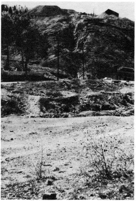
THE GREGORY LODE, BLACKHAWK—CENTRAL CITY, COLORADO
The first discovery of a gold vein in Colorado. (1858) Gregory, the discoverer, was allowed two claims, 50 ft. wide and 100 ft. long; others then staked claims 50 ft. wide and 100 ft. along the vein.
1–4 Act of February 27, 1865, Sec. 9 (13 Stat. 441): Recognized that the public domain was being appropriated for mining purposes but that such appropriation was by the law of possession and that the paramount title to such lands lay in the United States.
1–5 Act of July 26, 1866 (14 Stat. 251): Declared the mineral lands of the public domain open to exploration and occupation by citizens of the United States or those who had declared their intentions to become citizens. It provided for claims 200 feet in length along the vein for each locator, with an additional claim for the discoverer, and an association could take up to 3000 feet in length. No width was specified, only sufficient ground for working the claim. Extralateral rights were granted inasmuch as the vein could be followed to any depth, with all its dips, angles and variations. The Act also provided for obtaining patent (fee title) from the United States. It also recognized local customs, rules and mining districts, so far as they were not in conflict with the laws of the United States. This Act was repealed by the Act of May 10, 1872.
1–6 Act of July 9, 1870 (16 Stat. 217; 30 U.S.C. 35): Provided for placer claims (not covered in the Act of 1866) which included all deposits except veins of quartz and other rock in place. They were limited in size to 160 acres, either by one person or an association of persons, subject to entry and patent, and where on surveyed lands required to conform to legal subdivisions. This Act, with modification, is still in force.
1–7 Act of May 10, 1872 (17 Stat. 91; 30 U.S.C. Ch. 2; Title 43 C.F.R.): This Act contains the General Mining Laws which, with amendments, are still in force today. It provides in detail for discovery, location, survey and patent of both lode and placer claims; also mill 3sites. It requires annual labor, or assessment work until patent. Tunnel sites for the discovery of lodes are also provided for. The succeeding pages of this manual will take up and explain the various provisions of this Act, with appropriate reference and quotations from the Code of Federal Regulations or the U.S. Code, if not covered in the C.F.R.
1–8 Act of March 3, 1872 (30 U.S.C. 71–90): Provided for the location and purchase of coal; not a mineral subject to the general mining laws. This Act was repealed by the Mineral Leasing Act of 1920.
1–9 Act of May 17, 1884 (30 U.S.C. 49a–49f): Extended the general mining laws to Alaska.
1–10 Act of August 4, 1892 (30 U.S.C. 161): Included building stone under the mining laws subject to the provisions governing placer mining claims.
1–11 Act of February 11, 1897 (29 Stat. 526, 30 U.S.C. 101): Specifically included petroleum or other mineral oils as a mineral under the general mining laws subject to the provisions governing placer mining claims. This Act was repealed by the Mineral Leasing Act of 1920.
1–12 Act of January 31, 1901 (30 U.S.C. 162): Included salt in any form under the general mining laws subject to the provisions governing placer mining claims, limited to one claim per person. This Act was repealed by the Mineral Leasing Act of 1920.
1–13 Act of April 28, 1904 (30 U.S.C. 34): The monuments on the ground shall constitute the highest authority as to which lands are patented notwithstanding a conflict with the survey record or the calls and descriptions recited in the patent. Also, in extending the public land surveys, all patented mineral claims shall be segregated from the public lands as they are monumented on the ground.
1–14 Act of February 25, 1920 (30 U.S.C. Chapter 3A): The Mineral Leasing Act removed deposits of oil, gas, coal, potassium, sodium, phosphate, oil shale, native asphalt, solid and semi-solid bitumen and bituminous rock, including oil impregnated rock or sands, and sulphur in Louisiana and New Mexico from the general mining laws and other laws and set up a system of leasing for these minerals.
1–15 Act of July 31, 1947 (61 Stat. 681): The Materials Act authorized the sale of mineral materials if the disposal of such materials was not otherwise expressly authorized by law.
1–16 Act of August 13, 1954 (30 U.S.C. 521): Provided for multiple development of mineral deposits under the mining and mineral leasing laws. All mining claims and mill sites located after this date, and those prior to this date that did not preserve their rights, do not include leasable minerals, such minerals being subject to exploration and development under the Mineral Leasing Act.
1–17 Act of July 23, 1955 (30 U.S.C. 601): Removed common varieties of sand, stone, gravel, pumice (except block pumice), pumicite or cinders from appropriation under the general mining laws. Also restricted the use of the surface of unpatented mining claims to that portion necessary for the development and mining of the deposit and permitted the federal government to manage the surface and vegetative resources.
1–18 Act of August 11, 1955 (30 U.S.C. Chapter 16): All lands previously withdrawn for power sites, except those actually in use or being constructed upon, were restored to mining locations subject to future use for power development under the authority of the United States, without reimbursement, and subject to provisions for recording the location within 60 days from date of location and assessment work within 60 days of the expiration of the assessment year.
1–19 Act of March 18, 1960 (30 U.S.C. 42): Provided for the location of mill sites in conjunction with placer claims subject to the same requirements of survey as placers. This allowed location of mill sites by legal subdivisions.
1–20 Act of September 28, 1962 (76 Stat. 652): Provides for free use of petrified wood.
1–21 Act of December 24, 1970 (30 U.S.C. Chapter 23): This act provides for geothermal steam leases and should the lease be terminated, the lessee has the right to complete the location of mining claims for minerals subject to location which would constitute a byproduct if commercial production of steam continued. Conversion to a lease under the Mineral Leasing Act for lease minerals is provided for if the lease minerals are capable of being produced in commercial quantities.
1–22 Act of October 21, 1976 (43 U.S.C. 1744; 43 C.F.R. 3833): All unpatented mining claims, including lodes, placers, mill sites and tunnel sites located prior to this date must be recorded 4with the proper state office of the Bureau of Land Management by filing a copy of the record of the location (or last amended) notice or certificate, as required by state law, together with a map showing the claim and its relation to the public land survey or protracted grid, by October 21, 1979; and also provide evidence of assessment work for the preceding assessment year, or notice of intention to hold, and thereafter prior to December 31 of each calendar year. Claims located after October 21, 1976 shall be recorded within 90 days of date of location and evidence of assessment work or notice of intention to hold, if assessment work is not required, filed prior to December 31 of each calendar year after the year of location. Change in ownership must also be recorded and (presumably) amended location certificates. If these recording requirements are not met, the claims are deemed to be abandoned.
1–23 Reservations, Grants, Withdrawals and Severance of Minerals: Indian and military reservations, national parks and monuments are not, as a rule, open to mineral exploration except in special instances cited in 1–24 below. National forests are open to mineral exploration, location and patent, but subject to rules and regulations of the Forest Service. National Forest Wilderness Areas are covered in 1–24 below.
Grants include the Spanish Land Grants, Railroad Grants, and School Grants (School Sections), most of which included the minerals.
At least one Spanish Land Grant, The Sangre de Christo Grant comprising Costilla County, Colorado, has its own system of mineral surveys.
Arizona has its own rules for locating mining claims on state (school) lands. Indemnity grants were made in lieu of other lands previously appropriated, including unsurveyed school sections appropriated in part under the mining laws.
The Alaska Native Claims Settlement Act of December 18, 1971 granted certain lands to the natives in Alaska and allowed owners of claims located prior to August 31, 1971 five years to proceed to patent. Regulations permitted filing an application for mineral survey to be considered an application for patent.
Withdrawals made under the authority of the President are not subject to any form of location. Withdrawals under the Act of June 25, 1910 (43 U.S.C. 141, as amended) are subject to location for metalliferous minerals only. The Act, known as the Pickett Act, authorized the President to make withdrawals for various purposes such as power, irrigation, classification of lands.
Withdrawals under the first form Reclamation Act of June 17, 1902 are not subject to mining location unless opened under the Act of April 23, 1932. Lands withdrawn under the second form of the Act are subject to location.
The Federal Land Policy and Management Act of October 21, 1976(43 U.S.C. 1714) provides for withdrawals by the Secretary of the Interior, either on his own motion or at the request of any department or agency head, with certain restrictions and limitations. Each withdrawal and subsequent restoration must be reviewed to determine if mining locations are allowed, and under what conditions.
Severance occurs when minerals are reserved to the United States in a patent. Some of the Spanish Land Grants reserved certain minerals such as gold, silver, quicksilver and antimony.
The Act of March 3, 1891 reserved minerals from townsite entries on mineral land, but each patent should be checked; some of the early patents reserved only “known lodes.”
The Act of July 17, 1914 permitted agricultural entry or purchase of lands withdrawn for phosphate, nitrate, potash, oil, gas or asphalt with a reservation of these minerals to the United States.
The Act of July 20, 1956 permitted the disposition of these minerals discovered and located prior to the Mineral Leasing Act.
The Stockraising Homestead Act of December 29, 1916 allowed entry of 320 acres rather than the 160 acre preemption homestead, but reserved the minerals to the United States, the minerals being subject to disposal under the general mining and mineral leasing laws. The surface owner is protected by the Act, and a bond must be posted with the Bureau of Land Management unless satisfactory arrangements can be made between the mineral and surface owner (43 C.F.R. 3814).
Lands patented under the Color of Title Act (43 U.S.C. 1068), by exchange under the Taylor Grazing Act (43 U.S.C. 315g) and by Forest Exchanges (16 U.S.C. 485) with mineral reservation to the United States, are subject to appropriation under the mining and mineral leasing laws.
5The Atomic Energy Act of August 1, 1946 reserved fissionable source material, uranium and thorium, to the United States, but these provisions have since been rescinded and such minerals are locatable under the mining laws. Mining claims for fissionable source materials could be located on lands known to be valuable for coal under the Act of August 11, 1955 (30 U.S.C. 541 through 541i) which expired August 11, 1975.
1–24 Areas Subject to Special Mining Laws:
O & C Lands: The Act of April 8, 1948 (62 Stat. 162) reopened the revested Oregon and California Railroad and Reconveyed Coos Bay Wagon Road Grant Lands to exploration, location, entry and disposition under the United States Mining Laws, but imposed additional requirements regarding the filing of location certificates, affidavits of annual labor, use of timber, etc. See 43 C.F.R. 3821 for details.
Alaska Public Sale Act of August 30, 1949 (48 U.S.C. 364a–364e) segregated for classification and sale certain lands, but reserved the minerals for disposition under applicable law. Provided compensation to the surface owner for damage. See 43 C.F.R. 3822.
National Forest Wilderness Areas are open to prospecting and mining under existing laws until midnight, December 31, 1983 by which time they shall be closed except for valid existing rights. Patents will be for mineral only with title to the surface reserved to the United States, subject to certain use to facilitate mining. See 43 C.F.R. 3823.
City of Prescott, Arizona Watershed: The Act of January 19, 1933 (16 U.S.C. 482a) restricted future mining locations to minerals only with restricted use of the surface. See C.F.R. 3824.
Papago Indian Reservation, Arizona: The Act of June 18, 1934 (25 U.S.C. 461–479) as amended, restores from temporary withdrawal mineral location and entry under the United States Mining Laws, but imposes additional requirements for recording locations with the superintendent of the reservation, payment of annual rental to the tribe and a fee in lieu of the annual rental at time of patent. See 43 C.F.R. 3825.
National Park Service Areas: National parks and national monuments are, as a general rule, closed to mining, but there are exceptions, subject to special rules, regulations, and reservations in the patent. These special areas are: Mt. McKinley National Park, Alaska (see 43 C.F.R. 3826.1); Olympic National Park, Washington (see 43 C.F.R. 3826.2); Death Valley National Monument, California (see 43 C.F.R. 3826.3); Glacier Bay National Monument, Alaska (see 43 C.F.R. 3826.4); Organ Pipe Cactus National Monument, Arizona (see 43 C.F.R. 3826.5). The Act of September 28, 1976 (90 Stat. 1342, 16 U.S.C. 1901) prohibits further mining locations in these national parks and monuments.
King Range National Conservation Area, California: Mining claims are not prohibited, but those located after October 21, 1970 are subject to strict regulations and inspection of all mining activity (see 43 C.F.R. 3827).
1–25 Acquired Lands: Minerals on acquired lands are not generally open to mineral entry. These minerals are possibly subject to leasing only (see 43 C.F.R. 3500).
1–26 Update: In order that mineral surveyors may keep abreast of new laws it is desirable that the Office of Chief, Division of Cadastral Survey, Washington, D.C. keep the mineral surveyors advised, furnishing copies of the Acts and pertinent regulations, so far as it is practicable to do so. Mineral surveyors may also keep abreast of new legislation through the local offices of the BLM, their congressmen and by becoming members of local mining associations and attending their meetings.
1–27 Both the Acts of 1866 and 1872 provided for recognition of “local customs or rules of miners in the several mining districts so far as the same are applicable and not inconsistent with the laws of the United States.”
(R.S. 2319, 30 U.S.C. 22). C.F.R. 3831.1 states in part “(c) complying with the State Laws, regarding the recording of the location in the county recorder’s office, discovery work, etc. As supplemental to the United States mining laws there are State statutes relative to location, manner of recording of mining claims, etc., in the State, which should also be observed in the location of mining claims.”
43 C.F.R. 3841.4–2 states in part: “... 600 feet in width, but whether surface ground of that width can be taken depends upon the local regulations of State or Territorial laws in force ....” and 43 C.F.R. 3841.4–6 “the location notice must be filed for record in all respects as 6required by the State or Territorial laws, and local rules and regulations if there be any.”
Requirements of State law as to mining locations must be complied with if they are not repugnant to the United States mining laws. South Dakota v. Madill, 53 I.D. 195 (1930).
It is very clear that State laws must be complied with and some states go so far as to state that if the essentials of discovery and location are not complied with, the claim shall be null and void. Also, location certificates that do not contain the information set forth in the law, including an adequate description, shall be void.
The mineral surveyors cannot ignore state law, yet there are areas where they should not force the claimant to comply, such as failure to do the necessary discovery work as long as a discovery point has been designated. In such cases the claimant should be advised of the apparent discrepancy. At his insistence, the survey should be executed and processed to show the facts and conditions as they exist, leaving the matter to adjudication during patent proceedings. On the other hand, an inadequate description in the location certificate is justification for requiring an amended certificate.
Each mineral surveyor should obtain a copy of the state mining laws as soon as possible after receiving an order for survey in that state. The Chief, Branch of Cadastral Survey of each state office should have an up-to-date copy of the laws for his state, and advise the Chief, Division of Cadastral Survey at Washington, D.C. of changes as they occur so that he may keep all mineral surveyors advised.
Copies of state laws, in pamphlet form, are usually available from the State Bureau of Mines or Geological Survey, the Secretary of State or Attorney General.
Do not confuse state laws pertaining to the location of mining claims on the public domain with state laws covering the location of state lands. Arizona, for instance, allows the staking of mining claims on state lands and publishes rules and regulations governing such appropriation. Most states, however, lease their minerals.
Following is an abstract of the state laws in force so that mineral surveyors and cadastral surveyors will have an immediate source of information. The abstract is by no means complete, but contains only the essentials, and is not a substitute for the laws themselves.
Location notice containing name of claim, name of locator(s), date of location and approximate bearings and distances between corners shall be posted at the northeast corner of the claim.
Substantial monuments of stone or posts not less than three feet high and three inches in diameter, marked with name of claim, position or corner number and direction of boundary lines to be erected at each corner; witness corners shall be marked to indicate position of true corner. Cut out, blaze or mark boundary lines.
Location Certificate: Record in recording district (Alaska does not have counties) within 90 days of posting, containing in addition to information contained in the location notice, length and width of claim and reference to a natural object or permanent monument. (Late filing prior to intervening rights renews the location.)
Location notice containing same information as lodes, except giving length and width rather than metes and bounds, to be posted on one of the corners.
Monumentation: same as for lodes.
Location Certificate and recording: same as for lodes.
Restrictions on precious metal placers are:
1. Individual claims limited to 20 acres and 1320 feet, aggregate length.
2. Association claims limited to 40 acres and 2640 feet in length.
3. Location by agent to be supported by recorded power of attorney, limited to two principals per agent in any recording district.
4. Annual labor of $100 for each 20 acres or excess fraction required.
Amended locations, notices and certificates are provided for.
Annual Labor: Requirements same as federal law, except for precious metal placers, but in conflict with the Act of October 21, 1976 regarding failure to file.
Discovery Work: None required.
Location notice: Containing name of claim; name and address of locator(s); date of location; length and width of claim and distance from the location monument to each end of the claim, in feet; the general course of the claim; a reference to some natural object or permanent monument; the section, township and range, if known, shall be posted on a conspicuous monument of stones not less than three feet in height, or a post at least four feet above ground, at one corner within the boundaries of the claim.
Monumentation: Within 90 days erect six substantial posts projecting at least 4 ft. above ground or substantial stone monuments at least 3 ft. high, one at each corner and one at the center of each end line of a lode, marked to identify the corner or end center; posts may be of any material readily distinguished as monuments and shall be no less than 1½ inches in cross section.
Location Work: None required after September 3, 1978.
Recording: Within 90 days record in the office of the County Recorder a copy of the location notice containing the section, township and range (protracted, if unsurveyed), to which has been attached a map based upon a survey commensurate with the ability of the locator, no more than 8½ by 14 inches in size at a scale of one inch equals not more than 2000 feet, containing:
Abandonment: Failure to perform all the acts of location within the specified time constitutes abandonment.
Annual Assessment Work: Same as Federal, with form of affidavit given, to be recorded by December 31 of the assessment year.
Relocation, by owner and of abandoned claims, provided for, using the map instead of location work.
Existing claims: Owner may file map by October 21, 1980 which shall constitute a rebuttable presumption that the claim was monumented on the ground so that its boundaries could readily be traced.
No state laws.
Location notice containing name of claim, name and current mailing or residence address of the locator(s), length claimed along the course of the vein each way from the point of discovery and width claimed on each side of the center of the claim, in feet, general course of vein, date of location (being date of posting) and reference to a natural object or permanent monument, shall be posted in or on a substantial monument at the point of discovery.
Monumentation: Conspicuous and substantial monuments consisting of a wooden post or stone structure not less than three and one-half inches diameter, or metal post not less than two inches diameter, set at least one foot in the ground and projecting at least three feet above ground, or stone mound at least three feet high, with sufficient marks to designate the corner and name of claim, shall be erected at each corner and center of each end line within 60 days from date of location. Witness corners provided for.
Recording: Within 90 days of posting, record a true copy of the location notice with the county recorder with a statement by the locator of the monumentation and markings together with the section, township, range and meridian.
Location notice same as for lodes except for description which shall be the number of feet or 8acreage claimed with a description referenced to some natural object or permanent monument, posted on a substantial monument at the point of discovery.
Monumentation: Mark the boundaries and erect at each corner a substantial monument as specified for lodes, except where described by legal subdivisions, such description being deemed the equivalent of marking. (No time limit given, other than the 90 days for recording.)
Recording: same as for lodes.
Location notice: Same as for lodes except for description which shall be the proposed course of the tunnel and a description referenced to some natural object or permanent monument, posted on a substantial monument at the face of the tunnel. (No name for the tunnel is called for.)
Monumentation: Same monuments as for lodes placed along the lines of the tunnel on the surface no more than 600 feet apart from the face to the terminus of 3000 feet therefrom.
Recording: same as for lodes.
Location and claim boundaries marked as for placer claims, except that location monument may be anywhere within the claim.
Recording: same as for lodes.
Amended location and notice and relocation provided for.
Annual Labor, remonumentation and remarking of corners: Affidavit of labor as required by federal law must be filed within 30 days of the time limit for performance (end of assessment year) and, in addition to the usual statements and descriptions, a statement that all corners and notices are in place and are properly marked; an additional 30 days is allowed for a supplemental affidavit if the original was filed by someone other than the owner. Failure in such case constitutes prima facie presumption of abandonment.
Survey and monumentation by a United States Mineral Surveyor or land surveyor licensed in California together with filing of field notes for record with the location notice, constitutes prima facie evidence of the facts therein.
Penalties are provided for false statements and removal or destruction of monuments. Location (Discovery) Work: None required (law amended in 1965 for placers, 1972 for lodes), except in the case of a tunnel right.
Survey of Location: United States Mineral Surveyors are permitted to make and record location surveys.
Location notice or plain sign to be posted at the point of discovery on the surface containing name of the lode (claim), name of locator(s), and date of discovery.
Discovery (Location) Work in the form of a shaft ten feet deep or deeper if necessary for discovery, or open cut, crosscut or tunnel which cuts a lode ten feet beneath the surface, or adit at least ten feet in along lode from point of discovery to be completed within 60 days from date of discovery, or file a map with the location certificate based on an actual ground survey (see below).
Monumentation: Surface boundaries to be marked by six substantial posts, hewed or marked on the sides facing the claim, set in the ground (or in a mound of stones on bedrock) one at each corner and one at the center of each side line. Witness corner, suitably marked, may be used as necessary.
Recording: Within three months from date of discovery, file with the county recorder a location certificate containing the name of the lode (claim), name of locator(s), date of location, the number of lineal feet claimed on each side of discovery shaft (similar working as provided above, or discovery point), the general course of the lode and such description as shall identify the claim with reasonable certainty.
Field Survey and Map: In lieu of a discovery shaft (or similar working) and within the time required for filing the location certificate, attach to the location certificate for recording a map at a scale of 1″ = 500′ prepared from an actual ground survey showing the name and address of the discoverer of the claim, the legal subdivision upon which the claim is located if on surveyed land, courses and distances of the boundaries with tie to the nearest section or quarter section corner or permanent monument if on unsurveyed land, thus readily identifying the claim.
Location notice or sign same as lode but also giving number of acres or feet claimed.
9Discovery (Location) Work: None.
Monumentation: At each angle point (corner) of claim, substantial posts as called for under lodes.
Recording: Within 30 days from date of discovery file with county recorder, containing name of claim, name of locator(s), date of location, number of acres or feet claimed and description referenced to natural object or permanent monument.
Mill Sites: Mill sites are simply auxiliary to the working of mineral claims and the location for a mill site should be made in substantially the same manner as that of a lode or placer claim. There must be satisfactory proof that land claimed as a mill site is not mineral in character. No assessment work is required on mill sites but without patent they can only be held by using them for the purposes for which they were located.
Tunnel Claim: Record, specifying the place of commencement and termination with names of interested parties.
Relocation (Amended and Additional) by owner, and relocation of abandoned claims provided for.
Annual Labor: As required by federal law, affidavit may be filed within six months of the end of the assessment year.
No state laws.
Location notice to be posted at one corner of the claim containing name of locator(s), name of claim (whether lode or placer), date of location, mining district and county, directions and distances which describe claim and tie from corner where notice was posted to natural object or permanent monument as will fix and describe the site of the claim.
Substantial monuments or posts at least four feet in height and four inches square or in diameter, marked with the name of the claim, the position or number of the corner and direction of boundary lines shall be placed at each corner or angle. The boundary lines shall be marked so they can be readily traced. Provisions for witness corners marked to indicate true position.
Recording: Within 90 days file for record a copy of the location notice with the county recorder; failure to do so constitutes abandonment. Attached to notice must be an affidavit of one of the locators stating he is a citizen of the United States (or declared intention to become one), he is familiar with the ground, that it has not been previously located but if located, abandoned or defective.
Annual labor same as federal, affidavit required 60 days after end of assessment year; except patent survey with affidavit, including cost, by U.S. Mineral Surveyor may, if sufficient, be used for one year’s work.
Discovery or Location Work: None required; law amended in 1970.
Additional Certificate (amended location) and Location of Abandoned Claims provided for.
No state law.
No state law.
Location notice containing name of claim, name of locator(s), date of location (posting) and dimensions of area shall be posted at the point of discovery.
Monumentation: Within 30 days monument each corner or angle of the claim using a tree eight or more inches in diameter, blazed on four sides, a post four inches square, four feet six inches long, set one foot in ground (or mound of earth and stone four feet or more in diameter and two feet or more high if on bedrock), a squared stump of requisite size surrounded by such mound, a stone at least six inches square, 18 inches long, set two-thirds in the ground, with mound of earth and stone alongside at least four feet in diameter, by two feet high, or a boulder at least three feet above ground. Monument to be marked with the name of claim and corner number or cardinal point. Other monuments of lesser size to be determined acceptable by a court in the event of a dispute.
Recording: Within 60 days, comply with the U. S. Mining Laws and record a certificate of location with the county clerk containing name of claim and whether it is a lode or a placer, 10name of locator(s) with post office address, date of location and description, referenced to natural object or permanent monument and section, township and range (projected if on unsurveyed land); directions and distances from discovery point, and verified before an officer authorized to administer oaths. Within 20 days the county clerk will furnish a copy to the Department of State Lands at Helena, Montana.
Located same as lodes or placers but without discovery.
Amended locations, amended certificates, relocation by owner (but not to avoid annual labor) and relocation of abandoned claims provided for.
Filing of false claims prohibited; penalty of not more than five years in state penitentiary or not more than $5,000 fine, or both.
Recording of affidavit of annual labor as required by federal law within 90 days after expiration of assessment year.
Discovery work: None required, law amended in 1971.
No state law.
Location notice containing name of claim, name of locator(s) with post office address, date of location, the general course of the vein, the number of feet claimed each way along the course of the vein from the point of discovery, and the width claimed on each side of the center of the vein, to be posted on a monument (as described below) at the point of discovery.
Monumentation: Within 20 days from date of posting, erect at each corner of the claim and at the center of each side line a monument consisting of a tree, with top removed, not less than four inches in diameter, blazed and marked, a rock in place with smaller stones on top having an overall height of no less than three feet, a stone no less than six inches in diameter, 18 inches long, set two-thirds in the top of a mound of earth or stone four feet diameter, two and one-half feet high; a post four inches in diameter, four and one-half feet long set one foot in ground (except on bedrock). All trees, posts or rocks, when not four feet in diameter shall be surrounded by a mound of earth or stone four feet in diameter, two and one-half feet high. Witness corners are provided for.
Recording: Within 90 days of posting, record duplicate location certificates with the county recorder containing name of the lode or vein (claim), name of locator(s) with post office address, general course of the vein and number of feet claimed each way from the point of discovery together with the width on each side of the center of the vein, statement that location work consisted of making maps, and the location and description of each corner with the markings thereon.
Maps: Within 90 days of posting, file duplicate maps with the county recorder (one of which will be sent to the county surveyor along with the duplicate location certificate) showing the claim or claims, at a scale no less than 500 feet to an inch, the relative position and number of the corners and giving a tie by bearing and distance to a corner of the public land survey or claim location marker if no corner can be found, or if on unsurveyed land. Claim location marker shall be of rock, four feet in diameter at base and at least four feet high, or a steel post or pipe at least three inches in diameter and five feet above ground. Also show the township and range, and if surveyed, the section in which the claim and claim location marker is situated.
Location notice: Same as for lodes except that instead of discovery point, a location point anywhere on the north boundary, and instead of length and width from discovery point and vein, the number of feet or acres claimed.
Monumentation: All corners and location point with monuments as specified for lodes, except when described by legal subdivisions, only the location point need be monumented.
Recording: Same as for lodes, except giving number of feet or acres claimed in lieu of lode description. (Apparently no statement regarding map or corner descriptions necessary.)
Maps: Same as for lodes, but if described by legal subdivisions, map shall show the legal subs.
Location notice: Same as for placers except point of posting not designated; name of lode, 11mine or mill of which locator is owner to be given.
Monumentation: Same as for placers (and lodes) so far as applicable.
Recording: Within 30 days file for record with the county recorder duplicate certificates similar in all respects to the notice posted.
Maps: Two copies of a map, not exceeding three by four feet in size to be filed for record with the location certificates.
Location notice to be posted at the face or point of commencement containing the name of the locator(s) and post office address, proposed course or direction of tunnel, height and width thereof, position and character of boundary monuments and reference to natural object or permanent monument.
Monumentation: Line of tunnel to be staked at intervals of not more than 300 feet from commencement to 3000 feet therefrom; monuments to be the same as for lodes and placers.
Recording: Within 60 days record with county recorder (duplicate certificates) similar in all respects to notice posted.
Maps: File for record, with location certificate, two copies of a map as required for lodes.
Amended locations and certificates and relocation of abandoned claims are provided for.
Affidavits of annual labor are provided for; to be recorded 60 days from completion of work.
Discovery or Location Work: None required, other than the map (law amended in 1971).
False information willfully made on location certificates or maps a felony punishable by no less than three nor more than ten years in the state prison.
Survey with field notes and certificate of survey incorporated into the record by U.S. Mineral Surveyor or land surveyor licensed in Nevada, prima facie evidence of the facts therein.
Location Survey: United States Mineral Surveyors are permitted to make location surveys.
Location Notice containing name of locator(s), intent to locate the mining claim, (name of claim) and description by reference to natural object or permanent monument (date).
Monumentation: Mark the location on the ground so that its boundaries may be readily traced. Four substantial posts or monuments, one at each corner. No specifications.
Discovery Work: A shaft, cut, tunnel or adit at least ten feet below surface disclosing mineral in place completed within 90 days of taking possession; or a drill hole not less than one and one-half inches in diameter, ten feet or more in depth, disclosing a valuable mineral deposit in place. A substantial post or marker at least thirty inches high inscribed with the name of claim, claim owner, depth of hole and date drilled shall be placed within five feet of the hole. In addition, an affidavit by the owner giving the date of the hole, location within the claim, and mineral discovered shall be recorded in the office of the county clerk within the 90 days.
Recording: File for record a copy of the location notice with the county clerk within three months from date of posting.
Location notice shall be posted at one corner stating name of claim, material located, name of locator(s), and description by legal subdivisions or metes and bounds with tie to natural object or permanent monument, if on unsurveyed lands.
Monumentation: A substantial wood post, four feet high, set securely in the ground, or a substantial stone monument, shall be set at each corner of the claim, regardless of whether the claim is on surveyed or unsurveyed lands.
Discovery Work: None required.
Recording: A copy of the location notice shall be recorded with the county clerk within 90 days of location and posting.
Additional and amended locations and relocations provided for.
Abandonment is provided for by filing for record a statement with the county clerk.
Penalties are provided for falsifying location notices and affidavits, defacing and changing location notices, destruction of corners, hindering or preventing performance of annual labor and trespass, except for determining performance of annual labor or locating on government land.
Annual labor: Affidavit to be filed for record with county clerk 60 days from end of assessment year.
12Private Lands: Owners may make regulations, not in conflict with laws of the United States or New Mexico; governing the location of mining claims and file for record with county clerk.
Location Notice: to be posted at point of discovery containing name of lode, name of locator(s), date of discovery, length, in feet, each way from discovery, and width, in feet, on each side of lode. Width limited by state law to 150 feet on each side of lode; may be modified by county.
Discovery Work: Shaft, cut or tunnel at a depth sufficient to disclose the vein or lode, or adit ten feet along vein or lode, or drill hole, not less than one and one-half inches in diameter and of sufficient depth to reach, cut or expose vein or lode. Work to be completed within sixty days from time of uncovering or disclosing a lode (posting).
Monumentation: Eight substantial posts, hewed or blazed on the side facing the claim, marked with the name of lode and corner, end of lode, or side center sunk in ground or in monument of stone.
Recording: Within sixty days file for record with the county register of deeds a location certificate containing, in addition to information in location notice, the general course of the vein, and date of location.
No state law.
Additional certificate and relocation, both by owner and abandoned claims, provided for.
Annual labor: Provided for, but no affidavit.
Surface owner: May demand security from miner.
Location notice containing name of lode or claim, name of locator(s), date of location, linear feet claimed each way from point of discovery along the vein or lode and width on each side of the vein or lode, and the general course of the vein or lode, defining the boundaries and reference to natural object or permanent monument.
Monumentation: Within 30 days after posting mark with six substantial posts, not less than three feet above ground and not less than four inches square or in diameter, or substantial mounds of stone or earth and stone, one at each corner and one at each center end.
Recording: Within 60 days from posting, file for record with the county clerk a copy of the location notice.
Location notice: containing name of claim, name of locator(s), date of location, number of feet or acres claimed, and a description by legal subdivisions or with reference to a natural object or permanent monument, to be posted at some conspicuous place on the claim.
Monumentation: Unless located by legal subdivisions, corners shall be monumented with same size materials designated for lodes, with monuments no less than 1320 feet apart.
Recording: Same as for lodes.
Location notice same as for placer claims except for reference to appurtenant mining claim (lode or placer).
Monumentation: Same as for placers.
Recording: Copy of location notice to be recorded within 30 days.
Amended notices of location provided for.
Annual labor affidavit provided for; file within 30 days of completion of work.
Legal Subdivision includes a subdivision of a state survey.
Discovery or Location Work: None required. Law amended in 1971.
Location notice to be posted at the place of discovery on discovery monument, containing name of lode, name of locator(s), date of discovery, feet in length on each side of discovery and feet in width on each side of lode.
Monumentation: Eight substantial posts hewed or blazed on the side facing claim, one at each corner, one at each end of the lode and one at the center of each side line, sunk in the ground, or in mound of stone if on bedrock, marked with the name of the lode and the corner, end or side.
Recording: Sixty days from date of discovery file for record with the county register of deeds a location certificate containing the same information 13as in the location notice, except date of location instead of date of discovery, and in addition the general course of the vein and a description with reference to a natural object or permanent monument.
No state law.
Additional certificate and relocation, both by owner and abandoned claims, provided for.
Annual labor: Same as federal, affidavit provided for, no time limit for recording.
Surface owner may demand security from miner.
Penalties are provided for violence, threats of violence or intimidation of mining claimants or anyone at work on the claim by two or more persons.
Location notice containing the name of the claim, name of locator(s), date of location, linear feet claimed each way along the course of the vein from the point of discovery, width on each side of the center of the vein, the general course of the vein and a description with reference to a natural object or permanent monument.
Monumentation: Must be distinctly marked on the ground so boundaries can be readily traced. (Presumably at the corners, no specification as to material and size of monuments.)
Recording: Within 30 days, a substantial copy of the location notice must be filed for record with the county recorder.
Same as for lodes, except the location notice shall state the number of feet or acres claimed, instead of the length and width each way from the point of discovery.
Assessment Work (Annual Labor): Provides for posting a notice describing the work at the discovery monument and at the workings; affidavit to be filed 30 days after completion.
Penalty provided for interfering with notices, stakes or monuments.
Discovery or Location Work: None required.
Discovery notice to be posted at the discovery at the time of discovery giving the name of the lode, name of locator(s) and date of discovery.
Monumentation: Substantial posts not less than four inches in diameter, set in the ground, not less than three feet high, or substantial stone monuments not less than three feet high, bearing the name of the lode and date of location must be set at each corner. Claim boundaries must be brushed out, and trees blazed if such vegetation exists.
Recording: Within 90 days from date of discovery, record in the county auditor’s office a location notice containing the name of locator(s), date of location, feet in length each way from discovery, general course of the lode, and a description referenced to a natural object or permanent monument.
Location notice or certificate to be posted in conspicuous place at the point of discovery containing name of claim, name of locator(s), date of discovery and posting of notice, a description by legal subdivisions, or a description with reference to a natural object or permanent monument.
Monumentation: Within 30 days from discovery, including legal subdivision placers. (No specifications as to monuments, but see requirements for lodes.)
Recording: Within 30 days from discovery record notice or certificate of location with the county auditor.
Development work: Within 60 days perform labor equal to $10 for each 20 acres, and file with the county auditor an affidavit showing performance and nature and kind of work done.
Amended certificate (location) and relocation provided for.
Assessment work (Annual Labor): Affidavit provided for, to be filed within 30 days of the expiration of the assessment year.
Location notice to be posted at the point of discovery containing the name of the lode or 14claim, the name of the discoverer and locator, and date of discovery.
Discovery work: A shaft ten feet deep, or cut or tunnel ten feet long, disclosing the vein at a depth of ten feet; or a drill hole or holes no less than one and one-half inch in diameter, aggregating at least 50 feet deep with no one hole less than ten feet deep, to expose deposits of valuable minerals. One hole shall be designated the discovery hole and shall be marked with a substantial post or other permanent marker within five feet of the hole, firmly set in the ground and at least 30 inches above ground on which shall be placed the name of the claim, the owner, depth of hole and date of drilling. Work to be done within 60 days from date of discovery.
Monumentation: Boundaries to be marked by six substantial monuments of stone or posts, hewed or marked on the side facing the claim, sunk in the ground, one at each corner and at the center of each side line. Witness corners marked to indicate true point provided for.
(NOTE: The above are prerequisite to filing a location certificate.)
Recording: Within 60 days from date of discovery record a location certificate with the county clerk containing the name of the claim, name of the locator(s), date of location, length along the vein each way from the center of discovery shaft, the amount of surface ground claimed on either side of the discovery shaft, the discovery shaft being always equally distant from the side lines, and a description tied to a natural object or if on surveyed land to a section or quarter section corner, as shall identify the claim beyond question.
Location notice to be posted on claim containing name of claim, name of locator(s), date of discovery and number of feet or acres claimed.
Discovery Work: None.
Monumentation: Substantial posts or stone monuments to be placed at each corner of the claim.
(NOTE: The above are prerequisite to filing a location certificate.)
Recording: Within 90 days after date of discovery record with the county clerk a location certificate containing the name of the claim, designating it as a placer claim, the name of locator(s), the date of location, the number of feet or acres claimed and a description of the claim by designation of natural or fixed objects as shall identify the claim beyond question.
Additional location certificate (amendment) and relocation provided for.
Annual labor: Affidavits provided to be recorded with the county clerk within 60 days after completion.
Surface owners: Security from the miner provided.
Penalties are provided for force or threats by two or more persons destroying mining property, including notices and amendments, and defrauding, cheating or swindling, the latter being a felony.
1–47 The mineral surveyor and the cadastral surveyor responsible for processing mineral surveys must be thoroughly familiar with both federal and state law relating to the appropriation of minerals on the public domain.
The mineral surveyor may be the first detailed contact of the claimant with a government official, and he will look to the mineral surveyor for guidance through the first steps to obtaining patent, i.e., the survey, including discovery and work requirements.
If the location does not meet the requirements set forth in the law, the mineral surveyor may suggest the corrective steps necessary, including an amended location. If the location certificate is too vague, an amended certificate will be in order. If the development work includes improvements that will not count as patent expenditure or if common improvements will not meet the tests set forth in the chapter on mineral surveys in the Manual of Surveying Instructions, the mineral surveyor should discuss the matter with the claimant and suggest corrective measures.
The matter of a valid discovery or what constitutes sufficient mineral for patent is a complicated matter. While the mineral surveyor may discuss the subject in generalities, as set forth in the next chapter, it is not his duty to rule on it, this being a matter for the mineral examiner and adjudicators to determine. He may guide the claimant in properly locating and surveying his claims for patent.
If the mineral surveyor feels that the claimant is not justified in proceeding to patent or if he 15feels that the land is being obtained for purposes other than mining, he may decline to make the survey, since it is a matter of private contract.
1–48 Relationship of surveyor and attorney: If the claimant has employed an attorney-at-law, the surveyor and attorney should work closely together.
The surveyor should recognize that he is not schooled in the law and should respect the attorney’s opinion; on legal matters it is the attorney’s responsibility.
On the other hand, the attorney is not schooled in surveying and the surveyor should guide him in technical matters. The surveyor may refuse to comply with requests that are in conflict with his requirements of survey and that of the Bureau of Land Management. Doubtful situations may be referred to the Bureau of Land Management for further instructions.
Many attorneys are not expert in mining law and may require guidance from the mineral surveyor. Should the surveyor find himself in a situation where legal advice is necessary, and the claimant has not employed an attorney, he should discuss the matter with the claimant and recommend obtaining the services of a lawyer.
1–49 Extralateral Rights (Apex): Both the Acts of 1866 and 1872 granted the right to follow a vein downward on its dip beyond the vertical boundaries of the claim. R.S. 2322, 30 U.S.C. 26 states in part:
“The locators of all mining locations made on any mineral vein, lode or ledge situated on the public domain ... shall have the exclusive right of possession and enjoyment ... of all veins, lodes, and ledges throughout their entire depth, the top or apex of which lies inside of such surface lines extended downward vertically, although such veins, lodes or ledges may so far depart from a perpendicular in their course downward as to extend outside the vertical side lines of such surface locations. But their right to possession to such outside parts of such veins or ledges shall be confined to such portions thereof as lie between vertical planes drawn downward as above described, through the end lines of their locations, so continued in their own direction that such planes will intersect such exterior parts of such veins or lodes.”
Extralateral rights exist only when the end lines are substantially parallel and then only when the apex of the vein passes through at least one of the end lines.
If the vein passes through both end lines it may be followed with all its dips and variations beyond the side lines within the vertical planes of the end lines (see Claim A of Figure 1).
Where the vein passes through one end line and one side line, one end line is theoretically moved by protraction to the point where the vein leaves the side line, and extralateral rights apply on the vein only to the extent of the foreshortened claim (see Claim B of Figure 1).
Where the vein leaves the claim through both side lines, there are no extralateral rights and the vein may be mined only in the area contained within the vertical boundaries of the claim (see Claim C of Figure 1).
Two claims might be located along the strike of the same vein in such a manner as to produce diverging end lines as in Claims D and E of Figure 1. In this case a portion of the vein beneath the surface (F) belongs to neither claim and must be appropriated by staking claims the vertical boundaries of which will encompass the unappropriated segment.
Where veins of two different claims unite on the dip, the portion below the junction belongs to the senior claim; if the veins cross, rather than unite, the junction belongs to the senior claim.
An outcrop is not an apex in the case of bedded deposits that are tilted or outcrop on a canyon wall. Claims located on the outcrops of bedded deposits have no extralateral rights.
Where the vein is wider than patent, the extralateral rights belong to the senior claim. A claim located on the dip, though senior, loses the vein to a junior claim properly located on the apex. The latter issues have been the subject of numerous lawsuits, and there have been decisions favoring each side.
In Figure 1, Claims A, B, C, D and E were located along the apex of a vein dipping to the south in alphabetical order, “A” being the oldest claim. The portions of the vein belonging to each claim are shown by various cross-hatching.
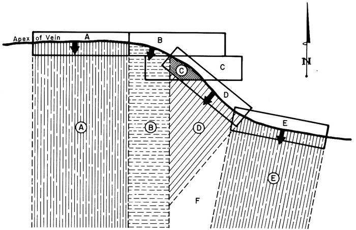
FIG. 1
171–50 Riparian Rights: Although not a general rule, occasions have arisen when a mining claim adjoins a navigable body of water and the shoreline or mean high water mark becomes the boundary of the claim. In such instances it is proper to run such a boundary as a meander line and the field notes of the mineral survey should state that it is a meander line of the mean high water line and that the corners of such line are meander corners. The situation is well stated in Alaska United Gold Mining Co. et al. v. Cincinnati-Alaska Mining Co. et al., decided April 18, 1916, 45 L.D. 330:
“The rule as to meander lines is applicable to mining claims, and where in the course of an official patent survey of a mining claim abutting upon a navigable body of water a meander line has been run, which follows as nearly as practicable the shore line of the water, such shore line and not the meander line, must be taken as the boundary of the claim when patented according to the plat and field notes of the survey.”
“Where one of the boundaries of a patented mining claim is a navigable body of water, all accretions formed after survey and prior to entry and patent of the tract passed under the patent, and all accretions that may thereafter form, become the property of the riparian proprietor.”
Following is an example of a mining claim with a meander line as a boundary taken from Mineral Survey 2154A Alaska. While the notes do not specifically call for meander corners, they do state that the line follows the mean high water mark of Cook Inlet (Figure 2). It is not necessary to monument the intermediate angle points along the meander line, as the example shows.
Should one entire end of a claim be delineated by a meander line, the end line will be protracted parallel to the inland end line at the farthest seaward point for the purpose of determining extralateral rights.
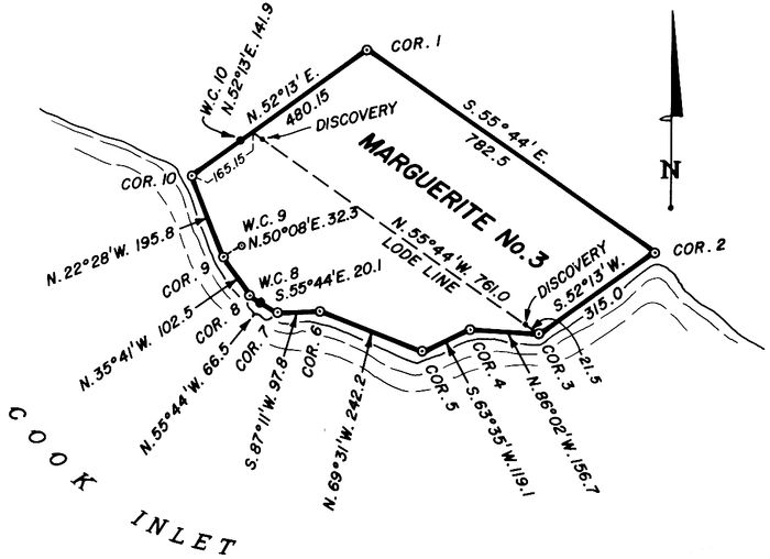
FIG. 2
2–1 Discovery: “No lode claim shall be located until after the discovery of a vein or lode within the limits of the claim, the object of which provision is evidently to prevent the appropriation of presumed mineral ground for speculative purposes to the exclusion of bona fide prospectors, before sufficient work has been done to determine whether a vein or lode really exists.” (43 C.F.R. 3841.3–1) Obviously, then, the staking and recording of a claim without a discovery of mineral is to no avail, except that a discovery made prior to intervening rights perfects the location. A claimant diligently trying to make a discovery will generally be protected.
Except for the minerals covered by the Leasing Act (1920), and common varieties which may be acquired under the Materials Act (1947 and 1955), “Whatever is recognized as a mineral by the standard authorities, whether metallic or other substance, when found on public lands in quantity and quality sufficient to render the lands valuable on account thereof, is treated as coming within the purview of the mining laws.” (43 C.F.R. 3812.1)
Whether a mineral should be located as a lode or placer claim depends on the nature of the deposit.
Lodes are deposits of mineral in place, regardless of their origin. The mineral must be firmly contained or embraced in solid rock. This includes veins with distinct hanging and foot walls, replacement deposits in sedimentary formations, ancient stream channels now consolidated in sandstones, such as the uranium deposits of Wyoming, and disseminated deposits such as the copper porphyries of Arizona.
On the other hand, mechanical deposits of minerals such as gold contained in the gravels of stream beds and alluvium deposits are properly located as placer claims. However, certain rock types, such as marble and perlite while mineral in place, are properly located as placers since the Act of 1892 provided for locating building stone under the placer mining laws. Included are bedded minerals not contained in rock in place, such as bentonite.
The discovery requirements for a lode claim are that the mineral must be in place. A discovery of float (a loose piece of ore from a vein) is insufficient. Merely a trace of mineral is insufficient. Discovery by geologic inference is insufficient. There must be an actual and physical exposure of a lode.
The discovery must be on vacant public domain, which includes patented surface lands with minerals reserved to the United States.
There have been many court cases and decisions as to what constitutes the discovery of a valuable mineral deposit and it can be a difficult and complicated matter. The general rule is stated in the famous Castle v. Womble Decision, 19 L.D. 455, 1894: “When minerals have been found and the evidence is of such a character that a person of ordinary prudence would be justified in the further expenditure of his labor and means, with a reasonable prospect of success, in developing a valuable mine, the requirements of the statute have been met.”
In the Jefferson-Montana Copper Mines Co. case, 41 L.D. 320, 1902, it was stated that the following elements of discovery are necessary:
The extent of discovery will vary with the situation to be considered and the type of mineral and deposit. For example, the requirement as between two claimants is far less than that between a claimant and the United States. A mineral of intrinsic value such as gold may well be considered under the rules set forth above, but a more common mineral would be further subjected to a test of marketability.
In the course of patent proceedings, a mineral examiner of the Bureau of Land Management, the Forest Service if the claim is in a national forest or the National Park Service if the claim is in a national park or monument, will make a field investigation to determine the validity of the claims in question.
Each location must be shown to be more valuable for minerals than for any other purpose and the burden of proof rests with the claimant. The claimant must be prepared to show the actual physical discovery and substantiate the value through assays, drill logs, etc.
The discovery need not be on the surface and may be made underground. In the case of blanket (horizontal) veins, the vein may be wider than the claim and discovery can be made anywhere within its boundaries. A discovery showing value and/or marketability may be anywhere within the claim. The discovery may be on the end line of a claim, but a single discovery cannot support more than one claim.
A discovery may be lost by the patenting of a junior claim in conflict, in which case a new discovery is required.
A claim cut in two by a non-mineral patent requires a discovery on each portion of the claim.
A claimant is entitled to possession as against third parties as long as he is diligently engaged in trying to make a discovery.
2–2 Discovery Work: 43 C.F.R. 3841.3–2 states:
“The claimant should, therefore, prior to locating his claim, unless the vein can be traced upon the surface, sink a shaft or run a tunnel or drift to a sufficient depth therein to discovery and develop a mineral-bearing vein, lode or crevice; should determine, if possible, the general course of such vein in either direction from the point of discovery, by which direction he will be governed in marking the boundaries of his claim on the surface.”
Except for the foregoing, the matter of discovery work is left to State law. The general requirement was that the vein (deposit) be disclosed to a depth of ten feet, or deeper if necessary, in a shaft, cut or tunnel. In recent years the tendency is away from requiring discovery work. This was brought about largely through the destruction of the surface by bulldozers digging needless pits or cuts on uranium claims in order to satisfy State law.
Drill holes have also been substituted for the usual shaft, cut or tunnel. In some cases the filing of maps has been substituted for discovery work.
The statutory requirements for each State are given in Chapter I. This chapter and the statutes themselves should be checked for current requirements.
In any event, a discovery point (usually marked by a discovery monument, bearing a notice) should be selected by the claimant from which to recite the dimensions of his claim. If a discovery is made underground, the discovery work requirement is usually met by driving a drift or raise, or sinking a winze on the vein, for ten feet in length; the discovery point is then marked on the surface, with the dip of the vein, if any, projected to the surface.
2–3 Location: 43 C.F.R. 3841.4–1 states: “From and after May 10, 1872, any person ... may locate ... a mining claim 1,500 linear feet along the ... vein ...; or an association of persons ... may make joint location of such claim of 1,500 feet, but in no event can a location of a vein or lode made after May 10, 1872, exceed 1,500 feet along the course thereof....”
43 C.F.R. 3841.4–2 states: “No lode located after May 10, 1872 can exceed a parallelogram 1,500 feet in length by 600 feet in width, but whether surface ground of that width can be taken depends upon the local regulations or State or Territorial laws.... No such local regulations or State or Territorial laws shall limit a vein or lode claim to less than 1,500 feet ... nor can surface rights be limited to less than 50 feet in width....”
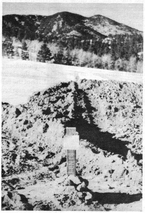
DISCOVERY CUT
Excavated by bulldozer, with discovery monument and location notice at the point of discovery.
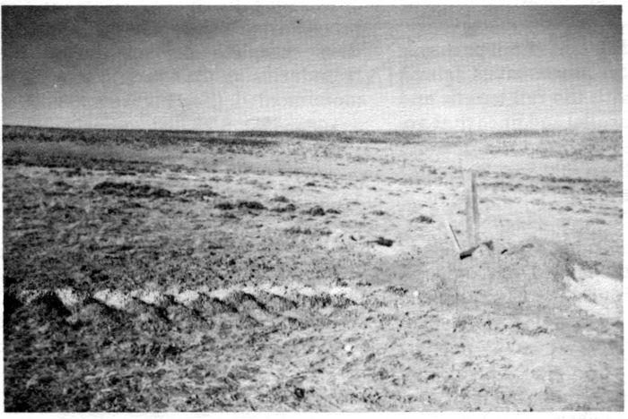
DISCOVERY DRILL HOLE
Note the discovery monument in the hole and samples of cuttings taken at each 5 feet of depth.
2243 C.F.R. 3841.4–3 further states: “With regard to the extent of surface ground ..., the Act of May 10, 1872, provides that the lateral extent of locations of veins or lodes ... shall in no case exceed 300 feet on each side of the middle of the vein at the surface, and that no such surface rights shall be limited by any mining regulations to less than 25 feet on each side of the middle of the vein at the surface ...; the end lines of such claims to be in all cases parallel to each other ...; and when the locator does not determine by exploration where the middle of the vein at the surface is, his discovery shaft must be assumed to mark such point.”
The only State known to limit the width of claims at present is North Dakota which only allows 150 feet on each side of the vein.
While Wyoming allows the full width, the side lines must be equidistant from the discovery, i.e., a claim may not have 300 feet on one side and 200 feet on the other. Since the federal law limits the size to 300 feet on each side of the vein, if 200 feet is taken on one side, 400 cannot be taken on the other.
The length each way from the point of discovery may be any amount as long as the total does not exceed 1,500 feet.
There is no limit to the number of claims any individual, association or corporation may locate.
Figure 3 shows three different claim patterns, all of which meet federal requirements. Claim A is the usual rectangle with the full length and width, Claim B shows parallel end lines that are not at right angles to the lode line and side lines. While they are longer than 600 feet, the right angle distance on either side of the lode line is exactly 300 feet.
Claim C shows a break in bearing of the lode line at the center of the claim (it could be anywhere on the lode line). Like Claim B, the right angle width does not exceed 300 feet on either side of the center line for any portion of the claim.
Corners may be placed on patented land and on other claims in order to obtain the described pattern and achieve parallel end lines with extralateral rights. If the fee owner objects to monuments, witness corners may be used.
43 C.F.R. 3841.4–4 and 3841.4–5 give the minimum requirements for defining and monumenting locations including the recording of location notices. The laws of the various states elaborate on these requirements giving minimum size of monuments and acceptable materials, specifying the points on the boundaries that shall be monumented, giving the contents required in the location certificates and setting time limits for completing discovery work and recording. (See Chapter I.)
A wood 4″×4″ post at least four feet in length, well set in the ground, makes a good monument. It should be marked on the side facing the claim with the corner number and initial, if not the full name of the claim. Side centers may be marked S/C and end corners E/C, as required.
Discovery monuments are usually marked D.M. The markings can be painted, or scribed with a timber scriber. In a very active area where a number of claims are being staked, claimants often paint the tops of posts with a distinctive color so that they may be readily identified.
A simple way to lay out and monument a single claim is to begin at the discovery point and run out the desired distance each way along the lode line, then turn an angle of 90° and run each way 300 feet to the corners. (See Figure 4.)
A simple way to lay out a block of claims on a bedded deposit is to run out a common set of end lines and at 300 feet or less turn 90° and at 50 feet or less set a discovery monument. Continue this procedure until the end of the area is reached, then complete the survey by running the boundaries so that each corner is located and monumented. (See Figure 4.)
In staking a block of claims it is advisable to make them short of the 600′×1500′ so that minor errors in the location survey will not result in infractions caused by oversize claims.
There is no set rule for numbering corners, clockwise or counterclockwise, except that they be consecutive. In a block of claims corner numbers should be grouped, reducing the number of ties to a section corner or natural object.
While 43 C.F.R. 3841.4–5 calls for a tie to a permanent, well-known point or object from the discovery, a tie from one of the corners is perfectly acceptable. In fact a metes and bounds description with bearings given at least to degrees and distances in feet, should be included in the location certificate. Avoid using such directions as southwesterly, northeasterly, northerly, etc. Acceptable location certificate forms can usually be purchased at a local printer or stationery store.
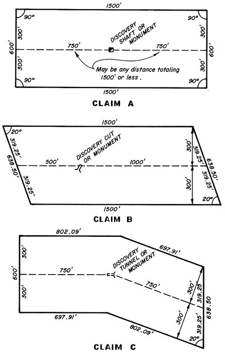
FIG. 3
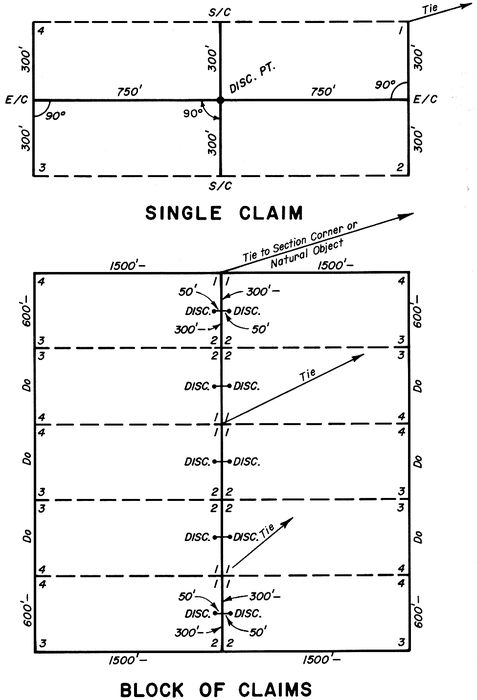
FIG. 4
25The term “location notice” applies to the notice posted on the claim at the time of discovery. Some states require that a copy of this notice be recorded, while others provide for the filing of a location certificate after all discovery work has been completed and the boundaries monumented. Forms for the location notice, to be followed by the location certificate for Colorado, and a form for a California location notice, where a copy of the notice is recorded, are included in the appendix.
2–4 Discovery: 43 C.F.R. 3842.1–1 states: “But one discovery of mineral is required to support a placer location, whether it be of 20 acres by an individual, or 160 acres or less by an association of persons.” The discovery may be anywhere in the claim and must be more than a trace. Although it need not be commercial for purposes of location, commercial feasibility (or marketability) will be required for patent.
Known lodes are automatically excluded from placer locations. If any are known to exist they must be located as lode claims; the extent of surface ground may be the minimum, i.e., 25 ft. on either side of the vein.
A number of oil shale placer claims were in existence at the time the Mineral Leasing Act was passed in 1920, and have subsequently been patented. Many discontinued performing the annual assessment work on the theory that no one else could locate the claim. The Department of the Interior has recently ruled (U.S. v. Frank W. Winnegar et al.; 81 I.D. 370) that failure to develop an oil shale claim demonstrates that the deposit is not valuable and that the rule of the prudent man has not been met.
2–5 Discovery Work: As with lodes, the State requirements for discovery work have been eliminated for all but the State of Washington. However, sufficient excavation will be necessary to disclose a valuable deposit.
2–6 Location: The Act of 1870 limited placer claims to 160 acres, whether they be located by an individual or association; the Act of 1872 limited locations to 20 acres per person, with up to 160 acres for an association of eight persons. Therefore, two persons may take 40 acres; three take 60 acres; four take 80 acres, etc.
If practicable, placer claims shall conform to the legal subdivisions of the public land survey, with ten acres being the smallest unit considered. If on unsurveyed lands, a placer claim should conform to the protracted survey. If on surveyed lands, no further description is necessary and the claim may proceed to patent on this basis. State law may require monumentation of the corners.
If on unsurveyed lands a mineral survey will be required before application for patent can be made. Further limitation on size of precious metal placers is imposed by the State of Alaska. There is no limit on the number of placer claims that may be located.
Where fractional lots of the public land survey are encountered, the rule of approximation may be applied to excess acreage. The rule is that the amount of excess may not exceed the amount of loss, if one of the subdivisions were eliminated. On the basis of ten acre tracts, the allowable excess would be 4.99 acres.
There are instances where conformity to the public land survey is not practical. These instances occur where conformity would take in a sizable amount of non-mineral ground, such as a gulch placer, where the claim is surrounded by prior locations or conformity would necessitate placing the lines on prior claims. In these cases, a metes and bounds description is proper, but with the following limitation: A location by one or two persons must be included within a square 40 acre tract; a location by three or four persons within two square 40 acre tracts placed end to end; a location by five or six persons within three square 40 acre tracts; seven or eight persons within four square 40 acre tracts. (43 C.F.R. 3842.1–5)
Regardless of the manner in which a placer is described, a location notice and/or certificate must be posted and filed for record. A sample certificate is included in the appendix.
2–7 Authority: The Act of 1872 provided for five acre mill sites to be taken in conjunction with lode claims or for the purpose of building an ore reduction works (mill or smelter). The Act of 1960 further provided for mill sites taken in conjunction with placer claims, and further provided for the description to be in the same manner as the placer. This provided for describing mill sites by legal subdivisions, and in practice this method of description is extended to mill sites taken with lodes or for an ore reduction works. (Instruction Memo No. 72–151, 4/25/72.)
26Land appropriated as a mill site must be non-mineral in character and the surface open to location under the mining laws. Once patented, it includes all minerals. Nominal values do not constitute mineral ground, nor does the fact that a mill site adjoins a lode or placer claim prove mineral ground. In patent proceedings, the mineral examiner may require drilling to provide the non-mineral character of the land.
As with lodes and placers, a location notice must be posted and recorded. (See appendix for sample.) State law may require monumentation, even if described by legal subdivisions.
2–8 Required Use: 43 C.F.R. 3844.1 states: “A omitted is required to be used or occupied distinctly and explicitly for mining or milling purposes in connection with the lode or placer claim with which it is associated. A custom or independent mill site may be located for the erection and maintenance of a quartz mill or reduction works.”
There is no limit to the number of mill sites that may be located, so long as they are necessary for the operation of a mine or mill. Acceptable uses include tailings ponds, dumps, storage facilities, living quarters, etc.
2–9 Possessory Right: The Act of 1872 gave the proprietors of a mining tunnel the possessory right to 1,500 feet of any blind lodes cut by the tunnel, not previously known to exist, for a distance of 3,000 feet from the portal, or first working face of the tunnel. Since the 1,500 feet could be taken in either direction from the line of the tunnel, this provided an exclusive area 3,000 feet square.
When a lode is discovered in the tunnel, it must be staked on the surface, and a notice posted on the surface at the projected point of discovery, either directly above or protracted on the dip of the vein.
Failure to work the tunnel for six months constitutes abandonment. A tunnel site may not be patented. (See appendix for sample location certificate.)
2–10 Location: 43 C.F.R. 3843.2 and 3843.3 provides for posting a notice at the portal of the tunnel, staking the claim and recording a copy of the notice with the proper local authorities. The Act of 1976 also requires recording with the Bureau of Land Management.
It is customary to stake the line of the tunnel at such intervals so that each succeeding stake or monument is visible from the last, beginning at the first working face and continuing 3,000 feet to the end. The four corners of the tunnel site should also be monumented.
Although not expressly provided for by law, a dump site of reasonable size may be located at the portal of the tunnel.
2–11 Recording of Claims: 43 C.F.R. 3841.4–6 states: “The location notice must be filed for record in all respects as required by State or Territorial laws, and local rules and regulations, if there be any.” Although the foregoing is contained in that section pertaining to lode claims, the same applies to placer claims, mill sites and tunnel sites. All the state laws make provision for the recording of location notices, with the County Clerk and Recorder or his equivalent (Register of Deeds in North and South Dakota, County Auditor in the State of Washington). Should the claim fall in two counties, it is proper to record the original certificate in the county (and state) where the discovery lies.
The Federal Land Policy and Management Act of 1976 made the recordation of mining claims with the Bureau of Land Management mandatory. Unlike state requirements, failure to file for record with the Bureau of Land Management within the designated time makes the claim abandoned and void. The objective is stated in 43 C.F.R. 3833.0–2:
“An objective of these regulations is to determine the number and location of unpatented mining claims, mill sites or tunnel sites located on Federal lands to assist in the management of those lands and the mineral resources therein. Other objectives are to remove the cloud on the title to these lands because they are subject to mining claims that may have been abandoned and to keep the BLM abreast of transfers of interest in unpatented mining claims, mill site and tunnel sites ....”
An abstract of the law is given in Chapter I. The proper State office of the Bureau of Land Management should be contacted to determine their requirements.
272–12 Assessment Work (Annual Labor): 43 C.F.R. 3851.1 states:
“In order to hold the possessory right to a lode or placer location made after May 10, 1872, not less than $100 worth of labor must be performed or improvements made thereon annually. The period within which the work required to be done shall commence at 12 o’clock meridian on the first day of September succeeding the date of location of each claim. Where a number of contiguous claims are held in common, the aggregate expenditure that would be necessary to hold all the claims may be made on any one claim. Cornering locations are held not to be contiguous.”
Almost any type of improvement will count as assessment work. Development work in the form of shafts, cuts and tunnels definitely will count as well as drill holes. Roads, bridges, ore bins, etc., will also count. Recently, geological, geochemical and geophysical surveys have been included as qualifying for assessment work, although not for patent expenditure.
Reports by qualified experts conducting such surveys must be filed with the county recorder. Such work cannot apply to more than two consecutive years and no more than a total of five years. Work may be done in a common improvement, but such work must be of benefit to all claims of the common group. It may be outside the claims, such as a tunnel driven toward the group for the development of the claims at depth. Not all work qualifying for annual labor will qualify as patent expenditure.
Provision is made in state laws for the filing of an affidavit of assessment work and form of content is provided. A copy of said affidavit or other proof must also be filed with the Bureau of Land Management. In the past, the filing for record of the affidavit shifted the burden of proof from the claimant to third parties and failure to file such an affidavit, or failure to do the work, did not invalidate the claim. Now, failure to do the work and file the necessary proof with the Bureau of Land Management will render the claim abandoned and void.
Notice of intent to hold must be filed with the Bureau of Land Management in the case of mill sites and tunnel sites and in the case of lodes or placers should the annual assessment work be suspended as it has in the past during time of war or economic stress.
2–13 Relocation, Amended Location, Additional Location Certificate: The terms “relocation” and “amended location” when made by the owner are synonymous. Generally, there is no relocation or amended location by the owner unless there is a change on the ground, such as a change in the boundaries or a change in the discovery. Such relocations or amended locations relate back to the original location and no existing rights are surrendered by such an amendment. If there is no change on the ground, and the change is only in the description, then an additional location certificate will suffice.
Amendments (or relocations) by the owner are made for the purpose of correcting any errors in the original location, description or record, changing the boundaries, or for the purpose of acquiring that part of any overlapping claim that has been abandoned. A relocation by the owner will not cure the lack of discovery or failure to do assessment work.
In the case of relocation of an abandoned claim by a third party, the discovery work should be extended or a new discovery made and the monuments should be checked to see that all are in place and in good condition. Such a relocation does not relate back to the original location.
State laws cover amendments and relocations and they should be checked for the requirements. (See appendix for sample Additional and Amended Location Certificate.)
3–1 43 C.F.R. 3861.5–1 states:
“Pursuant to section 2334 of the Revised Statutes (30 U.S.C. 39), the Director or his delegate will appoint only a sufficient number of surveyors for the survey of mining claims to meet the demand for that class of work. Each applicant shall qualify as prescribed by the Director or his delegate. Applications for appointment may be made at any office of the Bureau of Land Management listed in 3821.2–1 of these regulations. A roster of appointed mineral surveyors will be available at these offices. Each appointee may execute mineral surveys in any state where mineral surveys are authorized.”
The Director referred to is the Director, Bureau of Land Management.
3–2 Mineral Surveyors were originally appointed by the Surveyors General (General Land Office) of the various states where mineral surveys are authorized, and were appointed for that State only. As a general rule these men were practicing consulting mining engineers in an area covering one or more mining districts and seldom went out of their area to execute surveys. As a result, over a period of time, they developed a valuable set of survey records pertaining to claim corners, section corners and mine workings. Claimants found it advantageous to employ a mineral surveyor in his district because of his proximity to the work and his previously acquired knowledge.
With the decline in mining activity due to mineral deposits being exhausted or reaching uneconomical depths, and with the improvement in modes of transportation, mineral surveyors found themselves covering larger areas, and many sought appointments in more than one State. With the formation of the Bureau of Land Management and the establishment of areas or regions, the mineral surveyors’ appointments were extended to the area or region embracing their State and all adjoining states to the area or region, and finally to all states subject to the Federal mining laws.
3–3 Today, mineral surveyors are appointed by the Chief, Division of Cadastral Survey of the Bureau of Land Management at Washington, who acts for the Director. Application may be made to any State Office or directly to the Washington Office. The application should contain a brief resume of the applicant’s experience in land surveying, mining and geology and list the states in which he is registered as a land surveyor, or as a professional engineer if that state permits certain classes of professional engineers to do land surveying. The applicant is cautioned, however, that appointments are made only if a need is demonstrated by one of the State Directors, and he requests that an examination be held at his office to supplement the roll of mineral surveyors. Appointments are presently for a four-year period.
3–4 Mineral surveyors were originally bonded and such bonds were usually for a four-year period. The renewal of these bonds served to keep the roster of mineral surveyors active. Bonds are no longer required, but the mineral surveyor must request renewal of his appointment 60 days before its expiration. Renewal is based on his activity as a mineral surveyor, the quality of his work and the timeliness of filing returns of his surveys. If the record shows that he has not been actively engaged in executing mineral surveys, he may be dropped from the rolls. If he allows his appointment to lapse, he 30will not be reinstated or reappointed unless he demonstrates his capability to make mineral surveys, and there is a need for additional mineral surveyors.
3–5 A mineral surveyor’s appointment may be revoked at any time for just cause, among which are: incompetence, gross misconduct, conflict of interest, failure to personally execute a survey, failure to prosecute work diligently, and failure to file timely returns.
3–6 Before the revocation as stated in 3–5 can occur, any outstanding surveys or survey orders must be disposed of by completion, cancellation or by issuing a new order to another mineral surveyor, as mutually agreed on by all parties.
3–7 Although the mineral surveyor, as an employee or officer of the Federal Government, is not subject to State laws regulating the practice of land surveying, he will find it advisable to be registered, at least in his home State, if not in other states where he engages in mineral land surveying. Actually, he is only exempt from registration when he is working under a mineral survey order and as such he is limited to work covered by the order. However, the States of California and Nevada specifically permit a United States Mineral Surveyor to make a location survey and to make such survey a part of the record. (Public Resources Code of California, Sec. 2311, and 517.210 R.S. Nevada.) A mineral surveyor would probably not be questioned in other states if he is making an amended location survey or field examination prior to the application for survey. Often, additional work will be required by the claimant and the mineral surveyor will have to refer this work to others or associate with a registered surveyor. Furthermore, if an applicant for appointment is not registered in his home State, the Chief of the Division of Cadastral Survey may require a more extensive examination so as to embrace material normally covered in State examinations.
3–8 Although basically a land surveyor, the mineral surveyor should have a working knowledge of geology, ore deposits and principles of mining in order to properly execute his work. He should also be familiar with the methods of making underground surveys. He may acquire such knowledge informally by reading texts on the subjects and through membership in local mining associations and organizations.
3–9 Applicants for appointment as Mineral Surveyor must pass a 16–hour examination with a grade of 70 consisting essentially of four parts:
1. A solar observation for azimuth consisting of six consecutive readings, with an engineer’s transit or double center theodolite, three each with the telescope in direct and reversed positions observing opposite limbs of the sun; together with the necessary calculations to determine the true meridian. The applicant will furnish the instrument used.
2. Correctly answer questions on the legal and technical aspects of mineral surveys. Such questions may be of the true/false or multiple choice type.
3. Solve a practical problem relating to mining claims, including conflicts, where a set of conditions are given.
4. Prepare a set of field notes and prepare a preliminary plat from given field data.
References and calculators including minicomputers may be used in the examination. It is an open book examination.
The examination will be held in the office of the State Director who made the request, but it is not limited to residents of that State and anyone whose application has been accepted may take the examination at his own expense. Upon successful completion of the examination, the applicant will furnish the names of three references who are familiar with his character, integrity and capability as a surveyor. The examination is prepared by the Washington Office and mailed in a sealed envelope bearing the applicant’s name to the State office. The completed examination is returned to the Washington Office in a sealed envelope for each applicant for grading.
3–10 The duties of the mineral surveyor begin with an order for survey and cease with the approval of that survey. This precludes using data acquired by former surveys and by reason of having made the location or amended location survey, unless such data is verified by field work and examination after the survey order is issued.
The surveyor should not act as agent for the claimant in the signing of location or amended location certificates, although he may post such 31notices for the claimant. The mineral surveyor is prohibited from taking any part in the patent application; however, he may assist the attorney or agent or the claimant himself in interpreting his field notes, including the area statement. A mineral surveyor exceeds his duties if he prepares the notices of application for patent (24 L.D. 193).
3–11 The survey must be made in person by the mineral surveyor. This does not mean that every physical act of survey must be performed by him, but it must be performed under his direct supervision in the field. The mineral surveyor is prohibited from delegating such supervision to employees. In other words, the mineral surveyor cannot send a field party out to do the work under his authority without being on the ground himself. There is no objection to having more than one survey crew perform the field work as long as the mineral surveyor can give each crew adequate supervision. The same rule applies to office work in connection with the survey.
There is nothing that prohibits a mineral surveyor from being a part of an engineering and/or surveying firm, but he should be a principal of that firm. If he works as an employee of such a firm, he is compromising his appointment, for as a mineral surveyor he is an employee of the Bureau of Land Management.
He cannot be an employee of the claimant, nor can he employ the claimant, his attorney or parties in interest as assistants in making surveys of mineral claims (43 C.F.R. 3861.3–2).
3–12 The survey must be an actual survey on the ground. This precludes the calculation of ties and other lines through prior surveys. (See 6 L.D. 718 which disallowed a section corner tie calculated from another survey and required an amended survey to run the section tie on the ground.)
3–13 The mineral surveyor should bear in mind that his field work is subject to spot checks by cadastral surveyors of the Bureau of Land Management for sufficiency and accuracy; also, if his returns of a survey indicate irregularities, a complete examination by the Bureau of Land Management may be made. Such field checks will normally be made when a field party is in the area during the normal course of a field season. Irregularities that cannot be resolved with the mineral surveyor may call for a special field examination.
3–14 43 C.F.R. 3861.4–1 Payment: (a) The claimant is required in all cases to make satisfactory arrangements with the surveyor for the payment for his services and those of his assistants in making the survey, as the United States will not be held responsible for the same. (b) The State Director has no jurisdiction to settle differences relative to the payment of charges for field work between mineral surveyors and claimants. These are matters of private contract and must be enforced in the ordinary manner, i.e., in the local courts. The Department has, however, authority to investigate charges affecting the official actions of mineral surveyors, and will, on sufficient cause shown, suspend or revoke their appointment. (See 3–1 above.)
3–15 30 U.S.C. 39 states in part: “The Director of the Bureau of Land Management shall also have the power to establish the maximum charges for surveys ...; and to the end that the Director may be fully informed on the subject, each applicant (for patent) shall file with the Manager (of the land office) a sworn statement of all charges and fees paid by such applicant for ... surveys....”
3–16 Many factors enter into the ultimate cost of a mineral survey, such as the terrain, distance from centers of population, condition of the public land survey, number of conflicts with prior surveys and patents, the age of conflicting surveys, variable weather conditions, and inflation.
Cost should be a secondary consideration in selecting a mineral surveyor and the remuneration should be such as to assure an adequate job. Many of the early day surveys of the public lands resulted in poor or even fraudulent work because of the low contract price.
If a mineral surveyor has had considerable experience in an area, he may agree to a fixed price per claim, plus a fixed price per conflict and per mile of retracement of section lines with subdivision of sections as required. An alternative to this is a daily or hourly fee for each principal or party chief and assistants, plus expenses at cost, which assures the Bureau of Land Management and the claimant that quality will not be sacrificed because of cost. In the latter case, the mineral surveyor should provide the claimant with an estimate so that he 32will be prepared to meet his invoices. Either type of contract should provide for periodic payments, and the mineral surveyor is justified in requesting an advance deposit. In any event, payment for the mineral survey is a matter of private contract; the foregoing are merely suggestions.
3–17 Inasmuch as mineral surveyors may not hold an interest in the public domain (see Sec. 3–18 below), they are prohibited from accepting an interest in the claims as payment for his services.
3–18 The following is quoted from the current (1977) letter appointing mineral surveyors:
“As a special Government employee (see Waskey v. Hammer, 223 U.S. 85, 1911), you are subject to the pertinent conflict of interest statutes and standards of ethical conduct as set out in 18 U.S.C. 202 and E.O. 11222, Part III. You and your wife are prohibited from acquiring an interest in the public lands, either directly or indirectly, by provisions of 43 U.S.C. 11 and 43 C.F.R., Part 7. This prohibition extends to locating and holding in your names any mining claims, oil and gas leases, grazing licenses or permits, cadastral survey contracts, or making any other application or filing under the public land laws.” 43 C.F.R. 7.2 defines interest as follows:
“The term ‘interest’ means any direct or indirect ownership in whole or in part of the lands or resources in question, or any participation in the earnings therefrom, or the right to occupy or use the property or to take any benefits therefrom based on a lease or rental agreement, or upon any formal or informal contract with a person who has such an interest. It includes membership in a firm, or ownership of stock or other securities in a corporation which has such an interest: Provided, that stock or securities traded on the open market may be purchased by an employee if the acquisition thereof will not tend to interfere with the proper and impartial performance of the duties of the employee or bring discredit upon the Department.”
Employees stationed in Alaska are exempt from the above, except for a mineral lease or mining claim, and may acquire one tract of land, not exceeding five acres, for residence or recreation purposes. [43 C.F.R. 7.4 (a) (1) and (2).] Retention of an interest may be approved upon written request to the Secretary of the Interior, provided the interest was acquired prior to becoming an employee or the interest was acquired by gift, devise, bequest, or by operation of law.
3–19 The mineral surveyor may be required to file with the Bureau of Land Management a “Public Disclosure Statement of Known Financial Interests” under the Federal Land Policy and Management Act.
3–20 It should be clear why the foregoing restrictions are placed on mineral surveyors. They remove any possible conflict of interest and the claimant may deal freely with the mineral surveyor knowing that he cannot benefit from any information or knowledge gained during the course of the survey.
4–1 Purpose: Except in special instances, such as lands selected by the Native Corporations under the Alaska Native Claims Settlement Act, a mining claim may be held indefinitely as a location by performing the annual assessment work and making the necessary affidavits and recordings. However, once a valuable mineral deposit has been proven to exist, it may be desirable to obtain absolute fee title (patent) to the claim which, except in special cases, includes not only the mineral estate, but the surface as well. Patent not only assures possession of the property, but will facilitate financing as well.
Unless the claim is described by legal subdivisions as in the case of placers and mill sites, an official survey by a United States Mineral Surveyor under the direction and with the approval of the Bureau of Land Management is the first step in obtaining a patent.
Almost universally, the location survey has not been made with sufficient accuracy or detail to provide the necessary description for patent. The patent survey will, in addition to permanently monumenting and witnessing the location on the ground, show all conflicts with prior mineral surveys, fee lands with mineral rights, and prior locations that the claimant wishes to exclude. It will also show all the workings on the claims, both by the claimant and by others, if any. The survey itself confers no rights; patent must follow.
4–2 Selecting a Mineral Surveyor: A list of approved and active mineral surveyors may be obtained from any State Office, or from the Director, Bureau of Land Management, at Washington, D.C. Mineral surveyors’ appointments cover all states where the mining laws are applicable.
Usually, it will be advantageous to select a mineral surveyor close to the project, or one who has worked in the area and has a knowledge of existing surveys. All mineral surveyors are not equally experienced. Their appointment means that they have met certain qualifications and have satisfactorily demonstrated a knowledge of mineral survey procedures.
More than one mineral surveyor should be consulted before making a selection. His proposed method of making the survey, his availability and time schedule, as well as fees should be discussed. Fees should be a secondary consideration and may be on a time and expense basis or a flat contract price. If a flat price is to be decided, the mineral surveyor will probably want to first make an examination of the property. In any event, the arrangement between the mineral surveyor and the claimant is a matter of private contract, and the Bureau of Land Management will not be responsible.
Even after a survey has been started, the claimant may discharge a mineral surveyor and select another, but such action will call for an amended order for survey.
4–3 Selecting an Attorney: An attorney-at-law to act as agent for the claimant in the patent proceedings is not necessary; the claimant can make the application for patent himself.
However, an attorney well-versed in mining law can be a big asset and arrangements should be made prior to the survey so that he will be available for consultation. The mineral surveyor will know of attorneys with whom he has previously worked and may be able to make recommendations. The attorney’s fee may be negotiated. If the claimant is a large corporation, it may have staff attorneys or landmen that can handle the patent application.
The mineral surveyor may not assist in the patent proceedings. His help may be required in determining the net area of the claim from the area statement in the mineral surveyor’s field 34notes. There is no objection to the mineral surveyor interpreting his notes, and assisting in this regard.
4–4 Application for Survey: Must be made by claimant(s) or his agent on current Form 3860–5 (see appendix). Instructions are on the back of the form.
1. The name of the applicant (claimant) should be given exactly as it is to appear in the patent, together with his post office address.
2. Group name (if any). If the claims are known by a group name, it may be placed here. If they do not have a group name, it may be omitted.
3. Name(s) of claim(s) should appear exactly as they are given in the location certificate, e.g., Molly No. 1 should not be given as Molly #1. The date the claim was first located and recorded in the present chain of title must be given; the dates of amendment are only the last amendment made.
4. The location of the claims by section, township and range (stating that it is unsurveyed if based on protracted survey lines), county and state must be given. If not within a national forest, “None” should be used in the blank provided.
5a. To support the application, furnish two copies of the location notice (or last amended location with the original location and recordation date shown thereon). One copy must be certified by the custodian of the records where mining claims are locally recorded (usually the County Clerk and Recorder).
5b. The claim must be monumented on the ground so that the mineral surveyor can identify it.
6. In accordance with the instructions, a deposit in the proper amount must be made to cover the costs of the Bureau of Land Management in processing the survey.
7. The mineral surveyor designated must be one with whom prior arrangements have been made for the survey. The Bureau of Land Management may request proof, in the form of a simple letter from the mineral surveyor, that he has agreed to make the survey. The application should then be dated and signed by the applicant(s), if a corporation by the authorized officer, or by the Attorney-in-fact if by an agent acting for the applicant. Proof of authorized signature will not be required by the Bureau of Land Management at this time, but will be required at the time application for patent is made.
Several claims, generally limited to 50 in number, may be embraced in a single survey provided they are contiguous, i.e., not merely cornering; they must adjoin with common boundaries or overlap. Limiting the number of claims to be embraced in a single survey is arbitrary, but set at approximately 50 in order to facilitate processing. Two groups of claims may be embraced in a single survey if they both adjoin a group previously surveyed for patent and are owned in common.
Occasions have arisen where the group of claims lies in two states. Applications for survey should be made in each state for the claims or portions thereof which lie in that state. A survey number will be assigned in each state for the portion lying within each state, but the survey will be assigned for processing to the State where the majority of the claims lie. (See Surs. Nos. 10631 Montana, 3168 Idaho.)
4–5 Records Search: Prior to applying for the mineral survey, the claimant or his agent should make a search of the county records to determine if the claims are in conflict with other mining claim locations. If so, copies of the location certificates should be obtained for the mineral surveyor. If the claims are prior valid locations and the claimant wishes to exclude them from his patent application, the mineral surveyor will be required to show the conflict as it exists on the ground.
If it is not the desire to exclude such claims, no mention of them will be made in the field notes of the mineral survey, but the mineral surveyor will be aware of them when he goes on the ground.
The claimant should also make a search of the Bureau of Land Management records, particularly the Master Title Plats (M.T. Plats) to determine conflict with prior patents and withdrawals. Connecting sheets, if available, which show in outline all approved mineral surveys, should also be examined for conflicts with prior mineral surveys. The BLM record of unsurveyed locations should also be searched.
The claimant should make certain that his discovery point is on vacant public domain, which includes minerals reserved to the United States where the patent is for the surface only.
If two or more claims are involved, each must have its own discovery and both discoveries 35may not be in an area of conflict between two claims.
The length and width of each lode claim must be checked to make certain that statutory length of 1500 feet has not been exceeded and that the right angle distance of no more than 300 feet exists on each side of the presumed course of the vein (lode line).
The acreage of all claims and the length of placers must be checked for excess. If excesses appear to exist the mineral surveyor should be advised of them and directed to survey the claim within the boundaries given so as to eliminate such excess.
While metes and bounds descriptions of lode claims are not mandatory, the description must be such that the locus of the claim can be determined. While a tie to a section is preferable, a tie to another mineral survey, mineral location monument, or triangulation station of the National Geodetic Survey or U.S. Geological Survey is acceptable provided they can be identified with the public land survey. Ties to bench marks are not acceptable.
Irregular claims, such as placer claims or mill sites, must have a metes and bounds description closing within 0.50 feet in 1,000 feet. The acreage of lode claims cannot exceed 20.661 acres. Placers may not exceed 20 acres to each claimant, exclusive of conflict, and mill sites may not exceed 5 acres, exclusive of conflict.
One of the location certificate copies must be certified by the custodian of the local records, usually the County Clerk and Recorder.
If any of the above items are not in order, it will be necessary to require the claimant to file an amended location certificate that will properly describe the claim. If the error in the certificate is small, or there is an obvious clerical error, such as calling for a bearing of N.——W. when it should be N.——E. it will suffice to state in the final field notes that the location certificate is in error.
To aid in determining the locus and relative position of several claims, the claimant may be called upon to furnish a diagram. If the certificate is marginal in detail, it is proper to suggest to the mineral surveyor that an amended location certificate be filed and an amended order for survey obtained before completing his survey. It is also proper to set a time limit for the completion of the survey and filing returns.
After receipt of the survey order, the Mineral Surveyor should obtain copies of necessary survey records, including MT Plat, the notes of township surveys, conflicting mineral surveys, including the reports as to the condition of corners and survey discrepancies contained under other corner descriptions and supplemental data, Homestead Entry Surveys and Exchange Surveys on Forest Service lands, Small Claims, Homesites, Trade and Manufacturing Sites, Rights-of-Way and Townsites. He should also consult the State and County records for restored section corners and subdivision of sections. A visit with the County Surveyor will often prove profitable.
4–6 Order for Survey: The order for survey is issued by the State Director of the Bureau of Land Management or he may delegate this action to the Chief, Branch of Cadastral Surveys.
The order for survey is issued on current Form 3860–6, (see appendix) or may be in letter form. The information given is essentially the same as contained in the application for survey. The names of the locations must be exactly as given in the location certificates.
The next consecutive survey number is assigned; a number from a cancelled survey or survey order should not be used. Lodes and placers may be included in the same survey. If a mill site is included, it is designated by adding the letter “B” to the survey number; the other claims being designated “A.”
A copy of the location certificates should be furnished to the mineral surveyor, and a copy of the order to the claimant; also to the Regional Forester if the claims are within a National Forest, or the National Park Service if within a National Park or Monument.
4–7 Amended (or Supplemental) Order for Survey: An amended order is based on an amended application from the claimant. It is usually occasioned by the filing of amended location certificates. The amended application is processed exactly the same as the original application.
An amended order is also called for if there is an addition or deletion of claims from the survey.
A change in mineral surveyor will call for an amended order, but the order to the original mineral surveyor must be cancelled.
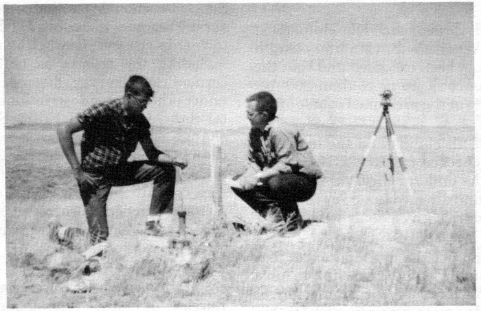
BUREAU OF LAND MANAGEMENT SECTION CORNER
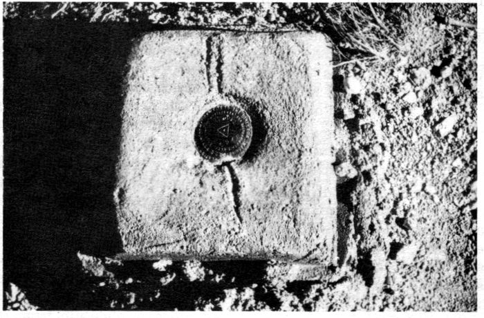
NATIONAL GEODETIC SURVEY TRIANGULATION STATION
37If the claimant sells the claims, an amended order will be required to show the new claimant.
An amended order may be used to authorize the survey of additional expenditures if the survey was approved without $500 of expenditures being made. (See Sec. 5–21)
4–8 Cancellation of the Survey Order: The most common reason for cancelling a survey order is failure of the mineral surveyor to complete the survey and file his returns. Under these circumstances, both the claimant and the mineral surveyor should be advised 30 days in advance of the action and be requested to show why the order should not be cancelled. If any reasonable explanation is given, the time should be extended. Lacking reasonable explanation the order will be cancelled, notifying both the claimant and the mineral surveyor, and any excess deposit is returned to the claimant.
Other reasons for cancelling a survey are a request to do so by the claimant, or if the claim has been declared null and void due to a contest brought by the United States.
The mineral survey number of a cancelled survey will not be used again, unless reopened as an amended survey and would then be shown with an “Am.” following the mineral survey number.
5–1 Preliminary: The first step in the field work should be an examination of the property with the claimant or his representative, unless such an examination was made prior to contracting for the survey. A sufficient number of claim corners should be visited to determine the material used, their condition, manner of marking, etc. In the course of such an examination, the claimant should point out known section corners, location monuments and triangulation stations, both of the U.S. Geological Survey and the National Geodetic Survey. The claimant may also be able to identify corners of adjoining and conflicting surveys and locations. If the property is extensive, the claimant may have established his own triangulation network and coordinate system, and if so, it should be incorporated into the survey, although not necessarily made a part of the official record.
All the discovery workings should be visited, the discovery points and discovery monuments pointed out. Other workings should be visited and the safety of old underground workings discussed. Maps of underground workings may be available. Workings constructed by third parties should also be identified.
Relations with landowners and other claimants in the area may be established with the help of the claimant. In addition to gaining access to the property and to their property for the purpose of executing the survey, they may have helpful information as to the location of section corners and the origin of fences.
If access is refused, it may be necessary to obtain help from the U.S. Marshall, but if properly handled in advance of the field work, the necessary permission will usually be granted. The fact may be stressed that you are a government official and that your work will be impartial. Emphasize that as a qualified surveyor, you are bound to protect all valid interests, property rights, and evidence.
Copies of the claimant’s maps of the property showing the claim boundaries, discovery and other workings and access roads should be obtained from the claimant. The claimant may also have aerial photos which will be helpful in planning the survey.
Descriptions of all triangulation stations should be obtained. The plat and field note record of all prior mineral surveys in conflict or adjoining, as well as a copy of the connected sheet should be ordered, if not previously furnished with the survey order. The county records pertaining to surveys and particularly the restoration of section corners should be searched. The county surveyor may be helpful.
If the field examination reveals that there are insufficient location corners on the ground to identify the claims, an amended location survey with the resulting amended location certificates and request for an amended order for survey will be necessary.
5–2 Survey Methods: The preliminary field examination will suggest the best method of survey. This will be dictated largely by the nature of the terrain and the amount of timber and brush. Modern methods employing theodolites and electronic distance measuring equipment should be used. Regardless of the method used, the work must be sufficiently checked to assure that errors will be avoided. Most errors occur when adjusting corners to their final position.
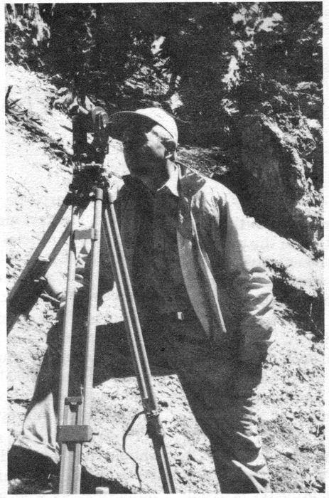
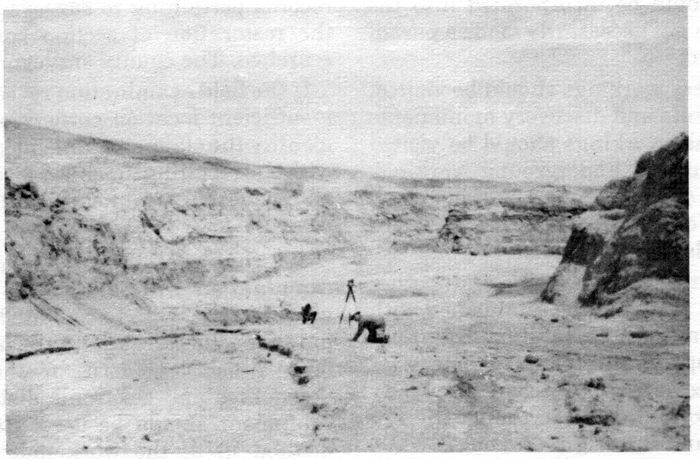
EXECUTING A MINERAL PATENT SURVEY
(Transit and Tape Method)
415–3 Executing the Survey: The survey is usually initiated by retracing the boundaries of the location, or tying-in the corners, along with the discovery monuments and discovery points. Readily identified corners of conflicting surveys and section corners should also be tied in. The relative positions of the corners and discovery points are then determined by calculated bearings and distances. If the boundaries are within the statutory length and width (1500 x 600 ft.), the end lines are parallel and the sidelines are within 300 feet on either side of the discovery point, the survey may proceed.
If only small corner moves of a foot or so will make the claim conform, an amendment is hardly necessary; otherwise, the corners should be moved and amended location certificates filed.
A single claim may be surveyed within the location boundaries, without amendment, as long as the above conditions are met.
New discoveries may be necessary, but if intervening rights are suspected, it is better to hold to the original discovery points and stake fractional claims as required.
If the deposit is a blanket vein or massive deposit, the discovery may be anywhere within the claim, except in Wyoming where State law requires that the side lines be equidistant from the discovery.
If no public land survey corners or location monuments (or other horizontal control stations) can be found within two miles of the survey it will be necessary to establish a location monument. The requirements are given in Sections 10–32, 33 and 34 of the Manual of Surveying Instructions. There was a period when these monuments were called “Mineral Monuments” and were designated “U.S.M.M.”
Conflicts with prior mineral surveys must be determined. It is necessary to search for each corner controlling a line in conflict. One corner is insufficient if others can be found. If the necessary corners cannot be found the boundaries shall be reestablished (not remonumented since the property belongs to another party) in accordance with the methods set forth in Chapter VI.
Conflicts with unsurveyed locations are not to be shown unless it is the wish of the claimant to exclude them from his patent. If they are prior locations, it may be well to do this in order to avoid an adverse suit. Conflicts with unsurveyed locations owned by the claimant and not a part of the survey need not be shown and excluded unless the area of conflict contains the discovery of the unsurveyed location. In cases where two claims of the survey are in conflict, the discovery of each claim may not be within the area of conflict. If so, an amended location is necessary to show a new discovery for one of the claims, outside the area of conflict.
If fee lands with mineral rights are in conflict, a subdivision of the section(s) may be necessary. This will depend on the wishes of the claimant and the Bureau of Land Management. An extensive resurvey that would place a hardship on the claimant should not be required. If a subdivision can readily be accomplished, it should be done.
It is not necessary to fix the boundaries of stock-raising homesteads since the minerals are reserved to the United States and belong to the mining claim in areas of conflict.
Special surveys such as townsites, Homestead Entry Surveys, U.S. Surveys and Coal Surveys in Alaska are treated as are prior mineral surveys. Rights-of-way should not be shown as the minerals are reserved, and when the right-of-way is abandoned, the surface reverts to the mining claim. In Alaska, native graves must be tied-in. Cemeteries should be shown.
Figure 5 shows Sur. Nos. 1234 A lode and 1235 B lode in conflict with the XYZ lode that is being surveyed for patent. Cors. Nos. 1 and 4 of Sur. No. 1234 A lode control the line of conflict with that claim. If they can be found, no further search is necessary; if they cannot, the search must be continued for Cors. Nos. 2 and 3. In the case of Sur. No. 1235, all four corners are required to be found in order to properly show the conflict.
Figure 6 shows the ABC and XYZ lodes, both of which are being surveyed for patent under the same survey order. The discovery shafts of both claims are in the area of conflict. In order to validate the claims, a new discovery must be shown for one of them, outside the conflict. It need not be the later claim as the owner has the right to decide which claim shall exclude the conflict.
If amended location certificates are filed for record, it will be necessary to make an amended application for survey to the Bureau of Land Management based on the amended certificates, and receive an amended order for survey. It will not be necessary to suspend field work pending such amendment, but it is advisable to refrain from marking the corners and accessories with the survey number until the amended order is received.
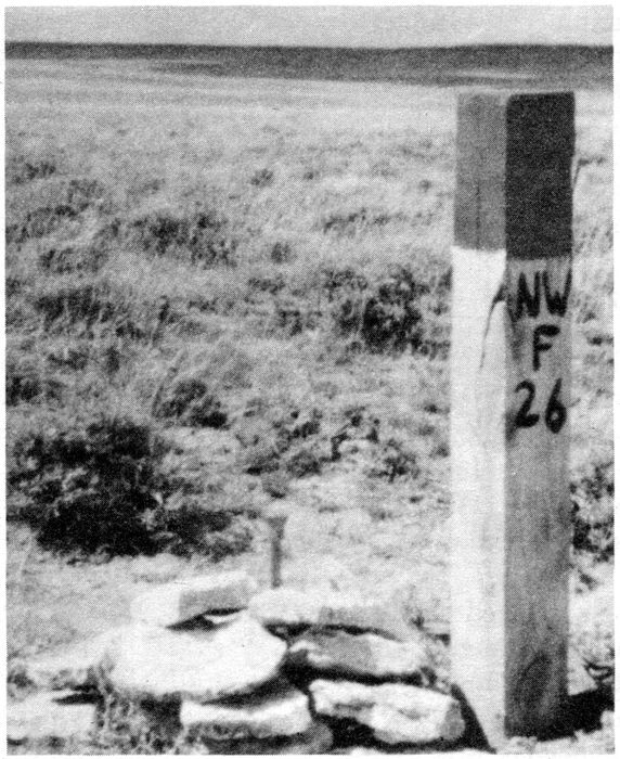
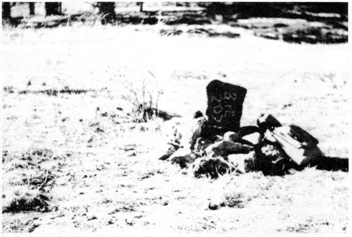
MINERAL PATENT SURVEY CORNERS
Top: a copper coated steel pin with brass cap. The location monument is set alongside.
Bottom: a stone corner chiseled with the corner number, the initial of the claim and the survey number.
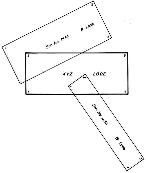
FIG. 5
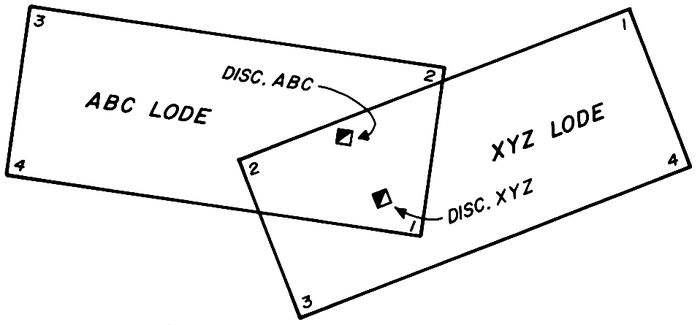
FIG. 6
455–4 Monumenting the Survey: Section 10–35 of the Manual of Surveying Instructions, 1973 lists corner monuments in their order of preference.
Accessories to the corner generally consist of bearing trees or bearing rocks. If trees are available, two different species at approximately right angles from each other to the corner should, if possible, be selected and marked differently so that each can be readily identified. For example: one might be a Douglas Fir, 10 inches diameter, bears N. 10° E., 20.65 feet dist., blazed and scribed 1 W—2826 X BT; the other a Ponderosa Pine, 7 inches diameter, bears S. 70° E., 12.52 feet dist., blazed and marked X BT. In each case the measurement should be taken to the X which is in contrast to the bearing trees to section corners, the measurement being taken to the center of the trees. If the measurement is to the center of the tree, an X should not be included in the markings.
The difference between a pine, spruce and fir can be identified by the needles, the pine having needles in bundles, the spruce having needles square in cross section, and the fir having flat needles.
Bearing rocks should be marked X B O or X B R with the measurement taken to the X; the rock or outcrop being of sufficient size to be readily identifiable.
Ties along claim boundaries to items of planimetry and drainage surrounding the corner may be taken at this time. Ties to section corners, location monuments and triangulation stations may also be made at this time if they are close to a corner.
There is no objection to monumenting corners that fall on patented land. If they fall in a cultivated field they should be buried at least one foot in the ground. If the landowner objects, a witness corner may be set. Witness corners should also be set if the corner falls at an inaccessible point (see Section 4–17 of the Manual of Surveying Instructions). If the corner falls in a road, it is advisable to bury the corner at the true point and set reference monuments at equal distances on either side of the road (see Section 4–16 of the Manual of Surveying Instructions).
Location posts, such as a 4×4 post in good condition, may be set alongside the patent survey corners as a guard post and to aid in calling attention to it.
In selecting corner numbers, there is no rule other than Cor. No. 1 should be the corner from which the tie is given to the section corner or location monument. When surveying a block of claims common corners should be given the same number thereby reducing the number of section corner ties required from Cor. No. 1. This facilitates field note writing as well as platting.
5–5 Improvements: All improvements made by the claimant or his grantors are to be tied to a corner of the survey, measured, and a value placed thereon if they are such as to count toward the $500 patent expenditure. If they are to count as patent expenditure, they must be in the nature of actual mining improvements, such as cuts, tunnels, shafts, drill holes, etc.; in other words, an improvement that tends to develop or explore the mineral deposit.
Improvements such as cabins, ore bins, roads, bridges, etc., do not develop the claim, but should be tied in, measured and included under “OTHER IMPROVEMENTS” in the field notes, without a value.
Work done by third parties must also be tied-in and listed under “OTHER IMPROVEMENTS.” If the claimant to such work is unknown, that fact should be stated. Again, no value is to be placed on these improvements.
The value to be placed on small improvements can readily be ascertained by multiplying the local wage or cost of equipment and operator by the length of time required to do the work. Drill holes may be valued at the cost of drilling, plus the cost of surveying, geologic evaluation and assaying. Larger improvements may not be as easy to estimate, and it may be necessary to go to the claimant’s cost records in order to place a reasonable value on them.
Common improvements require special consideration. See Sections 10–55, 10–56, and 10–57 of the Manual of Surveying Instructions. A common improvement is one that tends to benefit several claims of a common group. It must have been constructed in its entirety subsequent to the location of each claim of the group, or at least $500 must have been spent on the improvement subsequent to the location of each claim of the common group. All claims within range of benefit must be included, even though they were previously surveyed, or if they are locations which are not included in the survey. The field notes must recite all the claims involved, whether previously surveyed or unsurveyed.
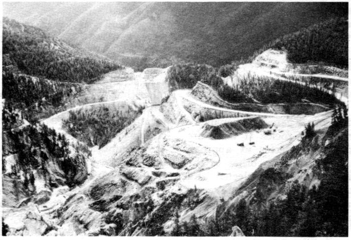
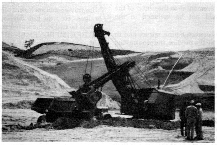
OPEN PIT MINES
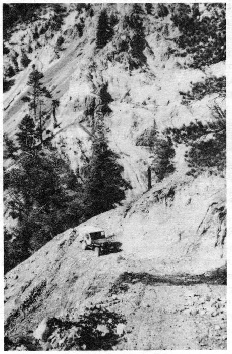
AN ACCESS ROAD IN RUGGED AREA. SUCH ROADS DO NOT AS A RULE COUNT TOWARD PATENT EXPENDITURE.
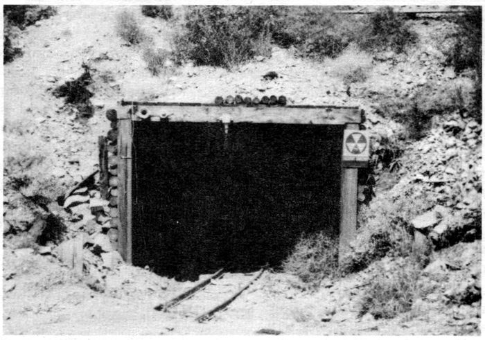
AN ADIT (TUNNEL) LEADING TO EXTENSIVE UNDERGROUND WORKINGS
48Improvements need not be surveyed with the same accuracy as the claim boundaries. Stadia measurements are acceptable, although they should be made with a Philadelphia Rod and distances kept under 500 feet. Small workings may be measured with a Brunton Compass and steel tape, but some point of the working, such as the mouth of a tunnel or cut, must be tied to a corner of the survey using a transit.
Surveys of extensive underground workings may be taken from the claimant’s records if such surveys were executed under the supervision of a mining engineer.
Extreme care should be exercised in entering old workings. In addition to unsafe timbering, they may be poorly ventilated resulting in bad air that could be fatal. Rather than risk an accident, the extent of such workings can be estimated from the size of the dump.
Ties to discovery workings require special mention in view of the directive from the Assistant Director of Technical Services, Washington, D.C., dated March 15, 1978.
Normally the discovery working is on the lode or intersects it and a tie is given along the lode line to the point of discovery, such as the face of the discovery cut, the mouth of the discovery tunnel, the center of the discovery shaft, etc.
However, in the case of blanket veins that are essentially horizontal a presumed lode line or center line need not be shown, and the discovery working may be anywhere on the claim. In such cases, the tie may be given from the nearest corner of the survey and included in the description of that corner, or a right angle tie may be given from a point on the nearest end line.
Where a discovery has been made by a hole drilled on an angle, a bearing and distance will be given from the collar of the drill hole to the point where it intersects the orebody, the collar of the hole will in turn be tied to the section corner or location monument. The description of the hole will necessarily include the verticle angle and the slope distance. This does not apply to Wyoming where State law requires that the discovery be on the center line.
5–6 Placer Claims: Placer claims that do not conform to the legal subdivisions of the public land survey will require a patent survey. When such claims are on unsurveyed land they should be conformed as nearly as possible to the protracted survey.
If the claims consist of a gulch placer they must be contained within the required number of 40 acre tracts according to the number of locators.
Metes and bounds placers are also permissible where conflicts with other mining claims would result if a description by legal subdivisions was used. In such cases, the placer claim must be surveyed around existing claims, so that no conflict exists.
The field notes of a placer claim must also contain a descriptive report as called for in the Code of Federal Regulations, 3863.1–3(c). The information required in the descriptive report was omitted from the 1973 Manual of Surveying Instructions but was contained in the 1947 manual as follows:
“The mineral surveyor is required to make a full examination of all placer claims at the time of survey ... and to file with his field notes a descriptive report ... duly corroborated by one or more disinterested persons and covering the following items:
(a) The quality and composition of the soil, the kind and amount of timber and other vegetation;
(b) The location and size of streams, and such other matter as may appear upon the surface of the claims;
(c) The character, extent, and position of all surface and underground workings for mining purposes;
(d) The proximity of centers of trade or residence;
(e) The proximity of well-known systems of lode deposits or of individual lodes;
(f) The use or adaptability of the claim for placer mining, including the availability of water in sufficient quantity for practical operations;
(g) Works or expenditures made by the claimant or his grantors for the development of the claim; and,
(h) The true position of all known mines, salt licks and salt springs, and mill sites. When none is known to exist on the claim, the fact will be so stated.”
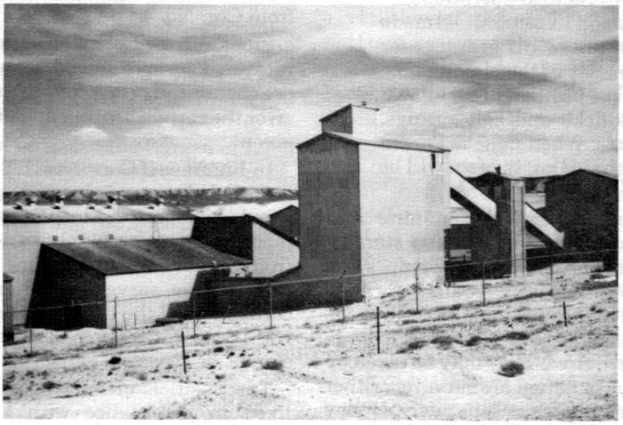
A URANIUM MILL
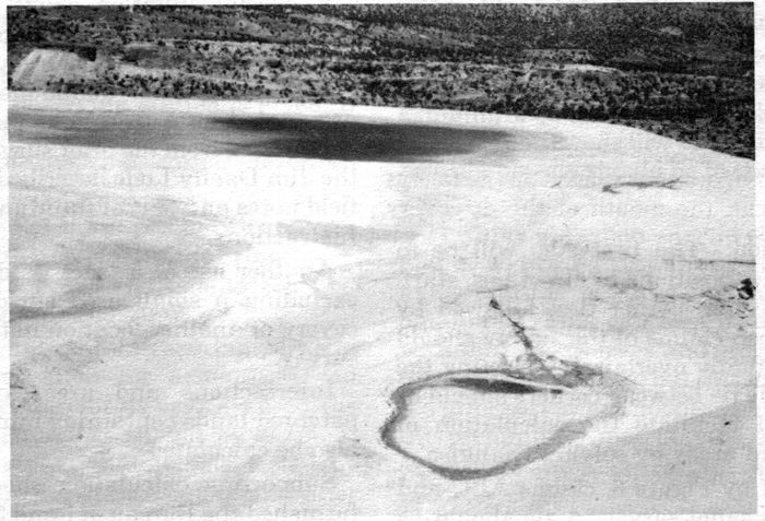
A URANIUM TAILINGS OR EVAPORATION POND
505–7 Mill Sites: Modern day mining and milling require sizable areas for waste storage, tailings and evaporation ponds. Camp sites, including schools, may be required for personnel employed at the mine or mill. Such areas are properly taken as mill sites and a large number may be required. They may be taken by legal subdivisions but often are surveyed, either with lode or placer claims or separately. If they are included in a survey with lodes or placers the survey number includes the letter “B”, while the other claims are designated “A”.
A mill site is not a valid location until it is put in use; therefore, all improvements and projected improvements should be shown. If the ground is to be used for a tailings or evaporation pond, the dam should be shown with its ultimate height and the high water line of the pond delineated by the survey.
It is also important to demonstrate the non-mineral character of the land. In the case of adjoining blanket deposits such as uranium, a few scattered drill holes will show the absence of a mineral deposit.
5–8 Calculation: The first step will be to reduce coordinate positions to direct ties, starting with the section corner ties, followed by short ties between claims of the survey should these claims actually overlap. In selecting the corners to tie, the tie between corners should be given that will facilitate the calculation of intersections and areas by solving triangles.
As illustrated by Figure 6, claims ABC and XYZ are in the same survey. A tie should be given from Cor. No. 1 of claim ABC to Cor. No. 2 of claim XYZ; not between Corners 1 and 3. After these ties have been calculated, they should be checked by calculating closures using the various short ties and section corner ties.
In selecting corners of conflicting surveys to give tie to, the corner within the survey as illustrated in Figure 5 should be selected. The tie to Sur. No. 1235 B lode should be to Cor. No. 1 from Cor. No. 1 of the XYZ lode, or to Cor. No. 2 from Cor. No. 4.
Lines of prior mineral surveys between recovered corners should be reported as correct or substantially correct as approved. If found in error the correct bearing and distance should be given.
In Figure 5, if Cors. Nos. 1, 2 and 4 of Sur. No. 1235 B lode were recovered, lines 1–2 and 4–1 should be reported. Lines 2–3 and 3–4 cannot be reported since Cor. No. 3 was not found. If the tie from Cor. No. 1 is to the same section corner as used in the survey of claim XYZ, then the correctness of the tie should be reported. If Cor. No. 1 was not recovered, the section corner tie cannot be reported.
The position of missing corners should be fixed in accordance with Chapter VI. The remaining lines can then be reported as fixed by the selected method of restoration.
Intersections and areas of conflict should then be calculated by solving triangles. Areas may be calculated using double meridian distances, but intersections should never be calculated by forcing a closure. Intersections may be checked by closure.
A special situation exists where a former survey excluded an unsurveyed location from the patent and the unsurveyed location has subsequently been abandoned. This area is designated as a tract and its boundaries are determined from the prior survey. See Tract A of the Jim Dandy Lode described in the specimen field notes and plat of the Manual of Surveying Instructions.
Another use of a tract is for the purpose of excluding a small area surrounding the discovery of another location not embraced in the survey.
Intersections and areas of conflict with patented lands containing mineral rights must also be calculated.
Supporting calculation sheets need not be furnished the Bureau of Land Management but computer tapes, if available, will be helpful. The BLM can perform the necessary checks by computer.
5–9 Preliminary Plat: The mineral surveyor will find it advantageous to prepare preliminary plats prior to writing the field notes. One plat should provide the base and give all the details of the survey with items of topography and culture secondary. This plat may be prepared in 51pencil or ink at the option of the mineral surveyor. It should be such that legible blue lines copies can be furnished to the Bureau of Land Management along with the notes, and to the claimant. It should clearly state that it is a PRELIMINARY PLAT SUBJECT TO CORRECTION. Some offices of the Bureau of Land Management may request a reproducible copy.
Plats on linen are no longer required. A secondary plat showing the topography and culture in detail will be an aid in writing field notes, but is not required by the BLM.
If drill holes are part of the improvements and are too numerous to show on the base plat, a separate plat is advisable.
5–10 Field Notes: A detailed set of specimen field notes is contained in the Manual of Surveying Instructions which should be followed for form and content. There are, however, some inconsistencies: The title page shown in the manual should not be used. Use current Form 3400–11, as supplied by the Bureau of Land Management.
The locations should be listed in the same order that they are described in the field notes, thereby serving as an index.
The field notes begin with a description of instruments and the mean results of the solar or other azimuthal observations. The latitude and longitude of the observing station is given. If this is not at a corner of the survey, the latitude and longitude of the first corner described should be given, thus:
At Cor. No. 1 of the Jim Dandy lode, identical with Cor. No. 1 of the Prince Lode of this survey, in latitude 38°45′ N, and longitude 106°20′ W.
A description of the measuring devices follows the observation for azimuth. If an electronic distance measuring device is used, the name and serial number should be given. It should also be stated that it was tested by measuring a known distance before and after the survey, and found correct.
Corner markings as shown are acceptable for stone monuments or wood posts. When a monument with a cap is used, the following marks would be more suitable:
The X has been omitted from the inscription on bearing trees which is incorrect, unless the measurement was taken to the center of the tree. It should be included, thus: JD–1–20220A XBT or JD–1–PRI–1–20220A XBT if the full complement of marks are shown.
When giving intersections only the distance to the line being intersected is given for claims of the survey as the distance to the corner on the line being intersected will be given later in the notes when that claim is described.
When the intersection is with a prior mineral survey or unsurveyed location, the distance should be given to a corner within the claim, or the same corner each time the line is intersected. See the intersection of lines 2–3 and 3–4 of the Protector lode with Sur. No. 20100 Silver lode.
Note that intersections are given to the nearest hundredth of a foot, while distances to items of topography and culture are to the nearest foot. Distances given in ties including bearing objects should be to the hundredth of a foot.
The area statement should show all conflicts and be so arranged that any exclusion may be made and the net area to be patented readily obtainable. This can best be done by starting with the oldest survey and progressing through the various conflicts, but this may not hold true if a prior survey has not been patented. A copy of the preliminary plat may be used to color the exclusions and make certain that all have been properly stated.
Under the heading “LOCATION” it is important to state that the survey is identical with the location as marked on the ground or to state the differences. When describing corners, ties should be given to location monuments when 52they are not identical. See the Prince Lode in the specimen notes.
Only those improvements counting toward the $500 expenditure are to be given under the heading “IMPROVEMENTS.” In such case, the discovery working should be numbered one. If there is no discovery working, but a discovery point is called for, it may be described and labeled No. 1. Any improvements that do not count toward the patent expenditure or those that have been made by others should be listed under “OTHER IMPROVEMENTS.”
“OTHER CORNER DESCRIPTIONS AND SUPPLEMENTAL DATA” is a very important part of the notes since it contains the report on prior surveys. Do not report another mineral surveyor in error for minor discrepancies in bearings and distances. The phrase, “substantially correct as approved” may be used, or “approximately correct as approved.”
Under “MEMORANDUM” differences with the calls given in the location certificate may be explained, as well as typographical errors in the certificate.
Because of corrections that may be required by the Bureau of Land Management it is well to prepare a preliminary draft of the notes for submitting to the BLM. The final typing, in triplicate, can be accomplished after all differences have been resolved.
5–11 The field notes and preliminary plat should be sent to the State Office of the Bureau of Land Management by either certified or registered mail with a return receipt requested. A copy of the preliminary plat may also be sent to the claimant with a copy of the letter of transmittal to the BLM.
As a rule, the returns of mineral survey should remain confidential until the survey is approved. The mineral surveyor should maintain this confidence. If a demand is made of the Bureau of Land Management under the Freedom of Information Act, then the preliminary nature of the work should be clearly stated to the recipient.
5–12 Preliminary Examination of Field Notes: The examination of the survey may begin by reading the notes and comparing them with the preliminary plat. As a general rule the mineral surveyor will write the notes from the plat. If inconsistencies appear, they will usually be typographical errors in the notes. However, this must be verified by the mineral surveyor.
Particular attention should be given to the format as shown by the specimen notes of the Manual of Surveying Instructions, 1973.
Corner descriptions must be proper and adequate. Ties should agree with the preliminary plat. Discovery points must be on public domain.
By posting the mineral survey to the connecting sheet or similar plat with a pencil, conflicts and other surveys within 100 feet may be determined.
The names of the locations must agree with those given in the location certificates. End lines must be parallel and the statutory length and width cannot be exceeded. Improvements should be fairly valued; the discovery point should agree with that given in the location certificate; common improvements should be correctly described and all claims benefiting therefrom should share equally. The geographic position of one corner of the survey must be given. Under “LOCATION” the correct section, township and range should be given.
It should be stated that the survey is identical with the location as marked on the ground. If not identical, it should be so stated, and ties to location monuments must be given.
The section corner tie may not exceed two miles from the nearest corner of the survey. Intersections with the lode lines and distances along the lode line to the discovery point must be given. (Exception: bedded deposits.) The bearing of the lode line, if different from the side lines, must be shown on the plat.
Reports on former surveys should be checked against the notes of these surveys. The bearings and distances of lines of former surveys that are wholly within the survey or a claim of the survey must be given.
The area statement should be reviewed to make certain that conflicts are given in chronological order and that any exclusion or combination of exclusions can be ascertained.
The magnetic declination must be given. The beginning and completion dates of the survey must be given. The survey cannot begin prior to the date of order.
5–13 Calculations: Calculations may begin by computing the solar observation; the declination should be verified, also the latitude and longitude. The survey should close. Lode claims should have a perfect closure; irregular claims 53such as placers should close within 0.5 feet in 1,000 feet. The statutory length and width of lode claims may not be exceeded. The width at right angles to the lode cannot exceed 300 feet on either side. The section corner ties within the survey may be checked by closure, using short ties between claims of the survey; each section tie and short tie should be used in at least one closure. The closures should not exceed 0.5 feet in 1,000 feet. (It may be necessary to report the longer section ties to an even number of seconds such as 15″.)
The section corner ties should be checked against those given in conflicting surveys using the short ties given to these claims along with the reported boundaries. Such closures, depending on the length of the ties, should not exceed 10 feet. If they do exceed this distance, the correct tie should be given under “OTHER CORNER DESCRIPTIONS AND SUPPLEMENTAL DATA” provided that the corner from which the tie was made was recovered. If the corner was not found, the error cannot be reported. The same applies to short ties between conflicting surveys, but the allowable error should be within the 1:2000 limit. If more than one section corner is tied, the bearing and distance along the section line should be checked, reporting any appreciable difference under “OTHER CORNER DESCRIPTIONS AND SUPPLEMENTAL DATA.”
The bearings and distances of intersections with lines of prior surveys should be correctly stated. This may be verified by closure, but if a closure of 1:2000 is not obtained, it will be necessary to calculate the intersections by solving triangles, to determine where the error lies. Such intersections should check with 0.2 feet.
From the intersections obtained, the areas of conflict should next be calculated. If the final plat is drawn at a scale of 1″ = 200′, conflicts with a conflict, i.e. double conflicts, may be checked by dividing the area of conflict into triangles and scaling the base and altitude. The mineral surveyor, however, must actually calculate these areas. All areas should check within 0.02 acres.
5–14 Platting Procedures: The lines of the survey are shown heavier than those of former surveys so that the locations of the survey will stand out.
All corners recovered or set are shown with a circle to distinguish them from corners not found.
The lode line is shown as a broken line and if parallel to the side lines, only the distance each way from the discovery point is shown; if not parallel, then the bearing must also be shown. The bearings and total distances of the lines of the survey are shown heavier than those of conflicting surveys and intersections along such lines.
The names of the locations of the survey shall be shown in vertical capital letters and be larger and heavier than those of conflicting surveys, which shall be shown in upper and lower case.
Distances to intersections along the line of survey should be shown before the intersection. Intersections with lines of prior surveys are given preference over topographic items. Where space will not permit the showing of a distance, it may be placed above a prior distance, with the first distance shown next to the line.
Bearings of conflicting surveys are usually shown in the direction of the line between corners as surveyed; i.e., from corner 1 to corner 2, etc. Bearings and distances in all cases should be shown along the line they pertain to. Bearings of ties should be shown in the direction from the corner from which the tie was made. Ties will be shown with light broken lines. If there is not room to place the bearing and distance next to the line, it may be placed on an arrow.
All bearings and distances shall be in slant lettering. Witness corners are shown with a circle and labeled W.C. Cor. No.——, provided they are on a line of the survey. If not on line they are shown with a tie.
Surveyed section lines and surveyed subdivision of section lines are shown by solid lines; unsurveyed lines are shown with a broken line.
Designation of subdivisions, Township and Range should be vertical letters. The discovery workings and all other improvements are labeled; they may be numbered to agree with the field notes. It is not necessary to give a tie to the improvements, except a common improvement tunnel, shaft, etc.
The title block shown on the specimen plat in the Manual of Surveying Instructions should be closely followed. While the plat scale is usually 200 feet to an inch, it may be smaller to accommodate several claims, provided the necessary data can be shown. Where more than 54one sheet is necessary, only the final sheet need have a title block. All sheets should carry the survey number and state that it is sheet No. —— of —— sheets.
When the plat is finished it should be compared with the field notes. This can be done by two people, one reading the notes and the other following the plat; or two people can independently do the comparing. If rough draft notes were submitted by the mineral surveyor, they should be returned to him with the corrections for final typing, and execution of the “Certificate of Surveyor,” current Form 3860–7.
The final typing will consist of the original set on current Form 9180–21, which is bound on the left, with two carbon copies on current Form 9180–22, which is bound at the top; this may vary with state office practice. (Xerox or similar copies are not acceptable.)
5–15 Approval of Survey: The lower portion of current Form 3860–7, “Certificate of Surveyor,” contains the certificate of approval to be signed by an officer of the Bureau of Land Management. This may be the State Director or he may delegate this authority to the Chief, Division or Branch of Cadastral Surveys, for that state. He should also sign the certificate of transcript for the two carbon copies.
Current Form 3860–8, certifying $500 expenditure, must also be executed by the above authorized officer and attached to the copy of the field notes that will be filed with the application for patent. If $500 has not been expended, it is the claimant’s responsibility to complete the work and have the certificate executed and filed with the BLM Branch of Land and Minerals (land office) prior to the expiration of the period of publication.
If the survey has been properly executed and shows the facts, the State Director cannot refuse to approve the survey because he feels that the claim is invalid. (See 57 I.D. 63, Raymond E. Johnson, 1939.)
The original field notes and plat are then placed in the open files of the Bureau of Land Management. The location certificates are to be included with the notes. The two transcripts of the field notes together with two cloth backed copies, one of which has been waterproofed for posting, and a plain paper copy of the plat, will then be furnished the claimant. An additional copy for posting will be furnished if a mill site is included in the survey.
One set of the notes and one copy of the plat will be used to support the application for patent. Current Form 3860–4, is used to notify the State Branch of Land and Minerals and the Director, Bureau of Land Management, of the approval of the survey and includes a sketch of the survey. This form is also used to notify the Regional Forester if the survey is on a National Forest.
The mineral surveyor should be notified by letter of the approval of the survey and he should be furnished a paper copy of the plat and requested to examine it at his early convenience. (See appendix for copies of forms.)
5–16 Cancellation of Surveys: A patented mineral survey may never be cancelled. An unpatented mineral survey may be cancelled only after the claim has been declared null and void or relinquished by the claimant; then it need not be cancelled until it is necessary to do so to accommodate an entry or administrative action. It can be cancelled only by the officer of the Bureau of Land Management authorized to approve mineral surveys.
In the past, claims could be declared null and void only after a successful contest had been brought against the claim. After October 21, 1979, claims must be recorded with the Bureau of Land Management within 90 days of the location date or they will automatically be deemed to have been abandoned and void.
The procedure is as follows: When the Chief, Branch of Cadastral Surveys of the State Office is notified that a claim has been declared null and void, a notation to that effect should be made on the plat of survey (or if the plat is in the archives, it may be made on the card index). No further action is necessary at this time; the survey is not cancelled.
Cancellation becomes necessary if an entry or administrative action, including a survey or resurvey, involves the land embraced in the mineral survey. Current Form 3860–4, Approval of Mineral Survey, may be used to cancel the survey and to notify the Director of the Bureau of Land Management and any other interested parties substituting the word “cancelled” or “cancellation” for approval or it may be by memorandum.
Should a supplemental plat be required to lot the area embraced in the survey, a certified set of the field notes of the survey and the mineral 55survey plat should accompany the plat to Washington, as they do not have the field notes of unpatented mineral surveys. The field notes of the cancelled survey becomes the basis for the new lot designation. The Director’s memoranda of July 14, 1958 and November 17, 1960, cover the subject.
5–17 Unapproved Survey: Occasionally an order for survey will be cancelled and it is not known how far the mineral surveyor has proceeded with the field work and what corners have been set and marked. In no case should the corners be removed as they still serve as corners of the location which may be perfectly valid. The survey number should not be re-used inasmuch as it will serve to identify the corners on the ground.
5–18 Additional Notes and Certificate on Plat: In the past, additional notes were sometimes prepared from the existing record along with amendment to the plat in red ink and accompanying certificate when there was an omission of a conflict with an agricultural or other patent, a pending entry or an adverse claim.
For example: A survey was approved without showing the conflict with a legal subdivision that had been included in a preemption homestead. The subdivision was protracted on the mineral survey plat from the township survey, based on the section corner tie given in the mineral survey, intersections given with the boundaries of the subdivision, and an area of conflict calculated. All plats were recalled for the amendment. The additional notes were written, in triplicate, by the cadastral surveyor, to show only the lines of the mineral survey involved in the conflict, giving the intersections. The area statement was rewritten to the extent necessary to show the area of conflict.
The same procedure was followed if an adverse claim was to be excluded on the basis of the description in its location certificate. Red ink was used on the plats to distinguish the amendment, but black ink was used if the certificate specifically stated the extent of the amendment.
Most offices now resolve the above situations solely through a memorandum process.
5–19 Amended Surveys and Amended Plats: This is occasioned by an error in the original survey that is not discovered until after the survey is approved, or for the same reasons listed in 5–18 above, where the amendment cannot be made from the existing record and additional field work is required. The claimant may also request an amended survey. The claimant bears the cost. Example: In Survey No. 19202A-Am. Colorado, the wrong claim was included in the survey. The correct claim was included in the amended survey which covered the same ground.
5–20 A new survey is required if the claim boundaries are changed by amendment after the original survey is approved. Section 10–62, page 226 of the Manual of Surveying Instructions states: “An amended survey must be made in strict conformity with, or be embraced within the lines of the original survey.” A new survey is also required where the claim has been abandoned and relocated by another.
5–21 Expenditure of $500 After the Survey is Approved: Supplemental notes based on a supplemental order for survey, either to the original mineral surveyor or another mineral surveyor, must be submitted and attached to the original field notes. The supplemental notes must contain a full description of all improvements. If the additional expenditure applies only to one claim of a group, only the expenditures of that claim need to be recited. Current Form 3860–8, Certificate of Expenditures, must be executed and attached to the claimant’s copy of the notes for filing with the patent application.
5–22 If patent is applied for long after the survey was approved, a statement from the Chief, Branch of Cadastral Survey, will be required by the Branch of Land and Minerals to the effect that the plat correctly shows all conflicts, or listing the later surveys with which a conflict exists.
If later surveys did not exclude the survey in question, the plat will be returned by the Branch of Land and Minerals for amendment, and amended notes will have to be written. If the applicant is not the same as the claimant shown at the time of the survey, he is entitled to use the survey provided he can show a chain of title. If he does not have the necessary plats and notes, the Branch of Cadastral Survey will supply him with the necessary copies. The claimant bears all costs.
5–23 Occasions have arisen where a claim or survey excluded from the patent is later abandoned. A supplemental application for patent 56may be made for the excluded ground. The procedure to be followed is the same as given in 5–22 above. Copies of the plats, including those for posting and the notes must be furnished the applicant.
5–24 Patent Applied for in Two Parts: When only a part of the claims of a survey are applied for and patented, and later application for patent is made for the remaining claims, a copy of the plat, or if the plat is in more than one sheet, the sheets showing the claim, must be posted, and a copy, together with a transcript of that portion of the field notes pertaining to the claims, filed with the Branch of Lands and Minerals at the time the supplemental application for patent is made. If not all sheets of the plat are used, be sure that the ones used show all ties and pertinent information.
6–1 Restoration of Lost Corners: There is no hard and fast rule for establishing missing corners of mining claims. The method should be selected that will give the best results, bearing in mind that end lines should remain substantially parallel. Ordinarily, the mineral surveyor should not remonument a restored corner; at least, it should not be done without the full knowledge and approval of the owner. A cadastral surveyor may remonument a corner if it is necessary to delineate the boundary between public and private land. As with all lost corners, the corner of a mineral survey should be reestablished from the best available evidence and in such a configuration that will place the lines as nearly as possible to their original position. The ties to bearing trees and objects should be used first. In fact, if such accessories are present the corner is not lost.
Second in order of preference is the use of short ties to or from adjoining surveys. A word of caution in using other mineral survey ties: In Colorado, and presumably in other states, there was a period where the short ties to conflicting surveys were calculated through the section corner tie. Such calculated ties should not be used. This period is not exactly known, but it ran approximately from 1898 to April 28, 1904. If a report of other surveys was contained in the field notes, the ties were not calculated. At the end of this period, it can be determined if calculations were used. It is not so easy to distinguish between the methods of survey at the beginning of the period since it was not customary to report on other surveys. In any event, the short tie should not be used unless the corner tied to (or from) is recovered. If no corners can be found, the section corner tie may be used, but it is the tie of last resort. In such cases, all lines are shown as approved.
In Figure 7, several conditions are illustrated. In situation A, only one corner is recovered, no other corners or accessories can be found nor are there any short ties available. In the absence of further collateral evidence, the three missing corners must be reestablished at record bearings and distances from the recovered Corner No. 1.
In situation B, Corners Nos. 1 and 2 can be recovered. Lines 4–1 and 2–3 should be shown at the record distance, regardless of the length of line 1–2. The bearings of lines 4–1 and 2–3 may be the record bearing or at the same variation from the record as line 1–2. If this was a rectangular claim, then the bearing of the missing lines probably should be at right angles to line 1–2, unless this would give a distorted relationship between the claim and the workings on it, particularly the discovery. Line 3–4 should be shown parallel and of equal length to line 1–2.
In situation C, Corners Nos. 1 and 4 are recovered. Line 2–3 should be shown parallel and of equal length to line 4–1, if the record was such. Lines 1–2 and 3–4 should be shown at the record distance, and at the record bearing or with the same variance found for line 4–1.
In situation D two corners are again recovered, but they are opposite corners, Nos. 1 and 3. Missing Corner Nos. 2 and 4 can be restored by using the Grant Boundary method. See Section 5–44 of the Manual of Surveying Instructions. They can also be shown at the record bearing and distance from Cors. Nos. 1 and 3, using either the end lines or side lines, with the resulting missing lines being the bearing and distance required to close. The method selected should restore the lines in the best relative position to the workings.
In situation E, three corners, 1, 2 and 4, are recovered. Line 2–3 is shown parallel and of equal length to line 4–1. Line 3–4 is shown parallel and of equal length to Line 1–2.
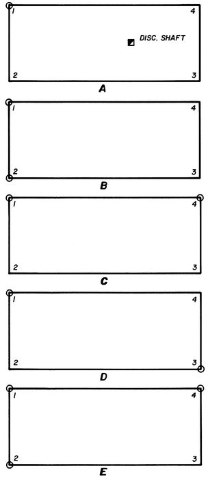
FIG. 7
59In restoring corners of irregular claims, such as metes and bounds placers, the broken boundary (non-riparian) or the Grant Boundary method should be used. It may also be applied to lode claims if the above methods do not give adequate results.
In reestablishing corners of a block of claims, the rules of proportionate measurement may be applied. In Figure 8, missing Corner No. 2 of claims E, F, G and H can be restored by double proportion. Missing Corner No. 1 of claims A and B may also be restored by double proportion; since there is no corner beyond this corner, the record distance from Corner No. 2 would have to be used in this direction. Corner No. 1 might also be established at the record bearing and distance from Corner No. 2, or lines 1–2 of claims A and B could be made parallel and of equal length to line 3–4 of claim A. Since missing Corner No. 3 of claims B and D is on an end line, single proportionate measurement might be considered. See the Manual of Surveying Instructions for proportionate methods, pp. 134–136.
6–2 Township Resurveys with Mineral Surveys: Prior to field work, all unpatented mineral surveys embracing claims that have been declared null and void should be cancelled, leaving only valid existing claims and patents to be segregated. Restoration of missing corners should only be made where they are necessary to control the boundaries between private and public land, including the boundaries between public land and unpatented valid mineral surveys. Segregation surveys of unsurveyed mining claims may be requested to accommodate administrative actions. If possible, the owners of the mining claims should be advised of the resurvey and given an opportunity to express their opinions as to the position of missing corners.
6–3 Mineral Segregation Surveys: Sections 7–39 to 7–44 inclusive, of the Manual of Surveying Instructions adequately covers this subject. Segregation surveys are not undertaken unless there is a need for them arising from administrative action involving the adjoining land. Very often it will be necessary to make the survey within the boundaries as they are marked on the ground due to inaccuracies in the location survey. The early township surveys in California often segregated unsurveyed mining claims showing them on the township plats without supporting field notes. Resurveys of such segregations may be required based on the evidence found in the field.
6–4 Supplemental Plats: When supplemental plats are required segregating mineral surveys, all such surveys must be segregated. Again, it is desirable that mineral surveys embracing invalid claims be cancelled. The need to lot a cancelled mineral survey will also require a supplemental plat.
6–5 Correcting Errors in Patented Mineral Surveys: As a general rule, the record of a patented mineral survey should not be changed or amended. When such errors are discovered, a pencil notation on the index card and/or on the field notes may be appropriate. Reported errors generally stand on their own merit and are contained in the field notes of the reporting survey.
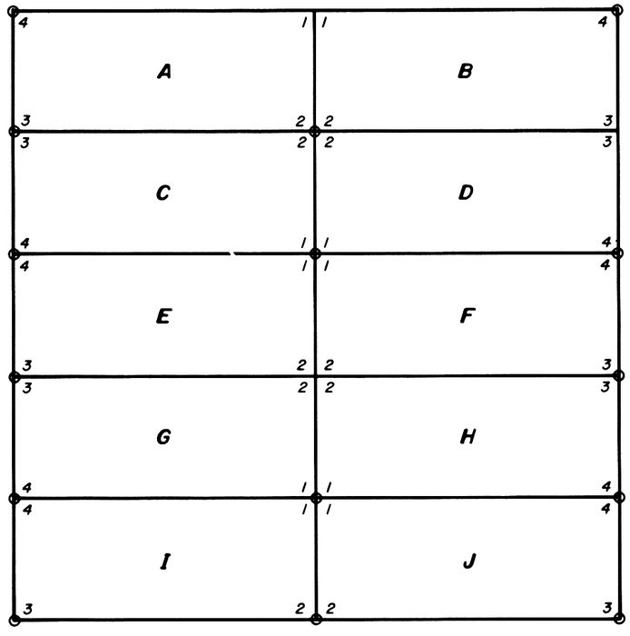
FIG. 8
ADIT: a horizontal entry into a mine with one opening to the surface, commonly and erroneously called a tunnel. (A tunnel is open at both ends.)
ALLUVIUM: unconsolidated sedimentary deposit, e.g. stream bed of sand and gravel.
ANTICLINE: a convex fold in sedimentary beds of rock (opposite: syncline).
APEX: top of a vein or lode.
ASSAY: a test to determine the quantity of mineral in a given sample. May be by a miniature smelting process in the laboratory, called a fire assay; or by use of chemicals, called a chemical or wet assay.
BACK: the roof of a horizontal opening such as an adit, drift or crosscut.
BONANZA: a rich body of ore.
BEDROCK: uppermost layer or segment (portion) of rock in place.
BREAST: the end, heading or working face of an adit, drift or crosscut.
CHIMNEY: a vertical ore body, tubelike in shape.
CHUTE: (ore) chute for transferring broken rock in a mine; usually from a stope to a haulage passage.
COBBING: hand sorting of ore.
COLLAR: top of a shaft or winze; the timbers or concrete at the upper end.
COLOR: a particle of free gold.
CONCENTRATOR: a device for separating and concentrating mineral from rock by mechanical means.
CONTACT: the meeting of two geologic formations.
CONTACT VEIN: a vein along the contact.
COUNTRY ROCK: rock surrounding a vein or lode, extending throughout the area.
CRIBBING: a wall of light timbering between heavy supports at either vertical or horizontal mine working.
CROSSCUT: a horizontal opening such as an adit driven across the vein or ore body.
CUT: an open working driven into a hillside to expose underlying rock.
DIKE: a vertical or near vertical fissure filled with volcanic rock.
DIP: the vertical angle a vein or sedimentary bed makes with a horizontal plane.
DRIFT: a horizontal opening (such as an adit) driven along the vein.
FACE: the last working end of an adit, drift, crosscut or cut (same as breast).
FAULT: A dislocation along a crack in the earth’s surface (may be horizontal, vertical or a combination of both); a failure along a line of stress; usually associated with earthquakes, but movement may be slow.
FISSURE: a crack in the earth’s surface; if filled with vein material becomes a fissure vein.
FLOAT: a piece of ore detached from a vein or lode, lying loose, not in place.
FLOOR: the lower surface of a mine working, i.e. the floor of a drift.
FLUME: a device for conveying water.
FOOT WALL: the lower side of an inclined vein in country rock.
GANGUE: the matrix of the ore composed of worthless material.
GLORY HOLE: a large funnel-shaped excavation extending to the surface, the material being drawn from the bottom through a tunnel.
GRIZZLY: a grating, usually made up of mine rails, over an ore bin for the purpose of diverting large rocks or boulders.
62GRUB STAKE: financing a prospector to share in his findings.
HANGING WALL: the upper wall of an inclined or dipping vein.
HEADING: same as breast or face of a working.
HORSE: a mass of country rock found in an ore deposit.
INCLINE: a sloping shaft, drift, crosscut or tunnel.
LEAD: same as lode, (pronounced “leed”)
LEDGE: same as lode.
LEVEL: one of a series of drifts or crosscuts, one above the other, in a mine.
LODE: a mineral deposit in place, including veins.
LODE LINE: presumed course of the vein or lode at the surface.
MATRIX: the worthless material in an ore deposit surrounding the valuable minerals.
METALLURGY: the art of separating minerals from the gangue in ores; also combining metals to form alloys.
MINE: an excavation for the purpose of extracting mineral.
MINERAL: an inorganic substance contained in the earth.
MUCK: broken rock in a mine.
OPEN CUT: a drift or crosscut that does not enter cover.
OPEN PIT: a large excavation beginning at the surface.
ORE: a mineral deposit that can be mined at a profit; includes the mineral itself and the gangue.
OUTCROP: that portion of a mineral deposit appearing at the surface.
PLACER: a mineral deposit of unconsolidated particles.
QUARRY: similar to an open pit, usually applied to building stone.
RAISE: a vertical or inclined shaft driven upward from an underground working.
REEF: Australian word for lode.
ROOF: the ceiling of a working, as the back of a drift.
ROYALTY: a percentage of the earnings or product paid an owner.
SHAFT: a vertical or inclined opening sunk from the surface to gain access or to explore an orebody.
SHIFT: a period of working time.
SKIP: an ore bucket used to hoist ore and muck in a shaft.
SLUICE: a trough with riffles for separating placer gold.
SMELTING: the reduction of metals from the ore in a furnace.
STOPE: usually a room where the ore is mined.
STRIKE: the horizontal direction of a vein.
STULL: a timber in a mine, usually a post.
SUMP: a low place in a mine for collecting water, such as the bottom of a shaft.
TAILINGS: the waste rock from a mine or mill.
TUNNEL: technically, a horizontal passageway open at both ends, but in mining used to designate any horizontal passageway driven for the development or discovery of an orebody.
VEIN: a fissure or crack in surrounding rock filled with mineral.
WINZE: a vertical or incline opening sunk from an underground mine working; an underground shaft.
APPENDIX #1
APPENDIX #2
APPENDIX #3
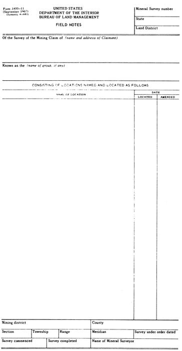
APPENDIX #4
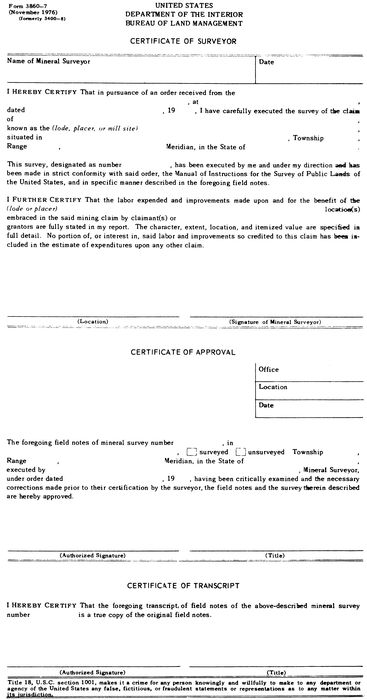
APPENDIX #5
APPENDIX #6
APPENDIX #7
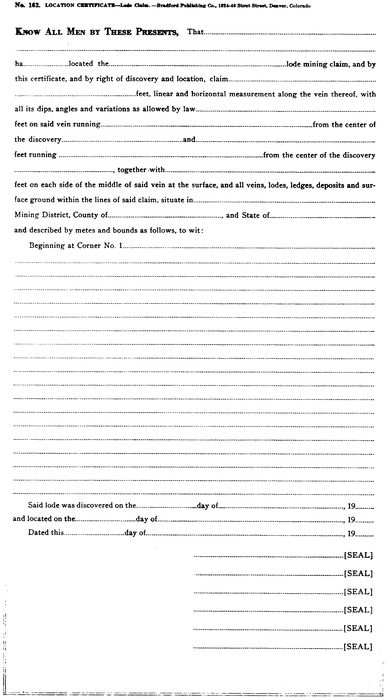
APPENDIX #8
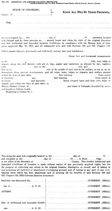
APPENDIX #9

APPENDIX #10
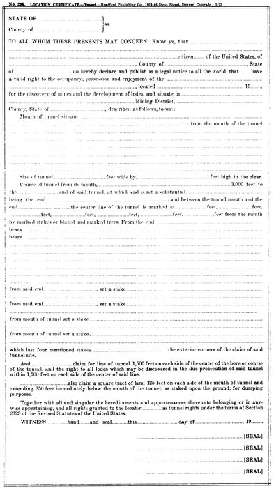
APPENDIX #11
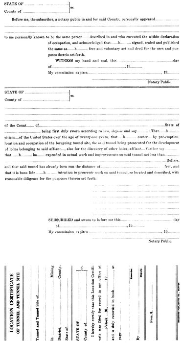
APPENDIX #12
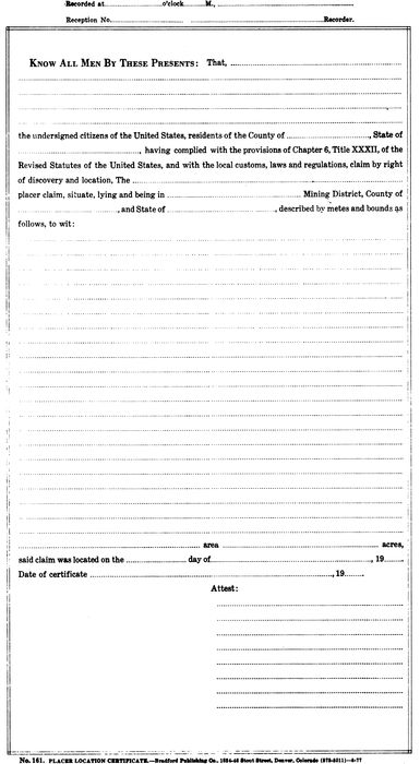
APPENDIX #13
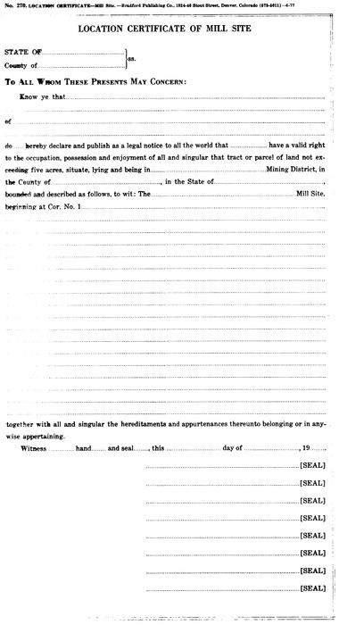
APPENDIX #14
First number indicates chapter. Second number indicates section of that chapter.