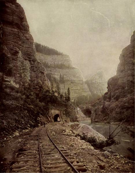
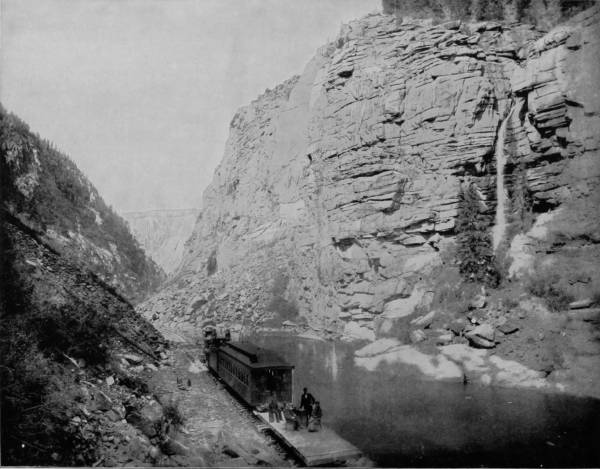
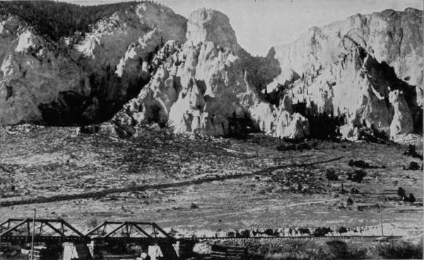
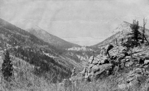
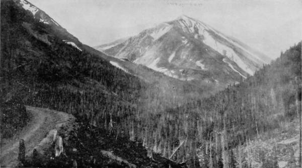
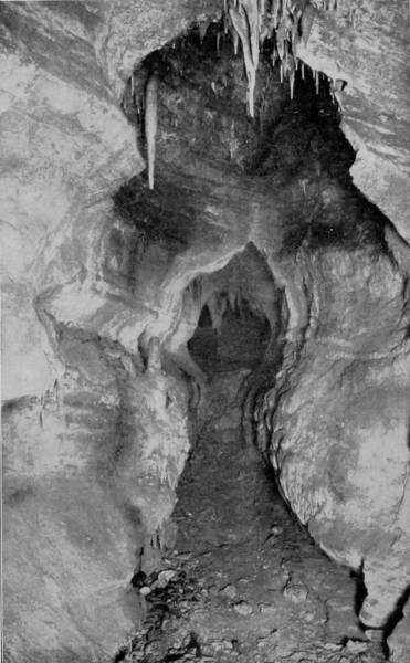
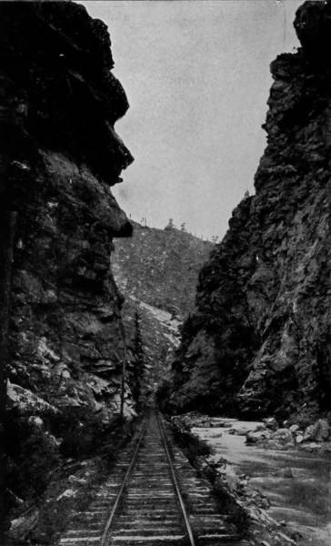
SHOSHONE TUNNEL, CAÑON OF GRAND RIVER.
The Engravings in this volume were made from original photographs, and are specially protected by Copyright, and notice is hereby given, that any person or persons guilty of reproducing or infringing the copyright in any way will be dealt with according to law.
| PAGE | |
| The Sublimely Grand and Incomparable Scenery of America.—Picturesque lands and places of other countries—Engagement of a corps of Photographers—Equipment of our Camera car—A trip to the Rocky Mountains—Hasty resumé of the pictorial districts visited—From summer climes to Alaska’s glacial shores—Excursions by car, stage, donkey and foot—Educational benefits of the tour—The work one of patriotic incitement, | 6-16 |
| CHAPTER I. | |
| Among the Wild Scenes of Colorado.—Through the Gateway of the Rockies—Wondrous visions—In the cañons of Bear Creek—Colossal cleavage of Clear Creek—A submerged forest of petrified trees—Among the clouds—Devil’s Gate to Bridal Veil Falls—The Loop at Georgetown—Silver Flume—Cornucopias of silver—Over the switchback to silver lands—Between towering crags—Terrific convulsions of nature—Dome Rock—Invocation of surging waters—The highest point ever reached by rail—A marvelous tunnel—An astounding view—Through Boulder Cañon and into North Park—A tour of Estes Park—Visits to Long’s Peak and Bald Mountain—Wild game in savage haunts—Climbing the American Matterhorn—Bewildering prospect from the “key-hole”—A trip to Table Mountain and examination of the glaciers—A journey through Middle Park—A story of Grand Lake—Away up on a dizzy brink, | 17-40 |
| CHAPTER II. | |
| Manitou the Mighty.—Twin cities that sit at the feet of Pike’s Peak—A spell of wonderment wrought by the eccentricities of nature—God’s acres of tumultuous stone—The story of Major Pike’s discovery—The first ascent of Pike’s Peak—The cog-wheel railroad to the summit—A trip to cloud-land—The wonderful panorama to be surveyed from the peak—A battalion of mountains in review—A storm on the mountain—Ute Pass to Cascade Cañon—Rainbow Falls and Grand Caverns—From the Cave-of-the-Winds down William’s Cañon—Garden of the Gods—Nature in wild riot of gruesome forms and sublime creations—Through Glen Eyrie and Monument Park—Witcheries that confound imagination—A visit to Cheyenne Cañon—Seven Falls—Entrancing hymns of nature—Legends of the Manitou, | 41-62 |
| CHAPTER III. | |
| Grand Cañons of Western Rivers.—A land of graceful, deep-leaping waterfalls—A park of marvelous petrifactions—Buena Vista, the beautiful view—Sportsmen’s Paradise—Through Hagerman Tunnel to Mount of the Holy Cross—Grand River Cañon—Sixteen miles of natural wonders—The Grand Cañon of the Colorado—Major Powell’s Trip from Green River to Yuma—A perilous journey richly recompensed—Flaming Gorge and Horseshoe Cañons—Tossed by dangerous rapids into halls and temples carved by Titans—In a chasm 7,000 feet deep—Caverns of Enchantment and walls flecked with rainbow colors—A borderland of phantasy—Cave habitations of an extinct race—Story of the hunted refugees—Vermilion Cliffs, Temples of the Virgin and Marble Cañon—Glories that thrill the heart with ecstasy, and fill the soul with reverence, | 63-84 |
| CHAPTER IV. | |
| Marvels of the Great Desert.—Magnificence of the scenery along Grand River—From mountain to plain—Beautiful Provo Falls—Our great inland sea—Fruitfulness of Salt Lake Valley—A wall of mountains around Salt Lake—Shores of ancient Lake Bonneville, now America’s Dead Sea—Islands of Salt Lake—The Mormon City and how it was founded—Red Butte and Emigrant Cañons—Garfield Beach and Giant’s Cave—Echo and Weber Cañons—Valleys of marvelous diversity—The Devil’s Slide and the Witches’ Playground—Beaver River Gulch and scenic wonders about Ogden—A trip across the creviced lava fields of Idaho—The magnitude and awfulness of Shoshone Falls—A second Niagara in the desert—Twin, Cascade and Bridal Veil Falls—A realistic description of this incomparable wonderland, | 85-112 |
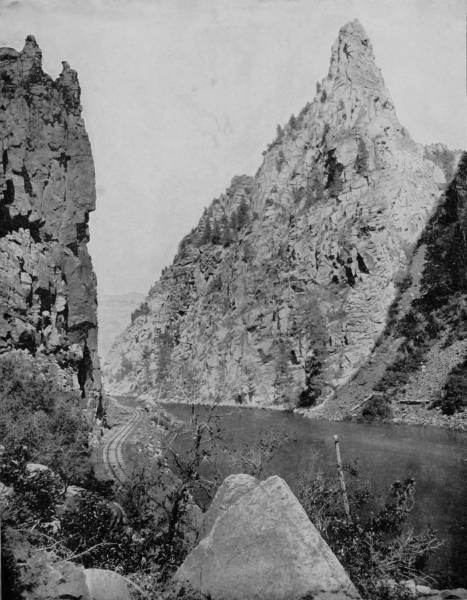
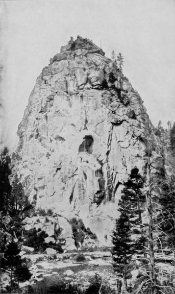
CURRECANTI NEEDLE, ON CURRECANTI RIVER, COLORADO.
| CHAPTER V. | |
| PAGE | |
| Over the Heights and into the Deeps of Wonderland.—Through the portals of Black Cañon—Astounding views along Gunnison River—Chippeta Falls and Currecanti Needle—A sight of Fossil Ridge and the Cone of Ouray—The trip over Marshall Pass—The terrible mightiness of the Royal Gorge—Hanging Bridge—The tempestuously craggy route between Ironton and Ouray—Marvelous engineering skill—Weirdly savage Animas Cañon—A railroad balcony 1,500 feet above the river—A flight high as the eagle’s—Kit Carson’s Exploits in Cañon de Chelle—The awesomeness of Toltec Gorge—A parade-ground of Nature’s Idols—Looking down upon the world—Blooming flowerland of San Luis Park—Down through Comanche Cañon—A side trip to ruined pueblos and cliff dwellings in New Mexico—Something about an extinct race—The Grave of Kit Carson—Some history of remarkable interest—The ancient Pueblo Indians and their dwellings—Magnificent ruins of the Casa Grandes—Montezuma’s Palace—Evidences of a walled and towered city—Prehistoric man in New Mexico, | 113-152 |
| CHAPTER VI. | |
| Across the Cactus Desert into California’s Golden Land.—The Zuni plateau—Approach to the Grand Cañon of the Colorado—A scene of overpowering sublimity—A Mohave Village—Death Valley—From sterility to fertility—Monterey and its attractions—A visit to the Lick Observatory and the great telescope—In and around San Francisco—The Seals’ Sporting Grounds—The Mariposa grove of big trees—A trip through the wondrous valley of the Yosemite—A stage journey through a region of incomparable grandeur—Wonders and curiosities of the Yosemite—Falls of extraordinary beauty and peaks of amazing height—The Calaveras big trees—The journey from Ogden to California—Across the great American desert—Indian camps along the way—The Humboldt Palisades—Lake Tahoe—The sad story of the Donner party—Along the lofty crest of American Cañon—Giant’s Gap and Cape Horn—The beautiful Sacramento Valley, | 153-192 |
| CHAPTER VII. | |
| Our Journey Through Picturesque Regions of the Northwest.—Winter in vernal climes—A plunge into the Siskiyou Range—the light that crowns Shasta’s head—Soda Springs that titillate the palate like champagne—Exquisite Mossbrae Falls—A glorious sight from Portland’s heights—Lofty peaks of the Cascade Range—A trip up the Columbia—Pictorial shores that lend charm to interest—Its dales, palisades and waterfalls—A panorama of extraordinary grandeur—A side trip to Crater Lake—Traditions of the Klamath Indians—The most marvelous body of water on earth—Indian legend of creation, the flood and repeopling of the world—Wondrous visions on the lake—The core of a great volcano—A Siwash legend of the Saviour—A voyage to Alaska—First sight of the glaciers—In the land of icebergs—Description of Muir Glacier—Birth of icebergs—History of the glacial epoch—Facts and fancies about Alaskan natives—Their religion and mortuary customs—Oh, glorious night of the North! | 193-234 |
| CHAPTER VIII. | |
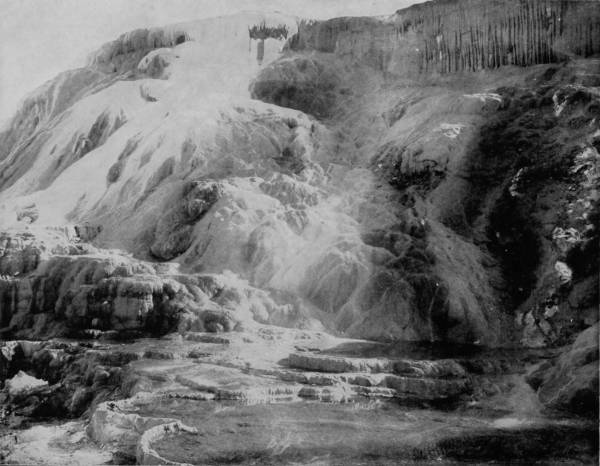
| Across the Mountains to Yellowstone Park.—A detour on the Canadian Pacific Railroad—Magnificent scenery along Fraser River—Green lakes on mountain brows—Canadian National Park—A glimpse of the Sandwich Islands through other eyes than ours—Down the Yakimer River—Spokane and Palouse Falls—Sights along Snake River—Pinnacle Rocks—Lost Falls—Lakes of marvelous beauty and rivers of torrential flow—A trip to the 12 falls of the Missouri—Our visit to Yellowstone Park—The wondrous gateway to Gardiner Cañon—Nesting place of the sentinel eagle—Mammoth Hot Springs Terraces—Remarkable formations more beautiful than the Cave of Stalacta—Springs glowing with brilliant coloring—Terraces of petrified rainbows—Through the Golden Gate, by deep cañon, lofty waterfall and far-soaring cliffs—In purgatorial regions—Growling caves and spouting Geysers—The Devil’s Kitchen and his Majesty’s Mush-pot—Along Firehole River and into the Lower Basin—The land of fearful surprises and volcanic energy—Yellowstone Lake and its game-abounding shores—Death Valley and Petrified Forest—Grand Cañon of the Yellowstone and its flowing beauties—Tower and Yellowstone Falls—A grave-yard of mammoth quadrupeds, | 235-288 |
CHIPPETA FALLS, IN BLACK CAÑON OF GUNNISON RIVER.
| CHAPTER IX. | |
| PAGE | |
| Among the Wonders of the Black Hills.—Beautiful Dells of the St. Croix—Scenes of the last Indian uprising—The scenery about Deadwood—Tumultuous wonders of Custer Park—Marvels of Elk Creek Cañon—Harney’s Peak and Wedge Rock—Horseshoe Curve—Keith’s Crystal Cave—A trip to the Belle Fourche—Astounding wonder of the Devil’s Tower—A basaltic column higher than the Eiffel Tower—Speculations concerning its formation—Crow Butte and Signal Rock—A story of Indian heroism—St. Anthony’s Falls—Charming beauty of Minnehaha—Dells of the St. Croix—The Devil’s Fishing Place—Customs of the Wisconsin Indians—Making a Medicine Man—Witchery of the Wisconsin Dells—Cleavages of extraordinary curiosity—Funeral ceremonies of the Ojibways—Wonders of Devil’s Lake and Camp Douglas—Through the Straits of Mackinaw—Picturesqueness of Superior’s Shores—Pictured palisades and frozen waterfalls—Scenery along the north shore—A trip down the Mississippi, | 289-344 |
| CHAPTER X. | |
| Scenic Marvels of the Great Northeast.—Mountain scenes in the vicinity of Eureka Springs—Legend of the Starved Rock in Illinois—Sublime glories and immensity of Niagara Falls—Utilization of the waters—Some interesting scientific facts—The Mohawk Valley and Leather Stocking Stories—Magnificence of Watkin’s and Havana Glens—The poetry of idyllic retreats—Down through the Thousand Islands—Chateaugay Chasm—Cañons of the Ausable and bewildering glories of the Adirondacks—Hunting grounds of the great North wilderness—Scenes of incomparable grandeur—Story of our tramp through the Catskills—A trip down the Hudson—Places famous in American history—West Point and its noted surroundings, | 345-382 |
| CHAPTER XI. | |
| A Pictorial Tour of the Eastern States.—A trip through the scenic regions of Canada—Torrential mightiness of Chaudiere Falls—The falls of Montreal River—A trip through Lachine Rapids—Something about the early history of Quebec—Winter sports in Montreal—The home of Queen Victoria’s father—Beautiful scenery in the vicinity of Quebec—A journey through the New England States—The Green Mountains of Vermont—Description of the White Mountains—Singular examples of nature sculpturing—Ascension of the highest peaks and bewildering views therefrom—The cog-wheel railroad up Mount Washington—Sensations and charms of the ascent—A typical village in a New Hampshire valley—Vagaries and reveries of a poetaster—Wild grandeur of Wild-Cat River—Afloat on the pretty lakes of New Hampshire—From Maine to Boston—Historic places of Massachusetts, and the stories connected with them—Curiosities around Pittsfield and description of the Shaker settlement, | 383-414 |
| CHAPTER XII. | |
| On Historic Fields of Virginia and Pennsylvania.—From the Blue Grass Regions to the Shenandoah—Scenery of the Kanawha River and Blue Ridge Mountains—Marvelous Natural Bridge of Virginia—Some remarkable scenes in East Tennessee—Pen-pictures of some of the mountaineers—War memories that are fast fading—The Great Smoky Mountains—Portraitures of North Carolinians, and some typical farm scenes—Scenery about Asheville—A tragic story of the ascent of Mount Mitchell—A visit to Luray Caverns—Beauties of the Under-world that dazzle with their splendor—Descriptions of the subterranean chambers—Valley of the Shenandoah—Memorable battle-fields—Down the Juniata—Scenery of the Susquehanna—Visit to a land of waterfalls beyond the Water Gap, | 415-448 |
| CHAPTER XIII. | |
| Through Languorous Lands of the Sunny South.—A visit to the Gettysburg battle-field—Through the Wilderness of Virginia—Scene of the closing event of the war—From Fortress Monroe to the Dismal Swamp—Story of Nat Turner’s Insurrection—A Dream of the Old Cabin Home—From Georgia to the orange lands of Florida—Olden times in St. Augustine—A boat journey down Indian River, into a land of perpetual bloom—Visions of tropic beauty and luxuriance—A trip on St. John’s River, and on the Ocklawaha—Alligators, snakes, and other slimy things—Marvels of Silver Spring—’Way Down Upon the Suwanee River—From Mobile to New Orleans—A trip to Mammoth Cave—Descriptions of its subterranean wonders—A tour of Wyandotte Cave—Magnificence of its halls, in which the splendors of Aladdin’s Cavern are reproduced—Conclusion, | 449-503 |
BERYL SPRINGS AND CLEOPATRA TERRACE, YELLOWSTONE NATIONAL PARK.

The most interesting, because most diversified, country in the world is America, and the center of that unexampled interest belongs to the territory comprised within the United States. The castles of England, crushed by the hand of time; the lochs and friths of Scotland, that murmur to the sea their wails of the Viking invaders; the lakes and heaths of Ireland, around which old legends hold perpetual carnival; the Rhine of Germany, whose banks are strewn with the relics of feudalism; the Bernese Alps, that flaunt their whitened locks like aged giants taunting the walled cities about which the sound of battle still seems to linger; the red glare of Vesuvius, wrestling with fiery wrath in mad ambition to overwhelm the cities built upon her ashes; the roar and blaze of Ætna, that growls with the voice of Polyphemus thirsting for the life of Ulysses; the hills of Greece, on which a thousand gods held council; the welling breast of Mother Nile, carrying to the sea remembrances of her ancient children; the Holy Land, blooming with sacred memories that fill the human heart with fragrance; the mighty peaks of Himalayas, piercing the heavens with frosted heads and draped with the fogs of centuries; the plains of Asshur, where Babylon stood, and the wrath of God was kindled. All these, and more, speak with siren tongue to lure the traveler and give him appetite for history. But, if we except the associations which make these places of the Old World memorable, the student of nature will find a thousand greater charms in the picturesque, grand, marvelous and sublime scenery that diversifies our own country. No picture has ever equaled the real, and no book has ever vividly described the wonders that God has scattered over the American landscape. We have had glimpses of mountain, plain, lake, river and cañon, but they have been little more than shadows of the reality, an intimation of a grandeur almost too great to depict. But as great telescopes have brought within our vision surprising views of other worlds, the rings of Saturn, the seas of Mars, and the burnt-out craters of the Moon, so has inventive genius been active in delineating the physical features of the earth, and through the perfection of photography we are now practically enabled to take the world in our hand and examine it with the same convenience that we can an orange. Travel is no longer necessary for the masses in order to behold the marvels of American scenery, for the camera has gathered them all and lays every inspiring scene upon even the poor man’s table, to minister to the delight of his family circle. But photography likewise blesses the traveler, for study of the picture establishes acquaintanceship with that which is represented, while accompanying description quickens his understanding and gives a more intelligent conception of the pictorial subject.
It has been my good fortune to make many trips across the continent over the various railway lines; and business and pleasure have taken me during the past several years to nearly all the accessible parts of the country, reached by rail, boat or stage-coach. Always an admirer of nature, I have longed for the means to sketch or photograph the imposing scenery which caught my enraptured eye as I hurried by. This ambition prompted the really stupendous undertaking whose fruitage is now offered to the public in all its delicious flavor, in the form of a book as herewith submitted.
How the photographic views herein reproduced were obtained may be thus briefly told, and is well worthy the relation: This book was conceived more than half a dozen years ago, but a press of other engagements caused a postponement 12of any effort at its preparation until the spring of 1890, when the publishers engaged a corps of artists, consisting of three of the best out-door photographers in the country. A passenger car was next chartered, which was remodeled so as to provide comfortable sleeping quarters for the men in one end, a kitchen in the other, while the center was fitted up as an operating-room for taking, developing and finishing pictures. Three cameras, of as many sizes, were also provided, with three thousand prepared plates, and a great quantity of paraphernalia which might be found useful for the expedition.
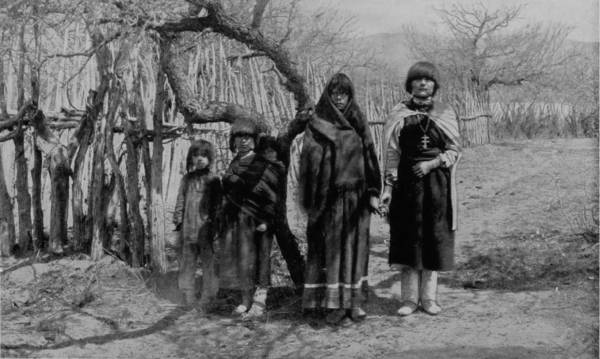
A FAMILY OF PUEBLO INDIANS, NEW MEXICO.
Thus equipped, our photographic party left St. Louis early in May, going directly west to Denver, from which point we made excursions to all the near-lying parks, thence to Manitou, and by way of the Colorado Midland to Salt Lake. Our work about Salt Lake occupied considerable time, and after leaving there we proceeded to Weber Cañon and then by way of the Union Pacific to Shoshone Falls. We next returned by way of the Denver and Rio Grande Railroad, making a sweep southward, through Ouray and the Valley of the Gunnison, over Marshall Pass and to Pueblo by way of the Royal Gorge. Our party divided several times in order to cover the territory more expeditiously, and in making the trip into New Mexico one part entered by way of Trinidad from Pueblo and the other traveled directly south through Antonito, forming a junction again at Santa Fe.
Some weeks were spent traveling off the line of road among the ruined villages of the Cliff-Dwellers, and in photographing the more rugged scenery of the Rio Grande River. Then we continued our journey westward over the Atlantic and Pacific and the Southern Pacific Railroads to California, where nearly three months were spent among the towns, Yosemite Valley, Big Trees and mountains of that summer-land. On the appearance of spring we traveled north by way of the California and Oregon Railroad, still making side trips by stage-coach and wagon, to Portland, from which point excursions were made up the Columbia and Willamette Rivers. At Victoria, British Columbia, we took steamer for Alaska, and 13returning we passed through the Cascade Range over the Northern Pacific, working our way back east. But we continued to make detours a long way off the main line of road, thus visiting the Falls of the Missouri, the Black Hills, the Custer battle-field, Devil’s Tower, and Yellowstone National Park, in which latter wonderland we spent two weeks photographing its scenery and extraordinary formations.
“WHALE-BACK” BOAT of the NORTHERN LAKES.
More than three-fourths of the grandest views were inaccessible by rail, so other means of travel had to be adopted. Often it was by stage-coach, but frequently donkeys were our sole reliance; and when these little animals could not carry us to the most rugged points, we shouldered our instruments and scrambled to the peaks and abysses of necessary observation. The difficulties, dangers and hardships thus encountered were both great and numerous, while the expense involved was so far beyond our first calculations, that had it been anticipated in the beginning the enterprise would certainly never have been undertaken.
GOVERNOR’S RESIDENCE, PUEBLO OF TESUQUE, NEW MEXICO.
We resumed our eastward journey thence to Superior Lake, Dells of the St. Croix, rapids of the Wisconsin, lakes and waterfalls of Minnesota, the Upper Mississippi through Lake Pepin, and back to St. Louis, the entire trip occupying more than eighteen months.
THE URNS, MANITOU PARK.
Our camera car had served our purposes in a most gratifying manner while making the long tour of the West, but in the eastern tour, which remained to be performed, it was considered that the car would be of no special advantage, since accommodations are so much more easily obtained in the built-up sections of the East than in the thinly and sometimes totally unsettled districts of the West, where in many cases our car 14was our only shelter. The journey east was begun in October, from St. Louis to Chicago, thence to Niagara Falls, and then up the St. Lawrence. Our route next lay through the Green and White Mountains, and other famous sections of the New England States; thence west into the Adirondacks, Mohawk Valley and Lakes George and Champlain, then down the picturesque Hudson into the Catskills. Continuing our journey southward, we visited the points of grandest scenery in Virginia, North Carolina, and Eastern Tennessee, and then proceeded on to Florida, where a part of the winter was spent photographing everything worthy of a place in this volume. On the return trip Mammoth Cave in Kentucky, and Wyandotte Cave, in Indiana, received our attention, as well as other interesting places along the way, and early in February our labors were ended by a return to St. Louis to put the results in book form. Nearly all the descriptive writing was done while our party was on the way, and while the impressions produced by the glorious visions were fresh in the author’s mind. This work, accordingly, is practically one of inspiration, the whole constituting a story of extraordinary interest and a history of incomparable value.
ON THE OCKLAWAHA RIVER, FLORIDA.
Illustrations, however fine, whether of wood or steel, represent the artist’s conceptions, dashed with an individual coloring that prevents a natural reproduction. The painter sketches his landscape from a special point of view, and working many days blends the sunrise with midday and sunset, the mists of morning with the clouds of noon, thus striving to please the eye rather than to truthfully present nature, without artificial adornments.
Photography, on the other hand, is the mirror which reflects nature in all her changeful moods; the absolutely faithful reproducer of her every aspect, exhibiting her in her every-day garb, noting the disfigurements with no less fidelity than the sublime graces which she exhibits and all the widely diversified physical features which render her 15countenance so variable that admirer and scoffer alike find reason for urging their claims. No other attempt has ever been made to so perfectly picture the wonders of America, and the work has been so thoroughly accomplished that it is confidently believed no one, however great his ambition or lavish his expense, will be able to add anything to the completeness of our undertaking, as here submitted. Whatever may be the measure of deserving of the descriptive part of this book, certainly the photographic illustrations are worthy of all praise as fulfilling the conditions of masterpieces of American scenery, while the publishers are entitled to most generous public recognition for conceiving and so liberally endowing an enterprise, which has flowered in the fragrance and beauty of this exquisite work.
ON THE SUMMIT OF MOUNT TACOMA, WASHINGTON.
It is seemly to add that our tour was made wholly at the expense of the publishers. Free transportation was offered us over all the railroads on which we traveled, but all such courtesies were uniformly refused, because an acceptance would have placed us under obligations to manifest some favoritism, and thus interfere with the declared purpose of the publishers to issue a work on American scenery in which the views and descriptions should be given truthfully, and without partiality. We therefore selected the routes which promised most satisfactory results, without regard to personal convenience, having in view the ambition to present and describe the most interesting, if not always the most famous, scenery of our country, and in so doing produce a work of which all Americans, like the publishers, may be justly proud. In this our celebrant year such a book is particularly appropriate, and the hope of the publishers, as it is of the author, is that our ambitious and worthy enterprise may find a warm welcome at the fireside of every American family.
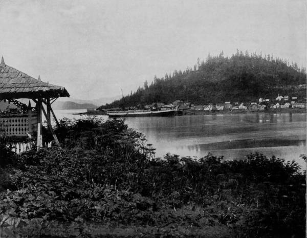
VIEW OF FORT WRANGEL, ALASKA.
PIKE’S PEAK FROM COLORADO SPRINGS.

Enthusiasm sometimes exaggerates the reality, just as colored glass confuses the sight; but when it serves to please without doing harm, the fault may be pardoned. To the enthusiasm of the occasion, and our great and unique enterprise, may therefore be charged the burst of admiration that manifested our feelings, when, rolling along the prairies on the Union Pacific R. R., we saw, rising far to the southwest, nearly one hundred miles away, the broad shoulders of Pike’s Peak, breaking into russet above the clouds and showing a head of saffron, mellowed by the soft rays of a sun just falling into the deep valleys of the Occident. It was the chief object to chain our attention for the while, and this first impression awakened most delightful anticipations of the work which lay before us. A few hours later we were in Denver, making final preparations for a photographing tour of the picturesque West. Fortunately, our arrangements were so nearly complete upon leaving St. Louis that only a short stay in Denver was necessary, and it was with eager desire that we had our car attached to a Union Pacific train and started for the heart of the Rockies. The long range of mountains, rising into sharp peaks, and again spreading their tops into truncated cones, elbowing and pushing each other like a brigade in too close quarters at parade-rest, are only fifteen miles from Denver, forming a grand background to an immense 18expanse of prairie landscape. Starting on the Colorado Central Branch of the Union Pacific, we soon pass through the gate-way of the Rockies; thence on to Golden, a beautiful mining town that nestles in the bed of a dried-up lake, and looks up with pleasing satisfaction to the guardian gods of North and South Table Mountains. Here a stop is made for a trip up Bear Creek Cañon, which is reached by stage, by which conveyance the traveler is trundled into a gorge of surpassing beauty and noble grandeur. Through this great gash the water dashes, swollen by melting snows, and fed by a thousand sources. On either side the frowning and dusky walls, weaving a tortuous way like the path of a drunken giant, rear up their castellated heads until they remind us of the walled cities of Jericho, over which Joshua’s spies were lowered by Rahab.
MARSHALL FALLS, CLEAR CREEK CAÑON.
Only a few miles from Golden is Clear Creek Cañon, another wondrous cleavage wrought by water that goes tumbling through the passage with rumble of breakers and roar of waterfall. The walls of the cañon rise perpendicularly to varying heights of 500 to 1,500 feet, and at places approach so near to each other that an observer looking upward from the cavernous depths can see only a thin strip of blue sky. Away up on the brows of the parallel cliffs are large trees that look like feather dusters, and little streams of liquid silver appear in the distance to be pouring their contributions from crevice and apex to swell the mad creek that rushes with complaining voice down the age-swept gorge. Along this water-bed was formerly the roadway, or trail, used by freight-wagons and stage-coaches, but it is now become the exclusive thoroughfare of the Central Branch, so that the magnificent view which the cañon affords is before the eyes of railroad travelers.
Less than three miles from Georgetown is Green Lake, an exquisite body of water which has been very appropriately called the Gem of the Mountain. Its translucent depths are animated by myriads of trout that are tinged by the green waters to the color of emeralds, while away down in its profound recesses is distinguishable a forest of stately trees which has been swept into the lake by some glacial avalanche. Not a branch appears to have been broken or a position disturbed, for the trees stand boldly upright in all their original gracefulness, but through calcareous depositions, that are a peculiarity of this lake, they have been converted into stone. Thus it is a submerged forest of petrified trees.
Looking beyond the lake we perceive, some seven miles away, the famous Argenta Pass, the summit of which is reached by the highest wagon-road in the world, and from this elevation an almost boundless and marvelously picturesque view may be had, stretching away to the west as far as Holy Cross Mount, and eastward to the prairies of Kansas.
A VIEW OF PIKE’S PEAK.
20But we have now reached the backbone of the divide and our train starts down the western grade, circling like a hawk out of the sky. Over immense fills, through deep cuts, across bridges, following a swiftly-flowing stream, until at length we gain the level valley and go dashing away to Graymont, on the way to Idaho Springs and Georgetown. To avoid tunneling in crossing the divide, the railroad winds around the mountain elevations, up a steep grade, over a way that has been blasted out of the eternal rocks, until from away up the lofty sides the traveler may look upon a scene of marvelous beauty and ruggedness that fades into indistinctness miles below. Leaning out of the car window we view a wondrous panorama, and pause directly to bring our cameras into use, that the scene may be caught and held on paper. There on one side of the depths is Devil’s Gate, in close proximity, as it seems, to Bridal Veil Falls, where the clear mountain stream plunges over a precipice of great height to join the gamboling creek that rushes away on its errand hundreds of feet below. There, too, is a spider’s web of steel, eighty-six feet high, that has served as a passage-way for our train across a chasm 300 feet wide, whose bottom can scarcely be distinguished from our lofty eminence; but we see that the track makes a complete loop, and that the road parallels itself, at a constantly increasing grade, no less than three times. All the while that we are winding around and crossing our own track, Georgetown continues visible, but it is dwarfed by the distance to the appearance of a prairie-dog village.
CHALK CLIFFS, CLEAR CREEK CAÑON.
The picturesqueness of the route now changes from wild scenery of lofty mountain and the dark awesomeness of deep cañon, to a park-like landscape, through tillable lands, and on to Silver Plume, a great feat of mining engineering, and beautiful beyond description. Gray’s Peak rises like a giant phantom a few miles beyond, and becomes a charming signet in the ring of park and town of Graymont that lies near its feet.
Returning east a distance of twenty miles, a junction is reached at Fork’s Creek, where another branch of the Union Pacific leads to Central City and Black Hawk. Here a marvelous thing is to be seen: The two towns are only a mile apart, measured by a straight line, yet so fearfully rugged is the territory to be traversed that the distance by rail between the places is four miles, and this interval is covered by means of a “Switch Back,” so called because of the tortuous route and the extraordinary grades. All along this vicinity are famous mines, and a wealth of mining machinery, that converts the country into a maze of industry, and the mountains into smoking mills and cornucopias of silver. In this mountainous region all roads seem to radiate from Denver, and hence to reach other charming scenery by means of our camera car, it was necessary to return again for a trip to Gunnison, which is on the South Park Branch. But in order to facilitate our work it was decided to divide our party, so that one photographer might proceed to Gunnison, while the other two took the northwest route to Estes and Middle Park, where a larger amount of work was to be done, and which could be reached only by stage.
A VIEW OF PLATTE CAÑON.
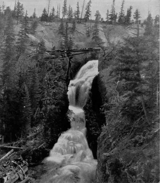
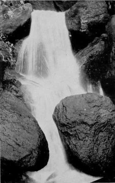
ARGENTA FALLS.
Continuing our trip, therefore, towards the southwest, our first stop was in Platte Cañon, which is twenty miles from Denver, and there many exquisite views were taken. This cañon, formed by the Platte River, resembles Clear Creek Cañon, but is longer and somewhat wilder. The route is over Kenosha Hill, which is Alpine in its grandeur, and so rugged that the road is as sinuous as the trail of a serpent. The cañon spreads at places until it runs between gradually sloping steeps, but again the walls draw closer, and rise perpendicularly to a sheer height of a thousand feet, excluding the sunlight except as it is strained at times through a narrow rift, until it looks like a pencil of light cleaving the pall of night. What mighty forces were gathered here in the age of the world’s infancy! what terrific convulsions and frenzied spasms of nature that rent in twain the earth’s envelope and left cañons and mountains where once were lake and plain!
Along the way rushes the impetuous Platte River, that has torn and eroded a great fissure through the rocks, and in so doing has left many wonderful incongruities to mark its eccentricity as well as power.
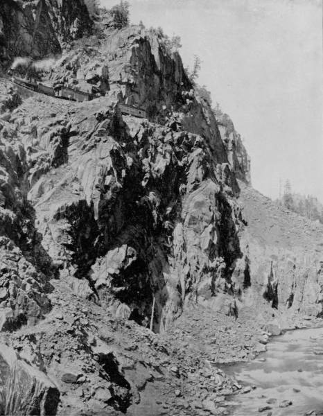
ALONG THE BREAST OF THE CAÑON WALLS OF THE RIO DE LOS ANIMAS, COLORADO.
BRIDAL VEIL FALLS, NEAR DEVIL’S GATE.
Dome Rock is one of the conspicuous curiosities in the cañon, resembling as it does, the top of a mosque that has sunk just behind the wall of beetling cliff, leaving a graceful dome as its burial monument. But all along, at frequent intervals, spires, with cathedral proportions, shoot skyward, lending an appearance not unlike a vast row of churches, where we may fancy nature worships, and the roar of waters is a perpetual hymnal invocation. On the same route, fifty miles from Platte Cañon, is the Alpine Tunnel, which is reached by the road winding about and upward until a height of 11,600 feet is gained, when, suddenly, the train makes an abrupt turn, and leaps into the very bowels of a mountain from which it emerges after many minutes on the other side, and then descends towards the Pacific. This tunnel is one of the most remarkable in all the world. It is at the highest point ever reached by any railroad in America, and in the center of its 1,773 feet of length is the dividing line of altitude between the two oceans. The boring of this mighty channel not only involved the naturally stupendous labor of digging through a mountain, but the work was rendered a hundred fold more difficult by reason of the rare atmosphere in which the workmen had to labor. In addition to this, 70,000 linear feet of California redwood was required for the inside bracing, and this had to be brought up the mountain side on the backs of burros, the only animals of burden that could make the ascent. It was a remarkable undertaking; its accomplishment was very like a miracle.
As we emerge from the tunnel, and creep around the perpendicular side of the mountain on a roadway barely wide enough to accommodate a single train of cars, a bewilderingly magnificent panorama opens to us. Away towards the southwest, one hundred and fifty miles, we observe the lofty and regular heads of the San Juan range, while a little further west we are able to distinguish Uncompaghre Peak, that looks down with benignant aspect upon the town of Ouray. There, too, is the green and happy valley of the Gunnison, towards the end of which we see Elk Mountains and their chief peaks, Mount Gothic and Crested Butte.
At this great height the snow lies packed in the deep crevices all summer through, while upon its borders may be seen beautiful flowers nodding their bright heads in the delightful wind that plays about the peak. Now we go down the mountain side with brakes set, marveling all the way at the natural wonders which have been strewn by some Titanic hand along the route. There, on the right, are the Palisades, which might be called sculptured rocks, so graceful and artistic that they appear to be the creation of the great Phidias, or pupils of his school. Further on lies Quartz Valley, like a pearl nestling in depths far below the angry waves of giant mountains. Now we cross Quartz Creek, where nature laughs with blossoms and fruitage, through Uncompaghre, around Hair-Pin Curve, with the Fossil range to our right, by Juniata Hot Springs, and at length arrive at Gunnison. We are now in the midst of the most magnificent mountain scenery, and in the heart of a great mining country, where there is bustle above ground and activity and visions of amazing wealth underneath. The town is at an elevation of more than 7,000 feet, but many peaks rise high above it, from which extensive views may be had of the Elk Mountain, San Juan and Uncompaghre ranges, while to the southwest a beautiful valley stretches away to mark the devious path of the Gunnison River.
VALLEY OF THE GUNNISON, NEAR SAPINERO.
THE LOOP NEAR GEORGETOWN.
Having taken many views of this famous region, we turned back again to Denver, and from that point of radiation started for North Park. Our route was by way of Boulder, at which place we took the narrow-gauge road for Fort Collins. A few miles from Boulder is Boulder Cañon, a stupendous mountain gorge seventeen miles long, and in places the walls rise to almost the incredible height of 3,000 feet. The falls of Boulder Creek are not without interest, but the mightiness and awful grandeur of the granite cañon weighs so heavily upon the startled perceptions of the spectator, that even the roar of water-fall is scarcely heard, all the five senses being concentrated in that of sight. The eye is set to climbing these terrific precipices of stone; up, up, from niche to niche, from wave upon wave of dizzy height, until it rests upon a world on high that seems to lift its parapets to the sky and bathe its brow in the azure of the heavens. Can it be that the little stream that runs complaining along the ravine has eroded this mighty fissure? No, not this alone, for water has been no more than a servant of other greater forces that have torn the earth into clefts and upheavals. Bursting volcano, denuding glacier, devastating deluge, and cooling fires of internal furnaces that brought a collapse of the earth crust, have all been agencies in this work of mighty disturbance.
MARY LAKE AND LONG’S PEAK, ESTES PARK.
ENTRANCE TO ESTES PARK, FROM ROCKY POINT.
HIGH LINE CANAL, SILVER FLUME AND PLATTE RIVER.
The temptation is very great to step aside into Estes Park, and explore Long’s Peak, which, though thirty-six miles distant, looms up in the clear atmosphere like a frosty-crowned giant almost near enough to speak to. But the rest of our party have preceded us and are no doubt in need of photographic supplies, so we hurry on, pausing only long enough to take a snap-shot at Boulder Falls. Reaching Fort Collins, we had the good fortune to find the others of our party awaiting us. They had made an extensive trip through Estes Park, and had a splendid lot of views as a reward for their labors. It was fortunate, therefore, that we did not stop, for we could have done no more than duplicate their work, and repeated the experiences which they reported to me substantially as follows:
After dividing our party, as already explained, two of our photographers followed the Colorado Central Branch of the Union Pacific to Loveland, at which place they side-tracked our camera car, and having made preparations for the trip, started west to make a tour of Estes Park, their principal objective point being Long’s Peak. The park is conveniently reached by a daily stage-line, which travels over a good road and, with the exception of a few miles of level plains, traverses a picturesque region, with mountains sweeping every side, the monotony of which is relieved by many lakes, thirty-five of which may be seen from a single station, scattered over the plain and bathing the foot-hills. The road leads up Bald Mountain and Pole Hill to an elevation that brings into view the valleys of three rivers, and from Park Hill the whole entrancing scenery of Estes Park, probably the finest in Colorado, is spread out in one unbroken and bewildering panorama of astounding beauty. It is not all a vision of primeval nature, for the vast table-land is abloom with fields of husbandry, and immense herds of cattle give animation to the seemingly boundless pasturage.
From Ferguson’s ranch there is a lovely prospect of Mummy range, with its conspicuous peaks, aglow with the soft colors of sunset in the evening, and mist-crowned in the early hours of the day. On the west are the Front and Rabbit Ear ranges, whose inaccessible heights run up so sharply to where storms have their breeding places, that they are browned by exposure and look inexpressibly bleak. Here, on these wild peaks, safe from human foes, bear and mountain sheep have 29their habitations, and the caterwaul of the puma rings out upon the air of lofty desolation as a warning to those who would attempt to gain their savage haunts.
DOME ROCK, BOULDER CAÑON.
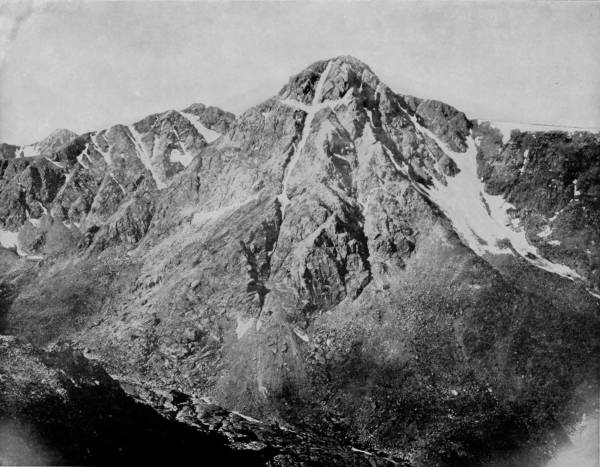
Long’s Peak is hardly more than a half-dozen miles from Table Mountain, measured by a straight line, but to pass from one to the other is very difficult, except by a long detour, so that the open route is by way of Loveland to Ferguson’s ranch, which is near the base of Long’s Peak, and from which point the ascent is best made. The east side of the mountain is precipitous and hence inaccessible; viewed from this side the peak appears so lofty as to almost fade into the cerulean of sky depths, and for this reason it has been not inaptly called the American Matterhorn. Its apex, seen from below, bears a striking similitude to an impregnable citadel surrounded by giant ramparts.
The road from Ferguson’s passes Mary’s Lake, a lovely body of water, thence over a hill to a forest that is begirt by Lily Mountain with its monster cliffs impending from a height of 11,500 feet above sea-level. The ascent may be made by horses as far as what is known as “Boulder Field,” but from that point foot climbing is necessary. To secure the finest view, a place called the “Key-hole” must be gained, and it is not reached without great exertion of muscle and careful equilibrium while passing along the ledges, since a false step may be attended by serious result. Having reached the Key-hole, the sight that rewards the climber is sublimely grand, for he is brought to face a vertical wall of sheer 2,000 feet, extending up to within what appears to be one or two hundred feet of the apex. The altitude is so great that a finer prospect, perhaps, never greeted human vision, for the world seems to be spread out for examination. A little higher up the scene changes, but is scarcely so beautiful, for every additional foot taken upward increases the indistinctness of the valley below and the mountain scenery in the distance. But by the aid of a field-glass we make out Big Thompson River, Boulder Cañon, and some remarkable columnar cliffs that exhibit fantastic shapes, sculptured by the erratic hand of nature. Mountains appear like legions to the right, to the left, upon all sides, but we are now above them all, and towards the southeast, sixty miles away, we see a smoke-cloud that has formed from the Denver Smelters. Still further southward are visible the hazy heads of Pike’s Peak and its twin brother, Cheyenne Mountain, while a hundred miles north are dimly distinguishable the range of bluffs east of the city of Cheyenne.
After gaining the summit our party had a still better view, for 30a bright sun had now come out from behind clouds that had before obscured his rays, and so completely dissipated the misty atmosphere that the panorama was greatly increased. They were lifted so far above the Front range that beyond the divide there broke into view, in the far southwest, the Mount of the Holy Cross, while beside it were the very pale outlines of Jackson Peak, the two almost blending into one.
BOULDER FALLS.
As they descended on the northeastern side, suddenly their sight was arrested by a lake slumbering in a little basin that had been scooped out of the granite sides of the mountain. It is almost immediately under the vertical cliffs, and so clear that the observer seems to look through it, as he would through a looking-glass, upon great walls which appear below, but are in reality reflections of the precipice examined when making the ascent. Lily Mountain was in bold outline on the right, where reposed another lake of somewhat greater size, whose water appeared to feed a stream that ran gamboling down a deep gorge into the plain which it nourished.
On every side there were evidences of glacial erosion, not only in the form of bowlders and debris, but in lateral moraines, where the glacier had left deposits, and in gorges where great granite blocks had been tumbled, over which in places the water cantered and fell in beautiful sheets. In one place, towards the base, were found many small aspen trees cut down, and most frequently the trunks were divested of their bark, and the tender limbs were missing. Investigating the cause, it was directly discovered to be the work of beavers, several of whose dams were perceived in a creek that ran through a beautiful meadow land, but no one of the party was able to catch sight of the wary animals.
Our party being satisfied with their trip in the park, and especially with the ascent of Long’s Peak, where they had secured more than a score of magnificent photographic views, returned to Loveland to be rejoined by at Fort Collins, as will be presently described.
MOUNTAIN OF THE HOLY CROSS, COLORADO.
GRAYMONT MOUNTAIN, MIDDLE PARK.
We tarried a short while at Fort Collins, then set off for Mason City, eighty miles distant, the road to which leads through the world-famous Cache La Poudre (Powder River) region. After leaving the south fork of this stream we passed Monitor Peak, crossed the Big Laramie, and brought up at Medicine Bow range. North Park proper lies west of the range, but the physical features of the immediately eastern district are almost identical, and to traverse the whole would have required more than a month. The park is an elevated plain 9,000 feet above sea level, and embraces an area of about 2,500 square miles. Properly speaking, it is a fertile valley enclosed by spurs and branches of the Rocky Mountains, and is so seldom visited that there are as yet no resorts for travelers, and the stage is a poor reliance for reaching the most interesting districts. We also experienced insurmountable obstacles, which compelled us to abandon our purpose of making a tour of the park. The only possible way of going through the district and to chief points of photographic interest (pardon the expression) would have been by horses, and these were not procurable because the country is devoid of settlements; besides, we were unprovided with camp equipment. We saw the mountains rising on every side into jagged spires, and occasional lakes nestling on their bosoms, but they were inaccessible to us, and after making so long a journey we were compelled to return without accomplishing anything worthy to be narrated. Photographs of some mineral springs bubbling up icy-cold in stony basins, wide stretches of landscape, hemmed in by a wall of mountains, and some fine views of scenery along the Cache La Poudre, was all the reward we had for days of uncomfortable traveling, much of which was done on foot, and on horses borrowed for short tours. We traversed enough of the district, however, to satisfy us of its beauty and fertility, and that the region was a vast game park, in which mountain sheep, bear, deer, pumas were numerous, and ptarmigan abundant. We caught sight of several wild sheep and had a far-away (not too far) look at a cinnamon, or grizzly bear, we were not able to positively decide which, and not being equipped for entertaining game of that character were indisposed to permit curiosity to supersede judgment.
Returning to Fort Collins, we retraced our route to Longmount, from which point we determined to visit Table Mountain, near by, and Mount Hallett, a little further towards the west. To carry this decision into effect it was necessary to make some provision for conveyance and camping, as the mountain cannot be explored in a day, and a few evenings must be spent in camp in order to do the work satisfactorily. Fortunately, supplies are easy to procure, and being fully provided, we set out a merry party on a pleasant errand. We reached the foot of Table Mountain towards the close of the day, and went into camp beside a beautiful little stream that had its source somewhere up the gorge that cleft one side of the mountain. At this point we were also able to take some pretty views of the imposing scenery by which we were surrounded.
SADDLE ROCK, AT THE SUMMIT OF THE PASS.
WITHIN THE GATES, GARDEN OF THE GODS.
34Near noon of the following day we accomplished the ascent, and from that vantage point surveyed a scene of bewildering grandeur. The wind, however, blew a gale that made our position extremely uncomfortable, and one of our party lost his hat, that was borne away and dropped into an abyss of almost measureless depth. There were mountains to the west that seemed to hang on the edge of the horizon, and down, far down, below us was an immense expanse of bowlders that had evidently once been the sport of a glacier. Indeed, the glacier was still there, a great solid field of compacted snow that at midday hugged the shadow side of the mountain, but was evidently moving gradually, imperceptibly, towards the gorge. Water was pouring from the base and forming waterfalls, cascades and swift streams, showing that heat radiation from the earth was melting the glacier more rapidly than the sun’s rays. The effect was extremely beautiful, for the afternoon sun was changing the edges of the snow-pack into beautiful reflections of aqua-marine, and waves of light shimmered above the glacier that made the ice coverlet scintillant with color.
TORREY’S PEAK, MIDDLE PARK, COLORADO.
Table Mountain is a truncated cone, from which fact it takes its name; but it is deeply fissured on every side, and on the west side there is an appalling gorge, over the edges of which, in places, colossal sheets of ice impend, vast ledges they appear, threatening the vegetation far down below, and rendering traveling along the slopes very dangerous. Having photographed Table Mountain and the fine scenery that is tributary, we descended and passed over to Mount Hallett, where we were delighted to find views of yet greater grandeur. The way to this mount is necessarily over Table Mountain and into Estes Park, the solid ramparts of rocks which surround the park, as far as Willow Cañon, preventing the access of pack animals.
Gaining the base of Table Mountain, we followed up Timber Creek over a natural roadway until the foot of Hallett was reached. The way was easy and pleasant, being level and almost floored with moss and flowers, while many species of birds flitted across our path, and in and out through the trees and bushes, with voices of tuneful glee.
As we ascended the mountain on the northeastern side, a magnificent view was presented down a deep gorge. A little higher up, and as we veered towards the west, we saw, a thousand feet below us, a deep, dark lake whose sides were walled, giving to it the appearance of a crater that had now become a lake basin. Still further up the steep, in a ravine, was another lake, the edges of which served to mark both the timber and snow line. Away off in the southeast was Long’s Peak, frowning in bleak desolation above a lake that hugged its feet. On every side the scenery was ruggedly sublime, while immediately at our right was a great chasm with a vertical wall of stone fully one thousand feet high.
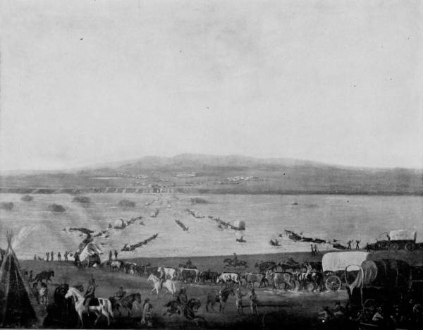
THE GREAT WESTWARD FLOOD OF EMIGRATION—CROSSING THE PLATTE RIVER IN 1868 (from a painting).
36The timber was now below us, and our horses picked their way over an indistinct trail through patches of snow. Occasionally, there were suspicious places, where the snow was deeply impacted, which might conceal a treacherous way, a chasm bridged with nothing more substantial than cakes of ice. Yet, on this lonesome mountain, chilled by perpetually arctic winds, swathed by eternal snows, and covered by giant bowlders that menaced everything by their apparent instability, there was no scarcity of animal life. The mountain rat, chipmunk, woodchuck, Rocky Mountain sheep and a few lions make this uninviting region their haunt, while ptarmigan, or mountain grouse, are fairly plentiful. One enthusiastic photographer who climbed Hallett some years before, claimed to have found a herd of mountain sheep so tame that he was able to take their pictures, but none of us had such good fortune.
FREMONT’S PASS, NORTH PARK.
At one point of the elevation we had an enrapturing view of Middle Park and Grand Lake, whose waters looked like a vast sea of quicksilver, on which the sunlight danced in a glorious reflection. North Park might have been also visible from this same lofty point of observation but for the intervention of Mummy Mountain, the monumental mark of Medicine Bow range, far to the northwest, too distant for our cameras to reproduce the view with satisfaction.
Our visits to Table Mountain and Mount Hallett had proven so delightful that our previously contemplated trip to Middle Park was now undertaken with the most pleasant anticipations. Returning to Longmont, we proceeded over the Union Pacific to Sunset, an arm of the road that stretches out into the Front range until it fairly grasps the beautiful scenery of that marvelously grand region. Georgetown would have been a more convenient point of departure for Midland Park, but we chose to avoid staging, and by means of pack animals to reach the park by the quickest, even though it was a more troublesome, route. Middle Park is separated from North Park by an east and west sweep of the great Continental Divide, and like its northern sister is completely encircled by lofty mountains, whose sentinels are Long’s Peak, Gray’s Peak and Mount Lincoln, with elevations above sea level of respectively 14,500, 14,200 and 14,300 feet. The elevation of the park itself is about 7,500 feet, and its area some 3,000 square miles, or about one-third less than the State of Connecticut. It is drained principally by the Blue and Grand Rivers, whose waters flow generally through smiling meadows until they escape from the park. We traveled by horse through Berthoud Pass to Hot Sulphur Springs, which is on a small tributary of Grand River, and only about twelve miles from the south boundary of the park. From this point we went to Grand Lake, the beautiful body of water that we had seen from the heights of Mount Hallett. If the scene was grand when viewed from that distant elevation, it was sublimely picturesque when we reached its shores. The western shore line of the lake washes the vertical base of towering mountains, which enclose it on three sides, and throw their giant shadows into its pellucid depths, where reflections of brown peaks mingle with the beautiful green of tall tufted pines. Its bed appears to be a glacier basin, for all about are cliffs that bear distinct marks of an ice deluge that thousands of years ago, perhaps, invaded this retreat of nature and tore asunder the earth, ground its way through stone, scoured the face of the mountains, and scooped a depression in the plain.
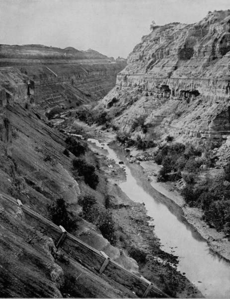
DODGE’S BLUFF, CAÑON OF GRAND RIVER.
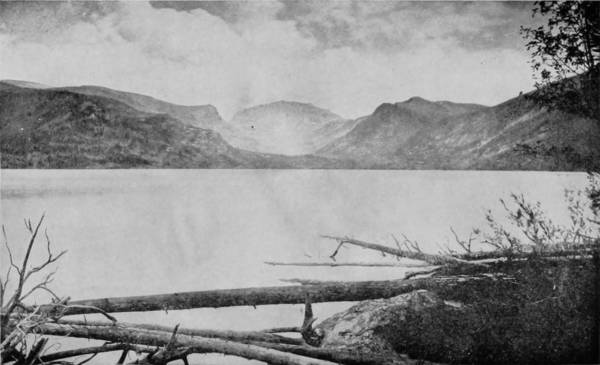
GRAND LAKE, MIDDLE PARK.
Strange it is that near the shores of this lake the water is singularly crystalline, while towards the center it is dark as midnight. The lake is also a treacherous body, subject to appalling disturbments from inrushing storms that first gather on the surrounding peaks and then swoop down to break with sudden and appalling force upon its expansive bosom. No wonder that from time immemorial, the Ute Indians have regarded the lake with superstitious fears, and tell ghostly stories of its treachery. Upon one occasion, as an old Indian related, a band of Utes were encamped upon its shores, pleasantly and profitably engaged in trout fishing. They had their women and children with them, and having prepared for a stay of some weeks, they had rafts made of pine logs, and it was from these they did their fishing. While thus engaged they were attacked by a war party of Arrapahoes, their implacable enemies. The Utes committed their wives and children to the rafts, which they pushed far out into the lake, and then engaged with their ferocious adversaries, whom, after a desperate battle, they repulsed. During the fight, however, a storm arose on the lake, which quickly lashed the water into such fury that the piercing cries of the helpless women and children were scarcely audible above the breaking waves and screech of savage wind. When the Utes turned from pursuing their enemies, they saw that a more dangerous foe had attacked their helpless ones. The rafts were quickly broken up by wild surges of the infuriated lake, and every woman and child was swallowed up. The Indians, whose minds are peculiarly susceptible to impressions of a supernatural character, were prompt to attribute the calamity to a manifestation of the Great Spirit’s anger, and since that fatal event they have regarded the lake as being the haunt of water demons, and no Indian has since that calamitous incident dared to venture upon its bosom.
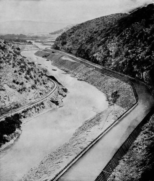
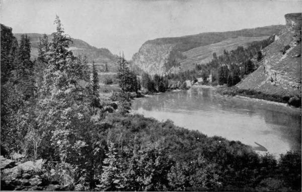
From Grand Lake we followed its outlet some twenty miles south, and entered a beautiful valley of Grand River, where the grass 39was long and green, the sky a beautiful indigo-blue, and the mountain scenery around us was magnificent. A marvelously clear atmosphere made the distance deceptive, so that peaks which were fifty miles away appeared to be scarcely five. From one point of observation we swept the ragged horizon with our enraptured eyes, and plainly perceived a battalion of well-known mountains that locked their massive arms around Middle Park like loving guardsmen. Roundtop lifted its head to gaze into the mysterious depths of Grand Lake; and far beyond, Long’s Peak, the great gray sentinel of Estes Park, loomed up like a cloud gathering inspiration from the heavens. A little to the right, Elk Mountain projects its snowy cap far into the sky and looks up into the face of its taller kinsmen. Following the waving lines of peak upon peak, our eyes caught sight of a pass through which a river had found its way, and behind the interval were the faded fronts of Medicine Bow range. A little further to the left there is another rent in the continuity of mountains, which closer inspection discovers to us is Gore’s Cañon of Grand River, where it leaves the park through a fissure made in the eruptive rocks quite three miles long, and in places nearly 2,000 feet deep. So perpendicular are these cliffs that a person standing upon the dizzy brink may drop a stone into the rushing river below.
GORE’S CAÑON, MIDDLE PARK.
If we look towards the southeast, across a stretch of sage-brush, we see the peak of heroic Powell, the most majestic elevation in the Park range, singular not only by reason of its cloud-piercing height, but also because it looks through the hazy distance like a mountain of sapphire, while behind it are lofty stretches of peaks with straggling locks of white, where snow has gathered in the wrinkles of their cheeks.
Our rambles through Middle Park had been so pleasant that it was with some reluctance we turned our steps eastward again, to pursue the work of photographing scenery in more southerly fields. We reached Sunset after an absence of twelve days, and were soon after switched on to the North Branch of the Union Pacific for Denver. Thence, our route was south to Colorado Springs and Manitou, where, as the following chapter will show, we repeated our delightful experiences in Middle Park, and saw even greater wonders.
IN THE CAÑON OF GRAND RIVER, COLORADO.
THE SEAL AND BEAR, GARDEN OF THE GODS.
The glory of Colorado, in the splendor of its waterfalls, the awesomeness of its mountains, the wealth of its mines, and the picturesqueness of its natural parks, is by no means confined to those Rocky Mountain districts which we have just pictured and described, for greater marvels remain to be spoken of, and pictorially represented. Returning to Denver, our tour took us southward, across a plain that hugs the gnarled bosom of the Continental Divide, by the pearl of Palmer Lake, and on to Colorado Springs and Manitou, the twin cities that sit at the feet of Pike’s Peak. Here we are compelled to pause in a spell of mighty wonderment before the amazing prodigies of a riotously eccentric nature, that bursts into an exuberance of dashing cascades, top-lofty mountains, darkling cañons, gruesome formations, monolithic spires, babbling brooks and magnetic springs. Here are God’s acres of tumultuous stone, grand, amazing, chaotic, aberrant; a pantheon of forces, a Jovian council, a mythologic assemblage that sits like a Sanhedrim on the issues of Titanic upheaval, erosion, conglomeration and elemental disturbance. There, rising like a giant specter above its lesser brothers, and dipping its hoary head into the milky baldric of the heavens, stands Pike’s Peak, the grand old sentinel of millenniums, with sides gashed by tumbling cataracts and yellow with quivering leaves of the frosted aspen. So lofty that the stars can almost whisper to it, and the clouds, when tired of sailing through the sky, circle and settle upon its peak, while eternal night sleeps undisturbed, save by the lion’s call, in the deep gorges that split its base.
The first white man who caught sight of this towering mountain was Lieutenant Zebulon Pike, who was sent out by the Government in the year 1806 to make an exploration of the Territory of Louisiana and the Provinces of New Spain, a district now characterized as the great Southwest. From his 42diary of Saturday, November 15th, 1806, we quote the description of his discovery:
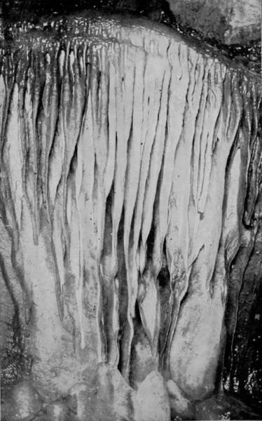
THE STALACTITE ORGAN, GRAND CAVERNS.
“Passed two deep creeks, and many high points of rocks; also large herds of buffaloes. At two o’clock in the afternoon I thought I could distinguish a mountain to our right, which appeared like a small blue cloud; viewed it with the spy-glass and was still more confirmed in my conjecture, and in half an hour it appeared in full view before us. When our small party arrived on the hill, they with one accord gave three cheers to the Mexican Mountains.”
On the 26th, following, this intrepid explorer attempted an ascent of Cheyenne Mountain, ten miles to the east of Pike’s Peak, from which to make an observation of the more lofty eminence, which he thus describes:
“Expecting to return to our camp that evening, we left all our blankets and provisions at the foot of the mountain, killed a deer of a new species, and hung its skin on a tree with some meat. We commenced ascending; found the way very difficult, being obliged to climb up rocks sometimes almost perpendicular; and after marching all day we encamped in a cave without blankets, victuals or water. We had a fine clear sky while it was snowing at the bottom. On the side of the mountain we found only yellow and pitch pine; some distance up we saw buffalo, and higher still, the new species of deer and pheasants.
“Thursday, 27th November.—Arose hungry, thirsty, and extremely sore, from the uneveness of the rocks on which we had lain all night; but we were amply compensated for our toil by the sublimity of the prospect below. The unbounded prairie was overhung with clouds, which appeared like the ocean in a storm, wave piled on wave, and foaming, whilst the sky over our heads was perfectly clear. Commenced our march up the mountain and in about an hour arrived at the summit of this chain; here we found the snow middle-deep, and discovered no sign of bird or beast inhabiting this region. The thermometer, which stood at nine degrees above zero at the foot of the mountain, here fell to four degrees below. The summit of the Grand Peak, which was entirely bare of vegetation, and covered with snow, now appeared at the distance of fifteen or sixteen miles from us, and as high again as we had ascended. It would have taken a whole day’s march to have arrived at its base, whence I believe no human being could have ascended to its summit. * * * * The clouds from below had now ascended the mountain, and entirely enveloped the summit, on which rest eternal snows.”
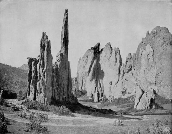
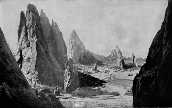
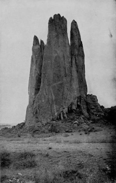
CATHEDRAL SPIRES, GARDEN OF THE GODS, COLORADO.
JUMBO TUNNEL, GRAND CAVERNS.
Being convinced in his own mind of its inaccessibility, Lieutenant Pike contented himself with the above brief notes in his diary, little thinking that his name would become perpetuated in the discovery, and that for all the ages thereafter Pike’s Peak would be one of the most famous of American mounts.
Not again was the lonely desolation of the mountain, or the marvelous scenery about its base, disturbed by the invasion of explorers until, forty-one years later, Geo. F. Ruxton came as a hunter to view its grandeur and make his camp within its game-haunted shadows. Soon afterwards gold was discovered in the vicinity, and then quickly followed a rush of adventurers whose hardy spirit accomplished that which Pike was fearful to undertake. An ascent of the peak was now made and the altitude ascertained to be 14,174 feet above the sea level.
Simultaneously, through the exploration of industrious prospectors, all the many amazingly curious formations which now render the region one of incomparable natural marvels were discovered, and the settlements of Manitou and Colorado Springs were presently made.
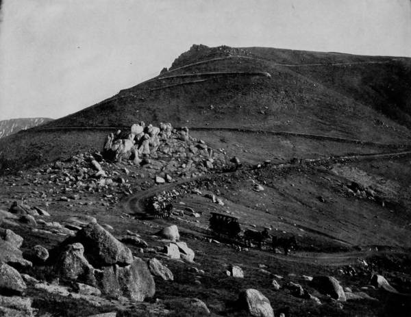
Pike’s Peak has been, since the time of Ruxton’s ascent, an object of great interest to travelers, and as early as 1852 a rough foot-trail was established to the summit, which was greatly improved twenty years later so as to admit the passage of vehicles. In the meantime, the towns of Manitou and Colorado Springs had grown steadily and the number of visitors increased until some one conceived the idea of constructing a railroad from the base to the summit. This idea was seized upon by some eastern capitalists in 1884, and a large capital being subscribed for the purpose, the work of building this unique road was begun. The original company, however, met with difficulties which they were unable to overcome for lack of capital, and in 1888 a second organization, under the title of Manitou & Pike’s Peak Railway Company, succeeded the first corporation, and adopting what is known as the Abt Cog-wheel System of Mountain Climbing, renewed the work thus interrupted. As the higher altitudes were reached the air became so rare that labor was extremely difficult, so that the strongest men were unable to exert themselves for more than a few minutes at a time. In place of wagons burros were employed to carry on their sturdy little backs all the needful materials of ties, rails, tools and spikes, up the steep mountain side, and without them the obstacles would have been insuperable. But thus the work went on until the 20th of October, 1890, when the last spike was driven and the highest railroad in the world received its finishing stroke. Special locomotives and cars were built and by the use of cog-wheels the pinnacle of Pike’s Peak was thereafter to be gained comfortably, if not swiftly. The length of the road leading to the summit is nine and one-quarter miles, and at times the grade seems positively appalling (being 25 per cent.) as the noisily-laboring engine pushes the passenger coach up the devious way, over great bowlders that have been flung down by some Titan from immense heights above; under overhanging brows of threatening cathedrals of stone; over mad-dashing waterfalls; through ever-green forests of silver pines, then into groves of dwarf aspens, until at length the route reaches up and on above the timber line. The steepness of the way still continues, but there are no longer abutting rocks, nor rush of water; the mountain now becomes a measureless pile of broken stones, between which the chipmunk and woodchuck play hide and seek; mists of clouds begin to gather, the snow line shows itself beyond the breath of summer, and a cold wind rushes around the peak making sport of the enterprise that invaded their frigid solitude.
THE CARRIAGE ROAD UP PIKE’S PEAK.—Since the completion of the cog-wheel railway to the summit of Pike’s Peak, the older carriage road is not so much used as in former times; yet it is still preferred by many tourists who travel for pleasure or to gratify their love for the grand and the beautiful in nature. Those who have the time to adopt this slower method of climbing the mountain will be richly repaid for their trouble in the glorious view that bursts upon them at every turn of the winding way. A journey over this carriage road, either up or down, is an event to be remembered throughout the remainder of one’s lifetime.
TEMPLE OF ISIS, WILLIAM’S CAÑON.
After two hours of pushing and climbing the train ceases its deep respirations and stands seemingly exhausted before the stone observatory that crowns the peak. Ah, now what a view, when the clouds pass away and the sun bathes with golden splendor the panorama that lies in the greater charm of indistinctness many leagues below! Towards the west and south and north is a mighty army of mountains, in companies and battalions, bold, rugged, majestic; always standing in review before the Captain and Creator of worlds who seems to have halted His regiment for inspection before an impending battle; while away towards the east spreads the fading prairies, losing themselves in the horizon; and down below, in a long stretch of landscape, is Colorado Springs, with its intersecting streets looking like a corn-field, and its smoke-stacks like scare-crows.
At other times a terrible snow-storm may be raging on the peak, while summer sunshine bathes the plains below; or, standing under the arch of a clear sky, the summit visitor may see the rolling clouds gathering into scrolls of darkness, and the livid lightning running through the storm that is breaking in torrential rain away down the mountain side. So that winter and summer, storm and sunshine, have their eternal meeting place on the age-swept breast of this giant peak, and at this trysting place of the extreme seasons is one of the most beautiful lakes that ever nestled in the bosom of a mountain.
THE JAWS OF CLEAR CREEK CAÑON.
WILLIAMS CAÑON, NEAR THE CAVE OF THE WINDS.
PILLAR OF JUPITER, WILLIAM’S CAÑON.
One of the most picturesque, grand and charming routes in the world is Ute Pass, which starts out of Manitou and climbs around mountains, through cañons, and emerges into a roadway that leads direct to Leadville. The most beautiful section of this pass, however, is in sight of Manitou, where it rises with bold precipitation around the mountain side and passes Rainbow Falls, which has a perpendicular descent of seventy-five feet, and looks down into Cascade Cañon, that is weirdly wild and awesomely imposing. The beauty of the pass is not more in the rugged margin, bordered with precipice and waterfall, than in the marvelous coloring of the roadway and abutting rocks of sandstone which at a distance appear like the petrified primaries of the rainbow wrapped around the mountain.
As the road winds upward a mile from Manitou, a branch strikes off from Ute Pass, and continuing another half mile around and up the mountain the visitor finds the way abruptly terminated by the entrance to a giant cave known as the Grand Caverns. Like most places to which visitors are attracted by flamboyant advertisements, these caves are not so wonderful as they have been represented, yet they possess considerable interest. The corridors are spacious and comparatively level, with here and there formations of stalactites and stalagmites of considerable beauty, though never large. Each compartment has been given a romantic and attractive name intended to increase the imagination, and give support to the marvelous tales with which guides entertain visitors, such as Canopy Avenue, Alabaster Hall, Stalactite Hall, Opera House, Concert Hall, Jewel Casket, Bridal Chamber, etc. The one principal object of interest in the Grand Caverns—a curiosity indeed—is what has been denominated the “Grand Pipe Organ of Musical Stalactites,” a formation which gives forth a great variety of sounds, capable, under the skilful touch of a player, of producing really ear-entrancing music. An “organist” is employed to entertain visitors by performing many familiar instrumental pieces, which, emanating from such a strange instrument, and echoing through the torch-lighted chambers of the grotto, produce a charming effect not easily forgotten.
In another compartment, particularly dark, if not noisome, and partitioned off by a grating to prevent profanation, are deposited some very ancient skeletons, which are said to have been found inurned here by the original cave discoverer in 1881. The photographer, by a trick, has pictured these bones as gigantic in size, whereas in fact they are slightly smaller than those of modern men.
TRIPLE FALLS, CHEYENNE CAÑON, COLORADO.—It would be exceedingly difficult to find a more gloriously beautiful scene than the one depicted by the photograph on this page. The pleasure of beholding it is also greatly increased by the assurance that it is absolutely true to nature, for the camera cannot misrepresent. Cheyenne Cañon is one of the wrinkles that sears the face of Cheyenne Mountain, some five or six miles east of Pike’s Peak, and both cañon and mountain are even more celebrated than their famous neighbor for the wildness and picturesque beauty of their scenery. This region is the Switzerland of America, except that its scenery surpasses that of Switzerland in the same proportion that America is larger and grander than the sturdy little republic of the Alps.
50A half-mile further around the mountain, towards William’s Cañon, and approached by a long stair-way that leads down to a dusky, rock-hewn platform, is the entrance to the “Cave-of-the-Winds,” as unforbidding a place as Mephistopheles himself could choose for his abode. This cave is nothing more than a tunnel, too narrow to admit the passage of a fat man without squeezing, and with ceilings so low as to compel a person of ordinary height to keep a stooped position. It is up and down steep stair-ways, across chasms of uncertain depths, and over obstructions which are quite enough to exhaust the visitor before half the cavern is traversed. The stalactites that are found here are very small, but often clustered in resemblance of chrysanthemums and other composite plants. Like the Grand Caverns, every little chamber in the Cave-of-the-Winds is designated by some curious or charm-impelling name, such as Cascade Hall, Canopy Hall, Boston Avenue, Diamond Hall, Hall of Beauty, Dante’s Inferno, Crystal Palace, etc.; while the coral-like stalagmites are represented by the tricky photographer as being of imposing size and bewildering splendor.
ANVIL ROCK, GARDEN OF THE GODS.
Emerging from the stifling, half-artificial Cave-of-the-Winds, and passing down the hill a few yards, a magnificent view of William’s Cañon bursts upon the enraptured vision of the spectator, the contrast from the dismal and disappointing cave lending additional sublimity to the scene. The south entrance to this herculean gorge is within a short walk of Manitou, and at the very door-way the walls rise up perpendicularly to a stupendous height and in fantastic forms that positively bewilder with a grandeur and beauty almost unexcelled by any scenery in the world. This gigantic gash in the mountain is evidently the effect of erosion, the result of a rushing torrent that drove down for centuries through the pass until it wore out a bed hundreds of feet deep and then found other outlet, or became absorbed in the process of drying-up which the world is undergoing. High upon the sides of this wondrous channel may be seen the distinct markings of glacial drift in deposits of shell-fish and bowlders, while in the bed there are fragments of tufa, betraying the action of volcanic fires which burned out ages upon ages ago.
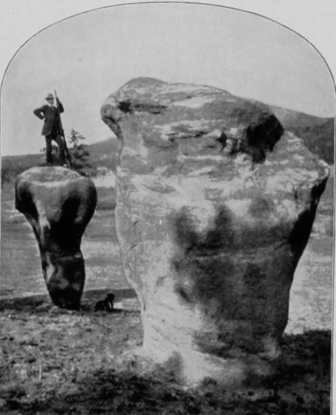
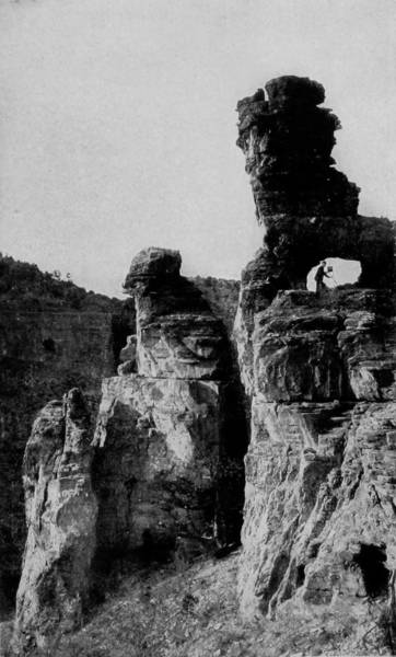
Two miles north of Manitou, and reached by a perfect roadway, over which carriage driving is a supreme pleasure, is the gate-way to that chaotically curious and fantastically marvelous district known as the Garden of the Gods. I know not who gave name to this region of grotesque formations, but its appropriateness lends belief that it was christened by one who had in mind the heroes of some eastern mythology, the Assyrian or Chinese, or the witchcrafts of the Samians. The Greeks, the Romans, and Egyptians conceived their gods as physically perfect, symmetrically beautiful; the idols of these people could never have suggested the wild, distorted, conglomerate forms that are marshalled in this garden of sweet confusion. Yet, the Greeks personified evil in horrid forms, and we have here their conception of deep iniquity done in nature’s sculpturings.
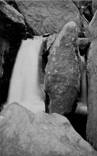
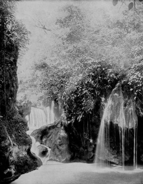
RAINBOW FALLS, UTE PASS.—Winding its serpentine way up the side of the mountain to the right of Pike’s Peak, is Ute Pass, along which a carriage-way has been made. The scenery is incomparably grand and beautiful. The pass has been cut in the side of the mountain by centuries of washings from the little stream that seeks its level by this course, breaking into numerous waterfalls and lending an additional charm to the picturesque surroundings by the music of its rushing waters. Rainbow Falls, so splendidly reproduced on this page, is one of the most celebrated and inspiring of the numerous cataracts to be found in this locality.
TOWER OF BABEL, GARDEN OF THE GODS.
The old legends tell us of the Sabbat, a nocturnal assembly at which demons and sorcerers celebrated their revels, and to the imaginative mind, stored with remembrances of the tales wherein are described the riot of nameless things and loathsomely fearful personages around the throne of Satan, it is easy to fancy this spot as the assembling place, and the strange forms of stone, that sit like dumb monstrosities waiting the call of a master, as the bodies of maleficent devils petrified in the very midst of their orgies. There on that mound squats old Sagittary, the man-beast who shot arrows of lightning from his bow, until he was struck down by a bolt of his own forging. A little beyond is the foul witch Sycorax, the dam of Caliban, whose raven wings shelter a demoniac progeny. In that depression, which looks afar like a seething quagmire, sits Abaddon, the promoter of wars, combustions and plagues, his face awry with fretful anxiety to renew his course of destruction. Behind a mound, that may well be called a breastwork, stand Ægæon, Cottus and Gyges, the brother triplets, each with a hundred arms and fifty heads, who made war upon the Titans and then stormed Olympus with stones plucked from the core of Ætna. Still further up the hillside, protruding from a gash in the side of a giant bowlder of red sandstone, is the distorted face of Hagen, that demon dwarf of a single eye, whose devilish claws tore out the heart of Siegfried. Everywhere, to the right and left, are these garish and ghastly remembrancers of the tales that make children crouch closer to grandmother’s knees, and people the darkness with forms infuriate. But the comical side is not wanting; for nature is protean in this godless garden of quaint conceits done in stone. If we have cause to laugh, it is at the Brobdingnagian frog that we see to the left of the door of the garden, sitting beneath a mushroom, with his gaze towards the mountain. But there is a whole settlement of giant fungi, each capable of giving shelter to a pond-full of modern-day frogs; and we can only explain the absence of other representatives of the croaking batrachia by the possibility that the one who has his home under the petrified umbrella was a political boss in his time and compelled all his followers to remain out in the rain when the big wet spell set in. On the first rock that we pass as we enter the garden, is the perfect outline of a stag’s head, with antlers laid back and nose high, as if startled by the sudden baying of the hounds; while a few yards within the entrance is a huge stone of two hundred tons weight perched like a spinning top upon the shoulder of another, so nicely balanced that every wind seems to threaten its stability, and yet centuries have failed to disturb its equilibrium. Still further on, and to the left, are to be seen a duck complete in all its outlines, and as demure as though she was hatching a brood. Then in succession is shown an alligator stretched out at full length, taking a siesta as natural as though it had life. Next in this procession of statuary wonders are Punch and Judy, peaceful folks in vermilion raiment, with faces full of righteous satisfaction, as if they were on their way to church. Punch’s cap is a little the worse for the long service it has seen, and Judy has a rent in her gown, but they affect no false pride and are evidently content with their fortune. Why should they not be happy, when within a few yards of them there is a poor old washer-woman bending over a tub, and a child tugging at her skirts? Certainly by contrast their lot is infinitely more bearable. And the washer-woman has been at her hard task as long as Punch and Judy have been on their way to the meeting house.
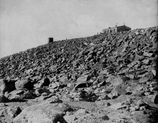
OBSERVATORY ON THE SUMMIT OF PIKE’S PEAK.—The Observatory is built of stones collected from the immediate vicinity. It occupies the highest point on the mountain, and was erected by the Government as a home for the officers who are employed in taking meteorological observations. It is a stormy region, and a place of unrest. Many tourists assert that snow falls here every day in the year, but while this is not literally true it is always cold enough to snow, even when the valleys at the foot of the mountains are sweltering in an August sun. The altitude is so great that tourists frequently faint before reaching the top, and in other instances blood is forced from the nostrils and mouth by the terrible pressure of the atmosphere.
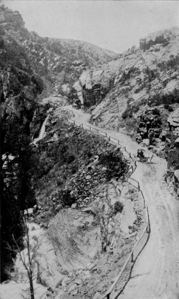
UTE PASS, NEAR MANITOU.
As we advance further into this museum of wonders, and turn our eyes away from the imps, reptiles and broad-smiling people of stone, our gaze is arrested by still stranger freaks of nature. There, before us, in awful sublimity, is the red sentinel who guards the north portals of the garden, flanked on either side by cathedrals and fortresses of amazing size, and aflame with brilliant coloring. There are thin slabs of sandstone standing on edge and lifting their heads a hundred feet high, on which the gods or witches have sculptured images of birds, animals, and moving caravans. A herculean lion is crouching on the peak of one, looking towards the north, where a bear and seal are eyeing each other from a lofty perch, uncertain of their safety, and undetermined whether to attack or retreat. Away up on the pinnacle of another peak sits a little old man in a rusty coat, but semi-respectable in a plug hat, very intently contemplating a coach-and-four driven by a pioneer stage engineer muffled to the chin in a shag overcoat, and bowling along over the dangerous comb of the Tower of Babel. Turning to look back, our sight is arrested by the towering form of Pike’s Peak, and a view that is incomparably and overwhelmingly grand.
Leaving the Garden of the Gods, and passing massive hills of gypsum, virgin in their whiteness and soft velvety reflection, the roadway north lies through a large prairie-dog village, where scores of wish-ton-wishes, of Indian name, scamper through the grass and lift themselves into comical postures on their little mounds to watch the carriage roll by. To the left is Glen Eyrie, where a few disaffected gods seem to have started a small, independent park of wonders, chief of which is Major Domo, a monolith of red sandstone thirty feet in circumference and more than one hundred feet tall; a frowning shaft with slightly inclined head, as if threatening the lesser forms about its base.
Five miles still beyond, nature has opened another museum of surprises, which some human invader has named Monument Park, but which might better be called Fiddler’s Green, or the Devil’s Ante-Chamber, for tradition tells us that the former place is located just five miles this side of Hades, and that all fiddlers en route stop there twenty minutes for refreshments. This assembling place of monstrosities; this parliament of satyr, sibyl, succuba and grim-visaged ogres, is rarely visited, not particularly because the sights superinduce nightmare, but probably because it is at the end of a long and dusty way, and the gruesome formations are not numerous. The views which delight those who love to fellowship with the incongruous and distempered products of nature, are pillars of white—almost calcareous—sandstone which the wind and sand have eroded into fantastic and outre shapes, leaving a top layer of dark limestone to complete the multitude of strange images.
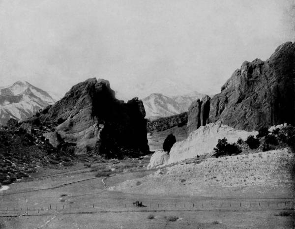
GATEWAY TO GARDEN OF THE GODS.—The next best thing to seeing a thing itself is to see its counterpart in a good photograph. Any one who has ever looked at an object through a camera will realize the force of this assertion, for a photograph is a perfect reproduction of the view as it is reflected in the camera. There cannot be any misrepresentation. Hence a good photograph is far more valuable than a painting or a drawing, let the latter be ever so well done, for the best artist that ever lived cannot draw or paint a scene just as nature made it. We see these facts clearly illustrated in this beautiful photograph. Every line, crevice and indentation of the huge rocks is brought out and stamped upon the printed page, while in the distance we observe the snow-covered summit of Pike’s Peak just as thousands of tourists have seen it with their natural vision.
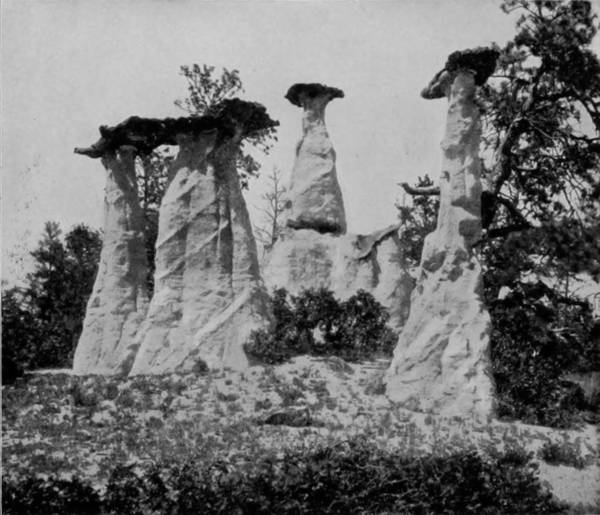
THE DUTCH WEDDING, MONUMENT PARK.
Here we find the Devil’s Anvil, apparently used by his swarthy majesty in the dim ages in fashioning his roasting spits. And near by is a concourse attending what is known as The Dutch Wedding, where all the goodly company are disattired outrageously, for not one has a stitch to his or her back. But they are more decent folks than old Mother Grundy, who stands in a nook to herself, trying to gossip with her shabby surroundings, and looking for all the world like a hag who has lost her teeth through salivation. Not far below her is The Idiot, as repulsive appearing a fellow as ever violated the laws of nature, and who might well be the offspring of a harridan like Mrs. Grundy. But there are other shapes and misshapes scarcely less wonderful; and if the visitor is at all imaginative, they take forms that are variable and astounding. Doré never pictured creatures of his fancy more weird than the wind-sculptures of Monument Park.
Turning back, and passing south of Colorado Springs some four or five miles, we are brought again into the Rocky range and enter at one of the Cheyenne Cañons, between beetling brows of tremendously high cliffs, through which a mad-dashing water-course has eaten its way. Whether we visit North or South Cañon, the view is augustly sublime and awful in its grandeur. We stand in the bed of the gorge and gaze upward on either side to a dizzy height, where the eagles float lazily about, just below the level of the summit, and build their nest upon the breast of the escarpment because the apex is sky-piercing in its loftiness. Yet tumbling down from that great eminence, where the gray spires of the peaks are dwarfed by distance until they grow thin as needles, is a stream of water, fed by springs that lie in the lap of still taller mountains in the rear, rushing in tumultuous flow until it breaks into seven waterfalls, and then checks its pace as it joins the river that runs on to the sea. A stair-way has been built alongside of the falls, by which the visitor may mount to a height of two hundred feet, and then stand upon a platform and watch the play of leaping waterfall as it breaks into rainbows and mist below, and hear its ceaseless song of praise mingling with the echoes that sport between the cañon walls. They who can feel no inspiration under the moving power of Cheyenne Mountain are hopelessly prosaic, who close their ears against the most entrancing hymns of nature.
It is not strange that the simple people who were reared centuries ago in this cradle of natural wonders entertained strange conceptions of the curious formations and mighty mountains that distinguished their surroundings from other places. Indeed, it would be matter for surprise had the primitive tribes of this region left no legends telling how Manitou, the Great Spirit, had upheaved the peaks, fashioned the grotesque images, scooped out the cañons and set his sign of ever-flowing mercy in the welling spring and roaring waterfall.
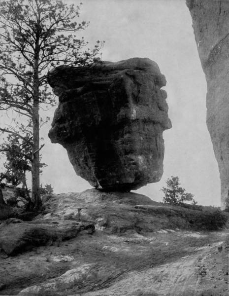
BALANCED ROCK, GARDEN OF THE GODS.—Balanced Rock is one of the most remarkable curiosities in the Garden of the Gods. It is an immense stone, weighing thousands of tons, balanced upon so small a pedestal that it seems as if the hand of a child could push it over, and yet the winter storms and the summer cyclones have raged around it for centuries without shaking it from its solid bearings. Nature does many things more wonderful than art or ingenuity of man can devise, and this is one of them. If Balanced Rock were the only curiosity in the Garden of the Gods it would be worth a trip there to see it, and as many of us are not able to bear the expense of such a trip it is gratifying to have within our reach, almost without cost, the living image of these wonders of nature.
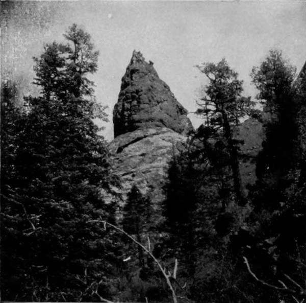
THE DEVIL’S TOOTH, CHEYENNE CAÑON.
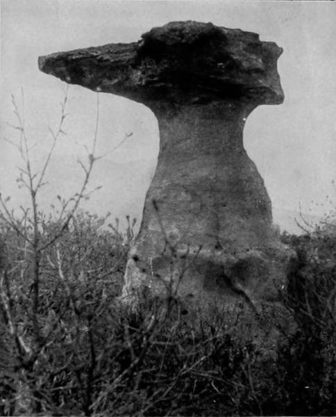
VULCAN’S ANVIL, MONUMENT PARK.
Among the several traditions which are preserved, we have the fragments of the following, which appear to have been left by the Toltecs, who undoubtedly at one time had their dwelling place in the Manitou district: A certain tribe, whose name is forgotten, living somewhere on the great plains towards the east, were driven from their homes by a mighty flood, and hearing that lofty mountains lay several days’ journey towards the setting sun, they fled to these for refuge. Having thus escaped the fury of what they believed was an angry god, and found safety under the benign shadow of Pike’s Peak, they came to regard it as the dwelling place of Manitou, and instituted a form of worship as an evidence of their gratitude. The climate being healthful and the region abounding with game, this tribe prospered and so increased in power that they made war on their less fortunate neighbors and reduced them to slavery. In other ways they so offended Manitou that, having once saved them from a deluge that drowned a large part of the world, he would now punish them with another flood visitation. And so the windows of heaven were opened, and the rain poured down in such volume that the valley was soon overflowed, and the rising waters began to rapidly climb the mountain sides. Perceiving that the deluge was an infliction sent upon them for their sins, the tribe gathered all of their possessions and with them hastened to ascend Pike’s Peak—which no one before had ever attained—to make an offering to the Great Spirit of all that they had, with the hope of propitiating his anger. All the members of the tribe succeeded in reaching the summit, where they prayed so fervently that the heart of Manitou relented and he consented to save the people by admitting them into heaven. But he would receive none of their earthly possessions, and these were accordingly thrown down and in time were changed into stone, so that by the accretion of the burdens thus rejected, the mountain became much higher than nature had formed it. The deluge was finally assuaged by a dragon which Manitou unchained from a huge rock in heaven, where it was kept prisoner, and sent down to drink up all the water. This dragon never came back to heaven, for after abating the flood it was turned into stone and laid on Cheyenne Mountain, where its crocodilian form may still be recognized by an observer stationed at Colorado Springs.
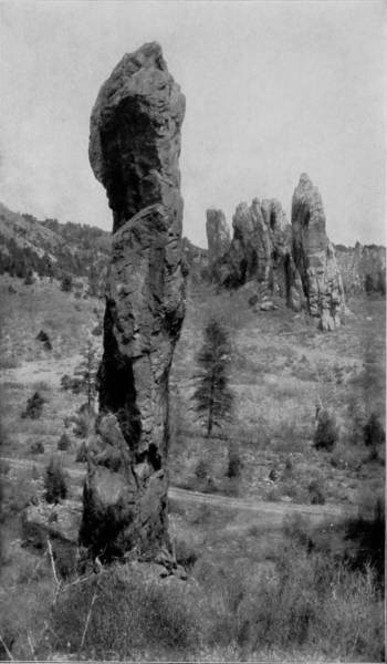
MAJOR DOMO, GLEN EYRIE.
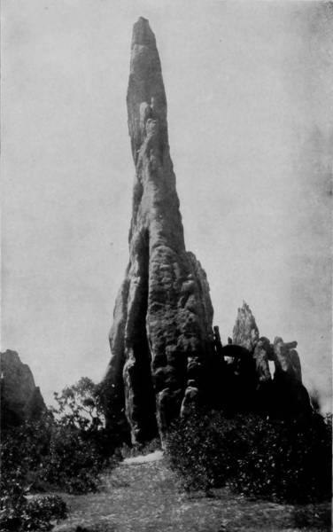
NEEDLE ROCKS, GARDEN OF THE GODS.
The two photographs on this page furnish us additional evidence of the wonders and beauties of the scenic region embraced by the Garden of the Gods and that immediate locality. There is no other place in the world like it. Nature has run riot here in the manufacture of strange and curious things. But the names which have been bestowed by chance upon these curiosities are not always appropriate. Needle Rocks, for instance, hear a much stronger resemblance to the ruins of some ancient cathedral than they do to the useful and pointed instrument whose name has been unadvisedly bestowed upon them. It is quite probable, however, that the bold pioneer who first beheld and named them was more familiar with needles than castles and cathedrals, and we can afford to let the misnomer pass with the assurance that it was given in good faith, and it certainly does not lessen the pleasure of beholding the object.
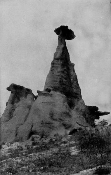
MEDICINE ROCK, MONUMENT PARK.
In after times, a new tribe came into the valley, and finding it fruitful and inviting, they established their homes and prospered so well that they soon grew mighty. For a long while no people were so grateful and devout, so worshipful and kindly as they; but power always begets arrogance, and in time these favored people became filled with conceit and began to esteem themselves as the equals of Manitou and to defy his power. This so offended the Great Spirit that he sent a mighty host of monsters out of the north to punish the vain bigots who thus contemned him. But some of the priests of the people had remained true in their devotion, and these now interposed with Manitou and made many offerings and sacrifices to appease his wrath. They so far prevailed that many of the people also purged their hearts of all iniquity, and Manitou was propitiated. As the host of monsters came swooping down, like an army of invincible Centaurs, suddenly Pike’s Peak appeared as if on fire, and the face of the Great Spirit was visible above it, shining with a splendor greater than the sun. On the next instant that invading army of satyrs and gorgons was changed to stone, and it is their bodies that stand, and lie, and posture in strange incongruity in the Garden of the Gods, Glen Eyrie, Bear Athol and Fiddler’s Green.
Many other legends are told to account for the singular formations, but none are so old and often repeated as the one here related. The region was certainly regarded by the early people who occupied it as possessing supernatural features, a fact attested not alone by the traditions so carefully preserved, but by rude carvings found on pieces of shale dug up in the valley, and winged images carved from gypsum, which appear to be very crude representations of a conception of preternatural creatures. These relics, however, are very few, and by many are pronounced spurious, so that it would be treading on doubtful ground to attempt to introduce evidence of the faith imposed by the Toltecs in such legends, or how they sought to perpetuate them. It is sufficient, therefore, to accept the curiosities that are in this wonderful garden merely as strange freaks of nature, without considering the tales handed down from a questionable source, pretending to show that the formations are the results of supernatural causes.
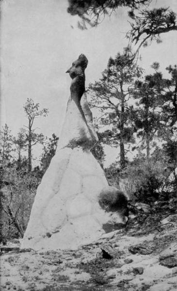
THE IDIOT, MONUMENT PARK.
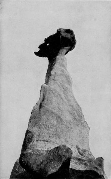
MOTHER GRUNDY, MONUMENT PARK.
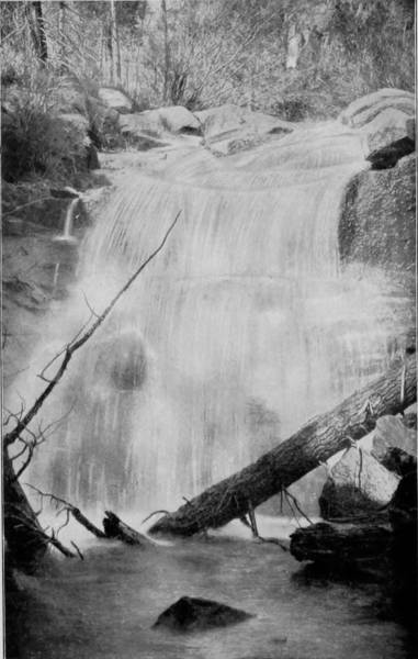
PHANTOM FALLS, NORTH CHEYENNE CAÑON.
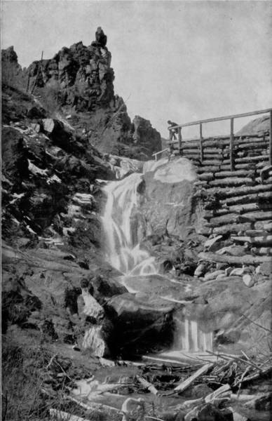
CASTLE FALLS, NORTH CHEYENNE CAÑON.
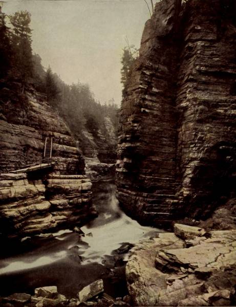
HELL GATE, AUSABLE CHASM.
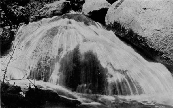
CRYSTAL FALLS, CASCADE CAÑON.

Having pretty thoroughly photographed the region roundabout Manitou, we hitched our camera car to a train on the Colorado Midland and started westward for Salt Lake, and to embalm the scenery that lay between. The way led around the base of Pike’s Peak, passed Cascade Cañon, and along Bear Creek, the road doubling upon itself and twisting around in the most tortuous course imaginable in order to get through the mountain defiles. Every foot of the route is grand, for there is no point that does not offer a view of scenic splendors beautiful, awesome and sublime. So rugged, tumultuous and wonderfully aberrant is the way, that the road plunges through no less than eight tunnels in traversing as many miles, and thus the traveler is whirled through the heart and arms of the mountains. The approach to Green Mountain Falls is up a valley which spreads out into a fascinating landscape, where the green of the meadowlands is set in a brown frame of sky-piercing peaks and impending cliffs. Fontaine River refreshes the glade that opens through the towering range, and a little way from the town the water goes leaping down Foster’s Falls in a sheet of liquid crystal. It is from this cascade that Green Mountain Falls takes its name. But besides this deep dash of broken water, there are many other beautiful falls in the vicinity which have served to make of the place a popular resort, indeed, one of the greatest in Colorado.
Onward we speed through valleys aflame with flowers and noisy with the laughter of gamboling streams, until, seventy miles from Colorado Springs, we plunge into a gorge known by its length as Eleven-Mile Cañon. It lies directly in the way to South Park, and is wonderful not so much for its darkling depths as for its marvelous petrifactions and other natural curiosities; its great masses of granite that have broken away from the peaks above and become a wall to the turbulent torrent that has cleft the mountains on its bridleless way to the sea. Thence our train winds around, up hill, past lakes, trout streams, and ranches, until we stop a while at Buena Vista, where the train pauses on the side of Gold Hill Mountain, fully one thousand feet above the town. From this natural observatory a beautiful view is had indeed: 64Below is the madly-rushing Arkansas, and the silvery Cottonwood Creek that joins its waters with the river at this point. Buena Vista is in a valley that glows like an emerald in the sun, across which rises a giant bank of mountains known as the Saguache range, in which we distinguish the collegiate trinity of mounts Harvard, Yale and Princeton, each being above 14,000 feet, and the former the second highest in the Rocky Mountains. Snowy and Sangre de Cristo ranges are also visible from this point, while eleven miles up Cottonwood Pass is Cottonwood Lake, a very gem set in a wilderness of snow-covered peaks. It is the same distance from Buena Vista to the summit of Mt. Princeton, reached by an easy wagon road, and on this lofty pedestal the observer sweeps the horizon with enraptured vision that commands a view of Salida, Poncha Pass, the wide expanse of South Park, and grand old Pike’s Peak one hundred miles away; Twin Lakes are twenty-five miles to the north, near Buffalo Peaks, where the sportsman finds a paradise and the health-seeker is exhilarated with balsamic winds; while all around, whichever way we look, the omnipotence of the Creator is exhibited in the mightiness of His handiwork as displayed in the weirdly broken landscape of jocund mountain peaks, bowlders of granite torn from the great heart of the earth, babbling streams, tumbling water-falls, and teeming valleys.
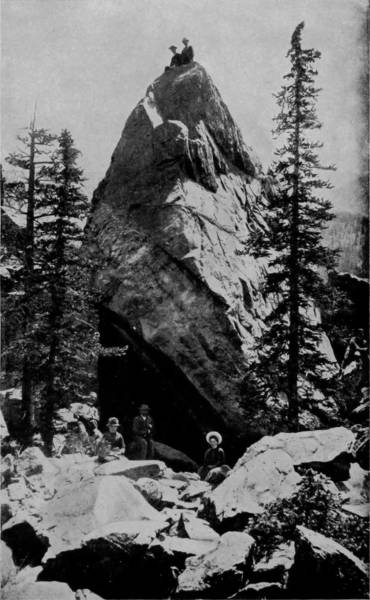
THE BEARS’ CAVE, NEAR GREEN LAKE.
After leaving Buena Vista the route was along the Arkansas River, through somewhat less rugged scenery, and on by Leadville, a city whose life is drawn from the bowels of the mountain. The whole territory is speckled and dotted with engine houses, and derricks, and flumes, and cavities, where the cupidity of man has laid a tribute upon the everlasting hills, and is collecting it by the sweat of his brow and the exercise of his genius.
The road continues to rise until we reach Hagerman Tunnel, a mammoth passage-way bored through solid rock. Its length is 2,164 feet, and to provide perfect ventillation the cut is eighteen feet wide and nearly as many high. The grade is a continually ascending one from Colorado Springs to this point, where an altitude of 11,530 feet is reached, and the slope towards the Pacific begins. Just as we emerge from Hagerman Tunnel, Loch Ivanhoe bursts into glorious view, a silvery sheet that wraps the cold feet of Snowy Mountain, while off to the left, like a sign of hope to the Christian traveler, is the Mount of the Holy Cross. This wonderful peak has become a veritable shrine, visited as it is by thousands, whose reverent feelings it never fails to excite. The mountain obtains its name and reputation from the clefts on its northern side near the summit, which are in the form of a cross and in which the snow lies at such a depth that summer suns never melt it. The height of this peak is 14,176 feet, but though not so lofty as some others in Colorado, it is apparently more exposed and holds the snow longest, the summit being nearly always covered.
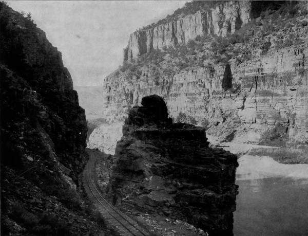
PORTAL OF GRAND RIVER CAÑON.—Grand and Green Rivers form the Colorado River, and all are rich in scenery of the most splendid and imposing character. A fine example of the beautiful and the grand blended and combined is seen in the photograph on this page. This is the gateway or portal, as it is aptly named, to other views equal in all respects to this one. A tour through this region is worth the toil and effort of a lifetime, and yet how few there are who can afford to spend their accumulations in giving to themselves such a supreme pleasure. But the camera overcomes the difficulty, giving us mirror-like reflections of these majestic wonders, in which we behold them as perfectly as if we were there in person.
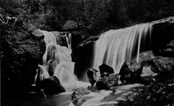
SYLVAN FALLS, CASCADE CAÑON.
The next point of interest on the way to Salt Lake is Glenwood Springs, situated at the junction of Grand and Roaring Fork Rivers. This place derives its importance from its numerous thermal springs of great remedial virtues, and the beautiful adornments which a lavish but well-directed use of money has provided. The situation, too, is one of great natural picturesqueness, as the scenery rivals that about Manitou. Glenwood Springs is located at the head of Grand River Cañon, which extends a distance of sixteen miles through colossal mountains, the palisades of which rise in serried ranks and terminate in towering columns and gigantic turrets frequently 2,000 feet above the bed of the river. It is through this tremendous chasm that the railroad runs, so that travelers have a perfect view of the Titanic scenery from the car windows, as they are whirled through it. Three miles from Glenwood Springs is No Name Cañon, while further up the stream is a tremendous fissure which admits the river, and on account of its wildly savage appearance is called Grizzly Cañon. Ten miles more towards the river’s source is Dead Horse Cañon, which may be gained only at the expense of most laborious effort, for the trail is over great bowlders and along crumbling walls which frown far above the roaring waters below. But away up in this darksome retreat of nature, where the lion and bear have their haunts, is Meteor Falls, that leaps almost out of the mouth of the cañon and hurls its waters down a precipice nearly one hundred feet deep, and then spreads through crevices of the rocks into a score of separate streams. Not far distant is Alexander’s Cave, which, though not so well known, is much grander in size and more curious with stalactite formations than those near Manitou, which have an undeserved fame. From the summit of a mountain just east of Glenwood, and reached by a walk of three miles, an immense expanse of charming scenery is viewable. For seventy miles towards the east extends the snow-crowned chain of the Continental Divide, while towards the north, like a babe sleeping to the lullabys of a brooklet’s voice, lies the White River plateau. Southward the observer’s vision swings across the valleys of Roaring Fork and Crystal River to the Elk range, and then sweeps around to the west, where it lingers on Book Cliffs, ninety miles away, which gleam with scintillant beauty, and inspire with a grandeur that fills the very soul with wondering ecstasy.
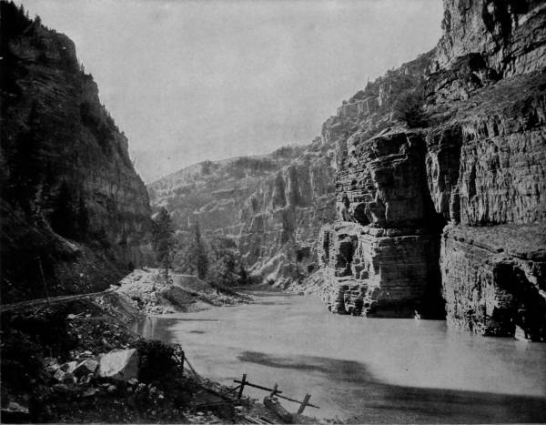
BOOK CLIFFS, WALLS OF GRAND RIVER CAÑON.—It would be a difficult thing to find a more beautiful picture than the one that embellishes this page. It is gloriously beautiful. The camera has done its work so well that the very reflection of the sun’s rays and the soft glimmer of the summer air are shown as perfectly as they could be seen with the natural eye. In fact it has been said, and truly so, that the camera is a good detective, for it discovers objects which are invisible to ordinary human sight, and prints them indelibly upon its sensitive plates. Hence good photographs, like those in Glimpses of America, are in many respects more desirable than a visit to the scenes themselves.
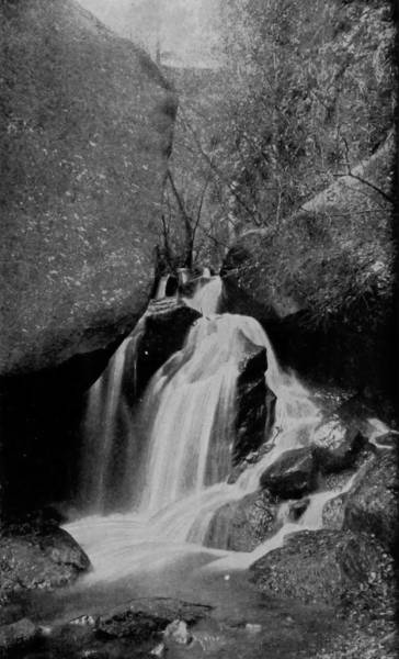
TRIPLE FALLS, CASCADE CAÑON.
The tumultuous anarchism of nature, the wild riot of natural forces, the savage disarrangement, the chaotically indefinable throes of internal madness that characterize the region, suggests other wonders of eruption and erosion, the dissolution and disorganization which have been wrought along the water-course and which has gnawed its way through these everlasting—nay, it would appear, transitory—mountains. The first travelers that fought their way into these vastnesses of cañon, roaring peak and soughing forests, carried back to civilization wondrous tales of the things which they had seen, and though discredited as the conceptions of perfervid imaginations, others were stimulated to seek the proofs, and confirm the theories that were offered by adventurous gold-hunters. The Government itself, unconscious of its own possessions, joined in the search for the wondrous evidences and sent expeditions into the Rocky Mountain regions to make topographic and geologic investigations, the results of which were to increase surprise. Operations in the west, chiefly against the Mohave Indians, made it necessary also for the Government to ascertain the most convenient routes for the transportation of supplies to the military posts in New Mexico and Utah, and in this search the Colorado River became an object of special interest, because if navigable it presented the easiest way to the seat of war. In order to determine the question, an expedition was despatched by the Secretary of War, in 1858, under the command of Lieutenant J. C. Ives, chief of topographical engineers. An iron steamboat fifty feet long was built in Philadelphia, which, being in sections convenient for transportation, was shipped by way of Panama to the Gulf of California, and put into service at Fort Yuma, at the mouth of the Colorado River, for an ascent of that stream.
The expedition thus conducted by Lieutenant Ives resulted in the exploration of a large territory which was before his advent therein a terra incognita, except that it had been partially traversed in 1540 by a few Spanish explorers, acting under orders of the Viceroy of New Spain, whose reports, however, were so crude as to be almost valueless. Ives succeeded in ascending the Colorado a distance of 425 miles in his steamboat, which he concluded was within seventy-five miles of the head of navigation during the most favorable season. The practical results were not of very great value, but his reports were extremely interesting, chiefly for the descriptions of marvelous scenery which they contained. Or, as he writes, “The region explored after leaving the navigable portion of the Colorado—though, in a scientific point of view, of the highest interest, and presenting natural features whose strange sublimity is perhaps unparalleled in any part of the world—is not of much value.”
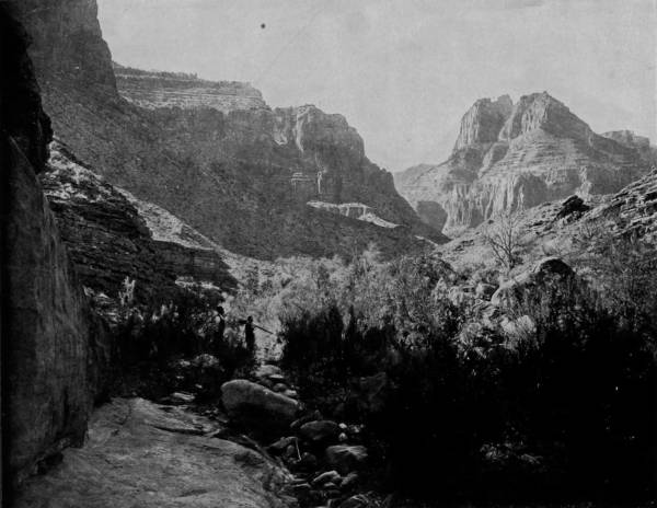
NEAR HANCE’S CABIN, GRAND CAÑON OF THE COLORADO.—The Grand Cañon of the Colorado, in Northwestern Arizona, is the supreme natural wonder of the world. It is formed by the Colorado River cutting its way through the high plateau of that region. It is not a mountainous district, but a level plateau, and for this reason the tourist sees no indication of the wonders soon to be unfolded to his astonished vision until he is right upon the brink of the awful chasm which gashes the earth in many places to a depth of more than one mile, at the bottom of which the river writhes and dashes like a tortured serpent. The towering cliffs on either side reflect all the colors of the rainbow, and when they are illuminated by the noonday sun the scene is indescribably beautiful as well as grand.
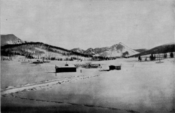
TEN-MILE PASS, NEAR KOKOMO, COLORADO.
Subsequently the Government determined to effect an exploration of the headwaters of the Colorado, and to this end Major J. W. Powell, chief of the U. S. Survey Corps, was sent out in charge of a party of a dozen equally intrepid men, with instructions to descend the stream if possible. To accomplish his purpose Major Powell provided four staunchly-built row-boats in which he and his party debarked at Green River Station, on the 24th of May, 1869, to run the gauntlet of cañon, maelstrom, rapids and waterfalls in the Green and Colorado Rivers. It is to Major Powell’s report that we are indebted for descriptions of the terribly sublime scenery of these two streams, which surpass in wonder every other region on the globe, and to the photographer of that expedition we make our acknowledgments for several of the views which are here reproduced. Mr. W. H. Jackson, who was for a long while attached to the survey corps as photographer, has also kindly furnished us with a number of exquisite pictures of the more accessible cañons of the Colorado, and to him, therefore, credit in large share must be given. Our own party, while thoroughly equipped for photographing regions contiguous to railroads, was unprepared for making a trip down the most dangerous of rivers, and we have accordingly been compelled to rely for our photographs of the Green and Colorado Cañons upon the work of those above credited. Condensing as much as possible the elaborate and entrancing report of Major Powell, as it fills a very large volume, his explorations may be thus hastily described:
Almost from the beginning of the trip, the scenery was delightful, variegated as it was with high-reaching cliffs dyed in great variety of colors, and long lines of mountains stretching away into an infinity of distance. The blue sky above, green shades of forest pines along the side, empurpled clouds catching the tints of a rising and setting sun, and lines of buff, red and brown, marking the strata of the banks, made a picture which no painter has the genius to reproduce. Green River enters the Minta plateau by the Flaming Gorge, and after reaching the heart of the chain turns eastward, then southward, cutting its way out by the splendid cañon of Lodore. Then following the base of the range for a few miles a sudden caprice seizes it. Not content with the terrible gash it has inflicted upon this noble chain, it darts at it viciously once more and cuts a horseshoe cañon in its flank 2,700 feet deep, then twists and emerges near the point of entrance. Thenceforward the river runs a tortuous course of 300 miles through gently inclined terraces which rise gradually as the stream descends. Further down, the Kaibab (Buckskin) Plateau rises to contest its passage, and a chasm 5,000 to 6,000 feet is the result. The whole province is a vast category of instances of river channels cutting through plateaus, mesas, and terraces where the strata dip up-stream, as will be more particularly described in the summary of Major Powell’s hazardous explorations.
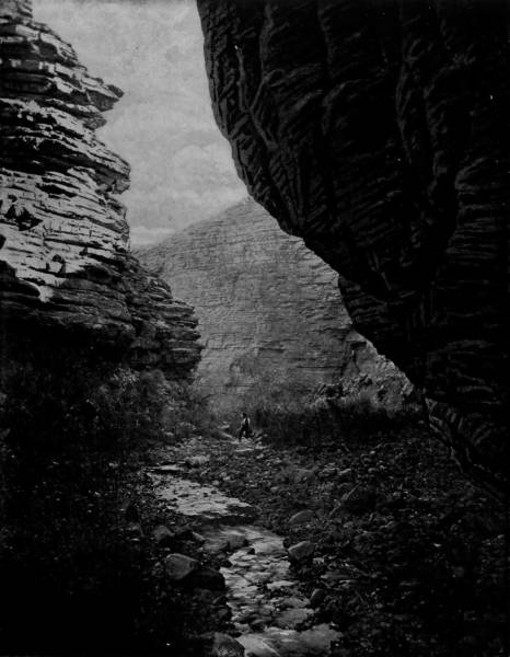
GRAND CAÑON OF THE COLORADO, NEAR THE TEMPLE OF SET.—This splendid photograph will convey to the mind of the reader a good idea of the awful grandeur of this locality. The picture is taken at the bottom of the cañon, beneath the overhanging cliffs which rise perpendicularly for thousands of feet, and between whose jutting crags the sun can penetrate only when it is at the meridian. It is well to contemplate such scenery, for it shows us our own littleness and impotency in the midst of the fearful and resistless forces of nature which God has set in motion.
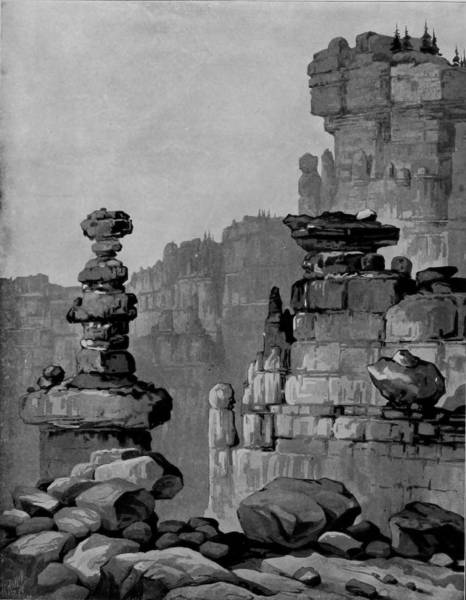
KAIBAB PINNACLES, GRAND CAÑON OF THE COLORADO.
Sixty miles from Green River the expedition floated into Flaming Gorge, a chasm fifteen hundred feet in depth, through which the water poured in swift measures and gave intimation of a more impetuous course further down. But undeterred the gallant party proceeded, through Red and Horseshoe Cañons, where the walls drew closer and big bowlders in the stream caused the water to boil with such ominous signs that portage around the obstructions was necessary. Thereafter the way became more difficult, for to dangerous rapids were added lofty falls, while along the vertical walls in places there was scarcely a space to set foot. Frequently the only possible means of passage was by lowering the boats by ropes attached to stem and stern, which taxed the strength of the men as well as the staunchness of the crafts. Time and again, in running rapids, the boats were capsized, but being built in water-tight compartments they righted themselves and were a refuge for the men, who clung to the sides until they drifted near the shore.
At one place, which Major Powell named Disaster Falls, one of the boats was swept over a fall and carried down to a rapid, where, striking broadside against a bowlder, it was broken in two, leaving the three occupants adrift to battle with the surging waters. Their escape from drowning was almost a miracle, due to good luck and the extraordinary efforts of their brave comrades. In this spot the walls were more than 3,000 feet high, and drawn so near together that only a thin strip of sky was visible, which at night-time appeared to rest on the jagged edges of the cliffs.
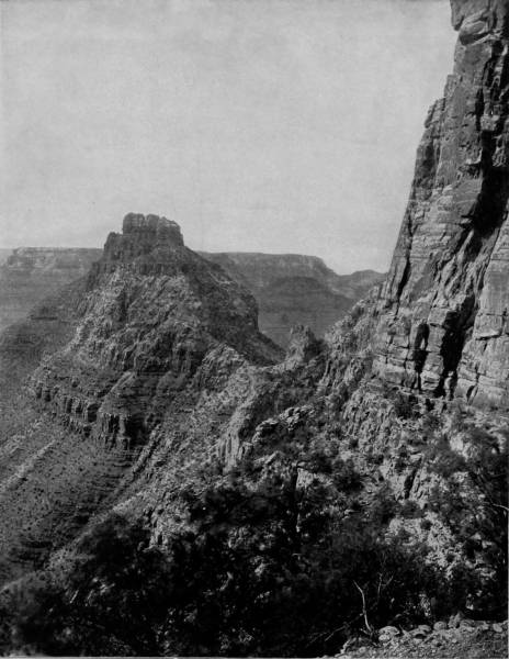
PYRAMID PEAK, IN GRAND CAÑON OF THE COLORADO.—We have on this page a general view of some of the rugged and imposing scenery of this region. The space is too limited, however, to show the towering heights of the cliffs to the right, which, when viewed from this standpoint, seem to bathe their faces in the blue vault of heaven. Along these cliffs, in many places, are found the deserted homes and the ghastly relics of an ancient race of men, long since perished from the face of the earth. They made their dwelling places in this rugged and secluded region as a protection against wild animals and still wilder savage men, but with all their precaution they were unable to shield themselves from the fury of their enemies, and another chapter of mystery and sorrow is thus added to the history of man.
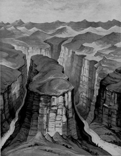
HORSESHOE CAÑON, GRAND CAÑON OF THE COLORADO.
Sixteen days after their departure from the starting point, the adventurous party were swept into Lodore Cañon, which extends its colossal walls along twenty-four miles of the river, sometimes in the form of hanging cliffs, tousled and gray with stunted vegetation, and rising nearly three thousand feet above the stream, and again in beautiful terraces of red sandstone that spread upward till they are lost in the Uintah Mountains.
It was not until two months after leaving Green River Station that the explorers approached the junction with Grand River. As they dropped out of the winding gorge whence they had descended, they caught a view of a wondrous fissure, down which poured a rushing stream which appeared to issue from the very bowels of the earth, so bottomless seemed the channel. It was Grand River, which, in many respects, is the counterpart of its sister stream, having the same features of waterfall, rapid, and awesome cañon, into which the sunlight falls only at midday, and where night-birds are on the wing almost constantly. It is a fitting thing that these two remarkable rivers should mix their fretful waters and flow on together in a perpetual quarrel, through arid plains, until they end their differences in the Gulf of California.
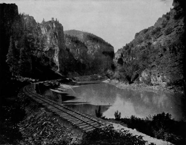
ECHO CLIFFS, CAÑON OF GRAND RIVER.—The resounding cliffs on either side of the valley so beautifully photographed on this page, give name to the locality. The echo is one of the finest known in any region of the world, and the place will some day become as famous as similar resorts in Europe, which attract thousands of visitors every year. The scenic regions of our country are so vast, so diversified, so grand and so beautiful that the time is not far distant when pleasure seekers, and those desiring rest and recreation from the toils and worries of business will turn their footsteps in this direction, rather than toward the less attractive and more distant wonders of Europe.
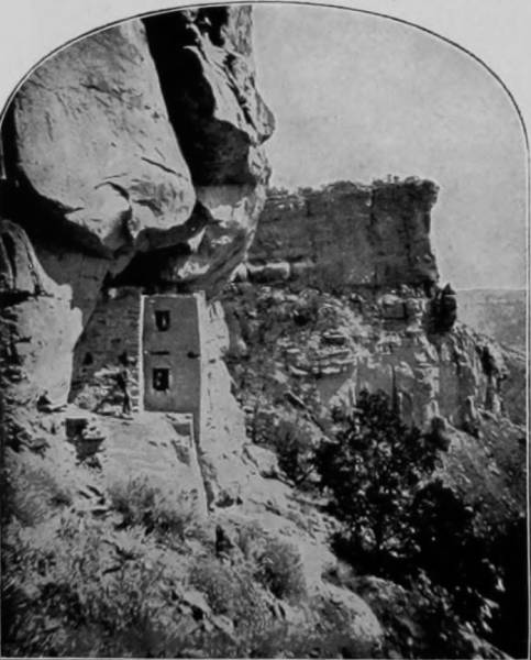
CLIFF RUINS IN THE CAÑON.
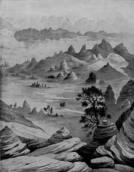
JURASSIC TERRACE OF THE CALAB, GRAND CAÑON OF THE COLORADO.
The Colorado River is formed by a union of the Grand and Green Rivers, the former taking its rise near Long’s Peak, and the latter having its source in the Wind River Mountains of Wyoming, within a few miles of Fremont’s Peak. The two streams form a junction near a point known as Fort Morrison, in southeast Utah, at the head of the most appalling gorge in the world, called the Grand Cañon of the Colorado. The scenery along both the Grand and Green Rivers is inexpressibly sublime, rising into towering buttes out of the plains; soaring to the clouds in the form of mountains; revelling in the wildest disorder of landscape, and the most turbulent panorama of mad-dashing streams between walls of amazing height; but the wild passions of both rivers seem to be united with more than double intensity when they mingle their waters and thence become one turbid flood gnawing a way through the southwest desert. How hard it is for the inexperienced eye to catch a mental view of the tremendous chasm of the Colorado, however realistic a descriptive writer may paint it, for height and depth almost lose their significance when we apply the terms to dizzy crags above, and the dark lonesomeness of Plutonian recesses beneath.
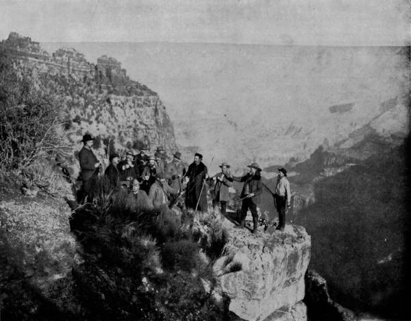
BUFFALO BILL AND PARTY AT POINT SUBLIME, GRAND CAÑON OF THE COLORADO.—During the summer succeeding his triumphal tour of Europe, General W. F. Cody (Buffalo Bill), accompanied by a party of friends, visited and explored the famous Grand Cañon of the Colorado. The photograph on this page represents the party at lunch on Point Sublime. Buffalo Bill is a warm friend and admirer of the author of Glimpses of America, and loaned this photograph to him for reproduction in this work. It was taken by the special photographer who accompanied the party on the tour referred to.
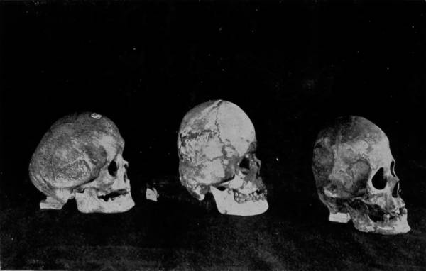
SKULLS OF THE CLIFF DWELLERS.
The region through which the chafing waters of the Colorado run is forbidding in the extreme, a vast Sahara of waste and inutility; a desert too dreary for either vegetable or animal life; a land that is haunted with wind-storm, on which ride the furies of desolation. But there is in its very bleakness and consumptive degeneracy something that appeals to the observer; a sympathy is aroused that stimulates contemplation of the wondrous works of Deity, of the omnipotent hand that sows seeds of plenty in one place and scatters tares of poverty in another; that makes the valleys to laugh with verdure, and the plains to wail with nakedness. In this sterile domain, this borderland of phantasy and reality, nature is so distraught that the supernatural seems to hold carnival, and in the forms which we here behold there is constant suggestion of chaos. The earth is parched to sterility, and yet there are abundant evidences that in centuries long ago this same land was abundantly blessed with an amazing fertility. Depressions ramifying the region are the dry beds of what were once water-courses, and the whole plateau is garish with rocks over which life-giving floods once poured their vivifying nourishment. But the friable nature of both soil and rock has given way before the action of the river, which has constantly deepened its path and drained the moisture from the earth. Now it is like the Moon, a parched district, save for the single stream which, instead of supplying sustenance, is eating its vitals. The channel is worn more than 5,000 feet deep, with stupendous banks terraced and wrought into shapes most fantastic, and at places diabolic. Imagine a chasm that at times is less than a quarter of a mile wide and more than a mile deep, the bed of which is a tossing, roaring, madly impetuous flood; winding its way in a sinuous course along walls that are painted with all the pigments known to nature! What an imposing spectacle; what a scene of awesome grandeur; what a sublime vision of mightiness! But the geologist sees in the crags and precipices, the strata and bed of that brawling stream, the handwriting of nature, the easily decipherable physical history and geology of the land. The antiquarian and ethnologist, following after, translate the relics of rude habitations found along the cliffs, and the skulls fortunately recovered from the ruins, into a story of the ancient people who in the long centuries ago dared to make their homes in these almost inaccessible fastnesses, driven to such refuges by the ruthless hand of persecution.
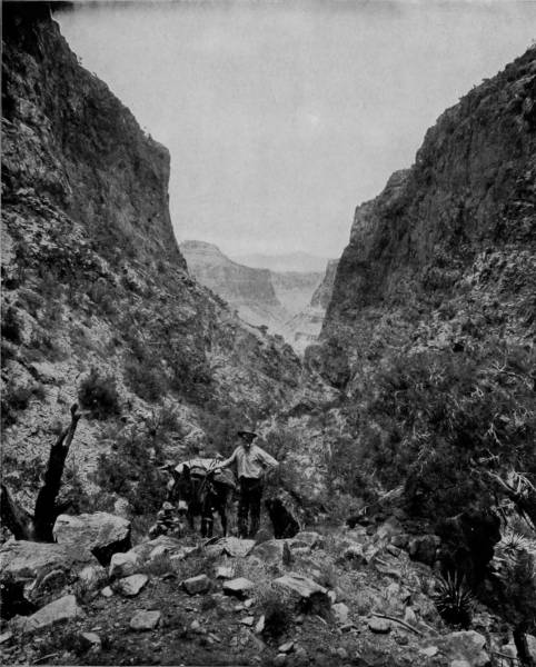
HANCE’S TRAIL, GRAND CAÑON OF THE COLORADO.—Between the beetling crags and along the serpentine windings of the river, we obtain in this photograph a fine view of some of the wonders of the Grand Cañon. The beauties of the scene would be largely enhanced if the varied hues of the red and orange and amber tinted cliffs could be painted by the camera with the same accuracy that it gives to all the other surroundings and characteristics of the picture. This much to be desired result is largely accomplished, however, in the splendid colored photograph of a similar scene in this connection, and which in fact gives a better idea of the splendors of the Grand Cañon than any photograph in a single color could convey.
ROTARY SNOW-PLOW.
In many places, Major Powell found overarching cliffs, formed by the river in making a sharp bend eating away the shale and gypsum of the base. Occasional inlets were observed, cut by creeks that have been dried up for ages; and following up one of these deep aroytas a little way, he came to a natural stair-way of small and regular terraces that led up fully 500 feet, to an oasis of vegetation, out of which burst a spring that lost its waters before they had run a hundred feet down the parched cliff. Just below this point a beautiful glen was found, where the walls of the cañon appeared to almost meet above the deep and quiet river, which, though narrowed, had an unobstructed channel. The cliffs were of a marvelous beauty, appalling in height, but as variegated as a bed of poppies, with their strata of white, pink, saffron, gray and red.
Passing out of Glen Cañon, the party came directly into the jaws of another chasm, where the river had excavated an amphitheater of mammoth proportions, and then plunged into a gorge where both the walls and bed of the stream were of marble so pure that they shone with an iridescent splendor, and the now lazy river reflected its walls until looking down was gazing into the heavenly depths. Just below was Cataract Cañon, the entrance to which was indicated by a lofty cliff that, from a distance, shone like a crystal mountain, but which, on closer inspection, was discovered to be the source of many springs whose waters glinted in the sun like jewels.
PORTION OF THE ANCIENT PALACE AT CASA GRANDE, ARIZONA.
PART OF THE ANCIENT CITY WALL AI CASA GRANDE, ARIZONA.
The ruins of the ancient city of Casa Grande, in Arizona, and others not less wonderful in the same region, prove that this portion of our country was once inhabited by a powerful and numerous race of people, who possessed a civilization and knowledge of the arts on a parallel with Babylon and Assyria. The walls of these ruins are built of adobe, thick and strong, and guarded with buttresses and towers to meet and repel the attacks of an enemy; but their age and the date of their occupancy cannot be determined. They may be a thousand years old, and it is just as probable that they date back two or three times that distance into the unknown past. Their origin is a profound mystery, and must always remain such.
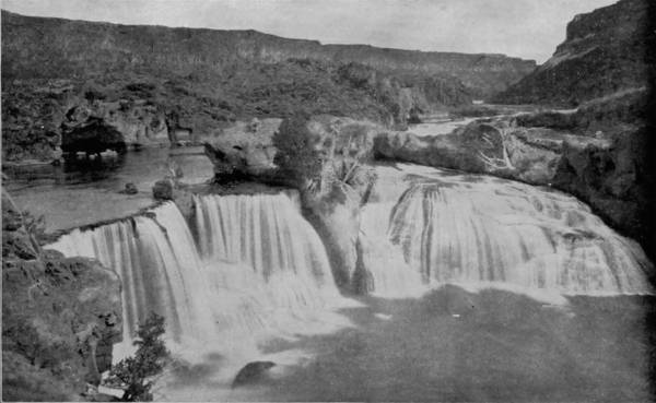
BRIDAL VEIL, SHOSHONE FALLS.
In many places the arid desolation which was noticeable in the upper portion and on the plateau, and which stretched away on both sides, was broken by patches of vegetation, and the appearance of side gorges in which creeks were still contributing to the river. Storms were not infrequent, too, and these occurring where the cañon walls were a mile high and close together, produced an effect that was almost supernatural in its awfulness. Every obscuration of the sun brought dense shadows in the chasm, which were split in twain by blinding flashes, while the deep thunder echoed sharply between the cliffs, producing a roaring sound that was almost deafening. Such rain-storms, however, were invariably confined to the immediate vicinity of the cañon, the territory lying two or three miles east or west continuing parched, with hardly a cloud above it. Even more remarkable than the stupendous walls which confine the Colorado River, are the ruined cave habitations which are to be seen along the lofty and apparently inaccessible ledges, in which a vanished race long years ago evidently sought refuge from their enemies. These caves are no doubt natural excavations, but in many instances the mouths are partially walled and otherwise fortified. They were reached by very narrow, precipitous and devious paths, and being extremely difficult to attain by the occupants themselves, presented an impregnable front to invaders. But the security which such cavernous retreats afforded was purchased at great cost, for we wonder how the inhabitants managed to exist, situated as they were in a desolate country, where there was great scarcity of both vegetable and animal life. Perhaps the most strikingly beautiful sections of the Grand Cañon are the Vermilion Cliffs, and the Temples and Towers of the Virgin, the one fading into the other. Vermilion Cliffs are a great wall of remarkable height and length of persistent proportions, and so ornate with natural sculpturing, and rich with parti-coloring, as to justify the most extravagant language in describing them. Each of the several terraces has its own style of architecture, and yet they contrast with one another in the most harmoniously artistic manner. The Elephantine ruins on the Nile, the temples of Greece, the pagodas of China, and the cathedrals of Southern Europe, present no more variety of pleasing structures than those encountered in descending the stair-way from the high plateaus to the deep Cañon of the Colorado. As we pass from terrace to terrace, the scene is constantly changing; not only in the bolder and grander masses which dominate the landscape, but in every detail and accessory as well: in the tone of the color-masses, in the vegetation, and in the spirit and subjective influences of the scenery. The profile of the Vermilion Cliffs is very complex, though conforming to a definite type and composed of simple elements. While varying much in different localities, it never loses its typical character. The cliffs consist of an ascending series of vertical ledges, rising story above story, with intervening slopes covered with heaps of rocks, through which project their fretted edges. The composite effect given by the multiple cliffs and sloping water-tables rising tier above tier, is highly architectural, and shows in striking contrast with the rough and craggy aspect of the cliffs of other regions. This effect is much increased by the aberrant manner in which the wall advances in promontories or recedes in alcoves, and by the wings and gables that jut out from every lateral face. In many places side cañons have cut the terrace platforms 83deeply, and open in magnificent gate-ways upon the broad desert plain in front. We look into them from afar, wonderingly and questioningly, with our fancy pleased to follow their windings until their sudden turns carry them into distant, unseen depths. In other places the cliffs verge into towering buttes, rearing their unassailable summits into the clouds, rich with the aspiring forms of a pure Gothic type, and flinging back in red and purple the intense sunlight that is poured upon them. Could the imagination blanch those colors, it might compare them with vast icebergs, sent from the face of a glacier and floating majestically out to sea.
Grand, glorious, sublime, are the pictorial cliffs of vermilion hue; yet a more magnificent spectacle is presented by an unfolding of the panorama that stretches southward, revealing as it does the heavenly crowned and resplendently painted temples and towers of the Virgin. Here the slopes, the serpentine ledges, and the bosses of projecting rock, interlarded with scanty soil, display all the colors of the rainbow, and in the distance may be likened to the painter’s palette. The bolder tints are of maroon, purple, chocolate, magenta and lavender, with broad bands of white laid in horizontal belts. The cañon proper is 7,000 feet deep here, but less than two miles beyond it stands the central and commanding object of this sublime painting, the glorious western temple that looms up 4,000 feet above the rapid river. This, however, is only the foreground of a matchless panorama, for right opposite are a mighty throng of structures wrought in the same exalted style, separated by two principal forks of the Virgin, known as the Parunuweap and the Mukuntuweap, or Little Zion Valley. At one point the two side cañons swing around and form a junction, where the walls break into giant pediments covered with the most remarkable and picturesque carvings. The sumptuous, bewildering and mazy effects are boldly discernible; but detail is lost when attempt is made to analyze it. The flank of the wall receding up the Mukuntuweap is similarly sculptured and decorated for two miles, and then changes into new kaleidoscopic forms still more wonderful and impressive. A row of towers half a mile high is sculptured out of the palisade, and stands in relief before its face. There is an eloquence in their forms which stirs the imagination with a singular power, and kindles in even the dullest mind a glowing response. Just behind them, and rising a thousand feet higher, is the eastern temple, crowned with a cylindric dome of white sandstone. Directly in front is a complex group of white towers, springing from a central pile and mounting to the clouds. The highest peak in this cumulus mass is almost pure white, with brilliant streaks of carmine descending its vertical walls, while the truncated summit is a deep red.
Nothing can exceed the wondrous beauty of Little Zion Valley, which separates the two temples and their respective groups of towers. In its proportions it is probably equal to Yosemite, but it very far exceeds that natural wonder in the nobility and beauty of sculpturing. We are not surprised that a Mormon zealot gave to this cañon the name of Little Zion, since the scenery is so imposing as to immediately and powerfully suggest those “houses not built with hands.”
Far to the westward is to be seen the last palisade, lifting its imposing front behind an army of towers and domes to an altitude of more than 3,000 feet. Beyond it the view changes quickly, for it passes at once into the Great Basin, which to this region is another world.
The passage of the Grand Cañon of the Colorado, that most fearful, colossal and extraordinary chasm in all the world’s surface, was completed on August 29th, the perils which beset the explorers being constant and the hardest work unremitting. Nor was it accomplished without great sacrifice. The dangers so increased that three of the men deserted, whose fate, however, was most tragic, for they were shortly afterwards murdered by Indians. Starvation threatened the party, for repeated capsizing of the boats resulted in the loss of nearly all their provisions, while exposure brought on illness, so that the men were in a desperate situation when they finally emerged from the jaws of the cañon and found succor among some hospitable Indians.
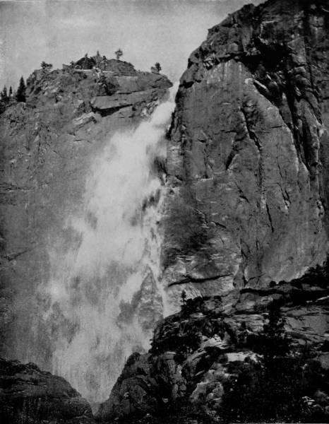
FALLS OF THE PARUNUWEAP.—The Parunuweap is a wady, or dry bed, during a great part of the year, but which carries in season much of the rainfall of southwest Colorado into the San Juan River, and thence into Colorado River. Throughout a great part of its length the bed of Parunuweap is a cañon of enormous depth and precipitous sides, into which, at frequent intervals, streams that are suddenly swollen by heavy rains pour their overflow. The illustration above shows one of these temporary falls, flowing in large volume over a precipice of the cañon that is nearly perpendicular and quite 200 feet high.
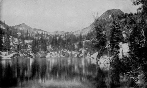
TWIN LAKES, COTTONWOOD CAÑON, UTAH.

Grand River valley is followed by the railroad from a point about forty miles north of Leadville for a distance of nearly two hundred miles, and until State Line is reached, when the road cuts across the plains of Utah, which are relieved by little diversity of landscape until Mount Nebo, of the Wasatch range, breaks into view. The scenery along Grand River is, however, extremely beautiful, being very rugged and at times mountainous. The road leads through several cañons that have very high vertical walls, around ledges, over bridges, and takes an occasional plunge into the midnight of tunnels bored through solid granite. The landscape which meets the traveler’s vision when he reaches Utah is very different from that which characterizes Colorado, the difference being apparent almost when the border is reached. After passing the plateau the route is by Provo Lake, where the region becomes broken, and near-by are lofty ledges, over one of which rushes a pellucid stream that is formed by melting snows from the adjacent mountains. Provo Falls is a beautiful sheet of water, dashing down a height of forty feet and then spreading away until lost in Provo Lake.
The Wasatch range is now plainly visible, coasting the eastern shore of Great Salt Lake, and winding around to the southwest until they enclose a valley that by Mormon industry has been converted into a veritable paradise, ramified as it is by canals that render it prolific with nearly everything that fertile soil can produce.
The Wasatch range forms one of the most important topographical features of the Cordilleran system; in fact, it marks the central line of elevation of this great mountain region, and is the dividing ridge between the arid interior basins of Nevada and the high and relatively well-watered plateau country that drains into the Gulf of California. All the mountain formations here are on a scale of universal magnitude, while in their structure are to be seen the 86effects of dynamic forces, which have folded and twisted thousands of feet of solid rock as if they were as pliable as so many sheets of paper. To the westward the range presents a bold, abrupt escarpment, rising suddenly out of the plains of the Utah basin, and attains its greatest elevation within a couple of miles of its western base. To the eastward it slopes off very gradually, forming a succession of broad ridges and mountain valleys whose waters drain into the Great Salt Lake through cañons and gorges cut through its main western ridge. The altitude is from 10,000 to 12,000 feet above sea level, so that snow is continuous on the summits, while a condensation of the eastward moving atmospheric currents, produced by the chill on the mountain peaks, furnishes a constant supply of water to the mountain streams, and from which the valleys derive their exceptional fertility. A view of the range, as observed from one of the islands in Salt Lake, presents a mountain wall more than 100 miles in length, of delicately varied outline, the upper portion wrapped in a mantle of snow, but dotted with patches of pine revealing all the intricacies of its rocky structure, and cut through at short intervals by deep cañon gashes of rare grandeur and beauty. A striking feature is presented in the old lake terraces which mark the former beach-line of ancient Lake Bonneville, of which the uppermost is 940 feet above the level of the present lake, and can be traced with few interruptions from one end of the range to the other. Lake Bonneville was formerly the great inland sea of which Great Salt Lake is now a part. It covered nearly one-sixth of what is now Utah territory, and there is evidence that it was connected with the sea by an arm extending to the Gulf of California. The upheaval of mountains through volcanic action reduced its bed and gradually confined its waters to the lower basin of what afterwards came to be known, because of its saline waters, as the Great Salt Lake.
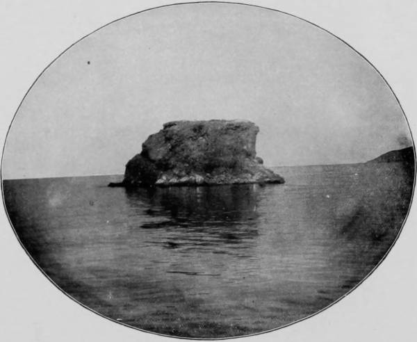
BLACK ROCK, GREAT SALT LAKE.
As early as 1689 mention was made of this remarkable lake, which was somewhat indefinitely located and described by Baron La Houtan, “lord-lieutenant of the French colony at Placentia, in New Foundland,” in a work which was first published in the English language in 1735. But though known at such an early day, it was not until 1849 that a survey of the lake was made by Howard Stansbury, captain of topographical engineers, U. S. A., though General John C. Fremont circumnavigated it in 1844, giving names to its several islands and prominent points. The settlement of Mormons in the Salt Lake Valley, near the shores of the lake, served to bring the Dead Sea of America into prominence, and to this fact was largely due the action of the Government in ordering a survey of the great basin to be made. The lake was found to be nearly eighty miles long by fifty broad, and to contain such a quantity of salt, sulphates of silver, chlorides of magnesium, potash and alum, that its solid contents were about four times greater than that of ocean water, while its specific gravity almost equalled that of the Dead Sea. Having no outlet the lake has a fluctuating level, dependent upon the amount of inflowing water and solar evaporation, which varies each season, but though theoretically the lake ought to be diminishing, the fact remains that it is rather increasing, showing marked encroachment on the eastern shores, while on the west there is an apparent recession of its waters, a peculiarity not easily explained.
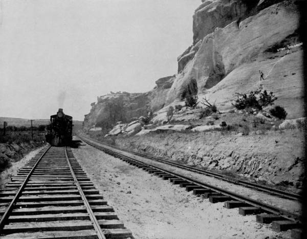
UTALINE, OR LINE OF DIVISION BETWEEN UTAH AND COLORADO.—It was a poetic as well as an artistic idea that led to the marking of the division line between Utah and Colorado upon the everlasting hills. It is a place of interest to all tourists, who never fail to comment upon it and admire the execution of the idea as the trains pass by. A path has been worn on the rocky side of the hills by the numerous tourists who have personally visited the place, and in the photograph we see an enthusiastic traveler returning to the waiting train after satisfying his curiosity.
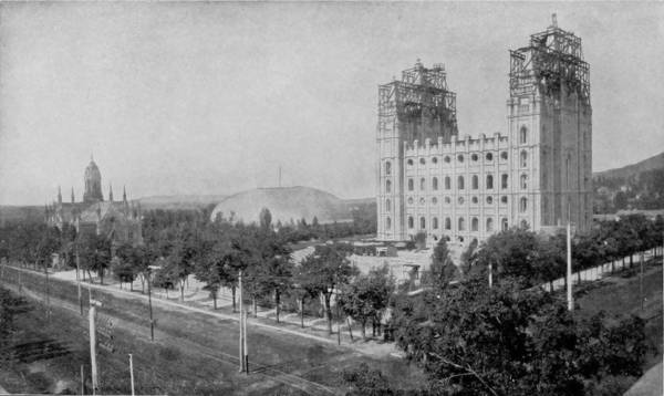
THE TEMPLE, SALT LAKE CITY.
There are a number of islands in Salt Lake, the two largest being Antelope and Stansbury, which rise abruptly to a height of 3,000 feet, terminating in rocky ridges that range north and south, and from which a marvelously beautiful view is had of the surrounding scenery, varied by towering peaks, boundless plains, fields of grain, irrigating ditches, prosperous farm houses, and away to the southeast a delightful vision of Salt Lake City. Other islands in the lake are those known as Gunnison, Fremont, Carrington, Dolphin, Black Rock, Mud, Egg, Hat, and several others that are so insignificant as to appear to be unworthy of any name. The total area covered by the lake is about 2,500 square miles, or nearly 400 square miles more than the State of Delaware, and its elevation above the sea is 4,000 feet.
But if Great Salt Lake is one of the prime curiosities of America, its municipal namesake may well claim the distinction of being one of the artificial wonders of our land. Salt Lake City is the sublime result of Mormon persecution, having been founded by that alien sect in 1847. The history of their expulsion from Nauvoo, Illinois, and Gallatin, Missouri, is familiar to every school-boy, yet there will ever linger about the story of their flight, across the winter-swept plains of Iowa and the icy prairies of Nebraska, to the desert lands of Utah, a glamour of romance, second in interest to that of the exile of the Acadians, as told by Longfellow in Evangeline.
In this valley of desolation, as it then appeared, Brigham Young, the Moses of his people, founded a city and re-established a hierarchy which has persisted and prospered to a degree that invites the world’s amazement. By industry as remarkable as it was well directed, the desert was converted into an oasis, and the bare earth, with its poverty of sand and sage-brush, was made to cover its nakedness with the green vestures of almost unexampled fecundity.
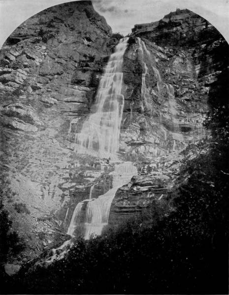
PROVO FALLS, NEAR PROVO CITY, UTAH.—There is perhaps not in the whole world a more beautiful sheet of water than Provo Falls. It plunges over a precipice forty feet high, striking boulders on the way that break it into jets and misty lace-work which reflect and re-reflect the sun’s rays in a thousand brilliant and ever-varying colors and tints, until the beholder is entranced with the loveliness of the vision. During the wet season, when the volume of water is greater, the falls are even more beautiful than they are represented in this photograph, but under the most adverse circumstances they are lovely enough to satisfy the most critical taste. Provo Falls constitute one of the chief attractions of Utah scenery.
90The town thus established under harsh conditions grew into the stature of a city, whose very isolation seemed to contribute to its prosperity. For the first score of years the place was in nearly all respects one of refuge, where the church was dominant and where priestcraft and polygamy were the two institutions upon which the life of the sect depended. We are not surprised, therefore, to find that the first great building erected in Salt Lake City was a tabernacle, with a seating capacity for 12,000 persons, the largest hall without pillar supports in the world, and that next to this a tithing house was built, for it was a principle with the Mormons that the church should be supported by levies upon the communicants of one-tenth of their annual profits, whether such earnings came from the soil, merchandise or the trades. Then followed the building of an endowment house, where the rites of the church were celebrated; and besides a residence for the president or chief priest, there was erected a structure known as the Bee-Hive, for the accommodation of Brigham Young’s harem, also an assembly hall, and lastly a Grand Temple, costing nearly $3,000,000, which, after twenty years, is just now approaching completion.
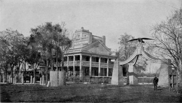
BEE-HIVE HOUSE, SALT LAKE CITY.
The City of Salt Lake, with a population of 44,000, is about seven miles from the southeastern shore of the lake, is beautifully laid out with streets 132 feet wide, the gutters of which are kept clean by the constant running of pure water through them, brought down from the Wasatch range and conducted thence through a myriad of ditches to irrigate the soil.
Salt Lake City is one of the chief military posts of the United States, and Fort Douglas, situated about five miles from the city, on a gently sloping hillside at the termination of Red Butte Cañon, is a delightful place and commands an unobstructed view of the entire valley. A mile toward the south is Emigrant Cañon, from which point it is said the Mormon pioneers first caught sight of the verdureless plain which they were destined to convert into a very Eden of productiveness. One of the greatest attractions in the neighborhood of the city (about eighteen miles distant) is a noted bathing resort called Garfield Beach which, during the summer season, is visited by thousands of persons who there indulge the incomparable luxury of a bath in the marvelous Dead Sea of America. The water is so buoyant that those who have not mastered the art of swimming find equal sport with those who are most expert, for they can lie on the delicious waves and be rocked like a child in its cradle, without putting forth any effort whatever. Just back of Garfield’s Beach is a great cavern in the Oquirrah Mountain side known as the Giant’s Cave, the entrance to which is some 300 feet above the lake level, though it is plainly evident that in former years the opening was submerged. When the cave was discovered, in 1860, it was found to contain several complete human skeletons, recklessly disposed, as though they were the victims of slaughter or starvation. It was a custom among the Utes to place their dead in caves and in hollows among the rocks, but the irregularity of the positions of the skeletons found in Giant’s Cave lends plausibility to the belief that the remains are those of a band of Indians who, having taken refuge there, were exterminated by their more powerful enemies.
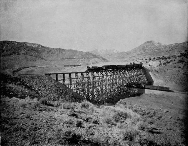
DOUBLE CIRCLE, NEAR EUREKA, UTAH.—This photograph is interesting to lovers of mountain scenery as well as railway engineers. The distant hazy mountains form a soft and beautiful background, with their dark sides and white, snow-crowned peaks; while in the foreground we behold as fine an example of railroad engineering as can be seen anywhere in the world. In climbing the mountains it is necessary for the tracks to wind and zigzag and cross themselves back and forth, until the train which first passes beneath the bridge a few minutes later dashes across the top of it a hundred feet or more higher up. It is exceedingly interesting to occupy a point where the whole scene is in view and watch a train pursuing its devious way around and over this portion of the track.
BRIGHAM YOUNG’S GRAVE, SALT LAKE CITY.
About forty miles north of Salt Lake City, and on the main line of the Union Pacific Railroad, are two remarkable chasms known as Echo and Weber Cañons, which are not only sublimely grand by reason of their lofty and often vertical walls, but are also marvelously curious on account of the weird formations which distinguish them. The first one reached on our trip from Salt Lake was Weber Cañon, which invites attention and admiration not so much by beetling cliffs as by its great variety of scenery and the kaleidoscopic changes which appear at every hundred yards of advance into it. The cañon is not always narrow, nor are the walls invariably high, for there is a succession of all kinds of mountain scenery, including stretches of beautiful meadow land and fertile fields wrapped about the feet of giant peaks; colossal gate-ways leading into dark defiles; mighty summits breaking way through cloudland; slopes covered with pine and aspen; and ridges that appear to have been fashioned by gods of war into towers, bastions and crenelated battlements. Weber River has forged its way through this chasm, and along its sinuous and rocky bed the railroad runs, sometimes cutting under an overhanging ledge, again almost scraping the sides of the walls that swing so near together, then leaping out of night-infested chasms into broadening valleys that are green and russet with prolific fruitage. While admiring the peaceful landscape and contemplating the happy environments that render the valley a place of delightful habitation, our dreamy reflections are suddenly disturbed by a sight of what seems to have been most appropriately named The Devil’s Slide, a formation whose singularity entitles it to consideration as one of nature’s marvels. The hill upon the side of which this unique wonder occurs is about 800 feet high, composed of a dark red sandstone, whose face has been scarred by some internal disturbance that has caused to be cast up from the base two gray parallel walls of white sandstone, which rise to a varying height of twenty to forty feet above the general surface of the hill, and are not more than twenty feet apart. This remarkable slide begins at the summit and continues to the base, where it is reflected in the clear waters of Weber River, opposite Lost Creek, producing a vision that is weirdly grotesque and sublimely curious.
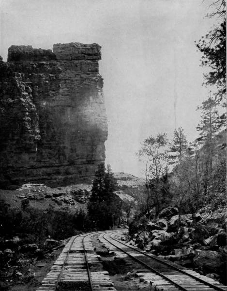
CASTLE GATE IN PRICE’S CAÑON, UTAH.—We observe in this photograph not only a castle gate but the castle itself, with its battlements and buttresses, as natural and picturesque as any of the ruins that lend their attractions to mediæval Europe. The scene is a grand one as we observe it from the railroad tracks, and to this grandeur there is added a vision of indescribable loveliness when the surrounding country is viewed from the dizzy heights of the castle walls. Such a view is one that never can be forgotten; it impresses itself upon the mind as a permanent and lasting memory. All tourists who have been this way will instantly recognize their old friend, the castle gate, in this splendid photograph.
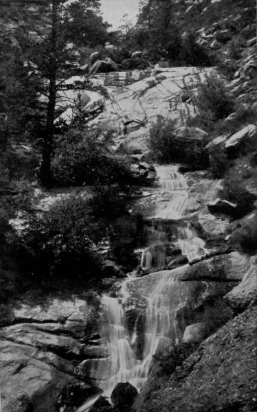
JOSEPHINE FALLS, BEAR CREEK, UTAH.
“Echo Cañon,” says an English traveler, “is a superb defile. It moves along like some majestic poem in a series of incomparable stanzas. There is nothing like it in the Himalayas that I know of, nor in the Suliman range. In the Bolan Pass, on the Afghan frontier, there are intervals of equal sublimity; and even as a whole it may compare with it. But taken for all in all—its length (some thirty miles), its astonishing diversity of contour, its beauty as well as its grandeur—I confess that Echo Cañon is one of the masterpieces of Nature.”
One of the first objects which claims particular attention near the entrance to the cañon from the west is Pulpit Rock, which is near the village of Echo. This projection receives its name from its suggestive appearance as well as from the popular tradition that Brigham Young occupied it to preach his first sermon in Utah. The rocks and precipices which line the way are variegated with subdued tints, heightened by the pronounced coloring of the mountain vegetation that covers the slopes and spreads out in occasional level tracts at the base. Remarkable and often fantastic formations diversify the cañon, which for their fancied resemblance to artificial things have received such appellations as Steamboat Rock, Gibraltar, Monument Rock, etc. Our further advance brings into view towering cliffs that seem to be suspended from the sky, and again the walls reach over the way like mighty claws, and exhibit their serrated peaks in a series of ruins that in the distance conjure the imagination and present a vision of monoliths, temples, galleries and castles, such as bestrew the old world. Hanging Rock and Castle Rock are two specially bold promontories that give suggestion of Nilotic and Rhenish ruins, a verisimilitude that is intensified by the knowledge that when Johnston invaded Utah in 1857 the Mormons fortified many of the cliffs of both Weber and Echo Cañons, the fading wrecks of these structures being still visible.
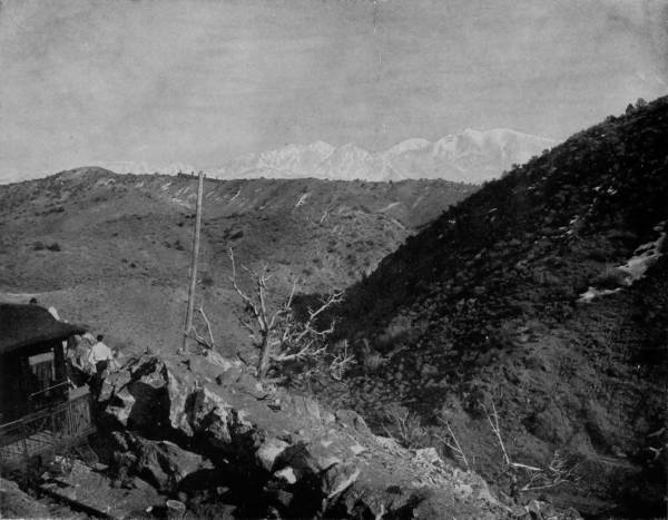
MOUNT NEBO, WASATCH RANGE.—Mount Nebo is about sixty miles almost due south of Salt Lake City, and about twenty-five miles south of Provo. Its snow-covered summit may be seen for a hundred miles or more, for the atmosphere of this region is so clear that the vision has almost an unlimited range. This mountain, as well as many other points and places in Utah, was named by the Mormons on account of its fancied likeness to its celebrated Old Testament namesake. It is one of the finest mountain scenes in the whole Western country.
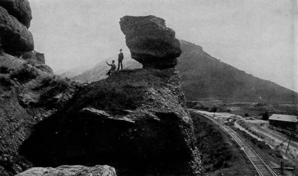
PULPIT ROCK, WEBER CAÑON.
Church Buttes and The Witches present a strange conglomeration in uniting religion with superstition, for they appeal to the two strongest attributes of human nature. From the west the “Witches” first come into view, a group of fantastically-wrought images that appear like chaotic creations, the rock-carved dreams of distempered boyhood, the feverish personations of old Granny Bunch’s tales. There they stand, like an assemblage of weazened and wrinkled wizards plotting some scheme of diabolism, though everlastingly anchored to the eternal hillsides, where, like Giant Grim, they can do nothing more than make faces at passers-by.
Church Buttes are more harmonious in their outlines, as well as massive in their proportions, simulating as they do cathedrals and meeting houses, some with towers and spires, and others of less ostentatious architecture, but all bearing some intimation of a worshipful purpose. But these curious efforts of nature are not confined to the cañons named, nor a limited district, for directly north of Green River, and reached by a Government trail leading to Yellowstone Park, are what are known as the Bridges and Washakie Basins of Bad Lands, a region that is remarkable for its capricious formations, the results of upheavals, glacial scouring, and erosions by wind and water. This district of marvelous forms is a part of Fremont county, covering an area of twenty by twenty-five miles. The country is a mixture of limestones, shales and calcareous sandstones, with occasional green clays, marls, and whitish sand, the latter often drifting into long dunes. Towards the south end of this dry valley there is a chain of bluff escarpments, extending about fourteen miles, and it is in these escarpments that the most remarkable examples of Bad Land erosions are to be found. The ridges rise 300 feet above the valley and present a series of abrupt, nearly vertical faces, worn into innumerable architectural forms, with detached pillars standing like monoliths some distance from the walls. Along the dry ravines the same curiously picturesque forms occur, so that a view of the whole front of the escarpment, with its salient angles, bears a striking resemblance to the ruins of a fortified city. Enormous masses project from the main wall, the stratifications of cream, gray and green sands are traced across their nearly vertical fronts like courses of immense masonry, and every face is scoured by innumerable narrow, sharp cuts, which are worn into the soft material from top to bottom of the cliff, offering narrow galleries which give access for a considerable distance into this labyrinth of natural fortresses. At a little distance, these sharp incisions seem like the spaces between series of pillars, and the whole aspect of the region is that of a line of Egyptian structures. Among the most interesting bodies are those of the detached outliers, points of spurs, or isolated hills, which are mere relics of the beds that formerly covered the whole valley. These monoliths, often reaching 100 feet in height, rise out of the smooth surface of a level plain of clay, and are sculptured into the most surprising forms, surmounted by domes and ornamented by many buttresses and jutting pinnacles.
OLDEST HOUSE IN SALT LAKE CITY, UTAH.—Whether or not this is actually the oldest house in Salt Lake City might be a disputed question, for when it comes to ancient things, or to the oldest inhabitant, we generally find that there are several claimants for the honor. But we can say with sincerity and truth that this is one of the oldest representative houses of the Mormon capital. It is one of the better class, erected immediately after the city was laid out, and it has been occupied continuously ever since. The house and its surroundings have an air of quiet restfulness that is exceedingly inviting, and a tired man could sleep like a new-born infant under the board roof with the rain pattering down upon it.
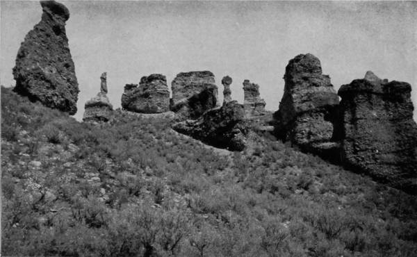
WITCH ROCKS, WEBER CAÑON.
Clarence King, U. S. Geologist, in a monograph on the Bad Lands, says: “It is not altogether easy to account for the peculiar character of this erosion, resulting as it does in such singular vertical faces and spire-like forms. A glance at the front of these Bad Lands shows at once that very much of the resultant forms must be the effect of rain and wind-storms. The small streams which cut down across the escarpment from the interior of the plateau, do the work of severing the front into detached blocks; but the final forms of these blocks themselves are probably in great measure given by the effect of rain and wind erosion. The material is so exceedingly fine, that under the influence of trickling waters it cuts down most easily in vertical lines. A semi-detached block, separated by two lateral ravines, becomes quickly carved into spires and domes, which soon crumble down to the level of the plain. It seems probable that some of the most interesting forms are brought out by a slightly harder stratum near the top of the cliffs (like the strange, and often uncouth, examples in Monument Park, Colorado), which acts in a measure as a protector of the softer materials, and prevents them from taking the mound-forms that occur when the beds are of equal hardness.”
As we follow down Green River, the same effects are observable in the vertical bluffs which extend along the shores, images to which fancy has given such names as the Devil’s Tea-pot, the Giant’s Club, Vermilion Cliffs, and many others, for the geologic structure is the same through nearly the whole of southeast Wyoming. But the so-called Bad Lands are not wholly confined to Wyoming, for they are met with in both North and South Dakota, west of the Missouri River; though for beauty and magnitude, those of Wyoming are incomparable.
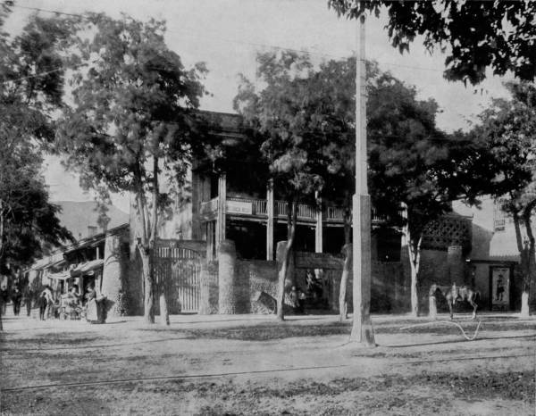
MORMON TITHING HOUSE, SALT LAKE CITY.—This is one of the houses occupied by Brigham Young during his lifetime as a residence and for office purposes. We presume from the name that it was also the appointed place for the payment of tithes by his devoted followers, and if this is true we can safely estimate that many millions of dollars were carried through its gates and deposited in the coffers of the Church as a tribute from ignorance and superstition to the superiority of cunning and avarice. The Mormon leaders have all been shrewd money getters and have not overlooked themselves while taking care of the interests of the Lord.
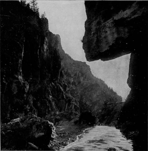
HANGING ROCK, AMERICAN FORK CAÑON.
From Green River Station we doubled our track and returned to Ogden, where we took some very beautiful views of Ogden Cañon, the Narrows, Adam’s Falls, and the mountains that soar very far skyward at the city’s rear. But our stay here was limited to two days, when we took the Oregon branch of the Union Pacific for a visit to Shoshone Falls, on Snake River, which for size as well as magnificence takes a position second only to our world-wonderful Niagara.
Directly after leaving Ogden the road enters the valley of Bear River, which it follows as far north as Weston Falls, a distance of about seventy-five miles. The scenery along this part of the route is almost as rugged as that of Weber Cañon, being a succession of cañons and lovely stretches of level lands brought into the highest state of cultivation by Mormon industry. At Pocatello the road branches, one of its iron arms extending northward to Helena, while the main line turns westwardly to Oregon. The district which it penetrates after leaving Pocatello is desert-like and devoid of interest almost to the western limits of Idaho, if we except the point where the road crosses Snake River. Here the American Falls go brawling and boiling over immense basaltic rocks that are struggling with the impetuous stream, and whose tops are flecked with tufts of foam thrown up by mad-dashing waves. But the waters have not yet worn a chasm through the desert, which spreads away on either side a level plain, until forty-four miles distant the dreary monotony is broken by three buttes that rise into view out of the uninviting landscape. We now enter a region that is somber beyond all power to describe; a wretched desolation that is relieved by no vegetation save of sage-brush, which straggles through little rifts in the earth and barely lifts its head above the surface. These are the lava beds that extend from Beaver Cañon all along the north side of Snake River, until they lose themselves in the stream where it turns due north and draws a boundary line between Idaho and Oregon. The land appears to have been cursed with such a fire as destroyed Gomorrah, for the eye wanders over nothing but the fiery sputa of volcanoes, that, having wrought the fullest destruction, were in turn destroyed. Everywhere we look there greets our vision waves of lava that lashed the earth until, tired of their devastating work, they became congealed, or were arrested by the hand of omnipotence. But between the knolls of scoria are occasional depressions, which are cross-seamed and cracked until in many places the fissures are hundreds of feet deep, apparently extending in depth to the very vitals of the earth. Some of the crevices are only a few inches in width, while there are others several feet broad, into which creeks have lost themselves, and lead into bottomless pits.
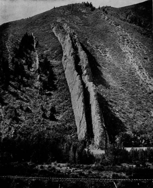
THE DEVIL’S SLIDE, WEBER CAÑON.—This great natural curiosity is in Weber Cañon, about forty miles north of Salt Lake City. It is composed of two parallel walls of white sandstone, thrown up by some ancient convulsion of the earth, which stand out in bold contrast with the dark red sandstone of the hill. The “Slide” is nearly 800 feet in length, the walls rising to a varying height of twenty to forty feet above the general surface of the hill. A few feet to the left of the “Slide” there is another wall of similar formation, but almost covered by the accumulated washings of centuries. It is a pity that so remarkable a curiosity should have received so profane an appellation; but we presume there would be no regrets if the devil should be required to take a hasty run down the top of the ragged and jutting walls of his famous slide.
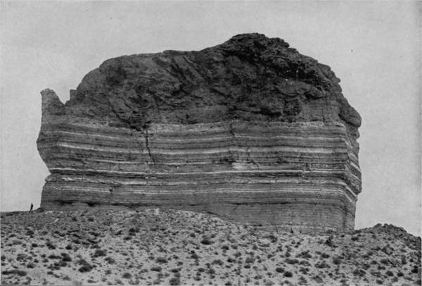
TEA-POT ROCK, GREEN RIVER.
It is a little more than one hundred miles from Pocatello to Shoshone Station, at which point we left the train, and by private conveyance struck across the lava fields, a distance of twenty-five miles due south, over the dustiest wagon-road that mortal ever traveled. The way is like a switch-back, up and down over sharp waves of lava, with desolation and discomfort obtrusive companions, and nothing rising above the dull undulations except a purplish tint in the horizon, marking with faint intimation a range of mountains one hundred miles away in Utah. For more than four hours we traversed this wearying stretch of parched and begrimed desert, without a sign of the river, until at length turning the base of a higher ridge we came suddenly upon the brink of a tremendous chasm, and there, 1,200 feet below our feet, was the river which we had journeyed so far to view. Long before reaching this objective point, we had heard a deep, rumbling noise that seemed to emanate from the earth’s internals, but now, with astounded sense of the awful, we beheld the cause. There before us was the vexed waters of a large river pouring over two precipices, the first 82 feet and the second 210 feet high, producing by the final plunge a colossal caldron, from which the mists rose up in boiling clouds that ever and anon hid the falls from sight.
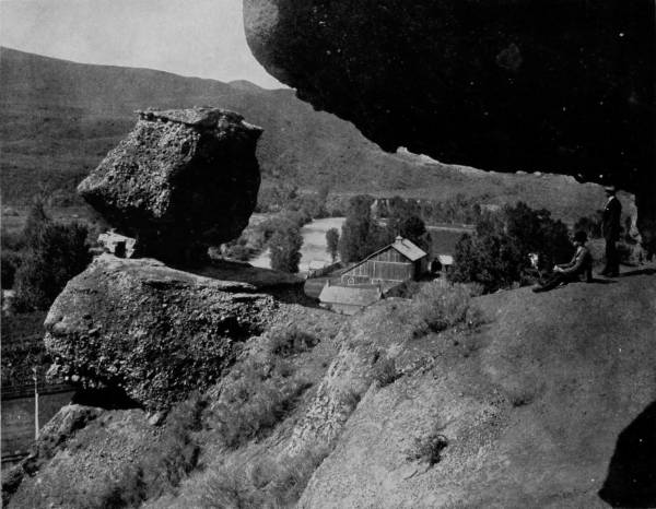
PULPIT ROCK, ECHO CAÑON, UTAH.—This singular overhanging rock, with the reading stand in front, has been known as Pulpit Rock since the early days of Mormonism in Utah, owing to the fact that it was used by Brigham Young as a pulpit in the delivery of his first sermon within the present limits of that territory. But it is not for this reason that we include it in Glimpses of America, for we have no sympathy whatever with Mormonism or its doctrines. The rock is one of the prominent curiosities of Utah, and as such it is here represented. The surrounding scenery is very beautiful, with glimpses of the winding river and the rolling hills as a background. It is a favorite resort for tourists, both on account of the scenic beauties and the healthfulness of the pure western air.
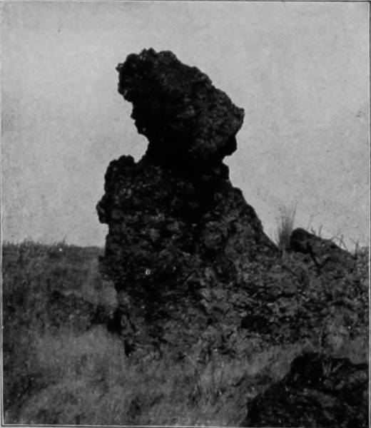
MAIDEN OF THE BAD LANDS.
A glance at this tremendous waterfall more than compensated for all the annoyances and discomforts that we had endured. It was a scene of positively bewildering majesty; a vision of the incomparably grand; an object lesson teaching the mightiness and mysterious ways of God. In the deep diapason of its voice we recognized nature’s hallelujah, and the thunderous boom of its plungings was like a chorus of invocation welling from a million throats. Its lovely grandeur, bursting out of the heart of desolation, is the personification of powerful, awe-inspiring sublimity, an exaltation of deity, an inspiration to the soul, a very glorification and apotheosis of nature.
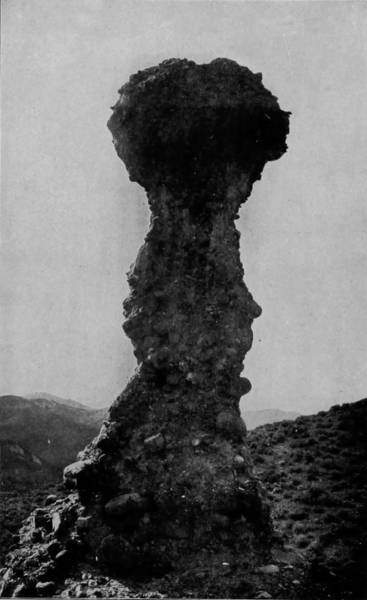
WITCH ROCK, BAD LANDS OF WYOMING.
Pausing on the bank to contemplate and measure the colossal wonder of the falls, we saw the emerald stream gliding along as placidly as though its mission was one of peace; nor was there any appearance of danger to the ferryman, who operated his boat by an over-head wire cable stretched from bank to bank, only 200 yards above. The quiet flow, however, was better understood when we learned that the river here is 200 feet deep; a very ocean filling a mighty chasm; an inundated cañon whose volume of water equals that of a dozen Niagaras, for this tremendous gorge extends a distance of eighteen miles, and its bottom lies under the river 1,400 feet below the brink.
Shoshone Falls proper are 950 feet wide at the point of precipitation, but only a few yards to the rear of it are Bridal Veil Falls, whose width is 125 feet, and which constitute the first plunge or precipice, which in turn is broken into a series of minor cascades, known as Bridal Train and Natural Mill Race Falls, the divisions being produced by the interposition of Eagle Rock and Bell’s Island. One mile and a half below the cataract are Cascade Falls, while three miles above are Twin Falls, which leap down a height of 180 feet, thus showing that there is a space of nearly five miles in which the tremendous chasm has been torn by convulsions which most probably occurred after the river was turned into its bed. An exquisite word-painting by the journalistic pen of Hon. C. C. Goodwin is here reproduced:
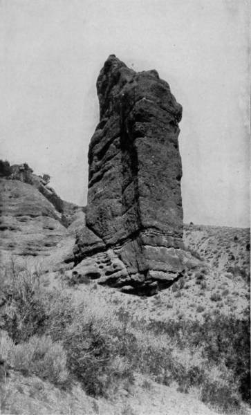
MONUMENT ROCK, ECHO CAÑON.
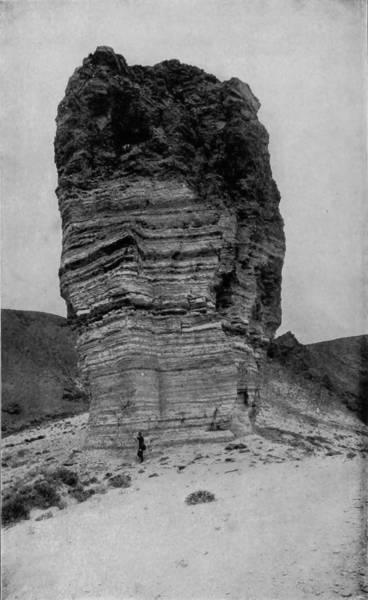
GIANT’S CLUB, GREEN RIVER.
These two natural curiosities, the one in Echo Cañon and the other near Green River, have been well named, for a glance at either immediately suggests its proper use. Their immensity can be estimated by the size of the man who stands at the foot of the Club, who, although he is taller than the average of his race, is hardly able to reach to the first wrinkle on the giant’s weapon.
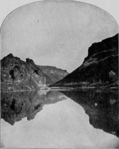
BANKS OF SNAKE RIVER.
“The lava beds of Idaho are a marked feature of that Territory. Starting near the eastern boundary, they extend southwesterly for a long distance, and are from 300 feet to 900 feet in depth. This mass was once a river of molten fire, the making of which must have succeeded a convulsion of nature more terrible than any ever witnessed by mortals, and long years must have passed before the awful fiery mass was cooled. To the east of the source of the lava flow, the Snake River bursts out of the hills, becoming almost at once a sovereign river, and flowing at first southwesterly and then bending westerly, cuts through the lava fields nearly in the center of the Territory, reckoned from east to west, and about forty miles north of its southern border, and thence flowing with great curves, merges finally with the Columbia. The two rivers combined make one of the chief waterways of the continent, and here and there take on pictures of great beauty. Never anywhere else was there such a scene; never anywhere else was so beautiful a picture hung in so rude a frame; never anywhere else, on a background so forbidding and weird, were so many glories clustered. Around and beyond, there is nothing but the desert—sere, silent, lifeless—as though Desolation had builded there everlasting thrones to Sorrow and Despair.
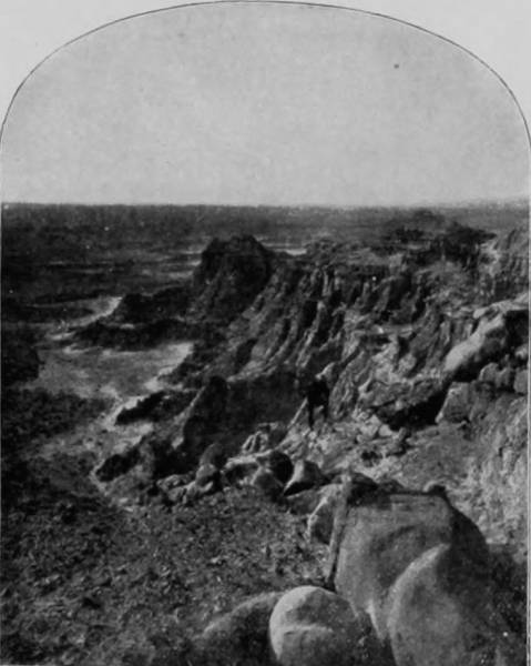
BAD LANDS OF WYOMING.
“Away back in remote ages, over the withered breast of the desert, a river of fire, 100 miles wide and 400 miles long, was turned. As the fiery mass cooled, its red waves became transfixed, and turned black, giving to the double-desert an indescribably blasted and forbidding face.
“But while this river of fire was in flow, a river of water was fighting its way across it, or has since made war and forged out for itself a channel through the mass. This channel looks like the grave of a volcano that had been robbed of its dead. But right between its crumbling and repellent walls, transfiguration appears. And such a picture! A river as lordly as the Hudson or Ohio, springing from the distant snow-crested Tetons, with waters transparent as glass, but green as emerald, with majestic flow and ever-increasing volume, sweeps on until it reaches this point where the display begins.
“Suddenly, in different places in the river-bed, jagged rocky reefs are upheaved, dividing the current into four rivers, and these, in a mighty plunge of eighty feet downward, dash on their way. Of course the waters are churned into foam, and roll over the precipice white as are the garments of the morning when no cloud obscures the sun. The loveliest of these falls is called “The Bridal Veil,” because it is made of the lace which is woven with a warp of falling waters and a woof of sunlight. Above this and near the right bank, is a long trail of foam, and this is called “The Bridal Trail.” The other channels are not so fair as the one called “The Bridal Veil,” but they are more fierce and wild, and carry in their ferocious sweep more power.
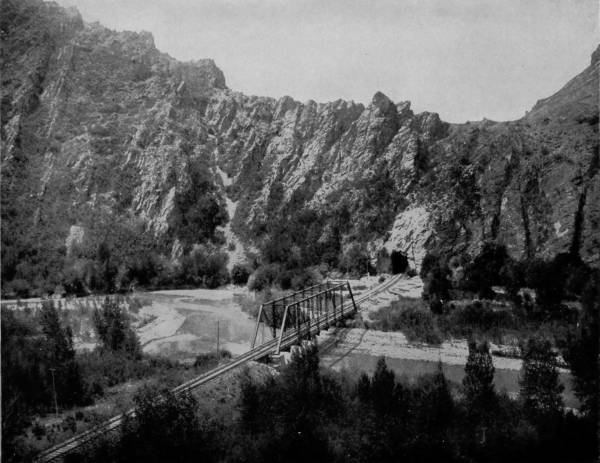
WEBER VALLEY, AND TUNNEL THROUGH GRANITE WALLS, UTAH.—We have a beautiful landscape and a grand mountain view combined in this fine photograph. The rugged wall of granite, through which the railroad tunnel has been cut, forms an appropriate frame for the picture of the peaceful valley and the winding river. The place has a restful look, inviting to the weary worker who seeks rest and health away from the noise and hustle of city life. Here, shut in by the surrounding walls, and with rod in hand, one could sit upon the banks of the mirror-like stream and imagine himself out of the world and away from all its cares and worries. It seems almost a pity that the demands of modern commerce should require the cutting of the hill and the breaking of the solitude by the screaming of the rushing locomotive.
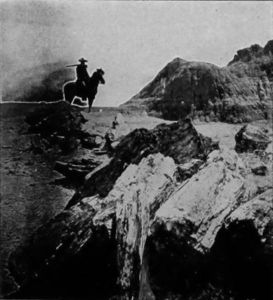
PETRIFIED TREES OF THE BAD LANDS.
“One of the reefs which divides the river in mid-channel runs up to a peak, and on this a family of eagles have, through the years, may be through centuries, made their home and reared their young, on the very verge of the abyss and amid the full echoes of the resounding roar of the falls. Surely the eagle is a fitting symbol of perfect fearlessness, and of that exultation which comes with battle clamors.
“But these first falls are but a beginning. The greater splendor succeeds. With swifter flow, the startled waters dash on, and within a few feet take their second plunge into a solid crescent, over a sheer precipice, 210 feet to the abyss below. On the brink there is a rolling crest of white, dotted here and there, in sharp contrast, with shining eddies of green, as might a necklace of emeralds shimmer on a throat of snow, and then the leap and fall.
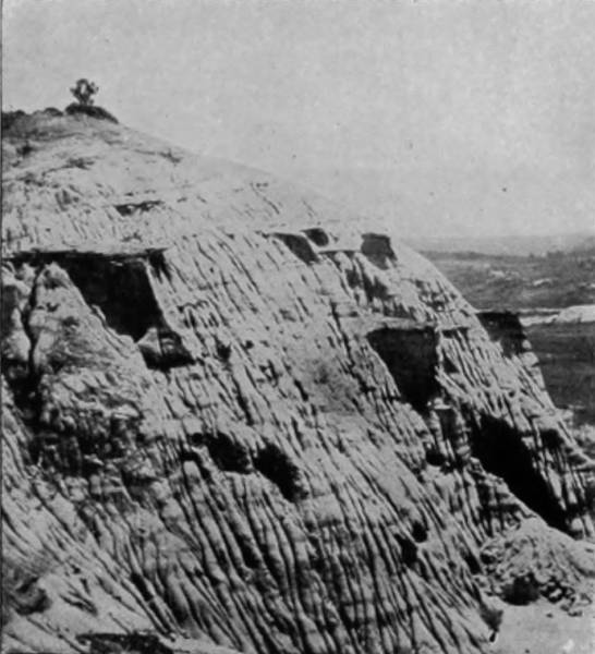
BEAUTIES OF THE BAD LANDS.
“Here more than foam is made. Here the waters are shivered into fleecy spray, whiter and finer than any miracle that ever fell from an India loom; while from the depths below, an everlasting vapor rises—the incense of the waters to the waters’ God. Finally, through the long, unclouded days, the sun sends down his beams, and to give the startling scene its growing splendor, wreathes the terror and the glory in a rainbow halo. On either sullen bank the extremities of its arc are anchored, and there in its many-colored robes of light it lies outstretched above the abyss like wreaths of flowers above a sepulchre. Up through the glory and terror an everlasting roar ascends, deep-toned as is the voice of fate, a diapason like that the rolling ocean chants when his eager surges come rushing in to greet and fiercely woo an irresponsive promontory.
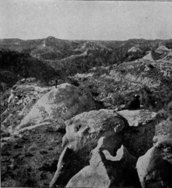
CEDAR CAÑON, BAD LANDS OF DAKOTA.
“But to feel all the awe and to mark all the splendor and power that comes of the mighty display, one must climb down the deep descent to the river’s brink below, and pressing up as nearly as possible to the falls, contemplate the tremendous picture. There, something of the energy that creates that endless panorama is comprehended; all the deep throbbings of the mighty river’s pulses are felt, all the magnificence is seen. In the reverberations that come of the war of waters, one hears something like God’s voice; something like the splendor of God is before his eyes; something akin to God’s power is manifesting itself before him, and his soul shrinks within itself, conscious, as never before, of its own littleness and helplessness in the presence of the workings of Nature’s immeasurable forces.
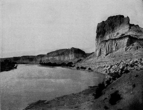
THE BLUFFS OF GREEN RIVER, UTAH.—If the traveler should come suddenly in front of the towering bluff to the right, with its striped and pillared front, it would require no great stretch of the imagination for him to conclude that he was sailing up the ancient Nile and viewing the ruins of Thebes or some other of the great cities that flourished with life and commerce many centuries ago, but now sit in solemn silence contemplating the glory of the dead past. This scene is a very striking one, and the splendid photograph does it full justice. It stands on the printed page just as nature made it, solemn, grand and silent. There is something really sphinxlike in the wrinkled front of the large bluff in the foreground.
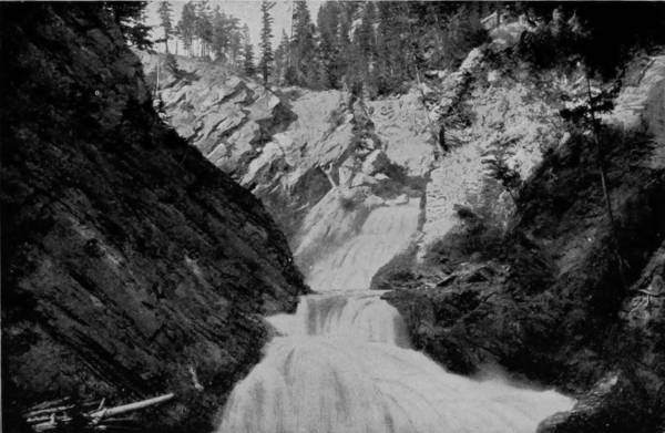
MOYEA FALLS, IDAHO.
“Not quite so massive is the picture as is Niagara, but it has more lights and shades and loveliness, as though a hand more divinely skilled had mixed the tints, and with more delicate art had transfixed them upon that picture suspended there in its rugged and somber frame. As one watches, it is not difficult to fancy that, away back in the immemorial and unrecorded past, the angel of love bewailed the fact that mortals were to be given existence in a spot so forbidding, a spot that, apparently, was never to be warmed with God’s smile, which was never to make a sign through which God’s mercy was to be discerned; that then omnipotence was touched, that with His hand He smote the hills and started the great river in its flow; that with His finger He traced out the channel across the corpse of that other river that had been fire, mingled the sunbeams with the raging waters, and made it possible in that fire-blasted frame of scoria to swing a picture which should be, first to the red man and later to the pale races, a certain sign of the existence, the power, and the unapproachable splendor of Jehovah.
“And as the red man, through the centuries, watched the spectacle, comprehending nothing except that an infinite voice was smiting his ears, and insufferable glories were blazing before his eyes; so, through the centuries to come, the pale races will stand upon the shuddering shore and watch, experiencing a mighty impulse to put off the sandals from their feet, under an overmastering consciousness that the spot on which they are standing is holy ground.
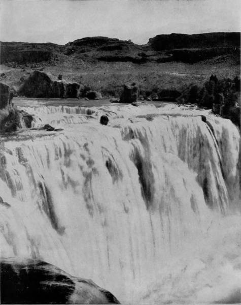
SHOSHONE FALLS, IDAHO.—Shoshone Falls are in Snake River, in the southern part of Idaho, and they constitute one of the greatest curiosities of our western country. In some respects they resemble Niagara, and have accordingly been designated as the Niagara of the west. The place is rapidly becoming a popular resort for tourists, and this popularity will greatly increase as it becomes better known. The surrounding scenery is beautiful, consisting of prairie valleys fringed with distant mountains. A splendid description of the Falls is given on page 110 of Glimpses of America.
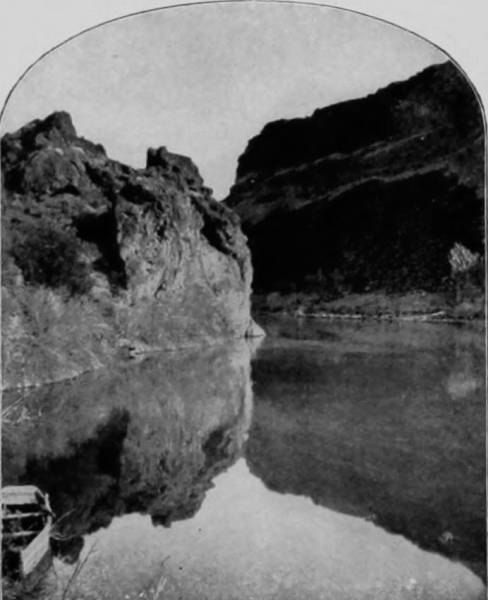
THE FERRY AT SHOSHONE FALLS.
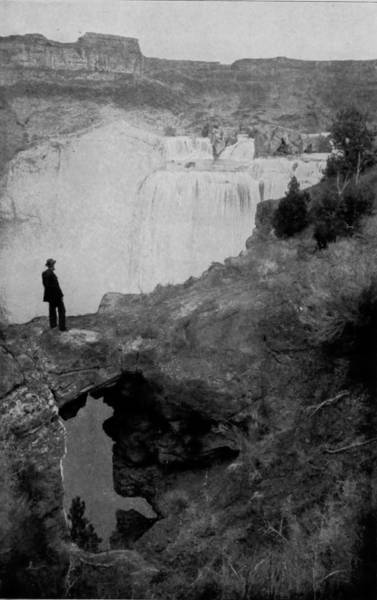
NATURAL BRIDGE, SHOSHONE FALLS.
“There is nothing elsewhere like it, nothing half so weird, so beautiful, so clothed in majesty, so draped with terror; nothing else that awakens impressions at once so startling, so winsome, so profound. While journeying through the desert, to come suddenly upon it, the spectacle gives one something of the emotions that would be experienced in beholding a resurrection from the dead. In the midst of what seems like a dead world, suddenly there springs into irrepressible life something so marvelous, so grand, so caparisoned with loveliness and irresistible might, that the head is bowed, the strained heart throbs tumultuously, and the awed soul sinks to its knees.” The time is fast approaching when the sublime glories of Shoshone Falls will be appreciated by tourists, and by that large class of summer vacationists who are always searching for sights and places that will drive away the ennui from which they chiefly suffer. The beat of ocean billow, the roar of waterfall, the stretch of landscape from lofty mountain peak, the lonely quietude of glen and wilderness, each have their votaries; but about Shoshone’s chasm there is more to charm than all of these, for the very desolation of its environments adds fascination to the wild and tameless scenery of the falls. The poet and the painter find here an inspiration for their genius; while the most prosaic spectator is thrilled by the matchless grandeur, the majestic awfulness of a mad-cantering river plunging through a gigantic rent, and over a precipice so high that the waters are scattered into mist and dissolve in rainbows when they meet the seething caldron below. It is a strange exhibition of nature’s power and freakishness, a manifestation of mysterious force, a blending of results precipitated by vomiting volcano and an irresistible flood of waters, the joining of rivers of fire with streams breaking over the barriers of mountains and pouring down upon the plains. Considering the surroundings, the bleak sterility of what appears to be a boundless extent of lava fields, and the mighty, awe-compelling avalanche of waters that cleaves it, Shoshone Falls is perhaps the most remarkable waterfall to be found anywhere on either continent, a wonder in which Snake River has an almost equal part. Indeed, this extraordinary river exhibits many equally astonishing features along its extreme length, for while a greater part of the stream flows through a belt of scoria, the lower portion is a succession of waterfalls, second only to those of Shoshone.
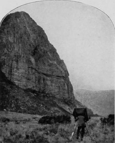
UNAWEEP CAÑON.
Having satisfied our curiosity and embalmed the views of Shoshone Falls, as here presented, our party of photographers and historiographer returned to Colorado over the same route that we had come, but at Grand Junction we proceeded southward over the Denver & Rio Grande Railroad to Gunnison, Ouray and Tulleride. At Grand Junction, Grand River divides, the southern branch of which is called Gunnison River, and takes its rise in the Sagauche and Elk ranges; and it was along the valley of this south branch that our route lay. It is characteristic of Colorado rivers that all of them flow through large fissures, and a majority have cleft the mountains into mighty chasms, thus producing the matchless scenery which has helped so much to make the State famous. It fortunately happens that the most picturesque places in the west are either directly upon the lines or in the near vicinity of railroads, for necessity has compelled their construction along the river valleys, since there are few other passes in the mountains, and no other routes so feasible.
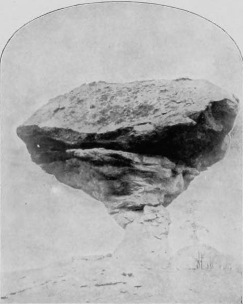
TOADSTOOL ROCK, NEAR GUNNISON.
The scenery along the south branch of Grand River is very similar to that which we have described on the main stream, and leaving Grand Junction we almost immediately entered the Unaweep Cañon, thence in succession Puniweep and Escalante. The road leaves the valley of the main stream at Delta, and follows a smaller branch (Cedar River) a distance of fifty or sixty miles, until Cimarron is reached, below the southern terminus of the Mesa Verde. In this interval, and running along the north side of the Mesa Verde—Green Plateau—is the Grand Cañon of the Gunnison, a cleft in the earth that is magnificently imposing, possessing as it does many of the characteristics of Grand River, though the walls are of limestone and hence not so precipitous, as being more easily eroded than granite, the base of the walls are cut until in many places they shelve far over the stream, while at frequent intervals the river is broken by cascades and waterfalls, those of Chippeta being particularly beautiful.
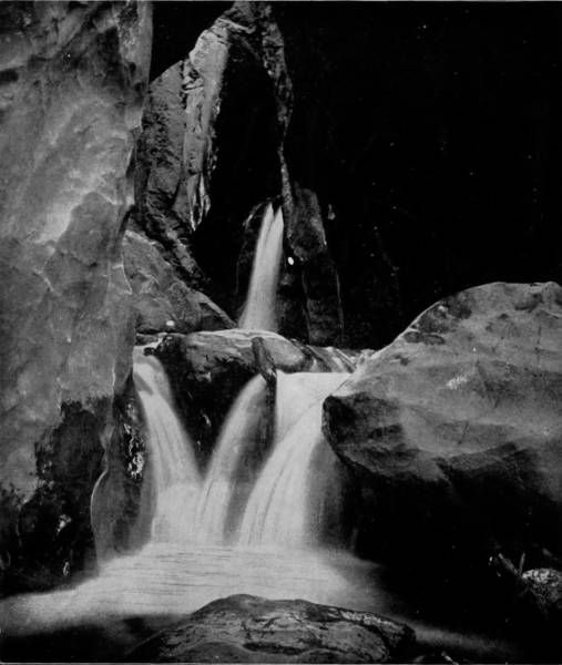
BOX CAÑON FALLS, NEAR GUNNISON.
Black Cañon, which begins near the town of Cimarron, is another wild gorge, through which the river glides with stately and uninterrupted majesty, a deep crystalline stream, until it passes Currecanti Needle, when the smooth flow is interrupted by bowlders which convert it into a rapid. Currecanti Needle is an object which excites the almost reverent wonder of every beholder. It is a symmetrical cone of red basalt, resting its feet in the Gunnison River and shooting up to an amazing height, its summit terminating in a spire that pierces the clouds, while its body is as variegated with bright colors as was Joseph’s coat. On each side of the stream the bluffs reach up 2,000 feet, but the needle soars very much more loftily, a great sachem among the stone giants that stand in colossal files along the river. Near Sapinero, which is at the eastern end of the cañon, the walls draw so near together that the light of day is almost entirely excluded, but at places where the sun is admitted they sparkle with dazzling lustre, caused by reflections from the mica of which they are largely composed.
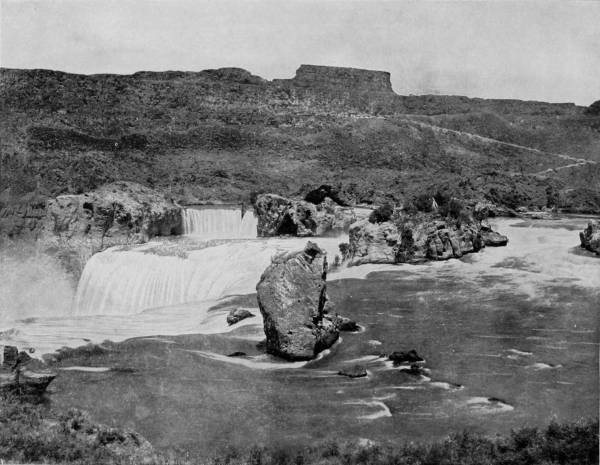
EAGLE ROCK, SHOSHONE FALLS.—The photograph on page 111 gives us a fine front view of Shoshone Falls, while on this page we see them from the side and just above the final plunge. The principal attraction in this picture is Eagle Rock, which occupies a prominent position in the foreground. On the top of the rock there is an eagle’s nest, from which many a young brood has taken its flight, for from all the indications the nest has been in existence for centuries. It is a fitting place for the fearless bird of freedom to rear its young, safe from the raids of wild animals and on the very brink of the dashing and roaring waters. Nothing but an eagle would dare approach such a place.
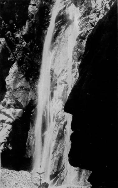
PROFILE ROCK, NEAR OURAY.
From Gunnison the road follows Tomachi Creek eastward, passing over a country devoid of particular interest, except as views are afforded of high mountains in the Fossil Ridge, Sagauche and Sangre de Cristo ranges far away, until the ascent of Marshall’s Pass is begun. The road now rises rapidly until it crosses the Rocky Mountains, at an elevation of 11,000 feet. But the ascent is indirect, in a serpentine course close to the cone of Mount Ouray, which penetrates the depths of heaven, to a height of 14,000 feet; so lofty that the sun shines brightly upon its snow-covered summit, while the earth below is wrapped in the sable garments of deepest night. Round and round, but in an ascending circle, the laboring train makes its toilsome way, until we see the tracks below us looking like a succession of terraces. At the apex we run through a long tunnel of snow-sheds, through openings in which a view may be had of the extinct crater of Ouray, while a hundred miles away towards the south, and across a wide expanse of plain, the frosted ridge of Sangre de Cristo is clearly visible through the tenuous air. The ride over this great mountain is one of the most delightful and picturesque in all the world, and leaves an impression which is as charming and fadeless as the memory of a boy’s first triumph. After passing down the mountain side, a short run brings us to Poncha Junction, at the entrance of the Valley of the Arkansas, and a few miles further Salida is reached, a splendid little town that is begirt with mountains, but reposes like a jewel in a green sea of amazing fertility and beauty. As we rush eastward down this lovely valley, some wondrous sights are viewable from our car. On the right the Arkansas River bowls along close by the track, while far beyond the horizon is belted with the Sangre de Cristo range. On our left our eyes are gladdened with the sight of three bristling peaks, known as Harvard, Princeton and Yale, which rise above their more humble brothers in the Park range. The scene now undergoes a quick change, for the valley becomes rapidly narrowed by the mountains drawing together, as if to bar our passage; but as their seared sides and snowy crests become more distinct by a closer approach, the scenery increases in interest until soon it develops into positive grandeur. At Parkdale we observe that the sloping sides of the mountains are becoming more abrupt and rocky, until five miles beyond, the gigantic, the marvelous and the terror-inspiring Royal Gorge bursts full upon our amazed and startled senses. The colossal peak has been cut in twain; sliced by the persistent waters of the Arkansas, that with remorseless jaws have eaten through the heart of the giant mountain that lay down in its way; and there the great gash breaks before us, into which the ravening river rushes, with a growling voice and imperious dash, as reckless as a bandit, and impetuous as a fiery youth. Pines and aspens struggle up the mountain sides, but where the waters have split a way there is nothing save vertical walls of stone that soar up, up, so high that it wearies the sight to travel to their summits. There are seams and depressions in their awful cliffs, and projections and cavities that show imprints of the teeth of frost, and away up on these eagles have found resting places, and built their eyries where only the storm-god can reach them. Distance, as expressed in feet on paper, conveys scarcely an idea of mountain height or cañon depth, for the awesome presence is lacking. But the height of the walls of the Royal Gorge, or, as it is sometimes called, the Grand Cañon of the Arkansas, is 3,000 feet, or more than half a mile, while the chasm is only fifty feet wide where the river rushes through, and but seventy feet at the summit. Three Eiffel towers, set upon top of each other, would hardly reach the crown of these tremendous cliffs, around the crests of which flying eagles look like flies lazily swimming in a haze of distance. In order to avoid cutting a road-bed through the base of the perpendicular cliffs, which come very close together, an iron bridge has been thrown around the defile and suspended by anchoring its sides in the granite walls, so that it has no pillared supports, for none are needed. Upon this suspended bridge, which runs parallel with and over the stream, every passenger train stops for the space of several minutes to give opportunity for an inspection of the Royal Gorge, which is most appalling and wonderful at this point.
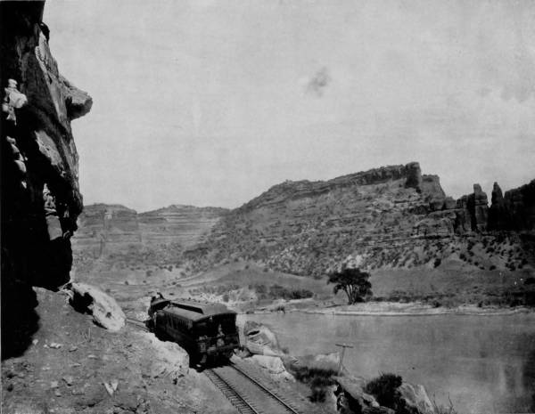
MOUTH OF GRAND RIVER CAÑON.—In this photograph we see the beginning of the magnificent scenery of Grand River Cañon in Colorado and Utah. It is the doorway or portal to a series of the most splendid views to be found anywhere in the world. No one can realize the true grandeur of this western scenery without beholding it, and the next best thing to seeing it in reality is its reflected image in this series of matchless photographs, taken specially for this work. The camera is a mirror in which the objects are reflected true to nature, and this reflection is caught by the rays of the sun and printed indelibly and beautifully upon the pages of the book.
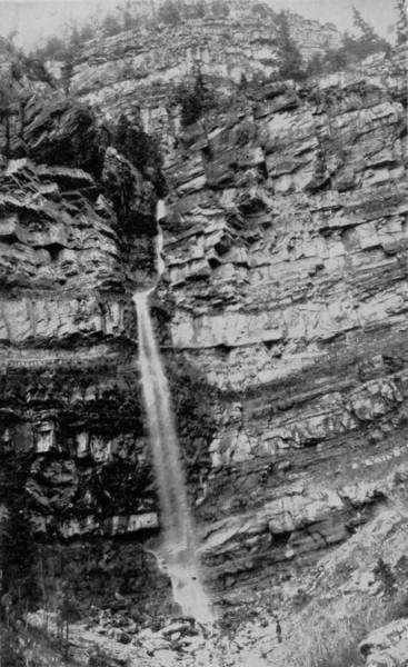
CASCADE AT OURAY.
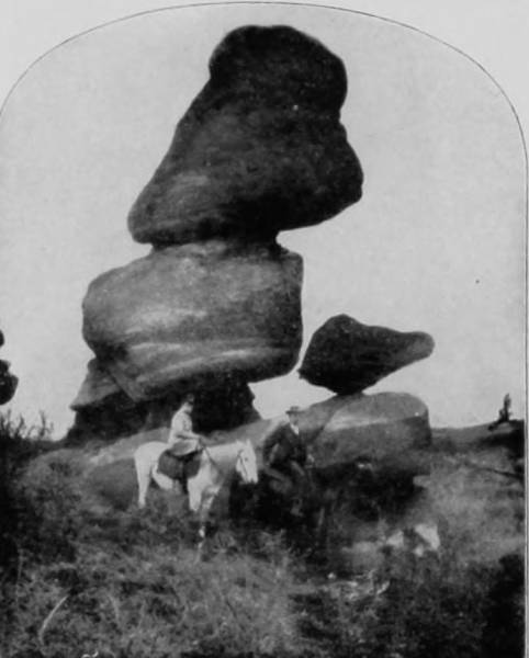
LEANING TOWER, PERRY PARK.
The eastern end of the gorge is at Cañon City, and after leaving this place the valley widens rapidly and spreads out into an arid plain that joins the prairies of Kansas. The change from a weirdly wild and savagely astounding cañon, to the pale landscape of a verdureless desert, is very sudden, and there is no variation in the passionless monotony of alkaline plain that lies between the mountain and Pueblo, a distance of forty miles. The Arkansas loses much of its volume and activity in struggling through the parched lands, becoming a listless stream, and murky with sediment that is gathered from its fast-washing banks.
We had to double upon our route very often in order to reach the numerous points of interest and charming scenery which is accessible by railroad, but in many cases much time was saved by dividing our party, though we refrain from wearying the reader with the uninteresting particulars of these movements. In the present instance, however, two of our photographers, with the camera car, proceeded southwest from Pueblo, over the Denver & Rio Grande R. R., to Wagon-Wheel Gap, while the others of our party returned, by way of the same route we had just traversed, to Montrose, thence to Ouray, and from that terminus, by stage, to Ironton, a distance of seven miles. From this latter point they followed the sweep of the same road, called the Rainbow route, around to Alamoso, where a junction was made with the two photographers on their return journey from Wagon-Wheel Gap.
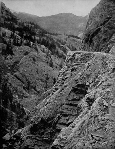
THE TRAIL ALONG THE BREAST OF SAN JUAN MOUNTAIN.—It appeared to many impossible to connect the towns Ouray and Silverton by stage road, on account of the tumultuous mountains, riven by mighty chasms, and scarred by eroding streams, that lay between; but skill, patience and great expenditure of money accomplished what was undertaken with misgivings. A roadway was blasted and carved along the rocky breast of the peaks; chasms were bridged, rents were filled, and our photograph shows a portion of the result, a wildly picturesque stage road, over which it is a delightful experience to travel.
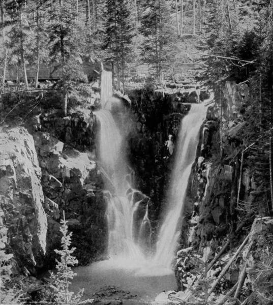
TWIN FALLS, NEAR AMES, COLORADO.
The journey south from Montrose is along Uncompaghre River—every little stream is called a river in the far west—which, like many other streams we have described, has worn a deep bed, in which it is now confined by high walls of polychromatic colors, very beautiful to see. From the occasional rises over which the road passes, very lovely views are to be had of Horse-Fly Peak on the west, and the rather gentle elevation of Tongue Mesa on the east. At Dallas the scenery becomes much more rugged, and thence to Ouray, and Silverton, which is twenty miles from Ironton, the landscape is tumultuous; for nature is here in strange derangement, not to say chaotic dismemberment. It appeared an impossible feat to connect Ouray and Ironton by a stage-road, so tempestuously craggy is the interval, rent as it is by mighty chasm and spurred by amazing peaks of stones piled up into vast pyramids of confusion. But engineering skill dominated even here, and not only was a wagon-road cut through this chain of obstacles, but a narrow-gauge railroad was successfully constructed between Ironton and Silverton.
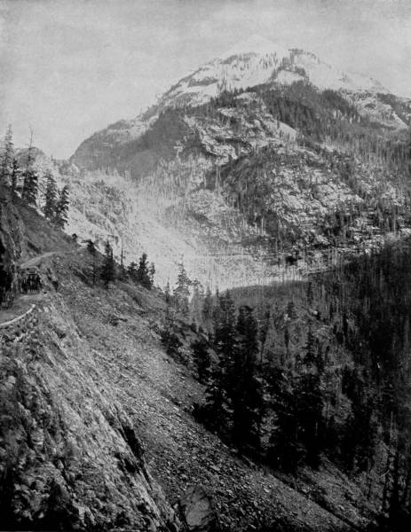
MOUNT ABRAM.—The hoary head of Mount Abram rises high above its Titanic, yet less lofty, brothers that compose the mountainous battalion of the San Juan Range, in Southern California. This sky-assailing peak lies near the splendid toll-road between Ouray and Silverton, and attains an elevation of 14,235 feet; high enough to receive the first assault of every storm; where the cold is so great that the apex is perpetually wrapped in a thick mantle of snow. A part of the toll-road is shown in the photograph, creeping around the steep slope, where a false step might result in a plunge over a precipice hundreds of feet high.
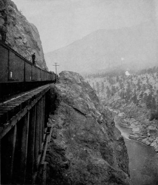
JAWS OF DEATH, ANIMAS CAÑON.
The approach to Ouray is by a way impressively magnificent, through rifts in castellated walls that are rich with the primary colors, and lofty enough to bathe their crests in the clouds. There goes the river, like a belated business man trying to overtake time, roaring, fretting, panting, with hardly enough space between the escarpments to admit its passage. Along, and over and around this mad-dashing stream the road winds, up and down, in and out, until the points of the compass lose their bearings, and swing around in distraction.
Ouray lies at peace with the world, in a basin whose sides are like a giant’s punch-bowl, only that the confinement is by a succession of mountain ranges piling up behind each other until the highest attain an altitude of 14,235 feet, and hold perpetual carnival with the snow-storm. That little basin seems to be the paint-pot of the Titans, and the mountains their mixing-boards. Letting our sight travel slowly up the soaring slopes, every step of the way is one of beauty. Clothed with a luxurious growth of yellow aspen, the brown of oak, the deep green of spruce, and the silver sheen of mountain pine, the picture needs only a frame to make it perfect. And there above is the thing desired; for where the timber line ends, the flaming colors of red, orange, purple, gray and brown stone begins, rising ever higher until they fade away behind the mists that gather about the peaks.
As we proceed on the way to Silverton the road inclines through forests whose autumn tints keep the eye dancing with admiration, and having descended two thousand feet, the mouth of Bear Creek is reached, where it rolls along a terrible cataract, known as Bear Creek Cascade. A little further on, we dash out upon a bridge which spans a dizzy height, for, there below us, the raging creek plunges over a precipice 275 feet high, and is dashed into vapor upon the rocks. It is a startling sight to behold the surging waters, and watch the mad plunge that falls into a caldron as angry as ever witches stretched hands about.
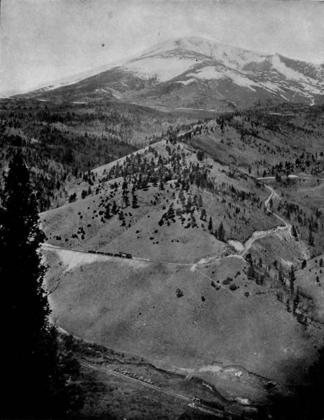
MOUNT OURAY, COLORADO.—Mount Ouray, like Pike’s Peak, holds the honorable distinction of lifting its head so high as to be always covered with a sheet of snow. Its peak is more than 14,000 feet above the level of the sea, and there it rests in lofty grandeur, looking down like a white-robed priest upon the little valleys nestling at its feet. It is a beautiful sight to stand at the foot of this mountain and watch a railroad train dashing back and forth, here and there, and zigzagging hither and yonder with no apparent purpose, but always climbing higher and higher, until it goes out of sight behind a ridge or through a tunnel, sending back a white flake of steam as it whistles good-bye. When you go to Colorado don’t fail to visit Ouray.
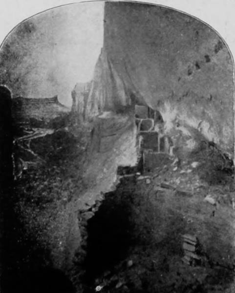
EXCAVATIONS in the CLIFFS, MANCOS CAÑON.
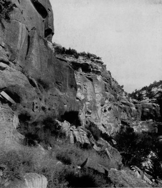
RUINS OF CLIFF DWELLINGS IN MANCOS CAÑON.
Thence onward we pursue our exciting ride, with mountains on either side, by the Needles, Sultan Peak, silver cascades, until soon we reach the Valley of the Animas, and are presently hurled into the wildly weird and awfully sublime Animas Cañon. A very suggestive name was given by the early Spaniards to this stream: Rio de los Animas, signifying the river of lost souls, for nothing could be more gruesomely somber. The cañon proper is about fifteen miles long, and lies between Rockwood and Durango, and is a cleavage that separates the San Juan and San Miguel ranges. The walls are perpendicular, and the passage so narrow that the sunlight can hardly get through. The railroad runs along the breast of the solid rock walls, on a ledge or balcony that had to be cut in the sheer escarpment, 1,500 feet above the river, but the top of the frowning enclosure is still 500 feet higher. Sitting at the car window, the traveler looks down into what appears to be an almost bottomless gulch, and sees the beating waters swirling in pools, and tossing in a terrific tumult that fills the cañon with deafening roar. While the river here is a succession of cataracts, there are waterfalls on either side, leaping down from bordering cliffs and joining hands with the impetuous river.
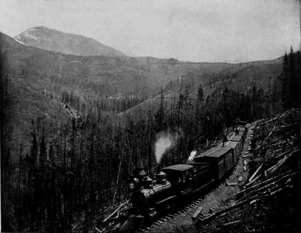
WEST SIDE OF MARSHALL PASS.—The summit of Marshall Pass has an altitude of 10,852 feet. From this point a magnificent view can be had of the Sangre de Cristo range extending to the southeast. The pass itself is a scenic and scientific wonder; grades of 211 feet to the mile are frequent, and the ascent and descent are made by a series of the most remarkable curves. The streams from the summit flow eastward into the Atlantic and westward into the Pacific. The tracks are so winding that passengers on ascending trains frequently become puzzled, and imagine that they are moving in a circle without a definite purpose, but when the train reaches the top and dashes over the divide, the object of its devious course is revealed, and a feeling of exhilaration succeeds that of doubt and uncertainty as it darts down the opposite side with the swiftness of an eagle.
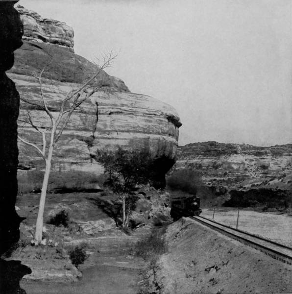
CALCAREOUS CLIFFS OF GRAND RIVER.
A few miles from Los Pinos Cañon and Toltec Gorge is the bustling town of Durango, which is the supply depot for the San Juan mining district. This place received a great impetus by the reported discovery of rich placer gold mines in southeastern Utah, in November of 1892, and at this time its future appears to be very promising. The region is altogether one of extraordinary interest alike for the miner, tourist and relic-hunter, for thirty miles west of the town are the picturesque ruins of very ancient cliff-dwellers, who, in the early centuries, excavated deep recesses in the perpendicular walls along the Rio Mancos, and there made their homes. Evidently they were of the same race, and no doubt were contemporary with those who fled from the Spanish persecutors and took refuge in artificial caves in the Grand Cañon of the Colorado.
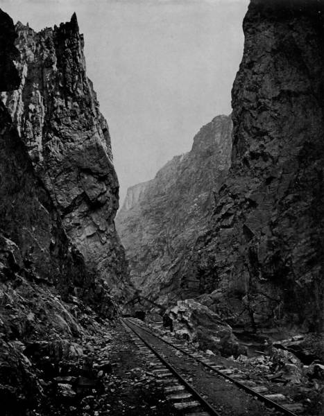
ROYAL GORGE, CAÑON OF THE ARKANSAS RIVER.—Mighty cleavage, wondrous chasm, tremendous gash, is that marvelous rent in the Park Range known as Royal Gorge, through which the Arkansas has cut its way, leaving precipitous walls 3000 feet high, upon the upper breasts of which eagles make their secure eyries. This amazing fissure is less than 100 feet wide at the top, and so narrow at the base that to avoid tunneling the engineers of the Denver and Rio Grande Railway built a hanging bridge, with fastenings in the walls, for a roadway through this awful pass, under which the confined river flows with dreadful roar. A view of this astounding cañon is one of terrific grandeur, of sublime mightiness, of inspiring yet awesome wonder.
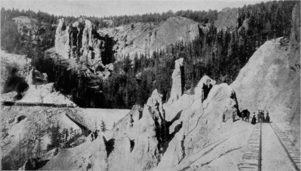
PHANTOM CURVE.
Southwest of these now vacant cave dwellings, in the northeast corner of Arizona, is a short branch of the San Juan River, known as the Rio de Chelly, which runs through a cañon celebrated in the history of Indian warfare as presenting the most serious obstacles encountered by expeditions under Colonel Sumner and General Canby. The region, and particularly De Chelly Cañon, was the stronghold of the Navajoe Indians, who rendered the defile almost impregnable. Time and again efforts were made by large bodies of troops to force a passage, but as often they were driven back by the Indians hurling stones down the thousand feet of perpendicular height. The rear was likewise protected by remarkable ruggedness of the approach, and an army sent against them was thus held at bay by the Indians for several months. Kit Carson was finally given a commission as colonel and sent against the defiant marauders with a force of five hundred men. Understanding all the difficulties of the situation, he so disposed his army as to hold the Indians within their lines of refuge, and choosing winter as the best time for action, laid a siege that effectually cut off all communication. Aid from the outside being thus prevented, and all supplies shut off, the Navajoes were presently reduced to such straits that after three desperate but futile efforts to escape, the entire band surrendered.
After passing through Animas Cañon, on the eastern journey, the scenery continues impressively beautiful, for several pellucid streams are crossed at points where they have cut deep furrows in the earth, and eaten their way through opposing mountains. At Ignacio we met with the first considerable number of Indians seen thus far during our trip. This place is the headquarters of the Southern Utes’ reservation, and was named after their chief. Twenty miles beyond we cross the Rio Piedra and enter the valley of the San Juan, which is followed for nearly sixty miles, and until Navajo is reached, where another small band of miserable-looking Indians have their quarters, and besiege incoming passenger trains with importunities that travelers almost invariably generously respond to. Now we are running along the borders of New Mexico, a line of demarkation indicated by the San Juan range that lies north of us, while southward stretches away the undulating and arid plains. At Amargo we are met by another band of Indians, whose sullen countenances and bedraggled appearance plainly show them to be Apaches, whose numbers, however, are now so reduced that the murderous raids which made the tribe celebrated in the early annals of the far west, are not likely to be repeated again.
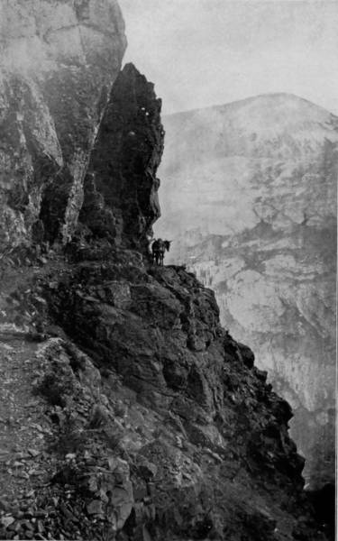
TRAIL OVER THE SAN JUAN MOUNTAINS.
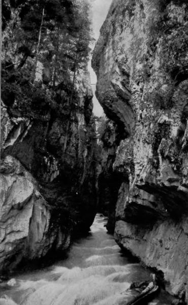
CREVICE CAÑON, NEAR OURAY.
Many persons have read of mountain trails, but comparatively few have seen them or realized the dangers that attend a passage over them. The splendid photograph of the trail over San Juan Mountains, on this page, will therefore be a subject of interest to all. This is a picture of the real thing, as it exists in nature.
Crevice Cañon, near Ouray, Colo., the companion picture, is another of nature’s wonders that will arouse the curiosity of every reader. It seems impossible that so small a stream could have carved its way through such an obstacle, but it has left the marks of its power in the granite walls of the opposing mountain.
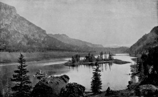
ANTELOPE PARK, NEAR TOLTEC GORGE.
We cross the Conejos range at Cumbres, at an elevation of 10,000 feet, and after traversing a lower range of the San Juan we again strike the Los Pinos River, and, taking a turn around Prospect Peak, come in view of Toltec Gorge, one of the most fearfully grand cañons in the world. The mountain is pierced by a tunnel near its summit, which is approached by a balcony trestle, on which the east-bound train stops several minutes to permit the passengers to gaze into the dreadful depths of the chasm over which they hang. For it must be understood that the road-bed is built here upon a trestle that has all its fastenings in the perpendicular walls, and without any support beneath, so that to one looking from the car window the train appears to be suspended in mid-air, 1,000 feet above the rolling waters below.
The gorge is 1,200 feet deep, and besides being narrow, the walls are perpendicular, so that daylight tarries but a short while in its profound recesses. As we pass the Toltec Gorge, Phantom Curve is approached, and from the grandeur and awesomeness with which the great abyss impressed us, our interest is quickened and spell-bound by objects that at once excite wonder and curious amazement. We are suddenly introduced to forms more strange than monstrous, more remarkable for their incongruity than significant for their grandeur. The chisels of nature’s sculptors, frost, water, storms, ice and decay have wrought many astounding things in stone, which rival in grotesque eccentricity the queer figures that render famous the Garden of the Gods. Passing this parade-ground of nature’s idols, we strike the Big Horn Curve, and twist like a contortionist in making a devious descent, that winds and winds until at last we reach the feet of the Sangre de Cristo range, at Antonito. Thence our direction was due north, over a level country, until we reached Alamosa, where, as per arrangement, we met the others of our party on their return from Wagon-Wheel Gap. Here we received reports of the trip from Pueblo, and tarried a while to write up our journals, pack our negatives, and prepare for the journey that by a long sweep was to take us to the lands of the Pacific.
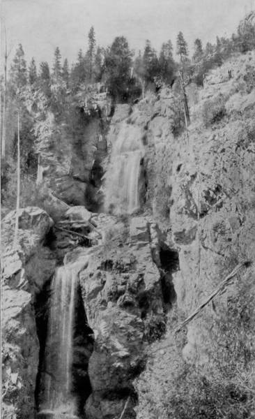
DEER PARK CASCADE, ANIMAS CAÑON.
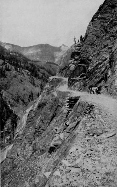
OURAY AND SILVERTON STAGE-ROAD.
All over the central and western portion of Colorado we find a succession of beautiful and magnificent scenery, mountains, waterfalls, cañons, landscapes of surpassing loveliness, and everything to charm the eye and please the most diversified taste. The region about Ouray is one of the most picturesque in the entire State. The mines are among the richest in Colorado; and the hot springs, added to its other attractions, make this locality a famous resort. A good idea of the grandeur of the scenery is conveyed in the photograph of the stage road from Ouray to Silverton, which occurs on this page.
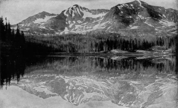
LAKE BRENNAN, IN SOUTH PARK, NEAR PLATTE CAÑON.
The trip southward from Pueblo possesses comparatively little interest until Cuchara Junction is reached, where one branch of the Denver and Rio Grande Railroad starts directly west, while the other continues south to Trinidad, and there forms a junction with the Atchison, Topeka and Santa Fe Railroad.
At Cuchara the scenery changes from waste plains to a tumultuary landscape similar to sections which we have just described. The road follows the valley of Cuchara for a distance of twenty miles, and then begins a rapid ascent towards Veta Pass, which is, in some respects, more wonderful than even Marshall Pass. In one place the grade is 216 feet to the mile, so steep that two locomotives are required to haul even light trains, and so serpentine that to passengers the cars appear to be moving in a circle. When the summit is reached, an altitude of 9,400 feet above sea level has been gained, and there is a panorama presented that it seems almost sacrilegious to attempt to describe. Away to the south rises up, like monsters plucking stars from the sky, the Spanish Peaks, whose frosted heads are often hidden by clouds that gather about them; towards the west, dim with distance, is seen the commanding form of Sierra Blanca, whose crown is the very heavens; and northward, La Veta Mountain, stupendous and sublime, stands like a grizzly sentinel, surveying the lesser wonders of nature and protecting them against the fierce storms that beat the bronzed breasts of the Rockies. Muleshoe Curve, over which we made the approach up Dump Mountain, is plainly visible, as are the numerous tracks that gridiron the slopes, and the waterfalls that play hide and seek along the mountain sides. Looking down we see the fast-receding banks and almost perpendicular cliffs, and the giant bowlders that have been hurled from the summit into the abyssmal depths a mile below, gathered into dams to impede the flow of waters. The view towards the east is unbroken, and there, spreading out like the lap of bounty, we watch the green prairie running away from the mountain base to meet the horizon.
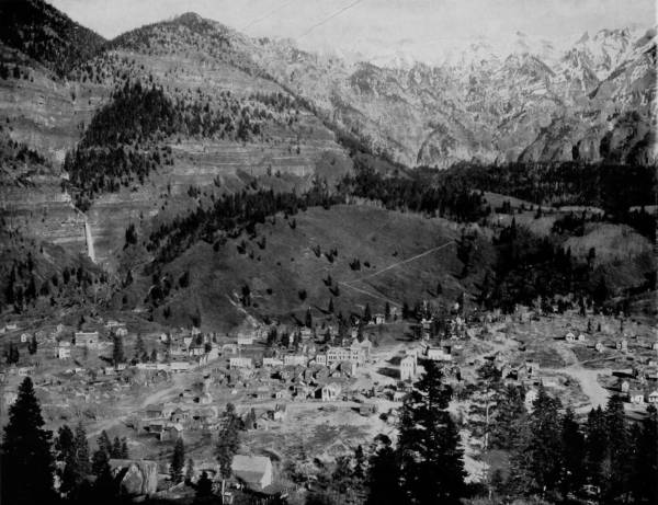
CITY OF OURAY, AND OURAY MOUNTAINS, COL.—If one should search the world over he could hardly find a more picturesque location for a city than this. It is a perfect picture, with framework of snow-covered mountains, and the music of dashing streams and laughing waterfalls. The city of Ouray has a population of about 3000, and was an active business centre previous to the depressing times in mining interests. It is still a resort for health seekers and tourists, and must always remain so on account of the excellent medicinal properties of its hot springs and the splendor and beauty of its surrounding scenery. The city nestles in a cozy valley at the foot of the mountain, down the sides of which races the little stream that breaks into such a splendid waterfall near the base, as seen in the background of the photograph.
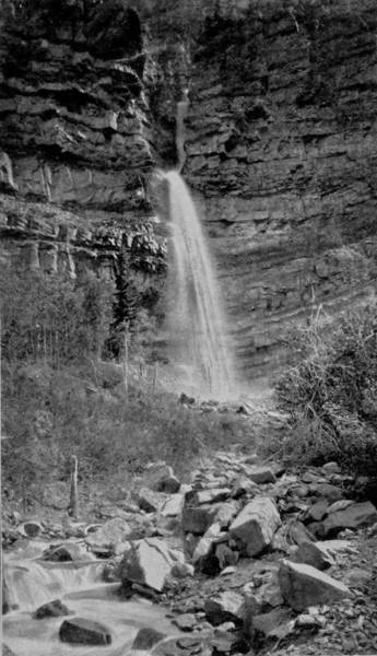
MAIDEN HAIR FALLS, NEAR DUMP MOUNTAIN.
Crossing La Veta’s lofty pass, the descent is rapid and tortuous, until a level is reached in the San Luis Park, which is abloom with the glories of cultivated fields, and animate with grazing herds. This great park, that covers an area equal to the State of Connecticut, was, in the early years of the world’s life, a vast inland sea, though its elevation is now more than 7,000 feet. The earth has absorbed nearly all its waters, though San Luis Lake still lies near its center, shining like a sheet of silver, and is fed by thirty mountain streams. All around this lake, whose length is sixty miles, is a waving savanna of luxuriant grasses, which form the frame of as pretty a picture as the eye of man ever wandered over.
As we proceed westward from La Veta Pass, the landscape becomes somewhat tame, though when we reach Fort Garland the grandest view is obtainable of Sierra Blanca Mountain, whose peak is at an elevation of 14,500 feet, the second highest in America. We cross San Luis Park, and having again reached Alamosa, continue on towards Wagon-Wheel Gap, by way of the picturesque valley of the Rio Grande del Norte. Though while en route we pass through no wonderful cañons, the way is full of interest and beautiful scenery. The river, in places, spreads out into a noiseless and sluggish stream, while again it is contracted by narrow walls into cascades and roaring waterfalls of exceeding magnificence. Especially is this true when we draw near to Wagon-Wheel Gap, where the walls are not only narrow, but rise into palisades of great height and beauty, and at one place, for the distance of half a mile, there are cliffs that soar skyward and lean towards the river, making a rocky canopy above the roadway that hugs the rushing stream.
We are now in the famous Creede mining region, where, besides silver to lure the avaricious seeker of riches, there is much to excite the admiration of the tourist and lover of nature. La Gorita Mountains lie towards the north in vast banks of haze, and the southern horizon is broken by the San Juan range. Here, also, is a region of surprising springs, where boiling-hot and ice-cold waters gush out of neighboring hills, and in places actually strike hands to neutralize each other. Creede, which is ten miles from Wagon-Wheel Gap, is a typical mining camp, full of excitement and all the concomitants of a new and rich discovery, though it is rapidly acquiring civilized ways. Willow Gulch is the scene of greatest activity, and there is now to be obtained, for a fair equivalent, everything from bad fighting whiskey to a spring bed, though the latter is still a scarce luxury, particularly in the immediate vicinity of Willow Gulch.
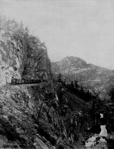
ANIMAS CAÑON.—Animas Cañon is on the Silverton branch of the Denver and Rio Grande Railway, just beyond the station of Rockwood and about 470 miles from Denver. The gorge is formed by the breaking through the mountains of the Rio de las Animas Perdidas, or River of Lost Souls, as it is appropriately termed in musical Spanish. The railroad tracks are laid along a shelf cut in the solid rock wall of the cañon, 500 feet below the top of the mountain and 1000 above its foot. The grandeur of the scene may be inferred from this description. It requires a steady nerve or long practice in traveling over such places to enable one to look down this frightful precipice from the car windows, and it is no unusual thing to observe timid tourists hugging the inner side of the coaches as they dash by this dangerous spot.
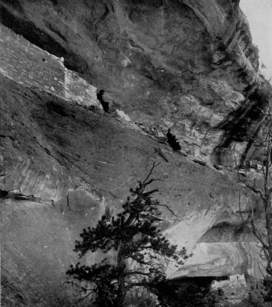
CLIFF DWELLINGS IN THE RIO MANCOS CAÑON.
After our meeting and short stay at Alamosa, our party again divided, two of our photographers going south from that point, over the New Mexico extension of the Denver and Rio Grande Railroad, to Santa Fe, while the other proceeded east to Cuchara Junction, thence south to Trinidad, and from that place he went by way of the Atchison, Topeka and Santa Fe Railroad, to Santa Fe, where our party again united.
The route directly south from Alamosa is across a well-watered country, but there is nothing of particular interest in the way of scenery until the town of Barranca is reached, where the road strikes the Rio Grande. Out of a level plain the train now dashes into deep gorges, and winds along the banks of a stream that is justly celebrated for the wild and rugged pageantry of mountains which it pierces. Comanche Cañon bursts into view, a glorious revelation of chaos, whose cliffs of marl and basaltic rock have tried in vain to arrest the energy and daunt the skill of civil engineers. As a consequence, their sides are rent and bored into cuts and tunnels, until the mountains of stone are made to acknowledge man’s sovereignty.
Fifteen miles south of Barranca is Espanola, a quaint old Spanish town, whose chief interest, however, lies in the fact that it is the nearest railroad point to some of the most interesting pueblos and cliff ruins that are to be found in New Mexico. The Indian adobes in this vicinity, which claim the largest attention of the anthropologist, are those of San Juan, Santa Clara and San Idelfonso, all situated within three or four miles of Espanola. At Santa Clara are also the ruins of cliff dwellings, relics of the habitations of a race that exists no longer, save in uncertain traditions.
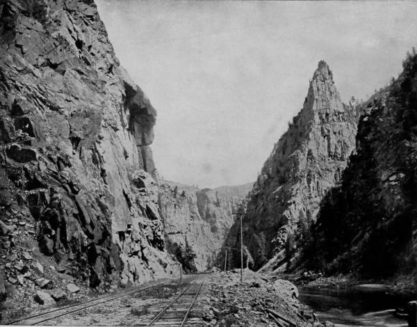
THROUGH THE BLACK CAÑON OF GUNNISON RIVER.—A deep and majestic gorge is Black Cañon, a vast rift in the mountain range where a mad river goes cantering through, here mild flowing where the cañon spreads, there tumultuous and impetuous where the great bluffs push their rugged feet against the stream and narrow the channel. Black Cañon is so called because at places the walls run up vertically and almost touch their heads, so nearly excluding the sunlight that the gorge is quite dark even at noonday, inexpressibly sombre when the sky is overcast, and weirdly awful when storms break, or night shrouds it with a pall. Photographs cannot be satisfactorily made of the dark places in the cañon, and the view herewith accordingly pictures the end near Cimmaron Station.
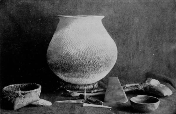
WEAPONS AND UTENSILS OF THE CLIFF-DWELLERS.
The little knowledge that we have respecting these ancient people is derived from the investigations of the late James Stevenson, chief of the Hayden Survey, who explored the cliff and cave dwellings of Arizona and New Mexico. His labors were rewarded also by the discovery of two perfect skeletons, in the Cañon de Chelly, which proved to be those of prehistoric inhabitants. He also, by patient study, obtained a very thorough knowledge of the religious mythology of the Zunis, and secured a complete collection of their fetich-gods, besides familiarizing himself with the manners and beliefs of the Navajoes and Moquis. We hold him in remembrance for his pioneer as well as scientific services. It was Stevenson that made the first survey of Yellowstone Park, who traced the Columbia and Snake Rivers to their sources, and who was the first white man to climb the Great Tetons, in Wyoming, and reach the Indians’ sacred altar, which has been kept inviolate for centuries.
The six ancient pueblos, which are still inhabited by Indians, were discovered by the Spaniards only forty-eight years after Columbus first landed on San Salvador, and they are thus entitled to rank among the earliest discoveries of this character ever made. In the neighboring cliffs are numerous cave dwellings equally prehistoric in their origin, but which Mr. Stevenson explored with the most valuable results, enabling him to determine the habits and peculiarities of these archaic people. On the west side of the road, and bounded by Caliente Creek, is the black Mesa, a curious elevation that might once have been an island in the ocean that covered this region when the world was young. Towards the east, and in bold view, is the Taos range, which merges into the Culebra range further north, and thence into the Sangre de Cristo. Between the railroad and the Taos Mountain, lies the town of Taos, in a beautiful valley, watered by branches of the Rio Grande. It is a quaint old place, composed chiefly of two great adobe buildings five stories high, surrounded by prosperous ranches and crumbling pueblos, and is celebrated as having been the home of Kit Carson, and the place where his body reposes. His grave is marked by an imposing monument erected to his memory, as a mark of gratitude for his intrepid services, by citizens of New Mexico. The place is accordingly something of a shrine, but is not much visited, because it is about twenty-five miles from the railroad, except on the 30th of September of each year, when it is the scene of a great festival, at which thousands of people gather. A more beautiful and fertile spot, however, is not to be found anywhere in the west.
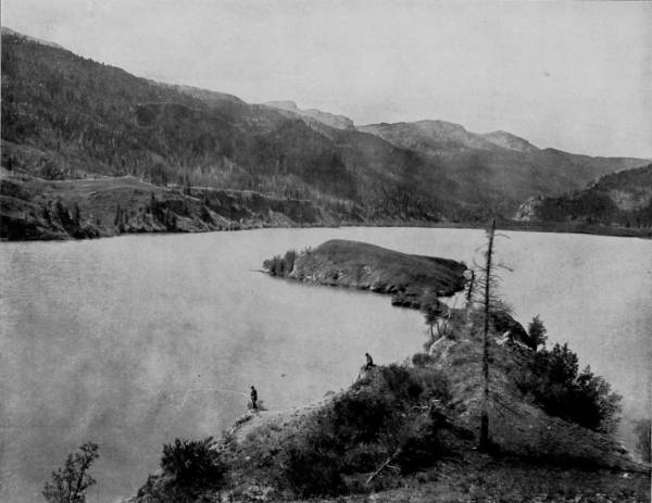
LAKE SAN CHRISTOVAL IN THE LAP OF OURAY MOUNTAINS, COL.—This lake is a basin of pellucid water formed by the drainage of the surrounding mountains. It is transparent as crystal, and being well filled with mountain trout and other species of game fish, is a favorite resort for lovers of the piscatorial sport. The tourist will find it one of the chief attractions of this delightful region, rich in scenic wonders and charming landscapes.
140Comanche Cañon is entered just above Embudo, by way of which the Denver and Rio Grande Railroad enters the Rio Grande Valley. The gorge is so rugged that it was necessary to make a great many deep cuts in the walls of marl and basalt, so that the way through the cañon is more picturesque by reason of the engineer’s work than nature designed it.
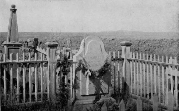
THE GRAVE OF KIT CARSON, AT TAOS.
Nearly midway between the pueblo ruins just mentioned and the city of Santa Fe, along the Rio Grande, is the Cañon Diabolo, a chasm that is not strikingly deep, but sufficiently weird to justify the Satanic appellation. High up in the walls, particularly near Espanola, are relics of a vanished race, in the form of excavations which once served as habitations, though evidently they were difficult of access. The appearance of these rock perforations are very similar to those on the Rio Mancos, and in the cañon cliffs of the Colorado; so nearly identical, in fact, that Stevenson expresses the belief that they were made by members of the same race, who took refuge in these caves when driven from their pueblos. At Santa Fe, a short stop was made to await the photographer who had passed around by Trinidad. The trip which he had made was in every respect as interesting as that which we had taken over the direct southern route. Upon passing beyond the Sangre de Cristo range eastward, the scenery grows tamely monotonous for a time, for the landscape is tiresomely level. But before reaching Trinidad, another agreeably surprising change occurs, as the Raton range breaks into view, and presents a kaleidoscopic variety of beautiful scenes. Trinidad lies at the foot of this range, and though it may not be described as a city of great architectural magnificence, certain it is that few places can boast of greater interest to the tourist. It was, long ago, the most important point on the old Santa Fe trail, and its ancient adobe houses were objects of endearment to the hearts of freighters, because they offered both refuge and refreshment after the perils of a dangerous journey. Though a great change has taken place since the railroad reached the town, it is still a typical Mexican city, which even the electric light cannot convert. Passing over the border into New Mexico, the scenery is varied and pleasing, but never grand. Instead of an arid region, however, the country is diversified, for all of the northeastern region is abundantly watered by creeks flowing towards the southeast, with occasional rivers, like the Canadian, Cimarron and Pecos, intersecting the railroad. On both sides of the road there are numerous knolls, called mesas, and craters long since burned out. The ascent of Raton Pass, sometimes called the “Devil’s Way,” affords many exquisite views, of which the Spanish Peaks, one hundred miles to the north, are chief, for the atmosphere is so clear and rare that they appear as distinct as though the distance were scarcely one-fourth so great. Upon gaining an altitude of 7,700 feet, the road enters a tunnel on the Raton Crest, and after a half-mile run emerges on the New Mexico side, where the sunlight appears to be intensified and the warmth of perpetual summer holds sway. The next considerable town reached after leaving Trinidad is Las Vegas, which reposes on a branch of the Pecos, the center of a great many sheep ranches, and it is wool that gives it chief importance. Six miles north of the place is Las Vegas Hot Springs, a sanitarium of much note, located in a region of considerable beauty. They are at the mouth of a small cañon which leads up to the Spanish Range, and thence joins the Rocky Mountains; the waters range in temperature from boiling hot to almost freezing cold.
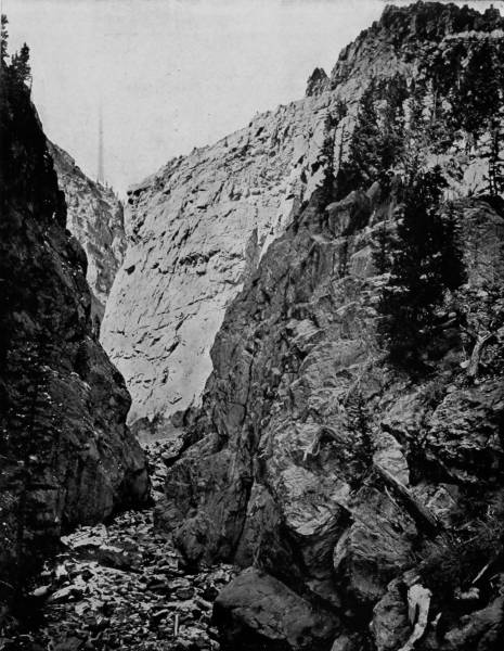
TOLTEC GORGE OF THE LOS PINOS, COL.—This is one of the most inspiring views in all Colorado. It is on the Silverton branch of the Denver and Rio Grande Railway, 309 miles from Denver City. The road traverses the verge of the great chasm, the bottom of which is 1500 feet below. The photograph was taken at the bottom of the cañon, and away up near the top may be seen a passing train, which at so great a height looks like a child’s toy. A little mountain stream meanders through the chasm, gently murmuring and singing as it makes its way over the rocks, but when the snows melt and the rains fall it becomes a mad, roaring, rushing torrent, tearing the sides of the mountain and tossing great boulders about as if they were made of straw.
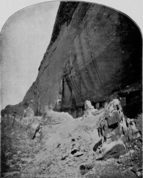
CAVE DWELLINGS in the CAÑON DE CHELLY.
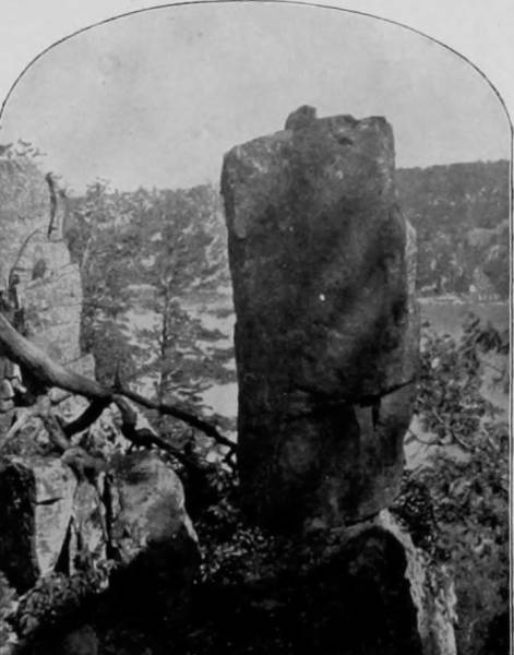
A RELIC OF THE CAVE-DWELLERS.
At a station called Lamy, there is a branch of the Atchison, Topeka and Santa Fe Railroad, leading north eighteen miles, to the ancient and interesting city of Santa Fe, celebrated in American history as being the second oldest town in the United States. The place contains much to entertain searchers after relics of the past, and here we find the links that bind the old Spanish invaders with the civilization of to-day. Settled by Catholics, it still retains the characteristics impressed upon it by the Franciscan fathers, and remains true to the faith in which it was first baptized. It is the seat of the archiepiscopal diocese, and the Cathedral of San Francisco is the largest church edifice in the territory, as well as the oldest, the original part, which still remains, having been built as early as 1622.
Old as the town is, Santa Fe is the Phœnix that rose from one that was very much more ancient, for the site was, in the ages that are very remote, occupied by an Indian pueblo, the ruins of which are still to be seen in what is known as the “Old Home.” But the most curious and attractive object within the city is the Governor’s Palace, a long, low building erected in 1598, a summary history of which is thus presented by Governor Prince:
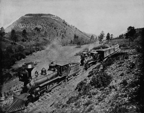
LA VETA PASS, COL.—Over this famous pass the railroad makes its way into San Luis Valley, and we have here a combination of the wonders of engineering skill with a grandeur of view unequaled in any other part of the world. The maximum grade is 237 feet to the mile, and the altitude at the summit is 9393 feet. Two of the largest locomotives are required to draw an ordinary train over the steep grades, and even with these the ascent is labored and tedious. From the top of the pass a view is obtained of such surpassing grandeur that no language can picture it.

ABANDONED CAVE HABITATIONS OF THE CLIFF-DWELLERS, NEAR ESPANOLA.
“Without disparaging the importance of any of the cherished historical localities of the East, it may be truthfully said that this ancient palace surpasses, in historic interest and value, any other place or object in the United States. It antedates the settlement of Jamestown by nine years, and that of Plymouth by twenty-two, and has stood during the 292 years since its erection, not as a cold rock or monument, with no claim upon the interest of humanity except the bare fact of its continued existence, but as the living center of everything of historic importance in the Southwest. Through all that long period, whether under Spanish, Pueblo, Mexican, or American control, it has been the seat of power and authority. Whether the ruler was called viceroy, captain-general, political chief, department commander, or governor, and whether he presided over a kingdom, a province, a department, or a territory, this has been his official residence. From here Oñate started, in 1599, on his adventurous expedition to the Eastern plains; here, seven years later, 800 Indians came from far-off Quivira to ask aid in their war with the Axtaos; from here, in 1618, Vincente de Salivar set forth to the Moqui country, only to be turned back by rumors of the giants to be encountered; and from here Peñalosa and his brilliant troop started, on the 6th of March, 1662, on their marvelous expedition to the Missouri; in one of its strong-rooms the commissary-general of the Inquisition was imprisoned a few years later by the same Peñalosa; within its walls, fortified as for a siege, the bravest of the Spaniards were massed in the revolution of 1680; here, on the 19th of August of that year, was given the order to execute forty-seven Pueblo prisoners, in the plaza which faces the building; here, but a day later, was the sad war-council held which determined on the evacuation of the city; here was the scene of triumph of the Pueblo chieftains as they ordered the destruction of the Spanish archives and the church ornaments in one grand conflagration; here De Vargas, on September 14, 1692, after the eleven hours’ combat of the preceding day, gave thanks to the Virgin Mary, to whose aid he attributed his triumphant capture of the city; here, more than a century later, on March 3, 1807, Lieutenant Pike was brought before Governor Alencaster as an invader of Spanish soil; here, in 1822, the Mexican standard, with its eagle and cactus, was raised in token that New Mexico was no longer a dependency of Spain; from here, on the 6th of August, 1837, Governor Perez started to subdue the insurrection in the north, only to return two days later and to meet his death on the 9th, near Agua Fria; here, on the succeeding day, Jose Gonzales, a Pueblo Indian of Taos, was installed as Governor of New Mexico, soon after to be executed by order of Armijo; here, in the principal reception-room, on August 12, 1846, Captain Cooke, the American envoy, was received by Governor Armijo and sent back with a message of defiance; and here, five days later, General Kearney formally took possession of the city, and slept, after his long and weary march, on the carpeted earthen floor of the palace.”
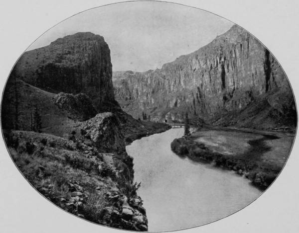
WAGON-WHEEL GAP.—Wagon-Wheel Gap is in Rio Grande County, Col., in the southern part of the State and near the head of the Rio Grande River. Hot Springs, famous for their curative qualities, are located here. The scenery is exceedingly picturesque, and the place has become a favorite resort for health and pleasure seekers. It is said to be the best place for trout fishing in the West, and this fact largely increases its popularity with tourists. It is 310 miles south of Denver, and is reached by the Creede branch of the Denver and Rio Grande road. The elevation is 8448 feet.
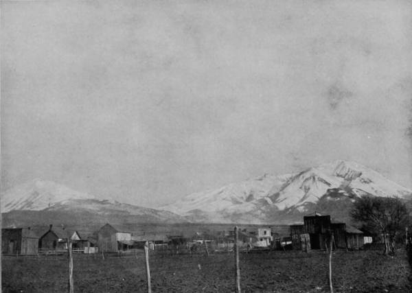
SPANISH PEAKS, FROM LAS VEGAS, NEW MEXICO.
Santa Fe now has many things that belong to the present age: street cars, electric lights, etc., but she is, nevertheless, still a place of adobe houses, before which there is ever a varied commingling of Americans, Mexicans and Indians. She is also the center of archæological interest, for besides the ancient objects which are to be found within her urban limits, there are villages near-by which present all the aspects of the aborigines, practically as they appeared to Cortes and Coronado. These adobe places and their inhabitants are called pueblos, because that is the old Indian name signifying town. The pueblos in New Mexico are nineteen in number, and while varying in size, they are very similar in appearance, showing, as they do, no variation of architecture. The houses were built to accommodate from one hundred to several hundred persons, as the Pueblo Indians were communistic in their manner of living. Instead of being one or two-story structures, like the present style of Mexican and the old Spanish adobes, the houses were built one upon another, in a succession of terraces, sometimes five or more in number, the upper stories being accessible only by means of ladders. The most noted of these pueblos are Taos, Laguna, Acoma, Santa Clara, Zuni and Santo Domingo. Albuquerque was also originally an Indian pueblo, built upon a slight elevation of rock, and the place still contains several clusters of square, flat-roofed adobe houses, arranged in terraces, as before described. The walls of these strange dwellings are very thick, and the interior is gained, not through doors, but by entrance-ways cut in the roof, which is reached only by ladders. The Pueblo Indians have been pronounced by many ethnologists to be the oldest race now living on the continent, though many others regard them as being the descendants of the Aztecs, whose ancient kingdom of Cibola extended from Colorado and Utah on the north, to Central America on the south. The capital of this extinct empire is supposed to have been situated in Penal county, Arizona, the ruins of which are traceable along the Gila River, in what is known as the Casas Grandes. Remarkable stories have been told of the relics of this ruined city, enthusiasts often describing them as equal in grandeur to the prostrate columns and mighty archways that speak in imperishable stone of the magnificence of ancient Egyptian cities. The Montezumas were supposed to have held their court in the splendid stone palaces whose relics lie scattered through the Casas Grandes, and whose carvings and hieroglyphics seem to attest the departed glory of a once mighty people. These famous ruins are twelve miles north of Florence, a station on the Southern Pacific, and are in a region of great picturesqueness, which is traversed by a good wagon-road running along the Gila River. The route is through an arid plain, in which the only vegetation is mesquite and cactus, but the parched desert is gracefully confined by a beautiful and opalescent range of mountains, while overhead is a sapphirine sky more brilliant than ever hung over Italy. The river margin is like a blue wave, colored as it is by the tossing heads of wild lilac flowers, which find protection from the beating sun under the waving branches of banks of willows that stoop low to drink from the river. There, under the shadows of the Tucson Mountains and the Sierra Catarina range, are the colossal ruins of the Casas Grandes. The buildings, of which confused heaps are all that now remain, were of irregular style, but of some architectural pretension, for the walls were constructed of concrete, moulded into blocks nearly three feet square. The principal structure, which has long been called Montezuma’s Palace, was about sixty feet long by fifty broad, and stood five stories, or forty feet high. For windows there was a square aperture over each door, wholly insufficient for either light or ventilation, though the ancient Indians were not partial to either, apparently preferring darkness; and living in the closest communal state, they appreciated fresh air like they did the storm and cold, only when it was on the outside.
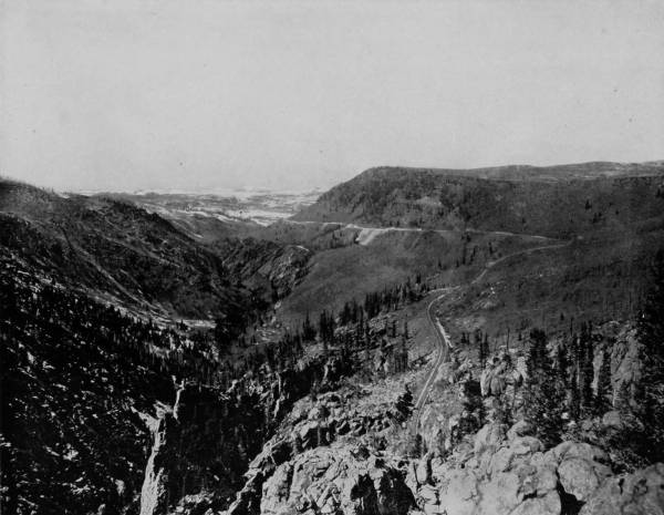
LOS PINOS VALLEY, LOOKING WEST.—This beautiful photograph gives us a splendid view of cañon, table-land and mountain scenery. It is rugged and picturesque, with a fringe of distant snow-covered mountains as a central background. From the high table-lands to the right, a view of surpassing grandeur and beauty bursts upon the enraptured vision, repaying the tourist for all his pains in climbing to the exalted heights. Here the atmosphere is always cool and invigorating, and the weariness and lassitude of a warmer and more humid climate are not experienced.
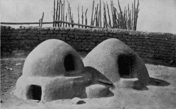
MEXICAN OVENS, USED PRINCIPALLY BY THE PUEBLO INDIANS.
Occasional pieces of copper are found in the Casas Grandes ruins, but no iron, and the cutting instruments of the original occupants were made of obsidian, as were their arrows. Pottery still strews the ground about, but there are no evidences to support the old legends of magnificence with which early travelers invested the so-called palace. But there are plainly to be seen ruins of a great wall that once enclosed the city, on which were sentinel towers rising several feet above the main wall, thus proving that this was not entirely a land of peace, nor do appearances indicate that it was one of plenty. The Apaches, no doubt, harried the less war-like Moqui, who were at last driven southward, and left ruins of similar cities along their gradual retreat from Utah to Mexico. Professor A. L. Heister, the antiquarian, who has made a long and patient investigation of the pueblo ruins in southwest New Mexico, thus writes of his discoveries:
“Within a radius of five miles of St. Joseph, New Mexico, I have discovered several hundred ruins of the habitations of prehistoric man. In these ruins—the walls of which are built of undressed stone and cement—are found the remains of huge cisterns; walls of fortification; queer implements of bone and stone; beautifully designed, carved or painted pottery, together with odd and artistic pictures, characters and symbols cut upon large rocks in cañons near, and with such nicety of taste as serve to strike the beholder with wonder and admiration.
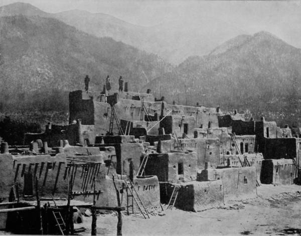
ADOBE VILLAGE OF PUEBLO INDIANS, NEW MEXICO.—The word pueblo in Spanish means village, and this term was applied by the early Spanish explorers to several powerful tribes of Indians whom they found living in adobe villages like the one so beautifully photographed on this page. They had evidently occupied such abodes for centuries before the Spaniards came, and they have not departed from the custom up to the present time. As the increase of a family requires more room, additions are made at the top of the house, and thus we find their homes built in tiers, one above the other, the upper stories being reached by rude ladders, as shown in the illustration. The baking oven, seen at the left of the photograph, is a village institution, and it has been adopted almost universally by the present rural population of Mexico. The Pueblo Indians are rapidly disappearing, their entire number being now less than 1000.
150“The ruins are generally found on high ground, and are composed of from two to several hundred rooms, averaging about eight by ten feet, and six to eight feet in height. In some cases the buildings have been two stories high. There has been a side entrance to all of these rooms, but these openings, from some cause, have been carefully walled up.
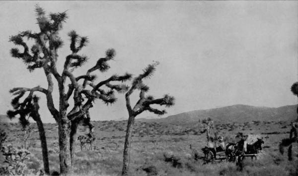
SCENE ON THE GREAT AMERICAN DESERT.
“These people were larger than those of to-day, some of them being fully eight feet high. I am led to believe their average height was not less than seven feet. They buried their dead in the ground floors of their rooms, with the heads towards the east, and, as a rule, their pottery, trinkets and personal ornaments with them. In excavating these ruins, one is constantly impressed with one paramount wonder—their great age. Huge pine trees, three and four feet in diameter and 100 feet high, flourish upon the walls and in the rooms of these habitations of forgotten man. The infilling of drift and the increase of surface, caused by vegetable growth and decay, is very slow, and has been estimated by some geologists to average about one foot in eighty years. Admitting this to be near the truth, our surprise knows no bounds when, on sinking directly under these giant trees, we pass through from six to ten feet of vegetable mold, then encounter from one to three feet of clean-washed sand and gravel, then a solid earthen floor covered with ashes, charcoal, bones and fragments of broken pottery. Yet still below this are the skeletons of human beings, surrounded by their pottery, weapons and ornaments of stone, bone and copper. My own opinion is that these people were either Aztecs or Toltecs. They were sun-worshipers and well advanced in carving, painting, building, weaving and agriculture. They flourished many centuries in Colorado, Arizona, New Mexico, Mexico, Central and South America, and were exterminated either by famine, flood, disease or volcanic action at least 1,000 years ago.
“In the eastern part of this (Socorro) county are the ruins of an immense city known as the Grande Quivero, covering two by two and one-half miles square. Its walls are, in some places, eight feet thick, forty feet high, and 700 feet long. A great aqueduct carried water to the city, but to-day there is no water within forty miles of this ancient wonder. It stands silent and alone in the sunlight and moonlight, and where once the love, industry and skill of an unknown race made thousands of beautiful and happy homes, the coyote, bat and snake now hold sway. When and by whom it was built was a mystery to the Mexican people more than 300 years ago.”
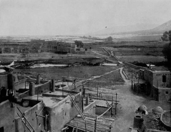
THE PUEBLO VILLAGE OF LA GUNA.—This is one of the most important of the Pueblo settlements in New Mexico. It is situated in the midst of a rich valley, which, by means of irrigation and rude methods of cultivation, produces abundant food for the unaspiring inhabitants. The reader is referred to page 150 of this work for a very full, graphic and interesting description of the Pueblos and their customs, together with a history of their probable origin and descent.
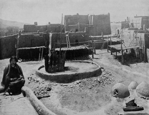
INNER COURT OF A PUEBLO TOWN, ARIZONA.—In two preceding photographs we have had very fine general views of Pueblo villages, and in this one we are shown the interior or court, formed by the surrounding houses, where much of the domestic work is performed. It is a dreary, desolate-looking place, but decidedly better than the average of the homes of savage or uncivilized peoples. The sun-baked mud houses are certainly preferable to an ordinary Indian wigwam, and we are sure the baking ovens would produce sweeter and more wholesome bread than the roving Apaches or Sioux are accustomed to. In fact, the houses, the ovens, and even the dress of the forlorn-looking woman indicate the beginnings of civilization.
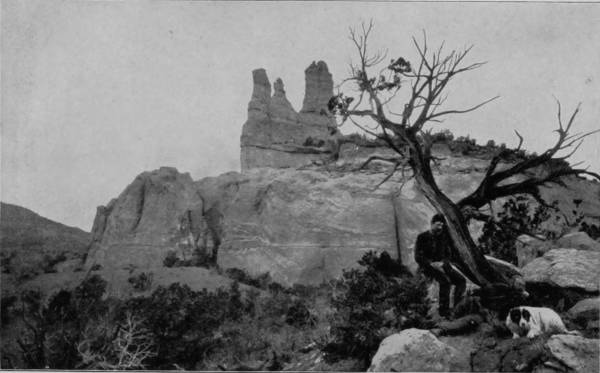
NAVAJO CHURCH, NEAR FORT WINGATE.

Leaving Santa Fe, we continued our journey westward over the Atchison, Topeka and Santa Fe Railroad, and striking the Rio Grande a short distance south of White Rock Cañon, followed the bank of that stream through some very handsome scenery until we reached Atlantic and Pacific Junction. Thence for a while the route was through an arid section, where alkali and musquite abounded; an unchangeable waste of black sterility; a country so level that the laying of a railroad track was attended by no difficulties, but keeping it clear of sand is a work of great perverseness. We were now on the line of the Atlantic and Pacific, which crosses a branch of the Rio Grande at Rio Puerco, and soon after follows the valley of that stream for about sixty miles. Laguna is on the way, and north and south are mesas, dry lakes and lava beds, but there is no picturesqueness of landscape. South of Fort Wingate, just east of the Arizona border, is the Zuni Plateau, in which several old ruins are still to be seen; but if we except the Indians, who exist in the most miserable condition, and old ruins and craters of extinct volcanoes, the region is without interest, and has few features worthy of the photographer’s art.
After reaching Arizona, the road passes through a corner of the Perco and Zuni reservations, and follows the old trail leading to Prescott. Immediately south of Flagstaff, and in sight of that place, are more ruins of cliff dwellings, built in the banks of Walnut Creek, but so faded as to be scarcely distinguishable now. We are now in the Cactus plain, where immense stalks of that curious vegetable growth rise to the dignity of branchless trees, prickly and often grotesque.
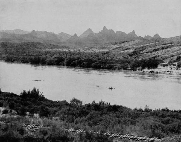
THE NEEDLES ALONG THE RIO GRANDE.—The Needles are a part of the Rocky Mountain chain, and they derive the name from their sharp-pointed and splintered pinnacles, in which respect they differ from all other mountains in America. Their peaks tower into the regions of perpetual snow, which cools and tempers what would otherwise be an almost intolerable climate. The Needles first come into view after emerging from the western extremity of Animas Cañon, and their white turrets are then visible for many leagues as the train glides along parallel with them.
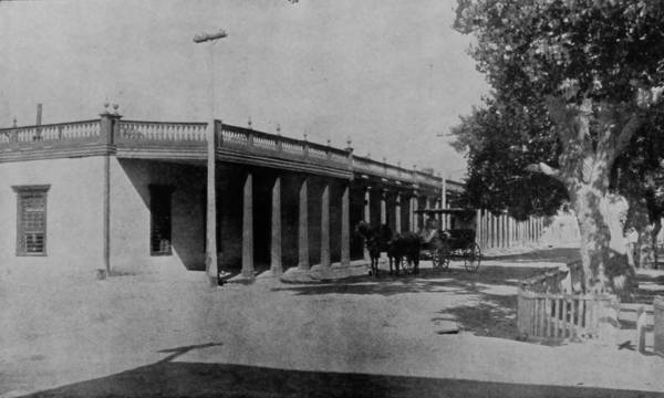
THE OLD SPANISH PALACE, SANTA FE, NEW MEXICO.
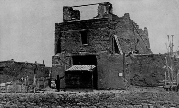
OLD CHURCH OF SAN MIGUEL, SANTA FE, N. M., BUILT OF ADOBE IN 1550.
These are two interesting buildings photographed on this page. The Palace, so called, has no very palatial appearance, but it has a record as a government building which many a palace might well be proud of. It has domiciled a long line of governors, both under Spanish and American rule, and is still occupied for this purpose. It fronts the plaza or public park, a portion of which is shown in the picture, and a brilliant scene is witnessed here on a summer’s afternoon when the officers of the garrison stationed here, with their families and visiting friends, gather under the shade of the trees to listen to the excellent music of the military band. The old adobe church is probably older by at least two centuries than any other church house in America, and a few years ago, when the writer was there, it was still used for religious purposes.
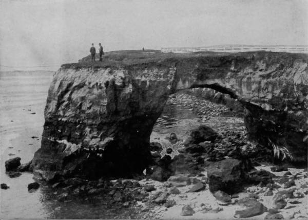
NATURAL BRIDGE, NEAR MONTEREY, CALIFORNIA.
At a little station called Peach Springs, the road draws very near the Hualpai reservation, and is within less than a score of miles of the Grand Cañon of the Colorado; but, though short, the way is a difficult one, over parched sands and an eye-wearying desolation, until within four or five miles of the cañon, when the approach to water is indicated by a gradual increase of vegetation, which, however, never becomes rank, even along the river-shore. A stage-line is now running from Flagstaff, which, though not so near as Peach Springs, offers a much easier route to the cañon. The trip from Flagstaff is made in twelve hours, and, by comfortable stages, the traveler is taken to one of the most imposing points in the cañon (Marble Cañon), where the descent is sheer 6,000 feet, and a panorama is afforded of frightful chasm, curiously chaotic walls, strange formations, and mountains breaking one behind the other, like waves on the ocean, until sight fades into the perspective of distance. Here terror and sublimity, in a marvel of natural extremes, have formed perpetual alliance to excite amazement in the mind of every visitor.
We cross the Colorado at Powell, where, to the south, are Red Rock buttes, and to the north are the Needles, the latter being hills that run up into sharp peaks, and then fall away to join a long stretch of plain. Black Mountains run parallel with the river on the north, near the foot of which, but on the river-shore, is a Mohave village, a settlement of that miserable remnant, who from a powerful people have degenerated, through oppression and decimation, until they are scarcely a degree removed from the Digger Indians. The reservation proper of this tribe is, however, near the Navajoes, in the northeastern part of the territory.
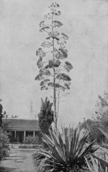
A CENTURY PLANT IN BLOOM, CALIFORNIA.
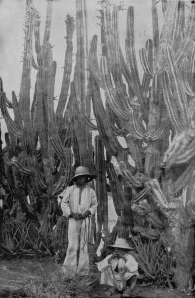
A CACTUS FENCE IN ARIZONA.
Immediately before blooming, the century plant puts out a long stem or shoot, as seen in the photograph, upon which the flowers appear in due course of time. The event is such a rare one as to be quite a curiosity, and as comparatively few of the readers of this book will probably ever be so fortunate as to see the real plant in bloom, they will all the more appreciate this beautiful photograph.—In many parts of Arizona, New Mexico and Mexico the cactus plant is made to do service as a fence around gardens and small fields. The variety generally used for this purpose has a broad, thin blade, resembling an ancient broadsword, and these grow so close together, with sharp needle-pointed thorns shooting out in every direction, that no living thing can pass through or between them.
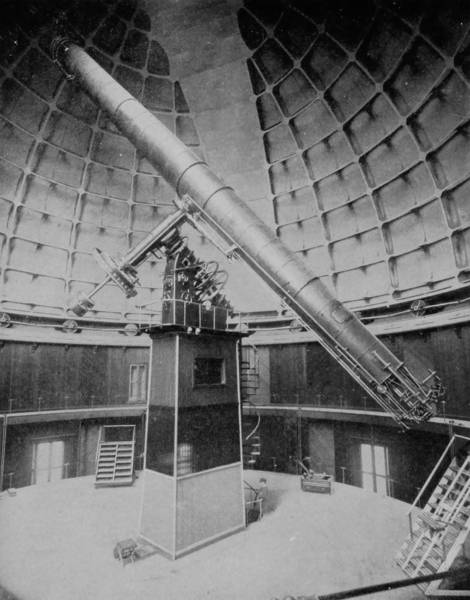
THE GREAT TELESCOPE, IN LICK OBSERVATORY.
Crossing the Colorado, we strike the desert district of California, which extends through the counties of San Bernardino and Kern, a distance of nearly three hundred miles. Adjoining these two counties on the north is Inyo county, into which the Carson and Colorado Railroad extends southward as far as Owen’s Lake. This county is remarkable for embracing a region of extraordinary wonders, greater, indeed, in several respects, than any other district in the world. In the northern part is a marvelous depression, 159 feet below sea level, and nearly 150 miles in circumference, known as Death Valley. It is distinctly a volcanic region, in which, however, the fires are long since burned out, leaving the desert a vast field of cinders, so parched that no drop of water exists within its borders, though rivers of lava ramify it in every direction. Many have perished in an effort to cross this fiery plain; and looking across it from the margin, the observer sees a shimmer in the air, as if a furnace were in active blast beneath. Here the temperature rises to 122 degrees, and the air hangs in a hot envelope, lazily swinging to and fro, rising and falling in waves of heat, and making the sands blaze with an almost blinding light. Scorched, burned-out and furnace-like though the region be, it is, nevertheless, the abode of life, but no less curious than is the valley itself. The centipede, scorpion and horned-toad find here a congenial habitation; and, strange to say, a species of kangaroo-rat is peculiar to this cursed spot, burrowing in the hot sand and feeding on insects.
Thunder-storms beat around the valley, but no drop of rain ever moistens its burning lips. The dryness of the air is such a preserver of dead bodies that decay is impossible, and the animals that die within its borders are mummified until they become like parchment. This cursed spot, sown as it is with dragon’s teeth, is not entirely without its attractions, though they are as dangerous as were the soft, lute-like voices of the Sirens. It is the field of wonderful illusion, from which spring into the quivering air the most astounding and alluring mirages: rippling brooks, waving palms, floral meadows, ships under sail, banks of thyme, and travelers moving in procession across a landscape more beautiful than an oriental vision.
Continuing our journey westward, we passed through a large arid district, in which dry lakes with beds white with soda, and shining in the blazing sun, were plentiful on both sides, but seeing no more interesting features until we arrived at Los Angeles. Here we found much to amuse, and often to instruct. It is an old town, settled by the Spaniards, in 1780, and although now a beautiful city, it has not entirely put aside the garments of antiquity with which the ancient church fathers invested it. Many old adobe buildings still remain, and there are not wanting the ruins of quaint and curious monasteries, moss-covered, and with broken walls and dilapidated belfries, in which the ghosts of long ago seem to have their haunt.
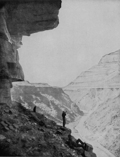
WITHIN THE JAWS OF GRAND CAÑON OF THE COLORADO.—The Grand Cañon of the Colorado is such a stupendous wonder that we never grow tired of contemplating it. From every point of view we see some new marvel to admire. The variegated and many-hued cliffs are as remarkable for their bewildering beauty as for the grandeur of their lofty heights. Everything is on the most colossal scale, except the little river itself, which goes dashing along in playfulness and glee with no intimation that it is the master workman by whose hands this stupendous wonder was wrought.
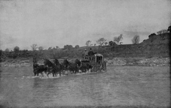
OUR STAGE-COACH CROSSING THE SANTA INEZ.
The river, which washes the eastern limits of the city, is a sluggish stream, but it imparts refreshment to one of the most fertile valleys to be found anywhere in California. Here we find a succession of orange-groves and vineyards, bending low with golden and purple fruitage, while beyond the city’s skirts are orchards of walnut, olive and almond, from which profitable crops are annually gathered.
San Diego, 147 miles south of Los Angeles, is another beautiful place, the center of a delightful region, but its interest lies very largely in the fact that it was at this place the first white settler in California pitched his tent, as early as 1769. This great Spanish pioneer, Father Junipero Serra by name, became the founder of twenty-one missions in California, some of which still remain in a fair state of preservation, but a majority exist as mere reminders of the olden time when the Franciscan friars dominated that portion of the Spanish territory. In this southern region the landscape is monotonous, and the air is usually hot, from which fact, no doubt, came the name “California,” which, in the Spanish, signifies “hot furnace,” and was bestowed by the discoverer, in 1534.
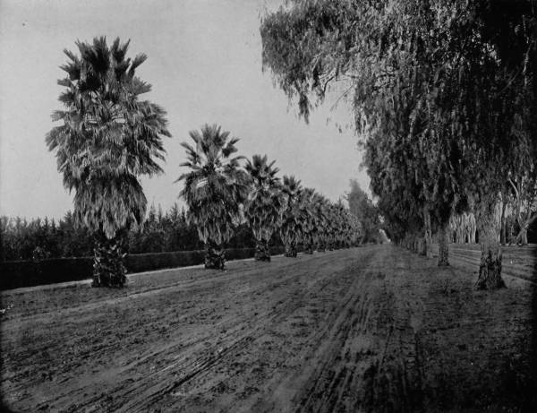
MAGNOLIA AVENUE, RIVERSIDE, CAL.—The climate in Southern California is almost tropical, and the fruits, flowers and general vegetation are similar to those found in equatorial regions. In the Spanish language “California” signifies “hot furnace,” and this name was bestowed upon that country by the discoverer in 1534. It is therefore no matter of surprise that we should see reproduced in this photograph a scene that carries us in imagination to the central regions of Florida. Here the palm and the magnolia, the orange and the lemon, grow and bloom side by side.
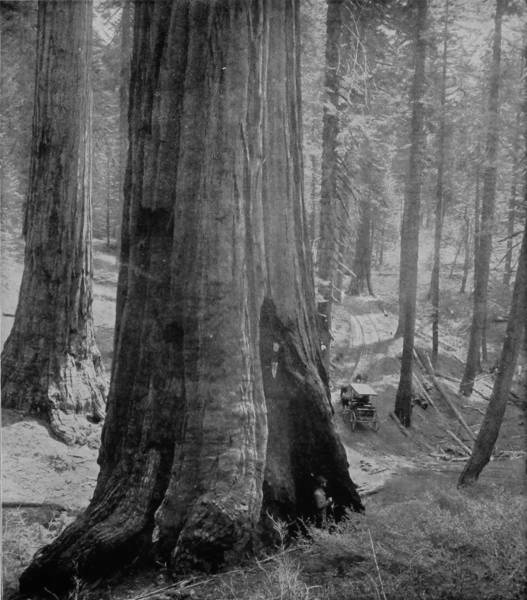
THE GRIZZLY GIANT, MARIPOSA GROVE OF BIG TREES.
Proceeding northward, the scenery becomes more varied and pleasing, for above Los Angeles a mountainous district is passed, with the San Bernardino and Sierra de San Rafael ranges on the right, and the Monica and Santa Inez ranges on the left. Still further north are the San Benito Mountains, paralleling the San Juan River, along whose magnificent valley the railroad runs until it reaches Castroville on the coast, just above Monterey. This latter place is one of very great attractiveness, not only for its historical associations, as the seat of Spanish Government in California until 1847, but also because it is the best specimen of the old-time adobe cities which now remains, as well as the location of one of the most exquisite gardens and charming hotels that is to be found either in or out of America. The Hotel del Monte is a building of much beauty in itself, but the very large grounds which surround it have been cultivated until they are a veritable paradise of noble oaks, rich green lawns, and bewildering flower-beds, dimpled with every hue that nature is capable of painting. The old town is a ghost of antiquity, the skeleton of a remote past, whose bony fingers point backward, as if beckoning beseechingly to the long ago. There is the mission house, rickety and tattered, raising its palsied head barely above the adobe walls which once served so well to defend it against enemies. But the wall, very thick though it was, has been badly breached by the catapults of time, and having done faithful guard-duty in the early days, it is now like the grave of a hero, which has become a shrine, to which many are drawn by curiosity as well as by respect.
From Monterey northward the road runs through the incomparably beautiful and fertile Santa Clara Valley, a region where nature is always in good humor, and so fat that every time she laughs she shakes out a harvest. Towards the left spreads away a waving plain in richest cultivation, while on the right towers the Coast range of mountains, whose summits, bathed perpetually in a clear atmosphere, look in the distance like a vast ridge of sapphires supporting the sky.
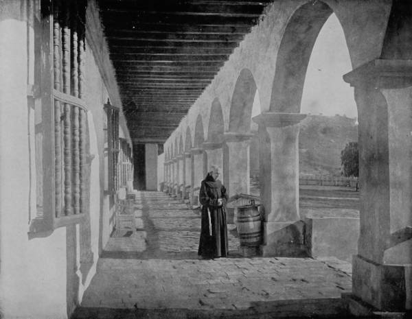
AN OLD MISSION HOUSE IN CALIFORNIA.—The great Spanish pioneer and priest, Father Junipero Serra, went to California in 1769, and pitched his tent near the modern city of San Diego. He was the first white man to settle within the limits of the territory now embraced by the great State of the Pacific coast. His object in going there was to serve as a missionary among the Indians, and so earnest and faithful was he that he lived to become the founder of twenty-one missions. Some of these still remain in a fair state of preservation, like the one photographed on this page, but most of them have fallen into decay.
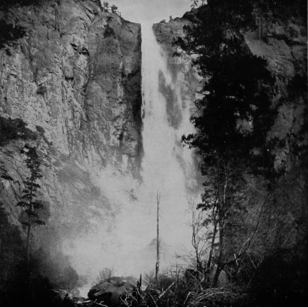
BRIDAL VEIL FALL, YOSEMITE.
At San Jose, a lovely city embowered with oaks, vines, roses and palms, the stage is taken for Mount Hamilton, upon the peak of which is located the Lick Observatory, enclosing the great Lick telescope. The road cost $80,000 to make; and though the ascent, which is begun fifteen miles from San Jose, is great, yet so admirably constructed is the way that two horses easily drag the stage to the summit. I never had a more delightful ride than this trip afforded, for while the air was bracing, the view was at all times indescribably picturesque. At places where sharp turns are made, passengers can look out of the coach windows down into abysses which seem to be bottomless, and which never fail to elicit the question: “If a wheel should run off the edge, where would the passengers land?”
The altitude of the observatory is 4,250 feet above the valley, and from this lofty point, it is claimed, with an appearance of truth, that a greater area is visible than from any other in the world. Not only is the whole of Santa Clara Valley viewable, but on very clear days the highest peaks of the Yosemite are discernible, and even Mount Shasta, 200 miles distant, can be distinguished. The telescope is a 36-inch reflector, the largest ever made, and so massive that it is controlled by hydraulic power, which is most ingeniously applied, the adjustment being so perfect that its many tons of weight can be moved by a single finger. The public have free access to the observatory, but unfortunately, and very unwisely, visitors are not permitted to use the telescope except on Saturday nights. As favorable evenings are comparatively few, this rule prevents a very great majority of persons from realizing what they have traveled thousands of miles to see, and much complaint against the astronomers in charge is accordingly made.
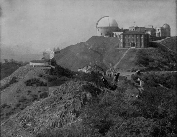
LICK OBSERVATORY, ON THE SUMMIT OF MOUNT HAMILTON, CAL.—The observatory buildings occupy the summit of the mountains, at an altitude of 4250 feet above the valley. The place is reached by stage from San Jose, over a road which is said to have cost $80,000 in its construction. The scenery along the road is wonderfully picturesque and beautiful, embracing a number and variety of views that are unsurpassed anywhere in the world. From the observatory nearly the whole of Santa Clara Valley can be seen, and on clear days the peaks of Yosemite, and even the hoary head of Mount Shasta, 200 miles distant, are discernible.
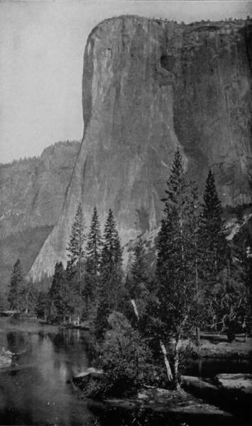
EL CAPITAN, 3,300 FEET HIGH, YOSEMITE.
From San Jose to San Francisco the distance is about fifty miles, through forests of redwood, past charming villas skirting San Francisco Bay, and many beauties peculiar to this perpetual summer land. The city is one of exceedingly great interest, possessing as it does features of a unique as well as of a magnificent character. Some of its best streets are reclamations from the bay, where, in 1849, the largest ships rode at anchor; and what were once bare mountains of sand were made accessible by the adoption of a cable system of street railroads, and on these peaks are now several of the finest residences in America.
The Palace Hotel is the largest in the world, nine stories high, occupying 275 by 350 feet of ground, and cost, with furnishings, the enormous sum of $7,000,000. The public buildings, and many of the business blocks as well, attest the great wealth of the place, which flowed in with the gold discoveries. Lone Mountain, distinguished by a large wooden cross on its summit, affords a view which embraces not only the entire city and bay, but likewise of the ocean, Mount Diabolo and the long Coast Range that shimmers in the sun like polished metal.
But the most delightful point of interest is the Cliff House, near the entrance to the Golden Gate, reached by a beautiful drive through Golden Gate Park, and also by cable and steam cars. The prospect from the hotel piazza, reaching far above and over the ocean, is both grand and charming. Immediately in front, and only three or four hundred yards away, three rocks rise out of the sea to a height of one hundred feet, and on these hundreds of sea-lions gather of sunny days to bask and display themselves before amused spectators. At times, their barking is almost distracting, especially when some ugly-dispositioned pater familias of the great herd sets about clearing the rocks, when there follows a noise like ten thousand big dogs in conflict, and a scrambling, sprawling and tumbling that is wonderful as well as amusing.
GARDEN OF PALMS AT INDIO, NEAR SAN DIEGO, CAL.—No wonder the people of California love their State and its “glorious climate” when they are able to produce such ideal homes as the one reproduced in this superb photograph. It is one of many others like it in the same region, and shows what may be accomplished in a short time with a combination of natural advantages and industry. The picture is so perfect that we can almost imagine we see the waving of the palm leaves and smell the perfume of the flowers.
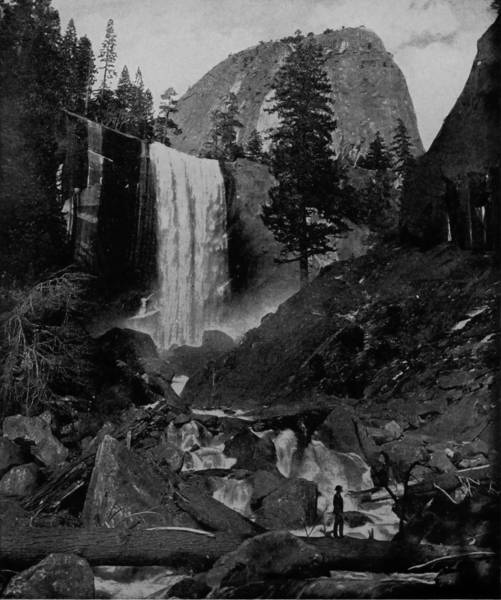
VERNAL FALLS AND LADY FRANKLIN ROCK, YOSEMITE.
San Francisco is a center from which many interesting itineraries may be conveniently made, several of which we performed, with the particular view of photographing the most attractive features. Chief of these excursions is to the Yosemite Valley, which is 267 miles from San Francisco, the last sixty-seven miles being journeyed by stage. Leaving that city at 4 P. M., we reached Raymond at 6 A. M. the following day, at which point the stage is taken to Wawona, which is only six miles from the Mariposa Grove of Big Trees. These giants of the primeval forest are in a Government reservation two miles square, and compose two distinct groves some half a mile apart. In the upper grove there are 365—one for each day in the year—trees, 154 of which exceed fifteen feet in diameter, and several are more than 300 feet in height. The largest, known as the Grizzly Giant, in the lower grove, is thirty-one feet in diameter, and the first limb which makes out from the trunk, 200 feet above the earth, is six feet in diameter. There is a prostrate tree in this grove which originally measured forty feet in diameter, and was 400 feet in height. The body is hollow, and is large enough to admit three horsemen abreast a distance of seventy feet.
A few miles beyond Wawona is a stage-station called Fresno, which is within the limits of another grove of mammoth trees, the largest of which is thirty-two feet in diameter at the butt, and there are probably 100 or more that measure as much as twenty feet through. Just beyond Fresno, we enter the far-famed and truly marvelous region of the Yosemite (which, in the Indian tongue, signifies a “grizzly bear”), that great heart of the Sierras which beats in mountain and breaks in waterfall. This wondrous valley, running along the western base of the Sierra Nevada range, is a comparatively level area, but it lies fully 4,000 feet above sea level, and is nine miles long, by an average of one mile wide. The remarkable feature of this valley, aside from its special curiosities and mammoth configurations, is the fact that it is enclosed by granite walls of almost unbroken continuity, which present perpendicular faces ranging from 3,000 to 6,000 feet in height. The valley was discovered May 6, 1851, by the Mariposa battalion, in command of Major James D. Savage, which had been sent against the Yosemite Indians, to punish them for outrages perpetrated against the miners in the counties of Mariposa, Fresno, Tuolumne and Inyo. Up to this time the valley was known to whites only through Indian traditions, which represented the region as one of great beauty, but the abode of witches and evil spirits. Upon the discovery, however, it was found to be a place of refuge for the Indians; and within its boundaries, therefore, some desperate fighting took place between the California rangers and the Yosemite Indian marauders, in which there were heavy losses on both sides, and many acts of shocking cruelty.
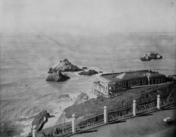
SEAL ROCKS AND CLIFF HOUSE AT THE GOLDEN GATE, SAN FRANCISCO.—This is one of the many popular resorts near the city of San Francisco. It affords a fine view of the Golden Gate entrance to the harbor, and the coming and going of the ships. The rocks in front of the hotel are nearly always covered with seals, or sea-lions, whose barking and plunging in the water add variety and interest to the scene.
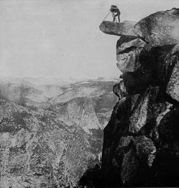
GLACIER POINT, YOSEMITE.
The stage-road leading from Wawona is particularly romantic and delightfully picturesque, with views of mountains, laughing streams and beflowered valleys, that break in pleasing variety upon the expectant vision of the visitor, and give intimation of the grander glories that lie beyond. After crossing Alder Creek, a beautiful stream that washes a pebbled bed, the route mounts Alder Hill, and rises rapidly until from its apex there is afforded an amazing sight, which never fails to throw the beholder into raptures. Northward, like a thread of silver running through a labyrinth of mountains, is the South Fork, while southward the same stream speeds away to join the Merced River, which dashes through a stupendous gorge aflame with colors. Descending Alder Hill on the east, by way of a tortuous route, we at last reach Merced Valley, beautiful as a poet’s inspiration, and crossing this low-lying strip of meadow land, climb another hill, where wonder compels us to pause upon its crest. Away yonder in the misty west, where the horizon drops down like a curtain on the world to hide the mysteries behind, are the dim outlines of the Coast Range, nearly 200 miles distant. But more bewildering sights are near at hand, for there to the left a little way are noisy cascades playing leap-frog over giant stones; Table Rock is close by, and El Capitan, that grizzled old captain of the Yosemite, exposes his shoulder, which seems to be a prop for the clouds. A few miles further and we reach Inspiration Point, where a glorious vision of Yosemite Valley and its Titanic walls break upon us with a startling suddenness, revealing a section of nature that is incomparably grand and awesomely magnificent. El Capitan forges upward 3,300 feet; the Three Brothers keep him company to a yet greater altitude, while in the background, frowzled, yet sublime, loom up against the cerulean sky the gray Cathedral Rocks, lying within the deep shadows of Sentinel Rock. Look around, for on every side appear evidences of mightiness, the awfulness of those powers which sometimes escape from internal reservoirs, or break away from the fastnesses where they were born; the bursting of lava beds, the tearing down of glacier, the down-sweeping of avalanche, and the steady flow of gnawing waters.
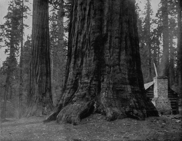
BIG TREES IN MARIPOSA FOREST, CAL.—The big trees of California are celebrated all over the world, and visitors to the World’s Fair at Chicago had the pleasure of beholding a number of very fine samples, the largest having been exhibited in the Government department. In this photograph the picturesque cabin, standing near the roots of the gigantic tree, affords a good object of comparison, by which one may readily determine the enormous size of the forest giant.
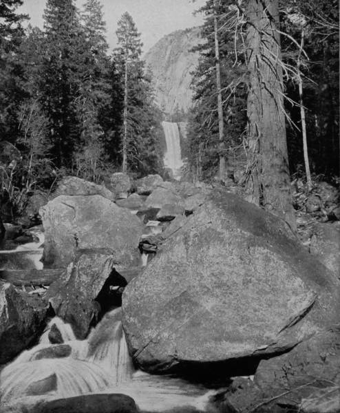
VERNAL FALLS, YOSEMITE.
A trip through the Yosemite Valley is one of profound amazement, a succession of astounding surprises, where the most amazing prodigies of nature stand before you in review. Why, throw a glance up yonder, so far that though the atmosphere is wondrously clear, yet the trees on the crest are not distinguishable, only a white ribbon that appears to have been flung down over the narrow edge of that appalling summit to attract attention. What we see is the first leap of Yosemite Falls, dashing through a notch that is nearly half a mile wide, and which has a fall from three ledges of 2,548 feet, or sixteen times greater than that of Niagara. There, not far away, is Glacier Point, which is 3,000 feet high, and from which a view of the entire valley can be had. Standing on that pinnacle, we gather in a glorious panorama of extraordinary splendor. The great domes of the Yosemite are plainly discernible; so is Liberty Cap, Clouds’ Rest, Vernal Falls, Nevada Falls, placid lakes, and the swift-rolling Merced River, that collects and bears away the waters that plunge down from a dozen dizzy heights.
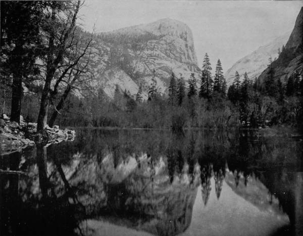
MIRROR LAKE, REFLECTING EL CAPITAN, IN YOSEMITE PARK, CAL.—Among the myriad attractions of Yosemite Park, none are more popular than Mirror Lake. The water is so transparent as to give a perfect and beautiful reflection of all surrounding objects. The photograph on this page is a fine example of this attractive feature, the reflection being so perfect that it is difficult to determine which is the right side of the picture. If this lake had been located in the Garden of Eden, we could not blame our grandmother Eve for admiring her counterpart in its pellucid depths.
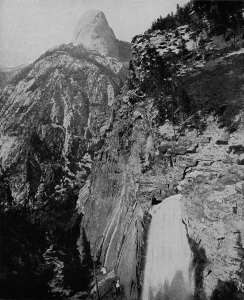
ILLILLOUETTE FALLS AND SOUTH DOME.
But besides these, as we turn to sweep the other points, we catch views no less grand, of Ribbon Fall, with its leap of 3,350 feet, Indian Cañon, Royal Arches, Bridal Veil Fall, Washington’s Tower, Columbia Rock, and pearl-gray granite walls that rise in places to a vertical height of 6,000 feet. More beautiful, in some respects, than any of these, as many believe, are Mirror Lake, which seems to reflect nearly the whole valley, and Cascade Falls, which are indescribably lovely. The meadows draw our admiration likewise, for they are so covered with flowers as to appear like a carpet of the most gorgeous patterns, done in the liveliest combination of brilliant colors. Other points of great interest are the Giant’s Thumb, Eagle Peak, Valley Ford, the Gnome of the Yosemite, Mount Watkins, 4,000 feet high, and Tis-sa-ack (Half Dome), 5,000 feet in height, which was regarded by the Indians as the Guardian Angel of the valley, for upon the south side of it are the distinct outlines of a human face, declared in a legend to be those of Tu-tock-ah-nu-lah, ancient father of the Yosemites. And there are the Three Brothers, called by the Indians Pom-pom-pa-sa, which signifies “three mountains playing leap-frog,” a name no doubt bestowed because of the popularity of that game with the original natives, and also because the mountains, from a distance, bear a strong resemblance to three giant frogs sitting side by side, upon the point of leaping into the valley, nearly 4,000 feet below.
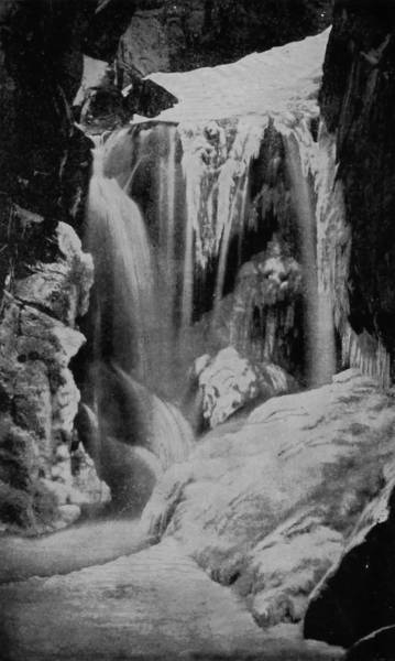
UPPER CASCADE OF BRIDAL VEIL FALLS IN WINTER.
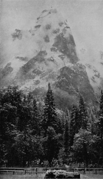
SENTINEL ROCK WRAPPED IN A CLOUD.
Both of the illustrations on this page belong to Yosemite Park scenery. The one on the right, representing Sentinel Rock wrapped in a cloud, is specially beautiful and interesting. Our photographers were fortunate in having so good an opportunity for reproducing a scene that occurs only at rare intervals, and they have done the work so well that every one will be delighted with the results.
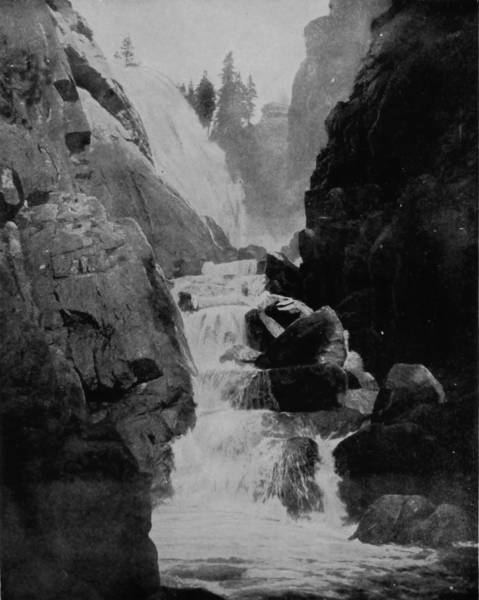
THE TURN, IN CHILNUALNU FALLS, YOSEMITE.
There are several great falls in this wonderful reservation, which, in point of beauty, exceed those in any other part of the world. Yosemite Falls is incomparably the greatest in height, and in the months of May, June and July, the volume of water which it pours down is second only to Niagara and Shoshone. Its first vertical leap is 1,500 feet, where it strikes a series of ledges which break the water into cascades for another fall of 626 feet, after which it takes a sheer plunge of 400 feet, and flows away into the Merced, making a roaring noise in its impetuous descent that can be heard for miles.
Bridal Veil Fall is the termination of a creek bearing the same name, where it plunges over a precipice 900 feet high, and the stream is so thin that it becomes a very mist before reaching the valley. Directly opposite is Virgin Tears Creek, which likewise dashes over a lofty ledge through a notch in El Capitan, 1,000 feet high, and falls in a spray, though during a greater part of the year the creek is nearly dry.
The first fall reached in ascending the cañon of the Merced is Vernal Fall, which has a vertical height of 400 feet and a very considerable volume. But as we proceed further up the cañon, passing a number of cascades, the eye suddenly catches what the ear has anticipated, and rapture succeeds expectation, for there bursts into view Nevada Falls, which, as Professor Whitney says, “is in every respect one of the grandest waterfalls in the world, whether we consider its vertical height, the purity and volume of the river which forms it, or the stupendous scenery by which it is environed. The fall is not quite perpendicular, as there is near the summit a ledge of rock which receives a portion of the water and throws it off with a peculiar twist, adding considerably to the general picturesque effect.”
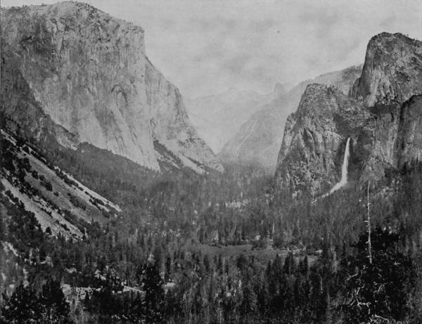
YOSEMITE VALLEY AS SEEN FROM ARTIST’S POINT.—This is an exceedingly fine view of Yosemite Valley with its surrounding mountains and a glimpse of the falls on the right. The photograph was taken at Artist’s Point, so named for its favorable location in viewing the valley and the majestic scenery by which it is surrounded. No painter could imagine a grander scene, and nothing but the camera could transfer it so accurately to the printed page.
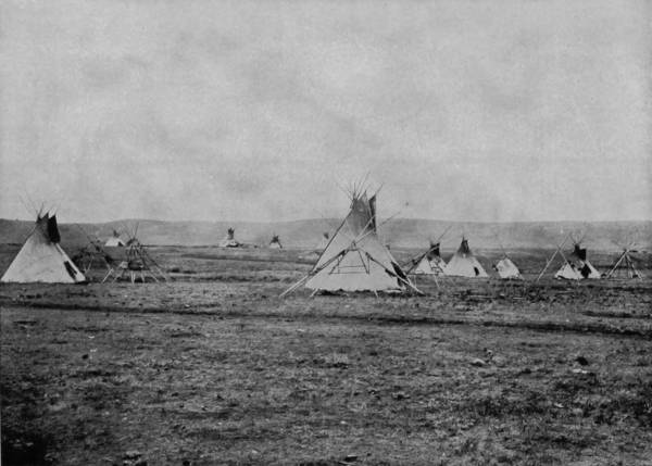
INDIAN CAMP ON THE NEVADA PLAINS.
The fall is about 600 feet, the stream being clearly defined throughout its descent, and the volume of water is very great, giving to the falls the very ideal of beauty, power and truly extraordinary grandeur. In the Cañon of the South Fork, there is another fall of equal height, and it is one, too, of much attractiveness, but brought into comparison with that of Nevada, of which it is a close brother, though difficult to reach, it appears so inconsequential as to scarcely deserve a name, though it is occasionally known as Illillouette Falls.
But everywhere, up and down that magic valley, whether viewed from the gorges that have their bottoms in dark and mystic abysses, or from amazing heights of walls thrust far into the skies, there is wonder piled upon wonder, grandeur overtopping rapture, dumfounded admiration riding at furious pace in the lead of inspiration, glorious realization gilding the visions of imagination. As the gifted Benjamin F. Taylor wrote of his visit to this wonderland: “Yosemite awaited us without warning. Spectral white in the glancing of the sun, the first thought was that the granite ledges of all the mountains had come to resurrection, and were standing pale and dumb before the Lord. I turned to it again, and began to see the towers, the domes, the spires, the battlements, the arches and the white clouds of solid granite, surging up into the air and come to everlasting anchor until the mountains shall be moved! You hasten on; you hear the winds intoning in the choral galleries a mile above your head; you hear the crash of waters as of cataracts in the sky; you trample upon broad shadows that have fallen thousands of feet down, like the cast-off garments of descending night.”
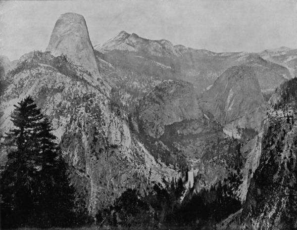
HALF DOME AND CLOUD’S REST, YOSEMITE VALLEY.—This is equally as grand a view of portions of the Yosemite scenery as the one given on page 177, though perhaps less beautiful from an artistic standard. The half dome on the left is one of the most striking features of this photograph. It is so smooth and regular in its outlines that we can hardly regard it as an accident of nature, but rather a work of design. But, after all, do we not find design, and law, and regularity of purpose in all the works of nature?
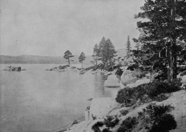
CAVE ROCK, LAKE TAHOE.
Instead of returning direct to San Francisco, by way of the route we had taken to the Yosemite, we went northward, over a very good road, through Tuolumne and into Calaveras county, near the eastern edge of which is the very celebrated grove of giant trees. The grove is confined within a valley some 3,000 feet long by 800 feet wide, and embraces ninety-three mammoth trees, some of which are prostrate. The tallest now standing is 325 feet high, and measures fifteen feet in diameter. There are others which, though less lofty, exceed the tallest in girth measurement by as much as twenty feet in circumference, while the thickness of the bark on these grizzly giants is as much as eighteen inches. Five miles southeast of the Calaveras forest is the Stanislaus Grove, of about 800 trees, which in any other country than California would be considered as veritable monsters for size; but they do not equal the better specimens in either the Calaveras or Mariposa Groves, though several have a height of 250 feet, and a trunk circumference of thirty feet.
Having inspected and photographed the groves, we proceeded to Murphy’s Hotel, sixteen miles from the Calaveras Grove, thence twenty-five miles by stage to Valley Springs, a station on a narrow-gauge railroad that runs to Lodi, where connection is made for San Francisco.
It was not possible, without occupying years of time, to make trips over all the picturesque rail-routes of America, and the transportation of our material in a photograph car, which was in almost constant use, made it necessary that our three photographers travel together, except when it was desirable to cover in quick time short detours from main lines. For this reason the overland trip from Denver was made by way of the southern route, without dividing our party; but to provide against what would otherwise have been a serious omission, the photographer of the Southern Pacific Railroad was brought into service to supply views of scenery along that road between Ogden and San Francisco, over which the writer has traveled so frequently as to be thoroughly familiar with all the points of interest. It was this route, formerly known as the Central Pacific, joining the Union Pacific at Ogden, that constituted the first all-rail overland road from Omaha to San Francisco, and it continues to hold rank as the most picturesque, though the scenery alternates with many dreary patches.
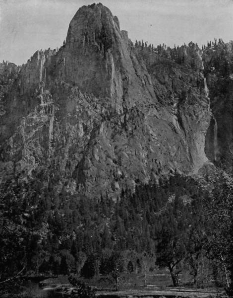
THE SENTINEL IN YOSEMITE PARK.—Every one who visits Yosemite is amazed at the grandeur and magnitude of the scenery. In the language of the author of this work, “Everywhere, up and down that magic valley, whether viewed from the gorges that have their bottoms in dark and mystic abysses, or from amazing heights of walls thrust far into the skies, there is wonder piled upon wonder.” Each advancing step brings a new revelation, until the vision is lost in a maze of marvelous views. One of the most striking features of this photograph is the outline of the falls in Merced River, as seen to the right of the grizzly Sentinel.
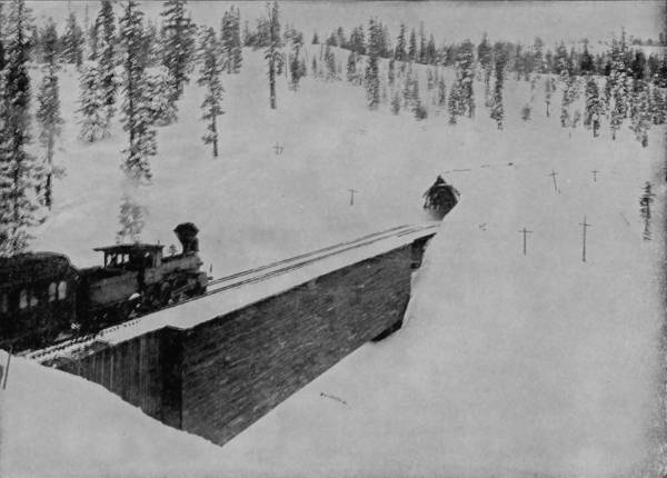
CASCADE BRIDGE AND SNOW-SHEDS ON THE SIERRAS.
After leaving Ogden, the Southern Pacific passes in a half-circle around the northern shores of Salt Lake, and then darts into the Nevada, or Great American Desert, a vast sea of alkali rippled with dry sage-brush; a furnace in summer and a Siberian tundra in winter. Nature has denied to this wretched region any compensation of flower, stream, bird, or even curiosity. It is the very nakedness of bleak desolation, and stretches its cursed length through a distance of 600 miles. The Humboldt River has tried to force a way through this parched waste; but however great its volume of water, gathered from the mountains in spring freshets, the desert drinks it up at a place known as the Humboldt Sink, where the thirst of the sands is so great that the river is arrested and stands still in a shallow lake, the resort of myriads of water-fowls.
But though the land is a wind-swept waste of alkali, scorched, denuded and cursed, yet men have planted their hopes even there, and are wrestling with the harshest and most unpromising disadvantages. Indian camps are frequent, and villages are occasional, where a few brave men, inured to all difficulties, scratch the parched earth and seek a precarious sustenance, though nearly all are traders, furnishing supplies to miners in the mountains miles away.
The dreary, lifeless monotony is relieved, however, just before reaching Humboldt Lake, by the bold but rugged contour of sky-piercing pinnacles, which rise to the south of the road in curious forms and extraordinary magnitude, marking the line of Humboldt River. These interesting formations are known as the Humboldt Palisades, in which the Devil’s Peak is conspicuous, viewed from the car window. After so many hours passed in crossing a wretched desert, the scenery of meandering river and lofty bluffs is extremely invigorating, and preparation to enjoy the sight is complete. But the palisades are singularly beautiful, viewed under any conditions, and situated near the edge of an alkali wilderness, as they are, they break upon the vision of a west-bound passenger with a delight that arouses rapture.
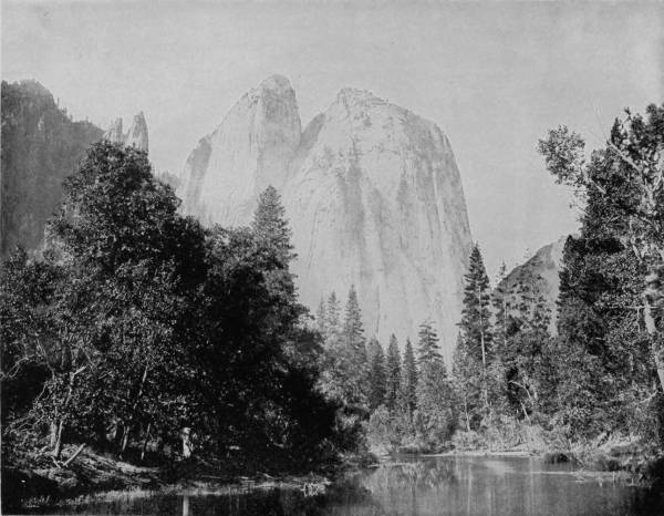
CATHEDRAL ROCKS, 2300 FEET HIGH, IN YOSEMITE PARK, CAL.—These majestic and towering rocks are so striking a feature of Yosemite scenery that they have attracted great attention from artists and photographers, and many copies have been made both in paintings and photographs. But we have seen none that are so beautiful or accurate as the one on this page. It is a perfect picture in all respects, even to the reflection in the lake.
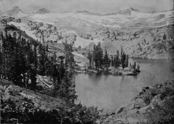
HEATHER LAKE AND MOUNTAIN SCENERY ABOUT LAKE TAHOE.
At Wadsworth, Truckee Valley is entered, green with the joy of exuberant nature, which we follow until Truckee City, a gem of the Sierras, is gained, and realize that we have now to climb over the second ridge of the continent, the ragged ribs that flank the great water-shed of the three Americas. Truckee is not only a pretty village, nestling on the snowy bosom of the Sierra Nevada Mountains, but it is the center of a lake region, wherein abound some of the most remarkable bodies of water to be found on the globe. Fourteen miles towards the south is California’s favorite resort, Lake Tahoe, a really marvelous sheet of crystalline water that, from the mountain peaks which enclose it, looks like a colossal beryl that through some disturbment has been rolled out of the sky and found lodgment in the great lap of the Sierras. The environs of the lake are wondrously grand, and the air a very enchantment, so great is its exhilaration. The lake is twenty-two miles long, ten miles wide, and 1,700 feet deep, while the surface is 6,247 feet above sea level, and it is, as Mark Twain eloquently describes it, “a sea in the clouds; a sea that has character, and asserts it at times in solemn calms, and again in savage storms; a sea whose royal seclusion is guarded by a cordon of sentinel peaks that lift their frosty fronts 9,000 feet above the level world; a sea whose every aspect is impressive, whose belongings are beautiful, whose lonely majesty types the Deity.” Tahoe’s waters abound with trout and other fish, whose bodies flash the sunlight from a depth of thirty feet. The waters are so cold that decomposition is arrested below the surface. Many persons have been drowned in the lake, but not one has ever been recovered, when the accident occurred in deep water. So pellucid are its waters that a boat gliding along the surface appears to be passing through the air, and from the prows of swift-moving crafts, sheets of clearest glass seem to be rolling away. Many beautiful cottages are built along the shore, the summer homes of wealthy Californians, and in season the lake is animate with boats and the beach alive with pleasure parties.
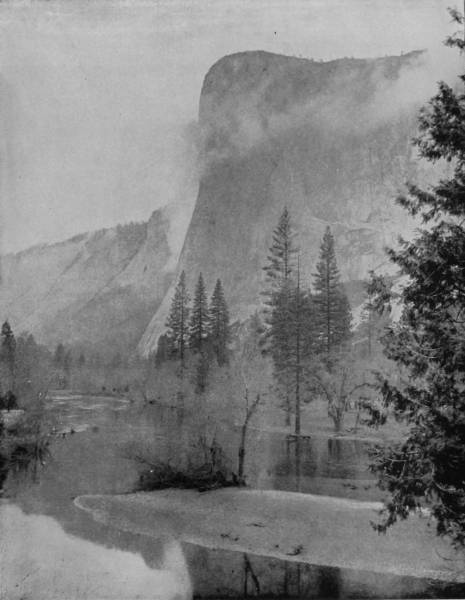
THE BROW OF EL CAPITAN GIRDLED WITH CLOUDS.—This is one of the grandest and most beautiful views of Yosemite scenery that we have ever had the pleasure of beholding. El Capitan, or, as we should say in plain English, and certainly much more expressively, “The Captain,” lifts his haughty head 3300 feet above the valley, and calmly surveys the surrounding landscape as if he had a right to command it. Our photographers were fortunate in being able to procure such a splendid representation of cloud effects as are shown along the brow of the mountain in this picture.
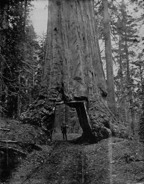
CARRIAGE ROAD THROUGH THE HEART OF MARIPOSA’S BIG TREE.—This splendid photograph will give a better idea of the immense size of California’s big trees than any other comparison or illustration could. After cutting a roadway through the tree large enough to admit of the passage of a carriage or an omnibus, it still has left sufficient strength of root to support its trunk and branches and stand firm against the assaults of the storms and earthquakes which frequently bring down other monarchs of the forest less firmly anchored in the heart of the earth.
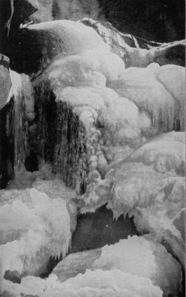
ICE FORMATION AT FOOT OF BRIDAL VEIL FALLS.
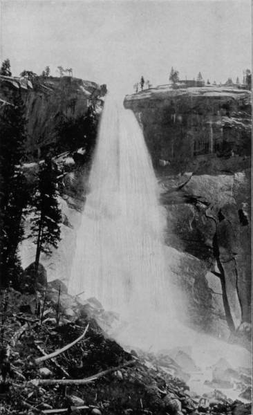
NEVADA FALLS, YOSEMITE.
Yosemite is beautiful and grand in all seasons of the year, in winter as well as in the summer-time. But it is not often visited by tourists except in the balmy season of summer, and thus some of its greatest wonders would go unobserved except for the efforts of the energetic photographer. On this page we have a combination of winter and summer views, and are thereby enabled to enjoy both seasons at the same time.
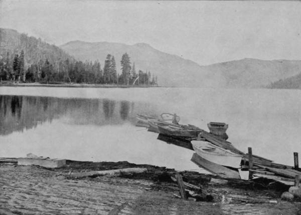
DONNER LAKE, NEAR TRUCKEE, CALIFORNIA.
A little way west of Truckee, and three miles from the road, is Donner Lake, a beautiful body, but chiefly famous for the tragic history which is connected with it. The story, in brief, is this: In the winter of 1846-47, a party of eighty-two emigrants, while on their way to California, were overtaken by a snow-storm while encamped on the shore of the lake, and of the number thirty-six perished of starvation. A ghastly tale of cannibalism is told of the survivors, and the whole tragedy is embalmed in Bret Harte’s novel of “Gabriel Conroy.” Besides these two more celebrated bodies of water near Truckee, there are Pyramid, Angeline, Silver, and Palisade lakes, all near by, and are more or less popular resorts, particularly with fishing parties.
As we proceed up the Sierras the cold increases, until when the town of Summit is reached snow lies upon the ground throughout the year, and it is perpetual winter there, 7,000 feet above the sea. The route is for many miles enclosed by snow-sheds, but the snow-plow has plenty of work to do in keeping the intervals clear. Formerly this work was performed by three or four engines pushing a big machine, somewhat resembling a shovel-board plow, through the heavy banks of snow, but it is now more speedily and effectively accomplished by a rotary snow-plow, as shown in one of our illustrations. The machine is, in fact, a giant auger, which is run by steam supplied by the engines behind it, and being set in motion, rapidly bores its way through the drifts, throwing the snow at an angle of forty-five degrees, and with a force sufficient to deposit it fifty feet from the track.
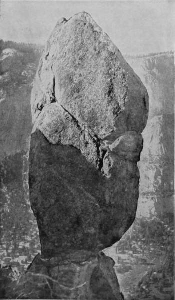
AGASSIZ COLUMN, YOSEMITE.
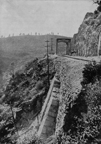
THE PASSAGE-WAY AROUND CAPE HORN.
The cliffs at Cape Horn, so beautifully represented on this page, are over 2000 feet high, and so precipitous that, when work was commenced in making a bed for the railroad tracks, men had to be lowered by ropes from the top and held in position until, with picks and crowbars, they could cut for themselves a footing in the rock walls. As the cars roll round the jagged point they are on a level with the clouds, while below for nearly 2000 feet appear the forests of pine trees, so reduced in size by distance that they appear like ordinary whisk brooms.—Agassiz Column is one of the prominent features of Yosemite scenery, and it is splendidly reproduced in the fine photograph on this page.
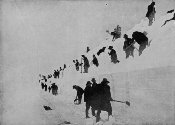
SNOW SHOVELERS CUTTING A BLOCKADE ON THE SIERRA NEVADAS.
The road begins to descend rapidly after leaving Summit, but the most wonderful scenery in all California is passed in the next 150 miles. Donner’s Peak comes into view as the first suggestion of a dreadfully tumultuous condition of nature, wrought by the great glaciers that in the early centuries came grinding their way over the mountains. There is Emigrant Gap, through which the first gold-seekers found their way into the Golden Valley, and American Cañon, along the dizzy edge of which the train runs at a free and almost reckless pace. The way is broken with quarreling cascades, fast-dashing creeks and beautiful blue cañons, in which an autumn haze perpetually lingers. Giant’s Gap, in the American Cañon, is a vast rent in an opposing mountain, that looks like it might have been torn out by the hand of the Thunder God to make a way for the trolls. Chasm after chasm comes into view with grandeur and awfulness as a background until presently the train runs out on a ledge that appears to passengers inside the coaches to have no more substantial support than a bank of clouds. We are away up high on the breast of a mountain that shoots upward 2,000 feet perpendicularly, and looking out of the car windows there is nothing but clouds bowling along on the same level, and below forests of pine, stunted by distance, until the trees are no bigger than whisk-brooms, and American River is a white thread not too large to run through the eye of a darning-needle. This is Cape Horn, where the ledge is so precipitous that in making the road-bed it was necessary to lower the first workmen by means of ropes, which were held fast at the summit while the suspended men plied their picks and crow-bars until a footing was made.
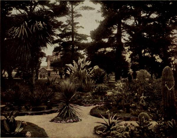
“FLOWER BEDS IN FRONT OF HOTEL DEL MONTE, MONTEREY.”
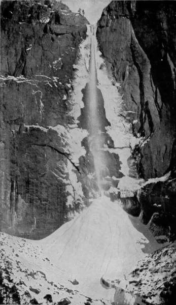
UPPER YOSEMITE FALLS IN WINTER.
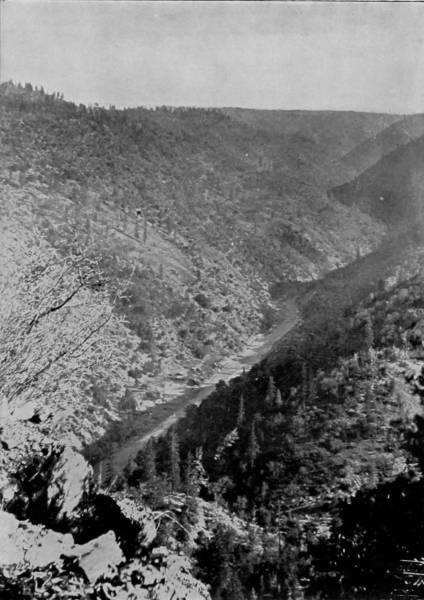
VIEW OF AMERICAN RIVER CAÑON, IN THE SIERRAS.
Yosemite Falls in winter, with the lace-like sheet of water gently pouring down between the columns of ice on either side, present a scene of indescribable loveliness. It is a scene, also, not often witnessed, for Yosemite has a dearth of visitors during the winter.—The companion photograph affords a fine view of scenery in the Sierra Nevada Mountains of California, made famous by Mark Twain in one of his jokes, wherein he stated that the changes of climate in that region were so sudden and extreme that, while hunting in the mountains one day, his dog’s head was sun-struck by the intense heat, while at the same time his tail was frozen by the severe cold prevailing at his other extremity. The point of the joke will be appreciated after reading the splendid description of this locality by the author of Glimpses of America on page 192.
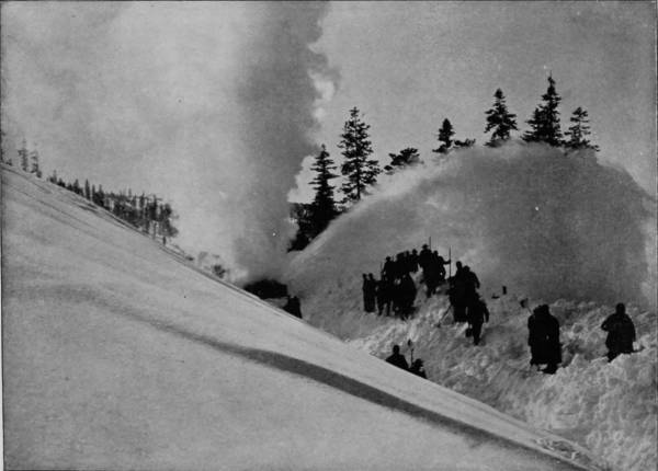
A ROTARY SNOW PLOW CUTTING THROUGH A BLOCKADE ON THE SIERRAS.
After leaving Cape Horn, and passing many relics of early mining days: holes in the ground, decaying sluice-boxes, long flumes, tumble-down shanties, and a few hydraulic works, the road gains the Sacramento Valley, where the passengers are met by a burst of sunshine that makes the land laugh with plenty, and fills every heart with gladness. The air is fragrant with the almond and orange, and where husbandry has not covered the broad-spreading acres with grain or vineyards, there are flowers of a thousand hues, and butterflies of corresponding colors. The early emigrants from the East, who sought fortune on the Pacific slope after the gold discoveries of 1848-49, found a paradise in the fragrant and prolific valley of the Sacramento, which, beautiful at all times, was to them, after a journey of almost unbearable hardships across the burning sands of the American Desert, a region of incomparable delight. There is, indeed, no contrast in all nature so sudden and so great as that afforded between Nevada and California, the line of separation being the Sierras. Out of the arid plains, a very ocean of verdureless desolation, the road rises rapidly to altitudes of perpetual snow and into forests of pine that cover the sides of fearful precipices, the peaks of towering mountains and the jaws of yawning chasms; then it swoops down again into a land of perennial bloom, the antithesis of that of the eastern desert, where, instead of parching, the sun revivifies and forces into fruitage orchards, vineyards, groves, gardens, and fields, making the land one of teeming plenty, and joyful with song of bird, flash of stream, gleam of golden grain, and resonant with the laughing chorus of exuberant nature. More fortunes have been won by aid of the hoe and sickle wielded in this charming valley than were ever gained by means of pick, flame and rocker on the harsh mountain sides, where the gold-seekers have toiled so hopefully for forty years, and in a great majority of cases spent their strength without reward.
The first time that I crossed the Sierras was in early autumn, before the crisp air had begun to clip the leaves, and when Nevada appeared to be swept with a stifling atmosphere; hot, dusty and dreary was the pale sands, and the gray sage-brush was withered as by a simoom’s breath; I wondered why tourists, on pleasure bent, should make such a journey. Then out of the plain of dearth, and up the mountains we sped; suddenly, as it were, the atmosphere grew chill, flakes of snow began to descend; the way led out of hot summer into severe winter, and the landscape became a picture of tumult, mighty, wonderful and picturesque. Then we rolled down the Sierras into a land of indescribable beauty, into a garden as lovely as that of Hesperides—and the answer was plain.
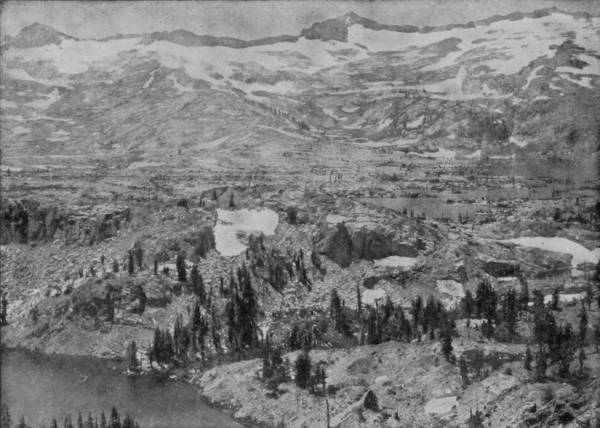
HIGH SIERRAS AND SUSIE LAKE, AN ARM OF LAKE TAHOE.

Winter had been spent in the vernal climate of New Mexico, Arizona and California, and we had so nicely calculated our work that when April arrived we were ready for explorations in northern fields. Accordingly, early in that month, we took our departure from San Francisco, over the California and Oregon Railroad (property of the Southern Pacific), to photograph the natural wonders of the extreme northwest. The road which we had thus selected is one of the most charmingly picturesque in America, abounding as it does with an infinite variety of beautiful valleys, leaping cascades, roaring waterfalls, snow-capped mountains, and abysmal cañons that are wrapped in eternal darkness.
After leaving Sacramento, the route follows the Sacramento Valley, through a marvelously fertile district, cleft by an exquisite stream that bellows, gushes, gurgles and rambles in a devious way from summerless peaks, through blossoming vales, and down mellow meadows, until it drops into the arms of the sea.
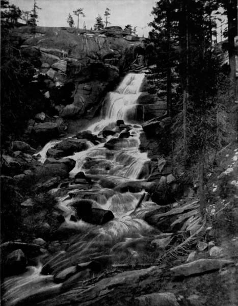
UPPER CASCADE OF CHILNUALNU FALLS, YOSEMITE.—It has been said by a distinguished writer that “either the domes or the waterfalls of Yosemite, or any single one of them, would be sufficient in any European country to attract travelers from far and wide. Waterfalls in the vicinity of Yosemite, surpassing in beauty many of the best known and most visited in Europe, are actually left unnoticed by travelers, because there are so many other objects to be visited that it is impossible to find time for them all.” This will doubtless explain why the beautiful cascade photographed on this page is so little known that it is not even described in the leading guide-books. It is one of the most attractive waterfalls in Yosemite, but it has so many neighbors equally beautiful and grander that it is passed by almost unnoticed.
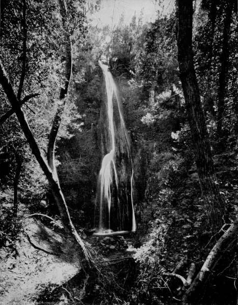
NAJAQUI FALLS, GAVIOTA PASS, CAL.—Gaviota Pass is located in Santa Barbara County, and possesses some of the finest scenery to be found anywhere in the State. The photograph on this page will afford a good idea of the delightful visions to be seen in this region. The falls are neither grand nor majestic, but they are exceedingly beautiful, and the secluded retreat, fringed with ferns and mosses, where but few sounds are heard except the gentle splashing of the constantly falling water, is a place to be sought and loved on a warm summer day.
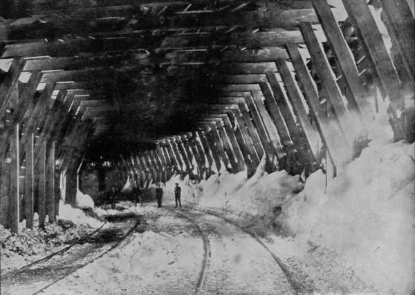
INTERIOR OF SNOW SHED, SIERRA NEVADA MOUNTAINS.
Beyond Chico, northward, the scenery becomes rapidly more rugged, until we plunge into the Siskiyou range, and apparently become tangled up, so tortuous is the way. Time and again the road overlaps itself in winding up the steeps, leaps across yawning chasms on lofty steel bridges, and dashes into tunnels that for a while appear to lead directly to the center of the under-world. But on every side, where daylight reveals the turbulent landscape, there is much to excite wonder and to lend surprise. A hundred miles before we come abreast of Mount Shasta, the sunlighted head of that mammoth peak glints and glistens with a weirdly grand effect upon the admiring eyes of approaching travelers. There it stands, apparently shifting from one side of the track to the other as we wind around among the gorges and creep up the slopes, but always a chief among mountains and commander among the clouds. Sissons is the nearest station to the giant peak, and here we stopped to make some photographs and gather information. The base of Shasta is exceedingly broad, covering as it does a circumference of seventy-five miles, and its hoary head is lifted up 11,000 feet above the surface, and 14,450 above the sea. The greatest wonder, however, is not in the mountain’s height or size, but in the fact that it is an extinct volcano, whose crater is nearly one mile in diameter and 1,500 feet deep. On one side there is a rift, resembling a broken piece from the rim of a bowl, through which the sea of lava that boiled and seethed in this devil’s caldron many centuries ago, evidently broke and poured a burning flood into the valley, and overflowed a large district of country. This may have been done in one of its expiring throes, for certainly there are no evidences that the volcano has been in activity within the past five hundred years.
“There is a cold gray light upon this mountain in winter mornings, that even to look upon, sends a chill to the very marrow, especially if the snow-banner be flying; yet perhaps at evening tide, when twilight shadows have darkened the valley below, this vast pyramid of hoar frost and storm-swept ridges is transformed into a great beacon light of glory, where the warm mellow light loves to linger; where the richest halos of gold and crimson encircle it with their loving bands; where the last and best treasures of the declining sun are poured out in a wondrous profusion, until it is driven by the night lavenders and grays beyond the horizon; then, the tranquil light of the stars sends shining avenues of silver down its furrowed, hoary slopes; soon there comes out from behind the night, first a faint flash of radiant silver that gleams across the sky and dims the light of the stars, the higher peaks are aflame with St. Elmo fire, and slowly from spire to spire, and from ridge to ridge, this incandescent flood sweeps on until the whole mountain glows and gleams with a light supernatural.”
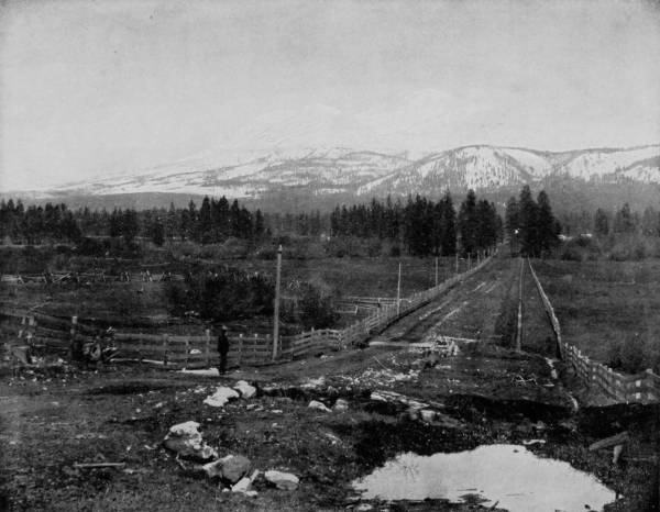
VIEW OF MOUNT SHASTA FROM SISSONS, CAL.—This view from Sissons is said to be the best obtainable of Mount Shasta. From this point it presents the appearance of a broad triple mountain, the central summit being flanked on the west by a large crater, whose rim is 12,000 feet high. The highest point in the centre is 14,442 feet. Shasta, as a whole, is the cone of an immense extinct volcano, rising with a single sweep from the base to a height of 11,000 feet. It is 338 miles north of San Francisco, and is visible for more than one hundred miles.
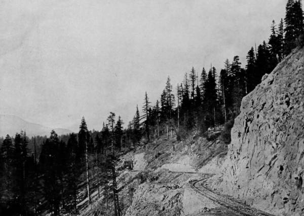
SACRAMENTO CAÑON, CALIFORNIA.
Another particularly wonderful natural attraction on the line of this road are the Chalybeate Soda Springs, which furnish an unfailing supply of mineral water, equal to the best that is bottled for the bar and picnic trade. When taken fresh from the spring, it has the appearance of champagne, which, indeed, it resembles in taste; and so strongly charged is the water with carbonic acid gas, that it will hold its flavor as long as any extra-dry wine.
Near these remarkable springs are the Mossbrae Falls, which come sliding over the lofty banks of the Sacramento in sheets of limpid water that look like glass, and have a spread of nearly half a mile. The fall varies in height from fifty to one hundred feet, but is surprisingly beautiful at every point.
After crossing Siskiyou Mountains, the road descends by a spiral way until it strikes Rogue Valley, thence through Grant’s Pass and gains the Willamette Valley, which is a level expanse of exceedingly great fertility. The ride to Portland over the rest of the way is interesting, not so much for the diversity of scenery, as for the scenes of thrift and prosperity which lie on both sides, for the country is a very Eden of productiveness.
Portland, which lies near the junction of the Columbia with the Willamette River, is one of the handsomest cities on earth, situated in one of the most attractive regions that the eye of the traveler ever gazed upon. From a high point in the western suburbs, gained by a cable-road, a view may be had greater than that which Quarantaria offers. To the west broadens the united waters of the two rivers, floating the commerce of this vigorous city to and from the sea. And in the clear atmosphere to the east rise like giants out of a plain the lofty peaks of Hood, St. Helen’s, Adam’s and Ranier, upon whose brows eternal snows beat with fury, and where clouds often settle to rest themselves for a fresh flight. Still beyond are the whitened crests of the Cascade range, reveling in a mad confusion of effort to gain the skies; and wandering through a maze of forest, mountain and gorge, are the Columbia and Willamette, like two long ribbons of burnished silver flung down by the gods to mark a way to wealth.
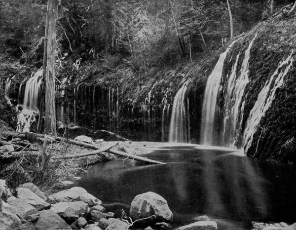
MOSSBRAE FALLS ALONG THE SACRAMENTO.—These falls are in the Sacramento River, not far from Upper Soda Springs in northern California. They vary in height from fifty to one hundred feet, and have a spread of nearly half a mile up and down the river. The water is so clear and limpid that it resembles great sheets of glass as it pours over the banks, producing a scene of indescribable beauty. The river at this point is very small, as shown by the photograph, but the scenery is of the most delightful character.
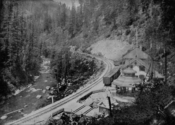
SODA SPRINGS, SACRAMENTO CAÑON.
The Willamette River is particularly beautiful in its upper course, where the scenery is almost a counterpart of that along the Rhine, whereas the Columbia becomes charmingly interesting almost from its mouth, and increases in grandeur as the ascent is made. Indeed, it may with truth be declared that scenically considered, the Columbia is the most delightful river that is known to modern geographers. The shores are mountainous, at times shooting up perpendicularly to amazing heights, and composing miles of solid walls; then again dropping away in level stretches covered with forests of pine, spruce and fir-trees; or revealing cañons down which plunge turbulent tributaries, and giddy waterfalls dancing out of the sky and falling in fleecy sheets so far as to dissolve its vapor. Some of the shore walls are of basalt, of fantastic shapes and brilliant with coloring; and not infrequently solitary columns of very great height are seen standing like sentinels along the water edge, such as Castle Rock, Rooster Rock, and the columnar cliffs of Cape Horn.
The Dalles of the Columbia are as famous as the palisades of the Hudson, while in fact they are much more wonderful, and well worth a trip of thousands of miles to see. They occupy about fifteen miles of the river between Celilo and Dalles Station, and are only 130 feet wide, whereas above and below, the bed of the stream is from 2,000 to 2,500 feet wide. As the river is swollen to extraordinary proportions by rain freshets and the melting of snow in the spring-time, it is not a remarkable thing that during such flood periods the water rises suddenly in this narrow cleft as much as sixty, and even seventy feet. The river itself very commonly rises as much as twenty-five feet, even at its widest places, and hence we may imagine what a raging torrent it becomes; but at low-water the Dalles are a succession of cascades of the most beautiful proportions, rolling in sheets of clearest water, over terraces of stone as regular as though they had been laid by the hand of a mason.
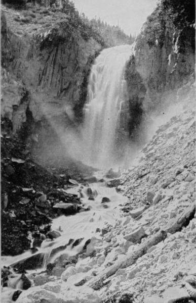
STRAWNAHAN’S FALLS, ON SIDE OF MOUNT HOOD.
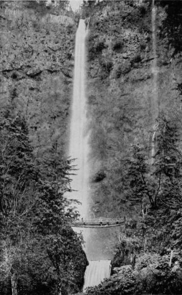
MULTINOMAH FALLS, OREGON.
The region of Oregon near Portland, and along the Columbia, is rich in scenery of the most beautiful and picturesque character. Far in the distance loom snowy peaks, and the clouds, trees and mountains are reflected in the clear water as in a mirror. Among the most picturesque of all the scenes of this locality are Multinomah Falls, near the railway station of the same name. The water plunges down the astonishing distance of 700 feet, breaking into a ribbon of glittering spray as it falls. A little to the right of the main falls, as seen in the photograph, is another tiny little one, so modest as scarcely to be observed, but loved and admired by tourists equally with its larger sister.
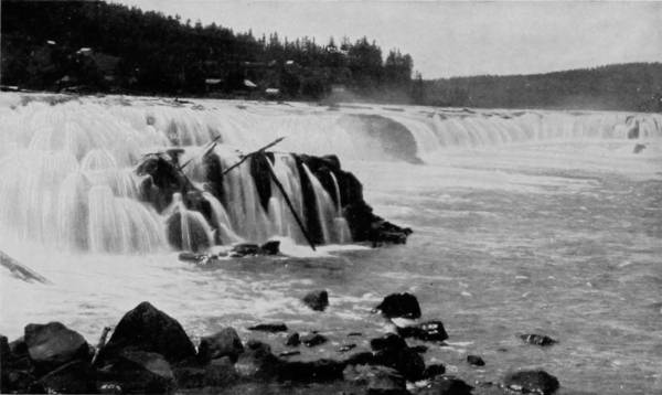
WILLAMETTE FALLS, OREGON.
From the Dalles down, the river plows its way through the Cascade Mountains, which on either side appear like towered battlements, while waterfall after waterfall pour their tribute down the mountain sides to swell the on-flowing stream. Twelve miles below is Memaloose Island, which is the ancient burial place of the Chinook Indians, who held it as a sacred spot, guarded, as they maintained, by spirits of the river. The gorge proper begins twenty miles below the Dalles, and thirty miles further are the cascades, but between these there is an incomparable panorama of grandeur and beauty, for the river is broken by many giant bowlders, around which the swift-rushing water is lashed into fury. Still further below, and around the next interval of six miles, where portage by rail is necessary, the scenery becomes even more exquisite, with islands that are so wind-swept as to be entirely devoid of vegetation, while scores of lovely falls line the river, such as Horse-Tail, a clearly defined stream that pours down a height of 200 feet, and Multinomah, a strip, or veil, of spray, that falls 850 feet perpendicularly. There are, besides these, others almost equally surprising and beautiful, such as Bridal Veil and Oneonta, both of which dash down over cliffs brilliantly green with mosses, and are reflected in their full length in the crystalline river into which they fall, while the soft coloring of bluest sky and blending tints of emerald pines give to the scene an intimation of fairy-land. Just below these, in stately procession, are Castle Rock, that shoots up 1,000 feet; Rooster Rock, a dizzy pinnacle of stone amid-stream; Cape Horn, frowning from shore, and lifting its brow 500 feet above the river, while the Pillars of Hercules, twin shafts of basalt, grand, massive and sublime, act as guardians before this watery realm of wonderland.
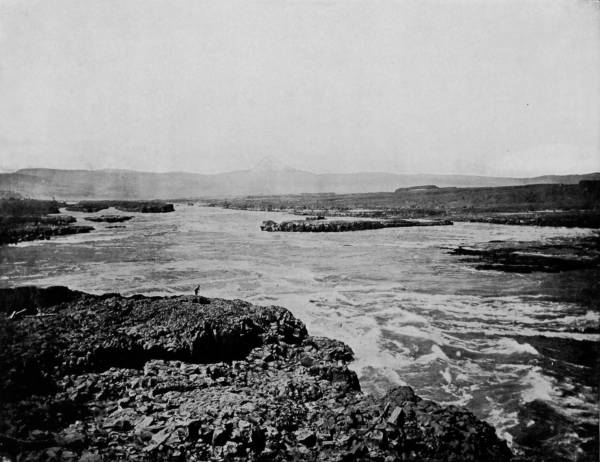
DALLES OF THE COLUMBIA, AND MOUNT HOOD IN THE DISTANCE.—The scenery between Portland and Dalles City, along the Columbia, is grand and beautiful in the extreme. Here the river passes through the heart of the Cascade Mountains, and the turbulent waves roar through the narrow channel, confined on either side by cliff-like walls of rock, often rising to the height of 1200 feet or more. At Cascade Locks there are fierce and whirling rapids, with a fall of forty feet, the entire river dashing down twenty feet at a single bound. For a distance of five miles the river is a seething caldron of foam, too dangerous for any kind of navigation to be attempted. The photograph gives a splendid bird’s-eye view of a portion of the Dalles.
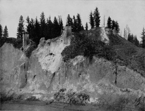
NATURAL PILLARS, COLUMBIA RIVER.
Twenty-five miles from the palisades, and reached by means of comfortable stages over a good road, is Mount Hood, one of the loftiest, as well as the most impressive, dead volcanoes to be found anywhere in the world, of which it has been written: “The view from the summit of Hood is one of unsurpassed grandeur, and probably includes in its range a greater number of high peaks and vast mountain chains, grand forests and mighty rivers, than any other mountain in North America. Looking across the Columbia, the ghostly pyramids of Adams and St. Helens, with their connecting ridges of eternal snow, first catch the eye; then comes the silent, lofty Ranier, with the blue waters of Puget Sound and the rugged Olympia Mountains for a background; and away to the extreme north (nearly to H. B. M.’s dominions), veiled in earth mists and scarcely discernible from the towering cumuli that inswathe it, lies Mount Baker. Looking south over Oregon, the view embraces the Three Sisters (all at one time), Jefferson, Diamond Peak, Scott, Pit, and, if it be a favorable day, and you have a good glass, you may see Shasta, 250 miles away. The westward view is down over the lower coast range, the Umpqua, Calapooya, and Rogue River Mountains, with their sunny upland valleys, and away out over the restless ocean. In the opposite direction, across the illimitable plains of Eastern Oregon, to the Azure Blue Mountains; down, almost to the foot of this mountain, ‘rolls the Columbia,’ through the narrow, rugged gorge of ‘The Dalles,’ 250 miles of its winding course being visible. The entire length of the great Willamette Valley, with its pleasant, prosperous towns and gently-flowing river, its broad, fertile farms, like rich mosaics, with borders of dark-green woodlands, is spread out in great beauty under the western slope of Mount Hood.”
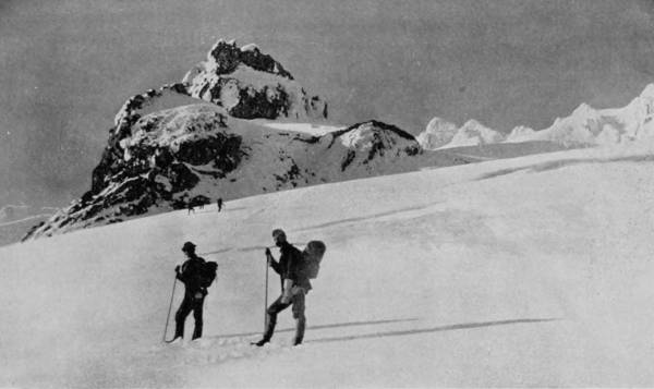
THE CRATER OF MOUNT HOOD.
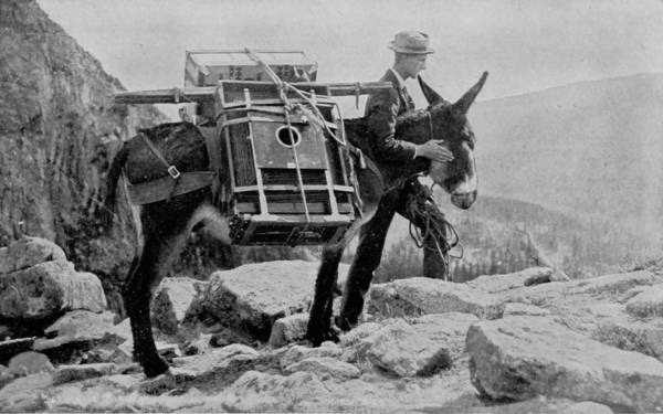
ON THE ROUTE TO CRATER LAKE.
Tourists need not cross the ocean and travel to Switzerland to see wild and grand and splendid mountain scenery, because it can be found in a thousand places in America on a much grander scale than anywhere in the Alps. An evidence of this is seen in the photograph of the crater of Mount Hood, on this page; and all along the Cascade, Rocky and other mountain ranges of our country, similar, and even grander, views can be observed by the thousands. We also present on this page an interesting portrait of our “mountain helper,” in obtaining views for Glimpses of America.
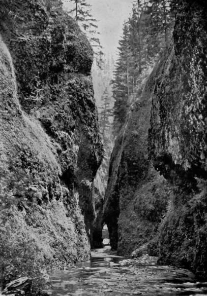
ONEONTA GORGE, COLUMBIA RIVER.
The Columbia is not only famed for its peerless scenery, and as being a main artery in Pacific coast commerce, but it is equally noted as affording the most profitable salmon fishing in the world. Hundreds of people are engaged in this industry, and vast wealth has been amassed by some of the large companies who run immense canneries in connection with the fisheries. At certain seasons the fish appear in such prodigious numbers, on their way up stream to the spawning grounds, that they almost crowd each other out of the water. The most successful way of taking the fish at such times is by the use of wheels attached to the end of a scow, which, being set in motion, scoop them up and deposit them in the boat, and so rapidly that thousands are thus taken in an hour. The fish continue their run up-stream as far as the water will allow, and so determined are they that they perform many amazing feats to gain the headwaters, crossing shoals, darting through the swiftest cascades, and even leaping up and over falls of considerable height. The Indians, familiar with the instincts of the salmon, in the season take great numbers by means of spears, which they cast with astonishing accuracy. A chief fishing place is Salmon Falls, where the river is a mile wide and plunges over a wall fully twenty feet high, extending from shore to shore. Notwithstanding this height, the salmon gather in the whirlpool below and suddenly dart up the falls like a flash of light, their tails waving with such rapidity that they are carried up and over the falls. It is while making these leaps that the Indians spear the fish, killing immense numbers, not only for food, but through sheer wantonness, at times fairly filling the river with the dead beauties.
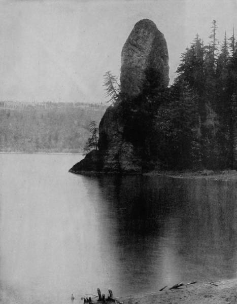
ROOSTER ROCK, COLUMBIA RIVER.—This grotesque rock, occupying a prominent point in one of the bends of the Columbia River, received its rather inappropriate name from a fancied resemblance to a male chicken. It requires a considerable stretch of the imagination to see where the resemblance comes in, and it is to be hoped the time may come when a more appropriate and picturesque title will be bestowed upon this celebrated curiosity of nature’s creation. Why not call it the Castle of the Columbia? for it certainly looks more like a castle than a rooster.
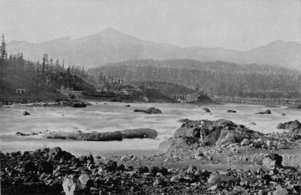
CASCADES OF THE COLUMBIA.
Before leaving San Francisco, one of our photographers expressed a very great desire to visit Crater Lake, one of the most remarkable bodies of water on the face of the earth, and so urgent were his pleadings, that it was decided he should make the trip, while the rest of the party continued on to Portland, to perform the work of photographing points of interest thereabouts, and on the Columbia River. In pursuance of this arrangement, he left us at a station called Medford, on the Southern Pacific Railroad, and from that place rode over to Jacksonville, capital of Jackson county, Oregon, a distance of five miles, to make his preparations for a journey to the lake. Jacksonville is a town of about 1,000 inhabitants, off the railroad, but on the military road that leads to Crater Lake, some seventy miles distant northeast, and thence to Fort Klamath. It was not difficult to procure necessary conveyance, but for safety it was deemed advisable to pack the cameras on a donkey, probably the surest-footed and most reliable animal that ever submitted back to a burden. Three men accompanied our photographer, with one road-wagon and a light buggy, hauling the necessary camping outfit, and being well prepared, the party started from Jacksonville on the 15th of April, 1891. The road follows Rogue River the entire distance, along which is some very beautiful scenery, and not a few wild gorges, which were photographed. There are a number of post-offices on the way, Deskins being the most northern, beyond which, and for nearly thirty miles, to the lake, there is a wilderness of mountain and cañon, unrelieved by any signs of human habitation. Crater Lake is in the western part of Klamath county, and is in the Klamath Indian reservation, a region that is distinctively volcanic, diversified by lakes, marshes and mountains, with the soil so mixed with scoriæ that it is harsh and unproductive. It was not until noon of the second day that the vicinity of the lake was reached, approach to it being indicated by a bank of clouds that hung over one spot, like a fog gradually lifting, beneath which was manifestly a large body of water. A suitable camping place was soon found, and the tent being set up and dinner disposed of, the work of exploring and photographing the lake was energetically begun. Fortunately, the weather was propitious and the season favorable, for otherwise clambering over so rough a region with the precious burden of delicate cameras would have been next to impossible. The snow falls to very great depths on the high ridge which surrounds the lake, and spring rains are at times so heavy here that the precipitous sides are gashed deeply by the cataracts thus produced.
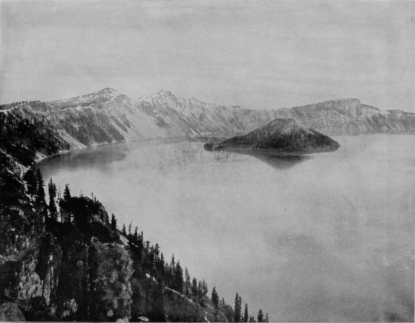
VIEW OF CRATER LAKE AND WIZARD ISLAND.—This stupendous and marvelous curiosity is located in Klamath County, Ore., and may now be reached by stage from Medford Station on the Oregon branch of the Southern Pacific Railway, a distance of about eighty miles. But when it was visited by the author of Glimpses of America and his photographing party there were no public conveyances, and they were forced to rely upon their own resources. Crater Lake is probably the greatest natural curiosity in the world, as every one will doubtless admit after reading the descriptions in these pages.
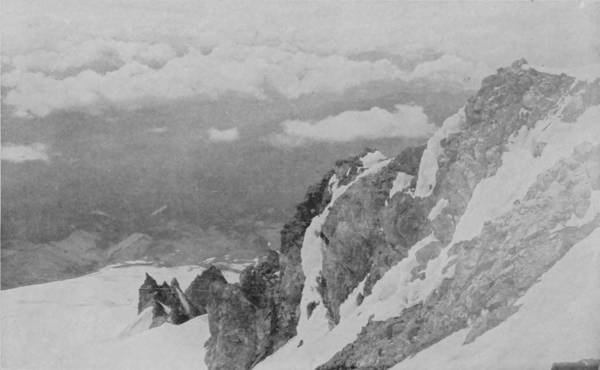
AMONG THE CLOUDS ON MOUNT HOOD.
The Klamath Indians have many traditions about the lake, one of which is to the effect that in earlier years it was the haunt of great numbers of water-devils, who watched its shores and drew into its mysterious depths all luckless persons who ventured near its banks. For this reason it was not until recently that any Indian could be prevailed upon, by the promise of however great a reward, to approach near the lake, though they were glad to guide travelers to its vicinity.
The first sight of this marvelous body of water excites unbounded awe and immeasurable wonder. The surface is 6,250 feet above sea level, but notwithstanding this great elevation, it is enclosed by cliffs that rise from 1,000 to 2,000 feet, and the greater part are vertical. At times, viewed from the summit of the walls, both the skies and mountainous surroundings are mirrored in the unrippled surface of the lake, until it is really difficult to distinguish the line of separation between the real and the reflection.
Crater Lake is egg-shaped, being seven miles in length by six in breadth, and in the southwest portion there is an island which rises out of the water to the amazing height of 850 feet. But this is not its only remarkable feature, for the island is circular in shape, with a scant vegetation on its sides, and in the center is a crater known as the Witch’s Caldron, which is 100 feet deep and nearly 500 feet in circumference. Here, then, we have the now smokeless chimney of what was once an active volcano, out of which poured a fiery mass that ran down the steeps and became congealed in the lake, for the base of the island is of ashes and vitrified rocks, evidencing the intense heat which once prevailed within and around it.
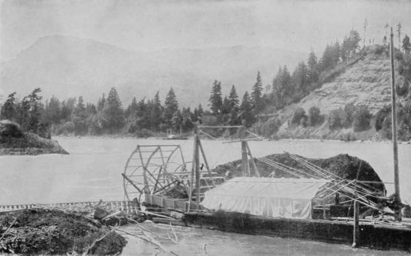
SCENE ON COLUMBIA RIVER.
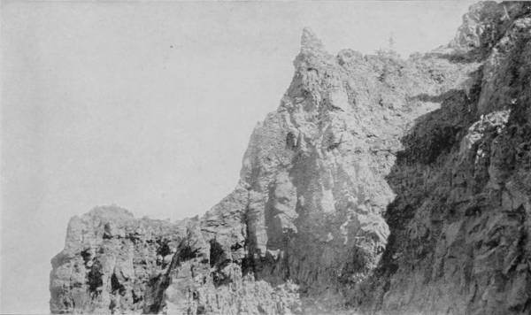
CLIFFS AROUND CRATER LAKE.
The salmon fisheries of the Columbia River constitute one of our most important northwestern industries, and the fish-wheels used in catching the salmon are to be seen at many points, lending a degree of life and activity to what would otherwise, in many instances, be an uninspiring view.—The surface of Crater Lake is 6250 feet above the level of the sea, and yet it is enclosed by cliffs that rise from 1000 to 2000 feet higher still. This will give some idea of the imposing grandeur of the scene. Many of these cliffs are perpendicular from the water’s edge to their summits, so that a stone dropping from the top will fall of its own weight into the lake more than a thousand feet below.
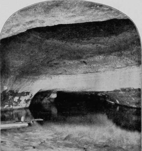
GROTTO IN CRATER LAKE.
On the shore, north of Wizard Island, is a rock that juts up 2,000 feet, and its side is so perpendicular that one standing upon its summit can drop a stone into the lake, nearly half a mile beneath. It is not at all surprising that this wonderful lake should be the subject of much superstitious dread among the Klamaths, and among the traditions and tales which these simple Indians tell is the following: A long time ago, a band of Klamaths, while hunting deer, which have always been abundant in this region, came suddenly upon the lake. They had often traveled over the same district, without discovering either lake or depression, and now, suddenly beholding so large a body of water, surrounded by towering walls, they perceived in it the work of the Great Spirit, but were not able to interpret its significance. All but one of the Indians fled in terror from the place, but the bravest determined, if possible, to ascertain the wishes of the Great Spirit, and, accordingly, he proceeded to the very brink of the lofty walls, and there built a camp-fire, to wait the Spirit’s call. Long he waited, until weary at last he lay down and slept; while he was thus sleeping he had a vision and heard mysterious voices, but he was not able to understand what was said, or to clearly discern the shape or appearance of his unearthly visitors. But as often as he slept he perceived, in his dreams, the indistinct forms of what half-appeared to resemble human bodies, and plainly heard voices, but they were strange tongues. Charmed by these visions, the Indian remained, day after day, and week after week, upon the precipice of the lake, leaving his camp-fire only to slay a deer for subsistence, until at length he descended to the surface of the lake and bathed in its crystal and mysterious waters. Instantly he felt his strength marvelously increased, and thereafter saw that the weird visions of his dreams were inhabitants of the lake, having human forms, but whether they were spirits of good, or devils of evil, he knew not. Familiarity, however, at length made him careless, and on one occasion he caught a fish in the lake, with the intention of using its flesh for food, but no sooner had he killed the fish than a thousand water-devils rose up out of the depths of the lake, and, seizing the unfortunate brave carried him through the air to the top of the cliffs. Here they cut his throat and cast his body headlong into the water, 2,000 feet below, where it was devoured by the angered devils.
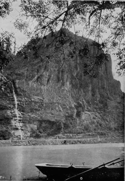
PALISADES OF THE COLUMBIA.
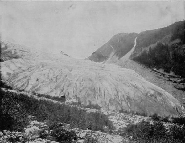
THE GREAT GLACIER, CANADIAN PACIFIC RAILWAY.—This fine photograph shows the front wall of the glacier as it plows its way down the mountain side, grinding the rocks into powder and cutting seams and cañons that will stand for centuries as records of its resistless powers. Those who have never seen one of these immense rivers of ice, ever moving and never failing, can hardly appreciate the feeling of awe that is aroused by a near approach to them. There is no other force of nature that so distinctively manifests its irresistible powers.
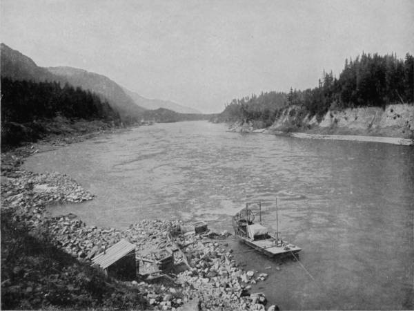
A FISH-WHEEL ON COLUMBIA RIVER.
The Klamath Indians believed that the water-spirits had not fully satisfied their revenge by this one bloody act, but would similarly destroy any Indian who had the temerity to approach the lake.
Near the base of a cliff on the south side of the lake stands a solitary rock, probably 100 feet high by 200 in length, and nearly the same in breadth, that, while not seen by the present generation of Indians, it is nevertheless known to them, and is a special object of superstitious dread. They consider it as a peculiarly ferocious monster, but are unable to describe its characteristics. It stands in the lake, entirely alone, and about fifty yards from shore. Standing on the cliffs, about five miles to the west and looking across the lake, this strange rock is plainly visible in the sunlight, its rugged peaks reaching aloft, giving it the appearance of a full-rigged ship at anchor. Should a cloud pass before the sun as the shadow strikes the rock it will recede from view as effectually as though it had ceased to exist. This illusion has prompted some one to call the rock the Phantom Ship.
Another equally interesting optical illusion is thus described by W. G. Steel, F.A.G.S., who made an exploration of the lake with a corps of United States surveyors: “One day while at work on the lake, my attention was called to what seemed to be a tall, full-bearded man standing on the southern portion of Llao Rock’s summit. One foot was placed a little forward of the other and the knee slightly, but naturally bent, while before him stood a gun. His hands were clasped over the muzzle as he gazed intently to the north. Just behind him stood a boy, apparently about fifteen years of age. They seemed entirely too natural not to be flesh and blood, and yet persons at that distance would not be visible to the naked eye, as we were two miles out on the lake. Day after day, as our work progressed, their position remained the same, and in the absence of a better excuse, we decided them to be trees.
GREEK CHURCH AT JUNEAU, ALASKA.—The prevailing religion among the natives of Alaska is a mixture of the doctrines of the Greek Church, inculcated by missionaries from Russia, and the ancient totemism of the aborigines. The missionaries wisely concluded that it was better to convert the natives to Christianity, and bring them up to civilization by a gradual process, rather than attempt a sudden transformation; hence the singular combination of the rites of a ludicrous superstition with the beneficent teachings of the Man of Galilee. Mission churches exist at several points in the territory, one of which, a very picturesque building, is finely photographed on this page.
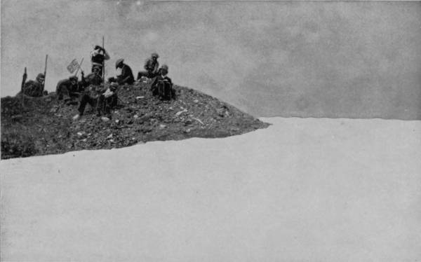
SUMMIT OF MOUNT SAINT HELENS, ABOVE THE CLOUDS.
“It is hard to comprehend what an immense affair it is. To those living in New York City I would say, Crater Lake is large enough to have Manhattan, Randell’s, Ward’s and Blackwell’s Islands dropped into it side by side, without touching the walls, or Chicago or Washington City might do the same. Our own fair city of Portland, with all her suburbs, from City Park to Mount Tabor, and from Albina to Sellwood inclusive, could find ample room on the bottom of the lake. On the other hand, if it were possible to place the lake, at its present elevation, above either of these cities, it would be over a mile up to the surface of the water, and a mile and three-quarters to the top of Llao Rock. Of this distance, the ascent would be through water for 2,000 feet. To those living in New Hampshire, it might be said the surface of the water is twenty-three feet higher than the summit of Mount Washington.”
The shore of Crater Lake has many remarkable indentations of slender arms and beautifully formed bays, and on one side there is a grotto running back some thirty feet and twenty feet inside, spanned by a graceful arch about eight feet high, forming an admirable shelter as well as a curious alcove in the rock, where the water is some twelve feet deep. The lake itself measures a little more than 2,000 feet in depth in places, but soundings show that there are peaks below the surface representing cinder cones, and which once evidently stood high above the surface. The whole lake is thus a reminder of mighty forces and the relic of terrible convulsions. What an immense affair it must have been ages upon ages ago, when, long before the hot breath of a volcano soiled its hoary head, standing as a proud monarch, with its feet upon the earth and its head in the heavens, it towered far, far above the mountain ranges, aye, looked far down upon the snowy peaks of Hood and Shasta, and snuffed the air beyond the reach of Everest. Then streams of fire began to shoot forth, great seas of lava were hurled upon the earth beneath. The elements seemed bent upon establishing hell upon earth and fixing its throne upon this great mountain. At last its foundation gave away and it sank forever from sight. Down, down, down deep into the bowels of the earth, leaving a great, black, smoking chasm, which succeeding ages filled with pure, fresh water, giving to our day and generation one of the most beautiful lakes within the knowledge of man.
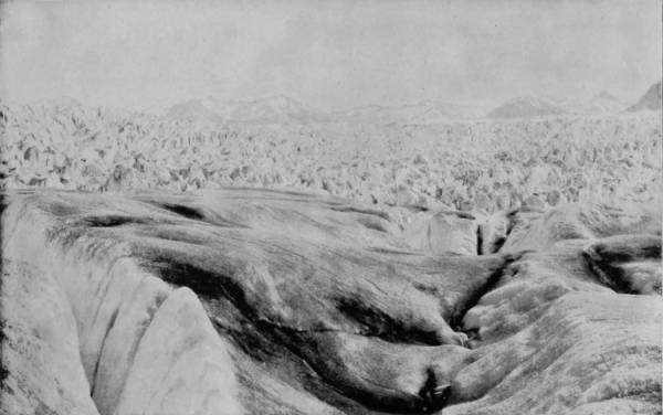
TOP OF MUIR GLACIER, ALASKA.
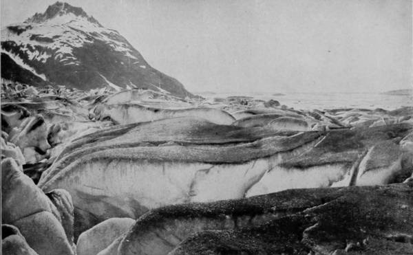
CREVASSE IN MUIR GLACIER, ALASKA.
The Muir is the most celebrated of all the glaciers in the world. It is located in southeastern Alaska, about one hundred miles north of Sitka, and is easily accessible by the California coast line steamers. The two excellent photographs on this page will give a good idea of the wonderful formation and diversified beauties of this immense ice-river, which has been moving steadily down the mountain side for ages past, and will doubtless continue to do so for ages to come.
218It may in truth be declared that Crater Lake is one of the grandest points of interest on earth. Here all the ingenuity of nature seems to have been exerted to the fullest capacity to build one grand, awe-inspiring temple within which to live and from which to gaze upon the surrounding world and say: “Here would I dwell and live forever. Here would I make my home from choice; the universe is my kingdom, and this my throne.”
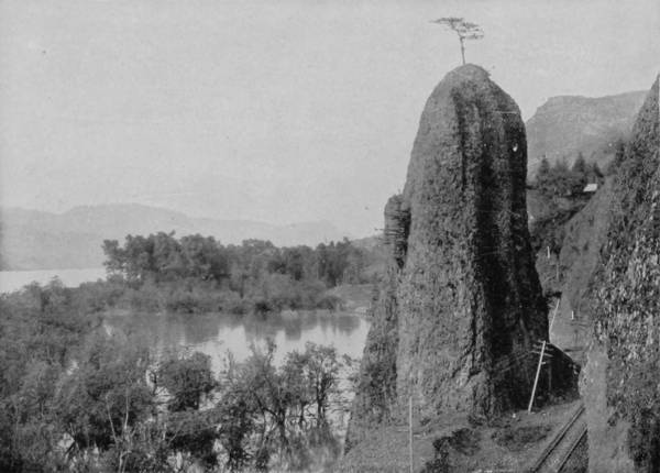
CATHEDRAL ROCK, ON COLUMBIA RIVER.
Our trip up the Columbia, and along the Willamette as far as Willamette Falls, was delightful beyond any one’s ability to describe; but though wonder succeeded wonder, and kept us as under a spell of enchantment, there were other surprises in store which were to hold our interest and even add something to our astonishment. Returning to Portland, we might have carried out our original resolution to take the steamer at that point direct for Alaska, but we very wisely made a change in our plans, by which we proceeded by rail to Vancouver, stopping en route, however, to continue our work of photographing mountains, valleys and glaciers.
Tacoma was our first stop after leaving Portland, and a very beautiful city it is, admirably and commercially situated at the head of navigation in Puget’s Sound. Mount Tacoma appears to be in the very front-yard of the city, so wonderfully clear is the air, though in fact it is forty miles away. The Sound is astir with the white wings of sailing vessels, and streaked with the black trails of ocean-going steamers, while the blue waters are begirt with the dark green of heavy forests, making a picture of almost incomparable beauty. There is romance in the very air, a kind of dreamy vision of the long ago, when this was the happy land of the Siwashes, who come before us again in the pretty legends which linger still upon the lips of this almost extinct tribe. They tell us of a Saviour who once came to them, riding in a copper canoe, out of the bleak desolation of the icy north, and who, first calling all the tribes together, preached to them the gospel of unselfish service and righteousness. He taught them the beatitudes, and was first to declare that man was possessed of an undying spirit, which lived forever, in pleasure or pain, according to the measure of his deserving. The Indians listened with reverent attention until this Saviour exhorted them to live in brotherly unity, one with another, and to avoid all strife, for he who shed human blood would feel the vengeance of the Great Spirit. This teaching so incensed the war-like tribes that they seized the Saviour and nailed his body to a tree, where it remained nine days. Then behold, there came a great storm of hail, accompanied by thunders that rent the earth and leveled the forests. In the midst of this mighty cataclysm of natural forces the Saviour appeared again, resurrected unto full life, and speaking to the winds and the thunders, in an instant the storm was hushed, and a great peace and burst of sunshine bathed the earth. After this the reincarnated Saviour renewed his preaching and continued to teach immortality for many weeks, until at last he ascended to the skies in a cloud.
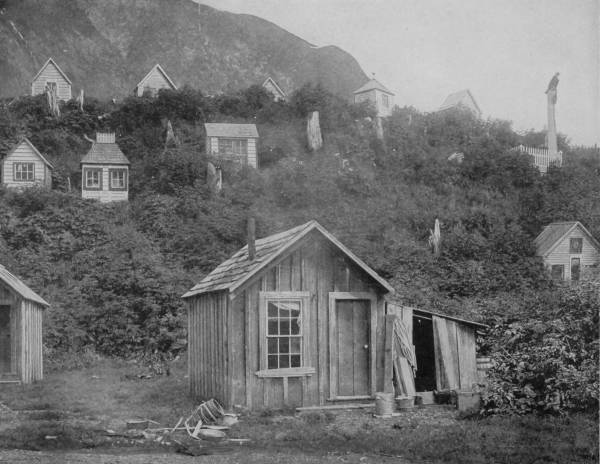
INDIAN BURIAL HOUSES, NEAR THE TOWN OF JUNEAU, ALASKA.—It is a religious custom among the Indians of Alaska to build houses, more or less pretentious according to the means of the surviving relatives, over the graves of their deceased friends. These houses are then suffered to fall into decay with the lapse of time, like family cemeteries in our own land, until in many instances the ghastly remains are exposed to view. The cemetery photographed on this page is evidently a new one, judging by the neat appearance of the little houses. There is really a beautiful sentiment in this custom, notwithstanding its origin among a heathenish and superstitious people.
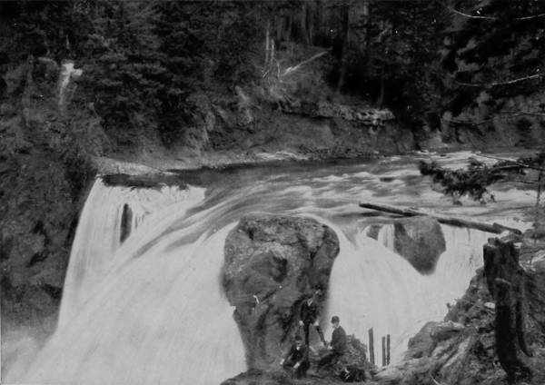
BRINK OF SNOQUALMIE FALLS, WASHINGTON.
These same Indians have also a tradition of the deluge, which bears a striking similarity to the Genetic account. They assert that many thousands of years ago a great rain fell upon the earth, such as was never before or since known; that such torrents of water were poured out of the sky that the world became a universal sea, with no spot of dry land anywhere visible. In this all-prevailing flood every human being perished except one man who took refuge on Mount Tacoma. As the water rose, he was driven higher and higher, until at last he reached the summit; but still the sea advanced; it covered the loftiest point of the mountain, then rose above his feet, his knees, and finally reached to his waist, when, to prevent him from being swept away, the Great Spirit turned his feet to stone, and he thus became anchored on the peak. Then the rain ceased, and the waters were gradually assuaged, but the man could not yet move from his position. At last the waters were again within their beds, the fields bloomed, the forests put forth with new life, and the world became musical with song of bird and the lullabies of flowing streams. Then a profound sleep fell upon the man, and while he slept the Great Spirit took a rib from his side, and from it made a beautiful woman. When he woke his feet were no longer stone, but strong with vigor, and at once he started down the mountain; but scarcely had he taken the first step when he saw before him the lovely woman who was given to him for wife. The Great Spirit now directed the couple to the foot of Tacoma, where he had planted a garden, and in this paradise he commanded them to abide and replenish the world.
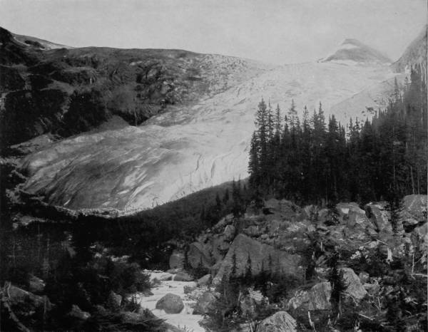
THE GREAT GLACIER, SIDE VIEW, SHOWING GRINDING OF THE FACE OF THE MOUNTAINS.—The grinding force of a glacier, as it moves down the side of a mountain, is strikingly illustrated in this splendid photograph. At the point of the glacier will be observed an accumulation of stones and débris wrenched from their places higher up by the resistless grinding force of the immense body of ice, moving steadily and irresistibly into the valleys below, cutting its way like an immense plow as it goes. The numerous photographs and printed descriptions of these wonders of the northern latitudes, in Glimpses of America, add a large degree of interest and value to this work.

LATOURELLE FALLS, WASHINGTON.
It is probable that these legends are the relics of the teachings of mission fathers who came to this region more than two hundred years ago.
From Tacoma we went to Seattle, another exquisite city of marvelous growth and immense possibilities, which occupies a strip of land between Puget Sound and Lake Washington; it has a very large water front, and exhibits a harbor as active with shipping as San Francisco. From Seattle, where we left our photograph car, we went to Port Townsend, and thence across the Straits of Juan de Fuca to Victoria, on Vancouver Island, where we first touched the soil of British Columbia. This city is also a very beautiful one, and from the summit of Beacon Hill a magnificent view is obtained, commanding a very great expanse of water, Mount Baker, and the Olympic Range, in which latter are numerous glaciers large enough to swallow up the Alps.
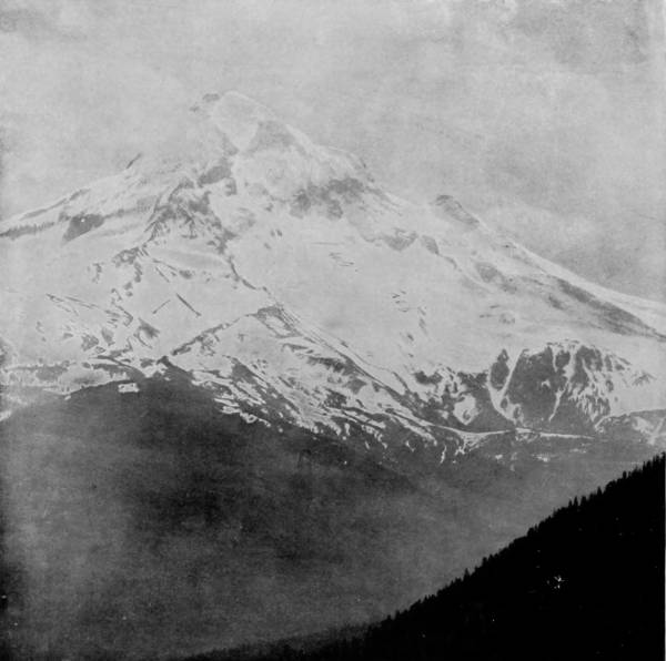
A VIEW OF MOUNT HOOD.
On the 2d of May we took passage at Victoria, on the Pacific Coast Steamship Company’s vessel Queen, and started upon a delightful voyage to Alaska, that opalescent gem in the frosted coronet of the far northwest. The trip is a revelation, a day-dream of indescribable transports, a luxury of blissful surprises. It is a strange combination of ocean and inland water travel, and just enough of each to provide all the pleasures of both, with none of the monotonies or discomforts of either. The route is almost entirely land-locked through channels of varying width, among islands which appear numberless, and as green with prolific vegetation as the shores of Killarney’s lakes.
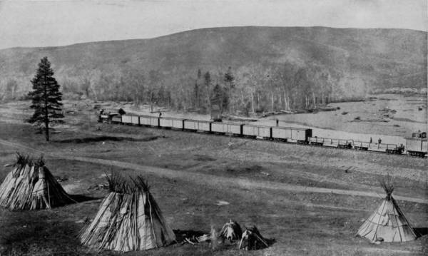
UMATILLA INDIAN CAMP, OREGON.
At places the channel narrows and passes through walls of very great height, and again widens to many miles, but all the while there are emerald shores, and high-rising banks over which tumble many beautiful waterfalls, and still above these, in the hazy backgrounds, are snow-capped mountains. Two hundred miles north of Victoria is Nanaimo, the last town with telegraphic connections, and six hundred miles beyond the steamer touches at Fort Wrangel, where the first contact with Alaska Indians is made, and interest at once centers in the curious appearance and habits which they display. Passing thence through Wrangel Narrows the region of ice is reached, indicated by a few straggling bergs that have become detached from the glacier that forms in a fiord called Thunder Bay, near the mouth of Stikeen River. Then follows a view of the Coast Range, which is rent with icy cañons that glow and gleam with refractions of clear sunlight, until in places they suggest the palace of Iris. Through this maze of mighty wonders the steamer plows her way to the town of Juneau, famous not so much for its latitude as being the location of the largest quartz-mill in the world. Thence we proceeded through a labyrinth of islands into Lynn Canal, which is considered to be the “most sublimely beautiful and spacious of all the mountain-walled channels of the Alaska route.” The Auk and Eagle Glaciers are displayed on the right as you enter the canal, coming with grand effect from their far-reaching fountains and down through the forests. But it is on the west side of the canal, near the head, that the most striking feature of the landscape is seen—the Davidson Glacier. It first appears as an immense ridge of ice thrust forward into the channel, but when you have gained a position directly in front, it is shown as a broad flood issuing from a noble granite gate-way, and spreading out to right and left in a beautiful fan-shaped mass, three or four miles in width, the front of which is separated from the water by its terminal moraine. This is one of the most notable of the large glaciers that are in the first stage of decadence, reaching nearly to tide-water, but failing to enter it, send off icebergs. Davidson Glacier is on the left shore of Chilcat River, and very near the Indian village of Chilcat, the northernmost point reached by the regular line of steamers. The place is of very little interest except for its salmon canneries and other fisheries. Cod, herring and halibut are very plentiful, but all the streams thereabout abound with salmon. Indeed, during certain seasons they are so numerous as to fairly choke the shallow rivers, and in places they may be scooped up with shovels. From this point the steamer turns south to Icy Strait, then proceeds north again by that channel into Glacier Bay, whence beyond to Mount St. Elias is the real ice-land of Alaska.
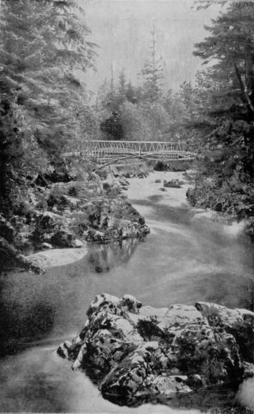
INDIAN RIVER, ALASKA.
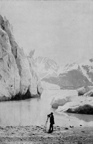
THE MOUNTAIN NEAR MUIR GLACIER.
According to general opinion Alaska is a cold and forbidding region, fit for habitation only by Esquimau Indians and fur traders. But this opinion is very much overdrawn, for in the valleys and along the islands of the coast, where the influence of the warm currents of the Pacific Ocean is felt, the climate is mild, and a vegetation almost semi-tropical is produced. This is shown to a considerable extent in the photograph of Indian River on this page.—The companion picture, with our photographer in the foreground, represents a front view of a portion of Muir Glacier, where the ice accumulation of centuries has piled up until it is mountain high.
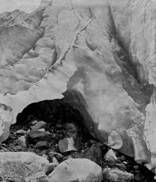
CAVE IN THE GREAT GLACIER, BRITISH AMERICA.
Glancing for a moment at the results of a general exploration, we find that there are between sixty and seventy small residual glaciers in the California Sierras. Through Oregon and Washington, glaciers, some of them of considerable size, still exist on the highest volcanic cones of the Cascade Mountains—the Three Sisters, Mounts Jefferson, Hood, St. Helens, Adams, Tacoma, Baker, and others, though none of them approach the sea. Through British Columbia and Southeastern Alaska the broad, sustained chain of mountains extending along the coast is generally glacier-bearing. The upper branches of nearly every cañon are occupied by glaciers, which gradually increase in size to the northward until the lofty region between Glacier Bay and Mount St. Elias is reached.
The largest of the glaciers that discharge into Glacier Bay is the Muir, and being also the most accessible is the one to which tourists are taken and allowed to go ashore and climb about its ice-cliffs and watch the huge blue bergs as with tremendous thundering roar and surge they emerge and plunge from the majestic vertical ice-wall in which the glacier terminates.
The front of the glacier is about three miles wide, but the central berg-producing portion, that stretches across from side to side of the inlet, like a huge jagged barrier, is only about half as wide. The height of the ice-wall above the water is from 250 to 300 feet, but soundings made by Captain Carroll show that about 720 feet of the wall is below the surface, while still a third portion is buried beneath moraine material. Therefore, were the water and rocky detritus cleared away, a sheer wall of blue ice would be presented a mile and a half wide and more than a thousand feet high.
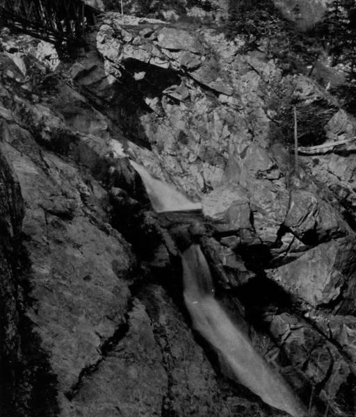
SCUZZIE FALLS, NEAR NORTH BEND, BRITISH AMERICA.
The number of bergs that become detached from the glacier every twelve hours varies with tide and weather, but generally a new one is thus fresh born every six or seven minutes, and so massive that the discharge may be heard like thunder or cannonading two or more miles away. When one of the fissured masses falls there is first a heavy, plunging crash, then a deep, deliberate, long-drawn-out thundering roar, followed by clashing, grating sounds from the agitated bergs set in motion by the new arrival, and the swash of waves along the beach. All the very large bergs rise from the bottom with a still grander commotion, rearing aloft in the air nearly to the top of the wall, with tons of water pouring down their sides, heaving and plunging again and again ere they settle and sail away as blue crystal islands; free at last after being held rigid as part of the slow-crawling glacier for centuries. And strange it seems that ice formed from snow on the mountains two and three hundred years ago, should after all its toil and travel in grinding down and fashioning the face of the landscape still remain so lovely in color and so pure.
The rate of motion of the glacier as has been determined by Professor Reid is, near the front, about from five to ten feet per day. This one glacier is made up of about 200 tributary glaciers, which drain an area of about a thousand square miles, and contains more ice than all the eleven hundred glaciers of the Alps combined. The distance from the front back to the head of the farthest tributary is about fifty miles, and the width of the trunk below the confluence of the main tributaries is twenty miles or more.
Next to the Muir, the largest of the glaciers enters the bay at its extreme northwestern extension. Its broad, majestic current, fed by unnumbered tributaries, is divided at the front by an island, and from its long, blue wall the 228icebergs plunge and roar in one eternal storm, sounding on day and night, winter and summer, and from century to century. Five or six glaciers of the first class discharge into the bay, the number varying as the several outlets of the ice-fields are regarded as distinct glaciers, or one. About an equal number of the second class descend with broad, imposing currents to the level of the bay without entering it to discharge bergs; while the tributaries of these and the smaller glaciers are innumerable.
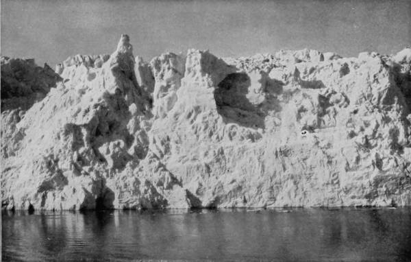
FACE OF MUIR GLACIER, ALASKA.
Mr. John Muir, the explorer of Muir Glacier, thus describes his visit to that wonderful ice-swept region: “The clouds cleared away on the morning of the 27th, and we had glorious views of the ice-rivers pouring down from their spacious fountains on either hand, and of the grand assemblage of mountains, immaculate in their robes of new snow, and bathed and transfigured in the most impressively lovely sunrise light I ever beheld. Memorable, too, was the starry splendor of a night spent on the east side of the bay, in front of two large glaciers north of the Muir. Venus seemed half as big as the Moon, while the berg-covered bay, glowing and sparkling with responsive light, seemed another sky of equal glory. Shortly after three o’clock in the morning, I climbed the dividing ridge between the two glaciers, 2,000 feet above camp, for the sake of the night views; and how great was the enjoyment in the solemn silence between those two radiant skies no words may tell.”
The destructive effects of glaciers and the extent of their ravages have been made the subject of many interesting essays by distinguished scientists, but nowhere has it been so interestingly and understandingly treated as by Dr. Wright in the Edinburgh Review, on the “Ice Age of North America.” The monograph, much abbreviated, is as follows:
“It is not more than 10,000 years ago since the whole of North America and Northern Europe emerged from beneath a deluge of ice which seems to have destroyed the aboriginal inhabitants as remorselessly as Noah’s flood.
“The chipped flint implement-makers perished with their contemporaries, the mammoth, the woolly rhinoceros, and the sabre-toothed tiger, and left the globe to be repeopled by the polished stone-working or Neolithic progenitors of its actual inhabitants. The gap between the two races is conspicuous, and has not yet been archæologically bridged. A catastrophe is indicated; and a catastrophe by water. This is the conclusion of science; how singularly it harmonizes with the biblical narrative is almost superfluous to point out.”
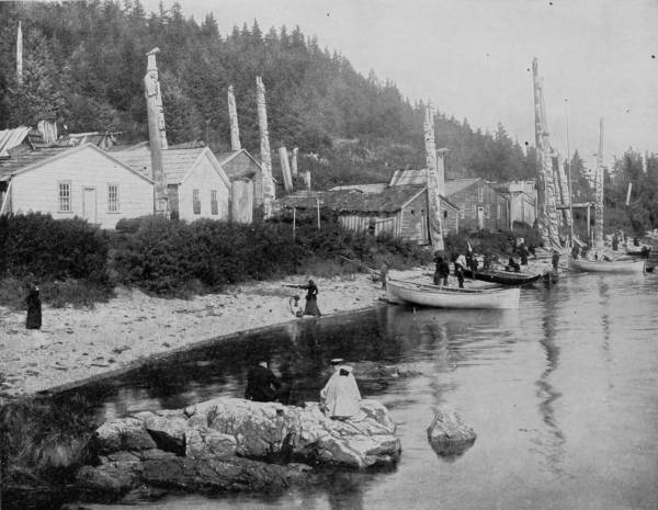
VILLAGE OF KASA-AN, ALASKA.—It will doubtless be a surprise to many persons not familiar with the conditions of the Alaskan Indians to observe that their houses are usually quite substantially built of frame or wood. We generally think of Indians as living in wigwams or huts, but in the case of the Alaskans they were for many years previous to the purchase of that country by our government under the influence of Russia, and are therefore partly civilized and somewhat advanced in the modern ways of living. But they still retain their old superstition, as shown by the totem poles in front of their houses. These poles are carved and mounted with rude representations of birds, beasts and reptiles, which are intended to give notice to the public that the spirits of the deceased ancestors of the occupants of the houses have entered into the living counterparts of these rude carvings, and that any indignities offered to them will be vigorously and promptly resented.
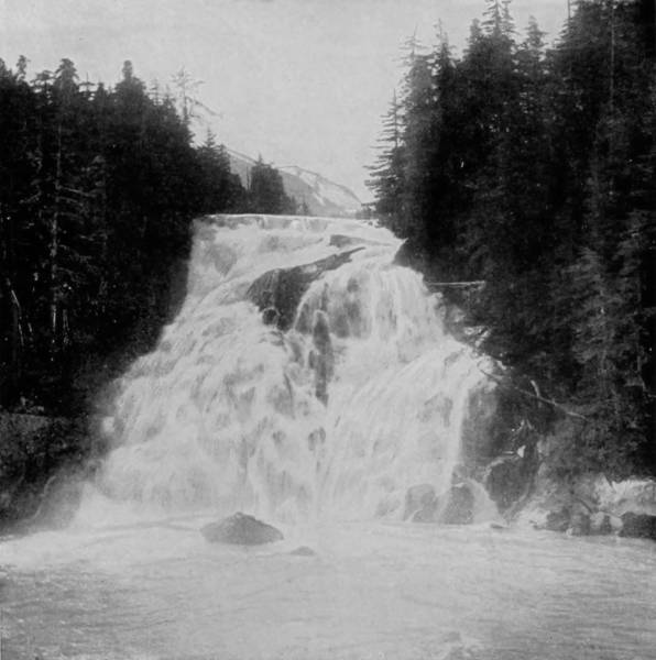
CHRISTINE FALLS, ALICE BAY, ALASKA.
The destruction of the Antediluvians who lived before the Ice Age set in was accomplished much further back; the date 6,000 B. C. represents the end of the Ice Age, not its beginning. How it was that ice submerged the world no one seems to be exactly able to say, but a great deal of valuable information has been obtained by the geological research of the present century. Before this devastating deluge of ice set in—
“Trees reigned without interruption, in north temperate and Polar regions, throughout the vast expanse of tertiary time. Palms and cycads then sprang up in the room of oaks and beeches in England; turtles and crocodiles haunted English rivers and estuaries; lions, elephants, and hyenas roamed at large over English dry land. Anthropoid apes lived in Germany and France, fig and cinnamon trees flourished in Dantzic; in Greenland, up to seventy degrees of latitude, magnolias bloomed, and vines ripened their fruit; while in Spitzbergen, and even in Grinnell Land, within little more than eight degrees of the pole, swamp-cypresses and walnuts, cedars, limes, planes and poplars grew freely.”
For some reason or other the temperature gradually fell, and great glaciers forming in the northern regions, the highlands of Canada and the Arctic Circles, submerged Northern Europe and reduced Canada and half of the United States to the present condition of Greenland. Those who see glaciers to-day can form little idea of the enormous possibilities of semi-fluid ice. Only in Alaska, where the Muir Glacier empties itself into the Muir inlet at the rate of seventy feet a day, can we form any idea of the glacier as a destructive agency. This glacier empties two hundred million cubic feet of ice into the sea every day; that is to say, 45,000 tons of ice fall into the water every minute in avalanches with detonations which sound like the booming of a cannonnade. The very earth seems 231to tremble, and the sea boils and foams with the continual discharge of fresh icebergs. “From observations upon living glaciers,” says Dr. Wright, “and from the known nature of ice, we may learn to recognize the track of a glacier as readily and unmistakably as we would the familiar foot-prints of an animal.” By the effects of ice-grinding, rocks are smoothed and polished, rounded and mammillated. They are, moreover, striated. “These may be called glacial hieroglyphics; glacial deposits are equally distinctive. They are of three different kinds—ground moraine, terminal moraine, and erratic bowlders. The heights to which the ice-flood rose are frequently self-registered on the mountains which once breasted its flow. They serve, in Dr. Wright’s phrase, as ‘glaciometers.’ Thus it has been learned that the ice was a mile thick in New England and a couple of thousand feet thick in Pennsylvania. The date of the close of the Glacial Epoch in the United States can scarcely, then, be placed earlier than 6,000 B. C. For it was, we repeat, the withdrawal of the ice that set the chronometer of the Falls going. The Falls of Niagara, indeed, constitute in themselves, in Dr. Wright’s apt phrase, ‘a glacial chronometer.’”
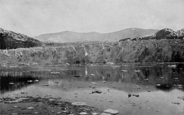
TAKU GLACIER, ALASKA.
It was this tremendous agency of glacial action that gave us Northwest America as we have it at present. “The inexhaustible fertility of the Far West is an endowment from vanished glaciers.”
The world to-day is very different from what it was in the old times. The mountains stood higher and the glaciers forming on their slopes crumpled the earth in beneath their weight. The earth-crust was not strong enough to bear the weight of its ice-armor. About six million square miles were covered with ice, varying in thickness of half a mile to a mile. Taking it only at half a mile in height, the weight per square mile was no less than two thousand million of tons. “And the whole of this enormous mass being extracted from the ocean, its differential effect in producing change of level was doubled. The ice-cumbered land accordingly went down, like an overladen ship, until it was awash with the waves, and sea-shells were deposited along coast-fringes above the drift. Then, as the ice melted, recovery ensued.” The whole article is full of interesting and suggestive reading, and is an excellent example of a popular presentation of the results of scientific research.
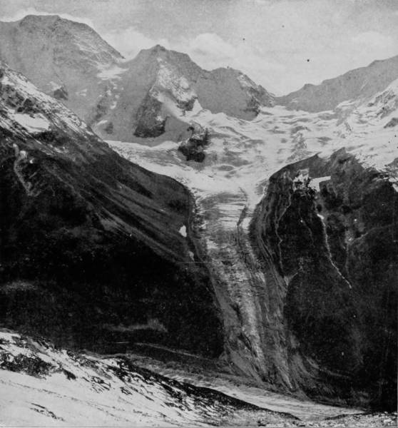
DAWSON’S GLACIER, BRITISH AMERICA.
The return trip was made down Chatham and Peril Straits to Sitka, the capital city of Alaska, situated on the Pacific shore of Baranoff Island. The place has grown very much in importance in the past few years, though it has not increased correspondingly in size. It is a considerable harbor for whaling and sealing vessels, that touch there for supplies, and accordingly supports a population that is largely American. The natives, however, still continue in considerable numbers, but contact with English-speaking people is rapidly civilizing them, and their old-time characteristics are fast disappearing. But in one particular they exhibit small change, viz.: religion. Long under the domination of Russian influence and missionaries of the Greek Church, it is not surprising that the natives should continue in the faith which was thus first established among them. There are three Greek churches in the city, all fairly well supported, though the communicants are content to worship in rather humble edifices. But while adopting the Greek faith, the native Indians generally retain their ancient mortuary customs; and among the interior tribes particularly, witchcraft, or Shamanism, and exorcism, still prevail. Burial of bodies is very seldom practiced among any of the Indians, as preservation of their dead is a universal desire. It is, therefore, a common thing to see their cemeteries, instead of earth-mounds and tombstones, a collection of mortuary houses, in which the dead are laid with great care, concealed only by the skins or blankets in which they are wrapped, something after the manner of the Sioux Indians. Thus disposed of, the dead are long preserved in that cold climate, the houses themselves often decaying before dissolution of the bodies is far advanced. This, however, applies to what may be called the better class of natives. Among the interior and poor people, it is the custom to remove the body to some secluded spot, usually on a bluff overlooking a river, and lay it upon the ground. A shelter is made by building over it a small conical-shaped structure of spruce logs, and a tree near-by is stripped of its branches and small pieces of cloth are tied to it to mark the spot. The household utensils, sled, and some of the weapons of the deceased are left with him, should he be the head of a family, and the place is tabooed thenceforth.
THE POOL AT BANFF HOT SPRINGS, BRITISH AMERICA.—These celebrated springs are in the Rocky Mountain region of British Columbia, on the line of the Canadian Pacific Railway. They are celebrated for their healing qualities, and have become a favorite resort for invalids and tourists. The photograph represents the pool or principal spring, at the foot of a great mountain. The rocks thereabout show volcanic origin, and several of the springs flow with water of a high temperature, and possess remedial qualities equal to those of the hot springs of Arkansas. The scenery of that region is sublime in the highest degree, and possesses even a greater attraction for tourists than the springs do.
DEVIL’S GATE, BEAVER CAÑON, BRITISH AMERICA.
Our return journey was devoid of the surprises which made the northward trip so delightful, yet the charm which possessed us after leaving Victoria continued throughout, for the magnificent scenery along the route cannot be exhausted by a single glance, but rather grows in beauty when lingeringly watched. It was impossible to feel that the voyage was being made on any part of the ocean, so still was the water, so green the near-by shores, so clear the sky, dropping down all around upon frosted peaks and island forests. And the nights were so gloriously grand, sprinkled with jewels of light from moon and stars that made the world as beautiful as the lawn in front of paradise, and brought to mind the poet’s tribute to nature’s solitude:
SPOKANE FALLS, WASHINGTON.

It was the 15th of May when we returned to Victoria, and without any waste of time we proceeded to Seattle, and there made hasty preparation to continue our work along the northern lines of road towards the east. A little change was made in our original plans, by a brief diversion from the routes we had marked out, in order to view and take some pictures of the marvelous scenery along Fraser River, on the line of the Canadian Pacific Railroad. This stream is as wide as the Ohio, but generally of great depth, and being confined within perpendicular walls, often rising to a height of 500 feet, it is a rushing flood, too swift in places for the most powerful steamer to make head against. The road follows the bed of this torrential stream for a distance of 150 miles, through the Cascade Mountains, and in sight at times of the Okinagan Range. Beyond these eastward are the Gold, Selkirk and Rocky Mountains, and in between and about these are glaciers of extraordinary proportions, which in summer feed tearing cataracts and plunging waterfalls, and furnish nature pictures that thrill the heart with wonder. Beyond the valley of Thompson River, where the Golden Range begins, the scenery is quite as grand, though scarcely so sublime as that in the cañon of the Fraser; but the mountains are surprisingly beautiful, and variegated with patches of snow, clumps of evergreen, and sheets of soft blue water that invite the angler. Louise, Agnes and Mirror lakes lie one above the other, high up upon the mountain sides, where they are often hidden by clouds, and are accordingly called the “Three Sisters of the Sky.” Castle Mountain may be seen from this point, which is only a few miles from Banff, famous for its hot springs, and for being the chief resort in the Canadian National Park, with a hotel capable of accommodating 800 guests.
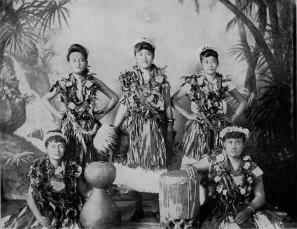
NATIVE GIRLS OF HAWAII, SANDWICH ISLANDS.—It is hard to believe that the ancestors of these beautiful and intelligent girls, only a few generations back, were savages and cannibals, but it is a fact nevertheless. They are living exponents of the benefits of modern Christian civilization. There is hardly a trace of savage ancestry to be seen in their countenances or general appearance. Their faces, in fact, are pleasant, indicating confidence and gentle disposition. There is a trace of savagery in their dress, however, and in their domestic implements, but in other respects they might be taken for a group of merry school girls out on a lark.
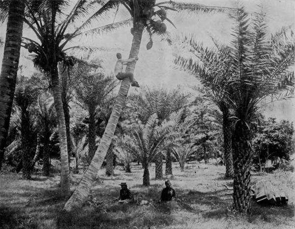
KANFOHE PARK, HONOLULU, HAWAII.—The climate of the Sandwich Islands is delightful in the extreme. It is tropical, but tempered by the mountains which tower into the regions of perpetual snow, and cool the hot air of the valleys. Tropical trees, fruits and plants, grow in profusion, and yield abundant food for the natives even before the advent of white civilization. The advantages of climate and soil in these islands are attracting many enterprising Americans and Europeans thither, and the time is probably not far distant when the native population will be entirely supplanted.
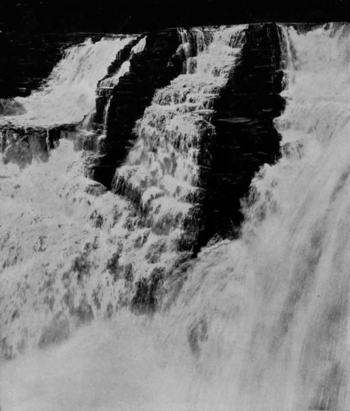
KAKABEKA FALLS, NEAR FORT WILLIAMS, THUNDER BAY, LAKE SUPERIOR.
The side-trip which we took on the Canadian Pacific occupied only one week, and though not originally contemplated in our plan of photographing American scenery, more than compensated for the change, for we are thus enabled to present some British American scenery equal to the most magnificent, imposing and attractive that our own country possesses.
Had the time been at our disposal, we would have made our scenic journey extend to the Sandwich Islands, after our return to Victoria, particularly as there was some political agitation in the government at Hawaii at the time. Indeed, while in San Francisco, we were earnestly urged to visit the islands with our cameras, so as to include them in our Wonderland book; and to the other inducements offered, we were presented with some views of the Hawaiian palace, the palmetto embowered walks, cocoanut groves, and pictures of the charming native girls, which latter was a particularly powerful persuasive. But the islands, charming though they are, do not belong as yet to the American domain, and cannot therefore be properly included, though on account of the annexation sentiment, and President Harrison’s message urging their acquisition, the views given to us are here reproduced.
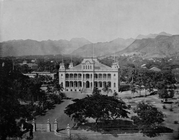
THE ROYAL PALACE, HONOLULU, HAWAII.—A special interest has been given to this building and its surroundings by the events of the recent revolution, which are still fresh in the minds of all. Our photograph herewith presents not only a very a fine picture of the palace, but also a large portion of the city, with the outlying mountains for a background. It is a representative view, and gives a good idea of the general appearance of these islands. The mountains seem barren and uninviting, but the valleys are rich with verdure and scented by a profusion of fruits and flowers.
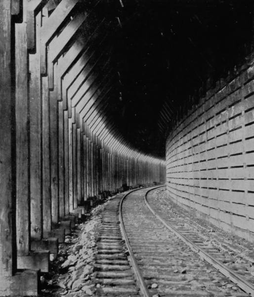
SNOW-SHEDS ON THE CANADIAN PACIFIC.
Returning to Seattle, we proceeded directly eastward again, by the Northern Pacific Railroad, crossing for a third time the Cascade Range and viewing again the white and sunlighted crests of Mounts Hood, St. Helens, Adams and Ranier. The route is along the Yakima River, through charming scenery all the way to Spokane Falls, where the beauty of the landscape, as well as the might and awfulness of the falls, arrested us for a time. Palouse Falls is within nine miles of the junction of the Snake with Columbia River, and are a part of Palouse River, which, after flowing through a deep cañon thirty feet wide, pours over a precipice that is a sheer height of 125 feet. The surrounding rocks exhibit many unique forms, ranging in terraces to a height of 2,000 feet, and then assuming the shape of pinnacles, chimneys, columns and needles, as if the region had one time been the work-grounds of giant sculptors.
Snake River is interrupted by enormous falls, the most important of which are American and Island Falls, the former having a drop of thirty feet; being very wide before taking the final leap, the river flows over a series of ledges that break the water into cataracts. Further up the stream, about fifty miles from Shoshone Falls, are Lost Falls, which leap down from a height of two hundred feet, and then the river, of which they are a part, disappears under the lava-covered earth, but reappears again several miles beyond and resumes its impetuous and erratic course.
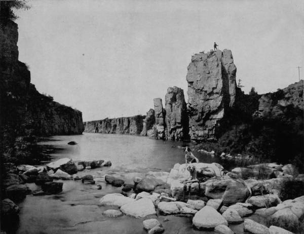
MISSOURI RIVER, ALONG THE GREAT NORTHERN RAILROAD.—There are many picturesque localities on the Upper Missouri River, a rich scenic region which has been neglected or overlooked by tourists. A finer scene of bold and rugged bluffs, carved into fantastic shapes by the water’s action, could hardly be found than the one so beautifully photographed on this page. One of our photographing party has stationed himself on top of the great rock for the double purpose of viewing the country and having his picture taken, the latter being intended by comparison to show the height and size of the rock.
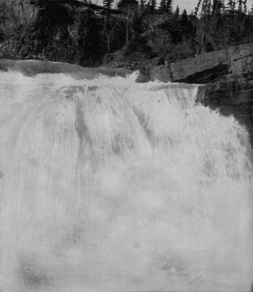
KANANASKE’S FALLS, BRITISH AMERICA.
Some fifty miles east of Spokane, on the line of the Northern Pacific, is Hauser Junction, where the road branches southward, through the Cœur d’Alene Indian Reservation and a great mining region, while the main line runs around the north shore of Lake Pend d’Oreille, the most beautiful sheet of water in the northwest, and destined sometime to become a popular resort. Beyond the lake is the Flathead Indian Reservation, and at Missoula the two lines of road unite again. This city is a place of much importance, and admirably situated near the Junction of Hell Gate and Bitter Root River, a district of great scenic beauty. Flathead Lake lies sixty miles to the north, an emerald sheet of crystal water reposing within a bed of lofty cliffs, and belted in the center by a chain of wooded islands, while its waters are discharged into the Pend d’Oreille River, that dashes away through deep gorges in tumultuous flow. Forty miles from this picturesque lake are the Two Sisters’ Cascades, which pour over the opposite walls of a colossal amphitheater 2,000 feet high, and then unite to journey through gorge, over waterfall and across lovely meadows, catching perfume and inspiration on their way to the Pacific.
The way thence from Missoula is over a comparatively level stretch of country, until just west of Helena the road strikes the Main Divide of the Rocky Mountains, and to cross this broken region it is compelled to pursue a winding way.
Helena is reputed to be the richest city of its size in all the world, a claim well supported by appearances, for while having probably 15,000 inhabitants, it has all the conveniences of our largest cities, and in no other place of equal population are the public buildings and residences so magnificent and palatial. But aside from its wealth and beauty, the place is the center of a region as remarkable for its scenic attractions as for its silver mines. Eighteen miles north of Helena is the cañon of Little Prickly Pear, where precipitous walls rise to a varying height of 500 to 1,000 feet, and are gorgeously colored by strata of different formations, blending with hues of trees, shrubs, and vines that tenderly cling to their faces. Near-by is the portal through which the headwaters of the Missouri go madly careening, making a deep roaring sound as they dash between walls 1,000 feet high. Atlantic Cañon is only three miles further down the river, and next in quick succession appears the Bear’s Tooth, two monoliths that may be distinctly seen from Helena, twenty miles away.
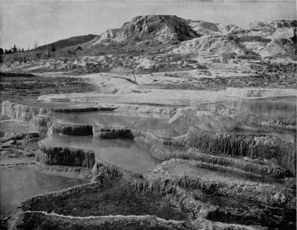
FRONT VIEW OF MAMMOTH HOT SPRINGS—CLEOPATRA AND JUPITER TERRACES.—The chief wonders in Yellowstone National Park are the geysers, and the limestone formations such as are shown above. These terraces are formed by exuding water carrying a heavy solution of travertine, which is deposited in the most remarkable shapes when coming in contact with the air. This deposit is semi-crystalline, often resembling snow-banks, and as the process of hardening goes on in circular rims, basins are left which hold the water, and reflect in a myriad of hues the sky and surroundings.
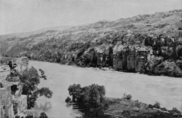
CAÑON OF MISSOURI RIVER, NEAR GREAT FALLS.
The Montana Central and Great Northern Railroad convey travelers over a good road eighty miles further, to the Falls of the Missouri, three in number, which are scattered over a distance of twelve miles, where the river flows through a cañon with vertical walls 200 to 500 feet high. We first meet a cascade called Black Eagle Falls, where the entire river drops over a ledge twenty-six feet high, a precursor of the more terrible waterfalls that are to come. The next one to appear in view is Rainbow Falls, where the river, 1,200 feet wide, hurls itself down a perpendicular descent of fifty feet. Six miles further down are the Great Falls, that have a leap of ninety feet, and whose terrible roaring can be heard a dozen miles away. At this point the river has a volume greater than the Mississippi, but is narrowed to 300 feet by walls 200 feet high. An island divides the rushing waters, the half next to the right bank dashing down with such tremendous effect that clouds of spray are sent 200 feet high, which, struck by bright sunbeams, are converted into rainbows, or at times glow with prismatic hues like giant soap-bubbles. That part of the stream flowing to the left passes over a succession of ledges, forming a magnificent cataract of fleecy foam, 200 feet in width and 90 feet in perpendicular elevation. But though these are the principal falls, there are twelve others within a distance of ten miles, having a total descent of 400 feet, and these interruptions in the channel continue, though in a lesser degree, as far down as Fort Benton, which is the head of navigation.
The country east of Helena, along the line of the Northern Pacific, presents no variation of apparently boundless prairie land, until the Bad Lands of Northern Dakota are reached, which will be hereafter described. One hundred and fifty miles east of the city, however, is the town of Livingston, at which point Yellowstone Park visitors change cars to a branch line that runs fifty miles due south to Cinnabar, which is within a mile of the Wyoming State line, and three miles from the northern boundary of the National Park. We are now upon the borders of the most wondrous region of the earth, the curiosities of which we will now attempt to briefly describe, though words seem to lose their significance when they are used to portray the marvels that exist in this real wonderland.
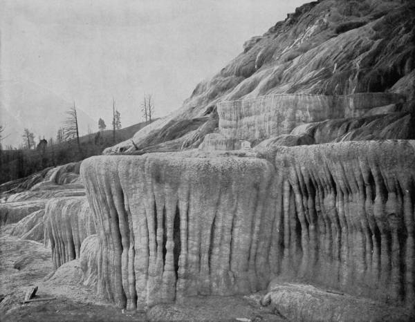
PULPIT TERRACE, MAMMOTH HOT SPRINGS.—The photograph above admirably represents this beautiful and surprising example of Nature’s wonder-working. The projecting terrace in front was on one occasion used as a pulpit, which it greatly resembles, from which fact the name is derived. These remarkable formations are beautiful beyond all the efforts of imagination to picture. Even a fine photograph like the above cannot do them full justice, as the exquisite coloring is wanting. They must be seen in all the glory of sunlight reflection to be fully appreciated.
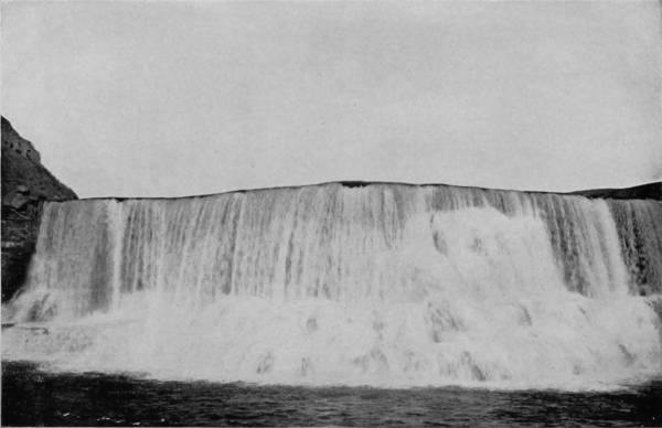
RAINBOW FALLS, GRAND FALLS, MONTANA.
At Cinnabar, tourists take the stage for a seven miles’ ride to Mammoth Hot Springs Hotel, which is the first and principal hostelry within the park. This ride prepares the visitor for remarkable surprises, for it is through an erratic district of soaring pinnacles, dizzy walls and chaotic formations, stranger and more weird than the gate-way that Cerberus guarded. Away up on the apex of the first tall spire of stone that has broken away from the cañon walls of Gardiner River, is seen an eagle’s nest, an aerie so lofty that the clouds play about it; so far-reaching skyward that it is tipped with the waking beams of sunlight before day, and is bright with lingering rays when evening shades have descended. By aid of glass the eagle may be seen demurely surveying the world, or in her absence the straining necks of her ambitious brood, watching the neighboring crags for their royal parent’s return. Nothing that I saw in Yellowstone Park impressed me more than this nest of eagles in the azure depths of that perilous peak.
This great National Park is a volcanic plateau some 10,000 feet above sea level, and embraces a territory fifty-five by sixty-five miles, or 3,575 square miles. It was first visited by John Colter, an attaché of the Lewis and Clarke exploring expedition in 1806, but it was not until nearly fifty years later that stories told of the region by old trappers and hunters were verified by a visit of members of the Geologic Survey. In 1880 it was made a National Park, since which time it has been under the immediate control of the Secretary of the Interior, who appoints a superintendent with headquarters at the Mammoth Hot Springs, and polices the park with a company of cavalry, whose principal care is the protection of game. So faithfully has this duty been executed that the park now abounds with deer, buffalo, elk, bear, and a few mountain lions, besides a great abundance of small game and water-fowl. Upon alighting from the stage at Mammoth Hot Springs Hotel, the first objects that attract the interest of visitors are the pink terraced springs and Cap of Liberty, which are in the front-yard, so to speak. The springs, fifty in number, cover an area of 170 acres and by a constant deposition of carbonate of lime have built up, terrace upon terrace, a mound fully 200 feet high.
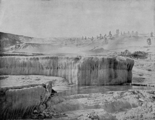
LITTLE JUPITER TERRACE.—The different terraces of the Yellowstone Park cover an area about two miles square. They have the appearance of a frozen cascade, so beautifully scalloped and adorned with a kind of bead work, that the beholder stands amazed and filled with inexpressible admiration. The water flowing over these terraces is so transparent that it is like glass, and the pools below hold the reflection of the sky while mirroring the white crystalline formations, surpassing all art, and more beautiful than anything which can be conceived.
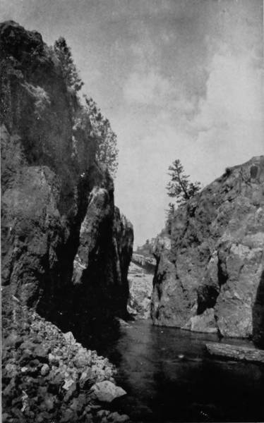
SLUICE-BOX CAÑON, NEAR GREAT FALLS, MONTANA.
The springs have their source somewhere within an active volcanic belt, and thus heated by internal fires they pour out their waters at a temperature of 112° to 163° Fahrenheit, which, acting upon the soft limestone, dissolves and converts it into what geologists call travertine, a semi-crystalline deposit that quickly hardens upon coming in contact with the air. When first observed, the terraces resemble a snow-bank, but by other writers they have been compared to the terminal front of a glacier, and again like a foaming cascade suddenly turned into stone. Streaks and patches of red, yellow and green seen upon the white slopes mark the course of overflowing water, while clouds of steam float lightly upward from the many springs, but only to quickly disappear.
There are in all eight well-defined benches, each with a more or less level surface, and terminating with vertical fronts to the next terrace below. Near the terraces, though on a bench of ground by itself, is Liberty Cap, a pillar forty-three feet high and twenty feet in diameter, with sphinx-like profile, the cone of a hot spring long since extinct. Close-by is a similar monolith, not so tall, called the Devil’s Thumb, a name readily suggested by the proximity of the springs to Pluto’s dominion, as some will have it, and the gossip that Satan’s hand is in all the region thereabout.
In wandering around the terraces the visitor is sure to have his surprise quickened by the brightly-tinted basins, and the red and orange slopes overflowed by the hot waters. These colors are due to the presence of minute algæ, or water-plants, whose life is strangely enough supported by the hot water and the lime held in solution; for investigation has disclosed the astonishing fact that the chief work of these microscopic plants is the separation from the water of the carbonate of lime, which they cause by abstracting the carbonic acid.
The view from these mammoth terraces is picturesque beyond comparison: The dark and lofty summit of Sepulchre Mountain shows its drowsy head near-by on the north; while the upper valley of the Yellowstone, and the jagged peaks of Snowy Range, are seen to the northeast, between Sepulchre and the long face of Mount Evarts. In the southeast the eye dwells pleasantly upon the distant view of Lava Creek and Undine Falls, with many snow-white peaks, standing like sentinels around this wizard realm; while Bunsen Peak keeps watch towards the south, its dark slopes making an effective background to the white hills of hot spring deposit.
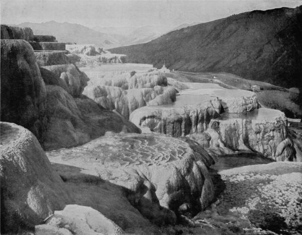
COATING SPRING TERRACE.—This terrace affords perhaps a better example of the formation of these beautiful monuments of Nature than any of the others. The water is seen flowing gently over the succession of steps, and depositing the calcareous substances of which they are composed. The ground-work is snow-white, but reflected from this is every shade of scarlet, green and yellow, as brilliant as the brightest of our aniline dyes. The spectacle is dazzlingly beautiful, producing a scene that cannot perhaps be equaled elsewhere in the whole world.

ECHO CAÑON FALLS, IN ROCKY MOUNTAINS, NEAR MIDVALE, MONTANA.
When we turn from viewing the surrounding scenery and begin to examine particularly each separate formation, we find near the center of this sublimated field a blue spring, brilliant as a sapphire, and clear as a diamond, with a deep and irregular rim all around it, as if nature had made an effort to retain its beautiful waters. This spring is fifteen by twenty feet in area, and is in a state of constant agitation. The sides and bottom of the basin are formed of pure white travertine, while the varying depths cause the water to appear all shades between a deep peacock-blue and a light nile-green. Issuing at a temperature of 165°, the water contains a considerable amount of gas, which escapes at the surface of the pool, thus causing the flow to rise in the form of a little dome, while a pulsating movement is imparted which sends out waves that ripple across the water and curl over the shallow rim of the bowl, filling other basins along its course. These terraced overflow basins, thus formed, are a most striking feature of the springs. No description can do justice to their beauty, for neither the delicate fretwork of their walls, the frosted surface of the glistening deposit, nor the brilliant colors of the pools and rivers can be adequately described.
In many places the overflow is in thin sheets and little cascades, while yellow, sulphur-coated threads of algæ are abundant, though they do not impart their color to the water, for the exquisite blues and greens of the hottest basins are due solely to the varying depths of water. On the other hand, the bright lemon, red and green shades of the cooler pools are entirely vegetable in their nature, and due to the presence of algæ lining the basins and striping their outer walls.
The upper basins are generally shallow, because of the rapid deposit of lime, but this deposition occurs after the overflow, thus forming what is called the Marble Basins, after which, the water being somewhat cooled, the deposit is slower. Accordingly, we find that the lower slopes are exquisitely fringed with slender stalactites and pillars, forming the beautiful Pulpit Basins as shown in the illustration.
The Government has expended large sums of money in making roads through the most interesting sections of the park, and over these we pursued a greater part of our way in reaching the places which we desired to photograph. A stage runs through the park, in which visitors may make the tour in six days, but for manifest reasons we traveled by private conveyances, camping out as often as we took quarters at the several hotels located at convenient distances along the route.
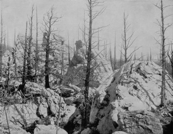
LIMESTONE HOODOOS IN YELLOWSTONE NATIONAL PARK.—If one should come suddenly upon these Hoodoos, or Ghost Rocks, alone on a moonlight night, he would instantly recognize the appropriateness of the title which has been bestowed upon them. It was winter when our photographers were there, and they had the advantages of a winding sheet of snow reflected in a bright winter sun to heighten the effects, and were thus enabled to secure a picture which is in every sense in perfect keeping with the gruesome surroundings.
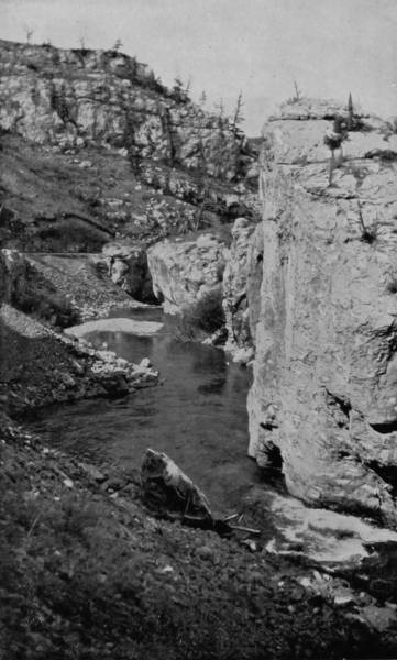
NATURAL CASTLE, SLUICE-BOX CAÑON.
Leaving the Mammoth Hot Springs terraces, whose incomparable beauties must ever remain as a delightful remembrance, we traveled southward by the Hoodoos, and entered the Golden Gate, where a part of the road is built over a cañon and another part is carved out of the cliffs, along which there is a charm following every footstep. On the one side rise precipitous walls, while on the other is a gorge of almost infinite depth, through which plunges Gardiner River, broken and foaming with cascade and waterfall. Beyond the gates there is a brief level, then down again among fresh curiosities the route leads by the Devil’s Paint-Pots, Crystal Spring, pretty Beaver Lake, and along a mountain base covered with blasted pines. Then another ascent, until the altitude is so great that we found snow in considerable patches as late as July 1st. But besides the bubbling springs and sputtering sulphur vats, whose locations were marked here and there in the distance by their streams of vapor, our interest was chained by the obsidian cliffs on our left, a black mountain of mineral glass that sparkled with unnatural lustre because of the dusky background, while strewed about were broken bits that made the spot resemble the remains of a glass factory.
At every few paces we startled a woodchuck which, satisfying his curiosity with a glance, quickly disappeared among the stones. Deer were occasionally seen scampering through the dead pine forest, and as we reached Beaver Lake two solemn blue cranes crossed our road and tried to hide their brood in a patch of tall grass. The hoarse “konks” of the cock, the thin “peeps” of the young, and the peculiar motions of the hen in her great agitation, were extremely amusing.
Twenty miles from Mammoth Hot Springs Hotel is the Norris Geyser Basin, where we were entertained with our first view of the spouting volcanoes throwing up streams of hot water and great volumes of vapor. This is indeed the Devil’s Kitchen, for besides the hellish aspect of boiling caldrons, the air is charged with those sulphurous fumes that are said to certainly indicate his activity and immediate presence. There is no sign of soil thereabout, for the surface is incrusted with a deep deposit of lime, in which vents occur to allow the escape of gases and to give intimation of the fiery furnace which is raging beneath our feet. We counted eighteen geysers from the insecure position which we took; the most of them, however, were infantile and irregular in their action, sending up a shower of mud at occasional intervals, and then subsiding to gather fresh force; but steam poured out continually, and when we moved a little further south, the roar of Steamboat Geyser fell on our ears. It, too, acted spasmodically; but every few minutes there was a deep rumbling, followed quickly by a respiration, deep, powerful and awful as the rush of a hurricane, then a regurgitation, as if the earth were swallowing up again the gas and steam which she had poured out.
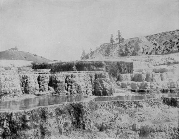
HYMEN TERRACES, MAMMOTH HOT SPRINGS.—A description of one of these marvelous formations fits them all, for there is much similarity between them, while each alike is so beautiful that neither language nor the camera can do them justice. One can spend weeks in their presence, and find new beauties to admire every day, in the varying reflections and prismatic colors that dance and sparkle upon their crystalline sides and surfaces. It is a region of wonders unequaled by any other spot on the face of the earth.
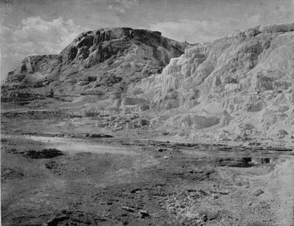
CLEOPATRA AND JUPITER TERRACES.—This photograph represents a portion of two of the most popular and beautiful of the Yellowstone terraces, and also presents a general view of the side of the hill on which they are located and the valley into which the waters flow. It is also one of the most recent and superb photographs of this scene, reproducing it as it would appear in its natural condition at the present time.
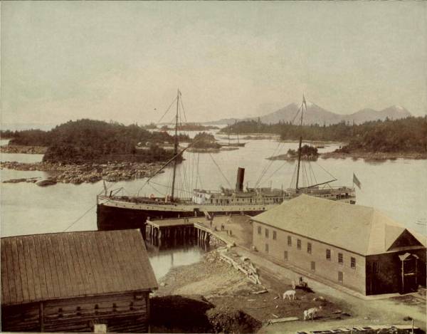
SITKA BAY, ALASKA.
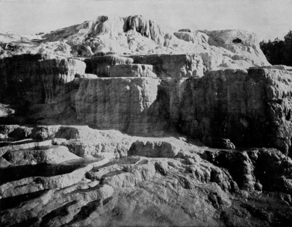
JUPITER TERRACE, MAMMOTH HOT SPRINGS.—This is a particularly fine view of this celebrated curiosity. The reflection of light and shade is admirable, and affords a good idea of the dazzling splendor of the formation when viewed in the light of the sun. We can but stand mute and dumb with admiration in the presence of such marvelous creations of Nature. No art can paint or imitate them. They are Nature’s own product, and stand unsurpassed even in human imagination.
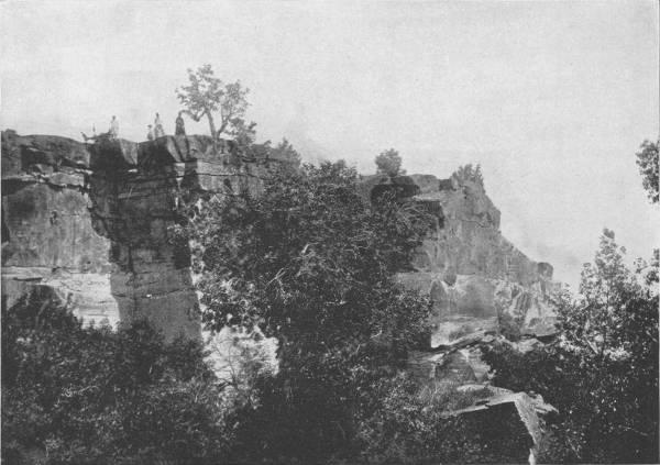
IN THE BELT VALLEY, NEAR GREAT FALLS.
On the brink of this infernal pit, distributed over a considerable space, were transparent pools of water of the most brilliant hues, indigo, orange, carmine and emerald, down in whose depths are queer formations of petrifying algæ, and bubbles that look like pearls. Near this beautifully colored and transparent spring is Mud Geyser, a basin full of mush, that lazily sputters as though it were hung over a slow fire, awaiting the spoon of a tardy diner. There is another mud volcano near Sulphur Mountain, the crater of which is thirty feet deep and twenty-five feet in diameter, and which is in a state of constant ebullition, throwing up great quantities of mud and steam to a height of 200 feet, and at times shaking the mountain with its terrible convulsions. Great as were the wonders which we saw in Norris Basin, it proved to be only the threshold of the colossal, the overpowering, the awful sights which we were yet to behold.
The well-constructed roadway leading south from the Norris Geyser Basin is along the Gibbon River, by Johnson Peak and Hot Springs, into Gibbon Cañon, which, however, is distinguished for its gracefully sloping sides rather than for its cliffs and depths. A little way to the west the cañon becomes wilder, and just below Beryl Spring is a high shelf in the river, over which the rushing waters plunge in a fall of ninety feet. But the descent is gradual, so that instead of torrential dash the waters, after breaking on the sharp projections of the rock face, slide into the river below and then speed away to join Madison River, into which is drained the overflow of the many active geysers. Though not precipitous, Gibbon Falls is a beautiful sheet of liquid crystals, rolling down terraces and ledges exquisitely colored by the presence of different minerals, and in the sunlight exhibiting a sheen and brilliance almost equal to that of Yellowstone Falls. The charm is enhanced by deep coverts of pine that are reflected in the placidly-flowing stream above and below the falls, and by the castellated bluffs that confine the waters. The prospect from the cañon walls is also delightful, for towards every point there is a lovely panorama of remarkable diversity, including mountains, valleys, parks, rivers, and geysers, the latter showing themselves many miles north and south, while steam from boiling caldrons rolls skywards and gathers in volume until immense cumulus clouds are formed that hang ominously above the valley, or are drifted away to break upon the sides of the surrounding mountains.
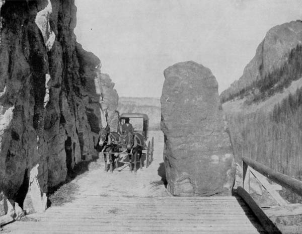
THE GOLDEN GATE, YELLOWSTONE NATIONAL PARK.—The Golden Gate is the favorite entrance to the park, and it has been photographed and pictured in many ways and from every point of view. The glimpse of the park caught through its portals is an entrancingly lovely one, and quickens the imagination with the expectation of greater things to be seen on the inside. Every person who can afford the expense should visit the National Park and see its wonders for himself, for there is no place on earth like it. Those who cannot afford the expense will find the splendid photographs and descriptions in Glimpses of America the best possible substitute.
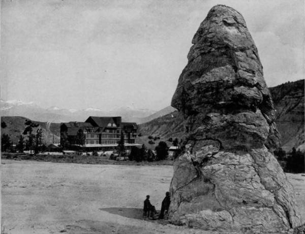
LIBERTY CAP AND MAMMOTH HOT SPRINGS HOTEL.
Continuing our trip southward through Gibbon Cañon and by Gibbon Falls, whence the landscape is more level, we came at length to Fire-Hole Creek and the Lower Geyser Basin. We were now in the region of giant geysers, in the visible presence of the most terrible manifestations of nature. In this pit of Acheron, this purgatory of ferment and explosion, covering an area of forty square miles, are almost countless geysers, distributed in seven groups, as if banded in rivalry. One of these groups is near the center of the basin and has one hundred orifices that spout steam and water, resembling from a distance an extensive manufactory. The most interesting feature of the Lower Basin is Fountain Geyser, which throws a column of water twenty feet in diameter to a height of fifty feet, though it plays only at intervals of many days. Near-by is Monument Basin, so called from the formations of every conceivable shape which distinguish it. Evangeline Geyser is another eruptive volcano that throbs and thumps violently when in action, but never casts up water more than a few feet above the surface; it has a beautifully scalloped rim, with small bowls of exquisite incrustations, resembling some of the basins in Mammoth Terraces. It is in the Upper Basin, eight miles further south, however, that the greatest of geysers are to be seen, though the area covered is scarcely three square miles, and the springs are less numerous. In this region, very near to Fire-Hole River, is a spot called Hell’s Half-Acre, a designation peculiarly appropriate by reason of the purgatorial wonders which exist therein, and the activity with which old Nick’s stokers stir the subterranean furnaces. The largest geyser in this fiery-haunted district, and indeed much the largest in the world, is Excelsior Geyser, which has a mouth two hundred feet wide and has been known to cast up a flood of water two hundred feet high, carrying with it large stones rent from the walls of its Plutonian caverns. Excelsior displays its power at very rare intervals, sometimes remaining quiet for years; but to our surprise and joy it was in a state of violent eruption during our visit, and thus gave us an opportunity not only to see but to photograph its immensity and awfulness.
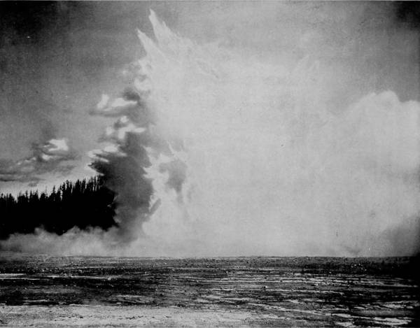
EXCELSIOR GEYSER IN ACTION.—Excelsior is the largest geyser, not only in Yellowstone Park, but in the whole world. Its mouth is 200 feet wide, and it has been known to spout a volume of hot water 200 feet high and filling the entire space of its cavity, carrying with it large stones rent from the interior of the earth. Such displays of its power occur only at rare intervals, but fortunately it was in a state of violent eruption at the time of the visit of our photographing party, and they thus had an opportunity not only to see but to photograph this wonder of nature in its immensity and awfulness.
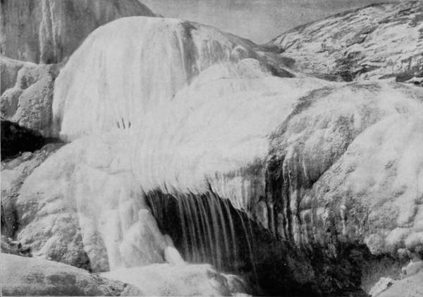
CUPID’S CAVE, MAMMOTH HOT SPRINGS.
The most interesting, because always reliable, is Old Faithful Geyser, which throws up a stream of hot water six feet in diameter 130 feet high every fifty-seven minutes, and sustains the flow for a period of five minutes. The amount of water thus discharged every hour is 100,000 gallons, or enough to supply a small river. The Bee-hive, located on the opposite side of the river, blows up a column of water three feet in diameter to a height of 250 feet, and plays, generally, for fifteen minutes, but at intervals of twenty-four hours. The Giantess is, for several reasons, the most interesting of all the 700 geysers within National Park. One may approach to the very brink of her crater, which is twenty feet across, and look down one hundred feet into her hot throat and hear the fierce gurgling of water, but none is visible until an eruption is about to occur. Then the sputtering increases, deep groans are audible, and a burst of steam is followed by a discharge of water that shoots upward in a succession of jets. The first main column sent up reaches a height of sixty feet, through which there are projected small streams a foot in diameter to a height of 250 feet, thus making a magnificent display for twenty minutes which nothing artificial can ever rival.
Giant Geyser is less pretentious than the Giantess, having a ragged cone that is broken on one side, and through a vent eight feet in diameter a discharge is made at irregular intervals, when a stream of water is tossed to a height varying from 90 to 200 feet, and the activity sometimes continues for two or three hours. Other geysers that make fine displays are the Sawmill, Turban, Grotto, Punch-Bowl, Soda, Grand, Fan, and Riverside, some of which are never quiet, while others play only occasionally. It has been found by experiment that foreign substances thrown into some of these craters create an agitation that frequently results in eruptions; the introduction of soap or lye is invariably attended by some manifestation even in the quiet geysers, while the active ones are by this means made to flow again almost immediately after an eruption has taken place.
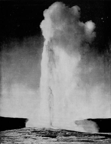
OLD FAITHFUL, LOWER GEYSER BASIN.—Old Faithful is the most interesting and popular of the many geysers in National Park, because it can be relied upon to give an exhibition regularly every fifty-seven minutes. At these intervals, with the regularity of the beating of a healthy pulse, it emits a stream of hot water six feet in diameter to a height of 130 feet, and lasting five minutes. The amount of water thus discharged every hour is estimated to be about 100,000 gallons, or enough to supply a small river. This has been going perhaps for centuries, and will doubtless continue for centuries to come.
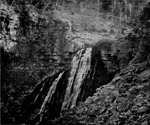
RUSTIC FALLS, GOLDEN GATE ROAD.
After two days spent among the Upper and Lower Basin Geysers, with our cameras in constant service, for the sun shone brightly, we went a few miles further down to Lone Star Geyser, Hot Springs, and to the high lands above Grant’s Pass. From this latter point of observation a magnificent view was had and photographs obtained of the Great Teton Mountains and Snake River Valley, which fill the distance with lines of hazy grandeur. Turning then towards the east we crossed Norris Pass (8,350 feet altitude), and after twenty miles of travel emerged from the forest and reached the Thumb of Yellowstone Lake, as it is called. This magnificent body of water is fifteen miles wide by twenty-five in length, and is a basin of wonderful beauty, thus described by Mr. Langford:
“Secluded amid the loftiest peaks of the Rocky Mountains, possessing strange peculiarities of form and beauty, this watery solitude is one of the most attractive objects in the world. Its southern shore, indented with long, narrow islets, not unlike the frequent fiords of Iceland, bears testimony to the awful upheaval and tremendous force of the elements which resulted in its creation. Islands of emerald hue dot its surface, and a margin of sparkling sands forms its setting. The winds, compressed in their passage through the mountain gorges, lash it into a sea as terrible as the fretted ocean, covering it with foam.”
In several places along the shore, and even projecting from the lake, are several boiling hot springs, which flowing with clear water holding lime in solution, pyramidal cones are thus built around their outlets, giving to them the appearance of ant-mounds when seen at a distance. Professor Hayden startles us with the statement that he has caught fish from the ice-cold lake while standing on these mounds, and dropping them into the craters of hot water, had the novel experience of cooking the fish without removing them from the hook.
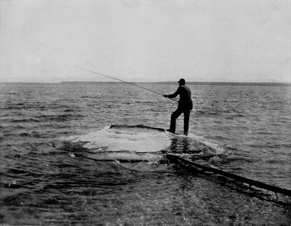
FISHING FROM YELLOWSTONE LAKE, AND COOKING FISH IN THE CONE OF AN ACTIVE GEYSER.—The cruelty of this scene detracts very much from its interest, and it is only for its scientific interest that it can be tolerated. There are several hot springs cones in the lake, containing water that is constantly at the boiling point. This water is separated from the lake by the solid walls of the cone, so that a person feeling so disposed may catch fish from the lake, as shown in the photograph, and boil them in the hot spring without removing them from the hook or changing his position. We are glad to say that the man in the picture who is performing this cruel feat did not belong to our photographing party.
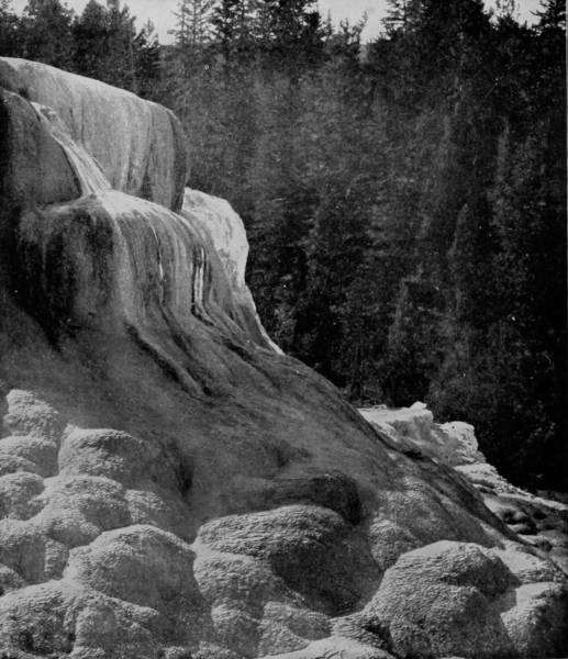
BEAUTY SPRING FORMATION.
Traveling along the shores of Yellowstone Lake for a distance of something more than thirty miles, we came to Lake Hotel, and beyond that the cliffs, which, however, are scarcely deserving of notice when brought into comparison with the Columnar Cliffs of the Yellowstone Cañon, soon to be described. Continuing our circuit of the park, we followed the main road, running along Yellowstone River, past Mud Geyser and Sulphur Mountain, until we found accommodations at Cañon Hotel, the center of another district of wonders, where we tarried for three days, to employ our energies in taking views of the extraordinarily grand and awfully imposing natural objects which cluster hereabout in the Cañon of the Yellowstone.
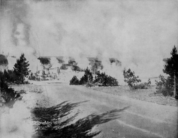
GENERAL VIEW OF THE NORRIS BASIN GEYSERS.—This beautiful photograph will give a good idea of the vast number of geysers in this locality, all of which emit boiling water and mud. Special attention is called to the accuracy and beauty of this superb photograph. Not only does it show the steam and water of the geysers as naturally as they would appear in reality, but all the other minutiæ of the scene are perfect, even to the shadow of the trees on the roadway in the foreground.
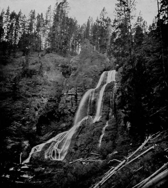
CRYSTAL CASCADE, 129 FEET HIGH.
A short distance from the hotel is Mount Washington, whose massive head is raised to a height of 10,500 feet above the sea; but so gradually sloping are its sides that an easy roadway has been made to the summit, which we ascended and from that lofty peak surveyed the vast landscape that was in the field of vision; and what a glorious panorama was there presented! We were indeed upon the topmost ridge of the Great Continental Divide, with the whole world apparently at our feet. Towards the far west and the distant south, as the range makes a sharp curve, were the high and snow-crested peaks of the Rocky Mountains, among which we readily distinguished the majestic Tetons, upon which the sacred fires lighted by very ancient tribes of Indians are said to be still burning. To the northwest are the Madison and Gallatin Mountains, dropping gracefully towards the east until they form what appears to be the western walls of Yellowstone Valley, speckled with its hundreds of steam-vomiting springs. The mountainous aspect of the western view has its counterpart in the tumultuous landscape which greets us on the east, for the horizon is broken, and the blue sky pierced by the Shoshone Range, which we follow towards the north as far as Emigrant Peak, as it thrusts its brazen front out of the Snowy Range. Still further west we perceive the outlines of the Stinking and Big Horn River Valleys, running in a northwesterly direction, past Fort Custer and the tragic Custer battle-field, until they merge into the Yellowstone Valley, two hundred miles from the park. In the clear depths of the far southwest we perceive a glitter in the tenuous atmosphere, which our glasses discover to us to be caused by snow on the Wind River Mountain peaks reflecting the brilliant sunlight. This magnificent range, that leaps out of the plains of Wyoming, and after running one hundred miles disappears again in the prairie, attains such a lofty altitude that the Wind River Shoshone tribe regard it as the crest of the world. And they have a legend, borrowed from the Blackfeet, that only one warrior ever reached the summits, from which he was permitted to look directly into the happy hunting grounds and survey all the entrancing beauties of that delectable land of happy spirits. But if the distant prospect is pleasing, how much more delightful is the wonder valley that lies at our feet! Looking down from our exceeding high eminence, we behold with amazement the Grand Cañon of the Yellowstone, a gigantic gash in the mountains twenty miles in length, and watch the play of enormous waterfalls that swell the mighty chorus of nature.
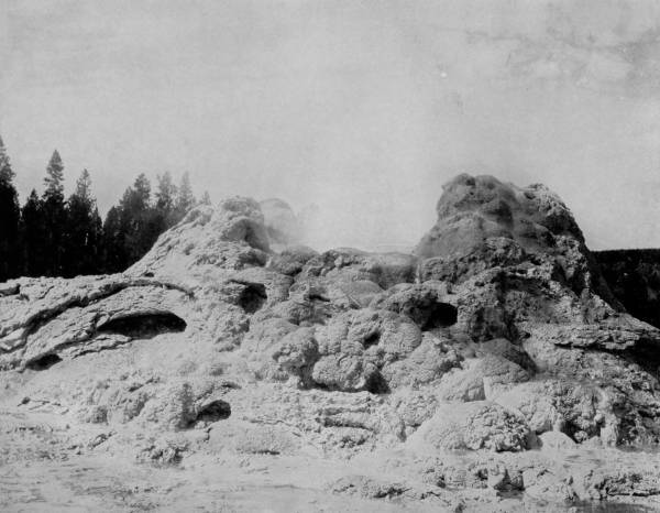
THE CRATER OF CASTLE GEYSER, YELLOWSTONE PARK.—This photograph presents a splendid and accurate view of the crater of one of the most noted geysers of this celebrated locality. The light and conditions were particularly favorable when our party was there, and they thus succeeded in getting one of the finest negatives of their entire series. The formation of the cone appears as clear, distinct and beautiful as if it were standing before us in its natural condition. No painting or engraving can equal such a photograph, in the qualities that make an illustration perfect.
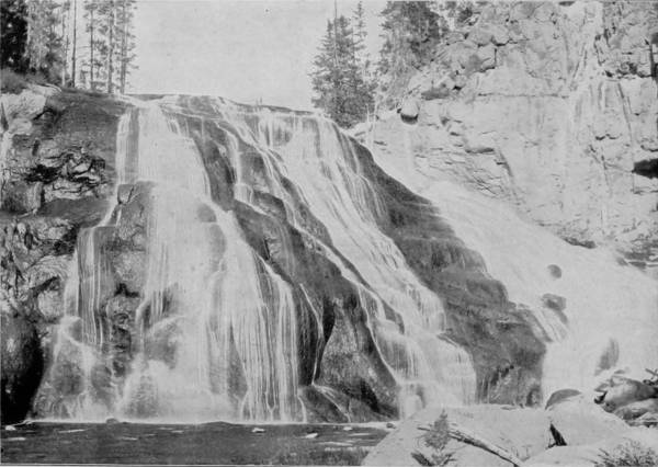
GIBBON FALLS, YELLOWSTONE PARK.
Descending from Mount Washington, we proceeded by the roadway through a deep forest of pines until presently we gained the brink of a frightful chasm nearly 2,000 feet deep, over which the river poured in tremendous force and had a sheer drop of 140 feet. This is the Upper Falls, and a grand nature-picture they compose. But the magnificence of the scene is mightily increased less than half a mile below, where the cañon walls rapidly contract and another greater precipice has been formed. Here the mad waters take a violent tumble of 350 feet, at Lower Falls, and are tossed up again in a mist that sometimes beclouds the valley. But recovering its force, the river plunges on with renewed energy, as the descent increases, until out of the gloomy depths it again emerges for one more final leap of 150 feet, at Tower Falls.
While the falls are of extraordinary interest, they are not more than the worthy accessories of a cañon which, though not the greatest, is in some respects the most sublime of any on the American continent. Mr. Archibald Geikie, an English scientist, has given the following admirable description of Yellowstone Cañon, admirable not only for its graphic picturing, but also because it is an Englishman’s confession that there is something really grand in America:
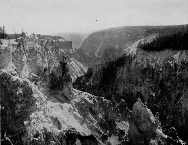
GRAND CAÑON OF THE YELLOWSTONE.—The Grand Cañon is immediately north of the lake, with Tower Falls at its north end and Yellowstone Falls at the south. The photograph presents a fine view from one of the most desirable points, but even a photograph, let it be ever so accurate, cannot give a true idea of the real grandeur of a scene like this. The width of the cañon varies from 200 to 500 yards, and the walls on either side rise to a height of 1200 to 1500 feet, the river winding its tortuous way and plunging over numerous waterfalls at the bottom of this tremendous crevice. The river is transparent as crystal, and reaches a depth of 300 feet at one point.
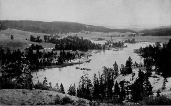
YELLOWSTONE RIVER, NEAR MUD GEYSER.
“Scrambling to the edge of one of the bastions and looking down, we could see the river far below, dwarfed to a mere silver thread. From this abyss the crags and slopes towered up in endless variety of form, and with the weirdest mingling of colors. Much of the rock, especially of the more crumbling slopes, was of a pale sulphur-yellow. Through this groundwork harder masses of dull scarlet, merging into purple and crimson, rose into craggy knobs and pinnacles, or shot up in sheer vertical walls. In the sunlight of the morning the place is a blaze of strange color, such as one can hardly see anywhere save in the crater of an active volcano. But as the day wanes, the shades of evening, sinking gently into the depths, blend their livid tints into a strange, mysterious gloom, through which one can still see the white gleam of the rushing river and hear the distant murmur of its flow. Now is the time to see the full majesty of the cañon. Perched on an outstanding crag, one can look down the ravine and mark headland behind headland mounting out of the gathering shadows and catching upon their scarred fronts of red and yellow the mellower tints of the sinking sun. And above all lie the dark folds of pine sweeping along the crests of the precipices, which they crown with a rim of green. There are gorges of far more imposing magnitude in the Colorado Basin, but for dimensions large enough to be profoundly striking, yet not too vast to be taken in by the eye at once, for infinite changes of picturesque detail, and for brilliancy and endless variety of coloring, there are probably few scenes in the world more impressive than the Grand Cañon of the Yellowstone.” Along the twenty miles of cañon where the walls are highest they have been carved by glacial agencies and weather-worn into many curious forms, generally columnar, but sometimes presenting the appearance of spires, domes, turrets and crenelated battlements, and everywhere the matchless colors of yellow, red, green, and many tints are present. After passing down the extreme length of the cañon, we took the less traveled road running east from Yancy’s Camp and visited the petrified forests; and here we began to comprehend more thoroughly than before the mysteries of the Yellowstone Park Basin. The evidence is here abundant that in the remote past this entire region of 375 square miles was a pleasant vale, where a luxuriant forest abounded, and many monster animals, long since extinct, found a pleasant abode. Following this period of delightful natural conditions, there succeeded a flood of ice that came sweeping with almost unimaginable force from the north, grinding, tearing and destroying until the region was denuded and the very earth furrowed and torn into the wonderful disfigurements which we now behold. In this terrific flood the mountains were precipitated and folded upon the forests and buried with the monster animals that had sought refuge in the spots which became their cemeteries. In the rents thus made the grinding ice flowed until it reached the internal furnace of the world, which generating gases and steam, explosions followed that tore wider the earth’s womb and made the region a fiery cave. Into the devious caverns thus formed water from underground rivers continues to flow, over subterranean fires that convert it into steam, and thus at the many vents we observe the ever active, though constantly waning, energies of the volcano.
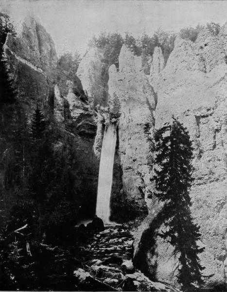
TOWER FALLS, IN THE GRAND CAÑON.—At this point the waters of Yellowstone River spring at one bound over a precipice 156 feet high, forming one of the most beautiful and picturesque falls to be found in any country. The castellated rocks surrounding the falls stand like grim sentinels guarding their beautiful treasure, and have been well and appropriately named, for their resemblance to ancient towers and battlements is so striking as to be recognized at a glance. This is one of the most attractive points along the entire length of Yellowstone Cañon.
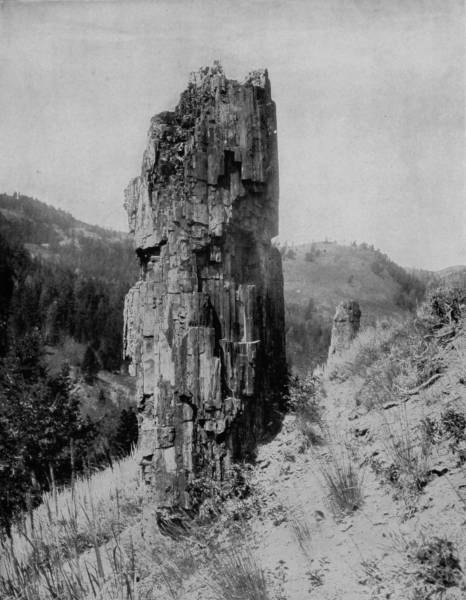
A PETRIFIED TREE IN THE BAD LANDS OF DAKOTA.—In many parts of the Northwest, particularly in the Bad Lands of Dakota and Yellowstone National Park, there are whole forests of petrified trees, partly standing or lying about in promiscuous profusion. A fine photograph of a portion of one of these trees is given on this page. According to the scientific theory, these forests were overwhelmed by the ice-flood many centuries ago, and each tree became, through chemical action, a thousand years or more thereafter, a gem-like pillar of the most exquisite beauty. Petrified remains of gigantic animals that roamed these ancient forests are found in abundance in the same regions.
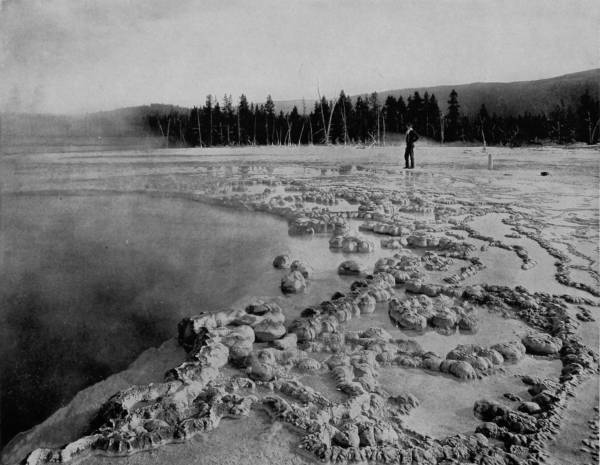
BISCUIT BASIN.—This is one of the most singular as well as beautiful formations in Yellowstone National Park. Terraced overflow basins like this are a most striking feature of the hot springs, and no description can do justice to their beauty, for neither the delicate fretwork of their walls, the frosted surface of the glistening deposit, nor the brilliant colors of the pools can be adequately described. The sides and bottom of the basin are formed of pure white travertine, while the varying depths cause the water to appear all shades between a peacock-blue and a light nile-green. Those who have seen Biscuit Basin will never lose the memory of the vision of beauty that it impresses upon the mind.
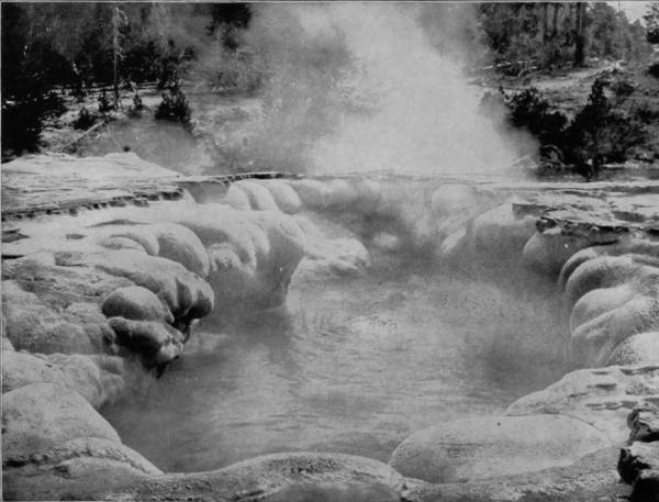
CRATER OF OBLONG GEYSER.
But there have been two glacial drifts over a great part of North America, and the second ice-flood scoured the earth in such manner as to frequently uncover the forests and animal remains that were buried by the first great deluge. It is in the region of the Petrified and Fossil Forests that we note the evidence of the truth of this theory; not only in Yellowstone Park, but in the Bad Lands of Dakota, the dry lake basins of the Southwest and, in fact, in nearly every State of the Union. But in Yellowstone Park the remains of petrified trees are particularly numerous, and it is here that we observe the most beautiful specimens of chalcedony lying about in promiscuous profusion, like the ruins of some magnificent palace. Every tree here, overwhelmed by the ice-flood, became, in a thousand years thereafter, a pillar of the most exquisite beauty, and we now examine them with wondering curiosity, then convert them into articles of use and adornment.
The same chemical action which changed the forests of this region into gem-like stone, also preserved the bones of many huge creatures which met their death suddenly in this volcanic basin. Here and there specimen relics of gigantic animals may be found in the fossil district east of Yellowstone River, though they are becoming scarce because of the immense quantity that has been carried away by scientific bone collectors and the admirers of curious things during the several years that the park has been a popular resort.
In this same district there is a depression or basin, about three hundred yards in diameter, which has received the title of Death Valley, a designation that is appropriately applied because it is not only an ossuary, where the bones of many animals lie about in promiscuous profusion, but such noxious gases emanate from the basin that it is represented as a place where no creature can survive the exhalations for more than a few minutes.
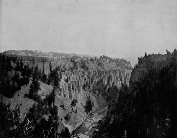
BASALTIC CAÑON OF THE YELLOWSTONE.—The Basaltic Cañon of the Yellowstone is similar in formation to the Giant’s Causeway of Ireland and Fingal’s Cave of Scotland, but not so pronounced in the columnar outlines. It is much more extensive, however, and equally as interesting and remarkable as either of the above-named natural wonders. The erosion of the rocks and the settling of the debris at the foot of the cliffs have shortened the pillars to a very considerable extent, and made them much less imposing than they were originally, but they are still among the most remarkable natural wonders of the world.
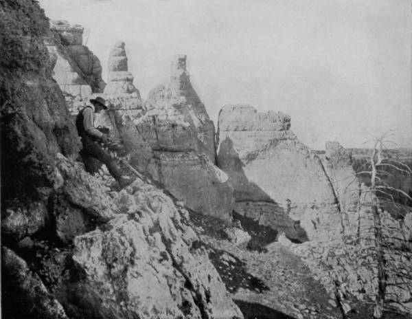
LIMESTONE PINNACLES IN BIG HORN RIVER CAÑON.—The Big Horn River, in its course through Wyoming, passes through as fine a scenic region as can be found in America, or, indeed, in any other country. A fine example of the wild picturesqueness of this scenery is given on this page, where we see turrets and towers and battlements piled one upon the other until they present a view unlike anything else in existence, unless it may be some of the most rugged portions of the famous scenery along the Rhine River, in Germany.
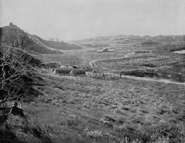
A RANCH ON THE LITTLE MISSOURI RIVER.—Scenes like this are not uncommon in the rich valleys of the Far Northwest, where stock-raising and farming have proved to be even more profitable than mining for the precious metals. Enterprising pioneers, who were attracted to that region by the discovery of gold and silver, have turned their attention to the more certain and desirable pursuit of agriculture, and the green valleys are now dotted with modest homes and thrifty farms, where peace and plenty go hand in hand with happiness and contentment.
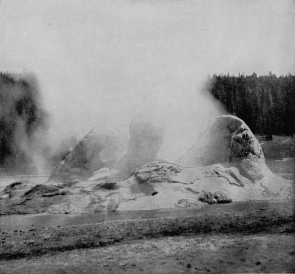
GROTTO GEYSER.
Examination of the remains found therein reveals the fact that bears, deer, wolves, a mountain lion, and numerous small animals have died of asphyxiation in trying to pass over the accursed ground. But as these sulphurous gases have the power to kill, they have also, to a certain extent, the virtue to preserve, the bodies of creatures thus destroyed exhibiting slight evidences of decay for a month or more after death. On account of the danger attending a critical investigation of this noxious plague-spot, those who have visited the place have been compelled to exercise great caution, and to use field-glasses in making their examinations. One rash person is known to have attempted a passage of the basin, but he was unable to advance more than twenty yards, and had he not retained the presence of mind to hold his breath, when he found himself affected by the gas, escape from certain death would hardly have been possible. No scientific investigator has ever visited the spot, so far as I have been able to learn, and reports of the deadly exhalations which characterize it therefore come from the few persons who have approached the place out of curiosity. It is also, and fortunately, no doubt, very difficult to reach, that portion of the Park being almost inaccessible by reason of the rugged topography, the jagged stones and almost impassable crevices which surround it. No roads have been surveyed in the locality, and only the intrepid, venturous and agile can reach the malignant basin, at the expense of great effort and endurance; for it is easier to climb the Tetons than to surmount the grim barriers which guard Death Valley. Assuming that the reports made by several persons who claim to have visited the spot are true, and which there is not lacking reason to believe, an explanation of its deadly character is not difficult to give, because similar conditions, though in much lesser degree, are found in many localities within the Park.
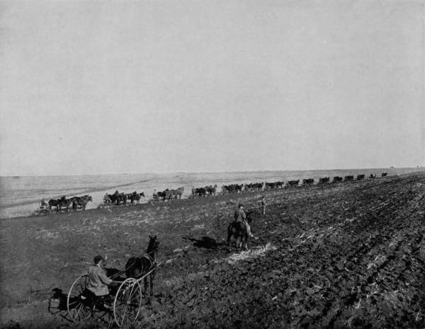
HARVEST SCENE ON DALRYMPLE’S FARM, NORTH DAKOTA.—During the prosperous era of wheat-raising, this was one of the most celebrated farms in the world. It covered an area of 50,000 acres, and both steam and horse-power were employed, not only in plowing the soil, but in harvesting and threshing the grain as well. Fifteen riding plows are to be seen in this photograph, busily at work preparing the ground for the seed.
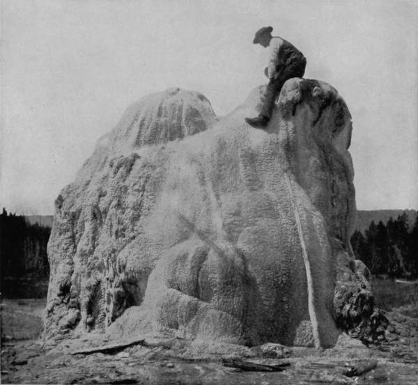
LONE STAR GEYSER CONE.
The geysers, such as are now active, are confined within a district whose radius does not exceed twenty-five miles, but there are unquestionable evidences that they were distributed over a much greater area before the last glacial epoch. Indeed, appearances indicate that at one time, in the very remote past, the whole present extent of the Park was occupied by either a sea of fire or a tremendous cluster of volcanoes. When the glacial catastrophe occurred the mountains on the north, whence the ice-flood descended, were pushed forward and deposited in the fiery basin. By this action the formerly mountainous lands to the north were leveled and became vast plains, as we now find them. The caldron of fiery activity was filled up by the material thus deposited, but confinement of the gases, which were being constantly generated, caused repeated explosions, the results of which we find in the cañons that ramify the district. It will not fail to escape the notice of the geologist that of the many rivers and streams that penetrate the Park, not one of them flows from the north, though immediately south of the Park the Snake River takes its rise, and has cut a way through the Teton Range that must have once opposed its passage. These mountains, as well as other ranges in the vicinity, are a part of the residue carried down by the glacial flood, and thus changed the slope, which was formerly towards the south, to a contrary direction. Several new basins were created by this enormous deposition, for it was impossible, by reason of the eruptions caused by escaping gases, that the deposit should show equal distribution. One of these basins is Death Valley, which, originally a geyser or volcano, was suppressed by the glacial deposit, though the furnace which fed it was not extinguished. The condition is therefore like that of a charcoal kiln, which, burning beneath a covering of earth, still allows the smoke and gases to escape. But since the geysers are not produced by the consumption of combustible material, but by chemical decomposition, though the action of fire and water, no smoke is created and thus none is seen escaping from the valley; but the deadly gases, all the more poisonous because of their temporary confinement, are constantly exuding through the earth-covering, having no connection with any active geyser through whose vent they might escape.
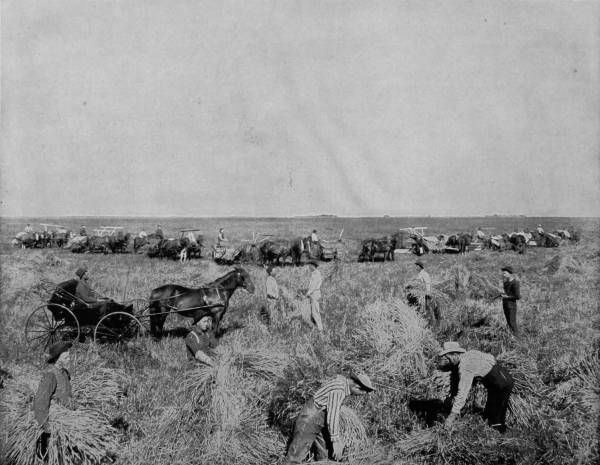
A HARVEST FIELD IN DAKOTA.—Such a harvest scene as this can be seen nowhere else in the world except upon the broad and rich prairies of the Northwest, and in a few localities in California. Eight self-binding reapers are at work in the field so accurately photographed before us, requiring an army of workmen in the proper handling of the golden grain. In California, where the climate is dry and the rain falls only at certain seasons, the harvesting is done with heading machines, and the grain is cut, threshed and sacked all at the same time. But more care is required in the Dakotas, where the rainfall is more frequent and uncertain.
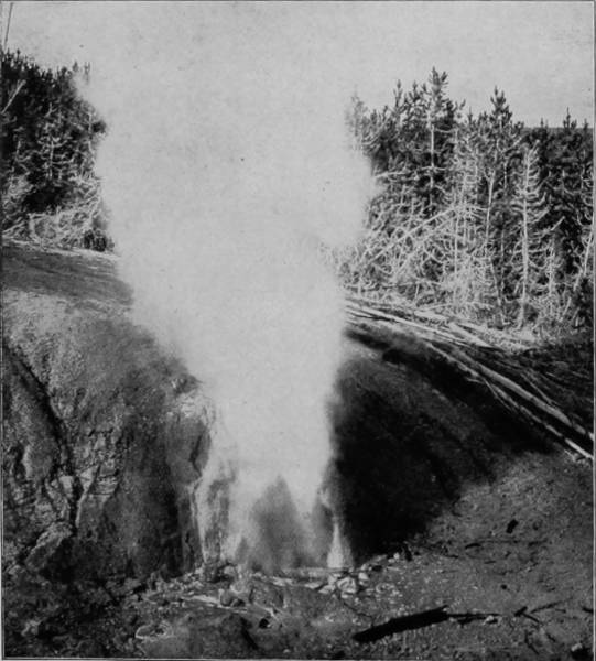
THE BLACK GROWLER GEYSER.
Yellowstone Park has many natural curiosities which entitle it to rank as the greatest museum of wonders in the world; but it is to be doubted if the geysers, formations of silica, and awe-compelling cañons can equal the marvel of Death Valley and the evidence which it supports of the glacial deluge that converted a sea of fire into a charmingly diversified wonderland. There is a grim connection between the fossil district in which the bones of so many extinct animals have been found so plentifully, and Death Valley, in which the remains of existent creatures attest the continued destructive result of the ice-flood. Truly, the ways of Providence are ways of mystery; and the more we contemplate them to satisfy the ambition of curiosity, the more we realize the incomprehensibility of the infinite, and that every advance step is an interrogation point in our lives.
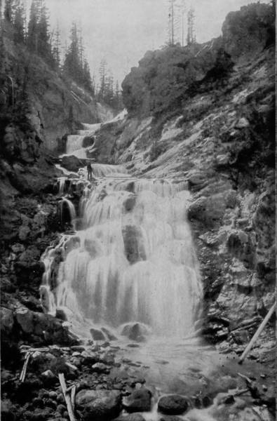
LITTLE FIRE-HOLE FALLS.
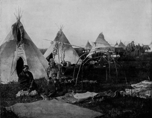
AN ENCAMPMENT OF SIOUX INDIANS, DAKOTA.—This is a war-camp of Sioux Indians, photographed during the hostile era of Sitting Bull and his band of desperadoes. It shows the camp deserted by the warriors, and left in charge of the women, children and old men. Photographic reproductions of such scenes become more interesting and valuable as time goes by, for they will never again exist in reality. The hostiles have been driven to the Government reservations, and the places once occupied by their villages, and the prairies over which they roamed in quest of game or the trophies of war, are now covered with homes, farms and cities.
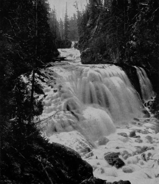
KEPLER’S CASCADE, FIRE-HOLE RIVER.
After making an examination of the petrified and fossil forests, we retraced our way and returned to Mammoth Hot Springs Hotel by the road that leads to Clark’s Fork Mines, a route which I cannot recommend to dyspeptics, for it is worse than a jolting stool. A few hours’ stop at the hotel to arrange our baggage, and we resumed our journey eastward over the Northern Pacific, which thereafter runs through the apparently boundless plains of North Dakota. The road follows the Yellowstone from Livingstone to Glendine, a distance of 175 miles, but there is little diversity in the landscape on the immediate line. Big Horn River intersects the road at Custer City, below which town, twenty miles, on the river, is Fort Custer; and the tragic field upon which Custer and his entire command were slaughtered by the Sioux Indians is only twenty-five miles southeast of the fort. Everything hereabout appears to be a rueful reminder of that terrible 15th of July, 1876, for the name of Custer greets us everywhere we turn until we get beyond Miles City. Between this latter point and the Missouri River are the Bad Lands, extending over a large tract of country that includes both Montana and Dakota, but the formations, while curious, are not nearly so wonderful as those in Wyoming, described in an earlier chapter. Although the mounds, monuments and pillars of earth are less lofty, the district acquires a particular interest from the fact that interspersed among the earthen columns are the erect bodies of petrified trees, scarcely distinguishable, at a little distance, however, from the fantastically eroded monoliths that are disposed like skirmishers over the otherwise level plain. These so-called Bad Lands, which reappear also in South Dakota, are not what the term would seem to signify for the land is not lacking in fertility, being frequently rich with loam, though more often extremely sandy or covered with soft sandstones that have been worn until they are round as cannon-balls. Indeed, Cannon-Ball River, which flows into the Missouri sixty miles south of Bismark, takes its name from the numerous round sandstones that are scattered along its banks. Five miles below is Standing Rock Agency of the Sioux, so called from a sandstone which stands some three feet tall, and by the Sioux is believed to be a petrified squaw. Thus for a considerable distance north and south, as well as east and west, peculiar formations characteristic of the Bad Lands are met with, furnishing proof that this area was once a forest, later a great salt sea, and then a plain, each representing a long period of time.
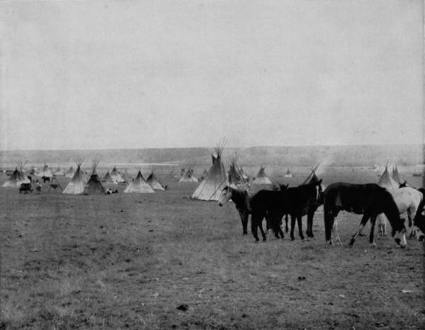
BLACKFEET INDIAN CAMP.—The Blackfeet were at one time the most powerful rivals and antagonists of the Sioux, even surpassing them in cunning, bravery and the slight advances which they had made in the art of constructing their villages. The wigwams in this photograph are more artistically erected than those of the Sioux on page 283; they are also arranged with more order and regularity, and seem to possess a larger degree of comfort, all of which are to be accepted as evidences of advancement along the lines of civilization and superiority in manhood. But the Blackfeet, as well as the Sioux, have been driven to their reservations, and they will never again appear as a powerful and independent tribe.
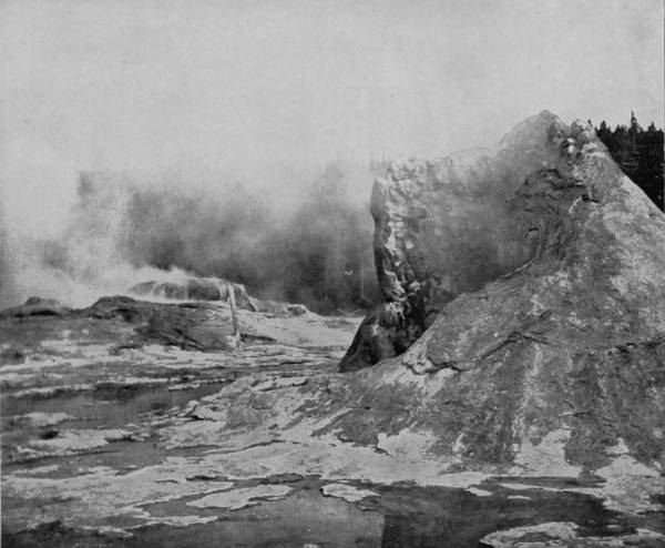
GIANT, CATFISH, AND YOUNG FAITHFUL CONES.
When we pass Jamestown, coming east, we enter the wheat belt of Dakota and pass fields of growing grain like that of Dalrymple’s, which is fifty thousand acres in extent. Here we come in contact with farming on a gigantic scale, and see the application of steam, not only for threshing, but for plowing, hauling and various other uses in which horses are generally employed.
Thence on to Minneapolis the route is through a level country, crossing the Red River of the North at Fargo, and by many pretty lakes to Brainard, where the road branches, one division leading to Duluth, and the other taking a southwest course to St. Paul.
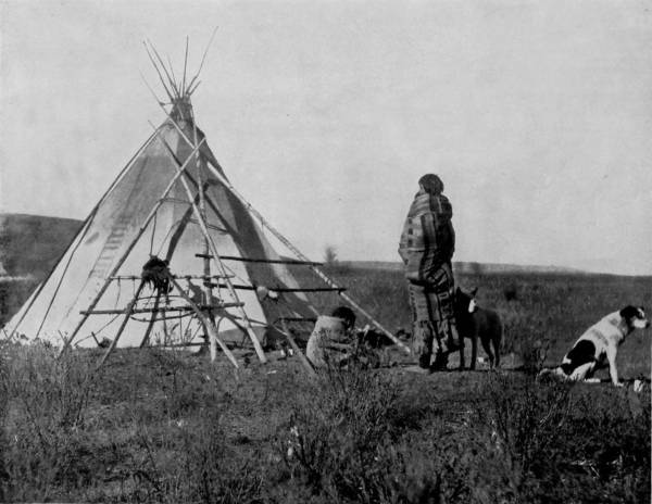
PRAIRIE HOME OF A CREE INDIAN, NORTHERN MINNESOTA.—The Cree Indians are a small and constantly decreasing tribe. They have no record as great warriors, like the Blackfeet and the Sioux, but they seem to have held a secondary position throughout their entire history, so far as we have any information concerning them. Their villages were never so large and populous as those of other tribes, and their existence seems to be a dreary and unprofitable one. A more desolate home than the one photographed on this page could hardly be imagined. Even the dogs seem to regret that they were born.
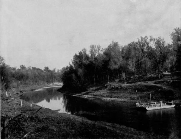
FERRY ACROSS RED RIVER OF THE NORTH AT FARGO.—Red River of the North is a remarkable stream, because of its extreme narrowness, tortuous course and great depth. A few years ago there was a line of packets running on this river between Fargo, and Winnipeg, Manitoba. They did a very large business during the summer season, and assisted materially in settling up a large section of country rich in soil and mineral tributary thereto. The stream is so narrow, however, that two boats were unable to pass each other except at particular points where the banks were cut out for that purpose. It was like a single track line of street railway with turnouts. The ferry scene indicates the river’s width at Fargo, which was the southern terminus of navigation.
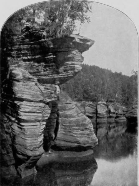
DELLS OF SIOUX RIVER.

Soon after reaching St. Paul our party divided, two of our photographers being instructed to take views of the falls, lakes and river-scenery thereabouts, while the other set out with the camera car, over the Chicago, St. Paul and Omaha Railroad, to Sioux City, and thence by the Fremont, Elkhorn and Missouri Valley Railroad to Deadwood. There is nothing of particular interest to entertain the traveler in search of scenic wonders until Iowa is crossed and we reach the Big Sioux River; nor is the immediate district about Sioux City one affording scenery of much importance. But at Dell Rapids, something more than one hundred miles north, we come in contact with some surprises which are without example, save in the Wisconsin River, hereafter to be described. The town derives its name from the remarkable freaks of nature displayed along the river-banks, and known as the Dells, and which are recognized as the safety-valves of the immense water-power at Dell Rapids. This picturesque stretch of fantastic bluffs and eccentric stream is thus described by a writer who recently made the passage in a canoe from Dell Rapids to Sioux Falls.
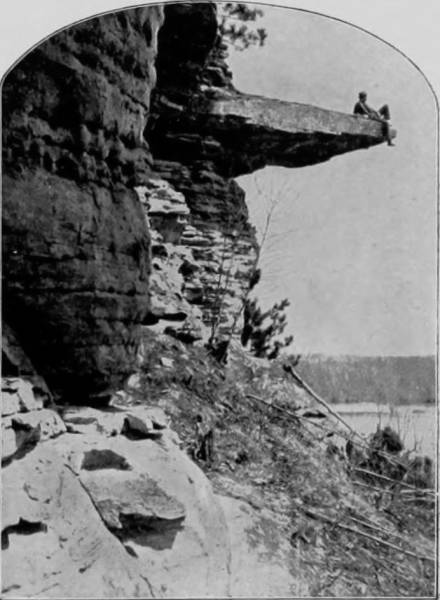
LOVER’S LEAP, DELLS OF THE SIOUX.
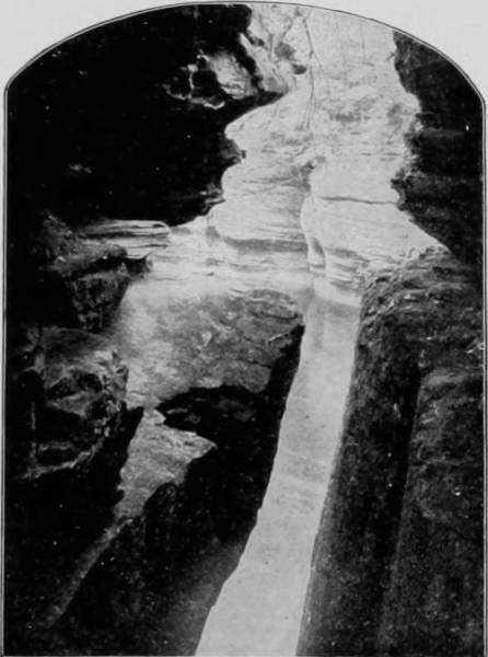
THE DEVIL’S NOTCH, DELLS OF THE SIOUX.
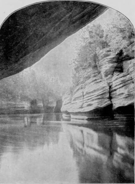
DANGER ROCK, DELLS OF THE SIOUX.
“Beginning at a break in the Big Sioux River, on the south bank, opposite the town, at first the Dells present the appearance of a rivulet flowing out of the main body of water, taking a circuitous direction to re-unite with the parent stream some two and one-half miles further along its eccentric course. Yet only in the highest stages of its waters does the Sioux overflow the dam across the aperture between itself and the Dells, and it becomes instantly apparent that it is not from the river that this peculiar branch, which is not a branch, obtains its water supply. Investigation determines that the Dells are fed by invisible springs, indefinite in number and indefinable in volume, which maintain in the bed of this curious stream an average depth of about eleven feet, although a much greater depth is found in various places. As you progress along the banks of the Dells, you notice increasing accumulations of the well-known Big Sioux quartzite, in its dull red and leaden colors; the banks grow more and more precipitous; the rocks are heaped strata upon strata in immeasurable quantities, and take on fantastic shapes and unusual formations; the Dells deepen into a gorge, far down into the bottom of which the waters taking their hues 290from the sky above them, creep along in almost imperceptible ripples. Overhead, pile on pile, hangs the rugged quartzite, shelving out over the liquid blue beneath; in the sides of the rocky banks innumerable swallows build their nests, while above them shrubbery clings and cacti grow, seemingly nurtured in a soil of adamant. Perhaps the highest perpendicular point, from the summits of the overhanging rocks to the waters below, is very nearly forty-five feet; but so precipitous is the descent, and so grotesquely wild the aspect, that it is no wonder the majority of tourists report the height much greater. Descending a fissure, gazing down which descent seemed impossible, the writer pushed off in a rude canoe and paddled for some distance under the overshadowing banks. Here, indeed, looking upward, the impression was intensified, for upheavals had torn these banks apart and given to them, with whimsical violence, their strangely weird formations.” Beyond Sioux City the country is monotonously level until, far in Nebraska, the road rushes into Elkhorn Cañon and passes for a considerable distance between walls sometimes vertical, but never very high, and which lack the grandeur and coloring that characterize those of mountain streams. Emerging from Elkhorn Cañon, the road runs for a long distance through the Niobrara Valley, though never close to that stream, until it crosses the river at Valentine. The southern line of South Dakota lies only a few miles north, and from Valentine west the road approaches to within twenty-five miles of the Rose-Bud and Pine Ridge Reservations, and of Wounded Knee, the scene of the last Indian insurrection, and of Pine Ridge Agency, where Sitting Bull was killed. Crossing White River at Dakota Junction, the road turns due north, and passing out of the plains of Nebraska enters the mountainous country known as the Black Hills, at Buffalo Gap. On the east are the Mauvais Terres, or Bad Lands of South Dakota, which extend west to the South Fork of Cheyenne River, while towards the west is the rugous, rough and riotous district known as the Black Hills. At Buffalo Gap connection is made with a narrow-gauge spur of the main line of road, which runs southwesterly a distance of fifteen miles and terminates at the Minnekahta, or Hot Springs. In making this run we pass through a mighty gorge whose age-swept and vertical walls climb up, stratum upon stratum, to a height of several hundred feet, and then break into spear-pointed peaks, called the “Needles.” This is Fall River Cañon, noted for its spires, parti-colored walls, and beautiful waterfalls that leap from a hundred brinks into the arms of the rushing river. That this is a land of gold is not better proved by the fact that the Black Hills were purchased of the Sioux by the Government in 1876, at the enormous price of $70,000,000 and support of the Indians for seven generations, than that the output of the several gold and silver mines of the district exceeds $100,000,000; verily, a richer land than Ophir.
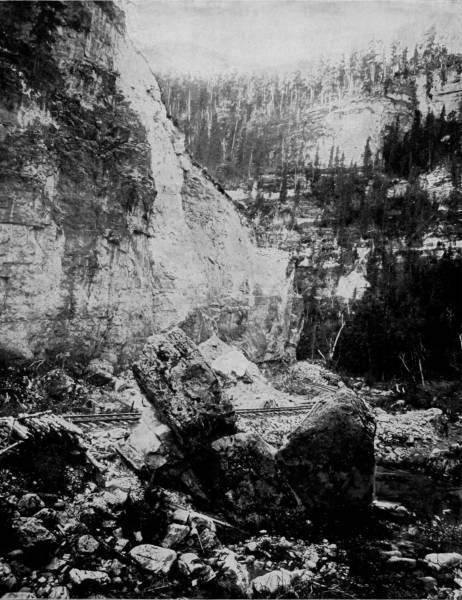
SIGNAL ROCK, ELKHORN CAÑON.—The wild turbulence of nature that distinguishes the scenery in the Black Hills district of Dakota is handsomely represented in this photograph. In Elkhorn Cañon the walls are some distance apart and only occasionally vertical, but there is rugged, tumultuous chaos in the cañon that interposed great difficulties to the engineers who built the railroad through it. The bluff on the left of the picture rises to so great a height that from its summit Indians could signal, by means of fire, a distance of nearly one hundred miles, whence its name.
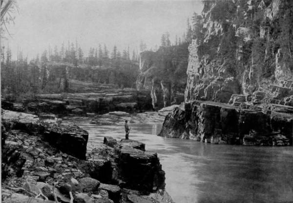
CABINET GORGE, DELLS OF THE SIOUX RIVER.
Turning back, we resumed our journey northward over the Elkhorn road, and passed through many miles of the most magnificent scenery to be found anywhere on the American Continent. The entire region is mountain infested, and to penetrate it by rail the road is compelled to follow the almost interminable sinuosities of creeks and broken valleys, with tunnels every few miles, and bridges quite as frequent. Through Fan-Tail Gulch the road winds in tortuous ways that sometimes draw grotesque figures, and in one place the road-bed is of the exact shape of a horseshoe, while on both sides of Elk Creek Cañon there are butting and pinnacled walls that suggest ruins of gigantic cathedrals, or monuments in a graveyard of Titans. Everywhere we turn there is the carving and hieroglyphic writing of the glacier and the volcano that in some age wrestled with the rocks and left them in a confusion of whimsical forms. Particularly is this true of Elk Creek Cañon, which presents many curious bluffs and isolated shafts of stone, worn into monoliths of oddity by wind and water.
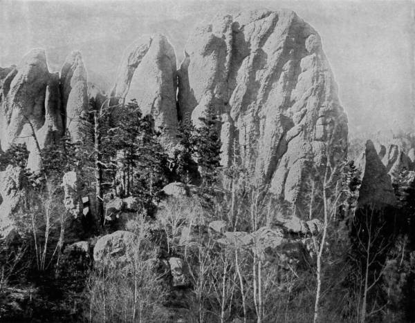
NEEDLE POINTS, NEAR HARNEY’S PEAK, BLACK HILLS.—These remarkable formations are prominent among the scenic wonders of the world, and if they were located in some older country and connected with legendary or historical incidents, would attract crowds of admiring tourists from the four quarters of the earth. These whimsical creations of the centuries, exhibiting as they do the severest contortions of nature, are remarkable, even to the point of being almost startling, but they are surrounded by, and are in the midst of, so many other tremendous upheavals, that they do not attract the attention which they deserve.
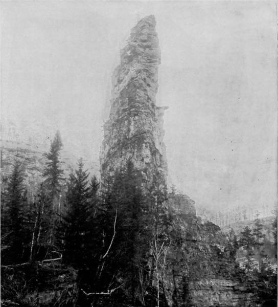
CATHEDRAL ROCK, IN ELK CREEK CAÑON, BLACK HILLS.
After passing Piedmont the region is less rugged and gradually falls away into a plain, dotted here and there with buttes of clay, some of them reaching a height of fifty feet, and in the distance resembling large buildings. Fort Meade and Bear Butte are on the right as we make a turn towards the west, then run south, until we enter Deadwood, which lies at the gnarled and bunioned feet of the Hills. We have scarcely been out of a cañon since leaving Hot Springs, but at Deadwood the granite walls that have become so familiar slope away until they become hills of slate and red clay, which have been denuded of their vestures of pine to supply fuel for the reduction mills. Through one of the last rifts in the walls that confine the track of the railroad a glimpse of Central City is obtained, several miles away, and a few minutes later we roll into the great mining town that is celebrated for its wealth, energy, golden prospects, and as being the place where Wild Bill was killed, and Calamity Jane broke the biggest faro bank in the settlement. Though Deadwood is only sixteen years old, few cities have passed through so many terrible vicissitudes. In 1876 the gold prospectors in the Hills were harried by Indians; then when the district was purchased and active settlement began, gamblers and shady women flocked to the place, considering that every honest person was legitimate prey, until the vigilantes restored order. Building was rapid, so that three years after the miners staked their first claims in the Hills, Deadwood had become a place of 5,000 inhabitants and was rapidly flowering into a great city. Then a dreadful fire broke out, which ravaged and swept the town, leaving scarcely a house uninjured, and nearly every citizen homeless. The loss was estimated at $1,500,000, but in its effects the loss was probably twice that amount. But with that courageous energy which characterizes western settlements, the people went to work to rebuild before even the embers had turned to ashes, and by 1883, Deadwood was a second time showing a metropolitan bud. She had emerged from the crucible, but fate had resolved that she should be subjected to another ordeal. Accordingly, the elements gathered their forces all around upon the mountains and in the gulches. For weeks unprecedented snow-storms bombarded the country and covered it to an extraordinary depth. Then the windows of heaven were opened and the rain descended. Day and night a terrific down-pour continued, followed directly by a flood that struck the town from every direction, and with irresistible might washed nearly every building from its foundation, leaving even small opportunity for the unhappy people to escape to the hills. But though the town was twice destroyed, the citizens lost none of their pluck, and before the cruel waters were fully assuaged they resumed the work of building again on the same twice stricken site, and have so continued until Deadwood is fortified against calamity and is moving on at the head of the procession, with colors flying and drums beating, the capital city of a capital country.

THE SUMMIT OF HARNEY’S PEAK, BLACK HILLS.—This famous and picturesque mountain peak derives its name from the gallant old hero, Gen. W. S. Harney, who won fame and glory in the battles of his country with Mexico and the red warriors of the West. It was principally through his firmness, bravery and wisdom, aided by the confidence which the Indians reposed in his integrity, that the hidden treasures and scenic wonders of the Black Hills were delivered up to the white people. It is said that the Indians who formerly occupied this region frequently exchanged gold nuggets and gold bullets for leaden ones of the same weight, so abundant was the yellow metal in some portions of their country—a statement, however, which lacks confirmation.
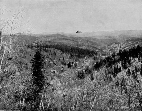
VIEW OF BEAR BUTTE, AT A DISTANCE OF FORTY-SIX MILES FROM THE ROAD, IN FAN-TAIL GULCH.
There are many interesting points within a few miles of Deadwood; for aside from the rugged character of the scenery, in the near vicinity are several of the largest wealth-producing mines in the world. The trip to Bald Mountain over the Fremont, Elkhorn and Missouri Valley narrow-gauge Road is one filled with pleasure and surprise. The way is almost incomparably winding, and exhibits remarkable examples of engineering skill and enormous investment. In several places the grade is four hundred and thirty feet to the mile, while the curves are said to be of one hundred and fifty feet radius. Passing up such grades and around such sharp turns, it is not so surprising that the train should in one minute be running along lofty benches, apparently in mid-air, over dizzy trestles, and in the next few moments be scurrying through a valley so deep that sunlight rarely ever visits it. North of Bald Mountain, and reached by a stage-line, are Crow Peak, Round-Top Mountain, and the town of Spearfish. This latter place is located on a creek of the same name that goes tumbling through a deep cañon with vertical, serrated walls, and diversified by roaring cascades and far-leaping waterfalls. Returning to Deadwood, we took the Burlington and Missouri River Railroad south through another long stretch of turbulent scenery, of rushing creeks, darksome gorges, under the shadows of lofty mountains, and by curious formations. Custer Peak is only two or three miles east of the road, and it is the center of a riotous region of broken stone, each one a very mountain of itself. Below, we strike Spring Creek, and go bowling along the valley cut out of the bills by that stream, until Harney’s Peak breaks into view, five miles to the east, and lifts its piney crest into the azure depths 8,000 feet. Hereabout are not only waterfalls, cañons, creeks, and huge bowlders dashed down from frost-riven peaks, for besides gold and silver, the region is said to abound with tin, that peculiarly elusive mineral which, though often found, seems to always dematerialize after the campaign is over; and though millions have been spent in developing the tin mines near Harney, the product has not yet paid the expense of mining. Three miles south of the peak are the Needles, bold-jutting pinnacles of sandstone that stand high above the bed of Squaw Creek and point their fingers toward the sky. Buckhorn Mountain stands very near the west side of the road, and close to its base reposes the town of Custer, the center of a broken district called Custer Park, famous for its scenery of river, tumultuary and distorted rocks over which a weasel can hardly make its way. A little further south we enter Red Cañon Creek, where the same general character of eroded and disrupted rocks continues, with occasional exhibitions of oddity exceeding those previously seen in the Hills. Evidently some terrific force has been at work in this uncanny region, for here and there our wonder is excited by extraordinary instances of displacement. Beecher Rocks are comicalities done in stone, but Wedge Rock must wear the garland as the most astounding example of natural tumult in this wonder-region, and which can be better understood by the accompanying illustration, than explained by the bare use of words.
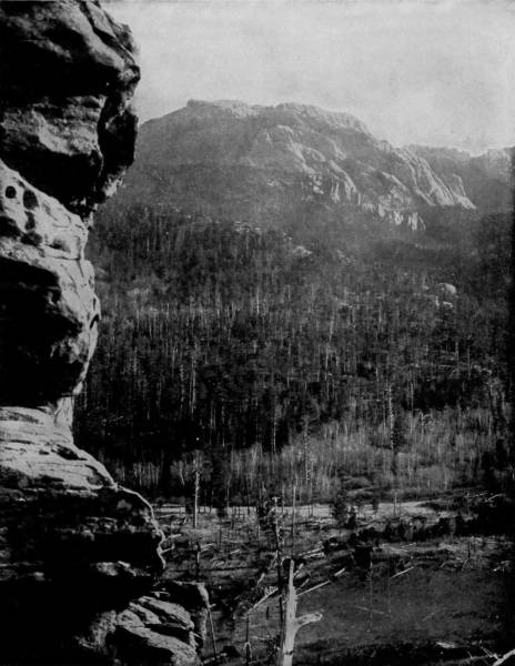
HARNEY’S PEAK, BLACK HILLS.—A general view of this famous mountain from the valley where this photograph was taken does not show the wonderful formations of the rocks on its summit and sides so well as closer special views do; but it is sufficiently picturesque to be entitled to a place in this representative work on American scenery. The picture, however, exhibits the extent and magnitude of the mountain, whose head is raised high above the timber line, in the region of perpetual snow.
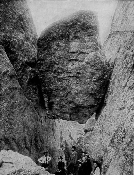
WEDGE ROCK, NEAR CUSTER CITY.—This immense rock, weighing thousands of tons, found a lodgment, where it is photographed, after a terrific plunging descent from near the top of the mountain, whence it was riven by some mighty convulsion. The path of its terrible fall is still discernible, in seams and abrasions on the face of the mountain, and in contemplating it one cannot refrain from regretting that he was not present to witness such an awe-inspiring and dreadful exhibition. It was a scene which might have frightened even the imperturbable gods of the hills.
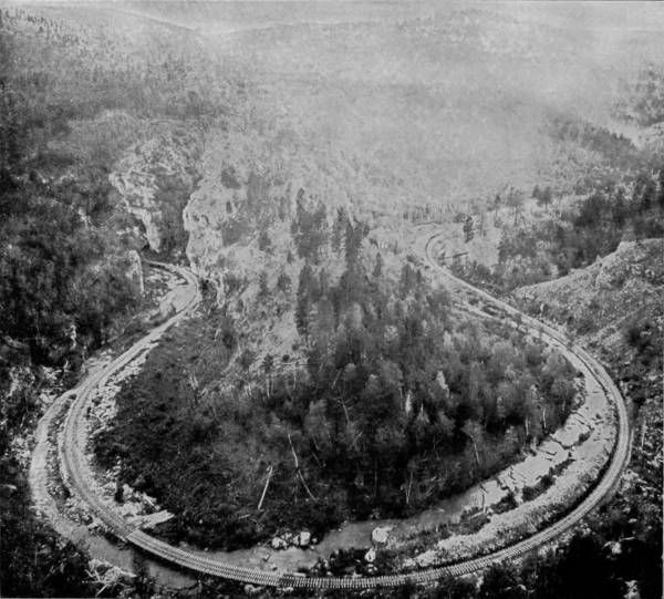
THE HORSESHOE IN ELK CREEK CAÑON.
But the country is not only rugged and mountain-spurred; it possesses curiosities even greater beneath the surface than those which diversify the sun-kissed landscape over which we have just passed. On Elk Creek, and entered from the cañon wall, is Keith’s Crystal Cave, a colossal rent in the mountain bowels, with passages fifteen miles in length. It is beautifully chambered, from which depend the most exquisite crystallizations in the form of stalactites and stalagmites that reflect the torchlight in glorious colors, dancing from column of onyx to pools of pellucid water.
But a more remarkable cave than Keith’s is found a little way west of Custer, and twelve miles north of Hot Springs. This marvelous natural excavation is ramified by many passages which have been explored for a distance of sixty-five miles, and the end is not yet. On account of the peculiar respiration of the cave, the air at one time rushing in with great velocity and again being expelled with equal force, it is called the Wind Cave; and no better name can be bestowed, for the cause of this inrushing and regurgitation of air seems to be beyond ascertainment. Like its more northerly cousin, Wind Cave is chambered and adorned with beautiful crystals that shimmer under the glances of the torch and are set aflame with color, with here and there such graceful formations as to suggest studios of monster sculptors.
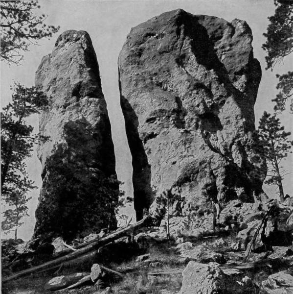
BEECHER ROCKS, NEAR CUSTER CITY.
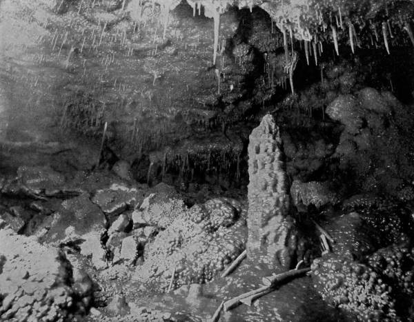
A CHAMBER IN CRYSTAL CAVE, BLACK HILLS.—This wonderful subterraneous chamber is becoming more celebrated in many respects than the famous Mammoth Cave of Kentucky, beautifully photographed and described in later numbers of this work. Crystal Cave has been explored for a distance of sixty-five miles, and the end is not yet discovered. It has a marked peculiarity in its regular respiration or breathing, like a living thing; the air at stated intervals rushes in with great velocity, and is again expelled with equal force. Its chambers are halls of stalactitic splendors, almost rivaling those of the Luray Caverns.
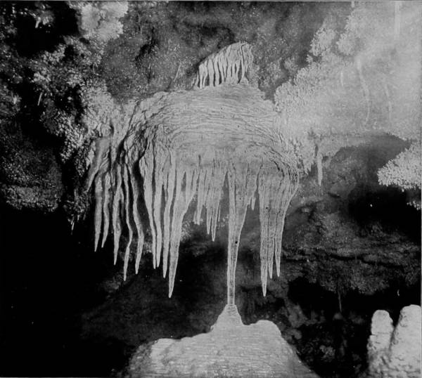
THE CHANCEL, CRYSTAL CAVE, BLACK HILLS.
Continuing our way southward to the junction of the Wyoming Division, in Fall River county, we turned north on that small branch whose temporary terminus is Merino, at which point a team was engaged to take us to what is truly one of the seven wonders of the world. In our trip of several thousand miles through the mountainous regions of the great West, we had seen and photographed many extraordinary and startling prodigies of nature, so that all sentiment of awe, surprise and admiration had been aroused, but we were now to be confronted by a miracle in stone that confounded and mingled all feelings of wonderment and fascination into stupefaction of bewildered senses.
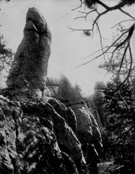
DEVIL’S THUMB, CUSTER PARK, NEAR CUSTER CITY.—This grotesque formation is weird enough to be in fact the thumb, or the toe, or any other member of his Satanic majesty’s supposably ugly and immeasurably immense body. Suggestive of evil power as it may be, the Thumb is surrounded by other petrified imps of darkness, scarcely less uncanny and frightful in appearance, indicative of nature in her wildest mood.
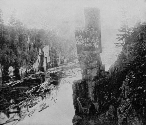
THE DEVIL’S CHAIR, ST. CROIX RIVER.
We had to travel about twenty-five miles across a fairly level stretch of country before reaching the Belle Fourche River, a main branch of the Cheyenne, on the west bank of which is located this marvelous monument of the ages, which for its astounding size and unaccountable formation is called the Devil’s Tower. Among the Sioux Indians, who have always regarded it with superstitious dread, it is known as the Mateo’s Tepee, signifying the Bear’s Lodge, and was by them supposed to be the haunt of a were-animal, who possessed the power of becoming a bear or man at pleasure. The country within a radius of fifty miles is slightly broken by high table-lands, but there is nothing to indicate any special spasm of nature by which so great a freak might have been formed; yet out of this undulating expanse of landscape suddenly rises a stupendous obelisk of vitrified stone, to the amazing height of eight hundred feet. The base, which measures 326 feet at its longest diameter, is 400 feet above the river-bed, which in turn is 500 feet above sea level. Thus measured, the peak of this amazing tower is 1,700 feet above the sea; no surprise therefore that it is visible for a distance of forty miles. But the wonder which such a colossal shaft naturally excites is immensely increased by the fact that the Devil’s Tower is a composition of huge crystals of basalt, or volcanic rock, which lie in columns some three feet in diameter, and continue unbroken from the base to the peak, giving to it a fibrous appearance. The walls are almost vertical, with a slightly vertical slope, to give it a more graceful contour, and though there are occasional rifts in the sides, no human being, however skilful as a spire-climber, can ever accomplish its ascent.
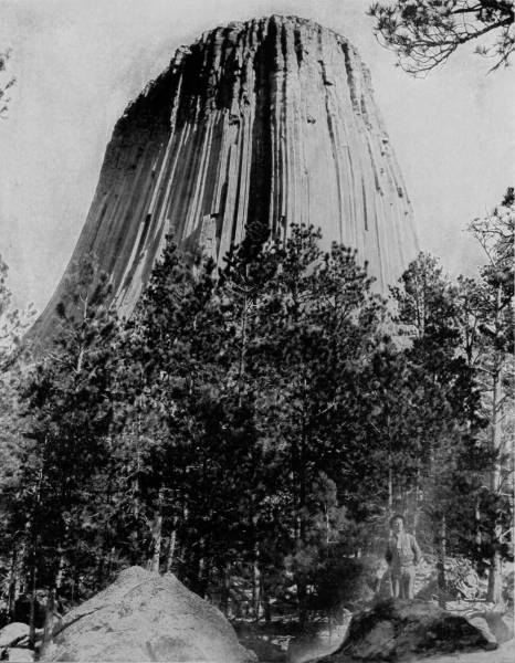
THE DEVIL’S TOWER OF VITRIFIED ROCK, 800 FEET HIGH.—This unparalleled curiosity, the most wonderful formation of the kind in the world, is situated on the bank of Belle Fourche River, in Northeastern Wyoming. It has a base of only 326 feet, and towers to the amazing height of 800 feet above the level plain on which it stands. A full description of this marvelous wonder is given in preceding pages, also an account of the author’s visit to it, when it was specially photographed for Glimpses of America.
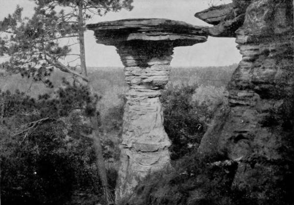
TEA-TABLE ROCK, WISCONSIN RIVER.
The enquiry is irresistible: “What wondrous force created this petrified monster of the Wyoming table-lands?” One plausible answer may be built upon the theory that here, at one time, was the bed of an ocean, a supposition supported by such evidences as the finding of sea-shells and bones of extinct sea-creatures all about over the ground, and deeply embedded in the earth throughout the section. When the waters receded, this inequality, which might have existed as an island, was left as the product of volcanic action. But a yet more reasonable cause may be found in the supposition that along the Belle Fourche was the center of intense volcanic energy sometime during the very remote past, during which period the spot occupied by the tower was a volcano-vent out of which poured lava in such a slow and steady flow that it deposited in basaltic columnar crystals at the apex. Thus gradually it grew in size and height, like many of the formations in Yellowstone Park, until the volcano had expended its force and left this vast monument as an everlasting evidence of its persistence through centuries of activity. But however it was formed, the Devil’s Tower takes a place in the first list of the world’s greatest natural wonders, and it deserves to be much better known than it is.
Returning from a long and very wearying ride to the Tower, we again took the Burlington Road, retracing much of the way we had come, and proceeded to Crawford, Nebraska, in order to view two famous curiosities known as Crow Butte and Signal Rock, which are near that town. Fort Robinson post and military reservation are a mile west, on White River, and the country is picturesque with buttes, which rise out of the prairie lands in singular impertinence and unseemliness, while considerable bluffs confine the river. The territory was for many years the scene of bitter strifes between the Sioux and Crow Indians, who reddened nearly every acre of the ground with their blood, and left remembrances of their occupancy and incidents of their adventures in names which they gave to a hundred points in the near vicinity of Crawford. South of the town, about five miles, a conspicuous object in a wide range is Crow Butte, a titanic elevation of stone, nearly two hundred feet in height and several hundred yards in circumference, with vertical walls on all sides except one, in which there is a winding-way by which a horseman may ride to the top. The legend is told that on one occasion a party of Crow Indians were so savagely pursued by their old enemies that they took refuge on the top of Crow Butte, where, though much fewer in number, they so valorously defended the narrow roadway that the Sioux were driven back each time they attempted to gain the summit. Being unable to dislodge them, the Sioux resolved to besiege the Crows until starvation compelled them to surrender. For several days and nights the siege continued, until at length hunger drove the Crows to a desperate expedient. Watching their time, when the night was darkest, they killed some of their ponies, and converting their hides into lariats, lowered one after another of their number to the ground below on the opposite side of the butte, until all but one old Indian had been safely delivered, who was left a while to keep the camp-fire burning. On the following day the old man came down and surrendered himself to the Sioux, and related to them the wonderful means by which his comrades had escaped. Instead of killing him, as might have been expected, on this one occasion the Sioux magnanimously gave him his liberty as a recompense for the loyalty and bravery which he had exhibited.
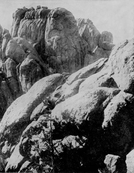
DOME ROCKS IN CUSTER PARK, SOUTH DAKOTA.—In this photograph we have another striking example of the curious and wonderful natural formations of this locality, one of the most remarkable scenic regions in all the world. These rocks seem to have been built by human hands and fashioned with a purpose into all sorts and shapes of grotesque and gruesome figures, and yet it would be impossible for human hands to mold such wonders. Nature, in one of her spasms, brought them forth, and imprinted upon their face the agony of her travail.
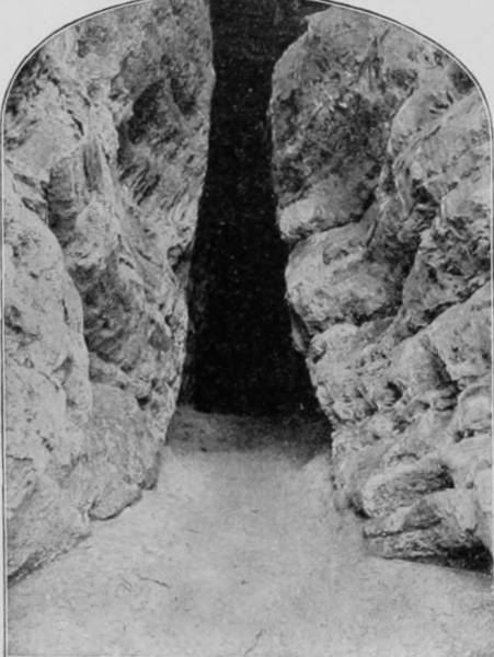
SQUAW’S CHAMBER, DELLS of the WISCONSIN.
Signal Rock is only a short distance from Crow Butte, and is a similar formation, though not nearly so large; and while the summit is nearly as high, it is peaked and not difficult to reach. It derives its name from the use to which it was frequently put by the Indians in previous years, who by means of fire at night were able to signal to their friends as far away as the Bad Lands of South Dakota.
The Fremont, Elkhorn and Missouri River Road crosses the Burlington at Crawford, and our work of photographing the Black Hills district being completed, the trip back to St. Paul was made, and a junction with other members of the expedition was formed, whose artist labors have already been described.
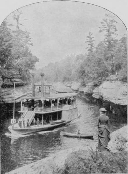
THE NARROWS, DELLS of the WISCONSIN.
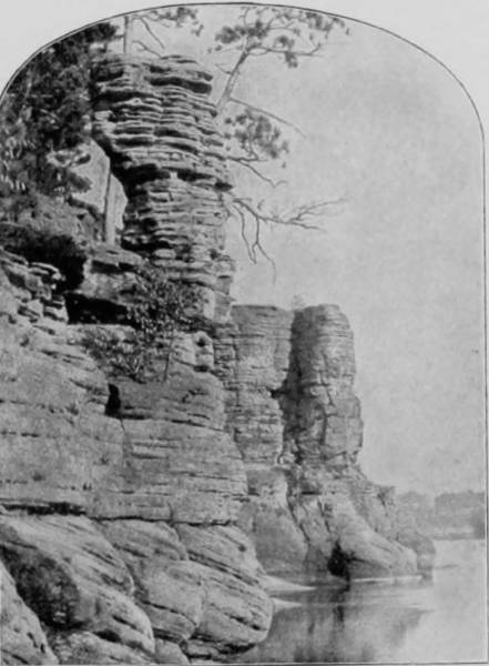
CASTLE TOWER, DELLS of the WISCONSIN.
The twin cities of St. Paul and Minneapolis represent the intrusion of civilization upon the primeval lands of romance, and thus while we admire the imposing wealth and architectural beauties of these great metropoli, we cannot avoid a feeling of semi-regret that they have grown at the expense and sacrifice of some of the most charming natural wonders that first attracted public interest to the vast Northwest. The head of navigation on the Mississippi is unalterably fixed at St. Paul, for above that point the river is a brawling stream, flowing over ledges and rushing through contracted passages lined with bluffs. At Minneapolis are the Falls of St. Anthony, but no longer do these present the furious aspect which once characterized them, for the wild riot of turbulent waters that formerly went dashing over a high brink with a roar that made the shore to tremble, have been harnessed, and are now driven over sloping tables so as to glide softly into the bed below. The channel, too, has been cut and buttressed with masonry, so that the strong right arm of the falls is made a servant of commerce in supplying the motive-power for many immense flouring mills.
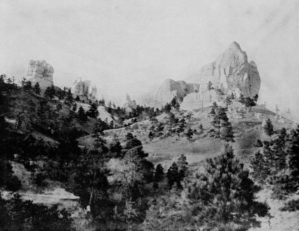
CROW BUTTE AND SIGNAL ROCK, DAWES COUNTY, NEB.—Crow Butte is a titanic elevation of stone, nearly 200 feet in height and several hundred yards in circumference, located about five miles south of the town of Crawford, in Nebraska. The walls are vertical on all sides except one, where there is a winding way by which a horseman may reach the top. The summit is a natural fortress, where a few well-armed and determined men could hold thousands at bay. A very interesting Indian legend connected with this rock-fortress is related in Glimpses of America, the story no doubt having a good foundation in historical fact.
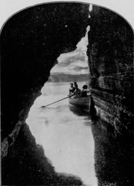
SKYLIGHT CAVE, DELLS OF THE WISCONSIN.
The sight-seer turns with feelings of disappointment at the artificial appearance of St. Anthony’s Falls, and seeking the wonders of nature unadorned, drives over to Minnehaha’s sylvan solitudes, but upon which, alas, the encroachments of sacrilegious improvements characteristic of city extension are now apparent. But the voice of its falling waters is still attuned to the rhythm of the poet that sang it into fame. Down through flower-sprinkled meadows purls and gambols a silver stream, slaking the thirst of the linnet and bathing the feet of the dove, until weary of the sunshine it spreads itself over a ledge like a veil of gossamer and drops into the cool shades that welcome its embraces. The Falls of Minnehaha are an example of that coy and quiet comportment which sometimes blushes into notoriety, for no one with less imagery than a poet would discover the sublimity of its aspect, or the artfulness of its graces. It is to Longfellow, therefore, that we owe the immortality with which these laughing waters are invested, and the imperishable fame of Hiawatha, who, while in quest of better weapons
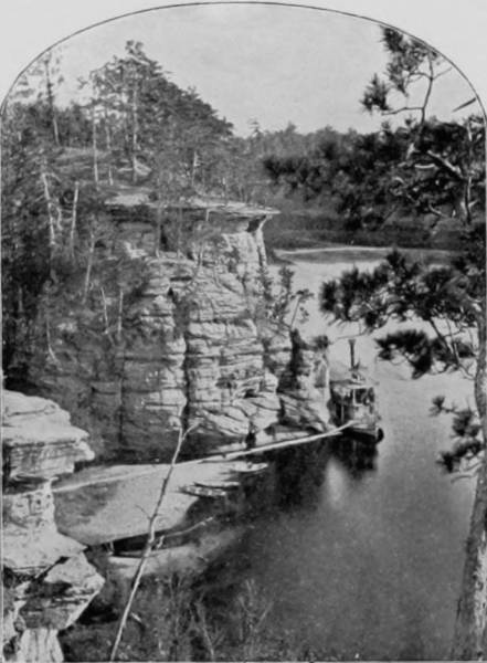
CLIFF NEAR MOUTH OF WITCHES’ GULCH.
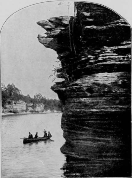
HAWK’S BILL, DELLS OF THE WISCONSIN.
But no one with a love for the picturesque can close an eye to the fairy-like beauty of Minnehaha, as it pours over a crescent brink in a sheet of gauze, so thin that the wall behind loses little of its distinctness, and the rocks upon which the water breaks are refreshed like the head of a babe at its christening. A lace curtain is not more delicate, and thistle-down is scarcely more dainty, as the illustration shows.
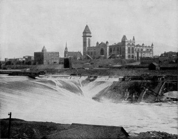
FALLS OF ST. ANTHONY.—The principal historical interest attaching to the Falls of St. Anthony is the fact that they were discovered by the famous priest-explorer, Father Hennepin, in 1680. They no longer present the furious aspect that originally characterized them, for the turbulent waters that once dashed over the precipice with a roar that made the earth tremble have been harnessed and made a part of the requirements of modern invention, until they now glide smoothly down sloping tables to the bed of the river below. The channel has also been cut and buttressed until the banks no longer present the features of scenic interest which a score of years ago they possessed.
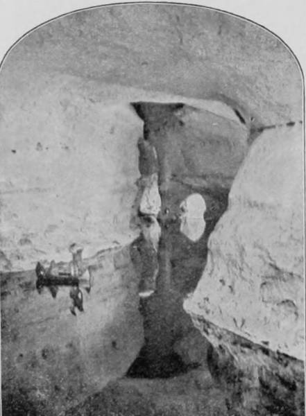
THE FAIRIES’ RETREAT, Dells of the Wisconsin.
The eroding fingers of percolating waters have worn the soft rock behind the fall, until a shelf is formed that extends three or four feet beyond the face of the wall. Visitors may therefore pass under this shelf and look outward through the transparent liquid sheet as it pours in a broad but tenuous stream, not unlike valencienne drapery gently agitated. A pathway leads from the falls down a gracefully embowered ravine to spots so temptingly secluded that maidens never wander there that love does not follow; and so many darts have been hurled at wooing swains in this romantic dell that I am almost persuaded to believe that it was not Hiawatha, but Cupid, who came here to get his arrows.
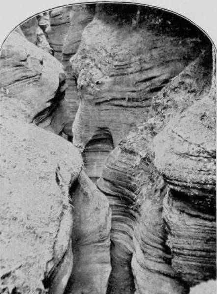
WITCHES’ GULCH, Dells of the Wisconsin.
But if Minnehaha is beautiful in spring-time, it is sublime when folded in the crystal arms of winter, a frozen cascade of puffs and snow-balls, hibernating after its season of sporting, awaiting the return of bird, flower and lover. Not far away are lakes of various sizes, like Minnetonka and Great Bear, to which thousands resort when sultry winds blow and the blazing sun of summer-time drives sweltering humanity to such cool retreats. But the beauties of this northern region are not exhausted by lake and waterfall, which though charming, cannot compete for interest with some of the natural marvels that exist in the neighbor State of Wisconsin.
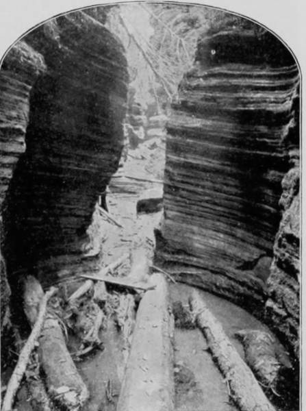
WHIRLPOOL CHAMBER, Dells of the Wisconsin.
St. Croix River separates the two States and is a stream that exhibits both curious and exquisite formations along many miles of its banks, and but for the vast logging interests which it so admirably serves, penetrating as it does the great pine region, the river would be filled with pleasure-crafts throughout the summer, carrying tourists in and out among its dells and fairy-like grottos.
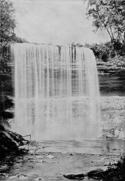
MINNEHAHA FALLS IN SUMMER.
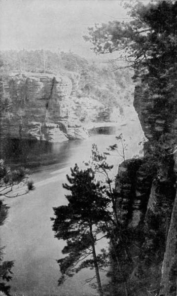
ROMANCE CLIFF, DELLS OF THE ST. CROIX RIVER.
Minnehaha is one of the smallest of the many beautiful and celebrated waterfalls of America, but it is also the most lovely and poetic. It is like a drapery of lace-work as it pours smoothly and gently over the cliff, keeping time to the merry music of its own laughing waters.—The accompanying photograph of Romance Cliff, on the St. Croix River, is as beautiful in its way as its twin sister of poetic renown, and the two together make pleasant company.
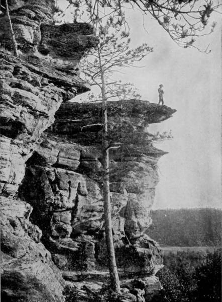
SIGNAL ROCK, NEAR CAMP DOUGLAS, WISCONSIN.
The bluffs of sandstone are a source of unending surprise, rising out of the water so nearly perpendicular that they defy all effort to scale them, and present a front like the walled cities of ancient times. Nature has not left them undisturbed, either, for their toussled brinks and seared sides show the finger-marks of frost in deep fissures and eccentric cleavages, while here and there fantastic images of stone stand like grim sentinels on commanding ledges, keeping unwearied watch upon the industrious river. Most curious of these erratic formations is the Devil’s Chair, which the Chippewa Indians verily believe was one time the resting-place of his sable majesty, probably when he went fishing. Anyhow, the rock bears the autographs of many adventurous persons who have been there to see. The fishing certainly was very good in this spot before Wisconsin lumbermen filled the stream so full of pine-logs that not even the devil himself could keep his line from fouling.
East of the St. Croix is Chippewa River, flowing in the same general direction, but aside from being a pretty stream it has nothing to specially interest tourists, for the banks gently shelve, and where stone appears it is in thin layers, and the shore-line never rises to the dignity of bluffs. But the Chippewa Indians, though now small in numbers, still retain their ancient homes in the vicinity of the stream, which, because of its shallowness, is not used as extensively as the St. Croix for shooting logs to the Mississippi. Though surrounded by a vigorous civilization, these Indians, if we except their clothing, exhibit little change from their original customs and manners of living, subsisting by hunting, fishing, and gathering berries for the neighboring markets. They still make birch-bark canoes, like their forefathers, and in a way, too, that white men do not appear to be able to imitate. Specimens of their deft work are on sale in all the towns of Wisconsin, from which source they derive no little profit.
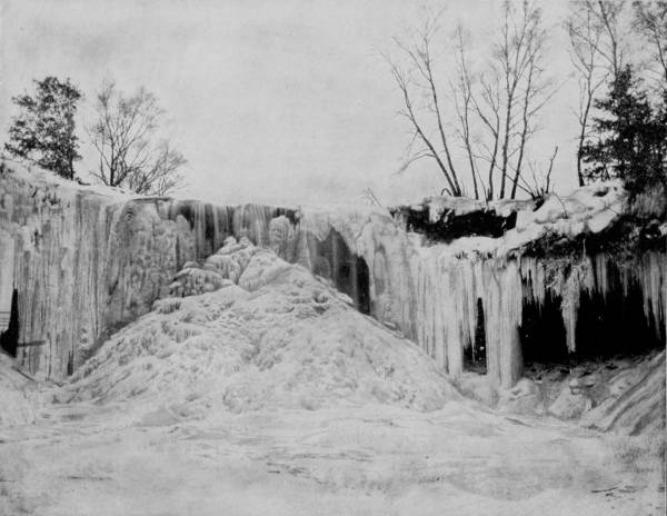
MINNEHAHA FALLS IN WINTER.—If Minnehaha is beautiful in the spring and summer, dressed in its flowing drapery of white, it is sublime when folded in the crystal arms of winter, a frozen cascade of puffs and snowballs, hibernating after its season of festivity, awaiting the return of bird, flower and lover. Not many visitors go there in winter-time, for the north wind is biting cold; but those who do go are rewarded with a vision of loveliness unsurpassed in the realms of romance or fact. Beneath the winter sun it becomes a fairy palace, turreted with columns of alabaster, studded with diamonds and pearls, that sparkle and glow with the iridescent hues of the rainbow.
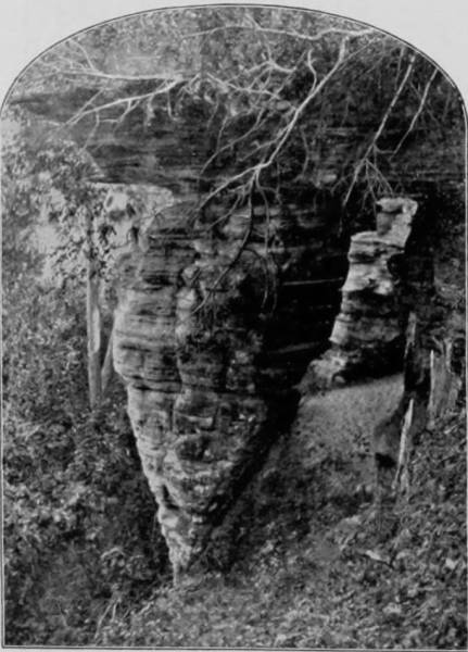
CLEOPATRA’S NEEDLE, DEVIL’S LAKE.
In the eastern part of the State, in Howano county, lives a small tribe called the Menomines, who are in what may be called the transition period, for their manner of living is a composite of modern ways and ancient usage and belief. Some of the Menomines appear to be thoroughly civilized, at least so far as outward indications show, while the patriarchs of the tribe remain steadfast in the faith of their fathers. They have lost none of their confidence in the Medicine Man, whose counsel in political affairs is as important as their influence over diseases of the body is pronounced.
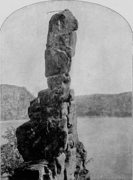
HORNET’S NEST, DELLS OF THE WISCONSIN.
A Medicine Man being questioned as to how the power which he claimed was conferred, answered thus:
“My heart told me that I should be a Medicine Man, and I went out upon a mountain and fasted and prayed for two days, awaiting a sign from the Great Spirit. At the end of the second day, as the sun was going to sleep, I saw a great light which blinded my eyes, and heard a noise as of the rushing of many waters. I looked around again, and about me were four animals—a black-tailed deer, a white-tailed deer, a wolf and a buffalo. They all spoke the speech of men. They said that the Great Spirit had heard my prayer and had sent them to me. The animals then took me over the prairies and told me what plants were hurtful and what were good for my people. They told me what diseases of men the good herb would cure, and then they vanished as suddenly as they came. I returned to my people, told the chiefs what I had seen, was made and have since been a Medicine Man.”
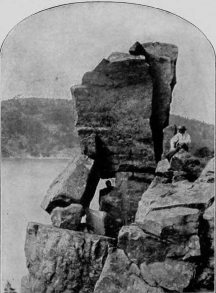
CLEFT ROCK, DEVIL’S LAKE, WISCONSIN.
But the transition from savage superstition to civilized modes is apparent among the Menomines, not only in the adoption of modern clothing, houses, household utensils and Christian ideas; it appears also in the change of their superstitions. They still believe in Medicine Men, and indulge in what is known as the Medicine Dance, but only at the time of the initiation of new candidates for such honors; and their doctors must now be the possessors of more or less medical knowledge, and be able to read and write. The ceremony is too long and tedious to describe, but the most superficial observer cannot fail to detect through it all the influence of contact with civilization.
The Ojibways are another remnant of the great Indian tribes of the Northwest, whose homes are in Polk county, in the vicinity of Balsam Lake, a pretty sheet of water in a wild district, where fishing is good and game still fairly abundant. One peculiarity of these Indians is the sacredness with which they regard their dead, and the care they take to preserve the bodies of relatives from violation. They are content to house themselves, even through the severest winters, in the flimsiest structures, which afford very little shelter from the cold, but their dead they carefully wrap in blankets and deposit them in small oblong houses that are made to perfectly exclude rain, snow and cold, except such as may enter by a square little door in one end. These miniature mortuary houses are placed close to the homes of the living, that a better watch may be kept upon them; but what superstitious motive prompts this custom, I have not been able to learn.
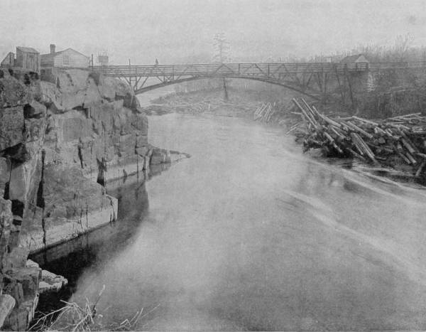
FOOT AND WAGON BRIDGE OVER THE ST. CROIX RIVER.—This bridge unites the States of Wisconsin and Minnesota, and spans one of the most beautiful views in the celebrated scenic region of the Northwest. The clear water of the river reflects the bluffs and surrounding objects as perfectly as the most costly mirror could, producing a double picture of exquisite loveliness, the reflection being even more beautiful in its softened outlines than the original. The region of the St. Croix is famous the world over, and is justly entitled to the honorable distinction which it holds.
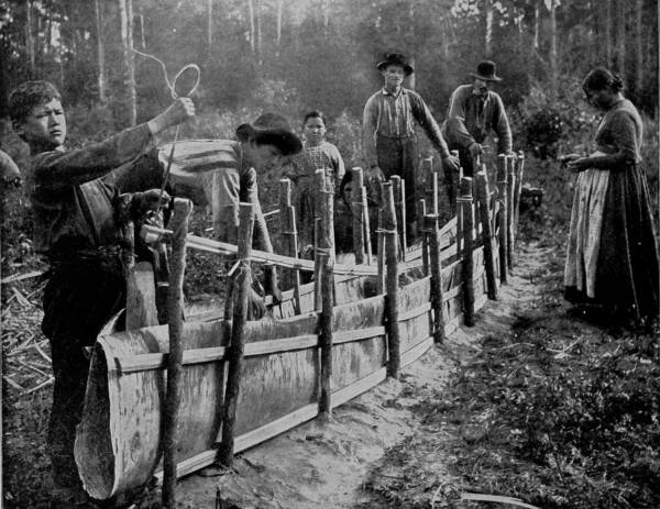
CHIPPEWA INDIANS, OF WISCONSIN, BUILDING A BIRCH-BARK CANOE.—Although the Chippewa Indians are now practically civilized, and differ but little in their appearance, dress and manners from the whites, yet they cling with remarkable tenacity to some of their ancient customs, one of which is the building of light bark canoes which glide like zephyrs over the surface of the water. They are very expert in this line of work, some of their little crafts being so artistically finished and ornamented as to arouse the sincere admiration of even the most critical observers. But lightness and speed are their main considerations, mere beauty being held as unimportant and suited only to holiday occasions.
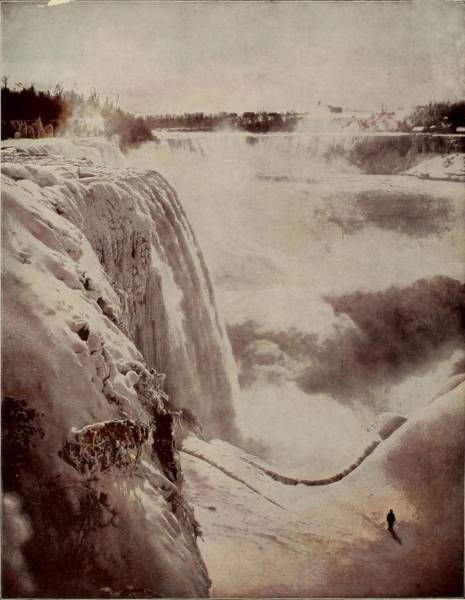
WINTER AT NIAGARA.
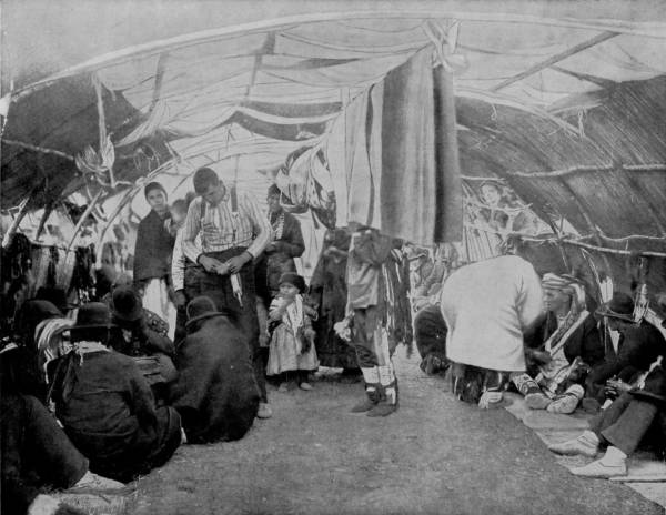
A CANDIDATE FOR MEDICINE MAN BEFORE A COUNCIL OF MENOMINE INDIANS.—The Menomines are a small tribe, living in the eastern part of Wisconsin, who are in what may be called the transition period from savagery to civilization. Some of the younger ones appear to be thoroughly civilized, so far as outward indications go, while the old patriarchs remain steadfast in the faith of their fathers and their confidence in the wisdom and saving powers of the medicine man. But even these have so far advanced, perhaps unconsciously to themselves, that all candidates for this important office are required to be able to read and write, and to possess more or less knowledge of medicines. The ceremony of initiation is an important event in the life of the candidate, and is regarded with a degree of superstition and reverential awe by his friends and relatives.
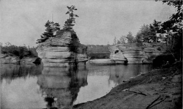
THE SUGAR-BOWL, DELLS OF THE WISCONSIN.
Wisconsin is very justly famous for many things: its semi-civilized Indian tribes, its lakes, dense pine forests, and above all for its wondrous scenery, particularly along the Wisconsin River, where wonders the equal of those to be seen in Watkins’ Glen, New York, are met with in rapid succession some six miles north and south of Kilbourn City. It was to Kilbourn City, therefore, that we proceeded, by way of the Chicago, Milwaukee and St. Paul Railroad, to view and photograph the truly marvelous scenery and whimsically erratic formations that characterize that section of the river known as the Dells. The river is deep, but at places so tortuously narrow between projecting elbows of the limestone walls that only such a dimity and fairy-like steamboat as the Dell Queen can thread a passage, and we accordingly committed ourselves to this frail little craft for the trip which is made by tourists first to the Upper Dells, eight miles above the city, and then to the Lower Dells, which are three miles below. For many, many centuries the Wisconsin, probably always a rapid stream, has rasped its soft Potsdam sandstone-bed, and constantly wearing its shore, has finally carved out a way that is fantastically curious. Now the stream rolls laughing along under vertical walls sometimes a hundred feet high, and wrought into the most weirdly grotesque forms imaginable. All along, its capricious course is marked by caves, caverns, grottos, glens, and eccentric pillars of stone that are as humorously dressed as a zany in caps and bells. In making the ascent from Kilbourn City one of the first objects to arrest attention is “Angel Rock,” whose broad stretch of petrified wing is said to guard against intrusion into the spectral haunts that lie beyond. “Swallow’s Fortress” next appears, a perpendicular wall of very great height, and unbroken length of two hundred feet, garrisoned by myriads of swallows that have perforated the face until it looks like the lid of a huge pepper-box. Having passed this castle of many loop-holes, we enter a section where “Romance Cliffs” pays eternal greetings to “High Rock,” with their strange configurations and picturesque statuary; a spot that is favored by speckled trout as it is by lovers. “Chimney Rock” next bursts into view, built up of as many strata as a tower of pan-cakes, which from a distance the chimney somewhat resembles. From the “Gate’s Ravine” there is a splendid sight of “Sturgeon Rock,” which is so perfectly reflected as to appear twice its natural size. Why it is called Sturgeon Rock not even tradition tells us; but it is manifest in many cases that those who bestowed names upon these pictorial surprises were so arbitrary as to be indifferent to appropriateness, like the colored woman who called her first-born Beelzebub, because she heard that some prince bore that name.
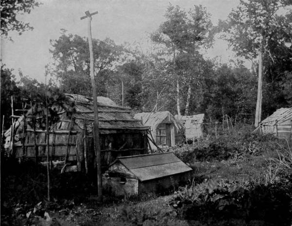
WINTER CAMP AND BURIAL HOUSE OF OJIBWAY INDIANS.—The Ojibways are a remnant of the great Indian tribes of the Northwest, who live chiefly by fishing and hunting. One of their peculiarities is the sacredness with which they regard their dead, and the care they take to preserve the bodies of friends and relatives from violation. They are content to house themselves, even through the severest winters, in the flimsiest structures, but their dead they carefully wrap in blankets and deposit in small oblong houses so perfectly built as to exclude rain, snow and cold, except such as may enter by a little square door in the end. These miniature mortuary houses are placed close to the abodes of the living, where they may receive loving care and attention. The origin of this really commendable custom is not known, but it is like a similar one in vogue among the Indians of Alaska, which has been described elsewhere in these pages.
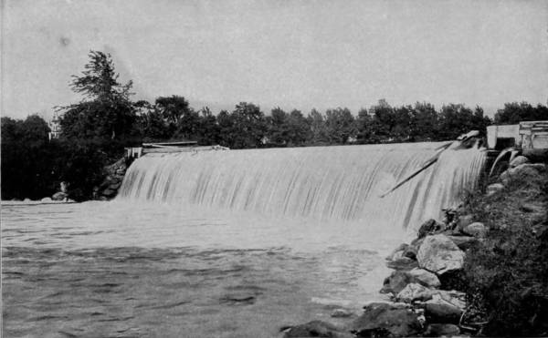
OCONOMONOC FALLS, WISCONSIN.
At a place where the river broadens, and the left shore spreads into a long level covered with willows, while the right bank continues its precipitous career, there is a wide extension-table projecting from the wall which is called “Visor Ledge, of Stand Rock.” This jutting point is admirably designed for a jumping-off place, and it is a matter for surprise that it was not christened Lover’s Leap, like all other similar ledges and shelves that I have seen. Beyond this the river again narrows, and singular efflorescences of stone, like a garden of flowering curios, wrap our attention with questioning surprise. “The Hawk’s Bill” is certain to catch our notice, and equally sure to excite our wonder that it was not called the “Toothless Old Man,” for it does seem that he might make a nut-cracker of his nose and chin. “Black Hawk’s Leap” must be accepted as a poor substitute for the “Lover’s Jump,” but as the latter has no place on Wisconsin River the former name has been applied to a section of pictured wall that is excavated at the base, and in which the gurgle of water is accentuated by echo into ominous noises. This natural excavation is called Black Hawk’s Cave, and is said to have been the place of retreat of a vanquished party of Indians, who were murderously pursued by a large number of their enemies, but memory fails to recall the particulars. A little further beyond is another grotto of still more remarkable formation, called “Cave of the Dark Waters,” and rightly it is named, for the entrance is by a small portal into a commodious chamber whose first most noticeable characteristic is its darkness. The water is deep throughout, and continually suggests the advantages of the cave as a place in which to commit crime, or to kiss your girl while passing through a dark tunnel.
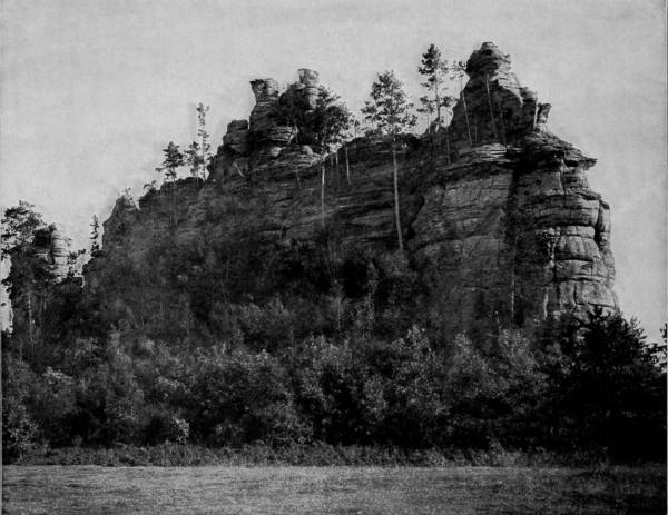
BELEAGUERED CASTLE, CAMP DOUGLAS, WISCONSIN.—The scenery about Camp Douglas is weird, sublime and curious. There are formations of odd and fantastic shapes, like the conjurings of a disordered brain, while others lift their rugged sides and castellated peaks into the air with all the grandeur and picturesqueness of “castles on the Rhine.” To this latter class belongs “Beleaguered Castle,” so boldly photographed on this page. Its resemblance to the ruins of some ancient fortification is so striking as to arouse the wonder and admiration of all beholders. The trees that have planted their roots in its sides and along the top of its mimic battlements serve to heighten the resemblance, so that one standing in its presence can hardly divest himself of the belief that he is really viewing the walls of some frowning relic of the warlike past.
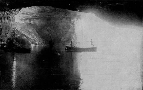
CAVE OF THE DARK WATERS, LAKE SUPERIOR.
It is a positive relief from the oppression which entrance to the Dark Waters Cave produces to be hailed, after emerging, by a sturdy little stone island with a tossing crest of pine, which some Sweet William has named the “Sugar-Bowl.” It is all the more refreshing because islands in the river are exceedingly scarce, and this diversity of landscape is accordingly doubly appreciated.
Still further beyond is the “Mouth of Witches’ Gulch,” commanded by picturesque cliffs that show the teeth-marks and lacerations of the gnawing waters. So romantic is the spot, and so inviting the little saucer-shaped beach of white sand, that all the pleasure-boats that ply in the Dells make a landing here and give their passengers opportunity to go on shore and carve their names on the terraced walls. So many persons had been there before us, however, that barely space was found to write a pencil autograph.
Another stop is made at “Cold Water Cañon,” usually dry, but through which the river pours in an impetuous torrent during high water. Hereabout are also glens and other curious excavations, among which is a hollow formation seventy feet high and fifty broad, called the “Devil’s Jug.” Another run of less than a mile brings us to “Steamboat Rock,” an oval island covered with hemlock and mountain cedars, opposite to which a third landing is made, and ascending three flights of stairs to gain the summit of the cliffs, across a stretch of woods, and descending a steep, rocky ledge, we find ourselves at the superlative wonder of the Dells—Witches’ Gulch. Abruptly arriving at the entrance of the gulch, above which 189 feet, in a projecting rock, may be seen the wry, unmistakable features of a tousled old hag, the queen of the witches, so ominously frowning on forms and faces below. Without the slightest exaggeration it certainly is one of the most wonderful, weird and peculiar places on this continent.
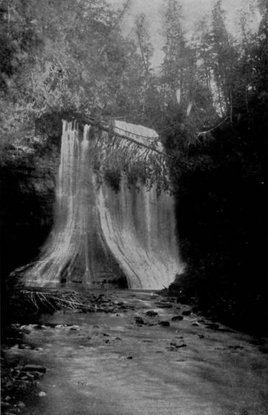
MINER’S FALLS, LAKE SUPERIOR.

WHITE ROCK, LAKE SUPERIOR.
The Pictured Rocks of Lake Superior and the scenery adjacent to them are celebrated in art and romance. The former derive their name from the great diversity of colors which they display. They have been worn into strange shapes by frost and storm, and stained by the thousand dyes of nature in every possible variety of arrangement, far beyond the power of words to describe; and this profusion of color and shape is repeated mile after mile, until the tourist is lost in wondering admiration.
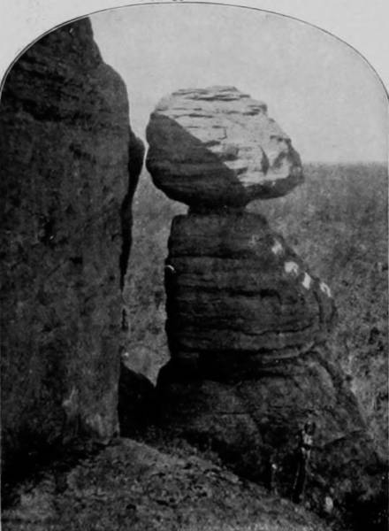
THE OLD GUARD, NEAR DEVIL’S LAKE, WIS.
Entering the gulch, we look up—far up—and catch glimpses of sunlight and see huge pines prostrate and lying from one ledge to another, admonishing us to look well to our going. After many, many windings, we come into “Phantom Chamber,” and in the side of a rocky ledge, scooped out, as if by hand, find a natural basin, and take a drink of the cool spring water gurgling out of the great rock into this hidden Pool of Siloam. In this rocky apartment we ascend a pair of stairs, from under which the stream that meanders through the entire gulch leaps in majestic fall, its roar almost deafening, and spray dashing over us. For thousands of years this little stream—at first, probably, a switch of rainfall on the earth’s surface—has been engaged in wearing this chasm in the sandstone, until now the gorge is seventy-five feet deep, nearly a mile long, and in some places so narrow that a large person can only pass through with difficulty, especially at Fat Man’s (or Woman’s) Misery-point. In several places vast chambers have been formed, at the door-way of one of which a beautiful fall of water leaps down into a deep-cut basin.
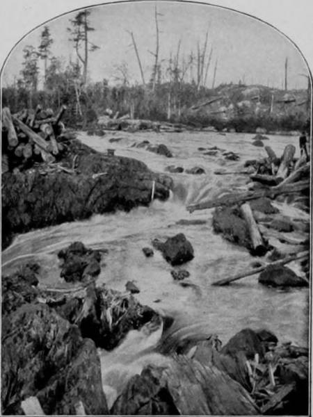
SPLIT ROCK, DEVIL’S LAKE, WISCONSIN.
There are several deep crevasses in the river leading to places of extraordinary beauty and wonder, and which on account of the narrow passage cannot be reached by the little steamboat. Row-boats are therefore provided, by the aid of which we visited a number of these side-attractions. “Skylight Cave” is one of these which, though having a small mouth, widens inside and receives light through a little crevice at the top. It is a cosy little retreat that well repays a visit.
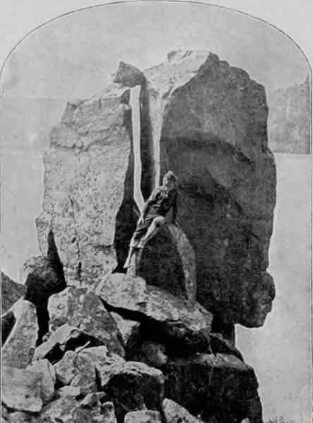
FALLS OF ST. LOUIS RIVER.
Returning to Kilbourn City, on the following day a trip was made to Taylor’s Glen, which is thus well described by a correspondent: “At the handsome school building on the east side of the village, a rugged path struggles down into an ordinary ‘hollow,’ which farther down and followed, opens into a grand gorge. Every step now reveals scenes and formations beside which all the boasted charms of ‘Watkin’s Glen’ become commonplace. Being neither cave nor valley, but combining all the attractions of both, it winds and twists through immense rocks in a serpentine path. At one point, far overhead, a sheet of daylight slants through a mere rift the rocks. The roof and high-arching walls are frescoed with diamond dew and dripping, drooping mosses and lichens. Groups of strange figures, carved by cataracts, washed by whirlpools ages on ages ago, ape Egyptian gods and mummies of the ancient Orient. Here a crystal spring bursts from a wall of solid stone and goes dancing down over pebbles and ferns. On through an ever-varying pathway filled with kaleidoscope-like enchantment we wandered with awe and admiration, our journey ending at a long, dark tunnel, which looks out, through a wide, cavernous window, upon the river beyond. The Lower Dells, like their companions above the village, have rocky banks, covered with vegetation, and curiously shaped formations no less interesting than the aggregation, a description of which I have but faintly accomplished. One cannot see this truly remarkable, weird, romantic and beautiful section of our land and suppress admiration. Nor will a week suffice for a thorough exploration of the caves, grottos, rocks and ravines hereabouts. Above Witches’ Gulch is a beautiful view of the river, its bluffs and many islands, a fairly comparable Lake George view. A fine drive is had north from Kilbourn to ‘Hornet’s Nest,’ ‘Squaw’s Chamber,’ ‘Luncheon Hall,’ ‘Stand Rock,’ ‘Devil’s Lake,’ and many points of interest farther up the river and in the country in this and adjoining counties.”
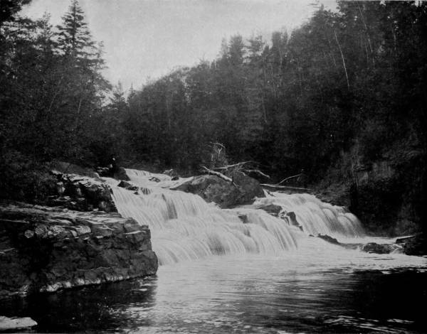
RAPIDS OF MONTREAL RIVER, NORTH OF LAKE SUPERIOR.—These picturesque rapids are located in the midst of a wooded dell, hemmed in and secluded by surrounding hills from the busy haunts of men. In peace and quiet they laugh and frolic and sing their merry song of rippling waters and dashing fountains through the summer days, and when winter comes they put on a dress of foamy puffs of white that sparkles and glows like a bed of diamonds in the dull rays of the northern sun.
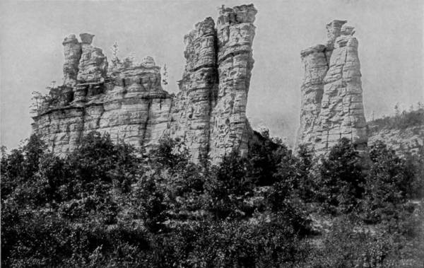
GIANT’S CASTLE, NEAR CAMP DOUGLAS.
The whole region within a radius of thirty or more miles of Kilbourn City, particularly on the west, is full of natural curiosities, for the district was evidently at one time, in the remote past, the bed of a lake whose swirling waters carved the soft sandstones into many astounding forms, and then were assuaged by some force which geologists fail to explain, leaving these rare monuments of their work behind them. Devil’s Lake, nearby, is the relic of that vast inland sea, which no doubt was a part of the great lakes, on the shores of which are many images of wondrous shapes and size, with many of which interesting legends are connected. Thus “Sacrifice Stone,” in “Wonder Notch,” is popularly believed to be the rock on which an Indian maiden was immolated at an unknown time to propitiate the anger of the Great Spirit, while “Cleft Rock” represents the fury of the devil who, while in a passion over some act of the tribe, rose out of the lake and hurled one of his fiery darts with such poor aim that it did no other damage than split the largest stone on the shore.
Cleopatra’s Needle is likewise reputed to be the transformed and geologic remains of a very ancient Indian chief who was punished by the devil for the audacity of attempting to penetrate the mysteries of the lake; while another broken and distorted stone on the front of East Mountain is connected with a similar and indistinct tradition respecting the invidious curiosity of a squaw. But though there is no lack of superstitious beliefs among the few Indians of the district, who respect these queer formations as the relics of their forefathers, there is no more foundation for them than the mere claim that “so it has been told,” for no one has ever heard the particulars. It is a forgotten story.
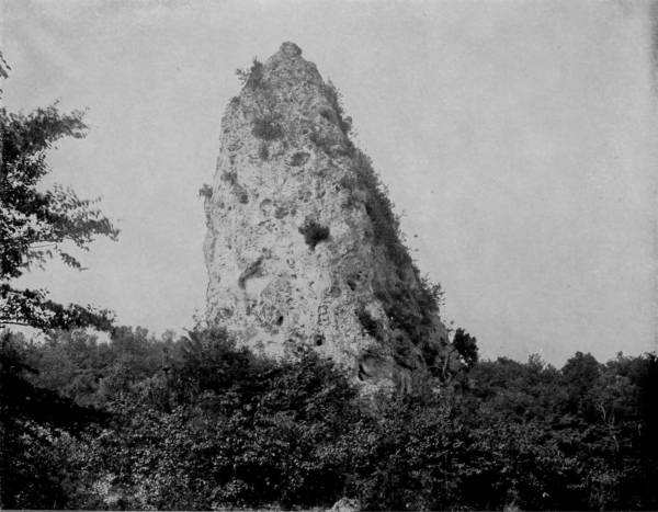
SUGAR-LOAF, MACINAC ISLAND.—Macinac Island is a delightful and picturesque summer resort, located in the Strait of Macinac, which connects Lakes Michigan and Huron. It is only about three miles long by two wide, and is rough and rocky. The natural scenery is charming. The geologist finds mysteries in the calcareous rocks dripping at unexpected angles; the antiquarian feasts his eyes on the Druidical circles of the ancient stones; the invalid sits on the cliff’s edge in the vivid sunshine, and breathes in the buoyant air with delight. The haunted birches abound, and on the crags grow the wild larches beckoning with their long fingers, the most human tree of all. There are many natural curiosities on the island, the most noted being Sugar-Loaf, so beautifully photographed on this page. It is conical in shape, and rises to a height of 134 feet.

CHIMNEY AND BEE ROCKS, CAMP DOUGLAS, WISCONSIN.
Near the west center of Juneau county, fifteen miles east of the Wisconsin River, is a cross-roads railroad town called Camp Douglas, which is in the midst of a region remarkable for natural curiosities, rivaling those found in the Bad Lands in Wyoming. It is a country of sandstone that exhibits the astonishing results of centuries of water and wind erosions upon what was manifestly once a vast bed of argillaceous clay, that in the process of time was converted into soft stone as the lake dried up. The receding waters gradually wore deep ravines in the sandstone, thus giving birth to rivulets which aided a more rapid change in the bed until it became traversed by numerous streams that in time completely drained the lake. Then the winds began their work of eroding, helped by the sand which they carried, and the result became finally, as we behold it in the Bad Lands, and in Monument Park, Colorado, a large number of towers, domes, pinnacles and other architectural forms. To the more strikingly curious shapes names have been given, as the “Old Guard,” “Giant’s Castle,” “Castle Rock,” “Chimney Rock,” “Signal Rock,” “Beleaguered Castle,” etc., as shown by the illustrations.
From Kilbourn City we went to Milwaukee, and thence by the Chicago and Northwestern, and the Minneapolis, St. Paul and Sault Ste. Marie Railroad to St. Ignace, where we took boat for Mackinac Island, a very noted resort in the Straits of Mackinaw. This island is celebrated for its splendid scenery, some of which we photographed, after which we proceeded to Sault Ste. Marie, the seat of government of Chippewa county, Michigan, and noted for having one of the largest and finest ship canals in the world, through which, surprising as the statement appears, a larger daily tonnage passes than the Suez Canal accommodates. One of the sights that are apt to claim the particular attention of visitors now are the new grain-carrying vessels called Whale-backs, which have within the last three years become a feature of our lake commerce.
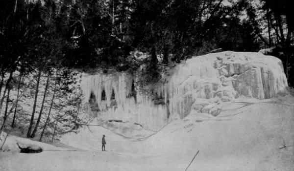
FALLS OF MINER’S RIVER IN WINTER.
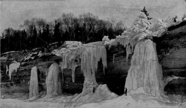
THE CASCADE IN WINTER, LAKE SUPERIOR.
In order to fully realize and appreciate the splendor and marvelous beauty of the Pictured Rocks and the scenery adjacent thereto, they must be seen in winter, when they are dressed in their frosty sheets of ice and snow and ornamented with a thousand pillars of pearly white. It is then that they appear like scenes from fairy-land, as pictured in the fantastic creations of poets and painters.
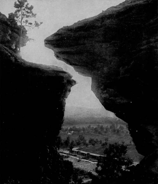
SIGNAL ROCK, CAMP DOUGLAS.
In order to observe the shores more clearly, we took one of the Lake Superior Transit Company’s steamers at Sault Ste. Marie for Duluth, a route which gives opportunity for taking photographs of the incomparable pictured cliffs of Superior. But at Marquette, where the steamer lands, a yacht was engaged in which we were able to approach much of the finest scenery that would otherwise have escaped our attention.
The range of cliffs to which the name of Pictured Rocks has been given, may be regarded as among the most striking and beautiful features of the scenery of the Northwest, and is well worthy the attention of the artist and the observer of geological phenomena. They may be described, in general terms, as a series of sandstone bluffs extending along the shore of Lake Superior for about five miles, and derive their name from the great diversity of colors they display. They are worn into strange shapes by frost and storm, and stained by a thousand dyes in every possible variety of arrangement, far beyond the power of words to describe, and all this profusion is repeated mile after mile, keeping up the interest by some new prospect of sweeping curve, or abrupt angle, or fantastic form. “The ‘Castle,’ the first of the more striking features of the rocks, bears at a distance a great resemblance to an ancient castle, with walls, towers, and battlements. Further on, a mass of detached rock called the ‘Sail Rock’ comes into view, and so striking is its resemblance to a sloop with the jib and mainsail spread, that a short distance out on the lake any one would suppose it a real boat sailing near the beach. But the principal feature of the rocks is the magnificent cave known as the ‘Grand Portal.’ Let the reader imagine himself in a room 400 feet long by 18 feet wide, and 150 to 200 feet high to the arched roof, bulk of yellow sandstone, seamed with decay, and dripping with water. Shout, and the voice is multiplied a hundred-fold by echoes that reverberate several seconds, sharp, metallic. Here the stratum of gravel rises about fifty feet, while at the castle it is nearly down to the water’s level. The waters are undermining the foundations, and wearing holes everywhere in the support of the walls and the roof. The water in the cave increases in depth as you go out towards the lake, from the bare rocks of the back end to about fifty feet at the opening, and a few rods from the shore it is a hundred feet, or more. The cliff on the west, next to the Grand Portal, is hollowing out, forming an immense cave, increasing every year.”
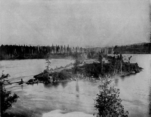
NIPIGON RIVER, FLOWING INTO LAKE SUPERIOR.—Nipigon River and Lake are famous fishing and hunting resorts in the British possessions north of Lake Superior. They are also celebrated for their fine scenery, which attracts many tourists to that region during the summer months. There are numerous rapids in the river, where salmon and trout of a superior quality abound in such quantities as to fully satisfy all lovers of the piscatorial sport who visit this region.
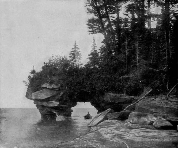
SAND ISLAND ARCH, LAKE SUPERIOR.
“It is beyond the power of the pencil,” says a recent traveler, “to represent the effect of the reflected light in the roof as seen from the rear. Especially when the sun is toward the west the bright light is reflected from the waves into the cavern, and undulates like a sea of light overhead; a picture in living colors, so tender, so quiet—luminous, pearly grays, bright flashes, cool, high lights, all warmed by the yellow sandstone, dripping with water, on which the effect is thrown.”
“At the mouth of Miner’s River the coast makes an abrupt turn to the eastward, and just at the point where the rocks break off and the sand beach begins, is seen one of the grandest works of nature in her rock-built architecture, which is known as ‘Miners’ Castle,’ from its singular resemblance to the turreted entrance and arched portal of some old castle. The height of the advancing mass, in which the form of the gothic gateway may be recognized, is about seventy feet, while that of the main wall forming the background is about one hundred and forty. The appearance of the opening at the base changes rapidly with each change in the position of the spectator, and on taking a position a little to the right of that occupied by the sketcher, the central opening appears more distinctly, flanked on either side by two lateral passages, making the resemblance to an artificial work still more striking. The chapel, if not the grandest, is among the most grotesque of nature’s architecture here displayed. Unlike the excavations before described, which occur at the water’s edge, this has been made in the rock at a height of thirty or forty feet above the lake. The interior consists of a vaulted apartment, which has not inaptly received the name it bears. An arched roof of sandstone, from ten to twenty feet in thickness, rests on four gigantic columns of rock, so as to leave a vaulted apartment of irregular shape, about forty feet in diameter, and about the same in height. The columns consist of finely stratified rock, and have been worn into curious shapes. At the base of one of them an arched cavity, or niche, has been cut, to which access is had by a flight of steps, formed by the projecting strata. The disposition of the whole is such as to resemble, very much, the pulpit of a church; since there is, overhead, an arched canopy, and in front an opening out towards the vaulted interior or the chapel, with a flat tubular mass in front, rising to a convenient height for a desk, while on the right is an isolated block, which not inaptly represents an altar; so that, if the whole had been adapted expressly for a place of worship, and fashioned by the hands of men, it could hardly have been arranged more appropriately. It is scarcely possible to describe the singular and unique effect of this extraordinary structure; it is truly a temple of nature—‘an house not made with hands.’”
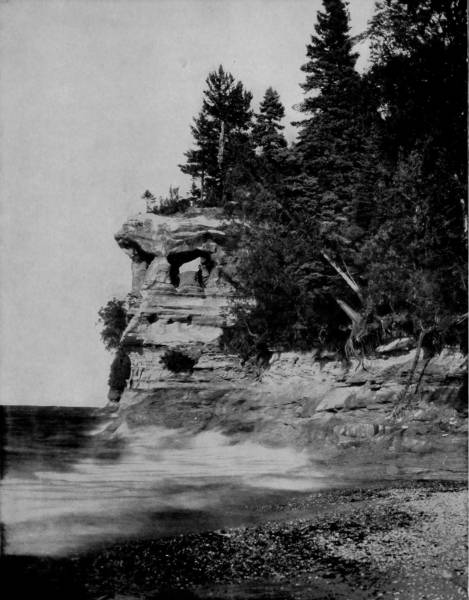
THE CHAPEL, PICTURED ROCKS, LAKE SUPERIOR.—This curiously carved rock, painted in many colors by the chemicals of Nature’s laboratory, forms a bold and picturesque point on the north shore of Lake Superior. It consists of a vaulted apartment in the rock, thirty or forty feet above the level of the lake. An arched roof of sandstone rests on four natural columns, forming an apartment about forty feet in diameter and the same in height. Within are a pulpit and altar, perfect as if fashioned by the hand of man. It is one of the most curious formations in this celebrated scenic region, and has been often pictured and described.

ABODE OF THE GENII, LAKE SUPERIOR.
The Pictured Rocks are beautiful and fantastic at all times, but it is in winter that they are sublimely lovely, bewilderingly grand, as photographs taken by Mr. Childs, to whom we are indebted for their use here, will show. The falls of Miners’ River are exquisite when pouring over a brink fringed with greenest foliage, but when held in the vise-like grip of winter they are magnificent almost beyond conception. They are a fitting prelude to the spectatorium of cave wonders near-by, such as the “Abode of the Genii,” which might better be called the “Throne-room of Fairy Stalacta.” The water percolating through the roof of the caverns is frozen into the rarest, daintiest and most exquisite incrustations imaginable, some having the appearance of snow balls, chrysanthemums and lilies, while others reach down their immense crystal points, as if trying to rest their ponderous weight upon the opalescent floor. The “Cave-of-the-Winds” has a splendid entrance, and being shallow in depth is well lighted, so that the ice-covered walls reflect the most gorgeous colors; but the congealed formations, while very beautiful, cannot compare with those that the Genii of the neighbor grotto have appropriated. The splendors of these shores, however, are by no means confined to the caverns, for almost equally curious and charming views are presented by the vertical faces of the snowy cliffs, upon which winter hangs the most magnificent draperies. “The Cascade” is formed by the water flowing over a low bench along the shore, but at many points more curious effects are produced by the fierce lashings of the lake that toss showers of spray high up on the cliffs, where it freezes into shapes peculiarly wonderful and often radiantly beautiful. “Peter’s Pillar” is a curious ice monument formed by a little waterfall that drops through a hole it has worn in the bluff, but about the base are pretty ice terraces and graceful corrugations, the frozen spray cast from the shore-beating waves of the angry lake.
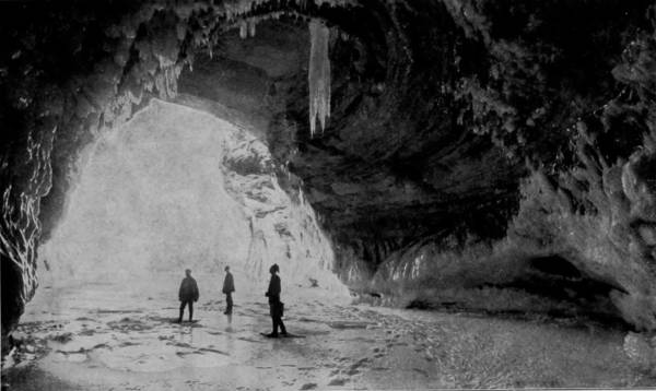
CAVE-OF-THE-WINDS, LAKE SUPERIOR.
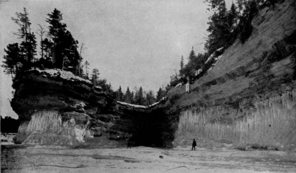
EXTERIOR VIEW OF CAVE-OF-THE-WINDS.
The Cave-of-the-Winds presents a royal view of sky and lake, through an archway covered with stalactites, when the observation is taken from within; but its outward appearance is not particularly striking. The cave is shallow in depth and well lighted, so that the ice-covered walls give forth the most gorgeous colors as the reflected rays from the lake fall upon them.
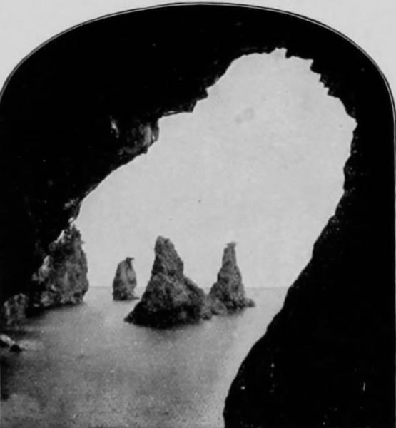
BAY OF ISLES, LAKE SUPERIOR.
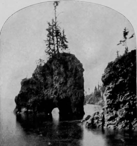
PAD-LOCK ISLAND, LAKE SUPERIOR.
“The Grand Portal” is a perforation through an elbow of the palisades, and of such magnitude as to appear like a vast cave, when viewed from an angle. Inside, however, it is seen to be a great tunnel, sufficiently curved to barely admit the sight of a small opening at each end. At this point the cliffs jut into the lake, and in winter they are festooned and royally embellished with lovely ice-forms of every imaginable shape. A formation somewhat similar is seen on “Sand Island” of the Apostle Group, where the beating waves have made an excavation through an arm of the palisades sufficiently large to admit the passage of a row-boat.
PRINCESS BAY, LAKE SUPERIOR.
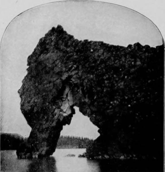
THE SEA-ELEPHANT, LAKE SUPERIOR.
But for miles the vertical and gleaming white bluffs of sandstone, sometimes resembling the chalk banks of Albion, distinguish the shore line, and exhibit surprising perforations that are frequently large enough to permit a boat to venture out of sight; and naturally they attract large numbers of summer tourists, who find in these caves, like the “Bay of Isles” and “Cave of the Dark Waters,” excellent trout fishing.
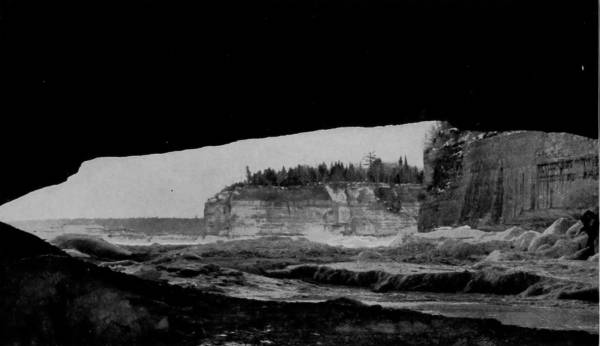
THE GRAND PORTAL, LAKE SUPERIOR.
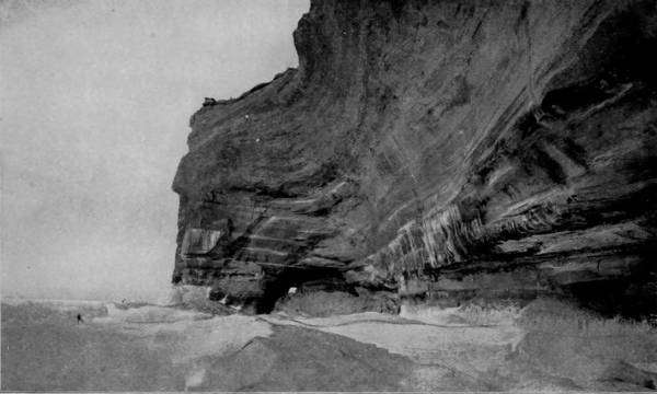
GRAND PORTALS, FROM THE LAKE.
The Grand Portal is the doorway or entrance to a splendid cave in the cliff of the Pictured Rocks. It is in the form of an immense vaulted chamber, with a ceiling nearly one hundred feet high, which has been carved out of the yellow limestone by the restless waves as they are driven in and out by the force of the winds. The sides of the cave are fretted and worn into all sorts of fantastic shapes, presenting a remarkable and exceedingly interesting spectacle. The view from the portal, embracing the adjacent cliffs and a vast expanse of rolling waters, is grand and sublime.
THE ICE PALACE AT ST. PAUL IN 1888.—It is hard to believe that this majestic structure, with its frowning battlements, massive walls and wrinkled visage of war, is composed wholly of transparent blocks of ice. It has more the appearance of an impregnable castle, which, outliving the scars and bruises of mediæval battles and the ravages of time, has come on down into our modern and better era as an example of the architectural ability and requirements of the dark and bloody days of former ages. But it is a castle which requires no resounding thump of the battering-ram or crash of cannon-ball to shatter its walls and break its turrets, for they vanish and melt away into imperceptible vapors under the warm kisses of the virgin spring sun.
STORMING THE ST. PAUL ICE PALACE, 1888.—This photograph represents a scene of the grandest and most imposing character. The interior of the palace was brilliantly illuminated, until it shone and sparkled like an immense diamond, while from every tower, turret and battlement many-colored lights blazed and flashed and shot up into the sky until the very heavens seemed to be on fire. On the outside there were batteries of rockets and Roman candles, and flashing meteors that hurled their fiery messengers against the walls of ice, bursting into a thousand brilliant and glowing fragments whose reflection bathed the face of the dark sky in a flood of iridescent light. It was a scene of splendor long to be remembered by those who saw it.
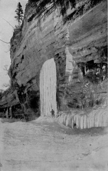
PETER’S PILLAR, LAKE SUPERIOR.
The wonders of Lake Superior’s shores do not terminate at Duluth, for the walls rise to even a greater height on the north line and are of green sandstone and porphyry, occasionally twelve hundred feet high. The St. Louis River enters the lake from the northwest at Duluth; and though this stream is barely deep enough to float a raft of logs, it runs between lofty banks of the same general character as those which confine the Great Lake. Enormous palisades line the north shore of Superior, whose columns are so symmetrical as to equal the best productions of the sculptor’s art. Pigeon River forms part of the boundary line between Canada and the United States, and is a stream in great repute with sportsmen, and also offers attractions to those who delight in natural scenery of a sublime character. Pigeon Falls is but one of many interruptions in its course towards the lake, the pool formed by the dropping water being a favorite haunt for trout and salmon, while in the numerous lakes near-by are myriads of water-fowls that have their nesting-places on the shores. A few miles toward the east is Nipigon River, another beautiful stream that connects a lake of the same name with Superior. It is somewhat wider than Pigeon River, and its shores are less bluffy; thus the current being less rapid, the stream is diversified by many little islands that are so green with pines, hemlocks and other trees as to look like emerald gems. But all along the north shore are scenes of great beauty, and vast stores of mineral wealth in iron and copper lie only a few feet beneath the surface; yet notwithstanding all these attractions, the region is rarely visited save by Indians and sportsmen.
We reached St. Paul, after an absence of nearly one month, and there met our photographer who had gone into the Black Hills in quest of views. Being thus reunited, we started down the Mississippi, but by rail, as the Chicago, Milwaukee and St. Paul Railroad follows the bank as far as La Crosse. Several stops were made, however, in order to catch pictures of Fort Snelling, and the grand bluffs above and below Winona, which for towering magnificence far exceed the hills that render the Hudson famous. Indeed, considering the river from St. Paul to Pepin Lake, the Mississippi’s shores present finer scenery than is to be found along any other navigable stream on either continent. But south of that point the views are rather monotonous until Grafton is reached, where the Piasa Bluffs begin and run along the river for twenty miles, exhibiting not only great vertical height, but curious shapes, and at one point some very ancient Indian picture writings.
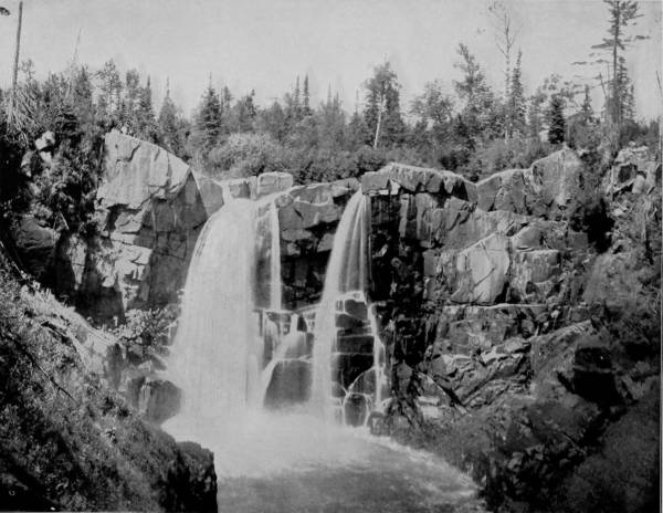
PIGEON RIVER FALLS, NORTH SHORE OF LAKE SUPERIOR.—The north shore of Lake Superior, and the little rivers which run to its waters, present many surprising and beautiful scenes. One of these is pictured on this page. It is a small sequestered stream, modestly winding its way through shading woods and green meadows, and along by quiet, restful farm-houses, until in a spirit of reckless fun, wholly unexpected of such a demure little rivulet, it suddenly plunges down a precipice with many a laughing leap and merry roar, breaking into a thousand shining sprays that enrapture the senses with their marvelous beauty and evanescent colors.
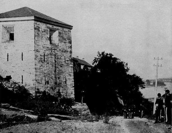
OLD FORT SNELLING, ON THE MISSISSIPPI RIVER.—This grim and grizzled relic of the past is named in honor of a brave soldier, Colonel Josiah Snelling, who served his country faithfully and bravely in many well-fought battles with the Indians in the early part of the present century. When the fort was first erected it was on the uttermost borders of civilization, in the midst of many surrounding dangers, and it served its purpose as a nucleus and protection for the gathering settlements of a later period.
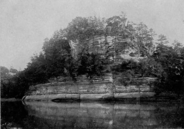
STARVED ROCK, ON ILLINOIS RIVER, NEAR OTTAWA, ILLINOIS.

Our circuit of the West had now been completed, and having surrendered the camera car which we had chartered, we made hasty preparations for a grand tour of all that section lying east of the Mississippi. Before departing for the East, however, we made a flying trip over the St. Louis & San Francisco Railroad to Eureka Springs, a popular health resort in Northern Arkansas, surrounded by some very beautiful scenery that spreads away through the Ozark and Boston Mountains in picturesque grandeur, diversified by swift-flowing streams, deep gorges, terrible bluffs and immense caves that are gorgeously embellished with gigantic stalactite and stalagmite formations. If these magnificent scenes were not so conveniently near a large city, they would be a hundred-fold more famous, for it is human nature to yearn for the least accessible and the most difficult of attainment. In short, we rarely appreciate the things that we have, and exaggerate the importance and attractiveness of places which are remote. It is this peculiarity of the human mind that makes heaven a necessity and immortality a natural deduction, the irresistible conclusion of human reason.
We tarried one week in St. Louis before departing for the East, and then again divided our party, one of our photographers proceeding to Pittsburgh, and thence through Pennsylvania and Virginia, taking views of the famous scenery of those States, while the other two whose travels we will now describe, passed northward to Chicago, and thence east by way of Niagara. Having heard much of a celebrated point known as Starved Rock, on the Illinois River, a place of commanding interest in the history of La Salle and his adventurous companions, we resolved to stop at Ottawa, en route to Chicago, and make a photograph of the historic rock. We reached Ottawa by the Chicago, Burlington and Quincy Road, and thence by driving ten miles in a spring wagon we gained the spot made celebrated through a tradition which is as romantic as it is tragic.
Starved Rock is now the property of a company, and is situated on the left bank of the Illinois River, near the foot of the rapids. It is a perpendicular bluff of limestone, one hundred and fifty feet high, and is crowned with oaks and other forest trees. The water front presents a precipitous wall, but there is a slope towards an adjoining bluff by which it is alone accessible. The summit has an area of about one acre, but is a natural stronghold; and perceiving its advantages, La Salle, on his first return trip to Canada, ordered his Indian lieutenant, named Tonti, to fortify himself upon the Rock, supplying him with one small cannon for that purpose. Tonti carried out these orders, and, it is said, died and was buried upon the Rock. Years afterward, the place became conspicuous in the Indian wars; and it is related that after the killing of Pontiac, chief of the Ottawas, in a drunken row at Cahokia, some of his people charged the Illinois tribe with the crime and made war upon them. Being feeble in numbers, they were driven before the Ottawas so remorselessly that as a last resort they took refuge on Starved Rock. Here they were able to hold their enemies at bay, but their distress was none the less because of their ability to prevent a scaling of their stronghold, for the Ottawas besieged the Rock and effectually prevented the Illinois from securing any supplies. Water was for a while procured by means of vessels attached to ropes of bark, which were let down into the stream. But this device was presently discovered and prevented by the Ottawas coming under the bluff in canoes and cutting the ropes. Unwilling to surrender and run the risk of torture, the unfortunate Illinois remained in the place of their retreat until one by one they died of starvation. This is the tradition current in La Salle county, and the finding of many Indian relics and bones on the Rock tend to confirm its truthfulness.
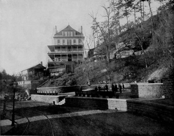
BASIN SPRINGS, EUREKA SPRINGS, ARKANSAS.—Arkansas is famous for her life-giving and health-supporting springs, and among these none are more celebrated than those at Eureka, in the northwestern part of the State. The location is picturesque and mountainous, the atmosphere clear and invigorating. A few years ago the place was a wilderness, and the waters wasted their treasures of good health in untrammeled mountain rivulets. By the merest accident their curative powers were discovered, and immediately the sick and the afflicted from all parts of the world began to flock thither, like pilgrims to a newly discovered Siloam. At present there is a thriving city of 4000 inhabitants located on the mountain sides, with many thousands of invalid guests constantly coming and going.
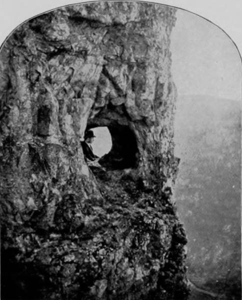
THE LOOKOUT, ON THE ROAD TO HOMER.
From Chicago we went east over the Michigan Central to Niagara Falls, that greatest of natural wonders, a sublime apotheosis of omnipotence, a glorification of the immeasurable power that nature possesses, in whose roar we distinguish the hallelujah chorus of centuries and peans of praise to the mightiness of Deity.
Niagara Falls, the supreme natural marvel of both continents, is divided into two cataracts, viz.: American Falls, flowing towards the American or western side, and Horseshoe Falls, which discharges towards the Canada side, the two being separated by Goat Island.
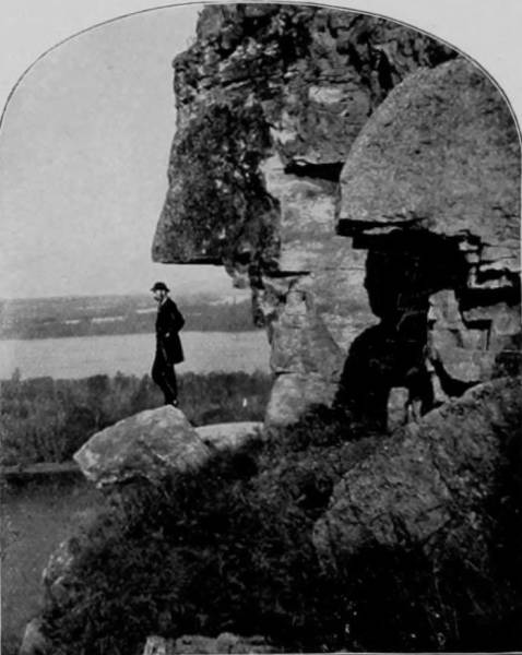
BARN BLUFF, NEAR RED WING, MINNESOTA.
The height of the former is one hundred and four feet, and the latter, owing to a limestone stratum not worn away, is one foot higher, by which it is reasonably concluded that at one time nearly all the flow was towards the American side, because the discharge over the western fall is not now so great as that towards the Canada side. This tremendous flood of waters is from Lake Erie through Niagara River into Lake Ontario, and the retrogression of the cataract, caused by the wearing of the limestone ledge, inclines geologists to the opinion that the flow has continued for a period of not less than thirty-seven thousand years. The width of Niagara River at the falls is forty-five hundred feet, of which American Falls occupies eleven hundred feet, Goat Island fourteen hundred feet, and Horseshoe Falls two thousand feet, though the deep curve in the latter, whence its name is derived, makes the line of fall more than three thousand feet. It has been estimated that the discharge exceeds one billion gallons of water every twelve hours, and that the force thus developed is equal to something more than one million horse-power.
The landscape on either side of the falls has little of the picturesque or tumultuous about it, being generally slightly rolling, and giving no indication of eruptive disturbance; so that scientists are still searching for a plausible theory upon which to base a conclusion as to the cause that produced this sudden dip in the limestone formation.
348The astounding power displayed by the river dropping over a wide and lofty ledge is scarcely more bewildering than that exhibited by the Rapids, which extend for half a mile from the point of descent, and meeting a swift current, the flood is lashed into a fury that is frightful to behold, rising in the center like huge beasts in combat, and tossing wave-caps nearly fifty feet above the surface. At times the spray rises in such clouds as to completely obscure the falls, and borne some distance by the winds is condensed, and a long-continued rain follows, which renders a considerable stay in the neighborhood somewhat disagreeable.
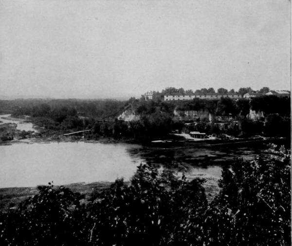
VIEW OF FORT SNELLING FROM THE MISSISSIPPI.
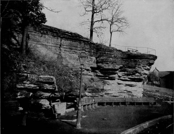
HARDING SPRING AND ROCK, EUREKA SPRINGS, ARKANSAS.—The ruggedness and beauty of the scenery in and around Eureka Springs, and their pleasant influence upon the minds of invalids, causing them to dwell upon other things rather than their ailments, no doubt have something to do with the marvelous cures that have been wrought here. Nature, aided by the embellishments of art, has made the place an exceedingly attractive resort, which grows in favor with each passing year. No imaginary picture, be it ever so attractive, could surpass in picturesqueness the scene so beautifully photographed on this page.
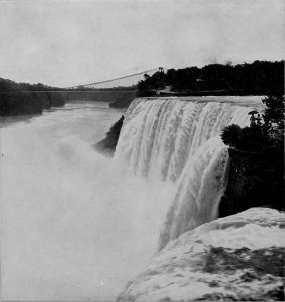
AMERICAN FALLS, VIEWED FROM GOAT ISLAND.
While an admirable view of the falls may be obtained from many points of observation on the bridge, or along both shores, the greatest interest attaches to a visit to the noisy caverns that are behind the descending flood. These may be reached by means of spiral stairways built for the purpose, but the visitor must prepare for the trip by investing himself in a suit of oil-skin, and for a while must assume the character of an amphibian. At the bottom of the deep descent are stones in great confusion, over which we must scramble to reach the Cave-of-the-Winds, a watery grotto indeed, in which the air is agitated by the thundering cataract that fairly envelopes you. The scene here is beyond the scope of pen or brush, for these appeal only to sight and understanding, while the awful presence conjures all the senses. Behind the giant curtain of waterfall is a greenish reflection, weird in its intensity and unnaturalness, and to the ears there comes a muffled roar which, while not jarring, yet seems to pervade and penetrate like the dull rumble of an earthquake. This uncertain disturbance, which confuses with strange noise, is intensified by a wind that is here created by what appears to be some mysterious agency; and other curious things are noted that suggest to the imaginative mind a region of the supernatural, where indistinct voices warn and then invite, but are always clamorous, like a crowd of bedlamites.
Below the falls the river narrows to eight hundred feet, between precipitous walls, which add swiftness to the current, and three miles from Horseshoe Falls the impetuous stream strikes a point of projecting land in such a manner that a terrible whirlpool is created, capable of sucking down a large steamboat. By means of a car, which is controlled by a cable, visitors may ride down the very steep incline to the edge of Whirlpool Rapids and view in safety the awful, mad-lashing waters, swirling with extraordinary rapidity and throwing high the tousled heads of ravening waves, which appear to be lusting for victims and bellowing for vengeance. It is gratifying to know that the almost incomputable power of Niagara is soon to be transmitted, through the generation of electricity, to mills and machinery, and thus utilized to the honor of human genius as well as to the glory of God.
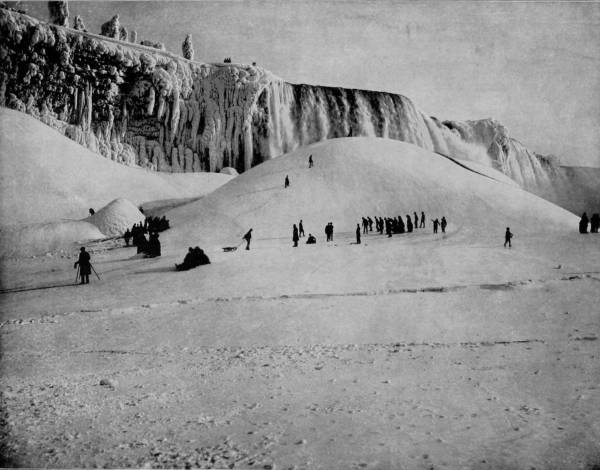
NIAGARA FROZEN.—Niagara is grand at any and all times, but if you would appreciate the sublimity of its grandeur in the fullest degree, you should visit it in winter, when it is covered with icy fringes and stalactites, and you can approach close to the roaring fountain on the mound of ice formed by the spray which rises from the foot of the precipice. It is only on rare occasions, during very severe winters, that such opportunities are afforded; but when they do occur they attract thousands of visitors from many sections, who come in crowds to witness a scene that has no equal among all the wonders of the world. On such occasions the Falls themselves seem to be a mass of liquid ice, while the shores, the trees and the cliffs are clothed in sheets of white, and made ornate with columns that rival alabaster in their transparent beauty.
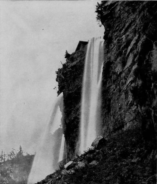
BRIDAL VEIL FALLS, NIAGARA.
Great changes occurring in Niagara Falls, which though slow and remittent, are no less certain to destroy the grandeur of that incomparable waterfall some time in the very remote future. It is a well-demonstrated fact that Niagara River has excavated the gorge through which it runs, and within recent years such immense masses of the ledge-stone have been detached by the gnawing waters as to cause an appreciable recession of the cataract, and a corresponding lengthening of the gorge. It is recorded that in 1818 very large fragments of limestone were wrenched from the surface-bed and cast over Horseshoe Falls, and another similar result occurred in 1855. But each year, and constantly, the erosion is marked, so that Table Rock, formerly a striking feature of the river, has been worn away so completely that no present sign of it now remains. It has been computed by Sir Charles Lyell that the average rate of recession is about one foot annually, counting for the past thousand years; but as before stated, the erosive results are spasmodic. There is now eighty feet of hard limestone composing the surface-rock, and it will probably require ten thousand years for the rushing waters to eat this away; after that, however, the wear will be rapid, and in course of centuries the falls will have disappeared, and only a tremendous gorge will remain in their stead. Many wonderful spectacles have taken place at the falls, the most interesting of which was the sending adrift of a condemned lake vessel, drawing eighteen feet of water, in 1829, which passed over the brink without touching bottom, and was dashed in pieces on the rocks below. This experiment was made to test the depth of water on the brink of the precipice.

HECTOR FALLS, WATKIN’S GLEN, IN WINTER.
There is a weary sameness to the generally level or prairie scenery which lies between the Mississippi River and New York State, if we except the rather pleasing diversity of well-cultivated farms, prosperous towns, and evidences of thrift that are everywhere noticeable. But there is more than the greatness of commercial and industrial empire to recommend New York to the sight-seer, for some of the most charming scenery to be found anywhere in the world is within her borders, matching for sublimity even the most marvelous views which we have described. And additional fascination attaches to many of her noted places on account of the Indian names which have been jealously preserved in her geography. The Mohawk Valley is at once a lovely vale and a reminder of Cooper’s “Leather Stocking Stories;” and so are her hundred rivers and lakes that bear the designations bestowed upon them, either by some of the once-powerful tribes, or which perpetuate the fame of their great chiefs, the shades of whom seem to linger about Seneca, Cayuga, Oneida, Oswego, Canandaigua, Chautauqua, Keuka, Skaneateles, over which they once skimmed in light canoes. The romance with which these beautiful waters are invested would draw us irresistibly to their shores were there no other attractions; but to these delightful traditions of a vanished people are the added charms of sylvan glades, exposing vistas of exquisite landscape, blue waters dimpled by soft winds, swift-racing streams dashing under overarching shades, and wild chasms that imprison echo and exhibit some of the most astounding results of glacial action, abetted by upheaval, depression and erosion. After picturing the wonders of Niagara, therefore, two of our party made a trip over the New York Central Line and its connection, to Geneva, a beautiful town on the north shore of Seneca Lake, which in many respects is one of the most remarkable bodies of water in the world. The lake is about forty miles in length, but it is a mere strip, rarely exceeding two miles in width, yet has the extraordinary depth of six hundred feet, so that it is evidently a basin created by the same convulsion that wrought the surprising results which render the Glens at 354the south end famous beyond comparison, as will be presently described. It is particularly strange that such a tremendous cleft should be made without showing a wider extent of disturbance, though the shores are a succession of promontories, sweeping back in graceful undulations and well-wooded slopes, save where industry has converted the hills into fruitful fields.
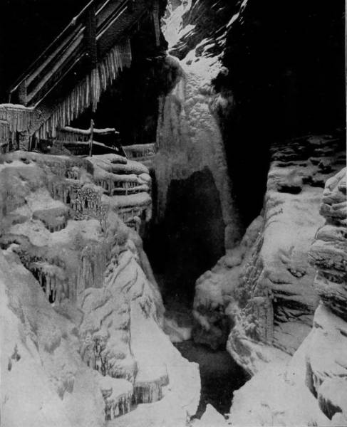
CAVERN CASCADE, WATKIN’S GLEN, IN WINTER.
The trip from Geneva to Watkins, which covers the extreme length of the lake, is comfortably and enjoyably made by means of fine steamers, which land at many intermediate points, and give summer tourists opportunity for thoroughly examining the towns and beautiful banks along the way. Watkins, which is the objective place of all pleasure travelers, has its feet bathed by Seneca Lake, and its head shaded by the brow of Buck Mountain, at whose base is the main street, running parallel therewith. Following this street a short distance, the visitor reaches a bridge that affords passage over a small stream, and proceeding along the banks of this little water-course for less than half a mile, he is suddenly confronted by a massive and lofty natural wall that prevents further progress. Stairways, however, have been built, by which we mounted to the summit of this wonderful masonry, and from that eminence surveyed the matchless scenery of Watkin’s Glen. But the view is interrupted by intervening precipices and densely wooded copses, so that to see the amazing wonders and the bewildering beauties of this marvelously diversified region a tour of its many attractions is necessary. To do this requires a pair of strong legs and good breath, for the climbing is severely taxing, though owing to the substantial and well protected stairways is never dangerous.

TERRACED FALLS, WATKINS GLEN, NEW YORK.—The most eloquent pen pauses in its futile efforts to depict the marvels, and the wonders, and the glories that are presented on every hand in Watkins Glen. In all the varied scenery of the world there is nothing to be compared to this, for here Nature seems to have done her utmost in fashioning something new and novel in the line of her handiwork for the admiration of mankind. At every footstep, for a distance of three miles along the gorge which cleaves the earth to a depth of 300 feet, some new wonder or marvelous creation is presented, each seemingly more superb than its neighbors.
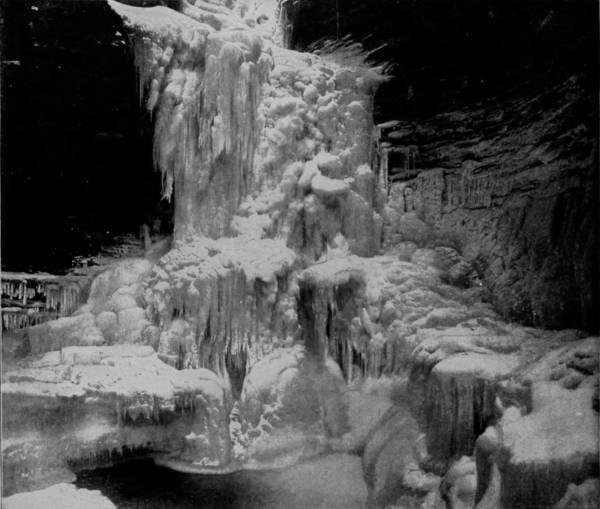
WATKIN’S CASCADE FROZEN.
Passing through Glen Alpha, where the awful sublimity of a tremendous chasm oppresses the visitor on first view, we caught sight of Twin Falls, where the waters pour down in two great sluices and become wedded in a swirling pool that pours out the overflow through a cañon whose walls have been scarified by the teeth of centuries. Below the falls is Whirlpool Gorge, an amphitheater that is striated and terraced into forms so variable as to please every conceit and yet arouse amazement. The stream dashes into this capricious auditorium at a maddening pace, but encounters resistance in the curving walls, and is thus thrown into a rapid, whirling movement like a maelstrom; and this rotary action of the waters has worn the half-encircling walls into many singular, though usually symmetrical shapes.
Climbing out of Whirlpool Gorge and moving southward a short distance along a railed ledge, we come in sight of Peek-a-boo Falls, a beautiful sheet of water plunging over a precipice fifty feet high, and scattering its spray along the walls that confine its descent, for the chasm is very narrow here, and charming for its sylvan weirdness. The cliffs are very pictures in stone, rising in tiers and carved into fantastic forms, while the overhanging trees, graceful ferns and velvety mosses make the place a bower in which fairies might delight to dwell.
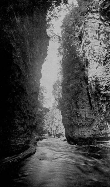
GIANT’S GORGE, IN CHATEAUGAY CHASM.
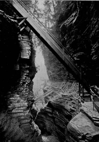
WHIRLPOOL GORGE, WATKINS GLEN.
These excellent photographs afford a splendid conception of the grandeur of the scenery where these points are located. The winding chasm, the rushing torrent, the glimmer of the sunlight above the tall cliffs, the bold, serrated rocks—all these tell us of the splendors which Nature has fashioned and deposited in this favored region.
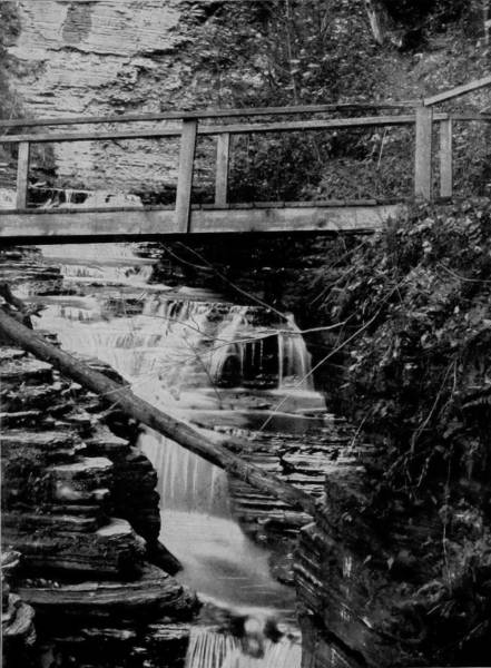
PORTLAND CASCADE, HAVANA GLEN.
Though both Watkins and Havana Glens are gems of nature in summer-time, their rarest robes of beauty are worn in winter, when the Ice King takes them in his embrace and bejewels them with crystals more exquisite than ever graced a royal bride. For the winter views which are here presented we are indebted to other photographers, as we are also for the frost pictures of the Lake Superior coast, as our visit was made in the summer-time. Examples of the sublime magnificence, the divine-like embellishment of Watkin’s Glen, when the lips of winter have kissed the noisy waterfalls into frozen silence, are seen in the illustrations of Cavern Cascade, and Hector Falls, and Watkin’s Cascade, where the frost-sprites and the little children of the snow hide beneath opalescent icicles and light the lamp of joy in grottoes that open toward the voiceless gorge.
Further up the chasm, where the broken fronts of vertical walls begin, is a quiet retreat known as the Council Chamber, spanned by a pretty bridge that is hung upon opposite ledges and conducts to a passage that runs along a shelf, then down a stairs to a path that leads from the water’s edge to the town. The walls that enclose this strip of river are exceedingly beautiful, built up as they are with thin layers, of a few inches’ thickness, each strata being very distinct, and the face of the cliffs wrought into lovely shapes, with a shelf here and there as if inviting lovers to seek them for the delightful seclusion which they offer. The glen is about three miles in length, and the walls frequently three hundred feet in height, with enough variableness in the scenery to make it a source of unwearying admiration.
Three miles south of Watkin’s Glen, and properly a continuation, for there is really a very brief interruption in the rugged character of the valley, is Havana Glen, quite as famous as its adjacent brother. The cliffs here are scarcely so vertical, but the general formation is practically the same, and similar means are provided for viewing its wonders to advantage. Bridal Veil Falls is Havana’s most alluring object, and well do they repay the tourist for his visit. The water at this point falls thirty feet down a very steep slope in a great column that, contracted at the plunge, spreads as it flows over a succession of terraces and dashes into the deep stream below with sullen roar.
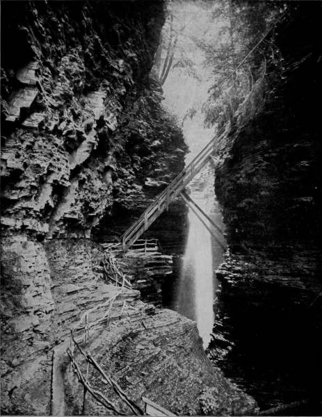
PEEK-A-BOO FALLS AND PICTURED CLEFT, WATKINS GLEN.—This romantic scene is thus beautifully described: Climbing out of Whirlpool Gorge and moving northward a short distance along a railed ledge, we come in sight of Peek-a-Boo Falls, a beautiful sheet of water plunging over a precipice fifty feet high, and scattering its spray along the walls that confine its descent, for the chasm is very narrow here, and charming for its sylvan weirdness. The cliffs are picturesque in stone, rising in tiers and carved into fantastic forms, while the overhanging trees, graceful ferns and velvety mosses make the place a bower in which fairies might love to dwell.
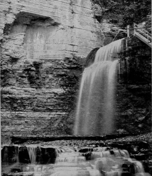
EAGLE FALLS, HAVANA GLEN.
Portland Cascade is another charming fall, but the chasm being wider at this point and broken by many shelves, the water flows with less turbulence, though the cascades are made more beautiful by spreading into thin, veil-like sheets, so transparent that the wall behind them is visible. A bridge is thrown across the leaping stream, from which a glorious view is had of the chasm as it winds away towards the south, while the copse which fringes the western edge constitutes a bower of extraordinary loveliness.
Eagle Falls, a hundred yards below the cascades, is, perhaps, the most daintily exquisite object in all this vale of natural wonders, a very poem of beauty and charming sequestration, where the brown cliffs sleep to the lullaby of flowing waters, and the wild flowers listen to the murmurs of the breeze. Stairs lead to the brink, under overarching trees that provide a delightful nook, but a more entrancing view is obtainable from the bottom of the charming dell into which the waters fall. There is neither grandeur nor sublimity in the sight afforded, but a soft witchery, a gentle soul-rapture that is kin to inspiration in the monody of the stream as it pours over the ledge in a rhythm that is as musical as April rain upon a cottager’s roof, and shimmers in its fall like a lace curtain stirred by the wind. Eagle Falls is plainly a misnomer, for the name suggests a thing of prey. The Nymphs’ Bath is more appropriate, for here it would seem that all the little people of the water and the wood might find what Titania and Diana longed for—a place of absolute seclusion, “where the bright eyes of angels only might behold a paradise so pure and lonely.”
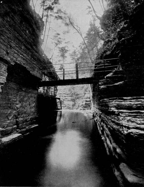
COUNCIL CHAMBER, WATKINS GLEN, NEW YORK.—This is one of the most imposing and impressive points of the Glen, and has been well named the Council Chamber. The walls that enclose this strip of river are exceedingly beautiful, built up as they are with thin layers, of a few inches’ thickness, each stratum being very distinct, and the face of the cliffs wrought into lovely shapes with shelving spaces here and there as if inviting lovers to seek them for the delightful seclusion which they offer. The chamber is spanned by a rustic bridge that is hung upon opposite ledges, affording a safe passage-way and a desirable point of view.
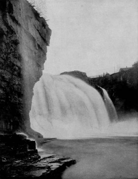
GIANT FALLS, AUSABLE CHASM.
Having feasted our sight, and caught the spirit of inspiration that haunts the romantic retreats of Havana Glen, we departed northward and took a train on the Rome, Watertown and Ogdensburg Railroad for Clayton, situated on the south bank of the St. Lawrence River, near where it receives the flow from Ontario Lake. At this point steamer was taken for a ride among the Thousand Islands to Ogdensburg, a trip more charming than our remembrance of love’s first dream. This part of the river is broken into many channels that meander through avenues worn in the granite which confines its course. The Thousand Islands is no misnomer, for they seem to be beyond number, scattered like a myriad of emeralds, with deep water between, and yet so close together that they may almost reach hands across the breach. Every islet is a dome of rock, ground into symmetrical shape by glacial action long ago, then covered by a sediment from the river sufficient to support a profuse vegetation. The Canada pine is conspicuous, lifting its scraggy head to a great height, and pointing its stout branches in every direction, a stately figure among the brushwood that surrounds it.
Many of the islands are only little green dots scarcely large enough for a fairy’s bower, while others are of considerable size, occupied by lovely villas, the resort of those wealthy enough to own beautiful summer houses where the air is fragrant with sweetest odors, and the gamest fish invite the enthusiastic angler.
Departing from Ogdensburg, one of our party proceeded to Montreal, by way of Ottawa, to photograph some Canada scenery in the vicinity of those cities, while the other took train for Chateaugay, each mapping out for himself the work to be done in the regions which he had chosen to picture. Chateaugay is in the extreme northeastern part of New York and about thirty miles from Lake Champlain. A river of the same name flows by the place and through some scenery which is almost matchless in marvelous grandeur, probably excelling in extraordinary cleavage that found in Watkin’s and Havana Glens. Giant Gorge is one of the first tremendous rents which we observe in the chasms of Chateaugay River, but several other precipitously walled cañons occur between that point and Chateaugay Lake, twenty miles below, where the Adirondack Mountain region begins, with its wilderness of untamable savagery, as wild now as when its rugged solitudes were first disturbed by an invading Indian seeking the game that there abounded. This darksome haunt of nature is cleft by the Saranac, Raquette, Boquet and Ausable Rivers, and in these gloomy recesses whence the day is dispelled are the lake sources of the noble Hudson.
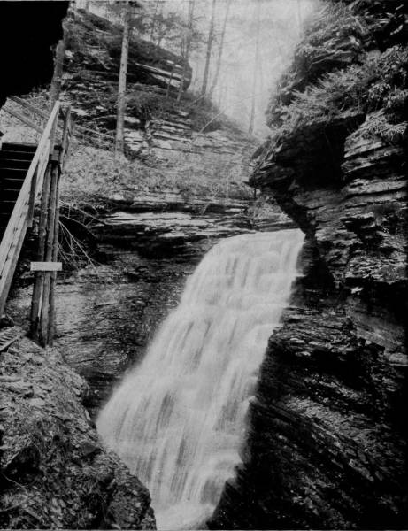
BRIDAL VEIL FALLS, HAVANA GLEN, NEW YORK.—Havana Glen is three miles south of Watkins, and is properly a continuation of the latter. The cliffs are scarcely so vertical, but the general formation is practically the same, and similar means are provided for viewing its wonders to advantage. Bridal Veil Falls are Havana’s chief attraction, and they merit the distinction. The water at this point falls thirty feet down a very steep slope, in a great column, which, contracted at the plunge, spreads as it flows over a succession of terraces until it dashes into the deep stream below with a sullen roar.
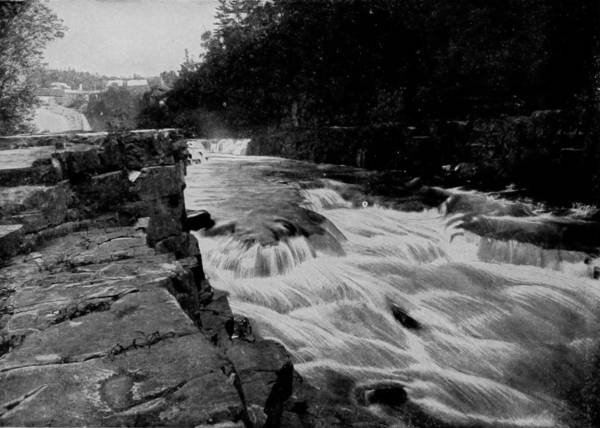
ELBOW FALLS, AUSABLE CHASM.
Crossing over to Lake Champlain, we took a Delaware and Hudson Railroad train at Plattsburgh and rode down to Port Kent and thence visited Ausable Chasm near-by. Indian Pass is also in the same vicinity. The scenery is a repetition of that in Watkin’s Glen, with the added interest of a more considerable stream, upon which boating is a royal pleasure. The freshness which description by another writer may furnish is my excuse for introducing the following from the pen of Alfred B. Street:
“At North Elba we crossed a bridge where the Ausable comes winding down, and then followed its banks to the northeast, with thick woods continually around us, and the little river shooting darts of light at us through the leaves. At length, a broad summit, rising to a taller one, broke above the foliage at our right, and at the same time a gigantic mass of rock and forest saluted us, and we stood before the giant portals of the Notch. As we entered, the pass suddenly shrank, pressing the river into a deep and narrow stream. It was a chasm cloven boldly through White-Face, so that on each side towered the mountain escarpment; on the left, the range rose in still sublimer altitude, with grand precipices, like a majestic wall or a line of palisades, climbing sheer from the half-way forest upward. The crowded rows of pines along the broken and wavy crest were diminished to a mere fringe. As we rowed slowly through the still narrowing gorge, the mountains soared higher and higher, as if to scale the clouds, presenting truly a terrific aspect. I shrank within myself, and appeared to dwindle beneath it. Something akin to dread pervaded the scene. The mountains appeared to be knitting their brows into threatening frowns at our daring intrusion into the solitudes. Nothing seemed native to the awful landscape but the plunge of the torrent and the scream of the eagle. Below, at our left, the dark Ausable dashed onward with hoarse, foreboding murmurs, in harmony with the loneliness and wildness of the spot.”

VIEW OF THE THOUSAND ISLANDS IN ST. LAWRENCE RIVER.—The Thousand Islands is no misnomer, for they seem to be beyond number, scattered like myriads of emeralds, with deep water between, and yet so close together that they almost clasp hands across the dashing channel. Every islet is a dome of rocks, ground into symmetrical shape by glacial action long ago, then covered by a sediment from the river sufficient to support a profuse vegetation. Many wealthy persons have purchased possessions in these picturesque islands, upon which they have erected stately and imposing summer residences, some of them rivaling in splendor the ancient palaces of Venice.
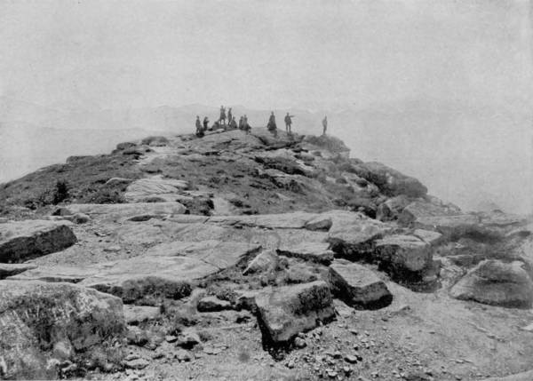
THE SUMMIT OF WHITE-FACE MOUNTAIN.
From the top of Mount Marcy, overlooking Indian Pass, the view is inspiring in its expansive and tumultuous grandeur. Towards the southeast gleams the white crest of Boreas Mountain, and rising beyond is the leaning tower-like peak of the Dial, which pays its obeisance to Dix’s Peak, that from afar exhibits the form of a crouching lion. “Thence stagger the wild, savage and splintered tops of Gothic Mountain, at the Lower Ausable Pond, linking themselves on the east with the Noon-Mark and Roger’s Mountains, that watch over Keene’s Valley. To the northeast rise the Edmonds Pond Summits—the mountain-picture closed by the sharp crest of Old White-Face, the stately outpost of the Adirondacks.”
A trip through Ausable Chasm is one of unspeakable delight and enrapturing surprises. Just above the point where the chasm begins there is an old mill, once run by a wheel driven by a sluice connected with the river, but steam has superseded this natural power and detracted somewhat from the interest which would otherwise invest the place. The dam is still there, however, and over its brink the water flows in softest measures, to strike the rocky shelves below, where it boils and brawls in confused dismemberment until joined again in an unbroken stream. The banks rise rapidly, while the river draws deeper into its bed, until presently making a leap at Giant Falls it plunges into a great gorge whose walls have been eaten by the floods and ice of centuries. But it is by a succession of falls and cataracts that the stream reaches its greatest depression, which is known as the Grand Flume. Elbow Falls scarcely deserve to be dignified by so large a title, as they are rapids rather than falls; but for beauty they are almost incomparable, and afford an opportunity for the painter’s brush as great as may be found anywhere in the Adirondacks.
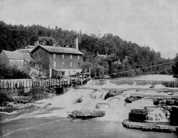
AUSABLE RIVER, NEAR THE HEAD OF THE CHASM.—The old mill reproduced in this photograph was at first supplied with motive power by one of those old-fashioned, picturesque water-wheels, which, however, has given place to the more energetic and less artistic steam engine. The dam, originally built upon the rapids, is still there, however, and over its brink the water flows in softest measures, falling upon the rocky shelves below, where it boils and broils in confused dismemberment until joined again in an unruffled stream a few yards below. This point is just above where the royal chasm begins.
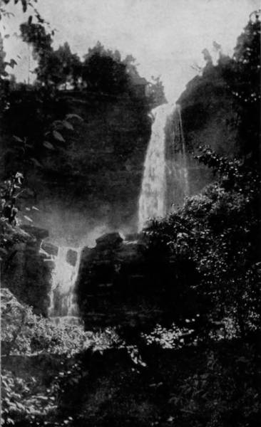
KAATERSKILL FALLS, CATSKILL MOUNTAINS.
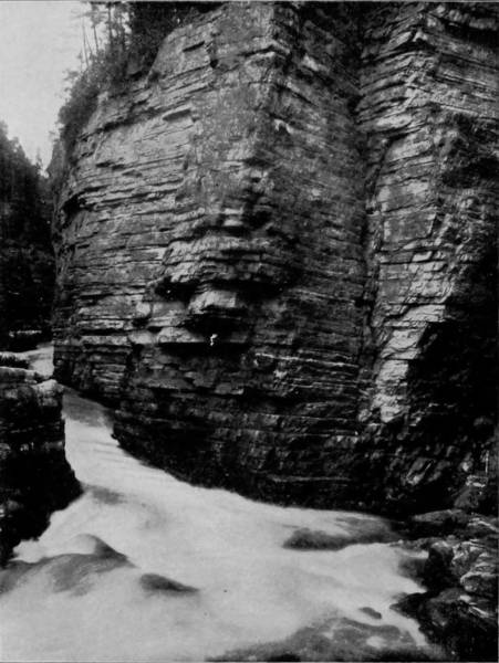
AUSABLE CHASM, BELOW THE OVEN.
A trip through Ausable Chasm is one of enrapturing pleasures and unspeakable delights. Every step and turn brings some new and surprising wonder into view. The banks rise rapidly until they tower into immense cliffs, between whose crenellated jaws the rays of the sun can penetrate only when it is near the meridian. The stream reaches its greatest depression by a succession of cataracts and falls of the most admirable and diversified character, embracing nearly every phase of the picturesque and beautiful in this class of scenery.
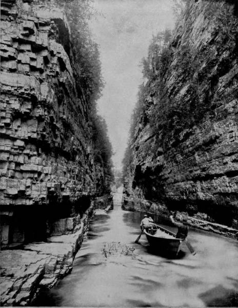
GRAND FLUME IN AUSABLE CHASM.—It is difficult to describe so grand and splendid a scene as this. The Grand Flume is the most admirable part of Ausable Chasm, the most picturesque section of this wonderful river, sublime in its grandeur, yet idyllic in its poetic and dreamy beauty. Here the Oreads might have sported while Diana pursued the untamed deer that have for ages made their favorite pastures in these mountain fastnesses and green valleys, where the grasses grow with ever-increasing luxuriousness each succeeding summer. Lovers of the grandly beautiful in nature can find no more desirable resort than Ausable Chasm.
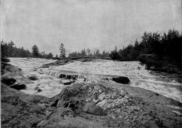
BOGG’S RIVER FALLS, ADIRONDACKS.
The chasm rapidly deepens and narrows below Elbow Falls, and becomes a wild gorge of intricate mightiness at a point called the Oven. The walls are lifted so high above the stream, with their crenated fronts exhibiting so many quaintly distorted and terribly jagged projections that the effect is most bewildering, while in places they are opposed with only a few feet between, giving to the passage the oppression of a prison. Hell Gate is not inappropriately named, because it is in a way begirt with difficulties that render boating dangerous. The river is here greatly compressed, but the channel is not sufficiently deep to hide the sharp-pointed rocks that split the stream and convert it into a rapid, but by means of stairs this interrupted water-way may be passed, and below are boats in which the pleasant passage may be continued through Grand Flume. This is the loveliest part of the chasm, the most picturesque section of this wonderful river, sublime in its grandeur, yet idyllic in its poetic and dreamy beauty, where the Oreads might have sported while Diana pursued the deer that have for ages made these mountain fastnesses their favorite haunts, for
From Ausable station, which may be reached by rail, a road leads southward through Ausable Forks, by White-Face Mountain, and thence into the very heart of the Adirondacks. This remarkable tract lies principally between Lakes Champlain and George, and covers an area of nearly 5,000 square miles, with one arm reaching northward to the St. Lawrence and another southward as far as Saratoga. Within this district there are said to be no less than 500 mountain peaks, several of which are 5,000 feet high, measured above the sea level, and as many as 1,000 lakes. Owing to the ruggedness of the country, its dense forests, numerous water-ways and prodigious chasms, the region was a comparatively unexplored wilderness forty years ago, and until its vast lumber interest attracted the attention of capitalists.
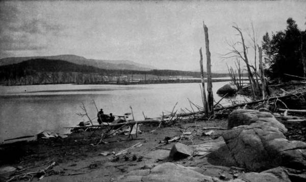
MOUNT MORRIS, FROM TUPPER LAKE, ADIRONDACKS.
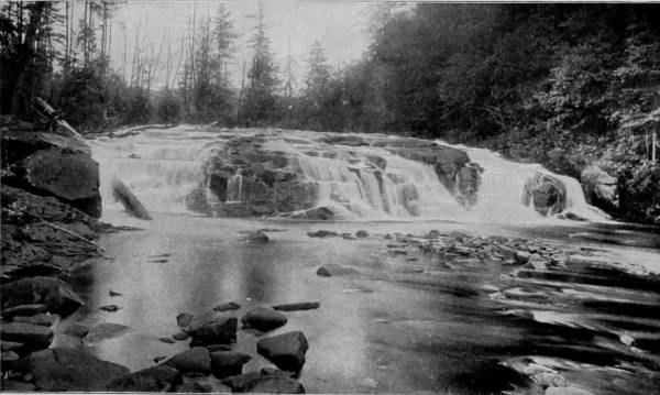
BUTTERMILK FALLS, ADIRONDACKS.
Those who visit the Adirondacks in search of the wildest beauties of nature will not make the trip in vain. Within this district there are said to be no less than 1000 lakes, and 500 mountain peaks, several of which rise to the height of 5000 feet. It is the Switzerland of America, in the same degree that America is greater and grander in all respects than any of the countries of the Old World.
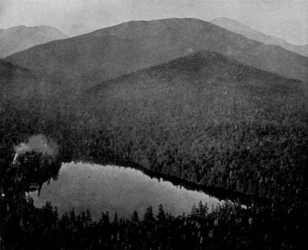
ADIRONDACK LODGE AND CLEAR LAKE.
Some of the loftiest peaks are Mounts Morris, Marcy, White-Face, Seward, Pharoah, Dix and Snowy Mountain, and of the lakes there are Tupper, Saranac, Long, Avalanche, Clear, Henderson, Raquette, Newcomb, Pleasant, and many others scarcely less in size and famous for the game-fish that swarm in their transparent waters. As a hunting-ground the Great North Wilderness, as it is often called, is probably the best now to be found anywhere in the United States, abounding as it does in deer, bear, panther, wolf, wolverene, and immense numbers of smaller game, so that whether lost or found, a man with a loaded gun need never go hungry in the Adirondacks.
It is not surprising that a region noted for its mountains, lakes and dense forests, should abound with features magnificently picturesque; and those who visit the Adirondacks in search of the wildest beauties of nature will not make the trip in vain. It is the Switzerland of America, equaling the best scenery of that country, and exceeding it in some respects, notably its intricate chain of lakes, its flaming chasms, and the solitudes of its deep wildernesses, so tangled and intricate that more than two-thirds remain yet to be explored. Night in these fastnesses is inexpressibly doleful and at times fearful. The Black Forest of Germany is not nearly so lonely, nor is the Brocken so ominous with its colossal specter as the mountain summits of the Adirondacks, clothed with evergreens and groves of birch, maple, beech, ash and cedar, in which the bear, wolf and wild-cat have their lairs. In these wild seclusions, the recesses of dark valleys and the dreary isolation of soaring peaks, darkness is enthroned and veiled by shadows, amid which savage animals and dusky night-birds hold their carnivals. The catamount sets up a chilling wail that brings response from the deep-voiced loon that keeps his lonely watch on a lake far below; then across a stretch of deep wood falls the hooting echo of a solemn owl, whose complainings excite condolement of whip-poor-will and katydid, and the chorus thus begun is taken up and joined in by a thousand whimpering, screeching, strident and wailing things that make the lonesome forest their assembling place.
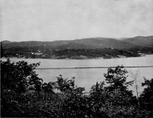
WEST POINT FROM EAGLE’S NEST.—This view of West Point, as all who are familiar with the scene will readily perceive, is taken from the opposite side of the Hudson River. It is historic ground, close to the place where Arnold lived and plotted his treason; where Washington passed so often to and fro during the times that sorely tried men’s souls; and in the immediate vicinity of many other incidents that brighten the pages of our country’s history with the glory of their renown. West Point and the picturesque region around it must forever hold a high place in the esteem and love of the American people, both for their historic associations and artistic beauty.
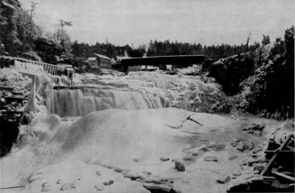
RAINBOW FALLS IN WINTER, ADIRONDACKS.
But when the sun is above the mountains and setting the landscape aglow with cheerful beams, these same fastnesses are a realm of romantic delight, for every peak is reflected in some lovely lake, while waterfalls appear to be pouring out of the sky and go chasing down the verdant slopes playing high-spy among the coverts and making the woods musical with their laughter. Near Ausable Ponds, guarded by Mount Marcy, are the beautiful Rainbow Falls, a very flood of opals, so iridescent does it appear when its waters catch the sunbeams. And near Tupper Lake are the Bogg’s River Falls, or cascades, that make the surrounding forest resound with their roaring, for they discharge an immense flood over a rock-infested course, and swell into a river a mile below.
Near the western margin of the Adirondacks is Long Lake, narrow as a river and many miles in length, but so still and crystalline that the lordly lake-trout may be seen sporting in its deepest water, as if challenging an angler. Its outlet is by way of a stream that flows by Owl’s Head and into Forked Lake. Between these points is Buttermilk Falls, stately and impetuous, but symmetrical and rhythmic, as it courses over gentle terraces and drops, step by step, into the rapids which crowd from shore to shore and keep the stream in a state of constant agitation.
Northeast of Buttermilk Falls is Adirondack station, on Henderson Lake, which is the central point of this whole mountain region, and a place where tourists are usually found in large numbers. Near the north end of the lake is Wall-Face Mountain, commanding an extensive view, and midway is Indian Pass, which is a tremendous chasm through what is known as the Dismal Wilderness. Notwithstanding the large number of visitors who annually summer in the vicinity, so dense is the forest and jungle-growth that surrounds the Pass, and so inaccessible the deepest portions of the gorge, that very few explorers have succeeded in making their way through it, and no one is sufficiently familiar with the region to act as a competent guide. It has been ascertained, however, that within the Pass, which is intersected by several streams, are springs which are the source of Ausable River, which, emptying into Champlain, finds an outlet into the Atlantic by way of the St. Lawrence, and also of the Hudson, whose drainage is in the opposite direction; and yet so close are these springs that it is possible to drink from each without shifting one’s position. In this vicinity is Gill Brook, which is picturesquely broken by Surprise Falls, composed of a succession of sharp leaps over limestone ledges, but so narrow that the forest trees form a perfect canopy above, excluding a sight of both river and falls until the visitor approaches within a few feet of the stream. But the entire region so abounds with lakes, mountains, gorges, waterfalls and cataracts that to describe all its attractions would be wearisome iteration, for there is an unavoidable sameness in the pen-pictures of scenery, however variable in character.
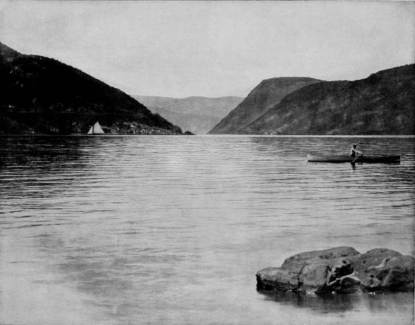
THE HUDSON NARROWS, NEAR PEEKSKILL.—In the whole world we do not believe there is another river which shows such a diversity of splendid scenery as the Hudson. There is hardly a point or bend in the river that does not present a view worthy of an artist’s enthusiasm. Commencing high up near its source in the Adirondack Mountains, where it is broken into many beautiful rapids and waterfalls, and continuing on down past Troy, Albany, the Catskills, famous in legend, poem and story, to the celebrated Highlands, there is a constant succession of splendid and ever-varying scenery, unsurpassed by any other water-course in the world.
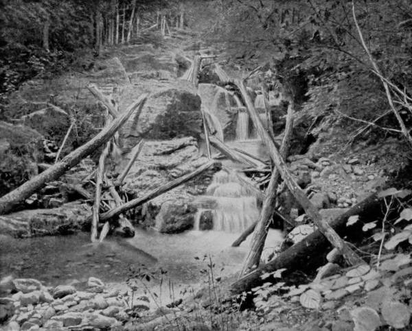
SURPRISE FALLS AND GILL BROOK, IN THE ADIRONDACKS.
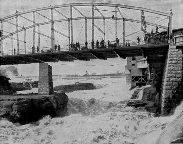
BRIDGE OVER GLEN’S FALLS, NEW YORK.
Having made a tour of the Adirondacks, and taken many photographs of the superb scenery which distinguishes it, we took train at Saranac Lake station, the southern terminus of the Chateaugay Railroad, and returned to Plattsburgh. From that point we proceeded south by the Delaware and Hudson Railroad, along the west shore of Champlain, by Ticonderoga, and thence to Glen’s Falls, to obtain a picture of the Hudson where it pours over rocky ledges in great volume and is converted into a terrible cataract that is worth many miles of travel to see. Our way was then continued southward to Albany, and thence into the Catskills, which begin about one hundred miles south of the Adirondacks. These mountains are unlike any others in America, in that while every other range possesses peaks with jagged points, generally of stones tumbled in confusion, the Catskills have gracefully rounded summits, which, though sometimes rising to a height of four thousand feet, yet exhibit few effects of aberrant forces; nor are they covered with huge rocks, such as characterize all other ranges. The scenery, therefore, while grand, is very tame as compared with the Adirondacks, and but for the fine drive-ways through the valleys and over their crowns, would be monotonous. But this sameness is occasionally diversified, and the visitor is led on to expect more beauties than he really finds. The one attractive and justly famous feature of this mountain region is Kaaterskill Falls. These are reached by the Catskill Mountain Railroad from Catskill, on the 377Hudson, stopping at Mountain House station, from which eminence, 2,250 feet above the river, an extensive view may be had, taking in Albany, the Hudson Highlands, Berkshire Hills and the Green Mountains. It is even said that by means of a good glass on a clear day portions of Massachusetts, Connecticut and New Jersey may be descried, but during our visit the atmospheric conditions were unfavorable. Two miles from the Mountain House, and reached by a beautiful road, are the celebrated Kaaterskill Falls, at the head of which is located the Laurel House, from which a fine view of Round Top and High Peak may be had, as well as of the falls themselves. But the best sight is obtained by descending a spiral stairway into the gorge below and looking upward. The falls are formed by the overflow of North and South Lake, which pours through a double cleft and descends in two cascades, the first having a drop of 180 feet, and the second eighty feet; but a short distance below there is another fall, known as the Bastion, which has a further descent of forty feet. Beautiful as they are, candor compels the statement, however disparaging it may appear, that the falls are remittent, and that people may visit them without seeing any such display of waters as we have described. The supply being limited, a dam has been constructed across the verge of the cliff, and is opened only on special and rare occasions, when the number of incredulous summer visitors is great enough to make it necessary to turn on the water, to show that the falls are still active. There is some very pretty scenery in the region of Kaaterskill Clove, notably Hains’ Falls, Fawn-Leap Falls and High Rocks, but a fee is charged at every point of interest, and the visitor is so harrowed by the showmen of nature that he is in no disposition to appreciate the view which he pays to see, and is almost certain to leave the Catskills with a bad impression—even worse than the mountains 378deserve. It was with such feelings that we set out by rail for Kingston, and there took boat down the Hudson River for New York, but stopped for a while at West Point en route.
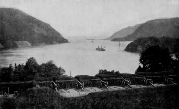
LOOKING NORTH FROM WEST POINT, NEW YORK.
The scenery about West Point is of almost matchless grandeur, and every consideration is present to confirm the wisdom of the Congress of 1812 in establishing a military training-school at this point. The fort on the river-shore is in a position to command the approaches north and south, while at the foot of the highlands is a level stretch, as though prepared by nature for a Champ des Mars, or parade-ground. The hills rise abruptly from the rear of the training-plaza, and from their summits an inspiring view is to be had. Sweeping the horizon, we clearly discern the Break-Neck, Crow’s Nest, and Storm King Mountains, with blue valleys stretching away between, and the majestic Hudson washing the feet of these and many other noble hills. The academy, besides being scenically and advantageously situated, is in a very realm of romance, around which cluster many memories of the greatest writers of fiction that our country has the honor of claiming. It was the Crow’s Nest that gave the inspiration to Joseph Rodman Drake for his exquisite poem entitled the “Culprit Fay,” so charmingly realistic that the fairies of his verse still exist in fancy, just as the mountain spirits who tricked Rip Van Winkle still haunt the deep forests of the Catskills and play at nine-pins on the peak that overlooks the faded village of Falling Water. Near Cold Spring, which is in this same historic land, was “Undercliff,” the home of George P. Morris, and where he wrote that patriotic and moving tribute to a sheltering tree, the figure of our American Union, “Woodman, Spare that Tree.” So was “Idlewild,” the villa of N. P. Willis, close-by, and hereabout also Washington Irving spent much of his time gathering traditions from descendants of the old Dutch colonists for his imperishable “Sketch Book” tales. But history as indelibly fixes West Point in the minds of Americans as the stories of famous fiction-writers, for the site of the training-school was, in Revolutionary times, occupied by Fort Putnam, erected under the direction of Kosciuszko; and it was at West Point that Benedict Arnold consummated his traitorous deal with Major Andre, to deliver that post into the hands of the British. On the opposite shore is the mouth of a pretty stream called the Mooda, but which in earlier times was known as Murderer’s Creek, on account of the slaughter by a band of lurking savages of eight soldiers who were sent with buckets to fetch water for the camp near-by. A little way below is Milton’s Ferry, a spot famous as the place of residence of a patriot blacksmith who made the great chain that stretched across the river at old Fort Montgomery, to prevent the passage of British ships. For this service he was taken captive shortly after and kept in close confinement on an English ship until his death. Newburgh is also only a few miles away, smiling benignly from terraced banks upon the river below; and conspicuous among its old houses is one in which Washington had his headquarters in 1780, and which is changed but little in appearance since he occupied it.
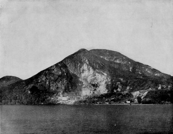
BREAK-NECK HILL, ON THE HUDSON RIVER, NEW YORK.—Break-Neck Hill is on the east side of the Hudson, north of West Point, and is a continuation of the Highlands. It is 1220 feet high, and one of the most commanding features of the splendid scenery of this region. Its rock-ribbed and serrated sides present a scene of imposing grandeur as they are observed from the decks of passing steamers; and in the summer season, when the sloping sides, from the water’s edge to the summit, are clothed in emerald green, with the gray rocks peeping out here and there, disclosing shaded nooks and sylvan glades where the birds sing and the squirrels play and frolic, the scene is inspiring enough to arouse the enthusiasm of a stoic.
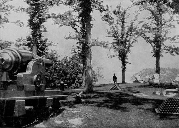
TROPHY GARDEN, WEST POINT.
It is below West Point that the principal places of scenic and historic interest occur, and these crowd rapidly upon one another until Yonkers is reached. At the base of Sugar-Loaf Mountain is a bluffy projection upon which Fort Independence, of Revolutionary times, was built, and near-by is Buttermilk Falls, that runs down a succession of sharp ledges one hundred feet. Anthony’s Nose is on the right, rising to a height of nine hundred feet, and overlooking beautiful Ionia Island, that seems to swim upon the glassy surface of the river, like the halcyon isle of fable; but on close approach its three hundred acres are found to be covered with vineyards and its shaded margins the favorite gathering-place of merry picnickers.
The Highlands come next in view, of which Dunderberg Mountain, eleven hundred feet high, is the most prominent object; and then appears Peekskill, the prettiest town in eastern New York. Near this place is Caldwell’s Landing, distinguished as being the immediate vicinity of Captain Kidd’s buried treasure, which hundreds have searched for with great energy and at immense expense, but without reward. Remains of Revolutionary forts are seen at Verplanck and Stony Point, and below these the Croton River discharges into the Hudson. Sing Sing and Nyack are passed in order, between which the shores are occupied with charming villas, and the landscape here is very picturesque. But it is at Tarrytown that visitors find most to interest them, both for the scenic beauty of the neighborhood and the historic prominence which attaches to the place. Here it was that Major Andre was arrested, the identical spot being marked by an inscription in the village records. The spirit of Washington Irving seems to pervade the locality, for it was in this vicinage that the creatures of his exquisite fancy held their lively revels. Sleepy Hollow is near-by, and the old bridge over which Ichabod Crane so furiously rode in his flight from a headless specter is still shown to visitors as a proof of that legendary race. The Christ Church which Irving attended in Tarrytown has not been suffered to lapse into decay, and the cemetery adjoining the old Dutch church, in which his remains find rest, shows the reverend respect with which his memory is treasured by the villagers, for it is well tended.
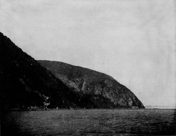
STORM-KING MOUNTAIN, HUDSON RIVER.—Storm-King is above West Point and on the same side of the river. It soars to a height of 1529 feet, commanding from its lofty summit a magnificent view of what is perhaps the finest scenic region of the world. At its feet reposes the lovely vale of Tempe, a modest stretch of green meadow-land covered with gardens and rustic homes, where the weary merchant and the harassed broker may find relief from the turmoil and the busy rush of city life. Since our photograph was taken an immense cantilever bridge has been thrown across the river at this point, which, while it is a splendid and beautiful example of modern engineering, is nevertheless an impediment to the artistic features of the scenery.
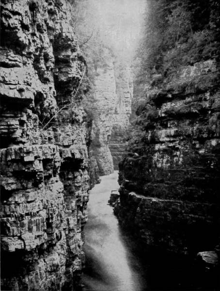
LONG GALLERY, AUSABLE CHASM.
“Wolfert’s Roost,” or Sunnyside, Irving’s villa, is a few miles below, just within the edge of Irvington, on the river, but it is hidden from view by the ivy that clambers in profusion over its walls, and the dense shrubbery that has been allowed to occupy all the ground in the front-yard.
The old town of Tappan is a short distance from Sunnyside, and is memorable as being Washington’s headquarters and likewise as the place of Major Andre’s imprisonment and execution. A monument erected by Cyrus Field marks the spot where the gallows stood on which that English officer perished. The Palisades next come into view, and on the west side is Locust Hill, which was the place where the American encampment was established in 1781, along the eminences of the Palisades which gave a commanding position to the troops guarding against invasion of the British up the river. Yonkers, Spuyten Duyvil, and Mount St. Vincent are next passed, and the city of New York then looms up, with its wharves lined with vessels, whose numerous masts make the shores look from a distance like a forest of pines denuded of their branches. Here we tarried to await the coming of our two photographers.
In the meantime, however, there were no idle moments, for the work of developing the photographs which we had taken was now prosecuted with great energy, and the finished pictures were sent on as fast as made to our photo-engravers for reproduction. Fortunately, too, we had so accurately timed the work which each had undertaken that there was only a few days’ detention in New York; little more, in fact, than was necessary to complete arrangements for our tour of the South, now to be described.
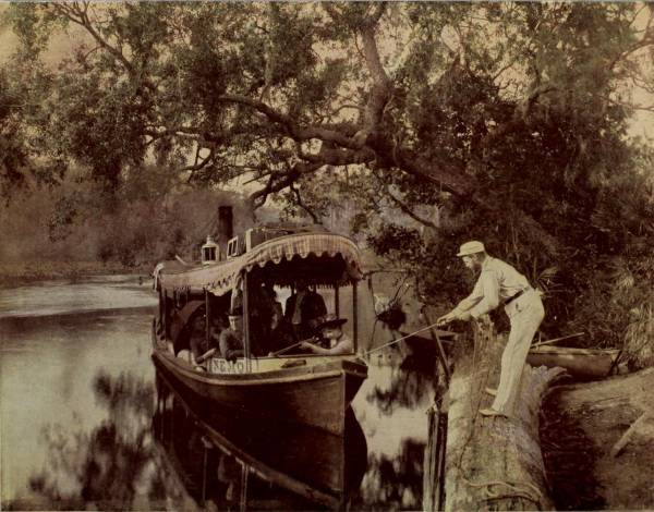
WINTER IN FLORIDA.
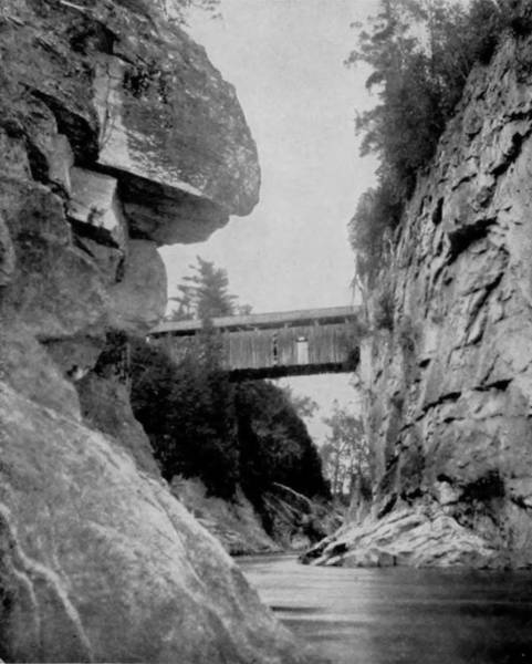
WINOOSKI RIVER GORGE, VERMONT.

As explained in the preceding chapter, one of our photographers was despatched into Canada from Ogdensburg, and instructed to take views of the most pleasing scenery of the Dominion, after which to make a tour of the Eastern States and join the others at New York upon the completion of his labors in that section. While Canada is not a part of the United States, its contiguous scenery, some of which is very beautiful, and the intimate relations subsisting between the two countries justify this brief departure from our original design, particularly as the most direct route from the West to Northern New Hampshire and Vermont, is through the southern part of Canada, where the most interesting and accessible scenery is found. Crossing the St. Lawrence at Ogdensburg to Prescott, our artist proceeded to Ottawa, fifty-four miles distant, by the Canadian Pacific Railroad, for the purpose of taking views of Chaudiere Falls, which are famous alike for their size and grandeur. The city of Ottawa extends for a distance of two miles along Ottawa River, and is one of the most picturesque sites in Ontario, located as it is on the banks of a beautiful stream, and in the center of a region that is famous for its charming scenery. The Rideau River debouches into the Ottawa at Chaudiere (Caldron) Falls, and its bluffy shores, 160 feet high, are ornate with splendid buildings. The Rideau Canal, which skirts the east side of Parliament Hill, separates the higher from the lower town, and south of this point is the vast lumber interests, manifested by the large number of saw-mills operated principally by power derived from the falls. But it is about Chaudiere Falls that chief attraction clusters, particularly of visitors, for a more entrancing sight can hardly be found in any part of North America. Ottawa River is a stream of considerable magnitude, both in width and depth, but at the point where the falls appear it is contracted to a width of 200 feet and then plunges over a precipice forty feet high, at the mouth of Rideau River. But the verge of the ledge is so ragged and curved that the stream is broken, and pours down in a swirling motion, which forms a very charybdis below, into which it is dangerous for crafts to enter. The volume discharged is almost as great as that of Niagara, and the power displayed is wonderful to behold. Beautiful, grand and amazing as they are in summer, it is during winter that the sublime magnificence of the falls is impressed upon the visitor. Several views, from different points of observation, were taken by our photographer, but these were rejected to give place to the winter scene here presented, since it affords a more perfect idea of the falls in their glory, when the Ice King has frozen them into a vision of superlative splendor.
Three hundred miles northeast of Ottawa, Montreal River, a small but noisy stream that is the outlet of a chain of lakes far up in the British possessions, flows into the Ottawa River, and twenty miles above its mouth are 384Montreal Rapids, a picture of which was obtained from a local photographer at Ottawa, and is here reproduced as affording an idea of the scenery in that great northern and almost unexplored region.
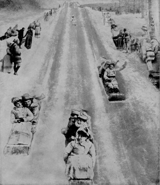
TOBOGGAN SLIDE AT MONTREAL.
From Ottawa the trip was continued by boat one hundred miles to Montreal. This route affords a view of Lake St. Louis, Nun’s Island, and Lachine Rapids, the most dangerous part of St. Lawrence River, yet it is every day traversed by pleasure steamers, of which a traveler has thus graphically written: “In the descent of these rapids we are wrought to a feverish degree of excitement, exceeding that produced in the passage of the Long Sault. It is an intense sensation, and though perfectly safe, is terrible to the faint-hearted, exhilarating to the brave. Opposite Lachine is the quaint Indian village of Caughnawago, where still reside descendants of the once-powerful Iroquois Nation. The immense steel bridge spanning the St. Lawrence at this point is justly considered one of the engineering triumphs of the century. It was built by the Canadian Pacific Railway, is about a mile long, with two channel spans of 408 feet, and lofty enough to allow free passage to the largest steamers. From this bridge a fine view is obtained of the rapids, villages on either shore, loftiest structures in Montreal, and the distant mountains.”
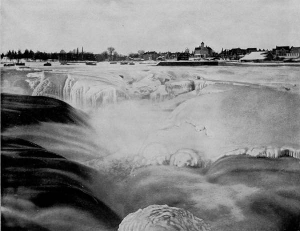
CHAUDIERE FALLS, NEAR OTTAWA, CANADA, IN WINTER.—These celebrated falls are at the junction of the Rideau and Ottawa Rivers, in the immediate vicinity of the city of Ottawa. The volume of water as it thunders over swirling precipice is almost as great as that of Niagara, and the power displayed is wonderful to behold. Beautiful, grand and amazing as these falls are in summer, it is during the winter that their sublimest magnificence is impressed upon the visitor, when the Ice King has frozen them into a vision of ravishing splendor.
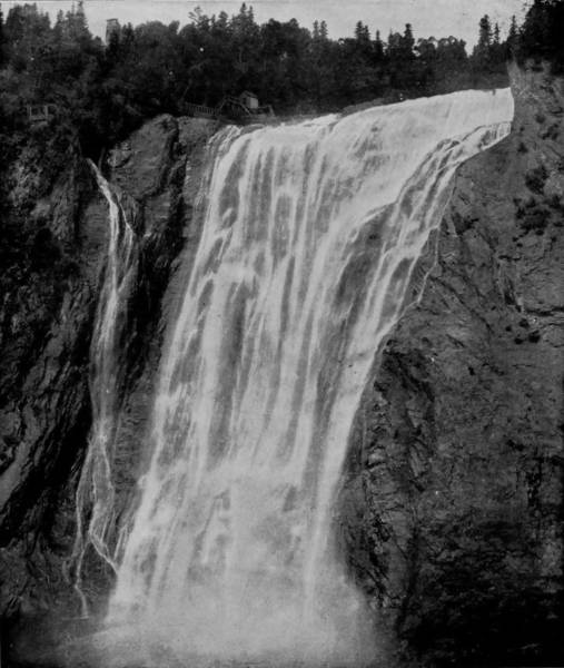
MONTMORENCI FALLS, NEAR QUEBEC.
Montreal is the metropolis of Canada, having a population of about 220,000, and being at the head of ship navigation, has improved its advantages and become the chief commercial port of the Dominion. The name is derived from Mount Royal, which rises 700 feet above the river, the eminence which Jacques Cartier ascended in 1535, and looked with startled eyes upon the palisaded Indian town of Hochelaga, surrounded by vast fields of grain, at the west base of the mountain. Sixty years later, when Samuel de Champlain made his way up the St. Lawrence and climbed to the summit of Mount Royal, he looked in vain for the town which Cartier had discovered and described. Only two of the native Indians of Hochelaga were found, from whom was learned the tragic history of the place, the inhabitants of which had been exterminated and the town destroyed by a rival tribe.
Montreal is situated on an island of the same name, and the eminences about it were so important as vantage-places that during the French and Indian wars (in 1665), the mount was fortified by the French, and in 1722 a citadel was erected on a height now laid out as Dalhousie Square. In its early history, therefore, the city was the scene of many incidents of Indian warfare, and was on disputed ground until the surrender of Quebec, in 1759, when the English gained permanent possession of the place.
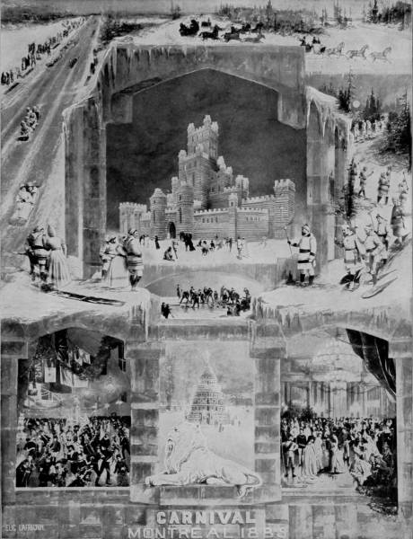
REPRESENTATIONS OF WINTER CARNIVAL SCENES AT MONTREAL.—Winter is the carnival season at Montreal, and for some years the city has been specially distinguished by the brilliant fêtes which her leading citizens have provided, notably that of 1888. On this occasion there were many scenes of extraordinary splendor, exceeding, in the magnificent sights afforded, the carnivals that take place on the frozen waters of the Neva River, before the Russian capital of St. Petersburg, famous alike in song and story. The great ice palace was a most exquisite imitation of mediæval architecture, rivaling in its imposing and charming appearance the finest castles of the Old World.
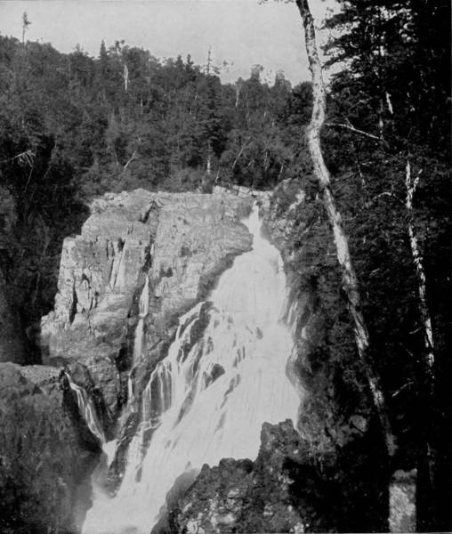
ST. ANNE FALLS, NEAR QUEBEC.
The scenery in the neighborhood of Montreal is pleasant, but not particularly attractive; yet the severity of the weather and the long reaches of graceful hills thereabout afford opportunity for the most enjoyable winter sports. Tobogganing is a favorite pastime in season, and the most charming scenes imaginable may be witnessed by a visit to the west side slide when a heavy snow has prepared the ground for the host of red-cheeked merry-makers, who flock there by thousands with their toboggans, and fly down the hill in long lines of variegated color. Winter is the carnival season, and for some years Montreal has been specially distinguished by the brilliant fetes which her leading citizens have provided notably that of 1888. On this occasion the city was a scene of extraordinary splendor, exceeding, in the magnificent sights afforded, the carnivals that take place on the frozen waters of the Neva River, before the Russian capital of St. Petersburg, famous alike in song and story. The great ice-palace, of which an illustration is here given, was a most exquisite imitation of mediæval architecture, rivaling in its imposing and charming appearance the finest castles of the old world. When illuminated by thousands of lights, the palace presented a scene which must ever remain fadeless in the memory of those who witnessed it. But to increase the beautiful effect, the city’s population turned out in the gayest of winter attire, filling the spacious ball-room of the palace with a marvelous display of color in graceful evolution, while outside the gay revelers sported as jolly maskers and filled the air with songs of glee. A similar carnival was held at St. Paul in 1889, and an ice-palace of equal proportions was constructed in honor of the Frost King, with grand illuminations and display of fire-works at night, as illustrated in a previous chapter, but no fete ever given on the western continent is believed to have been so magnificent as that of Montreal in 1888.
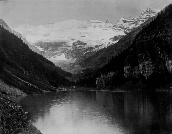
SCENERY ALONG THE LINE OF THE CANADIAN PACIFIC RAILWAY.—The finest scenery along the line of this railway is to be found in the distant Northwest, where it passes over the Rocky Mountain range; but in many other places there are views both splendid and imposing. The lakes and the mountains photographed in this page belong to the Rocky Mountain region, and they are part of a series of views that would do credit to the most famous scenic regions of the world. They are in the midst of perpetual snow and vast glaciers, where all the wonders of the Swiss Alps are reproduced on a gigantic scale.
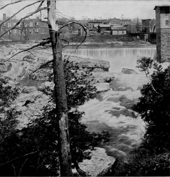
WINOOSKI FALLS, VERMONT.
From Montreal the journey was continued over the Canadian Pacific Railroad to Quebec, distant one hundred and thirty-five miles, and along the north shore of the St. Lawrence, in sight of that river most of the way, so that the view is a very attractive one. Quebec, the third largest city in the Dominion of Canada, with a population of 70,000, has much to recommend it, both commercially and scenically, for it is the center of vast lumber and mining interests, the head of navigation for the largest steamers of the line, and is advantageously located on a headland commanding the St. Lawrence. A large part of the city lies under what is known as Cape Diamond Promontory, upon the summit, of which, 350 feet above the river, is the Citadel, a fortification so nearly impregnable that Quebec has been called the American Gibraltar, a designation more deserved because of the many attacks which its garrisons have repulsed. The Plains of Abraham are southwest of the suburb of St. Louis, and from that eminence a wide and truly magnificent view is obtained, extending to the Green Mountains on the south and the Laurentian Range on the north, with glimpses of numerous rivers and lakes between.
The entire province of Quebec is remarkably well watered and timbered, with sections of forests so dense that much of it still remains to be explored. Eight miles from the city are the famous Montmorenci Falls, which have a leap over natural steps of 250 feet and pour down an immense volume, whose roaring may be heard on calm days for a distance of many miles. Near the falls is a hotel called the Haldimand House, which was once the residence of Queen Victoria’s father, the Duke of Kent. Sixty miles north, and reached by the Quebec and Lake St. John Railroad, is Lake St. John, a large and pellucid body of water whose outlet is the Saguenay River, and one of the most wonderful streams on earth. Bayard Taylor says of it: “It is not properly a river, but a tremendous chasm, like that of the Jordan Valley and the Dead Sea, cleft for sixty miles through the heart of a mountainous wilderness. Everything about it is hard, naked, stern, silent. Dark-grey cliffs of granite gneiss rise from the pitch-black water; firs of gloomy green are rooted in their crevices and fringe their summits; loftier ranges of a dull indigo hue show themselves in the background, and over all bends a pale, cold, northern sky.”
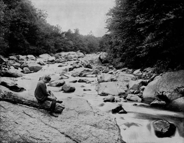
A SYLVAN STREAM IN VERMONT.—Vermont is rich in scenery as well as historic and classic associations. The Green Mountains, extending through the entire State from north to south, with their many spurs and outlying peaks, and the numerous lakes and small streams in the intervening valleys, afford a variety of scenery of the most pleasing and picturesque character. There is a wealth of splendid views along the Winooski River, whose source is in the spurs of the Green Mountains, whence it flows northwestwardly, cleaving the range near its junction with the Waterbury River, and then speeds through a wild gorge until it empties into Lake Champlain a few miles distant.
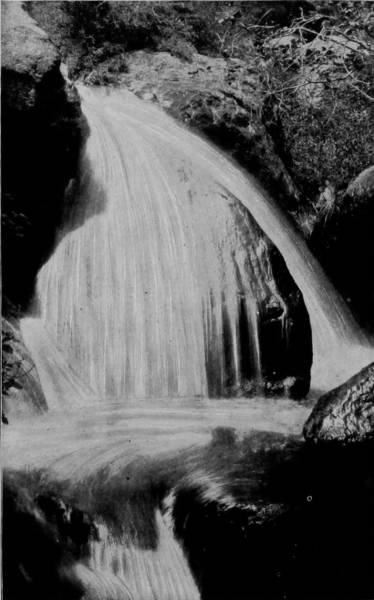
PEACOCK FALLS, GREEN MOUNTAINS.
The Saguenay is sometimes called the River of Death, on account of its sombre waters and the deep gorge through which it sluggishly moves. Its depth is also remarkable, ranging from 100 to 1000 feet, and along its course are several pretty falls, where the stream suddenly contracts, and rapids where it expands and the occasional shoals appear. The country about Quebec is pleasingly diversified, and abounding with forests and lakes is a very paradise for hunters and fishers, as well as affording views worthy of the artist’s best efforts. Some ten miles above the city, and forming an outlet for Lake Megantic, on the south side of the St. Lawrence, is Chaudiere, or Boiling River, an impetuous, but noble stream, whose erratic course is interrupted by Chaudiere Falls, where the river takes a plunge over a precipice 125 feet high and 350 feet wide. Having expended its vigor in this violent exercise, the river flows on thenceforth in a subdued and gentle manner, in remarkable contrast with the character which it displays above the falls.
Other famous falls in the vicinity of Quebec are those of the Scuzzie, near North Bend, and St. Anne Falls, on the north shore of the St. Lawrence, twenty miles below the city, where the river St. Anne, a small confluent of that stream, breaks over a brink one hundred feet high, and pours through crevices worn in the Laurentian rocks in a succession of cascades of great beauty. While the scenery of Southern Canada is very charming, it is the boundary outposts of very much more magnificent landscapes towards the south, and it was towards the mountainous districts of Vermont and New Hampshire that our artist bent his way after concluding a tour of the vicinity of Quebec. The journey was, therefore, by way of the Grand Trunk and Vermont Central Railroad into the heart of Green Mountains. This route took our photographer by the Enosburgh Falls, St. Albans and Essex Junction, from which latter place a detour was made down the 393famous Winooski River to embalm some of the remarkable scenery along that stream. Its source is in the spurs of Green Mountains, whence it flows northwestwardly, cleaving the range near its junction with Waterbury River, and then speeds through a chasm until it empties into Lake Champlain. This wild gorge is particularly wonderful some four or five miles from the lake, the walls rising at places fully one hundred feet and exhibiting the same cleavage and jagged precipices that distinguish Ausable Chasm, on the opposite side of the lake. At the town of Winooski, the river flows over a dam two hundred feet wide and twenty-five feet high, but before the dam was constructed, to afford power for several mills, the river here was a long stretch of cascades and cataracts, a condition which is still continued below the falls and to its place of outlet. From Essex Junction the Vermont Central follows the Winooski to Montpelier, passing the beautiful town of Waterbury, which is the pass of Green Mountains and the center of some of the finest scenery in the State. From Waterbury it is only ten miles by stage to Mount Mansfield, which is the loftiest peak in the range (4,389 feet), and from the summit of which a splendid view is had of lovely valleys, gushing streams and battalions of graceful mountains. In this same vicinity, checkered by many mountain streams, are Peacock Falls, Bingham Falls, Moss-Glen Falls, Morrisville Falls, and others of lesser note but equal beauty. At the base of Mansfield Peak is a stage station, called Stowe, from which the crown of the mountain is plainly observable, exhibiting the distinct features of a giant, whose forehead, nose and chin are formed by two rents in the summit, making the proportions, as well as the outlines, so perfect that visitors are quick to discover the likeness even before a guide calls attention to it. Camel’s Hump is another mountain, five miles from Waterbury, the second highest in the range (4,000 feet), but its surface is so broken that no wagon-road has as yet been made to the summit, but a horse may be ridden to the top, and the ascent, accomplished at whatever expense of effort, is well repaid by the magnitude and magnificence of the scenery thus brought into view. Balton Falls are within five miles of the Hump, and are a shrine of beauty to which hundreds of summer visitors pay the tribute of admiration.
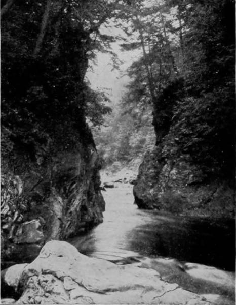
CLARENDON GORGE, VERMONT.
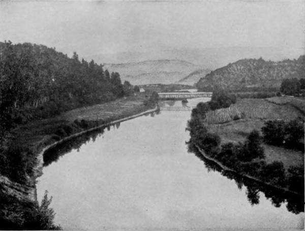
WINOOSKI RIVER, NEAR MIDDLESEX, VERMONT.
From Montpelier the Vermont Central turns south, following a tributary of the Winooski to Roxbury, thence it strikes the valley of 394White River, down which it continues to the Connecticut River; but this latter region is more subdued than the section just described. The scenery, while not so grand and mountainous, possesses a beauty to excite the fancy of a poet and day-dreamer, for the views are of gentle meandering streams roaming through woods where fairies might love to dwell, singing their lonesome lullabies to the deep coverts that bend low along the shores. Dainty waterfalls, murmuring rapids, sylvan shades, distinguish the way of many brooks that roll out of mountain springs and run down to the sea, giving drink to the farmers’ herds, trundling old water-mills, and doing many kind offices on the way.
Another branch of the Vermont Central runs due south from Essex Junction and Burlington, on the shore of Lake Champlain, and passes through many thriving villages, such as New Haven, Middlebury, Brandon and Rutland. At this latter point, which is on a considerable stream called Otter Creek, some very charming scenery occurs, not entirely confined to the creek, which, however, is a stream almost as remarkable as the Winooski. At a place called Clarendon Gorge the creek flows through a chasm some thirty feet deep and so narrow that when the foliage of the banks is heaviest the stream is almost entirely hidden by the overlacing branches of opposite trees. Here the stream makes a sharp turn, and in doing so has cut deeply into the rock-shore against which it strikes, and formed a deep pool in which fish fairly swarm, and hence at all seasons the angler here may find the choicest sport. The Green Mountain Range is within five miles of Rutland, and several outlying peaks are much nearer, such as Paco, Killington, Shrewsbury and Bald Peaks, which are of sufficient altitude to give the summit-observer a good view of Lake George and the Adirondacks. The road continues southwest from Rutland through a pass in the Green Mountains at Healdville and joins the more eastern section at Bellows Falls, on the Connecticut River.
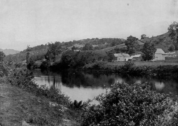
A RURAL SCENE IN VERMONT.
At Montpelier our photographer proceeded due east over the Montpelier and Wells River Railroad to Woodsville, a route which follows 395a third confluent of the Winooski for some miles to Marshfield station, where it makes an elbow-turn southwest by Peabody’s Lake, and thence keeps close to the bank of Wells River, a small stream that discharges into the Connecticut at Woodsville. The region thus traversed is somewhat broken, but is highly cultivated; and the farm scenes along the way are particularly charming. Agriculture in the Eastern States exhibits a striking contrast with that in the West, and in Vermont and New Hampshire the dissimilarity of method and the size of farm is especially great. The soil down east, in the sections named, has to be reclaimed, not from the forests so much as from the rocks, for it is essentially a rocky country. The fences are usually made of stumps and stones, material which is plentifully at hand, so that the barb-wire trust has no grip upon New England agriculturists. The farms, too, are what Westerners would call “small acre-patches,” but they are so industriously and intelligently tilled that every foot of ground is made to yield its full capacity. Frugal, yet hospitable—poor, maybe, yet refined—the down-east farmer is a hard worker, a lover of books, patient, contented, and, withal, a generous man, philosophic and industrious enough to extract happiness out of harsh natural conditions.
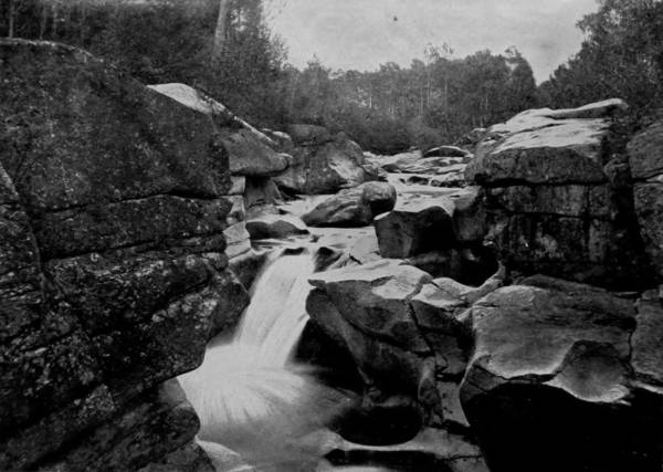
FALLS OF THE AMMOONOOSUC, IN THE WHITE MOUNTAINS.
Woodsville is at the junction of the Ammoonoosuc with the Connecticut River, along the valley of which former stream the railroad runs until it strikes the White Mountains, into which region of world-famous scenery our artist journeyed. A branch of the road extends south to a terminus at Profile House, which is at the base of Profile Mountain, in the Franconia Range. This peak, which is 4,000 feet above the sea, possesses two remarkable features that have served to make it known throughout the world. At the crown there are several colossal stones, so distributed by chance that when viewed from Profile Mountain House they resemble a mounted cannon, on which account the peak is often called Mount Cannon. But a greater natural curiosity occurs to visitors after 1,200 feet of the ascent is made, for suddenly there appears the bold and exceedingly well-defined features of “The Old Man of the 396Mountains,” formed by three masses of rock so disposed that its ninety feet of face exhibits the clean-cut characteristics of forehead, nose, lips and chin perfectly outlined against the sky. A few feet below the point of observation, where the old man’s face is exposed, the stone giant changes his features like a magician and becomes “a toothless old woman in a mop-cap.” Hawthorne has used this wonderful image to excellent effect in his “Twice-Told Tales,” in which the Great Stone Face is made the subject of a weird theme. Still nearer the base of the mountain is an exquisite lakelet known as the “Old Man’s Wash-bowl,” just large enough for the purpose, but full of fish, and from the shore of which a splendid view of Eagle Cliff may be had. In the immediate neighborhood is the lofty peak of Mount Lafayette, 5,269 feet above the sea, from whose wind-swept head a landscape of marvelous diversity and beauty may be surveyed, including miles of the Green Mountain Range and the entire aggregation of White Mountain peaks.
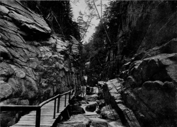
THE FLUME, NEAR PROFILE HOUSE, FRANCONIA MOUNTAINS.
Less than one mile from Profile House, and reached by a perfect carriage-road, is Franconia’s chiefest marvel, known as the Flume. Six hundred feet of cascades go churning their way through a fissure whose vertical walls are sixty feet high and less than twenty feet apart. In this chasm is the Flume, along the narrow confines of which a plank-walk has been built to permit visitors to observe more closely the wonders that nature has planted along this mountain brook. One mile south are the Georgianna Falls, the largest yet discovered in the mountainous districts of the State, plunging in successive leaps over two precipices, each eighty feet in height, and scattering their spray into vapor that keeps the vicinity drenched. Other mountain or detached peaks near-by are Lincoln, Liberty, Flume, and Big Coolidge; while further towards the east, yet in sight, are North, and South, Twin, Lowell, Carrigan and Huntington, from any of which magnificent views are obtainable.
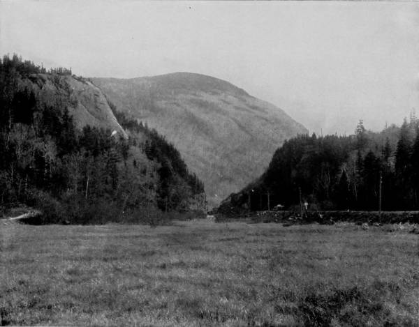
ELEPHANT’S HEAD AND MOUNT WEBSTER, NEAR CRAWFORD, NEW HAMPSHIRE.—Standing on the piazza of the hotel at Crawford’s Notch one observes a splendid view of that celebrated natural wonder, Elephant’s Head. The enormous head and trunk seem to be just emerging from the deep woods near the entrance to the pass, and the gray of the granite slope serves to heighten the illusion. The resemblance is so perfect and striking that even a stranger who had never heard of this marvel would need no introduction to be made fully aware of the fact that he was in the presence of the colossal counterpart of the great beast.
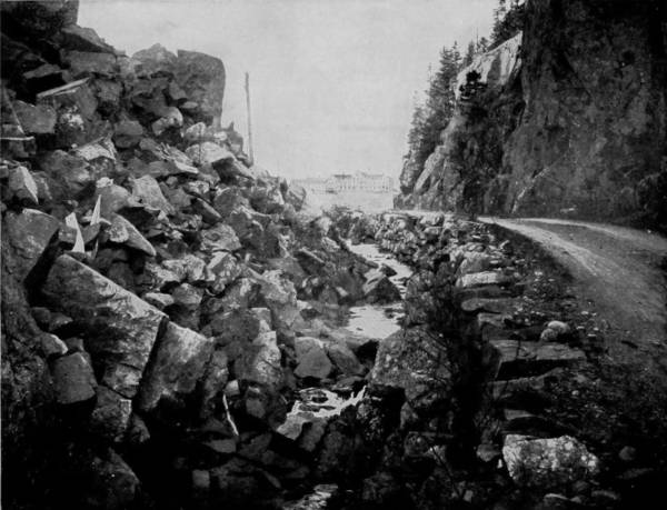
CRAWFORD HOUSE NOTCH, NEW HAMPSHIRE.
Turning back north from Profile House, our artist proceeded west from Bethlehem Junction over the Maine Central Railway, and after a short ride reached Fabyan’s, where the scenery of the White Mountains broke upon his enraptured vision in all its glory. Two miles below is Crawford’s Notch, the natural pass into the range, and here the visitor has his surprise as well as admiration quickened by a sight of the “Elephant’s Head.” Standing on the piazza of a hotel at Crawford’s, the enormous head and trunk seem to be just emerging from the deep woods near the entrance to the pass, and the gray of the granite slope serves to strengthen the illusion. From the Elephant’s Head Hotel there is a particularly fine view of the Notch, a gigantic cleft through which the Titans may have forced a way, but which is now utilized by the railroad. It is from this point that excursions to the summit of Mount Washington, by way of the bridle-path opened by Thos. J. Crawford in 1840, are made. A great majority of persons prefer the easier ascent by means of the cog-wheel railroad, which was completed in 1869, and requires one and one-half hours to make the trip, the fare being $6.00. The summit of Mount Washington is 6,293 feet above sea level; and as the rail distance is three miles, the grade is very great, in one place being a rise of one foot in three, or 33 per cent. To secure perfect safety the track is composed of three rails bolted to a trestle of heavy timbers, the center rail being an immense wrought-iron ladder, with rounds four inches apart, into which the cogs of the locomotive drive-wheels fit, and thus drag the train up the steep, as well as control it in making the descent, though automatic air-brakes are used in emergencies. But though the rail route, in swinging seats, is more comfortable and expeditious, if time be any consideration, the carriage-road is almost as popular with travelers, who, as a rule, are willing to make sacrifices, if by so doing they obtain the recompense of grander sights. As our artist had made the ascent of Pike’s Peak by car, he concluded to take in the larger experience of gaining the summit of Mount Washington by stage, that he might be better able to report the contrast. Though the distance by rail is only three miles, by wagon-road it is ten, so winding is the way, and to add to the distress of the latter journey, the first four miles is toilsome without revealing any scenery worth the effort of a glance. But above the four-mile point the dreary, tame and desolate aspect is succeeded by a landscape that cannot be excelled for magnificence. It is here that the creaking stage emerges from the woods that hides the prospect and moves out upon the bare crags, and the Ledge House, or Half-Way Station, is reached, where a stop is made to rest the horses and give passengers opportunity and time to drink in the glories of the wondrous view that is thus presented. Far down below yawns the measureless void of a tremendous gulf, while above is a colossal pile of granite that supports the dome of Washington and a wide-spreading wilderness of tumult. Looking off in the distance from this natural observatory, the presidential peaks of Mounts Adams, Jefferson and Madison are plainly visible, whose aged sides are cloven by deep crevasses and their feet are hidden in gorges of tremendous depths; while a glance downward over the ragged tops of the forest trees discovers Peabody Glen and river, with a white spot in the fading distance that by aid of glass is found to be the Crawford House. Following the vale out to its entrance upon the Androscoggin Meadows, the vision sweeps up Mount Moriah, and traversing the Confederate Peaks to the summit of Mount Carter, finally rests upon the brow of Washington, which is almost overhead.
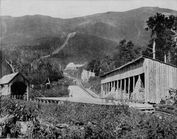
MOUNT WASHINGTON AND COG-WHEEL RAILROAD, WHITE MOUNTAINS.—The summit of Mount Washington is 6293 feet above the sea-level, and as the distance by rail is only three miles the grade is very steep, in some places as much as one foot in three. To secure perfect safety in ascending and descending such a tremendous grade, the track is composed of three rails bolted to a trestle of heavy timbers, the centre rail being an immense wrought-iron ladder, with rounds four inches apart, into which the cogs of the locomotive drive-wheel fit, and thus drag the train up the steep as well as control it, with aid of air-brakes, in making the descent. One and a half hours are consumed in making the round trip, and the fare is six dollars, but the view from the summit is so magnificent that it fully justifies the expense.
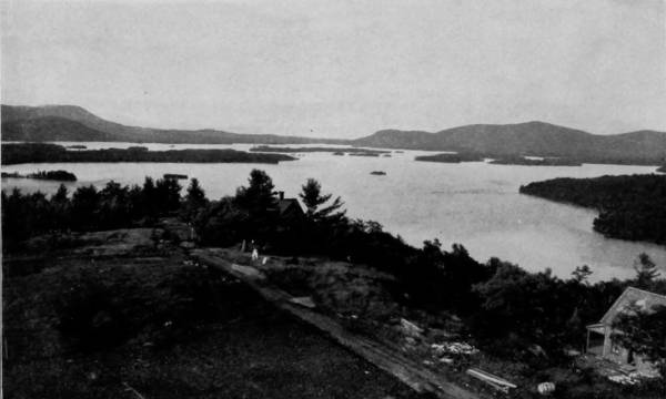
SQUAM LAKE, NEW HAMPSHIRE.
From the Ledge the road continues its zigzag way up the steep and around dangerously narrow terraces, over which a party of excursionists in a six-horse wagon tumbled to their death on the 3d of July, 1880, the only accident that has ever occurred in making the remarkable descent here, however perilous appears the passage; and this tragedy was due to a drunken driver. In describing the ascent above Midway House, Mr. Drake thus writes: “A sharp turn around a ledge, and the southeast wall of Tuckerman’s Ravine rose up like a wraith out of the forest. Nearer at hand was the Head of Huntington’s, while to the right the cone of Washington loomed up gradually, more than a thousand feet higher. A little to left you look down into the gloomy depths of Pinkham defile, the valley of Ellis River and the Saco Valley to North Conway. The blue course of the Ellis, which is nothing but a long cascade, the rich green of the Conway intervales, the blanched peak of 401Chocurua, the sapphire summits of Ossipee Mountains were presented in conjunction with the black and humid walls of the ravine, and the iron-gray moss of the great dome. The crag on which I stood leans out over the mountain like a bastion, from which the spectator sees the deep-entrenched valleys, the rivers which wash the feet of the monarch, and the long line of summits which partake of his grandeur while making it all the more impressive. From here the striking spectacle of four great northern peaks, their naked summits, their sides seamed with old and new slides, and flecked with snow, constantly enlarged. There were some terrible rents in the side of Clay, red as half-closed wounds, and in one place the mountain seemed riven to its center. It was this gulf that the first climber said it was such a precipice he could scarce discern the bottom. The rifts in the walls of the ravine, the blasted fir-trees leaning over the abyss, and clutching the rocks with a death-grip, the rocks themselves, tormented, formidable, impending, astounded by their vivid portrayal of the formless, their suggestions of the agony in which these mountains were brought forth.”
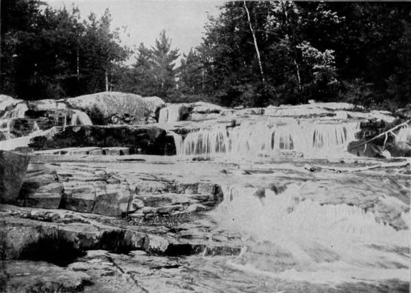
UPPER JACKSON FALLS, WILD-CAT RIVER, NEW HAMPSHIRE.
But if there be grandeur in the chaotic landscape which spreads out before the startled vision of the spectator on the mountain breast, what must be the sensation inspired by the tremendous view that is afforded from the summit? It is the feeling of complete separation from the earth, of suspension in the sky and looking down upon the world below. The exhilaration that comes from conquering a mighty thing; the solemnity of being face to face with infinity. But gradually an orderly array of magnificence and comprehensible grandeur appears, as peak upon peak is resolved into definable chains, clusters, or detached masses. Hills draw apart, valleys open, streams and cascades sparkle in their tortuous beds, while the skirts of the mountains are dotted with rich colors and the meadow-lands become a fringe of emerald encompassing their irregular bases. Almost independent of the will, the eye wanders from summit to summit, making a slow circuit of the crenated horizon, until it is arrested by a vast spread of gleaming white that at first sight may be 402mistaken for a luminous cloud in the southeast. More careful observation reveals that it is the ocean, one hundred miles away, and by the help of telescope vessels may be distinguished, and even the number of sails which each craft carries.
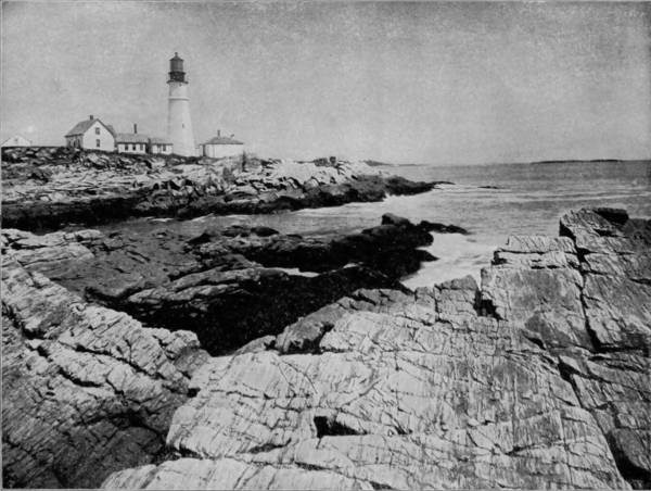
LIGHT-HOUSE IN THE HARBOR OF PORTLAND, MAINE.
Amazing, splendid, and even thrilling as the view unquestionably is from the top of White Mountain, yet it cannot compare, for either extent or grandeur, with that obtained from the summit of Pike’s Peak. Not so great in altitude as its nobler rival of the Rockies, it is wanting in other conditions to make it equal, chief of which is the usually heavy and hazy atmosphere that is due to proximity to the sea, thus interfering with the range of vision, and more frequently interposing clouds to shut off the view entirely.
On the highest point of Mount Washington the Government has built an observatory and signal station, and a very excellent hotel has also been added, for the accommodation of those who desire to spend a night at this great height, and to experience the sensation of a snow-storm in mid-summer. A curiosity recently added to the other attractions of the summit is an electric search-light of 100,000 candle-power, at a cost of $7,000, which is controlled from the foot of the tower by electric motors. Telegraphic signals flashed by this monster light have been interpreted at Portland, Maine, which is eighty-five miles distant.
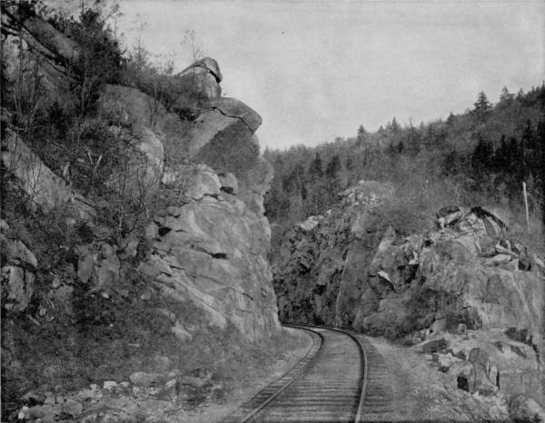
LOWER GATEWAY TO CRAWFORD’S NOTCH, WHITE MOUNTAINS, NEW HAMPSHIRE.—It was through this Notch, in 1840, that Thomas J. Crawford opened a bridle-path to the summit of Mount Washington. It is now utilized by a railroad, and the rocks and cliffs along the way have been disfigured and besmeared with patent medicine advertisements. The Notch is a gigantic cleft through the mountains, with treasures of splendid scenery along the way on either side. Hills draw apart, valleys open, streams and cascades sparkle in their tortuous beds, while the skirts of the mountains are dotted with rich colors, and the meadow-lands become a fringe of emerald encompassing their irregular bases.
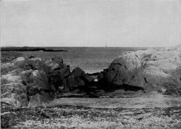
MINOT’S LEDGE LIGHT HOUSE, OFF COHASSET, MASSACHUSETTS.
From Mount Washington, the tourist who delights to revel among the wonderful scenes of this tumultuary and anarchistic region, where nature is in disarrangement through the operation of forces that long since have spent themselves, usually proceeds west by Thorn Hill, through Carter Notch, and thus arrives at the village of Jackson, the center of another district of great scenic interest. The town is but a handful of pretty white cottages, but it is in the quiet isolation of a mountain-engirdled vale, and the very lonesomeness of its situation gives the place an inexpressible fascination, for it is like meeting cheerful company in the valley of desolation. The largest house, commanding respect by reason of its size, and exciting reverence for its holy purposes, is a frame church, in whose belfry the pigeons swarm, undisturbed by the deep tones of the bell that summons the hamlet to worship. How mournfully it peals out the first stroke, as if awakening the town from sleep, so still is the place; but from a toll it becomes a chime, as the notes reverberate from hill to hill, until the noise is reassuring, that however lifeless things may have seemed, the church-bell has power to stir the people into mental if not physical activity. All about are mountains, Eagle, Wild-Cat, Tin, Iron and Thorn, the sides of which have been cleared of their forest growths and stone, and brought under cultivation, which add materially to the picturesque landscape of which the village is the natural center.
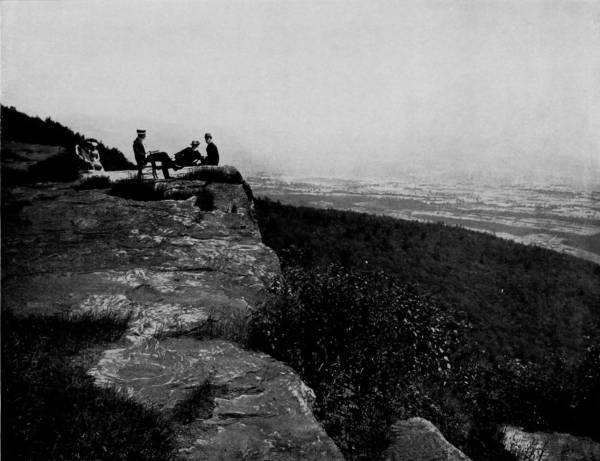
PROSPECT FROM THE SUMMIT OF WHITE MOUNTAINS, NEW HAMPSHIRE.—If there be grandeur in the chaotic landscape which spreads out before the startled vision of the spectator along the mountain sides, what must be the sensation inspired by the glorious panorama unfolded from the summit? It produces a feeling of complete separation from the earth, as if one were suspended in the sky and looking down upon the world below. It is the exhilaration that comes from conquering a mighty thing; the solemnity of being face to face with infinity.
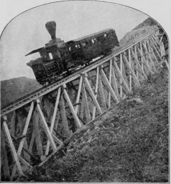
COG-WHEEL RAILWAY UP MT. WASHINGTON.
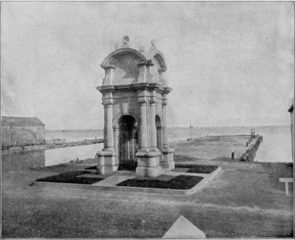
MONUMENT AT PLYMOUTH ROCK, MASSACHUSETTS.
Wild-Cat River cuts the town of Jackson in twain, a stream which is in fact a mountain cataract, filling the air about with its incessant roar. Within less than two hundred yards of the place the river makes a swift descent over granite ledges, which it has washed to almost whiteness, and near the bridge it is divided by a large bowlder into two cascades that are half-concealed by the rich foliage that bends down to receive the refreshing spray. The crest of the falls is split by huge stones and the main stream has overcome the obstacles in its way by cutting a passage under the rocks, after which it shoots down the ledge and becomes a faithful servant to a miller, who has utilized its power. Besides these cataracts there are several others, principal among which is Goodrich Falls, at which point the river pours its restless flood over a precipice eighty feet high. Bridal Veil Cascades are a mile further up the river, but there is a pleasant bridle-path all the way, and visitors to this district rarely fail to pay their respects to this very interesting part of the stream. The bed of the river is full of enormous bowlders, and its flow takes, accordingly, an erratic course; in fact, in every direction save upward. At the cascades the stream is parted by an elevation in the center of the ledge, and thus falls in a double sheet at almost right angles, where, gathering new force again, it goes rushing away to join the Androscoggin, which bears its waters to the sea. A tour of the mountains having been completed, our photographer doubled upon his tracks and returned to the Profile House, from which road-terminus he crossed the twelve-mile interval to North Woodstock, and there took train on the Concord and Montreal Railroad for points of attraction towards the southwest. The mountain region, however, was not yet entirely passed, for many prominent elevations, such as Mounts Moosilauke, Tecumseh, Tri-pyramid, Welch, Fisher, Stinson, Irael, and others, continued in view until Ashland was reached, at which place a stop was made to visit Squam Lake, one of the most exquisite sheets of water in the world. It is irregular in shape, but about six miles long by half as many broad. The expanse is not great, but the beauties which it presents are charming in the extreme. Over its bosom are scattered numerous islands which are very bowers of beauty, green with thickets of hazel and margined with mosaics of wild flowers. The waters are of such limpid purity that they swarm with fish, which may be seen frisking and playing tag twenty feet below the surface. The shores are banked but level, and along the edge is a perfect carriage-road, making a circuit of twenty-one miles, affording the finest excursion that can be made by vehicle. Squam Lake is separated from Lake Winnipiseogee by a strip of land two miles wide, and the village of Center Harbor lies on the west shore of the latter, where steamer may be taken for a ride to Wolfborough, twelve miles distant. The trip is a delightful one through narrow channels between islands of exceeding beauty, so thickly strewed over the water as to make the way appear like a labyrinth. Six miles northwest of the lake is an eminence over two thousand feet high, known as Red Hill, which is annually visited by many hundreds of tourists. There is a good carriage-road to the base, but the ascent is so steep and rugged that by foot or horse-back is the only means for gaining the summit. Though not nearly so lofty as a score or more of the mountains we have mentioned, yet visitors maintain that the view afforded from its peak exceeds in extent and magnificence that obtained from the observatory of Mount Washington or the summits of any of its brothers. This superiority is due to the absence of intervening peaks, as Red Hill is isolated, and overlooks a comparatively level district, in which Squam and Winnipiseogee Lakes are conspicuously visible, with their ragged shore-lines and lovely islands clearly definable.
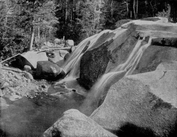
BRIDAL VEIL CASCADE, WHITE MOUNTAINS.—Wild Cat River, inaptly named in the pioneer times of New England, is an enchanting stream for the tourist and the painter. Its course is broken by many ravishingly beautiful waterfalls and cascades, each presenting new and charming features. At Bridal Veil Cascade the bed of the river is full of immense boulders, upon which the descending stream is broken into a thousand forms of diversified loveliness. At the summit the stream is parted by an elevation in the centre of the ledge, and thus falls in a double sheet at almost right angles, greatly enhancing the charming features of the delightful scene.
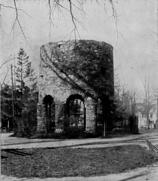
THE OLD TOWER AT NEWPORT, RHODE ISLAND.
From Wolfborough the route was east by the Maine Central Railroad to Portland, and thence by steamer to Boston. There are many beautiful places in the vicinity of Portland, and particularly about the popular summer resorts of Mount Desert Island and Bar Harbor; but much must be sacrificed to the limit of space, for no one book can ever contain pictures of all the natural scenery that is worthy to be reproduced. Among other photographs taken in and about Portland, we have room for only one, viz.: the light-house on Cape Elizabeth, in the harbor, a dreary desolation of stone, where the ocean is treacherous and a warning to incoming vessels is indispensable.
Boston is historic ground, around which are many sacred spots perpetuated in patriotic memories. It is a great city; but the traveled visitor is indifferent to municipal sights, and is restless to pay his tribute of respect and curiosity to those shrines that keep in mind the reverent character of the Puritan, and the heroism of the Revolutionary soldier. It is hard to resist this infectious temptation to photograph monuments and battle-fields, when one is walking upon the very famous dust, and reading inscriptions recording the valor of those who fought for our National Independence; but this is a volume devoted to American scenery rather than to American history, a subject which ought to inspire equal patriotic sentiment, and monumental tributes must therefore be omitted, or casually mentioned by incidental reference, as may appear proper.
From Boston our artist proceeded by a train on the Old Colony Railroad to Cohasset, a town which it has been truthfully said marks one of the most interesting, most wildly beautiful bits of nature on any coast.
“This town,” let it be said, “marks one of the most interesting, most wildly beautiful bits of nature on any known coast. In this situation are to be found all the beauties and all the terrors which ocean scenes can compass. The history of Cohasset, 409for the past two hundred and fifty years, has in it an element personal to every civilized people on the globe, since all have sent their ships and their travelers this way, and added names to the death-roll hereabouts. The crags and ledges along these shores have taken part in ocean tragedies for generations, and have witnessed more of human suffering and the extremity of distress than often falls to the lot of natural scenes. Upon their faces the ocean surges have never ceased to dash themselves since the morning of creation. Here the whiteness never goes out of the line of surf; and often the conditions are of shattered waters flying in the air, of roaring breakers crashing into fragments along the rocks, of great masses of billows lashed into fury, and resistless in their commonest attacks by all except the natural barriers to their progress here set up.”
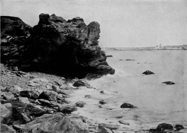
THE CLIFFS AT NEWPORT, RHODE ISLAND.
Beautiful, commanding, stirring as the scenes are about Cohasset’s bounding shores, yet the tragedies which have occurred in the treacherous approaches to the harbor are both numerous and heart-appalling. On these very rocks, where the waters usually play in such happy abandon, more than seven score of persons from a single ship—the St. John, in October, 1849—were dashed to their deaths, and disasters attended by less mortality became so common that the Government erected a lighthouse at Minot’s Ledge, which is two miles off Cohasset Point, where the hidden rocks are most dangerous to shipping.
From Cohasset the trip was south, by the Old Colony, along the Atlantic shore, passing many points of great interest, though for scenery there is nothing but marshes and a waste of sandy beach. But on the way, Daniel Webster’s farm is pointed out, located on a level strip between the railroad and Marshfield Neck, where it would appear that raising clams might be more profitably pursued than the growing of grain or vegetable. Quaint scenes, reminders of the olden times when stage-coaching was the most luxurious mode of travel, and pot-hooks and hangers were adjuncts of the crane that rendered the fire-place the sole convenience for cooking, pass in review and are a source of the greatest interest to those of a retrospective and reflective turn of mind. Here and there we observe old Puritan churches 410and equally old-fashioned people, whose appearances indicate that they have not been widely distributed since the Mayflower landed. There is a Miles Standish, John Alden and Priscilla in every village, and the houses, in many cases, tell of a time quite as remote. Indeed, in the little but ancient hamlet of Greenbush, which is within a half-dozen miles of Cohasset, and twice as far to Nantasket, an intensely fashionable resort, one may see the identical old oaken bucket and the crazy sweep by which “dripping with coolness it rose from the well,” which inspired Woodworth’s immortal lay in 1817. There, too, is the same old house, hiding behind a clump of trees, under which the poet sat and drank from the “full blushing goblet,” which, alas for human weakness, he really coveted less than a beaker of good wine.
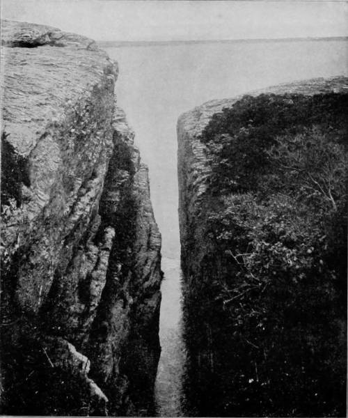
PURGATORY CHASM, NEAR NEWPORT, RHODE ISLAND.
Twenty-five miles south of Cohasset is the historic town of Plymouth, and right in front of it is a harbor made by a long neck of land, parallel with the shore, and known as the Cow-Yard, in which the Mayflower came to anchor with her precious cargo of forefathers, on a bleak December day in 1620. Mr. Samuel Adams Drake has written:
“Plymouth is the American Mecca. It does not contain the tomb of the prophet, but the rock of the forefathers, their traditions and their graves. The first impressions of a stranger are disappointing, for the oldest town in New England looks as fresh as if built within the century. There is not much that is suggestive of the old life to be seen there. Except the hills, the heaven, and the sea, there is nothing antique; save a few carefully cherished relics, nothing that has survived the day of the Pilgrims.” And another writer of recent times declares “it would be difficult to name any other place in America with such a profoundly 411interesting historical event as that which has made the name of Plymouth Rock forever famous in the annals of devotion and freedom. Upwards of fifty thousand persons come here every summer, making reverent pilgrimages to the cradle of American civilization. For these, and for all who love the antique and historic, Plymouth has well-nigh unrivaled attractions. Here is the renowned rock, down by the water-side, overarched by a stately granite canopy, in whose top are the bones of several of the Pilgrims. Up in the village rises the massive structure of Pilgrim Hall, consecrated to relics and memorials of the first colonists. Near this shrine is the court-house, with rare records and documents of the seventeenth century. On a noble hill rises the Pilgrim National Monument, a vast pile of carved granite crowned by a very impressive statue of Faith, forty feet high, and the largest stone figure in the world.
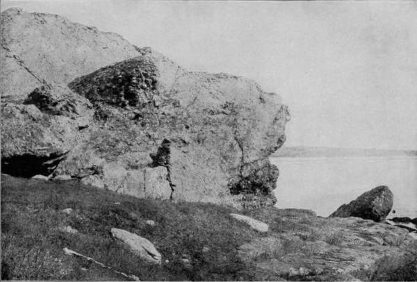
NEGRO-HEAD CLIFFS, NEWPORT, RHODE ISLAND.
“Burial Hill is one of the most interesting localities in New England. On every side are the tombs and monuments of the founders of the State and their descendants. Above these sacred graves the pleased eye wanders over an exquisite panorama of sea and shore, lonely islands, far-reaching promontories, and distant blue hills, out across the blue sea to where the sandy strand of Cape Cod bounds the view, low down on the horizon. On this bleak summit stood the fortified log-church and watch-tower, the former bearing six three-pound cannon on its flat roof, and the latter occupied by vigilant sentinels.”
It is about forty miles from Plymouth to Newport, Rhode Island, one of the ultra-fashionable summer seaside resorts, and thither our artist repaired to take views of that vicinity. Newport is not only famous for its fine bathing beach, elegant villas, and its harbor specially adapted for yacht-racing; there is much more to recommend the city to visitors than these means of recreation and pleasant vanities. Commercially, Newport is a metropolis of looms; historically, it is a city of great consequence; and scenically, a place of extraordinary interest. The Old Tower at Newport has been for centuries an object of curious inquiry and patient investigation. For many years the opinion obtained generally that it was a relic of the Norsemen’s discovery and occupation of the country, five hundred years before the time of 412Columbus, and that in some way the building was connected with Druidic worship. The Druids of England and France performed their religious ceremonies under oak trees and always in the open air, but this fact did not affect the belief current for so long a time that the Stone Tower was the remains of either an edifice or a monument erected by the Druids. When this opinion finally changed to the more reasonable though equally false one that the tower was the relic of a fort built by Norsemen sea-kings about the year 985, historians appeared to be satisfied and inquiry ceased for a long while. Finally, investigation of the Runic inscriptions on the Dighton Rock, in Massachusetts, revived curiosity in the tower, and the result of the last investigation is the opinion that it is the ruins of a wind-mill that was built some time in the seventeenth century. The truth, however, may as well be told, that notwithstanding what historians say to the contrary, no one knows, or is likely ever to know, when, by whom, or for what purpose the so-called tower was built. It is a question about which there can be nothing but speculation.
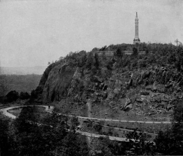
SOLDIERS’ MONUMENT ON EAST ROCK, NEW HAVEN, CONNECTICUT.
Newport is located on a peninsula on the east shore of Narragansett Bay, which is a splendid harbor, having an anchorage of thirty feet in low water. The scenery about the place, too, is very fine, and is brought into advantageous view by a charming drive-way that extends along the beach and entirely around the city. A part of the sea-shore line is very rocky and precipitous, and the assaults of terrific breakers for many ages have worn these cliffs into wonderful shapes. 413Purgatory Chasm is, perhaps, the most remarkable example of wave force in this vicinity, though the agency of water has, no doubt, been reinforced by some other natural power, such as glacier, earthquake or volcano. Near-by are Hanging Rocks, where Berkeley is said to have composed his Minute Philosophy; and less than three hundred yards distant is Spouting Cave, where the surf dashes into a grotto and thence through a hole in the roof to a height at times of fifty feet, affording a beautiful spectacle. Other points of interest along the cliffs are individualized by such names as Eastman’s, Green’s End, Lime Rock, Negro-Head Cliffs, the Flints, the Dumplings, Cockle-Shell Ledge, etc. After a brief circuit of Newport’s attractions, our artist departed for Western Connecticut and thence to Albany, there to take boat down the Hudson for New York City. The route lay through New Haven, where a short stop was made to take a picture of East Rock and the Soldiers’ Monument thereon. East Rock is a bluff 360 feet high, on the north side of the city, to which a beautiful carriage-road leads, and from its summit a wide extent of charming landscape is presented, taking in a part of the Connecticut Valley towards the west, Yale College on the east, and spanning Long Island Sound on the south, so that when the weather is clear the low banks of Long Island may be distinguished.
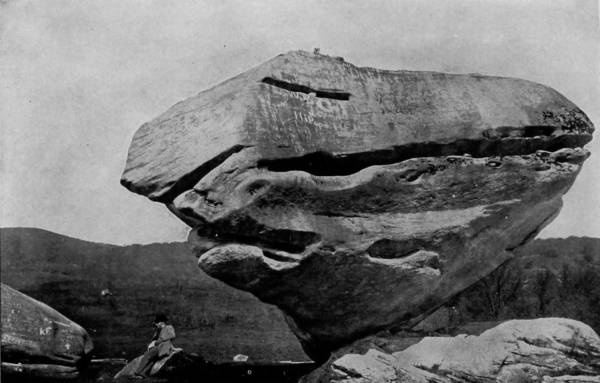
BALANCED ROCK, NEAR PITTSFIELD, MASSACHUSETTS.
From New Haven the route was north and west over the Housatonic system to Pittsfield, Massachusetts, in the Berkshire region, a city of some 17,000 people, and noted for its many interesting buildings of national reputation, as well as for the lovely scenery that environs it. The place is elegantly situated on a high plateau, with the Taconic Mountains on the west and the Hoosac Range commanding the eastern view. It will be remembered by students of history that Fighting Parson Allen, of Revolutionary fame, was pastor of the First Methodist Church in Pittsfield, and they will be gratified to know that the building is still standing and that it exhibits little impairment from age. The Agassiz Association, with an enrolled membership of 20,000, has its headquarters in the city, and the place is also the seat of many prominent historical and educational institutions. But it is the scenery thereabout that interests us most. Waconah Falls is a pretty cascade ten miles from the city, and still nearer is Roaring Brook, that rushes down the side of a mountain 414in torrential flow, through a gap known as Tories’ Cave, and contributes its waters to Ashley Pond, whence the city’s supply is obtained. Lake Onota is a picturesque sheet two miles west of Pittsfield, and near-by is Balanced Rock, one of the greatest natural curiosities in America. It is a tremendous bowlder, as the illustration shows, the estimated weight of which is 480 tons, and is balanced on a point that is only one foot square. So unstable is its appearance, resting on such a slender foundation, that it looks as if a zephyr might topple it over, yet so firmly poised that an army of giants could hardly disturb its equilibrium.
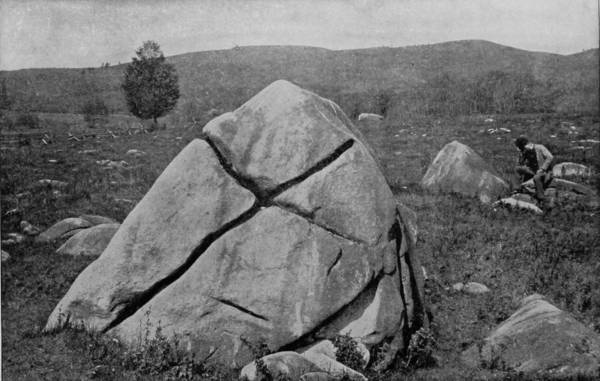
CROSS ROCK, NEAR PITTSFIELD, MASSACHUSETTS.
In a rocky field three miles from the city is another great natural curiosity known as Cross Rock, which has been singularly cleft, by some unknown agency, into the form of a perfect cross, to which a few superstitious people formerly attributed remarkable healing virtues, but which no one any longer regards.
Four miles east of Pittsfield is the village of Dalton, where immense quantities of paper are manufactured, and on the Pittsfield line is located the mill that produces all the Government bank-note paper. West Pittsfield, about five miles from the city proper, is also an interesting place, reposing under the shadows of Taconic Mountains, and celebrated as being the national headquarters of what is known as the “United Society of Believers in Christ’s Second Appearing.” This curious sect of Shakers, disciples of Ann Lee, founded the village more than a century ago, and their “Millennial” church, which was built soon after, still stands as one of the most conspicuous buildings in New England. Massachusetts has been famous as the home of religious denominations possessing peculiar tenets almost since the landing of the Pilgrims; but from the days of Salem witchcraft to the present, few sects have adopted more curious beliefs and ceremonials than the Shakers. Yet, to their credit let it be spoken, they are good citizens, honest, generous, faithful, industrious and kindly in all their intercourse with the world as well as among themselves.
From Pittsfield our artist proceeded to New Albany, and thence by boat to New York, where he joined the two other photographers, the route of the third having been east by way of the Baltimore and Ohio Railroad, which now remains to be described.
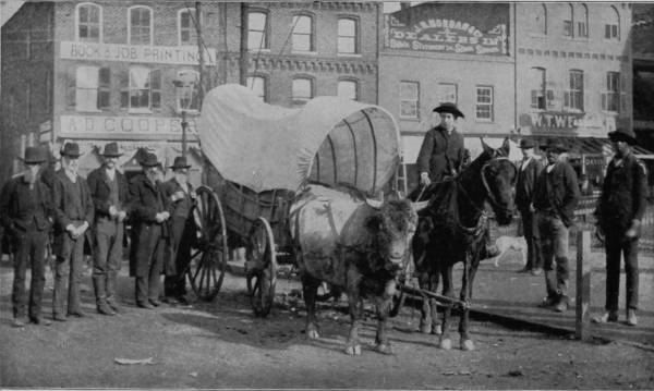
A MIXED TRAIN FROM THE WILDERNESS.
The instructions given upon the separation of our three photographers, after leaving St. Louis, were necessarily indefinite, and discrimination in the selection of routes and views had to be left to individual judgment, since weather and conditions play an important part in the artists’ profession. Our third photographer departed somewhat from the route which he had selected to cover, for after the separation, instead of proceeding directly east through Pennsylvania, as was his first intention, he went south to Cincinnati and east by the Chesapeake and Ohio Railroad, through the lovely Blue Grass region of Kentucky, making his first stop at Charleston, the capital of West Virginia. The capital is a small place of something less than 7,000 inhabitants, and with nothing of particular importance to visitors except the mountain scenery which invests it. The Kanawha River, upon which the town is situated, is navigable for small crafts from this point to its junction with the Ohio, but above Charleston the stream is treacherous and its channel so rock-infested that a skiff can hardly follow the stream without danger. Thirty miles from the capital are the Kanawha Falls, or cataracts, where the river goes tearing over several benches of thinly stratified rocks, and has scooped out a pool of very great depth, where fishing is said to be excellent. On the north side of the river at this point are the Gauley Mountains, rising to a considerable altitude, but so gently that the slopes have been reclaimed from thick timber growths and converted into beautiful farms.
The scenery all through the valley of the Kanawha is tumultuously grand, but nine miles beyond the falls it attains its greatest glory. Here the tremendous cliffs rise vertically to a height of 1,200 feet, and at a point called “The Hawk’s Nest” a breast of the bluffs extends out over the river in a perilous shelf 1,000 feet high, from which lofty elevation 416the river becomes a ribbon of white, and a train of cars running along the mountain skirts on the opposite side looks like a string of army-ants hurrying to an attack. The view down the valley is one of ineffable magnificence, presenting as it does a double file of noble mountains dressed in uniforms of lovely green, which, as they recede, assume a sky-blue hue, and then gradually fade away in the opalescent mist of distance.
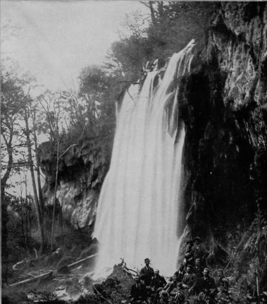
FALLING SPRING, NEAR WARM SPRINGS, VIRGINIA.
Thirty miles above Kanawha Falls, at a town called Hinton, the New and Green-Brier Rivers unite to form the Kanawha, and here the scenery is likewise charmingly picturesque. The line of lofty bluffs continues along the south shore of New River, under which the Chesapeake and Ohio Railroad runs upon a bare passageway, while the north line is marked by graceful mountains that in the distance look like lines of beauty tracing the horizon. In some places the ledges are 1,200 feet high, and the river so contracted that the cañon is almost dark at midday. The view is further diversified by successive rapids and cataracts, while at frequent intervals the bluffs recede, leaving stretches of fertile valley that are in a high state of cultivation, with pretty farm houses dotting the landscape and imparting an appearance of prosperous animation to these pleasing interludes. The road follows the valley of Green-Brier River twenty miles further, to Caldwell, then passes through White Sulphur Springs, and a few minutes later crosses the James River at Clifton Forge, where that romantic stream, drawing its inspiration from the Alleghenies, cuts its way through the Blue Ridge Mountains.
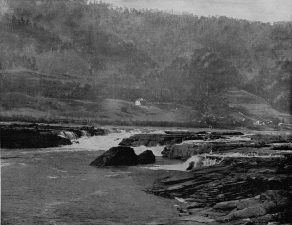
KANAWHA FALLS, WEST VIRGINIA.—Thirty miles from Charleston, the capital of West Virginia, are the Kanawha Falls or Cataracts, where the river is broken into numerous channels and fragments and plunges over an irregular ledge of thinly stratified rocks, presenting a scene that is both grand and picturesque. The Gauley Mountains rise with sloping terraces to the north of the falls, along the sides of which are many attractive farm-houses, adding a charm of rural beauty and contentment to the scene. At the foot of the falls an immense pool has been scooped out of the bed of the river, which teems with fish and is a favorite resort for lovers of that sport.
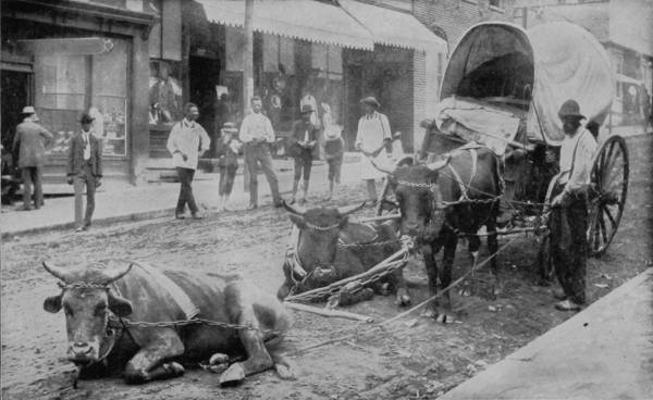
WAITING FOR TIME TO CATCH UP.
Clifton Forge is forty miles east of White Sulphur Springs, and from this junction a branch of the Chesapeake and Ohio Road runs northeast to form a connection with the Shenandoah Valley Railroad at Waynesborough. All the region hereabout is very rugged, and intersected by beautiful streams whose sources are springs that break out of the sides of mountains, and the waters are generally more or less impregnated with sulphur. Eighteen miles due north of Clifton Forge, and reached by a delightful road that winds through charming vales, is the village of Warm Springs, the capital of Bath county, and adjacent are the Warm Sulphur Springs, which attract so many visitors in search of health and fine scenery. It is a mountain town, whose population fluctuates with the season, for while the place is one of some animation from April to October, during the other months there are not enough people in the village to keep the mud-daubers out of the houses. A more picturesque district, however, can scarcely be found; too mountainous to permit agriculture, nature has given other blessings than fertility to the region. The climate is extremely invigorating, and the numerous springs possess medicinal properties of undoubted value, while the scenery is inspiring to even the most phlegmatic. One of the chief objects which serves to further diversify the landscape of high-lifted peaks, jutting cliffs, meandering brooks, green coverts, sylvan solitudes and cloistral caverns, is Falling Spring, a sheet of rainbow-flecked water that dashes over a ledge seventy feet high, and which, seen from a little distance, may be likened in appearance to the white trailing trousseau of a bride, so delicate, graceful, and gossamer-like is its form, so joyous is its laughter. After leaving Clifton Forge the road winds along the sinuous valley of James River, with charming views on both sides, until interest, charm and excitement are superseded by wonder as Natural Bridge, that marvelous curiosity of ages, is reached, and preparation is immediately made to examine and to photograph its astounding formation and immensity. This great natural wonder, which is an old acquaintance to all school-children, is two miles from the railway station, at the termination of a very deep gorge, through which flows a capricious little stream called Cedar Creek. At one time this feeble brook may have been a raging river, and needed bridging, but like an old man, it has lost the vigor of former days and fallen into the seventh age of decrepitude. But the bridge which Titans might have constructed still spans the creek’s deep bed and has grown in mightiness as the waters below subsided. To speak with mathematical exactness, without employing statistical details, it may be said that the Natural Bridge spans with graceful and architectural proportions the perpendicular ledges of Cedar Creek, which rise 200 feet above the stream. The center of its wondrous arch is forty feet in perpendicular thickness and sixty feet wide, while the span is exactly eighty-nine feet. A public highway utilizes the bridge, and it is the only means of passage for wagons within a mile either way, except by a steep bank, very difficult to ascend, a short distance below the gorge. Just above the bridge the creek bluffs are broken into masses that look like immense buttresses, pinnacled at places and reaching to a height of 250 feet. The most imposing view is obtained from a position fifty yards below the bridge, where the arch appears both lighter and higher, and the walls more dangerously precipitous. From this point of view this world-famous natural structure appears as perfect as if cut by design; a colossal arch that shines in the sun like variegated marble, without stratification or displacement, so high that the largest sailing vessel might pass under without touching the peak of her mainmast. On the abutments of the bridge are carved the names of many adventurous youths who sought fame by leaving a record of their reckless efforts to scale the dizzy heights of stone. George Washington was not above this ambition to win reputation by carving his name higher up than any of his fellow-youths, and for nearly seventy years he held the honor of being the most intrepid and expert wall-climber, for, like Ben Adam, his name led all the rest. But in 1818 this distinction was surrendered to James Piper, of Washington College, who performed the daring, and what was long thought to be impossible, feat of climbing from the foot of the abutment to the top of the arch, an exploit so dangerous that no one has since made a mad attempt to repeat it. Thomas Jefferson was moved to write a eulogium of this incomparable natural wonder in this wise:
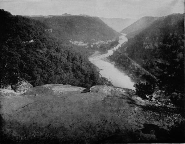
HAWK’S NEST AND CAÑON OF THE KANAWHA RIVER, WEST VIRGINIA.—The scenery all through the Kanawha Valley is picturesque and splendid, but its full glory is not attained until it reaches a place about nine miles beyond the falls. Here, at the point called Hawk’s Nest, which is photographed on this page, the cliffs are majestic, rising to a height of 1200 feet, while immediately in the foreground of the picture a breast of the bluff extends out over the river in a perilous shelf 1000 feet high, from which lofty elevation the winding stream becomes a mere ribbon of white, lined on either side with the dark green colors of the mountain foliage.
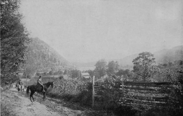
GALBRAITH SPRINGS, TENNESSEE.
“The Natural Bridge, the most sublime of nature’s works, though not comprehended under the present head, must not be pretermitted. Though the sides of this bridge are provided in parts with a parapet of fixed rocks, yet few men have resolution to walk to them and look over into the abyss. If the view from the top be painful and intolerable, that from below is delightful in an equal extreme. It is impossible for the emotions arising from the sublime to be felt beyond what they are here; so beautiful an arch, so elevated, so light and springing, as it were, up to heaven! The rapture of the spectator is really indescribable.”
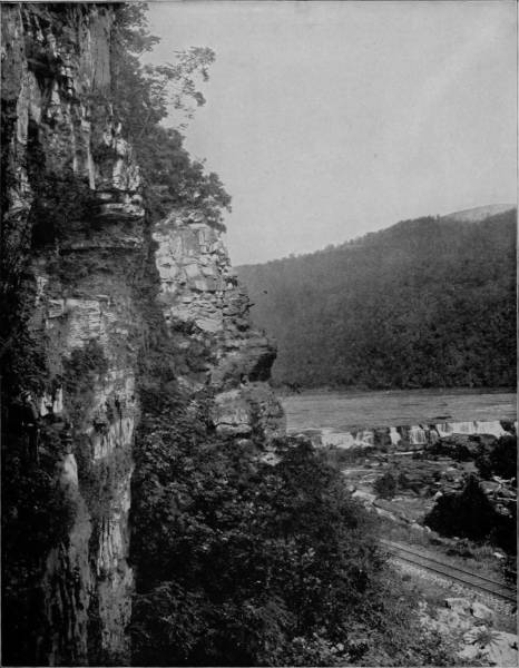
FALLS OF NEW RIVER, NEAR HINTON, WEST VIRGINIA.—Thirty miles above Kanawha Falls, the New and Greenbrier Rivers unite to form the Kanawha, and here the scenery is peculiarly grand and picturesque. In some places the ledges soar to a height of 1200 feet, and the river is so narrow that the intervening cañon sees but little of the sunlight except near midday. At some points the bluffs recede, giving space for beautiful green valleys, dotted with pretty farm-houses that lend an appearance of prosperous animation to these pleasing preludes. The river is broken into many rapids, cataracts and falls, which enhance the charms of the scenery by the music of their babbling waters.
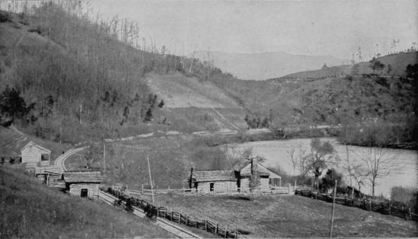
PASSAGE OF THE FRENCH BROAD RIVER THROUGH THE SMOKY MOUNTAINS.
From Natural Bridge our photographer took train on the Norfolk and Western Railroad, and proceeded southwestwardly to the junction of that road with the Tennessee, Virginia and Georgia Railroad, by which he passed into Tennessee as far as Knoxville, and from that point made excursions into the famous East Tennessee region, where scenes and scenery are quite unlike anything which he had ever before transferred to photographs. Nowhere in all the world are there richer lands, prettier women, braver men, finer landscapes, and bigger prospects than Tennessee affords. It is a region of boundless resources and charming views, and possessing as it does so many advantages, it likewise presents remarkable contrasts and conditions. Where can the scenery about Cumberland Gap be equaled, or the panorama from the summit of Lookout Mountain be matched? But there is relaxation in the quiet views of rural life in East Tennessee which are here reproduced, and the pastime reader as well as the student of geography, will appreciate the restful change.
Tennessee is the neutral ground between North and South, because it does not distinctively belong to either, but its contiguity to both gives to the State some of the characteristics of each. Adopting slavery, it is Southern, but developing a strong pro-Union sentiment in the beginning of the civil war, Tennessee became Northern in her affinities; but the slave-marks of one hundred years have not been effaced even after thirty years of freedom, for in the country and villages there are old slave-cabins, rickety, but still habitable, the homes of white-haired relics of ante-war times, and the new generation that has not been taught to tie up their hair with cotton strings. All over the South it is the same; but in East Tennessee there is something else to bring back old memories, for here the brazen front of war marched through the land, and turned its fair acres of waving grain and fruitful orchards into battle-fields, furrowed with dead and harrowed with destruction. And yet Tennessee was pro-Union, with secession tendencies, because her interests were indissolubly linked with the South. But the wounds have all healed; the impetuous youth who went forth to battle is now a peace-loving grandfather; his daughter was captured by a Yankee, and she has never regretted it, and the railroad runs every day between the two sections with mail-bags full of peace-messages. Why, the war has been over so long that we get mixed in our history, and sometimes we are not quite clear whether it was in 1776 or 1861. In fact, many of the old farm houses along the way look decidedly Revolutionary, and none of the mountains have changed or added another wrinkle to their imperturbable faces.
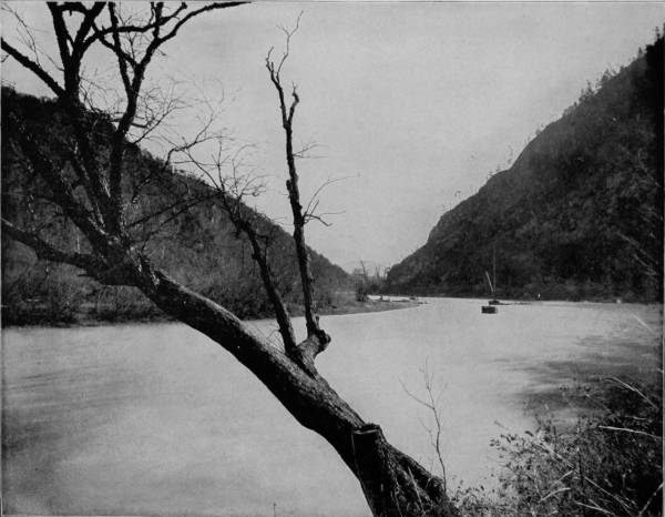
PASSAGE OF THE JAMES RIVER THROUGH THE BLUE RIDGE MOUNTAINS.—The very name of Blue Ridge is music in the ears of many thousands of good and worthy citizens of our country, whose ancestral homes were, or still are, in the midst or within view of the hazy-blue summits of these historic mountains. Any one who has seen them at a distance, in the soft light of an Indian summer, will appreciate the aptitude of the title, and the affection which must be engendered by association with such delightful scenery from childhood to the evening of life. The view presented in the photograph on this page is an exceptionally fine one, showing the mountains on either side and in the distance through the rift made by the river.
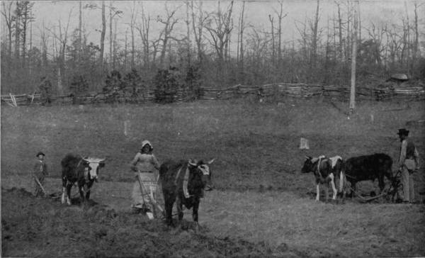
A SCENE OF RURAL LIFE IN NORTH CAROLINA.
In some of the towns there is a lazy air that barely stirs the little wind-mills on the marten-boxes, and indolence and shiftlessness have their votaries even here. Up in the mountains there are shadows of hard times, which are projected into the valleys and villages in the form of bull-teams and crotchety “mover-wagons.” The driver has a sang-froid appearance, and as if he was ahead of his expectations, and is willing to wait for tardy time to catch up. His team is glad to encourage the waiting ambition, and lies down in the street to keep him patient company.
To exhibit the diversity of scenes in East Tennessee and the resourceful expedients of the people, photograph was made of another mountaineer’s team, wherein the traction energy of a bull is compared with that of a horse, to the humiliation, no doubt, of the latter. In order to throw a little more animation into the scene, our photographer grouped a party of natives about the team, so that two purposes might be served with one stone, and no mistake might be made as to types of the people and their conveyances.
On a trip to the north boundary of the State several lovely landscape pictures were secured, one of the most exquisite being a view in the vicinity of Galbraith Springs, where the headwaters of Tennessee River pour through Short Mountains, which are the outposts of Cumberland Range, and go careening and pirouetting in many cascades between that point and Knoxville. The scenery hereabout presents the majesty of imperious isolation, the lonely grandeur of undisputed lordliness; and under the shadows which these towering mountains cast, are people that live in a little world of their own, almost forgetful that the earth projects beyond the horizon of their vision. But in this valley of delight the flowers run riot over the hills, the woods and fields are musical with songs of many birds, and there are the sweets of peace and the bloom of plenty beneath these opalescent skies.
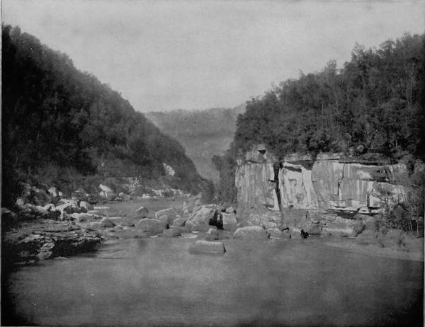
PICTURED BLUFFS ON NEW RIVER, WEST VIRGINIA.—These bluffs derive their name from their close resemblance to the Pictured Rocks of Lake Superior, and there is a very striking similarity between the general appearance and characteristics of the two localities, as all who are familiar with these famous scenic regions will admit. New River has its source in the picturesque Blue Ridge Mountains, flowing thence northwesterly to its junction with the Kanawha, and embracing in its course a wide diversity of some of the grandest and most beautiful scenery in the world.
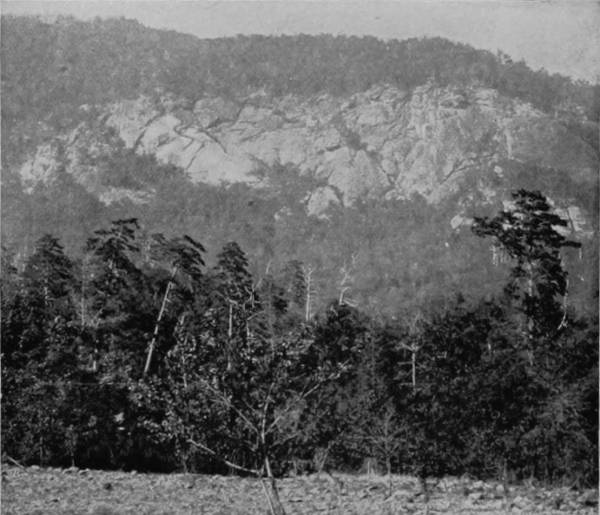
THE OLD MAN’S FACE, NEAR ASHEVILLE.
From the pleasant vales about Galbraith the route was south to Morristown, and thence southeast along the valley of the French Broad River, through Unaka Pass of the Great Smoky Mountains, to North Carolina. Many writers have exhausted the dictionary of adjectives in describing the romantic beauties of the French Broad, but the stream, and its intervales, bedighted with marvelous cliffs, continues as nature made it, beyond the power of description. The course of this lovely stream cuts through the charming hills about Asheville and pours its crystal waters through a narrow gorge until it passes the blockade of the Smoky Mountains. In this space of forty miles the French Broad is indeed a “racing river,” to which the Cherokees applied the name Tahkecostee, which has that significance, for it is impetuous, torrential, terrific. From a gentle stream above Asheville, by the contraction of its banks below, the river becomes angry, and the roar of cataract as it rushes over opposing bowlders fills the air with noise like thunder. At Stack House the current dashes over a fall twenty feet high, and at Mountain Island it makes another leap and then becomes a noisy rapid to a point known as “Deep Water.” Here the mountains close in upon the river, forcing it through a narrow channel only one hundred and fifty feet wide and forty feet deep. The railroad to reach the opposite bank, crosses the river diagonally by an iron bridge, with a clear span of two hundred and sixty feet, squeezing itself, as it were, around the rocky face of the mountain on the right bank, to be received with the same grudging hospitality by the hard face of the left bank, and twists itself by a very short curve into line, which in a very few minutes brings it into the beautiful, smiling valley of Hot Springs.
No one has ever been able to convey a just idea of the remarkable magnificence of this wonderful cañon, with its wild and ceaseless splendor of tumultuous waters, its overhanging cliffs, its noble mountains and fairy islets. In the time of stage-coaching it was an experience never to be forgotten—the day’s journey from Asheville to the Warm Springs, along the turnpike which followed the old Indian trail and lay between the river and the cliffs, hemmed in by the whirling emerald waters of the first and overhung by the fern-draped escarpments of the last, with vistas of wild and yet wilder beauty opening at every step.
Paint Rock is six miles below Hot Springs, and directly on the line between North Carolina and Tennessee. The rock itself is massive in size and would attract attention, if not admiration, aside from the legends which make it famous. The name Paint Rock is given to perpetuate a tradition that the Cherokee Indians colored portions of it with an indelible paint, and in the form of hieroglyphics which no one has been able to decipher, though the legend represents that it is the tribe’s prayer to the Great Spirit; and being approved, ages will not suffice to efface it. Twenty miles east of Asheville is Round Knob, on the line of the Western North Carolina Railroad and nestled in the very heart of the Blue Ridge Mountains, where the scenery surpasses in wildness and sublimity that of any other section of the State. It is a basin so completely shut in by lofty peaks, that if a person were dropped into it without knowing the point of entrance, he would find difficulty in escaping. A brawling mountain stream rushes by, in whose crystal waters bask the speckled trout to tempt the angler, while near the hotel is to be seen one of the most beautiful spectacles in the world—a magnificent fountain that throws its spray two hundred and eighty-six feet high, then like a bridal veil floats off in misty fragments. It is beautiful by day, but far more beautiful in the moonlight, as it throws its sparkling vapor high in the air, giving to the scene a weird enchantment.
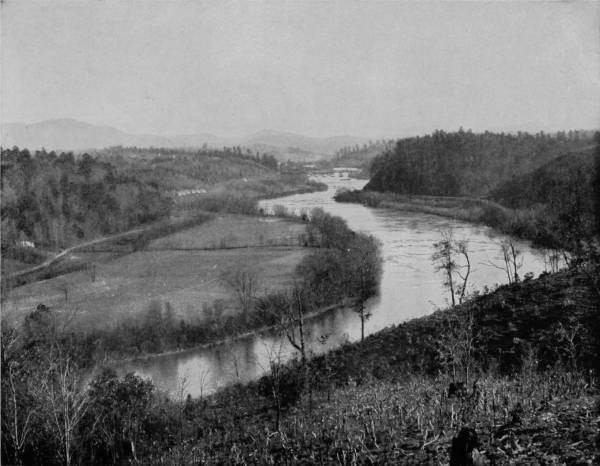
A VIEW OF THE FRENCH BROAD RIVER ABOVE ASHEVILLE.—Many writers have exhausted the dictionary of adjectives in describing the romantic beauties of the French Broad River, but the stream and its intervals, bedighted with marvelous cliffs, continues, as Nature made it, beyond the power of description. In its course northward this lovely stream cuts through the charming hills about Asheville, and pours its crystal waters through a narrow gorge until it passes the blockade of the Smoky Mountains. In this space of forty miles it is indeed a “racing river,” which is signified by its Cherokee name of Tahkecostee. From a gentle stream above Asheville, it becomes an angry, raging flood below that point as it dashes through mountain gorges and over opposing boulders with a roar like thunder.
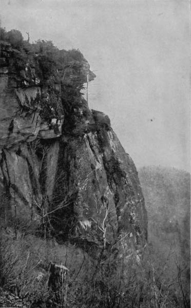
CÆSAR’S HEAD, SPUR OF THE BLUE RIDGE RANGE, N. C.
Overhead, apparently weaving in and out like a silver thread, winds the glistening track over which the tourist must pass to gain the summit of the Blue Ridge. So great and difficult is the ascent that at one point four parallel tracks may be seen, one above the other, while at another point, as the train passes over a winding trestle sixty feet high, the tourist might easily drop his hat on the track below over which he had passed a few minutes before, but now going in an entirely opposite direction, having gained nothing on his journey save about ninety feet in elevation. So often does the track turn, twist and double upon itself to gain the summit, that at one place of observation it may be seen at seventeen distinct points. After having gained a distance of over five miles of the ascent, the train is again within one-fourth of a mile of the Knob, now lying far below, but still the center of this grand system of iron loops, by means of which the train is gradually rising to the region of the clouds. From this point to the summit, in the short space of one and a half miles, the train passes through six tunnels and across numerous gorges, whose sides are clothed with the primeval forest where perhaps the foot of man never trod. The most noted of these is “Royal Gorge,” seen from the car window, whose precipitous sides and deep-yawning chasm form a scene of magnificent grandeur, from the top of whose butting cliffs the mountains of South Carolina are visible, two hundred miles distant. As the train rushes forward, suddenly it plunges into Swannanoa Tunnel, which is nearly two thousand feet long, and upon emerging at the western end, along the massive walls, we reach the highest point in that Land of the Sky, where the waters of a spring divide, a part flowing into the Atlantic Ocean and an equal share being contributed to the Gulf of Mexico.
Having crossed the Blue Ridge Mountains and passed through Hickory-Nut Gap to the valley, the road leads into one of the grandest cañons of the Broad River. Here for a distance of nine miles on either side of the river giant mountains rise to a dizzy height, forming massive walls of blue granite, often reaching a height of more than a thousand feet, while not a sprig of vegetation appears on their surface.
A creek large enough to turn a mill plunges over one of these embattlements and falls in a single stream a distance of over thirteen hundred feet, known as Hickory-Nut Falls, said to be the third highest falls in the United States. Passing on down this great gorge, we see Chimney Rock on the right, a circular column four hundred feet high, while on the opposite side is Round Top, with its pyramidal dome resting against the sky.
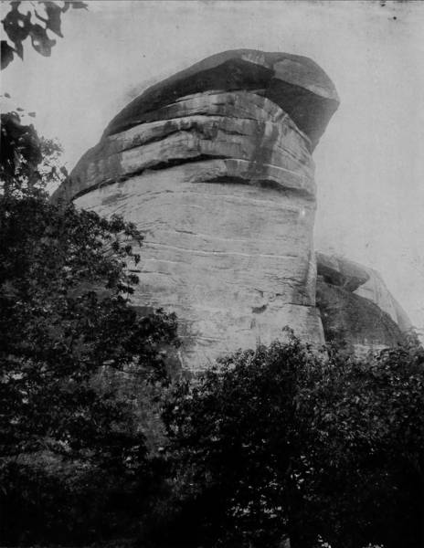
CHIMNEY ROCK, ON THE FRENCH BROAD RIVER.—After passing through the Blue Ridge Mountains at Hickory Nut Gap, the valley of the French Broad River is encompassed by one of the grandest cañons to be found in any part of the world. For a distance of nine miles on either side, giant mountains rise to a dizzy height, forming massive walls of blue granite, often reaching an altitude of more than a thousand feet, while not a sprig of vegetation appears on their surface. They are cut and carved by the elements into many curious and remarkable shapes, designated by names more or less appropriate. Chimney Rock, photographed on this page, is a circular column four hundred feet high, bearing upon its top a curiously shaped rock closely resembling the cap of liberty.
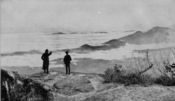
ABOVE THE CLOUDS ON MITCHELL’S PEAK, NEAR ASHEVILLE, NORTH CAROLINA.
“High mountains bound this vale on north and south, while directly in front of us, like companion sentinels guarding the western gateway, down which the sun was to march, stands Round Top and Chimney Rock Mountains. Behind Chimney Rock, trending toward the west, arise in close succession a number of mountains with distinct, broken summits—a long palisade fencing the gap in whose depth rushes the Broad River. In the center of the west stands Bear Wallow Mountain, the last visible knob of Hickory-Nut Gap.
“The sun was sinking behind the white cumuli that capped this mountain. Streamers of golden light, like the spokes of a celestial chariot, whose hub was the hidden sun, barred the western sky. The clouds shone with edges of beaten gold. Their centers, with every minute, changed to all hues imaginable. The fronts of the Sentinel Mountains were somber in the shadows, while the gap was radiant with the light pouring through it, and every pine on the top of the palisade stood black against the glowing sky.” The “Old Man’s Face” is another wonderful natural curiosity which divides interest with the finest scenery in this remarkable region, and is on the west side of Bald Mountain, in prominent view, for the rocks are barren and garish from the light of the sun. This singular formation is a faithful representation of a three-quarter view of an old man’s face, with forehead, eyes, nose, mouth and beard in such perfect proportion that one can hardly believe, without close examination, the face is only an accidental result of the elements, in their unceasing work of denudation.
Eighteen miles from Asheville, in the Balsam Range, is Mount Pisgah, 5,757 feet high, from the apex of which a wonderful expanse of mountain scenery is spread out to view; but it is from the Blue Ridge peaks that the sublimest visions are presented, and the most curious forms of nature-sculpturing occur. Passing southwest from Asheville, the Asheville and Spartanburg Road runs through an exceedingly fertile region, and thence into the Cañon of Little River, where for four miles the stream is a succession of surging rapids, noisy cascades, and picturesque waterfalls, until it approaches the base of tremendous cliffs. These are spurs of the Blue Ridge, one of which is famous as presenting a facial profile which has been named “Cæsar’s Head,” but it takes a person of vivid imagination to distinguish the human features, very plain though the guide declares them to be. As the altitude is nearly 6,000 feet, and 2,000 feet above the valley, the prospect of the peak of this Blue Ridge spur is incomparably magnificent.
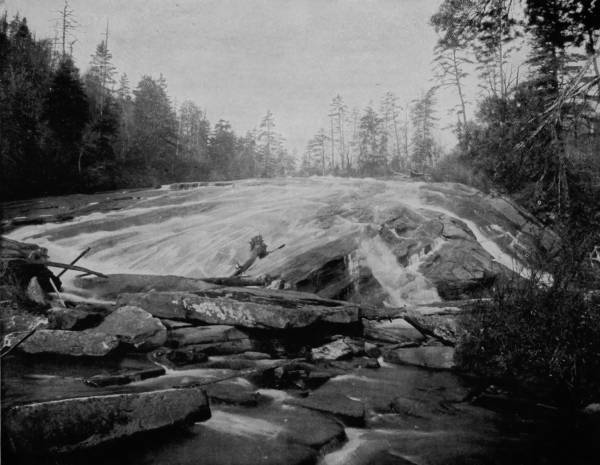
LITTLE RIVER RAPIDS, NORTH CAROLINA.—At this point the river flashes over a sloping ledge of rocks and boulders with irresistible power and a roar like that of thunder. At all seasons of the year the scene is splendid and inspiring, but when the river is swollen with the spring floods and the waters come with a mighty and irresistible flood, dashing over the rocks and carrying away trees and boulders with titanic force and rage, the view is awe-inspiring and grand beyond the power of human pen to describe.
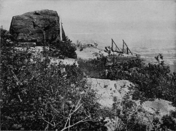
THE SUMMIT OF MOUNT MITCHELL, NORTH CAROLINA.
From this dizzy height the peaks of the Blue Ridge may be observed for scores of miles in each direction; looking northeast you may see the famous King’s Mountain, seventy miles away, while in the opposite direction, in distinct view, is Stone Mountain, near Atlanta, Georgia, over one hundred miles away. Looking to the north, a distance of a little more than one hundred miles, is the Roan Mountain, while to the northeast is seen the black dome of Mount Mitchell, full sixty-five miles distant. In the northwest, about thirty-five miles away, is Pisgah, resembling a great Egyptian pyramid in outline, while directly to the west are the Highlands of Macon county, with Whiteside Mountain glittering like an iceberg in the sunlight. From the top of this wonderful precipice the view is strangely suggestive of a great stretch of ocean. The blue waves of the sea find their counterpart in the waves of these blue mountains, with their corrugations extending far out until the outline is lost in the hazy distance. There is no grander sight than a view from this point at sunrise, when the world below is buried from sight in an ocean of impenetrable fog, and the great billows of fleecy mist rolling like angry waves, while the breaker-like roar of cataracts a thousand feet below, makes the deception complete.
The loftiest peak of the Appalachian system is Mount Mitchell, which is thirty miles from Asheville, and is easiest reached by way of the Swannanoa River. The ascent is by a comparatively easy roadway, but as the altitude of the summit is 6,717 feet, it is not gained without great exertion. Formerly the mountain was called Black Dome, then Clingman’s Mount, but was afterwards christened Mitchell’s Peak, in honor of Professor Elisha Mitchell, of the State University of North Carolina, who was first to measure its exact altitude, and who lost his life by falling over a precipice in making a second ascent to verify his first measurement. The body was found ten days after the fatal accident and conveyed to Asheville, where it was buried. One year subsequently the remains were disinterred and carried to the summit of Mitchell Mountain, and there committed to the grave, over which a beautiful monument now stands, the tribute of a daughter’s loving memory.
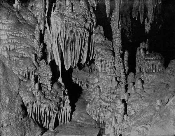
CATHEDRAL AND THRONE IN LURAY CAVERN, VIRGINIA.—The formations of Luray Cavern are perhaps the most beautiful of all the subterranean wonders of the world. At some period, long subsequent to its original excavation, the cavern was completely filled with glacial mud, whereby the drip-stone was eroded into singularly grotesque as well as lovely shapes. Out of these molds of nature, after the mud had been mostly removed by flowing water, came these marvelous formations, rivaling in beauty and wonder the most exquisite carvings of art. The “Throne-Room,” so beautifully photographed on this page, is canopied with curtains and hung with tapestry that seem to be woven of pearls and diamonds, rivaling the splendors of Aladdin’s fabled cave.
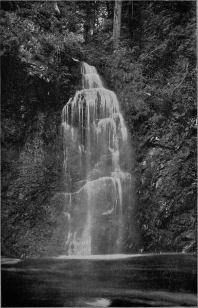
BRIDAL VEIL FALLS, DINGMAN’S FERRY, PENNSYLVANIA.
The ascent of the mountain lies through superb forests of deciduous trees and along the banks of the rushing Swannanoa, until after a climb of five miles the second base of the mountain is reached—a small grassy plateau, where a residence once stood—now known as the “Half-way House.” From this point the world below unrolls before the gaze like an azure scroll, while above, awful in its nearness and immensity, towers the dark mass of Black Mountain, clothed with a somber forest, into the depths of which the path now plunges, and which it does not leave again until the final summit is reached. Winding in snake-like turns through the close-growing firs, the trail climbs the steep shoulders of the great mountain, passing over what is now known as Clingman Dome (of the Blacks) and then following its ridges for about three miles, until the bare rocky peak, which is the highest point of land east of the Rocky Mountains, is reached, and all hardships of ascent are forgotten in the view that bursts upon the enraptured vision.
If the day is clear, the prospect is almost boundless in extent and of infinite beauty. Range behind range of great mountains lie below, like a Titanic ocean stilled by some mighty hand. From this supreme elevation it is possible to study the structural character of the region, and to count all the great chains that cross the country, while no words can express the varying and exquisite color that, like a glamour of heavenly enchantment, lies over the wide expanse. The whole earth, “and the beauty thereof,” seems to be spread out at one’s feet, and the airs that come to this high mountain crest are full of freshness and balm.
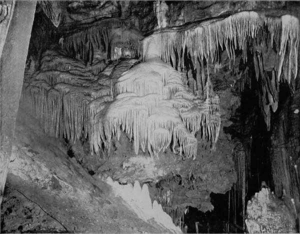
TITANIA’S VEIL, LURAY CAVERNS, VIRGINIA.—The origin of the beautiful scarfs and canopies that constitute a special feature of the attractions of Luray Caverns, and which differ from all other subterraneous formations yet discovered, is from carbonates deposited by water trickling down a sloping and corrugated surface. In one place there are sixteen of these alabaster scarfs hanging side by side—three white and fine as crepe shawls; thirteen striated like agate, with every shade of brown, and all perfectly transparent. Down the edge of each a tiny rill glistens like silver, the ever-flying shuttle that weaves this fairy fabric. When lighted by electricity each drop of liquid and every rounded gem becomes a flaming diamond, producing a scene of splendor that can be but faintly imagined.
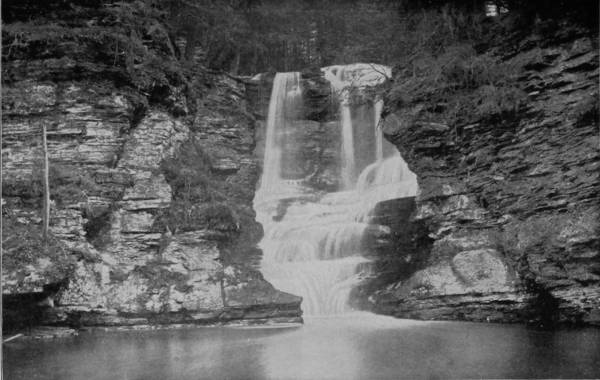
COLOSSEUM FALLS, NEAR DINGMAN’S FERRY, PENNSYLVANIA.
A Southern poet, who climbed the mountain in the spring of 1891, thus describes the inspiring sight which greeted him when the day was dying: “To witness a sunset from this peak is something long to be remembered. Never shall I forget that evening in June, when in company with my guide, we stood by the grave on the summit of Mount Mitchell, and looked down on that scene of resplendent glory that lay before us; far in the west the sun was slowly sinking in a bed of crimson and gold, the horizon was lighted with a flushing radiance which was infinitely sublime, while the whole landscape was aglow with splendor, every tint and hue imaginable seemed to intermingle in that sea of color, and every jutting crag, and dome, and pinnacle of sullen rock flamed as though a thousand rainbows had fallen out of the sky and hung themselves there like glorious banners; we stand enthralled at the scene before us, no sound is heard, no note of bird breaks the awful stillness. We are in the region of that eternal silence which wraps the summit of the ‘everlasting hills.’ A hush of dreamy repose broods over this lofty peak, which still retains the last rays of the setting sun, while over the world below twilight has fallen.
But it is not only from its unsurpassed view that this great mountain is interesting. Its vast sides are clothed with a forest of bewildering beauty, crystal streams gush from its heights, and there is, altogether, a fascination about this wild, unpeopled region that goes far to account for the passion which caused Professor Mitchell to lose his life in wandering through its wilderness.
Having accomplished a circuit of the wonderlands of Western North Carolina, our artist departed from Asheville by way of the Richmond and Danville Railroad, and thence by its northern connections to Roanoke, Virginia, at which point train was taken on the Shenandoah Valley Route for Luray, a town of 1,500 people, but famous by reason of its proximity to the marvelous caverns of that name, the beauty of which is incomparable, and in wonder they rival the great Mammoth Cave. This marvelous subterranean labyrinth is one mile distant from the town, and is entered by an easy passage-way that has a gradual descent by stone steps. The cave was an accidental discovery by Mr. Andrew J. Campbell, in 1878, who, while examining the locality known as Cave Hill, was led, by the hollow sound produced by stamping the earth, to seek for the cavity which he knew must exist at that point. With spade and mattock he sank a hole four feet deep and was rewarded by finding the great cavern which ought rightfully to bear his name.
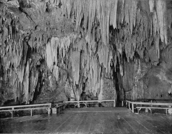
THE BALL-ROOM, LURAY CAVERNS.—Luray’s stalactite display exceeds that of any other cavern known. The original material is yellow, brown or red, and its wavy surface often shows layers like the gnarled grain of costly woods. The new stalactites growing from the old, and made of hard carbonates that had already once been used, are usually white as snow, though often pink, blue or amber-colored. The small pendants are innumerable, and they sparkle and blaze in the light like clusters of diamonds, sapphires and other precious stones. At some points the stalactite columns are of immense size and height, unsullied and wax-like in their transparent whiteness, each ripple and braided rill appearing as if it had been polished.
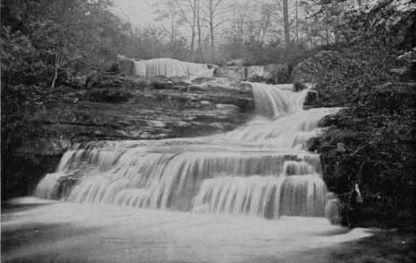
FACTORY FALLS, DINGMAN’S FERRY, PENNSYLVANIA.
To Rev. Horace C. Hovey, of New Haven, we are indebted for the best, as it is the most interesting, description that has ever been written of this underground wonderland, prepared as it was after a careful examination of the geology of the cave as well as of its splendors:
“At some period, long subsequent to its original excavation, and after many large stalactites had grown, the cavern was completely filled with glacial mud, whereby the drip-stone was eroded into singularly grotesque shapes. After the mud had been mostly removed by flowing water, these eroded forms remained amid the new growths. To this contrast may be ascribed some of the most striking scenes of the cave. The many, and extraordinary monuments of aqueous energy include massive columns wrenched from their place in the ceiling and prostrate on the floor; the hollow column forty feet high and thirty feet in diameter, standing erect, but pierced by a tubular passage from top to bottom; the leaning column, nearly as large, undermined and tilting like the Campanila of Pisa; the organ, a cluster of stalactites, dropped point downward, and standing thus in the room known as the Cathedral; besides a vast bed of disintegrated carbonates left by the whirling flood in its retreat through the great space called the Elfin Ramble.
“The stalactite display exceeds that of any other cavern known, and there is hardly a square yard on the walls or ceiling that is not thus ornamented. The old material is yellow, brown or red, and its wavy surface often shows layers like the gnarled grain of costly woods. The new stalactites growing from the old, and made of hard carbonates that had already once been used, are usually white as snow, though often pink, blue or amber-colored. The size attained by single specimens is surprising. The Empress Column is a stalagmite thirty-five feet high, rose-colored and elaborately draped. The Double Column is made of two fluted pillars side by side, the one twenty-five, the other sixty feet high, a mass of snowy alabaster. Several stalactites in the Giant’s Hall exceed fifty feet in length. The small pendants are innumerable; in the canopy above the Imperial Spring it is estimated that forty thousand are visible at once.
“The Cascades are wonderful formations, like foaming cataracts caught in mid-air, and transformed into milk-white or amber alabaster, while the Chalcedony Cascade displays a variety of colors. Brand’s Cascade, which is the finest of all, being forty feet high, and almost as wide, is unsullied and wax-like white, each ripple and braided rill appearing to have been polished.
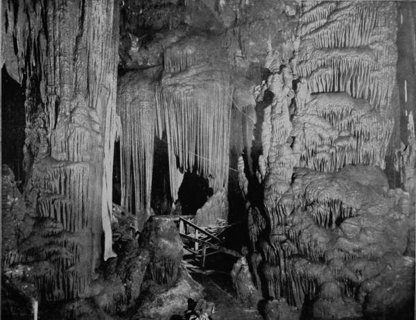
THE SARACEN’S TENT, LURAY CAVERNS, VIRGINIA.—The fervid imagination of youth, or the dreamer under the influence of the delirium-inducing hashish intoxicant in India’s climes, never riveted gaze on visions more wondrously beautiful than Luray’s intervals of divine architecture. Here and there are polished stalagmites, rich bluffs slashed with white, and others like huge mushrooms, with a velvety coat of red, purple or olive-tinted crystals. Some of the stalactites have their tips under water long enough to allow tassels of crystal to grow upon them, which in a drier season are again coated over with stalactite matter, by which many singular distortions are occasioned.
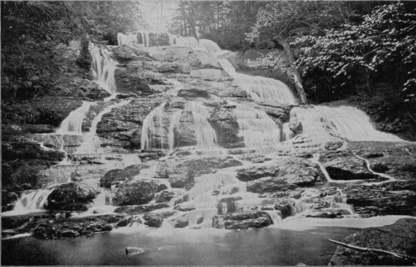
CADEDENEAN FALLS, DINGMAN’S FERRY.
“The Swords of the Titans are monstrous blades, eight in number, fifty feet long, three to eight feet wide, and one to two feet thick, but are hollow and drawn down to an extremely fine edge, filling the cavern with tones like tolling bells, when struck by the hand. Their origin, and also that of certain so-called scarfs and blankets exhibited, is from carbonates deposited by water trickling down a sloping and corrugated surface. Sixteen of these alabaster scarfs hang side by side in Hovey’s Balcony, three white and fine as crape shawls, thirteen striated like agate, with every shade of brown, and all perfectly transparent. Down the edge of each a tiny rill glistens like silver, and this is the ever-plying shuttle that weaves this fairy fabric.
“Streams and true springs are absent, but there are hundreds of basins, varying from one to fifty feet in diameter, and from six inches to fifteen feet in depth. The water in them is exquisitely pure, except as it is impregnated by the carbonate of lime, which often forms concretions called, according to their size, pearls, eggs, and snow-balls. A large one is known as the Cannon-Ball. When fractured, these spherical growths are found to be radiated in structure. Calcite crystals, drusy, feathery, or fern-like, line the sides and bottoms of every water-filled cavity, and, indeed, constitute the substance of which they are formed. Variations of level at different periods are marked by rings, ridges, and ruffled margins. These are especially strongly marked about Broaddus Lake, and the curved ramparts of the Castles on the Rhine. Here, also, are polished stalagmites, a rich buff slashed with white, and others, like huge mushrooms, with a velvety coat of red, purple, or olive-tinted crystals. In some of the smaller basins it sometimes happens that when the excess of carbonic acid escapes rapidly there is formed, besides the crystal beds below, a film above, shot like a sheet of ice across the surface. One pool twelve feet wide is thus covered so as to show but a third of its surface. The quantity of water varies greatly at different seasons; hence some stalactites have their tips under water long enough to allow tassels of crystal to grow on them, which in a drier season are again coated over with stalactitic matter, by which singular distortions are occasioned. Contiguous stalactites are often enwrapped thus till they assume an almost globular form, through which, by making a section, the primary tubes appear. Twig-like projections, lateral outgrowths, to which the term helictite has been applied, are met with in certain portions of the cave, and are interesting by reason of their strange and uncouth contortions. Their presence is partly due to the existence of a diminutive fungus peculiar to the locality, and designated from its habitat, Mucor Stalactitis. The Toy Shop is an amusing collection of these freaks of nature.
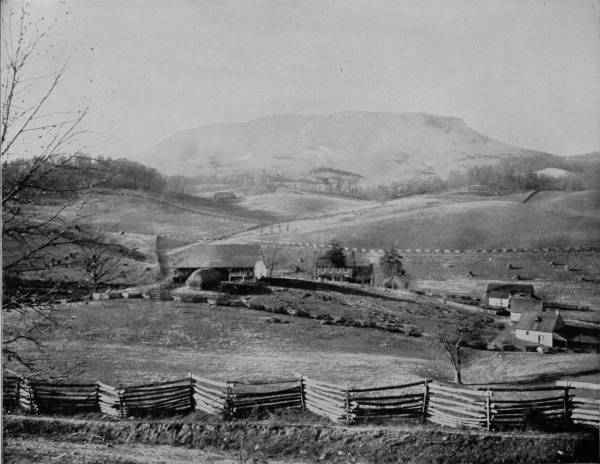
FARM SCENE IN THE VALLEY OF THE SHENANDOAH, VIRGINIA.—The war between the States found the valley of the Shenandoah an ideal pastoral country, of rich and beautiful farms, of wealthy and aristocratic families, where life in its ease and sunshine rivaled that in older lands. The war left it a bare, blackened and blasted region, its homes destroyed, its farms desolated, and its able-bodied population decimated in the field. But it has fully recovered again. Grass and grain have woven Nature’s beautiful covering over all the scars of battle, and once more the fields and orchards are laden with flowers, while the lowing of the cattle and the song of the contented husbandman are heard in place of the discordant drum and the ruthless clash of arms.
442“The dimensions of the various chambers included in Luray Caverns cannot be given, on account of the great irregularity of their outlines. Nor can their size be estimated from a diagram, because there are several tiers of galleries, and the vertical depth, from the highest to the lowest, is two hundred and sixty feet. The tract of one hundred acres, owned by the Luray Cave Company, covers all possible modes of entrance, and the explored area is much less than that. The waters of this cavern appear to be entirely destitute of life; and the existing fauna is quite meager, comprising a few bats, rats, mice, spiders, flies and small centipedes. When the cave was first entered the floor was covered with thousands of tracks of bears, wolves and raccoons, most of them probably made long ago, as impressions in the tenacious clay that composes most of the cavern-floor would remain for centuries. The traces of human occupation, as yet discovered, are pieces of charcoal, flints, moccasin tracks, and a single skeleton imbedded in a stalagmite in one of the chasms, estimated to have lain where found for not more than five hundred years, judging from the present rate of stalagmitic growth.”
Accurate and beautiful as is Mr. Hovey’s description of Luray Caverns, yet words, however ingeniously used, fail utterly to convey a true idea of the incomparable splendors of this under-world palace which gleams with unspeakable glories, such as God alone can create. Aladdin, in the Arabic tale which so delighted our youthful fancy, was permitted to enter a cave which exhibited such decorations that its very beauty both dazzled and affrighted; and to his amazement was added the greater wonder, that the cavern thus wrought of precious stones was the work of a geni, who was slave to a lamp and ring. But the fervid imagination of youth, or the dreamer under influence of the delirium-inducing hasheesh intoxicant in India’s climes, never riveted gaze upon vision more wondrously beautiful than Luray’s intervals of divine architecture; nor was Aladdin’s Cave half so charming. The Throne-Room, canopied with curtains woven of pearls and diamonds; “The Saracen’s Tent,” in which more than oriental splendors of richest damasks and golden samite sweep round the crystal couch in festoons of magic beauty; Titania’s Veil of petrified spider’s webs and crystallized harmonies, behind which the queen of fairies hides from Æolus; and the Ball-Room, with best adornments, as if to celebrate a marriage between the gods; all these and many more, in fast succession of admiring surprise, compose the Caverns of Luray, of which it has been said: “Mortal hath not made the like, nor human fancy conceived a thing more magnificent.” Let the illustrations herewith convey an idea of the beauty which language cannot express.
The uniform temperature of the cave is 54° Fahrenheit, which is the same as Mammoth Cave, and as the chamber-floors are dry, visitors are not fatigued or discomforted by long walks through the labyrinthine passages, where every step taken brings fresh marvels into view. To the curiously inclined the inquiry, not often asked, will appear very interesting: How did the animals whose foot-prints were noticed in the tenacious clay, by those who made the discovery, get into the cave? The opening by which the chambers are reached is an artificial one, made at the point where Mr. Campbell detected the hollow by stamping on the ground, as explained. No other ingress is yet known, though the cave has not been thoroughly explored; so it is possible, or probable even, that other means of entrance have long continued open, but the possibility also remains that its entering passage-ways may have been sealed up by an invasion of glacial drift, since the flood; marks of that tremendous cataclysm are plainly to be seen in the cave, and not all of the diluvium deposit has been yet removed or ground under foot by the 10,000 persons who visit the caverns annually.
A trip up the Shenandoah Valley, though made in a luxurious coach on a swift-moving train, is attended by innumerable reminders of the great civil war, for the journey is over a succession of hotly-contested battle-fields; but the beautiful scenery, rich lands, and lovely farm scenes that now compose the landscape, cannot efface the recollection which monuments and cemeteries constantly revive. General Boynton has drawn a truthful picture of this war-famous section, in this wise:
“Every foot south of the Potomac was fighting-ground; every town was, at some time, the headquarters of well-known forces; nearly every farm house was a hospital, and some of the dead and wounded of the many contests had fallen on every acre. On the Union side Fremont and Sigel, Milroy and Shields, Hunter and Banks, Kelley and Crook, Wilson and Sheridan, and others of note had there met Jackson, Ewell, Early, Stewart, Ashby, and the advance of Lee in force. There were innumerable small affairs, and many extended and fierce engagements. Columns in advance and in retreat ebbed and flowed there through every year of the war; while every gap opening eastward poured its footmen and its horsemen upon the flanks, first of the one army, and then of the other. From the opening of the contest till is close it was the vortex of strategy. The war found it an ideal pastoral country, of rich and beautiful farms, of wealthy and aristocratic families, where life in its ease and sunshine rivaled that in older lands. It was the granary and store-house of the Confederacy. The war left it a bare, blackened, and blasted region, its homes destroyed, its farms desolated, and its able-bodied population decimated in the field. But it has fully recovered again. Grass and grain have woven nature’s beautiful covering over all scars of battle, and the countless miles of parapets are green each year with verdure, and the fields and orchards are laden with flowers again.”
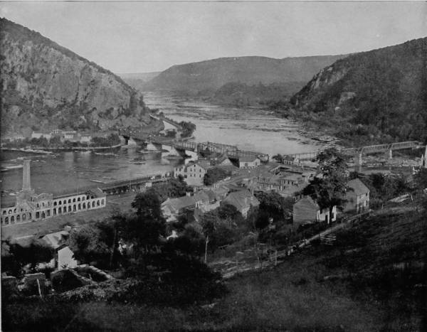
HARPER’S FERRY, WEST VIRGINIA, FROM BOLIVAR HEIGHTS.—Harper’s Ferry is a place of great scenic as well as historic interest; but it is the magnificent scenery surrounding the place that now chiefly attracts the tourist’s attention. From Maryland Heights, on the opposite side of the Potomac, the observer is able to look into seven counties and across stretches of three States, the view being at last arrested by a soft haze that crowns the summit of the Blue Ridge range. The Shenandoah River unites with the Potomac at this point, sprinkled with white-crested waves that dash and roar over the boulders that uselessly attempt to impede its progress.
444The southwestern branch of the Baltimore and Ohio skirts the Cumberland Range, following the valley of the Shenandoah, until it joins the main line at Harper’s Ferry, where the Shenandoah and Potomac likewise form a junction, each stream cleaving a way through the mountains and watering a region of extraordinary scenic beauty. Sheridan, when operating in these valleys, declared that the country was so barren that a crow would have to carry its rations when flying over it; but the country has blossomed into fertility since that time, and now presents glorious visions of great productiveness, as well as bluffs and mountains of rugged picturesqueness.
Harper’s Ferry was well known before the war as being the location of one of the important Government armories and arsenals, which were destroyed soon after the beginning of hostilities, and have not since been rebuilt. Its chief fame, however, is derived from the fact that the town was the seat of the John Brown insurrection (in October, 1859); and at Charleston, seven miles distant, on the road to Winchester, is the place where he was tried and executed. Harper’s Ferry was thus not only the scene of the opening events of the war, but it remained the center of action for a long time, being alternately occupied by the Union and Confederate forces, who contended with varying fortunes, but always with immense loss of life, in efforts to retain it as a base for their supplies. It is the magnificent scenery surrounding the place that now attracts the tourist’s interest, for a more beautiful section of mountain country is nowhere to be seen in the East. Particularly fine views are afforded from Maryland Heights, on the opposite side of the Potomac, and from Bolivar Heights, which are above the town, the latter being a more extensive perspective, commanding as it does a long stretch of river and the huge mountain ramparts on the south. From this point of observation, too, the Shenandoah River is presented to the view, sprinkled with white-crested waves dashing over smooth-worn bowlders, that have long lain in its course, and its frowning shores that rise up into towering mountains and form a chain of peaks that girdle the horizon. From Maryland Heights the observer is able to look into seven counties, and across stretches of three States, the view being at last arrested by a soft haze that crowns the soaring summits of the Blue Ridge Range. The route from Harper’s Ferry was north by way of the Baltimore and Ohio and the Cumberland Valley Railroads to Harrisburg, and thence some of the fine scenery of Pennsylvania was visited, particularly that which lies along the line of the Pennsylvania Railroad. In going East, the first view of great interest which greets the eyes of observant travelers along this road, after leaving Pittsburgh, is Johnstown, a great manufacturing place, at the confluence of Conemaugh River and Stony Creek, but whose largest fame dates from June 1, 1889, when the town was swept by one of the most appalling cataclysms that has found a record in history. On that ever-memorable date the immense reservoir away up in the Alleghenies that held the waters of South Fork, burst without warning and rushed down, a very devastating monster, into the smiling valley, which it overwhelmed with a flood forty feet deep. The result is too awful to dwell upon; two thousand people were whirled to their death, and the city was carried from its foundations, with a loss of $10,000,000. But Johnstown has recovered from the terrible blow which it received on that opening day of summer, and the blazing forge of the rolling-mills has again brought prosperity to the place.
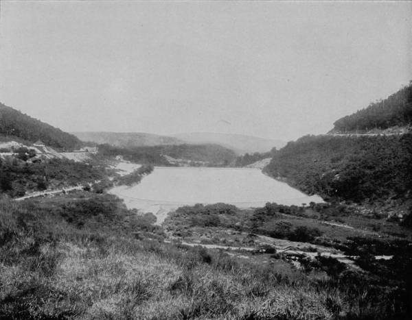
THE HORSESHOE CURVE AT KITTANNING, PENNSYLVANIA.—This point is in one of the finest scenic localities of the great State of Pennsylvania, the rolling and broken hills rising in many places almost to the dignity of mountains. The valleys and sloping sides of the hills are covered with rich and well-cultivated farms, adorned with elegant farm-houses, barns and other improvements, superior to almost any of the other rural districts of our country. It is a region also famous for fruits of various kinds, and in the early spring the whole country seems abloom with the apple, peach, pear and other fragrant and familiar blossoms.
446Beyond Johnstown a magnificent panorama of the Alleghenies breaks into view with their myriad phases of beauty and grandeur. As we follow down the Conemaugh, along the breast of the mountains are the remains of inclined planes of the Portage Railroad, by which loaded canal-boats were transported over the mountains at points where the canal was not yet constructed. This was before the days of steam railroads, when canals were the most expeditious mode of freight transportation. Beyond Cressons the road begins the ascent of the Alleghenies, and in doing so makes many turns, and from the right hand of the road a gorgeous spectacle is presented looking down into the valleys, where the houses are dwarfed by distance until they look like mole-hills, and men are not distinguishable. There are horseshoe curves as sharp and graceful as any on the roads that climb over western mountains, while the scene is often more picturesque because of the high state of cultivation of the mountain slopes. A tunnel three-quarters of a mile in length pierces the brow of one of the highest peaks, after which the road descends rapidly to Cressons, a place noted for its seven mineral springs. Altoona is next passed, and a few minutes later the train rushes around the beautiful horseshoe curve at Kittanning, affording a charming prospect of lofty mountains, surrounding a lake of exquisite beauty, made by damming a pretty stream that comes gamboling down from cool retreats in the high altitudes.
Out of the Tuckahoe Valley and on to Tyrone, where the Little Juniata is reached, along whose sweet-smelling banks the road hastens by Broad Top Mountain, Sliding Hill, through the gap of Jack’s Mountain, and thence into the Long Narrows, which is traversed by highway, river and canal, running in competition with the railroad. For several miles the scenery is wondrously beautiful, with kaleidoscopic glimpses of swift-passing mountain, foaming water-ways, laughing cascades, and bounty-bestowing valleys bedewed with the delicious waters of the blue Juniata. Thence on to Harrisburg the road speeds, with many a twist through smiling vales that swathe the mountain’s feet with ribbons of verdure; across the Susquehanna, where the river is more than a mile wide and freckled with impeding stones. Lancaster is soon reached, and thence eastward the scenery grows in grandeur until Chester Valley is passed and Paoli comes into view. This place is famous in history from the fact that here took place a massacre which will be remembered for ages as a reproach to the British. On September 20, 1777, the American forces under General Anthony Wayne were surprised by a large army of British regulars, commanded by General Gray. Notwithstanding the superior numbers of the enemy and his unpreparedness, General Wayne offered a stubborn resistance, and not until nearly one-half his men had fallen in the desperate conflict did he capitulate, upon terms of honorable surrender. Instead of observing the rules which obtain among civilized nations, after the Americans had laid down their arms the British mercilessly slaughtered many of their helpless prisoners. A monument, erected in 1817, marks the site of this shameful tragedy. Eastward from Paoli the road traverses one of the fairest sections in the world, resembling the richest agricultural regions of England, where the soil is in the highest possible state of cultivation and the farm houses are models of architectural elegance, with a gradual increase in the beauties of the prosperous landscape until the train pursues its way through Fairmount Park and into the great metropolis of Philadelphia.
Northward from Philadelphia our artist traveled, through Bethlehem to the Delaware Water Gap, where the Delaware River forges its way through the Blue Mountains, the point of passage being narrowed by walls from 1,200 to 1,600 feet high, which seem to clasp the sturdy stream in colossal arms, of half affection and half restraint. This tremendous gorge formerly bore the Indian name of Minnisink, signifying “Whence the waters are gone,” which is thus explained by a local geologist: “Here a vast lake once probably extended; and whether the great body of water wore its way through the mountain by a fall like Niagara, or burst through a gorge, it is certain that the Minnisink country bears the mark of aqueous action in its diluvial soil, and in its rounded hills, built of pebbles and bowlders.” The gap proper is about two miles long, when the mountains recede on both sides, as if at one time some terrific disturbance had thrown up a giant ridge in the path of the river. It is apparent also that centuries ago the passage, though hardly more than one hundred yards wide now, was very much narrower, and the name given to it by the Indians was no doubt suggested by this cleft through which the pent-up waters must have dashed with terrific force and roar.
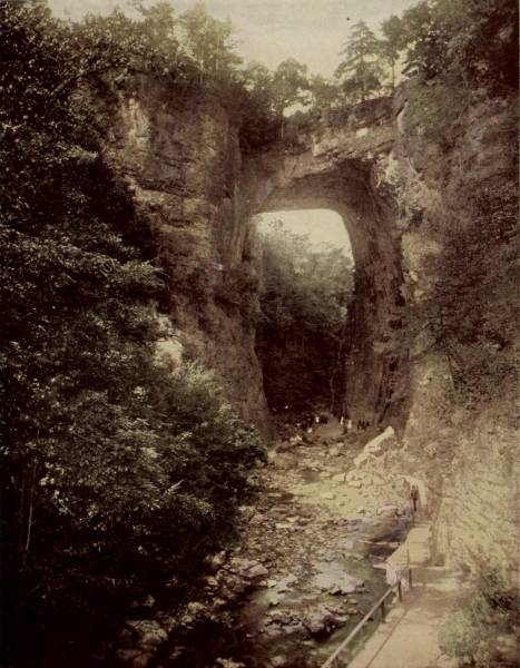
NATURAL BRIDGE OF VIRGINIA.
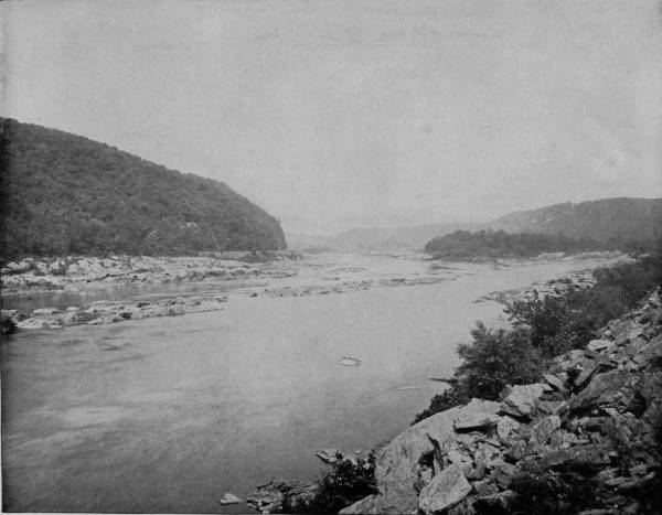
LITTLE NECK OF THE SUSQUEHANNA RIVER, PENNSYLVANIA.—The Susquehanna River takes its rise in the northern part of Pennsylvania and flows southward into Chesapeake Bay. Its entire course passes through a richly diversified and splendid scenic region, equaling in many respects the scenery along the Rhine River in Germany, and lacking only the castles and the ancient historic associations to make it as popular with tourists as its less poetically named sister of the Fatherland.
448The two mountains between which the river passes are named in honor of two famous Indian chiefs, that on the New Jersey side being called Tammany, and the one on the Pennsylvania shore being known as Minsi. Chief Tammany was of the Delaware tribe, whose bravery and magnanimity was such that he was canonized as the patron saint of America, but his name is best perpetuated by New York City’s political organization. The two mountains, adjacent, and which were no doubt one before the wearing waters cut a way through it, exhibit marked differences, which, to a casual observer, would seem to controvert this theory. Mount Minsi is a graceful peak crowned with dense forest growths, while Tammany is a gigantic rock that rises in broken ledges, almost terraces, from the river, on one of which, two hundred feet above the river, a hotel has been built to accommodate summer tourists. And the scenery is grand enough to lure lovers of the picturesque in nature. Just below the hotel falls a silvery cascade whose waters are derived from Hunter’s Spring, that bursts out of the mountain side, and perambulates through many sequestered nooks, moss-covered and beflowered, before it drops into a pool called Diana’s Bath, thence over Caldeno Falls, and slides into the river. Above the source of the waterfall is a lofty ledge known as Lover’s Leap, and to the left another promontory called Prospect Rock, while near-by is a clear lake on the very apex of the mountain, which visitors are told is of an unfathomable depth.
But though Tammany is the more ruggedly picturesque, Minsi offers the more entrancing prospect, expanding on the east until the whole of New Jersey seems to be spread out to view. A mile below the Gap the scenery becomes curiously pretty, for the river has worn the banks into grottoes and fantastic forms. Here are such objects of interest as Indian Ladder Bluff, Cold-Air Cave, Point of Rocks, Bumer’s Spring, etc., while a few miles above the Gap there are bits of nature positively charming. Bushkill Creek pours its contribution into the Delaware five miles from the Gap and a few hundred yards from its outlet the stream tumbles over a precipice twenty feet high in a sheet of water that looks like a curtain of lace. On an affluent of the Bushkill are two other cataracts of even greater beauty, known as Buttermilk and Marshall, both of which may be reached in a half-hour’s walk from the river, and are within seven miles of the hotel on Tammany’s ledge. A feature of the Water Gap, which vies in interest with the natural scenery, is the railroad-bed around the base of Tammany, where it exacts a space from both the river and the mountain, in order to secure sufficient width for passage. At this point the gap is narrowest and the cliffs most stupendous, right where the jaws of the gorge are set in firmest resolution to prevent a full flow of the river, and where a rushing current betrays irritation at the impediment by a ceaseless roar.
Twenty-five miles above the Water Gap is another section of wild and weirdly grand scenery, where Dingman’s Creek carols through the copses and takes a header into the Delaware, like a swimmer at the bath. Dingman’s Ferry is a small hamlet containing a score of houses, but what it lacks in population is made up in public interest by its picturesque surroundings. The region is intersected by numerous streams, which are noted for their impetuous courses and numerous falls. Of these Colosseum Falls are the largest, and by many are regarded as the most beautiful; but Bridal Veil Falls are more exquisitely fascinating to the artist. The stream is not large, but the precipice is high, and so gracefully terraced that the water makes a succession of leaps, and each time is spread by the ledges until at its last fall it is as airy as a bride’s veil. Its sedgy banks and bosky shelves add to the general effect in a way that compels the thought of fairy bowers and naiads’ retreats. Factory Falls are the largest cataracts of this sylvan region, pouring a considerable volume of water over serrated brinks, and twisting around in shapely ways that add ineffable grace to the boiling, laughing and playful waters. Cadedenean Falls are almost as graceful, but are spread over a greater surface, and fall into the creek in the form of an outspread fan. The “Brakes and Braes of Bonny Doon” were not more charming to the eyes of the poet than the soul-delighting coverts and falls about Dingman’s. In the spring-time these streams are swollen to immense proportions, and it is then that the falls display their greatest grandeur, filling the woods with their torrential orisons; but in summer they exhibit the most marvelous graces, for it is then the waters are crystalline in their purity, and the dewy mosses along their brinks look like garlands of diamonds, which the branches of bordering thickets stoop down to kiss.
From Dingman’s Ferry our photographer passed on to Milford, and thence by the Erie Road to New York City, where a junction was made with the two other photographers for a trip to the sunny lands of the South.
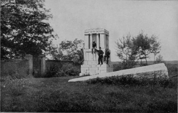
TOMB OVER THE GRAVE OF WASHINGTON’S MOTHER, AT FREDERICKSBURG, VIRGINIA.

New York City possesses many attractions for the cosmopolitan, but not for the artist, who prefers nature’s solitudes to the artificial glamor and noisy hum of a large city; hence our stay in that city was only for such time as it required to make preparations for extending our pictorial journey through summer lands of the southeast. Instead of carrying our original plans into immediate execution, however, it was decided to visit the battle-field of Gettysburg, which our artist coming up through Virginia and Pennsylvania did not find it convenient to include in his journey. The town of Gettysburg has a population of some 3,500 souls, and is the capital of Adams county, Pennsylvania, the center of a blooming and bounteously-producing agricultural district. Our route to reach the place was by way of the Pennsylvania Railroad to Hanover, and thence by the Western Maryland Railroad, a distance of 250 miles from New York. The landscape thereabout is undulating, occasionally rising to hills of considerable size; but scenically there is nothing particularly attractive, aside from the beautiful farms and truck-gardens that clothe the knolls with prodigal harvests. Historically, the place is imperishably famous, for here was fought, on the 1st, 2d and 3d of July, 1863, the bloodiest and hottest-contested battle of the civil war. From every eminence this dreadful field, though it now smiles with plenty, still presents memorials of that ever-memorable conflict. There is Cemetery Hill, the old grave-place of the town, where thousands slept before the awakening alarms of cannon and musket enveloped the scene in battle-smoke. Here it was that the Union forces, under General Meade, pitched their quarters, because it commanded a view of the adjacent country. One mile towards the west is Seminary Ridge, the spot chosen by the Confederates, under General Lee, 450as their vantage-point and headquarters. Now sweep the horizon and mark the places where the battle waxed fiercest; where the dead lay thickest and the thunder of conflict was loudest. There is Willoughby Run, where the battle began and where Buford’s cavalry was hurled upon the steel of Hill, and for two hours withstood the hell of ball and bayonet until flesh could endure no more. There is Round Top, another eminence where the Union lines reformed, with the left wing thrown around the ridges to Cemetery Hill. There is where Longstreet struck Sickles with such fearless resolution, and a whole day was spent in a contention for Great and Little Round Top, without advantage to either side, but with frightful losses to both. Now on Cemetery Hill the eyes of the world must rest, for here it was, on the third day, that such fighting was done as Greek nor Roman ever knew. After a lull at midday, two hundred brazen throats were opened with boom and screaming shells; the air became filled with smoke, and the earth was choked with dead, until there came a lull, out of which broke a column three miles long, whose gray uniforms soon proclaimed the advance of General Pickett leading his army in a desperate resolve to storm the Union position. No charge ever made was more terrible, no repulse was ever more fatal. Americans, whatever be their sympathies, whatever their prejudices, may feel proud of the heroism displayed by both armies on that day of carnage around Cemetery Hill. It was a courage that glorifies America.
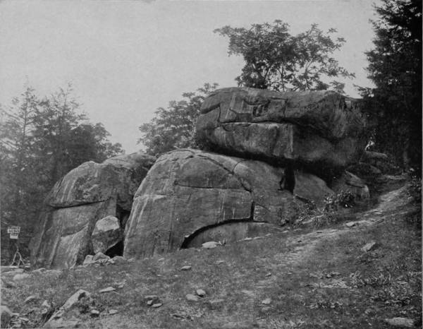
THE DEVIL’S DEN, BATTLE-FIELD OF GETTYSBURG
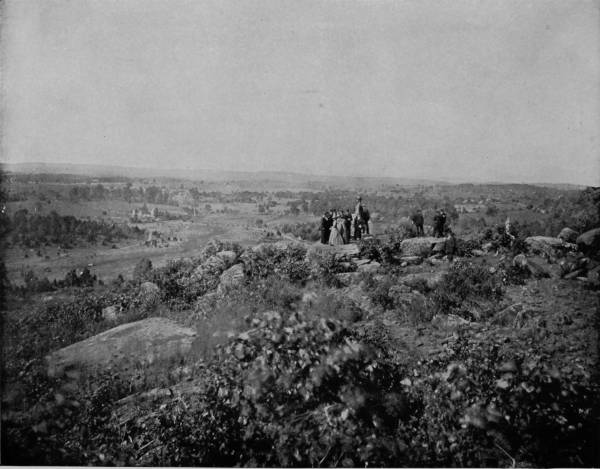
ROUND TOP, OVERLOOKING THE BATTLEFIELD OF GETTYSBURG.—The battle that was fought at Gettysburg on the first, second and third of July, 1863, has been justly classed as one of the great battles of the world. It was the final turning-point in the war between the North and the South, and each side, on this field, displayed a heroism that will forever shed a light of glory upon the courage and fortitude of Americans as soldiers. Fifty-four thousand of our countrymen gave up their lives at Gettysburg. They were distinguished by uniforms of blue and gray then; now they are clothed with robes that are woven without color. Let the head be uncovered and the eye moist with tears as we stand upon the ground made sacred by their blood.
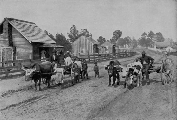
A VILLAGE SCENE OF HAPPY CONTENT IN VIRGINIA.
The 54,000 souls that laid down their arms and answered roll-call the morning of July 4th on the parade-grounds of paradise, were our countrymen. They were distinguished by uniforms of blue and gray then; they are invested with robes now that are woven without color. Let the trumpets blare, and the drums be beaten, but let it be on Memorial Day, as salutes of remembrance for the heroes who died within the gates of Cemetery Hill, at Round Top, the Stone Fence, Culp’s Hill, Seminary Ridge, Willoughby Run and Benner’s Hill.
Gettysburg is of itself a monument to human courage, but its field of blood has been made a national cemetery of seventeen acres, which was dedicated with imposing ceremonies on November 19, 1863, at which President Lincoln made the greatest address ever delivered on American soil, “With malice toward none, with charity for all.” A soldiers’ monument was erected in 1868, which is sixty feet high, surmounted by a marble figure of Liberty, and occupies a crown of the hill, where it is a conspicuous object for miles, and arranged in semi-circles about the base are the graves of nearly three thousand of the unidentified victims of the dreadful conflict.
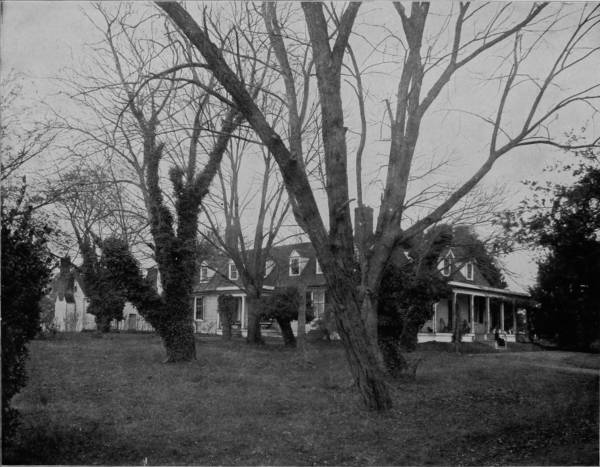
AN OLD COLONIAL HOUSE AT APPOMATTOX, VIRGINIA.—This picturesque old mansion, built while Virginia was still a colony of the mother-country, stands yet as a landmark of an earlier civilization and a social era that has passed away. The wealthy pioneer who planned it took as his model some still older mansion of the merry England from which he had emigrated, and thus sought to transplant in the wilds of America a memorial of some loved spot in his native country. Its halls are now filled with the ghostly recollections of the past, for even the mighty events which took place in this immediate vicinity in April, 1865, seem almost like ancient history, so rapidly does time speed away on the wings of steam and electricity.
FORTRESS MONROE, VIRGINIA.
From Gettysburg our route was southwest to Washington, and thence by way of Fredericksburg to Appomattox. From Washington the Richmond, Fredericksburg and Potomac Railroad runs through a sterile section, unrelieved by either picturesque scenery or smiling field, so that a part of it has long been known as the Wilderness, famous, however, as the scene of many great battles in 1863-4, many traces of which are still to be seen from the car windows of passing trains. Fredericksburg is distinguished also as the vicinity in which Washington was born, and where he spent the greater part of his youth. Here it was also that Washington’s mother lived for a long time, and died in 1789. A monument erected in 1883, in the suburbs of the town, marks the place of her sepulture. Twelve miles beyond Fredericksburg is the battle-ground of Spottsylvania Court House, where Stonewall Jackson received his death wound, May 2, 1863. Indeed, the region for fifty miles thereabout is still scarred by the strokes of contending armies delivered thirty years ago, and cemeteries in which repose the heroic dead of both Union and Confederate are numerous, marked by many monuments to attest the appreciation of the living for the sacrifices which were endured in those dreadful years of the sixties. But if the country is somewhat barren, and gruesome with reminders of fratricidal strife, it is not entirely destitute of the phases that lend cheerfulness to life. Here is essentially the land of happy negroes, where poverty abounds with joy, for absence of responsibility is contentment of mind with the colored race. At the depot there is always a swarm of pickaninnies eager to scramble for pennies thrown to the crowd, and the most comical scenes imaginable occur at these tussles, for the little darkies themselves, in an array of all sizes and shades of black and brown, a company of tatterdemalions that would put Punch and Judy to rout, are ludicrous enough to make a goat laugh. The street-scenes of villages near-by, as well as in the suburbs of Fredericksburg, are equally whimsical, presenting, as they often do, human nature in its most grotesque aspect. Horses are rarely used by negroes for draught purposes; mules more frequently; but bulls, cows and yearling calves are the chief dependence, and carts the popular style of conveyance with these happy-go-lucky people. There is no need for haste, and the loads are never large, hence a yoke of cattle are as handy as a span of horses, and preferable because slow movement allows more sleep on the way. The sun makes the tobacco grow, and the rain makes music on the cabin-roof; so rain or shine the darkey’s heart is always light and the future is hidden from him by a veil of present delight. Such sights teach the value of content, even if they do offend ambition, and in them the philosopher’s stone has its hiding-place.
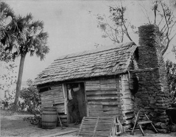
AN OLD CABIN HOME IN GEORGIA.—The old log cabin is a familiar sight in Georgia, as well as other parts of the South. Often it is vine-wreathed, showing signs of great antiquity, with roof of clapboards, upon which the rain patters like the long-roll beat of the snare drum. Homely, battered by time, and affording few comforts, yet in such cabins greatness has often had its birth, nor scorned such humble nativity. How many men of high estate lie down in the drapery of fine linen and, when night has folded the earth in her sable arms, think of the old cabin home in Georgia; of the long-time ago; of the bubbling spring in the hollow and the gourd that hung by it; of the grape-vine swing, and the cows mooing in the pasture; of father and mother, and the graves on the hillside. And there is a sigh from the heart for these pleasures of a past that have departed forever.
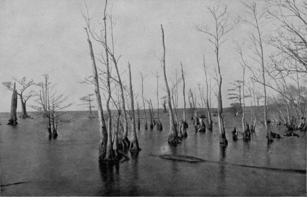
DRUMMOND’S LAKE, IN GREAT DISMAL SWAMP, VIRGINIA.
From Fredericksburg our route was northwest to Appomattox and thence east by way of Richmond to Fortress Monroe, on the peninsula. We were a little disappointed to find the site of the culminating event of the war destitute of any special feature of interest of either a natural or artificial character. The scene of surrender is not even marked by a monument, and the country thereabout is a pale and somber stretch of poorly-cultivated lands. Yet there are exceptions; for occasionally the monotony of cabin and broken fence is relieved by prolific tobacco-fields, pretty towns, and inviting manors adorned with colonial houses that still preserve their old-time air of comfort and Southern hospitality. Virginia well deserves the title of the Dominion State, not only because she is the mother of Presidents, but because she is also distinguished as the native state of many of the greatest men and women born on American soil. “To be a Virginian, is to be a gentleman,” has passed into an adage; and the country is proud of her for a hundred reasons, which reference to history will explain. If her soil is not the most fertile, yet her legacy is the richest, for she gave to the world such men as Washington, Madison, Jefferson, Randolph, Clay, Lee and a thousand others whose names and deeds are alike imperishable. Fortress Monroe is reached by the Chesapeake and Ohio Railroad, over which route we traveled from Appomattox. It is located at the point of a peninsula, formed by the Fork and James Rivers, which projects into Chesapeake Bay where it joins the Atlantic. The situation is particularly favorable for a Government fortress, and its natural and commanding advantages have been fully utilized, for it is the largest and strongest fortification in America. Hampton Roads separates the point of the peninsula from the opposite land. This body of water is about five miles wide and forms the outlet of James River. It was in the Roads that the most famous of modern naval battles, between the Monitor and the Merrimac (Virginia), took place, March 9, 1862. Two miles below Fortress Monroe is Old Point Comfort, a very popular resort and the seat of the National Soldiers’ Home. Newport News is nine miles above the Fortress, on Hampton Roads; and Yorktown, the place of Cornwallis’ surrender to Washington, October 19, 1781, is twenty-five miles north, on York River, both places possessing great historic interest for events of which they were the scene during the Revolutionary war.
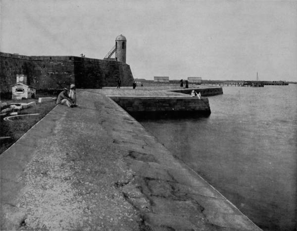
OLD FORT AND SEA WALL AT ST. AUGUSTINE, FLORIDA.—This old fort possesses a peculiar interest for Americans, being the oldest historic fortification of our country. Its construction was begun by Menendez de Aviles, a Spaniard, in 1565, but it was not completed until two centuries later. It was then called Fort San Marco, but with a ruthless disregard of historic associations characteristic of our people, it has been changed to Fort Marion, without in the least adding to the lustre of the renown of the great Revolutionary patriot of the South. The walls of the fort are composed of a conglomerate called coquina, which is formed of shells and sand brought from the island of Anastasia. Originally soft and pliable as plaster, it becomes almost of granitic hardness by exposure, affording a safe protection against the primitive artillery of that period.
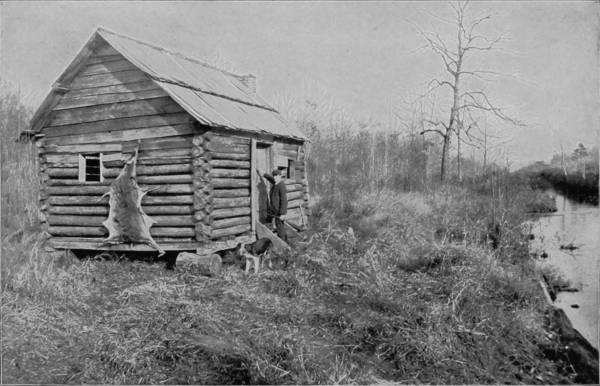
A HUNTER’S CABIN ON THE CANAL, DISMAL SWAMP.
Crossing Hampton Roads by steamer to Norfolk, we proceeded southward by the Norfolk Southern Railroad, through a region known as the Dismal Swamp, famous alike in fact and fiction. The term has been indelibly affixed to two extensive stretches of morass, the larger of which lies between the James River on the north and Albemarle Sound on the south, thus covering a part of Virginia and North Carolina, having a length of about forty miles and a breadth of twenty-five miles. Little Dismal Swamp is wholly within North Carolina, in the peninsula between Albemarle Sound and Pimlico Sound, and while occupying considerably less than one-third as much area as Great Dismal, is probably better known to readers because of the tragedies which have been enacted within its dark and gloomy districts. Speaking generally, the swamps are composed of a spongy, vegetable soil, but without any mixture of earth, which supports a dense growth of aquatic plants, brush-wood and timber. Sir Charles Lyell, the distinguished geologist, was first to bring to notice the curious fact that the surface of the swamp is actually twelve feet higher in many places than the surrounding country, so that its drainage is outward, except where a few small streams flow in from the west side. The center of Great Dismal is occupied by Drummond’s Lake, an oval basin six miles long and three wide, with perpendicular banks and fifteen feet depth of water. In and around this lake is a veritable paradise for hunters, for its waters abound with fish and wild fowl, and the adjacent woods are the favorite haunts of deer, bears, wild-cats, coons and swamp-rabbits. The region, inexpressibly dreary as it is, contributes largely to commerce by furnishing immense supplies of timber. To facilitate transportation the Great Swamp is intersected by canals, the two largest being those which connect the Elizabeth and Pasquotank Rivers, and Elizabeth River with Carrituck Sound.
Some queer little cabins are built along these water-ways, a few being occupied by timber cutters, but generally they are the temporary abodes of hunters who find shooting and trapping both pleasurable and profitable, and who work at logging out of game season. Little Dismal Swamp, though smaller than its more northern neighbor, is very much more dense with brush-wood, and decidedly more forbidding, because its gloomy depths rarely echo with the voice of man, or the sound of the woodman’s ax. Fifty years ago it was the refuge of runaway negroes, and a dangerous place for a white man to be seen, because the blacks who hid in its thick coverts were usually of the most desperate character, who would not hesitate at crime. One of the best-remembered, because the most tragic, negro insurrections that ever occurred in Virginia was headed by a Samsonian black named Nat Turner. Under his leadership more than a hundred armed negroes rose against their masters and massacred a score of men, women and children. When a sufficient force of whites was mustered to oppose them, the negroes fled to Little Dismal Swamp, where, after great length of time, they were starved into surrender. Nat Turner, however, was last to submit to his pursuers, and committed so many crimes, while the search for him continued, that his very name became a terror; but he was at last captured through betrayal by a negro whom he trusted, and after due trial was convicted and hanged.

PONCE DE LEON HOTEL, ST. AUGUSTINE, FLORIDA.—This photograph represents the court of the hotel, around which the walls extend in the form of a hollow square. The hotel itself is a revival of the richest examples of Moorish architecture. It is old Spain of the golden reign of Ibn-l-Ahmar transported to American shores. With its lavish adornment, picturesque style and exquisite grounds, in which every known tropical plant is made to add its beauty and shed its fragrance, while flowing fountains cool the summer air, the Ponce de Leon is not only a reminder of the great palace of Spain in the time of Columbus, but it is also one of the best representatives of modern convenience, comfort and artistic beauty of architecture and construction.
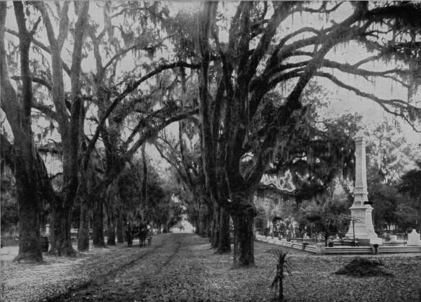
BONAVENTURE CEMETERY, SAVANNAH, GEORGIA.
Our next halting place on the flight southward was Savannah, the Gate City, as it is the Queen City of the South. Next to Atlanta in commercial importance, Savannah is easily first of all sunny metropoli in the superb beauty of its situation and the park grandeur of its surroundings. Here it was that General Oglethorpe founded his Georgia colony early in 1733; and the flourishing city, from which the first ocean steamer that ever attempted to cross the Atlantic sailed, and its rank as the second cotton port of the United States, are striking proofs of his foresight and excellent discrimination.
The city is situated on a bold bluff overlooking the Savannah River, along which it extends in a curved front for a distance of three miles, affording excellent wharfage. The streets are all very broad and magnificently shaded, while parks containing one to three acres occur at all the principal intersections, charmingly laid out and beautified with flowers, which grow in that warm climate in the richest profusion. Flower gardens constitute one of the most characteristic features of the place, for a majority of the residences are surrounded by ample grounds that are abloom with flowering plants throughout the year. This is the borderland of southern evergreens, where the stately oak is festooned with pearl-gray mosses, and the orange and the magnolia fill the air with delicious perfumes. Along the streets, too, are rows of flowering oleanders, pomegranates, palmettos, bananas, laurels, bays and sweet crape-myrtles. But of all the beauties about Savannah none rival the charms of Bonaventure Cemetery, four miles from the city, on Warsaw River, and reached by a shell road that is equal to any drive-way in the world. Every grave is a flower-bed, and the long avenues canopied with moss-garlanded oaks present a picture Arcadian in its loveliness, and suggestive of those flowery glades through which immortals might delight to wander.
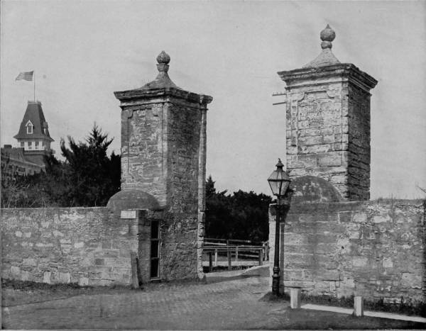
OLD CITY GATES, ST. AUGUSTINE, FLORIDA.—As St. Augustine is the oldest town in America, having been founded by the Spaniards in 1565, it is quite natural that we should find here many relics of the past mingled with the bright and better features of modern life. The old city was surrounded by a wall as security against attacks from the outside, and of this wall the gates, so beautifully photographed on this page, are about the only remaining relics. It is one of the links connecting the present with the earliest events of discovery in our country—a link rusty with the blood of conquest and martyrdom. Here it was that Spanish cruelty and French retaliation were carried to the most barbaric extreme, and cruelty is always in need of strong walls to protect it from the enemies it creates and nourishes.
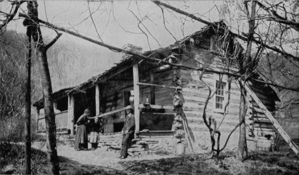
A HOME IN THE MOUNTAINS OF GEORGIA.
The country district about Savannah is somewhat similar in appearance to that of Western North Carolina, except that its mountains are not nearly so high. The soil, however, is practically the same, as are the social conditions; and hence the constant reminder of that section which we have already described. The old log-cabin is a familiar sight in Georgia, often vine-wreathed, and showing signs of great antiquity, with roofs of clap-board, upon which the rain patters like the long-roll beat of a snare-drum. The picture which we present is typical of this class, and an example as well of rural simplicity. Homely, battered by time, and affording few comforts, yet in such cabins greatness has often had its birth, nor scorned such humble nativity. How many men of high estate lie down in the drapery of fine linen and, when night has folded the earth in her sable arms, think of the old cabin home in Georgia; of the long time ago; of the bubbling spring in the hollow and the gourd that hung by it; of the grape-vine swing, and the cows mooing in the pasture; of father and mother, and the graves on the hillside. And there is a sigh from the heart. The old time was the flush of life’s morning; it is growing evening now, and the shadows are creeping up the slopes. Soon the present will be the “old times” to our children. How many men who have achieved greatness would exchange their possessions and positions for youth and the old cabin home as they see it now in their dreams! Many, yes, very many.
Inseparable, almost, from the log-house of the Southern poor, is the cabin home of the negro, because the two are separated by such a thin line of distinction that only critical inspection can prevent them from assimilating in the minds of those unfamiliar with Southern life. There is the same stone-chimney and clap-board roof, but the colored man’s cabin is a single room, and the front is porchless. More hasty construction is also noted, for the logs are laid like a turkey-pen, and clap-boards are used again, not for weather-boarding, but as a substitute for batten. Windows are not needed, through which to exchange civilities with the season, for there are holes and crannies to let smoke out, and plenty of accidental entrances for the warm summer air to get in. It is thus at small effort and no care the worst weather is kept out, and contentedness reigns within.
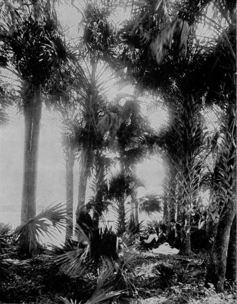
AMONG THE PALMETTOS ON THE BANKS OF HALIFAX RIVER, FLORIDA.—This is a typical Southern scene, and one of the most delightful to human senses that could be imagined. It is so perfectly in accord with nature that in imagination we can hear the bursting of the buds as they grow beneath the fructifying influences of the Southern sun, and feel the soft, hazy atmosphere as it gently rolls in from the cooling waters of the sea, and floods the intervening spaces of the moss-covered trees. In the Garden of Eden there must have been many bowers such as this, where Adam and Eve whispered the first vows of devotion and human love.
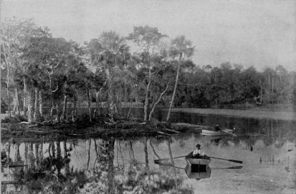
THE HEAD OF HALIFAX RIVER, ABOVE ORMOND.
Through Georgia and into the land of orange groves we sped, stopping a day at Jacksonville, and then hurried on to San Augustine, the oldest town in America (founded by the Spanish in 1565), and possibly the most interesting. It is a link which connects the present with the earliest events of discovery in our country—a link rusty with the blood of conquest and martyrdom. Here it was that Spanish cruelty and French retaliation were carried to the most barbaric extreme, and the enslavement of native Indians began. Passing through the first ordeals of settlement, a century later it was bitterly afflicted by raids of Indians and the plundering of pirates, so that its growth was prevented, and not until the British surrendered possession to the United States in 1821, did the place show any indications of permanency, or that it would attain to any importance beyond what it had before reached as a very small village.
St. Augustine is located on a narrow peninsula formed by the Matanzas and San Sebastian Rivers, and is separated from the ocean by Anastasia Island. From a place of little consequence, in the last few years it has become distinguished as the most popular winter resort in the South. Several things have conspired to bring about this change, chief of which, however, was the enterprises of Mr. H. M. Flagler, who, recognizing its favorable location, resolved to convert the town from a listless, sleeping, poverty-stricken village into such an Eden of loveliness as the arts of man can create. In accomplishing this object he spent $6,000,000, and the improvements are of such a character as may well satisfy his ambition. The Ponce de Leon Hotel is a revival of the richest examples of Moorish architecture. It is old Spain of the golden reign of Ibn-l-Ahmar transported to American shores. And strange coincidence it is, that the year in which Columbus set sail on his first western voyage in quest of eastern lands, the year of the Moorish Expulsion, the beautiful Alhambra, most magnificent building that ever graced the earth, was given over to vandalism and spoliation. The Ponce de Leon, with its lavish adornment, picturesque style and exquisite grounds, in which every known tropical plant is made to add its beauty and shed its fragrance, while fountains cool the summer air, is a reminder of the great palace of Grenada, and the chivalry of Spain in the time of Columbus.
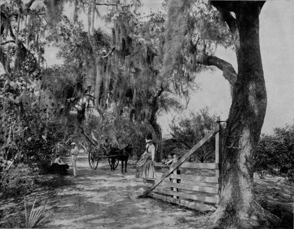
AVENUE OF MOSS-COVERED OAKS, NEAR ORMOND, FLORIDA.—Laying aside the question as to whether the command to work, that was imposed upon our first parents, was a curse or a blessing, it is easy to conceive that one reared among such scenery as this, where there are but few wants which the spontaneous growth of nature does not supply, would naturally regard hard labor as the greatest curse that could be pronounced against mankind. Here, side by side and of their own volition, grow the orange, the pomegranate, the fig, the melon, and nearly all the other fruits and vegetables necessary for the support of physical existence, while life is made delightful with the blossom and odor of thousands of bright-hued and ever-blossoming flowers. Here let us rest and dream, and think of work only when the flaming sword of necessity drives us forth to exertion.
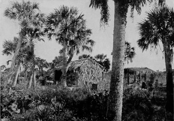
PALMETTO HUTS NEAR TITUSVILLE, FLORIDA.
But the interest to St. Augustine visitors is not confined to the Ponce de Leon, glorious as it is, joined though it be to its almost equally superb annexes, the Cordova and Alcazar, for the city is filled with the relics of an olden time, and associations that are almost painful to recall. Along its water-front extends a sea wall one mile in length and ten feet broad, built of coquina and coped with granite, forming an incomparable promenade between the old Franciscan monastery, now used as a barracks, and the ancient fort of San Marco, now known as Fort Marion. Though not the most formidable, these antique fortifications rank all others of this country in interest. Their construction was begun by Menendez de Aviles in 1565, at the time of the founding, but were not completed until two centuries later, all of the work being performed by enslaved Indians. The fortifications cover about four acres, and the walls are of coquina, a conglomerate of shells and sand brought from Anastasia Island, which, soft when dug, hardens by exposure. The fort is a splendid example of the best military architecture of the time, being in the shape of a trapezium, surrounded by a wide and deep moat, and with walls twenty-one feet high, sharp bastions at the corners, thick casemates, and subterranean passages and vaults which might serve equally for refuge ports or dungeons. That some of these were used for the latter purpose is proved by the fact that in one of the least accessible dungeon-rooms, the entrance to which was accidentally found, two skeletons chained to the wall were discovered. What a story of suffering these might tell if they could speak!
In the earlier centuries a wall extended across the peninsula, which protected the city from attack on the north side, but nothing now remains of this defence except the old city gates, at the head of St. George street. These are massive square towers fifteen feet high, pierced with loop-holes, and at the base of each is a sentry-box, which the guards occupied when on duty.
Near the center of the business part of the city is the old slave-market, adjoining which is the Plaza de la Constitucion, containing a monument erected in 1812, commemorative of the Spanish Liberal Constitution, while another monument stands in front of the old Market, which was erected in 1879, in honor of the Confederate dead.
Besides being a great winter resort, St. Augustine is a place of some commercial importance, its largest industry being the manufacture of palmetto hats, while in the convents a fine quality of lace goods is made, by girls and the nuns in charge.
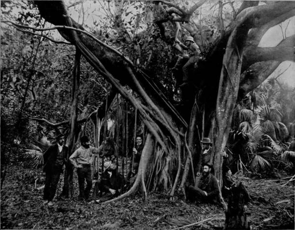
RUBBER OR BANYAN TREE, ON BANANA RIVER, FLORIDA.—We are now among the wonders of the semi-tropics and the paradisaic delights of a marvelous sun-browned land, where the mocking bird opens the matin competition in the college of vernal hymns, and the palmettos are vocal with the softly stirring breeze. The landscape is a dreamy haze of incomparable loveliness, where a feast of flowers is perpetually spread, and the voice of peris may be heard down under the green waters of a murmuring sea. The ocean is so near that the music of its rolling beach comes like a gentle lullaby through the clustering branches of the scented trees, bringing the hush of the still small voice that reminds us of the presence of Deity.
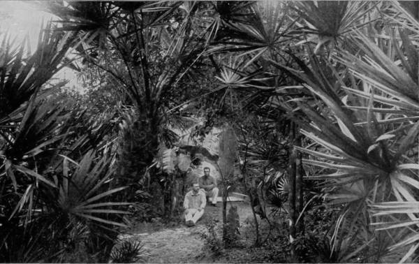
IN THE DEEP PALMETTO SOLITUDES ALONG INDIAN RIVER.
It is about seventy-five miles from St. Augustine to Ormond by the Jacksonville, Tampa and Key West Railroad, one of the branches of the Plant System, whose terminus is Daytona, five miles below Ormond. Indeed, nearly every road in Florida is the property of the Plant company, which has proven a factor of incalculable benefit to the State, and has reaped correspondingly great reward. Ormond is located on the head of Halifax River, which is a part of the Indian River Lagoon, connected by the Mosquito Haul-Over, or canal. We are now in the sub-tropics, and among the paradisiac delights of a marvelous sun-browned land, where the mocking-bird opens the matin competition in the college of vernal hymns, and the palmettos are vocal with the softly stirring breeze. The landscape is a dreamy haze of incomparable loveliness, where a feast of flowers is perpetually spread, and the voice of peris may be heard down under the green waters of a murmuring sea. Only a thin stretch of golden beach lies between the mainland, on which Ormond is located, and the ocean, so near that the billows are distinctly heard beating against the shore. Along this water-front of lagoon and sea are gleaming sands so hard that step nor wheel make any impression, and so inviting that nymphs might make it a playground. West of the village is a typical hummock of tropical growths, penetrated by a glade that is embowered and sweetly shaded by massive oaks gracefully festooned with pearl-gray mosses, and palmettos that flaunt their tangled, rustling branches before the beaming sun. Hereabout, too, are groves rich-laden with fruits as golden as those that were plucked by Hercules in the garden of Hesperides; where the orange and the banana bend beneath the weight of their own deliciousness, and pour out their honey to the bees in rich extravagance.
At Ormond boat was taken for a trip down Indian River, a journey which all the speech of adjective and imagery cannot justly describe. Indian River and Halifax River are not streams, but shallow lagoons, strips of the ocean enclosed by narrow tongues of sandy beach, severed by occasional inlets through which the billows break tumultuously. Its extreme length, for the two are now joined by a canal, is about two hundred miles, and though rarely more than three feet deep, and in places less, the lagoon is navigated by a line of stern-wheel boats, which, in winter-time, are crowded with excursionists, notwithstanding their sleeping accommodations are confined almost entirely to cots in the cabins. One line runs to Titusville, and there connects with another, which carries passengers as far south as Jupiter, the southern limit of the river. In the last year (1892) a railroad has been built from Titusville to Rockledge, and is being pushed southward, so that in another year or two the trip to Jupiter may be made by rail. But the boat journey, though beset by some harassments, consequent upon narrow passages and low water, will lose little of its popularity, because it will always remain one of the most delightful that can be taken. The connection between Halifax and Indian Rivers is by means of a canal that requires constant dredging, and through which it is difficult to pass with boat when the wind is blowing hard; while at times it is so choked with sand that the boats have to be literally dragged through by means of hawser and capstan. New Smyrna is a town of some importance, as is Titusville, but besides these, the landings are of no consequence as trading-places, consisting of never more than one or two stores and as many houses. This sparseness of population increases the interest of travelers on the river, for the charm of primeval beauty and attractiveness thus remains.
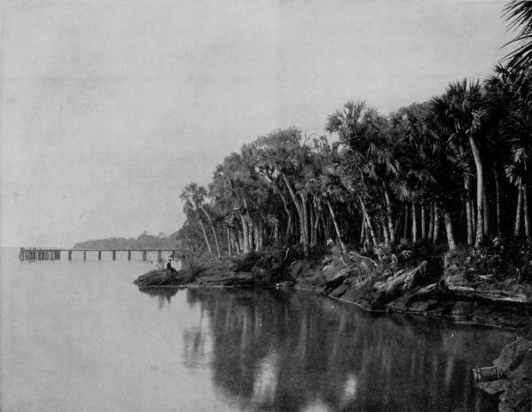
ROCKLEDGE, ON INDIAN RIVER, FLORIDA.—Rockledge is a resort of great popularity, but of no commercial importance, for it does not contain a single store. For beauty it is almost unrivaled, being richly adorned by nature and lavishly ornamented by the arts of man. The large cabbage palmettos that grow up wildly along the coquina banks were suffered to remain, and between them avenues were laid out and covered with shells, so that from the river there is a long prospect of gleaming walks ramifying a shore of brilliant green. Here also the orange grows to its most delicious perfection, likewise the lemon, banana and grape fruit; and such a breeze of perfume greets the incoming passenger as paradise itself might exhale.
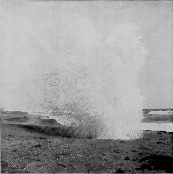
SPOUTING ROCK, NEAR JUPITER.
As a rule the banks are covered with spiney-palmetto, which is almost as difficult to eradicate as Canada thistle, and hence few attempts are made to reclaim the land, as the cost of clearing exceeds the value. But at occasional intervals the banks are diversified with orange groves, and bananas are also raised to some extent, but the chief industry is fishing, for the river abounds with sheephead, pompano, mullet, cavalli, and green turtles. Rockledge is a resort of great popularity, but of no commercial importance, for it does not contain a single store. For beauty, however, it is almost unrivalled, being richly adorned by nature and lavishly beautified by the arts of man. The large cabbage palmettos that grow up wildly along its coquina banks were suffered to remain, and between them avenues were laid out and covered with shells, so that from the river there is a lovely prospect of gleaming walks ramifying a shore of brilliant green. Here also the orange grows in its most delicious perfection, likewise the lemon, banana, and grape fruit; and such a breeze of perfume greets the incoming passenger as paradise itself might exhale.
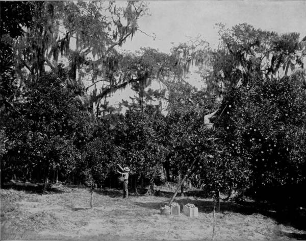
ORANGE GROVE AT ROCKLEDGE, INDIAN RIVER, FLORIDA.—A trip down Indian River is a journey that all the speech of imagery and adjective cannot justly describe. It is here that the orange reaches its best perfection, and on every hand are groves laden with the yellow fruit, while the more modest banana bush bends beneath the weight of its own deliciousness, and pours out its honey to the bees in rich extravagance. Nature is so luxurious in her productions that she supports nearly all the plants and trees and flowers belonging to this delightful climate, so that within the limits of an orange orchard may be found nearly everything that grows in the semi-tropics.
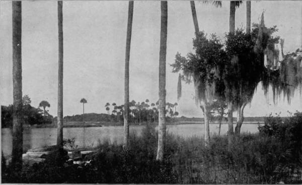
LAKE OKEECHOBEE, FLORIDA.
The river at Rockledge is nearly six miles wide and furnishes the finest sea for sailing, for the salt-air is present, and the dangers of heavy billows are absent. Across this expanse lies a broad strip of land which is divided by another lagoon called Banana River, along which is a charming vista of wood that has been named by some admirer Fairyland. This strip of forest-growth is beautiful enough to justify the name, and wandering through groves of oranges, palms, magnolias and paw-paws, on shell-walks of snowy whiteness, fancy pictures a troop of dryads picnicking among the trees, and drinking nectar from flaming begonia flowers that sprinkle the woods with scarlet. At the lower end of Fairyland is a natural park in which gnarled oaks spread their giant shadows over a lawn of grasses, and on the margin is a grove of pine-apples, the fragrance of which almost stifles the odor from the orange-blossoms. A single cottage is the only habitation in this poetic retreat, before the door of which are lofty paw-paws waving their feathery crests, and a gigantic rubber, or banyan tree, whose branches woo the soil and have taken root therein. Only one other specimen of this remarkable tree, of equal size, is found in the United States, and it, too, is a native of Florida, being one of the chief curiosities of Key West. There are other species that exhibit a disposition to fix the points of their drooping branches in the ground, but it is peculiar to the banyan to send out shoots from its main stems, which, instead of growing upward, point straight down, and even before reaching the ground the ends put out root-tendrils, which strike into the soil and firmly attach themselves as soon as they reach the earth. As the boat proceeds southward from Rockledge the way grows in interest, for we soon reach what may be called “the region of water-fowls.” Ducks, coots, water-hens, absolutely cover the river’s surface, while pelicans increase in number until we reach Pelican Island, where they swarm by thousands. The rising of water-fowl before the boat is a wondrous sight, and the beating of their wings on the water produces a sound like a heavy fall of hail on a dry clap-board roof; there are positively millions, and the commotion which they create is almost pandemonium. Another remarkable sight which we witnessed was a school of porpoises that had strayed into the lagoon (for they are not commonly found there) which, being frightened by the boat, made a retreat across the river in such precipitation that the shallow water was beaten into foam, leaving a streak of white behind them that marked their course some time after.
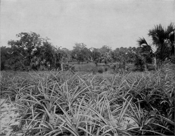
A PINEAPPLE GROVE ON INDIAN RIVER, FLORIDA.—A pineapple grove is one of the most enjoyable places in the world. The broad green blades of the plants, the golden reddish yellow fruit, and the pleasant odor that fills the air form a combination of the most delightful character. No one can fully appreciate the delicious flavor of the pineapple until he has plucked it ripe from the plant and eaten it on the spot. The fruit that goes to market is cut when only half ripe, and thus loses the best part of its flavor, and is spongy and tough in comparison with that which is allowed to mature before being gathered.
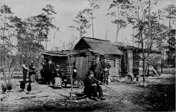
A CAMP OF CONSUMPTIVES, NEAR LAKE WORTH, FLORIDA.
The character of the shore vegetation also changed, the spiney-palmetto giving place to mangroves that grow so thickly a man might almost walk on their tops. In these deep forests wild game is abundant, including deer, bear, panthers and ’coons; and on our journey we saw a ’coon that had so little fear it scarcely moved even when the boat brushed the limb upon which it sat. When night falls upon these solemnly somber deep woods a sense of dread steals on the traveler, though he be in a gay crowd on a good steamboat. The river narrows for nearly ten miles through the mangrove thickets, and during this interval the banks are within reach from both sides. The passage is tortuous, too, and the boat requires slow and careful handling, frequently the bow striking one bank and the stern the other, while the electric bull’s-eye light penetrates and flashes like a Druid’s fire dance in the tangled copse where many slimy and uncanny things have their haunts. An alligator’s grunt, a loon’s cry, a frog’s hoarse croak, and a snake-bird’s piping are some of the sounds that animate the solitudes, and cracking branches betray the proximity of some wild beast whose eyes are like lanterns in the darkness.
After hours of patient working, Jupiter Narrows are passed and the boat speeds on, her iron hull often grinding on the oyster-beds, and long waves breaking over the shallows. Eden is then reached, and the odor of the pine-apple is perceptible in the air. A stop is made to allow passengers to go on shore and visit the pine-apple grove near-by, where that excellent fruit is cultivated successfully by a gentleman who first lost a fortune in the experiment. A mile below Eden St. Lucie Sound and River extend several miles inland towards Lake Okeechobee, twenty-five miles distant. It is proposed to connect the lake with this river by means of a canal, and thus drain the swamps and everglades of Southern Florida. Another shorter canal on the west would connect the lake with Caloosahat River, and thus two outlets would be afforded, which would speedily accomplish the purpose of the company that has undertaken the enterprise.
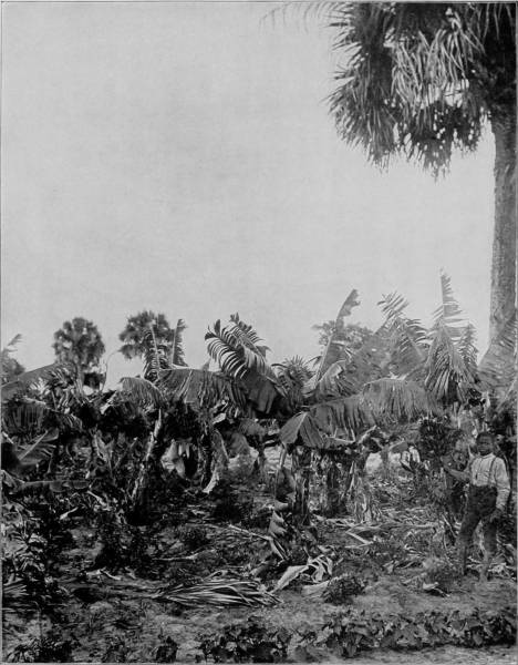
A BANANA GROVE IN FLORIDA.—The banana plant is one of the most beautiful growths that can be imagined. Its broad, luxuriant leaves are of a bright green color, changing to maroon and orange as the season advances and the fruit begins to ripen. The latter, when it reaches the delicious yellow stage of full maturity, does its part in helping to dress the field in the most beautiful livery of nature, presenting a scene of gold, green and maroon surpassing the powers of pen or pencil to depict or portray. The Spaniards, from a fancied resemblance of the transverse section to a cross, supposed the banana to have been the forbidden fruit, and that Adam saw in eating it the mystery of redemption by the cross.
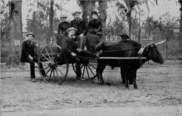
THE ONE-OX SHAY IN FLORIDA.
Twenty-five miles below Eden is Jupiter, the southern termination of Indian River, a little town that derives its importance from the Government light-house which stands before the inlet to warn vessels off the dangerous reefs outside. The surroundings, however, are very delightful, especially the beach, which is strewn with the prettiest ocean-shells that ever a pensive person gathered, including an occasional pearly nautilus, a perfect one of which we had the good fortune to find. Near-by is the Spouting Rock, a coquina formation that rises into a bank and which has been hollowed at the base by incessant dashing of the billows. Into this grotto the waves plunge with such force that they drive out through an opening in the top of the rock like a colossal fountain, and are scattered by the winds into a shower of rainbows. A narrow-gauge railroad runs south from Jupiter, a distance of eight miles, to Juno, its terminus on Lake Worth, where tourists take a steam launch for Palm Beach and are then in the land of the cocoanut. The voice of eloquence grows coarse when it attempts to paint the beauties of this o’er fair summer-land; a land where warm zephyrs stir the hazy air with breath of perpetual bloom, and sensuous perfumes fan the cheeks of languorous day. In this Arcadian spot of beauty, where the air is passionate as a lover, wooing and kissing the flowers, tossing and embracing the fronds of the cocoa-trees, there is a joy like retrospection; a communion with the rapturous soul of nature; a commingling with the creatures of our sweetest fancy; a balmy, delicious sense of gratification that lulls and etherealizes; that bridges the gulf between the real and the ideal; that builds substantial castles in clouds of gold, and makes everything a slave to our desires. The banks are pictures of beauty, the gardens are beds of perennial delight. Lake Worth is separated from the ocean by a strip of land less than half a mile wide, and this narrow tongue of what was once bare sand has been converted into a stretch of tropical exuberance. For a distance of four miles there is an unbroken glade of cocoanut-trees, while nearer to the sea-shore are banana groves, and trees bending to the ground with guavas, sapodillas, oranges, lemons and other tropical fruits. At intervals there are gardens full-bearing in February with beans, peas, tomatoes, and along the walks are flower-beds that flame with color and lade the atmosphere with nature’s incense. To walk through such a grove of fruitful delight is to fill the heart with ecstasy.
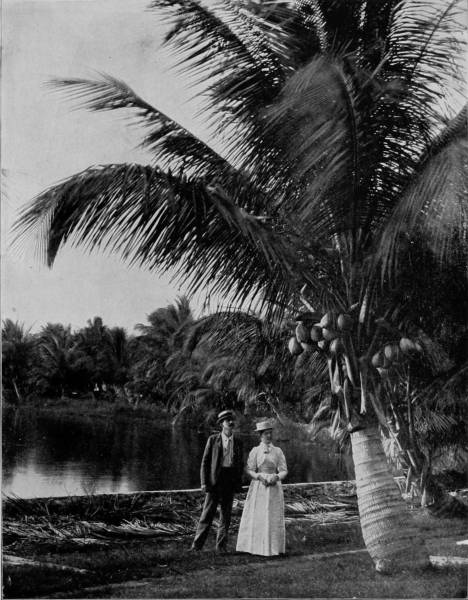
A COCOANUT GROVE ON THE BANKS OF LAKE WORTH, FLORIDA.—There are but few of the wants and conveniences of mankind to which the cocoanut palm does not contribute something. Without exception it is the most useful tree in existence. It attains a height of sixty to one hundred feet, and a diameter of one to two feet; while it is resplendently crowned with numerous feather-like leaves from eighteen to twenty feet long. The flowers come in clusters, and at first have a beautiful milk-white appearance, which, however, soon changes to a yellowish color. They are beautiful for their varied combinations and great number rather than from any individual grace. Each tree will produce from eighty to one hundred nuts per year.
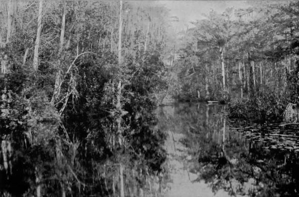
SCENE ON THE OKLAWAHA RIVER, FLORIDA.
The air of this southern region is not only languorous but, in the piney districts particularly, is balsamic, and hence thousands of consumptives go to Florida for relief which they cannot find elsewhere. The Everglades are not what they were formerly pictured to be before exploration revealed that instead of impenetrable swamps they are sections of very thickly timbered lands, whose only drawback are spiney-palmettos, which render travel through them very laborious. But at several places I saw parties of consumptives encamped not far from Indian River, and also in the vicinity of Lake Worth, where they spent their time in hunting and fishing, and claimed great benefits from the exercise as well as from the restoratives contained in the air.
Returning from our trip down Indian River, we left the steamboat at Titusville and took train for Enterprise, at which point we embarked on boat for a run down the St. John’s River as far as Palatka. The journey was very different from that on Indian River, yet the sensation of pleasure was not wanting, for the stream, though the largest in Florida, is, nevertheless, characteristic, sluggish, rather shallow and margined with a thick growth of timber and brush-wood. The landings, while more important than those on Indian River, are generally small villages whose principal population are negroes. The industries in Florida are not varied as in other States, but consist mainly of fruit growing, fishing and phosphate digging. Manufacturing there is none, practically, and the people derive their largest revenue from tourists, who pay as much for oranges, cocoanuts and pineapples at the places where they are grown as is charged for the fruit in our Northern cities. Yet there are signs of rapid growth in Florida, and the State has a bright future, for it is settling up at a marvelous pace, and with an excellent class of immigrants.
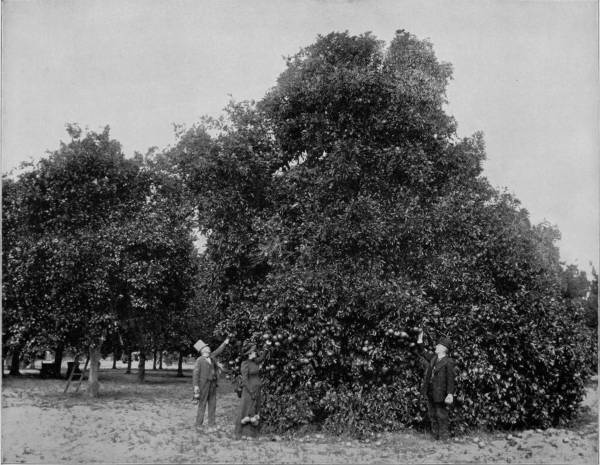
AN ORANGE GROVE NEAR PALATKA, FLORIDA.—A full-grown orange tree, loaded to the ground with its yellow, ripe, luscious fruit, is a delightful object to gaze upon. Oranges do not drop from the trees of their own accord as soon as they are matured, like most other fruits, but they hang by the stem until they are plucked off, and it is said that the longer they remain the sweeter and juicier do they become. Experience seems to prove the truth of this theory, for we have never eaten oranges elsewhere so deliciously sweet as when we took them from the tree with our own hands and ate them on the spot. Owing to the peculiarity of the fruit it is no uncommon thing to see ripe oranges on a tree that is in full bloom for another crop.
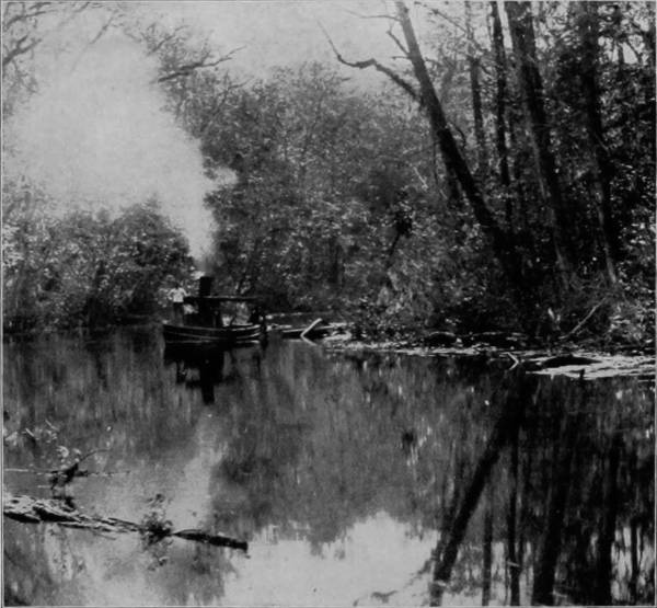
EXCURSION LAUNCH ON THE RUN, FLORIDA.
About Palatka are many very fine orange groves, and the city is in a flourishing condition, largely through the business of fruit growing. In writing of the St. John’s River Mr. Edward King says, with truth well told: “The banks are low and flat, but bordered with a wealth of foliage to be seen nowhere else upon this continent. One passes for hundreds of miles through a grand forest of cypresses robed in moss and mistletoe; of palms towering gracefully far above the surrounding trees; of palmettos whose rich trunks gleam in the sun; of swamp, white and black ash, of magnolia, water-oak, poplar and plane trees; and where the hummocks rise a few feet above the water level, the sweet-bay, the olive, cotton-tree, juniper, red-cedar, sweet-gum, and live-oak shoot up their splendid stems; while among the shrubbery and inferior growths one may note the azalea, the sumach, sensitive plant, agave, poppy, mallow, and the nettle. The fox-grape clambers along the branches, and the woodbine and bignonia escalade the haughtiest forest monarch. When the steamer nears the shore, one can see far through the tangled thickets the gleaming water, out of which rise thousands of cypress knees, looking exactly like so many champagne bottles set into the current to cool. The heron and the crane saucily watch the shadow which the approaching boat throws near their retreat. The wary monster-turtle gazes for an instant, with his black head cocked knowingly on one side, then disappears with a gentle slide and splash. An alligator grins familiarly as a dozen revolvers are pointed at him over the boat’s side, sullenly winks with his tail, and vanishes, as the bullets meant for his tough hide skim harmlessly over the ripples left above him. For its whole length the river affords glimpses of perfect beauty. It is not grandeur which one finds on the banks of the great stream; it is nature run riot. The very irregularity is delightful, the decay is charming, the solitude is picturesque.”
I may add to Mr. King’s description the regrettable fact that the animate scenes which he pictured are no longer to be witnessed on the St. John’s River. The persecution of alligators by travelers on the steamers has resulted in the practical extermination of those curious creatures in that stream. They are now protected by a State law, but it came too late; where alligators were plentiful five years ago they are now a curiosity, though in some parts of Florida, where travel is not heavy, their number is not yet diminished, but every year they are becoming scarcer, and in a little while they will no doubt be extinct. Not only are alligators persecuted for the mere sport of killing, but thousands are annually destroyed by professional hunters for their hides, which make an excellent leather. The taxidermist also finds his business increased by the sale of stuffed specimens to visitors from the North, while great numbers of the young are caught and sold to the lovers of curious things for pets, all of which contribute to their rapid diminution, and their total extinction is therefore a matter of only a short while.
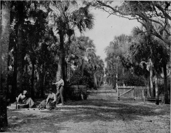
A PALMETTO GLADE NEAR PALATKA, FLORIDA.—The palmetto is intimately associated with the history of the South, having on several occasions been adopted as the national tree and emblazoned on the flags. It has also done good service on many occasions as material for forts and breastworks, the tough and spongy nature of the wood being well suited for such a purpose. No wonder, therefore, that it is regarded with a certain degree of love and veneration by the people who live within the limits of its growth. As a forest tree, or for the ornamentation of lawns, nothing could be more beautiful, as may be inferred from its elegant appearance in the photograph before us.
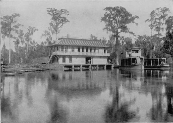
SILVER SPRING AND OCKLAWAHA STEAMBOAT.
Palatka is a pretty town of 3,500 inhabitants, and situated in the heart of the orange belt. Besides its picturesque surroundings and importance as a shipping point, it is healthfully located on high ground and in the midst of a piney region noted for the blandness of its climate. Florida has been transformed within the past very few years by the Plant railways from a state of comparatively sandy desolation, without roads through its dense growths, into a country of great advantages and thriftiness. Fruit trees have supplanted the coverts of palmetto, and there is health and prosperity abounding everywhere. The “Florida Cracker,” as her languid, backwoods, one-gallus type of slovenly, slow humanity is called, has not yet wholly disappeared, but the transition to more industrious and cultured citizenship is going on, and it is particularly apparent about Palatka. The old-time conveyance of an ox in shafts hitched to a cart of uncertain age is not quite obsolete, but it survives more as a relic than as a thing of every-day service; and people who visit Florida on a winter trip, people in fine linen who are able to fare sumptuously, are more given to using the ox-cart, than are the permanent inhabitants. In the mountain districts of Colorado tourists ride burros; in Florida they affect a preference for the harnessed ox. It is the influence of locality that diversifies custom. Another curiosity in Florida, peculiar alike to Cuba and the tropics generally, is the palmetto hut, an unsubstantial structure roofed and “weather-boarded” with palmetto leaves, but which furnishes protection from the sun and rain. These huts are usually built to serve as temporary abodes for orange-pickers, and are therefore usually within or near the groves. Throughout Florida it is the custom to sell the orange crop on the trees, the purchasers being fruit dealers from the North. These dealers employ trained pickers, who work throughout the season, going from one grove to another, until the gathering is completed; usually they provide their own supplies, likewise their shelter, and the palmetto hut serves them both well and economically. When the fleas become so thick as to crowd the occupants, they burn the hut and build another. It is the cheapest way yet discovered of getting rid of these elusive pests.
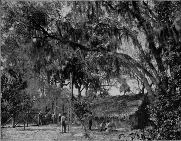
HOME OF THE ORANGE-PICKERS IN FLORIDA.—A curiosity peculiar to Florida, and the tropics generally, is the palmetto hut, an unsubstantial structure roofed and “weather-boarded” with palmetto leaves, but furnishing ample protection from sun and rain. These huts are usually built to serve as temporary abodes for orange-pickers, and are therefore generally within or near the groves. It is the custom to sell the orange crop on the trees, the purchasers being usually fruit dealers from the North. These dealers employ trained pickers, who work throughout the season, going from one grove to another until the gathering is completed. These pickers generally provide their own supplies, likewise their shelter, and the palmetto hut serves them both well and economically.
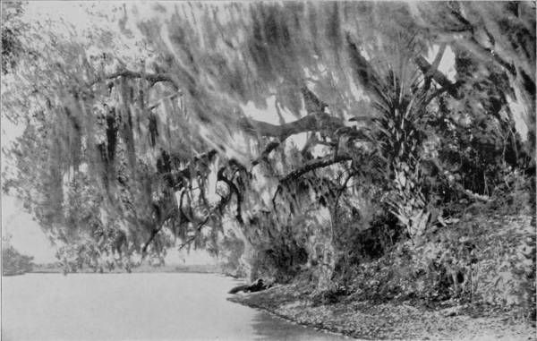
SCENE ON THE SUWANEE RIVER.
At Palatka we took boat for an excursion up the Ocklawaha River to Silver Spring and Ocala, the head of navigation on that stream. Of our many trips in the East, West and South, this proved to be the most unique, the most wonderful, the most sensationally picturesque. Ocklawaha River is at once a lagoon, a narrow lake, and a swamp, but at no place does it have the appearance of a flowing stream, for the current is scarcely perceptible. The shore-line is indicated by a profuse growth of water-vegetation and cypress knees, while at places the river is so narrow that lofty trees interlace their branches above the low smoke-stack of the boat. And what a boat! It is well adapted to the trade, and to that end is unlike any other steamer that ever sat in the water, a thing of indescribable shape, an object of surprise and curiosity. On this queer craft fifty people may ride in comfort during the day, while attention is attracted by the alligators, cranes, loons and snake-birds along the shore, but the night must be spent in vain regrets and fighting mosquitoes. No chance to get lonesome on this trip; there is too much to see in day-time and too much to do at night. But it is a novelty, an experience, a sensation worth more than the discomforts that must be endured. Along the Ocklawaha alligators are still plentiful, because shooting is not allowed from the boat, and there is no other way to approach them within gun-shot distance. The lazy monsters may be seen sunning their corrugated backs on nearly every log, and in their company huge water-snakes are often found, associated with big and little snapping-turtles, the three species forming a congenial but most repulsive family of reptilian cousinship. The water being half-stagnant is black with a vegetable dissolution, and yet so transparent that the bottom may at times be seen. But if the creatures that haunt the river are offensive, the sight is compensated by the wonder which they excite; while the dense woods that margin the shore are resonant with the carol of birds and jewelled with their brilliant plumage.
The trip is remarkably interesting, but the greatest charm that attaches to the stream is found when the boat reaches Silver Spring, the most exquisite pool that was ever rippled by dip of oar or skimmed by lap-wing. Tradition tells us that this is the marvelous rejuvenating spring of which Ponce de Leon heard fabulous tales which lured him to the dark interior of Indian-infested Florida. If his eyes ever gazed into its crystalline depths surely he must have believed that his quest for the magic fountain had been rewarded. The clearness of the water may be likened to the air itself, for at its greatest depth of eighty feet objects on the bottom may be clearly and distinctly seen, likewise the fissure through which the water pours up like a veritable fountain. A peculiarity of the spring is the prismatic colors which are reflected from any white or shiny object thrown into it. To test this curious fact I cast in a piece of broken crockery and watched with keenest interest the fragment as it sank in a zigzag motion to the bottom. No rainbow was ever so brilliant as the colors which flashed up from this piece of saucer, nor did ever jewel gleam with more scintillant beauty.
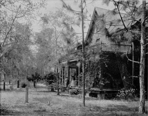
A HOME IN THE SHADES OF SOUTHERN PINES.—If Ponce de Leon and his doughty Spaniards had remained in Florida and built them homes like this, under the shades of the health-giving pines, instead of wading through swamps and morasses in quest of the fountain of youth, they might, and probably would, have lived to be hale and hearty old men. Abodes like this, in the balmy air of the Sunny South, are fountains of life within themselves, where, free from worry and the necessity of making a living, one has but little to do aside from living and growing and being happy. Such homes, with contentment, are more worthy of being sought after than the wealth of a thousand Crœsuses.
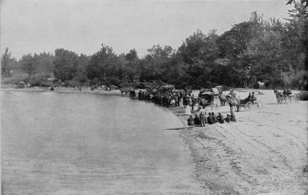
A BAPTIZING ON THE SUWANEE RIVER.
The flow from Silver Spring is so great that a deep river one hundred feet wide is formed, which, after a course of nine miles, joins the Ocklawaha. This stream is called the Run, and a little launch, or tug, plies over this short course, carrying visitors on an excursion which, if brief, is incomparably delightful. Five miles from Silver Spring is Ocala, on the Florida Southern Railroad, to which point we proceeded, and thence north and west by the Savannah, Florida and Western, and the Florida Central and Peninsular railroads to New Orleans. Ocala is on the border or north limit of the hummock lands, and thereafter the journey was through pine-barrens which are so infested with dwarf palmetto that it appears to be an impossible labor to clear it away. This is the home of the deer and likewise of the rattlesnake, very monsters of the latter being more plentiful than game; but north of Gainesville the country presents a change for the better, being much higher and undulating, with hills that are 300 or 400 feet above the ocean level, and the soil is exceedingly fertile. The vegetation, too, loses its tropical character, orange groves disappear, and fields of tobacco and cotton occupy the landscape.
At High Springs we crossed the Santa River, a tributary of the Suwanee; at New Bradford we touched the banks of that historic river, and at Ellaville crossed the stream and halted there a day to pay to it the tribute of a respect aroused in every American heart by Foster’s mournful pastorale, “The Old Folks at Home.” Who has not heard “Way down upon the Suwanee River”? and who hearing the song has not tried to picture the desolate plantation and the dreary heart that went up and down the solitudes of the deserted cotton-field sighing for the old massa and missus, who will never call for Pompey again? In a small boat we rowed down the river, which was as still as death, and almost as motionless. The faint sound of a saw-mill at Ellaville was the only thing that gave reminder of our proximity to civilization; and when at length even this link was broken by distance, it seemed as if all creation had gone into mourning. The spell, while mournful, was yet dreamily charming, and instinctively, under the influence of such lonesome isolation, we sang with the fullness of appreciation, “The Old Folks at Home.” Never before had song such sweetness, never had one so much of sadness, to me; and when the last note died away there was a feeling of oppression in the silence that ensued. The old song brought up visions to which 487we were unused: a fallow-field where once was bounty; a large white mansion with its long porch fallen in decay; a magnolia-tree with a mocking-bird’s deserted nest ready to fall from its dead branches; two grave-stones, green with moss, in the pasture, and an old darkey bowed in prayer. The Suwanee has its source in Okefenokee Swamps, Georgia, and after running its course of nearly three hundred miles, empties into the Gulf of Mexico, just above Cedar Key. At some places the river has considerable width, but never sufficient depth to permit of navigation by any craft of considerable size. Its banks are occasionally high, as at Ellaville, but generally they are flat and overhung by oaks thickly festooned with moss. The current is sluggish and the water seldom clear, carrying as it does a thick vegetable solution. The stream is neither beautiful nor romantic, save as it acquires the reputation for being both through the song that has made it as famous as our largest rivers.
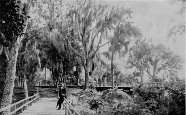
A SECTION OF BIENVILLE PARK, MOBILE, ALABAMA.
The country about Ellaville is fairly well settled, though the place itself hardly ranks as a hamlet. We arrived on Saturday, and as no trains run on Sunday we were compelled to remain over, and attended church in the forenoon and witnessed a baptizing later in the day. The administration of the ceremony proved to be a great event in the unruffled lives of the people, and many came long distances to witness the immersion of four candidates, three women and a man. The sight of a baptizing, while common enough, possessed for us unusual interest because the place was Suwanee River, and having the consent of the officiating minister, we took a photograph of the crowd on shore, a heavy cloud overcasting the sun immediately after, so that a picture could not be made of the baptizing. From Ellaville our journey was continued westward through Tallahassee and on to Mobile, where a short stop was made, and thence to New Orleans. Mobile is not only one of the oldest towns in the South, but is among the earliest settlements in America, the exact date of its founding being in dispute. The place is known to have been the original seat of the French colonization in the Southwest as early as 1702, but its growth was so slow that the Colonial Government was transferred to New Orleans in 1723, and with the change, the little importance which it had acquired became lost, nor was it again recovered until the place became a rendezvous for corsairs under the infamous Lafitte, from 1810 to 1815. Its greatest prosperity, however, dates since the civil war, though some 488years preceding that troublous period Mobile had become a considerable port, her chief shipments being cotton, coal, lumber and naval stores.
AVENUE OF TOMBS IN WASHINGTON CEMETERY, NEW ORLEANS.
The entrance to Mobile Bay is commanded by Forts Morgan and Gaines, which are thirty miles below the city, and on the east side of Tensas River are the ruins of Spanish Fort and Fort Blakely, all of which played an important part in the defence of the city when it was attacked by Admiral Farragut, in August, 1864. One of the most desperate battles that was fought during the war took place in the harbor, when Farragut ran the blockade with a squadron of ten powerful men-of-war headed by his flagship, the Hartford, and encountered the Confederate fleet inside. One of the Union ships ran onto a torpedo and was instantly blown into fragments, but the other vessels met with little opposition until at the moment when Farragut thought the battle won, he saw with surprise the dark body of a strange vessel flying the Confederate flag and bearing down upon him at great speed, evidently intent upon ramming and sinking his ship. The Hartford, by a piece of good luck and skilful handling, managed to avoid the intended blow, and then followed an engagement that has few parallels in fierceness. The strange gun-boat proved to be the Tennessee, one of the most powerful and destructive that the Confederate Government had sent into service. The Union iron-clads closed around their black and terrible antagonist and battered her with their heavy prows of steel until the unequal contest was ended by her surrender. Forts Gaines and Morgan were also captured, but Spanish Fort and Fort Blakely still defended the city, which resisted all efforts at its reduction until April 12, 1865, three days after the surrender of Lee.
Mobile has grown greatly since the war, and now has a population of nearly 35,000. It is situated on a sandy plain that rises into high and very graceful hills. Notwithstanding the barren shore as nature made it, the arts of man have supplied the deficiency of soil and made of the streets bowers of lovely shade, so charming that much of the city’s fame is due to the noble trees that arch all its streets. Bienville Park is one of the prettiest spots in southern lands, noted far and near alike for its massive live-oaks, magnificent magnolias, and handsome fountain, a place swathed in delicious airs and luxurious with the richest and most beautiful vegetation.
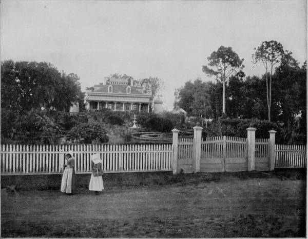
A PLANTATION HOME IN MISSISSIPPI.—This is one of the few old-time Southern mansions that survived the shock of war and still remain as landmarks of the golden age of the South country, when the wealthy planters owned armies of slaves and entertained with a hospitality even more than princely. As a rule these mansions have fallen into decay, even where they were not wholly or partially destroyed, for when the master and his sons left their bones to bleach upon some distant battle-field, the light of the home went out, and the weaker members of the household, reduced in many instances to pinching poverty, sadly but bravely took up the battle of life in less favored localities. But prosperity promises once more to smile upon the South, and the old mansions are being rebuilt, but the old faces are no more seen beneath their roofs.
490Westward from Mobile the route was by the Louisville and Nashville Railroad along the Gulf border of Mississippi, through some of the loveliest intervales that vision ever wandered over. The air is warm without debilitating sultriness, for the Gulf of Mexico tempers the atmosphere with refreshing humidity, and a constant breeze shakes the perfume out of flowering shrub and tree. Many beautiful places are passed on the run of one hundred and forty miles from Mobile to New Orleans, some of which are more or less noted as winter resorts, such as Ocean Springs, Biloxi, Beauvoir, Pass Christian, and Bay St. Louis. Beauvoir has a place in history as being the residence of Jefferson Davis for several years after the war, and where he died. The way is beautified also by many palatial homes and well-cultivated plantations that attest the thrift and prosperity of farmers of the New South.
Between Pass Christian and Bay St. Louis the road crosses an inlet of St. Louis Bay on a steel trestle, and a few miles further west passes over Pearl River and enters Louisiana. The land is level, and cut up by innumerable bayous, and after crossing the narrow outlet of Lake Pontchartrain, called Pigolet’s, the road runs along a tongue of sea marsh for a few miles, then plunges into a dismal swamp, where the alligator’s bellow and the cormorant’s cry are the only sounds that disturb its stillness, save when a train goes growling by. “The sea marsh is dotted with many lakes, where green vegetable rafts of lotus leaves and lily pods turn slowly with the tide or float lazily about, blown by the breath of a salt breeze sweeping in from the Gulf. But in the ghostly gloom of the swamp, the forest trees are like an assemblage of monstrosities, great gnarled trunks and knotted arms of moss-draped oaks, clutching at the fan-shaped fronds of palmettos, while the mixture of crooked bodies and twisted leaf-stems of the latonia appear as if they were the bodies and outstretched arms of horned goblins appealing for release.”
New Orleans is a very old city, settled by the French in 1718. Like other settlements of these early times, it has passed through many evil vicissitudes and been in turn a possession of France, Spain, and the United States. A singular thing in connection with the city is the fact that it is built upon ground that is considerably lower than the surface of the Mississippi during high water, and that it has no more substantial foundation than an alluvium deposit which has been going on for centuries, constantly extending into the Gulf, the point of outlet of the Mississippi. To prevent overflowing, the city is protected by a dyke, or levee, which is fifteen feet wide and fourteen feet high. This earth-wall follows the river’s crescent winding a distance of ten miles, while another extends across the rear to protect the city from Lake Pontchartrain. To secure a firm foundation for some of the large buildings, cotton-bales have been used on which to build, as piling is of no service. But that this character of basis is no disadvantage is proven by the fact that New Orleans is noted for its mammoth edifices, public, church and commercial, which give no sign of insecurity. The place is essentially cosmopolitan, for in no other city is the population more mixed, nearly every street being occupied by a different nationality. Commercially it is next to New York as an export city, and easily holds the honor of the leading cotton port of the country, from which one-fourth of the world’s supply is floated. She is likewise a city of many charms and great historic interest. Within the city proper occurred a terrible scene following the rebellion of 1763, when France ceded the place to Spain, while at its southern outskirts is the battle-field on which Jackson won his glorious victory over the British under Packenham, January 8, 1815. The city passed through another storm of shot and shell in 1862, when Farragut compelled its capitulation after a terrible bombardment. But these scars have long since healed, and New Orleans, despite plagues and wars, has held her position as Queen City of the South and one of the great metropoli of America, with a population now of 250,000, which is rapidly increasing. While New Orleans is famous for the romance with which her history is invested, for her immense importance as an export city, and also for the beauty of her parks and magnificence of her private residences, the curiosity of strangers is no less attracted by her cemeteries, which are unlike those of any others in the world. In earlier times it was the custom there to bury the dead in shallow graves, but this practice was finally abandoned for the more sacred and sanitary one of enclosing the bodies in tombs above the ground, and then hermetically sealing up the mortuary cell. This became a necessity because of the nature of the soil, where water is reached at a depth of two feet below the surface. Some of these tombs are mausoleums made of stone or iron and of beautiful architectural designs, but the more common form of disposition of the dead is in a wall pierced by cells large enough to contain a coffin, one above the other, to a height of seven or eight feet. There are thirty-three such cemeteries in New Orleans, in one of which (Greenwood) is a monument to the Confederate dead; and in another, the National, at Chalmette, the Union dead are similarly honored.
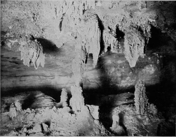
FAIRY GROTTO, MAMMOTH CAVE.—There is a remarkable absence of stalactitic formations in Mammoth Cave, Fairy Grotto and the Maelstrom being the only points where they are found in any quantity. But on the other hand, it contains an unexampled wealth of crystals of endless variety and incomparable beauty. There are halls canopied with fleecy clouds, or studded with mimic snowballs, and others displaying various grotesque resemblances on the walls and ceilings. Two avenues, each a mile long, are adorned by myriads of gypsum rosettes and curiously twisted crystals, called “oulopholites,” or cave-flowers, which are unfolded by pressure like a sheaf of wheat forced through a tight binding. This charming embellishment of clusters and garlands is frequently seen curling outward, like roses, composing petrified bouquets that cover the snowy arches.
492Having completed our work in New Orleans, and a tour of the Southeast, or at least that portion which is noted for its semi-tropical characteristics and great picturesqueness, we took train on the Louisville and Nashville Railroad for Mammoth Cave, to make an inspection and photographic tour of that world-wonderful natural curiosity. To reach the Cave our route was northeast through Birmingham, Nashville, and thence to Glasgow Junction, at which point connection is made with a little spur of the Louisville and Nashville Road, which runs directly to the Cave, a distance of twelve miles from the Junction. Mammoth Cave is in the eastern part of Edmondson county, Kentucky, eighty-five miles south of Louisville, and its entrance is in a forest ravine nearly two hundred feet above Green River, where the banks are very steep and high. It is said to have been discovered in 1809 by a hunter named Hutchins, while pursuing a wounded bear that had taken refuge in a wide crevice that led directly into a broad chamber of the Cave. The history of this discovery is not sufficiently definite to enable us to know which one of the two points of entrance was thus accidentally found. The present opening used is in the ravine mentioned, but the original mouth is believed to have been the aperture that is nearly a quarter of a mile above, and leads into what is known as Dixon’s Cave, a disconnected branch of Mammoth Cavern.
Luray Caverns are lighted by electricity, so that photographing its many chambers and beautiful stalactitic formations is easily accomplished; but though Mammoth Cave is the largest and best known of the world’s great subterranean recesses, and visited by about 6,000 persons annually, no provision has been made for lighting, beyond the crude method of guides who carry torches and candles. To photograph its dark rivers, avenues, configurations, and strange sculpturings many attempts have been made by the aid of magnesium lights, but without satisfactory results until Mr. Ben. Hains, of New Albany, Indiana, made special and most careful preparations to do the work which had so often failed in the hands of others. Several weeks were spent in the cave testing the powerful artificial lights which he had provided, and by dint of perseverance he was at last rewarded by the most perfect results. To this enterprising gentleman we are indebted for the use of the photographs from which our reproductions are made.
Mammoth Cave first came into notice and importance about the year 1812, when it was discovered that the cave contained vast beds of niter, sufficient, as was stated at the time, to supply the whole population of the globe with saltpeter. Gratz and Williams were the owners, and established a very large industry in collecting the nitrous earth by means of ox-carts and shipping it to Philadelphia, where it was used in manufacturing the gun-powder that enabled us to triumph over England a second time. The region is essentially cavernous, as Professor Shaler estimates that in this carboniferous limestone district of Kentucky “there are at least 100,000 miles of open caverns,” but very few of the five hundred caves and grottoes of Edmondson county contain nitrous earth. On the other hand, there have been very few evidences of prehistoric occupancy discovered in Mammoth Cave, while in Salt Cave, its neighbor, and almost a rival in size, archæologic remains, such as fire-places, burnt torches, sandals, and moccasin-prints are numerous; and in Short Cave, also near-by, the mummified bodies of several small animals and a few human remains have been found. White Cave is half a mile from the Mammoth Cave entrance, and the two may be connected, though the communication has not been discovered. But there is a decided difference in the formations that characterize the two. White Cave is in some respects similar to Luray Caverns in its exquisitely charming variety of stalactites. In the first chamber, “Little Bat Room,” as it is called, we find many lovely creations and a few objects of great interest to paleontologists. In the second room is a piece of stalactitic drapery, which has been very appropriately called the “Frozen Cascade.” “Humboldt’s Pillar” and “Bishop’s Dome” are other wonderful examples of the effects of slowly percolating water bearing lime in solution. In this same cave, some seventy years ago, were found huge fossil bones, of the megalonyx, or giant sloth, bear, bison, and stag, and scattered among these animal remains were a few human bones.
But while the adjacent caves each possess an interest peculiar to themselves, Mammoth Cave must continue to remain the most remarkable cavern in our country, not only for its size, but likewise for the marvels which exploration of its labyrinthine avenues has revealed. To Professor H. C. Hovey’s admirable and scientific description of the Cave I acknowledge my indebtedness for a larger part of the information here imparted, from which, also, liberal extracts are made, though without quotation credit.
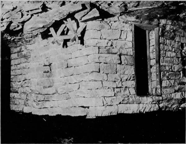
OLD STONE HOUSE, MAMMOTH CAVE.—The dry atmospheric condition of the galleries of Mammoth Cave led to a belief some forty years ago that a continuous residence within these dark precincts for a definite period would be beneficial to consumptives. The experiment was therefore made by building a number of stone houses or huts at a point about a mile within the cave, in which a colony of invalids took up their abodes and lived in deep seclusion until it was demonstrated by the death of several of the sufferers that they derived no benefit from the surroundings. Relics of two of these stone huts still remain, but they exist now only as curiosities, no one having spent a night in either of them for many years.
494The entrance to Mammoth Cave is arched by a rock-span of seventy feet, thence leading by an easy descent down a winding flight of stone steps to a narrow passage through which the air rushes outward with great force in summer and is drawn inward with corresponding violence during the winter, a phenomenon due to the inequality of temperature between the air inside and out of the Cave, for the temperature of the Cave is uniformly 54° Fahrenheit at all times. The atmosphere being thus constantly agitated, is kept constantly pure, for while the lower levels are moist, being no doubt connected with Green River, the upper avenues and galleries are always dry; conditions which were one time thought to be particularly favorable to consumptives, as well as to those suffering from other wasting diseases. The experiment was therefore made, some forty years ago, of building thirteen stone houses at a point one mile within the Cave, in which a number of invalids took up their domicile and lived there in deep seclusion until it was demonstrated that whatever might be the salubrity of the atmosphere, consumptives derived no benefit from it, a number dying in the Cave. Relics of two of these stone huts still remain, but they exist now only as curiosities, no one having spent a night in one of them for many years.
The main cave is from 40 to 300 feet wide and from 35 to 125 feet high, divided into a great number of rooms and winding avenues, the extent of which has not yet been determined, for exploration of the Cave is far from being complete. Some of the best known rooms are, first, the Rotunda, in which are ruins of the old saltpeter works, and where the skeletons of two men were found several years ago. Beyond this is the Star Chamber, where the protrusion of white crystals through a coating of black oxide of manganese creates an optical illusion of great beauty. Another department is called the Chief City, a chamber of nearly two acres space, with a vaulted roof 125 feet high. The floor is bestrewn with rocks, among which have been found charred torches of cone, and a few other evidences of prehistoric occupancy. There are also shown some mummified bodies, preserved by their inhumation in nitrous earth, utensils, ornaments, braided sandals, and other relics, but all of these were found in Salt and Short Caves, near-by, and removed to Mammoth Cave for exhibition. The main cave ends four miles from the entrance, but is joined to other spacious chambers by winding passages leading to different levels, so that while the cavern area is perhaps less than ten miles, the total length of the avenues is supposed to be 150 miles.
The chief places of interest are found along two main lines of the explored portions, from which side excursions may be made. The “short route” may be covered in about four hours, but it requires nine hours to traverse what is known as the “long route.” Audubon Avenue is the first leadway, interesting for the swarms of bats that hang in huge clusters from the ceiling, but it is not until Gothic Avenue is reached that stalactites and stalagmites are met with. This passage leads into the Chapel, at the end of which is a beautiful double dome and cascade; thence we pass into the Throne-Room, with its royal formations of surprising splendors, which compel visitors to stop, and elicit exclamations of wonder and admiration. The Bridal Altar is almost equally grand, with its frosted pillars of pearl-white, and the convolutions of their magnificent pediments that may be likened to clouds in the sky of cave. Indeed, these vertical shafts or petrified columns are among the most surprising features of cave scenery. They are not confined to the Bridal Altar, however, for they pierce through all levels, from the uppermost galleries to the lowest floors, and even find lodgment in the sink-holes.
A block of stone that is forty feet long by twenty feet wide is called the Giant’s Coffin, and when viewed from a certain angle the resemblance to a funeral casket is so great that even if attention were not called to it, visitors would hardly fail to be a little shocked by the sight. There is a narrow passage-way around the coffin, which followed leads to a large vault called Gorin’s Dome, in which there are six pits varying in depth from 65 to 220 feet; truly, awful pits to fall into. Notwithstanding the treacherous character of the floor, Gorin’s Dome is one of the finest chambers in the Cave, for it is charmingly festooned and pillared with stalactitic formations. Mammoth Dome, which is at the termination of Sparks Avenue, is probably more interesting, because besides having its walls draped with a marvelous tapestry, the great wonder of the room is immensely increased and beautified by a cataract, which falls from a height of 250 feet and fills the apartment with its musical splashings. The Egyptian Temple, which is a continuation of the Mammoth Dome, contains six massive columns, two of which are quite perfect and eighty feet high by twenty-five feet in diameter. Lucy’s Dome, which is three hundred feet high, is the loftiest of these monster shafts, the equal of which cannot be found in any known cave in the world.
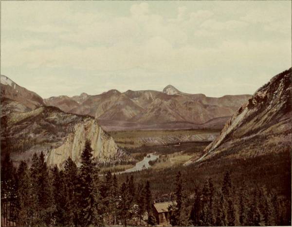
BEAUTIFUL BOW VALLEY.—One of the peculiarly attractive and picturesquely exquisite portions of British America is mountain-begirted Bow Valley, 500 miles east of Vancouver, along the Canadian Pacific Railway line. The region is wondrously diversified and marvelously beautiful, holding within its compass not only a valley of paradisaic charms, but also mountains of startling grandeur, with crystalline lakes reposing on their bosoms, range breaking beyond range, snowy crests gleaming with sunlight splendors, forests tinted with softest hues, streams that murmur and cascades that roar, while the valley is aflame with the richest colorings of daisies, buttercups, bluebells, heather, wild pinks, anemones, and brianthus, a symphony of beauty, a colossal bouquet decorating the marriage-bed of nature.
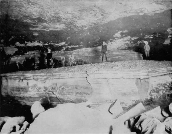
GIANT’S COFFIN, MAMMOTH CAVE, KENTUCKY.—This remarkable and weird curiosity is composed of a huge block of stone forty feet long by twenty wide, and when viewed from a certain angle the resemblance to a funeral casket is so great that, even if attention were not called to it, visitors would hardly fail to be a little shocked by the uncanny sight. Standing within its presence it is almost impossible to divest one’s self of the belief that he is gazing upon the last resting-place of some tremendous giant, the guardian genius, perhaps, of this lugubrious subterranean abode; and it is with a sigh of relief that we pass on to more inspiring and splendid scenery.
496The Maelstrom, in Croghan’s Hall, is one of the deepest and most awful-appearing pits yet discovered, and until 1859 no one had ever ventured to explore its dark recesses. It is at a remote point in the Cave and seldom visited, because the way is beset with obstacles, while the sight is neither reassuring nor compensating. A son of George D. Prentice, however, braved the dangers of the pit by permitting some of his friends to lower him 190 feet by a rope to the bottom, but his experience was of little value, because he found nothing of interest to reward him for the trouble. Some pretty stalactites are near this pit, and also in Fairy Grotto, but in the deeper recesses there is a remarkable absence of these formations. Indeed, considering the character and extent of Mammoth Cave, its poverty of stalactitic ornamentation is surprising. On the other hand, it contains an unexampled wealth of crystals of endless variety and incomparable beauty. Besides the sparkling vault of the Star Chamber, which is 300 feet long and 80 feet high, there are halls canopied by fleecy clouds, or studded by mimic snow-balls, and others displaying various grotesque resemblances on the walls and ceilings. Cleveland’s Cabinet, and Marion’s Avenue, each a mile long, are adorned by myriads of gypsum rosettes and curiously twisted crystals called “oulopholites.” These cave-flowers are unfolded by pressure, like a sheaf of wheat forced through a tight binding. This charming embellishment of clusters and garlands is frequently seen curling outward, like roses, composing petrified bouquets that cover the snowy arches.
This curious feature is even more marked by the stalactites in Mary’s Vineyard, where they appear in the form of an aggregation of spherical prominences, resembling clusters of grapes. Other chambers are drifted with snowy crystals of sulphate of magnesia, and the ceilings are so thickly covered with their efflorescence that a sharp concussion of the air will cause them to fall like flakes in a snow-storm.
Many small rooms and tortuous paths, where danger lies, are avoided as much as possible; but even on the regular routes through the Cave some disagreeable experiences are inevitable, while about the deep pits peril is always present. The one now known as the Bottomless Pit was for many years a barrier to all further exploration, and until a substantial wooden bridge was built across it. Long before the shaft had been cut as deep as now, the water flowed away by a channel gradually contracting until at a point called The Fat Man’s Misery the walls were only eighteen inches apart. The rocky sides are beautifully marked with waves and ripples, as if running water had been suddenly petrified. This winding-way conducts to River Hall, beyond which lie the crystalline gardens that have been described. It was formerly believed that if this narrow passage were closed, escape would be impossible; but a few years ago a tortuous fissure called the Cork-Screw was discovered, by means of which a good climber ascending a few hundred feet finally lands 1,000 yards from the mouth of the Cave, and cuts off nearly two miles.
The waters, entering through numerous domes and pits, and falling, during the rainy season, in cascades of great volume, are finally collected in River Hall, where they form several extensive lakes, or rivers, whose connection with Green River is known to be in two deep springs appearing under arches on its margin. Whenever there is a freshet in Green River the streams in the cave are joined in a continuous body of water, the rise sometimes being as much as sixty feet above the low-water mark. The subsidence within is less rapid than the rise; and the streams are impassable during a greater part of the year. They are usually navigable from May to October, and furnish exceedingly interesting as well as novel features of cave scenery. The largest body of water is called the Dead Sea, embraced within a basin formed by cliffs sixty feet high, above which a path has been made which leads to a stairway and thence to the River Styx, a body of water that is four hundred feet long and forty feet wide. Lake Lethe is the next water-basin, enclosed by walls ninety feet high, below which is a path that conducts to a pontoon at the neck of the lake. Thence a beach of the finest yellow sand extends for 500 yards to Echo River, the largest of all, being nearly one mile long, from 20 to 200 feet broad, and varying in depth from 10 to 40 feet. Two or three boats are placed on this Lethean or Stygian stream, in which visitors are taken from one end of the river to the other, and the trip is of such novelty that the remembrance of it is imperishable. To see the boats approaching, in the weird light of flickering torches, is like a vision of a spectral crew, funereal, sepulchral and almost horrific. The arch overhead is symmetrical but irregular in height, and is famous for its musical reverberations—not a distinct echo, for the repetitions are so rapid that they merge and become a prolongation of sound that continues for nearly half a minute. The long vault has a certain key-note of its own, which, when sounded, produces harmonies of almost incredible depth and sweetness.
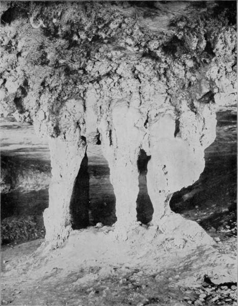
THE BRIDAL ALTAR, MAMMOTH CAVE.—The Bridal Altar is one of the most magnificent spectacles of Mammoth Cave, with its frosted pillars of pearl-white and the convolutions of their magnificent pediments that may be likened to clouds in the sky of the cave. These vertical shafts or petrified columns are among the most surprising and beautiful features of cave scenery, and when brilliantly lighted they present a scene of splendor surpassing the utmost stretch of the imagination. Let us not, therefore, wonder that this is a favorite resort for young married people, who come hither in the rosy blush of their wedding dawn to plight the faith that makes them one for time and eternity.
498In these Plutonian regions of perpetual night, where vegetation is only imaged by petrified efflorescence, many creatures find a congenial abode, and become so accustomed to this dark habitat that they cannot live elsewhere. Of the twenty-eight different species here found, the most remarkable are a blind and wingless grasshopper with extremely long antennae; a blind and colorless cray-fish, and a blind fish which grows to the length of six inches. These fish possess the additional curiosity of being viviparous, or producing their young in a living state, instead of by eggs. Occasionally other fish are caught in the running streams of the Cave which are identical with species common in Green River, thus proving the subterranean connection that exists between that river and the Cave streams.
The strongly marked divergence of these blind creatures from those found on the outside led Agassiz to believe that they were specially created for the limits within which they dwell; but the opinion now generally held is that they are modifications of allied species existing in the sunlight, and that their peculiarities are to be accounted for on the principles of evolution—the process of change being accelerated, or retarded, by their migration from the outer world to a region of silence and perpetual darkness.
Having concluded our examination of Mammoth Cave, we departed by the Louisville and Nashville Railroad for Louisville, at which city train was taken on the St. Louis Air Line for Wyandotte Cave, which was to be our last objective point in completing our extensive photographic tour of America. This very remarkable Cave, though not so generally known as Luray or Mammoth, is about ten miles south of the Louisville and St. Louis Air Line, in Crawford county, Indiana, and is only five miles from the Ohio River. We reached the Cave by way of Milltown, thence to Corydon, and from that point by private conveyance a distance of eleven miles. Entrance to the Cave is by way of a large opening in a hillside, the aperture being about six feet high and twenty feet wide, through which there is always a strong circulation of air like that noted at the mouth of Mammoth Cave, while the temperature is likewise uniformly 54° Fahrenheit. A short avenue leads into a chamber known as Fanueil Hall, whose dimensions are 200 feet long, 50 feet wide and 25 feet high; thence the route conducts through Twilight Hall into Columbian Arch, which resembles a railroad tunnel, so symmetrical is the excavation. Washington Avenue is next entered, which, followed, brings the visitor to Banditti Hall, where the ceiling rises to an immense height, and the walls are jagged, as is the floor, with protruding rocks, so that this chamber is both forbidding in appearance and difficult to traverse. At this point the main gallery branches, one avenue leading to what is known as the Old Cave, and the other conducting by a longer route to more interesting apartments than those before passed. Through a narrow crevice the visitor gains a room called the Bats’ Lodge, and beyond this is Rugged Mountain, which is in the center of a circular room, where Epsom salts of sparkling purity and vast quantities of gypsum in efflorescent beauty cover the arched vault. Seen under torch-light the effect is indescribably magnificent, and is the first striking intimation which the visitor receives of the extraordinary grandeur to which he will be presently introduced. Following the long route we cross a lovely sand-deposit known as the Plain, but find an abrupt termination of this level walk and are compelled to climb the rock-bestrewn Hill of Difficulty, then squeeze through a small passage-way from which we find present relief by emerging into Wallace’s Grand Dome, one of the most magnificent chambers, as well as the largest, in the Cave, being 245 feet high and 300 feet in diameter. In the center is Monument Mountain, a tremendous stalagmite formation above which is an immense dome beflowered with curling leaves of gypsum that bear a wondrous likeness to the foliage of the acanthus. At the apex of the mountain is a stalagmite one hundred and twenty feet in circumference, which has been broken by some force into three columns, which, viewed from the base, admirably counterfeit three monuments, or ghosts clad in robes of gleaming whiteness, from which fact the chamber takes its name. Visitors are usually treated to a superbly grand sight while examining the splendors of this hall, for the guide disposes his company about the base of the mountain, and ascending to the summit he extinguishes his torch in order to bring the visitors under the influence of dense darkness for a few moments. Suddenly the peak is lighted up with a dazzling splendor, as the guide touches off green, blue, red and orange lights, bathing the chamber in a sea of flaming beauty and bejewelling its lofty arch until Aladdin’s Cave of our imagination is reproduced.
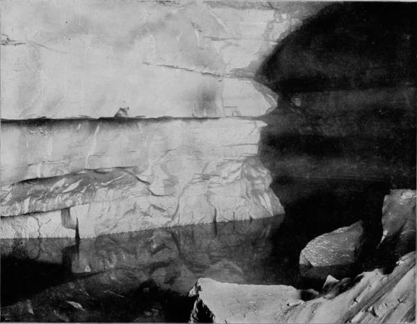
THE RIVER STYX, MAMMOTH CAVE, KENTUCKY.—Some idea of the grandeur of the waterways of Mammoth Cave will be obtained from the following description: The largest body of water is called the Dead Sea, embraced within a basin formed by cliffs sixty feet high, above which a path has been made leading to a stairway and thence to the River Styx, which is forty feet wide and four hundred long. Lake Lethe is the next water-basin, enclosed by walls ninety feet high, below which is a path that conducts to a pontoon at the neck of the lake. Thence a beach of the finest yellow sand extends for five hundred yards to Echo River, the largest of all, being nearly one mile long, from twenty to two hundred feet broad, and varying in depth from ten to forty feet. Two or three boats ply this Stygian stream, in which visitors are taken from one end to the other, and the trip is of such novelty that the remembrance of it is imperishable.
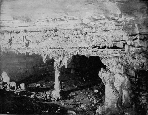
ENTRANCE TO PILLARED PALACE, WYANDOTTE CAVE.—There are many grand and splendid halls in Wyandotte Cave, of which the most attractive is Pillared Palace, in which gypsum and stalactites occur in the most charming and imposing forms. This hall is particularly entrancing in its sumptuous and architecturally beautiful decorations. It is from five to six feet high, forty or fifty wide and several hundred long. The ceiling is a complete fringe-work of stalactites, while the floor is as thickly set with stalagmites, many of which uniting with the former produce pillars of the grandest proportions, beautiful beyond the power of imagination to describe. Drapery of every conceivable style is seen in the utmost profusion, some of it transparent as crystal and resonant as a silver bell when struck with a metal substance.
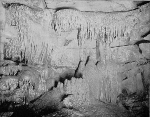
THE THRONE, WYANDOTTE CAVE.—Although less celebrated than Mammoth or Luray Caves, Wyandotte fully equals them in many of its wondrous and beautiful formations. The Throne and the hall in which it is located are truly marvels of Nature’s handiwork. Imagine great bunches of white, delicate, branching coral, twisting, curling and interlacing itself, serpent-like, into every conceivable fantastic shape, and you have only a faint idea of the truly extraordinary scenery of this glorious temple erected by Nature. In all directions are to be seen fantastic examples of stalactite formations, and marvelous decorations of whitest gypsum. Huge rocks, overhung by galleries of creamy stalactites, with vermicular tubes intertwined, while frozen cataracts and vine-like pendent forms cluster along the walls in a profusion almost incredible.
502Beyond Wallace’s Dome there are a hundred halls of great magnificence, in nearly all of which are seen fantastic examples of stalactite formations, and marvelous decorations of whitest gypsum, Milroy’s Temple being a very exhibition-room of these exquisite curiosities: huge rocks, overhung by galleries of creamy stalactites, vermicular tubes intertwined, frozen cataracts and vine-like pendant forms of stalactites, cluster along the walls in a profusion almost incredible. Imagine great masses of white delicate branching coral, twisting, curling and interlacing itself, serpent-like, into every conceivable fantastic shape, and you have only a faint idea of the truly extraordinary scenery of this glorious temple erected by nature. Other halls of almost rival splendor are known as Snowy Cliffs, Frosted Rocks, Fairy Palace, Beauty’s Bower, The Throne, and Pillared Palace, in all of which gypsum and stalactites occur in the most charming and imposing forms. Pillared Palace is particularly entrancing in its sumptuous and architecturally beautiful decorations. It is from five to six feet high, forty or fifty feet wide and several hundred feet long. Its ceiling is a complete fringe-work of stalactites, while its floor is as thickly set with stalagmites, many of which latter unite with the former, making the grandest pillars. Drapery of every conceivable style may be seen, some of which is as transparent as crystal and rings like a silver bell when exposed to a light blow. After Pillared Palace comes the Palace of the Genii, which for delicate formations even excels the former. Here are found stalactites of every conceivable form, many of them as white as if they were made of sugar or whitest marble.
Passing through Fairy Grotto, Neptune’s Retreat, and Hermit’s Cell, the visitor enters a larger chamber invested with the same charming ornamentation, and in the center is a rich canopy of stalactite overhanging a stalagmite which has been likened by some imaginative person to a chair richly upholstered. This is called the Throne, a designation appropriate enough, for it is one of the most royally beautiful curiosities in the Cave, as the illustration will show.
That portion known as the Old Cave, while scarcely so interesting as the galleries and vaults of the long route, contains several halls of much interest and one, called the Senate Chamber, which rivals Wallace’s Dome. In the center of this room stands a mountain whose top is covered many feet deep with stalactite formations, upon which stands the Pillar of the Constitution. This is an immense stalagmite measuring seventy-five feet in circumference and thirty feet high, reaching from the top of the mountain to the ceiling above, fluted and carved after a manner that would have put to shame the most extravagant architecture of Rome’s most halcyon days. The world has not yet produced, so far as civilized man knows, anything of the kind to equal it. A writer says of it:
“Before us arose a considerable hill, upon the top of which stood, like a column supporting the ceiling, a vast stalagmite like an immense spectral-looking iceberg looming up before us, appearing as though it had just arisen from the foaming waves of the ocean, on a dark and foggy night. In the uncertain light of our lamps it presented an appearance grand, if not appalling; but when the Drummond light had been set off, all this changed to the most unearthly beauty. The ceiling above, with its long fringes of stalactites, came out to view, and the great pillar could be seen in all its grandeur and beauty.”
Beyond this is Pluto’s Ravine, where stands Stallasso’s Monument, a large white stalagmite, marked all over with pencil inscriptions, some of them sixty years old, composing an autograph album of wonderful curiosity, containing hundreds of names which to fame are otherwise unknown, and effusions of doggerel poets whose reputations, alas, will no doubt be forever restricted to the limits of this cave chamber. A short distance beyond Pluto’s Ravine is the termination of this section of the Cave, and from this point return is made to the open air. A ramble among the subterranean glories and petrified splendors of Wyandotte Cave was a fitting conclusion to one of the most interesting tours that was ever taken through the picturesque regions of our country; a tour affording so much information, pleasure, adventure, and profit, that the remembrance must forever remain a source of intense satisfaction and delight. It was with feelings of deep regret that we separated after the completion of our work, and each returned to his respective home, to take up anew the old labor which we had laid down when the start was made upon our long journey. During the trip our photographers took five thousand pictures; many of these were taken under unfavorable conditions, and upon development were found unworthy of reproduction. Many others were excellent and well deserving to rank with those which we have here used, but there is a limit to all things, and ours does not exceed the space occupied by the 520 odd views which we have presented; these, however, are fairly representative of the incomparable scenery that charmingly diversifies our native land, a land kissed by the lips of liberty, bounty, and beauty, and blessed with an amplitude of powers, under the exercise of which the largest freedom, benefits and sovereign rights are obtained for the whole people.