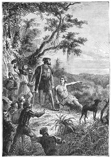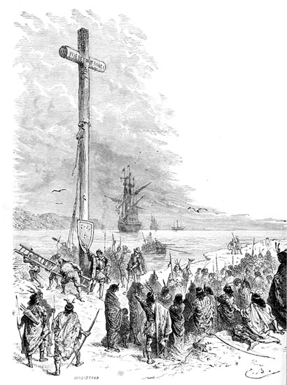
CARTIER TAKING POSSESSION FOR FRANCE.
Project Gutenberg's The Making of the Great West, by Samuel Adams Drake

This eBook is for the use of anyone anywhere in the United States and most
other parts of the world at no cost and with almost no restrictions
whatsoever.  You may copy it, give it away or re-use it under the terms of
the Project Gutenberg License included with this eBook or online at
www.gutenberg.org.  If you are not located in the United States, you'll have
to check the laws of the country where you are located before using this ebook.

Title: The Making of the Great West
       1512-1883

Author: Samuel Adams Drake

Release Date: July 17, 2018 [EBook #57528]

Language: English

Character set encoding: UTF-8

*** START OF THIS PROJECT GUTENBERG EBOOK THE MAKING OF THE GREAT WEST ***


Produced by Melissa McDaniel and the Online Distributed
Proofreading Team at http://www.pgdp.net (This file was
produced from images generously made available by The
Internet Archive)
Transcriber's Note:
Inconsistent hyphenation and spelling in the original document have been preserved. Obvious typographical errors have been corrected.
Footnote 1 in the section "DEATH AND BURIAL OF DE SOTO" is missing.
There are two [7] anchors for Footnote 7 in the section "SWORD AND GOWN IN CALIFORNIA".
There are two [3] anchors for Footnote 3 in the section "THE LOST COLONY: ST. LOUIS OF TEXAS". The second appears to be a printer's error.
No map was identified in the text showing the Santa Fé and Oregon trails.
No section was found referring to the "Edmunds Bill".
The following alternate spellings were identified and retained:
BY
SAMUEL ADAMS DRAKE
WITH MANY ILLUSTRATIONS AND MAPS
London
GIBBINGS & COMPANY, Ltd.
18 BURY STREET, W.C.
1894
Copyright, 1887, by
CHARLES SCRIBNER'S SONS.
Presswork by Berwick & Smith, Boston, U.S.A.
"Time's noblest offspring is the last."
This history is intended to meet, so far as it may, the want for brief, compact, and handy manuals of the beginnings of our country.
Although primarily designed for young people, the fact has not been overlooked that the same want exists among adult readers, to whom an intelligent view of the subject, in a little space, is nowhere accessible.
For the purpose in hand, the simplest language consistent with clearness has been made use of, though I have never hesitated to employ the right word, whenever I could command it, even if it were of more than three syllables.
As in the "Making of New England," "this book aims to occupy a place between the larger and lesser histories,—to so condense the exhaustive narrative as to give it greater vitality, or so extend what the narrow limits of the school-history often leave obscure as to supply the deficiency. Thus, when teachers have a particular topic before them, it is intended that a chapter on the same subject be read to fill out the bare outlines of the common-school text-book.
"To this end the plan has been to treat each topic as a unit, to be worked out to a clear understanding of its objects viii and results before passing to another topic. And in furtherance of this method, each subject has its own descriptive notes, maps, plans and pictorial illustration, so that all may contribute to a thorough knowledge of the matter in hand. The several topics readily fall into groups that have an apparent or underlying connection, which is clearly brought out."
In this volume, I have followed up to its legitimate ending the work done by the three great rival powers of modern times in civilizing our continent. I have tried to make it the worthy, if modest, exponent of a great theme. The story grows to absorbing interest, as the great achievement of the age,—of the Anglo-Saxon overcoming the Latin race, as one great wave overwhelms another with resistless force.
Under the title of "The Great West," the present volume deals mostly with the section lying beyond the Mississippi. Another is proposed, in which the central portion of the Union will be treated. The completed series, it is hoped, will present something like a national portrait of the American people. ix
| GROUP I.—THREE RIVAL CIVILIZATIONS. | |
| I. The Spaniards. | |
| PAGE | |
| An Historic Era | 1 |
| De Soto's Discovery of the Mississippi | 10 |
| Death and Burial of De Soto | 18 |
| The Indians of Florida | 20 |
| How New Mexico came to be Explored | 28 |
| "The Marvellous Country" | 39 |
| Folk Lore of the Pueblos | 45 |
| Last Days of Charles V. and Philip II. | 53 |
| Sword and Gown in California | 55 |
| II. The French. | |
| Prelude | 67 |
| Westward by the Great Inland Waterways | 71 |
| The Situation in A.D. 1672 | 80 |
| Count Frontenac | 84 |
| Joliet and Marquette | 85 |
| The Man La Salle | 93 |
| La Salle, Prince of Explorers | 99 |
| Discovery of the Upper Mississippi | 105 |
| The Lost Colony: St. Louis of Texas | 109 |
| Iberville founds Louisiana | 118 |
| France wins the Prize | 123 |
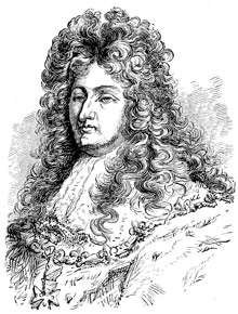
| Louis XIV. | 130 |
| III. The English. | |
| The Bleak North-west Coast | 132 |
| Hudson's Bay to the South Sea | 136 |
| The Russians in Alaska | 140 |
| England on the Pacific | 143 |
| Queen Elizabeth | 147 |
| Interlude. | |
| What Jonathan Carver aimed to do in 1766 | 149 |
| John Ledyard's Idea | 153 |
| A Yankee Ship discovers the Columbia River | 156 |
| The West at the Opening of the Century | 162 |
| GROUP II.—BIRTH OF THE AMERICAN IDEA. | |
| I. America for Americans. | |
| Acquisition of Louisiana | 171 |
| A Glance at our Purchase | 175 |
| II. The Pathfinders. | |
| Lewis and Clarke ascend the Missouri | 184 |
| They cross the Continent | 191 |
| Pike explores the Arkansas Valley | 198 |
| New Mexico in 1807 | 205 |
| Gold in Colorado.—A Trapper's Story | 208 |
| The Flag in Oregon | 211 |
| Louisiana admitted 1812 | 214 x |
| III. The Oregon Trail. | |
| The Trapper, Backwoodsman, and Emigrant | 215 |
| Long explores the Platte Valley | 219 |
| Missouri and the Compromise of 1821 | 223 |
| Arkansas admitted 1836 | 227 |
| Thomas H. Benton's Idea | 227 |
| With the Vanguard to Oregon | 233 |
| Texas admitted | 241 |
| Interlude. | |
| New Political Ideas | 246 |
| Iowa admitted | 248 |
| The War with Mexico | 248 |
| Conquest of New Mexico | 251 |
| Taking of California | 256 |
| The Mormons in Utah | 264 |
| GROUP III.—GOLD IN CALIFORNIA, AND WHAT IT LED TO. | |
| I. The Great Emigration. | |
| El Dorado found at last | 271 |
| Swarming through the Golden Gate | 276 |
| The California Pioneers | 279 |
| California a Free State | 285 |
| Arizona | 288 |
| II. The Contest for Free Soil. | |
| The Kansas-Nebraska Struggle | 290 |
| Kansas the Battle-ground | 295 |
| The Battle fought and won | 299 |
| Two Free States admitted | 307 |
| III. The Crown of the Continent. | |
| Gold in Colorado, and the Rush there | 308 |
| The Pacific Railroads | 315 |
| Kansas, Nevada, Nebraska, and Colorado admitted | 320 |
| The Recent States | 322 |
| The Work of Eighty Years | 326 |
| PAGE | |
| Taking Possession for France | Frontispiece |
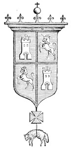
| Spanish Arms | 1 |
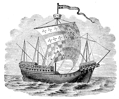
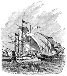
| Ship of the Sixteenth Century | 2 |
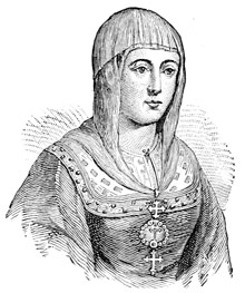
| Isabella of Spain | 3 |
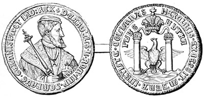
| Medal of Charles V. | 5 |
| Ponce de Leon | 6 |
| Balboa discovering the Pacific | 8 |
| French Map of 1542. From Jomard | 10 |
| De Soto | 11 |
| Soldier of 1585 | 12 |
| Cuban Bloodhound | 14 |
| Departure of the Spaniards | 16 |
| Burial of De Soto | 19 |
| Florida Warrior | 21 |
| Palisaded Town | 23 |
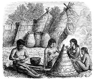
| A Florida Indian's Cabin | 24 |
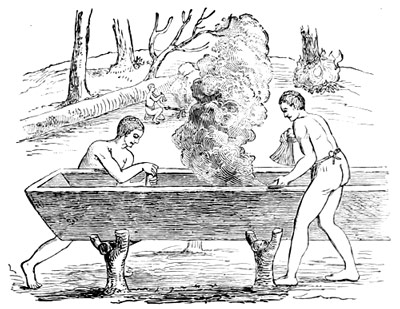
| Making a Canoe | 25 |
| A Chieftain's Grave | 26 |
| Processional Fans | 27 |
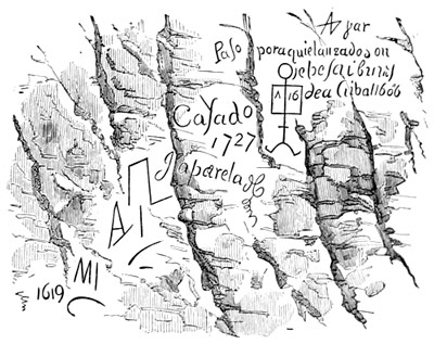
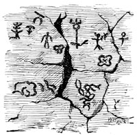
| Rock Inscriptions, New Mexico | 29 |
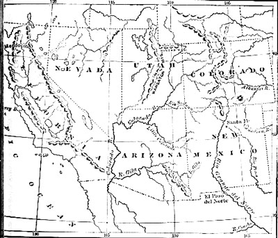
| Map, New Mexico. Route of Spanish Invaders | 31 |
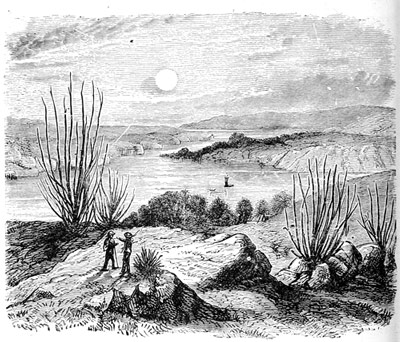
| Junction of the Gila and Colorado | 34 |
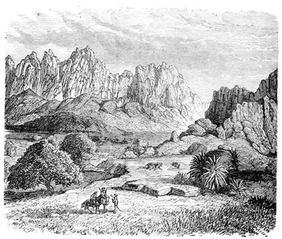
| Organ Mountains | 36 |
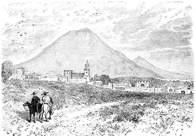
| El Paso del Norte | 38 |
| A Pueblo Restored | 41 |
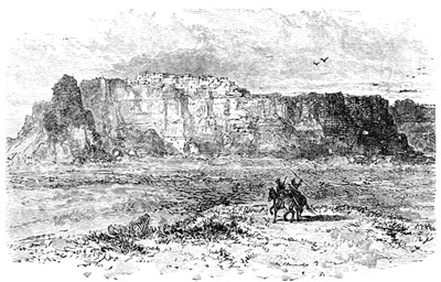
| Acoma | 43 |
| Casa Grande, Gila Valley | 44 |
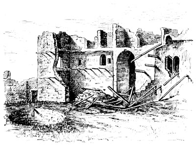
| Ruins of Pecos | 47 |
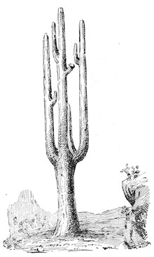
| Cereus Gigantea | 49 |
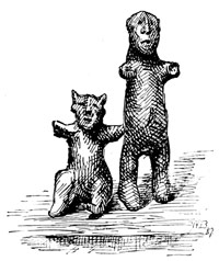
| Pueblo Idols | 50 |
| Hieroglyphics, Gila Valley | 51 |
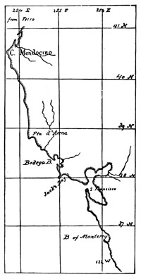
| Map, California Coast | 55 |
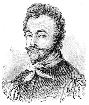
| Sir Francis Drake | 57 |
| Drake sails away | 58 |
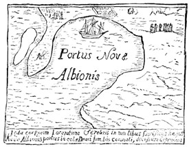
| Old Map showing Drake's Port | 60 |
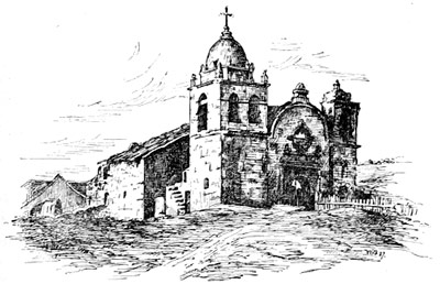
| Carmel Mission Church | 61 |
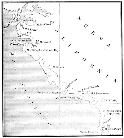
| Spanish Map of 1787, showing Missions, Presidios, and Routes | 63 |
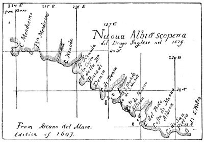
| Map from Arcano del Mare, 1647 | 64 |
| Ships of the Sixteenth Century | 68 |
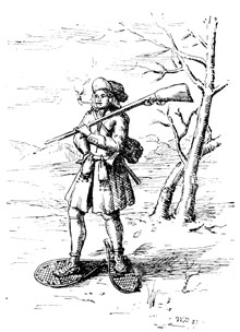
| A Wood Ranger | 70 |
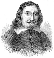
| Champlain | 72 |
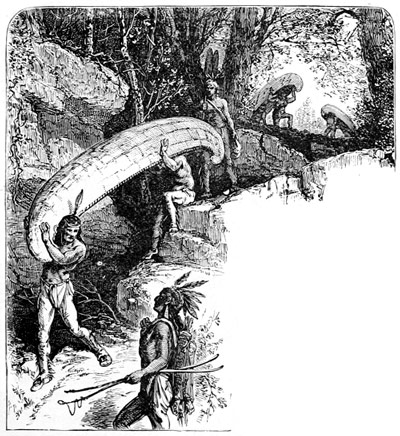
| A Portage | 73 |
| Totem of the Foxes | 76 |
| French Costumes | 77 |
| Fox River | 78 |
| Louis XIV. | 82 |
| Marquette's Map | 86 |
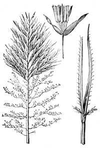
| Wild Rice | 87 |
| Totem of the Illinois | 89 |
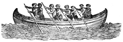
| War Canoe, from Lahontan | 90 |
| The Calumet | 91 |
| La Salle | 94 |
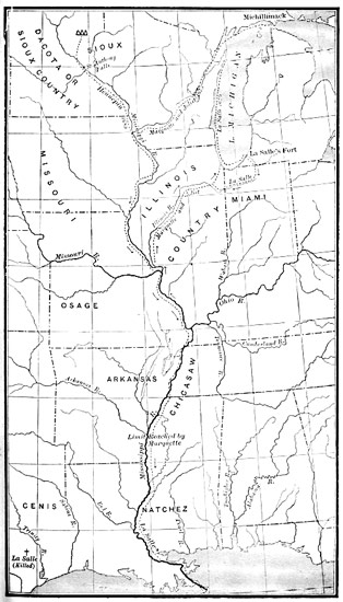
| Map showing La Salle's Explorations | 95 |
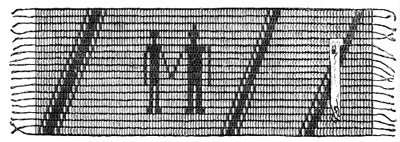
| Wampum Belt | 102 |
| Sioux Chief | 107 |
| Sioux Totem | 108 |
| Sugar Plant | 120 |
| Map showing Delta of the Mississippi and Adjacent Coast | 122 |
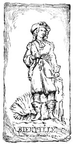
| Bienville | 124 |
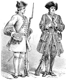
| French Soldiers | 126 |
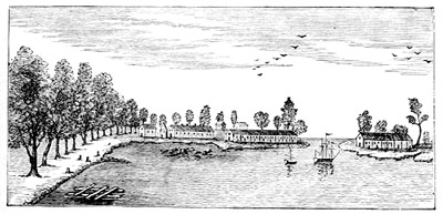
| New Orleans, 1719 | 129 |
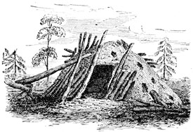
| Abandoned Hut, North-west Coast | 133 |
| Hudson's Bay Company's House, London | 135 |
| Hudson's Bay Sled, loaded | 136 |
| Indian Mask, West Coast | 139 |
| Seals, St. Paul's Island | 140 |
| Russian Church, Alaska | 141 |
| Snow Spectacles, Alaska | 144 xii |
| Indian Carving | 144 |
| Indian Grave, North-west Coast | 155 |
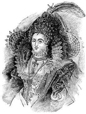
| Queen Elizabeth | 148 |
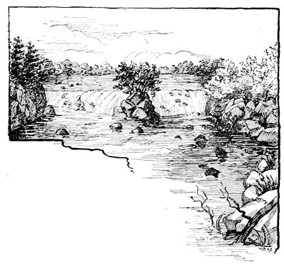
| Falls of St. Anthony | 151 |
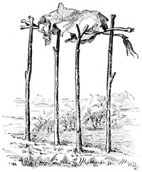
| Indian Burial Scaffold | 152 |
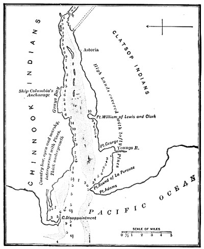
| Map, Mouth of Columbia River | 157 |
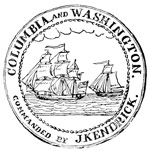
| Medal, Ships Columbia and Washington | 159 |
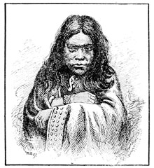
| An Oregon Belle | 161 |
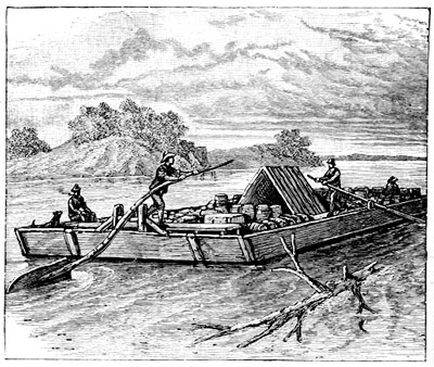
| A Flat-Boat | 164 |
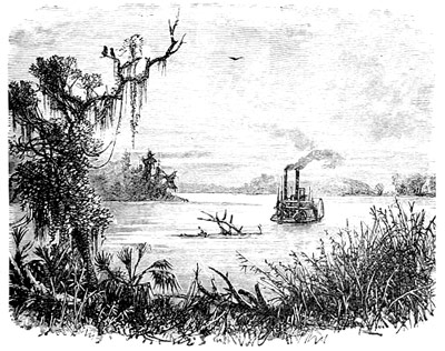
| On the Lower Mississippi | 167 |
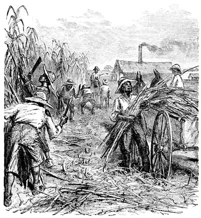
| A Louisiana Sugar-Plantation | 176 |
| French Settlements: Germ of St. Louis | 177 |
| Old Convent, New Orleans | 179 |
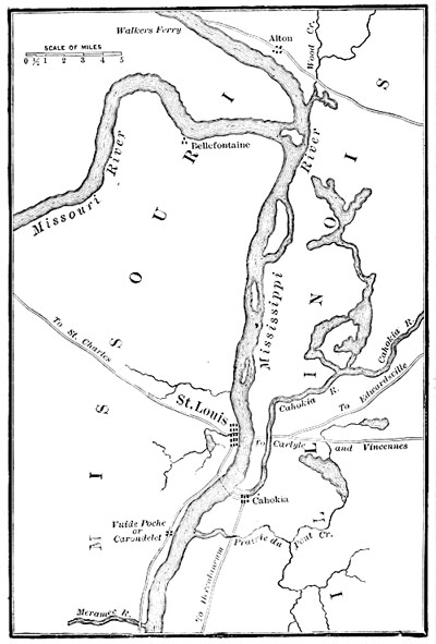
| Map, St. Louis and Vicinity | 180 |
| Chouteau's Pond, St. Louis | 181 |
| Rock Towers near Dubuque | 182 |
| Mountain Goat, or Big-horn | 185 |
| Indians moving Camp | 186 |
| A Mandan | 188 |
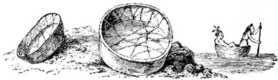
| Mandan Skin Boats | 190 |
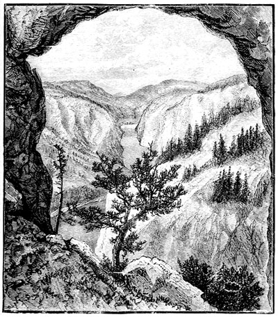
| Gate of the Rocky Mountains | 193 |
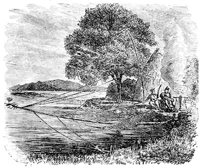
| Catching Salmon, Columbia River | 196 |
| Map illustrating Lieut. Pike's Explorations | 199 |
| Indian Burial-place | 200 |
| Pike's Peak | 202 |
| The Yucca-tree; Spanish Bayonet | 205 |
| Church, Santa Fé, with Fort Marcy | 207 |
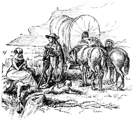
| An Emigrant's Camp | 217 |
| Map illustrating Long's Explorations | 220 |
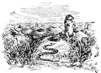
| Prairie-dog Village | 221 |
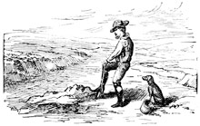
| Digging in the River for Water | 222 |
| Statue of Benton | 229 |
| Fort Laramie | 235 |
| Amole, or Soap-plant | 237 |
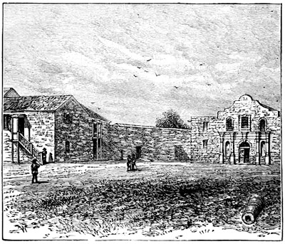
| San Antonio | 242 |
| The Alamo | 244 |
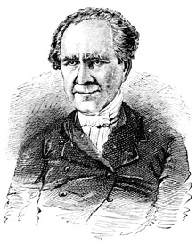
| Samuel Houston | 245 |
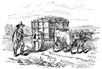
| Mexican Cart | 249 |
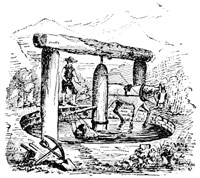
| Mexican Arastra, for grinding Ores | 250 |
| Pueblo Woman grinding Corn | 253 |
| Boy and Donkeys | 254 |
| Pueblo of Taos | 255 |
| Big Tree | 257 |
| Map showing States and Territories acquired from Mexico | 259 |
| California Indians and Tule Hut | 260 |
| El Capitan, Yosemite | 262 |
| Salt-Lake City and Tabernacle | 265 |
| Sutter's Mill | 272 |
| Two Miners | 274 |
| The Golden Gate | 276 |
| Chinese Laundryman | 277 |
| A Father | 280 |
| Mount Shasta | 281 |
| On the Oregon Trail | 282 |
| San Francisco in 1849 | 283 |
| Early Coin | 284 |
| Hydraulic Mining | 286 |
| Chicken-Vender | 287 |
| Mission San Xavier del Bac, near Tucson | 289 |
| Stephen A. Douglas | 291 |
| A Squatter's Improvements | 296 |
| Street, Kansas City, 1857 | 297 |
| Lawrence, Kansas | 298 |
| The Ferry, Lawrence, Kansas | 300 |
| A Squatter moving his Claim | 301 |
| Mud Fort, Lawrence | 303 |
| John Brown | 304 |
| John Brown's Cabin | 305 |
| Gate, Garden of the Gods | 309 |
| Humors of the Road | 310 |
| Denver in 1859 | 311 |
| Overland Stage—in Camp | 311 |
| Going in | 312 |
| Coming Out | 312 |
| Office of "Rocky-Mountain News," Denver | 312 |
| Colorado City, 1859 | 313 |
| Quartz Stamping-Mill | 314 |
| Quaker Gun at Stage Station | 315 |
| Pony Express and Overland Stage | 317 |
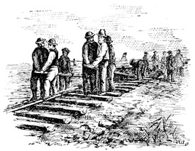
| Track-laying, Pacific Railroad | 319 |
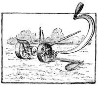
| Reaping-Machine | 327 |
"True History, henceforth charged with the education of the People, will study the successive movements of humanity."—Victor Hugo. 1
"And from America the golden fleece
That yearly stuffs old Philip's treasury."
Marlowe's Faustus.
The story we have to tell was the problem of the sixteenth century, and is no less the marvel of the nineteenth. Put in the simplest possible form, the riddle to be solved in every palace of Christendom was, "How is the discovery of a new world going to affect mankind?"
To make the whole story clear, from beginning to end, calls for an effort to first put ourselves in relation with that remote time,—its thought, its interests, its aims and civilization. Let us try to do this now, at this time, when from our standpoint of achieved success we may calmly look back over the field, and see clearly the causes which have led up to it in orderly succession.
In the very beginning we see three rival civilizations. We see different nations, each of which is putting forth efforts to grasp dominion in, or stamp its own civilization 2 upon, the New World in despite of the other. We see civilization apparently engaged in defeating its own ends. Naturally, then, our first interest centres in the combatants themselves. Who and what are these Old World gladiators, who, in making choice of the New for their arena, have stripped for the encounter?
Great affairs were engaging the attention of the civilized world, so great that nearly all Europe was up in arms. It was the era of unsettled conditions,—of old jealousies and animosities revived, of new opportunities and new adjustments created by them. But among the nations of Europe power was very differently distributed from what we see it to-day. Spain, not England, was acknowledged mistress of the seas. Not yet had England wrested that proud title from her ancient rival in the greatest naval battle of the century. Drake and Frobisher had not been born. Hawkins was a lad, strolling about the quays of his native seaport. Who, then, should dispute with Spain dominion of the seas? 3
The royal standard of Spain had indeed floated very far at sea. Columbus had borne it even in sight of the shores of Mexico; but, though he had given to Spain a new world, he, the man of his century, did not succeed in finding his long-sought strait to India, and so had died without seeing the one great purpose of his life accomplished.
Yet Columbus, so to speak, was a lever of Archimedes,[1] for with the greatness of his idea he had moved both the Old World and the New. The Old was thrown into commotion because of his discoveries and what they implied to mankind, the New thrilled with the new life that stirred in her bosom. Spain at once stepped forward into the front rank of nations. How strange and striking are the events that have flowed from this one idea working in one man's brain! And where, in all the history of the world, shall we look for their equal?
By the time Columbus had returned to Spain, the Portuguese mariner, Diaz, had also discovered the Cape of Good Hope. Upon this these two proud and powerful nations, Spain and Portugal, agreed to divide between themselves all the unknown lands and seas to the east and to the west of a meridian line which 4 should be drawn from pole to pole, one hundred and seventy leagues west of the Azores. All other nations were thus to be excluded from the New World.[2]
Having first secured a solid foothold in the Antilles,[3] through Columbus and his discoveries, Spain early threw out her expeditions into Florida (1512) and Mexico (1519). The one was the logical result of the other, for St. Domingo and Cuba now assumed distinct importance, as stations, whence it was easy to move forward upon new schemes of conquest. In the harbors of these islands the Spaniards could refit their ships or recruit their crews after the long ocean voyage from Europe. Cuba, especially, became an arsenal of the highest military importance, which Spain took great pains to strengthen.
So at the very outset, Spain held this great advantage over her competitors. She possessed a naval station conveniently situated for making descents upon the adjacent coasts, which none of them was able to secure for themselves.
Columbus died in 1506; Ferdinand, King of Spain, whose name by the accident of time is linked in with that of Columbus, had also died; and now Charles, who shortly was crowned Emperor of Germany, began his most eventful reign. The period it covers is one of the most momentous in modern history, and as great occasions commonly bring forth great men, so those monarchs who then ruled over the peoples of Europe were worthy of the time in which they lived. Charles was himself one of the greatest of these monarchs. Francis I. of France was another; Henry VIII. of England another. Hence we have felt justified in saying, as we did at the beginning of this chapter, that our 5 starting-point was fixed in an historic era; for every thing betokened that as between such men as these were the struggle was to be a contest of giants.
During this reign the conquests of Mexico and Peru took place. During this reign Spain was raised to such a height of greatness as had never before been known in her history. Europe looked on in wonder to see these grand schemes of conquest being carried on three thousand miles away, while Spain's powerful neighbors were kept in awe at home. The English poet Dryden, who wrote a play upon the conquest of Mexico, makes Cortez and Montezuma hold the following dialogue, Cortez offering peace or war:—
Mont. Whence, or from whom dost thou these offers bring?
Cortez. From Charles the Fifth, the world's most potent king.
Other nations would gladly have shared the riches of the New World with the conquerors, but Spain haughtily warned away intruders, meaning to keep the prize for herself alone. 6
It was then that Francis I. demanded to be shown that clause in the will of Adam disinheriting him in the New World. But Spain was too formidable to be attacked on the seas. On the land, the two great rivals met at Pavia, where the pride of France was laid so low that after the battle was over, Francis wrote to his mother the memorable words, so often made use of in like emergencies, "Madam, all is lost except honor."
The pre-eminent grandeur of Spain, at this period, shines out all the clearer by comparison with the inferior attitude of England, not only as a military power, but in respect of peaceful achievement. By the light Spain carried in the van of discovery other nations moved forward, but at a distance indicating their respect for the dictator of European politics.
It is worth our remembering that in the efforts made to obtain a foothold upon the mainland, or terra firma,[4] as the Spaniards then called it, the territory of the United States may claim precedence in the order of time. Before Cortez landed in Mexico, Ponce de Leon had discovered and named Florida. Therefore Florida was the first portion of the North-American continent to receive the baptism of a Christian name.[5]
Although, under this name of Florida, Spain first 7 claimed every thing in North America, it was the great central region lying about the tropics to which her explorers first turned their attention.
Cortez landed on the Gulf Coast, unfurled his banner of "blood and gold," set fire to his ships,[6] to let his followers know that for him and them there was no retreat, and marched on into the heart of Mexico. Two initial points are thus fixed from which to continue the story of Spanish domination in the New World, Florida and Mexico.
Then again, having at last found their way across the Isthmus of Darien to the South Sea[7] (1513), the Spaniards in a measure ceased from their persistent and useless search for an open water-way to India. Cortez presently hewed out another road, with the sword, across Mexico, to this great western ocean. His achievement was quickly followed up by Ulloa (1539), Cabrillo (1542), and other Spanish navigators, who were sent by Cortez or the Viceroy to extend discovery up the coast. They coasted the Gulf of California, first called the Vermilion Sea, and sailed beyond it, as high as 30° North latitude.
So thanks to Cortez, Spain had secured the much-coveted way to India at last. Yet when he came home to his native country, the king demanded of those about him who Cortez was. "I am a man," said the conqueror of Mexico, "who has gained your majesty more provinces than your father left you towns."
Supreme on land and sea, Spain pushed on her conquests abroad without hinderance. If such deeds as hers had so irritated the self-love of a rival prince, how must they have stirred the blood of all those daring spirits by whom Charles was surrounded, and who 9 burned to distinguish themselves in the service of their liege lord and sovereign. In America, men said the making of a new empire had begun. If that were so, it meant that men of energy, ambition and capacity, the kind of men on whom fortune waits to bestow her choicest favors, should seek her there.
But Mexico and Peru were already won. When, therefore, the Spaniards began to look about them for new worlds to conquer, their eyes fell upon Florida. It is true that all those who had set forth upon this errand met with nothing but disaster.[8] A spell seemed hanging over this land of flowers. The Spaniards had indeed, with much pomp, planted a cross, strangely proclaiming themselves masters of the country; yet, without power to hold a foot of ground, this cross stood a monument to their failures, as its inscription seemed an epitaph to their presumption.
[1] Lever of Archimedes. The saying attributed to this celebrated mathematician of ancient times, that if they would give him a fulcrum for his lever he would move the world, is often employed in one or another sense as a figure of speech.
[2] Pope Alexander VI. confirmed the act of partition by a special decree, called a bull.
[3] Antilles, an early name of the West Indies.
[4] Terra Firma, literally meaning firm land; a name first used by the Spaniards to distinguish the American continent, or that part first discovered, from the West India Islands.
[5] Christian Name, from its discovery on Easter Sunday, Pascha Floridum—Flowery Easter.
[6] Burning One's Ships has passed into a proverb often used to illustrate some act of extraordinary hardihood, by which one puts it out of his power to draw back from an undertaking. Cortez only followed the example of the Emperor Julian in ancient Rome, and of William the Conqueror in England.
[7] South Sea. The Pacific Ocean was so first called.
[8] Disaster befell the attempt of Narvaez upon Florida in 1528. Look it up.
"One may buy gold at too dear a price."—Spanish.
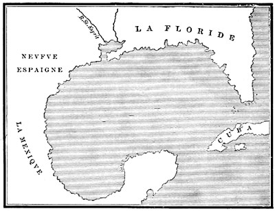
If we look at the earliest Spanish maps on which the Gulf of Mexico is laid down, not only do we find the delta of a great river put in the place where we would expect to see, on our maps of to-day, the Mississippi making its triumphal entry into the sea, but the map-makers have even given it a name—Rio del Espiritu Santo—meaning, in their language, the River of the Holy Ghost.
That this knowledge ought not to detract from the work of subsequent explorers is quite clear to our minds, because the charts themselves show that only the coast line[2] had been examined when these results were put 11 upon parchment. The explorers had indeed found a river, and made a note of it, but had passed on their way without so much as suspecting that the muddy waters they saw flowing out of the land before them drained a continent. Had they made this important discovery, we cannot doubt their readiness to have profited by it in making their third invasion of Florida. So the discovery, if it can be called one, had no practical value for those who made it, and the country remained a sealed book as before. We cannot wonder at this because La Salle subsequently failed to find the river when actually searching for it, though he had seen it before.
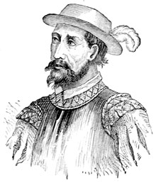
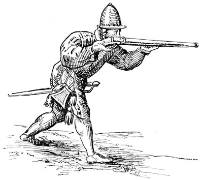
With 600 men, both horse and foot, thoroughly equipped and ably led, Hernando de Soto[3] set sail from Havana in May, and landed on the Florida coast on Whitsunday[4] of the year 1539.
De Soto did not burn his ships, like Cortes, but sent them back to Havana to await his further orders. These Spaniards had come, not as peaceful colonists, looking for homes and a welcome among the owners of the soil, but as soldiers bent only upon conquest. De Soto, as we have seen, had brought an army with him. Its camp was pitched in military order. It moved at the trumpet's 12 martial sound. Two hundred horsemen carrying lances and long swords marched in the van. With them rode the Adelantado, his standard-bearer and suite. Behind these squadrons marched the men of all arms—cross-bowmen, arquebusmen, calivermen, pikemen, pages and squires, who attached themselves to the officers in De Soto's train—then came the baggage with its camp-guard of grooms and serving-men: and last of all, another strong body of infantry solidly closed the rear of the advancing column, so that whether in camp or on the march, it was always ready to fight. In effect, De Soto entered Florida sword in hand, declaring all who should oppose him enemies.
De Soto enforced an iron discipline, never failing, 13 like a good soldier, himself to set an example of obedience to the orders published for the conduct of his army. In following his fortunes, it is well to keep the fact firmly in mind that De Soto was embarked in a campaign for conquest only.
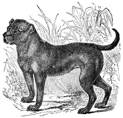
Toward the unoffending natives of the country the invaders used force first, conciliation afterwards. As in Mexico and Peru, so here they meant to crush out all opposition,—to thoroughly subjugate the country to their arms. De Soto had served under Pizarro, and had shown himself an apt pupil of a cruel master. The Indians were held to have no rights whatever, or at least none that white men were bound to respect. Meaning to make slaves of them, the Spaniards had brought bloodhounds to hunt them down, chains with iron collars to keep them from running away, and wherever the army went these poor wretches were led along in its train, like so many wild beasts, by their cruel masters. On the march they were loaded down with burdens. When the Spaniards halted, the captives would throw themselves upon the ground like tired dogs. When hungry they ate what was thrown to the dogs. So far as known, Hernando de Soto was the first to introduce slavery,[5] in its worst form, into the country of Florida, and in this manner did this Christian soldier of a Christian prince set up the first government by white men begun in any part of the territory of the United States.
The Spaniards were seeking for the gold which they believed the country contained. At the first landing, a Spaniard,[6] who had lived twelve years among the Florida Indians, was brought by them into the camp among his friends. The first thing De Soto asked this 14 man was whether he knew of any gold or silver in the country. When he frankly said that he did not, his countrymen would not believe him. The Indians, when questioned, pointed to the mountains, where gold is, indeed, found to this day. Though he did not believe him, De Soto took the rescued man along with him as his interpreter.
It was said, and by many believed, that somewhere in Florida stood a golden city, ruled over by a king or high priest who was sprinkled from head to foot with gold-dust instead of powder. This story was quite enough to excite the cupidity of the Spaniards, who grew warm when speaking of this city as the El Dorado,[7] or city of the Gilded One.
Such fables would not now be listened to by sensible 15 people, but in the time we are writing of they were firmly believed in, not only by the poor and ignorant, but by the greatest princes in Christendom, as well. No doubt they helped to fill De Soto's ranks. Lord Bacon tells us that in all superstitions wise men follow fools, and as this was a superstitious age, we can readily believe him. The great, the prolific, the true mines of the country, the cultivation of the soil, was not thought of by these soldiers of fortune who followed De Soto into Florida.
This ill-starred expedition is memorable rather for its misfortunes than because of any service it has rendered to civilization. Most graphically are these shadowed forth in the death and burial of De Soto himself, and in that sense they will stand for all time on the page of history as a memorial to what men will dare and suffer for greed of gold. In any other cause the expedition would be worthy an epic.
Although composed of the best soldiers in the world, with a valiant and skilful captain for its leader, the little army became so hopelessly entangled, so utterly lost in the primeval wildernesses, that to this day it has never been possible to trace out the true course of that fatal march.[8] Wherever he could hear of gold, thither De Soto led his weary and footsore battalions. When baffled on one side, he turned with rare perseverance to another. And though they were being wasted in daily combats, though famine and disease followed them step by step through swamp and everglade, over mountains and rivers, still, with wondrous fatuity, De Soto pushed ever on. Like an enchantress his El Dorado had lured him on to his destruction.
For about two years De Soto and his companions 16 wholly passed from the knowledge of men. A miserable remnant of this once gallant band then made their way to the coast, not indeed as conquerors, but as fugitives.[9]
Just where these years were passed is not clear. Long ago time obliterated all traces of the invaders' march. So the clew is lost. Yet we do know that one day in May, 1541, two years after its first landing, the army halted on the banks of an unknown river almost half a league broad. One of the soldiers says of it, that if a man stood still on the other side it could not be discerned whether he was a man or no. The river was of great depth, and of a strong tide which bore 17 along with it continually many great trees. All doubt vanishes. This could be no other than the "Father of Waters" itself.
[1] Mississippi River first mentioned (Indian). The name is variously spelled by early writers. "Father of Waters," or "Great Father of Waters," is the accepted meaning. Most probably the Espiritu Santo of the earliest known Spanish map of Florida (1521), of Sebastian Cabot's (1544); and St. Esprit of the one given in the text, though the Mobile may be meant. De Soto's people seem first to have called it Rio Grande or Great River. This disaster brought exploration in this quarter to a full stop for forty years, when it was resumed by the French, of whose efforts we shall presently speak. The river then appears on a map of the explorer Louis Joliet (1674) under its present name, though there spelled "Messasipi." From this time the name superseded all others.
[2] Gulf Coast of Florida is laid down with tolerable accuracy on a map of 1513 (Ptolemy, Venice). Garay examined it in 1518. By 1530 (Ptolemy, Basle) the Gulf Coast had obtained quite accurate delineation. The Gulf, itself, being the highway for ships bound to Mexico and Yucatan, was well known to Spanish sailors. Erelong it became an exclusively Spanish sea on which no other flag was allowed.
[3] Hernando de Soto is described by one of his followers as "a stern man of few words, who, though he liked to know and sift the opinions of other men, always did what he liked himself, and so all men did condescend unto his will."—Rel. Portugall.
[4] Whitsunday, or Whitsuntide, a festival of the Christian Church commemorating the descent of the Holy Ghost upon the apostles.
[5] Slavery, a certain type, it is true, existed among the Indians of this continent, who held their captives in semi-servitude, though the condition was totally different, in that the captive was considered eligible for adoption into the family and tribe of his master. Among the Indians the question of social equality had nothing to do with their policy toward their prisoners, or such as refused to become incorporated with themselves.
[6] A Spaniard who came with Narvaez to Florida, named Juan (John) Ortiz.
[7] El Dorado. Bear this name in mind. We shall meet with it again.
[8] That Fatal March. The one clew to the route De Soto took in his wanderings up and down what are now the Gulf States, is found in the names of various Indian nations whose countries he traversed. Thus the names Apalache, Coça (Coosa), Tuscaluca (Tuscaloosa), and Chicaça (Chicasaw) are so many landmarks. But no precise data remain from which to lay down, with reasonable accuracy, a journey which extended over at least eight or ten states, covered thousands of miles, and occupied years in making. De Soto's crossing place is placed on Pownall's (Eng.) official map of 1755 at or near Osier Point, on the east bank, now corresponding with the north-west corner of the State of Mississippi and De Soto County. On a map of 1775, it is fixed on the thirty-fourth parallel, some distance below the ancient village of the Arkansas, or "Handsome Men."
[9] As Fugitives, De Soto's followers, under command of Moscoso, his successor, built themselves boats, in which they descended the Mississippi to the coast, finally reaching Tampico, in Mexico, "whereat the viceroy greatly wondered."
"By a Portugall of the Company."
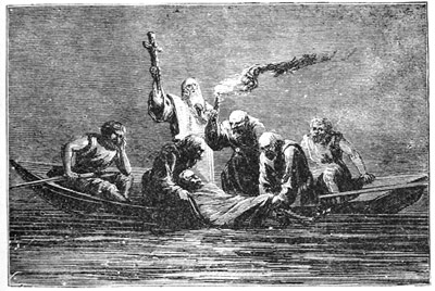
"The Gouernour felt in himselfe that the houre approached, wherein he was to leaue this present life, and called for the Kings Officers, Captaines and principall persons. Hee named Luys de Moscoso de Aluarado his Captaine generall. And presently he was sworne by all that were present, and elected for Gouernour. The next day, being the one and twentieth of May, 1542, departed out of this life, the valorous, virtuous, and valiant Captaine, Don Fernando de Soto, Gouernour of Cuba, and Adelantado of Florida: whom fortune aduanced, as it vseth to doe others, that he might have the higher fall.[1] Hee departed in such a place, and at such a time, as in his sicknesse he had but little comfort: and the danger wherein all his people were of perishing in that countrie, which appeared before their eyes, was cause sufficient, why euery one of them had neede of comfort, and why they did not visite nor accompanie him as they ought to have done. Luys de Moscoso determined to conceale his death from the Indians, because Ferdinando de Soto had made them beleeue, that the Christians were immortall; and also because they tooke him to be hardy, wise, and valiant: and if they should knowe that hee was dead, they would be bold to set upon the Christians, though they liued peaceably by them.
"As soon as he was dead, Luys de Moscoso commanded to put him secretly in an house, where he remayned three dayes: and remouing him from thence, commanded him to be buried in the night at one of the 19 gates of the towne within the wall. And as the Indians had seene him sick, and missed him, so did they suspect what might be. And passing by the place where he was buried, seeing the earth moued, they looked and spake one to another. Luys de Mososco vnderstanding of it, commanded him to be taken up by night, and to cast a great deale of sand into the Mantles, wherein he was winded vp, wherein he was carried in a canoa, and throwne into the midst of the riuer. The Cacique of Guachoya inquired of him, demanding what was become of his brother and lord, the Gouernour: Luys de Moscoso told him, that he was gone to Heauen, as many other times he did: and because he was to stay there certaine dayes, he had left him in his place. The Cacique thought with himselfe that he was dead; and commanded two young and well proportioned Indians to be brought thither; and said, 20 that the vse of that countrie was, when any Lord died, to kill Indians, to waite vpon him, and serue him by the way: and for that purpose by his commandement were those come thither: and prayed Luys de Moscoso to command them to be beheaded, that they might attend and serue his Lord and brother. Luys de Moscoso told him, that the Gouernour was not dead, but gone to Heauen, and that of his owne Christian Souldiers, he had taken such as he needed to serue him, and prayed him to command those Indians to be loosed, and not to vse any such bad custome from thenceforth."
Indian High Priest. "Old prophecies foretell our fall at hand.
When bearded men in floating castles land,
I fear it is of dire portent."—Dryden's Indian Emperor.
De Soto's invasion of Florida is, we think, most memorable for what it has preserved touching the manners and customs of the Indians with whom the Spaniards dealt in such evil sort. In this light only has it historic value. Though incomplete as to details it is our earliest portrait of this singular people, as they existed a full century before New England was settled, and so marks a definite limit of history whence to date that knowledge from.
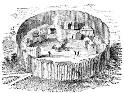
Yet when we shall have gone so far back in the history of this primitive race as the beginning of the sixteenth century, nothing is found in their manners, customs or traditions, as they have come down to us, which would go to confirm the theory that the ancestors of these people were more civilized than themselves. 21 The little they seem to have known about it belongs to the very infancy of art, not to its growth out of lower conditions. These Indians knew how to make beads of the pearl oyster. So did those of New England know how to make shell wampum. The Florida Indians could weave cloth of the fibre of wild hemp and dye it prettily; they could tan, dress, and decorate deerskins; had found out how to mould rude earthen vessels and bake them in the sun. In some of these things they certainly surpassed their brethren of New England, though their arms and implements are quite like those used farther north. Then inasmuch as all the tools they had to work with were of the rudest sort, being shaped out of stone or bone, so the making of most things cost them a great deal of time and labor, and hence the mechanical arts in use among them were such only as spring from the first and most pressing wants of a people, as is everywhere the case in the history of primitive man.[1]
It must be borne in mind that what we are told about these Florida Indians is written by their enemies. Therefore, when their courage is praised, we feel that they must have deserved it. Perhaps what most astonishes us about the narratives themselves is the cold-blooded 22 way in which they recount the slaughter made of these Indians, who seem hardly to have been considered in the light of human beings.
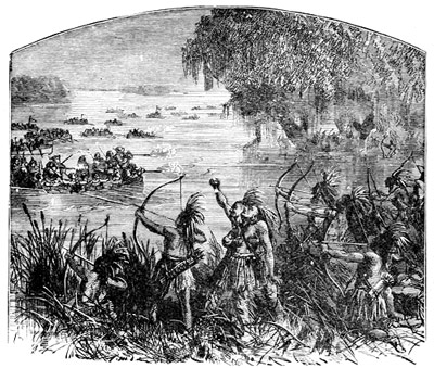
It would seem as if the ill-repute of the Spaniards must have gone before them, for upon nearing the Florida shore the invaders saw smokes everywhere curling above it, which they soon found were lighted for the purpose of warning the inhabitants to be on their guard.
The first Indians met with were instantly set upon by De Soto's horsemen, who had nearly killed John Ortiz before they discovered him to be a Christian like themselves. Though in doubt what the landing of so many white men could mean, these Indians were loyally bringing Ortiz as a peace-offering to the Spanish camp. It is worth while to remember this, since on the part of the Spaniards the first act was one of violence and intimidation.
Therefore, whenever the Spaniards approached an Indian town, the inhabitants fled from it in terror; and so in order to procure guides to lead them, or porters to carry the baggage, while on the march, De Soto found himself obliged to seize by force such Indians as his own men could lay hands upon. On these he put chains and caused them to bear the burdens of his soldiers. If possible, a chief was kidnapped to be held a hostage for the good conduct of his tribe. No Spaniard was therefore safe outside his encampment.[2]
Again, the Spaniards plundered the villages they entered of whatever they stood in need, just the same as if they were in a conquered country. If they wanted corn they took it; if they found any thing of value they helped themselves, without making any show of paying for it. In consequence, the exasperated 23 Indians everywhere obstructed De Soto's march so far as it lay in their power to do so; and on the other hand, in proportion to the resistance he met with, De Soto treated the natives with greater or less severity. We know these Indians therefore, for men of courage, since in defence of their homes and liberties they could fight with naked breasts against men in armor, and with bows and arrows against fire-arms.[3]
So that by the time De Soto arrived at the Mississippi, he had lost over a hundred men and most of his horses.
What such treatment would be likely to lead to is easily foreseen. Most surely it sowed the seeds of future hostility to the white man broadcast. His cruelty became a tradition. The Indian has a long memory and is by nature revengeful. From having looked upon the whites as gods, gifted with all good and beneficent things, the Indian quickly perceived them to be a cruel people filled with avarice, and bent on destroying 24 him. His worst enemies could do no more. And thus the two races met each other in the New World.
We should not omit to mention here one of the strangest things that fell out in the whole course of the expedition. When the Spaniards came to the town of Quizaquiz, where they made some stay, Indians flocked there from distant villages in order to see for themselves what manner of people had come among them; for they said it had been foretold them by their fathers' fathers that men with white faces should come and subdue them, and now they believed the prophecy had come true.
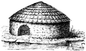
In appearance, the Indian villages and towns we're everywhere much the same. The houses were little round cabins, built of wooden palings, sometimes thatched with palm leaves, sometimes with canes or reeds laid on the roof in the manner of tiles. The better to resist the fierce Gulf winds, they were built low on the ground. In the colder climates, the walls would be smeared over with clay. The only difference to be perceived between the cabins of the common sort and the dwellings of the chief men was that they were larger and more roomy residences, with sometimes a gallery built out over the front, under which the family could sit in the heat of the day.
Every little knot of cabins would have one or more 25 corn-cribs close beside it. This was a loft or granary set up in the air on poles, exactly in the manner now practised by the whites, and for the like purpose of storing up maize or Indian corn which was universally cultivated. Only for the supplies of maize everywhere found, both the Spaniards and their horses would soon have starved, as corn[4] became their only article of food, and ofttimes they had to go hungry for want of it.
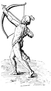
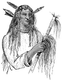
Men and women wore mantles woven either of the bark of trees or of a wild sort of hemp which the Indians knew how to dress properly for the purpose. They also understood the art of tanning and dyeing such skins as were obtained in the chase, which they also made up into garments. Two of these mantles made a woman's usual dress. One was worn about them, hanging from the waist down, like a petticoat or gown, the other would be thrown over the left shoulder with the right arm bared, after the manner of the Egyptians. 26 The warriors wore only this last mantle, which allowed them free use of the right arm in drawing forth an arrow from the quiver, or in bending the bow. When dressed up in his head-gear of feathers, and wearing his ornamented mantle flung across his shoulder, bow in hand, and carrying his well-filled quiver at his back, the Indian warrior made no unpicturesque figure, even beside the heavily-armed white man, for he was of a well-proportioned and muscular build, with good features, an eye like the eagle's, and a bearing which told of the manhood throbbing beneath his dusky skin.
The Indians of Florida worshipped both a god of good and evil. They also made sacrifice to both spirits alike. In some places they worshipped and sacrificed to the sun as the great life-giving principle; in others they had a curious custom when any great lord died, of sacrificing living persons to appease or comfort his spirit with the offering of these other spirits who were to serve him and bear him company in the happy hunting-grounds.
Some tribes kept their dead unburied for a certain time in a rude sort of pantheon, or temple, dedicated to their gods.[5] Over this a strict watch was kept to guard against the intrusion of evil spirits who were supposed to lie in wait, in the form of some prowling beast of prey. This custom sprung from a belief that the spirits of the dead revisited their mortal bodies at times.
Besides maize, pumpkins, beans, and melons, whatever 27 natural fruits the country produced the Indian lived on. He hunted and fished. The summer was his season of plenty, the winter one of want, sometimes of distress, but in the semi-tropical region, bordering upon the Gulf, his wants were fewer and more easily supplied, and hence, as a rule, life was freer from hardship than in more northern climes.
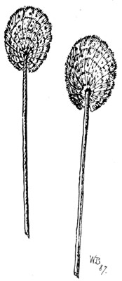
The stronger nations made war upon the weaker, but treaties were duly respected. The vanquished were compelled to pay tribute to the conquerors or join themselves with some stronger tribe than their own. The languages differed so much with different nations, that De Soto found he must have a new interpreter for every new nation he visited; nevertheless the Indians quickly learned to speak the Spanish tongue. In public the people behaved with great propriety, showed respect for their rulers, and often confounded De Soto, who pretended to supernatural powers, by the shrewdness of their replies. For instance, when the Spaniard gave out that he was the child of the sun, a Natchez chief promptly bid him dry up the river, and he would believe him. In some places the Indians greeted the Spaniards with songs and music. Their instruments were reeds hung with tinkling balls of gold or silver. When the chieftain, or 28 cacique, went abroad in state, men walked by his side carrying screens elegantly made of the bright plumage of birds. These were borne at the end of a long staff.
The Spaniards found the fertile parts of the country everywhere crowded with towns, and very populous. But they did not find the gold[6] they coveted so much. They called the Indians a people ignorant of all the blessings of civilization, but to their honor be it also said, they were free from the vices by which it is accompanied and degraded.
[1] Primitive Man. All the articles named as being found in common use among the Florida Indians have been taken from the burial mounds which exist in the States of Ohio, Georgia, North Carolina, Tennessee, Wisconsin, etc. And all are more or less referred to as so many evidences of an extinct civilization.
[2] Narvaez pursued the same policy, and met with like treatment.
[3] Fire-arms of that period were very clumsy weapons indeed. The arquebus was a short hand-gun, the caliver longer, and with the help of a slow-match could be fired from a rest. Only a certain proportion of the infantry were thus armed; the rest carried pikes.
[4] Corn. The Indians' corn-mill was a smooth round hole worn in the rock. A stone pestle was used. The coarse meal mixed with water or tallow, or both, was then wrapped in leaves, and baked in hot ashes.
[5] Burial Places. Upon finding one of these receptacles for the dead, a Franciscan of Narvaez' company, who declared the practice idolatrous, caused all the bodies to be burnt, thereby much incensing the natives.
[6] Gold. Hearing the Spaniards always asking for gold, the natives shrewdly made use of it to rid themselves of these unwelcome visitors, by sending them farther and farther away. In reality the Indians had almost none of the precious metals, but the finding of a few trinkets among them seems to have dazzled De Soto's eyes.
"Northward, beyond the mountains we will go,
Where rocks lie covered with eternal snow."
In the disasters of Narvaez and De Soto, the movement from the side of Florida towards the West had met with an untimely check. But, strangely enough, it made progress in another quarter through these very misfortunes. 29
For while De Soto was vainly seeking for gold on that side, his countrymen were bestirring themselves in the same business in a quite different direction, as we shall see.
At this time it was Don Antonio de Mendoza who was the emperor's viceroy in Mexico. Now Mendoza aimed to gain distinction with his sovereign by being the first who should discover and make known to the world, all the unexplored region lying north of Mexico, which was accounted as rich as any yet known to the Spaniards. Most of all, perhaps, Mendoza wished to find the land's end in that northern direction, as by doing so he would complete the work of putting a girdle round the continent, and gain the glory of it for himself.
Various efforts were making to do this both by land and sea.[1] And curiously enough these efforts came from the West. 30
For the purpose in hand Mendoza had with him in Mexico two or three survivors[2] of Narvaez' expedition, who, in the most wonderful manner, had made their way overland through the unknown regions of the North, from Florida into Mexico. These men told the viceroy, Mendoza, that the natives who dwelt among the mountains to the north were a very rich people, who lived in great cities and had gold and silver in abundance. Mendoza also held captive some Indians whose homes were in that far-away country, which he was now meditating how to conquer.
Yet two important obstacles met Mendoza at the start. In the first place, the unknown country, which the Spaniards vaguely knew by the name of Cibola,[3] could be reached only through mountain defiles, so rugged and inaccessible that men questioned whether it could be reached at all. Nature had admirably adapted it for defence. Clearly, then, a few resolute men might easily defend their country against a host, and the Spaniards having reason to expect the most determined resistance found a twofold hinderance in their way.
The second obstacle, the Spaniards had created for themselves, by making slaves of all natives taken in arms. Rather than be slaves the Indians had fled into the mountain fastnesses. As their fear of the Spaniards was very great, these fugitives secreted themselves in the most inaccessible places, choosing rather to live like wild beasts than be branded like cattle with hot irons, and nursing their hatred of their oppressors. Not venturing to come down into the open valleys where they would be at the mercy of their conquerors, these unhappy people lived in caves, or in stone dwellings perched high among the rocks, where they could 32 at least breathe the air of liberty unmolested. Those who formerly lived in the valleys had also fled to the mountains when they heard of the Spaniards' coming. So the Spaniards would have to contend not only with nature, but with a brave and a hostile people, if they attempted to subdue them.
Considering that great difficulties are often overcome or results accomplished by simple means, the viceroy took a poor barefooted friar[4] from his cell, gave him one of Narvaez' men for a guide, and with a few natives of the country sent him out to explore the unknown wilds. Upon reaching Culiacan, which was the most northerly place the Spaniards had made their way to, the captive Indians were sent ahead with messages of peace and good-will to the distrustful natives, who took good care to keep out of the way.
These promises of peace induced a great many of the natives to come down from the mountains; and once there they were easily won over with gifts and kind words, and in gratitude for the promise not to capture and enslave them as they had done, told the Spaniards to go and come as freely as they chose. The natives were then sent home to spread the news among their brethren.
The way being thus opened, the friar and his party set forth by one route, while still another party, led by Vasquez de Coronado,[5] went forward by a different one, on the same errand. Of the two parties, that of the friar alone succeeded in penetrating far into the country, and the information he brought back now reads more like a story from the Arabian Nights than the sober record of one already well versed in the country and people, such as Mendoza says he believed Father Marco to be. Yet the father is thought to have reached 33 Cibola, or Zuñi, which was the object of his journey, when the murder of his negro guide caused him to hasten back with all speed to the Spanish settlements.
So these attempts, as well as a second made by Coronado in the following year, were fruitless in every thing except the formal act of taking possession of the country, and the acquisition of some imperfect geographical knowledge about the valleys of the Colorado,[6] the Gila,[7] and the Rio Grande del Norte.[8] About all we can say of them is that the explorers went through the country.
As in Florida, so here a long period of inaction followed these failures. In both cases the Spaniards had come and seen, but not conquered. The Mississippi flowed on untroubled to the sea, the heart of the continent still kept its secret fast locked in the bosom of its hills. But we know now that the gold and silver the Spaniards craved so much to possess were there waiting for the more successful explorers.
It is forty years before we again hear of any serious effort made to search out the secrets of this land of mystery. The Church then took the matter in hand. It was wisely decided that the best way to conquer the people was to convert them. Accordingly two pious Franciscans set out from the Spanish settlements in New Biscay[9] on this errand. This time they penetrated into the country by the valley of the Rio Grande, under protection of a few soldiers, who, after conducting the fathers to a remote part of this valley, left them to pursue their pious work alone, and themselves returned to New Biscay. Hearing nothing from these missionaries, those who had sent them fitted out an expedition in the following year—1582—to go in search of them. 34 This rescuing party brought back a more exact knowledge of the country and people than had so far been obtained through all the many explorers put together.
In proportion as they advanced up the Rio Grande, these explorers found everywhere very populous towns. The people lived well and contentedly. Some were found who had even kept the faith taught them by Christians,[10] long ago, but in general they worshipped idols in temples built for the purpose. In the natives themselves the Spaniards remarked a wide difference. Some went almost naked, and lived in poor hovels of mud covered with straw thatch. Others, again, would be clothed in skins, and live in houses four stories high. 35 Often the natives showed the Spaniards cotton mantles skilfully woven in stripes of white and blue, of their own making and dyeing, which were much admired. It seemed for the most part a land of thrift and plenty, for the towns were populous beyond any thing the Spaniards had ever dreamed of. And the farther north the explorers went, the better the condition of the people became. Finding themselves in a land much like Old Mexico, in respect of its mountains, rivers, and forests, the explorers gave it the name of New Mexico.
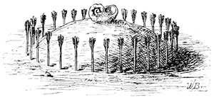
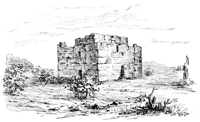
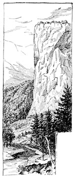
One of the greatest towns visited, called Acoma,[11] contained above six thousand persons. It was built upon the level top of a high cliff, with no other way of access to it than by steps hewn out of the solid rock which formed the cliff. The sight of this place made the Spaniards wonder not a little at the skill and foresight shown in planning and building these natural fortresses, which nothing but famine could conquer. All the water was kept in cisterns. But this was not all the aptitude these people showed in overcoming obstacles or supplying needs. Their cornfields lay at some distance from the town. In this country it hardly ever rains. So the want of rain to make the corn grow was supplied by digging ditches to bring the water from a neighboring stream into the fields. We therefore see how conditions of soil and climate had taught the Indians the uses of irrigation.[12]
Turning out of the valley of the Rio Grande, to the west, the explorers at length came to the province of Zuñi, where many Spanish crosses were found standing just as Coronado had left them forty years before. Here our Spaniards heard of a very great lake, situated at a great distance, where a people dwelt who wore bracelets 36 and earrings of gold. Part of the company were desirous of going thither at once, but the rest wished to return into New Biscay in order to give an account of all they had seen and heard. So only the leader with a few men went forward, meeting everywhere good treatment from the natives, who in one place, we are told, showered down meal before the Spaniards, for their horses to tread upon, feasting and caressing their strange visitors as long as they remained among them.
These explorers returned to Old Mexico in July, 1583, by the valley of the Pecos,[13] to which stream they gave the name of River of Oxen, because they saw great herds of bison[14] feeding all along its course. 37
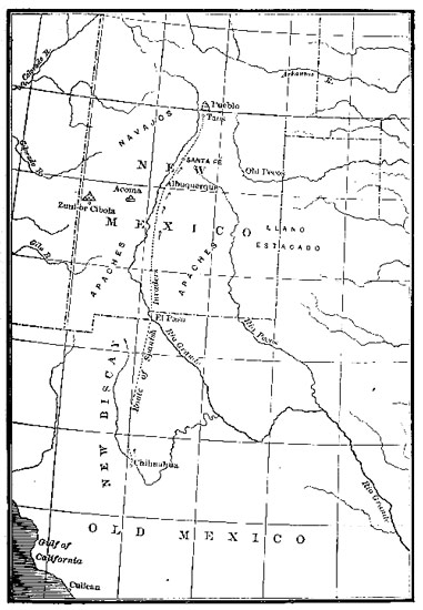
Out of these discoveries and reports came new attempts to plant a colony on the Rio Grande. Nothing prospered, however, until 1598, when Juan de Oñate[15] invaded New Mexico at the head of a force meant to thoroughly subdue and permanently hold it. Oñate was named governor under the viceroy. These Spaniards established themselves on the Rio Grande, not far from where Santa Fé now is. Most of the village Indians submitted themselves to the Spaniards, whose authority over them was, at best, little more than nominal, though the roving tribes, the fierce Apaches and warlike Navajoes, never forgot their hereditary hatred to the Spaniards, with whom they kept up an incessant warfare.
With this expedition came a number of Franciscan missionaries who, as soon as a town was gained over, established a mission for the conversion of the natives. In 1601 Santa Fé was founded and made the capital. In thirty years more the Catholic clergy had established as many as fifty missions which gave religious instruction to ninety towns and villages.
New Mexico had now reached her period of greatest prosperity under Spanish rule. For fifty years more the country rather stood still than made progress. The Spaniards were too overbearing, and the old hostility too deep, for peace to endure. Then, the system of bondage which the Spaniards brought with them from Old Mexico, and most unwisely put in practice here, bore its usual bitter fruit. Determined to be slaves no longer, in 1680 the native New Mexicans rose in a body, and drove the invaders out of the country with great slaughter. Upon the frontier of Old Mexico the fugitives halted, and then founded El Paso del Norte, 38 which they considered the gateway to New Mexico, and so named it. It took the Spaniards twelve years to recover from this blow. By that time little was left to show they had ever been masters of New Mexico. But a new invasion took place, concerning which few details remain, though we do know it resulted in a permanent conquest before the end of the century.
As far back as 1687 Father Kino had founded a mission on the skirt of the country lying round the head of the Gulf of California, to which the Spaniards gave the name of Pimeria.[16] It will be noticed that once again they were following up the traces of Father Marco and Coronado. When the Spaniards took courage after this defeat, and again entered New Mexico, Kino (1693) founded other missions in the Gila country which in time grew to be connecting links between New Mexico and California, in what is now Arizona.[17]
[1] By Land and Sea. As rivals, both Cortez and Mendoza strove to be beforehand with each other. Cortez despatched Ulloa from Acapulco, northward, July, 1539. Alarcon, sailing by Mendoza's order in 1540, goes to the head of the Gulf of California, and so finds the Colorado River, while a land force, under Coronado, marched north to act in concert with Alarcon.
[2] Survivors of Narvaez' Expedition (Florida, 1528). The chief among these was Alvar Nuñez, sometimes called Cabeça de Vaca (literally cow's head), who had been treasurer to the expedition of Narvaez.
[3] Cibola. The Zuñi country of our own day. Supposed to be derived from Cibolo, the Mexican bull, and therefore applied to the country of the bison. Cibola is on an English map of 1652 in my possession. Zuñi is thirty miles south of Fort Wingate.
[4] Poor Barefooted Friar was Marco de Niza (Mark of Nice), a friar of the Franciscan order. For a long time his story was doubted. It is, in fact, an exaggerated account of what is, clearly, a true occurrence.
[5] Vasquez de Coronado. (See note 1.)
[6] Colorado (Co-lor-ah´-doe) Spanish, meaning ruddy or red. First called Tizon, meaning a firebrand.
[7] Gila, pronounced Hee'la.
[8] Rio Grande del Norte, Spanish, Great River of the North. Usually called, simply, Rio Grande.
[9] New Biscay. Northernmost province of Mexico, capital Chihuahua (Shee´wah´wah).
[10] By Christians. Cabeça de Vaca and his companions.
[11] Acoma, one of the seven cities of Cibola; forty-five miles south of old Fort Wingate.
[12] Irrigation. Without it, it would hardly be possible to raise crops in New Mexico to-day.
[13] Valley of Pecos. East of, and parallel with that of the Rio Grande.
[14] Bison. Cabeça de Vaca is the first to mention this animal. One is said to have been kept as a show in Montezuma's garden, where the Spaniards saw it for the first time. See note 3.
[15] Juan de Oñate. Hopeless confusion exists concerning the proper date of this invasion.
[16] Pimeria essentially corresponds with Arizona. It took this name from the Pimos Indians of the Gulf.
[17] Arizona, or Arizuma, a name given by the Spaniards to denote the mineral wealth of Pimeria, where silver and gold were said to exist in virgin masses. Silver ores were, in fact, discovered by the Spaniards at an early day. Originally part of Senora (Sonora), Old Mexico.
"Antiquity here lives, speaks, and cries out to the traveller, Sta, viator."—V. Hugo, The Rhine.
Mention has been made of the towns which the Spaniards came to in the course of their marchings up and down the country. Men had told them, in all soberness, that far away in the north-west seven flourishing 40 cities,[1] wondrous great and rich, lay hid among the mountains. We remember that their first expeditions were planned to reach these seven cities. Now, when, at last, the Spaniards did come to them, these wonderful cities proved to be large, but not rich, full of people, though by no means such as the white men expected to see there.
Though sorely vexed to think they had come so far to find so little, the Spaniards were very much astonished by the appearance of these cities, the like of which they had never seen before. So these cities hid away among desert mountains were long remembered and often talked about.
But these cities were not cities at all, as the term is now understood. Instead of many houses spread out over much ground, the builders plainly aimed at putting a great many people into a little space. Yet the cities they built were neither simply walled towns, nor simply fortresses, but a skilful combination of both.
In the open plain they commonly consisted of one great structure either enclosed by a high wall, or else so built round it that wall and building were one.
On the other hand, if the pueblo[2] stood upon a height, the houses would be built all in blocks, and have streets running through them, though in other respects the manner of building was everywhere the same.
In either case, this style of architecture made them look less like the peaceful abodes of peaceful men, than the strongholds of a warlike and predatory race, whence the inmates might sally forth upon their weaker neighbors, just as the lords of feudal times did from the rock-built castles of the Rhine. It is plain they had grown up out of the necessity for defence, as every 41 thing else was sacrificed to its demands, and we know that necessity is the mother of invention.
The single great house, in which all the inhabitants lived together, is perhaps the most curious. Let us suppose this to be a three-story building, parted off into from sixty to a hundred little rooms, with something like a thousand people living in it. Could the outer wall be taken away, the whole edifice would look like a monstrous honeycomb, and in fact the pueblo was nothing else than a human hive, as we shall presently see.
Now the city of Acoma is one of those which are built upon a height. The builders chose the flat top of a barren sandstone cliff, containing about ten acres, 42 which rises about three hundred feet above the plain. In New Mexico such table-lands are called mesas, from mesa, the Spanish word meaning table. Therefore, while no one knows its age, or history, all agree that Acoma must go far back into the past. Acoma was so strongly built that to-day it looks hardly different from what it did when the Spaniards first saw it, perched on the top of its rock, in 1582.
We see then in the builders of Acoma a people gifted with a much higher order of intelligence than the Red Indian, who is always found living in huts, or hovels, of the rudest possible kind. The wild Indian always carries his house about with him, and so is ever ready, at a moment's notice, to
"Fold his tent, like the Arabs,
And as silently steal away."
The sedentary Indian sometimes patterned his after the burrowing animals, like the beaver, and sometimes after the birds of the air, like the sparrow.
Now to describe Acoma itself. It consists of ranges of massive buildings rising in successive tiers from the ground. The second story is set a little back from the first, and the third a little back from the second, so leaving a space in front of each range of buildings for the inhabitants or sentinels to walk about in, in peaceful times, or send down missiles upon the heads of their enemies in time of war. By running up the outer wall of each story, for a few feet higher than this platform, the builders made what is called a parapet in military phrase, meant for the protection of the defenders. There were no doors or windows except in the topmost tier. Acoma, then, was a castle built upon a rock. 43
It would seem that only birds of the air or creeping things could gain admittance to such a place. Indeed, there was no other way for the inhabitants themselves to enter their dwellings except by climbing up ladders set against the outer walls of the building for the purpose. In this manner one could climb to the first platform, then to the second, but could not get in till he came to the roof, through which he descended by a trap door into his own quarters.
The whole collection of buildings being divided by partition walls into several blocks, each containing sixty or seventy houses, is, practically, the apartment hotel of to-day. The material commonly used was adobe,[3] or bricks dried and hardened in the sun. Such a building could not be set on fire or its walls battered down with any missiles known to its time.
We see then that the Pueblo Indians must have had enemies whom they feared,—enemies at once aggressive, 44 warlike, and probably much more numerous than themselves. How well they were able to meet these conditions, their houses show us to this day.
Living remote from the whites, these people, like those of Old Zuñi, have kept more of their primitive manners, and live more as their fathers did, than those do who inhabit the pueblos of the Rio Grande, where they have been longer in contact with Europeans. Forty years ago they knew only a few Spanish words, which they had learned when Spaniards held their country. In a remarkable manner, the people have kept their own tongue and nationality free from foreign taint. From this fact we are led to think them much the same people that they were long, long ago.
There are other buildings in the country of the Gila, called Casas Grandes,[4] or Great Houses, which are quite different from those described in this chapter, but were apparently built for a similar purpose of defence.
[1] Seven Cities. See preceding chapter.
[2] Pueblo, Spanish for town or village.
[3] Adobe, Spanish. The same material is much used throughout New Mexico, Arizona, California, Utah, and Colorado.
[4] Casas Grandes, or Casas Montezumas. Lieut. Emory, U.S.A., thus describes one seen on the Gila: "About the noon halt a large building was seen on the left. It was the remains of a three-story mud house, sixty feet square, and pierced for doors and windows. The walls were four feet thick. The whole interior of the building had been burned out and much defaced." Casa Grande is on a map of 1720; is on the Gila.
While professing Christianity, the Pueblo Indians have mostly kept some part of the idolatrous faith of their fathers. Thus the two have become curiously blended in their worship. We often see the crucifix, or pictures of the Virgin hanging on the walls of their dwellings, but neither the coming of the whites, nor the zeal of missionaries could wholly eradicate the deeply grounded foundations of their ancient religion. The little we know about this belief, in its purity, comes to us chiefly in the form of legendary lore, although since the Zuñi have been studied[1] with this object we have a much clearer conception of it than ever before.
By this uncertain light we find it to be a religion of symbols and mysteries, primarily founded upon the wondrous workings of nature for man's needs, and so embodying philosophy growing out of her varied phenomena. Therefore sun, moon, and stars, earth, sky, and sea, and all plants, animals, and men were supposed to bear a certain mystical relation to each other in the plan of the universe. Instead of one all-supreme being, the Zuñi worshipped many gods each of whom 46 was supposed to possess some special attribute or power. Some were higher, some lower down in the scale of power.
The phenomena of nature, being more mysterious, were thought to be more closely related to the higher gods. If there was drought in the land, the priests prayed for rain from the housetops, as the Prophet Elijah did in the wilderness. Each year, in the month of June, they went up to the top of the highest mountain, which they called the "Mother of Rain," to perform some secret ceremony touching the coming harvest. And because rain seldom falls in this country, they made earnest supplication to water, as a beneficent spirit, who ascended and descended the heavens in their sight, and to the sun as the twin deity in whom lay the power of life and death,—to ripen the harvest or wither all living things away into dust.
Like the ancient Egyptians, of whom they constantly remind us, the Zuñi believed animals possessed certain mystic powers, not belonging to man, so investing them with a sacred character. Beasts of prey were supposed to have magic power over other animals, hence the bear stood higher in the Zuñi mythology than the deer or antelope. The Indians call this magic power medicine, but the Zuñi gave it form to his own mind—the substance of a thing unseen—by making a stone image of the particular animal he had chosen for his medicine, which he carried with him to war or the chase as a charm of highest virtue. We call this fetich-worship.
Each pueblo had one or more close, underground cells[2] in which certain mysterious rites, connected, it is believed, with the worship of the people, were solemnized. We are told that, at Pecos, the priests kept 47 watch night and day over a sacred fire, which was never suffered to go out for a single moment, for fear some calamity would instantly happen to the tribe. It is also said that when Pecos was assaulted and sacked by a hostile tribe, the priests kept their charge over the sacred fire while the tumult of battle raged about them. And when, at length, the tribe itself had nearly died out, the survivors took the sacred fire with them to another people, beyond the mountains, where it is kept burning as the symbol of an ever-living faith.
Another legend goes on to say that an enormous serpent was kept in a den in the temple of Pecos to which on certain occasions living men were thrown as a sacrifice. Both legends would seem to point to Pecos as a holy place, from which the priests gave out instruction 48 to the people, as of old they did from the temples of the heathen gods.
The tradition of the origin of the Zuñi, as told by Mr. Cushing, is almost identical with that held by the Mandans of the Upper Missouri. Each says the race sprung from the earth itself, or rather that the first peoples lived in darkness and misery in the bowels of the earth, until at length they were led forth into the light of day by two spirits sent from heaven for their deliverance, as the Zuñi say, or by discovering a way out for themselves, as the Mandans say.[3]
A tradition of the Pimos[4] Indians makes a beautiful goddess the founder of their race. It says that in times long past a woman of matchless beauty resided among the mountains near this place. All the men admired and paid court to her. She received the tributes of their devotion, grain, skins, etc., but gave no favors in return. Her virtue and her determination to remain secluded were equally firm. There came a drought which threatened the world with famine. In their distress the people applied to her, and she gave them corn from her stock, and the supply seemed endless. Her goodness was unbounded. One day as she was lying asleep a drop of rain fell upon her and produced conception. A son was the issue, who was the founder of the race that built these structures.
But Montezuma[5] is the patriarch, or tutelary genius, whom all the Indians of New Mexico look to as their coming deliverer.
One tradition runs that Montezuma was a poor shepherd who tended sheep in the mountains. One day an eagle came to keep him company. After a time the eagle would run before Montezuma, and extend its 49 wings, as if inviting him to seat himself on its back. When at last Montezuma did so, the eagle instantly spread its wings and flew away with him to Mexico where Montezuma founded a great people.
Ever since then the Indians have constantly watched for the second coming of Montezuma, and thenceforth the eagle was held sacred, and has become a symbol among them. He is to come, they say, in the morning, at sunrise, so at that hour people may be seen on the housetops looking earnestly toward the east, while chanting their morning prayers, for like the followers of Mahomet, these people chant hymns upon the housetops. Although beautiful and melodious these chants are described as being inexpressibly sad and mournful.
In person the people are well formed and noble looking. They are honest among themselves, hospitable to strangers, and unlike nomads, are wholly devoted to caring for their crops and flocks. They own many sheep. They raise corn, wheat, barley and fruit. One pueblo raises corn and fruit, another is noted for its pottery, while a third is known for its skill in weaving. 50
But after all, these Pueblo Indians are only barbarians of a little higher type than common. Whenever we look closely into their habits and manners, we are struck with the resemblances existing among the whole family of native tribes. If we assume them to have known a higher civilization they have degenerated. If we do not so assume, the observation of three centuries shows them to have come to a standstill long, long ago.
Pueblo Customs. When the harvest time comes the people abandon their villages in order to go and live among their fields, the better to watch over them while the harvest is being gathered in.
Grain is threshed by first spreading it out upon a dirt floor made as hard as possible, and then letting horses tread it out with their hoofs. It is then winnowed in the wind.
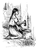
The woman, who is grinding, kneels down before a trough with her stone placed before her in the manner of a laundress's wash-board. Over this stone she rubs another as if scrubbing clothes. The primitive corn-mill is simply a large concave stone into which another stone is made to fit, so as to crush the grain by pressure of the hand.
The unfermented dough is rolled out thin so that after baking it may be put up in rolls, like paper. It 51 is then the color of a hornet's nest, which indeed it resembles. Ovens, for baking, are kept on the housetops.
The processes of spinning and weaving, than which nothing could be more primitive, are thus described by Lieut. Emory, as he saw it done on the Gila, in 1846.
"A woman was seated on the ground under one of the cotton sheds. Her left leg was turned under with the sole of the foot upward. Between her great toe and the next a spindle, about eighteen inches long, with a single fly, was put. Ever and anon she gave it a dexterous twist, and at its end a coarse cotton thread would be drawn out. This was their spinning machine. Led on by this primitive display, I asked for their loom, pointing first to the thread, and then to the blanket girded about the woman's loins. A fellow who was stretched out in the dust, sunning himself, rose lazily up, and untied a bundle which I had supposed to be his bow and arrows. This little package, with four stakes in the ground, was the loom. He stretched his cloth and began the process of weaving."
But these self-taught weavers were behind their brethren of the pueblos, whose loom was of a more improved pattern. One end of the frame of sticks, on which the warp was stretched, would be fastened to the floor, and the other to a rafter overhead. The weaver sat before this frame, rapidly moving the shuttle in her hand to and fro, and so forming the woof.
Pottery was in common use among them as far back as we have any account of the Pueblo Indians. Jars for carrying and 52 holding water were always articles of prime necessity, though baskets of wicker-work were sometimes woven water-tight for the purpose.
Pueblo Government. Each pueblo is under the control of a head chief, chosen from among the people themselves. When any public business is to be transacted, he collects the principal chiefs in the underground cell, previously mentioned, where the matter that has brought them together is discussed and settled.
The pueblos also have officers, corresponding with the mayor and constables[6] of a city, whose business it is to preserve order. In every pueblo there is also a public crier who shouts from the housetops such things as it may concern the people at large to know.
In some of the pueblos there is an abandoned Spanish mission church of unknown antiquity. The one at Acoma has a tower forty feet high with two bells in it, one of which is lettered "San Pedro, A.D. 1710." The church at Pecos is a picturesque ruin.
[1] Zuñi have been studied by Mr. F. H. Cushing, who joined the tribe for the purpose.
[2] Underground Cells, Spanish Estufas, were circular, without doors or windows, and had a kind of stone table, or altar, in them. One at Taos was surrounded with a stockade, and entered through a trap-door.
[3] The Mandans say that the roots of a grape-vine, having penetrated into their dark abode, revealed to them the light of the upper world. By means of this vine, half the tribe climbed to the surface. Owing to the weight of an old woman the vine broke, leaving the rest entombed as before.
[4] The Pimos live along the Gila, having moved up from the Gulf Coast within fifty years. They are a pastoral and agricultural people.
[5] Montezuma of the traditions is not the Montezuma of Spanish-conquest celebrity.
[6] Mayor and Constable. The first is called an al´cal´de, the second an al´gua´zil.
We have here reached the high-water-mark of Spanish advance into territory now embraced within the United States. The moment seems well chosen in which to take a parting look at the two great men of their age, whose talents and energy had builded an empire so vast that, when the master-hand was taken away, it tottered to its fall.
Last Days of Charles V. Charles V. is thought to have hastened his death by the indulgence of so strange a whim, that one is led to doubt the soundness of his intellect.
He chose, now in his lifetime, to have his own funeral obsequies performed. For the purpose he laid himself down in his coffin which the monks then lifted on their shoulders and bore into the church. When the bearers had set the coffin down in front of the altar, the solemn service for the dead was chanted, the Emperor himself joining in all the prayers said for the repose of his soul. In the hush which followed the last office paid to the illustrious dead, all the attending monks passed silently out of the church, leaving Charles to pray alone in his coffin.
"The chamber in the Escurial Palace where Philip II. died is that in which he passed the three last years of his life, nailed by the gout to a sofa. Through a narrow casement, his alcove commanded a view of the high altar of the chapel. In this manner, without rising, without quitting his bed, he assisted every day at the holy sacrifice of the mass. His ministers came to work with him in this little chamber, and they still 54 show the little wooden board which the king made use of when writing, or signing his name, by placing it upon his knees."
Tombs of Charles and Philip. "At the right and left of the altar, at the height of about fifteen feet, are two large parallel niches hollowed out in the form of a square. The one at the left is the tomb of Charles V., that at the right of Philip II. At the side of Philip II., who is on his knees in the attitude of prayer, are the prince, Don Carlos, and the two queens whom Philip successively espoused, all three also on their knees in prayer. Underneath, one may read in letters of gold:
PHILIP II., KING OF ALL THE SPAINS,
OF SICILY, AND OF JERUSALEM,
REPOSES IN THIS TOMB, WHICH HE
BUILT FOR HIMSELF WHILE LIVING.
"The Emperor Charles V. is also represented on his knees in the act of prayer. He too is surrounded by a group of kneeling personages who are identified in the inscription, of which we give only part.
TO CHARLES V., KING OF THE ROMANS,
HIGH AND MIGHTY EMPEROR, KING OF
JERUSALEM, ARCHDUKE OF AUSTRIA,
HIS SON PHILIP.
"All these statues are of gilt bronze, of a grand style and admirable effect. Those of the two sovereigns, above all, with their armorial mantles, are of a severe magnificence."—Alex. Dumas, the Elder. 55
California is the name[1] given in an old Spanish romance to a fabulous island of the sea lying out toward the Indies.
After a time, the Spaniards found out that what they had supposed to be a large island[2] was really a peninsula, so the name presently spread to the mainland.
Cabrillo[3] sailed yet higher up, and others higher still, till the work of tracing the coast as far as Cape Mendocino[4] itself was completed.
Spanish power in the New World received now and here its first serious check, though possibly little was thought of it at the time, in Europe. Like David before Goliath, little England confronted the bully of Europe where least expected, with menace to her great and growing empire of the West.
The greatest seaman of his age, Francis Drake, whose name was the terror of Spaniards everywhere, had 56 passed the Straits of Magellan with one little vessel, into the Great South Sea, which Balboa discovered and claimed for Spain. Stopping at no odds, one day fighting and the next plundering, Drake kept his undaunted way a thousand leagues up the coast. His ship being already full-freighted with the plunder of the ports at which she had called, Drake thought to shorten the way back to England by sailing through the North-east Passage,[5] so outwitting the Spaniards who were keeping vigilant watch against his return southward,—for his men were but a handful against a world of foes, and his ship too precious to be risked in fight. So Drake sailed on into the north. He sailed as far as the Oregon coast, when the weather grew so cold that his men, who were come from tropic heats, began to murmur. Drake was therefore forced to put his ship about and steer south again, along the coast, looking for a harbor as he went, to refit his ship in. Finding this harbor[6] in 38°, the Golden Hind dropped anchor there on the 17th of June, 1579, showing a flag which had never before been seen in that part of the world.
Drake lay quietly at anchor in this port for five weeks. During all this time the natives came in troops to the shore, drawn thither to see the strange bearded white men who spoke in an unknown tongue, and kept the loud thunder hid away in their ship. It is even said that the king of that country took the crown off his own head, and put it on Francis Drake's in token of submission. All this and much else is fully and quaintly set forth in the narrative of Master Fletcher, who was Drake's chaplain on board the Golden Hind.
Before leaving this friendly port, Drake took formal 57 possession of the country by setting up a post, to which a plate of brass was fixed, with Queen Elizabeth's name engraved on it.
The white cliffs of the coast that rose about him, would seem to have recalled to Drake's mind those of Old England, for he gave the name of New Albion to all this great land he had merely coasted. We should not forget that Elizabeth herself afterwards said of such acts that "discovery is of little worth without actual possession."
Having planted this thorn in the side of the Spanish Empire of the West, Drake merrily sailed away for England by way of the Cape of Good Hope.[7] 58
Spain complained. Elizabeth listened with impatience. When the Spanish ambassador insisted on his master's sole right to navigate the western ocean, the Queen lost her temper. She roundly told Mendoza that "the sea and air are common to all men." Yet the claim itself shows what mighty hold Spain had on the other powers. In eight years the question was fought out in the English Channel with all Europe for spectators. Spain was so sure of victory, that the popular feeling even got into the nursery rhymes of the day. A child is supposed to be saying,
Drake had perhaps done as much as any man to bring about the issue. He was there in the thick of the fight.[8]
So the spell of Spanish invincibility was broken at last. Spain was no longer mistress of the seas.
Next on her brilliant roll of navigators, comes Juan de Fuca, who (1592) discovered the straits that now bear his name. Spain still wanting a harbor in which the Manila galleons could refit when homeward bound, Sebastian Vizcaino (1602-1603), sometimes called "the Biscayner," entered the haven of San Diego, and that of Monterey,[9] which he then named, as he also did the one lying within Point Reyes, called by him Port San Francisco.[10] Exploration of this coast then ceased for a century and a half.
The real advance into California (1768), like all other Spanish movements on this continent, originated in a half-monkish, half-military plan for the conquest, conversion and civilization of the country. Enough was known of its soil and climate to show how far both exceeded the sterile steppes of New Mexico, where Spanish advance had already reached its farthest limit, and like a stream that meets an obstacle in its path, was turned into another channel. For where plants grow and rivers flow, God has fixed the abodes of men.
This movement began[11] from the missions of Lower California. It was designed to extend the system by which Spain had first conquered, and since ruled, Mexico into the unoccupied and little-known province 60 of Alta, or Upper, California. The viceroy was to furnish soldiers, the president-prelate of the Franciscan order, missionaries.
Thus coast batteries and forts were to be built for the defence of the best harbors, as well as to sustain the missions themselves, so forming a line of military strength along the coast sufficient to repel assault by sea or land, while the mountains behind them would be a barrier between the missions and the wild tribes who lived in the great valleys beyond. One arm was to seize upon and firmly hold the country in its grasp, while the other should gradually bring it into subjection to the Catholic faith. Then, with clerical rule once established, civil order was to come in. Therefore the first essential thing was to build a fort, and the second a church. In this way it was proposed to make rallying-points for civilization of these missions,[12] although the plan founded an oligarchy and nothing else.
The Spaniards did not mean to till the soil themselves, but to make the Indians do it for them. Setting this scheme at work, a Franciscan mission was begun 61 at San Diego in July, 1769. The next year another was established at Monterey. From these missions explorers presently made their way out to the valley of the San Joaquin, and even as far north as the great bay of San Francisco (1772), which took to itself, a little later, the name of the old Port San Francisco, with which it must not be confounded.
In 1776 the Mission of San Francisco was founded. Monterey being the chief settlement, the governor's official residence was fixed there; and now, so late as the period of American Independence, we have the machinery for civilization in California fairly set in motion.
The plan which the founders had proposed to themselves also included the building-up of pueblos, which should be located in suitable places outside the missions, though actually meant for their support, and therefore in a sense dependencies of them. But these pueblos were to be inhabited by Spanish colonists only. One 62 was thus begun (1777) at San José, and a second (1781) at Los Angeles. Here then are plants of two distinct types in the growth of the country,—native vassals and foreign freemen.
As, one by one, missions were created, the native Californians were told they must come and live in them, and submit themselves to the fostering care of the fathers, who would teach them how to live as the whites did, and make known to them the blessings of Christianity, so that their children might exceed their fathers in knowledge, and as they were a docile, submissive and indolent people, they mostly obeyed the order unresistingly, and were set to work building houses, tilling the soil, or tending flocks or herds belonging to the missions, into which it was the aim of the fathers to draw all the wealth of the country.
These pious fathers, however, thought more of converting the Indian than of making a man of him. It is true they baptized and gave him a Christian name, but they held him in servitude all the same. The system looked to keeping him a dependant rather than rousing his ambitions, or showing him how he might better his condition. For instance, the Indian could hold no land in his own right. His labor went to enrich the mission, not himself. He was fed and clothed from the mission. He was a mere atom of society, a vassal of the Church, and was so treated. Men and women were put in the stocks or whipped at the pleasure of their masters, just the same as in slave plantations. If an Indian ran away, he was pursued and brought back by the military. The missionaries found him free, but took away his liberty. In short, spite of all the romance thrown round him, and though his condition was somewhat better than it 63 had been in times past, yet when all is said, the mission Indian was hardly more than a serf. Still the work of the missions so prospered that by the end of the century there were eighteen of them with 13,500 converts. But at this time there were 110 more than 1,800 whites in the country, or only one hundred to a mission.
Such, briefly, were the Spanish missions of California, 64 which undertook a noble work, not nobly done, which kept the word of promise to the ear and broke it to the hope.
If we look at the commercial policy of the province, and it is what we should most naturally turn to next, we shall find almost no business transacted with the outside world. Once a year the Manila galleon came to Monterey and took away the furs that had been collected there. Spain's policy shut out all other nations from her colonies, and to the same extent shut the colonies in. So foreign vessels were forbid to enter her ports at all. To this fact we owe the meagre and unfrequent reports of what was going on in the country, nor was it till 1786 that the world learned something of its true condition and worth.
In that year a French discovery ship put into Monterey. Her commander was La Peyrouse,[13] whom Louis XVI. had sent to the Pacific to look into the fur trade of the north-west coast, and who, after touching 65 there, had come down the coast to refit in a Spanish port. La Peyrouse used the six weeks of his stay in Monterey to such purpose that we owe to him the first and only intelligent view of California had up to this time.
As a matter of course, communication with the neighbor provinces was mostly carried on by sea. There was a little trade with San Blas, and so with Old Mexico, but it was long before the way was opened to New Mexico by crossing the Colorado desert. One of the fathers, in 1776, set out from San Gabriel for the Colorado River, passing safely over the route now followed by the Southern Pacific Railway. Afterwards, a little trade sprung up between the provinces, but the way was long and the road beset with dangers.
The first American vessel to enter a California port was the ship Otter of Boston, in 1796. She was an armed trader, carrying a pass signed by Washington, of whom it was doubtful if the Californians had even so much as heard, though they admitted the Otter to trade with them.
The Spaniards had found the natives singularly free from the vices of civilization, but intermingling of the two races soon led to mingling of blood, and subsequent growth of an intermediate class half Spanish and half Indian, so combining certain traits of both without the native vigor of either.
[1] California the Name, as applied to the peninsula, first appears in Preciados' diary of Ulloa's voyage.
[2] California an Island on English maps so late as 1709 (H. Moll, "Present State of the World").
[3] Cabrillo's Voyage is reprinted in the Report of the Wheeler Exploring Expedition.
[4] Cape Mendocino. Bancroft ("The Pacific States") thinks the name was given in honor of the viceroy Mendoza.
[5] North-east Passage here, or North-west Passage from the Atlantic side, was a thing firmly believed in by the sailors of all nations.
[6] Drake's Harbor is not satisfactorily identified. Authorities differ. Some, like Admiral Burney, believe the present port of San Francisco to have been Drake's anchorage; others, like Bancroft, maintain this to be wholly improbable, and think Old Port San Francisco, under Point Reyes, was the place. See Fletcher's account, "The World Encompassed," or Bancroft's Monumental History.
[7] Drake's Voyage round the World. A chair made from his ship was presented to the University of Oxford.
[8] The Invincible Armada of Philip II., 1588.
[9] Monterey, literally King's Mountain.
[10] Punta de los Reyes, or Kings' Point.
[11] Began from La Paz.
[12] Missions were founded with funds given by benevolent persons, at the solicitation of the monks. A royal grant was sometimes the foundation. They were invariably named in honor of a saint. The buildings usually formed a square, enclosed by a high wall, one end being occupied by the church, while the apartments of the friars, granaries, storehouses, etc., occupied the remaining sides.
[13] La Peyrouse, an officer of the French navy who had gallantly fought in our war for independence. He lost his life among the islands of the New Hebrides, on one of which his ship was thrown, not a soul surviving to tell the tale.
After the discovery of America by Columbus, the French were among the first to turn their attention to this side of the Atlantic, not so much to make conquests in the spirit of universal dominion, as the Spaniards were doing, as to seek new outlets or new sources of supply for their commerce and fisheries.
Spain, as we have seen, forced other nations to follow her lead at a respectful distance. With one foot planted in Europe and the other in America, she bestrode the Atlantic as the colossus of the age.
But the newly awakened spirit of discovery would not down at the bidding of prince or pontiff, let him be never so great or so powerful. Once aroused it was sure to find ways by which some part of the benefits to accrue to mankind from this grand discovery should not be monopolized by a single nation. We might even say that all the nations of Europe instinctively felt this to be their opportunity,—the opportunity of the human race.
France had the ships, and France had the sailors. Sir Walter Raleigh tells us—and surely he is an unbiassed witness—that in Cæsar's time the French 68 Bretons were the best sailors in the world. Were we disposed to call in question their right to this title at a later day,—the time of Columbus, Cabot, Cortereal, and Magellan,—what can be said of their boldly setting sail across an unknown ocean, like the Atlantic, in vessels not larger than a modern oyster-boat?
Yet the names they left behind them in their adventurous voyages make it certain that these Basque and Breton fishermen pushed their way into the Gulf of St. Lawrence soon after Cabot carried home to England the news that he had been in seas alive with codfish.
The knowledge thus gained pointed with unerring finger to the St. Lawrence as the open door through which French discoverers should pass into the spacious interior of our broad continent, though never, in their wildest flights of fancy, could they have conceived what lay beyond this door. So accident rather than choice led them on through the colder region of the north. And while the Spaniards had missed the Mississippi, a more fortunate chance led Frenchmen to find it by a very different, though 69 no less certain, route. To them be the honor of the achievement!
Just as the march of Spanish civilization is traced in the names given by explorers of that nation, so, in like manner, those conferred by Frenchmen shall direct us in the lines by which they journeyed onward toward the setting sun.
Although Jacques Cartier[1] ascended the St. Lawrence so early as 1534-35, it was not till Champlain founded Quebec (1608), that the work of settling a French colony in Canada began in earnest. But even here, at Quebec, three hundred miles from the ocean, the great river poured its undiminished floods out of the wilderness beyond, and it bore its greatness on its face.
Astonished to find themselves only on the threshold, as it were, of the continent, the adventurous pioneers caught their first glimpses of its undoubted grandeur. That they were dazzled by it, is something we may easily conceive.
Whence came this silent river, this daily riddle for men to guess, and whither would it lead them? In what far country would its tiny tributary rills be found? Did they lie hid among the feet of far-off mountains, over-peering all the land like hoary giants, or gush forth from the bosom of some vast plain? Was it indeed the road to India?[2]
To such questions as these the future must make answer. All believed it would lead to India. But Champlain and those who, like him, looked at things broadly and deeply, were convinced that whoever should hold that river throughout its course would be masters of the continent it undoubtedly drained. And 70 as Frenchmen ever loyal to their king and country, whose glory they would see increased, they purposed making here, in the wilderness, a New France which some day, perhaps, should rival, if not eclipse, the old.
To this work the French brought one qualification peculiarly their own. It was this. Of the three nations who have contended for control in our country, none have so readily adapted themselves to the original people as the French have. None have so thoroughly respected their feelings and prejudices. And none have so easily won their confidence, or so fully commanded their services.
Moreover, the French being rather traders than colonists in the true sense, because in Canada the fur trade[3] was chiefly looked to, and colonization was thought unfavorable to it, exploration became the profession, we might say, of many who trained themselves for it by living among the Indians, studying their language, their habits, learning how to use the paddle, making long canoe voyages, and so inuring their bodies to the toil and hardship of savage 71 life. While the English remained in their villages, the French wandered everywhere.
If we add to this that the French are a nation of explorers, in whom discovery speedily develops into a passion, we shall get at the true animating spirit which carried them so far into the interior, whether as simple traders, soldiers, or missionaries.
The world could ill spare one of its pioneers. They are heralds of civilization following the guiding star of its destiny.
[1] Jacques Cartier ascended the St. Lawrence as high as Montreal (Royal Mount), which he named for the mountain back of the city.
[2] The Road to India was no less the goal of early French explorers than with those of other nations.
[3] The Fur-trade of Canada, rather than agriculture or fisheries, was considered its truest source of wealth because it gave immediate returns, and was thought to be inexhaustible. Hence it became the engrossing occupation of the inhabitants. It was granted first to De Monts, then to others who undertook to colonize Canada at their own cost.
"I hear the tread of pioneers
Of nations yet to be."—Whittier.
From Quebec Champlain pushed on up the river to the island of Montreal, where he established a trading-post. Hither came the Hurons of the lake to barter their furs for French goods. They came by way of Lake Nipissing and the Ottawa. These Indians told the French all about their country, and the way to it. One of them showed Champlain an ingot of copper, and described the way his people refined it from the native ore. Interpreters began to study the Indian dialects, and eager traders to push out farther and farther into the wilderness for the sake of larger gains. 72
But the route to the west was not without perils which the French found it hard to overcome. Two great rival families of savages were divided from each other by the St. Lawrence and the Lakes. Those living north of the river may be included in the general name of Hurons;[1] those on the south were called Iroquois.[2] The two waged perpetual war with each other, drawing to them kindred or tributary tribes. In an evil hour Champlain had taken part with the Hurons, so identifying the French, in the minds of the Iroquois, with their worst enemies.
If to natural obstacles be added the enmity of a most valiant people, whose country stretched along the whole southern shore of Lake Ontario, who controlled the portage round the Falls of Niagara, and were undisputed masters of the lake itself, we shall go forward with some idea of the impediments to peaceful exploration and of the consummate folly which had put this stumbling-block in the way of it.
We know that before 1612 Champlain had informed himself quite thoroughly about Lake Ontario, because we find the lake outlined on his map of that year. For 73 a like reason we judge him to have known of the Niagara River and Falls.[3] But that way the Iroquois lay.
This state of things forced exploration into a quite different channel. The French now had to take the roundabout and difficult way through the country of the friendly Hurons, their allies, or in other words to reach Lake Huron by making a canoe voyage up the Ottawa, across Lake Nipissing, and thence down French River to the lake, instead of going through the open waters of Lakes Ontario and Erie.
In 1615 Champlain brought some Franciscan missionaries to Quebec, one of whom made his way up the Ottawa to Lake Huron a little before him. In 1626 74 came the Jesuit Fathers,[4] who brought the zeal of their order to the cause of evangelizing the Indians. Then Richelieu,[5] who held the reins of the monarchy in his hands, founded his famous Company of New France, to whom the King not only granted full powers of government, but also a monopoly of the fur trade, so turning Canada over to private hands.
An unprosperous beginning, however, awaited the new order of things. Civil war had broken out in France. Richelieu was beleaguering the heretics of La Rochelle when England mingled in the fray. In 1629 the English took Quebec from the French, and did not restore[6] it again till 1632.
At this time the conquerors had carried Champlain to England, a prisoner of war. He returned to Quebec in 1633, again in chief command, though soon (1635) to die at his post, greatest among all the explorers of his time.
With Champlain's death,[7] a new force came into the cause of discovery and conversion, for since the coming of the Jesuits the two were henceforth to go hand in hand.
At the pleasure of the general of the order, its missionaries might be sent with scrip, staff, and wallet to the uttermost parts of the earth. Like John the Baptist in the wilderness, we find them living on such scant fare as nature supplied. Their beds were the bare ground. Under a canopy of green boughs they reared the altar of their humble missions for the worship of the ever-living God. Thus in exile and in want, they began their ministrations among the rude peoples of the wilderness because God and the Blessed Virgin had given them this pious work to do. Their food was 75 often more nourishing to the imagination than the body, yet when compared with what they might expect at the hands of the Iroquois, hunger counted for little, since these barbarians of the New World burnt a missionary alive with the same zest that Christians of the Old did a heretic.
Men willing to undertake such duties, undergo such hardships, live such lives, are sure to leave their impress on any country. We shall find they did so on ours.
On their part the savages truly wished for knowledge of the white man's God, who they were told, and believed, was able to raise them up out of their lowly condition and make them rich and powerful like the whites. So much, at least, of the Jesuits' teachings they could comprehend.
No long time elapsed before these Jesuits made their way to the Hurons of the lake, and here (1634) they established their first missions.
Some say that in this same year a French trader, named Jean Nicolet,[8] made his way as far west as the Green Bay of Lake Michigan. There is hopeless confusion about the date, but none as to the fact of his being the first white man to set foot in what is now the State of Wisconsin.
When Nicolet got back to Quebec, he told the missionaries there that he had been on a river which would have taken him to the sea, had he kept on as he was going but three days longer. Hearing this story, the fathers believed themselves on the eve of no less a discovery than the long-sought outlet to India.
Although the Spaniards said little about the discoveries they were making on that side, they could not prevent some knowledge of what they were doing in 76 New Mexico and on the Pacific from leaking out through the Jesuits who were themselves concerned in all these discoveries, and so were better informed than others in regard to their progress.
But from the year 1640, when the missionaries so certainly thought the key to the South Sea was in their hands, on to 1650, or one whole decade, the Iroquois gave the French and their allies other work to do at home. Hardly could the French consider themselves safe in their fort at Montreal, much less venture abroad upon new schemes of discovery. In vain the missionaries cried out upon the Iroquois as the great scourge of Christianity. In vain the elements were invoked to destroy them. The heathen were at the doors of their monasteries, the Dutch[9] were behind the Iroquois, urging them on, and the future of New France looked gloomy indeed.
Finally (1650) the Iroquois carried the war into the heart of the Huron country itself. The Hurons fought well, but were soon overpowered and driven from their villages into perpetual exile. Some fled to the east, some to the west, thereby becoming so thoroughly dispersed as never more to be a united nation.
With brief periods of cessation from active warfare, which were rather truces than peace, war raged until 1661, and as the Iroquois now commanded all the routes to the west, the French were effectually shut out from the Great Lakes for the time being. 77
A brighter day dawned at last. In 1660 some Lake Superior Indians arrived at Quebec in their canoes. When they were ready to go back, they offered to take a missionary home to live with them. It was a terrible journey, but the offer could not be neglected. Accordingly one was sent back in their company, but died in no long time after reaching their country, of misery and want. The Indians then asked for another missionary. The next to go was Father Allouez,[10] who set out in the summer of 1665 in company with some returning savages. Nothing was heard of him for nearly two years. He had about been given up for lost when he appeared at Quebec bringing strange tidings indeed. On the southern shore of Lake Superior, in the forest, among savage hordes, he had set up a mission. He had been much among the neighbor tribes, and had seen and talked with the dreaded Sioux, who proudly told him their country reached to the end of the world. 78 They also told him of a great river, which he supposed must "fall into the sea by Virginia." The father wrote down the name as the Sioux pronounced it,—Messipi.[11]
Following in the footsteps of Allouez (1668), Fathers Dablon[12] and Marquette[13] were sent to the mission at the foot of Lake Superior. Afterward Dablon founded that at Sault St. Marie. With Dablon, Allouez (1670) made a journey from Green Bay up Fox River to Winnebago Lake, which they crossed. Going still farther on, they reached the head waters of the Wisconsin, which was then found to be a tributary of the Mississippi.
Thus, in the course of a few years, the Jesuits had planted missions at La Pointe, on Lake Superior, at Sault St. Marie, its outlet, at the Straits of Michilimackinac, 79 and Green Bay. All were first fishing-places, next missions, and then outposts of civilization in the western world.
In the spring of 1671, with much ceremony, the French took formal possession of Sault St. Marie, the lakes Huron and Superior, and all the country as far as the western sea. In token of sovereignty a cross of wood was reared with the arms of France fixed upon it. Amid volleys of musketry, and shouts of "God save the king!" France thus proclaimed herself mistress of the Great West.
[1] Hurons, or Wyandots, occupied the east shore of Lake Huron and contiguous country between this and Lake Simcoe. "Their women were their mules."—Champlain. The Wyandots now live in Kansas, and are civilized.
[2] Iroquois, called so by the French; by the English, Five Nations, and subsequently Six Nations. The confederated Mohawks, Oneidas, Cayugas, Onondagas, Senecas, to whom the Tuscaroras of North Carolina being joined, made the sixth. They attributed their origin to five different handfuls of seed, sowed by the Creator.
[3] Niagara River is properly laid down. That Champlain knew of the Falls, is evident from the words "Saut d'eau," meaning waterfall, which he has put down not quite where they belong, but not far out of the way.
[4] The Jesuits, or Society of Jesus, founded by Ignatius Loyola, 1534. The brothers were vowed to chastity, poverty and obedience. See Encyclopædia; also article Jesuit's Bark, or Cinchona.
[5] Richelieu, at this time minister of Louis XIII.
[6] Did not restore Quebec till the arrears of Queen Henrietta's dowry (queen of Charles I.) had been paid in full.
"How strange are the freaks of destiny! Mary de Medicis, widow of Henry IV., exiled and abandoned, had a daughter, Henrietta, widow of Charles I., who died at Cologne, in the house where, sixty-five years before, Rubens, her painter, was born."—V. Hugo.
[7] Champlain, Samuel de, the father of Canada, and first among French explorers in the New World, ought to be held in high esteem by Americans. The work he did was for all time. A man of sterling qualities; of resources; of solid judgment; never effervescent, sometimes headstrong, yet prompt to act in emergencies. Though not noble, he had a chivalric nature united with capacity for affairs. His Voyages is a storehouse of information concerning Canada and New England.
[8] Jean Nicolet has become the subject of much discussion. The evidence fixing his visit in 1634 is wholly circumstantial, therefore unsatisfactory. But it is by no means improbable. I was first inclined to doubt the whole story as told by Father Vimont, thinking he might have been imposed upon, but it bears the stamp of genuineness. The Father wrote in 1640, hence Nicolet must have gone to Green Bay earlier. No one disputes his claim to be the first white who visited that region. See Jesuit Relations of 1640.
[9] The Dutch then occupied New York, with a fort and trading post at Albany. They were competitors of the French for the fur trade, and therefore natural allies of the Iroquois, to whom they sold guns to be used against the French. After New York became an English Colony (1664) the English pursued the same policy of confining the French to the north shore of Lake Ontario.
[10] Father Claude Allouez, in the Jesuit Relations.
[11] Messipi, first mentioned under its present name. Mostly pronounced to-day as here spelled.
[12] Father Claude Dablon arrived in Canada, 1655. In 1668 he went with Marquette to the Mission of St. Esprit on Lake Superior. Afterward he founded that of S. St. Marie.—Jesuit Relations.
[13] Father James Marquette came to Canada 1666. His going west was in the nature of a re-enforcement to those earlier missionaries who had prepared the way. He died while returning from a journey to the Illinois towns in 1675, or after that made with Joliet the previous year. Marquette, Mich., is named for him.
Since the day of Champlain's death New France had been wofully misgoverned. Men who, like him, would be willing to give their best efforts and best years to building up the colony, in singleness of purpose, were not forthcoming. Champlain left no successor. Speaking generally, the post of governor was calculated at what it would be worth to the holder. Sometimes it was sold outright, sometimes given in payment of services, or again to some needy favorite as a means to repair his ruined fortunes. Hence most governors looked upon Canada as a place to get rich in, just as the better sort of merchants looked to making fortunes, and then going home to France as quickly as possible to enjoy them. Where everybody thought about the country only as a place of temporary sojourn and nobody as a home, it is evident there could be no feeling of permanence.
Meanwhile, the short-sighted policy of continually drawing upon the natural resources of Canada, without 81 making the loss good, may be compared with stripping mountains of their forests. Under this policy the colony was like a man who is slowly bleeding to death.
But it was now the age of Louis XIV., who, if sometimes a hard master, possessed the rare gift of bringing round him men of superior abilities.
Once more let us glance at the two leading monarchies of Europe, and see if their relative attitude, one to the other, has been in any wise altered since Pavia.
Under Charles V., Spain menaced Europe with universal dominion; under Philip II. and Philip III., she had lost the Low Countries; under Philip IV., Portugal; under Charles II., Burgundy and Flanders. History offers few examples of such rapid decline.
The characters of these sovereigns may be summed up as follows: Charles V. was a great general and great king. Philip II. was a king only. Philip III. and Philip IV. were not even kings. Charles II. could hardly be called a man. This dotard, at thirty-nine, passed his time in making and destroying his will. Choosing rather to ally his house with France than Germany, Charles made a French prince his heir. It was to this prince that Louis XIV., in embracing him, made use of the memorable words, "There are no longer any Pyrenees."
It was then, as we have said, the age of Louis XIV. and of French supremacy in continental affairs.
In our continent Spain was already playing a secondary part. A more vigorous hand had seized the standard of discovery, and was now bearing it onward to victory.
It had gone all the way from the humble Jesuit mission at the foot of Lake Superior to France, that the 82 greatest river of America was as good as found,—the greatest, because all admitted that only its head streams could have been touched, while it was seen that its course must of necessity lie on one or the other side of the mountains of New Mexico,—toward the Gulf of Mexico or the Vermilion Sea. But on which side they could not tell.
Of course there were two opinions. Some favored one, some the other, but either belief announced the river of the continent. Whoever should first plant themselves at its mouth, would inevitably control its whole course. And so the idea took root in the minds of the statesmen and geographers of the time, who set about trying to map out the destiny of the future empire.
The shrewdest among the French explorers did not believe that the Mississippi and Colorado could be the same, or that the great river flowed into the South Sea. Father Allouez, as we have seen, thought otherwise. In any case an incentive had been found for more earnest effort, with more definite aims. There began to be, in America, a really national question. 83
So it was that step by step that great mysterious river which had so long flowed through men's brains, grew at last into definiteness, though still waiting for the veil of centuries to be lifted.
So far America had been the orange to be squeezed by whoever should possess it. Louis, like the rest, no doubt looked more to the revenue he hoped to get from New France, than to the mere glory of extending his dominions in that quarter, though he was also ambitious of doing this. Yet for either purpose he must have suitable agents, while his political aims in Europe would be furthered by crippling the English and Spanish colonies in America. The English were to be hemmed in on the seaboard, while the Spaniards would find themselves checked from advancing beyond the limits they already occupied.
When the royal arms of France were raised at Sault St. Marie, New England was pushing out toward the east, not the west. No English could be found west of the Hudson. No word of English had been heard beyond Lake Ontario. There was not yet a Pennsylvania. Virginia lay east of the Blue Ridge; the Carolinas were but recently settled; Florida was hardly more than a Spanish military post.
In all times large views demand large men for their execution. In looking about him for a governor who ought to be more of a soldier than politician, less a courtier than a man of action, though something of both, the king's eye fell upon Count Frontenac, whose rule somewhat resembled that of his august master, in the attempted concentration of all power in himself.
In 1672 Colbert, the prime minister, wrote to the intendant of Canada that his majesty wished him to 84 give his attention to the discovery of the South Sea. The wish being the same as a command, the intendant sought for a fitting agent to carry it into effect.
Louis de Buade, Compte de Frontenac, showed little loss of physical or mental vigor outwardly, though at seventy incessant wear and tear had begun to tell on a constitution and will of iron. His eye had not lost its fire, nor his step its elasticity, but a deep crease between the brows gave a look of care to his face, and bespoke the power and habit of concentrated thought. His complexion was florid, his moustache, imperial, and eyebrows, white as snow. Notwithstanding a certain cast of sensuality there, the face, if not noble, had that decided distinction about it which impressed the beholder with the idea that he was in the presence of no ordinary man. Men called him the savior of Canada, for he had been sent at a most critical moment to retrieve, if possible, the blunders, the incapacity of his predecessor, Denonville. Crafty, supple, acute, he was the very man to comprehend Indian diplomacy, to penetrate or baffle Indian duplicity, or by a politic act to disarm the hostility of these wily adversaries. At the same time, he not only knew when and where to strike the most deadly blows, but how to draw from success in war the most important, the most fruitful results. The Iroquois, who waged incessant and destructive warfare against Canada, called him the great Onontio. He had not disdained to join an Indian war-dance, in which he was the first to strike the war-post with his 85 hatchet. He harangued his savage allies in their own sententious and highly imaginative rhetoric, imitated their own methods of war, and even their atrocities in roasting prisoners alive,—to the end, perhaps, that the Indians might admire in him the qualities which they most valued in themselves.
"Peace hath her victories no less renowned than war."
In Louis Joliet,[1] Talon, the intendant,[2] found the man he wanted. Joliet promised to see the mouth of the Mississippi before he came back to give an account of himself, and being already a veteran explorer, no less was expected of him than that he would keep his word.
We remember that exploration and conversion were now always to go hand in hand. One of the Jesuit missionaries at the Lakes was therefore named by his superior to go along with Joliet. This was Father James Marquette. Father Marquette was then in charge of the mission at Michilimackinac, where Joliet found him impatiently expecting his coming, for ever since Marquette had heard the Indians talk about the great river, the wish to make a pilgrimage to it had lain next his heart. He prayed the Virgin to obtain for him this boon, and his prayer had been granted at last. Marquette had also heard of the Missouri, and the natives who dwelt in prodigious numbers along its banks. All these things he was anxious to see with his own eyes in order to know how far the truth would agree with what had been told him. He was impatient to carry the gospel 86 among all these lost tribes, to whom he felt himself called by special appointment of Heaven.
The explorers set out from Mackinac[3] in May, 1673, in two canoes. They were seven men in all. Coasting Lake Michigan[4] till they came to Green Bay, they entered Fox River, crossed Lake Winnebago, and on the 7th of June reached the Mascoutin Village, where to Marquette's great joy a cross[5] was standing unharmed among the wigwams to signify that Christians had already been there.
They had now reached the farthest limit of previous exploration. So far as known no traveller had gone beyond this spot.
At this place the explorers took Indian guides. Setting out again on the 10th, they forced the canoes slowly along through shallow waters, choked with wild rice, which grew so tall about them as almost to meet above their heads, till they could go no farther. Then lifting the canoes from the water, the explorers bore them on their shoulders across the prairie to the Wisconsin, upon which they again launched them. 87
"They glided calmly down the tranquil stream, by islands choked with trees and matted with entangling grape-vines, by forests, groves and prairies, the parks and pleasure-grounds of a prodigal Nature; by thickets and marshes and broad bare sandbars; under the shadowing trees, between whose tops looked down from afar the bold brow of some woody bluff. At night the bivouac—the canoes inverted on the bank, the flickering fire, the meal of bison flesh or venison, the evening pipes, and slumber beneath the stars; and when in the morning they embarked again, the mist hung on the river like a bridal veil, then melted before the sun, till the glassy water and the languid woods basked breathless in the sultry glare."
On the 17th of June, Marquette and Joliet reached the site of Prairie du Chien. Here the Wisconsin was swallowed up in the broad current of a mightier stream whose dark waters swept by without pause, like something conscious of its power. No sooner had they looked than the eager explorers knew it for the object of their hopes and prayers. A few vigorous strokes of the paddles, and they were floating on its 88 majestic tide lost in wonder and praise, for the half had not been told them. There could be no mistake. The long-sought Mississippi had been found again.
With cautious strokes and watchful eyes the canoes were steered southward. Sometimes sailing in the dark shadows of overhanging forests where danger might lurk unseen, again gliding on through sunny prairies, unfolding vistas of quiet beauty to the view, the delighted explorers kept on their venturous course. It was a voyage which threw around them the charm of an exceeding loveliness.
Now and then the party would land to cook a hasty meal, but not knowing what sort of people they might meet with, they dared not sleep on shore. So at nightfall the canoes were anchored off in the stream. For a whole week they floated on in a primeval solitude. No sign of the hand of man was to be seen about them. No human voice was raised in welcome or in warning. All was silent as at the creation. Herds of bison, grazing along the banks, raised their shaggy heads to gaze in wonder at the passing travellers, but in all this time nothing in human form appeared to molest them.
One day the explorers saw footprints upon the shore. Consulting together, they resolved to follow them. Leaving the canoes in charge of their men, Joliet and Marquette set out. The path led to a village whose inhabitants sallied forth at the strange white men's halloo, amazed to see them there. The chief men offered the peace-pipe. Marquette asked them what people they were.
"We are the Illinois," was the ready reply. Then the two Frenchmen knew they were among friends[6] who would tell them what they wanted to know about 89 the river below—what people they were likely to fall in with, and whether friendly or not. The Illinois feasted the strangers, and spread buffalo-robes for them to sleep on, but urged them not to think of descending the river farther on account of the demon which guarded the passage.
Going back to their comrades, with the whole village for an escort, the explorers pushed off again on their voyage. First they passed the Illinois, with its remarkable rocks. Next the Missouri,[7] child of the mountains, poured its turbid flood into the clear waters of the Mississippi with such impetuous force as to cut its way through to the opposite bank, so giving its own dull hue to the whole stream.
Getting clear of all dangers, the adventurous voyagers next passed the mouth of the Ohio, or Beautiful River. Day after day they floated on between forests of cypress, only once meeting with Indians by the way, till they had descended as far as the mouth of the Arkansas, when suddenly a fleet of war canoes was seen putting off from the shore to cut them off. In vain Marquette waved the calumet,[8] which the Illinois had given him to be his safeguard, and which among savages is the symbol of peace. The young warriors fitted their arrows and bent their bows. In another moment the explorers would have been riddled with arrows, but for the timely arrival of the elders who called out to the young men to stay their hands. With these the French now held a parley, 90 and having made known their pacific intentions, were suffered to land and were kindly treated.
With the help of one among them who understood a little of the Illinois tongue, Marquette was able to make his purpose to reach the sea understood. He now learned that this was not the principal town of the Arkansas nation. That was eight or ten leagues farther down the river. So the next day the Frenchmen went on to the greater town,[9] where they hoped to learn all they wished to know.
Strangely enough, the explorers had now reached the very point made memorable by the coming of De Soto a century and a half earlier. And as if his fate had cast a spell over the spot where they stood following the course of the great river with their eyes till it was lost in the distance, neither Joliet nor Marquette was destined to pass beyond it.
Here the Indians gave the explorers a feast, while holding a council upon the question whether they could or could not proceed with safety. In return the whites distributed gifts among the Indians. These Indians had little food except corn, of which they raised three crops each year. In addition to this, they gave their visitors dog's flesh to eat, as a mark of honorable treatment. 91 Although they had knives and hatchets of European make, and could mould rude earthenware pots and jars to cook their food in, these people were of lower condition than those who lived higher up the river, although from symmetry of form they were known as the "handsome men." The men went entirely nude; the women wore skins about their loins.
They told Marquette that the people lower down would never let him pass through their country; that they were a people who had fire-arms and knew how to use them. This made them so formidable to their neighbors, that these Arkansas dared not hunt the buffalo in that country, though the plains there were alive with them.
Such ill reports touching the obstacles in the way of further progress decided the explorers to turn back, although the Indians said the sea was only ten journeys distant. They were too few to fight. Their capture would most surely frustrate the whole purpose of the expedition. All felt that this chance should not be risked. They had at least gone far enough to settle the vexed question about the outlet to the sea. All indications pointed to the Gulf of Mexico.
It is evident that the explorers took counsel of their own wishes, perhaps of their own fears, in making their decision to go back. Be that as it may, Joliet had not kept his promise to Talon.
On the 17th of July the explorers began their long journey homeward. They were weeks making their 92 way back to the Illinois, into which they turned their canoes, knowing it would shorten the journey. Ascending this river to the Indian town of Kaskaskia, the party procured guides who conducted them to Lake Michigan.
[1] Louis Joliet had studied for the priesthood, which he renounced to become a trader. Talon sent him to Lake Superior to search for the copper-mines of which the French heard so much. Though unsuccessful in this, Joliet collected much information which subsequently proved of service to his employers. He made a map showing his discoveries at the time of his trip with Marquette, who also made the one inserted in the text, on which the Mississippi is called River of the Conception, though Joliet, on his map, calls it Colbert River, after the celebrated minister of Louis XIV.
[2] Talon, the intendant, was one of the most sagacious advocates of the French movement into the Far West. He wished to establish a French port at the mouth of the Mississippi, to check the Spaniards.
[3] Mackinac is the shortening of the original lengthy word which is pronounced as if spelled Mackinaw.
[4] Lake Michigan was first called Lake of the Illinois. This name often appears on maps of the last century, though the present one superseded it in time. It is not needful to give all the different titles given by different explorers. Their name is legion.
[5] A Cross. Doubtless one erected by Fathers Dablon and Allouez; see preceding chapter.
[6] Among Friends, because they had articles of French make, showing them to have intercourse with French traders. The village referred to is supposed to have been at the mouth of the Des Moines.
[7] The Missouri is first identified by Marquette, who calls it Pekitanoüi on his map. The Indians told him that by following it he might go to the sea, referring probably to the Platte and Colorado route to the Gulf of California.
[8] The Calumet, or peace-pipe. "Men do not pay to the crowns and sceptres of kings the honor Indians pay to the calumet; it seems to be the god of peace and war, the arbiter of life and death. Carry it about you and show it, and you can march fearlessly. There is a calumet for peace and one for war, distinguished only by the color of the feathers with which they are adorned, red being the sign of war. They use them also for settling disputes, strengthening alliances, and speaking to strangers."—Marquette.
[9] The Greater Town, according to Marquette's map, was then on the east bank.
"Eagles fly above, but sheep flock together."—Spanish.
The Mississippi had now been struck at two points. Its course had been explored for six hundred miles, glimpses of its greatness had been caught, its mysteries partly solved. A man of greater mark now put his hand to the completion of what Marquette and Joliet had left unfinished.
Robert Cavelier de la Salle[1] was no simple explorer, having some little education, like Joliet, or pious missionary, whose sole object was to make proselytes, like Marquette.
La Salle was a man of far different mould. In him the man of brains, of ideas, of resources, of unbending will, were all joined in one. He was a serious man,—a man of heroic patience, whose highest qualities shone forth brightest in moments of supreme trial. Disaster, calumny, treachery, disease, assailed by turns, but could never crush his indomitable spirit. Whether he stood alone amid the wreck of his projects, or was confronted by unforeseen perils, his fortitude never forsook him. Although rather stern than indulgent toward his men, there was that in him which commanded respect and obedience; more, La Salle did not desire. He was the master-spirit of his own enterprises—the originator and executor of them—not the simple agent of other men's schemes. From a study of the man, in the light of what he aimed to do and what he actually achieved, we should say that, "Where there's a will there's a way," was the inspiration of La Salle's efforts, and unique maxim of his career. 94
But La Salle had his drawbacks also. Naturally thoughtful and reserved he lived too much apart, in himself, to be a good companion in the wandering republic of which he was the head, though his followers learned to look up to him if they could not love him. He could not unbosom himself to his inferiors, nor could they understand that mixture of pride and reserve which wrapped him about like a garment. What they took for austerity of manner was the absorption of the man in himself. Those who knew him best would have followed him to the end of the world, but La Salle was so constituted that few could know him. Of all this La Salle, himself, was unconscious. His responsibilities were too great, his cares too many, for indulgence in trivial things. With minds like Louis XIV., Colbert or Frontenac, the case was different. La Salle impressed them as no ordinary man could. So when the possibility of getting control of our continent by stretching a chain of French posts from Quebec to the St. Lawrence unfolded itself to his mind, in its grandeur, the King at once saw in La Salle the fittest man for the work. And La Salle knew no such word as fail. 95
La Salle was one of those who in the beginning believed the Mississippi flowed into the Vermilion Sea. If we may put faith in appearances, his original idea was not so much to descend the great river to its mouth, as to make his way across the continent to the great South Sea, and so to reach China and Japan. And the name of La Chine,[2] which La Salle gave his own residence, at Montreal, really seems an indication of what was then uppermost in his mind.
This is instructive as showing how slowly geographical knowledge of the westward half of the continent unfolded itself.
As we have said, Cavelier de la Salle was a man of one idea, practical in some things, visionary in others, but in pursuit of a purpose as steadfast as fate.
In 1666, at twenty-three, he found himself in Canada. He took up his residence at the upper end of the island of Montreal, where the St. Lawrence is broken up into rapids which to this day bear the name of La Salle's residence, La Chine.
Here La Salle quietly spent three years, hearing the while from the Indians who came to La Chine, all sorts of strange stories about the vast region toward the setting sun, and the people who lived in it.
We have seen the missions already firmly established on the Great Lakes. Joliet and Marquette had reached the Mississippi by one route and returned by another and different one, leading them through the heart of the great Illinois nation, to whom Marquette believed himself specially called. His labors among this people had left an impression highly favorable to those who might come after him.
It was from the Iroquois, who came to visit him at 97 La Chine, that La Salle first heard of the Ohio. The passion for discovery seems to have found swift and intense development in him. He was young, ambitious and eager for adventure. La Salle was only twenty-six when he resolved to go in search of the Ohio.
Immediately he sold La Chine to procure an outfit. In the summer of 1669 he set out for the Iroquois country where we lose sight of him altogether. Yet, while no itinerary of his journey remains extant, his claim to have discovered the Ohio is conceded by his rival, Joliet.
Meanwhile, Frontenac, that man of action, was not idle. He was bent on opening the direct road to the western lakes, peaceably if he could, forcibly if he must, but at any rate to open it. To this end he now showed the Iroquois that he was not afraid of them by building a fort at Kingston,[3] which was called, in his honor, Fort Frontenac. This post gave the command of Lake Ontario to the French. It was at once a check and a menace to the Iroquois, who saw the mastery of the lakes slipping away from them but could not prevent it. Through his favor with Frontenac, La Salle secured from the king a grant of Fort Frontenac, which, in his hands, became not only an important trading-post, but the base of future contemplated discoveries. Here La Salle brooded over the projects which were to make him famous not for a day, but for all time.
For ten years more La Salle is found repairing his fortunes, maturing his plans, acquiring information, or studying Indian dialects. The Gulf of Mexico was to be reached, and a French port and colony established there into which all the trade of the river should flow. Thus the Mississippi, in French hands, was to be a 98 wedge dividing the Spaniards in Florida from the Spaniards in New Mexico. Possessed of the two great waterways of the continent—the St. Lawrence and Mississippi—France was to take the first place in America. When all was ready La Salle laid his plans before the King.
In his memorial La Salle forcibly contrasts the barren soil, dense forests and harsh climate of Canada, with the fertile soil, sunny prairies and genial climate of the West. He describes it as being a country possessed of every thing requisite for planting flourishing colonies; and as one thoroughly familiar with it. Its native products, its abundance of fish and game, its pleasant streams, are all dwelt upon without the exaggeration with which explorers usually embellish their reports. In La Salle's view the facts were all-sufficient for his purpose.
In thus seeking the enlargement of French empire at the expense of Spain, La Salle had found a congenial field for his talents—a purpose which lifts him above the rank of a mere explorer or trader. It is true he expected to find riches and honor for himself, yet these were things which, of necessity, hinged upon the success of the scheme as a whole, not of a part.
Impressed by La Salle's representations, Louis granted him a patent for those regions he proposed to discover, with power to build forts and govern therein for the term of five years. La Salle was to do all this at his own cost, looking to his monopoly of trade to reimburse himself. So he set about borrowing money right and left. Never generous, the King limited himself to giving La Salle the opportunity he asked for.
While in Paris, on the business of the patent, La 99 Salle became acquainted with an Italian officer, named Tonty, who afterward served him with rare fidelity in his various expeditions. Upon La Salle's return to Quebec, Father Louis Hennepin, a Franciscan friar, sought and obtained leave to join him. And thus matters stood in September, 1678.
La Salle's plans included the following details. A vessel had been built at Frontenac for the navigation of Lake Ontario, so doing away with the tedious canoe voyages of the past. This brought the western missions one step nearer Montreal. Next, the Niagara River was to be seized upon and held, as Frontenac had been, by building a fort at its mouth. The next step would be the construction of a vessel, above the falls, to navigate the western lakes. With this done the real point of departure for the Mississippi would be removed to Lake Michigan, and the delay and fatigue of previous expeditions saved to the present one. Such were the essential features of La Salle's plan.
Accordingly La Salle set about building the fort at Niagara[1] and the vessel above the falls, during the winter of 1679. In a word, he was perfecting his communications as he went along.
In August La Salle embarked on board his new vessel and hoisted sail. It was the first which had ever 100 ploughed the waters of Lake Erie. In due season he reached Michilimackinac, whence, after some stay, he again sailed for Green Bay. Here La Salle landed his people and goods. The Griffin was sent back to Niagara, for the supplies La Salle wanted, with order to return without delay to the rendezvous. With fourteen men La Salle then started in canoes on his journey to the Mississippi.
Various adventures signalled the progress of the explorers along the shores of Lake Michigan, as far as the mouth of the St. Joseph, which had been chosen for the final point of departure. The autumn season was well advanced. Already the north wind blew keen and cold across the lake. The canoes were tossed about on a stormy sea, which broke with violence against the inhospitable coast, threatening shipwreck if they approached it. Often the canoes would be swamped in the surf when the rising sea made it dangerous to keep the lake. Often the explorers threw themselves on the frozen ground at night, wet to the skin and famishing with hunger.
Reaching the St. Joseph, La Salle set his men to work building a fort, while he anxiously waited the coming of Tonty, who had been ordered to join him at this place. At last Tonty came. Winter had now set in. In the first days of December the united party paddled up the St. Joseph, crossed over the portage to the Kankakee, descended it to the Illinois, reaching at length the great Illinois town,[2] numbering, by actual count, four hundred and sixty lodges.
To their great disappointment the town was deserted, all the Illinois having gone to hunt the buffalo, as their custom was at this season of the year. It was a heavy 101 blow to La Salle, who had expected to get guides and a supply of food here, as well as to recruit his men. The explorers however obtained a supply by opening the caches[3] in which the Illinois kept their winter store.
Somewhere below Peoria Lake, La Salle fell in with the Illinois, who told him all the fables they could invent in order to prevent his going on, for it seems they had some inkling his doing so would be prejudicial to them in the future.
The Mississippi, they said, was beset by men of fierce aspect who would kill them all, its waters infested with serpents, alligators and like monsters lying in wait to devour them, while the river itself finally plunged into a raging whirlpool in which they and their canoes would be swallowed up.
Although La Salle treated these silly tales with the contempt they deserved, they took effect upon his men, six of whom deserted on the spot. The explorers wintered among these Illinois in a fort which La Salle significantly named Crèvecœur.[4]
The name tells its own story. On the lakes they had been nearly drowned. On the march they had often gone hungry, La Salle with the rest. Treason was with him in his own camp, danger in that of the Illinois. His own men had tried to poison him. And now, to cap the climax of misfortune, no word had come of the Griffin[5]—the Griffin on which hung all hope of successfully continuing their search.
But nothing could shake the resolve of La Salle. Sending Father Hennepin to explore the lower course of the Illinois, the chief left Tonty in charge of Fort Crèvecœur, while he himself set out for Frontenac in order to learn what had become of the Griffin, and bring 102 back the things he must have before it would be possible to stir from Fort Crèvecœur again.
We need not follow him on this remarkable journey, itself no mean exploit.
La Salle had not yet reached the Mississippi. In August, 1680, he again left Montreal with this object. Again he made his way to the Illinois village. This time heaps of charred and blackened rubbish, strewed with mangled bodies, met his eyes. During his absence the Iroquois had wreaked their vengeance upon the Illinois, as already they had done upon the Hurons.
Where was the faithful Tonty? What had become of him? After La Salle's departure, his men rose against Tonty, plundered the fort of what was worth taking, demolished it, and went off in a body, leaving Tonty to shift for himself.
But where was he? La Salle found Crèvecœur in ruins, and the place a solitude.
In despair La Salle searched the river to its mouth, so reaching the Mississippi at last, but without finding the least trace of his lieutenant. On every side fate seemed conspiring for his defeat. 103
Still undaunted, for the third time La Salle set out in the autumn of 1681. In a wonderful manner Tonty had made his escape from the Iroquois, and rejoined his chief on the lakes. This time the expedition passed through the Chicago River to the Illinois, and thence down to the Mississippi, which was reached on the 6th of February.
After a short stay here the little fleet of canoes resumed the long voyage before them. On the 24th, the explorers landed near the Third Chickasaw Bluff to hunt. Here they built a stockade which was called Fort Prudhomme.[6]
Few incidents marked the passage of the explorers through the countries of the Arkansas, Tensas[7] and Natchez nations, till the Frenchmen reached the neighborhood of the Quinipissas, when they were shot at from the canebrakes along the banks, though without receiving any hurt.
Knowing he was among a multitude of foes, La Salle prudently refrained from returning the fire.
On the 6th of April, the explorers found the river branching out before them in three streams. Which to take, they knew not. That there should be no mistake about it, La Salle took the westernmost himself, Tonty the middle, and another the eastern branch. Presently some one dipped up a cupful of water to drink. It proved to be brackish to the taste. La Salle knew now he was nearing his goal.
At last the canoes glided past the outermost point of low, reedy land, out upon the broad bosom of the Gulf.
Landing not far above the mouth of the river, La Salle caused the arms of France to be set up at that place, and then and there, on the ninth day of April, 104 1682, he took formal possession of the country watered by the Mississippi. It was in the name of Louis XIV. that he did so, in whose honor La Salle declared the name of this vast acquisition to be Louisiana.
Yet in no long time we find Louis writing with his own hands words like these: "Like you,"—he is addressing M. de La Barre,[8]—"I am persuaded that the discovery of the Sieur de La Salle is very useless; and it is necessary hereafter to prevent similar enterprises which can have no other result than to debauch the people by the hope of gain, and to diminish the revenue from the beaver."
[1] Fort at Niagara, on the east side of Niagara River, "a little below the mountain-ridge of Lewiston;" came into possession of United States, 1796.
[2] Great Illinois Town. First known to the whites as Kaskaskia (see chapter "Joliet and Marquette"); its site corresponds with the village of Utica, on the Chicago and R. I. Railway, five miles east of La Salle.
[3] Caches, French for hiding-places. The word is naturalized in the West. A pit, or Indian barn, in which grain, etc., was stored. The custom, universal among the Indians, was adopted by white hunters and traders in their expeditions.
[4] Crèvecœur, French, broken-hearted.
[5] The Griffin should have brought back cables, anchors, sails, etc., for a vessel to be built on the Illinois, in which La Salle purposed sailing down to the Gulf. Though the vessel was built, the purpose came to naught for reasons given in the text.
[6] Fort Prudhomme is on early maps. So named for one of La Salle's men who wandered away and was lost in the woods. La Salle left a few men here to await his return.
[7] Tensas. The customs of these people were identical with those described under the caption of "Florida Indians," as seen by De Soto's men, which see. They kept a sacred fire burning. (Refer to legend of Pecos, New Mexico Indians, for analogy of customs in this respect.) Tensas County, La., was the home of these Indians. La Salle also visited the Natchez town, near the site of the present city of Natchez, where he saw the same religious rites performed as among the Tensas.
[8] De La Barre had succeeded Frontenac as governor of Canada. He was La Salle's enemy.
It will be remembered, that, when La Salle found himself so unfortunately stopped among the Illinois, his active mind was promptly casting about for something to be achieved elsewhere. This object he found in the Upper Mississippi, which he determined should be explored in his absence, so interlocking his own discoveries with those of Joliet and Marquette. Two of his people were accordingly sent to perform this duty, with whom went Father Hennepin,[1] the Franciscan missionary before spoken of.
The party set out from Fort Crèvecœur on the last day of February, 1680, while at the same time La Salle was starting northward for Lake Ontario.
As historian of the expedition, Hennepin's vanity has led him to claim the leadership for himself, while he accuses La Salle of meaning to get rid of him,[2] in the same breath. We know, however, from La Salle that neither is true. La Salle was much too good a judge of character not to see through the friar after so long trial of him, though, knowing him to be capable, he gave him the chance of being useful. For the expedition itself, it is certain La Salle had it much at heart. Touching Hennepin's narrative, La Salle dryly says the friar "spoke more according to his wishes than what he knew," or, in the familiar phrase, was in the habit of drawing on his imagination for his facts.
Hennepin himself seems to have been that singular anomaly, seldom met with in real life, a brave braggart, whose self-conceit and arrogant self-assertion stand forth in strong contrast with the modesty and patience always 106 shown by La Salle when he is speaking of his own achievements. And it is further characteristic of the two men, that while one felt he could afford to wait for time to do him justice, the other sought the cheap glory to be had by sounding his own praise abroad, even when exposure was certain to follow. So that nothing Hennepin has written can be accepted as true, without other evidence to substantiate it. The more is the pity! But the exaggerations of all our early chronicles show that they were penned by men influenced by the passions or rivalries of the time, often so distorting what is true as to make it fit the particular end they may have had in view. To this lamentable want of integrity may be attributed the fact that history has so often to be re-written.
For six weeks the explorers plied their paddles against the current of the Mississippi unmolested. One day when they had drawn their canoe on shore to repair it, the Frenchmen were suddenly surrounded by a war party of Sioux[3]—the very people of all others whom they most wished to avoid.
In a moment the whites were made prisoners. The scowling looks and threatening gestures of their captors boded them no good. Hennepin proffered the peace-pipe. It was snatched from his hand. When he began muttering prayers aloud, the Indians angrily signed to him to be silent, thinking he was preparing some charm to overpower them with, but they let him chant the same prayers, he says, thinking there could be no sorcery or medicine in song. Presently the Sioux began their homeward journey, thus making it clear to the Frenchmen that their future discoveries must be made as captives. 107
In nineteen days the party landed near the site of St. Paul.[4] From here the trail was struck leading to the Sioux villages, which were reached after five days of hard marching and harder usage at the hands of the Sioux warriors.
Here the prisoners were separated, Hennepin going to an aged chief who adopted him as his own son. So they passed the winter among the Sioux.
In the following summer, when the Sioux went on their annual buffalo hunt, they took the three Frenchmen along with them. This was the prisoners' opportunity for regaining their liberty, and they hastened to make use of it. La Salle had promised to send word of himself to them at the mouth of the Wisconsin, and they knew he would not fail them. Telling the Sioux their friends were coming, loaded with gifts, the greedy Sioux were easily induced to let Hennepin and one other go down the river to meet them alone and unguarded. One Frenchman remained behind with the Sioux as a hostage for the others.
The two whites began their descent of the river, carrying their canoe round the Falls of St. Anthony,[5] to which Father Hennepin gave this name, till, after many adventures, Lake Pepin[6] was reached.
To their consternation, the travellers were overtaken at this point by a party of Sioux who had followed their 108 prisoners so closely, as hardly to lose sight of them, and now pushed on ahead to the Wisconsin. Finding neither traders[7] nor goods there, as they had been led to expect, the Sioux paddled back again in bad humor to the place where the whites had remained. After being soundly rated for the cheat they had practised, the unlucky whites were forced to turn about and go back again as they came.
After some longer stay among the Sioux, the captives were found by some French traders who had made their way from Lake Superior, through the Sioux country, to the Mississippi. Hearing of the three white men, while on the way, these traders had kept on from village to village, till they reached the one in which Hennepin and his companions were detained, and ransomed them out of the hands of the savages.
At the head of the rescuing party was one Du Lhut, or Duluth, for whom the city of Duluth is named, as Lake Pepin is also said to have been named for another of this party. Thus, in St. Anthony's Falls, Lake Pepin, and Duluth we have a group of names commemorating the men of La Salle's exploring party, as well as the exploration itself.
All the Frenchmen now returned to the Sioux villages at Mille Lac together.
They finally made their way back to the French settlements by the Wisconsin and Green Bay route, as 109 Marquette had done before them, and the Sioux[8] also for many generations had travelled to the great lake.
[1] Father Louis Hennepin, a Récollet, or Franciscan friar, published his Description of Louisiana, 1683, with subsequent editions, under various titles, 1697, 1698, etc. While his exaggerations make it difficult to separate what is true from what is false, yet his writings are an indispensable part of the History of the Great West.
[2] Get Rid of Him, by exposing him to be scalped among hostile Indians.
[3] Sioux, properly Dacotahs, may be nominally divided in two great bodies by the Mississippi River. Those living on the east side were Eastern Sioux, those on the west, Western Sioux. Their country reached from the westernmost tributaries of the Mississippi to Lake Superior. In power, they were to the West what the Iroquois were to the East—the scourge of weaker nations. The Sioux ceded their lands east of the Mississippi to the United States, in 1837, living on the St. Peter's till the massacres of 1862-63 drove them thence.
[4] St. Paul, nine miles below the Falls of St. Anthony, capital city of Minnesota, settled about 1840; Benjamin Gervais, the first settler.
[5] Falls of St. Anthony. St. Anthony of Padua was Hennepin's patron saint. The Sioux were in the habit of hanging buffalo-robes on the trees as offerings to the spirit of the waters. Minneapolis is the growth of the water-power of these falls, having increased from 2,564 in 1860, to 46,000 in 1880.
[6] Lake Pepin, a broadening of the Mississippi, about twenty-five miles long. There is a pretty Indian legend connected with Maiden's Rock in the lake, told in Mrs. Eastman's Legends of the Sioux.
[7] La Salle asserts that the Jesuits told the men he had engaged to do this that the friar had been killed, so preventing them from going.
[8] The Sioux also. Recall the fact stated earlier, that Marquette fell in with the Sioux at or about Green Bay.
Thus, in 1682, La Salle had secured an empire for France, and at last found a legitimate field for his own ambition. His Louisiana comprised every thing between the Alleghanies and Rio Grande, the Gulf of Mexico and Hudson's Bay. Upon opening the maps of the time we find the English crowded into the comparatively narrow limits extending from the eastern slopes of the Appalachian range to the sea, the Spaniards occupying those between the Rio Grande and Gulf of California, while the whole great heart of the 110 continent, including portions of Carolina and Florida, with its magnificent system of waterways, is covered by the names New France and Louisiana.
But La Salle himself, the man of large and luminous views, had now reached the high-water-mark of his achievements. The wave which owed its impetus to his active brain, expended its force with his life.
Upon his return voyage up the Mississippi the explorer fell sick. He was taken to Fort Prudhomme, the one built by his order on the way down, where he lay for months a helpless invalid, chafing under the inaction thus forced upon him. As soon as he felt strong enough to bear the journey, La Salle proceeded on to Michilimackinac, where he was no sooner arrived than he set about the work of rebuilding the trading-post on the Illinois, in room of the one his treacherous followers had destroyed in his absence.
This was to be his half-way house to the Mississippi. Here he trusted to gather a colony alike capable of drawing to itself all the trade of a vast tributary region, as of defending itself and his allies, the Illinois, against the incursions of the Iroquois.
But La Salle's greater project for securing the results of his discoveries, by planting a colony at the mouth of the Mississippi, henceforth looked to reaching that point by sea and not by land. To transport every thing overland from Quebec to the Gulf was of course impracticable. No one knew this better than La Salle himself, yet he also foresaw the importance of keeping the way to Canada open if the colony at the Gulf was to thrive. To this end the fort on the Illinois, and that at the Chickasaw Bluff, were but incidents.
After establishing himself strongly on the Illinois, 111 La Salle went to France in order to lay his projects before the King.
In consequence of a rupture with Spain he found the court well disposed to listen to his proposals. These contemplated the building of a fort sixty leagues above the mouth of the Mississippi, which La Salle assumed would draw around it, as to a common centre, all the neighbor tribes. Gifts and good usage had already disposed these tribes favorably toward the French, while the Spaniards had already alienated them by harsh treatment. With their help La Salle asserted that the conquest of New Biscay,[1] with its rich silver-mines, would be an easy matter, because there were not more than four hundred Spaniards in all that province.
The plan met instant favor. To enable La Salle to carry it out, four vessels were given him instead of the two he asked for. A naval officer by the name of Beaujeu was assigned to command them at sea. La Salle set himself to work with his usual energy. Soldiers, priests and colonists, arms, munitions and stores, were provided in sufficient number or quantity to put the colony on its feet at once.
Long before the ships were ready to sail from Rochefort, La Salle and Beaujeu had quarrelled. Beaujeu overrated himself, and underrated La Salle. Often betrayed by those he trusted most, La Salle's naturally suspicious nature led him to distrust every one, above all Beaujeu, who constantly ridiculed him and his schemes to his friends. So La Salle's reserve gave offence to Beaujeu, who grew sulky, and was at no pains to conceal his dislike for the whole affair. Here then at the very outset the seeds of disaster were sowed. 112 It was under such unpromising conditions that the fleet set sail in July, 1684, for the Gulf of Mexico.
Three of the vessels reached St. Domingo in two months, with a large number of sick on board, of whom La Salle himself was one. The fourth had been taken at sea by Spanish buccaneers, thus depriving the colonists of the tools and provisions with which she was loaded.
Upon La Salle's recovery from what came near proving a fatal illness, the fleet again put to sea, though it was now November, and much precious time had been lost.
Steering westward into the Gulf, they made their landfall on New Year's Day, but when La Salle went on shore to look about him, he could discover no sign of the great river he was in search of. The colonists were upon a low, flat coast, without natural landmarks to guide them, or knowledge of the longitude of the place they were seeking, or of the currents which the Gulf sets in motion. No wonder, then, that La Salle failed to recognize any part of the inhospitable coast before him.
Finding no trace of the Mississippi, and as the failure to do so was every day productive of disputes between himself and Beaujeu, La Salle resolved to land where he was, notwithstanding his belief that he had gone too far to the westward. He was, in fact, at the time of taking this resolution, on the coast of Texas, more than four hundred miles from the Mississippi.
Almost at the moment of landing, La Salle's storeship, which contained the greater part of his provisions, grounded, and became a wreck; it is said, through the carelessness or treachery of her master, who also was on 113 bad terms with La Salle. Indeed, from first to last La Salle's enemies seem to have exerted themselves to ruin him with a zeal that, if honestly employed, would easily have insured the success of all his plans.
This disaster, taken with the fact that he knew not where he was, would have staggered any one but La Salle. His dispirited people were huddled together on the sands, among the bales and boxes saved from the wreck, out of which they made themselves a temporary intrenchment and shelter, for like vultures who scent their prey from afar, hostile Indians hovered about the encampment, watching their chance to cut off any who should stray away from its protection.
Yet misgiving for the success of an enterprise so disastrously begun, was turned into dread when the colonists learned that they were nowhere near their actual destination. La Salle, indeed, tried to put heart in them by pretending to believe otherwise, but a little time soon dispelled this fallacy. He, however, took the best means of quieting discontent by setting every one at work. Beaujeu had sailed away after promising much, but performing little else. The colonists now had much more to fear from the Spaniards, than the Spaniards from them. Yet for La Salle nothing remained but to make the best of the situation until he should have time to look it fairly in the face.
Meanwhile, the essential thing to be done was to get his people housed in a situation which should admit of their living in some comfort and security, as the place where they first landed was alike destitute of wood, water and comfortable lodging.
He therefore chose a site on the Lavaca River,[2] two leagues above its entrance into Matagorda Bay. To 114 this place the colonists removed themselves and their goods, and under the energetic direction of La Salle, whose previous training now stood him in good stead, they set about building themselves a home in this out-of-the-way corner of the world. As it rose from the soil, the ever-loyal La Salle named it St. Louis,[3] in honor of his sovereign.
The summer was hot and sickly. Death was soon busy among the colonists, those who ate wild fruits imprudently suffering first of all. Now and then the Indians would kill some straggling hunter. Thus, in one or another form, death lurked about them. And beneath these apparent dangers, in which all shared alike, smouldered the embers of unreasoning discontent which certain of La Salle's followers were always fanning into a flame.
Having seen his people comfortably housed, and in condition to defend themselves, the indefatigable La Salle now turned his attention to the prime purpose of his expedition, with the certainty of the needle to its pole, for all he had so far done was merely a step in this direction. There was no time to lose.
Although it is not clear why La Salle should determine to march overland, rather than make search along the shores, the character of the Gulf coast affords a possible clew. This is described by Mr. Cable as follows: "Across the southern end of the State,"—he is speaking now of Louisiana,—"from Sabine Lake to Chandeleur Bay, with a north and south width of from ten to thirty miles, and an average of about fifteen, stretch the Gulf marshes, the wild haunt of myriads of birds and water-fowl, serpents and saurians, hares, raccoons and wildcats, deep-bellowing frogs, and clouds of 115 insects, and by a few hunters whose solitary and rarely frequented huts speck the wide green horizon at remote intervals."
It was now October, 1685. With fifty men La Salle set out for the river he had discovered only to lose again. Those who staid behind, lived on buffalo-meat,[3] turtles, oysters, fish, and wild fowl which the prairies or lagoons around them plentifully supplied in their season.
In March, the exploring party came back unsuccessful and in rags. They had wandered far, but had not found the Mississippi. One crowning disaster now befell these exiles. Up to this time they had kept one little vessel of their fleet with them, which was to take them to the Mississippi so soon as its exact situation should be discovered. This vessel, in which their sole dependence lay, was now lost.
In desperate situations, desperate measures are alone to be availed of. La Salle's resolve was heroic. He determined to make a last effort to reach the Mississippi and the lakes. Indeed, there was now no hope of obtaining relief nearer than Canada, therefore to Canada he must go, leaving the colonists to await his return.
For this purpose La Salle chose twenty men, with whom he again set out from the fort on the 22d of April, 1686. Each man carried his own pack and weapons, and as the little band filed out upon the prairie, the hopes of the lost colony went forth with them in their desperate venture.
But these hopes sunk low when La Salle came back with only eight of the twenty who had gone with him. The explorers had penetrated as far as the country of 116 the Cenis Indians,[4] when sickness and desertion had so crippled their strength as to make further progress hopeless for the time. They, however, procured some horses from the Indians which were brought back to the fort.
No other resource being open, La Salle once more essayed the task before him. In the straits in which he and his people were placed, his splendid qualities for leadership shine out of the gloom like a guiding star. The resources of the colony were nearly exhausted in fitting out previous parties, but the scanty stores were ransacked anew to equip those who were to be the saviors of the rest. The horses which La Salle had brought in were loaded with baggage and ammunition. All was ready. A midnight mass was solemnly said. La Salle spoke a few hopeful words to those who were to endure a suspense perhaps even greater than his own, and then, mastering his own feelings, he turned away to join his followers,—the forlorn hope of the expiring colony.
On the 15th of March, 1687, the hunters who were out killed a buffalo. The party therefore halted till the meat could be brought into camp. Here it was that the hatred, long nursed in secret, openly revealed itself in murder. Misery always begets quarrels, but in this case the sole incitement was revenge. La Salle had the unhappy faculty of making enemies, of whom his worst ones were then close at hand, and plotting for his life. A quarrel about the meat hastened the work on. Those who were faithful to La Salle became the conspirators' first victims. Three of these, whom La Salle had sent over to the hunters' camp, were butchered while they slept.
La Salle himself was encamped six miles distant from 117 the place where these murders were committed. Growing uneasy at the long absence of the men he had sent away, he started with an Indian guide for their camp. A friar named Douay also accompanied him. This friar noted in La Salle's talk and manner the presentiment of coming evil. On reaching a point which he supposed to be near the hunters' camp, La Salle fired his musket as a signal. One of the conspirators showed himself, while the others lay hid in the long prairie-grass unobserved. La Salle fell into the snare thus set for him. While advancing toward the decoy, whose insolent replies angered him, La Salle constantly neared the ambuscade. Suddenly a shot was fired. When the smoke cleared away, La Salle was seen stretched lifeless upon the prairie. He was quite dead.[5] The bullet had gone through his brain.
Thus, in the prime of life, fell Robert Cavelier de La Salle, and thus again must history record its indignant protest in the death of a man of highest intellectual force, whose worth to the world was monumental as compared with that of the vulgar assassin who slew him. 118
Note.—The Colonists at St. Louis, except three or four who were carried into captivity, were all massacred by the Indians. A Spanish expedition in 1689 found the place a solitude. Those who escaped subsequently related what had occurred. Although this was the first white colony to be founded in Texas,[6] in itself it was an accident, no less productive of results, because it led the Spaniards to occupy the country in order to keep out intruders like La Salle. Geographical knowledge was also remarkably extended.
[1] New Biscay. Refer to chapter "New Mexico."
[2] Lavaca River, also called by the French La Vache (the cow).
[3] St. Louis. This name was some time preserved in connection with St. Bernard, or Matagorda Bay. Not to be confounded with St. Louis of the Illinois.
[4] Cenis Indians occupied the east bank of the Trinity, toward Red River.
[5] The Murder is located at a point nearly midway between the Brazos and Trinity Rivers, on a map in the author's possession, and not far from the old Spanish trail between Nacodoches and the Presidio del Norte. After the murder, the survivors went forward to the Cenis villages. In a quarrel about the plunder, two of the ringleaders, Duhant and Liotot, were killed by their confederates. This left the way open for Joutel, the two priests, Cavelier (La Salle's brother), and Douay, with three others, to continue their attempt to reach the Mississippi. Those implicated in La Salle's murder, dared not return to the settlements. With Indian guides the river was struck at the Arkansas villages, where the fugitives met with two of Tonty's men, who helped them on their way. Tonty had been down the river on a fruitless search for La Salle.
[6] Texas. The name, in its present orthography, occurs at this time in connection with La Salle's colony, but is first found in "A Briefe Relation of Two Notable Voyages" (Hakluyt iii. 464), made first by the friar Augustin Ruiz, in 1581, to the Tiguas Indians, and next by Antonio de Espejo in 1583. Shortened to Tejas (Tahas), the name was easily turned into Texas, its present rendering.
Where La Salle had sowed, others were to reap, yet so comprehensive were his plans, so well matured, so entirely feasible withal, that what followed was but the natural result of his efforts. La Salle was like the general who falls in the moment of victory. All honor then to his name![1]
Therefore while we record his failure, individually, to do all he purposed in this, his last expedition, the success which came later was due to the master mind of La Salle. We shall not find, in any explorer of his time, so original a mind united with such rare gifts for doing the work to which he devoted himself.
For a time, the project of colonizing Louisiana[2] quietly slept. It was then revived by a naval officer named Iberville,[3] who thus became, in a manner, heir to La Salle's projects.
Iberville promised to rediscover the mouth of the Mississippi, and hold it afterward by building a fort at its mouth, just as La Salle would have done if he had lived to carry out his schemes.
Although it had slumbered long, the moment the 119 project was renewed by so capable a man as Iberville, every intelligent Frenchman saw its importance. The minister Ponchartrain approved it directly it was broached to him, the more because he knew that if any man could succeed in what he undertook, Iberville would.
Iberville had seen much service in Canada, Hudson's Bay and Newfoundland. Being himself a naval officer of rank, he would command his own ships, and not be hampered by a divided command, or the jealousy of a rival, which had proved such a formidable stumbling-block to La Salle.
As the war was now over, Iberville wished to distinguish himself by some worthy action done in the interests of peaceful conquest.
Two ships were therefore got ready, which sailed from Rochefort in October, 1698, and anchored at St. Domingo[4] in December. Sailing thence they fell in with the Florida coast January 27. A bay opened before them. Iberville wished to put into this port, but on attempting to do so he found it in the possession of three hundred Spaniards from Vera Cruz, whose commander forbade his landing there. This place was called Pensacola.[5]
Fearing the Spaniards were on the same errand[6] with himself, Iberville at once made sail for the westward, hugging the shores as closely as possible in order not to miss the river among the mists which commonly hang over and hide it from view. Finding in Mobile Bay a harbor where his ships could safely ride, while he himself continued the search along the shore in boats, Iberville came to an anchor there.
Very shortly his exploring parties came to the Pascagoula 120 River, where they found many savages living. From this river they pushed on through the intervening lagoons that everywhere intersect this shallow shore, till, on the 2d of March, the Mississippi itself was entered through one of its numerous passes.
Sailing on up the river, Iberville passed first one populous town and then another, receiving everywhere a cordial welcome from the savages, yet doubting within himself whether he was on the true Mississippi, till one day a chief brought him a letter[7] which Tonty had left for La Salle thirteen years before, when, after searching for his chief in vain, this trusty comrade had turned back for the Illinois.
After mentioning that he had found La Salle's cross thrown down, and had set up another in a better place, the letter concludes by saying, "It is a great chagrin to me that we are going back without finding you, after having coasted the Mexican (Louisiana) shore for thirty leagues, and the Florida twenty-five."
This letter having removed all Iberville's doubts, he fell down the river again, and having nowhere found, 121 within sixty leagues of the Gulf, a proper place to begin a settlement on, he turned back to the Bay of Biloxi, where a spot was chosen and the ground marked out for one.
After seeing the establishment at Biloxi well under way, Iberville took ship for France. He was back again early in January, 1701. During his absence an English corvette had sailed twenty-five leagues up the Mississippi to a point where the river sweeps grandly round to the east. At this place her captain was warned back by the French, from which circumstance the bend received the name of the English Turn, which it has ever since borne.
Iberville also learned that English traders from Carolina[8] had penetrated into the Chickasaw country above him. Finding himself menaced both by sea and land, and delay dangerous, Iberville shut up the entrance from sea by mounting some cannon near the mouth of the river.
The century turned noiselessly on its hinges with no other establishments in all this great domain of Louisiana except that planted by La Salle on the Illinois, and the one at Biloxi.
In 1701 Iberville began a settlement at Mobile. The next year he erected storehouses and barracks on Dauphine Island[9] for permanent occupation. In a few years this island became the general headquarters of the Louisiana colony. Nothing worthy of the name, however, existed before 1708. Up to this time the handful of colonists lived on what was sent them from France, or obtained by trading French goods with the savages. They sowed wheat, but found the climate too damp for growing it with success. They also began 122 the planting of tobacco, which did so well that its culture presently became a mainstay of the colony.
But while Iberville had thus gained a foothold, in what might be called a good strategic position for approaching the Mississippi, either from sea or through Lake Ponchartrain, he was actually but little nearer than the Spaniards at Pensacola, who kept a watch on all his movements. Never did nature seem more persistently thwarting the schemes of men than in the 123 attempt of these Frenchmen to enter upon what they considered their rightful inheritance.
[1] La Salle's Name is perpetuated in many places in the United States, notably in a city and county of Illinois.
[2] Colonizing Louisiana quietly slept, partly, but not wholly, in consequence of war between England and France.
[3] Iberville, Le Moyne de, was one of eight brothers, all eminent in the annals of Canada. He was considered one of the greatest sailors France has produced. In 1685 he assisted in expelling the English from Hudson's Bay. Afterward he took part in the defence of Quebec by Frontenac; destroyed Pemaquid; and took St. John's, Newfoundland. As a commander he was almost uniformly successful. Iberville's name is perpetuated in a town and parish of Louisiana.
[4] St. Domingo, or Hayti, had been seized by French buccaneers, 1630. The French government took possession of the island, 1677, thus establishing a dépôt for their operations in the Gulf of Mexico.
[5] Pensacola (Indian). A place of much historic interest. First discovered, according to the Spaniards, by Narvaez, then by Maldonado, one of De Soto's captains. It received several Spanish names, notably that of Santa Maria de Galve, but finally retained that of the neighboring tribe of savages.
[6] On the Same Errand. That the Spaniards knew of the Mississippi is clear from their having given it the name Iberville afterward found so apt when ascending it,—Rio de los Palissades,—a title suggested by the enormous rafts of uprooted trees which the river brought down and left stranded at its mouth.
[7] Tonty's Letter was left in the forks of a tree where the Indians found it. It may be seen in full in Charlevoix, ii. 259.
[8] English Traders from Carolina were pushing their way across the Appalachians. Many French Protestants who had fled from their country on the revocation of the Edict of Nantes, were settled in South Carolina, and it was feared the English would attempt to settle a colony of them in Louisiana.
[9] Dauphine, originally Massacre Island.
"A soldier, fire, and water, soon make room for themselves."
Iberville died at Havana in 1706, leaving his uncompleted work to his younger brother, Bienville,[1] who set vigorously about it.
Many believed Natchez to be the best point on the river for founding a settlement. Natchez therefore assumed importance to French plans for the future. But Natchez was the principal seat of a powerful nation 124 whose enmity it would be impolitic to arouse by making forcible entry upon their lands. An opportunity soon offered itself, however, which Bienville quickly took advantage of.
In the first place some outrages committed by the Natchez upon passing traders gave Bienville the pretext he sought for building a fort at their village, which was promptly done (1714).
These people being overawed, the next step taken was the building of a fortified house at Natchitoches,[2] on the Red River, as a check to the Spaniards, who, already, were working their way east from the Rio Grande toward the Mississippi, partly to overawe the troublesome Comanches, and partly to engross the Indian trade of that region for themselves. Thus early in its history the Mississippi and its commerce were become a bone of contention between English, Spaniards and French.
Again the folly of farming out the trade of a whole country to a single individual, which had been tried in Canada with such bad effects, was repeated here in Louisiana. This monopoly was granted (1712) to Anthony Crozat for twenty-five years. Like all speculators, Crozat aimed to make the most in the shortest 125 time, letting the future of the colony take care of itself. He was to control, absolutely, all that came into the colony or went out of it. Agriculture was neglected and trade only encouraged. And all trade was monopolized by Anthony Crozat. This was the penny wise, pound foolish, colonial system of France, adopted with the purpose of putting a little money into the royal treasury at a nominal saving to it of certain sums required for maintaining its authority in the colony. This policy turned the colony into a trading-post, and the people themselves into dependants of Crozat.
When Crozat entered upon his exclusive privileges there were but twenty-eight families in the whole province, of whom not more than half were actual settlers, the rest being either traders, innkeepers or laborers, who had no fixed residence.
The roving traders, or Coureurs de Bois,[3] bartered French goods with the Indians for peltries and slaves, which were sold in the settlements. It was found that tobacco, indigo, cotton and rice could be profitably cultivated, but none except slaves were employed in tilling the soil, which, indeed, is comparatively worthless in the neighborhood where the colonists first located themselves. Consequently only such things as would help to eke out a subsistence—such as corn, vegetables and poultry—were cultivated at all. In a word, the colony literally lived from hand to mouth. Instead of growing stronger and richer, of its own robust growth, it grew, if possible, weaker and poorer by reason of a policy, or system, under which no colony has ever thrived.
Little inducement was held out for the colonist to identify himself with the country, or feel that he and 126 it must grow up together. He was a sojourner in a strange land. He could never hope to get rich by trade, since every thing must pass through the hands of Crozat's agents, at a price fixed by them.
This was by no means the whole weakness of Louisiana in her infancy. Perhaps the primary evil lay in the fact that so far the French neither controlled access to the Mississippi, in the place where they were, or had formed any settled plan for securing that solid foothold on its banks which alone could render them masters of the situation.
Crozat's failure was, in the nature of things, foreordained. His scheme, indeed, proved a stumbling-block to the colony and a loss to himself. In five years (1717) he was glad to surrender his monopoly to the crown.
From its ashes sprung the gigantic Mississippi Scheme of John Law,[4] to whom all Louisiana, now including the Illinois country, was granted for a term of years. Compared with this prodigality Crozat's concession was 127 but a plaything. It not only gave Law's Company proprietary rights to the soil, but power was conferred to administer justice, make peace or war with the natives, build forts, levy troops and with consent of the crown to appoint such military governors as it should think fitting. These extraordinary privileges were put in force by a royal edict, dated in September, 1717.
The new company granted lands along the river to individuals or associated persons, who were sometimes actual emigrants, sometimes great personages who sent out colonists at their own cost, or again the company itself undertook the building up of plantations or lands reserved by it for the purpose. One colony of Alsatians was sent out by Law to begin a plantation on the Arkansas.[5] Others, more or less flourishing, were located at the mouth of the Yazoo, Natchez and Baton Rouge. All were agricultural plantations, though in most cases the plantations themselves consisted of a few poor huts covered with a thatch of palm-leaves. The earliest forts were usually a square earthwork, strengthened with palisades about the parapet.
The company's agricultural system was founded upon African slave labor.[6] Slaves were brought from St. Domingo or other of the West India islands. By some their employment was viewed with alarm, because it was thought the blacks would soon outnumber the whites, and might some day rise and overpower them; but we find only the feeblest protest entered against the moral wrong of slavery in any record of the time. Negroes could work in the fields, under the burning sun, when the whites could not. Their labor cost no more than their maintenance. The planters easily 128 adopted what, indeed, already existed among their neighbors. Self-interest stifled conscience.
The new company wisely appointed Bienville governor. Three ships brought munitions, troops, and stores of every sort from France, with which to put new life into the expiring colony.
It was at this time (February, 1718) that Bienville began the foundation of the destined metropolis of Louisiana. The spot chosen by him was clearly but a fragment of the delta which the river had been for ages silently building of its own mud and driftwood. It had literally risen from the sea. Elevated only a few feet above sea-level, threatened with frequent inundation, and in its primitive estate a cypress swamp, it seemed little suited for the abode of men, yet time has confirmed the wisdom of the choice.
Here, then, a hundred miles from the Gulf, on the alluvial banks of the great river, twenty-five convicts and as many carpenters were set to work clearing the ground and building the humble log cabins, which were to constitute the capital, in its infancy.
The settlement was named New Orleans,[7] in honor of the Regent, Orleans, who ruled France during the minority of Louis XV.
Up to this time it was supposed that large ships could not cross the bar, at the river's mouth, but upon sounding the channel, enough water was found to float one of the company's ships, which then sailed up to New Orleans. From this day, the river may be said to have been fairly open to commerce with the outside world. As respects the passage up and down, it had practically become an every-day excursion for the Canadian voyageurs who, with the Indians, had so long 129 formed its floating population. These adventurers now drew up their canoes, along the bank, at New Orleans, whose promiscuous assemblage of Indians, habitants, convicts, soldiers and priests, they joined.
Father Charlevoix, the historian of New France, thus describes New Orleans as he saw it in 1721:—
"The most just idea I can give you is to imagine two hundred persons who have been sent to build a city, and who are encamped on its banks. This city is the first which one of the greatest rivers of the world has seen rise on its borders. It is composed of a hundred barracks placed without much order, a large storehouse built of wood, two or three houses which would not adorn a poor village in France, and part of a wretched barrack which they have been willing to lend the Lord, for his service, and of which He had scarcely taken possession when He was thrust out and made to take shelter under a tent."
In the cluster of French names,—Louisiana, New Orleans, Ponchartrain, Iberville and Maurepas,—the great personages who bore a conspicuous part in the founding of Louisiana are fittingly perpetuated.
From Quebec to New Orleans, from the St. Lawrence 130 to the Gulf, a line of posts, half-military, half-religious, had sprung up in La Salle's footsteps. France had won the prize.
[1] Bienville, from his long and useful association with the province, was called the "Father of Louisiana."
[2] Natchitoches became an important strategic point with reference to the Spaniards in Texas, who had founded missions at San Antonio and a post at Nacodoches.
[3] "Coureurs de Bois, or Wood Rangers, are French or Canadese, so called from employing their whole life in the rough exercise of transporting merchandise goods to the lakes of Canada and to all the other countries of that continent in order to trade with the savages. And in regard that they run in canoes a thousand leagues up the country, notwithstanding the danger of the sea and enemies, I take it they should rather be called Runners of Risks than Runners of the Woods."—Baron la Hontan.
[4] John Law of Edinburgh was made comptroller-general of the finances of France, upon the strength of a scheme for establishing a bank, and an East India and Mississippi Company, by the profits of which the national debt of France was to be paid off. In 1716 he opened his bank, and the deluded of every rank subscribed for shares both in the bank and company. A. de Pontmartin calls it the "idolatry of the golden calf." Voltaire relates that he had seen Law come to court with dukes, marshals and bishops in his train. The imaginary riches of Louisiana furnished the basis for the scheme. At first the shares went up. In 1720 the inflated bubble exploded, spreading ruin everywhere. Law himself died in poverty. It infused a spasm of prosperity in Louisiana, soon to be followed by reaction which brought every thing to a standstill. Consult any good encyclopædia.
[5] On the Arkansas, but very soon removed lower down the river. These Germans were pioneers of free labor in Louisiana. They became the market gardeners for New Orleans.
[6] Slavery. Negro slavery was then established in the Spanish and English American colonies.
[7] New Orleans was regularly laid out in 1720. It was protected from inundation by an embankment called a levee.
Louis XIV. was not only, as Richelieu, powerful, but he was majestic; not only, as Cromwell, great, but in him was serenity. Louis XIV. was not, perhaps, genius in the master, but genius surrounded him. This may lessen a king in the eyes of some, but it adds to the glory of his reign. As for me, as you already know, I love that which is absolute, which is perfect; and therefore have 131 always a profound respect for this grave and worthy prince, so well-born, so much loved, and so well-surrounded; a king in his cradle, a king in the tomb; true sovereign in every acceptation of the word; central monarch of civilization; pivot of all Europe, seeing, so to speak, from tour to tour, eight popes, five sultans, three emperors, two kings in Spain, three kings of Portugal, four kings and one queen of England, three kings of Denmark, one queen and two kings of Sweden, four kings of Poland, and four czars of Muscovy appear, shine forth and disappear around his throne; polar star of an entire age, who, during seventy-two years, saw all the constellations majestically perform their evolutions round him.—V. Hugo. The Rhine. 132
"War with the world and peace with England."—Spanish.
We should expect to find a race of sailors pushing discovery on their own element.
With English mariners of the seventeenth century, the belief in a North-west Passage to India was an inherited faith. Cabot led discovery in this direction. It became, almost exclusively, a field for the brave and adventurous of this nation who, from year to year, spreading their tattered sails to the frozen blasts of the Polar Sea, grimly fought their way on from cape to headland, in desperate venture, lured by the vain hope of finding the open waters of their dreams lying just beyond them. It is a story of daring and peril unsurpassed. Many a noble ship and gallant crew have gone down while attempting to solve those mysteries which the hand of God would seem forever to have sealed up from the knowledge of man.
Among others the brave and ill-fated Henry Hudson,[1] in 1610, sailed through the straits leading into the bay now bearing his name, where his mutinous crew wickedly abandoned him to die of cold or hunger, or both. 133
Afterward, Hudson's Bay was repeatedly visited by English navigators whose discoveries all went to confirm the prevailing belief in an open polar sea. One of them even took a letter from his own king for the Emperor of Japan. In view of the suffering to which all were alike subject, these "frost-biting voyages" might be said to show more heroism than sound practical wisdom, yet with the riches of the Indies spread out before their fancy, and all England to applaud their deeds, the best of England's sailors were always ready to peril life and limb for the prize. All who came back told the same tale,—of seas sheeted in ice, suns that never set, lands where nothing grew, cold so extreme that all nature seemed but a mockery of the all-wise design of the Creator Himself.
Sir Thomas Button followed up Hudson's discoveries in 1612. He wintered at the mouth of Nelson's River, so named by him, after finding farther progress to the westward barred by the coast, where he had hoped to find it opening before him.
It was soon found that the bleak and desolate region enclosing Hudson's Bay was rich in fur-bearing animals, whose skins bore a great price in Europe, and the reports brought back from that far-off land gave a certain 134 Frenchman named Grosselier the idea of planting a fur-trading colony there. He at once went to the minister with his plan. The minister, however, would not listen to him. Grosselier then went to Prince Rupert,[2] who was staying at Paris, to ask for the aid he wanted. Struck with the scheme, the prince became its patron. A ship was sent out, with Grosselier, in 1668, which reached the head of James' Bay,[3] where Fort Charles was built. The next year, Prince Rupert, and seventeen others, were incorporated into a company, with power granted them to make settlements and carry on trade in Hudson's Bay.
In this way the since famous Hudson's Bay Company obtained a monopoly of the fur-trade of all that region, which afterward proved so valuable to it. Its powers were most ample. It could hold and convey land, fit out ships, erect forts, or make war with the peoples of that country, but all this was to be done in its character as a trading-company; and though it had a resident governor, the central authority was kept in the company, in London, who continued to direct its affairs.
In the earlier years of its existence the Hudson's Bay Company had a hard struggle for life. We know that French traders formerly had dealings with the natives of that dreary inland sea. Jealousy now prompted them to try to drive the English thence by force, and so get rid of their rivalry. To this end repeated attacks were made upon the English factories,[4] which were taken and retaken, first by one and then by another assailant. Even in time of peace the French had not scrupled to assault these remote posts, so unwilling were Canadians to see the English gain a foothold in that quarter. 135
These invasions were quieted at last by the treaty of Utrecht (1713), which left the English in possession of what they had battled with foes of every sort to secure for themselves.
Communication had with the natives, who were nomads, taught the English how to make distant journeys, and gradually, with their aid, to penetrate farther and farther into the interior. But to live in the country at all, they had, in a great measure, to adapt themselves to the natives' way of life, and to make journeys they had to adopt the rude conveyances found in use among them.
[1] Henry Hudson. The same who discovered and named Hudson River of New York.
[2] Prince Rupert, of Bavaria, commanded the cavalry of Charles I. during the Civil War (1642): after the Restoration he devoted himself to scientific pursuits.
[3] James' Bay. Like Davis, Baffin, Hudson, etc., the name is that of an arctic navigator. It opens at the bottom of Hudson's Bay.
[4] The English Factories, at that time, were Forts Nelson, Albany, Hayes and Rupert.
"Many a shoal marks this stern coast."
The Hudson's Bay Company's grant was meant to promote the discovery of a North-west Passage to India: so the people of England, in giving away such large privileges, expected this would be done without delay.
But the company, at first, made little or no effort in this direction. It was chiefly occupied with making money, and making it from the start. Hence every thing was made to work to that end.
England did not know what she was doing when she created this monopoly. Ignorance led to delusion, and delusion to the inconsiderate granting away of an empire. It was thought the company would explore and settle its grant, and thus England would reap the benefits without spending a penny. The company, on the other hand, meant to do nothing of the sort, unless driven to it by popular clamor. Then it would do as little as it could. Colonization was fatal to the fur-trade, and the company was an association of fur-traders, nothing else. Hence, given a warehouse in London, a ship to carry goods back and forth, a port and factory at Hudson's Bay, a score or more of trading-posts scattered here and there over a vast extent of territory, to which the hunters could bring furs and get goods at the company's price, and we have, briefly told, the whole machinery of this giant 137 monopoly. In dealing with the outside world it pursued a policy of Spanish exclusion and silence. It was not making history, but money.
Yet the company was all the time building better than it knew, for even the coming and going of its own traders gradually enlarged geographical knowledge of the country, so smoothing the way for the future.
From time to time the natives who came to the factories showed specimens of copper ore, which they said came from the Far Off Metal River of the North. The English traders consequently named it the Coppermine. It became an object with them to find the mine, or mines, whence these specimens had been taken. The governor accordingly (1769) sent one of his most trusty men into the unknown wilderness in search of them.
Taking with him some Indian guides, and living as they lived, that is to say one day fasting and the next feasting, as game was found plenty or scarce, Samuel Hearne only succeeded in getting to the Coppermine after making three attempts to do so. His story is a wondrous record of persevering endurance. He found the sacred character of the calumet everywhere acknowledged, even by the most degraded tribes. When they had once smoked together the stranger was as safe from injury or insult as in his own house, though nothing could exceed the curiosity which his white skin, blue eyes and light hair, all so different from their own, caused among the Indians he met in his journey.
The Coppermine was found to run into the Arctic Ocean, instead of Hudson's Bay, as Hearne supposed it did when he first set out, but no copper could be discovered worth the taking of such a journey to look for, as his. Hearne came back (1772) at the end of a year 138 and a half, having established the shore line of the northern ocean at a point where land only was supposed to be. This was considered a great geographical discovery. Thus, year by year, a little was added here and a little there toward completing an accurate map of the north coast line.
In 1789, a Scotch trader, named Alexander Mackenzie, had been living for eight years past at Fort Chipewyan.[1] This was a station nearly central between Hudson's Bay and the Pacific. Mackenzie was an explorer by instinct. He determined to cross the continent. Once he had made up his mind, no thought of hardship could deter him. His course through the Slave River and lakes led him to the river now bearing his own name,—the Mackenzie River. Down this stream the intrepid traveller floated in his frail canoe, to its outlet upon the frozen Arctic Sea.
During his trip, Mackenzie questioned the Indians of this river about the unknown country lying beyond the great western wall of mountains, but found they could tell him little except that the people of that country were so exceeding fierce no stranger durst go among them. But Mackenzie knew the Pacific was there, and meant to reach it.
He first moved up from Fort Chipewyan to the east foot of the mountains, so as to get a better start. He wintered here. In the spring (1793), he was ready to set out again. One large, strong canoe, which held all the provisions, and which two men could carry with ease, enabled the travellers to work their slow and toilsome way up the swollen mountain torrents into the highest defiles, from which they sprung. As the explorers advanced, the stream they were ascending became 139 more and more choked up with rocks or fallen trees, and more and more broken by cascades and rapids. It was often necessary to carry the canoe round or drag it over these obstructions, though at the cost of such toil that the men grew disheartened and wished to turn back, thinking the task a hopeless one. Unsparing of himself, Mackenzie put courage into the downhearted, and after a short rest all were ready to go on again.
Falling, at length, among the Indians who dwelt among the mountains, Mackenzie found that the rest of the journey would be much shortened by leaving his canoes and proceeding by land. He therefore continued his way by land, constantly meeting with natives who lived sumptuously on the salmon that the streams everywhere produced in great abundance and perfection. Mackenzie soon found he had nothing to fear from these people. They fed and sheltered his men in their villages, and willingly helped him on his way. The fatigues and anxieties of the journey were nearly past, for on the 23d of July, 1793, the party of white men arrived on the shores of the Pacific Ocean, near the Straits of Fuca.
Although, in relating the adventures of Mackenzie, we have gone somewhat before our story, the doing so is essential to its design, as subsequent chapters will show.
[1] Fort Chipewyan was at the foot of Athabasca Lake, midway between the mountains and Hudson's Bay.
"Heaven is high and the Czar distant."
Referring to what Drake had done for England, and De Fuca for Spain, the one tacking a name to the coast here, the other there, we find little for more than a century going to show that Europeans thought the discoveries of either worth following up.
What do we then see? Not Spain, not England putting forth a steady hand to grasp the prize each already claimed as its own, but a new power, coming not from the East, but from the West. It is a power hardly known in Europe. It is Russia.
The Czar Peter, Peter the Great in history, determined to know whether the two grand continents, Asia and America, were joined in one, or separated by a northern ocean. Peter died before the orders given for this purpose could be carried out, but Catherine, his empress and successor, sent Captain Behring[1] of the royal navy to execute them.
Sailing from Kamschatka (1728), Behring followed the coast of Asia round to the north-west, finding open water everywhere, and so determining the separation of the continents. In a second voyage (1741) he put out 141 to sea, this time falling in with the American coast, discovering Mt. St. Elias and the Aleutian archipelago.
During this voyage Behring's vessel was thrown upon an island and wrecked, and he himself died miserably there, but some of his sailors built themselves a vessel out of the wreck, in which they succeeded in getting back to Kamschatka, bringing with them the furs of the sea-otters and foxes they had killed and eaten while living upon the desert island.
From the time of these discoveries, Russian adventurers, who were little better than daring freebooters, crossed over the narrow seas to the Aleutian Isles, to kill the sea-otters for their fur, thus opening between them and Ochotsk, and between Ochotsk and the Chinese frontier, next Siberia, by means of caravans, a trade in the valuable furs for which these islands are so famous.
In time, these roving traders were followed by a few actual colonists, who were brought over from Siberia or Kamschatka to aid in establishing permanent trading-posts[2] at suitable points. But the country possessed no other resources except its fur-trade. The early traders had cruelly oppressed the natives, hence the first colonists were looked upon as enemies, and treated as such 142 by them. Some missionaries of the Greek Church were also sent over to care for the souls of these poor people, who before had no knowledge of Christianity.
There were no elements of thrift in this colony, consequently it could never make healthy progress. At best the people were little better than vassals, while the Indians were hardly more than slaves. The land is too cold for agriculture. The people have but one occupation, that of seal-hunting.
The fur-trade was at first conducted by private persons, but eventually the control passed to one large company, sanctioned by the crown under the form of The Russian American Company, with headquarters first at Kodiak and then at Sitka.[3]
This company claimed the whole coast of America, on the Pacific, with the adjacent islands, from Behring Straits southward to, and beyond, the mouth of the Columbia River.
[1] Behring Straits, and Sea, take their name from this navigator,—Vitus Behring, or Bering. According to a map published by the Imperial Academy of St. Petersburg, Behring touched his farthest southerly point on our coast closely under the sixtieth parallel, at what is called, on some maps, Admiralty or Behring's Bay. His consort Tchirikow's track is extended to 55° 36´. In the narrowest part of Behring's Straits it is only thirty-six miles from Asia to America, showing how slight were the obstacles to communication, as compared with the three thousand miles separating America from Europe.
[2] Permanent Trading-Posts were begun on Oonalaska about 1773, and Kodiak 1783. In 1789 there were eight of these posts, with two hundred and fifty Russians. A Russian post was also established at St. Michael's, Norton Sound.
[3] Sitka was founded to check the encroachments of the Hudson's Bay Company. Alaska was purchased by the United States in 1867, during the presidency of Andrew Johnson.
"Ye mariners of England!"—Campbell.
England's conquest of Canada[1] (1763) put a wholly new face upon the situation in America. She was now, beyond dispute, the foremost power of this continent.
Hardly had the echoes of this conflict died away, when a new power arose to contend with England for what she had just torn from the grasp of France. This was her own American colonies, whose people had now been driven to take up arms (1775) against the mother country, in defence of their dearest political rights. So England gained Canada, but lost her own colonies. She wrested power from France, only to see it snatched from her own grasp in the moment of victory, though, after all, it was no less a victory for the English-speaking race over all her Latin-speaking rivals. It must be seen that events like these would have far-reaching effects in shaping our history.
Yet while the conflict with her colonies was going on, and both parties were in the thick of the actual fighting, England was putting forth efforts to control the commerce of the North-west Coast.
For this purpose it would be essential to have accurate surveys of all important harbors and sounds, in order to select sites for future settlements, and above all of any navigable rivers flowing from the east out upon the coast, that might afford a practicable route into the interior, and so connect this coast with the settlements of the Hudson's Bay Company.
With this end in view, two discovery ships were sent out (1776), in command of Captain James Cook,[2] with 144 orders to search the coast of New Albion for any navigable river north of the forty-fifth parallel. England clearly meant to re-assert her claim to sovereignty,[3] set up so long ago in her behalf by Sir Francis Drake.
On board Cook's ship were two persons with whom our story will have to deal. One was Midshipman Vancouver, the other Corporal Ledyard of the marines.
Cook first discovered and named the Sandwich Islands.[4] Shaping his course thence for the American coast, he fell in with (1778) and named Cape Flattery.[5] Steering now northward with the coast always in sight, Cook at length found a broad basin, which the Indians called Nootka, and which has since been known as Nootka Sound.[6] The ships lay here all the month of April, refitting, and getting ready for the coming cruise in the arctic seas, which Cook was instructed to explore for the wished-for passage into Hudson's Bay.
Except for their propensity to steal, which nothing could control, Cook found the natives of Nootka a friendly people, though they were no longer abashed in the presence of white men, or afraid of their loud-roaring cannon, as in the time of Drake. Many wore brass or silver trinkets. Most of them had tools of iron which they had made for themselves, and could use with skill. Passing ships would therefore seem to have brought these tribes into unfrequent communication with Europeans, so that Cook's coming neither surprised nor intimidated them; while the articles 145 in their possession acquainted him with the fact that other navigators had passed that way before him, perhaps with views similar to his own.
Upon again setting sail, Cook was blown off the coast by contrary winds. When he again saw it, he was far to the north of Nootka. He saw and named Mt. Edgecumbe as he sailed; then Mt. St. Elias rose in solitary grandeur before them, giving Cook notice that he was now crossing the track of the Russian discoverers.
The ships continued to skirt the coast until its westward trend forced them to put about, and steer south-west, along the shores of the Alaskan peninsula. Cook had missed both the Columbia River and the Straits of Fuca, thus losing his one chance for making known to the world the great water systems of the north Pacific.
Getting clear of Alaska, Cook came to Oonalaska, of the Aleutian group, which he doubled. Then, finding the coast beyond him to bend in the desired direction, again he sailed on through Behring's Straits into the Arctic Ocean as far as Icy Cape (70° 29´), at which point his ships were stopped by ice. Finding he could go no farther, he put about and returned to Oonalaska, where, in October, he anchored.
From this anchorage Corporal Ledyard was sent on shore in search of the Russian traders, then known to 146 be living on the island, whom he found, and brought back with him to the ships. Getting little from these people, for want of interpreters, Cook sailed back to the Sandwich Islands, where the natives of Owyhee treacherously killed him while he was on shore.
The furs which Cook's sailors obtained from the natives of Nootka, in exchange for knives, buttons and other trifles, were sold at Canton, China, for more than ten thousand dollars. This was the beginning of a trade between Nootka and Canton, which, during the next decade, was the means of bringing many British vessels to the North-west Coast.
It is instructive to remember that, at the very time when the American colonies were throwing off their allegiance, Cook was quietly exploring the North-west Coast, in the interests of peaceful expansion, which, in the end, was to inure to the benefit of those colonies.
[1] Conquest of Canada was the result of the Seven Years' War in Europe. Nearly all the powers were involved in it. When peace was made, all that France held east of the Mississippi River, under the names Louisiana or Canada, except New Orleans, was given up to England. New Orleans, with all that France claimed west of the Mississippi, had already (1762) been privately ceded by France to Spain.
[2] James Cook entered the navy as a cabin boy. He stood at the head of English navigators since Drake. The government kept his discoveries secret till after the close of the war. To their honor, all the belligerents gave orders that he should not be molested by their forces.
[3] Her Claim to Sovereignty. It was known in England, before Cook sailed, that Spanish navigators were again working their way up the coast. (See voyages of Juan Perez 1774, Bruno Hector and Bodega 1775, in Bancroft.) The Spaniards knew the value of the fur seal in commerce.
[4] Sandwich Islands, so named for the Earl of Sandwich, then first lord of the Admiralty.
[5] Cape Flattery, on the mainland, at the south entrance to the Straits of Fuca, and landmark of those straits.
[6] Nootka Sound, Vancouver Island. Taken possession of by Spain, 1789. The English navigators Cook, Meares and Vancouver, being unable to find another good harbor between Cape Mendocino and Cape Flattery, hit upon Nootka as possessing the requirements of a port for their nation. Upon this a quarrel arose with Spain, which claimed Nootka in virtue of prior discovery. In the end Spain was obliged to relinquish Nootka to England. Vancouver, who gave his name to the large island to which Nootka Sound belongs, reached the coast April, 1792, near Cape Mendocino, but strangely missed the Columbia River, though he carefully looked for any opening in the coast line, which he declared to be unbroken from Mendocino to Cape Flattery. Vancouver's surveys were to fill the gap left open by Cook when he was blown off the coast. His passage through the Straits of Fuca had been anticipated by Captain Kendrick, of the American sloop "Washington," in 1790, thus first verifying the long-disputed fact of the existence of those straits.
Though Elizabeth was so well calculated to govern with ability, and even with that glory and advantage to her people which England had never witnessed under any of its preceding sovereigns;—though her administration was so vigorously and equitably exercised, and all her plans and negotiations so ably and successfully conducted;—though, in short, she was equally revered and obeyed, as a sovereign, at home, and she was feared and respected abroad;—yet was Elizabeth a very weak and silly woman in trifling concerns. She seemed a Goliath in the conduct of the mighty affairs of empires; but dwindled into a very woman, when the color, fancy, or fashion of a dress became the topic. Nor was she free from the little petty vexations, jealousies, and rivalship of beauty, so natural to her sex. Indeed, it appears that she hated and envied her cousin, the beautiful Mary of Scots, less on account of her pretensions to the crown, than for her superior charms. When Mary sent Sir James Melville to London, to endeavor to establish a good understanding with Elizabeth, he was instructed by Mary to sound her cousin on subjects that would interest her rather as a woman than a queen. "He accordingly succeeded so well," says Hume, "that he threw that artful princess entirely off her guard, and made 148 her discover the bottom of her heart, full of those vanities, and follies, and ideas of rivalship, which possess the youngest and most frivolous of her sex. He talked to her of his travels, and forgot not to mention the different dresses of the ladies in different countries; and she took care thenceforth to meet the ambassador every day apparelled in a different habit; sometimes she was dressed in the English garb, sometimes in the French, sometimes in the Italian; and she asked him which became her most? He answered, the Italian,—a reply that he knew would be agreeable to her, because that mode showed to advantage her flowing hair, which he remarked, though more red than yellow, she fancied to be the finest in the 149 world. She desired to know of him what was reputed to be the best color of hair; she asked whether his queen or she had the finest color of hair; she even inquired which of them he esteemed the fairest person,—a very delicate question, and which he prudently eluded, by saying that her majesty was the fairest person in England, and his mistress in Scotland. She next demanded which of them was tallest. He replied, his queen. 'Then she is too tall,' said Elizabeth, 'for I myself am of a just stature.'"
It is a saying, that the greatest heroes are not so in the opinion of their valets; and it may with equal truth be said of this celebrated princess, that, however she might appear a great heroine to the world, she was still nothing more than a frail woman in the eyes of those who best knew her private and undisguised thoughts, feelings and actions.—Anon.
It so happened, that after the conquest of Canada, an American, and veteran of that war, named Jonathan Carver, conceived the idea of crossing the continent by way of the Great Lakes and tributaries of the Mississippi. After attentively studying the French maps, and reading the accounts of Hennepin and Lahontan, he believed this could be done.
Carver's avowed purpose was, first, to ascertain the breadth of the continent. If successful in reaching the Pacific, he meant to have proposed to the English government the establishment of a permanent port on 150 that coast. He was convinced that this was the true way to the discovery of the North-west Passage, which Drake had attempted so long ago, justly reasoning that it would be easier to sail from the west than from the east, while the loss of time consequent upon the long voyages from England, with the delays and perils incident to Arctic navigation, would be much lessened by having such a dépôt as he proposed. And it would also greatly facilitate communication between Hudson's Bay and the Pacific.
Carver thought further, that a settlement on that side of the continent would not only open up new sources of trade, and, to use his own words, also "promote many useful discoveries, but would open a way for conveying intelligence to China and the English settlements in the East Indies with greater expedition than a tedious voyage by the Cape of Good Hope, or the Straits of Magellan, would allow of."
Whether it originated in his own brain or not, so far as known, Carver was the first boldly to set before the English people the idea of going across the American continent to India,—the idea that has eventually solved the whole problem.
Convinced that his undertaking was practicable, Carver started from Michilimackinac in September, 1766, in company with some traders who were going among the Sioux by the old route leading through Green Bay, Fox River and the Wisconsin. What he could learn about the upper tributaries of the Mississippi seems to have determined Carver to fix his final starting-point somewhere about the Falls of St. Anthony.
These falls were reached on the 17th of November. When Carver came to the point overlooking them, his 151 Indian guide surprised him by beginning to chant aloud an invocation to the spirit of the waters. While doing this he was stripping off first one, then another, of his ornaments, and casting them from him into the stream. First he threw in his pipe, then his tobacco, then the bracelets he wore on his arms and wrists, and lastly his necklace and ear-rings. When he had thus divested himself of every article of value he possessed, the Indian concluded his prayer of adoration with which his propitiatory offerings were so freely joined. Carver's journey, in this direction, ended at the River St. Francis. Returning south he ascended the St. Peter's, or Minnesota River, by his own account, for a distance of two hundred miles, to the villages of the Sioux with whom he passed the winter.
But after thus penetrating far into what is now the State of Minnesota, Carver found himself unable to proceed. The gifts that were to be sent after him, and which were essential to securing a safe-conduct among 152 the Indian nations on his route, did not come. No alternative therefore remained but to go back to Prairie du Chien, the great Indian trading-mart of all that region, where the explorer finally gave up the attempt to go west at this time. He then returned to Canada by way of the St. Croix and Lake Superior, bringing with him the information gained by a seven months' residence among the Sioux.
Carver's Travels were published in England in 1778, ten years after his return, although his notes and maps had been in the government's possession for some years, permission to publish them having been refused him.
It is here that we first find the name of Oregon,[1] given to the great river of the Pacific slope. Carver speaks of it repeatedly as "the river of the West that falls into the Pacific Ocean."
This explorer afterward (1774) decided to renew the effort to cross America, his indicated route being up the St. Peter's to its head, thence across to the Missouri, up this stream to its source, and, after discovering the source of the "Oregon or River of the West, on the other side the summit of the dividing highlands," to descend it to the sea. His purpose was frustrated by 153 the war between England and the colonies. He has, however, put on record his opinion touching the future of the great Mississippi valley. This is his prophecy:
"To what power or authority this new world will become dependent, after it has arisen from its present uncultivated state, time alone can discover. But as the seat of empire, from time immemorial, has been gradually progressive towards the west, there is no doubt but that at some future period, mighty kingdoms will emerge from these wildernesses, and stately palaces, and solemn temples, with gilded spires, reaching the skies, supplant the Indian huts whose only decorations are the barbarous trophies of their vanquished enemies."
[1] Oregon. What were Carver's sources of information about this river? The Sioux told Father Charlevoix forty odd years earlier (1721), that by going up the Missouri, as high as possible, a great river would be found running west, into the sea. Carver, we know, had read Charlevoix's work. Yet the Sioux may have told him the same story, which he so constantly reiterates in his own narrative, and we know it to be a true story. Substantially, Carver followed the same route which Marquette, Hennepin, and others had before him. This may have cast doubts upon the validity of all he has given, as of his own knowledge. But the main facts came within the ken of so many persons, who could have stamped them as spurious, but did not, that we think their validity must be granted.
But what is the origin of the name Oregon first used by Carver? Here we are all at sea. Bonneville says the word comes from Oregano, which he asserts to have been the early Spanish name for the Columbia River country—derived from oreganum, the botanical name for the wild-sage plant, or artemisia. This seems hardly conclusive. Again, we know the Spaniards gave the name Los Organos (Organ Mountains) to a range of the Sierra Madre, so it is possible they may have applied it indefinitely to the whole chain, north of New Mexico. But the Sioux could hardly have known of either derivation, or Carver have invented the name.
Corporal John Ledyard's[1] fancy had been taken captive by the exploits of Captain Cook, which for a time fairly renewed the enthusiasm Drake's bold dash into the far South Sea had created so long before.
Ledyard was a born explorer. Every thing he saw 154 while under Cook's command was jotted down from day to day in his diary. He was quick-witted, restless, and ambitious of making his way in the world, nor was he slow to see the advantage that the north-west coast offered to whomsoever should be first in the field. But Ledyard had been wearing King George's uniform, though himself an American, whom thirst for new scenes had led to enlist under a hostile flag. When, however, after his return to England, Ledyard was sent out to America, rather than fight against his country he deserted.
His mind was filled with crude projects for securing the commerce of the north-west coast, not for England, but for America, and America was now a free republic. So he had imbibed at least the spirit of what is now known as the Monroe Doctrine.
Ledyard first tried to get American merchants to fit out a ship for him. Failing in this he went to France, thinking to secure there the help he wanted.
It happened that while Ledyard was trying to get up a company to carry on his schemes, Louis XVI. was fitting out La Peyrouse to follow up Cook's track in the Pacific, and so make good what that eminent navigator had failed to make complete.
Ledyard importuned everybody. Haunting those who would listen to him, borrowing money first from one and then another in order to live, sometimes without a crown in his pocket, always repulsed, but never despairing, the would-be explorer woke and slept on his one ever-present idea.
"I die with anxiety," he says to a friend, "to be on the back of the American States, after having penetrated to the Pacific Ocean. There is an extensive 155 field for the acquirement of honest fame. The American Revolution invites to a thorough discovery of the continent. It was necessary that a European should discover America, but in the name of love of country let a native explore its resources and boundaries. It is my wish to be that man."
Thomas Jefferson was, at this time (1785), our minister to France, "in every word and deed the representative of a young, vigorous and determined state." Ledyard often sought his counsel and aid. Struck by Ledyard's uncommon devotion to his one idea, Jefferson said to him one day, "Why not go by land to Kamschatka, cross over in some of the Russian vessels to Nootka Sound, fall down into the latitude of the Missouri, and penetrate to and through that to the United States?"
This conversation curiously shows us that, at the time the American Union was first formed, more was known about Kamschatka than about the region lying between the Mississippi and the Pacific Ocean. Through Siberia, at least, there was a travelled route, while from the Mississippi to the Pacific there was none. The conversation is therefore an instructive starting-point in the history of our country.
Although the enterprise itself failed to bear fruit at this time, the coming together of these two men, one of whom became the apostle of the American idea in its broadest sense, was like the striking together of flint and steel. Fire followed it. Ledyard had the best knowledge of the subject. Ledyard pointed out the way. Ledyard had given Jefferson something to ponder, which, in his sagacious mind, soon grew to a question of highest national importance. 156
Ledyard eagerly agreed to make the trial, provided that the Russian Government would give its consent. This being granted, the explorer set out for Kamschatka; but at Irkutsk, in Siberia, he was stopped and turned back, in consequence of the jealousy of the Russian-American Company, whose headquarters were at Irkutsk, and who feared their interests would be endangered if this daring stranger were permitted to pass into their territory.
From this time Ledyard's personal history ceases to be associated with that of the Great West. But he was the first to perceive, perhaps dimly, what was shortly to become, with a broader growth, the ruling idea of American statesmen.
[1] John Ledyard was a native of Groton, Conn.; (born 1751, brother of Colonel William, who fell in the defence of Groton, 1781). John went first to Dartmouth College to be fitted as an Indian missionary. In those primitive days the students were called together by the blowing of a conch-shell. Though quick and apt to learn, Ledyard hated study. He preferred climbing the mountains about the college. In four months he ran away. He, however, returned, but finding the rigid discipline no less irksome than before, made his escape in a canoe, in which he floated down the Connecticut River, from Hanover to Hartford, one hundred and forty miles. Ledyard was proud, sensitive, impulsive, and restive under correction or restraint. Finding his purpose to enter the ministry thwarted, in a fit of resentment he shipped for the Mediterranean as a common sailor before the mast. This voyage was Ledyard's preparation for service under Cook. He was in turn theological student, sailor, soldier, explorer, and in his make-up all these characters were combined to produce a thorough-going explorer.
With the close of the Revolutionary War, the commercial spirit of our countrymen began to re-assert itself in deeds which should stamp them for all time as worthy sons of worthy sires. Far back, even when the colonies were but a few feeble settlements strung along the 157 Atlantic seaboard, few people had shown greater enterprise in seeking avenues for commerce than they.
This was especially the case with the New-England colonies. War had ruined their commerce, but with the coming of peace the shrewd New-England merchants were on the lookout for new outlets, since nowhere 158 could ships be so cheaply built, while the population largely got their living either on or from the sea. Besides this, they had a brand-new flag of their own, of which they were justly proud, and which they wished to see afloat on the most distant seas.
The discoveries made on the north-west coast by England, though kept secret till after the close of the war, were by no means unknown to our merchants and sailors, in whom the laudable desire to profit by every avenue the ocean might throw open to honest enterprise and skill, was inspired and increased by a condition of national freedom.
It was at this time that certain merchants of Boston formed (1787) a partnership for beginning a trade between the north-west coast and China. They fitted out the ship "Columbia," of two hundred tons, and sloop "Washington," of ninety tons burden, with trading-goods, which the masters were to barter for furs with the Indians, sell the furs at Canton, and with the proceeds buy teas for the home-market. Large profits were expected. As the United States was a new power at sea, and her flag little known, the masters were provided with passports, to certify they were honest traders sailing under an honest flag.
The owners, however, looked somewhat farther than a mere trading voyage would suggest. They had in mind the establishment, under the national authority, of permanent factories, somewhat similar to those of the Hudson's Bay Company. Looking to this end, their masters, John Kendrick and Robert Gray, were instructed to buy lands of the natives, to build storehouses or forts, or make such other improvements on these lands as would insure their permanent tenure to the owners. 159 In so far as occupation by any white people was concerned, the territory lying between Cape Mendocino and the Straits of Fuca was known to be vacant, though, out of England, Spain was thought to have the best claim to it. Kendrick and Gray were therefore directed to begin operations on this unexplored strip of coast, not only as traders, but as explorers of an undiscovered country.
Less could not well be said of these voyages, because of the importance they subsequently assumed in the dispute between England and the United States about their respective boundaries, but we will leave that question now to take its proper turn in the story, and go back to the voyages themselves.
Both vessels[1] reached Nootka in the early autumn of 1788. Having made her cargo, the "Columbia" set sail for Canton, sold her furs for teas, with which she returned to Boston in August, 1790, thus first carrying the flag quite round the world.
This time the Bostonians did not throw the tea overboard as they had once done, when it came seasoned with an odious tax. A quite different reception was given to the "Columbia" as she sailed up the harbor with the stars and stripes fluttering at her mast-head, after an absence of nearly three years. As she passed the Castle, the "Columbia" fired a national salute, which the fortress immediately returned. The loud-booming cannon brought the inhabitants in crowds to the wharves 160 to see what ship was receiving such honorable welcome. As the "Columbia" rounded to, in the inner harbor, the people shouted, the cannon pealed, as if the occasion were one worthy of public commemoration and rejoicing. It was, indeed, felt to be the breaking away from old despotisms which a colonial condition had so long imposed, while the track round the globe was not yet so much travelled, or so well known, as to make the "Columbia's" voyage seem any less a great achievement.
It happened that the "Columbia" had touched at Owyhee, the royal residence of the king of the Sandwich Islands. Captain Gray persuaded the king to let the crown prince go with him to the United States. The prince was royally welcomed in Boston, and safely returned to his native land, so bringing about a friendliness between Americans and the islanders, of much benefit to commerce in the future.
Although the owners had lost money[2] by the venture, they were public-spirited men, and determined on making a second trial. The "Columbia" was therefore again fitted for sea, and in June, 1791, was again breasting the waves of the North Pacific. During this second voyage, Captain Gray saw the mouth of a river, into which, however, he did not sail, because the surf broke with violence quite across it. He, however, carefully noted down the latitude in his log; but when, shortly after, he fell in with Vancouver, that officer doubted what Gray told him about this river. It could not be there, he thought, since he himself had carefully searched without finding it.
After parting company with Vancouver, Gray sailed south, with the intention of knowing more about the river in question. When the entrance was sighted, the 161 "Columbia" was boldly steered for it with all sails set. She safely ran in between the breakers, into a broad basin which no keel but hers had ever ploughed before, and without anchoring held her onward course fourteen miles up the river, surrounded by a swarm of canoes, among which the stately ship moved a leviathan indeed.
When the anchor was let go, Captain Gray found himself quietly floating on the bosom of a large freshwater river, to which, upon quitting it, he gave the name of his ship,—the Columbia.[3]
As a result of these voyages, the direct trade between the North Pacific and China fell almost exclusively into the hands of American traders. British merchants were restrained from engaging in it by the opposition of their East India Company. Russian vessels were not admitted into Chinese ports. We find the British explorer, Mackenzie, speaking with much ill-humor about this state of things, which, nevertheless, only goes to prove the energy and skill of American merchants and ship-masters, who, from the first voyages of the "Columbia," were known to the Indians of the north-west coast as Bostons, because these vessels hailed from that port.
[1] Both Vessels. The "Washington," being a sort of tender to the "Columbia," coasted about Vancouver Island and Straits of Fuca. In pursuance of his instructions, her master bought large tracts of land from native chiefs, from whom he took regular deeds. Copper coins, and medals struck for the purpose, were also given to the natives. Kendrick was the first to collect sandalwood as an article of commerce.
[2] The Owners Lost Money. "All concerned in that enterprise have sunk fifty per cent of their capital. This is a heavy disappointment to them, as they had calculated, every owner, to make an independent fortune."—Letter to General H. Knox.
[3] The Columbia River. The entrance was sighted by Heceta (Spaniard), 1775, who called the northern promontory St. Roque. This name was soon given, on Spanish maps, to a river St. Roque, flowing out into Heceta's inlet, who says, "These eddies of the water caused me to believe that the place is the mouth of some great river." He did not, however, attempt to enter. Captain Meares (1788), in searching for this River St. Roque, ran into the inlet, but, seeing nothing but breakers ahead, left it under the conviction that there was no such river. On this account he called the northern promontory Cape Disappointment. The southern point was named by Gray, Point Adams.
"America now attains her majority."
At the close of the Revolutionary War, almost nothing was known in the American colonies about the country lying to the west of the Mississippi. The sources of the Missouri[1] were unknown even to French traders. Nobody knew that a great sister river carried the snows of the Rocky Mountains to the Pacific, or that the head waters of these two noble streams lay coiled about the feet of the same lofty chain.
Where, then, should we locate the West? Possibly central along the eastern base of the Alleghanies, certainly remote at Pittsburg, and perhaps reaching its vanishing-point somewhere about the Dark and Bloody Ground of Kentucky. Among a host of foes civilization stood at bay here, but would take no backward step.
France opened the way from east to west. France 163 and England fought for the primacy of the continent, and England won. Defeated France gave up the idea of maintaining herself in America, and secretly ceded to Spain what the war had left her west of the Mississippi, as a bankrupt might convey his property out of the reach of his most pressing creditor.
When the Colonies revolted, France saw her way to make them, like the cat in the fable, pull her chestnuts out of the fire. It is no part of a king's trade to set up a republic. France played her own game,[2] played it astutely and to the end. When the Colonies, with her help, achieved their independence, she showed them, much to their wonder, for they were fresh to the tricks of diplomacy, that in politics there is no more friendship than in trade, or rather that politics is a game in which the best player wins.
In view of what it had cost her to give up Louisiana, in the first place, not only in loss of territory, but national prestige, it is perhaps not strange that when, as our ally, France was in turn a victor, she should be found trying to get back Louisiana for herself. To do this she had to play a double game, with the help of Spain, while that power stood ready in the background to take any thing that came in her way.
These two gamesters wished to restore what we should call the old balance of power, thus confining the United States nearly in the limits they had occupied as colonies. To her honor, England would not listen to their seductive pleadings. Not that she loved her revolted subjects more, but that she loved her old rivals less. When John Jay gave their schemes to the light of day, it was seen France had never meant we should be a power among the nations—only a little republic. In 164 the end England's pride prevailed over the sting of wounded self-love. Instead of dictating the terms of peace, as she had meant to do, France had to see herself shut out from Louisiana, for good and all, while Spain, the Mephistophiles of American affairs, recovered Florida from England, so excluding the United States from access to the Gulf of Mexico either by the seaboard or the Mississippi River. What was now left of French Louisiana, as it existed previous to this war, presented the anomaly of a colony of French people living under the Spanish flag.
In effect, John Jay had urged upon England that blood is thicker than water. Franklin said, "Let us 165 now forgive and forget." And so the Anglo-Saxon spirit prevailed.
With independence achieved, the United States gained, as we have seen, all the territory, except Canada, which England had conquered from France. At a single stride her frontier had reached the Mississippi on the west and the Great Lakes on the north.
Before the war, of which this was the grand sequel, a thin stream of English immigrants, chiefly from Virginia and North Carolina, under the lead of Daniel Boone, had crossed the mountains of North Carolina into Kentucky. This movement was central in what is commonly known as the Blue Grass Region, of which Lexington may be considered the pivot.
After the war, a second and larger emigration, chiefly from New England, crossed over the Alleghanies to the head of navigation on the Ohio, whence it moved down that river to the Muskingum, and was central about Marietta. Here, then, we have two separate streams of population, belonging to the same sturdy Anglo-Saxon race, though originating in different sections of the young Republic, each taking along with it to its new home in the West the customs and traditions of its own section, and guided by instinct or destiny upon lines which, ere long, were to divide slave from free States.
By an Act of Congress, known in history as the Ordinance of 1787, all that great block of wilderness country, into which this last emigration was setting, became one political division under the name of the North-west Territory.[3] The Act creating this territory also provided for making three States from it, and most wisely forbade that slavery should ever exist within its borders. Thus it was that the Ohio came to be not only a physical, 166 but a political, dividing-line between the sections, which, now that the law of the land had fixed a limit slavery should not overstep, came to be designated as North and South, not, as formerly, from geographical situation only, but because the line had been thus sharply drawn between free and slave institutions. Each was now on trial before the world; each was now to show what it could do for human progress, under its own institutions, with its own means, and on its own chosen ground.
It would seem as if this splendid acquisition of ours, this North-west Territory, now constituting the great heart and seat of power in the American Union, might well have filled the fullest measure of patriotic desire for territorial expansion. It was to be, however, but the cradle of a newer and more robust growth, as the original States had been for that just beginning at the centre. It was an empire in itself, comprising all those States now enclosed between the Mississippi, the Ohio, Pennsylvania, and the Great Lakes. Yet this whole tract held, in 1792, no more than ten thousand whites, settled in widely scattered spots, among sixty-five thousand wild Indians.
These widely scattered spots were the new settlements at Marietta and Fort Harmar on the Muskingum, Cincinnati and Fort Washington on the Ohio, Clarksville at the Falls of the Ohio, with the old French posts of Vincennes on the Wabash, Kaskaskia on the river of the name, and Fort Chartres and Cahokia on the Mississippi. Over this vast tract a score of military posts held the Indians in check, and formed the kernels of future settlements. Along the line of the Great Lakes, and contrary to treaty stipulations with her, England 167 still held the key-points,—Niagara, Miami, Detroit, Michilimackinac,—thus restricting the movement of our citizens from east to west on that line, and so shutting them out from the lucrative Indian trade of the Far West.
Let us now look at the section south of the Ohio.
Kentucky was made a State in 1792, and Tennessee in 1796. All south of Tennessee and west of Georgia was formed (1798) into the Mississippi Territory. On the east, or American, shore of the Mississippi, settlement was mostly confined to the places mentioned in "The Founding of Louisiana" as villages. None had outgrown this condition. Most were simply plantations. Population had increased (1785) to thirty-eight 168 thousand persons, chiefly by the coming-in of refugees from Nova Scotia and St. Domingo. And blacks were already numerous enough to cause uneasiness among the planters. The cultivation of cotton and sugar was growing to importance; but the Spaniards at New Orleans wanted all the water to their own mill, as the proverb has it, which meant nearly the same thing as closing the river to American trade altogether.
The Falls of the Ohio had already begun to assume importance both as a depot and shipping-point. They were a natural stopping-place for all boats going up or down the river. Hence Louisville had grown up above the falls as the port of a remarkably thrifty cluster of inland settlements which had taken the place of the primitive stations of the first settlers.
On both sides of the Ohio the Indians made a determined stand against the coming in of white settlers. But bravely as they fought, their power was so broken in many bloody conflicts, that they were, at length (1794), glad to sue for peace. Shorn of power, they were now confined within narrower limits. England gave up (1795) the lake fortresses. All roads to the West being now open, they were speedily thronged by an army of settlers.
[1] The Sources of the Missouri. About the time Mackenzie crossed the mountains (see chapter "Hudson's Bay to the Pacific"), an employee of the North-west Company, named Fidler, is reported to have gone from Fort Buckingham to the head of the Missouri. Traders from St. Louis ascended the river at this period, but how far is uncertain.
[2] France played her own Game. It is notorious that the French minister, Vergennes, intrigued with the British minister, Shelburne, outside the knowledge of the United States Commissioners. See "Life of Lord Shelburne."
[3] North-west Territory was ceded to the General Government by the States to provide a means for paying off the debt incurred during the war. In thirty years it had half a million people. Connecticut reserved a strip along Lake Erie to herself.
AMERICA FOR AMERICANS.
"America, is therefore the land of the future."—Hegel. 171
"I have given England a rival that will humble her pride."—Napoleon.
We have now done with that part of French Louisiana lying east of the Mississippi. It is now blossoming all over with incipient civilization in the form of log cabins, trading-posts, cross-roads, hamlets, and schoolhouses.
From 1793 to 1799 our old ally France, now become a republic, was trying first to cajole, then to bully us into taking up her quarrel with England. She even went to the length of demanding tribute-money from us as the price of peace, and, upon a refusal, of ordering our minister out of her territory. Our remonstrances were treated with disdain, our ships captured, and our flag fired upon at sea, without even the formality of a declaration of war. This conduct drove us into making reprisal. After one or two of her frigates had been beaten in fight by ours, France grew more pacific toward us, and again cultivated friendly relations with a power she had seemed to despise, until the reply "Millions for defence, but not a cent for tribute,"[1] warned her that America would never yield a principle to threats.
Let us now turn to Spain. In 1795 this power had 172 made a treaty which secured to us the right of storing[2] American goods at New Orleans, pending shipment abroad, thus making the river so far free for our commerce.
In 1800 Napoleon had come to the head of the French nation. Ambition to restore the ancient sovereignty of France over Louisiana led him to propose to Spain the exchange of Tuscany for it. Spain accepted the offer, and in 1800-1801 treaties of cession were signed, but not made public, because war with England was probable, and Napoleon wished to make his title good on the spot with the bayonets of his soldiers, before England could know of it. Therefore for the present Spain kept possession of Louisiana in trust for France.
Just here some grave international questions arose. Our rapid growth in the West gave Spain uneasiness. It certainly was putting her possessions in peril. In consequence she showed such an unfriendly spirit toward us as to keep the West in a state of chronic irritation.[3] It even disposed the West to listen to plans for separating her from the East, which Spain would gladly have aided in, and so was fast breaking up the feeling of national unity so essential to keep alive in the Republic.
Suddenly, without previous notice, the Spanish intendant at New Orleans revoked the right of deposit. The act shut the only door by which the people of Ohio, Kentucky, and Illinois could get to the sea. It exasperated them to such a point that they begged the General Government to drive the Spaniards out of the Mississippi for good and all.
In Thomas Jefferson the people of the West found a more sagacious advocate. The cession could not long remain a secret. It was soon known in the United 173 States; but instead of calming the people, the change of masters revived their fears, since it was felt that Napoleon, whose exploits filled Europe with alarm, would prove more difficult to deal with than Spain, whom nobody feared.
Such was the situation presented to Mr. Jefferson. Fortunately for its solution, national pride and national policy do not always go hand in hand.
Our minister, Livingston,[4] a very able man, was told to bring the Louisiana question to Napoleon's attention, and to do it in such a way as to leave no doubt in his mind that the United States could not remain an idle looker-on while New Orleans was being bought and sold. She had too much at stake. Napoleon's army was getting ready to sail for Louisiana. There was no time to lose.
Mr. Livingston did not stop with the suggestion to sell New Orleans to us. He went further, and proposed the cession of all Louisiana above the Arkansas and east of the Mississippi. He did it with true republican frankness, never hesitating to press home upon Napoleon's advisers the dilemma which the possession of Louisiana must offer to their choice. "What will you do with Louisiana? Would you have England wrest it from you? Her navies have driven yours from the seas. Do you wish to force the United States into joining with England, against you? England would gladly give us what we ask, as the price of our help."
France was on the eve of war with England. But for this we should hardly have had Louisiana so easily. There was no assurance felt that the fleet Napoleon destined for Louisiana would ever reach the Balize. Napoleon wanted money. It was true, national pride 174 might be hurt by the sacrifice, but it was most important, at this crisis, not to make an enemy of the United States; and Napoleon foresaw that no foreign power could long hold the mouth of the Mississippi, and have peace with those States. That conviction was decisive in its effects. He declared for the sale of Louisiana, outright, in these words: "I will not keep a possession which would not be safe in our hands, which would embroil our people with the Americans, or produce a coldness between us. I will make use of it, on the contrary, to attach them to me, and embroil them with the English, and raise up against the latter, enemies who will some day avenge us."
Napoleon would not even wait for Mr. Monroe to arrive, after making up his mind, but sent at once for Mr. Livingston, and opened the matter with him on the spot. So little had our ablest statesmen, Mr. Livingston excepted, touched the root of the matter, that, when Mr. Monroe did come, with powers from Congress to treat for the cession of New Orleans and the Floridas only, Napoleon surprised him with this master-stroke of policy which not even Mr. Jefferson had foreseen. And thus a treaty[5] for the whole of Louisiana was concluded on our part without adequate powers.
The price agreed upon was eighty million francs, the equivalent of twenty million dollars. Of this sum sixty were to be paid in money. The remaining twenty were to be retained by the United States as indemnity for damage done to our commerce under the orders of the Directory. In this way the nation became the trustee for what is known as the French Spoliation Fund. The principle was now laid down, that free 175 ships make free goods. When they had signed the treaty, the commissioners arose and shook each other's hands. "We have lived long," said Livingston, "but this is the noblest work of our lives." Mr. Jefferson's efforts to bring about the geographical and political unity of the United States were thus far completely successful.
[1] "Millions for Defence." This celebrated sentiment, uttered by our minister, Charles Cotesworth Pinckney, was echoed throughout the Union.
[2] The Right of Deposit allowed the landing and storing of merchandise, going to foreign markets, until such time as it could be put on board ship. Without it, the tobacco, corn, flour and lumber of the West would have been excluded from the markets of the world.
[3] State of Chronic Irritation. Increased by Spain's dilatory action in settling our southern boundary, her refusal to give up Natchez, etc., as provided for under the treaty of 1795. In view of this attitude, the United States concentrated troops on the Mississippi with the intention of seizing New Orleans. England stood ready to do the same thing in case of a rupture with Spain.
[4] Livingston, Robert R., one of the signers of the "Declaration," deserves the name of the author of the Louisiana purchase.
[5] Treaty Signed April 30, 1803; sent to the United States May 13; ratified Oct. 21, seven senators voting against it on the ground that the question should be first submitted to the whole people.
Hitherto Louisiana has played the part of a football in European politics. The curtain is now to rise upon a far different scene.
For fifteen millions the United States obtained more territory than the original thirteen had started out with.
As we have shown in a previous chapter, our people had more than enough land already, and few men were wise enough, in that day, to forecast our national greatness in the future; but at last the Mississippi in all its course was ours, and the one question of highest 176 moment to the West was settled in our favor,—settled definitely and forever.
With what actual materials for progress, in nation-building, did the United States set up her rule over Louisiana? The answer will show what the French and Spaniards had done in two centuries or more of intermittent effort.
Two rather large towns, twelve hundred miles apart, held about one-third its whole population, and controlled 177 all its trade. The first, New Orleans, was the commercial port for the Mississippi Valley and its products. The second, St. Louis, was a fur-trading post with its chief outlet in Canada. One had a mixed population of from eight thousand to ten thousand, Frenchmen, Spaniards, Americans and blacks; the other did not have more than twelve hundred people, all told, many of whom were boatmen, who passed much of their lives afloat on the rivers or domesticated among roving tribes. In both, the French were most numerous, but taking all Louisiana together, there were nearly, if not quite, as many slaves as white people, although, as compared with the Indians then occupying this vast territory, the whites were only a handful.
At the date of cession to the United States, New Orleans had perhaps fourteen hundred houses, mostly built of wood and uniformly homely. Two hours would have laid the whole of it in ashes. In the best part, 178 a few houses were built of brick, some one, some two stories high, with the open galleries running round the outside, one is accustomed to see in the tropics; yet though it had been burned over so recently as 1794, New Orleans was little bettered in the rebuilding, showing, as before, a collection of hurriedly built barracks and dwellings, among which the Hotel de Ville and Parochial Church, alone, gave a certain metropolitan character to this city of wood and shingles.
Though spacious, the streets were unpaved, dirty, and ill-kept. No drainage could be had, and every thing was thrown into the street. Summer heats quickly developed epidemic fevers. It followed that New Orleans had the name of being the most unhealthy city in the United States.
Besides the church and Hotel de Ville, or City Hall, there were a military hospital, charity hospital, and nunnery,—all equally inconspicuous in point of architectural design. There was also a theatre in which a company, whom the revolt had driven from St. Domingo, acted plays for the gratification of the Creole population.
Going north, Natchitoches on Red River, and Arkansas Post on the Arkansas, may be considered outposts of the country immediately dependent upon New Orleans. Each tapped the Indian trade of its river. The first was a thriving, the second a poor village. We next come upon a group of settlements, constituting what was known, under French and Spanish rule, as Upper Louisiana, with St. Louis for its emporium. Chief among these were New Madrid,[1] Cape Girardeau, St. Genevieve, Carondelet, and St. Charles. The population, all told, counting from the Arkansas to the 179 Missouri, and including St. Louis, numbered about six thousand, of whom at least a thousand were slaves, with a sprinkling of half-breed French-Indian trappers besides.
St. Louis had arisen out of the transfer of the east bank of the Mississippi to Great Britain. Rather than live as aliens, under English laws, many French settlers went with Pierre Laclede,[2] across the Mississippi, to a place already nicknamed by them Pain Court, where, in February, 1764, they founded a new town with the name of St. Louis, in honor of Louis XV.
These people were mostly French Canadians,—either traders, trappers, or voyageurs, who still kept up their trading connection with Canada,—though a sprinkling of Spaniards and Americans became incorporated with them, so making St. Louis a city of many tongues like 181 New Orleans. In both, an American could fancy himself in a foreign country, among foreigners. But while New Orleans had grown up under the worst conditions, in respect of situation and climate, St. Louis began her career under the best of both. At New Orleans people lived, as it were, on a floating island which the Mississippi might deluge with her floods. St. Louis was laid out on a spacious terrace, elevated above the united floods of the Missouri and Mississippi. Besides its high and healthy situation, the spot chosen by the founders of St. Louis for their future city was the best one to be found next south of the mouth of the Missouri River. That the whole Indian trade of the upper country was destined to be poured into the lap of the infant 182 metropolis, was early foreseen and soon realized by its sagacious founders.
Of St. Louis in its infancy we lack adequate description. It was a palisaded village of the pattern so often described in these pages. During the Revolutionary War (1780) it withstood the assault of a marauding party sent against it from the Lakes, but lost some of its inhabitants whom the enemy carried off into captivity. At this time it had one hundred and twenty houses with eight hundred inhabitants, who owned and bred many cattle. While a few houses were of stone, the major part were mean, and the streets narrow and dirty. With the cession it began to grow apace.
When Father Charlevoix, the Jesuit historian of New France, descended the Mississippi in 1721, he found some miners at work on the Meramec, under authority of Law's Company. While searching for silver the miners struck galena ore which from that time began to be a source of wealth to the province, 183 the lead product mostly going down the river to New Orleans.
In that part of the Louisiana purchase comprised within the States of Iowa and Minnesota, the North-west Company[3] of Montreal continued to monopolize the Indian trade till after the cession. It had posts on Sandy Lake and Leech Lake. Prairie du Chien had grown to a hamlet. Julien Dubuque, a French trader, who had first gone there from Canada, obtained permission to work the lead-mines where the city of Dubuque now stands, and had settled there.
[1] New Madrid. Shortly after the Revolutionary War, Baron Steuben and other officers of rank obtained from the Spanish authorities of Louisiana a grant of land on which they proposed founding a military colony. Under this authority New Madrid was laid out on a great scale in 1790, by Colonel George Morgan of New Jersey. The Spanish governor Miro, however, disconcerted these plans by building a fort there. The place was nearly destroyed by the earthquakes of 1811-12. Cape Girardeau and St. Genevieve were ports of shipment for the lead-mines of the interior. The latter is called the oldest settlement in Missouri (1755). St. Charles, twenty miles up the Missouri, had been settled by Blanchette, 1769.
[2] Pierre Laclede came up from Lower Louisiana in 1763 to start a fur-trade west of the Mississippi, going first to St. Genevieve, subsequently to Fort Chartres. The two brothers Auguste and Pierre Chouteau were with him. He held a trading license from the governor of Louisiana.—Nicollet-Edwards.
[3] North-west Company, the great rival of the Hudson's Bay Company; formed by the union (1784) of rival interests; Frobisher and McTavish, managers; did business by the way of the Grand Portage, Fond du Lac, Leech Lake, etc.
"To lose themselves in the continuous woods
Where rolls the Oregon."
Mr. Jefferson had never forgotten his talk with Ledyard at Paris. It was the key-note of future projects. Even before Louisiana was ours, he began to take steps for having it explored, partly with the view of ascertaining its real value, but chiefly to determine whether the Missouri and Columbia Rivers would afford a practicable overland route for commerce with the Pacific. Should they do so, the discovery of the century would be made. It was the very first step taken to open a road across the continent under national auspices, and, as such, has historic importance, going far beyond the aimless wanderings of a few migratory fur-traders, who, thus far, were the sole geographers of this interesting region.
Except that they took their rise somewhere in the great Rocky Mountain chain, next to nothing was known about the higher sources of the Missouri. Something, indeed, was learned from the French traders who had been making canoe voyages up the Missouri for many years. These adventurers had pushed their way into 185 the Osage, the Kansas, and the Platte. To them we owe the names these streams bear to-day, which are derived, the Platte[1] alone excepted, from the tribes inhabiting their banks. For the same reason the great Missouri[2] itself was given this name by the French explorers because they were ignorant of its existing Indian name.
From their known activity and restlessness of character, we should expect to find evidences of the presence of Frenchmen everywhere in a region they had possessed for centuries. We do find that the most adventurous had ascended not only as high as the Yellowstone,[3] but had even found their way into the Black Hills, so establishing an important landmark for after-comers. Indeed, both the Yellowstone and the Black Hills owe their names to these pioneers.
But the knowledge thus gained was, at best, little better than what would be disclosed by the mirage of the prairies themselves. It was vague, mostly inaccurate, and often quite upside down.
Therefore, while an occasional trapper or trader might be met with on the Missouri, no habitation of civilized man existed in all its magnificent valley, if we except the French settlements begun near its mouth. This state of things is all the more striking because it comes within the memory of living men.
Beyond their regular villages, which could be moved 186 at a few hours' warning, the Indians of this valley had no fixed habitations, but roamed the wide, treeless prairies in savage freedom, like wandering Arabs of the desert, carrying their skin-tents on the backs of their shaggy little ponies about with them from camp to camp.
These rovers of the prairies had the same barbaric picturesqueness, the same wild and free manners, the same thieving propensities, as the Arab. Like him, the Indian of the plains set the greatest value on his horse, which, though subdued to his rider's will, was yet as untamed as he.
Once a year the whole village struck its tents, and started off on its annual buffalo-hunt. On the eve of departure, a solemn dance was held and offerings made to the god of the chase, without whose help they believed the hunt would be in vain. Their hunting camps were pitched at some favorite spot, where grass grew and water could be had. Here they lived in savage luxury on the buffalo-meat which the hunters brought in from the chase. When enough meat had been obtained for their winter's supply, they rode back to their villages, and with singing and dancing celebrated the success of the hunt. Thus they hunted, ate, slept, and waged continual war with each other. This was all their life. 187
Of the Columbia[4] nothing certain was known. More was known, even in America, about the Nile. It was thought, however, that its highest streams would be found interlocked with those of the Missouri, about the feet of the same great mountain chain. Should this prove true, a practicable passage from one to the other through these mountains might be discovered; yet while nothing actual was known about them the difficulties were felt to be so uncommon, that none but men of tried courage would be found equal to them. Clearly it was to be no holiday journey. Just what obstacles lay in the explorer's way, what means of living the country would afford, what sort of people would be met with, were questions no one had so far attempted to solve.
Mr. Jefferson set about solving them. He looked about him for the man to do the work. His first choice fell upon his own secretary, Captain Meriwether Lewis,[5] "of courage undaunted," at whose request Captain William Clarke[6] was invited to make one of the party. Clarke accepted the offer with great glee. Both were young men, both had seen service on the frontiers, both were Virginians, and both gave heart and soul to the enterprise in hand.
Though its objects were less scientific than political, the young explorers were commanded to carefully note down every thing of interest about the countries and nations they were going to pass through—what were the natural products of the one, or the numbers, disposition and manners of the other.
It was to be a long voyage to begin with—two thousand miles at the least. The best the Government could do was to provide a keel-boat, fifty-five feet long, 188 drawing three feet, carrying one large square sail and twenty-two oars. A half deck at bow and stern formed forecastle and cabin, the middle being left open for the rowers. This vessel, we see, was but a modification of the galley of ancient times, and quite like those used by the Spaniards in exploring our coasts two centuries before.
Thus equipped the party started down the Ohio on their long journey to the Pacific.
The Spaniards had not yet given up St. Louis to us when the expedition reached there, in the autumn of 1803. It therefore went into winter quarters on the American bank of the Mississippi, opposite the mouth of the Missouri.
It was the middle of May before the voyage up the Missouri could begin. With sail and oars, the deeply laden keel-boat was forced slowly along against a swift yellow tide, which ever and anon hurled floating trees athwart its course, or brought it to a standstill on some hidden sand-bar. Compared with it, the navigation of the Ohio was but a pleasure-trip. The Platte, however, was reached late in July. Not far above, the explorers landed to hold a council with the Otoes, for which reason they gave the place the name of Council Bluff.
In the last days of October, 1804, they halted for 189 the winter at the Mandan villages, sixteen hundred miles from the Mississippi. So far the journey had been only fatiguing. Its real difficulties were just beginning.
The winter was spent in making ready for the coming season's work, in hunting and exploring, and in talks with the Indians, from whom it was now learned that after many days' journey toward the setting sun, the white men would come to a gorge wondrous deep and wild, where the whole river plunged foaming down with thunderous roar. They even spoke with veneration of the solitary eagle which had built her nest in a dead cottonwood tree, among the mists of the cataract itself.
With the early spring (1805) the party again set out in good health and spirits. Before doing so Captain Lewis sent back all but the bravest and strongest men, as he was now about to enter a region roamed over by predatory savages, whose friendship would be best secured by being always ready to fight them, for though brave, they would seldom attack a well-armed party of whites unless the advantage was on their own side.
As they went on, each day found the navigation of the river growing more and more difficult. Sometimes they were forced to drag their canoes slowly along with the aid of towlines, or again to push them over shallow places or through dangerous rapids with poles. Their hunters kept them supplied with venison, bear and buffalo meat, which they were now mostly to live on for months to come.
The Yellowstone was reached and passed. On the 26th of May the party came in sight of the Rocky 190 Mountains,—a long line of snowy summits nestling among clouds. By the end of the month they were skirting the Black Hills, or Côte Noire of the French traders. The river grew swifter now, and its bed thickly sown with rocks. Since leaving the Mandan villages no permanent habitations had been seen, though the travellers often came upon traces of some transient encampment where the ground would be strewed with the remnants of savage feasts. While the men were wearily dragging the boats on at a snail's pace through the river shallows, Captains Lewis and Clarke would be scouting the country in advance, rifle in hand. Whenever a bluff was climbed to gain a wider view, thousands upon thousands of buffaloes would be seen quietly feeding on the prairies, far as the eye could reach. Then at the evening halt, round the camp-fires, the events of the day would be noted down, its difficulties talked over, and the chances for the morrow discussed, over the joints of venison or bear-meat the hunters had brought in. At dark sentinels were posted. Relaxation gave way to discipline. Fresh logs were thrown on the blazing fires. The men stretched themselves on the ground in their blankets, and soon forgot the fatigues of the day. At dawn the camp was again astir.
[1] Platte is French for low or flat. Long says it derives its name from the fact of being broad and shallow.
[2] The Missouri. So says Charlevoix. Marquette calls it Pekitanoui, on his map. It was not unfrequently called the Great River of the Osages.
[3] Yellowstone is English for Roche Jaune, the old French name. Black Hills were Côte Noire.
[4] The Columbia. Vancouver had ascended it (1792), one hundred miles from the sea.
[5] Captain Meriwether Lewis, afterwards governor of Louisiana, committed suicide in a fit of depression.
[6] Captain William Clarke kept a journal of the expedition. Brother of General George Rogers Clarke. Lewis also kept a diary.
On the 13th of June, while scouting in advance of his party, Captain Lewis saw, in the distance, a thin cloudlike mist rising up out of the plain. To him it was like the guiding column which led the Israelites in the desert. Not doubting that it was the Great Fall, which the Mandans had told him about, and of which he was in search, Captain Lewis hastened toward it. He soon heard it roar distinctly, and in a few hours more stood on the brink of the cataract itself. The Indians had told him truly. Not even the eagle's nest was wanting to make their description complete.
He was the first white man who had ever stood there, and he calls it a sublime sight.
Thirteen miles of cascades and rapids! At headlong speed the Missouri rushes down a rocky gorge, through which it has torn its way, now leaping over a precipice, now lost to sight in the depths of the cañon,[1] a thousand feet below the plain, or again, as with recovered breath, breaking away from these dark gulfs into the light of clay and bounding on again. No wonder the discoverer stood forgetful of all else but this wondrous work of nature! 192
Much valuable time was lost in getting the boats and baggage round these falls. To pass them was impossible. It was necessary to build carriages on which the boats were dragged by hand a distance of eighteen miles, before they could be launched again.
But after all this had been done the boats were found unsuited to the navigation of the river above them, and so new ones had to be hewed out of the trees growing on the banks, which could better withstand the buffeting of the rocks. In these the party again embarked, and on the 19th of July found themselves just entering a deep gorge of the mountains, five miles long, through which the river wound its way between walls of rock that rose a thousand feet above their heads. They named this awful cañon the Gate of the Rocky Mountains.
Boat navigation was now nearly at an end. Every day the scouts were sent out in search of roving Indians from whom they might get horses and guides to cross the mountains. But no Indians could be found. A well-beaten trail had been followed high up into the hills, but lost again among defiles so narrow and stony, that when the scouts came back they said no horseman could go through them. So these great mountains, which so long had been to them a guide and landmark, now seemed sternly forbidding their farther progress.
Yet at all risks horses and guides must be had. Telling his men he would not come back till he had found them, Captain Lewis set out on his forlorn search, knowing that on him depended the success or failure of the expedition. The men remained encamped where he left them.[2]
While engaged in this search, Captain Lewis, on the 193 12th of August, reached the highest source of the Missouri. At three thousand miles from its mouth it dwindled to a mountain brook. Passing thence over the dividing ridge, he came upon the waters of what proved to be the Columbia. So within a few hours he drank of the waters of both. Following the stream down the mountain, with fresh hope, it led him to a village of the Shoshones or Snake Indians.[3]
No shipwrecked wanderer on an unknown sea ever looked with more eagerness on a rescuing sail than Lewis did upon this uncouth and squalid habitation in the wilderness. The Indians would not believe he had crossed the mountains on foot and without guides. At length, however, some of them agreed to go back with him, and these having found his story true, horses and guides were furnished for the white men's use.
Thus equipped, the party began the passage of the mountains, following the obscure windings of a trail known only to the Indians themselves. They found it a hard march. Sometimes it led them through a wild cañon strewed with stones for miles together. Sometimes the caravan would be painfully climbing some slippery height, or skirting the edge of a precipice where a single false step would have flung horse and rider headlong to the bottom of the ravine.
But these active little horses, which the Indians rode without saddle or bridle, unshod and ill-fed as they were, did their work to the admiration of the white men. Though they frequently slipped and fell with their burdens, they would quickly scramble to their feet again with the agility of mountain goats.
Almost a month was thus spent in getting through the mountains. Snow fell, and water froze among those rocky heights. On some days five miles would be the most they could advance. On others they could scarcely go forward at all. The plenty they had enjoyed in the plains gave way to scarcity or worse. Seldom could the hunters bring in any thing but a pheasant, a squirrel, or a hawk, to men famishing with hunger and worn down by a hard day's tramp. The daily food mostly consisted of berries and dried fish, of which 195 every man got a mouthful, but none a full meal. When a horse gave out he was killed and eaten with avidity. The men grew sick and dispirited under incessant labor for which want of nourishing food rendered them every day more and more incapable. In short, every suffering which cold, hunger, and fatigue could bring, was borne by these explorers.
Ragged, half-starved, and foot-sore, but upheld by the courage of their leaders, the explorers came out on the other side of the mountains less like conquerors than fugitives.
Their guides led them on, past many streams, till they came to one on which they were told they might safely embark. It was the Kooskooskee. This was about four hundred miles from the place where they had left their boats on the other side of the mountains. They had struck one of the southern affluents of the Columbia.
Here the party built canoes in which they began to descend the river, leaving their horses with the Nez Percés Indians[4] to keep against their return. In three days this stream led into a larger one to which they gave the name of Lewis River. In seven, they reached the junction of a larger branch coming from the north, which they named the Clarke. They were now fairly afloat upon the great river itself. Down this they paddled till they came to the point where the Columbia in a series of mad leaps breaks through the lofty Cascade chain.[5] These too were safely passed.
It was now late in October. All along the explorers had found camps pitched on the borders of the rivers, for the Indians of this region lived wholly on salmon, like the tribes Mackenzie had fallen in with on Frazer 196 River. Wherever the river was broken by rapids a noted fishing-place would be found, so the travellers were now in a land of plenty; but the farther they fell down, the more squalid the Indians became, and of meaner looks and stature. Had these people shown themselves unfriendly, Lewis and Clarke might never have reached the ocean, for the valley was everywhere very populous.
Since leaving the cascades, evidences of approach to the sea multiplied. Up to that point no fire-arms had been seen among the Indians. Many now had guns, and showed themselves more and more presuming toward the white men. They traversed the river in great war canoes, having images set up at the stem and stern, like the vikings of old. But our men did not fear them. They were already more than half Indians themselves 197 in dress, looks and habits of life. They had learned to eat dog-meat, and to make their beds wherever the night found them.
Soon the tides were observed. On the 7th of November the roar of the breakers was heard in the distance. They had reached their goal at last.
A most inhospitable welcome awaited the explorers. They had struck the coast in the rainy season. The floods drove them from their first camp on the north side, to the south side of the river, where they set to work building themselves winter quarters. The little clump of cabins was named Fort Clatsop, from the tribe on whose land it stood, with the flag the explorers had brought waving over it. Here the winter was passed.
In March, 1806, the explorers began their journey home. At the Falls of the Columbia they bought horses which took them to the place where their own had been left. From here they travelled on an east line through the mountains till the head of Clarke's River was struck. The party was then divided. One band under Lewis crossed the mountains to the head-waters of the Maria River, while the other, under the lead of Clarke, passed them lower down, so reaching the sources of the Yellowstone, down which they floated to the place of rendezvous.
[1] Cañon. Spanish for ravine or gorge; pronounced, kan-yon. The word has been naturalized in the West.
[2] Encamped on the Missouri, at the head of the Jefferson River.
[3] Shoshones, or Snakes, occupied the country west of the mountains and south of the Salmon River. They had a custom of taking off their moccasins when meeting a stranger and wishing to show amity.
[4] Nez Percés, or Pierced Noses, lived about the waters of the Kooskooskee and Lewis, next north of the Shoshones.
[5] Cascade Mountains take their name from the cascades formed by the Columbia in its passage through them.
In the course of an expedition made to the Upper Mississippi, in the years 1805 and 1806, Lieutenant Zebulon M. Pike[1] had shown such aptitude for the work of an explorer, that he was immediately chosen to lead another to the sources of the Arkansas. Pike was directed to go through the country of the Osages, with whom the Kansas nation was then at war, and, after effecting a peace between them, "to ascertain the direction, extent, and navigation of the Arkansas and Red Rivers."
In pursuance of these orders Pike left St. Louis in July, 1806, for the Osage villages, in row-boats which made about fifteen miles a day, his men living on the bears, deer, and turkeys killed along the banks. Turning into the Osage River, the Indian villages were reached about the middle of August, and Pike here began mounting his party for the long land journey before him.
Having accomplished this, the party set out for the Pawnee villages on the Platte. Near the Grand Osage Village, Peter Chouteau,[2] a French trader, had a trading-house, which was the last sign of civilization the explorers would see until the Spanish settlements of New Mexico were reached.
Tents were struck Sept. 1. The exploring party rode away in high spirits, accompanied by a numerous train of warriors who, in this way, did honor to those whom they considered their guests.
After following the Osage for some distance Pike 200 struck across the country to the Neosho, a tributary of the Arkansas. As he rode on across the dividing ridge the prairies of Kansas broke on his sight like a scene of enchantment. He seemed discovering a corner of paradise itself.
From the Neosho, Pike passed over to the Smoky Hill Fork of the Kansas, and thence to the Republican, meaning to proffer friendship to the Pawnees, whose evil reputation, however, boded no good to his mission.
When he came to their villages the Pawnees had just been visited by an embassy sent from New Mexico to sow distrust, if not enmity, toward the Americans. The Spaniards had come with three hundred men, by the side of whom Pike's twenty-three looked small indeed, and to the Pawnees indicated the number of warriors each nation had at its command. They were therefore at no pains to hide their disdain.
Pike found them in this temper. Knowing it would never do to show fear, he hoisted his flag in the chief town to let them see that sour looks and uncivil words could not turn him from his purpose of making them show respect for the government of the United States, even if they felt a preference for the Spaniards. 201
His mission in this quarter having failed, Pike turned back to the Arkansas, which was reached on the 18th of October. At this point Lieutenant Wilkinson was sent down the river, while Pike himself began the work of tracing it to its source. When he had done this, Pike meant to cross over to the head of Red River and then descend it to Natchitoches, so completing the work laid out for him, which, we have seen, was partly diplomatic and partly geographical in its nature; for the government wished to have the natives not only keep peace toward us, but among themselves. So we at least set out in our new purchase with a sound Indian policy.
Thus Pike's explorations would take in all the great central region lying between the waters of the Red and Platte Rivers and the Rocky Mountains, which to-day is perhaps the most fertile and populous of all the Great West.
But Pike's plans were doomed to meet failure, and he himself to sufferings which a man of weaker mould would have sunk under. As it was, they served to bring out those splendid qualities which raised him to the rank of general at the age of thirty-three, and made his name renowned in our military annals.
On the 15th of November he came in sight of the lofty Spanish Peaks. Soon the diminishing river he was following buried itself among the hills, where it was lost to view. Thinking thus to get a better idea of the country round him, Pike set out on a prospecting tour, in the course of which he climbed the elevated peak now so fitly bearing his own name, and saw the matchless view outspread from its summit. 202
Winter had now set in. Day by day difficulties multiplied. The streams were frozen up or buried in snow-drifts, so that it was next to impossible to follow them into the ravines which gave them birth. Where to look for the sources of Red River, Pike knew not. Decoyed among the hills, till all bearings were lost, his search for it was in vain. Beaten back, but not dismayed, he then spent days in trying to recover the trail made by the Spaniards in going from Santa Fé to the Platte. It was obliterated by frost and snow. Baffled everywhere, his party wandered to and fro like lost men, often without food or shelter, but directed and encouraged to new efforts by their unconquerable leader.
At last, when nearly spent, the party reached the banks of a stream which Pike believed to be the one he was in search of. One can hardly realize to-day this desperate struggle for life as taking place among the pleasure-grounds of Colorado.
Men and animals being broken down with fatigue, and all in danger of perishing for want of the necessaries of life, Pike resolved to send to Santa Fé for the help without which he could not stir from the place where he then was. Dr. Robinson offered himself to 203 go on this errand. He was one of the strongest men of the party, and second only to Pike as a hunter. The hopes of the explorers went with him. When he had gone, all who could still work were set to building a block-house, for shelter or defence.
One day while Pike was out hunting, two strangers rode up to him. They had come from Santa Fé. Robinson had safely arrived, and would soon be heard from. Feeling no mistrust of them, Pike took these strangers back to his camp. To his surprise he then learned that he was but two days' journey from Santa Fé.
These visitors had not been gone many days when a squadron of Spanish horse rode up to the block-house. The officer in command then notified Pike that he was encamped on the Rio Grande, on Spanish ground. It was now clear that the first visitors were sent to spy out Pike's place of retreat, while this force followed on to take the Americans prisoners. It also came to light that they were suspected of having a design to seize the province[3] of New Mexico.
Pike went to Santa Fé to explain why he was found trespassing on Spanish territory, but was held as a prisoner with his men, whose appearance, as he describes it, is the best proof of the hardships they had undergone while lost in the mountains. He says,—
"When we presented ourselves at Santa Fé, I was dressed in a pair of blue trousers, moccasins, blanket-coat, and a cap made of scarlet cloth lined with fox-skins, and my poor fellows in leggings, breech-cloths, and leather coats. There was not a hat in the whole party. Our appearance was extremely mortifying to 204 us all, especially as soldiers; and although some of the officers would frequently say to me, that 'Worth made the man,' yet the first impression made on the ignorant is hard to eradicate; and greater proof cannot be given of the ignorance of the common people here than their asking if we lived in houses, or camps like the Indians, or if we wore hats in our country."
After a brief detention, the explorers were sent back to the United States, under armed escort, by way of El Paso, San Antonio and Natchitoches. Pike's papers were taken from him, so depriving the world of the interesting details which at that time were eagerly sought for, but now had to be supplied largely from memory.
At the same time that Pike was engaged in these explorations, parties were sent up the Red and Washita Rivers, with the view of enlarging the scope of his undertaking.[4]
[1] Zebulon Montgomery Pike, born New Jersey, 1779. He was killed while leading an attack on York (Toronto), Upper Canada, in 1813, having then reached the grade of brigadier-general. His expedition to the upper Mississippi in 1805-6 was to take formal possession of the country, and to notify the British intruders of the North-West Company to leave it. Its objects were chiefly political and military. At this time Pike bought of the Indians the ground on which Fort Snelling stands, the post being named for Colonel Josiah Snelling, a distinguished officer of the United States army.
[2] Auguste and Pierre (Peter) Chouteau. (See note 2, "Acquisition of Louisiana.") Founders of St. Louis with Laclede. Auguste was in charge of the party that commenced operations here. In time the brothers became the greatest fur-traders of the West. The post among the Osages was in charge of Peter, who was subsequently made United States agent to that nation.
[3] A Design to seize the Province. The Spanish authorities had been warned to be on their guard against the filibustering expedition of Aaron Burr. They thought Pike's appearance on their frontier part of Burr's scheme, and professed to believe the exploration a cloak for hostile intentions. Burr's conspiracy, broadly speaking, though it forms an interesting episode, has no place in the plan of this volume. Its history, however, should be read by every student.
[4] Red and Washita were explored by Dunbar, Hunter and Sibley.
Although, in its main objects, Pike's expedition seems unfruitful of results, we owe to his capture an interesting account of New Mexico, as he saw it at that time.
"The village of the Warm Springs or Aqua Caliente," he tells us, "at a distance presents to the eye a square enclosure of mud walls, the houses forming the wall. They are flat on top, or with very little ascent on one side, where spouts carry off the water of the melting snow and rain, when it falls, which, we were told, had been but once in two years.
"The houses were all of one story, the doors narrow, the windows small, and in one or two houses there were talc lights. This village had a mill near it, situated on the little creek of the same name, which made very good flour. The population consisted of perhaps five hundred Indians, civilized, but of much mixed blood.
"Here we had a dance which is called the fandango, but there was one other, which was copied from the Mexicans, and is now danced in the first societies of 206 New Spain, and has even been introduced at the court of Madrid.
"The greatest natural curiosity is the warm springs, of which there are two, each affording sufficient water for a mill-seat. They appeared to be impregnated with copper, and were more than 33° above blood-heat. From this village, the Indians drove off two thousand horses at one time, when at war with the Spaniards.
"St. John's (San Juan) was also enclosed by a mud wall, and probably contained one thousand souls; its population also chiefly consisted of civilized Indians, as indeed do all the villages of New Mexico, the whites not forming the one-twentieth part of the inhabitants.
"The house-tops of this village, as well as the streets, were crowded when we entered it. At the door of the public quarters, we were met by the priest. When the officer in charge of my escort dismounted, and embraced him, all the poor creatures who stood around strove to kiss the ring or hand of the holy father. My men were taken to the quarters provided for them, and I went to the priest's, who offered me coffee, chocolate, or whatever else he had, and bid me consider myself at home in his house.
"Santa Fé, the capital, is situated along the banks of a small creek, which comes down from the mountains, and runs west to the Rio del Norte. Although it is but three streets in width, it is about a mile long. Seen from a distance, I was struck with the resemblance to a fleet of flat-boats floating down the Ohio in the spring. There are two churches, whose fine steeples form a striking contrast to the squalid appearance of the houses around them.
"In the centre is the public square, or plaza, one side of which forms the flank of the soldiers' square, which 207 is closed and in some degree defended by round towers in the angles, which flank the four curtains: another side of the square is formed by the palace of the governor, his guard-houses, etc. The third side is occupied by the priests and their suite, and the fourth by the Chapetones who reside in the city. The houses are generally only one story high, with flat roofs, and have a very mean appearance on the outside, though some are richly furnished, especially with plate. The supposed population is four thousand five hundred souls. On our entering the town, the crowd was very great, and followed us to the government house. When we dismounted, we were taken through various rooms, the floors of which were covered with buffalo-robes, bear-skins, or those of other animals, to a chamber where we waited for some time, until his excellency appeared."
In going down the valley into Texas, Pike gained some insight into the traffic carried on between Old and New Mexico, and of its regulated movements. 208
"We passed the encampment," he continues, "of the caravan, going out with about fifteen thousand sheep for the other provinces, from which they bring back merchandise. This expedition consisted of about three hundred men, chiefly citizens, who were escorted by an officer and forty soldiers. They come together at Ciboletta in February, and separate there on their return in March. A similar expedition goes out in the autumn. At other times of the year no citizen travels over the road, the couriers alone excepted. At the pass of the Rio del Norte, the couriers meet and exchange packets, when each returns to his own province. We met a caravan of fifty men and probably two hundred horses, loaded with goods for New Mexico.
"Saturday morning, March 21, we arrived at the Paso del Norte, through a mountainous country. We put up at the house of Don Francisco Garcia, who is a wealthy merchant, and planter. He had, in the neighborhood, twenty thousand sheep and one thousand cows. We were received in a most hospitable manner, by Don Pedro Roderique Rey, the lieutenant-governor, and Father Joseph Prado, the vicar of the place. This was by far the most flourishing town we had so far been in."
Pike found but one American living in Santa Fé. This man had been a trapper, accustomed to the wild and free life of the plains, and this was the story he told.
James Pursley was a Kentuckian who had gone in 209 1799 to St. Louis, lured by the thirst for adventure for which men of his class willingly give up all the comforts of civilized life. He was one of those men who, like Daniel Boone,[1] thought it time to move on when he could no longer fell a tree so that its top would lie within a few yards of the door of his cabin.
So in advance of the explorer comes the trapper of the West, who, while flying from civilization, is actually paving the way for its coming in spite of himself.
In 1802, with two companions, Pursley left St. Louis, and travelled west to the head of the Osage, where they made a successful hunt. From thence the trappers started for the White River of Arkansas, meaning to go down to New Orleans with their peltries, but while getting ready for the long voyage the Indians stole their horses from them.
The hunters pursued the robbers to their villages. The horses were there, but the Indians would not give them up. Seeing an Indian riding on his horse, Pursley ran up to him, and with his hunting knife ripped open the horse's bowels. The incensed savage instantly ran to his lodge for his gun. It missed fire. Pursley then sprang upon him with his drawn knife in his hand. The Indian took refuge in a lodge filled with children and squaws. The chiefs were so struck with the bravery of the "mad Americans," as they called them, that they gave them back their horses again.
Pursley and his comrades then returned to the place where they had hid their peltry, meaning to go to St. Louis by land, but when they were near the Osage, their horses were again stolen. Hewing themselves a canoe out of a log, they paddled down the Osage without 210 further misadventure till they came to its mouth, when the canoe overset, and the whole year's hunt was lost. They, however, managed to save their powder and guns.
In the Missouri they met a French trader going up to the Mandan country. Pursley at once engaged to go with him for the voyage.
On reaching their destination, Pursley was sent out on a hunting and trading trip with some friendly Paducas and Kiowas, they taking with them a few trading goods. In the ensuing spring, while hunting at the sources of the Platte, they were driven into the neighboring mountains by hostile Sioux. Pursley estimated their number at two thousand, with ten thousand animals. Well was this nation called the Scourge of the Great Plains!
Knowing themselves to be on the borders of New Mexico, it was decided that Pursley, with a few others, should go to Santa Fé in order to learn if the Spaniards would give them good treatment if they came there to trade.
The Spanish governor having promised them good treatment, the Indian deputies went back to their bands, but rather than again risk capture by the cruel Sioux, Pursley thought best to stay where he was, among a civilized people. He arrived at Santa Fé in June, 1805, and had been following the carpenter's trade ever since. Lieutenant Pike describes him as a man of strong natural sense, of dauntless courage, and the first American who had penetrated so far into the wilds of Louisiana.
Among other things, Pursley told Lieutenant Pike "that he had found gold on the head waters of the 211 Platte, and had carried some of the virgin ore about with him in his shot-pouch for months; but being in doubt whether he should ever again behold the civilized world, and having wholly discarded all the ideal value with which mankind has stamped that metal, he threw the sample away; that he had imprudently mentioned it to the Spaniards, who had frequently importuned him to go and show them the place, though, conceiving it to lie in our territory, he had always refused, and was fearful that his doing so might prove an obstacle to his leaving the country."
This man little dreamed that after lying dormant half a century, the discovery of which he thought so little would one day be the making of a great State.
[1] Daniel Boone went from Kentucky to Missouri in 1794, while it was yet a Spanish province. The Spanish governor allotted him ten thousand acres in the District of St. Charles, and also made him syndic of the district. The same want of forecast which had exiled him from Kentucky lost him this grant. In his old age he was compelled to appeal to Congress for relief, that body granting him one thousand arpents of land in the District of St. Charles. In 1811 he was still following the business of a trapper. A traveller saw him returning home, at eighty-four years of age, with sixty beaver-skins. He was then a hale old man. Boone County and Booneville, Mo., are named for him.
We have seen that Mr. Jefferson's plan for securing the commerce of the Great West needed two things for its success. One was a road across the continent. This had been found. The other want was a port on the Pacific. When this had been met, not only would the resources of Louisiana lie open to East and West, but the way to India be found, and the unity of America secured for all time. 212
As emigration was only just beginning to cross the Mississippi, it scarcely weighed in the balance with commerce, but was as sure to follow it as grass to grow or water run.
Our Government having thus cleared the way, the St. Louis traders were not slow to avail themselves of it. In 1808 they organized the Missouri Fur Company, which immediately sent an agent into the coveted territory, where he set up a trading-house known as Post Henry on the Lewis River.
John Jacob Astor, a merchant of New York, conceived the idea of carrying out the whole scheme as formulated in Mr. Jefferson's mind, not as a monopolist, protected by Government with exclusive privileges, but as a private person, who undertakes an enterprise on his own judgment, and backs it up with his own means.
Mr. Astor was a shrewd and careful merchant who had grown very wealthy from the profits of the fur-trade. He had the money. He knew the price of a beaver or an otter skin in every market of the world. He had the whole A B C of commerce at his fingers' ends. Uniformly successful in whatever he undertook, his judgment inspired confidence in others, as superior business tact is sure to do; hence Mr. Astor had no difficulty in securing partners in his enterprise. It was seen that the key to success lay in the hands of whoever should first occupy the rich fur-bearing valleys of the Columbia River.
There was nothing niggardly about this princely merchant's preparations, once he had made up his mind to embark in the adventure. Every thing was conceived on a most liberal scale, and nothing was left to chance. One company of agents, clerks, and laborers was sent 213 round Cape Horn, with orders to begin a station at the Columbia River, should they first arrive on the ground. Another company, numbering sixty persons, either agents, trappers, guides, or interpreters, went from St. Louis up the Missouri and Yellowstone, and so across the great snowy range into the Columbia basin.
This was in 1810. The next year Mr. Astor despatched a second ship to the Columbia with further supplies of men and means.
The Tonquin, the pioneer ship, arrived in the Columbia before the overland party did. A site was chosen ten miles up the river, on the south side, and the work of erecting a trading-post begun at once, so that when the advance of the overland party reached it (January, 1812), in the utmost destitution, they found relief within its walls.
In honor of its projector the builders called their settlement Astoria. Its history was destined to be brief but eventful. In the first place, the rivalry of the British North-west Company soon made itself felt. Its agents spread themselves out over the upper Columbia waters, so intercepting the Indian trade. Then news was brought to the factory, of the taking of the Tonquin and massacre of her crew by the Indians, with whom she was trading, near the Straits of Fuca.
The ship Beaver, with the third detachment, arrived out in May, 1812. She, too, sailed on a trading-voyage up the coast. A party was sent out from Astoria, at this time, to establish a trading-post on the Spokane River, which, with one already begun at Okonagon, was the second this company had formed in the interior.
In June, 1812, war broke out between England and 214 the United States. It was January before the people at Astoria heard of it. Finding themselves cut off from help on the one side, and threatened with capture on the other, Astor's agents sold the property to the North-west Company, into whose hands it thus passed, not without suspicion of collusion on the part of the sellers. This was in October, 1813.
In this way an enterprise which had been sagaciously planned, backed with abundant means, and had passed through the preliminary stage of trial to assured success, came to an inglorious end because the Government lacked means to protect it. And so Americans were ousted from Oregon, and Englishmen put in possession, which was much like giving the wolf the wether to keep.
Louisiana came into the Union in 1812, so making it the eighteenth State in the order of succession, as it was the first formed of any portion of the territory we had acquired west of the Mississippi. Louisiana is therefore the corner-stone of the new Great West.
Louisiana came in at the beginning of a period of strife and bloodshed. England made a most desperate effort to seize New Orleans, with intent to obtain control of the Mississippi, or at least to gain a vantage-ground from which she could dictate terms to the United States. The fortune of war, however, went against her in the bloodiest battle of the time. Peace was already made when it was fought, so making the effort as useless as it was costly and heroic. 215
Ever since the expedition of Lewis and Clarke, the head waters of the Missouri had been frequented by hunters, trappers, and traders. These men threaded every nook and corner of the wilderness in pursuit of a livelihood, and, rude geographers as they were, the remotest mountain solitudes were fast yielding up to them the secrets they had held since the creation of the world.
Let us begin with a portrait of the trapper as drawn from life by Mr. Irving:—
"When the trade in furs was chiefly pursued about the lakes and rivers, the expeditions were carried on in bateaux and canoes. The voyageurs or boatmen were the rank and file in the service of the trader, and even the hardy men of the North were fain to be paddled from point to point of their migrations.
"A totally different class has now sprung up,—the 'mountaineers,' the traders and trappers that scale the vast mountain chains, and pursue their hazardous vocations amidst their wild recesses. They move from place to place on horseback. The equestrian exercises, therefore, in which they are engaged, the nature of the countries they traverse, vast plains and mountains, seem to make them physically and mentally a more lively race than the fur-traders and trappers of former days. A man who bestrides a horse 216 must be essentially different from a man who cowers in a canoe. We find them, accordingly, hardy, lithe, vigorous and active; extravagant in word, in thought, and deed; heedless of hardship, daring of danger, prodigal of the present, and thoughtless of the future.
"The American trapper stands by himself, and is peerless for the service of the wilderness. Drop him in the midst of the prairie, or in the heart of the mountains, and he is never at a loss. He notices every landmark, can retrace his route through the most monotonous plains or the most perplexed labyrinths of the mountains. No danger nor difficulty can appal him, and he scorns to complain under any privation."
Behind the trapper, though it might be at a great distance, came the backwoodsman. This man was a product of American growth, of continued expansion of territory, but never the voluntary agent of civilization. He was more like the foam blown from the crest of its ever-advancing wave.
The true backwoodsman was one, who, like Daniel Boone, fled at the approach of his fellow-men. He was a recluse from choice. He has always hung on to the skirts of civilization, though he scorned to become part of it, or profit by its advantages or comforts.
This man made a little clearing, built himself a rude cabin of logs, and lived by hunting. When he first heard of a new purchase he hastened to it, but as soon as another was made he shouldered his rifle and his pack, and without regret turned his back upon the home he had scarcely made habitable when this new fit of restlessness sent him forth in search of another. In this manner, his lonely clearing made smooth the way for the coming settler. Thus the backwoodsman's life was passed far from the haunts of men. Free from all desire to better his condition in any ennobling sense, 217 he had no higher aspiration than to live apart, no thought of becoming an instrumentality in the hand of progress. In his habits and way of life he was more like an Indian than a civilized being, for the only school he had been educated in was nature's, and his tastes or instincts led him rather downward than upward in the scale of human effort.
Behind the backwoodsman, like the vanguard of an army taking the field, came the emigrant. The tread of his oxen, and print of his wagon-wheels, followed close in the blazed footpath of the departing pioneer. On foot he trudged at the head of his worldly possessions, as light of heart as the birds singing in the forest around him. In the wagon his household utensils would be stowed away, with wife and little ones, while his bronzed and barefooted boys, on foot and in homespun, drove the cows and hogs along the road behind it. At nightfall the wagon would be drawn up by the side of some limpid brook, the animals turned loose to crop the tender grass, while with an armful of fagots, gathered close at hand, the goodwife was soon busy cooking a frugal 218 supper of bacon and potatoes, over the embers of their camp-fire. In this way the emigrant sometimes travelled week after week, and month after month, before finding a place of abode to suit him.
This man had come to stay. When he had found a situation to his mind, he set about felling trees for his cabin. On the Missouri, where the first settlers chiefly came from Tennessee and Kentucky, this dwelling was usually two houses, built a little apart from each other, each containing but one room, and joined together only by the roof, so leaving an opening in the centre, where the family usually sat in the heat of the day. The chimneys were built of sticks, plastered with clay, and stood at the outside of the building, as the fashion is in the Southern States. There was little difference between the dwellings of rich and poor. In these humble abodes the first generation grew up to man's estate to find themselves to-day the founders of an empire.
Unlike the backwoodsman, the settler had come to better his condition,—to grow up with the country, not abandon it with the first token of progress. Here he lived content. He broke up his forty acres of prairie land, fenced and planted it, and from its fertility soon reaped an abundant harvest of corn and potatoes, which with his swine and poultry, furnished more than food enough for his wants. Though the comforts of life were scarcely attainable in a wilderness, he had the necessaries, and could say, with our gracious poet, to the dweller in cities,—
"How canst thou walk in these streets, who hast trod the green turf of the prairies?
How canst thou breathe in this air, who hast breathed the sweet air of the mountains?"
From the summit of Pike's Peak, Pike, the explorer, had looked down upon regions watered by four great rivers,—the Platte,[1] Arkansas, Rio Grande and Colorado. Into those dark gorges he had recklessly plunged. But he had scarcely done more than confirm the position of the great landmark, which nature has placed at the head of these great rivers.
War with England had put a stop to exploration for a time, but with peace it was determined to know if the Platte would not afford a better route than the roundabout one Lewis and Clarke had followed to the Pacific. It was thought depressions might exist where this river issued from the mountains, so giving access to the country on the other side, by a way less formidable to the traveller than had yet been found.
With this object in view, Major Long[2] was sent to the Missouri in 1819 by President Monroe. As he was a man of scientific attainments, a more thorough and critical report was expected from him than his predecessors had so far furnished.
Long's journey marks a distinct era in the ways of travel; for while Pike had used row-boats, Long ascended the Missouri in a steamboat built for the purpose at Pittsburg, and named the "Western Engineer." In this vessel he made the voyage to Council Bluffs.
In going up the Missouri, Long found the most populous settlements growing up in the neighborhood of St. Charles, in what is now Callaway County, and in that part lying between the Osage and Chariton. 221 Above the Chariton only a horse-path, called a trace, led northward to Council Bluffs.
In all these primitive settlements superior wealth would be indicated by the number and size of the corn-cribs, smoke-houses, etc., but nothing resembling the barn found on every farm in the Northern States entered into the make-up of these frontier homesteads.
After spending the winter in camp near Council Bluffs, Long passed on his way into the Platte, to the village of the Otoe nation, situated about forty miles above the confluence of the Platte with the Missouri. Going thence he entered the Pawnee country, finding there a more friendly welcome than Pike had met with, but, like him, getting an impression of savage chivalry and independence, the like of which he had found nowhere else. The braves of this nation hung out their war-shields in the village streets, as the cavaliers of old were accustomed to display theirs before their tents, so that every passerby might know who the occupant was by his device.
Long's party turned down the South Fork of the Platte, and reached the mountains in July, 1820, after making a journey of nearly a thousand miles since leaving the Missouri.
In one place this traveller has noted down how they had passed by a large and uncommonly beautiful village of the prairie marmot, covering a grassy plain of about a mile square. As they came toward it, this spot happened to be covered with a herd of some thousands 222 of bisons. On the left were a number of wild horses, and immediately in front twenty or thirty antelopes, and about half as many deer. As it was near sunset the light fell obliquely upon the grass, giving an additional brilliancy to its dark verdure. The little inhabitants of the village were seen running playfully about in all directions, and when the travellers got near them, they sat erect on their burrows, and gave a short, sharp bark of alarm.
A scene of this kind comprised most of what was beautiful and interesting to the passing traveller in the wide unvaried plains of the Missouri and Arkansas.
Before leaving this interesting region, Dr. James, the botanist and historian of the expedition, ascended the high mountain now known as Long's Peak (July 13). Turning south, Long's party soon struck the waters of the Arkansas, near Pike's Peak, from whose summits they saw the great plain they had crossed, "rising as it receded until it appeared to mingle with the sky."
From this point, the explorers descended the valleys of the Arkansas and its largest tributary, the Canadian, to Fort Smith, and from thence through the growing settlements of the territory,[3] to the Mississippi, visiting, by the way, the famous Hot Springs of the Washita. 223 The upper waters of the Arkansas and Platte were reported by them to lie in sandy wastes unfit for occupation by civilized man. Often the explorers would have to dig in the bed of the river to get water, while the arid appearance of every thing around, caused by the disappearance of the rivers[4] beneath their own sands, the want of wood and absence of game, stamped the whole region as one on which nature had set the seal of perpetual barrenness and desolation.
The sum of these discoveries had traced out, as it were, the larger veins through which emigration, the life-blood of the country, was ultimately to flow.
[1] The Platte was called Nebraska by the Otoes, whence comes the name of the State in which it chiefly lies. Some authorities make the Indian word mean the same thing as the French, or flat and shallow, which describes it well.
[2] Major Stephen Harriman Long had been assistant professor of mathematics at West Point. He afterwards (1823-24) explored the Upper Mississippi. Journal of the first expedition published in 1823, of the second 1824.
[3] Arkansas Territory was formed in 1819, capital Little Rock, then a village built on a bluff near the beginning of the hilly region. The name comes from a rock in the river exposed at low water. Fort Smith was a new military post. Other settlements were scattered along the Arkansas from the White River Cut-off to Belle Point, and on Red River as far as the Kiamesha. Though numerous, Long says all were small. Besides these, the Cherokees were also forming settlements on the Arkansas about Cadron, which Long often found superior, in respect of the comforts of life, to those of the whites. These people were the vanguard of their nation, to which Government had ceded lands in Arkansas Territory, and was removing from Georgia beyond the Mississippi. They owned black slaves, the same as the whites. They raised considerable cotton, which they wove into cloth for their own use.
[4] Disappearance of the Rivers. Long's party travelled more than a hundred miles along the dry bed of the Arkansas without once seeing water. Of course they hastened on through this desert with all speed.
Far back, when the original States were yet colonies, and while the people of Massachusetts were solemnly deliberating how to deliver themselves from oppression, 224 a letter was read to the body to whom this grave question had been committed, asking it to consider the state of the negro slaves in the province.
These men had just said they were called rebels because they would not be slaves. The dilemma was thus presented to them, either to make good their declaration, or limit its application to themselves. After some debate the matter was dropped, but the plea for a principle had been uttered, the appeal to men's consciences taken, and as some secret cause, working beneath the waters, gives notice of the agitation below by sending up bubbles to the surface, so this question of slavery continued at intervals to prick the conscience of the people, and confront them at every turn with its warning.
The North had got rid of slavery. It had done more. Its voice had excluded slavery from the great North-West. But the South owed its growth to slave labor, and wherever her people went to found new States they carried their slaves with them. It was inevitable, that, whenever free and slave labor should meet on the same ground, a conflict must arise between them, though statesmen were anxious to avert the coming on of strife as long as possible.
It is hard to stay the march of events, or confute the logic of time. Even as far back as the beginning of the Union, men had foreseen the coming storm, with foreboding, yet these men were no wiser than the Massachusetts men of 1774; for at the time of the Union slavery might have been so restricted that it would eventually have died out in the land, or a way provided for the gradual emancipation of the blacks. Such steps were indeed talked of, but not consummated. So the 225 nation was allowed to drift on, and the two opposing systems were left to work out their own results.
In 1819 Missouri asked for admission into the Union. Her doing so, with a constitution recognizing slavery, proved a rock of danger to the Republic, the wisest statesmen found it hard to steer clear of. It provoked violent opposition at the North, and equally vehement support in the South. Under French rule the people of the nascent State held slaves. Those who had since come in were mostly from slaveholding States, and wanted to have slavery recognized as part of their social and political system.
They demanded this, not as a privilege, but as a right guaranteed to them by the Constitution itself, in which property in slaves was distinctly recognized. So they stood firm for what they considered their rights, defending slavery from the charge of immorality, or inhumanity of man to man, as men would the most righteous cause.
The North contended, broadly, that slavery was a crime, discountenanced by Christian people and enlightened thought everywhere, of which the nation should purge itself. It was said that the idea of a nation being free, when it countenanced holding men in bondage, was a mockery of freedom. Many construed the ordinance of 1787 to have forbidden, if not in its letter, at least in spirit, the formation of slave States out of newly acquired territory. But these men did not propose to interfere with slavery in the States where it already existed.
Around these two differing ideas the men of the North and South clustered themselves. Underlying all, and governing all, was the conviction that a check to the extension of slavery meant a check to the political 226 power of the South itself. This view made the South a unit, while in the North public sentiment was divided, for many there deprecated agitation of the question, as the entering wedge which should split the Republic asunder.
When, therefore, Congress took up the bill for the admission of Missouri, the opponents of slavery met it with the condition that no slaves should afterward be brought into the new State, while all children, born in it subsequent to its admission, should be free at the age of twenty-five years. In time this condition would have made Missouri a free State.
The matter was hotly debated. Of the twenty-two States then constituting the Union, ten were slave States. Two ominous phrases began to be heard. One was "State rights," the other "Balance of power." In the violence of party strife, patriotism was lost sight of.
The House of Representatives refused to admit Missouri without the condition; the Senate refused to do so with it. So Missouri was not admitted at this time.
With the two houses thus divided, it was apparent that no new State could be admitted, since the Southern party, having control of the Senate, would not vote to admit a free State so long as Missouri was kept out, and Maine was then ready to come in as a free State.
As neither party would yield, the more moderate, or timid, men of each tried to find some intermediate ground where the factions could come together, each giving up something for the sake of restoring harmony to the country. Finally a settlement was reached. Maine came in a free State. Missouri was admitted with slavery, but with the restriction attached that her southern boundary should thenceforward be the limit 227 north of which no new slave States should be formed. Thus the line between freedom and slavery was first strictly drawn on the parallel of 36° 30´, but with a slave State above it. The first battle between the two warring systems had been fought, and slavery had won. The North had got a line, but the South had won a State.
Arkansas was admitted into the Union in 1836, as a slave State, retaining the name it had been given as a Territory, when formed from the Louisiana purchase,—a name originating with the once powerful nation Marquette found seated on the banks of the Mississippi. Thus three slave States had been made out of French Louisiana.
Lawyer, soldier and politician, but not yet a statesman, Thomas H. Benton went from Tennessee to Missouri after the war with England was over. Though St. Louis was yet only a large village, it was the focus of the activities of the Great West. Mr. Benton saw it was the place for a rising man to grow up in, and accordingly he settled there.
In St. Louis Mr. Benton found an aristocracy of fur-traders, whose attachment for their own usages and old form of government bound them together. They kept their own language and manners. With many it was 228 a point of honor never to learn English at all. In all things they were as distinctively French as the French people of Canada are to-day. Thus this scion of refinement had been grafted on a rude frontier life, but would not assimilate with the coarser elements thrown upon it by emigration from the States.
By the side of this middle-class (bourgeois) aristocracy stood the Catholic clergy, with its traditions of the old régime in Canada, its proud record of discovery and missionary work among the barbarians of these Western wilds, whose every stream and fountain had its story of zeal and heroism to tell.
This was society at the core. The clergy was its rock of support. Boys were taught in the parish school, and girls in a nunnery. So education was as much in the keeping of the Church as religion itself. Nations may change, but the Roman Church never abandons its people or its objects.
Around this foundation was grouped the community of French Creoles, whom the great fur companies employed and who were their dependants. And around them clustered again an increasing population of American adventurers, coming mostly from the Southern States in search of a living, for whom St. Louis was the magnet which attracts to itself the scattered atoms of society far and near.
Outside of St. Louis, Missouri owed her rapid growth to the in-coming of actual settlers. In 1816 only thirty families were found on the left bank of the Missouri, above Callaway County. In three years the number had increased to eight hundred families. Here was the real bone and sinew of the State.
Mr. Benton found the American Fur-Trading Company 229 sending forth its yearly caravans over the great plains to the mountains, and from the mountains, through passes known only to the Indians and fur-traders, into Sonora, New Mexico and Oregon. Since the way was beset by hostile Indians, these caravans went armed to the teeth. The same Indians might fight them one day and trade the next. In time, the passing to and fro of these traders had marked out well-beaten paths up the Arkansas and the Platte, which presently came to be known on the frontier as the Santa Fé Trail and Oregon Trail.[1]
At bottom the St. Louis fur-traders were not more friendly to colonization than the English fur-traders, but they were quite as eager to push their business into Oregon, conceiving they had the best right there, as the English companies were to keep them out of it so that they themselves might reap all the profit; and so there was rivalry and ill blood between them.
Mr. Benton was energetic, ambitious and self-reliant, qualities which soon identified him with the thought and interests of the people among whom he had cast in his lot in life. Thoroughly Southern in his feelings, he had borne an active part in making Missouri a slave State, and when that result was accomplished the people sent him to the United States Senate as a reward for his zeal in their behalf.
When the war with England was over, our Government wished to have the boundary between our own 230 and the British possessions defined and settled. Though proposed to be run on the forty-ninth parallel it had never been done, and in buying Louisiana we inherited a dispute which, so long as that vast region was unexplored and unknown, had slept, but was now become a source of irritation and danger between England and the United States. The Columbia River and its basin[2] were the bone of contention. Both wanted them. Neither would give them up. Since Astoria[3] had been sold, the Hudson's Bay and North-west Companies had held uninterrupted possession of the whole country, to the exclusion of our own ships and traders, whose interests had suffered in consequence; but as England would not yield her pretensions peaceably, the people of the Atlantic coast were unwilling to go to war about a region so remote, the more so because they were just recovering from the effects of the one lately ended, and felt that they would be the greatest sufferers if war again broke out between the two nations.
So the two countries compromised their differences by agreeing to hold Oregon in common, first for ten years (1818-1828), and afterward from year to year. All this time England was growing stronger in Oregon, and the United States losing the hold her citizens had first obtained there, for though it was neutral ground on paper, the English with their free access by land and sea were able to shut out our traders, and did so.
This state of things was humiliating to the West. It was as though the nation were eating humble-pie rather than offend England. Continual agitation of the question served to keep up a feverish feeling about Oregon, but since Major Long had said it was of no 231 use to think of cultivating the land between the meridian of Council Bluffs and the Rocky Mountains, it seemed settled that nobody but fur-traders would want to cross this desert while so much fertile land remained vacant in the Mississippi and Missouri Valleys. If settlement must stop at the edge of this desert, then the idea of geographical unity vanished, and Oregon would, in truth, be worth little to us. Mr. Benton, himself, was at one time of this opinion.
So when Mr. Benton wanted the Government to take Oregon with an armed force, he was told it was not worth the trouble, for Oregon could never become a State if we did.
There was another element to the dispute, which found much favor in the West. This was Mr. Monroe's declaration that no European power would be allowed to subdue or overturn the independent governments of our continent. This was a notice to England that she could not have Oregon. It has since been known as the Monroe Doctrine,[4] and so Mr. Monroe became the author of a national policy.
Mr. Benton mastered all the details of the vexatious Oregon question. The interests of his constituents were at stake. His patriotism was aroused. He felt equal disgust with the artifices by which England kept us out of Oregon, as with the cautious spirit of the East, which counted the cost of every thing beforehand, less, it seemed to him, in the spirit of statesmanship, than for what it would be worth at the present moment.
It should not be forgotten, however, that New England enterprise had first made known the resources of our possessions on the Pacific. 232
In fine, Mr. Benton made himself the champion of the growing West. He had already become, in a sense, the trustee of Mr. Jefferson's pet scheme of a great overland highway to India, which, indeed, proved too great for the time that wise man lived in, but only waited for the people to grow up to it. Mr. Benton knew from Mr. Jefferson's own lips what results had been hoped for, but not realized,—how the best-laid plans had been thwarted, or suffered to sleep the sleep of oblivion,—and the Missouri senator had gone away from his memorable interview more than ever impressed with the greatness of the mission he was henceforth to take upon himself as Mr. Jefferson's disciple.
England managed, in one or another way, to delay a settlement just forty-nine years. A few Americans had gone into Oregon, but as yet they were only a handful. In 1832 Captain Bonneville[5] took the first wagon train across the Wind River chain into the Green River Valley, thus proving the mountains were practicable for vehicles. The same year Nathaniel J. Wyeth[6] led a party all the way from New England to Fort Vancouver, after a journey lasting seven months, in which some of his men were killed by the Blackfeet. In 1834 and 1835 some American missionaries[7] were sent out to Oregon, one of whom, Marcus Whitman, was to figure largely in its history. In the following year Dr. Whitman went through to Fort Walla Walla with a wagon, thus doing what had been declared impossible. Yet up to the close of 1841 not quite a hundred and fifty Americans, in all, had settled in Oregon, though the Oregon Trail was largely shorn of its terrors by the intrepidity of these real pathfinders. For his part, Dr. Whitman saw clearly, that, since 233 diplomacy was purposely hindering it, emigration must step in and settle the question who should have Oregon. And Dr. Whitman was not only a man of clear sight, but of action.
[1] Santa Fé Trail and Oregon Trail. Independence was long the farthest white settlement in Missouri, and consequently became the starting point. So far the Missouri River could be followed. See map. Westport, and finally Kansas City, grew from this cause. As settlements extended up the river, the main trails were struck from many points, as Fort Leavenworth, St. Joseph, Council Bluffs, etc.,—like trunk roads with many branches.
[2] The Columbia and its Basin. England claimed that Drake and Cook had first discovered and taken possession of Oregon, which then included the present Oregon, Idaho, Washington and part of Montana. In 1671 Saint Lusson, at Sault Ste. Marie, had taken possession of all the country west to the South Sea for France. (See preceding chapters.) Whatever rights France acquired became ours by purchase from her. But Spain had the better title on the Pacific. She, however, relinquished to us, on the cession of the Floridas, in 1819, all north of 42°, the present north line of California. We thus became possessed of all rights either power had laid claim to north of that parallel. The north boundary, between Louisiana and the British Possessions, was supposed to be fixed by the Treaty of Utrecht (1713) at the forty-ninth degree.
[3] Astoria was restored to us (1818), after much wrangling, but the Hudson's Bay Company established Fort Vancouver, ninety miles up the Columbia, so cutting off Astoria from the upper valleys. It was burnt to the ground in 1821, except a few huts.
[4] The Monroe Doctrine. "The American Continents, by the free and independent condition they have assumed and maintain, are not to be considered as subjects for colonization by European powers."
[5] Captain Bonneville's adventures are related by Washington Irving.
[6] Nathaniel J. Wyeth established Fort Hall on Lewis River, in what is now Idaho. The Hudson's Bay Company at once set up a rival post called Fort Boisé below it, so compelling Wyeth to sell out to it or be ruined by its competition.
[7] These Missionaries were Revs. Jason and Daniel Lee sent by the Methodist denomination, and Revs. Samuel Parker and Marcus Whitman sent by the American Board. The Methodist mission was at the Dalles, the other at Walla Walla. This was the first introduction of Protestant missions among the Oregon tribes.
Emigration was to be our army of occupation in Oregon. In this conviction Mr. Benton was looking about him for the means to set it in motion, when he 234 chanced to meet Lieutenant John C. Fremont, of the topographical engineers, who had just returned from surveying the Upper Mississippi, with Nicollet.[1]
Mr. Benton wanted the Oregon route surveyed in aid of emigration to the Lower Columbia. The subject led to an intimacy between the two men, in the course of which Fremont fell in love with Mr. Benton's daughter Jessie, whom a little later he married, so uniting his fortunes with the distinguished senator's family, as well as his plans.
It resulted in sending Fremont (1842) to find out whether the South Pass[2] of the Rocky Mountains, the usual crossing-place, would best accommodate the coming emigration.
This was the very first step taken by our Government in aid of emigration to Oregon. Hitherto it had reflected the prevailing belief in the worthlessness of Oregon for any such purpose. We were, at this time, thick in the dispute with England about the boundary, and so the expedition was rather assented to, in deference to Western men, than authorized as a Government measure.
St. Louis is no longer to be considered as a starting-point for the mountains. Already this had gone three hundred and fifty miles west. Fremont's journey therefore began at the little village of Kansas,[3] now a city larger than any then existing west of the Alleghanies, but then only a landing for Chouteau's trading-post, ten miles up the Kansas River. From this place, early in June, Fremont's party set out for the mountains. Kit Carson of Taos, a famous hunter, was their guide.
For most of the way Fremont's wagons only followed in the track of those that had gone before them, sometimes 235 with guides, but oftener without them. The road was plain, and led over ground where vehicles pass everywhere with ease, except when gullies or streams cross their path. So Fremont's men journeyed on quite at their ease. At nightfall the wagons were drawn together in a circle, thus forming an enclosed and barricaded camp, in which the travellers pitched their tents.
Fremont went up the Kansas valley as far as the Big Blue, crossing thence over to the Platte, which was now to be his guide for the rest of his journey.
Now and then Fremont would come across the abandoned camp of some Oregon emigrants, who thus seemed piloting him on, instead of he them.
At the forks of the Platte the party was divided, Fremont himself going down the South Fork, to St. Vrain's Fort,[4] while the rest kept on up the North Fork, to Fort Laramie,[5] where Fremont presently joined them again.
When firewood grew scarce the men would have to make their fires of dried buffalo-dung, as the Arabs of the desert do with that of the camel.
At Laramie, Fremont learned that the mountains beyond swarmed with Indians, who were out on the war-path, and had declared the road shut to the whites. But Fremont went on to the South Pass, which was 236 found to rise by so gradual an ascent that the exploring party hardly knew when they had reached its summit.
In the valley beyond this pass, the explorers rested. Before turning back, Fremont himself, with a few others, made their way into the mountains and up to the summit of the high peak now known by his name, which rose, the monarch of all in this region, 13,570 feet above the sea. In this way the three greatest landmarks of the Rockies make memorable the names of three explorers, Pike, Long and Fremont.
While Fremont did little that had not been done already, his careful record of distances, fords, camping-places where grass, wood and water could be had, was just what outgoing emigrants needed to know, and so, immediately, they began to go forward with confidence. It was besides a token that Government had taken hold of the matter at last, and would, it was thought, now foster and protect the emigration.
Fremont said it would be necessary to have permanent military posts at Laramie, St. Vrain's and Bent's Fort, to keep the Indians from killing our people, as they passed through their country. Until this should be done the road could not be called safe. But he did the most for emigration in correcting the popular error about the barrenness of the great plains, to which Major Long gave currency, and which everybody to this time had believed. He showed that where the buffalo roamed in such vast herds, and found food, could not be a desert, for the wild grass they lived on would certainly keep the emigrants' cattle, while no man need starve in the midst of such abundance of wild game as constantly roved these plains before their eyes. It 237 was much to have all these things set down in an orderly manner by some friendly hand, and with the seal of Government authority. Fremont did this as it had not been done before.
Fremont's first expedition met with such favor that he was immediately sent on a second (1843), and much more important one. This time he was to begin at the South Pass, and go through the Lower Columbia country. He was well on his way when the War Department suddenly recalled him to Washington, but Mrs. Fremont took the responsibility of suppressing the order until the explorer was too far off for it to reach him.
At the moment of starting from the Missouri, Fremont met a large party of emigrants who were going to California under the lead of J. B. Childs. This party took with them that modern civilizing engine, a saw-mill, ready to be put up on reaching the Sacramento. As Fremont moved west, trains of wagons were seldom out of sight. The great march had begun in earnest.
Fremont decided to explore the mountains in the neighborhood of St. Vrain's Fort to see if they would afford a practicable passage on a more direct east-and-west 238 line than the old way up the Platte. He therefore struck into them, north of Long's Peak, and by following the Cache-à-la-Poudre[6] River came out on the other side, where his journey of the previous year had ended. From here he passed on into the valley of Bear River, and so on to the Great Salt Lake,[7] which he also explored.
From Salt Lake, Fremont went north to the Hudson's Bay Company's post at Fort Hall, striking the Oregon Trail again by the way. The explorers divided here, part going back to the States and part down the river with Fremont. Fort Boisé[8] they found was only an ordinary dwelling-house. Going on they next came to the mission Dr. Whitman had founded among the Nez Percés, near Walla Walla. It then consisted of but one adobe house, though more were going up around it. Its cornfields and potato-patches, which Dr. Whitman had cleared and planted, were a pleasant sight to men worn down with travel and fasting, but not more so to Fremont than the little colony of emigrants now collected here after their long march of two thousand miles,—men, women and children,—all in robust health, and all regaling themselves with Dr. Whitman's potatoes.
Fort Walla Walla marks an important strategic point in the early movement of emigration to Oregon. Situated only nine miles below the junction of the two great branches of the Columbia, it was thus also planted at the meeting of two great trans-continental routes of travel, one coming from the United States by way of the South Pass, the other from Hudson's Bay by way of Lake Athabasca and the mountain passes near it. For such of the emigrants as chose to go on 239 by water, Walla Walla was the end of their long overland journey. Fremont found a large body of emigrants, under the lead of Mr. Jesse Applegate, building bateaux here to go down the river in.
But the British trading-post lay on a sandy plain, where scarce a blade of grass or a shrub grew. Dr. Whitman had chosen a pleasant and fertile nook, not far from the fort, where emigrants might recruit themselves among friends; for at the fort itself every effort was made to turn them back or send them into California. Thus everywhere, except at the missions, emigrants found this Oregon Trail a hard road to travel, for our Government left them to the mercy of the Hudson's Bay Company's agents, who hindered them in every way, or failing to stop them, charged exorbitantly for every thing furnished.
Finding emigration would increase in spite of them, this company chose to save itself by bringing in British emigrants from the Red River of the North. It meant to occupy the best lands, as it had the best trading sites. The first colony was on the Upper Columbia when Dr. Whitman heard of it. If Oregon were to be saved to us, there was not a moment to lose. He instantly started for Washington with the news of this threatened invasion.
Dr. Whitman's ride to St. Louis, by way of Santa Fé, will ever be memorable in the annals of Oregon, as well for its perils as for what it accomplished. He found our Government had just signed the Ashburton Treaty,[9] by which Oregon was still left out in the cold, without a boundary or the protection of our laws or flag. His great energy, however, enabled him to get together on the frontier an emigrants' train of two hundred 240 wagons with which, as the leader of an army, he started back in the spring. It was these people whom Fremont had seen setting out, had tracked a thousand miles on their way, and finally come up with at their journey's end. As the Government would not lead, it now had to follow the people's grand march for the Pacific.
With fresh horses Fremont pushed on down the left bank of the Columbia to the Dalles, Mount Hood towering in the distance. Here the whole river rushes through a long and narrow trough of rock, with so swift a tide that in the season of high water boats cannot stem it.
A few miles below, Fremont emerged from the sterile and inhospitable region through which he had been travelling, upon a green spot in the valley, where, among groves of noble forest-trees, the Methodist mission had reared its two dwellings, its one schoolhouse, and its barn, cleared ground for planting, gathered to it a colony of Indians for instruction in the ways and religion of the whites, and so dropped in the wilderness the seed of Christian civilization.
From the Dalles, Fremont sailed down the river to Vancouver, finding here still more emigrants, most of whom were waiting to cross over into the fertile Willamette Valley, which was then their land of promise.
At this point Fremont's journey ended. His explorations had now connected with surveys conducted by Captain Wilkes from the Pacific coast. Fremont therefore turned homeward again, taking with him the most exact knowledge of the country traversed, so far obtained.
[1] J. Nicolas Nicollet had first established the sources of the Mississippi. He had returned from exploring a considerable part of Minnesota and Dakota.
[2] The South Pass cuts the south part of the Wind River chain.
[3] Kansas City took its name thus early from its neighborhood to the Kansas River (though in Missouri), which has led many to suppose it is in Kansas.
[4] St. Vrain's Fort, a fur-trading post, in communication with Santa Fé by way of Taos. Under the mountains, seventeen miles east of Long's Peak.
[5] Fort Laramie, first called Fort William (Sublette), built by Robert Campbell about 1835, since named from the Laramie Fork, near which it stands. Its walls were ranges of adobe houses, in the Spanish style, with bastions at the corners. The house tops or roof formed a banquette, on which, again, was set a row of palisades.
Bent's Fort, on the Arkansas, established by Charles Bent, was the third of these remote posts, for which the above description will suffice.
[6] Cache-à-la-Poudre. French, hiding-place for the powder.
[7] Salt Lake was known to early Spanish explorers (see p. 37); had been often visited, but not explored. Ashley of Missouri, who led a party of trappers to the heads of the Colorado in 1823, built the next year a trading-house near Salt Lake. See also Bonneville's account. Fremont's explorations disclosed the existence of a great interior basin between the Rockies and Sierra Nevada, whose waters fall into Utah and Salt Lakes instead of reaching the Columbia or Colorado.
[8] Fort Boisé. French, meaning wooded.
[9] Ashburton Treaty settled our north-eastern boundary with England, and carried the parallel 49° to the Rocky Mountains, but not beyond. In 1846 a second treaty carried it to the Pacific.
Mexico threw off her allegiance to Spain in 1821. Not till then did the Spaniards in Mexico abandon their policy of excluding all foreigners from their soil; but the example set them by the United States, with the feeling born of freedom from the Spanish yoke, brought about a change of policy in this regard, and Americans were invited to settle in Texas on the most generous terms. No stronger instance is found of the influence exerted by free institutions from without upon the hereditary prejudices of a whole people. It confessed a failure nobly.
When Texas was thus thrown open to emigration her settlements were few and scattered. Habitual 242 timidity or indolence had restricted them to the neighborhood of fortified posts or missions.[1] The chief ones were San Antonio, Goliad, Refugio and Nacodoches, and around these small parcels of land had been brought under cultivation. But the missions themselves, which had formed the groundwork of Spanish occupation, were fallen into irremediable decay. The Indians who had been gathered into them by the monks had dwindled away until the missions were mostly depopulated. Here, as in California, experience had shown that the natives could not exist under the shadow of the whites. Civilization wasted them away.
To induce settlers to come into Texas, they were offered exemption from all taxes for the space of ten years.
Among the first to avail themselves of these offers was Stephen F. Austin, of Durham, Conn. Acting under a grant of lands made by the Mexican authorities to his father, Austin began a settlement on the Brazos in 243 1821, which later became the capital of the State, of which he was the foremost founder.
Emigration poured in from the Lower Mississippi Valley,—from Louisiana, Arkansas, and Mississippi,—and even the older States contributed to swell the tide. The law forbade slavery, but many brought negroes with them and held them in spite of it. Many were adventurers who held law in little estimation, or found in Texas a convenient asylum from the pursuit of their creditors. Others were poor people whom the liberal offers of the Mexican Government lured from their homes in the hope of bettering their condition. Though sound at the heart, in no long time Texas had won for itself an unenviable name throughout the Union as the chosen home of lawless men, through its worst elements rising to the top.
Our Government had long coveted Texas, and had made two unsuccessful attempts to buy it of Mexico, considering it as an integral part of Old Louisiana, to which we had a sort of right by the prior discovery of La Salle.
Texas, which the Spaniards had weakly settled and feebly governed, declared herself independent of Mexico in 1835. When this revolt took place there were more Americans than people of Spanish blood in Texas, so bringing over to the Texan cause the warm sympathy and active aid of a large part of the American people.
The conflict was short and bloody. After meeting reverses at Goliad and the Alamo,[2] the Texans won their independence by defeating the Mexican army at San Jacinto,[3] in 1836. General Samuel Houston, the Texan leader, was subsequently made president of the Republic of Texas, which then set up for itself upon the model of the United States. 244
In no long time Texas applied for admission to the Union. Too weak to maintain herself as an independent power, her interests were now at one with the South. Her soil, climate, and productions were much the same. Her population was largely derived from that source, and owned to like feelings and prejudices with their brethren of that section. The South, therefore, favored the admission of Texas, not only for these general reasons, but because it would add a slave State to the Union, as, since Missouri and Arkansas had come in, there was no more territory, except Florida, open to slavery under the interdicted line of 36° 30´.
For this very reason the growing anti-slavery sentiment 245 of the North strongly opposed the admission of Texas. It was further opposed on the ground that as Mexico had not yet acknowledged the independence of Texas, so unfriendly an act toward Mexico would lead to war. Moreover, Texas was of such vast extent, compared with other States, that the bill for its admission allowed the making of four more new States out of it, so opening the door of the Union not to one, but several slave States in the future.
But the North and South did not separate themselves into two distinct political factions, or their citizens stand wholly together, on this Texas question. With many it was simply a question of national policy or expediency. It was championed by the Democratic party, which believed in the "manifest destiny" of the Union to control the whole continent, while the Whig party was conservative, and its opposition was based on the grounds already given, which many thought equivalent to national dishonor. Southern men were in both parties, and Northern men in both. Each party nominated a Southern man for President upon this issue. This question was carried to the people in the next national election (1844), when Clay, the Whig candidate, 246 and opponent of annexation, was defeated, and Polk,[4] the Democratic candidate and its advocate, elected. The Congress therefore admitted Texas to the Union, Dec. 29, 1845.
[1] Texas Missions were established by Franciscan monks as follows: In 1690, that of San Francisco on the Lavaca River, at Fort St. Louis (see "La Salle's Colony"); St. John the Baptist was founded on the Rio Grande, same year. In 1714, those of San Bernard and Adaes, fifteen miles west of Natchitoches. In 1715, Mission Dolores, west of the Sabine; one near Nacodoches, and another near the present town of San Augustine. The mission and fortress of San Antonio de Valero was soon after founded near the present city of San Antonio. In 1721, one was located at the crossing of the Neches; another on the Bay of St. Bernard, called Our Lady of Loretto; and a third, called La Bahia (the Bay), at the lower crossing of River San Antonio. In 1730, the Church of San Fernando, San Antonio, was founded; in 1731, the mission of La Purissima Concepcion, near the same place. All these missions were secularized in the latter part of the eighteenth century.—Baker, Texas Scrap-Book.
[2] The Alamo (Spanish for poplar-tree), was a chapel used in connection with the Mission San Antonio de Valero. Here one hundred and forty-four Texan revolutionists, under W. Barrett Travis, were besieged (1836) by superior Mexican forces under Santa Anna. The insurgents held out ten days, when the Alamo was stormed, and all of its brave defenders put to death. David Crockett of Tennessee was among the slain. The event has been commemorated by a shaft bearing the legend: "Thermopylæ had its messenger of defeat, the Alamo had none."
[3] San Jacinto is a small village near Galveston Bay. The decisive battle was fought April 21, 1836.
[4] James K. Polk, of Tennessee. His nomination was the first public news ever sent by telegraph in the United States. Morse's new line was just completed between Baltimore and Washington.
"Truth crushed to earth will rise again."—Bryant.
As yet any direct attack upon slavery was unpopular in the North. The two antagonistic ideas of limiting or extending it were now running a neck-and-neck race for controlling power; but attachment for the Union itself was stronger at the North than at the South, whose people had been taught to consider it a compact to be kept only during the pleasure of the several States, or so long as their interests were promoted 247 by it. This doctrine was never taught in the North. The prevailing sentiment there was attachment for the Union, "one and indivisible;" while the South, under different teachings, was weighing its worth in the balance with slavery.
One new and potent element, however, had come into the controversy. At the North a little band of men pledged to work for the immediate emancipation of the slave, and deeply in earnest, had begun a warfare that ere long was to shake the Union to its foundations. Though few in numbers, they were both hated and feared. At the North they were called fanatics, at the South abolitionists. At the North they were mobbed, at the South a reward offered for their heads. The North apologized for them, the South demanded they should be put down. But though they were thus held up to public detestation, as enemies of the Union, by both sections, these men felt that they stood for a great and holy principle, which surely must triumph in the end. It made them strong. It made them respected. They were led by William Lloyd Garrison of Massachusetts, whose name is now spoken in the land with as much honor as it once was with bitter scorn and hatred.
Slavery was to be openly attacked through the printing-press, the platform, and the right of petition. The two first agencies would reach the people, and the last their representatives in Congress. Garrison declared in his paper "The Liberator," that he would be heard; and he was heard, though not till he had been dragged through the streets of Boston with a halter round his neck. In Congress, as the outcome of this agitation, John Quincy Adams presented many petitions, praying for the abolition of slavery and the slave-trade in the 248 nation's capital, the District of Columbia. He was assailed with a storm of indignation. Congress would not receive the petitions. They continued to come in by the hundred, some bearing thousands of names. All were refused a hearing. The venerable Adams,—"the Old Man Eloquent,"—then in his sixty-fifth year, was declared an incendiary unworthy of a seat in the Capitol, and a resolution to expel him was even introduced; but his brave stand for the right of petition made a hundred friends for the anti-slavery cause where one had been before.
Iowa was the first free State to be formed out of the Louisiana purchase. She had been admitted with Florida in 1845, but her people, being dissatisfied with the boundaries Congress had prescribed, refused to ratify the Act, so delaying her admission until the next year 1846.
Those who said war would follow the annexation of Texas were right. It was soon seen that Mexico would not sit down quietly under her loss of territory, or lightly pass over the affront to her national honor. They who reckoned on her doing so forgot that if the Spanish race is indolent, it is also brave.
When nations are resolved on war a pretext is soon found for it. 249
Texas had brought with her into the Union a dispute with Mexico about her western boundary. She claimed to the Rio Grande, while Mexico claimed to the Nueces,[1] thus leaving in question a tract one hundred miles wide, extending between these rivers.
It is true the tract itself was worth little to either party, it being mostly barren prairie land, but in a military view the Rio Grande offered much the strongest line of defence, and for this reason Texas wanted her boundary fixed on it.
A Spanish proverb says, "Force without forecast is little worth." Mexico was quietly massing troops along the Rio Grande, in the disputed territory, to be ready to fight, while sounding England to see if she would not help her against the United States. England was too wise to do so openly, but stood ready to take advantage of whatever the chance of war might throw in her way. As Mexico owed England money it was thought England would take California as soon as fighting began, both as security for the debt, and to get possession of a Pacific port, which we were preventing her from doing in Oregon, and would prevent in California. On the other hand, if war broke out, our Government had determined to take California itself and at once. So something more than a question of boundary was depending on war with Mexico.
If now Mexico had chosen to give up the boundary 250 in dispute, without a fight, there is no telling how the decision might have affected the future of the United States. The question is perhaps, itself, the best apology we can find for the war.
The quarrel having thus become ours, troops were sent to the Lower Rio Grande to hold possession. The Mexicans brought forces to oppose them, and fighting began. After driving back the Mexicans at Palo Alto, and Resaca de la Palma, our forces crossed the Rio Grande into Mexican territory. General Zachary Taylor commanded on this line.
War being thus begun, steps were taken to push it by assembling an army of fifty thousand volunteers, and plans laid to invade Mexico at different points. In Generals Scott, Taylor, and Wool, we had able leaders, but the men they had under them were mostly new to war, being hastily levied and sent off into the field before they could be properly trained in the use of arms.
In the North the war was unpopular.[2] Its coming was foreboded and its consequences viewed with alarm. That section therefore looked on with indifference until the actual fighting roused the national spirit. Then the people, in general, heartily desired the success of our arms, though they still deprecated the war itself.
On the other hand, in the South, and particularly the South-west, the war was hailed with enthusiasm. The people there did not stop to inquire whether its 251 aims were such as should control the acts of one powerful nation toward its weaker neighbor, but gave it unstinted support from the first. In Texas the war spirit was fully aroused by the promise of meeting her old enemy on more equal terms.
The war soon developed the larger issues we have pointed out. So though sometimes called "a little war," it is seen that the contest with Mexico was being waged for a large stake.
[1] The Nueces had been the acknowledged line between the provinces of Coahuila and Texas, before the latter achieved her independence, as shown by maps of the time.
[2] The War Unpopular. Placards calling for volunteers were posted in the streets, headed with the words "Ho for the Halls of the Montezumas!" The attempt of the administration party to kindle a war spirit, however, fell flat.
The regiment raised in Massachusetts was not even cheered when passing through the streets of Boston on its way to the front, and on its return home its flags were refused a place in the State Capitol.
But in Arkansas, Louisiana, Alabama and Mississippi the war fever ran so high that fifty thousand men could have been furnished by these States alone. In some districts the rush was so great that it was feared there would be too few whites left to keep the negroes quiet.
While the heaviest fighting was going on in Old Mexico, the Government easily took possession of New Mexico and California, by means of expeditions organized on the remote frontiers.
New Mexico was wanted for the emigration to the Pacific. If we were to have California we must also have the right of way to it. In the hands of the Spaniards, New Mexico barred access to the Pacific so completely that the oldest travelled route was scarcely known to Americans at all, and but little used by the Spaniards themselves.
If now we consult a map of the United States it is 252 seen that the thirty-fourth parallel crosses the Mississippi at the mouth of the Arkansas, cuts New Mexico in the middle, and reaches the Pacific near Los Angeles. It was long the belief of statesmen that the great tide of emigration must set along this line, because it had the most temperate climate, was shorter, and would be found freer from hardship than the route by way of the South Pass. This view had set on foot the exploration of the Arkansas and Red rivers. But if we except the little that Pike and Long had gathered, almost nothing was known about it. Yet the prevailing belief gave New Mexico, as related to California, an exceptional importance.
These considerations weighed for more than acquisition of territory, though the notion that New Mexico contained very rich silver-mines undoubtedly had force in determining its conquest. Otherwise it was held to be a poor country, with little arable land, mostly mountainous, and scarcely fertile in the valleys, while in consequence of its great elevation the winters were severe.
Thus New Mexico seemed placed by Nature as a half-way house may stand alone at the summit of a mountain pass with deserts upon either side. It offered a place for the refreshment of the nation's travellers. At best it was only a thin wedge of semi-civilization driven north into barbarism as far as Spanish power could send it, but this force had spent itself long ago, and New Mexico now lay a stumbling-block in the path of progress, in contented isolation. Our Government determined to remove the obstruction.
With this object General Kearney marched from Fort Leavenworth in June, 1846, for Santa Fé, at the head 253 of a force[1] of which a battalion of Mormons formed part. After subduing New Mexico, Kearney was to go on to California, and with the help of naval forces already sent there, for the purpose, conquer that country also.
It is worth while to dwell a moment upon one feature of this expedition, if only for its singularity. The Mormons were to be paid off in California, were to turn the sword into a ploughshare and settle in the country, and had therefore been allowed to take their families and property with them. They were seen when setting out on the march by Mr. Parkman, who thus describes them: "There was something very striking in the half-military, half-patriarchal appearance of these armed fanatics, thus on their way with their wives and children to found, it might be, a Mormon empire in California.
"In the morning the country was covered with mist. We were always early risers, but before we were ready the voices of men driving in the cattle sounded all around us. As we passed above their camp, we saw through the obscurity that the tents were falling, and the ranks rapidly forming; and, mingled with the cries of women and children, the rolling of the Mormon drums and the clear blast of their trumpets sounded through the mist.
"From that time to the journey's end, we met almost 254 every day long trains of government wagons, laden with stores for the troops, crawling at a snail's pace towards Santa Fé."
General Kearney marched by the Upper Arkansas, to Bent's Fort,[2] and from Bent's Fort over the old trail through El Moro and Las Vegas, San Miguel and Old Pecos, without meeting the opposition he expected, or at any time seeing any considerable body of the enemy. On the 18th of August, as the sun was setting, the stars and stripes were unfurled over the palace of Santa Fé, and New Mexico was declared annexed[3] to the United States. Either the home government thought New Mexico quite safe from attack, or, having decided to reserve all its strength for the main conflict, had left this province to its fate.
After organizing a civil government, and appointing Charles Bent of Bent's Fort, governor, General Kearney broke up his camp at Santa Fé, Sept. 25. His force was now divided. One part, under Colonel Doniphan, was ordered to join General Wool in Chihuahua. A second detachment was left to garrison Santa Fé, while Kearney went on to California with the rest of the troops. The people everywhere seemed disposed to submit quietly, and as most of the pueblos soon proffered 255 their allegiance to the United States Government, little fear of an outbreak[4] was felt.
Before leaving the valley, a courier was met bearing the news that California also had submitted to us without striking a blow. This information decided General Kearney to send back most of his remaining force, while with a few soldiers only he continued his march through what is now Arizona for the Pacific.
Near his point of departure from the Rio Grande, a deputation of the Apaches came to have a talk with the general. These hereditary foes of the Spaniards were lost in wonder at seeing the order and celerity with which our cavalry obeyed the bugle-call of "boots and saddles,"—the order to mount for the march. The pent-up wrath of three hundred years broke forth among them in hot words. "You have taken New Mexico, and will soon take California," they said. "Go, then, and take Chihuahua, Durango, and Sonora. You fight for land. We care nothing for land. We fight for the laws of Montezuma and for food. The Mexicans are rascals, and we will kill them all!"
Leaving this force to make its slow way down the Gila, and across the sandy desert of Lower California, we will now inquire what had happened to wrest California from Spanish rule without bloodshed.
[1] General Stephen Watts Kearney's Force consisted of two batteries of artillery (Major Clark commanding), three squadrons of dragoons (Major, afterward General, Sumner), Doniphan's and Price's (afterward General C. S. A.) Missouri regiments, and the Mormon Battalion (Colonel P. St. George Cooke). It was called the Army of the West.
[2] Bent's Fort (two hundred miles south-east of Denver) was all-important to the success of this campaign. It was a large quadrangle with adobe walls and bastions, similar to Fort Laramie (refer to description of Fort Laramie). Named for Charles Bent, its founder.
[3] New Mexico annexed. General Kearney's act was premature. This could be done only by Act of Congress.
[4] No Outbreak expected. But a general one began at Taos, January, 1847, with a massacre of Americans, Governor Bent being one of the victims. It was quelled by Colonel Price, who took Taos. The old church of Taos was occupied by insurgents, who were driven out by Kit Carson and St. Vrain.
The courier who had been stopped by General Kearney was Kit Carson, Fremont's old guide. Carson[1] was on his way to Washington with despatches from Commodore Stockton and Captain Fremont.
A few words will explain how Fremont came to be in California at so critical a time. While trying to make his way back to the States, through the Sierras, he had been forced to recross their snows into the Sacramento Valley, and had descended this valley, which was found uninhabited, save by Indians, to Sutter's Fort,[2] where means were furnished him to continue his journey homeward.
Delighted with the country, he had made so favorable a report of it that he was again sent out (1845) for the purpose of finding the shortest route for a railroad to the Pacific, and especially to the neighborhood of San Francisco Bay.
When Fremont set out, war with Mexico was thought to be near at hand. Our Government coveted California for several reasons. For one thing, our whale-fishery 257 in the Pacific had grown to be a great business, in which twenty thousand sailors and two hundred thousand tons of shipping were employed. This interest therefore wanted California, because the port of San Francisco was the only one in the North Pacific not blocked up by a sand-bar, like that which renders the mouth of the Columbia so difficult of access.
Moreover, a considerable emigration[3] had already found its way into California, whose fine climate and fertile soil these people praised so much to their friends at home, that many were already on the road, and more preparing to follow them. Unknown to themselves they were to be the founders of a new commonwealth. And even at this early day Government and people were talking of a Pacific railroad, as a thing of coming necessity, and the more sanguine believers in "manifest destiny" thought as many as fifteen thousand Americans would be settled in Oregon and California during their lifetime. Thus we had important commercial views touching California, and we were throwing into it what might be considered in the light of the vanguard of an army of occupation. We had won Texas in this way, and would win Oregon too.
It became a prime object with President Polk to 258 secure California, peaceably if we could, forcibly if we must. Mexico was first asked to sell it, but refused. Our Government then began a secret negotiation through the American consul[4] at Monterey, which aimed to bring about the voluntary secession of California from the Mexican Republic altogether, and the setting-up instead of an independent government there under our protection. But if this plan failed—and it did not succeed—every thing was made ready to take California by force of arms.
There was also fear lest England might try to obtain in California what she was about to lose in Oregon, namely, a Pacific seaport. Her ships were in those waters. Mexico owed England money, as we have said. How far this fear was well founded, is not clear; but that it was felt there can be no doubt, for we find Mr. Buchanan, our Secretary of State, instructing our consul at Monterey that "the United States would vigorously interpose to prevent California becoming a British or French colony."
In furtherance of these views our squadron in the Pacific had orders to take possession of the chief ports of the country, so soon as war should begin.
Fremont therefore started on his third expedition across the continent well informed of the general policy of the Government toward California. For the rest, his work was to be done wholly on Mexican ground, which, being taken with the other elements of the case, of itself seems plainly foreshadowing the views of the Government.
On this journey, Fremont crossed from the head of the Arkansas into Utah, and from the Utah Desert to the Humboldt Mountains and River, both of which he named at this time for the great German scientist. 259 From here he again struck the Sierra Nevada, which he crossed, as before, into the Sacramento Valley.
Upon reaching the vicinity of Monterey, Fremont was ordered out of the country by the Mexican authorities. Intrenching himself on a hill, back of Monterey, he hoisted the American flag, and bade defiance to the order. Finding the Mexicans would not attack him, he marched northward up the Sacramento Valley as far as Klamath Lake unmolested, save by Indians with whom he had several combats. 260
At this place, Fremont was overtaken by a messenger who had come across Mexico with despatches from the Government. It is thought Fremont was unofficially advised to make the most of any opportunity that should present itself. At any rate, he seems to have thought the time was come for him to drop his character of explorer and turn his presence in California to account. He therefore set out at once for Sutter's Fort, where he could be near the American settlers, who were living in the lower part of the valley or about the Bay of San Francisco. Fremont thus became the rallying-point for his countrymen in California, and their protector.
This was in June, 1846. Rumors of war were now flying thick and fast. The Californians were quarrelling among themselves over questions then dividing the 261 Mexican nation. The American settlers were thrown into more or less alarm by the threats made to drive them from the country. We had ships-of-war at San Francisco and Monterey, but their commanders hesitated to act until it was known the two nations were at war. The settlers put an end to all indecision by raising the flag of revolt themselves. On the 14th these settlers seized Sonoma, a military post lying to the north of San Pablo Bay. They immediately proclaimed California an independent republic. Upon this Fremont put himself at their head. He marched first to Sonoma, and next to the Presidio of San Francisco, whose garrison fled at his approach. By these prompt acts all the country lying north of the Bay of San Francisco fell into the hands of the insurgents.
These events were followed by the raising of an American flag over Monterey, July 7, by Commodore Sloat. The same thing was done by his order at Yerba Buena and Sonoma. As soon as he heard of it, Fremont also hoisted the flag at Sutter's Fort. He then marched for Monterey, where the ships Savannah, Congress, Cyane, and Levant were lying with their guns commanding the town. An English line-of-battle ship was also anchored in the basin of Monterey, and another at Yerba Buena. With whatever intentions they had come, they had arrived just too late.
In this manner what is known as the Bear Flag Revolution, from the settlers' having borne a bear on their standard, began and ended with Fremont for its central figure. Without him it would never have been possible. But for him the conquest would not have come when it did, but it would have come.
Commodore Stockton, an energetic officer who succeeded 262 Sloat, now took active steps for putting down all armed resistance to the United States. Fremont's battalion,[5] now mustered into the service of the United States, but until then acting independently, was sent to San Diego on board the Cyane. No resistance was met with at San Diego. Fremont then marched on Los Angeles, the actual capital, which he entered in company with a force led by Commodore Stockton from San Pedro, on the coast. The Californians nowhere made a stand, but fled to the mountains rising behind Monterey.
California having thus fallen so easily into our hands, steps were at once taken to quiet it. Civil officers were appointed to administer the government. The inhabitants were promised protection so long as they kept peace, while, as if to clinch what had been done already, numbers of emigrants were coming down into the Sacramento Valley from the north, and coming to stay.
An insurrection in the south put an end to this state of things. In a little time the interior country was again overrun. While it was in progress, General Kearney was heard from. After making one of the longest marches on record, he had arrived near San Pasqual, where the insurgents were found in some 263 strength. A fight took place in which Kearney's overmatched force was roughly handled, and for a time hemmed in by foes. The Californians were themselves in turn defeated at San Gabriel and the Mesa, and meeting Fremont coming to attack them from Santa Barbara, gave themselves up to him.
The war on the Pacific coast was thus ended, while that on the Atlantic was still in progress. General Taylor had taken Monterey, and later fought the battle of Buena Vista, which was obstinately contested. A second army under General Scott landed at Vera Cruz, and, with the aid of the fleet, took the castle of San Juan de Ulloa. This army then began its victorious march for the City of Mexico, winning battles at Cerro Gordo, Churubusco, Molino del Rey, and Chapultepec. Having overcome all opposition, the capital was entered, and the war ended Sept. 14, 1847.
By the treaty of peace, which followed (Feb. 2, 1848), the United States acquired New Mexico and California, for which fifteen millions were paid. Mexico also gave up her claim to the territory east of the Rio Grande. That river on the east, and the Gila on the west, now formed the southern boundary of the United States, from the Gulf of Mexico to the junction of the Gila with the Colorado. From thence a straight line extended it to the Pacific, so as to include the port of San Diego.
[1] Carson's Home was at Taos, and he knew the country thoroughly. He had promised Fremont to go to Washington in sixty days, and had already killed or worn out thirty mules when he met Kearney.
[2] Sutter's Fort. Captain John A. Sutter was by birth a Swiss. He came from Missouri to California in 1838-39, and made the first settlement in the valley on a tract granted him by the Mexican Government in consideration of his keeping the Indians in check. To this end he built a fort, and armed it with guns bought of the abandoned Russian Colony at Bodega. The fort was a quadrangular structure, built of adobe, mounting twelve guns, and capable of containing a thousand men, though Fremont found in it but thirty whites, and forty Indians whom Sutter had domesticated. It stood on the banks of a creek running to the American River. Vessels ascended to within two miles of it. Fremont found in Sutter's Fort a base ready prepared for his operations against the Californians. Though holding a Mexican commission, Sutter soon joined the American party himself. The fort is perhaps best known in connection with the discovery of gold at Sutter's Mill, now Coloma, fifty miles above it. Sutter lived here independently, raising large crops and herds with Indian laborers. His extensive grant was called New Helvetia, and included the site of Sacramento City. Except this, the Spaniards had neither post nor settlement in the great basin of California.
[3] De Mofras, a Frenchman who visited California, estimates its whole white population in 1842 at only five thousand, of which three hundred and sixty were Americans, and about six hundred natives of other countries.
[4] The American Consul was Thomas O. Larkin, a native of Charlestown, Mass., who went to California in 1832. He was the first and only American consul in that country, and performed his duties so well as to win the confidence of all parties. "To him, perhaps more than to any other man, the country is indebted for the acquisition of that territory."—W. W. Morrow.
[5] Fremont's Battalion. "Fremont rode ahead, a spare, active-looking man.... He was dressed in a blouse and leggings, and wore a felt hat. After him came five Delaware Indians who were his body-guard, and have been with him in all his wanderings. The rest, many of them blacker than the Indians, rode two and two, the rifle being held by one hand across the pommel of the saddle."—Lieutenant Walpole, R.N.
The Mormons, or Latter Day Saints[1] as they prefer to call themselves, have been mentioned in a former chapter. They are a religious community whose teachings differ widely from those of any other Christian body in the land. For one thing, they allow polygamy,[2] which is not only repugnant to the moral sense of the great body of Christian people, but to the laws as well.
Driven from Missouri (1838), and from Illinois ten years later, their leaders cast about for some place of refuge, so remote that persecution could not reach them, and where they might practise their religious forms freely. Like most religious sects the Mormons 265 seemed to thrive upon persecution, for their numbers were constantly increasing under it.
It was at this time that Fremont's description of the region about the Great Salt Lake arrested the attention of Brigham Young, the Mormon patriarch. Fremont had said the valley of Bear River, a tributary of this lake, made "a natural resting and recruiting station for travellers." Its bottoms were extensive, water excellent, timber sufficient, and soil well adapted to the grains and grasses suited to so elevated a region. 266 The great lake would furnish exhaustless supplies of salt. And he gave it as his opinion, that cattle and horses would thrive where grass and salt were so abundantly provided by nature. With these advantages he recommended it for civilized settlement.
Upon this, the Mormons, who were farmers and graziers, decided to form themselves in one great caravan, and travel to this Great Salt Lake. They started out with one hundred and forty-seven people and seventy-three wagons. On the 24th of July, 1847, as the caravan slowly wound down the Wasatch Mountains, the exiles saw the plain of their New Jerusalem stretching out before them, but when they reached it they found nothing growing upon it but sage-bushes.
They however laid out their city[3] at the foot of the hills, on a river which, as it runs from Utah Lake to Salt Lake, intercepts the streams coming down the eastern hills. The Mormons called this river the Jordan, because of some fancied resemblance to the river of Palestine.
Finding all so barren about them, these people took counsel of the experience of their neighbors, the Pueblo Indians, who for want of wood build their houses of adobe, and for want of rain raise crops by watering them artificially. Thus Salt Lake soon grew out of an arid plain to be a city of gardens and running streams.
In setting forth the advantages of the Utah Basin, Fremont had described a portion of the neighbor republic of Mexico, with which we were then at peace, and in making it their home the Mormons had been moved by a desire to go outside the limits of the United States, but were strangely brought back within them again when California was ceded to us. 267
Though shut out from the world, this strange colony steadily grew in strength and numbers. The Mormon Church had sent out its missionaries to make converts in other lands, for in the Union its doctrines were detested, and the community itself looked upon as little better than outcasts. So the increase was mostly from this source. Hence it was natural that the Mormon body should have in it less of the spirit of national feeling than other communities, and grow more and more away from the Union by reason of its isolation and the teachings of its rulers.
These teachings were embodied in a hierarchy, or, in other words, Church and State were one with the Church above the civil authority. The bishops, chief priests, and elders were the actual rulers, who both made and gave the law, and each member of the society gave a tenth of his living to the support of the Church. All who did not conform to the Mormon faith were denied any share in civil affairs. Thus the Mormons had set up in Utah[4] a little republic of their own, which, in effect, excluded other citizens of the Union from a full share in its privileges. Though a republic in name it was a despotism at the root. In short, the Mormons had gone to Utah to found a society for themselves alone, in which none but their own people should find a welcome.
It followed that the Mormon state was looked upon as an element of danger, rather than strength, to the Union, for the place where it was founded was a natural stronghold from which the authority of the nation might be set at defiance, as soon happened.
Flourishing only by reason of their isolation, the Mormons looked with little favor upon the passing 268 emigration, though they drew much benefit from it. They could sell their cattle, grain, horses and other supplies to the emigrants at high prices, but the steady march of these people toward the west threatened the security they wished to enjoy apart from the world. Though always hostile to the great westward movement, and sometimes resorting to violence to stay it, the Mormons have been made to contribute to its success, not indeed as free agents, but as instruments in the hands of destiny. Formidable only in their seclusion, they have presented the anomaly of a handful of people throwing themselves before the wheels of progress. Though no longer formidable, they have done a notable work in making productive what was before considered an uninhabitable desert.
[1] The Mormon Sect was founded by Joseph Smith, a native of Vermont (1805), who claimed direct revelation from God, and in 1830 put forth the Book of Mormon, or Mormon Bible, as of Divine inspiration. The same year the Mormon Church began at Manchester, N.Y. Smith's authority was absolute, like that of the Pope, and could continue only by apostolic succession. The Mormons went first to Ohio, next to Jackson County, Mo., then to Nauvoo, Ill., where Smith was killed by a mob (1844). They had little settlements at the Pueblo of the Arkansas and at Fort Bridger.
[2] Polygamy, or plurality of wives. The Mormons claim to practise it in accordance with a revelation of the Divine will. It is however now made an offence by United States laws framed to reach it. (See the Edmunds Bill.)
[3] Their City, elevated almost a mile above the sea, "was located mainly on the bench of hard gravel that slopes southward from the foot of the mountains toward the lake valley. The houses—generally small and of one story—have a neat and quiet look, while the uniform breadth of the streets (eight rods) and the 'magnificent distances' usually preserved by the buildings (each block containing ten acres, divided into eight lots, giving each householder a quarter of an acre for buildings, and an acre for a garden) make up an ensemble seldom equalled. Then the rills of bright, sparkling, leaping water which flow through each street give an air of freshness and coolness which none can fail to enjoy."—Horace Greeley.
[4] Utah is the name of an Indian tribe, said to mean "those who dwell on the mountains." It was formed into a Territory, 1850. "The great basin, six hundred miles by three hundred, seems to have been a vast inland sea. The immediate valley in which Salt Lake lies is much its best portion, and with irrigation the soil is very productive."—A. D. Richardson. But for polygamy, Utah would long ago have been a State in the Union.
"There is nothing in the world so sound as American society."—Goldwin Smith.
What El Dorado[1] had been to the active imaginings of De Soto's Spaniards, was now to become a reality that would startle the world from its long forgetfulness. The world believed they had been chasing a phantom which lured them to their death. One seeks in vain to know why Nature at last revealed the secret she had so long kept hid from those who had sought but not found, to disclose it to others who had found without seeking.
The war was scarcely ended[2] which gave us California, when a scene took place there of far-reaching moment to mankind. Words can hardly describe it. For a time it seemed the overturning of all laws governing the acquisition and distribution of wealth, if it were not to put the common laborer on a level with the millionaire, and so revolutionize society itself. When we consider what has followed in its train, the story itself seems tame indeed.
Captain Sutter had been having a saw-mill built for him fifty miles above his fort, on the south fork of the American River, which is here a swift mountain stream. 272 One evening, when all within the fort wore its usual quiet, a horseman rode up in hot haste, and asked to see Sutter alone. This was James W. Marshall, one of Sutter's men, who had charge of the mill above. Seeing by his manner that something unusual was the matter, Sutter led the way into his private room, and turned the key in the lock. With much show of mystery, Marshall then handed his employer a packet, which being opened, was found to contain a handful of yellow metal, in flakes or kernels, which he said he had taken from the mill-race, and asserted to be gold. By the light of a candle the two men bent over the little heap of shining particles in eager scrutiny. Sutter would not believe it was gold. Marshall was sure it could be nothing else. Aquafortis 273 was then tried without effect. The metal was next weighed with silver, in water. All doubt was removed. It was indeed gold, yellow gold, that Marshall had found.
His story, briefly told, was to this effect. They had started the mill, when the tail-race was found too small to carry off the water. In order to deepen it the whole head of water was then let into the race, thus washing it out to the required depth. It was while looking at the work the water had done, that Marshall saw many shining particles lodged in crevices of the rocks, or among the dirt the water had carried down before it. All at once it flashed upon him that this might be gold. Gathering up what he could without risk of detection, he had started off for the fort without making his discovery known to any one.
Sutter saw his happy pastoral life of the past on the point of vanishing. He made an idle effort to keep the discovery secret, at least till he could set his house in order. It was soon known in the household and at the mill. From this little mountain nook it was borne on the wings of the wind to the sea-coast, and from the sea-coast to the four quarters of the globe.
Captain Sutter's men[3] deserted him in a body. The American settlers and Indians of the neighborhood next caught the infection. Gold was quickly found at a point midway between Sutter's Fort and Mill, called the Mormon Diggings,[4] on Feather River, and in the gulches above the mill site. From these districts the first miners began to straggle down to San Francisco with pouches of gold-dust in their possession. Men who had hardly known what it was to have a dollar of their own suddenly lived
"Like an emperor in their expense."
The effect was magical. Within a short three months most of the houses in San Francisco and Monterey were shut up. Blacksmiths left their anvils, carpenters their benches, sailors their ships. Soldiers were every day deserting from the garrisons of San Francisco, Sonoma, and Monterey. The two newspapers[5] then printed in the country suspended their issue indefinitely. Everybody was off for the mines, and nothing else was talked of but gold.
Consul Larkin thus describes the scene at the Mormon Diggings in June, 1848: "At my camping-place I found forty or fifty tents, mostly occupied by Americans, strewn about the hillsides next the river. I spent two nights in company with eight Americans, two of whom were sailors, two carpenters, one a clerk, and three common laborers. With two machines called cradles, these men made fifty dollars each per day. Another miner had washed out, with a common tin pan, gold to the value of eighty-two dollars in a single day." 275
Mr. Larkin thought there were then about one thousand people, mostly foreigners, actually working in the mines, whose daily gains would amount to at least ten thousand dollars. And he even ventured to hint that at this rate gold enough would be produced in a single year to repay what California had cost the nation.
Colonel Mason, the military governor, adds what he saw while making a tour of inspection to the new placers: "Along the whole route mills were lying idle, fields of wheat were open to cattle and horses, houses vacant, and farms going to waste. At Sutter's there was more life and business. Launches were discharging their cargoes at the river, and carts were hauling goods to the fort, where were already established several stores, a hotel, etc. Captain Sutter had only two mechanics in his employ, whom he was then paying ten dollars a day. Merchants pay him a monthly rent of one hundred dollars per room; and while I was there a two-story house in the fort was rented as a hotel for five hundred dollars a month."
[1] El Dorado. Refer to p. 14 for the origin of this name.
[2] The War hardly ended. Confusion exists as to the precise date of the gold discovery. Larkin says, on the spot, January or February. Hittell, a well-informed writer, says January 19. Royce, January. Bancroft is not accessible as I pen this note.
[3] Captain Sutter's Men. Some of those who were either in his employ or under his military command, became wealthy and influential citizens of the State. Among them John Bidwell, Pearson B. Reading, Samuel J. Hensley, and Charles M. Weber may be named.
[4] Mormon Diggings. The Mormons who were found here by Mr. Larkin in June, probably came into California overland with Colonel Cooke, or with Samuel Brannan by sea in July, 1846. Governor Mason reports them as preparing to go to Salt Lake. See Note 5.
[5] The Two Newspapers. The "Californian" (later "Alta California"), first published in Monterey, then in San Francisco; founded 1846 by Walter Colton and Robert Semple; edited by Semple after its removal to San Francisco. The "California Star," founded by Samuel Brannan early in 1847, was merged with the "California." See Note 4.
Meanwhile the area of the gold-fields was being rapidly enlarged on all sides by new discoveries. Each day had its story of the finding of some richer placer for which a general rush was made. As time wore on, gold was found in all the streams which cut their way through the foothills of the great Sierra.[2] By midsummer four thousand people, half of whom were Indians, were washing for gold as if it had been the only employment of their lives.
By this time too the first guarded statements made about the extent and richness of the gold-fields gave place to predictions as bold as they were hard to believe. For instance, Governor Mason, who had been over-cautious at first, soon had no hesitation in saying that there was more gold in the country than would pay the cost of the war a hundred times over.
It is true that flour was worth fifty dollars a barrel, at the mines, and a common spade ten dollars, but when even the poor and degraded Indians of the rancherias[3] could afford the luxuries of life, the cost of necessaries was of little account to men who thought four golden ounces only a fair return for a day's labor. 277
This is the story of only a few short months,—the preface, as one might say, to the larger history. It was yet too soon for the discovery to be known in the United States, but the time was drawing near when it would be the one all-engrossing topic in every hamlet from Maine to Florida. Meanwhile it spread to all the shores and isles of the Pacific. Dark-visaged Kanakas from the Sandwich Islands, swarthy Peruvians and Chilenos, added their thousands to the already composite character of the population of the land of gold. From the Russian Possessions in the north, from the Sandwich Islands in the midst of the Pacific, the wondrous tale was speeding on to China and the Australian Isles. Then with the autumnal rains the first chapter of this history of marvels was closed for a brief season.
Authentic reports of the gold discovery first appeared in the public prints of the Atlantic States in the autumn. In December, President Polk gave Governor Mason's and Consul Larkin's reports to the country. From these sources the story was taken up and multiplied through the myriad channels of public and private 278 intelligence, until the name of California became a household word throughout all the length and breadth of the land. Talismanic word! It was soon to entice a million men from their homes to seek their fortunes among the gulches of the wild Sierra.
Rarely in the history of the world has society been so deeply stirred to its centre. It was like an electric shock that is felt throughout the whole social organization. First there was the numbness of wonder, then the fever of unwonted excitement. How to get to this land of gold, was now the one absorbing question of the hour. Near a thousand leagues of barren plains and desert mountains lay between it and the settled frontier. These could only be crossed after grass had grown in the spring. A still longer ocean journey must be made by crossing the Isthmus of Darien, over the trail struck out by the viceroys when Spain held the keys of the East; or, if the voyage were to be made round Cape Horn, the distance would be more than quadrupled. But the thought of these vast distances to be traversed seemed only to add to the general impatience to surmount them. The temper of the public mind was such that it would bear any thing but delay. Soon ships were fitting out in every port[4] of the Union for Tampico or Vera Cruz, for Chagres, and for the long voyage round Cape Horn. In the seaports nothing was heard but the note of preparation. On the frontier caravans were everywhere forming to go forward with the appearance of the first blade of grass above ground. "Ho for California!" was the cry borne on every breeze that wafted ship after ship out over the wide ocean with her little colony of gold-seekers. "Ho for California!" was the watchword of 279 those who were braving the perils of a winter journey across the Sierras. And "California!" was still the answer of other bands that were wending their way across the Cordilleras, in paths first traced by Cortez and his comrades, to Acapulco, San Blas or Mazatlan on the Pacific. All roads seemed leading to the Golden Gate. El Dorado was found at last.
[1] The Golden Gate. "Approaching from the sea, the coast presents a bold outline. On the south the bordering mountains come down in a narrow ridge of broken hills, terminating in a precipitous point, against which the sea breaks heavily. On the northern side, the mountain presents a bold promontory, rising in a few miles to a height of two or three thousand feet. Between these points is the strait—about one mile broad in its narrowest part, and five miles long from the sea to the bay. To this gate I gave the name of Chrysopylae, or Golden Gate, for the same reason that the harbor of Byzantium was called Chrysoceras, or Golden Horn."—Fremont. This was prior to the gold discovery. The old Presidio was at the end of the southerly point.
[2] One Vast Gold-Field. Most of the tributaries of the Sacramento and San Joaquin were soon tapped, and search was even made among the sources of these rivers in the belief that gold existed there in virgin masses, from which the particles found lower down had been worn by water. Eager prospectors soon carried exploration from the Trinity in the north, to King's River in the south.
[3] Indians of the Rancherias were employed in large numbers by the whites to wash gold for them. With willow baskets fifty Indians washed out in one week fourteen pounds (avoirdupois) of gold.
[4] In Evert Port. "A resident of New York coming back after an absence of three months (this was in January) would be puzzled at seeing the word 'California' everywhere staring him in the face, and at the columns of vessels advertised to sail for San Francisco."—New York Tribune.
Although we have seen much doing there in the previous year, and the earliest comers were the true pioneers, the great rush to the gold region took place in 1849, upon the first news being spread throughout the States. It is therefore from that year that the history of the gold fever is usually dated.
So great was the demand for shipping, that even old 280 whale-ships were fitted up to carry three or four hundred passengers round Cape Horn. Even these were quickly crowded with emigrants. But ere long the demand for vessels that would show greater speed gave rise to new models in ship-building; and to this cause we owe the fast clipper ships which sometimes sailed from New York to San Francisco in eighty-seven days.
At first it was much the fashion for men to go in companies formed in their own neighborhoods. Those who could not go themselves would club together and send a substitute, as men may own shares in a ship or a machine, the substitute being allowed to keep a certain share of the profits of his own labor.
Then, again, a novel appearance was given to the streets of our seaport towns by the daily presence in them of men dressed in red woollen shirts, slouch hats, and cowhide boots,—men wearing pistols and dirks, or carrying rifles,—whom it was not easy to know for peaceful citizens just turned out of their farms or workshops or counting-houses. Nor was the emigration confined to the bone and sinew of society only. Men of every walk in life were drawn into it. A scholar might have a day-laborer for his companion. Larkin has told us how this worked in the mines. The one purpose to dig for gold quickly put all on an equal footing, for in making labor the sole means of wealth, as in the beginning it was, the common laborer had become the peer 281 of the most learned scholar in the land. Hence every ship and every caravan carried its little republic of equality. And hence society seemed going back into its original elements, as if gold were the magnet attracting all else to itself.
The sailing of many ships, full freighted with eager gold-seekers, was followed in the early spring by the march of thousands across the plains. Like colonies of migratory ants the long line of wagons crept along the roads leading to the South Pass and Rio Grande. At Salt Lake City, which we have just seen founded, the weary emigrants tarried a while to recruit their failing animals for the dreaded passage of the desert; then to the road again to struggle ever on through the parched valleys, where their gaunt beasts died of thirst, or up the granite sides of the Sierras, where they dropped from exhaustion, till the Sacramento Valley was reached at last, and Shasta Peak burst on their enraptured sight. Hundreds perished by the way, and long after the march for gold in 1849 might be traced by the abandoned wagons or dead animals that strewed its path.
Many reached Panama by way of the Chagres River, whose course led up to the mountain chain dividing the waters of the Atlantic from those of the Pacific. Day by day a motley fleet of dug-out canoes might have been seen toiling with pole and oar against the swift 282 current of this mountain stream. At the head of boat navigation, in an open spot, under the high mountains, a few cocoanut palms lifted tufts of graceful foliage above a clump of miserable huts, whose owners were of mixed Spanish and Indian blood. This was on the route the Spaniards had discovered in 1513. This was Gorgona.
Taking mules at Gorgona the emigrants crossed the mountains to the Pacific, which they here closely approach. At the ancient city of Panama, interesting only as a specimen of that older civilization which had run its course, several thousand Americans[1] were soon waiting for vessels to take them on to California. Every crazy hulk that would float had been taken up by earlier comers. So these people had to stay at Panama through the sickly season, though the deadly fever of the country was daily thinning their ranks of the bravest and best. Thus months of weary waiting must pass before these people could set foot in the land of gold.
When they did reach it[2] they found San Francisco[3] a city of tents and shanties scattered about a group of barren, wind-swept sand-hills. In the basin below, formed by the curving shore, a fleet of deserted ships rode at anchor. Farther off rose the little island of Yerba Buena,[4] and still farther, beyond the leagues of 283 glittering water, the rugged wall of the Coast Range grandly enclosed the bay in its encircling arm.
To this picture now add the hurry and confusion which the beach showed at all hours of the day, and we shall get a rapid glimpse at the humble beginnings of the destined mart of the Pacific. Those tents on the beach were the warehouses of the future metropolis; those on the hills were the abodes of its wealthiest citizens.
Should we follow the swarm of boats seen every hour pushing off from the beach for the mines, they would lead us to the two great inland waterways of the country. On the spot where Sutter had made his landing-place another city had sprung into being. This was Sacramento. On the San Joaquin, where Weber 284 had made a home in 1844, Stockton was growing up. These were the two great depots for the mines north and south.
By the beginning of the new year (1849) the population of California had run up to twenty-five thousand. The winter months, or, as we should say of this region, the rainy season, everywhere brought great suffering to the badly-housed and ill-fed emigrants, many of whom reached the mines in a state of destitution. There were many things even gold could not buy or wealth command. Men who had both were glad to get acorns to live on. Many died this first winter. With the coming of spring the depleted ranks were more than filled by new arrivals, and when January came round again the pioneers of 1849 were a hundred thousand. 285
[1] Two Thousand Americans. "In settling an island the first building erected by a Spaniard will be a church; by a Frenchman, a fort; by a Dutchman, a warehouse; and by an Englishman, an alehouse." To this it should be added that an American would start a newspaper. The detained Americans having found at Panama an unused printing-office started a paper called the "Star," of which John A. Lewis of Boston was editor.
[2] When They did reach it. The schooner Phœnix was a hundred and fifteen days making the passage; the Two Friends, five and a half months going from Panama to San Francisco.
[3] San Francisco: named for St. Francis of Assisi, founder of the Franciscan order, which founded the California missions. See legend of his preaching to the birds. The Mission of San Francisco was situated two miles from the landing-place on the bay, where the present city of the name was begun. At this landing a custom-house was established, and the place called Yerba Buena (see Note 4). The missionaries chose the little Dolores Valley because it was the sunniest and warmest part of the peninsula.
[4] Yerba Buena; first name of San Francisco (see Note 3); meaning good herb: now continued in the island. A vine with a small white flower, common to California.
The United States did not set up a Territorial government in California at once, but put military governors over it, who continued the old laws of Mexico in force. What these were, only the native people could know. They had not yet been translated into English. Many, indeed, derided the idea of being governed by laws made for Spaniards. Instead, then, of being clothed with power to enact laws suited to the new and strange conditions growing out of the gold discovery, with society unformed, or breaking to pieces about them, the people of California found themselves living almost without law, except such as imperative need compelled them to make and enforce for themselves. This state of things could have but one result among a people hastily thrown together from all parts of the earth, most of whom were law-abiding, but many the outcasts of society. It led to confusion, lawlessness, and crime. In the annals of the State it is usually called the interregnum, from the Latin word signifying a suspension of the regular functions of government.
Therefore, as the actual laws remained either mostly unknown, or were held in little esteem, the people conformed to them only so far as to give the officers or courts they chose among themselves Spanish names. They everywhere took the law into their own hands, establishing such local laws, or usages having the force of laws, as their situation would seem to give warrant for.
Thus, the miners determined for themselves how much room each man should have to dig in; and they established 286 in their camps rude codes of justice by which the worst crimes usually met with prompt punishment. If, for instance, a man committed murder, he would be tried on the spot by a miners' court, hastily summoned for the purpose. Trials of this sort were generally conducted in an orderly manner, and seldom failed of doing justice, but they were always felt to be a departure from the usages of civilized people, and in so far a going-back toward barbarism.
Much disorder brings with it much order. Informed of all the evils to which this state of affairs gave rise, 287 Governor Riley, in 1849, called the people to meet in convention for the forming of a State government. The delegates accordingly assembled in September at Monterey. They framed a constitution, on the plan of the free States, prohibiting slavery; for as labor was to be the corner-stone of the State, the men of 1849 would not degrade free labor by competition with slave-labor. In November the constitution was ratified by the people; and in December the officers elected under it met at San José to fully organize the State government.
The petition of California to be a free State was strongly resisted by the Southern men in Congress, who had hoped it would come in as a slave State. Once again it brought up the whole subject of slavery extension. Eventually the struggle gave rise to another compromise by which California came in as a free State (1850), the slave-trade was abolished in the District of Columbia, and the Fugitive Slave Law passed, mainly by the efforts of Henry Clay. The execution of the last-named law roused the indignation of the North as nothing had ever yet done. Resistance to slavery 288 extension was now become the dominant question there in politics, in literature, and in the pulpit. The doctrine that the people of a territory alone should have the right to decide whether they would have slavery or not had been urged with much force by Senator Douglas in the case of California; and thus popular sovereignty, as it was called, now first brought together the moderate partisans of slavery, those indifferent to its extension, and those who believed such a settlement as Mr. Douglas proposed would lift the question out of party agitation, and so put a stop to the threats of secession, which was the bugbear of all who loved the Union.
A dispute having arisen with Mexico about the boundary the war had established, President Pierce settled it by buying the territory in question (1853) for ten millions of dollars. General James Gadsden negotiated its transfer, and for him it was called the Gadsden Purchase. The United States thus acquired the strip of country lying between the Gila River and the present southern boundary of Arizona. Prior to its purchase it had formed part of the Mexican State of Sonora. Mr. Gadsden exerted himself to secure with it the port of Guaymas on the Gulf of California, but was not sustained by Congress in his effort to do so.
At the period of its cession to us Arizona was practically unknown except to hunters and trappers or to the few who had read the accounts of the early Spanish explorers. Mr. Gadsden was ridiculed for making the purchase, and Congress censured for squandering the 289 people's money upon an arid waste destitute of sufficient wood and water to sustain a population of civilized beings. The failure of the Spaniards to found any considerable settlements was dwelt upon. Stories of mines of fabulous wealth that Arizona held locked up in her mountains had indeed come down from a remote time, and were more or less current abroad, but few believed in them, or could see any compensating advantage to accrue to us for the millions Congress had spent. Government, however, caused the territory immediately to be surveyed with the view of settling the question whether we had or had not been cheated in making the purchase.
At the period now reached by our story the political sense of the people, in all things touching the national life, was represented by the Whig and Democratic parties. There was yet another body formed to prevent the coming in of any more slave States, and therefore called the Free-Soil party. This last party had only come into being since the war with Mexico, and was not yet strong enough to successfully cope with the older ones for control in national affairs; but it was growing stronger every day.
Neither of the two great parties was divided by geographical lines. Both called themselves national parties, but since the extension of slavery was become the vital question of the hour, the Whig party was losing ground to the Free-Soil party, which indeed mostly grew up from the defection of those Whigs who determined henceforth to stand with the opponents of slavery until that question should be settled forever. So while the Whig party was strongest in the free States, it was beginning to go to pieces because it no longer represented the growing feeling against slavery in those States, though it was still led by able statesmen 291 like Daniel Webster, whom the country had always looked to in the past for safe counsel and guidance through all the perils of party strife.
The Democratic party, on the contrary, being most numerous in the slaveholding States, was more firmly united than ever by the agitation about slavery, which their great leader, Calhoun, had told them could only be maintained by being extended, and could only be extended by becoming aggressive.
Here, then, we have the political situation after the admission of California, in a nutshell. In the South the Democratic party stood solid and defiant in support of slavery extension; in the North it favored popular sovereignty, as defined by Mr. Douglas. The Free-Soil party declared its purpose to oppose the making of any more slave States, and under the lead of Sumner of Massachusetts, Chase of Ohio, and Seward of New York, prepared to make head against its formidable opponents. The Whigs were now looked upon as the party of vacillation, weakness, and compromise. Though in nominal opposition to the Democrats, its leadership was no longer trusted, because it was felt to have surrendered the one principle[1] on which the coming struggle inevitably would turn. 292
The Democratic party succeeded in electing Franklin Pierce[2] to the Presidency, for the term running from 1853 to 1857.
His administration is chiefly memorable for the passage of the Kansas-Nebraska Act, by which two new Territories were formed of the Louisiana Purchase, and thrown open to settlement. In framing this Act its authors left it to the people to choose for themselves whether they would have slavery or not, as Douglas urged they should; and in order that they might do so, the compromise of 1820 was set aside. This measure was largely the work of Mr. Douglas, who, arguing that the people are sovereigns, viewed a reference of the slavery question back to them, as the only true way of settling the agitation about it. It had a certain fair-play look that won many to its support in the North. In this form Congress passed the Act, May 30, 1854.
To repeal the Missouri Compromise, was held by many at the North and some at the South,[3] to be a violation of the pledge so sacredly made to the whole people, not to admit slavery north of 36° 30´. We shall see what it led to.
Let us look first at the new Territories as the organic Act found them. From the Missouri on the east, they reached to the Rocky Mountains on the west. They contained the most fertile lands of the public domain. The great thoroughfares to Oregon, California, and New Mexico, traversed them in their whole length, so making it clear, even at this early day, that the great movement of the people from east to west must be along the lines of these thoroughfares, strewing its pathway with populous cities and towns as it went.
Already we have led the explorers through this magnificent 293 land. Through them much knowledge had been gained of its natural features, its fine climate, and of the unequalled fecundity of its soil. The West was its neighbor and knew most about it. The East knew it only through the accounts of Pike, Long, and Fremont, from the reports of emigrants, or in the stories of travel written by Irving, Latrobe and others, all of which gave it a kind of romantic interest with their readers.
Upon the virgin soil of Kansas the fragments of many of the one-time powerful red nations of the East had been colonized. Here, at last, we meet again the Wyandots of Lake Huron,[4] the Delawares of Pennsylvania, the Sacs and Foxes, Ottawas, Pottawatomies, Shawnees, Kickapoos, Piankeshaws and other warlike peoples whose race as nations had been run. To this point they had at length been rolled back by the ever-advancing tide of white emigration. They probably far outnumbered the original owners of the soil,—the Missouris, Kansas, Otoes, Pawnees, Osages,—and all maintained their tribal organization unimpaired within the limits Government had set for them. Here these wrecks of once powerful peoples peacefully lived on the bounty of the nation which had told them Kansas was to be their permanent home.
Among most of these tribes missions and schools had been planted by various religious denominations. One of the richest and seemingly most prosperous ones was that founded by the Methodists[5] among the Shawnees, who were half-civilized, and also held a few slaves.
To protect its emigrants who were constantly passing over the great routes toward the Pacific, Government had established the military posts of Fort Leavenworth[6] on the Missouri, Fort Riley at the junction of the two 294 chief branches of the Kansas, and Fort Kearney on the Platte. Fort Scott was also founded in the south, on the road leading to the Indian Territory.
Set against these new Territories were two States,—one slave and the other free. It was thought that Kansas would mostly take her settlers from Missouri, and so easily be a slave State, while Nebraska in a like manner would become a free State through the influence of Iowa, its neighbor. Moreover the soil and climate of Kansas were thought favorable to the employment of slave labor, while Nebraska was considered to lie north of the line beyond which such labor could be made profitable. Hence it was to Kansas that the efforts of those favoring slavery were turned; and as the best part of it was occupied by Indians, their removal or restricting within smaller tracts was provided for, so making way for the coming settlement.
[1] Surrendered the Principle. The two great Whig leaders, Webster and Clay, advocated the compromise measures of 1850. Clay was a Southern man, though no slavery propagandist, like Calhoun; but Webster, a Northern man, disappointed many of his constituents, and lost his old influence over them from that time onward.
[2] Franklin Pierce was a native of New Hampshire, a lawyer by profession, who had served in the Mexican War. He was not in the front rank of Democratic statesmen, but was selected as a compromise candidate, after thirty-five ballots had been divided between Cass, Douglas, and Buchanan.
[3] Some in the South. Benton of Missouri and Houston of Texas opposed the repeal.
[4] Wyandots of Lake Huron. Look back to "Westward by the Great Waterways." For the other tribes, see index.
[5] Methodist Mission. This was a mission of the Methodist Church South. Other missions of this denomination were planted among the Omahas, Kickapoos, Kansas, and Delawares. The Baptists and Quakers also had missions among the Shawnees, the Baptists to the Delawares, and the Catholics (St. Mary's) among the Kansas.
[6] Fort Leavenworth, founded by Colonel Henry Leavenworth, 1827, for whom it is named. It was the great frontier dépôt of supply for the other military posts on the Santa Fé and Oregon routes, which were converted into military roads by Government. Forts Riley, Kearney, and Scott, were similarly named for General Bennet Riley (military governor of California), General Stephen W. Kearney (conqueror of New Mexico), and General Winfield Scott (conqueror of Old Mexico).
When Congress decreed that freedom and slavery should compete for control in Kansas, the decision reminds us of the judgement given by the wise king of history, who, having to decide which of two mothers a child belonged to, ordered one of his guards to cut it in two with his sword, and give the half to each claimant.
In this contest Congress and the President stood with the South. The law-making power had first removed every restriction to making Kansas a slave State, and now the executive branch was to appoint governors[1] over the people who should go there to live, and give orders to the military commanders to aid them when called upon to do so.
There was another very potent means working to the same end, which in the hands of lawless men proved a serious obstacle to the peaceful going-in of settlers from the free States. The great avenue of travel into the disputed territory was the Missouri River, whose banks were already lined with a population holding many slaves, and therefore easily aroused to active enmity by the fear that the planting of a free State next their border would cause their negroes to run away, and so deprive them of their property. Moreover, as we have already said, the Missourians had confidently looked upon Kansas as theirs whenever it should be opened to settlement, and could not bear the thought of having it snatched from them by a people whose politics they detested, and whose presence they feared.
Under these conditions the movement of settlers into Kansas began at the North and South. It was no 296 peaceful march of peaceful citizens under the protecting hand of the nation, but was turned by sectional rivalry into a political crusade. Public meetings were held all over the North and South to encourage the going of the adventurous young men of both sections, as in time of war. Sectional passions were aroused and inflamed. Large sums were raised in the churches to arm these emigrants for the conflict which it was clear must take place sooner or later. So the war of the sections that so long had threatened the national peace was begun at last. Congress had left the question to the people to settle, less in the spirit of statesmanship than as a way out of the difficulty; and the people, seeing that its peaceful settlement was impossible, were getting ready to fight it out, not with the ballot as Douglas believed they would, but as men who are convinced that force, and force only, can decide the justice of their cause.
Missourians began the settlement of Kansas. June, 1854, Leavenworth[2] was laid out two miles below the fort of that name. Another town was also begun twenty-five miles farther up the Missouri, and named for Senator Atchison[3] of Missouri. These two, with St. 297 Joseph on the north and Kansas City on the south, not only controlled all the river-front of Kansas, but the roads leading into it as well, as St. Joseph and Kansas City were the established starting-points for crossing the plains, from which the great overland routes diverged. Missouri settlers also shortly began a third town, in the Kansas Valley, to which they gave the name of Lecompton,[4] and soon made it the capital of the Territory.
Thus the North entered the conflict to obtain control of Kansas under every disadvantage which remoteness, prior occupation, or unyielding determination to exclude all who did not favor slavery, could bring into it.
New England was the focus of anti-slavery thought and action, to which the rest of the North undoubtedly looked for leadership. It was, therefore, in New England that active steps for throwing free-State settlers into Kansas first originated. This was effected through an association known as the New-England Emigrant Aid Company,[5] which was the parent or forerunner of many similar ones subsequently organized throughout the free States. The New-England Company acted with much method. It formed little colonies which were put under competent leaders, were furnished with farming-tools, and even took out saw-mills for the making of new settlements. Some colonists took their families along with them, but most of the first comers 298 were single men whom the desire to see Kansas a free State, rather than a thoughtless spirit of adventure, took from the orderly communities of the Far East. To this work they confidently went forth accompanied by the prayers and good wishes of their friends and neighbors, though as little used to the rude encounter with border men and border life as the two kinds of civilization each presented in itself were removed one from the other.
These emigrants made a lodgement in the Kansas Valley, where they founded Lawrence[6] (August, 1854), Topeka, Manhattan, and Wabaunsee. Later settlements were begun along the Osage waters, of which Osawatomie was the chief, and most famous in the annals of Kansas. 299
The directing head of this free-State movement on the spot was Charles Robinson, than whom no more fitting representative of the spirit of his mission, or one possessed of the ability to make head against the multiplied difficulties of time and place, could well have been chosen.
[1] Governors of Kansas. In four years Kansas had five governors; viz., Reeder, Shannon, Geary, Walker, and Denver. Reeder refused to enforce the bogus Territorial laws, and was removed. Shannon tried to put down the free-State movement, but resigned in despair. Geary fell into line with it, had his life threatened, and fled the Territory in disguise. Walker proved too honest to sustain fraudulent voting, and left the Territory when he found himself deserted by those who sent him there. Denver found the controversy practically settled in favor of a free State. Kansas was therefore not inaptly called the "graveyard" of governors.
[2] Leavenworth is finely enclosed by a high ridge on the west which forms a natural amphitheatre. Its site is hardly surpassed by that of any city of the Missouri Valley. Its vicinity to the fort soon made it the first commercial city of Kansas, as it was the most populous. Kansas missed the golden opportunity for having a great city within her own borders.
[3] Senator David R. Atchison was the head of the pro-slavery movement on the spot. Atchison was the residence of Senators Samuel C. Pomeroy and John J. Ingalls, and is now a thriving city.
[4] Lecompton took its name from Samuel D. Lecompte, Supreme Territorial Judge of Kansas.
[5] New-England Emigrant Aid Company was a chartered organization under the laws of Massachusetts. Its history is being written by Eli Thayer, one of its earliest promoters. The men who composed it were representative of the anti-slavery sentiment at large, rather than as politicians. All were of unimpeachable character. Their colonies were the embodiment of the New-England idea, as interpreted by the motto of Massachusetts, "Ense petit placidum sub libertate quietam:"—
"This hand, the rule of tyrants to oppose,
Seeks with the sword fair freedom's soft repose."
[6] Lawrence, named for Amos A. Lawrence of Massachusetts.
It was the doom of slavery that it should require the destruction of every thing that stood in its way. This being conceded, a resort to lawlessness—more especially on the part of a rude population like that of the Missouri border—was sure to follow the attempt to set up a free commonwealth in Kansas. 300
From the moment the organic Act became law, the future of Kansas was ever and foremost a national question. The Southern leaders had told the Missourians, if they would not see political power wrested from the South, they must secure Kansas to slavery at any cost. The North had met the challenge in the words of Senator Seward, who said, "Come on, then, gentlemen of the slave States! Since there is no escaping your challenge, I accept it in behalf of freedom. We will engage in competition for the virgin soil of Kansas, and God give the victory to the side that is stronger in numbers, as it is in the right."
The people of Western Missouri, of whom glimpses have been given in former chapters, were typical American borderers, rude of manner and speech, scarcely touched by the refining influences of the older East, open-handed and hospitable to a fault, but capable of committing brutal excesses when their passions were aroused, as they now were by the overwrought appeals of their most trusted leaders to make an end of abolitionism, if they would not see it become a menace to their domestic peace,—an incitement to insurrection or ceaseless turbulence along their border. Their character may be guessed from the name which in a spirit of 301 bravado they took from their opponents' mouths,—that of border ruffians. They were expert with the rifle, daring riders, accustomed to out-of-door life from infancy, and hardened by experiences drawn from the vicissitudes of frontier life, into the bone of a self-asserting Americanism of the Davy Crockett school. Then, inasmuch as public opinion justified the settlement of private quarrels with the pistol or bowie-knife, the taking of life was held cheaply as compared with communities where the enforcement of law is the safeguard of the citizen. Add to this the frontiersman's habitual scorn for those reared in cities, or who shunned a resort to violence in support of their principles, and we have the measure of those adversaries whom the free-State men of the North were to face on their own ground, and with their own weapons in their hands.
The events flowing from this state of things may be briefly summed up.
While the free-State movement was steadily gaining 302 ground by the coming-in of actual settlers, the Missourians made determined efforts to stay it, first by seizing upon the government of the Territory, and next by intimidating or driving out all who opposed their lawless acts. Thus an election for members of the Territorial Legislature (March, 1855) was controlled by Missourians who, in the most open manner, came into the voting precincts with arms, cast their ballots unchallenged, and then went home again to Missouri, so returning a law-making body by unlawful votes. This Legislature enacted laws establishing slavery. The free-State men refused to recognize it or its laws. They proceeded to form a constitution[1] prohibiting slavery, with which they asked admission into the Union. They also elected State officers, and a legislature which they meant to put in operation if worst came to worst. Meantime they organized themselves to repel force with force if necessary. All those who were opposed to making Kansas a slave State, now came together as the free-State party.
This party, which had just elected Charles Robinson governor, refused to pay taxes, obey writs, or in any way abide by the acts of the so-called bogus legislature. The pro-slavery party declared this treason. Congress rejected the Topeka Constitution, the House voting for its admission, the Senate against it.
In consequence of the rescue of a free-State man from the hands of the sheriff, Lawrence was soon besieged by a large force of Missourians, assembled under color of law, but in reality invaders of the Territory. The people of Lawrence prepared to make a sturdy defence by building earth-forts at all the approaches to the town, in which men armed with Sharpe's rifles were constantly 303 stationed. Seeing them determined to fight, the Missourians left without venturing to attack them.
Finding the free-State men thus firm, the other party next invoked the judicial power to aid them in breaking up the combination made against the enforcement of illegal laws. Governor Robinson and many other free-State leaders were indicted for treason[2] by a grand jury, acting upon instruction of the chief justice, who defined the acts of the free-State men as levying war against the Federal Government. Robinson and others were arrested and imprisoned. Some of the leaders escaped out of the Territory.
Bills of indictment had also been found against the two newspapers printed at Lawrence, as well as the hotel in which the free-State men were in the habit of holding their meetings. These were declared public nuisances. Under the color of law, an armed posse proceeded to Lawrence, threw the presses into the river, gutted the hotel, and burned Governor Robinson's house to the ground. This took place May 20, 1856.
The next act of the actual government was the calling-in of United States troops to disperse the free-State legislature, which met at Topeka, July 4. All these proceedings had aroused the keenest interest throughout the Union, and while in Kansas opposition to oppression was momentarily quelled, it was acquiring greater strength[3] in all the free States. 304
Among the free-State men were some who believed such acts as had been committed at Lawrence called for reprisals in kind. Of these, James H. Lane[4] obtained a wide notoriety; but the animating spirit was undoubtedly John Brown of Osawatomie,[5] who held that the policy of submission was all wrong, and that the pro-slavery men too must be made to fear for their own safety before peace could be had. He avowed himself in favor of giving blow for blow. This idea found much favor with the fighting portion of the free-State men. On the question of slavery, Brown's mind was surely unsettled by the all-engrossing idea that slavery was a thing of violence which must die a violent death. To bring this about was now the one purpose of his life, and in pursuit of it he was as inexorable as fate. For its accomplishment he possessed certain qualities that make either the hero or martyr according as the purpose is weighed by history. An iron will, religious fervor amounting to fanaticism, were joined to a calm but resolute courage which no danger could daunt or turn from its purpose. He was a seventeenth-century Puritan of the 305 Cromwellian stamp—a man of iron belonging to an iron age.
Brown soon had the border in terror of his deeds. The blows he struck were swift, secret and deadly. It was now the pro-slavery men who were driven out or assassinated, or had their homes fired at dead of night. Men sent to take him were themselves taken and held as prisoners. These acts led to retaliation, retaliation to fresh outrages, and for a time Kansas was given over to violence.
Believing Congress would admit them to the Union, the slavery party also formed a State Constitution at Lecompton, the capital. But an election for a new legislature had overwhelmingly defeated them, thus giving control of the Territorial body to the free-State men at last. So the Lecompton men now saw no hope for themselves except in their State Constitution. As they refused to submit the whole instrument to the people, the free-State men refrained from voting for or against the single proposition 306 of "slavery" or "no slavery," seeing they must get the detested Constitution in any event. The returns showed the old determination still strong to fasten slavery on the people against their will. A large majority was obtained for the Constitution by stuffing the ballot-boxes with fraudulent votes. Of six thousand and odd votes (6,226), nearly half (2,720) were illegally cast. The Lecompton Constitution was, however, sent to Congress by President Buchanan with his approval. In Congress it provoked a stormy debate, was sent back to the people of Kansas for final ratification, and by them decisively rejected at the polls, August, 1858.
Though Kansas was kept out of the Union three years longer, her attitude in respect to slavery was now so little doubtful that the pro-slavery men gave up the contest in despair.
To maintain their cause with the country at large, and make it one on which the opponents of slavery could unite, the free-State men of Kansas lived for a time nearly in chaos rather than forfeit the name of law-abiding people. In this they showed admirable self-restraint. To maintain themselves in Kansas they were forced to adopt the tactics of their assailants at last, and deal blow for blow. Cultured people were roughened by this sort of life. It made them reckless. It weakened respect for law, even with the law-abiding. It brought material progress to a standstill, and engendered lifelong enmities among men who were to live together as neighbors. Social improvement was put back years. The very existence of a conflict had the tendency to bring bad men to the front, whose influence proved a hinderance to the settling of order in the State. The contest in Kansas proved Douglas wrong 307 and John Brown right, in so far as the question of peaceful competition for the soil was involved in it. In a national sense it was therefore but the prelude to the great Civil War of the century.
[1] Constitution prohibiting Slavery, known in history as the Topeka Constitution. The State finally came into the Union under a Constitution framed at Wyandotte in 1859, ratified October of that year at the polls.
[2] Indicted for Treason. The courts were supported by Federal troops with whom the free-State men would not risk a conflict. Robinson and other "treason prisoners" suffered several months' imprisonment. It was a clever plan for depriving the free-State party of its leaders.
[3] Acquiring Strength. Since its publication in 1852, people everywhere had been reading Mrs. H. B. Stowe's "Uncle Tom's Cabin," a book which perhaps did more to consolidate public opinion against slavery, by directing attention to its worst evils, than all the political discussions of the time put together. In this view it deserves a place in the train of events following upon the compromises of 1850. Another episode of like tendency was the assault made on Senator Sumner by Preston S. Brooks of South Carolina, in the Senate Chamber, arising out of the Kansas troubles (1856). Still another was the decision of Justice Taney in the case of Dred Scott, a slave, declaring that slavery had a right to exist everywhere in the public domain until forbidden by State laws.
[4] James H. Lane of Indiana had served with credit in the Mexican War. He came to Kansas a pro-slavery man, but soon joined the free-State party, in which he obtained much influence—perhaps more than any man in it. Lane was a born leader of men. This explains his advancement in the face of the other fact that he never had the confidence of other eminent free-State leaders. With the agricultural settlers he was strong. Lane's great popularity elected him to the United States Senate from Kansas. In the Rebellion he commanded a brigade. His public and private integrity have been equally called in question. Though once the popular hero of his day, Lane was the product of abnormal conditions and died with them.
[5] Osawatomie is a jumbling together of Osage and Pottawatomie.
Minnesota came into the Union in 1858, and Oregon in 1859, thus strengthening it by the addition of two young and sturdy commonwealths, both of which were primeval wildernesses within the memory of men now living. 308
It had long been predicted by those most familiar with the general characteristics of the Rocky Mountains, that eventually they would be found rich in mineral wealth. One of the earliest and most sanguine advocates of this idea was Colonel William Gilpin of Missouri, whose predictions, when viewed in the light of later knowledge, seem like the gift of prophecy. Reports were indeed more or less current at Salt Lake of the finding of gold among the mountain streams of the Great Basin, as far back as 1848, but all search for it was discouraged by the Mormon leaders as tending to bring upon them a swarm of adventurers whose presence would inevitably work the ruin of their isolated republic, and so render all previous toil and hardship of no avail. We have seen that such reports had reached the Mormons in California, who were preparing to go to Salt Lake in consequence of them.
Then, the existence of rich silver-mines among the mountains of New Mexico, which the Spaniards had been working for an unknown period of time, in the rudest possible way, was a thing of common knowledge from the time of La Salle, though the secrecy observed 309 in regard to them effectually shut out inquiry as to whether the business were profitable or not. But California was so long the goal of all seekers after gold, that it was not until her gold-fields began to give out, and people began to ask "What next?" that the great backbone of the continent, over which the emigration had rushed so long and heedlessly, suddenly stopped them with the question, as one might say, "Why not search me?"
The first report of the finding of gold at the eastern base of the Rocky Mountains reached the Missouri River in July, 1858, but did not gain much credit till several months later. By October, however, the fever was at its height on the frontier, and had made some progress toward the east. Though several parties started out from the border towns of Kansas and Missouri, the lateness of the season prevented many from going at this time. Meanwhile, however, reports continued to come in, each seemingly well authenticated and more conclusive, as to the main fact that gold existed in paying quantity not far from the foot of Pike's Peak. The region where report located the discoveries therefore took to itself the name of this magnificent mountain, whose sides were vaguely supposed to be veined with the precious metal found in the sands of the Platte. 310
After much prospecting, the ground along Cherry Creek, a small tributary of the South Platte, was fixed upon as one promising the best results to the miner. It accordingly became a base for future operations which were to be pushed up into the heart of the mountains. First known simply as Cherry Creek, the camp of the earliest comers soon took to itself the name of Denver City,[1] from James W. Denver, governor of Kansas, of which this gold region then formed part.
With the coming of spring, and opening of navigation on the Missouri, emigrants began to pour into the various points of departure for the new gold region. From Omaha to Independence unprecedented bustle prevailed all along the border. Many started off on a journey of seven hundred miles on foot. Some put their worldly goods in hand-carts to which they harnessed themselves. One man is said to have trundled a wheelbarrow from Kansas City to Cherry Creek. Most emigrants, however, went in wagons over the now well-marked roads of the pioneers, and by night the prairies were lighted up far and near with their camp-fires. 311
In view of the rush to Pike's Peak, the firm of Russell, Majors & Waddell, which had for years transported supplies to the military posts of Kansas, Utah, and New Mexico, now put on a line of daily coaches from Leavenworth to Denver, which were run up the Republican, and thence to the Platte. Thus, after the Indian pony, the trapper's caravan, the explorers' and emigrants' cavalcade, comes at last the modern stage-coach with its promise of greater things to follow in its track. On the 21st of May the first coach reached Leavenworth on its return from the mountains, bringing only a few thousand dollars 312 in dust; but in that month John H. Gregory, an old Georgia miner, found rich deposits of gold in the mountains among the headwaters of Clear Creek. This discovery established the value of Colorado as a gold-bearing region.
When visited in 1859 the Gregory Diggings were found in a gulch along which log cabins, tents and camps, hastily covered in with boards or pine boughs, were scattered for miles. There were then five thousand people in them, and more were coming in every day.
Here the experiences of California life were repeated. Some men were taking out two hundred dollars a day; others who worked equally hard did not get five dollars a day for their labor. It resulted that a stream of confident and cheerful ones were constantly going in, while not a few who had failed to find fortune in the diggings were as constantly coming out, crestfallen and in rags.
In 1859 Denver had about one thousand people, who lived in three hundred rough-hewn log houses. Very few of them had glass windows, 313 or doors, or other floors than the bare ground. Hearths and fireplaces would be built of adobe, as in New Mexico, and chimneys of sticks laid crosswise one on the other, with the interstices filled with mud, as the New-Englanders of 1630 were accustomed to make theirs. As no rain falls except during the summer months, life in the open air caused little discomfort to people who, being obliged to make the most of every thing, easily learned to do without what are called luxuries.
Picturesquely set up among these homely dwellings of the whites, one saw many skin lodges. These belonged to a band of Arapaho Indians, who had thus pitched their camp in the heart of the growing city. Golden City in the north and Colorado City in the south were soon founded. The first was an intermediate point on the route to the Gregory Diggings; the second was started at the 314 foot of Pike's Peak, near to the famous Fontaine qui bouille,[2] or Boiling Spring, and on the route to Santa Fé.
In a few months more Denver had grown to a city of brick and frame buildings, with two theatres, a mint coining the gold of its own mines, and rival daily newspapers. It had quite reached the second stage of development of frontier cities.
The surface, or placer, diggings of Colorado were soon exhausted, but in their place belts of gold mixed with quartz were struck all the way from Pike's Peak in the south to Long's Peak in the north. Above this gold belt, rich silver ores were sometimes found on the very summits of the mountains. These discoveries soon changed mining from a pursuit in which every one could engage, and which had drawn such numbers into Colorado in the beginning, to the larger operations of capital, with all the appliances modern science brings to its aid.
[1] Denver City. Green Russell, a Georgian, with a company of gold-seekers, pitched the first camp on Cherry Creek in the summer of 1858. They called it Auraria after a mining town of Georgia. The party which named Denver City came with General Larimer, of Leavenworth, Kan., in the winter of 1858-59. The gold region first formed a county of Kansas called Arapaho, though distant six hundred miles from Junction City, then the nearest settlement of Kansas. The nearest post-office was Fort Laramie, two hundred and twenty miles north of Denver.
[2] Fontaine qui bouille, French. "The three fountains bubbling up from the ground, and not boiling with heat, are strongly impregnated with soda." They were visited and described by Pike, Long, Fremont, and others.
In about half a century we have seen the great body of the nation moving more than five hundred miles westward. It has moved forward like an army taking the field, planting its outlying settlements before it at all strategic points, the possession of which was essential to the success of its peaceful mission. This army has marched at the rate of ten miles a year, mostly along the thirty-ninth parallel, to which the advantage of soil and climate was its infallible guide. Its destination was the Pacific Ocean.
We have also witnessed the occupation of the Pacific coast, the rise of two great States there whose people were already stretching their hands out toward the East as if to hasten its coming. The genius of civilization hovered over and directed this grand march, which never halted but to re-form its lines and go forward again with stately tread.
We have further seen a third body firmly plant itself among the fastnesses of the Rocky Mountains, whose mission was to extend its own civilization both to the East and West, as the pebble which is dropped into a 316 pool sends out its ever-broadening circle upon the surface of the waters. Thus the people of New Mexico, Colorado, and Utah, were already throwing out little colonies into the later Territories of Nevada, Arizona, Idaho, and Montana. Thus these Territories were the heralds of the coming East. And in this manner the vigorous West had secured in advance the strongholds which, in a physical sense, impeded the march toward the Pacific.
As it went forward, the East brought all the appliances of civilization with it, and set them working all along the line. In 1859[1] the locomotive and telegraph reached the eastern frontier of Kansas. There was now a gap of two thousand miles remaining to be closed up between the Missouri and the Pacific. How to bridge this over, and by so doing bring widely separated sections together, was a question now assuming national importance in men's minds.
The West demanded it should be done without more delay; the older sections responded in the spirit of national progress.
Private enterprise had already accomplished something toward the desired object. In the summer of 1859 the same energetic firm that had sent the first stage-coach across the wastes of Western Kansas to Denver, put on a pony express[2] to run between the Missouri River and the Pacific. Stations were established twenty-five miles apart on the open prairie, where fresh animals and riders were kept ready saddled and equipped for the road. Mounted on his hardy little Indian pony, the courier rode with whip and spur to the next station, where, whether by night or day, he stopped only long enough to snatch a mouthful, mount 317 a fresh pony, and secure his letter-pouch behind him. He then dashed on again at the top of his speed. Though one of the oldest known methods of carrying news, the difficulties were here such as seldom have been overcome. By dint of hard riding, despatches were sometimes delivered in Denver in less than three days, and in Sacramento in eight days, from the time of setting out.
The Butterfield Overland Stage Company[3] established between St. Louis and San Francisco (1859) was a more serious undertaking. It ran coaches every day in the year, over the longest stage-route in the world, traversing a distance of near three thousand miles from end to end.
Even such achievements as these were regarded as make-shifts which the coming railway should set aside. That and that only would solve the problem how permanently to unite and hold together such remote sections of the Union. In the East the country has always been settled before railways were built: in the West railways are expected to bring settlement with them, or even to go before it in a case like the present one. But without a country to support it, the proposed Pacific Railway[4] 318 was something too vast for private enterprise to grapple with. From the time it was first talked of, the enterprise, therefore, assumed a national character and importance.
But the slavery question had now brought on a national crisis. Too long it had hung over the land like a storm-cloud that is to overwhelm it with ruin. The election of Abraham Lincoln to the Presidency (1860) was followed by the secession of most of the slave-holding States (1861), secession by civil war, and civil war by the abolition of slavery in the land. All the resources of the country being needed to carry on the war, it would seem, at first sight, no time could be worse chosen for pressing the claims of the Pacific Railway than when men so doubted and feared for the nation itself.
The people, however, thought otherwise, and they were to rule. Indeed, at the moment the Union was most seriously threatened with dissolution, the idea of binding the Great West more firmly to it seemed dictated by a wise forecast, since, if remoteness were to be an element of weakness to the nation, then the sooner that remoteness were done away with, the better for its security.
Congress made liberal offers of moneys and lands, and work began both in California (1862) and Nebraska[5] (1863). The route from the Missouri first begun followed the old emigrant trail up the Platte Valley, thence crossing the mountains into the Utah Basin, where the road from the west was expected to join it. As the Platte Valley is nearly a dead level from the Missouri to the mountains, the work went on rapidly over this part of the line. Twelve thousand men were employed 319 on it. In front gangs of laborers shovelled up the loose earth to form the embankment; after these came the tie-layers and track-layers; who were again closely followed by the locomotive, with the cars in which the workmen slept and ate since leaving the settlements behind them.
When the track neared the Black Hills, the Indians tried to stop its farther progress. They looked upon its coming as destined to drive away the buffalo from their old feeding-grounds, and so starve them out of their country. In this belief they attacked the laborers, tore up the tracks, and so harassed the builders that the work could only go on under the protection of United States soldiers. Some well-meaning people thought it wrong thus to invade the Indians' hunting-grounds for any purpose whatsoever, and Wendell Phillips rejoiced that they had risen in defence of them. Said he, "All hail and farewell to the Pacific Railroad! Haunt that road with such dangers that none will dare use it!"
The work, however, steadily went on. On the 10th of May, 1869, the two ends came together at Promontory Point, Utah, and with impressive ceremonies the Pacific Railway was opened to the traffic of the world. 320 The way to the Indies had been found. Senator Benton's prophecy was fulfilled.
[1] The Locomotive reached St. Joseph, Mo., over the Hannibal and St. Joseph Railroad. The telegraph came up the Missouri River from St. Louis. The telegraph crossed the plains in advance of the railroad.
[2] Pony Express followed the old Platte route, via Forts Kearney, Laramie, the South Pass, Fort Bridger, to Salt Lake.
[3] Butterfield Overland Company's route went through the Indian Territory, Texas, and Arizona, with a branch line coming from Memphis, Tenn., via Fort Smith, Ark. The coaches ran day and night, ordinarily making the trip in twenty-five days.
[4] The Pacific Railway. A bill authorizing it was carried through Congress in 1859. It provided for three great lines, namely, the Northern, Southern, and Central, all of which have been built. The coming on of civil war checked the enterprise at this time. Government had already caused all the practicable routes to be surveyed. As far back as 1846 Lieutenant Emory noted down the practicability of the route up the Arkansas, down the Rio Grande and Gila to San Diego or Los Angeles, while on the march for California. This is, practically, the Southern Pacific route of to-day.
[5] California and Nebraska routes. That begun in California is called the Central Pacific. The one leaving Omaha is the Union Pacific. Both lines have many branches. On the California side the first passenger train reached the top of the Sierra, Nov. 30, 1867. The Union Pacific did not push its work until the war was nearly over. By the autumn of 1866 it was forty miles west of Fort Kearney. By the time the Central Pacific was in the Truckee Valley (140 miles built), the Union Pacific was at the Black Hills (500 miles built). Brigham Young built a portion of the road in Utah.
Kansas came into the Union (1861) as the seceding States went out. Though peaceful progress was arrested by the war, which kept most of her able-bodied men in the field, she, the youngest State, did her part bravely and well in that memorable conflict of arms, by the side of the older ones. She kept the name of the nation which had dwelt along her great river before the coming of the white men. With the cessation of civil strife began an era of prosperity, hardly paralleled in the history of the nation, and owing, chiefly, to the 321 fertility of her soil, which has raised her to the front rank of agricultural States.
Nevada[1] may be said to have sprung from the side of California, though originally forming part of Utah. For a time it was known only as Washoe, from the Indians living about the east foot of the great Sierra.
A little surface gold was found here as early as 1850 by emigrants who carried the news to California. Their report brought a number of eager gold-seekers into the gulches around what has since grown up to be Virginia City, and it was while searching for gold that rich silver ores were discovered early in 1859, on Mount Davidson. Here on the eastern slope of this mountain, near the newly discovered silver lode, the town of Virginia began with a few log huts. In sixteen years it had a population of twenty-five thousand. In 1864 Nevada was admitted to the Union.
Nebraska[2] in soil and climate is quite like Kansas, though somewhat less fertile. Though opened to settlement at the same time Kansas was, emigration was mostly directed to the latter State by the slavery excitement. In 1861 the area of Nebraska was much reduced by the forming of Dakota, though it is still larger than all New England. Omaha,[3] Plattsmouth, and Nebraska City grew up as outfitting points for the commerce of the plains. All were villages in 1857. As the railway system of Iowa unerringly directed itself toward the Platte, Omaha, the capital, grew in importance; but when the terminus of the Pacific Railway was fixed there, its future was assured. From this time onward the progress of Nebraska was marked. In 1867 it came into the sisterhood of States.
Colorado was named for the great river which rises 322 among its mountains. It was formed (1861) of portions taken from New Mexico, Utah and Kansas. Besides its mineral wealth, the raising of sheep and cattle has grown to be a great industry. In 1876 Colorado was admitted to the Union.
[1] Nevada, Spanish for "snowy," is aptly called "The Desert State." Except lead and silver it produces little or nothing. Carson, the capital, is named for Fremont's old guide. Though silver-mines were also opened in the Reese River District (Austin) the chief mineral deposits were found about Virginia City. A great rush set in there from California, where the excitement about Washoe quite rivalled, for a time, that of 1849. Here are the great Comstock, Gould and Curry and other rich silver lodes. This explains why population is chiefly concentrated in one spot in the west of the State. California is its natural outlet. In sixteen years the Comstock mines yielded over two hundred million dollars in silver bullion.
[2] Nebraska. When I visited Nebraska (April, 1858), a few settlements were begun on the Nemaha, Saline, Big Blue, and Elkhorn, but all would not have made one good-sized town. The great tide of western travel set through Independence, Kansas City, Leavenworth and St. Joseph. In 1872 the London Times openly discouraged emigration to Nebraska, urging the Red River country instead. Western Nebraska is unfertile.
[3] Omaha is six hundred miles from St. Louis by the Missouri River, five hundred from Chicago, and 1,898 from San Francisco. It has a charming site. In 1866 its population had risen to eight thousand.
It is at least worthy of notice, in following out the law governing the movement of our people from east to west, that the great block of wilderness country which Lewis and Clarke first explored should be the last settled. The course their explorations took passes through Dakota, Montana, Idaho and Washington to the Pacific Ocean.
The reason for this long pause between the first and last acts in the story of the Great West is found in the fact that later exploration soon determined in favor of the Platte Valley, as the one affording by far the shortest way through the centre of the continent. 323
Therefore the new States, just named, are mostly an outgrowth of the more central region in which the great body of emigration has first settled. It may be further remarked, that in those Territories where gold and silver occur, settlement was nearly simultaneous.
Idaho,[1] like Nevada, grew up from the discovery of gold and silver in her borders. The finding of these precious metals goes no farther back than the summer of 1862. These were placer deposits. A year later quartz lodes, rivalling in richness those of Colorado, were brought to light. Soon the old Hudson's Bay post of Fort Boisé[2] was turned into a thrifty town. The mineral find rapidly extended along the Salmon, Boisé, and Clearwater Rivers. In the south, Idaho City sprung up on the Boisé; in the north, Lewiston on the Clearwater was settled. In 1860 Idaho scarcely had any white people: in 1863 they were sufficiently numerous to entitle them to have a Territorial government.
Washington[3] is another rib taken from the side of the older Oregon, whose boundaries so fortunately gave us the magnificent harbors embraced by Puget Sound. Here therefore is the natural terminus of the Northern Pacific Railway,[4] which comes from Duluth and St. Paul, crosses the tier of States now under consideration, and reaches Tacoma by way of the Lower Columbia. Washington was made a State in 1889.
Montana.[5] About all known of this Territory in 1860 was that it contained two important military posts: Fort Benton at the head of navigation on the Missouri, and Fort Union near the mouth of the Yellowstone. But in 1861 gold was found in a gulch lying at the head of the Jefferson Fork of the Missouri. Population rushed in. Here Bannack City was founded. As with 324 Colorado and Nevada, so here the surface diggings were quickly worked out. In 1862 Virginia City was founded as the successor of Bannack; and in 1863 Helena as the successor of Virginia, and supply-point for the mines of the Blackfeet country. Montana was organized as a Territory in 1864. A year later there were but four post-offices, at which tri-weekly mails were received, while but one newspaper was printed in the Territory. Yet even at this early day, when mining engrossed the attention of nine-tenths of the population, it was seen that the agricultural resources of Montana were very great, and since the building of the Northern Pacific Railway along the Yellowstone, that valley has become to Montana what the Willamette is to Oregon. Montana was admitted to the Union in 1889.
Dakota has signally demonstrated its capacity for supporting large populations, either by raising grain crops or live stock, for which the wild grasses of the plains furnish abundant pasturage. Divided by the Missouri in the centre, and bounded on the east by the Red River of the North, Dakota has come to be a great wheat-producing region in its eastern half, and a cattle-growing one in its western. Made a Territory in 1861, Dakota came into the Union as two States (North Dakota and South Dakota) in 1889.
Wyoming contains in its north-western corner the wonderful Yellowstone Park, which Congress with wise forecast has set apart for the benefit and instruction of mankind. At no distant day this remarkable and picturesque region bids fair to become the chosen playground of the nation.
Thus the Great American Desert, which only to have crossed was once thought a feat worthy of being handed 325 down to posterity, whose length and breadth were vividly portrayed as never meant to be inhabited by man, is now everywhere supporting large and prosperous populations.
It is but just to add that the Mormons first disproved this popular fallacy by making their homes in the heart of the desert, which imperfect knowledge first led them to choose, and necessity afterward forced to make trial of. These people have therefore done a work as remarkable in its way as that performed by the early New-England colonists.
It should further be added, that the occupation of these Territories, notably Montana and Dakota, was productive of serious conflicts with the Indians, who fought to the death for the preservation of their last hunting-grounds. The Sioux war of 1876 was caused by the rush of gold-seekers into the Black Hills, which the Sioux had reserved to themselves. They attacked the whites, to whose aid soldiers were sent. One band led by General Custer perished to a man on the Little Big-Horn, in battle with confederate Indians, led by Sitting Bull, a Sioux chief.
[1] Idaho. Indian, said to signify "shining mountains," more fully interpreted by some to mean "gem of the mountains." Originally part of Oregon. The Territory contains the great falls of the Shoshone, or Snake, or Lewis River. Fremont's Peak is its great landmark on the east.
[2] Boisé (see p. 241) became a government post upon our occupation of Oregon. The capital was first fixed at Lewiston, then removed to Boisé.
[3] Washington. Besides the excellence of its harbors, Washington is noted for its inexhaustible forests, thus making it a great lumber-producing region. In the eastern part wheat is grown, and there are good grazing lands.
[4] Northern Pacific Railway unites the railway and water systems of the Great Lakes and Upper Mississippi with the Pacific. It is the route forecast by Jona. Carver in 1766. (See p. 149.)
[5] Montana. The name is simply descriptive of a mountainous region. Fort Benton was named for Thomas H. Benton. From this point returning trappers or traders were in the habit of floating down the river to St. Louis in canoes before the day of steamboats. Fort Union was a trading-post established with reference to the Yellowstone Valley route to the mountains.
Our story closes with the national domain completed within limits grander than even the sagacious Jefferson had hoped for. Though "peace hath her victories," peaceful development, such as has followed the settlement of grave political questions, affords fewer materials for history than the stirring records of war, or the annals of political strife.
The West shared with the East in the drain made upon its resources by the Secession War. Its recovery from the effects of that war has, however, been so marked that to-day all traces of it are nearly effaced from its outward and inward life. National unity is no longer a thing of territorial expansion, as with the statesmen of Jefferson's and Benton's time, but now means a perfect union of the whole people in the cause of progress, and for the welfare of mankind. In that peaceful conflict the once hostile sections are now engaged with a praiseworthy emulation.
The child who was born when Lewis and Clarke set out for the Pacific, may now be the living witness to what we have called the marvel of the nineteenth century. It is true, much of the rapid progress of the Great West is due to the development of its extraordinary mineral wealth, by which masses of population have been suddenly moved upon particular points, so forcing settlement beyond its legitimate growth.
There have been, however, other potent agencies at work to the same end. Foremost among these, always keeping in mind the constantly improving facilities for moving emigrants into the West, come the great improvements 327 made in mechanical arts. And first of all we should class the reaping-machine, invented by Cyrus H. McCormick, which is thought to have advanced the line of civilization westward many miles each year. Without this invention, what was an uninhabited and unproductive region forty years ago would hardly have been converted into the granary of the continent, with its millions of people, its marvellous productiveness, and its growing weight in the nation. In the East small farms are the rule; in the West, the exception. The difference, at least, seems to be largely owing to the grass-mower, and grain-reaping machines that were unknown to agriculturists of a former generation, though allowance must be made for the better conditions of soil, which more generally adapt it for cultivation. Great bodies of fertile lands, such as exist in the States of Kansas and Nebraska, are unknown in the East.
Then the building of the Pacific railways has contributed greatly to the rise of the West. Munificently endowed by Government with moneys and lands, the sale of the latter to settlers became an instant and potent means to the building-up of the unoccupied country. In its pre-emption and homestead laws the Government has also offered unusual privileges to all who wished to settle on the vacant public domain; thus putting within the reach of men of small means, the 328 most valuable and productive farming lands in the world. In this respect no government has done so much for its middle-class population as ours. And no population has more quickly returned to the giver the benefits it has received.
One other active means to the making of the Great West should not be overlooked. Passing by the explorers, whose names are familiar, we come to a class of men whose work was no less important in its way. Trained journalists like Horace Greeley, Samuel Bowles, Albert D. Richardson, Henry Villard, Thomas W. Knox, and William Phillips, did much to make the West known to the East in all its aspects, whether political, social, or economical, so depicting its inside and outside life to a multitude of readers, many of whom became actual emigrants in consequence.
These combined agencies, all working together in harmony, have produced extraordinary results. For instance, at the time we bought it all Louisiana, counting from New Orleans to the Missouri, had only about forty-five thousand people. In 1880, under not quite eighty years of American rule, it had over eleven millions, or more than twice as many as all the States had when Louisiana was ceded to us. The whole population of French and Spanish Louisiana did not equal that of Minneapolis, St. Paul, or Kansas City at the present time, neither of which had a single settler at the date of cession.
Spain thought to control the continent with a few soldiers and missionaries. Her civilization, barbaric in its origin, is mediæval rather than modern. In America it could rise no higher than its source. Mexico and Cuba, two of its earliest conquests, show what it has 329 been able to do in the New World in three hundred and fifty years of rule.
France frittered away her opportunities in schemes too vast for the time or the means appointed for their accomplishment. It is the story of force without forecast. Her explorers overran the country, but left few substantial footmarks behind them. One reads French names everywhere, but sees no cities founded. The policy of France, like that of Spain, looked more to getting a revenue from America than colonizing it. Hence every avenue of individual effort was made to lead back to the royal exchequer.
Now let the man who is not yet fifty years old take down the geography he studied when a schoolboy, and put his finger in the middle of the State of Iowa. He will have touched the border of that Great American Desert whose story we have been telling him. 331
End of Project Gutenberg's The Making of the Great West, by Samuel Adams Drake

*** END OF THIS PROJECT GUTENBERG EBOOK THE MAKING OF THE GREAT WEST ***

***** This file should be named 57528-h.htm or 57528-h.zip *****
This and all associated files of various formats will be found in:
        http://www.gutenberg.org/5/7/5/2/57528/

Produced by Melissa McDaniel and the Online Distributed
Proofreading Team at http://www.pgdp.net (This file was
produced from images generously made available by The
Internet Archive)

Updated editions will replace the previous one--the old editions will
be renamed.

Creating the works from print editions not protected by U.S. copyright
law means that no one owns a United States copyright in these works,
so the Foundation (and you!) can copy and distribute it in the United
States without permission and without paying copyright
royalties. Special rules, set forth in the General Terms of Use part
of this license, apply to copying and distributing Project
Gutenberg-tm electronic works to protect the PROJECT GUTENBERG-tm
concept and trademark. Project Gutenberg is a registered trademark,
and may not be used if you charge for the eBooks, unless you receive
specific permission. If you do not charge anything for copies of this
eBook, complying with the rules is very easy. You may use this eBook
for nearly any purpose such as creation of derivative works, reports,
performances and research. They may be modified and printed and given
away--you may do practically ANYTHING in the United States with eBooks
not protected by U.S. copyright law. Redistribution is subject to the
trademark license, especially commercial redistribution.

START: FULL LICENSE

THE FULL PROJECT GUTENBERG LICENSE
PLEASE READ THIS BEFORE YOU DISTRIBUTE OR USE THIS WORK

To protect the Project Gutenberg-tm mission of promoting the free
distribution of electronic works, by using or distributing this work
(or any other work associated in any way with the phrase "Project
Gutenberg"), you agree to comply with all the terms of the Full
Project Gutenberg-tm License available with this file or online at
www.gutenberg.org/license.

Section 1. General Terms of Use and Redistributing Project
Gutenberg-tm electronic works

1.A. By reading or using any part of this Project Gutenberg-tm
electronic work, you indicate that you have read, understand, agree to
and accept all the terms of this license and intellectual property
(trademark/copyright) agreement. If you do not agree to abide by all
the terms of this agreement, you must cease using and return or
destroy all copies of Project Gutenberg-tm electronic works in your
possession. If you paid a fee for obtaining a copy of or access to a
Project Gutenberg-tm electronic work and you do not agree to be bound
by the terms of this agreement, you may obtain a refund from the
person or entity to whom you paid the fee as set forth in paragraph
1.E.8.

1.B. "Project Gutenberg" is a registered trademark. It may only be
used on or associated in any way with an electronic work by people who
agree to be bound by the terms of this agreement. There are a few
things that you can do with most Project Gutenberg-tm electronic works
even without complying with the full terms of this agreement. See
paragraph 1.C below. There are a lot of things you can do with Project
Gutenberg-tm electronic works if you follow the terms of this
agreement and help preserve free future access to Project Gutenberg-tm
electronic works. See paragraph 1.E below.

1.C. The Project Gutenberg Literary Archive Foundation ("the
Foundation" or PGLAF), owns a compilation copyright in the collection
of Project Gutenberg-tm electronic works. Nearly all the individual
works in the collection are in the public domain in the United
States. If an individual work is unprotected by copyright law in the
United States and you are located in the United States, we do not
claim a right to prevent you from copying, distributing, performing,
displaying or creating derivative works based on the work as long as
all references to Project Gutenberg are removed. Of course, we hope
that you will support the Project Gutenberg-tm mission of promoting
free access to electronic works by freely sharing Project Gutenberg-tm
works in compliance with the terms of this agreement for keeping the
Project Gutenberg-tm name associated with the work. You can easily
comply with the terms of this agreement by keeping this work in the
same format with its attached full Project Gutenberg-tm License when
you share it without charge with others.

1.D. The copyright laws of the place where you are located also govern
what you can do with this work. Copyright laws in most countries are
in a constant state of change. If you are outside the United States,
check the laws of your country in addition to the terms of this
agreement before downloading, copying, displaying, performing,
distributing or creating derivative works based on this work or any
other Project Gutenberg-tm work. The Foundation makes no
representations concerning the copyright status of any work in any
country outside the United States.

1.E. Unless you have removed all references to Project Gutenberg:

1.E.1. The following sentence, with active links to, or other
immediate access to, the full Project Gutenberg-tm License must appear
prominently whenever any copy of a Project Gutenberg-tm work (any work
on which the phrase "Project Gutenberg" appears, or with which the
phrase "Project Gutenberg" is associated) is accessed, displayed,
performed, viewed, copied or distributed:

  This eBook is for the use of anyone anywhere in the United States and
  most other parts of the world at no cost and with almost no
  restrictions whatsoever. You may copy it, give it away or re-use it
  under the terms of the Project Gutenberg License included with this
  eBook or online at www.gutenberg.org. If you are not located in the
  United States, you'll have to check the laws of the country where you
  are located before using this ebook.

1.E.2. If an individual Project Gutenberg-tm electronic work is
derived from texts not protected by U.S. copyright law (does not
contain a notice indicating that it is posted with permission of the
copyright holder), the work can be copied and distributed to anyone in
the United States without paying any fees or charges. If you are
redistributing or providing access to a work with the phrase "Project
Gutenberg" associated with or appearing on the work, you must comply
either with the requirements of paragraphs 1.E.1 through 1.E.7 or
obtain permission for the use of the work and the Project Gutenberg-tm
trademark as set forth in paragraphs 1.E.8 or 1.E.9.

1.E.3. If an individual Project Gutenberg-tm electronic work is posted
with the permission of the copyright holder, your use and distribution
must comply with both paragraphs 1.E.1 through 1.E.7 and any
additional terms imposed by the copyright holder. Additional terms
will be linked to the Project Gutenberg-tm License for all works
posted with the permission of the copyright holder found at the
beginning of this work.

1.E.4. Do not unlink or detach or remove the full Project Gutenberg-tm
License terms from this work, or any files containing a part of this
work or any other work associated with Project Gutenberg-tm.

1.E.5. Do not copy, display, perform, distribute or redistribute this
electronic work, or any part of this electronic work, without
prominently displaying the sentence set forth in paragraph 1.E.1 with
active links or immediate access to the full terms of the Project
Gutenberg-tm License.

1.E.6. You may convert to and distribute this work in any binary,
compressed, marked up, nonproprietary or proprietary form, including
any word processing or hypertext form. However, if you provide access
to or distribute copies of a Project Gutenberg-tm work in a format
other than "Plain Vanilla ASCII" or other format used in the official
version posted on the official Project Gutenberg-tm web site
(www.gutenberg.org), you must, at no additional cost, fee or expense
to the user, provide a copy, a means of exporting a copy, or a means
of obtaining a copy upon request, of the work in its original "Plain
Vanilla ASCII" or other form. Any alternate format must include the
full Project Gutenberg-tm License as specified in paragraph 1.E.1.

1.E.7. Do not charge a fee for access to, viewing, displaying,
performing, copying or distributing any Project Gutenberg-tm works
unless you comply with paragraph 1.E.8 or 1.E.9.

1.E.8. You may charge a reasonable fee for copies of or providing
access to or distributing Project Gutenberg-tm electronic works
provided that

* You pay a royalty fee of 20% of the gross profits you derive from
  the use of Project Gutenberg-tm works calculated using the method
  you already use to calculate your applicable taxes. The fee is owed
  to the owner of the Project Gutenberg-tm trademark, but he has
  agreed to donate royalties under this paragraph to the Project
  Gutenberg Literary Archive Foundation. Royalty payments must be paid
  within 60 days following each date on which you prepare (or are
  legally required to prepare) your periodic tax returns. Royalty
  payments should be clearly marked as such and sent to the Project
  Gutenberg Literary Archive Foundation at the address specified in
  Section 4, "Information about donations to the Project Gutenberg
  Literary Archive Foundation."

* You provide a full refund of any money paid by a user who notifies
  you in writing (or by e-mail) within 30 days of receipt that s/he
  does not agree to the terms of the full Project Gutenberg-tm
  License. You must require such a user to return or destroy all
  copies of the works possessed in a physical medium and discontinue
  all use of and all access to other copies of Project Gutenberg-tm
  works.

* You provide, in accordance with paragraph 1.F.3, a full refund of
  any money paid for a work or a replacement copy, if a defect in the
  electronic work is discovered and reported to you within 90 days of
  receipt of the work.

* You comply with all other terms of this agreement for free
  distribution of Project Gutenberg-tm works.

1.E.9. If you wish to charge a fee or distribute a Project
Gutenberg-tm electronic work or group of works on different terms than
are set forth in this agreement, you must obtain permission in writing
from both the Project Gutenberg Literary Archive Foundation and The
Project Gutenberg Trademark LLC, the owner of the Project Gutenberg-tm
trademark. Contact the Foundation as set forth in Section 3 below.

1.F.

1.F.1. Project Gutenberg volunteers and employees expend considerable
effort to identify, do copyright research on, transcribe and proofread
works not protected by U.S. copyright law in creating the Project
Gutenberg-tm collection. Despite these efforts, Project Gutenberg-tm
electronic works, and the medium on which they may be stored, may
contain "Defects," such as, but not limited to, incomplete, inaccurate
or corrupt data, transcription errors, a copyright or other
intellectual property infringement, a defective or damaged disk or
other medium, a computer virus, or computer codes that damage or
cannot be read by your equipment.

1.F.2. LIMITED WARRANTY, DISCLAIMER OF DAMAGES - Except for the "Right
of Replacement or Refund" described in paragraph 1.F.3, the Project
Gutenberg Literary Archive Foundation, the owner of the Project
Gutenberg-tm trademark, and any other party distributing a Project
Gutenberg-tm electronic work under this agreement, disclaim all
liability to you for damages, costs and expenses, including legal
fees. YOU AGREE THAT YOU HAVE NO REMEDIES FOR NEGLIGENCE, STRICT
LIABILITY, BREACH OF WARRANTY OR BREACH OF CONTRACT EXCEPT THOSE
PROVIDED IN PARAGRAPH 1.F.3. YOU AGREE THAT THE FOUNDATION, THE
TRADEMARK OWNER, AND ANY DISTRIBUTOR UNDER THIS AGREEMENT WILL NOT BE
LIABLE TO YOU FOR ACTUAL, DIRECT, INDIRECT, CONSEQUENTIAL, PUNITIVE OR
INCIDENTAL DAMAGES EVEN IF YOU GIVE NOTICE OF THE POSSIBILITY OF SUCH
DAMAGE.

1.F.3. LIMITED RIGHT OF REPLACEMENT OR REFUND - If you discover a
defect in this electronic work within 90 days of receiving it, you can
receive a refund of the money (if any) you paid for it by sending a
written explanation to the person you received the work from. If you
received the work on a physical medium, you must return the medium
with your written explanation. The person or entity that provided you
with the defective work may elect to provide a replacement copy in
lieu of a refund. If you received the work electronically, the person
or entity providing it to you may choose to give you a second
opportunity to receive the work electronically in lieu of a refund. If
the second copy is also defective, you may demand a refund in writing
without further opportunities to fix the problem.

1.F.4. Except for the limited right of replacement or refund set forth
in paragraph 1.F.3, this work is provided to you 'AS-IS', WITH NO
OTHER WARRANTIES OF ANY KIND, EXPRESS OR IMPLIED, INCLUDING BUT NOT
LIMITED TO WARRANTIES OF MERCHANTABILITY OR FITNESS FOR ANY PURPOSE.

1.F.5. Some states do not allow disclaimers of certain implied
warranties or the exclusion or limitation of certain types of
damages. If any disclaimer or limitation set forth in this agreement
violates the law of the state applicable to this agreement, the
agreement shall be interpreted to make the maximum disclaimer or
limitation permitted by the applicable state law. The invalidity or
unenforceability of any provision of this agreement shall not void the
remaining provisions.

1.F.6. INDEMNITY - You agree to indemnify and hold the Foundation, the
trademark owner, any agent or employee of the Foundation, anyone
providing copies of Project Gutenberg-tm electronic works in
accordance with this agreement, and any volunteers associated with the
production, promotion and distribution of Project Gutenberg-tm
electronic works, harmless from all liability, costs and expenses,
including legal fees, that arise directly or indirectly from any of
the following which you do or cause to occur: (a) distribution of this
or any Project Gutenberg-tm work, (b) alteration, modification, or
additions or deletions to any Project Gutenberg-tm work, and (c) any
Defect you cause.

Section 2. Information about the Mission of Project Gutenberg-tm

Project Gutenberg-tm is synonymous with the free distribution of
electronic works in formats readable by the widest variety of
computers including obsolete, old, middle-aged and new computers. It
exists because of the efforts of hundreds of volunteers and donations
from people in all walks of life.

Volunteers and financial support to provide volunteers with the
assistance they need are critical to reaching Project Gutenberg-tm's
goals and ensuring that the Project Gutenberg-tm collection will
remain freely available for generations to come. In 2001, the Project
Gutenberg Literary Archive Foundation was created to provide a secure
and permanent future for Project Gutenberg-tm and future
generations. To learn more about the Project Gutenberg Literary
Archive Foundation and how your efforts and donations can help, see
Sections 3 and 4 and the Foundation information page at
www.gutenberg.org


Section 3. Information about the Project Gutenberg Literary Archive Foundation

The Project Gutenberg Literary Archive Foundation is a non profit
501(c)(3) educational corporation organized under the laws of the
state of Mississippi and granted tax exempt status by the Internal
Revenue Service. The Foundation's EIN or federal tax identification
number is 64-6221541. Contributions to the Project Gutenberg Literary
Archive Foundation are tax deductible to the full extent permitted by
U.S. federal laws and your state's laws.

The Foundation's principal office is in Fairbanks, Alaska, with the
mailing address: PO Box 750175, Fairbanks, AK 99775, but its
volunteers and employees are scattered throughout numerous
locations. Its business office is located at 809 North 1500 West, Salt
Lake City, UT 84116, (801) 596-1887. Email contact links and up to
date contact information can be found at the Foundation's web site and
official page at www.gutenberg.org/contact

For additional contact information:

    Dr. Gregory B. Newby
    Chief Executive and Director
    gbnewby@pglaf.org

Section 4. Information about Donations to the Project Gutenberg
Literary Archive Foundation

Project Gutenberg-tm depends upon and cannot survive without wide
spread public support and donations to carry out its mission of
increasing the number of public domain and licensed works that can be
freely distributed in machine readable form accessible by the widest
array of equipment including outdated equipment. Many small donations
($1 to $5,000) are particularly important to maintaining tax exempt
status with the IRS.

The Foundation is committed to complying with the laws regulating
charities and charitable donations in all 50 states of the United
States. Compliance requirements are not uniform and it takes a
considerable effort, much paperwork and many fees to meet and keep up
with these requirements. We do not solicit donations in locations
where we have not received written confirmation of compliance. To SEND
DONATIONS or determine the status of compliance for any particular
state visit www.gutenberg.org/donate

While we cannot and do not solicit contributions from states where we
have not met the solicitation requirements, we know of no prohibition
against accepting unsolicited donations from donors in such states who
approach us with offers to donate.

International donations are gratefully accepted, but we cannot make
any statements concerning tax treatment of donations received from
outside the United States. U.S. laws alone swamp our small staff.

Please check the Project Gutenberg Web pages for current donation
methods and addresses. Donations are accepted in a number of other
ways including checks, online payments and credit card donations. To
donate, please visit: www.gutenberg.org/donate

Section 5. General Information About Project Gutenberg-tm electronic works.

Professor Michael S. Hart was the originator of the Project
Gutenberg-tm concept of a library of electronic works that could be
freely shared with anyone. For forty years, he produced and
distributed Project Gutenberg-tm eBooks with only a loose network of
volunteer support.

Project Gutenberg-tm eBooks are often created from several printed
editions, all of which are confirmed as not protected by copyright in
the U.S. unless a copyright notice is included. Thus, we do not
necessarily keep eBooks in compliance with any particular paper
edition.

Most people start at our Web site which has the main PG search
facility: www.gutenberg.org

This Web site includes information about Project Gutenberg-tm,
including how to make donations to the Project Gutenberg Literary
Archive Foundation, how to help produce our new eBooks, and how to
subscribe to our email newsletter to hear about new eBooks.