The cover image was restored by the transcriber and is placed in the public domain.
The cover image was restored by the transcriber and is placed in the public domain.
The objects of this work are twofold: to describe the actual incidents of various interesting episodes in the modern sport of cave exploring, and to give an account of the scientific results of underground investigations in the Mendip region of Somerset. Speleology is the latest of the sporting sciences: like orology and Arctic exploration, it has two sides, sport and adventure being the lure to some, whilst others are chiefly attracted by the new light thrown by these researches on the geology, the hydrology, and the natural history of the subterranean regions explored. The chapters dealing with the scientific results are by H. E. Balch, who has been working on the geology of Mendip, more especially among the caves, for upwards of twenty years: the accounts of actual experiences, in which the sporting side is predominant, are by E. A. Baker, who described the recent exploration of the Derbyshire caves in his Moors, Crags, and Caves of the High Peak, 1903. No attempt is made to traverse the ground so perfectly covered by Professor Boyd Dawkins in his fascinating volume on Cave Hunting, and elsewhere, most of the work described here being supplementary to that done by him, and, largely, outside the scope of his aims. The authors are indebted to the kindness of the Editors[vi] of the Liverpool Courier and Daily Post, the Manchester Guardian, the Standard, the Yorkshire Post, the Irish Naturalist, and the Climbers' Club Journal for permission to use the substance of various articles which have appeared in their pages, and to M. Martel, Mr. C. Blee, and Messrs. Gough for permission to reproduce a number of excellent illustrations by them.
| PAGE | |
| Map of the Mendip District of Somerset, | |
| showing Swallets, Caves, and Outlets | 5 |
| The Great Gorge of Cheddar | 16 |
| Photo by Dawkes & Partridge, Wells. | |
| Romano-British Pottery, Coins, Human | |
| Remains, etc., Wookey Hole Cave | 22 |
| Photo by H. E. Balch. | |
| Hyæna Den and Badger Hole, Wookey Hole | 23 |
| Photo by Bamforth, Holmfirth. | |
| Plan and Section of Wookey Hole Cavern | 25 |
| By H. E. Balch. | |
| The Great Swallet on Bishop's Lot, Priddy | 28 |
| Photo by Bamforth, Holmfirth. | |
| St. Andrew's Well, Wells | 29 |
| Photo by H. E. Balch. | |
| Profile of the "Witch of Wookey," | |
| Wookey Hole Cavern | 46 |
| Photo by H. E. Balch. | |
| Among the Pools, Wookey Hole Cavern | 47 |
| Photo by H. E. Balch. | |
| Mass of Stalagmite, Wookey Hole | 48 |
| Photo by H. E. Balch. | |
| In the First Chamber, Wookey Hole Cavern | 49 |
| Photo by Bamforth, Holmfirth. | |
| Stalactite Terrace, Wookey Hole | 50 |
| Photo by H. E. Balch. | |
| Great River Chamber, Wookey Hole | 51 |
| Photo by Dawkes & Partridge, Wells. | |
| Second Great Chamber, Wookey Hole | 52 |
| Photo by Dawkes & Partridge, Wells. | |
| Entrance of Third Chamber, Wookey Hole | 53 |
| Photo by Dawkes & Partridge, Wells. | |
| Stalactite Grotto: New Chambers, | |
| Wookey Hole Cave | 54 |
| Photo by H. E. Balch. | |
| Stalactite Grotto, Wookey Hole | 55 |
| Photo by Claude Blee. | |
| Stalactite Pillars, Wookey Hole | 56 |
| Photo by Claude Blee. | |
| New Stalactite Grotto, Wookey Hole | 57 |
| Photo by Bamforth, Holmfirth. | |
| The Grille: New Chambers, Wookey Hole | 58 |
| Photo by Bamforth, Holmfirth. | |
| The Source of the Axe, Wookey Hole | 59 |
| Photo by Bamforth, Holmfirth. | |
| Entrance to Great Cavern of Eastwater | 62 |
| Photo by Bamforth, Holmfirth. | |
| Section of Eastwater Cavern | 63 |
| By H. E. Balch. | |
| The Descent of Eastwater Cavern, | |
| the Second Vertical Drop | 64 |
| From Sketch by H. E. Balch. | |
| The Great Canyon, Eastwater Cavern | 65 |
| From Sketch by H. E. Balch. | |
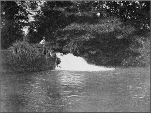
| Entrance of Swildon's Hole | 72 |
| Photo by M. Martel. | |
| Waterfall, Swildon's Hole | 73 |
| Photo by H. E. Balch. | |
| Entrance of Stalactite Chamber, | |
| Swildon's Hole | 78 |
| Photo by Bamforth, Holmfirth. | |
| Stalactite Curtains, Swildon's Hole | 79 |
| Photo by Bamforth, Holmfirth. | |
| Stalactite Chamber, Swildon's Hole | 80 |
| Photo by Bamforth, Holmfirth. | |
| Stalagmite Pillars in Gough's Great Cavern | 84 |
| Photo by Gough, Cheddar. | |
| The Pillars of Solomon's Temple, | |
| Gough's Caves, Cheddar | 85 |
| Photo by Gough, Cheddar. | |
| Organ Pipes, Gough's Caves, Cheddar | 86 |
| Photo by Gough, Cheddar. | |
| "Niagara," A Stalagmite Fall, | |
| Gough's Cave, Cheddar | 87 |
| Photo by M. Martel. | |
| In Cox's Cavern at Cheddar | 92 |
| Photo by Bamforth, Holmfirth. | |
| Great Rift Cavern, Cheddar Gorge | 93 |
| Photo by Bamforth, Holmfirth. | |
| Entrance to Lamb's Lair, Harptree | 116 |
| Photo by Bamforth, Holmfirth. | |
| Plan and Section of the Great Cavern | |
| of Lamb's Lair | 117 |
| By H. E. Balch. | |
| The "Beehive" Chamber, Lamb's Lair | 118 |
| Photo by Bamforth, Holmfirth. | |
| Stalactite Wall, Lamb's Lair | 119 |
| Photo by Bamforth, Holmfirth. | |
| Entrance to Great Chamber, Lamb's Lair | 120 |
| Photo by Bamforth, Holmfirth. | |
| Largest Chamber in Somerset, | |
| Lamb's Lair, Harptree | 121 |
| From Sketch by H. E. Balch. | |
| Stalactites in Entrance Gallery, | |
| Lamb's Lair | 122 |
| Photo by Bamforth, Holmfirth. | |
| The Ogo, near Abergele | 128 |
| Photo by E. A. Baker. | |
| Inside the Ogo, near Abergele | 129 |
| Photo by E. A. Baker. | |
| In the Ogo, near Abergele | 130 |
| Photo by E. A. Baker. | |
| A pre-Glacial Cave, Llandulas | 132 |
| Photo by E. A. Baker. | |
| On the Ceiriog | 134 |
| Photo by E. A. Baker. | |
| Upper Ceiriog Cave | 135 |
| Photo by E. A. Baker. | |
| Lower Ceiriog Cavern | 136 |
| Photo by E. A. Baker. | |
| In Stump Cross Cavern | 140 |
| Photo by E. A. Baker. | |
| The Pillar, Stump Cross Cavern | 141 |
| Photo by E. A. Baker. | |
| The Chapel: Stump Cross Cavern | 142 |
| Photo by E. A. Baker. | |
| Ricklow Cave in Flood | 156 |
| Photo by G. D. Williams. | |
| A Great Pillar: Mitchelstown Cavern | 160 |
| Photo by E. A. Baker. | |
| A Fairy Lantern: Mitchelstown Cavern | 161 |
| Photo by E. A. Baker. |
THE CAVE DISTRICT OF THE MENDIPS
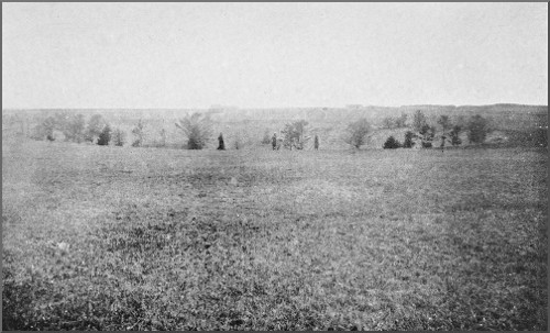
"A land of caves, whose palaces of fantastic beauty still adorn the mysterious underworld where murmuring rivers first see the light." In these words an imaginative writer describes Somerset, which shares with Derbyshire and Yorkshire the title of a land of caverns. Across it the range of the Mendips, a region of Old Red Sandstone and Carboniferous Limestone, 1000 feet above tide-level, stretches in a huge, flat-topped rampart for nearly 30 miles, from the town of Frome to the sea. No piece of country in the kingdom offers so much to explore. An abundant harvest is there waiting to be reaped; for on every side are obvious indications of half-buried gateways to the dark and secret pathways to the netherworld, and everywhere upon the surface of the Mendip tableland lie the open pits and hollows which the local speech calls "swallets," that is to say, swallow holes, some of them dry, some actively engulfing streams, but all testifying to untold ages of water action.
This Limestone district lies far from the busy hives of industry, remote and secluded in the very heart of lovely Somerset. Only on the darkest of nights, with the clouds low in the sky, can the glare of the lights of Bristol be seen reflected far to the northward. One main[2] line of railway, the Great Western from Bristol to Exeter, passes near it, and even that does not intrude beyond the margin of this Caveland. The rendezvous for the cave explorers of the district is usually the quiet little city of Wells, lying calm and secluded under the southern slopes of Mendip, in close proximity to all the principal caverns. A mile to the south-east rises the bold and picturesque Dulcote Hill, a fragment of the most southerly anticline of Mountain Limestone in the kingdom. From this point, rolling northward in a great fivefold anticline, Old Red Sandstone, Lower Limestone Shales, and Mountain Limestone form the great mass of the worn-down stump of the once mighty Mendip range. The extent of the denudation which has taken place indicates that this range was originally at least 5000 feet high, yet now in but a few places is the height of 1000 feet attained, and this is reached only by the Old Red Sandstone ridges laid bare in the prolonged course of that denudation. The first of these high ridges rises boldly to the north of Wells, and a steep climb of 900 feet in two and a half miles brings us to the summit of Pen Hill, or Rookham, from which a grand southward view is to be obtained. Immediately below, the three cathedral towers pierce the blue mist hanging over the little city we have just left. Beyond, the peat moors of the Brue and the Axe stretch away to the Isle of Avalon, sacred as the birthplace of our Christian faith in England. Here below us is that
"Island valley of Avilion,
Where falls not hail, or rain, or any snow,
Nor ever wind blows loudly; but it lies
Deep meadow'd, happy, fair with orchard lawns,
And bowery hollows crowned with summer seas."
Here, where Arthur's bones are said to have been found, and where traditions associated with him abound, his memory is kept green in the names of many well-known[3] spots; and yonder rises Cadbury Camp, looked upon by many as the Camelot of romance. On the low ridge which intervenes between the valleys of the Axe and the Brue lies Wedmore, where King Alfred gained in the Peace of Wedmore such temporary respite from his foes as allowed him to gather strength for the great operations that resulted at last in the conquest and unity of the whole kingdom. Yonder, too, are the marshes of the Parrett and the Tone, around which cluster tales familiar to every schoolchild. In the marshes between the Mendips and Glastonbury, exploration has unearthed a most interesting example of a swamp or lake village, with great store of antiquarian material, throwing a flood of light upon a period of which little was known. Beyond lies Sedgemoor, where in 1685 took place the last battle ever fought on English soil; and throughout this neighbourhood the infamous Jeffreys worked his will in the judicial slaughter of countless Somerset men.
In the far distance the sunshine glints on the waters of the Bristol Channel, where, 60 miles away, the bold promontory of the Foreland rises sheer from the sea; to the south, upon the farthest limits of our vision, Pilsdon and Lewsdon mark the descent of our southern counties to the English Channel; whilst, on a clear day, between them is seen the summit of Golden Cap, the base of which is washed by our southern sea. Surely here is as fair a scene as eye could wish to see.
Only a pleasant walk away, the great chasms of Ebbor and Cheddar have rent the rocks asunder, forming two of the loveliest ravines in the kingdom. Northward across the intervening syncline of Mountain Limestone, pitted with swallets marking the entrances to many an unknown subterranean labyrinth, are seen the Old Red Sandstone summits of North Hill, crowned with its seventeen Neolithic barrows, and of Blackdown beyond,[4] from whose bare top is seen the broad estuary of the Severn spreading out across the view, giving a glimpse of the coast of South Wales in the far distance, its busy factories showing their pencil-like chimneys against the dark hills behind. In the Channel the little islands of Steepholm and Flatholm mark the line of the original continuation of the great Mendip range into South Wales. The limestone shores of the former rise sheer from the sea, forming an impregnable fortress. Here, far below the level of the salt water around, a supply of pure water is obtained from the Limestone, brought, doubtless, from the Limestone area of Mendip by way of some hidden fissure.
Hard by, at Clevedon, is the grave of that great friend of Tennyson, who sat here and listened to
"The moaning of the homeless sea,
The sound of streams that, swift or slow,
Draw down æonian hills, and sow
The dust of continents to be."
Very truly and accurately his words describe the action that is going on, by which the swallet streams are undermining and honeycombing these hills and bearing their component rocks away to the sea.
Standing on Pen Hill and looking northward, a great east and west depression is seen forming a broad low valley in the tableland of Mendip. Into this valley numerous springs and a liberal rainfall are for ever pouring their waters. Yet nowhere is there a surface channel which can carry this water away; and nowhere, save in the small hollows of the Old Red Sandstone and Shales, does water accumulate. The reason is not far to seek. The Carboniferous Limestone, evenly stratified everywhere, has been split by vertical joints into a series of gigantic cubes. Between them, the surface waters, laden with carbonic acid obtained from the atmosphere and from[5] vegetation, have for ages made their way, enlarging them by both chemical and mechanical action, till they have become fissures capable of giving passage to an enormous quantity of water. So from one joint to another, from one bedding plane to another, the water percolates downwards until it meets with some impermeable rock beneath, or until it finds an outlet at the level of the Secondary rocks forming the valley below. Such impermeable beds are found in the Lower Limestone Shales, and the resulting outlets are well known in the great risings of St. Andrew's Well in the gardens of the Bishop's Palace at Wells, in the source of the Axe at Wookey Hole, in the Cheddar Water and other large springs, of all of which more hereafter.
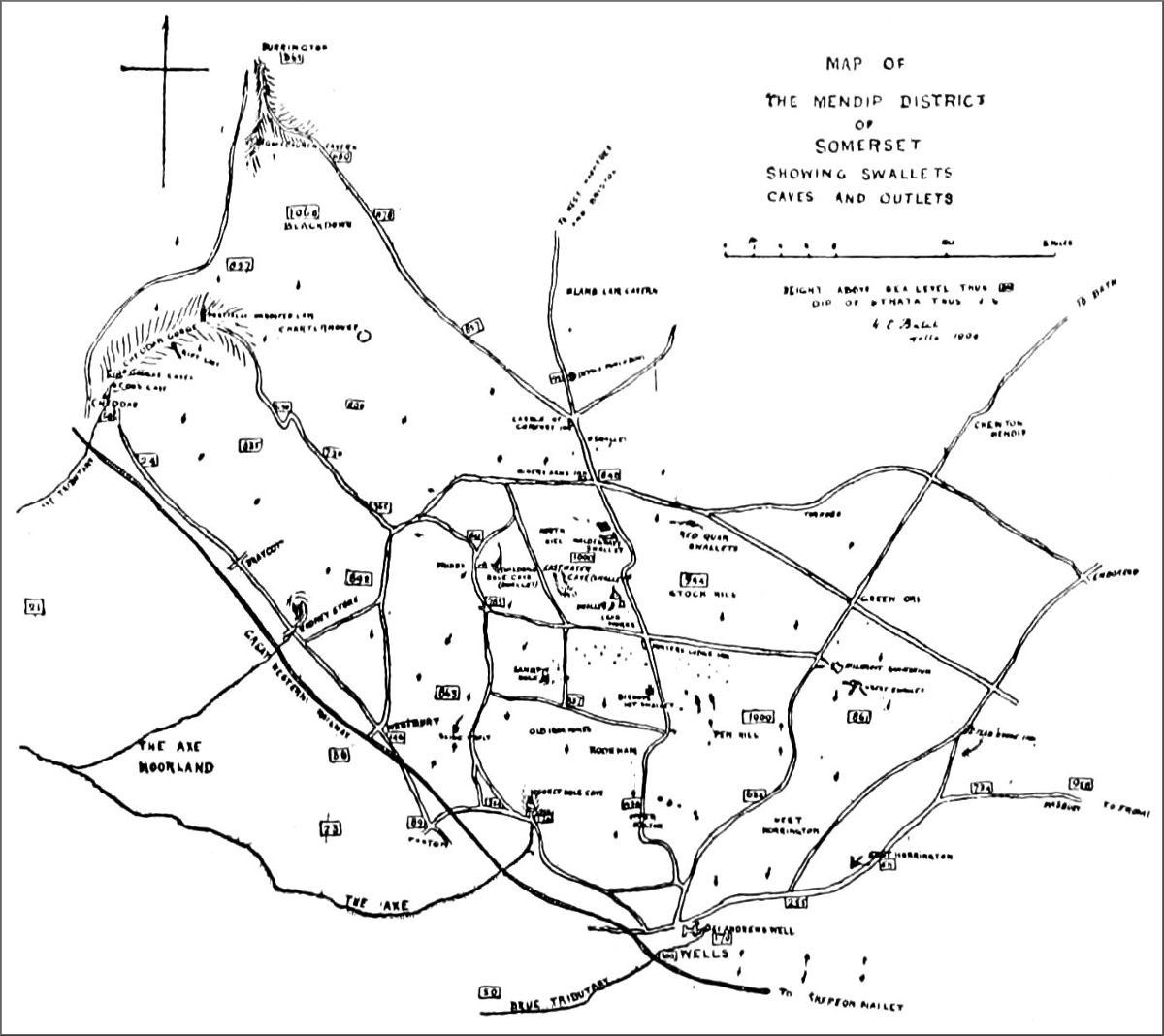
MAP OF THE MENDIP DISTRICT OF SOMERSET, SHOWING SWALLETS, CAVES, AND OUTLETS.
(Click on map to see a larger version. Not available on all devices.)
Reference to the sketch map of the district will show that the majority of the more important swallets lie along the line of the great depression referred to. These comprise by no means all the swallets of Mendip, yet they are the chief ones. It is obvious that the whole of the mass of material represented by this great depression has been removed in suspension by way of these swallets; and one is compelled to ask, How long has this work been going on? What time is represented by so vast a work? On the threshold of the inquiry we are met by such an amount of evidence bearing upon it that the subject must be dealt with separately. For, upon the upturned edges of the Carboniferous Limestone rocks, which can have been brought down to their present plane of denudation only by long-continued water action, have been deposited, and still remain in situ, great masses of the basement beds of the Secondary rocks, lying in such a manner as to convince us that swallet action had prepared the denuded surfaces upon which they lie. And upon this hinges the whole question of the antiquity of the caverns of Mendip. But whilst the age of our caverns is a[6] debatable matter, no one can question the accuracy of the theory of ravine formation from the collapse of cavern roofs, as evidenced by the instances supplied by Mendip.
Through crevices and cracks, here, there, and everywhere, the percolating waters find their way. Now some crevice is enlarged into a passage; now some weak point in the passage becomes a chamber; and on the water rushes, steadily joining forces and accumulating, until on the level of the lower land it finds an outlet, and rushes forth a considerable stream. In its headlong course the water again and again leaps down some great series of potholes, as down some giant stairway, forming many fine cascades, whose deafening roar goes on for ever where there is no ear to hear and where no footstep ever treads the rocky ways. Along the course of the larger streams huge chambers occur; for the ever-eddying water, bearing sand along in its course, eats out the sides of its channel, or, revolving stones in its bed, carves out the pothole by friction. Or some pendent mass of rock has its support undermined and comes crashing into the streamway, only to be broken up and carried away by the ceaseless energy of the stream, so ever enlarging the chambers upwards towards the light of day. But whilst this action is going on underground, a more potent factor is at work where the subterranean stream first sees the light. Here very soon the action of the water alone gives rise to a little cliff overhead. Now rain and frost, wind and tempest, loosen, bit by bit, the fragments of rock forming the face of the cliff, which fall away into the river, to be broken up and carried away. Little by little the face of the cliff recedes, along the line of the subterranean river, until the first underground chamber is reached. The undermined archway of rock is less able to withstand the agents of denudation, and the cliff front[7] recedes apace. Such is the present stage at Wookey Hole, the chamber whence the river Axe issues being still in process of destruction. Thus the work goes on slowly, yet none the less surely, until along the whole course of the subterranean river the roof of the cavern is destroyed, perhaps effectually hiding the stream under huge blocks of Limestone, such as those of Ebbor Gorge, near Wells, or until the water finds another course for itself, as at Cheddar, to begin the whole story over again. Every stage is abundantly illustrated by our Mendip swallets and caves. The large swallets of Eastwater, three and a half miles from Wells, of Swildon's or Swithin's Hole, a half-mile nearer Priddy, and the more recent swallet of Stoke Lane, half-way between Wells and Frome, are excellent examples of streams engulfed on the summit of Mendip. The whole of the country surrounding the two first-named caverns is dotted with innumerable small pits and hollows. The great swallet of Hillgrove, three miles north of Wells, in the exploration of which we are at present engaged, in an endeavour to penetrate the labyrinth of ways to which it will undoubtedly afford access, is a fine example of an intermittent swallet. Here three ways, carved deeply through the stream-borne sands and clays of some uncertain epoch of geological history, converge in a deep glen, beautiful with its tropical wealth of ferns. In the bottom of the glen huge spurs of Limestone stand up boldly, dipping towards the Old Red Sandstone exposed to the south, and pointing to a great fault, along the line of which the Limestone water is bound to accumulate in a huge triangular reservoir, the outflow from which may account for the summer flow of the Axe when the majority of the swallets are dry. In winter the converging torrents here find ingress into the Limestone, but, though pits and hollows abound on every hand, no foot of man has ever yet trod the hidden ways beneath.[8] At a depth of 10 feet we have reached the first open channel, only to have it blocked subsequently by a fall of the treacherous gravel through which we have been working.
Vast dry swallets are represented by a great depression which we call the Bishop's Lot Swallet, on the road from Wells to Priddy. Here a huge hollow in the ground, perfectly circular and 300 yards round, shows us the largest swallet in Mendip. Though the surrounding land slopes gently to the edge of the great pit, which is 60 feet in depth, there is but the smallest trace of water penetrating it. It is ages since the drainage of the surrounding land gravitated towards it, for it lies at a considerable height above the level of most of the other swallets in the neighbourhood. A mile and a half to the west, a similar pit occurs called Sand Pit Hole. Here too water has ceased to flow, and it remains, with precipitous sides, a problem for us to investigate in the near future.
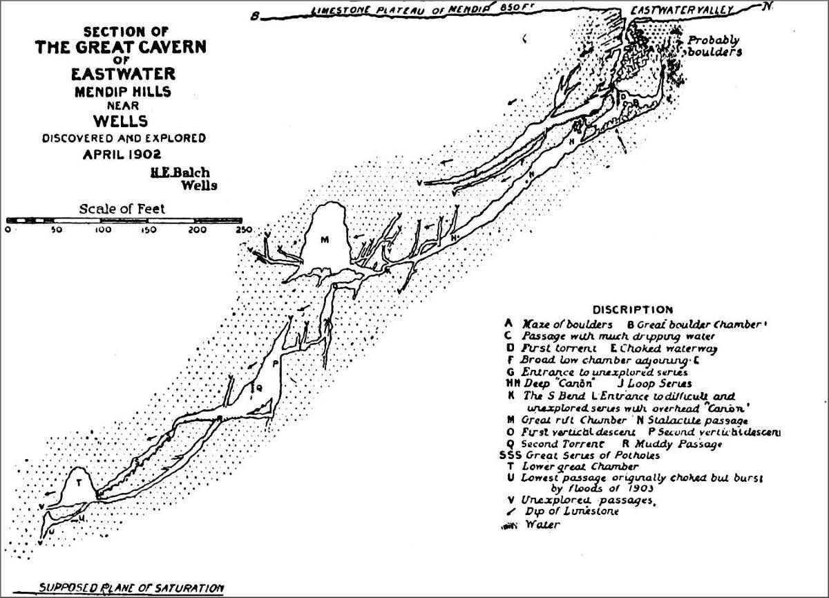
To enter either of the active swallets of Eastwater or Swildon's Hole, and to follow it to its greatest depth, is to gain an insight into the action of subterranean streams such as no other method can give. The former is well illustrated by the annexed section, in which its profound depth and its labyrinth of passages may readily be understood. The difficulties and disappointments which we encountered when I conducted the operations which at last resulted in our effecting an entrance into this cavern, the existence of which was not even suspected previously, need not here be recapitulated. Altogether, what with volunteers and labourers, nearly a dozen of us were occupied ten days in the determined effort which we made, and which at last was crowned with success. From the point of view of the subsequent explorer the reader is referred to the ensuing chapter upon Eastwater Cavern,[9] which will convey some idea of what the first explorers must undergo in any such place when to the ordinary difficulties of such an exploration is added the great uncertainty felt at every step taken, and when every boulder upon which our weight is to rest must first be carefully examined. The difficulty of our work at Eastwater is practically what must be experienced in any new work undertaken in the Mendip region, and there is much waiting to be done. If there is one thing more than another to be learned from Eastwater Cavern, it is the great importance of chokes in determining the lines of subterranean drainage. Here they are seen in every stage of formation and destruction, and the channels which have been carved by the arrested water may be readily recognised.
There is a fascination in exploration work such as that at Eastwater, where corridors, hitherto untrodden by the foot of man, open up all around as you make your way ever downwards into the heart of the hills; and even now there are many accessible passages into which as yet no one has penetrated. Reference to the section annexed will show an upper way, which terminates abruptly in a choke of stones and gravel, holding up a little water, whilst allowing a considerable quantity to pass. It is a remarkable fact that in all the labyrinths of galleries which we have explored in the profound depths of this cavern we have not yet alighted upon any portion which gives access to the continuation of this channel. There, rendered inaccessible by the barrier of débris, is, without doubt, a cavern as extensive as that which we have proved to exist in the sister watercourse hard by; and these two channels, starting from practically the same point, must diverge widely, and certainly do not unite again before the depth of 500 feet is attained.
Farther eastward in Mendip, too, are similar swallet[10] caverns. Not far to the north-west of Stoke Lane is an interesting cavern locally known as Cox's Hole. It is situated in the Limestone forming the southern edge of the great basin in which lies the Radstock Coalfield. Owing to the existence of this coalfield, there are no deep caves accessible in this part of Mendip. Yet a good deal of water must be absorbed through the innumerable fissures into the depths of the Carboniferous Limestone underlying the coalfield, and it is by no means unlikely that this water, heated to a high point by the subterranean temperature, gives rise to the hot springs at Bath. Cox's Hole was at a remote period, when the form of the hill was very different from that presented now, an active water-channel, evidently draining towards St. Dunstan's Well. It has two distinct entrances, one, the more westerly, being a cavity of considerable size. For about 100 feet the cavern consists of a roomy gallery running more or less horizontally. Then it pinches in, until the height is less than a foot, and only those can get along who are able to compress themselves into small compass. In a few feet, however, it widens out into a good-sized passage, with fine stalactites here and there, especially at a point on the northern side where an aven opens into a chamber more than 30 feet high. Now roomy and now contracted, the passage leads on until, at a distance of 100 yards from the entrance, it becomes so small that there is considerable difficulty in proceeding. Beyond this point the cavern becomes a simple water-tunnel, of a type common in Yorkshire. At 130 yards there is a sharp descent, the floor is littered with boulders, and 20 yards farther the passage is choked with silt. A very small passage, which had water in it when I was there, is said to be passable at times, though I am inclined to doubt this. An almost vertical ascent amongst treacherous boulders, however,[11] seems an indication of a possible route onwards, which may, I trust, with care be yet explored. The last 50 yards of the cave run to the south-east—that is, away from the direction of St. Dunstan's Well—a beautiful spring rising from the Carboniferous Limestone hard by; yet I feel sure that it must of necessity be a part of the same waterway. Either it was an inlet which received the waters of some vanished Old Red Sandstone spring, or it was a former outlet for the waters of that well. I am inclined to favour the former theory. As to the present source of the waters of St. Dunstan's Well there can be no doubt whatever. In the valley below Stoke Lane, and three-quarters of a mile distant from the well and from Cox's Hole, there is a most interesting swallet, of comparatively recent age. It is obviously certain that, not so long ago, the stream which courses down the valley flowed unchecked down its whole length, and so reached the larger stream below. Slightly retarded, in all probability, by some flood-borne silt, the water found a little joint in the western bank of the valley, and by slow degrees so enlarged it that it at last became capable of swallowing the whole. Even now a few hours' work would divert the water and cause it to resume its former course. Upstream is a mill, the owner of which has courteously given every facility for testing and for exploration. It was found that the effect of damming the mill stream entirely was to reduce the flow at St. Dunstan's Well enormously, and to render the entrance of the swallet passable. Mr. Marshall of Stratton-on-the-Fosse with his party made a successful descent, and travelled a considerable distance, mainly parallel with the valley without and to a great extent horizontally, through water-tunnels of small size. As no measurements were taken one cannot say yet how far it is passable, but he says that they did not get to the limits of possible exploration, as the time[12] which they spent there was getting dangerously near the hour up to which it is possible to dam the water, and they most wisely beat a hasty retreat. The first opportunity will be taken by us to make use of a spell of fine weather to carry this exploration to a successful issue. Not far distant, too, is another swallet, from which the water has been diverted to be used for water-supply. This is in the vicinity of a ruined hunting lodge, and is said to lead in the same direction as the Stoke Lane Swallet. The whole of this district is likely to be very interesting, there being a series of remarkable rifts or fissures in the Dolomitic Conglomerate which deserve attention. One of these, called Fairy Slats, has been known for many years, and is indeed shown on the Ordnance map; and the fact that such fissures abound has been forcibly brought home by a disaster to a new reservoir, only recently completed by the authorities of Downside Monastery, to supply the neighbouring villages. Here a finely designed basin, having been constructed over one of these fissures, had its massive concrete bottom burst out as if it were an egg-shell the moment the water filled it, and in a single hour the whole fabric was absolutely ruined. Some measure of the extent of the concealed fissures may be gathered from the fact that 500,000 gallons of water were absolutely swallowed up without a drop coming to light in the neighbouring valley. An early visitor to the adjoining field reported that air was being ejected through the grass all around him, much to his alarm, as he was quite unaware of what had occurred. It will be a most interesting subject for inquiry, as to how far such fissures as these are the results of water action or otherwise, and it is most desirable to descend one of them at the first opportunity in search of evidence. At present I am inclined to attribute their presence to movements in the Secondary rocks, due to[13] the intersection of the district by valleys. The Conglomerate mass has parted along the lines of the principal joints, and the rifts thus formed have become lines of drainage. This theory, in view of possible future discoveries, may have to be modified.
Above Stoke Lane Swallet, and evidently connected with it in some remote way, is a cavity without a name, the exploration of which would probably be interesting, and would be most likely to yield remains of primitive Man. Mr. Marshall also reports the existence of a fissure of considerable size, where, after a very small entrance, a point is reached with a vertical descent of great depth. All these things indicate that there is a splendid field here for further work.
Indeed there are abundant evidences of this all over Mendip. One of the most interesting problems has had further light thrown upon it by work recently done by us at Wookey Hole. The Hyæna Den and the Badger Hole are testimony that a large amount of underground action has taken place upon the east side of the ravine, yet nothing has been known hitherto of any series of dry channels upon that side. Recently, however, we have succeeded in gaining access, by way of the smallest of fissures, into what will turn out most likely to be a portion of this very series. Here is to be seen a choked-up chamber of precisely the same type as the Hyæna Den, but far deeper in the wall of the ravine. Without doubt it contains prehistoric remains, yet its excavation will entail great labour. We have already reached a distance of 80 feet from the entrance, and only a partially choked passage bars the way.
High up in the ravine at Ebbor, too, there is a very promising field for further research. This is immediately beneath a cliff on the western side of the valley, where we have already done much preliminary work. There is also[14] a very promising little cave, slightly north of Tower Rock in the same gorge and high up in its side. Here a narrow entrance gives access to a small chamber, on the floor of which is a deep deposit of cave earth, from which I have obtained Deer bones.
At Dulcote, again, there is a series of waterways and dry caves of great interest, which in themselves bear corroborative evidence of the great antiquity of the caverns of the district. From time to time the quarrymen have broken in upon these waterways, which have been lost in subsequent operations. Not many years ago a blast blew off the top of an almost vertical shaft, carved out in the Limestone by water action and descending to a great depth. The mass of rock blown off by the charge turned over and fell down the shaft, blocking it at 30 feet from the surface. It was possible to descend to this point and throw down stones, which fell for a considerable distance; but the block was never moved, and in the process of quarrying the hole became filled, and is now lost in the general level of the quarry. Hard by, also, a cavern of considerable extent was opened, and still remains. It contains nothing of peculiar interest, though when I was first lowered into it, from a hole 60 feet above its floor, it contained very pretty coral-like splash stalagmite; and also, in the mud floor, the tubular linings of calcite, formed from the drip from above. In this quarry, too, were found a considerable quantity of the bones of Bear, Deer, Bos, Horse, etc., and these are now in the Wells Museum, where they were deposited some years since by A. F. Somerville, Esq. There are numerous other minor caves in this locality. Farther up the same valley, above Croscombe, is a small cave known locally as Betsy Camel's Hole, and it appears to have been occupied by a woman bearing that name for some years. She was, of course, carried away by the devil, according to the same[15] popular report. It may very well have been a rock shelter at some stage of its history. Mr. Somerville informs me, too, that in Dinder Wood there is a small cave which was almost certainly a rock shelter. This also has never been explored. In fact, the whole district may be described as an unexplored field, and there is abundant room for willing helpers. The landowners, for the most part, are exceedingly kind and ready to offer every facility for scientific research.
H. E. B.
The great gorge of Cheddar and its caverns form a subject of surpassing interest to the student of Geology. Presenting some of the most stupendous cliff scenery in England, the great wall of rock on the southern side of the valley towers nearly 500 feet into the air, defying all attempts at mapping contour lines; and the road which traverses the ravine winds, with many a sudden turn, along the base of this noble cliff, ever upwards, until in four miles the actual summit of the Mendip downs is reached. At the entrance to the gorge, and close to the caverns owned by Gough, the hidden river bursts into the light, pouring forth a stream of great volume, which, after serving the purposes of various millers in the village, hurries on to join its sister stream from Wookey Hole, the two then flowing into the sea near Weston-super-Mare. It is strange that in all the exploration work that has been done at Cheddar, the underground channel of the stream has not once been reached. Near the entrance in Gough's Cave a fairly deep hole contains water, which changes in level along with the river itself, but no open passage leads from it. A vertical rope descent of 100 feet from the upper and practically unknown caverns belonging to Gough brings the explorer to what must be regarded as the nearest point which has yet been reached to the subterranean river of Cheddar. As this gorge is the most stupendous in the Mendip region, so is this stream the most considerable in volume. Mr.[17] Sheldon of Wells has gauged its minimum flow to be not less than three million gallons per day, whilst its torrent at flood time must be many times as much, probably not less than eight or ten millions.
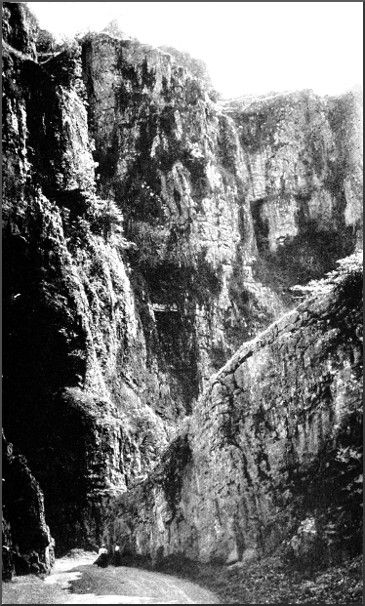
THE GREAT GORGE OF CHEDDAR.
Photo by Dawkes & Partridge, Wells.
This is considerably larger than the other two great outlets of the subterranean waters of Mendip, those of Wookey Hole and Wells, each of which, however, pours forth an enormous volume. That it is the Cheddar stream which is responsible for the existence of the gorge itself no one can doubt, and it is a most interesting subject for discussion as to how this has been brought about. It is not difficult to determine what points must mark the boundaries of the catchment area, the waters of which drain to Cheddar. The road from Castle Comfort to Charterhouse on the north-east, the outcrop of Shales south of Blackdown on the north, and a line drawn from Rowberrow Farm north of Priddy to the gorge itself on the south, enclose the whole area from which the supply is obtained. This is somewhere about 12 square miles in extent. To this must be added, possibly, some water from slightly more to the eastward. It is now the commonly accepted theory that the whole of this water, or at any rate the bulk of it, found inlet into a series of caverns along the line now occupied by the gorge, and that then the processes which are so well known to be going on gradually enlarged these to the point of collapse, the falling débris being removed by the still flowing stream. It is only right to add that M. Martel, arguing from his long experience, which probably exceeds that of any man who has ever studied the subject, sees in the gorges of Cheddar, Burrington, and presumably Ebbor, the superficial channels worn by the escaping streams from the ancient Mendip plateau. He says, "The numerous dried valleys (Burrington Combe, Cheddar Cliffs, etc.), which cut through the circumference of the Mendips,[18] witness, as everywhere, to the ancient superficial flowing off of the rivers, and to their capture by the natural wells, successively opened and enlarged in the cracks of the Limestone rock." That even small streams acting through a sufficient period of time are capable of doing enormous erosive work it would be idle to deny, but the difficulties in the way of accepting this theory as alone sufficient are too great to admit of its acceptance. It demands that the water of a very large area could find access to the eastern end of the ravine, which itself demands that the general configuration of the Mendips must have been very different from that presented now. This, from the existence of the Secondary beds in their present position, say near Harptree, was not the case; and therefore, for the theory to hold good, we must suppose that the superficial gorge was pre-Triassic. As it was not filled in, either in Triassic time or subsequently, it could not have been superficial. Of course it may be contended that the reversal of this line of argument demonstrates that the gorge is post-Liassic and may then have been a superficial channel, but I hold this to be disproved in my chapter on the antiquity of the Mendip Caves. I am, accordingly, forced to the conclusion that the Cheddar gorge was during the whole of the Secondary period a roofed-in cavern. The only difficulty which arises is a doubt as to the ability of the stream to remove so vast a bulk of falling material as must be accounted for; but when we see the process in actual operation, as at Wookey Hole, it is only necessary to demand sufficient time, and the difficulty vanishes. That a time did arrive when the rate of collapse more than kept pace with the destructive energy of the stream is indicated by the rapid rise which takes place in the road through the gorge. This favours the cave theory as opposed to the superficial channel theory, inasmuch as a superficial channel would[19] probably have maintained a more nearly equal depth throughout.
That the portion of M. Martel's theory which explains the absence of the stream from the gorge is correct is very clear, there being obvious indications, notably at the western end of the ravine, where points of absorption might be traced beneath the high cliffs, any one of which, if excavated, would almost certainly lead to the present channel of the river beyond Gough's Caves. The Long Hole above, as pointed out in my chapter upon the antiquity of the Mendip Caves, is corroborative evidence which tends to disprove the superficial valley theory, as it is without a doubt an old cavern of absorption, which could not have existed had the ravine been a superficial valley. Everyone must lament the recent developments in the Cheddar gorge by which the northern side is being hacked to pieces to provide road metal. There are thousands of places where the same stone could be obtained, with almost equal ease; and it does seem pitiful that one of the finest places in the kingdom should be sacrificed to the most callous and sordid commercialism. The conditions under which the work is being carried on constitute also a public danger, as has now been exemplified by the collapse into the gorge of a huge mass of the rock. The dip of the Limestone is to the southward, and consequently any work done on the northern side is removing the support that holds up the great mass upon an inclined plane. Of necessity the mass above, its support gone, comes hurtling down to the roadway, and it is practically certain that, if quarrying operations continue, some day the gorge will be entirely closed by a gigantic fall.
An interesting little tributary ravine and cavern, far up the gorge, provides a perfect example of the cave theory of the formation of the gorge itself. About two[20] miles from the village, on the southern slopes of the ravine, is an extensive fir wood. High up on the opposite side this little ravine is visible, and it may be reached with ease. Here sides that gently slope give way to precipitous walls, between which you walk. Moss-grown stones give place to new-fallen stones, and then you have before you the little ravine roofed in; you pass beneath, and find yourself in the darkness of the cavern itself, which can be followed for some distance. Here, at any rate, there can be no doubt as to the process that has been at work.
H. E. B.
When we consider the question of the age of our caverns, we are met at the outset by a mass of evidence forcing upon us the certainty that they must be credited with a very high antiquity indeed. Here measurement by years and centuries fails, and the imagination must be called in to aid us to compute the epochs that have successively elapsed since the first cave, to take one example, began to be formed at Wookey Hole. These evidences are of three kinds: historical, palæontological, and geological. In the first place, there has been obviously little change in the general configuration of our caverns since earliest historical times. The dens and caves of the earth have afforded a retreat to the persecuted of all generations, and a ready-made home when all else has failed. Here, too, with the rocky walls behind him and his protecting fires at the entrance, early man could defy the savage beasts that roamed the land in those far-off days.
At Wookey Hole it was only necessary to scratch the very surface of the accumulated débris within the mouth of the great cave to turn up fragments of Romano-British pottery and a human jaw and rib-bones. These interesting relics are in the possession of myself and Mr. Troup. From the very nature of the place, it is obvious that the tendency has been to accumulate more and more débris upon the mass of cave earth which contains these remains. Slightly deeper, yet still only in the loose earth of the cavern mouth, we found pottery of still earlier date,[22] unwheeled and cruder. The fact is borne in upon us, that certainly for two thousand years this entrance has remained much as it is now. Perhaps a loose rock here and there has been dislodged from the overhanging cliff outside, and, crashing to the stream bed below, has there been broken up and carried away by the river. But no one can doubt that the general outline is the same now as then. And farther within the cavern an interesting sidelight is thrown on the slowness with which things change in the underworld. At the descent into the first great chamber a chalk inscription roughly made reads "E A 1769." That inscription has been there unchanged, to my knowledge, for the last twenty years, and I have no reason to doubt its authenticity. If a chalk mark remains unerased for a century and more, how long have those solid walls stood, and how long will they endure?
As I have gazed upon that inscription, the thought has come, that such a place as this would be an ideal site for national monuments. When our abbeys and cathedrals are crumbled away, these great subterranean halls will remain practically unchanged. And in the caves of Cheddar like evidences meet the eye. In the loose material in the Roman cave there, Roman and Romano-British remains have been found in abundance; and here again we are forced to the conclusion that no change has taken place since those remains were deposited.
But when we consider the evidences furnished by the remains of the extinct mammalia, mingled with those of primitive man, much more is it impressed upon the mind that we are dealing with relics of enormous antiquity. The great assemblage of bones of the extinct animals which occurs at Banwell Cave, and the numberless finds from the caves of Cheddar, are indications of this; but those of the Hyæna Den of Wookey Hole, and the conditions of their deposit there, afford us much more[23] reliable testimony. Here are two principal cavities on the eastern side of the ravine, representing two of the five river levels which the stream of the Axe has hollowed for itself in the Dolomitic Conglomerate. These are branch or side chambers which have not been totally destroyed in the process of erosion that formed the ravine at the expense of the cavern. In the uppermost cavity, known as the Badger Hole (it was the haunt of badgers until a few years ago), no traces of the extinct mammalia are to be found, nor have I found definite traces of prehistoric man. At seven feet below the surface, however, there is a bed of river sand of precisely the same kind as that in the upper chambers of the great cavern. In the Hyæna Den below, on the other hand, so thoroughly and systematically explored by Professor Boyd Dawkins, was found one of the most perfect assemblages of the remains of extinct animals ever discovered. Many years after his labours were completed I searched there again, and was rewarded with a by no means poor collection of bones and teeth: Mammoth and Woolly Rhinoceros, Irish Elk and Reindeer, Red Deer, Bison, Cave Lion and Bear, Hyæna and Wolf, Wild Goat, Wild Horse, and Wild Boar have all been found. One of my earliest trophies was a fairly complete skull of a young Bear; and I have representatives of all the others. From a small hole in the side of the valley hard by, which I thought looked promising, we have obtained a large number of Rhinoceros teeth, together with those of several of the other kinds present in the Den. The examination of these cavities and their contents demonstrates the fact that they were the actual dens of some of these animals. The abundant marks of gnawing show that the Hyænas made their home there. Over the vertical cliff many a worn-out beast was hunted to its death by the Hyænas and Wolves, and its shattered carcass dragged to this hole.
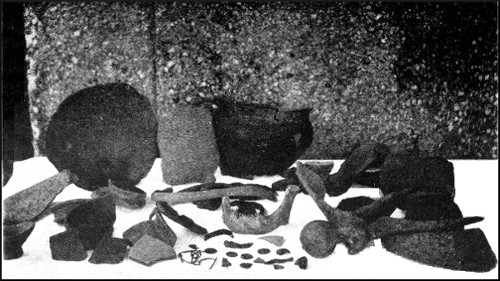
ROMANO-BRITISH POTTERY, COINS, HUMAN REMAINS, ETC., WOOKEY HOLE CAVE.
Photo by H. E. Balch.
HYÆNA DEN AND BADGER HOLE, WOOKEY HOLE.
Photo by Bamforth, Holmfirth.
It is easy to wander back in imagination and bring the state of things that existed visibly before the mind's eye: to watch the unwieldy Mammoth or the great Rhinoceros rolling its huge bulk along; to see the pack of cowardly Hyænas or Wolves hounding some worn-out Bison to its death, over the awful cliff close by their den, which purpose effected, they themselves rushed headlong down the steep slope hard by, to fight and wrangle over the shattered carcass of their prey; or to see the Lion lying in wait by the peaceful stream in the little valley for the noble Elk or timid Deer to come for its accustomed drink; and then to behold savage Man, with his weapons of flint or bone, when out on his hunting expeditions, arriving at this peaceful valley, and there for a while making his quarters in the Den, and lighting his fires at the entrance to scare the wild beasts from their lair.[1]
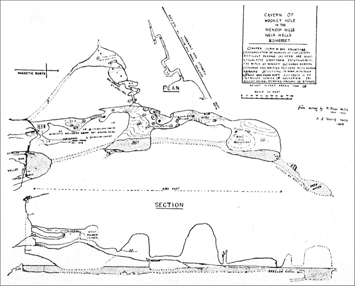
How long ago this state of things existed is a matter for geological calculation. Suffice it that the earliest historical records show us no wild beasts existing in the land except Bears and Wolves, along with the Red Deer which is with us to this day. Now there is no sign at Wookey Hole of the time when the Bear and Wolf alone remained and all else had become extinct from the land. There is no trace whatever in the Hyæna Den of the pottery which we find in the entrance of the great cave. Without a doubt, the latest deposits here are vastly older than the most ancient deposits there. The commingling of northern, temperate, and southern forms gives evidence of oscillations in temperature such as demand a vast time to have taken place. Yet the whole of these remains accumulated between the time when the entrance to the Den was left exposed by the gradual destruction and[25] retreat of the cliff face up the valley, and the infilling and choking of the entrance by the accumulating gravel which eventually blocked it. It is only within the last few years that the gravel arch which was first formed, and then undermined in the search after bones, has collapsed, revealing the true configuration of the cavern. Here we must again postulate a great antiquity for our caverns, since these deposits exist in what is really an insignificant fragment of the great cavern, and are only an incidental part of the material which an exposed cavity is sure to receive. But when purely geological evidences are taken into account, the demand for time becomes still more imperative. The subterranean Axe occupies, as its present channel, vast chambers formed by the excavation of thousands of tons of the hard Conglomerate, great halls over 70 feet in height and of fine proportions. The process which formed these is still at work enlarging them, till in the course of time they must collapse; yet no change is ever visible, no signs of recent action can at any point be seen. The rarely occurring great flood serves but to remove one film of sand from the floor and to leave another in its place as the waters subside. So slow is the undermining action that no eye can ever detect a change though the waters rise ever so high. Yet this channel is but one of five distinct levels which the river has occupied from time to time, until it has found in turn a lower course, leaving its sands as a record upon each, here and there sealed down beneath a mass of stalagmite. What untold ages have elapsed since first the river flowed through these upper channels!
PLAN AND SECTION OF WOOKEY HOLE CAVERN.
(Click on map to see a larger version. Not available on all devices.)
But an examination of the top of the Mendips points to a vaster antiquity still. The published horizontal section No. 17 of the Geological Survey gives an excellent idea of the plateau of Mendip, which stretches from immediately north of Wells to the neighbourhood of Compton Martin.[26] This plane of denudation would never have been reached save by the long-continued action of subterraneous streams, an assumption supported by the existence of the great depression crossed by the road from Wells to Priddy. That depression of nearly 100 feet in depth and several miles in length, hollowed in the hard Carboniferous Limestone, here dotted with every known type of swallet or swallow hole, has been obviously formed by the slow action of swallet streams prolonged through vast periods of time. Every atom of the millions of tons of solid rock represented by this depression has been borne down the course of the subterranean Axe. Tributary to this depression a little valley has been eroded across the Old Red Sandstone anticline immediately to the north, and in it are deposited masses of Dolomitic Conglomerate, the component pebbles of which were derived from the surrounding rocks. The same valley existed, therefore, in pre-Triassic time, and as there was obviously no other outlet for its water, the cavities into which it flowed—that is to say, the swallets and subterranean channels—must have existed also, and are therefore pre-Triassic in date. Though at first sight this appears impossible, inasmuch as the known course of the resulting Axe River is through Triassic Conglomerate, I propose to show that such a conclusion is necessary and inevitable. Long ago I was struck with the fact that at Wookey Hole the Triassic Conglomerate attains an abnormal thickness, and measurements have shown that at the far end of the cavern there is certainly a thickness of over 350 feet of this rock. As there is no sign of any approach to the Limestone against which it must abut, nor any change in the character of the Conglomerate itself at this point, I think that we may fairly conclude that the total thickness of it must be at least 500 feet. Now this is a vast deposit, far exceeding any known to exist elsewhere, and it requires a special[27] explanation to account for it. Only one explanation is possible. The Conglomerate is here filling in some great pre-existing valley in the Mountain Limestone. That is just what I should expect.
The great Limestone cavern formed by the action of the swallet streams in early Triassic times collapsed, and formed a Limestone ravine, into which was rolled a great accumulation of fragments of the Limestone derived from the slopes and crags above. With the whole of this part of England these beds were subsequently submerged, remaining so during the deposit of the whole of the Secondary beds; and on their emerging once more from beneath the sea the lines of drainage were re-established along the old courses, where these had not been choked with sedimentary material. Forcing a way through the Conglomerate which then impeded its flow, the river formed those cavities which we see. Indeed, it may well be that the successive levels cut by the Axe through the Conglomerate may represent stages in the uplifting of the land, the lowest channel being the last and largest, as it has been formed during an extended period of stability. But we are not without evidences of another sort as to the existence of some of our swallet ways at that remote period. The cavities found in the Holwell quarries, near Frome, filled in with Rhaetic material containing bones and teeth of fishes; those of Gurney-Slade, near Radstock; and numbers which from time to time are laid bare in the Limestone quarries, all filled in with Triassic sediment, show that penetrating waterways of considerable size then existed. There was, too, at Charterhouse-on-Mendip, north of Cheddar, a fissure, possibly a swallet, which, being open, received an infilling of Liassic material that is known to extend to a depth of 300 feet. Had these channels been closed by a narrow aperture temporarily blocked, no infilling but by water would have taken[28] place when the land sank beneath the waters of the Triassic and Liassic seas.
Furthermore, in the position of the entrances of many of our swallets there is corroborative evidence to the same effect. The great circular swallet on Rookham, near Wells, situated far from any existing line of drainage, yet withal one of the largest cavities on Mendip, shows that great changes have taken place since it was an active waterway. The position of the caverns of Compton Bishop and of Banwell, far removed from any stream or any line of drainage possible with the present contours, proves that the configuration of the country has utterly changed since they formed the points of engulfment of any streams. The Coral Cave (as we have called it) at Compton Bishop descends abruptly into the earth, and its outlet must have been far below the level where now the Triassic Marl forms an impervious barrier. The waters of Banwell Pond rise through the Marl, forced upwards through beds which do not yield water and ordinarily retard its passage. Doubtless the Marl when it was deposited covered some earlier outlet from the Limestone. The waters of St. Andrew's Well, at Wells, are forced upwards through Dolomitic Conglomerate and overlying Pleistocene gravel, the former of which was doubtless deposited upon what was once a free and unimpeded outlet from the Mountain Limestone, similar to that of Cheddar. The water of Rickford, near Burrington, resulting from the streams engulfed at and around Burrington, is forced up through the Secondary beds, which have been similarly deposited upon the pre-existing outlet. All these things help to demonstrate that what I contend is true, viz. that our caverns as a whole are pre-Triassic in age. The Long Hole at Cheddar, high in the cliffs above Gough's Cave, lends its evidence too. Contrary to all the other caves at Cheddar, it was a channel of intake for the water which formed it.[29] Doubtless it is a fragment of a larger cavern, which, before the gorge of Cheddar itself was formed, existed in the mass of rock occupying the whole area. At the northern end of the Limestone defile of Ebbor, near Wells, the ravine is carved through Dolomitic Conglomerate, which has been much worked for iron ore. The fact that this Conglomerate was deposited in a depression in the land, at the head of the present ravine, yet without entering it, suggests that here was an entrance to a series of caverns, the collapse of which produced the gorge.
THE GREAT SWALLET ON BISHOP'S LOT, PRIDDY
Photo by Bamforth, Holmfirth
ST. ANDREW'S WELL, WELLS.
Photo by H. E. Balch.
The Devil's Punchbowl, near the Castle of Comfort Inn on the Mendips, is, in all probability, a collapse of the remarkable Lias beds which there occur into some pre-existing cavity in the Mountain Limestone below, somewhat in the same manner as the Shake Holes in the Glacial Drift on the Yorkshire moors were formed. No one questions the existence of the cavities beneath before the deposit of the Drift, neither do I doubt the existence of swallets beneath the Trias and Lias before these were deposited on the Mendips. The question naturally arises, Why do we not find in our caverns remains of all the ages that have elapsed since that time? Why are only Pleistocene remains discovered? Surely, because we have not found them it does not follow that they are nonexistent. The recent discovery of Pliocene remains in a cavern at Doveholes, near Buxton (Derbyshire), is clear proof that we may search hopefully for similar remains in the Mendips. It must be borne in mind, that the further we go back in time, the more certain we are to find that the contents of any Limestone cavern would be completely mineralised, until the whole of the contents may have become cemented into a solid mass. Where running water is present, attrition may have destroyed them, or borne them onwards to those great depths where, constantly submerged as they must be, we can never hope to[30] penetrate. I am aware, however, of the existence, in the Eastwater Cavern, of very ancient chokes of water-borne material, from which I have some hope of obtaining remains.
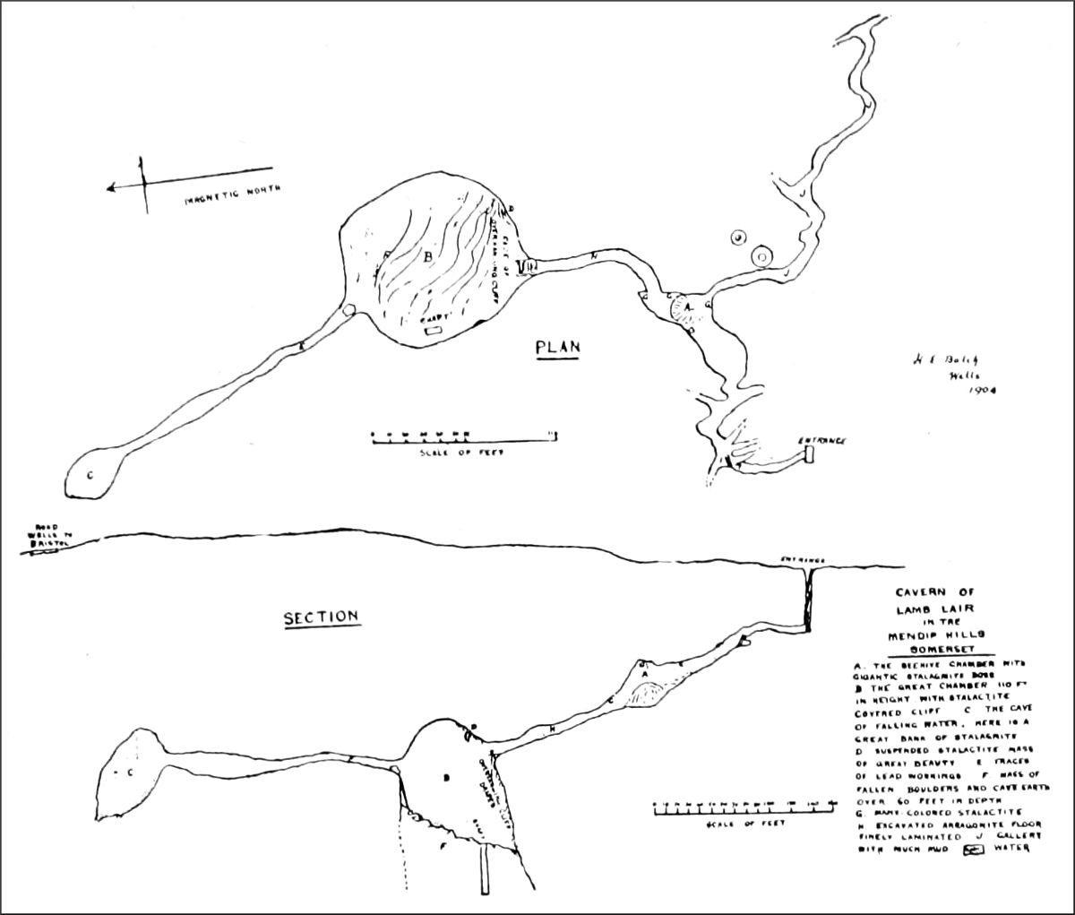
I might mention the demonstrated antiquity of the bosses of stalagmite in Kent's Cavern at Torquay, and from it argue the immense age of the great masses of stalagmite in the Mendip Caves, but, recognising the variable rate of deposit of the carbonate of lime in different caverns, and indeed in different parts of the same cavern, no useful purpose would be served thereby. The huge Beehive of Lamb's Lair at Harptree, the large boss in the first great chamber at Wookey Hole, Gough's "Niagara" at Cheddar, the tall and slender pillars in Cox's Cave at Cheddar, and the taller "Sentinel" pillar at Wookey Hole, all demand for their formation a prodigious length of time, which it is but folly to attempt to compute with our present information. Certainly many thousands of years are required for some of them, and it should be remembered that we have then arrived merely at the time when the floor upon which they stand had received its final form, the action of running water having ceased.[2] Who can doubt then, that, as we stand in the great waterways of the profound depths of our hills, we are looking upon scenes which have varied little since remote ages, and that in some form or other these waterways played an important part in the degradation of the earlier and loftier Mendip range?
It is worthy of remark in this connection that the veteran M. Martel, commenting upon the caverns of Mendip, says, "In consequence of the existence, on the[31] flanks of the Mendip Hills, of deposits of Triassic Dolomitic Conglomerate (Keuper) of Rhaetian beds, and of possibly Glacial alluvia, unconformably on the Carboniferous Limestone, the outflow of the water in the risings operates in three ways: (A) by large fissures in the Limestone itself, when it flows out freely, as at Cheddar; (B) through the crevices in the Dolomitic Conglomerate (the Axe at Wookey Hole, etc.); (C) where the outlet of the water from the Limestone is hidden by alluvia (St. Andrews Well, at Wells). The consequence of this arrangement is that it will be possible—notably at Wookey Hole, when the explorations now going on have enlarged the new galleries recently found—to ascertain whether the Dolomitic Conglomerate is there shown in long beds of ancient shores, regularly superposed on the Limestone, or rather accumulated in filled-up pockets, in hollows pre-existing in the Limestone; that is to say, there will be a material verification of Mr. Balch's hypothesis (already outlined by Boyd Dawkins in 1874) of the very ancient excavation of certain caves of the Mendip Hills, even before the Keuper period. The lie of the Conglomerate under the vaulted roofs of Wookey Hole appeared to me to favour this idea. And it is necessary to wait till formal proofs have been gathered together here, that caves were hollowed out there before the Trias. I recall, on this subject, that long ago I concluded, with Messrs. De Launey, Van den Broeck, Boule, etc., that the formation of caves could commence in the most distant geological epochs, and that the pockets of phosphorites, among others at Quercy and the Albanets of Couvin (Belgium), testify to caves or abysses of at least Eocene times."
H. E. B.
We are called a nation of sportsmen; yet the first criticism we level against any new sport, not our own, is the question, usually unanswerable and always irrelevant, What is the use of it? One may then, with a certain show of propriety, point out that cave exploring is a sport not entirely lacking in utilitarian or scientific objects. It belongs, in fact, to that large class which originated as something else than mere pastime. Mountaineering and hunting are typical representatives of that class. The earliest mountaineers were geographers. Cave exploring was first of all taken up as a branch of archæological and palæontological research, and then as a general inquiry into the physical nature of caves. But a science that has discovery as its principal object, and hardships and adventure as its natural concomitants, is bound to attract as many sportsmen as scientists. The geographical might be called the sporting sciences. And so there are now many ardent cave explorers who would blush to be called speleologists, their sole motive being the enjoyment of the game, and scientific results purely a by-product. Thus the science of caves has given birth to a sport that subserves its aims in the same irregular way as rock-climbing and peak-bagging subserve the aims of geography, geology, meteorology, and other sciences.
Speleology itself is, comparatively, a new science. Cave hunting, the search for human and animal remains, has been an important bypath of scientific investigation[33] since the days of Dean Buckland and the discoveries recorded in Reliquiæ Diluvianæ, 1823. Professor Boyd Dawkins has in recent decades done still more valuable work for palæontology. Speleology is a word of both wider and narrower meaning; in the widest sense covering all kinds of knowledge about caves, their geography, geology, hydrology, their fauna, their palæontology. But most speleologists confine their attention to the physical characteristics of caves. This side of the inquiry has practical utilities. At Vaucluse, for instance, near Avignon, M. Bouvier in 1878 explored the channels of a gigantic siphon that carries the waters of an inaccessible reservoir into the Fontaine de Vaucluse, a famous "rising." His object was partly scientific, and partly to determine the nature of this permanent source, so as to utilise its waters to regulate the level of the Sorgue, to extend the irrigation system of the neighbourhood, and to secure water-power for manufacturing purposes. The Katavothra of Pod-Stenami were enlarged by an enterprising engineer, and protected by iron gratings, after their subterranean exits had been explored, and so utilised to regulate the drainage of the marshy plains of Laibach, and to prevent periodical inundations. In our own country, underground exploration has brought to light valuable water-supplies, and enabled us to safeguard the public interests by pointing out sources of pollution. Caves are most abundant in the districts where those great fissures known as rakes occur, which are rich in minerals, especially lead, calamine, copper, gypsum, and fluor-spar. During the short period in which cave work has been taken up as a sport, discoveries have been made, which of course it is impossible to particularise, that may be the source of considerable profit in the future.
The majority of those engaged in this physical exploration[34] of caves are French. France possesses a Société de Spéléologie, the secretary of which, Monsieur E. A. Martel, author of Les Abîmes, is a most indefatigable and courageous explorer, and the man who has made the science an important and a living one. But M. Martel himself awards the title of "créateur de la spéléologie" to a forgotten predecessor, Dr. Adolphe Schmidl, who published Die Grotten und Höhlen von Adelsberg, in 1854. In this country, although such brilliant discoveries have been made of extinct animals and prehistoric relics of humanity, cave exploring of this kind is a new pursuit. M. Martel says, in Irlande et Cavernes Anglaises, 1897: "In short, the underground of the calcareous regions of the British Isles may be considered as being, topographically, very insufficiently known; this is the conviction impressed on me by my own researches in 1893." Something has been accomplished since that date. Two or three clubs, consisting chiefly of climbers, and a few speleologists working independently, have effected a thorough examination of the great caverns of the Peak, the extraordinary system of underground waters, huge cavities, and profound abysses in the West Riding, and the beautiful caverns of Somerset. But the ground that remains unexplored, the opportunities for adventure and the possibilities of discovery are such as may probably astonish those people who think there is nothing of the sort left in Old England.
Caves are formed in calcareous strata by the chemical action of water laden with carbonic acid, and by the mechanical action of streams. In consequence of the original structure of the Limestone, the joints of which run at right angles to the bedding planes, these eroded hollows have two dominant forms: the vertical pot, swallet, or hole, produced by the widening of a master-joint; and the horizontal water-channel, running in the[35] same direction as the line of stratification. But the strata being commonly tilted, these pits and abysses are often a long way out of the vertical, and the caverns that follow the strata very steep. Many of these ancient watercourses are now dry, but others are still traversed by streams, and present the explorer with most formidable obstacles. The complete exploration of any cave system would involve the tracing out of all its passages from the point where the stream or streams enter the earth to the point of exit. But I know not a single instance where such a task has been worked out in its entirety. In many cases the streams enter the ground merely as small rivulets, and begin to excavate passages practicable to man only at a considerable depth. "Siphons," or traps, as they ought to be called, complete or partial chokes, and a variety of other causes, may put insuperable obstacles in the explorer's way.
Take two of the most important cave problems still awaiting solution, one in Yorkshire, the other in Somerset. A large beck is precipitated into the abyss of Gaping Ghyll, 360 feet deep, and emerges from an opening in the hillside, a mile away, close to the mouth of Ingleborough Cave, which was itself an earlier exit. Several parties have descended Gaping Ghyll, and followed the passages at the bottom to a distance of more than 1000 feet. Then impenetrable water-sinks, and muddy chambers with no outlet, have been encountered, and the communication with the lower cavern has hitherto proved undiscoverable. Both the dry galleries and the canals of Ingleborough Cave have been explored, with great toil and daring, to a considerable distance upwards, with similar results; and though many speleologists are still absorbed in this problem, there is little hope that it will be cleared up without adopting the drastic and costly measure of cutting through the obstructions. The other problem is that[36] of Wookey Hole, the cave in Britain which has the longest history, and which is still yielding interesting discoveries. A number of streams disappear into the earth on the Mendip plateau, 2 miles away and 700 feet above, and find their issue in the source of the Axe at Wookey Hole. Two of the Mendip swallets have been explored to a great depth. Swildon's Hole, an exquisite series of terraced galleries and stalactite grottoes, has been penetrated to a depth of 300 feet. But a more determined attempt has been made to reach the bottom of the Eastwater Cavern. This was discovered in 1902 by my friend Mr. Balch, of Wells, by means of opening the swallet, where a tiny brook ran away through small crevices in a Limestone ravine. A far-extending cave was thus disclosed, full of intricate ramifications, that explain in a graphic manner how new galleries are formed and old ones left dry and deserted, as the result of floods and partial chokes. We have, in the longest route discovered in this complicated system, reached a distance of 2000 feet from the entrance and a depth below the surface of 500 feet. At this point no absolutely impassable barrier has been met with. There is reason to hope that we may still advance farther into the mysterious region between it and Wookey Hole. But the formidable difficulties of the journey hither have set a limit to endurance. Hundreds of feet of creeping through steep, narrow, and contorted passages, compared with which a series of drain-pipes would afford luxurious travelling; perpendicular drops of 50 and 90 feet, with no convenient ledges at the top for letting men down; and, in addition, the necessity of transporting great quantities of tackle to the bitter end of it, have made a twelve hours' day underground as much as we could stand. The difficulty may perhaps be got over by means of a subterranean bivouac. Unfortunately, it would not do to leave the apparatus in[37] position for long beforehand, as it would deteriorate so rapidly. In Wookey Hole itself, we have not yet succeeded in reaching a farther distance than 600 feet from the cave mouth; there a submerged tunnel has stood in the way. But Mr. Balch has thoroughly explored the upper passages that honeycomb the rock above the known caves; he has discovered a number of promising galleries, which are being slowly cleared of débris; and, among them, a series of the most beautiful incrusted grottoes in Britain. A season of drought may reveal an opening up the river-course.
Innumerable similar problems still await solution. Some of us have been engaged in trying with pick and crowbar to engineer a way into the swallets above Castleton, which send their waters through the heart of the hills down to the caves in the dale of Hope. One of these, which we have penetrated to a distance of 350 feet, may turn out to be the entrance to as wonderful a chain of caverns as those of Eastwater. Long Kin Hole, Helln Pot, and other tremendous cavities in the Ingleborough district, still promise good sport. Of all the varieties of cave forms these vertical holes are the most impressive, and also the most perilous to explore. No exploit stands out more finely in the record of that intrepid explorer, M. Martel, than his single-handed descent into Gaping Ghyll, the first ever accomplished. In the Cevennes, however, he has reached the bottom of abysses still more profound, though without the unpleasant accompaniment of falling water. One of the most awkward of the descents described by him is that of the Aven de Vigne Close (Ardèche), 190 mètres in depth. This strange pit is almost a corkscrew in shape, comprising five perpendicular drops, the bottom of one being a few feet from the top of the next. To manage the final pitch, with a chain of rope ladders 40 mètres too short, it was necessary to get six men down to[38] the "Salle à Manger" at the foot of the fourth stage, others remaining as sentinels at the head of the various stages. Some of these waited on their narrow perches for eleven hours, in the dark, with nothing to do but listen to the distant noises of their comrades at work. One man, hanging at the end of a rope, succeeded single-handed in fastening a pulley to the free end of the second ladder, and so let down the third ladder to the required extent. This critical operation was carried out under grave difficulties, the nerves of the whole party having been shaken a few minutes earlier by the accidental fall of a heavy lamp, which was within an inch of killing the men beneath.
Elden Hole, in the Peak of Derbyshire, a yawning cavity 200 feet deep, with an inner cave 65 feet deeper, has been descended several times recently. On the first occasion, through the inexperience of the party, I had the privilege of spending nine hours in the hole, in a state of uncertainty as to whether it was in the power of the other men to get me out. On the next occasion, we let down a dozen men safely. But there still remains the possibility that excavation might clear up the puzzle as to the connection of Elden Hole with other swallets and caves in the vicinity. The old miners believed that it had communication with the natural chambers in the Speedwell Mine; and that is a problem which will entail exploration in collapsible boats along the flooded levels. The great chasm in the Speedwell, which used to be reputed bottomless, has been proved to be only 90 feet deep. It has an upward extension, in the same steep rake, which has not been climbed, nor its top so much as caught sight of. It attains a height, most probably, of at least 400 feet. That is a problem worthy the mettle of our most skilful cragsmen. In the Blue John Mine, a vertical fissure has been climbed, by a party properly roped up, to the height of 130 feet,[39] between walls splendidly adorned with polished and translucent stalagmite. Ladders may sometimes be rigged up, one above another, to reach hollows in the roof of caves. In this way a handsome grotto was discovered above Peak Cavern. When these vertical fissures are open to the sky, it is a simple matter to fix tackle, and even a windlass, for letting men down. When they open in the floor of a well-nigh impracticable gallery, as in the Eastwater Cavern, the difficulties of securing pulleys and ropes are serious. There our troubles are aggravated by the proximity of deep, gaping chasms at the foot of each pitch, lying in wait to receive falling bodies. Nevertheless, by an ingenious arrangement of life-line and pulley, the entire party gets safely to the bottom of the gulf and back again, although it is usual in such situations to leave a sentry behind at the top. Grandest of all these underground cavities in England is the great chamber of Lamb's Lair, in the Mendips. The approaches and subsidiary chambers of that marvellous cavern are magnificent in the richness of their incrustation and their colouring; but this mighty hall surpasses the rest by far. Floor, walls, and roof, of a dome-shaped chamber 110 feet high, are a mass of sculptured transparencies, fantastic reliefs and glowing enamel, all the colours of the rainbow being produced by the different veins of minerals. Only a strong party of experienced climbers or cave workers, fully equipped, should venture to explore this fine cavern in its present dangerous state.
No chapters in Les Abîmes are more absorbing than those describing the exploration of underground waters. By means of collapsible boats, M. Martel explored the concealed streams that tumble into the canyon of the Ardèche. In 1890-91, M. Mazauric, with enormous toil and considerable danger, traced out the labyrinthine ramifications of the Bonheur at Bramabiau (Gard). The Tindoul[40] de la Vayssière (Aveyron), with its yawning abyss and powerful subterranean torrent, and the Causse de Gramat (Padirac), both entailed the descent of a deep chasm and the navigation of large streams. At Padirac the exploring party made their way in four boats along a river, with frequent portages caused by dykes of stalagmite, and discovered some of the most exquisite and romantic stalactite scenery in the vaults through which the river flows.
As a sport, cave exploring ranks high. The exertion it entails is exceedingly severe. The innumerable obstacles and difficult problems to be faced make incessant demands on our inventiveness, adaptability, and presence of mind. The exposure, the hardships, the dangers that must be encountered, form an admirable discipline. Those who consider these any detraction from the merits of the sport, must condemn, not one sport, but a whole class. Running risks, we must remember, is always foolhardy, but to nullify danger by means of science and skill is an aim worthy of the noblest kinds of sport. It will, of course, be objected that the lack of exhilarating conditions, and of the stimulus of fresh air, deprives the sport of the usual benefits of outdoor games. But the air at the bottom of a cave 100 or more feet deep is usually as pure and sweet, and not seldom as dry, owing to its free circulation, as that on the hills. Then the darkness and the sense of imprisonment, you say, are not conducive to healthy enjoyment. But a cave explorer, enthralled by the manifold interest and excitement of the pastime, will never admit this. The variety of entertainment it affords constitutes a peculiar charm.
Only to judge by the number of climbers that have taken up cave work as a pastime, there must obviously be a natural relation between this sport and rock climbing. Certainly, there are many methods common to the two[41] sports, and the expert cragsman has an immense advantage over others when he takes to cave exploring. But the methods and appliances of the mountaineer are restricted by artificial regulations. There are many things that must not be done, even to enable a climber to ascend an otherwise inaccessible peak or to avoid serious peril. In cave work, on the other hand, the difficulties and dangers are multiplied so formidably by the singular conditions, of which darkness is but one, that such prohibitions would be absurd. When one may be called upon to climb a wall of mud, or a sheet of slippery stalagmite, or to traverse water-swept rocks with an unfathomed pool or swallet underneath, every safeguard must needs be utilised. Any mechanical means of accomplishing, facilitating, or expediting a passage is legitimate in cave work; ropes, pulleys, ladders of rope and wood, windlass, rafts, boats, crowbar, pick, shovel—all these, and an enormous variety of other things, have their place in the cave explorer's equipment.
One might write a volume on the equipment of cave explorers. Hardly any other sport requires so formidable a variety. I must limit myself to a few words. The explorer's dress should be a boiler suit, made all in one piece from neck to heel, and with no pockets or buttons to catch in the jagged Limestone, plenty of both being provided inside. He must renounce any hankering after waterproof garments, the proper precaution against the effects of wet being to wear thick woollen underclothing. His boots should be nailed after the manner of those worn by rock climbers. Candles are the best illuminant, much better than any lamp—acetylene, electric, or other. But a supply of magnesium wire should be carried, with waterproofed matches in water-tight boxes; and a powerful limelight, burning ether instead of hydrogen, for the sake of portability, is a useful auxiliary. Boats have been used[42] in some of the caves in the Peak, in Wookey Hole, and in the cavern of Marble Arch, explored by M. Martel, in Ireland. Plenty of rope—not of the Alpine Club material, but hempen—is necessary, and a few rope ladders often come in handy. The only rule of the game that I should like to insist upon is, that no damage should be done to the beautiful features of a cave. It is a rule observed by every cave explorer worthy of the name. The temptation to acquire specimens must be resisted.
The first thing that the cave explorer, eager for discovery, has to learn, is not to lose himself. In many cases no special precautions are necessary, but if there are numerous bifurcations, specific measures must be adopted. Often it is sufficient to station a hurricane lamp or a good-sized candle at the cross roads; a surer method, but one that is rather troublesome, is to unreel a thread as we advance. Such a cavern as Goatchurch, in Burrington Combe, Somerset, is a perplexing maze, where one loses one's bearings completely two minutes after looking at the compass. The mass of the hill is shivered into innumerable fragments, of giant size. Passages striking off along the fractures often lead one back imperceptibly to the point of divergence. At the Eastwater Cavern, in the same district, after I had already gone four times through the enormous aggregation of shattered rocks at the top, where a human body is like a beetle in a heap of macadam, I tried in vain to make my way out without using the life-line. Although there is but 100 feet of it, one takes half an hour to get through. The original explorers spent a much longer time in discovering a practicable route. For my own part, I was lost in a few moments, and compelled to return. The imprudence of two men in the Bagshawe Cavern, in Derbyshire, who went too far in advance in their anxiety[43] to be discoverers, led to an uncomfortable experience both for them and for their rescuers. This very extensive cavern has a number of ramifications. The two men who were following reached a distant and unexplored part of the cave, only to find that they had missed their comrades, the sand and clay on the cave floor being still perfectly smooth and untrodden. They failed to discover the wanderers in the neighbouring passages, and lost their own way for a time before they got back, through the winding tunnels, low-roofed fissures, and deep canals, crawling, scrambling, and wading breast-deep through icy water, to the place where they had parted. They hoped the truants had found their way back, but there was no sign of them, and preparations had to be made for a second journey. After a fatiguing quest, that lasted several hours, they found the missing adventurers in a remote part of the cavern, nursing their last shred of candle and waiting to be rescued. The experiences of some youthful explorers in Wookey Hole, who found themselves on dangerous ground and all their matches gone, are described on another page.
There is a romance about cave exploring that is almost unrivalled. The conditions of the sport are so weird and exciting, so strangely different from everything we are accustomed to. To be so near to, and yet so far from, the scenes of our everyday life; to be launched on a voyage of discovery on an English river, or to be the first to gaze on some miracle of fantastic crystallisation only a few miles away from a large town—these are among the attractions of the sport, at least in its present stage. There is nothing in this country to compare with the prodigious caves of Kentucky or the terrific subterranean defiles of Adelsberg. One might as well look for the magnificence of the Alps among our English[44] mountains. Yet the caves and gulfs of Derbyshire and Yorkshire have a grandeur of structure and diversity of character, and the Somerset caves a brilliance of crystalline deposits, that are fully as admirable and impressive.
E. A. B.
"Where Albion's western hills slope to the sea,
There is a cave, and o'er its dismal mouth,
Whence come to quick, mysterious ears hoarse sounds
Of giant revelry, the ivy grew
And shut the old sepulchral darkness in;
And by its side a well, whence ever full
And ever overflowing, silent, deep,
And cold as death, the waters creep
Adown the broken rocks in search of day.
Above it frowns a fretted, stony brow,
And only from the setting sun e'er came
Within that place the joyfulness of light."
W. W. Smith, Angels and Men: a Poem.
Hardly anywhere else in Britain is the mind borne down with such a sense of incalculable antiquity as at Wookey Hole. Nowhere, certainly, is there anything like such a continuous record from ages inconceivably remote. To touch first of all upon periods that are historical and measurable, we have the name Wookey, which appears to be the one bestowed by the ancient Britons; for it is a recognisable corruption—especially as the people of the district sound it, "Ookey"—of the Celtic Ogo, a cavern, the same word, Ogof, as the modern Welsh still apply to several caves in the Principality. Clemens Alexandrinus, in the second century A.D., has a reference to the cavern, and there are periodical allusions in Latin and English writers from that time to the present. In the Middle Ages its fame as one of the wonders of England was great. William of Worcester has a quaint description; he says, "Its entrance is narrow, and the ymage of a man stands[46] beside it called the Porter, of whom leave to enter the Hall of Wokey is to be obtained." What became of this janitor is now unknown, unless he be represented by the recumbent monolith still to be seen outside the portal. References to the antiquities of Wookey Hole occur in Leland's Itinerary and in Camden's Britannia, and there is incorporated in Percy's Reliques a ballad, by an eighteenth-century virtuoso, Dr. Harrington of Bath, entitled "The Witch of Wokey," recounting an old legend of the neighbourhood.
"In aunciente dayes, tradition showes,
A base and wicked elfe arose
The Witch of Wokey hight."
So it begins, and goes on to relate, in the sham antique style of the day, how a malevolent old woman was for her misdeeds changed to stone by a "lerned clerk of Glaston." The Witch, a black, aquiline profile in stone and stalagmite, is with her culinary utensils the chief attraction to sightseers in the first great chamber, or, as it is sometimes called, the Witch's Kitchen.
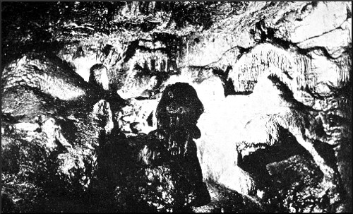
PROFILE OF THE "WITCH OF WOOKEY," WOOKEY HOLE CAVERN.
Photo by H. E. Balch.
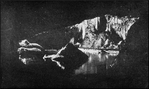
AMONG THE POOLS, WOOKEY HOLE CAVERN.
Photo by H. E. Balch.
It is impressive enough to stand beside the very modern-looking paper-mill, where the infant Axe, still dazzled by its sudden entry into the sunlight, is harnessed to assist in the manufacture of such workaday commodities as Bank-note paper, and to see before one things that carry the memory back all those stages; yet it is but the last few pages of the voluminous history that we are considering now. Professor Boyd Dawkins, who won his spurs as a palæontologist by his researches at Wookey Hole, discovered in the neighbouring Hyæna Den, which is really a branch of the old cavern, human and animal remains whose antiquity, compared with the periods just reviewed, is as the age of Stonehenge compared with that of a man. In the less known passages of the Hole itself,[47] such relics have constantly been found in the course of our investigations. Potsherds, celts, bone implements, the carbonised embers from ancient hearths, all sorts of refuse lying in odd corners, have continually brought us, as it were, face to face with the time when man was little more than the king of beasts. Whosoever would read in the deeper chapters of this vast chronicle must be referred to the fascinating pages of Cave Hunting; there will be only an occasional glance at the human history in this record of a different class of exploration. Palæontological research has not been our object. Several of my companions have made some valuable discoveries in this line, and are intent on making more; but my own original motive, and that of several others, was the sport, as much as the scientific results, to be enjoyed in endeavouring to work out the great problem of the waters that have made themselves a road through the underworld of Mendip, and found an escape from bondage at Wookey Hole. This cavern has been known so long and so familiarly, that it must have seemed as if there were nothing more to be found out about it. It will, surely, be a surprise to many to learn what important additions have recently been made to the extent of its known and accessible passages, and what progress there has been in explaining the secrets of its water system. We are, in all probability, on the brink of yet more startling revelations.
Drayton complained, in "Polyolbion," that the renown of the Devil's Hole in the Peak of Derbyshire, then as in the present day, had robbed the Somersetshire cave of some of its glory.
"Yet Ochy's dreadful Hole still held herself disgrac'd
With th' wonders of this Isle that she should not be plac'd:
But that which vex'd her most, was that the Peakish Cave
Before her darksome self such dignity should have."
Many things here bring to mind the Derbyshire cavern,[48] which several of our party had explored pretty thoroughly before we did any serious work in Somerset—the approach along the deep wooded ravine cut through the Dolomitic Conglomerate, the river pouring out from vast reservoirs within the earth, the legendary associations, and the mystery shrouding the stream's subterranean course. From the drainage area about Priddy, 700 feet above, on the top of Mendip, these waters find their way down through a multitude of channels. Most of these passages are quite unknown, but the two most important, of which a good deal will be said presently,—the Eastwater Swallet and Swildon's Hole,—have been explored to a considerable depth. In the latter we have got to a depth of 300 feet, but natural obstacles and other difficulties have prevented us from following the stream-course farther. Mr. Balch has traced the Eastwater Swallet, which he opened in 1902, to the depth of 500 feet below the point of absorption—almost, that is to say, down to the level of Wookey Hole; but an enormous thickness of rock still remains unexplored between the farthest points attained, from below upwards and from above downwards. Most likely, when we get farther, if we succeed in passing the present obstacles, we shall soon find ourselves entering the canals and water caverns that lie on the same level as the great natural reservoirs of Wookey Hole; in other words, we are approaching the plane of saturation. Exploration in the Eastwater Swallet is still being carried on, though perforce very slowly; and concurrently therewith, efforts are being made, not without success, to trace the passages in the lower cavern farther and farther back.
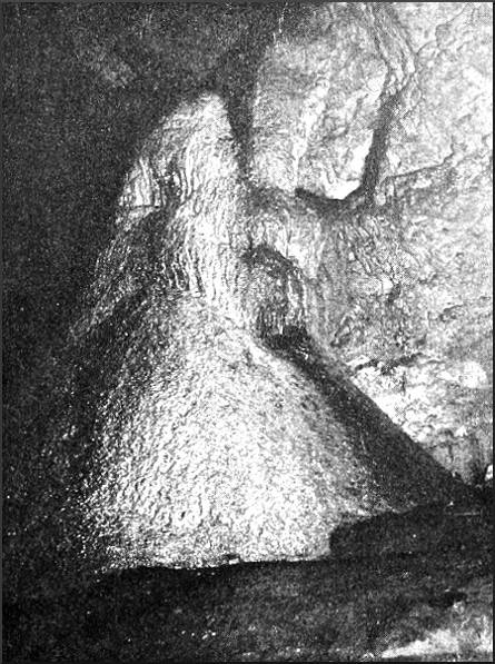
MASS OF STALAGMITE, WOOKEY HOLE.
Photo by H. E. Balch.
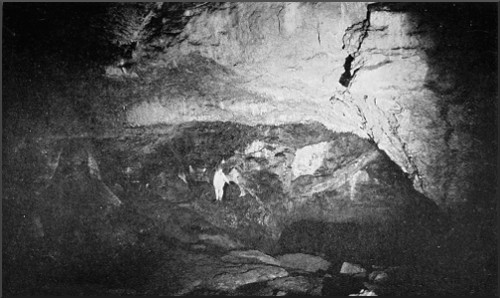
IN THE FIRST CHAMBER, WOOKEY HOLE CAVERN.
Photo by Bamforth, Holmfirth.
The summer tourist, conducted through the three principal chambers of Wookey Hole by a guide armed with a can of benzoline, for making stalagmites into torches, comes out having a very imperfect knowledge of the geography of the cavern, and a totally inadequate[49] idea of its beauties. I well remember how little I was impressed by my first visit, under these conditions, many years ago. The weak illumination seemed to reveal only the proportions of some rather large cellars, pervaded by oily pools, into which the contents of the can were poured and set on fire, producing an unearthly glare through the darkness and the waters; and a number of dingy and unconvincing natural effigies, black with the accumulation of soot. Our exploring party in March 1903 saw these things under an illumination such as had never been kindled there before, and I for one was quite unprepared for the revelation of brilliance and spaciousness and beauty that we were to witness.
"Wokey Hole," says Bishop Percy, "has given birth to as many wild, fanciful stories as the Sybil's (sic) Cave in Italy. Through a very narrow entrance it opens into a large vault, the roof whereof, either on account of its height or the thickness of the gloom, cannot be discovered by the light of torches. It goes winding a great way underground, is crost by a stream of very cold water, and is all horrid with broken pieces of rock: many of these are evident petrifactions, which, on account of their singular forms, have given rise to the fables alluded to in this poem," the story, that is, of the blear-eyed hag who was turned into stone. This quaint description is true in every particular. The first cavern, or the "Witch's Kitchen," has a weird similitude to Gothic architecture. Arch springs from arch up to the lofty summit, and the walls and vaulting are full of canopied recesses, with wild foliations of glistening calcite wreathed from niche to niche.
Below us, as we enter, a broad deep pool stretches away into darkness. Could we follow the gently moving current in a boat, we should enter another great vault, whose existence the ordinary visitor never suspects.[50] There, in a small passage beyond the water, Mr. Balch discovered human remains. Whilst we peered into the gloom, the limelight was burning up, and now it flashed across the cavern to where the black scowling head of the Witch overshadows terraces, basins, and wild imageries of spectral stalagmite.
"A glow! a gleam!
A broader beam
Startles those realms of endless night,
While bats whirl round on slanting wing,
Astonished at this awful thing.
The rocky roof's reflected rays
Are caught up in the waterways,
And every jewelled stalactite
Is bathed in that stupendous light,
One moment only; then the caves
Are plunged again in Stygian waves;
The fairy dream has passed away
And night resumes her ancient sway."
The Vicar of Whiteparish, near Salisbury, wrote these expressive lines after seeing Wookey Hole lighted up with magnesium. Our beam of light was less transitory, and gave us ample leisure to contemplate the glories of this magnificent chamber. Its walls for the most part are coloured a rich red, which absorbs light readily and makes photography a slow business. The first exposure took half an hour. Against the warm red, the pearly streaks of stalactite and stalagmite shine in exquisite relief. There is a superb mass of stalactite near the Witch; to say truth, the eye is confounded by the wild grouping of fantastic piles of dripstone around that uncouth head; the colours of the rocks and the flashing crystallisations are reflected in the pellucid water, and confused again with our glimpses of the river-bed, smitten by the moving shaft of light. On the nearer side of the cave, where a narrow arch leads into an incrusted grotto, a gentle stream has deposited a fairy-like series of fonts[51] and stoups, ending in a pure white sheet of dripstone, over which the water murmurs. The surface of all these fabrications is diapered over with a network of delicate pearly ridges; so that here you see a mass, as it were, of polished brain coral, and there madrepores and alcyonaria, where the deposits have continued their growth under water. Some of these efflorescences are like petrified filaments of water weed. The foul scurf and soot that covers the Witch's cooking apparatus and other accessories would, doubtless, disappear under a fresh deposit of pristine white, would the guides but cease for a twelvemonth to drench them in benzoline, for the delectation of such as love conundrums in stone. Still, these things are but a small part of the scenery, when all is lighted up as we were able to light it. Our work done, a Bengal fire was set off, and the glimpses it gave us along the waterway to the inaccessible chamber beyond added vastness and mystery to the scene.
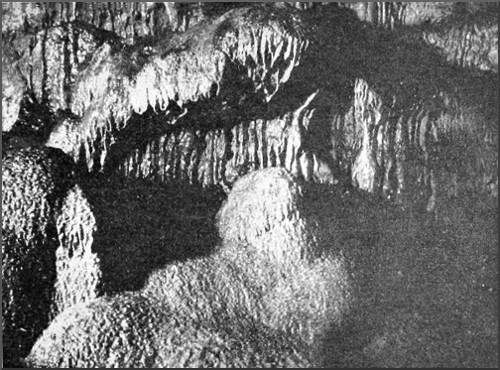
STALACTITE TERRACE, WOOKEY HOLE.
Photo by H. E. Balch.
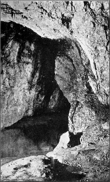
GREAT RIVER CHAMBER, WOOKEY HOLE.
Photo by Dawkes & Partridge, Wells.
The next chamber is a loftier vault, and the arching is more decidedly Gothic in its suggestiveness. Two low arches at either side form the portals, far above which a series of pointed arches spring to a height of 70 feet, their summits converging in a polygonal cleft, like the lantern of some cathedral dome. Then we make our way across the sandbanks, between the pools, into the largest chamber of all, with a roof of enormous span, whose breadth dwarfs its height, arching over the sleeping river and the broad slopes of sand, whereon grotesque Limestone monoliths take the likeness of prehistoric monsters sleeping by the waterside. Through the clear water we can discern a submerged arch communicating with more distant caverns. There is a tradition, coming down from the mediæval historians, that unfathomable lakes lie behind the barrier. This is probably true in so far as it points to the existence of enormous reservoirs of water[52] beyond the accessible parts of Wookey Hole, the theory being confirmed by the behaviour of the silt at flood time. Were the hatches belonging to the paper-mill opened, and the water lowered a few feet, an attempt might be made to solve these problems. Mr. Balch did, in fact, at a time when the water was partially lowered, make his way into two unexplored chambers, fed by tunnels submerged a foot or so below the surface.
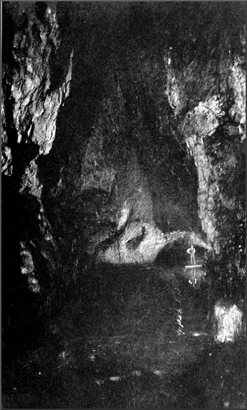
SECOND GREAT CHAMBER, WOOKEY HOLE.
Photo by Dawkes & Partridge, Wells.
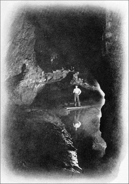
ENTRANCE OF THIRD CHAMBER, WOOKEY HOLE.
Photo by Dawkes & Partridge, Wells.
The older and the newer caves and passages of Wookey Hole lie at five levels, one above the other like five storeys, the topmost of all representing the oldest channel of the subterranean Axe, which has in the course of ages forsaken first one and then the other, boring fresh passages in the Conglomerate. Of these five storeys, one alone, the nethermost, is known to the uninitiated visitor. Portions of the other four had been explored from time to time by Mr. Balch, who in 1903 made such discoveries of unknown continuations as fill us with hopes of penetrating deeply into the mysterious region beyond. Climbing into the Upper Series from a spot near the threshold of the Witch's Kitchen, we made our way eastward over dry rocks, and came speedily to the junction with another passage from nearer the cave mouth. Only a thin leaf of rock separates the two, for it is characteristic of all these upper passages that they run almost parallel to each other whilst rising to other levels. Altogether, we doubled back on our original direction three or four times, creeping through holes in the walls partitioning the corridors, and ascending to the top of several lofty bridges, formed by fragments that have fallen from roof and walls and wedged themselves securely. The construction of these bridges is often marvellous to see. In one case a number of rocks form an irregular arch, at the top of which a keystone wedges the whole cluster together. Obviously they must have fallen and come together practically at the same instant.[53] This was what happened hard by with two great boulders that fell down the rift and caught each other in mid-air. Another impressive natural structure is known to explorers of Wookey Hole as the Spur and the Wedge. The huge horizontal peak of Limestone projecting into the chasm brings to mind a famous passage in Mr. Rider Haggard's She. This spot was the scene of a droll adventure that befell one of my companions years ago. With several other boys, he wandered into these passages, when suddenly the one candle they had with them went out. A boy had been commissioned to bring a supply of matches, but it was ascertained that he had only one left, which on being struck promptly went out. In this emergency, the lads could do nothing but sit still until help arrived. They had no food, and in trying to feel the time, they broke the hands of the only watch. They computed that they had been in durance three days when the rescue party reached the spot, but the protracted and hungry period of waiting turned out to be only eight hours. Their resting-place was the flat back of the pinnacle, with a 60-foot drop on one side and jagged rocks on the other.
In two places in these galleries there are fine displays of stalagmite on the wall, in the form of corrugated sheets, the ridges of which, stained red with ferrous deposits, hang straight down like a series of organ pipes. The walls glisten here and there with minute crystals. But the most striking sight is where the Dolomitic Conglomerate, of which the walls are composed, appears in clean-cut sections. One of these, which has been successfully photographed, shows the differently coloured pebbles, chiefly Mountain Limestone with a few of Old Red Sandstone, embedded in the matrix, and surrounded with distinct layers of cement, all as brilliantly defined as the concentric rings of an agate. Hard by is a corner where Mr. Balch discovered the bones of a man; they were mineralised,[54] but it was impossible to tell their period, or even whether they represented an interment, or were merely the remains of some wanderer from his tribe who had perished in this forlorn spot.
Sleeping bats hung from many a coign, and would not be awakened even when lifted down. Big cave spiders crawled over the walls in the parts adjoining the open air, where the breeze found its way in, although we could not see through the narrowing crevices. Here and there the cocoons of the spiders hung from the roof in white, woolly balls. At the farthest point reached was a settlement of jackdaws, with a number of untidy-looking nests, and there we could hear a thrush singing in the trees outside; for we were close to the main cliff, and the river was flowing out beneath our feet, under a great thickness of rock.
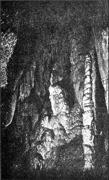
STALACTITE GROTTO: NEW CHAMBERS, WOOKEY HOLE CAVE.
Photo by H. E. Balch.
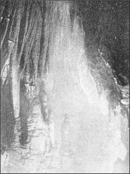
STALACTITE GROTTO, WOOKEY HOLE.
Photo by Claude Blee.
By the natural falling in of the roof, the first great chamber of Wookey has broken through into the galleries above, and certain passages of the Upper Series now open high up in the vault of the Witch's Kitchen. One of these openings has been known for years; another, which we reconnoitred carefully in March 1903, has now had its barrier of cave earth cut through, with the result that a group of stalactite chambers of wonderful beauty has been disclosed, with untold possibilities of further advance. Boxing Day 1903 was spent in an exploration of these new chambers. Climbing on my shoulders, Mr. Balch got hand-hold in a chink of the Limestone, and pulled himself up 10 feet. Here a stalagmite peg held the rope ladder whilst we clambered after, entering a cross gallery that gives access by another short scramble to the loveliest of the new grottoes. When the discovery was made, Mr. Balch and his assistants had to keep watch and ward day and night, until a door had been fitted up, and every hole and crevice securely blocked; for the entire village was[55] quickly on the scene, and irretrievable damage might have been committed.
The grotto is irregular in shape, and the incrustations are disposed without order or system. From every nook and corner in the superimpending rocks bundles of stalactite spears are thrust; bosses and pillars spring from the floor, and sometimes meet the descending shafts. Of all these frail pillars, the finest, rising on the very edge of the rift we had ascended, seems to support the whole ponderous roof, like the fragile column left by a dexterous architect, to cheat the eye, in some cathedral vestibule. Certain of these hanging shafts are shaped like the barbed head of a spear, a slanting stalactite having intercepted and coalesced with the dripping calcite from an inch or two away. A creamy, brownish yellow, with a golden lustre like that of amber, is the prevailing tint; but, here and there, plaques of dazzling white shine out against the burning magnesium.
Crawling in and out among the stalagmite pedestals, grievously afraid of injuring the diaphanous fabric, we emerged in a very low chamber of great area, right across which a grille of translucent rods, each a foot high and ranged in regular line, fills the narrow space between roof and floor. This extraordinary and strangely beautiful railing is some 30 feet long, and only in one spot is it possible, by dint of careful wriggling, to pass between the rods into the farther parts of the chamber. Mr. Balch entreated me not to attempt this. When he tried it, a fortnight ago, he had indeed got through to the series of caves beyond, but, in returning, a projection had caught him at the lowest spot, where the chamber is only nine inches high, and he had struggled hard for twenty minutes before he could move an inch. Two of us, notwithstanding this advice, ventured through. After draining off a pool of water that was held back by a thin rim of dripstone,[56] we traversed the low chamber and a short tunnel beyond, climbed a vertical cleft, and entered another low chamber of immense length and breadth, whose various extensions we explored until the accumulated deposits of boulders and cave earth stopped our advance for the time being. In returning through the tunnel and the low chamber with the grille, we tried successfully to dive under the archway and wriggle into the opening head foremost, in spite of two opposing stumps of stalagmite. By these tactics we escaped the worst of the squeeze.
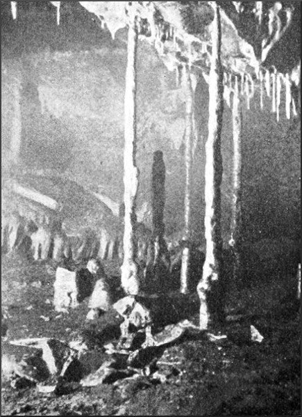
STALACTITE PILLARS, WOOKEY HOLE.
Photo by Claude Blee.
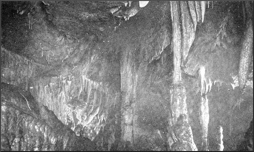
NEW STALACTITE GROTTO, WOOKEY HOLE.
Photo by Bamforth, Holmfirth.
Whilst engaged in this excursion, we had heard the sound of hammering somewhere away in the heart of the rock. It was our three friends attempting to break into a promising gallery, which ought to cross the vestibule of the main cavern and connect the two groups of upper caves. We were not long in joining them; and now with pick, hammer, and crowbar we attacked the barrier in force. The chief obstacle was a great flat rock standing on end across the unexplored opening, and propped up by a heap of boulders, which we gradually smashed up or removed to one side. Still the big fellow would not budge, and we had to sap his foundations by degrees. Yet this huge rock was but a fragment that had fallen from the edge of a vast and threatening leaf of rock, which now hung over our heads like a monstrous guillotine. The upper caves are waterless, and it soon became desirable to send one of our number to fetch us a drink. Presently we heard a plaintive cry from the distance: his candle had gone out, and he had forgotten the matches. Going to the rescue, I found him groping about on a shelf of rock, 30 feet from the floor, hard by the Spur and Wedge; he had lost his bearings altogether. On his return, we made another onslaught upon our rocky adversary, the five of us sitting on his shoulder and pushing against the wall, whilst our leader waxed grimly[57] facetious as to what would happen to us if the shock brought down the guillotine. Slowly and painfully we tilted the mass of rock over, but only a few inches, leaving just room enough for a thin man to crawl behind. Squirming eagerly into the opening, I looked under, and was disappointed to see that, if wide, it was still heaped right to the crown of the arch by the rubbish flung there long ago by the river. Nevertheless, Mr. Balch was not dissatisfied. Though parts of these ancient waterways are choked with débris, it is unlikely, nay impossible, that the main channels should not remain open. Our day's work had taken us on another stage in our slow journey. The labour of removing the new obstacle will be considerable, but the result is sure.
In 1904 we had the pleasure of escorting that veteran speleologist, Monsieur E. A. Martel, through the old and the new caves at Wookey Hole. About the same time efforts were made anew to force a way into unexplored territory, with not uninteresting results. Many hours were spent one day by three of us in a hole that we had discovered just within the doorway of the cavern, a thing that had most unaccountably escaped observation hitherto, though right under our noses. The opening pointed in the direction of the lower cave mouth, where the Axe comes out; but it certainly did not look very promising. Crawling in, we found ourselves in a steeply descending passage, almost completely choked by stones and cave earth. But at the end of the first portion it was noticed that the floor dropped suddenly, indicating a chamber or gallery below. An afternoon was spent in the laborious task of shifting rocks, small stones, and earth, and passing up the fragments, great and small, from hand to hand, until they could be placed in safe positions near the mouth of the hole. Eventually, an ancient channel through the solid rock was disclosed, and at the end of 60 feet or so[58] a broad low chamber appeared, floored with rocks and earth, and roofed in with solid rock at a height of 12 or 14 inches. Pushing on, the leader speedily found he was jammed between floor and ceiling, and could go no farther without more engineering; but an elder wand was procured, a candle tied to the end of it, and this rough-and-ready torch being pushed forward, it was possible to see some 35 feet ahead into the low chamber, in the depths of which a row of spiky stalactites stretched across like an alabaster grating.
To explore this chamber thoroughly, it will be necessary to hollow out a passage in the soft floor. In all likelihood, it crosses the present river-course at a level only a few feet higher. Quantities of pottery, bones, teeth, and fragments of charcoal were found in digging out the obstacles. It seems most probable that the hole was stopped up by human agency in prehistoric ages; perhaps it was a place of sepulture. The obstacles were carefully wedged together, and their removal caused much difficulty. It is not pleasant to lie on one's back in a hole, whose roof is only a few inches above one's face, and have a block of Limestone rolled from end to end of one's frame, without allowance for projections in either. In all several tons of material were shifted and carried out of the way. Much of the pottery had designs of a primitive character worked on the surface; the more elaborate was Romano-British. Considerable sections of amphoræ and other vessels have since been pieced together.
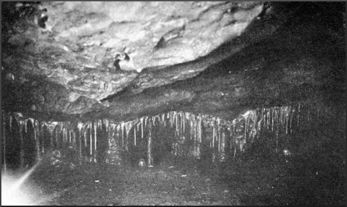
THE GRILLE: NEW CHAMBERS, WOOKEY HOLE.
Photo by Bamforth, Holmfirth.
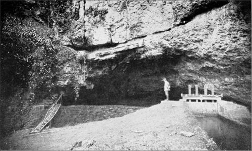
THE SOURCE OF THE AXE, WOOKEY HOLE.
Photo by Bamforth, Holmfirth.
Next day I made a curious find at a point farther in. Where the path from the entrance rises over a big accumulation of rocks, just before it reaches the first great chamber, a hole in the floor had been noticed. It had not been explored, but was waiting for someone capable of standing an exceptionally hard squeeze. The depth being uncertain, I had a rope tied on, and after a brief[59] struggle managed to get through the first hole, into a crooked passage of no great length, which brought me down to a small bell chamber. This had simply been produced by the piling up of huge quantities of rocks and stones on the floor of the original cavern, the whole structure having since become thoroughly cemented and solidified by the growth of stalagmite. There were many teeth lying about, but the most interesting object was a wooden bowl, slightly flattened out, and resembling the top of a man's skull in shape and size. It felt soft, like a piece of cork, but was perfectly sound. What its age would be one could not tell within a century or two. It is now in the possession of Mr. Troup of Wells.
E. A. B.
From two to three miles north of Wookey Hole, on the top of the Mendip tableland, is a broad, shallow valley, surrounded on every side by higher ground. It is a grey, desolate tract, with few trees dotted over its surface, but a thick belt of wood on the south, the dark green of which in summer, and the black stems in winter, make the grey landscape seem the more arid, gaunt, and desolate. The ruined engine house of a deserted lead mine does not add to the attractiveness of the scenery. But that is soon lost to sight in the vastness of the rolling tableland, which swells up in the distance to 1000 feet above the sea on Pen Hill to the east, and again to the same height at Priddy Nine Barrows on North Hill, the general brown tints of the heather and bracken showing that the Old Red Sandstone comes to the surface on these and the other saliences of the plateau. Within this shallow basin the rock is Limestone, and the causes of the existence of a valley without any visible outlet for its drainage are at once manifest. In many places the surface of the ground is scored and pitted by innumerable depressions of diverse shapes and sizes; roundish basins, steep funnels, craggy troughs with streams running in and disappearing, and mere dimples, grass-lined and perfectly dry. Through these swallets, or swallow holes, the whole of the drainage finds a vent, and all the material excavated by the forces of nature in the process of hollowing out this valley, has[61] been carried off in the same way. The work is still going on. At Eastwater a little stream, flowing down a long ravine, suddenly comes against a Limestone cliff, and begins to burrow. Less than a mile away, another stream, big enough to be called a brook, pours into a cleft in the ground and is seen no more. This second swallow is known as Swildon's Hole, Swildon being a corruption of Swithin. Years ago, in the course of a lawsuit, it was proved that the waters about the village of Priddy, which stands on the edge of this upland valley, find their way into the Axe, uniting their streams somewhere in the heart of the hill between this point and Wookey Hole. When there were storms on the hilltop, or the upland waters were fouled artificially, the Axe came out turbid. That the area drained by the underground Axe is a large one is proved by the size of the river, which must be formed by the junction of a good many streams of the volume of Eastwater and the Swildon brook. Probably that area extends as far east as Hillgrove, where a series of swallets in a woodland ravine are now being enlarged by Mr. Balch, with a view to an exploration of the underlying caverns.
In 1901 Mr. Balch's party made a descent into Swildon's Hole, and got to a depth of 300 feet below the point of absorption, which is at the same level as the Eastwater Swallet and that at Hillgrove—that is, 780 feet above the sea. Difficulties having been put in the way of a more complete exploration by the owner of the field in which the swallet is situated, he turned his attention to the neighbouring stream of Eastwater, which, unfortunately, runs away through holes impenetrable to man, and therefore had not promised so easy a route into the unknown. Undeterred by the obvious difficulties, Mr. Balch set to work early in 1902, and, as he describes, made his way at last into the open passages underneath the swallet. In[62] the course of two or three visits he reached a point nearly 500 feet below the cave mouth, and distant about 2000 feet in horizontal measurement.
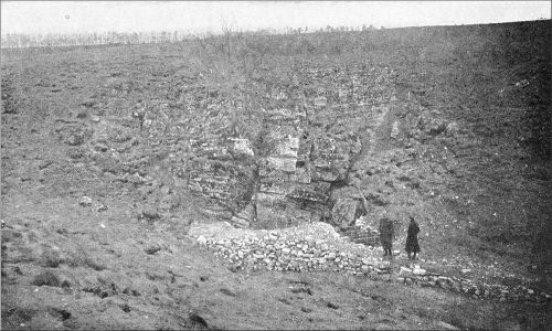
ENTRANCE TO GREAT CAVERN OF EASTWATER.
Photo by Bamforth, Holmfirth.
SECTION OF EASTWATER CAVERN.
(Click on map to see a larger version. Not available on all devices.)
He invited a large party to descend with him on March 18th, 1903, for a more elaborate exploration. Besides the leader, Mr. Balch, experienced cave explorers came from Oxford, Derby, Holmfirth, Glastonbury, and Wells. Driving up from Wells early in the morning, we donned our overalls at the mouth of the swallet. Everything was in readiness for the adventure, and at eleven o'clock or thereabouts the first man descended the artificial hole, 20 feet deep, into the enormous accumulation of loose rocks that extends for more than 100 feet into the head of the cavern. The blocks forming the sides of this shaft, and many of those beyond its foot, had been carefully underpinned with timber. Everything bore witness to the labour and perseverance spent in engineering an entrance. The baggage having been let down by a rope, we pushed on through the confusion of rocks by a maze of passages resembling the intricacies of the well-known Goatchurch Cavern, at Burrington, although the rocks, instead of being huge rectangular masses, were shattered into the most irregular forms and sizes, leaving holes between scarce big enough for a human body to squeeze through. The first explorers were two hours in finding a way through this bewildering labyrinth. Some of our men went head foremost, others crawled on their backs with feet in front. The rocks were water-worn and jagged, and often so rotten with the action of water laden with carbonic acid, that a finger could be thrust in up to the hilt, as into clay. We formed ourselves into a chain to hand on the luggage; this was a trying business, for we were taking down more than 500 feet of rope, besides a pick, a shovel, a bucket, various steel pulleys, an ample stock of candles, and provisions for three meals, to[63] humour which through these unaccommodating passages was worse than coaxing one's own body along. Both horizontal and vertical openings occurred here and there, and had to be avoided carefully, one of the most important of these being a flood-way formed by the stream entering the swallet. It was curious to find a withy stick making desperate efforts to put forth leaves in the darkness, and succeeding in producing a long white sprout.
Suddenly the noise of falling water was heard, and the leading men called for the rope ladder. The masses of loose rock end abruptly. To the right a steep tunnel, called the 380-foot way, carries a small stream down; to the left is a large, irregular chamber; and beyond it, the main passages of the cavern. The ladder being secured, each man resigned himself to the inevitable drenching, and descended into the rugged cave at the head of the 380-foot way. A camera was got down so far, but most of the apparatus was left at the parting of the ways. Our road was now decidedly easier. The water-channel was rugged, but the roof rose fairly high, and there were few boulders. A large tunnel, cut in the solid rock, brought down a tributary stream on the right; on the other side, a horizontal tunnel was marked down for further investigation. The real termination of the 380-foot way has not been discovered. At present there is no passing beyond a choke of stones and gravel that fills it nearly to the roof; but Mr. Balch proposes to remove this.
We returned to the horizontal tunnel. It led into an extensive sloping chamber whose shape is peculiarly characteristic of this cavern. Roof and floor, roughly parallel, are inclined at an angle of fifty degrees. For a long distance there was space to creep along under the roof, then the space grew less, and at length the leading men shouted that they could get no farther. Being rather[64] slighter in build than those who were in front, I made an effort to pass them, and succeeded by clambering along at a higher level. A hole between some choke-stones and a stalactite gave me admittance to a continuation of this extraordinary chamber. Then, dropping into a dry water-channel, I wriggled downward and downward, following the noise of some dislodged stones that rattled away to a considerable depth. At last I found it impossible to get any farther, though two more feet would have led me into a sudden widening that looked rather promising. The next man behind was unable to get within 50 feet of this point.
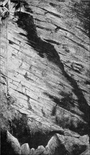
THE DESCENT OF EASTWATER CAVERN, THE SECOND
VERTICAL DROP.
From Sketch by H. E. Balch.
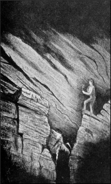
THE GREAT CANYON, EASTWATER CAVERN.
From Sketch by H. E. Balch.
After an exceedingly painful journey back to the mouth of the tunnel, we sat down to lunch, before re-ascending the rope ladder, and carrying our baggage through a series of awkward holes and pits, all deluged with water, into the big chamber at the head of the main passages. In this chamber, whose walls, floor, and roof are formed of gigantic blocks seemingly on the point of collapsing, is an opening in the roof, through which a stream comes tumbling in. At the farthest corner therefrom a large opening leads to the bottom of a chimney or aven. Great quantities of clay on walls and roof show that this cavern has frequently been filled with water through the choking up of the lower exit. The stream runs away into the rocky floor at the lower end of the cave, and a few feet above it is a flood-way, a short, low tunnel, through which we crawled. Then begins one of the most interesting portions of the cavern. In one of those broad, low-roofed fissures, inclined at the same angle of fifty degrees as the general dip of the strata, and formed, in fact, by the widening of a bedding-plane in the Limestone strata, a deep, winding channel has been cut by the stream we have just passed. It has been called, from its likeness, the Canyon. For a considerable distance our[65] path lies down the Canyon, and with our heavy burdens we find the passage far from easy. As far as possible, we keep near the top of the ravine, straddling across. Sometimes, however, there is no help for it but to drop right to the bottom. Before we reach its termination, we have to climb out on the smooth, sloping floor of the main fissure, and wriggle forwards lying on our sides or on our backs. Foot-hold and hand-hold being singularly scarce hereabouts, we shall find this one of the most troublesome places in returning. On the right, we have a glimpse through a hole here and there of another great low-roofed fissure sloping at the same angle; then there are cross roads, with a tunnel on the left admitting to a stalactite chamber, and a passage on the right leading to the lower end of the Canyon.
We now reached the most constricted portion of the main channel. It is a low, roundish tunnel, with an S curve at the distant end. A good deal of our locomotion might be likened to crawling through drain-pipes; we were now coming to a sort of trap. The S bend has to be taken with the body lying on its right side. Once in it, the explorer cannot turn round, since the diameter every way only just admits a human body, and the three curves are close together. My candle went out half-way through, and to unjam my arm and get it down for the waterproof matches was a difficult and protracted operation. Moving the luggage through was a very severe task, the width of the hole at one spot being only nine and a half inches.
We issued into a good-sized passage. Immediately on the left a twisting fissure went down to the head of the first perpendicular drop; but, leaving this for a while, we spent nearly an hour exploring the lofty chamber straight ahead of us. It rises to an unknown height in a vertical fissure, narrowing gradually. At the bottom is a deep[66] cutting, which some of us passed by back and knee work, at a height above the floor. On the left, that is the eastern, wall are openings into a parallel tunnel with good stalactites. At the far end both this tunnel and the passage itself are blocked with clay and gravel.[3] On our second visit, a day or two later, I explored a tunnel in the other wall 10 feet from the floor. It led into another of the vast sloping fissures already described, which I was too much exhausted to explore very far. These fissures, all inclined at the same angle, and either parallel or else lying in one plane, are most impressive features of the Eastwater Cavern; their extent is evidently enormous, and it seems as if only a few frail pillars of jammed stones served to prevent the great mass of the hill from settling down and crushing roof and floor together. On a more minute survey it may turn out that these are all portions of one huge fissure, merely partitioned off by different chokes.
It was four in the afternoon when we entered the twisting fissure leading to the first vertical descent, and two of the party had now to return. Through an oversight in not bringing a short rope for harnessing the pulley, nearly two hours were spent in rigging up the tackle, the situation being awkward for letting men down safely. We were ensconced in a little chamber, the boulder floor of which opened into the top of a narrow rift widening downwards, where, about 60 feet beneath, the walls funnelled into a yawning pit 60 feet deep. This pit had been explored previously, and was found to be choked at the bottom; it formed a safe and certain receptacle for anything lost or dislodged by persons descending the cliff above it. The configuration of our hole was such that only one man at a time could get a steady pull on the[67] life-line, which ran over a pulley. A manilla rope was therefore let down from the same belaying-pin, for a man to climb up and down by, so far as he was able, the life-line being used merely as a safeguard. One by one the explorers dropped over into the abyss. The last three or four had the best of it, since, with a hauling party below, full use could be made of the pulley.
We were now drawing nigh to the final tug of war. A quarter of an hour of indescribable wriggling brought us to a narrow and lofty rift, into which as many of the party as it would accommodate wedged themselves, right over the second vertical drop. Much the same tactics were resorted to here, save that, instead of a fixed pulley, each man in turn had a large steel pulley belted to him, through which ran 200 feet of rope, one end fixed to a wedged boulder beneath us, the other end in the hands of the hauling party. A 90-foot manilla was, as before, allowed to hang free, as a guide-rope, over the crags, and enabled each man to do something for himself and assist those above. Only four men essayed this last descent.
The gigantic cavity into which we now dropped is one of the most savage and impressive things it has ever been my lot to see. At the top, over the heads of the hauling party, it runs up into the rocky mass of the hill as a vertical chimney, under the mouth of which lay what appeared to be a deep black pit. We alighted, one by one, on a sloping shelf that traversed the side of the cavity at a considerable height. Creeping along this ledge, we saw at the end of it a huge cavernous opening descending into darkness, with a mighty rock wedged across it like a bridge. The black, gaunt walls on each side of us were craggy and rifted; their surfaces glistened with streaming water. Our ledge ending abruptly, we dropped, hand over hand, on the rope, to the edge of a large pothole, into which a stream was rushing. At this point a tunnel[68] goes off to the left, and, as it had not been explored, I was asked by Mr. Balch to proceed down it. Two of us crept and clambered and slid down a very dirty watercourse, till, at a distance of perhaps 50 yards, we found ourselves atop of a high clay bank, closely overhung by rocks, with a stream rumbling along to the south-south-west. I got within 10 feet of the water, but without a rope to get us up again we would not venture farther. We had now been in the cave nine and a half hours, and were too much fatigued to undertake new work. It was ascertained, beyond reasonable doubt, that a fine series of potholes that exist in the continuation of the great cavity must drain into the stream just discovered. Beyond those potholes, to pass which involves much hard work, is another cavity, and beyond that what?—at present no one can tell. All we know is, that the water finds its way ultimately into the vast reservoirs inside Wookey Hole; but whether there are other vast cavities, or merely narrow crevices and impassable clefts between, is a question that will require labours almost Herculean to solve.
In scrambling back along the ledge in the big cavity I gave the final shove to a dangerous loose rock weighing something like six hundredweight. It fell into the ravine beneath, and hurtled onwards toward the chain of potholes, making the whole grim place ring with a crash of echoes. It took us two hours and a half to return to the cave mouth, although we were unencumbered with apparatus, for we had left the ropes and pulleys in place for another descent. Getting seven men up the higher of the two vertical pitches was a tough undertaking at the end of an arduous day, and when we returned through the famous S tunnel more than one explorer seemed disposed to snatch a sleep on its procrustean bed. We had been twelve hours underground when we revisited the glimpses of the moon.
It had been proposed to continue the exploration next day, but no one was fit for such a repetition of exhausting labours. The day following, a party of three was mustered to recover the apparatus that had been left in the depths. Two of us reached the head of the nethermost pitch, and after hours of severe work got everything up to the mouth of the swallet. Once more we drove back over Mendip in the dark. All around us on the desolate plateau was impenetrable gloom, but in the northern sky, and it seemed but a few miles away, the lights of Bath and Bristol flared across the heavens like two immense conflagrations. Never does one feel the sublimity of the open, windy earth, the starry sky, and the free sense of space, so profoundly as after striving for a long day to break through the barriers that shut us out from the regions of mystery under the hills.
E. A. B.
An insignificant crevice, a hole scarcely wide enough to tempt a dog or fox, alone gives admittance to what is perhaps the wildest and most magnificent cavern in Britain. Swildon's Hole, it has already been stated, lies at the same level, 780 feet above the sea, as the Eastwater Swallet and that of Hill Grove. It lies in a separate trough, within the same basin as the Eastwater stream, with whose waters it unites somewhere in the bowels of the rocky hills, to flow out of Wookey Hole as the river Axe, of which it may be considered as the principal feeder. A few years ago the actual swallet was visible, the brooklet running away into holes under a bank of earth and rock crowned with foliage. More recently, in order to make a small fish pond, the landowner has made a dam above the swallet, which is entirely concealed by this means, an entrance remaining, however, into the maze of cavities and waterways through a narrow crevice at the side. Mr. Balch was the first person to recognise the importance of Swildon's Hole as a chief feeder of the Axe, and in 1901 he made preparations to explore it. But through some delay, three members of his party were the first to enter the cave, without him—namely, Messrs. Troup and H. and F. Hiley. A short while after, Mr. Balch was able to carry out a more extended exploration. Then for some time no one entered the swallet, which gradually became choked with stones and litter brought down by the stream. Very few had ever heard of the cave, and[71] hardly anyone realised that one of the most beautiful pieces of underground scenery in Britain was lying there unseen, and one of the most important of hydrological problems remaining quite unsolved.
The next visit took place about Christmas 1904. Mr. Troup, who had been one of the first in the cave, took the lead of our party. My other companions were Messrs. Bamforth and E. E. Barnes, but we expected to be joined some hours later by Mr. Balch and Mr. Slater.
When the first explorers entered this cavern some little while ago, they met with serious difficulties owing to the presence of ancient chokes or dams that held back pools of water, but they were assisted by the dryness of the weather. We, on the contrary, made our descent after a period of heavy rains, and the volume of water that accompanied us down was twentyfold as great. We had one advantage, however: the original discoverers were with us to point the way. With luggage reduced to a minimum, two ropes, plenty of illuminants, food, and two cameras, we passed through the uninviting entrance, and attacked methodically a close-packed mass of débris that had been washed into a narrow gut since the former visit.
Whilst we lay at work, the sound of falling water in the depths below broke on our ears, a musical but ominous salutation. The obstacle wasted two hours of valuable time. Wriggling through at last, feet foremost, our legs came out over the rift, a narrow chasm some 20 feet deep, with the head stream of the cavern tumbling in over a choke-stone at one end. Our goods were let down carefully into the hands of the first man, who lodged them in a sheltered spot whilst we scrambled hastily down through showers of spray. Now began a painful advance into the depths. Along the tilted bedding planes, down the perpendicular joints of the Limestone, widened by the water into broad, low chambers[72] and deep shafts and canyons, we forged ahead, hugging the stream, which grew larger and angrier as tributaries came swishing in from walls and roof. At one point the water swept horizontally along a straight canal, but was stopped at the end by a recent choke, and now tumbled through a hole in the wall into a huge pothole. Through this lay our road.
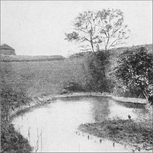
ENTRANCE OF SWILDON'S HOLE.
Photo by M. Martel.
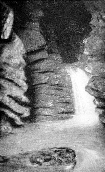
WATERFALL, SWILDON'S HOLE.
Photo by H. E. Balch.
The water poured down a staircase of similar basins, where to keep clear of the stream was impossible. So far we had kept tolerably dry, but as we clung to this watery ladder I pricked up my ears at the remark, "Will you have your back or your stomach in it?" Crouching on all fours, with back pressed against the low roof, and looking between my legs, I watched the performances of my comrades, as each in turn went through the final archway. Not one escaped a severe wetting. But I was going to be more wily—at least, I thought so. With hands and knees in the rushing stream, I squirmed hastily but cautiously through. I seemed to be getting on famously, and gave a spurt. That moment the rocks ended; they were undercut. I found myself sliding down a waterfall 10 feet high, and floundering in a big pool at the bottom. Drenched we were; but what better preparation could we have for the troubles ahead? This part of the cavern shows traces of enormous changes in the course of the stream, which has planed down great masses of stalagmite, the growth of ages, when this section of the tunnels was dry or all but deserted by the streams, which found a way down by the horizontal canal or some higher channel. Between this first water-chute and the second lies the most nerve-trying part of the journey to the farthest point hitherto attained. It is a succession of lofty rifts, giving into each other at right angles, the water sweeping from one to the next through curving fissures and sudden falls. For a while we kept above the canyons[73] on a water-worn shelf, all that remained of a low, flattish chamber that sufficed for the small streams of older times. This giving out, we scrambled along the cliffs of the canyons, which seemed in the gloom without top or bottom, bestraddling the rift, or with feet on one side and back to the other pushing on from hold to hold. The Limestone grips would have been amply sufficient for this mode of progression had they not been drenched and slippery. Below us the waters raced and bellowed. At the junctions of the canyons they sounded on all sides at once; the invisible hollows all round seemed to be alive with angry voices, mad to be at us. What if a thunderstorm burst over Mendip now? Such thoughts would occur, although we knew we could climb into safety on the upper shelves of the canyon; for with a water-chute above and another below, a little flood would make us fast prisoners.
At the Well, the stream tumbles suddenly into a deep round pit, in which it is churned to foam before being driven out with accelerated speed along a rugged gorge to the second staircase of potholes. Shreds of magnesium ribbon dropped into the Well lit up such a turmoil of waters as one might see in some gigantic turbine going at full speed. Two of us now went ahead to report on the condition of the next stage. The gorge was too wide for climbing, but we found a footing on the rocks in the bed, then squirmed through a narrow fissure, and began to descend the potholes. These were deep basins, with high walls on the upper side where the stream poured in, and the other side broken down by the force of the torrent. Below them lay the second water-chute, a big fall pitching into a hole underneath a low arch, and sliding out into a turbulent pool. It was a sort of culvert, with very little head-room above the water. Had we not come through so many tribulations already, and had we not known of[74] the glories that awaited us in the great stalactite chamber beyond this last trial, we should certainly have been turned back by this obstacle. After some little hesitation we resolved to attempt it, and went back to the head of the Well for our companions. One of the cameras had already been left behind; it was decided to leave the other here. The leader went down the water-chute on his back; the rest adopted all the other attitudes possible short of a complete header. But it made little difference; all got a most effectual drenching.
Running the gauntlet beneath another tributary, which came swishing in just over our heads, we pushed on into a high and ample chamber, where in times gone by a volume of water had accumulated in a sort of gigantic cistern. The rocky roof was flat and smooth, its cracks and fissures fringed with meandering lacework of stalactite. In front, the rocky mole that once held up the reservoir was cloven into a series of Limestone seracs, between which the stream found its way down into the remoter cavities. Masses of clay, some 15 feet thick, deposited by the ancient waters, still flanked this rugged portal into the unknown. Bones of sheep, cattle, horses, and lesser mammals lay about in profusion, enough to reconstruct whole skeletons; with them were the relics of animals now extinct on Mendip, deer and other creatures. Higher up sherds of Samian pottery had been found, brought down by the stream from the rubbish heaps of long ago. What struck the imagination as still more wonderful was that in this sunless spot, 300 feet below the surface, there were creatures that lived. Empty snail shells were abundant, but yet more plentiful were tiny snails that were actually crawling over the clay, feeding, no doubt, on water-borne vegetable matter. Gossamer-like webs stretched across many chinks in the Limestone, but the microscopic spiders we could not see. What flies did[75] they live on? Surely not the caddis, whose corpses lay about in plenty on every shoal.
From this chamber the stream quickly descends into the great Water Rift, one of the most wonderful things in the whole cavern. It is but a few feet wide, but its height is enormous. The walls go up like mountain cliffs, but are lost in gloom instead of mist. Here tremendous changes had taken place since the former exploration. At that time the rift was blocked up in one place by a vast barrage of rock and stalagmite, that came down to the stream and forbade human progress save by one strait and difficult way. At a height above the water a hole ascended seven feet into the barrier, its orifice all but closed by a fringe of stalactites. Contriving to enter, the explorers crept up this pipe, and down a corresponding one on the other side, coming out on a cliff face overhanging the continuation of the Water Rift, to attain the bottom of which was an abstruse gymnastic problem. A little farther on they reached the utmost limit of their journey, where the stream beats violently against the termination of the rift, is hurled sideways, and finds an outlet through a low crevice, whence it tumbles in a 40-foot cataract into an unknown pool. Our main object to-day had been to descend this 40-foot pitch; that was the reason why we had encumbered ourselves with two long ropes. But now all was different. In the short interval that had elapsed since the former visit, the strength of the ungovernable torrent had swept away the whole of this vast structure, the work of thousands of ages—for the Pyramids are recent erections compared with these products of unimaginably slow crystallisation. Hardly a vestige remained; and now the current dashed unimpeded from end to end of the Water Rift, and the incessant thunder of the cataract deafened ears already attuned to the noise of the higher falls and canyons. Probably the removal of[76] stones and dams by the former party, in making their way down, had contributed largely to this extraordinary event.
Nothing could be done in the face of such a volume of water. We turned, accordingly, out of the main passage into a lofty gallery or transept that branches off to the west, the general direction of the cavern being due south. To say it branches off is slightly incorrect, for it is really the course of a tributary brook, and quite possibly may have been in remote times the channel of the main stream. At all events its shape and magnitude indicate that it was once a very important section of the cavern. Scrambling cautiously along the sides of the toppling fragments of the mole, we crossed a deep gap and entered the gallery. At the portal a great hollow corbel of stalactite stood out from the wall, like an enormous stoup, its huge rims curved over like the petals of a flower. It stood there in solitary grandeur, but it was a token of transcendent glories beyond. A few more steps, and we saw that we were on the threshold of a fane more beautiful than any made with hands. The rocks to right and left were sheeted with crystalline enamel, its surface powdered thickly with a minute splash deposit, so frail that it gave one a twinge to crush the lovely efflorescence as we moved. One could not go a step without destroying hundreds of these delicate spicules, the work of untold ages of water action. More great corbels stood out from the walls as we advanced; they were richly moulded with concentric rings of stalagmite, and these again were carved and chased with wonderful reliefs. From the corbels sprang huge pillars right to the roof, pillars 40 feet in height; and from their capitals shining curtains hung down in ample folds, heavy as Parian marble, and as lovely in hue. One would have called them white, had we not seen, hanging from a cleft high up in the lofty walls, a mass of curtains as white as[77] arragonite, the whitest thing there is. So dazzling was their immaculate purity that the rich creamy surface of the other incrustations showed dusky in comparison. We were veteran cave explorers, yet it seemed to us that all the caves we had ever seen in Britain could no more vie with this than parish churches with cathedrals. At each turn there was a new and more enthralling vista: more pillars, ampler curtains, piers and arches of Oriental magnificence, fluted and moulded into wildest fantasies. It struck one with a curious wonder to think that all these splendours had lain here unbeheld by living eye, untouched by a gleam of light, until one casual year in the twentieth century.
But the photographer was exercised by other feelings. He was here, but where was his camera? It had seemed a Herculean labour to bring that much-enduring instrument down to the 300-foot level, but he declared that the task was not superhuman, and, furthermore, he was determined to do it. He could not do it alone, however; that was obvious. The expedition, therefore, came down out of the stalactite gallery. Two went through the water-chute, two remained just outside it, to assist in the last and most dangerous stage of the transportation. We waited a long time; in fact, we had leisure enough to explore an interesting side gallery whilst the others made their way to and from the head of the Well. At last their welcome shout was heard. Standing in the water, with light held low under the arch, we caught sight of a hand, and then of a wading and much-crumpled-up man, lugging the camera, which he kept out of the foaming water with admirable skill. We grabbed it, and put the precious instrument in a place of safety; ten minutes later the flashlight was at work, taking our breath away with its gorgeous revelations. The photographer had his troubles even here, though not such as to be compared with those[78] of the water caverns we had recently traversed, where at this moment two of our party, following us down, were engaged in photographing the canyons and the falls, under difficulties that few cameras have ever been confronted with. Here there was no marble pavement suitable to the splendours of the walls; nothing for the camera to stand on but an inch or two of slippery ledge, with a depth of mud in the middle that none of us cared to fathom. The only place that could be found at one spot for the flashlight was the top of my unfortunate head, which I generously put at the photographer's disposal. On it was laid a piece of stone, on which the gun-cotton was spread and sprinkled with the powder, which, when it went off, made me shut both eyes for fear of the shower of sparks, and so I missed the glorious blaze of light that illumined the cavern.
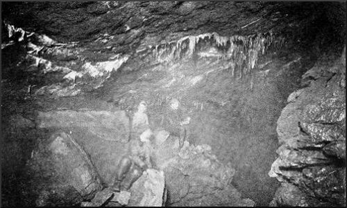
ENTRANCE OF STALACTITE CHAMBER, SWILDON'S HOLE.
Photo by Bamforth, Holmfirth.
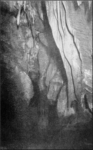
STALACTITE CURTAINS, SWILDON'S HOLE.
Photo by Bamforth, Holmfirth.
These stately columns, soaring vaults, and sweeping marble draperies were strangely out of proportion to the narrowness of the place. But now the sinuous aisle broadened out, and the style of the architecture was changed entirely. We were at the junction chamber where, in the remote past, two big streams came down from the yawning passages to the left and right, and met here, probably as the main stream of the cavern. The roof is a spacious dome, hung with resplendent candelabra. But the unique feature of the place, the thing that impresses itself on the memory as one of the most dazzling creations of the wonder-working calcite, is the stalagmite bridge. Bridge, I say, but it is more than a bridge, for its complicated arches support a beautiful piazza, with a huge array of dripstone terraces, crystal basins, massive pedestals, and obelisks of stalagmite, which all but fills the chamber and extends some distance up the alcoves behind. Standing on one of the great hemispheres of dripstone, one could put one's head among the pendulous[79] shafts above, and see how each was marvellously twisted, moulded, and fantastically embossed and gemmed with flashing crystals. The splash formation covered everything beneath the roof, save portions of the polished floor, with millions of tiny spicules. We had to move about cautiously, not only for fear of doing damage, but to avoid gaping pitfalls in the bridge, the surface of which was smooth as ice.
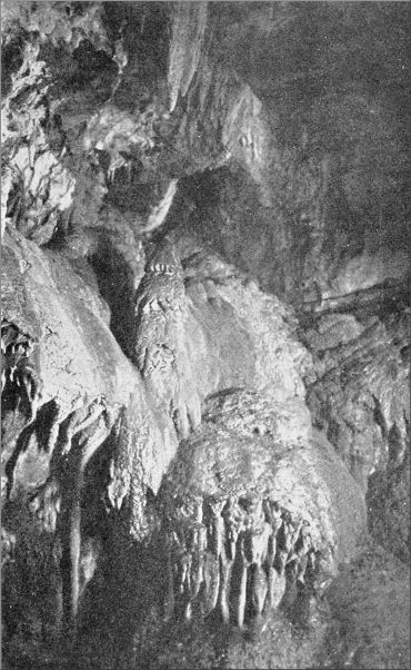
STALACTITE CHAMBER, SWILDON'S HOLE.
Photo by Bamforth, Holmfirth.
Whilst we were at work photographing a distant shout was heard, and soon the two men who had followed us down arrived at the big chamber. But our party was again reduced to its original four by the departure of two other members, who were to go back by the aquatic route in order to pick up certain articles that had been deposited on the way down. We ourselves hoped to get to the surface by another and a drier course. At the previous exploration two men had missed the rest of the party, and found their way, after divers adventures, through the ramifications of the cavern, to what they described as a great stalactite chamber, which was presumably our gallery. When they reached it, however, no one was there, nor any trace of human presence; either the explorers had finished their work and departed, or the pair had missed their way altogether. It was believed that they had come down to this very spot by the gallery joining this one on the north, and we purposed following that passage out. But this, as we presently discovered, was all wrong.
Two of us now went off on an exploring trip into the great passage running west. At once we encountered a series of huge obstructions. This passage was of the usual rift pattern, and, save for holes and crevices between, was wholly blocked up by large masses of tumbled rocks. One of us climbed to the top of the Cyclopean pile, whilst I attempted to make my way along at the middle height,[80] but eventually found it easier to crawl through the culverts and water-gaps, regardless of mud and wet. Even among the piled-up rocks there were charming little nooks adorned with rich incrustations. When the rocks ended the open tunnel began to ascend rapidly; then, after a while, we came to another tunnel joining it on the north. This, though smaller, was the more important passage; the other shortly came to an end in a lofty grotto, bountifully tapestried with curtains and tassels of stalactite. We climbed the northern passage, through several brilliant displays of incrustation, and reached a level approximately 70 feet below the surface, by aneroid; there we could get no farther. But, unknown to ourselves, we had brought back important information.
We had noticed mysterious bits of string at two points in this series. When we reported the discovery to the two men left behind, they at once saw its significance. The two men whose route down to the stalactite chamber had caused so much perplexity had used a ball of string to mark their way out—these were the relics. Our casual trip had, perhaps, saved us from a night of blind wandering in the unknown branches of the great tunnel on the north. All being in readiness for our departure, we now proceeded to take up this providential thread. It was not an easy task. Often not an inch of string remained undecayed for many hundreds of feet together, and often we nosed the walls and floor, eagerly but in vain, for droppings of candle grease left by our predecessors. The way was dry, that was a relief, after six or seven hours in wet clothes; but it was a tighter squeeze than the other, and the sharpness of the turns was often aggravated by a portcullis of crystals on our backs, and a cheval de frise of stalagmite spear-heads against our stomachs. All the while we wondered whether we should really find the exit, or whether we should have to return and undertake[81] the canyons after all. Mr. Balch compared our task of finding the desired exit to an attempt to ascend from the mouth of a river to some unknown point upon one of its tributaries, with nothing to indicate which way to take. This puts the position clearly enough, I think. There was no string to be found in the higher parts. At last the man in front disappeared feet foremost through the ugliest hole we had yet seen, out of which the noise of waters sounded ominously. A cheering cry came back to us; he had found the rift, where we had descended seven hours ago into the route through the canyons. A few more yards of determined wriggling, and the candle left by the other two men hove in sight. We found they had got out two hours ago. The stars were shining from a clear sky, and a keen frost was on the fields, but the excitement and the success of our adventure were stimulant enough to keep out the cold.
E. A. B.
The ultimate goal of our researches at Cheddar has been the discovery of the underground river-course. Not many yards below the entrance to Gough's, or the Great Cavern, a large body of water wells up at the foot of a cliff, spreading out into a beautiful mere, half encircled by crags; flows on thence through the village, performing a great deal of industrial work on its way; and, finally, proceeds a mile or two farther as the Cheddar Water, to join its brother, the Axe, which has a similar origin. But less is known about the darksome course of the Cheddar Water than about the stream flowing out of Wookey Hole. With its tributaries, it has doubtless been the principal agent in the formation, not only of the caves, but also of the famous Cheddar gorge, which bears every evidence of having been produced by the gradual destruction of a series of caverns. Yet this important stream has actually not been met with hitherto at any single point of its course underground, and we have anything but complete information as to its sources on the uplands of Mendip. The owners of the Great Cavern, the Messrs. Gough Brothers, tell me that they intend to blast away about 10 feet of rock immediately overlying the exit of the river. When the stream is very full, water often bursts forth here from cracks and joints several feet above the normal level, and they imagine that there must be a chamber of some height just within. This, however, in my opinion, is not a necessary inference, since every cavity and crevice behind[83] the outlet would at such times be heavily charged with water, under pressure, and the large cavities might be a long way back. It is curious that the water in a low tunnel recently discovered in Cox's Cavern, which lies some distance from Gough's, and at a lower level, rises and falls in unison with the movements of the water-level of the river outside, although that always remains 10 feet higher. Cox's Cavern is occasionally flooded, yet the water never rises to a point within 10 feet of the river level. Obviously the subterranean connection must be of a complicated and roundabout form.
At the time of my first serious attempt to explore the caves of Cheddar, when our party contained Dr. Norman Sheldon, Mr. J. O. Morland, and Mr. Harry Bamforth, two of whom have not since been able to join us in Somerset, I had not the advantage of knowing Mr. H. E. Balch, and we were utterly unaware of the great work he had been doing in the cave region adjoining Wells. On the other hand, we received invaluable assistance from the brothers Gough, who are not only proprietors of show caves, but take a sincere interest in underground exploration. Their father, who died in 1902, was the discoverer of the caverns that bear his name, and was actively at work pushing his way farther and farther into the rocky bosom of the hill up to the year of his death, at a good old age.
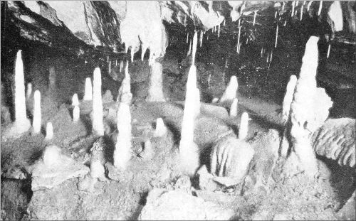
STALAGMITE PILLARS IN GOUGH'S GREAT CAVERN.
Photo by Gough, Cheddar.
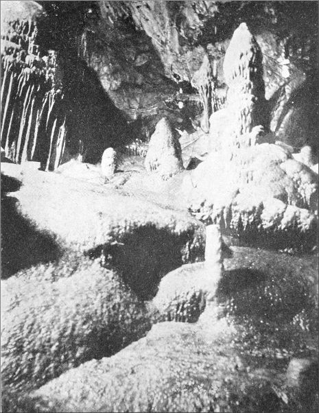
THE PILLARS OF SOLOMON'S TEMPLE, GOUGH'S CAVES, CHEDDAR.
Photo by Gough, Cheddar.
The Great Cavern was discovered in 1898. The parts open to visitors extend in a generally easterly direction for some 600 yards, and consist of natural chambers and passages, connected here and there by artificial tunnels. We began work early in the morning, carrying into the cavern a large quantity of ropes, ladders of wood and rope, and plenty of illuminants, including a 2000-candle-power limelight, which with its lens or condenser is one of the most valuable aids in subterranean work. Many openings[84] are seen overhead and in the walls of the cavern as the visitor advances, some of which end abruptly, whilst others lead into small grottos and galleries. One of the most conspicuous chimneys, or perpendicular caves, has at its base a peculiar staircase of stalagmitic basins, formed by the deposits of a calcareous spring that is now dried up. These basins are known as the "Fonts." Our conductors had been in the habit of climbing about 50 feet up this lofty chasm, over the crust of stalagmite, and a wire rope had been fixed to assist visitors in ascending to a broad, deep ledge. Above this point the rocks were much steeper. No one had ever succeeded in seeing the top, and at first we thought it would be impossible to ascend any higher without some sort of apparatus. We sent for a ladder, and meanwhile Dr. Sheldon and I tried to clamber over the jutting arch of rock that formed the first obstacle—a cave-pitch in a gully or chimney we should call it in climbing parlance. To our surprise, we succeeded in reaching the continuous channel or gutter above it, which ascended at a high angle, with sheer walls to right and left, and the other side of the huge shaft overhanging it. The holds were shallow and slippery, and with one hand grasping a candle we found the ordinary difficulties of a rock-climb multiplied enormously. Half-way up my candle went out, but my companion was now well ahead, and I groped my way after him with confidence. When a shout from below announced that the ladder had been hoisted up to the platform above the "Fonts" we were within a few yards of the top. At a height of 120 feet (by the aneroid) above this platform and of 170 feet above the floor of the cavern we found the shaft completely blocked up with débris and clay. We were in a subterranean pot, or swallet, of large dimensions, formed in remote ages by a big stream, which had worked through its Limestone bed, and continued its path at a deeper level.[85] Whether this was the main stream that now flows in an unknown course hundreds of feet below, or only a tributary, it is at present impossible to tell. Mr. Bamforth's limelight was now projected up the chasm, revealing grand masses of superincumbent rock on the farther side, whilst the view downwards, past our friends into the dark bottom of the pit, was very curious. Roping ourselves together for the descent, we kept near each other for fear of a slip, and took the utmost precautions not to dislodge any stones on the heads of those underneath. The limelight was a great advantage, although many dark reaches had to be carefully inspected with a taper before we could secure foothold. When we got to the critical bit at the bottom we found the ladder placed ready for us.
Not far from the entrance to the "Fonts" is the mouth of a low passage on the other side, with a hole at the far end of it, that our guides thought must communicate with the underground river which, they conjecture, has its channel not far below this spot. We crawled into this burrow and fixed ourselves in the confined space round the black pit, which we found, by throwing in stones, had water in it. With a rope round my waist I climbed down the fissure, whose sides were of sharply corrugated rock though they looked like wet clay. About 30 feet down the hole grew so narrow that I could not turn round; I could just reach the water with my foot, but found that it was quite a small pool. Another "well," nearer the cave mouth, was explored after our further operations had been carried out. It was situated at the extremity of another burrow, but was much larger in circumference. Steadied by the rope, I climbed to the bottom and found a large pool of great depth about 30 feet below the edge. No current was perceptible, and its connection with running water is hardly probable. Some years later, a perfect skeleton of a man was exhumed from the clay beneath[86] the stalagmite in this burrow; accompanying it were numerous flint flakes. Some peculiarities indicate that the find was that of a man of early Neolithic age. It is shown by the Gough Brothers at the entrance of their cave.
While some of the party were photographing the "show place," a lofty dome-shaped cavern with its sheet of stalagmite poured over the cliff like a petrified waterfall, two of us retraced our steps from "St. Paul's," as this beautiful sight is nicknamed, to the branch leading to the other principal shows. "Solomon's Temple" is a wonderful grotto, walled, roofed, and floored with gleaming white and ivory calcite, and set at the top of another great fall of stalagmite which has flowed on and on in a gentle stream and covered the floor of a lofty cavern with dimpling waves of crystal. Nor are these all its attractions, for on turning round the spectator sees on the opposite cliff a broad and voluminous sheet of stalagmite, rippling down, spouting and foaming over the rocks like a waterfall, but still as marble and white as frozen snow. We had seen all these things before, however, and were anxious to move on to new ground again.
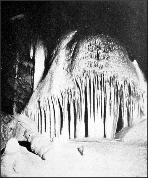
ORGAN PIPES, GOUGH'S CAVES, CHEDDAR.
Photo by Gough, Cheddar.
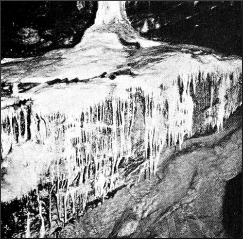
A STALAGMITE FALL, GOUGH'S CAVE, CHEDDAR.
Photo by M. Martel.
In the fork between the main passage and this big cavern is a large irregular opening, with disorderly blocks of Limestone heaped up on its floor. We picked our way across these, and at a height of 40 feet reached the edge of an abrupt rock some four yards high. We dropped over on to an earthy floor, and going a little farther found ourselves in a domical chamber with three low exits. First of all exploring that on our left, we had a look at a slanting shaft filled with a "ruckle" of big shattered blocks wedged insecurely, above which are two small chambers incrusted with stalagmite, but with no apparent exit. We climbed down again, and tried the third opening. It led through a series of caves and narrow clefts[87] into a larger chamber, all maintaining the same easterly direction, and there we found two possible ways onward. The first of these brought us in a few moments to the brink of a steep cliff, which seemed to be one wall of a considerable cavern. We preferred to wait for the limelight before venturing to let a man down into this unknown abyss, and meanwhile to examine the other passage. A few minutes' crawling brought us to a great pit, which sounded very deep when we threw in some fragments of rock. Apparently it was the chasm that had been described to us as 300 feet deep by one of our guides who had descended part of the way. We approached the edge with respect, and as a preliminary step let down a rope ladder into the upper part, which is strangely twisted. At a depth of 20 feet I found a possible landing-place; the second man joined me, and by dint of careful manœuvring the third got down to the same spot. With an 80-foot rope tied on, I now explored the next section of the chasm, and was delighted to find that there was just enough rope to reach a slope of big rocks at the bottom. A little more scrambling brought me into a vast chamber, the floor of which was piled up with enormous blocks, while the lowest part seemed to offer two possible routes onwards. One of these proved to be a mere hollow, but the other was evidently the channel of a stream, and apparently led onwards into further caves. But the roof was extremely low, and it was quite impossible to wriggle through. One of my companions, who had now joined me, also failed to squeeze through the opening, and we decided to leave it until the hole could be enlarged with pick and shovel. The alleged 300 feet was found by aneroid to be exactly 100 feet. In a corner of this lofty cavern was a steep fissure which seemed to be well worth exploring. The bottom half of it was completely walled in by an enormous flake of Limestone that had come down[88] from the roof, and looked as if a touch would send it tumbling on the heaps of rock at the bottom of the cave. We scrambled up the fissure at the back of this, and reached a promising gallery; but, to our disgust, this was entirely blocked up with clay and mud at the top, and it was impossible to proceed. Gaining the summit of the huge Limestone flake, we lit up the cave with magnesium wire, and were deeply impressed by its height and the grandeur of the shattered crags bristling on walls, roof, and floor. Everything was black, save one long, dripping cascade of stalagmite on the wall over against us; its unsullied whiteness shone weirdly out of the gloom as the fierce light fell on it. Just at that moment voices were heard, and from a rent in the rocky wall in front the intolerable beam of the searchlight came right in our faces. The remainder of the party had followed us up, and reached the spot where we had first looked over into the deep chasm. Revealed in all its extent by this penetrating light, the cave reminded us strongly of the enormous chamber that we had explored a few months earlier in the lowest part of the Blue John Mine in Derbyshire. On the way back one of the acetylene lamps fell down the pit by which we had entered, and was completely smashed. With no other mishap, we made our way through the tortuous passages and amongst the chaos of tumbled rock masses back to the cavern under "Solomon's Temple."
Two of us explored the openings above "St. Paul's" a few days later. A 30-foot ladder was placed against the corner of the stalagmite fall, and a yard or two of scrambling took us to the top. On the left was an ascending vault, with openings to right and left. Taking the latter to begin with, we found it gradually trend downhill and dwindle away into a series of holes scarcely big enough to let a human body pass. Squeezing through with a good deal of trouble, I reached a flattish cave with a floor[89] of rock and stalagmite all cracked and fissured. The whole of this part seemed to have been shivered by some large movement of the rocky strata. One of the fissures gave entrance to a passage underneath the floor; but this speedily narrowed, and when it was impossible to get farther I found myself right underneath my companion, who was holding my rope and paying it out as I advanced from his original position in the outer passage. No other exit being discoverable on this side, we crossed to the passage on the right, and after a few yards of crawling under a depressed roof we found ourselves on the largest expanse of stalagmite either of us had ever met with. It had flowed down from fissures high up on our left and spread over a wide, rocky slope; it had then contracted and poured over a cliff immediately on our right. We still kept the rope taut, and moved about cautiously, for the crystalline floor was extremely slippery, and the cliff immediately beneath us would have made the slightest accident serious. A broad flat roof of rock overhung the floor of stalagmite closely, and was covered with thin pipes and reeds of stalactite. We soon ascertained that we had returned by a different route to the crown of the petrified cascade in "St. Paul's," although a craggy partition separated us from our route up the ladder. We explored the edges of this huge surface of stalagmite, which we could not measure, having no better light to guide us than a few tapers, but which could not be much less than 100 feet wide. Where the deposits came down through crevices at the top they had settled in jewelled and diapered masses of the most fantastic patterns. Our situation was, however, too precarious for lingering in this strange spot, and without another man to back one up it was impossible to explore the hole at the top. We gave up our quest reluctantly and returned towards our ladder, incrusted from head to foot with the thick, plastic clay. A convenient knob of[90] stalagmite enabled us to give the rope a hitch whilst we scrambled down to the top of our ladder.
One other passage from the main cavern was explored, with a curious cluster of vertical cavities near its extremity. The end of the passage was coated in every direction with tinted deposits, among which we noticed beautiful specimens of the branching stalactites that were called anemolites by the explorers of the Blue John caverns, who thought they had acquired their abnormal shapes through the irregularity of evaporation caused by air currents. I climbed 30 or 40 feet up one of the openings in the roof, whilst Dr. Sheldon explored another. At the top we found no exits big enough to afford a man passage. A wider cavity in the middle of the roof looked more promising. A ladder was adjusted, but fell short; but my companion, with considerable risk of a dangerous fall, clambered up to the rocky slope and over the piles of jagged blocks that well-nigh filled it. This too failed to afford us a passage, and the daring climber had great difficulty in coming down, being forced to thread the rope and let himself down on it to the ladder. During the operation a flake of rock came hurtling down and hit the ladder, but luckily did nothing worse than smash a rung. These cavities in the roof were extremely interesting, and no doubt are connected together and have a common origin in some neighbouring fissure or waterway.
The Cheddar gorge, which is the deepest and narrowest defile, and on its south side presents the loftiest face of absolutely vertical rock in England, is not dissimilar, though far superior in height and grandeur, to the Winnats pass in Derbyshire. The huge chasm runs east-north-east across the dip of the Limestone beds, which are tilted up towards the saddle of Mendip; one of its sides, consequently, is formed mainly of shelving rock, and the other is almost continuously precipitous. If, as may be assumed with confidence, the original cause of the ravine was a stream or streams flowing through a chain of caverns, one would naturally expect to find openings on the abrupt side through which the underground waters were successively tapped, and followed the trend of the strata to a lower level. This view is confirmed by observation. Except at the jaws of the defile, where both sides are equally high and precipitous, there are no caves on the northern side, but on the south openings both large and small are frequent, some narrow and lofty—"slitters," they are called locally—the others low and wide, according as they originated in a vertical joint or a bedding plane. They occur at various levels, some on inaccessible shelves high up in the cliffs, others along the base. But the larger number of these openings have in the lapse of time become silted up with clay and débris, so that the entrance is either completely masked or it is impossible to penetrate far without toilsome work with pick and shovel.
After exploring the Great Cavern our party of four devoted some time to an examination of these openings, so far as could be done without excavating. There are three important caverns in close proximity to the Great Cavern, or Gough's. The best known is Cox's, a small but exceedingly beautiful stalactite cavern (see frontispiece). No one interested in caves would think of visiting Cheddar without seeing the Great Cavern, nor would any such person dream of missing Cox's. Each is the complement of the other as a piece of underground scenery. The spacious vaults and vast stalagmite falls of the one fill one with a sense of power and majesty; the other is a gem of fantastic architecture, embellished with the most lawless and fairy-like designs of the subterranean artificer, and unique in one respect—the wealth and diversity of the mineral deposits that have dyed its multiform incrustations with luminous tints. No sane man, however, would attempt to describe Cox's Cavern in detail, and a photograph can give only colourless glimpses of its kaleidoscopic beauties. The cavern seems, at first sight, to be a solitary freak of nature, having no connection with the general system of caves and streams. But since the visit just referred to, several new passages have been opened, among them the interesting water-tunnel with its ebb and flow corresponding to the movements of the Cheddar Water outside, which, as already described, flows at a higher level. Of three other good-sized fissures or ancient channels radiating from the same large chamber, two after a while dwindle away almost to nothing, but the third has indications of a channel striking downwards, which it might be worth while to clear of rubbish. All these passages were choked with clay until quite recently.
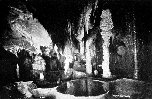
IN COX'S CAVERN AT CHEDDAR.
Photo by Bamforth, Holmfirth.
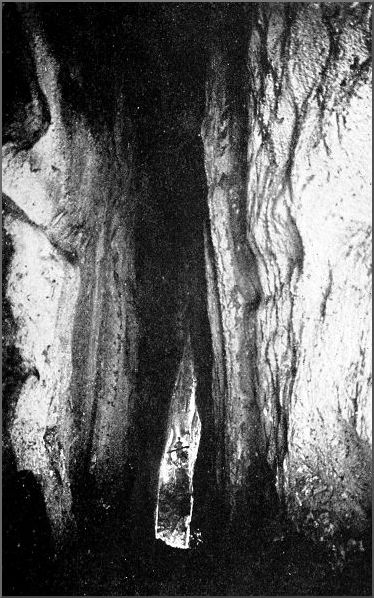
GREAT RIFT CAVERN, CHEDDAR GORGE.
Photo by Bamforth, Holmfirth.
The next cave also is of minor interest to the speleologist, although it contains many curious sights. It is[93] called "Gough's Old Cavern," and its entrance is close to the mouth of the Great Cavern. It is an ascending cleft, apparently not linked at present with the other caves, although it was once probably a sloping aven draining into the big series of caverns that have been gradually cut back by the falling in of the defile. Whoever likes such things may find here plenty of those freaks and alleged similitudes that puzzle and delight the ordinary sightseer. On a stalagmite excrescence nicknamed the "Ribs of Beef" we had the luck to see a far more interesting phenomenon. The calcite mass was clustered over with a number of motionless black objects, which we found to be roosting bats, hanging head downwards by their claws. They were not disturbed in the least by our presence, and one that was lifted off gently just showed his teeth and claws, and clung on again as fast as ever when replaced on the rock to resume his patient sleep. A photograph of this curious sight was obtained by means of the flashlight. At the head of the cave are several incrusted grottoes, where the process of deposition is still going on, roof and walls streaming with moisture. This part is not unlike the show places in the Bagshawe Cavern in the Peak of Derbyshire.
In many respects the Roman Cave is much more interesting. Its mouth is situated about 150 feet up the cliffs, almost immediately over the cave just described. Quantities of Roman pottery, coins, bones, and other remains, have been discovered there, showing it to be one of the places that sheltered fugitives after the evacuation of Britain by the Roman legions. The entrance is a broad anticlinal arch, and the main passage, high-roofed and ascending gradually, runs east for perhaps a furlong. Then the floor, which has been covered with earth and stones, becomes rugged and rock-strewn, and suddenly we creep through a lowly portal into a high and gloomy[94] chamber, the shadowy corners of whose roof our lights are too feeble to explore. To all appearances this was the end of the cavern; but we had been told that the passage takes a turn here and goes on nearly a quarter of a mile farther. We scanned every part of the walls as far up as we could see, but no accessible opening disclosed itself. In a recess on one side a number of fallen rocks were piled up and wedged between the converging walls. To examine the cavity from a vantage spot, we climbed with a good deal of difficulty to the top of these, and there, to our astonishment, a wide passage sloped up at right angles to the one we had entered by. A curious slit in the wall opened into a perpendicular fissure that was situated right in the roof of the latter, and through the hole we caught a glimpse of our friends following us up. Three men now pushed on up the new passage and entered a chamber whose sole exit was a small and uninviting hole. We crawled and scraped through, and on over sharp stones till at last we could get no farther. We had evidently doubled back over the main cavern, and that we could not be far from the open air was shown by the presence of a bewildered bat, who flew to and fro in the confined space and hit us in the face several times. And in the extreme recess of this narrow branch a steady draught of air blew in through a crevice and nearly put the lights out. Through an oversight we found ourselves at this point reduced to two tapers and a bit, and to economise we kept only one alight at a time, so as to have enough for the return journey. All went well, however, and the sole difficulty we met with was in getting down over the wedged blocks in the big chamber, a climb that proved extremely awkward when taken the reverse way. In many parts of this cavern we noticed prodigious quantities of moths on the walls, as well as many huge spiders. But a more interesting thing was the vegetation naturalised in the[95] caves, examples of which we found in other Mendip caverns as well. It will be advisable to have them examined by a botanical specialist. All I can say about them now is that they consist of extremely slender branching tendrils, some white and translucent, others brownish, thin as cotton.
It was late in the afternoon when we entered the Roman Cavern; it was dark now, and the stars were out. Returning in advance of the others, I sat down just within the majestic gateway of the cavern, a flattened arch about 100 feet wide resting on enormous rocky jambs, and looked out across the deep wooded abyss where Cheddar lay, its lights reflected here and there by the dark waters of the mere, towards the craggy heights of Mendip opposite, just sinking down towards Sedgemoor. The Great Bear was shining brightly right in front—it almost spanned the breadth of the cave mouth; and the solemnity of the place and the hour could not but bring to mind the miserable fugitives who sat in this forlorn asylum, hemmed in by foes, and looked out on the same giant constellation thrice five hundred years ago. The place is admirably adapted for defence. A rear attack was of course impossible, whilst a frontal attack by way of the cliffs would be easily repelled; and a tolerable water-supply was to be found inside the cavern. The huge natural glacis of the fortress is covered to-day with a dense tangle of ivy and other climbers, through which we made our way heedfully, for a slip would have been easy in the dark, and a terrible fall the consequence.
Next morning we strolled up the defile and looked at the mouths of several caves that are now choked up. Two furlongs above its entrance the ravine makes a double curve like a gigantic figure three. The two crescents of beetling Limestone, with their jutting horns, that appear to the astonished beholder underneath like towering pyramids[96] and slim aiguilles, rise to a vertical height of 430 feet, and, being absolutely unassailable, they fill a crag climber's mind with admiration tempered by regret. What enhances their grandeur, while it softens the savage aspect of the sheer and ledgeless precipice, is the bountiful vegetation clinging wherever it can find a hold, dark shrouds of ivy and darker masses of yew standing out against the grey rock in beautiful relief. Would the indomitable scramblers who haunt Lakeland at Easter, we asked ourselves, have forced a way up these tremendous "chimneys" if the Cheddar cliffs had been pitched somewhere in the latitude of Wastdale? We went so far as to reconnoitre one alluring fissure, 200 feet or more in length, but the gap between its base and the first feasible lodgment was insuperable. Not far away a long talus of scree marks the foot of an easy though rather sensational way to the cliff top. Passing it by, we stopped at the mouth of a vertical fissure that opens on to the roadway. It expands slightly inside, and the roof soars higher and higher; then the floor breaks away, and the two men who descended the next 80 feet had to be steadied by the rope. The walls were wet and soft, being incrusted with a sticky calcareous substance. At the bottom of the precipitous slope the magnesium ribbon revealed the enormously lofty walls of a narrow chamber, whose farther extent was blocked up by an accumulation of rocks and débris.
Returning to the open air, we ascended to the cliff top, and, skirting each promontory and rounding the edge of every bay, proceeded towards the mouth of the defile on the lookout for openings. Not far from the highest point we had noticed from the road a series of dark cavities. One man scrambled along a ledge to the uppermost of these, and found that it was merely a shallow niche, and another, on a ledge some 50 feet lower, proved to be only 20 feet deep. He made a determined effort to reach[97] another fissure on the same level as the last but sundered from it by a wide space of cliff which was covered with dense brambles. Holding on to the prickly stems, and fighting his way through, he got near enough to see into the fissure, but was quite unable to enter it for a closer examination. An opening in the cliffs at a lower point, but still some 200 feet above the road, led a long way into the recesses of the Limestone strata, making two wide curves to the right, but maintaining a generally easterly direction. The passages were very low, narrow, and awkwardly shaped, involving a great deal of unpleasant crawling; and when we reached the stalagmite grotto at the end we found that it had been pillaged of every bit of calcite that could be removed. This cavern, the "Long Hole," must have been the channel of a stream that once flowed from somewhere on the other side of the gorge, through the mass of rock that has now been swept away by the forces of disintegration. Though several hundred feet long, it is but the tail end of the cavern that once existed.
The remainder of our time was devoted to two of the Burrington caverns, on the opposite side of the Mendip Hills, and to a fruitless search for a large chasm or swallet hole into which the drainage from the now abandoned lead mines on the top of Mendip used to fall and ultimately find its way to Cheddar, where it poisoned the trout stream. A score or more of years ago I saw these mines, still in working order; but now the dried-up pools and the wilderness of refuse, with fragments of ruined buildings, look as old almost as the remains of the Roman mines. Of the important opening that we sought there is now no trace; it may have been filled up intentionally and the stream allowed to revert to its old channel, whence it had been turned artificially. Hard by, in the Long Wood near Charterhouse, and elsewhere, there are smaller swallets that we were already acquainted with; and there are others at[98] Priddy, the waters of which find an exit farther to the east.
The ground we were on is well known to readers of Walter Raymond's romances, and we were much interested when it was pointed out that the lonely house facing us was the actual Ubley Farm that figures in Two Men o' Mendip.
E. A. B.
Burrington Combe is a smaller Limestone defile on the north side of Mendip—that is to say, the opposite side to that of Cheddar. It is smaller, and because of its proximity to Cheddar it has to suffer disadvantageous comparisons. Anywhere else the grandeur of Burrington Combe, the magnificence of its crags, with dark, heather-clad Black Down lowering behind them, and the beauty of the copses that lurk in its corners and clamber up its precipices, would excite the admiration of guide-books and attract crowds of tourists. Like the Cheddar defile, Burrington Combe was doubtless formed by the gradual destruction of a series of caverns, and there remains of that series a number of caves or openings of blocked-up caves on either side of the ravine. Of these the most important and the only one well known to speleologists is Goatchurch Cavern, which was explored by Professor Boyd Dawkins in 1864. The next in importance is Aveline's Hole, discovered in 1796, but not explored till 1820, when about fifty human skeletons were found lying side by side with their weapons, a stalagmitic crust sealing bones and implements to the floor. This cavern has since had its mouth silted up by drainage from the road, so that troublesome excavation will have to be undertaken before it can be entered again. It would well repay a thorough exploration, for it is reported that a natural pit, covered by a slab, has never yet been descended, and leads probably into important cavities. Foxe's Hole is interesting[100] for its curious bosses of tufaceous stalactite. A nearly vertical cave, Plumley's Den, has been stopped up with a plug of timber and stones at the depth of 80 feet, in consequence of a fatal accident to a man who tried to descend it in 1875. At a level probably a few feet below that of the caves whose destruction was the origin of the Combe, a good road with a grassy margin now ascends towards the top of Mendip, where it joins the old Roman road that runs from "Severn Sea" to Old Sarum, along the crown of the ridge.
Our waggonette when we left the Bath Arms at Cheddar was piled up with ropes, cameras, gas cylinders, condensers for the searchlight, and an incredible amount of needful and superfluous things, for we were quite unable to say what would be wanted. Climbing to the miniature mountain pass across Mendip at Shipham was hard work for the horse, and we walked up the hill. Dr. Sheldon and Mr. Bamforth were my companions. Our clothes, still richly daubed with the clay and mire of the Cheddar caverns, made our appearance both business-like and picturesque. The north side of the Mendips is very different from the bleak and craggy slopes on the south. From the broad bare top of the hills down to the valley stretches, almost continuously, a deep mass of trees that looks in the distance like a wall of dusky verdure. We drove between orchards where great bushes of mistletoe grew on nearly every tree, till we were within a few hundred yards of Burrington village; then, turning towards Mendip, we drove through more orchards, till suddenly the rocky entrance of the Combe appeared and we heard the clink of pick and crowbar in the Limestone quarry not far from Plumley's Den. Half-way up the gorge makes a sudden bend towards the east, a little below which point a shallower ravine comes in on the other side. About 120 feet above the bed of this dry ravine[101] is the entrance to Goatchurch Cavern. We coaxed the horse over the stony turf and up the ravine till the roughness of the ground and the thickness of the bramble bushes stopped him. At this point we were met by the lord of the manor, Mr. James Gibson of Langford, who is the owner of the Burrington caves. His men assisted us to get our apparatus up to the cave mouth, and afterwards convoyed us and the luggage throughout the less difficult parts of the cavern.
A few years ago the entrance to Goatchurch Cavern was an insignificant hole, through which adventurous boys used to crawl as far as the first considerable chamber, where Professor Boyd Dawkins found a few remains of extinct animals. Owing to the depredations which were made by neighbouring villagers in search of specimens of calcite, Mr. Gibson recently had the entrance enlarged and closed with a padlocked gate, the public being admitted only on certain days of the week or by appointment. It is a pity this step was not taken before many of the finer stalactites had been carried away. In this long chamber, the floor of which is covered with sheets and bosses of dripstone, we entered some of the funnel-shaped openings in the roof by means of a ladder, but soon perceived that no discoveries were to be made that way. At the end of the chamber a precipitous hole goes down to the left, and fixed ropes are used for getting into the lower galleries. We found ourselves at once entering on a maze of passages, where the presence of our guides saved valuable time. So intricate and bewildering are these ramifications that Mr. Balch tells me that he discovered a passage some years ago that led him eventually to a much deeper part of the cavern than had ever been reached before, but every attempt to rediscover the passage since has failed. In spite of our efforts to examine every branch of the various passages, we also missed this[102] important link. It would seem that the solid mass of the hill has been shivered here into vast, roughly cubical fragments, between which lie the irregular passages and narrow chambers of the cavern. Many tempting galleries lead the explorer on and on till they dwindle to a mere rabbit hole, or till he finds himself wedged in the cleft between two enormous surfaces of rock. Disorderly accumulations of boulders and splinters cover the floor; there is hardly a level spot anywhere, and it is desirable to explore every yard carefully with a taper or a lantern to avoid the consequences of a rash step. We crawled on hands and knees and wormed along through insignificant holes, making our way into spots that had probably not been inspected before; but we always came back to the main channel, where our guides were waiting, having made no noteworthy find.
Assembling again in a more roomy chamber, about 140 feet below the entrance, we all proceeded along a tunnel that showed evident traces of the action of a stream to another chamber, where the sound of running water came up from a grim-looking chasm. Only two of us went beyond this point. The rest secured the rope, whilst we climbed down the steep hole into a large cavern through which the stream runs from the swallet hole in the ravine outside on its way to Rickford Rising, where it issues in considerable volume. The stream has a somewhat puzzling course after leaving the cavern, for it runs underground athwart Burrington Combe and through the solid hill opposite, Burrington Ham. This stream, as Professor Boyd Dawkins pointed out, was doubtless the originating cause of Goatchurch Cavern, running in at the present mouth, which is now dry. The ravine outside has since been hollowed out to a further depth of 120 feet, and the stream finds its way in at a lower level. The Professor also describes a very pretty experiment. Having taken[103] the temperature of the stream before it enters the cave, he tested it again after it had run some distance underground, finding that it was here several degrees cooler. It is obvious that a colder stream must have joined it at some unknown point midway.
The nethermost series of chambers and passages are not very different from those above, their shape rugged and irregular, and their floor heaped up with fragments of all sizes. We reached no lower point than that attained by previous explorers—that is, 220 feet below the entrance, as measured by aneroid. Squeezing with difficulty through the deepest fissure, I found myself in a small cave, whence, turning round, I only perceived one exit. It looked and felt so small that I despaired of pushing through and turned to go back, when it suddenly occurred to me that this was the hole I had come in by, and there was no other way out. Such little incidents often happen in cave work, but most often in such a complicated network of tunnels and fissures as the Goatchurch Cavern, where we were quite convinced that an important passage ran due east until the compass assured us that the direction was west. Clambering up a steep bank of stiff clay out of the lowest cave, we reached a vaulted grotto with a cascade of stalagmite flowing down one side. On the edge of this a sloping passage disclosed itself, lined with stalagmite, and we ascended it in the expectation of finding something new. It brought us by an easy scramble back to the upper cave, whence we had descended on the rope; and with little more deviation from the main passages we made our way back to the cave mouth, where a well-earned lunch was waiting.
But little time was wasted in examining the silted-up entrance to Aveline's Hole and another cave mouth, and the next halt was made at Plumley's Den. Tying two Alpine ropes together, a pair of us descended this ancient[104] pothole as far as the artificial pile of débris that blocks it up. One man was hit rather severely by a dislodged stone—a serious danger in caves of this sort—and in returning he dropped and smashed his acetylene lamp. The hole is effectually plugged, a tree and a quantity of stone having been flung in after Plumley's fatal mishap; and until Mr. Gibson carries out his proposal to remove the stones that block it, the 200 feet which are said, on doubtful authority, to lie beyond can never be explored. Mr. Gibson also proposes to bore a new entrance from the Combe into the lower series of caves at Goatchurch. Above Plumley's Den a magnificent rib of Limestone, like those at Matlock, springs nearly to the hilltop; and over the way a picturesque pile of crag comes out to meet it, and is known as the "Rock of Ages," from the tradition that Toplady, the divine, taking shelter under it from a storm, composed his famous hymn there.
Still piloted by our kind host, we walked across Burrington Ham and saw the brook which we had heard babbling amid the silence of Goatchurch Cavern flowing out, a strong body of water, at Rickford Rising, after a subterranean course of about two miles from its sources high up on Black Down.
Rickford Rising is in the Secondary beds, but a short mile up the beautiful Combe at whose outlet it lies, a Limestone ridge comes down to the road. Hard by the extremity is a hole in the rocky ground, now almost entirely choked with stones, but not so many years ago an open pit. It is known as the "Squire's Well." Here, in times of continuous rain, a body of water issues forth, often flooding the road. It seems to be connected with the water-channels that feed Rickford Rising, to which it acts as a safety valve. To open it would not be a very serious affair, and might discover something interesting.
At the back of Mendip Lodge, on the hill immediately west of Burrington Combe, the hilltop is cut up by innumerable ravines ending in swallets, the water of which comes to light again in a large stream in the Yeo valley near Upper Langford, about a mile away. Several of these swallets look as if they would repay the trouble of a little excavation; and the size of the stream at the point of issue indicates the existence of large cavities in the line of its subterranean course.
E. A. B.
A cave just discovered near Compton Bishop, on the skirts of Mendip, furnishes valuable evidence in corroboration of the theory that the Limestone caverns of this region were formed at a period enormously anterior to that generally accepted. It is situated a little way up the slope of Wavering Down, only a short distance above the upper limit of the red marl laid down in the Triassic age, unconformably on the denuded edges of the Carboniferous Limestone.
We had been engaged in some exploring work in the Cheddar caves, the results of which were of a negative kind, but none the less important, as modifying the lines of costly excavation. Accompanied by the Messrs. Gough, the proprietors of the great cave at Cheddar, we proceeded late in the day to Axbridge, where Mr. Balch joined the party. Our goal was a certain cavern, explored about a century ago, and described by the antiquary Phelps, but now little known. This purpose was, however, not carried out that day, for in making inquiries about the cave as we passed through the village of Cross, we got wind of a cavern that had never yet been explored, and was therefore treasure-trove to such ardent cave workers. Two years ago, in blasting for stone to line a drinking-place for cattle, a farmer had blown a hole into the top of a subterranean cavity. Two 30-rung ladders were lashed together, so we learned, and a bold countryman, secured by a cart-rope, descended into the mysterious[107] hollow, alighting on a slope of shifting stones and earth, whence he could see a second chasm, black as Tophet and of unknown profundity, yawning beneath him. No one would venture on this further descent; a rock was rolled against the opening to prevent sheep or incautious persons from tumbling in, and there for the time being was an end of the matter.
Our first task was to withdraw this formidable plug. It was a sound, unfissured block of Mountain Limestone, weighing perhaps half a ton. We thought that six men with a rope ought to move it easily; but we could not make it budge. A spade and a crowbar were fetched, with which we laboured diligently for an hour; but the only effect was to drop the stone deeper into the hole. A sledgehammer was now obtained from the nearest smithy, and one after another we attacked the foe with might and main. At length it yielded. Pieces flaked off, and at last it split; the fragments tumbled into the chasm, and the rock, diminished to half its former size, was rolled away. The job had taken two hours and a half, and it was now dark.
Mr. Balch and I cast lots for the honour of the first descent: it fell to me. An Alpine Club rope was tied on as life-line, whilst a 70-foot cotton rope was to be used for lowering and lifting. Slung in a bight of the latter, I was carefully let down over the cliff-like face below the entrance. The cavity formed part of a huge choked swallet, which extended up into the hill above the point where we had been working, and ran away obliquely underneath, so that I was coming down from a hole perforating one corner of the roof. Over against the hole was the steep slope of earth and scree already mentioned, steep almost as a wall, and the scree so loose that it seemed to be in a state of suspended animation. As soon as one came into contact with the treacherous stuff, an avalanche[108] of stones was launched, and I sought in vain for a spot where it would be safe to unrope and await the next man. The cliff down which I had been lowered was undercut by a wide archway, through which I looked into a black, forbidding pit gaping at the bottom. With nowhere to rest, and with the risk of falling stones, it was obviously wiser to finish the descent before another man started.
Tying the loose rope round me (for it was necessary to swing out under the arch), I was let down slowly, and began to slip over a smooth, greasy rock-face into the unknown cavity. At 60 feet from the ground I alighted at the top of a slope of stones, and was able to remove the ropes and scramble to the bottom. Lighting some magnesium wire, I found myself in a bell-shaped chamber about 65 feet high, opening above by the precipitous archway into the upper cavity, and on the other side into an ascending vault running north-west. All around were the indelible marks of water action in the remote past. On the upper side the rocks were carved and pitted as by the swirling of a violent torrent. But there was now no sign of running water, only the drip, drip from the moist roof; and the outlet of the ancient stream at the bottom of the cavern was blocked up by a deep accumulation of débris. Among the countless fragments strewn all over the floor I found a large stone covered with a mass of dog-tooth crystals, clear as diamonds and large as walnuts. But at the very bottom of the place was something even more lovely, myriads upon myriads of exquisite spicules of carbonate, some little more than specks of red, orange, and amber, but thousands like wee tendrils of coral three-eighths of an inch in length. They were the growth, through age after age, of a splash deposit from the roof or from the stream that had disappeared. Such a formation is not rare in water caverns; but in such beauty of shape and hue it is rare indeed, for these tender little crystal flowers took all[109] manner of forms, blossoming ofttimes into wreaths and clusters like a miniature coral. One of the most exquisite and most puzzling features was that the dots and spicules were often arranged in set patterns, symmetrical and even geometrical, in tiny circles, squares, and triangles, by the rhythmic action of the waters that had left this beautiful record of their passage. We named the cave the Coral Cavern.
As the descent had not been direct, and there might be difficulty in recovering the ropes if once let go, it seemed most prudent that no one should follow me down for the present. Climbing the slopes of rocks and scree that led up through a lofty vault to the north-west, I reached a height of considerably more than 100 feet above the floor of the Coral Cavern, the present floor of which is 90 feet below the point of entrance. The open way then came to an end abruptly, in a tiny grotto, at a distance of 240 feet from that point. But hard by there were funnel-like cavities penetrating the roof, and hinting at the proximity of a Secondary swallet hole on the hillside close overhead. Evidently, when the cave was in working order, in times of indefinable remoteness, a big stream had run down this steep vaulted passage, and united with the main stream at the bottom, both then pursuing their way into the fissures of the rock, and ultimately finding an exit into the open air at some point now buried under Triassic deposits. Enormous slabs of Limestone, smooth, and fitting close over each other like boiler-plates, formed the sloping floor of this tunnel on one side. These too were a conspicuous testimony to powerful water action.
At present the red marl of the Trias comes nearly up to the artificial entrance of the cavity. It is obvious that when the cave was occupied by a stream, its waters must have found a vent some distance below the upper limit of the marl; whence it necessarily follows that the marl has[110] been laid down here since that period. Much evidence has been gathered in the course of our cave work in the Mendips to show that many of the caverns are older than the vast accumulations of Dolomitic Conglomerate and other deposits of Triassic age, but nowhere is the proof put so clearly and concisely as by the new cave at Compton Bishop.
My stay underground was cut short by the fear that the others would grow impatient. I was hauled up without mishap, save that at one point the cotton rope stuck fast in a cleft, and I had to pull myself up hand over hand on the life-line. Two men then went down, with the result we had dreaded—the rope could not be got back to the last man without extreme difficulty. Only after tying on stone after stone, and making many a cast in vain, did we ultimately restore communication. He came up; the guardian block was pushed back into its place; and at a late hour we struck down the hillside home.
A day or two later we set out once more to find Phelps's Cavern. It opens on the very crest of the ridge leading up to Crook Hill, or, as it is more commonly known to-day, Crook's Peak, a sharp Limestone spur, running south-east from the western extremity of Wavering Down. At the foot of the hill, near the road, we came across a small cave, called the Fox's Hole, which we searched thoroughly for any continuation upwards or downwards, but in vain. After a great deal of jamming and squeezing, we got in to a distance of 50 feet, where a low chamber has holes between wall and floor that had acted as a water-sink to some ancient system of cavities. But the floor was heaped with stones, and in spite of our efforts to clear these out, we did not discover a single hole big enough to enter. This small cave is, doubtless, but the tail end of the cavern that once existed here; and, indeed, the large cavern at the hilltop must be little more than a[111] fragment of what it was. Crook's Peak seems to be the mere skeleton of a hill. To account for the presence of such a cavern at the summit, one must postulate a large drainage area in days gone by, and a general configuration entirely opposite to the present. The higher part of the hill is but a Limestone shell enclosing these ancient, and now waterless, caverns.
The big cavern is known as Denny's Hole. Descending the sloping side of an open pit, we found ourselves under an arch of mighty span, the crown of which was formed by the rock-wall on the other side. Under this arch the floor sloped precipitously into the jaws of the cavern; then the roof came close down, and the farther passages wound onwards as low tunnels, descending steeply into the entrails of the hill. It is easy enough to get to a considerable depth and distance in the largest of these, but the journey is not specially interesting, for the place has been looted by adventurous rustics, and serious exploration is at present brought to a standstill by the enormous quantities of loose stones filling every cavity in the floor. Coming back to the cave mouth, we were struck by the grandeur of the vestibule, which has every appearance of being the remains of a great subterranean chamber, the pit-like entrance, through which we look up to the sky and the sunshine, being the remnant of a cave-tunnel, once perhaps of very considerable length.
Phelps had alluded to another chamber, of some beauty, to be attained, at the expense of divers wrenches and abrasions, by a certain tortuous passage leading out of the vestibule. After diligent search we found a hole in the floor at one corner, but it seemed to be only a foot or two deep. Kicking about for some time, with body half in and half out of the hole, I managed to shift some loose stones, and felt space below. But the space proved, on experiment, at least as excellent a place of torment as[112] Phelps's description had been able to do justice to. The passage doubled back upon itself at once, and twisted here and there like a corkscrew. Only by obstinate wriggling were we able to worm a way down to the low cavity at the bottom. Two blind passages started therefrom, and in one wall was a long, horizontal slit, with some big place beyond, as we judged from the sound of the stones we threw in. In various cautious attitudes we inserted ourselves into the slit. The drop inside, though fearful to anticipate, was a matter of only a few feet.
The cave we found ourselves in was a sort of double chamber, with vestiges of a partition across the middle; the whole was some 40 feet in length. At one end was a pool of water, stagnant at present, or nearly so. Close by, a low fissure sloped downwards to a vertical hole or pot that sounded deep; but we could not get near it for the spikes of stalactite that guarded it on all sides. This chamber, which we thought must communicate with the series reached by the main passage from the vestibule, seems to have been hardly ever visited. We heard a story of a lady's pet dog that had been lost here for a week, and was not found, although a tempting reward was offered, until a farmer, who told us the story, explored the corkscrew tunnel leading to this cave. He found the poor beast shivering on the edge of the slit we had come in by, afraid to jump. Even the farmer, who thought he knew all the ramifications of this perplexing cavern, did not seem to have reached this chamber, the natural ornaments of which showed no trace of specimen-hunting.
Returning to daylight, we examined a cave vent in the ground hard by, where a vapour was steaming up into the chilly air. The penetrable portion was just big enough to accommodate the six feet two of our tallest man. With some time left on our hands, we decided now to walk on to Loxton, the next village, where another cave[113] was situated on a Limestone hilltop. There were only two miles to walk, so we did not think it worth while to doff our cave panoply. Great was the speculation that our unexampled appearance excited in the people we met. We could not be tramps—in fact, we hardly looked respectable enough; and yet our rucksacks, ropes, and cameras gave us an air of distinction that was puzzling in the extreme. Faces crowded to the windows at every house we passed, and at Loxton we had to run the gauntlet of satiric observation. As we asked our way to the quarry at Loxton, the general conclusion was that we were in quest of a job there.
This cave must have been a very interesting one long ago, but now it is like those at Compton Bishop, only a remnant; and besides what has been destroyed by natural denudation, a great deal has been damaged by the gradual approaches of a Limestone quarry on the side of the hill. This has exposed the outlets of several passages. A labyrinth of low galleries remains, with a few larger hollows here and there; but of whatever beauty they once possessed they have long been denuded by the devastating village boy, who has found the intricacies of Loxton Cavern a perfect paradise. It does not follow that the cave would necessarily not pay for a thorough exploration. If some of the lower reaches were carefully examined, entrances would very likely be found into still nether caverns, of which these dry channels were at one time the feeders. But the work would be peculiarly difficult on account of the smallness of the open spaces, and the result uncertain. Yet the Limestone of the Mendips is so thick—the thickest in England—and the parts that have been explored are so honeycombed with cavities and passages, that every gateway into this strange underworld promises more or less reward. It is somewhere in the neighbourhood of Loxton and Banwell that the famous[114] "Gulf" was discovered in the days of the old lead miners. In driving an extensive level through a hill, at a point 80 fathoms below the summit, they came upon a gigantic rift. A man was let down on a long rope—so tradition reports—and when he had descended to the full extent of it he was unable to see either walls or bottom of the tremendous abyss. We are probably on the track of this monster cavity, an exploration of which will entail labour and fortitude. That and the exploration of the swallet at Hillgrove, when it is opened, are the two most fascinating problems awaiting us in the immediate future.
E. A. B.
A few years ago the Great Western opened what they called the Wrington Vale Light Railway up the valley of the Yeo, which borders Mendip on the north. A few miles beyond its present terminus lie the two Harptrees, in the heart of a sequestered countryside of great pastoral beauty. Here, where nowadays all the pursuits are agricultural, a great deal of mining was carried on in years gone by, the relics of which are still visible in the surface workings, grown over with grass. In the upland ravines of Lamb's Bottom, near the top of the Mendip plateau, these are very numerous, and seem to be the work of both lead miners and searchers for black oxide of manganese. Early in the eighteenth century a cavern of prodigious size and beauty was discovered in this locality; but, by one of those curious accidents which are by no means infrequent in the history of caves, it was lost, and its site remained unknown for a hundred and twenty years. Its fame, however, was cherished by the country folk, and the tradition of its fabulous wonders induced a lord of the manor, a quarter of a century ago, to offer a heavy monetary reward, which led to its rediscovery in the year 1880. This new exploration made some noise at the time, and a fair number of people ventured on a descent. The difficulties were smoothed down considerably. Ladders were fixed in the shaft, which was strengthened by timber supports, and in difficult parts of the lower galleries; solid beds of arragonite were cut through, and a heavy structure[116] of timber, carrying a windlass, was built out on the verge of an abyss, to make accessible the floor of the Great Chamber. Lamb's Lair is even alluded to, though incorrectly, in the fourth edition of Murray's Guide—that for 1882—and, for a while, great was the renown of its unparalleled beauties. Then, as usually happens with cave scenery when there is any difficulty or any peril involved, the novelty and the popularity of Lamb's Lair waned; and now for a long period the cave has been derelict, the timber erections have become rotten and dangerous, and the only visit during many years previous to the one I am about to describe nearly resulted in a catastrophe.
ENTRANCE TO LAMB'S LAIR, HARPTREE.
Photo by Bamforth, Holmfirth.
PLAN AND SECTION OF THE GREAT CAVERN OF LAMB'S LAIR.
(Click on map to see a larger version. Not available on all devices.)
Our party of four had been engaged in some arduous work near Wells, and a descent into Lamb's Lair meant a long drive across Mendip, nearly to East Harptree. We were dropped by our waggonette, with a great pile of apparatus, at a gate into a field. The field was part of the Lamb's Bottom ravine, and we had some difficulty in locating the entrance to our cavern among the innumerable workings and natural depressions that cut up the surface. At length we caught sight of the end of a ladder sticking out from a hole that was buried in brushwood, and straightway we found ourselves on the brink of the 60-foot shaft. The uppermost ladder was broken six feet from the top, and so was the second; neither was fit to be trusted. We supported the broken part of the top ladder with a forked branch, and I took up my station on a ledge 15 feet down, to steady the things as they were lowered. Each man was roped for the descent, for the crazy ladders, the decayed woodwork, and the loose stones in the shaft all threatened disaster. At last all our paraphernalia was safe at the bottom, and now a muddy progress began through a narrow, dripping cleft into a low tunnel, that brought us, after many windings, to the top of a fourth[117] ladder. This one was not so high, but it was quite as shaky as the others, and a member of the party got a nasty blow on the shoulder from a beam connected with it, that gave way whilst we were passing the luggage from hand to hand.
Descending still through an irregular passage, we suddenly entered a roomy vault with stalactites on the roof. Here the glories of Lamb's Lair begin. In a few moments we shall be at the threshold of the incomparable Beehive Chamber, and thence, to a point far beyond what we can attain to-day, the poetry and witchery of cave scenery are at their finest. Stumbling over the irregularities of the crystal floor, we see dimly, by the light of our candles, great luminous arcs bending over our heads; and then, catching sight of a regularly shaped hemisphere rising out of the darkness and dwarfing the cave with its enormous proportions, we realise that this is the Beehive Chamber. When the limelight is brought in, and its fierce beams play upon the wild arcades and groining of this fantastic vault, we are astounded by the wealth and brilliance and extraordinary variety of the incrustations: not a rib, not a corner of bare rock remains visible; every inch of floor and walls and roof has been thickly coated with the calcareous enamel. The Beehive itself, 12 feet high and enormous in girth, is not more astonishing for its size than for the regularity of its shape. It is probably the largest boss of stalagmite in England. The sides are streaked with white and yellow bands, which enhance the weird symmetry and polish of its appearance; and, on the summit, wide enough for a man to walk about, we noticed that a number of stalactites, fallen from the vault above, had become embedded in its mass, and were slowly being crusted over with the ceaseless deposits. All over the chamber there is a continuous patter of water-drops, carrying on the work of the ages, and laying film[118] after film of lustre on the imageries of this hidden shrine, which man has visited so rarely. To right and left of the Beehive the uneven floor descends into deep recesses—which we see as we draw nigh to be rocky porches adorned with the most magnificent incrustations—leading into two passages. These two porches, the arch by which we have entered, and the wild vaulting that rises to an apex over our heads amid a profusion of glistening stalactites, are the dominant features of this piece of fairy architecture. But who can count or describe the gleaming volutes and scrolls that wind over the walls in brilliant confusion, the clustered corbels whence random ribs spring towards the roof, the lace-like fringe of delicate stalactites that hangs from every ridge, or the gnome-like fingers and ghoulish faces, staring and pointing downwards, that one seems to discern amid the disordered sculpture of roof and walls?
A broken bottle of paraffin and some pieces of cotton-waste, evidently the relics of the last party who had used them to light up the Beehive Chamber years ago, were lying in a corner just as they were left. In one of the galleries I noticed the marks of fingers and the impress of the clothes of a man who had crawled along the clay floor—as fresh as if he had been there an hour ago. This changelessness of everything fills one with a certain awe; but what impresses one as still more wonderful is that all this consummate beauty and grandeur should lie concealed and unknown in the midst of modern England, only a few miles away from important cities, but unvisited by a soul for long periods of years, while the country people seem hardly aware of the cave's existence. Were the cave easily accessible, one can hardly question that crowds of sightseers would be attracted, and much of the charm would be dispelled, even if its treasures were not ransacked. For the present these are perfectly safe.
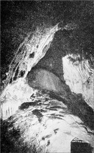
THE "BEEHIVE" CHAMBER, LAMB'S LAIR.
Photo by Bamforth, Holmfirth.
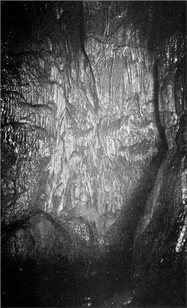
STALACTITE WALL, LAMB'S LAIR.
Photo by Bamforth, Holmfirth.
From the Beehive Chamber a passage winds downward under one of the glorious porches already described, and on and on between walls of calcspar and arragonite, toward the chief wonder of Lamb's Lair, the Great Chamber. The original passage was low and difficult, and early explorers cut a deeper way through solid beds of arragonite, whose miraculous whiteness glistens on every side as we advance. So enormous is the thickness of this compact and fine-grained variety of the calcium carbonate, with its delicate lines of crystallisation showing transparently where it is shattered, that fully three and a half feet are shown in section, a wall of snowy brilliance; and one cannot judge how much more is hidden. The tunnel widens into an arch of reddish rock, covered with sparry reliefs; then suddenly we find ourselves stepping on a plank, and out of the darkness ahead starts up the gaunt shape of a windlass. We have reached the spot where the gallery breaks into the upper part of the Great Chamber; under our feet is a black void, and further progress is forbidden. The gallery ends on a sloping bevel, 10 feet wide, that dips steeply into the chasm. On this bevel, which overhangs by many feet the receding wall of the Great Chamber, a timber platform was erected a quarter of a century ago. It is a sort of cantilever, with the windlass resting on the long arms. We moved here with utmost caution, hardly venturing to place a foot on the time-worn structure without holding on to the rocks at the side. On the last occasion that the cavern was visited, some years ago, a fatal accident was averted almost by a miracle. The rope broke while Mr. Balch was descending; he fell about 60 feet, on to the broken rocks beneath, checking his fall by catching at a tangle of line that was hanging near. His hands were cut to the bone, and he lay at the bottom stunned for a quarter of an hour, and has hardly ceased to feel the effects of the[120] shaking. Naturally, he now felt little inclination to venture another descent, especially as he told us that the rickety state of the platform has filled him with grave doubts as to its safety if weight were put on it.
At present, beyond the stark shape of the windlass, darkness reigned. We flung blocks of arragonite out into the void. There was an interval of silence, then a crash on the hard floor, and the missile burst into fragments. When the ray of our 2000-candle-power searchlight flashed across the abyss, we found ourselves looking into a chamber whose weird majesty held us spellbound. Its height is 110 feet, and the walls curve gradually over in an irregular dome. Hardly a square foot of this mighty wall-space is blank. Stripes and reticulations and pendulous lacework run all over it in enchanting disorder. Here a snow-white flood of calcite drops from an unseen cleft, there a cascade of many colours ripples down from roof to floor. There are great sheets of opaline enamel, curtains drooping in massy folds, silken fabrics wrinkled over the face of the rock, all giving one the sense of motion suddenly arrested, and of light and colour captured from the rainbow and sleeping here in the darkness, waiting year after year for our lamp to awaken it to life and beauty.
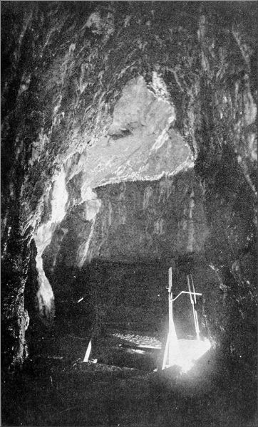
ENTRANCE TO GREAT CHAMBER, LAMB'S LAIR.
Photo by Bamforth, Holmfirth.
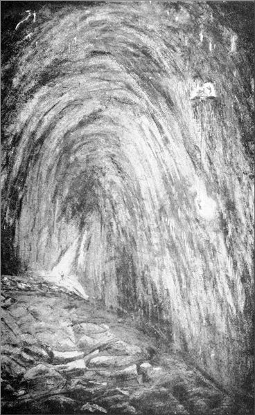
LARGEST CHAMBER IN SOMERSET, LAMB'S LAIR, HARPTREE.
From Sketch by H. E. Balch.
The cylinder of oxygen and the ether saturator were pushed out as far as we dared, and the camera was set up on the edge of the platform, to secure at least a glimpse of this hall of wonders. We were told what lay beyond. Another gallery, begemmed as richly as the one behind us, leads on and on, until a high chamber is reached, into which water pours over a sheet of snowy stalagmite, 60 feet high. We could not descend into the Great Chamber, but we intended to light it up. A tinful of[121] Bengal fire was put into an iron saucer, hanging from a string by iron wires; and this with a light attached was lowered through the hole in the platform, whereon we lay extended at full length looking over into the gulf. There was a fizz, and then the fierce radiance swept from side to side of the huge vault, staining the sheets and curtains and cascades of white a splendid crimson. The walls sparkled blood-red as if set with rubies, and the blue-black sheets of calcite marked by oxide of manganese were empurpled by the glow. We fled before the pungent clouds of smoke that rose into our gallery, back to the Beehive Chamber, leaving that glorious hall once more to solitude and silence.
The only other part we explored was the winding tunnel that begins under the second porch in the Beehive Chamber. It goes far away down, and is knee-deep in mire for a considerable distance. At last, when it seems as if the Great Chamber itself cannot be far away, the passage ends in a choke. We had been in the cavern about five hours, when, after much hard work, we got our apparatus back to the foot of the shaft. Climbing ahead up the rickety ladders, the broken rungs of which were caked with mud and clay, and keeping hold of the life-line all the while, I found our driver waiting for us at the top, for we were an hour late. Several dangerous stones were shifted in pulling up the luggage, and one man below not only received a nasty blow, but narrowly escaped destruction by another stone that he just succeeded in warding off his face.
We have since regretted that we did not test the platform and windlass by a rough-and-ready method, and then descend by a long Alpine rope. The sharp ledges underneath might, however, have rendered this dangerous. We had not seen everything, but we had[122] seen enough to recompense us abundantly for the toil, the slight risk, and the dirt. Murray says that Lamb's Lair is the finest cave in Somerset; I would confidently venture further, and say that for transcendent beauty it has not its equal in England.[4]
E. A. B.
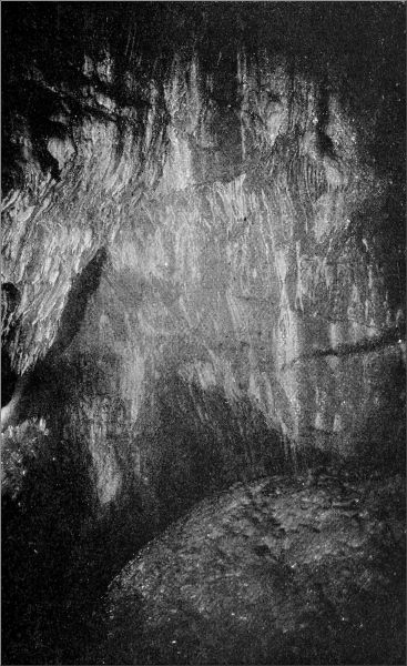
STALACTITES IN ENTRANCE GALLERY, LAMB'S LAIR.
Photo by Bamforth, Holmfirth.
At Bridgewater, where we had arrived one winter morning at sunrise, after a melancholious journey in unwarmed carriages across the flooded moors beyond Glastonbury, not a person had heard tell of a cave in the Quantocks. But the information we relied on, though a century old, was definite enough to warrant the hire of a trap to convey us and our apparatus to a certain lonely cross-road, seven miles away, in a corner of the broad parish of Bloomfield. Climbing steadily through Enmore, we found the cross-road on a hilltop 800 feet above the sea, hard by a homely tavern, where we got cider for ourselves and feed for the horse. To our west was the Beacon on Cotherstone Hill, and two miles farther the Fire Signal Pits on Will's Neck (1261 feet), the highest of the Quantock Hills. But of the red-deer country that lay around us we saw little, and less as the day wore on, for a cold sea-mist came rolling up from the Bristol Channel, and would have given us trouble in finding our cave, had not a guide appeared providentially. It was a tattered and weather-beaten countryman, who emerged from the tap-room and announced that he was the only person who knew anything about the cave. He dilated in glowing terms on its beauties—"It be very ornamental, sur, very ornamental." Fox by name and fox by nature, so he described himself—for he was both garrulous and egotistical—he was fond of burrowing into holes. That he was a poacher to boot, we had no reason to disbelieve after a few minutes'[124] conversation. He led us by a veritable fox's path over fields and hedges, through a mist-drenched spinney, down to a dingle, where beetle-browed rocks overhung the entrance to the cave. A rusty iron gate barred the way, and was padlocked. Reynard proposed to make a journey of several miles, at our expense, to procure the key; but a broken link in the chain saved us time and cider.
There is not much Limestone on the Quantocks, and caves are a rarity. At this spot an outlier of Carboniferous Limestone lies in close contact with beds of Greywacke Slate—a very unusual conjunction, which prepared us for something new and strange in the way of crystallisations. Descending a few yards beyond the entrance, the main passage rises a little, and then drops gradually towards a stagnant pool, beyond which it is impossible to get. The length of this portion is only 140 feet, and the direction from north-east to south-west. Certain narrow passages, however, bore into the Limestone on the north, and extend their ramifications much farther. Only one of these seems to have been known before our visit. In the main passage, near the pool, is seen the special wonder of Holwell Cave, a brilliant display of arragonite crystals all over the roof. Arragonite usually occurs in massive deposits of satin spar, distinguished by a perfection of whiteness when newly split, a whiteness that grows dingy very soon if you try to keep specimens. Here it occurs in quite another form—the coralloid, known as flos ferri; thousands of filaments or spicules ramifying from centres, and looking as soft as cobweb, though as brittle as blown glass. This delicate product is often tinged with a pink stain like that of fluor-spar. Andrew Crosse, the electrician, who was carrying on his researches in the neighbourhood when Holwell Cavern was found about 1800, thought that the crystal might have been distorted by slow degrees into[125] these fanciful shapes "through the invisible action of electric energy," an agent to which most mysterious natural processes have been attributed some time or another; but the fibrous arragonite, scientists tell us, is by no means abnormal. It all lies on the Greywacke part of the roof; the adjoining Limestone has no arragonite, but is incrusted with the usual sheets and bosses of calcite, mutilated somewhat by visitors who have taken away mementos.
"Ain't it ornamental, sur?" said our conductor; but his exclamations were still more enthusiastic when the magnesium ribbon lit up the millions of arragonite crystals that covered the roof with a glistering efflorescence. Then the flashlight blazed out, as our camera got into action, and the old man was speechless with amazement. He had known the cave, boy and man, all his life, but never before had he, or anyone else for that matter, gazed upon all its beauties. Several photographs were secured—among them the portrait of a sleeping bat clinging to the groining of calcite—and then the cave grew too smoky for further work. So we went off to explore.
First we climbed into an opening high up in the north wall. It seemed to run parallel with the main passage, and soon we beheld daylight in front. Ere we reached the open air, however, we came to a steep drop, and found that the branch had simply brought us back to the vestibule of the cavern. Another opening, near the entrance, running due north, proved more interesting, leading eventually to a bell chamber, floored, walled, and roofed with polished carbonate. Someone had reached this point twenty years ago, so dates and initials testified; but there were virgin passages branching off to left and right for us to investigate, as far as bodies of speleological slimness were admissible.
A squeeze through a crevice in the east wall led into a[126] parallel tunnel, depressingly low and painfully narrow, which seemed to run on indefinitely to the north. The soft clay floor showed it was at times the path of a heavy stream. Northward, it shrank to a mere drain-pipe; southward it led by one joint and culvert to another, all at right angles, into other straight channels, all going in the same general direction. My companion stuck fast a little way beyond the first tunnel; I pushed on like a weevil into the maze of perforations, but met the same fate at last, not giving in, however, until I had been held as in a vice at one point for a good five minutes, with boot jammed, candle out, and no room to get my hand to the pocket where the waterproof matches were safely stowed away.
It was still possible to see a long way ahead, by candlelight and magnesium; and we made out that north of the known cave lies a whole network of dry waterways, the principal channels running due north, roughly parallel to the Limestone escarpment in which the cave mouth opens, and all connected together by rectangular branches. One channel brought us within view of daylight; but the crevice was too small for anything but a rabbit, and we had to return by the same arduous and abrading passages we had come by. As old Fox would have said, the things we saw were "very handsome," but we could not tempt him to enter this uncomfortable region.
E. A. B.
Travellers on the North-Western to Holyhead or Snowdonia are familiar with several cave mouths that form a prominent feature in the Limestone cliffs above Lord Dundonald's castle, near the station of Llandulas. The most conspicuous is a vast antre near the cliff-top; and legend has it that this opens into passages running for great distances, and eventually descending beneath the sea. (Welsh cave-myths are not less extravagant than those of Derbyshire and Somerset, where stories of dogs, geese, and other animals that have made long pilgrimages underground and come into daylight again divested of feathers or hair, are still piously cherished by the credulous.) The name attached to this group of caves, Tanyrogo—"under the cave"—is derived from the Celtic ogo or ogof, a cavern, and is almost identical with the original name of Wookey Hole in Somerset. A party of explorers from Liverpool and Colwyn Bay have recently carried out some researches in the Tanyrogo caves, and in those at St. George, on the other side of Abergele; and while verifying their disbelief in the supposed extent of the subterranean galleries, have ascertained many interesting facts as to the formation and the geological history of both series.
A grassy terrace runs along the cliff face to the gaping portal of the Ogo, the biggest of the Tanyrogo caves, which looks seaward and commands a magnificent view over the coast and the Irish sea. The prehistoric men[128] who doubtless lived here once showed not only good taste in the choice of a site for their residence, but a judicious eye for military possibilities; the place is all but impregnable, save by starvation, the only access being by this narrow ledge, which a handful of men could defend against an army. Spanned by a noble arch is a colossal vestibule, rock-floored and dry. But this imposing entrance is a deception—there is nothing beyond to compare with its shape and magnitude. We swerved to the left, and at once found ourselves treading a floor of wet clay, which began to ascend, and soon steepened into a high bank leading up towards the roof. Creeping under an arch, we found ourselves in a transverse fissure that may have run as far as the legends pleased, but grew too narrow in a few feet for any human being to penetrate farther. A few rudimentary stalactites and a crust of pure white calcite adorned one small grotto; the rest was bare rock walls and rugged arches, springing here and there high into the darkness, in fissures that must reach very nearly to the summit of the cliff. A branch passage dwindled away still more quickly, and so did a minor opening that looks like a side door to the main entrance.
The rock structure of the cave arches is displayed in very beautiful ways in this cavern, but the most interesting feature is the remnant of an old cave floor. The cavern was evidently formed in pre-Glacial times, and the vast quantities of clay that plug it up almost entirely now must have been carried in by the ice. After the glaciers had receded, the normal agencies began their work again; a stalagmite floor was formed by the drip of water from the roof, depositing a layer of calcite; this in the course of time was broken down again, and now leaves a kind of high-water mark all round the walls of the cavity.
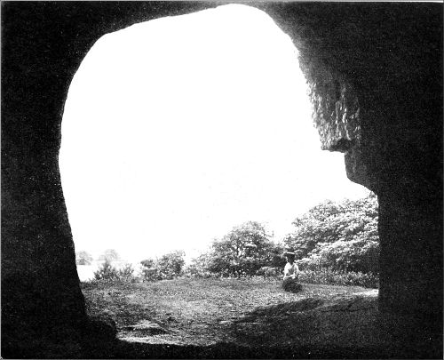
THE OGO, NEAR ABERGELE.
Photo by E. A. Baker.
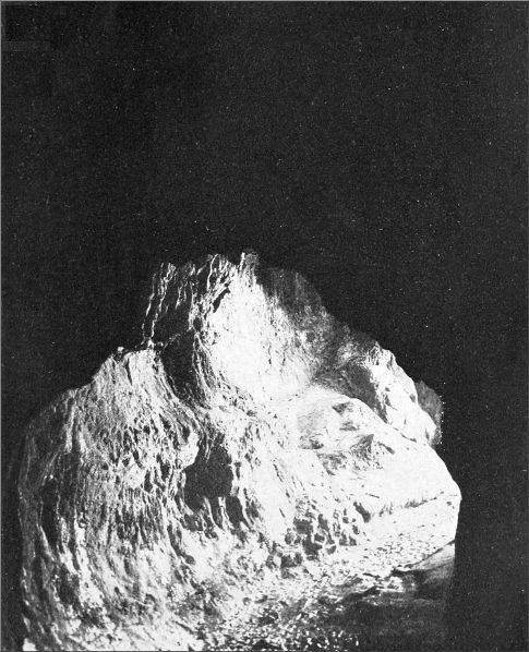
INSIDE THE OGO, NEAR ABERGELE.
Photo by E. A. Baker.
The line of the fissure creating the upward chasms inside the cave can be traced in the external configuration of the cliff; in sundry vertical openings in the face, and in the clean-cut walls, where sheer masses have fallen away, broken at the joints. Similar joints and fissures played a part in the formation of a lower tier of caves, which we explored next. The first was only a yard or two wide, but very lofty, and its floor was composed of a level bed of sand and clay. This gradually rose as we walked into the darkness, until the cave ended more abruptly even than the last. We noticed pebbles of Bunter sandstone in the floor, and the next cave produced many more examples of the same stone, which must have been brought from a long distance, the nearest strata corresponding to it being in Wirral. At the back of this next cave a bank of cave earth and boulder clay was piled right up to the roof, so steeply that it was not too easy a climb to the summit. Arrived there, we found no possible egress; but a horizontal tunnel, a sort of squint or hagioscope probably more than forty feet long, gave us a peep through the rocky cliff out to the sunlight. We set out forthwith to discover the outside orifice of this curious hole, and found it came out on a ledge in the face of the cliff, hard by an open platform which had a very queer look about it. On examination this proved to be the floor of an old cave that had been destroyed by the quarrymen. Half-embedded in thick clay were a number of stalagmite pedestals, and a floor of stalagmite underneath several feet in depth, surmounting a thick bed of boulder clay stuck full of Bunter pebbles. It was obvious that the quarrymen, coming across this mass of useless material, had not troubled to attack the solid layer of stalagmite above it. The remains of stalactites and stalagmite curtains still adhered to the neighbouring cliff.
The spot is well worth visiting, if only to see this remarkable illustration of several consecutive chapters in the history of a cavern. The destructive work of the Limestone quarry, having been checked at this particular point, exposes the whole thing as in a diagram; and the actual evidences are there just as they were produced by the forces acting in successive epochs—the mouth of the original cave, formed perhaps in pre-Triassic times; the masses of drift thrust in by the glaciers; and the new cave floor, with its growth of stalagmites. Since the caves lie at a height of several hundred feet above sea-level, it is fairly certain that the moving glaciers exerted an upward as well as a horizontal force, shoving the plastic masses of clay and débris into the ascending passages, and caulking up, no doubt, a good many tributary galleries that are now unknown. The caves look north, and the material pushed into them must have come from seaward; there is, furthermore, no rock in the adjoining districts that could have yielded this kind of pebbles: so that it appears the stream of glaciers which flowed across from Lancashire and Cheshire, impinging against the contrary flow of ice from Snowdonia, must be held responsible for the presence of these dense deposits. All along the meadow-lands between the Limestone hills and the sea a series of risings or big springs are noticeable from the railway, forming large pools. These are the outlets of the drainage that has been absorbed by the Limestone strata, through which the water has found its way until, meeting with an impermeable layer of rock, or reaching the plane of saturation at sea-level, it has been forced to the surface.
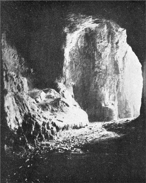
IN THE OGO, NEAR ABERGELE.
Photo by E. A. Baker.
The St. George's Caves are situated on and about a wooded hill of Limestone near the village, which adjoins the low-lying lands of Morfa Rhuddlan, the scene of a murderous battle in the year 795. The Celt, with his[131] strong historical imagination, such a factor in national solidarity, still remembers, though confusedly perhaps, some incidents of that calamitous fight. The old woman who pointed out the situation of the caves drew our attention to the ditch and rampart which run round the hillcrest, where it is not protected by cliffs. There, she said, the routed Welsh tribes had entrenched themselves and fought desperately on until every man was put to the sword. The wood on the hilltop is full of graves, she told us, and weapons often come to light there.
A great master-joint or fissure runs across the hill towards the battlefield, and in it lie the caves, or rather the cave, for so far as we could make out they are all parts of one stream-channel. At the top of a cliff that is now being worked for lime is a small orifice, a mere fox's hole, blocked up against Master Reynard or the badgers that often find a home in these small caves. A hundred feet beneath it is a larger opening, which is said to give entrance into several good-sized chambers; but that also has been carefully built up with fragments of Limestone by the quarrymen. We were driven accordingly to seek the outlet of the cave, and this we found by following the smooth, straight escarpment, produced by the fault, in a wood close to the mainroad. A large stream once issued from the cave mouth, but has since become engulfed in some internal swallet, and emerges a few yards lower down, welling out from a funnel of crystal water some 15 feet deep. The cave itself discharges a stream only in flood-time. There, too, we were stopped from penetrating far by the beds of clay that gradually rose to the cave roof; but in this instance the deposits had been made by the stream, and were not the results of glacial action pushing upwards. In fact, this is a cave with quite a modern history, one still in[132] working order, and used as a waterway at the proper times and seasons by the stream that made it. The Tanyrogo Caves, on the other hand, have ceased for untold ages to be actual water-channels, having been deprived long ago by denudation above and behind them of the greater part of their drainage area. And since that remote epoch they have gone through the series of vicissitudes so plainly recorded in their present physiognomy.
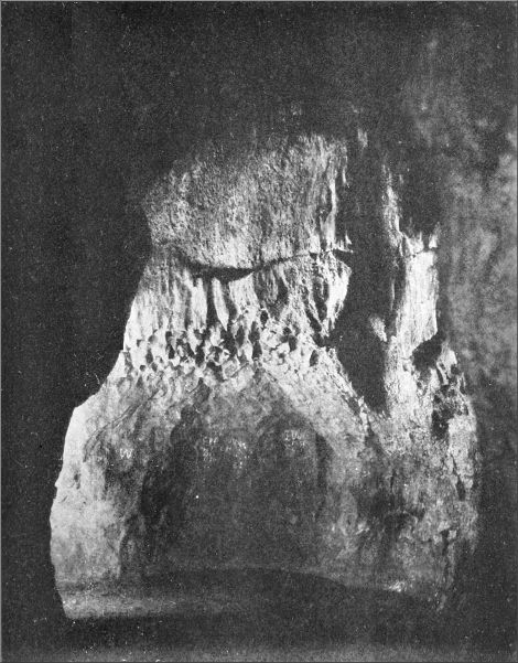
A PRE-GLACIAL CAVE, LLANDULAS.
Photo by E. A. Baker.
The other day, a Liverpool friend, who has a bungalow in the Ceiriog Valley, close to Offa's Dyke, told me he had found a cave there, which had never been explored, but was reputed to go six miles underground, to the neighbourhood of Oswestry. He invited me to come down and explore it, and I readily agreed, on the condition that he was to seize the opportunity to make his début as a cave explorer. On the side of the valley where the cave lies the hill falls steeply to the Ceiriog, and the densely-wooded cliff of Limestone that bathes its foot in the river is like a bit of Dovedale. Not so the other side of the valley, where different strata crop out, and the hills, with all their trees, rise more gently to the brow overlooking Llangollen.
The cave mouth is about 20 feet above the river, in a cliff facing due north, in which the Limestone is tilted at an angle of 45 degrees. It is recessed within a lofty arch, but the entrance itself is low, compelling us to creep for the first few yards. After two or three bends, the roof as well as the floor rises, and the passage opens into a chamber whose floor is heaped up to a height of 10 feet with fallen débris, thickly plastered with mud. At first the cave runs due south, but the main axis of this chamber, which is lofty and measures about 20 feet by 20, runs east-south-east. The roof rises about 20 feet higher than the central heap of débris.[134] Water drips occasionally, but there are no stalactites. At the far end the passage turns south-east, and, though lofty, is narrow, the walls being parallel, and tilted at an angle of 20 degrees from the perpendicular. Then a second chamber widens out, 50 feet long by 6 feet broad, as muddy as the former. Rising 10 feet, the passage continues to the east-south-east, but the walls converge for a time, forcing us to crawl, extended on our sides. Then it opens out again, and we climb over more heaps of débris littering the floor, and all bedaubed with thick, tenacious clay.
Now the passage becomes loftier but narrower, and progress has to be made by keeping near the roof, the walls sloping at an angle of 30 degrees from the vertical, opening at one point into a small chamber with a false floor of jammed rocks, then immediately closing again, and so continuing for a distance of 60 feet. The narrowness is so great that one goes ahead only by dint of a continuous struggle against friction. Up to this, my friend had kept close at my heels, followed by his man. But here the only way visible was down a still narrower rift bending off to the left, and the latter found his own diameter greater than that of the cave. We left him, and pushed obstinately forward, though we had not seen a sign of any person's former presence for a long distance. Nearer the cave mouth matches and candle-grease and the marks of crawling had been plentiful, local adventurers having got in nearly 100 feet.
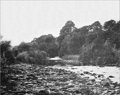
ON THE CEIRIOG.
Photo by E. A. Baker.
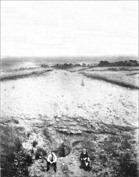
UPPER CEIRIOG CAVE.
Photo by E. A. Baker.
Already we had struck the water in two or three places, but had not found it in the main passage. Now we crossed a long pool or runnel of stagnant water, which came in from under the rocks to the south-east, and climbed into a tight little curving tunnel that led back to it in a semi-circle. Beyond it, I found myself in a rift chamber, with the water coming in from under the[135] rocks at one end, and flowing out in like manner at the other. There seemed to be no egress, till suddenly I noticed that the niche in which I was sitting was the end of a small horizontal hole or dry water-pipe, striking off at right angles. But my companion had found the tunnel too much for him. The sides bristled with points of rock, and pressed in so close that one could only wriggle through by fractions of an inch, stretched at full length on the left side. Now he made a stout attempt to get through underneath, in the water tunnel. I heard the sound of wallowing, and then my friend's head and shoulders came splashing in at the bottom of the cave, his body dragging after through water and mud. But again he stuck fast, and announced that he would give the thing up.
It was not wise to go on far alone, for fear of being left by any accident without a light; but in order to make a reconnaissance for future work I pushed through the water-pipe, and to my delight found myself in another horizontal tunnel running parallel to the main chamber. Crawling ahead, first over a clay-lined floor, and then over splinters of Limestone mixed with stalagmites, I emerged presently into an open passage, 25 or 30 feet high, with the stream peacefully reposing in one long pool at the bottom. It appeared to go on indefinitely, and I might have gone farther, but for the present determined to leave off the exploration at this point. The parallel tunnel seemed to be going straight back towards the cave mouth, and it looked as though it might form a short cut home. As a matter of fact, this was a right branch striking off from the point where our man had stuck fast. By crawling in his direction and shouting, I made him hear, and at last saw his light through a chink only three inches wide. Fallen blocks of Limestone choked the tunnel at his end, where it leaves[136] the main passage near the roof, and in its present state this branch of the cave was practically invisible. We shifted several big stones, however, and in a few minutes my friend joined me, pleased enough to find a way out that saved the discomforts of his recent journey. He had had the misfortune to array himself in white flannels, and now the state of his garments was so deplorable that he straightway hid himself in the river, like the pseudo Marquis of Carabas, until more presentable clothing could be fetched.
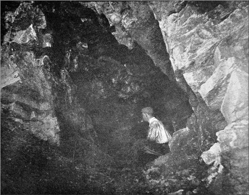
LOWER CEIRIOG CAVERN.
Photo by E. A. Baker.
A veteran cave-hunter from Liverpool gladly joined me in a second visit to the Ceiriog Cavern. Our host could not be with us, but sent a village youth as his substitute. This young man was very keen and plucky, and, as things turned out, saved the situation, for my speleological friend, to his intense chagrin, failed to get through the narrow entrance to the parallel tunnel, and the two of us had to finish the job by ourselves. Climbing along the walls of the water-rift, we soon found it best to wade straight through the stream bed, and finally, when the space grew more and more restricted, to crawl through the water. Toward the end of the rift a small tunnel broke away to the left, and the water disturbed by our advance flowed into it and away down a small swallet. Wriggling through, heedless of a wetting, we came into a small chamber with four exits, each of which we explored, marking off each with a cross or arrow to prevent our losing the route back. Every branch led eventually to other points of divergence, and ultimately to small tunnels or pipes, through which the water flows in rainy weather into the head of the cavern. Having conscientiously examined every one, without finding the mythical passage to Oswestry, we returned to the tunnel of the swallet. One of the bifurcations, it was interesting to discover, led back unexpectedly into the water-rift. There were[137] numberless chinks and fissures, and holes in the roof, leading into this network of passages, all very interesting as a concise example of the whole history of the formation of a cave; but the farthest point reached was, by measurement, only a little more than 500 feet from the entrance. Only in places were there stalactites, and those small ones. There were stalagmite curtains on the walls at one or two spots, and patches of very white amorphous tufa. Curious filaments of cave-weed, white and brown, without a vestige of leaves, abounded throughout the cavern. Not far above the cave mouth I came across the exit of the water, a beautiful spring, pouring down into the Ceiriog, a few yards away.
On the top of the hill, in a disused Limestone quarry, there were traditions of a cave opening that had been covered by a landslip for some thirty years. A man was set to work digging it out, and a small fissure was disclosed, the old channel of a tributary leading into the middle of a cave running north-north-east and south-south-west. The total length was 172 feet. The water apparently entered at the top of the left passage and ran away into a low bedding cave to the right. The floor is wet clay at present, but there are traces of large stalagmites, including one handsome "beehive"; and the roof is covered with beautiful white and amber stalactites. Our further attempts to uncover openings into the Limestone only brought us down to the solid rock, and we found nothing to confirm the rumour that a cave exists which carried a stream down to the Ceiriog, feet below.
The explorers who have done so much work in Derbyshire and Somersetshire have also carried out extended explorations in some of the more remote caves of Yorkshire. Recently a party carried out farther investigations than any previous explorers in Stump Cross Cavern, on the moors between Wharfedale and Nidderdale. This cavern, which is named after the ancient boundary mark of Knaresborough Forest, and is situated near the summit of the moors, 1326 feet above sea-level, 4½ miles from Pateley Bridge and 11½ from Skipton, was discovered in 1843 by miners searching for lead, as was the case with several of the Derbyshire caverns. The Greenhow lead mines are not far off, and the ground in many parts hereabouts is riddled with old workings. No place could look more unlikely for caves than the flat field on the top of the hill, where a few steps lead down to a doorway into the ground, close to the rough road to Grassington and Appletreewick.
The party of five, besides myself, Messrs. B. and F. Wightman, J. W. Puttrell, J. Croft, and H. Bamforth (all members of the Kyndwr Club), drove up from Bolton Abbey Station by way of Burnsall, and through various delays did not reach the cave mouth till nine o'clock on Saturday evening. With our photographic and other apparatus we descended at once to a level gallery 50 feet or so below the surface, whence several passages[139] branch off, and there we made a halt. To give a clear general idea of the structure of this cavern is not easy. It consists of a number of galleries running in different directions at different levels, with a few intercommunications, and many continuations that have gradually become choked with clay and stalagmite and have for ages been impassable. Descending the steep stairway in a northerly direction one soon reaches the first of the natural passages, which bears to the west. A gallery goes off to the right, west-south-west, and bifurcates, but is uninteresting, the earth and clay that show its proximity to the surface rendering it very dirty. In the opposite direction, east-north-east, the corridor where we had placed the luggage and made our general rendezvous continues to a distance of 120 feet, and then dwindles away into a low stalactite grotto. Being so inaccessible and so little known, the various chambers have never yet been christened, except with the vague and general names of Upper Caverns and Lower Caverns, which have little meaning owing to the intricate conformation of the series. From our rendezvous two important tunnels, called the Lower Caverns, go off in a westerly direction from the bottom of a natural shaft 20 feet deep. These were left for the present whilst we went into the Middle Caverns, which strike off to the north from the same spot, and after many turns and twists approach the surface in the ravine of Dry Gill, south-east from the entrance to the caves. Many chambers and passages open out from this series, the largest and most beautiful being called, very inappropriately, the Top Cavern. As it leads eventually to a charming piece of cave scenery that we agreed to call the "Bowling Alley," it might well be named after this.
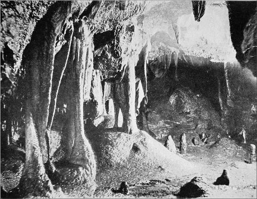
IN STUMP CROSS CAVERN.
Photo by E. A. Baker.
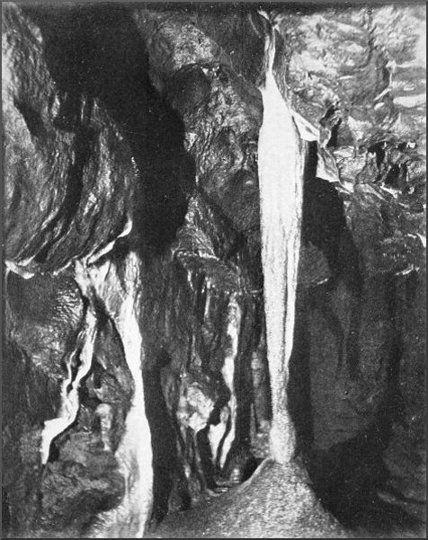
THE PILLAR, STUMP CROSS CAVERN.
Photo by E. A. Baker.
I will now, as clearly as I can, follow the steps of the party in their exploration of these Middle Caverns, and proceed afterwards with them into the other series.[140] Descending gradually, and passing many nooks and corners where exquisite recesses are wreathed about by the ivory-white incrustations on wall, roof, and floor, we stayed to drink a ceremonious glass from the icy waters of Jacob's Well, a crystal pool curtained in with masses of stalactite, and then passed on to one of the chief show places seen by the public, bearing the modest name of the Chapel. Its great attraction is the series of massive pillars of translucent white that seem to uphold the arching roof. In few of the caverns that I have explored is there anything to compare with the stateliness of this pure colonnade, the cylindrical shafts of which are a good deal longer than a man's height, and modelled fantastically by the irregular deposit of the calc spar. One column in this part of the cave measured three feet in circumference. A peculiar beauty was the transparency of the material, a pure glassy white through which the light of a candle shone clearly, whilst a light inside converted the hanging folds and clusters of stalactites into a beautiful species of lantern. On the walls were folds and ridges of snowy stalagmite, and from the roof hung stalactites of all shapes and sizes, myriads of threadlike growths hanging in a lacy fringe. Onwards the arcading and the array of pillars extended into a roomy vault, the end of which struck upwards, as already explained, south-eastwards, toward Dry Gill. Though a perceptible draught comes through from the open air, and the heaps of clay-coated blocks show that a swallet is not far off above, no way can be forced through without excavation. Augmented by the arrival of two or three local friends, the party descended, after lunch, into the Lower Caverns. Unlike the other passages, with their continual windings and perplexing branches, these two series of large vaults, narrow tunnels, and almost impracticable crevices maintain a westerly direction throughout, and the few branches strike off decisively to the right[141] or to the left. Two of us, being delayed by some trifling accident, missed the others at the bottom of the short vertical descent, and, unaware that there were two series of passages, crept on along the first that opened. This had the appearance of an old stream-bed, the ground being littered in places with blocks of Limestone, in others clayey, and in some parts smoothed down by the rush of a torrent. High in places, it often dwindled to a very low passage, through which we crept and wriggled after the manner of the serpent, ofttimes exerting no little strength to push beneath the projections overhead. Here a shaft of glassy stalagmite, uniting floor and roof, tried to bar the way, and there it was impossible to advance without scraping against the vitreous threads that hung like hairs from the dripping rocks. We shouted to the others who we thought were ahead of us, but got no reply, and after twenty minutes of this painful progression began to think of returning. Noticing a hollow in the right wall, I asked my comrade to wait while I examined it. Inside was a blind passage and the round orifice of a small tunnel, into which I thrust my head and shoulders and then crawled forward. It was not an inviting hole, being wet and an exceedingly tight fit, and I was on the point of returning when a voice was heard faintly in the distance. Listening intently and creeping on again, I heard the voice more distinctly, and shouted. The voice replied from below. I quickly realised that we two had missed the others, who were following a lower series of passages somewhere beneath us. Unable to turn round, and too far advanced to return up this slippery tunnel, I saw there was nothing for it but to push on, head downwards. In a yard or two, to my unspeakable relief, the hole grew big enough to turn round in, just before I got to the end of it, and saw Messrs. Croft and Puttrell, 12 feet below me, holding out their hands and inviting me to drop. The[142] leap was a little sensational, but I had my turn of enjoyment in witnessing the grace with which my comrade from above, who was now courteously invited to follow me through the water-pipe, took the jump on to the clay floor of the lower tunnel.
We returned later to the other westerly passage, at the top of the water-pipe. Examining every opening carefully, we noticed many similar communications between the two series, evidently proving that the upper was a very ancient stream course that had been tapped successively until the lower tunnel superseded it as a waterway. Pushing ahead, we soon realised that we had arrived at the richest part of the whole cavern, though also the most inaccessible. The roof came down bristling with spikes and shafts of the purest calcite; the floor was one mass of crystallisation, ridged all over with the rippling lines that form as the crust grows under water. This exquisite scene was continued for hundreds of feet, various and indescribable as a dream, whilst our march onward over the sharp crystals of the floor and through the portcullis that closed every chamber was as painful as a nightmare. Loveliest of all was a long tunnel that once held many pools of water, half-encrusted over with a film of carbonate. Only one of these lucid mirrors remained, but the dried-up basins were as beautiful now as ever, with the bottom and sides covered by a coraline growth delicate in colour as in form. At the end was a small dome-like chamber, where we extended ourselves for a hard-earned rest before facing the toils and tribulations of the journey back.
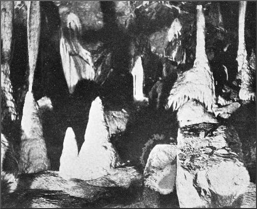
THE CHAPEL: STUMP CROSS CAVERN.
Photo by E. A. Baker.
We thought this expedition to the lower series had exhausted the principal beauties of Stump Cross Cavern, but we were wrong. On our way to rejoin the other men in the Middle Cavern we were much impressed by two large curtains of stalactite, one of them folded and wrinkled,[143] and the other hanging straight down without a curve, but both striped with deep bands of crimson, orange, and golden yellow when a piece of magnesium was burnt behind them. These were equal in extent and brilliance to anything I have ever seen, even in Cox's Cavern at Cheddar. A round tunnel, ribbed and groined with glistening dripstone, and a broad low arch set with pillars and string-like stalactites stretched from top to bottom, led into the long, wide chamber that we dubbed the "Bowling Alley," on account of the stumps and pedestals of stalagmite that stud the floor between the pillars. Beyond it a short passage leads into a grotto to the right, and a very difficult one continues some distance to the left.
It was now past three in the morning. Tired and battered to the point of exhaustion, but delighted with an exploration that far exceeded in interest all we had looked for, we returned to the cave mouth. An unpleasant-looking bull which had with great suspicion watched us make our nocturnal entry into the regions below had, greatly to our relief, got tired of waiting, and the coast was clear. Out of the everlasting silence and the shadows, lit so rarely by the glare of the magnesium and the beams of the limelight, we returned again, with the surprise that never fails, to the light of the heavens. Dusk was on the far-extending moors and hills, daylight was creeping on over the sky, a pair of larks saluted us with a hilarious song. Our driver was soon awake at the little inn, two furlongs away, and in the freshness of the morning we crawled down the break-neck road to Appletreewick, Bolton Woods and the Wharfe growing in light before us; and then at an exhilarating pace rolled up the dale to the Red Lion at Burnsall.
Between Sparrowpit and the head of the Winnats the old road from Chapel-en-le-Frith to Castleton skirts what is, geologically, one of the most important localities in Derbyshire. It runs along the side of a shallow upland valley, about 1200 feet above tide-level and two miles long, which is bounded on two sides by the curve of Rushup Edge and on the other two by Elden Hill, Windy Knoll, and other Limestone acclivities. One of the great faults of the Pennine chain traverses this valley longitudinally, the Yoredale strata having been thrown down to the level of the Limestone, so that the middle of the valley is the boundary between the Yoredale rocks, shale grits, and milestone grit on the north, and the Limestone plateau of Mid-Derbyshire on the south. The valley is completely encircled by higher ground; there is no egress for streams on the surface. Accordingly other modes of drainage are to be looked for, and they will be discovered in a numerous series of swallets situated along the line of the fault, the water that runs over the impervious shales perforating the Limestone as soon as it comes in contact with it. This shallow valley, in fact, is the gathering ground for the waters that pour into the abyss of the Speedwell Cavern, traverse Peak Cavern, and make their way to the open air at Russet Well and other springs at Castleton. That such is the case has long been proved by observations of[145] the temperature and colour of the waters, and by tracing chaff and other things thrown into the upland streams. But there exist hardly enough data to establish the theory of the French speleologist, M. Martel, that Peak's Hole Water comes from Perryfoot, and the water of Russet Well from Coalpit Mine, near Sparrowpit. All that is definitely known is that these waters run through the massive Limestone for distances varying from two to three miles and reappear in Castleton, 600 feet beneath. Whether they unite into one or two large streams, which form considerable chambers and caverns in the inaccessible region beyond the farthest known parts of Speedwell and Peak Caverns, is an interesting question, that tempts one to answer boldly in the affirmative, since the action of underground streams in Somerset and Yorkshire seems to justify the assumption, if we take into account the extent of the vertical joints eaten away by the water in its descent of 600 feet, and the effects of periodical floods. In Somerset, in a situation exactly similar, two caves of 600 feet fall and 2000 feet horizontal measurement have recently been discovered by opening similar swallet-holes. Is there any hope of finding such hypothetical cavern or caverns here by exploring, and if necessary opening artificially, any of the swallets between Perryfoot and Giant's Hole? The investigations recently carried out by a friend and myself do not make us hopeful that if there are such caverns they will ever be made accessible.
We began our work at Giant's Hole, which opens in the bottom of a little gorge between Peak's Hill and Middle Hill. The brooklet that runs in at the cave mouth was very low, and we passed almost dryshod over the rough stones that cover the stream-bed for some 60 feet. Giant's Hole has an arched entrance about seven feet high, and the first part of the cave retains the same form. Then the walls contract, and the cave takes the[146] shape of a deep and narrow canyon, cut through solid rock, with the stream coursing along at the bottom over little falls and waterslides and through pools that are not easy to pass without a wetting. One hundred and fifty feet from the entrance to the cave is a lofty rift, near the top of which an upper gallery turns west, the general direction of the main passage being southerly. Passing this, we followed the stream downhill for another fifty or sixty yards, and were then brought to a standstill by a partial choke. At this point a quantity of stones and gravel comes within two feet of the roof, and the water is dammed back in a pool a foot deep, so that there is barely a foot of clear space between water and roof.
Returning to the steep climb to the upper gallery, we scaled the wet and slippery rocks, and found ourselves on a shelf over the canyon. The shelf gave ingress to the gallery, which rose gently in a westerly direction, with frequent twists and turns, and then turned north. In 150 feet it divided. We scrambled on; but all the branches evidently approached the surface of the ground, becoming earthy, and we soon found it impossible to get any farther. This upper level, which for our purposes was of less interest than the lower, is incrusted with deposits throughout its length of 80 or 90 yards. There are stalagmite curtains and sheets of tufa on the walls, the older rocks on the floor are cemented together with a crust of polished stalagmite, and some of the boulders are covered with shining enamel. We found it best to use an Alpine rope in getting back to the lower level, the ledges underneath not being easy to find by candlelight. Outside the sun was shining brightly, and the light that streamed in at the cave mouth, through the ferns and flowers and grasses that encircled it, was stained a fairy-like green.
Continuing our way through the gorge between the[147] sharp Limestone knoll of Peak's Hill and the bulkier Middle Hill, we followed a stream that comes down from Rushup Edge, perforates the Limestone base of Peak's Hill, and comes out on the other side at a small cave. In three furlongs this stream is swallowed under a cliff some 20 feet high, the ingress at present being through a series of holes, where the water makes an intermittent roaring, almost like the throb of a hydraulic ram, as if a siphon were momentarily discharging. Older rifts are seen in the same line of cliffs, and can be penetrated for 30 feet, but are now deserted by the water save at flood-time. Farther on is a deep depression in the hillside, big enough to engulf a house. It is supposed locally to have been produced by the falling in of a cave roof, but it is more probably an independent swallet, one of a series, nearly all funnel-shaped and long out of working order, that lie along a higher level in the Limestone than those that occupy the line of demarcation from the shales. The biggest of them is Bull Pit, which we come to later. Next to the last pair of large openings into which streams are running, and which may be called the Peak's Hill Swallets, since their waters rise out of Peak's Hill, we come to a large irregular series of trough-shaped hollows converging on another swallet at this same geological border-line. The openings here are all little ones. But the next swallet has a cave above it, into which we entered. It does not go far, but it has two ascending branches that can be traced to two small depressions in the Limestone where tiny affluents have percolated and cut for themselves little tunnels in the rock. The next swallet beyond this has but a small opening, although the hollow cut out by its rivulets through the shales is hundreds of square yards in area. An abrupt cliff walls in the hollow on the Limestone side, only a few paces from which are naked patches of Yoredale rocks, clearly defining the boundary of the two series.
We now came to one of the most interesting openings that we have met with. It lies about 200 yards north of Bull Pit. As often happens, immediately above the swallet, in the Limestone, is a deep chasm almost perforating the escarpment. At the base of the escarpment is a rounded archway with a turbulent stream running in. After securing a photograph we enter, and make our way down stream easily for a little distance; then the cave twists and narrows, and at a distance of 40 feet or so we are disappointed to find the channel too confined for us to force our way farther. Outside we had observed that the basin-shaped area had been flooded not long ago, and inside the vegetable débris that was plastered over the walls and roof showed that the swallet must have been completely choked during the recent wet weather. But the peculiarity of this swallet was that the solid mass of rock through which the stream had carved its way was not ordinary Limestone, but beautifully veined and crystalline like marble, and its surface smooth and polished. It had very much the same appearance as the marmorised Limestone found in the neighbourhood of intrusive lavas, such as those near Tideswell. By the action of the water it had been sculptured into fantastic shapes; in one place a corner had been cut through and a small pillar left, joined to the rock at top and bottom. We scrambled with some difficulty into the chasm behind the swallet. At the bottom, on the same side as the existing swallet, was the broad and lofty arch of a cave, which went only a few yards in, otherwise it would have broken through the escarpment. Right above the keystone of the arch was a weathered group of stalactites hanging from a ledge, and under them the broken stalagmite floor of a tiny grotto. It is a rare thing to find such deposits in the open air, and doubtless it indicates that the chasm was formed by the destruction[149] of a larger cave. A thick deposit of earthy mud covered the floor, and at one side a big hole penetrated this to a depth of six feet, the work of a stream that had perhaps not run for ages. This deposit, though dry, was so soft that I nearly sank through into the hole. We found four birds' nests in this cave mouth, with eggs and young in them, and were disappointed not to come across the egg of a cuckoo that flew out the moment before we entered. In the wiry grass not far away from the top of the cavity we discovered a lark's nest with two eggs in it.
Bull Pit lies in the wood just above this opening, nearer the road. It is a great open abyss, walled on three sides by crags of Limestone nearly a hundred feet high, and with trees growing all round the edges. This, no doubt, is a very ancient swallet that has not been in operation for ages—belongs, perhaps, to the same period as Elden Hole, which opens 200 or 300 feet higher, a mile away, on Elden Hill. A little way on, near Perryfoot, we come in sight of another very ancient cavity, on the side of Gautries Hill. It is a gaping pit about 70 feet deep, with a noble arch inside, spanning the entrance to a broad cave. At present the cave mouth is silted up with sand and clay. All these rocky openings are the lurking-places of beautiful ferns and mosses; the feathery fronds of the Limestone polypody, the late primroses, various saxifrages, and the delicate foliage of herb robert making a brave show. The wilder birds take refuge there. A crow flew out of the hole on Gautries Hill, and one day on approaching Elden Hole I was startled by a dense cloud of jackdaws, more than a hundred, suddenly rushing out. Farther down, from 50 to 100 feet lower, a host of starlings had built their nests on the walls of the chasm. Disturbed, they came flying up in twos and threes, beating the air in painful efforts to wing their way straight up and out of the hole.
At Perryfoot a stream is engulfed which M. Martel considers to be the source of Peak's Hole Water, and to be identical with the stream that flows through the inmost passages of Peak Cavern. It now runs into a cleft that is too small to be explored. But at a comparatively recent date it was swallowed in a number of large fissures in a crescent-shaped wall of Limestone 100 yards away. Most of these openings are impracticable, but at the extreme east I had already reconnoitred a promising cleft which we now proceeded to examine thoroughly. This complicated swallet, with the passages behind it, is known locally as "Manifold." Going east for 35 feet, the fissure divides, one passage striking up towards the surface and the other turning south. We soon had to crawl, the passage being very low, narrow, and lined with objectionable stones. After 30 feet more we came to a wider place, with a sort of chimney on one side. Here was the sole mark of humanity that we found in this cave, a stake that had apparently been used to climb into the chimney. Nothing was gained by climbing it, so we squeezed our way along the main passage. Now the tunnel grew into a high but narrow canyon where we could stand upright, then it dwindled to a tunnel again, generally descending, but occasionally rising in what was once a siphon. We passed one or two branches, at the most important of which the principal tunnel curved to the left and descended a little more steeply over some small ledges and basins brimming with water. We began to feel sanguine about the wished-for cavern, but presently the diameter of the tunnel grew so small that we could not advance another yard. My companion was some distance behind with his candle out, and I would not make a move until he had got it relighted, the consequences of both candles going out at once being unpleasant and possibly dangerous. For a long way we could not turn round, and had to crawl[151] feet foremost. Just after repassing the junction my companion shouted that we were going wrong. He did not recognise the passage. I remained at the junction whilst he went farther and ascertained that it was the right channel after all. Then I examined the branch. It ascended 20 feet and then divided, the left branch, which was earthy, plainly striking up to the surface, the right branch going back towards the swallet. Undoubtedly there must be quite a labyrinth of dry water channels to correspond with the numerous series of openings in the cliff, but the one we explored seemed to be the largest and most practicable. Very tired and hot, not to mention the dirt, we made our way back to the exit, glad to feel that our day's work was done.
The one thing that had impressed us most during our explorations was that all these swallets and water channels are cut through solid rock. Only when the rocks are shattered or disintegrated, as in the cases alluded to in Somerset, would there be any possibility of enlarging a swallet artificially. And though we had penetrated to a distance of 400 feet at Manifold we had not found the passages growing more roomy nor enlarged by the accession of tributaries. So far, the prospect of opening up the large fissures and chambers that must surely exist deeper in the rock seems unfavourable, unless the main channel of Giant's Hole can be unblocked.
E. A. B.
The new and exciting game of cave-exploring has been pursued so strenuously during the last four years that one would almost think the possibilities of fresh discoveries had been exhausted. When a little while ago, therefore, rumours came in of a big cavern in Lathkill Dale, so big that people were said to have been lost in its recesses, they were received not a little incredulously. But after the usual allowances had been made for exaggeration and myth, and the alleged casualties reduced to the misfortunes of a sheep-dog who spent fourteen days in the cavern, probably rock-bound on a ledge, it still appeared that there was something worth exploring. Accordingly two friends, Messrs. W. H. and G. D. Williams, who were residing near Matlock, kindly undertook to find the cave or caves, and see what was to be done; and a native of Middleton was commissioned to make further inquiries. First, a letter arrived with the disappointing intelligence that there was no cave on the Lathkill, nothing but old mine workings: but hard on its heels came a wire to say that a cave had been located and was being explored tentatively. Then further messages arrived with mention of another opening, but which was the reputed great cavern was a question to be settled only by a regular exploration.
A day was fixed for the campaign, and my section of the party drove up early in the morning from Bakewell Station on the Midland. Our friends were waiting at the[153] head of Ricklow Dale, a mile below the little village of Thornyash, and we proceeded without delay down that streamless canyon, first over smooth greensward between the grim Limestone walls, then hopping from point to point of huge, close-packed fragments, until we reached the uppermost cave mouth. It has a very imposing entrance, solid piers supporting a massive lintel, about 20 feet wide. It opens in the west cliff of Ricklow Dale, at a height of 690 feet above sea-level, and is evidently the source at times of a large stream. Ricklow Dale is really the upper part of Lathkill Dale, above the junction with Cales Dale, and the head streams of the Lathkill originally flowed down it from the neighbourhood of Monyash. But at a later period, seemingly, the stream betook itself to an underground course, until it emerged into the open from this cave. At the present time the cave is swept by water only when the deeper cavities of the rock overflow. This happened, for instance, a few weeks ago, when the cave discharged a considerable stream, and was for the time being quite impenetrable to man. As the Messrs. Williams had been into this cavern a day or two before, we left it for the present, in order to try some unexplored openings farther down the dale.
On the same side of the dale they had detected the entrance to something, whether cave or mine they knew not, covered in by stones and earth. With pick and crowbar an entrance was soon exposed, not much larger than a badger's hole, and we crept through. At once it became evident that the hole was not a natural one; it was no "self-cave," as the country people say, but an ordinary level or a sough draining a lead mine. A pool of water filled the tunnel from side to side, stretching away into the distance; and as we preferred, if wading were necessary, to postpone it as long as we could, we left this alone for the present, and went on with our quest at two[154] other spots in the entrance to Cales Dale. Needless to say, we had missed no opportunity of cross-examining the inhabitants of the district, but the results had been absurdly inaccurate and conflicting. Already a crowd of rustic onlookers had gathered round, but the only individual among them who knew anything about the region inside was the afore-mentioned sheep-dog, who could tell us nothing. He, too, was the only one who showed any inclination to join our underground party. In the upper Cales Dale Cavern, as we named it, he actually went ahead of us, and put our candles in jeopardy with the spirited wagging of his tail.
This cave is doubtless a very ancient channel of the Cales Dale Water, which now runs through hidden crevices till it meets the Lathkill; the span of its antiquity may be gauged by the fact that Cales Dale has been cut 200 feet deeper, and the cave left high and dry, since it was a regular stream-course. I say dry in a comparative sense, for we quickly found ourselves confronted by a short passage of extreme dampness. The main channel runs west for 150 feet, and then divides, both branches dwindling rapidly to mere water-pipes. But near the entrance a branch strikes off to the right. Although the roof came down on our backs as we crawled, we managed to keep just above the surface of a shallow pool that lay in the middle: but a second pool was almost entirely mopped up by our journey to and fro. The passage ended in a chamber where two can stand upright. Every bit of this little nook is covered with a creamy-white and brownish coating of amorphous carbonate. It is like a small empty shrine, with heavy curtains flowing over its walls, their folds and ridges flecked with innumerable scaly projections, like some delicate frilling. The rest of the cave is devoid of charm, though there are interesting masses of white tufa on the walls, as soft as putty.
At the bottom of the dale, almost exactly under and parallel to this upper cave, is a larger one, which we called the Lower Cales Dale Cavern. It is entirely concealed by bushes and nettles, and we had to remove a mass of blocks and detritus before we laid bare the two entrances. Even then, room could not be made for the broad-shouldered member of the party to get in. At the end of 15 feet of very tight wriggling there was more head room. We were in a straight tunnel, arched as evenly as a culvert, the floor covered with the gravelly deposits of a stream. Evidently it is a channel still used frequently by the Cales Dale Water. It ran due west for 300 feet, with room in most places for us to crawl on hands and knees: then it bent one point to the north. Here the stream had thrown up a low dam, behind which it had bored a series of holes on the south side, through which most of it gets away. Soon a wall of rock, shaped like the steps of a weir, confronted us, at the top of which we found ourselves in a wide, irregular chamber, the height of whose roof varied from 6 feet to 18 feet. We called it the Pot Hole Cavern, because of the number of water-worn cavities in the roof. The biggest of these cavities appearing to give entrance to an upper gallery, I climbed into it with the aid of a comrade's shoulder. It contained a pretty grotto, lined with incrustations, but led to nothing. Deep horizontal fissures yawned on every side of the Pot Hole Chamber, and vertical joints split the interposing strata. All the exits, however, came to an end speedily except two, one extending a point east of south, the other a point east of north. I explored the northern branch before my friends arrived. It had several short ramifications, in some of which there were trails of rabbits, and other evidences of a communication with the surface, such as pieces of sodden wood and deposits of soil; but it gave ingress for barely 50 feet. The other branch seemed more important, and[156] as we were tired out and hungry, we left it until we had returned to the dale for rest and lunch, a waste of time, unfortunately, for it ran only for 100 feet farther.
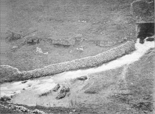
RICKLOW CAVE IN FLOOD.
Photo by G. D. Williams.
We crept over a pavement of fractured blocks, into a broad, low passage that seemed to have been hewn by giants out of the solid Limestone. All around were the marks of a powerful, swirling current, that had split and torn the rocks asunder, and bored its way through their joints; yet not a grain of sand or a speck of mud was visible on their cleaned and polished surface. Fissures and passages twisted away at the side, but returned in a few yards to the main corridor. In the roof were discernible the clean-cut hollows whence slabs of Limestone had fallen that still cumbered the floor. The large chamber that we reached finally was bestrewn and heaped up with such masses, and all the ways of egress save one were entirely blocked up. This very soon came to an abrupt termination in a bell-shaped cavity, floored with a crust of stalagmite. But there were narrow fissures, a few inches only in width, running away in many directions; a strong draught made the candles gutter; and the occasional presence of great volumes of water was made evident by the damage done to some of the incrustations. There was no sign or sound of flowing water now; the silence was as profound and impressive as the darkness. Yet this rock-strewn chamber was once the birthplace of a river. Hither, from countless fissures, the streamlets gathered together and poured through the hidden places of the hill, now in a rippling brook, and now in a torrent, crashing and rending. At present the Cales Dale stream finds its way to the Lathkill river by still more secret channels. But at no infrequent times, even yet, the torrent thunders over the waterfall in the Pot Hole Cavern, the swallet is inundated, and a flood pours on through the long tunnel, and so into the open[157] stream-course in the dale, now dried up and covered with vegetation. Proofs of this were legible all around us.
Returning up the dale, we closed the mouth of the artificial level, and went back to the Ricklow Cavern. Although the portal is so majestic, the passage becomes anything but commodious at the end of a few paces. Once more we had to crawl over hard, water-worn rock, deeply fissured and thrown out of the horizontal; our galled knees and elbows could scarcely be induced to go at all, and the pace was miserably slow. Then the roof came down so close in a horizontal fissure of huge extent, that there was nothing for it but to wriggle. My friends had ascertained that 280 feet of this work leads into a lofty chamber. It is one of those long, vertical fissures, not wide but enormously high, that are common in the Castleton caves. There were indications of galleries overhead, but we were too much exhausted to attempt climbing without a ladder. Only one exit was practicable, which led in 20 feet into just such another hollow, but still wider and uglier of aspect. Filling the cavity to a height of 30 feet was a mountain of shattered rocks, flung together pell-mell and wedged loosely. When we climbed it, the light of our candles showed that the structure was hollow, and hardly more durable in appearance than a house of cards. Some of the rocks were held by points and corners, swinging on their long axes; a touch sent others clattering down, as we crept with the utmost caution up the adjoining wall. It was as if the interior of the hill had been rent apart by an earthquake, and the headlong stream of rocks caught suddenly and held by the closing in of the fracture. We clambered to the summit of this hollow mass of ruin, and lit some magnesium wire. The formless walls went up into a dark void above us, their ledges fringed with glistening spikes and tendrils of transparent stalactite, revealed by[158] the glare. There had been visitors here before. Scratched on the walls, but partially coated over by a crystalline enamel, were the initials "H. B.—R. A.," and the date 1817; other scrawls were indecipherable. No doubt this was the cave whose legendary renown had reached our ears. Getting down our shattered staircase was a more formidable job than the ascent. One stone, as big as a table, rocked like a see-saw when we set foot on it.
Stalactites were not numerous in these caves, which are not only very humid, but continually swept by water. Animal remains were plentiful, all recent, bones being carried in by beasts of prey and deposited by floods. As this process must have been going on for ages, the two Cales Dale caverns would probably yield good results to palæontological research.
A comic incident cheered my fatigued comrades when we regained the open air. In the morning I had brought my family up from Bakewell Station for a day in the country, a work of supererogation that now placed me in a curious predicament. The waggonette had gone off to pick them up for the early train, and, to my distress, I found the driver had relieved us of all the luggage, including the rücksack which held my clothes, not to mention boots, pipe, and railway ticket. The alternative stared me in the face of proceeding to town in slimy overalls or in attire of dangerous slightness. But the broad-shouldered friend came to the rescue with his cave jacket, a garment that fell about me like a baggy greatcoat, hiding the worst deformities, and with battered hobnailers at one extremity, and a cap that had more stiff clay than cloth in it at the other, I made the best of my way home under the cover of darkness.
Mitchelstown Cave, the largest ever discovered in the British Isles, is not situated at the town of that name, in county Cork, but 10 miles away, in Tipperary, on the road to Cahir. Its entrance is in a small Limestone hill in the broad vale of the Blackwater, midway between the Knockmealdown Mountains and the Sandstone ridges and tables of the Galtees. The cave was laid open in the course of quarrying operations in 1833, from which time to the present the work of exploration has gone on progressively, if at long intervals, and may, perhaps, continue until the extent of the passages known is considerably enlarged. It seems now to be entirely forgotten that the spot has been famous from time immemorial for a wonderful stalactite cavern. In October 1777, Arthur Young was taken into a cave, known as Skeheenarinky, after the townland, but the old Irish name of which was Oonakareaglisha. "The opening," he says, "is a cleft of rock in a Limestone hill, so narrow as to be difficult to get into it. I descended by a ladder of about twenty steps, and then found myself in a vault of 100 feet long and 50 or 60 high: a small hole, on the left, leads from this a winding course of, I believe, not less than half an Irish mile." He goes on to describe the beautiful scenery of the cave, which, he says, is much superior to the Peak Cavern in Derbyshire, "and Lord Kingsborough, who has viewed the Grot d'Aucel in Burgundy, says that it is not to be compared with[160] it."[5] The odd thing is that the very existence of this cavern seems to have been forgotten since the discovery of its much finer neighbour. Yet the trees and brushwood guarding its mouth are in full view of the well-frequented entrance to the other cave; and Dr. Lyster Jameson, who was with Monsieur Martel on his visit in 1895, told me some years ago that an opening had been pointed out to him into a lower series of caves, which I have little hesitation in identifying with Young's cavern and the cave mouth I allude to.
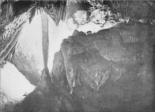
A GREAT PILLAR: MITCHELSTOWN CAVERN.
Photo by E. A. Baker.
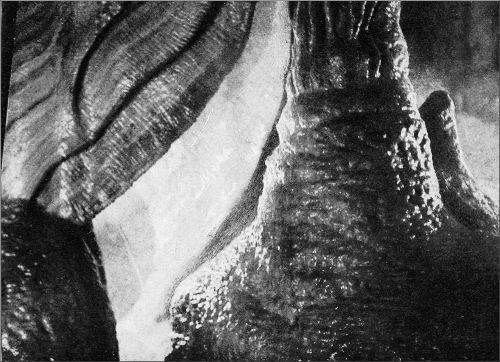
A FAIRY LANTERN: MITCHELSTOWN CAVERN.
Photo by E. A. Baker.
Dr. C. A. Hill and I visited the spot in August 1905, intending to go through all the accessible parts of the huge series now known collectively as Mitchelstown Cave, and also to examine the series referred to by Dr. Jameson, who had been unable to undertake their exploration. Our impression was that little or nothing was known of the latter series, and it was not until after our return from Ireland that we were startled and puzzled by turning up an account in The Postchaise Companion (1805 ed., pp. 301, 302) of a cave in this place already known and celebrated thirty years before the discovery of the Mitchelstown Cave. The explanation probably is that the guides find one cave a more profitable investment than two. To show the second (or rather the first, since the other is the usurper) would involve twice as much labour, but would hardly bring in twice the income. Since 1833, then, the original cavern has been suppressed, so successfully that even the omniscient Baddeley never suspected that there are two series, although he had read Young's description and confused it with the other. Dr. Hill let me down a few feet into the old cave-mouth, just such a narrow slit as Young depicts; but we found that the rock was cut away immediately beneath, and[161] without more hauling power, the only way to get down was to use a long ladder, and this we could not obtain. The guide told us that the hole led into nothing of any interest, and that the entrance had been used as a receptacle for deceased dogs and other excreta. This effectually took away any wish to pursue our researches in that direction for the present. Still, the old cave ought not to be lost sight of; and we propose, if no one else undertakes the work, to explore the lower series on some future visit to Ireland. The unscientific explorers of a hundred years ago may have left discoveries to future workers as important as those which remained for so many years after the early explorations in the neighbouring great cave.
What was done in the latter during the first year after the discovery may be read in an article by Dr. Apjohn in the Dublin Penny Journal for December 27, 1834, an article reproduced from the Dublin Geological Journal, vol. i. Dr. Apjohn carried out a most elaborate and painstaking survey to points considerably beyond the second great cavity, now known as the "House of Lords," but failed to reach "O'Leary's Cave," the key of the farther ramifications, or to explore the tunnels connected with "The River." His plan, worked out to scale, and showing the differences of level with great minuteness, remained the only map of the cave until M. Martel's survey in 1895. Meanwhile various adventurers had got to more distant points, particularly to the long chain of caverns running east to Brogden's, at the end of which M. Martel's chart stops. The French explorer does not seem to have broken any fresh ground; but his plan, which appeared in The Irish Naturalist for April 1896, with an account of his visit, was a brilliant achievement, especially when the short time at his disposal is considered, six hours for the whole of the cavern. Parts of this chart were only hastily[162] sketched in, either from a rapid survey or from information supplied by the guide, as M. Martel explained to me in a conversation some time ago, and errors of detail were, under these conditions, unavoidable. For instance, "O'Leary's Cave" is much larger than appears on the plan, and the "Chimney" is not situated at the far end of a passage, but actually opens in the floor of "O'Leary's Cave." The caves running east, again—O'Callaghan's and Brogden's—are not such a simple series of straight passages as they seem on the chart; our guide had considerable difficulty in threading his way among the various bifurcations. As will transpire later, there is a mystery connected with the name of "Cust's Cave," the real Cust's being in a totally different part of the series, and a different chamber altogether in shape. Unfortunately we did not go prepared to carry out any survey, believing that all this had been done; so that we can at the most point out some places where the existing plans are at fault. We were also unfortunate in not being prepared to take a large number of photographs, the accounts we had read not leading us to anticipate the actual grandeur and extent of the scenery. M. Martel compares the Mitchelstown Cave with such famous continental caverns as those of Adelsberg, Padirac, Dargilan, and Han-sur-Lesse, and it comes off but poorly in such a comparison. I have seen his lantern slides of these caves, and after exploring all the most beautiful caves discovered as yet in England, I venture to say there is not one English cave that would not come off badly if set beside any of these. Compared, however, with other British caverns, that of Mitchelstown can hold its own easily; though individual chambers may be surpassed, there is nothing like the same extent of brilliant subterranean scenery anywhere else in these islands.
The tourist portion of the cavern, a fraction of the[163] whole, but yet a considerable extent of underground passages, is deservedly much frequented. The spacious vault, nicknamed the "House of Commons," vies in dimensions and dignity with those in the Peak of Derbyshire, but it is far surpassed by the "House of Lords." Seventeen massy columns of pure white stalactite, surmounting enormous cones of terraced stalagmite, tower from floor to roof of this impressive dome, some 140 feet in span and 70 feet high. The grandeur of its height is lost somewhat through the mountain of fallen blocks that rises from the entrance almost to the apex of the roof. Behind this vast accumulation a sort of ambulatory runs round under the walls, opening here and there into side chapels and irregular cavities, all bountifully adorned with the fairy-like work of the Limestone carbonate. The so-called "Tower of Babel" is a majestic pillar rising from the summit of a pyramidal mass of stalagmite, 40 feet in circumference, that being also the measure of its total height. A crowd of other Limestone freaks, some aptly and some incongruously nicknamed, and many extremely beautiful, are found in this chamber.
The cavities and passages that lie to the north-east of the first great chamber are not often visited. They start from "Sadlier's Cave," which is not large but bewilderingly picturesque, and contains a superb pillar, "Lot's Wife," almost of the prodigious size of the "Tower." The "Kingston Gallery" is a straight rift, nearly 300 feet long, but only two or three feet wide, with sheets of snowy white sweeping down the walls, and breaking into whole garlands of scrolls and pennons and curtains, which in places have been thrown right across the gallery, dividing it into lofty cells. Manholes, actually, had to be cut through these diaphanous partitions to create a passage. From the cave at[164] the end, a lower passage, the Sand Cave, comes back in a parallel direction to the point of junction, and from the quantities of fine sand on its bed, was evidently an important stream-course after the Kingston Gallery was drained of its waters. It has one unique feature, the succession of parallel rifts, called the "Closets," which are connected together by rents in their dividing walls. Some of these are extremely narrow, and by candlelight it is impossible to see any limit to their height, depth, or length. Similar widenings of the master joints and degradation of the Limestone separating them, are a special feature of the Mitchelstown Cave, and the key to its ground-plan, with its maze of right-angles.
The great eastern vault, the Garret, which is only 19 feet below the level of the entrance, does not fall, as stated by M. Martel, towards a series of choked swallets, that originally carried the waters farther down, but rises towards inlets from the surface. Its fretted roof has fallen in at the upper end. A little to the south is a nameless series of charming vestibules, grottoes, and tunnels, meandering towards the insignificant lakelet called the "River." Here we spent the whole of our first day. It is possible, we learned, to reach the easternmost series of caverns by this route, which also takes one into the square cavity designated as "Cust's Cave" on M. Martel's chart. We chose the other way, that is, through the passage from the "House of Lords" to the "Cathedral."
In the tangle of contrary passages into which this leads we lost ourselves several times, in the absence of the guide, and only recovered the thread by careful observation with the compass. Eventually we found the way into "O'Leary's Cave," which struck us as one of the most impressive chambers in the whole cavern. It is not only much larger than is shown on the plan, but[165] different in shape. Apparently it is the most recent of all in formation, although this may be only an appearance caused by the falling in of the roof. Unlike the other parts, where every bit of débris is sealed down by a glistening layer of stalagmite, this great cavity is heaped high with loose fragments, as free from incrustation as if the ceiling had collapsed yesterday. So wild and vast is the configuration of "O'Leary's Cave" that, standing on the lower side and looking across a depression in the middle to the ascending ground opposite, one fancied oneself, in the dim candlelight, gazing across a valley to a range of hills in the distance. We spent some time vainly searching for the horizontal tunnel supposed to end at the "Chimney," and before the guide joined us were lucky enough to hit upon a string of chambers that seem never to have been entered before. These run, so far as we could make out without actual measurement, right over the O'Callaghan series. In fact there were openings in the floor which we might have explored but for the aggressive and tenacious clay bedaubing everything, apparently leading down to these nether passages. Brilliant draperies swept down to the bold masses of stalagmite below the walls, and long crystalline wands hung from the roof in thousands, so that we could not move without committing havoc in this pendulous forest.
Conducted by the guide, we now descended the "Chimney" into the tortuous passages leading to the "Scotchman's Cave," which lies under O'Leary's. It is a small but very beautiful chamber, giving one the idea that it has been hollowed out in a mountain of Parian marble. Now we struck into the long series running east through "O'Callaghan's Cave" to the farthest point yet reached. This was one of the principal channels by which the ancient waters descended, from openings now unknown and inaccessible, to the labyrinth of forsaken[166] waterways we had left behind. Our guide, who astonished us by the rapidity with which he got over difficult ground, was unable to make very speedy progress here. The ramifications are extremely hard to unravel, and he had only been in this part twice before, in 1895 with M. Martel, and twenty-five years earlier, as a boy, with his father. Eventually, after many wanderings, we reached "Brogden's Cave," where hitherto all direct progress had stopped. On the south side (not on the north, as shown in the chart) is the "Chapel," which M. Martel rightly described as the most beautiful thing in the whole cavern. It is an arched recess, canopied with stalagmite of the purest and most delicate lustre.
Whilst my companion rested, I joined the guide, who was hunting for the passage to a cave where his father had taken him thirty-five years ago. We discovered the opening at last, and after wriggling and squirming round innumerable twists and corners, we dropped over a low cliff, beyond which a short wriggle brought us into a long and lofty cave, magnificently walled and pillared with snowy calcite. Floor, walls, and roof were a spotless white, wrought into intricate reliefs and embroideries by the flow of the freakish stalagmite. The guide stated that this was "Cust's Cave," and the one beyond, where our progress stopped, he called the "Demon's Cave." M. Martel's chart shows a "Cust's Cave" of a totally different shape and size, near the "River"; and, as there is no mention extant of any cave beyond Brogden's, I take it that this, the real Cust's, was unknown to him. Unfortunately I had followed the guide without bringing the plan or a compass, unaware that we were going so far from the known parts of the cavern; and now, to my disgust, the guide was unable to find the way out. Twice he descended into a hole at our end of the cave, and emerged with the intelligence, "It's not there, sir." We[167] ransacked every opening in wall and floor, but failed to hit on any exit whatever. The guide grew alarmed, and rushed off to the farther end of the cave, wondering if we had completely lost our sense of direction. He tried whistling; but the hundreds of feet of rock between us and our companion were well able to guard their ancient silence. Tired with these exertions, he next proposed that we should put out the lights and rest for a while. Whether his idea was to husband the only provisions we had, I could not say; but at any rate the situation did look serious, since rescuers might have taken days to discover our position in this remote corridor, of whose very existence, probably, our guide was the only man in Ireland that knew anything. But where there is a way in, there is a way out, as I very well knew from several similar experiences; and after a pretty bad half-hour, we did manage to recover the trail, and got back to our friend, who had been completely mystified by our disappearance, and was almost as relieved as we by our return. After many hours of fatiguing work, we were glad to follow our guide back through the labyrinthine passages, by the most direct route to the open air.
Our chief regret was that we had relied too much on the completeness of previous surveys, and had not taken materials for correcting the map. We had secured many photographs of the earlier chambers, but had not taken the camera into the innermost cavities, where photography would be most profitable. M. Martel's dictum can still be endorsed that there is a great field for research in the Mitchelstown Cavern.
Printed by J. Baker & Son, Clifton
FOOTNOTES:
[1] Only a few years since, three cows were driven over the cliff by several unruly dogs, and of course were instantly killed. Thus was the tragedy of long ago re-enacted.
[2] In 1894 the initials "T. W." were carved by Mr. Willcox of Wells on the great stalagmite bank in the end chamber of Lamb's Lair. I added "1894," that in years to come some measure may be obtained of the rate at which this bank is being formed. I make a rule of never making an inscription, but in this case I thought that the end justified the means.
[3] Recently, October 1906, Mr. Balch dug through an obstruction here and entered a vast fissure chamber, which he climbed to a height of 150 feet: it has a remarkable shaft as its outlet.
[4] Mr. James McMurtrie, then manager of Earl Waldegrave's estates, was responsible for the exploration of this cavern after its rediscovery in 1880. He had it surveyed and plans made; he had the windlass erected, but went down himself before it was fixed. Very great credit is due to him for this valuable work, which it is hoped will not be rendered less valuable by allowing the artificial shaft as well as the windlass to be permanently destroyed through neglect and decay. The plan and section contained here were the result of independent measurements, which fully confirmed the results of his previous survey.
[5] Arthur Young's Tour in Ireland; ed. by A. W. Hutton. 2 vols. Bell, 1892. See pages 464-465, vol. i.
TRANSCRIBER'S NOTE:
Obvious printer errors have been corrected. Otherwise, the author's original spelling, punctuation and hyphenation have been left intact. The Index has been created in one column instead of two for ease of reading.