"DONE UP"
Transcriber's Note:
The cover image was created by the transcriber and is placed in the public domain.
"DONE UP"
Among the many books about the Polar regions there is none quite like this, dealing with the gradual progress of exploration towards the north along the different areas of advance within the Arctic Circle.
The subject is always interesting, for few regions have been the scene of more persistent effort and exciting adventure and unexpected gains from the unknown, particularly in the earlier days when the endeavour to find the northern passages to the east and west led to the beginning of our foreign trade.
It is often asked, "What is the use of further Arctic discovery?" No one knows. Nor did any one know the use of most discoveries before they were made.
When Eric landed in Greenland he was not in search of cryolite for aluminium. When Cabral sailed to Porto Seguro he knew nothing of the incandescent gas-mantle. When Oersted looped the live wire round the magnetic needle he was not bent on founding electrical engineering. And when Linnæus noticed the sleep of plants he had no intention of providing a substitute for a clock in high latitudes where, though vithe sunshine is continuous during the summer, the plants within the Circle sleep as in the night time, their sleeping leaves telling the traveller that midnight is at hand.
Men have made up their minds to reach the Pole, and thither they will go. What they will find when they get there may not promise to be much, but what they have found round about it has been enough to influence considerably the history of the world.
| CHAPTER I | |
| PAGE | |
|---|---|
| SPITSBERGEN | 1 |
| CHAPTER II | |
| SPITSBERGEN (continued) | 24 |
| CHAPTER III | |
| NOVAYA ZEMLYA | 49 |
| CHAPTER IV | |
| FRANZ JOSEF LAND | 64 |
| CHAPTER V | |
| CAPE CHELYUSKIN | 84 |
| CHAPTER VI | |
| THE LENA DELTA | 106 |
| CHAPTER VII | |
| BERING STRAIT | 127 |
| CHAPTER VIII | |
| THE AMERICAN MAINLAND | 146 |
| CHAPTER IX | |
| THE PARRY ISLANDS | 170 |
| CHAPTER X | |
| BOOTHIA | 190 |
| viiiCHAPTER XI | |
| BAFFIN BAY | 215 |
| CHAPTER XII | |
| SMITH SOUND | 235 |
| CHAPTER XIII | |
| GREENLAND | 259 |
| INDEX | 287 |
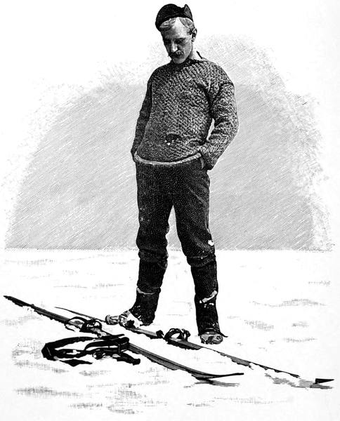
| "Done up" | Frontispiece | |
| From Nansen's First Crossing of Greenland (Longmans) | ||
| TO FACE PAGE | ||
|---|---|---|
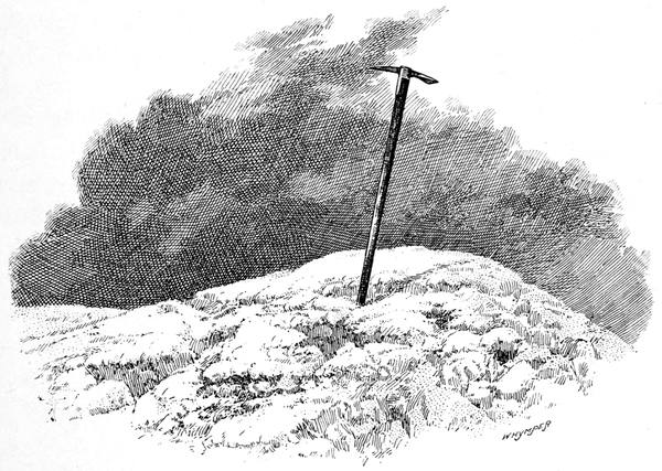
| The Summit of Oraefa | 2 | |
| From a photograph | ||
| Columbus | 4 | |
| From the portrait at Versailles | ||
| Samoyeds and their Dwellings | 10 | |
| From Hartwig's Polar World (Longmans) | ||
| Franz Josef Fiord | 14 | |
| From a drawing by Lieutenant Julius Payer | ||
| Whalers among Icebergs | 30 | |
| From Hartwig's Polar World (Longmans) | ||
| Sir John Franklin | 34 | |
| From Le Tour du Monde, 1860 (Hachette) | ||
| Track of H.M.S. "Dorothea" and "Trent" | 36 | |
| From A Voyage of Discovery towards the North Pole, performed in His Majesty's Ships "Dorothea" and "Trent," under the command of Capt. David Buchan, R.N., 1818, by Capt. F. W. Beechey, R.N., F.R.S. (Richard Bentley, 1843.) | ||
| Parry Camped on the Ice | 40 | |
| From Captain Parry's Narrative, 1828 (Murray) | ||
| Parry's Boats among the Hummocks | 42 | |
| From Captain Parry's Narrative, 1828 (Murray) | ||
| How our Ship stuck fast in the Ice | 50 | |
| From A True Description, by Gerrit de Veer (Hakluyt Society, 1853) | ||
| How we nearly got into trouble with the Sea-horses | 56 | |
| From A True Description, by Gerrit de Veer (Hakluyt Society, 1853) | ||
| Adolf Erik Nordenskiöld | 90 | |
| From a photograph | ||
| Fridtjof Nansen | 96 | |
| With autograph. From a photograph supplied by himself | ||
| Reindeer | 112 | |
| By permission. From Short Stalks, by Edward Buxton (Stanford) | ||
| Samoyed Man | 114 | |
| From Seebohm's Siberia in Asia (Murray) | ||
| xOstiak Man | 116 | |
| From Seebohm's Siberia in Asia (Murray) | ||
| The Face of the Fur Seal | 130 | |
| From The Seal Islands of Alaska, by Henry W. Elliott (Washington, 1881) | ||
| The Aleutian Islands | 132 | |
| From Hartwig's Polar World (Longmans). From an original Sketch by Frederick Whymper | ||
| Driving the Fur Seal | 134 | |
| From The Seal Islands of Alaska, by Henry W. Elliott (Washington, 1881) | ||
| Fur Seals at Sea | 136 | |
| From The Seal Islands of Alaska, by Henry W. Elliott (Washington, 1881) | ||
| The Parka of the Alaskan Innuits | 138 | |
| From Whymper's Alaska (Sampson Low) | ||
| The Frozen Yukon | 140 | |
| From Whymper's Alaska (Sampson Low) | ||
| Ascending the Yukon | 142 | |
| From Whymper's Alaska (Sampson Low) | ||
| Moose-hunting on the Yukon | 144 | |
| From Whymper's Alaska (Sampson Low) | ||
| Mahlemut Man | 146 | |
| From Whymper's Alaska (Sampson Low) | ||
| Winter Travelling on the Great Slave Lake | 150 | |
| From Franklin's Journey to the Polar Sea, 1819-22 (Murray, 1823) | ||
| Crossing Point Lake | 152 | |
| From Franklin's Journey to the Polar Sea, 1819-22 (Murray, 1823) | ||
| Kutchin Indians | 154 | |
| From Hartwig's Polar World (Longmans). From an original sketch by Frederick Whymper | ||
| Preparing an Encampment on the Barren Grounds | 156 | |
| From Franklin's Journey to the Polar Sea, 1819-22 (Murray, 1823) | ||
| Sir John Richardson | 158 | |
| With autograph, from a letter in the possession of Edward Whymper | ||
| Back's Journey down the Great Fish River | 160 | |
| From Back's Arctic Land Expedition to the mouth of the Great Fish River in the years 1833, 1834, and 1835 (Murray, 1836) | ||
| Sir William Edward Parry | 170 | |
| With autograph, from a letter in the possession of Edward Whymper | ||
| Sir John Barrow | 178 | |
| With autograph | ||
| H.M.S. "Hecla" and "Griper" in Winter Harbour | 180 | |
| From A Voyage for the Discovery of a North-west Passage, by Capt. Parry (Murray, 1821) | ||
| xiParry's Discoveries on his First Voyage | 182 | |
| From A Voyage for the Discovery of a North-west Passage, by Captain Parry (Murray, 1821) | ||
| An Igloolik Eskimo carrying his Kayak | 190 | |
| From Parry's Second Voyage (Murray, 1824) | ||
| Parry's farthest on his Third Voyage | 192 | |
| From Parry's Third Voyage (Murray, 1826) | ||
| The "Victory" | 194 | |
| From Sir J. Ross's Arctic Expedition, 1829-33 (Webster, 1835) | ||
| North Hendon | 196 | |
| From Sir J. Ross's Arctic Expedition, 1829-33 (Webster, 1835) | ||
| Eskimo listening at a Seal-hole | 198 | |
| From Parry's Second Voyage (Murray, 1824) | ||
| H.M.S. "Terror" lifted by Ice | 202 | |
| From Hartwig's Polar World (Longmans) | ||
| Fractured Stern-post of H.M.S. "Terror" | 204 | |
| From Capt. Back's Narrative, 1838 (Murray) | ||
| The "Fox" escaping from the pack | 208 | |
| From M'Clintock's Voyage of the "Fox" | ||
| The "Fox" on a rock | 210 | |
| From M'Clintock's Voyage of the "Fox" | ||
| Discovery of the Cairn | 212 | |
| From M'Clintock's Voyage of the "Fox" | ||
| Sir Martin Frobisher | 216 | |
| From The Three Voyages of Martin Frobisher (Hakluyt Society, 1867) | ||
| Eskimo awaiting a Seal | 222 | |
| From Hartwig's Polar World (Longmans) | ||
| A Greenlander in his Kayak | 224 | |
| From Le Tour du Monde, 1868 (Hachette) | ||
| Baffin Bay in 1819 | 232 | |
| From A Voyage of Discovery, by Capt. John Ross (Longmans, 1819) | ||
| Dr. E. K. Kane | 234 | |
| From the Frontispiece to Kane's Arctic Explorations, 1856 | ||
| Kalutunah | 236 | |
| From Le Tour du Monde, 1868 (Hachette) | ||
| The East Coast of Smith Sound | 238 | |
| From Hayes' Open Polar Sea (Sampson Low) | ||
| Dr. I. I. Hayes | 240 | |
| By permission, from Hayes' Open Polar Sea | ||
| xiiThe Shores of Kennedy Channel | 242 | |
| From Hayes' Open Polar Sea | ||
| Tyndall Glacier | 244 | |
| From Hayes' Open Polar Sea | ||
| A Seal in Danger | 246 | |
| From Parry's Second Voyage for the Discovery of a North-west Passage (Murray, 1824) | ||
| Sir George Nares | 248 | |
| From a photograph | ||
| Sledges used by Sir Leopold M'Clintock and Sir George Nares | 254 | |
| (In the collection of Edward Whymper) | ||
| Bishop Paul Egede | 258 | |
| From the Frontispiece to Efterretninger om Grönland (Copenhagen) | ||
| Greenlanders | 260 | |
| From Hartwig's Polar World (Longmans) | ||
| On level ground | 262 | |
| Nansen's First Crossing of Greenland (Longmans) | ||
| The Allan Liner "Sardinian" among Icebergs | 264 | |
| From a photograph | ||
| The "Germania" in the Ice | 266 | |
| From Le Tour du Monde, 1874 (Hachette) | ||
| The Region round Mount Petermann | 268 | |
| From a drawing by Lieutenant Julius Payer | ||
| The Last Days of the "Hansa" | 270 | |
| From Le Tour du Monde, 1874 (Hachette) | ||
| Robert E. Peary | 280 | |
| With autograph, from a letter in the possession of Edward Whymper From Nearest the Pole, by Commander Peary. By permission of Hutchinson and Co. | ||
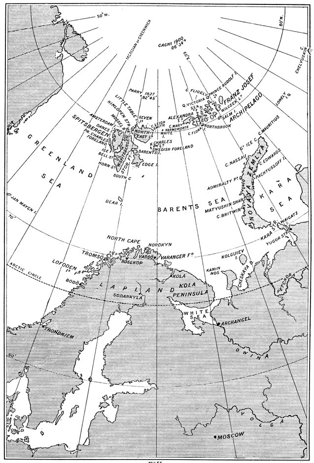
| 1. | Spitsbergen | 12 |
| 2. | Cape Chelyuskin | 84 |
| 3. | The Lena Delta | 106 |
| 4. | Bering Strait | 128 |
| 5. | The Parry Islands | 174 |
| 6. | Greenland | 272 |
Iceland—Greenland—America—Sebastian Cabot—Robert Thorne—The North-east Passage—Willoughby—Chancellor—Borough—The North Cape rounded—The White Sea reached—The First Arctic Search Expedition—Pet and Jackman—Brunel—Cornelis Nai—Barents reaches 77° 20´—Second voyage of Nai—The Samoyeds—Rijp, Jacob Van Heemskerck and Barents—Bear Island discovered—Spitsbergen discovered—The Dutch reach 79° 49´—Stephen Bennet—Welden—Jonas Poole—Henry Hudson reaches 80° 23´—Poole starts the British whaling trade—Baffin's voyages to Spitsbergen—Pellham winters at Green Harbour.
The story of the lands within the Arctic Circle is a record of the brave deeds of healthy men. This would seem to be true were we to take the story, if we could, back to the days when man followed the retreat of the glaciers, as he may in turn have to retreat before them, such a condition of things being not beyond the range of probability though it may be remote. For the boundaries of the frozen north are not dependent on a line of latitude, and have never been the same from period to period, or even from year to year. In some cases they have changed considerably within the 2Christian era, and it is evident that the ice is not eternal. The fossils declare that the climate round the North Pole has varied greatly, and must in comparatively recent ages have been comfortably warm, so genial indeed that some people would have us believe that men came from there in their last distribution. Not, however, with such migrants from the far north do we concern ourselves, but with those who have endeavoured to get there in historical times by different lines of approach, as we follow the circle round from east to west and note the record of each section by itself.
Who was the first to sail to the northern seas we know not. Suffice it for us that in 875 Ingolf the jarl, from Norway, refusing to live under the sway of Harold Haarfager, sighted Mount Oraefa. As he neared the coast, overboard went the carved wood; and where the wood drifted ashore he founded Reikjavik. But he was not the first in Iceland, for the Irish monastery had been there for years when he arrived, though the monks retired to their old country when they found the Norsemen had come to stay.
Then the Icelander Gunnbiörn, driven westward in a gale, sighted the strange land he called White Shirt from its snowfields, which Eric the Red, following a long time afterwards, more happily renamed. "What shall we call the land?" he was asked. "Call it Green Land," replied Eric. "But it is not always green!" "It matters not: give it a good name and people will come to it!"
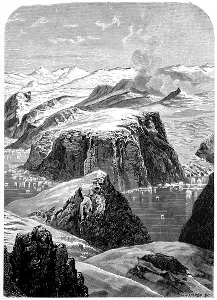
THE SUMMIT OF ORAEFA
3Then the Norsemen worked further south. In 986 Bjarni sighted what we now call America, and in 1000 came the voyage of Leif Ericson, who, on his way down the mainland, landing again and again, gave the names to Helluland, Markland, Vinland—in short, the Viking discovery of the New World.
Greenland, like the eastern coast of the continent, was duly colonised, its two chief settlements being one just round Cape Farewell, the other further north on the same coast. In those days the island, or chain of islands beneath an ice-cap, as many think it is, would appear to have had a milder climate than it has now. The colonies throve, their population becoming numerous enough to require a series of seventeen bishops, the last one dying about 1540, to superintend their spiritual welfare. But the Eskimos, in their migration from Asia across the Arctic islands, arrived in the country before the middle of the fourteenth century and gradually drove the Norsemen downwards, the northern colony coming to an end in 1342 owing to the enemy attacking during a visitation of the Black Death.
Meanwhile Iceland, which touches the Arctic Circle in its northernmost point, and extends but half as far south of it as Greenland, increased in prosperity as a sort of aristocratic republic, and produced more vernacular literature than any country in Europe, in which, as might be expected, the story of Greenland and the American colonies was kept so well to the fore that it became as familiar among the people as a nursery tale. Thither, from Bristol, in February, 1477, went Columbus; and thence it was he returned to seek a patron for his western voyage across the Atlantic.
The first voyage of Columbus in 1492 gave a great 4stimulus to maritime discovery, and many were the projects for searching the seas for a new route to the east. Of these the most important was that submitted to Henry VII by John Cabot, of Bristol. Much has been written, on slender and confusing evidence, as to the share in its success due to him and to his son, the more famous Sebastian; and, to be brief, we cannot do better than follow Anderson, who, in his Origin of Commerce, ingeniously evades the difficulty by speaking, commercially, of "Cabot and Sons." The Bristol firm, then, in 1497 despatched their ship Matthew to the westward and discovered and took possession of Labrador and the islands and peninsulas in the mouth of the St. Lawrence, the district being at first known as the New Found Land, a name afterwards restricted to the largest island. And they had their reward, as shown in the Privy Purse accounts of Henry VII, where an entry of the 10th August, 1497, appears—"To hym that found the new isle, £10." Surely not an excessive honorarium for the finding of a continent.
In 1498 another voyage of the same ship by way of Iceland, in which some attempt seems to have been made to colonise the newly discovered territories, resulted in the discovery of Hudson Strait and a visit to Labrador, judging by the finding of the deer in herds, the white bears, and the Eskimos who are not known to have ever crossed into the island of Newfoundland. This was not the only English vessel to appear in these parts at that time, for in the same year the Privy Purse accounts record a gift of £30 to Thomas Bradley and Launcelot Thirkill for going to the New Isle, adding that Launcelot had already received £20 "as preste" for his ship going there.
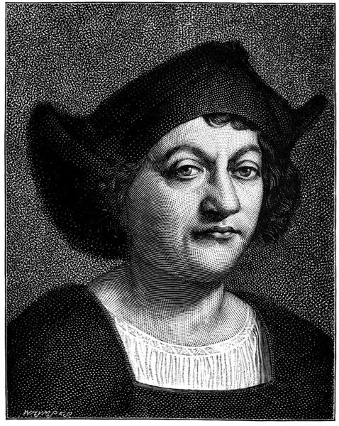
COLUMBUS
5It is evident that the fisheries were found to be worth working, for no less than fifty Spanish, French, and Portuguese ships were engaged in them in 1517, the year of Sebastian Cabot's disputed voyage to Hudson Bay. Ten years afterwards Robert Thorne, of Bristol, wrote to the King, mentioning this voyage and suggesting three sea routes to Cathay—by the north-west, as Sebastian had attempted, by the north over the Pole, and by the north-east—and, in 1547, when Sebastian returned to England for good, after his long service with Spain, he again, as the first Governor of the Company of Merchant Adventurers, took up this Cathay question, which had frequently been raised, and fitted out, as a commencement, an expedition to the north-east.
The ships were built at Bristol specially for the purpose, and they were sheathed with lead, the first so treated in this country. This sheathing of ships was not the only innovation we owe to the most scientific seaman of his time, for in his famous ordinances for the voyage many excellent new things are enjoined, including the keeping of a log and journal, which date from this expedition. There were three vessels, the Bona Esperanza, of one hundred and twenty tons, Captain Sir Hugh Willoughby; the Edward Bonaventure, one hundred and sixty tons, Captain Richard Chancellor; and the Bona Confidentia, ninety tons, Captain Durfourth. In Chancellor's ship, as master, was the best navigator of the fleet, whose monumental brass in Chatham Church is noteworthy for its 6epitaph: "Here lieth buried the bodie of Steven Borough, who departed this life ye xij day of July in ye yere of our Lord 1584, and was borne at Northam in Devonshire ye xxvth of Septemb. 1525. He in his life time discouered Moscouia, by the Northerne sea passage to St. Nicholas, in the yere 1553. At his setting foorth of England he was accompanied with two other shippes, Sir Hugh Willobie being Admirell of the fleete, who, with all the company of ye said two shippes, were frozen to death in Lappia ye same winter. After his discouerie of Roosia, and ye Coastes thereto adioyninge—to wit, Lappia, Nova Zemla, and the Countrie of Samoyeda, etc.: he frequented ye trade to St. Nicholas yearlie, as chief pilot for ye voyage, until he was chosen of one of ye foure principall Masters in ordinarie of ye Queen's Matties royall Nauy, where in he continued in charge of sundrie sea services till time of his death."
The ships left in May, but did not remain long together. On the 2nd of August Willoughby and Durfourth separated from Chancellor in a storm off the Lofodens, and after devious courses, that might have led anywhere, were frozen in on the coast of Lapland, where they wintered and died, as did all the men with them. Chancellor, having waited at the rendezvous in vain, crossed the Arctic Circle, rounded the North Cape—so named by Borough—and found his way into the White Sea. While his ship was in winter quarters near where Archangel now is, he made a sledge journey to the Czar at Moscow, which led to the formation of the Muscovy Company and the beginning of England's Russian trade; and through 7his meeting there with the Persian Ambassador came about the mission of Anthony Jenkinson to the Shah, which opened up for us the Persian trade. Never was a voyage more successful. With it began the foreign commerce of this country, and from it dates the rise of our mercantile marine.
In 1556 Borough, in the Searchthrift, persevered further east, and, passing between Novaya Zemlya and Waigatz Island, through the strait that bears his name spelt differently, entered the Kara Sea. Next year in the same ship he was given the command of the first Arctic Search Expedition, its object being to discover what had become of Willoughby. Of one ship, the Confidentia, he obtained news in an interview with a man who had bought her sails, but the full story of the disastrous end of the voyage remained a mystery until the Russians found the ships and bodies and Willoughby's journal, and took the ships round to the Dwina. Then for the first time did people realise what it meant to battle with an Arctic winter without preparation, and many were those who withdrew their interest in the frozen north, preferring tropical dangers to the possibility of such accumulating miseries as the journal records in due order in its matter-of-fact way, its last entry being the terribly suggestive—"Unknowen and most wonderful wild beasts assembling in fearful numbers about the ships."
With Stephen Borough in the Chancellor voyage was Arthur Pet—or Pett, a name not unknown in the navy—who, after two centuries, has become notable again through a strange discovery. In search of the much-desired passage by the north-east he sailed from 8Harwich on the 31st of May, 1580, in the George, of forty tons, accompanied by Charles Jackman, in the William, of twenty tons. His orders were to avoid the open sea and keep the coast in sight all the way out on the starboard side, and William Borough—Stephen's brother, afterwards Comptroller of the Navy—gave him certain instructions and notes.
Arranging with Jackman, whose little vessel sailed badly, to wait for him at Waigatz, Pet went ahead and endeavoured to pass through Burrough Strait, but meeting with trouble from the ice, missed the passage, and working round Waigatz to the south, entered the Kara Sea through Yugor Strait, or as it used to be called after him, Pet Strait. Coasting eastward with the mainland in sight, he was, as might be expected, much hampered by the heavy pack. On being joined by the little William he made for the northward, seeking a way to the east, but the "more and thicker was the ice so that they could go no further," and, after talking the matter over on the 28th of July, Pet and Jackman reluctantly decided to return to Waigatz and there decide on what should be done.
Their way back was difficult. They became shut in so that "they could not stir, labouring only to defend the ice as it came upon them." For one day they were clear of it, but next day, the 16th of August, they were encumbered again, though they got out of the trouble by sailing between the ice and the shore, which was a new experience. In this way they just scraped through Pet Strait, and bore away in the open sea to Kolguiev, both vessels grounding for a time on the sands to the south of that island. On the 22nd of 9August, two days afterwards, the William parted from the George in a dense fog, while Pet brought his ship home and dropped anchor at Ratcliff on Boxing Day.
The Dutch had for some time been trying to outstrip the English on this route to the far east. In 1565 they had settled at Kola, and about thirteen years afterwards had established the factory at the mouth of the Dwina on the site of Nova Kholmogory, generally known as Archangel. In 1584 Olivier Brunel, their energetic emissary in Russia, sailed on the first Dutch Arctic discovery expedition. He tried in vain to pass through Pet Strait, and the ship, with a valuable cargo of furs and mica, was wrecked on its homeward voyage at the mouth of the Petchora.
Ten years elapsed, and then there sailed from the Texel the expedition of Cornelis Nai, in which the Mercury, of Amsterdam, was commanded by Willem Barents. Barents—really Barentszoon, the son of Bernard—sighted Novaya Zemlya, with which his name was to be thenceforth associated, on the 4th of July, and coasting along its mighty cliffs, peopled with their myriad seabirds, passed Cape Nassau ten days later. Thence reaching 77° 20´, and thus improving on John Davis's record for the highest north, he struggled through the ice to the Orange Islands and back, some twenty-five miles, during which he tacked eighty-one times and thereby sailed some seventeen hundred geographical miles. Failing to proceed further, he came south, and off Pet Strait—named by the Dutchmen Nassau Strait—fell in with the other two ships returning from their unsuccessful attempt to cross the Kara Sea.
Next year a fleet of seven vessels under Nai left the 10Mars Diep on another endeavour to get through to China. One of the two chief commissioners on board was the famous Van Linschoten, who had been on the previous voyage, and the chief pilot was Barents, who was in the Winthont (Greyhound) with Jacob van Heemskerck as supercargo. Arriving at Pet Strait they found it so blocked with ice that no passage was possible, and Barents, in search of information, went ashore on the mainland south of the strait and made friends—in a way—with the Samoyeds, whose appearance, as described by Gerrit de Veer, was "like that of wild men," dressed as they were in deerskins from head to foot, those of importance wearing caps of coloured cloth lined with fur; for the most part short of stature, with broad flat faces, small eyes, and bow legs; their hair worn long, plaited, and hanging down their backs.
They were evidently suspicious of the Dutchmen, who did their best to be friendly. The chief had placed sentinels all round to see what the new-comers were about and note everything that was bought and sold. One of the sentinels was offered a biscuit, which "he with great thanks took and ate, and while he ate it he still looked diligently about him on all sides, watching what was done." Their reindeer sledges were kept ready—"that run so swiftly with one or two men in them that our horses were not able to follow them." They were unacquainted with firearms, and, when a musket was fired to impress them, "ran and leapt like madmen," but calmed down as soon as they saw there was no malicious intention, to wonder much more, however, when the man with the gun aimed at a flat stone he placed as a mark, and, fortunately, hit and broke it. The meeting ended satisfactorily; "after that we took our leaves one of the other with great friendship on both sides, and when we were in our pinnace we all put off our hats and bowed to them, sounding our trumpet; they in their manner saluting us also, and then went to their sledges again."

SAMOYEDS AND THEIR DWELLINGS
11Barents was by no means convinced that the strait was impassable, and held out against the opinion of the others for some days, but with the firm ice stretching round in all directions he had to give in, and on the 15th of September the fleet began the voyage home. Much had been expected, and the result was so conspicuous a failure that the States General abandoned any further attempt at a north-east passage on their own account, but decided to offer a reward to any private expedition that proved successful. Whereupon the authorities and merchants of Amsterdam fitted out two vessels for a third voyage, giving the command of one to Jan Corneliszoon Rijp, and that of the other to Jacob van Heemskerck, with Barents as chief pilot.
The ships left the Dutch coast on the 18th of May. Four days afterwards they were off the Shetlands, going north-east. On the 9th of June they discovered an island, on which they landed. Here they saw a prodigious white bear, which they went after in a boat, intending to slip a noose over her neck, but when they were near her she looked so strong that their courage failed, and they returned to the ships to fetch more men, and what seems to have been quite an armoury of "muskets, harquebusses, halberds and hatchets." Accompanied by another boat they attacked this 12formidable beast for over two hours, one of them getting an axe into her back, with which she swam away until she was caught and had her head split open by another blow from an axe. From this remarkable bear, whose skin, we are told, was twelve feet long, the island was named Bear Island.
Continuing northwards they sighted, on the 19th of June, Spitsbergen, which they supposed to be Greenland—an error that led to much confusion—and on the 21st of June they landed and had another trying time with a bear, whose skin proved to be thirteen feet long. On one island of the cluster they found the eggs of the barnacle goose, Bernicla leucopsis, whose nesting ground was up to then unknown, and on others they saw reindeer, for in this land "there groweth leaves and grass." Returning to Bear Island after attaining 79° 49´, some hundred and seventy miles higher north than in 1594, Rijp departed for the north again, and, failing to get beyond Bird Cape, went home to Holland by way of Kola; and to Kola he came back the year afterwards.
In 1603, following the Dutch, came Stephen Bennet to call Bear Island Cherie Island, after his patron, and find the walruses in thousands and the birds in millions. A rocky tableland of mountain limestone and carboniferous sandstone, with the usual fossils in unusual numbers and a few coal seams in between; the ravines faced and floored with fragments of every dimension and shape, split off by the frost and weathered by wind and rain: a grey, grassless, monotonous country, except along the coast, where the guano from the vast numbers of seabirds has coated the crannies and ledges of the cliffs, that tower up perhaps four hundred feet from the water, with a thin layer of soil in which the scurvy-grass and a few other plants thrive amazingly, though the island's complete flora contains but forty species—such is Bear Island, the stepping-stone to Spitsbergen, of which Jonas Poole took possession in 1609 for the Muscovy Company.
SPITSBERGEN
13Lying east of the influence of the Gulf Stream, the range of temperature is of the widest. Often the island is unapproachable owing to the ice, sometimes it is even now as hot as Welden found it in 1608, when, in June, "the pitch did run down the ship's sides, and that side of the masts that was to the sun-ward was so hot that the tar did fry out of it as though it had boiled." That was a great year for Welden, for he killed a thousand walruses in less than seven hours and took a young one home with him, "where the king and many honourable personages beheld it with admiration, the like whereof had never before been seen alive in England."
Poole did much useful work in these seas, but is now little heard of, most of the surviving interest in such matters being concentrated on Henry Hudson, who was in the same service at the same time. Hudson was, perhaps, a grandson of Alderman Henry Hudson, one of the founders of the Muscovy Company, but nothing is really known of him beyond his being a captain in the Muscovy Company, who, on the 19th of April, 1607, took the sacrament at St. Ethelburga's, in Bishopsgate Street, with his son and crew "and the rest of the parishioners." That he was a parishioner may be true, but that all the ten members of the crew 14were so is unlikely. Anyhow, they were outward bound for Japan and China by way of the North Pole, and sailed from Gravesend on the 1st of May.
Where he went is not clear in detail, as his latitudes are seldom correct and his longitudes are not recorded. He sighted Greenland north of Iceland, and, shouldered off by the ice barrier, left it somewhere about Franz Josef Fjord, working easterly by the edge of the ice to Spitsbergen. Here he sailed round Prince Charles's Foreland and went north, passing Hakluyt Headland, which he named, reaching on the 13th of July, 80° 23´, "by observation." He saw many whales, but found his way blocked by ice; and after many attempts, assuring himself that there was no passage hereabouts to the north, sailed southwards for Bear Island. On leaving this he seems to have gone west, possibly to the coast of Greenland again, for on his way home he lighted upon Hudson's Touches, now known as Jan Mayen Island, the principal cape of which bears the name of Hudson's Point—which may be either Hudson's or Rudston's (after the Rudston mentioned in Baffin's fourth voyage)—while another is known as Young's Foreland, perhaps after the James Young who was the first in the ship to sight the coast of Greenland on the outward journey. He dropped anchor in the Thames on the 15th of September all well. He had not crossed the Pole, nor did he find Spitsbergen stretching up to 82°, as he said, its most northerly point being miles further south; but he had gone beyond Van Heemskerck's furthest north and found a fishing ground for whales and walruses which proved of great commercial value.
FRANZ JOSEF FIORD
15In 1610, Poole, finding that he could not land on Bear Island owing to the ice, stood away to the north-west, reached Spitsbergen, and worked along the western side to Hakluyt Headland, where the ice barred further advance. On his way up and down the coast he gave many of the capes and bays the names they still bear, and generally did so well that on his return he was put in the place of Hudson, who had left the service two years before, and made a sort of special commissioner by the Muscovy Company "for certain years upon a stipend certain" to make further discoveries round Spitsbergen and to ascertain whether there was an open sea further northward than had already been found. In addition to searching for the open polar sea, he was to convoy the Mary Margaret, in which were six Biscayners "expert in the killing of the whale," to Bear Island, and thence to Whale Bay in Spitsbergen. In short, Poole was to start the British whaling trade, the Mary Margaret being the first British vessel to be employed in that lucrative but hazardous occupation; and she was under the command of Thomas Edge, whose name is borne by Edge's Island.
The beginning was so promising that in 1613, two years afterwards, a fleet of seven vessels went out to take part in the fishery and clear away the foreigners who had come to share in the good fortune; the company claiming the islands on the ground of their purely imaginary discovery by Willoughby, the Dutch resting their claim on the real discovery by Van Heemskerck. In this fleet as chief pilot was William Baffin—his second recorded voyage. By him, who as usual kept 16his eyes open, we have the first description of the Spitsbergen glaciers. He was at the time—the 29th of July—in Green Harbour in Ice Fjord. "One thing more I observed," he says, "in this harbour which I have thought good also to set down. Purposing on a time to walk towards the mountains, I, and two more of my company, ascended up a long plain hill, as we supposed it to be; but having gone a while upon it, we perceived it to be ice. Notwithstanding we proceeded higher up, about the length of half a mile, and as we went saw many deep rifts or gutters on the land of ice, which were cracked down through to the ground, or, at the least, an exceeding great depth; as we might well perceive by hearing the snow water run below, as it does oftentimes in a brook whose current is somewhat opposed with little stones. But for better satisfaction I brake down some pieces of ice with a staff I had in my hand, which in their falling made a noise on each side much like to a piece of glass thrown down the well within Dover Castle, whereby we did estimate the thickness or height of this ice to be thirty fathoms. This huge ice, in my opinion, is nothing but snow, which from time to time has for the most part been driven off the mountains; and so continuing and increasing all the time of winter (which may be counted three-quarters of the year) cannot possibly be consumed with the thaw of so short a summer, but is only a little dissolved to moisture, whereby it becomes more compact, and with the quick succeeding frost is congealed to a firm ice."
Next year he was out again in the Thomasine, one of a fleet of thirteen vessels, and in endeavouring to pass 17to the north-east, reached Wijde Bay, where at the point of the beach at the entrance he "set up a cross and nailed a sixpence thereon with the king's arms," probably the neatest property mark in history. Thence he went on to the entrance to Hinlopen Strait, completing the journey along the north of the main island. It was on this voyage that he endeavoured to find his longitudes by observing the moon, for Baffin was the first who attempted to take a lunar at sea.
Year by year the fishery increased, and the whale fishers multiplied as if the sea were a goldfield, the monopoly being respected until 1618, when the Dutch, who had all along prospered more than the rest, proved too strong for the English, and a compromise was arrived at by which the different harbours were allotted to the different nations for the processes necessary in the preparation of the whale products for shipment. But it was purely a summer industry. There was no colony, and it did not seem as though there would be one, for no man willing to winter in the place could be found. Vainly were rewards offered to those who would venture. In the north was the ever-present barrier of ice, more distant some years than others, but always there to come south and hold the islands in its grip when the fishery was over, and those who came early and those who stayed late saw enough of the wintry landscape to make them doubt if life were possible under such conditions.
Then the idea, not new to Englishmen, that colonies should be started by criminals, was acted upon, and the Muscovy Company procured the reprieve of a batch of prisoners under sentence of death and landed 18them in Spitsbergen under promise of a free pardon, a handsome reward, and full provisions and suitable clothes if they would remain there for a continuous twelve months. But, as the ship that brought them was preparing to return to London, "they conceived such a horror and inward fear in their hearts" that they besought the captain to take them back that they might be hanged rather than perish amid such desolation; and the captain "being a pitiful and a merciful gentleman, would not by force constrain them to stay," and brought them home again, when the company—who could do no less—procured them a pardon. One captain—of a different disposition—had left nine men behind him, all of whom perished miserably; and another, in 1630, left eight others, apparently through causes beyond his control, whose adventure was to form one of the most interesting episodes in Arctic story.
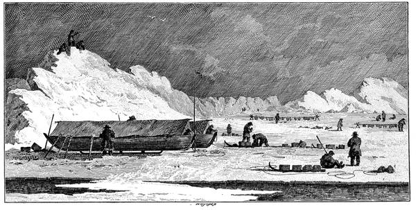
It was on the 15th of August in that year that the Salutation sent Edward Pellham and his seven companions ashore to kill reindeer for the ship's provisions on her voyage home. Taking with them two dogs, a snap-hance, two lances, and a tinder-box, they landed near Black Point, between Green Harbour and Bell Sound, and, "laying fourteen tall and nimble deer along," camped for the night. During the night the weather changed and brought in the ice between the shore and the ship, and in the morning the ship had gone. The boat's crew made for Green Harbour, thinking she would put in there to pick them up, but she failed to appear, being due to leave the country in three days, and after a fruitless attempt to catch her at 19Bell Sound, they eventually took up their quarters there on the 3rd of September.
Here was one of the so-called tents of the whale-fishers. "This," says Pellham, "which we call the tent, was a kind of house built of timber and boards very substantially, and covered with Flemish tiles, by the men of which nation it had in the time of their trading thither been built. Four-score foot long it is and in breadth fifty. The use of it was for the coopers, employed for the service of the company, to work, lodge, and live in, all the while they make casks for the putting up of the train oil." As this was too large for their comfort, they very sensibly built another within it. "Taking down another lesser tent therefore (built for the landmen hard by the other, wherein they lay whilst they made their oil), from thence we fetched our materials. That tent furnished us with one hundred and fifty deal boards, besides posts or stanchions and rafters. From three chimneys of the furnaces wherein they used to boil their oil, we brought a thousand bricks: there also found we three hogsheads of very fine lime, of which stuff we also fetched another hogshead from Bottle Cove, on the other side of the sound, some three leagues distant. Mingling this lime with the sand of the sea-shore, we made very excellent good morter for the laying of our bricks: falling to work thereon, the weather was so extreme cold as that we were fain to make two fires to keep our morter from freezing. William Fakely and myself, undertaking the masonry, began to raise a wall of one brick thickness against the inner planks of the side of the tent. Whilst we were laying of these bricks, the rest of our 20company were otherwise employed every one of them: some in taking them down, others in making of them clean and in bringing them in baskets into the tent. Some in making morter, and hewing of boards to build the other side withal, and two others all the while in flaying of our venison. And thus, having built the two outermost sides of the tent with bricks and morter, and our bricks now almost spent, we were enforced to build the two other sides with boards; and that in this manner. First we nailed our deal boards on one side of the post or stanchion to the thickness of one foot: and on the other side in like manner: and so filling up the hollow place with sand, it became so tight and warm as not the least breath of air could possibly annoy us. Our chimney's vent was into the greater tent, being the breadth of one deal board and four foot long. The length of this our tent was twenty foot and the breadth sixteen; the height ten; our ceiling being deal boards five or six times double, the middle of one joining so close to the shut of the other that no wind could possibly get between. As for our door, besides our making it so close as possibly it could shut; we lined it moreover with a bed that we found lying there, which came over both the opening and the shutting of it. As for windows, we made none at all, so that our light we brought in through the greater tent, by removing two or three tiles in the eaves, which light came to us through the vent of our chimney. Our next work was to set up four cabins, billeting ourselves two and two in a cabin. Our beds were the deer skins dried, which we found to be extraordinary warm, and a very comfortable kind of lodging to us in our distress."
21For fuel they knocked to pieces seven old boats left ashore by the ships, storing the wood over the beams of the tent so as to make a sort of floor protecting the interior from snow driven in under the tiles, and, in addition, they broke up a number of empty casks. To make the wood last as long as possible they hit upon a device for keeping the fire in—"when we raked up our fire at night, with a good quantity of ashes and of embers, we put into the midst of it a piece of elm wood, where, after it had lain sixteen hours, we at our opening of it found great store of fire upon it, whereupon we made a common practice of it ever after: it never went out in eight months together, or thereabouts."
Upon the 12th of September a small quantity of drift ice came into the sound, on a piece of which they found two walruses asleep, when "William Fakely being ready with his harping iron, heaved it so strongly into the old one that he quite disturbed her of her rest: after which, she, receiving five or six thrusts with our lances, fell into a sounder sleep of death." The young one, refusing to leave her mother, was also killed; and a week afterwards another walrus fell a victim; but even with these the store of provisions was inadequate. To make the food last, they put themselves on an allowance of one good meal a day, except on Wednesdays and Fridays which were fasting days devoted to whale sundries—"a very loathsome meat," says Pellham, in brackets—later on, for four days in the week they fed upon "the unsavoury and mouldy fritters, and the other three we feasted it with bear and venison." "But," continues the narrative, "as if it were not enough for us to want meat, we now began to want 22light also; all our meals proved suppers now, for little light could we see; even the glorious sun (as if unwilling to behold our miseries) masking his lovely face from us, under the sable veil of coal-black night."But they were equal to the emergency. "At the beginning of this darksome, irksome time, we sought some means of preserving light amongst us; finding therefore a piece of sheet lead over a seam of one of the coolers, that we ripped off and made three lamps of it, which, maintaining with oil that we found in the coopers' tent, and rope-yarn serving us instead of candle-wicks, we kept them continually burning."
Cheerful and resourceful as they were, their fits of depression were not infrequent. "Our extremities being so many, made us sometimes in impatient speeches to break forth against the causers of our miseries; but then again, our consciences telling us of our own evil deservings, we took it either for a punishment upon us for our former wicked lives; or else for an example of God's mercy in our wonderful deliverance: humbling ourselves therefore, under the mighty hand of God, we cast down ourselves before him in prayer, two or three times a day, which course we constantly held all the time of our misery."
Their prospects got worse, but they never lost a little hope. "The new year now began: as the days began to lengthen, so the cold began to strengthen; which cold came at last to that extremity, as that it would raise blisters on our flesh, as if we had been burnt with fire, and if we touched iron at any time it would stick to our fingers like bird-lime: sometimes if we went but out of doors to fetch in a little water, the 23cold would nip us in such a sort that it made us as sore as if we had been beaten in some cruel manner."
Provisions were running low; the men began to talk of famine, and the outlook became daily gloomier until the 3rd of February. "This proved a marvellous cold day; yet a fair and clear one; about the middle whereof, all clouds now quite dispersed and night's sable curtain drawn, Aurora with her golden face smiled once again upon us, at her rising out of her bed; for now the glorious sun with his glittering beams began to gild the highest tops of the lofty mountains. The brightness of the sun and the whiteness of the snow, both together, were such as that it was able to revive even a dying spirit. But to make a new addition to our new joy, we might perceive two bears (a she one with her cub) now coming towards our tent; whereupon we, straight arming ourselves with our lances, issued out of the tent to await her coming. She soon cast her greedy eyes upon us, and with full hopes of devouring us she made the more haste unto us; but with our hearty lances we gave her such a welcome as that she fell down and biting the very snow for anger."
Then more bears came to be eaten; then the birds began to arrive, and the foxes to come out of their winter earths to be trapped to the number of fifty; then the reindeer returned; and then, on the 25th May, two ships of Hull came into the sound from which a boat's crew landing unperceived came close up to the tent and shouted "Hey!" And Ayers, the only man at the moment in the outer tent, shouted "Ho!"—and Pellham and his shipmates had proved it to be possible to live through a winter in Spitsbergen.
The summer town of Smeerenberg—Himkoff winters in North East Land—Phipps reaches 80° 48´—Scoresby the elder reaches 81° 30´—Scoresby the younger—Voyage of the Dorothea and Trent under Buchan and Franklin—Parry reaches 82° 45´—Torell and Nordenskiöld—Carlsen sails round Spitsbergen—Swedish North Polar expedition under Nordenskiöld—Lamont—The Diana coal mine—Leigh Smith—Conway.
This wintering of the Salutation men occurred when the Spitsbergen fisheries were most flourishing, the prosperity continuing for seven more years. So lucrative was the trade that on Amsterdam Island under Hakluyt Headland, within fifteen miles of 80° north latitude, about as far from the North Pole as St. Malo is from John o' Groat's, there sprang up as a summer resort the Dutch village of Smeerenberg. Such was the bustle produced by the yearly visit of two or three hundred double-manned vessels, containing from twelve thousand to eighteen thousand men, that this village of the farthest north was as busy as a manufacturing town. The incitement of prices proportionate to the latitude attracted hundreds of annual settlers, who throve on the sale of brandy, wine, tobacco, and sundries to the whale-fishers in shops of all varieties, including bakehouses, where the blowing of a horn let the sailors know that the bread had just 25been drawn hot from the oven. In fact, hot rolls and every delicacy could be had in Smeerenberg, which the Dutch averred was as flourishing as Batavia, founded by them a few years before. And when winter was just about due every man—and woman—went back to Holland. But the life of Smeerenberg was a short and a merry one, for in 1640 the shore fisheries were failing, and a year or so afterwards the lingerers of its last season left it for good, clearing out from its houses of brick and wood, demolishing its furnaces, removing its copper cauldrons and coolers and casks and everything that could be taken away, and leaving it in desolation to be occupied in the next and subsequent summers by polar bears.
Like all seaside resorts it had its rival. Close by is the Cookery-of-Haarlem, abandoned at the same time, but rather more hurriedly. When Martens went there on the 15th of July, 1671, he found four houses still standing, in one of which were "several barrels or kardels that were quite decayed, the ice standing in the same shape the vessels had been made of: an anvil, smith's tongs, and other tools belonging to the cookery, were frozen up in the ice; the kettle was still standing as it was set, and the wooden troughs stood by it." Behind these houses "are high mountains," he continues, "if one climbeth upon these, as we do on others, and doth not mark every step with chalk, one doth not know how to get down again: when you go up you think it to be very easy to be down; but when you descend it is very difficult and dangerous, so that many have fallen and lost their lives." Absurd as this chalking of the steps may seem, there have been many who 26have taken the hint from the careful Martens when climbing in Spitsbergen, and many who have regretted not having done so.
In ordinary summers the west side of Spitsbergen is clear of ice, not so the eastern side, the difference being due to the Gulf Stream, which, though evidently failing, is traceable along the coast round Hakluyt Headland and up to the ice barrier. In addition to this there is the general cause, whatever it may be, which makes the western coasts of all Arctic lands, isolated or not, warmer than the eastern. Greenland, for instance, is more approachable in summer from Davis Strait than from the Greenland Sea, Novaya Zemlya from Barents Sea than from Kara Sea, and so on with all the islands and peninsulas of Asia and America. Hence all this whaling was confined practically to the western harbours of West Spitsbergen, the largest of the group of islands. The next largest, North East Land, was never much visited except from Hinlopen Strait, though the Russians from time to time took some interest in the north and east harbours, and would have taken more, for it abounded in reindeer, if the ice had not made the landing an enterprise of some difficulty.
On the east coast of North East Land, in 1743, a Russian whaler was caught in the pack, and the mate, Alexis Himkoff, remembering that a house had been built there some years before, went on shore with his godson, Ivan Himkoff, and two sailors, Scharapoff and Weregin, in search of it, in case the ship should have to be abandoned. They found the house, but, on returning to the shore next morning, could see nothing 27of the ship, which had apparently been carried away and crushed in the ice. They had brought with them a musket, a powder-horn with twelve charges of powder, twelve bullets, an axe, a small kettle, a bag with about twenty pounds of flour, a knife, a tinder-box and tinder, a bladder of tobacco, and every man had his pipe. That was their outfit.
The house was thirty-six feet in length, and eighteen in height and breadth. It contained a small antechamber about twelve feet broad, which had two doors, one to close it from the outer air, the other admitting to the inner room in which was a Russian stove, a kind of oven without a chimney, serving at will for heating, for baking, or for sleeping on. Realising that they had a long stay before them, they began by shooting twelve reindeer, one for each bullet. They then repaired the house, stopping up all the crevices with moss; and they then laid in a store of fuel from the driftwood, there being no trees on the island. On the beach they found some boards with nails in them, and a long iron hook and a few other pieces of old iron. And also there was a root of a fir tree in shape not unlike a bow. Those were the materials they had to make the best of.
A large stone served for an anvil, a pair of deer horns did duty for tongs, and with these and the fire, the iron hook was made into a hammer; and then two of the nails were shaped into spear-heads, which were tied to sticks from the driftwood with strips of deerskin. With these weapons they began by killing a bear, whose flesh they ate, whose skin they kept, and whose tendons they made into thread and a string for the 28bow formed out of the root of the fir tree. More nails were forged into arrow-heads, tied with sinew on to light sticks cut with the knife, the shafts being feathered from the feathers of seafowl. With these weapons they shot, before they had finished, two hundred and fifty reindeer, and they kept the skins, as they did also those of a large number of blue and white foxes, as we shall see in the sequel. In their own protection they killed nine bears, the only one they deliberately attacked being the first.
To be sure of keeping their fire alight they modelled a lamp out of clay, which they filled with deer-fat, with twisted linen for a wick; but the clay was too porous, the fat ran through it; so they made another lamp of the same stuff, dried it in the air, heated it red hot, and cooled it in a sort of thin starch made of flour and water, strengthening the pottery by pasting linen rags over it. The result was so successful that they made a second lamp as a reserve. Some wreckage gave them a little cordage and a quantity of oakum, which came in for lamp-wicks. The lamp, like the sacred fire, was never allowed to go out. To make themselves clothes, they soaked skins in fresh water till the hair could be pulled off easily, and rubbed them well, and then rubbed deer fat into them until they were pliant and supple. Some of the skins they prepared as furs. Out of nails they, after many failures, made awls and needles, getting the eyes by piercing the heads with the point of the knife, and smoothing and pointing them by rounding and whetting them on a stone.
For six years they lived in this desert place. Then 29one of them, Weregin, died of scurvy, and their gloomy forebodings as to which was to be taken next were broken in upon by their sighting a ship, to which they signalled with a flag made of deerskin. The signal was seen and they were rescued; and they took back to Archangel two thousand pounds weight of reindeer fat, their bales of skins and furs, their bow and arrows and spears, and in short everything they possessed. And they arrived there on the 28th of September, 1749, comfortably off from the value of the goods they brought with them—the heroes of one of the very best of true desert island stories.
Like most Russians they do not seem to have suffered much from the cold or to have been inconvenienced by the summer heat, which is also considerable. In 1773, on the 13th of June, when Phipps and Lutwidge anchored in Fair Haven, round by Amsterdam Island, they found the thermometer reach 58½° at noon and descend no lower than 51° at midnight, and on the 16th it rose in the sun to 89½° till a light breeze made it fall almost suddenly ten degrees. This was the expedition sent out to the North Pole, mainly at the instigation of Daines Barrington, Gilbert White's friend. The ships were the Racehorse and Carcass; and, as every one knows, or ought to know, as midshipman with Captain Lutwidge went Horatio Nelson, then a boy of fourteen, who was to figure largely in the world, though on this occasion he did nothing remarkable beyond attacking a polar bear, whose skin he thought would make a nice present for his father, and bringing his boat to the rescue when one of the Racehorse boats was attacked by walruses. 30For another thing the expedition is memorable, that being that the useful apparatus for the distillation of fresh water from sea water, known to every seafarer, was first used on this voyage, Dr. Irving, its inventor, being the surgeon of the Racehorse. Another item to be noted is that Phipps had with him a Cavendish thermometer, which he tried the day after he crossed the Arctic Circle, and found that at a depth of 780 fathoms the temperature was 26°, while at the surface it was 48°.
Phipps did all he could to go north, and, in longitude 14° 59´ east, reached 80° 48', the nearest to the Pole up to then, but he was foiled by the ice barrier, which he tried to penetrate again and again. He got his ships caught in the ice and took to his boats, thinking he would have to abandon them, when fortunately the pack drifted south, and the vessels, clearing themselves under sail, caught the boats up and took them on board. Then he went along the edge of the ice westward, and, finding no opening, gave the venture up and sailed for home.
The next to do good work within this area was William Scoresby the elder, whose only equal as a whale-fisher was his son. To him we owe the invention of the crow's nest, that cylindrical frame covered with canvas, entrance to which is given by a trap-hatch in the base, reached by a Jacob's ladder from the topmast crosstrees, the conning-tower, so to speak, carried since by every ship on Arctic service. He was also the inventor of the ice-drill and many another implement and device used in Polar navigation; and he it was who sloped off his fore and main courses to come inboard to a boom fitted to the foot, used by every whaler, by which, in fact, you may know them. He also, long before the America, discovered the advantage of flat sails, and, in order to get his weights well down, he filled his casks with water as ballast and packed them with shingle, so that, instead of going out light, he was in the best of trim, with a power of beating to windward that took him to the fishing ground in double quick time and further into the ice, when he chose, than any of his competitors.
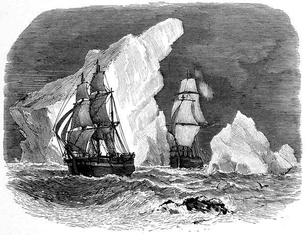
WHALERS AMONG ICEBERGS
31Out in the Resolution in 1806 he saw from his crow's nest, in which he often spent a dozen hours at a stretch, that below the ice-blink—the white line in the sky which betokens the presence of ice—there was a blue-grey streak denoting open water, and that the motion of the sea around the ship must be due to a swell, which could only come from open water to the northward. On the 13th of May he started for this. By sawing the ice, hammering at it, dropping his boats on to it from the bow, sallying the ship—that is, rolling her by running the crew backwards and forwards across her deck—and, in fact, using every means he could think of, he passed the barrier in the eightieth parallel, and, on the 24th of June, attained 81° 30´, the farthest north ever reached by a sailing vessel in these seas. On that day there was not a ship within three hundred and fifty miles of the Resolution. The bold venture proved a thorough success; in thirty-two days he filled up with twenty-four whales, two seals, two walruses, and a narwhal—one of the most profitable of his thirty voyages.
In this voyage the chief officer was his son, William 32Scoresby the younger, whose Arctic Regions is the best book ever written on the northern seas. Sent by his father to Edinburgh University where he studied almost every branch of natural and physical science, he was thoroughly equipped for his task, and his practical experience as a whaling captain and trained observer stood him in such stead that his book is still the basis of all scientific Polar research. His description of the Spitsbergen coast as seen from a ship is as faithful to-day as when he wrote it. "Spitsbergen and its islands, with some other countries within the Arctic Circle, exhibit a kind of scenery which is altogether novel. The principal objects which strike the eye are innumerable mountainous peaks, ridges, precipices, or needles, rising immediately out of the sea to an elevation of 3000 or 4000 feet, the colour of which, at a moderate distance, appears to be blackish shades of brown, green, grey and purple; snow or ice, in striæ or patches, occupying the various clefts and hollows in the sides of the hills, capping some of the mountain summits, and filling with extended beds the most considerable valleys; and ice of the glacier form, occurring at intervals all along the coast, in particular situations as already described, in prodigious accumulations. The glistening or vitreous appearance of the icy precipices; the purity, whiteness, and beauty of the sloping expanse formed by their snowy surfaces; the gloomy shade presented by the adjoining or intermixed mountains and rocks, perpetually covered with a mourning veil of black lichens, with the sudden transitions into a robe of purest white, where patches or beds of snow occur, present a variety and extent of contrast altogether 33peculiar; which, when enlightened by the occasional ethereal brilliancy of the Polar sky, and harmonised in its serenity with the calmness of the ocean, constitute a picture both novel and magnificent. There is, indeed, a kind of majesty, not to be conveyed in words, in these extraordinary accumulations of snow and ice in the valleys, and in the rocks above rocks and peaks above peaks, in the mountain groups, seen rising above the ordinary elevation of the clouds, and terminating occasionally in crests of snow, especially when you approach the shore under the shelter of the impenetrable density of a summer fog; in which case the fog sometimes disperses like the drawing of a curtain, when the strong contrast of light and shade, heightened by a cloudless atmosphere and powerful sun, bursts on the senses in a brilliant exhibition resembling the production of magic."
In 1818 there went out the first British expedition prepared to winter in the north. The vessels were two whalers bought into the navy, the Dorothea and Trent, the first under the command of David Buchan, the other under that of John Franklin. Neither officer had been in the Arctic region before, but Buchan had done excellent service in surveying Newfoundland, and Franklin had been marked for special duty owing to his work in Australian seas under his cousin, Matthew Flinders, and for the manner in which on his way home he had acted as signal officer to Nathaniel Dance in that ever-memorable victory off the Straits of Malacca, when the Indiamen defeated and pursued a French fleet under Admiral Linois. Dance's report gave Franklin a further chance of distinction, for it led to 34his appointment to the Bellerophon, whose signal officer he was during the battle of Trafalgar.
They were instructed to proceed to the North Pole, thence to continue on to Bering Strait direct, or by the best route they could find, to make their way to the Sandwich Islands or New Albion, and thence to come back through Bering Strait eastward, keeping in sight and approaching the coast of America whenever the position of the ice permitted them so to do. A nice little programme. But they started too early in a bad season; they did not get so far north as Phipps; they made accurate surveys and other observations; in exploration they did little; and they had many adventures.
As they ranged along the western side of Spitsbergen the weather was severe. The snow fell in heavy showers, and several tons' weight of ice accumulated about the sides of the Trent, and formed a complete casing to the planks, which received an additional layer at each plunge of the vessel. So great, indeed, was the accumulation about the bows, that they were obliged to cut it away repeatedly with axes to relieve the bowsprit from the enormous weight that was attached to it: and the ropes were so thickly covered with ice that it was necessary to beat them with large sticks to keep them in a state of readiness. In the gale the ships parted company, but they met again at the rendezvous in Magdalena Bay.
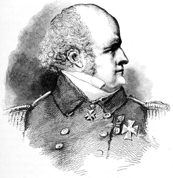
SIR JOHN FRANKLIN
35Later on, off Cloven Cliff, there was a walrus fight begun by the seamen and continued by the walruses when they found themselves more at home in the water than on the ice. They rose in numbers about the boats, rushing at them, snorting with rage, endeavouring to upset them or stave them in by hooking their tusks on the gunwales, or butting at them with their heads. "It was the opinion of our people," says Beechey, "that in this assault the walruses were led on by one animal in particular, a much larger and more formidable beast than any of the others; and they directed their efforts more particularly towards him, but he withstood all the blows of their tomahawks without flinching, and his tough hide resisted the entry of the whale lances, which were, unfortunately, not very sharp, and soon bent double. The herd was so numerous, and their attacks so incessant, that there was not time to load a musket, which, indeed, was the only effectual mode of seriously injuring them. The purser, fortunately, had his gun loaded, and the whole now being nearly exhausted with chopping and sticking at their assailants, he snatched it up, and, thrusting the muzzle down the throat of the leader, fired into him. The wound proved mortal, and the animal fell back amongst his companions, who immediately desisted from their attack, assembled round him, and in a moment quitted the boat, swimming away as hard as they could with their leader, whom they actually bore up with their tusks and assiduously preserved from sinking."
On one occasion Franklin and Beechey, when out in a boat together, witnessed the launch of an iceberg. They had approached the end of a glacier and were trying to search into the recess of a deep cavern at its foot when they heard a report as if of a cannon, and, turning to the quarter whence it proceeded, perceived 36an immense piece of the front of the cliff of ice gliding down from a height of two hundred feet at least into the sea, and dispersing the water in every direction, accompanied by a loud grinding noise, and followed by a quantity of water, which, lodged in the fissures, made its escape in numberless small cataracts over the front of the glacier. They kept the boat's head in the direction of the sea and thus escaped disaster, for the disturbance occasioned by the plunge of this enormous fragment caused a succession of rollers, which swept over the surface of the bay, making its shores resound as it travelled along it, and at a distance of four miles was so considerable that it became necessary to right the Dorothea, which was then careening, by instantly releasing the tackles which confined her. The piece that had been disengaged wholly disappeared under water, and nothing was seen but a violent boiling of the sea and a shooting up of clouds of spray like that which occurs at the foot of a great cataract. After a short time it reappeared, raising its head full a hundred feet above the surface, with water pouring down from all parts of it; and then, labouring as if doubtful which way it should fall, it rolled over, and, after rocking about for some minutes, became settled. It was nearly a quarter of a mile round and floated sixty feet out of the water, and making a fair allowance for its inequalities, was computed to weigh 421,600 tons.
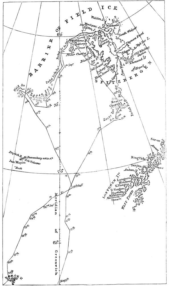
TRACK OF H.M.S. "DOROTHEA" AND "TRENT"
37There were frequent landings, often with difficulties in the return, due generally to attempts at making a short cut to the shore or across the ice. Of these short cuts the very shortest was that made by one of the sailors named Spinks, who was out with a party in pursuit of reindeer. The ardour of the chase had led them beyond the prescribed limits, and when the signal was made for their return to the boat some of them were upon the top of a hill. Spinks, an active and zealous fellow, anxious to be first at his post, thought he would outstrip his comrades by descending the snow, which was banked against the mountain at an angle of about 40° with the horizon, and rested against a small glacier on the left. The height was about two thousand feet, and in the event of his foot slipping there was nothing to impede his progress until he reached the beach, either by the slope or the more terrific descent of the face of the glacier. He began his career by digging his heels into the snow, the surface of which was rather hard. At first he got on very well, but presently his foot slipped, or the snow was too hard for his heel to make an impression, and he increased in speed, keeping his balance, however, by means of his hands. In a very short time his descent was fearfully quick; the fine snow flew about him like dust, and there seemed but little chance of his reaching the bottom in safety, especially as his course was taking him in the direction of the glacier. For a moment he was lost sight of behind a crag of the mountain, and it was thought he had gone over the glacier, but with great presence of mind and dexterity, "by holding water first with one hand and then the other," to use his own expression, he contrived to escape the danger, and, like a skilful pilot, steered into a place of refuge amid a bed of soft snow recently drifted against the hill. When he extricated himself 38from the depths into which he had been plunged he had to hold together his tattered clothes, for he had worn away two pairs of trousers and something more. That was all his damage, and we shall meet with him again in the west out with Franklin and Captain Back.
In the morning of the 30th of July the ships found themselves caught in a gale with the ice close to leeward. The only way of escaping destruction seemed to be by taking refuge in the pack. It was a desperate expedient rarely resorted to by whalers and only in extreme cases. In the Trent a cable was cut up into thirty-foot lengths, and these, with plates of iron four feet square, supplied as fenders, and some walrus hides, were hung around her, mainly about her bows; the masts were secured with extra ropes, and the hatches were battened and nailed down. When a few fathoms from the ice those on board searched with anxiety for an opening in the pack, but saw nothing but an unbroken line of furious breakers with huge masses heaving and plunging with the waves and dashing together with a violence that nothing but a solid body seemed likely to withstand; and the noise was so great that the orders to the crew could with difficulty be heard. At one moment the sea was bursting upon the ice blocks and burying them deep beneath its wave, and the next, as the buoyancy brought them up again, the water was pouring in foaming cataracts over their edges, the masses rocking and labouring in their bed, grinding and striving with each other until one was either split with the shock or lifted on to the top of its neighbour. Far as the eye could reach the turmoil stretched, and overhead was the clearness of a calm and silvery 39atmosphere bounded by a dark line of storm cloud lowering over the masts as if to mark the confines within which no effort would avail.
"At this instant," says Beechey, "when we were about to put the strength of our little vessel in competition with that of the great icy continent, and when it seemed almost presumption to reckon on the possibility of her surviving the unequal conflict, it was gratifying in the extreme to observe in all our crew the greatest calmness and resolution. If ever the fortitude of seamen was fairly tried it was assuredly not less so than on this occasion; and I will not conceal the pride I felt in witnessing the bold and decisive tone in which the orders were issued by the commander of our little vessel, and the promptitude and steadiness with which they were executed by the crew."
The brig was steered bow on to the ice. Every man instinctively gripped his hold, and with his eyes fixed on the masts awaited the moment of concussion. In an instant they all lost their footing, the masts bent with the shock, and the timbers cracked below; the vessel staggered and seemed to recoil, when the next wave, curling up under her counter, drove her about her own length within the edge of the ice, where she gave a roll and was thrown broadside to the wind by the succeeding wave which beat furiously against her stern, bringing her lee in touch with the main mass and leaving her weather side exposed to a floe about twice her size. Battered on all sides, tossed from fragment to fragment, nothing could be done but await the issue, for the men could hardly keep their feet, the motion being so great that the ship's bell, which in the heaviest 40gale had never struck of itself, now tolled so continuously that it had to be muffled.
After a time an effort was made to put the vessel before the wind and drive her further into the pack. Some of the men gained the fore-topsail-yard and let a reef out of the sail, and the jib was dragged half up the stay by the windlass. The brig swung into position, and, aided by a mass under her stern, split the block, fourteen feet thick, which had barred her way, and made a passage for herself into comparative safety; and after some four hours the gale moderated. Strained and leaking the Trent had suffered much, but the Dorothea had been damaged more; and both returned to Fair Haven, where it was found hopeless to continue the voyage, and thence, when the ships had been temporarily repaired, they sailed for England. The expedition had not done much, but it had given their Arctic schooling to Franklin, Beechey, and Back.
In May, 1827, Parry, in the Hecla, was forced to run into the ice, but not quite in the same way as Buchan did. He was beset for three weeks, and then, getting clear, proceeded to the Seven Islands to the north of Spitsbergen, on one of which, Walden, he placed a reserve of provisions; the ship, after reaching 81° 5´, going to Treurenberg Bay, in Hinlopen Strait, to await his return.
PARRY CAMPED ON THE ICE
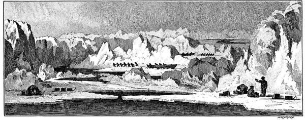
41From here he made his dash for the Pole. He had with him two boats of his own design, seven feet in beam, twenty in length. On each side of the keel was a strong runner, shod with steel, upon which the boat stood upright on the ice. They were so built that they would have floated as bags had they been stove in. On ash and hickory timbers, an inch by an inch and a half thick, placed a foot apart, with a half-timber of smaller size between each, was stretched a casing of waterproof canvas tarred on the outer side and protected by a skin of fir three-sixteenths of an inch thick, over this came a sheet of stout felt, and over all a skin of oak of the same thickness as the fir, each boat weighing about fourteen hundredweight—that is the hull, as launched. One of these boats was named the Enterprise, the other the Endeavour. They were intended to be hauled by reindeer, but the state of the ice rendered this impracticable and the men did the work themselves. Parry took command of the Enterprise, the other being in charge of Lieutenant James Clark Ross; and, altogether, officers and men numbered twenty-eight.
From Little Table Island, where they left a reserve as they had done at Walden, they started for the north—two heavy boats laden with food for seventy days and clothing for twenty-eight men, with a compact equipment including light sledges, travelling in a sea crowded or covered with ice in every form, large and small, over which they were dragged up and down hummocks, round and among crags and ridges, along surfaces of every kind of ruggedness, of every slope and irregularity, the few flat stretches broken with patches of sharp crystals or waist-deep snow; through lanes and pools of water with frequent ferryings and transhipments, in sunshine and fog, and, strange to say, frequently in pouring rain. They travelled by night and rested by day, though, of course, there was daylight all the time. "The advantages of this plan," says Parry, "which was occasionally deranged by circumstances, 42consisted, first in our avoiding the intense and oppressive glare from the snow during the time of the sun's greatest altitude, so as to prevent in some degree the painful inflammation in the eyes called snow-blindness which is common in all snowy countries. We also thus enjoyed greater warmth during the hours of rest and had a better chance of drying our clothes; besides which no small advantage was derived from the snow being harder at night for travelling. When we rose in the evening we commenced our day by prayers, after which we took off our sleeping dresses and put on those for travelling, the former being made of camlet lined with racoon skin, and the latter of strong blue, box cloth. We made a point of always putting on the same stockings and boots for travelling in, whether they had dried during the day or not, and I believe it was only in five or six instances that they were not either still wet or hard frozen." When halted for rest the boats were placed alongside each other, with their sterns to the wind, the snow or wet cleared out of them, and the sails, held up by the bamboo masts and three paddles, were placed over them as awnings with the entrance at the bow.
Progress was not great, sometimes fifty yards an hour, occasionally twelve miles a day, that is on the ice, for soon it was apparent that the distance gained by reckoning was greater than that given by observation, and Parry realised to his dismay that the pack was drifting south while he was going north. But he kept on till on the 21st of July he reached 82° 45´, which remained the farthest north for forty-nine years.
PARRY'S BOATS AMONG THE HUMMOCKS
43During the last few days he had been drifting south in the day almost as far as he had advanced north in the night, and, having used up half his provisions, he reluctantly abandoned the struggle as hopeless. "As we travelled," he says, "by far the greater part of our distance on the ice, three, and not infrequently, five times over, we may safely multiply the road by 2½; so that our whole distance, on a very moderate calculation, amounted to five hundred and eighty geographical miles, or six hundred and sixty-eight statute miles; being nearly sufficient to have reached the Pole in a direct line."
In 1858 a Swedish expedition under Otto Torell started from Hammerfest for Spitsbergen. He was accompanied by A. Quennerstedt and Adolf Erik Nordenskiöld. They explored Horn Sound, Bell Sound, and Green Harbour. In Bell Sound they dredged with great success for mollusca; they made a botanical collection, chiefly of mosses and lichens, found tertiary plant fossils, and, in the North Harbour, carboniferous limestone beds with the tertiary plant-bearing strata above them—in short, Nordenskiöld entered upon his long and fruitful study of Spitsbergen geology. Three years afterwards Torell took out another expedition, Nordenskiöld going with him, which was to explore the northern coast and then make for the far north; but the ice conditions kept them in Treurenberg Bay, where they visited Hecla Cove and found Parry's flagstaff. In the course of their journeys they noticed in Cross Bay the first known Spitsbergen fern, Cystopteris fragilis; by the side of a freshwater lake in Wijde Bay an Alpine 44char was picked up; and, at Shoal Point, Torell discovered in a mass of driftwood a specimen of the unmistakable Entada bean, two and a quarter inches across, brought there from the West Indies by the Gulf Stream, as other specimens have been drifted to European shores.
In 1864, the year that Elling Carlsen found the navigation so open that he passed the Northern Gate and sailed round Spitsbergen, Nordenskiöld, at the head of a small expedition, was at work in Ice Fjord, and, unable to go north on account of the ice, rounded South Cape, entered Stor Fjord, visited Edge's Land and Barents Land, and from the summit of White Mountain, near Unicorn Bay, rediscovered the west coast of the island reported by Edge two hundred and fifty years before. In 1868, as leader of the Swedish North Polar Expedition in the Sofia, he reached 81° 42´, in 17° 30´ east, the highest latitude then reached by a steam vessel, and his farthest north; his next Polar venture, four years afterwards, in the Polhem, ending in his having to winter in Mossel Bay, where his generous endeavour to feed one hundred and one extra men, who were ice-bound, on provisions intended for his own twenty-four, would have ended in disaster had he not been relieved by Leigh Smith in the Diana.
The Diana was the steam yacht built for James Lamont, in which, like Leigh Smith, he cruised for several seasons in the Arctic seas, combining sport with exploration in a truly admirable way. To these two yachtsmen we owe much of our knowledge of Spitsbergen, Novaya Zemlya, and Franz Josef Land, but we 45can only give them passing mention here. We must, however, find room for Lamont's useful find of the coal mine in Advent Bay, from which he filled up the Diana's bunkers. "When I paid a visit to the coal mine," he says, "I found it quite a busy scene for a quiet Arctic shore. The engineer and fireman directed the blasting, my English hands quarried, while the Norwegians carried the sacks down the hill. The old mate, the many-sidedness of whose character I have so much valued on my various voyages, was digging away with the rest, though I am sorry that in the sketch his weather-beaten face is turned away. All the rest are portraits, and the reader will notice that Arctic work is not done in the attractive uniforms known to Cowes and Ryde. The coal-bed was about three feet thick, and lay very horizontally between two layers of soft, mud-coloured limestone. It was harder to obtain than I anticipated, because saturated, through all the cracks and interstices, with water which had frozen into ice more difficult to break through than the coal itself, thereby rendering these fissures worse than useless in quarrying. This is tertiary coal, and is of fair quality, but contains a good deal of sulphur. When we began to burn it, so much water and ice was unavoidably mixed with it that the engineers had to let it drain on deck in the hot sun and then mix it with an equal bulk of Scotch coal. Consumed in this way the ten tons obtained in three days was a useful addition to the fast-dwindling stock on board."
While Nordenskiöld was at Mossel Bay he attempted a journey to the north, but was stopped by the ice 46at Seven Islands, and returned round North East Land. It took him five days to pass across the twenty-three miles between Phipps Island and Cape Platen over pyramids of angular ice up to thirty feet high. On the coast, which he found extending, as Leigh Smith had reported, much further to the east than was shown on the charts, he met with the inland ice ending in precipices from two thousand to three thousand feet high. Ascending this ice they had scarcely gone a quarter of a mile before one of the men disappeared at a place where the surface was level, and so instantaneously that he could not even give a cry for help. When they looked into the hole they found him hanging on to the drag-line, to which he was fastened with reindeer harness, over a deep abyss. Had his arms slipped out of the harness, a single belt, he would have been lost. Along the level surface every puff of wind drove a stream of fine snow-dust, which, from the ease with which it penetrated everywhere, was as the fine sand of the desert to the travellers in the Sahara. By means of this fine snow-dust, steadily driven forward by the wind, the upper part of the glacier—which did not consist of ice, but of hard packed blinding white snow—was glazed and polished so that it seemed to be a faultless, spotless floor of white marble, or rather a white satin carpet. Examination showed that the snow, at a depth of four to six feet, passed into ice, being changed first into a stratum of ice crystals, partly large and perfect, then to a crystalline mass of ice, and finally to hard glacier ice, in which could still be observed numerous air cavities compressed by the overlying weight; and, 47when, as the surface thaws, the pressure of the enclosed air exceeds that of the superincumbent weight, these cavities break up with the peculiar cracking sound heard in summer from the glacier ice that floats about in the fjords. Occasionally broad channels were crossed, of which the only way to ascertain the depth was to lower a man into them, and frequently he had to be hoisted up again without having reached the bottom; such danger areas causing so circuitous a route that much progress was impossible.
Prior to the explorations of Sir Martin Conway in 1896, it was supposed that this inland ice extended over all the islands of the group, an area exceeding twenty thousand square miles. He, however, proved that so far as West Spitsbergen was concerned, this was not the case. Crossing it he found much of the interior a complex of mountains and valleys, amongst which were many glaciers, as in Central Europe, but with no continuous covering of ice, each glacier being a separate unit with its own drainage system and catchment area, the valleys boggy and relatively fertile, the hillsides bare of snow in summer up to more than a thousand feet above sea-level. In the rise of the country from the sea it seems to have come up as a plain which did not reach the level of perpetual snow, so that as it rose it was cut down into valleys in the usual way by the agency of water pouring off from the plateau over its edge down a frost-split rock-face, the valleys gently sloped, the head necessarily steep owing to the face of the cliff being stripped off as the waterfalls cut their way back.
Since Nordenskiöld's first expedition we have learnt 48much of the geology and physical features of Spitsbergen; and we hear no more of the poverty of its flora and fauna. Now it has become a summer tourist resort we are yearly increasing our knowledge of this land of no thunderstorms, for centuries the largest uninhabited area on the globe, the only considerable stretch on which there is no trace of human occupation before its discovery by the moderns in 1596, when it was found by Barents and his companions.
Van Heemskerck and Barents reach Ice Haven—The ship in the ice—The first crew to winter in the Arctic—The house the Dutch built—The bears—The foxes—Intense cold—Twelfth Eve rejoicings—Preparations for departure—Death of Barents—The boat voyage—Meeting with Rijp—Admiral Jacob Van Heemskerck—Carlsen at Ice Haven—Finds the house as described by De Veer—The relics at the Hague—Gardiner finds the powder-flask—Gundersen finds the translation of the voyage of Pet and Jackman—Second voyage of Hudson—His third voyage—De Vlamingh—Russian explorers.
We left Barents parting company with Rijp at Bear Island, Rijp bound northwards. Barents, taking his vessel eastwards, struck Novaya Zemlya at Loms Bay, near Cross Bay, and bearing north-eastwards reached the Orange Islands and rounded Cape Mauritius. Steering south he got down into Ice Haven, where at length, says De Veer, "the ice began to drive with such force that we were enclosed round about therewith, and yet we sought all the means we could to get out, but it was all in vain: and at that time we had like to have lost three men that were upon the ice to make way for the ship, if the ice had held the course it went; but as we drove back again, and the ice also whereon our men stood, they being nimble, as the ship drove by them, one of them caught hold of the beak head, another upon the shrouds, and the third upon the mainbrace that hung out behind, and so by great 50adventure by the hold they took they got into the ship again, for which they thanked God with all their hearts." The same evening, that of the 26th of August, 1596, they reached the west of Ice Haven—now known as Barents Bay—where they were forced to remain, being the first crew on record to spend a winter in the Arctic regions and survive to tell the story.
To begin with, the ice gathered round the ship and lifted her bow four feet out of the water. Endeavouring to right her by clearing the ice away, Barents was on his knees measuring the height she had to fall when the ice broke with "such a noise and so great a crack that they thought verily they were all cast away." As she lay upright again they tried in vain with crowbars and other tools to break off the piled-up ice, and next day in a heavy snow the pressure became such that the whole ship was borne up and so squeezed that "all that was both about and in it began to crack, so that it seemed to burst in a hundred pieces, which was most fearful both to see and hear, and made all the hair of our heads to rise upright with fear." The grip continuing, the vessel was driven up four or five feet and the rudder squeezed off, which was replaced by a new one, when she sank back into the water a few hours afterwards owing to the ice drifting clear for a while. Thus matters went on for a little time, the ship being alternately lifted and released.
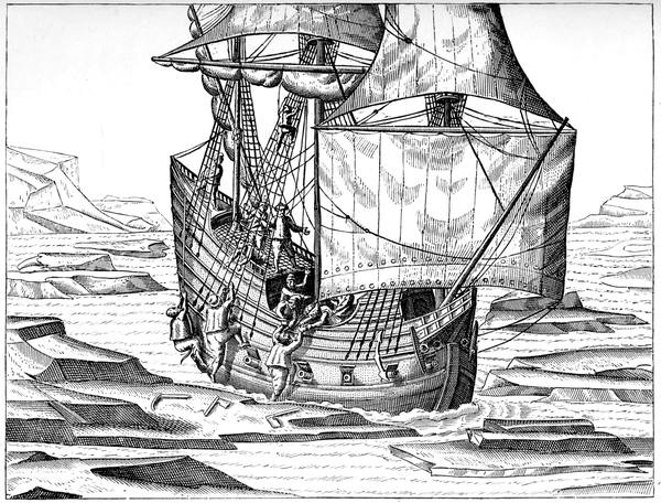
HOW OUR SHIP STUCK FAST IN THE ICE
51On the 11th of September, as there was no hope of escape, it was decided to build a house wherein to spend the winter, and in seeking for a suitable position, a mass of driftwood—"trees, roots and all"—was discovered, "driven ashore from Tartaria, Muscovia, or elsewhere," for there were no trees growing on the land, "wherewith," says De Veer, "we were much comforted, being in good hope that God would show us some further favour; for that wood served us not only to build our house, but also to burn and serve us all the winter long; otherwise without all doubt we had died there miserably with extreme cold."
The timber was collected and piled up in heaps that it might not be hidden under the snow, and two sledges were made on which to drag it to the site of the house. This was heavy work in which all took part, four of them in turn remaining by the ship, there being thirteen men to each party, five to each sledge, with three to help and lift the wood behind "to make us draw the better and with more ease," and at the end of the first week of it the carpenter died, so that only sixteen were left. But the wood was brought along day after day, some to build with, some for fuel; and the house was built, the frost so hard at times that "as we put a nail into our mouths, as carpenters do, there would ice hang thereon when we took it out again and made the blood follow"; and when a great fire was made to soften the ground, in order that earth might be dug to shovel round the house, "it was all lost labour for the earth was so hard and frozen so deep that we could not thaw it, and it would have cost us too much wood."
The house was roofed with deals obtained by breaking up the lower deck of the fore part of the ship, and, to make it weather-tight, it was covered with a sail on which afterwards shingle was spread to keep it from being blown off; and the materials of the cabin yielded the wood for the door. Inside, the house was made as 52comfortable as possible, as shown in the illustration given in De Veer's book in 1598. Low shelves, with partitions between, along the side served for sleeping places; a cask on end with a square hole like a window in the upper half was frequently used as a bath; a striking clock and a time-glass marked the passing of the hours; the large fire in the centre with its frame and trivet and spit and copper pots and other kitchen utensils served for warmth and cooking; and over the fire hung a large lamp beneath the chimney, which terminated outside in a cask giving it the appearance of a crow's nest ashore.
While the house was building, and as long as the sun was above the horizon, there was much trouble with the bears, whose daily visits were always productive of excitement. On the 26th of October, for instance, the day after all the crew first slept in the house, when the men had loaded the last sledge and stood in the track-ropes ready to draw it to the house, Van Heemskerck caught sight of three coming towards them from behind the ship. The men jumped out of the track-ropes, and as fortunately two halberds lay upon the sledge, Van Heemskerck took one and De Veer the other, while the rest ran to the ship, "and as they ran one of them fell into a crevice in the ice, which grieved us much, for we thought the bears would have run unto him to devour him," but they made straight after the others instead. "Meantime we and the man that fell into the cleft of ice took our advantage and got into the ship on the other side; which the bears perceiving, they came fiercely towards us that had no arms to defend us withal but only the two 53halberds, gave them work to do by throwing billets of firewood and other things at them, and every time we threw they ran after them as a dog does at a stone that has been cast at him. Meantime we sent a man down into the caboose to strike fire and another to fetch pikes; but we could get no fire, and so we had no means to shoot"—their firearms being matchlocks. "At the last as the bears came fiercely upon us we struck one of them with a halberd on the snout, wherewith she gave back when she felt herself hurt and went away, which the other two, that were not so large as she, perceiving, ran away."
When the bears had gone and the long night set in, their place was taken by the white foxes, many of these being caught in traps and furnishing skins for clothes and flesh for meat—"not unlike that of the rabbit"—that was "as grateful as venison." The 19th of November was a great day. A chest of linen was opened and divided among the men for shirts, "for they had need of them." Next day they washed their shirts, having evidently made the new ones in a hurry, and, says De Veer, "it was so cold that when we had washed and wrung them they presently froze so stiff (out of the warm water) that although we laid them by a great fire the side that lay next the fire thawed, but the other side was hard frozen, so that we should sooner have torn them in sunder than have opened them, whereby we were forced to put them into the boiling water again to thaw them, it was so exceeding cold."
On the 3rd of December and the two following days it was so cold that as the men lay in their bunks 54they could hear the ice cracking in the sea two miles away, and thought that icebergs were breaking on each other; and as they had not so great a fire as usual owing to the smoke "it froze so sore within the house that the walls and the roof thereof were frozen two fingers thick with ice, even in the bunks in which we lay. All those three days while we could not go out by reason of the foul weather we set up the sandglass of twelve hours, and when it was run out we set it up again, still watching it lest we should miss our time. For the cold was so great that our clock was frozen and would not go, although we hung more weight on it than before."
The snow fell until it was so deep round the house that on Christmas Day they heard foxes running over the roof; and the last day of the year was so cold that "the fire almost cast no heat, for as we put our feet to the fire we burnt our hose before we could feel the heat, so that we had work enough to do to patch our hose." On the 4th of January, "to know where the wind blew we thrust a half pike out of the chimney with a little cloth or feather upon it; but we had to look at it immediately the wind caught it, for as soon as we thrust it out it was frozen as hard as a piece of wood and could not go about or stir with the wind, so that we said to one another how fearfully cold it must be out of doors."
Next day, being Twelfth Eve, on which foreigners, according to the old practice, hold the festivities now customary in England on the following day, the men asked Van Heemskerck that they might enjoy themselves, "and so that night we made merry and drank 55to the three kings. And therewith we had two pounds of meal, which we had taken to make paste for the cartridges wherewith, of which we now made pancakes with oil, and to every man a white biscuit, which we sopped in wine. And so supposing that we were in our own country and amongst our friends it comforted us as well as if we had made a great banquet in our own house. And we also distributed tickets, and our gunner was king of Nova Zembla, which is at least eight hundred miles long and lieth between two seas."
In time the sun reappeared—as also the bears—and the rigours of the winter relaxing, the men, on the 9th of May, applied to Barents asking him to speak to Van Heemskerck with a view to preparing for departure. This, after two other appeals, he did on the 15th of May, Van Heemskerck's answer being that, if the ship were not free by the end of the month, he would get ready to go away in the boats. The two boats, or, to be exact, the boat and the herring skute, were then repaired and made suitable for a long sea voyage, and on the 13th of June were in proper condition with all their stores ready. Then Van Heemskerck, "seeing that it was open water and a good west wind, came back to the house again, and there he spake unto Willem Barents (that had been long sick) and showed him that he thought it good (seeing it was a fit time) to go from thence, and they then resolved jointly with the ship's company to take the boat and the skute down to the water side, and in the name of God to begin our voyage to sail from Nova Zembla. Then Willem Barents wrote a letter, which he put into a powder flask and hanged it up in the chimney, 56showing how we came out of Holland to sail to the kingdom of China, and what had happened to us." Then Barents was taken down to the shore on a sledge and put into one boat, the other sick man, Andriesz, being placed in the other, and "with a west-north-west wind and an indifferent open water" they set sail on a voyage of over fifteen hundred miles among the ice, over the ice, and through the sea.
Barents, though they little suspected it, had but a few days to live. As they passed the northernmost cape of Novaya Zemlya, "Gerrit," he said to De Veer, "if we are near the Ice Point, just lift me up again. I must see that point once more." They were amongst the ice floes again; soon they had to make fast to one; and then they became shut in and forced to stay there. Next day their only means of safety lay in hauling their boats up on to a floe, taking the sick men out on to the ice and putting the clothes and other things under them; but after mending the boats, which had been much bruised and crushed, they drifted into a little open water and got afloat. On the 20th of June, about eight in the morning it became evident that Andriesz was nearing his end. "Methinks," said Barents, in the other boat, when he heard of it, "with me too it will not last long." But still his companions did not realise how ill he was, and talked on unconcernedly. Then he looked at the little chart which De Veer had made of the voyage. Putting it down, he said, "Gerrit, give me something to drink." And no sooner did he drink than he suddenly died. Thus passed away their chief guide and only pilot, than whom none better ever sailed the northern seas.
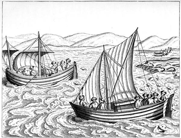
HOW WE NEARLY GOT INTO TROUBLE WITH THE SEA-HORSES
57Working their way down the west coast of the long island, putting in every now and then in search of birds and eggs, constantly in peril from the floating ice and the bears, they slowly came south. When passing Admiralty Peninsula they had to deal with a danger of their own causing. They sighted about two hundred walruses upon one of the floes. Sailing close to them they drove them off, "which," says De Veer, "had almost cost us dear, for they, being mighty strong sea monsters, swam towards us round about our boats with a great noise as if they would have devoured us; but we escaped from them by reason that we had a good gale of wind, yet it was not wisely done of us to waken sleeping wolves."
Day by day De Veer tells the story of that adventurous voyage, with its long succession of dangers and disappointments, until they reached the mainland and sent the Lapland messenger to Kola, who returned with a letter from Jan Corneliszoon Rijp, who at first they could not believe was the old friend from whom they had parted at Bear Island; and more briefly he continues the story until Amsterdam was reached on the 1st of November, when the survivors, in the same clothes they wore in their winter quarters, fur caps and white fox-skins, walked up to the house of Pieter Hasselaer to report themselves on arrival and received the hearty welcome they deserved.
Though Van Heemskerck had failed to make the passage to the east by way of the north, he was perhaps destined for greater fame on the far less rigorous route. Like Nelson he went on an Arctic expedition that failed, and then secured a place in 58history by a sea-fight in Spanish waters, for which his countrymen will never forget him. He it was who as Vice-Admiral of Holland fought the Spanish fleet at Gibraltar in the decisive battle of the 25th of April, 1607, in which with his twenty-six vessels he attacked Juan Alvarez Davila's twenty ships and ten galleons. Early in the struggle he had his leg swept off by a cannon shot, but he remained on deck till he died, gaining the complete victory which rendered his countrymen free from hindrance on the road to the Indies round the Cape of Good Hope, of which for so many years they made such profitable use. It is customary to give all the credit of the Arctic voyage to Barents on the ground that his captain was no sailor, but Holland knows no better sailor than Jacob Van Heemskerck of Gibraltar Bay.
On the 9th of September, 1871, Captain Elling Carlsen, sailing in the Barents Sea, which he had entered round Icy Cape, landed in Ice Haven and found the house just as De Veer had described it. There it had stood in cold storage for 274 years, never having been entered by human foot since Van Heemskerck had shut the door. The bunks, the table, the bath, the clock, in short everything, all in order, as the orderly Dutchmen had left it. Never did a voyage book receive such ample verification; never did the description of an island home stand the test better.
Carlsen, to begin with, knew nothing of De Veer or Barents, but he set to work in a conscientious way and recorded the results like a true archæologist. "Thursday, 14th," he wrote in his log, "Calm with clear sky. Four o'clock in the morning we went 59ashore further to investigate the wintering place. On digging we found again several objects, such as drumsticks, a hilt of a sword, and spears. Altogether it seemed that the people had been equipped in a warlike manner, but nothing was found which could indicate the presence of human remains. On the beach we found pieces of wood which had formerly belonged to some part of a ship, for which reason I believe that a vessel has been wrecked there, the crew of which built the house with the materials of the wreck and afterwards betook themselves to boats."
Bringing away a very large number of articles, he resumed his voyage and landed at Hammerfest, where Mr. E. C. Lister Kay, who happened to be there on a yachting trip, bought them, thinking they would be repurchased from him, at the price he gave, for one of our own museums. In this he was disappointed, and the collection was taken down to his house in Dorsetshire, where Count Bylandt, the Dutch Ambassador, happening to hear of it, called and bought it for his Government, who placed it at the Hague in a room, the exact imitation of that in Novaya Zemlya.
In July, 1876, Mr. Charles Gardiner, another English yachtsman, when on a cruise in the Glow-worm in Barents Sea, made a call at the house and brought away many other relics, which he presented to the Dutch, to be added to those at the Hague; and among them was the powder-flask hung in the chimney, containing the paper mentioned by De Veer. The previous August Captain Gundersen had been there in the Norwegian schooner Regina. In one of the chests he found two charts and what he described 60as Barents's Journal. The journal proved to be a manuscript Dutch translation of the story of the voyage in 1580 of Arthur Pet and Charles Jackman.
In 1608, eleven years after Barents died, Henry Hudson, in the Muscovy Company's service, was sent to China by the north-east. He sailed on the 22nd of April from St. Katharine's, near the Tower of London, and on the 3rd of June passed the North Cape on his way to Novaya Zemlya, which he reached near Cape Britwin twenty-three days afterwards. For some considerable distance he had skirted the ice pack, vainly endeavouring to get through to the northward and enter the Kara Sea round the Orange Islands.
This being impracticable he ranged southwards looking for a passage through at Kostin Shar, which in the Dutch map he had with him was marked as a strait and proved to be a bay. Had he been able to go a little further north than Cape Britwin he might have found that Matyushin Shar, like a rift in the rocks, divides the long island in half, though at that early season the ice would have probably been blocking it. From Kostin or thereabouts he departed for home, his voyage failing almost at the outset, owing to his being two months too early.
While off the coast he sent his boat ashore several times. "Generally," he says, "all the land of Nova Zembla that we have yet seen is to a man's eye a pleasant land; much main high land with no snow on it, looking in some places green, and deer feeding thereon; and the hills are partly covered with snow and partly bare"—rather a different picture from that given by De Veer of what it was like in the winter. 61De Veer, too, had committed himself to the statement that there were no deer in the country, but here were Hudson's men frequently coming upon their traces, and on the 2nd of July reporting that they had seen "a herd of white deer, ten in a company," bringing on board with them a white lock of deer's hair in proof thereof.
On his return Hudson left the service of the Muscovy Company. He went to Holland, and, early in April, 1609, was sent out by the Amsterdam Chamber of the Dutch East India Company. On the 5th of May he rounded the North Cape, making for Novaya Zemlya, and a few days afterwards reached the ice. Here, according to Dutch accounts, his men mutinied, but what happened during the trouble is not recorded. Whether it was really owing to a mutiny, or, as is by no means improbable, to secret instructions received at his departure, Hudson, on the 14th, made sail for the North Cape, passed it on the 19th, when he observed a spot on the sun, and then went off westwards to Newfoundland, making direct apparently for the mouth of the river now bearing his name, which was discovered by Verrazano in March, 1524, and surveyed by Gomez in the following year, and was at the time of Hudson's visit British territory.
The reason for this astonishing change of route was, perhaps, that on some of the charts of the period, as on Michael Lock's planisphere, this river, the Rio de Gamas or Rio Grande of the Spaniards, was made to communicate with what seems to be intended for Lake Ontario, and this with the other lakes to the westward was widened out into the waterway to the South Sea. 62Thus Hudson drops out of our story at his first mutiny, for he did not cross the Arctic Circle on his fourth voyage, when his second mutiny ended his career in the bay that bears his name, which, like the river and the strait, was indicated on the maps years before he went there.
In 1664 Willem de Vlamingh, the Dutch navigator, or—to be cautious—the namesake of the Dutch navigator, who thirty-one years afterwards found Dirk Hartog's plate and named Swan River in West Australia after the black swans, was in these regions and rounded Novaya Zemlya into the Kara Sea, reaching so far north that if his recorded latitude be correct he must have sighted the Franz Josef archipelago, and, contrary to the tendency of Arctic explorers, mistaken land for a bank of mist or a group of icebergs. After him neither Dutch nor English delay us, the opening up of this continuation of the Urals being left to the Russians, who found it first and named it—Novaya Zemlya meaning simply New Land.
For years it was left to the Samoyeds and the walrus hunters, whose persistent reports of deposits of silver in its cliffs led to Loschkin's making his way round it and spending two winters on its east coast. In 1768 Rosmysslof, also on silver bent, wintered in Matyushin Shar, that wonderful waterway, ninety fathoms deep, bounded by high hills and precipitous cliffs, winding so sharply that ships have been into it for a dozen miles or so and seeing no passage ahead have come out again to seek it elsewhere. In 1807 came Pospeloff, with Ludlow the mining engineer, to settle the silver question once for all, and settle it they did by showing that 63everywhere the so-called silver was either talc or mica, and naming Silver Bay ironically in memory thereof. Fourteen years afterwards Lütke surveyed the west coast, continuing during the next three summers; and in 1832 Pachtussoff arrived to undergo in the course of his really admirable work the hardships and privations of which he died.
Austro-Hungarian expedition of 1872—The voyage as planned—The drift of the Tegetthoff—The polyglot crew—Discovery of Franz Josef Land—Payer's description of an aurora—The sledge journeys—Crown Prince Rudolf Land—Cape Fligely reached—Abandonment of the Tegetthoff—The boat voyage to Cape Britwin—Leigh Smith's expeditions—Loss of the Eira—The retreat in the boats—Jackson in Franz Josef Land—His excellent survey work—The Italian expedition under the Duke of the Abruzzi—Cagni attempts to reach the Pole and is stopped at 86° 34´—The return journey.
In 1871 Weyprecht and Payer were out in the cutter Isbjörn, pioneering for their intended voyage to the eastward, which started next year in the Tegetthoff, the famous Austro-Hungarian attempt of 1872 which may be described as an unintentional voyage of unexpected discovery. The amount of credit due to a man who starts to find one thing and lights upon another has always been a contentious matter, and this expedition afforded an extreme case for such speculations. The plan was to go east-north-east, the wintering places being undetermined, though they might be Cape Chelyuskin, the New Siberian Islands, or any land that might be discovered; and a return to Europe through Bering Strait lay among the possibilities of the venture, as an endeavour was to be made to reach the coast of Siberia in boats and penetrate south down one of the large rivers of 65Northern Asia. What happened was that during the afternoon of the 20th of August, when off the north-west coast of Novaya Zemlya in 76° 22´ north, 63° 3´ east, the ship was run into an ice-hole and made fast to a floe, and during the night the ice, instead of parting asunder, closed in and imprisoned her, so that she never steamed or sailed again. In the ice and on the ice she lay perfectly helpless, drifting with the floe, and still in its grip when she was abandoned by her crew on the 20th of May, two years afterwards.
It was a wonderful drift. North-easterly in the main to begin with, then north-westerly, then easterly to about 73°, then north, then west, in and out and roundabout, till they reached much the same longitude as they started from and then with a general tendency to the northward. Autumn passed away; the Polar night set in; and still they drifted ice-bound—a miscellaneous company representative of the polyglot empire; "on board the Tegetthoff," says Payer, "are heard all the languages of our country, German, Italian, Slavonic, and Hungarian; Italian is, however, the language in which all orders are given," to which we should add the Norwegian of Olaf Carlsen, the ice-master. During the winter there was enough of occupation and amusement, though private theatricals were impossible, as they would have had to be given in four languages to be intelligible to the audience.
The short summer came and went, and August had almost gone when—it was on the 30th, in 79° 43´—there came a surprise. The rays of the sun were fitfully breaking through the gloom when suddenly the gliding mists rolled up like a curtain, revealing in the 66north-west the outlines of a rocky coast, which in a few minutes grew into a radiant Alpine land. The shore, however, was unattainable, as a rush over the icefield soon showed, but from the edge of the fissure that barred any further progress they could make out its hills and glaciers and imagine the green pastures of its valleys. They called it Kaiser Franz Josef's Land, and along it they drifted during September till its outlines faded as the wind began to drive the floe to the south. But at the end of the month the direction of the floe changed to the north-west, taking the Tegetthoff up to 79° 58´, her highest north, near enough to one of the islands for an effort to be made to land. Six started from the ship over the grinding, groaning, broken walls of ice, and when they were out of sight of the ship a mist settled down which cut them off from the sight of land and then so closely enwrapped them that they could see nothing. Advance they found hopeless, and as they returned they lost their way and were saved by the sagacity of a dog they had with them. All through October the drift continued, and it was not until forenoon of the 1st of November, two months after sighting the country, that they managed to get ashore. This was on Wilczek Island in the same longitude as Admiralty Peninsula in Novaya Zemlya, and in the same latitude as Mossel Bay in Spitsbergen.
The sun had retired for the winter nine days before, and it was by the light of the moon that they first explored the unknown country. Little could be done, and, as it was much too late for attempting to shift from the ship to the shore, the winter had to be spent 67on board as the other had been. Through this winter, as before, the auroral displays were remarkable, and they are excellently described by Payer. Of one of them, he says: "It is now eight o'clock at night, the hour of the greatest intensity of the northern lights. For a moment some bundles of rays only are to be seen in the sky. In the south a faint, scarcely observable, band lies close to the horizon. All at once it rises rapidly and spreads east and west. The waves of light begin to dart and shoot; some rays mount towards the zenith. For a short time it remains stationary, then suddenly springs to life. The waves of light drive violently from east to west; the edges assume a deep red and green colour and dance up and down. The rays shoot up more rapidly; they become shorter; all rise together and approach nearer and nearer to the magnetic Pole. It looks as if there were a race among the rays, and that each aspired to reach the Pole first. And now the point is reached, and they shoot out on every side, to the north and the south, to the east and the west. Do the rays shoot from above downwards, or from below upwards? Who can distinguish? From the centre issues a sea of flames. Is that sea red, white, or green? Who can say?—it is all three colours at the same moment. The rays reach almost to the horizon; the whole sky is in flames. Nature displays before us such an exhibition of fireworks as transcends the powers of imagination to conceive. Involuntarily we listen; such a spectacle must, we think, be accompanied with sound. But unbroken stillness prevails, not the least sound strikes on the ear. Once more it becomes clear over the ice, 68and the whole phenomenon has disappeared with the same inconceivable rapidity with which it came, and gloomy night has again stretched her dark veil over everything. This was the aurora of the coming storm—the aurora in its fullest splendour."
Sledging was begun in March, Hall Island being first visited, and, on the 26th, Payer, with six men, started on his main journey up Austria Sound, reaching Hohenlohe Island, where three men were left, and then proceeding further north to Crown Prince Rudolf Land. Off the southern promontory of this were innumerable icebergs, up to two hundred feet in height, cracking and snapping in the sunshine. The Middendorf Glacier, with an enormous sea-wall, ran towards the north-west; layers of snow and rents in the sea-ice, caused by icebergs falling in, filled the intervening space. Into these fissures Payer and his men were continually falling, drenching their canvas boots and clothes with sea-water. One of the men was sent on ahead to find a path by which the glacier might be climbed, and discovering a fairly open road the summit was gained across many crevasses bridged with snow, three of those at the lower part needing but a slight movement to detach the severed portions and form them into bergs.
While resting on the glacier looking down on the semicircular terminal precipice and the gleaming host of bergs which filled the indentations of the coast, one of the men reported that his foot was swollen and ulcerated, and he had to be sent back to Hohenlohe Island. Just as the others were setting off, the snow gave way beneath the sledge, and down fell Zaninovich, 69the dogs and the sledge, while Payer was dragged backwards by the rope. The fall was arrested at a depth of thirty feet by the sledge sticking fast between the sides of the crevasse. Payer, on his face, the rope attaching him to the sledge tightly strained and cutting into the snow, shouted that he would sever the rope, but Zaninovich implored him not to do so as the sledge would then turn over and he would be killed; hearing, however, from Orel, that the man was lying on a ledge of snow with precipices all around him and that the dogs were still fast to the traces, Payer cut the rope, and the sledge made a short turn and stuck fast again. Then, telling Zaninovich that he must contrive to keep himself from freezing for four hours, Payer and Orel set off to run the six miles back to Hohenlohe Island. Payer, as he went on ahead, threw off his bird-skin clothes, his boots and his gloves, and ran in his stockings through the snow. In an hour he reached the camp, and leaving it unattended they all set off to the rescue with a rope and a pole. Picking up his clothes on the way, Payer and his men reached the crevasse; one of the party was let down by the rope, and finally Zaninovich and the sledge and dogs were brought from their dangerous position four hours and a half after their fall.
The advance was then resumed along the west coast of Crown Prince Rudolf Land round the imposing headland they named Cape Auk—the rocky cliffs being covered with little auks and other seabirds, enormous flocks flying up and filling the air, the whole region seeming to be alive with their incessant whirring—and following the line of Teplitz Bay, Payer mounted one 70of the bergs detached from a glacier and saw open water with ice bounding it on the horizon. As the sheet over which their course lay became thinner, and threatened to give way beneath them, they had to open up a track among the hummocks by pick and shovel; and when this failed they had to unload the sledge and carry the things separately. At Cape Saulen they camped for the night in the fissure of a glacier into which they had to drag their baggage by a long rope; and next day—the 12th of April, 1874—they went on again and reached Cape Fligely, in 81° 50´ 43˝, their farthest north.
With great difficulty they made their way back to the ship, a long, toilsome journey through snow and sludge, with open water in places where there had been ice, which made them fear the Tegetthoff might have drifted away again. The imminent danger of starvation was ended by their reaching their depot on Schonau Island, whence Payer went on for the remaining twenty-five miles alone with the dog-sledge, the two dogs giving much trouble until they struck the old sledge track almost obliterated by snow, when they raised their heads, stuck their tails in the air, and broke into a run. Halting on an iceberg for a meal, the berg capsized, and in a moment Payer was begirt by fissures, water-pools, and rolling blocks of ice, from which he managed to escape. When he turned into the narrow passage between Salm and Wilczek Islands, Orgel Cape, visible at a great distance, was the only dark spot on the scene. At once the dogs made for it, and about midnight he arrived there. With an anxious heart he began the ascent; a barren stony plateau confronted 71him; with every advancing step, made with increasing difficulty, the land gradually disappeared and the horizon of the frozen sea expanded before him; no ship was to be seen, no trace of man for thousands of miles except a cairn with the fragments of a flag fluttering in the wind, and a grave half covered with snow. Still he climbed, and suddenly three masts emerged. He had found the ship; there she lay about three miles off, appearing on the frozen ocean no bigger than a fly, the icebergs and drifts around her having hidden her amongst them. He held the heads of the dogs towards her and pointed with his arm to where she lay; and they saw her, and away they went, to find all but the watch asleep.
After another sledge journey north-westwards to Mount Brunn, from which Richthofen Peak was sighted, preparations were made for abandoning the ship and returning home. The three boats left the Tegetthoff on the 20th of May, but so slow was the progress over the difficult route that at the end of every day in the first week it was possible for Payer to go back to her on the dog-sledge to replenish the stores which had been consumed; and at the end of two months of indescribable effort the distance between the boats and the ship was not more than eight statute miles. The heights of Wilczek Land were still distinctly visible and its lines of rocks shone with mocking brilliance in the ever-growing daylight. All things appeared to promise that after a long struggle with the ice there remained for the expedition but a despairing return to the ship and a third winter there with the frozen ocean for their grave.
72In the middle of July the fissures which had been opening out around them became wider and longer, progress reaching some four miles a day; then the north wind blew and the icefield commenced to drift to the south, to drift again north-east when the wind changed. Backwards and forwards, amid every variety of weather, including heavy rain, the pack ice moved until it changed to drift ice, and, on the 15th of August, the much-tried company got afloat at last in open water and laid their course for Novaya Zemlya, where they fell in with two Russian schooners off Cape Britwin.
The next to visit Franz Josef Land was Leigh Smith, whom we met with in the Spitsbergen seas. Building the Eira especially for Arctic service, he started in 1880, the year she was launched, on a cruise to Greenland and thence eastwards, which took him to the west and north-west of the ground gone over by the Austrians. He surveyed the whole coast from 42° east to the most westerly point seen by Payer, and sorted it out into several islands, but found no trace of the Tegetthoff, for where she had been left was open water. Encouraged by the success of his visit, in which the observations and collections were unusually good, he returned in the Eira the following year to meet with much more unfavourable ice conditions. Finding it impossible to get westward of Barents Hook the Eira was, on the 15th of August, made fast to the land floe off Cape Flora, and six days afterwards she was nipped and stove by the ice and slowly sank in eleven fathoms of water. As she settled down the steam winch was set to work, and by its means half a dozen casks of 73flour and about three hundredweight of bread were saved from the main hold; and when nothing more could be got from the lower deck the stores in the after cabin were attacked, and within the two hours from the discovery of the leak to the disappearance of the ship, all these provisions and the boats and clothes were safe on the ice; and the sails were cut away, and with them and some oars a tent was erected in which all the company, twenty-five in number, took shelter.
A move was made next day to the land. On Cape Flora a house was built mainly of earth and stones, covered with sails, in which the winter was passed. Fortunately the district abounds with bears and walruses, and the meat from these, boiled with vegetables, and served out three times a day into twenty-five plates made out of old provision tins, proved the right sort of fare to keep every one in excellent health. Thanks in a great measure to Bob, the retriever, the larder was kept full; but there being a shortness of coal, recourse for fuel had to be made to rope and blubber, so that no one could mistake the time when the cooking was on. In fact, the odour and the smoke were of great interest to the bears, who lingered about intending to pay surprise visits, and the dog had always to be sent in front of those leaving the house. One day when out on his own account, Bob discovered a school of walruses on the ice and reported the matter in his own fashion, whereupon several of these were shot, and after an exciting chase five were secured. In January he found another school, of which three were bagged and stowed alongside the house, although the thermometer stood at forty below zero. On another 74occasion he managed to tempt a bear up to the front door, where it was promptly tumbled over, to his evident satisfaction.
During the winter the party killed twenty-nine walruses and three dozen bears. Once, when only a fortnight's meat was left, and things began to look serious, no less than eight bears were killed in two weeks. At the end of April the birds returned, and in June the ice was cleared away by a gale and walruses were seen swimming on the water in hundreds. Never did a wintering party meet with better fortune, and never was one better managed.
On the 21st of June they started from Cape Flora in four boats, six men each in three of them, seven in the other, to reach the open sea, leaving in the house six bottles of champagne in case any person might look in, besides a few other things, and blocking up the door to keep out the bears. Before the boats reached the ice they crossed eighty miles of water, and then six weeks' hard labour began, zigzagging through channels, hauling over hummocky floes, sailing through pools, halting for days on a floe with no water in sight, but never doubting that a clearance would come. On leaving the ice they steered for Novaya Zemlya, at first in a gentle breeze, which rapidly increased to a gale in a heavy thunderstorm, so that the boats, with their sails of tablecloth and shirt-tail, had to be carefully handled as they scudded before it at such a pace that within twenty-four hours of leaving the ice they were drawn up all safe on the beach at the entrance of Matyushin Shar. Next morning the Dutch exploring schooner, Willem Barents, was descried coming out of 75the strait, and before the schooner was reached by the boats there came round the point the Hope, which Sir Allen Young, of the Pandora, had brought out as a rescue ship for them. They had been driven by the gale to the very spot on the very day they could be best relieved.
From the reports of Weyprecht and Payer it appeared that the north-east of Franz Josef Land would make an excellent base for a start for the North Pole, and Leigh Smith was led to the same view by his visit to Alexandra Land, but along the south he had made so many changes in Payer's map that a further examination of the region was evidently desirable. To effect this by a careful survey of the coasts, Frederick G. Jackson landed near Cape Flora on the 7th of September, 1894, and began his residence of a thousand days. Setting to work in a businesslike way, and recording his progress in similar style, he disintegrated the land masses into a group of some fifty size-able islands, through which run two main waterways, his British Channel and Payer's Austria Sound, both opening out northwards into Queen Victoria Sea; Crown Prince Rudolf Land being a large island at the northern entrance of Austria Sound, Wilczek Land at its southern entrance being about twice its size. He defined the coast-lines for over eighty miles of latitude, extending to fifteen degrees of longitude as far west as the most westerly headland, Cape Mary Harmsworth, and so cutting up Franz Josef Land that not even an island now bears the name, which is used only as that of the archipelago. Never in Arctic exploration was work rendered more evident than in 76the difference between the map as Jackson found it and as he left it.
The Windward, with the expedition on board, sighted the land on the 25th of August, but, stopped by intervening ice, could not reach the coast until a fortnight afterwards, the landing taking place at Cape Flora, close to Leigh Smith's house, which was found with the roof off. Not far away Jackson established his headquarters, quite a little settlement, though the expedition consisted of only eight men. Just as Leigh Smith found no remains of the Tegetthoff, so Jackson found no trace of the Eira. It had been intended that the Windward should return after putting the party ashore, but, shut in by the ice, she had to remain during the first winter, getting away safely next year, to return in 1896 and take away Nansen, who, as we shall see further on, ended his long land journey here. On her 1897 trip she departed with the members of the expedition all well, so that neither ship nor man was lost, the only serious casualties being among the dogs and the Russian ponies which did such excellent service.
Two years afterwards, in July, 1899, the deserted settlement was visited by the Duke of the Abruzzi, in his expedition in the Stella Polare, on his way to the north, a few days before he met with his short imprisonment in the ice in British Channel. His was a successful run all the same, for he was in 82° 4´, to the northward of Crown Prince Rudolf Land, or, as it is now called, Prince Rudolf Island, twenty-seven days out from Archangel. Passing Cape Fligely—the latitude of which was afterwards found to be sixteen 77miles south of the 82° 5´ Payer had made it—and rounding Cape Auk, the Stella Polare went into winter quarters in Teplitz Bay, whence Captain Umberto Cagni started, on the 11th of March, 1900, for his forty-five days' march towards the North Pole.
It was a great disappointment to the Duke to have to stay with the ship instead of leading this well-equipped and thoroughly organised sledge attempt, but owing to an accident two of his fingers had been so severely frost-bitten that they had to be amputated, and, unless a second winter was to be spent in the ice, a start was imperative before he could recover from the operation. Thus all he could do was to assist at the first encounter of the sledges with the pressure ridges and wish Cagni the longest possible journey and a safe return. There was every appearance of the journey being a difficult one, for on the first day a stoppage had to be made every quarter of a mile or thereabouts for a road to be cut through the ridges with ice-axes, while next day a new hindrance was experienced in the young ice in the channels being too thin at times to support the sledges, one of which began to sink and was only extricated with difficulty, so that only one sledge could be allowed on such ice at a time.
On the 13th of March the auxiliary sledge was sent back, thus reducing the caravan to a dozen sledges and ninety-eight dogs, which in a long line passed over a vast plain covered with great rugged blocks of ice, as though they had been thrown down confusedly by a giant's hand to bar the way. The wind was north-east, the cold intense, fifty below zero, not to be particular to a degree or so, for, as Cagni says, when 78the temperature is below twenty-two, and it is impossible to use a screen or a magnifying glass, the mere fact of approaching to read the scale on an unmounted thermometer sends it up a couple of degrees, and when the temperature is below fifty-eight an approach makes a difference of three or four degrees. So cold was it that the sleeping bags were as hard as wood, and the men got into them after much effort, not to sleep but to feel their teeth chattering for hours, the only warm parts of the body being the feet clad in long woollen stockings. "There are patches of ice on our knees," says Cagni, "like horses' knee-caps, and we have others, both large and small, sometimes thick enough to be scraped off with a knife, everywhere, but especially on our cheeks and backs and in all places where the perspiration has oozed through."
Amid such surroundings the camp must have seemed somewhat out of place. When a suitable site was chosen the first sledge was stopped, and near it the three other sledges of the third detachment were drawn up at a distance of about ten feet from each other. The sledges of the second detachment as they came up formed a second line, those of the third forming another. The tents were pitched between two sledges, generally those in the centre, the guy ropes being fastened to the sledge runners, those at the ends to an ice-axe stuck in the ice. The sleeping bags were then unpacked, the cooking stoves taken out of the boats, and everything arranged under the tent. The thin steel wire ropes to which the dogs were tethered, when unharnessed, were stretched between the sledges away from the tents. While the men were taking 79the dogs out of the harness, which always remained attached to the traces on the sledges, and tethering them to the steel ropes, one of the guides took a chosen victim to some distance from the camp, and felled it with a blow from an ice-axe, then opened it, skinned it quickly, divided it up into ten shares and distributed these to the dogs, already destined to undergo the same fate, these being the weakest and most ailing—in short, this was the elimination of the unfit.
On the 22nd of March the first detachment began its return journey; it consisted of Lieutenant Querini and two men, and it was never heard of again. The way northwards continued extremely difficult, with channels and ridges plentiful and the road so rough that the sledges began to break up in the bows and runners, some at last so badly that their fragments had to be used to repair the others with. On the 31st the second detachment was sent back, consisting of the doctor and two men, and it got safely to the ship. The third detachment, consisting of Cagni with two Courmayeur guides—Petigax and Fenoillet—and a sailor, Canepa, all four Italians, made the final effort. That day they were on level ice and covered seventeen miles, but at night a snowstorm came on and there was trouble. After a rest they pressed forward in rapid marches amid bad weather over the drifting fields. On the 12th of April while raising camp a strong pressure piled up within a hundred yards of them a wall from thirty-six to forty-five feet high, the highest ridge they had seen. Enormous blocks rolled down towards them with loud crashes after being thrown up by other 80blocks, lifted to the brow of the ridge and rolled over in their turn, raising a cloud of ice-dust in their fall, the loud continual creaking of the pressure drowned by the booming of the cascade which shook the ice for yards around. These ridges were constantly forming, most of them remaining, some of them subsiding as the edges drifted apart, and the channels thus caused were even more difficult to deal with, some having to be passed over thin ice, some ferried over on small floes. But they did not cross the track all along, and during the last few days the travelling was easy.
On the 24th of April the long journey reached its end. "At ten minutes past twelve," says Cagni, "we are on our way to the north. The ice is like that of yesterday, level and smooth, and, later on, undulating. At first the dogs are not very willing to pull, but encouraged by our shouts and a few strokes, they advance at a rapid pace, which they keep up during the whole march. At five we meet with a large pressure ridge, which almost surprises us, as it seems to us a century since we have seen any; we lost a quarter of an hour in preparing a passage through and crossing it. Beyond it the aspect of the ice changes; the undulations are more strongly marked, and large blocks and small ridges indicate recent pressure, but luckily they do not stop us or obstruct our way. Soon after six we come upon a large channel running from east to west; we must stop. Beyond the channel is a vast expanse of new ice, much broken up and traversed by many other channels. Even if I were not prevented from doing so, I would now think twice before risking myself in the midst of them. If we did push forward on that 81ice, even for half a day, we would gain very few miles and besides run the risk of losing a sledge. The dogs are very tired, and we too feel the effects of yesterday's strain. I therefore consider that it is more prudent to stop here, and both the guides are of the same opinion. The sun is unclouded. I bring out the sextant and take altitudes of the sun to calculate the longitude (65° 19´ 45˝ E.) while Fenoillet and Canepa put the sledges in order and pitch the tent in a sort of small amphitheatre of hillocks which shelter us from the north wind. On that farthest to the north, which is almost touched by the water of the channel, we plant the staff from which our flag waves. The air is very clear; between the north-east and the north-west there stand out distinctly, some sharply pointed, others rounded, dark or blue and white, often with strange shapes, the innumerable pinnacles of the great blocks of ice raised up by the pressure. Farther away again on the bright horizon in a chain from east to west is a great azure wall which from afar seems insurmountable." The latitude was 86° 34´.
The outward journey took forty-five days; the homeward took sixty, and proved a perilous adventure owing to the drift of the pack to the westward and its breaking up as the weather became warmer and the southern boundary was approached. At first there was good promise. The dogs knew they were going back, and followed the outward track so fast that the men, failing to keep up with them, for the first time took a seat on the sledges and were drawn along at four miles an hour. Progress was rapid for a few days owing to there being now only four sledges and, in a 82considerable degree, to the intelligence of the leading dog, Messicano. Ever since leaving Teplitz Bay this small white dog, with the intelligent eyes and bushy legs, had held the first place in the leading sledge because he followed the man at the head of the convoy better than the others, and now when the guide was behind or on the sledge, Messicano took the track at a gallop with his nose on the snow, losing the way now and then, but finding it again, though to the men it was often invisible. The time came, however, when the old track had to be left for a better course to the ship, and then difficulties of every sort had to be overcome, the delays being such that dog after dog had to be killed to keep away starvation, and it was only with seven of them and two sledges that Prince Rudolf Island was reached from the westward on the 23rd of June. "The snow is wet, which is very bad for dragging the sledges, as it sticks to the runners and tires our dogs exceedingly; we have still seven, but only three that really pull (three to each sledge), for Messicano is at the last extremity and can hardly hold up the trace." Toiling on thus through the fog to Cape Brorok a noise was heard in the distance like the creaking caused by pressure among ice floes, and when the fog lifted it was found that the sound was that of the seabirds on the cliffs. Out on the icefield no signs of life had been met with beyond the traces of a bear, a seal that vanished, and a walrus that popped up through thin ice to send Fenoillet scuttling off on his hands and knees.
Meanwhile the ship, which had been seriously damaged, had been made seaworthy. Liberated from 83her berth by mines of gunpowder and guncotton, she sailed from Teplitz Bay on the 16th of August, and, after further unpleasant experiences in the ice, reached Cape Flora, where a call was made at Jackson's house in the vain hope of news of Querini; and thence, after more ice complications, Captain Evensen took her to Hammerfest. Though, as in all Arctic endeavour, conditions were against them, the employment of a Norwegian crew for the ship and an Italian crew for the sledges had, under excellent management, worked thoroughly well.
Chelyuskin reaches the cape—The Laptefs—Deschnef's voyage through Bering Strait—Nordenskiöld's voyages to the Yenesei—The Siberian tundra—The voyage of the Vega—Nordenskiöld rounds Cape Chelyuskin—Endeavour to reach the Siberian Islands—Liakhoff's discovery—The Vega passes the Cape North of Captain Cook—Frozen in within six miles of Cape Serdze Kamen—Completes the North-east Passage—Nansen's voyage—The Fram—Her drift in the ice—Nansen and Johansen start for the Pole—They reach 86° 13´ 6˝—Their journey to Frederick Jackson Island—The meeting with Jackson—Sverdrup's voyage to Spitsbergen.
The tundras and shores of Siberia abound with obstacles to exploration, and yet a third of the threshold of the Polar regions has been surveyed along their line. No spot remains unvisited on the northern margin of the Asiatic mainland, the northernmost point of which is Cape Chelyuskin in 77° 36·8´, so that the Arctic Circle sweeps inland for 770 miles to the south of it—in other words the cape is practically half-way between the Circle and the Pole.
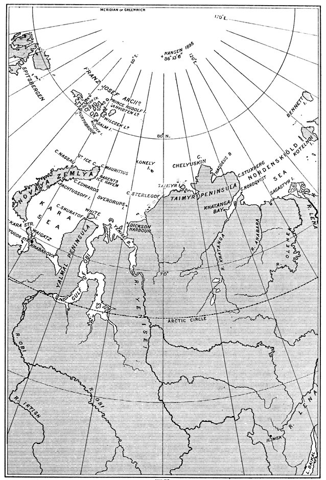
CAPE CHELYUSKIN
85It was chiefly from the land that the northern coast-line was surveyed by the Russians, whose Arctic work has been immense and thorough, though not marked by any striking discoveries. Cape Chelyuskin was first reached, in May, 1742, by the explorer whose name it bears, after a sledge journey from the Chatanga, he being at the time second in command to Khariton Laptef, whose first expedition in 1739 ended in the loss of his ship three hundred miles from his winter quarters, to which he had to travel on foot, losing twelve men by cold and exhaustion on the way. Within the preceding four years the survey of the coast west of it had been completed in four stages—from Archangel to Yalmal (that is Land's End); from Yalmal to the Obi; from the Obi to the Yenesei; from the Yenesei to Cape Sterlegof. In 1735 Pronchistschef, from the Lena, failed to round Cape Chelyuskin from the east, and returned to the Olenek to die but two days before his young wife, who was his companion on his perilous voyage. Two years afterwards Dmitri Laptef began his explorations east of the Lena which took him to Cape Baranoff, thus joining up to the discoveries of the sable-hunters made a century before, including those of Deschnef, who, in 1648, sailed from the Kolyma to Kamchatka and went through Bering Strait more than thirty years before Bering was born. Thus the route of the North-east Passage was known, although no man had travelled the whole way either by land or sea, before the task was undertaken by Nordenskiöld.
To begin with, Nordenskiöld made two voyages to the Yenesei. In the first voyage he left Tromsoe in the Proeven on the 14th of June, 1875, and reached what he named Dickson Harbour at the mouth of the Yenesei on the 15th of August. Sending back the Proeven, which returned through Matyushin Shar, he, with Lundstrom the botanist and Stuxberg the zoologist, and three walrus-hunters, embarked in a boat they had brought out with them and proceeded up the estuary into the river; and during the first six hundred 86miles they landed only twice. On the last day of the month they caught up a steamer on which they became passengers.
"We were yet," says Nordenskiöld, "far to the north of the Arctic Circle, and as many perhaps imagine that the little-known region we were now travelling through, the Siberian tundra, is a desert wilderness covered either by ice and snow, or by an exceedingly scanty moss vegetation, it perhaps may not be out of place to say that this is by no means the case. On the contrary, we saw snow during our journey up the Yenesei only at one place, in a deep valley cleft some fathoms in breadth, and the vegetation, especially on the islands which are overflowed during the spring floods, is distinguished by a luxuriance to which I have seldom seen anything comparable. Already had the fertility of the soil and the immeasurable extent and richness in grass of the pastures drawn forth from one of our walrus-hunters, a middle-aged man who is owner of a little patch of ground among the fells of Northern Norway, a cry of envy at the splendid land our Lord had given the Russian, and of astonishment that no creature pastured, no scythe mowed, the grass. Daily and hourly we heard the same cry repeated, and even in louder tones, when some weeks after we came to the grand old forests between Yeneseisk and Turuchansk, or to the nearly uninhabited plains on the other side of Krasnojarsk covered with deep black earth, equal without doubt in fertility to the best parts of Scania, and in extent surpassing the whole Scandinavian peninsula. This judgment formed on the spot by a genuine though 87illiterate agriculturist is not without interest in forming an idea of the future importance of Siberia."
In fact, Siberia is particularly rich in mineral and agricultural wealth, and this voyage, which opened up the route to and from Europe by the natural outlets to the north, was of such commercial promise that the explorer received for it the special thanks of the Russian Government. As, however, there were people who looked upon it as an exceptional voyage in an exceptional year, Nordenskiöld next season took another voyage to the river, this time in the Ymer, carrying the first instalment of merchandise so as to begin the trade; and he was followed in a few weeks by Captain Joseph Wiggins, in the Thames, whose subsequent voyages made the northern route well known.
Assured by the experience gained in these voyages that the North-east Passage was possible to a steam vessel of moderate size, Nordenskiöld, in 1878, was enabled to fit out the Vega, and sailed from Tromsoe on the 31st of July. Three other vessels accompanied her, two bound for the Yenesei, one for the Lena, the rendezvous being Khabarova. All went well. On the 9th of August the Fraser and Express proceeded up the Yenesei to discharge their cargoes and return to Europe in safety; next day the Vega and Lena left for the eastward, and, after some risky navigation among islands and through fog, lay for four days in Actinia Haven, between Taimyr Island and the mainland, vainly waiting for clear weather. Pushing on through fitful fog they sighted a promontory in the north-east gleaming in the sunshine, and rounding its western horn anchored in a bay open to the north and 88free from ice at the extremity of Cape Chelyuskin. With the rounding of the most northerly point of the Old World the first object of the expedition had been attained. The salute fired in honour of the event having frightened away the only polar bear who had stood watching the ship from the western horn, some of the party landed, the botanists to discover that all the plants of the peninsula had apparently been stopped on the outermost promontory when trying to migrate further north. The flora was not extensive—a few luxuriant lichens and twenty-three flowering plants, eight of them saxifrages, most of them with a tendency to form semi-globular tufts; the fauna consisted of the bear, a few seals, a walrus, two shoals of white whales, some ducks and geese, and a number of sandpipers. Not so long a list as was obtained at other landings, but by no means a bad one for the half-way house to the Pole.
After passing the cape the course was laid for the New Siberian Islands, but ice prevented progress in their direction beyond 77° 45´, the highest north of the voyage, and the ship had to work her way out by the route she went in, thus losing a day, which had serious consequences, though it proved the correctness of Nordenskiöld's theory that the water delivered by the Siberian rivers is, for a few months, of sufficiently high temperature to give a clear passage to vessels content to keep near the coast. On reaching the mouth of the Lena the ships parted company, Captain Johannsen taking the smaller steamer up the river as intended and bringing the news of the rounding of Cape Chelyuskin and the promise of the North-east 89Passage being accomplished in one season, which was not destined to be fulfilled.
Another attempt was then made by the Vega to reach the islands to the north, but after sighting the two most westerly of the group the shallow sea was too crowded with rotten ice, and an idea of landing on Liakhoff Island having to be given up for the same reason, the course was altered so as to take the ship round Svjatoi Nos (the Holy Cape), where in April, 1770, Liakhoff had noticed the mighty crowd of reindeer going south. Justly considering they must have come over the ice from some northern land, he went back on their tracks in a dog-sledge, discovering two of the most southerly islands, and obtaining from Catherine the Second as a reward the monopoly of hunting the foxes and collecting the ivory there from the fossil mammoths he found in abundance.
Forced to keep to the channel along the coast, which daily became narrower, the Vega reached Cape Chelagskoi, and when off this promontory Nordenskiöld saw the first natives during his voyage. Two boats built of skin almost exactly similar to the oomiaks, or women's boats, used by the Eskimos, came out to the ship, the men, women, and children in them intimating by shouts and gestures that they wished to come on board. The Vega was brought-to that they might do so, but as none of the Chukches could speak Russian and none of the Swedes knew Chukche, the interview was not so satisfactory as expected, though the universal language of pantomime with presents ensured a favourable termination.
On the 12th of September the Vega passed Irkaipii, 90the Cape North of Captain Cook, and by rounding it Nordenskiöld joined up with the westernmost limit of the Arctic discoveries of the great navigator. Cook tried to weather it in August, 1778, but was turned back by fog and snow, and thinking it was "not consistent with prudence to make any further attempts to find a passage into the Atlantic this year in any direction, so little was the prospect of succeeding," he sailed for Hawaii, where his intention of making the attempt the ensuing summer came to nought owing to his death.
On the 28th of September the Vega's progress for the year was arrested by her being frozen in for the winter on the eastern side of Kolyuchin Bay in the northernmost part of Bering Strait, only six miles of ice barring the way round Cape Serdze Kamen into the open sea. During her detention of two hundred and sixty-four days the scientific investigations of many kinds that were undertaken were of lasting importance, as they had been throughout, and when she was released on the 18th of July, 1879, to come home by way of Yokohama, the collections and records she brought with her were simply enormous. No better work with greater results was done by any Arctic expedition than during this successful voyage, which was too well managed to have much adventure. For it Nordenskiöld very justly claimed the reward of twenty-five thousand guilders offered in 1596 by the States-General of Holland, the endeavour to win which sent out Van Heemskerck, Barents, and Rijp.
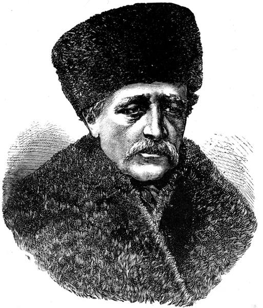
ADOLF ERIK NORDENSKIÖLD
91We have seen how the Dutchmen built their house at Ice Haven mainly of the driftwood from the Siberian rivers. Similar wood from probably the same source is found on the shores of Greenland and of almost all the northerly islands of the Arctic Ocean. Further, the Greenland flora includes a series of Siberian plants apparently from seeds drifted there by some current. Not only do trees and seeds travel by water from Asia westward to America; at Godthaab, for instance, on the western coast of Greenland, there was found a throwing-stick of a shape and ornamentation used only by the Alaskan Eskimos; and three years after the foundering of the Jeannette to the north of the New Siberian Islands there were found on the south-west coast of Greenland a number of articles in the drift-ice that must have come from the sunken vessel. For these and other reasons it seemed clear to Fridtjof Nansen that a current flowed at some point between the Pole and Franz Josef Land from the Siberian Arctic Sea to the Greenland coast, and so he set to work to organise his daring expedition to strike this current well to the eastward, trusting to its mercies to take him to or near the Pole.
In 1893, when the Fram rounded Cape Chelyuskin, Nansen had found the Kara Sea almost as open as Nordenskiöld had done, but had met with more difficulties among the islands off the Taimyr Peninsula. A famous vessel, the Fram, the first of her kind, built specially for the ice to take her where it listed in the hope that she would drift to discovery like the Tegetthoff, and not to disaster like the Jeannette. The general idea was Nansen's, the carrying out of the idea was Colin Archer's. As Nansen says: "We must gratefully recognise that the success of the expedition 92was in no small degree due to this man." Plan after plan did he make of the projected ship, model after model did he prepare and abandon before he was satisfied: and never was a ship more honestly built. With her double-ended deck plan, with a side of such curve and slope that under ice pressure she would be lifted instead of crushed between the floes, and with bow, stern, and keel so rounded off that she would slip like an eel from the embrace of the ice, she was of such solidity as to withstand any pressure from any direction. Her stem of three stout oak beams, one inside the other, was four feet in thickness, protected with iron; her rudder-post and propeller-post, two feet across, had on either side a stout oak counter-timber following the curvature upwards and forming a double stern-post, with the planking cased with heavy iron plates; and between these timbers was a well for the screw and another for the rudder, so that each could be hoisted on deck, the rudder with the help of the capstan coming up in a few minutes. Her frames, ten inches thick and twenty-one wide, stood close together, carrying three layers of planking, giving altogether a side of two feet or more of solid wood, so shored and stayed for strength that the hold looked like a thicket of balks, joists, and stanchions. With a length of 128 feet over all, a breadth of thirty-six, a depth of seventeen, and a displacement of 800 tons, she was quite a multum-in-parvo engined with a 220 horse-power triple expansion, so contrived that in case of accident or for any other cause the cylinders could be used singly or two together. Rigged as a three-masted fore-and-aft schooner, with the mainmast much 93higher than the others—it being unusually high, for the crow's-nest on the main-topmast was 102 feet above the water—she proved equal to the demands on her, though in her case strength and warmth had to be thought of before weatherliness and speed. But her speed was not so poor, for when steaming and sailing after leaving Cape Chelyuskin on the 10th of September she was doing her nine knots.
The day after she had entered the Nordenskiöld Sea came a walrus-hunt, so graphically described by Nansen that we must find room for an extract. "It was," he says, "a lovely morning—fine, still weather; the walruses' guffaw sounded over to us along the clear ice surface. They were lying crowded together on a floe a little to landward of us, blue mountains glittering behind them in the sun. At last the harpoons were sharpened, guns and cartridges ready, and Henriksen, Juell, and I set off. There seemed to be a slight breeze from the south, so we rowed to the north side of the floe, to get to leeward of the animals. From time to time their sentry raised his head, but apparently did not see us. We advanced slowly, and soon were so near that we had to row very cautiously. Juell kept us going, while Henriksen was ready in the bow with a harpoon, and I behind him with a gun. The moment the sentry raised his head the oars stopped, and we stood motionless; when he sank it again, a few more strokes brought us nearer. Body to body they lay, close-packed on a small floe, old and young ones mixed. Enormous masses of flesh they were. Now and again one of the ladies fanned herself by moving one of her flippers backwards and forwards 94over her body; then she lay quiet again on her back or side. More and more cautiously we drew near. Whilst I sat ready with the gun, Henriksen took a good grip of the harpoon shaft, and as the boat touched the floe he rose, and off flew the harpoon. But it struck too high, glanced off the tough hide, and skipped over the backs of the animals. Now there was a pretty to do! Ten or twelve great weird faces glared upon us at once; the colossal creatures twisted themselves round with incredible celerity, and came waddling with lifted heads and hollow bellowings to the edge of the ice where we lay. It was undeniably an imposing sight; but I laid my gun to my shoulder and fired at one of the biggest heads. The animal staggered and then fell head foremost into the water. Now a ball into another head; this creature fell, too, but was able to fling itself into the sea. And now the whole flock dashed in, and we, as well as they, were hidden in the spray. It had all happened in a few seconds. But up they came again immediately round the boat, the one head bigger and uglier than the other—their young ones close beside them. They stood up in the water, bellowed and roared till the air trembled, threw themselves forward towards us, then rose up again, and new bellowings filled the air. Then they rolled over and disappeared with a splash, then bobbed up again. The water foamed and boiled for yards around—the ice-world that had been so still before seemed in a moment to have been transformed into a raging Bedlam. Any moment we might expect to have a walrus tusk or two through the boat or to be heaved up or capsized. Something of this kind 95was the very least that could happen after such a terrible commotion. But the hurly-burly went on and nothing came of it."
The Fram had to follow the coast owing to the thick pack barring the way across the sea. The mouth of the Chatanga was passed, then that of the Olenek, and then the influence of the warm water of the Lena being apparent by the clearance of the floes, the course was laid straight for the Pole in open water until 77° 44´ was reached, when, checked by the long compact edge of ice shining through the fog, the route became north-westerly until they stopped for fear they should get near land, which was the very thing they wished to avoid; and on the 25th of September in about 78½° north latitude—north-west of Sannikof Land—they were frozen in.
Preparations for wintering began. The rudder was hauled up, the engine was taken to pieces, each separate part oiled and laid away with the greatest care—for Amundsen looked after it as if it were his own child—a carpenter's shop was started in the hold, a smithy arranged first on deck and then on the ice. But it all had to be replaced, even the engine put together again, for the pack cleared away for a brief period, to return, when again the shiftings were made; and when the windmill was put up to drive the dynamo, the winter installation was in all senses complete.
Slowly the Fram drifted in her ice-berth, so slowly that at the end of twelve months she had moved from point to point only 189 miles, having returned no further west than the longitude of the Olenek; her highest north, attained on the 18th of June, being 9681° 46´. In the main the drift was north-westerly, but three times it had boxed the compass in irregular loops, the only constant thing about it being that, in no matter what direction she was taken, the bow of the Fram always pointed south. Of grips she had many, some of the pressures were enormous, once they were severe enough to suggest measures for her abandonment, but she survived them all unscathed. Early in the drift it became apparent that the ice was packing twice and slacking twice in every twenty-four hours, and in this sea, as afterwards in the Atlantic area, the influence of the tides, particularly the spring tides, was unmistakable—as it was expected it would be—though in the deep Polar basin the wind had more effect; and, in truth, the wind was a factor throughout in the packing of the ice and in the drift's direction. One thing was clear, that the current was not taking the Fram across the North Pole, but about half-way between it and Spitsbergen; and if the Pole was to be reached some of the expedition must attempt to get there over the ice. This meant leaving the ship, going north, and returning to the nearest known land, for, owing to the irregularity of the drift, it was hopeless to think of again reaching the Fram. During the second winter the route of the ship trended more to the north, and, after a loop all round in January, she reached 84° 4´ on the 14th of March in the longitude of Cape Chelyuskin. Here Nansen and Lieutenant F. H. Johansen, who rather than not join the Fram had shipped in her as stoker, left the ship with three sledges, two kayaks, and twenty-eight dogs to go as far northward as they could, their expectation being that they would reach the Pole in fifty days. Had they remained in the ship until November they would have saved themselves trouble, for, as matters turned out, the embarrassing drift took the Fram within eight miles of the farthest north they attained after twenty-three days of strenuous endeavour.
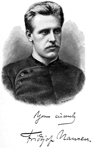
97The ice, fairly easy for a few days, soon became terrible in the difficulties it offered to progress over it, and the continual toil of hauling and carrying the sledges, and righting them when capsized, soon told on the two men to such an extent as to tire them out so thoroughly that sometimes in the evening they fell asleep as they went along. The cold, too, proved singularly searching and severe. During the course of the day the damp exhalations of the body little by little became condensed in their outer garments, which became transformed into suits of ice-armour, so hard that if they could have been got off they could have stood by themselves, and they crackled audibly at every movement. The clothes were so stiff that the sleeve of Nansen's coat rubbed deep sores in his wrist, one of which got frost-bitten, the wound growing deeper and deeper and nearly reaching the bone. "How cold we were," says Nansen, "as we lay there shivering in the bag, waiting for the supper to be ready! I, who was cook, was obliged to keep myself more or less awake to see to the culinary operations, and sometimes I succeeded. At last the supper was ready, was portioned out, and, as always, tasted delicious. These occasions were the supreme moments of our existence, moments to which we looked forward all day long. But sometimes we were so weary that our eyes closed, and we 98fell asleep with the food on its way to our mouths. Our hands would fall back inanimate with the spoons in them and the food fly out on the bag."
The further they went the worse became the conditions. On the 8th of April, with ridge after ridge and nothing but rubble to travel over, the work became so disheartening that Nansen went on ahead on his skis and from the highest hummocks viewed the state of affairs; and as far as the horizon, lay a chaos of such character that progress across was impracticable if he and Johansen were to return alive. Here, then, they stopped, this being their northernmost limit, 128 miles from the Fram, 260 miles from the Pole, latitude 86° 13·6´, longitude 95°.
To reach this point they had been travelling north-westwards for six days, the way due north being impassable; but on turning south they seemed to enter another country; so much did the going improve after the first mile that in three days they covered over forty miles. They were making for Petermann Land, which does not exist, or for the wide-stretching Franz Josef Land, also placed on the maps by Payer, which Jackson had been cutting up into fragments while the Fram was in the ice. Further south difficulties thickened ahead of them till the road became almost as bad as that to the north. Before they reached land the hundred days they had allowed themselves had increased to more than half as many again, their dogs had been killed one by one to yield food for the rest, until only two remained; Nansen was helpless with rheumatism for two days; and Johansen was nearly killed by a bear. Through a chain of disasters caused by storms 99and fogs and snow and the state of the ice, they threaded their way, sometimes by sledge, sometimes by kayak, through mazes of open channels, leaping from floe to floe and ferrying back to get their baggage over, hundreds of yards on mere brash, dragging the sledges after them in constant fear of their capsizing into the water. Then the ice gave out and, taking to their kayaks, they sailed and paddled to what is now known as Frederick Jackson Island in the north of the Franz Josef Archipelago.
Here they wintered, quite at a loss at first to know where they were, owing to their watches having run down during a great effort of thirty-six hours at a stretch, so that they did not know their longitude, though they subsequently concluded they must be somewhere on Franz Josef Land within 140 miles of Eira Harbour. They built a hut and altogether lived passably well, there being no lack of food, thanks mainly to the bears, whose visits were embarrassing in their frequency though the visitors were not unwelcome when they came to stay.
On the 19th of May they set out for the south, down British Channel, with their sledges and kayaks, and five days afterwards, when off Cape M'Clintock, while Johansen was busy lashing the sail and mast securely to the deck of his kayak to prevent their being blown away, Nansen went on ahead to look for a camping ground and fell through a crack in the ice which had been hidden by the snow. He tried to get out, but with his skis firmly fastened could not pull them up through the rubble of ice which had fallen into the water on the top of them, and, being harnessed to the 100sledge, he could not turn round. Fortunately, as he fell, he had dug his staff into the ice on the opposite side of the crack, and holding himself up with its aid, and the arm he had got over the edge of the ice, he waited patiently for Johansen to come and pull him out. When he thought a long time had passed and felt the staff giving way and the water creeping further up his body, he called out but received no answer; and it was not until the water had reached his chest that Johansen came and pulled him out.
For a few days they were storm-bound. On the 3rd of June they started again down the channel, their whereabouts still a mystery to them, nothing in the least like it being on their map. Nine days afterwards, after rounding Cape Barents on Northbrook Island, the kayaks, which had been left moored to the edge of the ice, got adrift. Nansen, running down from the hummock, from which he had been looking round, threw off some of his clothes and sprang into the water. The wind was off the ice, and the kayaks with their high rigging were moving away as fast as he could swim. It seemed more than doubtful if he could reach them. But all their hope was there, all they had was on board; they had not even a knife with them, and whether he sank or turned back amounted to much the same thing. When he tired he turned over and swam on his back, and then he could see Johansen walking restlessly up and down on the ice, unable to do anything, and having the worst time he ever lived through. But the wind lulled, and when Nansen turned over he saw he was nearing the kayaks, and though his limbs were stiffening and 101losing all feeling, he put all the strength he could into his strokes, and eventually was able to reach them. He tried to pull himself up, but was so stiff with cold that he could not do so. For a moment he thought he was too late; but after a little he managed to swing one leg up on to the edge of the sledge, which lay on the deck, and in this way he scrambled on board. The kayaks were lashed together so as to form a double boat, and the only way in which, owing to his stiffness, he could paddle them was to take one or two strokes on one side and then step into the other kayak and take a few strokes on the other side. The return was consequently slow, but it was a return, though the ice was reached a long way from where the drifting had begun.
Next day but one came another perilous episode. "Towards morning," says Nansen, "we rowed for some time without seeing any walrus, and now felt more secure. Just then we saw a solitary rover pop up a little in front of us. Johansen, who was in front at the time, put in to a sunken ledge of ice; and although I really thought that this was caution carried to excess, I was on the point of following his example. I had not gone so far, however, when suddenly the walrus shot up beside me, threw himself on to the edge of the kayak, took hold further over the deck with one flipper, and as it tried to upset me aimed a blow at the kayak with its tusks. I held on as tightly as possible, so as not to be upset into the water, and struck at the animal's head with the paddle as hard as I could. It took hold of the kayak once more and tilted me up so that the deck was almost under water, then let go and raised itself 102right up. I seized my gun, but at the same moment it turned round and disappeared as quickly as it had come. The whole thing had happened in a moment, and I was just going to remark to Johansen that we were fortunate in escaping so easily from that adventure, when I noticed that my legs were wet. I listened, and now heard the water trickling into the kayak under me. To turn and run her in on to the sunken ledge of ice was the work of a moment, but I sank there. The thing was to get out and on to the ice, the kayak filling all the time. The edge of the ice was high and loose, but I managed to rise; and Johansen, by tilting the sinking kayak over to starboard, so that the leak came above the water, managed to bring her to a place where the ice was low enough to admit of our drawing her up. All I possessed was floating about inside, soaked through. So here we lie, with all our worldly goods spread out to dry and a kayak that must be mended before we can face the walrus again. It is a good big rent that he has made, at least six inches long; but it is fortunate that it was no worse."
The kayak was mended, and, after a long rest, it was past noon on the 17th of June when Nansen turned out to prepare breakfast. After doing so he went up on a hummock to look around. Flocks of little auks were flying overhead, and, amid the confused noise of their calls, he heard a couple of barks from a dog. Thinking he was mistaken he waited for a time, and then the barking was unmistakable, bark after bark, one of a deeper tone than the other. He shouted to Johansen, who started up from the sleeping-bag incredulous. 103The sound ceased, and, breakfast over, Nansen went forth to investigate. Soon he came on the footprints of a dog or wolf, and then, still doubting, he heard a distant yelping that certainly came not from a wolf. Making his way among the hummocks, he heard a shout from a human voice, a strange voice—the first for three years. Running up on to a hummock he shouted with all his might. Back came a shout in reply; and among the hummocks he caught sight of a dog, and further off a man walked into view. The man spoke to the dog in English. Thinking he recognised Jackson, Nansen raised his hat as he met him, and they shook hands heartily.
The contrast could not have been greater. One the well-groomed, civilised European in a check suit and rubber water-boots, the other in dirty rags black with oil and soot, with long matted hair and shaggy beard, and a face in which the complexion was undiscernible through the accumulations which a winter's endeavours, including scrapings with a knife, had failed to remove. As they talked they had turned to go inland. Suddenly Jackson stopped, and, looking the new arrival straight in the face, said—
"Aren't you Nansen?"
"Yes, I am."
"By Jove! I'm damned glad to see you."
And seizing his hand he shook it again, his whole face beaming with a smile of welcome and delight at the unexpected meeting; and needless to say, both Nansen and Johansen received the warmest of welcomes from all at Elmwood. The Windward was then on her way, and when she arrived the two Norsemen 104from the farthest north went in her to Vardoe, where they landed on the 13th of August.
Meanwhile the Fram had continued her leisurely drift, north-west, south-west, north-west, west, then all round the compass, still with her head pointing south, until on the 15th of November she reached 85° 55·5´ in longitude 66° 31´, thus giving Captain Otto Sverdrup the honour of attaining the highest north in a ship. Another winter was passed in her ice-berth, during which she moved westerly. In February came another complete triangle in her course, after which she went south-west, and on the 16th of May turned due south. Then, in the later days of the month with the southerly drift continuing and open water on ahead, Sverdrup resolved to set her free by mines, and on the 3rd of June, as a result of the blastings, she gave a lurch, settled a little deeper at the stern and moved away from the edge of the ice until the hawsers tautened. But, though she was afloat, the ice around still kept her captive, and in the pool she drifted straight towards Spitsbergen.
Again and again was steam got up and endeavour made to break a way out, but day after day elapsed, and it was not until the 13th of August that she passed through the last floes into open water, and her thirty-five months of imprisonment came to an end. Making for Danes Island in Spitsbergen, she was there boarded by Andrée, who was then preparing for his disappearance in the balloon voyage to the Pole. Going on direct to Skjervoe in Norway, Sverdrup landed at two o'clock in the morning to wake up the telegraphist, who told him that Nansen had reached Vardoe a week 105before and was then at Hammerfest and probably leaving for Tromsoe. For Tromsoe Sverdrup started, after telegraphing to Nansen. And there, at four o'clock in the afternoon of the 25th of August, 1896, Sir George Baden-Powell's yacht Otaria, with Nansen and Johansen on board, glided alongside the Fram, the good little ship looking much weather-beaten though none the worse for such a task of strength and endurance as had been set no other in the story of the sea.
Discovery of the Siberian Islands—Hedenström—Anjou and Wrangell—Migration of reindeer—Animals and plants of the tundra—The northward migration of the native tribes—The voyage of the Jeannette—Her drift in the pack—Jeannette Island—Henrietta Island—The ship crushed and sunk—Landing on Bennett Island—The boat voyage—The boats separate in a storm—De Long lands on the Lena Delta—Nindemann and Noros in search of assistance—Safety of the whale-boat—Fate of De Long and his companions—Baron Toll's discoveries.
The Siberian Islands, lying north of the delta of the Lena, answer to the Parry Islands on the American side, the two groups being separated by that wide stretch of the Arctic Ocean communicating with the Pacific through Bering Strait. At first the Asiatic group was officially named after Liakhoff, then it was called after the unwisely named New Siberia, but, under any designation, it took half a century to find the different islands, and considerably more to land on them.
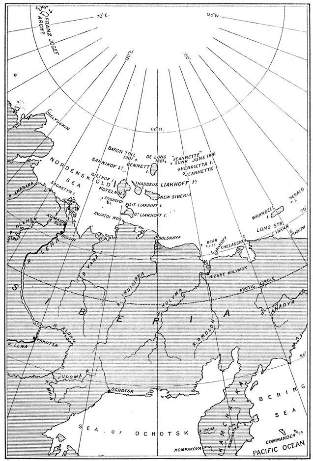
THE LENA DELTA
107When Liakhoff discovered the one named after him by the Empress Catherine, he also went north to Moloi, and he seems to have visited Kotelnoi to the north-west. In 1775 Chvoinof was sent to survey these three, but he devoted most of his attention to Liakhoff Island—fifty miles across—which he found to consist, as reported, of hills of granite rising from a mass of mammoth bones, sand, and ice, some of the ice ancient enough to carry a deep covering of moss. Though he stated that other islands could be made out in the distance, nothing was done to verify his discoveries, real or imaginary, until thirty years had passed, when Thaddeus and Stolbovoi were reached. Next year (1806) New Siberia, to the eastward, was discovered by Sirovatskof, and two years afterwards Bjelkof was added to the southerly portion of the archipelago.
In 1809 Hedenström, assisted by Sannikof, began his series of surveys extending over all these, and cleared up much of the mystery concerning them. From Thaddeus, Sannikof sighted, away to the northward, what is now known as Bennett Island; and, from New Siberia, Hedenström sighted Henrietta and Jeannette Islands, and set out for them, and would have reached them had his sledges not been stopped by open water. Like his predecessors he was astonished at the mammoth remains on Liakhoff Island.
According to his account, "these bones or tusks are less large and heavy the further we advance towards the north, so that it is a rare occurrence on the islands to meet with a tusk of more than 108 lbs. in weight, whereas on the continent they are said often to weigh as much as 432 lbs. In quantity, however, these bones increase wonderfully to the northward, and as Sannikof expresses himself, the whole soil of the first of the Liakhoff Islands appears to consist of them. For about eighty years the fur-hunters have every year brought large cargoes from this island, but as yet there is no sensible diminution of the stock. The tusks on the islands are also much more fresh and 108white than those on the continent. A sandbank on the western side was most productive of all, and the fur-hunters maintain that when the sea recedes after a long continuance of easterly winds, a fresh supply of mammoth bones is always found to have been washed from this bank, proceeding apparently from some vast store at the bottom of the sea." Besides these multitudinous remains of the mammoth Hedenström found numerous remains of rhinoceros, the horn of which was then thought to be a bird's claw three feet long.
To clear up the wide discrepancies in the maps the Emperor Alexander, in 1820, equipped two expeditions to proceed by land to the northern coast of Siberia and properly survey it, the work to be carried as far east as Cape Chelagskoi, whence a sledge party was to start for the north in search of the inhabited country reported to exist in the Polar Sea in that direction. One of these expeditions, under Lieutenant P. F. Anjou, was to commence its operations from the mouth of the Yana; the other, under Lieutenant Ferdinand Vrangel' (or, as he is generally known amongst us, Wrangell or Von Wrangell), was to start from the mouth of the Kolyma, his chief assistant being Midshipman Matiuschkin. Both parties did good survey work, but neither made any striking discovery. Anjou reached 76° 36´ to the north of Kotelnoi; Wrangell reached 72° 2´ (north-east of the Bear Islands, one hundred and seventy-four miles out on the sea from the great Baranoff rock), beyond which progress was impossible owing to the thinness of the ice, which was covered with salt water.
Wrangell had many perilous experiences. In his 109fourth journey over the sea the ice broke up around him and he found himself on a floe with a labyrinth of water lanes hemming him in on every side and a storm coming on from the westward. The storm rapidly increased in fury, and the masses of ice around him were soon dashing against each other and breaking in all directions. On the floe, which was tossing to and fro on the waves, he gazed in painful inactivity on the conflict, expecting every moment to be swallowed up. For three long hours he had remained unable to move, the mass of ice beneath him holding together, when it was caught by the storm and hurled against a large field of ice. The crash was terrific, as it was shattered into little pieces. At that dreadful moment, when escape seemed impossible, he was saved by the impulse of self-preservation. Instinctively the party sprang on to the sledges and urged the dogs to full speed, and as hard as they could gallop they skimmed across the yielding fragments to the field on which they had been stranded, and safely reached a stretch of firmer ice, where the dogs ceased running among the hummocks, conscious that the danger was past.
But it is not so much for adventures like this that his account of his work is of continuing interest as for the abundance of its notes and reflections on the country and its life and climate. Once, for instance, when on the Baranicha he was fortunate enough to witness a migration of reindeer. "I had hardly finished the observation," he says, "when my whole attention was called to a highly interesting, and to me a perfectly novel, spectacle. Two large migrating bodies of reindeer passed us at no great distance. They were descending 110the hills from the north-west and crossing the plain on their way to the forests, where they spend the winter. Both bodies of deer extended further than the eye could reach, and formed a compact mass, narrowing towards the front. They moved slowly and majestically along, their broad antlers resembling a moving wood of leafless trees. Each body was led by a deer of unusual size, which my guides assured me was always a female. One of the herds was stealthily followed by a wolf, who was apparently watching for an opportunity of seizing any one of the younger and weaker deer which might fall behind the rest, but on seeing us he made off in another direction. The other column was followed at some distance by a large black bear, who, however, appeared only intent on digging out a mouse's nest every now and then, so much so that he took no notice of us. We had great difficulty in restraining our two dogs, but happily succeeded in doing so; their barking, or any sound or motion on our part, might have alarmed the deer, and by turning them from their course, have proved a terrible misfortune to the hunters, who were awaiting their passage, on which they are entirely dependent for support. We remained for two hours whilst the herds of deer were passing by, and then resumed our march."
The way in which the deer are dealt with by the hunters was seen by Matiuschkin when despatched by Wrangell to survey the Anyui. "The true harvest, which we arrived just in time to see, is in August or September, when the reindeer are returning from the plains to the forests. They are then healthy and well fed, the venison is excellent, and as they have just 111acquired their winter coats the fur is thick and warm. The difference of the quality of the skins at the two seasons is such, that whilst an autumn skin is valued at five or six roubles, a spring one will only fetch one or one and a half roubles. In good years the migrating body of reindeer consists of many thousands; and though they are divided into herds of two or three hundred each, yet the herds keep so near together as to form only one immense mass, which is sometimes from thirty to seventy miles in breadth. They always follow the same route, and in crossing the river near Plotbischtsche, they choose a place where a dry valley leads down to the stream on one side, and a flat sandy shore facilitates their landing on the other side. As each separate herd approaches the river, the deer draw more closely together, and the largest and strongest takes the lead. He advances, closely followed by a few of the others, with head erect, and apparently intent on examining the locality. When he has satisfied himself, he enters the river, the rest of the herd crowd after him, and in a few minutes the surface is covered with them. Then the hunters, who have been concealed to leeward, rush in their light canoes from their hiding-places, surround the deer, and delay their passage, whilst two or three chosen men armed with short spears dash into the middle of the herd and despatch large numbers in an incredibly short time; or at least wound them so, that, if they reach the bank, it is only to fall into the hands of the women and children. The office of the spearman is a very dangerous one. It is no easy thing to keep the light boat afloat among the dense crowd of swimming deer, which, moreover, 112make considerable resistance; the males with their horns, teeth, and hind legs, whilst the females try to overset the boat by getting their fore-feet over the gunwale; if they succeed in this the hunter is lost, for it is hardly possible that he should extricate himself from the throng; but the skill of these people is so great that accidents very rarely occur. A good hunter may kill a hundred or more in less than half an hour. When the herd is large, and gets into disorder, it often happens that their antlers become entangled with each other; they are then unable to defend themselves, and the business is much easier. Meanwhile the rest of the boats pick up the slain and fasten them together with thongs, and every one is allowed to keep what he lays hold of in this manner. It might seem that in this way nothing would be left to requite the spearmen for their skill, and the danger they have encountered; but whilst everything taken in the river is the property of whoever secures it, the wounded animals which reach the bank before they fall, belong to the spearman who wounded them. The skill and experience of these men are such that in the thickest of the conflict, when every energy is taxed to the uttermost, and their life is every moment at stake, they have sufficient presence of mind to contrive to measure the force of their blows so as to kill the smallest animals outright, but only to wound the larger and finer ones, so that they may be just able to reach the bank. Such proceeding is not sanctioned by the general voice, but it seems nevertheless to be almost always practised. The whole scene is of a most singular and curious character, and quite indescribable. The throng of thousands of swimming reindeer, the sound produced by the striking together of their antlers, the swift canoes dashing in amongst them, the terror of the frightened animals, the danger of the hunters, the shouts of warning advice or applause from their friends, the blood-stained water, and all the accompanying circumstances, form a whole which no one can picture to himself without having witnessed the scene."
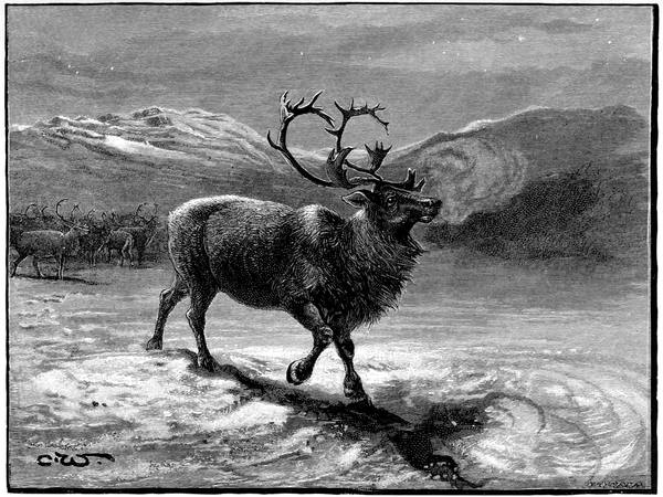
REINDEER
113The tundra has no more characteristic animal than the reindeer. Over the mossy hillocks and the matted tops of the dwarf birches he runs, or through the rivers and lakes he swims, with his broad-hoofed, spade-like feet never at a loss to find a footing. In the long winter he is protected by his thick skin against the influence of the cold, and is seldom at starvation point, as he digs for food in the deepest snow, and is by no means particular what he eats; and in the short summer he is in luxurious ease, for the tundra, as we have seen, is not always as bad as it is painted. In exposed places near the coast it is little else than gravel beds interspersed with patches of peat and clay, with scarcely a rush or a sedge to break the monotony, but by far the greater part of it is a gently undulating plain, broken up by lakes, rivers, swamps, and bogs; the lakes with patches of green water-plants, the rivers flowing between sedges and rushes, the swamps the breeding haunts of ruffs and phalaropes, the bogs dotted with the white fluffy seeds of the cotton-grass. Almost everywhere the birds are in noticeable numbers, among the commonest being the golden plover (who wears the tundra colours), the bluethroat, the fieldfare, the whooper swan, and the 114ducks and divers—particularly the divers—and, among the birds of prey, the falcons and the rough-legged buzzards, which, with the owls, find such abundant provision in the lemmings that migrate in myriads compared with which the reindeer troops are insignificant.
"The groundwork of all this variegated scenery," says Seebohm, "is more beautiful and varied still—lichens and mosses of almost every conceivable colour, from the cream-coloured reindeer-moss to the scarlet-cupped trumpet-moss, interspersed with a brilliant alpine flora, gentians, anemones, saxifrages, and hundreds of plants, each a picture in itself, the tall aconites, both the blue and yellow species, the beautiful cloudberry, with its gay white blossom and amber fruit, the fragrant Ledum palustre and the delicate pink Andromeda polifolia. In the sheltered valleys and deep water-courses a few stunted birches, and sometimes large patches of willow scrub, survive the long severe winter, and serve as cover for willow-grouse or ptarmigan. The Lapland bunting and red-throated pipit are everywhere to be seen, and certain favoured places are the breeding-grounds of plovers and sandpipers of many species. So far from meriting the name of Barren Ground, the tundra is for the most part a veritable paradise in summer. But it has one almost fatal drawback—it swarms with mosquitoes."
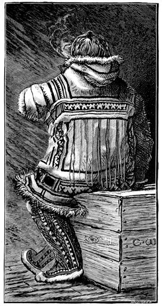
OSTIAK MAN
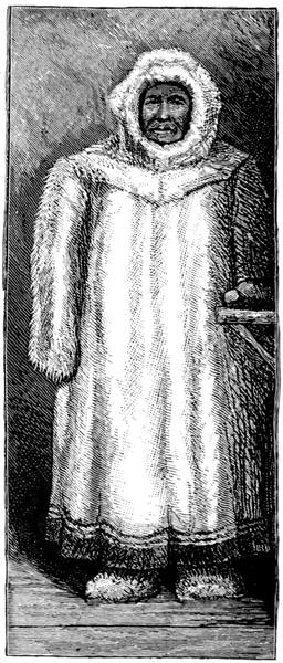
SAMOYED MAN
115The beauty of the tundra is, however, transient and skin deep; it is only such plants as can live in the soil that thaws that survive. Wherever the ground is dug into, ice is sure to be reached; in fact, it may be said that ice is one of the rocks of the subsoil, and in some places these strata of ice that never melts have been found to be three hundred feet thick—ice that has remained in block since the mammoths got into cold storage in it ages ago, for otherwise they would not have lasted intact in skin and flesh as many have done, like the very first discovered in a complete state, that chipped out by Adams in 1807.
In such a climate, whose winter terrors are only too prominent, all along the north of Siberia live the ancient peoples driven towards the sea by those mighty movements from the land of the Turk and Mongol which, north and south, east and west, flooded Europe and Asia with invaders—Ostiaks and Samoyeds west of Chelyuskin; Yakuts, Chukches, and others to the east of it, the descriptions of whose unpleasant manners and customs appear to be written with a view to showing how curiously local are the laws of health. One may well ask, as Wrangell did, why they should remain in so dreary a region and take life so contentedly. And the answer may be that they might go further north and fare worse, as their predecessors in the eastern section would seem to have done. Once, according to the legend, there were more hearths of the Omoki on the shores of the Kolyma than there are stars in the clear sky, and these Omoki, or some other departed race, appear to have left as their traces the remains of the timber forts and the tumuli that are found on the coast, especially near the Indiyirka, and the huts of earth and stones and bones found all along from Chelagskoi to the straits, similar remains of a departed people now existing in the Parry Islands, over a thousand miles away. 116According to another legend of more recent date, there was an intervening land, the land that Wrangell went to seek and the Jeannette went to winter at, and the supposed site of which she drifted through, in her last and longest imprisonment in the ice.
The Jeannette was the old Pandora, bought from Sir Allen Young by James Gordon Bennett, and accepted by and fitted out, officered, and manned under the orders of the Navy Department of the United States, her commander being Lieutenant George Washington De Long. She left San Francisco on the 8th of July, 1879, and two months afterwards had been run into the pack and was fast in the ice off Herald Island, drifting to her doom. Her route, in the main, was north-westerly, with many complicated loops, at first at the rate of half a mile a day, then at two miles, then at three, showing that the current from Bering Strait had been reinforced by some other current as she went further west, and, from its direction, there seemed to be land to the northward which was never sighted.
Wrangell Land, passed to the south, proved to be not a continent but a small island. No other land was seen for a monotonous twenty months, and then, in May, 1881, the ship drifted, stern first, past that sighted by Hedenström from New Siberia, which was found to consist of two islands, to be henceforth known as Jeannette and Henrietta. On the 12th of June, in latitude 77° 14´ 57˝, the Jeannette was crushed and sank, her fore yardarms breaking upwards as she slipped down through the rift in the pack, and a start was made for the Siberian Islands over the ice; but the 117drift had taken the party to 77° 36´, before they got on their proper course, and after a most laborious journey, lasting up to the 28th of July, they were safe ashore on the land sighted by Sannikof from Thaddeus, which De Long named Bennett Island.
Bennett Island was left on the 7th of August, the party of thirty-three being in three boats, thirteen under De Long in the first cutter, ten under Lieutenant Chipp in the much smaller second cutter, and ten, under Engineer George W. Melville, whose skill and resourcefulness had been conspicuous throughout, were given the whale-boat, the most suitable of the three. Sail was made for Thaddeus Island, which was reached in safety; after a halt of some days it was left on the 31st of August. Then Kotelnoi Island was reached and rested at; then the boats made for Semonovski, which was left on the 12th of September.
The same day a gale came on in which the first cutter had great difficulty in keeping afloat, the second cutter disappeared never to be heard of again, and the whale-boat, behaving excellently, went off before the wind straight for the continent to reach in safety one of the eastern mouths of the Lena, up which Melville arrived at a Russian village on the 26th of September. De Long's party ran their boat aground in shallow water, on the 17th of September, and rafted and waded ashore to one of the most inhospitable spots on the globe. Heavily laden they made their way down the dreary delta, toiling through the snow, delayed by the tributaries which were not frozen over hard enough to bear, hampered by sickness and disablement, and finally dying one by one of starvation.
118On the 9th of October De Long sent two of the seamen, Nindemann and Noros, ahead in search of relief. They had no food but what they could find, and on the second day out their dinner consisted of a little willow tea and a burnt boot sole. Next morning they burnt another sole of a boot, and they spent the day struggling through a morass in drifting snow, crossing streams of all sizes, and halting for the night in so high a wind that they were unable to light a fire and took refuge in a hole in the snow from which they emerged with difficulty in the morning, owing to the wind having piled up the snow against the opening. At the end of the third day they reached a deserted hut in which were some deer bones, which they grilled and tried to eat, and in the morning a gale was blowing and the wild drifting snow was so thick that they had to remain where they were and continue their diet of charred bones and willow tea.
Next day, Thursday, the 13th of October, they began against a strong head wind. In the afternoon they sighted a hut on the west bank of the river. "They had seen one in the morning, but had in vain attempted to cross the ice to it. Now they tried to reach this, but were turned back by the brittle ice. They kept it in sight as they moved southward, and made another attempt to cross the ice, but it broke and they came back. Then they saw that there was no further progress possible to the southward on that side of the water, and they returned to the ice. It broke again, but they kept on. They went in up to their waists, but managed to pull themselves up on the stronger ice." The wind was blowing against them 119and the ice was like glass, so that they were driven back. They looked about for ice which had been roughened by the ripples beneath, and finding some they succeeded at length in reaching the other side, where were two wooden crosses beneath a bank, which rose fifty feet above them. They pulled themselves up the bank, but when they came to the hut which they had kept in sight they found it a ruin nearly full of snow. "While Noros was trying to make a place in it for shelter, Nindemann saw a black object farther along to the south and went to it. It was a small peaked hut without a door, but large enough to hold two men. There were some fresh wood shavings outside the hut and higher up on the hill two boxes. On going to them Nindemann found them old and decayed, and he began to break one of them open. When he had ripped off the top he discovered that there was another box enclosed; breaking into it he found a dead body, and hastily left it. Doubtless the two crosses below on the river bank were memorials of the two beings left high up above the reach of the floods."
In the small hut they found a sort of floor, the boards of which they pulled up for firewood, and in a hole beneath was a box in which were a couple of fish and two fish heads; and, as these were discovered, a lemming came out of another hole and was promptly caught. On the lemming, roasted on the ramrod, and the fishes, which were so decayed that they dropped apart as they were handled, they made their meal for that day. Next day the snowstorm was so heavy that they were driven back here after striving in vain to make headway. On the Saturday, still without food, 120they rested for the night in a fissure in the river bank, where as a last resource Nindemann cut a piece off his sealskin trousers and soaked it in water and burnt it to a crust. Their breakfast consisted of the remains of this toasted sealskin. During the day they saw a crow flying across the river and in among the hills, and, as the crow in these regions is rarely found away from the haunts of men, Nindemann decided to cross the river in the hope of meeting with either natives or game on the other side. When darkness came on no shelter was discoverable, and so, after a meal of more sealskin and hot water, they went to rest in a hole in the snow. Next day, during which they recrossed the river, their experiences were similar and the end the same.
On Tuesday the 18th, after a terrible day, they came upon a hut with a pile of wood close by, which proved to be sledges, and these they broke up, as there was no other firing. Next day as they were struggling on they reached a place where there were three huts, in one of which was a half-kayak and in it was some blue mouldy fish; and here, attacked by dysentery, they remained until the Saturday, unable to go any further. About noon there was a noise outside like a flock of geese sweeping by. Nindemann, looking through the crack of the door, saw something moving which he took to be a reindeer, and was going out with his rifle when the door opened and a man entered, who promptly fell on his knees when he caught sight of the gun. Nindemann threw the rifle into a corner and, trying to make friends with the man by signs, offered him some of the fish, which the man by an emphatic gesture pronounced not fit to eat. After some more of the sign 121language it was clear that the native had no food with him, and holding up three or four fingers to show that he would return in so many hours or days he drove off. About six o'clock in the evening, while they were preparing their fish dinner, the visitor returned with two other men, one of whom brought in a frozen fish which he skinned and sliced, and while the sailors were eating it—the first healthy meal they had had for weeks—the natives invited them to accompany them, and brought in deerskin coats and boots and finally got them into the sledges and drove off to the westward for about fifteen miles. Here there were two tents, and Nindemann was taken into one, Noros into the other, and both were well looked after, the natives doing their very best to get them well.
This was intelligible on both sides, for the language of kindness is universal, but as the sailors knew not the language of their hosts, and the natives knew not the language of their guests, the difficulty of being understood by each other was great, and the delivery of the urgent message in signs was almost impossible. Nindemann did his best; he appealed to the man who seemed to be the head of the party, and drawing in the snow a map of the places where he had been, with every combination of signs he could think of, he tried to explain what he wanted. That he succeeded to a certain extent was clear, though he did not think so at first, for the natives loaded up their sledges, twenty-seven in number, with reindeer meat and skins and fish, and struck their tents, and, with over a hundred head of deer harnessed up, started for the south. At noon, when the deer were resting, the man for whom the 122map had been drawn in the snow took Nindemann to where he could show him a prominent landmark, and asked by signs if that was where he had left his friends. And on learning by signs that it was further to the north, he shook his head as if sorry, and resumed his journey to the south. During the next day they reached Ku Mark Surka, where there were a number of natives who were much interested in the new-comers, and again the sailors used every effort to deliver their message.
Immediately after breakfast on the morning of the 25th, Nindemann began talking to these people in signs and pantomime. Soon one of them showed that he had an idea of where the sailors came from, for he spoke to one of the boys, who ran off and returned with a model of a Yakutsk boat. Then they gathered round and evidently asked if the ship was anything like it. And in answer, Nindemann took up some sticks and placed three of them in the boat to show that his ship had three masts, and then he fastened smaller sticks across to show that she had yards, which seemed to surprise them greatly. Then he made a funnel out of wood and put it in position, and pointed to the fire and smoke to show that she was a steamer, and then he cut out a propeller with his knife and put it where the rudder was to show that she was a screw. Continuing his work he soon chipped out so many small boats to show how many she had; and then, signing to one of the men to get him two pieces of ice, he showed them how the ship had been crushed. Pointing to the northward he tried to tell them that the ship had been crushed up there; and then he put 123away the ship and kept only three of the little boats to tell that part of the story, and in the boats he put so many sticks to represent the number of men in each. When he had done this one of the men pointed to a dog that was looking on and asked if the ship had any, whereupon the sailor counted on his fingers to show there were about forty, and by pantomime explained that they had been shot. This being evidently understood, Nindemann drew a chart of the coast-line, and imitating a gale of wind showed that the boat he came from went to the land at a certain point and that he knew nothing of the others. Then he went on to show how they had all left the boat, waded ashore and walked along the river-bank, and he marked the huts where they had stopped, and then he indicated where one of the men had died and been buried in the river. This was understood, for all the audience shook their heads as if to say how sorry they were. But when he tried to tell them that he had left the captain two days afterwards and had been so many days on the way to ask for help, they showed that they either did not or would not understand; and really it was not easy to make such a matter clear.
Next day Nindemann made another attempt to get them to understand the one essential, urgent fact that help was needed, or the men would die; but no, he could not do it. On the Thursday, despairing of the hopelessness of his task and the helplessness of his companions, he broke into tears and groans, and a woman in the hut took pity on him and spoke earnestly to one of the men, who came and said something about a commandant. Then the sailor, who had 124picked up a few words, asked him to take him to Bulun, to which the man replied by again saying commandant and holding up five or six fingers. Late in the evening there arrived a tall Russian, whom Nindemann supposed to be the commandant and addressed in English, but he was a Russian exile who could not understand him, though he seemed to know something about the matter, for in what he said he clearly mentioned Jeannette and Americansk. Nindemann tried him in German, but at this he shook his head. Then Nindemann showed him the chart given him by De Long, which the Russian evidently did not understand, though he said something that sounded like St. Petersburg and telegrams. While this apparently hopeless conversation was going on Noros was busy steadily writing out a note that the two sailors had drawn up, and the tall Russian—who we shall see was really a most intelligent man—giving over his talk with Nindemann in despair, coolly picked this up and put it in his pocket, and notwithstanding the protest of the Americans, walked off with it. In the morning he came in and gave them to understand that he was going to Bulun, and that they were to follow, and soon afterwards the natives fitted them out with clothing and boots and food and sent them off on a sledge. At Bulun they were taken to the commandant, who, after a little sign language from Nindemann, showed that he understood, and said something about a telegram. The sailors jumped at the idea, and one of them dictated to the other a despatch to the American Minister at St. Petersburg. This the Russian took, explaining that the captain should have 125it next day. Who the captain was the sailors could not make out; but three days afterwards, that is on the 3rd of November, while Nindemann lay on the bed and Noros was sitting on the table, a man came in dressed in fur.
"My God, Mr. Melville!" said Noros, recognising him as soon as he spoke. "Are you alive? We thought that the whale-boats were all dead!"
The exile had handed the note to Melville, whom he knew as the captain, and his difficulty in understanding the sailors had been in their speaking of one boat while he had only seen the other. The whale-boat crew had reached a village opposite to where he lived, and he had agreed to take them to Bulun, and he was on his way there to arrange for their transport when he heard of the sailors. Like a sensible man he ordered the men to be sent to Bulun, and had hurried there, made his arrangements with the commandant and returned to Melville, who, seeing the urgency of the case as soon as he read the letter, had started at once, leaving his party to follow.
Melville, as soon as possible, went off along the track of the two sailors, who were too weak to go with him, and eventually found the chronometer and the log-books and other records; but the winter was too far advanced for him to do more, and he had to return, after a journey of over six hundred miles, to try again in the spring. Then, accompanied by Nindemann, he went north, and came upon the bodies of the commander and those who had perished with him, and three or four feet behind De Long, as if he had tossed it over his shoulder, lay the journal in 126which the last page was but a chronicle of death after death.
This chapter must conclude with another tragedy. In 1885 Dr. Bunge and Baron Toll made some important investigations in the neighbourhood of the mouth of the Yana; and next year Bunge among the fossils of Liakhoff Island found not only mammoth and rhinoceros, but horse, musk-ox and deer, and two new species of ox. To these Toll, after discovering that there were flourishing trees on Kotelnoi in the time of the mammoth—nearly two hundred miles north of their present limit—added frozen carcases of musk-ox and rhinoceros, and bones of antelope and tiger.
In 1902 Toll, pushing his geological researches further north, reached Bennett Island, where he collected bones of the mammoth and other recent mammals, while the main mass of the plateau he identified as of Cambrian age. These discoveries he included in the record announcing his intention of leaving for Kotelnoi, which was found in 1904 by the expedition sent to his relief, for he was never seen alive again.
Native stories of the distant continent—The Russians in Kamchatka—Bering's expedition—The difficulties of his task—Builds a vessel and reaches Kamchatka—Builds another vessel and discovers the strait named after him by Captain Cook—His second expedition—Spangberg's voyage to Japan—Bering reaches the American coast—His shipwreck and death—The influence of the sea-otter and the fur-seal on geographical discovery—The Arctic voyage of Captain Cook—Clerke's voyage—Beechey's voyage—Point Barrow reached by the barge of the Blossom—Kellett's voyage in the Herald—Boat expedition to Hudson Bay—Kellett reaches 72° 51´—Landing on Herald Island—Kellett sights Wrangell Island—Berry in the Rodgers explores Wrangell Island—He reaches 73° 44´—Frederick Whymper and W. H. Dall ascend the Yukon.
Rumours of land over against the far corner of Siberia had reached the Russians for years, and many were the legends of those who had seen these lands from the cliffs, or had been on the ice to look at them more closely, or had gone away to them and never come back. There was, for instance, the old legend of Kraechoj, who believed he had found safe shelter at Irkaipii from the Chukche vengeance, but the Chukche made his way into the stronghold and killed Kraechoj's son, whereupon Kraechoj escaped by letting himself down with thongs to the boat and fled to the land whose mountains can be seen in clear sunshine from Cape Yakan; and there he was among his people who had left Asia before him.
And among the official documents was the statement 128made by the Chukches when they went to Anadyrskoi Ostrog to acknowledge the dominion of the Russians, that "The Noss is full of rocky mountains, and the low grounds consist of land covered with turf. Opposite to it lies an island, within sight of it, of no great extent, and void of wood. It is inhabited by people who have the same aspect as the Chukche, but are quite a different nation, and speak their own language, though they are not numerous. It is half a day's voyage with boats from the Noss to the island. There are no sables on the island, and no other animals but foxes, wolves, and reindeer. Beyond the island is a large continent that can be scarcely discerned from it, and that only on clear days; in calm weather one may row over the sea from the island to the continent, which is inhabited by a people who in every particular resemble the Chukches. There are large forests of fir, pine, larch, and cedar trees; great rivers flow through the country and fall into the sea. The inhabitants have dwellings and fortified places of abode environed with ramparts of earth; they live upon wild reindeer and fish; their clothes are made of sable, fox, and reindeer skins, for sables and foxes are there in great abundance. The number of men in that country may be twice or three times as many as that of the Chukches who are often at war with them." That there was land in sight somewhere seemed clear, but the reports differed in placing it all the way round from the north to the east. Many were the vain attempts to reach it from the northward-flowing rivers, and it was left to be found from the Pacific side.
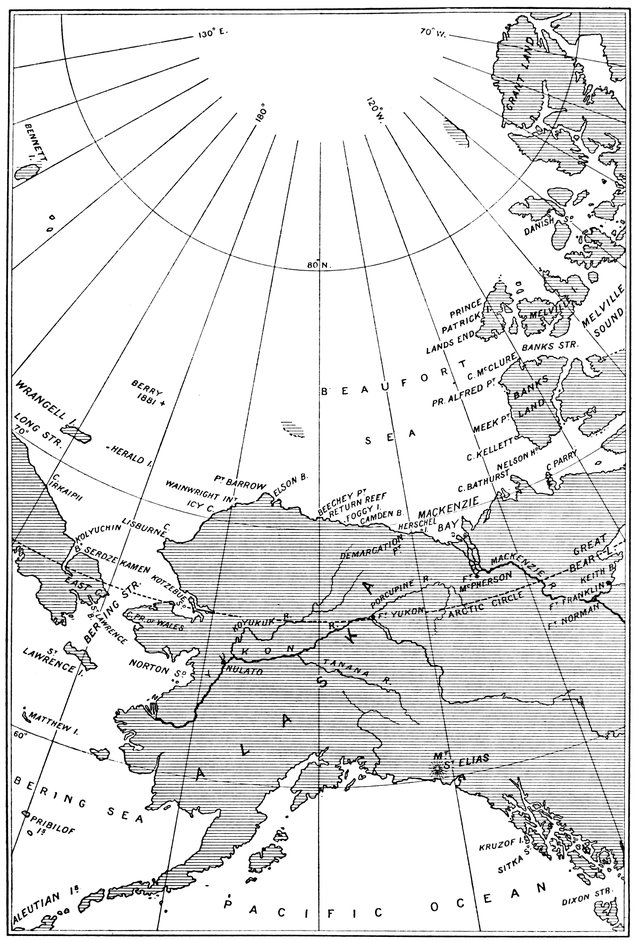
BERING STRAIT
129When Atlassof, in 1697, took the first steps in the conquest of Kamchatka the Russians were already known to the inhabitants. Long before him Fedotof and a few comrades had made their way into the country and intermarried with native women. They had been held in great honour and almost deified as being evidently of a superior race. For some time it was supposed that no human hand could hurt them, but this belief was rudely shattered when two of the demigods quarrelled and fought, and one wounding the other, the blood flowed. That flow of blood was fatal, for the natives, judging that they were but ordinary flesh, took an early opportunity of wiping them out, the name of their leader being still traceable in that of the Fedotcha River on the banks of which they had lived.
The Kamchadales had other tales to tell of visitors from the east and south, and Atlassof himself discovered on the River Itcha a Japanese who had been wrecked on the coast two years before, from whom he learnt of islands innumerable. But there were no ships on the Pacific coast of Siberia, and nothing in the way of discovery could be done until 1714, when there arrived at Ochotsk a detachment of sailors and shipwrights despatched thither overland. According to one of the sailors, Henry Bush, a Dutchman, the carpenters built a good durable vessel some fifty feet long which was ready for sea in 1716 when the first voyage was undertaken. The coast of Kamchatka was made near the River Itcha, and sailing south they reached the Kompakova, where they wintered and found the whale that had in its body the harpoon of European workmanship marked with Roman letters, mentioned by Scoresby. Bush returned to Ochotsk in 130July, to be sent in the following year to discover the Shantar Islands, and next year, 1718, the Kuriles; thus venturing into the Pacific beyond Cape Lopatka.
The last of these expeditions was due to the direct order of Peter the Great, who, knowing nothing of Deschnef, and finding the sea open to the north, resolved on a voyage in that direction, his holograph instructions to Admiral Apraxin being: "One or two boats with decks to be built at Kamchatka, or at any other convenient place, with which inquiry should be made relative to the northerly coasts, to see whether they are not contiguous with America, since their termination is not yet known." Peter died, and the Empress Catherine, carrying out these instructions in their fullest meaning, began her reign with an order for the expedition.
Veit Bering, Dane by birth and sailor by trade, had voyaged to the Indies, east and west, and, like many other men of enterprise, had entered the Russian service at Peter's invitation. He had served with distinction in the Cronstadt fleet in the war against the Swedes, and, being in good repute for his knowledge of ships and their handling, was appointed to the command of the most remarkable Arctic enterprise on record. Just as Nicholas ruled a line and ordered a railway to be built there, so did Catherine in the same imperial way order an exploring expedition, and it was done. But it meant building the ship from the trees of the forest on the coast of the Pacific and carrying the materials and stores—everything but the timber—right across the Russian empire in the days when for thousands of miles there were not even roads.
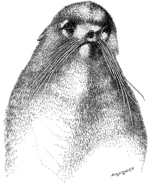
THE FACE OF THE FUR SEAL
131Bering's lieutenants were Martin Spangberg and Alexei Tschirikof. With them and the rest of the expedition he left St. Petersburg on the 5th of February, 1725. During that year they got as far as the Ilim, where they wintered. In the spring of 1726 they sailed down the Lena to Yakutsk, where they parted company for a time owing to the difficulties of the route to Ochotsk, the way not being passable in summer with wagons, or in winter with sledges, on account of the marshes and rocky ground. So Spangberg set out, working along the rivers Aldan, Maia, and Judoma, with part of the provisions and heavy naval stores, while Bering followed overland through uninhabited country with more stores on horses, and Tschirikof remained to collect still more and follow in the track of his commander.
Bering reached Ochotsk first. Spangberg was frozen up in the Judoma, and thence he walked to Ochotsk with the most necessary materials; but he suffered so much from hunger on the way that he had to support life by eating leather bags, straps, and shoes, and did not reach Bering till the 1st of January, 1727, nearly two years after leaving St. Petersburg. In the beginning of February he returned to the Judoma and brought away about half of his lading, the other half being left for a third journey, which he made from and to Ochotsk on horses. Meanwhile Tschirikof was toiling along from Yakutsk, and did not arrive to complete the party until the 30th of July.
On arrival Bering had to build a vessel to take his most necessary naval stores and his shipbuilders across the sea of Ochotsk to Bolscheretzkoi, which, in her, he 132reached on the 2nd of September. From here he followed the shipwrights, who went on ahead to fell the trees, taking with them the provisions and stores, over the backbone of the isthmus and down the Kamchatka River to the mouth, a distance of some two hundred miles, the journey being very slow on account of the travelling being by dog-sledge. In short, it was not until the 4th of April, 1728, that is, more than three years after leaving St. Petersburg, that it was possible to put on the stocks the vessel in which the voyage to the north was to be made. But she took only three months to build, being launched on the 10th of July, when she was named the Gabriel.
Laden with stores for forty men during a year's voyage, she put to sea ten days afterwards, Bering keeping close to the coast so that he could map it as he went. On the 10th of August he was off the island of St. Lawrence, which he so named, as it was the day of that saint. In a day or two he had passed the East Cape without seeing the American coast, and had entered the Arctic Circle. And on the 15th he was well through the strait, out in the Arctic Ocean, in 67° 18´ off Serdze Kamen, a promontory behind which the coast trended to the west, as the Chukches had told him it did; and he assumed, and rightly so, though he had not gone far enough to prove it, that there was no land connection between Asia and America. Whereupon, as he had in his opinion accomplished his mission, seeing no need for wintering in those parts, he put the Gabriel about and was back in the Kamchatka River on the 20th of September, after a voyage of seven weeks in a vessel that took three months to build on a spot that took over three years to reach—the plan of campaign being much the same as that in which a mountain stronghold is advanced on across a desert, besieged for a few days, and captured by assault.
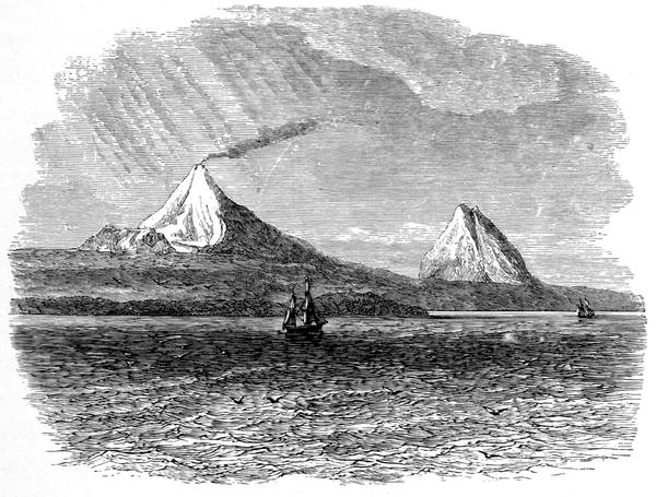
THE ALEUTIAN ISLANDS
133After wintering, Bering went off next year on a voyage due east in search of reported land, but, after some hundred and thirty miles out, he was blown back, and, rounding the south end of Kamchatka, put in at the River Bolschaia; thence he crossed to Ochotsk, whence he started for St. Petersburg, where he arrived after an absence of five years. Catherine was dead and another empress reigned in her stead, who was pleased and satisfied if no one else was, and the 21st of February, 1733, saw him starting again in the same laborious fashion to arrange other voyages as part of a great scheme for the exploration of Northern and North-eastern Asia. Some of these expeditions on the north coast have already been mentioned; Bering's particular task was to send Spangberg in search of Japan, while he and Tschirikof, in separate ships, went eastward to America. More stores and provisions went overland across Siberia than before; Spangberg got again frozen up on the Judoma and had to continue on foot to Ochotsk, where he found plenty of food owing to Bering having sent on ahead, in case of any such trouble, a hundred horses, each of them laden with meal. In June, 1738, Spangberg, in two newly-built vessels and the Gabriel, was off to Japan, to reach the Kuriles and return to winter in Kamchatka; but next year he arrived there all well and found to his astonishment that the Japanese knew as much about maps as he did. He was still more astonished on his return to 134be told by those high in office at St. Petersburg that he could not possibly have been there as they had not got it on their maps where he said it was, and, consequently, he was to go where he had been as soon as he could to make sure. He started on this voyage of verification, but circumstances were against him and he did not reach there; and his Japanese trip remained discredited until the Russian geographers knew better. His voyage thither had, however, used such a stock of provisions that it was two years before the deficiency could be made up, and it was actually the 4th of September, 1740, seven and a half years after leaving St. Petersburg, when Bering, in the specially-built St. Peter, and Tschirikof, in her sister the St. Paul, got off outward bound to America.
In about three weeks they were at Awatcha Bay on the east of Kamchatka, anchored in the fine harbour named Petropaulovsk after the two ships, and here they had to stay for the winter, so that they did not leave Russian territory until the 4th of the following June. A few days out the ships were separated in a fog and storm, and the St. Paul reached the American coast first, at Kruzof Island on the western shore of Sitka Sound. The St. Peter three days afterwards, on the 18th of July, drifted to the coast more to the northward, at Cape St. Elias near the mighty mountain of that name. In this neighbourhood amid much fog Bering stayed six weeks until he was blown out to sea, when, his men beginning to die from scurvy, he resolved to return to Kamchatka. It was a voyage of misfortune in a continual downfall, the men in want, misery, and sickness, continuously at work in the cold and wet, becoming fewer and fewer, so that there were not enough to work the ship properly. It ended on one of the Commander Islands by the vessel being lifted by the sea clear over a reef into calm water. Bering died—the island is named after him—and the survivors of the crew, building a boat from the materials of the St. Peter, arrived at Petropaulovsk on the 27th of August, bringing with them a quantity of sea-otter skins, which did more for discovery in those seas than any imperial expedition.
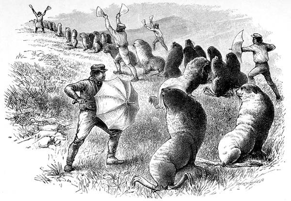
DRIVING THE FUR SEAL
135As the sable had brought about the conquest of Siberia, so did the sea-otter lead to the seizure of the islands of the Bering Sea and the coasts of Alaska. Three years after the return of the survivors of the St. Peter, Nevodtsikof wintered on one of the Aleutian Islands, and in a few years the fur-hunters were at their exterminating work over the whole chain. In time the fur-seal attracted as much attention, and, with Pribylov's discovery, in 1786, of its rookeries on the islands named after him, the trade became of such increasing importance as to endanger in our time the peace of the world. Every one has heard of the wonderful haunts and habits of that strange eared seal which seems to have come from the south through the tropics to breed in the coldest limit of its range, now almost entirely on the Pribylovs and the Commanders; how it is pursued in skin boats and every sort of craft, and scared in long lines to slaughter by clapping of boards and bones and waving of flags and opening and shutting of gingham umbrellas, until it promises to become as extinct as Steller's sea-cow or as rare as the sea-otter.
136Following Bering on the way to the north came Captain James Cook, in H.M.S. Resolution, who gave Bering's name to the strait. Cook sighted Mount St. Elias in May, 1778, and, cruising slowly along the coast with many discoveries and much accurate surveying, was off, and named, Cape Prince of Wales, the western extremity of America, on the 9th of August. He then crossed the strait and plied back until on the 18th he sighted and named Icy Cape in 70° 29´. Close to the edge of the ice, which was as compact as a wall, and seemed to be ten or twelve feet high at the least, he sought persistently for a passage through, but none was to be found; and after reaching 70° 6´ in 196° 42´ (163° 18´ W.) on the 19th, he turned westward to the Asiatic coast, along which he went until he sighted and named Cape North, as already stated. Then, blocked by ice, east, north, and west, he returned, passing Cape Serdze Kamen (Bering's farthest) and naming East Cape, confirming Bering's observation that it was the most easterly point of Asia.
On Cook's death at Hawaii Captain Charles Clerke, of the accompanying vessel H.M.S. Discovery, took command of the expedition and carried out Cook's intention of making another effort during the following year. The ice conditions were, however, worse. The two ships found the ice block further south, and as impenetrable as before, and Clerke's highest was 70° 33´ on the American side, on the 19th of July. As it was Cook's last voyage, so it was Clerke's. He was in a bad way with consumption, and continued his work in the north, though, under the special circumstances and being in command, he could at any time have given up the obviously hopeless attempt and left for a more genial climate, in which he would at least have had a chance of longer life; but, remaining at his duty, he died at sea on the 22nd of August, and was buried at Petropaulovsk.
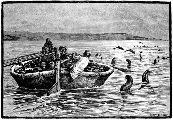
FUR SEALS AT SEA
137Captain Beechey, in H.M.S. Blossom, passed through the strait in 1826 when sent north from the Pacific with a view of meeting with his old commander, Franklin, then on his second land journey. Beechey took the ship to Icy Cape, whence on the 17th of August he despatched the barge under the master, Thomas Elson, to survey the coast to the north-eastward as far as he could go in three weeks, there and back. Elson reached his farthest on the 25th at a spit of land jutting out several miles from the more regular coast-line, the width of the neck not exceeding a mile and a half, broadest at its extremity, with several frozen lakes on it, and a village, whose natives proved so troublesome that it was thought unsafe to land. This was Point Barrow, in 71° 23´ 31˝, longitude 156° 21´ 30˝, the northernmost land on the western half of the American continent. To the eastward curved a wide bay—named Elson Bay by Beechey—the shore-line of which joined on to the ice pack that encircled the horizon. Here he was within a hundred and sixty miles of where Franklin had turned back a week before. Though Beechey did not meet Franklin he did most useful work in these parts, for by him the whole coast was surveyed between Point Barrow and Point Rodney, to the south of Prince of Wales Cape.
Franklin was also the cause of the appearance of the next British expedition in the strait. This was in 1381848, Captain Henry Kellett, in H.M.S. Herald, with Commander Thomas Moore in H.M.S. Plover, forming the western detachment of the first series of search expeditions. There were three detachments, one to follow the Erebus and Terror from the eastward, another under John Richardson to descend the Mackenzie and search the northern coast, the other coming in from the west to meet the ships should they have made the passage. On this duty the Herald and Plover were hereabouts for three seasons, the Plover wintering, the Herald going south when the navigation closed.
In October, 1826, Beechey had buried a barrel of flour for Franklin on the sandy point of Chamisso Island, ample directions for finding it being cut and painted on the rock, and to call the attention of the party to the spot the name of the Blossom was painted on the cliffs of Puffin Island. When the Herald was at Chamisso Island in 1849 Captain Kellett searched for this flour and found it. A considerable space was cleared round the cask, its chimes were freed, and, only adhering to the sand by the two lower bilge staves, it required the united strength of two boats' crews, with a parbuckle and a large spar as a lever, to free it altogether. The sand was frozen so hard that it emitted sparks with every blow of the pickaxe. The cask itself was perfectly sound and the hoops good, and out of the 336 lb. of flour which it contained, 175 lb. were as sweet and well tasted as any he had with him; so good indeed was it that Captain Kellett gave a dinner party, at which all the pies and puddings were made of this flour.
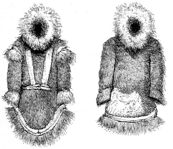
THE PARKA OF THE ALASKAN INNUITS
(THE SHORTER COAT IS THAT WORN BY THE MEN)
139After the dinner party, on the 18th of July, the two vessels started for the north, being joined as soon as they stood from the anchorage by Robert Shedden in his yacht the Nancy Dawson, who at his own initiative had come up from Hong Kong to join in the search. From Wainwright Inlet Kellett sent off the boats under Lieutenant Pullen, two of which made the journey along the northern coast and up the Mackenzie, their crews thence making their way home eastwards to York Factory.
When Kellett was about to commence his observations at the inlet he drew a semicircle on the sand from water's edge to water's edge, and placed the boats' noses between its points. The natives seemed to understand the meaning of this line. Not one of them attempted to overstep it, and they squatted down and remained perfectly quiet and silent. When a stranger arrived they shouted to him, and he no sooner comprehended the directions than he crept rather than walked to the boundary, and squatted among the rest. Afterwards they danced and sang and played football with the seamen—who stood no chance with them at that game—and when they had gone off, after all this good behaviour, it was discovered that they had been picking the pockets of some of the party, one losing a handkerchief, another a glove, and Commander Moore a box of percussion caps.
The boat party had a similar experience, without the pocket-picking. Reaching Point Barrow they landed to make observations and look about for traces of the visit of the Blossom's boat, which they did not find. Their interpreter did not understand the tribe, and 140recourse was had to the universal language of signs. "We made a rude model of a vessel," says Lieutenant Hooper, "and performed sundry antics to signify what we were in search of, but could elicit no information, and so set to work at obtaining observations. We concluded that these people must have been entirely misunderstood. Far from evidencing any disposition to assail or molest us, they were most docile and well-behaved, agreeably disappointing us in their conduct. When we arrived on the hillock, all, big and little, sat down around us, and I amused myself by filling their pipes, becoming a great favourite immediately in consequence. They had among them a great many knives, which we feared would influence the magnet. Mr. Pullen therefore kindly drew off the crowd to a distance, distributing among them tobacco, beads, snuff, etc., and much to their credit be it said, there was neither confusion nor contention, each taking his allotted portion, and seeming delighted with his good fortune. They took care not to come near the instruments, finding that we did not like their approach; one or two indeed came towards us, but retired instantly when laughingly motioned back, and this should be considered as a display of great forbearance, inasmuch as their curiosity must have been highly excited. When the observations were concluded they were allowed to inspect the objects of their wonder; then fast and thickly to utterance flew their expressions of astonishment at the—to them—novel and splendid instruments. The trough of quicksilver, liquid and restless, especially attracted them, pleasure and wonder were evident at the simple view, but when one or two had permission to take some from the dish, and found it ever elude the grasp, their astonishment knew no bounds."
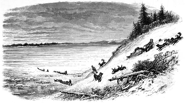
THE FROZEN YUKON
141From Wainwright Inlet, which is between Icy Cape and Point Barrow, the Herald sailed along the pack to the westward, reaching her highest north, 72° 51´, in 163° 48´, and, on the 17th of August, Kellett landed on and named Herald Island in 71° 17´ 45˝, a mass of granite towering nine hundred feet above the sea, under five miles long and three broad, inhabited mainly by black and white divers and yielding the collector only four flowering plants. Further to the west he sighted Wrangell Island, sailed past and named by the American whaling captain, Thomas Long, in August, 1867.
In 1881 Wrangell Island was thoroughly explored by another search expedition, that of Captain Berry in the American ship Rodgers, who was in these parts looking out for traces of the Jeannette. He found it to be, not a continent as some had supposed, but an island forty miles broad and sixty-six miles long, about thirty miles from Herald Island and eighty from the Siberian coast; and on it, as on all these Siberian islands and the coast of Alaska, remains of the mammoth were found. Examining the ice to the northward, he reached 73° 44´ in 171° 30´, being fifty-three miles further north than Kellett and twenty-four miles further than Collinson in 1850. Returning from the north to winter quarters he achieved another Arctic record in his ship being destroyed by fire in St. Lawrence Bay on the Asiatic side of Bering Strait.
Opposite this, on the American side, from Cape York downwards the land trends away to the south-east 142to Norton Sound, in which are the mouths of the Yukon, one of the mightiest rivers of the world, its volume being as great as, or according to some writers greater than, the Mississippi. In a course of two thousand miles it runs northwards to the Arctic Circle at the now abandoned trading post of Fort Yukon, where its waters are reinforced by its tributary, the Rat or Porcupine, coming in from the north-east, and given their seaward direction to the south-west. Up this vast waterway in 1866 went Frederick Whymper and William H. Dall.
Beginning with a sledge journey of a hundred and seventy miles from Unalachleet, they struck the Yukon on the 10th of November, gliding down a high steep bank on to it. Hardly a patch of clear ice was to be seen, the snow covering the whole extent. Accumulations of hummocks had in many places been forced on the surface before the river had become thoroughly frozen, and the water was still open, running swiftly in a few isolated streaks. From bank to bank was not less than a mile, the stream flowing among several islands. As they sledged up the river the dreary expanse of snow made them almost forget they were on a sheet of ice; and, as it winds considerably, their course was often from bank to bank to cut off corners and bends. Many cliffs abutted on the stream, and islands of sombre green forest studded it in all directions.
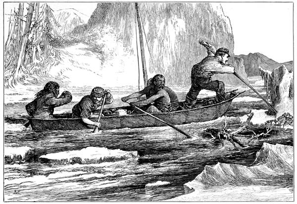
ASCENDING THE YUKON
143On the 15th they reached Nulato, six hundred miles from the mouth, where they spent the winter. Here they found a curious method of fishing practised all through the season. Early in the winter large piles or stakes had been driven down into the bed of the river, and to these were affixed wickerwork traps like eel-pots on a large scale, oblong holes being kept open over them by frequently breaking the ice. This was cold work, for the temperature ran low. "In November and December," says Whymper, "I succeeded in making sketches of the fort and neighbourhood when the temperature was as low as thirty degrees below zero. It was done, it need not be said, with difficulty, and often by instalments. Between every five strokes of the pencil, I ran about to exercise myself or went into our quarters for warmth. The use of water-colours was of course impracticable—except when I could keep a pot of warm water on a small fire by my side—a thing done by me on two or three occasions, when engaged at a distance from the post. Even inside the house the spaces near the windows, as well as the floor, were often below freezing point. Once, forgetful of the fact, I mixed some colours up with water that had just stood near the oven, and wetting a small brush commenced to apply it to my drawing block. Before it reached the paper it was covered with a skin of ice, and simply scratched the surface, and I had to give up for the time being."
On the 12th of May the Nulato River broke up and ran out on the top of the Yukon ice for more than a mile upstream; and in a few days the ice of the main river was coming down in a steady flow at a rate of five or six knots, surging into mountains as it met with obstacles, and grinding and crashing and carrying all before it, whole trees and banks being swept away on its victorious march, the water rising fourteen feet above the winter level. On the 26th Whymper and 144Dall started with two Indians and a steersman in a skin canoe, the river still full of ice, and navigation difficult. They had proceeded but a short distance when they came to bends, round which logs and ice were sweeping at a great rate, so that it was necessary for a man to stand in the bows of the canoe, with a pole shod at one end with iron, to push away the masses of ice and tangle of driftwood. They could often feel the ice and logs rolling and scraping under the canoe; and it was not the thickness of a plank between them and destruction, but that of a piece of sealskin a tenth of an inch thick.
On the 7th of June they were two hundred and forty miles above Nulato, at the junction of the Tanana, the furthest point reached by the Russians, and soon were in a part abounding with moose owing to their seeking refuge in the stream from the millions of mosquitoes. Here the Indian hunters were busy, not wasting powder and shot, but manœuvring round the swimming deer in their birch-bark canoes until they tired the victim out; and then stealthily approaching, securing it with a stab from their knives.
After twenty-six laborious days against the stream they reached Fort Yukon, the then furthest outpost of the Hudson's Bay Company, six hundred miles from Nulato, and, of course, managed and victualled from the east. Here the amount of peltry was astonishing, the fur-room of the fort containing thousands of marten skins, hanging from the beams, and huge piles of common furs lying around, together with a considerable number of foxes, black and silver-grey, and many skins of the wolverine, thought so much more of by the Indians than by any one else that they are used as a medium of exchange. All these furs were brought in from the surrounding districts, far and near, and traded for goods, as widely distributed, among the native tribes whose representatives gathered at the fort in such a miscellaneous crowd that perhaps half a dozen dialects were heard in a morning.
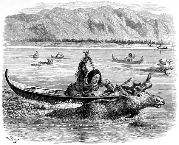
MOOSE-HUNTING ON THE YUKON
145In the crowd the busiest and most prominent were the primitive Tananas, gay with feathers and painted faces, looking like survivals among the local Kutchins and the Kutchins of the upper river, the Birch River men, and the Rat River men by whom the skins were brought from the natives of the northern coast, as were the messages from the Franklin search parties. Indians were all of these, distinguishable by their wearing the hyaqua or tooth-shell (Dentalium entalis) through the septum of the nose, while the Mahlemut wears a bone on each side of the mouth, a practice common with all the Innuit, or Eskimo tribes, from the Alaska Peninsula to Point Barrow, unless some other form of labret happens to be the local fashion.
The Hudson's Bay Company—Samuel Hearne—His journey down the Coppermine River—The North West Fur Company—Sir Alexander Mackenzie—His journey down the Mackenzie—Sir John Franklin's first land journey—Fort Enterprise—Back's journey to Athabasca—The rapids of the Coppermine—Point Turnagain reached—The Wilberforce Falls—The terrible crossing of the Barren Grounds—Franklin's second land journey—Richardson's voyage to the eastward—Discovers Wollaston Land and Dolphin and Union Strait—Franklin's voyage to Return Reef—Back's journey down the Great Fish River—Discovers Montreal Island and King William Land—The Parry Falls—Sir George Simpson—Peter Warren Dease and Thomas Simpson—Exploration of the coast between Return Reef and Point Barrow—Simpson advances beyond Point Turnagain and discovers Victoria Land and Dease Strait—Their second voyage down the Coppermine—Discovery of Simpson Strait—Reach the Great Fish River—Their farthest east—Complete the survey of the northern coast between Boothia and Bering Strait—The first to find the North-West Passage.
For two elks and two black beavers, paid yearly whensoever the King of England entered their estate, the Hudson's Bay Company were, in 1670, presented by Charles II with the northern part of the American mainland, thus ensuring an ample stretch of British territory along the passage to the South Sea. But the company soon ceased to be interested in any such passage, finding quite enough to do in developing the very profitable fur trade of their vast possessions. With the exception of John Knight's disastrous voyage to Marble Island in 1719, whatever attempts at discoveries there may have been were kept quiet for fear of aiding their rivals the French to the south, who were fostering the trade in the region of the great lakes; and not until the French dominion ended in 1763 and the Frenchmen's interests were passing to an opposition British company was any effort made to explore the coast of the Polar Sea.
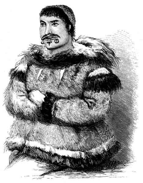
MAHLEMUT MAN
147Owing to Indian reports of rich deposits of native copper and an abundance of fur-bearing animals, Samuel Hearne, once a midshipman in the Royal Navy, was sent by the company in 1769 to explore to the west and north. After a journey of thirteen hundred miles to the west he found the Coppermine River and the Great Slave Lake, and he traced the river to its mouth and emerged on the northern shore, being the first known white man to see the Arctic Ocean between the Boothia Peninsula and Bering Strait. Among other things he was instructed to discover a north-west passage, and he certainly did something definite towards it by showing there was open water so much further west; but, though he suspected it, he was unable to prove that the northernmost point of the continent was in the unexplored country between the Coppermine and Hudson Bay.
In 1783 the North West Fur Company was formally established, and after a severe struggle obtained, owing mainly to the efforts of Alexander Mackenzie, a fair share of the trade in the west of the region controlled by the Hudson's Bay people. Mackenzie was at Fort Chippewyan, on Lake Athabasca, and thence he was sent in 1789 on an exploring voyage to the north. In four birch-bark canoes, one of his party being an Indian known as English Chief, who had been with 148Hearne on his journey to the Coppermine, he started down the Great Slave River into the Great Slave Lake. After spending twenty days in crossing and exploring this vast sheet of water, he entered the large river now bearing his name, and down it amid many dangers and difficulties, overcome by skill, persuasion, force, good humour or good fortune, he reached the sea on the 14th of July. He camped on Whale Island, the name being given owing to one of the men sighting a great many animals in the water, which he at first supposed to be pieces of ice. "However," says Mackenzie, "I was awakened to resolve the doubts which had taken place respecting this extraordinary appearance. I immediately perceived that they were whales; and having ordered the canoe to be prepared, we embarked in pursuit of them. It was indeed a very wild and unreflecting enterprise, and it was a very fortunate circumstance that we failed in our attempt to overtake them, as a stroke from the tail of one of these enormous fish would have dashed the canoe to pieces. We may, perhaps, have been indebted to the foggy weather for our safety, as it prevented us from continuing our pursuit. Our guide informed us that they are the same kind of fish which are the principal food of the Eskimos, and they were frequently seen as large as our canoe. The part of them which appeared above the water was altogether white, and they were much larger than the largest porpoise"—being evidently belugas (Delphinapterus leucas).
Satisfied with a short canoe voyage on the sea, he returned to the river and made his way back to the fort, arriving there in the middle of September. He 149had thus proved the existence of the sea twenty degrees further west than Hearne had done. Three years afterwards he started on his notable journey to the Pacific at Cape Menzies, facing Princess Royal Island, being the first white man to cross the Rocky Mountains, and, as he had reached Fort Chippewyan by way of Montreal, the first to cross North America above the Gulf of Mexico.
Another of Hearne's Indians accompanied Franklin on his first land journey in 1819, the object of which was to explore the coast between Hearne's farthest and Hudson Bay, thus filling in the gap in which the assumed northern promontory was to be found. Franklin, who was sent out by the British Government, had with him, as surgeon and naturalist, Dr., afterwards Sir, John Richardson, to whom as a boy Robert Burns had lent Spenser's Faerie Queene, a naval surgeon with a distinguished record, who while on half-pay had studied botany and mineralogy at Edinburgh. Like another member of the expedition, George Back, who had been with Franklin in the Trent and Dorothea voyage, he was destined to gain a great reputation among Arctic explorers. With Back was another midshipman, Robert Hood, whose fate it was to be murdered by an Iroquois half-breed who, through want of food, betook himself to cannibalism.
Landing at York Factory, in Hudson Bay, after an exciting voyage, on the 30th of August, Franklin, disregarding local advice, pushed on across the continent during the winter, arriving at Fort Chippewyan on the 26th of March, the losses and trying experiences of 150the long journey being mainly due to the rigours of the climate at that time of year; and thence, in July, the party followed Mackenzie's route to Fort Providence on Great Slave Lake. Here they were joined by Mr. Wentzel, of the North West Company.
Starting for the north on the 2nd of August in four canoes, they were joined next day at the mouth of the Yellow Knife by a band of Indians, under a chief named Akaitcho, in seventeen canoes. The Indians were to guide the party and supply them with food by hunting and fishing on the way, but game and fish proved scarce—and scarcer owing to the poorness of the Indian marksmanship—provisions were short and portages long, so that the journey, which soon led across a series of lakes, was pursued under toilsome and hazardous conditions until it ended at Winter Lake in 64° 30´, where it became necessary to winter in a log house built by Wentzel, and named Fort Enterprise. The site was delightful: a hillside amid trees three feet in diameter at the roots, the view in front bounded at a distance of three miles by round-backed hills, to the eastward and westward the Winter and Roundrock Lakes connected by the Winter River, its banks clothed with pines and ornamented with a profusion of mosses, lichens, and shrubs.
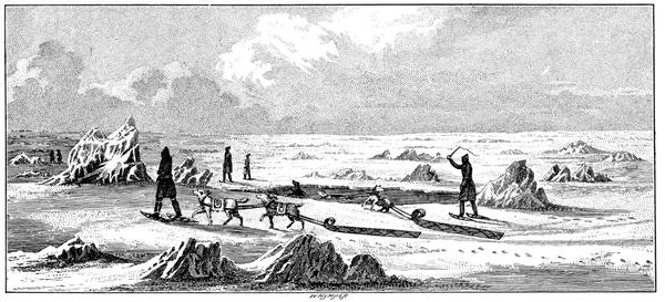
WINTER TRAVELLING ON THE GREAT SLAVE LAKE
151In a few weeks, however, the weather became so severe that, according to Franklin, the trees froze to their very centres and became as hard as stones, on which some of the axes were broken daily, until but one was left. And though at first the reindeer appeared in numbers, their visits lasted only for a short time, and the party, short of tobacco for the Canadian voyageurs and of ammunition for the Indians, had so poor an outlook that it became necessary to accept Back's proposal to return to the forts and bring on supplies which had not been forwarded as promised; the failure being due to the journey, unlike the successful ventures of Hearne and Mackenzie, being pushed on regardless of climatal conditions, and, in some degree, to the rivalry between the two fur companies which were amalgamated while the expedition was in progress.
Back set out accompanied by Wentzel and two Canadians and two Indians and their wives, crossing lakes frozen just hard enough to bear them, going wide circuits to avoid those which were open, amid mist and fog and storm, over rugged, bare country, through dense woods and snow-covered swamps, rafting across a river with pine branches for paddles, until Fort Providence was reached. From here he sent back Belanger with letters and a hundred bullets he procured on loan. Belanger arrived at Fort Enterprise on the 23rd of October alone; he had walked constantly for the last six-and-thirty hours through a storm, his locks were matted with snow, and he was encrusted with ice from head to foot, so that he was scarcely recognised when he slipped in through the doorway.
At Fort Providence Back had to wait until the Great Slave Lake was frozen over. On the 18th of November he observed two mock moons at equal distances from the central one, the whole encircled by a halo, the colour of the inner edge of the large circle a light red inclining to a faint purple; and two days 152afterwards two parhelia were observable, with a halo, the colours of the inner edge of the circle a bright carmine and red-lake intermingled with a rich yellow forming a purplish orange, the outer edge being a pale gamboge. On the 7th of December he left, sledging across the lake before the wind, for the North West fort on Moose Deer Island, and finding at the Hudson's Bay fort, also on the island, five packages of belated supplies and two Eskimo interpreters on their way to Franklin.
Here he was told that nothing could be spared at Fort Chippewyan, that goods had never been transported so far in the winter season, that the same dogs could not go and return, and that from having to walk constantly on snow-shoes he would suffer a great deal of misery and fatigue. Nevertheless he undertook the journey in dog-sledges with a Canadian and an Indian, leaving Wentzel behind. At times the weather was so cold that they had to run to keep themselves warm, and, owing to the snow, the feet of the dogs became so raw that an endeavour was made to fit them with shoes. With legs and ankles so swollen that it was painful to drag the snow-shoes after him, Back hurried on, reaching Fort Chippewyan on the 2nd of January to find that he and all Franklin's party had been reported to have been killed by Eskimos. Here he had to wait a month, and then, with an instalment of what he wanted, he set out on his return, arriving at Fort Enterprise on St. Patrick's Day after a memorable journey of over a thousand miles.
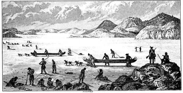
CROSSING POINT LAKE
153During his absence he was told that the cold had been so severe that Hood had found accurate observing difficult owing to the sextant having changed its error and the glasses lost their parallelism from the contraction of the brass, a circumstance, combined with the crystallisation of the mercury of the artificial horizon, that might account for some of the diversity of results obtained by Arctic navigators. And Richardson had to tell him of an early discovery that when fishing and the hands get cold by hauling in the line, the best way to warm them is to put them in the water; and how the fish had frozen as they were taken out of the water so that by a blow or two of the hatchet they were easily split open, leaving the intestines removable in one lump, and yet that these much-frozen fish retained their vitality so that he had seen a thawed carp recover so far as to leap about with much vigour after it had been frozen for thirty-six hours.
On the 14th of June Fort Enterprise was left, and on the 25th the expedition began to cross Point Lake on the way to the Coppermine, the river being reached through Rocknest Lake on the 30th. Down the river they paddled, taking the rapids as they went—in one place three miles of them on end. "We were carried along with extraordinary rapidity, shooting over large stones, upon which a single stroke would have been destructive to the canoes; and we were also in danger of breaking them, from the want of the long poles which lie along their bottoms and equalise their cargoes, as they plunged very much, and on one occasion the first canoe was almost filled with the waves; but there was no receding after we had once launched into the stream, and our safety depended on the skill and dexterity of the bowmen and steersmen."
154There were rapids day by day affording almost every possible chance of wreck except that due to driftwood; the two worst being one where the stream descends for three-quarters of a mile in a deep but narrow and crooked channel which it has cut through the foot of a hill of five hundred or six hundred feet high, confined between perpendicular cliffs resembling stone walls varying in height from eighty to a hundred and fifty feet, on which lies a mass of fine sand; the body of the river pent within this narrow chasm dashing furiously round the projecting rocky columns as it discharges itself at the northern extremity in a sheet of foam. The other being where the river flows between lofty stone cliffs, reddish clay rocks and shelving banks of white clay, and is full of shoals. Franklin's people had entered this rapid before they were aware of it, and the steepness of the cliffs prevented them from landing, so that they owed their preservation to the swiftness of their descent. Two waves made a complete breach over the canoes; a third would probably have filled and overset them, which would have proved fatal to all on board. This Escape Rapid, as it was named, was, as it were, the gate into the territory of the Eskimos who were soon met with in small parties all the way down to the sea. It was passed on the 15th of July; three days afterwards the Indians bade farewell to the expedition in the morning, and in the afternoon the canoes were afloat on the Arctic Ocean.
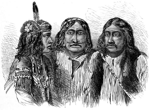
KUTCHIN INDIANS
155From the river mouth Wentzel returned, as arranged, with despatches, taking with him a number of voyageurs and others, thus reducing the party to twenty in all in two canoes. In these Franklin, nearly two years after he had landed in America, went on his voyage to the eastward to enter at last on the work he had been sent to do. But the survey of this lofty rocky coast was no easy matter; the sea was rough, the weather tempestuous, the canoes were lightly built and only suited for river work, and, in short, it was a most risky enterprise. Tracing the shore of Coronation Gulf and coasting up and out of Bathurst Inlet, Franklin reached Point Turnagain in 109° 25´ W., at the entrance of Dease Strait, on the 16th of August, 1821. Though the voyage had extended over only six and a half degrees of longitude, he had sailed 555 geographical miles; and then, as his resources did not permit of his going further or of his returning to the Coppermine, and in his own words "Our scanty stock of provisions rendering it necessary to make for a nearer place," he, on the 22nd, turned back to ascend the Hood River.
Here they soon reached the Wilberforce Falls, beautiful and remarkable, but not easy of navigation. "In the evening," says Franklin in his journal, "we encamped at the lower end of a narrow chasm through which the river flows for upwards of a mile. The walls of this chasm are upwards of two hundred feet high, quite perpendicular, and in some places only a few yards apart. The river precipitates itself into it over a rock forming two magnificent and picturesque falls close to each other. The upper fall is about sixty feet high, and the lower one at least one hundred, but perhaps considerably more, for the narrowness of the chasm into which it fell prevented us from seeing its bottom and we could merely discern the top of the spray far beneath our feet. The lower fall is divided into two by 156an insulated column of rock which rises about forty feet above it."
As the river above the falls appeared too rapid and shallow for the large canoes they were taken to pieces, and two smaller ones built from their materials. The voyage in these lasted but three days, when the river was abandoned as trending too far to the west, and the party, carrying the canoes, proceeded overland to Point Lake on their struggle of starvation across the Barren Grounds. For days they had nothing to eat but lichens—species of Gyrophora or Umbilicaria known as tripe-de-roche—a diet varied with leather, burnt bones and skins, an occasional ptarmigan, and, once, a musk ox, until they were so weak that when a herd of reindeer went strolling past they had not strength enough to shoot at them.
The tragedy need not be lingered over. Back was again sent for help, and, finding no stores at Fort Enterprise, was on his way to Fort Providence when he fell in with Akaitcho, who at once hurried to the rescue; and on the 14th of July, 1822, Franklin, Richardson, Back, and Hepburn the seaman, who had behaved as a hero all through, returned to York Factory after a three years' journey, fraught with peril and horror, by land and water, of over six thousand three hundred statute miles.
After he had been at home a year, Franklin suggested that another attempt should be made to survey the northern coast while Parry was at work in search of the North-West Passage. The suggestion was accepted. Accompanied by Richardson and Back, and by E. N. Kendall as assistant surveyor—who had been out with Captain Lyon in the same capacity—and by Thomas Drummond as assistant naturalist, he left Liverpool on the 26th of February, 1825.
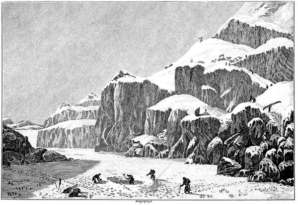
PREPARING AN ENCAMPMENT ON THE BARREN GROUNDS
157Taught by experience, the expedition was better managed in every way. Instead of driving ahead regardless of the season or the trade routine, the ordinary conditions of local travel were kept in view throughout, and the results were more in proportion to the effort. Three boats were specially built at Woolwich on Franklin's design and under Buchan's superintendence. They were of mahogany with timbers of ash, both ends alike, steerable by oar or rudder, the largest 26 ft. by 5 ft. 4 ins., the two others 24 ft. by 4 ft. 10 ins., and with them Colonel Pasley's portable boat, known as the Walnut Shell from its shape, 9 ft. long and half as wide, with frames of ash fastened with thongs and covered with canvas. The canvas was "waterproofed by Mr. Macintosh, of Glasgow"—the first instance of its use—and for the first time also what we know as macintosh coats and overalls were issued as part of the outfit, the process having been patented in 1824.
The boats and stores were sent on ahead by way of York Factory in 1824, and Franklin and his party, travelling by New York and the lakes, caught them up on the Methye River at sunrise on the 29th of June. With them were several old friends, not the least delighted being the two Eskimo interpreters, Augustus and Ooligbuck, who were to be of the utmost importance throughout. On the 8th of August they had got along so well that they were at the junction of the Bear Lake River with the Mackenzie. Here Back and Peter 158Warren Dease of the Hudson's Bay Company, who had joined the expedition to look after the local arrangements, were sent off to build a house to winter in on the banks of the Great Bear Lake, in Keith's Bay, where the river leaves it; Richardson also left to explore the northern shore of the lake, and Franklin and Kendall continuing down the Mackenzie reached the sea before the week was out in less than six months from their departure from Liverpool. And on the 5th of September they had returned upstream and were at their winter quarters at the new house on the lake, which Back had named Fort Franklin, to find that Richardson had been along the northern shore and noted as being the nearest point to the Coppermine the entrance of the river he had named after Dease, which was to be of so much service to him later on.
During the winter another boat, the Reliance, was built on the lines of the Lion, the largest of the Woolwich boats, and leaving Dease to complete the stores for another comfortable winter, the expedition started on the 24th of June. At Point Separation, at the head of the Mackenzie delta, Franklin in the Lion with Back in the Reliance—our old friend Robert Spinks being his coxswain—took the western arm, and Richardson in the Dolphin and Kendall in the Union, carrying the Walnut Shell with them, took the eastern arm.
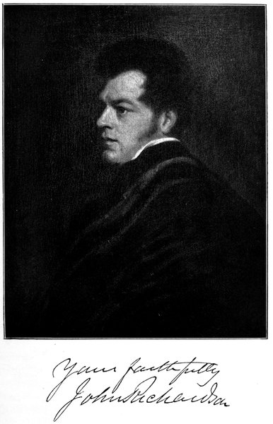
159Richardson, with a few more or less threatening encounters with the Eskimos, ending fairly well owing to Ooligbuck, and in constant danger of wreck avoided by careful navigation, rounded Cape Bathurst in 70° 36´ and discovered Wollaston Land, the coast-line of which they left continuing to the east, when they reached Coronation Gulf and, on the 8th of August, entered the Coppermine, and thus filled in the gap of nine hundred and two statute miles from Point Separation. Leaving the Dolphin and Union at Bloody Fall on that river, it being impossible to take them further, the expedition, carrying the Walnut Shell with them, proceeded along the banks, but finding they had no use for the portable boat, owing to the shallowness of the stream, they soon abandoned it, and in 67° 13´, where the river is nearest to the north-eastern arm of Great Bear Lake, the Coppermine was left and the course laid across the Barren Grounds for Dease River. This was reached three days afterwards, Richardson being met at its mouth by Dease's people on the 24th of August.
Franklin had similar experiences with the Eskimos, and was as deeply indebted to Augustus for his tact and bravery in dealing with them. Coasting along to the westward, hindered by ice, bad weather and fog, and tormented by mosquitoes, his progress was much slower than that of Richardson. Delayed for some days on or about Foggy Island, he had to give up his intention of reaching Bering Strait, and not knowing that Elson with the barge of the Blossom had come as far east as Point Barrow, he gave the name of Cape Beechey to the westernmost headland in sight, and leaving Return Reef in 148° 52´ on the 18th of August, after covering six hundred and ten statute miles through parts not previously discovered, began his voyage back to Fort Franklin, where he arrived on the 21st of September. Meanwhile Richardson had gone off to 160explore the Great Slave Lake, whence Drummond had started on his journey among the Rockies; and, being unable to get away till another winter had passed, both Franklin and Richardson landed in England in September, 1827, after an important and fruitful expedition that had no death-roll.
Back was again in these regions in 1833 on his expedition in search of Sir John Ross. Reaching the Great Slave Lake, he built Fort Reliance at its north-eastern corner and began the long winter there on the 5th of November. Soon afterwards Akaitcho put in an appearance, and expressed his intention—which he did his best to fulfil—of being of as much assistance as he could; and later on Augustus made his way across country to offer his services, but, either exhausted by suffering and privation, or caught in a snowstorm, he died alone near the Rivière à Jean.
Temperatures ranging from 50 to 70 minus were of frequent occurrence, and, on one occasion Back, after washing his face within a yard of the fire, had his hair clotted with ice before he had time to dry it. Every animal was driven away from the neighbourhood by the cold, except a solitary raven which swept once round the house and then winged his flight to the westward. On the 25th of April a messenger arrived at the fort with the news of the safe return of Sir John Ross to England, but Back determined to proceed with the journey for exploring purposes, taking one boat instead of two, and, with Richard King the surgeon, and eight men, he started for the Great Fish River on the 8th of July.
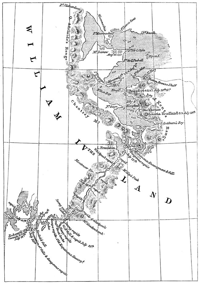
BACK'S JOURNEY DOWN THE GREAT FISH RIVER
161The voyage was a hazardous and adventurous one. For five hundred and thirty geographical miles the river was found to run through an iron-ribbed country without a single tree on the whole line of its banks, expanding into fine large lakes with clear horizons, most embarrassing to the navigator, and broken into falls, cascades, and rapids, to the number of no less than eighty-three, pouring its waters into the Polar Sea in latitude 67° 11´ and longitude 94° 30´; so that his explorations on the northern coast were confined to a section further east than Point Turnagain.
The expedition met with its greatest danger at Escape Rapid, between Lake Macdougall and Lake Franklin, on the 25th of July. Here the stream was broken by a mile of heavy and dangerous rapids. The boat was lightened, and every care taken to avoid accident; but so overwhelming was the rush and whirl of the water, that she, and consequently those in her, were twice in imminent peril of being plunged into one of the gulfs formed in the rocks and hollows. It was in one of these places, which are fall, rapid, and eddy within a few yards, that the boat owed its safety to an unintentional disobedience of the steersman's directions.
The power of the water so far exceeded whatever had been witnessed on any of the other rivers that the precautions used elsewhere were weak and unavailing. McKay, the steersman, was endeavouring to clear a fall and some sunken rocks on the left, but the man to whom he spoke misunderstood him, and did exactly the reverse; and then, seeing the danger, the steersman swept the stern round; instantly the boat was caught by an eddy to the right, which, snapping an oar, twirled 162her irresistibly broadside on; so that for a moment it seemed uncertain whether the boat was to be hurled into the hollow of the fall, or dashed stern foremost on the sunken rocks. Of how it happened no account can be given, but her head swung inshore towards the beach and thereby gave an opportunity for some of the men to spring into the water and by their united strength rescue her from her perilous position. Had the man to whom the first order was given understood and acted on it no human power could have saved the crew from being buried in the abyss. Nor yet could any blame be justly attached to the steersman, who had never been so situated before and whose coolness and self-possession never in this imminent peril forsook him. At the awful moment of suspense, when one of the crew with less nerve than his companions began to cry aloud to Heaven for aid, McKay in a still louder voice exclaimed, "Is this a time for praying? Pull your starboard oar." Never could a reminder that laborare est orare have been more opportune.
On the 1st of August Montreal Island was reached. Nine days afterwards a log of driftwood, nine feet long and nine inches in diameter, jocularly described as a piece of the North Pole, was found on the beach, which, as there are no trees on the Fish River or the Coppermine, Captain Back was of opinion must have come from the Mackenzie and drifted eastward, so that he was on the main line of the land. The inference, confirmed by the appearance of a whale, was correct, but, misled, perhaps, by hilly islands, he missed the channel through which it had come, blocking it, in the manner of John Ross, with a range of mountains 163that does not exist. Though he reached Mount Barrow and mistook the head of Simpson Strait for an inlet, thus failing to find one of the north-west passages, he discovered and named King William Land and sighted Point Booth at its eastern extremity. An attempt to reach Point Turnagain to the westward and thus link up with Franklin's farthest east, in which he might have discovered the passage, proving impracticable owing to the bogginess of the ground, Back began his return from King William Land in latitude 68° 13´, longitude 94° 58´, and entered on a wearisome journey up the river and lakes he had come down, meeting with a party from Fort Reliance on the 17th of September.
A week after, when within a couple of days of the fort, on that "small but abominable river" the Ah-hel-dessy from Artillery Lake, Back discovered the Anderson Falls. Toiling along over the mountains, every man with a seventy-five-pound package on his back, he had not proceeded more than six or seven miles when, observing the spray rising from another fall, he was induced to visit it and was well consoled for having left the boat behind. "From the only point," says Back, "at which the greater part of it was visible, we could distinguish the river coming sharp round a rock, and falling into an upper basin almost concealed by intervening rocks; whence it broke in one vast sheet into a chasm between four and five hundred feet deep, yet in appearance so narrow that we fancied we could almost step across it. Out of this the spray rose in misty columns several hundred feet above our heads; but as it was impossible to see the main fall from the side on which we were, in 164the following spring I paid a second visit to it, approaching from the western bank. The road to it, which I then traversed in snow-shoes, was fatiguing in the extreme, and scarcely less dangerous; for, to say nothing of the steep ascents, fissures in the rocks, and deep snow in the valleys, we had sometimes to creep along the narrow shelves of precipices slippery with the frozen mist that fell on them. But it was a sight that well repaid any risk. My first impression was of a strong resemblance to an iceberg in Smeerenberg Harbour, Spitsbergen. The whole face of the rocks forming the chasm was entirely coated with blue, green, and white ice, in thousands of pendent icicles; and there were, moreover, caverns, fissures, and overhanging ledges in all imaginable varieties of form, so curious and beautiful as to surpass anything of which I had ever heard or read. The immediate approaches were extremely hazardous, nor could we obtain a perfect view of the lower fall, in consequence of the projection of the western cliffs. At the lowest position we were able to attain, we were still more than a hundred feet above the level of the river beneath; and this, instead of being narrow enough to step across, as it had seemed from the opposite heights, was found to be at least two hundred feet wide. The colour of the water varied from a very light to a very dark green; and the spray, which spread a dimness above, was thrown up in clouds of light grey. Niagara, Wilberforce Falls on Hood River, the falls of Kakabikka near Lake Superior, the Swiss or Italian falls—although they may each charm the eye with dread—are not to be compared to this for splendour of effect. It was the most imposing 165spectacle I had ever witnessed; and, as its berg-like appearance brought to mind associations of another scene, I bestowed upon it the name of our celebrated navigator, Sir Edward Parry, and called it Parry's Falls."
Back, like Franklin, owed much of the success of his expedition to the cordial help of the Governor of the Hudson's Bay Company, George, afterwards Sir George, Simpson. Ever the fastest of travellers in the north, Simpson had, in 1828, made a 3260-mile canoe voyage from Hudson Bay to the Pacific, passing the Rockies through canyons previously untried, and slipping down mountain torrents and through unknown rapids at such speed that hostile Indians let him pass in sheer amazement; and all his life he was distinguished for similar energy and celerity. When it became clear that the British Government had no immediate intention of completing the survey of the northern coast, Simpson organised an expedition at the Company's expense to undertake the task, and entrusted the leadership to Dease, who had done such excellent work for Franklin; and with Dease he associated his own nephew, Thomas Simpson, in no way inferior to his uncle in energy, speediness, or decision of character, being in fact one of our very best explorers, Arctic or otherwise.
Thomas Simpson, Master of Arts of Aberdeen and a winner of the Huttonian, began characteristically by starting off to Fort Garry—now Winnipeg—with a view, as he says, "to refresh and extend my astronomical practice which had for some years been interrupted by avocations of a very different nature"; and 166thence, in the winter, making his way to Fort Chippewyan, a journey of 1277 miles, joining Dease there more than a month before he was expected. Two boats were built, light clinker craft of 24 ft. keel and 6 ft. beam, adapted for shallow navigation by their small draught, both alike and honoured with the classical names of the heavenly twins, Castor and Pollux, each boat provided with a small oiled canvas canoe and portable wooden frame. Of one, the steersman was the redoubtable James McKay—"Pull your starboard oar!"—and of the other, George Sinclair, Back's bowman; and one of the bowmen was Felix, who had been with Franklin in 1826. All told, the expedition numbered fourteen.
Leaving Fort Chippewyan on the 1st of June, 1837, they reached Bear Lake River on the 3rd of July, and six days afterwards were out on the sea. On the 23rd of July they camped at Return Reef, that is to say they had traversed the whole extent of Franklin's survey in a fortnight, and not without danger from the ice and losing much time by doubling the floes, however far they extended seawards. Once Simpson's boat, which was of course leading, was only saved from destruction by throwing out everything it contained upon the floating masses. By means of portages made from one fragment to another, the oars forming the perilous bridges, and after repeated risks of boats, men, and baggage being separated by the motion of the ice, they succeeded with much labour in collecting the whole equipment on one floe, which, being covered with water, formed a sort of wet dock. There they hauled up the boats, momentarily liable to be overwhelmed 167by the turning over of the ice, three miles from land, with the fog settled round them throughout the inclement night.
Continuing westwards along new country, they reached and named Cape George Simpson (after the Governor) and, a little further on, Boat Extreme, where, from the coldness of the weather and the interminable ice, the further advance of the boats appeared to be so hopeless that Dease agreed to stay in charge of them while Simpson with five men, including McKay and Felix, pushed ahead for Point Barrow on foot. Passing McKay Inlet and Sinclair River, named after the two steersmen, an Eskimo camp was reached, where Simpson exchanged his tin plate for a platter made out of a mammoth tusk, and borrowed an oomiak which floated in about half a foot of water. In this useful skin boat the journey was resumed to Point Barrow, and on the 4th of August the survey completed between Franklin's farthest and Elson's.
The winter was passed at the mouth of the Dease River, on Great Bear Lake, where Fort Confidence had been built ready for the expedition on its return. On the 6th of June, 1838, a start for the coast was made by the Coppermine route, that river being reached on the 22nd, and its descent accomplished, on the spring flood, in nine days. But it was a bad season, and the navigation was so hampered by ice that no start was made to the eastward until the 17th of July. At Boathaven, in 109° 20´, Simpson again left the boats and went ahead with Sinclair and six others who had not been to Point Barrow. Passing Franklin's farthest at Point Turnagain, he kept on for a hundred miles 168along the whole length of Dease Strait, discovering and naming Victoria Land, reaching Beaufort River beyond Cape Alexander, and sighting an open sea to the eastward. From here, in 106° 3´, the return began; and by many devices and the unfailing skill of McKay and Sinclair, the two boats were taken up the Coppermine stream, falls and rapids and all, to the nearest point to Fort Confidence, where they were hauled up in readiness for next year.
On the 22nd of June, 1839, the boats again left for the sea; and they were run down to Bloody Fall without a stoppage in eleven hours. Again there were fourteen all told in them, but this time one of the men was Ooglibuck, who had come specially from Ungava in Labrador, in the wonderful time of three months less eight days, to join the expedition which was to meet with great success and accomplish an Arctic boat journey of over sixteen hundred statute miles.
Entirely blocked until the 3rd of July, and hindered by ice difficulties all the way, the boats did not reach the previous year's farthest until the 28th of July. On the 11th of August, through an outlet only three miles wide, they passed into the much-desired eastern sea. "That glorious sight," says Simpson, after whom the strait is named, "was first beheld by myself from the top of one of the high limestone islands, and I had the satisfaction of announcing it to some of the men who, incited by curiosity, followed me thither. The joyful news was soon conveyed to Mr. Dease, who was with the boats at the end of the island, about half a mile off." On the continent and on King William Land, where Franklin's men were in time coming to 169perish of starvation, reindeer were seen browsing on the scanty herbage among the shingle. A terrible thunderstorm followed, and then, doubling a very sharp point on the 13th, Simpson landed and saw before him a sandy desert. It was Back's Point Sir C. Ogle that he had at length reached. Away in the distance was the Great Fish River, and three days afterwards the party were encamped on Montreal Island, where McKay led the way to the provisions and gunpowder deposited by Back among the rocks.
The expedition had performed its allotted task, and the men were consulted as to whether they would continue for a short distance to the eastward. To their honour they all assented without a murmur; but the cruel north-east wind forbade much progress in that direction, and their farthest east was reached at Castor and Pollux River. From there immediate return was imperative, as not a day could be spared. And so, from latitude 68° 28´ 23˝, longitude 94° 14´, they turned back on the 21st of August, leaving the survey of the north coast of the American mainland practically complete from Bering Strait to Boothia.
Further, on their return journey they crossed to the southern shore of King William Land and traced its coast for nearly sixty miles, discovering and naming Cape Herschel, south-eastward of which, in Simpson Strait, M'Clintock found the remains of one of Franklin's men. They thus linked up with what was to be the route of the Franklin expedition and were the first to find the North-West Passage for the command of which the territory was given by Charles II to the Hudson's Bay Company.
John Rae—Wollaston Land and Victoria Strait—Overlaps Franklin's route—M'Clure discovers Prince of Wales Strait—The North-West Passage—Banks Land—M'Clure rescued by Bedford Pim—Collinson's remarkable voyage—In Beaufort Sea—Reaches Banks Strait—Voyage to Cambridge Bay—On Franklin's route—The North-West Passage sailed by Amundsen along the track of the Enterprise—Sir John Barrow—Parry's first voyage—Penetrates Lancaster Sound and discovers the Parry Islands—Stopped by ice in Banks Strait—The search for Franklin—Sir John Ross—De Haven—Penny—Austin—Ommanney—Osborn—Belcher—Kellett—M'Clintock—Drift of the Resolute—Sledge work—Sverdrup's discoveries during his four years in the north.
The second to complete a north-west passage by linking up with Franklin's voyage was Dr. John Rae, an Orkneyman by birth, as energetic as Thomas Simpson and evidently not inferior to him in stamina, for in his Arctic journeys he walked a distance equal to that of the circumference of the earth. In 1846 he had surveyed the Committee Bay district between Boothia and the Melville Peninsula, reaching it from Repulse Bay, and in 1848 and 1849 he had been associated with Richardson in searching for Franklin along the coast from the Mackenzie eastwards. Next year, while in charge of the Mackenzie district, he was again requested to lead a Franklin search expedition, and, starting from Fort Confidence on the 25th of April, was on the sea by the 1st of May. Crossing over to Wollaston Land, and making westward along the coast on the 22nd of May, he rounded Cape Baring, just above the seventieth parallel. Crossing to its continuation, Victoria Land, on a second journey, he travelled eastward, and, going up Victoria Strait, rounded Pelly Point, also just above the seventieth parallel, on the 12th of July, thus practically completing the survey of the southern half of what Collinson was to prove is one large island.
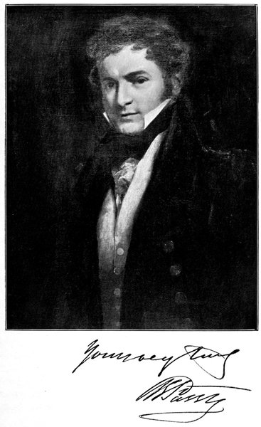
171Off Pelly Point, it afterwards appeared, the Erebus and Terror were beset in the ice in September, 1846, and fifty miles to the south-east they had been abandoned in April, 1848; but the only relic found by Rae on this occasion was the doubtful one—picked up in Parker Bay—of the butt-end of a flagstaff on which was nailed a piece of white line by two copper tacks, all three bearing the Government mark. This was the first to be found of anything that could be thought to be a trace of the missing ships, a sort of promise of what he was to meet with four years later; and it is worth noting that, had he not failed in getting across the strait to King William Land, Rae would in 1850 have probably discovered Franklin's fate.
His farthest in these parts was passed in May, 1853, by Captain Richard Collinson, in his sledge journey to Gateshead Island from H.M.S. Enterprise, then wintering in Cambridge Bay. The Enterprise and Investigator had been placed under Collinson's command and sent by way of Cape Horn to search for Franklin from the west, the instructions being that the ships should not part company; but regardless of this, Commander Robert Le Mesurier M'Clure, of the Investigator, 172happening to get through Bering Strait first, declined to wait for his commanding officer, went off on an expedition on his own account and, by a sledge journey, joined Parry's track when in search of the North-West Passage.
Steering north-east from Franklin Bay, M'Clure reached the south of Parry's Banks Land and followed the coast north-eastwards, discovering Prince of Wales Strait and making his way rather more than half-way up, until, near Princess Royal Island in 72° 50´, he was caught in the ice and imprisoned for the winter. On Trafalgar Day, 1850, M'Clure left the Investigator on a sledge journey up the strait, and at sunrise on the 26th of October, from Mount Observation in 73° 30´, a hill six hundred feet above the sea, he looked over Banks Strait and Melville Sound, and saw the coast of Banks Land terminating about twelve miles further on and thence trending to the north-west, while Wollaston Land, as it proved to be, turned eastward on the other side at Peel Point. That evening Banks Strait was reached at Cape Lord John Russell, and the North-West Passage by Prince of Wales Strait clearly demonstrated. The spot was not bare of vegetation, and there were many traces of animals, for, fortunately for M'Clure, there was no scarcity of game during his three winterings in Banks Land—reindeer in herds, musk oxen occasionally, hares in troops, ducks in plenty, ptarmigan almost as numerous, and bears, wolves, and foxes to feed on them; for instance, the weights of three items in the bag, 1945 lb. of musk ox, 7716 lb. of deer, and 1017 lb. of hare, show fairly good shooting.
173Enclosing a record of the visit in a cairn, M'Clure returned to the ship, from which in the spring three sledge parties were sent out—Cresswell's to the north-west finding that Banks Land was an island, Wynniatt's to the north-east reaching Reynolds Point on the north of Wollaston Land, and Haswell's down Wollaston Land to within forty miles of where Rae turned back about a week later—this being the only attempt at searching for Franklin that the expedition undertook after sighting Nelson Head. Released in July, the Investigator retreated down the strait and attempted to circumnavigate Banks Land, finding to the west a coast as precipitous as a wall, the water deep—fifteen fathoms close in, with the yardarms almost touching the cliffs on one hand and the lofty ice on the other—and the pack drawing forty feet of water, rising in rolling hills a hundred feet from base to summit. On shore the hills were as remarkable. Many of them were peaked and isolated by precipitous gorges, about three hundred feet deep. And all the way up them were numbers of fallen trees, in many places in layers, some protruding twelve or fourteen feet, one of these trunks measuring nineteen inches in diameter. Says M'Clure: "I entered a ravine some miles inland, and found the north side of it, for a depth of forty feet from the surface, composed of one mass of wood similar to what I had before seen. The whole depth of the ravine was about two hundred feet. The ground around the wood or trees was formed of sand and shingle; some of the wood was petrified, the remainder very rotten and worthless even for burning." And this forest bed is on the shore of the Beaufort Sea 174in 74° north latitude, a similar one being in Prince Patrick Island, on the other side of Banks Strait.
After one or two narrow escapes the Investigator entered her last home at the Bay of Mercy, well within the strait, near Cape Hamilton, the most prominent of the three capes discovered from the Dundas Peninsula by Parry's lieutenant, Beechey, thirty-one years before. The winter passed, and on the 11th of April M'Clure left the ship on a sledge journey across to Parry's old quarters at Winter Harbour, which were reached on the 28th, to find nothing but a notice of M'Clintock's having been there in the previous June. Noticing Parry's inscription rock, M'Clure judiciously left on it a statement that the Investigator was in want of relief at Mercy Bay. But all through that year no news from the outside came to Banks Land, and matters became serious owing to the appearance of scurvy, notwithstanding the abundance of fresh meat, for even in January a herd of reindeer trotted by.
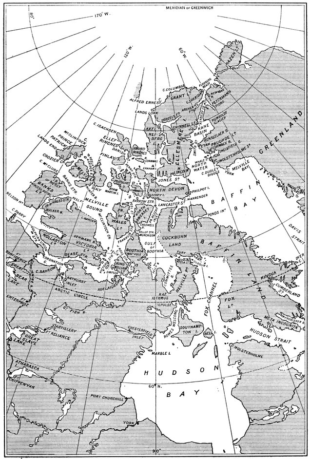
THE PARRY ISLANDS
175Another winter went wearily, each month with a gloomier outlook than the last, and on the 5th of April the first of the scurvy patients died. Next morning M'Clure and Haswell were walking near the ship discussing how they could dig a grave in the frozen ground, when they noticed a man hurriedly approaching from the entrance of the bay, throwing up his arms and shouting at the top of his voice, his face as black as ebony. When he came within talking range the dark-faced stranger called out, "I am Lieutenant Pim, late of the Herald and now in the Resolute; Captain Kellett is in her at Dealy Island." And soon the dog-sledge with two men came into view. Pim's arrival was most fortunate for the sufferers, for the captain, as a desperate resource, was—in spite of the doctor's protests—just about to send off two sledge parties of the invalids to take their chance of escaping somehow, as there was no hope of their recovery in the ship; and on examination by the doctor of the Resolute, it was found that every man of the crew was more or less affected by the disease. So the ship was abandoned in Mercy Bay, and the officers and crew, crossing to the Resolute, reached England by way of Hudson Strait.
Collinson's was the most remarkable voyage ever accomplished by a sailing-ship in the Arctic regions. It lasted from 1850 to 1855—five years and a hundred and sixteen days—all the way out across the Atlantic and Pacific and home again in safety, traversing a hundred and twenty-eight degrees of longitude in the Arctic sea, coming nearest at the time to completing the north-west passage by ship (up Prince of Wales Strait), finding two north-west passages by sledge (one joining with Parry's discoveries across Banks Strait, the other with Franklin's up Victoria Strait), and approaching nearer than any other naval expedition to the great discovery by travelling up Franklin's route for some distance, and passing within thirty miles of the spot where the vessels he was in search of had been abandoned, though unfortunately, like Rae, he was on the west side of the waterway instead of the east.
Passing Bering Strait in July, 1850, the Enterprise went north from Wainwright Inlet into the Beaufort 176Sea, until she was stopped by the heavy pack. Trying east, to join with Parry's farthest, and then west, she arrived, on the 28th of August, at 73° 23´ in 164°, and here she turned south after having sailed over eleven thousand miles without having to reef her topsails, an unprecedented run of distance and fine weather combined. Returning in 1851 from wintering at Hong Kong, Collinson, with a southerly wind "too precious to be wasted," made his way up Prince of Wales Strait, knowing nothing of the visit of the Investigator, to find ice blocking his way just at the northern outlet, his furthest north, by ship, 73° 30´, forty miles beyond M'Clure's winter quarters, as given in the record he found in one of the cairns.
Unable to round the corner into Banks Strait owing to the ice block, Collinson returned down Prince of Wales Strait and followed the track of the Investigator half-way up the west coast of Banks Land, though he had found nothing to indicate she had gone in that direction. Finding the ice conditions dangerous, he retraced his route along the coast and went into comfortable winter quarters in Walker Bay, at the entrance of Prince of Wales Strait. By the end of November the natives fishing for salmon-trout had cleared off, as also had the reindeer, hares, and ptarmigan and other birds, and on the 17th of March the ravens, which had been the last to leave, were the first to return. In April sledge parties went out, one of which under Lieutenant Parkes crossed the route of the Hecla along the strait and reached Melville Island at Cape Providence on the way to Winter Harbour, short of which, within sight of Point Hearne, Parkes began his 177homeward journey, owing to his taking the tracks of sledges and barking of dogs as indicating the presence, not of M'Clure as it did, but of Eskimos, with whom, being without weapons, he was unable to cope.
Released on the 5th of August, the Enterprise proceeded to sea, coasting along past Rae's farthest and Cape Baring, and so, where no ship had been, through Coronation Gulf to Cambridge Bay. Here the winter of 1852-3 was spent, and hence the sledges went up Victoria Strait. At Finlayson Islands, what seemed to be a piece of a companion-door was found among the driftwood, which might have been a relic of the lost ships; but that was all. During the return along the northern coast the Enterprise was beset in Camden Bay, and here the third winter was passed, release not coming until the end of the following July, and Bering Strait not being reached until the 21st of August after a voyage, like that of the Vega, too well managed to yield much adventure. Like all the other Arctic voyages of this period, it failed in the one object it was undertaken to achieve; but in days to come the first ship to sail the passage from the Atlantic to the Pacific was to follow Collinson from Cambridge Bay along the route laboriously completed by the surveyors of the mainland from James Cook to Dease and Simpson.
M'Clure claimed and—to have done with the matter—obtained the reward of £10,000 for discovering the North-West Passage through Prince of Wales Strait, though he sailed only half-way up it and, in attempting to get round to Parry's farthest, lost his ship and started sledging on the west side of the pack; while 178Collinson took his ship much nearer to Parry's course on the east side; and Franklin, by linking up with Dease and Simpson over the ice by way of Victoria Strait, had previously found another of the possible passages, as shown by Collinson's voyage to Cambridge Bay. But surely what was done by M'Clure, and by Collinson in his northerly cruise, was to see where ships could pass when there was no ice in the way, which was no more than had been done by Parry, who had taken his ship within sight of both their farthest, and would have sailed into the Beaufort Sea had not the pack forbidden it. It was Parry, in fact, who discovered the main road, the route by Prince of Wales Strait, like that by Peel Sound taken by Franklin and successfully accomplished by Amundsen, being only one of the many by-roads leading off along his course.
His famous voyage to Melville Island was due to the influence of Sir John Barrow. Barrow, to whom more than any other man this country owes its position in Arctic story, was born in a small thatched cottage at Dragley Beck, near Ulverston, in North Lancashire, in 1764, and, in a remarkable course of promotion by merit, became second secretary of the Admiralty for forty years under twelve or thirteen different naval administrations, Whig and Tory; being so unmistakably the right man in the right place that he was only dispensed with once—on a change of First Lords—and then was reinstated the next year. When he was seventeen he was given the opportunity of a voyage in a Greenland whaler, which he accepted, and that was his only Arctic experience; but even when with Macartney in China and South Africa, he kept up his interest in the north, and in 1817, when at the Admiralty, proposed to Lord Melville his plan for two voyages of discovery, one to the north and the other to the north-west, which opened the new era of Polar exploration.
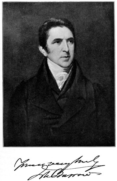
179The voyage to the north was that of Buchan and Franklin in the Dorothea and Trent; that to the north-west was undertaken by John Ross in the Isabella and William Edward Parry in the Alexander. Of this we need only say here that on their return from the north of Baffin Bay, Ross and Parry coasted down the west side and sailed into Lancaster Sound for a considerable distance until Ross—who seems to have had the mountain-finding eye and an unenviable gift for missing straits—declared that it ended in a range of mountains which he appropriately named Croker's; and, that there should be no mistake about them, he gave a very pretty picture of them as a full-page plate in his book. Parry, however, saw no mountains and took the liberty of saying so to Barrow when he reported himself at the Admiralty, the result being the despatch of Parry's expedition in the Hecla and Griper which left Yarmouth on the 12th of May, 1819, and, for the first time after leaving the coast of Norfolk, dropped anchor in the bay named after them in Melville Island, on the 5th of September.
Parry, before his voyage in the Alexander, had had Arctic experience while lieutenant of the Alexandria frigate engaged in protecting the Spitsbergen whale fisheries, and knew thoroughly what he was about. For instance, he worked his crews in three watches, and had both his vessels rigged as barques 180as the most convenient rig among ice, though the Griper, a strong, slow gunboat, was rather too small to be so treated, being only about half the tonnage of the Hecla, whose measurement was under four hundred. Had she been a little speedier more work might have been done; but what was done was magnificent.
Entering Lancaster Sound, Parry found a strait not blocked by mountains but thirty miles broad leading into a region up to then unknown, except—so it is said—to the Norsemen. On the 12th of August Prince Regent Inlet was discovered and named, it being George IV's birthday. Then North Somerset was sighted and the course laid across Barrow Strait to North Devon and its south-western peninsula known as Beechey Island; then Wellington Channel was descried, and then Cornwallis Island. Griffith Island was discovered on the 23rd of August, Bathurst Island on the 25th, Byam Martin Island on the 27th, where Sabine, the astronomer of the expedition, found they had passed north of the magnetic north pole. Then the south side of Melville Island was coasted along, Dealy Island being found on the 4th of September at noon, and, at a quarter past nine at night, just after passing Bounty Cape (named in honour of the event), the Hecla crossed the 110th meridian west, and became entitled to the Government grant of £5000 for doing so—which Parry shared between the ships.
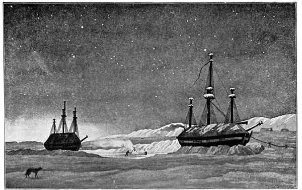
H.M.S. "HECLA" AND "GRIPER" IN WINTER HARBOUR
181Soon the ice became difficult and the ships had to anchor, but, the conditions improving, the westerly voyage was resumed. Cape Providence was passed and Cape Hay sighted, but the ships could get no further than about half-way between these capes, and they had to return to Winter Harbour, where, on the 26th of September, they were warped to their quarters through a channel cut in the ice. The Hecla, sending down all her upper masts except the main topmast, and the Griper, housing her fore and main topmasts, used the spars to support a roof which completely enclosed their upper decks and made them both snug for the winter, which did not seem so long owing to the efforts of the officers to keep every one amused and on the move. Parry, a host in himself, was well seconded by his lieutenant, Beechey, late of the Trent, James Clark Ross, one of his midshipmen, Captain Sabine, and Lieutenant Liddon, the commander of the Griper, who was almost disabled with rheumatism, and Lieutenant Hoppner, also of the Griper. A couple of books of plays on board proved a real treasure; owing to them the Royal Arctic Theatre was started, the pioneer of so many amateur theatrical ventures in the Polar seas, and the North Georgia Gazette and Winter Chronicle came into existence, the first of ship newspapers. On Christmas Day there was a dinner of roast beef which had been on board since May, the condition of which, as Parry said, was an excellent testimony to the antiseptic properties of a cold atmosphere; and the food generally was good and abundant, and the management and supplies far better than on many subsequent expeditions. In the spring, game was found in fair quantity, nearly four thousand pounds of musk ox, deer, hares, geese, ducks, and ptarmigan being brought on board.
In May the vessels were afloat again, though ice-bound, and, in June, walking, not sledging, journeys 182were organised, the furthest points reached being Cape Fisher to the north and Cape Hoppner to the west. On the 1st of August the vessels moved out of the bay to the westward, and six days afterwards Beechey called attention to the land with the three capes already mentioned. "The land," says Parry, "which extends beyond the 117th degree of west longitude, and is the most western yet discovered in the Polar Sea to the north of the American continent, was honoured with the name of Banks Land out of respect to the late venerable and worthy President of the Royal Society."
On the 16th Cape Dundas was named, but progress was impossible. For a week Parry made every endeavour to pass, but the floes, forty to fifty feet thick, heaped up by the tides from the east and the west so as to form a wide-stretching landscape of hill and dale, barred the way right across Banks Strait; and no further west could be attained than 113° 46´ 43·5˝, in latitude 74° 26´ 25˝. Thence Parry returned, hoping to get through on another voyage, and bidding farewell to the North Georgian Islands, as he called them, or the Parry Islands, as we now know them, he came home by the way he went out, through Lancaster Sound. Needless to say, the very next season the whalers followed on Parry's track, and Lancaster Sound became the highway to a very profitable fishing-ground.
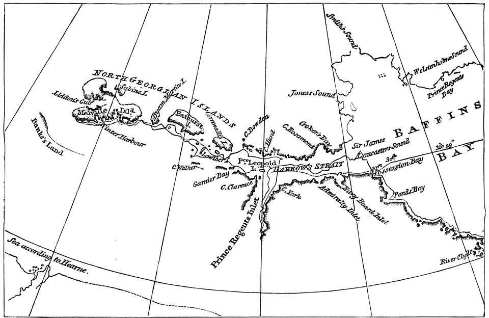
PARRY'S DISCOVERIES ON HIS FIRST VOYAGE
183Among the Parry Islands in 1851 were several vessels in search of Franklin. Sir John Ross, aged seventy-four, was there in the schooner-yacht Felix on a private expedition chiefly memorable for the story of his having sent off a carrier pigeon from his winter quarters at Cornwallis Island, which reached his home—North-West Castle, Stranraer, Wigtownshire—three thousand miles away, in five days. Lady Franklin's vessel, the Prince Albert, was there, with Captain Forsyth and Parker Snow on board, an old fruit schooner, and therefore the speediest sailing-craft among the crowd. The Grinnell expedition of the two American brigs, Advance and Racer, under De Haven, was also there, to drift afterwards up Wellington Channel and down again back into Baffin Bay; as was a British Government expedition of the two whaling brigs, Lady Franklin and Sophia, under Captain William Penny, who was to discover the sea open north of Wellington Channel. In addition to these was the British squadron under Captain Horatio Austin in H.M.S. Resolute, with H.M.S. Assistance, Captain Erasmus Ommanney, and the old Cattle Conveyance Company's boats known as H.M.S. Intrepid, Lieutenant Cator, and H.M.S. Pioneer, Lieutenant Sherard Osborn, these two being screw steamers used as tenders, which proved of great value as tugs and ice-breakers.
On the 23rd of August Captain Ommanney found Franklin's winter quarters on Beechey Island, and four days afterwards Captain Penny came upon the gravestones marking where the three men, two of the Erebus and one of the Terror, had been buried in 1846, though nothing was discoverable of the route intended to be taken by the ships. The news was important, and the Prince Albert, acting as despatch vessel, was immediately sent home with it, to return next year with Kennedy and Bellot to make a discovery of her own. Soon Captain Austin's four ships 184departed, also to return in the following year, Sir Edward Belcher, in the Assistance, being then in command, Kellett being in the Resolute, M'Clintock in the Intrepid, and Sherard Osborn again in the Pioneer. Belcher's attempt ended in his abandoning his vessels in the ice; one of them, the Resolute, as though in mute protest, drifting from 74° 41´ for a thousand miles, to be picked up by Buddington off Cape Dyer in Baffin Bay, bought from him by the American Government and presented to Great Britain, refitted as she used to be, as a much-appreciated token of goodwill.
The great feature of these years was the wonderful sledge work; by it mainly the northern coasts of the islands discovered by Parry were surveyed and other islands added to the archipelago, including the westernmost, Prince Patrick, named after the Duke of Connaught, who was at first known as Prince Patrick instead of Prince Arthur. The sledges fitted out by Austin traversed 1500 miles of coast-line, 850 of which were new, the routes radiating between Osborn's 72° 18´ and Bradford's 76° 25´, M'Clintock going farthest, 760 miles, to 114° 20´ in 74° 38´. Those next year from Kellett at Dealy Island covered 8558 miles, radiating from Pim's 74° 6´ (to rescue M'Clure) to M'Clintock's 77° 23´, a run to 118° 20´ and back of 1401 miles, while Mecham reached 120° 30´ on a trip of 1163 miles; and Belcher from his winter quarters in Northumberland Sound, in 76° 52´, aided by Richards and Osborn, was almost as busy further north.
Thus practically the whole belt of land and sea westward between and including Lancaster Sound and 185Jones Sound as far as 120° was searched and mapped, the most northerly of the Parry Islands known up to then being Finlay Island, North Cornwall, and Graham Island. But in 1898 Captain Otto Sverdrup went up Smith Sound in his old ship the Fram on an endeavour to sail round the north coast of Greenland from west to east. He had to winter in Rice Strait, near Pim Island, and finding, to put it sportingly, that he was to a certain extent trespassing on Peary's preserves, decided to devote his attention to the unknown region approachable through Jones Sound. In 1899, therefore, he took the Fram up the sound, and, failing to pass through Cardigan Strait, spent the three following years among the fiords at the north-western end.
From here he sent his sledge and ski parties far and wide, west and south and north over an approximate area of a hundred thousand square miles. Long stretches of coast-fine were explored and named, in a few cases unnecessarily, though, strange to say, the unnecessary names were all royal ones, King Oscar Land being the west of Ellesmere Land, Crown Prince Gustav Sea and Prince Gustav Adolf Sea being the Polar Ocean, and King Christian Land being simply Finlay Island. Separated from Finlay Island by Danish Sound and from North Cornwall by Hendriksen Sound, he found two large islands, which—just as John Ross named Boothia after his principal patron, the distiller—Sverdrup named Ellef Ringnes and Amund Ringnes after two of his supporters, the brewers; his other discovery, Axel Heiberg Land—which seems to be Peary's Jesup Land sighted in 1898—to 186the west and north-west of these, being so called after his other munificent patron.
His farthest south was Beechey Island, his farthest west Cape Isachsen in Ellef Ringnes Land, his farthest north Lands Lokk in Grant Land, in latitude 81° 40´ and longitude about 92°, within sixty miles of Aldrich's farthest along the north-eastern coast, the gap afterwards traversed by Peary. Within these limits the amount of coast detail filled in was remarkable. Owing to the favourable condition of the ice and the excellent management in all ways, the sledges frequently did their fifteen miles and more a day. Though the expedition lost its doctor during the first winter, there was little trouble as regards health; and game was in plenty right up to the far north where Hare Fiord tells of hares in hundreds.
With hunting episodes the story is pleasantly varied, one in particular being so graphically described by Sverdrup that as a sample we may be forgiven a rather long quotation. "The bear," says Sverdrup, "was determined to go up a difficult stony valley a little north of our tent, and, try as the dogs would to prevent it, up the valley it went. Schei and I ran full speed northward along the ice-foot, and soon heard that the dogs had brought it to bay. We made a short cut across some hills of grit, and, when we reached the top of one of them, saw the bear on the other side of the valley, sitting on a hill-top, which fell almost sheer away. But on the north side it was accessible, and here it was probably that the bear had climbed it. There sat the king of the icefields enthroned on a kind of pedestal, and the whole staff of yelping dogs standing 187at a respectful distance. I tried a couple of shots, but overrated the distance, and the bullets went over the bear's head. I then told Schei to go and shoot it whilst I looked on at the further development of the drama. The bear's position was a first-rate one. It had taken its stand on a little plateau high up on a mountain crag; this little ledge was reached by a bridge not more than a good yard in width, and there stood the bear, like Sven Dufva, ready with his sledgehammer to fell the first being that should venture across. His majesty was not visible to Schei until he came within a few feet of him, but then it was not long before a shot was heard. The bear sank together, and a few seconds afterwards all the dogs had thrown themselves on to it. They tugged and pulled at the bear's coat, tearing tufts of hair out of it, and before we knew what they were doing, had dragged the body to the edge of the plateau, where it shot out over the precipice. The dogs stood amazed, gazing down into the depths where the bear was falling swiftly through the air—but not alone, for on it as large as life were two dogs which had clung so fast to its hair, that they now stood planted head to head, and bit themselves still faster to it in order to keep their balance. I was breathless as I watched this unexpected journey through the air. The next moment the bear in its perpendicular fall would reach the projecting point of rock, and my poor dogs!—it was a cruel revenge the bear was taking on them. I should now have only three dogs left in my team. The bear's body dashed violently against the rock, turned a somersault out from the mountain wall and fell still 188further, until, after falling a height of altogether at least a hundred feet, it reached the slopes by the river, and was shot by the impetus right across the river-ice and a good way up the other side. And the dogs? When the bear dashed against the mountain they sprang up like rubber balls, described a large curve, and with stiffened legs continued the journey on their own account, falling with a loud thud on to the hardly packed snow at the bottom of the valley. But they were on their legs again in a moment, and set off as fast as they could go across the river after the bear. Not many minutes afterwards the whole pack came running up, but when they were driven away from the carcase, they lay down again to await their turn. I hurried back to camp to fetch the dog harness; we put a lanyard through the nose of the mighty fallen, and set off. The dogs knew well enough that this meant food for them, and the nearer we came to camp the harder they pulled. In fact, I had to sit on the carcase to keep them back, and, jolting backwards and forwards, on this new kind of conveyance I made my entrance into camp, in the light spring night." But bears were few, compared with the musk oxen, which, with the reindeer and hares, and with the wolves and foxes, and stoats and lemmings, seals and walruses, narwhals and white whales, represented the Arctic mammalia.
The most singular experience met with was perhaps the sledge journey through the ice tunnel on the return across the Simmons Peninsula in 1900. Descending a valley which became narrower and narrower Sverdrup and Fosheim began to think it was going to end in a 189canyon, but without any warning they were stopped by a high wall of ice, perpendicular and inaccessible to any one without wings. Looking about, Sverdrup found a large hole which proved to be the beginning of a tunnel through the glacier. Through this lofty vault they sped. From the roof hung threateningly above their heads gigantic blocks of ice, seamed and cleft and glittering sinisterly; and all around were icicles like steel-bright spears and lances piercing downwards on them. Along the walls were caves after caves, with pillars in rows like giants in rank; and over all shone a ghostly whitish light which became bluish as they went. "I dared not speak," says Sverdrup. "It seemed to me that in doing so I should be committing a deed of desecration; I felt like one who has impiously broken into something sacred which Nature had wished to keep closed to every mortal eye. I felt mean and contemptible as I drove through all this purity. The sledges jolted from block to block, awakening thunderous echoes in their passage: and it seemed as if all the spirits of the ice had been aroused and called to arms against the intruders on their church-like peace."
Christopher Middleton—Wager River—Repulse Bay—Parry's second north-west voyage—Melville Peninsula—Fury and Hecla Strait—John Ross's second Arctic voyage—Introduces steam navigation into the Arctic regions—The whaler John—Ross misses the North-West Passage—Snow houses—Eskimo geographers—James Clark Ross finds the Magnetic North Pole—Lyon in the Griper—Back in the Terror—Rae's journey round Committee Bay—Sir John Franklin's last voyage—Kennedy and Bellot—Discovery of Bellot Strait—Rae's journey in 1854—His Franklin discoveries—M'Clintock's voyage in the Fox—Lady Franklin's instructions—Captain Charles Hall—Frederick Schwatka—Amundsen accomplishes the North-West Passage.
In July, 1742, Christopher Middleton, working northwards in Hudson Bay from Fort Churchill, made his way up Rowe's Welcome and entered a deep inlet apparently leading to the South Sea. Middleton—who gained his Fellowship of the Royal Society for his variation observations at Fort Churchill, and was the first to practise the modern method of finding longitude by eight or ten different altitudes of the sun or stars when near the prime vertical—spent eighteen days in the inlet observing the tides, and then came to the conclusion that it was an estuary; and he named it Wager River after Sir Charles Wager, who was First Lord of the Admiralty when he began his voyage. Proceeding north, he reached his Repulse Bay, and at the north-east end of it saw Frozen Strait, as he called it, stretching away along the north of Southampton Island towards Cape Comfort. Here, also from tidal observations, he satisfied himself that Repulse Bay afforded no passage to the westward and that Frozen Strait led into Fox Channel.
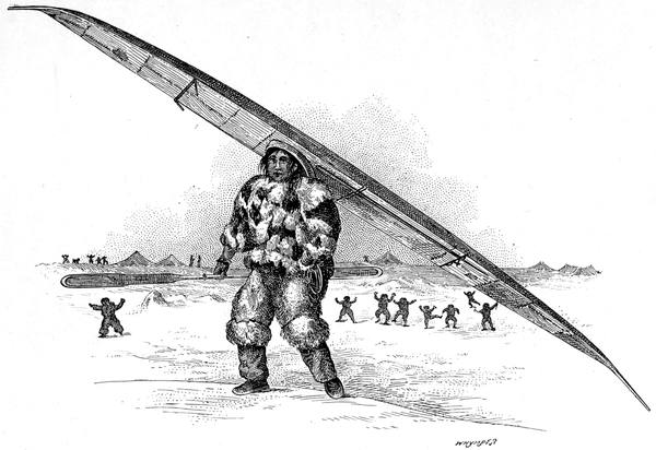
AN IGLOOLIK ESKIMO CARRYING HIS KAYAK
191His opinions were disputed by those who only knew the coast from his chart, and two vessels were sent out to prove he was wrong. The reports of the captains of these—there is no need to mention their names—were embarrassing. Neither had been to Repulse Bay, but both had been to Wager River, and they agreed that it was unmistakably a river and not a strait; but in every other respect, even in naming the places they had seen, they were at variance. Thus the matter was left in sufficient doubt to encourage some people in believing in a north-west passage through Repulse Bay, just at the Arctic Circle, and to seek this, Parry, on his return from Melville Island, was despatched on his second voyage.
This time the Hecla was commanded by George Francis Lyon—the North African traveller—Parry being in the Fury, a sister ship; both vessels, at Parry's suggestion, being exactly alike so that their gear and fittings were interchangeable. They sailed from the Little Nore on the 8th of May, 1821, and going direct up Frozen Strait, with much trouble from the ice, ran into Repulse Bay on the 22nd of August. Here after a careful examination it was ascertained beyond a doubt that no passage existed through to the westward. "Thus," says Lyon, "the veracity of poor Middleton, as far as regards this bay at least, was now at length established; and in looking down the strait we had passed, he was fully justified in calling it a frozen strait. 192We were now indisputably on our scene of future action, the coast of America; and it only remained for us to follow minutely the line of shore in continuation from Repulse Bay."
During a stay at Gore Bay red snow was brought off to the Fury, its colour being much fainter than that found in the Isabella voyage at Crimson Cliffs in Greenland; "the appearance of the mass was not unlike what is called raspberry ice, in a far better climate, where cold is made subservient to luxury." The colouring of this is due to one of the Algæ, Protococcus nivalis, and not as Peter Paterson said in 1671—ninety years before De Saussure—to the rocks being "full of white, red, and yellow veins, like marble; upon any alteration of the weather, these stones sweat, which, together with the rains, tinges the snow red." The day on which this snow was found, the 30th of August, was so warm that the party were glad to pull off their coats and waistcoats. "The valleys were fertile in grasses and moss; and the fineness of the weather had drawn forth a number of butterflies, spiders, and other insects, which would, by their gay colours and active motions, have almost deceived us into an idea that we were not in the Arctic regions, had not the Frozen Strait, filled with huge masses of moving ice, reminded us but too forcibly, that we were in the most dangerous of them."
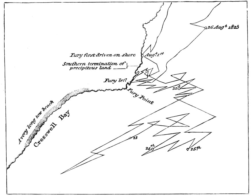
PARRY'S FARTHEST ON HIS THIRD VOYAGE
193Early in October the ships took up their quarters at Winter Island on the coast of Melville Peninsula in 66° 32´, and there, during the cordial intercourse with the Eskimos, Parry heard of the way through further north which led him on his release in the following July to discover Fury and Hecla Strait, along which the ships passed to find their progress blocked by the ice just beyond its entrance into Regent Inlet. Returning through the strait, they reached the island of Igloolik at the eastern entrance, and there they passed the winter, Igloolik being an important Eskimo settlement, with four fixed places of residence on it, to which as the season changes the natives move in rotation. From this island, as the health of the men did not permit of his venturing to spend another winter in the ice, Parry retraced his route and returned to England.
The ships dropped anchor in the Thames on Trafalgar Day, 1823. Next year, on the 19th of May, they were off again to the north to seek a passage to the west down Prince Regent Inlet, Parry in the Hecla, Hoppner in the Fury. It was a bad season. The ships were late in leaving Baffin Bay and were hindered by new ice in Lancaster Sound. So far from reaching the strait discovered two years before, they could get no further south than Port Bowen, in 73° 12´, where they spent the winter in a singularly barren part of Cockburn Land. Starting in July they went down to Cresswell Bay, the ships being forced by the weather and the ice to work—as is not unusual under such circumstances—in almost every possible direction within every mile, their track—as shown in the illustration—being most complicated. The end of it all was that the Fury was wrecked and her stores carefully taken out and left, on what was named Fury Beach, for the use of future callers in want of them. And the Hecla came home alone.
Four years afterwards Captain John Ross, anxious 194for further work in the north, started in search of the passage by the same route. After some years of effort he had succeeded in organising an expedition, the expenses of which to the amount of over £17,000 were borne by Felix Booth, with the exception of over £2000 added by Ross himself. It was a memorable voyage in many respects, and for one thing in particular that is frequently passed unnoticed. This was the introduction of steam into Arctic navigation. The Victory was an old Isle of Man packet-boat of eighty-five tons, which, by raising her sides five feet, Ross increased to one hundred and fifty tons. Taking out her old paddles, he replaced them with a pair of Robertson's patents, hoistable out of water in a minute, so as to clear the ice. The engine was also a patent, by Braithwaite and Ericsson, who built the Novelty that appeared at Rainhill. But neither Braithwaite nor Ericsson was any happier in this production. Its great feature was the doing away with the funnel, no flue being required owing to the fires being kept going by artificial draught derived from two bellows of unequal sizes—"the bellows draught," in fact, like that of the Novelty which broke down in the great locomotive contest won by the Rocket. Had not Ross been a man of enterprise he would never have ventured to sea with such an experimental arrangement; but he did, and he suffered for it.
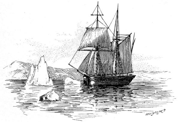
THE "VICTORY"
195The "execrable machinery," as he inadequately called it, went wrong from the first. On the way from Galleons Reach to Woolwich, part of it became displaced, causing a delay for repairs. At Woolwich, Sir Byam Martin, the Comptroller of the Navy, and Sir John Franklin went on board and said uncomplimentary things about it, as also did the Duke of Orleans (afterwards King Louis Philippe) and the Duke of Chartres, though the Frenchmen were more gentle in their phrases. From Woolwich to Margate this remarkable engine, aided by the sails, took the Victory in just over twelve hours, the boiler leaking so much that the additional forcing pump had to be kept working by hand all the time. Passing the Lizard, the piston-rod was found to be so much worn on one side by friction against the guide-wheels that a piece of iron had to be brazed on to it. Then the keys of the main shaft broke and the substitutes made on board broke one after the other. "The boilers also continued to leak, though we had put dung and potatoes in them by Mr. Ericsson's directions." The air-pump drew quantities of water; the feeding pump was insufficient to supply the boiler. The big bellows nearly wore out; so did the small one. Off the Mull of Galloway the stoker fell into the machinery and had his arm crushed and nearly severed above the elbow. Then the teeth of the fly-wheel of the small bellows were shorn off, and the boiler joints gave way, and the water, or rather the potato soup, flowed out of the furnace doors and put out the fire.
Enough has been said to show the difficulties under which Ross first used steam on a voyage to the northern seas. The list of damages need not be continued. Every constituent part of the apparatus gave way in turn; and when the Victory became imprisoned for the winter, and the engineering staff had some time on their hands, they employed it in taking what was 196left of the installation, piece by piece, out of the ship, laying it on the ice, and leaving it there.
Ross was to be accompanied by the whaler John, but the men mutinied and refused to start, so that he went on from Loch Ryan alone. The following year the crew of the John, then on a whaling voyage in Baffin Bay, again mutinied, killed the master, put the mate adrift in a boat in the manner of Henry Hudson, and lost the ship on the western coast, where most of them were drowned.
With the Krusenstern, a boat of eighteen tons, in tow, Ross crossed the Atlantic, sighting Sanderson's Hope on the 29th of July, having left Scotland six weeks before. Early in August he sailed through Lancaster Sound, and, taking the opportunity of removing his Croker's Mountains to the north-east corner of North Somerset, went down Prince Regent Inlet to Fury Beach. After completing his provisions for twenty-seven months from the stores left behind by Parry, he crossed Cresswell Bay, passed Cape Garry, Parry's farthest south, on the 15th of August, and next day, Sunday, "I went on shore," he says, "with all the officers, to take formal possession of the new-discovered land; and at one o'clock, being a few minutes after seven in London, the colours were displayed with the usual ceremony, and the health of the King drunk, together with that of the founder of our expedition, after whom the land was named."
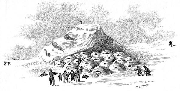
NORTH HENDON
197"From the highest part of this land, which was upwards of a hundred feet above the level of the sea," he continues, "we had a good view of the bay and the adjoining shores, and had the satisfaction to find that the ice was in motion and fast clearing away. We therefore resolved to wait patiently till we could see an opening; and proceeded to the northern quarter of this spot to make some observations on the dip of the magnetic needle.... To this place I gave the name Brown Island, after the amiable sister of Mr. Booth; the inlet was named Brentford Bay, and the islands Grimble Islands." And in his book is a beautiful steel engraving by W. Chevalier, "Taking Possession. Cape Hussard, Grimble Isle, Brentford Bay, Brown's Island." In short, Ross found the place, landed on it, took possession of it, named it and sketched it. "The sketches from which the drawings were made were taken by Mr. Ronald's invaluable perspective instrument, and therefore must be true delineations."
And Ross passed on, apparently quite pleased with himself. But the Fates had again been against him, for this was the very North-West Passage he had come specially to find; the bay, as Kennedy was to show, being the entrance to Bellot Strait in which the Fox was to winter when on the Franklin search. He had blundered along from the island of North Somerset to the mainland of America, and passed unheeded its northernmost point, which M'Clintock was to name Cape Murchison.
Working down the coast of the newly-named Boothia, the Victory reached Felix Harbour, and there she wintered. No Eskimos were seen until the 9th of January, when thirty-one came to the ship and were invited on board, a return visit being paid next day to their village, which Ross named North Hendon. As 198this was a typical Eskimo snow camp we may as well copy his picture and quote his description.
"The village soon appeared, consisting of twelve snow huts, erected at the bottom of a little bight on the shore, about two miles and a half from the ship. They had the appearance of inverted basins, and were placed without any order; each of them having a long crooked appendage, in which was the passage, at the entrance of which were the women, with the female children and the infants. We were soon invited to visit these, for whom we had prepared presents of glass beads and needles; a distribution of which soon drove away the timidity which they had displayed at our first appearance. The passage, always long, and generally crooked, led to the principal apartment, which was a circular dome, being ten feet in diameter when intended for one family, and an oval of fifteen by ten where it lodged two. Opposite the doorway there was a bank of snow, occupying nearly a third of the breadth of the area, about two feet and a half high, level at the top, and covered by various skins, forming the general bed or sleeping place for the whole. At the end of this sat the mistress of the house, opposite to the lamp, which, being of moss and oil, as is the universal custom in these regions, gave a sufficient flame to supply both light and heat; so that the apartment was perfectly comfortable. Over the lamp was the cooking dish of stone, containing the flesh of deer and of seals, with oil; and of such provision there seemed no want. Everything else, dresses, implements, as well as provisions, lay about in unspeakable confusion, showing that order, at least, was not in the class of their virtues. It was much more interesting to us to find, that among this disorder there were some fresh salmon; since, when they could find this fish, we were sure that it would also furnish us with supplies which we could not too much multiply. On inquiry, we were informed that they were abundant; and we had, therefore, the prospect of a new amusement, as well as of a valuable market at the mere price of our labour."
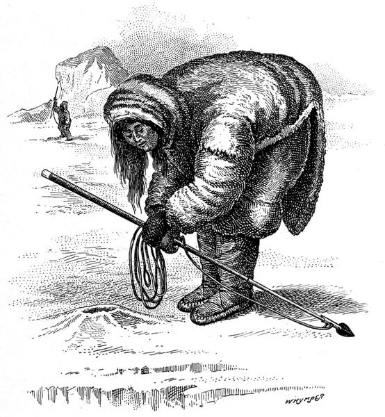
ESKIMO LISTENING AT A SEAL-HOLE
199A few weeks later Ross was to see how these houses were built. "Four families," he says, "comprising fifteen persons, passed the ship to erect new huts about half a mile to the southward. They had four heavy-laden sledges, drawn each by two or three dogs, but proceeded very slowly. We went after them to see the process of building the snow house, and were surprised at their dexterity; one man having closed in his roof within forty-five minutes. A tent is scarcely pitched sooner than a house is here built. The whole process is worth describing. Having ascertained, by the rod used in examining seal holes, whether the snow is sufficiently deep and solid, they level the intended spot by a wooden shovel, leaving beneath a solid mass of snow not less than three feet thick. Commencing then in the centre of the intended circle, which is ten feet or more in diameter, different wedge-shaped blocks are cut out, about two feet long, and a foot thick at the outer part; then trimming them accurately by the knife, they proceed upwards until the courses, gradually inclining inwards, terminate in a perfect dome. The door being cut out from the inside before it is quite closed serves to supply the upper materials. In the meantime the women are employed in stuffing the joints 200with snow, and the boys in constructing kennels for the dogs. The laying the snow sofa with skins and the insertion of the ice window complete the work; the passage only remaining to be added, as it is after the house is finished, together with some smaller huts for stores"—the design being similar to that of the yurts of the Eskimos of the north, with a change of material, snow for stone, and ice instead of seal-gut for the window over the entrance.
Making friends with the Eskimos, and gaining a great reputation by the carpenter fitting one of them with a wooden leg, Ross obtained much valuable information from them, particularly as to the geography of the district. Like all Arctic men, he was impressed by their quickness in understanding maps and their skill in drawing them upon anything, snow, paper, or otherwise, that lay handy. One of them, Ikmallik, drew in the ship's cabin a map, which he reprints in his book, showing the coast-line of the country south of the Victory's quarters, with the capes, inlets, and islands, giving the isthmus of Boothia and Committee Bay, and Repulse Bay on the other side of the Melville Peninsula, which is really wonderful, for neither the Eskimo, nor Ross, had anything to copy from, it being nearly twenty years before Rae's exploration; and the one thing it clearly demonstrated was that there was no waterway to the westward, south of Felix Harbour.
Ross owed much to Ikmallik, and really a good deal of the time of the expedition was spent in confirming the statements of that well-informed man. The west coast of Boothia was surveyed down to Bulow Bay; the east side from Cape Nicholas down to Cape Porter, 201including the crossing of the upper part of James Ross Strait, the discovery of Matty Island and the north-east coast of King William Land from Cape Landon, opposite Cape Porter—where Ross, as usual, missed a strait—westward to capes Franklin and Jane Franklin, within sight of which in the days that were coming, by one of those remarkable coincidences so frequent in the north, the Erebus and Terror were to meet their fate.
The one conspicuous triumph of the expedition was the journey of James Ross to the site of the Magnetic North Pole, which he found on the western coast of Boothia on the 1st of June, 1831. In the younger Ross's own words, "the land at this place is very low near the coast, but it rises into ridges of fifty or sixty feet high about a mile inland. We could have wished that a place so important had possessed more of mark or note. It was scarcely censurable to regret that there was not a mountain to indicate a spot to which so much of interest must ever be attached; and I could even have pardoned any one among us who had been so romantic or absurd as to expect that the magnetic pole was an object as conspicuous and mysterious as the fabled mountain of Sinbad, that it even was a mountain of iron, or a magnet as large as Mont Blanc. But Nature had here erected no monument to denote the spot which she had chosen as the centre of one of her great and dark powers; and where we could do little ourselves towards this end, it was our business to submit, and to be content in noting by mathematical numbers and signs, as with things of far more importance in the terrestrial system, what we could but ill 202distinguish in any other manner.... We fixed the British flag on the spot and took possession of the North Magnetic Pole and its adjoining territory in the name of Great Britain and King William the Fourth. We had abundance of materials for building, in the fragments of limestone that covered the beach; and we therefore erected a cairn of some magnitude, under which we buried a canister containing a record of the interesting fact; only regretting that we had not the means of constructing a pyramid of more importance and of strength sufficient to withstand the assaults of time and of the Eskimos. Had it been a pyramid as large as that of Cheops, I am not quite sure that it would have done more than satisfy our ambition, under the feelings of that exciting day. The latitude of this spot is 70° 5´ 17˝, and its longitude 96° 46´ 45˝ west."
The Victory in the short summer of 1830 sailed a few miles further south and spent the winter in Victoria Harbour, to be there abandoned in May, 1832. Ross in his boats made for Fury Beach, where, at Somerset House, as he called it, he passed the following winter. On the 26th of August, 1833, when in his boats off the eastern mouth of Lancaster Sound, he was picked up by the Isabella, his old ship, and in her he reached the Humber in October of that year after four successive winters in the ice, having been enabled to make so long a stay by his fortunate find of the stores left by Parry.
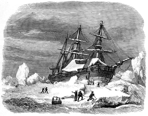
H.M.S. "TERROR" LIFTED BY ICE
203In 1824 Captain Lyon was sent out in the Griper to winter at Repulse Bay, and thence crossing the isthmus described by the Eskimos continue along to Franklin's Point Turnagain; but the Griper was nearly wrecked in Rowe's Welcome and did not reach Wager River. The discoveries of Ross led to the renewal of this attempt by Captain Back in the Terror in 1836. He was to go to Wager River or Repulse Bay, and then make his way into Prince Regent Inlet, and so west; but he became imprisoned in the ice off Cape Comfort during one of the severest winters known. Drifting up Frozen Strait amid most perilous experiences, the ship, lifted high above sea-level by pressure, lay at times almost horizontal. Once "they beheld," he says, "the strange and appalling spectacle of what may be fitly termed a submerged berg, fixed low down, with one end to the ship's side, while the other, with the purchase of a long lever advantageously placed at a right angle with the keel, was slowly rising towards the surface. Meanwhile, those who happened to be below, finding everything falling, rushed or clambered on deck, where they saw the ship on her beam-ends, with the lee boats touching the water, and felt that a few moments only trembled between them and eternity."
Day after day the Terror defied the persistent effort of the ice to smash her, but suffering much in almost every timber she withstood it sufficiently to keep together. For four months she was entirely out of water, and when at last she was free, Back wrapped her up as best he could, and brought her home with the water pouring into her so that the men were so wearied out that they could hardly have continued at the pumps another day; and he ran her ashore in Lough Swilly only just in time. Upwards of twenty feet of her keel, together with ten feet of the stern-post, were driven over more than three and a half feet on one side, leaving a frightful opening astern for the free 204ingress of water. The forefoot was entirely gone; numbers of bolts were either loosened or broken; and when, besides this, the strained and twisted state of the ship's frame was considered, there was not one on board who did not express astonishment that they had ever floated across the Atlantic.
The next attempt to complete the coast of the American mainland was made from the land, and at the cost of the Hudson's Bay Company. Really it was the expedition proposed by Simpson some five years before, of which he would have been the leader had he not been shot; and it was entrusted to the capable hands of Dr. John Rae.
After wintering at York Factory, Rae reached Repulse Bay with two boats, the Magnet and North Pole, on the 25th of July, 1846, and in his usual style started immediately across the chain of lakes and portages which make up the isthmus that now bears his name, launching his boats in the tidal water of Committee Bay on the 1st of August. Stopped by ice on the west side and then on the east he returned to Repulse Bay, where he built Fort Hope of stones and roofed it with sails, and lived in it through the winter on what he could shoot and catch, for many weeks venturing on only one meal a day. Outside the men kept themselves warm chiefly by building snow houses and playing football; inside, as the only fuel used was for cooking, the only thing they could do was to wrap themselves in furs, and trust to their natural heat in a temperature that ranged about zero.
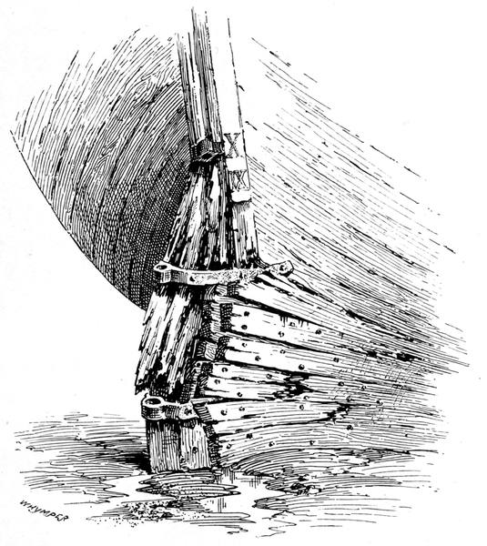
FRACTURED STERN-POST OF H.M.S. "TERROR"
205In April, with a couple of sledges, eight dogs, and five men, he crossed the isthmus again and went straightaway up the east side of Boothia to Ross's farthest south, thus completing that coast-line. Back he went to Fort Hope after a trip of nearly six hundred miles, to start again on the 12th of May up the west coast of the Melville Peninsula to Cape Ellice, which Parry had sighted from the strait on that side. And he was back once more at Fort Hope on the 9th of June. Thus the survey of the northern coast was complete with the exception of the gap between the Boothia isthmus, on the west side, and Castor and Pollux River of Dease and Simpson, which Rae in another famous effort from Repulse Bay was to link up later on.
When Rae reached Lord Mayor's Bay on the east coast of Boothia, Franklin, with the Erebus and Terror, was off its west coast in the same latitude. This was the reappearance of the Terror in the north. After Back's voyage she had been repaired to sail with the Erebus, under Sir James Clark Ross, when he discovered the South Magnetic Pole; and on their return the barques had been thoroughly overhauled and fitted with auxiliary screws, the first time that the screw propeller was used in Arctic work. Franklin was in the Erebus, the Terror being commanded by Francis R. M. Crozier as she had been in the Antarctic voyage. Crozier was one of Parry's men, he having been in the Fury in 1821 and in the Hecla on her two subsequent expeditions.
The ships left England on the 19th of May, 1845, and were last seen and spoken with on the 26th of July in Melville Bay on their way to Lancaster Sound. According to information gained during the long series of searches, they passed through the sound and went 206north for about a hundred and fifty miles, to 77°, up Wellington Channel into Penny Strait—the first time the passage had been made. Returning down the west side of Cornwallis Island, discovering the strait between it and Bathurst Island, they wintered at Beechey Island, where three of the men died and were buried; and where the most significant relic was about seven hundred tins of preserved meat that seemed to have been condemned as bad, just as the stock of similar stuff had in the same year been condemned and thrown overboard at Portsmouth.
Leaving Beechey Island in 1846, they went south down Peel Sound, being the first to pass through it, and Franklin Strait—another new discovery—to within twelve miles of Cape Felix in King William Land, where, on the 12th of September, they were beset about half-way between Cape Adelaide in Boothia and Pelly Point in Victoria Land. Hereabouts the second winter was passed, and on the 24th of May a party under Lieutenant Gore crossed the ice to Point Victory, probably on a journey to examine the unknown coast between there and Cape Herschel. On the 11th of June, 1847, Sir John Franklin died. The ships drifted a short distance during their imprisonment in the ice, and the third winter was passed some twenty miles further south down Victoria Strait, where, on the 22nd of April, 1848, when fifteen miles north-north-west of Point Victory, they were abandoned, and the officers and crews, a hundred and five in all, under Crozier's command, started for Back's Great Fish River, some of them completing the first North-West Passage in crossing Simpson Strait and reaching Montreal Island.
207The first undoubted traces of the lost expedition were those discovered at Beechey Island, the news reaching England in the Prince Albert in the autumn of 1850. As soon as the winter was over this excellent little schooner was again sent out by Lady Franklin under the command of Captain William Kennedy, who took with him as a volunteer Lieutenant Joseph René Bellot of the French navy, and also John Hepburn, who had been with Franklin on the land journey in 1819. Kennedy wintered at Batty Bay in North Somerset, and during a remarkable sledge journey, in which he made the circuit of the island, he and Bellot reached Brentford Bay, and, on the 21st of April, 1852, discovered the strait named after the gallant Frenchman. But he found no traces of the expedition through turning to the north and crossing to Prince of Wales Island, instead of going to the south at the western mouth of the strait. He had, however, discovered the termination of Boothia, the north point of the American continent which men had been seeking for three centuries.
To the southern end of Boothia came the indefatigable Rae. That cheery hero of the north left Repulse Bay on the 31st of March, 1854, to complete the Hudson's Bay Company's survey. On the 20th of April he met a young Eskimo in Pelly Bay, who told him the fate of the Erebus and Terror, and from him and his people Rae obtained a number of small articles, forks and spoons and so forth, which had undoubtedly come from the ships, one of which had been crushed in the ice, the other sinking after drifting further south.
Rae was not the man to return until he had attacked the work he had set out to do, and he continued his 208surveying with his customary accuracy, despatch, and general alertness, striking across the peninsula, discovering the Murchison River, reaching Simpson's farthest at Castor and Pollux River, and thence proving the insularity of King William Land by travelling up the east coast of the strait now named after him—and he was back again in August. He had almost finished the survey of the northern coast-line; and he had ascertained how and where Franklin's voyage had ended, for which discovery the British Government gave him the reward of £10,000, letting it be understood that so far as they were concerned the Franklin searches were at an end.
But Lady Franklin thought one more effort should be made to unravel the mystery of her husband's fate, and there were many who thought the same. Helped to a certain extent by a public subscription, she organised another expedition. The steam-yacht Fox was bought from the executors of Sir Richard Sutton and altered for Arctic work by her builders, the Halls of Aberdeen clipper fame. As leader went Captain, afterwards Sir, Frederick Leopold M'Clintock, who had done such brilliant sledge-work in the north; like his second in command, Lieutenant W. R. Hobson, he gave his services gratuitously, as also did Dr. David Walker and Captain, afterwards Sir, Allen Young, then of the Mercantile Marine, who also subscribed £500 towards the fund. Carl Petersen, the Eskimo interpreter on the voyages of Penny and Kane, came to join from Copenhagen, having landed there from Greenland only six days previously. The British Government, although declining to send out an expedition, contributed liberally to the supplies, and sent on board all the arms and ammunition and ice-gear and every instrument that was asked for.
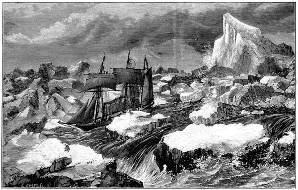
THE "FOX" ESCAPING FROM THE PACK
209Lady Franklin's instructions were so characteristic of the noble-hearted woman whose name can never be forgotten in Arctic story that they must be given in full:—
"You have kindly invited me to give you 'Instructions,' but I cannot bring myself to feel that it would be right in me in any way to influence your judgment in the conduct of your noble undertaking; and indeed I have no temptation to do so, since it appears to me that your views are almost identical with those which I had independently formed before I had the advantage of being thoroughly possessed of yours. But had this been otherwise, I trust you would have found me ready to prove the implicit confidence I place in you by yielding my own views to your more enlightened judgment; knowing too as I do that your whole heart also is in the cause, even as my own is. As to the objects of the expedition and their relative importance, I am sure that you know that the rescue of any possible survivor of the Erebus and Terror would be to me, as it would be to you, the noblest result of our efforts.
"To this object I wish every other to be subordinate; and next to it in importance is the recovery of the unspeakably precious documents of the expedition, public and private, and the personal relics of my dear husband and his companions.
"And lastly, I trust it may be in your power to confirm, directly or inferentially, the claims of my 210husband's expedition to the earliest discovery of the passage, which, if Dr. Rae's report be true (and the Government of our country has accepted and rewarded it as such), these martyrs in a noble cause achieved at their last extremity, after five long years of labour and suffering, if not at an earlier period.
"I am sure that you will do all that man can do for the attainment of all these objects; my only fear is that you may spend yourselves too much in the effort; and you must therefore let me tell you how much dearer to me even than any of them is the preservation of the valuable lives of the little band of heroes who are your companions and followers.
"May God in His great mercy preserve you all from harm amidst the labours and perils which await you, and restore you to us in health and safety as well as honour. As to the honour I can have no misgiving. It will be yours as much if you fail (since you may fail in spite of every effort) as if you succeed; and be assured that, under any and all circumstances whatever, such is my unbounded confidence in you, you will possess and be entitled to the enduring gratitude of your sincere and attached friend,
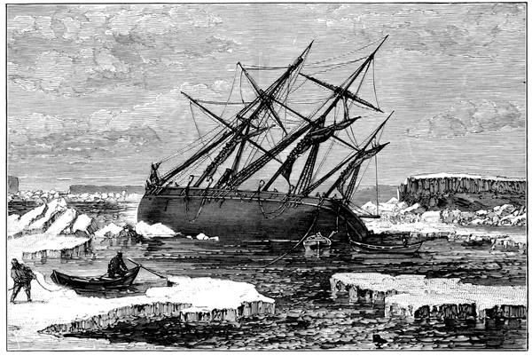
THE "FOX" ON A ROCK
211The men of the Fox were worthy of the confidence placed in them. Leaving Aberdeen on the 1st of July, M'Clintock reached Disco on the last day of the month, and, proceeding northwards, was, by a perverse freak of fortune, beset in Melville Bay on the 8th of August, and kept imprisoned thence onwards all through the winter, drifting south through Baffin Bay and Davis Strait. On the 26th of April, 1858, after a drift of 1194 geographical miles, the Fox escaped from the pack and steamed to the eastward amid the most perilous of ice experiences. Most men would have returned and tried again; not so M'Clintock. He boldly ran up the Greenland coast as if nothing had happened and, making good deficiencies, resumed his voyage. Soon after leaving Sanderson's Hope the Fox was nearly wrecked near Buchan Island, remaining on a rock until the tide rose again to set her free. After calling at Beechey Island, M'Clintock followed Franklin's track down Peel Sound until stopped by the pack, when he retraced his course and tried Prince Regent Inlet, reaching Bellot Strait on the 21st of August. At Port Kennedy in this famous waterway—which is like a Greenland fiord, about twenty miles long and scarcely a mile wide at its narrowest part, the water four hundred feet deep within a quarter of a mile of its northern shore—he passed the winter.
On the 1st of March he reached by sledge the Magnetic Pole and fell in with four of the Boothian Eskimos, who, at the cost of a needle each, built him a snow hut in an hour, in which they all spent the night. "Perhaps," says M'Clintock, "the records of architecture do not furnish another instance of a dwelling-house so cheaply constructed!" Halting at Cape Victoria the Eskimos came up from their village close by with a number of small relics of the lost expedition. Returning to the Fox after a journey of four hundred and twenty statute miles in which the survey of the west coast of Boothia was completed, everything was made ready for three long sledge journeys of two sledges each, the captain taking that for Montreal Island, and giving Hobson the best chance of promotion by sending him 212round the west coast of King William Land, while Young took the Prince of Wales Land route.
On the east coast of King William Land M'Clintock met with more Eskimos, from whom he obtained relics and obtained information. Pushing on, he reached Montreal Island on the 15th of May, where the only traces of a boat were some scraps of copper and an iron-hoop bolt. A crossing to the mainland on the 18th of May revealed no more; and next day the return journey began. Six days afterwards, walking along a gravel ridge near the beach on the way to Cape Herschel, M'Clintock found the first skeleton, partly exposed, with a few fragments of clothing appearing through the snow, evidently one of the men who, as the old Eskimo woman said, fell down and died as they walked along. Visiting Simpson's cairn at Cape Herschel and meeting with nothing, he went on for about twelve miles, where he caught sight of a small cairn built by Hobson's party at their furthest south, reached six days before, containing a note with the great news that at Point Victory they had found what is now known as the Franklin record.
This record, which has frequently been printed—in a smaller size than the original—was one of the navy bottle-papers with the request in six languages that it should be forwarded to the Admiralty. A pale blue paper, twelve and a half inches by eight, it was filled up in the ordinary way, and then added to round the four margins in the handwriting of Lieutenant Gore, Captain FitzJames, and Captain Crozier, and signed by these and C. F. Des Vœux. It had been first deposited four miles away, so it said, "by the late Commander Gore," in 1847, and next year found by Lieutenant Irving, added to, and removed to the new cairn on the site of Sir James Ross's pillar.
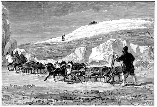
DISCOVERY OF THE CAIRN
213Brief as it was, it contained all the authentic information regarding Franklin's voyage up to the time the ships were abandoned. Resuming the return journey along the edge of the strait where the meeting of the Pacific and Atlantic tides keeps the ice drifting down from the north-west almost constantly packed, M'Clintock reached a boat with two skeletons and other relics already visited by Hobson, who had found other cairns and many relics, and, in Back Bay, another record by Gore, also deposited in 1847, but giving no additional news.
Hobson was dragged alongside the Fox, on the 14th of June, so ill with scurvy that he was unable to walk or even stand without assistance. M'Clintock arrived five days later; and on the 27th Allen Young returned after an exploration of three hundred and eighty miles of coast-line, which, added to that discovered by M'Clintock and Hobson, gave a total of eight hundred geographical miles of new coast as the work of the expedition, besides what it had done in clearing up the Franklin mystery.
In 1869 Captain C. F. Hall collected other relics and sufficient information to account for seventy-nine men out of the hundred and five who left the ships. Ten years after that, Schwatka, in his long, careful search of King William Land, discovered the grave of Lieutenant Irving, in which were some fragments of his instruments and the prize medal he won at the Royal Naval College. Near by were many traces indicating that it was the site of the first encampment of the 214retreating crews after leaving their ships; and down the coast he traced camp after camp, and death after death. Irving's remains were brought away and are buried at Edinburgh. The spot where they were found was Cape Jane Franklin.
More fortunate than Franklin was Captain Roald Amundsen. Leaving Christiania in the Gjöa on the 16th of June, 1903, he crossed the Atlantic and proceeded down Peel Sound, past Bellot Strait, and along the west coast of Boothia, where a fire on the ship did a certain amount of damage, and, struggling thereafter for ten days among shoals and rocks, down James Ross Strait, past Matty Island into Rae Strait, he dropped anchor in Petersen Bay, King William Land. For his base station he required a site in which the inclination was eighty-nine degrees, and at Gjöahaven, in this bay, he found it in 68° 30´ N., 96° W.
Here he arranged his headquarters for his observations on the Magnetic Pole which were kept going night and day for nineteen months; and here he stayed for two winters, moving about in the country around and over into Boothia, where he proved that the Pole was not immovable and stationary, but in all likelihood in continual movement. Leaving the south-eastern corner of King William Land in his little ship he passed through Simpson Strait, linking up with Collinson; and, like him, he was delayed for a winter on the coast of the American mainland. Through Bering Strait he reached San Francisco, where the voyage ended in the sale of the Gjöa. Thus of Amundsen it can be said, without any qualification whatever, that he accomplished the North-West Passage.
Sir Humphrey Gilbert—Sir Martin Frobisher—His first voyage—The fateful stone—First meeting with the Eskimos—The Cathay Company—Second voyage—Third voyage—Frobisher builds a fort—The ships among the floes—Captain Hall finds the Frobisher relics—Adrian Gilbert—John Davis—His voyages and dealings with the Eskimos—Reaches and names Sanderson's Hope—The Traverse Book—William Baffin—His first voyage to Greenland—His fourth and fifth voyages—Discovers Baffin Land—Discovers Baffin Bay—Smith Sound—Jones Sound—Lancaster Sound—Baffin's farthest north—John Ross and Parry verify his discoveries.
In 1566 Humphrey Gilbert—who was as near to heaven by sea as by land—petitioned Queen Elizabeth for privileges in regard to discoveries "by the North-west to Cataia" as an alternative to a petition he, in conjunction with Anthony Jenkinson, had presented the previous year for a voyage by the north-east. He received no answer; but ten years afterwards, in support of this unanswered petition, he published his Discourse of a Discovery for a New Passage to Cataia. This met with approval, and led, with little delay, to the expedition under the Martin Frobisher who, among other noteworthy services, commanded the Triumph in the Armada fight to such good purpose that he was one of the five distinguished men knighted by Howard in mid-channel after the battle off the Isle of Wight.
Frobisher was a good seaman—but no mineralogist. 216Mainly at the expense of Ambrose Dudley, Earl of Warwick, and under the business management of that old seafarer, Michael Lock, of the Muscovy Company, he left Blackwall on the 7th of June, 1576, in the Gabriel of twenty-five tons, accompanied by the Michael of twenty tons—which deserted and returned as soon as difficulties arose—and a ten-ton pinnace, which ended by foundering off Greenland. All told, the expedition numbered thirty-five, of whom the Gabriel carried eighteen; and with these the voyage through the Arctic Ocean was to be made to China.
Leaving the Shetlands at her top speed of a league and a half an hour—which her master, good Christopher Hall, proudly recorded—the Gabriel sighted Cape Farewell on the 11th of July. Two days afterwards she was thrown on her beam-ends in a storm, and was rapidly filling with water flowing in at her waist when she was relieved by the loss of her fore-yard and the cutting away of her mizen-mast. Rounding the cape, steering westward when he could among the floating ice, Frobisher reached a high headland at the south-east end of what is now Frobisher Bay, which he named Queen Elizabeth Foreland. A few days afterwards Hall, out in a boat seeking a way through the ice for the ship, landed on what they called Hall's Island, and, noticing a fog coming on, left hurriedly, snatching up, as specimens of the plants, a few grasses and flowers, and, as a rock specimen, a heavy black stone picked up haphazard on the beach. The grass faded, the flowers perished, and the fateful stone remained.
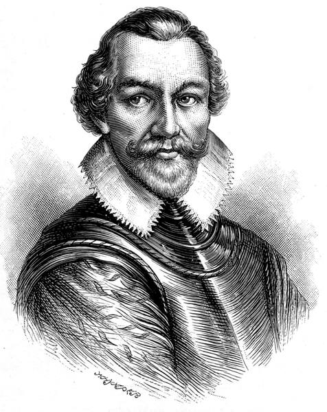
SIR MARTIN FROBISHER
217For fifty leagues Frobisher sailed north-westward into the bay, thinking it to be a strait with Asia on the right hand and America on the left. He landed at what he called Butcher's Island, saw "mightie deere which ranne at him and hardly he escaped with his life in a narrow way where he was faine to use defence and policie," and from a hill-top "perceived a number of small things fleeting in the sea afarre off whyche hee supposed to be porposes or seales or some kind of strange fishe but coming nearer he discovered them to be men in small boates made of leather," who only just failed in capturing his boat before he reached it. Subsequent conferences with the Eskimos ended in his losing the boat with five men who had gone ashore to trade; and finally, having lifted single-handed one of the interesting natives, kayak and all, into the Gabriel, he made sail for home.
When Lock went aboard on the ship's arrival there were no riches from Cathay, nothing worth mentioning beyond the Eskimo—who soon died—the kayak and paddle, and "the fyrste thynge found in the new land," the black stone. He carried away the stone, after chipping off a few fragments for the friends around, and after a week or two's consideration sent some of it to the Mint to be assayed. The report was not as he expected; the "saymaster" was of opinion that it was marcasite, that is, iron pyrites. Not satisfied, Lock sent some to another expert, who also said it was pyrites. Then he tried a third man, who could find no gold in it. And then he tried a fourth—this time an Italian—who gave him the answer he wanted: "A very little powder of gold came thereout."
Lock sent him some more, telling him frankly that 218three other assayers "could find no such thing therein," but again the Italian was equal to the occasion. "The xviii day of January," writes Lock, "he sent me by his mayde this little scrap of paper written, No. 1, hereinclosed; and thereinclosed the grayne of gold, which afterward I delivered to your majesty." For the Queen had become interested in the wonderful stone which was the talk of the town, its value increasing at every recital until many believed, as Sir Philip Sidney seems to have done, that it was "the purest gold unalloyed with any other metals."
Lock was not the man to let such excellent advertisement be lost, and forthwith he projected the Cathay Company for which the charter was obtained from the Crown on St. Patrick's Day, 1577. Lock was named as Governor for six years with remuneration "for ever" of one per cent on all goods imported; Frobisher was named as Captain by sea and Admiral of the ships and navy of the Company for life with a yearly stipend and one per cent, like Lock, on all goods the Company brought in. Queen Elizabeth—notwithstanding the report from the Mint—headed the list of shareholders with £1000; and Burghley, Howard, Leicester, Walsingham, Hunsdon, Sidney, even Gresham, subscribed for shares in this remarkable company.
To bring home more of the "golden ore," a new expedition was entered upon at once, and on the 26th of May, Whit-Sunday as it happened, Frobisher started on his second voyage. He had three vessels, the Aid of two hundred tons, lent him from the Royal Navy, and the Gabriel and Michael as before, and one hundred and twenty officers and men, of whom 219thirty were miners and other landsmen, and, in addition, six condemned criminals whom he was to land in Greenland as colonists but put ashore at Harwich instead.
To the new land—named by the Queen Meta Incognita, "the unknown limit of the outward course"—he made his way without much adventure. Landing on Hall's Island, he sought for more stone but could find not so much as a piece as big as a walnut; for Hall, who was again with him as master, had apparently lighted, in the one sample, on the whole of its mineral wealth. This disappointment, however, was forgotten in the finding of occasional patches of pyrites on the mainland and other islands which in due course were visited. Thirty leagues up the bay a landing was made on what was called Countess of Warwick's Island, where more ore was found and a fort called Best's Bulwark was built. That was Frobisher's farthest on this voyage, and thence he sailed on the 24th of August, bringing with him two hundred tons of pyrites, and, as a present for the Queen, a horn two yards long, wreathed and straight, which he had found in the nose of a dead narwhal.
The ore was received with rejoicings. Some of it was deposited in Bristol Castle, some in the Tower of London under four locks, but there was not enough of it; and as there were then, as now, no furnaces in England capable of getting gold out of marcasite, a new expedition was despatched while the furnaces were being prepared. This time the enterprise was to be on a very different scale. Frobisher was given a fleet of fifteen vessels, Drake's old ship, the Judith, amongst them, the Aid, as before, being the flagship. He was to bring 220home two thousand tons of mineral and find other mines, if he could, besides taking out a colony of a hundred persons to settle in Meta Incognita, for whom the materials of a wooden house were among the miscellaneous cargo.
The fleet left Harwich on the 31st of May, 1578. A landing was made in the south of Greenland, which Frobisher named West England and took possession of, his point of departure from there being called by him, "from a certain similitude," Charing Cross! Soon he was among the ice floes. One of the ships was driven on to a floe and sank with some of the materials for the wooden house. Then followed a storm in which most of the ships had a terrible experience. "Some," says Captain Best of the Ann Frances, the chronicler of the voyage, "were so fast shut up and compassed in amongst an infinite number of great countreys and ilands of ise, that they were fayne to submit themselves and their ships to the mercie of the unmercifull ise, and strengthened the sides of their ships with junckes of cables, beds, masts, planckes, and such like, which being hanged overboord, on the sides of their shippes, mighte the better defend them from the outrageous sway and strokes of the said ise. But as in greatest distresse, men of best value are best to be discerned, so it is greatly worthy commendation and noting with what invincible mind every captayne encouraged his company, and with what incredible labour the paynefull mariners and poore miners (unacquainted with such extremities) to the everlasting renoune of our nation, dyd overcome the brunt of these so great and extreame daungers; for some, even without boorde uppon the ise, and some 221within boorde, uppon the sides of their shippes, having poles, pikes, peeces of timber and ores in their hands, stood almost day and night, without any reste, bearing off the force, and breaking the sway of the ise, with suche incredible payne and perill that it was wonderfull to behold, which otherwise no doubt had striken quite through and through the sides of their shippes, notwithstanding our former provision; for planckes of timber, of more than three ynches thick, and other things of greater force and bignesse, by the surging of the sea and billow, with the ise were shevered and cutte in sunder at the sides of oure ships, that it will seeme more than credible to be reported of. And yet (that which is more) it is faythfully and playnely to be proved, and that by many substantiall witnesses, that our shippes, even those of greatest burdens, with the meeting of contrary waves of the sea, were heaved up betweene islandes of ise a foote welneere out of the sea above their watermarke, having their knees and timbers within boorde both bowed and broken therewith."
To add to the difficulties of the voyage Frobisher lost his way, and entered what he called the Mistaken Streight—now designated Hudson Strait—through which he might have found his way to Cathay, had he been so minded; but recognising that he was on the wrong road he returned and reached his mining district at the end of July. While the ore was being gathered in, Best ventured into the upper part of Frobisher Bay as far as the Gabriel Islands—the only exploring work that was done—and early in September the fleet departed on the homeward voyage.
Frobisher had left one unmistakable indication of 222his visit behind him. On Countess of Warwick Island he had built a house of lime and stone, and "the better," says Best, "to allure those brutish and uncivill people to courtesie, againste other times of our comming, we left therein dyvers of our countrye toyes, as bells and knives, wherein they specially delight, one for the necessarie use, and the other for the great pleasure thereof. Also pictures of men and women in lead, men a horsebacke, lookinglasses, whistles and pipes. Also in the house was made an oven, and breade left baked therein, for them to see and taste. We buried the timber of our pretended forte, with manye barrels of meale, pease, griste, and sundrie other good things, which was of the provision of those whyche should inhabite, if occasion served. And insteade therof we fraight oure ships full of ore, whiche we holde of farre greater price."
Here we part from the Cathay Company. The inevitable trouble came with the discovery that, practically, the only gold the ore would yield was that put in as an "additament" by the Italian. A very thick cloud rolled over Frobisher, who, like Lock, seems to have believed in the genuineness of the affair all through; but soon his country had need of him and he came to the front again in so worthy a manner that little more was heard of his connection with this company that failed.
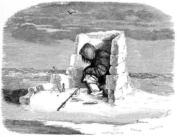
ESKIMO AWAITING A SEAL
223To complete the story. In 1861 (say three hundred years afterwards) Captain Hall—hearing among the Eskimos how numerous white men had arrived first in two, then three, then a great many ships, how they had killed several natives and taken away two, how five of the white men had been captured, and how these had built a large boat and put a mast in her and sailed away to death when the water was open—went to Kod-lun-arn (White Man's Island) and there found the house of lime and stone as described, and traces of the diggings, and many relics among which he made the collection presented by him to the British Government.
In the year 1583, when Sir Humphrey Gilbert, whose Discourse gave so great a stimulus to Arctic discovery, founded St. John's, Newfoundland—the first English colony in America—a patent was granted by Queen Elizabeth to his brother Adrian "of Sandridge in the county of Devon," as one of the colleagues of the Fellowship for the Discovery of the North-West Passage. At this Sandridge—on the east of the Dart, bounded on three sides by the river, some two miles above Dartmouth—was the home of the three Gilberts (John, Humphrey, and Adrian), whose mother by a second marriage became the mother of Carew and Walter Raleigh; and here, about 1550, of a family also owning property in the small peninsula, was born John Davis, as we know him, or John Davys, as he signed himself, who was probably a playmate, and certainly a life-long friend, of these five.
Davis was an accomplished seaman, the best of the Elizabethan navigators, and a man of accurate observation, always on the alert, whose reputation does not rest only on the work he did in the northern and other seas, for he was the author of The Seaman's Secrets, the most popular practical navigation treatise of its time. Very early, perhaps from the first, he was one of the moving spirits in this new north-west enterprise, for on the 23rd of January, 1583, we find Dr. Dee-who 224had helped to send Frobisher on his first voyage—making an entry in his journal that Mr. Secretary Walsingham had come to his house, where by good luck he found Mr. Adrian Gilbert, and so talk began on "the north-west straits discovery"; and, next day, "I, Mr. Awdrian Gilbert and John Davis, went by appointment to Mr. Beale, his howse, where only we four were secret, and we made Mr. Secretary privie of the N.W. Passage, and all charts and rutters were agreed upon in generall"—"rutter" being the French "routier," originating in Le Routier de la Mer, signifying a book of sea routes. Another important friend of Davis was William Sanderson, the representative of the merchants by whom the expenses of the voyage were borne, he being the chief subscriber. One of the ships, the Moonshine, seems to have belonged to him, and it was largely owing to his influence among the shareholders that Davis was appointed captain and chief pilot of the "exployt," in which he was to practically rediscover Greenland.
There were two vessels, the Sunshine of London, fifty-nine tons, with twenty-three persons on board, and the Moonshine of Dartmouth, thirty-five tons, with nineteen. They left Dartmouth on the 7th of June, 1585, but had to put in at Falmouth and then at the Scillies, where Davis occupied the twelve days he spent there in surveying and charting the islands. On the 20th of July they were sailing down the east coast of Greenland, and were so little attracted by it that Davis called it the Land of Desolation. Nine days afterwards he found a group of many pleasant green islands bordering on the shore, while the mountains of the mainland were still covered with snow, and here he landed on the west coast at Gilbert Sound, as he named it, near where Godthaab now is, and entered into communication with the natives.
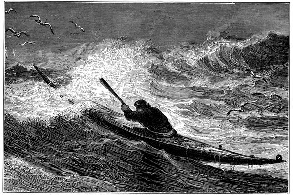
A GREENLANDER IN HIS KAYAK
225For such occasions, apparently, he had among the Sunshine people four described as musicians, whom, on sighting the Eskimos, he sent for. As soon as they arrived from the ship he ordered them to strike up a dancing tune, and to their merry music Davis and his men began to caper as if they were enjoying themselves immensely, while the lookers-on gradually increased in number. "At length," he says, "one of them poynting up to the sunne with his hande would presently strike his brest so hard that we might hear the blowe. This he did many times, before he would any way trust us. Then John Ellis the master of the Mooneshine, was appointed to use his best policie to gaine their friendshippe: who strooke his breast and poynted to the sunne after their order: which when he had diverse times done, they began to trust him, and one of them came on shoare, to whom we threwe our caps, stockings and gloves, and such other things as then we had about us, playing with our musicke, and making signes of joy, and dancing. So the night comming we bade them farewell, and went aboord our barks."
The next morning, being the 30th of July, thirty-seven canoes came up to the ships, their occupants calling to the English to come on shore. "Wee not making any great haste unto them, one of them went up to the top of the rocke, and lept and daunced as they had done the day before, shewing us a seales 226skinne, and another thing made like a timbrel, which he did beate upon with a sticke, making a noyse like a small drumme." Whereupon Davis manned his boats and went to the waterside where they were in their canoes, "and after we had sworne by the sunne after their fashion, they did trust us. So I shooke hands with one of them, and hee kissed my hand, and we were very familier with them. We bought five canoas of them, we bought their clothes from their backs, which were all made of seales skins and birdes skinnes: their buskins, their hose, their gloves, all being commonly sewed and well dressed: so that we were fully persuaded that they have divers artificers among them. Wee had a paire of buskins of them full of fine wooll like bever. Their apparell for heate, was made of bird skinnes with their feathers on them. We sawe among them leather dressed like glovers leather, and thicke thongs like white leather of a good length. Wee had of their darts and oares, and found in them that they would by no meanes displease us, but would give us whatsoever we asked of them and would be satisfied with whatsoever we gave them. They took great care one of an other: for when we had bought their boates, then two other woulde come and carie him away betweene them that had soulde us his." He describes them as "a very tractable people, voyde of craft or double dealing, and easie to be brought to civiltie or good order," the men of good stature, unbearded, small-eyed, "by whom, as signes would permit, we understood that towards the north and west there was a great sea."
During his stay among these islands he found considerable 227quantities of wood—fir, spruce, and juniper—which whether it came floating any great distance or grew in some island near he did not discover; but he thought it grew further inland because the people had so many darts and paddles which they held of little value and gave away for insignificant trifles. He also found "great abundance of seales" in shoals as if they were small fish; but saw no fresh water, only snow water in large pools, and he notes that the "cliffes were all of such oare as M. Frobisher brought from Meta Incognita."
Leaving the sound on the 1st of August he crossed the strait now named after him and reached land in 66° 40´. In water "altogether voyd from ye pester of ice" he anchored, "in a very fair rode, under a very brave mount, the cliffs whereof were as orient as gold." This mount he named Mount Raleigh, the roadstead he called Totnes Rode, the sound round the mount he named Exeter Sound, the foreland to the north he called Dyer's Cape, the southern foreland being named Cape Walsingham—all of which names remain. Here white bears were killed "of monstrous bignesse," a raven was descried upon Mount Raleigh, withies were found growing low like shrubs, and there were flowers like primroses, though there was no grass.
For three days Davis went coasting downwards, and rounding the southern point of the peninsula, which he named the Cape of God's Mercy, he entered what he afterwards called Cumberland Strait, now Cumberland Gulf, supposing it to be his way to the westward. It was clear of ice; sixty leagues up islands were found, among which a stay was made during five days of very 228foggy foul weather. On the 15th of August "we heard dogs houle on the shoare, which we thought had bene Wolves, and therefore we went on shoare to kil them; when we came on lande, the dogs came presently to our boate very gently, yet we thought they came to pray upon us, and therefore we shot at them and killed two: and about the necke of one of them we found a letheren coller, whereupon we thought them to be tame dogs. Then wee went farther and founde two sleads made like ours in Englande. The one was made of firre, spruse and oken boards, sawen like inch boards; the other was made all of whale bone, and there hung on the toppes of the sleds three heads of beasts, which they had killed. We saw here larkes, ravens, and partriges"—probably rock ptarmigan.
Searching about, it was agreed that the place was all islands, with sounds passing between them; that the water remained of the same colour as the main ocean, whereas in every bay they had been into it became blackish; that a shoal of whales they saw must have come from the west, because to the eastward no whale had been seen; that "there came a violent counter checke of a tide from the south-west against the flood which we came with, not knowing from whence it was maintayned"; that the further they ran westward the deeper was the water, "so that hard abord the shoare among these yles we could not have ground in 330 fathoms"; and that, lastly, there was a tide range of six or seven fathoms, "the flood comming from diverse parts, so as we could not perceive the chiefe maintenance thereof." For which six reasons it was determined to continue the voyage to the westward if 229the weather changed—which it did to worse with the wind unfavourable, so that the ships had to run for shelter and then sail for home, crossing the Atlantic from Greenland in a fortnight. On arrival Davis reported to Walsingham that the North-West Passage was a matter nothing doubtful, but at any time almost to be passed, the sea navigable, void of ice, the air tolerable, and the waters very deep; and a voyage for next year was decided on, for which the merchants of Exeter, Totnes, London, Cullompton, Chard, and Tiverton, and five private subscribers, "did adventure their money"—to the amount of £1175—"with Mr. Adrian Gilbert and Mr. John Davis in a voyage for the discovery of China, the seventh daie of April in the xxviij yeare of the rayne of or. soverayne Ladie Elizabeth."
The fleet, consisting of the Mermaid of one hundred and twenty tons, the Sunshine and Moonshine, and a ten-ton pinnace named the North Star, left Dartmouth on the 7th of May, 1586. On reaching Greenland the Sunshine and North Star were sent up the east coast of Greenland, while the Mermaid and Moonshine made for Gilbert Sound.
Here the Eskimos received them cordially "after they had espied in the boate, some of our companie that were the yeere before heere with us, they presently rowed to the boate, and tooke holde on the oare, and hung about the boate with such comfortable joy as woulde require a long discourse to be uttered: they came with the boates to our shippes, making signes that they knewe all those that the yere before had bene with them. After I perceived their joy, and smal 230feare of us, my selfe with the merchaunts, and others of the company went a shoare, bearing with me twentie knives: I had no sooner landed, but they lept out of their Canoas, and came running to mee and the rest, and imbraced us with many signes of hartie welcome: at this present there were eighteene of them, and to each of them I gave a knife: they offered skinnes to mee for rewarde, but I made signes that it was not solde, but given them of curtesie: and so dismissed them for that time, with signes that they shoulde returne againe after certaine houres." But soon there were passing troubles owing to iron having so great an attraction for them that they could not resist stealing it. While amongst them, exploring the country, Davis compiled the first Eskimo vocabulary known, a list of some forty words written down phonetically, most of them remarkably good approaches considering that both parties were ignorant of each other's language, none of them, however, except that for "sea" being likely to be of any use in putting him on the road to China.
On leaving Gilbert Sound, Davis when in latitude 63° 8´ "fel upon a most mighty and strange quantity of ice, in one intyre masse, so bigge as that we knew not the limits thereof, and being withall so very high, in forme of a land, with bayes and capes, and like high cliffe land, as that we supposed it to be land, and therefore sent our pinnesse off to discover it: but at her returne we were certainely informed that it was onely ice, which bred great admiration to us all, considering the huge quantity thereof, incredible to be reported in truth as it was, and therefore I omit to speake any 231further thereof. This onely, I thinke that the like before was never seene, and in this place we had very stickle and strong currants. We coasted this mighty masse of ice untill the 30 of July, finding it a mighty bar to our purpose: the ayre in this time was so contagious, and the sea so pestered with ice, as that all hope was banished of proceeding: for the 24 of July all our shrowds, ropes, and sailes were so frozen, and compassed with ice, onely by a grosse fogge, as seemed to me more then strange, sith the last yeere I found this sea free and navigable, without impediments."
Crossing the straits he repaired and revictualled the Moonshine in an excellent harbour among islands where they found it very hot and were "very much troubled with a flie which is called Musketa, for they did sting grievously." Forsaken by the Mermaid, he abandoned the search in Cumberland Sound as he "found small hope to pass any farther that way," and worked south, it being too late to go northwards, crossing Frobisher Bay, which he described as "another great inlet neere forty leagues broad where the water entered with violent swiftnesse, this we also thought might be a passage, for no doubt the north parts of America are all islands." Off the coast of Labrador he found a vast shoal of codfish, of which he caught over forty with a long spike nail made into a hook. These he salted, and some of them, on his return, he gave, at Walsingham's request, to Burghley, who, at an interview, encouraged him to make a further attempt.
Next year he was off again, this time "to the Isles of the Molucca or the coast of China." He seems to have been on board the Ellen, a small craft of some 232twenty tons, his two other vessels being the Sunshine as before, and the Elizabeth. These he left to fish for cod in the straits while he went northward from Gilbert Sound in his little "clinker," which he had probably chosen as being handy for ice navigation. Running along the land, to which he gave the name of London Coast, he reached 72° 12´—the highest north up to then attained—where he named the loftiest of the headlands Sanderson's Hope, whose lofty crest piercing through the driving clouds near Upernivik has become perhaps the best-known landmark in the northern seas. Here the wind suddenly shifting to the northward made further progress impossible, and he had to shape his course westerly, and then, owing to ice, which he in vain endeavoured to get round to the north, he had to turn southwards. Amid much fog, and with the ice always present, he came down the coast of Baffin Land, giving a name here and there on the way, until on the 31st of July he passed "a very great gulfe, the water whirling and roring, as it were the meetings of tides," which was probably the entrance to Hudson Strait. Next day he was off the Labrador coast and named Cape Chidley after his friend who died in the Straits of Magellan, and on the 15th of August he laid his course for England.
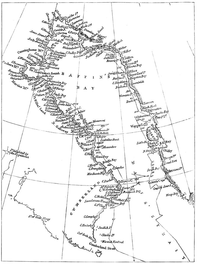
BAFFIN BAY IN 1819
233Of this voyage Hakluyt prints the Traverse Book, one of the earliest known. In it the full detail is given for every day, arranged in nine columns, one each for the month, the day, the hour, the courses, the leagues, the elevation of the pole in degrees and minutes, the wind, and a remarks column headed "The Discourse"—for Davis was an exact and systematic man remarkable for his latitudes never being wrong, though like all those old navigators before the invention of the chronometer, he was frequently out in his longitude. He was going off again bound for the sea north of Sanderson's Hope, but the coming of the Armada and the death of Walsingham caused the postponement of the project he did not abandon, for it seems that the Desire, in which he discovered the Falkland Islands at the other end of America, was to be his reward for accompanying Cavendish round the world, and that in her he intended to make his next Polar voyage.
The work he had set himself to do was done by William Baffin, who first appears in the Arctic record as pilot of the Patience in James Hall's Greenland voyage in 1612, which ended in Hall being killed in revenge for the kidnapping proceedings on the two previous voyages under the Danish flag. Baffin then made two voyages, as we have seen, to Spitsbergen in the service of the Muscovy Company, and, in that of the Company for the Discovery of the North-West Passage, he made his fourth, in 1615. In Hudson's old ship the Discovery, also her fourth trip to the north, he passed up Hudson Strait to the end of Southampton Island, where he abandoned the attempt to get through owing to ice and shallow water, and returned after discovering the land that Parry named after him.
In his fifth voyage, again in the Discovery, with Robert Bylot again as master, he left Gravesend on the 16th of March, 1616, and reached Sanderson's Hope on the 30th of May, discovering the great bay to the north which bears his name. Passing the Women Islands and the Baffin Islands off Cape 234Shackleton, he took the middle passage across Melville Bay, coasting along by Cape York, by the cape named after one of his directors, Sir Dudley Digges, and the sound named after another of his directors, Sir John Wolstenholme; along Prudhoe Land, entering the North Water of the whalers, reaching Cape Alexander in 77° 45´, his farthest north; opening up and naming Smith Sound, after Sir Thomas Smith, another of his directors, and Jones Sound, after Alderman Sir Francis Jones, another of the board, and Lancaster Sound, after Sir James Lancaster of the East India Company. Thus, coasting Ellesmere Land, North Devon, Bylot Island, and Baffin Land, he continued his voyage from the north on his way home. A good piece of work: the discoveries so many and unexpected that people ceased to believe in them, geographers going so far as to erase his bay from their maps until, two hundred years afterwards, Ross and Parry sailed over the land of the unbelievers and confirmed Baffin's work in every detail—and Ross, in his best mountain-finding manner, reported no thoroughfare at Smith Sound.
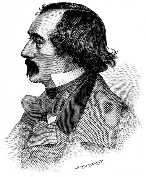
DR. E. K. KANE
Captain Inglefield—Dr. Kane—The open Polar Sea—Hans Hendrik the Greenlander—Kalutunah the Eskimo—An Eskimo bear-hunt—A lesson in catching auks—Dr. Hayes—His journey over the glacier—Tyndall Glacier—Captain C. F. Hall—Joe and Hannah—Voyage of the Polaris—Drift of the Polaris—The voyage on the ice-floe—The British Government Expedition of 1875—The Alert and Discovery—The cairn on Washington Irving Island—Discovery Harbour—How the Alert got into safety at Floeberg Beach—Low temperatures—Nares on sledging—Description of the sledges and their burden—Markham starts for the Pole—Reaches 83° 20´ 26˝—Outbreak of scurvy—Parr's walk—Aldrich's journey west—Beaumont's journey east—The perilous homeward voyage.
Lady Franklin, who incidentally did so much for Arctic discovery, sent out the Isabel in 1852 under Commander, afterwards Sir, Edward Augustus Inglefield to search for her husband to the north of Baffin Bay. Unlike John Ross, the names of whose ships, Isabella and Alexander, are home by the capes at its entrance, he found Smith Sound to be the highway to the north. Steaming up the open water "stretching through seven points of the compass," noting the coasts as he went, he was turned back by the ice in 78° 28´, at the entrance to the Kane Sea, with Cairn Point and the way in to Rensselaer Harbour on his right, and Cape Sabine and Ellesmere Land, which he named, on his left; the farthest north he sighted being Cape Louis Napoleon, the farthest east Cape Frederick VII, now known as Cape Russell. Needless 236to say he found no Franklin traces, although he really looked for them.
Twelve months afterwards Dr. Elisha Kent Kane in the United States brig Advance followed in his track and wintered in Rensselaer Harbour, nine miles further north. Ostensibly Kane was on a Franklin search, but his real object was the Pole. He explored the sea named after him, naming many landmarks, not always placing them in their true positions, and underwent many hardships. For one mistake he was famous for a time, and his reputation now suffers. One of his expedition, William Morton, almost reached Cape Constitution, in about 80½°, which he placed some sixty miles too far north, and described as the corner of the north coast of Greenland; and from the southern horn of the bay of which it is the northern boundary he looked out over the south of Kennedy Channel, which is open every summer, and mistook it for the Polar Sea. And he returned with a report of an even more wonderful discovery than the Polar Sea, for, according to the illustration, he beheld the midnight sun dipping in its waters on Midsummer Day.
In May, 1854, the month before Morton's discoveries, Dr. Hayes and William Godfrey crossed the Kane Sea to connect the northern coast with Inglefield's survey, "but it disclosed no channel or any form of exit from the bay," being, in fact, Ellesmere Land continued, and yet on reaching the shore for the first time at Hayes Point, three miles north of Cape Louis Napoleon, and following it for two miles to Cape Frazer, they quite unnecessarily named the country Grinnell Land. On the other side of this sea the chief discovery was Kane's Humboldt glacier, some fifty miles north-east of their winter quarters, which was described as "the mighty crystal bridge which connects the two continents of America and Greenland," when, of course, it does nothing of the sort.
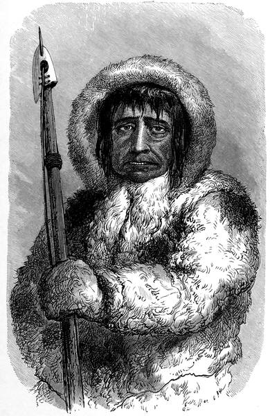
KALUTUNAH
237What with sickness, accident, and other disaster, it became evident that the Advance would never leave her wintering place, and in July Kane set off on a wild endeavour to reach Beechey Island and obtain relief from the Franklin search vessels, but he had to return. Next month Hayes was sent to Upernivik, but he also came back. Finally in May, 1855, the brig was abandoned and the survivors began their journey to the south. Fortunately on the outward voyage Kane, at Fiskernaes, had engaged Hans Hendrik the Greenlander, then a boy of nineteen, who became quite a prominent figure in this and subsequent voyages, and without him and Kalutunah, chief of the Etah Eskimos, the whole party would have perished miserably.
Hans first appears when spearing a bird on the wing; Kalutunah's first appearance was equally encouraging. "The leader of the party," says Kane, "was a noble savage, greatly superior in everything to the others of his race. He greeted me with respectful courtesy, yet as one who might rightfully expect an equal measure of it in return, and, after a short interchange of salutations, seated himself in the post of honour at my side. I waited, of course, till the company had fed and slept, for among savages especially haste is indecorous, and then, after distributing a few presents, opened to them my project of a northern exploration. Kalutunah received his knife and needles with a 'Kuyanaka,' 'I 238thank you'; the first thanks I have heard from a native of this upper region. He called me his friend—'Asakaoteet,' 'I love you well'—and would be happy, he said, to join the nalegak-soak in a hunt."
And the journey ended in a hunt, for the dogs caught sight of a large male bear in the act of devouring a seal. The impulse was irresistible; Kane lost all control over both dogs and drivers, who seemed dead to everything but the passion of pursuit. Off they sped with incredible speed; the Eskimos clinging to their sledges and cheering their dogs with loud cries. A mad, wild chase, wilder than German legend—"the dogs, wolves; the drivers, devils." After a furious run, the animal was brought to bay, and the lance and rifle did their work. There were more bears and more hunts, and when Kane objected that this could hardly be called northern exploration, he was told by Kalutunah, significantly, that the bear-meat was absolutely necessary for the support of their families, and that the nalegak-soak had no right to prevent him from providing for his household. "It was a strong argument," says Kane, "and withal the argument of the strong."
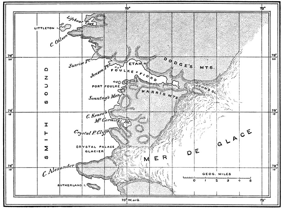
THE EAST COAST OF SMITH SOUND
239Bear-hunting hereabouts has its dangers, for the Eskimos of the north are not armed with bows and arrows as are those of the mainland. When the bear is found the dogs are set upon the trail, and the hunter runs by their side in silence. As he turns the angle ahead his game is in view before him, stalking probably along with quiet march, sometimes sniffing the air suspiciously, but making, nevertheless, for a clump of hummocks. The dogs spring forward, opening in a wild wolfish yell, the driver shrieking "Nannook! nannook!" and all straining every nerve in pursuit. The bear rises on his haunches, views his pursuers, and starts off at full speed. The hunter, as he runs, leaning over his sledge, seizes the traces of a couple of his dogs and liberates them from their burden. It is the work of a minute; for the speed is not checked and the remaining dogs rush on with apparent ease. Pressed more severely, the bear stands at bay while his two foremost pursuers halt at a short distance and quietly await the arrival of the hunter. At this moment the whole pack are liberated; the hunter grasps his lance, and, stumbling through the snow and ice, prepares for the encounter. Grasping the lance firmly in his hands he provokes the animal to pursue him by moving rapidly across its path, and then running as if to escape. But hardly is its long body extended for the tempting chase, before, with a quick jump, the hunter doubles on his track, and, as the bear turns after him again, the lance is plunged into the left side below the shoulder; and that so dexterously, that, if it be an inch or so wide of the proper spot, the spear has to be left in the bear and the man has to run for his life.
At this hazardous work Kalutunah was an adept, and he was equally skilful at a much less dangerous game, as Dr. Hayes was to discover when wintering in the schooner United States in Foulke Harbour, further south, in 1860-61. Hayes wished to learn how to catch auks, and the Eskimo gave him a lesson. Kalutunah carried a small net, made of light strings of sealskin knitted together, the staff by which it was held being about ten feet in length. Arriving about half-way 240up the cliffs he crouched behind a rock and invited the doctor to follow his example. The slope on which the birds were congregated was about a mile long, and in vast flocks they were sweeping over it a few feet above the stones down the whole length of the hill, returning higher in the air, and so round and round in a complete circuit. Occasionally a few hundreds or thousands would drop down as if following some leader, and in an instant the rocks, for some distance, would swarm with them as they speckled the hill with their black backs and white breasts. The doctor was told to lie lower, as the birds noticed him and were flying too far overhead. Having placed himself as Kalutunah approved, the birds began to sweep lower and lower in their flight until their track came well within reach. Then, as a dense portion of the crowd approached, up went the net, and half a dozen birds flew into it, and, stunned by the blow, could not recover before the Eskimo had slipped the staff through his hands and seized the net. With his left hand he pressed down the birds, while with the right he drew them out one by one, and, for want of a third hand, used his teeth to crush their heads. The wings were then locked across each other; and with an air of triumph the old chief looked around, spat the blood and feathers from his mouth, and went on with the sport, tossing up his net and hauling it in with much rapidity until he had caught about a hundred, and wanted no more.
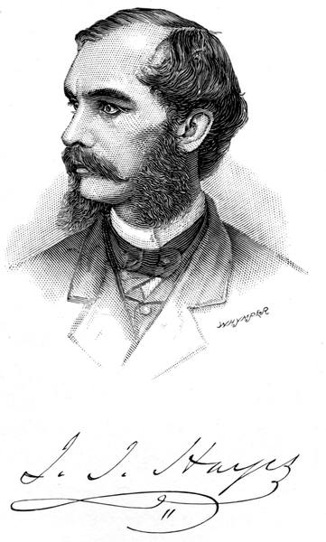
241Hayes did his best to disparage both Kalutunah and Hans, to whom he was not quite so much indebted as Kane, owing to his having given himself a better chance of retreat by not taking the schooner out of Smith Sound, his quarters in Hartstene Bay being only some twelve miles north of Cape Alexander. He had come to verify the existence of the open sea and sail to the Pole across it if he could; and he verified it to his own satisfaction. But he did not get so far north as Morton, although he claimed to have done so, for he climbed a cliff eight hundred feet high and looked out over the open water—in Kennedy Channel—and did not see the Greenland cliffs trending away northwards within thirty miles of him, and visible all the way up for two degrees north of Cape Constitution. Thus he left the map as Kane left it, with Greenland cut off short south of the eighty-first parallel, and his farthest seems to have been the south point of Rawlings Bay, where the Alert was forced on shore in August, 1876, in 80° 15´.
"I climbed," he says, "the steep hillside to the top of a ragged cliff, which I supposed to be about eight hundred feet above the level of the sea. The view which I had from this elevation furnished a solution of the cause of my progress being arrested on the previous day. The ice was everywhere in the same condition as in the mouth of the bay across which I had endeavoured to pass. A broad crack, starting from the middle of the bay, stretched over the sea, and uniting with other cracks as it meandered to the eastward, it expanded as the delta of some mighty river discharging into the ocean, and under a water-sky, which hung upon the northern horizon, it was lost in the open sea. The sea beneath me was a mottled sheet of white and dark patches, these latter being either soft decaying ice or places where the ice had wholly disappeared. These 242spots were heightened in intensity of shade and multiplied in size as they receded, until the belt of the water-sky blended them all together into one uniform colour of dark blue. The old and solid floes (some a quarter of a mile, and others miles across) and the massive ridges and wastes of hummocked ice which lay piled between them and around their margins, were the only parts of the sea which retained the whiteness and solidity of winter."
Unfortunately for Hayes, the astronomer of the expedition, August Sonntag, who had assisted Kane in the same capacity, was frozen to death on a sledge journey, and the doctor was left to do the work for himself, with disappointing results, as with errors of many miles in either latitude or longitude his journeys can only be noticed in a very general way. In October, 1860, he proceeded for some distance over the glacier to the east of his wintering place. The first attempt to scale the glacier was attended by what might have been a serious accident. The foremost member of the party missed his footing as he was clambering up the rude steps, and, sliding down the steep side, scattered those who were below him to the right and left and sent them rolling into the valley beneath. The next effort was more successful, and, the end of a rope being carried over the side of the glacier, the sledge was drawn up the inclined plane and a fair start obtained. A little further on Hayes was only saved from disappearing down a crevasse by clutching a pole he was carrying on his shoulder. Next day, the surface being smoother, more progress was made, and they reached a plain of compact snow covered with a crust through which the feet broke at every step. The day afterwards the cold grew more intense and a gale came on. At night the men complained bitterly and could not sleep, and as the storm increased in strength they were forced to leave the tent and by active exercise prevent themselves from freezing.
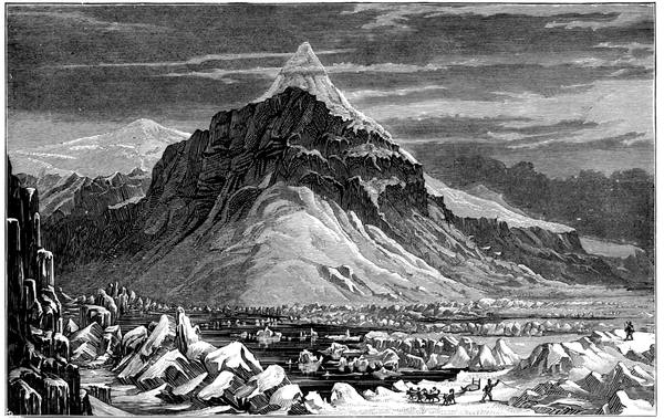
THE SHORES OF KENNEDY CHANNEL
243To face the wind was impossible, and shelter was nowhere to be found upon the unbroken plain, there being but one direction in which they could move, that being with their backs to the gale. It was not without difficulty that the tent was taken down and bundled upon the sledge, the wind blowing so fiercely that they could scarcely roll it up with their stiffened hands. The men were in pain and could only hold on for a few moments to the hardened canvas, their fingers, freezing continually, requiring vigorous pounding to keep them on the flickering verge of life. "In the midst of a vast frozen Sahara, with neither hill, mountain, nor gorge anywhere in view," says Hayes, "fitful clouds swept over the face of the full-orbed moon, which, descending toward the horizon, glimmered through the drifting snow that whirled out of the illimitable distance, and scudded over the icy plain, to the eye in undulating lines of downy softness, to the flesh in showers of piercing darts. Our only safety was in flight; and like a ship driven before a tempest which she cannot withstand, and which has threatened her ruin, we turned our backs to the gale; and, hastening down the slope, we ran to save our lives. We travelled upwards of forty miles, and had descended about three thousand feet before we ventured to halt."
Next year he visited the large glacier in Whale 244Sound which he named after Professor John Tyndall, pulling first along its front in a boat and then mounting its surface. As he rowed along within a few fathoms of this two miles of ice, he found the face "worn and wasted away until it seemed like the front of some vast incongruous temple, here a groined roof of some huge cathedral, and there a pointed window or a Norman doorway deeply moulded; while on all sides were pillars round and fluted and pendants dripping crystal drops of the purest water, and all bathed in a soft blue atmosphere. Above these wondrous archways and galleries there was still preserved the same Gothic character; tall spires and pinnacles rose along the entire front and multiplied behind them, and new forms met the eye continually. Strange, there was nothing cold or forbidding anywhere. The ice seemed to take the warmth which suffused the air, and I longed to pull my boat far within the opening and paddle beneath the Gothic archways."
Charles Francis Hall, of Cincinnati, was a man of a very different stamp. He was a genius and a genuine worker, an accurate observer and painstaking explorer who believed above all things in thoroughness. Realising that the best way to study the Polar regions was to understand the Eskimos, who know most about them, and utilise their local knowledge, he settled amongst them, lived with them, adopted their customs, and became as one of them in their huts and tents, taking part in their sports and hardships. Two friends he made amongst them, Ebierbing and his wife Tookoolito, better known as Joe and Hannah, who accompanied him till he died.
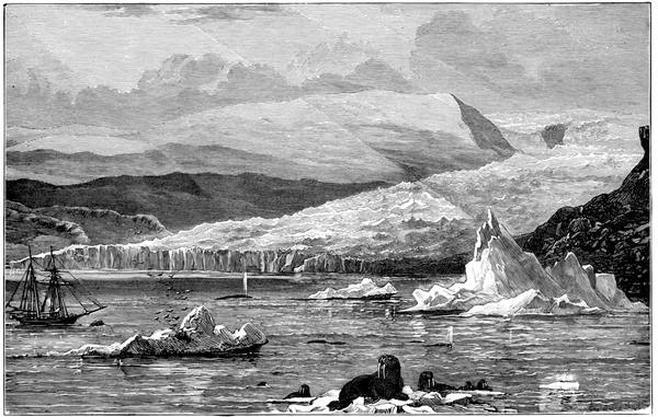
TYNDALL GLACIER
245After clearing up the Frobisher problem and throwing some light on the Franklin mystery, he started in 1871 to go as far north as he could across the reported Polar Sea. To him Henry Grinnell, who did so much for northern discovery, entrusted the American flag which had been to the Antarctic with Wilkes in 1838, to the Arctic with De Haven, with Kane and with Hayes, and was a sort of oriflamme of Polar discovery. His ship was the Polaris, of 387 tons, once the Periwinkle, a name which seemed to be a little too unassuming. Buddington, his sailing-master, was an experienced whaling captain; his assistant, Tyson, destined for the independent command of an ice-floe, was another whale-fisher. The naturalist was Emil Bessels. On board were also Joe and Hannah—of course—and William Morton, to show where the sea was, and, picked up at Upernivik, the indispensable Hans Hendrik with his wife and three children.
The voyage was fortunate so long as Hall lived. The Polaris found the Polar gates open before her. She steamed right up Smith Sound, through Kane Sea, up Kennedy Channel, into Robeson Channel—named after the Secretary to the American Navy—until she reached the ice, in 82° 16´, on the 30th of August, 1871, the highest latitude then attained by a ship. Hall would have pressed on into the ice, but Buddington wisely refused, and hardly had the Polaris been headed round when she was beset and carried southwards, to escape in a few days and take refuge for the winter in a harbour on the east of what is now known as Hall Basin, protected at its entrance by a grounded floeberg. The latitude is 81° 38´, the harbour Hall called Thank 246God Bay. There in November he died; and close by is Hall's Rest, where he is buried.
His death was the end of the enterprise. Buddington wished to return as soon as the ship was released, and eventually had his way, after a journey or two of little importance. But he stayed too long. The ship was clear in June, and he did not start until the 1st of August, and he started by driving her into the pack, anchored her to a floe, and drifted helplessly into Baffin Bay, as De Haven had done through Lancaster Sound in 1850. For eleven weeks the drift continued until she was off Northumberland Island on the 15th of October. Here in the middle of the night a violent gale arose, and the crippled ship, nipped between two masses of ice, was lifted bodily and thrown on her side, her timbers cracking loudly and her sides apparently breaking in. Two boats, all she had, were hurriedly got on to the ice, and provisions, stores, and clothing were being passed out, when with a roar the floe broke asunder, and the Polaris disappeared like a phantom in the gale. As the ice cracked and the sides lurched apart, a bundle of fur lay across the fissure. A grab was made at it, and the bundle was saved. It contained the baby of Joe the Eskimo, whose wife had been confined the year before in latitude 82°, perhaps the most northerly birthplace of any of this world's inhabitants.
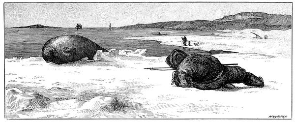
A SEAL IN DANGER
247On the ice were Tyson, with Sergeant Meyer, the steward, the cook, six sailors, and nine Eskimos, men, women, and children, including Hans and Joe. They built a house, from the materials thrown out from the ship, as a shelter; and they built snow houses as the time went on and the floe diminished. Provisions they had but few, but Hans and Joe were indefatigable. They speared seals, caught fish, trapped birds, and, sometimes, a bear would scramble up on to the ice for them to shoot—and they never missed. In short, without them the party would have starved to death.
The floe on which the castaways passed the winter was about a hundred yards long and seventy-five broad. On this they voyaged down the whole length of Baffin Bay and through Davis Strait, the ice melting away and getting smaller and smaller as they drifted south, until on the 1st of April, when it was only twenty yards round, they had to take to the remaining boat, the other having been used for fuel. Once they nearly touched the shore, but the wind rose and off they were driven in the snow. When they were picked up by the sealer Tigress in 53° 35´, near the coast of Labrador, on the 30th of April, they had drifted fifteen hundred miles in the hundred and ninety-six days that had elapsed since they left the ship.
The Polaris, blown to the northward, reached land at Lifeboat Cove in the entrance to Smith Sound, a little north of Foulke Harbour, and here with the aid of the Etah Eskimos the crew passed the winter; and, in the spring, some of them went on an expedition in the Hayes country and lost the famous flag. As the ship could not be made seaworthy, two flat-bottomed boats were built of her materials, and on the 21st of June these were found hauled up on a floe in Melville Bay, and their people rescued by the whaler Ravenscraig, which shifted them into the Arctic, another Dundee whaler, on board of which was Commander Markham, 248who, with Hans Hendrik, four years afterwards, was to follow up Hall's track to the north.
The results of this expedition were of considerable importance. In five days Captain Hall had run five hundred miles through what on most occasions has been found to be an ice-choked sea. He completed the exploration of Kennedy Channel, discovered Hall Basin and Robeson Channel, and was the first to reach the Polar ocean by this route. Greenland and Grinnell Land he extended northward for nearly a hundred and forty miles; and, north of Petermann Fiord, where he showed that the inland ice terminated, he had found a large area free from ice, with its wild flowers and herbage and musk oxen.
Hall's remarkable success in taking a ship to so high a latitude led to the Government expedition of 1875, the first British attempt to reach the Pole since Parry's failure in 1827. Three ships were employed: the Alert, a seventeen-gun sloop; the Discovery, once the Bloodhound, a Dundee whaler; and the Valorous. The Alert and Discovery were specially prepared for the voyage at Portsmouth by Sir Leopold M'Clintock who was then Admiral Superintendent of the dockyard; the Valorous, an old paddle sloop, required little alteration, as her duty was merely to carry the stores that could not safely be taken by the exploring vessels in crossing the Atlantic and hand them over at Disco.
SIR GEORGE NARES
249The leader, Captain George Strong Nares, when one of the Franklin search officers under Kellett at Melville Island, had distinguished himself by a sledge journey in which he had travelled nine hundred and eighty miles in sixty-nine days and reached 119½° west longitude. He was known as one of the best navigators in the Navy, and when called upon to go to the north was in command of H.M.S. Challenger, then on her famous voyage of scientific exploration in very different seas. With him in the Alert was Commander Albert Hastings Markham, whose experience, varied and considerable, gained by his spending much of his spare time within the Arctic Circle, rendered him especially well fitted for the position. In command of the Discovery was Captain Henry Frederick Stephenson; and the officers of both ships were, like the crews, all specially selected. There was no difficulty in the manning. One commanding officer called at the office at Portsmouth where the men were being entered and asked for advice. "An order," he said, "has come on board my ship, directing me to send volunteers for Arctic service to this office. What am I to do? The whole ship's company, nearly eight hundred men, have given in their names."
The three ships left Spithead on the 29th of May, 1875, and were all at Godhavn on the 6th of July. Nine days afterwards they left for Ritenbenk of the curious name, which is an anagram of that of Berkentin who was in charge of the Greenland department when it was founded. Here the Valorous parted company to return home after filling up with fuel at the coal quarries on the north side of Disco Island, while the two ships went to Proven to pick up Hans Hendrik, who this time left his wife and children behind him.
Through Smith Sound, almost choked with ice, progress was slow and difficult; but the passage was safely accomplished, and so across Kane Sea and up 250Kennedy Channel. On Washington Irving Island an ancient cairn was found, evidently the work of white men's hands and of great age, as shown by the state of the lichens on it—yet another of the many indications in the Polar regions that there was always a somebody before the first on record. Crossing the mouth of Archer Fiord, a snug harbour was found in 81° 44´, where the Discovery was left to spend the winter, the Alert going on, hampered much by the floes, though helped at last by a south-westerly wind, until she had to stop in 82° 27´ on the shore of the Polar Ocean, at what was named Floeberg Beach, off an open coast and with no more protection during the winter than was afforded by masses of ice ranging up to sixty feet in height aground in from eight to twelve fathoms of water.
"The protected space," says Nares, "available for shelter was so contracted and shallow, the entrance to it so small, and the united force of the wind and flood-tide so powerful, that it was with much labour and no trifling expense in broken hawsers that the ship was hauled in stem foremost. It was a close race whether the ice or the ship would be in first, and my anxiety was much relieved when I saw the ship's bow swing clear into safety just as the advancing edge of the heavy pack closed in against the outside of our friendly barrier of ice. From our position of comparative security the danger we had so narrowly escaped was strikingly apparent as we gazed with wonder and awe at the power exerted by the ice driven past us to the eastward with irresistible force by the wind and flood-tide at the rate of about a mile an hour. The projecting 251points of each passing floe which grounded near the shore in about ten fathoms of water would be at once wrenched off from its still moving parent mass; the pressure continuing, the several pieces, frequently thirty thousand tons in weight, would be forced up the inclined shore, rising slowly and majestically ten or twelve feet above their old line of flotation. Such pieces quickly accumulated until a rampart-like barrier of solid ice-blocks, measuring about two hundred yards in breadth and rising fifty feet high, lined the shore, locking us in, but effectually protecting us from the overwhelming power of the pack." The land had already assumed a wintry aspect, and the ship soon put on a garb of snow and ice, each spar and rope being double its ordinary thickness from the accumulation of rime. Around her everything was white and solemn; no voice of bird or beast was heard; all was still and silent save the gathering floes; and in two days the men were able to walk on shore over the new ice.
For eleven months she stayed here, secured by cables to anchors frozen on to the shore to protect her from gales on the landward side. With the ship housed in awnings of tilt-cloth, with snow a foot thick laid on the upper deck and banked up on each side as high as the main-chains, with skylights and hatchways carefully covered up, except two hatchways for ingress and egress constructed with porches and double doors so as to prevent the entrance of the bitter air, the crew here passed the long Polar night. On the 11th of October the sun disappeared, and then began those entertainments, lectures, lessons, games, not forgetting the 252Royal Arctic Theatre which opened on the 18th of November, with which the winter was pleasantly whiled away. "Can you sing or dance? or what can you do for the amusement of others?" every man had been asked before he was chosen, and the result was a singularly happy time kept up until sunrise.
The cold was intense and long-continued. Even the tobacco pipes froze, the stem becoming solidly clogged with ice as the smoking went on unless it was made so short as to bring the bowl unpleasantly close to the mouth. On the 1st of April the temperature was down to minus 64°, and three days afterwards it was a hundred and five below freezing, the cold weather preventing the departure of the dog-sledge for Discovery Bay.
During the autumn, sledging parties had laid out reserves of stores for the spring journeys, and a certain amount of practice had been given to the men in what was intended to be the chief work of the expedition. The field, however, was not promising. On one occasion Nares went out to look at it. He obtained a fine view of the pack for a distance of six miles from the land. The southern side of each purely white snow-covered hummock was brilliantly lighted by the orange-tinted twilight. The stranded floebergs lining the shore extended from half to three-quarters of a mile off the land. Outside were old floes with undulating upper surfaces separated from each other by Sherard Osborn's "hedgerows of Arctic landscape," otherwise ridges of pressed-up ice of every size. "It will be as difficult," was his verdict, "to drag a sledge over such ice as to transport a carriage directly across country in 253England." He gave a lecture on sledging at one of the winter entertainments. It was interesting but not encouraging. He told his hearers that if they could imagine the hardest work they had ever been called upon to perform in their lives intensified to the utmost degree, it would only be as child's play in comparison with the work they would have to perform whilst sledging. "These prophetic words," says Markham, "were fully realised, and were often recalled and commented on by the men."
They had four different kinds of sledges. From the illustrations it will appear how the eight-feet sledges differed from those used by M'Clintock, the Nares sledge being higher and more slender in the uprights. The eight-men sledge, such as the Marco Polo—which was bound for the Pole—had six uprights eighteen inches apart. It was eleven feet long, thirty-eight inches wide, eleven inches high, and weighed one hundred and thirty pounds. The tent, made of light, unbleached duck, was nine feet four inches long at the bottom, eight feet at the top, seven feet wide and high, and weighed forty-four pounds. The tent poles, five in number, weighed five pounds apiece. The coverlet weighed thirty-one pounds and a half, and the extra coverlet twenty pounds. The lower robe weighed twenty-three pounds, the waterproof floor-cloth fifteen. The eight sleeping-bags weighed eight pounds apiece, and the eight knapsacks, when packed, twelve pounds apiece. The shovel and two pickaxes accounted for twenty-one pounds, the store-bag for twenty-five, the cooking gear for twenty-nine, the gun and ammunition for twenty-five, the medical stores for twelve, the 254instruments for fifteen, and the tent for nine and a quarter. To this must be added a thousand and eighty pounds for forty-five days' provisions for the eight men, and we have the total of sixteen hundred and sixty-four pounds odd, which with seven men at the ropes gives each man a drag of about two hundred and thirty-eight pounds. In the spring the weight decreases as the provisions are consumed, but the rate of decrease is not the same in the autumn, for then the steadily falling temperature increases the weight of the outfit by the moisture it adds to the tent and clothing. In Markham's autumn journey the tent of thirty-two pounds came back as fifty-five, the coverlet as forty-eight, the lower robe as forty, the floor-cloth as forty, and everything else was heavier than at the start.
The sledges mustered for their journeys on the 3rd of April. Seven in number, they were drawn up in single line according to the seniority of the leaders, all fully equipped and provisioned, and manned by fifty-three officers and men. On each was its commander's banner—a swallow-tailed flag charged with a St. George's cross and displaying the armorial bearings. As a precaution against snow-blindness, the men had been ordered to decorate the backs of their snow-jumpers with any device they thought fit, the result being a display of comic blazonry that often formed a topic of conversation when others failed. For the same reason the two boats carried on the north-going sledges were gaily decorated with the royal arms, and the rose, shamrock, and thistle; the artist, as on other occasions, being Doctor Moss, whose great difficulty in the matter was that in spite of the quantity of turpentine used in mixing the paint it would persist in freezing so that the brush became as stiff as a stick every few seconds.
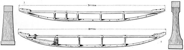
| Section M'Clintock | SLEDGES USED BY (1) SIR LEOPOLD M'CLINTOCK AND (2) SIR GEORGE NARES | Section Nares |
| (In the collection of Ed. Whymper) |
255Lieutenant Aldrich, supported for three weeks by Lieutenant Giffard, was to explore the shores of Grant Land, towards the north and west, along the coast-line he had discovered in the previous autumn. Commander Markham, seconded by Lieutenant Parr, was to accompany Aldrich to Cape Joseph Henry and then strike off to the northward over the ice. The other three sledges were to accompany these as far as their own provisions would allow, after completing the four's deficiencies and giving them a fresh start from an advance post.
When Markham was only eleven days out, one of his crew complained of pain in his ankles and knees, and was of no help for the rest of the journey. This was the first appearance of the scurvy which was to ruin so many hopes, for man after man was taken ill and became a passenger. To make matters worse no rougher road was ever traversed by sledge. Over a labyrinth of piled-up blocks of ice ranging to forty feet and more in height, through which the road had to be cut with pickaxe and shovel, and amid gale and fog and falling snow, the painful progress went on. With many a "One; two; three; haul!" the heavy mass would be dragged where the men could hardly drag themselves; one of the sledges taken a few yards by the combined crews, who would then return for the other. On the 19th of April one of the boats was abandoned and this made matters easier, but only for a time, as the disease spread. At last it was decided to stop; and on the 12th of May a party of ten went ahead to reach the farthest north.
256"The walking," says Markham, "was undoubtedly severe, at one moment struggling through deep snowdrifts, in which we floundered up to our waists, and at another tumbling about amongst the hummocks. Some idea may be formed of the difficulties of the road, when, after more than two hours' hard walking, with little or nothing to carry, we had barely accomplished one mile. Shortly before noon a halt was called, the artificial horizon set up, and the flags and sledge standards displayed. Fortunately the sun was favourable to us, and we were able to obtain a good altitude as it passed the meridian, although almost immediately afterwards dark clouds rolled up, snow began to fall, and the sun was lost in obscurity. We found the latitude to be 83° 20´ 26˝ N., or three hundred and ninety-nine miles and a half from the North Pole."
On the 8th of June Lieutenant Parr appeared on the quarter-deck of the Alert greeting in silence the one or two who chanced to meet him. That some calamity had happened was evident from his looks. He had walked on alone for forty miles to bring the news that Markham's party were in sore distress. Measures of rescue were instantly taken; Lieutenant May and Doctor Moss, on snow-shoes, pushing ahead with the dog-sledge laden with medical stores, while Nares with a strong party followed. On their arrival one man had died, and of the others no less than eleven were brought back to the ship on the relief sledges.
Ten days afterwards, fearing a similar fate had overtaken Aldrich's party, Lieutenant May was despatched 257to find him. As with Markham, scurvy had begun on the outward journey, and it had become so bad on the return that one of the men was being sent off to the ship when May arrived with help. It had nevertheless been a successful journey, the road being easier than that by the northern route. Aldrich had traced the continuous border of the heavy pack for two hundred miles from Floeberg Beach, rounded Cape Columbia, in 83° 7´ N., the northernmost point of Grant Land, and, along the coast trending steadily south-west, had reached longitude 85° 33´ and sighted Cape Alfred Ernest in longitude 86½°.
With his arrival there were over forty scurvy patients on board the Alert; and Nares was to learn that the sledge parties from the Discovery had been similarly affected. Lieutenant Beaumont had gone along the North Greenland coast, reaching, on the 21st of May, 51° W., in 82° 20´ N., and sighting Cape May, Mount Hooker, and Cape Britannia. On the 10th of May, while on his outward journey, he had sent back Lieutenant Rawson to bring a relief party to meet him, and Rawson with Hans and eight dogs, accompanied by Doctor Coppinger, reached him on the 25th of June when he was on his last possible day's journey, he and two of his men dragging the sledge with four helpless comrades lashed on the top of it.
The Discovery had also sent out Lieutenant Archer to survey the fiord named after him, which opens out into Lady Franklin Bay; and Lieutenant Fulford had crossed the channel and explored Petermann Fiord. In fact, the expedition's geographical work was of great extent, as was the other scientific work, the most important, 258as usual, being that done from the ships. Among the odds and ends easily rememberable was the haul of the seine in Sheridan Lake, near the wintering station of the Alert, which yielded forty-three char (Salmo arcturus), the most northerly freshwater fish; the finding of the nest of the sanderling (Calidris arenarius), now in the Natural History Museum, in 82° 33´, and the discovery of the nesting of the grey phalarope and the knot in the same neighbourhood; the thirty-feet seam of Miocene coal worked in Discovery Harbour; and the Eskimo relics at Cape Beechey, near the eighty-second parallel, which, in connection with the encampments on the opposite coast, suggested that there, at the narrowest part of Robeson Channel, had been a crossing place from shore to shore.
On the 31st of July, 1876, the Alert was again under steam after her long rest, and one of the most dangerous voyages on record began. The ships, of from five hundred to six hundred tons, were handled as if they were small tugs; blocked, beset, pressed on shore, Nares with consummate skill, constant watchfulness, and never-failing patience, brought them through. But they did not get out of Smith Sound until the 9th of September, and then it was against head winds in stormy weather amid icebergs innumerable that they were slowly worked southwards and homewards.
BISHOP PAUL EGEDE
Hans Egede—The house of Eric the Red—Nansen's crossing of Greenland—Nansen and Sverdrup row to Ny Herrnhut—Nordenskiöld's journeys—Berggren's discovery—Nordenskiöld on the inland ice—Glaciers and icebergs—Diatoms and whales—Edward Whymper's expedition—Greenland in Miocene times—Graah—Scoresby—Ryder—The Germania and Hansa—The Duke of Orleans—The Eskimos of Clavering Island—Franz Josef Fiord—The drift of the Hansa—The Greely expedition—The International Polar stations—Voyage of the Proteus—Lockwood reaches 83° 24´—Greely's wagon—The Eskimo house at Lake Hazen—Greely Relief expeditions—The rescue of Greely—Peary—His journey to Independence Bay—His four years' expedition—Reaches 84° 17´—His Polar expedition of 1905—The Roosevelt—The voyage to Cape Sheridan—Plan of the northern advance—Peary reaches 87° 6´—Moxon's mariner.
Hans Egede, aged twenty-two, priest of the parish of Vaagen, in the north of Norway, reading, in 1710, about the Norse colonists of the west—and apparently knowing nothing of Thiodhilda—was led to think that some of their descendants might still be living in heathenism. Writing to the Bishop of Trondhjem, he proposed to go out to these as a missionary. The good father rather astonished him by the reply that "Greenland was undoubtedly part of America, and could not be very far from Cuba and Hispaniola, where there was found such abundance of gold," and, as those who went to Greenland might bring home "incredible riches," he approved of the suggestion.
260Unfortunately, however, Egede had written his letter without the knowledge of his wife, who by no means thought with the Bishop until seven years afterwards, when she changed her mind. Trying in vain locally, Egede applied for support to Frederick IV of Denmark, who finding him an earnest, honest, interesting man, gave him his patronage, the result being that a company was formed at Bergen for the development of trade and the propagation of the gospel; and, on the 3rd of May, 1721, the Hope set sail from there for Greenland with forty-six intending colonists, including the missionary and his wife and family.
His landing-place was on an island at the mouth of Godthaab Fiord, or Baal's River. He found the Greenlanders very different from what he had supposed; and also that the Dutch were carrying on a profitable trade with them and keeping it quiet. To begin with they were nothing like Vikings in appearance; and their language, instead of being a Scandinavian dialect, was of the same character as that of the Eskimos of Labrador—and not at all easy to learn. Learn it, however, he and his family did; and among the Greenlanders they remained and laboured with truly admirable energy and devotion, battling hard for life amid much disaster until, with the help of his son Paul, who succeeded him as superintendent of the mission with the title of bishop, the settlement became permanent, and other settlements arose from it up the western coast as they are found to-day.
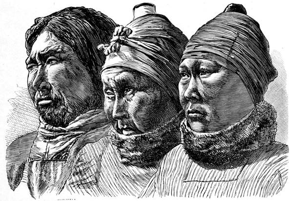
GREENLANDERS
261Though there were no Norsemen, there were many traces of them, the most interesting being the house of Eric the Red, near Igaliko. Here, close to Erik's Fiord and overlooking Einar's Fiord, on one of the prettiest sites in Greenland, was Brattelid—"the steep side of a rock"—one side of it a natural cliff, the walls of the other sides, more than four feet thick, built of blocks of red sandstone from four to six feet in length as well as in breadth and thickness, reminding the visitor of those of Stonehenge, and evoking similar wonderment as to how they were got into place. And in his first colony, now called Igdluernerit, Egede seems to have followed the Norsemen—at an interval—in their architecture, to judge by the large stones in the walls of his house, which, like Eric's, is now in ruins.
Twelve years after Egede, came the Moravians to take up their quarters at Ny Herrnhut, also at the mouth of Godthaab (that is, Good Hope) Fiord. It was here that Nansen and Sverdrup landed in October, 1888, having rowed up from Ameralik Fiord in their "half a boat," as the Eskimos called it.
"Are you Englishmen?" they were asked.
"No," said Nansen, in good Norse, "we are Norwegians."
"May I ask your name?"
"My name is Nansen and we have just come from the interior."
"Oh, allow me to congratulate you on taking your doctor's degree!"
From which it is clear that Godthaab is not so much out of the world as one would suppose.
Nansen with his three Norsemen and two Lapps had reached the east coast in the Jason, and on the 17th of July had left the ship in their boats to make their way 262to the shore; but they had been caught in the floes, and on them and among them they had drifted for twelve days—an experience they had not bargained for. Getting ashore at last near Cape Tordenskiold, they worked their way back northwards along the coast, spending a short time at an Eskimo encampment at Cape Bille, until on the 15th of August they hauled their two boats up near Umivik and started to cross Greenland over the inland ice.
The country is now in its glacial period, and for days they toiled across its glacial desert; each day alike in its wearisome monotony. "Flatness and whiteness were the two features of this ocean of snow," says Nansen; "in the day we could see three things only, the sun, the snowfield and ourselves. We looked like a diminutive black line feebly traced upon an infinite expanse of white. There was no break or change in our horizon, no object to rest the eye upon, and no point by which to direct the course. We had to steer by a diligent use of the compass, and keep our line as well as possible by careful watching of the sun and repeated glances back at the four men following and the long track which the caravan left in the snow. We passed from one horizon to another, but our advance brought us no change."
By the 2nd of September they had all taken to their skis on which they made great progress alone, but when it came to hauling the sledges there was a difference. Sometimes the snow proved to be very heavy going, particularly when it was wind-packed, and then it was no better than sand. One entry in Nansen's journal will suffice: "It began to snow in the middle of the day, and our work was heavier than ever. It was worse even than yesterday, and to say it was like hauling in blue clay will scarcely give an idea of it. At every step we had to use all our force to get the heavy sledges along, and in the evening Sverdrup and I, who had to go first and plough a way for ourselves, were pretty well done up."
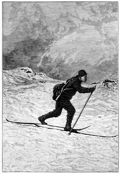
ON LEVEL GROUND
263When at last the wind became favourable they hoisted sail, and off they went over the waves and drifts of snow at a speed that almost took their breath away; and when they reached the western slopes they slid down them using the sledges as toboggans. At first they had intended making for Christianshaab, but the route had to be changed for that to Godthaab, and the sea was reached some distance to the south. Here they stitched the floor-sheet of their tent over a framework of withies, and with oars made of canvas stretched across forked willows and tied to bamboo shafts, Nansen and Sverdrup boldly trusted themselves to the waves and with much hard labour pulled into Ny Herrnhut on the 3rd of October. Such was the first crossing of Greenland, a really remarkable instance of daring endeavour.
Further north, Nordenskiöld, in 1883, had attempted to cross over the ice-cap from near Disco on the west coast, but, hindered and finally stopped by crevasses and other obstacles, could do no more than send his Lapps to try their best on their skis, and they returned after their journey eastwards of a hundred and forty miles reporting similar monotonous conditions all along their track. Thirteen years before, he had, also from Auleitsivik Fiord, started out with Berggren; and deserted by their followers, they 264had gone on by themselves for some thirty miles east of the northern arm of the fiord. It was on this occasion that Berggren discovered Ancylonema, that small poly-cellular alga forming the dark masses that absorb a far greater amount of heat than the white ice and thus cause the deep holes that aid in the process of melting.
"The same plant," says Nordenskiöld, "has no doubt played the same part in our country; and we have to thank it, perhaps, that the deserts of ice which formerly covered the whole of Northern Europe and America have now given place to shady woods and undulating cornfields."
Nordenskiöld looked upon Greenland and its icefield as a broad-lipped, shallow vessel with chinks in the lip, the glacier being viscous matter within it. As more is poured in, the matter runs over the edges, taking the lines of the chinks, that is, of the fiords and valleys, as that of its outflow. In other words, the ice floats out by force of the superincumbent weight of snow just as does the grain on the floor of a barn when another sackful is shot on to the top of the heap already there. When the glacier reaches the sea it makes its way along the bottom under water for a considerable distance, in some cases, as near Avigait, for more than a mile. This is where the water is too shallow for it to affect the mass, which forms a breakwater; though as a rule the shore deepens more suddenly and the projection is less. It was long supposed that the berg broke from the glacier by force of gravity, but this is not generally so. The berg is forced off from the parent glacier by the buoyant action of the sea from beneath; the ice groans and creaks; then there is a crashing, then a roar like the discharge of artillery; and with a great regurgitation of the waves the iceberg is launched into life. These huge floating islands of ice are the most conspicuous exports of Greenland; and their true magnitude is not realised until it is remembered that only about an eighth of their bulk appears above the water. Bergs as large as liners we frequently hear of—one such is shown in our illustration—but sometimes they are of much greater freeboard, though the very large ones reported as extending along the horizon are invariably groups of several crowded together.
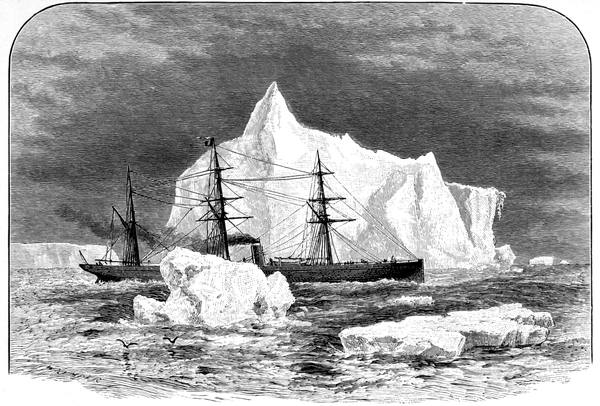
THE ALLAN LINER "SARDINIAN" AMONG ICEBERGS
265Ancylonema has evidently plenty to do. Another instance of the important part played by the insignificant in these regions is suggested by the colour of the sea. This varies from ultramarine blue to olive-green, from the purest transparency to striking opacity; and the changes are not transitory but permanent. These patches of dark water abound with diatoms, while the bluer the water the fewer are the diatoms; and where they are most numerous, there the animals that feed on them assemble in their greatest numbers. And these animals are jellyfish, entomostracans, and, to a greater extent, pteropods, their chief representative being Clio borealis. In short, the animals that feed on the diatoms are food of the Greenland whale, and where the waters are dark the whale-fishers thrive. "I know nothing stranger than the curious tale I have unfolded," says Dr. Robert Brown, who worked out this remarkable chain, "the diatom staining the broad frozen sea, again supporting myriads of living beings which crowd there to feed on it, and these again supporting the huge whale. Thus it is no stretch of the imagination to say 266that the greatest animal depends for its existence on a being so minute that it takes thousands to be massed together before they are visible to the naked eye."
Cold as Greenland is, there was a time when matters were different. In token of this we have the Miocene fossils collected by Edward Whymper during his expedition from near Jakobshavn in 1867, which were described and illustrated by Oswald Heer in the Philosophical Transactions for 1869. A look at these is a welcome relief after such a surfeit of ice. Here, as well preserved as in the leaf beds of Alum Bay, are the leaves and fruits of an unmistakable temperate flora. Magnolias, maples, poplars, limes, walnuts, water-lilies; myrica, smilax, aralia; sedges and grasses, conifers and ferns: these at the least were all growing in Greenland in its Miocene age. And even a thousand years ago the climate must have been milder than now, to judge by the farming reports of the colonists who seem to have been quite at home along the coast, which, with its innumerable islands and fiords, is as intricate as that of Norway.
Searching for the ancient eastern settlement of the Norsemen, W. A. Graah, in 1829, wintered at Julianehaab, which in all likelihood is the site, although he knew it not. Possessed with the idea that it must be on the south-eastern coast, he devoted his attention to that region only, finding Eskimos who had never seen a white man and starting a trading intercourse which led to most of them migrating to the less inclement west. His work linked up with that of Scoresby, who in 1822 charted the main features of the sea-front from 69° to 75°. Ryder, seventy years afterwards, filled in the details of much of Scoresby's work, and found Eskimos further north, as Clavering had done in 1823, when in the Griper during Sabine's observations at Pendulum Island.
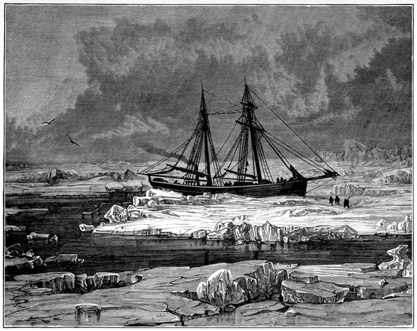
THE "GERMANIA" IN THE ICE
267It was to Pendulum Island, in 74° 32´, that Karl Koldewey, after his preliminary run to 81° 5´ in 1868, took the Germania to winter during the German expedition of 1869. The two vessels, the Germania, a small two-masted screw steamer of one hundred and forty-three tons, built specially for Arctic service, and the Hansa, only half her size, which had been strengthened for the voyage, reached Jan Mayen on the 9th of July, and, hidden from each other by fog, sailed northwards for five days. On the fifth evening the wind rose, the fog cleared, and a hundred yards in front of them lay the ice like a rugged line of cliffs.
For a few days they sailed along it endeavouring to find an opening to the north. Then, on the 20th, the Germania ran up a signal to approach and communicate, which was misunderstood, and, instead of repeating it and making sure, the Hansa put up her helm, fell off, crowded on all sail, and disappeared in the fog. Koldewey, persisting in his efforts to get through the pack, found an opening on the 1st of August. Nine days afterwards he was again blocked, and finally, on the 27th, he reached Pendulum Island, where he made the Germania snug for the winter, which proved to be remarkably mild.
The first sledge party travelling up one of the fiords met with abundant vegetation and herds of reindeer and musk oxen, and were visited by bears who had not learnt to be wary of man; and when the bears came 268back with the sun in February they were as troublesome as those of Ice Haven to the Dutchmen. Several sledge parties went out in the spring, and, notwithstanding inadequate equipment, did excellent work. In April, 1870, Koldewey reached 77° 1´, almost up to Lambert Land, otherwise the Land of Edam. Here, looking out over the ice-belt, they agreed that it was "a bulwark built for eternity," and hoisting sails on their sledges they ran back to the ship. But in 1905 the Duke of Orleans arrived on the coast to reach 78° 16´ and discover that their Cape Bismarck was on an island and their Dove Bay a strait.
In the neighbourhood of their winter quarters the glaciers and mountains were well explored, and an attempt was made to measure an arc of the meridian, which proved to be rather rough work among such surroundings. The snowstorms were particularly pitiless and heavy, and the travelling decidedly bad. The thaw began about the middle of May, and there was more sledging through pools than usual, so that they did not want variety in their occupations. On the 14th of July boating became practicable, and a voyage was made to the Eskimo village found by Clavering in 1823, on the island named after him, but the village proved to be deserted and the huts in ruins—an unwelcome discovery, for, as M'Clintock says in reference to it: "It is not less strange than sad to find that a peaceable and once numerous tribe, inhabiting a coast-line of at least seven degrees of latitude, has died out, or has almost died out, whilst at the same time we find, by the diminution of the glaciers and increase of animal life, that the terrible severity of the climate has undergone considerable modification. We feel this saddening interest with greater force when we reflect that the distance of Clavering's village from the coast of Scotland is under one thousand miles. They were our nearest neighbours of the New World."
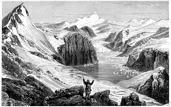
THE REGION ROUND MOUNT PETERMANN
269A little north of the seventy-third parallel Koldewey discovered on his way home the magnificent Franz Josef Fiord. Here the grandest scenery in Greenland is to be found along its deep branches winding among the mountains, one of which, Mount Petermann, is over eleven thousand feet high. As the Germania entered this remarkable inlet, which extends inland for some five degrees of longitude, a fleet of icebergs were sailing out of it with the current; the farther she advanced the warmer seemed the temperature of the air and surface water, and the wilder and more impressive became the grouping of the mighty cliffs and peaks with their lofty waterfalls and raging torrents and deep glacier-filled ravines. It was the great geographical discovery of the expedition.
Meanwhile Hegemann, trying to pass to the north more to the westward, got the Hansa beset on the 9th of September some twenty-four miles from Foster Bay. As the ice-pressure threatened to become too great for the vessel to resist, an elaborate house was planned and built on the floe. Briquettes were used for the walls, the joints were filled up with dry snow on which water was poured, and in ten minutes it hardened into a compact mass. The house was twenty feet long, fourteen feet wide, and four feet eight inches high at the sides, with a rising roof consisting of sails and mats covered with deep snow. Into this house, which took a week 270to build, provisions for two months were carried, besides wood and fuel. The boats were put out, a flagstaff was set up, and quite a little settlement was started on the ice; and no sooner was it completed than a violent snowstorm, lasting for five days, buried both the ship and the house. The ice increased around, and, the pressure of the accumulation lifting the Hansa seventeen feet above her original level, everything of value was removed from her on to the ice and into the house. On the 22nd of October she sank, having drifted below the seventy-first parallel; and all through the winter the floe, which was about two miles across, leisurely made its way to the south.
Off Knighton Bay Christmas was kept with all possible honour. The briquette house was decorated with coloured-paper festoons, and, by the light of the sole remaining wax candle, the genial Germans made themselves merry around a stubby Christmas tree devised out of an old birch broom. Three weeks afterwards the floe cracked beneath the dwelling. There was barely time to take refuge, but all hands were saved in the boats. For two days they remained in them, poorly sheltered from the storm and unable to clear out the snow. Then a smaller house was built of the ruins of the old one, but it was only large enough for half the party; and as the spring advanced the floe decreased, breaking away at the edges as did that on which the Polaris people drifted to Labrador.
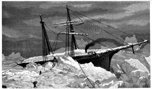
THE LAST DAYS OF THE "HANSA"
271At the end of March it entered Nukarbik Bay and there it stayed four weeks, caught in an eddy, slowly moving round and round just far enough from the shore to render an attempt at escape impossible; twice a day they went in with the tide and out with the tide, the ice too bad for the boats and never promising enough for a dash to the land. Having become thoroughly acquainted with this portion of the coast with its bold range of hills, its deep bays, its inlets, headlands, and islands, a storm came on which cleared them out of the eddy and drove them further south. Three weeks after that the floe had become so diminished by the lashing of the surge that it was hardly a hundred yards across, and large fragments were slipping off every hour.
They had been on it for two hundred days and drifted eleven hundred miles when, on the 7th of May, water-lanes opening shorewards, they took to the boats and ventured among the masses of ice, making for the south. At first they had their difficulties in being compelled to haul up on the floes to pass the night or wait for a favourable wind, which meant severe work in unloading and reloading. Once during their painful progress of more than a month they were kept on a floe for six days by gales and snow-showers. Finally, after a long desperate effort, they reached Illuilek Island, and thence proceeded close inshore among rocks and ice to Frederiksdal, a couple of hours' walk from the southernmost point of the Greenland mainland, Cape Farewell being part of an island twenty-eight miles further to the south-east. On the 21st of June, eight days afterwards, they were at Julianehaab, whence they sailed to be landed at Copenhagen on the 1st of September, just ten days before the Germania steamed into Bremen. Thus the expedition, by its two divisions, ice-borne and ship-borne, had skirted nearly all that was then known of the east coast from end to end.
272On the north coast, Beaumont's discoveries were extended by Lieutenant James B. Lockwood for ninety-five miles, the trend of the shore taking him up to 83° 24´, three minutes and thirty-four seconds nearer the North Pole than Markham reached out on the sea. This was on the 13th of May, 1882, during the ill-fated A. W. Greely expedition. Like most American expeditions up to then this began well and ended badly, worse, in fact, than any; and unlike them, and all others, it consisted entirely of soldiers—as if a detachment of Royal Engineers had been sent north on ordnance survey work. It was, however, more miscellaneous, for among its twenty-three members were representatives of three cavalry regiments, six infantry regiments, and an artilleryman.
This was to be the garrison of the International Circumpolar Station at Lady Franklin Bay. The idea of a ring of stations round the Pole for the study of the natural phenomena for which the Arctic regions afford so wide and important a field was not new, but it was first reduced to definiteness and its adoption secured by Karl Weyprecht of the Austro-Hungarian expedition of 1872. At a meeting of German scientific men at Gratz, in September, 1875, he procured assent to his general principle that the best results in Arctic inquiry were to be obtained by subordinating geographical discovery to physical investigation. It had long been evident that the most valuable results had been obtained by the ships and fixed observatories, and that the toilsome work of the sledges in their successive approaches by a few more miles towards a mathematical point, though most interesting to read about, had really been of very little practical use owing to the necessarily light equipment. Instead, therefore, of a number of isolated attempts at irregular intervals, Weyprecht suggested that the better way would be to attack the subject systematically by a group of expeditions at permanent stations working together long enough at the same time for their observations to be dealt with as part of a general scheme; and the suggestion was approved although he did not live long enough to see the stations occupied.
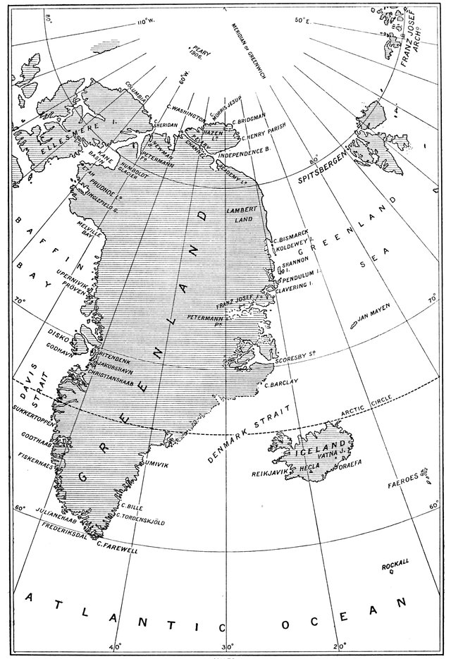
GREENLAND
273Three International Polar Conferences were held, in 1879 and the two following years, at Hamburg, Berne, and St. Petersburg, at the last of which it was arranged that the stations should be fourteen in number, two in the south and twelve in the north, these twelve being—(1) The Austrian at Jan Mayen; (2) the Danish at Godthaab; (3) the Finnish at Sodankyla in Uleaborg; (4) the German at Kingua in Cumberland Sound; (5) the British at Fort Rae on the northern arm of the Great Slave Lake; (6) the Dutch at Dickson Harbour at the mouth of the Yenesei; (7) the Norwegian at Bosekop at the head of Alten Fiord; (8) the Russian at Little Karmakul Bay in Novaya Zemlya; (9) the second Russian on Sagastyr Island in the Lena Delta; (10) the Swedish at Mossel Bay in Spitsbergen; (11) the American at Point Barrow under Lieutenant P. H. Ray, who met with marked success and brought his men all home in safety; and (12) the second American at Lady Franklin Bay, the winter quarters of H.M.S. Discovery, which Greely renamed Fort Conger.
In direct opposition to the guiding idea of the scheme, Greely's work was complicated by having 274tacked on to it Howgate's proposal of another dash for the Pole, his instructions requiring him to send out "sledging parties in the interests of exploration and discovery." Further, his expedition was fitted out in a way that almost invited disaster. Let one instance suffice. "In speaking of this instrument," he explains, "it is necessary to say that a dip-circle was especially made for the Lady Franklin Bay Expedition, but it was by error shipped to the United States Coast Survey. On calling for it, when the duplicate instrument ordered could not be had in time, the late Mr. Carlisle Patterson, then Superintendent, promptly promised that it should be sent on to me at New York. On the day of my sailing, a dip-circle, carefully boxed, was received; but on opening it at St. John, an old, rusty, unreliable instrument was found in the place of the new circle. This resulted in unsatisfactory and incomplete observations at Conger, for the old circle having upright standards instead of transverse ones, as in the new, but one end of the needle could be read. It must always be a matter of regret that this unwarrantable and unauthorised substitution by some person was made, which materially impaired, if not effectually destroyed, the value of our two-years' dip-observations." This sort of thing reduced International Polar Research to a farce, and the same spirit appeared in other departments, more seriously than all in the relief proceedings, which were conducted in a way that could only lead to starvation.
In August, 1881, the Proteus, with the expedition on board, made her way up Smith Sound and Kennedy Channel without serious hindrance until she entered 275the south-eastern part of Lady Franklin Bay, where the close, heavy pack brought her to a stop within eight miles of her destination. She had come seven hundred miles from Upernivik in less than a week, and, faced by ice twenty to fifty feet thick, she had to wait another seven days before she got into Discovery Harbour. Here the party landed and a house was built, and dissension arose which ended in one of the company returning in the ship and another endeavouring to do so and being too late, so that he had to remain as a sort of tolerated volunteer. Two others were sent away as being physically unfit; but, making up for these, were two Eskimos engaged at Upernivik.
Preliminary sledging began at once, and in the spring the two great efforts were made. The doctor's, towards the Pole, left on the 19th of March and got adrift on a floe from which the party escaped with the loss of their tent, provisions, and some of their instruments. According to Greely's report: "The farthest latitude attained by this party is given by Dr. Pavy as 82° 56´, it being estimated, as no observations for time, magnetic declination, or latitude were made at any period during his absence."
On the 3rd of April, Lockwood with twelve men left for the coast of Greenland. Up to Newman Bay four men had been sent back as unfit for field-work. On the 16th, when the party started from here for the north-east, Lockwood and Christiansen, the Eskimo, were in advance hauling about eight hundred pounds with a team of eight dogs, a three-men sledge following, and then two two-men sledges; at Cape Bryant the men-sledges were sent back, and Lockwood, 276Brainard, and the Eskimo went on with the dog-sledge. Cape Britannia was reached on the 5th of May, and on the 13th they camped at Lockwood Island, and there, for the first time, Americans reached a farthest north.
"I decided to make this cape my farthest," reported Lockwood, "and to devote the little time we could stay to determining accurately my position, if the weather would allow, which seemed doubtful. We built a large, conspicuous cairn, about six feet high and the same width at the base, on the lower of two benches. After repitching the tent Sergeant Brainard and I returned to the cairn, and collected in that vicinity specimens of the rocks and vegetation of the country, the sergeant making almost all the collection. We ascended without difficulty to a small fringe of rocks, which seemed from below to form the top. The ascent, at first very gradual, became steeper as we went up, but we had no difficulty, as for some distance below the summit the surface is covered with small stones, as uniform in size, position, etc., as those of a macadamised road. Reached the top at 3.45 p.m. and unfurled the American flag (Mrs. Greely's) to the breeze in latitude 83° 24´ N. (according to last observation). The summit is a small plateau, narrow, but extending back to the south to broken, snow-covered heights. It commanded a very extended view in every direction. The barometer, being out of order, was not brought along, so I did not get the altitude. The horizon on the land side was concealed by numberless snow-covered mountains, one profile overlapping another, and all so merged together, on account of their universal covering of 277snow, that it was impossible to detect the topography of the region. To the north lay an unbroken expanse of ice, interrupted only by the horizon."
On Midsummer Day Greely started with a four-wheel wagon to explore Grinnell Land. The wagon, in the men's vernacular, was a man-killer, and was abandoned after they had dragged it a hundred miles. On this journey much exploring work was done in the unknown country, the most interesting find being that of the Eskimo house at Lake Hazen. In this, according to Greely's description, there were two fireplaces, one in the east and the other in the south, both of which had been built outward so as to take up no part of the space of the room, which was over seventeen feet long and nine feet wide. The sides of the entire dwelling were low walls of sodded earth, lined inside with flat thin slates, the tops of which were about two feet above the level of the interior floor, and the bench was covered with flat slabs of slate. Near by was a smaller house of the same character, and around were a large number of relics, including walrus-ivory toggles for dog-traces, sledge-bars and runners, an arrow head, skinning knife, and articles of worked bone. Next year further explorations of the back country were undertaken, so that some six thousand miles of the interior were viewed, disclosing many fertile valleys with their herds of musk ox.
Meanwhile the Neptune, with supplies for Fort Conger, had in August, 1882, been vainly endeavouring to get north, and, a few miles from Cape Hawks, had turned back with the pack piling the ice as high as her rail. Six attempts she made before she gave up and 278retreated, after making several deposits of stores at Cape Sabine and elsewhere. In July, 1883, the Proteus, making a similar attempt to reach Greely, was crushed in the ice off Cape Albert, her side opening with a crash while the men were working in the hold, the ice forcing its way into the coal-bunkers and then pouring in so that as soon as the pressure slackened she went down, escape to the south being effected in the boats.
Next year, matters having become serious, a naval expedition consisting of the Thetis, the Bear, and Nares's old ship the Alert, presented by the British Government, was placed in the capable hands of Commander Winfield Schley, who had with him George Melville of Jeannette fame as engineer of the Thetis, and matters were conducted in quite a different way under much more favourable circumstances. Schley intended to find Greely, at all costs, and he did so. First he found a cairn at Brevoort Island, in which were the papers deposited by Greely relating how he had had to come south owing to shortness of supplies, and how his party were then—21st of October, 1883—encamped on the west side of a small neck of land distant about equally from Cape Sabine and Cocked Hat Island.
As it was then the 22nd of June, 1884, and they had had only forty days' complete rations to live upon, Schley hurried off at once. Had he been two days later he would have been too late. There was a tent wrecked by the gale, with its pole toppling over and only kept in place by the guy ropes. Ripping it up with a knife, a sight of horror was disclosed. On one side, close to the opening, with his head towards the 279outside, lay what was apparently a dead man. On the opposite side was a poor fellow, alive but without hands or feet, and with a spoon tied to the stump of his right arm. Two others, seated on the ground, were pouring something out of a rubber bottle into a tin can. Directly opposite, on his hands and knees, was a dark man with a long matted beard, in a dirty and tattered dressing-gown with a little red skull cap on his head, and brilliant staring eyes. As Colwell appeared, he raised himself a little, and put on a pair of eyeglasses.
"Who are you?" asked Colwell.
The man made no answer, staring at him vacantly.
"Who are you?" again.
One of the men spoke up. "That's the Major—Major Greely."
Colwell crawled in and took him by the hand, saying to him, "Greely, is this you?"
"Yes," said Greely in a faint, broken voice, hesitating with his words; "yes—seven of us left—here we are—dying—like men. Did what I came to do—beat the best record."
Near at hand were ten graves. The bodies, despite Greely's remonstrances, were taken up and removed for burial in the United States. "Little could be seen of the condition of the bodies, as they had been clothed, and all that appeared was intact. In preparing them subsequently," says Schley, "it was found that six had been cut and the flesh removed." One of these, that of a cavalryman serving under the assumed name of Henry, had a bullet in it. He had been shot, at Greely's written order, "for stealing sealskin thongs, the only remaining food."
280The next to add to our knowledge of the northern coast of Greenland was Robert E. Peary, of the American Navy, who seems to have devoted his life to Arctic exploration. On his first expedition in 1886, he penetrated with Maigaard for some distance into the country in the neighbourhood of Jakobshavn as a sort of pioneering venture. In 1891, accompanied by his wife, when outward bound in the Kite in the Melville Bay pack, he had his leg broken. The ship had been butting a passage through the spongy sheets of ice which had imprisoned her, when in going astern a detached cake struck the rudder, jamming the tiller against the wheel-house where Peary was standing, and pinned his leg long enough to snap it between the knee and the ankle. In spite of this he insisted on being landed with the rest of the party at McCormick Bay, a little to the north of Whale Sound, where a house was built and the winter spent.
Making a good recovery, he set off in May to sledge across North Greenland through snow and over it, and over snow-arched crevasses, often, in cloudy weather, travelling in grey space with nothing visible beyond a foot or two around him. After fifty-seven days' journey to the north-east and along Peary Channel, the northern boundary of the mainland, he left the inland ice for a strange country dotted with snowdrifts and mostly of red sandstone, in which murmuring streams, roaring waterfalls, and the song of snow-buntings formed an agreeable change from the silence of the desert of snow. Four days' hard labouring through this brought him on the 4th of July to Independence Bay on the north-east coast, where from Navy Cliff, nearly four thousand feet high, he looked across to Academy Land on the other side of the bay and beyond it over the region leading down to the farthest north of the Duke of Orleans. "It was almost impossible," he says, "to believe that we were standing upon the northern shore of Greenland as we gazed from the summit of this bronze cliff, with the most brilliant sunshine all about us, with yellow poppies growing between the rocks around our feet, and a herd of muskoxen in the valley behind us. Down in that valley I had found an old friend, a dandelion in bloom, and had seen the bullet-like flight and heard the energetic buzz of the humble-bee."
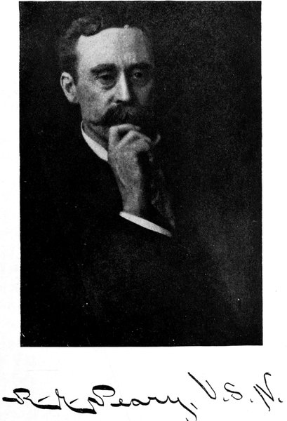
281Next year he and his wife were out again to take up their quarters at a house they built at Bowdoin Bay, where, in September, their daughter was born. In March, 1894, he started for another journey across Greenland, with twelve sledges and over ninety dogs, but severe weather drove him back after travelling some two hundred miles. Staying over that winter instead of returning in the Falcon, he set out in the spring, and under almost desperate circumstances managed to reach and return from Independence Bay.
Following this came his expedition of 1898, in which he spent four winters in the Arctic regions and almost met with Petersen's fate by a venturesome winter sledge journey, which resulted in the freezing of his feet and the loss of eight of his toes. Travelling in Grinnell Land he proved beyond doubt that it was continuous with Ellesmere Land, as had been admitted by those who named it. Following Lockwood's track, he continued it up to 83° 54´, along Hazen Land, practically 282completing the coast-line to Cape Henry Parish, its furthest east, thus rounding the north of the Greenland archipelago, and even there finding traces of Eskimos and a fauna similar to that of other Arctic lands hundreds of miles further south. And striking northwards over the sea from Cape Hecla, with seven men and six dog-sledges, into the breaking, drifting pack, he made a dash for the Pole which ended at 84° 17´.
His next northern venture, though not more remarkable, is destined, perhaps, to be remembered longer. On it he sighted the new land away out in the sea north-west of Grinnell Land, nearer to the Pole than any other land discovered up to then, and where it was expected to be. And out over the ice he went to eclipse his 1902 record by nearly two hundred miles, in the best planned of all his journeys.
In July, 1905, he had left New York in the Roosevelt, a steamship of over six hundred tons and more than a thousand horse-power, rigged complete as a three-masted coasting schooner, able to hold her own almost anywhere in the event of her engines becoming useless. One hundred and eighty-two feet in length, thirty-five and a half in beam, and sixteen and a quarter in depth; sharp in the bow and rounded amidships; treble in framing and double in planking, with sides thirty inches thick, twelve feet of deadwood in her bow, and six feet of false keels and kelsons, she was specially built for the expedition as the strongest and most powerful vessel ever sent on Arctic service, and was launched on the 23rd of May, 1905, Mrs. Peary naming her by smashing a block of ice against her ironclad stem.
283A month out from New York, the Roosevelt left Etah laden deep with coal from the Eric that had awaited her there, and having on board over fifty Eskimos, of both sexes and all sizes, and some two hundred Eskimo dogs. Leaving a reserve of provisions at Bache Peninsula, she worked up through open water and occasional ice to Richardson Bay, where the pack looked so threatening that Peary literally rammed his way across to the eastern side, and so continued northwards. When off Cape Lupton the ship received such rough treatment that the rudder was twisted and the head-bands and tiller-rods broken, as she ground along the face of the ice-foot "with a motion and noise like that of a railway-car which has left the rails"; but this was the only time she was in serious danger during her most fortunate run. Resting for six days in Newman Bay to repair damages and make ready for a final effort, she was headed westward to Grinnell Land through the floes, and after a continuous battle of thirty-five hours, reached the ice-foot at Cape Sheridan, a little north of the old winter quarters of the Alert, and found her wintering place, like her, just as the Polar pack closed in against the shore. The endeavour had been to lay up in Porter Bay, twenty-seven miles further north, but the state of the ice made this impossible.
Provisions were plentiful, as no less than two hundred and fifty musk oxen had been shot by the 1st of November, and there were numbers of hares and several herds of the white reindeer first mentioned by Hudson in his second voyage three hundred years ago. During the very mild winter eighty of the dogs died, and when 284sledging began only twenty teams of six each were available. The plan of the northern advance over the ice was to divide it into sections of about fifty miles each, with snow houses at each station, the nearest station being supplied from the base and supplying the next, and so on, thus keeping up an unbroken line of communication gradually extending nearer to the Pole, the sledges working backwards and forwards, outwards laden and inwards empty, between station and station along the line.
The land was left at Point Moss, north-west of Cape Joseph Henry. At 84° 38´ a lead in the pack stopped the way for six days until the young ice was thick enough to bear, and forty miles further north the vanguard drifted east some seventy miles during a storm for another six days. On the 20th of April a region of much open water was reached, and from midnight to noon next day the last effort was made by Peary, Henson, and a small party of Eskimos, the farthest north, 87° 6´, being attained and immediately left in a rapid retreat for safety.
Thus Peary went nearer to the Pole than Cagni by thirty-two minutes or thirty-seven statute miles, both being stopped by water with apparently similar conditions ahead of them. What the conditions may be along the intervening two hundred miles from Peary's farthest nobody knows; but although a good many things may happen between London and York, which is about the same distance, there is good reason for supposing that, even if there be land somewhere, the road is over a sea more or less packed with ice which is never without its channels.
285One thing is clear: the attainment of the Pole is a matter of money. Given the funds, the men and the dogs, and the ships, boats, sledges, and other things will be forthcoming, and the journey accomplished, not by a rush, but on some systematic station-to-station plan; though it is not impossible that it may be done by chance in some exceptional year, for the climate of the north is variable and has a wider range of temperature than that of Britain in its good years and its bad years.
Let us hope there may be land at the exact spot, for then the position can be checked at leisure, and there will be no doubt of its having been reached. Joseph Moxon, Hydrographer to the King, in 1652 met at Amsterdam a sailor of a Greenland ship which "went not out to fish that summer, but only to take in the lading of the whole fleet to bring it to an early market"—in other words, to act as a carrier—which ship, before the whaling fleet had caught enough to lade her, had by order of the Company sailed to the North Pole and back again, and even two degrees beyond it; no land seen, no ice, and the weather as it was in summer-time at Amsterdam.
A sailor's yarn told in a tavern? Only this and nothing more, perhaps; though a good many things were kept dark in the whaling trade as in other trades. But if there had been an island at the Pole we might eventually have been able to verify that ancient mariner's tale.