A Map of Washington's Farms at Mount Vernon
TRANSCRIBER'S NOTE
The editor and his printer made every effort to reproduce Washington's journal precisely and without any corrections, noting in the Preface "with that literal exactness as to text which can only be assured by the careful efforts of an experienced copyist and expert proof reader having access to and comparing in every possible case the copies with the originals."
This etext preserves that intent, and no corrections of spelling or punctuation have been made to the journal text (Washington's words as found in the printed book). A few corrections have been made to the editor's Footnotes and to the Index; more detail of that can be found at the end of the book.
Footnotes have been left in-line whenever possible, following the format of the original text. Some that were placed mid-paragraph have been moved to the end of the paragraph.
One unusual symbol is denoted by ɭ (Unicode Hex026d) on page 107, in the string '6400 ɭ 400'. Author's meaning is not clear.
The cover image was created by the transcriber and is placed in the public domain.
BY
GEORGE WASHINGTON,
WHILE SURVEYING FOR LORD THOMAS FAIRFAX, BARON OF CAMERON,
IN THE
NORTHERN NECK OF VIRGINIA,
BEYOND THE BLUE RIDGE,
IN
1747-8.
Copied from the Original with Literal Exactness and Edited with Notes
BY
J. M. TONER, M. D.
ALBANY, N. Y.
JOEL MUNSELL'S SONS, PUBLISHERS
1892
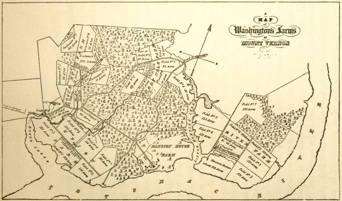
| 1. Mount Vernon farms, to face page | iv |
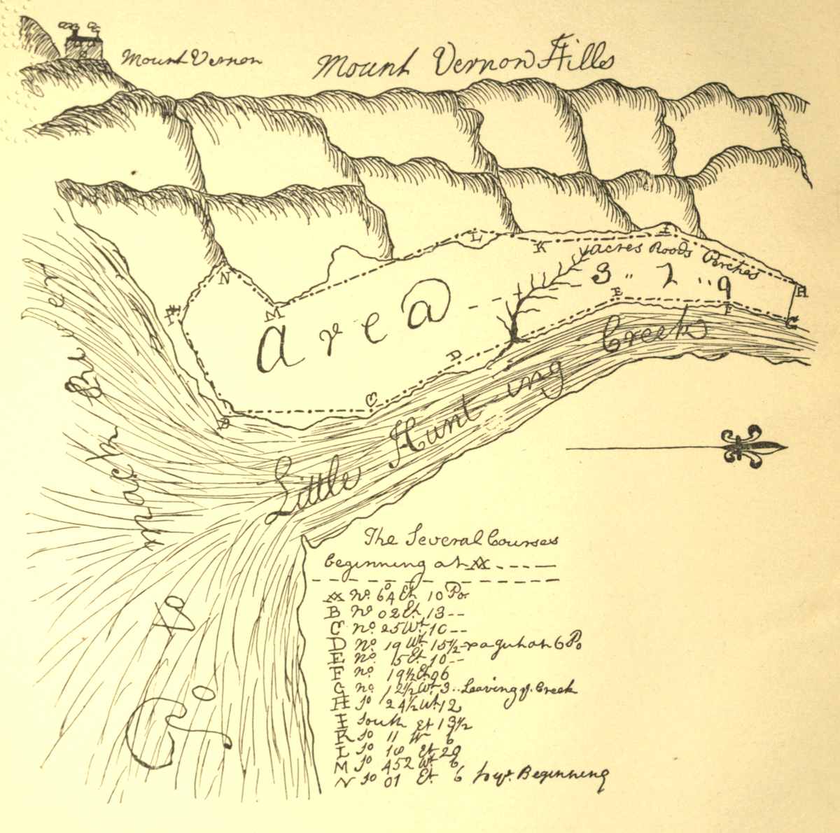
| 2. Mount Vernon hills—made as early as 1747, traced from original, to face page | 9 |
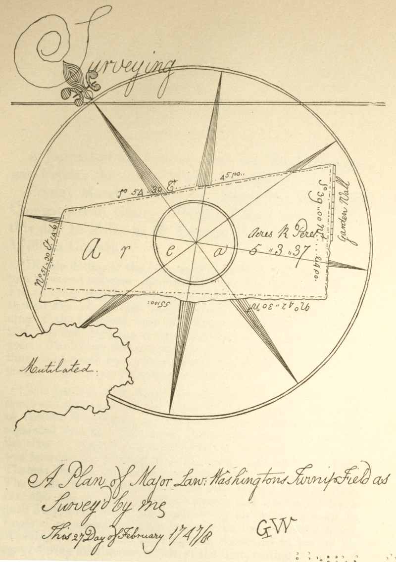
| 3. Plan of Major Lawrence Washington's turnip field, traced from original, to face page | 14 |
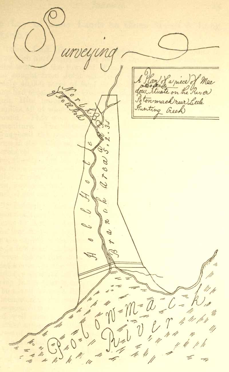
| 4. Plan of survey of land known as "Hell Hole," traced from original, to face page | 24 |
| 5. Mount Vernon river front at mouth of Hunting creek, traced from original, to face page | 52 |
| 6. Surveying or measuring land, a study traced from original, to face page | 56 |
| 7. Lost river, traced from the original, to face page | 73 |
| 8. Plat of Francis Jett's land, traced from the original, to face page | 76 |
| 9. Plat of Elizabeth Washington's land, traced from the original, to face page | 76 |
| 10. Plat of survey for Richard Barnes, Gent., copied from Sparks, to face page | 79 |
Washington's Journal here given to the public, if we except his version of the "Rules of Civility and Decent Behaviour in Company and Conversation," is the earliest literary effort of this, the most admirable character in all history. The editor has long been engaged in collecting accurate copies of all the obtainable writings of this great man. Wherever it has been found practicable to examine and critically compare even his generally accepted writings with the originals, it has been, or will be done to secure a copy of exact and verified conformity, in every particular, with the text as it left the hand of the writer.
It is a well-known fact that editors have taken great liberties with Washington's writings, not for the purpose of falsifying history, or aspersing his character, but from a variety of reasons, often to suppress caustic expressions, or to substitute a more euphonious word to give to his sentences a fine, rhetorical finish. Such editorial dressing, even where the motive is well intended, is vicious in principle and liable to abuse; and, in the case of Washington's writings, is neither justifiable nor desirable. The time has come when the people want to know intimately and without glamour or false coloring, the father of his country as he actually lived and labored,[6] and to possess his writings, just as he left them, on every subject which engaged his attention. It is the purpose of the editor to prepare a complete collection of all the writings of George Washington, from his youth to the close of his eventful life, with that literal exactness as to text which can only be assured by the careful efforts of an experienced copyist and expert proof reader having access to and comparing in every possible case the copies with the originals. This initial Diary of Washington opens with his sixteenth year, and plainly shows the energy and the maturity of his judgment, and his capability to discharge even then important trusts with efficiency.
Forthcoming volumes will give, in chronological order, his co-operation in the march of events on this continent, and his life and opinions as seen through the writings he left. This volume must be viewed as the work of a youth, making a few, brief and hurried memoranda while in the depths of the forest and intended for no eye but his own. The time is not far distant when an edition of Washington's more important papers will be called for in facsimile by some one of the photogravure processes now available for such purposes, because of the unquestionable fidelity to the original it secures and which is approximately arrived at in this publication.
This is the first systematic attempt to produce the writings of Washington with literal exactness as to abbreviations, the use of capitals, punctuation, spelling, etc. It is possible that the plan pursued may[7] not, at first, meet with an unqualified commendation from the public. But if the editor does not much mistake the desire of students, the admirers of Washington and the demand of historians, this method, if faithfully executed, must produce the preferred edition of his writings.
A few miscellaneous pieces in Washington's youthful handwriting are preserved in this Journal, and are here printed with the same effort for literal accuracy which has been bestowed upon the Journal itself, and upon his field notes of land surveys.
This journal of George Washington, now for the first time printed entire and with literal exactness, was begun, as shown by the date in the opening lines, when he was but one month over sixteen years of age. It is his own daily record of observations during his first remunerated employment. His proficiency as a surveyor, and his fortitude in encountering the hardships of the forest in this expedition were, considering his age, truly remarkable. With him the beginning determined the end. Biographers have made us acquainted with the character of his worthy parents, and with the sturdy stock from which they were descended. It does seem as though Providence called our Washington into being, and educated him in the western world just at the time when a great leader was wanted to direct a revolution, and to found on this continent a new and a free, English-speaking nation. Every factor, whether of lineage or culture, in the admirably balanced character of Washington, as well as every aspiration of his heart, from his cradle to his grave, is of high interest to the world. Although deprived of a father's care at the age of[10] eleven years, he was, however, especially blessed in having such a mother as the noble Mary Washington, who conscientiously discharged her sacred duty as his guardian, counselor and friend. Hence filial reverence grew with his growth and strengthened with his maturing years into fixed principles, making him throughout all his eventful life loyal to every virtue and heroic in every trust.
When George Washington set out on the enterprise herein narrated, he was just out of school, where he had received the best education the neighborhood could supply, supplemented with good private instruction. We may well believe that his mother and his brothers then supposed that George had attained an age and proficiency when he should either go to college to acquire a higher education, or embark speedily in some respectable calling; and we may further conclude that this precocious youth was eager to take part in the affairs of life, and deferentially announced his preference for the latter course. Possibly he was influenced in this selection by his great admiration for his half-brother, Major Lawrence Washington, who was actively and prosperously engaged in various business enterprises, who made much of George, and had him visit Mount Vernon whenever it was practicable.
George Washington's aptitude for mathematics early attracted the attention of his teachers, and his beautifully kept copy-books, which are still preserved, attest his unusual ability in mathematical demonstra[11]tion and diagrams. Mr. Williams, the principal of the Academy in Westmoreland county, Va., where young Washington was, to give a practical value to this mathematical talent, had added surveying and navigation to his other studies; and these were soon mastered by this bright pupil. Land surveying was then a profitable and genteel pursuit in the colonies, and it comported well with Washington's tastes and inclinations. While visiting his brother at Mount Vernon, he had repeatedly amused himself and entertained guests of the house by surveying, in their presence, the garden, or a field, and rapidly drawing plats of them as an exercise. A few maps of such early surveys have been preserved. One of them, of Lawrence Washington's turnip field, bearing date 27 Feb., 1747-8, is reproduced in fac-simile in this publication. The others are without date, but are of about the same period; although one, namely that of "Hell Hole," a part of the Mount Vernon estate, and frequently mentioned in Washington's later diaries, may have been an earlier production. A fac-simile of it may also be found in this work.
Washington's efficiency and enthusiasm as a surveyor were observed and admired not only by his friend and companion, George William Fairfax, but also by the Hon. Wm. Fairfax and by Lord Fairfax, who were constantly employing surveyors to lay off lands for sale in the latter's large domain known as "The Northern Neck" of Virginia. During the early spring of 1748 the demands for surveys were[12] more than usually pressing by actual settlers in the Shenandoah valley. Lord Fairfax engaged the youth, George Washington, to proceed with George William Fairfax, his agent, as recorded in this journal, to execute certain commissions and meet a pressing demand. His surveys and reports gave entire satisfaction and led to his steady employment by his titled patron, principally as a director of his lordship's land office and of the surveys, preparatory to sale. Washington filled this position for about three years, when he was called upon to accompany his brother Lawrence, who, from failing health, was constrained, in the fall of 1751, to visit the West Indies in the hope of finding relief.
The journal kept by George Washington during his visit to Barbadoes in company with his brother, will be given in a separate work soon to be issued in its chronological order by the editor. The journal here presented to the public is, in the main, confined to Washington's daily entries, memoranda and field notes of surveys of land situated between the Blue Ridge and the Alleghany mountains.
Unfortunately the records of his surveys are not consecutive, and it is quite evident that they represent but a part, and probably but a small part, of the land surveyed by Washington for Lord Fairfax and others. The notes of surveys here published are all that can be found or that are now known to exist. It is to be hoped, however, that if other books of his field notes of surveys have escaped destruction, they may yet be[13] discovered. This hope is encouraged from the fact that the laws of the colony required surveyors, upon retiring from their official stations as county surveyors, to deposit their field books of notes of surveys with the records of the county. How far this law was complied with, the editor is unable to say. It is a mistake, however, to infer that Washington was constantly employed in actually running lines and taking field notes. He was largely charged with the supervision of Lord Fairfax's land office, and the records thereto belonging, and was his principal adviser in his land surveys, directing the men employed in the field work.
This journal, with its memoranda and surveys, makes a valuable addition to our knowledge of the life and employments of Washington in his youth. Here are also preserved the names of nearly three hundred of the early settlers and first land owners in the great valley of Virginia, for whom Washington made surveys, or who assisted him in this business.
It was a cherished hope of the editor that he might be able to give, in notes, brief sketches of the pioneers in the valley here named, through the assistance of their descendants, who, in many instances, reside upon lands surveyed by Washington for their ancestors. In this, however, he has been disappointed.
The journal, memoranda and surveys found in these books have all been copied with literal exactness and are here printed just as they were recorded by the hand of their author. This literalness is ad[14]hered to in the interest of truth and for the benefit of earnest students of history unable to consult personally the originals. Washington requires no apology for any apparent want of style or other marks of hasty composition in this journal. It was written in the nature of a memorandum intended for himself alone. His thoughts, even in these youthful productions, flow easily and in an orderly and consecutive manner. His sentences are never involved or obscure, and his observations are always apt and instructive; and, although a youth in years when this journal was written, he was dealing ably with important interests, and deporting himself in a manly manner, and associating on terms of intimacy with the foremost men of the day. He seems to have had no idle boy life, but was a man with manly instincts and ambitions from his youth. Time and accidents are slowly, but effectually, destroying the precious original manuscripts, so that a literal and authentic copy is a great desideratum. No liberty whatever is taken by the editor with the text as recorded by Washington. The notes which are added, it is hoped, may prove of interest.
J. M. T.
A Journal of my Journey over the Mountains began Fryday the 11th of March 1747-8.[1]
Fryday March 11th 1747-8. Began my Journey[2] in Company with George Fairfax, Esqr.;[3] we travell'd this day 40 Miles to Mr George Neavels[4] in Prince William County.[5]
[1] Double dating of the year, as is done here, was an old custom observed between January 1st and the 25th of March. For all other portions of the year a single date was used. Although January 1st had been generally accepted as the beginning of the historical year in Christian countries, yet March 25th was held by some as the beginning of the civil or legal year. The Gregorian chronology or new style had not, at the time this journal was written, been adopted by England, and, indeed, was not until September 2nd, 1752.
[2] The party on this expedition set out from "Belvoir," the home and plantation of the Hon. William Fairfax, described by General Washington as "within full view of Mount Vernon, separated by water only, is one of the most beautiful seats on the river." (Letter to John Sinclair, 11 December, 1796.) It was founded by William Fairfax, cousin and agent to Lord Thomas Fairfax, and was his residence until his death in 1757. The estate then passed to his eldest son, George William Fairfax, also one of Lord Fairfax's agents, and was his residence until July, 1773, when, accompanied by his wife, he went to England to attend to some property he had inherited there. Washington, his friend and neighbor, consented to act as his agent during his absence, which, at the time, neither anticipated would be of long continuance.
"Law's delay" and business interests making it important for Mr. Fairfax to remain in England, he directed Washington to dispose of his stock, farm fixtures and household effects at public sale. After due advertisement, this was done August 15, 1774. A second sale at "Belvoir" took place December 5, 1774.
The following bill of household effects bought at this first sale at Belvoir by George Washington has been preserved among his private papers and was in the possession of one of his inheritors, Lawrence Washington, in January 1891. The bill in the auctioneer's handwriting was folded and endorsed in Washington's known hand:—"Articles bought by Go Washington at Colo Fairfax's Sale 15 August 1774."
"Inventory of House Furnishings bought by Colo George Washington at Colo Fairfax's Sale at Belvoir 15 August 1774.
| £ | s. | d. | |
| Gilbert Simpson's 5 Bott. or Pickle Pots | 7 | 6 | |
| 2 Potts from Lawson Parkerdodo | 2 | ||
| 6 Pickle Potts different sizes | 4 | 6 | |
| 2 Doz. mountain wine | 1 | 4 | |
| 4 Chariot Glasses frames | 12 | 6 | |
| Irons for a boat canopy with tiller | 12 | 6 | |
| 12 Pewter Water Plates | 1 | 6 | |
| 1 Mahogany Shaving Desk | 4 | ||
| 1 Settee-bed and furnature | 13 | ||
| 4 Mahog'y chairs | 4 | ||
| 1 Chamber Carpet | 1 | 1 | |
| 1 Oval Glass with guilt frame in the Green room | 4 | 5 | |
| 1 Mahog'y chest and drawers in Mrs Fx chamber | 12 | 10 | |
| 1 Mahog'y Side Board | 12 | 5 | |
| 1 Mahog'y Cistern & stand | 4 | ||
| 1 Mahog'y voider a dish tray & a knife tray | 1 | 10 | |
| 1 Japan Bread tray | 7 | ||
| 12 Chairs & 3 window curtains from ye dining room | 31 | ||
| 1 Looking glass & Guilt Frame | 13 | 5 | |
| 2 Candlesticks & a bust of the Imortal Shakespere | 1 | 6 | |
| 3 floor carpets in the gent's room | 3 | 5 | |
| 1 Large carpet | 11 | ||
| 1 Mahog'y wash Desk bottle &c. | 1 | 2 | 6 |
| 1 Mahog'y Close Stool—part broke | 1 | 10 | |
| 2 Matrasses | 4 | 10 | |
| 1 Pair andirons, tongues, fender & shovel | 3 | 10 | |
| 1 Pairdo"""" | 3 | 17 | 6 |
| 1 Pairdo"""" | 1 | 17 | 6 |
| 1 Pair Dogirons in Great Kitchen | 3 | ||
| 1 Pot Rache""" | 4 | ||
| A Roasting Fork | 2 | 6 | |
| A Plate Basket | 3 | ||
| 1 Mahog'y Spider make tea table | 1 | 11 | |
| 1 Old Skreen | 10 | ||
| 1 Carpet | 2 | 15 | |
| 1 Pair Bellows & Brush | 11 | ||
| 2 Window Curtins | 2 | ||
| 1 Large Marble Morter | 1 | 1 | |
| 1 Pot Rache in the cellar | 1 | 7 | 6 |
| 2 Mahog'y Card Tables | 4 | ||
| A bed a pair of blankets & 19 quilts or coverlets Pillows Bolsters &c 1 Mahog'y card Table for Colo Lee | 11 | ||
| ———— | |||
| £169.12.6 | |||
The following admirable description of the estate is taken from an advertisement in the Pennsylvania Gazette of Philadelphia, October 19, 1774:
"To be rented from year to year, or for a term of years,—Belvoir, the beautiful seat of the Honorable Geo. W. Fairfax, Esq., upon the Potomac river, in Fairfax county, about 14 miles below Alexandria.
"The mansion is of brick, two stories high, with four convenient rooms, and a large passage on the lower floor; five rooms and a large passage on the second; servants' hall and cellar below; convenient to it are offices, stables and coach-house; adjacent is a large and well furnished garden stored with a great variety of fruits, all in good order.
"Appertaining to the tract on which these houses stand and which contains near 2,000 acres (surrounded in a manner by navigable water), are several valuable fisheries and a good deal of clear land in different parts which may be let all together or separately as shall be found most convenient.
"The terms may be known of Colonel Washington who lives near the premises, or of me in Berkeley county.
"Francis Willis, Junior."
The estate was leased to the Rev. Andrew Morton for a term of seven years. Unfortunately the mansion was destroyed by fire only a few years later. The owner's long absence, and the fact that there was no house to invite a careful tenant, together with the excitement and derangement of business incident to the war for independence, caused the estate rapidly to depreciate in value. Early in 1775 Washington relinquished the agency of George W. Fairfax's business in America, as his time was fully taken up in directing the momentous affairs of the Revolution.
[3] George William Fairfax, eldest son of the Hon. William Fairfax, of "Belvoir," Va., was born in Nassau, New Providence, West Indies, in 1724. His father having been appointed to the custom house in Salem, Massachusetts, he was taken to that town and resided there until 1734, about which time his father accepted the agency of Lord Fairfax's lands in Virginia, and removed to that province. For a time he resided in Westmoreland county, Va., but after a couple of years he settled upon and developed the "Belvoir" estate on the Potomac river. George William Fairfax was educated in England, and coming to his majority settled at "Belvoir," and married Sarah, daughter of Col. Wilson Cary, of Hampton, Va., who some writers, on rather apocryphal testimony, endeavor to show was an object of Washington's ardent devotion when a mere youth. The same compliment has also been claimed for her sister Mary, who married Edward Ambler, and for other belles of that period in Virginia, as well as in some of the other colonies. George W. Fairfax, after his marriage, resided part of the time at "Belvoir," and part at "Greenway Court," as agent of Lord Fairfax, in the vicinity of which he owned and cultivated lands. On his father's death in 1757 he inherited "Belvoir," where he continued to reside until the summer of 1773, when, accompanied by his wife, he went to England to look after some property he had inherited there. The proprietors of "Belvoir" and "Mount Vernon" and their families were always on the most friendly terms, as the letters extant of each attest, and Washington's diaries fully confirm. Mr. Fairfax[19] favored the early protests by the colonies and petitions to the king in the interests of the colonies, but opposed measures looking to forcible resistance. Washington consented to act as his agent while he was absent, presuming his stay in England would be of short duration. But a complication of matters detained him abroad so that he instructed his agent to sell off his stock at "Belvoir" and lease the property. A sale was accordingly held on the estate in August, 1774, which continued two days. A second and further sale was held in December the same year. The property was leased in 1774 for seven years, but shortly after this the mansion house was burned down and never rebuilt. During the Revolutionary war some of Mr. Fairfax's property in Fairfax county was escheated to the state. His loss of income from America led him to limit his expense, he therefore removed from Yorkshire to Bath and lived in a modest way, dividing generously, from his limited means, with the American prisoners of war held in England. He had no children. A friendly correspondence was kept up between him and Washington to the close of his life. He was urged to return to America, but his mansion at "Belvoir" having been destroyed by fire he kept putting it off and never returned. He left "Belvoir" and some other landed property to Ferdinand, son of his half-brother, Rev. Bryan Fairfax, and died at Bath in England, April 3, 1787, and was buried in Wirthlington church. His will appointed George Washington as one of his executors. His wife survived him until 1812. Her remains were placed by the side of her husband's.
[4] George Neville, Esq., was among the earliest planters to settle in the western part of Prince William county, Va. As early as, or before 1730, he selected a large body of desirable land lying on the main road by way of Ashby's Gap from Fredericksburg to Winchester. Here his residence was beautifully situated on high, healthy and productive land near the head springs of Bull Run, a tributary of the Occoquan river, and 34 miles from Fredericksburg, the head of tide water on the Rappahannock river. Squire Neville, the proprietor of this fine estate, as he was usually called, was a man of steady and industrious habits, possessed a fine constitution, gentle in his manners, and cultured in his tastes, enterprising and thrifty, with a genius for overcoming such difficulties as always beset[20] the path of the pioneer in a new country. As the lands to the west of him, and particularly those in the Shenandoah valley beyond the Blue Ridge, began to attract settlers the travel on the road past his house became considerable, and as a matter of accommodation to the public he opened an ordinary and kept a store for general merchandizing. Neville's Ordinary was a land mark, and is to be found on Fry and Jefferson's Map of Virginia, as well as on Governor Pownall's and other early maps of Virginia. In 1750 Washington surveyed for Mr. Neville 400 acres of land. By marriage George Neville was related to the Fairfax family of Virginia. His wife, Ann Burroughs, was a cousin to Lord Thomas Fairfax of "Greenway Court," the proprietor of the Northern Neck of Virginia. Squire Neville and his wife were blessed with a numerous family of healthy sons and daughters, who inherited the sturdy virtues of their parents, and who founded families for themselves, and whose descendants are to be found throughout the southern and western states. Joseph Neville, son of George, was a prosperous planter in the western part of Prince William county, Va., in 1760. (See Washington's Diary.) He served as a colonel in the Revolution, was one of the commissioners for running the boundary line between Pennsylvania and Virginia, and was a member of Congress 1793-5; died in Hardy county, Va., 1819. John Neville, another son, was colonel of the 4th Virginia regiment in the Revolution, and brigadier-general in the Pennsylvania militia at the close of the war. He was born in Virginia 26 July, 1731. From his youth he had a fondness for military affairs and served in the Braddock expedition, and also in the Dunmore Indian war. He and his brothers were early and life-long friends of General Washington, the acquaintance beginning when they were youths. At an early date John Neville took up considerable tracts of land in Frederick and Augusta counties, Va. He resided for some years in the Shenandoah valley, being at one time sheriff of Frederick county. He also acquired large tracts of land on Chartier's creek in Pennsylvania, and had built himself a house preparatory to taking up his residence there, when the Revolutionary war began, in which he took an active and honorable part. This event postponed, for some years, his removal with his family to Pennsylvania. On the 24th August, 1754, he was united in marriage to Winifred Oldham, by whom he had two[21] children, a son and a daughter, Presley and Amelia. Presley Neville married Nancy, daughter of General Daniel Morgan, and they became the progenitors of the large and influential family of Nevilles of Pittsburg, Pa. Colonel Presley Neville, as he was called, served in the Revolution for three years on the staff of General Lafayette. Amelia Neville married Major Isaac Craig of the Revolution, and they became the founders of the well known and esteemed family of Craigs of Pittsburg.—Eagle's Pennsylvania Genealogies.
[5] Prince William county, Va., formed in 1730 from Stafford and King George counties, embraced territory extending from the Potomac river on the east to the summit of the Blue Ridge on the west; it was divided from Loudoun county by the Occoquan and Bull Run streams. Prior to 1822 the county seat was at Dumfries, but at that date it was removed to Brentville.
Saturday March 12th this Morning Mr James Genn ye surveyor[6] came to us, we travel'd over ye Blue Ridge[7] to Capt Ashbys[8] on Shannondoah River,[9] Nothing remarkable happen'd.
[6] James Genn, a licensed surveyor in Virginia, much employed by Lord Fairfax, and frequently mentioned by Washington, and whose name often appears signed to surveys in which the latter was engaged, as the surveyor or director, is doubtless the person to whom reference is here made.
[7] Blue Ridge—the most easterly of the mountain ranges of the United States. The name properly restricted however, applies especially to that portion of the Appalachian range south of the Potomac river. In some parts of Pennsylvania it is known as Kittatinny and at some places in Maryland as South Mountain. It attains its greatest altitude in Virginia at the Peaks of Otter, which are about 4,000 feet above sea level.
[8] Capt. Ashby resided on the Shenandoah river above Burwell's island and the great bend of that stream, at which place he maintained a ferry and kept a house of entertainment. It was on the natural line by which travel came from the tide-water region of Virginia, through a gap in the Blue Ridge and across the Shenandoah valley to the country beyond. Being a[22] man of great courage and usefulness, he was deservedly popular among the early settlers, and his name was given not only to his ordinary but also to the gap and to the ferry. There was, too, a Fort Ashby on Patterson creek, near the town of Frankfort. There are numerous families bearing the name of Ashby throughout the southern and western states, who are probably descendants of this famous pioneer. General Turner W. Ashby, an officer of distinction in the Confederate army, is presumably of this family. The name still attaches to the gap in the mountains, but it has been superseded at the old ferry.
[9] Shenandoah river—this is the largest tributary of the Potomac. The name is of Indian origin, and in the aboriginal language is said to signify "the daughter of the stars." Kercheval, in his History of the Valley of Virginia, says the name was first written Gerando, then Sherandoch, and now we have Shenandoah. The river has its head in Augusta county near the divide where the head-waters of the James river take their rise. The Shenandoah flows for about 170 miles through a broad valley over a limestone bed between the North mountain on the one side and the Blue Ridge on the other, to the Potomac river at Harper's Ferry. This valley was the theater of many important military operations during the late war. The name of Sherando is perpetuated in the name of a post-office in Augusta county on the head-waters of the Shenandoah.
Sunday March 13 Rode to his Lordships Quarter[10] about 4 Miles higher up y River we went through most beautiful Groves of Sugar Trees & spent ye best part of y Day in admiring ye Trees & richness of ye Land.
[10] Thomas Fairfax, 6th Lord and Baron of Cameron, born in England in 1691, died at his residence "Greenway Court," Frederick county, Virginia, on the 12th of December, 1781. His remains were interred within the Episcopal church of Winchester, Va. His residence and other improvements were familiarly called "Quarters" and "Hunting Lodge," chiefly because he had in contemplation the erection of a commodious mansion. Lord Fairfax was the son of Thomas, 5th Lord Fairfax[23] and his wife Catherine, daughter of Lord Culpeper, once governor of Virginia. He was educated at Oxford and afterward held a commission in the British army. He was a fine scholar, and is said to have been a contributor to The Spectator. He succeeded to his father's title and to his mother's extensive landed estate known as the "Northern Neck of Virginia," lying between the Potomac and Rappahannock rivers and estimated at 5,700,000 acres. For some years after coming into possession of this property it was left in the hands of agents. He finally employed his cousin, the Hon. William Fairfax, son of Henry and Anne (Harrison) Fairfax, as his agent in the management of his lands. About 1739 Lord Fairfax first visited his estate in America. For a year he devoted himself to becoming thoroughly acquainted with his possessions and then returned to England. Four years later, in 1745, he returned to this country and for a time made his home at "Belvoir," the seat of his relative and agent.
A branch office for the sale of lands in the valley of Virginia, had been opened in Frederick county in 1742. The main office and records, however, were not removed from "Belvoir" until 1761.
Lord Fairfax built for himself a stone lodge with quarters for his servants, reserving around it a manor of 10,000 acres which he called "Greenway Court." The lodge was about twelve miles south-east of Winchester, at which place he purposed to build a castle, but this was never erected. His lodge was, however, sufficiently spacious for him to live in comfortably, and exercise a generous hospitality. He possessed a good library and was frequently visited by men of note whom he entertained in an elegant manner. He was fond of the chase and took an active interest in the management of his estate, as well as in the affairs of the colony, as his letters fully prove. He identified himself with the people as far as was practicable, and was deservedly popular. He served as lieutenant of Frederick county in the militia organizations; presided as one of the judges in the county courts at Winchester, and was an overseer of the public roads.
He met at "Belvoir," George Washington, when a youth, and, pleased with his energy and talents, employed him to survey lands beyond the Blue Ridge, which were to be sold. This was Washington's first remunerated employment. The[24] acquaintance thus begun, ripened into a friendship that was cherished by both through life.
Although a frank loyalist, his age and prudence in refraining from all participation in the Revolutionary struggle, protected him from being interfered with either by the government or by his neighbors. He died at the age of ninety-three, before peace was restored. His barony and its prerogatives, according to English law, descended, in the absence of a son, to his eldest brother, Robert, who thus became 7th Lord Fairfax. The latter died in Leeds Castle, England, 1791, without a son. The baronial title then fell to the Rev. Bryan Fairfax, of "Towlston Hall," Fairfax county, Va., who died 7 August, 1802. The great landed estates with their entails were, however, in effect confiscated by the success of the Revolution. The Legislature of Virginia in 1785 passed an act in relation to the "Northern Neck" to the following effect. "And be it further enacted, that the land holders within the said district of the Northern Neck shall be for ever hereafter exhonorated and discharged from composition and quit rents, any laws, customs or usage, to the contrary notwithstanding." Revised Code of the Laws of Virginia, vol. 1, p. 351, 2, 3. "Greenway Court" was devised by his lordship to his nephew, Rev. Denny Martin, residing in England, on condition of his obtaining the consent of Parliament to change his name to Fairfax. This was done, and he was afterward known as "Denny, Lord Fairfax." Like his uncle, he left no children and therefore bequeathed the estate to two maiden sisters in England. The legatees of the Fairfax estate sold their interest to Chief Justice John Marshall, Raleigh Colston, Esq. and General Henry Lee. They divided it up and sold it out in small farms, and quieted the titles. It is believed that no part of this vast body of Fairfax land is now held by any member of the family.—Sparks, Drake and others.
Monday 14th We sent our Baggage to Capt Hites[11] (near Frederick Town)[12] went ourselves down ye River about 16 Miles to Capt Isaac Penningtons (the Land exceeding Rich & Fertile all ye way produces abundance of Grain Hemp Tobacco &ca) in order[25] to Lay of some Lands on Cates Marsh & Long Marsh.[13]
[11] Capt. Joist Hite came to Virginia from Pennsylvania in 1732 with his family, settled on the Opequon creek about five miles south of the town of Winchester. The year before he had bought from John and Isaac Van Meter a warrant for nearly 40,000 acres of land in the Shenandoah valley which they had obtained from Governor Gooch of Virginia in 1730. Capt. Hite brought with him from Pennsylvania sixteen families, all of whom settled in the same vicinity on fine arable ground. They were all judges of good lands and devoted to agriculture. The descendants of Hite are quite numerous throughout the southern and south-western states, and many farms in the valley are still held under titles derived from him. Kercheval says, Joist Hite built a stone house on the Opequon shortly after his coming to the valley. It is still standing and has a very ancient appearance though there are no discoverable marks to fix the date. On the wall plate of a frame barn, however, built by Hite, the figures "1747" are plainly marked and can still be read.
[12] "Frederick Town," properly Winchester, is the capital of Frederick county, Va. The latter was formed out of Orange county by Act of Assembly of Virginia in 1738, at the same time that Augusta county was formed. The choice of this site for the capital of the county was determined by the simple fact that a few hardy, adventurous Indian traders, as early as 1732 or even before that date, had built themselves cabins at this point known as the "Big Shawane Springs." These settlers gradually attracted others until a village was developed. This spring or one near it, an example of the great springs which are to be found in most limestone regions, furnishes the town of Winchester, to the present time, with an abundant supply of pure potable water. The site of the town was, all things considered, well chosen, in a fertile region and on the line of travel, whether across the valley to the Alleghany mountains and the waters of the Ohio river beyond, or along the great valley of the Shenandoah. James Wood was the projector of the town of Winchester, which was incorporated in 1752 by the Assembly of Virginia. However, twenty-six lots had been laid out[26] and sold by James Wood prior to this. Lord Fairfax shortly after this date made an addition to the town, and donated the ground for an Episcopal church. Frederick county early took measures to give protection to its settlers by building forts, making roads and establishing ferries. Its productive soil at the same time bountifully rewarded the husbandman for his labor. As the Frederick county courts were held at Winchester, the people adopted the southern habit of calling the place where the courts met by the name of the county, thus it was frequently spoken of as Frederick Town and is so designated in several of the early maps. Fort Loudoun was erected here by direction of the Assembly of Virginia in 1756, under the immediate supervision of Major Washington.
[13] Cate's marsh and Long marsh—these are names of small streams which flow from the foot hill of North mountain to the Shenandoah river and have along their course considerable meadow or marshy land. Long marsh is of sufficient importance to be named upon the maps of Virginia.
Tuesday 15th We set out early with Intent to Run round ye sd Land but being taken in a Rain & it Increasing very fast obliged us to return, it clearing about one oClock & our time being too Precious to Loose we a second time ventured out & Worked hard till Night & then return'd to Penningtons we got our Suppers & was Lighted into a Room & I not being so good a Woodsman as ye rest of my Company striped myself very orderly & went in to ye Bed as they called it when to my Surprize I found it to be nothing but a Little Straw—Matted together without Sheets or any thing else but only one thread Bear blanket with double its Weight of Vermin such as Lice Fleas &c[14] I was glad to get up (as soon as y [27]Light was carried from us) I put on my Cloths & Lays as my Companions. Had we not have been very tired I am sure we should not have slep'd much that night I made a Promise not to Sleep so from that time forward chusing rather to sleep in y. open Air before a fire as will appear hereafter.
[14] For comments on fleas and other vermin see note 4. Washington's "Rules of Civility and Decent Behaviour," p. 14, Washington's association with frontiersmen in their primitive cabins, which the position of a surveyor in the then almost unbroken forest necessitated, was to him a new and peculiar experience. His observations and reflections of the first few days are recorded with a naivete which is truly charming.
March y. 15th 1747-8 Survey'd for George Fairfax Esqr. a Tract of Land lying on Cates Marsh and Long Marsh Begining at three Red Oaks Fx on a Ridge the No Side a Spring Branch being corner to ye 623 Acre Tract & Extending thence No 30° Et 436 poles to a Large Hickory and Red Oak Fx near John Cozines house thence No 60° Wt 90 Poles to a Large White Oak Fx thence No 7° Et 365 poles to Long Marsh 420 poles to 2 Red Oaks and W: Oak in a Poyson'd field[15] by a Road thence No 65° Wt 134 Poles to a W: Oak by ye sd Marsh thence crossing ye Marsh So 20° Wt 126 poles to another Branch: of Long Marsh 218 poles to a Red Oak Fx thence No 80° Wt 558 po: to a Large Red Oak & White Oak Fx in a Valley thence S[28] 25° Wt 144 poles to a Black Walnut in a Poysond Field by a Lime stone Rock thence So 33½° Et 96 to a White Oak thence So 20 Et 316 po. to three Red Oaks in a Bottom in Wm Johnstones line thence with Johnstones So 80° Et 30 po to a Double Hickory Collo Blackburns corner 114 po to 3 Hickorys Johnstones corner & corner to ye aforesd 623 Acre Tract thence along ye lines thereof East 280 poles to 3 Red Oaks finally along another of the lines thereof S 15° Et 262 po. to ye beginning
| Henry Ashby | } | Chainmen. |
| Richard Taylor | } | |
| Robert Ashby Marker. | ||
| Wm Lindsy Pilot. | ||
[15] This probably has reference to some pernicious weeds unfavorable to tillage and injurious to grazing animals, as St. John's wort. Farmers believe that this, and certain other noxious weeds which occasionally invade pasture fields, cause sore mouths and legs in horses and horned cattle and affect the milk of cows grazing where it grows.
Wednesday 16th We set out early & finish'd about one oClock & then Travell'd up to Frederick Town where our Baggage came to us we cleaned ourselves (to get Rid of y. Game[16] we had catched y. Night before) & took a Review of y. Town & thence return'd to our Lodgings where we had a good Dinner prepar'd for us Wine & Rum Punch[17] in Plenty & a good Feather Bed[18] with clean Sheets which was a very agreeable regale.
[16] This facetious term "game," referring to his misfortune the first night he lodged in the valley, has a touch of humor in it; and while it is true that Washington was not given to punning or indulging in witticisms, he was not deficient in imagination or unappreciative of the exercise of this talent on suitable occasions by others. He knew that good humor minimized most of the petty annoyances of life.
[17] The office and art of the surveyor were held in high esteem by the early settlers. It is, therefore, not surprising that the people for whom surveys were executed, made special efforts to give the surveying parties good dinners, even going so far as to[29] set before them "wine and rum punch." I may add here that there is neither tradition nor record that Washington was ever known to have been indiscreet from youth to age in the use of wine or strong drinks.
[18] Feather beds, a great luxury in former times, have nearly gone out of use among well-to-do people. By the wealthy, as well as by the laborers, they were once a greatly prized comfort and often devised by will as valuable inheritances. Hair, cotton and spring mattresses have displaced them from popular favor, but "clean sheets" belong to the category of comforts in even early times and must be a delight and joy forever.
Thursday 17th Rain'd till Ten oClock & then clearing we reached as far as Major Campbells one of there Burgesses about 25 Miles from Town. nothing Remarkable this day nor Night but that we had a Tolerable good Bed lay on.
Fryday 18th We Travell'd up about 35 Miles to Thomas Barwicks on Potomack[19] where we found y. River so excessively high by Reason of y. Great Rains that had fallen up about y. Allegany Mountains as they told us which was then bringing down y. melted Snow & that it would not be fordable for severall Days it was then above Six foot Higher than usual & was rising we agreed to stay till Monday we this day call'd to see y. Fam'd Warm Springs[20] we camped out in y. field this Night Nothing Remarkable happen'd till sonday y. 20th
[19] Cohongoruton—the Indian name by which the Potomac river was known to the Six Nations and other tribes of Indians. From its head-waters, to Point Lookout in the Chesapeake bay, this stream is the dividing line between Maryland and Virginia.
[20] The "Warm Springs," now known as "Bath" or "Berkeley Springs," were already famed, as Washington notes, in[30] 1747. They were deservedly popular for many years, but their remoteness and the difficulty of access to them, with the competition of other resorts more easily reached, prevented their receiving the attention which the value of their waters merited. A settlement sprang up about the springs at an early date, which finally became a prosperous village under the name of Bath, and was made the county seat when, in 1820, the county of Morgan was formed. Washington bought lots here, built a cottage and stables, and passed summers here with his family. His half-brother, Lawrence, spent nearly a year at the springs for the benefit of his health before going to England and later to Barbadoes. The property-right in the springs is in the state of Virginia, and is held for the benefit of the public.
Sonday 20th finding y. River not much abated we in y. Evening Swam our horses over & carried them to Charles Polks in Maryland for Pasturage till y. next Morning.
Monday 21st We went over in a Canoe & Travell'd up Maryland side all y. Day in a Continued Rain to Collo Cresaps[21] right against y. Mouth of y. South Branch[22] about 40 Miles from Polks I believe y. worst Road that ever was trod by Man or Beast.
[21] Cresap, Col. Thomas, the founder of the family in America, was born in Skipton, Yorkshire, England, and at the age of about fifteen came to America. Some five years later he resided at Havre-de-Grace, Md., where he married a Miss Johnson. Removing thence to Wright's Ferry, opposite the town of Columbia, where he obtained a Maryland title to a 500 acre tract of land called "Peach Bottom," and built himself a small stone house. The land, however, was on disputed territory, and claimants under the laws of Pennsylvania finally dispossessed him. His next move was to a locality in what is now Washington county, Md., where he located and settled upon a[31] tract of 1,400 acres on the Antietam creek, called "Long Meadows," and began trading with the Indians. After collecting a large lot of furs and skins he shipped them to England but was financially ruined through the capture of the vessel by the French. Unable to repay money he had borrowed from Mr. Dulany, of Maryland, he gave up to him his land, and moved farther west, built a cabin a few miles above the junction of the north and south branches of the Potomac, on the Maryland side, at a place which became known as "Old Town," but which he called Skipton, the name of his Yorkshire birthplace. This frontier spot became his permanent residence, where he eventually owned a large body of land on both sides of the Potomac. From his familiarity with the Indians and their habits and character, he was enabled to carry on with great advantage his trade with them and in time became the most important frontiersman of his day in Maryland. He took part with the Washingtons, Lee, Mason and others in the formation and early operations of "The Ohio Company," and in all matters of dealing with the Indians and prospecting for wild lands was the Company's chief dependence. With the aid of Namacolin, a noted Indian hunter, he laid out the first road over the Alleghany mountains to the head-waters of the Ohio. Gen. Braddock's expedition, and later the National road, followed nearly the same route. The attention attracted to the Ohio region through this Company's explorations, made it increasingly important to both England and France to possess and control the lands beyond the Ohio. This vigilance precipitated the war that drove out the French and secured to England and America the vast dominion known as the Northwest.
Col. Cresap's literary acquirements were small, but he had a vigorous mind, strong common sense, and was not deficient in practical self-education. He was one of the surveyors of Prince George's county which, at that period, embraced all the western part of Maryland. January 1, 1745, he surveyed for Gov. Thomas Bladen "Walnut Bottom" just below the mouth of Wills creek. He frequently represented his county in the Legislature and being noted for his clear understanding, sound judgment, firmness and courage, was esteemed one of the best legislators his county ever had. He was of medium stature, firmly set, of sound constitution, and lived to the uncommon[32] age of 105 or 106. He was twice married, the second time at the age of 80; by his first wife he had five children; three sons, Daniel, Thomas and Michael, and two daughters, Sarah and Elizabeth. Captain Michael Cresap was the person upon whom Thomas Jefferson fixed the stigma of the murder of the relatives of Logan. Jefferson having transmitted the pathetic speech of the Indian chief to the Abbe Raynal as an evidence of the original power of oratory of the aboriginal American, it is claimed more in a spirit of literary conceit than of conviction; however he failed during his life to correct the injustice done Cresap, although he was repeatedly furnished with the evidence exculpating Cresap and fixing the barbarous act on one Great-house. At his home, Col. Cresap dispensed, for his time and means, a generous hospitality to all callers, in a region where, as yet, no public houses were to be found. He kept a big kettle ready suspended to place a fire under, near a spring for the use of the Indians who often passed his place, and for this reason they designated him the "Big Spoon." Lord Baltimore employed him to run a survey of the western line of Maryland, and to ascertain which of the two branches of the Potomac was the largest. His autograph map of this survey is still preserved in the archives of the state of Maryland.
[22] The South Branch of the Potomac, of which the Indian name was Wappotomaka, rises in Pendleton county, West Virginia, among the spurs of the Alleghany and North mountains, and meets the North Branch about 20 miles below Cumberland, Md. The latter branch has been accepted as the dividing line between Maryland and Virginia, although now known to be neither as long nor as large as the South Branch. A line drawn due north from the extreme head-waters of the South Branch would run ten miles to the west of a parallel line from the head springs of the North Branch, thus proving the loss by Maryland of this strip of territory, as well as the region between the two branches, had the South Branch been taken instead of the North Branch as the main river referred to in the Royal Charter, and made the line separating the contiguous colonies. The valley through which the South Branch flows is broad and its lands very fertile, causing them to be much sought after for farms by the hardy pioneers in the early days before the Revolution. It was then familiarly known as the "upper tract" of Virginia.
Tuesday 22d Continued Rain and y. Freshes kept us at Cresaps.
Wednesday 23d Rain'd till about two oClock & Clear'd when we were agreeably surpris'd at y. sight of thirty odd Indians coming from War with only one Scalp[23] We had some Liquor with us of which we gave them Part it elevating there Spirits put them in y. Humour of Dauncing of whom we had a War Daunce[24] there manner of Dauncing is as follows Viz They clear a Large Circle & make a Great Fire in y. middle then seats themselves around it y. Speaker makes a grand Speech telling them in what Manner they are to Daunce after he has finish'd y. best Dauncer Jumps up as one awaked out of a Sleep & Runs & Jumps about y. Ring in a most comicle Manner he is followed by y. Rest then begins there Musicians to Play ye Musick is a Pot half of Water with a Deerskin Streched over it as tight as it can & a goard with with some Shott in it to Rattle & a Piece of an horses Tail tied to it to make it look fine y. one keeps Rattling and y. other Drumming all y. while y. others is Dauncing
[23] Scalp—a term applied to the tissues covering the human head, and embracing all the hairy integuments and flattened muscles from the back of the skull to the brow above the eyes. Taking the scalp of an enemy, living or dead, has been held from remote times as a special sign of victory and token of triumph. The North American Indians, particularly during the early colonial wars, took the scalps of their enemies, preserving and exhibiting them with savage pride and occasionally wearing them as decorations and trophies. The assembly of Virginia, in 1755, established a reward of £10 for every scalp[34] of a male Indian above the age of twelve (Hening's Statutes, vol. VI, p. 551). In 1757 this sum was raised to £15, and £30 more for every scalp taken within the next two years (Hening, VII, p. 122). Maryland and Pennsylvania also offered rewards for Indian scalps.
[24] The war dance of the Indians probably had a significance to their minds not understood by civilized man, and was not to them the meaningless custom it seems to us. It has frequently been described and painted by eye-witnesses. In 1857 Virtue, Emmins & Co. copyrighted a very effective engraving of a war dance in the forest, arranged from Washington's description of it in this journal.
Fryday 25th 1748 Nothing Remarkable on thursday but only being with y. Indians all day so shall slip it this day left Cresaps & went up to y. mouth of Patersons Creek[25] & there swam our Horses over got over ourselves in a Canoe & traveld up y. following Part of y. Day to Abram Johnstones 15 Miles from ye Mouth where we camped.
[25] Paterson Creek rises in Hampshire county, West Virginia, and empties into the Potomac about twelve miles below Cumberland, Md. On the old maps of Evans, Hutchins and Lewis, the name is given as Pattison. There are large tracts of good, arable land along the valley and bottoms adjacent to this stream. They began to attract settlements a little before the time Fort Cumberland was built. Fort Ashby was also erected to protect settlers along this stream.
Saterday 26 Travelld up ye Creek to Solomon Hedges Esqr one of his Majestys Justices of ye Peace for ye County of Frederick where we camped when we came to Supper there was neither a Cloth upon ye Table nor a Knife to eat with but as good luck would have it we had Knives of own.[26]
[26] Knife and fork at table.—Polished nations have usages[35] which, at first view, appear natural or common to all mankind. This, however, is not the fact. That there was a period in the history of our race when the knife and fork were unknown to the furnishings of the table, cannot well be doubted; and there was even a time when the table itself was not deemed an essential. At the present day the idea of eating a meal at table without the accompaniment of a knife and fork would excite disgust; their absence, however, in a remote Virginia mountain cabin in 1747-8 as here recorded, simply shows that they had not been provided nor deemed essential to the life of a hunter, not an ignorance of their use, as the two-pronged, iron, table fork was in common use at that period throughout the settlements in all the American colonies. It is nevertheless true that the knife and fork now deemed so necessary at table, are a much more modern convenience than is generally supposed. The king of Hungary, Coevinus, toward the close of the fifteenth century, as related by Galeotus Martius, ate his meat with his fingers as did all the guests at table. In Italy, the fork was, to a limited extent, in use at this time among the nobility. In France, at the end of the sixteenth century, forks were comparatively new at court. The use of the table fork is referred to in "Washington's Rules of Civility and Decent Behaviour," and in Hawkins' Youths' Companion, the source of these rules printed about 1650. The knife is perhaps one of the most ancient of instruments, it was made of different metals and in a great variety of forms. The table knife was, however, contemporary with the fork. According to Chamberlin it was first made in England, in 1563. The use of the fork at table spread to Europe from Venice, in Italy. In 1608 it was brought to England by Thomas Coryate who, while traveling, observed its use in Italy and continued it himself on his return to England. (See his work entitled "Crudities.") It is rather disappointing that neither the Greeks nor Romans have even a name for the table fork. The flesh fork, called creagra, with a long handle, for cooks to take meat out of a boiling pot, was known and used by the Hebrews and the Greeks. But had the table fork been used by the latter or by the Romans, some specimens would have been found among those extensive ruins which have been so carefully explored by modern investigators. It is known that some articles have been found, the use of which conjecture assigns to the table,[36] but they are not forks and the surmise is not generally credited. The Chinese, who claim to have led the rest of the world in most of the economic inventions, seem to have overlooked the table fork and do not even now use it in cutting or conveying food to the mouth but employ in its stead the "chop sticks" which, it must be said in their praise, they use with skill and dexterity. It should be stated that large bronze forks were used by the Egyptians in presenting offerings to the gods. It is unpleasant to represent the tables of our ancestors of a few centuries back as without forks, yet this certainly was the fact. The silver table fork, which also had its evolution from two to four prongs, was first manufactured in 1662 by Heylin.
The small knife, formerly worn by gentlemen at their girdles, was used by them, not only as a weapon of defense, but also as an article of convenience in cutting their meat. However, the ancient custom of serving food at table was to have a servant cut meats and other food into small morsels before distributing it to guests. The wealthy employed a person whose special duty it was to carve the meats into proper and convenient pieces and his was the only knife in the dining hall. When the fork was first introduced into England, its employment was ridiculed as an effeminate practice, as may be seen in the plays of Beaumont and Fletcher, and others where the persons using it are referred to as "your fork-carving-traveler."
Sunday 27th Travell'd over to y. South Branch attended with y. Esqr to Henry Vanmetriss[27] in order to go about Intended Work of Lots[28]
[27] Henry Van Metre or Meter.—There was a numerous family of the Van Meters in Virginia and they were among the earliest settlers in the valley of the Shenandoah, on the South Branch and along the upper Potomac. Kercheval, in his History of the Valley of Virginia, says this family came from New York and New Jersey. It is evident that they were people of energy and thrift, judges of good land. At a period antedating the settlements in the valley, it is stated by this historian that a John Van Meter, a sort of wandering Indian trader, of New York, accompanied the Delaware Indians in a war party against the Catawbas; but the Catawbas anticipating the attack,[37] surprised and defeated the Delawares in a battle fought near where the present court-house of Pendleton stands. John Van Meter escaped and returned to New York, but he was so impressed with the beauty and fertility of the lands on the South Branch bottom in Hardy county, that he advised his sons to secure lands and locate there. Of these sons, Isaac became a man of note and frequently represented Hardy county in the House of Delegates of Virginia. He was a member of the Virginia Convention of 1788 which ratified the Federal Constitution. In 1730, it is a matter of history that John and Isaac Van Metre, brothers, obtained from Gov. Gooch, of Virginia, a warrant for 40,000 acres of land to be located west of the mountains. This warrant, or a part of it, they sold to Joist Hite. A number of tracts on the original warrant were surveyed in the vicinity of Shepherdstown. The name of Van Meter is still frequently met with throughout West Virginia and has its monument in a stream forming the north-western boundary line of Jefferson county and emptying into the Potomac, and named on the maps of Virginia Van Meter's Marsh. A controversy as to the validity of the Van Metre patent was raised in 1738 by Lord Fairfax and taken into the courts for adjudication. Lord Fairfax contending that his grants covered the whole of the western end of the northern neck, while the holders claimed that the governor, under authority from the crown, had disposing power. This conflict as to title was a source of much litigation, and was not finally settled until after the Revolution, when all the parties to the original suits were dead.
[28] Lots.—This term, as used by surveyors, indicates portions, tracts, divisions and subdivisions of land. Each survey, lot or division when plotted is usually indicated by some name or device, as a number, a letter, or a symbol. So that each can then be described and referred to in a deed or an advertisement, and its location and boundaries be accurately and systematically defined and described in a book of land records.
Monday 28th: Travell'd up y Branch about 30 Miles to Mr James Rutlidges[29] Horse Jockey & about 70 Miles from ye Mouth
[29] James Rutledge.—Kercheval, in his History of the Valley[38] of Virginia, says that prominent among the earliest settlers on the South Branch, before the arrival of the Van Meters, were the Howards, Coburns, Walkers and Rutledges.
Tuesday 29th This Morning went out & Survey'd five Hundred Acres of Land & went down to one Michael Stumps on ye So Fork of ye Branch on our way Shot two Wild Turkies[30]
[30] The wild turkey.—This is the largest and finest of our game birds and, although native to North America, it bears a foreign name from the following circumstances. Specimens of the living bird, as well as its eggs, were sent by the early Jesuit missionaries to the old world on Spanish and Portuguese ships, entering Europe through Portugal. It was as yet unnamed, and was at first referred to by writers of that period merely as the "Jesuit bird." As it became known, the demand for the stranger was supplied chiefly from Turkey where, for some reason, it thrived exceedingly well, and in time it came to be familiarly spoken of as "the turkey." Gradually becoming tame, and proving to be quite prolific, it was recognized as a great addition to the luxuries of the table. Speedily becoming a favorite in every country to which it was taken, the great forests and game preserves throughout Europe were gradually stocked with it and it was also raised as a domestic fowl. To-day the American turkey, derived as stated, is found wild in all the great forests of the old world, while the domesticated bird is abundantly raised everywhere in Europe for the markets. In ancient times, we are told, the choicest game fowls brought to a feast were pheasants and peacocks. Emigrants to America brought over with them the domesticated bird to its native land, but under a borrowed name. Washington, in his journal, April 7, 1748, records the fact that one of his men that day had killed a wild turkey weighing 20 pounds. The domesticated bird, when permitted to attain the age of two or three years, and being well fed during the winter months, often reaches the weight of 30 pounds or more. As marking in a degree the devastation of the late war and the enforced abandonment of plantations in the section of Virginia adjacent to the city of Washington, it is a fact worthy of record, that in[39] 1876 the newspapers chronicled the news that the thickets and pine forests which were grown up since the armies left were tenanted by wild deer and turkeys; foxes, etc. And to this day, December 25, 1890, wild turkeys are brought to the Washington market killed in Fairfax county, Va., within ten miles of Washington city.—Gentlemen's Magazine.
March 29th: 1748 Survey'd for Mr James Rutlidge ye following a piece of Land Beginning at 3 W. O. in ye Mannor Line[31] by a Path leading to y. Clay Lick[32] & Extending thence No 44° Wt 164 po. to a White Oak by a Drain at ye foot of a Mountain thence No 46° Et 487 po. to 2 White Oaks near a Branch call'd Clay Lick Run thence So 44° Et 164 po. to 2 W: O: & a Hickory in ye Mannor line Finally along ye Mannor line Reversed So 46° Wt 487 po to y. Beginning
| Henry Ashby | } | Chainmen |
| Richard Taylor | } | |
| Wm Duncan Marker | ||
[31] Manor line.—In colonial times there were a number of manors, or great landed estates, granted under the then existing laws of England, to persons of note and quality in Virginia and in some of the other provinces. Holders of such estates enjoyed special rights and privileges. Manors were formerly called baronies and entitled the rightful possessor to lordships, and such lord or baron was empowered to hold domestic courts for redressing misdemeanors, nuisances and settling disputes among tenants. Among the manors of limited privileges in Virginia may be enumerated the "manor of Greenway Court," with a domain of 10,000 acres. The great "manor of Leeds," which has figured so extensively in the courts of Virginia, contained 150,000 acres within the counties of Culpeper, Fauquier and Frederick. The "South Branch manor," in Hardy county, embraced 55,000 acres; "Paterson Creek manor," in Hampshire county, 9,000 acres; and "Goony Run manor," adjoining that of Leeds and lying chiefly in Shenandoah county, 13,000[40] acres. "Beverley's manor," for the most part in Augusta county, consisted of 118,411 acres, and "Fairfax manor," in Hampshire, of 10,000 acres. There were still other manors in different parts of the state. In New York under the Dutch government the baron or proprietor of the manor lands was called the patroon.
[32] Clay lick.—Names of places or streams with the word lick either prefixed or affixed to them, such as "Salt lick," "Blue lick," "Grass lick," "Licking creek," etc., were usually given in consequence of the presence of some saline matter in the springs, streams or soil which attracted the wild animals and caused them to lick for the salt. Hunters in new settlements often built what they called blinds near these licks in which to conceal themselves, and waited there for the game to come, as they were pretty sure to do, almost daily, and at times in considerable numbers, when they could be readily killed.
Wednesday 30th This Morning began our Intended Business of Laying of Lots we began at ye Boundary Line of ye Northern 10 Miles above Stumps & run of two Lots & returnd to Stumps
The Courses & Distances of ye Several Lots lay'd of on ye So Fork of Wappacomo[33] Began March 30th. 1748
[33] "Wappacomo," also spelled "Wappatomaka," was the Indian name for the South Branch of the Potomac. This stream courses through a fine valley from its head-springs in Pendleton county, and has many considerable branches rising among the spurs of the Alleghany mountains on the one side and the North or Cacapehon (Capon) mountain on the other, the latter separating it from the valley of Virginia on the east. The great or most noted fork of the South Branch is at Morefield in Hardy county. Washington surveyed much of the land in that section. The young farmers seeking good lands had come in taken up considerable tracts and built improvements before surveys were made or any effort to prove rights from either Lord Fairfax or the governor of Virginia.
Lot ye 1st Peter Reeds Begins at a Box Oak & Hickory F in y. Boundary line about 20 po. above a Large Spring on ye West side ye Fork in a Hollow of ye Mountains and extending thence No 65° Et 320 Po. to a White O: and Hickory on ye Mountain side thence So 60° Et 300 Po: Crossing ye Fork at 106 P: to 2 Spanish Oaks and W: O on ye Top of a Hill thence So 65 Wt 96 to a White Oak on ye Top of a Hill thence So 45 Wt 114 po. to a W: O on a Run thence So 13 Wt 148 to a Pine thence S 45° Wt 28 po. to 2 R == O: bushes in ye Boundary line thence along y. same to ye Beginning
Lot the 2d Begins at a W: O & Hickory on a Mountain side Corner to Lot ye 1st extending ye Line So 60° Et 300 po. to 2 Spanish Oaks and W: O on a Hill thence No 30′ Et 214 po to 2 W: O near a Branch thence No 60° Wt 244 po to y. So Fork 300 po. to a Ledge of Rocks on a Mountain side thence So 30 Wt 214 to ye Beginning.
Thursday 31st Early this Morning one of our Men went out with ye Gun & soon Returnd with two Wild Turkies we then went to our Business run of three Lots & returnd to our Camping place at Stumps
March 31st
Lot the 3d Begins at Ledge of Rocks corner to Lot 2d extendth thence along ye sd line So 60 Et 300 po to 2 W: O near a Branch thence No 30 Et 214 po [42]to a Pine on a Hillside near a Run thence No 60° Wt 78 to y. Bottom Ground 202 po. to ye River and 244 po. to a Pine by a Rock on y. Mountain side thence to ye Beginning S. 30 Wt 224 P.
Lot 4th this Lot survey'd myself Beginning at a Pine by a Rock on a mountain side Corner to Lot 3d & Running the sd line So 60° 244 Poles to a Pine on a Hill side near a Run thence No 30° Et 262 Po to 2 Chesnut Oaks and a Pine thence No 60° Wt 98 Pole to ye Low Grounds 164 to ye Fork and 244 P. to a R: O on a Rock thence So 30 Wt 262 Po to y. Beginning
Lot 5th Begins at a Red O on a Rock Corner to Lot 4th & extendeth thence So 60 Et 244 Poles to 2 Chesnut Oaks & a Pine thence No 30 Et 262 Po. to a W: O by a Run thence No 60 Wt 154 po to an ash 108 po to ye Fork thence No 86 Wt 38 xing ye Fork 78 xing it again and 100 Po: to a R: O on ye mountain Side thence S 30 Wt 262 Po to ye Begg
[April 1st]
Lot ye 6th Anthony Regar Begins at a Red Oak on a Mountain side Corner to Lot ye 5th and extending thence along ye sd Line So 86 Et 100 po. to an Ash thence with another of ye sd lines So 60 Et 154 po: to a white Oak by a Run thence No 30 Et 256 po to 3 pines on a Hill side thence No 60 Wt 200 po: to ye Low Grounds 320 po to a Poplar standing in ye Fork thence to ye Begg
Lot ye 7th Harmon Shoker & Elias Cellars Begins [43]at a Poplar standing on ye So Fork Corner to Lot ye 6th & Running along ye Line So 60 Et 244 po to a Pine on a Hill side thence N 30 Et 262 po by 2 Marked Pines thence No 60 Wt 46 po to ye Low G: 140 to ye Fork and 244 po to a Stone on ye side of a Mountain thence to ye Beging S 30 Wt
Lot ye 8th Vacant[34] Beginning at a Rock corner to lot 7 & Running along ye Line thereof So 60 Et 244 po by 2 Pines thence No 35 Et 266 po. to 3 Chesnut Oaks on a Steep Hill side thence No 55 Et 54 po. to ye Low Grounds 80 po. to ye Fork 190 po to ye farr Edge of ye Low G: 244 po. to a Chesnut Oak on ye Mountain side thence to ye Begining
[34] Vacant—this term, as used by surveyors, indicates that the tract of land so designated is neither claimed by an actual occupant or occupied by virtue of any official record. Many of the settlers on the lands of Lord Fairfax selected their farms and made improvements without any legal survey, warrant or title, other than a "tomahawk blaze" for a boundary mark, trusting that the actual owner of the land would recognize the improvement and occupant's claim and deal justly by them. These "tomahawk claims" were respected by the actual settlers, had a market value among land speculators and were admitted, to a certain extent, as evidence of rights in the courts.
Fryday April ye 1st 1748 This Morning Shot twice at Wild Turkies but killd none run of three Lots & returned to Camp
Saterday April 2d Last Night was a blowing & Rainy night Our Straw catch'd a Fire yt we were laying upon & was luckily Preserv'd by one of our Mens awaking when it was in a we run of four Lots this Day which Reached below Stumps
April 2d
Lot ye 9th
Begining at Chesnut Oak on ye Mountain side corner to Lot 8th & Running along ye Line thereof So 55 Et 244 po to 3 Chesnut Oaks on a Steep Side thence No 35 Et 262 po to 2 Chesnut Oaks & a White Oak thence No 65 Et 80 to ye Low G: 126 po to ye Fork 244 po to a Hickory at ye Foot of the Mountain thence to ye Beginning So 35 Wt 262 po this Lot is very Good
Lot 10th Michael Calb Liveron Begining at a Hickory Corner to Lot ye 9th & Runing along ye Line So 55 Et 244 Pole to 2 Chesnut Oaks thence No 35 Et 262 po to 2 pines & a spanish Oak on ye Top of a Hill thence No 55 Wt 84 po to ye Low G: 230, po to ye Fork 270 po to a Red O: on ye Mountain Side thence to ye Beginning
Lot ye 11th Leonard Nave Beginning at a Red O: on ye Mountain side Corner to Lot ye 10th & Running along ye Line S 55 Et 270 Po to 2 Pines on ye Top of a Hill thence No 35 Et 262 po. to a Pine on a Hill side thence No 55 E 180 po to ye Bottom 248 po to ye Fork 274 to an Ash at ye Foot of ye Mountain thence to ye Beg.
Lot 12th Michael Stumps Begins at an Ash at ye Foot of ye Mountain Corner to Lot 11 & Running along ye Line So 55 Et 274 Po: to a Pine thence No [45]25 Et 320 po to 2 Pines thence No 65 Wt 188 po to ye Low G: 280 po to 2 Sycamores & a White Wood tree Standing on ye Fork thence up and Crossing ye Fork to ye Begg
Sunday 3d Last Night was a much more blostering night than ye former we had our Tent Carried Quite of with ye Wind and was obliged to Lie ye Latter part of ye night without covering there came several Persons to see us this day one of our Men Shot a Wild Turkie
Monday 4th this morning Mr Fairfax left us with Intent to go down to ye Mouth of ye Branch we did two Lots & was attended by a great Company of People Men Women & Children that attended us through ye Woods as we went showing there Antick tricks I really think they seem to be as Ignorant a Set of People as the Indians they would never speak English but when spoken to they speak all Dutch[35] this day our Tent was blown down by ye Violentness of ye Wind
[35] Dutch.—As early as 1730 there was a considerable settlement in the Shenandoah valley, of German immigrants and their descendants, who had first settled in Pennsylvania and then removed to, and taken up lands in, the valley of Virginia. They selected, chiefly, the good limestone lands with their centers of population near the head-waters of the Opequon creek, in Shenandoah, and the south-western part of Frederick county. They were all Protestants in religion. The town of Woodstock was originally and exclusively settled by Germans. The bill for its incorporation was reported to the House of Burgesses of Va., by Col. George Washington in 1761. For many years the German language was exclusively spoken in their settlement, and German customs and religious observances were retained[46] with tenacity, their remoteness and seclusion securing to them almost perfect freedom from innovations. The Revolution found them patriotic supporters of the colony as against the pretensions of Great Britain. It was in the town of Woodstock, Shenandoah county, that Maj.-Gen. John Peter Gabriel Muhlenberg, minister of the Lutheran church, dressed in his uniform and with his sword buckled on, preached a farewell sermon in 1776, to a sympathizing and patriotic congregation, and the next day marched as colonel at the head of his German regiment, known subsequently as the 8th Virginia, to join the Continental army. Such names of places as Strasburg, Hamburg, Mecklenburg, the latter now known as Shepherdstown, etc., perpetuate the fact that many of the earliest settlers in that section were German.—See Kercheval, p. 158.
April 4d
Lot ye 13 Vacant Begins at 2 Sycamores and a White Wood Tree standing on ye fork Corner to Lot 12th & Running along ye Line So 65 Et 280 po. to 2 pines thence No 25 Et 228 Po. to a Spanish Oak thence No 65 Wt 206 to ye Low G: 248 po to ye Fork 280 to a Rock Stone on ye Mountain Side thence to the Beginning S 25 Wt 228 poles
Lot 14th James Simson's Begins at a Rock Stone on ye Mountain Side Corner to Lot ye 13th & Runs thence So 65 Et 280 pole to a Spanish Oak thence No 25 Et 228 pole to a Large Hickory in a Vally thence No 65 Wt 108 to ye Low G: 180 pole to ye Fork 280 pole to 3 Red Oaks on ye Mountain side near a Spring Branch thence to ye Beginning S 25 Wt 228 pole this Lot I survay'd.
The Courses of ye Fork from Lot 14th Down to ye Mannor Line Beginning at 2 Red Bud Trees[36] & a[47] Black Walnut on ye West side ye Fork & Running Down ye Several Courses of ye Fork No 9 Et 19 po No 34 Wt 12 po No 15 Et 22 po No 39 Et 24 po No 12 Et 23 po No 17 Wt 66 po N 6 Et 42 po opposite to Henry Harris's house No 26 Wt 20 po West 32 op Phillip Moors house bears No 86 Wt No 23 Wt 48 po to a Blazed Tree[37] from here Phillip Moors house bears So 54 Wt No 6 Wt 33 po No 28 Et 26 po No 73 Et 28 po No 7 Wt 85 po to a blazed tree No 45 Wt 24 po. ye Widow Wolfs[38] house bears So 52 Wt about 60 po. No 65 Wt 27 po So 84 Wt 18 po. S 50 Wt 14 po S. 19 W 20 po No 67 Wt 22 po. No 28 Wt 23 po. So 78 Wt 29 po No 71 Wt 25 po. No 39 Wt 19 po No 3 Wt 24 po. xx No 60 Wt 20 po No 39 Wt 20 po No 8 Et 46 po to an Ash black Walnut & White Walnut in ye Mannor Line on ye sd fork thence So 36 Wt along ye Mannor Line 320 poles to 2 W: O & a R: O.
[36] The Red Bud or Judas tree.—A common tree that grows wild in the United States. In botany it is known as the "Cercis Canadensis," and often grows to the height of 30 feet or more. It flowers in April, clothing its limbs in a reddish-purple bloom for a week or ten days before its leaves appear, and from this circumstance it is popularly called red bud.
[37] Blazed trees.—These are surveyors' marks made on trees to proclaim and identify certain routes or lines. The "blaze" is made by removing with an axe a strip of the outer bark of a tree or sapling, for about a foot in length and well into the inner bark. In the future growth of the tree a lighter color marks the cicatrix which rarely ever wholly disappears. Surveyors, to distinguish corner trees in a survey, not only blaze the sides of the tree in the direction their lines run but cut three small notches through the bark which will remain distinct during the life of the tree.
[38] Widow Wolf.—There was a Fort Wolf on Stony creek a few miles south-west of Woodstock, erected by the Germans at an early period in the settlement of the valley; there is also a marsh or creek named Wolf's marsh, which empties into the Shenandoah about twelve miles above Ashby's Ferry. Possibly these were so called from the name of this widow's husband.
Tuesday 5th We went out & did 4 Lots we were attended by ye same Company of People yt we had ye day before
April ye 5th 1748
Lot ye 15th Phillip Moore Beginning at Lot ye 14th on ye Fork & Running down ye Meanders to ye first Blazed Tree a Black Oak on ye Fork thence So 69 Wt 80 to ye Edge of ye Low G: 226 po to a Spanish Oak thence So 41 Et 296 po. to a White Oak on a Mountain side thence No 40 Et 38 po to 3 Red Oaks on a Mountain side near a Spring Branch this Lot very good
Lot ye 16th and 17th Widow Wolfs and Henry Sheplars a Black Smith by trade Begins at a Black Walnut on ye Fork & Runs So 17 W 76 po to a Red Oak & Hickory 90 po Crossing ye Road about 20 po: above ye house 226 po to 2 W: O thence No 41 Wt 96 po to 2 White Oaks in ye Mannor line to ye River the line of ye 16th Lot from ye 2 W: O S 41 Et
Lot 18th Jeremiah Osborne's Begins at a Sycamore on ye Fork & extending No 80 Et 215 po. to a Chesnut Oak thence South 280 po to a W: O near a Hick[49]ory Corner to Lot ye 14th thence along the line thereof to ye Fork thence down ye Several Meanders of ye Fork to ye Beginning
Wednesday 6th Last Night was so Intolerably smoky that we were obliged all hands to leave ye Tent to ye Mercy of ye Wind and Fire this day was attended by our afored Company untill about 12 oClock when we finish'd we travell'd down ye Branch to Henry Vanmetris's on our Journey was catch'd in a very heavy Rain we got under a Straw House untill ye Worst of it was over & then continued our Journey
April 6th
Lot 19 Begg: at a Spanish Oak corner to Lot 18th & Runing thence No 23 Wt 350 po to 3 W: O thence So 36 Wt 164 po 94 to ye Low G: to 2 Locust Trees on ye Fork
Lot ye 20th Begg at 2 Locusts on ye Fork Corner to Lot 19th & Runing along ye Line No 36 Et 164 po to 3 W: O thence No 23 Wt 250 po 3 Red Oaks in ye Manner line thence Down ye Manner line
Thursday 7th Rain'd Successively all Last night this Morning one of our men Killed a Wild Turkie that weight 20 Pounds we went & Survey'd 15 Hundred Acres of Land & Return'd to Vanmetris's about 1 o'Clock about two I heard that Mr Fairfax was come up & at 1 Peter Casseys about 2 Miles of in ye same Old Field[39] I then took my Horse & went up to see[50] him we eat our Dinners & walked down to Vanmetris's we stayed about two Hours & Walked back again and slept in Casseys House which was ye first Night I had slept in a House since I came to ye Branch
[39] Old Fields and Wild Meadow.—There were many small, timberless tracts of land on the mountains and in the great valleys of Virginia and Pennsylvania, in regions which were generally, prior to the occupation and the clearing up of the country by the white man, densely covered with trees. Large tracts of such timberless land existed in the region now embraced within the counties of Berkeley, Jefferson and Frederick. Strange as it may appear some of this kind of land within the history of the settlement of the valley became covered with young forest timber. In some respects these openings resembled the treeless prairies of the west. No satisfactory explanation of this frequently observed condition has ever been given. Many of these meadows were the favorite pasturing grounds of the large game and were, therefore, of special interest to the hunter. Clearfield county, Pa., it is believed, got its name from the fact that there were within its territory extensive natural clear fields and meadows.
Fryday 8th we breakfasted at Casseys & Rode down to Vanmetris's to get all our Company together which when we had accomplished we Rode down below ye Trough in order to Lay of Lots there we laid of one this day The Trough is couple of Ledges of Mountain Impassable running side & side together for above 7 or 8 Miles & ye River down between them you must Ride Round ye back of ye Mountain for to get below them we Camped this Night in ye Woods near a Wild Meadow where was a Large Stack of Hay after we had Pitched our Tent & made a very[51] Large Fire we pull'd out our Knapsack in order to Recruit ourselves every was his own Cook our Spits was Forked Sticks our Plates was a Large Chip as for Dishes we had none
Saterday 9th Set ye Surveyor[40] to work whilst Mr Fairfax & myself stayed at ye Tent our Provision being all exhausted & ye Person that was to bring us a Recruit disappointing us we were oblige to go without untill we could get some from ye Neighbours which was not till about 4 or 5 oClock in ye Evening we then took our Leaves of ye Rest of our Company Road Down to John Colins in order to set off next Day homewards
[40] From the expression, "set the surveyor to work," as well as the language used in the record on the 12th of March, that "Mr. James Genn the surveyor came to us and traveled over the Blue Ridge, etc.," with other expressions at a later date of similar import in the journal and in other documents, it is rendered almost certain that George Washington was, from the first, employed by Lord Fairfax, not as a surveyor, merely, but rather in the capacity of a skilled director of other surveyors, and as the confidential adviser in the division and sale of his lordship's lands.
Sunday 10th We took our farewell of ye Branch & travell'd over Hills and Mountains to 1 Coddys on Great Cacapehon about 40 Miles
Monday 11th We travell'd from Coddys down to Frederick Town where we Reached about 12 oClock we dined in Town and then went to Capt Hites & Lodged
Tuesday 12th We set of from Capt. Hites in order to go over Wms Gap[41] about 20 Miles and after Riding about 20 Miles we had 20 to go for we had lost ourselves & got up as High as Ashbys Bent[42] we did get over Wms Gap that Night and as low as Wm Wests in Fairfax[43] County 18 Miles from ye Top of ye Ridge This day see a Rattled Snake ye first we had seen in all our Journey
[41] Williams' Gap, in the Blue Ridge, is on a line nearly due east from Winchester. It derived its name from a Mr. Williams, who kept a ferry over the Shenandoah river on one of the roads from Winchester into Loudoun and Fairfax counties. This name still attaches to the gap and appears on the early maps of Virginia. It is a notable fact that all or most of the important gaps through mountain passes in the United States were well worn buffalo paths and Indian trails when first visited by white men.
[42] Ashby's Bent is supposed to have reference to the great bend and extensive bottom lands of the Shenandoah, just above which was located Captain Ashby's ferry across that river. Washington uses this term in 1770 to describe a large tract of bottom land on the Ohio which he acquired.
[43] Fairfax county, in which Mount Vernon is located, was created out of Prince William county by the Assembly of Virginia in 1742.
Wednesday ye 13th of April 1748
Mr Fairfax got safe home and I myself safe to my Brothers[44] which concludes my Journal[45]
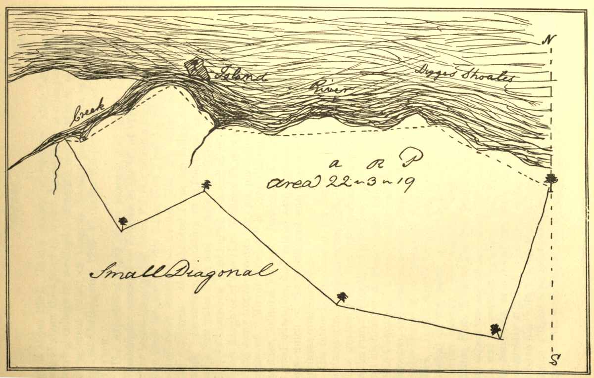
[44] Major Lawrence Washington, proprietor of Mount Vernon, was the second child and oldest surviving son of Augustine and his first wife Jane (Butler) Washington, born at Pope's Creek, Westmoreland county, Va., in 1718, and died at his residence, Mount Vernon, 26th July, 1752. He was the half-brother of the illustrious George Washington and great-grandson of the emigrant, Col. John Washington, who came to Virginia [53]about 1657. It is a matter of tradition that Lawrence was at about the age of 15 sent to England to be educated, and leaving college he received a captain's commission to serve in a regiment raised in Virginia to take part in the expedition against Carthegenia, 1740-42, under the command of Admiral Vernon.
The expedition failed of its purpose, and Major Lawrence Washington returned to Virginia in the fall of 1742. He shortly after became engaged to Anne Fairfax, which induced him to resign from the army. His father died April 12, 1743, leaving a considerable estate and named him, his oldest son, one of his executors. He inherited from his father "the Hunting creek" plantation, consisting of 2,500 acres, on the Potomac but a few miles from and in sight of "Belvoir." On the 19th of July Lawrence Washington was united in marriage to Anne, eldest daughter of the Hon. William Fairfax of "Belvoir." He made many improvements on his plantation and gave it the name of "Mount Vernon," in compliment to his old commander, Admiral Vernon. Lawrence Washington had received a good education, had mixed with prominent personages, had seen much of the world, and was a man of good habits and business qualifications.
His father at the time of his death, was largely engaged in business which Lawrence was obliged to look after and close up. This gradually led him into various business enterprises; such as the manufacturing of iron, buying and selling land, etc. He and his brother Augustin were among the organizers of "The Ohio Company," to explore the western country, encourage settlements, and conduct a trade with the Indians. He was elected to the House of Burgesses of Virginia from Fairfax county in 1748. It was largely through his influence that a charter was granted to the towns of Alexandria and Colchester, both in Fairfax county. He together with Lord Fairfax, George Mason, Hon. William Fairfax, William Ramsay, John Carlyle and others was named as trustee to lay out and govern the town. He was a popular legislator, but declined to serve longer in the Assembly, as it interfered with his present business. He was greatly attached to his brother George, and made it a point to have him with him at Mount Vernon whenever it was practicable without interrupting his studies. Lawrence was always of a delicate constitution, but by his prudent habits and systematic[54] attention to business he accomplished a great deal and enhanced the value of his possessions. He was tall in stature and a man of fine personal appearance, as is shown by an oil painting of him which still hangs upon the wall of the Virginia room in Mount Vernon mansion. He was rapidly becoming one of the leading business men of Virginia, when his health broke down. As a last resort his physicians recommended that he should spend a winter in the West Indies. In the fall of 1751, he resigned his commission as one of the adjutant-generals of Virginia, and taking his brother George with him, he went to the Island of Barbadoes. His pulmonary trouble had progressed too far to be arrested, and after spending some five months on the Island, and finding himself declining he returned home and died in July, 1752. His marriage had been blessed by four children, three of whom had died, his surviving child, Sarah, was still an infant at the time of her father's death. After providing in his will for his wife he left Mount Vernon to his daughter, but in the event of her death without heirs it was to go to his "beloved brother George," who was also named as one of his executors. This daughter Sarah died within a year, and George inherited Mount Vernon before he was 21 years of age. A few years after Lawrence Washington's death, his widow married George Lee, brother to the father of Arthur and Richard Henry Lee, patriots in the Revolution.
[45] The note book which contains this journal of Washington's includes also other memoranda, such as notes of surveys, drafts of juvenile letters, verses, etc., all of which are of interest for the glimpses they give of the character and early life of their author, and are copied with literal exactness and given with the journal and surveys.
The Mannor how to Draw up a Return when Survey'd for His Lordship or any of ye Family
March ye 15th 1747-8
Then Survey'd for George Fairfax Esqr. Three Thousand & twenty Three Acres of Land lying in Frederick County[46] on Long Marsh Joyning Thomas Johnstones Land and bounded as follows
[46] Frederick county, Virginia, was formed by Act of Assembly in 1738, out of Orange county at the same time that Augusta county was created. The boundaries of Frederick county were measurably well defined; to Augusta, however, was left all the western territory belonging to Virginia, much of it at that time an unexplored wilderness. This immense area has since been divided and now forms four great and independent states of the Union, namely, Kentucky, Indiana, Ohio and Illinois. Frederick county, by a return of the effective militia made to the governor of Virginia in 1777, had but 923 men. The total population of the town of Winchester at that time was 800 and a fraction.—Kercheval.
Beginning at (A) Three Hickorys Corner Trees to Thomas Johnstones Land & Extending thence along his S 13 Wt One Hundred Seventy two Poles to (B) a Locust Johnstones Corner thence along another of his Lines S 34 Et 150 po. to (C) a White Oak another of his Corners thence So 75 Et 186 po & to (D) a large Hickory thence No 58 Et 160 po xing a Spring Run to (E) three Red Oak Fx on a Ridge thence No 30 Et 436 po to a Hickory an Red Oak Fx at (F) thence No 60 Wt 90 po to (G) a Large White Oak Fx thence No 7 Et 420 po xing Long Marsh to (H) two Red Oaks and a W: O: Fx in a Bottom in ye aforesd Thomas Johnstones line finally along his line So 80 Et one Hundred fourteen Poles to ye Beginning Containing Three Thousand & twenty three Acres.
pr James Genn
| Henry Ashby | } | Chain men |
| Richard Taylor | } | |
| Robert Ashby Marker. | ||
| Wm. Lindsey Pilot. | ||
N. B. The Distances in ye above Writing ought to be Written in Letters not in figures only I have done it now for Brevity sake[47]
[47] At this place in the journal three leaves, six pages, have been torn out. The edges left show that they had been written upon by Washington. The next record of a survey in the hand-writing of Washington is signed by him with the name of James Genn, as is also the incomplete plot of a survey here reproduced from the original by tracing; whether it is a study from field notes by James Genn or an actual survey by Washington himself does not appear. The paper upon which it is drawn and the style of the hand-writing, place it as of a date current with the added records of 1747-8.
The Courses & Distances of the Following Plat is as follows viz beginning at A and running thence No 30 Et 436 poles thence N 60 Wt 90 pole thence No 7 Et 365 pole to Long Marsh & 420 to the end of the Course thence N 65 Wt 134 pole thence So 20 Wt 126 poles crossing Long Marsh to a Branch thereof commonly calld Cates Marsh 218 pole to the end of the Course thence N 80 Wt 558 pole thence S 25 Wt 144 pole thence S 33½ Et 96 pole S 20 Et 316 pole thence S 80 Et 114 pole thence East 280 pole thence S 15 Et 262 to the Beginning Survey'd by
James Genn
The Courses of the Town of Alexandria[48]
[48] Alexandria, Virginia.—This seems to be a brief record of the course and distances of a survey by Washington of the shore-line of the town of Alexandria before the river bank was improved or altered by the building of wharves and the grading of streets. It is probable that these lines were run in the winter when the river was closed with ice.
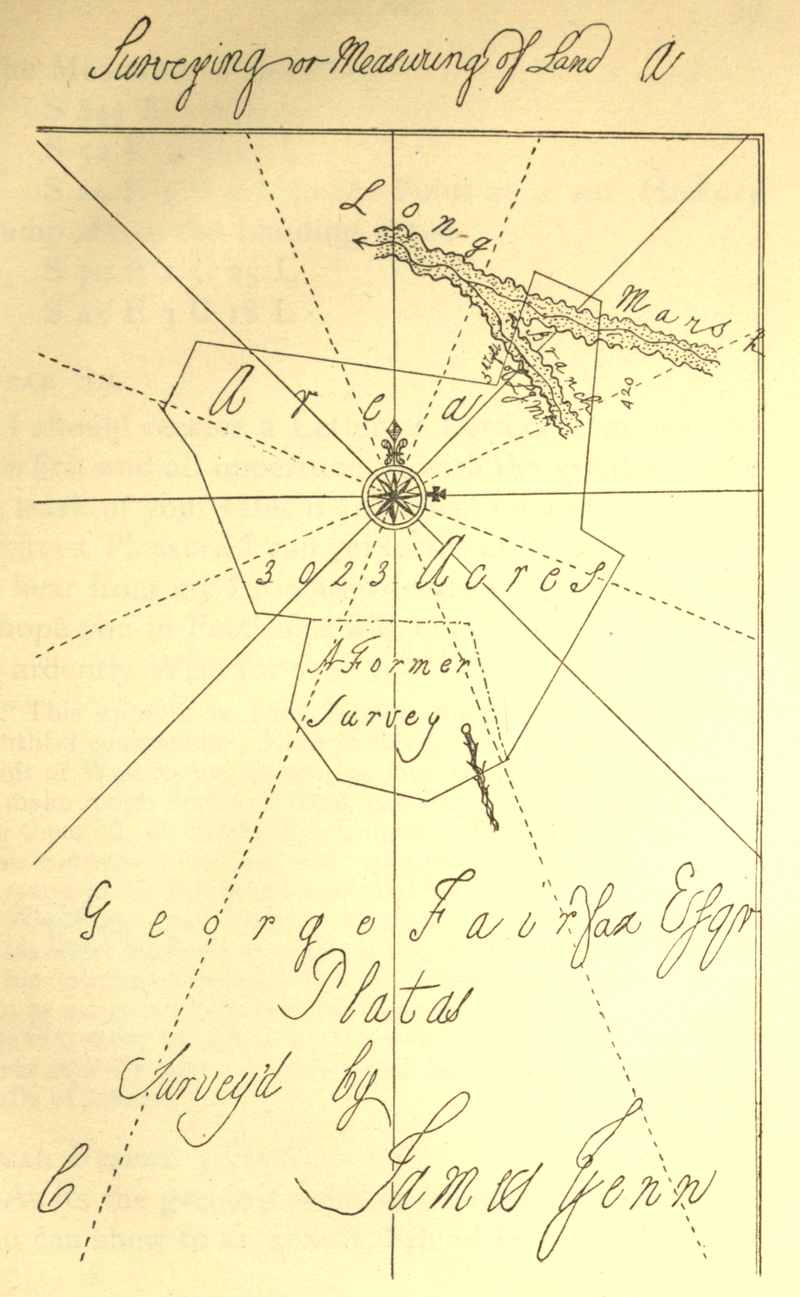
The Meanders of the River
S 84½ Et 3 Chain
S 52 Et 4 C 17 L
S 24 E 5 C 9 L to the Point at a sml Hickory
stump above the Landing Place
S 70 E 1 C 25 L
S 45 E 3 C 18 L
Dear Sir
I should receive a Letter or Letters from you by the first and all oppertunetys with the greatest sense or mark of your esteem and affection whereas its the greatest Pleasure I can yet forsee of having in fairfax to hear from my Intimate friends and acquaintances I hope you in Particular will not Bauk me of what I so ardently Wish for[49]
[49] This appears to have been a study for a letter to some youthful companion. Even to the close of his life it was the habit of Washington, in writing important letters and papers, to make rough drafts of them as a study. However, in copying them off, he frequently changed expressions and amplified their contents as his judgment approved. The original drafts of many of his letters are preserved in the Department of State at Washington and illustrate this fact. Hence the transcripts in his letter-book are not always true copies of either his drafts or his original autograph letters. These drafts were kept by him as memoranda, rather than as exact copies. It is also probable that there are many drafts preserved of letters which were never actually sent. In some cases he endorses this fact upon drafts of letters.
Dear Friend John[50]
As its the greatest mark of friendship and esteem you can shew to an absent Friend In often Writing[58] to him so hope you'l not deny me that Favour as its so ardently wish'd and desired by me its the greatest pleasure I can yet forsee of having in fairfax to hear from my friends Particularly yourself was my affections disengaged I might perhaps form some pleasures in the conversasion of an agreeable Young Lady as theres one now Lives in the same house with me but as that is only nourishment to my former affecn for by often seeing her brings the other into my remembrance whereas perhaps was she not often & (unavoidably) presenting herself to my view I might in some measure eliviate my sorrows by burying the other in the grave of Oblivion I am well convinced my heart stands in defiance of all others but only she thats given it cause enough to dread a second assault and from a different Quarter tho I well know let it have as many attacks as it will from others they cant be more fierce than it has been I could wish to know whether you have taken your intended trip downwards or not if you with what Success as also to know how my friend Lawrence drives on in his art of courtship as I fancy you may both nearlly guess how it will respectively go with each of you
[50] Dear Sir, Dear Friend John, and Dear Friend Robin.—These all seem to be studies or drafts of letters, which may have been impersonal or possibly to his youthful school-fellows and companions in Westmoreland and Stafford counties. It would be idle to speculate as to whom they were intended, in the absence of more definite information. They are in no wise remarkable, except as evidences of Washington's life-long habit of making memoranda, drafts and studies of his letters.
Dear Friend Robin
As its the greatest mark of friendship and esteem absent Friends can shew each other in Writing and often communicating their thoughts to his fellow companions makes me endeavour to signalize myself in acquainting you from time to time and at all times my situation and employments of Life and could Wish you would take half the Pains of contriving me a Letter by any oppertunity as you may be well assured of its meeting with a very welcome reception my Place of Residence is at present at His Lordships where I might was my heart disengag'd pass my time very pleasantly as theres a very agreeable Young Lady Lives in the same house (Colo George Fairfax's Wife's Sister[51]) but as thats only adding Fuel to fire it makes me the more uneasy for by often and unavoidably being in Company with her revives my former Passion for your Low Land Beauty[52] whereas was I to live more retired from yound Women I might in some measure eliviate my sorrows by burying that chast and troublesome Passion in the grave of oblivion or etarnall forgetfulness for as I am very well assured thats the only antidote or remedy that I ever shall be releivd by or only recess that can administer any cure or help to me as I am well convinced was I ever to attempt any thing I should only get a denial which would be only adding grief to uneasiness
[51] The young lady indicated was Miss Mary Cary, the daughter of Colonel Wilson Cary, of Ceeleys Hampton, Elisabeth City county, Va. For 34 years Mr. Cary was collector of customs[60] for the lower James river district, and a man of large wealth and aristocratic notions. He had four daughters: Sarah, who married George W. Fairfax, of "Belvoir"; Mary, who married in 1754, Edward Ambler of Jamestown; Anna, who married Robert Carter Nicholas; and Elizabeth, who married Rev. Bryan, 8th Lord Fairfax. Col. Cary had also one son Wilson Miles Cary, who was a member of the Convention of Virginia in 1776. Some writers have confounded him with his father. Bishop Meade in his Old Churches and Families of Virginia, accepts traditions which other writers claim are authenticated by documents, preserved by the Ambler family, and accordingly his account credits the story that Washington, in his youth, was an ardent admirer of Miss Mary Cary, and solicited leave of Col. Cary to address his daughter, but was refused. (See Meade, vol. i, 108.) This draft of the letter addressed to "Dear Friend Robin," was probably made in the spring of 1748, when Washington was in his seventeenth year. In it, he playfully avows an admiration for the "lowland beauty" and, at the same time, admits the agreeableness of the "young lady in the house" with him at "Belvoir." Mr. Edward Ambler, educated at Cambridge, England, was collector for York river and a burgess for Jamestown. He died in 1768 in his thirty-fifth year and was buried at Jamestown; his widow survived him until 1781. Mrs. Ambler with her children and her sister, Mrs. Fairfax, were occasionally guests at Mount Vernon, as Washington's diaries show. I am inclined to believe that while it is true that Washington entertained a high regard for the Cary family and particularly the ladies, there is nothing but the lightest gossip to create an inference that there ever was even an incipient affair of the heart between either of the Misses Cary and Washington.
[52] Lowland beauty.—Who this object of Washington's early admiration was, if she had a veritable existence, is not positively known. Irving, followed by Everett and others, accepts the tradition, or rather surmises, that this sobriquet referred to Miss Lucy Grymes of Westmoreland county, who in 1753 married Henry Lee, Esq. Their son was the gallant General Henry Lee, "Lighthorse Harry," of the Revolution. Some recent writers, affect to believe that this draft of a letter is conclusive that there was a real love affair but that Betsy[61] Fauntleroy, of Fredericksburg, Va., was the person referred to, and have published a letter purporting to have been addressed by Washington to William Fauntleroy, Sr., Esq., in Richmond, enclosing one to Miss Betsy, who, it is made to appear, had also refused Washington's addresses. Letters and traditions of this character should be received with caution, for while vague reports and surmises of an affair of the heart may be dilated upon in a bantering way among friends of the parties where there is little or no foundation for the allegation, yet they should be subjected to scrutiny and some positive evidence adduced before they are accepted as historical facts.
Dear Sally
This comes to Fredericksburg fair in hopes of meeting with a speedy Passage to you if your not there which hope you'l get shortly altho I am almost discouraged from writing to you as this is my fouth to you since I receiv'd any from yourself I hope you'l not make the Old Proverb good out of sight out of Mind as its one of the greatest Pleasures I can yet foresee of having in Fairfax in often hearing from you hope you'l not deny it me
I Pass the time of much more agreeabler than what I imagined I should as there's a very agreeable Young Lady lives in the same house where I reside (Colo George Fairfax's Wife Sister) that in a great Measure cheats my sorrow and dejectedness tho not so as to draw my thoughts altogether from your Parts I could wish to be with you down there with all my heart but as it is a thing almost Impractakable shall rest myself where I am with hopes of shortly having some Minutes of your transactions in your Parts which will be very welcomely receiv'd by Your
Dear Sir—It would be the greatest Satisfaction
Memorandom[53] to have my Coat made by the following Directions to be made a Frock with a Lapel Breast the Lapel to Contain on each side six Button Holes and to be about 5 or 6 Inches wide all the way equal and to turn as the Breast on the Coat does to have it made very Long Waisted and in Length to come down to or below the bent of the knee the Waist from the armpit to the Fold to be exactly as long or Longer than from thence to the Bottom not to have more than one fold in the Skirt and the top to be made just to turn in and three Button Holes the Lapel at the top to turn as the Cape of the Coat and Bottom to Come Parrallel with the Button Holes the Last Button hole in the Breast to be right opposit to the Button on the Hip[54]
[53] The minuteness of detail is very characteristic of the writer. While Washington was observant of the proprieties of life and of good taste in dress, there was not the least leaning to foppishness. But it was a principle with him to have whatever he bought, consonant with good taste and of the best quality.
[54] At this point in the book there are 18 blank pages.
Dear Richard
The Receipt of your kind favour of the 2d of this Instant afforded me unspeakable pleasure as I am convinced I am still in the Memory of so Worthy a friend a friendship I shall ever be proud of Increasing you gave me the more pleasure as I receiv'd it amongst a parcel of Barbarians and an uncooth set of People the like favour often repeated would give me Pleasure[63] altho I seem to be in a Place where no real satis: is to be had since you receid my Letter in October Last I have not sleep'd above three Nights or four in a bed but after Walking a good deal all the Day lay down before the fire upon a Little Hay Straw Fodder or bearskin whichever is to be had with Man Wife and Children like a Parcel of Dogs or Catts & happy's he that gets the Birth nearest the fire there's nothing would make it pass of tolerably but a good Reward a Dubbleloon is my constant gain every Day that the Weather will permit my going out and some time Six Pistoles[55] the coldness of the Weather will not allow my making a long stay as the Lodging is rather too cold for the time of Year I have never had my Cloths of but lay and sleep in them like a Negro except the few Nights I have lay'n in Frederick Town.
[55] A Pistole.—This coin was worth, at the time Washington wrote this journal, about $3.60. A doubloon was worth twice that amount.
Mem To Survey the Lands at the Mouth of Little Cacapehon[56] & the Mouth of Fifteen Mile Creek[57] for the Gentlemen of the Ohio Com:[58]
[56] Cacapehon, now generally written Capon.—There are two streams in the same vicinity known by this name, and to distinguish them, one is called "Great Capon" and the other "Little Capon." Both are tributaries to the Potomac.
[57] Fifteen Mile creek rises in Maryland and flows in a south-easterly direction, emptying into the Potomac river between Sideling Hill creek and Town creek, about 15 miles above Hancock, Md.
[58] "The Ohio Company" grew into existence out of efforts by Virginians, dated as early as 1746 or 1747, to secure a share in the lucrative Indian trade, and with the prospect of opening to settlement the lands on the upper waters of the Ohio. An early move in this direction had been made by Colonel Thomas Cresap, a man of courage, judgment and enterprise—qualities required for trading successfully with the Indians. He had erected his cabin at Oldtown, Md. About 1746 Lawrence and Augustine Washington, after making some cautious business ventures in the Indian trade, with others assisted to organize "this Ohio Company." Thomas Lee, whose second son, Richard Henry Lee, was to become so conspicuous a patriot of the Revolution, and John Hanbury, a wealthy London merchant, were original members of this company, into which still other men of substance and standing were admitted, and to which, in 1749, the British government gave a charter, as "The Ohio Company," with a grant of half a million acres of land, to be located between the Monongahela and Kanawha rivers, on the south side of the Ohio. With but twenty shares of stock at first issue, the company's prosperity seemed assured, and both Governor Dinwiddie and George Mason, at a later date purchased an interest in it. Among the early Washington manuscripts appears the above memorandum of a survey for this company. Although this entry is without date it must have been earlier, judging from its position in the note-book, than the charter. This document imposed, as conditions of the land grant, that the company should at once survey two hundred thousand acres, and within seven years secure the settlement of not less than one hundred families, erect forts, and maintain a garrison against the Indians,—conditions on the fulfilment of which they were to be for ten years exempt from the payment of quit-rents. Mr. Christopher Gist was employed as the company's agent, and on October 19, 1749, entered upon his duties of inspecting the country, contiguous to the Ohio river, reporting upon the character of the lands, making surveys, keeping a journal of his observations, drawing plans of the territory, etc. In 1750 the company built a small store-house at Will's creek and stocked it with goods from London to the value of £4,000. In 1752 Mr. Gist held a council with the Indians on the Ohio in behalf of the company, and secured their permission to lay out a town and erect a fort at McKee's[65] Rocks at the mouth of Chartier's creek, upon the east side of the Ohio, a few miles below Pittsburg. Washington, in his diary, alludes to this, and says of the position: "I think it greatly inferior, either for defense or advantage, especially the latter: For a fort at the forks would be equally well situated on the Ohio, and have the entire command of the Monongahela." In 1751 the company began making a road to the mouth of the Monongahela, but for lack of adequate resources, made only slow progress. The company looked upon the lands around Will's creek as being within their grant. They also erected a store-house at the mouth of Redstone on the Monongahela and began some improvements at the forks of the Ohio, immediately after completing those at Will's creek. At the latter place they had the adjacent lands surveyed on both sides the stream, above and below the forks, and laid out a town to which they gave the name of Charlottesburg in honor of the Princess Charlotte, afterward wife of King George. The French and Indian war, with other stirring political events, compelled the company to be cautious and to contract its operations, but, its embarrassments increasing from the course pursued toward it by the English government, prompted by envious rival interests, the consent of its agent, George Mercer, Esq., was finally gained to merge the Ohio Company into a Grand Company, under what was known as the Walpole Grant or Company. Their proposal was as follows: "We, the Committee of the Purchasers of a Tract of Country for a new Province on the Ohio in America, do hereby admit the Ohio Company as a Co-Purchaser with us for two shares of the said Purchase,* in Consideration of the Engagement of their Agent, Col. Mercer, to withdraw the application of the said Company for a separate Grant within the Limits of the said Purchase.
Witness our Hands this 7th Day of May 1770
* The whole being divided into seventy-two equal Shares by the words "two shares" above is understood two Seventy-second parts of the Tract so as above Purchased.
THOMAS WALPOLE
S. POWNALL
B. FRANKLIN
SAMUEL WHARTON
THOMAS WALPOLE
S. POWNALL
B. FRANKLIN
SAMUEL WHARTON
See American Historical Review, vol. iii, p. 205.
This action, however, was not approved by the American[66] members of the company, and the final collapse of the whole enterprise was one of the results of the Revolution.
I heartily congratulate you[59] on the happy News of my Brothers safe arrival in health in England and am joy'd to hear that his stay is likely to be so short I hope you'll make Use of your Natural Resolution and contendness as they are the only Remedys to spend the time with ease & pleasure to yourself I am deprived of the pleasure of waiting on you (as I expected) by Ague and Feaver which I have had to Extremety since I left which has occasioned my Return D
[59] Memorandum or draft of a letter to his sister-in-law Anne, wife of Lawrence Washington, of Mount Vernon, made, very possibly, while in the field surveying in the fall of 1748 or spring of 1749. This visit to Europe, of Lawrence Washington, was partly in the interest of the Ohio Company and partly on account of his failing health which, unfortunately, was not benefited by the voyage as had been hoped.
Memorandom to charge Mrs Aus. Washington[60] with 4 /9 and 18d the 30 of July to a Maryland Hen-wife as also Major Law: Washington with 1 /3 lent the 15 of August 5 /9 the 17 Do 2 /6 Do: I read to the Reign of K: John
[60] Mrs. Aus. Washington evidently refers to Mrs. Augustine Washington, of Westmoreland, the wife of George's half-brother, Augustine, with whom he had made his home while attending Mr. William's Academy. Austin is, or has been, in Virginia a contraction for Augustine. Augustine Moore, a notable character, is recorded interchangeably, in land and other records, as Augustine and as Austin Moore. It is presumed that "The Maryland Housewife" was intended to have been written, that being the name of a popular book on cookery and the art of housekeeping at that period. The date of this memorandum[67] is presumed to be 1748. A charge in his book of accounts kept at this time, and which was among the relics of Lawrence Washington sold in Philadelphia in the spring of 1891, would fix the date as July 28th, 1748. It was not an unusual thing for Washington in his youth to use contractions in writing the first names of his brothers, the following are examples: Aus., Austin for Augustine; Sam for Samuel; Jack and John, simply for John Augustine.
In the Spectators Read to No 143[61]
Mem:
When I see my Brother Austin to Enquire of him whether He is the Acting Attorney for my Brother and as my Brother Lawrence left Directions with the H. on W Fx[62] to remit his Pay as Agetant whether it would not be more proper to keep it to Pay the Notes of Hand thats Daily coming against him and to Write Word to Williamsburg to Acquaint his Hon: my B: A: to write him word.
[61] This is about the only record Washington has left of his course of reading. It is inferred that the books were either at "Greenway Court" or at "Belvoir." The character of the works he selected for his perusal is what might have been expected. This memorandum also exhibits a trait in his character prominent throughout his life, that of giving attention to minute details of business. It may truly be said of him that "the boy was father to the man."
[62] Honorable William Fairfax, of "Belvoir," Fairfax county, Va., was born 1691 in Yorkshire, England, where his father that year became high sheriff of the county. His father was the son of Henry Fairfax, 2d son of 4th Lord Fairfax and Anna (Harrison) Fairfax, whose sister, Eleanora Harrison, of South Cave, married in 1689, Henry Washington; their son, Richard Washington, who resided in London, was, therefore, an English cousin of Wm. Fairfax, and a correspondent both of his and of Col. George Washington's (see Washington's correspondence,[68] in Sparks). Wm. Fairfax lost his father when quite young and was educated at his uncle's, Sir John Lowther's College. Through the influence of Capt. Fairfax, of the Royal Navy, he entered that service in 1710 and served for two years. He then joined the British army in Spain under Col. Martin Bladen, who had married a Fairfax, and was stationed at St. Helena in 1716-17, and subsequently at the Bahamas, and returned to England in October, 1717. Having married in the Bahamas, Sarah, daughter of Maj. Walker, of Nassau, she accompanied him to England. In 1718 Wm. Fairfax was sent out with Captain or Governor Woodes Rogers as chief justice to suppress the pirates infesting the West Indies. His residence was at Nassau, New Providence. The business for which he accepted office having been completed and the climate not being congenial, he in 1725 removed to New England. Here he received an appointment to the custom house at Salem, which he held until 1734. While a resident of Salem, his first wife died and was buried there. His son George William was born in Nassau, three of his children were born in Salem. Thomas, of the Royal Navy, was killed in battle; Anne married Lawrence Washington, and was the first mistress of Mount Vernon; and Sarah married John Carlyle, of Alexandria, Va., who was a major and commissary in the French and Indian war. Mr. Fairfax married, January 18, 1731, Deborah Clarke, of Salem, Mass. Her first child was Bryan, 8th Lord Fairfax, born at Salem 1732, but better known as the Rev. Bryan Fairfax, who died in 1802. In 1734 Wm. Fairfax accepted an offer, he had before declined, to remove to Virginia and act as agent for his cousin, Lord Thomas Fairfax, in the management of the vast Fairfax land estate. He at first took up his residence in Westmoreland county and remained there for several years, but afterward improved the plantation, built "Belvoir" mansion, six miles below "Mount Vernon," and removed to it. He was residing there in 1739, when Lord Fairfax first visited Virginia and made it his home for a year. Wm. Fairfax, from his high character and acquaintance with business, soon came to the front among the leading men in Virginia. Besides being agent for his cousin, he served in the assembly of Virginia, and after the death of John Blair was president of the Provincial council and collector of his majesty's customs for the South Potomac. His second wife bore him two children, besides Bryan[69] already mentioned, William Henry, killed at the storming of Quebec in 1759; and Hannah, who married Warner Washington, cousin to George Washington. William Fairfax was a man of great executive ability and much beloved by the community. He died September 3, 1757. His wife survived him but a few years. "Belvoir" was left to George W. Fairfax and was his residence until he went to England in 1773.
Memorandam of what Cloths I Carry into Fairfax
Razor[63]
7 Shirts 2 Do Carrd by Mr Thornton[64]
6 Linnen Waistcoats
1 Cloth Do——
6 Bands[65]
4 Neck Cloths[66]
7 Caps[67]——
[63] The razor in colonial days was an essential part of a gentleman's toilet outfit. Washington had a strong beard and was early called upon to use his razor. Long, full beards were not then in fashion in America. It is a notable fact that there is not a portrait extant of an American-born patriot or statesman of the Revolutionary period, painted with a full beard. This memorandum, although not dated, is believed to have been written in 1748. The clean shaven face was constrained by the fashion of the continent; and prevailed as the custom in England and France for a period of quite 75 years.
[64] The Thorntons intermarried with the Washingtons.
[65] A kind of shirt collar.
[66] Neck Cloths.—These were usually made of fine white cambric, folded wide, were wrapped twice around the neck and worn without collars.
[67] Caps.—The number here will attract attention considering the list of other articles; but it must be remembered that it was the custom at that period for both men and women to wear caps at night in bed. At the time when this journal was written,[70] bed rooms were not heated, hence the custom of warming beds before retiring in winter, and the necessity for wearing night caps is more apparent, and, further, the head was frequently shaven and wigs were worn during the day by many. It is the tradition that Patrick Henry wore at home, in the day, even, when not in full dress, a "tarred cotton cap," whilst in public he wore a wig. In speaking, when he was earnestly moved, a striking emphasis of his is said to have been a rapid whirling of his wig around his head.
M: the regulater of my watch now is 4 M: and over the fifth from the Slow end
| 'Twas Perfect Love before | } | s: Young M: A: his W |
| But Now I do adore | } |
What's the Noblest Passion of the Mind? 6:2:
M: Delivered Mrs Humphras this 30th Day of October 2 Shirts the one marked G W the other not marked 1 pr of Hoes & one Band to be Washed against November Court in Frederick[68]
[68] At this point in the journal several blank pages occur.
Oh Ye Gods why should my Poor Resistless Heart
Stand to oppose thy might and Power
At Last surrender to cupids feather'd Dart
And now lays Bleeding every Hour
For her that's Pityless of my grief and Woes
And will not on me Pity take
He sleep amongst my most inveterate Foes
And with gladness never wish to wake
In deluding sleepings let my Eyelids close
That in an enraptured Dream I may
In a soft lulling sleep and gentle repose
Possess those joys denied by Day
[71]From your bright sparkling Eyes, I was undone;
Rays, you have; more transparent than the Sun,
Amidst its glory in the rising Day,
None can you equal in your bright array;
Constant in your calm and unspotted Mind; }
Equal to all, but will to none Prove kind, }
So knowing, seldom one so Young, you'l Find. }
Ah! woe's me, that I should Love and conceal }
Long have I wish'd, but never dare reveal, }
Even though severely Loves Pains I feel: }
Xerxes that great, was't free from Cupids Dart,
And all the greatest Heroes, felt the smart.[69]
[69] The poetical effusions of George Washington are neither numerous nor notable. The specimens here given are found on the spare pages of his memoranda mixed in with his notes of surveys. Some leaves are missing at this point and the concluding lines of one poem, at least, are lost.
A List of the Peoples Names that
I have Warrants for[70]
| Acres | ||
| Richard Arnold Frederick C | 400 | |
| before the 25th Day of April | ||
| Barnaby McKannary | Do | 400 |
| on the Lost River[71] | ||
| Silvenus Smith | Do | 400 |
| John Wilton | Do | 300 |
| James McKoy | Do | 400 |
| James Kinson | Do | 400 |
| Ann Dunbarr | 400 | |
| Andw Vincy of Augusta | 400 | |
| Robert Denton | Do | 400 |
| [72] John Stackhouse of Fredk | 400 | |
| Saml Kinsman | Do | 400 |
| Thos Wiggans | Do | 400 |
| George Horner | Do | 200 |
| Darby McKeaver | Do | 400 |
| Josh Howt: frm New Eng | Do | 400 |
| Jno Ellwick Senr of Augusta | 400 | |
| James Hamilton Jr | 400 | |
[70] Land warrants were granted by the Crown, by the Legislature or its authorized agent, and by the governors of the provinces. A warrant had the character of a commission and guaranteed title. Land warrants issued in accordance with law were negotiable, and when laid and the survey plotted by a licensed surveyor and recorded in the land office, were maintained by the courts as against all other claimants.
The following is an exact copy of an order from G. W. Fairfax, agent of Lord Fairfax, for the sale of unseated lands in the "Northern Neck of Virginia" to George Washington a licensed surveyor in Virginia as his warrant to survey a particular parcel of land. The original document was in the possession of J. A. Russell, Esq., of New York city, in 1869, and is published in the Historical Magazine for March of that year, p. 197:—
"To Mr. G. Washington
"Whereas, Barthalamore Anderson, of Frederick County hath Informed that there are about Four hundred 50 Acres of Waste and Ungranted Land in the said County, formerly granted to Thomas Morgan by Jost Hite as p. Bond for the same & by Assignment to the sd Anderson, on Arnold's Run a branch of Shenandoah.
"And Desiring a Warrant to survey the same in order to obtain a Deed, being ready to Pay the Composition and Office Charges.
"These are therefore to Empower You the sd G. Washington to survey the sd Waste Land.
"Provided this be the first Warrant that hath Issued for the same and you are to make a just, true and Acurate survey [73]thereof, Describing the courses and distances p. Pole, also the Buttings and Boundings of the several Persons Lands adjoining, and where you cannot Join on any known Lines, you are to make Breadth of the tract to bear at least the proportion of one-third part of the length as the Law of Virginia Directs, you are also to Insert the Names of the Pilot and Chain Carriers made use of and Employed, a Plat of which sd Survey with this Warrant you are to give into this Office any time before the twenty-fifth Day of March next ensuing. Given under my Hand and Seal of the Proprietors Office this thirteenth day of Oct. 1750 in the Twenty-Fourth year of His Majesty King George the Second's Reign.
"G. W. FAIRFAX."
[ENDORSED.]
"Barthalamore Anderson's Warr for 450 Acres
"Mr Washington's Retur'd the 8th Feby 1750-1.
"To be paid p Ld Fx
"61"
[71] Lost River.—This stream gets its name from the fact that for three miles it passes out of sight under a mountain which lies across its course. It rises in Hardy county, W. Va., and flows in a north-easterly direction to the Cacapehon river. The following diagram is made from a pen drawing by Washington in his field note book, but not definitely related to this particular survey.
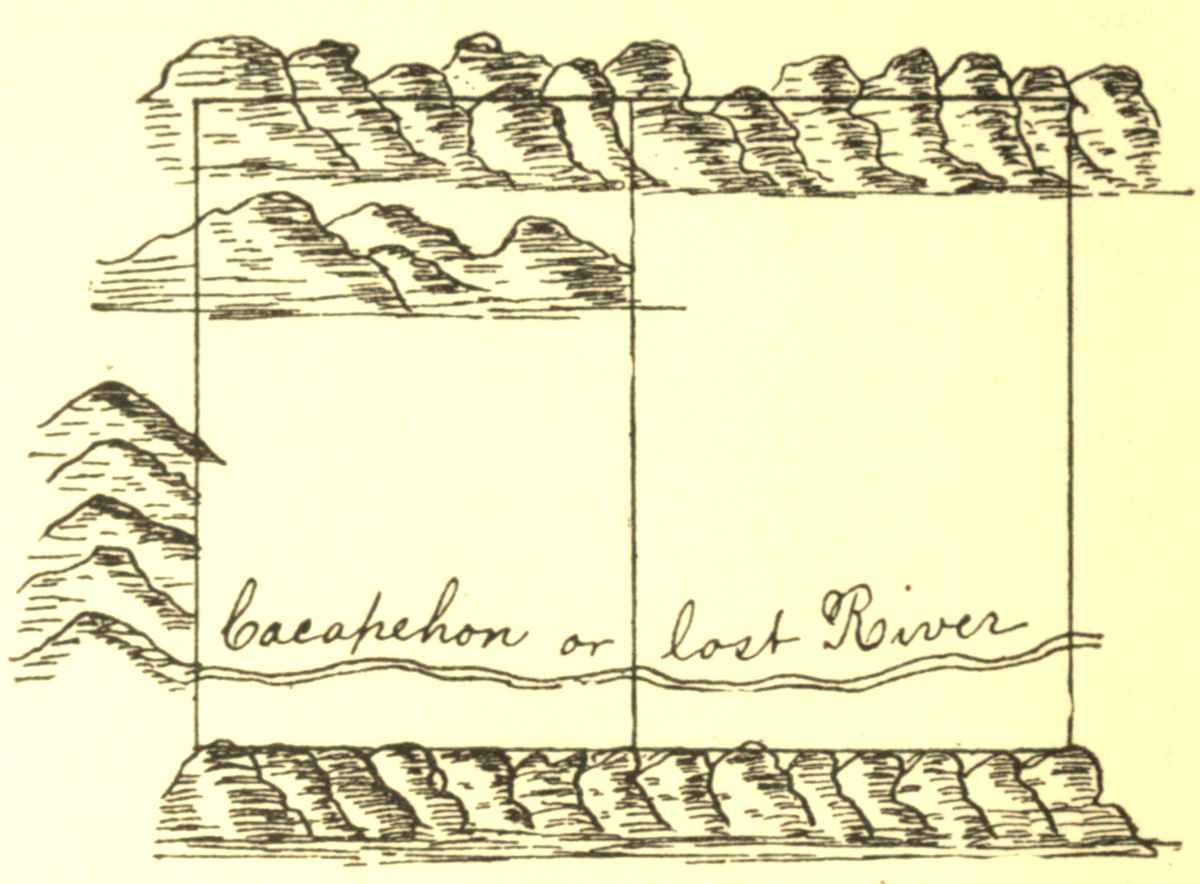
My Lord
I went Last Tuesday not knowing your Lordship had that very Day set out for Neavils to see whether you had any further Commands or directions to give concerning the Surveying of Cacapehon and as your Lordship was not at Home I was inform by Colo G. Fairfax that you had not any Directions in Particular more than were given to the other Surveyors as your Lordship had mentioned I therefore have made bold to Proceed on General Directions from him as[74] Missing this Opportunity of Good Weather may be of considerable Hindrance I shall Wait on your Lordship at Frederick Court in November to obey your further Pleasure and am my Lord &[72]
[72] Here terminates the entries in the little note book, containing "My Journey Over the Mountains." It is proper to state that the journal was kept in a small, vellum-bound, blank book, 6 by 3¾ inches in size, closely written on both sides of the leaf. Either from a desire to classify his memoranda, or for want of a second book, or from some motive of economy, he turned the book around and began from the other end to keep a record more particularly relating to his surveys and miscellaneous affairs. His field notes of surveys were kept in a book of the same size as the one described, from which the most of the following surveys are taken. The other surveys are found on loose sheets which have been bound and denominated miscellaneous papers; a few of them having dates, enables the editor to place them in chronological order.
Then Survey'd for Mr John Monroe ye following Tract of land bounded as follows
| Poles | |||||
| A | Beginning at a marked white oak | } | N 20,,0 | E | 130,,68 |
| B | N 20—00 E to a Chesnut | } | |||
| C | Thence to a Red oak | N 71,,00 | E | 116,,44 | |
| D | Thence to a Spanish oak near a Swamp | S 73,,00 | E | 188,,24 | |
| E | Thence to Hiccory | S 44,,00 | E | 158,,72 | |
| F | Thence to a red oak Stump | S 14,,00 | E | 186,,24 | |
| G | Thence to a Black Gum | S 88,,00 | W | 244,,00 | |
| From thence to the Beginning |
Then survey'd for Mr John Watts ye Following Tract of Land bounded as followeth
| Courses | |||||
| A | Beginning at a Marked red Oak | } | S 15° 30′ | W | 400.56 |
| B | S 15° 30 W to a Sweet Gum | } | |||
| C | Thence to a Chesnut | S 59,,00 | W | 200.40 | |
| D | Thence to a Walnut | N 45,,00 | W | 240.24 | |
| E | Thence to a White Oak | N 10,,00 | E | 200.00 | |
| F | Thence to a Maple | N 35,,00 | E | 300.00 | |
| From thence to the Beginning |
Then Survey'd for Mr Francis Jett the following Tract of Land bounded as follows
| A | Beginning at a Marked Hiccory S 20, W | } | S 20,,00 | W | 120 |
| B | to a White Oak | } | |||
| C | Thence to a Walnut Stump | S 63,,00 | W | 160 | |
| D | Thence to a Red Oak on the top of a Hill | S 85,,00 | W | 80 | |
| E | Thence to a Black Gum near a Valley | N 66,,00 | W | 116 | |
| F | Thence to a Dogwood near a Swamp | N 35,,00 | W | 63 | |
| G | Thence to a Mulberry standing in Corn-field | N 35,,00 | E | 97 | |
| H | Thence to a Sasafras | N 45,,00 | E | 157 | |
| From thence to the Beginning |
Then Survey'd for Capt Henry Washington ye following Tract of Land bounded as follows
| Poles | |||||
| A | Beginning at a red Oak S 25—00 W | } | 25—00 | W | 74 |
| B | near the road running to a red Oak Saplin | } | |||
| C | Thence to white Oak | S 23—00 | E | 24 | |
| D | Thence to Spanish Oak | S 55—00 | W | 34 | |
| E | Thence to a Black Gum | N 76—00 | W | 30 | |
| F | Thence to a Black Oak | N 25—00 | W | 62 | |
| G | Thence to Caleb Butlers old Field | N 00—00 | W | 104 | |
| H | Thence to a White Oak | S 76—00 | E | 70 | |
| I | Thence to a Red Oak | N 78—00 | E | 56 | |
August 18th 1747 Then survey'd the following Piece of Land at one Station in the School House old field bounded as pr field Book. Vizt Beginning near a Persimon within ye field Extending thence to a Fence Stake S 15—00 E 165°,,00′—28 Pole thence S 19—00 W 199°—00′—27.5 Pole thence S 47 W 227°—00′—18.9 thence S 76—00 W 256°—00′—21.4 thence N 42 W 318°—00′—46.3 thence N 29—00 E 29°—00′—34 Pole.
October 1st 1747 Then Survey'd the following
Piece of Land for Mr Richard Roe Bounded as follows
[76]Beginning at a Chesnut extending thence So
20—00 W 38 Pole thence N 75—00 W 39.7 P thence
No 46—00 W 41.1 P thence So 68—00 W 21.3 thence
No 29—00 W 25.3 thence So 77—00 E 4 Pole thence
No 60—00 E 25.1 Pole thence So 42—00 E 14 Pole
thence So 79—00 E 14 Pole—thence East from thence
to the beginning S 60—45
E
Then Survey'd for Mr Francis Jett the following Tract of Land Bounded as pr Field Book[73]
| A | N | 56.15 | Remarks ye distance from A to B being Inaccessable I took an Angle within ye field from A to a house bearing N 73°—00 E 46 Pole thence to B bearing N 48—00 W | |
| B | N 51—00 | E | 39.19 | |
| C | S 65—00 | E | 34.14 | |
| D | S 49—00 | E | 50.15 | |
| E | S 20—00 | E | 29.00 | |
| F | S 70—00 | W | 62.13 | |
| G | N 58—30 | W | 20.24 | |
| H | S 83—30 | W | 30.00 |
Survey'd for Mrs Elizabeth Washington ye Following Tract of Land whose thirds is required to be laid off 20 Pole from H towards K & the Division line to run towards B C[74]
| Courses | Dist: | Poles | |||||
| A | S 54,,00 | W | 67,,00 | ||||
| B | N 45,,00 | W | 36,,00 | ||||
| C | N 76,,00 | W | 45,,— | ||||
| D | N 31,,00 | E | 60,,— | Acres | Roods | Perch: | |
| E | N 56,,00 | E | 35,,— | Area | 52 ,, | 1 ,, | 39 |
| F | N 21,,00 | E | 30,,24 | ||||
| G | S 51,,00 | E | 40,,20 | Scale 50 Parts to an Inch. | |||
| H | S 34,,00 | E | 41,,60 | ||||
| I | S 04,,00 | W | 34,,20 | ||||
[73] (Transcriber's note: this footnote refers to the illustration below)
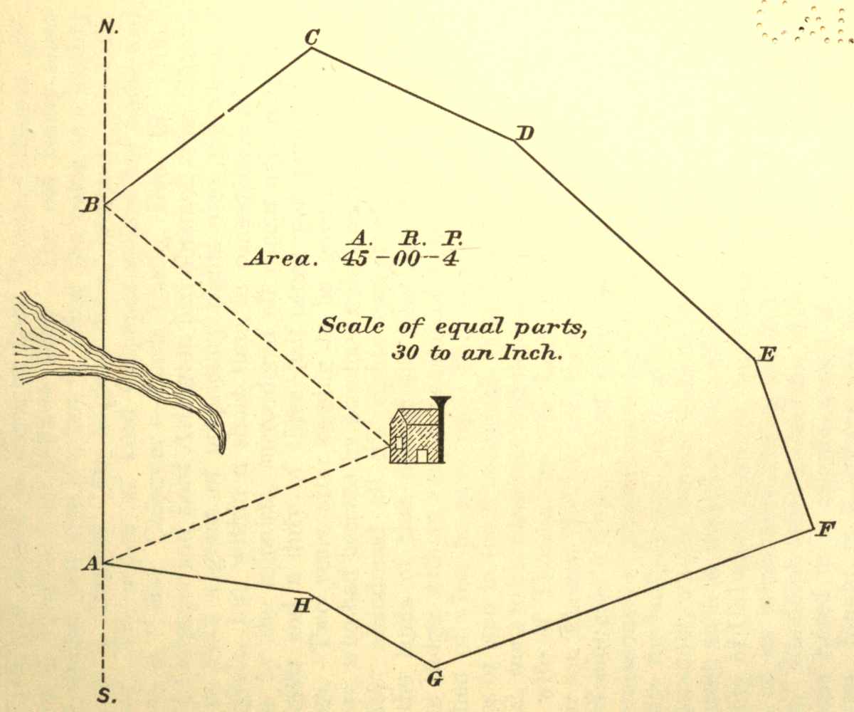
[74] (Transcriber's note: this footnote refers to the illustration below)
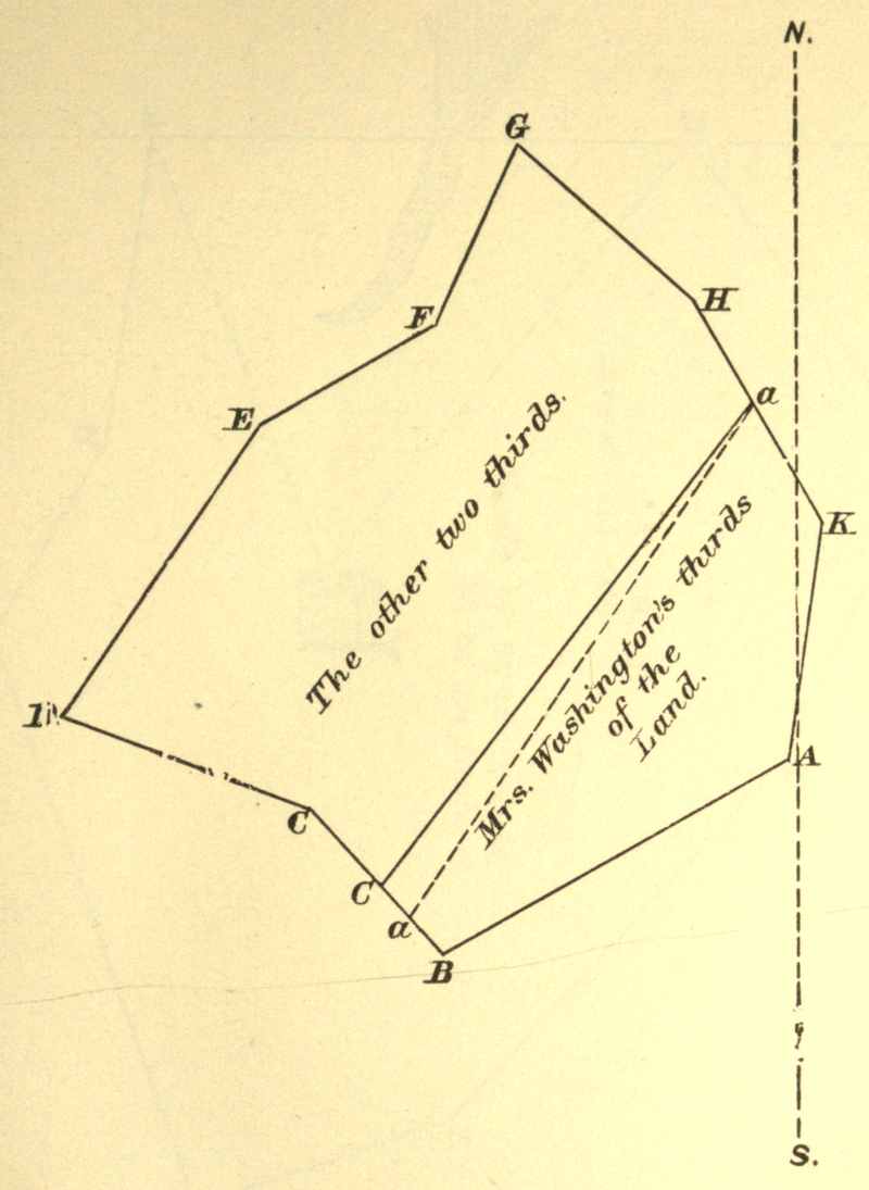
SURVEY'D For Richard Barnes Gentn of Richmond County[75] a certain Tract of Waste and ungranted Land Situate Lying and being in the county of Culpeper[76] and Bounded as followeth Beginning at three white Oaks in Normans Line and Corner Trees to (Aaron Pinson's now) Mr Barnes's Land & Extending thence No 42° 30′ Wt Ninety five Poles to a branch of Flat Run Two hundd and Eighteen Poles to a Large white Oak Corner to Norman thence along another of his Lines No 39° Et Thirty four Poles to three white Oaks & a Hickory Cor: to the said Norman and John Roberts thence along Robert's Line So 78° Wt One hundd and Eighty three Poles to the Road that Leads over Norman's Foard Two hundd and Sixteen Poles to two white Oaks in a Glade Corr to the said Roberts and Mr Francis Slaughter thence with the said Slaughters Line So 5° Wt One hundd and Sixty four Poles to three white Oaks in the said Slaughter Line thence leaving his Line So 66° Et Two hundd and thirty Six Poles to three white Oaks amongst a Parcel of Rock Stones Barnes's Corner thence with his Line No 53° Et One hundd and Eighty Six Poles to the Beginning Containing Four Hundred Acres this Twenty Second Day of July 1749.
| John Lonem | } | Cha Men |
| Edward Corder | } | |
| Edward Hogan Marker | ||
| by | ||
| Washington S C C[77] | ||
[75] For this survey Washington received the sum of £2 3s 0d on the 25th of July, 1749, as shown by entry in his cash book; a copy of which is in the Toner Collection, Library of Congress, Washington, D. C.
[76] Culpeper county, Virginia, was formed by act of assembly in 1748, and named in honor of Lord Thomas Culpeper, governor of Virginia from 1682 to 1686. The old family name was spelled with two p's, but in using the name as a locality one p is dropped. Its original form, however, was Colepeper. The widow of Lord Culpeper spelled her name and wrote it, "Mar. Culpeper—Leeds Castle, Dec. 19, 1706." Lord Culpeper and Lord Arlington had obtained from Charles II in 1672 a grant of proprietary rights over the whole of Virginia, but within a short time, in consequence of resistance by the colonists, surrendered all except quit rents and escheats, and a duty of three half-pence per pound on tobacco. Two years after ceasing to be governor, Lord Culpeper, who had become by purchase sole owner of the grant, further abandoned all his rights except that of property in the lands of that part of the Northern Neck beyond the Blue Ridge, with an annual pension of £600 for twenty years in lieu of what he gave up. This estate of about 5,700,000 acres of land in the Shenandoah valley and the mountains beyond, went to his daughter and heiress, Catherine, who became the wife of Thomas, the 5th Lord Fairfax, and from her to their son Thomas the 6th, and the first American Lord Fairfax of Washington's time. Lord Culpeper had been one of the commissioners of plantations under Charles II, and was a man of ability for business and public affairs, although rapacious; and, as governor, wholly British, without that sympathy for Virginia interest, such as Berkeley, with all his faults, had shown. The county of Culpeper, however, was conspicuous for the patriotism of its inhabitants during the Revolution. Her "minute men," Randolph said on the floor of the United States Senate, "were raised in a minute, armed in a minute, marched in a minute, fought in a minute, and vanquished in a minute." The motto on their flag was, "The Culpeper Minute Men," along the top border; in the center a curled rattlesnake with head erect and rattling tail; on either side the words "Liberty—or Death;" and beneath, along the lower border, "Don't [78] Tread on Me." In the clerk's office of Culpeper court house is recorded the following: "20 July, 1749 [O. S.] George Washington, Gent., produced a commission from the President and Master of William and Mary College, appointing him to be surveyor of this county, which was read, and thereupon he took the usual oaths," etc.
[77] Washington, S. C. C.—This is supposed to be an official check mark signature of George Washington as a licensed surveyor of Culpeper county. The plat of this survey is published by Sparks, vol. 1, p. 14, and is reproduced here, as the editor has failed, so far, in finding the original among any of the Washington papers extant. The plat bears date two days after he filed his certificate and took the necessary oath before the court in Culpeper county referred to in the preceding note.
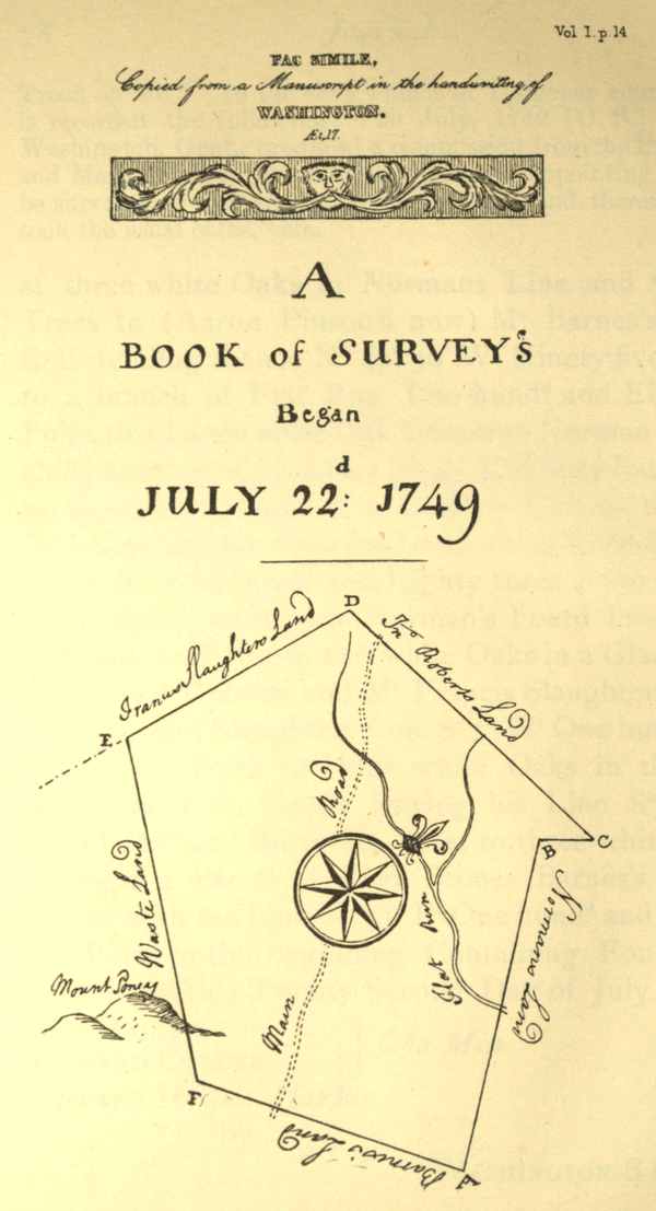
FAC SIMILE.
Copied from a Manuscript in the handwriting of
WASHINGTON.
Æt. 17
A
BOOK of SURVEY's
Began
JULY 22d: 1749
SURVEY'D For Edward Hogan a certain Tract of Waste and Ungranted Land Situate Lying and being in the County of Augusta[78] and on the Lost River or Cacapehon about Six Miles within the Boundary Line of the Northern Neck and bounded as followeth Beginning at a white Oak and white Pine Saplins on the West Side of the River and Runs thence So 68° Et Two hundred and Eighty Poles to three Chesnut Oaks on a Steep Mountain Side thence No 9° Et Two hundred and three Poles to three Pines on the Mountain Side thence No 68° Wt Two hundd and Eighty Poles to two white Oaks in a Drain that makes from the Mountains thence So 2° Wt One hundred and [80]thirty two Poles to two white Oaks thence So 22° Wt Sixty Eight po. to the Beginning Containing Three hundred and Thirty five Acres this 1st Day of November 1749[79]
| John Lonem | } | Cha Men |
| Edward Corder | } | |
| Edward Hogan Marker | ||
| by | ||
| Washington S C C | ||
[78] Augusta county, and also Frederick county, were formed in 1738, out of Orange county which, prior to that date, had embraced all of Virginia beyond the Blue Ridge. The bounds of Frederick were defined as follows: the Potomac on the north, the Blue Ridge on the east, and on the south and west a line drawn from the head spring of the Hedgman creek to the head spring of the Potomac; all beyond this line, comprising the immense western territory belonging to Virginia, constituted Augusta county. The earliest Frederick county court was held at Winchester, Nov. 11, 1743; and that of Augusta county was held at Beverley's Mill Place, now Staunton, Dec. 9, 1745.
[79] The notes of the survey of land, on the 22d July, 1749, for Richard Barnes, and that of November 12, 1749, for Edward Hogan, were recorded on sheets of foolscap paper, and are bound up with other early miscellaneous papers of George Washington, preserved in the Department of State. They are here given nearly in their chronological place.
November 2d 1749 Then Surveyd for Robert Denton a certain Tract of ungranted Land Situate in Augusta County and on the Lost River of Cacapehon and Bounded as followeth Beginning at two white Pines and a Pitch and running thence So 62 Et Three Hundred Poles to a Chesnut, Pine and Spanish Oak on a Mountain Side thence No 28° Et Two hundred & Six poles to two white Oakes and a Hick. thence leaving the Mountain No 62 Wt Three hund poles to two Pines and a white Oak on a steep Hill thence to the Beginning
E Plat drawn
Robert Denton, Marker
November 2d 1749[80] Then Survey'd for James Hamilton [81]a certain Tract of Waste Land lying on Cacapehon and bounded as followeth Beginning at three Pines on a Mountain Side Corner to Edward Hogan and running thence along his Line No 68 Wt Two Hundred and Eighty Poles to three white Oaks another of his Corner's thence along the Mountain Side No 27 Et Two hundred Poles to a Poplar a Lynn & white Walnut Trees standing on the Creek thence crossing the Creek S. 68 Et Two hundred and Eighty Poles to a Large Black Oak and two Chesnut Trees growing from one Root thence to the Beginning along the side of an Inaccessable Mountain
E. Plat drawn
Hogan Marker
[80] This entry is in a new book of the same dimensions as the one described; first pages of it are blank—page 7 is the first written upon; pages 8 and 9 gone; page 10 blank.
Survey'd for Francis McBride Three hundred and Eighty Six Acres and a Quarter of Waste and Ungranted Land Situate Lying and being in the County of Augusta and on the Lost River or Cacapehon and Bounded as followeth Beginning at three Pines on very Hilly Ground and on the West Side the River and Runs thence So 62° Et Three hundred Poles to three white Oaks on the brake of the Mountains thence So 28° Wt Two hundred and Six Poles to two Black Oaks & a Dogwood thence No 62° Wt Three hundred Poles to two white Oaks and a Hickory Saplins on the Side of very Hilly Ground thence No 28° E Two hundred and Six Poles to the Beginning this third Day of November 1749
November 3 7th 1749 Then Survey'd for William McBride a certain Tract of Waste and ungranted Land Scituate in Augusta County and on the Lost River of Cacapehon and Bounded as followeth Beginning at three pines Francis McBrides Corner and runs thence with his Lines So 62° Et Three hundred poles to three white Oaks another of his Corners thence No 28° Et Two hundred and Six Pole to three white Oakes thence No 62 Wt Three hundred poles to two pines & a red Oak On a steep Hill from thence to the Begining
E
Plat drawn
John Donbarr M:
November 4th 1749 Then Survey'd for Ann Dunbarr a certain Tract of Waste Land Scituate in Augusta County and on the Lost River of Cacapehon and bounded as followeth Beginning at a Pine and white Oak pretty High up a Mountain Side and running thence So 65° Et Three hundred Poles to a white Oak Chesnut Oak and Maple on the Mountain Side near a Drain thence No 25° Et with the Mountain Two hundred and twenty Poles to three white Oak Saplins by a Runside thence No 65° Wt Two hundred and twenty Poles to a red Oak and Pine on the Creek Side thence up the Mountain Side far enough to make out three hund'd Poles from thence to the Beginning
E Plat drawn
John Donbarr M.
November 5th 1749 Then Surveyd for Mr John Ellswick a certain Tract of Waste and ungranted Land Situate in Augusta County on the Waters of Cacapehon and bounded as followeth Beginning at three white Oakes Corner to Mrs Ann Dunbarr and running thence along the Mountain side No 25 Et One hundred Poles to three white Oaks in very Stony ground thence bearing more to the Mountain No 50 Et One hundred and twenty Poles to two Chesnuts and one Chesnut Oak near the side of some Large hanging Rocks on the side of a Mountain thence No 65 Wt Three hundred Poles to three white Saplins in the Hollow of a the Mountains near the Road that leads to the So Branch thence S 38 Wt One hundred and twenty poles to Dunbarr's Corner on the Mountain thence with his Line So 65 E Three hundred pole to the B.
E
Plat drawn
Josh How M.
Survey'd For James Scott Three hundred and Eighty Six Acres and a Quarter of Waste and Ungranted Land Situate Lying and being in the County of Augusta and on the Lost River or Cacapehon and Bounded as followeth Beginning at a Pine a Spruce Pine and Spanish Oak by the side of some Large Rocks on the East Side the River and Runs thence No 55° W Three hundred Poles to three Chesnut [84]Oaks on Short Hills thence over the Hills No 35° Et Two hundred and Six Poles to a Large white Oak on the Hills or Ridges from the Mountains thence So 55° Et Three hundred Poles to a Hickory red Oak and Maple on the Mountain Side thence So 35° Wt Two hundred and Six Poles to the Beginning this Sixth Day of November 1749
November 7 1749 Then Survey'd for Mr Josh How a certain Tract of Waste and ungranted Land Lying in Augusta County and on the Lost River of Cacapehon and bounded as followeth Beg. at a Corner of the Land Survey'd for James Scott a Hickory red Oak and Maple on the Mountain Side and running thence along the Mountain No 35 Et Two hundred and Six Poles to two white Oaks and Maple on the Mountain thence leaving the Mountain and run thence No 55 W 60 po to the Road Three Hundred Poles to Red Oak Chesnut Oak and Hickory on a Mountain Side thence So 35° Wt Two hundred and Six poles to a Large white Oak James Scotts Corner thence with his line S 55 Et Three hundred poles to the Beg:
E. Plat drawn
Josh How: M.
November 8th 1749 Then Survey'd for Andrew Viney a certain Tract of Waste and Ungranted Land Situate in Augusta County and on the Lost River of Cacapehon and Bounded as followeth Beginning at a Large white Pine and three Lynn Trees growing from[85] one Stump & runs thence No 55° Wt Three hundred Poles to three white Oaks in amongst the Mountains thence went to the Beginning and runs So 35 Wt Two hundred & six poles to a Maple a Lynn and Wild Cherry Trees on the Mountain Side just on the Creek thence No 55 Wt Three hundred Poles to a white Oak and a Black & Hic. Oak from thence to his Opposite Corner No 35° Et
E
Plat drawn
Andrew Viney M
November 9 10th 1749 Then Surveyd for Mr Luke Collins a certain Tract of Waste and ungranted Land Situate in the County's of Augusta and Frederick & on the Lost River of Cacapehon and Bounded as followeth Beginning at two Chesnut Oaks and a Black and run thence S 55° Et 48 po to Barnaby McHandry's Corner thence with his Line to his Corner Lynn Maple & Mountain Burch on the Mountain thence along the Mountain S 35° Wt Two hundred and Six po. to two Mountain Burches and a Gum thence No 55 Wt three hundd poles to three white Oaks from thence to the Beg:
Plat drawn
Saml McHandry M
November 9th 10th 1749 Then Survey'd for Barnaby [86] McHandry a certain Tract of Waste and ungranted Land Situate in Frederick County on the Lost River of Cacapehon and Bounded as followeth Beginning 48 po. below William Bakers Corner 2 Chesnut Oaks and a White Oak and runs thence So 55° Et Two hundred and fifty two poles to two Mountain Burches and a white Oak on the M side thence So 35° Wt Two hundred and fifty two po to a Lynn a Maple and a Mountain Burch thence No 55° Wt Two hundred and Fifty two po to two white Oaks and a Hickory from thence to the Beginning
Plat drawn
William Baker M
November 10 9th 1749 Then Surveyd for William Baker a certain Tract of Waste and ungranted Land Situate in Frederick County & on the Lost River of Cacapehon and Bounded as followeth Beginning at two Chesnut Oaks and a red Oak in amongst very steep pine Hills Saml Bakers Corner and runs then with his Line So 55° Et Three hundd Poles to two Mountain Burches and a Chesnt Oak on the M: th: alg the Mountain So 55° Wt Two hundd & Six poles to two Mountain Burches and a white Oak thence No 55 W Three hundred poles to two Chesnut Oaks & a white Oak from th. to the Beg
Plat drawn
Saml Baker
November 10th 1749 Then Survey'd for Samuel Baker a certain Tract of Waste and ungranted Land Situate in Frederick County and on the Lost River of Cacapehon and Bounded as followeth Beginning at two white Oaks near very Large Rocks and runs thence No 55 Wt Three Hundred Poles to two white Oaks and a Black on the Short Hills thence went Back to the Beginning and So 25 W Two hundred and fifteen Poles to a Chesnut Oak and two Mountain Burches thence No 55 Wt Three hundred poles to two Chesnut Oaks and a red Oak
Plat drawn
Saml Baker M
November 11th 1749 Then Surveyd for William Warden a certain Tract of waste and ungranted Land Situate in Frederick County and on the Lost River of Cacapehon and Bounded as followeth Beginning at two Hickorys and an Elm on the Creek side and runs thence So 70° Wt Two hundd & twelve Poles to a Spanish Oak a Chesnut & a Maple thence No 20° W: Three hundred poles to a Chesnut Oak a white Oak and Pine thence No 80 Et Two hundd and twelve pos and from thence to the Beginning
Plat drawn
Saml Baker M:
March 30th 1750.
Then Survey'd for David Edwards a
certain Tract of waste Land Situate in Frederick
County and on Cacapehon and bounded as followeth[88]
Beg: at a white Oak Josh Edwards Cor: on the Et
side the River & run thence No 70 Wt 176 po to the
Creek 253 Po to another of J. Edwards's Cors and
three hundd & twenty Poles to three black Oaks near
a Large Pine on the Top of a Hill thence No 20 Et
Two hundd Poles to four Pines on the side of a steep
Hill thence So 70° Et Three hundred & Forty Poles
to an Ash on the Creek side near a fine spring thence
to the Begg 412 Acres
Plat drawn
| John Lonem | } | Chn |
| Silvenus Smith | } | |
| David Edwards Mr | ||
March 30th 1750
Then Survey'd for Thoms Edwards a
certain Tract of Waste Land Situate in Frederick
County and on Cacapehon & bounded as followeth
Begg at 2 Pines on the side of a Mountain about 4
Pole from the Waggon Road that leads to the So
Branch and on the Wt Side the Creek & run thence
East One hundd Pole to the Creek & three hund and
twenty Poles to a Red Oak white Oak and Hickory
on the side of a steep Hill thence South Two hundred
Poles to three white Oaks thence West 20 Po: to the
Creek Three hundred & twenty Poles to a white Oak
thence North Two hundred Poles to the Beg. containing
four hundd acres
| John Lonem | } | Cha: |
| David Edwards | } | |
| George Hyatt Plat drawn | ||
March 31st 1750
Then Survey'd for George Hyatt a certain
Tract of waste Land Situate on a branch of the
No River calld Davids Run in Frederick County Beg
at 2 white Oaks on the side of a Hill in very stony
ground and Run thence So 70° Et One hundd & Seventy
two Poles to a Chesnut Oak amongst a Parcel
of Rocks on a Ridge of a Mountain thence No 20°
Et..220 Po to the Wagn Road that leads to the So
Branch Two hundd and Fifty Poles to a Hickory &
two white Oaks thence No 70° Wt One hundd & Seventy
two Poles to two white Oaks on a Hill thence
So 20 Wt Two hundd & Fifty three Po: tods Begg
Contg 272 Acres
Plat drawn
| John Lonem | } | C M |
| David Edwards | } | |
| George Hyatt : Markr. | ||
March 31st 1750
Then Survey'd for John Parkes Junr
a certain Tract of Waste Land Lying & Situate in
Frederick County & on a branch of Cacapehon &
bounded as followeth beginning at two Chesnut Oaks
near a Drain of the Mountains that parts a Ridge of
Rocks & run thence So Et..Two hundd Poles to three
white Oaks at the foot of a mountain thence No Et..Two
hund Poles to three white Oaks at the foot of
the sd Mountain thence No Wt Two hundd Poles to
three Pines on the same Ridge we began at thence[90]
So Wt Along the Ridge Two hundd Poles to the Beg:
containing 250 Acres Plat drawn
| John Lonem | } | C M |
| David Edwards | } | |
| John Parkes Markr | ||
April 2d 1750
Then Survey'd for Even Pugh a certain
Tract of Waste and ungranted Land Situate in
Frederick County on the Trout Run a branch of Cacapehon
& bounded as followeth begg at a white Oak
& two Poplars standg on the Run & Run thence So
85° Et Three hund and twenty Poles to two red Oaks
two Gums & a Maple thence No 40° Wt Three hundd
& twenty Poles to a white Oak from thence to the
Beg: So 27 Wt 244 Po. Cong 226......
Plat drawn
| David Edwards | } | C: M |
| Joseph Powell | } | |
| Evan Pugh Junr Mark | ||
April 2d 1750
Then Survey'd for Jacob Pugh a certain
Tract of Waste Land Situate in Frederick County
and on a branch of Cacapehon calld Trout Run begg
at a Poplar and black Walnut on Evan Pugh's Line
on the branch and Run thence No 50 Et One hundd
& Sixty Poles to two white Oaks in a Bottom thence
So 40 Et Two hundd and twenty Poles to three white
Oaks thence So 50 Wt One hundd & Sixty Poles to
two red Oaks two Gums & a Maple Evan Pughs[91]
Corner thence with his Line No 40 Wt Two hundd
and twenty Poles to the begg containing 220 Acres
Plat drawn
| David Edwards | } | C. M |
| Joseph Powell | } | |
| Evan Pugh Junr Mr | ||
April 2d 1750
Then Survey'd for Joseph Powell a certain
Tract of Waste & ungranted Land Situate in
Frederick C: & on a branch of Cacapehon calld
Trouts Run begg at two white Oaks in a bottom
Jacob Pughs Corner and run thence with his Line
So 40° Et Two hundd & twenty Poles to three white
Oaks another of J— Pughs Corner's thence No 50 Et
One hundd & Sixty Poles to three white Oaks thence
No 40 Wt Two hundd & twenty Poles to two Pines
thence So 40 Wt One hundd & Sixty Poles to the Beg:
Containing 220 Acres Plat drawn
| Jacob Pugh | } | C. M |
| Evan Pugh | } | |
| Joseph Powell M | ||
April 2d 1750
Then Survey'd for Thoms Hughs a
certain Tract of Waste & ungrand Land Situate in
Frederick County & on Cacapehon & boundd as followeth
beg: at a red Oak & white Oak at the foot
of a steep Mountain and run thence No 25 Wt One
hundd and Seventy 4 Poles to an Elm & red Oak
[92]Saplins thence No 45° Wt...Three hundd & Forty
Poles to two Pines on a Ridge thence No 75° Et Two
hundd Poles to two red Oaks in the bottom thence So
25° Et Three hundd & forty Poles to three white Oaks
near the lick Branch thence to the beg. Cong 419
Acres Plat drawn
| Jacob Pugh | } | C: M |
| Evan Pugh | } | |
| William Hugh's Mr | ||
April 3d 1750
Then Survey'd for Hugh Hughs a certain
Tract of waste & ungranted Land Situate lying
& being in Frederick County & on Cacapehon &
bounded as followeth beginning at two swamp white
Oaks standing under a steep hill & run thence No 75
W Four hundd & twenty Poles to two Pines and a
Chesnut Oak on the Ridge of a Mountain thence So
17 Wt Two hundd Poles to two white Oaks thence So
73° Et at 72 po came to a black in thoms Hughs's Line
about 80 po: from his corner at 192 Po came to three
white Oaks in another Line of Ths Hughs's four
hundd and twenty Poles to three white Oaks from
thence to the begg Cong 480 Acres
Plat drawn
| John Lonem | } | C M |
| Josh Powell | } | |
| William Hughs Mr | ||
April 3d 1750
Then Survey'd for William Hughs Senior
a certain Tract of Waste Land Situate in Frederick[93]
County and on Cacapehon & bounded as followeth
beg. at two swamp white Oaks hugh hughs Corner &
run thence No 17 Et Two hundd Poles to three white
Oaks near the Creek thence No 73° Wt Three hundd
and twenty Poles to three Pines on the side of a
Mountain thence So 17° Wt..Two hundd Poles to the
beg: containing 400 Acres
Plat drawn
| John Lonem | } | C. M |
| Joseph Powell | } | |
| Elias Hughs Mr | ||
April 4th 1750 Plat drawn
Then Survey'd for William Hughs Junr
a certain Tract of Waste & ungranted Land Situate
lying and being in Frederick County & on Cacapehon
& bounded as followeth beg at three white Oaks &
run thence No 73° Wt 40 Pole to William Hughs Senr
Corner Three hundd & twenty Poles to a stake thence
No 35° Et Two hundd & twenty Poles to three Gums
in a Drain of the Mountain thence So 73° Et Three
hundd & Eighty Poles to two white Walnuts thence
to the beg So 47 Wt 245 Po Cong 460 Acres
| John Lonem | } | C. M |
| Evan Pugh | } | |
| Elias Hughs—Mr | ||
April 4th 1750 Plat drawn—
Then Survey'd for Nicholas Robinson a
certain Tract of waste Land Situate in Frederick
County & on Cacapehon & bounded as followeth[94]
beginning at two white red Oaks about two pole
below a spring & under a mountain & clift of Rocks
& run thence So 45° Et Two hundd & sixty Six Pole
thence So 45° Wt Two hundd & Forty Pole thence No
45° Wt Two hundd & Sixty Six Pole to 2 Pines & 1
White Oak thence No 45° Et Two hundd & Forty
Poles to the beg: Containing 400 Acres
| John Lonem— | } | C. M |
| Samuel Brown | } | |
| Nicholas Robinson Mr | ||
April 5th 1750 Plat drawn
Then Survey'd for William Henry Welton
a certain Tract of 390 Acres of waste and ungranted
Land Situate in Frederick County & on
Cacaphon & bounded as followeth beg. at two white
Oaks & a black Oak John Woodfins beg: Corner &
run thence So 50° Wt Two hundd Poles to two Pines
high on a mountain Side thence So 35° Et Two hundd
& Sixty Poles to three white Oaks in William Hughs
Junr Line thence with his Line So 73 Et 100 Pole to
two white Walnuts under a clift of Rocks on the
Creek William Hughs corner thence I Went back to
the beg. & run with Woodfins Line So 20 Et Eighty
Six Po: crossing Cacapehon to a red oak & white
Walnut thence So Et One hundd & sixty one Pole to
a white Oak near ye foot of a hill then close the Line
The above Plat begins at Woodfins Corr & run N Wt
| John Lonem | } | C. M. |
| Samuel Woodfin | } | |
| John Welton | ||
April 5th 1750 Plat drawn
Then Survey'd for Edward Kinnison
Junr a certain Tract of Waste Land Situate in Frederick
County & on Cacapehon & bounded as followeth
beg. at two red Oaks N. Robn Corner about 2 Pole
below a Spring & run thence So 45° Et Three hundd
& Twenty Poles thence No 45 Et two hundd Poles
thence No 45° Wt Three hundd & Forty Po. to two
white Oaks under a mountain & clift of Rocks thence
to the beg.
| John Lonem | } | C. M |
| Saml Brown | } | |
| Edward Kinnison Mr | ||
April 5th 1750 Plat drawn
Then Surveyd for John Lonem a certain
Tract of waste Land Situate Lying & being in
Frederick County & on Cacapehon & bounded as
followeth beg: at two white Oaks under a clift of
Rocks Edward Kinnison's Corner & run thence No
37° Et Two hundd & forty Poles to two hickorys &
white Oak on a Mountain Side thence So 53 Et Two
hundd & forty Poles thence So 38° Wt 274 Po. to Intersect
Kinnison N Wt Line thence N Wt 240 to the
begng Cong———390 Acres
| John Lonem | } | Chn Men |
| Saml Brown | } | |
| Nicholas Robinson M | ||
April 10th 1750 Plat drawn.
Then Surveyd for Darby McKeaver[96]
Senr[81] a certain Tract of waste & ungranted Land
situate Lying & being in Frederick County and on
Cacapehon & bounded as followeth beg: at One white
Oak & two hickorys John Lonems Corner & run
thence No 37 Et Two hundd and twenty Poles to 2
Pines & a black Oak on a steep Mountain side thence
So 53 Et Three hundd Poles to two white Oaks & a
Pine thence So 37 Wt Two hundd & twenty Poles
from thence So 53 Wt 60 Po to John Lonem's Corner
Three hundd Poles to the beg. Cong 412½ Acres
| John Lonem | } | C. M |
| David Edwards | } | |
| James Dilouza Mr | ||
[81] The following is copied from a patent for land granted to Darby McKeaver, Sr., recorded at Winchester, Frederick Co., Va. The survey was made by George Washington, but it is not contained in the field note book of surveys of "My Journey over the Mountain," we quote: "Granted by Right Hon Thomas Lord Fairfax of Cameron to Darby McKeaver Elder of Frederick Co. Virginia. Bounded by survey of a tract in s'd County on Great Cacapon made by Mr George Washington. Beginning at two Hickorys & a white Oak John Lonem's Corner, thence N 37 E. Two hundred and twenty poles to two Pines & a Black Oak on the side of a steep mountain, thence S. 53, E. Three hundred poles to two White Oaks & a Pine S. 37 W. Two hundred & twenty Poles, Thence N. 53, W Sixty Poles to John Lonem's Corner Three hundred poles to the beginning, containing Four hundred and twelve and a half acres.
Patent granted October 7th 25th year of the Reign of George Second."
April 10th 1750——this Card to Foo 82
Then surveyd for Darby McKeaver
Junr a certain Tract of waste Land Situate in Frederick
[97]County & on Cacapehon & bounded as followeth
beg: at a red Oak & Pine about a Mile &
quarter below his other Survey and Run thence So 53
Et One hundd Poles to 2 white Oaks thence So 20 Et
Two hundd & thirty eight Poles to a spanish Oak
white Oak & hickory thence S 37 W ninety two
Poles to 2 Pines & a white Oak thence No 53 Wt
Three hundd Poles to three Pines from thence to the
beg.
| John Lonem | } | C. M |
| David Edwards | } | |
| James Dilouza Mr[82] | ||
[82] This survey has a cross drawn over its face and the following words added after the date: this Card to Fo 82. It is probable that some error had discovered itself when an attempt was made to draw a plat by the metes and bounds as given. As this illustrates Washington's careful attention to details, it is given just as he left it.
April 10th 1750
Then Surveyd the vacant Lot betwixt
Darby McKeaver and Son in Frederick County & on
Cacapehon & bounded as followeth beg: at 3 Pines
Sons Corner near the Mountain & Run thence So 37
Wt Two hundd & ninety Six Pole to Darbys Line &
twenty Pole from the Corner then went to the Corner
& run with his Line So 53° Et & so Round ye whole
binding on their Lines & Corners
| John Lonem | } | C. M |
| David Edwards | } |
April 11th 1750 Plat drawn
Then Surveyd for John Parke Senr a
certain Tract of waste Land situate in Frederick
County & on Cacapehon & bounded as followeth beg:
at two Pines on a Mountain Side & run thence S 57
Et Three hundd & twenty Poles to a Pine & two
hickory bushes on the Top of a clear hill thence So
33° Wt Two hundd Poles to 2 white Oaks in Level
ground thence No 57 Wt 200 Pole to the Creek Three
hundd & twenty Poles from thence to the beg
| John Lonem | } | |
| Silvenus Smith | } | |
| Richd Arnold—Senr | ||
April 11th 1750 Plat drawn
Then Survey'd for Richard Arnold Junr
a certain Tract of waste Land Situate in Frederick
County & on Cacapehon & bounded as followeth beg:
at a black Oak & hickory at the foot of a Mountain
& run thence So 57 Et Three hundd & twenty Poles
to 2 Pines & a Spanish thence So 33 Wt Two hundd
Pole to a hickory black Oak & white Oak thence No
57 Wt Three hundd & twenty Poles to two white Oaks
from thence to the beg:
| John Lonem | } | |
| Silvenus Smith | } | |
| Richard Arnold Junr | ||
April 11th 1750
Then Survey'd for Mr Joseph Edwards
a certain Tract of waste Land Situate in Frederick[99]
County & on Cacapehon & bounded as followeth beg:
at a black Oak & hickory at the foot of a Mountain
Richard Arnold's Corner & run thence with his Line
So 57 Et Three hundd & twenty Poles to a Pine & 2
Spanish Oaks another of Arnolds Corner's thence No
33 Et Two hundd Poles to three white Oaks by a
small branch near a Path thence No 57 Wt Three
hundd & twenty Poles to two white Oaks on the
Mountain side thence to the beg
| John Lonem | } | |
| Silvenus Smith | } | |
| Richard Arnold Senr | ||
April 12th 1750 Plat drawn
Then Surveyd for James Caudy[83] a certain
Tract of waste Land Situate in Frederick County &
on Cacapehon & bounded as followeth beg at a white
Oak on the East Side the Creek a Corner of his
Patent Land & run thence So 53 Et 200 Po: to a white
Oak on a Level near the Waggon Road another of
his Corners thence So 37 Wt Ninety Six Poles to a
white Oak in Josh Edwards Line thence with his Line
No 57 Wt 110 Po. Josh Edwards Corner thence to ye
beg containing 98 Acres
| John Lonem | } | |
| Sylvenus Smith | } | |
| Richd Arnold Junr | ||
[83] One of the natural curiosities of West Virginia is "Caudy's Castle," named presumably for this individual, who, Kercheval says, had taken refuge from the Indians on the summit of a stupendous detached rock standing out from a precipitous mountain side and having an elevation of several hundred feet. It is situated a couple of miles above the forks of Capon.
April 12th 1750 Plat drawn
Then Survey'd for Thomas Parker Senr
a certain Tract of waste Land Situate in Frederick
County & on the No River of Cacapehon & bounded
as followeth beg at 2 white Oaks on ye W. side the
Creek & Run thence No 36 Wt Two hundd Pole to
a Hickory & black Oak in the bent of the Creek th:
So 54 Wt Two hundd Pole to two Pines on a Stony &
Piney Point thence So 62 Wt Eighty four Poles to a
white Oak & maple on ye Creek thence So 30 Wt One
hundd & Eighty Poles to 3 Pines & a white Oak in
flat Level Ground from thence to the beg. No 38 Et
220 Cong 237 Acres
| John Lonem | } | |
| Richd Arnold Senr | } | |
| Barnaby Lynch— | ||
April 13th 1750 Plat drawn
Then Survey'd for Evan Pugh Junr a
certain Tract of Waste Land Situate in Frederick
County on a very small branch & bounded as followeth
beg at 3 white Oaks on a Stony Ridge & run th: So
60 Et One hundd & Sixty Po: to two Chesnut Oaks
& a Pine th: No 30 Et One hundd & Sixty Pole to two
red Oaks & a white Oak thence No 60 Wt One hundd
& Sixty Pole to a Chest Oak & black Oak on a Rocky
Ridge thence So 30 Wt One hundd & Sixty Pole to
the beg: Cong 160
| John Lonem |
| James Thomas |
| Jacob Pugh: |
April 13th 1750 Plat drawn
Then Survey'd for Benjamin Phipps a
certain Tract of Waste & ungranted Land Situate in
Frederick County & on the North River of Cacapehon
& bounded as followeth beg: at a white red & Chesnut
Oaks on ye west side the River & run thence No 26
Wt Three hundd & twenty Poles to three Pine Saplins
in very hilly Ground thence So 64 Wt Two hundd Pole
to three white Oaks on the Top of a Mountain thence
So 26 Et Three hundd & twenty Poles to 3 white Oaks
in a hollow th: to the beg
| John Lonem | } | C: M |
| Aaron Ashbrook | } | |
| Benjamin Phipps Mark. | ||
April 14th 1750 Plat drawn
Then Surveyd for George Nickson a
certain Tract of waste Land Situate in Frederick
County & on the No River of Cacapehon & bounded
as followeth beg. at 3 red Oaks on the River Side &
Wt side & run thence No 60 Wt Three hundd & twenty
Poles to 2 Black Oaks & a Pine thence S 30 Wt Two
hundred Poles to a white Oak & Pine in the fork of
three hollows thence So 60 Et Three hundd & twenty
Pole to two Pines 20 Po x[84] ye Creek thence No 30 Et
Two hundd Poles to the beg: containing 400 Acres
| John Lonem | } | C. M |
| James Smith | } | |
| George Nickson Mr | ||
April 14th 1750 Plat drawn
Then Survey'd for Josiah Arnold a certain
Tract of waste Land Situate in Frederick County
& on the No River of Cacapehon & bounded as followeth
beg: at a red Oak near a great Rock on the
East side ye River & run thence No 48 Wt Three
hundd & twenty Poles to two Pines thence No 42 Et
Two hundd Pole thence So 48 Et Three hundd Poles
to the Creek Three hundd & twenty Poles to 2 Lynn
Trees & a Maple thence So 42 Wt to the beg: containing
400 Acres
| John Lonem | } | |
| James Smith | } | |
| Josiah Arnold | ||
April 14th 1750 Plat drawn
Then Surveyd for James Smith a certain
Tract of waste Land Situate in Frederick County
& on the No River of Cacapehon & bounded as followeth
beg: at a hickory & Walnut on ye Creek Side
& west Side & opposite against a Pavement of Rocks
& run thence No 48° Wt Three hundd & twenty Poles
to 2 Pines amongst steep Hills thence No 42 Et 200
Pole to 2 Pines thence So 48° Et Three hundd &
twenty Poles to 2 Pines on a Mountain Side thence
So 42 Wt 200 Pole to the Beg: Containing 400
Acres
| John Lonem | } | |
| George Nickson | } | |
| James Smith | ||
April 16th 1750 Plat drawn
Then Surveyd for John Stackhouse a
certain Tract of Waste & ungranted Land Situate in
Frederick County & on the No River of Cacapehon
& bounded as followeth beg at a Large white Oak &
hickory on the Et side the River & run thence No 45
Wt Three hundd & five Pole thence So Wt Two hundd
& Ten Pole thence So Et Three hundd & five Pole to
two white Oaks in a small Island under the foot of a
Mountain thence No Et Two hundd & ten Pole to the
beg. Containing 400 Acres
| John Lonem | } | — |
| James Smith | } | |
| John Stackhouse | ||
April 16th 1750 Plat drawn
Then Surveyd for James Warden the
Vacant Land situate in Augusta County & between
ye Lines of Andrew Viney & Luke Collins on the
Lost River & bounded as followeth beg: at 3 white
Oaks amongst Piney Hills Luke Collins's Corner &
run thence with his Line So 55° Et Three hundd Poles
to two Mountain Burches & a Gum on a steep Moun.
side thence So 35 Wt One hundd & Seventy Six Pole
to a Large white Pine & three Lynn Trees growing
from one Stump Andw Vineys Corner thence with his
Line No 55 Wt Three hundd Poles to three white
Oaks in amongst ye Mountains another of V. Corners
thence to ye beg Cong 330 Acres
John Lonem
James Scott
April 16th 1750 Plat drawn
Then Survey'd the Waste Land for
Francis McBride & Robert Denton between their
Lines beg: at 2 Pines & a Spanish Oak on the left
side the River & run thence No 28° Et 128 Pole to
Frank McBrides Line thence up his Line to his Corner
No 62° Wt 72 Pole to McBrides Corner 2 white
Oaks & a hickory
when plotted of is from Dentons
Corner to McBrides, North 148 thence around with
there Lines containing 244 Acres
John Lonem
Daniel Lizenby
Robt Denton
April 18th 1750 Plat drawn
Then Survey'd for David Dunbar a certain
Tract of waste Land Situate in Augusta County
& on Cacapehon & bounded as followeth beg at a
white Oak Chesnut Oak & Maple Corner to Ann
Dunbar & run thence So 25° Wt Two hundd Poles to
3 white Oaks thence No 65 Wt Three hundd & Eighty
Poles to 3 white Oaks at the foot of a Mountain
thence to John Dunbar corner from thence with his
Line to ye beg Contg 425 Acres this Plat beg: at John
Dunbar's beg. Corner
John Lonem
Daniel Lizenby
William Warden
April 19th 1750 Plat drawn
Then Surveyd for William Miller Horse
Jockey a certain Tract of waste Land Situate in Augusta
County & on the Lost River of Cacapehon &
bounded as followeth beg at a white Oak & Spruce
Pine Edward Hogan's Corner & Run thence So 10°
Wt Two hundd & twenty Poles to 3 white Oaks on
the Edge of the bottom thence So 68 Et Two hundd
& Eighty Poles to 2 Chesnut Oaks & a hickory on a
Mountain Side thence No 10 Et Two hundd & twenty
Poles to another of Hogan's Corners thence with his
Line to the beg Cong 380 Acres
John Lonem
Danl Lizenby
William Miller
April 19th 1750 Plat drawn
Then Surveyd for James Thomas a certain
Tract of waste Land Situate in Augusta County
and on the Lost River or Cacapehon & bounded as
followeth beg at two white Oaks by a small branch &
run thence So 65° Et Three hundd Pole to 2 white
Oaks good way on the Mountain side thence No 25
Et Two hundd Pole to an hickory Maple & Ash on a
Rocky Run thence No 65 Wt Three hundd Poles to 3
Pines then So 25 Wt Two hundd Poles to the beg
Cong 375 Acres
John Lonem
William Miller
Robert Denton
April 20th 1750 Plat drawn
Then Surveyd for James Dilouza a certain
Tract of waste Land Situate in Frederick County
& on a branch of the No Branch of Cacapehon &
bounded as followeth beg: at a Chesnut Oak white
Oak & hickory on a hill near the Mountain Side &
run thence No 52 Wt Two hundd & fifty two Poles to
a white Oak & black Oak thence So 38 Wt Two hundd
& fifty two Poles to 3 Spanish Oaks on ye Mountain
Side thence So 52 Et Two hundd & fifty two Poles to
3 Spanish Oaks on a Mountain Side thence to ye beg:
Contg 397 Acres
John Lonem
James Warden
James Dilouza
April 20th 1750 Drawn
Then Surveyd for David Wood a certain
Tract of waste & ungranted Land Situate in Augusta
County & on ye No River of Cacapehon & bounded
as followeth beg: at a hickory & Walnut against a
Pavement of Rocks James Smiths Corner & Run
thence So 42 Wt two hundd Pole to a white Oak &
hickory on ye west side ye Creek thence No 48 Wt
have recourse to ye returnd Survey[85]
John Lonem
John Stackhouse
Daniel Wood
April 20th 1750 Plat drawn
Then Surveyd for Jonathan Arnold a
certain Tract of Waste Land Situate in Frederick
County & on ye No River of Cacapehon & bounded
as followeth beg: at a white Oak & hickory on ye Et
side ye River David Woods Corner & Run thence
with his Line No 48 Wt Three hundd & twenty Poles
to his corner thence So 42 Wt Two hundd Pole thence
So 48 Et Three hundd & twenty Poles to 2 Pines
thence No 42 Et 200 po[86] to ye beg: Containg 400
Acres
| 320 | No 48 Wt 320 | } | [86] |
| 200 | So 42 Wt 200 | } | |
| ——– | So 48 Et 320 | } | |
| 6400 ɭ 400 | No 42 Et 200 | } | |
| 640 |
John Lonem
John Stackhouse
Jonathan Arnold
[86] The last line and the record of courses and distances and the figuring are in pencil.
April 21st 1750 Plat drawn
Then Surveyd for Robert Lindsay a
certain Tract of Waste Land Situate in Frederick
County & on ye No River of Cacapehon & bounded
as followeth beg: at 3 white Oaks & on ye foot of a
Mountain & run thence No 48 Wt Three hundd &
twenty Poles to thence No 42 Et Two hundd Poles
thence So 48 Et Three hundd & twenty Poles to a
[108]forked Pine & white Oak thence So 42 Wt Two hundd
Poles to ye beg: containing 400 Acres
John Lonem
John Stackhouse
Jonathan Arnold
April 23d 1750 Plat drawn
Then Surveyd for Henry Enoch a certain
Tract of waste Land Situate at ye Fork of Cacapehon
& bounded as followeth beg. at 2 red Oaks
near ye Cacapehon & Run thence No 12 Et Two hundd
Poles to red Oak & Spanish Oak on ye side of a steep
Hill thence No 78 Wt 100 Pole to ye Creek Two
hundd & Seventy Poles to 2 white Oaks & a red Oak
thence So 12° Wt 200 Po to ye No River Two hundd
& Sixty Poles to 2 white Oaks & a hickory thence to
ye beg: So 78 Wt 275 Poles Cong 388 Acres
| John Lonem | } | |
| John Keith | } | |
| John Constant | ||
April 23d 1750 Plat drawn
Then Surveyd for John Newton a certain
Tract of waste Land Situate in Frederick County &
on ye No River about a Mile above ye Fork and
bounded as followeth beg: at 2 white Oaks & a
hickory Henry Enocks's Corner & run thence with
his Line No 12 Et Two hundd & Sixty Poles to
another of Enocks Corners 2 white Oaks & red Oak
thence West Two hundd Poles to 2 hickorys & a Pine
[109]thence So 12 Wt Two hundd & Sixty Poles to 2 Pines
in clear Ground thence East 200 to ye beg: at 50 Po
came to ye No River Cong 315 Acres
| John Lonem | } | C. M |
| John Keith | } | |
| John Constant Marker | ||
April 24th 1750 Plat drawn
Then Surveyd for Thomas Wiggans a
certain Tract of waste Land Situate in Frederick
County & on Potomack River about ½ Mile above
ye Mouth of great Cacapehon & bounded as followeth
beg: at a white Oak a white Hickory & white Wood
Tree just on ye Mouth of Wiggan's Run & opposite
to a nob of ye Mountains in Maryland & run thence
So 25 Wt Two hundd & twenty Eight Poles to a white
hickory an Elm & Mulberry about 30 Pole from Cacapehon
thence No 75 Wt One hundd & forty Poles
to a Chesnut Oak & white Oak thence No 25 Et Two
hundd & Sixty Poles to a white Oak red Oak & Iron
Wood on ye Riverside thence down ye several Meanders
thereof So 67½ Et 37 Po So 58½ Et 74 Po So 55
Et to ye beg Cong 210 Acres—
John Lonem
Isaac Dawson
William Wiggans
April 24th 1750 Plat drawn
Than Survey'd for Isaac Dawson a certain
Tract of waste Land Situate Lying & being in a[110]
Neck of Land between Cacapehon & Potomack
River & bounded as followeth beg at a white Oak
white hickory & white Wood tree Thoms Wiggans
Cor. & run thence with his Line So 25 Wt One hundd
& Eighty two Poles to a Walnut & hickory in Ts
Wiggans Line thence So 75 Et twenty Pole to 2 white
Oaks on ye Creekside thence ye several Meanders
thereof No 69 Et Thirty six po So 60½ Et 62 Po; So
40½ Et 56, So 26 Et One hundd & twelve Po, So 59
Et fifty four Po., No 38 Et Seventy two Pole, No 28
Et Thirty eight, Po No 2 Wt 44 Po; No 56½ Wt 50
No 40 Wt 44 Po, No 51 Wt 26 Po No 42 Wt 52 Po.
So 10½ Et 42 to ye Mouth of ye Creek thence up ye
Meanders of ye River No 71 Wt 92 Po No 45 Wt 30
Po. to ye beg. Cong 270 Acres—
John Lonem
William Wiggans
Isaac Dawson—
April 24th 1750 Plat drawn
Then Surveyd for Thoms Williams a
certain Tract of waste Ld Situate just below ye Mouth
of ye Caca & on Potomack River & bounded as followeth
beg: at a Maple & Sugar at ye Mouth of ye
Creek & Run ye Meanders of ye River So 79 Et 90 Po
So 70 Et 50 Pole to a White Oak & Sugar tree growing
together at ye Top by ye Mouth of a gully thence
leaving ye River & Run thence So 1 Wt One hundd
& fifteen Po th== So 72 Wt 28 Po to ye Ck & ope to
Dawson's C: ye two last Courses down ye Creek are
[111]No 42° Wt 35 P No 17° Et 52 P to ye beg Cong 95
Acs
John Lonem
William Wiggans
Thoms Williams
April 25th 1750 Plat drawn
Then Surveyd for Nicholas Friend a
certain Tract of waste Land Situate on Potomack
River about 2 Miles below ye Mouth of Little Cacapehon
& bounded as followeth beg at 2 hickorys & a
Sugar Tree at ye Mouth of a Run on ye River brink
& run thence So 55 Et Sixty Pole to two Pines on ye
top of a Ridge thence So 35 Wt One hundd & Sixty
Poles to 2 white Oaks & an ash about 18 Pole x ye
Run we began at thence No 55 Wt One hundd & thirty
Pole to 2 Sycamores on ye River Side thence down
ye Meanders of ye River No 4 Wt fifty four Po. No
28 Et forty Po. No 70 E twenty Six Po. No 75 Et
Twenty one Po. No 79½ Et Thirty Poles So 80 Et 72
Po. to ye beg. Cong 142 Acres
John Lonem
Samuel Plumb
John Friend
April 25th 1750 Plat drawn
Then Survey'd for Friend Cox a certain
Tract of waste Ld Situate in Frederick Coty & on
Potomack & Little Cacapehon & bounded as followeth
beg. at 2 hickorys & a Spanish Oak at ye Mouth
of Little Cacapehon & ye lower Side & run thence ye
[112]Meanders of ye River No 84 Et thirty Pole So 86 Et
Twenty Eight Pole No 65 Et 68 Pole East forty Pole
to 2 Burches thence leaving ye River So 10 Et Two
hundd & forty Poles Run So 80 Wt One hundd & thirty
Poles to ye Creek then No 22 Wt Sixty Pole No 45½
Wt 100 Po No 12 Et 30 No 39 Et 16 Po No 15 Wt 56
Po to ye beg Cong 240 Acres
John Lonem
John Parker
Richd Lane
April 26th 1750 Plat drawn
Then Survey'd for John Parker of So
Brch a certain Tract of waste Land Situate in Frederick
& on Little Cacapehon & about ½ Mile above
ye Buffilo Lick & bounded as followeth beg: at a
white Oak & red Oak on ye hillside & Run thence
So 50 E Two hundd Pole thence So 40 Wt One hundd
& Sixty Pole thence No 50 Wt Two hundd Pole to a
black Oak Spanish Oak & white Oak thence No 40
Et One hundd & Sixty Poles to ye Beg: Containing
200 Acres
John Lonem
Henry Enoch
John Parker
April 27th 1750 Plat drawn
Then Surveyd for Silvenus Smith a
certain Tract of waste Land Situate in Frederick
County & on Cacapehon & bounded as followeth beg:
at a hickory black Oak And white Oak Richd Arnolds
[113]Corner & run thence with his Line No 57 Wt Three
hundd & twenty Poles to 2 white Oaks another of
Arnolds Corners thence So 33 Wt One hundd &
twenty four Poles to 2 Pines John John Parke Senr
Corner thence with Parke's Line So 57 Et Three
hundd & twenty Poles to a Pine & two hickorys another
of Parke's Corner thence to ye beg: find ye
Course & Quantity[87]
| John Lonem... | } | |
| Richd Arnold Junr | } | |
| Silvenus Smith | ||
April 27th 1750 Plat drawn.
Then Resurveyd Darby McKeaver's
Junr Land beg. at a red Oak & Pine his old Corner
& Run thence So 53 Et 70 Po to a hickory & black
Oak on ye Creek Side then up ye Creek So 37 Wt 60
to 2 black Oaks on ye Creek Side thence So 53 Et 230
Po. to 2 Chesnut Oaks & a black on Piney Ground
thence So 37 Wt 140 Po to 2 Pines & a white Oak
thence No 53 Wt Three hundd Poles to three Pines
find ye Course[87]
from thence ∧ to ye beg: Cong 315 Acres
John Lonem
Silvenus Smith
Roger Parkes
[87] Interlined in lead pencil.
April 28th 1750 Plat drawn.
Then Surveyd for James McCay a certain
[114]
Tract of Waste Land Situate in Frederick
County bounded as followeth beg: at 2 white Oaks
& a Gum in Level Ld about 10 Po from ye Waggon
rd & run thence So 27 Wt Three hundd & twenty Po
to 3 white Oaks thence No 63 Wt 30 Po to ye Waggon
Road that Leads up ye Creek to Woodfins two hundd
Poles to 2 Chesnut Oaks thence No 27 Et 270 Po to
ye Wagn Road Three hundd & twenty Poles to 3
Pines thence So 63 Et Two hundd Pole to ye beg
Cong 400
John Lonem
David Edwards
James McCay
August 16th 1750 Plat drawn.
N. B. This Plat made to begin at ye Double hickory
So 11½ Wt 280 po.
Then Survey'd for Mr Edward Musgrove
a certain Tract of waste & ungranted Land Situate
in Frederick County & on Shannondoah River &
joining his Patent Land bounded as followeth Beg. at
a Corner Stone where his Corner tree stood on the
River Side & run up the several Courses thereof So...63°...Wt..40
poles So..43°..15″ Wt 60 poles to
an Ash on the River Corner to William Vestalls
Patent Land thence with his Lines No 40 Wt Eight
poles to a white Oak Saplin V. C. thence So..70 Wt
92 poles to 1 blacks oak in ye fork of a road thence
No..31¼ Et 426—Poles to a Double hicy Cornr to
[115]Musgroves Pa. Ld & ye pat. Ld of John Vestall thence
to ye beg 135 Acres——
| Reuben Rutherford | } | Ned Musgrove Mr |
| John Musgrove | } |
August 20th 1750 Plats drawn
Then Re Survey'd for Richard Stephenson
and William Davis a certain tract of waste and
ungranted Land beg: at 1 Spanish Oak black Oak &
white Oak & run thence No....10°...Et Forty three
poles to a Large hic: in a hallow thence So...80 Et
One hundd poles to a Large white Oak & small hickory
in or near ye Old Corner th: So..37..Et One
hundd & Eighty four poles to a Dead white O. & living
one by a path side thence No..36....Et Thirty
Six poles to a Stoopg white Oak by a path Side Corner
to a tract Survey'd for William Davis thence So
— —50°-45′...Et four hundd and twelve poles to a
red Oak Another Corner of William Davis's Land in
Colo Geo. Fairfax's Line thence So 41 Wt Three hundd
& Ninety Eight Poles to a hickory Saplin about 8
pole x the No Branch of Bullskin[88] thence No..37°...Wt...Two
hundd & Eighty poles to small hickory
Saplins about 90 pole from the Corner of the Patent
Land a broken topd red Oak Pits's—Patent thence
with his Lines No 50 Et Seventy poles to a red Oak
in Stephensons clear'd Ground—thence No 5 Wt 242
p to a Corner—Two hundd & fifty poles to 2 hickorys
thence No—35°—Wt 160 po. thence No 85° 30′ Wt
18 ps- to a Large white Oak by a parcel of Rocks[116]
then reduced to a straight Line is No...40°-45′..Wt
One hundd & Seventy One po thence No...80—Wt
Seventy Eight poles to the beg: cong 810
| Lewis Thomas | } | 398 |
| William Crawford | } | 240 |
| Daniel McKleduff Mr. | 158 | |
[88] Bullskin is a small stream which rises within the present boundaries of Jefferson county, West Virginia. George Washington, and also his brothers Lawrence and John Augustine, owned large tracts of land in the vicinity of this stream.
August 21 to 23 1750 Plat drawn
Then Survey'd for Majr Lawrence
Washington the Waste Land between the Lines of
Mr Worthington Davis & T Keys bounded as followeth
beg at 4 Sycamores standing on the edge of
Worthington's Run being his C: & run thence So 72
Wt Twenty eight Poles to a red Oak thence No 78°
Et Two hundd & Ninety four poles to several small
Saplins Wory beg. Corner thence So 20° Wt Two
hundd & Sixty poles to a red Oak, thence No 70 Wt
One hundd & twenty poles to a white Oak, thence
No 20 Wt Two hundd & Seventy Six poles to a white
Oak, Then West Forty five Poles to a white Oak
hickory & Walnut So 10° Wt Five hundd & forty poles
to a black Oak thence So 80° Et Sixty poles to a white
Oak thence No 10° Et 45 poles to a C: of Pitts's
Patent Land Eighty Eight poles to a Large hickory
in a hallow Corner to ye Ld Surveyd for Davis &
Stephenson thence with their Lines So 80° Et One
hundd poles to a Large white Oak & small hickory
[117]thence So 37¼° Et One hundd & Eighty four poles to
2 white Oaks one of them Dead by a path side thence
No 36 Et Thirty Six poles to a stooping white Oak by
the So path Corner to a Sepee Survey made for William
Davis thence with his Lines No 29¼° Et One
hundd & fifty Six poles to 2 red Oaks Davis's Corner
thence to a Corner of his Patent Ld So 54 Et Six
poles a Large red Oak ye beg. C. of his Patent (his
patent Lines being protracted) went to ye Corner of
Samuel Waker's Patent Ld now W a white Oak &
run thence along his Line & keys So 17 W Three
hundd & thirty four poles to 2 red Oaks where Keys
Corner shd stand the Courses being protracted thence
So 72° Et Two hundd & four poles to a hickory on the
West side a Meadow where Davis's Patent sd Corner
then following the Courses of his patent S Wt One
hundd & Eight poles to a red Oak on ye side of a
hill (ye patent says a hickory but their is neither Line
or Corner to be found) thence No 70° Wt One hundd
& forty poles to a black Oak & white Oak Near a
glade & on ye No side th: No 45° Wt 148 po: to a
Large Oak in a small hallow thence N Et 22 po to a
hic: Sap th. N Wt 76 poles to 3 tri. hic near a
path th. No 82 Et 82 poles to Davis's patent Cr
| Wm Crawford | } | C C |
| Lewis Thos | } | |
| Daniel McKleduff. | ||
August 23d 1750 Then survey'd for Maj'r Lawr Washington of Fairfax County a certain tract of[118] waste and ungranted Land in Frederick joining Worthington's Land and Beg: at the 2d corner the sd Worthington's tract a red Oak and extended with his Line No 70 W one hundred and twenty poles to white Oak thence leaving his Lines and extended So 60 W one hundred and seventy four poles to two white Oaks, one double stand'g on y'e side of the Old wag'n Road thence No 80 W fifty Six poles to a white Oak and hic'ry in Worthingtons Line thence with his Lines So 10 W. two hundred poles to a black Oak thence So 80 E. Sixty poles to a white Oak thence No 10 E.t 25 po to a c'r of Pitts's patent L'd Eighty eight poles to a large hi'ry c'r to a survey known by that of Pitts's now Stephenson's Jr then with these Lines So 80 E.t one hund'd poles to a large white Oak and small hic'ry thence So 87¼ E.t one hundred & Eighty four poles to two white Oaks one of them dead & stand'g by a path thence No 86 E.t thirty six poles to a Sloaping white Oak on the edge of the s'd path c'r to a survey made for Wm Davis thence with his Lines No 29¼ Et one hund'd and fifty six poles to two read Oaks So 54 Et six po to a c'r of his pat'd L'd th: with a Line therof No 82 E.t 82 po to 3 live hic'ry thence No 10 W. one hund'd and Eighty four poles and So 85 W. One hund'd and fifteen poles to the Beg: con'g Six hund'd and thirteen acres.
| Wm Crawford | } | C. C. | |
| Lewis Thos | } | ||
| G. Washington[89] | |||
[89] The field notes of this survey, as well as the neatly drawn[119] plat of the land, is on one side of a large, loose foolscap sheet of paper, and all in the handwriting of Washington. As the diagram can easily be reproduced from the notes, no engraving of it is given in this work.
August 24th & 25th Plats drawn
Survey'd for Majr Lawe Washington
ye following Tract of Land Beg at 3 Sycamores a
Corner of Robt Worthington's Pat Ld & run thence
No 10° Wt 24 po. to a white Oak another of W Cr
thence No 5 Wt 24 po. to a hicky another of Wg Cr
th No 2 Et 42 po to a hickory W C thence No 24 Wt
64 po to a hic: th., No 49° Wt 46 po to a white Oak
th So Wt 74 poles to a white Oak th So 27 Wt 28
poles to a white Oak & hickory th: No 65 Wt 178
poles to a red Oak th North 158 to a red O. th West
50 po to a white Oak th No 110 poles to a white Oak
& red Oak on ye East side a glade another Corner of
his Patent Ld also a Corner of his Survey th with
those Lines No 89 Et 208 po to a Large red Oak &
small hickory th No 19¼ Et 262 poles to 3 Locusts in
a Bottom thence leaving his Lines & run th No 83°
Et 18 po to a Double hickory near a Limestone Rock
Henry Bradshaws Corner th: with his Lines So 70
Et 210 po to 3 hickys and a Locust 4 poles from a
Large red Oak on a Level Bradshaws Corner th No
20 Et 68 po to a white Oak on a Level in Bradshaws
Line th So 50¼ Et 137 po to Captn Rutherfords beg
Corner of his pt Ld a white Oak th with his Lines So
22 Wt 255 po to a red Oak and white Oak thence
So 68° Et 94 poles to a Dead red Oak 2 small hickys
[120]
& a Locust Rutherfords Cr also Cr to Walter Sherley
th: with Sherley's Line So 13° Et 310 po to a Scubby
red Oak Sherley's & Nathl Thomas's Corner th. with
Thomas's Lines West One hundd & twenty poles to
a red Oak and white Oak th So 240 poles to 2 red
Oaks & an hic. Thos Cr in Keys's Line th with Keys's
Line No 72 Wt Two hundd & fifty Six poles to a
white Oak on Worthg River near the Mill thence No
2. 30 Et 110 poles to ye beg.
| William Crawford | } | C C |
| Thomas Carny – – – – | } |
August 26th 1750 Plat drawn
Then Surveyd for Majr Lawrence
Washington ye Vacancy between Worthingtons Lines
beginning at ye upper Cr of ye Surplus Ld 2 white
Oaks on ye Edge of the Barons near Smiths—Glade
& run thence with Wy Lines So 72 Et 410 poles to to
a black Oak & hic: th No 9° Et 150 poles to a hicky
th No 68 Wt Sixty poles to a white Oak No 1° Et 154
po to a red Oak th West 110 po to a white Oak th:
So 35 Wt 44 po to a white Oak th— No 70 Wt 102
poles to a red Oak th So 89° Wt 89 poles to a white
Oak th So 13° 15′ Wt 206 poles to ye Beg Cong 570
Acres
| Hugh Rankon | } | C C |
| Timothy McCarty | } | |
| Robt Worthington Marker | ||
August 28th 1750 plat drawn
Surveyd for Captn George Johnston
[121]
a certain Tract of waste & ungranted Land Situate
in Frederick County & on ye So Side Bullskin ye So
Fork thereof & bounded as followeth Beginning at a
Sycamore standing on the So side Bullskin Cr to ye
Haynes's and Patrick Matthews and run thence with
ye Haynes's Line No 88° Wt Three hundd Poles to a
Large hickory another of the Haynes's Corner's
thence No 82° Wt Two hundd & Sixty poles to a white
Oak in ye Line of Dr McCormick's Patent Ld then with
his Patent Line So 27° Wt One hundd & Sixty Six
poles to an old black stump in ye Barrens sd to be
McCormicks Corner th No 68° Wt Ten & ½ poles to
a small Locust th No 55-30 Wt Twenty four poles to
a stake near ye Middle of ye Water Course thence up
ye Water No 85½ Wt Twelve poles to a Stake near ye
Center of ye Spring thence So—Fifty poles near to
a small red Oak & hickory in ye Barrens then East Six
hundd & thirty poles to 3 white Oaks in Grubbs Line
thence No 10½ Wt Sixty Six poles thence No 40° Et—Twenty
six poles between two Walnut Trees th No
36 Et Fifty poles to ye beg: Cong 552 Acres
| John Johnson | } | C C |
| Thomas Jones | } | |
| Joshua Haynes Mr | ||
Octr 17th Then Surveyd for Mr Thos Loftan a certain Tract of waste & und Land in F. Beg at a white Oak on ye N Et Side a Meadow Colo George Fairfax Cornr & run thence No 7 Et 34 po to 2 small white Oaks by a the Road that Leads to Pennington Johnston's[122] &ca then So 83 Et 128 po to 3 small Locusts in ye Barrons on a knowl the So 7 Wt 132 po to 3 small Locust by a path Side in a Valley near John Cozines House thence No 83 (Wt 128 po to 2 red Oaks in Colo G. Fairfax's Line thence with his Line No 7 Et 298 po to ye Beg Contg 265¼ Acres plat drawn
| John Cozine | } | C C |
| Geo. Smith | } | N. B. this plat beg at 2 red Oaks & white Oak Colo G. Fx. cr |
| Thos Loftan Mr | ||
Oct. 18th 1750 Then Surveyd for G. Smith a certain
Tract of waste Ld Situate in Frederick County & on
Long Marsh beg at 3 small Locust on ye No Side Lg
M Thos Loftans Corner & run thence So Et 220 po to
3 white Oak Sapl thence So 7 Wt 200 po to Long
Marsh 312 po to 3 white Oaks th: N Wt 220 po to a
a white Oak in Thoms Loftan's Line & 38 po from
his Cr from thence with his Line to the beg. Cong
335 Acres
plat drawn
| John Cozine | } | C. C |
| Thoms Loftan | } | |
| Owen Thos Mr | ||
Octr 18th Then Survey'd for John Cuszine a Tract of Ld Situate & joining Colo G. Fairfx Beg at a hicky & red Oak Fx Cr & run with his Line So 30 Wt 220 po to 2 red Oaks in his Line th leaving his Line So 60 Et 182 poles to a hickory on a Level thence No 30 Et 310 [123]po to G. Smiths Line about 8 po from his Cr within his Line thence with his Line No 45° Wt 210 poles to a white Oak in Thos Loftans Line thence with his Line So 7 Wt 20 poles to 3 small Locust by a path his Cr thence with anr of his Lines No 83 Wt 128 poles to 2 red Oaks his Cr in Colo G. Fairfaxs line thence with his Lines So 7 Wt 90 poles to a large white Oak Fx th So 60 Et 90 poles to ye beg Cong 455 Acres
plat drawn
| Thos Loftan Junr | } | CC |
| G. Smith | } | |
| John Cozine | ||
Octr 19th Then Survey'd for Isabella Jump a certain
Tract of waste & ungranted Ld joining her Patent
Ld beg at a white Oak near a path & run thence No
96 po thence So 60 Wt 88 po to a hicky on ye rising
of a knowl thence No 73° Wt 26 po abt a rod further
than a Large red Oak & hicky th: N 4 Et 84 po to
a red Oak in Thos Colston Ld thence with his Line So
Wt 125 po to a hicky near a path about 40 yds from
Fairfax Cy Road th So 76 Et 194 po to ye Beg Cong
65 Acres
plat drawn
| George Hampton | } | C C |
| Stephen Sebastian | } | |
| Joseph Hampton | ||
Octr 19th Then Surveyd for John Vance a certain Tract of waste Ld joining & beg at a hicky Thos Colston's Cornr & run thence with his Line No Wt 120 po [124]to a small locust & red Oak in rich Barons thence So Wt 200 po near a small white Oak & burn't topt Do in a hollow Glade thence So Et 260 po. near 2 red Oaks on a knowl in ye Barons thence No Et 200 po to a hicky on a knowl thence No 26¼ Et 70 po to a red Oak in Widow Jumps Line th with her Line No 76 Wt 134 poles to ye Beg Cong 353 Acres
| William Crawford | } | C C plat drawn |
| Thos Hampton | } | |
| Alexr Vance | ||
Octr 19th then Survey'd for John Anderson Beg. at 2
red Oaks John Vances Cr & run thence So 82 po to a
hicky & red Oak on a knowl thence So 54 Wt 114 to
2 white Oaks in Carter's Line thence with his Line
No 58¼ Wt 140 po th No 30 Et 8 po to two hickys in
Carters Line ye Course to be Drawn straight which is
No 56 Wt 140 thence No 30 Et 198 po to a Large red
Oak & hicky on a level in John Vances Line thence
with his th So Et 150 po to ye Beg Cong 192 Acres
Plat drawn
| Isaac Foster | } | C. C. |
| Ralph Croft | } | |
| John Miller Mr | ||
| 260 | ||
| 150 | ||
Octr 22d 1750 Then Surveyd for Isaac Foster a certn
Tract of Ld beg: at 2 white Oak in Carters Line &
run thence No 50 Et 23 po to a red Oak abt 4 pole
[125]from Fosters house th No 31½ Et 204 po to a hicy &
small white Oak th So 66 Et 45 po to a small white
Oak & burnt topt Do John Vances Cr thence with
Vances Line So Et 110 poles to a large red Oak &
hicy John Andersons Cr in Vances Line th with Andersons
Line So 30 W—ly 8 poles to 2 hickys in
Messrs Carters Line finally along Vances Line No 56
Wt 167 poles to ye beg Cong 203 Acres
plat drawn
| John Anderson | } | C C |
| Ralph Croft | } | |
| John Miller Mr | ||
Octr 22d Then Surveyd for Saml Isaac Beg at 2 white Oaks in Cr Line & Isaac Foster's Cr & run thence with his Lines No 50° Et 23 po to a red Oak th No 31½ Et 206 po to a hicy th No 57 Wt 320 po to 2 small Locust & one hicky in a clear spot then So 31½ Wt 206 po to 5 red Oak Saplins in Carters Line thence with his Line So 56 Et 308 poles to ye beg Cong 415 Acres
plat drawn
| Ralph Croft | } | C C |
| John Anderson | } | |
| John Miller Mr | ||
Octr 23d Then Surveyd for Captn Isaac Penington a
certain Tract of waste Ld joining his own Patent Ld
beg. at a white Oak a Cornr of his Patent Ld & run
th So 45 Wt 30 po to Morris's Patent Cr 260 po to 4
[126]
small black Oaks in Saml Isaac's Cr thence with his
Line So 57 Et 298 to a hicky his Cr likewise Corner to
Isaac foster thence with his Line So 66 Et 45 po to a
small white Oak & burnt topt Do his Cr also Cr to
John Vance thence with Vance's Line N Et 200 po
to a small Locust & red Oak in Rich Barons in Isaac
Peningtons Line thence with his Line No Wt 335 to
ye Beg Cong 445
Plat drawn
| Henry Hendricks | } | C C |
| John Urton | } | |
| Isaac Penington Mr | ||
Octr 23d Then Surveyd for Patrick Rice a tract of
waste Ld on ye head of Long Marsh beg at 2 white
Oaks on ye No Side of Long Marsh & run thence So
22 Wt 154 po to 2 red Oak Saplins Nathl Daughilys
Cr on a knowl th No 68 Wt 320 po to 3 red Oaks in
Rocky Limestone Ground thence No 22 Et 200 po to
2 red Oaks & one white O. Saplins near a stooping
white Oak in Limestones th So 68 Et 320 po to 2
hickys from thence to ye Beg Contg 400 Acres
Plat drawn
| Henry Hendricks | |
| John Urton C C | N. B. this plat I have made to begin at ye two red Oaks on ye So side Long Marsh |
| Patrick Rice Mr |
Octr 24. Survey'd for John Madden a tract at Joes Hole beg at a white Oak about on ye Fairfax Road & [127] Run thence So Et 200 near 3 Small Locust in ye Mh thence So Wt 320 po abt 1 pole from a hicy on a Limestone Ridge thence No Wt 200 po to a Limestone Rock 4 M near two small mark'd Red Oak Saplins in Very Rocky Ground th No Et 320 po to ye Beg Contg 400 Acres Plat drawn
| Thomas Hampton | } | C C |
| Jeremiah Wood | } | |
| John Lindsey—Markr | ||
Octr 24th Survey'd for Jeremiah Wood a certain Tract of Waste Ld Begin Carters Line & Saml Isaac's Cr 5 red Oaks and Run thence with his Line No 31½ Et 206 po to 3 Small Locusts another of Isaac's Cr thence No 60 Wt 216 po to a Dead hickory & live red Oak & white Oak Saplins in ye Barains th So 31½ Wt 244 po to a red Oak in Messrs Corners Line thence with his So 73½ Et 100 th No 60 Et 12 po to 2 white Oaks & a hicky Carters Corner ye Course which is So 89 Et 110 to be drawn straight th to ye beg. So 56 Et 112 poles Contg 292 Acres
Saml Isaac
Thos McClahan
Jerh Wood
Octr 27th then Surveyd for Robt Ashby Beg at 2 white
Oak in Carters Line & run thence No 11 Wt 192 po
to a forked red Oak near a Glade th No 81 Et 333 po
to white Oak Saplins & one red Oak 320 po to Fairfax
[128]
Road th So 11 Et 56 po to a red Oak on a Ridge
thence So 30 Wt 76 po to a red Oak white Oak &
Locust thence So 11 Et 55 po to 3 small hicy Saplins
in Messrs Carters Line th to ye Beg. So 77 Wt 283
poles Cong 346 Acres
plat drawn
John Urton
Steph Southerd
Robt Ashby Mr
plat drawn
Octr 29th Survey'd for Hannah Southerd late Widow to Peter Camperlin & Jacob & Saml Camperlin a certn Tract of Waste Ld Beg. at a fork'd red Oak near a Glade & run thence with his Line No 81° Et 333 po xing Fairfax Road to 2 white Oak Saplins & one red Oak Do thence No 05 Wt 182 po to red Oak in Colo G Fairfax's Line thence with his Line No 75 Wt 144 po to a red Oak Fx Colo Fx Cr also Cr to Johnstons patent th with his Line South 160 po. to a Locust Stake in a Corn Field th No 60 Wt 52 po to Johnstons Cr 2 white Oaks then went to ye white Oak Robt Ashbys Cr and extendd th No 11 W—51 poles to a red O. white O. & locust in Vances Line th: with Vances Line No Et 31 poles No 26½ Et 70 poles to W. Jumps Line th: to ye tother Cr Cong 311 Acres
| John Urton | |
| John Sheely | this plat is made to begn in Widow Jumps Line Vance cr & to run first with Vances Line |
| Stephen Southerd | |
Octr 29th Survey'd for Robt Fox a Tract Beg. at 2
white Oaks Robt Ashbys Cr in Carters Line R A
& run thence with Ashbys Line No 55 Wt 192 to Ashbys
Cr 243 po to a red Oak a hicky & Locust in
Vances Line thence with his Line So Wt 168 po to
Vances Cr 3 red Oaks on a knowl also Cr to John
Anderson thence with Andersons Line So 82 poles to
a a hickory & red Oak anothr of Andersons Crs thence
So 54 Wt 114 po to White Oaks in Carters Line
thence with his Line So 56 Et 36 po to a a white Oak
& hicky in ye Turn of Carters Line thence with his
Line No 79 Et 237 poles to ye Beg Cong 1216 Acres
Plat drawn
| John Urton | } | C C |
| John Sheely | } | |
| Robt Fox | ||
Octr 30th 1750
Surveyd for Captn George Neavil a Tract
beg at a Walnut Morris's patent Cr & run thence No
Wt 200 po to a Spanish Oak on a Ridge of Rocks
thence So Wt 321 po two red Oak Saplins on ye No
Side Fairfax Road thence So Et 200 po to 3 red
Oak Saplins th N 50 Et 52 po to a red Oak Cr to
Morris's Patent thence to ye Beg Containing 400
Acres plat drawn
| Thomas Hampton | |
| Richd Hampton | 52 |
| Francis Carney | 92 |
| 144 |
N. B I have made the above Ld a parrallelogram
November 3d 1750 Plat drawn
Then Surveyd for Captn Marquis
Calmes Beg on ye So Side Bullskin & in Captn G.
Johnstons Line 3 white Oak & run th. with his Line
No 20 po to a stake in ye Center spring of head of
Bullskin Johnstone Cr th down ye Water Course So 5½
Et 12 po & to a stake in ye stream another of Johnston's
Crs thence leaving ye Water & run thence No 5
Et 148 po to a red Oak th No 48 Et 19 pole to a red
Oak in Dr McCormick's Line th with his Line No 24
po to a hicky & red Oak McCormicks Cr the true Cr
is No 35 Et—126 to a double red Oak ye patt mentions
a hicy at 256 po: No 258 Pole to a red Oak Walnut
& Locust in a rich spot of Ground th So 80 Wt
192 po to 3 White Oaks on a Stoney Ridge th No 60
Wt 148 po. to 3 red Oaks on a Stony Ridge th So
30 Wt 380 po to 2 small hickorys near two white Oaks
thence So 52 Et 428 poles to a white Oak & two red
Oaks thence No 85 Et 40 po to ye Beg Contg 1170
Acres
| Roert Worthington | } | C C |
| James McCormick | } | |
| Captn Marquis Calmes Marker | ||
Beg at a red Oak and hicky Davis's & Stephensons Cr & run thence So 42—15 Wt 220 po to ye Marsh 240 po to a small white Oak in Stephensons Line 294 po to a stake near a markt white Oak thence So 30 Et 20 poles to a white Oak Colo G Fx's [131] Corner thence to ye beg ye above was an addition made to Mr Fairfaxs Tract[90]
[90] The survey of November 3d, 1750 for Captain Marquis
Calmes has several pencil lines drawn across it, with the memorandum
also in pencil and in Washington's handwriting:—
"Get ye last Surveys returnd to ye Office——".
Academy attended, 11.
Academy in Westmoreland, 11.
Agent of Lord Fairfax, 68.
Ague and fever, 66.
Alexandria, charter for, 53.
Alexandria, course of river front, 56.
Alleghany mountains, 12, 25, 29, 32.
Anderson. Barthalamore, 73.
Anderson. John, 124, 125, 129.
Antietam creek, 31.
Appalachian range, 21.
Arlington. Lord, 77.
Arnold. Josiah, 102.
Arnold. Richard, Sr., 71, 98, 99, 100.
Arnold. Richard, Jr., 98, 99, 113.
Ashby. Capt., 21.
Ashby. Robert, 28, 55, 128, 129.
Ashby. Genl. T. W., 22.
Ashby's Bent, 52.
Ashby's Ferry, 47.
Ashby's Gap, 19.
Augusta Co., Va., 20, 25, 40, 80, 81, 82, 83, 104, 105, 106.
Augusta Co., Va., boundary, 55.
Augusta Co., Va., formed, 79.
Baggage came, 28.
Baker. William, 86.
Baltimore. Lord, 32.
Barnes, Richard, Gent., 76, 77, 78, 80.
Baronies or manors, 39.
Barony of Cameron, 24.
Barwick. Thomas, 29.
Bath, England, 19.
Bath Warm Springs, Va., 29, 30.
Battle between Delawares and Catawbas, 37.
Beards, full, not in fashion, 69.
Beaumont and Fletcher, 36.
Beautifully kept copy book, 10.
Bed-rooms rarely heated, 70.
Beds, poor, 26.
Belvoir estate described, 17.
Belvoir in view from Mt. Vernon, 15.
Belvoir mansion burnt, 18, 19.
Belvoir, the home of the Fairfaxes, 15.
"Bent," a large river bottom, 52.
Berkeley. Governor, 77.
Beverley manor, 40.
Beverley Mills, now Stanton, 79.
Big Kettle, 32.
Big Shawnee Spring, 25.
Big Spoon, 32.
Black oak, 81.
Black smith, 48.
Blackburn. Col., 28.
Bladen. Col. Martin, 68.
Bladen. Gov. Thomas, 31.
Blair. John, 68.
"Blaze," a surveyor's term, 47.
"Blazed" trees, 47.
Born a leader, 9.
Bradshaw. Henry, 119.
Brentville, 21.
Brother Austin, 67.
Brown. Samuel, 95.
Buffalo paths and Indian trails, 52.
Bull Run, 21.
Burroughs. Ann, 20.
Burwell's Island, 21.
Butler. Jane, first wife of A. W., 52.
Cacapehon mountain, 40.
Cacapehon river, 73, 79, 80, 81, 85, 86, 88, 89, 91, 92, 93, 95, 96, 101, 102, 103, 105, 106, 107, 108, 109, 110, 112.
Calmes. Captain Marquis, 130.
Campbell. Maj., 29.
Camperlin. Jacob, 128.
Camperlin. Peter, 128.
Camperlin. Samuel, 128.
Canoe, crossed Potomac to Md., 30.
Canoe, recrossed to Virginia, 34.
Carney. Francis, 129.
Carney. Thomas, 120.
Carter's line, 124, 125, 127, 129.
Carthegenia expedition, 53.
Cary. Anna, 60.
Cary. Elizabeth, 60.
Cary. Wilson Miles, 60.
Catawba Indians, 36.
Caudy. James, 99.
Caudy's Castle, 99.
Cellars. Elias, 42.
Chainmen on surveys, 28, 39, 55, 78, 79, 88, 89, 90, 91, 92, 93, 94, 95, 96, 97, 101, 109, 117, 120, 122, 123, 124, 126, 127.
Charles II, 77.
Charlottesburg, now Cumberland, 65.
Chartier's creek, Pa., 20.
Chartier's creek, town projected at, 65.
Chinese table furniture, 36.
Chips for plates, 51.
Clark. Deborah, 68.
Clean shaved faces, 69.
Clearfield Co., Pa., 50.
Coddy's on Great Cacapehon, 51.
Coburns early settlers in valley, 38.
Cohongoruton or Potomac, 29.
Colchester, Fairfax Co. charter, 53.
Colins. John, 51.
Collector of customs, 68.
Colston, Raleigh, Esq., 24.
Colston. Thomas, 123.
Columbia, Pa., 30.
Commission of plantations, 77.
Continental Army, 46.
Contraction of first names, 67.
Cooked their own meats, 51.
Corner trees blaze, 47.
Coryate. Thomas, 35.
Council with Indians, 64.
Course of river at Alexandria, 56.
Court, November, in Frederick Co., 70.
Cox. Friend, 111.
Cozine. John, 27.
Cozine's. John, house, 122, 123.
Craig. Major Isaac, 21.
Crawford. William, 116, 117, 118, 120, 124.
Cresap. Col. Thomas, 30, 31, 32, 33, 34, 64.
Cresap. Daniel, 32.
Cresap. Michael, 32.
Cresap's map, 32.
Culpeper, Lord Gov. of Va., 77.
Culpeper, Lord Thomas, 23, 77.
Culpeper, widow of lord, 77.
Culpeper Co., History of, 76, 77.
Culpeper Co. "Minute Men," 77.
Culpeper Co., surveyor of, 79.
Culpeper Court-House, 78.
Daughily. Nathaniel, 126.
"Daughter of the Stars," 22.
Davids Run, Frederick Co., 89.
Davis. Worthington, 116.
"Dear Friend John," 57.
Deer, wild, in Fairfax Co., 39.
Denny, Lord Fairfax, 24.
Denton. Robert, 71, 80, 104, 105.
Dinner with wine, etc., 28.
Dinwiddie. Gov., 64.
Discrete in use of liquors, 29.
Dishes, had none, 51.
Dividing line, 32.
Dogwood trees, 81.
Double dating, 15.
Doubloon a day, 63.
Draft of letter to Lord Fairfax, 73.
Draft of letter to sister-in-law, 66.
Dulany, Mr., of Maryland, 31.
Dumfries, 21.
Duncan. William, 39.
Dunmore's Indian War, 20.
Dutch, speaking no English, 45.
Early maps of Va., 52.
Edwards. David, 87, 88, 89, 90, 91, 96, 97.
Elm trees, 87.
Elizabeth City, Co., Va., 59.
Ellswick. John, 83.
Ellswick. John, Sr., 72.
Employment, first, 9.
England and the calendar, 15.
Episcopal Church, 26.
Everett, 60.
Expert in surveying, 11.
Fairfax. Rev. Bryan, 19, 24, 60, 68.
Fairfax. Catherine, 77.
Fairfax. Ferdinand, 19.
Fairfax. George William, 11, 12, 15, 16, 17, 18, 27, 45, 49, 51, 52, 54, 59, 60, 68, 72, 73, 115, 121, 122, 123.
Fairfax. Hannah, 69.
Fairfax. Robert, 24.
Fairfax. Sarah, 68.
Fairfax. Capt. Thomas, 68.
Fairfax, Hon. Wm., Trustee, 53.
Fairfax. Wm. Henry, 69.
Fairfax Co., its formation, 52, 117.
Fairfax land office, 13.
Fairfax manor, 40.
Fauntleroy. Betty, 61.
Feather bed, 29.
Federal Constitution, 37.
Field book of surveys, 75, 76.
Field notes of surveys, 12, 13, 74.
Fifteen Mile creek, 63.
Filial reverence, 10.
First road over the Alleghanies, 31.
Flag of "Culpeper Minute Men," 77.
Fleas and other vermin, 26.
Flesh fork, 35.
Forked sticks for spits, 51.
Fort Loudoun, 26.
Fort Wolf, 47.
Forts in Frederick Co., 26.
Forts, to build, on Ohio, 65.
Forts, to garrison, against Indians, 64.
Fox. Robert, 129.
Foxes, wild, near Washington, 39.
Frankfort on Patterson creek, 22.
Franklin. Ben., 65.
Frederick county, 20, 24, 25, 26, 34, 45, 50, 54, 55, 85, 87, 88, 89, 91, 95, 100, 101, 102, 106, 107, 108, 114, 121, 122.
French and English on Ohio, 31.
French, early adopt knife and fork, 35.
Friend. John, 111.
Friend. Nicholas, 111.
Frontier cabins, 27.
Fry and Jefferson's map, 20.
"Game," a fictitious term, 28.
German emigrants, 45.
German Protestants, 45.
German regiments, 46.
Germans in Shenandoah Valley, 45, 47.
Gist. Christopher, 64.
Glade. "Smith's," 120.
Gooch, Governor, of Va., 25, 37.
Good humor, 28.
Goony Run manor, 39.
Great bend in Shenandoah, 52.
Great Cacapehon, 63.
Great Valley of Virginia, 13.
Greathouse, 32.
Greeks did not have table forks, 35.
Greenway Court, library at, 67.
Greenway Court manor, 39.
Gregorian chronology, 15.
Grubb's line, 121.
Grymes. Miss Lucy, 60.
Half brother—Lawrence, 10, 12, 66.
Hamilton. James, 80.
Hamilton, James, Jr., 72.
Hampton. George, 123.
Hampton. Joseph, 123.
Hampton. Richard, 129.
Hampton. Thomas, 124, 127, 129.
Hanbury. John, 64.
Hancock, Maryland, 63.
Hardy Co., Va., 20, 22, 37, 39, 40, 73.
Harris. Henry, 47.
Harrison. Ann, 23.
Havre-de-Grace, Md., 30.
Hay, stack of, 50.
Haynes. Joshua, 121.
Hedges. Solomon, 34.
Hedgman creek, 80.
Hemp and tobacco, 24.
Hendricks. Henry, 126.
Henry. Patrick, 70.
Hogan. Edward, 78, 79, 80, 81, 105.
Hickory trees, 28, 41, 46, 48, 55.
Historical year, 15.
Hite. Capt. Joist, 24, 25, 51.
Horner. George, 72.
Horse jockey, 37.
House of Burgesses, 53.
Howard's early settlers, 38.
Howt. Jos., from N. E., 72.
Hughes. Elias, 93.
Hughes. William, Jr., 92, 93, 94.
Humphras. Mrs., 70.
Hunting creek plantation, 53.
Hunting lodge, 22.
Hyatt. George, 89.
Illinois formed from Va., 55.
Indian dance, 33.
Indian scalp, 33.
Indian trails lead through the mountain passes, 52.
Indiana formed from Va., 55.
Indians returning from war, 33.
Indians, trading with, 31.
Introduction, 9.
Introduction of table forks, 35.
Inventory of articles bought at Fairfax sale, 16, 17.
Irving, 60.
Isaacs. Samuel, 125, 126, 127.
Italy, use of knife and fork, 35.
Jamestown, Va., 60.
Jefferson Co., Va., 50.
Jefferson. Thomas, 32.
"Jesuit Bird," 38.
"Joe's Hole," 126.
Johnston. Abram, 34.
Johnston. Capt. George, 120, 130.
Johnston. John, 121.
Johnston. Miss, marries T. Cresap, 30.
Johnstones. William, 28.
Jones. Thomas, 121.
Journal, a literal transcript of, 13.
Journal, a private memorandum, 14.
Journal mutilated, 56.
Journal of my journey over the mountains, 12.
Journal of voyage to Barbadoes, 12.
Judas tree, 47.
Jump. Isabella, 123.
Justice of the peace, 34.
Juvenile letters, 54.
Kanawha river, 64.
Kentucky formed from Va., 55.
Kercheval's History of the Valley, 22, 25, 36.
King. George, 65.
King George Co., Va., 21.
King of Hungary, 35.
Kinnison. Edward, Jr., 95.
Kinsman. Samuel, 72.
Kinson. James, 71.
Kittatinny mountain, 21.
Knife and fork at table, 34.
Lafayette. General, 21.
Land office, 12.
Land rights, 40.
Land surveying profitable, 11.
Land title, 37.
Land warrants, form of, 72.
Lane. Richard, 112.
Lee. Arthur, 54.
Lee. George, 54.
Lee. Thomas, 64.
Leeds Castle, England, 24, 77.
Lieutenant of Frederick Co., 23.
Limestone rocks, 28.
Lindsay. John, 127.
Lindsay. Robert, 107.
Liquor given Indians, 33.
List of clothes, 69.
Liveron. Michael Calb, 44.
Loftan. Thomas, 121, 122, 123.
Loftan. Thomas, Jr., 123.
Logan, friend of the whites, 32.
Logan, Indian chief, 32.
Lonem. John, 78, 79, 88, 89, 90, 92, 93, 94, 95, 96, 97, 98, 99, 100, 101, 102, 103, 104, 105, 106, 107, 108, 109, 110, 111, 112, 113.
Long Marsh, 26, 27, 31, 54, 55, 56, 122, 126.
Lord Baltimore, 32.
Lordship's quarters, 22.
Lost his father, 9.
Lost River, 79, 80, 81, 82, 84, 85, 87, 103, 105.
Lost the road, 52.
"Lots," a surveyor's term, 36, 37.
Loudoun Co., Va., 52.
Lowther's College, 68.
Lutheran Church, 46.
Lynch. Barnaby, 100.
Lynn trees, 81, 84, 85, 86, 103.
McBride. Francis, 81, 82, 104.
McBride. William, 82.
McCarty. Timothy, 120.
McClahan. Thomas, 127.
McCormick. Dr. James, 121, 130.
McHandry. Barnaby, 85.
McKannary. Barnaby, 71.
McKeaver and son, 97.
McKeaver. Darby, Jr., 95, 96, 113.
McKeaver. Darby the elder, 72, 96.
McKoy. James, 71.
Madden. John, 126.
Manor of Leads, 39.
Manorial grants in Va., 39.
Manors in N. Y. or Patroons, 40.
Markers on surveys, 28, 39, 55, 78, 79, 80, 82, 83, 85, 86, 87, 90, 91, 92, 93, 94, 95, 96, 97, 101, 109, 115, 120, 122, 123, 124, 126, 127.
Mason, George, trustee, 53.
Mathematics, his aptitude in, 10.
Matthews. Patrick, 121.
Marshall. Chief Justice, 24.
Martin, Rev. Denny, name changed, 24.
Maryland house wife, 66.
Matured early in life, 14.
Mead. Bishop, 60.
Mecklenburg, Va., 46.
Memorandum for a coat, 62.
Memorandum of clothes, 69.
Mercer. George, 65.
Miller, Wm., horse jockey, 105.
Minute Men's flag, 77.
Monongahela river, 61.
Monroe. John, 74.
Morefield, Va., 40.
Morgan Co., Va., 30.
Morgan. Gen. Daniel, 21.
Morton. Rev. Andrew, 18.
Mother of G. Washington, 9.
Mount Vernon, 10, 18, 52, 53, 68.
Mouth of S. Branch, 45.
Muhlenberg. Rev. Maj. Gen., 46.
Musgrove. John, 15.
Music by Indians, 33.
My journey over the mountains, 15.
N. B., 56.
Namacolin, an Indian chief, 31.
Nassau, New Providence, 68.
National road, 31.
Nave. Leonard, 44.
Neck of land, 110.
Neighbors supply provisions, 51.
Neville. Amelia, 21.
Neville. Brig. Genl. John, 20.
Neville. Col. Joseph, 20.
Neville. Presley, 21.
Neville's ordinary, 20.
New Providence, 65.
Newton. John, 108.
Nicholas. Robert Carter, 60.
Nickson. George, 101.
Night caps, 69.
No idle boy life, 14.
Norman's ford, 78.
Norman's line, 78.
North American Indians, 52.
North branch, 32.
North river of Cacapehon, 106.
Northern neck of Va., 11, 23, 72, 77.
Note book of memoranda, 54.
Oldham. Winifred, 20.
Ohio, State of, founded, 55.
Orange Co., Va., 25.
Oratory of Indians, 32.
Osborne. Jeremiah, 48.
Owen. Thomas, 122.
Parke. Roger, 113.
Parker. John, 112.
Parker. Thomas, Sr., 100.
Patroons, barons of manor lands in N. Y., 40.
Patterson creek manor, 39.
Peach bottom, 30.
Peaks of Otter, 21.
Pendleton Co., W. Va., 32, 37, 40.
Pennington. Capt. Isaac, 24, 121, 125, 126.
Pennsylvania, 25.
People follow the surveyors, 45, 48, 49.
Pernicious weeds, 27.
Persimon trees, 75.
Picture of a war dance, 34.
Pine trees, 42.
Pinson. Aaron, 42.
Plat of early surveys, 11.
Plat of "Hell Hole," 11.
Plat of survey, 79.
Plat of turnip field, 11.
Plats drawn, 81, 82, 83, 85, 86, 88, 89, 90, 92, 93, 95, 98, 100, 101, 102, 103, 104, 105, 106, 107, 108, 109, 111, 114, 115, 118, 119, 120, 122, 123, 124, 125, 126, 127, 128, 129, 130.
Plumb. Samuel, 111.
Prince William Co., 19.
Point Lookout, 29.
Polk, Charles, of Md., 30.
Pope's creek, Westmoreland Co., 52.
Poplar trees, 81.
Portrait of Major Washington, 54.
Potomac, head spring of, 80.
Potomac river, 21, 23, 31, 109.
Potomac river, high water, 29.
Powell. Joseph, 90, 91, 92, 93.
Pownall. S., 65.
Pownall's, Gov. map, 20.
President of Council, 68.
Prince William Co., 15, 21, 52.
Proprietary rights, 77.
Provisions exhausted, 51.
Pulmonary trouble, 54.
Quebec, storming of, 69.
Ramsay, William, trustee of Alexander, 53.
Randolph. Senator, 77.
Rankon. Hugh, 120.
Rattle snake, 52.
Raynal. Abbe, 32.
Razor in toilet outfit, 69.
Red bud trees, 46.
Redstone creek storehouse, 65.
Reed. Peter, 41.
Regar. Anthony, 42.
Reward for man scalps, 33, 34.
Rice. Patrick, 126.
Rich barons, 124.
Rich lands, 24.
Road made over the Alleghany, 31, 65.
Roberts. John, 78.
Robinson. Nicholas, 93, 94, 95.
Roe. Richard, 75.
Rogers. Gov. Wood, 68.
Romans without knives and forks, 35.
Royal charter, 32.
Russell, J. A., Esq., 72.
Rutherford. Capt. Reuben, 115, 119.
Salem, Massachusetts, 68.
Salt Lick, 40.
Scalps of Indians, rewards for, 33, 34.
School-house, 75.
Schools attended, 10.
Sebastian. Stephen, 123.
Sheets, clean, on beds, 29.
Shenandoah Co., Va., 39.
Shenandoah river, 21, 22, 26, 47, 52, 114.
Sheplar. Henry, 48.
Sheriff of Frederick Co., 20.
Sherley. Walter, 120.
Shoker. Harmon, 42.
Silver four-pronged forks, 36.
Simson. James, 46.
Sinclair. John, 15.
Six Nations, 29.
Six pistoles a day, 63.
Skilled director of surveys, 51.
Slaughter. Francis, 78.
Sleeping in the open air, 63.
Sleeping on cabin floors, 27.
Smith. Silvenus, 71, 88, 98, 99, 112, 113.
Smith's Glade, 120.
South branch manor, 39.
South branch Potomac, 30, 32, 36.
South mountain, 21.
South Potomac, 68.
Southerd. Hannah, 128.
Southerd. Stephen, 128.
Spark's Washington, 79.
Spectator, reading, 67.
Spruce trees, 115.
"Squire" (G. W. Fairfax), 36.
St. John's wort, 27.
Stackhouse. John, 72, 103, 106, 107, 108.
Stafford Co., Va., 21.
Stephenson. Richard, 115, 116.
Stone house built by Cresap, 30.
Stone house built by Hite, 25.
Stone lodge, 23.
Stony creek, 47.
Storehouse at Red stone, 65.
Storehouse at Will's creek, 64.
Strasburg, Va., 46.
Straw house, 49.
Studied surveying, 11.
Stump. Andrew, 103.
Stump. Michael, 38, 40, 41, 44.
Sugar trees, 22.
Surveying in Shenandoah valley, 12.
Surveyors set to work, 51.
Swam horses over Potomac, 30, 34.
Table cloth, 34.
Table knife, history of, 34, 35.
Tarred cotton cap, 70.
Tent carried off by wind, 45.
Tent pitched, 50.
Thomas. Nathan, 120.
Thornton's, 69.
Timberless tracts of land, 50.
Titled patron, 12.
Tomahawk blaze, 43.
Tomahawk claims, 43.
"Toner Collection," 77.
Towlston Hall, 24.
Town creek, 63.
Treeless prairies, 50.
Through a narrow pass, 50.
Trout run, 90.
Trustees of Alexandria, 53.
Turkeys become wild, 38.
Undressed for bed, 26.
"Upper Tract," Va., 32.
"Vacant," a surveyor's term, 43, 46.
Valley of Virginia, 36.
Vance. John, 123, 124, 125, 126, 128.
Van Meter's Marsh, 37.
Van Meters, sketch of, 36.
Vermin in beds, 26.
Vernon. Admiral, 53.
Vestall. William, 114.
Vincy. Andrew, 71, 84, 85, 103.
Walker, Major, of Nassau, 68.
Walker. Samuel, 117.
Walker's pioneers in valley, 38.
Walnut bottoms, 31.
Walnut trees, 47.
Walpole grant, 65.
Walpole. Thomas, 65.
War dance, 34.
Warm spring, 29.
Washington and the Ohio Co., 31.
Washington cottage at Bath, 30.
Washington county, Md., 30.
Washington, his reading, 67, 73.
Washington licensed a surveyor, 78.
Washington made Major, 26.
Washington. Anne, 54.
Washington, Augustine, Jr., and Ohio Co., 33, 34.
Washington. Augustine, Sr., 52, 53.
Washington. Mrs. Aug., 66.
Washington. Col., 18.
Washington, George, begins life, 15.
Washington, George, "S C C.", 78.
Washington, George, to leave school, 10.
Washington. Capt. Henry, 67, 75.
Washington, Col. John, the emigrant, 52.
Washington. John Augustine, 116.
Washington. Lawrence, 64, 68, 116, 118, 119, 121.
Washington. Major Lawrence, 10, 12.
Washington, Lawrence, at Bath, 30.
Washington, Lawrence, and Ohio Co., 31.
Washington, Lawrence, half-brother to George, 52.
Washington, Lawrence, married, 53.
Washington, Lawrence, portrait of, 54.
Washington. Mary, 9.
Washington. Richard, 67.
Washington. Sarah, 54.
Washington. Warner, 69.
Washington's purchases at sale, 16, 17.
Watts. John, 74.
Wearing apparel, 69.
Welton. John, 94.
Welton. Henry, 94.
West, William, of Fairfax Co., 52.
Westmoreland Co., 68.
Wharton. Samuel, 65.
White walnut trees, 48, 81, 93, 94.
Wiggans. Thomas, 72, 109, 111.
Wigs worn, 70.
Wild cherry trees, 85.
Wild meadows, 50.
Wild turkey eggs taken to Turkey, 38.
Wild turkey, its name, 38.
Wild turkey killed, 49.
Wild turkey, native of America, 38.
William and Mary College, 78.
Williams' gap, 52.
Williamsburg, Va., 67.
Willis, Francis, Jr., 18.
Wilton. John, 71.
Winchester, Frederick Co., 19, 22, 25, 52, 80, 96.
Wine and rum punch, 28.
Wood. Daniel, 106.
Wood. Jeremiah, 127.
Woodfin. Samuel, 94.
Woodsman, 26.
Worthington. Robert, 116, 118, 119, 120, 121, 130.
Wolf's fort, 47.
Wolf's marsh, 47.
Wright's ferry, 30.
Wirthlington Church, England, 19.
TRANSCRIBER'S NOTE
Footnotes have been left in-line whenever possible. Some that were placed mid-paragraph have been moved to the end of the paragraph.
The original Footnote numbering has been maintained. One Footnote marked '*' inside Footnote [58] has been treated as a Sidenote.
Footnotes [73] and [74] have anchors in the original text and refer to the two following illustrations, not footnotes per se.
Footnote [87] has two anchors on the same page referencing it.
No corrections of spelling or punctuation have been made to the journal text. A few corrections noted below have been made to the editor's Footnotes and to the Index:
Footnotes:
Pg 20 Footnote [4], 'son of Geerge' replaced by 'son of George'.
Pg 25 Footnote [11], 'Opequan creek' replaced by 'Opequon creek'.
and 'on the Opecquan' replaced by 'on the Opequon'.
Index:
'Anderson. Bartholamore' replaced by 'Anderson. Barthalamore'.
'Charlottsburg' replaced by 'Charlottesburg'.
'Coady's' replaced by 'Coddy's'.
'Coryat. Thomas' replaced by 'Coryate. Thomas'.
'Daughely. Nathaniel' replaced by 'Daughily. Nathaniel'.
'Hedgman's creek' replaced by 'Hedgman creek'.
'Howt. Jno.' replaced by 'Howt. Jos.'.
'Nevill. Amelia' replaced by 'Neville. Amelia'.
'Opequan river' replaced by 'Opequon river'.
'Toulston Hall' replaced by 'Towlston Hall'.
'Walpool grant' replaced by 'Walpole grant'.
'Walpool. Thomas' replaced by 'Walpole. Thomas'.