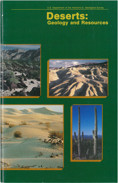
U. S. Department of the Interior / U. S. Geological Survey
by A. S. Walker
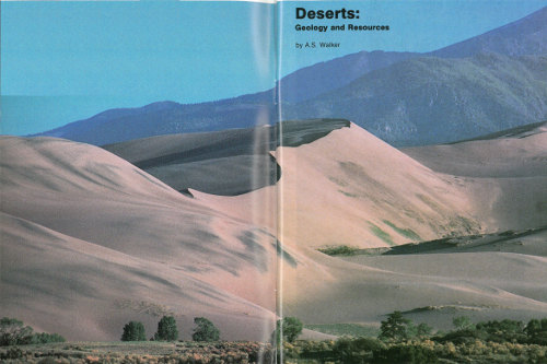
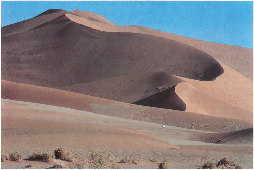
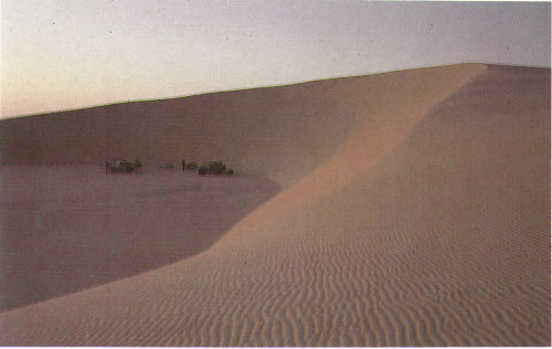
Great Sand Dunes National Monument, Colorado (photograph by John Keith).
Beauty is before me
And beauty behind me,
Above and below me hovers the beautiful,
I am surrounded by it,
I am immersed in it.
In my youth I am aware of it,
And in old age
I shall walk quietly
The beautiful trail.
from a Navajo benedictory chant describing the desert
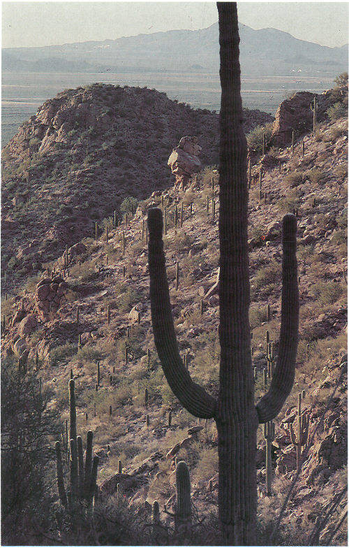
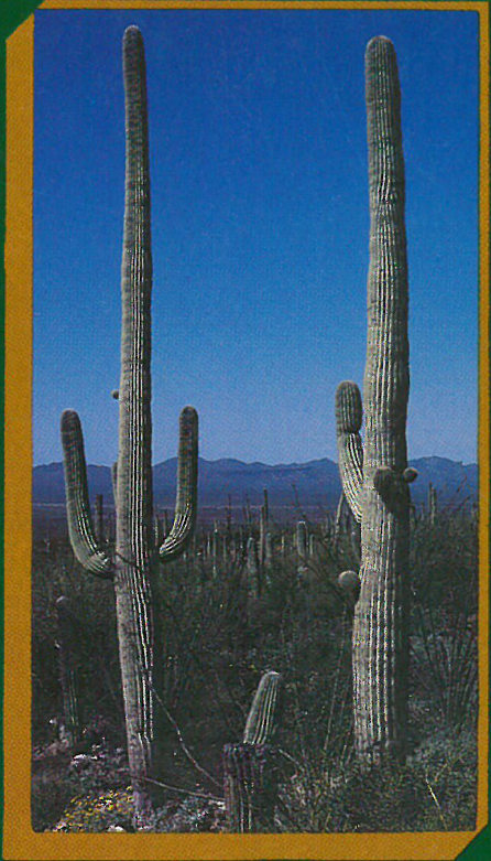
Cacti dominate the Sonoran Desert vegetation near Tucson, Arizona (photograph by Peter Kresan).
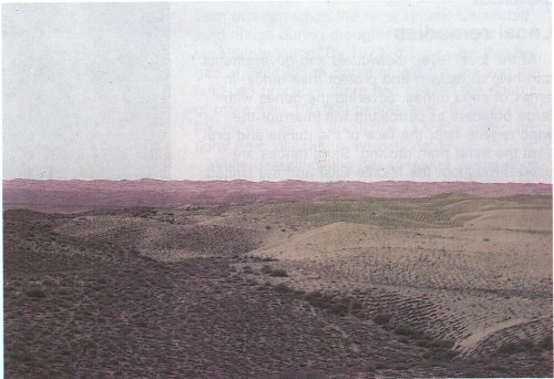
Approximately one-third of the Earth’s land surface is desert, arid land with meager rainfall that supports only sparse vegetation and a limited population of people and animals. Deserts—stark, sometimes mysterious worlds—have been portrayed as fascinating environments of adventure and exploration from narratives such as that of Lawrence of Arabia to movies such as “Dune.” These arid regions are called deserts because they are dry. They may be hot, they may be cold. They may be regions of sand or vast areas of rocks and gravel peppered with occasional plants. But deserts are always dry.
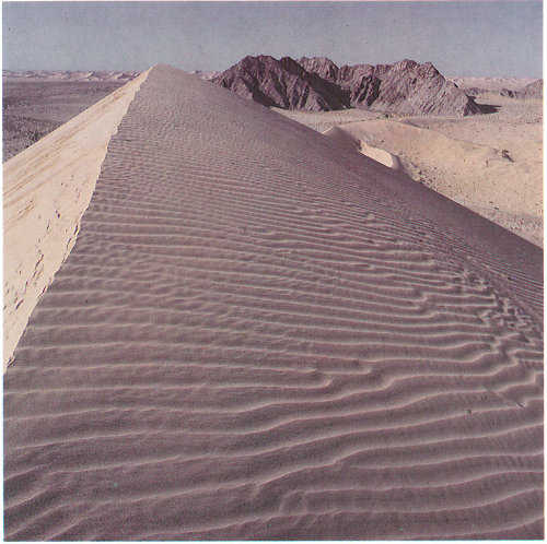
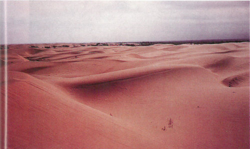
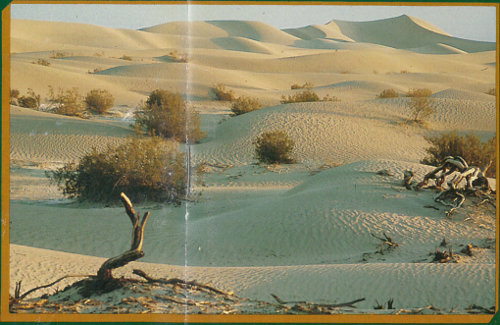
Ripples on a dune in the Gran Desierto, Mexico (photograph by Peter Kresan).
Deserts are natural laboratories in which to study the interactions of wind and sometimes water on the arid surfaces of planets. They contain valuable mineral deposits that were formed in the arid environment or that were exposed by erosion. Because deserts are dry, they are ideal places for human artifacts and fossils to be preserved. Deserts are also fragile environments. The misuse of these lands is a serious and growing problem in parts of our world.
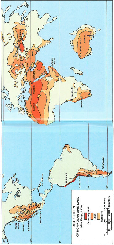
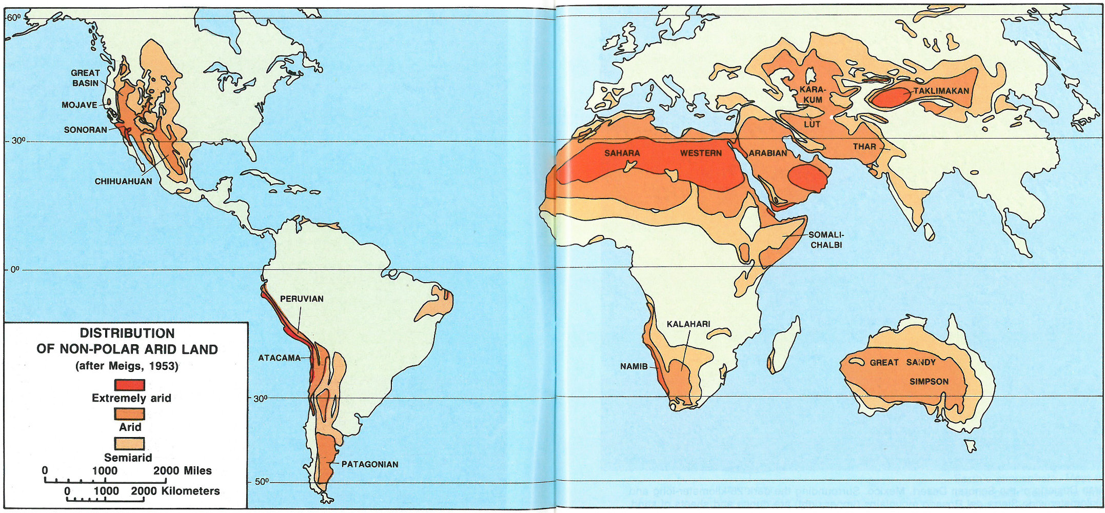
DISTRIBUTION OF NON-POLAR ARID LAND (after Meigs, 1953)
There are almost as many definitions of deserts and classification systems as there are deserts in the world. Most classifications rely on some combination 5 of the number of days of rainfall, the total amount of annual rainfall, temperature, humidity, or other factors. In 1953, Peveril Meigs divided desert regions on Earth into three categories according to the amount of precipitation they received. In this now widely accepted system, extremely arid lands have at least 12 consecutive months without rainfall, arid lands have less than 250 millimeters of annual rainfall, and semiarid lands have a mean annual precipitation of between 250 and 500 millimeters. Arid and extremely arid land are deserts, and semiarid grasslands generally are referred to as steppes.
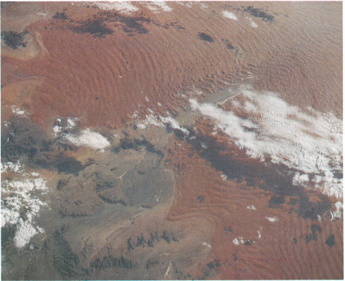
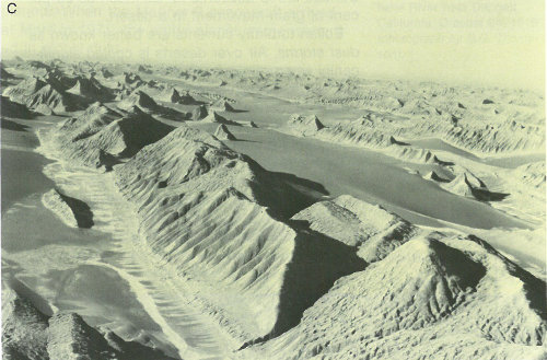
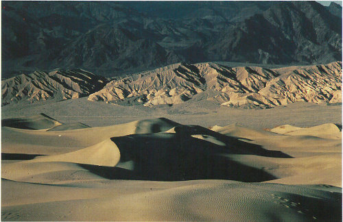
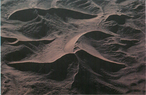
Gran Desierto of the Sonoran Desert, Mexico. Surrounding the dark 25-kilometer-long and 5-kilometer-wide Sierra del Rosario mountains (upper right) are dunes and sheets of sand.
We live at the bottom of a gaseous envelope—the atmosphere—that is bound gravitationally to the planet Earth. The circulation of our atmosphere is a complex process because of the Earth’s rotation and the tilt of its axis. The Earth’s axis is inclined 23½° from the ecliptic, the plane of the Earth’s orbit around the Sun. Due to this inclination, vertical rays of the Sun strike 23½° N. latitude, the Tropic of Cancer, at summer solstice in late June. At winter solstice, the vertical rays strike 23½° S. latitude, the Tropic of Capricorn. In the Northern Hemisphere, the summer solstice day has the most daylight hours, and the winter solstice has the fewest daylight hours each year. The tilt of the axis allows differential heating of the Earth’s surface, which causes seasonal changes in the global circulation.
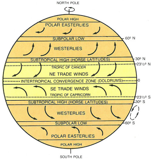
The circulation pattern of the Earth’s atmosphere. Most of the nonpolar deserts lie within the two trade winds belts.
On a planetary scale, the circulation of air between the hot Equator and the cold North and South Poles creates pressure belts that influence 8 weather. Air warmed by the Sun rises at the Equator, cools as it moves toward the poles, descends as cold air over the poles, and warms again as it moves over the surface of the Earth toward the Equator. This simple pattern of atmospheric convection, however, is complicated by the rotation of the Earth, which introduces the Coriolis Effect.
To appreciate the origin of this effect, consider the following. A stick placed vertically in the ground at the North Pole would simply turn around as the Earth rotates. A stick at the Equator would move in a large circle of almost 40,000 kilometers with the Earth as it rotates.
The Coriolis Effect illustrates Newton’s first law of motion—a body in motion will maintain its speed and direction of motion unless acted on by some outside force. Thus, a wind travelling north from the equator will maintain the velocity acquired at the equator while the Earth under it is moving slower. This effect accounts for the generally east-west direction of winds, or streams of air, on the Earth’s surface. Winds blow between areas of different atmospheric pressures.
The Coriolis Effect influences the circulation pattern of the Earth’s atmosphere. In the zone between about 30° N. and 30° S., the surface air flows toward the Equator and the flow aloft is poleward. A low-pressure area of calm, light variable winds near the equator is known to mariners as the doldrums.
Around 30° N. and S., the poleward flowing air begins to descend toward the surface in subtropical high-pressure belts. The sinking air is relatively dry because its moisture has already been released near the Equator above the tropical rain forests. Near the center of this high-pressure zone of descending air, called the “Horse Latitudes,” the winds at the surface are weak and variable. The name for this area is believed to have been given by colonial sailors, who, becalmed sometimes at these latitudes while crossing the oceans with horses as cargo, were forced to throw a few horses overboard to conserve water.
The surface air that flows from these subtropical high-pressure belts toward the Equator is deflected toward the west in both hemispheres by the Coriolis Effect. Because winds are named for the direction from which the wind is blowing, these winds are called the northeast trade winds in the Northern Hemisphere and the southeast trade winds in the Southern Hemisphere. The trade winds meet at the doldrums. Surface winds known as “westerlies” flow from the Horse Latitudes toward the poles. The “westerlies” meet “easterlies” from the polar highs at about 50-60° N. and S.
Near the ground, wind direction is affected by friction and by changes in topography. Winds may be seasonal, sporadic, or daily. They range from gentle breezes to violent gusts at speeds greater than 300 kilometers/hour.
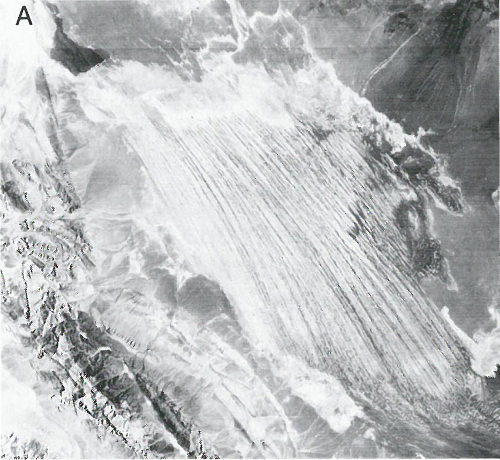
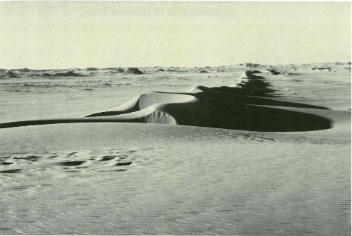
These dunes in the Algodones Sand Sea of southeastern California move as much as 5 meters per year. The dunes in this photograph, looking south, move toward the east (left) (photograph by Peter Kresan).
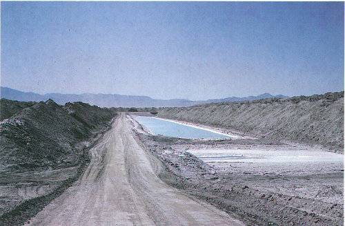
Searles Lake, California (photograph courtesy of Kerr-McGee, Inc.).
Dry areas created by global circulation patterns contain most of the deserts on the Earth. The deserts of our world are not restricted by latitude, longitude, or elevation. They occur from areas close to the poles down to areas near the Equator. The People’s Republic of China has both the highest desert, the Qaidam Depression that is 2,600 meters above sea level, and one of the lowest deserts, the Turpan Depression that is 150 meters below sea level.
Deserts are not confined to Earth. The atmospheric circulation patterns of other terrestrial planets with gaseous envelopes also depend on the rotation of those planets, the tilts of their axes, their distances from the Sun, and the composition and density of their atmospheres. Except for the poles, the entire surface of Mars is a desert. Venus also may support deserts.
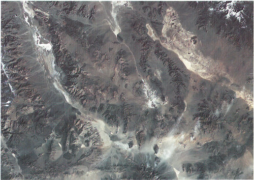
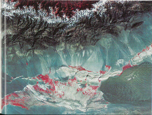
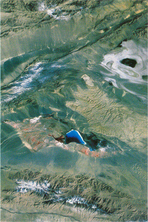
The Garlock fault, near the bottom of this Landsat image, is generally considered to be the geologic border between the Mojave Desert in the south and the Great Basin Desert in the north. The Great Basin contains more than 150 discrete desert basins separated by more than 160 mountain ranges.
Deserts are classified by their geographical location and dominant weather pattern as trade wind, midlatitude, rain shadow, coastal, monsoon, or polar deserts. Former desert areas presently in nonarid environments are paleodeserts, and extraterrestrial deserts exist on other planets.
The trade winds in two belts on the equatorial sides of the Horse Latitudes heat up as they move toward the Equator. These dry winds dissipate cloud cover, allowing more sunlight to heat the land. Most of the major deserts of the world lie in areas crossed by the trade winds. The world’s largest desert, the Sahara of North Africa, which has experienced temperatures as high as 57° C, is a trade wind desert.
Midlatitude deserts occur between 30° and 50° N. and S., poleward of the subtropical high-pressure zones. These deserts are in interior drainage basins far from oceans and have a wide range of annual temperatures. The Sonoran Desert of southwestern North America is a typical midlatitude desert.
Rain shadow deserts are formed because tall mountain ranges prevent moisture-rich clouds from reaching areas on the lee, or protected side, of the range. As air rises over the mountain, water is precipitated and the air loses its moisture content. A desert is formed in the leeside “shadow” of the range.
The Sahara of Africa is the world’s largest desert. It contains complex linear dunes that are separated by almost 6 kilometers (Skylab photograph).
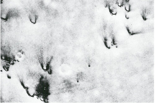
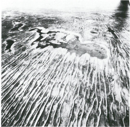
A rare rain in the Tengger, a midlatitude desert of China, exposes ripples and a small blowout on the left. Winds will shortly cover or remove these features.
This Landsat image shows the Turpan Depression in the rain shadow desert of the Tian Shan of China. A sand sea is in the lower center on the right, but desert pavement, gray in color, dominates this desert. The few oases in the desert and the vegetation in the mountains at the top are in red. A blanket of snow separates the vegetation in the Tian Shan from the rain shadow desert.
Coastal deserts generally are found on the western edges of continents near the Tropics of Cancer and Capricorn. They are affected by cold ocean currents that parallel the coast. Because local wind systems dominate the trade winds, these deserts are less stable than other deserts. Winter fogs, produced by upwelling cold currents, frequently blanket coastal deserts and block solar radiation. Coastal deserts are relatively complex because they are at the juncture of terrestrial, oceanic, and atmospheric systems. A coastal desert, the Atacama of South America, is the Earth’s driest desert. In the Atacama, measurable rainfall—1 millimeter or more of rain—may occur as infrequently as once every 5-20 years.
Crescent-shaped dunes are common in coastal deserts such as the Namib, Africa, with prevailing onshore winds. Low clouds cover parts of the Namib in this space shuttle photo.
High dunes of the Namib Desert near Sossus Vlei (photograph by Georg Gerster).
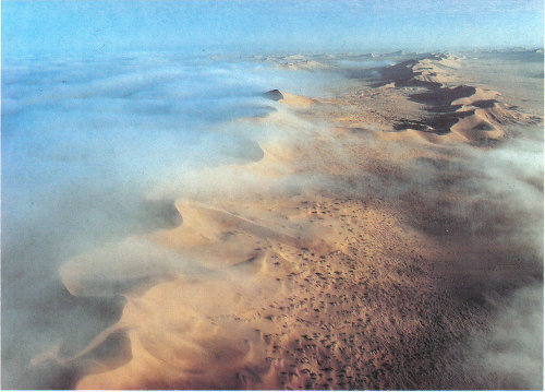
Morning fog moistens the dunes of the Namib coastal desert (photograph by Georg Gerster).
“Monsoon,” derived from an Arabic word for “season,” refers to a wind system with pronounced seasonal reversal. Monsoons develop in response to temperature variations between continents and oceans. The southeast trade winds of the Indian Ocean, for example, provide heavy summer rains in India as they move onshore. As the monsoon crosses India, it loses moisture on the eastern slopes of the Aravalli Range. The Rajasthan Desert of India and the Thar Desert of Pakistan are parts of a monsoon desert region west of the range.
The Indus River floodplain, lower left, is the western border of the Thar Desert. This Landsat image of the monsoon desert shows small patches of sand sheets in the upper right, with three types of dunes; some dunes are almost 3 kilometers long.
Polar deserts are areas with annual precipitation less than 250 millimeters and a mean temperature during the warmest month of less than 10° C. Polar deserts on the Earth cover nearly 5 million square kilometers and are mostly bedrock or gravel plains. Sand dunes are not prominent features in these deserts, but snow dunes occur commonly in areas where precipitation is locally more abundant.
Temperature changes in polar deserts frequently cross the freezing point of water. This “freeze-thaw” alternation forms patterned textures on the ground, as much as 5 meters in diameter.
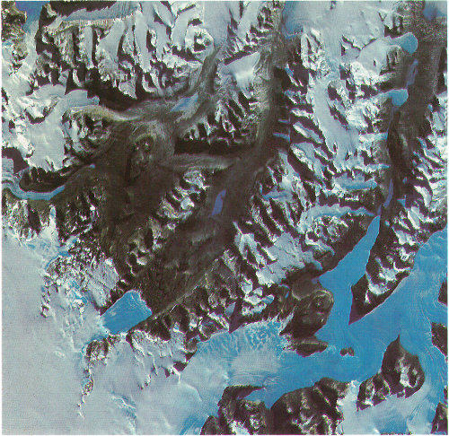
The Dry Valleys of Antarctica have been ice-free for thousands of years (courtesy of USGS Image Processing Facility, Flagstaff, Arizona).
This aerial photograph of the Nebraska Sand Hills paleodesert shows a well-preserved crescent-shaped dune (or barchan) about 60 to 75 meters high (photograph by Thomas S. Ahlbrandt).
Data on ancient sand seas (vast regions of sand dunes), changing lake basins, archaeology, and vegetation analyses indicate that climatic conditions have changed considerably over vast areas of the Earth in the recent geologic past. During the last 12,500 years, for example, parts of the deserts were more arid than they are today. About 10 percent of the land between 30° N. and 30° S. is covered now by sand seas. Nearly 18,000 years ago, sand seas in two vast belts occupied almost 50 percent of this land 19 area. As is the case today, tropical rain forests and savannahs were between the two belts.

A dry community of vegetation grows among the dunes of the Nebraska Sand Hills (photograph by N. H. Darton).
Fossil desert sediments that are as much as 500 million years old have been found in many parts of the world. Sand dune-like patterns have been recognized in presently nonarid environments. Many such relict dunes now receive from 80 to 150 millimeters of rain each year. Some ancient dunes are in areas now occupied by tropical rain forests.
The Nebraska Sand Hills is an inactive 57,000-square kilometer dune field in central Nebraska. The largest sand sea in the Western Hemisphere, it is now stabilized by vegetation and receives about 500 millimeters of rain each year. Dunes in the Sand Hills are up to 120 meters high.
Mars is the only other planet on which we have identified wind-shaped (eolian) features. Although its surface atmospheric pressure is only about one-hundredth that of Earth, global circulation patterns on Mars have formed a circumpolar sand sea of more than five million square kilometers, an area greater than the Empty Quarter of Saudi Arabia, the largest sand sea on our planet. Martian sand seas consist predominantly of crescent-shaped dunes on plains near the perennial ice cap of the north polar area. Smaller dune fields occupy the floors of many large craters in the polar regions.
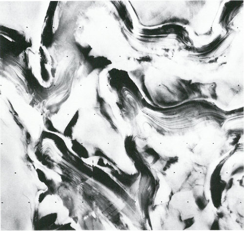
This Viking spacecraft image of Mars shows alternating layers of ice and windblown dust near the north polar cap. Annual and other periodic climatic changes due to orbit fluctuations may occur on Mars (courtesy of USGS Image Processing Facility, Flagstaff, Arizona).
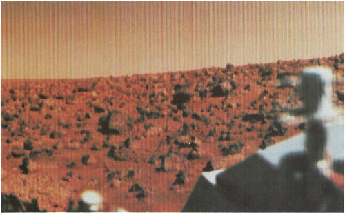
One of the first images taken at the Viking 2 landing site on Mars shows the pink sky over Utopia and the desert pavement on the ground (courtesy of NASA).
Some of the crescent-shaped dunes in this Viking image of Mars are more than a kilometer wide. The dark material that streaks from the horn-shaped features may be dust recently blown from the dunes (courtesy of NASA).
Natural Bridge, Arches National Monument, Utah (photograph by Peter Kresan).
Sand covers only about 20 percent of the Earth’s deserts. Most of the sand is in sand sheets and sand seas—vast regions of undulating dunes resembling ocean waves “frozen” in an instant of time.
Nearly 50 percent of desert surfaces are plains where eolian deflation—removal of fine-grained material by the wind—has exposed loose gravels consisting predominantly of pebbles but with occasional cobbles.
The remaining surfaces of arid lands are composed of exposed bedrock outcrops, desert soils, and fluvial deposits including alluvial fans, playas, desert lakes, and oases. Bedrock outcrops commonly occur as small mountains surrounded by extensive erosional plains.
Oases are vegetated areas moistened by springs, wells, or by irrigation. Many are artificial. Oases are often the only places in deserts that support crops and permanent habitation.
Underground channels carry water from nearby mountains into the Turpan Depression of China. If the channels were not covered, the water would evaporate quickly when it reached the hot, dry desert land.
Soils that form in arid climates are predominantly mineral soils with low organic content. The repeated accumulation of water in some soils causes distinct salt layers to form. Calcium carbonate precipitated from solution may cement sand and gravel into hard layers called “calcrete” that form layers up to 50 meters thick.
Caliche is a reddish-brown to white layer found in many desert soils. Caliche commonly occurs as nodules or as coatings on mineral grains formed by the complicated interaction between water and carbon dioxide released by plant roots or by decaying organic material.
Most desert plants are drought- or salt-tolerant. Some store water in their leaves, roots, and stems. Other desert plants have long tap roots that penetrate the water table, anchor the soil, and control erosion. The stems and leaves of some plants lower the surface velocity of sand-carrying winds and protect the ground from erosion.
Sparse, very dry, single species vegetation in Death Valley, California.
Vegetation amidst the desert pavement of the Sonoran Desert (photograph by John Olsen).
Deserts typically have a plant cover that is sparse but enormously diverse. The Sonoran Desert of the American Southwest has the most complex desert vegetation on Earth. The giant saguaro cacti provide nests for desert birds and serve as “trees” of the desert. Saguaro grow slowly but may live 200 years. When 9 years old, they are about 15 centimeters high. After about 75 years, the cacti are tall and develop their first branches. When fully grown, saguaro are 15 meters tall and weigh as much as 10 tons. They dot the Sonoran and reinforce the general impression of deserts as cacti-rich land.
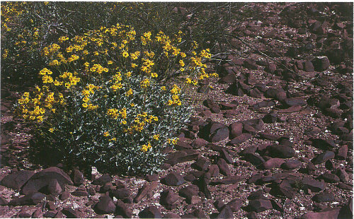
Although cacti are often thought of as characteristic desert plants, other types of plants have adapted well to the arid environment. They include the pea family and sunflower family. Cold deserts have grasses and shrubs as dominant vegetation.
Rain does fall occasionally in deserts, and desert storms are often violent. A record 44 millimeters of rain once fell within 3 hours in the Sahara. Large Saharan storms may deliver up to 1 millimeter per minute. Normally dry stream channels, called arroyos or wadis, can quickly fill after heavy rains, and flash floods make these channels dangerous. More people drown in deserts than die of thirst.
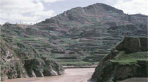
Though little rain falls in deserts, deserts receive runoff from ephemeral, or short-lived, streams fed by rain and snow from adjacent highlands. These streams fill the channel with a slurry of mud and commonly transport considerable quantities of sediment for a day or two. Although most deserts are in basins with closed, or interior drainage, a few deserts are crossed by ‘exotic’ rivers that derive their water from outside the desert. Such rivers infiltrate soils and evaporate large amounts of water on their journeys through the deserts, but their volumes are such that they maintain their continuity. The Nile, the Colorado, and the Yellow are exotic rivers that flow through deserts to deliver their sediments to the sea.
The Wei River in the Loess Plateau, China (photograph by I-Ming Chou).
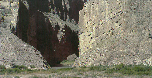
Running water created this canyon in arid Big Bend National Park, southwest Texas.
Lakes form where rainfall or meltwater in interior drainage basins is sufficient. Desert lakes are generally shallow, temporary, and salty. Because these lakes are shallow and have a low bottom gradient, wind stress may cause the lake waters to move over many square kilometers. When small lakes dry up, they leave a salt crust or hardpan. The flat area of clay, silt, or sand encrusted with salt that forms is known as a playa. There are more than a hundred playas in North American deserts. Most are relics of large lakes that existed during the last Ice Age about 12,000 years ago. Lake Bonneville was a 52,000-square-kilometer lake almost 300 meters deep in Utah, Nevada, and Idaho during the Ice Age. Today the remnants of Lake Bonneville include Utah’s Great Salt Lake, Utah Lake, and Sevier Lake. Because playas are arid land forms from a wetter past, they contain useful clues to climatic change.
The flat terrains of hardpans and playas make them excellent race tracks and natural runways for airplanes and spacecraft. Ground-vehicle speed records are commonly established on Bonneville Speedway, a race track on the Great Salt Lake hardpan. Space shuttles land on Rogers Lake Playa at Edwards Air Force Base, California.
The Qaidam Depression in China is the highest desert in the world. This Landsat image illustrates a salt lake and evaporite basins in the depression.
Eolian processes pertain to the activity of the winds. Winds may erode, transport, and deposit materials, and are effective agents in regions with sparse vegetation and a large supply of unconsolidated sediments. Although water is much more powerful than wind, eolian processes are important in arid environments.
Wind erodes the Earth’s surface by deflation, the removal of loose, fine-grained particles by the turbulent eddy action of the wind, and by abrasion, the wearing down of surfaces by the grinding action and sand blasting of windborne particles.
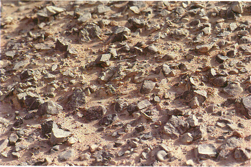
Most eolian deflation zones are composed of desert pavement, a sheetlike surface of rock fragments that remains after wind and water have removed the fine particles. Almost half of the Earth’s desert surfaces are stony deflation zones. The rock mantle in desert pavements protects the underlying material from deflation.
The sand and rock of China’s Turpan Depression resemble closely those in the view of the Martian surface on page 21.
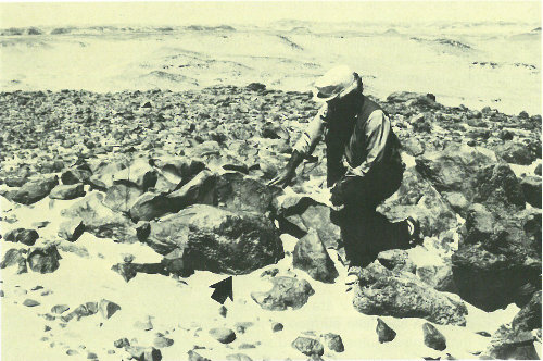
The arrow points to shiny black desert varnish on these rocks of Egypt’s southwest desert (photograph by Carol Breed).
A dark, shiny stain, called desert varnish or rock varnish, is often found on surfaces of some desert rocks that have been exposed at the surface for a long period of time. Manganese, iron oxides, hydroxides, and clay minerals form most varnishes and provide the shine.
Deflation basins, called blowouts, are hollows formed by the removal of particles by wind. Blowouts are generally small, but may be up to several kilometers in diameter.
Wind-driven grains abrade landforms. Grinding by particles carried in the wind creates grooves or small depressions. Ventifacts are rocks which have been cut, and sometimes polished, by the abrasive action of wind.
Sculpted landforms, called yardangs, are up to tens of meters high and kilometers long and are forms that have been streamlined by desert winds. The famous sphinx at Giza in Egypt may be a modified yardang.
Yardangs of the Lut Desert of Iran. These yardangs are among the largest on Earth, with almost 100 meters of relief.
View from Landsat.
View from high-altitude photograph (photograph by U.S. Air Force).
View from low-altitude photograph (photograph by J.T. Daniels).
Particles are transported by winds through suspension, saltation, and creep.
Small particles may be held in the atmosphere in suspension. Upward currents of air support the weight of suspended particles and hold them indefinitely in the surrounding air. Typical winds near the Earth’s surface suspend particles less than 0.2 millimeters in diameter and scatter them aloft as dust or haze.
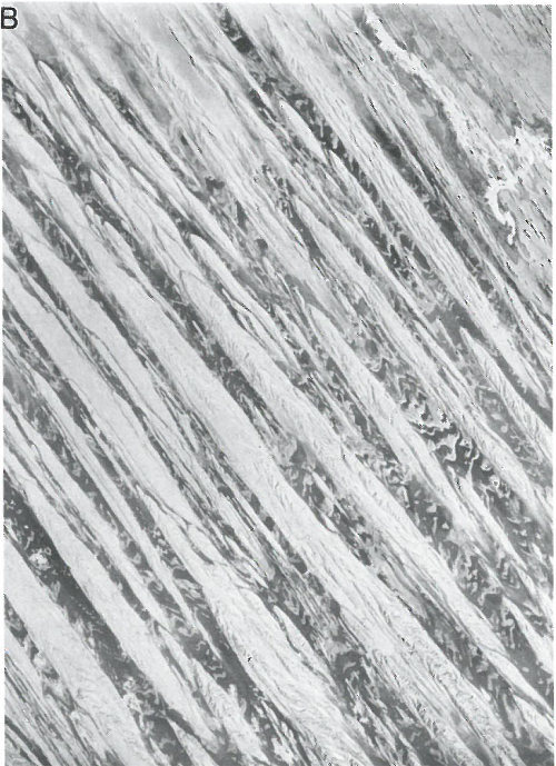
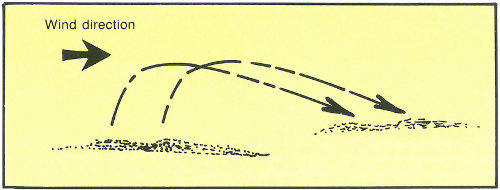
Saltation is downwind movement of particles in a series of jumps or skips. Saltation normally lifts sand-size particles no more than one centimeter above the ground, and proceeds at one-half to one-third the speed of the wind. A saltating grain may hit other grains that jump up to continue the saltation. The grain may also hit larger grains that are too heavy to hop, but that slowly creep forward as they are pushed by saltating grains. Surface creep accounts for as much as 25 percent of grain movement in a desert.
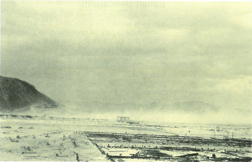
Eolian turbidity currents are better known as dust storms. Air over deserts is cooled significantly when rain passes through it. This cooler and denser air sinks toward the desert surface. When it reaches the ground, the air is deflected forward and sweeps up surface debris in its turbulence as a dust storm.
Saltation moves small particles in the direction of the wind in a series of short hops or skips.
Crops, people, villages, and possibly even climates are affected by dust storms. Some dust storms are intercontinental, a few may circle the 33 globe, and occasionally they may engulf entire planets. When the Mariner 9 spacecraft arrived at Mars in 1971, the entire planet was enshrouded in global dust.
Dust storm along the Mohave River near Daggett, California, October 24, 1919 (photograph by D. G. Thompson).
Most of the dust carried by dust storms is in the form of silt-size particles. Deposits of this windblown silt are known as loess. The thickest known deposit of loess, 335 meters, is on the Loess Plateau in China. In Europe and in the Americas, accumulations of loess are generally from 20 to 30 meters thick.
Small whirlwinds, called dust devils, are common in arid lands and are thought to be related to very intense local heating of the air that results in instabilities of the air mass. Dust devils may be as much as one kilometer high.
Wind-deposited materials hold clues to past as well as to present wind directions and intensities. These features help us understand the present climate and the forces that molded it. Wind-deposited sand bodies occur as sand sheets, ripples, and dunes.
Sand sheets are flat, gently undulating sandy plots of sand surfaced by grains that may be too large for saltation. They form approximately 40 percent of eolian depositional surfaces. The Selima Sand Sheet, which occupies 60,000 square kilometers in southern Egypt and northern Sudan, is one of the Earth’s largest sand sheets. The Selima is absolutely flat in some places; in others, active dunes move over its surface.
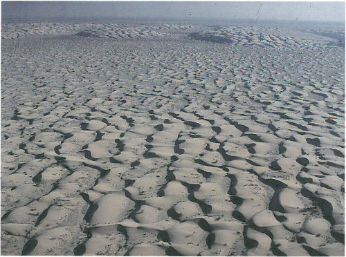
Wind blowing on a sand surface ripples the surface into crests and troughs whose long axes are perpendicular to the wind direction. The average length of jumps during saltation corresponds to the wavelength, or distance between adjacent crests, of the ripples. In ripples, the coarsest materials collect at the crests. This distinguishes small ripples from dunes, where the coarsest materials are generally in the troughs.
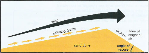
Wind-blown sand moves up the gentle upwind side of the dune by saltation or creep. Sand accumulates at the brink, the top of the slipface. When the buildup of sand at the brink exceeds the angle of repose, a small avalanche of grains slides down the slipface. Grain by grain, the dune moves downwind.
Accumulations of sediment blown by the wind into a mound or ridge, dunes have gentle upwind slopes on the wind-facing side. The downwind portion of the dune, the lee slope, is commonly a 35 steep avalanche slope referred to as a slipface. Dunes may have more than one slipface. The minimum height of a slipface is about 30 centimeters.
Sand grains move up the dune’s gentle upwind slope by saltation and creep. When particles at the brink of the dune exceed the angle of repose, they spill over in a tiny landslide or avalanche that reforms the slipface. As the avalanching continues, the dune moves in the direction of the wind.
Some of the most significant experimental measurements on eolian sand movement were performed by Ralph Bagnold, a British engineer who worked in Egypt prior to World War II. Bagnold investigated the physics of particles moving through the atmosphere and deposited by wind. He recognized two basic dune types, the crescentic dune, which he called “barchan,” and the linear dune, which he called longitudinal or “sief” (Arabic for “sword”).
Sand dunes in Death Valley, California (photograph by Richard Frear).
Ripples on a dune in Eureka Valley, California (photograph by Terrence Moore).
A worldwide inventory of deserts has been developed using images from the Landsat satellites and from space and aerial photography. It defines five basic types of dunes: crescentic, linear, star, dome, and parabolic.
These crescentic dunes of coastal Peru are migrating toward the left (photograph by John McCauley).
The most common dune form on Earth and on Mars is the crescentic. Crescent-shaped mounds generally are wider than long. The slipface is on the dune’s concave side. These dunes form under winds that blow from one direction, and they also are known as barchans, or transverse dunes. Some types of crescentic dunes move faster over desert surfaces than any other type of dune. A group of dunes moved more than 100 meters per year between 1954 and 1959 in 38 China’s Ningxia Province; similar rates have been recorded in the Western Desert of Egypt. The largest crescentic dunes on Earth, with mean crest-to-crest widths of more than 3 kilometers, are in China’s Taklimakan Desert.
Straight or slightly sinuous sand ridges typically much longer than they are wide are known as linear dunes. They may be more than 160 kilometers long. Linear dunes may occur as isolated ridges, but they generally form sets of parallel ridges separated by miles of sand, gravel, or rocky interdune corridors. Some linear dunes merge to form Y-shaped compound dunes. Many form in bidirectional wind regimes. The long axes of these dunes extend in the resultant direction of sand movement.
Star dunes, such as these of the Namib, indicate the winds that formed them blew from many directions (photograph by Georg Gerster).
Radially symmetrical, star dunes are pyramidal sand mounds with slipfaces on three or more arms that radiate from the high center of the mound. They tend to accumulate in areas with multidirectional wind regimes. Star dunes grow upward rather than laterally. They dominate the Grand Erg Oriental of the Sahara. In other deserts, they occur around the margins of the sand seas, particularly near topographic barriers. In the southeast Badain Jaran Desert of China, the star dunes are up to 500 meters tall and may be the tallest dunes on Earth.
Linear dunes advance on small playas east of Lake Eyre in the Simpson Desert of central Australia (photograph by C. Twidale).
Linear dunes in the Western Desert of Egypt (photograph by Carol Breed).
Oval or circular mounds that generally lack a slipface, dome dunes are rare and occur at the far upwind margins of sand seas.
U-shaped mounds of sand with convex noses trailed by elongated arms are parabolic dunes. Sometimes these dunes are called U-shaped, blowout, or hairpin dunes, and they are well known in coastal deserts. Unlike crescentic dunes, their crests point upwind. The elongated arms of parabolic dunes follow rather than lead because they have been fixed by vegetation, while the bulk of the sand in the dune migrates forward. The longest known parabolic dune has a trailing arm 12 kilometers long.
Small crescentic dunes occur on the crests of these complex dome dunes of Saudi Arabia’s Empty Quarter (photograph by Elwood Friesen).
Ripples and horns of this crescentic dune in Egypt indicate that the dune is moving right to left (photograph by John Olsen).
Occurring wherever winds periodically reverse direction, reversing dunes are varieties of any of the above types. These dunes typically have major and minor slipfaces oriented in opposite directions.
All these dune types may occur in three forms: simple, compound, and complex. Simple dunes are basic forms with a minimum number of slipfaces that define the geometric type. Compound dunes are large dunes on which smaller dunes of similar type and slipface orientation are superimposed, and complex dunes are combinations of two or more dune types. A crescentic dune with a star dune superimposed on its crest is the most common complex dune. Simple dunes represent a wind regime that has not changed in intensity or direction since the formation of the dune, while compound and complex dunes suggest that the intensity and direction of the wind has changed.
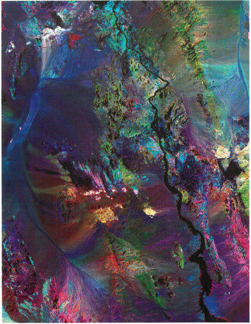
The northern Mojave Desert. The Landsat Thematic Mapper (TM) acquires data in seven bands of the electromagnetic spectrum. On this image, white and yellow colors indicate rocks rich in clay minerals and limonite in rocks of red and yellow hues. The large concentrations of limonite and clays may indicate mineral deposits exposed at the surface or buried up to several thousand feet below it (photograph courtesy of Melvin Podwysocki).
The world’s deserts are generally remote, inaccessible, and inhospitable. Hidden among them, however, are hydrocarbon reservoirs, evaporites, and other mineral deposits, as well as human artifacts preserved for centuries by the arid climate. In these harsh environments, the information and perspective required to increase our understanding of arid-land geology and resources often depends on remote-sensing methods. Remote sensing is the collection of information about an object without being in direct physical contact with it.
Remote-sensing instruments in Earth-orbit satellites measure radar, visible light, and infrared radiation. Radar imaging systems provide their own source of electromagnetic energy, so they can operate at any time of day or night. Additionally, clouds and all but the most severe storms are transparent to radar.
The first Shuttle Imaging Radar System (SIR-A), flown on the U.S. space shuttle Columbia in 1981, recorded images that show buried fluvial topography, faults, and intrusive bodies otherwise concealed beneath sand sheets and dunes of the Western Desert in Egypt and the Sudan. Most of these features are not visible from the ground. The radar signal penetrated loose dry sands and returned images of buried river channels not visible at the surface. These images helped find new archeologic sites and sources of potable water in the desert. These “radar rivers” are the remnants of a now vanished major river system that flowed across Africa some 20 million years before the development of the Nile River system. Radar imagery also is a powerful tool for exploring for placer mineral deposits in arid lands.
In 1972, the United States launched the first of a group of unmanned satellites collectively known as Landsat. Landsat satellites carry sensors that record “light,” or portions of the electromagnetic spectrum, as it reflects off the Earth. Landsat acquires digital data that are converted into an image.
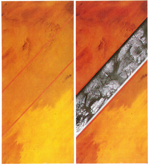
The Landsat simulated true color mosaic (left) shows the Selima Sand Sheet covering all but rocky areas of the Sahara Desert in Sudan. On the right, a 50-kilometer-wide strip of Shuttle Imaging Radar, SIR-A, is placed over the Landsat mosaic to reveal old stream channels and geologic structures like these. Structures that are otherwise invisible under the surface sands are potential sources of water, placer minerals, ancient artifacts, and information on changes of climate in arid areas (courtesy of USGS Image Processing Facility, Flagstaff).
The scarcity of vegetation makes spectral remote sensing especially effective in arid lands. Rocks containing limonite, a hydrous iron oxide, may be identified readily from Landsat Multispectral Scanner data. The Landsat Thematic Mapper (TM) has increased our ability to detect and map the distribution of minerals in volcanic rocks and related mineral deposits in arid and semiarid lands.
More than a million images of Earth have been acquired by the Landsat satellites. A Landsat image may be viewed as a single band in black-and-white, or as a combination represented by three colors, called a color composite. The most widely used Landsat color image is called a false-color composite because it reproduces the infrared band (invisible to the naked eye) as red, the red band as green, and the green band as blue. Healthy vegetation in a false-color composite is red.
Desert studies still are hampered in many regions by lack of accurate climate data. Most desert weather stations are in oases surrounded by trees and buildings and have been subjected to many location and elevation changes throughout the life of the station. Data from oases do not reflect conditions from the surrounding desert. A wide variety of instruments has been used to record measurements over varying lengths of time and in different formats, making data difficult to interpret and compare.
To overcome some of these problems in deserts of the American Southwest, the U.S. Geological Survey (USGS) established its Desert Winds Project to measure in a standard format several key meteorologic characteristics of arid lands. Project scientists have successfully established instrument stations to measure wind-speed, including peak gusts, which alter the landforms the most. A station recorded a windstorm near Vicksburg, Arizona, for example, with peak gusts of almost 150 kilometers per hour. Using low-maintenance, automatic, solar-powered sensors, the stations also measure wind direction, precipitation, humidity, soil and air temperatures, and barometric pressure at specific heights above the surface. Data are sampled at 6-minute intervals and transmitted every 30 minutes to a Geostationary Operational Environmental Satellite (GOES). From GOES, the data are transmitted to the USGS laboratory in Flagstaff, Arizona.
The Desert Winds Project’s investigators combine analyses of data with detailed geologic field studies and repetitive remote-sensing coverage in order to investigate and understand the long-term changes produced by wind in deserts of differing geologic and climatic types.
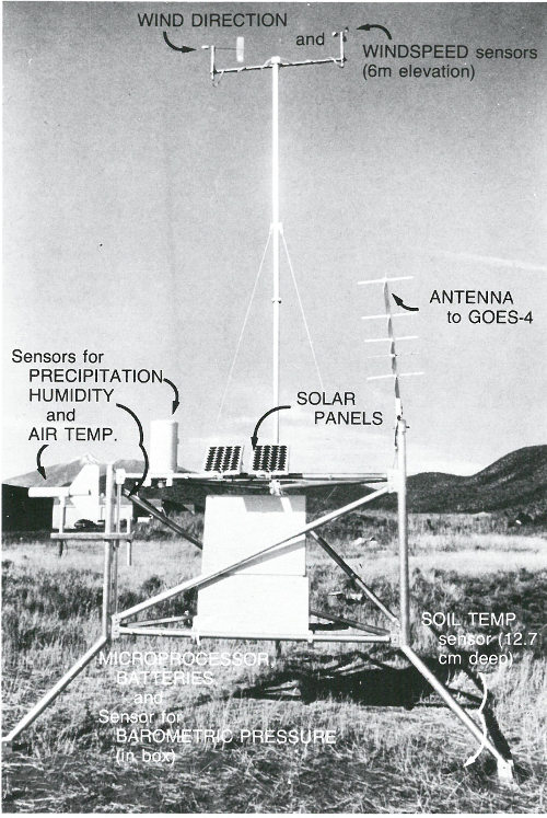
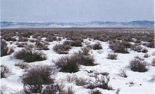
This geometeorologic station of the Desert Winds Project measures wind speed and direction, soil and air temperature, and precipitation and humidity in the Great Basin Desert (photograph by Carol Breed).
Nitrate workings in a broad valley in the Atacama Desert of northern Chile, where saline-cemented surficial deposits formed near a playa lake (photograph by George Ericksen).
Some mineral deposits are formed, improved, or preserved by geologic processes that occur in arid lands as a consequence of climate. Ground water leaches ore minerals and redeposits them in zones near the water table. This leaching process concentrates these minerals as ore that can be mined. Of the 15 major types of mineral deposits in the Western Hemisphere formed by action of ground water, 13 occur in deserts.
Evaporation in arid lands enriches mineral accumulation in their lakes. Playas may be sources of mineral deposits formed by evaporation. Water evaporating in closed basins precipitates minerals such as gypsum, salts (including sodium nitrate and sodium chloride), and borates. The minerals formed in these evaporite deposits depend on the composition and temperature of the saline waters at the time of deposition.
Significant evaporite resources occur in the Great Basin Desert of the United States, mineral deposits made forever famous by the “20-mule teams” that once hauled borax-laden wagons from Death Valley to the railroad. Boron, from borax and borate evaporites, is an essential ingredient in the manufacture of glass, ceramics, enamel, agricultural chemicals, water softeners, and pharmaceuticals. Borates are mined from evaporite deposits at Searles Lake, California, and other desert locations. The total value of chemicals that have been produced from Searles Lake substantially exceeds $1 billion.
The Atacama Desert of South America is unique among the deserts of the world in its great abundance of saline minerals. Sodium nitrate has been mined for explosives and fertilizer in the Atacama since the middle of the 19th century. Nearly 3 million metric tons were mined during World War I.
Valuable minerals located in arid lands include copper in the United States, Chile, Peru, and Iran; iron and lead-zinc ore in Australia; chromite in Turkey; and gold, silver, and uranium deposits 50 in Australia and the United States. Nonmetallic mineral resources and rocks such as beryllium, mica, lithium, clays, pumice, and scoria also occur in arid regions. Sodium carbonate, sulfate, borate, nitrate, lithium, bromine, iodine, calcium, and strontium compounds come from sediments and nearsurface brines formed by evaporation of inland bodies of water, often during geologically recent times.
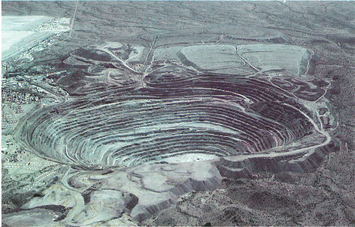
This open-pit mine in the Sonoran Desert near Ajo, Arizona, has exposed an elliptical copper deposit about 1,000 meters long and 750 meters wide. The copper ore mined here is in a bed that averages 150 meters in thickness (photograph by Peter Kresan).
The Green River Formation of Colorado, Wyoming, and Utah contains alluvial fan deposits and playa evaporites created in a huge lake whose 51 level fluctuated for millions of years. Economically significant deposits of trona, a major source of sodium compounds, and thick layers of oil shale were created in the arid environment.
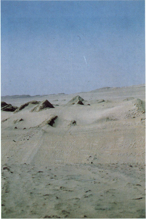
Trona mine at Searles Lake, California (photograph by John Keith).
Some of the more productive petroleum areas on Earth are found in arid and semiarid regions of Africa and the Mideast, although the oil reservoirs were originally formed in shallow marine environments. Recent climate change has placed these reservoirs in an arid environment.
Other oil reservoirs, however, are presumed to be eolian in origin and are presently found in humid environments. The Rotliegendes, a hydrocarbon reservoir in the North Sea, is associated with extensive evaporite deposits. Many of the major U.S. hydrocarbon resources may come from eolian sands. Ancient alluvial fan sequences may also be hydrocarbon reservoirs.

The Sahelian drought that began in 1968 was responsible for the deaths of between 100,000 and 250,000 people, the disruption of millions of lives, and the collapse of the agricultural bases of five countries (photograph by Daniel Stiles, UNEP).
The world’s great deserts were formed by natural processes interacting over long intervals of time. During most of these times, deserts have grown and shrunk independent of human activities. Paleodeserts, large sand seas now inactive because they are stabilized by vegetation, extend well beyond the present margins of core deserts, such as the Sahara. In some regions, deserts are separated sharply from surrounding, less arid areas by mountains and other contrasting landforms that reflect basic structural differences in the regional geology. In other areas, desert fringes form a gradual transition from a dry to a more humid environment, making it more difficult to define the desert border.
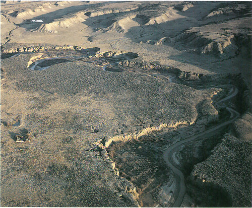
Overgrazing has made the Rio Puerco Basin of central New Mexico one of the most eroded river basins of the American West and has increased the high sediment content of the river (photograph by Terrence Moore).
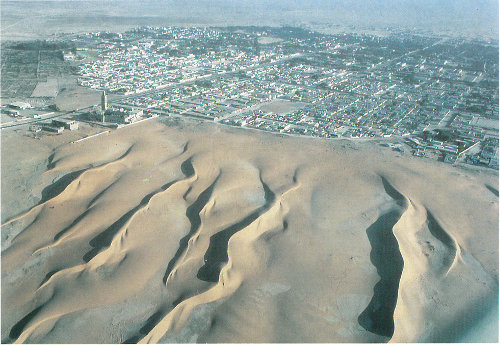
Linear dunes of the Sahara Desert encroach on Nouakchott, the capital of Mauritania. The dunes border a mosque at left (photograph by Georg Gerster).
These transition zones have very fragile, delicately balanced ecosystems. Desert fringes often are a mosaic of microclimates. Small hollows support vegetation that picks up heat from the hot winds and protects the land from the prevailing winds. After rainfall the vegetated areas are distinctly cooler than the surroundings. In these marginal areas, human activity may stress the ecosystem beyond its tolerance limit, resulting in degradation of the land. By pounding the soil with their hooves, livestock compact the substrate, increase the proportion of fine material, and reduce the percolation rate of the soil, thus encouraging erosion by wind and water. Grazing and the collection of firewood reduces or eliminates plants that help to bind the soil.
This degradation of formerly productive land—desertification—is a complex process. It involves multiple causes, and it proceeds at varying rates in different climates. Desertification may intensify a general climatic trend toward greater aridity, or it may initiate a change in local climate.
Desertification does not occur in linear, easily mappable patterns. Deserts advance erratically, forming patches on their borders. Areas far from natural deserts can degrade quickly to barren soil, rock, or sand through poor land management. The presence of a nearby desert has no direct relationship to desertification. Unfortunately, an area undergoing desertification is brought to public attention only after the process is well underway. Often little or no data are available to indicate the previous state of the ecosystem or the rate of degradation. Scientists still question whether desertification, as a process of global change, is permanent or how and when it can be halted or reversed.
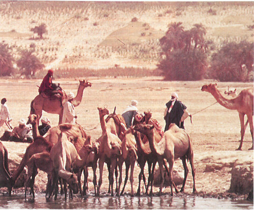
Camels and other animals trample the soil in the semiarid Sahel of Africa as they move to water holes such as this one in Chad (photograph courtesy of the U.S. Agency for International Development).
Desertification became well known in the 1930’s, when parts of the Great Plains in the United States turned into the “Dust Bowl” as a result of drought and poor practices in farming, although the term itself was not used until almost 1950. During the dust bowl period, millions of people were forced to abandon their farms and livelihoods. Greatly improved methods of agriculture and land and water management in the Great Plains have prevented that disaster from recurring, but desertification presently affects millions of people in almost every continent.
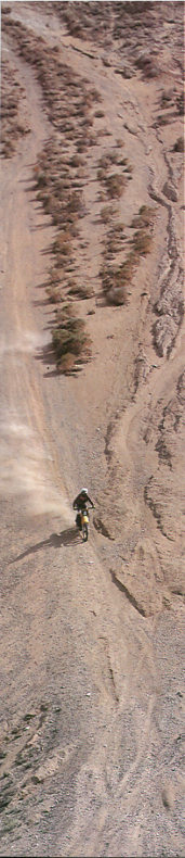
Off-road vehicles significantly increase soil loss in the delicate desert environment of the western United States. In a few seconds, soils that took hundreds of years to develop can be destroyed (photograph by Terrence Moore).
Increased population and livestock pressure on marginal lands has accelerated desertification. In some areas, nomads moving to less arid areas disrupt the local ecosystem and increase the rate of erosion of the land. Nomads are trying to escape the desert, but because of their land-use practices, they are bringing the desert with them.
It is a misconception that droughts cause desertification. Droughts are common in arid and semiarid lands. Well-managed lands can recover from drought when the rains return. Continued land abuse during droughts, however, increases land degradation. By 1973, the drought that began in 1968 in the Sahel of West Africa and the land-use practices there had caused the deaths of more than 100,000 people and 12 million cattle, as well as the disruption of social organizations from villages to the national level.
While desertification has received tremendous publicity by the political and news media, there are still many things that we don’t know about the degradation of productive lands and the expansion of deserts. In 1988 Ridley Nelson pointed out in an important scientific paper that 57 the desertification problem and processes are not clearly defined. There is no consensus among researchers as to the specific causes, extent, or degree of desertification. Contrary to many popular reports, desertification is actually a subtle and complex process of deterioration that may often be reversible.

Goat seeks food in the sparsely vegetated Sahel of Africa (photograph courtesy of the U.S. Agency for International Development).
In the last 25 years, satellites have begun to provide the global monitoring necessary for improving our understanding of desertification. Landsat images of the same area, taken several years apart but during the same point in the growing season, may indicate changes in the susceptibility of land to desertification. Studies using Landsat data help demonstrate the impact of people and animals on the Earth. However, other types of remote-sensing systems, land-monitoring networks, and global data bases of field observations are needed before the process and problems of desertification will be completely understood.
At the local level, individuals and governments can help to reclaim and protect their lands. In areas of sand dunes, covering the dunes with large boulders or petroleum will interrupt the wind regime near the face of the dunes and prevent the sand from moving. Sand fences are used throughout the Middle East and the United States, in the same way snow fences are used in the north. Placement of straw grids, each up to a square meter in area, will also decrease the surface wind velocity. Shrubs and trees planted within the grids are protected by the straw until 58 they take root. In areas where some water is available for irrigation, shrubs planted on the lower one-third of a dune’s windward side will stabilize the dune. This vegetation decreases the wind velocity near the base of the dune and prevents much of the sand from moving. Higher velocity winds at the top of the dune level it off and trees can be planted atop these flattened surfaces.
Straw grids (one of which is shown above) and vegetation irrigated by water from the Yellow River stabilize dunes in this part of China’s Tengger Desert (shown below) and protect a nearby railroad from windblown sand.
Tengger Desert
Oases and farmlands in windy regions can be protected by planting tree fences or grass belts. Sand that manages to pass through the grass belts can be caught in strips of trees planted as wind breaks 50 to 100 meters apart adjacent to the belts. Small plots of trees may also be scattered inside oases to stabilize the area. On a much larger scale, a “Green Wall,” which will eventually stretch more than 5,700 kilometers in length, much longer than the famous Great Wall, is being planted in northeastern China to protect “sandy lands”—deserts believed to have been created by human activity.
More efficient use of existing water resources and control of salinization are other effective tools for improving arid lands. New ways are being sought to use surface-water resources such as rain water harvesting or irrigating with seasonal runoff from adjacent highlands. New ways are also being sought to find and tap groundwater resources and to develop more effective ways of irrigating arid and semiarid lands. Research on the reclamation of deserts also is focusing on discovering proper crop rotation to protect the fragile soil, on understanding how sand-fixing plants can be adapted to local environments, and on how grazing lands and water resources can be developed effectively without being overused.
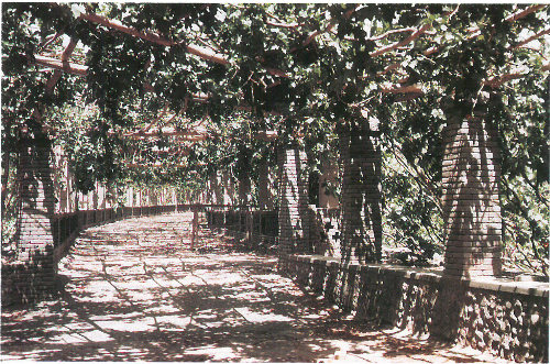
From wasteland to vineyard. Ground water and underground channels help this vineyard flourish on land reclaimed from desert pavement in China’s Turpan Depression.
If we are to stop and reverse the degradation of arid and semiarid lands, we must understand how and why the rates of climate change, population growth, and food production adversely affect these environments. The most effective intervention can come only from the wise use of the best earth-science information available.
Bagnold, R. A., 1941, The physics of blown sand and desert dunes: Methuen, London, 265 p. (A classic treatise concerning the origin and evolution of dunes.)
Breed, C. S., and others, 1979, Regional studies of sand seas, using Landsat (ERTS) imagery: in McKee, E. D., ed., A study of global sand seas: U.S. Geological Survey Professional Paper 1052, p. 305-397. (A study of selected sand seas based on analysis of remote sensing images, surface wind summaries, and available literature.)
Cook, R. U., and Warren, Andrew, 1973, Geomorphology in deserts: University of California Press, Berkeley, California, 374 p. (Examines the nature of landforms, soils, and geomorphological processes in the world’s deserts.)
Eigeland, Tor, and others, 1982, The desert realm: National Geographic Society, Washington, 304 p. (A well illustrated discussion of deserts of America, Africa, Asia, and Australia.)
Ericksen, G. E., 1983, The Chilean nitrate deposits: American Scientist, v. 71, p. 366-374. (A discussion of the origin of the Chilean nitrate deposits which has puzzled scientists for more than 100 years.)
Gerster, Georg, 1960, Sahara-desert of destiny: Coward-McCann, New York, 302 p. (How plants, animals, and people survive in the Sahara.)
Greeley, Ronald, and Iversen, J. D., 1985, Wind as a geological process on Earth, Mars, Venus and Titan: Cambridge University Press, New York, 333 p. (Expands the classic work of Bagnold to discuss eolian processes in a planetary context. Describes the processes on all moons and terrestrial planets with atmospheres.)
Hare, F. K., 1983, Climate on the desert fringe: in Gardner, Ritz, and Scoging, Helen, eds., Mega-geomorphology: Clarendon Press, Oxford, p. 134-151. (The margins of many deserts are affected by tension between society and environment. This paper summarizes the climatology of arid zones.)
MacMahon, James A., 1985, Deserts: Alfred A. Knopf, Inc., New York, 640 p. (An Audubon Society Nature Guide to the deserts of the United States, and their inhabitants.)
McCauley, J. F., and others, 1984, Remote monitoring of processes that shape desert surfaces: The Desert Winds Project: U.S. Geological Survey Bulletin 1634, 19 p. (Describes a new study on collecting weather data from solar-powered data-collection platforms in deserts. The data are relayed by a GOES satellite to the USGS in Flagstaff, Arizona, and converted to graphic form.)
Meigs, Peveril, 1953, World distribution of arid and semi-arid homoclimates: in Reviews of research on arid zone hydrology: Paris, United Nations Educational, Scientific, and Cultural Organization, Arid Zone Programme-1, p. 203-209. (Classifies arid lands according to precipitation.)
Nelson, R., 1988, Dryland management: the desertification problem: Environmental Department Working Paper No. 8, Washington: World Bank, 42 p. (An excellent review of the present state of knowledge concerning desertification.)
Tolba, M. K., 1984, Desertification is stoppable: Arid Lands Newsletter No. 21, p. 2-9. (A discussion of the problems involved in preventing desertification and reclaiming arid lands.)
Walker, A.S., 1986, Eolian geomorphology: in Short, N.M., and Blair, R.W., eds., Geomorphology from space: a global overview of regional landforms: NASA SP-486, p. 447-520 (a brief review of desert processes).
Warren, A. and Agnew, C., 1988, An assessment of desertification and land degradation in arid and semi-arid areas: International Institute for Environment and Development, Drylands Programme, Paper 2, London: IIED, 103 p. (An evaluation of land degradation problems.)
The metric units used in this publication can be converted to English units by using the approximate conversions given below:
Landsat image shows complex linear and crescentic dunes in the northeastern Taklimakan Desert of China.
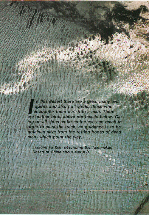
In this desert there are a great many evil spirits and also hot winds; those who encounter them perish to a man. There are neither birds above nor beasts below. Gazing on all sides as far as the eye can reach in order to mark the track, no guidance is to be obtained save from the rotting bones of dead men, which point the way.
Explorer Fa Xian describing the Taklimakan Desert of China about 400 A.D.
This publication is one of a series of general interest publications prepared by the U.S. Geological Survey to provide information about the earth sciences, natural resources, and the environment. To obtain a catalog of additional titles in the series “General Interest Publications of the U.S. Geological Survey,” write:
U.S. Geological Survey
Branch of Distribution
P.O. Box 25286
Denver, CO 80225
★ U. S. GOVERNMENT PRINTING OFFICE : 1992 0-332-326 QL 2
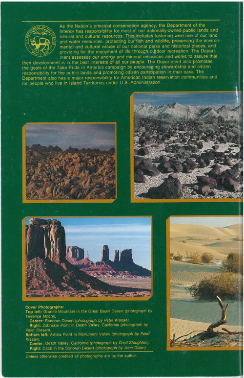
As the Nation's principal conservation agency, the Department of the Interior has responsibility for most of our nationally-owned public lands and natural and cultural resources. This includes fostering wise use of our land and water resources, protecting our fish and wildlife, preserving the environmental and cultural values of our national parks and historical places, and providing for the enjoyment of life through outdoor recreation. The Department assesses our energy and mineral resources and works to assure that their development is in the best interests of all our people. The Department also promotes the goals of the Take Pride in America campaign by encouraging stewardship and citizen responsibility for the public land and promoting citizen participation in their care. The Department also has a major responsibility for American Indian reservation communities and for people who live in Island Territories under U.S. Administration.

Granite Mountain in the Great Basin Desert (photograph by Terrence Moore).
Sonoran Desert (photograph by Peter Kresan).
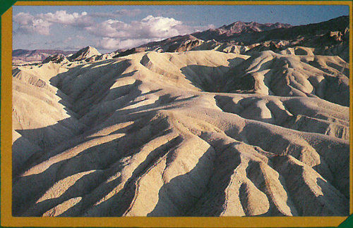
Zabriskie Point in Death Valley, California (photograph by Peter Kresan).
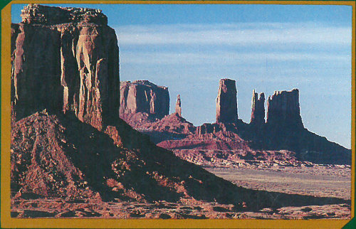
Artists Point in Monument Valley (photograph by Peter Kresan).
Death Valley, California (photograph by Cecil Stoughton).
Cacti in the Sonoran Desert (photograph by John Olson).