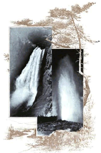
Grand Falls of the Yellowstone and Old Faithful Geyser.
THE
Yellowstone National Park
HISTORICAL AND DESCRIPTIVE
Illustrated with Maps, Views and Portraits
BY
Hiram Martin Chittenden
Captain, Corps of Engineers, United States Army
![]()
CINCINNATI
THE ROBERT CLARKE COMPANY
1895
Copyright, 1895,
By Hiram Martin Chittenden.
![]()
TO THE MEMORIES OF
![]()
AND
![]()
PIONEERS IN THE WONDERLAND
OF THE
![]()
Twenty-five years ago, this date, a company of gentlemen were encamped at the Forks of the Madison River in what is now the Yellowstone National Park. They had just finished the first complete tour of exploration ever made of that region. Fully realizing the importance of all they had seen, they asked what ought to be done to preserve so unique an assemblage of wonders to the uses for which Nature had evidently designed them. It required no argument to show that government protection alone was equal to the task, and it was agreed that a movement to secure such protection should be inaugurated at once. So rapidly did events develop along the line of this idea, that within the next eighteen months the “Act of Dedication” had become a law, and the Yellowstone National Park took its place in our country’s history.
The wide-spread interest which the discovery of this region created among civilized peoples has in no degree diminished with the lapse of time. In this country particularly the Park to-day stands on a firmer basis than ever before. The events of the past two [vi] years, in matters of legislation and administration, have increased many fold the assurances of its continued preservation, and have shown that even the petty local hostility, which has now and then menaced its existence, is yielding to a wiser spirit of patriotism.
The time therefore seems opportune, in passing so important an epoch in the history of the Park, and while many of the actors in its earlier scenes are still among us, to collect the essential facts, historical and descriptive, relating to this region, and to place them in form for permanent preservation. The present literature of the Park, although broad in scope and exhaustive in detail, is unfortunately widely scattered, somewhat difficult of access, and in matters of early history, notably deficient. To supply a work which shall form a complete and connected treatment of the subject, is the purpose of the present volume.
It deals first and principally with the history of the Upper Yellowstone from the days of Lewis and Clark to the present time. The main text is supplemented by a considerable amount of appendical matter, the most important features of which are a complete list of the geographical names of the Park, with their origin and signification; a few biographical sketches of the early explorers; and a bibliography of the literature pertaining to this region.
The descriptive portion of the work contains a succinct, [vii] though comprehensive, treatment of the various scientific and popular features of the Park. While it is sufficient for all the requirements of ordinary information, it purposely refrains from a minute discussion of those details which have been, or are now being, exhaustively treated by the scientific departments of the government.
In describing a region whose fame rests upon its natural wonders, the assistance of the illustrative art has naturally been resorted to. The various accompanying maps have all been prepared especially for this work and are intended to set forth not only present geography but historical features as well. The folded map embodies every thing to date from the latest geographical surveys. It will bear careful study, and this has been greatly simplified by a system of marginal references to be used with the list of names in Appendix A.
The illustrations cover every variety of subject in the Park and represent the best results of photographic work in that region. They are mostly from the studio of Mr. F. J. Haynes, of St. Paul, the well-known Park photographer, who has done so much by his art to disseminate a knowledge of the wonders of the Yellowstone. A considerable number are from views taken during the Hayden surveys by Mr. William H. Jackson, now of Denver, Colorado. A few excellent subjects are from the amateur work of Captain C. M. [viii] Gandy, Assistant Surgeon, U. S. A., who was stationed for some years on duty in the Park. The portraits are restricted to the few early explorers who visited the Upper Yellowstone prior to the creation of the Park.
To any one who is familiar with the recent history of the Park, a work like the present would seem incomplete without some reference to those influences which endanger its future existence. A brief discussion of this subject is accordingly presented, which, without considering particular schemes, exposes the dangerous tendencies underlying them all.
In the course of a somewhat extended correspondence connected with the preparation of this work, the author has become indebted for much information that could not be found in the existing literature of the Park. He desires in this place to return his sincere acknowledgments to all who have assisted him, and to refer in a special manner.
To the Hon. N. P. Langford, of St. Paul, whose long acquaintance with the Upper Yellowstone country has made him an authority upon its history.
To Dr. Elliott Coues, of Washington, D. C., who has contributed, besides much general assistance, the essential facts relating to the name “Yellowstone.”
To Captain George S. Anderson, 6th U. S. Cavalry, Superintendent of the Park, for the use of his extensive collection of Park literature.
To Prof. Arnold Hague, and others, of the U. S. Geological Survey, for many important favors.
To Prof. J. D. Butler, of Madison, Wis., for biographical data relating to James Bridger.
To Dr. R. Ellsworth Call, of Cincinnati, Ohio, for valuable assistance pertaining to the entire work.
To the Hon. D. M. Browning, Commissioner of Indian Affairs, for important data relating to the Indian tribes in the vicinity of the Yellowstone Park.
To the officers of the War and Interior Departments, the U. S. Fish Commission, the U. S. Bureau of Ethnology, and of the U. S. Coast and Geodetic Survey, for public documents and other information of great value.
To R. T. Durrett, LL.D., of Louisville, Ky.; Mr. J. G. Morrison, of the Library of Congress, Washington, D. C.; Mr. J. D. Losecamp, of Billings, Mont.; Mr. George Bird Grinnell, of Forest and Stream, New York City; Major James F. Gregory, Corps of Engineers, U. S. A.; Lieutenant Wm. H. Bean, Second Cavalry, U. S. A.; Hon. David E. Folsom, White Sulphur Springs, Mont.; Washington Mathews, Major and Surgeon, U. S. A.; Dr. A. C. Peale, of Philadelphia, Pa.; William Hallett Phillips, of Washington, D. C.; Dr. Lyman B. Sperry, of Bellevue, O.; Mrs. Matilda Cope Stevenson, of Washington, D. C.; Mrs. Sirena J. Washburn, of Greencastle, Ind.; Miss Isabel Jelke, of Cincinnati, O.; Mr. O. B. Wheeler, [x] of St. Louis, Mo.; Mr. O. D. Wheeler, of St. Paul, Minn.; Mr. J. H. Baronett, of Livingston, Mont.; Mr. W. T. Hamilton, of Columbus, Mont.; Mr. Richard Leigh, of Wilford, Idaho; Mr. Edwin L. Berthoud, of Golden, Colo.; and Miss Laura S. Brown, of Columbus, O. H. M. C.
Columbus, Ohio, September 19, 1895.
PART I.—HISTORICAL.
| Chapter I.—“Yellowstone” | 1 |
| Chapter II.—Indian Occupancy of the Upper Yellowstone | 8 |
| Chapter III.—John Colter | 20 |
| Chapter IV.—The Trader and Trapper | 32 |
| Chapter V.—Early knowledge of the Yellowstone | 40 |
| Chapter VI.—James Bridger | 51 |
| Chapter VII.—Raynolds Expedition | 58 |
| Chapter VIII.—Gold in Montana | 65 |
| Chapter IX.—Discovery | 72 |
| Chapter X.—The National Park Idea—Its Origin and Realization | 87 |
| Chapter XI.—Why So Long Unknown | 98 |
| Chapter XII.—Later Explorations | 103 |
| Chapter XIII.—An Indian Campaign through the National | 111 |
| Chapter XIV.—Administrative History of the Park | 127 |
| Chapter XV.—The National Park Protective Act | 142 |
PART II.—DESCRIPTIVE.
| Chapter I.—Boundaries and Topography | 148 |
| Chapter II.—Geology of the Park | 156 |
| Chapter III.—Geysers | 162 |
| Chapter IV.—Hot Springs | 172 |
| Chapter V.—Fossil Forests of the Yellowstone | 175 |
| Chapter VI.—Fauna of the Yellowstone | 181[xii] |
| Chapter VII.—Flora of the Yellowstone | 187 |
| Chapter VIII.—The Park as a Health Resort | 193 |
| Chapter IX.—The Park in Winter | 198 |
| Chapter X.—Roads, Hotels, and Transportation | 201 |
| Chapter XI.—Administration of the Park | 206 |
| Chapter XII.—A Tour of the Park—Preliminary | 209 |
| Chapter XIII.—A Tour of the Park—North Boundary to Mammoth Hot Springs | 211 |
| Chapter XIV.—A Tour of the Park—Mammoth Hot Springs to Norris Geyser Basin | 217 |
| Chapter XV.—A Tour of the Park—Norris Geyser Basin to Lower Geyser Basin | 221 |
| Chapter XVI.—A Tour of the Park—Lower Geyser Basin to Upper Geyser Basin | 228 |
| Chapter XVII.—A Tour of the Park—Upper Geyser Basin to Yellowstone Lake | 237 |
| Chapter XVIII.—A Tour of the Park—Yellowstone Lake to the Grand Cañon of the Yellowstone | 248 |
| Chapter XIX.—A Tour of the Park—Grand Cañon of the Yellowstone to Junction Valley | 260 |
PART III.—THE FUTURE.
| Chapter I.—Hostility to the Park | 267 |
| Chapter II.—Railroad Encroachment and Change of Boundary | 270 |
| Chapter III.—Conclusion | 281 |
APPENDIX A.
| Geographical Names in the Yellowstone National Park | 285 | |
| I. | —Introductory | 285 |
| II. | —Mountain Peaks | 289 |
| III. | —Streams | 313 |
| IV. | —Water-falls | 324 [xiii] |
| V. | —Lakes | 327 |
| VI. | —Miscellaneous Features | 338 |
| VII. | —Geysers | 342 |
APPENDIX B.
| Legislation and Regulations now in Force affecting the Yellowstone National Park | 345 |
APPENDIX C.
| Appropriations on Account of the Yellowstone National Park | 357 |
APPENDIX D.
| List of Superintendents of the Yellowstone National Park | 359 |
APPENDIX E.
| Bibliography of the Yellowstone National Park | 361 |
The Yellowstone National Park.
“YELLOWSTONE.”
Lewis and Clark passed the first winter of their famous trans-continental expedition among the Mandan Indians, on the Missouri River, sixty-six miles above the present capital of North Dakota. When about to resume their journey in the spring of 1805, they sent back to President Jefferson a report of progress and a map of the western country based upon information derived from the Indians. In this report and upon this map appear for the first time, in any official document, the words “Yellow Stone” as the name of the principal tributary of the Missouri.
It seems, however, that Lewis and Clark were not the first actually to use the name. David Thompson, the celebrated explorer and geographer, prominently identified with the British fur trade in the North-west, was among the Mandan Indians on the Missouri River from December 29, 1797, to January 10, 1798. While there he secured data, mostly from the natives, from which he estimated the latitude and [2] longitude of the source of the Yellowstone River. In his original manuscript journal and field note-books, containing the record of his determinations, the words “Yellow Stone” appear precisely as used by Lewis and Clark in 1805. This is, perhaps, the first use of the name in its Anglicised form, and it is certainly the first attempt to determine accurately the geographical location of the source of the stream. [A]
[A] Thompson’s estimate:
Latitude, 43° 39’ 45” north.
Longitude, 109° 43’ 17” west.
Yount Peak, source of the Yellowstone (Hayden):
Latitude, 43° 57’ north.
Longitude, 109° 52’ west.
Thompson’s error:
In latitude, 17’ 15”.
In longitude, 8’ 43”, or about 21 miles.
Neither Thompson nor Lewis and Clark were originators of the name. They gave us only the English translation of a name already long in use. “This river,” say Lewis and Clark, in their journal for the day of their arrival at the mouth of the now noted stream, “had been known to the French as the Roche Jaune, or, as we have called it, the Yellow Stone.” The French name was, in fact, already firmly established among the traders and trappers of the North-west Fur Company, when Lewis and Clark met them among the Mandans. Even by the members of the expedition it seems to have been more generally used than the new English form; and the spellings, “Rejone,” “Rejhone,” “Rochejone,” “Rochejohn,” and “Rochejhone,” are among their various attempts to render orthographically the French pronunciation.
Probably the name would have been adopted unchanged, as so many other French names in our geography have been, except for the recent cession of Louisiana to the United States. The policy which led the government promptly to explore, and take formal possession of, its extensive acquisition, led it also, as part of the process of rapid Americanization, to give English names to all of the more prominent geographical features. In the case of the name here under consideration, this was no easy matter. The French form had already obtained wide currency, and it was reluctantly set aside for its less familiar translation. As late as 1817, it still appeared in newly English-printed books, [B] while among the traders and trappers of the mountains, it survived to a much later period.
[B] Bradbury’s “Travels in the Interior of America.” See Appendix E.
By whom the name Roche Jaune, or its equivalent form Pierre Jaune, was first used, it would be extremely interesting to know; but it is impossible to determine at this late day. Like their successor, “Yellow Stone,” these names were not originals, but only translations. The Indian tribes along the Yellowstone and upper Missouri rivers had names for the tributary stream signifying “yellow rock,” [C] and the French had doubtless adopted them long before any of their number saw the stream itself.
[C] The name “Elk River” was also used among the Crow Indians.
The first explorations of the country comprised within the present limits of the State of Montana are matters of great historic uncertainty. By one account it appears that, between the years 1738 and 1753, [4] Pierre Gaultier de Varennes, the Sieur de la Verendrye, and his sons, particularly the Chevalier de la Verendrye, conducted parties of explorers westward, from Lake Superior to the Assinnaboine River, thence south to the Mandan country, and thence to the very sources of the Missouri. Even the date, January 12, 1743, is given for their first ascent of the Rocky Mountains. But such is the dearth of satisfactory evidence relating to these explorations, that positive inferences concerning them are impossible. The most that can be said is, that if De la Verendrye visited these regions, as is generally believed, to him doubtless belongs the honor of having adopted from original sources the name of the Yellowstone River.
The goal of De la Verendrye’s explorations was the Pacific Ocean; but the French and Indian war which robbed France of her dominion in America, prevented his ever reaching it. Following him, at the distance of nearly half a century, came the traders and trappers of the North-west Fur Company. As already noted, they were among the Mandans as early as 1797, and the name Roche Jaune was in common use among them in 1804. They appear to have been wholly ignorant of the work of De la Verendrye, and it is quite certain that, prior to 1805, none of them had reached the Yellowstone River. Lewis and Clark particularly record the fact, while yet some distance below the junction of this river with the Missouri, that they had already passed the utmost limit of previous adventure by white men. Whatever, therefore, was at this time known of the Yellowstone could have come to these traders only from Indian sources. [D]
[D] An interesting reference to the name “Yellowstone,” in an entirely different quarter, occurs on Pike’s map of the “Internal Provinces of Spain,” published in 1810. It is a corrupt Spanish translation in the form of “Rio de Piedro Amaretto del Missouri,” (intended of course to be Rio de la Piedra Amarilla del Missouri) river of the Yellow Stone of the Missouri. No clue has been discovered of the source from which Pike received this name; but the fact of its existence need occasion no surprise. The Spanish had long traded as far north as the Shoshone country, and had mingled with the French traders along the lower Missouri. Lewis and Clark found articles of their manufacture among the Shoshones in 1805. There is also limited evidence of early intercourse between them and the Crow nation. That the name of so important a stream as the Yellowstone should have become known to these traders is therefore not at all remarkable. There is, however, no reason to suppose that the Spanish translation antedates the French. It certainly plays no part in the descent of the name from the original to the English form, and it is of interest in this connection mainly as showing that, even at this early day, the name had found its way to the provinces of the south.
We thus find that the name, which has now become so celebrated, descends to us, through two translations, from those native races whose immemorial dwelling-place had been along the stream which it describes. What it was that led them to use the name is easily discoverable. The Yellowstone River is pre-eminently a river with banks of yellow rock. Along its lower course “the flood plain is bordered by high bluffs of yellow sandstone.” Near the mouth of the Bighorn River stands the noted landmark, Pompey’s Pillar, “a high isolated rock” of the same material. Still further up, beyond the mouth of Clark’s fork, is an extensive ridge of yellow rock, the “sheer, vertical sides” of which, according to one writer, “gleam in the sunlight like massive gold.” All along the lower river, in fact, from its mouth to [6] the Great Bend at Livingston, this characteristic is more or less strikingly present.
Whether it forms a sufficiently prominent feature of the landscape to justify christening the river from it, may appear to be open to doubt. At any rate the various descriptions of this valley by early explorers rarely refer to the same locality as being conspicuous from the presence of yellow rock. Some mention it in one place, some in another. Nowhere does it seem to have been so striking as to attract the attention of all observers. For this reason we shall go further in search of the true origin of the name, to a locality about which there can be no doubt, no difference of opinion.
Seventy-five miles below the ultimate source of the river lies the Grand Cañon of the Yellowstone, distinguished among the notable cañons of the globe by the marvelous coloring of its walls. Conspicuous among its innumerable tints is yellow. Every shade, from the brilliant plumage of the yellow bird to the rich saffron of the orange, greets the eye in bewildering profusion. There is indeed other color, unparalleled in variety and abundance, but the ever-present background of all is the beautiful fifth color of the spectrum.
So prominent is this feature that it never fails to attract attention, and all descriptions of the Cañon abound in references to it. Lieutenant Doane (1870) notes the “brilliant yellow color” of the rocks. Captain Barlow and Doctor Hayden (1871) refer, in almost the same words, to the “yellow, nearly vertical walls.” Raymond (1871) speaks of the “bright yellow of the sulphury clay.” Captain Jones (1873) says that "about [7] and in the Grand Cañon the rocks are nearly all tinged a brilliant yellow." These early impressions might be repeated from the writings of every subsequent visitor who has described the scenery of the Yellowstone.
That a characteristic which so deeply moves the modern beholder should have made a profound impression on the mind of the Indian, need hardly be premised. This region was by no means unknown to him; and from the remote, although uncertain, period of his first acquaintance with it, the name of the river has undoubtedly descended.
Going back, then, to this obscure fountain-head, the original designation is found to have been
Mi tsi a-da-zi,
[E] Rock Yellow River.
And this, in the French tongue, became
Roche Jaune and Pierre Jaune;
and in English,
Yellow Rock and Yellow Stone.
Established usage now writes it
Yellowstone.
INDIAN OCCUPANCY OF THE UPPER YELLOWSTONE.
It is a singular fact in the history of the Yellowstone National Park that no knowledge of that country seems to have been derived from the Indians. The explanation ordinarily advanced is that the Indians had a superstitious fear of the geyser regions and always avoided them. How far this theory is supported by the results of modern research is an interesting inquiry.
Three great families of Indians, the Siouan, the Algonquian, and the Shoshonean, originally occupied the country around the sources of the Yellowstone. Of these three families the following tribes are alone of interest in this connection: The Crows (Absaroka) of the Siouan family; the Blackfeet (Siksika) of the Algonquian family; and the Bannocks (Panai’hti), the Eastern Shoshones, and the Sheepeaters (Tukuarika) of the Shoshonean family.
The home of the Crows was in the Valley of the Yellowstone below the mountains where they have dwelt since the white man’s earliest knowledge of them. Their territory extended to the mountains which bound the Yellowstone Park on the north and east; but they never occupied or claimed any of the country beyond. Their well-known tribal characteristics were an insatiable love of horse-stealing and a wandering and predatory habit which caused them to roam over all the West from the Black Hills to the Bitter Root Mountains and from the British Possessions to the Spanish Provinces. [9] They were generally, although by no means always, friendly to the whites, but enemies of the neighboring Blackfeet and Shoshones. Physically, they were a stalwart, handsome race, fine horsemen and daring hunters. They were every-where encountered by the trapper and prospector who generally feared them more on account of their thievish habits than for reasons of personal safety.
The Blackfeet dwelt in the country drained by the headwaters of the Missouri. Their territory was roughly defined by the Crow territory on the east and the Rocky Mountains on the west. Its southern limit was the range of mountains along the present north-west border of the Park and it extended thence to the British line. The distinguishing historic trait of these Indians was their settled hostility to their neighbors whether white or Indian. They were a tribe of perpetual fighters, justly characterized as the Ishmaelites of their race. From the day in 1806, when Captain Lewis slew one of their number, down to their final subjection by the advancing power of the whites, they never buried the hatchet. They were the terror of the trapper and miner, and hundreds of the pioneers perished at their hands. Like the Crows they were a well-developed race, good horsemen and great rovers, but, in fight, given to subterfuge and stratagem rather than to open boldness of action.
In marked contrast with these warlike and wandering tribes were those of the great Shoshonean family who occupied the country around the southern, eastern, and western borders of the Park, including also that of the Park itself. The Shoshones as a family [10] were an inferior race. They seem to have been the victims of some great misfortune which had driven them to precarious methods of subsistence and had made them the prey of their powerful and merciless neighbors. The names “Fish-eaters,” “Root-diggers,” and other opprobrious epithets, indicate the contempt in which they were commonly held. For the most part they had no horses, and obtained a livelihood only by the most abject means. Some of the tribes, however, rose above this degraded condition, owned horses, hunted buffalo, and met their enemies in open conflict. Such were the Bannocks and the Eastern Shoshones—tribes closely connected with the history of the Park, one occupying the country to the south-west near the Teton Mountains, and the other that to the south-east in the valley of Wind River. The Shoshones were generally friendly to the whites, and for this reason they figure less prominently in the books of early adventure than do the Crows and Blackfeet whose acts of “sanguinary violence” were a staple article for the Indian romancer.
It was an humble branch of the Shoshonean family which alone is known to have permanently occupied what is now the Yellowstone Park. They were called Tukuarika, or, more commonly, Sheepeaters. They were found in the Park country at the time of its discovery and had doubtless long been there. These hermits of the mountains, whom the French trappers called “les dignes de pitié,” have engaged the sympathy or contempt of explorers since our earliest knowledge of them. Utterly unfit for warlike contention, they seem to have sought immunity from their dangerous neighbors by dwelling among the inaccessible fastnesses of the mountains. They were destitute of even savage comforts. Their food, as their name indicates, was principally the flesh of the mountain sheep. Their clothing was composed of skins. They had no horses and were armed only with bows and arrows. They captured game by driving it into brush inclosures. Their rigorous existence left its mark on their physical nature. They were feeble in mind, diminutive in stature, and are always described as a “timid, harmless race.” They may have been longer resident in this region than is commonly supposed, for there was a tradition among them, apparently connected with some remote period of geological disturbance, that most of their race were once destroyed by a terrible convulsion of nature.
Such were the Indian tribes who formerly dwelt within or near the country now embraced in the Yellowstone National Park. That the Sheepeaters actually occupied this country, and that wandering bands from other tribes occasionally visited it, there is abundant and conclusive proof. Indian trails, [F] though generally indistinct, were every-where found by the early explorers, mostly on lines since occupied by the tourist routes. One of these followed the Yellowstone Valley entirely across the Park from north to south. It divided at Yellowstone Lake, the principal branch following the east shore, crossing Two-Ocean-Pass, and intersecting a great trail which connected the Snake and Wind River Valleys. The other branch passed along the west shore of the lake and over the divide to the valleys of Snake River and [12] Jackson Lake. This trail was intersected by an important one in the vicinity of Conant Creek leading from the Upper Snake Valley to that of Henry Fork. Other intersecting trails connected the Yellowstone River trail with the Madison and Firehole Basins on the west and with the Bighorn Valley on the east.
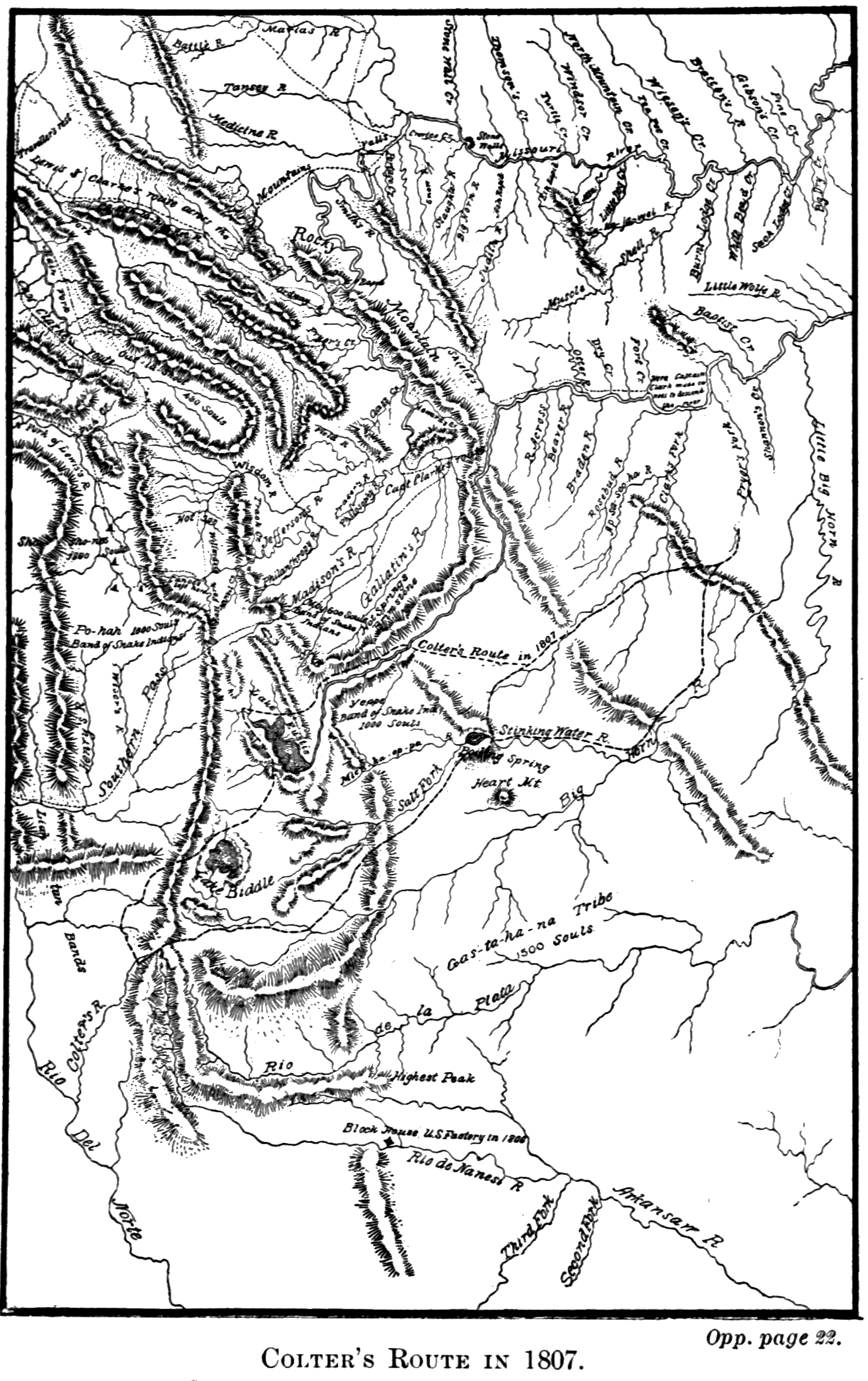
[F] See historical chart, opposite.
The most important Indian trail in the Park, however, was that known as the Great Bannock Trail. It extended from Henry Lake across the Gallatin Range to Mammoth Hot Springs, where it was joined by another coming up the valley of the Gardiner. Thence it led across the Black-tail Deer plateau to the ford above Tower Falls; and thence up the Lamar Valley, forking at Soda Butte, and reaching the Bighorn Valley by way of Clark’s Fork and the Stinkingwater River. This trail was certainly a very ancient and much-traveled one. It had become a deep furrow in the grassy slopes, and it is still distinctly visible in places, though unused for a quarter of a century.
Additional evidence in the same direction may be seen in the wide-spread distribution of implements peculiar to Indian use. Arrows and spear heads have been found in considerable numbers. Obsidian Cliff was an important quarry, and the open country near the outlet of Yellowstone Lake a favorite camping-ground. Certain implements, such as pipes, hammers, and stone vessels, indicating the former presence of a more civilized people, have been found to a limited extent; and some explorers have thought that a symmetrical mound in the valley of the Snake River, below the mouth of Hart River, is of artificial origin. Reference will later be made to the discovery of a [13] rude granite structure near the top of the Grand Teton, which is unquestionably of very ancient date.
Dr. A. C. Peale, prominently connected with the early geological explorations of this region, states that the Rustic Geyser in the Hart Lake Geyser Basin is “bordered by logs which are coated with a crystalline, semi-translucent deposit of geyserite. These logs were evidently placed around the geyser by either Indians or white men a number of years ago, as the coating is thick and the logs firmly attached to the surrounding deposit.” [G]
[G] Page 298, Twelfth Annual Report of Dr. Hayden. See Appendix E. It is more than probable that this was the work of trappers.
More recent and perishable proofs of the presence of Indians in the Park were found by the early explorers in the rude wick-e-ups, brush inclosures, and similar contrivances of the lonely Sheepeaters; and it is not improbable that many of the arrow and spear heads were the work of these Indians.
The real question of doubt in regard to Indian occupancy of, or visits to, the Park, is therefore not one of fact, but of degree. The Sheepeaters certainly dwelt there; but as to other tribes, their acquaintance with it seems to have been very limited. No word of information about the geyser regions ever fell from their lips, except that the surrounding country was known to them as the Burning Mountains. With one or two exceptions, the old trails were very indistinct, requiring an experienced eye to distinguish them from game trails. Their undeveloped condition indicated infrequent use. Old trappers who have known this region for fifty years say that the great [14] majority of Indians never saw it. Able Indian guides in the surrounding country became lost when they entered the Park, and the Nez Percés were forced to impress a white man as guide when they crossed the Park in 1877.
An unknown writer, to whom extended reference will be made in a later chapter, visited the Upper Geyser Basin in 1832, accompanied by two Pend d’Oreilles Indians. Neither of these Indians had ever seen or apparently heard of the geysers, and “were quite appalled” at the sight of them, believing them to be “supernatural” and the “production of the Evil Spirit.”
Lieutenant Doane, who commanded the military escort to the Yellowstone Expedition of 1870, says in his report: [H]
“Appearances indicated that the basin [of the Yellowstone Lake] had been almost entirely abandoned by the sons of the forest. A few lodges of Sheepeaters, a branch remnant of the Snake tribe, wretched beasts who run from the sight of a white man, or from any other tribe of Indians, are said to inhabit the fastnesses of the mountains around the lakes, poorly armed and dismounted, obtaining a precarious subsistence, and in a defenseless condition. We saw, however, no recent traces of them. The larger tribes never enter the basin, restrained by superstitious ideas in connection with the thermal springs.”
[H] Page 26, “Yellowstone Expedition of 1870.” See Appendix E.
In 1880, Col. P. W. Norris, Second Superintendent of the Park, had a long interview on the shore of the [15] Yellowstone Lake with We-Saw, “an old but remarkably intelligent Indian” of the Shoshone tribe, who was then acting as guide to an exploring party under Governor Hoyt, of Wyoming, and who had previously passed through the Park with the expedition of 1873 under Captain W. A. Jones, U. S. A. He had also been in the Park region on former occasions. Colonel Norris records the following facts from this Indian’s conversation: [I]
“We-Saw states that he had neither knowledge nor tradition of any permanent occupants of the Park save the timid Sheepeaters…. He said that his people (Shoshones) the Bannocks and the Crows, occasionally visited the Yellowstone Lake and River portions of the Park, but very seldom the geyser regions, which he declared were ‘heap, heap, bad,’ and never wintered there, as white men sometimes did with horses.”
[I] Page 38, Annual Report of Superintendent of the Park for 1881.
It seems that even the resident Sheepeaters knew little of the geyser basins. General Sheridan, who entered the Park from the south in 1882, makes this record in his report of the expedition: [J]
“We had with us five Sheep Eating Indians as guides, and, strange to say, although these Indians had lived for years and years about Mounts Sheridan and Hancock, and the high mountains south-east of the Yellowstone Lake, they knew nothing about the Firehole Geyser Basin, and they exhibited more astonishment and wonder than any of us.”
[J] Page 11, Report on Explorations of Parts of Wyoming, Idaho and Montana, 1882. See Appendix E.
Evidence like the foregoing clearly indicates that this country was terra incognita to the vast body of Indians who dwelt around it, and again this singular fact presents itself for explanation. Was it, as is generally supposed, a “superstitious fear” that kept them away? The incidents just related give some color to such a theory; but if it were really true we should expect to find well authenticated Indian traditions of so marvelous a country. Unfortunately history records none. It is not meant by this to imply that reputed traditions concerning the Yellowstone are unknown. For instance, it is related that the Crows always refused to tell the whites of the geysers because they believed that whoever visited them became endowed with supernatural powers, and they wished to retain a monopoly of this knowledge. But traditions of this sort, like most Indian curiosities now offered for sale, are evidently of spurious origin. Only in the names “Yellowstone” and “Burning Mountains” do we find any original evidence that this land of wonders appealed in the least degree to the native imagination.
The real explanation of this remarkable ignorance appears to us to rest on grounds essentially practical. There was nothing to induce the Indians to visit the Park country. For three-fourths of the year that country is inaccessible on account of snow. It is covered with dense forests, which in most places are so filled with fallen timber and tangled underbrush as to be practically impassable. As a game country in those early days it could not compare with the lower surrounding valleys. As a highway of communication between the valleys of the Missouri, Snake, Yellowstone, [17] and Bighorn Rivers, it was no thoroughfare. The great routes, except the Bannock trail already described, lay on the outside. All the conditions, therefore, which might attract the Indians to this region were wanting. Even those sentimental influences, such as a love of sublime scenery and a curiosity to see the strange freaks of nature, evidently had less weight with them than with their pale-face brethren.
Summarizing the results of such knowledge, confessedly meager, as exists upon this subject, it appears:
(1.) That the country now embraced in the Yellowstone National Park was occupied, at the time of its discovery, by small bands of Sheepeater Indians, probably not exceeding in number one hundred and fifty souls. They dwelt in the neighborhood of the Washburn and Absaroka Ranges, and among the mountains around the sources of the Snake. They were not familiar with the geyser regions.
(2.) Wandering bands from other tribes occasionally visited this country, but generally along the line of the Yellowstone River or the Great Bannock Trail. Their knowledge of the geyser regions was extremely limited, and very few had ever seen or heard of them. It is probable that the Indians visited this country more frequently in earlier times than since the advent of the white man.
(3.) The Indians avoided the region of the Upper Yellowstone from practical, rather than from sentimental, considerations.
The legal processes by which the vast territory of these various tribes passed to the United States, are full of incongruities resulting from a general ignorance of the country in question. By the Treaty of Fort Laramie, dated September 17, 1851, between the United States on the one hand, and the Crows, Blackfeet and other northern tribes on the other, the Crows were given, as part of their territory, all that portion of the Park country which lies east of the Yellowstone River; and the Blackfeet, all that portion lying between the Yellowstone River and the Continental Divide. This was before any thing whatever was known of the country so given away. None of the Shoshone tribes were party to the treaty, and the rights of the Sheepeaters were utterly ignored. That neither the Blackfeet nor the Crows had any real claim to these extravagant grants is evidenced by their prompt relinquishment of them in the first subsequent treaties. Thus, by treaty of October 17, 1855, the Blackfeet agreed that all of their portion of the Park country, with much other territory, should be and remain a common hunting ground for certain designated tribes; and by treaty of May 17, 1868, the Crows relinquished all of their territory south of the Montana boundary line.
That portion of the Park country drained by the Snake River was always considered Shoshone territory, although apparently never formally recognized in any public treaty. By an unratified treaty, dated September 24, 1868, the provisions of which seem to have been the basis of subsequent arrangements with the Shoshonean tribes, all this territory and much besides was [19] ceded to the United States, and the tribes were located upon small reservations.
It thus appears that at the time the Park was created, March 1, 1872, all the territory included in its limits had been ceded to the United States except the hunting ground above referred to, and the narrow strip of Crow territory east of the Yellowstone where the north boundary of the Park lies two or three miles north of the Montana line. The “hunting ground” arrangement was abrogated by statute of April 15, 1874, and the strip of Crow territory was purchased under an agreement with the Crows, dated June 12, 1880, and ratified by Congress, April 11, 1882, thus extinguishing the last remaining Indian title to any portion of the Yellowstone Park.
JOHN COLTER.
Lewis and Clark passed the second winter of their expedition at the mouth of the Columbia River. In the spring and summer of 1806 they accomplished their return to St. Louis. Upon their arrival at the site of their former winter quarters among the Mandans, an incident occurred which forms the initial point in the history of the Yellowstone National Park. It is thus recorded in the journal of the expedition under date of August 14 and 15, 1806: [K]
“In the evening we were applied to by one of our men, Colter, who was desirous of joining the two trappers who had accompanied us, and who now proposed an expedition up the river, in which they were to find traps and give him a share of the profits. The offer was a very advantageous one, and, as he had always performed his duty, and his services might be dispensed with, we agreed that he might go provided none of the rest would ask or expect a similar indulgence. To this they cheerfully answered that they wished Colter every success and would not apply for liberty to separate before we reached St. Louis. We therefore supplied him, as did his comrades also, with powder, lead, and a variety of articles which might be useful to him, and he left us the next day.”
[K] Pages 1181-2, Coues' “Lewis and Clark.” See Appendix E.
To our explorers, just returning from a two years' [21] sojourn in the wilderness, Colter’s decision seemed too remarkable to be passed over in silence. The journal continues:
“The example of this man shows us how easily men may be weaned from the habits of civilized life to the ruder but scarcely less fascinating manners of the woods. This hunter has now been absent for many years from the frontiers, and might naturally be presumed to have some anxiety, or some curiosity at least, to return to his friends and his country; yet just at the moment when he is approaching the frontiers, he is tempted by a hunting scheme to give up those delightful prospects, and go back without the least reluctance to the solitude of the woods.”
Colter seems to have stood well in the esteem of his officers. Besides the fair character given him in his discharge, the record of the expedition shows that he was frequently selected when one or two men were required for important special duty. That he had a good eye for topography may be inferred from the fact that Captain Clark, several years after the expedition was over, placed upon his map certain important information on the strength of Colter’s statements, who alone had traversed the region in question. In another instance, when Bradbury, the English naturalist, was about to leave St. Louis to join the Astorians in the spring of 1811, Clark referred him to Colter, who had returned from the mountains, as a person who could conduct him to a certain natural curiosity on the Missouri some distance above St. Charles. Colter had not seen the place for six years. In the Missouri Gazette, for April 18, 1811, he is referred to as a “celebrated hunter and woodsman.” These glimpses of his [22] record, and a remarkable incident to be related further on, clearly indicate that he was a man of superior mettle to that of the average hunter and trapper.
Colter’s whereabouts during the three years following his discharge are difficult to fix upon. It may, however, be set down as certain that he and his companions ascended the Yellowstone River, not the Missouri. Captain Clark’s return journey down the first-mentioned stream had made known to them that it was better beaver country than the Missouri, and Colter’s subsequent wanderings clearly indicate that his base of operations was in the valley of the Yellowstone near the mouth of the Bighorn, Pryor’s Fork, or other tributary stream.
In the summer of 1807, he made an expedition, apparently alone, although probably in company with Indians, which has given him title to a place in the history of the Yellowstone Park, and which was destined in later years to assume an importance little enough suspected by him at the time. His route appears upon Lewis and Clark’s map of 1814, and is there called “Colter’s route in 1807.” There is no note or explanation, and we are left to retrace, on the basis of a dotted line, a few names, and a date, one of those singular individual wanderings through the wilderness which now and then find a permanent place in history.
The “route,” as traced on the map, starts from a point on Pryor’s Fork, the first considerable tributary of the Yellowstone above the mouth of the Bighorn. Colter’s intention seems to have been to skirt the eastern base of the Absaroka Range until he should reach an accessible pass across the mountains of which the Indians had probably told him; then to cross over to the headwaters of Pacific or gulf-flowing streams; and then to return by way of the Upper Yellowstone.
Click on image to view larger size.
Accordingly, after he had passed through Pryor’s Gap, he took a south-westerly direction as far as Clark’s Fork, which stream he ascended for some distance, and then crossed over to the Stinkingwater. Here he discovered a large boiling spring, strongly impregnated with tar and sulphur, the odor of which, perceptible for a great distance around, has given the stream its “unhappy name.”
From this point Colter continued along the eastern flank of the Absaroka Range, fording the several tributaries of the Bighorn River which flow down from that range, and finally came to the upper course of the main stream now known as Wind River. He ascended this stream to its source, crossing the divide in the vicinity of Lincoln or Union Pass, and found himself upon the Pacific slope. The map clearly shows that at this point he had reached what the Indians called the “summit of the world” near by the sources of all great streams of the west. That he discovered one of the easy passes between Wind River and the Pacific slope, is evident from the reference in the Missouri Gazette already alluded to and here reproduced for the first time. It is from the pen of a Mr. H. M. Brackenridge, a contemporary writer of note on topics of western adventure. It reads:
"At the head of the Gallatin Fork, and of the Grosse Corne of the Yellowstone [the Bighorn River], from discoveries since the voyage of Lewis and Clark, it is found less difficult to cross than the Allegheny [24] Mountains. Coulter, a celebrated hunter and woodsman, informed me that a loaded wagon would find no obstruction in passing."
The “discoveries” are of course those of Colter, for no other white man at this time had been in those parts.
From the summit of the mountains he descended to the westward; crossed the Snake River and Teton Pass to Pierre’s Hole, and then turned north, recrossing the Teton Range by the Indian trail in the valley of what is now Conant Creek, just north of Jackson Lake. [L] Thence he continued his course until he reached Yellowstone Lake,[L] at some point along its south-western shore. He passed around the west shore to the northernmost point of the Thumb, and then resumed his northerly course over the hills arriving at the Yellowstone River in the valley of Alum Creek. He followed the left bank of the river to the ford just above Tower Falls, where the great Bannock Trail used to cross, and then followed this trail to its junction with his outward route on Clark’s Fork. From this point he re-crossed to the Stinkingwater, possibly in order to re-visit the strange phenomena there, but more probably to explore new trapping territory on his way back. He descended the Stinkingwater until about south of Pryor’s Gap, when he turned north and shortly after arrived at his starting point.
[L] For the names given by Captain Clark to these bodies of water, see Appendix A, “Jackson Lake” and “Yellowstone Lake.”
The direction of Colter’s progress, as here indicated, and the identification of certain geographical features [25] noted by him, differ somewhat from the ordinary interpretation of that adventure. But, while it would be absurd to dogmatize upon so uncertain a subject, it is believed that the theory adopted is fairly well supported by the facts as now known. It must in the first place be assumed that Colter exercised ordinary common sense upon this journey and availed himself of all information that could facilitate his progress. It is probable that he was under the guidance of Indians who knew the country; but if not, he frequently stopped, like any traveler in an unknown region, to inquire his way. He sought the established trails, low mountain passes, and well-known fords, and did not, as the map suggests, take a direction that would carry him through the very roughest and most impassable mountain country on the continent. It is necessary to orient his map so as to make both his outgoing and return routes extend nearly due north and south, instead of north-east and south-west, in order to reconcile his geography at all with the modern maps. With these precautions some of the difficulty of the situation disappears.
Colter, it is therefore assumed, followed the great trail along the Absarokas to the Wind River Valley, and crossed the divide by one of the easy passes at its head. His two crossings of the Teton range were along established trails. He evidently lost his bearings somewhat in the vicinity of the Yellowstone Lake, but as soon as he arrived at the river below the lake he kept along the trail until he reached the important crossing at Tower Falls. If he was in company with Indians who had ever been through that [26] country before, he learned that it would be no advantage to cross at Mud Geyser, inasmuch as he would strike the great Bannock Trail at the next ford below. Moreover, the distance below the lake to the point where Colter touched the Yellowstone is clearly greater than that to the Mud Geyser Ford. The bend in the river at the Great Falls, and the close proximity of the Washburn Range to the river, are distinctly indicated. The locality noted on the map as “Hot Springs Brimstone” is evidently not that near the Mud Geyser, as generally assumed, but instead, that of the now world-renowned Mammoth Hot Springs. As will be seen from the map, it is nearer the Gallatin River than it is to the Yellowstone where Colter crossed. If Colter visited the Springs from Tower Falls, as is not unlikely, a clue is supplied to the otherwise perplexing reference to the Gallatin River in the above extract from the Missouri Gazette, for it would thus appear that he was near the sources of both the Grosse Corne and of the Gallatin.
The essential difficulties in the way of this theory (and they exist with any possible theory that can be advanced) are the following: (1.) There is no stream on the map that can stand for the Snake River either above or below Jackson Lake, although Colter must have crossed it in each place. “Colter’s River” comes nearest the first location, and may possibly be intended to represent that stream; but Clark’s evident purpose to drain Jackson Lake into the Bighorn River doubtless led to a distortion of the map in this locality. (2.) The erroneous shape given to the Yellowstone Lake will be readily understood by any one who has visited its western shore. The jutting [27] promontories to the eastward entirely conceal from view the great body of the lake and give it a form not unlike that upon Clark’s map. (3.) The absence of the Great Falls from the map is not easily accounted for, although the location and trend of the Grand Cañon are shown with remarkable accuracy. (4.) The absence of the many hot springs districts, through which Colter passed, particularly that at the west end of the Yellowstone Lake, may be explained by the same spirit of incredulity which led to the rejection of all similar accounts for a period of more than sixty years. It is probable that Clark was not willing to recognize Colter’s statements on this subject further than to note on his map the location of the most wonderful of the hot springs groups mentioned by him.
The direction in which Colter traveled is a matter of no essential importance, and that here adopted is based solely upon the consideration that the doubling of the trail upon itself between Clark’s Fork and the Stinkingwater River, and the erratic course of the route around Yellowstone Lake, can not be well accounted for on the contrary hypothesis. [M]
[M] In adopting, as Colter’s point of crossing the Yellowstone, the ford at Tower Creek, the author has followed the Hon. N. P. Langford, in his reprint of Folsom’s “Valley of the Upper Yellowstone.” (See Appendix E.) All other writers who have touched upon the subject have assumed the ford to be that near the Mud Geyser.
Such, in the main, is “Colter’s route in 1807.” That he was the discoverer of Yellowstone Lake, and the foremost herald of the strange phenomena of that region, may be accepted as beyond question. He did [28] not, as is generally supposed, see the Firehole Geyser Basins. But he saw too much for his reputation as a man of veracity. No author or map-maker would jeopardize the success of his work by incorporating in it such incredible material as Colter furnished. His stories were not believed; their author became the subject of jest and ridicule; and the region of his adventures was long derisively known as “Colter’s Hell.” [N]
[N] This name early came to be restricted to the locality where Colter discovered the tar spring on the Stinkingwater, probably because few trappers ever saw the other similar localities visited by him. But Colter’s descriptions, so well summed up by Irving in his “Captain Bonneville,” undoubtedly refer in large part to what he saw in the Yellowstone and Snake River Valleys.
The story of Colter’s subsequent experience before he returned to St. Louis is thrilling in the extreme. Although it has no direct bearing upon this narrative, still, since it is part of the biography of the discoverer of the Upper Yellowstone, it can not be omitted. The detailed account we owe to the naturalist Bradbury, already referred to. He saw Colter above St. Louis in the spring of 1811, one year after his return from the mountains, and received the story directly from him. All other accounts are variations from Bradbury. Irving, who has made this story an Indian classic, borrows it in toto. Perhaps in all the records of Indian adventure there is not another instance of such a miraculous escape, in which the details are throughout so clearly within the range of possibility. It is a consistent narrative from beginning to end. In briefest outline it is as follows:
When Colter returned from his expedition of 1807, [29] he found Manuel Lisa, of the Missouri Fur Company, already in the country, where he had just arrived from St. Louis. With him was one Potts, believed to be the same person who had been a private in the party of Lewis and Clark. In the spring of 1808, Colter and his old companion in arms set out to the headwaters of the Missouri on a trapping expedition. It was on a branch of Jefferson Fork that they went to work, and here they met with their disastrous experience.
One morning while they were in a canoe examining their traps they were surprised by a large party of Blackfeet Indians. Potts attempted resistance and was slain on the spot. Colter, with more presence of mind, gave himself up as the only possible chance of avoiding immediate death. The Indians then consulted as to how they should kill him in order to yield themselves the greatest amount of amusement. Colter, upon being questioned as to his fleetness of foot, sagaciously replied that he was a poor runner (though in fact very swift), and the Indians, believing that it would be a safe experiment, decided that he should run for his life. Accordingly he was stripped naked and was led by the chief to a point three or four hundred yards in advance of the main body of the Indians. Here he was told “to save himself if he could,” and the race began—one man against five hundred.
The Indians quickly saw how they had been outwitted, for Colter flew away from them as if upon the wings of the wind. But his speed cost him dear. The exertion caused the blood to stream from his mouth and nostrils, and run down over his naked form. The prickly pear and the rough ground lacerated [30] his feet. Six miles away across a level plain was a fringe of cottonwood on the banks of the Jefferson River. Short of that lay not a shadow of chance of concealment. It was a long race, but life hung upon the issue. The Indians had not counted on such prodigious running. Gradually they fell off, and when Colter ventured for the first time to glance back, only a small number were in his wake. Encouragement was now added to hope, and he ran even faster than before.
But there was one Indian who was too much for him. He was steadily shortening the distance between them, and at last had arrived within a spear’s throw. Was Colter to be slain by a single Indian after having distanced five hundred? He would see. Suddenly whirling about, he confronted the Indian, who was astounded at the sudden move and at Colter’s bloody appearance. He tried to hurl his spear but stumbled and broke it as he fell. Colter seized the pointed portion and pinned the Indian to the earth.
Again he resumed his flight. He reached the Jefferson, and discovered, some distance below, a raft of driftwood against the head of an island. He dived under this raft and found a place where he could get his head above water. There, in painful suspense, he awaited developments. The Indians explored the island and examined the raft, but Colter’s audacious spirit was beyond their comprehension. It did not occur to them that he was all the time surveying their movements from his hiding place under the timber, and they finally abandoned the search and withdrew. Colter had saved himself. When evening came he swam several miles down the river and then went [31] ashore. For seven days he wandered naked and unarmed, over stones, cacti, and the prickly pear, scorched by the heat of noon and chilled by the frost of night, finding his sole subsistence in such roots as he might dig, until at last he reached Lisa’s trading post on the Bighorn River.
Even this terrible adventure could not dismay the dauntless Colter, and he remained still another year in the mountains. Finally, in the spring of 1810, he got into a canoe and dropped down the river, “three thousand miles in thirty days,” reaching St. Louis, May 1st, after an absence of six years.
Colter remained in St. Louis for a time giving Clark what information he could concerning the places he had seen, and evidently talking a great deal about his adventures. Finally he retired to the country some distance up the Missouri, and married. Here we again catch a glimpse of him when the Astorians were on their way up the river. As Colter saw the well appointed expedition setting out for the mountains, the old fever seized him again and he was upon the point of joining the party. But what the hardships of the wilderness and the pleasures of civilization could not dissuade him from doing, the charms of a newly-married wife easily accomplished. Colter remained behind; and here the curtain of oblivion falls upon the discoverer of the Yellowstone. It is not without genuine satisfaction that, having followed him through the incredible mazes of “Colter’s Hell,” we bid him adieu amid surroundings of so different a character.
THE TRADER AND TRAPPER.
For sixty years after Lewis and Clark returned from their expedition, the headwaters of the Yellowstone remained unexplored except by the trader and trapper. The traffic in peltries it was that first induced extensive exploration of the west. Concerning the precious metals, the people seem to have had little faith in their abundant existence in the west, and no organized search for them was made in the earlier years of the century. But that country, even in its unsettled state, had other and important sources of wealth. Myriads of beaver inhabited the streams and innumerable buffalo roamed the valleys. The buffalo furnished the trapper with means of subsistence, and beaver furs were better than mines of gold. Far in advance of the tide of settlement the lonely trapper, and after him the trader, penetrated the unknown west. Gradually the enterprise of individuals crystallized around a few important nuclei and there grew up those great fur-trading companies which for many years exercised a kind of paternal sway over the Indians and the scarcely more civilized trappers. A brief resumé of the history of these companies will show how important a place they occupy in the early history of the Upper Yellowstone.
The climax of the western fur business may be placed at about the year 1830. At that time three great companies operated in territories whose converging [33] lines of separation centered in the region about Yellowstone Lake. The oldest and most important of them, and the one destined to outlive the others, was the world-renowned Hudson’s Bay Company. It was at that time more than a century and a half old. Its earlier history was in marked contrast with that of later years. Secure in the monopoly which its extensive charter rights guaranteed, it had been content with substantial profits and had never pushed its business far into new territory nor managed it with aggressive vigor. It was not until forced to action by the encroachments of a dangerous rival, that it became the prodigious power of later times.
This rival was the great North-west Fur Company of Montreal: It had grown up since the French and Indian War, partly as a result of that conflict, and finally took corporate form in 1787. It had none of the important territorial rights of the Hudson’s Bay Company, but its lack of monopoly was more than made up by the enterprise of its promoters. With its bands of Canadian frontiersmen, it boldly penetrated the north-west and paid little respect to those territorial rights which its venerable rival was powerless to enforce. It rapidly extended its operations far into the unexplored interior. Lewis and Clark found its traders among the Mandans in 1804. In 1811 the Astorians saw its first party descend the Columbia to the sea. Two years later the American traders on the Pacific Coast were forced to succumb to their British rivals.
A long and bitter strife now ensued between the two British companies. It even assumed the magnitude of civil war, and finally resulted in a frightful [34] massacre of unoffending colonists. The British government interfered and forced the rivals into court, where they were brought to the verge of ruin by protracted litigation. A compromise was at last effected in 1821 by an amalgamation of the two companies under the name of the older rival.
But in the meantime a large part of their best fur country had been lost. In 1815 the government of the United States excluded British traders from its territory east of the Rocky Mountains. To the west of this limit, however, the amalgamated company easily forced all its rivals from the field. No American fur company ever attained the splendid organization, nor the influence over the Indians, possessed by the Hudson’s Bay Company. At the time of which we write it was master of the trade in the Columbia River valley, and the eastern limit of its operations within the territory of the United States was nearly coincident with the present western boundary of the Yellowstone Park.
The second of the great companies to which reference has been made was the American Fur Company. It was the final outcome of John Jacob Astor’s various attempts to control the fur trade of the United States. Although it was incorporated in 1809, it was for a time overshadowed by the more brilliant enterprises known as the Pacific Fur Company and the Southwest Fur Company. The history of Mr. Astor’s Pacific Fur Company, the dismal experiences of the Astorians, and the deplorable failure of the whole undertaking, are matters familiar to all readers of Irving’s “Astoria.”
The other project gave for a time more substantial [35] promise of success. A British company of considerable importance, under the name of the Mackinaw Company, with headquarters at Michilimacinac, had for some time operated in the country about the headwaters of the Mississippi now included in the states of Wisconsin and Minnesota. Astor succeeded in forming a new company, partly with American and partly with Canadian capital. This company bought out the Mackinaw Company, and changed the name to South-west Fur Company. But scarcely had its promising career begun when it was cut short by the War of 1812.
The failure of these two attempts caused Mr. Astor to turn to the old American Fur Company. The exclusion Act of 1815 enabled him to buy at his own price the North-west Fur Company’s posts on the upper rivers, and the American Company rapidly extended its trade over all the country, from Lake Superior to the Rocky Mountains. Its posts multiplied in every direction, and at an early date steamboats began to do its business up the Missouri River from St. Louis. It gradually absorbed lesser concerns, such as the Missouri Fur Company, and the Columbia Fur Company, and in 1823 was reorganized under the name of The North American Fur Company. In 1834, Astor sold his interests to Chouteau, Valle and Company, of St. Louis, and retired from the business. At this time the general western limit of the territory operated in by this formidable company was the northern and eastern slope of the mountains which bound the Yellowstone Park on the north and east. Its line of operations was down the river to St. Louis, [36] and its great trading posts were located at frequent intervals between.
The third of the great rival companies was the Rocky Mountain Fur Company, which originated in St. Louis in 1822, and received its full organization in 1826 under the direction of Jedediah Smith, David Jackson and William Sublette. Among the leading spirits, who at one time or another guided its affairs, was the famous mountaineer James Bridger to whom frequent reference will be made.
This company had its general center of operations on the head waters of Green River to the west of South Pass. Unlike the other companies, it had no navigable stream along which it could establish posts and conduct its operations. By the necessities of its exclusively mountain trade it developed a new feature of the fur business. The voyageur, with his canoe and oar, gave way to the mountaineer, with his saddle and rifle. The trading post was replaced by the annual rendezvous, which was in many points the forerunner of the later cattle “roundups” of the plains. These rendezvous were agreed upon each year at localities best suited for the convenience of the trade. Hither in the spring came from the east convoys of supplies for the season’s use. Hither repaired also the various parties of hunters and trappers and such bands of Indians as roamed in the vicinity. These meetings were great occasions, both in the transaction of business and in the round of festivities that always prevailed. After the traffic of the occasion was over, and the plans for the ensuing year were agreed upon, the convoys returned to the States and the trappers to their retreats in the mountains. The field of operations of [37] this company was very extensive and included about all of the West not controlled by the Hudson’s Bay and American Fur Companies.
Thus was the territory of the great West practically parceled out among these three companies. [O] It must not be supposed that there was any agreement, tacit or open, that each company should keep within certain limits. There were, indeed, a few temporary arrangements of this sort, but for the most part each company maintained the right to work in any territory it saw fit, and there was constant invasion by each of the proper territories of the other. But the practical necessities of the business kept them, broadly speaking, within the limits which we have noted. The roving bands of “free trappers” and “lone traders,” and individual expeditions like those of Captain Bonneville and Nathaniel J. Wyeth, acknowledged allegiance to none of the great organizations, but wandered where they chose, dealing by turns with each of the companies.
[O] A singular and striking coincidence at once discloses itself to any one who compares maps showing the territories operated in by these three companies, and those which belonged to the three great families of Indians mentioned in a preceding chapter. By far the larger part of the Hudson’s Bay Company’s territory, as far west as the main range of the Rocky Mountains, was Algonquian. The American Fur Company’s territory was almost entirely Siouan, and that of the Rocky Mountain Fur Company, Shoshonean.
Nor did any company maintain an exclusive monopoly of its peculiar methods of conducting business. The American Fur Company frequently held rendezvous at points remote from its trading posts; and the Rocky Mountain Fur Company in later years resorted [38] to the Missouri River as its line of supplies. In fact, the interests of the two companies finally became to such an extent dependent upon each other that a union was effected, in 1839, under the firm name of P. Chouteau, Jr.
The records of those early days abound in references to the fierce competition in trade which existed between these great organizations. It led to every manner of device or subterfuge which might deceive a rival as to routes, conceal from him important trapping grounds, undermine the loyalty of his employes or excite the hostility of the Indians against him. It often led to deeds of violence, and made the presence of a rival band of trappers more dreaded than a war party of the implacable Blackfeet.
The vigor and enterprise of these traders caused their business to penetrate the remotest and most inaccessible corners of the land. Silliman’s Journal for January, 1834, declares that—
“The mountains and forests, from the Arctic Sea to the Gulf of Mexico, are threaded through every maze by the hunter. Every river and tributary stream, from the Columbia to the Rio del Norte, and from the Mackenzie to the Colorado of the West, from their head waters to their junctions, are searched and trapped for beaver.”
That a business of such all-pervading character should have left a region like our present Yellowstone Park unexplored would seem extremely doubtful. That region lay, a sort of neutral ground, between the territories of the rival fur companies. Its streams abounded with beaver; and, although hemmed in by vast mountains, and snow-bound most of the year, it [39] could not have escaped discovery. In fact, every part of it was repeatedly visited by trappers. Rendezvous were held on every side of it, and once, it is believed, in Hayden Valley, just north of Yellowstone Lake. Had the fur business been more enduring, the geyser regions would have become known at least a generation sooner.
But a business carried on with such relentless vigor naturally soon taxed the resources of nature beyond its capacity for reproduction. In regions under the control of a single organization, as in the vast domains of the Hudson’s Bay Company, great care was taken to preserve the fur-bearing animals from extinction; but in United States territory, the exigencies of competition made any such provision impossible. The poor beaver, as at a later day the buffalo, quickly succumbed to his ubiquitous enemies. There was no spot remote enough for him to build his dam in peace, and the once innumerable multitude speedily dwindled away. The few years immediately preceding and following 1830 were the halcyon days of the fur trade in the United States. Thenceforward it rapidly declined, and by 1850 had shrunk to a mere shadow of its former greatness. With its disappearance the early knowledge of the Upper Yellowstone also disappeared. Subsequent events—the Mormon emigration, the war with Mexico, and the discovery of gold—drew attention, both private and official, in other directions; and the great wonderland became again almost as much unknown as in the days of Lewis and Clark.
EARLY KNOWLEDGE OF THE YELLOWSTONE.
On the west bank of the Yellowstone River, a quarter of a mile above the Upper Falls, in a ravine now crossed by a lofty wooden bridge, stands a pine tree, on which is the oldest record, except that of Colter, of the presence of white men within the present limits of the Park. It is an inscription, giving the initials of a name and the date when inscribed. It was discovered in 1880 by Col. P. W. Norris, then Superintendent of the Park. It is now practically illegible from overgrowth, although some of the characters can still be made out. Col. Norris, who saw it fifteen years ago, claims to have successfully deciphered it. He verified the date by counting the annual rings on another tree near by, which bore hatchet marks, presumably of the same date. The time that had elapsed since these cuts were made corresponded well with the inscribed date. The inscription was:
J O R
Aug 19 1819
Efforts have been made to trace this inscription to some of the early noted trappers, but the attempt can hardly succeed. Even if an identity of initials were established, the identity of individuals would still remain in doubt. Nothing short of some authentic record of such a visit as must have taken place can satisfy the requirements of the case. In the absence [41] of any such record, the most that can be said is that the inscription is proof positive that the Park country was visited by white men, after Colter’s time, fully fifty years before its final discovery.
Col. Norris' researches disclosed other similar evidence, although in no other instance with so plain a clue as to date. Near Beaver Lake and Obsidian Cliff, he found, in 1878, a cache of marten traps of an old pattern used by the Hudson’s Bay Company’s trappers fifty years before. He also examined the ruins of an ancient block-house discovered by Frederick Bottler at the base of Mt. Washburn, near the Grand Cañon of the Yellowstone. Its decayed condition indicated great age. In other places, the stumps of trees, old logs used to cross streams, and many similar proofs, were brought to light by that inveterate ranger of the wilderness.
The Washburn party, in 1870, discovered on the east bank of the Yellowstone, just above Mud Geyser, the remains of a pit, probably once used for concealment in shooting water fowl.
In 1882, there was still living in Montana, at the advanced age of one hundred and two years, a Frenchman by the name of Baptiste Ducharne. This man spent the summers of 1824 and 1826 on the Upper Yellowstone River trapping for beaver. He saw the Grand Cañon and Falls of the Yellowstone and the Yellowstone Lake. He passed through the geyser regions, and could accurately describe them more than half a century after he had seen them.
A book called “The River of the West,” [P] published [42] in 1871, but copyrighted in 1869, before the publication of any modern account of the geyser regions, contains the record of an adventure in the Yellowstone three years after those of Ducharne. The book is a biography of one Joseph Meek, a trapper and pioneer of considerable note. The adventure to which reference is made took place in 1829, and was the result of a decision by the Rocky Mountain Fur Company to retire from competition with the Hudson’s Bay Company in the Snake River Valley. In leaving the country, Captain William Sublette, the chief partner, led his party up Henry Fork, across the Madison and Gallatin Rivers, to the high ridge overlooking the Yellowstone, at some point near the present Cinnabar Mountain. Here the party was dispersed by a band of Blackfeet, and Meek, one of its members, became separated from his companions. He had lost his horse and most of his equipment and in this condition he wandered for several days, without food or shelter, until he was found by two of his companions. His route lay in a southerly direction, to the eastward of the Yellowstone, at some distance back from the river. On the morning of the fifth day he had the following experience:
"Being desirous to learn something of the progress he had made, he ascended a low mountain in the neighborhood of his camp, and behold! the whole country beyond was smoking with vapor from boiling springs, and burning with gases issuing from small craters, each of which was emitting a sharp, whistling sound. When the first surprise of this astonishing scene had passed, Joe began to admire its effect from an artistic point of view. The morning being clear, [43] with a sharp frost, he thought himself reminded of the City of Pittsburg, as he had beheld it on a winter morning, a couple of years before. This, however, related only to the rising smoke and vapor; for the extent of the volcanic region was immense, reaching far out of sight. The general face of the country was smooth and rolling, being a level plain, dotted with cone-shaped mounds. On the summit of these mounds were small craters from four to eight feet in diameter. Interspersed among these on the level plain were larger craters, some of them from four to six miles across. Out of these craters, issued blue flames and molten brimstone." [Q]
[P] See Appendix E.
[Q] Page 75, “River of the West.”
Making some allowance for the trapper’s tendency to exaggeration, we recognize in this description the familiar picture of the hot springs districts. The precise location is difficult to determine; but Meek’s previous wanderings, and the subsequent route of himself and his companions whom he met here, show conclusively that it was one of the numerous districts east of the Yellowstone, which were possibly then more active than now.
This book affords much other evidence of early knowledge of the country immediately bordering the present Park. The Great Bend of the Yellowstone where Livingston now stands, was already a famous rendezvous. The Gardiner and Firehole Rivers were well known to trappers; and a much-used trail led from the Madison across the Gallatin Range to the Gardiner, and thence up the Yellowstone and East Fork across the mountains to the Bighorn Valley.
In Vol. I, No. 17, August 13, 1842, of The Wasp, a Mormon paper published at Nauvoo, Ill., occurs the first, as it is by far the best, of all early accounts of the geyser regions prior to 1870. It is an extract from an unpublished work, entitled Life in the Rocky Mountains. Who was the author will probably never be known; but that he was a man of culture and education, altogether beyond the average trader, is evident from the passing glimpse which we have of his work. He apparently made his visit from some point in the valley of Henry Fork not far west of the Firehole River, for, at the utmost allowance, he traveled only about sixty or seventy miles to reach the geyser basins. The evidence is conclusive that the scene of this visit was the Upper Geyser Basin. It fits perfectly with the description, while numerous insuperable discrepancies render identification with the Lower Basin, which some have sought to establish, impossible. Following is this writer’s narrative:
"I had heard in the summer of 1833, while at rendezvous, that remarkable boiling springs had been discovered on the sources of the Madison, by a party of trappers, in their spring hunt; of which the accounts they gave, were so very astonishing, that I determined to examine them myself, before recording their description, though I had the united testimony of more than twenty men on the subject, who all declared they saw them, and that they really were as extensive and remarkable as they had been described. Having now an opportunity of paying them a visit, and as another or a better might not occur, I parted with the company after supper, and taking with me two Pend d’Oreilles (who were induced to take the excursion with me, by [45] the promise of an extra present,) set out at a round pace, the night being clear and comfortable. We proceeded over the plain about twenty miles, and halted until daylight, on a fine spring, flowing into Camas Creek. Refreshed by a few hours' sleep, we started again after a hasty breakfast, and entered a very extensive forest, called the Pine Woods; (a continued succession of low mountains or hills, entirely covered with a dense growth of this species of timber;) which we passed through and reached the vicinity of the springs about dark, having seen several lakes or ponds on the sources of the Madison, and rode about forty miles; which was a hard day’s ride, taking into consideration the rough irregularity of the country through which we traveled.
"We regaled ourselves with a cup of coffee, the materials for making which we had brought with us, and immediately after supper, lay down to rest, sleepy and much fatigued. The continual roaring of the springs, however, (which was distinctly heard,) for some time prevented my going to sleep, and excited an impatient curiosity to examine them, which I was obliged to defer the gratification of until morning, and filled my slumbers with visions of waterspouts, cataracts, fountains, jets d’eau of immense dimensions, etc., etc.
"When I arose in the morning, clouds of vapor seemed like a dense fog to overhang the springs, from which frequent reports or explosions of different loudness, constantly assailed our ears. I immediately proceeded to inspect them, and might have exclaimed with the Queen of Sheba, when their full reality of dimensions and novelty burst upon my view, ‘the half was not told me.’
"From the surface of a rocky plain or table, burst forth columns of water, of various dimensions, projecting high in the air, accompanied by loud explosions, and sulphurous vapors, which were highly disagreeable to the smell. The rock from which these springs burst forth was calcareous, and probably extends some distance from them, beneath the soil. The largest of these beautiful fountains projects a column of boiling water several feet in diameter, to the height of more than one hundred and fifty feet, in my opinion; but the party of Alvarez, who discovered it, persist in declaring that it could not be less than four times that distance in height—accompanied with a tremendous noise. These explosions and discharges occur at intervals of about two hours. After having witnessed three of them, I ventured near enough, to put my hand into the waters of its basin, but withdrew it instantly, for the heat of the water in this immense cauldron was altogether too great for my comfort; and the agitation of the water, the disagreeable effluvium continually exuding, and the hollow unearthly rumbling under the rock on which I stood, so ill accorded with my notions of personal safety, that I retreated back precipitately to a respectful distance. The Indians, who were with me, were quite appalled, and could not by any means be induced to approach them. They seemed astonished at my presumption in advancing up to the large one, and when I safely returned, congratulated me upon my ‘narrow escape.’ They believed them to be supernatural and supposed them to be the production of the Evil Spirit. One of them remarked that hell, of which he had heard from the whites, must be in that vicinity. [47] The diameter of the basin into which the waters of the largest jet principally fall, and from the center of which, through a hole in the rock, of about nine or ten feet in diameter, the water spouts up as above related, may be about thirty feet. There are many other smaller fountains, that did not throw their waters up so high, but occurred at shorter intervals. In some instances the volumes were projected obliquely upward, and fell into the neighboring fountains, or on the rock or prairie. But their ascent was generally perpendicular, falling in and about their own basins or apertures.
“These wonderful productions of nature are situated near the center of a small valley, surrounded by pine-covered hills, through which a small fork of the Madison flows.”
Here we have a description, as from the pen of some earlier Doane or Langford, free from exaggeration and true to the facts. No one who has seen the Upper Geyser Basin will question its general correctness. The writer then goes on to relate what he has learned from others, but here exaggeration creeps in and this part of his narrative is less reliable. It continues:
"From several trappers who had recently returned from the Yellow Stone, I received an account of boiling springs that differ from those seen on Salt River only in magnitude, being on a vastly larger scale; some of their cones are from twenty to thirty feet high, and forty to fifty paces in circumference. Those which have ceased to emit boiling, vapor, etc., of which there were several, are full of shelving cavities, even some fathoms in extent, which give them, inside, an appearance of honey-comb. The ground for [48] several acres extent in vicinity of the springs is evidently hollow, and constantly exhales a hot steam or vapor of disagreeable odor, and a character entirely to prevent vegetation. They are situated in the valley at the head of that river near the lake, which constitutes its source.
"A short distance from these springs, near the margin of the lake, there is one quite different from any yet described. It is of a circular form, several feet in diameter, clear, cold and pure; the bottom appears visible to the eye, and seems seven or eight feet below the surface of the earth or water, without meeting any resistance. “What is most singular with respect to this fountain is the fact that at regular intervals of about two minutes, a body or column of water bursts up to the height of eight feet, with an explosion as loud as the report of a musket, and then falls back into it; for a few seconds the water is roily, but it speedily settles and becomes transparent as before the effusion. A slight tremulous motion of the water, and a low rumbling sound from the caverns beneath, precede each explosion. This spring was believed to be connected with the lake by some subterranean passage, but the cause of its periodical eruptions or discharges, is entirely unknown. I have never before heard of a cold spring, whose waters exhibit the phenomena of periodical explosive propulsion, in form of a jet. The geysers of Iceland, and the various other European springs, the waters of which are projected upwards, with violence and uniformity, as well as those seen on the head waters of the Madison, are invariably hot.”
The cold water geyser above described, although, [49] apparently a myth, may not have been so after all. In many places along the west shore of the Yellowstone Lake there are visible protuberances in the water surface where boiling springs from beneath force the cold water upward. It is quite possible that this spring was so connected with the lake as to keep constantly filled with cold water to a considerable depth; and that the eruptive energy of the spring was expended in lifting the superincumbent mass without giving any visible indication of the thermal action below.
The whole article forms the most interesting and authentic reference to the geyser regions published prior to 1870. It proves beyond question that a knowledge of this region existed among the early trappers, and confirms our previous deduction that the wide range of the fur business could not have left it unexplored.
In a letter addressed by General Bonneville to the Montana Historical Society, [R] since the creation of the Yellowstone Park, he states that, at the time of his sojourn in the mountains, in 1831-4, the geyser regions were known to his men, although he had not personally seen them. He also remembered having seen the trader Alvarez, referred to in the above article.
[R] See Appendix E, “Transactions Montana Historical Society.”
In 1844, a large party of trappers entered the Upper Yellowstone Valley from the south, passed around the west shore of the Yellowstone Lake to the outlet, where they had a severe battle with the Blackfeet Indians, in a broad open tract at that point. The remains of their old corral were still visible as late as 1870.
There are numerous other interesting, though less definite, references to an early knowledge of the Yellowstone; but those we have given show their general character. The important fact to remember is that this knowledge was barren of result. For the most part it existed only in the minds of illiterate men, and perished with them. It never caught the public ear and did not in the least degree hasten the final discovery. Historically interesting these early adventures will always be; as are also the Norse voyages to America; but they are very far from being the Columbus voyage of discovery.
JAMES BRIDGER.
Of the early characters whose names are closely linked with the history of the Yellowstone, the most distinguished is James Bridger, a sketch of whose life is given in Appendix A, under “Bridger Lake.” That he had often been in the region of the Yellowstone Park, and was familiar with its unique features, is now well known. His first personal knowledge of them is believed to date from 1824, when he is supposed to have been upon the upper Yellowstone. It is certain that before 1840 he knew of the existence of the geysers in the Firehole Valley, although at that time he had probably not seen them himself. Between 1841 and 1844 Bridger was leader of a grand hunting and trapping expedition, which for upward of two years, wandered over the country from the Great Falls of the Missouri to Chihuahua, Mexico. At some time during this expedition he entered the region of the upper Yellowstone and saw most of its wonders. His descriptions of the geysers and other remarkable features of that locality can be traced back nearly to this period and present an accuracy of detail which could come only from personal observation.
Among the records of these descriptions the earliest is that by Captain J. W. Gunnison, of the Corps of Topographical Engineers, who was associated with Captain Howard Stansbury, of the same corps, in the [52] Salt Lake Expedition of 1849-50. The record is found in Gunnison’s History of the Mormons, [S] and dates back to this expedition. It reads:
“He [Bridger] gives a picture, most romantic and enticing, of the head waters of the Yellow Stone. A lake, sixty miles long, cold and pellucid, lies embosomed among high precipitous mountains. On the west side is a sloping plain, several miles wide, with clumps of trees and groves of pine. The ground resounds with the tread of horses. Geysers spout up seventy feet high, with a terrific, hissing noise, at regular intervals. Water-falls are sparkling, leaping and thundering down the precipices, and collect in the pool below. The river issues from this lake, and for fifteen miles roars through the perpendicular cañon at the outlet. In this section are the ‘Great Springs,’ so hot that meat is readily cooked in them, and as they descend on the successive terraces, afford at length delightful baths. On the other side is an acid spring, which gushes out in a river torrent; and below is a cave, which supplies ‘vermillion’ for the savages in abundance.”
[S] Page 151, Gunnison’s History of the Mormons. See Appendix E.
In this admirable summary we readily discover the Yellowstone Lake, the Grand Cañon, the Falls, the geyser basins, the Mammoth Hot Springs, and Cinnabar Mountain. Prior to 1860, Bridger had related these accounts to Captain Warren, Captain Raynolds, Doctor Hayden, and others, and although he seems to have convinced these gentlemen that there was something in his stories, they still attributed less to fact than to fancy.
In his efforts to disseminate a knowledge of this region, Bridger was as determined as Colter had been before him, and with little better success. He tried to have his narratives published, but no periodical would lend itself to his service. The editor of the Kansas City Journal stated editorially in 1879 that Bridger had told him of these wonders fully thirty years before. He prepared an article from Bridger’s description, but suppressed it because his friends ridiculed the whole thing as incredible. He later publicly apologized to Bridger, who was then living at Westport, Missouri. [T]
[T] Of interest in this connection is the following extract from a recent letter to the writer by the present managing editor of the Kansas City Journal:
“The interview had with Bridger was in the year 1856. He told Col. R. T. Van Horn, Editor of the Journal, which was published at that time, the story of the Park with the geysers, and at the same time, drew with a piece of charcoal on a piece of wrapping paper an outline of the route necessary to be taken by a railroad should it ever cross the continent, which route is exactly on the line that is now crossed by the Union Pacific.
In this conversation, he told the Colonel about the mud springs and the other wonders of that part of the country, or to use his own expression, ‘it was a place where hell bubbled up.’
The Colonel was much interested in the matter at the time and took notes of the account, but did not print it because a man who claimed to know Bridger, told him that he would be laughed out of town if he printed ‘any of old Jim Bridger’s lies.’”
The persistent incredulity of his countrymen, and their ill-concealed suspicion of his honesty, to say nothing of his mental soundness, were long a cloud upon Bridger’s life; but, more fortunate than his prototype, Colter, he lived to see himself triumphantly vindicated. Whether from disgust at this unmerited [54] treatment, or because of his love of a good story, Bridger seems finally to have resolved that distrust of his word, if it must exist, should at least have some justification. He was in fact noted for “drawing the long bow to an unparalleled tension,” and for never permitting troublesome scruples of conscience to interfere with the proper embellishment of his yarns. These were generally based upon fact, and diligent search will discover in them the “soul of truth” which, according to Herbert Spencer, always exists “in things erroneous.” These anecdotes are current even yet among the inhabitants of the Yellowstone, and the tourist who remains long in the Park will not fail to hear them.
When Bridger found that he could not make his hearers believe in the existence of a vast mass of volcanic glass, now known to all tourists as the interesting Obsidian Cliff, he supplied them with another glass mountain of a truly original sort. Its discovery was the result of one of his hunting trips and it happened in this wise.
Coming one day in sight of a magnificent elk, he took careful aim at the unsuspecting animal and fired. To his great amazement, the elk not only was not wounded, but seemed not even to have heard the report of the rifle. Bridger drew considerably nearer and gave the elk the benefit of his most deliberate aim; but with the same result as before. A third and a fourth effort met with a similar fate. Utterly exasperated, he seized his rifle by the barrel, resolved to use it as a club since it had failed as a firearm. He rushed madly toward the elk, but suddenly crashed into an immovable vertical wall which proved to be a [55] mountain of perfectly transparent glass, on the farther side of which, still in peaceful security, the elk was quietly grazing. Stranger still, the mountain was not only of pure glass, but was a perfect telescopic lens, and, whereas, the elk seemed but a few hundred yards off, it was in reality twenty-five miles away!
Another of Bridger’s discoveries was an ice-cold spring near the summit of a lofty mountain, the water from which flowed down over a long smooth slope, where it acquired such a velocity that it was boiling hot when it reached the bottom. [U]
[U] This story, which is taken from the report of Captain W. F. Raynolds, was one of Bridger’s favorites, and it is even said that he did not regard it as pleasantry at all, but as plain matter of fact. Mr. Langford, who often heard him relate it, says that he generally described the stream as flowing over the smooth surface of a rock, and reasoned that, as two sticks rubbed together produce heat by friction, so the water rubbing over the rock became hot. In proof, he cited an instance where the water was hot only in close proximity to the rock and not at the surface. Mr. Langford found a partial confirmation of the fact, but not of the theory, in fording the Firehole River in 1870. He passed over the smooth deposit of an active hot spring in the bed of the stream, and found that the stream bottom and the water in contact with it were hot.
An account, in which the “soul of truth” is not so readily apparent, is that of a mining prospector of this region, who, in later times, met a unique and horrible fate. He had for days been traveling with a party toward a prodigious diamond set in the top of a mountain, where, even at noonday, it shone with a luster surpassing the sun. He arrived at length on the top of the mountain only to see the diamond on another summit apparently as far away as ever. Disheartened and weary, he thought to save the labor of descent [56] by taking advantage of an extremely smooth face of the mountain, and accordingly sat down upon his shovel, as upon a toboggan, and let slide. There was a vacant place around the camp-fire that evening, and next day the rest of the party, passing along the base of the mountain, found an infusible clay pipe and the molten remains of a shovel. Warned by the fate of their comrade, the superstitious survivors forbore any further search for the diamond.
To those who have visited the west shore of the Yellowstone Lake, and know how simple a matter it is to catch the lake trout and cook them in the boiling pools without taking them from the line, the ground work of the following description will be obvious enough. Somewhere along the shore an immense boiling spring discharges its overflow directly into the lake. The specific gravity of the water is less than that of the lake, owing probably to the expansive action of heat, and it floats in a stratum three or four feet thick upon the cold water underneath. When Bridger was in need of fish it was to this place that he went. Through the hot upper stratum he let fall his bait to the subjacent habitable zone, and having hooked his victim, cooked him on the way out!
In like manner the visitor to the region of petrifactions on Specimen Ridge in the north-east corner of the Park, and to various points in the hot springs districts, will have no difficulty in discovering the base material out of which Bridger contrived the following picturesque yarn. According to his account there exists in the Park country a mountain which was once cursed by a great medicine man of the Crow nation. Every thing upon the mountain at the time of [57] this dire event became instantly petrified and has remained so ever since. All forms of life are standing about in stone where they were suddenly caught by the petrifying influences, even as the inhabitants of ancient Pompeii were surprised by the ashes of Vesuvius. Sage brush, grass, prairie fowl, antelope, elk, and bears may there be seen as perfect as in actual life. Even flowers are blooming in colors of crystal, and birds soar with wings spread in motionless flight, while the air floats with music and perfumes siliceous, and the sun and the moon shine with petrified light!
In this way Bridger avenged himself for the spirit of distrust so often shown for what he had related. The time presently came, however, when the public learned, not only how large a measure of truth there was in his stories, but also how ingenious a tale he could weave from very inadequate material.
RAYNOLDS' EXPEDITION.
On the 13th of April, 1859, Captain W. F. Raynolds, of the Corps of Topographical Engineers, U. S. A., was ordered to explore “the region of country through which flow the principal tributaries of the Yellowstone River, and the mountains in which they, and the Gallatin and Madison Forks of the Missouri, have their source.” This was the first government expedition [V] directed to the precise locality which is now embraced in the Yellowstone National Park. It is interesting to us, not for what it accomplished—for it fortunately failed to penetrate the Upper Yellowstone country—but because it gives an admirable resumé, in the form of a report and a map, of the geographical knowledge of that country down to the date of actual discovery.
[V] Accompanying this expedition as geologist was Dr. F. V. Hayden, whose name is so intimately connected with the history of the Yellowstone Park. James Bridger was guide to the party.
Captain Raynolds was in the field during the two seasons of 1859 and 1860; but it was only in the summer of 1860 that he directed his efforts toward the country in which we are particularly interested. In May of that year the expedition left its winter quarters at Deer Creek, Wyo., and marched to the junction of the Wind River and the Popo Agie where these streams unite under the name of Bighorn River. Here [59] the party divided. One division under Captain Raynolds was to ascend the Wind River to its source and then cross to the head waters of the Yellowstone. This stream they were to follow down to the Great Bend, and then cross over to the Three Forks of the Missouri. The other party, under Lieutenant Maynadier, was to skirt the east and north flanks of the Absaroka Range and to join the first party at the Three Forks, if possible, not later than July 1st.
Captain Raynolds was charged with other instructions than those mentioned in his order, which must be kept in mind in order properly to account for the final outcome of the expedition. A total eclipse of the sun was to occur on July 18th of that year, and its line of greatest occultation lay north of the British boundary. It was desired that Captain Raynolds should be present in that locality in time to observe the eclipse. This condition, rather than impassable mountains or unmelted snows, was the chief obstacle to a thorough exploration of the Upper Yellowstone.
The two parties separated May 24th. Captain Raynolds, according to his programme, kept up the Wind River valley, and with much difficulty effected a crossing by way of Union Pass—which he named—to the western slope of the mountains. He then turned north seeking a passage to the head waters of the Yellowstone. When nearly opposite Two-Ocean Pass, he made a strenuous effort to force his way through, spending two days in the attempt. But it was still June and the snow lay deep on the mountains. It was a physical impossibility to get through at that point, and the risk of missing the eclipse forebade [60] efforts elsewhere. The Captain was deeply disappointed at this result. He writes:
“My fondly cherished schemes of this nature were all dissipated by the prospect before us; … and I therefore very reluctantly decided to abandon the plan to which I had so steadily clung.”
It seems not a little singular that so experienced a guide as Bridger should not have conducted the party up the valley of the Snake River and thence over the low divide between that stream and the Yellowstone Lake—a route which was perfectly practicable even as early as June. But the plan does not appear to have been entertained, and the expedition passed around the Park region to the west, arriving at the Three Forks on the 29th of June.
Lieutenant Maynadier wisely made no attempt to cross the Absaroka Range, which rose continuously on his left. Had he done so, the deep snow at that season would have rendered his efforts futile. He kept close to the flank of the mountains until he reached the valley of the Yellowstone north of the Park, and then hastened to join his commanding officer at the appointed rendezvous. He reached the Three Forks on the 3d day of July.
The expedition had now completely encircled the region of the Upper Yellowstone. At one point Captain Raynolds had stood where his eye could range over all that country which has since become so famous; but this was the limit of his endeavor. The Yellowstone wonderland was spared the misfortune of being discovered at so early a day—a fact quite as fortunate as any in its history.
It will be interesting now to survey this region as [61] known at the time of the Raynolds Expedition. Nothing of importance occurred to increase public knowledge of it until 1870, and Captain Raynolds' [W] Report is therefore the latest authentic utterance concerning it prior to the date of actual discovery. In this report Captain Raynolds says:
"Beyond these [the mountains south-east of the Park], is the valley of the Upper Yellowstone, which is as yet a terra incognita. My expedition passed entirely around, but could not penetrate it…. Although it was June, the immense body of snow baffled all our exertions, and we were compelled to content ourselves with listening to marvelous tales of burning plains, immense lakes, and boiling springs, without being able to verify these wonders. I know of but two men who claim to have ever visited this part of the Yellowstone Valley—James Bridger and Robert Meldrum. The narratives of both these men are very remarkable, and Bridger, in one of his recitals, described an immense boiling spring, that is a perfect counterpart of the geysers of Iceland. As he is uneducated, and had probably never heard of the existence of such natural wonders elsewhere, I have little doubt that he spoke of that which he had actually seen…. Bridger also insisted that immediately west [X] of the point at which we made our final effort to penetrate this singular valley, there is a stream of considerable size, which divides and flows down either side of the water-shed, thus discharging its waters into both the Atlantic and Pacific Oceans."
[W] See Bibliography. Appendix E, “Explorations of the Yellowstone,” etc.
The Captain concludes this particular part of his report as follows:
“I can not doubt, therefore, that at no very distant day, the mysteries of this region will be fully revealed; and, although small in extent, I regard the valley of the Upper Yellowstone as the most interesting unexplored district in our widely expanded country.”
Lieutenant Maynadier also contributes a few interesting observations upon this region. The vast importance of that extensive mass of mountains, as a reservoir of waters for the country round about, impressed him deeply. He says, somewhat ostentatiously:
“As my fancy warmed with the wealth of desolation before me, I found something to admire in the calm self-denial with which this region, content with barren magnificence, gives up its water and soil to more favored countries.”
Of the Yellowstone River, he was told that it had its source “in a lake in the impenetrable fastnesses of the Rocky Mountains;” and that for some distance below the lake it flowed through a narrow gorge, up which “no one has ever been able to travel.”

Click on image to view larger size.
But it is the map prepared by Captain Raynolds that tells a more interesting story even than his written report. It reveals at once to the eye what was known as well as what was unknown of the Upper Yellowstone. Extending in a south-easterly and north-westerly direction, is a large elliptical space, within which geographical features are represented by dotted lines, indicating that they are put in by hearsay only. In the midst of a surrounding country, which is already mapped with great accuracy, there is a region wholly unknown to the geographer. A cordon of mountains encircles it, and shows the limit of official effort to gain a correct knowledge of it. Within this enchanted inclosure lies the region approximately defined by the 44th and 45th parallels of latitude and the 110th and 111th meridians of longitude, which now constitutes the Yellowstone National Park. There one may catch glimpses, through the uncertain haze of tradition, of the geysers, hot springs, Lake, Falls, Grand Cañon, Mammoth Hot Springs, and Two-Ocean Pass. This was the net result of fifty years' desultory wandering in and about and over this “mystic” region.
Raynolds' report, it must be remembered, was the first official recognition in any form of the probable existence of extensive volcanic phenomena in the region of the Upper Yellowstone. Had it been published immediately after the expedition, and had not public attention been totally engrossed with other matters of overshadowing importance, this region must have become fully known in the early Sixties. But within a month after the return of Captain Raynolds to civilization there had taken place the national election which was the signal for attempted armed disruption of the Union. A year later found every officer of the Army called to new fields of duty. Western exploration entirely ceased until 1865, and was not vigorously resumed for some years thereafter. Captain Raynolds' report did not appear until 1868, although his map was published several years earlier in order to meet a demand for it by the new settlers [64] in western Montana, Nothing transpired in the meantime to make the general public familiar with this region, and the picture here given is therefore substantially correct down to the date of the celebrated Washburn expedition.
GOLD IN MONTANA.
Perhaps the most fascinating pages of American history are those which recount the annals of the discoveries of gold and silver. No one can appreciate the magnitude of those various movements by a simple perusal of statistics of the mineral wealth which they disclosed. He must pass through the mining belts and note how almost every rod of ground, over vast tracts of country, is filled with prospect holes that attest the miner’s former presence. If the trapper carried the tools of his trade to haunts remote and inaccessible, the miner, with his pick and shovel, certainly outdid him. One can readily understand that, as soon as such a movement should be directed toward the region of the Upper Yellowstone, the wonders of that region would speedily be revealed.
The presence of gold in the mountains of Montana was first noticed as far back as 1852. Later, in 1858, the Stuart brothers, James and Granville, founders of Montana, discovered gold in the Deer Lodge Valley; but they were destitute of equipments, and so constantly exposed to the hostility of the Blackfeet, that they went to Fort Bridger in the south-west corner of Wyoming, and did not return until late in 1860.
It was in 1860 and 1861 that the rich mines on the Salmon and Boisé rivers were discovered. In 1862 the tide of discovery swept across the [66] mountains into Montana. The rich mines on Pioneer Creek, the Big Prickly Pear, the Big Hole River, North Boulder Creek, and at Bannock and other points, became known. Although there were scarcely a thousand people in Montana in the winter of 1862-3, the news of the great discoveries marshaled a host of immigrants ready to enter the territory in the following spring. These were largely re-enforced by adventurers from both the northern and southern states, who, with little credit to their courage or patriotism, sought in these remote regions exemption from the tributes and levies of war. The immigrants were welcomed in the spring of 1863 by the news of the discovery of Alder Gulch, the richest of all gold placers. The work of prospecting, already being pushed with vigor, was stimulated to an extraordinary degree by this magnificent discovery. Prospecting parties scoured the country in all directions, often with loss of life through the Indians, but rarely, after the first two or three years, with any substantial success. Some of these expeditions have a particular connection with our narrative because they passed across portions of what is now the Yellowstone Park.
The most important of them occurred in August and September, 1863. It was led by Walter W. DeLacy, an engineer and surveyor of some distinction in the early history of Montana. The party at one time numbered forty-two men, although this number did not continue constant throughout the expedition. Its sole object was to “prospect” the country. Evidently nothing in the line of topographical reconnaissance was thought of, for Captain DeLacy says [67] “there was not a telescope, and hardly a watch, in the whole party.”
The expedition left Virginia City, August 3d; passed south into Idaho until it struck the Snake River, and then ascended that stream to the region about Jackson Lake. Near the mouth of Buffalo Fork a halt was made, a corral was built to hold the stock, and a miners' meeting held at which rules were adopted to govern the miners in the contemplated examination of the country. The party then broke up into small groups and set out in different directions so as to cover as much ground as possible. The last four days of August were spent in this search, but with failure in every direction. This discouragement led to the abandonment of the expedition. Fifteen men set out for home by the way they had come, while DeLacy and twenty-seven men resolved to reach the Madison River and the settlements by going north. A day later this party entered the territory which is now the Yellowstone Park.
The route lay up the Snake River to its junction with Lewis River where the hot springs of that locality were discovered. Here another separation occurred. About half the party went back down the river to re-examine a locality where they thought they had found some fair prospects. They soon returned, however, unsuccessful. The main party under DeLacy ascended the hills to the west of the river to seek a more practicable route. They soon reached the summit of the plateau where they discovered what are now Hering and Beula lakes, and noted their divergent drainage. Thence they passed north over Pitchstone Plateau until they struck the [68] valley of Moose Creek. They descended this stream for a few miles and came to a large lake, which they supposed to be tributary to either the Madison or the Yellowstone Rivers. To their great surprise they found, upon rounding its southern point, that it drained south into the Snake. This is what is now called Shoshone Lake.
From the outlet of the lake, DeLacy sent a man down stream to examine the river. This reconnaissance resulted in the discovery of Lewis Lake and the hot springs basin there. When DeLacy resumed his route, he followed along the east shore of the lake to its northern extremity, and then ascended the beautiful open valley of DeLacy Creek. He crossed the Continental Divide at the head of the valley, and camped on the evening of September 8th some miles beyond the Divide toward the Firehole River. The next morning, September 9, 1863, he came upon the considerable stream of hot water which flows down a mountain ravine into the Lower Geyser Basin close by the Great Fountain Geyser. The reader will learn with some amazement that our party thought little enough of this wonderful locality to pass directly through it without halt or perceptible delay. Before the camping hour of the afternoon had arrived, they were many miles away at the junction of the Gibbon and Firehole rivers.
The other section of the party, which had gone down the Snake from its junction with Lewis River, soon returned, followed up the river to Lewis and Shoshone lakes, passed around the western end of the latter lake discovering its extensive geyser basin, and thence crossed over to the Madison. This stream they descended [69] through the geyser basins, and followed the main party to the settlements.
DeLacy might have passed into history as the real discoverer of the Yellowstone wonderland, but for the fact that he failed to appreciate the true importance of what he saw. In that, however, he was no exception to the general rule of immigrants. The search for gold with them so far overshadowed all other matters, that it would have required something more than geysers to divert them, even momentarily, from its prosecution. Although DeLacy kept a daily journal of his expedition, and noted therein the various items of interest along his route, he did not publish it until 1876, long after public interest had been strongly attracted to the geyser regions. He did, however, publish a map of the country through which he passed, and on this map he correctly noted the drainage of Shoshone Lake—something which the Folsom, Washburn, and Hayden (1871), expeditions all failed to do. He also noted the various hot springs localities through which the party passed. In a letter published in Raymond’s “Mineral Resources of the States and Territories West of the Rocky Mountains,” in 1869, before the date of the Washburn Expedition, he called attention to the existence of geysers at the head of Shoshone Lake and on the Madison River.
DeLacy’s account, as finally published, is an interesting early view of this region, and is remarkable for its general correctness. That he failed to publish his discoveries must be regarded as fortunate so far as the Park is concerned, for the time had not yet come when it was desirable that the real character of this country should be made known.
From 1863 to 1869 there were many other prospecting parties in the region of the Upper Yellowstone. In 1863 one of these parties, numbering thirty or forty men, ascended the Yellowstone and the East Fork to the mouth of Soda Butte Creek, and thence crossed an intervening ridge to the next northern tributary of the East Fork. Here all their horses were stolen by Indians. There were left only one or two mules on which was packed all the baggage they could carry, the rest being concealed in a cache. The party then separated into two portions and prospected the country for several days in the vicinity of Clark’s Fork. They finally returned, emptied the cache, and descended to the Yellowstone where they found fair prospects near the present north boundary of the Park. The expedition has no permanent interest for this narrative except that it left the two geographical names, “Cache Creek” and “Bear Gulch.”
In 1864, a party of seventy-three men under James Stuart passed from Deer Lodge, Montana, to the Yellowstone Valley, and thence around the east base of the Absaroka Range into the valley of the Stinkingwater. The object of this expedition was to punish the Indians for outrages of the previous year, and also to prospect the country for gold. At the Stinkingwater, Stuart was compelled to return home. The party then separated into groups that gradually worked their way back to the Montana settlements. One of these small parties went as far south as the Sweetwater River, then crossed to the Green and Snake Rivers, and re-crossed the Continental Divide at Two-Ocean Pass. They descended the Yellowstone, past the Lake and Grand Cañon, and beyond the present [71] limits of the Park. Norris found remnants of their camp debris seventeen years afterward.
In 1866, a party under one George Huston left Virginia City, Montana, and ascended the Madison River to the geyser basins. Thence they crossed to the Yellowstone at Mud Geyser, ascended the river to the lake, passed completely around the latter, discovering Hart Lake on their way, and then descended the Yellowstone by the Falls and Cañon, to Emigrant Gulch. Here they were interviewed by a newspaper reporter, and an account of their travels was published in the Omaha Herald. They had seen about all there was to be seen in the whole region.
At least two parties traversed the Park country in 1867. One of these gave names to Crevice, Hell-roaring and Slough Creeks. An account of the wanderings of the other party appeared in the Montana Post of that year.
Many other parties and individuals passed through this region during the Montana mining craze. Their accounts appeared now and then in the local papers, and were reprinted throughout the country. By 1869, probably very few of the reading public had not heard rumors of a strange volcanic region in the Far West. In Montana, particularly, repeated confirmation of the old trappers' tales was gradually arousing a deep interest, and the time was fast approaching when explorations for the specific purpose of verifying these rumors were to begin.
DISCOVERY.
The discovery of the Yellowstone Wonderland—by which is here meant its full and final disclosure to the world—was the work of three parties who visited and explored it in the years 1869, 1870, and 1871, respectively. The first of these expeditions was purely a private enterprise. It consisted of three men, and was the first party to enter this country with the express purpose of verifying or refuting the floating rumors concerning it. The second expedition was of a mixed character, having semi-official sanction, but being organized and recruited by private individuals. This was the famous “Yellowstone Expedition of 1870”—the great starting point in the post-traditional history of the Park. The third expedition was strictly official, under the military and scientific departments of the government. It was a direct result of the explorations of 1870, and was intended to satisfy the public demand for accurate and official information concerning this new region of wonders. It was the final and necessary step in order that the government might act intelligently and promptly for the preservation of what was believed to be the most interesting collection of wonders to be found in the world. [Y]
THE EXPEDITION OF 1869.
The question of setting definitely at rest the constantly multiplying rumors of wonderful volcanic [73] phenomena around the sources of the Yellowstone, began to be seriously agitated among the people of Montana as early as 1867. An expedition was planned for that year but came to nothing. A like result attended a similar effort the following year. In 1869, the proposition came near materializing, but fell through at the last moment owing to the failure to obtain a military escort. There were three members of this proposed expedition, however, who refused to be frightened off by any dangers which the situation at that time promised. They had already provided themselves with an elaborate equipment, and were determined, with escort or without it, to undertake the trip. The names of these men were David E. Folsom, C. W. Cook, and William Peterson, the last named being a native of Denmark. Armed with “repeating rifles, Colt’s six-shooters, and sheath-knives,” with a “double-barreled shot gun for small game;” and equipped with a “good field-glass, pocket compass and thermometer,” and utensils and provisions “for a six weeks' trip,” they set out from Diamond City on the Missouri River, forty miles from Helena, September 6, 1869.
The route lay up the Missouri to the Three Forks; thence via Bozeman and Fort Ellis to the Yellowstone River; and thence up the Yellowstone to its junction with the East Fork inside the present limits of the Park. From this point they crossed to the east bank and followed up the river, passing through the many groups of hot springs to be found east of the Grand Cañon. On September 21st, they arrived at the Falls of the Yellowstone, where they remained an entire day. [74] Some distance above the rapids they re-crossed to the west shore and then ascended the river past Sulphur Mountain and Mud Volcano to Yellowstone Lake. They then went to the extreme west shore of the lake and spent some time examining the surpassingly beautiful springs at that point. Thence they crossed the mountains to Shoshone Lake, which they took to be the head of the Madison, and from that point struck out to the north-west over a toilsome country until they reached the Lower Geyser Basin near Nez Percé Creek. Here they saw the Fountain Geyser in action and the many other phenomena in that locality. They ascended the Firehole River to Excelsior Geyser and Prismatic Lake, and then turned down the river on their way home. They were absent on the expedition thirty-six days.
It is said that these explorers were so astonished at the marvels they had seen that “they were, on their return, unwilling to risk their reputations for veracity by a full recital of them to a small company whom their friends had assembled to hear the account of their explorations.” But Mr. Folsom later prepared a most entertaining narrative of his journey which was published in the Western Monthly, of Chicago, in July, 1871. [Z] This article deserves a high rank in the literature of the Park. It is free from exaggeration and [75] contains some descriptions unsurpassed by any subsequent writer. The article, and personal interviews with the author and his companions, had a strong influence in leading to the important expedition next to be described.
[Z] It is only through the undiminished loyalty of Mr. N. P. Langford to every thing pertaining to the welfare of the Yellowstone National Park that this article has been saved from oblivion. The office of the Western Monthly was destroyed by the great Chicago fire of 1871, and all the files of the magazine were lost. Mr. Folsom had lost or given away all copies in his possession. So far as is known there is but one remaining copy of this issue and that is owned by Mr. Langford. In 1894, Mr. Langford caused the article to be reprinted in handsome pamphlet form, with an interesting preface by himself, and it will now receive the recognition which it justly deserves.
THE EXPEDITION OF 1870.
The Yellowstone Expedition of 1870, more commonly known as the Washburn-Doane Expedition, was the culmination of the project of discovery to which frequent reference has already been made. At this time the subject was exciting a profound interest throughout Montana, and the leading citizens of the territory were active in organizing a grand expedition. General Sheridan, who passed through Helena just prior to his departure for the scene of the Franco-German War, spent some time in arranging for a military escort to accompany the party. The project did not assume definite shape until about the middle of August, and when the time for departure arrived, Indian alarms caused a majority of the party to repent their decision to join it. Finally, their were only nine persons who were willing to brave all dangers for the success of the undertaking. These nine were:
General Henry D. Washburn, Surveyor-General of Montana, chief of the expedition, and author of a series of valuable “notes” describing it. [AA]
[AA] See Appendix E.
Hon. Nathaniel P. Langford, who published a series of articles in Scribner’s Magazine, [AB] which gave general publicity to the news of discovery. He became first Superintendent of the Park.
[AB] See Appendix E.
Hon. Cornelius Hedges, who first proposed setting apart this region as a National Park.
Hon. Truman C. Everts, ex-U. S. Assessor for Montana, whose experience upon the expedition forms the most painful and thrilling chapter in the annals of the Yellowstone.
Hon. Samuel T. Hauser, President of the First National Bank of Helena, and later Governor of Montana.
Walter Trumbull, son of the late Senator Trumbull. He published an account of the expedition in the Overland Monthly for June, 1871. [AC]
[AC] See Appendix E.
Other civilian members of the expedition were Benjamin Stickney, Jr., Warren C. Gillette, and Jacob Smith.
The personnel of this party is sufficient evidence of the wide-spread interest which was being taken at the time in the region of the Upper Yellowstone.
The party proceeded from Helena to Fort Ellis, one hundred and twenty-five miles, where they were to receive a military escort promised by General Hancock, at that time commanding the department in which Fort Ellis was located. The post order detailing this escort is dated August 21, 1870, and directs Lieutenant Gustavus C. Doane, Second Cavalry, with one sergeant and four privates, “to escort the Surveyor-General of Montana to the falls and lakes of the Yellowstone and return.” There is a significant absence in this order of any reference to geysers or hot [77] springs; and the discreet post commander evidently did not intend to commit himself to a recognition of their existence on the strength of such knowledge as was then available. His incredulity was indeed largely shared by the members of the party themselves. Mr. Hedges subsequently said:
“I think a more confirmed set of sceptics never went out into the wilderness than those who composed our party, and never was a party more completely surprised and captivated with the wonders of nature.”
Lieutenant Doane, than whom no member of the expedition holds a more honorable place in its history, has left on record a similar confession.
The party as finally organized, including two packers and two colored cooks, numbered nineteen individuals. Thirty-five horses and mules, thoroughly equipped for a month’s absence, completed the “outfit,” and made altogether quite an imposing cavalcade.
August 22, 1870, the expedition left Fort Ellis, crossed to the Yellowstone, and ascended that stream through the First and Second Cañons, past the “Devil’s Slide” and Cinnabar Mountain, to the present north boundary line of the Park at the mouth of the Gardiner River. At this point they were within five miles of the celebrated Mammoth Hot Springs which are now the first attraction to meet the tourist’s eye on entering the Park. But the party kept close to the Yellowstone, instead of taking the modern route up the Gardiner, and missed this wonder altogether.
It was August 26th when the expedition entered [78] the present territory of the Park. Lieutenant Doane and Mr. Everts, with one soldier and two hunters picked up on the way, rode in advance along the brink of the Third Cañon and across the high plateau between the Gardiner and Tower Creek, camping at nightfall upon the latter stream. In the broad open valley near the junction of the Yellowstone and East Fork, a small tepid sulphur spring gave them the first evidence of their approach to the regions of volcanic activity.
Next day, the remainder of the party arrived. Two days were spent in examining the beautiful Tower Falls, and—to our tyros in geyser exploration—the wonderful hot spring formations to be seen at that point. Here they also had for the first time glimpses of the Grand Cañon of the Yellowstone.
The party left Tower Creek on the 29th of August, and followed up the river over the east flank of Mount Washburn. As their progress lifted them rapidly above the surrounding country, a marvelously beautiful landscape unfolded itself to their view. Presently an interesting incident occurred, which shall stand here in Lieutenant Doane’s own language:
"Through the mountain gap formed by the cañon, and on the interior slopes some twenty [evidently a misprint] miles distant, an object now appeared which drew a simultaneous expression of wonder from every one of the party. A column of steam, rising from the dense woods to the height of several hundred feet, became distinctly visible. We had all heard fabulous stories of this region, and were somewhat skeptical of appearances. At first it was pronounced a fire in the woods, but presently some one noticed [79] that the vapor rose in regular puffs, as if expelled with great force. Then conviction was forced upon us. It was indeed a great column of steam, puffing away on the lofty mountain side, escaping with a roaring sound audible at a long distance, even through the heavy forest. A hearty cheer rang out at this discovery, and we pressed onward with renewed enthusiasm."
The party then ascended the lofty mountain to their right, now known as Mt. Washburn, and from its summit looked around upon the vast panorama which is now included in the Yellowstone National Park. Had old James Bridger been present at that moment, he would have received ample vindication for long-standing injustice at the hands of his incredulous countrymen. There were the Cañon and Falls and Lake of the Yellowstone, with evidence enough of boiling springs and geysers! The enthusiasm of the party was unbounded, and Lieutenant Doane exultingly declares that they were “more than satisfied with the opening up of the campaign.”
The pack-train continued its course along the side of the mountain, and went into camp after a march of only twelve miles. That evening, Messrs. Washburn, Doane, and Hedges went on ahead of the main party, discovering the extensive mud springs at the southern base of the mountain, and finally reached the verge of a cliff beyond which yawned the stupendous cañon of the Yellowstone. It was the first real view from near by, but darkness prevented further examination.
The next day saw the arrival of the party at the Falls of the Yellowstone, close by the mouth of Cascade [80] Creek, which, with its Crystal Falls, received that day their present names. The remainder of this day, August 30th, and the next, were spent in exploring the cañon and measuring the heights of the falls. Messrs. Hauser and Stickney descended the sides of the cañon to the brink of the river about two miles below the falls; and Lieutenant Doane and Private McConnell accomplished the same difficult feat further down. It needs not to be said that the members of the party were profoundly impressed with the incomparable scenery of the Grand Cañon, although their descriptions of it are, perhaps, least satisfactory of any they have left us.
From the Cañon the party ascended the now placid river amid ever-changing wonders. They passed Sulphur Mountain and the uncanny region around the Mud Volcano and Mud Geyser, then crossed to the east shore of the river, and finally went into camp, September 3d, on the shore of the Yellowstone Lake. Here our explorers were again in ecstacies, and not without cause; for, seen under favoring conditions, this “watery solitude” is one of the most beautiful objects in nature.
After a day spent in this camp, the expedition continued by slow stages up the east shore of the lake. Messrs. Doane and Langford scaled the lofty Absaroka Range just east of the lake, being the first white men known to have accomplished this feat, and their names now designate two of its noblest summits.
September 7th, the party forded the Upper Yellowstone and traversed the almost impassable labyrinths of fallen timber between the several projecting arms. [81] on the south of the lake. It was on this portion of the route, September 9th, that Mr. Everts became separated from his party, lost his horse with all his accoutrements, and commenced those “thirty-seven days of peril,” which so nearly cost him his life. This unfortunate affair cast a deep gloom over the little party and seriously interfered with the progress of the expedition. A week was spent in searching for the lost companion, without other result than the discovery of the hot springs basins at Hart Lake and on the west shore of the Yellowstone Lake.
At length it was concluded that Mr. Everts had either been killed or had wandered back home; and it was resolved to wait no longer. The party were surfeited with sight-seeing, and believed that they had now covered the whole ground. They therefore determined to strike across the mountains to the Madison and follow that stream to the settlements. They set out on the morning of September 17th, over rugged hills and through fallen timber, crossing the Continental Divide twice, and camping that night in an open glade on a small branch of the Firehole. While passing the second time over the Divide, they caught a glimpse of Shoshone Lake and erroneously thought it to be the head of the Firehole River.
At 9 A. M., September 18th, the march was resumed. The party soon reached the Firehole just above Kepler Cascade and thence followed down the course of the stream. Tourists who have visited the Park since 1891, when the new road from the Upper Basin to the Lake was opened, will remember that immediately after leaving “Old Faithful” they plunge into an unbroken pine forest and see no other evidences of [82] geyser action until they reach the Lake. The situation of our homeward-bound explorers can thus be easily understood. They were traveling toward the geysers. The dense forest concealed every thing beyond the radius of a few hundred feet. In unsuspecting mood, bent only on getting home to tell their wonderful story, and perhaps to find their missing companion, they moved down the river, crossing it considerably below the site of the present bridge above the Upper Basin, and suddenly emerged from the timber into an open treeless valley. It was nearly noon of a clear, cool September day. Directly in front of them, scarcely two hundred yards away, a vertical column of water and steam was shooting upward a hundred and fifty feet into the air. The bright sunlight turned the clear water into a mass of glittering crystals, and a gentle breeze wafted the vast white curtain of steam far to the right across the valley. Thus it was that “Old Faithful,” as if forewarned of the approach of her distinguished visitors, gave them her most graceful salutation; and thus she bowed out the era of tradition and fable, and ushered the civilized world into the untrodden empire of the Fire King. Little wonder that our astonished explorers “spurred their jaded horses,” and “gathered around the wonderful phenomenon.”
The party spent only the remainder of the day and the following morning in the Upper Basin; but in that time saw seven of the principal geysers in action, and gave them their present names. [AD] They then passed down the river through the Middle and Lower Basins, but stopped to examine only such curiosities [83] as were close by the river. Their rations were nearly gone, their lost companion was not found, and the desire to tell what they had already seen was greater than the desire to see more. They therefore made haste for home, and on the evening of September 19th encamped where the Firehole and Gibbon Rivers unite to form the Madison. From this point the party journeyed steadily homeward, conversing on the expedition of the past month, and planning how their great discovery might best be brought to the attention of the world.
[AD] See list of geysers, Appendix A.
The news of this expedition created intense and wide-spread interest throughout the country. Messrs. Washburn, Hedges, Trumbull, and others, prepared numerous descriptive articles for the local Montana papers, many of them among the best that have ever been written upon the Park, and these were reproduced in every important paper in the land. The Helena Herald, of October 27, 1870, only a month after the return of the party, refers to the extraordinary interest aroused by these articles, so unlike the sixty years' indifference which had marked the history of this region.
These preliminary and hasty reports were followed by more studied efforts. Lieutenant Doane’s masterly report was completed December 15, 1870. Besides its intrinsic merit, it has the distinction of being the first official report upon the Upper Yellowstone country. It passed through the customary military channels and was finally sent to Congress, February 24, 1871. Prof. S. F. Baird, of the Smithsonian Institution, also presented the information gathered by Lieutenant Doane to the Philosophical Society of Washington during the winter.
Messrs. Langford and Trumbull prepared entertaining magazine articles, which, however, could not be gotten to press until the following May and June. But Mr. Langford in the meantime did effective work from the lecture stand. In Helena, Minneapolis, New York and Washington, he told the story of what he had seen. In Washington, the Hon. James G. Blaine, Speaker of the House, presided at the lecture, and in the audience was Dr. F. V. Hayden, who was destined to play a prominent part in the history of the Yellowstone Park.
From whatever point of view considered, this expedition is one of the most remarkable in our annals. From Helena to the farthest point reached by the party, the route passed over was nearly three hundred miles long. The region of the Upper Yellowstone is perhaps the most difficult of access in the entire country. Even to-day, it is an almost certain place in which to get lost, if one is not thoroughly familiar with wilderness travel and happens to stray away from the beaten path. In 1870, moreover, the danger from hostile Indians was a constant and formidable menace, and the party was more than once reminded of it during the progress of the expedition. But in spite of all these difficulties, the success of the enterprise was so complete, its incidents were so full of romance, and its results were so far-reaching and important, that it well deserves the wide attention it has received.
THE JOINT GOVERNMENT EXPEDITION OF 1871.
The direct result of the expedition of 1870 was to cause the U. S. Geological Survey to change its programme [85] for the season of 1871, so as to give attention to the new wonderland; and also to cause the military authorities to send a well-appointed engineer party to the same locality. These two expeditions, one under Dr. Hayden and the other under Captains Barlow and Heap, of the Engineer Corps of the Army, moved for the most part together, camping near each other, and accompanied by the same military escort. Particular attention will here be given only to such features of these expeditions as pertain to new discoveries.
At the very outset of their journey, they branched off from the Washburn route at the mouth of the Gardiner River, and by ascending this stream, discovered the wonderful formations now known as the Mammoth Hot Springs. From this point, the parties traveled eastward to Tower Creek; thence over Mt. Washburn, and past the Cañon and Falls, to Sulphur Mountain, Mud Geyser, and the Lake; thence by a new route across the mountains to the Lower Geyser Basin; thence to the Upper Basin; thence east, across the mountains again, past Shoshone Lake to Yellowstone Lake; thence around the head of this body of water to its outlet; thence across the country, by separate routes, to the mouth of Soda Butte Creek; and thence down the East Fork to Baronett’s Bridge (which had been built only a few months before), and out of the Park by way of Mammoth Hot Springs.
The original work done by these parties, besides the discovery of the springs on the Gardiner, was the opening of a route between the Yellowstone River and the Lower Geyser Basin; the exploration of the Lower Basin; the mapping of the shore line of Yellowstone Lake, by Dr. Hayden; the mapping of the [86] head waters of the Snake River, by Captain Barlow; and some hasty explorations in the valley of the East Fork of the Yellowstone, now called Lamar River.
The chief value of these explorations, however, was not in the line of original discovery, but in the large collection of accurate data concerning the entire region. The photographs were of immense value. Description might exaggerate, but the camera told the truth; and in this case the truth was more remarkable than exaggeration. Unfortunately for Captain Barlow’s collection, the great Chicago fire almost entirely destroyed it. The same cause delayed the appearance of his report until six weeks after the Park Bill was passed. An interesting and complete summary, however, appeared as a supplement in the Chicago Journal for January 13, 1872. The report and collection of photographs and specimens by Dr. Hayden were therefore the principal results of this season’s work, and they played a decisive part in the events of the winter of 1871-2.
With the close of the expeditions of 1871, the discovery of the Yellowstone wonderland was made complete. It remained to see what Congress would do with so unique and valuable a possession.
THE NATIONAL PARK IDEA—ITS ORIGIN AND REALIZATION.
The first steamboat to ascend the Missouri River as far as to the mouth of the Yellowstone arrived at that point on the 26th of June, 1832. By a happy coincidence it bore the name Yellowstone. We are indebted for the conception of the National Park idea to a passenger upon this boat who was destined to become one of the most interesting characters America has produced. Every one bears in memory those pictures of Indian life which thrilled their youthful imagination with visions of camping-grounds, council fires, exciting buffalo hunts, and the wild and picturesque costumes of the red men. Very few, however, realize how largely all that is best in these pictures has flowed from a single source. The name of George Catlin is by no means familiar except to the specialist. His work reaches the public eye through so many different channels, and so often without any acknowledgment of its origin, that the origin itself is very generally lost to view.
To no other individual does the Indian race owe so much for the perpetuity in history and art of its life and customs. From an early age he displayed an enthusiasm for every thing pertaining to the aboriginal races which can be adequately described only by the word worship. He abandoned the profession for which he had been educated, and enlisted his whole energy in the service of brush and pencil, apparently [88] for the single purpose of indulging this passion of his life. He once wrote:
“Unaided and unadvised, I resolved to use my art and so much of the labors of my future life as might be required in rescuing from oblivion the looks and customs of the vanishing races of native man in America, to which I plainly saw they were hastening before the approach and certain progress of civilization.” [AE]
[AE] Manners, Customs, etc., of the North American Indians. See Appendix E.
This high purpose Catlin followed throughout the remainder of his life with unwavering fidelity. He visited almost every Indian tribe in North America, gathering sketches and making descriptive notes. He also visited South America, and afterward spent many years in Europe exhibiting his work. The result of his labors was a gallery of more than six hundred pictures, now happily forever safe under the protection of the Smithsonian Institution in Washington, wherein he delineated the portraits of famous chiefs and the scenes and customs of Indian life. This work he supplemented with the scarcely less valuable work of his pen, leaving behind him probably the best popular description of the native races that has ever been written. His work is a perennial fountain to which students of Indian themes will ever resort. Valuable as it was considered in his lifetime, each passing year makes it more valuable still.
Catlin’s enthusiasm for every thing pertaining to Indian life, and the grief with which he beheld the certain fading away of it all before the rapid progress of civilization, suggested to him the idea which was to find partial fulfillment at the time to which our narrative [89] has now been carried. In order to preserve, at least on a small scale, the native fauna of America, and a remnant of the Indian races, he proposed that the government should set apart, in some suitable locality of the West, a large tract of land, to be preserved forever as a “Nation’s Park, containing man and beast, in all the wildness and freshness of their nature’s beauty.” With his natural enthusiasm and vigor, he unfolded his idea, concluding:
“I would ask no other monument to my memory, nor any other enrollment of my name among the famous dead, than the reputation of having been the founder of such an institution.”
In the report of the late Prof. Joseph Henry to the Board of Regents of the Smithsonian Institution for 1871, it is stated that Catlin made a proposition to the government in 1832 “to reserve the country around these [the Yellowstone] geysers as a public park.” While it is more than probable, considering the date, and the wide acquaintance of Mr. Catlin with the traders and Indians of the West, that he had heard of the geyser regions, still there is not sufficient evidence attainable to justify our acceptance of the above statement. But in every thing else except the particular locality, and the plan of providing a reservation for the Indians, Catlin’s idea was the same as that finally adopted by Congress.
Although the project of creating a vast National Park in the West originated with George Catlin, it is certain that Congress could never have been brought to act favorably upon it, except under the influence of some extraordinary motive. That motive was [90] supplied when the innumerable unique and marvelous wonders of the Yellowstone were made known. Their preservation at once became a matter of high public duty, which could be accomplished only by reserving from settlement the region around them.
Since the Park was created and has to such a marked degree received the approval of the people, numerous claimants have arisen for the honor of having first suggested the idea. In truth, no special credit for originality should attach to the matter. It was a natural, an unavoidable proposition. To those who first saw these wonders, and were not so absorbed with gold-seeking as to be incapable of appreciating their importance, it was clear that, within a few years, they must become objects of universal interest. It was equally clear that the land around them would soon be taken up by private parties, and that the beautiful formations would be carried off for mercenary purposes; in short, that the history of Niagara and of the Yosemite would repeat itself in the Yellowstone. To avoid such a calamity only one course was open, and that was for the government to retain control of the entire region. That the necessity of such a course should have been set forth independently by several different parties, as we find it to have been, is therefore not in the least surprising.
But in as much as the development of the project must have started from some one source, it is of interest historically to determine what this source was. We find it to have been the Washburn Expedition of 1870. [AF] The subject was discussed by the party at the [91] first camp after leaving the geyser regions near the junction of the Firehole and Gibbon Rivers. The date was September 19, 1870. The members of the party were sitting around the camp-fire after supper, conversing about what they had seen, and picturing to themselves the important pleasure resort which so wonderful a region must soon become. The natural impulse to turn the fruits of discovery to the personal profit of the discoverer made its appearance, and it was suggested that it would be a “profitable speculation” to take up land around the various objects of interest. The conversation had not proceeded far on these lines when one of the party, Cornelius Hedges, interposed and said that private ownership of that region, or any part of it, ought never to be countenanced; but that it ought to be set apart by the government and forever held to the unrestricted use of the people. This higher view of the subject found immediate acceptance with the other members of the party. It was agreed that the project should be at once set afoot and pushed vigorously to a finish.
[AF] Mr. Folsom deserves mention in this connection. In the manuscript of his article in the Western Monthly was a reference to the Park idea; but the publishers cut out a large part of his paper, giving only the descriptions of the natural wonders, and this reference was cut out with the rest. Mr. Folsom also suggested the idea to General Washburn, of which fact Mr. N. P. Langford is still a living witness. From Mr. Folsom’s suggestion, however, as from Mr. Catlin’s, no direct result can be traced.
As soon as the party reached Helena, a series of articles appeared in the daily papers of that city describing the late expedition, and in one of these, written by Mr. Hedges and published in the Helena Herald November 9, 1870, occurs what is believed to be the first public reference to the Park project.
The next mention of the subject was in Mr. Langford’s lecture, delivered, as already related, in Washington, January 19, 1871; in New York, January 21, 1871; and at a later date in Minneapolis. At each of these places he closed his lecture with a reference to the importance of setting apart this region as a National Park. The New York Tribune of January 23, 1871, thus quotes Mr. Langford:
“This is probably the most remarkable region of natural attractions in the world; and, while we already have our Niagara and Yosemite, this new field of wonders should be at once withdrawn from occupancy, and set apart as a public National Park for the enjoyment of the American people for all time.”
Such is the origin of the idea which has found realization in our present Yellowstone Park. The history of the Act of Dedication, by which the Park was created, may be briefly told. The general plan for a vigorous prosecution of the project was arranged in Helena, Montana, mainly by Nathaniel P. Langford, Cornelius Hedges, and William H. Clagett, who had just been elected delegate to Congress from Montana, and who had already himself independently urged the importance of converting this region into a public park. Mr. Langford went to Washington when Congress convened, and he and Mr. Clagett drew the Park Bill, except as to description of boundaries, which was furnished by Dr. Hayden. The bill was introduced in the House by Mr. Clagett, December 18, 1871. Senator Pomeroy, of Kansas, had expressed a desire to perform a like service in the Senate, and accordingly Mr. Clagett, as soon as he had presented the measure to the House, took a copy to the Senate [93] chamber and gave it to Senator Pomeroy, who immediately introduced it. In each House it was referred to the Committee on Public Lands. In the Senate no formal report was prepared. In the House the Hon. Mark H. Dunnell, of Minnesota, chairman of the sub-committee having the bill in charge, addressed a letter under date of January 27, 1872, to the Secretary of the Interior, asking his opinion upon the proposed measure. The Secretary replied, under date of January 29th, fully indorsing the project, and submitting a brief report by Dr. Hayden, which forcibly presented all the main features of the case.
The bill, being thus before Congress, was put through mainly by the efforts of three men, Dr. F. V. Hayden, N. P. Langford, and Delegate William H. Clagett. Dr. Hayden occupied a commanding position in this work, as representative of the government in the explorations of 1871. He was thoroughly familiar with the subject, and was equipped with an exhaustive collection of photographs and specimens gathered the previous summer. These were placed on exhibition, and were probably seen by all members of Congress. They did a work which no other agency could do, and doubtless convinced every one who saw them that the region where such wonders existed should be carefully preserved to the people forever. Dr. Hayden gave to the cause the energy of a genuine enthusiasm, and his work that winter will always hold a prominent place in the history of the Park.
Mr. Langford, as already stated, had publicly advocated the measure in the previous winter. He had rendered service of the utmost importance, through his publications in Scribner’s Magazine in the preceding [94] May and June. Four hundred copies of these magazines were brought and placed upon the desks of members of Congress on the days when the measure was to be brought to vote. During the entire winter, Mr. Langford devoted much of his time to the promotion of this work.
The Hon. William H. Clagett, as delegate from the Territory most directly interested in the passage of the bill, took an active personal part in its advocacy from beginning to end.
Through the efforts of these three gentlemen, and others less conspicuously identified with the work, this measure received perhaps the most thorough canvass of any bill that has ever passed Congress. All the members were personally visited and, with few exceptions, won to the cause. The result was a practical unanimity of opinion when the measure came to a vote. This first took place in the Senate, the bill being passed by that body January 30th. It was warmly supported upon its passage by several members and opposed by one, Senator Cole, of California; a fact the more remarkable because that Senator had in his own state—in the preemption by private parties of the Yosemite wonderland—the most convincing example possible of the wisdom of such a measure as that proposed.
The Senate bill came up from the Speaker’s table in the House of Representatives, February 27th. Mr. Dunnell stated that the Committee on Public Lands had instructed him to ask the House to pass the Senate bill. Hon. H. L. Dawes, of Massachusetts, warmly advocated the measure, which was then passed by a decisive [95] vote. [AG] The bill received the President’s signature March 1, 1872.
[AG] No yea and nay vote was taken in the Senate. The vote in the House was—yeas, 115; nays, 65; not voting, 60.
This subject has been treated somewhat in detail because there has long been a false impression among the people as to who it was that first put forward this important project. To no individual is the public more indebted for the creation of the Park than to Dr. F. V. Hayden, who was long prominently connected with the geological surveys of the government. But he did not, as is generally supposed, originate the idea. His statement in his report for 1878, Vol. II, p. xvii, that, “so far as is now known, the idea of setting apart a large tract about the sources of the Yellowstone River, as a National Park, originated with the writer,” is entirely erroneous; and there is the less excuse for the error in that Dr. Hayden had himself heard the measure advocated by Mr. Langford in his Washington lecture. In fact, he is known to have said in later years, only a short time before his death, while residing in Philadelphia, that when the project was first talked of among the members of his party, in the summer of 1871, he personally disapproved it because he doubted the practicability of adequately guarding so vast a region; but that, upon further reflection, he became converted to the measure and was thereafter its most ardent advocate.
But it is not so much actual facts, as what men believe these facts to be, that controls human action; and it is unquestionably true that the above quotation correctly expresses the views of the great majority [96] of members of Congress when the Park measure was before that body. It is not too much to say that Dr. Hayden’s influence, as the official representative of the government, was a controlling factor in the passage of that measure.
Perhaps no act of our national Congress has received such general approbation at home or such profuse commendation from foreigners as that creating the Yellowstone National Park. The lapse of twenty years has only served to confirm and extend its importance; and to give additional force to the sentiment so well expressed by the Earl of Dunraven when he visited the Park in 1874:
“All honor then to the United States for having bequeathed as a free gift to man the beauties and curiosities of ‘Wonderland.’ It was an act worthy of a great nation, and she will have her reward in the praise of the present army of tourists, no less than in the thanks of the generations of them yet to come.” [AH]
[AH] Page xi, “The Great Divide.” See Appendix E.
It was a notable act, not only on account of the transcendent importance of the territory it was designed to protect, but because it was a marked innovation in the traditional policy of governments. From time immemorial privileged classes have been protected by law in the withdrawal, for their exclusive enjoyment, of immense tracts for forests, parks and game preserves. But never before was a region of such vast extent as the Yellowstone Park set apart for the use of all the people without distinction of rank or wealth.
The example thus set by the United States has been [97] widely followed. We have now the Yosemite and Sequoia National Parks, and numerous parks upon the sites of great battle-fields. The State of New York has a Niagara Park and contemplates setting apart a portion of the Adirondack region. Minnesota has the Itasca State Park, including the sources of the Mississippi. Canada also has a public park at Niagara, and a large reservation in the midst of the finest scenery of the Rocky Mountains. New Zealand has set a part for public use the region of her hot springs and geysers. Finally the question is being mooted of reserving a vast tract of Africa wherein the large game of that continent may be kept from annihilation.
WHY SO LONG UNKNOWN?
There is no more singular fact connected with the history of the Upper Yellowstone country than its long immunity from the presence of white men. From the date when Lewis and Clark first stood at the Three Forks of the Missouri, less than one hundred miles distant from this notable region, sixty-five years elapsed before it was fully known. In the meantime all the surrounding country had been thoroughly explored. Cities, villages, farms and highways had been established throughout the west. A railroad had been built across the continent. But around the head waters of the Yellowstone, the most attractive region of all, it was still terra incognita. A fact so remarkable requires adequate explanation.
The most difficult feature of the question is the fact that no knowledge of this region appears ever to have been derived from the Indians. Lewis and Clark were told of the Great Falls of the Missouri, and of other notable geographical features, long before they saw them. But of the far more wonderful falls of the Yellowstone, of the great lake in the mountains, or of the marvelous volcanic phenomena in the same neighborhood, they received no hint. There is not a single instance on record, so far as we can discover, except in the meager facts noted in an earlier chapter, where rumors of this strange country appear to have fallen from the lips of Indians. And [99] yet it was not a region unknown to them, for they had certainly passed back and forth across it for a long period in the past. Their deep silence concerning it is therefore no less remarkable than mysterious.
But how was it that the long period of the fur trade should have passed without disclosing this country? To this question a more satisfactory answer may be returned. The Upper Yellowstone country was indeed, as we have seen, frequently visited in these early years. But it was never favorite territory. Old trappers say that, although it abounded in beaver, they were not so plentiful as in lower altitudes, while on the streams impregnated with mineral matter, the furs were not so good. The seasons also were unpropitious. The winter snows were so deep—they came so early and remained so late—that little could be done there except from the middle of June to the middle of September. But furs taken during the summer months are of inferior quality, and there was consequently no inducement to trap. Moreover it was generally at this time that the gatherings at posts and rendezvous took place, and after these were over but little time remained. Causes like these prevented extensive operations in this region, and doubtless only a comparatively small number of trappers ever saw it.
Then, the interest of the trader was against the dissemination of any knowledge which might induce immigration and hasten the certain ruin of his occupation. The stress of competition also caused him to remain silent concerning the places he had seen, lest a rival should profit thereby. He took no pains to reveal the country, and the trappers were too illiterate to do so had they wished. With the one notable exception [100] which has been mentioned in a previous chapter, no important press notice of these regions appeared during the entire sixty-five years.
The fur business itself quickly ran its course, and with it disappeared all probability of an early discovery of the geyser regions from this cause. The war with Mexico followed, with the vast cession of territory which it secured. Then came the highly important discovery of gold in California. Already the Mormon emigration had taken place. These great events completely changed the character and purpose of western exploration. The whole west was forgotten excepting only California and the Salt Lake Valley, and the routes leading to them. None of these led close to the geyser regions. On the north were the British fur trader’s route, and the Missouri River route, both of which led directly west to the Columbia. To the south was the great thoroughfare along the Platte River and though South Pass, leading to Utah, California and Oregon. Still further south were the long known routes near the border of Old Mexico. It was hopelessly improbable that gold seekers bound to the Pacific Coast along any of these routes would stray into the mountain fastnesses about the sources of the Yellowstone.
Finally the whole energy of the government in the field of exploration was directed away from this region. In the period from 1804-6, the date of Lewis and Clark’s expedition, to 1870, the date of the real discovery of the Park, there were no fewer than one hundred and ten explorations in the country west of the Mississippi, nearly all of which had government authority, and were conducted on a scientific basis. [101] Of these, eighty-four were in the territory lately acquired from Mexico, and mostly in the far south and west. Nineteen were east of the Bighorn Mountains, five north of the Yellowstone, and only two in the region about the Upper Yellowstone. Of these two expeditions one was that of Lewis and Clark, and was in no wise intended to explore the Upper Yellowstone further than might be necessary to find a good route to the Pacific. This leaves but a single expedition of the whole number, that of Captain Raynolds, which was directed to this specific territory. How the purpose of this expedition was defeated by the heavy snow in the mountains and by the solar eclipse of 1860, has been elsewhere related.
And so it came about that it was the gold-seeker who finally revealed the well-kept secret of the Yellowstone. Itself destitute of mineral wealth, this region could not escape the ubiquitous prospector. It was not, indeed, by him that it was publicly proclaimed to the world. He cared little for any country that was destitute of “color” or “pay.” But the hints he dropped put others on the track and opened the door to real discovery.
This fact of long delay in the discovery of the Upper Yellowstone is the most important in its history. Had it been known at an earlier date, its fate would have been deplorably different. The period of the fur traders was too early for the interest of the people to demand, or the power of the government to enforce, its protection. If Captain Raynolds had discovered it, all its most valuable tracts would have been preempted long before the government would have been able to give it attention. Fortunately, the discovery [102] was delayed until there was a considerable population in the country near by, and the government was prepared actively to consider the matter. Before settlers could establish a permanent foothold, the Park was created, and all the vexatious obstacles, which might otherwise have defeated the project, were avoided.
LATER EXPLORATIONS.
As soon as the remarkable character of the country about the sources of the Yellowstone became generally known, there was a rush of explorers to its borders. Every expedition that could possibly extend the field of its labors in that direction did so, and there was scarcely a summer during the next twenty years that the Park was not the scene of some official exploration or visit.
By far the most important of these were the various expeditions under the United States Geological Survey. Dr. Hayden was again in the country with two parties in 1872, and very widely extended the range of observations of the previous year. In 1878, survey parties again entered the Park and resumed work there on a much more minute and extensive scale. The result of that year’s explorations appeared in 1883 in the form of an elaborate report by Dr. Hayden and his co-workers, which entered with much detail into the more important subjects of scientific interest. It was embellished with a great number of engravings and colored plates, and with an exhaustive series of topographical and geological maps. The work was again taken up in 1883, and was continued for several years. All questions of scientific importance were investigated more thoroughly than ever before, and many valuable official reports and monographs, [104] together with a superb map, have been the result.
In 1872, General John Gibbon, U. S. A., with a considerable party, made a tour of the Park, passing by the usual route from Mammoth Hot Springs via Mt. Washburn, the Grand Cañon, and the Lake, to the Firehole Geyser Basins. On his way home he attempted to ascend the north Fork of the Madison, following an old trail; but he abandoned the attempt after going a few miles. His name, which was given to the river, has also attached to many other features along that valley.
In 1873, Captain William A. Jones, of the Corps of Engineers, passed through the Park as part of a more extended reconnaissance. He was the first to carry a party through the “impassable barrier” of the Absaroka Range. Jones Creek, just east of the northern portion of the Yellowstone Lake, shows where the party entered the Park. From the Lake the expedition passed down the east bank of the river to the valley of Junction Butte; thence west to Mammoth Hot Springs; thence back over the usual trail via Tower Creek, Mt. Washburn, the Grand Cañon and Mud Geyser, to the Lower Geyser Basin; thence via the Upper Basin to the west shore of the Yellowstone Lake; thence to the Upper Yellowstone River; thence through Two-Ocean Pass and Two-Gwo-Tee Pass to the valley of Wind River. The chief results of this expedition, in the line of original discovery, were the passage of the Absaroka Range, the verification of the traditional “Two-Ocean Water,” between Atlantic and Pacific Creeks, in Two-Ocean Pass, and the discovery [105] of the extremely easy pass (Two-Gwo-Tee [AI]) over the Continental Divide, between the Snake and Wind Rivers. Prof. Theodore B. Comstock accompanied the expedition as geologist. A valuable report of the reconnaissance appeared in 1875. [AJ]
[AI] So named by Captain Jones for one of his Indian guides.
[AJ] See Appendix E.
In 1875, Captain William Ludlow, of the Corps of Engineers, made a reconnaissance from Carroll, Montana, on the Missouri River, to the Yellowstone Park and return. In the Park he followed the previously traveled routes and developed little in the line of original discovery. He succeeded, however, in obtaining a very accurate measurement of the height of the Yellowstone Falls, and his report [AK] forms one of the ablest brief descriptions of the Park extant. Among his civil assistants was George Bird Grinnell, now widely known as the editor of Forest and Stream, and as one of the most steadfast and watchful guardians the Park has ever had.
[AK] See Appendix E.
During the same season a distinguished party, consisting of the Secretary of War, Gen. W. W. Belknap, and several prominent officers and civilians, with Lieutenant G. C. Doane, of National Park fame, as guide, made a complete tour of the Park. An exceedingly interesting narrative [AL] of the trip was written by Gen. W. E. Strong, who was a member of the party.
[AL] See Appendix E.
In 1877, Gen. W. T. Sherman and staff made a tour of the Park. His letters on the subject to the Secretary of War, and the official report prepared by Gen. O. M. Poe of his staff, form a valuable contribution to the literature of the Park. [AM]
[AM] See Appendix E.
In the same year Gen. O. O. Howard crossed the reservation in pursuit of the Nez Percés Indians.
In 1880, the Hon. Carl Schurz, Secretary of the Interior, accompanied by Gen. Crook with a large number of officers and soldiers, and an immense pack train, entered the Park from the valley of Henry Fork and made an extended tour.
In 1881, Captain W. S. Stanton, of the Corps of Engineers, made a reconnaissance through the Park, entering by the way of Soda Butte Creek, and passing out by the Madison Valley. The most important result of his work in the Park was a more accurate table of distances over some of the routes than had previously been in use.
In July and August of this year, the Hon. John W. Hoyt, Governor of Wyoming, with a military escort under command of Major Julius W. Mason, U. S. A., made an extended reconnaissance to discover a practicable wagon route to the Yellowstone Park from the south-east. He entered the Park by way of the Upper Yellowstone, passed through it by way of Yellowstone and Shoshone Lakes, the Firehole Geyser Basins, the Grand Cañon, the lower end of Yellowstone Lake, and left it along the route by which Captain Jones had entered in 1873.
In the years 1881 and 1882, General Sheridan, with parties of considerable size, twice crossed the Park and visited its most important points. His expeditions were of great value to the Park from the forcible warning which he gave to the public concerning the demoralized condition of its civil administration.

1 2 3 4 5 6 7 8 9 10
Presidential Party of 1883.
1. John Schuyler Crosby, Governor of Montana Territory; 2. Michael V. Sheridan, Lieutenant-Colonel and Military Secretary; 3. Philip H. Sheridan, Lieutenant-General, U. S. Army; 4. Anson Stager, Brigadier-General, U. S. Volunteers; 5. W. P. Clark, Captain Second Cavalry, U. S. Army; 6. Chester A. Arthur, President of the United States; 7. Dan. G. Rollins, Surrogate of New York; 8. James F. Gregory, Lieutenant-Colonel and Aide-de-camp; 9. Robert T. Lincoln, Secretary of War; 10. George G. Vest, United States Senator from Missouri.
The most elaborate expedition that ever passed through this region took place in August, 1883. [AN] It included among its members the President of the United States, the Secretary of War, the Lieutenant-General of the Army, a United States Senator, and several other distinguished officers and civilians. The interesting part of the journey lay between Fort Washakie, Wyo., and the Northern Pacific Railroad at Cinnabar, Mont. The party traveled entirely on horseback, accompanied by one of the most complete pack trains ever organized in this or any other country, and escorted by a full troop of cavalry. Couriers were stationed every twenty miles with fresh relays, and by this means communication was daily had with the outside world. The whole distance traveled was 350 miles, through some of the wildest, most rugged, and least settled portions of the west. No accident or drawback occurred to mar the pleasure of the expedition. The great pastime en route was trout fishing, in which the President and Senator Vest were acknowledged leaders. The phenomenal “catches” of these distinguished sportsmen might pass into history as typical “fish stories,” were they not vouched for by the sober record of official dispatches, and the unerring evidence of photographer Haynes' camera. [108] The elaborate equipment of this expedition, the eminent character of its personnel, and the evident responsibility resting upon those who conducted it, attracted a great deal of attention at the time, and gave it a prominent place in the annals of Western Wyoming. [AO]
[AN] The year 1883 seems to have been the banner year for distinguished visitors to the Park. The list of arrivals for that year includes the President of the United States and a member of his cabinet; the Chief-Justice and an Associate Justice of the United States Supreme Court; the General, Lieutenant-General, and a large number of other distinguished officers of the army; six United States Senators; one Territorial Governor; a prominent railroad president; the Ministers from Great Britain and Germany; the President of the Admiralty Division of the High Court of Justice, England; three members of Parliament; and a considerable number of other eminent personages, both from this country and abroad.
[AO] See Appendix E—“A Journey through the Y. N. P., etc.”
To these various expeditions must be added the extensive, though desultory, explorations of P. W. Norris during the five years that he was Superintendent of the Park.
It has thus come about that the Yellowstone National Park, though remote, inaccessible, and of great extent, is about the most thoroughly explored section of the United States. Within the territory bounded by the 44th and 45th parallels of latitude, and the 110th and 111th meridians of longitude, there are nearly four hundred geographical names. The names of hot springs and geysers would probably double the number. To appreciate this fact, it must be remembered that there are no settlements in the Park, and that counties, townships, cities, and villages, which on ordinary maps form so large a proportion of the names, are here entirely absent. That region has indeed been a paradise for the explorer, the topographer, and the geologist; and its splendid opportunities have not gone unimproved.
Although not strictly in the line of original exploration, the few winter journeys that have been made through the Park may nevertheless most appropriately be considered in this place, reserving for a later chapter a description of the difficult and hazardous nature of these undertakings. The first of these expeditions was in 1887, under the auspices of the New York [109] World, and was led by Frederick Schwatka, the Arctic explorer. It was organized on a grand scale, “with Arctic ‘sleeping bags,’ the Norwegian ‘ski,’ the Canadian ‘web’ snow shoe, and toboggans to carry supplies, photographic equipment, and astronomical instruments.” But the elaborate outfit proved fatal to the enterprise, which quickly resulted in a magnificent failure. The conditions were different from those in Arctic travel, and the recent fall of light snow negatived any attempt to move toboggans through it successfully. The party consumed three days in getting to Norris, a distance of twenty miles. Here Lieutenant Schwatka became ill and the expedition was abandoned.
But Mr. F. J. Haynes, the well known Park photographer, who had accompanied the party, resolved to continue the tour in order to secure a collection of winter views. Three other members of the party joined him. They abandoned the toboggan and strapped the baggage on their backs. They went by way of the usual route to the Upper Geyser Basin, where they were snow-bound for five days in a fearful blizzard. Thence they went to the Grand Cañon, and from that point over Mount Washburn to Yancey’s. On this part of the trip the party nearly lost their lives, wandering for three days in a blinding storm without food or shelter. The circuit covered about two hundred miles, and the temperature ranged from ten to fifty-two degrees below zero during the entire trip of twenty-nine days.
In March, 1894, two very important winter expeditions were made in the Park. Mr. F. J. Haynes went through for the purpose of extending his line of winter [110] views, and also of photographing the Park game. Accompanying him was Felix Burgess, government scout.
Following this party by a few days, and joining it at the Grand Cañon, came another party with a staff correspondent of Forest and Stream. This gentleman, Mr. E. Hough, of Chicago, Ill., made the entire round of the Park, studying its game and other similar matters. [AP] His narrative, published in Forest and Stream, forms one of the most entertaining and valuable contributions yet made to the literature of the Park. These two expeditions played an important part in securing the enactment of the National Park Protective Act, in May, 1894.
[AP] See Appendix E, “Yellowstone Park Game Exploration.”
AN INDIAN CAMPAIGN THROUGH THE YELLOWSTONE PARK.
In a letter dated at Fort Ellis, Montana Territory, August 19, 1877, addressed to the Hon. George W. McCreary, Secretary of War, the writer, General W. T. Sherman, then on a tour of inspection of the “country north of the Union Pacific Railroad,” tells of his recent visit to the Yellowstone National Park. This was about the period when our Indian wars in the Far West were at their height. Only a year had elapsed since the Custer massacre. It was the crisis of the Indian military question. There was at that time scarcely a spot in the whole Missouri and Yellowstone Valleys that was safe from Indian depredations. Naturally, therefore, General Sherman had his mind upon this subject when his small party, comparatively unprotected, were traveling through the wilds of the National Park. But he saw nothing there to excite his fears, and in the letter above referred to, says: “We saw no signs of Indians and felt at no moment more sense of danger than we do here.” It will presently be seen how delusive was this fancied security, and by how narrow a margin it escaped resulting disastrously to the General’s party.
The tour from Fort Ellis to the Park and return had taken from August 4th to August 18th. On the latter date, the party met an ingoing company of tourists from Helena composed of the following persons: A. J. Weikert, Richard Dietrich, Frederic [112]k Pfister, Joseph Roberts, Charles Kenck, Jack Stewart, August Foller, Leslie Wilke, L. Duncan, and Benjamin Stone (colored cook). The party followed the usual route to the Grand Cañon and Falls of the Yellowstone, where they were in camp August 24th.
As they were entering the territory of the Park, another party was on the point of leaving it after a tour of about two weeks. This party was composed of the following persons, most of whom were from Radersburg, Montana: George F. Cowan and wife, Frank and Ida Carpenter, brother and sister of Mrs. Cowan, Charles Mann, William Dingee, Albert Oldham, A. J. Arnold, and a Mr. Meyers. They had formed a permanent camp in the Lower Geyser Basin, where the Fountain Hotel now stands, and from that point had made daily short excursions to the various localities of interest. They all visited the geyser basins and some of the party crossed to the Lake and Cañon of the Yellowstone. They must have been seen by Sherman’s party, for they were directly in his route. The party had completed their tour of the Park, August 23d, and had arranged to set out for home early on the following morning.
In order to understand the unfortunate turn which the affairs of these two tourist parties were about to take, it will be necessary to explain, in briefest outline, the cause and previous incidents of one of the most remarkable Indian campaigns in our history.
From the time of Lewis and Clark, the Nez Percé Indians had dwelt in what are now the States of Oregon, Washington, and Idaho. Their territory extended from the Salmon River on the south to the Pelouse River on the north, and from the Bitter Root [113] Mountains westward into the present States of Idaho and Washington. In 1855, they ceded to the United States a part of their territory, and the principal chiefs located in the several portions of the remainder. In 1860, gold was discovered on the reservation and the usual gold rush followed. The danger of a conflict with the Indians became so great that a temporary arrangement, pending action by the government, was made between them and their Indian agent, opening a portion of the reservation “to the whites in common with the Indians for mining purposes.”
But the settlers did not stop with these concessions. In defiance of law, they built the town of Lewiston on the reservation, and gave other proofs of their project for permanent occupancy. It soon became necessary for the government to take some decisive step, and this was accomplished in 1863 by a new treaty in which the Indians relinquished three of their most important valleys, the Wallowa, the Alpowai, and the Salmon River.
The treaty, however, was far from receiving the general assent of all the chiefs. A formidable faction, headed by Chiefs Joseph, Looking Glass, Big Thunder, White Bird, and others, refused to be bound by it, and were henceforth referred to in official reports as the “Non-treaty Nez Percés.” For a time the authorities made no effort to enforce the new treaty, and the Indians were “tacitly permitted to roam” over their ancient hunting-grounds.
This condition of affairs continued for thirteen years with various efforts in the meantime to arrive at some more satisfactory settlement. Finally, in 1876, [114] a civil and military commission was appointed to visit the Nez Percé Indians, to examine into their grievances, and to determine what measures were necessary for a permanent settlement of the question. The report [AQ] of this Commission is interesting, both for the facts it relates in regard to the tribal life and characteristics of the Nez Percé Indians, and for the heroic treatment of the long-standing troubles which it recommends.
[AQ] See Report of Secretary of the Interior, 1877, part 1, p. 607. See also Appendix E, “Nez Percé Indians,” etc.
These Indians were altogether a peculiar people. The early missionaries had converted them to the Christian faith, and, whether from that cause, or from natural proclivity, they were among the most religious of our Indian tribes. There is a general concensus of authorities that, despite certain grave defects of character, they were, mentally and morally, far above the average Indian. In later times, approaching the period covered by this sketch, they fell under the influence of a class of mystics called “dreamers,” who taught a doctrine of land ownership which was the immediate cause of all their subsequent troubles. This doctrine was, in substance, that “the ‘Creative Power,’ when he made the earth, made no marks, no lines of division or separation, upon it, and that it should be allowed to remain as it is;” that it “should not be disturbed by man, and that any cultivation of the soil, or other improvements, any voluntary submission to the control of government,” were incompatible with the true purpose for which it was made. At bottom it was the broad principle that no man or aggregation of men can take from other men the right to enjoy what nature has made free for all. Why the [115] Commission should characterize this doctrine as “pernicious,” unless a thing is pernicious whenever it is impracticable, is not easy to understand. From the point of view of the nomadic life of the redmen, it is hard to conceive a theory of land tenure, or the want of it, more nearly approaching a perfect ideal.
Unfortunately for such a doctrine, at the point at which American history had now arrived, it was no longer possible of realization; and any attempt to put it in force could not result otherwise than in failure. So it was with Joseph and his followers. The government for a long time overlooked their infractions of the Treaty of 1863, but finally was compelled to interfere. The Commission recommended that the existing treaty be enforced, by military aid if necessary. The recommendation was approved, and to General O. O. Howard fell the task of putting the Indians on their proper reservation.
For a time it seemed that they would be induced to submit without the employment of active force; but just as success was apparently assured, the Indians murdered some twenty white men, women, and children, in revenge for one of their number killed the previous year. Peaceful negotiations came at once to an end, and the military authorities assumed control of the situation. This was June 13, 1877.
Between that date and July 12th, three battles were fought, in which both sides suffered severely, and the Indians displayed extraordinary fighting ability. They then left their country—as it proved, not to return—and set out across the mountains to their oft-visited “buffalo country,” in the Judith Basin, far to the eastward of the Upper Missouri.
But their route lay too close to the military post of Fort Missoula and to the towns in the more thickly settled portions of Montana. They bore off to the southward, through a country with whose people they were well acquainted, and with whom they had often traded in previous excursions to the buffalo country. Here they found friends and obtained the supplies they needed.
In the meantime, General Gibbon, with a small force, which he had gathered from Forts Benton, Shaw, and Missoula, and from volunteers among Montana citizens, was in close pursuit. He overtook the Indians on the Big Hole River, in South-western Montana, where a desperate battle ensued, in which his own force was severely handled.
The Indians then passed south into Idaho, with Howard in pursuit, swung around to the east, and re-crossed into Montana by way of Henry Lake. Near Camas Creek, they had an engagement with the pursuing troops.
Howard arrived at Henry Lake at 8 A. M., August 23d, just as the Indians had left. The long marches compelled him to halt at this point for three or four days, to rest his men and replenish his supplies. This gave the Indians a considerable start, of which, however, they took only a leisurely advantage. Their route lay across the Yellowstone Park, which they entered by Targhee Pass, and on the night of August 23d they encamped on the Firehole River, in the Yellowstone National Park, a short distance from where we left the Radersburg tourists, and less than twenty miles from the camp of the Helena party. The interest of the campaign for the next week centers [117] chiefly upon the fortunes of these unlucky excursionists.
Before sunrise on the morning of August 24th, Arnold and Dingee, who had got up to prepare the camp fire, saw Indians approaching. The rest of the party were promptly aroused. The Indians at first professed to be friendly and little alarm was felt; but the party nevertheless had no appetite for breakfast, and immediately broke camp and started down the river toward home. But they were soon surrounded by the increasing number of Indians, who began to give indications that trouble was at hand. They were told that it would be unsafe to proceed down stream further, that the only course was to turn back with the Indians. This they were soon forced to do. After traveling some two miles up Nez Percé Creek, it became impossible to take the wagons further. The horses were unhitched and the ladies mounted upon them, and in this manner the march was resumed. At this point Mr. Frank Carpenter was induced to hasten to the front in search of Chief Looking Glass to see if he could not secure the party’s release; but his suspicions becoming soon aroused, he refused to go further, and returned. In fact, it turned out later that Looking Glass was not in front at the time and that the pretense that he was, was a mere subterfuge to aid in scattering the party. The captives were now taken up the East Fork of the Firehole (Nez Percé Creek) to the foot of Mary Mountain, where a consultation with the chiefs was had. Mr. Cowan was spokesman for the whites, and Poker Joe, who knew English well, for the Indians. The party were [118] here set at liberty, their horses, guns and ammunition were taken, they were given other horses instead, and, just as the Indians were about to resume their march, they were told to depart by the back trail. After proceeding some three-fourths of a mile, they were overtaken by some seventy-five young and war-painted bucks, and were compelled to countermarch. It was about this time that two of the party were given a hint by a friendly Indian and made their escape in the brush. The rest continued their way back to the point where they had been liberated and some distance beyond in the direction of Mary Lake. Just as they reached the first sharp ascent of the mountain about 2 P. M., in the midst of dense timber, the attack began. At the first fire Cowan was struck in the thigh and fell from his horse. His wife instantly rushed to his side, threw her arms around his neck, and strenuously resisted the Indians in their further attempts to kill him. But they partially pulled her away and an Indian shot Cowan again in the head. He was then left for dead.
In the meantime, Carpenter had had a narrow escape. A young Indian had drawn his revolver upon him, when Carpenter, remembering his religion, quickly made a sign of the cross. He was then hid by the Indians in a clump of underbrush until the trouble was over, and was assured that the ladies should not be harmed. [AR]
[AR] The Indians denied that Carpenter was saved because of making a sign of the cross although they remembered his making it. The chiefs had strictly enjoined their followers that the whites were not to be injured. When the few lawless bucks began the attack, some of the other Indians interfered. Poker Joe was sent back by the chiefs for the same purpose when they surmised what was going on. He succeeded in preventing further trouble, and Carpenter’s escape was due to this cause.
The other members of the party scattered promptly when the firing began. All of them escaped to the brush, but one of them was wounded in the attempt, and fell behind a log where he lay concealed until the Indians had gone.
This left Carpenter and his two sisters captive. They were taken along with the Indians, each being lashed to a pony behind an Indian. The captives became separated and did not see each other until ten o’clock that night at the Indian camp near Mary Lake. The next day, August 25th, the march was resumed, and the party were taken across the Yellowstone at the ford near Mud Geyser. Here Carpenter’s fate was put to a vote of the chiefs and by a majority of one he was given his life. In the afternoon, the ladies were given each a pony, and, with Carpenter, were escorted by Poker Joe back across the river. They were then taken a mile down stream and told to depart—instructions which they obeyed with no want of alacrity.
Strange to say none of the party had been killed. Cowan, who had been twice shot, and stoned also by the Indians, when they saw lingering evidences of life, nevertheless survived. About five o’clock in the afternoon he recovered consciousness, and drew himself up by the bow of a tree, when lo! close behind him was another Indian with his rifle ready to fire. He tried to get away, but the Indian fired and the ball passed through his left hip. He now gave up hope [120] as he fell again to the ground. The Indian, however, did not come up. After waiting until every one had apparently gone, Cowan crawled along till about midnight, seeking a place of greater safety, and then waited for day. At daybreak he commenced crawling back toward the old camp, a distance of eight or ten miles. He passed the abandoned wagons on the way, where he found a dog belonging to the party. It took him four days to reach the old camp, but once there he found matches, coffee, and some other articles which helped him to keep alive. The day after his arrival, he was picked up by Howard’s scouts.
Arnold, who had escaped to the brush before Cowan was shot, and had wandered for four days until finally picked up by Howard’s command near Henry Lake, came along with the troops on the 29th, and remained with Cowan until their arrival in Bozeman. They were taken by Howard to near Baronett’s Bridge, and then sent down the river.
Already Carpenter and his sisters had made their way down the river, passing close to the camp of the other party of tourists near the Falls—whom they might have saved had they chanced to see them—and were met by a party of soldiers under Lieutenant Schofield twelve miles from Mammoth Hot Springs. They were escorted to the springs, whence they went to Bottler’s ranch, some distance below the Park, and a short time afterward returned to Radersburg. It was about two weeks before Mrs. Cowan learned that her husband was still alive. After all these miraculous escapes, it is interesting to know that Mr. Cowan and his wife survived to make another tour of the Park a few years later under better conditions.
It will not be necessary to follow in detail the fortunes of the rest of the party. They all escaped, though with much suffering, in their wanderings through the wilderness.
When the captive members of the party were being marched down the Yellowstone slope east of Mary Lake, they heard considerable firing in the timber to their right. This is thought to have been an attack upon two prospectors who were known to have been in the neighborhood at the time, and who have never since been heard of.
The party of Helena tourists in camp near the Falls of the Yellowstone on the night of August 24th, were less fortunate than the Radersburg party. On the morning of the 25th, they started up the river toward the Mud Geyser. They had gone about a mile beyond Sulphur Mountain when they discovered moving bodies of men, part of whom were fording the river. Careful scrutiny showed them to be Indians, and the party rightly divined that they must be the hostile Nez Percés. They hastily retraced their steps and went into camp in the timber near the forks of Otter Creek, about a mile and a half above the Upper Falls of the Yellowstone. Here they remained undisturbed all day and the following night. On the morning of the 26th, Weikert and Wilkie set out to scout the country. They went as far as Sulphur Mountain, and finding every thing clear, started back to camp to report. When entering the timber just north of Alum Creek, they suddenly met a band of Indians who promptly opened fire on them. A flight and pursuit of considerable duration ended in the escape of both men; but [122] not until Weikert had been wounded. This party of Indians had just attacked and dispersed the group in camp. They had stolen upon the camp as dinner was being prepared, and a volley of musketry was the first warning the tourists had of their presence. There was instant flight and most of the party managed to get away. But Kenck was soon overtaken and killed; and Stewart after being severely wounded, prevailed on the Indians to spare his life.
Weikert and Wilkie, who had hastened back to camp after their own encounter, found every thing in confusion, and all the party gone. They soon fell in with several of them, and together they set out for Mammoth Hot Springs.
And now began another series of wanderings through the trackless wilderness of the Park. Two of the party made their way by way of the Madison River, where they were given food by soldiers, to Virginia City and thence to Helena. The rest of the survivors after much hardship reached Mammoth Hot Springs, and soon after left the Park with the exception of Weikert, Dietrich, the colored cook, Stone, and a man named Stoner.
On August 31st, Weikert and one McCartney, owner of the first hotel ever built in the Park, went to the Falls of the Yellowstone in order if possible to learn the fate of the missing members of the party. Shortly after their departure from the Springs a band of Indians prowled across the country from the Yellowstone to the Gardiner and went down the latter stream as far as Henderson’s Ranch near the present town of Cinnabar. After a brief skirmish and a general pillage here, they went back to Mammoth Hot Springs. Stoner [123] and the colored cook fled precipitately, but Dietrich, believing the Indians to be friendly scouts, remained behind and was shot dead in the door of the hotel. Stone made a lucky escape by climbing a tree, and his subsequent ludicrous recital of his experience became a standing jest among the inhabitants of the Yellowstone.
Weikert and McCartney went back to the old camp on Otter Creek, where they buried Kenck’s remains and gathered up whatever of value the Indians had left. On their way back, when on the head waters of Black Tail Deer Creek, they met the band of Indians who had just slain Dietrich at Mammoth Hot Springs. A lively skirmish ensued, in which Weikert lost his horse. The two men succeeded in finding refuge in some neighboring brushwood.
Just as the Indians went into camp on the night of August 23d, their first day in the Park, they captured one Shively who was on his way to Montana from the Black Hills. As Shively professed to know the country, which the Nez Percés had never seen before, they impressed him into their service as guide. He was with them thirteen days and claims to have served them faithfully, as well as to have received fair treatment from them. At any rate he won their confidence by his behavior, and was watched so carelessly that he escaped one dark night just as the Indians were crossing the north-east boundary of the Park.
As soon as the command at Henry Lake had become recuperated, the pursuit was vigorously resumed. Howard followed in the track of the Indians as far as to the ford of the Yellowstone; but instead of crossing at this point, he descended the river by the left [124] bank to the site of Baronett’s celebrated first bridge over the Yellowstone. From the Lower Geyser Basin to this bridge a road had to be opened for the wagons. It was a prodigious undertaking, but was performed with astonishing rapidity under the direction of Capt. W. F. Spurgin, Twenty-first Infantry. The bridge was found partially destroyed by the Indians and had to be repaired, after which the line of march was continued up the Lamar and Soda Butte Valleys, and across the divide to the valley of Clark’s Fork.
The authorities had been widely warned of the probable route of the Indians and were lying in wait to intercept them. Gen. Sturgis expected to do this as they emerged from the Absaroka Mountains; but unfortunately he stationed himself in the wrong pass and left the one which the Indians took unguarded. By this loss of time he fell in behind both the Indians and Howard, who was now in close pursuit. The Indians crossed the Yellowstone September 12th. Here Sturgis overtook them with a company of cavalry and a slight conflict ensued. The Indians then struck north, apparently for the British line. On September 23d they crossed the Missouri at Cow Island and resumed their march north. But they were intercepted by Gen. Miles in the Bear Paw Mountains and a severe fight followed, at the northern base of the range on Snake Creek, less than thirty miles from the boundary. The Indians were utterly defeated and Looking Glass was killed. Most of the survivors surrendered unconditionally and the rest escaped across the line. This was on October 5, 1877.
Since the first outbreak, June 13th, three months and [125] twenty-two days had elapsed. The flight and pursuit had extended over 1,500 miles. There had been no fewer than fifteen engagements. The whites had lost 6 officers and 121 soldiers and citizens killed, and 13 officers and 127 soldiers and citizens wounded. A large part of the Indian losses could never be ascertained, but their known losses were 151 killed, 88 wounded and 489 captured.
This celebrated campaign is well intended to elicit the fullest sympathy for the unfortunate Nez Percés. A vast deal of sentiment has been wasted upon the cause of the red man. Opinions have ranged from the extreme views of Catlin, who could see no wrong in the Indian, to those of the rabid frontiersman whose creed was “no good Indian but a dead one.” But, if there ever was a case where sympathy might well incline to the side of the Indian, it is the one under consideration.
The Nez Percés had always been friendly to the whites, and it was their boast that they had never slain a white man. They were intelligent, brave, and humane. In this campaign they bought supplies which they might have confiscated; they saved property which they might have destroyed; they spared hundreds of lives which other Indians would have sacrificed. If some of the more lawless element committed various outrages, they might justly reply that the whites had fired into their tents where their women and children were sleeping. In short, their conduct in this campaign places them in all respects vastly nearer the standard of civilized people than any other of the native tribes of the continent.
In estimating the causes that led to the war, history [126] can not fail to establish that the Indians were in the right. It was a last desperate stand against the inevitable destiny which was robbing the Indian of his empire; a final protest against the intolerable encroachments of the pale face. In defense of this principle, the Nez Percés staked their all on a single throw. They lost, and were irretrievably ruined. They were transported to a distant territory, and the land of their fathers they saw no more. [AS]
[AS] After the surrender, Joseph and a few of his followers were sent to Fort Leavenworth, where they remained until July, 1878, when they were taken to the Indian Territory. After languishing here for seven years, they were established on the Colville Reservation in Washington.
The campaign of 1877 was the only one in which tourists of the National Park were ever subjected to serious danger from the Indians. It has left its mark indelibly upon the Park. “Nez Percé Creek” will always remind the traveler of the terrible danger in which another party of tourists was once placed upon the borders of that stream. “Howard’s Trail” will not soon be effaced from the forests and mountains where Captain Spurgin, with brilliant expedition, built the first passable highway through that tangled wilderness.
In 1878, there was a slight alarm in the Park caused by an ephemeral raid of the Bannock Indians; but, beyond the loss of a few horses, no damage was done.
ADMINISTRATIVE HISTORY OF THE PARK.
The Act of Dedication of the Yellowstone National Park indicates in clear terms the purposes for which it was created. These are:
(1.) The preservation of its natural curiosities, its forests, and its game.
(2.) The reservation of its territory from private occupancy so that it may remain in unrestricted freedom “for the benefit and enjoyment of the people.”
(3.) The granting of such leases and other privileges as may be necessary for the comfort and convenience of visitors.
One grave omission in the original act, and the long-continued failure of Congress to remedy it by subsequent legislation, in a large degree nullified these important purposes. Strange as it may seem, for twenty-two years, or until the spring of 1894, there was no law defining offenses in the Park or providing a penalty for their commission. Wanton vandalism, destruction of game, or burning of forests, could be visited with no heavier punishment than ejection from the Park and confiscation of “outfit.” In the reports of every Superintendent, for more than a score of years, this condition of affairs was brought to the attention of Congress. Meanwhile there were experienced all the evils of a license which at times was wholly unchecked and which has never until very recently been under proper control.
This long-standing misfortune was aggravated by another scarcely less serious—the failure of Congress for several years to appropriate funds for the protection and improvement of the Park. For this failure, however, no one can justly be held faultily responsible. The promoters of the Park project had based extravagant expectations upon the results to be derived from leases. They believed that the revenue from this source would amply cover the expense of opening the necessary highways and providing a proper police force. They did not make due allowance, for the fact that there was at that time no railroad within 500 miles; that the new reservation was an almost impassable wilderness, and that the construction of roads and bridges must necessarily precede any profitable tourist business. Neither do they seem to have realized that these leases could not, in the nature of things, yield a revenue commensurate with the work of opening up so wild and extensive a country. The argument of self-support was a mistaken one. It did an important work, however, for it is doubtful if Congress would have created this reservation had it not believed that no additional public burden was to be incurred thereby.
The subsequent results of this erroneous impression were in every way unfortunate. It was several years (1872 to 1878) before any money was appropriated for the Park, which, in the meanwhile, was left wholly without means for its improvement and protection. The Secretary of the Interior might indeed publish rules and regulations for its government, but they could avail but little so long as there was no authority to carry them into execution. In fact, the [129] only valuable result of the creation of the Park during these years was the exclusion of settlers from its territory.
Shortly after the Park was created, the Hon. N. P. Langford was appointed its first Superintendent. The selection was in every sense an admirable one. Mr. Langford had been a member of the famous Washburn Expedition, and an earnest worker in securing the Act of Dedication. He was intimately acquainted with all phases of western life, and was an enthusiast upon the subject of his new charge. But, from the first, his hands were completely tied. No money was ever allowed him for his services, nor for any other form of expenditure in the interests of the Park. He was, therefore, powerless to accomplish effective work. His office, which he held for about five years, was a source of great annoyance to him; for he was frequently, and most unjustly, charged in the public press with the responsibility for a condition of things for which he was in no sense to blame.
In 1877, there appeared, as Mr. Langford’s successor, one of the most unique and picturesque, as well as one of the most important, characters in the history of the Park. This was Philetus W. Norris, of Michigan. He was appointed immediately upon the advent of President Hayes' administration, and held office very nearly five years, or almost exactly the same length of time as his predecessor.
Norris filled with varying capacity the rôles of explorer, path-finder, poet, and historian in the Park. He was a man of extraordinary energy, and, if not in the fullest sense a practical man, he had at least the invaluable quality of being able to produce results. [130] He entered upon his new field of duty with a genuine enthusiasm, and he was fortunate in receiving from Congress substantial means with which to carry out his plans.
The work of Norris' administration may be conveniently considered under three heads: his discoveries, his road building, and his reports.
He was pre-eminently an explorer. He not only traveled repeatedly over all the known trails, but he penetrated the unknown sections of the Park in every direction. Though not the discoverer, he first made generally known the geyser basin that bears his name. He explored and reported upon the Hoodoo region, and first called prominent attention to the noble cañon of the Middle Gardiner. But the most important feature of his explorations was the study he made of the history and antiquities of the Park. We owe more to him than to any one else for evidence of the former presence of white men in that region. His discoveries also in the matter of prehistoric races and of early Indian history possess scientific value.
In the rôle of road builder, Norris was a pioneer in the Park. Before his time, wagons could get up the Gardiner to Mammoth Hot Springs, and up the Madison to the Lower Geyser Basin. He opened the way direct from Mammoth Hot Springs to the Upper Geyser Basin, from the Lower Basin to the Yellowstone River, Lake, and Falls, and from Mammoth Hot Springs to Tower Creek. He thus shortened the old pack-train route by one-third, and foreshadowed the general road system which Lieutenant Kingman later formulated into a permanent project of improvement. As a road engineer, he was not a distinguished success. [131] His work was ill-conceived and poorly executed, but at the same time it gave access to many places wholly inaccessible before. All the difference between poor roads and none at all may justly be placed to his credit.
The third and most important feature of Norris' work was his official reports and other writings. As he was always doing something, although seldom in the best way, so he was always saying something, with the same constitutional defect. Nevertheless, he has left in his five annual reports a great deal of useful information, which he supplemented by a long series of articles in the Norris Suburban, a paper at that time largely read throughout the West. It is not too much to say that he was a prime mover in the strong awakening of public sentiment in regard to the Park which began to show itself toward the close of his administration.
Norris' work in the Yellowstone Park can not be passed over without praise. It left its mark, as its author did his name, in every quarter. But one thing must be charged to his account—an almost total failure to protect the Park. He did, indeed, by his public utterances, denounce the vandalism and game destruction that were then rampant; but he did little in a practical way to prevent them—no more, in fact, than his predecessor, although he was given the means.
Norris was succeeded in February, 1882, by Patrick H. Conger, of Iowa. Of this Superintendent, it need only be said that his administration was throughout characterized by a weakness and inefficiency which brought the Park to the lowest ebb of its fortunes, [132] and drew forth the severe condemnation of visitors and public officials alike. This administration is an important one, however, for it marks the period of change in public sentiment already referred to, and the commencement of reform in the government of the reservation.
As if the unfortunate condition of affairs due to the lack of suitable laws for the reservation were not enough, there arose in the early part of Superintendent Conger’s administration a new and even more formidable danger, under the euphemistic title of the Yellowstone Park Improvement Company. Previous to this time, there had been no regular leases in the Park. Several informal permits for occupancy had been granted, and a small number of inferior buildings had been erected. In 1880, there were nine of these buildings, nearly all of them being plain log-cabins, with earth roofs, of the common frontier pattern. Only two, the headquarters building at Mammoth Hot Springs and Marshall’s Hotel in the Lower Geyser Basin, rose in dignity above the primitive type. No one as yet thought of remaining in the Park during the winter season.
But it finally dawned upon certain sagacious individuals that here was a rare opportunity to exploit the government for their private emolument under the generous guise of improving the Park, and catering to the comfort of the tourist. A company was accordingly formed, and a valuable ally secured in the person of the Assistant Secretary of the Interior, who granted a lease of 4,400 acres in tracts of about a square mile at each of the great points of interest. It was urged in defense of this sweeping grant, that [133] it was hoped in that way to secure the protection which had yet failed to be found by any other method. It was thought that, if responsible parties could be given exclusive control of these natural curiosities, they would, at least from motives of self-interest, preserve them. But such a monopolistic privilege was clearly opposed to the spirit of the Act of Dedication. Why set apart this region for the free and unrestricted enjoyment of the people, if the Secretary of the Interior could give to private parties absolute control of all its most important localities? Was this a proper interpretation of “small parcels of ground,” as specified in the act? The danger involved in this action was indeed a grave one, and it at once aroused a storm of protest throughout the country.
It was about this time also that there began to appear those various railroad and segregation projects which from that time to the present have been a formidable menace to the continued existence of the Park. A more extensive consideration of this particular subject is reserved for a later chapter.
It thus became apparent as early as 1882, that immediate and radical measures must be adopted if the Park was to be preserved in its original condition. General Sheridan who passed through that region in 1881, 1882, and 1883, gave forcible warning of the impending danger, and urgently appealed to the public sentiment of the country in favor of some action which should avert it. The Governor of Montana made an earnest appeal to Congress. Other influential voices united in the same cause, and already it was broadly hinted that the only salvation of the Park lay in turning it over to the military. The whole matter was [134] brought prominently before the next Congress, and in March, 1883, a clause in the Sundry Civil Bill containing the annual appropriation for the Park, forbade the granting of leases of more than ten acres to any single party, authorized the Secretary of the Interior to call upon the Secretary of War for troops to patrol the Park, and provided for the employment of ten assistant superintendents who were to constitute a police force. Thus was the bold scheme of the Improvement Company frustrated, and the foundation laid for the present administrative system. The Secretary of the Interior, however, seems not to have wished to avail himself of military assistance, and it was several years before this provision of the law was put into operation.
It was in this same year that the killing of birds and animals in the Park, and the taking of fish by any other method than by hook and line, were absolutely prohibited. Previously, hunting had been allowed so far as was necessary to supply the wants of camping parties—a concession that practically operated as an unrestricted license.
The failure of Congress to enact needed legislation at length became so nearly chronic that relief was sought in another direction. Nearly all the territory of the Park, and all its great attractions, were within the limits of Wyoming. Might it not therefore be within the province of territorial legislation to furnish the necessary legal protection? The subject was agitated, and in the winter of 1884, an act was passed, designed “to protect and preserve the timber, game, fish, and natural curiosities of the Park,” and for other purposes. The act was very stringent in its [135] provisions, and clearly indicated the deep-seated nature of the disease which it has designed to cure. But it totally failed of its purpose. The attempt at territorial control of what was really a national institution was in itself a grave blunder. Then, the officials chosen to execute the law seem to have been poorly qualified for the purpose, and to have displayed lamentable want of tact and moderation. Some of their arrests were so tyrannical and inexcusable, as to create universal protest. The spectacle of the assistant superintendents—federal officials—sharing, as informers, the fines levied by a territorial court, was not designed to create respect for the new authority. At length the unpopularity of the law became so extreme, that it was repealed March 10, 1886.
Although so unwise a measure could not stand, the first effect of its repeal was to advertise the fact that the Park was practically without legal protection. Matters became even worse than before. The common verdict, as gathered from official reports and other sources, is that the body of police, styled assistant superintendents, were notoriously inefficient if not positively corrupt. They were, for the most part, creatures of political favoritism, and were totally unused to the service required of them. Commissioned as guardians of the rarest natural wonders on the globe, they not infrequently made merchandise of the treasures which they were appointed to preserve. Under their surveillance, vandalism was practically unchecked, and the slaughter of game was carried on for private profit almost in sight of the superintendent’s quarters. Already some of the rarer species of animals had suffered a depletion in numbers from [136] which they have never recovered; and the prediction of Prof. Comstock, in 1874, seemed on the point of realization, that “the zoological record of to-day” was about to “pass into the domain of the paleontologist.”
The difficulties that beset the administration of the Park seem to have been too great for Superintendent Conger to grapple with successfully, and he resigned, July 28, 1884. It may at least be said in his favor, that, weak as his management had been, no charge of corruption or dishonesty was ever brought against him.
In his place was appointed, August 4, 1884, Robert E. Carpenter, of Iowa. Mr. Carpenter’s views of the requirements of his office were clear and positive; and he promptly set about to carry them into execution. In his opinion, the Park was created to be an instrument of profit to those who were shrewd enough to grasp the opportunity. Its protection and improvement were matters of secondary consideration. Instead of remaining at his post during the winter season, he went to Washington, and there, in concert with a member of the Improvement Company, very nearly succeeded in carrying a measure through Congress by which important tracts upon the Reservation were to be thrown open to private occupancy. So confident of success were these conspirators that they even located claims upon the tracts in question, and their names appeared on claim notices posted to designate the localities. Fortunately the measure failed of passage, but the scandal of Superintendent Carpenter’s conduct led to his prompt removal from office.
On the day of his removal, May 29, 1885, Colonel David W. Wear, of Missouri, was appointed to the vacancy. Colonel Wear appears to have been admirably fitted for the place. He at once set out to reform the administration of the Park, and his intelligent and vigorous measures gave the highest encouragement to those who had been familiar with the previous condition of affairs. But, as has often happened before, and will often happen again, he was made to suffer for the sins of his predecessors. The bad repute into which the government of the Park had fallen was not easily removed, and Congress finally declined to appropriate money for a protection which did not protect. The Secretary of the Interior was thus compelled to call upon the Secretary of War for assistance. The régime of civilian superintendents passed away, and that of the military superintendents began. The change was bitterly opposed by the Secretary of the Interior and by all who held or hoped to hold places under the old order; but the sequel quickly proved the wisdom of this action of Congress. The old order necessarily felt the evil of our patronage system of office-holding; but no single act ever went so far to eliminate this fruitful source of misfortune as the assignment of the administrative control of the Park to the officers and soldiers of the army.
August 20, 1886, marks the turning point in the administrative history of the Reservation. It was upon that day that Captain Moses Harris, First U. S. Cavalry, relieved the civilian Superintendent of his duties, and soldiers supplanted the so-called assistant Superintendents as a Park police. Henceforth an entirely new order was to obtain. It was to be seen [138] how much could be accomplished, even in the absence of laws, toward a vigorous and healthful administration. Trespassers upon the Reservation were promptly removed. The regulations were revised and extended, printed upon cloth, and posted in all parts of the Park; and their violation was visited with summary punishment to the full extent of the Superintendent’s authority. Abuses of leasehold rights were searchingly inquired into and reported to the department. As soon as this show of real authority was made manifest, and it became apparent that here was a man who meant what he said, a great part of the difficulty was over. Nothing in fact conduces so much to the infraction of law as a belief in the incompetency or dishonesty of those delegated to enforce it, and the removal of this cause was a long step in the right direction.
The Park was particularly fortunate in its first military Superintendent. Captain Harris possessed in a marked degree the qualities required for that position. He was vigorous and uncompromising in suppressing lawlessness, just and impartial in his rulings, and untiring in his watchfulness for the public interest. Although his immediate superior, the Secretary of the Interior, had strenuously opposed the installation of the military in the Park, he never failed to pay a high tribute to the efficiency with which the new Superintendent performed his duties. In fact, this high opinion of Captain Harris' services was soon shared by all who were familiar with the situation. Even Forest and Stream, whose fidelity to the best interests of the Park has been a distinguishing feature of that journal for the past fifteen years, was fain to admit, [139] although it had regarded the change as impolitic, that under Captain Harris' guardianship “the Park had been cared for as it never had been before.”
Captain Harris remained in charge for nearly three years, and was succeeded, June 1, 1889, by Captain F. A. Boutelle, First U. S. Cavalry. That the evil of political interference and private intriguing was not yet wholly eliminated from the affairs of the Park became manifest when Captain Boutelle undertook to enforce the regulations against a prominent employe of the hotel company. For causes not publicly understood, he was unexpectedly relieved from duty January 21, 1891, and Captain George S. Anderson, Sixth U. S. Cavalry, the present Superintendent, was assigned in his place.
Going back now to the Yellowstone Park Improvement Company, the history of that erratic concern will be briefly traced. It is important first to state, however, that the conduct of private business in the Park has, until recent years, been most unsatisfactory. The Park was long unfortunate in the men who sought to carry on business within its borders, and even yet it is not wholly free from the evil of unscrupulous and dishonest schemers. The strife, backbiting, struggle to ruin each other, which seemed to be the chief purpose of those who at first sought government favors on the Reservation, can be understood only by those who have seen them, or have gone to the trouble to examine official correspondence. More than once has the government made these troubles the subject of special investigation, although generally with indifferent results.
The new hotel company had a meteoric career, [140] promising great things, but effecting no permanent improvement except the partial construction of the Mammoth Hot Springs Hotel. Its fortunes early collapsed, and the opening of the tourist season of 1885 found the great building in the possession of unpaid workmen, who held it under a kind of military guard until their wages should be paid.
This company, and other lesser concerns, gradually transferred their rights to a new company, called the Yellowstone Park Association, which is still in operation. It is largely identified with the Northern Pacific Railroad, and although it has a practical monopoly of the tourist business, it has never subjected itself to the charge of using that monopoly to the disadvantage of the public. From the old and unsatisfactory condition of things it has built up a hotel system which, though incomplete, is far ahead of what could be reasonably expected in a region so remote from the great centers of civilization.
It was in the early part of Conger’s administration that the government took up in earnest the question of road construction. For some years, the public, thoroughly weary of Norris' roads, had been urging the necessity of sending an engineer officer to take charge of that important matter. This agitation bore fruit in 1883 in the assignment of Lieutenant D. C. Kingman, of the Corps of Engineers, to the charge of this work. His tour of duty ran through three years, and resulted in the greatest improvement to the road system. He prepared the project which has served as a basis of all subsequent work, and he did much toward carrying it into execution. His reports were especially valuable, not only in matters connected [141] with his particular work, but also those pertaining to the general welfare of the Reservation. He was among the first to lift a warning voice against the grave danger of railroad encroachment, and no one since his time has presented this matter in a more convincing light.
The years 1894 and 1895 have brought a radical improvement to the administrative status of the Park. May 4, 1894, the long desired code of laws was enacted. On August 3d of the same year, an act was passed further regulating the question of leases and removing the most serious defects of previous legislation. In the autumn of the same year, the road work was taken from the charge of a non-resident engineer with headquarters in St. Paul, and placed in direct charge of the Superintendent, thus bringing the entire administrative control under a single head.
These two years have also witnessed a decided check to the schemes of those who still persist in believing that the Park was created for their personal aggrandizement. Strong adverse reports have been submitted, practically for the first time, by Congressional Committees against the so-called Segregation project, the admission of railroads into the Park, and the construction of an electric railway therein.
With the exception of the lack of a sufficient force of scouts properly to patrol that region, the condition of affairs on the Reservation is now eminently satisfactory—far more so than at any previous period.
THE NATIONAL PARK PROTECTIVE ACT.
One of the most important milestones in the history of the Park has been so recently set that the public is as yet not fully conscious of its existence. It has already been stated that for more than twenty years the Park was wholly without adequate statutory protection; and that this long-standing defect was finally remedied by the enactment of a comprehensive measure in the spring of 1894. The circumstances attending the passage of this Act, and the prompt manner in which a great misfortune was changed into a lasting benefit, form one of those singular instances of good fortune which have so largely characterized the history of this region.
Bills providing suitable protection for the Park were introduced at the First Session of the Fifty-third Congress, just as they have been for the past twenty years, and apparently with not much greater chance of success. The wanton recklessness of those who seek special privileges in the Park, and are unwilling that any measure for its welfare shall pass unless coupled with their own private schemes, threatened this time, as hitherto, to defeat Congressional action. But an unforeseen event, of such powerful bearing as practically to override all opposition, occurred in March, 1894, and quickly brought about the desired consummation.
It is well known that the only herd of bison, now [143] roaming in their native condition within the present limits of the United States, is in the Yellowstone National Park. There has always been a lively interest in the preservation of this herd, and its extinction would be regarded as a deplorable calamity. With proper protection, it will undoubtedly flourish, but there is no margin for carelessness or neglect.
During the winter of 1894, Captain George S. Anderson, U. S. A., Superintendent of the Park, learned that snow-shoe tracks had been seen along Astringent Creek in the Pelican Valley east of the Yellowstone River, in territory ranged over by the buffalo in winter. The same tracks were seen near Soda Butte station pointing toward Cooke City. Inquiry proved them to have been made by one Howell, a well-known poacher and lawless character, who was evidently driving his trade in the winter buffalo country. It was apparent that he had left the Park for supplies and would soon return. Captain Anderson accordingly laid his plans for capture.
There has been given a brief account of the winter expedition through the Park in the spring of 1894, of which Mr. F. J. Haynes and Scout Burgess were members. Burgess was instructed to examine the country east of the Yellowstone and obtain, if possible, a clue to Howell’s whereabouts. Early on the morning of March 12th, he set out from the Lake hotel with a single companion, Private Troike, of the Sixth Cavalry, and before it was scarcely daylight struck a dim snow shoe trail in the valley of Astringent Creek. Soon after, he found the poacher’s teepe and a number of buffalo heads hung up, by means of a pulley, to the limb of a tree so as to be out of the [144] reach of wolves. Every thing indicated that the poacher was there for a business of some duration and magnitude.
Leaving the teepe and following Howell’s morning trail for some distance, Burgess' attention was soon arrested by six rifle reports. These six shots slew five buffalo. Burgess soon discovered Howell, engaged in skinning the head of one of the buffalo. His rifle was leaning against another some fifteen feet from him. A dog (but this Burgess did not know) was coiled up under the leg of a buffalo. Burgess thus had the dangerous duty to perform of crossing the intervening space of some four hundred yards, where there was no cover and where he might easily be seen by Howell or the dog. Considering the desperate character of these poachers, and the fact that Burgess was armed only with a revolver as against Howell’s rifle, the peril involved in this capture may be easily appreciated. But fortune was on Burgess' side. A heavy storm was on, and the wind was blowing direct from Howell to Burgess. This prevented the dog from scenting approach, and Howell from hearing any noise, from the leeward. Burgess did not stop to reckon the chances of success, but promptly sallied forth upon his intended victim. On his way he ran upon an open ditch about ten feet wide. To make a snow shoe jump on level ground is a feat of much difficulty; but Burgess managed to accomplish it. By good fortune nothing happened to arouse Howell, and Burgess got within fifteen feet of him before he was aware that there was any one within as many miles. With Burgess' cocked revolver over him, he discreetly surrendered. Private Troike was summoned, the rifle [145] and accoutrements were seized, and the party set out at once for the Lake hotel. But such are the difficulties of snow shoe travel in this region, that it was long after dark before they reached their destination.
The Yellowstone Park Association keeps a solitary watchman at each of its hotels during winter, and has a telephone line connecting each with Mammoth Hot Springs. By virtue of this lucky fact, Howell’s capture, though made some sixty miles from the nearest telegraph station, and in a region where winter travel is impossible except on snow shoes, was made known to the Superintendent before 9:30 P. M. that day. By another stroke of good fortune a representative of Forest and Stream was at that moment present at Mammoth Hot Springs. He had arrived but two days before and remained a guest of the Superintendent prior to a tour of the Park, which began two days later. The news of Howell’s capture was at once put on the wire, and in less that twenty-four hours, Forest and Stream was represented in Washington with a new and powerful argument for the passage of the Offenses Bill. The imminent danger of the speedy and entire extinction of the only remaining herd of buffalo in the country produced the desired effect in Congress, and on May 7, 1894, the bill became a law.
It was throughout a most fortunate combination of circumstances that made this consummation possible. A Superintendent thoroughly devoted to the care of his important charge, and fearless in the execution of his duty; a scout who had the nerve to make an arrest full of peril to himself; the existence of a winter telephone line to the heart of that inaccessible region; [146] the presence at Mammoth Hot Springs of a representative of that journal which holds first rank among the protectors of the Park; and uncommon good, luck in minor details, caused this important event to cast its influence into the national councils almost before the echo of the poacher’s rifle shots had died away among the mountains. Howell’s act was a misfortune—a grievous misfortune—to the game interests of the Park; but its immediate result in legislation will prove a benefit of far greater consequence.
Howell was brought to Mammoth Hot Springs and was there imprisoned in the Fort Yellowstone guardhouse, and his case reported to Washington. As there was no law for his trial and punishment, the Secretary of the Interior in due time ordered his release. He was accordingly put out of the Park and forbidden to return without permission. But with his habitual disregard of authority, he came back during the following summer and was discovered by the Superintendent in a barber’s chair at Mammoth Hot Springs Hotel. He was promptly arrested and tried under the new law for violating the orders of the Superintendent in returning. He was convicted and sentenced to one month’s imprisonment and fifty dollars fine. He thus became the Park Haman—first to be hanged upon the gallows of his own building.
Howell appealed the case to the U. S. District Court sitting at Cheyenne, Wyoming, and was released upon the technical ground that, as the prohibition against returning to the Park was merely an order from the Superintendent, and not explicitly authorized [147] by the regulations of the Secretary of the Interior, the offense did not come within the purview of the law. This defect in the regulations has since been remedied and the conviction of Howell, therefore, notwithstanding his final release, has all the force of precedent.
BOUNDARIES AND TOPOGRAPHY.
At the time when the bill creating the Yellowstone Park was before Congress there had been no detailed survey of that region, and the boundaries, as specified in the bill, were to some extent random guesses. The exploring parties of 1870 and 1871 had seen all the more important points of interest. To include these in the proposed reservation, the framers of the bill passed two lines due east and west, one through the junction of the Yellowstone and Gardiner Rivers, and one through a point ten miles south of the most southerly point of the Yellowstone Lake; and two lines due north and south, one through a point ten miles east of the easternmost point of Yellowstone Lake, and one through a point fifteen miles west of the most westerly point of Shoshone (then called Madison) Lake. The nearly rectangular area thus resulting was found to lie mainly in the north-west corner of Wyoming, with narrow strips, two or three miles wide, overlapping into the Territories of Montana and Idaho. The mean dimensions of the Reservation were 61.8 miles by 53.6 miles, giving an area of 3312.5 square miles.
By presidential proclamation, dated September 10, 1891, a large area to the east and south of the Park [149] was set apart as a Forest Reserve, under the provisions of an Act of March 3, 1891, and was placed in charge of the Superintendent of the Park. By this action the area reserved from settlement around the sources of the Yellowstone was increased to about 5,000 square miles. It should be remembered, however, that this additional reserve is not a direct creation by Act of Congress, and it therefore does not stand upon the same substantial footing as the original Reservation.
The chief topographical features of the Park are as follows:
DRAINAGE AREAS.
Three great rivers receive the waters of the Yellowstone Park—the Yellowstone, the Missouri, and the Snake. The first two rivers are on the Atlantic slope; the third is on the Pacific slope. The areas drained by them are approximately:
| By the Yellowstone, | 1,900 square miles. |
| By the Missouri, | 730 square miles. |
| By the Snake, | 682 square miles. |
The Yellowstone River has its source in the snow drifts of Yount Peak, twenty-five miles south-east of the Park. It enters the Reservation six miles west of the south-east corner; crosses it in a direction somewhat west of north, and leaves it at a point about nineteen miles east of the north-west corner. Near the center of the Park it flows through the celebrated lake of the same name, and further north passes through two remarkable cañons before it leaves the Reservation. Its principal tributaries within the Park are the Lamar River (commonly called the East Fork), from the east, and Gardiner River from the west. [150] The Lamar River rises nearly due east of the outlet of Yellowstone Lake and flows north-westerly, joining the main stream near Junction Butte. Its principal tributary is Soda Butte Creek, which rises just outside the north-east corner of the Park and joins the Lamar River near the extinct hot spring cone from which it derives its name.
Gardiner River is the second largest tributary of the Yellowstone, and drains the extensive area between the Washburn and Gallatin Mountains.
The low-water discharge of the Yellowstone River, as measured by the writer, in 1891, a little below the lake outlet, is 1,598 cubic feet per second; as measured by the United States Geological Survey, in 1886, 1,525 cubic feet. The discharge at the north boundary of the Park can not be less than 2,000 cubic feet.
The Missouri River drainage flows into the Gallatin and Madison forks of that stream. The Gallatin drains only a small area in the extreme north-west corner of the Park. The Madison is formed by the junction of the Gibbon and Firehole Rivers, about twelve miles east of the west boundary of the Park. The Gibbon takes its rise a few miles west of the Falls of the Yellowstone, and flows in a south-west direction. The Firehole rises in Madison Lake, and flows north to its junction with the Gibbon. Its principal tributaries are the Little Firehole River and Iron Creek on the west, and Nez Percé Creek on the east.
The Snake River drains the south-west portion of the Park. It rises about fifteen miles south of Yellowstone Lake, just outside the Park. It then takes [151] a northerly circuit into the Park, receiving the waters of Hart and Lewis Rivers, and leaves the Reservation just north of Jackson Lake. Its principal tributary is the Lewis River, which drains Shoshone and Lewis Lakes. Several large streams, Bechler and Falls Rivers among them, cross the south-west boundary of the Park and join the main Snake further south.
The line of separation between this water-shed and those of the Yellowstone and the Missouri, is the Continental Divide, the irregular course of which can be readily understood by consulting the map.
In the entire Park there are about thirty-six named lakes with a total area of nearly 165 square miles. Of these lakes, twenty-one, with an area of 143 square miles, are on the Yellowstone slope; eight, with an area of perhaps two square miles, are on the Missouri slope; and seven, with an area of about twenty square miles, are on the Snake River slope. The four principal lakes—Yellowstone, Shoshone, Lewis, and Hart—are clustered near the Continental Divide at its lowest point, the first being on the Atlantic slope, and the others on the Pacific.
There are upon the various streams of the Park no fewer than twenty-five interesting water-falls, where the streams descend from the Park plateau to the lower surrounding country.
MOUNTAIN SYSTEM
As the Yellowstone River is the most important stream in the Park, so the Absaroka Range, in which it has its source, is the most important mountain system. It extends north and south along the entire eastern border. To the south it is prolonged under [152] the name of the Sierra Shoshone Mountains as far as the Wind River Valley, while north of Soda Butte Creek it extends to the Great Bend of the Yellowstone under the name Snowy Range. The various larger summits are remarkably uniform in elevation. From Index Peak on the north to Yount Peak on the south, there are more than thirty named mountains with an average altitude of 10,400 feet. The variation from this mean is slight. The range, throughout its length, is full of noble views, and, as seen from across the Yellowstone Lake, is one of the finest exhibitions of mountain scenery on the continent.
The next most important range is the Gallatin, situated in the north-west corner of the Park, at the head of the Gallatin River. It has about seventeen named peaks, with an average altitude of 9,800 feet. The highest peak, Electric, is the loftiest mountain in the Park.
The Washburn Range, a detached mountain system, originally known as the “Elephant’s Back,” is situated between the Grand Cañon of the Yellowstone and the Gardiner River. It has seven christened summits, with an average altitude of 9,800 feet. The most conspicuous peak of the range, as well as the most noted mountain of the Park, is Mt. Washburn.
The Red Mountain Range is a small, detached group of mountains between Hart and Lewis Lakes. Its principal summit, Mt. Sheridan, affords probably the finest view to be had in that entire region.
The Teton Range lies mainly outside the Park, its northern spurs barely touching the southern boundary. It extends north and south along the west shore of [153] Jackson Lake, and is a very noted range of mountains. Its highest summit, the Grand Teton, has no competitor for altitude nearer than Fremont Peak, seventy-five miles distant.
The Big Game Ridge lies along the south boundary of the Park, and is the source of the Snake River. It has six named peaks, with an average altitude of 9,800 feet.
Besides these various groups of mountains, there are a few detached peaks worthy of note, which can not be conveniently classified with any of the principal ranges.
PLATEAUS.
A considerable portion of the Park area is composed of what may be termed plateaus, elevated tracts of land, not so high as the mountain ranges, but much higher than the valleys. Ordinarily, these are to be found along the divides between the larger streams. The more important are the Pitchstone Plateau, between the Snake River and the head waters of the Bechler and Fall Rivers, with a mean altitude of 8,500 feet; Highland Plateau, between the Yellowstone and the Madison Rivers, altitude 8,300 feet; Mirror Plateau, between the Yellowstone and the Lamar Rivers, altitude 9,000 feet; Mt. Everts Plateau, between the Yellowstone and the Gardiner, altitude 7,000 feet; and the Madison Plateau, west of the Lower Geyser Basin, altitude 8,300 feet.
VALLEYS.
These form an exceedingly important part of the Park topography. The largest is Junction Valley, including its branches along the Yellowstone and the [154] Lamar Rivers. It is an extensive, grassy tract, stretching well back upon the mountain sides, and forming a fine pasturage for game. For scientific research, its fossil forests and other features make it an extremely interesting section.
Hayden Valley is the next in size and importance, and occupies an important tract along the Yellowstone River, between the Lake and Falls, mostly on the west side, in the vicinity of Alum Creek.
The Madison Valley, and its extensions up the Firehole and Gibbon Rivers, are chiefly noteworthy as being the locality of the three great geyser regions of the Park.
The Swan Lake Flats, Willow Park, the Shoshone and Falls River Basins, are other important examples of typical mountain valleys.
ALTITUDES.
The lowest point in the Park is at the junction of the Yellowstone and the Gardiner Rivers, 5,360 feet above sea level; the highest is the summit of Electric Peak, six miles distant, 11,155 feet. To give a general idea of the altitudes of different points in the Park, particularly of those which the tourist visits, the following list is presented: [AT]
| Gardiner, Mont. | 5,400 | feet. |
| Mammoth Hot Springs hotel | 6,215 | " |
| Glen Creek Bridge above Golden Gate | 7,245 | " |
| Indian Creek Bridge | 7,275 | "[155] |
| Beaver Lake | 7,360 | " |
| Norris Road Junction | 7,470 | " |
| Gibbon Meadows | 7,315 | " |
| Gibbon and Firehole Rivers, junction of | 6,780 | " |
| Lower Geyser Basin (mouth of Nez Percé Creek) | 7,125 | " |
| Upper Geyser Basin (near Castle Geyser) | 7,300 | " |
| Mouth of Spring Creek | 7,600 | " |
| Isa Lake, Continental Divide | 8,300 | " |
| Yellowstone Lake | 7,741 | " |
| Road at Mud Volcano | 7,705 | " |
| Cañon Hotel | 7,850 | " |
| Junction Valley near Yancey’s | 6,150 | " |
| Divide between the Black-tail and Gardiner | 6,550 | " |
[AT] From profile of road system. For additional elevations, see list of names in Appendix A.
SCENERY.
The mountain scenery of the Park is not so imposing as that of Colorado and some other parts of the Rocky Mountain region; but it is more varied and beautiful. The eye is not wearied with the constant sight of vast and bare mountain cliffs, but finds relief in attractive lakes, streams, glades, parks, forests, and every combination of effects that helps to produce a beautiful landscape.
Geology of the Park.
Nature seems, from the first, to have designed this region for a mountain park. In geological chronology it was near the close of the Cretaceous Period, that the lifting of the great mountain systems of the West into their present positions was practically finished. In the formation of these mountains, the general outline of the Yellowstone Park was already marked out, probably in much more striking features than at present. A vast rim of mountains, visible now in the Absaroka, Snowy, Gallatin, Teton, and Snake River Ranges, hemmed in the extensive area which has since become so famous. Subsequent events have greatly modified its original form, but the grand outlines at first determined are still distinctly visible.
In the Tertiary Period, which was next in order of time after the Cretaceous, changes of the greatest importance occurred, consisting principally in the outpouring of enormous masses of volcanic material. The origin of these lava flows has been traced to a few craters, one of which was near Mt. Washburn, another in the Red Mountain Range, and a third near the sources of the Lamar River. Mt. Washburn has long been recognized as part of the rim of an ancient volcano. Both it and Mt. Sheridan, the two mountains which bore the principal part in working out the present features of that country, still remain the most [157] prominent peaks from which the modern visitor can contemplate the work they have performed.
The outpourings at first consisted of andesitic lavas. They largely changed the appearance of the mountain ranges and to some extent filled up the interior basin. The flows were not continuous but were separated by long intervals of quiet, during which vegetation and the agencies of erosion were actively at work.
After the cessation of the andesitic eruptions, a quiescent period of great length ensued. Then came the period of rhyolitic flows, the centers of volcanic activity being as before Mts. Washburn and Sheridan. These flows built up the present Park plateau, and constitute the great bulk of the rocks which the tourist now sees.
Following the period of rhyolitic eruptions, orographic agencies were active in producing extensive faults or displacements, which in certain localities radically changed the relative positions of the rocks.
The last exhibitions of volcanic energy were in the form of basaltic eruptions. These took place in part through ordinary volcanic craters, and in part through cracks or seams in the rocks, where they may still be seen forming extensive dykes. The basalt is of relatively limited extent, but its striking and picturesque forms wherever it appears make it more interesting to the tourist than any of the other rocks.
The great variety of superficial appearances which these volcanic rocks have assumed makes the Park one of the best laboratories in the world for their study.
The continuance of these various outpourings doubtless extended into Quaternary time. Then came the [158] Glacial Epoch, the epoch of wide-spread ice-carving, which still further modified the surface of the country. The paths of the ancient glaciers have in several instances been made out and their transported material may readily be distinguished. One glacier flowed from the Gallatin Range eastward across Terrace Mountain, where it joined another moving westwardly from the Absaroka Range. The united streams continued down the Gardiner and Yellowstone Valleys, in which vast masses of drift still mark their ancient route.
Glacial action and the common agents of denudation have given the Park country its present general aspect. These later modifications have indeed been extensive, and the great variety of form now seen in the valleys, cañons and hills is the result of their combined action. The Yellowstone Cañon is a marked example of erosion on a large scale. A direct result of its formation was the partial draining of Yellowstone Lake, which had previously existed at a much higher level than now, and spread over the entire area of the present Hayden Valley.
Since the cessation of the basaltic lava flows there seem to have been no further lava outpourings in this region. The old volcanoes have been long extinct and their craters have been modified almost beyond recognition. But evidences of the power which once worked beneath them are still abundant, although no longer on so imposing a scale. It is the hot springs and geysers still in existence which partly render this region so widely celebrated. That this thermal action originates mainly in the same source of energy which once poured out the vast fields of lava, there is no [159] reason to doubt. Many plausible explanations are advanced to account for the existence of subterranean heat, but whatever may be its real origin it is doubtless the same for both classes of phenomena.
The action which is now observable has continued in an ever-decreasing degree since the close of the lava period. Over vast tracts of the Park plateau, the rocks are entirely decomposed to unknown depths by the ascending superheated vapors. Some idea of the extent of this action may be obtained at the Grand Cañon, which has cut its way a thousand feet downward into the decomposed volcanic rock without yet reaching its bottom. The infinite variety of chemic products resulting from this decomposition has given the Cañon its wonderful coloration.
The same condition largely prevails over the Park plateau. Where now are dense forests and no superficial evidence of unusual conditions, there will frequently be found, by digging beneath the surface, the familiar proof that thermal activity once prevailed there. In constructing the tourist route from the Upper Geyser Basin to the Yellowstone Lake, where for nearly the whole distance there is a complete absence of hot springs, the evidences of former volcanic activity were found to be abundant.
Facts like these clearly demonstrate that, from a geologic standpoint, thermal activity in the Park is gradually becoming extinct; and many persons, taking alarm at this evidence, imagine that the unique phenomena of the Yellowstone are of an evanescent character, and that the time is not far remote when they will be known only as matters of history. There is, however, no occasion for such misgiving. The [160] present condition is the result of processes that run back probably for millions of years; certainly for periods of time compared with which recorded history is insignificant. The same rate of progress would produce no perceptible change in the lifetime of an individual.
Some who have visited the geyser regions more than once assert that, after an interval of several years, they observe a marked diminution in thermal activity. But this is probably because a second visit ordinarily makes a less vivid impression than a first. The weight of reliable evidence is certainly the other way. Mr. David E. Folsom, leader of the Expedition of 1869, made a tour of the Park during the present season of 1895. He says: “I had a very vivid recollection of all I saw twenty-six years ago, and I note no important change.” Professor Arnold Hague, probably the best living authority upon the scientific features of the Park, has compared the hot springs and geysers by means of authentic records covering intervals of several years, and he declares that he finds “no diminution in the intensity of action or in the amount of discharge from the springs and geysers, since they have been subject to careful observation.” While it is certain that springs are constantly becoming inactive, it is no less certain that others replace them, and it may be confidently assumed that the progress toward ultimate extinction will be inappreciable in our time or for many generations to come.
The distribution of thermal springs over the surface of the earth is probably more general than is commonly supposed. Only one extensive area is practically without them, and that is the Continent of Australia. [161] Africa, also, has very few. But in other parts of the globe they are found almost without number, ranging from the Equator to the Arctic Circle, and from sea-level to the lofty table lands of Thibet.
The three localities, however, in which they abound in such numbers and magnitude as to attract marked attention are, in the order of their discovery, Iceland, New Zealand, and the Yellowstone National Park. In extent, variety, and magnitude of accompanying phenomena, and in geologic age, the above order is reversed. Iceland has probably the most famous geyser in the world, principally because it was for a long time the only known geyser, and consequently received a great deal of scientific attention; but judging from published descriptions it is clearly inferior to several now known in the Firehole Geyser Basin.
Three notable features of similarity in these geyser regions are the presence of volcanic rocks of remote or recent origin; proximity to the earth’s surface of active sources of subterranean heat; and the presence of a great number of lakes. In all three cases, lava, heat and water are the characteristic geologic and physical accompaniments of those particular phenomena which will now be described more in detail.
GEYSERS.
The hot springs of the Yellowstone National Park may be roughly divided into two classes, eruptive and non-eruptive. To the first the term geyser is applied, while the term hot springs is restricted to the second. These two classes pass into each other by insensible gradations and the line of demarcation it is not possible to draw. The following description will pertain only to those examples about which there is no doubt, and which may be taken as types of their class.
A geyser may be defined as a periodically eruptive hot spring. The name, as might be expected, is of Icelandic origin, and comes from the verb geysa, to gush. The general characteristics of a true geyser, as illustrated by the most perfect example known, Old Faithful in the Yellowstone Park, are the following:
(1.) There is an irregular tube descending from the earth’s surface to some interior source of heat.
(2.) The mouth of this tube may be either a self-built mound or cone (as in the example), or simply an open pool.
(3.) Into this tube meteoric water finds its way and is subjected to the action of heat.
(4.) The result is an eruption and expulsion of the water from the tube with more or less violence.
(5.) The eruption is generally preceded by slight preliminary upheavals leading gradually to the final outburst.
(6.) After cessation of the eruption there is usually a considerable escape of steam.
(7.) A quiescent period, generally of indeterminate duration, follows during which the conditions necessary for an eruption are reproduced.
Geyser phenomena have attracted a great deal of scientific attention, and many theories have been advanced to explain them. Passing over for the present the various less important views, attention will first be given to Bunsen’s theory, because it is, upon the whole, the most satisfactory explanation yet advanced. This theory was a direct deduction from observations upon the Great Geyser of Iceland, and has been experimentally illustrated by artificial examples.
The fundamental principle upon which it is based is the well known fact that the temperature of the boiling point of water varies with the pressure to which the water is subjected. At the sea level, under the pressure of one atmosphere (fifteen pounds to the square inch), the boiling point is about 212 degrees Fahrenheit. Under a pressure of two atmospheres it is 250 degrees; of three, 275 degrees; of four, 293 degrees, and so on. At an altitude like that of the Park plateau, where the atmospheric pressure is much less than at sea level, the normal boiling point is about 198 degrees, but the law of variation due to pressure conditions applies exactly as in lower altitudes.
If water, subjected to great pressure, be heated to a temperature considerably above that of its normal boiling point, and if then the pressure be suddenly relieved, it will almost instantaneously be converted into steam; a fact which always operates to enhance the danger from the explosion of steam boilers. Applying [164] this principle to the case of an ordinary geyser, it will readily be seen that in the long irregular tube descending to great depths there are present the necessary conditions for subjecting the water to great pressure. At the surface the pressure is that of the weight of the atmosphere corresponding to the altitude; at a certain depth below (33 feet at the sea level, but less at higher altitudes) it is twice as great; at double this depth three times as great, and so on.
Suppose, now, that there is an interior heat at some point along the geyser tube well below the surface. The boiling point of water in the vicinity of the heat supply will be higher than at the surface in definite relation to its distance down. If the tube be of large diameter and the circulation quite free, the water will never reach this point, for it will rise nearer the top, where the boiling point is lower and will pass off in steam. The spring will thus be simply a boiling or quiescent spring. But if the tube be comparatively small and if the circulation be in any way impeded, the temperature at the source of heat will rise until it reaches a boiling point corresponding to its depth. Steam will result, and will rise through the water, gradually increasing the temperature in the upper portions of the tube. After a time the water throughout the entire tube becomes heated nearly to the boiling point and can no longer condense the steam rising from below; which then rapidly accumulates until its expansive power is great enough to lift the column above and project some of the water from the basin or cone. This lessens the weight of the column and relieves the pressure at every point. In places [165] where the water had been just below the boiling point, it is now above, and more steam is rapidly produced. This throws out more water, still further lightens the column, and causes the generation of more steam, until finally the whole contents of the tube are ejected with terrific violence.
From this explanation it is apparent that any thing which impedes the circulation of water in the geyser tube will expedite the eruption. The well-known effect of “soaping geysers” may thus be accounted for. As oil thrown upon waves gives a viscosity to the surface, which greatly moderates their violence, so does the addition of soap or lye make the water of the geyser tube less free to circulate, and thus hasten the conditions precedent to an eruption.
The apparently contrary process of violently agitating the water of the geyser, as by stirring it with a stick, sometimes produces the same effect; but this results from the sudden forcing upward of masses of superheated water, instead of allowing them to rise and gradually cool.
That Bunsen’s theory really explains the phenomena of geyser action there can be little doubt. It is true that in no single geyser does one find a perfect example of the theory. But it must be remembered that typical conditions probably never exist. The point of application of heat; the mode of application, whether from the heated surface of rocks or from superheated steam issuing into the tube; the diameter and regularity of the tube; the point of inflow of the cold water; are all matters which influence the eruption and determine its character. In the endless variety of conditions in nature one need not wonder [166] at the varying results. He should rather wonder that in a single instance nature has produced a combination of such perfection as is found in Old Faithful, which, for thousands of years has performed its duty with the regularity of clock work.
There are various other theories, each with some particular merit, which may be briefly referred to. Sir George Mackenzie, who visited Iceland in 1810-11, thought the geyser tube at some point beneath the surface curved to one side and then upward, communicating with a chamber in the immediate vicinity of the source of heat. The water in this chamber becomes heated above the boiling point, and, expanding, forces the water from the chamber into the tube until the chamber is finally emptied to the level of the mouth of the tube. Any further expulsion of water lessens the weight of the column of water above. Bunsen’s theory comes into play, and with the accumulated pressure of the steam in the chamber, produces a violent eruption.
Prof. Comstock, who visited the Park in 1873, thought that there were two chambers, the lower being in contact with the source of heat, and the upper acting as a sort of trap in the geyser tube. After a sufficient force of steam has accumulated in the lower chamber, it ejects the contents of the chamber above.
S. Baring-Gould, who visited Iceland in 1863, observed that if a tube be bent into two arms of unequal length, the shorter of which is closed, and if the tube be filled with water and the shorter arm then heated, all the characteristic phenomena of geyser action result, [167] the water being finally ejected, with explosive violence from the longer tube.
Now, it is probable that in nature each of these theories may find illustration, but it must still be acknowledged that in all cases Bunsen’s theory is the partial explanation, and in many the only adequate one.
The most superficial examination of the geysers in the Park will disclose two widely different characteristics as regards their external appearance and mode of eruption. On this basis they may be divided into two classes—the fountain geysers and the cone geysers.
In the fountain geyser there is no cone or mound, but in its place a considerable pool which in intervals of rest bears perfect resemblance to the larger quiescent springs. The eruption generally consists of a succession of prodigious impulses by which vast quantities of water are thrown up one after another. There is ordinarily no continuous jet. To geysers of this class, Mackenzie’s and Comstock’s theories would seem to find closer application than to any others. Noted examples are the Fountain, the Great Fountain, the Grand and the Giantess Geysers.
The cone geysers, on the other hand, have no pool about the crater, and water is not generally visible in the tube. There is always a self-built cone or mound of greater or less prominence, ranging from a broad gently-sloping mound, like that of Old Faithful, to a huge cone like that of the Castle. The eruptions from these geysers usually take the form of a continuous jet, and are more in accordance with the theory [168] of Bunsen. Prominent examples are the Giant, the Castle, Old Faithful, the Lone Star, and the Union.
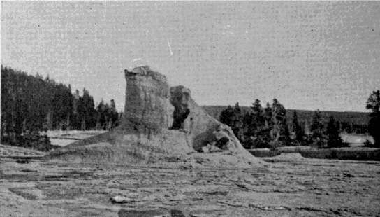
Cone of the Giant Geyser.
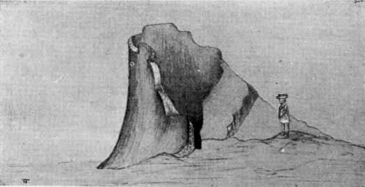
First sketch ever made. [AU]—Trumbull.
Cone of Giant Geyser.
[AU] This sketch and a similar one of the Castle Geyser cone and two of the Yellowstone Falls are the very first ever made of these objects. They were made in 1870 by Walter Trumbull, a member of the Washburn Party, and by Private Charles Moore, one of the escort under Lieutenant Doane. Moore was a man of excellent education and considerable culture, and it was a matter of comment among the members of the Expedition that he should be content with the condition of a private soldier. His quaint sketches of the Falls forcibly remind one of the original picture of Niagara made by Father Hennepin in 1697.
An interesting and singular fact pertaining to this region is that in most cases the springs and geysers have no underground connection with each other. Water in contiguous pools stands at different levels, and powerful geysers play with no apparent effect upon others near by.
It is another interesting question to know whence comes the water for these geysers and hot springs. Into the hidden caverns of “Old Faithful” flow nearly a million of gallons per hour. This is a large stream, but it is a mere trifle compared with the entire outflow of hot water throughout the Park. The subterranean passages by which the necessary supply is furnished to all these thousands of springs, certainly constitute the most intricate and extensive system of water-works of which there is any knowledge.
Not least wonderful of the features of the great geysers are the marvelous formations which surround them, more exquisitely beautiful than any production of art. They are really much handsomer than those to be found around the ordinary quiescent springs. The falling or the dashing of the hot water seems to be in some way essential to the finest results. To say that these rocky projections simulate cauliflower, sponge, fleeces of wool, flowers or bead-work, conveys but a feeble hint of their marvelous beauty. It is indeed a [170] most interesting fact that nature here produces in stone, by the almost mechanical process of deposition from cooling water, the identical forms elsewhere produced by the very different processes of animal and vegetable life.
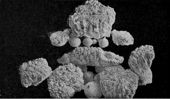
Specimens of Geyserite.
These formations are all silica and are of flinty hardness. Bunsen, and Prof. Le Conte following him, assert it to be a rule that the presence of silica in the water is essential to the development of a geyser. In one sense this is true, and in another it is not. Should the heated waters find a ready-made tube, like a fissure in solid rock, this would serve for a geyser tube as well as any other. The Monarch Geyser, in Norris Geyser Basin, seems to have originated in this way. But in the general case, geyser tubes are built up, not [171] found ready made. In such cases silica is an indispensable ingredient of the water. A calcareous deposit, like that at Mammoth Hot Springs, would lack strength to resist the violent strain of an eruption. So it is found to be a fact that silica is the chief mineral ingredient in the water of all important geysers.
HOT SPRINGS.
Under this general head will be included all thermal phenomena of the Park, except the geysers. The term will cover the quiescent springs, the boiling springs, the mud springs, or “paint pots,” and the steam vents and fumaroles.
The quiescent spring seems to stand at the opposite pole from the geyser. The conditions are such that the water nowhere reaches a temperature sensibly above the boiling point. The surface therefore steams quietly away, unruffled except by the passing breeze.
The great attraction of these springs is in the inimitable coloring of the water. It is not simply the beautiful green or blue of great depths of clear water. In no ordinary pool can one find all the colors of the spectrum, flitting about, as though seen through a revolving prism. Sometimes there is an iridescent effect similar to that of a film of oil upon water; but there is no oil here. There are doubtless many contributing causes that produce these remarkable effects. There is first a great depth of clear water which always presents a beautiful appearance. Then there are the mineral deposits on the sides of the crater, producing indefinite reflection, the effects of which are multiplied by the refractive power of the water. The mineral ingredients dissolved or suspended in the water doubtless add to the effect.
The hot springs on the Gardiner River are wholly [173] different in character from those in any other part of the Park. The water of these springs holds carbonate of lime in solution while most of the others contain silica. To this fact must be attributed the peculiar character of the formations at Mammoth Hot Springs. Wherever the deposits of springs are calcareous, the character of the formations is the same, and generally different from those produced by the deposit of silica. They rise in terraces one above another, and mold for themselves overhanging bowls of transcendent beauty in form and color. In the tints displayed by the water, however, these springs are not unlike others in the Park.
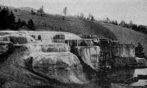
Cleopatra Terrace.
The rims about the quiescent springs are often very beautiful, and the observer is astonished to see how they stand up above the general surface of the ground so evenly built that the water has hardly a choice of [174] route in flowing away. Tyndall, however, makes this puzzling phenomenon clear. He says:
“Imagine the case of a simple thermal siliceous spring, whose waters trickle down a gentle incline; the water thus exposed evaporates speedily, and silica is deposited. This deposit gradually elevates the side over which the water passes, until finally the latter has to take another course. The same takes place here; the ground is elevated as before, and the spring has to move forward. Thus it is compelled to travel round and round, discharging its silica and deepening the shaft in which it dwells, until finally, in the course of ages, the simple spring has produced that wonderful apparatus which has so long puzzled and astonished both the traveler and the philosopher.”
The boiling spring is intermediate between the quiescent spring and the geyser. The circulation is sufficiently free to prevent a great rise of temperature in the lower depths of the tube, and nothing more than a surface ebullition, often extremely violent, results. These springs are generally objects of secondary interest. They are simply enormous caldrons; any kettle placed over a brisk fire simulates their action on a small scale.
The mud springs, or Paint Pots, as they are now always called, are extremely curious phenomena. They are caused by the rising of steam through considerable depths of earthy material. The water is just sufficient in quantity to keep the material in a plastic condition, and the steam operates upon it precisely as it does upon a kettle of thick mush. Generally there are various mineral ingredients, mostly oxides of iron, which impart different colors to different parts of the [175] group. As the steam puffs up here and there from the thick mass, it forms the mud into a variety of imitative figures, prominent among which is that of the lily. These figures immediately sink back into the general mass, only to be formed anew by other puffs of steam. The material is so fine as to be almost impalpable between the fingers. Lieutenant Doane, however, justly observes that “mortar might well be good after being constantly worked for perhaps ten thousand years.”
Other phenomena very common throughout the Park are steam vents or fumaroles in which there is no water or only a very small quantity. They are not ordinarily of much popular interest, although there are a few remarkable examples. Among these may be mentioned the Black Growler in the Norris Geyser Basin, and Steamboat Spring on the east shore of the Yellowstone Lake.
The hot spring areas of the Park are both numerous and extensive. They abound throughout the valleys of the Yellowstone, the Madison, and the Snake Rivers, and the number of individual springs is several thousand.
FOSSIL FORESTS OF THE YELLOWSTONE.
A region of great popular and scientific interest in the Yellowstone Park, although as yet hardly known to the tourist, owing to the incomplete condition of the road system, is that of the Fossil Forests in the north-east corner of the Park. The facts which have been brought to light concerning the origin of these forests are worthy of particular consideration.
The trees are found to occur in different planes or horizons of growth, one above another, until the whole series represents a thickness of many hundreds, and possibly thousands, of feet. Going back to the first of these growths, it is found to have been destroyed by an outpouring of volcanic material, which partially or wholly submerged it. After the flow had ceased, the ordinary atmospheric and aqueous agencies began work, eroding the surface in some places and depositing the products of erosion in others, while vegetation rapidly covered the newly-formed soil. A subsequent flow destroyed this second growth and gave a new horizon, on which the same process was repeated. This continued until there were at least nine, and probably twelve, of these consecutive growths.
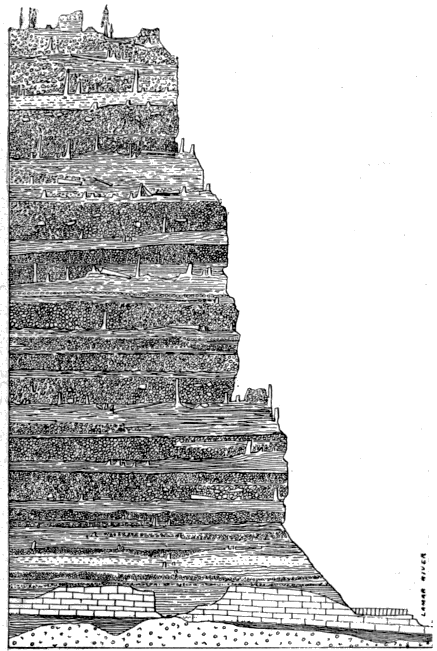
Section of Amethyst Mountains.
The lava flows in this particular section do not seem to have been characterized by great heat. They were composed of volcanic agglomerate, in which there was a large admixture of mud and water, with sufficient heat to destroy life, but not to char or consume its products. The percolation of siliceous waters gradually turned the arboreal vegetation into stone [178] by the process of substitution, and thus preserved in these silent monuments a record of the events which once transpired there. When the last of the eruptions had ceased, there existed in this locality a vast depth of volcanic ejectamenta, composed of many layers, on each of which was standing, buried in the layer next above, the trunks of extinct forest growths.
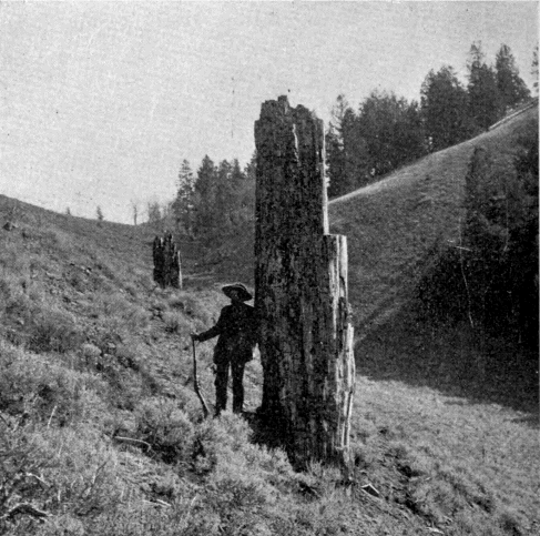
Petrified Trees near Yancey's.
After the cessation of volcanic activity, the eroding agencies of the Quaternary Period carved out the valley of the Lamar River through these accumulated flows, and laid bare the remains of their vegetable [179] growths. To-day the tourist may see upon the slopes of Specimen Ridge, side by side, the living and the dead, the little conifers of present growth and the gigantic trunks of unknown species which flourished there eons ago.
Some of the petrifactions are very perfect. Roots, bark, parts showing incipient decay, worm holes, leaves—all are preserved with absolute fidelity. The rings of annual growth may be counted, and these indicate for the larger trees an age of not less than five hundred years. Some of the stumps are fully ten feet in diameter. Here and there the ponderous roots stand imbedded in the rock face of the cliff, where erosion has not yet undermined them. In one case, a large tree that had fallen before petrifaction lies partly exposed, both ends being still imbedded in the rock. Some hollow trees show interiors beautifully lined with holocrystalline quartz.
How long it took each growth to reach maturity; how long it flourished afterward before destruction; and how long the several lava flows suspended vegetable growth; are matters largely conjectural. But at the very lowest estimate the time represented by these various accumulations can not be less than five thousand years.
That these early trees were of a different species from those which now flourish there, need not excite surprise, for climatic and other conditions are wholly changed. But an equal difference seems also to have prevailed between the successive growths, the trees of which were not only unlike each other, but nearly all were of species hitherto unknown to science. Fortunately the rare perfection of some of the specimens, [180] particularly of the leaves and bark, have greatly simplified their classification, and have given valuable clues to their geologic age.
The products of these petrifactions in time strewed the surface of the ground with such an abundance of specimens as to give the locality its present name. Most of the lighter specimens, and some of the heavier, have been carried away.
Besides the general interest of these old forests to the casual observer, they are of great value to science, for probably in no other part of the globe can a similar chapter of its history be found more clearly recorded.
FAUNA OF THE YELLOWSTONE.
The universal curiosity of people to see what are popularly called wild animals, especially those larger species which never frequent the precincts of civilization, is a fact of which it is not easy to give a philosophical explanation. In this country the rapid disappearance, amounting almost to annihilation, of the large game is looked upon as a great misfortune; and in later years there has arisen a fixed purpose that protection shall be secured for the surviving remnants of those species which once with the red man held possession of the continent. The statutes of nearly every state give evidence of the universality of this sentiment.
As a means of accomplishing such a purpose, no institution promises to be more effectual than the Yellowstone Park. It ought, in this respect, to be a complete realization of Catlin’s dream. Its importance as a game preserve was recognized in the Act of Dedication, and has become more and more pronounced as acquaintance with it has increased.
The Park is fortunately better adapted for this purpose than any other tract of similar extent in America. It offers very little to tempt the cupidity of man. Its mineral wealth is buried so deeply under the lava that no miner will ever reach it. Its altitude and climate unfit it for agriculture. Its forests, though excellent for shade, are of little value for lumber. But as a [182] home for the native species of the continent, it possesses unrivaled advantages. These are admirably summed up in the following paragraph from the pen of Prof. Hague:
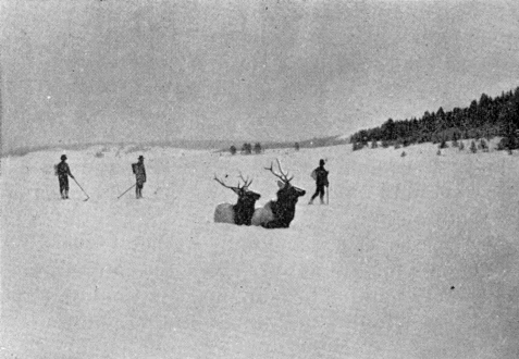
Park Elk.
"The broad expanse of forest incloses sequestered nooks, and enticing grassy parks, with absolute seclusion in mountain recesses admirably adapted for the homes of wild animals. It is the great diversity of its physical features, offering within a restricted area. all the requirements for animal life, which fits it for the home of big game. Abundant food supply, shelter from wind and weather in winter, cool resorts on the uplands in summer, favorable localities for breeding purposes and the rearing of young, all are found here. The Park supplies what is really needed—a zoological reservation where big game may roam unmolested [183] by the intrusion of man, rather than a zoological garden inclosed by fences, and the game fed or sustained more or less by artificial methods." [AV]
[AV] “The Yellowstone National Park as a Game Preserve.” See Appendix E.
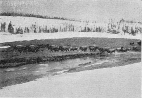
Park Buffalo.
It is a matter of profound regret that the many years of lax administration in the Park to a great degree nullified its purposes as a game preserve. Killing of wild animals was not absolutely prohibited until 1883, and the restricted license previously in force was shamefully abused. Some of the larger species were greatly reduced in numbers, while in a few instances they were practically exterminated. In later years, the elk, antelope, deer, bear and beaver, have rapidly regained their former numbers, and there is no reason to apprehend their extinction. There are now no fewer [184] than 30,000 elk in the Park. For the buffalo, mountain sheep, and a few other varieties, the prospect is good, though not so flattering. The number of buffalo does not probably exceed two hundred, and the possibility of their early extinction has led the Smithsonian Institution to allot a sum of money for the construction of a large inclosure in the Park, where at least a portion of the herd can be kept and be thus more carefully protected. Of the moose, mountain lion, wolverine, lynx, wild cat, marten, and otter the perpetuation is more doubtful. They were too much reduced in numbers during the game slaughtering era. The smaller species, such as porcupines, foxes, gophers, squirrels, woodchucks, and the like, flourish in great numbers.
The tourist often feels a keen disappointment in passing through the Park in that he does not see more game, and he not infrequently expresses positive doubts of its existence. He should remember, however, that it is the nature of wild game to shun the haunts of man. If he will remain for some time in the Park and will frequent those regions remote from the tourists routes he will see game in plenty. In one important instance he rarely goes away disappointed. Bruin generally accommodates him. The fine instincts of that intelligent brute have shown him that it is much easier to get a living from the refuse about the hotels than to forage for it in the wilds of parsimonious nature. Nightfall, therefore, always brings him about to the great delight of the game-seeking tourist. The incidents of each season to which these bears unwittingly give rise are among the amusing features of tourist life in that region.
The herbivorous game generally seek the seclusion of the hills in summer, but the deep snows of winter will not permit them to remain there. At that season they descend to the valleys, of which the most important are the Hayden, the Junction, and the Pelican Valleys, and those about the headwaters of the Snake River. The preservation of these tracts as a free winter pasturage is absolutely essential to the perpetuity of game in the Yellowstone Park.
Although an ornithologist, in passing through the Park, would report a list of native birds so extensive as to lead one to think that they abound in great numbers, there is really a noticeable absence of the winged tribes. There are birds, of course, but in numbers, variety, and beauty not to be compared with those in lower altitudes. The only varieties that would attract attention from any but specialists are the larger birds, which are often quite plentiful about the lakes. There are great numbers of pelicans, gulls, fish-hawks, and cranes, with now and then a wild swan. Eagles are not uncommon, while hawks, woodpeckers, and robins are frequently seen. The sharp-tailed or willow grouse is common, and in the fall of the year astonishing numbers of wild geese and ducks frequent the marshes. There are many other varieties, conspicuous mainly for their paucity of numbers.
Piscatorially speaking, the Yellowstone National Park has no rival as a paradise for the angler. The generous gift of nature and the admirable work of the United States Fish Commission, supplemented by the wise protection of the government, leave nothing to be desired by even the most devout follower of Isaak Walton.
Not all the streams of the Park were originally stocked with fish. Where the waters leave the great volcanic plateau and fall to the underlying formations, the cataracts form impassable barriers to the ascent of fish. In the lower courses of all the streams there were native trout, but above the falls, with one exception, there were none. The exception of the Yellowstone River and Lake is a most interesting one. Why the Falls of the Yellowstone, the highest and most impassable of all, should apparently have proven no barrier, is at first a puzzling question. But the solution is to be found in Two-Ocean Pass. Across this remarkable divide fish may easily make their way, and the Yellowstone Lake is unquestionably stocked from this direction. We thus have an example, probably without parallel, of an extensive body of water on the Atlantic slope stocked by nature with fish from the Pacific.
The trout of the Yellowstone Lake are to some extent infected with a disease which renders them unfit for eating. In earlier times particularly, this condition was generally prevalent. But more recently the disease seems to be disappearing, and in time it will probably die out altogether.
In 1889 and 1890, the United States Fish Commission undertook to stock all the fishless streams in the Park, and planted about 83,000 yearling trout in the various streams and lakes. The varieties were Brook, Lake, Loch Leven, and Von Behr trout. Recent examination of these plants shows that all have taken decisive root, and that within a few years there will not be a hidden stream or lake in the Park which will be without its attractions for the sportsman.
FLORA OF THE YELLOWSTONE.
The most conspicuous feature of the Park flora is the wide extent of forest growth which covers some eighty-four per cent of its area. This is the more noticeable because the surrounding country below the mountains is practically treeless. The Park forests consist almost exclusively of pine and fir. The trees are generally tall and slender and of little use for lumber. They are usually unattractive in appearance, although in some places among the mountains the spruce and fir attain a size, form and hue of foliage that are exceedingly beautiful.
Among the several species may be noted the following:
Black pine (Pinus Murrayana) so called from the dark hue of its foliage when seen in dense bodies.
Red fir (Pseudotsuga Douglasii) the largest variety in the Park, sometimes attaining a diameter of five feet.
Balsam (Abies subalpina). It flourishes near the snow fields and is the beauty of the forest.
Spruce (Pinus Engelmanni). Like the preceding it flourishes at high altitudes. It is tall and slender, and is good for lumber.
Red cedar (Juniperus virginiana) is found to a limited extent.
Poplar or aspen (Populus tremuloides) flourishes among the sheltered foot-hills.
Dwarf maple is occasionally found.
Willow thickets abound in great abundance.
Of these varieties the first is found more abundantly than all the others combined. In many places it has fallen down and strews the country to such an extent as to be absolutely impassable on horseback. There is very little timber of marketable value, and at first thought it would seem that nature has here lavished her energies in a most wasteful manner.
But the great value of these forest growths, is their agency in the conservation of a water supply for the surrounding country. A glance at the map will show that the Park is in the midst of a vast arid region extending far into the surrounding states. The reclamation of these desert wastes, and their conversion into productive lands, can be accomplished by irrigation alone, and for this purpose the abundant streams which descend from the mountains are the indispensable water supply.
From the summit of the Grand Teton, the range of vision covers probably the most remarkable group of river sources upon the earth. To the north rises the Missouri which flows three thousand miles through Montana, the Dakotas, Iowa, Nebraska, Kansas and Missouri. To the east rises the Yellowstone, which, after leaving the Park, flows four hundred miles through southern and eastern Montana until it unites with the Missouri. From the eastern foot-hills of the Absaroka and Shoshone Ranges flow the Wind and Big Horn Rivers through the extensive valleys of the same names in Wyoming and Montana. Southwardly, across the Wind River Range rises the Platte which flows eastward eight hundred miles through [189] Wyoming and Nebraska. From the west flank of these mountains issue the tributaries of the Green River (afterward the Colorado) which flows through Wyoming, Utah and Arizona into the Gulf of California. Finally, interlaced with the sources of the Yellowstone, and the Missouri, are those of the Snake River which flows through Wyoming, Idaho and Washington into the Columbia, and thus reaches the Pacific.
Not only do these streams rise in this limited area; they derive from it most of their waters. In the arid lowlands they receive but slight accessions, and often actually shrink under evaporation. It is therefore from a relatively small tract of country that the future water supply must come for portions of ten states in the great arid belt of the west.
The conditions which nature has established around this remarkable fountain-head are admirably adapted for the creation and maintenance of an unlimited water supply. Over an area of more than 5,000 square miles there prevails an average altitude of perhaps 7,500 feet; sufficient to insure enormous annual snowfalls, but not so great as to prevent their complete melting in summer. But, that they may not melt too rapidly, the whole region is covered with a thick forest growth cutting off the intense rays of the summer sun, and covering the ground with a vegetable mold through which the surface waters filter but slowly. It is a conservative estimate, based upon observations in connection with road work in the Park, that these forests prolong the melting of the snows from four to six weeks. This condition greatly lessens the liability to sudden floods, and maintains a generous supply of water far into the summer.
It has been estimated [AW] that from the Park alone, at low water, there flows per second 4,000 cubic feet of water. If the time ever comes when this supply is so far used as to threaten exhaustion, there will be found in the basin of Yellowstone Lake the most perfect facilities in the world for the construction of an artificial reservoir of almost limitless capacity at a comparatively insignificant cost. A dam could be thrown across the gorge at the first rapids in the Yellowstone below the Lake, and without injuring the natural condition of that region, could easily be made to quadruple the present capacity of the Lake.
[AW] By Dr. William Hallock, United States Geological Survey.
The Park with its contiguous area thus presents magnificent possibilities in the development of the surrounding country—possibilities of which its founders little dreamed, but which they unconsciously foreshadowed when they declared that this region should be forever set apart for the “benefit” as well as for the “enjoyment” of the people.
Besides its wealth of trees, the Park produces other interesting flora. Interspersed among the forests and ornamenting the open glades are flowers and shrubs in endless profusion. We quote from the description of one of the early visitors:
"The choke-cherry, the goose-berry, the buffalo-berry, and black and red currants, are found along the streams and in moist places of the middle and lower altitudes. The meadows and hill-sides are spangled with bright-colored flowers, among which may be noted the bee-larkspur, the columbine, the harebell, the lupine, the evening primrose, the aster, [191] the painted cup, the gentian, and various kinds of euphorbia. It is not uncommon to find daises, buttercups, forget-me-nots, white-ground phlox, and other field flowers flourishing in profusion near the melting snow banks during the month of August. Scarcely a night throughout the year passes without frost, even though the temperature by day is over 80 F., so that all forms of vegetation in the Park grow and bloom under somewhat unusual conditions. Indeed, when ice forms in the water-pails of camping parties during the night, as often happens, and the petals of the flowers become crisp with frost; even then the blooms are not harmed, but thaw out bright and fresh when the hot sun touches them."
The flowers form a most attractive feature of the Park, and give an interesting study of the way in which altitude and temperature affect well known varieties. It is only after a second look that one can trace in the mountain dandelion, huckleberry, and other species a resemblance to those of lower altitudes. The extreme shortness of the season causes vegetation to mature quickly, and before the flush of spring has disappeared from the leaves the palor of autumn makes its appearance.
The mountain grasses are generally abundant in the open country and even in many places among the forests. The writer just quoted says:
"The pasturage on the many open spaces is excellent, the mountain meadows being covered with a mat of nutritious grasses. The predominating variety is the bunch grass, upon which the horses of tourists generally subsist, keeping in good condition without the need of oats. Among other kinds, are the blue joint, [192] fescue, and beard grasses, as well as Alpine timothy, all of which grow luxuriantly."
The early autumns tinge the foliage of the willow parks and other groups of shrubbery with a wealth of color not often seen elsewhere. Even the frost on the grass upon sharp mornings seems to have a peculiar beauty, and one may trace terrestrial rainbows in all the perfection of those set in the sky.
THE PARK IN WINTER.
From the end of September to the end of May the Park is closed to the tourist; that is, the hotels do not receive guests, and camping is too precarious to be attempted. It is generally possible, however, to get into the Park as late as the middle or end of November, very rarely as late as Christmas. In May, the snowfalls are light, but the accumulations of the previous winter render traveling out of the question. With great difficulty the hotel company reaches its nearest hotels as early as May 16. Some of the roads remain impassable fully a month later.
What the fall of snow is in the upper Park has never been determined; but at Mammoth Hot Springs, altitude 6,200 feet, an average for six years, from November to April inclusive, is ten feet per year, with a maximum of fifteen feet and a minimum of five. But on the Park Plateau, 1,000 to 1,500 feet higher, the fall is certainly much greater. No doubt its light depth aggregates twenty feet. The weight of this snow often destroys the railing of bridges and injures the buildings of the Park.
The drifts accumulate in phenomenal magnitude. No matter how deep a ravine may be, the wind will pile the snow up in it until it is level with the surrounding country. Some of these drifts on the mountain sides are hundreds of feet deep and never entirely melt away. Even on the general plateau [194] they last until the middle of July. The Cañon Hotel is almost buried every winter. The snow actually reaches the second story windows, and the drift behind the hotel would last throughout the summer were its melting not facilitated by cutting it in pieces with shovels. It verily seems that all the conditions of climate here conspire to make this region one of the snowiest in the world.
Of course, general access to the Park under such conditions is wholly out of the question. Only on snow-shoes is it possible at all. The hotel company has a watchman at each of its buildings, who drags out a lonely existence through the two hundred days from November to May. He can talk over the telephone line with Mammoth Hot Springs, and at long intervals he receives a call, and perhaps mail, from “Telephone Pete,” who travels the line to keep it in order. In some places, also, small squads of soldiers are stationed for the winter.
The art of traveling by snow-shoe is a thoroughly interesting one, notwithstanding the fact that it is about the most difficult method of travel known and is rarely resorted to except from sheer necessity.
The instrument used in the Park for this purpose is called a ski (pronounced skee). It is a long slender strip of wood—ash, Norway pine, or hickory—some twelve feet long, four or five inches wide, and just thick enough to give needed strength. About midway of its length is a strap through which the toe is slipped and by which the foot pulls the ski along. The bearing surface of the two skis is about eight square feet, and holds the weight of the body even in soft snow without sinking more than a few inches. [195] The bottom surface is polished smooth and then rubbed with a mixture of tallow and beeswax to make it free from friction. A pole is an important accompaniment, aiding to slide the traveler along and steady him on the skis. It also serves as a brake in descending steep hills, the traveler sitting astride it and bearing the rear end into the snow.
Down hill work is indeed glorious. No express train can rival the ski for speed. Its only drawback is danger of accident. On level country ski traveling is simply walking on a board walk, except that the pedestrian carries the board with him, and makes and unmakes the road as fast as he goes. This is hard enough, especially if the snow is sticky, but when it comes to up hill traveling it is a truly laborious matter. If the hill is steep, there is danger of losing one’s grip on the snow and sliding backward down the hill. Where the ascent is too steep to work up by direct forward movement, “corduroying” is resorted to. The traveler works up sidewise, stepping up a foot or so with the upper ski and following with the lower. Generally this sidewise movement is combined with a slight forward movement, the skis being pointed up hill at as steep an inclination as they will hold.
The dress and equipment of the snow-shoe traveler are reduced to a minimum consistent with protection from the climate. This protection is really needed only at camping places, for the extraordinary exertion of traveling keeps the body in a continuous glow of warmth. Generally, warm woolen underwear, with canvas surface garments to keep out the wind and to shed snow, are the essential features of the dress. No overcoat is worn, but a tightly drawn belt takes its [196] place. The feet are the weak point. “Natural wool socks, then a pair of Indian moccasins, then a pair of heavy gray army socks, then Arctic overshoes and leggings,” is the description of an equipment actually used. A broad hat is frequently worn to keep snow out of the neck, and colored glasses are indispensable to prevent snow blindness.
Baggage is limited to the strictest necessities, and is so packed that it will rest uniformly on the back from the shoulders to the hips.
No eating of snow or drinking of water can be safely indulged in while en route. The traveler must go strictly “dry” between meals.
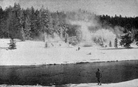
Geyser Basins in Winter.
Of course traveling of this sort is attended with much peril. A man must rely wholly on himself. No wagon or saddle is available if he is injured or sick. Heavy storms may blind him and cause him to lose his way. In short, a snow-shoe trip through the Park [197] is an undertaking which requires a vigorous physique, a determined will, and a good fund of courage. Very few, except those whose duty has required it, have ever made the attempt. But it is the unanimous verdict of those who have, that, glorious as the Park is in summer, it is even more glorious in winter. One can readily understand this to be so. Evergreen forests never appear to better advantage than when laden with snow. Ice formations always enhance the beauty of water-falls. [AX] The rolling open valleys of the Park must be doubly beautiful when robed in drifted snow. It is a pity that this silvery landscape should forever remain excluded from the general view.
THE PARK AS A HEALTH RESORT.
The climate of the Yellowstone National Park, to any one with a fair reserve of health, is of the most beneficial kind. The general public will be interested in the subject only as it relates to that season when it is possible to visit the Park.
For the six months beginning with May, the average temperature will not vary much from the following figures, Fahrenheit:
| Maximum. | Minimum. | Mean. | |
| May | 77° | 25° | 49° |
| June | 87° | 30° | 55° |
| July | 91° | 36° | 64° |
| August | 90° | 36° | 61° |
| September | 85° | 25° | 54° |
| October | 72° | 18° | 41° |
These temperatures are for Mammoth Hot Springs. For the Park Plateau they should be diminished by not less than ten degrees. No month of the year in that region passes without ice-forming frosts. It will be seen that during June, July, August, and September, the thermometer makes excursions to the neighborhood of the nineties. This, however, is only in the middle of the day, and is due to the direct intensity of the sun’s rays. No such heat pervades the general atmosphere. As soon as the sun is near setting, the temperature falls rapidly. The night temperature rarely gets above 55° or 60°, and averages [199] scarcely half as much. The Park is noted for its delightful sleep-giving qualities, which constitute no small part of its claim as a health resort.
Summer in the Park is comparatively short. It may not be strictly true that “the Park has only three seasons, July, August, and Winter,” but it is true that July and August are the only two months free from the ordinary characteristics of winter. Snows are frequent in June and September, while May and October are well on the snowy side of the year. July and August are the Park summer. The weather is settled. The air is pure and bracing and not too cold. The long imprisoned vegetation bursts suddenly into full life and beauty, and in a short period take place all the changes which require months in lower altitudes.
That there is life and health in that summer atmosphere, no one who has breathed it will deny. At the same time, as has already been hinted, it is healthful only for those who have some foundation to build upon. Persons suffering from any form of heart disease or advanced pulmonary trouble, or those greatly reduced in strength from any cause, would better stay away. The altitude and sharp air might prove too severe.
A matter which has naturally attracted considerable inquiry is the therapeutic value of the mineral springs of the Park. The superstitious faith in the efficacy of mineral waters to restore health, which has characterized mankind in all ages, caused the physically afflicted to hail the discovery of that region as the promised fountain of new life. The first explorers to ascend the Gardiner in 1871 found “numbers of invalids” [200] encamped on its banks, where the hot waters from Mammoth Hot Springs enter the stream; and it is recorded that “they were most emphatic in their favorable expressions in regard to their sanitary effects.”
But this impression was very evanescent. No one now goes to the Park because of its mineral waters. Nevertheless, it would be wholly premature to assume that there is no medicinal virtue in them. Certainly there is in the Park almost every variety of mineral spring; there are abundant and luxurious waters for bathing; and it is not at all improbable that the opportunities afforded in this region may yet be utilized to the great advantage of the public.
But for health-giving qualities, the Park will never be dependent on its mineral waters. Its true value lies in other and more potent influences. The pure water of its snow-fed streams, the exhilarating atmosphere, the bracing effect of altitude, the wholesome fatigue of daily rambles over the rough, mountainous country, the fragrant odor of the pine boughs which every-where pervades the atmosphere, and, above all, the beautiful and varied scenery, which exalts the mind and diverts the attention from cares that are too often the real cause of physical ills—these are the true virtues of the Yellowstone Park as a health resort.
ROADS, HOTELS, TRANSPORTATION.
The Park, as is well known, is a very extensive tract of country, and its various points of interest are widely separated from each other. The question of ways and means for getting comfortably through it is an all-important one. If the roads are bad, the hotels ill-kept, or the transportation uncomfortable, no amount of grandeur of natural scenery can compensate for these defects. In making a tour of the Park, the visitor travels not less than 150 miles, sometimes considerably more, and remains in the Park about one week. He is thus quite at the mercy of those who have the management and control of those matters which form the subject of this chapter.
The road system of the Park, when completed, will comprise a belt line, connecting the principal centers of interest; approaches, by which access may be had to the Park from different directions; side roads, leading from the main route to isolated points of interest; and trails, by which pack outfits can reach desired points to which regular roads will never be built.
The belt line includes Mammoth Hot Springs, Norris Geyser Basin, Lower Geyser Basin, Upper Geyser Basin, the Yellowstone Lake, the Grand Cañon, and Junction Valley. A cross-road passes from Norris to the Grand Cañon.
The approaches are not all yet selected, but in time there will be at least one on each side of the Park.
Trails are important adjuncts of the Park road system. They were long ago selected and opened up, and they are of great importance in patroling the Park. They are also much used by those tourists who remain for a considerable time.
The mileage of the completed road system will be about as follows:
| Belt line | 163 | miles. |
| Approaches | 105 | " |
| Side roads | 22 | " |
| Total mileage of Park system, exclusive of trails | 290 | " |
In regard to construction, it is hardly necessary to say that nothing but the best macadamized roads should be built. The inherent difficulties of the work are great. The soil in many places is of the most wretched character. The country is exceedingly rough. The streams are almost without number. The snow lies on some of the roads until the middle of June. The mud in the wet season is bad, and the dust of the dry season is worse. The soft volcanic rocks, which so generally prevail, make poor road metal. But all these difficulties can be overcome, if Congress will but provide for a systematic completion of the project. At present, the annual allowance is too small to promise any thing like good work, and it will be many years before the hopes of the government engineers in the matter will be realized.
The work itself is as attractive as ever falls to the lot of the road engineer, and it is doubtful if another opportunity exists to develop a road system which, if properly done, will reflect so much credit upon the [203] government building it. It is used by visitors from all lands. It passes through every variety of scenery. It presents every known problem of road engineering. In short, it combines all the elements to make it, when complete, one of the noted highways of the world.
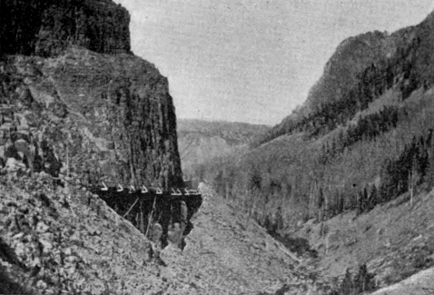
Kingman Pass. (Showing roadway along side of cliff.)
It is not impossible that the tourist may yet be carried by boat from the west shore of the Lake to near the head of the Falls, nor that a bridge worthy of its surroundings—an arch of the native rock so studied as to simulate a natural bridge—will span the river near the Upper Falls and give access to the many splendid views from the right bank of the Grand Cañon.
The tourist transportation of the Park is done mostly by coach, ordinarily with four horses each. [204] Surreys and saddle horses are also provided when desired. The present system is the result of long development, and is very satisfactory. With proper roads, it would be all that could be desired.
Electric transportation in the Park has often been suggested, but there are certain grave objections, to be discussed in a later chapter, which will probably always prevent its introduction.

Yellowstone Park Coach.
When the hotel system of the Park is complete, there will be no fewer than seven good houses and three lunch stations along the belt line and approaches. The hotels will be at Mammoth Hot Springs, Norris Geyser Basin, Lower Geyser Basin, Upper Geyser Basin, Yellowstone Lake, Grand Cañon, and Junction Valley. The present management of the hotels has developed into a very efficient system. It is conducted by a single company whose business headquarters [205] is at Mammoth Hot Springs, from which point all supplies are shipped. A telegraph line connects it with points in the interior and with the outside world. The manager of each hotel knows in advance the number of guests he must provide for, and the convenience of the tourist is thus carefully arranged beforehand. With a reasonable extension and development of the present system, the Park will be admirably equipped in this respect.
Besides the regular tourists—those who make the usual trip, stopping at the hotels—there are hundreds who pass through the Park with camping outfits. During the months of July and August and early September, this is by no means an undesirable method. It is less comfortable, to be sure, than the ordinary method, but at the same time it is less expensive and more independent. In the latter part of August, the Park fairly swarms with these camping parties. They give the authorities plenty to do, for the danger of forest conflagrations from their camp fires is very great.
ADMINISTRATION OF THE PARK.
The administration of the Park is assigned by law to the Secretary of the Interior, who delegates his authority to a local Superintendent. By statute, also, the Secretary of the Interior is authorized to call upon the Secretary of War for such details of troops as may be necessary to protect the Park. Owing to the failure of Congress to provide for a civilian Superintendent and police force, since 1886, the Secretary of the Interior has found it necessary to avail himself of this second statute, so that the present working of the Park administration is on this wise:
An army officer, commanding the troops of the Park, is the representative of the Secretary of the Interior, and is called the Acting Superintendent of the Park, on the assumption that the old régime of civilian Superintendents is only temporarily suspended. The Superintendent is charged with the enforcement of the rules and regulations provided for the government of the Park. As to all such matters, he receives his instructions direct from the Secretary of the Interior, and he annually submits to that official a report upon the condition of the Park. For a police force, he has two troops of cavalry, which he stations throughout the Park as necessity requires. He has also one civilian scout, paid for from the appropriation for the army, whose duty it is to patrol the 5,000 [207] square miles, more or less, in the original reservation and the forest reserve! [AY]
[AY] A portion of the latest appropriation for the Park is authorized to be expended in the employment of additional scouts. This policy ought to be continued.
The specific duties which form the burden of the Superintendent’s work are:
1. To see that all leases and privileges granted by the Secretary of the Interior to private parties are strictly observed, and that all business conducted in the Park is in pursuance of government authority and in accordance with specific conditions and limitations.
2. The protection of the Park from vandalism. This is a very important matter. The pardonable desire to carry off specimens from the beautiful formations, and the unpardonable craze to cover them with individual names, would, if unrestrained, soon quite destroy what nature, through long ages, has so laboriously produced.
3. The protection of game. All around the Park are hordes of law-breakers, who let pass no opportunity to destroy the surviving species. To avert this calamity requires the utmost vigilance of the Park police.
4. The preservation of forests. This has always been the most onerous and trying duty of Park officials. The importance of the forests is so far-reaching that their destruction would be a public calamity. No exertion can be considered too great which may prevent it.
5. The construction of roads and bridges in the Park.
Other functions which the Superintendent fills are the social duties of his position, which at certain seasons exact much of his attention. Official visitors depend upon him entirely for pilotage through the Park. Private parties bring letters soliciting favors, and on the whole he finds his time well occupied with these pleasant, though sometimes onerous, duties.
The office building of the Superintendent, who is also commanding officer of Fort Yellowstone, is at Mammoth Hot Springs. A pretty little garrison is built upon the white formation opposite the hotel, and in winter, the whole military force, except small detachments in various places, is gathered at that point.
At Mammoth Hot Springs are also located the post-office and jail, and at this point the judicial officers of the Park hold court to try offenses against the Park statutes and regulations.
A TOUR OF THE PARK.
Preliminary.
In the following description there will be mentioned in succinct outline all the notable features of interest in the Yellowstone National Park. For more detailed information, the reader is referred to the list of names in "Appendix A."
The necessary limit of space forbids any thing like extended description, even if the inherent difficulties of such a task would permit. Captain Ludlow has well stated the nature of these difficulties:
“The Park scenery, as a whole,” he says, “is too grand, its scope too immense, its details too varied and minute, to admit of adequate description, save by some great writer, who, with mind and pen equally trained, can seize upon the salient points, and, with just discrimination, throw into proper relief the varied features of mingled grandeur, wonder, and beauty.”
Of the many who have attempted, with pen or pencil, to reproduce the wonders of the Yellowstone, no one has yet completely satisfied these important requirements. The writer, for his part, will modestly decline any such undertaking, and, like that pioneer explorer, Folsom, will confine his descriptions “to the bare facts.” He will, however, occasionally call to aid those who have seen and written of these wonders. To the early explorers, in particular, who entered this region before it became generally known, [210] its strange phenomena appealed with an imaginative force which the guide-book tourist of to-day can hardly realize. This may account for the fact that some of these explorers, who have never, before or since, put pen to paper with any literary purpose in view, have left in their narratives strokes of word painting which the most gifted writer would find it difficult to excel.
The season selected for the tour will be the early days of July. The rain and snow and chilly air, not uncommon in June, are gone. The drought and smoke of August and September are still remote. Even mosquitoes, so amazingly plentiful at certain seasons (Langford found them on the very summit of the Grand Teton), have not yet made their appearance. It is late enough, however, to call forth in their richest glory the magnificent profusion of flowers which every-where abound in the Park. The air is at its best, full of life and energy, and so clear that it confounds distances and gives to objects, though far away, a distinctness quite unknown in lower altitudes. The skies, as they appear at this season, surpass the sunny skies of Italy, and the tourist will find in their empyreal depths a beauty and fascination forever lacking in the dingy air of civilization. In short, the open air stage trips through that rich mountain atmosphere will form one of the most attractive and invigorating features of the tour.
Without further preliminary, the rôle of guide will now be assumed, and the tourist will be conducted through the wonders of this celebrated country, following, over most of the distance, the present general route.
A TOUR OF THE PARK.
North Boundary to Mammoth Hot Springs.
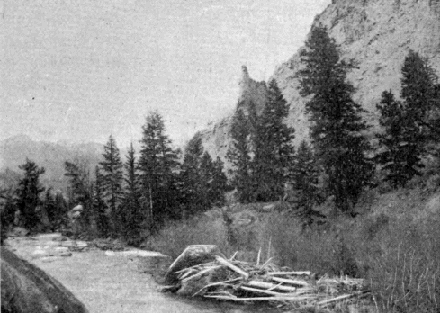
Gardiner River.
Distance five miles. The road for most of the way lies in the valley of the Gardiner. The principal points of interest en route are:
The Junction of the Yellowstone and Gardiner Rivers which determines the north boundary of the Park. It lies in the State of Montana, the state line being two miles further south. The old prospector’s route bore off at this point and kept up the valley of the Yellowstone. [212] Folsom took this route in 1869; so did the Wasburn party in 1870. Hayden and Barlow in 1871 kept along the Gardiner and thus saw the Mammoth Hot Springs.
The Gardiner Cañon is a precipitous valley of loose gray walls suggestive of danger from falling rocks. The nests of fish-hawks here and there crown detached pinnacles. The most striking feature of the cañon is the river, a typical mountain torrent of such rapid fall over its rocky bed that it is a continuous succession of foaming cascades.
Some four miles up the river, at the point where the road leaves it, the tourist gets his first sight of any indication of subterranean heat. This is a large stream of hot water, in early times called the Boiling River, issuing from an opening in the rocks and emptying directly into the river. It is formed of the collected waters of Mammoth Hot Springs which find their way to this point through underground passages. It was here that “numbers of invalids” were encamped when Hayden and Barlow saw the spot in 1871.
From the last crossing of the Gardiner a winding road, which rises 600 feet in its length of one mile, brings the tourist to the world-renowned Mammoth Hot Springs, and to the administrative and business headquarters of the Park.
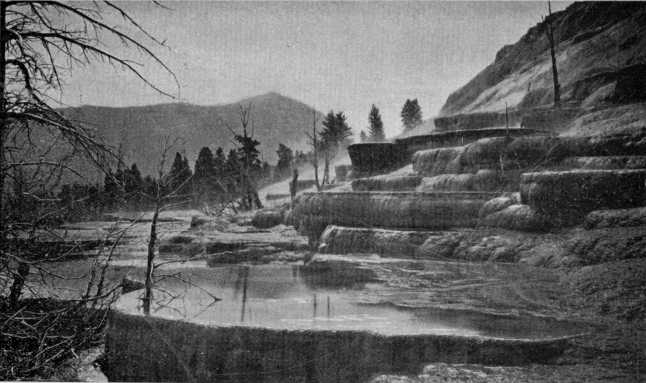
Mammoth Hot Springs.
Bunsen Peak in the distance.
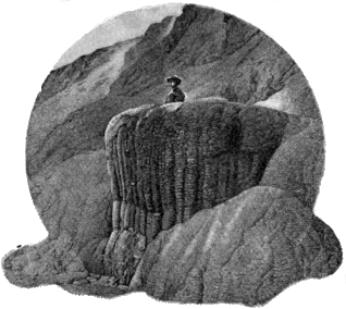
Pulpit Terrace.
First in importance, among the many points of interest accessible from this locality, are the Hot Springs Terraces. These have been built one upon another until the present active portion constitutes a hill rising 300 feet above the site of the Mammoth Hot Springs Hotel. The formation about these springs, it will be remembered, is calcareous, and to this fact is due its distinctive character, so different from the silica formations which prevail nearly every-where else in the Park. The overhanging bowls which these deposits build up are among the finest specimens of Nature’s work in the world, while the water which fills them is of that peculiar beauty to be found only in thermal springs. Speaking of this feature Dr. Hayden says:
"The wonderful transparency of the water surpasses
any thing of the kind I have ever seen in any
other portion of the world. The sky, with the
smallest cloud that flits across it, is reflected in its
clear depths, and the ultramarine colors, more vivid
than the sea, are greatly heightened by constant,
gentle vibrations. One can look down into the clear
depths and see, with perfect distinctness, the minutest
[213]
[214]
ornament on the inner sides of the basins; and the
exquisite beauty of the coloring and the variety of
forms baffle any attempt to portray them either with
pen or pencil."
[AZ]
[AZ] Page 69 Hayden’s Report for 1871. See Appendix E.
Cleopatra Spring, Jupiter Terrace, Pulpit Terrace, Minerva Terrace, the Narrow Gauge Terrace—an incongruous name for a long fissure spring—the White Elephant, another fissure spring, and the Orange Geyser, a very pretty formation, dome-shaped, with a pulsating spring in the top, are among the most interesting of the active springs.
Liberty Cap is the cone of an extinct spring and stands forty-five feet high and twenty feet through at the base.
Bath Lake is a warm pool of considerable size, much used in bathing.
Scattered over the formation in every direction are caves, springs, steam-vents, handsome deposits, and curiosities without number to attract and detain the visitor. Many of them, like Cupid’s Cave, the Devil’s Kitchen, and McCartney’s Cave, are of much interest. In the last-mentioned cave, or, more properly, crater, an elk fell one winter when the crater was level full with light snow. His antlers caught between the sides of the crater, holding him in a suspended position until he perished. He was found the following spring by Mr. McCartney.
Besides the hot springs features, there are other important objects of interest in this neighborhood.
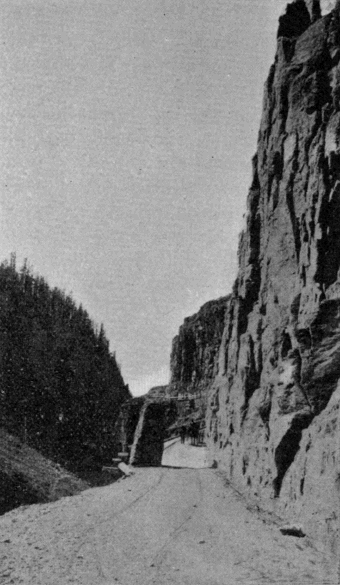
Golden Gate.
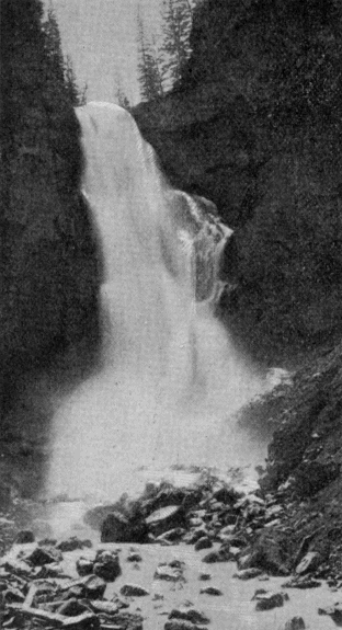
Osprey Falls.
Lookout Hill is a prominent rounded elevation opposite the hotel. Upon its summit is a block-house, built by Colonel Norris, in 1879, as a headquarters building for the Superintendent. The awkward and inconvenient location was selected for its defensible qualities. It will be remembered that the two previous years, 1877 and 1878, had witnessed the Nez Percé and Bannock incursions into the Park.
The Falls and Cañon of the Middle Gardiner, distant four miles from the hotel, are the finest scenery of the kind in the Park, excepting only the Grand Cañon of the Yellowstone.
Bunsen Peak is a conspicuous summit located between the Middle and West Forks of the Gardiner. Its western face terminates in Cathedral Rock, a bold cliff that overhangs the valley of Glen Creek.
Golden Gate and Kingman Pass are names applied to the picturesque cañon of Glen Creek. It is justly considered one of the gems of the Park scenery. The skillful engineering feat of carrying the tourist route through this difficult cañon was performed by Lieutenant D. C. Kingman, of the Corps of Engineers, U. S. A., in 1884-5. Rustic Falls is a handsome cataract near the head of the pass. The best view in this vicinity is to be had from above the pass, looking through it toward Mt. Everts.
Besides Bunsen Peak, the tourist will find Terrace Mountain, Sepulcher Mountain, and Electric Peak ever ready to satisfy whatever ambition for mountain climbing he may possess.
The East Gardiner Cañon affords some fine views, and the falls and rapids at its head are extremely beautiful. It is through this cañon that access can most easily be had to the summit of Mt. Everts. This last name is given to a feature which bears almost no [216] resemblance to the ordinary conception of a mountain. It is simply a broad table-land extending from the Yellowstone south and terminating in the lofty and conspicuous bluff just across the Gardiner from Mammoth Hot Springs. The mountain derives its chief popular interest from the Everts episode, which is described in the Appendix under “Mt. Everts.” It is also of great interest to scientific inquirers. The view from the prominent point opposite the forks of the Gardiner is very fine. The whole Mammoth Hot Springs formation and the group of buildings near it; the cañons and falls of the three Gardiners; and the array of mountain peaks across the valley, form a rare and attractive landscape.
Mt. Everts and the surrounding country are the home of the Park antelope and mountain sheep.
As explained elsewhere, Mammoth Hot Springs is the official and business headquarters of the Park. The handsome garrison of Fort Yellowstone is built on the white formation, and with the hotel and transportation buildings, the post-office, and various other structures, gives the place a village appearance not to be seen in any other part of the Park.
A TOUR OF THE PARK.
Mammoth Hot Springs to Norris Geyser Basin.
Distance, twenty miles. The first object of interest, after ascending the long hill above the Springs (four miles), is the Gallatin Range of mountains, which bursts into full view upon emerging from Kingman Pass. Its various peaks—Joseph, Gray, Bannock, Quadrant, the Dome, Mt. Holmes, and others—still retain the heavy snow drifts of the previous winter. Some of these peaks remain in sight for thirty miles along the tourist route.
Swan Lake (4.5 miles) is a little pond on the right of the road.
Willow Park (8 miles) comprises the valley of the lower course of Obsidian Creek. It is a dense growth of willows, and forms an attractive sight, either in the fresh foliage of spring or in its autumnal coloring.
Apollinaris Spring (10 miles) is on the left of the roadway, in a pine forest. Tourists generally stop and try its water.
Obsidian Cliff (12 miles) is composed of a kind of volcanic glass, black as anthracite, which abounds at this point in enormous masses. The Indians once quarried implements of war and the chase here, and many fine arrowheads have been picked up by explorers. The building of the first road along the base of this cliff has some historic celebrity, owing to [218] the novel method employed. It was done by Colonel Norris, who thus describes it:
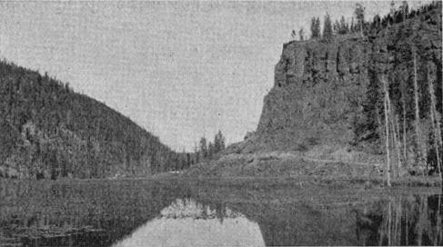
Obsidian Cliff and Beaver Lake.
"Obsidian there rises like basalt in vertical columns many hundreds of feet high, and countless huge masses had fallen from this utterly impassable mountain into the hissing hot spring margin of an equally impassable lake, without either Indian or game trail over the glistering fragments of Nature’s glass, sure to severely lacerate. As this glass barricade sloped from some 200 or 300 feet high against the cliff at an angle of some 45° to the lake, we—with the slivered fragments of timber thrown from the heights—with huge fires, heated and expanded, and then men, well screened by blankets held by others, by dashing cold water, suddenly cooled and fractured the large masses. Then, with huge levers, steel bars, sledge, pick, and shovels, and severe laceration of at least the hands and faces of every member of the party, we rolled, [219] slid, crushed, and shoveled one-fourth of a mile of good wagon road midway along the slope; it being, so far as I am aware, the only road of native glass upon the continent." [BA]
[BA] Annual Report Superintendent of the Park, 1878.
The reader may now be inclined to take issue with our judgment of Norris' practical turn for road building. He will at least readily indorse our opinion of the old mountaineer’s literary ability. (See "Norris Peak," Appendix A.)
Beaver Lake has its outlet opposite the base of Obsidian Cliff. It is formed by ancient beaver dams, now entirely overgrown with vegetation. The old dam extends in a sinuous line entirely across the valley, and, although apparently less than a yard thick, is quite impervious to water. The lake is a great resort for water fowl later in the year.
Roaring Mountain (15.5 miles) is a high hill on the left of the road, with a powerful steam vent near the summit. Nothing which can now be heard from the road would suggest the name.
Twin Lakes (16 miles) are two exquisitely beautiful ponds, if only seen in a good sunlight and with a tranquil surface. The peculiar green of the water is perhaps to be seen nowhere except in the National Park. A most singular feature of these two lakes is that, although so close together, they never simultaneously exhibit the same colors.
The Frying Pan (17.75 miles) is a small basin of geyserite, on the right of the road, vigorously stewing away in a manner which reminds one of a kitchen spider in operation.
After passing Obsidian Cliff evidences of hot spring action constantly increase, until they reach their climax [220] in the Norris Geyser Basin. There are but few other places in the Park where the odor of sulphur is so general and offensive as on this portion of the tourist route.
Norris Geyser Basin is clearly among the more recent volcanic developments of this region. Its rapid encroachment upon the forest growth, and the frequent appearance of new springs and the disappearance of others, indicate its relatively recent origin. Compared with the Firehole Geyser Basin it is of minor importance; but coming first to the notice of the tourist it receives a large amount of attention. It has only one prominent geyser, the Monarch, which throws a column about 100 feet high. The Constant is visible from the roadway in the bottom of a large tract of geyserite which is unsafe for pedestrians. It makes up in frequency of action what it lacks in power. The most noteworthy feature of the basin has received the appropriate name Hurricane. It is a prodigious steam vent whose violent gusts bear a striking resemblance to the driving blasts of a tempest. It also discharges a large amount of water. The Black Growler, close by the road side, is a similar phenomenon.
Among the less important features of this basin may be mentioned the Congress, Constant, Arsenic, Echinus, Fearless, Pearl, Vixen, Minute Man, and Mew Crater, all geysers; the Emerald Pool, a quiescent spring; and the Locomotive and Mud Geyser, boiling springs.
From the Norris Hotel a drive of three miles up the Gibbon River, on the cross road leading to the Grand Cañon, carries the tourist to Virginia Cascade, a unique and picturesque water-fall in a rocky cañon of considerable beauty.
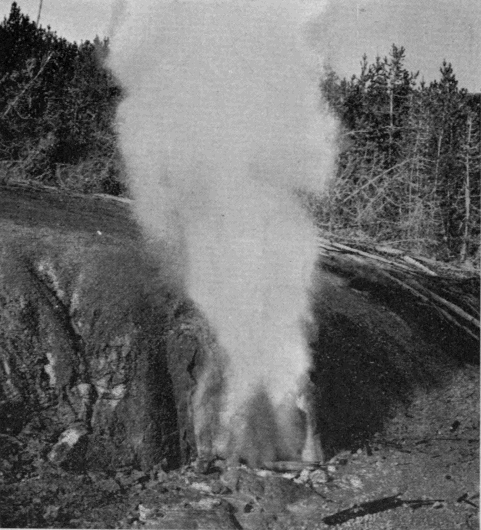
Black Growler.
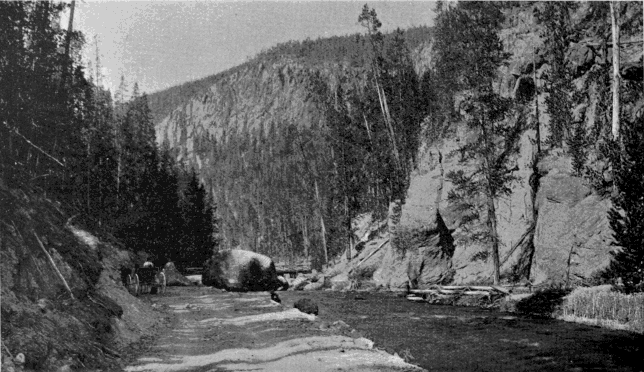
Gibbon Cañon.
A TOUR OF THE PARK.
Norris Geyser Basin to Lower Geyser Basin.
Distance, 20 miles. The road follows the Gibbon River to within three miles of its mouth, then crosses a point of land to the Firehole, and ascends the right bank of the latter stream to the Lower Basin.
Gibbon Meadows (3 miles) is a broad open bottom, sometimes called Elk Park, just at the head of Gibbon Cañon.
The Gibbon Paint Pots (4 miles) are on the left of the road, near the head of the cañon, and one-fourth of a mile away.
Monument Geyser Basin (4.5 miles) is on the high hill just west of the upper end of Gibbon Cañon. It is an interesting spot, but rarely visited owing to its inaccessibility. It was discovered and named by Col. Norris.
The Gibbon Cañon (4.5 to 10.5 miles) affords the tourist one of the pleasantest rides in the Park. The mountains rise boldly from the river on either side, and present several particularly fine views. The road lies close to the river’s edge, and the stream is an important adjunct to the scenery.
Beryl Spring (5 miles) is close to the road on the side opposite the river. It boils violently and discharges a large amount of water. The steam from it frequently obscures the roadway.
The Soda and Iron Spring (7.5 miles), like Apollinaris [222] Spring already mentioned, is a frequent stopping-place for tourists.
Gibbon Falls (8 miles) is a water-fall of very irregular outline, but withal one of much beauty. The road hangs on the side of the cliff far above it, and affords a lovely view of the forest-covered valley below.
About half way between the point where the road leaves the Gibbon River and that where it touches the Firehole, is the junction of the belt line with the western approach which enters the Park by way of Madison Cañon. A beautiful cascade, some distance from the tourist route, may be found on the Firehole River about a mile above its mouth. Just as the road (the old Norris Road) commences to descend from the high plateau between the Gibbon and the Firehole, a glimpse is had of the Teton Mountains. They are among the most striking in the entire Rocky Mountain Region. For half a century after the overland journey of the Astorians, they were the chief landmarks in that trackless wilderness, and long bore the name of Pilot Knobs. They are distinctly visible from every important peak in the Park, although they are themselves outside its limits. As seen from the point, at which we have arrived, they are fifty miles away. They rise precipitously from the west shore of Jackson Lake (also outside of the Park) and with it form a scene of grandeur which ought to be included in the reservation. In 1872, Langford and Stevenson ascended the Grand Teton, being the first white men ever to reach the summit. [BB]
[BB] Some doubt has been expressed in recent years as to the actual accomplishment of this feat. It probably arose from an erroneous statement by Doctor Hayden in his report for 1872 that the granite inclosure was found “on the top of the Grand Teton.” As a matter of fact it was found on a point somewhat lower, and is clearly so stated by Mr. Langford both in an official report to Dr. Hayden (Hayden, 1872, p. 89) and in his “Ascent of Mt. Hayden” (Scribner’s, June, 1873, p. 145). A subsequent explorer, who ascended the mountain to the site of this principal object of interest, came to the conclusion, doubtless as a result of the erroneous account given by Hayden, that this was what Langford and Stevenson called the summit. But the references above given, and a more detailed and circumstantial account furnished by Mr. Langford at the writer’s request, effectually demolish this theory.
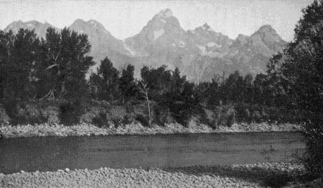
The Teton Range.
The Grand Teton in the center.
They were astonished to find, on a point but little lower than the main summit, a rude shelter of granite slabs evidently put in place by human hands ages ago.
Nez Percé Creek (18 miles) is the largest branch of the Firehole, and is of historic interest from its connection with the Indian campaign of 1877. It forms the north boundary of the Lower Geyser Basin. Two miles beyond it is the Fountain Hotel.
To attempt any thing like a detailed description of the Firehole Geyser regions would be intolerable alike to reader and author. Of the objects of interest, any one of which in other localities would attract marked attention, there are several thousand. In the present description, therefore, only the more important features will be noticed—those notable objects to see which is an indispensable part of any well ordered tour of the Park.
The Fountain Geyser is a typical example of the first class of geysers described in a previous chapter. [224] Its proximity to the hotel (one-fourth mile) causes it to be much visited.
The Mammoth Paint Pots, a little way east of the Fountain, are probably the most prominent example of this class of phenomena in the Park.
The Great Fountain Geyser lies a mile and a half south-east of the Fountain. It is the chief wonder of the Lower Basin, and, in some respects, the most remarkable geyser in the Park. Its formation is quite unlike that of any other. At first sight the visitor is tempted to believe that some one has here placed a vast pedestal upon which to erect a monument. It is a broad, circular table about two feet high, composed entirely of hard siliceous deposit. In its surface are numerous pools molded and ornamented in a manner quite unapproached, at least on so large a scale, in any other part of the Park. In the center of the pedestal, where the monument ought to stand, is a large irregular pool of great depth, full of hot water, forming, to all appearances, a lovely quiescent spring. At times of eruption, the contents of this spring are hurled bodily upward to a height sometimes reaching 100 feet. The torrent of water which follows the prodigious down-pouring upon the face of the pedestal, flows away in all directions over the white geyserite plain. No visitor to the Yellowstone can afford to miss the Great Fountain Geyser.
In this vicinity are several of the handsomest springs in the Park. One in particular lies just across the hot stream which flows a little to the south of the Great Fountain. It is shaped like an egg set endwise [225] in the ground with the upper part of the shell broken off. It is an exquisite trifle.
In a small valley, extending to the north-east from the Great Fountain, are several objects worthy of notice. One of these is an immense hot lake, by far the largest in the Park. Steady Geyser and Young Hopeful, near the head of the valley, are not remarkable in this land of geysers.
The principal attraction of the locality is what has come to be called the Firehole. It is at the extreme upper end of the valley, difficult to find, and unsatisfactory to visit when the wind agitates the water surface. It is a large hot spring from the bottom of which, to all appearances, a light colored flame is constantly issuing, only to be extinguished in the water before it reaches the surface. At times it has a distinct ruddy tinge and it always flickers back and forth like the lambent flame of a torch. When seen under favorable conditions, the illusion is perfect, and the beholder is sure that he has at last caught a glimpse of the hidden fires which produce the weird phenomena of this region. But it is only illusion. Through a fissure in the rock gas or superheated steam escapes and divides the water, just as bubbles do on a smaller scale. The reflection from the surface thus formed accounts for the appearance, which is intensified by the black background formed by the sides and bottom of the pool.
The Lower Geyser Basin has an area of thirty square miles. Conspicuous among its topographical features are the Twin Buttes, two prominent peaks west of the river which dominate the entire basin. A [226] little way south of these is Fairy Fall, a pretty cascade 250 feet high.
There will be included in this chapter, as more properly belonging to it than to the next, a description of the Midway Geyser Basin. Its principal interest lies in the stupendous character of its phenomena.
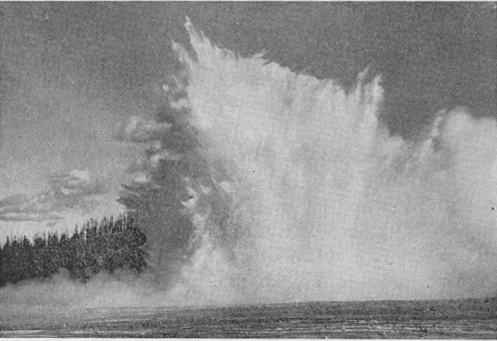
Excelsior Geyser.
Excelsior Geyser, as a dynamic agent, has no equal in the Park. It is really a water volcano, and its eruptions have nothing of the characteristic display of a genuine geyser. Its crater is a vast seething cauldron close by the brink of the Firehole River, into which, in non-eruptive periods even, it pours 4,000 gallons of water per minute. The shape of the crater is irregular. Its dimensions are about 330 by 200 feet, and 20 feet deep. It was not known to be a [227] geyser until 1878, and did not really disclose its true character until the winter of 1881. During the remainder of that year and 1882, it gave continuous exhibitions of its power. Its water column was more than 50 feet in diameter, and at times rose to the enormous height of 250 feet. At such times, it doubled the volume of water in the Firehole River. Its eruptions were frequently accompanied by the ejection of large rocks. A second period of activity took place in 1888, since which time it has remained inactive.
Prismatic Lake is the most perfect spring of its kind in the world. It rests on the summit of a self-built mound, sloping very gently in all directions. Down this slope the overflow from the spring descends in tiny rivulets, every-where interlaced with each other. A map of the mound resembles a spider web, with the spider (the spring) in the center. The pool is 250 by 300 feet in size. Over the lake hangs an ever-present cloud of steam, which itself often bears a crimson tinge, reflected from the waters below. The steam unfortunately obscures the surface of the lake, and one involuntarily wishes for a row-boat, in which to explore its unseen portions. Wherever visible, there is a varied and wonderful play of colors, which fully justifies the name.
Turquoise Spring is another large pool, 100 feet in diameter, and rivals Prismatic Lake in the beauty of its coloring.
The Midway Geyser Basin contains hundreds of other springs, some of them very beautiful, but the Basin is mainly noted for the three features just described.
A TOUR OF THE PARK.
Lower Geyser Basin to Upper Geyser Basin.
Distance, nine miles. Road follows the Firehole River. Midway Geyser Basin, already described, is passed four miles out. No other object of interest is met until the visitor actually arrives at the Upper Basin.
This locality is probably the most popular with the tourist of any in the Park. Its two rivals, the Grand Cañon and the Yellowstone Lake, are so unlike it as not to admit of any comparison. It is the home of the genus geyser, as seen in its highest development. There are fifteen examples of the first magnitude and scores of less important ones. [BC] The quiescent pools and springs are also numerous and of great beauty.
[BC] For list of names of geysers, with heights of eruptions, see Appendix A, VII.
The first important feature en route is the Biscuit Basin, which is reached by a side road leading to the west bank of the Firehole River. It contains a fine geyser and several beautiful springs. The most interesting are the Jewell Geyser and the Sapphire Pool. Near this locality is the Mystic Falls, a fine cascade, on the Little Firehole River.
Artemesia Geyser comes next to the attention of the tourist. It has been known as a geyser only since 1886. It is on the right of the roadway, at a considerably lower level.

The Morning Glory is a little further up stream. In this beautiful object the quiescent pool is at its best. Its exquisite bordering and the deep cerulean hue of its transparent waters make it, and others like it, objects of ceaseless admiration.
The Fan Geyser is close by the Firehole on the east bank, not far above the Morning Glory. The Riverside is also on the east bank at the point where the road crosses the river. It is an inconspicuous object when not in eruption, and one would scarcely suspect it of being a geyser. It spouts obliquely across the river, and not, like most geysers, vertically.
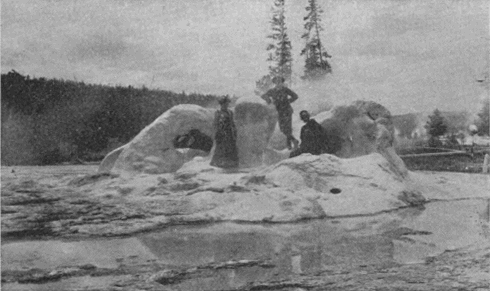
Grotto Geyser Cone.
Next in order, after crossing the river to the Westbank, is the Grotto, remarkable for its irregular and cavernous crater. A little further on, close to the [230] river, stands the broken crater of one of the Park’s greatest geysers, the Giant. Lieutenant Doane compared its crater to a “huge shattered horn.”
A few hundred feet further up stream, still close to the river, is the Oblong. Directly across the road, but a short distance away, is the Splendid, well worthy of its name; and near it, sometimes playing simultaneously, is the Comet.
To the westward from the Firehole, nearly on the divide between it and Iron Creek, is a lovely spring, called the Punch-bowl. Across the divide in the Iron Creek valley is the Black Sand Basin, a unique but beautiful pool. Near it is another attraction, Specimen Lake, so named from an abundance of specimens of partly petrified wood. The limit of curiosities in this direction is Emerald Pool, which competent judges pronounce to be the finest quiescent spring in the Park.
Returning to the Firehole by a different route, we pass a large spring or geyser known as the Three Crater Spring. Its three craters are connected by narrow water ways, making one continuous pool, though fed from three sources.
A thousand feet to the north, stands the most imposing crater in the Park, that of the Castle geyser. It is frequently seen in moderate eruption, but rarely when doing its best. As ordinarily seen, it throws a column of water only 50 or 60 feet, but at times it plays as high as 150 or 200 feet.
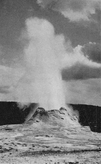
Castle Geyser.
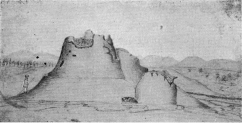
Castle Geyser Cone.
[BD] See foot note, page 168.
Crossing the river to its right bank, nearly opposite the Castle, there are found within a narrow compass three noted geysers, the Sawmill, Turban, and Grand. Of these, the last is by far the finest, and ranks among the very greatest geysers in the world. It was not seen by the Washburn Party, in 1870, but it seems to have been the first geyser to welcome to the Upper Basin the Hayden and Barlow parties in 1871. Captain Barlow says of its eruption: [BE]
"This grand fountain continued to play for several minutes. When dying down, I approached to obtain a closer view of the aperture whence had issued such a powerful stream. A sudden gush of steam drove me away, following which the water was again impelled upward and upward, far above the steam, till it seemed to have lost the controlling force of gravity, and that it would never cease to rise. The roar was like the sound of a tornado, but there was no apparent effort; a steady stream, very graceful and perfectly vertical, except as a slight breeze may have waved it to and fro. Strong and smooth, it continued [232] to ascend like the stream from a powerful steam fire-engine. We were all lost in astonishment at the sudden and marvelous spectacle. The proportions of the fountain were perfect. The enthusiasm of the party was manifested in shouts of delight. Under the excitement of the moment, it was estimated to be from three to five hundred feet in height."
[BE] Page 25, “Reconnaissance of the Yellowstone River.”—See Appendix E.
Further up the river on the same side and at some distance back, are the Lion, Lioness and the two Cubs, an interesting group, including one notable geyser. Half way up a high mound of geyserite which covers a large area on the north side of the river, is an exquisitely beautiful formation called, from its appearance, the Sponge.
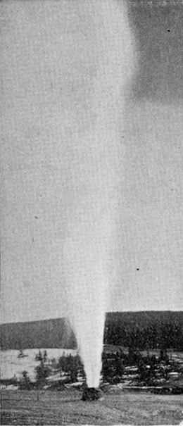
The Bee Hive Geyser.
On the top of the mound is another of the great geysers, thought by the Washburn Party to be the greatest in the world, the Giantess. It belongs to the class of fountain geysers, and when not in action strongly resembles a quiescent spring. Its eruptions are infrequent and irregular, but when it does play it is a sight not to be forgotten. Mr. Langford thus describes the first eruption known to have been seen by white men: [BF]
"We were standing on the side of the geyser nearest the sun, the gleams of which filled the sparkling columns of water and spray with myriad rainbows, whose arches were constantly changing—dipping and fluttering hither and thither, and disappearing only to be succeeded by others, again and again, amid the aqueous column, while the minute globules, into which the spent jets were diffused when falling, sparkled [233] like a shower of diamonds, and around every shadow which the denser clouds of vapor, interrupting the sun’s rays, cast upon the column, could be seen a luminous circle, radiant with all the colors of the prism, and resembling the halo of glory represented [234] in paintings as encircling the head of Divinity. All that we had previously witnessed seemed tame in comparison with the perfect grandeur and beauty of this display."
[BF] “The Wonders of the Yellowstone.” See Appendix E.
Between the Giantess and the river is the Bee Hive, also one of the most prominent geysers. The symmetry of its cone is only surpassed by the regularity of its water column. From an artistic point of view it is the most perfect geyser in the Park. Its slender jet attains a great height and is vertical and symmetrical throughout.
Crossing again to the west bank of the stream and ascending to the very head of the basin, we come to the last and most important of the geysers, Old Faithful. Any other geyser, any five other geysers, could be erased from the list better than part with Old Faithful. The Giant, Giantess, Grand, Splendid, and Excelsior, have more powerful eruptions. The Bee Hive is more artistic. The Great Fountain has a more wonderful formation. But Old Faithful partakes in a high degree of all these characteristics, and, in addition, has the invaluable quality of uniform periodicity of action. It is in fact the most perfect of all known geysers.
To it fell the honor of welcoming civilized man to this region. It was the first geyser named. It stands at the head of the basin and has been happily called “The Guardian of the Valley.”
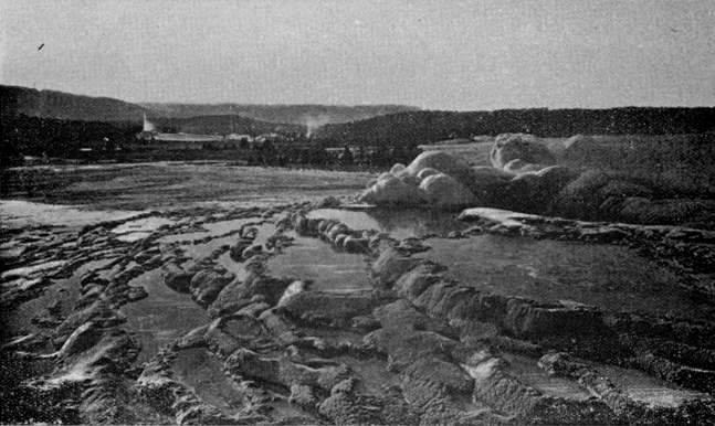
Castle Geyser.
Geyser in action.
Crater of Old Faithful.
Upper Geyser Basin.
It is located in the center of an oblong mound, 145 by 215 feet at the base, 20 by 54 feet at the summit, and about 12 feet high. The tube, which seems to have originated in a fissure in the rock, has an inside measurement of 2 by 6 feet.
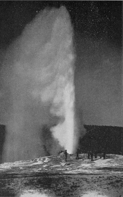
Old Faithful.
The ornamentation about the crater, though limited in extent, is nowhere surpassed for beauty of form and color. In particular, the three small pools on the north side of the crater and very close to it are specimens of the most remarkable handiwork which Nature has lavished upon this region. A singular fact is that the waters in these three pools, although so close together as apparently to be subject to the same conditions, are of different colors. Speaking of these marvelous appearances, Lieutenant Doane says: [BG]
“One instinctively touches the hot ledges with his hands, and sounds with a stick the depths of the cavities in the slope, in utter doubt of the evidence of his own eyes…. It is the most lovely inanimate object in existence.”
[BG] Page 29, “Yellowstone Expedition of 1870.” See Appendix E.
In its eruption this geyser is equally fascinating. It always gives ample warning, and visitors have time to station themselves where the view will be most perfect. The graceful column rises, at first with apparent effort, but later with evident ease, to a height of 150 feet. The noise is simply that of a jet of water from an ordinary hose, only in intensity corresponding to the greater flow. The steam, when carried laterally by a gentle breeze, unfurls itself like an enormous flag from its watery standard. The water is of crystal clearness and the myriad drops float in the air with all manner of brilliant effects. To quote Lieutenant Doane again:
"Rainbows play around the tremendous fountain, the waters of which fall about the basin in showers of [236] brilliants, and then rush steaming down the slopes to the river."
The uniform periodicity of this geyser is its most wonderful and most useful characteristic. It never fails the tourist. With an average interval of sixty-five minutes, it varies but little either way. Night and day, winter and summer, seen or unseen, this “tremendous fountain” has been playing for untold ages. Only in thousands of years can its lifetime be reckoned; for the visible work it has wrought, and its present infinitely slow rate of progress, fairly appall the inquirer who seeks to learn its real age.
It is worth while, however, to note the enormous work which this geyser daily performs. A conservative estimate, based upon an extended series of observations made in 1878 by the United States Geological Survey, shows that the outpour for an average eruption is not less 1,500,000 gallons, which gives 33,225,000 gallons per day. This would supply a city of 300,000 inhabitants. The combination of conditions by which the supply of heat and water, and the form of tube, are so perfectly adapted to their work, that even a chronometer is scarcely more regular in its action, is one of the miracles of nature.
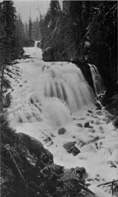
Kepler Cascade.
A TOUR OF THE PARK.
Upper Geyser Basin to the Yellowstone Lake.
Distance, nineteen miles. The route ascends the Firehole River to the mouth of Spring Creek, which stream it follows to the Continental Divide. For seven miles it then lies on the Pacific slope, after which it descends the mountains to the Yellowstone Lake. The drive is one of the most pleasant in the Park, and the scenery is unconventional and wild.
Kepler Cascade (1.25 miles) is a fascinating water-fall. Lieutenant Doane, who first wrote of it, says: [BH]
“These pretty little falls, if located on an eastern stream, would be celebrated in history and song; here, amid objects so grand as to strain conception and stagger belief, they were passed without a halt.”
[BH] Page 27, “Yellowstone Expedition of 1870.” See Appendix E.
We counsel the tourist not to so pass them.
Half a mile up the Firehole, above the mouth of Spring Creek, is the Lone Star Geyser (4 miles). This geyser is conspicuous chiefly for its fine cone. It plays frequently to a height of 40 or 50 feet.
Madison Lake, ten miles further up the valley, is the ultimate lake source of the Madison River. This lake, with possibly the exception of Red Rock Lake, the source of the Jefferson, is further from the sea by direct water-course than any other lake on the globe.
Returning down the Firehole, we enter the mouth [238] of Spring Creek Cañon (3.5 miles), which the road traverses for a distance of two and one-half miles. This narrow, winding, rocky cañon, under the shadow of the Continental Divide, is full of picturesque turns and surprises.
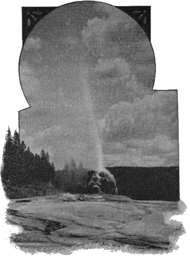
Lone Star Geyser.
The first crossing of the Continental Divide (8.5 miles) is through a narrow cañon, Craig Pass, hemmed in by precipitous cliffs, inclosing a lily-covered pond, Isa Lake, which rests squarely upon the doubtful ground between the two oceans.
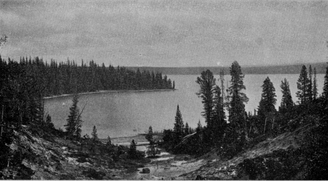
Shoshone Lake.
Shoshone Point (10.5 miles) is in the center of the large amphitheater-shaped tract which is drained by the branches of De Lacy Creek. It overlooks Shoshone Lake and the broad basin surrounding it, and gives a second glimpse of the Teton Mountains.
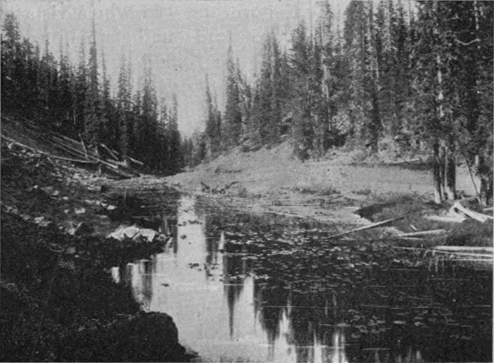
Isa Lake and Craig Pass.
Shoshone Lake is a lovely body of water, with an area of twelve square miles and a most picturesque shore line. On its west shore is a geyser basin, second in importance only to those on the Firehole. Among its many interesting features may be mentioned the Union Geyser, of which the middle crater plays to a height of 100 feet; and the Bronze Geyser, very striking [240] because of the perfect metallic luster of its formation.
From Shoshone Point, the road again ascends to the Continental Divide, and then drops down the Atlantic slope toward the Yellowstone Valley.
Lake View (18 miles) is at a point where a sudden turn in the forest road brings the tourist, quite without warning, in full view of one of the most striking water landscapes in the world. The whole vista of the Yellowstone Lake is spread out before him, still 300 feet below where he is standing. Far to the right and left, along the distant eastern shore, extends the Absaroka Range of mountains, many of its summits still capped with snow. Every-where the dark pine forests come down to the water’s edge, in fine contrast with the silver surface of the lake. The sparkling of the waves, the passage of the cloud shadows, and, in sheltered coves, the tranquil mirror of the waters, all combine to make the picture one to be long remembered.
The Yellowstone Lake is about 7,741 feet, nearly a mile and a half, above the level of the sea. It has a shore line of 100 miles, and an area of 139 square miles. Its maximum depth is 300 feet, and its average depth about 30 feet. It is fed almost entirely from the springs and snow drifts of the Absaroka Range. Its waters are icy cold, clear and transparent to great depths, and literally swarm with trout. It is subject to heavy south-west winds, and at times is lashed into tempestuous seas.
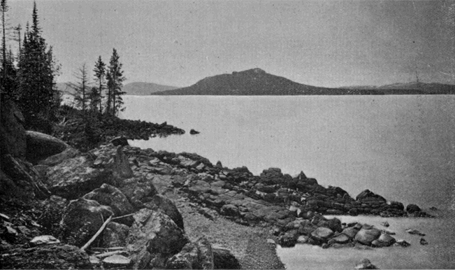
Yellowstone Lake.
The shape of the lake was compared by the early explorers to the form of the human hand. The resemblance is exceedingly remote, and one writer has well [241] observed that only the hand of a base ball player who has stood for years behind the bat could satisfy the comparison. The “fingers” have now been generally dropped from the maps and replaced by the usual names; but “West Thumb” seems to have become a fixture.
Surpassing the Yellowstone Lake both in area and altitude there are but few lakes in the world. Lake Titticaca, in Peru, and one or two others in the less explored regions of the Andes; and also a few lakes on the lofty table-land of Thibet, comprise the number.
The Yellowstone Lake has been a theme of enthusiastic praise by all who have ever seen it; but what seems to us the most exquisite tribute it has ever received is to be found in the farewell words of Mr. Folsom, when, in 1869, he regretfully turned away from its western shore into the deep forests which surround it: [BI]
"As we were about departing on our homeward trip, we ascended the summit of a neighboring hill and took a final look at Yellowstone Lake. Nestled among the forest-crowned hills which bounded our visions, lay this inland sea, its crystal waves dancing and sparkling in the sunlight as if laughing with joy for their wild freedom. It is a scene of transcendent beauty which has been viewed by but few white men, and we felt glad to have looked upon it before its primeval solitude should be broken by the crowds of [242] pleasure seekers which at no distant day will throng its shores."
[BI] Page 20, Langford’s reprint of the “Valley of the Upper Yellowstone.” See Appendix E.
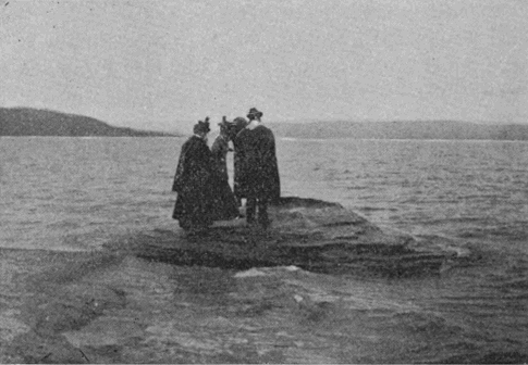
Fishing Cone.
On the west shore of the lake is an extensive and important hot springs basin. The principal features are the Paint Pots, not inferior to those near the Fountain Hotel; two of the largest and most beautiful quiescent springs in the Park; the Lake Shore Geyser, which plays frequently to a height of about 30 feet; an unnamed geyser of considerable power but of very infrequent action; and the celebrated Fishing Cone where unfortunate trout find catching and cooking painfully near together.
From the west shore of the lake a visit can be advantageously made to Hart Lake and Mount Sheridan. The lake is probably the prettiest in the Park. Near [243] it, on the tributary Witch Creek, is a small but important geyser basin. The principal features are the Deluge, Spike and Rustic geysers, and the Fissure Group of springs. The Rustic Geyser is remarkable in having about it a cordon of logs, evidently placed there by the Indians or white men many years ago. The logs are completely incrusted with the deposits of the springs.
Mt. Sheridan would rank with Mt. Washburn as a popular peak for mountain climbers were it only more accessible. No summit in the Park affords a finer prospect.
From the west shore to the Lake Outlet the tourist may travel either by stage around the border of the lake, or by boat across it. If he does not want to miss one of the notable features of the tour he will not omit the boat ride. In fact, a steamboat ride, at an altitude more than a quarter of a mile greater than that of the summit of Mt. Washington is not an every day diversion. From near the center of the lake the view is surpassingly fine. To the south and south-west the long arms of the lake penetrate the dark forest-crowned hills, which are but stepping stones to the lofty mountains behind them. Far beyond these may again be seen for the third time the familiar peaks of the Tetons. All along the eastern shore stand the serried peaks of the Absaroka Range, the boundary which nature has so well established along the eastern border of the Park. A notable feature of this range is the profile of a human face formed by the superimposed contours of two mountains, one several miles behind the other. The best effect is had from points between Stevenson Island and the Lake Hotel. The face is looking directly upward. [244] A similar profile, noted by the early explorers from the summit of Mt. Washburn, and nearly in the same locality as this, although of course not the same feature, was called by them the “Giant’s Face,” or the “Old Man of the Mountain.”
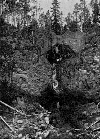
Natural Bridge.
On the north-east shore of the lake are Steamboat Spring, and other thermal phenomena worth visiting. From Bridge Bay at the north-west of the lake, a trip of a mile will take the tourist to an extremely interesting freak of nature in the form of a Natural Bridge over a small tributary of Bridge Creek. The [245] arch is forty-one feet high with a thirty foot span. As seen from the down stream side it is very regular and symmetrical.
Some twenty miles above the head of the lake is the celebrated Two-Ocean Pass, long known to the early trappers. It is probably the most remarkable example of such a phenomenon in the world. Although the fact of its existence was asserted and stoutly maintained by Bridger for many years prior to the discovery of the Park region, it was generally disbelieved until Captain Jones crossed the pass in 1873. It has since been visited and described by Hayden in 1878, by Hague in 1884, and by Prof. Evermann of the United States Fish Commission in 1891. The following facts and map are taken from Prof. Evermann’s report:
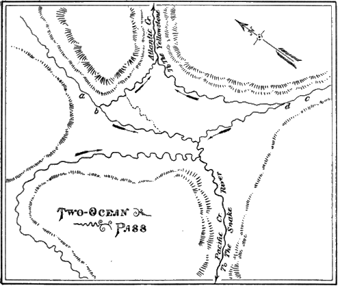
Sketch of Two-Ocean Pass.
The pass is in a nearly level grassy park hemmed in by the surrounding hills, and is 8,150 feet above the level of the sea. Its extreme length is about one mile and its extreme breadth about three-fourths of a mile. From the north a stream issues from a cañon, a, and divides at b, part flowing to Atlantic Creek and part to Pacific Creek. A similar stream, c, with a similar division, d, comes from the south. At extreme low water, these divisions may possibly disappear and all the water flow either one way or the other. But at ordinary and high stages the water flows both ways. These streams are by no means insignificant rivulets, but substantial water-courses capable of affording passage to fish of considerable size.
Here, then, we have the very interesting phenomenon of a single stream upon the summit of the continent dividing and flowing part one way and part the other, and forming a continuous water connection between the Atlantic and Pacific Oceans over a distance of nearly 6,000 miles.
A most singular and interesting acoustic phenomenon of this region, although rarely noticed by tourists, is the occurrence of strange and indefinable overhead sounds. They have long been noted by explorers, but only in the vicinity of Shoshone and Yellowstone Lakes. They seem to occur in the morning, and to last only for a moment. They have an apparent motion through the air, the general direction noted by writers being from north to south. The following descriptions are from the pens of those who have given some study to these strange sounds. Prof. S. A. Forbes says:
"It put me in mind of the vibrating clang of a harp [247] lightly and rapidly touched high up above the tree tops, or the sound of many telegraph wires swinging regularly and rapidly in the wind, or, more rarely, of faintly heard voices answering each other overhead. It begins softly in the remote distance, draws rapidly near with louder and louder throbs of sound, and dies away in the opposite direction; or it may seem to wander irregularly about, the whole passage lasting from a few seconds to half a minute or more." [BJ]
[BJ] “Overhead sounds in the vicinity of Yellowstone Lake.” See Appendix E.
Mr. Edwin Linton thus describes it:
“It seemed to begin at a distance, grow louder overhead where it filled the upper air, and suggested a medley of wind in the tops of pine trees, and in telegraph wires, the echo of bells after being repeated several times, the humming of a swarm of bees, and two or three other less definite sources of sound, making in all a composite which was not loud, but easily recognized, and not at all likely to be mistaken for any other sound in these mountain solitudes.” [BK]
[BK] “Overhead sounds in the vicinity of Yellowstone Lake.” See Appendix E.
No rational explanation has ever been advanced for this remarkable phenomenon. Its weird character is in keeping with its strange surroundings. In other lands and times it would have been an object of superstitious reverence or dread, and would have found a permanent place in the traditions of the people.
A TOUR OF THE PARK.
The Yellowstone Lake to Grand Cañon of the Yellowstone.
Distance seventeen miles. The road follows the Yellowstone River along the west bank all the way.
Just after the tourist leaves the Lake Hotel, he will see on the right of the roadway a small monument. It was placed there, in 1893, by the United States Corps of Engineers to mark a position accurately determined from astronomical observations by the United States Coast and Geodetic Survey in 1892. It is of value as a point of reference in surveys and other similar work. [BL]
[BL] Latitude,
44° 33' 16.1" north.
Longitude, 110° 23' 43.1" west.
Magnetic variation about 19° east.
Mud Volcano (7.5 miles) is a weird, uncanny object, but, nevertheless, a very fascinating feature and one which the tourist should stop and examine. It is an immense funnel-shaped crater in the side of a considerable hill on the west bank of the river. The mud rises some distance above a large steam vent in the side of the crater next the hill, and chokes the vent until the steam has accumulated in sufficient force to lift the superincumbent mass. As the imprisoned steam bursts forth, it hurls the mud with great violence against the opposite side of the crater, making a heavy thud which is audible for half a mile. These outbursts take place every few seconds.
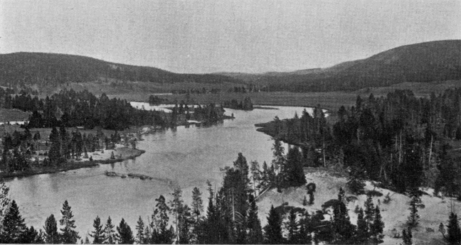
Yellowstone River, between Lake and Falls.
A striking example of the strange commingling of dissimilar features in the hot springs districts is found in the Grotto, a spring of perfectly clear water, not far from the Mud Volcano. It is acted upon by the steam in a manner precisely similar to that of the Mud Volcano, but its waters issue directly from the rock, and are entirely clear.
Mud Geyser, now rarely seen in action, was an important geyser twenty years ago. As it became infrequent in its eruptions, and tourists rarely saw them, the name was unconsciously, but mistakenly, transferred to the Mud Volcano, which has none of the characteristics of a geyser.
The locality where these objects are found has considerable historic interest. The ford just below the Mud Volcano was long used by the hunters and trappers who passed up and down the river. Folsom crossed it in 1869, and the Washburn party in 1870. The Nez Percés encamped here two days, in 1877, and here transpired a part of the episode elsewhere related. Hither came General Howard, in pursuit of the Indians, although he did not cross the river at this point.
Trout Creek (9.5 miles) has a most peculiar feature, where the tourist route crosses it, in the form of an extraordinary doubling of the channel upon itself. It was this stream which Mr. Hedges, in 1870, called “a lazy creek coiled up like a monster serpent under a sand bluff.”
Sulphur Mountain (11.5 miles) is half a mile back from the main route. At its base is a remarkable [250] Sulphur Spring, always in a state of violent ebullition, although discharging only a small amount of water. This is highly impregnated with sulphur, and leaves a yellow border along the rivulet which carries it away. The best time to visit Sulphur Mountain is on a clear sharp morning. The myriad little steam vents which cover the surface of the hill are then very noticeable.
Hayden Valley is a broad grassy expanse extending several miles along the river and far back from it on the west side. It was once a vast arm of the lake. It comprises some fifty square miles, and is an important winter range for the Park buffalo and elk.
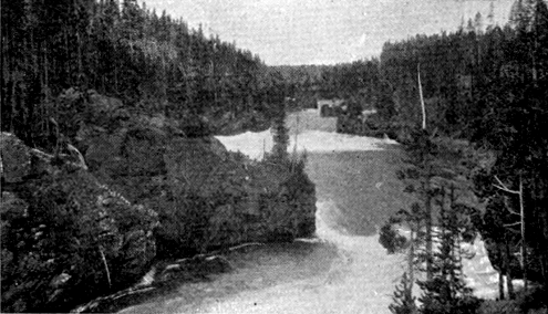
Gandy.
Rapids Above Falls.
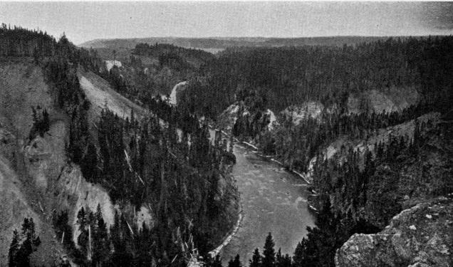
Upper Fall of the Yellowstone.
Distant view.
The river along the lower portion of this valley is the most tranquil and lovely stream imaginable—broad, deep, transparent, flowing peacefully around its graceful curves, disturbed only by the splashing trout which inhabit it. There is little here to suggest the mad turmoil into which it is soon to plunge. At a point fifteen miles below the lake, the river and road are forced by the narrowing valley close together. The stream becomes suddenly broken into turbulent cascades as it dashes violently between precipitous banks and among massive boulders.
The road also becomes decidedly picturesque. Hung up on the almost vertical cliff overlooking the rapids, it forms a short drive unsurpassed for interest anywhere else in the Park. At one point it crosses a deep ravine over the highest bridge on the road system. Just to the left of this bridge, in the bottom of the ravine, still stands the tree upon which some white man carved his initials away back in 1819.
Half a mile below the head of the rapids, the river suddenly contracts its width to less than fifty feet, turns abruptly to the right, and disappears. It is the Upper Fall of the Yellowstone. In some respects, this cataract differs from almost any other. Although the ledge over which it falls is apparently perpendicular, the velocity of flow at the crest of the fall is so great that the water pours over as if on the surface of a wheel. Visitors at Niagara have noticed the difference in this respect between the almost vertical sheet of water on the American side and the well-rounded flow at the apex of the Horseshoe Fall. The height of the Upper Fall of the Yellowstone is 112 feet.
From this point, the character of the scenery is wild and rugged. A ride of a few hundred yards brings the tourist to a sharp bend in the road, which at once unfolds to him the whole vista of the Grand Cañon of [252]the Yellowstone. The sight is so impressive and absorbing that the chances are he will cross the ravine of Cascade Creek without even noticing the lovely Crystal Falls almost beneath his feet.
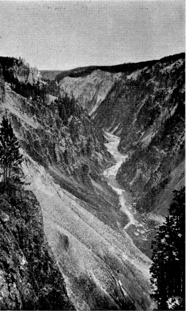
Grand Cañon of the Yellowstone.
Looking down—probably from Lookout Point.
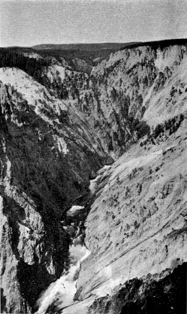
Grand Cañon of the Yellowstone.
From Inspiration Point—looking up stream. Lower Fall in the distance.
The Cañon Hotel is half a mile beyond Cascade Creek, in an open park, a little way back from the brink of the Cañon. From its porch, the crest of the Upper Fall can be seen, and the roar of both cataracts is distinctly audible. This hotel and that at the lake are the most desirable in the Park for a protracted stay.
The Grand Cañon of the Yellowstone is acknowledged by all beholders to stand without parallel among the natural wonders of the globe. Other cañons, the Yosemite, for example, have greater depths and more imposing walls; but there are none which, in the words of Captain Ludlow, “unite more potently the two requisites of majesty and beauty.” The cañon itself is vast. A cross-section in the largest part measures 2,000 feet at the top, 200 feet at the bottom, and is 1,200 feet deep, giving an area of over three acres. But such a gorge in any other part of the world would not be what it is here. Its sides would soon be clothed with vegetation, and it would be simply an immense valley, beautiful, no doubt, but not what it is in the Yellowstone National Park.
There are three distinct features which unite their peculiar glories to enhance the beauty of this cañon. These are the cañon itself, the water-fall at its head, and the river below.
It is the volcanic rock through which the river has cut its way that gives the Grand Cañon its distinctive character. It is preëminently a cañon of color. The hue has no existence which can not be found there. "Hung up and let down and spread abroad are all the [254] colors of the land, sea, and sky," says Talmage, without hyperbole. From the dark, forest-bordered brink, the sides descend for the most part with the natural slope of the loose rock, but frequently broken by vertical ledges and isolated pinnacles, which give a castellated and romantic air to the whole. Eagles build their nests here, and soar midway through the vast chasm, far below the beholder. The more prominent of the projecting ledges cause many turns in the general course of the cañon, and give numerous vantage places for sight-seeing. Lookout Point is one of these, half a mile below the Lower Falls. Inspiration Point, some two miles farther down, is another. The gorgeous coloring of the cañon walls does not extend through its entire length of twenty miles. In the lower portion, the forests have crept well down to the water’s edge. Still, it is every-where an extremely beautiful and impressive sight. Along the bottom of the cañon, numerous steam vents can be seen, one of which, it is said, exhibits geyseric action. In places, the cañon walls almost shut out the light of day from the extreme bottom. Lieutenant Doane, who made the dangerous descent several miles below the Falls, records that "it was about three o’clock P. M., and stars could be distinctly seen, so much of the sunlight was cut off from entering the chasm."
The Lower Fall of the Yellowstone must be placed in the front rank of similar phenomena. It carries not one-twentieth the water of Niagara, but Niagara is in no single part so beautiful. Its height is 310 feet. Its descent is very regular, slightly broken by a point of rock on the right bank. A third of the fall is hidden behind the vast cloud of spray which forever conceals the mad play of the waters beneath; but the mighty turmoil of that recess in the rocks may be judged from the deep-toned thunder which rises in ceaseless cadence and jars the air for miles around.
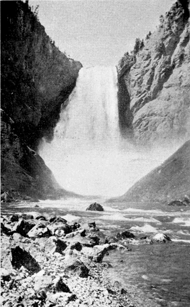
Lower Fall of the Yellowstone—from below.
To many visitors the stream far down in the bottom of the cañon is the crowning beauty of the whole scene. It is so distant that its rapid course is diminished to the gentlest movement, and its continuous roar to the subdued murmur of the pine forests. Its winding, hide-and-seek course, its dark surface when the shadows cover it, its bright limpid green under the play of the sunlight, its ever recurring foam-white patches, and particularly its display of life where all around is silent and motionless, make it a thing of entrancing beauty to all who behold it.
It is not strange that this cañon has been a theme for writer, painter, and photographer, from its discovery to the present time. But at first thought it is strange that all attempts to portray its beauties are less satisfactory than those pertaining to any other feature of the Park. The artist Moran acknowledged that “its beautiful tints were beyond the reach of human art;” and General Sherman said of this artist’s celebrated effort: “The painting by Moran in the Capitol is good, but painting and words are unequal to the subject.”
In photography, the number of pictures by professional and amateur artists, that have been made of this cañon is prodigious. But photography can only reproduce the form, it is powerless in the presence of such an array of colors as here exists.
The pen itself is scarcely more effective than the pencil or camera. Folsom, who first wrote of the cañon, frankly owned that “language is entirely inadequate to convey a just conception of the awful grandeur and sublimity of this masterpiece of nature’s handiwork.” Time has shown this confession to be substantially true. From the clumsy work of the casual newspaper scribe, to the giddy flight of that eminent clergyman, who fancied he saw in this cañon a suitable hall for the great judgment, with the nations of the earth filing along the bottom upon waters “congealed and transfixed with the agitations of that day,” all descriptions do injustice to their subject. They fall short of their mark or overreach it. They are not true to nature. We shall therefore pass them by, with one exception, and shall commend our readers to a study of this great wonderwork from the pine-clad verge of the Grand Cañon itself.
The exception to which reference is made relates to the Grand Cañon in winter. It has been explained in another place why it is that the winter scenery of the Park must ever remain a sealed book except to those few hardy adventurers who are willing to brave the perils of winter travel in that region. It is a pleasure, therefore, to give at first hand what one of those intrepid spirits felt as he stood upon Lookout Point less than two years ago, and saw the famous cañon clad in its annual mantle of white. He says: [BO]
"I suppose thousands have stood grasping the stem of that same sturdy, ragged tree, and have looked in silence as we did. They have seen the cañon in summer, and I wish they might all see it also in the depth of winter. Now the glorious colors of the walls were gone, but the peaks and crosses and pinnacles were there, free of all color, but done in clean, perfect white. It [258] was “frozen music”—the diapason of nature’s mightiest and most mysterious anthem all congealed in white, visible, palpable, authentic. No thinking man could stand there and not feel the exalted and compelling theme go thrilling to his heart."
[BO] E. Hough, in Forest and Stream, June 30, 1894, p. 553.
Back perhaps a quarter of a mile from Inspiration Point, but within fifty yards of the brink of the cañon, is a huge rectangular block of granite which rests alone in the woods, a most singular and striking object. It is evidently an intruder in unfamiliar territory, for there is not a particle of granite outcrop known to exist within twenty miles. It must have been transported to this place from some distant [259] quarry by the powerful agencies of the Glacial Epoch.
To the eastward from the Grand Cañon are several interesting hot springs districts, and there is one notable group at the southern base of Mount Washburn.
A Tour of the Park.
The Grand Cañon of the Yellowstone to Junction Valley.
Distance twenty-two miles. [BP] From the Grand Cañon north lies the true scenic portion of the tourist route. Hitherto, the main attractions have been the geyser basins, the Yellowstone Lake, and the Grand Cañon. The tourist has probably frequently expressed his disappointment at not finding as much rugged mountain scenery as he had expected. But from this point on he will have no cause to complain.
[BP] The distances given in this chapter are only approximate, the surveys for a wagon road from the cañon to Mammoth Hot Springs, via Mt. Washburn, not being yet completed.
Mt. Washburn (12 miles) is the most celebrated peak in the Park, and the first to receive its present name. Its prominence justifies its notoriety, but the real cause of it is the fact that for eight years the main tourist route lay across it. From its summit the Washburn party received the first definite confirmation of the truth of the rumors that led them into this region. All reports and magazine articles which first gave a knowledge of the Park to the world were written by persons who had crossed this mountain. As the view from its summit is comprehensive and grand, covering almost the entire Park, it of course figured prominently in all narratives. Tourists fell into the custom established by the first explorers, of leaving their cards in a receptacle for the purpose on the summit. Many eminent names are to be seen there. It is a matter for congratulation that the progress upon the road system will soon restore this mountain to its former place in the tourist route.
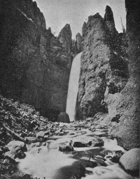
Tower Falls.
Tower Falls (20 miles) is perhaps the most graceful cataract in the Park, and should never be passed without a visit. It is on Tower Creek only a short distance back from the Yellowstone. Lieutenant Doane says in his report: [BQ]
“Nothing can be more chastely beautiful than this lovely cascade, hidden away in the dim light of overshadowing rocks and woods, its very voice hushed to a low murmur, unheard at the distance of a few hundred yards. Thousands might pass by within a half mile and not dream of its existence; but once seen, it passes to the list of most pleasant memories.”
[BQ] Page 8, “Yellowstone Expedition of 1870.” See Appendix E.
Near this point on both banks of the river are numerous sulphur fumaroles, the last evidence of subterraneous fire which the tourist will encounter on his trip. A little way above the mouth of the stream is the old Bannock Ford, the same by which Colter crossed in 1807. It is the only practicable ford within twenty miles in either direction.
Junction Butte (22 miles) is on the right bank of the Yellowstone in the angle between that stream and the East Fork. It stands not only near one of the most important stream junctions in the Park, but also near a not less important road junction. It is a very striking object. Its summit is nearly flat, and its sides [262] near the summit are perpendicular. Below this is a steep slope composed of enormous masses of finely broken stone disengaged from the cliff by the force of the elements. It is a fitting landmark for its important situation.
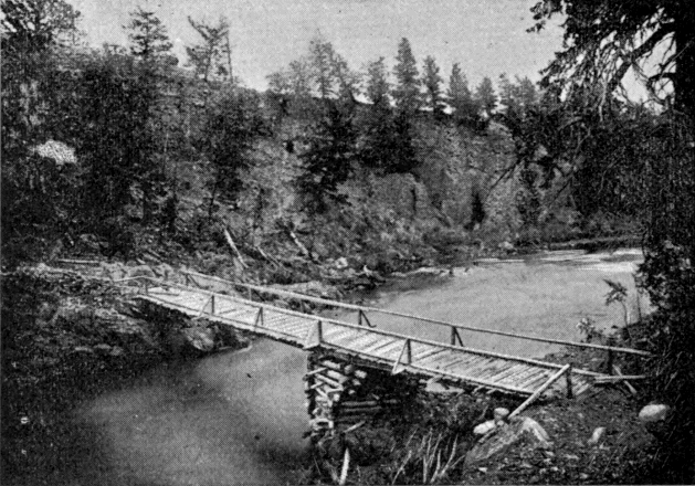
First Bridge Over the Yellowstone.
Baronett’s Bridge crosses the river immediately opposite Junction Butte. It is the first and only bridge yet (1895) built across the Yellowstone within the limits of the Park. It was built by the well known mountaineer, J. H. Baronett, in the spring of 1871, for the convenience of Clark’s Fork miners. It was partially destroyed by the Nez Percés in 1877, but was repaired by Howard’s command, and still further repaired the following year by Baronett and Norris. [263] In 1880, it was replaced by a more substantial structure. At present it enjoys the unique distinction of being a private toll bridge on a government reservation.
Junction Valley, [BR] described elsewhere, is a name properly applicable to the valley inclosed by Crescent Hill, Mt. Washburn, Specimen Ridge, and the mountains north of Lamar River. This valley, and those of tributary streams, form the largest treeless tract in the Park.
[BR] The popular name for this locality is “Yancey’s,” from John Yancey, who has long held a lease in the Valley of Lost Creek at the foot of Crescent Hill. He has kept a sort of hotel or stopping place for the convenience of travelers to Cooke City, as well as for tourists between the Grand Cañon and Mammoth Hot Springs by way of Mt. Washburn.
Amethyst Mountain, Specimen Ridge, and the Fossil Forests are names at once suggestive of the action of geological agencies which have been described in another chapter. Amethyst, limpid quartz, milky quartz, chalcedony, carnelian, prase, chrysoprase, banded agate, flint, jaspers of all colors, semi-opal, calcite, and many other varieties abound. The forest petrifactions present one of the most interesting scientific problems in the Park.
The Lamar River Cañon (7 miles above Junction Butte) is a gorge about half a mile long, the chief characteristic of which is the enormous number and size of boulders which have fallen into it. These are almost spherical in shape, and, in many instances, are as smooth as if from the hand of a stone glazier. They are piled up like billiard balls, to such a depth [264] that the stream flows entirely out of sight beneath them. [BS]
[BS] Above the head of this cañon are the remains of what seems to have once been a bridge, but no record concerning it has come to the writer’s notice.
Soda Butte (15 miles above Junction Butte) and Soda Butte Cañon, extending from Soda Butte to Cooke City, are worthy of much attention. The cañon in particular is as wonderful a bit of scenery as any mountains afford. It is every-where rugged, majestic and imposing, and there is no point in its twelve miles length that does not present a landscape deserving of the tourist’s careful study. Mr. W. H. Weed, who has done much work in the Park, and particularly in this section, says of this valley:
“To the eastward Soda Butte Valley penetrates the heart of the rugged Sierra, whose high peaks rise in castellated forms. The visitor, disappointed perhaps in the mountain scenery of the Park, after traveling the usual route over the dusty roads of the Park plateau, will here find mountain views that are sure to fulfill his expectations, while the neighborhood is not lacking in curiosities that in another land would attract visitors from far and wide.” [BT]
[BT] Fossil Forests of the Yellowstone. See Appendix E.
Cooke City is a small mining camp just outside the north-east corner of the Park in the midst of the Clark’s Fork mining district. It is of interest in this connection only on account of its notorious hostility to the Yellowstone National Park.
Death Gulch, reputed to exist in the valley of Cache Creek, is like Bridger’s Glass Mountain, mostly a product of the imagination. It seems that some [265] animals were once poisoned there, and that later, certain explorers, finding them, attributed their death to an escape of carbonic acid gas from the earth. The name has found its way into maps and reports of highest authority, but the object itself has no existence.
The Hoodoo Region is near the head of Miller Creek just outside the original reservation, although within the Forest Reserve addition. This mysterious region furnishes probably the most striking example in existence of the effects of erosion and wind action upon masses of moderately soft rock. The region was discovered by miners in 1870, but was first explored and reported upon by Colonel Norris in 1880, who thus describes it: [BU]
“Nearly every form, animate or inanimate, real or chimerical, ever actually seen or conjured by the imagination, may here be observed. Language does not suffice to properly describe these peculiar formations; sketches may probably do something, and photographs more, to convey a conception of their remarkable character, but actual observation is absolutely necessary to adequately impress the mind with the wild, unearthly appearance of these eroded Hoodoos of the Goblin Land. These monuments are from fifty to two or three hundred feet in height, with narrow, tortuous passages between them, which sometimes are tunnels through permanent snow or ice fields, where the big-horn sheep hide in safety; while the ceaseless but ever changing moans of the wild winds seem to chant fitting requiems to these gnome-like monuments of the legendary Indian gods.”
Returning to Junction Valley, and following down the Yellowstone, the tourist soon arrives at the Third Cañon (the third above Livingston, the Grand Cañon being fourth), which extends from the eastern limit of Junction Valley to the north boundary of the Park. Located anywhere else, away from the overshadowing splendor of the Grand Cañon, it would become celebrated. Some of the views, particularly from the high ground north of Mt. Everts, overlooking by nearly 2,000 feet the vast chasm through which the turbulent river flows, are among the most impressive in the entire region.
From the immediate vicinity of the Third Cañon, the road crosses the plateau of Black Tail Deer Creek to the valley of the East Gardiner. The tour terminates at Mammoth Hot Springs.
PART III.—The Future.
HOSTILITY TO THE PARK.
From what has been thus far set forth the reader can not have failed to observe how fortunate have been the events, both in prehistoric and in recent times, which have made the Yellowstone National Park what it is to-day. In the course of long ages Nature developed this region into its present attractive form, and filled it with wonders which will never fail to command the admiration of men. She placed it upon the very apex of the continent, and made of it an inexhaustible reservoir of water for a perennial supply to the parched and rainless desert around it. She interspersed among its forests an abundance of parks and valleys, where the native fauna of the continent, elsewhere fast passing away, may find protection in all future time. With infinite foresight she made it unfit for the gainful occupations of men, so that every motive to appropriate it for private use is removed.
For many years after the white man first looked within its borders, a rare combination of circumstances prevailed to keep it from becoming generally known until the time had arrived when the government could effectually reserve it from settlement. Finally, since its formal erection into a public park, the same good fortune has attended it, in spite of many adverse influences, [268] until it has become thoroughly intrenched in the good opinion of the people.
So fully has the experience of the past quarter century confirmed the wisdom of setting apart this region for public uses, that it ought no longer to be necessary to say a word in favor of its continued preservation. To most people it will seem impossible that there should be any one who would seek the mutilation or destruction of this important reservation. Unfortunately there are many such. No session of Congress for twenty years has been free from attempted legislation hostile to the Park. The schemes to convert it into an instrument of private greed have been many, and strange as it may seem, they are invariably put forward by those very communities to whom the Park is, and must ever remain, the chief glory of their section. It is a lamentable proof of the dearth of patriotic spirit that always betrays itself whenever the interests of individuals and of the public come into collision. Nevertheless it is a great satisfaction to know that this spirit of hostility is confined to an infinitesimal portion of the whole people. Excepting a few mine owners and their following, a handful of poachers, one or two railroad corporations, and a few greedy applicants for special franchises, the people of the country are a unit in favor of the strictest preservation of this great national pleasure ground. No better proof of this can be had than the fact that the Park has successfully withstood for so long a period every attack that has been made upon it.
It will not do, however, to assume that, because these schemes have hitherto failed, they will always [269] continue to fail. Since they have their origin in speculative ventures, they will be put forward so long as they offer the least pecuniary inducement. The certainty of this, and the danger of their ultimate success, justify the assignment of a brief space to a consideration of this subject.
RAILROAD ENCROACHMENT AND CHANGE OF BOUNDARY.
Nearly all of the enterprises that have been put forward in opposition to the true interests of the Reservation partake of the nature of railroad encroachment. Without entering into the merits of particular projects, it will be sufficient to explain in general terms the reasons why the government has always opposed them.
Railroads in the Yellowstone Park are objectionable because:
(1.) They will mar, and in places destroy, that natural condition which is one of its greatest charms. From the first it has been the wish of those who know any thing of the Yellowstone that it should remain as nature made it. The instructions of the Interior Department to the first Superintendent of the Park, two months after the Act of Dedication became a law, thus announced the policy of the government upon this subject:
“It is not the desire of the Department that any attempts shall be made to beautify or adorn this reservation, but merely to preserve from injury or spoliation the timber, mineral deposits, and various curiosities of that region, so far as possible, in their natural condition.”
It requires no argument to show that nothing would so interfere with this natural condition as the construction of a railroad through that country; and the [271] danger involved in these projects early became apparent to all who were well acquainted with the situation. As early as 1883, Lieutenant Kingman thus refers to this subject in his annual report, wherein he describes his proposed road system for the Park:
"The plan for improvement which I have submitted is given in the earnest hope and upon the supposition that it [the Park] will be preserved as nearly as may be as the hand of nature left it—a source of pleasure to all who visit it, and a source of wealth to no one. If the Park ever becomes truly popular and national, it will be when the people come to know and appreciate its delightful summer climate, the wonderful efficiency of its baths and its mineral waters, as well as the natural wonders, beauties and curiosities to be seen there. Then, if there are numerous small, quiet hotels scattered here and there throughout the Park, where visitors can have plain and simple accommodations at moderate prices, the overworked and the sick, as well as the curious, will come here, not to be awed by the great falls and astounded by the geysers, and then to go away, but will come here and will remain for weeks and months, and will find what they seek, rest, recreation and health. But if it ever becomes the resort of fashion, if its forests are stripped to rear mammoth hotels, if the race-course, the drinking saloon and gambling-table invade it, if its valleys are scarred by railroads, and its hills pierced by tunnels, if its purity and quiet are destroyed and broken by the noise and smoke of the locomotive; … then it will cease to belong to the whole people, and will interest only those that [272] it helps to enrich, and will be unworthy the care and protection of the National Government."
The history of the twelve years since the above was written confirms in every point this forcible presentation of the case.
(2.) Railroads will unavoidably seriously cripple the present tourist routes. They must of necessity occupy the valleys. But it is through these that the tourist route passes, and it is frequently the case that they are not wide enough for both. In many cases the roadway would be forced back upon the hills, and in others its present location would have to be changed. It is certain that the admirable system of roads, which the government is slowly working out, would receive irreparable injury at the hands of any railroad which might be built through that region.
(3.) Railroads would mean the inevitable destruction of the large game. The winter snows are too deep among the hills for game to subsist there. It is necessary to come down into the valleys, where there is more grass and less snow. But, as already stated, it is through these valleys that railroads must pass if at all. The trains would frighten the animals back into the hills, where starvation would await them. Moreover, the loss of game from poaching would be greatly aggravated by the increased facility of clandestine access to that region.
(4.) Railroads would destroy the Park forests. During July, August, and September, there are always long periods of dry weather when the dense bodies of fallen timber, the impenetrable tangles of underbrush, and the luxuriant prairie grass are a mass of inflammable tinder. A spark converts it into a conflagration. [273] A railroad winding its way through this country would render protection against fires, even now a matter of great difficulty, wholly out of the question. Referring to this subject in his annual report for 1894, the Superintendent of the Park says:
“Six months from the entrance of the first locomotive within the limits of the Park, there will not be one acre of its magnificent forests left unburned.”
What such a catastrophe would mean to the future development of the surrounding country may be appreciated by a perusal of our chapter on the Flora of the Yellowstone.
(5.) As a matter of public policy, the granting of a railway franchise in the Park is objectionable because it necessarily creates a perpetual monopoly of a public privilege. There is no practicable way to avoid it. It has been proposed to compel the railroad to share the advantage of this monopoly with the public, by paying a certain percentage of earnings on its Park business to constitute an improvement fund. With Union Pacific history fresh in the public mind, the government will not be likely to enter into a partnership of that precarious nature.
From the foregoing exposition, it is clear that only the most cogent reasons should ever sanction the construction of railroads in the Yellowstone Park. These reasons, from the standpoint of the railroad companies, as set forth by the promoters of a recent bill before Congress, fall under two heads.
In the first place, it is speciously urged that a railroad would render the Park more accessible, cheapen the cost of visiting it, and make it fulfill more perfectly its original design as a park for the people. To [274] all this it may be replied that the people do not want the improvement at the price they must pay for it. By an almost unanimous voice they oppose it. It is true that the Park is not as accessible as one might wish it to be, or as it soon will be. But to make it easily accessible, it is by no means necessary that a railroad should pass through it. A line touching the southern boundary and communicating with the central portions of the country would answer every practical purpose. The pretext that a railroad across the Reservation will greatly aid the tourist is erroneous. The points of interest are so scattered about that a coach would be in any case a necessity, and all the railroad would really save to the tourist would be the distance from the boundary to the belt line.
Neither will such a railroad materially lessen the cost of a visit, which has always been, and will always be, in the main, getting to that region. The Reservation is 1,500 miles from the center of population of the country, and it is this remote location that makes visiting it cost. The outlay after getting there is trifling in comparison with that of coming and going. Whether a railroad pass though the Park, or simply touch its southern border, will not appreciably affect this principal item.
In the second place, it is urged that the Park stands directly in the path of the railroads and so “acts as a blockade to the development of three large states.” As this will always form the staple argument for granting a right-of-way for railroads across the Reservation, it will be well to scrutinize it somewhat carefully.
It is not at all a question of whether the country [275] about the Park is at present sufficiently supplied with railroads. The important question is: Will any portion of this territory be better served by a railroad that may be built across the Reservation than by one coming from another direction? The most superficial examination of the map, even by one not personally acquainted with the country, will answer this question in the negative. The Yellowstone Valley on the north, the Bighorn Valley on the east, the Jackson Lake country on the south, and the Madison and Henry Fork Valleys on the west, find their natural outlets by routes not passing through the Yellowstone Park. A railroad entering the Park on one side through a lofty wall of mountains, and leaving it on the other through a similar wall, after traversing the inclosed plateau for a distance of perhaps seventy-five or one hundred miles, would be almost as much lost to the country outside as if for this whole distance it were built through a tunnel. In fact, the true welfare both of the Park and of the surrounding country would be best served by a line passing through the Wind River Valley, across one of the easy passes into the Valley of the Snake, and thence along the southern border of the Park, past Jackson Lake and the northern spur of the Teton Range, into the valleys of Idaho and Montana. This would give the Park a needed southern approach, and would directly serve a vast tract of territory. Tributary either to this line, or to one north of the Park, or to both, another would soon be built along the extensive Valley of the Bighorn. No imaginable route across the National Park could so well subserve both local and public interests.
From an engineering point of view, the Yellowstone Park is poor railroad country. It could be crossed, to be sure, but not easily, and not at all except by monopolizing portions of the tourist route. The long winter season of nearly seven months would interpose an almost insuperable obstacle to the successful operation of any line which might be built. We quote again from the report of the Park Superintendent for the year 1894:
“The great amount of moisture furnished by the lake and its numerous tributaries gives a mantle of snow that will average fifteen feet in depth, and with the strong winds prevailing in this mountainous country no railroad could be kept running during the six months of winter without being entirely inclosed in snow sheds, which would prove destructive to the natural beauty of the Park.”
In short, it is certain that, were it not for the special inducements which a monopoly of Park travel offers, no railroad could afford to locate its line across that territory.
Closely related to this general subject is that of building an electric line for tourist transportation within the Park. It is at once apparent that the objections to such a railroad are much less formidable than to one operated by steam locomotives. The danger of fire is eliminated. The unsightly character of an ordinary railway outfit is exchanged for attractive tourist cars. The power plant, being located in cañons and operated by water, would give no outward evidence of its existence. There being no long trains of cars, no smoke, no screeching of locomotives, the game would not be much more frightened by it than [277] by the stage coaches. In winter, traffic would be suspended and the game would be undisturbed on the ranges. The line, by its greater speed, would be a convenience to tourists having but a short time at their disposal, and also to those, infirm in health, who find the long stage rides fatiguing.
Such are the merits of an electric railway for tourist transportation in this country. If the people really desired it, and if it could be built and operated by the government, so as to exclude as far as possible all corporate management of Park business, there would be no serious objection to the project. Of course it should never be permitted, as some times proposed, to use the present wagon roads. These must not in any event be interfered with.
The question then is, Do the people desire this kind of transportation? Fortunately we can answer this question with authority. In 1892, a vote upon it was obtained from the tourists of that season. The result was a majority of more than five to one against it. In giving their votes, tourists frequently went beyond the specific question at issue to express their emphatic disapproval of the construction of any kind of railroad in the Park. The whole result was a gratifying proof of the deep-seated interest of the people in this Reservation, and of their unalterable wish that it remain forever free from the handiwork of man. In fact, to almost every body in these days, a coaching tour like that through the Yellowstone, is a decided novelty. There is no other place in this country, probably not in the world, where one approaching it can be had. The people enjoy it. They would prefer to see it developed and perfected, rather [278] than replaced by the noisy car, to get away from which they have come so far.
In the long and fruitless struggle to secure rights-of-way for railroads, the promoters of these projects have resorted to various indirect methods the most noteworthy of which is a proposal to change the boundary line of the Park. We have elsewhere explained how this boundary was originally determined. For a random line, which of necessity it largely was, it was a most excellent one. No one would have been dissatisfied with it were it not that it was subsequently found to stand in the way of certain private enterprises.
When it became apparent that the government would never consent to the construction of a railroad within the Park, it was sought to compass the same end by cutting off all that portion of the Reservation lying outside of, and including, the proposed right-of-way.
In accordance with the proverbial policy of indirection which characterizes schemes of this sort, the real purpose of this proposition is always veiled under a beneficent guise, intended to make its promoters appear as zealous guardians of the Park, rather than what they really are—conspirators for its destruction. The proposed change of boundary is ostensibly based upon the alleged necessity of having a natural boundary—that is, a boundary along the courses of streams. The present line, it is urged, is unmarked and no one knows where it is. A stream is a definite, visible line, seen and known by every one. [BV]
[BV] It is of course unnecessary to point out that an artificial line can easily be marked so that there shall be no uncertainty about its location. The hollowness of purpose on the part of those who propose this argument is disclosed by the fact that, of the 280 miles, more or less, in the proposed boundary, they provide a natural line for only about 50 miles—or along that precise portion where they want to build a railroad. All the rest of the way an artificial line is good enough!
The pernicious fallacy that lurks in this argument is plainly visible if we look a little beneath the surface. Never permit the boundaries of the Yellowstone Park to be brought down into the valleys. Nature has indeed built the proper boundaries; but they are mountain ranges, not valleys. A thousand Chinese walls heaped together would not form a barrier like the Absarokas on the east, the Snowy Range on the north, the Gallatin Range on the west, and the Tetons and the Big Game Ridge on the south. Along the present boundary line there are very few places where it is possible to build human habitations. No poacher or law breaker can there fix his stealthy abode ready at a favorable opportunity to dash across it. But if it were in the bottom of the valleys, a whole colony of these dangerous individuals would soon infest every border of the Park. Police surveillance, in any case extremely difficult, would then be well-nigh impossible. No! Whatever changes may be made in the boundary of the Park, let it always be kept among the mountain tops.
What the success of any of these projects to cut off, or segregate, portions of the Park would mean, may be judged from a single instance—that, namely, of the north-east corner of the Park. In this strip of territory are some of the finest scenery and most interesting [280] scientific curiosities to be found upon the Reservation. It is the great winter grazing ground for the elk, and by estimate based upon actual count no fewer than 20,000 of these noble animals find their winter subsistence here. That all of this game would be almost instantly annihilated by the segregation of this strip goes without saying. More than this, the admission to the very heart of the Park of that class of reckless characters, who even now are its greatest source of danger, would vastly enhance the difficulty of protecting the remaining portions.
It is well to emphasize by repetition the few important facts pertaining to this question:
(1.) There are no private interests on the borders of the Park whose development is jeopardized by the refusal of the government to give access to them by a railroad across the Reservation. They can all be reached from the outside without encountering greater obstacles than have been overcome in scores of other places throughout the West.
(2.) There is no need of a railroad in the Park so far as the comfort or advantage of the tourists is concerned. A line along the southern border would answer quite as well, and would serve the surrounding country better.
(3.) There is no occasion to construct an electric line in the Park. Nearly all of those who visit that region oppose it.
(4.) There is no necessity for changing the present boundaries of the Reservation.
CONCLUSION.
It is in respect of the foregoing matters that the Yellowstone National Park has most to fear. The general public, although always in favor of its preservation, knows nothing of the merit of these various projects. A bill is introduced in Congress in the interest of some private enterprise. It is supported by representations and statistics gotten up for the occasion. There may be no one at hand to refute them, and they are the only information upon which Congress can act. More than once these bills have been reported favorably from committee, when every essential statement in the committee’s report was contrary to fact. Unless some friend of the Park is present, ready and willing to devote time, and perhaps money, to its defense, there is only too much danger that these measures will eventually prove successful.
Thus far, the Park has never been lacking in such friends; and there is no more encouraging fact in its history than this, that some one has always been on guard against any thing which might work to its injury. Men like Senator Vest in official position, or William Hallett Phillips in private life, and journals like Forest and Stream, have stood for years, in a purely public-spirited manner, without remunerative inducement of any sort, and often in face of the bitterest vituperation and abuse, against the designs of selfish and unscrupulous schemers. In like manner, [282] government officials connected with the Park have always, with one or two exceptions, earnestly opposed these dangerous projects. It is plain to any one who is familiar with its inside history, that, but for the agencies just mentioned, there would not be to-day any Yellowstone Park at all. It is equally plain, that so long as friends like these are forthcoming, the Park has little to fear from its enemies.
In still another respect, the Park has been unfortunate where it had a right to expect better things. Prior to the admission of Montana, Wyoming, and Idaho into the Union of States, its interests were looked after in Congress, particularly in the Senate, by a few members who took great pride in promoting its welfare. But when the above territories were admitted to the Union, these gentlemen very naturally turned over the charge, which they had voluntarily assumed, to the members from the new States, as being thereafter its proper guardians. It was, of course, believed that in them, if in any one, the Park would find needed championship and protection. It is a matter of great regret that these very reasonable expectations have not been realized. A glance at the list of bills pertaining to the Yellowstone National Park, which have been presented to Congress in the past six years, will show that nearly every objectionable measure has been fathered by the very men whose first duty would seem to have been to oppose them. In a speech opposing the Segregation Project, delivered in the Senate in the winter of 1892-3, Senator Vest referred to this subject with justifiable indignation. He said:
"When those States [Montana, Wyoming, and Idaho] were territories, and not represented in the [283] Senate, I considered it the duty of every Senator, as this Park belonged to all the people of the United States, … to defend its integrity, and to keep it for the purposes for which it was originally designed. Since Senators have come from those States, who, of course, must be supposed to know more about that Park than those of us who live at a distance, and since they have manifested a disposition to mutilate it, I must confess that my interest in it has rather flagged, and I feel very much disposed, in plain language, to wash my hands of the whole business. If the constituencies, who are more benefited than any others can possibly be in the Park, are willing to see it cut off, the best disposition of the matter would be to turn it open to the public, let the full greed and avarice of the country have their scope, let the geysers be divided out and taken for the purpose of washing clothes, … let the water of that splendid water-fall in the Yellowstone River be used to turn machinery, let the timber be cut off; in other words, destroy the Park, and make it a sacrifice to the greed of this advanced age in which we live."
It is only fair to say that generally these members do not personally favor the measures to which they lend official countenance and comfort. One can find a practical, if not a morally justifiable, excuse for their course in the exigencies of political life which too often constrain men to official action not in accordance with their private judgment. Unquestionably, a majority of the people of these young and enterprising states are immovably opposed to any thing which may tend to mutilate or destroy this important reservation; and it is not believed that their broader patriotism will [284] ever be overridden by the narrow and perverted wishes of a few straggling constituencies. [BW]
[BW] The almost prophetic warning of Captain Harris in his last report as Superintendent of the Park has a peculiar force in this connection:
“In my experience in connection with this National Park, I have been very forcibly impressed with the danger to which it is subjected by the greed of private enterprise. All local influence centers in schemes whereby the Park can be used for pecuniary advantage. In the unsurpassed grandeur of its natural condition, it is the pride and glory of the nation; but if, under the guise of improvement, selfish interests are permitted to make merchandise of its wonders and beauties, it will inevitably become a by-word and a reproach.”
Finally, the effect of a single evil precedent upon the future of the Park must be kept constantly in mind. The door once opened, though by never so small a degree, can not again be closed; but will sooner or later be thrown wide open. A privilege granted to one can not be denied to another. If one corner of the Park is cut off, other portions will share the same fate. If one railroad is granted a right of way across the reservation, another can not be refused. The only way to avoid these dangers is to keep the door entirely closed.
There is now but little real need of further positive legislation. Some provision should of course be made for an adequate police force, and ample means should be provided to perfect the system of roads. Happily this duty involves no appreciable burden. It requires no continuing outlay to “beautify and adorn.” And when it is done, the further policy of the government toward the Park should be strictly negative, designed solely to preserve it unimpaired, as its founders intended, for the “benefit and enjoyment” of succeeding generations.
GEOGRAPHICAL NAMES IN THE YELLOWSTONE NATIONAL PARK.
INTRODUCTORY.
In common experience, the importance of geographical names lies in their use as a means of identification. To describe an object there must be a name, and for this purpose one name is as good as another. But if the reason be sought why a particular name happened to be selected, it will generally be found to arise, not from this practical necessity, but from some primary fact or tradition, or from some distinguished character, in the annals of the community where it occurs. In its mountains and valleys, its lakes and streams, and in its civil divisions, the cradle history of a country may always be found recorded.
In newly-discovered countries, the naming of geographical features is the dearest prerogative of the explorer, as it is also the one most liable to abuse from personal vanity or egotism. The desire to attach his name, or those of his personal friends, to the prominent landmarks of the globe, where the eye of posterity may never escape them, is a weakness from which no discoverer has yet shown himself free.
In a region like the Yellowstone National Park, destined for all time to be a resort for the lovers of science and pleasure, this temptation was quite irresistible; so much so, that, when the expeditions of 1870 and 1871 left the field, they [286] left little worth naming behind them. And yet the honor thus gained has not, we venture to say, been all that its votaries desired. Small is the number of tourists who stop to inquire for whom Mary Lake, DeLacy Creek, or Stevenson Island was named. Fewer still are aware that Mt. Everts was not christened in honor of a distinguished American statesman of similar name, but in commemoration of one of the most thrilling individual experiences in American history. So with all these personal names. The lively satisfaction with which they were given finds no counterpart in the languid indifference with which the modern visitor mechanically repeats them.
In as much as it fell to the lot of the United States Geological Survey to originate a great many of the names in our western geography, it is interesting to know from official sources the principles which governed in this important work. Writing upon this point, Dr. Hayden says: [BX]
“In attaching names to the many mountain peaks, new streams, and other geographical localities, the discovery of which falls to the pleasant lot of the explorer in the untrodden wilds of the West, I have followed the rigid law of priority, and given the one by which they have been generally known among the people of the country, whether whites or Indians; but if, as is often the case, no suitable descriptive name can be secured from the surroundings, a personal one may then be attached, and the names of eminent men who have identified themselves with the great cause, either in the fields of science or legislation, naturally rise first in the mind.”
[BX] Page 8, Fifth Annual Report of Dr. Hayden.
In the more recent and thorough survey of the Park by the United States Geological Survey, it became necessary to provide names for those subordinate features which, in a less restricted field, the early explorers had thought unworthy of [287] notice. Professor Arnold Hague, upon whom this work has principally fallen, thus states the rule which he has followed: [BY]
“In consultation with Mr. Henry Gannett, geologist in charge of geography, it was agreed that the necessary new names to designate the unnamed mountains, valleys, and streams should be mainly selected from the beasts, birds, fishes, trees, flowers, and minerals found within the Park or the adjacent country.”
[BY] Page 152, Part I, Annual Report United States Geological Survey for year ending June 30, 1887.
The christening of the hot springs and geysers of the Park has been singularly fortunate. The names are in all cases characteristic. They are not studied efforts, but are simply the spontaneous utterances from first impressions by those who had never seen, and had heard but little of, similar phenomena. It is doubtful if the most careful study could improve them, and tourists will agree with General Poe who referred as follows to this subject when he visited the Park in 1877: [BZ]
“The region of these geysers has been rightly named Fire Hole, and one almost wonders that in this country, where the tendency is to name natural objects after men who have a temporary prominence, this interesting place and its assemblage of wonders should have so completely escaped, and in general and in particular received names so very appropriate.”
[BZ] Page 79, “Inspection made in the Summer of 1877, etc.” See Appendix E.
In the race for the geographical honors of the Park, the prize fell neither to the United States Geological Survey nor even to Colonel Norris, though each was a close competitor. It was won by that mythical potentate of whose sulphurous empire this region is thought by some to be simply an outlying province. Starting with “Colter’s Hell,” the list grew until it contained “Hell Roaring Creek,” "Hell Broth [288] Springs," “Hell’s Half Acre,” “Satan’s Arbor,” and the Devil’s “Den,” “Workshop,” “Kitchen,” “Stairway,” “Slide,” “Caldron,” “Punch Bowl,” “Frying Pan,” “Well,” “Elbow,” “Thumb,” “Inkstand,” etc., etc. It is some satisfaction to know that this rude and fiery nomenclature is gradually falling into disuse.
In a measure from sympathy with the purpose of the early name-givers, and to help those who take an interest in such matters to know when, by whom, and why the geographical names of the Park were given, a complete list of these names, with a few from adjacent territory, has been prepared. The letters and numbers immediately after the names (except those in parentheses) give marginal references on the map to facilitate identification. The date of christening and the name of the christening party next follow. When these can not now be determined with precision, the work is credited to the authors of the map upon which they first appear. Next comes whatever account is discoverable of the origin of the names, authority being quoted, as far as possible, from the writings of whoever bestowed them. Wherever an object was named from some natural characteristic, as its form, color, composition, or other peculiarity, or from the birds, beasts, fishes, insects, trees, flowers, shrubs or minerals of the Park, the single word “characteristic” denotes the fact. The abbreviation “U. S. G. S.” is for “United States Geological Survey.”
II.
MOUNTAIN RANGES, PEAKS, BUTTES, RIDGES, HILLS.
[The numbers in parentheses denote elevations. These are taken from the latest map by the United States Geological Survey, and are the same as that of the one hundred foot contour nearest the summit. The true elevation of the ultimate peak is in each case slightly greater, lying somewhere between the figure given and an altitude one hundred feet higher.]
Abiathar Peak (10,800)—C: 14—1885—U. S. G. S.—For Charles Abiathar White, Paleontologist, U. S. Geological Survey.
Absaroka Range, A-X: 12-16—1885—U. S. G. S.—This range of mountains has had an unfortunate christening history. It was first known as the Yellowstone Range, from its close relation to the Yellowstone River, of which it is the source. The original name dates from as far back as 1863, and was adopted by the first explorers of the Park country. It was officially recognized in 1871, by both the Corps of Engineers and the United States Geological Survey. When the Park was created this range became its real eastern boundary, and many of its peaks were named for those who had borne prominent parts in its history. The name had thus an added claim to perpetuity. It passed into general use, and appears in all the writings of the United States Geological Survey down to 1883.
In 1873, Captain W. A. Jones, of the Corps of Engineers, led an expedition through these mountains—the first that ever crossed them. He gave them a new name, “Sierra Shoshone.” Except for the fact that he was violating the rule of priority, [290] his action in giving this name, as well as his judgment in its selection, were of unquestionable propriety. It was a tribe of the Shoshonean family who alone dwelt in the Park, or among these mountains, and it was entirely fitting to commemorate this fact in a distinct and permanent manner. The name passed rapidly into public use, and by 1880 had practically supplanted the original name.
For reasons that can hardly be made to appear satisfactory, the United States Geological Survey, in 1883, or soon after, rejected both these names and adopted in their place Absaroka, “the Indian name of the Crow nation” (Hague). Of course this action can have no pretense of justification from the standpoint of the “rigid law of priority.” There are very few instances in American geography of a similar disregard for the rights of previous explorers. Unfortunately, not even the argument of appropriateness can be urged in its defense. These mountains, except that portion north of the Park, were never properly Crow territory, and the name is thus distinctly an importation. Its future use is now unhappily assured, on account of its formal adoption (for reasons wholly inadequate, it is true,) by the United States Board on Geographical Names. Against the influence of the government, with its extensive series of publications, even though committed to the perpetuation of an error, it is idle to contend; but it is greatly to be deplored that a feature of the Park scenery of such commanding prominence should not bear a name at least remotely suggestive of some natural or historical association.
Amethyst Mountain (9,423)—F: 11—1872—U. S. G. S.—Characteristic.
Antler Peak (10,200)—E: 4—1885—U. S. G. S.—Characteristic.
Atkins Peak (10,900)—N: 14—1885—U. S. G. S.—For John D. C. Atkins, Indian Commissioner, 1885-1888.
Avalanche Peak (10,500)—L: 13—1885—U. S. G. S.—Characteristic.
Bannock Peak (10,400)—D: 4—1885—U. S. G. S.—From the name of a tribe of Indians who inhabited the country to the south-west of the Park, and were finally settled on a reservation in southern Idaho. What is known as the Great Bannock Trail, passed along the valley of Indian Creek, some distance south of this mountain. The spelling here given is that which custom seems finally to have settled upon; but Bannack would more nearly express the original pronunciation. The various spellings, some sixteen in number, come from the original Panai’hti, or Bannai’hti, meaning southern people.
Barlow Peak (9,500)—Q: 10—1895—U. S. G. S.—For Captain (now Colonel) J. W. Barlow, Corps of Engineers, U. S. A., leader of the military expedition which entered the Park region in 1871. His name was first applied to the upper course of the Snake River, but was recently transferred to a neighboring mountain peak.
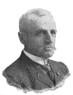
COLONEL J. W. BARLOW.
Baronett Peak (10,300)—C: 13—1878—U. S. G. S.—For C. J. Baronett, “Yellowstone Jack,” a famous scout and guide, closely connected with the history of the National Park, and builder of the first bridge across the Yellowstone River.
Baronett’s career was adventurous beyond the average man of his class. He was born in Glencoe, Scotland, in 1829. His father was in the British naval service, and he early began to follow the sea. In his multitudinous wanderings we find him on the coast of Mexico during the Mexican War; on the Chinese coast in 1850, where he deserted his ship and fled to San Francisco; in 1852, in Australia after gold; the [292] next year in Africa, still on a gold hunt; then in Australia again and in San Francisco; next in the Arctic seas as second mate on a whaling vessel; back in California in 1855; courier for Albert Sidney Johnston in the Mormon War; later in Colorado and California searching for gold; scout in the Confederate service until 1863; then in Mexico with the French under Maximilian, who made him a captain; back in California in 1864, and in Montana in September of the same year, where he at once set out on a prospecting trip which took him entirely through the region of the Yellowstone Park; later in the service of Gen. Custer as scout in the Indian territory; then in Mexico and finally back in Montana in 1870; finder of the lost Everts; builder of his celebrated bridge in 1871; in the Black Hills in 1875, where he slew a local editor who had unjustly reflected upon him in his paper; scout in the Sioux, Nez Percé, and Bannock Wars, 1876-8; Indian trader for many years; engaged in innumerable prospecting ventures; and still, at the age of sixty-six, searching with his old time ardor for the elusive yellow metal.
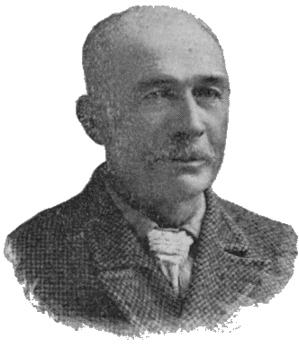
C. J. BARONETT.
Big Game Ridge—Q-T: 9-11—1895—U. S. G. S.—Characteristic.
Birch Mils (7,300)—R: 4—1885—U. S. G. S.—Characteristic.
Bison Peak (8,800)—D: 12—1878—U. S. G. S.—Characteristic.
Bobcat Ridge (9,500)—T: 9—1895—U. S. G. S.—Characteristic.
Bunsen Peak (9,100)—D: 6—1872—U. S. G. S.—For the eminent chemist and physicist, Robert Wilhelm Bunsen; inventor of the Bunsen electric cell and of the Bunsen Gas Burner; co-discoverer with Kirchoff of the principle of Spectrum Analysis; and the first thorough investigator of the phenomena of geyser action. (See Chapter III, Part II.)
Cathedral Peak (10,600)—J: 13—1885—U. S. G. S.—Characteristic.
Chittenden, Mt. (10,100)—K: 12—1878—U. S. G. S.—“Of the prominent peaks of this [the Absaroka] range may be mentioned Mount Chittenden, named for Mr. George B. Chittenden, whose name has long been identified with this survey.”—Gannett.[CA]
[CA] Page 482, Twelfth Annual Report of Dr. Hayden.
Cinnabar Mountain (7,000)—A: 5—Named prior to 1870.—“So named from the color of its rocks, which have been mistaken for Cinnabar, although the red color is due to iron.”—Hayden. The Devil’s Slide (also named before 1870) is on this mountain.
Colter Peak (10,500)—O: 13—1885—U. S. G. S.—For John Colter. (See Part I, Chapter III.)
Crags, The (9,000)—E: 3—1885—U. S. G. S.—Characteristic.
Crescent Hill (7,900)—D: 9—1885—U. S. G. S.—Characteristic.
Crow Foot Ridge (9,700)—D-E: 3—1885—U. S. G. S.—Characteristic.
Doane, Mt. (10,500)—M: 13—1870—Washburn Party—For Lieutenant Gustavus C. Doane, 2d Cavalry, U. S. Army, commander of the military escort to the celebrated Wasburn Expedition of 1870.
CAPTAIN GUSTAVUS C. DOANE.
Lieutenant Doane was born in Illinois, May 29, 1840, and died in Bozeman, Mont., May 5, 1892. At the age of five he went with his parents, in wake of an ox team, to Oregon. In 1849 his family went to California at the outbreak of the gold excitement. He remained there ten years, in the meanwhile working his way through school. In 1862 he entered the Union service, went east with the California Hundred, and then joined a Massachusetts cavalry regiment. He was mustered out in 1865 as a First Lieutenant. He joined the Carpet-baggers and is said to have become mayor of Yazoo City, Mississippi. He was appointed a Second Lieutenant in the Regular Army in 1868, and continued in the service until his death, attaining the rank of Captain.
Doane’s whole career was actuated by a love of adventure. He had at various times planned a voyage to the Polar regions, or an expedition of discovery into Africa. But fate assigned him a middle ground, and he became prominently connected with the discovery of the Upper Yellowstone country. His part in the Expedition of 1870 is second to none. He made the first official report upon the wonders of the Yellowstone, and his fine descriptions have never been surpassed by any subsequent writer. Although suffering intense physical torture during the greater portion of the trip, it did not extinguish in him the truly poetic ardor with which those strange phenomena seem to have inspired him. Dr. Hayden says of this report: "I venture to state, as my opinion, that [295] for graphic description and thrilling interest it has not been surpassed by any official report made to our government since the times of Lewis and Clark." [CB]
[CB] Page 8, Fifth Annual Report of Dr. Hayden.
Lieutenant Doane and Mr. Langford were the first white men known to have ascended any of the higher peaks of the Absaroka Range. From the summit of the mountain so ascended, Mr. Langford made the first known authentic sketch of Yellowstone Lake. This sketch was used soon after by General Washburn in compiling an official map of that section of country, and he was so much pleased with it that he named the mountain from which it was taken, Mt. Langford. At Mr. Langford’s request, he named a neighboring peak, Mt. Doane.
Dome, The (9,900)—E: 4—1885—U. S. G. S.—Characteristic.
Druid Peak (9,600)—D: 12—1885—U. S. G. S.—Characteristic.
Dunraven Peak (9,700)—F: 9—1878—U. S. G. S.—“This I have named Dunraven Peak in honor of the Earl of Dunraven, whose travels and writings have done so much toward making this region known to our cousins across the water.”—Gannett. [CC]
[CC] Page 478, Twelfth Annual Report of Dr. Hayden.
Dunraven visited the Park in 1874. In 1876, he published his “Great Divide,” describing his travels in the West. The irrepressible Colonel Norris named this peak after himself, and coupled it with Mt. Washburn in a characteristic poem. But the United States Geological Survey decided otherwise, and transferred the colonel’s name to the north-east corner of the Park. (See "Mt. Norris.")
Eagle Peak (10,800)—O: 14—1885—U. S. G. S.—Characteristic.
Echo Peak (9,600)—E: 4—1885—U. S. G. S.—Characteristic.
Electric Peak (11,155)—B: 4-5—1872—U. S. G. S.—From the following circumstance, described by Mr. Henry Gannett, who ascended the mountain with surveying instruments, July 26, 1872: [CD]
“A thunder-shower was approaching as we neared the summit of the mountain. I was above the others of the party, and, when about fifty feet below the summit, the electric current began to pass through my body. At first I felt nothing, but heard a crackling noise, similar to a rapid discharge of sparks from a friction machine. Immediately after, I began to feel a tingling or pricking sensation in my head and the ends of my fingers, which, as well as the noise, increased rapidly, until, when I reached the top, the noise, which had not changed its character, was deafening, and my hair stood completely on end, while the tingling, pricking sensation was absolutely painful. Taking off my hat partially relieved it. I started down again, and met the others twenty-five or thirty feet below the summit. They were affected similarly, but in a less degree. One of them attempted to go to the top, but had proceeded but a few feet when he received quite a severe shock, which felled him as if he had stumbled. We then returned down the mountain about three hundred feet, and to this point we still heard and felt the electricity.”
[CD] Page 807, Sixth Annual Report of Dr. Hayden.
Elephant Back (8,600)—J: 9—1871—U. S. G. S.—Characteristic. “On account of the almost vertical sides of this mountain, and the rounded form of the summit, it has received the name of the Elephant’s Back.”—Hayden. [CE]
[CE] Page 98, Fifth Annual Report of Dr. Hayden.
This name, as now applied, refers to a different feature from that originally designated by it. Many years before the Park was discovered, it was used to denote the long ridge of which Mt. Washburn is the commanding summit, and which was distinctly visible from beyond the present limits of the Park, both north and south. It so appears upon Raynolds' map of [297] 1860, and was so used by the Washburn Expedition (1870), by Captain Barlow (1871), and by Captain Jones (1873). The United States Geological Survey, however, in 1871, transferred the name to an inconspicuous ridge more than a thousand feet lower than the surrounding mountains. Whether the change was made by accident or design does not appear. Captain Ludlow, as late as 1875, refers to it and deplores the fact that it had taken place.
Everts, Mt. (7,900)—C: 7—1870—Washburn Party.—For Hon. Truman C. Everts, member of the Expedition of 1870, whose terrible experience is elsewhere alluded to. The following succinct account is from the pen of Lieutenant Doane, and is in the main correct: [CF]
"On the first day of his absence, he had left his horse standing unfastened, with all his arms and equipments strapped upon his saddle; the animal became frightened, ran away into the woods, and he was left without even a pocket knife as a means of defense. Being very near-sighted, and totally unused to traveling in a wild country without guides, he became completely bewildered. He wandered down to the Snake River Lake [Hart Lake], where he remained twelve days, sleeping near the hot springs to keep from freezing at night, and climbing to the summits each day in the endeavor to trace out his proper course. Here he subsisted on thistle-roots, boiled in the springs, and was kept up a tree the greater part of one night by a California lion. After gathering and cooking a supply of thistle-roots, he managed to strike the south-west point of the [Yellowstone] Lake, and followed around the north side to the Yellowstone [River], finally reaching our [old] camp opposite the Grand Cañon. He was twelve days out before he thought to kindle a fire by using the lenses of his field-glass, but afterward carried a burning brand with him in all his wanderings. Herds of game [298] passed by him during the night, on many occasions when he was on the verge of starvation. In addition to a tolerable supply of thistle-roots, he had nothing for over thirty days but a handful of minnows and a couple of snow-birds. Twice he went five days without food, and three days without water, in that country which is a net-work of streams and springs. He was found on the verge of the great plateau, above the mouth of Gardiner’s River. A heavy snow-storm had extinguished his fire; his supply of thistle-roots was exhausted; he was partially deranged, and perishing with cold. A large lion was killed near him, on the trail, which he said had followed him at a short distance for several days previously. It was a miraculous escape, considering the utter helplessness of the man, lost in a forest wilderness, and with the storms of winter at hand."
[CF] Page 37, “Yellowstone Expedition of 1870.” See Appendix E.
On the thirty-seventh day of his wanderings (September 9th to October 16th), he was discovered by Jack Baronett and George A. Pritchett, near the great trail on a high mountain a few miles west of Yancey’s. Baronett threw up a mound of stones to mark the spot. He carried Everts in his arms the rest of that day, and passed the night on a small tributary of Black-tail Deer Creek. The next day he was taken on a saddle to near the mouth of the Gardiner.
The commemoration of this adventure in the naming of Mt. Everts was an awkward mischance. The mountain which should bear the name is Mt. Sheridan. It was named for Everts by the Washburn Party the night before he was lost, in recognition of his having been the first white man (except Mr. Hedges, who was with him) known to have visited its summit. In the writings of the Washburn Party after their return, it is so used; one very interesting article, by Mr. Hedges, with this name as a title, being published in the Helena Herald before it was known that Mr. Everts had been found. But the name, Mt. Everts, was finally given to the broad plateau between the Gardiner and the Yellowstone, a feature which is [299] not a mountain at all, and which is ten miles from where Everts was found. The actual locality of the finding was erroneously supposed to be near “Rescue Creek.”
In 1871, Captain Barlow ascended the mountain which should have borne the name of Everts, and called it Mt. Sheridan, in ignorance of its former christening.
Factory Hill (9,500)—O: 8—1885—U. S. G. S.—The term “factory” has at various times been applied to several different localities in the Park, because of their striking resemblance on frosty mornings to an active factory town. The resemblance was noted as far back as 1829. The name has now become fixed, as above indicated.
Flat Mountain (9,000)—N: 9—1871—U. S. G. S.—Characteristic.—This mountain had already been named by the Washburn Party Yellow Mountain, from its color.
DAVID E. FOLSOM.
Folsom Peak (9,300)—E: 8—1895—U. S. G. S.—For David E. Folsom, leader of the Expedition of 1869, and author of the first general description of the valley of the Upper Yellowstone.
Forellen Peak (9,700)—T: 5—1885—U. S. G. S.—From the German name for Trout.
Gallatin Range—A-F: 1-4—Name in use prior to 1870. Raynolds has “Mt. Gallatin” on his map. Gallatin River (see name) rises in this range.
Garnet Hill (7,000)—C: 9—1878—U. S. G. S.—Characteristic.
Giant Castle (10,000)—K: 14-15—1873—Jones—Characteristic.
Gibbon Hill (8,600)—H: 6—1885—U. S. G. S.—From the Gibbon River.
Gravel Peak (9,600)—T: 11—U. S. G. S.—Characteristic.
Gray Peak (10,300)—C-D: 4—1885—U. S. G. S.—Characteristic.
Grizzly Peak (9,700)—L: 12—1885—U. S. G. S.—Characteristic.
Hancock, Mt. (10,100)—R: 10—1871—Barlow—For General W. S. Hancock, U. S. Army, who, as commanding officer of the Department of Dakota, had lent his active aid in the prosecution of the Yellowstone Explorations.
Hawk’s Rest (9,800)—R: 14—1885—U. S. G. S.—Characteristic.
Hedges Peak (9,500)—G: 9—1895—U. S. G. S.—For Cornelius Hedges, a prominent member of the Washburn Expedition, author of a series of descriptive articles upon the trip, and first to advance and publicly advocate the idea of setting apart that region as a National Park.
Holmes, Mt. (10,300)—F: 4—1878—U. S. G. S.—For W. H. Holmes, Geologist, U. S. Geological Survey. This peak had been previously called Mt. Madison.
Horseshoe Hill (8,200)—E: 6—1885—U. S. G. S.—Characteristic.
Hoyt, Mt. (10,400)—L: 13—1881—Norris—For the Hon. John W. Hoyt, then Governor of Wyoming.
Huckleberry Mountain (9,700)—S: 7—1885—U. S. G. S.—Characteristic.
Humphreys, Mt. (11,000)—N: 14—1871—Barlow—For General A. A. Humphreys, then Chief of Engineers, U. S. A.
Index Peak (11,740)—C: 16—This mountain, and Pilot Knob near it, received their names from unknown sources prior to 1870.
"One of them [the peaks] derives its name from its shape, [301] like a closed hand with the index-finger extending upward, while the other is visible from so great a distance on every side that it forms an excellent landmark for the wandering miner, and thus its appropriate name of Pilot Knob."—Hayden. [CG]
[CG] Page 48, Sixth Annual Report of Dr. Hayden.
Joseph Peak (10,300)—C: 4—1885—U. S. G. S.—For Chief Joseph, the famous Nez Percé leader in the war of 1877. He deservedly ranks among the most noted of the North American Indians. His remarkable conduct of the campaign of 1877 and his uniform abstinence from those barbarous practices which have always characterized Indian warfare, were a marvel to all who were familiar with the facts. No Indian chief ever commanded to such a degree the respect and even friendship of his enemies.
Junction Butte (6,500)—D: 10—When or by whom given not known. The name arose, of course, from the fact that this butte stands at the junction of the two important streams, the Yellowstone and Lamar Rivers. Barlow records that the Butte was known as “Square Butte” at the time of his visit in 1871.
Lake Butte (8,600)—K: 11—1878—Characteristic.
Landmark, The (8,800)—F: 6—1885—U. S. G. S.—Characteristic.
Langford, Mt. (10,600)—M: 13—1870—Washburn Party—For the Hon. Nathaniel Pitt Langford, first Superintendent of the Yellowstone National Park.
NATHANIEL PITT LANGFORD.
Mr. Langford was born August 9, 1832, in Westmoreland, Oneida County, New York. His early life was spent on his father’s farm, and his education was obtained by winter attendance at district school. At nineteen, he became clerk in the Oneida Bank of Utica. In 1854, he went to St. Paul, where we find him, in 1855, cashier of the banking house of Marshall & Co., and in 1858, cashier of the Bank of the State [302] of Minnesota. In 1862, he went to Montana as second in command of the Northern Overland Expedition, consisting of 130 men and 53 wagons drawn by oxen. In 1864, he was made Collector of Internal Revenue for the new territory. In 1868, he was appointed by President Johnson Governor of Montana, but as this was after the Senate’s imbroglio with the President and its refusal to confirm any more presidential appointments, he did not reach this office. He was one of the famous Montana Vigilantes, a member of the Yellowstone Expedition of 1870, and first Superintendent of the newly created Park. In 1872, he was appointed National Bank Examiner for the Pacific States and Territories, and held the office for thirteen years. He now resides in St. Paul, Minnesota. He is author of a series of articles in Scribner’s for 1871, describing the newly-discovered wonders of the Yellowstone, and of the important work, “Vigilante Days and Ways,” the most complete history in existence of that critical period in Montana history.
The notable part which Mr. Langford bore in the discovery of the Upper Yellowstone country, and in the creation of the Yellowstone National Park, has been fully set forth elsewhere. He has always been its ardent friend, and his enthusiasm upon the subject in the earlier days of its history drew upon him the mild raillery of his friends, who were wont to call him, [303] “National Park” Langford—a soubriquet to which the initials of his real name readily lent themselves.
For the circumstance of naming Mt. Langford, see “Mt. Doane.”
Mary Mountain (8,500)—J: 7—Probably so named by tourists from Mary Lake, which rests on the summit.
Moran, Mt. (12,800)—W: 5—1872—U. S. G. S.—For the artist, Thomas Moran, who produced the picture of the Grand Cañon now in the Capitol at Washington.
Needles, The (9,600)—E: 14—1885—U. S. G. S.—Characteristic.
PHILETUS W. NORRIS.
Norris, Mt. (9,900)—E: 13—1878—U. S. G. S.—For Philetus W. Norris, second Superintendent of the Park, and the most conspicuous figure in its history.
He was born at Palmyra, New York, August 17, 1821. At the age of eight, he was tourist guide at Portage Falls on the Genesee River, New York, and at seventeen he was in Manitoba in the service of British fur traders. In 1842, he settled in Williams County, Ohio, where he founded the village of Pioneer. Between 1850 and 1860 he visited the Far West. At the outbreak of the Civil War, he entered the army and served a short time as spy and captain of scouts. He was then placed in charge of Rebel prisoners on Johnson’s Island. He next entered politics as member of the Ohio House of Representatives, but being later defeated for the State Senate, he joined the United States Sanitary Commission [304] and went again to the front. He soon returned and became trustee of certain landed property near the City of Detroit belonging to officers and soldiers of both armies. These lands he reclaimed at great expense from their original swampy condition, and built thereon the village of Norris, now part of Detroit. In 1770, he went west again and undertook to enter the Park region in June of that year, but permitted the swollen condition of the streams to defeat his project. He thus missed the honor which a few months later fell to the Washburn Party—a misfortune which he never ceased to deplore. In 1875, he again visited the Park, and in 1877, became its second Superintendent. In 1882, he returned to Detroit, after which he was employed by the government to explore old Indian mounds, forts, villages, and tombs, and to collect relics for the National Museum. He died at Rocky Hill, Kentucky, January 14, 1885. He is author of the following works: Five Annual Reports as Superintendent of the Park; “The Calumet of the Coteau,” a volume of verse, with much additional matter relating to the Park; and a long series of articles on “The Great West,” published in the Norris Suburban in 1876-8.
The above sketch sufficiently discloses the salient characteristic of Norris' career. His life was that of the pioneer, and was spent in dealing first blows in the subjugation of a primeval wilderness. He was “blazing trails,” literally and figuratively, all his days, leaving to others the building of the finished highway. It is therefore not surprising that his work lacks the element of completeness, which comes only from patient attention to details. Nowhere is this defect more apparent than in his writings. A distinct literary talent, and something of the poet’s inspiration, were, to use his own words, “well nigh strangled” by the “stern realities of border life.” His prose abounds in aggregations of more than one hundred words between periods, so ill arranged and barbarously punctuated as utterly to bewilder the reader. His [305] verse—we have searched in vain for a single quatrain that would justify reproduction. Nevertheless, his writings, like his works, were always to some good purpose. They contained much useful information, and, being widely read throughout the West, had a large and beneficial influence.
Perhaps no better or more generous estimate of his character can be found than in the following words of Mr. Langford who knew him well: “He was a good man, a true man, faithful to his friends, of very kind heart, grateful for kindnesses, of more than ordinary personal courage, rather vain of his poetical genius, and fond of perpetuating his name in prominent features of scenery.”
Concerning which last characteristic it may be noted that three mountain peaks, one geyser basin, one pass, and an uncertain number of other features of the Park, were thought by Colonel Norris deserving of this distinction. With inimitable fidelity to this trait of his character, he had even selected as his final resting-place the beautiful open glade on the south side of the Grand Cañon, just below the Lower Falls.
Observation Peak (9,300)—G: 8—1885—U. S. G. S.—Characteristic.
Obsidian Cliff (7,800)—F: 6—1878—Norris—Characteristic.
Paint Pot Hill (7,900)—H: 6—1885—U. S. G. S.—Characteristic.
Pelican Cone (9,580)—I: 12—1885—U. S. G. S.—Near source of Pelican Creek.
Pilot Knob (11,977)—C: 16—See "Index Peak."
Piñon Peak (9,600)—S: 10—1885—U. S. G. S.—Characteristic.
Prospect Peak (9,300)—D-E: 8—1885—U. S. G. S.—Characteristic.
Pyramid Peak (10,300)—J: 14—1895—U. S. G. S.—Characteristic.
Quadrant Mountain (10,200)—D: 4—1878—U. S. G. S.—Characteristic.
Red Mountain Range—P: 7-8—U. S. G. S.—Characteristic.
Reservation Peak (10,600)—M: 14—1895—U. S. G. S.—Characteristic.
Roaring Mountain (8,000)—F: 6—1885—U. S. G. S.—“It takes its name from the shrill, penetrating sound of the steam constantly escaping from one or more vents near the summit.”—Hague.
Saddle Mountain (11,100)—H: 15—1880—Norris—Characteristic.
Schurz Mt. (10,900)—N: 14—1885—U. S. G. S.—For Carl Schurz, Secretary of the Interior during President Hayes' administration. This name was first given by Colonel Norris to the prominent ridge on the west side of the Gibbon Cañon.
Sepulcher Mountain (9,500)—B-C: 5-6—The origin of this name is unknown. The following remarks concerning it are from the pen of Prof. Wm. H. Holmes: [CH]
“Why this mountain received such a melancholy appellation I have not been able to discover. So far as I know, the most important thing buried beneath its dark mass is the secret of its structure. It is possible that the form suggested the name.”
[CH] Page 15, Twelfth Annual Report of Dr. Hayden.
Sheepeater Cliffs (7,500)—D: 7—1879—Norris—From the name of a tribe of Indians, the only known aboriginal occupants of what is now the Yellowstone Park. (See Chapter II, Part II.) It was upon one of the “ancient and but recently deserted, secluded, unknown haunts” of these Indians, that Colonel Norris, “in rapt astonishment,” stumbled one day, and was so impressed by what he saw, that he gave the neighboring cliff its present name. He thus describes this retreat: [CI]
“It is mainly carpeted with soft grass, dotted, fringed, and overhung with small pines, firs and cedars, and, with the subdued and mingled murmur of the rapids and cataracts above and below it, and the laughing ripple of the gliding stream, is truly an enchanting dell—a wind and storm sheltered refuge for the feeble remnant of a fading race.”
[CI] Page 10, Annual Report Superintendent of the Park for 1879.
Sheridan Mt. (10,250)—P: 8—1871—Barlow—For Gen. P. H. Sheridan, who actively forwarded all the early exploring expeditions in this region, and, at a later day, twice visited the Park. His public warnings at this time of the danger to which the Park was exposed from vandals, poachers, and railroad promoters, and his vigorous appeal for its protection, had great influence in bringing about a more efficient and enlightened policy in regard to that reservation. (See "Mt. Everts.")
Signal Hills (9,500)—M: 12—1871—U. S. G. S.—A ridge extending back from Signal Point on the Yellowstone Lake.
Silver Tip Peak (10,400)—K: 13—1885—U. S. G. S.—Characteristic.
Specimen Ridge (8,700)—E: 11—Name known prior to 1870.—Characteristic. (See Chapter V, Part II.)
Stevenson, Mt. (10,300)—M: 13—1871—U. S. G. S.—For James Stevenson, long prominently connected with the U. S. Geological Survey.
“In honor of his great services not only during the past season, but for over twelve years of unremitting toil as my assistant, oftentimes without pecuniary reward, and with but little of the scientific recognition that usually comes to the original explorer, I have desired that one of the principal islands of the lake and one of the noble peaks reflected in its clear waters should bear his name forever.”—Hayden. [CJ]
[CJ] Page 5, Fifth Annual Report of Dr. Hayden.
Mr. Stevenson was born in Maysville, Ky., December 24, 1840. He early displayed a taste for exploration and natural history, and such reading as his limited education permitted [308] was devoted to books treating of these subjects. At the age of thirteen he ran away from home and joined a party of Hudson’s Bay Fur Company’s traders, bound up the Missouri River. On the same boat was Dr. F. V. Hayden, then on his way to explore the fossiliferous region of the Upper Missouri and Yellowstone Rivers. Noticing Stevenson’s taste for natural history he invited him to join him in his work. Stevenson accepted; and thus began a relation which lasted for more than a quarter of a century, and which gave direction to the rest of his life.
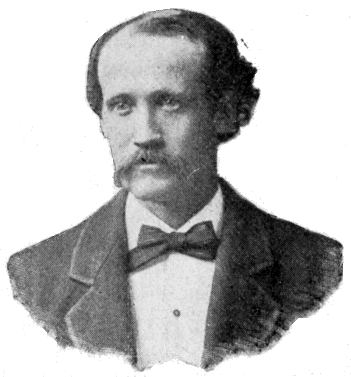
JAMES STEVENSON.
He was engaged in several explorations between 1850 and 1860, connected with the Pacific railroad surveys, and with others under Lieutenants G. K. Warren and W. F. Raynolds. In 1861 he entered the Union service as a private soldier, and left it in 1865 with an officer’s commission. After the war he resumed his connection with Dr. Hayden. He was mainly instrumental in the organization of the United States Geological Survey of the Territories in 1867, and during the next twelve years he was constantly engaged in promoting its welfare. When the consolidation of the various geographical and geological surveys took place in 1879, under the name of the United States Geological Survey, he became associated with the United States Bureau of Ethnology. He had always shown a taste for ethnological investigations and his scientific work during the rest of his life was in this direction, [309] principally among the races of New Mexico and Arizona. He died in New York City July 25, 1888.
In the paragraph quoted above from Dr. Hayden there is more than any but the few who are familiar with the early history of the geological surveys will understand. It rarely happens that a master is so far indebted to a servant for his success, as was true of the relation of Dr. Hayden and James Stevenson. Stevenson’s great talent lay in the organization and management of men. His administrative ability in the field was invaluable to the Survey of which Hayden was chief, and his extraordinary influence with Congressmen was a vital element in its early growth. His part in the Yellowstone Explorations of 1871 and 1872 is second to none in importance. It will not be forgotten that he was the first to build and launch a boat upon the Yellowstone Lake, nor that he, and Mr. Langford who was with him, were the first white men to reach the summit of the Grand Teton.
Storm Peak (9,500)—E: 8—1885—U. S. G. S.—Characteristic.
Survey Peak (9,200)—T: 4—1885—U. S. G. S. This mountain was a prominent signaling point for the Indians. It was first named Monument Peak by Richard Leigh who built a stone mound on its summit.
Table Mountain (10,800)—O: 14—1885—U. S. G. S.—Characteristic.
Terrace Mountain (8,100)—C: 6—1878—U. S. G. S.—Characteristic.
Teton, Grand (13,691)—Not on Map.—This mountain has borne its present name for upward of four score years. Through more than half a century it was a cynosure to the wandering trapper, miner and explorer. The name has passed into all the literature of that period, which will ever remain one of the most fascinating in our western history. Indeed, it has become the classic designation of the most interesting historic summit of the Rocky Mountains. That it [310] should always retain this designation in memory of the nameless pioneers who have been guided by it across the wilderness, and thousands of whom have perished beneath its shadow, would seem to be a self-evident proposition. Individual merit, no matter how great, can never justify the usurpation of its place by any personal name whatever. An attempt to do this was made in 1872 by the United States Geological Survey who rechristened it Mt. Hayden. The new name has never gained any local standing, and although it has crept into many maps its continued use ought to be discouraged. It is greatly to the credit of Dr. Hayden that he personally disapproved the change, so far at least, as very rarely, if ever, to refer to the mountain by its new name.
Three Rivers Peak (9,900)—E: 4—1885—U. S. G. S.—Branches of the Madison, Gallatin and Gardiner Rivers take their rise from its slopes.
Thunderer, The (10,400)—D: 14—1885—U. S. G. S.—Seemingly a great focus for thunder storms.
Top Notch Peak (10,000)—L: 13—1895—U. S. G. S.—Characteristic.
Trident, The (10,000)—Q-R: 14—1885—U. S. G. S.—Characteristic.
Trilobite Point (9,900)—F: 4—1885—U. S. G. S.—Characteristic.
Turret Mountain (10,400)—P: 14—1878—Characteristic.—Called by Captain Jones “Round-head or Watch Tower.”
Twin Buttes (8,400)—K: 14—1870—Washburn Party.—Characteristic.
Washburn, Mt. (10,000)—F: 9—1870—Washburn Party.—For General Henry Dana Washburn, chief of the Yellowstone Expedition of 1870.
General Washburn was born in Windsor, Vt., March 28, 1832. His parents moved to Ohio during his infancy. He received a common school education and at fourteen began [311] teaching school. He entered Oberlin College, but did not complete his course. At eighteen he went to Indiana where he resumed school-teaching. At twenty-one he entered the New York State and National Law School, from which he graduated. At twenty-three he was elected auditor of Vermilion county, Indiana.
His war record was a highly honorable one. He entered the army as private in 1861 and left it as brevet brigadier-general in 1865. His service was mainly identified with the Eighteenth Indiana, of which he became colonel. He was in several of the western campaigns, notably in that of Vicksburg, in which he bore a prominent part. In the last year of the war he was with Sherman’s army, and for a short time after its close was in command of a military district in southern Georgia. In 1864, he was elected to Congress over the Hon. Daniel W. Voorhees, and again, in 1866, over the Hon. Solomon W. Claypool. At the expiration of his second term he was appointed by President Grant, surveyor-general of Montana, which office he held until his death.
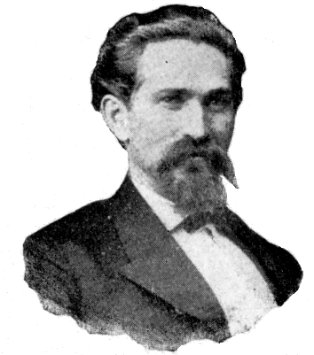
GEN. HENRY DANA WASHBURN.
It was during his residence in Montana that the famous Yellowstone Expedition of 1870 took place. His part in that important work is perhaps the most notable feature of his career. As leader of the expedition he won the admiration and affection of its members. He was the first to send to Washington specimens from the geyser formations. He ardently [312] espoused the project of setting apart this region as a public park and was on his way to Washington in its interest when his career was cut short by death. The hardship and exposure of the expedition had precipitated the catastrophe to which he had long been tending. He left Helena in November, 1870, and died of consumption at his home in Clinton, Indiana, January 26, 1871.
General Washburn’s name was given to this mountain by a unanimous vote of the party on the evening of August 28, 1870, as a result of the following incident related by Mr. Langford:
“Our first Sunday in camp was at Tower Creek. The forest around us was very dense, and we were somewhat at a loss in deciding what course we needed to follow in order to reach Yellowstone Lake. We had that day crossed a fresh Indian trail, a circumstance which admonished us of the necessity of watchfulness so as to avoid disaster. While we were resting in camp, General Washburn, without our knowledge, and unattended, made his way to the mountain, from the summit of which, overlooking the dense forest which environed us, he saw Yellowstone Lake, our objective point, and carefully noted its direction from our camp. This intelligence was most joyfully received by us, for it relieved our minds of all anxiety concerning our course of travel, and dispelled the fears of some of our party lest we should become inextricably involved in that wooded labyrinth.”
White Peaks (9,800)—F : 4—1895—U. S. G. S.—Characteristic.
Wild Cat Peak (9,800)—T : 8—1885—U. S. G. S.—Characteristic.
Yount Peak (Hayden, 11,700; Hague, 12,250)—Not on map.—1878—U. S. G. S.—Source of the Yellowstone.—Named for an old trapper and guide of that region.
III.
STREAMS.
[Map locations refer only to outlets, or to points where streams pass off the limits of the map. Altitudes refer to the same points, but are given only in the most important cases.]
Agate Creek—E : 10—1878—U. S. G. S.—Characteristic.
Alum Creek—H : 9—Name known prior to 1870—Characteristic.
Amethyst Greek—E : 12—1878—U. S. G. S.—Flows from Amethyst Mountain.
Amphitheater Creek—D : 13—1885—U. S. G. S.—From form of valley near its mouth.
Antelope Creek—E : 10—1870—Washburn Party—Characteristic.—This name is often applied locally to a tributary of the Yellowstone just above Trout Creek.
Arnica Creek—L : 8—1885—U. S. G. S.—Characteristic.
Aster Creek—P : 7—1885—U. S. G. S.—Characteristic.
Astrigent Creek—J : 12—1885—U. S. G. S.—Characteristic.
Atlantic Creek—S : 13—1873—Jones—Flows from Two-Ocean-Pass down the Atlantic slope.
Badger Creek—P : 13—1885—U. S. G. S.—Characteristic.
Basin Creek—Q : 9—1885—U. S. G. S.—Characteristic.
Bear Creek—B : 7—1863—Party of prospectors under one Austin. On the way they found fair prospects in a creek on the east side of the Yellowstone, and finding also a hairless cub, called the gulch “Bear.”—Topping.
Bear Creek—K : 11—1885—U. S. G. S.—Characteristic.
Beaver Creek—O : 9—1885—U. S. G. S.—Characteristic.
Beaver Dam Creek—O : 12—1871—U. S. G. S.—Characteristic.
Bechler River—R : 1—1872—U. S. G. S.—For Gustavus R. Bechler, topographer on the Snake River Division of the Hayden Expedition of 1872.
Berry Creek—U : 6—1885—U. S. G. S.—Characteristic.
Black-tail Deer Creek—B : 8—Named prior to 1870—Characteristic.
Bluff Creek—H : 10—1885—U. S. G. S.—Characteristic.
Bog Creek—H : 10—1885—U. S. G. S.—Characteristic.
Boone Creek—T : 1—Named prior to 1870—For Robert Withrow, an eccentric pioneer of Irish descent, who used to call himself “Daniel Boone the Second.”
Bridge Creek—K : 9—1871—U. S. G. S.—Characteristic.
“At one point, soon after leaving camp, we found a most singular natural bridge of the trachyte, which gives passage to a small stream, which we called Bridge Creek.”—Hayden.
“Natural Bridge” is really over a branch of Bridge Creek.
Broad Creek—F : 10—1871—Barlow—Characteristic.
Buffalo Creek—D : 11—Prior to 1870—Naming party unknown—Characteristic.
Burnt Creek—E : 10—1885—U. S. G. S.—Characteristic.
Cache Creek—F : 13—1863—Prospecting party under one Austin were in camp on this stream when they were surprised by Indians, and all their stock stolen except one or two mules. Being unable to carry all their baggage from this point, they cached what they could not place on the mules, or could not themselves carry. From this circumstance arose the name.
Calfee Creek—F : 13—1880—Norris—For H. B. Calfee, a photographer of note.
"Some seven miles above Cache Creek we passed the mouth of another stream in a deep, narrow, timbered valley, which [315] we named Calfee Creek, after the famous photographer of the Park. Five miles further on, we reached the creek which Miller recognized as the one he descended in retreating from the Indians in 1870, and which, on this account, we called Miller’s Creek."—Norris.[CK]
[CK] Page 7, Annual Report Superintendent of the Park for 1880.
Cañon Creek—1 : 5—1885—U. S. G. S.—Characteristic.
Carnelian Creek—E : 9—1885—U. S. G. S.—Characteristic.
Cascade Creek—G : 8—1870—Washburn Party—Characteristic.
Chalcedony Creek—E : 12—1885—U. S. G. S.—Characteristic.
Chipmunk Creek—O : 11—1885—U. S. G. S.—Characteristic.
Clear Creek—L : 11—1878—U. S. G. S.—Characteristic.
Cliff Creek—Q : 13—1885—U. S. G. S.—Characteristic.
Clover Creek—G : 13—1885—U. S. G. S.—Characteristic.
Cold Creek—H : 14—1885—U. S. G. S.—Characteristic.
Columbine Creek—M : 11—1885—U. S. G. S.—Characteristic.
Conant Creek—T : 1—Prior to 1870—By Richard Leigh for one All Conant, who went to the mountains in 1865, and who came near losing his life on this stream.
Cotton Grass Creek—H : 9—1885—U. S. G. S.—Characteristic.
Cougar Creek—G : 2—1885—U. S. G. S.—Characteristic.
Coulter Creek—R : 8—1885—U. S. G. S.—For John M. Coulter, botanist in the Hayden Expedition of 1872.
Crawfish Creek—R : 6—1885—U. S. G. S—Characteristic.
Crevice Creek—C : 7—1867—Prospecting party under one Lou Anderson.
“They found gold in a crevice at the mouth of the first Stream above Bear, and named it, in consequence, Crevice [316] Gulch. Hubbel went ahead the next day for a hunt, and upon his return he was asked what kind of a stream the next creek was. ‘It’s a hell roarer,’ was his reply, and Hell Roaring is its name to this day. The second day after this, he was again ahead, and, the same question being asked him, he said: “‘Twas but a slough.” When the party came to it, they found a rushing torrent, and, in crossing, a pack horse and his load were swept away, but the name of Slough Creek remains.”—Topping.
Crooked Creek—R : 10—1885—U. S. G. S.—Characteristic.
Crow Creek—K : 15—1885—U. S. G. S.—Characteristic.
Crystal Creek—D : 11—1885—U. S. G. S.—Characteristic.
Cub Creek—L : 11—1885—U. S. G. S.—Characteristic.
Deep Creek—E : 10—1873—Jones—Characteristic.
De Lacy Creek—M : 6—1880—Norris—For Walter W. De Lacy, first white man known to have passed along the valley. (See "Shoshone Lake.") First named Madison Creek by the Hayden party in 1871.
Duck Creek—G : 3—1895—U. S. G. S.—Characteristic.
Elk Creek—D : 9—Named prior to 1870—Characteristic.
Elk Tongue Creek—C : 12—U. S. G. S.—Characteristic.
Escarpment Creek—Q : 13—1885—U. S. G. S.—Characteristic.
Fairy Creek—J : 4—1871—Barlow—From “Fairy Falls,” which see.
Falcon Creek—R : 13—1885—U. S. G. S.—Characteristic.
Falls River—S : 1—1872—U. S. G. S.—Characteristic.
Fan Creek—C : 2—1885—U. S. G. S.—Characteristic.
Fawn Creek—C : 5—1878—U. S. G. S.—Characteristic.
Firehole River—I : 4—This name and “Burnt Hole” have been used to designate the geyser basins and the stream flowing through them since at least as far back as 1830. Captain Bonneville says it was well known to his men. The term “Hole” is a relic of the early days when the open valleys or parks among the mountains were called “holes.” The descriptive [317] “fire, naturally arose from the peculiar character of that region.”
Firehole, Little—L : 4—1878—U. S. G. S.—From main stream.
Flint Creek—F : 13—1885—U. S. G. S.—Characteristic.
Forest Creek—Q : 7—1885—U. S. G. S—Characteristic.
Fox Creek—R : 11—1885—U. S. G. S.—Characteristic.
Gallatin River—A : 1—1805—Lewis and Clark—For Albert Gallatin, Secretary of War under President Jefferson.
Gardiner River (5360)—B : 6—This name, which, after “Yellowstone,” is the most familiar and important name in the Park, is the most difficult to account for. The first authentic use of the name occurs in 1870, in the writings of the Washburn party. In Mr. Langford’s journal, kept during the expedition, is the following entry for August 25, 1870: “At nineteen miles from our morning camp we came to Gardiner River, at the mouth of which we camped.” As the party did not originate the name, and as they make no special reference to it in any of their writings, it seems clear that it must already have been known to them at the time of their arrival at the stream. None of the surviving members has the least recollection concerning it. The stream had been known to prospectors during the preceding few years as Warm Spring Creek, and the many “old timers” consulted on the subject erroneously think that the present name was given by the Washburn Party or by the Hayden Party of 1871. What is its real origin is therefore a good deal of a mystery.
The only clue, and that not a satisfactory one, which has come under our observation, is to be found in the book “River of the West,” already quoted. Reference is there made to a trapper by the name of Gardiner, who lived in the Upper Yellowstone country as far back as 1830, and was at one time a companion of Joseph Meek, the hero of the book. In another place it is stated that in 1838, Meek started alone from Missouri Lake (probably Red Rock Lake) "for the Gallatin [318] Fork of the Missouri, trapping in a mountain basin called Gardiner’s Hole…. On his return, in another basin called Burnt Hole, he found a buffalo skull, etc." As is well known, the sources of the Gallatin and Gardiner are interlaced with each other, and this reference strongly points to the present Gardiner Valley as “Gardiner’s Hole.” The route across the Gallatin Range to Mammoth Hot Springs, and thence back by way of the Firehole Basin, was doubtless a natural one then as it is now. It is therefore reasonable to suppose that this name came from an old hunter in the early years of the century, and that the Washburn Party received it from some surviving descendant of those times.
Geode Creek—C : 8—1878—U. S. G. S.—Characteristic.
Geyser Creek—H : 6—1878—U. S. G. S.—Characteristic.
Gibbon River—I : 4—1872—U. S. G. S.—For Gen. John Gibbon, U. S. A., who first explored it.
“We have named this stream in honor of Gen. John Gibbon, United States Army, who has been in military command of Montana for some years, and has, on many occasions, rendered the survey most important services.”—Hayden.[CL]
[CL] Page 55, Sixth Annual Report of Dr. Hayden.
Glade Creek—S : 6—1885—U. S. G. S.—Characteristic.
Glen Creek—C : 6—1885—U. S. G. S.—Characteristic.
Gneiss Creek—G : 1—1885—U. S. G. S.—Characteristic.
Gravel Creek—U : 10—1895—U. S. G. S.—Characteristic.
Grayling Creek—F : 1—1885—U. S. G. S.—Characteristic.
Grouse Creek—O : 10—1885—U. S. G. S.—Characteristic.
Harebell Creek—R : 8—1885—U. S. G. S.—Characteristic.
Hart River—Q : 9—1872—U. S. G. S.—From Hart Lake, of which it is the outlet. (See “Hart Lake.”)
Hell Roaring Creek—C : 9—1867—See “Crevice Creek.”
Indian Creek—E : 6—1878—U. S. G. S.—See “Bannock Peak.”
Iron Creek—L : 4—1871—U. S. G. S.—Characteristic.
Jasper Creek—D : 11—1885—U. S. G. S.—Characteristic.
Jay Creek—S : 13—1885—U. S. G. S.—Characteristic.
Jones Creek—K : 15—1880—Norris—For Captain (now Lieutenant-Colonel) W. A. Jones, Corps of Engineers, U. S. A., who first explored it. Captain Jones was leader of an important expedition through the Park in 1873, and has since been largely identified with the development of the Park road system.
Jumper Creek—J : 6—1885—U. S. G. S.—Characteristic.
Lamar River (5,970)—D : 10—1885—U. S. G. S.—For the Hon. L. Q. C. Lamar, Secretary of the Interior during the first administration of President Cleveland. The stream is locally known only by its original designation, the “East Fork of the Yellowstone.”
Lava Creek—D : 7—1885—U. S. G. S.—Characteristic.
Lewis River—R : 7—1872—U. S. G. S.—From “Lewis Lake,” which see.
Lizard Creek—U : 6—1885—U. S. G. S.—Characteristic.
Lost Creek—D : 9—1885—U. S. G. S.—Characteristic.
Lupine Creek—D : 7—1885—U. S. G. S.—Characteristic.
Lynx Creek—Q : 13—1885—U. S. G. S.—Characteristic.
Madison River—G : 1—1805—Lewis and Clark—For James Madison, Secretary of State to Thomas Jefferson.
Magpie Creek—J : 6—1885—U. S. G. S.—Characteristic.
Maple Creek—G : 2—1885—U. S. G. S.—Characteristic.
Mason Creek—L : 16—1881—Norris—For Major Julius W. Mason, U. S. A., commander of escort to Gov. Hoyt, of Wyoming, on the latter’s reconnaissance for a wagon road to the Park in 1881.
Meadow Creek—M : 11—1885—U. S. G. S.—Characteristic.
Middle Creek—L : 15—1885—U. S. G. S.—Characteristic.
Miller Creek—G : 13—1880—Norris—For a mountaineer named Miller. See "Calfee Creek."
Mink Creek—T : 11—1885—U. S. G. S.—Characteristic.
Mist Creek—I : 14—1885—U. S. G. S.—Characteristic.
Moose Creek—N : 6—1885—U. S. G. S.—Characteristic.
Moss Creek—G : 10—1885—U. S. G. S.—Characteristic.
Mountain Creek—P : 13—1885—U. S. G. S.—Characteristic.
Mountain Ash Creek—R : 3—1885—U. S. G. S.—Characteristic.
Nez Percé Creek (7,237)—J : 4—1878—U. S. G. S.—The Nez Percé Indians passed up this stream on their raid through the Park in 1877. It had previously been called “East Fork of the Firehole.” Prof. Bradley, of the U. S. Geological Survey, christened it Hayden’s Fork in 1872. (See Chapter XIII, Part I.)
Obsidian Creek—E : 6—1879—Norris—Characteristic.
Opal Creek—E : 12—1885—U. S. G. S.—Characteristic.
Otter Creek—H : 8—1885—U. S. G. S.—Characteristic.
Outlet Creek—P : 9—1895—U. S. G. S.—Characteristic.
Owl Creek—T : 5—1885—U. S. G. S.—Characteristic.
Pacific Creek—W : 11—1873—Jones—Flows from Two-Ocean Pass down the Pacific slope.
Panther Creek—D : 5—1878—U. S. G. S.—Characteristic.
Pebble Creek—D : 13—1885—U. S. G. S.—Characteristic.
Pelican Creek—K : 10—Probably named by the Washburn Party in 1870. Hayden and Barlow, in 1871, use the name as though it were already a fixture. Mr. Hedges says of this stream:
“About the mouth of the little stream that we had just crossed were numerous shallows and bars, which were covered by the acre with ducks, geese, huge white-breasted cranes, and long-beaked pelicans, while the solitary albatross, or sea-gull, circled above our heads with a saucy look that drew many a random shot, and cost one, at least, its life.”
Phlox Creek—Q : 13—1885—U. S. G. S.—Characteristic.
Plateau Creek—C : 12—1885—U. S. G. S.—Characteristic.
Polecat Creek—S : 6—1885—U. S. G. S.—Characteristic.
Quartz Creek—E : 10—1885—U. S. G. S.—Characteristic.
Rabbit Creek—K : 4—1885—U. S. G. S.—Characteristic.
Raven Creek—J: 12—1885—U. S. G. S.—Characteristic.
Red Creek—Q: 8—1885—U. S. G. S.—Characteristic.
Rescue Creek—C: 7—1878—U. S. G. S.—Where Everts was not found. (See “Mt. Everts.”)
Rocky Creek—O: 12—1885—U. S. G. S.—Characteristic.
Rose Creek—D: 12—1885—U. S. G. S.—Characteristic.
Sedge Creek—K: 11—1885—U. S. G. S.—Characteristic.
Senecio Creek—S: 13—1885—U. S. G. S.—Characteristic.
Sentinel Creek—J: 4—1872—U. S. G. S.—“The two central ones [geyser mounds] are the highest, and appear so much as if they were guarding the Upper Valley, that this stream was called Sentinel Branch.” Bradley.
Shallow Creek—F: 11—1895—U. S. G. S.—Characteristic.
Sickle Creek—Q: 10—1885—U. S. G. S.—Characteristic.
Slough Creek—D: 10—1867—See “Crevice Creek.”
Snake River (6,808)—W: 8—1805—Lewis and Clark—From the Snake or Shoshone Indians, who dwelt in its valley.
Soda Butte Creek—E: 12—Probably named by miners prior to 1870. From an extinct geyser or hot spring cone near the mouth of the stream.
Solfatara Creek—G: 6—1885—U. S. G. S.—Characteristic.
Solution Creek—M: 8—1885—U. S. G. S.—The outlet of Riddle Lake.
Sour Creek—H: 9—1871—Barlow—Characteristic.
Spirea Creek—R: 6—1885—U. S. G. S.—Characteristic.
Spring Creek—M: 5—1885—U. S. G. S.—Characteristic.
Spruce Creek—J: 6—1885—U. S. G. S.—Characteristic.
Squirrel Creek—N: 5—1878—U. S. G. S.—Characteristic.
Stellaria Creek—C: 3—1885—U. S. G. S.—Characteristic.
Stinkingwater River—L: 16—1807—John Colter—From an offensive hot spring near the junction of the principal forks of the stream. A most interesting fact, to which attention was first publicly called by Prof. Arnold Hague, is the occurrence on the map, which Lewis and Clark sent to President [322] Jefferson in the spring of 1805, of the name “Stinking Cabin Creek,” very nearly in the locality of the river Stinkingwater. Prof. Hague, who published an interesting paper concerning this map in Science for November 4, 1877, thinks that possibly some trapper had penetrated this region even before 1804. But with Lewis and Clark’s repeated statements that no white man had reached the Yellowstone prior to 1805, it seems more likely that the name was derived from the Indians.
Straight Creek—E: 5—1885—U. S. G. S.—Characteristic.
Sulphur Creek—G: 9—1878—U. S. G. S.—Characteristic.—Locally this name is applied to a stream which flows from the hot springs at the base of Sulphur Mountain.
Surface Creek—G: 9—1885—U. S. G. S.—Characteristic.
Surprise Creek—P: 9—1885—U. S. G. S.—Its course, as made known by recent explorations, was surprisingly different from that which earlier explorations had indicated.
Tangled Creek—J: 4—1885—U. S. G. S.—Characteristic.—A hot water stream which flows in numberless interlaced channels.
Thistle Creek—J: 10—1885—U. S. G. S.—Characteristic.
Thoroughfare Creek—R: 13—1885—U. S. G. S.—Its valley forms part of a very practicable route across the Yellowstone Range.
Timothy Creek—G: 13—1885—U. S. G. S.—Characteristic.
Tower Creek—D: 10—1870—Washburn Party—From “Tower Falls,” which see.
Trail Creek—O: 12—1873—Jones—From an elk trail along it.
Trappers' Creek—P: 13—1885—U. S. G. S.—A great beaver resort.
Trout Greek—I: 9—1885—U. S. G. S.—Characteristic.
Violet Creek—I: 8—1872—U. S. G. S.—Characteristic.—“We named the small stream Violet Creek, from the profusion of violets growing upon its banks.” Peale.
Weasel Creek—K: 9—1895—U. S. G. S.—Characteristic.
Willow Creek—H: 14—1885—U. S. G. S.—Characteristic.
Winter Creek—E: 6—1885—U. S. G. S.—Characteristic.
Witch Creek—O: 8—1878—U. S. G. S.—Probably from the prevalence of hot springs phenomena along its entire course.
Wolverine Creek—R: 8—1885—U. S. G. S.—Characteristic.
Yellowstone River (8,100 and 5,360)—U: 16 (enters map); A: 5 (leaves map).—See Part I, Chapter I.
IV.
WATER-FALLS.
[Figures in parentheses indicate approximate heights of falls in feet. These in most cases are not to be relied upon as strictly accurate, there having been no published record of actual measurements, except in the case of the Yellowstone Falls.]
Collonade Falls—F: 3—1885—U. S. G. S.—Characteristic.
Crystal Falls (129)—G: 8—1870—Washburn Party.—Characteristic.—The total fall includes three cascades.
Fairy Fall (250)—K: 4—1871—Barlow.—Characteristic.
Firehole Falls (60)—I: 4—Takes name from river.
Gibbon Falls (80)—I: 5—Takes name from river.
Iris Falls—P: 3—1885—U. S. G. S.—Characteristic.
Kepler Cascade (80)—L: 5—1881—Norris.—For the son of Hon. John W. Hoyt, Ex-Governor of Wyoming, who accompanied his father on a reconnaissance for a wagon road to the Park in 1881. Norris speaks of him as “an intrepid twelve-year old” boy who “unflinchingly shared in all the hardships, privations, and dangers of the explorations of his father,” which included many hundred miles of travel on horseback through that difficult country; and in admiration for the lad’s pluck, he named this cascade in his honor.
Lewis Falls, Upper (80)—P: 7—Takes name from river.
Lewis Falls, Lower (50)—Q: 7—Takes name from river.
Moose Falls—R: 6—1885—U. S. G. S.—Characteristic.
Mystic Falls—L: 4—1885—U. S. G. S.—Characteristic.
Osprey Falls (150)—D: 6—1885—U. S. G. S.
Ouzel Falls—P: 3—1885—U. S. G. S.—Characteristic.
Rainbow Falls (140)—R: 4—1885—U. S. G. S.—Characteristic.—Height includes total of three falls.
Rustic Falls (70)—D: 6—1878—Norris—Characteristic.
Silver Cord Cascade—G: 9—1885—U. S. G. S.—Characteristic.
Terraced Falls—R: 4—1885—U. S. G. S.—Characteristic.
Tower Falls (132)—D: 10—1870—Washburn Party—Characteristic.
“By a vote of a majority of the party this fall was called Tower Fall.”—Washburn.
“At the crest of the fall the stream has cut its way through amygdaloid masses, leaving tall spires of rock from 50 to 100 feet in height, and worn in every conceivable shape…. Several of them stand like sentinels on the very brink of the fall.”—Doane.
Undine Falls (60)—D: 7—1885—U. S. G. S.—Characteristic.
Union Falls—Q: 4—1885—U. S. G. S.—Characteristic.
Virginia Cascade (60)—H: 7—1886—By E. Lamartine, at that time foreman in charge of government work in Park.—For the wife of the Hon. Chas. Gibson, President of the Yellowstone Park Association.
Wraith Falls (100)—D: 7—1885—U. S. G. S.—Characteristic.
Yellowstone Falls (Upper 112; Lower 310)—H: 9—From the river which flows over them. [CM]
[CM] Record of the various measurements of the Upper and Lower Falls of the Yellowstone River.
Folsom (1869) Upper Fall, 115 feet. Method not stated.
Lower Fall, 350 feet. Method not stated.
Doane (1870) Upper Fall, 115 feet. Line.
[326]Langford (1870) Lower Fall, 350 feet. Line stretched on an incline.
Moore’s Sketch (1870) Lower Fall, 365 feet. Method not
stated.
Hayden (1871) Upper Fall, 140 feet. Method not stated.
Lower Fall, 350 feet. Method not stated.
Gannett (1872) Upper Fall, 140 feet. Barometer.
Lower Fall, 395 feet. Comparison of angles subtended
by Falls and by a tree of known height.
Jones (1873) Upper Fall, 150 feet. Barometer.
Lower Fall, 329 feet. Barometer.
Ludlow (1875) Upper Fall, 110 feet. Line.
Lower Fall, 310 feet. Line.
Gannett (1878) Upper Fall, 112 feet. Line.
Lower Fall, 297 feet. Line stretched on an incline.
U. S. G. S. (Recent) Upper Fall, 109 feet. Method not stated.
Lower Fall, 308 feet. Method not stated.
Chittenden (1892) Upper Fall, 112 feet between point of first
descent and level of pool below. Measured by means of a transit
instrument. Width of gorge at brink of fall, and a few feet above
water surface, 48 feet.
V.
LAKES.
[Figures in parentheses denote elevations.]
Beach Lake (8,150)—K: 8—1885—U. S. G. S.—Characteristic.
Beaver Lake (7,415)—F: 6—1879—Norris—Characteristic.
Beula Lake (7,530)—R: 5—1872—U. S. G. S.—Characteristic.
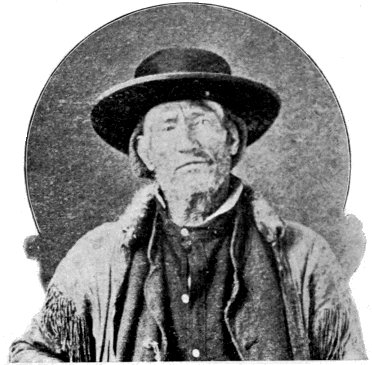
JAMES BRIDGER.
Bridger Lake (7,900)—R: 13—Name a fixture prior to 1870.—For James Bridger, the Daniel Boone of the Rockies, [328] and one of the most remarkable products of the trapping and gold-seeking eras.
He was born in Richmond, Va., in March, 1804, and died in Washington, Jackson Co., Mo., July 17, 1881. He must have gone west at a very early age for he is known to have been in the mountains in 1820. Niles Register for 1822 speaks of him as associated with Fitzpatrick in the Rocky Mountain Fur Company. Another record of this period reveals him as leader of a band of whites sent to retake stolen horses from the hostile Bannocks. In 1832, he had become a resident partner in the Rocky Mountain Fur Company. That he was a recognized leader among the early mountaineers while yet in his minority seems beyond question. He became “The Old Man of the Mountains” before he was thirty years of age.
Among the more prominent achievements of Bridger’s life may be noted the following: He was long a leading spirit in the great Rocky Mountain Fur Company. He discovered Great Salt Lake and the noted Pass that bears his name. He built Fort Bridger in the lovely valley of Black Fork of Green River, where transpired many thrilling events connected with the history of the Mormons and “Forty-niners.” He had explored, and could accurately describe, the wonders of the Yellowstone fully a quarter of a century before their final discovery.
In person he was tall and spare, straight and agile, eyes gray, hair brown and long, and abundant even in old age; expression mild, and manners agreeable. He was hospitable and generous, and was always trusted and respected. He possessed to a high degree the confidence of the Indians, one of whom, a Shoshone woman, he made his wife.
Unquestionably Bridger’s chief claim to remembrance by posterity rests upon the extraordinary part he bore in the exploration of the West. The common verdict of his many employers, from Robert Campbell down to Captain Raynolds, is [329] that as a guide he was without an equal. He was a born topographer. The whole West was mapped out in his mind as in an exhaustive atlas. Such was his instinctive sense of locality and direction that it used to be said that he could “smell his way” where he could not see it. He was not only a good topographer in the field, but he could reproduce his impressions in sketches. “With a buffalo skin and a piece of charcoal,” says Captain Gunnison, “he will map out any portion of this immense region, and delineate mountains, streams, and the circular valleys, called ‘holes,’ with wonderful accuracy.” His ability in this line caused him always to be in demand as guide to exploring parties, and his name is connected with scores of prominent government and private expeditions.
His lifetime measures that period of our history during which the West was changed from a trackless wilderness to a settled and civilized country. He was among the first who went to the mountains, and he lived to see all that had made a life like his possible swept away forever. His name survives in many a feature of our western geography, but in none with greater honor than in this little lake among the mountains that he knew so well; and near the source of that majestic stream with which so much of his eventful life was identified.
Delusion Lake (7,850)—M: 9—1878—U. S. G. S.—This lake was long supposed to be an arm of the Yellowstone Lake, and, in the fanciful comparison of the main lake to the form of the human hand, occupied the position of the index finger. The delusion consisted in this mistaken notion of a permanent connection between the two lakes.
Dryad Lake (8,250)—K: 8—1885—U. S. G. S.—Characteristic.
Duck Lake (7,850)—M: 7—1885—U. S. G. S.—Characteristic.
Fern Lake (8,150)—H: 11—1885—U. S. G. S.—Characteristic.
Frost Lake—(7,350)—I: 14—Unknown-Characteristic.
Gallatin Lake (9,000)—E: 4—1885—U. S. G. S.—Source of the Gallatin River.
Goose Lake (7,100)—K: 4—1885—U. S. G. S.—Characteristic.
Grassy Lake (7,150)—R: 5—1885—U. S. G. S.—Characteristic.
Grebe Lake (7,950)—G: 8—1885—U. S. G. S.—Characteristic.
Grizzly Lake (7,490)—F: 5—1885—U. S. G. S.—Characteristic.
Hart Lake (7,469)—P: 9—According to Hayden, “long known to the hunters of the region as Heart Lake.” Named prior to 1870 for an old hunter by the name of Hart Hunney who in early times plied his trade in this vicinity. He was possibly one of Bonneville’s men, for he seems to have known the General well and to have been familiar with his operations. He was killed by a war party of Crows in 1852.
The spelling, Heart, dates from the expeditions of 1871. The notion that the name arose from the shape of the lake seems to have originated with Captain Barlow. It has generally been accepted although there is really no similarity between the form of the lake and that of a heart. Lewis Lake is the only heart-shaped lake in that locality.
Everts named Hart Lake, Bessie Lake, after his daughter.
Henry Lake (6,443)—A noted lake outside the limits of the Park passed by tourists entering the park from the west. It is named for a celebrated fur trader, Andrew Henry, who built a trading post in that vicinity in 1809.
Hering Lake (7,530)—R: 5—1878—U. S. G. S.—For Rudolph Hering, Topographer on the Snake River Division of the Hayden Survey for 1872.
Indian Pond—J: 11—1880—Norris.—An ancient, much-used [331] camping-ground of Indians. “My favorite camp on the Yellowstone Lake (and it evidently has been a favorite one for the Indian) has ever been upon the grove-dotted bluff, elevated thirty or forty feet above the lake, directly fronting Indian Pond.”—Norris.
Isa Lake (8,250)—L: 6—1893—N. P. R. R.—For Miss Isabel Jelke, of Cincinnati.
Jackson Lake (6,000)—U-W: 6—Date unknown.—For David Jackson, a noted mountaineer and fur trader, and one of the first three partners of the Rocky Mountain Fur Company. This lake was discovered by John Colter and was named by Clark Lake Biddle, in honor of Nicholas Biddle, who first gave to the world an authentic edition of the journal of the celebrated Lewis and Clark Expedition.
Jenny Lake—South of Leigh Lake and off the map.—1872—U. S. G. S.—For the wife of Richard Leigh. She was a Shoshone Indian.
Leigh Lake—W: 5—1872—U. S. G. S.—For Richard Leigh (“Beaver Dick”), a noted hunter, trapper, and guide in the country around the Teton Mountains. The nickname “Beaver Dick” arose, not from the fact that Leigh was an expert beaver trapper, but on account of the striking resemblance of two abnormally large front teeth in his upper jaw to the teeth of a beaver. The Indians called him “The Beaver.”
Lewis Lake (7,720)—O: 7—1872—U. S. G. S.—For Captain Lewis of “Lewis and Clark” fame.
“As it had no name, so far as we could ascertain, we decided to call it Lewis Lake, in memory of that gallant explorer Captain Meriwether Lewis. The south fork of the Columbia, which was to have perpetuated his name, has reverted to its Indian title Shoshone, and is commonly known by that name, or its translation, Snake River. As this lake lies near the head of one of the principal forks of that stream, it may not be inappropriately called Lewis Lake.”—Bradley.[CN]
Loon Lake (6,400)—R: 3—1885—U. S. G. S.—Characteristic.
Lost Lake (8,500)—M: 7—1885—U. S. G. S.—Characteristic.—This is probably Norris' Two-Ocean-Pond, and is doubtless also the lake referred to by Hayden in the following paragraph from his report for 1871:
“We camped at night on the shore of a lake which seemed to have no outlet. It is simply a depression which receives the drainage of the surrounding hills. It is marshy around the shores, and the surface is covered thickly with the leaves and flowers of a large yellow lily.”—Hayden.
Madison Lake (8,250)—N: 4—1872—U. S. G. S.—Head of the Madison River.
“A small lake, covering perhaps sixty acres, occupies the southern end of the [Firehole] valley, where it bends to the eastward; and as the ultimate lake source of the Madison River, is the only proper possessor of the name ‘Madison Lake.’”—Bradley.[CO]
[CO] Page 243, Sixth Annual Report of Dr. Hayden.
Mallard Lake (8,000)—L: 5—1885—U. S. G. S.—Characteristic.
Mary Lake (8,100)—J: 7—1873—Tourist Party.—Circumstance recorded by Rev. E. J. Stanley, one of the party, and author of the book “Rambles in Wonderland,” describing the tour. The following extract is from his book:
“We passed along the bank of a lovely little lakelet, sleeping in seclusion in the shade of towering evergreens, by which it is sheltered from the roaring tempests. It is near the divide, and on its pebbly shore some members of our party unfurled the Stars and Stripes, and christened it Mary’s Lake, in honor of Miss Clark, a young lady belonging to our party.”
This lake appears on Jones' map for the same year as Summit Lake. Everts is said to have passed it in his wanderings, but there is no reliable evidence to that effect.
Mirror Lake (8,700)—G: 12—1885—U. S. G. S.—Characteristic.
Obsidian Lake (7,650)—E: 6—1885—U. S. G. S.—Characteristic.
Riddle Lake (7,950)—N: 8—1872—U. S. G. S.—
“‘Lake Riddle’ is a fugitive name, which has been located at several places, but nowhere permanently. It is supposed to have been used originally to designate the mythical lake, among the mountains, whence, according to the hunters, water flowed to both oceans. I have agreed to Mr. Hering’s proposal to attach the name to this lake, which is directly upon the divide at a point where the waters of the two oceans start so nearly together, and thus to solve the unsolved ‘riddle’ of the ‘two-ocean-water.’”—Bradley.[CP] This was a year before Captain Jones verified the existence of Two-Ocean-Pass.
[CP] Page 250, Sixth Annual Report of Dr. Hayden.
Shoshone Lake (7,740)—M-N: 5-6—1872—U. S. G. S.—From Shoshone, or Snake River, which here finds its source. This lake was first named De Lacy Lake, after its discoverer. The Washburn Party (1870) appear to have named it after their leader. In 1871, Doctor Hayden, failing to identify its location, and believing it to be tributary to the Madison River, renamed it Madison Lake. It is this name which appears on the first map of the Park and in the Act of Dedication, where the west boundary of the Park is described as being “fifteen miles west of the most western point of Madison Lake.” In 1872, when the correct drainage of the lake was discovered, the name “Madison Lake” was transferred to its present location (See "Madison Lake"), and its place supplied by “Shoshone Lake.” The Act of Dedication is therefore misleading, and it is necessary to know that “Madison Lake” of the Act, is “Shoshone Lake” now, in order to understand the true location of the west boundary of the Park.
In changing the name from “De Lacy” to “Shoshone,” Prof. F. H. Bradley, of the United States Geological Survey, took occasion to reflect severely and unjustifiably upon De Lacy’s work in mapping the country. [CQ]
[CQ] Page 24, Sixth Annual Report of Dr. Hayden.
De Lacy felt deeply wronged by this action, and Dr. Hayden promised him that he would set the matter right; but nothing was done. At a later day, Colonel Norris endeavored to do De Lacy tardy justice by placing his name on the stream which enters the lake from the north and drains the beautiful valley now crossed by the tourist route. This name remained for several year’s, when it also was removed by the United States Geological Survey, and its place filled by “Heron Creek.” During the past year, however, the name “De Lacy Creek” has been restored.
Summit Lake (8,450)—M: 3—1885—U. S. G. S.—Near Continental Divide.
Swan Lake (7,200)—D: 6—1879—Norris—Characteristic.
Sylvan Lake (8,300)—L: 13—1878—U. S. G. S.—Characteristic.
Tern Lake (8,150)—I: 11—1885—U. S. G. S.—Characteristic.
Trout Lake (6,850)—D: 13—1885—U. S. G. S.—Characteristic.
Turbid Lake (7,800)—K: 11—1878—U. S. G. S.—Characteristic.
Twin Lakes (7,450)—G: 6—1885—U. S. G. S.—Characteristic.
Wapiti Lake (8,500)—H: 11—1885—U. S. G. S.—Characteristic.
White Lake (8,150)—I: 11—1885—U. S. G. S.—Characteristic.
Woods, Lake of the (7,550)—F: 6—1885—U. S. G. S.—Characteristic.
Yellowstone Lake (7,741)—K—0: 8—12—From the river [335] which flows through it. This lake was named, on the map showing “Colter’s Route in 1807,” Lake Eustis, in honor of William Eustis, Secretary of War to President Madison, 1809 to 1812.
Later it appears as Sublette Lake, in honor of the noted fur trader, William Sublette. It is even said at one time to have borne the “fugitive name,” Riddle Lake. But it early became known by its present name.
The islands of this lake are seven in number. They seem to have all been named by the United States Geological Survey largely for the employes of the survey. They are:
Carrington Island. For Campbell Carrington, zoologist.
Dot Island. A mere dot on the map.
Frank Island. For the brother of Henry W. Elliott, a member of the Hayden Expedition of 1871. This Island was renamed Belknap Island in 1875 by the members of Secretary Belknap’s party, who passed through the Park in that year. The name, however, never came into use.
Molly Island.—For the wife of Mr. Henry Gannett.
Peale Island.—For Dr. A. C. Peale, author of the elaborate report on thermal springs which appears in Hayden’s report for 1878.
Pelican Roost.—Characteristic.
Stevenson Island.—For James Stevenson. See "Mt. Stevenson."
The bays are also seven in number, of which only the following merit notice:
Mary Bay.—Named by Henry W. Elliott for Miss Mary Force.
Thumb.—From the old fancy that the form of the lake resembled that of the human hand.
Bridge Bay.—From Bridge Creek. See "Bridge Creek."
The capes are thirteen in number. We need notice only Signal Point, which was much used in signaling by the early explorers; Steamboat Point, named from the Steamboat Springs near by; and Storm Point, so named because it receives the full force of the prevailing south-west winds from across the lake.
“The Annie.”—The first boat on the Yellowstone Lake was a small canvass craft 12 feet long by 31/2 feet wide. Dr. Hayden records that, it was, christened The Annie, “by Mr. Stevenson, in compliment to Miss Anna L. Dawes, the amiable daughter of Hon. H. L. Dawes.”
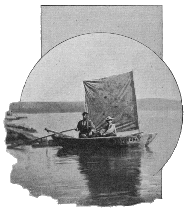
"The Annie."
The boat was extemporized by Mr. James Stevenson from such materials as could be picked up. In the classic picture of this historic craft, the persons in the boat are James Stevenson and Henry W. Elliott. An original photograph of the boat now adorns the cabin of the Zillah, the small steamboat which conveys tourists about the Lake.
VI.
MISCELLANEOUS FEATURES.
[Numbers in parentheses indicate altitudes.]
Craig Pass (8,300)—L: 6—1891—From the maiden name of Mrs. Ida Craig Wilcox, the first tourist to cross the pass.
FERDINAND VANDIVEER HAYDEN
Hayden Valley (7,800)—H-J: 8-10-1878—U.S.G.S. For the eminent American geologist, Ferdinand Vandiveer Hayden, M.D., LL. D., whose important part in the history of the Yellowstone National Park has been fully set forth in previous pages. The following condensed sketch of his life is from the pen of Dr. A. C. Peale: [CR]
[CR] Bulletin Philosophical Society of Washington, Vol. VI, pp. 476-478.
… "He was born at Westfield, Mass., September 7, 1829…. His father died when he was about ten years of age, and about two years later he went to live with an uncle at Rochester, in Lorain County, Ohio, where he remained for six years. He taught in the country district schools of the neighborhood during his sixteenth and seventeenth [339] years, and at the age of eighteen went to Oberlin College, where he was graduated in 1850….
"He studied medicine with Dr. J. S. Newberry, at Cleveland, and at Albany was graduated Doctor of Medicine in the early part of 1853. After his graduation, he was sent by Prof. James Hall, of New York, to the Bad Lands of White River, in Dakota. The years 1854 and 1855 he spent exploring and collecting fossils in the Upper Missouri country, mainly at his own expense. From 1856 until 1859, he was connected as geologist with the expeditious of Lieutenant Warren, engaged in explorations in Nebraska and Dakota. From 1859 until 1862, he was surgeon, naturalist, and geologist with Captain W. F. Raynolds, in the exploration of the Yellowstone and Missouri Rivers. In October, 1862, he was appointed acting assistant surgeon and assistant medical inspector until June, 1865, when he resigned, and was brevetted lieutenant-colonel for meritorious services during the war. He then resumed his scientific work, and in 1866 made another trip to the Bad Lands of Dakota, this time in the interest of the Academy of Natural Sciences of Philadelphia. In 1865, he was elected professor of mineralogy and geology in the University of Pennsylvania, which position he resigned in 1872. From 1867 to 1879, his history is that of the organization of which he had charge, which began as a geological survey of Nebraska, and became finally the Geological Survey of the Territories…. From 1879 until December, 1886, he was connected with the United States Geological Survey as geologist. His health began to fail soon after his connection with this organization, and gradually became worse, and he lived only a year after his resignation.
"In 1876, the degree of LL.D. was conferred upon him by the University of Rochester, and in June, 1886, he received the same degree from the University of Pennsylvania. He was a member of seventeen scientific societies in the United States, among them the National Academy of Sciences, and [340] was honorary and corresponding member of some seventy foreign societies. A bibliography of his writings includes 158 titles.
“… The gentleness and diffidence, approaching even timidity, which impressed his fellow-students at Oberlin, characterized Dr. Hayden throughout his life, and rendered it somewhat difficult for those who did not know him intimately to understand the reasons for his success, which was undoubtedly due to his energy and perseverance, qualities which were equally characteristic of him as a boy and student and in later life. His desire to forward the cause of science was sincere and enthusiastic, and he was always ready to modify his views upon the presentation of evidence. He was intensely nervous, frequently impulsive, but ever generous, and his honesty and integrity undoubted. The greater part of his work for the government and for science was a labor of love.”
Jones Pass (9,450)—K: 12—1880—Norris—For its discoverer, Captain W. A. Jones, Corps of Engineers, U. S. A., who passed through it in 1873.
Kingman Pass (7,230)—D: 6—1883—U. S. G. S.—The pass of which Golden Gate is the northern entrance. For Lieutenant D. C. Kingman, Corps of Engineers, U. S. A., who built the road through the pass.
Norris Geyser Basin (7,527)—G-H: 6—For P. W. Norris, who first explored and described it, and opened it up to tourists. It was, however, discovered in 1872 by E. S. Topping and Dwight Woodruff, who were led in that direction by noticing from the summit of Bunsen Peak a vast column of steam ascending to the southward. The day after this discovery, a tourist party, including a Mr. and Mrs. H. H. Stone, of Bozeman, Montana, visited it from Mammoth Hot Springs, and then continued their course, by way of the general line of the present route, to the Firehole Geyser Basin. Mrs. Stone was the first white woman to visit the Park.
Norris Pass (8,260)—M : 6—1879—Norris—For its discoverer.
Raynolds Pass (6,911)—Not on map.—Crosses the Continental Divide to the northward of Henry Lake, and connects the valley of Henry Fork with that of the Madison. Named for Captain W. F. Raynolds, who led his expedition through it in 1860.
Sylvan Pass (8,650)—L : 13—1895—U. S. G. S.—Characteristic.
Targhee Pass (7,063)—Not on map.—Crosses the Continental Divide to the eastward of Henry Lake, and leads from the valley of Henry Fork to that of the Madison. The origin and orthography of this name are uncertain. In Hayden’s Report for 1872, occur three spellings, Targhee, Tyghee, and Tahgee. The weight of evidence is in favor of the form here adopted. There was an impression among the Hayden Survey people, in 1872, that the name was given in honor of some distinguished Indian Chief; but that there was no definite information on the point is evident from the following statements, taken from Hayden’s Report for 1872. On page 56, it is stated that Tahgee Pass “was named years ago for the head chief of the Bannocks.” On page 227, it is said that Tyghee Pass “was named for an old Shoshone chief who was wont to use it.” The real origin is thus left somewhat obscure, but it is probable that the notion that the pass was named for an Indian chief may have some foundation in fact. There was living among the Bannocks within the present memory of white men a chief whose name was pronounced Ti-gee.
VII.
LIST OF THE PROMINENT GEYSERS.
The numbers in the third column are the highest recorded eruptions. The numbers in the fourth and fifth columns are not to be taken as indicating the correct duration or periodicity of eruptions. The prevalent notion that geysers exhibit uniform periodicity of action, is erroneous. There is only one geyser of importance in the Park that can be depended on, and that is Old Faithful. The figures for the other geysers are merely rough averages, true, perhaps, as the mean of a year’s observations, but not at all to be relied upon in predicting particular eruptions.
The following abbreviations are used: “M. H. S.,” for Mammoth Hot Springs; “N. G. B.,” “L. G. B.,” “M. G. B.,” “U. G. B.,” “S. G. B.,” and “H. G. B.,” for the Norris, Lower, Middle, Upper, Shoshone, and Hart Lake, Geyser Basins respectively; “E. S. Y.” and “W. S. Y.” for the East and West Shores respectively of the Yellowstone Lake; “s.” for second; “m.” for minute; “h.” for hour; and “d.” for day.
| Name. | Location. | Eruptions. | Authors of Names. Remarks. |
||
| Height. | Duration | Interval | |||
| Arsenic | N. G. B. | — | — | — | U. S. G. S. |
| Artemesia | U. G. B. | 150 ft. | 10 m. | 2 d. | U. S. G. S. |
| Atomizer | U. G. B. | 20 ft. | 10 m. | — | Unknown. |
| Bead | L. G. B. | — | — | — | Has a “beautifully beaded tube.”—Comstock. |
| Bee Hive | U. G. B. | 220 ft. | 8 m. | 20 h. | Washburn Party. |
| Bijou | U. G. B. | — | — | — | U. S. G. S. |
| Bulger | U. G. B. | 5 ft. | — | — | U. S. G. S. |
| Castle | U. G. B. | 100 ft. | 25 m. | 24 h. | Washburn Party. “From a distance it strongly resembles an old feudal castle partially in ruins.”—Doane. [343] |
| Catfish | L. G. B. | — | — | — | U. S. G. S. |
| Chinaman | U. G. B. | — | — | — | U. S. G. S. Really a quiescent spring. Sometimes called a geyser from the circumstance that a Chinaman who had used it for a wash-tub caused an eruption by the soap put in the spring, thus initiating the practice of “soaping geysers.” |
| Clepsydra | L. G. B. | 50 ft. | 10 s. | 3 m. | “Like the ancient water-clock of that name, it marks the passage of time by the discharge of water.”—Comstock (1873). |
| Comet | U. G. B. | 60 ft. | 1 m. | — | U. S. G. S. |
| Congress | N. G. B. | — | — | — | Came into existence in the winter of 1893. Like the memorable 53d Congress, for which it is named, its performance is sadly incommensurate with its promises. |
| Constant | N. G. B. | 40 ft. | 10 s. | 1 m. | Norris. |
| Cubs | U. G. B. | — | — | — | See “Lion.” |
| Deluge | H. G. B. | 15 ft. | — | — | U. S. G. S. |
| Echinus | N. G. B. | 20 ft. | — | — | U. S. G. S. |
| Economic | U. G. B. | — | — | — | No water lost in eruption; all falls back into crater. |
| Excelsior | M. G. B. | 300 ft. | — | 1 to 4 | “A geyser so immeasurably excelling any other ancient or modern known to history that I find but one name fitting, and herein christen it the Excelsior.”—Norris. The Sheridan parties in 1881 and 1882 called it the Sheridan Geyser. |
| Fan | U. G. B. | 60 ft. | 10 m. | 8 h. | Washburn Party. |
| Fearless | N. G. B. | — | — | — | Norris. |
| Fissure | N. G. B. | 100 ft. | 20 m. | 2 h. | U. S. G. S. |
| Fitful | L. G. B. | 3 ft. | — | — | Comstock. |
| Fountain | L. G. B. | 60 ft. | 15 m. | 4 h. | U. S. G. S. |
| Giant | U. G. B. | 200 ft. | 90 m. | 6 d. | Washburn Party. |
| Giantess | U. G. B. | 250 ft. | 12 h. | 14 d. | Washburn Party. |
| Grand | U. G. B. | 200 ft. | 20 m. | 20 h. | U. S. G. S. |
| Gray Bulger | L. G. B. | 1 ft. | 30 s. | 1 m. | U. S. G. S. |
| Great Fountain | L. G. B. | 100 ft. | — | — | U. S. G. S.—Called Architectural Fountain in 1871. [344] |
| Grotto | U. G. B. | 40 ft. | 30 m. | 4 h. | Washburn Party. |
| Jet | L. G. B. | 15 ft. | — | — | U. S. G. S. |
| Jewell | U. G. B. | 50 ft. | 1 m. | 50 m. | U. S. G. S. |
| Lion | U. G. B. | 60 ft. | 8 m. | 24 h. | With Lioness and Cubs, called “The Chimneys” by Barlow in 1871; renamed “Trinity” Geysers by Comstock in 1873; most isolated cone called “Niobe” by U. S. G. S. in 1878; present name given by Norris in 1881. |
| Lioness | U. G. B. | 80 ft. | 10 m. | 24 h. | See “Lion.” |
| Lone Star | M : 5. | 60 ft. | 10 m. | 40 m. | Unknown. First called “The Solitary” by the U. S. G. S. in 1872. |
| Minute | N. G. B. | 40 ft. | 20 s. | 90 s. | Norris. |
| Model | U. G. B. | — | — | — | Geyser on a small scale. |
| Monarch | N. G. B. | 125 ft. | 20 m. | 12 h. | Norris. |
| Mortar | N. G. B. | 60 ft. | 6 m. | 8 h. | “Resembles in its eruption the particular piece of ordnance from which it derives its name.” Haynes Guide Book. |
| Mud Geyser | N. G. B. | 10 ft. | 5 m. | 20 m. | Norris. |
| Mud Geyser | I : 9 | 30 ft. | 20 m. | 3 h. | Washburn Party. |
| Oblong | U. G. B. | 40 ft. | 4 m. | 8 h. | U. S. G. S. |
| Old Faithful | U. G. B. | 150 ft. | 41/2 m. | 65 m. | Washburn Party. |
| Pearl | N. G. B. | — | — | — | U. S. G. S. |
| Pebble | N. G. B. | 50 ft. | — | 75 m. | U. S. G. S. |
| Pink Cone | L. G. B. | — | — | — | U. S. G. S. |
| Restless | U. G. B. | — | — | — | U. S. G. S. |
| Riverside | U. G. B. | 80 ft. | 15 m. | 8 h. | U. S. G. S. |
| Rosette | L. G. B. | 30 ft. | — | — | U. S. G. S. |
| Rustic | H. G. B. | 47 ft. | 4 m. | 15 m. | U. S. G. S. |
| Sawmill | U. G. B. | 35 ft. | — | — | U. S. G. S. |
| Sentinel | U. G. B. | 20 ft. | — | — | Barlow. |
| Shield | S. G. B. | — | — | — | U. S. G. S. |
| Spasmodic | U. G. B. | 5 ft. | — | — | U. S. G. S. |
| Spike | H. G. B. | — | — | — | U. S. G. S. |
| Splendid | U. G. B. | 200 ft. | 10 m. | 3 h. | Norris. |
| Sponge | U. G. B. | — | — | — | From appearance of its crater. |
| Steady | L. G. B. | 30 ft. | — | — | U. S. G. S. |
| Surprise | U. G. B. | 100 ft. | 2 m. | — | |
| Turban | U. G. B. | 20 ft. | 25 m. | — | U. S. G. S. “From the fancied appearance of some of the large globular masses in its basin to a Turkish head-dress.”—Peale. |
| Union (1) | S. G. B. | 114 ft. | 60 m. | 5 h. | U. S. G. S. in 1872. So named “because of its combination of the various forms of geyseric action.”—Peale. No. 1 is North Cone; No. 2 Middle Cone; and No. 3 South Cone. |
| Vixen | N. G. B. | — | — | — | Norris. |
| White Dome | L. G. B. | 12 ft. | — | — | U. S. G. S. |
| Young Faithful | U. G. B. | 20 ft. | — | — | Earl of Dunraven. |
| Young Hopeful | L. G. B. | 20 ft. | — | — | U. S. G. S. |
LEGISLATION AND REGULATIONS NOW IN FORCE AFFECTING THE YELLOWSTONE NATIONAL PARK.
THE ACT OF DEDICATION.
An Act to set apart a certain tract of land lying near the headwaters of the Yellowstone River as a public park.
Be it enacted by the Senate and House of Representatives of the United States of America in Congress assembled, That the tract of land in the Territories of Montana and Wyoming lying near the headwaters of the Yellowstone River, and described as follows, to wit: commencing at the junction of Gardiner’s River with the Yellowstone River and running east of the meridian, passing ten miles to the eastward of the most eastern point of Yellowstone Lake; thence south along the said meridian to the parallel of latitude, passing ten miles south of the most southern point of Yellowstone Lake; thence west along said parallel to the meridian, passing fifteen miles west of the most western point of Madison Lake; thence north along said meridian to the latitude of the junction of the Yellowstone and Gardiner’s Rivers; thence east to the place of beginning, is hereby reserved and withdrawn from settlement, occupancy, or sale under the laws of the United States, and dedicated and set apart as a public park or pleasuring ground for the benefit and enjoyment of the people; and all persons who shall locate, or settle upon, or occupy the same or any part thereof, except as hereinafter [346] provided, shall be considered trespassers and removed therefrom.
Sec. 2. That said public park shall be under the exclusive control of the Secretary of the Interior, whose duty it shall be as soon as practicable, to make and publish such rules and regulations as he may deem necessary or proper for the care and management of the same. Such regulations shall provide for the preservation from injury or spoliation of all timber, mineral deposits, natural curiosities, or wonders within said park, and their retention in their natural condition.
The Secretary may, in his discretion, grant leases for building purposes, for terms not exceeding ten years, of small parcels of ground, at such places in said park as shall require the erection of buildings for the accommodation of visitors; all of the proceeds of said leases, and all other revenues that may be derived from any source connected with said park, to be expended under his direction in the management of the same and the construction of roads and bridle-paths therein. He shall provide against the wanton destruction of the fish and game found within said park and against their capture or destruction for the purposes of merchandise or profit. He shall also cause all persons trespassing upon the same after the passage of this act to be removed therefrom, and generally shall be authorized to take all such measures as shall be necessary or proper to fully carry out the objects and purposes of this act.
Approved March 1, 1872.
Signed by:
James G. Blaine, Speaker of the House.
Schuyler Colfax, Vice-President of the United States and President of the Senate.
Ulysses S. Grant, President of the United States.
MILITARY ASSISTANCE AUTHORIZED FOR PROTECTING THE PARK
SUNDRY CIVIL BILL FOR 1883.
… The Secretary of War, upon the request of the Secretary of the Interior, is hereby authorized and directed to make the necessary details of troops to prevent trespassers or intruders from entering the park for the purpose of destroying the game or objects of curiosity therein, or for any other purpose prohibited by law, and to remove such persons from the park if found therein….
Approved, March 3, 1883.
ADMISSION OF THE STATE OF WYOMING.
Sec. 2. … Provided, That nothing in this act contained shall repeal or affect any act of Congress relating to the Yellowstone National Park, or the reservation of the park as now defined, or as may be hereafter defined or extended, or the power of the United States over it; and nothing contained in this act shall interfere with the right and ownership of the United States in said park and reservation as it now is or may hereafter be defined or extended by law: but exclusive legislation, in all cases whatsoever, shall be exercised by the United States, which shall have exclusive control and jurisdiction over the same; but nothing in this proviso contained shall be construed to prevent the service within said park of civil and criminal process lawfully issued by the authority of said state; and the said state shall not be entitled to select indemnity school lands for the sixteenth and thirty-sixth sections that may be in said park reservation, as the same is now defined or may be hereafter defined….
Approved, July 10, 1890.
THE NATIONAL PARK PROTECTIVE ACT.
An Act to protect the birds and animals in Yellowstone National Park, and to punish crimes in said park, and for other purposes.
Be it enacted by the Senate and House of Representatives of the United States of America in Congress assembled, That the Yellowstone National Park, as its boundaries now are defined, or as they may be hereafter defined or extended, shall be under the sole and exclusive jurisdiction of the United States; and that all the laws applicable to places under the sole and exclusive jurisdiction of the United States shall have force and effect in said park; provided, however, that nothing in this Act shall be construed to forbid the service in the park of any civil or criminal process of any court having jurisdiction in the States of Idaho, Montana and Wyoming. All fugitives from justice taking refuge in said park shall be subject to the same laws as refugees from justice found in the State of Wyoming.
Sec. 2. That said park, for all the purposes of this Act, shall constitute a part of the United States judicial district of Wyoming and the District and Circuit Courts of the United States in and for said district shall have jurisdiction of all offenses committed within said park.
Sec. 3. That if any offense shall be committed in said Yellowstone National Park, which offense is not prohibited or the punishment is not specially provided for by any law of the United States or by any regulation of the Secretary of the Interior, the offender shall be subject to the same punishment as the laws of the State of Wyoming in force at the time of the commission of the offense may provide for a like offense in the said State; and no subsequent repeal of any such law of the State of Wyoming shall affect any prosecution for said offense committed within said park.
Sec. 4. That all hunting, or the killing, wounding, or [349] capturing at any time of any bird or wild animal, except dangerous animals, when it is necessary to prevent them from destroying human life or inflicting an injury, is prohibited within the limits of said park; nor shall any fish be taken out of the waters of the park by means of seines, nets, traps, or by the use of drugs or any explosive substances or compounds, or in any other way than by hook and line, and then only at such seasons and in such times and manner as may be directed by the Secretary of the Interior. That the Secretary of the Interior shall make and publish such rules and regulations as he may deem necessary and proper for the management and care of the park and for the protection of the property therein, especially for the preservation from injury or spoliation of all timber, mineral deposits, natural curiosities, or wonderful objects within said park; and for the protection of the animals and birds in the park, from capture or destruction, or to prevent their being frightened or driven from the park; and he shall make rules and regulations governing the taking of fish from the streams or lakes in the park. Possession within the said park of the dead bodies, or any part thereof, of any wild bird or animal shall be prima facie evidence that the person or persons having the same are guilty of violating this Act. Any person or persons, or stage or express company or railway company, receiving for transportation any of the said animals, birds or fish so killed, taken or caught, shall be deemed guilty of a misdemeanor, and shall be fined for every such offense, not exceeding three hundred dollars. Any person found guilty of violating any of the provisions of this Act or any rule or regulation that may be promulgated by the Secretary of the Interior with reference to the management and care of the park, or for the protection of the property therein, for the preservation from injury or spoliation of timber, mineral deposits, natural curiosities or wonderful objects within said park, or for the protection of the animals, birds and fish in the said park, shall be deemed [350] guilty of a misdemeanor, and shall be subjected to a fine of not more than one thousand dollars or imprisonment not exceeding two years, or both, and be adjudged to pay all costs of the proceedings.
That all guns, traps, teams, horses, or means of transportation of every nature or description used by any person or persons within said park limits when engaged in killing, trapping, ensnaring, or capturing such wild beasts, birds, or wild animals shall be forfeited to the United States, and may be seized by the officers in said park and held pending the prosecution of any person or persons arrested under charge of violating the provisions of this Act, and upon conviction under this Act of such person or persons using said guns, traps, teams, horses, or other means of transportation, such forfeiture shall be adjudicated as a penalty in addition to the other punishment provided in this Act. Such forfeited property shall be disposed and accounted for by and under the authority of the Secretary of the Interior.
Sec. 5. That the United States Circuit Court in said district shall appoint a commissioner, who shall reside in the park, who shall have jurisdiction to hear and act upon all complaints made, of any and all violations of the law, or of the rules and regulations made by the Secretary of the Interior for the government of the park, and for the protection of the animals, birds, and fish and objects of interest therein, and for other purposes authorized by this Act. Such commissioner shall have power, upon sworn information, to issue process in the name of the United States for the arrest of any person charged with the commission of any misdemeanor, or charged with the violation of the rules and regulations, or with the violation of any provision of this Act prescribed for the government of said park, and for the protection of the animals, birds, and fish in the said park, and to try the person so charged, and, if found guilty, to impose the punishment and adjudge the forfeiture prescribed. In all cases of [351] conviction, an appeal shall lie from the judgment of said commissioner to the United States District Court for the district of Wyoming, said appeal to be governed by the laws of the State of Wyoming providing for appeals in cases of misdemeanor from justices of the peace to the District Court of said State; but the United States Circuit Court in said district may prescribe rules of procedure and practice for said commissioner in the trial of cases, and for appeal to said United States District Court. Said commissioner shall also have power to issue process as hereinbefore provided for the arrest of any person charged with the commission of any felony within the park, and to summarily hear the evidence introduced, and, if he shall determine that probable cause is shown for holding the person so charged for trial, shall cause such person to be safely conveyed to a secure place for confinement, within the jurisdiction of the United States District Court in said State of Wyoming, and shall certify a transcript of the record of his proceedings and the testimony in the case to the said court, which court shall have jurisdiction of the case; provided, that the said commissioner shall grant bail in all cases bailable under the laws of the United States or of said State. All process issued by the commissioner shall be directed to the marshal of the United States for the district of Wyoming; but nothing herein contained shall be construed as preventing the arrest by any officer of the government or employe of the United States in the park, without process, of any person taken in the act of violating the law or any regulation of the Secretary of the Interior; provided, that the said commissioner shall only exercise such authority and powers as are conferred by this Act.
Sec. 6. That the marshal of the United States for the district of Wyoming may appoint one or more deputy marshals for said park, who shall reside in said park, and the said United States District and Circuit Courts shall hold one session of said courts annually at the town of Sheridan, in the [352] State of Wyoming, and may also hold other sessions at any other place in said State of Wyoming, or in said National Park, at such dates as the said courts may order.
Sec. 7. That the commissioner provided for in this Act shall, in addition to the fees allowed by law to commissioners of the Circuit Courts of the United States, be paid an annual salary of one thousand dollars, payable quarterly, and the marshal of the United States, and his deputies, and the attorney of the United States and his assistants in said district, shall be paid the same compensation and fees as are now provided by law for like services in said district.
Sec. 8. That all costs and expenses arising in cases under this Act, and properly chargeable to the United States, shall be certified, approved, and paid as like costs and expenses in the courts of the United States are certified, approved, and paid under the laws of the United States.
Sec. 9. That the Secretary of the Interior shall cause to be erected in the park a suitable building to be used as a jail, and also having in said building an office for the use of the commissioner, the cost of such building not to exceed five thousand dollars, to be paid out of any moneys in the Treasury not otherwise appropriated, upon the certificate of the Secretary as a voucher therefor.
Sec. 10. That this act shall not be construed to repeal existing laws conferring upon the Secretary of the Interior and the Secretary of War certain powers with reference to the protection, improvement, and control of the said Yellowstone National Park.
Approved, May 7, 1894.
LEASES IN THE YELLOWSTONE NATIONAL PARK.
An act concerning leases in the Yellowstone National Park.
Be it enacted by the Senate and House of Representatives of the United States of America in Congress assembled, That the Secretary [353] of the Interior is hereby authorized and empowered to lease to any person, corporation, or company, for a period not exceeding ten years, at such annual rental as the Secretary of the Interior may determine, parcels of land in the Yellowstone National Park, of not more than ten acres in extent for each tract, and not in excess of twenty acres in all to any one person, corporation, or company, on which maybe erected hotels and necessary out-buildings; provided, that such lease or leases shall not include any of the geysers or other objects of curiosity or interest in said park, or exclude the public from free and convenient approach thereto, or include any ground within one-eighth of a mile of any of the geysers or the Yellowstone Falls, the Grand Cañon, or the Yellowstone River, Mammoth Hot Springs, or any object of curiosity in the park; and provided, further, that such leases shall not convey, either expressly or by implication, any exclusive privilege within the park except upon the premises held thereunder and for the time therein granted. Every lease hereafter made for any property in said park shall require the lessee to observe and obey each and every provision in any Act of Congress, and every rule, order, or regulation made, or which may hereafter be made and published by the Secretary of the Interior concerning the use, care, management, or government of the park, or any object or property therein, under penalty of forfeiture of such lease, and every such lease shall be subject to the right of revocation and forfeiture, which shall therein be reserved by the Secretary of the Interior; and provided, further, that persons or corporations now holding leases of ground in the park may, upon the surrender thereof, be granted new leases hereunder, and upon the terms and stipulations contained in their present leases, with such modifications, restrictions, and reservations as the Secretary of the Interior may prescribe.
This Act, however, is not to be construed as mandatory [354] upon the Secretary of the Interior, but the authority herein given is to be exercised in his sound discretion.
That so much of that portion of the Act of March third, eighteen hundred and eighty-three, relating to the Yellowstone Park, as conflicts with this Act, be, and the same is hereby, repealed.
Approved, August 3, 1894.
RULES AND REGULATIONS FOR THE GOVERNMENT OF THE YELLOWSTONE NATIONAL PARK.
1895.
[Promulgated by the Secretary of the Interior.]
RULES AND REGULATIONS OF THE YELLOWSTONE NATIONAL PARK.
1. It is forbidden to remove or injure the sediments or incrustations around the geysers, hot springs, or steam vents; or to deface the same by written inscription or otherwise; or to throw any substance into the springs or geyser vents; or to injure or disturb, in any manner, or to carry off any of the mineral deposits, specimens, natural curiosities, or wonders within the park.
2. It is forbidden to ride or drive upon any of the geyser or hot spring formations, or to turn loose stock to graze in their vicinity.
3. It is forbidden to cut or injure any growing timber. Camping parties will be allowed to use dead or fallen timber for fuel.
4. Fires shall be lighted only when necessary, and completely extinguished when not longer required. The utmost care should be exercised at all times to avoid setting fire to the timber and grass, and any one failing to comply therewith shall be peremptorily removed from the park.
5. Hunting or killing, wounding, or capturing of any bird or wild animal, except dangerous animals, when necessary to prevent them from destroying life or inflicting an injury, is prohibited. The outfits, including guns, traps, teams, horses, or means of transportation used by persons engaged in hunting, killing, trapping, ensnaring, or capturing such birds or wild animals, or in possession of game killed in the park under other circumstances than prescribed above, will be forfeited to the United States, except in cases where it is shown by satisfactory evidence that the outfit is not the property of the person or persons violating this regulation, and the actual owner thereof was not a party to such violation. Firearms will only be permitted in the park on the written permission of the Superintendent thereof. On arrival at the first station of the park guard, parties having firearms will turn them over to the sergeant in charge of the station, taking his receipt for them. They will be returned to the owners on leaving the park.
6. Fishing with nets, seines, traps, or by use of drugs or explosives, or in any other way than with hook and line, is prohibited. Fishing for purposes of merchandise or profit is forbidden by law. Fishing may be prohibited by order of the Superintendent of the park in any of the waters of the park, or limited therein to any specified season of the year, until otherwise ordered by the Secretary of the Interior.
7. No person will be permitted to reside permanently or to engage in any business in the park without permission, in writing, from the Department of the Interior. The Superintendent may grant authority to competent persons to act as guides, and revoke the same in his discretion, and no pack trains shall be allowed in the park unless in charge of a duly registered guide.
8. The herding or grazing of loose stock or cattle of any kind within the park, as well as the driving of such stock or cattle over the roads of the park, is strictly forbidden, except [356] in such cases where authority therefor is granted by the Secretary of the Interior.
9. No drinking saloon or bar-room will be permitted within the limits of the park.
10. Private notices or advertisements shall not be posted or displayed within the park, except such as may be necessary for the convenience and guidance of the public, upon buildings on leased ground.
11. Persons who render themselves obnoxious by disorderly conduct or bad behavior, or who violate any of the foregoing rules, will be summarily removed from the park, and will not be allowed to return without permission in writing from the Secretary of the Interior or the Superintendent of the Park.
Any person who violates any of the foregoing regulations will be deemed guilty of a misdemeanor, and be subjected to a fine, as provided by the Act of Congress, approved May 7, 1894, “to protect the birds and animals in Yellowstone National Park, and to punish crimes in said park, and for other purposes,” of not more than one thousand dollars or imprisonment not exceeding two years, or both, and be adjudged to pay all costs of the proceedings.
Hoke Smith,
Secretary of the Interior.
APPROPRIATIONS FOR THE YELLOWSTONE NATIONAL PARK.
| Act | June 20, 1878. | To protect, preserve, and improve the Park | $10,000 00 |
| " | Mar. 3, 1879. | To protect, preserve, and improve the Park | 10,000 00 |
| " | June 16, 1880. | To protect, preserve, and improve the Park | 15,000 00 |
| " | Mar. 3, 1881. | To protect, preserve, and improve the Park | 15,000 00 |
| " | Mar. 3, 1881. | Deficiency for 1880 | 89 76 |
| " | Aug. 5, 1882. | Deficiency for 1881 | 155 00 |
| " | Aug. 7, 1882. | For protection and improvement of Park | 15,000 00 |
| " | Aug. 7, 1882. | To reimburse P. W. Norris for salary and expenses, April 18, 1877, to June 30, 1878 | 3,180 41 |
| " | Mar. 3, 1883. | For protection and improvement of Park | 40,000 00 |
| " | July 7, 1884. | For protection and improvement of Park | 40,000 00 |
| " | Mar. 3, 1885. | For protection and improvement of Park | 40,000 00 |
| Joint Resolution of July 1 and July 15, 1886 | Compensation of Superintendent and employes for month of July, 1886 | 934 25 | |
| Act | Aug. 4, 1886. | For construction of roads and bridges | 20,000 00 |
| " | Mar. 3, 1887. | For construction of roads and bridges | 20,000 00 |
| Act | Oct. 2, 1888. | For construction of roads and bridges | 25,000 00 [358] |
| " | Mar. 2, 1889. | For construction of roads and bridges | 50,000 00 |
| " | Aug. 30, 1890. | For construction of roads and bridges | 75,000 00 |
| " | Sept. 30, 1890. | Reimbursement of Superintendent Conger | 169 37 |
| " | Mar. 3, 1891. | For construction of roads and bridges | 75,000 00 |
| " | Aug. 5, 1892. | For construction of roads and bridges | 45,000 00 |
| " | Mar. 3, 1893. | For construction of roads and bridges | 30,000 00 |
| " | May 4, 1894. | For erection of court-house and jail | 5,000 00 |
| " | Aug. 18, 1894. | For construction of roads and bridges | 30,000 00 |
| " | Aug. 18, 1894. | For salary of Commissioner provided by Act of May 4, 1894 | 1,000 00 |
| " | Mar. 2, 1895. | For construction of roads and bridges | 30,000 00 |
| " | Mar. 2, 1895. | For salary of Commissioner | 1,000 00 |
| " | Mar. 2, 1895. | For reimbursement of John W. Meldrum | 385 75 |
| Total | $596,914 54 | ||
| Receipts from leases | $8,358 94 | ||
| Expenditures from same | 4,053 45 | ||
| Balance | 4,305 49 | ||
| Outlay for 23 years | $592,609 05 | ||
| Average annual outlay less than | 25,000 00 | ||
LIST OF SUPERINTENDENTS OF THE YELLOWSTONE NATIONAL PARK.
| Name. | Length of Service. | Compensation. |
| Nathaniel P. Langford | Appointed May 10, 1872; removed April 18, 1877 | No compensation. |
| Philetus W. Norris | Appointed April 18 1877 | Do. |
| Commissioned July 5, 1878; removed February 2, 1882 | $1,500 per annum. | |
| Patrick H. Conger | Commissioned February 2, 1882; resigned July 28, 1884 | $2,000 per annum. |
| Robert E. Carpenter | Commissioned August 4, 1884; removed May 29, 1885 | Do. |
| David W. Wear | Commissioned May 29, 1885. Congress failed to appropriate for office from August 1, 1886 | Do. |
| Capt. Moses Harris | Acting Superintendent of Park. August 10, 1886, detailed by Secretary of War, in pursuance of Act March 3, 1883 (22 Statutes, 627). Relieved from duty June 1, 1889 | No compensation other than army say. |
| Capt. F. A. Boutelle | Acting Superintendent of Park; assigned June 1, 1889, relieving Capt. Moses Harris | No compensation other than army pay. [360] |
| Capt. Geo. S. Anderson. | Acting Superintendent of Park; assigned January 21, 1891, relieving Capt. F. A. Boutelle | Do. |
BIBLIOGRAPHY OF THE LITERATURE OF THE YELLOWSTONE NATIONAL PARK.
The following bibliography is intended to contain the names of such books and magazine articles in the English language as treat in whole or in part of the Yellowstone National Park. It does not include references in encyclopedias or school textbooks, nor, with few exceptions, articles from the daily or weekly journals. Those who desire to consult the more general literature relating to the geysers and hot springs of the world are referred to the excellent work of Dr. A. C. Peale, published in 1883, in the Twelfth Annual Report of Dr. Hayden, pp. 427-449.
The present list is carefully indexed under the more prominent words of the titles and under the names of the authors; but the full title of each work is given only once. To pass from any other reference to the corresponding full title, note the number following the reference and look for the title which is preceded by the same number. The abbreviation “Y. N. P.” is for “Yellowstone National Park.”
1. Action of Geysers. Westminster Review, vol. lxvii, p. 207.
Allen, C. J., 6.
2. American Big Game Hunting. The Book of the Boone and Crockett Club, vol. i. Editors, Theodore Roosevelt and George Bird Grinnell. New York. Forest and Stream Publishing Company. 1893. Contains numerous references [362] to the Y. N. P. and an article entitled “The Yellowstone Park as a Game Preserve,” by Arnold Hague.
3. Among the Geysers of the Yellowstone. E. Roberts. In his Shoshone. New York. Harper Brothers. 1888. pp. 202-245.
4. Analyses of some Geyser Deposits. By Henry Leffmann. Chemical News. London, vol. xliii, p. 124.
5. Analyses of the Waters of the Y. N. P. By Frank A. Gooch and James E. Whitfield, Bulletin No. 47, U. S. Geological Survey, Washington: Government Printing Office. 1888.
6. Annual Reports of Officers of the Corps of Engineers in charge of the Construction of Roads and Bridges. Including, to the present time, reports by Lieutenant (now Captain) D. C. Kingman, Captain (now Major) C. B. Sears, Major Charles J. Allen, Lieutenant W. E. Craighill, Major (now Lieutenant-Colonel) W. A. Jones, and Lieutenant (now Captain) H. M. Chittenden. Washington: Government Printing Office.
7. Annual Reports of Secretaries of the Interior, from 1871 to the present time. Washington: Government Printing Office.
8. Annual Reports of Superintendents of the Park. Including, to the present time, reports by N. P. Langford, P. W. Norris, P. H. Conger, D. W. Wear, Captain (now Major, retired) Moses Harris, Captain F. A. Boutelle, and Captain George S. Anderson. Washington: Government Printing Office.
9. Annual Report (Fifth: 1871) of the U. S. Geological Survey of the Territories. By Dr. F. V. Hayden, with sub-reports by A. C. Peale, Joseph Leidy and T. C. Porter, Washington: Government Printing Office. 1872.
10. Annual Report (Sixth: 1872) of the U. S. Geological Survey of the Territories. By Dr. F. V. Hayden, with sub-reports by Dr. A. C. Peale, F. H. Bradley, C. H. Merriam, [363] Henry Gannett, J. M. Coulter and N. P. Langford. Washington: Government Printing Office. 1873.
11. Annual Report (Twelfth: 1878) of the U. S. Geological and Geographical Survey of the Territories. By Dr. F. V. Hayden, with sub-reports by W. H. Holmes, Dr. A. C. Peale and Henry Gannett. Washington: Government Printing Office. 1883. This report contains Dr. Peale’s exhaustive treatise upon the thermal phenomena of the park; his general treatise on the hot springs and geysers of the world, and his elaborate bibliography pertaining to these subjects.
12. Annual Reports of the United States Geological Survey. The serial numbers of these reports begin with June 30, 1880, the first report being for the year ending at that time. Nearly all these reports contain valuable references to the Park, most of them being from the pen of Prof. Arnold Hague. One article of great importance, by Walter Harvey Weed (Ninth Annual Report, 1888, pp. 613-676), on the formation of hot springs deposits through the agency of vegetable growth, deserves particular notice. Washington: Government Printing Office.
13. Aquatic Invertebrate Fauna of the Y. N. P., Preliminary Report upon. S. A. Forbes. Bulletin United States Fish Commission for 1891, p. 215. Washington: Government Printing Office. 1893.
Arthur, Chester A., 66.
14. Ascent of Mt. Hayden. N. P. Langford. Scribner’s (Old) Monthly, vol. vi, p. 129.
15. Astoria.—Washington Irving.—Chapter xv contains a reference to John Colter.
Attractions of the Y. N. P., 96.
16. Attractions of the Y. N. P. Kansas City Review. April 1880, p. 743.
17. Autumn in the Yellowstone Park. L. Rutgers. In [364] his On and off the Saddle. New York: Putnam, 1894, pp. 1-19.
Barlow, Captain J. W., 94.
18. Battle of the Big Hole. G. O. Shields. Chicago and New York: Rand, McNally & Company. 1889. Contains an account of the Nez Percé Campaign.
Beam, Wm., 21.
19. Bicycle Tour of the Y. N. P. First. W. O. Owen. Outing, vol. xviii p. 191.
20. Black Hills, The, and American Wonderland. H. N. Maguire. The Lakeside Library, vol. iv, p. 298.
21. Bonneville, Captain, The Adventures of. Washington Irving. Chapter xxiii contains a reference to John Colter, the Stinkingwater River, and to “Colter’s Hell.”
22. Botanical Observations in Western Wyoming. C. C. Parry. American Naturalist, vol. viii, pp. 9, 102, 175, 211.
Boutelle, Capt. F. A., 8.
Brackett, W. S., 63.
Bradbury, J., 115.
Bradley, F. H., 10.
Brockett, G. P., 152
Brown, R., 125.
Bunce, O. B., 83.
Butler, J. D., 65.
23. Calumet of the Coteau. P. W. Norris. Philadelphia: J. B. Lippincott & Co., 1883.
24. Camping in the Y. N. P. Captain Geo. S. Anderson. Youth’s Companion, October 17, 1895, p. 488. Gives exhaustive directions for those desiring to camp through the Park.
Catlin, George, 62.
25. Chronicles of the Yellowstone. E. S. Topping. St. Paul: Pioneer Press Company. 1883.
Commissioner of Fish and Fisheries, Report of, 91.
Comstock, T. B., 45, 90, 118, 141.
Conger, P. H., 8.
26. Congressional Reports (only the more important):
To accompany House Bill 764 (Act of Dedication), 42d Cong., 2d Session.
Report of a Special Committee of the House of Representatives appointed by the Speaker on the 4th day of March, 1885, to investigate, among other things, the Y. N. P. House Report No. 1,076, 49th Cong., 1st Sess., pp. 245-270.
Report of the Committee on Public Lands on the administration of the Y. N. P. in compliance with House resolution of April 8, 1892. House Report No. 1,956, 52d Cong., 1st Sess., pp. 295.
Adverse Report on the admission of steam railways within the Park. House Report No. 1,386, 53d Cong., 2d Sess.
Adverse Report on the admission of electric railways within the Park. House Report No. 1,387, 53d Cong., 2d Sess.
Adverse Report on Segregation project and change of boundaries. House Report No. 1,763, 53d Cong., 3d Sess.
27. Contributions to the Geological Chemistry of the Y. N. P. Henry Leffmann and Wm. Beam. American Journal of Science. 3d series, vol. xxv, p. 104.
28. Cooke City versus the National Park. New York: Forest and Stream, December 8, 1892, p. 16.
Cope, E. D., 145.
Corps of Engineers, Officers of, Annual Reports of, 6.
Coues, Elliott, 57.
Coulter, J. M., 10.
Craighill, W. E., 6.
Dana, E. S., 89.
De Vallibus, 132.
Donne, G. C., 136.
Donaldson, T., 87.
Driscoll, C. F., 142.
Dudley, W. H., 159.
Dunraven, Earl of, 53.
29. Earth, The, and its Inhabitants. Élisée Reclus. Vol. iii. New York: D. Appleton & Co. 1893. Contains numerous references to the Y. N. P.
Eldridge, G. H., 44.
30. Elk Hunt, An, at Two-Ocean Pass. Theodore Roosevelt. The Century, vol. xliv, p. 713.
Ellsworth, Spencer, 86.
31. Enchanted Land, The, or an October Ramble among the Geysers, etc., of the Y. N. P. Illustrated. 8vo. pp. 48. Paper. R. E. Strahorn. Omaha. 1881.
Evermann, B. W., 91.
Everts, T. C., 110.
32. Expedition through the Big Horn Mountains, Y. N. P., etc., in 1881. Report by Lieutenant-General P. H. Sheridan, with sub-reports by Lieutenant-Colonel J. F. Gregory, A. D. C., Surgeon W. H. Forwood, U. S. A., and Captain S. C. Kellogg, U. S. A. Washington: Government Printing Office. 1882.
33. Expedition to the Yellowstone. Analectic Magazine, vol. xv, pp. 293, 347.
34. Exploration of Parts of Wyoming, Idaho, and Montana, in 1882. Report by Lieutenant-General P. H. Sheridan, with sub-reports by Lieutenant-Colonel J. F. Gregory, A. D. C., and Surgeon W. H. Forwood, U. S. A. Washington: Government Printing Office. 1882.
35. Exploration of the Yellowstone and the Country drained by that River. W. F. Raynolds, Brevet Brigadier-General U. S. A. Sen. Ex. Doc. No. 77, 40th Cong., 1st Sess. On page 10 is a reference to the geyser regions.
36. Falls of the Yellowstone. Howard O’Neil. Southern Magazine, vol. ix., p. 219.
37. Falls of the Yellowstone. Moses Thatcher. The Contributor. Salt Lake City. Vol. v, p. 140.
Ferris, G. T., 84.
38. Fifth Avenue to Alaska. Edward Pierrepont. New York: G. P. Putnam Sons, 1884, p. 237. Printed for private circulation only.
Folsom, D. E., 119.
Forbes, S. A., 13.
Forest Reservation, The Y. N. P. as a, 157.
39. Fossil Forests of the Volcanic Tertiary Formations of the Y. N. P. W. H. Holmes. Bulletin United States Geological Survey, vol. v, p. 125. Washington: Government Printing Office. 1879.
40. Fossil Forests of the Yellowstone. Walter Harvey Weed. School of Mines Quarterly, vol. xiii, no. 3.
41. Fossil Forests of the Yellowstone. Prof. Samuel E. Tillman. United States Military Academy. Popular Science Monthly, vol. xliii, p. 301, July, 1893.
42. Fossil Forests of the Yellowstone. Prof. Frank H. Knowlton, P. H. D. The Epoch, vol. i, no. 1, p. 18. April, 1895.
Francis, E., 49.
Frankland, E., 143.
Game Exploration, Y. N. P., 158.
Game Preserve, The Y. N. P. as a, 2.
Geike, A., 48.
Geological Chemistry of the Y. N. P. Contributions to the, 27.
43. Geological History of the Y. N. P. Arnold Hague. Transactions American Institute of Mining Engineers, vol. xvi, 1888. Also in Smithsonian Report for 1892, p. 133.
44. Geological Reconnaissance in North-western Wyoming. George Homans Eldridge. Bulletin 119, United States Geological Survey. Washington: Government Printing Office. 1894.
45. Geology of Western Wyoming. Theo. B. Comstock. American Journal of Science. 3d series, vol. vi, p. 426.
Geyser Deposits, Analyses of, 4.
Geyserland, Pilgrimage to, 86.
Geysers, Action of, 1.
46. Geysers and how they are explained. Joseph Le Conte. Popular Science Monthly, vol. xii, p. 407.
47. Geysers, Comparisons of. A. C. Peale. Science, vol. ii, p. 101.
48. Geysers of the Yellowstone. Archibald Geike. Macmillan, vol. xliv, p. 421. Same article, Appleton’s Journal, vol. xxvi, p. 538; and Eclectic Magazine, vol. xcviii, p. 124.
49. Geysers of the Yellowstone. E. Francis. Nineteenth Century, vol. xi, p. 369. Same article in Living Age, vol. cliii, p. 31, and Eclectic Magazine, vol. xcviii, p. 598.
Geysers of the Yellowstone, Among the, 3.
Geyser Regions, The World’s, 134.
Geysers, Soaping, 102, 103, 104.
50. Gigantic “Pleasuring Ground,” A. Nature, vol. vi, pp. 397, 437.
51. Glacial Phenomena in the Y. N. P. W. H. Holmes. American Naturalist, vol. xv, p. 203.
52. Gold Hunt on the Yellowstone, A. Edward B. Nealley. Lippincott’s, vol. ix, p. 204.
Gooch, F. A., 5.
53. Great Divide, The. Earl of Dunraven. London: Chatto and Windus. 1876.
54. Great West, The. A Journal of Rambles over Mountain and Plain. P. W. Norris. A long series of articles under the above title appeared in the Norris Suburban in 1876, ’7, ’8. They deal largely with the Y. N. P., and contain [369] much of historic value. Norris subsequently rearranged and extended these articles with a view to publication in book form; but death interrupted his purpose. The manuscript is now in the possession of William Hallett Phillips, of Washington, D. C.
55. Grotto Geyser, The. F. V. Hayden. Washington: Government Printing Office. 1876.
56. Guide Books of the Y. N. P. The guide books of the Park are numerous; but as they are all similar in character, and generally supplanted by the latest issue, it seems unnecessary to give a full list of them. Among those who have prepared guides or manuals of the Park, of practical value to the tourist, may be mentioned H. J. Norton, P. W. Norris, Henry J. Winser, G. L. Henderson, W. W. & S. K. Wiley, W. C. Riley, F. J. Haynes, A. B. Guptill, and the Northern Pacific and Union Pacific Railway Companies. The leading authorities at the present time are Haynes' (St. Paul) Guide Book and O. D. Wheeler’s (N. P. R. R.) “Wonderland” Series. See “Wonderland Series.”
Gunnison, J. W., 77.
Hague, Arnold, 2, 12, 43, 67, 102, 154, 156, 157.
Harris, Moses, 8.
Harrison, Carter, 107.
Hayden, F. V., 9, 10, 11, 55, 59, 60, 117, 127, 128, 140, 160.
Hayden, Mt., Ascent of, 14.
Heap, D. P., 94.
Hedges, C., 137.
57. History of the Expeditions under the Command of [370] Lewis and Clark, to the Sources of the Missouri River, thence across the Rocky Mountains and down the Columbia River to the Pacific Ocean. Performed during the Years 1804-5-6, by Order of the Government of the United States. Elliott Coues. 4 vols. New York: Francis P. Harper. 1893. Pages 283, 1153, 1154, 1181, and 1182 contain references to the Y. N. P.
Holmes, W. H., 11, 39, 51, 82.
58. Horseback Rides through the Y. N. P. H. J. Norton. Virginia City, Mont. 1874. The first real guide book of the Park.
59. Hot Springs and Geysers of the Yellowstone and Firehole Rivers. F. V. Hayden. American Journal of Science, vol. ciii, pp. 105, 161.
60. Hot Springs of the Y. N. P. F. V. Hayden. In The Great West, Philadelphia: Franklin Publishing Co. 1880.
Hough, E., 158.
Howard, O. O., 79, 81.
Hoyt, J. W., 93.
61. Hunting in Many Lands. Book of the Boone and Crockett Club. Vol. ii. Editors, Theodore Roosevelt and George Bird Grinnell. New York: Forest and Stream Publishing Company. 1895. Contains an article by Captain G. S. Anderson, 6th U. S. Cavalry, on “Protection in the Y. N. P.”, and one by the Editors on “The Yellowstone Park Protective Act.”
Iddings, J. P., 156.
62. Illustrations of the Manners, Customs, and Condition of the North American Indians. George Catlin. 2 vols. London: Henry G. Bohn. 1857. Pages 261-2 contain reference to Catlin’s Park project. Published also in New York. 1841.
63. Indian Remains on the Upper Yellowstone. William S. Brackett. Smithsonian Institute Report for 1892, p. 577.
64. Inspection Made in the Summer of 1877 by Generals P. H. Sheridan and W. T. Sherman. Contains letters from General Sherman to the Secretary of War, and reports by General Sheridan, Colonel O. M. Poe, and other officers. Washington: Government Printing Office. 1878.
65. John Colter. Professor J. D. Butler. Magazine American History, vol. xii, no. 1, p. 83.
Jones, W. P., 153.
Joseph, Nez Percé, 81.
66. Journey through the Yellowstone National Park and North-western Wyoming. 1883. Photographs of Party and Scenery along the Route Traveled, and Copies of the Associated Press Dispatches sent whilst En Route. Washington: Government Printing Office.
This book, of which only twelve copies were ever made, is the record of the journey of President Arthur through the Park as the guest of Lieutenant-General Sheridan in 1883. The dispatches were mostly written by Lieutenant-Colonel M. V. Sheridan, Military Secretary, and by Lieutenant-Colonel James F. Gregory, Aide-de-Camp; but at least one dispatch was written by each of the other members of the party, except the President. All the dispatches were read to and approved by the President before being sent. No newspaper correspondent accompanied the expedition. The photographs, which form an important feature of the book, were taken by F. J. Haynes, who accompanied the party.
Kellogg, S. C., 32.
Kingman, D. C., 6.
Knowlton, F. H., 42.
Koch, Peter, 144.
Langford, N. P., 8, 10, 14, 119, 120, 129, 137.
Le Conte, Joseph, 46.
Leidy, Joseph, 9.
Lewis and Clark, 57.
Liederkranz Expedition to the Y. N. P., 159.
Linton, Edwin, 85.
Ludlow, William, 89.
Maguire, H. N., 20.
67. Map of the North-west, An Early. Arnold Hague. Science, vol. x, p. 217.
68. Map of the Y. N. P. Science, vol. xi, p. 255.
69. Marvels of the Yellowstone. Leisure Hour, vol. xxi, p. 134.
Merriam, C. H., 10.
70. Microscopical Character of Vitreous Rocks of Montana. Frank Rutley and James Eccles. Quarterly Journal Geological Society, London, vol. xxxvii, p. 391.
71. Military Road from Fort Walla Walla to Fort Benton, Report on Construction of. Captain John Mullan, U. S. A. Washington: Government Printing Office. 1863. Pages 19 and 53 refer to geysers and hot springs near the Upper Yellowstone.
72. Mineral Resources of the States and Territories. Rossiter W. Raymond. Washington: Government Printing Office. 1869. Page 142 quotes W. W. De Lacy in regard to hot springs on the Firehole and Snake Rivers.
73. Mineral Springs of the United States. A. C. Peale. Bulletin No. 32, United States Geological Survey. Washington: Government Printing Office.
74. Mineral Springs of the United States. A. C. Peale. Popular Science Monthly, vol. xxx, p. 711.
75. Mineral Springs of the United States and Canada. G. E. Walton. Popular Science Monthly, vol. iii, p. 515.
76. Mineral Waters of the Y. N. P. A. C. Peale. Science, vol. xvii, p. 36.
Mitchell, S. W., 112.
Montana Historical Society, Transactions of, 114.
77. Mormons or Latter Day Saints, A History of. Captain J. W. Gunnison, U. S. A. Philadelphia: Lippincott, Grambo & Co. 1852. Also Philadelphia: J. B. Lippincott & Co. 1856. Page 151 contains a reference to Bridger’s knowledge of the geyser regions.
Mullan, John, 71.
National Park, Our Great, 83.
Nealley, E. B., 52.
78. New North-west, The. The Century, vol. xxiv, p. 504.
79. Nez Percé Campaign, The, Reports of General Howard and other officers upon. Vol. i, Reports of Secretary of War for 1877. Washington: Government Printing Office. 1877.
Nez Percé Campaign, The, 18, 79, 80, 81.
80. Nez Percé Indians, Report of Civil and Military Commission to inquire into Grievances of. Vol. i, Report of Secretary of the Interior for 1877, p. 607. Nez Percé War described on pp. 405-409, same volume. Washington: Government Printing Office. 1877.
81. Nez Percé Joseph. History of the Nez Percé Campaign of 1877. General O. O. Howard. Boston. Lee and Shepard. 1881.
Northern Pacific Railway Co., 56, 126.
82. Notes on an Extensive Deposit of Obsidian in the Y. N. P. W. H. Holmes. American Naturalist, vol. xiii, p. 247.
Obsidian in the Y. N. P., 82.
O’Neil, H., 36.
83. Our Great National Park. O. B. Bunce. In Picturesque America; or, the Land we Live in, vol. i, p. 292. New York: D. Appleton & Co. 1872.
84. Our Native Land, or Glances at American Scenery [374] and Places. George T. Ferris. New York: D. Appleton & Co., 1886, pp. 148-178.
Overhead Sounds in the Vicinity of the Yellowstone Lake. S. A. Forbes. Page 215, Preliminary Report on Aquatic Invertebrate Fauna, in the Y. N. P., 13.
85. Overhead Sounds in the Vicinity of the Yellowstone Lake. Edwin Linton. Science, vol. xxii, No. 561, p. 244.
Owen, W. O., 19.
Peale, A. C., 9, 10, 11, 47, 73, 74, 76, 109, 134.
Peck, J. K., 155.
Pierrepont, Edward, 38.
86. Pilgrimage to Geyserland. Spencer Ellsworth. Lacon, Ill. 1883.
Poe, O. M., 64.
Porter, R. P., 153.
Porter, T. C., 9.
Protection in the Y. N. P., 61.
Protective Act, Y. N. P., 61.
87. Public Domain, The. Its History with Statistics. Thomas Donaldson. Washington: Government Printing Office, 1884, p. 1294.
88. Rambles in Wonderland. Edwin J. Stanley. New York: D. Appleton & Co. 1873.
Raymond, R. W., 72, 104, 105, 106, 130.
Raynolds, W. F., 35.
Reclus, Élisée, 29.
89. Reconnaissance from Carroll, Montana, to the Y. N. P. Captain (now Lieutenant-Colonel) Wm. Ludlow, Corps of Engineers, U. S. A., with sub-reports by George Bird Grinnell and Edward S. Dana. Appendix N N, Chief of Engineers' Report for 1876. Washington: Government Printing Office. 1876. Also published separately in quarto, 155 pages. 1876.
90. Reconnaissance of North-western Wyoming, including the Y. N. P., made in the summer of 1873. Captain W. [375] A. Jones, of the Corps of Engineers, with sub-reports by Prof. Theo. B. Comstock, Dr. C. L. Heizman, U. S. A., and Dr. C. C. Parry. Washington: Government Printing Office. 1875.
91. Reconnaissance of the Streams and Lakes of Western Montana and North-western Wyoming. Barton W. Evermann. In Report of the United States Commissioner of Fish and Fisheries. Washington: Government Printing Office. 1892, pp. 1-58.
92. Reconnaissance of the Streams and Lakes of the Yellowstone National Park, Wyoming, in the interests of the United States Fish Commission. David Starr Jordan. Bulletin United States Fish Commission, vol. ix, pp. 41-63. Washington: Government Printing Office. 1890.
93. Reconnaissance for a Wagon Road to the National Park. Gov. John W. Hoyt, of Wyoming. In Annual Report of Secretary of the Interior, 1881. Vol. ii, p. 1074. Washington: Government Printing Office. 1881.
94. Reconnaissance of the Yellowstone River in 1871. Captains Barlow and Heap, of the United States Corps of Engineers. Sen. Ex. Doc. No. 66, 42d Cong., 2d Sess.
95. Report upon United States Geographical Surveys West of the One Hundredth Meridian. Captain George M. Wheeler, Corps of Engineers, U. S. A. Washington: Government Printing Office. 1889. Vol. i contains a memoir upon the Voyages, Explorations, and Surveys pertaining to that portion of the United States west of the Mississippi River from the year 1500 to 1880, including an epitome of a Memoir by Lieutenant G. K. Warren, covering the period from 1800 to 1857.
96. Resources of Montana Territory and Attractions of the Y. N. P. R. E. Strahorn. Helena, Montana: Montana Legislative Assembly. 1879.
Richardson, James, 131.
Riley, W. C., 56.
97. River of the West, The. Frances Fuller Victor. Hartford, Conn.: Columbian Book Company. 1871. Pages 75 and 76 contain a description of some of the hot springs districts of the Park as seen in 1829.
98. Roads in the Y. N. P. Lieutenant H. M. Chittenden, U. S. A. Good Roads, vol. v, no. 1, p. 1.
99. Rocky Mountain Region of Wyoming and Idaho. James Eccles. Alpine Journal, London. Vol. ix, p. 241.
Rollins, A. W., 111.
Roosevelt, Theodore, 2, 30, 61.
Rutgers, L., 17.
Rutley, F., 70.
Saltus, J. S., 123.
Sanitarium, A Winter, 124.
Sargent, C. S., 149.
100. Scorodite from the Y. N. P. J. Edward Whitfield. Bulletin U. S. G. S., No. 55. Washington: Government Printing Office. 1889.
Sears, C. B., 6.
Secretaries of the Interior, Annual Reports of, 7, 80, 93.
Sessions, F. C., 147.
Sheridan, M. V., 66.
Sheridan, P. H., 32, 34, 64, 66.
Sherman, W. T., 64.
Shields, G. O., 18.
101. Siliceous Pebbles from the Geyser of the Yellowstone Cañon. A. P. Townsend. American Chemist, vol. iii, p. 288.
Siliceous Sinter, Formation of, 12.
102. Soaping Geysers. Arnold Hague. Science, vol. xiii, p. 382. Also in Smithsonian Report for 1892, p. 153.
103. Soaping Geysers. Popular Science Monthly, vol. xxxvii, p. 139.
104. Soaping Geysers. R. W. Raymond. Transactions [377] of the American Institute of Mining Engineers, Buffalo Meeting, October, 1888.
Stanley, E. J., 88.
105. Statistics of Mines and Mining. Rossiter W. Raymond. Washington: Government Printing Office. 1870. Page 312 contains references to the geysers of the Yellowstone.
106. Statistics of Mines and Mining. Rossiter W. Raymond. Washington: Government Printing Office. 1872. Pages 213-216 contain a reference to the geysers from the pen of General Washburn.
Strong, W. E., 116.
107. Summer’s Outing, A, or, The Old Man’s Story. Carter Harrison. Chicago: Dibble Publishing Company. 1891.
Superintendents of the Y. N. P., Annual Reports of, 8.
Tetons, The Three, 111.
Thatcher, M., 37.
108. Therapeutical Value of the Springs in the Y. N. P. Dr. C. L. Heizmann, U. S. A. Philadelphia. Medical Times, vol. vi, p. 409.
109. Thermal Springs of the Y. N. P., Report on. A. C. Peale. Popular Science Monthly, vol. xxiii, p. 515.
110. Thirty-seven Days of Peril. Truman C. Everts. Scribner’s Monthly, vol. iii, p. 1.
111. Three Tetons, The. Alice Wellington Rollins. Harper’s, vol. lxxiv, p. 869.
112. Through the Yellowstone Park to Fort Custer. Dr. S. Weir Mitchell. Lippincott’s, vol. xxvi, p. 29.
113. Through the Yellowstone Park on Horseback. G. W. Wingate. New York: Orange Judd. Co. 1886.
Tillman, S. E., 41.
Topping, E. S., 25.
Townsend, A. P., 101.
114. Transactions Montana Historical Society, vol. i. Helena, Montana: Rocky Mountain Publishing Company. 1876. Contains numerous references to the Upper Yellowstone, the most important of which is an article entitled “Trip up the South Snake River,” by Walter W. De Lacy.
115. Travels in the Interior of America in the years 1808-10-11. John Bradbury. Liverpool: 1817.
Travertine, Formation of, 12.
Trip up the South Snake River in 1863. Walter W. De Lacy, 114.
116. Trip to the Y. N. P., in July, August and September, 1875. Gen. W. E. Strong. Washington. 1876.
117. Two-Ocean Pass, The So-called. Dr. F. V. Hayden. Vol. v, Bulletins United States Geological Survey of the Territories, p. 223.
118. Unexplained Phenomena of the Geyser Basins of the Y. N. P. Theodore B. Comstock. Popular Science Monthly, vol. xii, p. 372.
Union Pacific Railroad Company, 56.
United States Geological Survey, Annual Reports of, 9 to 12.
119. Valley of the Upper Yellowstone. David E. Folsom. Western Monthly, vol. iv, p. 60, July, 1870. Reprinted by Mr. N. P. Langford, with an interesting preface by himself. St. Paul, Minn. 1894.
Vegetation of Hot Waters, 12.
Victor, F. F., 97.
120. Vigilante Days and Ways. N. P. Langford. St. Paul: D. D. Merrill & Co. 1893. Contains numerous references to the Park.
Walton, G. E., 75.
Warren, G. K., 95.
121. Washburn Yellowstone Expedition, The. Walter Trumbull. Overland Monthly, vol. vi, pp. 431, 489.
122. Wasp, The. Vol. i, No. 17, August 13, 1842. Contains the article quoted on pp. 44-49, stated to have been an extract from an unpublished work entitled “Life in the Rocky Mountains.” Author unknown. The Wasp was a Mormon paper, published at Nauvoo, Ill.
Wear, D. W., 8.
123. Week in the Yellowstone, A. J. Sanford Saltus. New York: Knickerbocker Press. 1895. Printed for private circulation.
Wheeler, G. M., 95.
Wiley, W. W. and S. K., 56.
Wilson, S. A., 135.
Wingate, G. W., 113.
Winser, H. J., 56.
124. Winter Sanitarium for the American Continent. Popular Science Monthly, vol. xxvii, p. 290.
125. Wonderland of America. Robert Brown. In the Countries of the World, vol. iv. London, Paris, and New York.
Wonderland, American, The Black Hills and, 20.
Wonderland, Rambles in, 88.
126. Wonderland Series. O. D. Wheeler. Annual Publication of Northern Pacific Railroad Company, describing the country along the line of that railroad. These books all contain valuable articles on the Park. They include “6,000 Miles through Wonderland,” 1893, “Indianland and Wonderland,” 1894, and “Sketches of Wonderland,” 1895.
127. Wonders of the Rocky Mountains. The Y. N. P. How to reach it. F. V. Hayden. In Williams' Illustrated [380] Guide to the Pacific Railroad, California, etc. New York. 1876.
128. Wonders of the West. More about the Yellowstone. F. V. Hayden. Scribner’s Monthly, vol. iii, No. 4, p. 388.
129. Wonders of the Yellowstone, The. N. P. Langford. Scribner’s Monthly, vol. ii, pp. 1, 113.
130. Wonders of the Yellowstone, The. Rossiter W. Raymond. In his Camp and Cabin. New York: Fords, Howard & Hulburt. 1880.
131. Wonders of the Yellowstone, The. James Richardson. New York: Scribner, Armstrong & Co. 1872.
132. Wonders of the Yellowstone, The. De Vallibus. Contributor, Salt Lake City, vol. v, pp. 5, 47, 86.
133. Wonders of the Yellowstone Region. Chambers' Journal, vol. li, p. 315.
134. World’s Geyser Regions, The. A. C. Peale. Popular Science Monthly, vol. xxvii, p. 494.
Wright, G. M., 156.
Yellowstone, Chronicles of the, 25.
Yellowstone Expedition, 121.
135. Yellowstone Expedition of 1863. S. A. Wilson. Magazine Western History, vol. xiii, pp. 448, 668.
136. Yellowstone Expedition of 1870, Report upon. Lieutenant Gustavus C. Doane. Sen. Ex. Doc. No. 51, 41st Cong., 3d Sess.
137. Yellowstone Expedition of 1870. A Series of Articles in Montana Papers, describing the Expedition. These consisted of articles by Mr. Langford in the Helena Herald; “Notes” by General Washburn in the same paper; a series of articles, including “Sulphur Mountain and Mud Volcano,” “Hell-broth Springs,” “Yellowstone Lake,” “Mt. Everts,” and others, by Mr. Hedges, published in the Herald; and a similar series in the Helena Gazette by Walter Trumbull. These articles appeared between September 26, 1870, immediately after the return of the Expedition, and November [381] 12th, the date of the banquet given to Mr. Everts after his miraculous escape from his terrible adventure.
Yellowstone, Expedition to the, 33.
Yellowstone, Exploration of the, 35.
Yellowstone, Falls of the, 36, 37.
Yellowstone, Fossil Forests of the, 39, 40, 41, 42.
Yellowstone, Geysers and Hot Springs of the, 3, 31, 48, 49, 59, 60.
Yellowstone, Gold Hunt on the, 52.
Yellowstone, Indian Remains on the, 63.
Yellowstone Lake, Overhead Sounds in the Vicinity of, 13, 85.
Yellowstone, Marvels of the, 69.
138. Yellowstone National Park. Scribner’s Monthly, vol. iv, p. 120.
139. Yellowstone National Park. Manhattan Illustrated Monthly, vol. iv, No. 2, p. 129, August, 1884.
140. Yellowstone National Park. F. V. Hayden. American Journal of Science, vol. ciii, p. 294.
141. Yellowstone National Park. Theo. B. Comstock. American Naturalist, vol. viii, pp. 65, 155.
142. Yellowstone National Park. Charles F. Driscoll. American Architect, vol. xiii, p. 130.
143. Yellowstone National Park. E. Frankland. Popular Science Monthly, vol. xxvii, p. 289.
144. Yellowstone National Park. Peter Koch. Magazine American History, vol. xi, p. 497.
145. Yellowstone National Park. E. D. Cope. American Naturalist, vol. xix, p. 1017.
146. Yellowstone National Park. E. Roberts. Art Journal, vol. xl, pp. 193, 325.
147. Yellowstone National Park. F. C. Sessions. Magazine Western History, vol. vi, p. 433.
148. Yellowstone National Park. A. B. Guptill. Outing, vol. xvi, p. 256.
149. Yellowstone National Park. C. G. Sargent. Garden and Forest, vol. vii, p. 131.
150. Yellowstone National Park. D. S. Jordan. Around the World, vol. i, p. 148.
151. Yellowstone National Park. (Anon.) Nature, vol. v, p. 403; vi, pp. 397, 437.
152. Yellowstone National Park. G. P. Brockett. In Our Western Empire, chap. xxii. Philadelphia, 1881.
153. Yellowstone National Park. Robert P. Porter, Henry Gannett, and W. P. Jones. In The West from the Census of 1880. Chicago: Rand, McNally & Co. 1882.
154. Yellowstone National Park. Arnold Hague. Extract from the proceedings of the Fifth Session of the International Congress of Geologists. Washington, 1891.
155. Yellowstone National Park. J. K. Peck. In his Seven Wonders of the World. New York: Hunt and Eaton, p. 71.
Yellowstone National Park, Analyses of Waters of, 5.
Yellowstone National Park, Aquatic Invertebrate Fauna of, 13.
Yellowstone National Park, Attractions of, 16, 96.
Yellowstone National Park, Autumn in, 17.
Yellowstone National Park, Camping in, 24.
Yellowstone National Park, Cooke City versus, 28.
Yellowstone National Park, Expeditions to or through, 32, 34.
Yellowstone National Park, First Bicycle Tour of, 19.
156. Yellowstone National Park Folio. (In preparation.) A publication by the United States Geological Survey, consisting of four geological and four topographical maps; a descriptive text by Prof. Arnold Hague, of the United States Geological Survey; and a geological text by Prof. Hague as Geologist in Charge, assisted by Messrs. J. P. Iddings, W. H. Weed, and G. M. Wright. It is understood that this Folio [383] is presently to be followed by an exhaustive Monograph upon the Park.
157. Yellowstone National Park as a Forest Reservation. Arnold Hague. Nation, vol. xlvi, p. 9.
158. Yellowstone National Park Game Exploration. E. Hough. Under the above title a series of thirteen articles appeared in Forest and Stream in the summer of 1894, the first article appearing in the issue of May 5, and the last in that of August 25 of that year. These articles are of great interest and value as forming probably the most complete discussion of the game question in the Park that has yet appeared. Their descriptions of snow-shoe traveling and of the winter scenery of that region are well worthy of perusal. The graphic narrative of the arrest of the poacher, Howell, is an important feature.
Yellowstone National Park as a Game Preserve, 2.
Yellowstone National Park, Geological Chemistry of, 27.
Yellowstone National Park, Geological History of, 43.
Yellowstone National Park, Glacial Phenomena in, 51.
Yellowstone National Park, Guide Books of, 56.
Yellowstone National Park, Horseback Rides through, 58.
Yellowstone National Park, Hot Springs and Geysers of, 3, 31, 48, 49, 59, 60.
Yellowstone National Park. How to reach it, 127.
159. Yellowstone National Park from the Hurricane Deck of a Cayuse; or, The Liederkranz Expedition to Geyserland. W. H. Dudley. Butte City, Montana. 1886.
Yellowstone National Park, Journey through, 66.
Yellowstone National Park, Map of, 68.
Yellowstone National Park, Mineral Waters of, 76.
160. Yellowstone National Park and the Mountain Regions of Portions of Idaho, Nevada, Colorado, and Utah. F. V. Hayden. Boston. 1876. Large folio.
Yellowstone National Park, Obsidian in, 82.
161. Yellowstone National Park, Past, Present, and Future. [384] Facts for the Consideration of the Committee on Territories for 1891, and Future Committees. G. L. Henderson. Washington: Gibson Brothers. 1891.
162. Yellowstone National Park in Photogravure. F. J. Haynes. Fargo, North Dakota. 1887.
Yellowstone National Park, Protection in, 61.
Yellowstone National Park, Protective Act, 61.
Yellowstone National Park, Reconnaissance to, 89, 90.
Yellowstone National Park, Reconnaissance of Streams and Lakes of, 91, 92.
Yellowstone National Park, Reconnaissance for a Wagon Road to, 93.
Yellowstone National Park, Roads in, 98.
Yellowstone National Park, Scorodite in, 100.
Yellowstone National Park, Therapeutical Value of Springs of, 108.
Yellowstone National Park, Thermal Springs of, 109.
Yellowstone National Park, Through the, to Fort Custer, 112.
Yellowstone National Park, Through the, on Horseback, 113.
Yellowstone National Park, A Trip to, 116.
Yellowstone National Park, Unexplained Phenomena of, 118.
Yellowstone River, Reconnaissance of, 94.
Yellowstone, Valley of the Upper, 119.
Yellowstone, A Week in the, 123.
Yellowstone, Wonders of the, 129, 130, 131, 132, 133.
INDEX.
[Appendices A and E being carefully arranged alphabetically, names found in them are not included in this index unless they also occur in the main body of the work. The few abbreviations used are self-explanatory.]
Absaroka, Indian name for Crow Tribe, 8.
Absaroka Range, name considered, 289.
described, 152, 240.
first ascent of, 80, 295.
first crossed, 104.
profile of human face in, 243.
Act of Dedication becomes a law, 95.
comments upon, 96, 97.
history of, 92-5.
provisions of, 127.
text of, 345.
vote on, 95.
Act of 1883, Military Assistance in protecting Park, 134, 347.
Act of 1890, admitting Wyoming, 347.
Act of 1894, National Park Protective Act, 141, 145, 348.
Act of 1894, regulating leases, 141, 352.
Adirondacks, proposal for reservation in, 97.
Administration of the Park, 206-8.
Administrative History of the Y. N. P., 127-141.
Adverse reports on railroad projects, etc., 141.
Africa, preserve for big game in, 97.
thermal springs of, 161.
Alder Gulch, discovery of gold in, 66.
Algonquian family of Indians, 8.
territory, 37.
Altitudes in the Y. N. P., 154.
Alvarez, Spanish trader, 46, 49.
American Fur Company, historical sketch of, 34-5, 38.
American Fur Company, territory of, 35, 37.
Amethyst Mountain, 263.
Anderson, Captain G. S., eighth superintendent Y. N. P., 139.
plans capture of Howell, 143.
quoted, 273, 276.
Andesitic lava flows in Y. N. P., 157.
“Annie,” first boat on Y. Lake, 336.
Antelope, habitat of, in Y. N. P., 216.
Apollinaris Spring, 217.
Appropriations for the Y. N. P., 357.
Area of the Y. N. P., 148.
Arnold, A. J., member of Helena tourist party, 112, 120.
Arsenic Geyser, 220.
Artemesia Geyser, 228.
Arthur, Chester A., visits Y. N. P., 107, 371.
Assistant Superintendents, Y. N. P., 135.
Astor, John Jacob, and the American fur trade, 34.
Astorians, The, 21, 23.
departure of, for Pacific coast, 31
surrender to N. W. Fur Co., 33.
Astringent Creek, 143.
Atlantic Creek, 246.
Atmosphere of the Y. N. P., 199, 210.
Australia, thermal springs of, 161.
Autumn foliage in the Y. N. P., 192.
Baird, S. F., presents Lieutenant Doane’s report to Phil. Soc. of Washington, 83.
Bannock Indians, 8, 10.
incursion of, into Y. N. P., 126, 215.
territory of, 10.
Bannock Peak, 217.
Bannock Trail, 17, 24, 43.
[386]Baring-Gould’s theory of geyser action, 166.
Barlow, Captain J. W., expedition of, 85-6, 291.
quoted, 6, 231, 344.
report of, 86.
Baronett, C. J., biographical sketch, 292.
Baronett’s Bridge burned, 124.
history of, 261.
Basaltic lava flows in Y. N. P., 157.
Bath Lake, 214.
Battle of trappers and Indians near Y. Lake, 49.
Battle of the Big Hole, 116.
Bays of the Y. Lake, 335.
Bears and tourists, 184.
Bear Creek, 70.
Beaver Lake, 219.
Bechler River, 151.
Bee Hive Geyser, 234.
Belknap, W. W., visits Y. N. P., 105.
Beryl Spring, 221.
Bibliography of the Y. N. P., 361.
Biddle Lake, first name for Jackson Lake, 331.
Big Game Ridge, 153.
Big Hole, Battle of the, 116.
Bighorn River, Lisa’s fort on, 29, 31.
source of, 188.
Big Thunder, Nez Percé chief, 113.
Birds in the Y. N. P., 185.
Biscuit Basin, 228.
Blackfeet Indians, 8, 9.
territory of, 8, 9, 18.
treaties with, 18, 19.
Black Growler, 175, 220.
Black Sand Basin, 230.
Blaine, J. G., introduces Langford at Washington lecture, 84.
signs Act of Dedication, 346.
Block house, ancient, in Y. N. P., 41.
Boat, first on Y. Lake, 337.
Boat ride on Y. Lake, 243.
Boiling River, 212.
Boiling Springs in Y. N. P., 174.
Bonneville, Captain, 37.
refers to Firehole River, 49, 316.
Bottler’s Ranch, 120.
Boundaries of the Y. N. P., 148, 278-280, 333.
Boutelle, Captain F. A., Seventh Superintendent of the Park, 139.
Bradbury, John, 3, 21.
Bradbury, John, interviews Colter, 28.
Bradley, F. H., quoted, 321, 331, 332, 333.
Bridge, Baronett. See Baronett’s Bridge.
Bridge Creek, 244.
Bridge, Natural, 244.
Bridge over the Y. River, 203.
Bridger, James, ability of as guide, 328.
biographical sketch, 327.
acquaintance of with Park country, 51, 52, 61.
disbelieved by the public, 53, 57.
guide to Captain Raynolds, 59.
his stories, 54-56.
partner in Rocky Mountain Fur Company, 36.
and Two-Ocean Pass, 61, 245.
British Fur Companies, strife between, 34.
British Fur Traders excluded from U. S. Territory, 34.
Bronze Geyser, 240.
Buffalo of Y. N. P., 143, 184.
Buildings at Mammoth Hot Springs, 209, 216.
Buildings in Y. N. P. in 1880, 132.
Bunsen Peak, 215.
Bunsen’s theory of geyser action, 163-5.
Burgess, Felix, government scout, 110.
arrests Howell, 143, 144.
“Burning Mountains,” 13, 16.
Cache Creek, name of, 70.
Calcareous Springs in the Y. N. P., 173.
California, discovery of gold in, 39, 100.
Camas Creek, Battle of, 116.
Camping in the Y. N. P., 205.
Canadian National Park, 97.
Canadian Niagara Park, 97.
Cañon Hotel, 253.
Capes of the Y. Lake, 336.
Carpenter, Frank and Ida, members of Radersburg tourist party, 112.
experiences of, with Nez Percés, 117-19.
Carpenter, R. E., Fourth Superintendent Y. N. P., 136.
removed from office, 136.
Cascade Creek, 180, 253.
Castle Geyser, 167, 230.
Cathedral Rock, 215.
[387]
Catlin, George, biographical sketch of, 87-8.
Indian Gallery of, 88.
originates Park idea, 89.
quoted, 88-9.
Chittenden, Lieutenant, H. M., measures height of Upper Fall, 326.
Chouteau, Valle & Co. buy out Astor, 35.
Clagett W. H., his work for Park bill, 92, 94.
Claimants for credit of originating Park idea, 90.
Clark’s Fork Mining District, 264.
Clark, Wm., gives names to Y. Lake and Jackson Lake, 24.
mentioned, 5, 21, 22.
receives information from Colter, 27, 31.
Cleopatra Spring, 214.
Climate of the Y. N. P., 189, 198.
Coast and Geodetic Survey, monument of, near Y. Lake, 248.
Cold-water geyser, 48.
Cole, Senator, remarks of, on Park bill, 94.
Colfax, Schuyler, signs Act of Dedication, 346.
Color of rock in Grand Cañon, 253.
water in Hot Springs, 172, 213.
Colter, John, adventure of, with the Blackfeet, 28-31.
character of, 21.
declines to join the Astorians, 31.
discovers Grand Cañon of the Y., 27.
discovers Jackson Lake, 24.
discovers Mammoth Hot Springs, 26.
discovers Tar Spring on the Stinkingwater, 23.
discovers Y. Lake, 24, 27.
gives Clark information, 31.
marries, 31.
receives discharge from Lewis and Clark, 20.
returns to St. Louis, 31.
whereabouts of, in winter of 1806-7, 22.
“Colter’s Hell,” 28, 31.
“Colter’s River,” 26.
“Colter’s Route in 1807,” 25-7.
Comet Geyser, 230.
Commission to examine into grievances of Nez Percé Indians, 114, 115.
Comstock, T. B., member of Captain Jones' party in 1873, 105.
Comstock, T. B., his theory of geyser action, 166.
quoted 342, 343, 344.
Conant Creek, trail along, 12, 24.
Cone Geysers, 167.
Conger, P. H., Third Superintendent of Y. N. P., 131.
resigns, 136.
Congress abolishes civilian police force in Park, 137.
Congress Geyser, 220.
Congressional Reports on Y. N. P., 141.
Constant Geyser, 220.
Continental Divide, 151, 238.
Cook, C. W., Member of Folsom Party in 1869, 73.
Cooke City, 264.
“Corduroying” on snow-shoes, 195.
Cost of visiting Y. N. P., 274.
Cowan, Mr. and Mrs. George F., members Radersburg tourist party, 112.
experiences of, with Nez Percés, 118-120.
re-visit Park, 120.
Craig Pass, 238, 338.
Cretaceous Period in Y. N. P., 156.
Crevice Creek, 71.
Crook, General George, visits Park, 106.
Crosby, Schuyler, appeals to Congress for protection to Y. N. P., 133.
member of presidential party, 1883, 107.
Crow Indians, territory of, 8, 18.
treaties with, 18, 19.
tribal characteristics, 8.
Crystal Falls, 80, 253.
Cubs, The, 232.
Cupid’s Cave, 214.
Danger to future existence of Y. N. P., 281.
Dawes, Hon. H. L., 94, 336.
Dawes, Miss Anna L., 336.
Death Gulch, 264.
De Lacy Creek, 239.
De Lacy, W. W., discovers Lower Geyser Basin, 68.
discovers Shoshone Lake, 68.
history of his expedition, 67-69.
Deluge Geyser, 243.
Denudation and erosion, work of, in Y. N. P., 158.
[388]“Devil,” frequency of name in Y. N. P., 287, 388.
Devil’s Kitchen, 214.
Diamond, The, Bridger’s story of, 35.
Dietrich, Richard, member of Helena tourist party, 111.
killed by Nez Percés, 122.
Dingee, William, member of Helena tourist party, 112.
Discovery of gold, 65, 66.
Discovery of the Y., 72.
long delay in, 101.
Doane, Lieutenant G. C., ascends Absaroka Range, 80, 295.
biographical sketch, 294.
commands escort to Washburn Expedition, 14, 76.
descends Grand Cañon, 80.
guide to General Belknap, 105.
measures height of Upper Falls, 325.
quoted, 6, 14, 78, 175, 235, 237, 254, 261, 297, 325, 343.
report of, upon Washburn Expedition, 83.
Dome, The, 217.
Drainage areas of Y. N. P., 149.
“Dreamers” among the Nez Percés, 114.
Du Charne, Baptiste, upon the Upper Y. in 1824, 41.
Duncan, L., member of Helena tourist party, 1877, 111.
Dunnell, M. H., and Park bill, 93.
Dunraven, Earl of, 9.
publishes “Great Divide,” 295.
quoted, 96.
visits Y. N. P., 295.
Early knowledge of the Y., 50, 60.
East Gardiner Cañon and Falls, 215.
Echinus Geyser, 220.
Elephant Back, original name for Washburn Range, 152, 296.
Electric Peak, 152, 215.
Electric railways in Y. N. P., 204, 276, 277, 280, 365.
Elk in Y. N. P., 184, 280.
Elliott, H. W., 336, 337.
Emerald Pool (Norris Geyser Basin), 220.
(Upper Geyser Basin), 230.
Equipment for snow-shoe traveling, 195.
Erosion, work of, in Y. N. P., 158.
Eustis Lake, first name for Y. Lake, 335.
Eustis, William, 334.
Evermann, B. W., describes Two-Ocean Pass, 245.
Everts, Mt., 153, 215, 216.
Everts, T. C., experience of, in 1870, 81, 297.
member of Washburn Party, 76.
Excelsior Geyser, 226.
Expedition of 1869. See Folsom Expedition.
of 1870. See Washburn Expedition.
Explorations by U. S. Government, relation of to Y. N. P., 100.
Explorers, rush of, to Y. N. P., 103.
Face, profile of in Absaroka Range, 293.
Fairy Fall, 226.
Falls River, 151.
Basin, 154.
Falls of the Yellowstone described, 251, 254.
measurement of, 80, 105, 325-6.
not on Colter’s map, 27.
Fan Geyser, 229.
Fauna of the Y. N. P., 181.
Fearless Geyser, 220.
Firehole Cascade, 222.
Spring, 225.
River, 43, 150.
Fish Commission U. S., work of, in Y. N. P., 186.
Fishes of the Y. N. P., 185, 186.
Fishing Cone, story of, 56.
Fishing Cone, west shore Y. Lake, 242.
Fishless streams of the Y. N. P., 186.
Flora of the Y. N. P., 187.
Flow of water from Y. N. P., 190.
Flowers of the Y. N. P., 190.
Foller, August, member of Helena tourist party, 112.
Folsom, D. E., 73.
article by, in Western Monthly, 74.
measures Falls of the Y., 325.
quoted, 160, 241, 256.
suggests Park idea, 91.
Folsom Expedition, 72-4.
Forbes, S. A., quoted, 246.
Ford of the Y. River at Mud Geyser, 26, 249.
[389]at Tower Creek, 261.
Forest and Stream, 145, 281, 383.
Forest Reserve, 148.
Forests of the Y. N. P., economic value of, 188.
effect of railroads upon, 272.
extent of, 187.
preservation of, 207.
Formations about geysers, 169.
Fort Yellowstone, 208, 216.
Fossil Forests of the Y., 177-180, 263.
Fountain Geyser, 167, 223.
Fountain geysers, 167.
Fountain Hotel, 223.
“Free trappers,” 37.
French name for Y. River, 2, 7.
French and Indian War, 4.
Friends of the Y. N. P., 281.
Frying Pan, 219.
Funds for the Y. N. P.; lack of, 128.
Fur companies, growth and history, 32-36.
territory controlled by, 37.
Fur trade, climax in, 32, 39.
competition in, 38.
decline of, 39, 100.
in its relation to western exploration, 32, 99, 100.
Gallatin Range, 152.
Gallatin River, 26, 150.
Game preserve, the Y. N. P. as a, 181.
Game in the Y. N. P., destruction of, 183.
killing of, prohibited, 134.
present condition of, 184, 383.
protection of, 181, 207.
tourists and, 184.
Gandy, Captain C. M., photographic work of, in Y. N. P., vii.
Gannett, Henry, measures heights of Falls, 326.
quoted, 293, 295, 296.
Gardiner’s Hole, 317.
Gardiner River, 150, 212.
early known to trappers, 43, 318.
Geographical names, importance of, 285.
policy of the U. S. G. S. in regard to, 286.
in the Y. N. P., 108, 285-6.
Geologic activity diminishing, 159.
Geology of the Y. N. P., 156-161.
Geyser action, theories concerning, 163-6.
“Geyser,” etymology of, 162.
Geyser regions of the world, 160-161.
Geysers, description of, 162.
formations about, 169.
Soaping, 165.
underground connection, 169.
water supply for, 169.
Giant Geyser, 167, 230.
Giantess Geyser, 167, 232.
“Giant’s Face,” 244.
Gibbon Cañon, 221.
Gibbon Falls, 222.
Gibbon, John, 104.
battle of, with Nez Percés, 116.
Gibbon Meadows, 221.
Gibbon Paintpots, 221.
Gibbon River, 104, 150, 221.
Gillette, W. C., member of Washburn Party, 76.
Glacial Epoch in Y. N. P., 158.
Glaciers, channels of, 158.
Glass Mountain, Bridger’s story, 54.
Gold, discovery of, 65.
in California, 39, 100.
in Idaho, 65.
in Montana, 65, 66.
in the Nez Percé Reservation, 113.
Golden Gate, 215.
Gold-seekers on the Yellowstone, 101.
Government officials and protection of Y. N. P., 282.
Grand Cañon of the Y., colors in, 6, 254.
Colter discovers the, 27.
description of, 253-8.
in winter, 257.
Grand Geyser, 167, 231.
Grand Teton, 153.
ascent of, 222, 309.
granite blocks near summit, 12, 222, 223.
name considered, 323.
Granite Block near Grand Cañon, 258.
Granite Blocks near summit of Grand Teton, 12, 222, 223.
Grant, U. S., signs Act of Dedication, 346.
Gray Peak, 217.
Great Bend of the Y., 6, 43.
Great Fountain Geyser, 167, 224.
[390]Green River, 188.
Grinnell, G. B., 105.
Grotto Geyser, 229.
Grotto Spring, 249.
Gunnison, Captain J. W., and James Bridger, 52.
quoted, 52, 329.
Hague, Arnold, quoted, 160, 182, 286, 290, 306, 321.
referred to, 245, 322.
Hancock, Gen. W. S., 76, 300.
Harris, Captain Moses, quoted, 284.
Sixth Superintendent Y. N. P., 138.
Hart Lake, 151, 242
Geyser Basin, 243.
Hauser, S. T., descends Grand Cañon, 80.
member of Washburn Party, 76.
Hayden and Barlow discover Mammoth Hot Springs, 85.
route of, 85, 86.
Hayden Expedition of 1871, 85, 86.
results, 86.
Hayden Expeditions of 1872 and 1878, 103.
Hayden, F. V., biographical sketch, 338-340.
connection of, with Park bill, 86, 92, 93, 95.
explorations of, in Y. N. P., 85, 103.
geologist to Captain Raynolds, 59.
quoted, 6, 95, 213, 286, 293, 294, 296, 301, 307, 314, 317, 330, 332, 341.
referred to, 245.
Hayden Valley, 154, 250.
Haynes, F. J., accompanies Presidential party, 107, 371.
winter tours of Y. N. P., 109.
work of, in Y. N. P., vii.
Health resort, Y. N. P. as a, 199.
Heap, Captain D. P., with Captain Barlow, 1871, 85.
Hedges, Cornelius, member of Washburn Party, 76, 83.
quoted, 32, 76, 249, 320.
originates National Park project, 91.
Helena Herald, and Washburn Expedition, 83.
Helena tourists, 1877, 111.
experiences of, with Nez Percés, 121, 122.
Hell Roaring Creek, 71, 287.
Henry, Andrew, fur trader, 330.
Henry, Joseph, quoted, 89.
Henry Lake, 330.
Howard’s command at, 116.
Highland Plateau, 153.
Holmes, Mount, 217.
Holmes, Wm. H., quoted, 306.
Hoodoo Region, 265.
Hostility to the Y. N. P., vi., 267-9.
Hotel system of Y. N. P., 204.
Hot Spring, color of water in, 172, 213.
Hot Springs of the Y. N. P., 162, 172-5.
Hot Springs and Geysers, water supply for, 169.
Hot Springs in Grand Cañon, 254.
Hough, E., connection of, with the Howell episode, 145, 383.
quoted, 258.
winter tour of, through Y. N. P., 110, 145.
Howard, General O. O., and Nez Percé campaign, 106, 115, 116, 123.
“Howard’s Trail,” 126.
Howell the Poacher, capture and conviction of, 144-6.
Hoyt, J. W., expedition of, 15, 106.
Hudson’s Bay Fur Company, historical sketch 33-5.
territory of, 34, 37.
Hurricane, The, 220.
Huston, George, crosses Park country, 71.
Iceland, thermal springs of, 161.
Idaho, admission of, to Union, 282.
Indians and name Yellowstone, 3, 7, 16.
implements of, in Y. N. P., 12.
knowledge of, concerning the geyser regions, 8, 13-17, 98.
title of, to Y. N. P., 19.
traditions of, concerning Y. N. P., 16.
trails of, in Y. N. P., 11, 12, 13.
treaties with, 18, 19.
tribes of, near Y. N. P., 8.
visits of, to Park country, 17.
Inscription on pine tree near Grand Cañon, 40, 251.
Inspiration Point, 254.
Invalids at Mammoth Hot Springs in 1871, 200, 212.
Irving, Washington, quotes Bradbury, 28.
[391]Isa Lake, 238.
Islands of Y. Lake, 335.
Itasca State Park, 97.
Jackson, David, fur trader, 36.
Jackson Lake, first named by Wm. Clark, 24, 331.
discovered, 24.
mentioned, 152, 222.
Jackson, W. H., photographer in Y. N. P., vii.
Jefferson Fork, scene of Colter’s adventure, 29.
Jefferson, Thomas, 1.
Jewel Geyser, 228.
Jones Creek, 104.
Jones, Captain W. A., discovers and names Two-Gwo-Tee Pass, 105.
discovers Two-Ocean Pass, 104, 245.
expedition of, 15, 104.
first to cross Absaroka Range, 104.
measures Y. Falls, 326.
names mountains east of Park, 289.
quoted, 6.
Joseph, Non-treaty Nez Percé chief, 113, 126.
estimate of his character, 301.
Joseph Peak, 217.
Junction Butte, 261.
Junction Valley, 154, 263.
Jupiter Terrace, 214.
Kansas City Journal, editor of, rejects Bridger’s statements, 53.
Kenck, Charles, member Helena Tourist Party, 112.
killed by Nez Percés, 122.
Kepler Cascade, 237.
Killing of game in Y. N. P. prohibited, 134.
Kingman, Lieutenant D. C., prepares project for Park road system, 140.
quoted, 271.
reports of, 140.
Kingman Pass, 215.
Lake Shore Geyser, 242.
Lake View, 240.
Lakes of the Y. N. P., 151.
Lamar River, 150.
Cañon of, 263.
Langford, N. P., 27, 55.
advocates Park project, 92.
ascends Absaroka Range, 80, 295.
ascends Grand Teton, 222, 309.
biographical sketch of, 302.
first Superintendent Y. N. P., 129.
lectures on the Washburn Expedition, 84.
measures height of Lower Fall, 325.
member of the Washburn Expedition, 75.
publishes articles on Washburn Expedition, 84.
quoted, 92, 232, 305, 312, 317.
reprints Folsom’s article, 74.
work of, for Park Bill, 92-3.
Laws for Y. N. P., lack of, 127.
Leases, Act of 1894 regulating, 141, 352.
of land to Y. N. P. Improvement Co., 132.
and privileges in Y. N. P., 132, 207.
revenue from, 128.
Lewis and Clark among the Mandans, 1.
expedition of, 101.
give Colter his discharge, 20.
and North-west Fur Co., traders, 33.
use name “Yellow Stone,” 1, 2.
quoted, 20.
return journey of, 20.
send report to President Jefferson, 1.
Lewis Lake, 151.
Lewis, Meriwether, kills a Blackfoot Indian, 9.
Lewis River, 151.
Liberty Cap, 214.
“Life in the Rocky Mountains,” referred to, 44.
quoted from, 44, 48.
Lincoln Pass, 23.
Linton, Edwin, quoted, 247.
Lion Geyser, 232.
Lioness Geyser, 232.
Lisa, Manuel, at mouth of Bighorn River, 29.
Locomotive Spring, 220.
Lone Star Geyser, 167, 237.
“Lone Traders,” 37.
Looking Glass, Nez Percé chief, 113.
Lookout Hill, 214.
[392]
Lookout Point, 254.
Louisiana, cession of to U. S., 3.
Lower Fall of the Y., described, 254.
recorded measurements of, 325-6
Lower Geyser Basin, 223.
Ludlow, Captain William, explorations of, 105.
measures Falls of Y., 105, 326.
quoted, 209, 253, 297.
report of, 105.
Mackenzie, theory of geyser action, 166.
Madison Lake, 237, 333.
Madison Plateau, 153.
Madison River, 150.
Madison Valley, 154.
Mammoth Hot Springs, buildings at, 209, 216.
described, 173, 212.
discovery of, 26, 85.
Mandan Indians, 1, 2, 4.
Mann, Charles, member of Radersburg Tourist party, 112.
Map of Y. N. P., vii.
Map, Raynolds', 63.
Marten traps, discovery of cache of, 41.
Mason, Major J. W., commands escort to Governor Hoyt, 106.
Maynadier, Lieutenant, commands detachment of Raynolds Party, 59, 60.
quoted, 62.
McCartney, C. J., attacked by Nez Percés, 123.
McCartney Cave, 214.
Meek, Joseph, adventures of, 42.
Members of Congress from States near Park, 282-3.
Mexico, war with, 39, 100.
Middle Gardiner Falls and Cañon, 215.
Midway Geyser Basin, 226.
Mileage of Park Road System, 202.
Miles, General N. A., intercepts and captures Nez Percés, 124.
Mineral Springs of the Y. N. P., therapeutic value of, 199
Minerva Terrace, 214.
Minnetaree, Indian dialect, 7.
Minute Man, 220.
Mirror Plateau, 153.
Missouri Fur Co., 29, 35.
Missouri Gazette, extract from, 21, 23.
Missouri River, 1, 4, 150, 188.
Missouri River, fur trade along, 35.
Mi tsi a-da-zi, Indian name for Yellowstone, 7.
Monarch Geyser, 220.
Montana Territory, becomes a state, 288.
early explorations in, 3.
emigration to, 66.
population of, in 1862, 66.
Monument Geyser Basin, 221.
Monument, survey, 248.
Moore, Charles, sketches by, 168.
records height of Falls, 326.
Moran, Thomas, painting by, 256.
quoted, 256.
Mormon emigration, 39, 100.
Morning Glory, 229.
Mound, artificial in Y. N. P., 12.
Mountain sheep of Y. N. P., 216.
Mountain stream of hot water, Bridger’s story, 55.
Mountain Systems of the West, formation of, 156.
of the Y. N. P., 151, 152.
Mud Geyser, Norris Geyser Basin, 220.
Y. River, 249,
Mud Volcano, 248.
Mystic Fall, 228.
Names of Hot Springs and Geysers, 287.
Narrow Gauge Terrace, 214.
National Park project, origin of, 87-92.
National Park Protective Act, 110, 141-5, 348.
National Parks on sites of battle-fields, 97.
Natural Bridge, 244.
Navigation of Y. Lake and River, 203.
New Crater Geyser, 220.
New York Tribune quotes Langford on Park project, 92.
New Zealand, thermal springs of, 97, 161.
Nez Percé Creek, 126, 150, 223.
Nez Percé Indians attack Y. N. P. tourists, 118, 121.
cede territory to U. S., 113.
characteristics of, 114.
fate of, 126.
impress white man as guide, 14.
incursion of, into Y. N. P., 117-123, 215.
surrender to Miles, 124.
[393]territory of, 112.
treaties with, 113.
Nez Percé War, beginning of, 115.
causes of, 112, 115.
criticism upon, 125.
statistics of, 125.
Niagara Falls compared with the Falls of the Y., 251, 254.
original sketch of, 168.
Niagara Park, Canadian, 97.
New York State, 97.
Non-treaty Nez Percés, 113.
Norris, P. W., biographical sketch of, 303.
builds road of volcanic glass, 218.
criticism of his work, 131.
discoveries of, 40, 41, 108, 130.
names Dunraven Peak after himself, 295.
quoted, 15, 218, 265, 307, 314, 324, 331, 343.
road work of, 130.
second Superintendent Y. N. P., 14, 129, 130.
writings of, 131.
Norris Geyser Basin, 220, 340.
discovery of, 340.
North-west Fur Company and name “Yellowstone,” 4.
sketch of, 33.
Oblong Geyser, 230.
Obsidian Cliff, 217.
first road past, 218.
Indian quarry at, 12, 217.
Old Faithful, 167, 234-6.
discovery of, 82.
Oldham, Albert, member Radersburg tourist party, 112.
“Old Man of the Mountains,” 244.
Orange Geyser, 214.
Original sketches of Park scenery, 168, 169.
Orographic agencies, work of, in Park, 157.
Overhead sounds near Y. Lake, 246.
Pacific Creek, 246.
Pacific Fur Co., 34.
Paintpots described, 174.
on west shore Y. Lake, 242.
Peale, A. C., quoted, 13, 323, 344.
work of, in Y. N. P., 361, 363.
Pearl Geyser, 220.
Pend d’Oreilles Indians in geyser basins, 14, 45.
Peterson, W., member of Folsom party, 73.
Petrifactions in Y. N. P., Bridger’s story, 56.
perfection of, 179.
Pfister, Frederick, member of Helena tourist party, 112.
Phillips, W. H., connection of, with Y. N. P., 281.
Photography of Grand Cañon, 256.
Pierre Janne. See Roche Janne.
Pierre’s Hole, 24.
Pike, Z. M., gives Spanish translation of Pierre Janne, 5.
Pine, prevalence of, in Y. N. P., 188.
Pine tree inscribed with date 1819, 40, 251.
Pitchstone Plateau, 153.
Plateaus of the Y. N. P., 153.
Platte River, 188.
Poe, General O. M., 105.
quoted, 287.
Pompey’s Pillar, 5.
Potts, companion of Colter, 29.
Precedent, effect of, upon future of Y. N. P, 284.
Presidential Party of 1883, 107, 371.
Prismatic Lake, 227.
Private interests and Y. N. P., 280.
Prospecting expeditions in the Upper Y., 7, 66-71.
Prospectors, unknown, slain by Nez Percés, 121.
Protection of game, 181, 207.
Protective Act, Y. N. P., 110, 141.
Public business in Y. N. P., 139.
Pulpit Terrace, 214.
Punch bowl, 230.
Pryor’s Fork, 22.
Pryor’s Gap, 23, 24.
Quadrant Mountain, 217.
Quiescent Springs, 172-3.
Radersburg tourist party, 1877, 112.
experiences of, with Nez Percés, 117-120.
Railroads and the Y. N. P., 133, 270-6, 280, 365.
[394]
Rapids of the Y. River, 251.
Raymond, R. W., quoted, 6.
Raynolds, Captain W. F., expedition of, 58, 59, 101.
map of, 62.
quoted, 60, 61, 62.
report of, 63.
Red Mountain Range, 152.
Rendezvous in the fur trade, 36.
Reservoir, Y. Lake as a, 190.
Rhyolitic rocks in Y. N. P., 157.
“River of the West,” 42.
quoted from, 42, 317.
River sources in and near Y. N. P., 188.
Riverside Geyser, 229.
Road system of the Y. N. P., 140, 201-7.
Roberts, Joseph, member of Helena tourist party, 112.
Roche Janne, French name for Y. River, 2, 3, 7.
Rocky Mountains ascended by De La Verendrye, 4.
Rocky Mountain Fur Company sketch, of, 36, 38.
territory of, 36, 37.
Routes from the east to the Pacific Coast, 100.
Rules and Regulations for the Y. N. P., 354.
Rustic Falls, 215.
Rustic Geyser, old logs around, 13, 243.
Sapphire Pool, 228.
Sawmill Geyser, 230.
Scenery of the Y. N, P., 155, 209.
in winter, 197.
Scenic portion of tourist route, 260.
Schemes to destroy the Y. N. P., 268.
Schofield, Lieutenant, meets Radersburg tourists, 120.
Schurz, Carl, visits Park, 106.
Schwatka, Frederick, attempts winter journey through Y. N. P., 108.
Seasons in the Y. N. P., 193, 199
Secretary of the Interior applies for military aid, 137.
instruction of, to first superintendent, 270.
Segregation projects, 133, 278, 280, 365.
Sepulcher Mountain, 215.
Sequoia National Park, 97.
Sheepeater Indians, 8, 18, 306.
characteristics of, 10, 11.
ignorant of geyser regions, 15.
number of, 17.
original occupants of park country, 10, 11, 13, 14, 17.
relics of, 13.
Sheridan Mt., 15, 152, 242.
an extinct volcano, 156.
Sheridan, General P. H., aids exploration and discovery, 75.
gives public warning of dangers to Park, 106, 133.
quoted, 15.
visits Park, 106, 107.
Sherman, General W. T., quoted, 111, 256.
visits Park, 105.
Shively, Nez Percé guide, 123.
Shoshonean family of Indians, 8.
territory, 37.
Shoshone Indians, 8, 18.
characteristics of, 9, 10.
Spanish articles among, 5.
treaty with, 18.
Shoshone Geyser Basin, 239.
Shoshone Lake, 151, 239, 333.
Shoshone Point, 239.
Sierra Shoshone Range, 152.
Silica, its function in geyser formation, 170.
Siouan family of Indians, 8.
territory, 37.
Ski, Norwegian snow-shoe, 194.
Slough Creek, 71.
Smith, Jacob, member of Washburn Party, 76.
Smith, Jedediah, fur trader, 36.
Snake Creek, battle of, 124.
Snake River, 26, 150.
Snowfall in Y. N. P., 193.
Snow-shoe traveling in Y. N. P., 194, 195, 196.
Snowy Range, 152.
Soaping Geysers, 165, 343.
Soda Butte, 264.
Cañon, 264.
Creek, 150.
Soda Spring, 221.
Solar eclipse of 1860, 59.
[395]South-west Fur Co., 35.
Spanish traders and name “Yellowstone,” 5.
Specimen Ridge, 179, 180, 263.
Spike Geyser, 243.
Splendid Geyser, 230.
Sponge, The, 232.
Spring Creek Cañon, 238.
Spurgin, Captain W. F., builds road for Howard across Y. N. P., 124, 126.
Stage rides in Y. N. P., 277.
Stanley, E. J., quoted, 322.
Stanton, Captain W. S., makes reconnaissance through Y. N. P., 106.
Steady Geyser, 225.
Steamboat, first to reach mouth of Y. River, 87.
Steamboat Spring, 175, 244.
Steam vents, 175.
Stevenson, James, ascends Grand Teton, 222, 309.
biographical sketch, 307-308.
builds first boat on Y. Lake, 337.
Stewart, J., member of Helena party of tourists, 112.
Stickney, Benj., member of Washburn party, 76.
descends to bottom of Grand Cañon, 80.
Stinking Cabin Creek, 322.
Stone, Benj., experience of with Nez Percés, 123.
member Helena party of tourists, 112.
Stone, Mrs. H. H., first white woman to visit Park, 340.
Streams of Y. N. P., fish in, 186.
Strong, Gen. W. E., accompanies Secretary Belknap to Y. N. P., 105.
Stuart, James, 65, 70.
Sturgis, General S. D., attacks Nez Percés, 124.
fails to intercept Nez Percés, 124.
Sublette Lake, early name for Y. Lake, 335.
Sublette, William, fur trader, 36.
Subterranean heat, origin of, 158.
Sulphur Mountain, 249.
Spring, 250.
Superintendents of the Park, duties of, 206, 207.
list of, 359.
Swan Lake, 217.
Flats, 154.
Talmage, T. DeWitt, quoted, 253, 257.
Temperatures in Y. N. P., 198.
Terraces, formation of, 173, 212.
Terrace Mountain, 215.
Tertiary Period in Y. N. P., 156.
Teton, Grand. See Grand Teton.
Teton Pass, 24.
Teton Range, 152, 222, 243.
Therapeutic value of springs in Y. N. P., 199.
Thermal activity in Y. N. P. not diminishing, 160.
Thermal springs, geographical distribution of, 160.
Third Cañon of the Y., 266.
Thompson, David, and name “Yellowstone,” 1, 2.
and source of Y. River, 2.
Thumb of Y. Lake, 241, 335.
Topping, E. S., quoted, 313, 315.
Tour of the Y. N. P., best season for, 210.
Tourists and wild animals in Y. N. P., 184.
Tourists' season in Y. N. P., 193.
Tower Falls, 261.
discovered, 78.
Transportation in the Y. N. P., 204.
Trappers ignorant of geyser regions, 99.
Treaties with Indians, 18, 19.
Tree inscribed with date 1819, 40, 251.
Trees of Y. N. P., 187.
Trout Creek, serpentine course of, 249.
Trout in Y. Lake, 186.
Trumbull, Walter, member Washburn Party, 76.
publications by, 83, 84.
sketches by, 169.
Tukuarika, native name for Sheepeater Indians, 8, 10.
Turban Geyser, 230.
Turquoise Spring, 227.
Twin Buttes, 225.
Twin Lakes, 219.
Two-Gwo-Tee Pass, 105.
Two-Ocean Pass, 59, 105, 245, 333.
crossed by fish, 186.
discovered, 104, 245.
Tyndall, John, quoted, 174.
Union Geyser, 167, 239.
[396]Pass, 23, 59.
U. S. Geological Survey, explorations under, 103.
measurements by, of height of Falls, 326.
names by, in Y. N. P., 286.
Unknown visitor to geyser basins in 1833, 14, 44.
Upper Fall of the Y., 251.
Upper Geyser Basin, 228.
discovery of, 82.
visited in 1833, 44.
Valleys of the Y. N. P., 153.
Vandalism in the Y. N. P., 207.
Verendrye, Chevalier de la, explorations of, 4.
Vest, Senator G. C., connection of with Y. N. P., 281.
member Presidential party, 1883, 107.
quoted, 282.
Virginia Cascade, 220.
Visitors to Y. N. P. in 1883, 107.
Vixen Geyser, 220.
Volcanic rocks in Y. N. P., 157.
War of Rebellion, 63.
War with Mexico, 100.
Washburn Expedition of 1870, history of, 75-84.
organization of, 75-7.
results of, 84.
revives Park idea, 90.
Washburn, General H. D., biographical sketch, 311.
chief of Washburn Expedition, 75.
“notes” of, upon Washburn Expedition, 83.
quoted, 325.
Washburn, Mt., 152, 260.
an extinct volcano, 156.
Washburn Range, 17,152.
original name of, 152.
on Colter’s map, 26.
Wasp, The, 48.
Watchmen at Park hotels in winter, 194.
Water-falls of Y. N. P., 151, 324.
Wear, D. W., Fifth Superintendent Y. N. P., 137.
Weed, W. H., quoted, 264.
Weikert, A. J., member of Helena tourist party, 111.
Weikert, A. J., experience of, with Nez Percés, 123-6.
We-Saw, Shoshone Indian, 15.
West Shore geyser basin, 242.
White Bird, Nez Percé chief, 113.
White Elephant, 214.
Wilkie, Leslie, member Helena tourist party, 112.
Willow Park, 154, 217.
Wingate, G. W., quoted, 190.
Winter journeys through the Y. N. P., 108.
Winter in the Y. N. P., 197, 198.
Witch Creek, 243.
Wyeth, Nathaniel J., 37.
Wyoming, admission of, to Union, 282,347.
Wyoming Territory attempts to protect Park, 134, 135.
“Yancey’s,” 263.
“Yellowstone,” origin of name, 1-7.
Spanish translation of, 5, note.
Yellowstone, first steamboat at mouth of Y. River, 87.
Yellowstone, discovery of the, 72.
early knowledge of the, 40, 50, 60.
fossil forests of the, 177-180, 263.
gold-seekers on the, 101.
Grand Cañon of, colors in, 6, 254.
Third Cañon of the, 266.
Upper, prospecting expeditions on the, 66-71.
Upper, why so long unknown, 99, 101.
Yellowstone Falls, compared with Niagara, 251, 254.
Lower, 251, 254.
measurement of heights, 80, 325-6.
Upper, 261.
Yellowstone Lake, 151, 240, 241.
bays of, 333.
boat ride on, 243.
capes of, 336.
compared with other lakes, 241.
discovered, 24, 27, 80.
first boat on, 337.
form of, 240.
islands of, 335.
monument on shore of, 248.
names of, 334.
navigation of, 203.
overhead sounds near, 246.
[397]reservoir possibilities of, 190.
thumb, of, 241.
trout of, 186.
Yellowstone National Park, administration of, 206.
administrative history of, 127-148.
altitudes in, 154.
area of, 148.
Assistant Superintendents of, 135.
atmosphere of, 210.
autumn foliage of, 192.
basaltic lava flows in, 157.
birds, 185.
boundaries of, 148, 278-280.
buffalo of, 143, 184.
buildings of, in 1880, 132.
calcareous springs of, 173.
camping in, 205.
climate of, 189, 198.
Congressional Reports on, 141.
cost of visiting, 274.
Cretaceous Period in, 156.
danger to future existence of, 281.
drainage areas of, 149.
economic importance of, 190.
electric railways in, 204, 276-280.
elk in, 280.
exploration of, 103, 108.
fauna of, 181.
fishes of, 185-6.
flora of, 187.
flow of water from, 190.
flowers of, 190.
forests of, 187, 188.
fossil forests of, 177-180, 263.
friends of, 281.
funds for, 128.
game in, 134, 181-4, 207.
geographical names in, 108, 285-6.
geology of, 156.
Glacial Epoch in, 158.
healthfulness of, 199.
hostility to, vi, 267, 269.
hotel system of, 204.
hot springs of, 172-5.
Indian knowledge of. See Indian.
lakes of the, 151.
laws for, 127.
leases in, 141, 207.
mineral springs of, 199.
mountain systems of, 151-2.
nature of country in, 16, 17.
Nez Percé incursion into, 117, 123, 215.
petrifactions in, 56, 179.
plateaus of, 153.
private interests and, 280.
Protective Act, 110, 141.
public business in, 139.
railroads and. See Railroads.
rhyolitic rocks in, 157.
road system of, 201.
rules and regulations for, 354.
scenery of, 155, 197, 209, 260.
schemes to destroy, 268.
season for tour of, 210.
seasons of, 199.
snow in, 193.
snow-shoe traveling in, 194-6.
source of great rivers near, 188.
stage rides through the, 277.
Superintendents of, 206-7, 359.
Tertiary Period in, 156.
thermal springs of, 161.
tour of, 210, et seq.
tourist transportation in, 204.
trees of, 187.
valleys of, 153.
vandalism in, 207.
visitors to, in 1883, 107.
volcanic rocks in, 157.
water falls of, 324.
winter in, 193, 197, 198.
winter journeys through, 108.
Yellowstone Park Association, 140.
Yellowstone Park Improvement Company, 132, 139, 140.
Yellowstone River, 149, 250, 256.
bridge over, 203.
color of banks, 5, 6.
flow of, 150.
fords, 26, 249, 261.
Great Bend of, 6, 43.
junction of, with Gardiner, 211.
navigation of, 203.
source of, 2, 188.
Yosemite Wonderland, 90, 94, 97, 253.
Young Hopeful, 225.
Yount Peak, source of the Y. River, 2, 149.
Zillah, The, tourist boat on Y. Lake, 336.
Transcriber’s Notes
The images were moved so that they would not split paragraphs.