North American Transportation and Trading Company |  |
|
DIRECTORS... JOHN J. HEALY, Dawson, Klondike Gold Fields ELY E. WEARE, Fort Cudahy, N. W. T. CHARLES A. WEARE, Chicago, Ill. JOHN CUDAHY, Chicago, Ill. PORTUS B. WEARE, Chicago, Ill. MICHAEL CUDAHY, Chicago, Ill. |
| ALASKA and |
| NORTHWEST TERRITORY |
| MERCHANTS and CARRIERS |
| STEAMERS: | TRADING POSTS: | |
| Portus B. Weare John Cudahy C. H. Hamilton J. J. Healy T. C. Power J. C. Barr Klondike | Fort Get There Weare Healy Circle City Fort Cudahy Dawson |
Steamers leave September 10, 1897, first steamer in 1898, June 1st, and every two weeks thereafter.
| J. EDWARD ADDICKS, President, Claymont, Delaware. |
| SYLVESTER T. EVERETT, 1st Vice-president, Cleveland. |
| BENJAMIN BUTTERWORTH, 2d Vice-president, Washington. |
| E. F. J. GAYNOR, Treasurer, Auditor Manhattan R. R., New York City. |
| CHARLES H. KITTINGER, Secretary, 66 Broadway, New York City, Harrison Building, Philadelphia. |
| HON. JOHN H. McGRAW, Ex-Governor, State of Washington. Vice-President First National Bank, Seattle. |
| CAMILLE WEIDENFELD, Banker, 45 Wall Street, New York. |
| CHARLES E. JUDSON, President Economic Gas Company, Chicago. |
| HON. BENJAMIN BUTTERWORTH, Com'sioner of Patents, Washington. |
| HON. JAMES G. SHAW, Manufacturer, New Castle, Delaware. |
| SYLVESTER T. EVERETT, V-Pres't Cleveland Terminal & Valley R. R., Cleveland. |
| CHARLES H. KITTINGER, 66 Broadway, New York, Harrison Building, Philadelphia. |
| HON. JOHN LAUGHLIN, Ex-State Senator, New York, Laughlin, Ewell & Haupt, Attorneys-at-Law, Buffalo. |
| JULIUS CHAMBERS, Journalist, New York. |
| GEN. E. M. CARR, of Preston, Carr & Gilman, Attorneys-at-Law, Seattle. |
| THOMAS W. LAWSON, Banker, 33 State Street, Boston. |
| GEORGE B. KITTINGER, Mining Engineer, Seattle, Wash. |
| E. F. J. GAYNOR, Auditor Manhattan Railway Co., New York. |
| PHILO D. BEARD, Treasurer Queen City Gas Co., Buffalo. |
| J. M. BUXTON, M. E., Vancouver, British Columbia. |
| GEORGE A. KELLY, 66 Broadway, New York. |
| J. EDWARD ADDICKS, Delaware. |
... THIS COMPANY is formed to explore and develop the GOLD FIELDS of British Columbia, including the Cariboo District and the Klondike District at the headwaters of the Yukon River. Shares of its Capital Stock are offered to the public at par—$1.00 per share. The Company has placed exploring parties in the Gold Regions, and now has its own Agents in this marvelously rich field. Each party is in charge of mining engineers, fully equipped for successful discovery and development.
Prospectus and additional information furnished, and subscriptions to stock received at office of
 JUNEAU CITY.
| Shares ... | $1.00 each | |
| Full Paid | ||
| Non-Assessable | ||
To make "a book about the Klondike" so shortly after that word first burst upon the ears of a surprised world, would be the height of literary impudence, considering how remote and incommunicado that region is, were it not the public is intensely curious to know whatever can be said authentically in regard to it. "The Klondike," it must be remembered, is, in reality, a very limited district—only one small river valley in a gold-bearing territory twice as large as New England; and it came into prominence so recently that there is really little to tell in respect to it because nothing has had time to happen and be communicated to the outside world. But in its neighborhood, and far north and south of it, are other auriferous rivers, creeks and bars, and mountains filled with untried quartz-ledges, in respect to which information has been accumulating for some years, and where at any moment "strikes" may be made that shall equal or eclipse the wealth of the Klondike placers. It is possible, then, to give here much valuable information in[v] regard to the Yukon District generally, and this the writer has attempted to do. The best authority for early exploration and geography is the monumental work of Capt. W. H. Dall, "Alaska and its Resources," whose companion, Frederick Whymper, also wrote a narrative of their adventures. The reports of the United States Coast Survey in that region, of the exploration of the Upper Yukon by Schwatka and Hayes of the United States Geological Survey, of Nelson, Turner and others attached to the Weather Service, of the Governor of the Territory, of Raymond, Abercrombie, Allen and other army and naval officers who have explored the coast country and reported to various departments of the government, and of several individual explorers, especially the late E. J. Glave, also contain facts of importance for the present compilation. The most satisfactory sources of information as to the geography, routes of travel, geology and mineralogy and mining development, are contained in the investigations conducted some ten years ago by the Canadian Geological Survey, under the leadership of Dr. G. M. Dawson and of William Ogilvie. Of these I have made free use, and wish to make an equally free acknowledgement.
It will thus be found that the contents of this pamphlet justified even the hasty publication which[vi] the public demands, and which precludes much attention to literary form; but an additional claim to attention is the information it seeks to give intending travelers to that far-away and very new and as yet unfurnished region, how to go and what to take, and what are the conditions and emergencies which they must prepare to meet. Undoubtedly the pioneers to the Yukon pictured the difficulties of the route and the hardships of their life in the highest colors, both to add to their self-glory and to reduce competition. Moreover, every day mitigates the hardships and makes easier the travel. Nevertheless, enough difficulties, dangers and chances of failure remain to make the going to Alaska a matter for very careful forethought on the part of every man. To help him weigh the odds and choose wisely, is the purpose of this little book.
| Pop. | |
| First, or Southeastern district | 8,038 |
| Second, or Kadiak district | 6,112 |
| Third, or Unalaska district | 2,361 |
| Fourth, or Nushagak district | 2,726 |
| Fifth, or Kuskokwim district | 5,424 |
| Sixth, or Yukon district | 3,914 |
| Seventh, or Arctic district | 3,222 |
| Total | 31,795 |
| Addington, C-9. | Danby, B-3. | Icy, C-8. | Martin, C-6. | Seppings, A-2. |
| Alitak, C-5. | Denbigh, B-3. | Igvak, C-4. | Menchikof, C-4. | Sitkagi, C-7. |
| Anchor, C-5. | Douglas, B-2. | Ikti, C-4. | Muzon, D-9. | Smith, B-2. |
| Anxiety, A-6. | Douglas, C-5. | Ikolik, C-5. | Narrow, C-5. | Spencer, A-2. |
| Banks, C-5. | Dyer, A-2. | Kahurnoi, C-5. | Newenham, C-8. | Spencer, C-8. |
| Barnabas, C-5. | Dyer, B-2. | Kanarak, C-4. | Nome, B-2. | St. Augustine, D-9. |
| Barrow, A-4. | Edward, C-8. | Karluk, C-5. | Ocean, C-7. | St. Elias, C-7. |
| Bartolome, C-9. | Elizabeth, C-5. | Kayakliut, C-4. | Ommaney, C-8. | St. Hermogenes, C-5. |
| Becher, A-6. | Eroline, C-4. | Khituk, D-8. | Pankoff, D-3. | Steep, C-5. |
| Beechey, A-6. | Espenberg, A-3. | Krusenstern, A-3. | Peirce, C-3. | Strogonof, C-4. |
| Belcher, A-3. | Etolin, B-2. | Kupreanof, C-4. | Pellew, B-6. | Suckling, C-7. |
| Black, C-5. | Fairweather, C-8. | Lapin, D-3. | Pillar, C-5. | Tangent, A-5. |
| Blossom, A-8. | Foggy, C-4. | Lay, A-3. | Pitt, A-5. | Thompson, A-2. |
| Campbell, B-6. | Franklin, A-3. | Lazareff, D-3. | Prince of Wales, A-2. | Toistoi, B-3. |
| Chiniak, C-5. | Glasenap, C-3. | Leontovich, C-8. | Providence, C-4. | Tonki, C-5. |
| Chitnak, B-1. | Grenville, C-5. | Lewis, A-2. | Puget, C-6. | Trinity, C-5. |
| Christy, A-4. | Griffin, A-7. | Lisburne, A-2. | Resurrection, C-6. | Two Headed, C-5. |
| Cleare, C-6. | Gulross, B-6. | Low, C-5. | Rodknoff, C-3. | Ugat, C-5. |
| Collie, A-3. | Halkett, A-5. | Lowenstern, A-2. | Rodney, B-2. | Unalishagvak, C-4. |
| Constantine, C-4. | Harbor, C-9. | Lutke, D-3. | Romanof, B-3. | Uyak, C-5. |
| Cross, C-8. | Hinchinbrook, C-6. | Manby, C-7. | Romanzof, B-2. | Vancouver, B-2. |
| Current, C-5. | Hope, A-2. | Manning, A-7. | Saritchey, D-2. | West, B-1. |
| Dall, B-2. | Icy, A-3. | Martin, A-7. | Seniavin, C-3. | Yaktag, C-7. |
| Adakh, A-10. | Chirikof, C-4. | Kigalgin, A-11. | Shumagin, C-4. | Zayas, D-9. |
| Admiralty, C-9. | Chiswell, C-6. | King, B-2. | Shuyak, C-5. | |
| Afognar, C-5. | Chowiet, C-4. | Kiska, A-9. | Simeonof, D-4. | |
| Agattu, A-8. | Chugatz, C-5. | Kiukdauk, C-5. | Sitkalidak, C-5. | |
| Aghiyuk, C-4. | Chuginadak, A-10. | Knights, B-6. | Sitkinak, C-5. | |
| Akun, D-2. | Chugul, A-10. | Korovin, C-4. | Sledge, B-2. | |
| Akutan, D-2. | Coronation, C-9. | Kuiu, C-9. | South, C-4. | |
| Aleutian, A-8. | Dall, D-9. | Kupreanof, C-9. | Spruce, C-5. | |
| Amak, C-3. | Deer, D-3. | Little Diomede, A-2. | St. George, C-2. | |
| Amaoa, D-3. | Dolgoi, C-3. | Little Koniushi, C-4. | St. Lawrence, B-2. | |
| Amatiguak, A-9. | Douglas, C-9. | Little Sitkin, A-9. | St. Matthew, B-1. | |
| Amatuli, C-5. | Duke, D-9. | Marmot, C-5. | St. Michael, B-3. | |
| Amchitka, A-9. | Dundas, D-9. | Middleton, C-6. | St. Paul, C-2. | |
| Amlia, A-10. | Egg, B-3. | Mitkof, C-9. | Stephens, D-9. | |
| Amukta, A-10. | Etolin, C-9. | Mitrofania, C-4. | Stuart, B-3. | |
| Andreanof, A-10. | Flaxman, A-6. | Montagu, C-6. | Sutwik, C-4. | |
| Andronica, C-4. | Forrester, D-9. | Nagai, C-4. | Tagalakh, A-10. | |
| Annete, D-9. | Gareloi, A-9. | Nakchamik, C-4. | Tanaga, A-9. | |
| Anowik, C-4. | Geese, C-5. | Near, A-8. | Tigalda, D-3. | |
| Atka, A-10. | Great Sitkin, A-10. | Nelson, B-3. | Trinity Is., C-5. | |
| Atkulik, C-4. | Green, B-6. | North, D-9. | Tugidak, C-5. | |
| Attu, A-8. | Hagemeister, C-3. | Nunivak, B-2. | Ugamok, D-2. | |
| Augustine, C-5. | Hall, I-1. | Okolnoi, C-3. | Ulak, A-9. | |
| Avantanak, D-2. | Hassler, C-9. | Otter, C-2. | Uliaga, A-11. | |
| Ban, C-5. | Hawkin, B-6. | Paul, C-4. | Umga, D-3. | |
| Baranof, C-9. | Hazy, C-8. | Pinnacle, B-1. | Umnak, A-11. | |
| Barren, C-5. | Hinchinbrook, B-6. | Pribilof, C-2. | Unalaska, D-2. | |
| Barter, A-7. | Igitkin, A-10. | Prince of Wales, C-9. | Unavikshak, C-4. | |
| Besboro, B-3. | Jacob, C-4. | Punuk, B-2. | Unga, C-3. | |
| Big Diomede, A-2. | Kadiak, C-5. | Pye, C-5. | Unimak, D-3. | |
| Big Koniushi, C-4. | Kagalaska, A-10. | Rat, A-9. | Ushugat, C-5. | |
| Bim, D-3. | Kagamil, A-11. | Revillagigedo, C-9. | Walros, C-2. | |
| Biorha, A-11. | Kalgin, B-5. | Sand, B-2. | Wooded Is., C-6. | |
| Buldir, A-9. | Kanaga, A-9. | Sannak, D-3. | Wossnessenski, C-3. | |
| Chankilut, C-4. | Kateekhuk, C-4. | Seal, C-4. | Wrangell, C-9. | |
| Chernabura, D-3. | Kavalga, A-9. | Seguam, A-10. | Wrigham, C-7. | |
| Chernobour, D-3. | Kayak, C-7. | Semichi, A-8. | Yakobi, C-8. | |
| Chiachi, C-4. | Khoudiakoff, C-3. | Semidi, C-4. | Yunaska, A-10. | |
| Chichagoi, C-8. | Khoudoubine, C-3. | Semisopochnoi, A-9. | Zaiembo, C-9. |
| Aleknagik, C-3. | Mentasta, B-7. | Selawik, A-3. | Walker, A-5. |
| Becharof, C-4. | Naknek, C-4. | Skillokh, B-6. | |
| Iliamna, C-5. | Nushagak, B-4. | Tasekpuk, A-5. | |
| Imuruk, B-2. | Rat, A-7. | Tustumena, B-5. |
| Aghileen Pinnacle, C-3. | Jade, A-4. | Mt. Fairweather, C-8. | Progromnia Volcano, D-2. |
| Alaskan, B-5. | Kayuh, B-4. | Mt. Greenough, A-7. | Rampart, A-5. |
| Asses Ears, A-3. | Lionshead, C-9. | Mt. Hononita, B-4. | Ratzel, A-7. |
| Black Peak, C-4. | Lower Ramparts, A-6. | Mt. Kelly, A-3. | Red, A-5. |
| Boundary, A-7. | Makushin, D-2. | Mt. Kimball, B-7. | Redoubt Volcano, B-5. |
| British, A-7. | Miles Glacier, B-7. | Mt. Lituya, C-8. | Shishaldin Volcano, C-3. |
| Cathul, A-7. | Mt. Becharof, C-4. | Mt. Olai, C-4. | Snow, A-5. |
| Deviation Peak, A-3. | Mt. Bendeleben, A-3. | Mt. Sanford, B-7. | Spirit, B-7. |
| Devils, A-3. | Mt. Blackburn, B-7. | Mt. Tillman, B-7. | Tanana Hills, A-6. |
| Four Peaked, C-5. | Mt. Chiginagar, C-4. | Mt. Wrangel, B-7. | Vsevidoff Volcano, A-11. |
| Franklin, A-6. | Mt. Crillon, C-8. | Mulgrave Hills, A-3. | Yukon Hills, A-4. |
| Gold, A-5. | Mt. Drum, B-6. | Palisades, A-5. | |
| Iliamna Peak, B-5. | Mt. Edgecumbe, C-8. | Pavloff Volcano, C-3. |
| Allenkakat, A-5. | Forty-mile, B-7. | Koo, A-4. | Soonkakat, B-4. |
| Ambler, A-4. | Forty-mile, B-7. | Kookpuk, A-3. | Stikine, C-9. |
| Anvik, B-3. | Gakona, B-6. | Kowak, A-4. | Sucker, A-7. |
| Azoon, B-3. | Gersde, B-6. | Koyuk, A-3. | Sushitna, B-6. |
| Baczakakat, A-5. | Goodpaster, B-6. | Koyukuk, A-5. | Taclat, B-5. |
| Big Black, A-7. | Hokuchatna, A-4. | Kuahroo, A-4. | Tahkandik, A-7. |
| Black, B-3. | Husstiakatna, A-4. | Kuguklik, C-3. | Tanana, B-6. |
| Bradley, B-6. | Ikpikpung, A-5. | Kukpowruk, A-3. | Tasnioio, B-6. |
| Bremner, B-6. | Inglixalik, A-4. | Kulichavak, B-3. | Tatotlindu, B-7. |
| Buckland, A-3. | Innoko, B-4. | Kuskokwim, B-3. | Tazlina, B-6. |
| Cantwell, B-6. | Ippewik, A-3. | Kvichak, C-4. | Teikhell, B-6. |
| Chilkat. | Johnson, B-6. | Liebigitag's, B-6. | Traodee, A-7. |
| Chisana, B-7. | Kaknu, B-5. | Little Black, A-7. | Tokai, B-7. |
| Chitslechina, B-6. | Kalucna, B-7. | Lovene, B-5. | Tovikakat, A-5. |
| Chittyna, B-7. | Kandik, A-7. | Marokinak, B-3. | Ugaguk, C-4. |
| Chittystone, B-7. | Karluk, C-5. | Meade, A-4. | Ugashik, C-4. |
| Chulitna, B-4. | Kashunik, B-3. | Melozikakat, A-5. | Unalaklik, B-4. |
| Colville, A-5. | Kassilof, B-5. | Naknek, C-4. | Volkmar, B-6. |
| Copper, B-6. | Kaviavazak, A-3. | Noatak, A-3. | White, B-7. |
| Cutler, A-4. | Kayuh, B-4. | Nushagak, C-4. | Whymper, A-6. |
| Daklikakat, A-4. | Kevwleek, A-3. | Pitmegea, A-3. | Woliek, A-3. |
| Dall, A-5. | Kinak, B-3. | Porcupine, A-7. | Yukon, B-3. |
| Delta, B-6. | Klanarchargat, A-6. | Ray, A-5. | |
| Doggetlooscat, A-4. | Klatena, B-6. | Robertson, B-6. | |
| Dugan, B-6. | Klatsutakakat, B-5. | Salmon, A-7. | |
| Fickett, A-5. | Klawasina, B-6. | Selawik, A-4. | |
| Fish, A-3. | Knik, B-6. | Slana, B-6. |
| Pop. | Pop. | Pop. | |||
| Afognak, C-5 | 409 | Jackson, D-9 | 105 | Ounalaska, A-11 | |
| Alaganik, B-6 | 48 | Juneau, C-9[A] | 1253 | Pastolik, B-3 | 113 |
| Anagnak, C-4 | Kaguyak, C-5 | 112 | Redoubt Kolmakoff, B-4 | ||
| Anvik, B-3 | 191 | Kaltig, B-4 | Sandpoint, C-3 | ||
| Attanak, A-4 | Karluk, C-5 | 1123 | Seward, C-5 | ||
| Attenmut, A-4 | Katniai, C-4 | Shageluk, B-3 | |||
| Belkoffski, D-3 | 185 | Ketchikan, C-9 | Shakan, C-9 | ||
| Belle Isle, B-8 | Killisnoo, C-9 | 79 | Shaktolik, B-3 | ||
| Cape Sabine, A-2 | Kipmak, B-3 | Sitka, C-8[A] | 1190 | ||
| Chilkat, C-8 | 153 | Klawock, C-9 | 287 | St. Orlovsk, C-5 | |
| Douglas, C-9 | 40 | Kodiak, C-5[A] | 495 | Sutkum, C-4 | |
| Dyea[B] | Koggiung, C-4 | 133 | Suworof, C-4 | ||
| Egowik, B-3 | Kutlik, B-3 | 31 | Taku, C-9 | ||
| Fort Alexander, C-4 | Leather Village, B-4 | Tikchik, B-4 | |||
| Fort Andreafski, B-3 | 10 | Loring, C-9 | 200 | Ukak, C-4 | |
| Fort Cudahy, B-8 | Mary Island, D-9 | Unalaklik, B-3 | 175 | ||
| Fort Get There, B-3 | Metlakahtla[B] | Unalaska, D-2 | 317 | ||
| Fort Healy, B-5 | Mitchell, A-8 | 238 | Unga, C-3 | 159 | |
| Fort Kenai, B-5 | Morzhovoi, D-3 | 68 | Village, C-4 | ||
| Fort St. Michaels, B-3 | 101 | Nig-a-lek, A-6 | Wrangel, C-9 | ||
| Fort Weare, A-7 | Nikolski, A-11 | Yakitat, C-8 | |||
| Fort Wrangel, C-9[A] | 316 | Nulato, B-4 | 118 | ||
| Igagik, C-4 | 60 | Nushagak, C-4 | 268 | ||
| Ikogmut Mission, B-4 | 140 | Old Morzhovoi, C-3 | |||
| Initkilly, A-2 | Orca, B-6 |
| Addenda. | |
| Pop. | |
| Weare, B 5 | |
| Circle City, B 7 | |
| Dawson, B 7 | |
| Klondyke River, B 8 | |
| Klondyke District, B 8 | |
| Dyea, C 8 | |
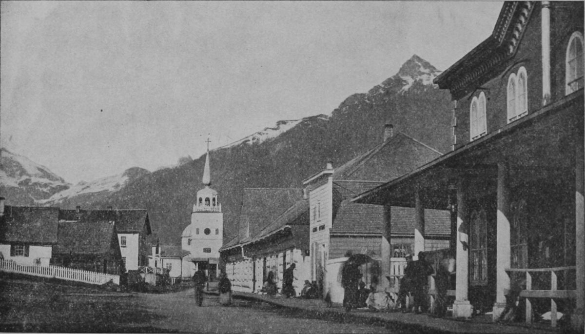
 BIRD'S-EYE VIEW OF SITKA—FROM BARANOFF CASTLE.
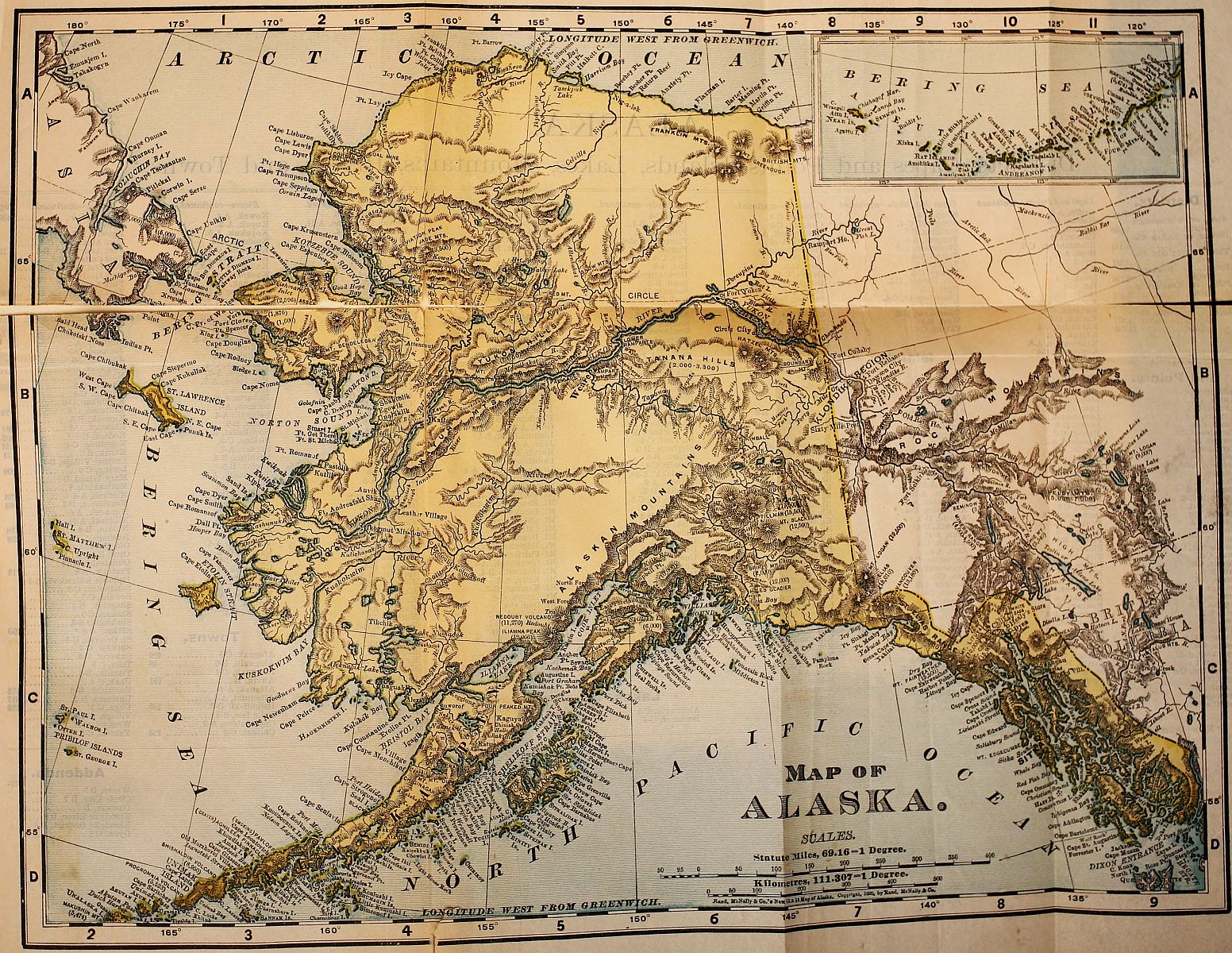
The gold-fields of the Yukon Valley, at and near Klondike River, are near the eastern boundary of Alaska, from twelve to fifteen hundred miles up from the mouth of the river, and from five to eight hundred miles inland by the route across the country from the southern Alaskan coast. In each case an ocean voyage must be taken as the first step; and steamers may be taken from San Francisco, Portland, Ore., Seattle, Wash., or from Victoria, B. C.
The overland routes to these cities require a word.
1. To San Francisco. This city is reached directly by half a dozen routes across the plains and Rocky Mountains, of which the Southern Pacific, by way of New Orleans and El Paso; the Atchison & Santa Fé and Atlantic & Pacific by way of Kansas City, and across northern New Mexico and Arizona; the Burlington, Denver & Rio Grande, by way of Denver and Salt Lake City; and the Union[8] and Central Pacific, by way of Omaha, Ogden and Sacramento, are the principal ones.
2. To Portland, Oregon. This is reached directly by the Union Pacific and Oregon Short Line, via Omaha and Ogden; and by the Northern Pacific, via St. Paul and Helena, Montana.
3. To Seattle, Wash. This city, Tacoma, Port Townsend and other ports on Puget Sound, are the termini of the Northern Pacific Railroad and also of the Great Northern Railroad from St. Paul along the northern boundary of the United States. The Canadian Pacific will also take passengers there expeditiously by rail or boat from Vancouver, B. C.
4. To Vancouver and Victoria, B. C. Any of the routes heretofore mentioned reach Victoria by adding a steamboat journey; but the direct route, and one of the pleasantest of all the transcontinental routes, is by the Canadian Pacific Railway from Montreal or Chicago, via Winnipeg, Manitoba, to the coast at Vancouver, whence a ferry crosses to Victoria.
Regular routes of transportation to Alaska are supplied by the Pacific Coast Steamship Company, which has been dispatching mail-steamships once a fortnight the year round from Tacoma to Sitka, which touch at Juneau and all other ports of call. They also maintain a service of steamers between[9] San Francisco and Portland and Puget Sound ports. These are fitted with every accommodation and luxury for tourist-travel; and an extra steamer, the Queen, has been making semi-monthly trips during June, July and August. These steamers would carry 250 passengers comfortably and the tourist fare for the round trip has been $100.
The Canadian Pacific Navigation Company has been sending semi-monthly steamers direct from Victoria to Port Simpson and way stations the year round. They are fine boats, but smaller than the others and are permitted to land only at Sitka and Dyea.
Such are the means of regular communication with Alaskan ports. There has been no public conveyance north of Sitka, except twice or thrice a year in summer, in the supply-steamers of the Alaskan commercial companies, which sailed from San Francisco to St. Michael and there transferred to small boats up the Yukon.
Whether any changes will be made in these schedules for the season of 1898 remains to be seen.
Special steamers.—As the regular accommodations were found totally inadequate to the demand for passage to Alaska which immediately followed the report of rich discoveries on Klondike Creek,[10] extra steamers were hastily provided by the old companies, others are fitted up and sent out by speculative owners, and some have been privately chartered. A score or more steamships, loaded with passengers, horses, mules and burros (donkeys) to an uncomfortable degree, were thus despatched from San Francisco, Puget Sound and Victoria between the middle of July and the middle of August. An example of the way the feverish demand for transportation is found in the case of the Willamette, a collier, which was cleaned out in a few hours and turned into an extemporized passenger-boat. The whole 'tween decks space was filled with rough bunks, wonderfully close together, for "first-class" passengers; while away down in the hold second-class arrangements were made which the mind shudders to contemplate. Yet this slave-ship sort of a chance was eagerly taken, and such space as was left was crowded with animals and goods. Many persons and parties bought or chartered private steamers, until the supply of these was exhausted by the end of August.
Two routes may be chosen to the gold-fields.
1. By way of the Yukon River. This is all the way by water, and means nearly 4,500 miles of voyaging.
2. By way of the seaports of Dyea or Shkagway,[11]
[12]
[13]
over mountain passes, afoot or a-horseback, and
down the upper Yukon River and down the lakes
and rivers by raft, skiff and steamboat.
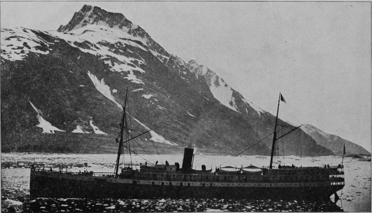 GLACIER BAY. STEAMSHIP QUEEN.
To describe these routes is the next task—first, that by the way of St. Michael, and second—up the Yukon River.
Route, via St. Michael and the Yukon River.—This begins by a sea-voyage, which may be direct, or along the coast. The special steamers (and future voyages, no doubt) usually take a direct course across the North Pacific and through the Aleutian Islands to St. Michael, in Norton Sound, a bight of Bering Sea. The distance from San Francisco is given as 2,850 miles; from Victoria or Seattle, about 2,200 miles. The inside course would be somewhat longer, would follow the route next to be described as far as Juneau and Sitka, then strike northwest along the coast to St. Michael.
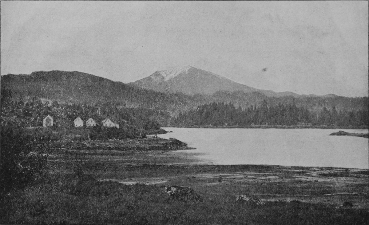
This town, on an island near shore in Norton Sound, was established in 1835 by Lieut. Michael Tébenkoff, of the Russian navy, who named it after his patron saint. Though some distance to the mouth of the Yukon entrance, St. Michael has always been the controlling center and base of supplies for the great valley. The North American Trading and Transportation Company and the Alaska Commercial Company have their large warehouses[14] here, and provide the miners with tools, clothing and provisions. Recently the wharf and warehouse accommodations have been extended, and the population has increased, but if, as is probable, any considerable number of men are stopped there this fall by the freezing of the river, and compelled to pass the winter on the island, they will find it a dreary, if not dangerous experience.
The vessels supplying this depot can seldom approach the anchorage of St. Michael before the end of June on account of large bodies of drifting ice that beset the waters of Norton Sound and the straits between St. Lawrence and the Yukon Delta.
A temporary landing-place is built out into water deep enough for loaded boats drawing five feet to come up at high tide, this is removed when winter approaches, as otherwise it would be destroyed by ice. The shore is sandy and affords a moderately sloping beach, on which boats may be drawn up. A few feet only from high water mark are perpendicular banks from six to ten feet high, composed of decayed pumice and ashes, covered with a layer about four feet thick of clay and vegetable matter resembling peat. This forms a nearly even meadow with numerous pools of water, which gradually ascends for a mile or so to a low hill, of volcanic origin, known as the Shaman Mountain.
Between the point on which St. Michael is built and the mainland, a small arm of the sea makes in, in which three fathoms may be carried until the flagstaff of the fort bears west by north, this is the best-protected anchorage, and has as much water and as good bottom as can be found much farther out.
The excitement of the summer of 1897 caused an enlargement of facilities and the erection of additional buildings, forming a nucleus of traffic called Fort Get There. Here will be put together in the autumn or winter at least three, and perhaps more, new river steamboats, of which only two or three have been running on the lower river during the last two or three years. These are taken up, in pieces, by ships and fitted together at this point. All are flat-bottomed, stern-wheeled, powerfully engined craft, the largest able to carry perhaps 250 tons, such as run on the upper Missouri, and they will burn wood, the cutting and stacking of which on the river bank will furnish work to many men during the coming winter. To such steamers, or smaller boats, all the persons and cargoes must be transferred at St. Michael.
For the last few years there has been no trader
here but the agent of the Alaska Commercial Company,
and a story is told of the building of a riverboat[16]
there in 1892, which illustrates what life on
the Yukon used to be. In that year a Chicago man,
P. B. Weare, resolved to enter the Alaskan field as
a trader. He chartered a schooner, and placed upon
it a steamboat, built in sections and needing only to
be put together and have its machinery set up, and
for this purpose he took with him a force of carpenters
and machinists. On reaching St. Michael
Weare was refused permission to land his boat sections
on the land of the Commercial Company's
post, and was compelled to make a troublesome
landing on the open beach, where he began operations.
Suddenly his ship carpenters stopped work.
They had been offered, it was said, double pay by
the rival concern if they would desist from all work.
Weare turned to the Indians, but with the same ill-success.
The Indians were looking out for their
winter grub. Here was the Chicago man 2,500
miles from San Francisco and only two weeks
left to him in which to put his boat together and
then hope for a chance to ascend the river before
winter came on. There was no time in which to
get additional men from San Francisco. In the
midst of his trouble Weare one day espied the revenue
cutter Bear steaming into the roadstead. On
board of her was Captain Michael A. Healy. That
officer, on going ashore and discovering the condition[17]
[18]
[19]
of affairs, threatened to hang every carpenter
and mechanic Weare had brought up if they failed
to immediately commence work. The men went to
work, and with them went a gang of men from the
Bear. The little steamer was put together in a few
days, and the Bear only went to sea after seeing
the P. B. Weare steaming into the mouth of the
Yukon.
 STEAMER PORTUS B. WEARE.
The Weare was enabled that summer to land her stores along the Yukon, and was the only vessel available for the early crowds of miners going to Klondike.
The mouth of the Yukon is a great delta, surrounded by marsh of timber—a soaking prairie in summer, a plain of snow and ice in winter. The shifting bars and shallows face out from this delta far into Bering Sea, and no channel has yet been discovered whereby an ocean steamer could enter any of the mouths. Fortunately the northernmost mouth, nearest St. Michael and 65 miles from it, is navigable for the light river steamers, and this one, called Aphoon, and marked by its unusual growth of willows and bushes is well known to the local Russian and Indian pilots. It is narrow and intricate, and the general course up stream is south-southeast. Streams and passages enter it, and it has troublesome tidal currents. The whole space between[20] the mouth is a net-work, indeed, of narrow channels, through the marshes.
Kutluck, at the outlet of the Aphoon, on Pastol Bay, is an Indian village, long celebrated for its manufacture of skin boats (bidars), and there the old-time voyagers were accustomed to get the only night's sleep ashore that navigation permits between St. Michael and Andraefski. On the south bank of the main stream, at the head of the delta, is the Roman Catholic mission of Kuslivuk; and a few miles higher, just above the mouth of the Andraefski River, is the abandoned Russian trading post, Andraefski, above which the river winds past Icogmute, where there is a Greek Catholic mission. The banks of the river are much wooded, and the current even as far down as Koserefski averages over three knots an hour. Above Koserefski (the Catholic Mission station), the course is along stretches of uninviting country, among marsh islands and "sloughs," the current growing more and more swift on the long reach from Auvik, where the Episcopal mission is situated, to Nulato.
The river here has a nearly north and south course, parallel with the coast of Norton Sound and within fifty miles or so of it. Two portages across here form cut-offs in constant use in winter by the traders, Indians and missionaries. The first of these[21] portages starts from the mainland opposite the Island of St. Michael, and passes over the range of hills that defines the shore to the headwaters of the Anvik River. This journey may be made in winter by sledges and thence down the Auvik to the Yukon, but it is a hard road. Mr. Nelson, the naturalist, and a fur trader, spent two months from November 16, 1880, to January 19, 1891, in reaching the Yukon by this path.
The other portage is that between Unalaklik, a Swedish mission station at the mouth of the Unalaklik River, some fifty miles north of St. Michael, and a stream that enters the Yukon half way between Auvik and Nulato. In going from St. Michael to Unalatlik there are few points at which a boat can land even in the smoothest weather; in rough weather only Major's Cove and Kegiktowenk before rounding Tolstoi Point to Topánika, where there is a trading post. Topánika is some ten miles from Unalaklik, with a high shelving beach, behind which rise high walls of sandstone in perpendicular bluffs from twenty to one hundred feet in height. This beach continues all the way to the Unalaklik River, the bluff gradually decreasing into a marshy plain at the river's mouth, which is obstructed by a bar over which at low tide there are only a few feet of water except in a narrow and tortuous channel, constantly[22] changing as the river deposits fresh detritus. Inside this bar there are two or three fathoms for a few miles, but the channel has only a few feet, most of the summer, from the mouth of the river to Ulukuk.
Trees commence along the Unalaklik River as soon as the distance from the coast winds and salt air permit them to grow; willow, poplar, birch and spruce being those most frequently found.
The Unalaklik River is followed upward to Ulukuk, where begins a sledging portage over the marshes to the Ulukuk Hills, where there is a native village known as Vesolia Sopka, or Cheerful Peak, at an altitude of eight hundred feet above the surrounding plain. This is a well-known trapping ground, the fox and marten being very plentiful. From Sopka Vesolia (Cheerful Peak) it is about one day's journey to Beaver Lake, which is only a marshy tundra in winter, but is flooded in the spring and summer months. From the high hills beyond the lake one may catch a first glimpse of the great Yukon sweeping between its splendid banks.
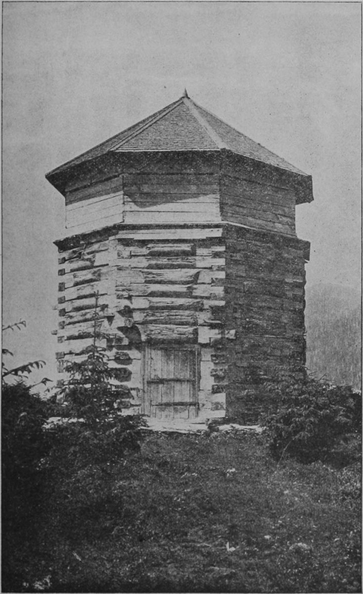 OLD RUSSIAN BLOCK HOUSE AT SITKA.
The natives call Nulato emphatically a "hungry"
place, and it was once the scene of an atrocious massacre.
Capt. Dall, from whose book much of the
information regarding this part of Alaska is derived,
describes the Indians here as a very great nuisance.[23]
[24]
[25]
"They had," he explains, "a great habit of coming
in and sitting down, doing and saying nothing, but
watching everything. At meal times they seemed
to count and weigh every morsel we ate, and were
never backward in assisting to dispose of the remains
of the meal. Occasionally we would get desperate
and clean them all out, but they would drop
in again and we could do nothing but resign ourselves."
The soil on the banks of the Yukon and that of the islands probably never thaws far below the surface. It is certain that no living roots are found at a greater depth than three feet. The soil, in layers that seems to mark annual inundations, consists of a stratum of sand overlaid by mud and covered with vegetable matter, the layers being from a half inch to three inches in thickness. In many places where the bank has been undermined these layers may be counted by the hundred. Low bluffs of blue sandstone, with here and there a high gravel bank, characterize the shores as far as Point Sakataloutan, and some distance above this point begin the quartzose rocks.
The next station on the river is the village of Nowikakat, on the left bank. Here may be obtained stores of dried meat and fat from the Indians. The village is situated upon a beautiful bay or Nowikakat[26] Harbor, which is connected by a narrow entrance with the Yukon. "Through this a beautiful view is obtained across the river, through the numerous islands of the opposite shore, and of the Yukon Mountains in the distance. The feathery willows and light poplars bend over and are reflected in the dark water, unmixed as yet with Yukon mud; every island and hillside is clothed in the delicate green of spring, and luxuriates in a density of foliage remarkable in such a latitude."
Nowikakat is specially noted for the excellence of its canoes, of which the harbor is so full that a boat makes its landing with difficulty among them. It is the only safe place on the lower Yukon for wintering a steamer, as it is sheltered from the freshets which bring down great crushes of ice in the spring.
At Nuklukahyet there is a mission of the Episcopal church and a trading store, but there may or may not be supplies of civilized goods, not to speak of moose meat and fat. This is the neutral ground where all the tribes meet in the spring to trade. The Tananah, which flows into the Yukon at this point, is much broader here than the Yukon, and it is here that Captain Dall exclaims in his diary: "And yet into this noble river no white man has dipped his paddle." Recently, however, the Tananah has been more or less explored by prospectors[27] with favorable results towards the head of the river, which is more easily reached overland from Circle City and the Birch Creek camps.
Leaving Nuklukahyet, the "Ramparts" are soon sighted, and the Yukon rapids sweep between bluffs and hills which rise about fifteen hundred feet above the river, which is not more than half a mile wide and seems almost as much underground as a river bed in a canyon. The rocks are metaphoric quartzites, and the river-bed is crossed by a belt of granite. The rapid current has worn the granite away at either side, making two good channels, but in the center lies an island of granite over which the water plunges at high water, the fall being about twelve feet in half a mile.
Beyond the mouth of the Tananah the Yukon begins to widen, and it is filled with small islands. The mountains disappear, and just beyond them the Totokakat, or Dall River of Ketchum, enters the Yukon from the north. Beyond this point the river, ever broadening, passes the "Small Houses," deserted along the bank at the time, years ago, when the scarlet fever, brought by a trading vessel to the mouth of the Chilkat, spread to the Upper Yukon and depopulated the station. This place is noted for the abundance of its game and fish.
The banks of the river above this point become[28] very low and flat, the plain stretching almost unbroken to the Arctic Ocean.
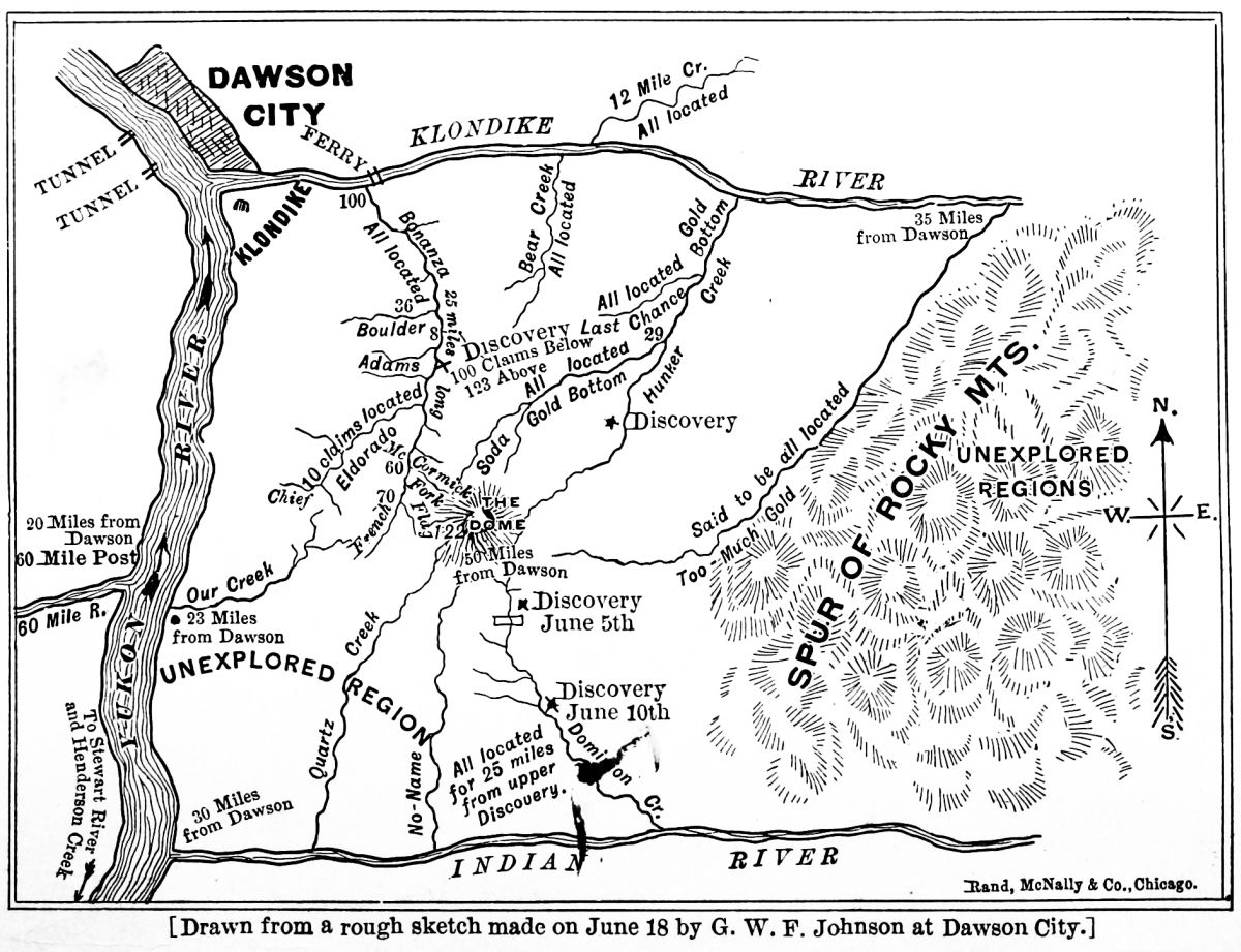
The next stream which empties into the Yukon is Beaver Creek, and farther on the prospector bound for Circle City may make his way some two hundred miles up Birch Creek, along which much gold has already been discovered, to a portage of six miles, which will carry him within six miles of Circle City on the west.
Meanwhile the Yukon passes Porcupine River and Fort Yukon, the old trading-post founded in 1846-7, about a mile farther up the river than the present fort is situated. The situation was changed in 1864, owing to the undermining of the Yukon, which yearly washed away a portion of the steep bank until the foundation timbers of the old Redoubt over-hung the flood.
Many small islands encumber the river from Fort Yukon to Circle City, and the river flows along the rich lowland to the towns and mining centers of the new El Dorado, an account of which belongs to a future chapter.
This voyage can be made only between the middle of June and the middle of September, and requires about forty days, at best, from San Francisco to Circle City or Forty Mile.
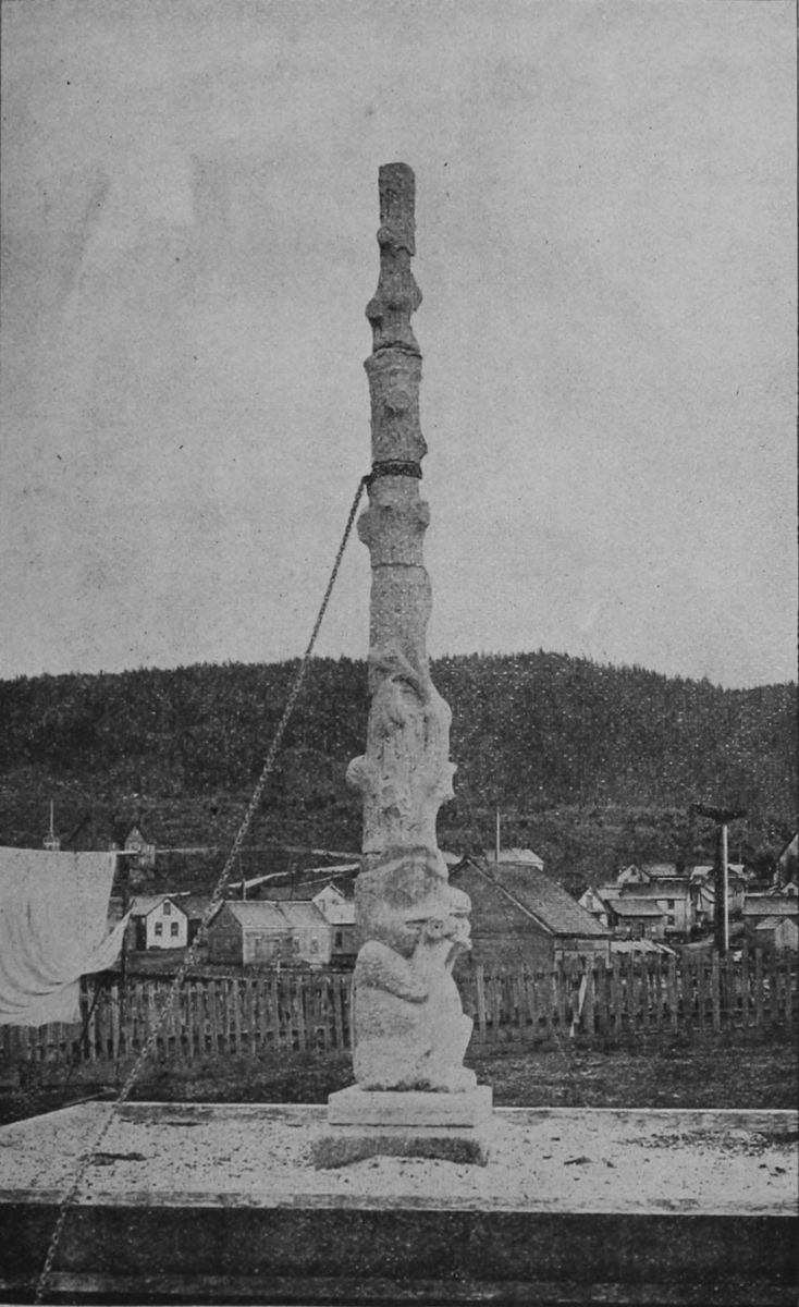 INDIAN TOTEM POLE, FORT SIMPSON.
Route via Juneau, the Passes and down the Upper[29]
[30]
[31]
Yukon River. The second and more usual, because
shorter and quicker course, is that to the
head of Lynn Canal (Taiya Inlet) and overland.
This coast voyage may be said to begin at Victoria,
B. C. (since all coast steamers gather and stop
there), where a large number of persons prefer to
buy their outfits, since by so doing, and obtaining
a certificate of the fact, they avoid the custom duties
exacted at the boundary line on all goods and
equipments brought from the United States. Victoria
is well supplied with stores, and is, besides, one
of the most interesting towns on the Pacific coast.
The loveliest place in the whole neighborhood is
Beacon Hill Park, and is well worth a visit by those
who find an hour or two on their hands before the
departure of the steamer. It forms a half-natural,
half-cultivated area of the shore of the Straits of
Fuca, where coppices of the beautiful live oak, and
many strange trees and shrubs mingled with the all-pervading
evergreens.
Within three miles of the city, and reached by street cars, is the principal station in the North Pacific of the British navy, at Esquimault Bay. This is one of the most picturesque harbors in the world, and a beginning is made of fortifications upon a very large scale and of the most modern character. This station, in many respects, is the most interesting[32] place on the Pacific coast of Canada.
Leaving Victoria, the steamer makes its way cautiously through the sinuous channels of the harbor into the waters of Fuca Strait, but this is soon left behind and the steamer turns this way, and that, at the entrance to the Gulf of Georgia, among those islands through which runs the international boundary line, and for the possession of which England and the United States nearly went to war in 1862. The water at first is pale and somewhat opaque, for it is the current of the great Fraser gliding far out upon the surface, and the steamer passes on beyond it into the darker, clearer, salter waters of the gulf. Then the prow is headed to Vancouver, where the mails, freight and new railway passengers are received.
From Vancouver the steamer crosses to Nanaimo, a large settlement on Vancouver Island, where coal mines of great importance exist. A railway now connects this point with Victoria, and a wagon road crosses the interior of the island to Alberni Canal and the seaport at its entrance on Barclay Sound. This is the farthest northern telegraph point. The mines at Nanaimo were exhausted some time ago, after which deep excavations were made on Newcastle Island, just opposite the town. But after a tremendous fire these also were abandoned, and all[33] the workings are now on the shores of Departure Bay, where a colliery village named Wellington has been built up. A steam ferry connects Nanaimo with Wellington; and while the steamer takes in its coal, the passengers disperse in one or the other village, go trout fishing, shooting or botanizing in the neighboring woods, or trade and chaffer with the Indians. Nanaimo has anything but the appearance of a mining town. The houses do not stretch out in the squalid, soot-covered rows familiar to Pennsylvania, but are scattered picturesquely, and surrounded by gardens.
Just ahead lie the splendid hills of Texada Island, whose iron mines yield ore of extraordinary purity, which is largely shipped to the United States to be made into steel. The steamer keeps to the left, making its way through Bayne's Sound, passing Cape Lazaro on the left and the upper end of Texada on the right, across the broadening water along the Vancouver shore into Seymour Narrows. These narrows are only about 900 yards wide, and in them there is an incessant turmoil and bubbling of currents. This is caused by the collision of the streams which takes place here; the flood stream from the south, through the Strait of Fuca and up the Haro Archipelago being met by that from Queen Charlotte Sound and Johnstone straits. These straits are[34] about 140 miles long, and by the time their full length is passed, and the maze of small islands on the right and Vancouver's bulwark on the left are escaped together, the open Pacific shows itself for an hour or two in the offing of Queen Charlotte's Sound, and the steamer rises and falls gently upon long, lazy rollers that have swept all the way from China and Polynesia. Otherwise the whole voyage is in sheltered waters, and seasickness is impossible. The steamer's course now hugs the shore, turning into Fitz Hugh Sound, among Calvert, Hunter's and Bardswell islands, where the ship's spars sometimes brush the overhanging trees. Here are the entrances to Burke Channel and Dean's Canal that penetrate far amid the tremendous cliffs of the mainland mountains. Beyond these the steamer dashes across the open bight of Milbank Sound only to enter the long passages behind Princess Royal, Pit and Packer islands, and coming out at last into Dixon Sound at the extremity of British Columbia's ragged coast line.
 STREET IN SITKA.
The fogs which prevail here are due to the fact
that this bight is filled with the waters of the warm
Japanese current and the gulf stream of the Pacific
from which the warm moisture rises to be condensed
by the cool air that descends from the neighboring
mountains, into the dense fogs and heavy rain[35]
[36]
[37]
storms to which the littoral forest owes its extraordinary
luxuriance. During the mid-summer and
early autumn, however, the temperature of air and
water become so nearly equable that fog and rain
are the exception rather than the rule.
Crossing the invisible boundary into Alaska the steamer heads straight toward Fort Tougass, on Wales Island, once a military station of the United States, but now only a fishing place. Between this point and Fort Wrangel another abandoned military post of the United States, two or three fish canneries and trading stations are visited and the ship goes on among innumerable islands and along wide reaches of sound to Taku Inlet (which deeply indents the coast, and is likely in the near future to become an important route to the gold fields), and a few hours later Juneau City is reached.
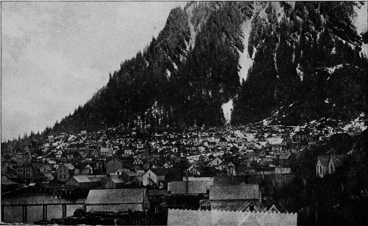
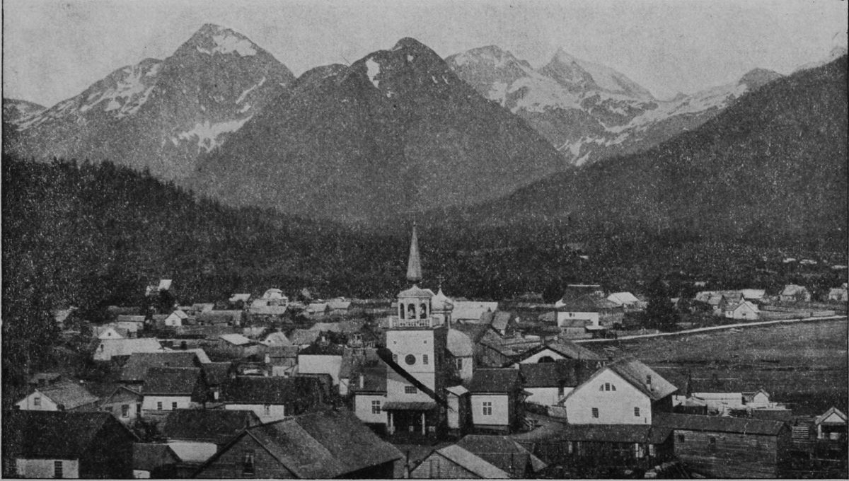
Juneau City has been lately called the key to the Klondike regions, as it is the point of departure for the numberless gold hunters who, when the season opens again, will rush blindly over incalculably rich ledges near the coast to that remote inland El Dorado of their dreams.
Juneau has for seventeen years been supported by the gold mines of the neighboring coast. It is situated ten miles above the entrance of Gastineau Channel, and lies at the base of precipitous mountains,[38] its court house, hotels, churches, schools, hospital and opera house forming the nucleus for a population which in 1893 aggregated 1,500, a number very largely increased each winter by the miners who gather in from distant camps. The saloons, of which in 1871 there were already twenty-two, have increased proportionately, and there are, further, at least one weekly newspaper, one volunteer fire brigade, a militia company and a brass band in Juneau. The curio shops on Front and Seward streets are well worth visiting, and from the top of Seward Street a path leads up to the Auk village, whose people claim the flats at the mouth of Gold Creek. A curious cemetery may be seen on the high ground across the creek, ornamented with totemic carvings and hung with offerings to departed spirits which no white man dares disturb.
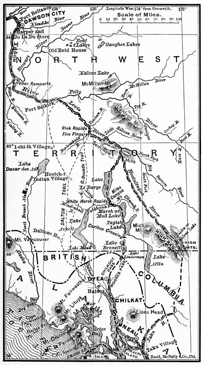
The few persons who formerly wished to go to the head of Lynn Canal did so mainly by canoeing, or chartered launches, but now many opportunities are offered by large steamboats. Most of the steamers that bring miners and prospectors from below do not now discharge their freight at Juneau, however, but go straight to the new port Dyea at the head of the canal. Lynn Canal is the grandest fiord on the coast, which it penetrates for seventy-five[39] miles. It is then divided by a long peninsula called Seduction Point, into two prongs, the western of which is called Chilkat Inlet, and the eastern Chilkoot. "It has but few indentations, and the abrupt palisades of the mainland shores present an unrivalled panorama of mountains, glaciers and forests, with wonderful cloud effects. Depths of 430 fathoms have been sounded in the canal, and the continental range on the east and the White Mountains on the west rise to average heights of 6,000 feet, with glaciers in every ravine and alcove." No Cameron boundary line, which Canada would like to establish, would cut this fiord in two, and make it useless to both countries in case of quarrel. The magnificent fan-shaped Davidson glacier, here, is only one among hundreds of grand ice rivers shedding their bergs into its waters. At various points salmon canneries have long been in operation; and the Seward City mines are only the best among several mineral locations of promise. A glance at the map will show that this "canal" forms a straight continuation of Chatham Strait, making a north and south passage nearly four hundred miles in length, which is undoubtedly the trough of a departed glacier.
Dyea, the new steamer landing and sub-port of entry, is at the head of navigation on the Chilkoot or eastern branch of this Lynn Canal, and takes its[40] name, in bad modern spelling, from the long-known Taiya Inlet, which is a prolongation inland for twenty miles of the head of the Chilkoot Inlet. It should continue to be spelled Tiaya. This inlet is far the better of the two for shipping, Chilkat Inlet being exposed to the prevalent and often dangerous south wind, so that it is regarded by navigators as one of the most dangerous points on the Alaskan coast. A Presbyterian mission and government school were formerly sustained at Haines, on Seduction Point, but were abandoned some years ago on account of Indian hostility.
The Passes.—Three passes over the mountains are reached from these two inlets,—Chilkat, Chilkoot and White.
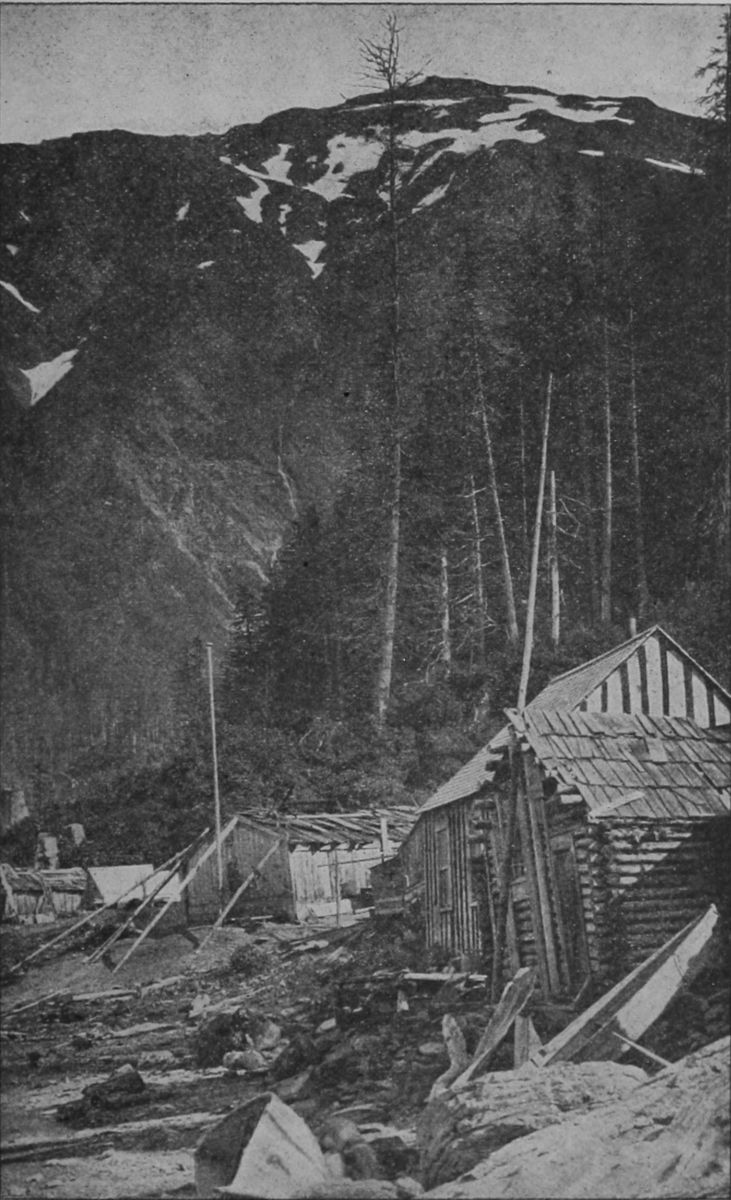
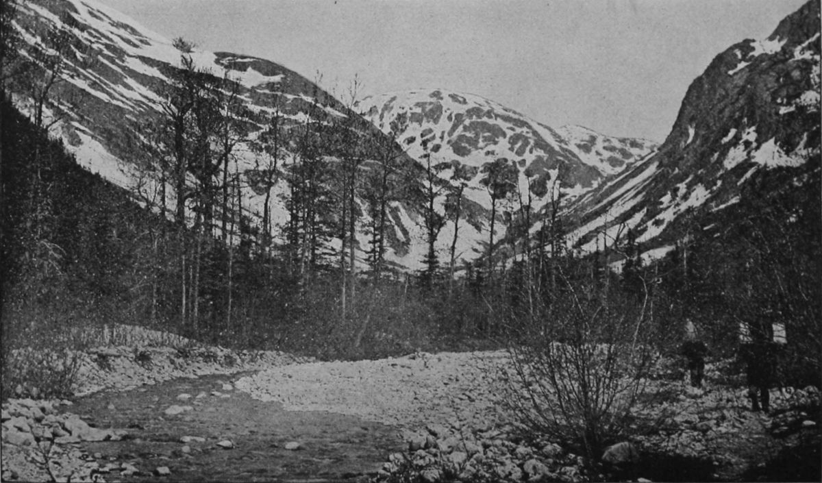 HEAD WATERS, DYEA RIVER.
Chilkat Pass is that longest known and formerly
most in vogue. The Chilkat Indians had several
fixed villages near the head of the inlet, and were
accustomed to go back and forth over the mountains
to trade with the interior Indians, whom they
would not allow to come to the coast. They thus
enjoyed not only the monopoly of the business of
carrying supplies over to the Yukon trading posts
and bringing out the furs, and more recently of assisting
the miners, but made huge profits as middle-men
between the Indians of the interior and the
trading posts on the coast. They are a sturdy race[41]
[42]
[43]
of mountaineers, and the most arrogant, treacherous
and turbulent of all the northwestern tribes, but
their day is nearly passed. The early explorers—Krause,
Everette and others—took this pass, and
it was here that E. J. Glave first tried (in 1891) to
take pack horses across the mountains, and succeeded
so well as to show the feasibility of that
method of carriage, which put a check upon the
extortion and faithlessness of the Indian carriers.
His account of his adventures in making this experiment,
over bogs, wild rocky heights, snow fields,
swift rivers and forest barriers, has been detailed in
The Century Magazine for 1892, and should be read
by all interested. "No matter how important your
mission," Mr. Glave wrote, "your Indian carriers,
though they have duly contracted to accompany
you, will delay your departure till it suits their convenience,
and any exhibition of impatience on your
part will only remind them of your utter dependency
on them; and then intrigue for increase of
pay will at once begin. While en route they will
prolong the journey by camping on the trail for two
or three weeks, tempted by good hunting or fishing.
In a land where the open season is so short, and
the ways are so long, such delay is a tremendous
drawback. Often the Indians will carry their loads
some part of the way agreed on, then demand an[44]
extravagant increase of pay or a goodly share of the
white man's stores, and, failing to get either, will
fling down their packs and return to their village,
leaving their white employer helplessly stranded."
The usual charge for Indian carriers is $2 a day and board, and they demand the best fare and a great deal of it, so that the white man finds his precious stores largely wasted before reaching his destination. These facts are mentioned, not because it is now necessary to endure this extortion and expense, but to show how little dependence can be placed upon the hope of securing the aid of Indian packers in carrying the goods of prospectors or explorers elsewhere in the interior, and the great expense involved. This pass descends to a series of connected lakes leading down to Lake Labarge and thence by another stream to the Lewes; and it requires twelve days of pack-carrying—far more than is necessary on the other passes. As a consequence, this pass is now rarely used except by Indians going to the Aksekh river and the coast ranges northward.
Chilkoot, Taiya or Parrier Pass.—This is the pass that has been used since 1885 by the miners and others on the upper Yukon, and is still a route of travel. It starts from the head of canoe navigation on Taiya inlet, and follows up a stream valley, gradually leading to the divide, which[45] is only 3,500 feet above the sea. The first day's march is to the foot of the ascent, and over a terrible trail, through heavy woods and along a steep, rocky and often boggy hillside, broken by several deep gullies. The ascent is then very abrupt and over huge masses of fallen rock or steep slippery surfaces of rock in place. At the actual summit, which for seven or eight miles is bare of trees or bushes, the trail leads through a narrow rocky gap, and the whole scene is one of the most complete desolation. Naked granite rocks, rising steeply to partly snow-clad mountains on either side. Descending the inland or north slope is equally bad traveling, largely over wide areas of shattered rocks where the trail may easily be lost. The further valley contains several little lakes and leads roughly down to Lake Lindeman. The distance from Taiya is twenty-three and a half miles, and it is usually made in two days. Miners sometimes cross this pass in April, choosing fine weather, and then continue down the lakes on the ice to some point where they can conveniently camp and wait for the opening of navigation on the Yukon; ordinarily it is unsafe to attempt a return in the autumn later than the first of October.
Lake Lindeman is a long narrow piece of water navigable for boats to its foot, where a very bad river passage leads into the larger Lake Bennett, where[46] the navigation of the Yukon really begins.
"The Chilkoot Pass," writes one of its latest travelers,
"is difficult, even dangerous, to those not possessed
of steady nerves. Toward the summit there is
a sheer ascent of 1,000 feet, where a slip would certainly
be fatal. At this point a dense mist overtook
us, but we reached Lake Lindeman—the first of a
series of five lakes—in safety, after a fatiguing tramp
of fourteen consecutive hours through half-melted
snow. Here we had to build our own boat, first
felling the timber for the purpose. The journey
down the lakes occupied ten days, four of which
were passed in camp on Lake Bennett, during a violent
storm, which raised a heavy sea. The rapids
followed. One of these latter, the "Grand Canyon,"
is a mile long, and dashes through walls of rock
from 50 to 100 feet high; six miles below are the
"White Horse Rapids," a name which many fatal
accidents have converted into the "Miner's Grave."
But snags and rocks are everywhere a fruitful source
of danger on this river, and from this rapid downward
scarcely a day passed that one did not see some
cairn or wooden cross marking the last resting place
of some drowned pilgrim to the land of gold. The
above is a brief sketch of the troubles that beset the
Alaskan gold prospector—troubles that, although
unknown in the eastern states and Canada, have for[47]
[48]
[49]
many years past associated the name of Yukon with
an ugly sound in western America."
 RAFT ON LAKE LINDEMAN.
It is probable that few if any persons need go over this pass next year, and its hardships will become a tradition instead of a terrible prospect.
White Pass.—This pass lies south of the Chilkoot, and leaves the coast at the mouth of the Shagway river, five miles south of Dyea and 100 from Juneau. It was first explored in 1887 and was found to run parallel to the Chilkoot. The distance from the coast to the summit is seventeen miles, of which the first five are in level bottom land, thickly timbered. The next nine miles are in a cañon-like valley, beyond which three miles, comparatively easy, take one to the summit, the altitude of which is roughly estimated at 2,600 feet. Beyond the summit a wide valley is entered and leads gradually to the Tahko arm of Tahgish lake. This pass, though requiring a longer carriage, is lower and easier than the others, and already a pack-trail has been built through it which will soon be followed by a wagon road, and surveys for a narrow gauge railway are in progress. At the mouth of the Shkagway River ocean steamers can run up at all times to a wharf which has been constructed in a sheltered position, and there is an excellent town site with protection from storms.
An English company, the British Columbia Development Association, Limited, has already established a landing wharf and is erecting a wharf and sawmills at Skagway, whence it is proposed (as soon as feasible) to lay down a line of rail some thirty-five miles long, striking the Yukon River at a branch of the Marsh Lake, about 100 miles below Lake Lindeman. By this means the tedious and difficult navigation between these two points will be avoided, and the only dangerous parts of the river below will be circumvented by a road or rail portage. Light-draught steamers will be put on from Teslin Lake to the cañon and from the foot of the latter to all the towns and camps on the river.
Dyea is a village of cabins and tents, and little if anything in the way of supplies can be got there; it is a mere forwarding point.
Pending the completion of the facilities mentioned above, miners may transport their goods over the pack trail on their own or hired burros, and at Tahgish Lake take a boat down the Tahco arm (11 miles) to the main lake, and down that lake and its outlet into Lake Marsh. This chain of lakes, filling the troughs of old glacial fiords to a level of 2,150 feet above the sea, "constitutes a singularly picturesque region, abounding in striking points of view and in landscapes pleasing in their variety or grand and impressive[51] in this combination of rugged mountain forms." All afford still-water navigation, and as soon as the road through White Pass permits the transportation of machinery, they will doubtless be well supplied with steamboats. Marsh Lake is 20 miles long, Bennett 26, and Tagish 16½ miles, with Windy Arm 11 miles long, Tahko Arm 20 miles, and other long, narrow extensions among the terraced, evergreen-wooded hills that border its tranquil surface. The depression in which this group of lakes lies is between the coast range and the main range of the Rockies; and as it is sheltered from the wet sea-winds by the former heights, its climate is nearly as dry of that of the interior. The banks are fairly well timbered, though large open spaces exist, and abound in herbage, grass and edible berries. Lake Marsh, named by Schwatka after Prof. O. C. Marsh of Yale, but called Mud Lake by the miners, without good reason, is twenty miles long and about two wide. It is rather shallow and the left bank should be followed. The surrounding region is rather low, rising by terraces to high ranges on each side, where Michie mountain, 5,540 feet in height, eastward, and Mounts Lorue and Landsdowne, westward, 6,400 and 6,140 feet high respectively, are the most prominent peaks. "The diversified form of the mountains in view from this lake render it particularly[52] picturesque," remarks Dr. Dawson, "and at the time of our visit, on the 10th and 11th of September, the autumn tints of the aspens and other deciduous trees and shrubs, mingled with the sombre greens of the spruces and pines, added to its beauty."
Near the foot of this lake enters the McClintock river, of which little is known. The outlet is a clear, narrow, quiet stream, called Fifty-mile River, which flows somewhat westerly down the great valley. Large numbers of dead and dying salmon are always seen here in summer, and as these fish never reach Lake Marsh, it is evident that the few who are able, after their long journey, to struggle up the rapids, have not strength left to survive.
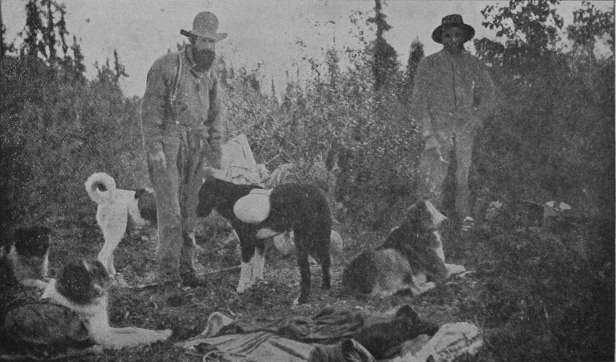 DOG PACK TRAIN.
The descent of the Lewes (or Yukon) may be said
to begin at this point, and 23 miles below Lake
Marsh the first and most serious obstacle is encountered
in the White Horse Rapids, and Miles Cañon.
Their length together is 2¾ miles, and they seem to
have been caused by a small local effusion of lava,
which was most unfortunately ejected right in the
path of the river. The cañon is often not more than
100 feet in width, and although parts of it may be
run at favorable times, all of it is dangerous, and
the White Horse should never be attempted. The
portage path in the upper part of the cañon is on
the east bank, and is about five-eighths of a mile[53]
[54]
[55]
long. There a stretch of navigation is possible, with
caution, ending at the head of White Horse Rapids,
where one must land on the west bank, which consists
of steep rocks, very awkward for managing a
boat from or carrying a burden over. Usually the
empty boat can be dropped down with a line, but
when the water is high boat as well as cargo must
be carried for 100 yards or more, and again, lower
down, for a less distance. The miners have put
down rollways along a roughly constructed road
here to make the portage of the boats easier, and
some windlasses for hauling the boats along the
water or out and into it. It would be possible to
build a good road or tramway along the east bank
of these rapids without great difficulty; and plans
are already formulated for a railway to be built
around the whole three miles of obstruction, in the
summer of 1898, to connect with the steamboats
above and below that will no doubt be running next
year.
The river below the rapids is fast (about four miles an hour) for a few miles, and many gravel banks appear. It gradually subsides, however, into a quiet stream flowing northwest along the same wide valley. No rock is seen here, the banks being bluffs of white silt, which turns the clear blue of the current above into a cloudy and opaque yellow.[56] Thirteen miles (measuring, as usual, along the river) brings the voyager to the mouth of the Tah-Keena, a turbid stream about 75 yards wide and 10 feet deep, which comes in from the west. Its sources are at the foot of the Chilkat Pass, where it flows out of West Kussoa lake (afterwards named Lake Arkell), and was formerly much employed by the Chilkat Indians as a means of reaching the interior, but was never in favor with the miners, and is now rarely followed by the Indians themselves, although its navigation from the lake down is reported to be easy.
Eleven and a half miles of quiet boating takes one to the head of Lake Labarge. This lake is 31 miles long, lies nearly north and south, and is irregularly elongated, reaching a width of six miles near the lower end. It is 2,100 feet above sea level and is bordered everywhere by mountains, those on the south having remarkably abrupt and castellated forms and carrying summits of white limestone. This lake is a very stormy one, and travelers often have to wait in camp for several days on its shores until calmer weather permits them to go on. This whole river valley is a great trough sucking inland the prevailing southerly summer winds, and navigation on all the lakes is likely to be rough for small boats.
The river below Lake Labarge is crooked, and at first rapid—six miles or more an hour, and interrupted by boulders; but it is believed that a stern wheel steamer of proper power could ascend at all times. The banks are earthen, but little worn, as floods do not seem to occur. Twenty-seven miles takes one to the mouth of a large tributary from the southeast,—the Teslintoo, which Schwatka called Newberry River, and which the miners mistakenly call Hotalinqu. It comes from the great Lake Teslin, which lies across the British Columbia boundary (Lat. 62 deg.), and is said to be 100 miles long; and it is further said that an Indian trail connects it with the head of canoe navigation on the Taku river, by only two long days of portaging. Some miners are said to have gone over it in 1876 or '77, Schwatka and Hayes came this way; and it may form one of the routes of the future,—perhaps even a railway route. This river flows through a wide and somewhat arid valley, and was roughly prospected about 1887 by men who reported finding fine gold all along its course, and also in tributaries of the lake. As the mountains about the head of the lake belong to the Cassiar range, upon whose southern slopes the Cassiar mines are situated, there is every reason to suppose that gold will ultimately be found there in paying quantities.
This part of the Lewes is called Thirty-mile River, under the impression that it is really a tributary of the Teslintoo, which is, in fact, wider than the Lewes at the junction (Teslintoo, width 575 feet; Lewes, 420 feet), but it carries far less water. From this confluence the course is north, in a deep, swift, somewhat turbid current, through the crooked defiles of the Seminow hills. Several auriferous bars have been worked here, and some shore-placers, including the rich Cassiar bar. Thirty-one miles below the Teslintoo the Big Salmon, or D'Abbadie River, enters from the southeast—an important river, 350 feet wide, having clear blue water flowing deep and quiet in a stream navigable by steamboats for many miles. Its head is about 150 miles away, not far from Teslin Lake, in some small lakes reached by the salmon, and surrounded by granite mountains. Prospectors have traced all its course and found fine gold in many places.
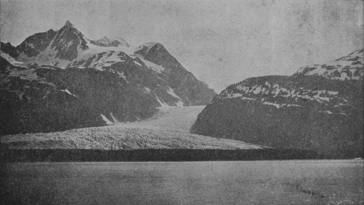 DAVIDSON GLACIER. CHILKAT INLET.
Thirty-four miles below the Big Salmon, west-north-west,
along a comparatively straight course,
carries the boatman to the Little Salmon, or Daly
River, where the valley is so broad that no mountains
are anywhere in sight, only lines of low hills at a
distance from the banks. Five miles below this river
the river makes an abrupt turn to the southwest
around Eagle's Nest rock, and 18½ miles beyond[59]
[60]
[61]
that reaches the Nordenskiold, a small, swift, clear-watered
tributary from the southwest. The rocks of
all this part of the river show thin seams of coal,
and gold has been found on several bars. The current
now flows nearly due north and a dozen miles
below the Nordenskiold carries one to the second
and last serious obstruction to navigation in the
Rink rapids, as Schwatka called them, or Five-finger,
as they are popularly known, referring to five
large masses of rock that stand like towers in mid
channel. These other islands back up the water and
render its currents strong and turbulent, but will
offer little opposition to a good steamboat. Boatmen
descending the river are advised to hug the
right bank, and a landing should be made twenty
yards above the rapids in any eddy, where a heavily
loaded boats should be lightened. The run should
be made close along the shore, and all bad water
ends when the Little Rink Rapids have been passed,
six miles below. Just below the rapids the small
Tatshun River comes in from the right. Then the
valley broadens out, the current quiets down and a
pleasing landscape greets the eye as bend after bend
is turned. A long washed bank on the northeast
side is called Hoo-che-koo Bluff, and soon after
passing it one finds himself in the midst of the pretty
Ingersoll archipelago, where the river widens out[62]
and wanders among hundreds of islets. Fifty-five
miles by the river below Rink Rapids, the confluence
of the Lewes and Pelly is reached, and the first sign
of civilization in the ruins of old Fort Selkirk, with
such recent and probably temporary occupation as
circumstances may cause. Before long, undoubtedly,
a flourishing permanent settlement will grow
up in this favorable situation.
The confluence here of the Lewes and Pelly rivers forms the Yukon, which thenceforth pursues an uninterrupted course of 1,650 miles to Behring Sea. The country about the confluence is low, with extensive terrace flats running back to the bases of rounded hills and ridges. The Yukon below the junction averages about one-quarter of a mile in width, and has an average depth of about 10 feet, with a surface velocity of 4¾ miles an hour. A good many gravel bars occur, but no shifting sand. The general course nearly to White River, 96 miles, is a little north of west, and many islands are seen; then the river turns to a nearly due north course, maintained at Fort Reliance. The White River is a powerful stream, plunging down loaded with silt, over ever shifting sand bars. Its upper source is problematical, but is probably in the Alaskan Mountains near the head of the Tenana and Forty-mile Creek.
For the next ten miles the river spreads out to more than a mile wide and becomes a maze of islands and bars, the main channel being along the western shore, where there is plenty of water. This brings one to Stewart river, which is the most important right-hand tributary between the Pelly and the Porcupine. It enters from the east in the middle of a wide valley, and half a mile above its mouth is 200 yards in width; the current is slow and the water dark colored. It has been followed to its headquarters in the main range of the Rockies, and several large branches, on some of which there are remarkable falls, have been traced to their sources through the forested and snowy hills where they rise. These sources are perhaps 200 miles from the mouth, but as none of the wanderers were equipped with either geographical knowledge or instruments nothing definite is known. Reports of traces of precious metals have been brought back from many points in the Stewart valley, but this information is as vague as the other thus far. All reports agree that a light draught steamboat could go to the head of the Stewart and bar up its feeders. There is a trading post at its mouth.
 VIEW FROM INDIAN CHURCH, LOOKING NORTHEAST.
The succeeding 125 miles holds what is at present
the most interesting and populous part of the
Yukon valley. The river varies from half to three-quarters[64]
of a mile wide and is full of islands. About
23 miles below Stewart River a large stream enters
from the west called Sixty-mile Creek by the miners,
who have had a small winter camp and trading store
there for some years, and have explored its course
for gold to its rise in the mountains west of the international
boundary. Every little tributary has been
named, among them (going up), Charley's Fork,
Edwards Creek and Hawley Creek, in Canada, and
then, on the American side of the line, Gold Creek,
Miller Creek and Bed Rock Creek. The sand and
gravel of all these have yielded fine gold and some
of them, as Miller Creek, have become noted for their
richness. Forty-four miles below Sixty-mile takes
one to Dawson City, at the mouth of Klondike River,—the
center of the highest productiveness and greatest
excitement during 1897, when the gold fields of
the interior of Alaska first attracted the attention
of the world. Leaving to another special chapter an
account of them, the itinerary may be completed by
saying that 6½ miles below the mouth of the Klondike
is Fort Reliance, an old private trading post of
no present importance. Twelve and a half miles
farther the Chan-din-du River enters from the east,
and 33½ below that in the mouth of Forty-mile
Creek, or Cone Hill River, which until the past year
was the most important mining region of the interior.[65]
[66]
[67]
It took its name from the supposition that it
was 40 miles from Fort Reliance, but the true distance
is 46 miles. On the south side of the outlet of
this stream is the old trading post and modern town
of Forty-Mile, and on the north side the more recent
settlement Cudahy. Both towns are, of course,
on the western bank of the Yukon, which is here
about half a mile wide. Five miles below Cudahy,
Coal Creek comes in from the east, and nearly
marks the Alaskan boundary, where a narrowed
part of the river admits one to United States territory.
Prominent landmarks here are two great
rocks, named by old timers Old Man rock, on the
west bank, and Old Woman, on the east bank, in
reference to Indian legends attached to them. Some
twenty miles west of the boundary—the river now
having turned nearly due west in its general course—Seventy-mile,
or Klevande Creek, comes in from
the south, and somewhat below it the Tat-on-duc
from the north. It was ascended in 1887 by Mr.
Ogilvie, who describes its lower valley as broad and
well timbered, but its upper part flows through a
series of magnificent cañons, one of which half a
mile long, is not more than 50 feet wide with vertical
walls fully 700 feet in height. There are said to be
warm sulphur springs along its course, and the Indians
regard it as one of the best hunting fields,[68]
sheep being especially numerous on the mountains
in which it heads, close by the international boundary,
where it is separated by only a narrow divide
from Ogilvie River, one of the head streams of the
Peel river, and also from the head of the Porcupine,
to which there is an Indian trail. Hence the miners
call this Sheep River. The rocks along this stream
are all sandstones, limestone and conglomerates,
with many thin calcite veins. Large and dense timber
prevails, and game is abundant.
Below the mouth of the Tat-on-duc several small streams enter, of which the Kandik on the north and the Kolto or Charley's River—at the mouth of which there used to be the home of an old Indian notability named Charley—are most important. About 160 miles from the boundary the Yukon flats are reached, and the center of another important mining district—that of Birch Creek and the Upper Tenana—at Circle City, the usual terminus of the trip up the Lower Yukon from St. Michael.
The sources of the Yukon are just within the northern boundary of British Columbia (Lat. 62 deg.) among a mass of mountains forming a part of the great uplift of the Coast range, continuous with the Sierras of California and the Puget Sound coast. Here spring the sources of the Stikeen, flowing southwest to the Pacific, of the Fraser, flowing south through British Columbia, and of the Liard flowing northeasterly to the Mackenzie. Headwaters of the Stikeen and Liard interlock, indeed, along an extensive or sinuous watershed having an elevation of 3,000 feet or less and extending east and west. There are, however, many wide and comparatively level bottom lands scattered throughout this region and numerous lakes. The coast ranges here have an average width of about eighty miles and border the continent as far north as Lynn Canal, where they trend inland behind the St. Elias Alps. Many of their peaks exceed 8,000 feet in height, but few districts have been explored west. Eastward of this mountain axis, and separated from it by the valleys of the Fraser and Columbia in the south and the Yukon northward, is the Continental[70] Divide, or Rocky Mountains proper, which is broken through (as noted above) by the Laird, but north of that cañon-bound river forms the watershed between the Liard and Yukon and between the Yukon and Mackenzie. These summits attain a height of 7,000 to 9,000 feet, and rise from a very complicated series of ranges extending northward to the Arctic Ocean, and very little explored. The valley of the Yukon, then, lies between the Rocky Mountains, separating its drainage basin from that of the Mackenzie, and the Coast range and St. Elias Alps separating it from the sea. Granite is the principal rock in both these great lines of watershed-uplift, and all the mountains show the effects of an extensive glaciation, and all the higher peaks still bear local remnants of the ancient ice-sheet.
The headwaters of the great river are gathered into three principal streams. First, the Lewes, easternmost, with its large tributaries, the Teslintoo and Big Salmon; second, the Pelly, with its great western tributary, the MacMillon.
 SCENE IN JUNEAU—MOUNTAINS AND INDIAN HOUSES.
The Lewes River has been described. It was
known to the fur traders as early as 1840, and the
Chilkat and Chilkoot passes were occasionally used
by their Indian couriers from that time on. The
gold fields in British Columbia from 1863 onwards[71]
[72]
[73]
stimulated prospecting in the northern and coastal
parts of that province, and in 1872 prospectors
reached the actual headwaters of the Lewes from the
south, but were probably not aware of it; and that
country was not scientifically examined until the reconnaissance
of Dr. G. M. Dawson in 1887. In 1866
Ketchum and La Barge, of the Western Union Telegraph
survey, ascended the Lewes as far as the
lakes still called Ketchum and La Barge. In 1883
Lieut. Frederick Schwatka, U. S. A., and an assistant
named Hayes, and several Indians, made their
way across from Taka inlet to the head of Tahgish
(a Tako) Lake, and descended the Lewes on a raft
to Fort Selkirk, studying and naming the valley.
From Fort Selkirk an entirely new route was followed
toward the mountains forming the divide between
the Yukon and the White and Copper rivers,
which flow to the Gulf of Alaska, north of Mt. St.
Elias. After discovering a pass little more than
5,000 feet high, they struck the Chityna River and
followed that to the Copper River and thence to the
coast. The Copper River Valley was thoroughly explored
somewhat later by Lieuts. Abercrombie and
Allen, U. S. A., who added greatly to knowledge
of that large river, which, however, seems to have
no good harbor at its mouth. The miners began to
use the Chilkoot Pass and the Lewes River route to[74]
the Yukon district in 1884. Some additions were
made to geography in this region by an exploring
expedition despatched to Alaska in 1890 by Frank
Leslie's Weekly, under Messrs. A. J. Wells, E. J.
Glave and A. B. Schanz. They entered by way of
Chilkat pass and came to a large lake at the head
of the Tah-keena tributary of the Lewes, which they
named Lake Arkell, though it was probably the
same earlier described by the Drs. Krause. Here
Mr. Glave left the party and striking across the coast
range southward discovered the headwaters of the
Alsekh and descended to Dry Bay. At Forty-mile
creek Mr. Wells and a party crossed over into the
basin of the Tanana and increased the knowledge of
that river. Mr. Schanz went down the Yukon
and explored the lower region. In 1892 Mr. Glave
again went to Alaska, demonstrated the possibility
of taking pack horses over the Chilkat trail, and
with an aid named Dalton made an extensive journey
southward along the crest of the watershed between
the Yukon valley and the coast.
Turning now to the Pelly, we find that this was the earliest avenue of discovery. The Pelly rises in lakes under the 62nd parallel, just over a divide from the Finlayson and Frances Lake, the head of the Frances River, the northern source of the Liard, and this region was entered by the Hudson Bay Company[75] as early as 1834, and gradually exploring the Laird River and its tributaries, in 1840 Robert Campbell crossed over the divide north of Lake Finlayson (at the head of the Frances), and discovered (at a place called Pelly Banks) a large river flowing northwest which he named Pelly. In 1843 he descended the river to its confluence with the Lewes (which he then named), and in 1848 he built a post for the H. B. Company at that point, calling it Fort Selkirk. This done, in 1850, Campbell floated down the river as far as the mouth of the Porcupine, where three years previously (1847) Fort Yukon had been established by Mr. Murray, who (founded by James Bell in 1842) crossed over from the mouth of the Mackenzie. The Yukon may thus be said to have been "discovered" at several points independently. The Russians, who knew it only at the mouth, called it Kwikhpak, after an Eskimo name. The English at Fort Yukon, learned that name from the Indians there, and the upper river was the Pelly. The English and Russian traders soon met, and when Campbell came down in 1850 the identity of the whole stream was established. The name Yukon gradually took the place of all others on English maps and is now recognized for the whole stream from the junction of the Lewes and Pelly to the delta.
The Yukon basin, east of the Alaskan boundary, is known in Canada as the Yukon district, and contains about 150,000 square miles. This is nearly equal to the area of France, is greater than that of the United Kingdom of Great Britain and Ireland by 71,000 square miles, and nearly three times bigger than that of the New England states. To this must be added an area of about 180,000 square miles, west of the boundary, drained by the Yukon upon its way to the sea through Alaska. Nevertheless, Dr. G. M. Dawson and other students of the matter are of the opinion that the river does not discharge as much water as does the Mackenzie—nor could it be expected to do so, since the drainage area of the Mackenzie is more than double that of the Yukon, while the average annual precipitation of rain over the two areas seems to be substantially similar. Remembering these figures and that the basin of the Mississippi has no less than 1,225,000 square miles as compared with the 330,000 square miles of the Yukon basin, it is plain that the statement often heard that the Yukon is next to the Mississippi in size, is greatly exaggerated. In fact, its proportions, from all points of view, are exceeded by those of the Nile, Ganges, St. Lawrence and several other rivers of considerably less importance than the Mississippi.
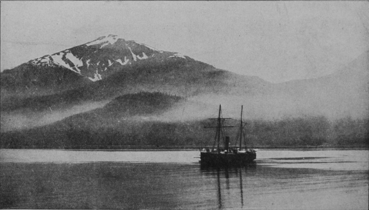 EARLY MORNING AT JUNEAU.
Resuming the historical outline, a short paragraph will suffice to complete the simple story down to the year 1896.
Robert Campbell had scarcely returned from his river voyage to his duties at Fort Selkirk, when he discovered that its location in the angle between the rivers was untenable, owing to ice-jams and floods. The station was therefore moved, in the season of 1852 across to the west bank of the Yukon, a short distance below the confluence, and new buildings were erected. These had scarcely been completed, when, on August 1st, a band of Chilkat Indians from the coast came down the river and early in the morning seized upon the post, surprising Mr. Campbell in bed, and ordered him to take his departure before night. They were not at all rough with him or his few men, but simply insisted that they depart, which they did, taking such personal luggage as they could put into a boat and starting down stream. The Indians then pillaged the place, and after feasting on all they could eat and appropriating what they could carry away, set fire to the remainder and burned the whole place to the ground. One chimney still stands to mark the spot, and others lie where they fell. This act was not dictated by wanton destructiveness on the part of the Chilkats—bad as they undoubtedly were and[80] are; but was in pursuance of a theory. The establishment of the post there interfered with the monopoly of trade that they had enjoyed theretofore, with all the Indians of the interior, to whom they brought salable goods from the coast, taking in exchange furs, copper, etc., at an exorbitant profit, which they enforced by their superior brutality. The Hudson Bay Company was robbing them of this, hence the demolition of the post, which was too remote to be profitably sustained against such opposition.
A little way down the river, Mr. Campbell met a fleet of boats bringing up his season's goods, and many friendly Indians. These were eager to pursue the robbers, but Campbell thought it best not to do so. He turned the supply-boats back to Fort Yukon and led his own men up the Pelly and over the pass to the Frances and so down the Liard to Fort Simpson, on the Mackenzie. Such is the story of the ruins of Fort Selkirk. Fort Yukon flourished as the only trading post until the purchase of Alaska by the United States, when Captain Raymond, an army officer, was sent to inform the factor there that his post was on United States territory, and require him to leave. He did so as soon as Rampart House could be built to take its place up the Porcupine. Old Fort Yukon then fell into ruins, and Rampart House itself was soon abandoned. In 1873 an opposition[81] appeared in the independent trading house of Harper & McQuestion, men who had come into the country from the south, after long experience in the fur trade. They had posts at various points, occupied Fort Reliance for several years, and in 1886 established a post at the mouth of the Stewart River for the miners who had begun to gather there two years before. Many maps mark "Reed's House" as a point on the upper Stewart, but no such a trading-post ever existed there, although there was a fishing station and shelter-hut on one of its upper branches at an early day. This firm became the representatives of the Alaska Commercial Company (a San Francisco corporation) and opened a store in 1887 at Forty Mile, where they still do business.
Gold Discoveries.—The presence of fine float gold in river sands was early discovered by the Hudson Bay Company men, but in accordance with the former policy of that company, no mining was done and as little said about it as possible. The richness of the Cassiar mines led to some prospecting northward as early as 1872, and by 1880 wandering gold hunters had penetrated to the Testintos, where for several years $8 to $10 a day of fine gold was sluiced out during the season by the small colony. In 1886 Cassiar Bar, on the Lewes, below there, was opened, and a party of four took out[82] $6,000 in 30 days, while other neighboring bars yielded fair wages. By that time Stewart River was becoming attractive, and many miners worked placers there profitably in 1885, '86 and '87. During the fall of 1886 three or four men took the engines out of the little steamboat "New Racket," which was laid up for the winter there, and used them to drive a set of pumps lifting water into sluice-boxes; and with this crude machinery each man cleared $1,000 in less than a month. A judicious estimate is, that the Stewart River placers yielded $100,000 in 1885 and '86.
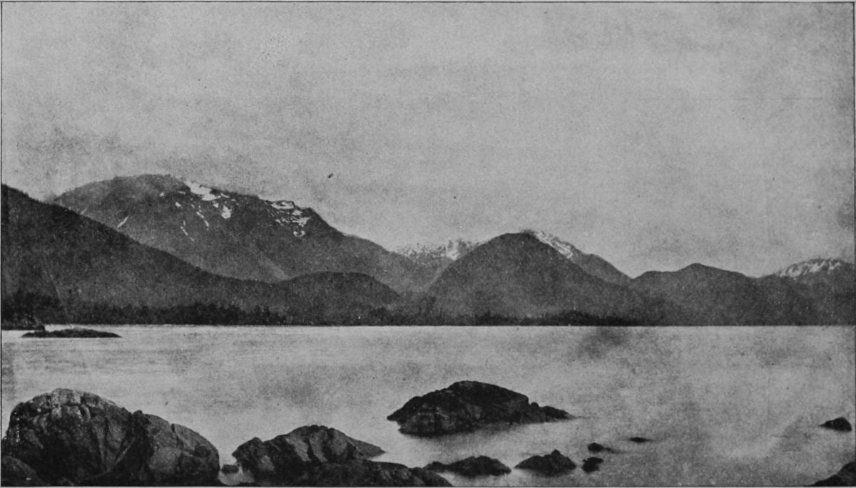 HARBOR OF SITKA.
Prospecting went on unremittingly, but nothing
else was found of promise until 1886, when coarse
gold was reported upon Forty Mile Creek, or the
Shitando River, as it was known to the Indians, and
a local rush took place to its cañons, the principal
attraction being Franklin Gulch, named after its discoverer.
Three or four hundred men gathered there
by the season of 1887, and all did well. This stream
is a "bed-rock" creek,—that is, one in the bed of
which there is very little drift; and in many places
the bed-rock was scraped with knives to get the little
loose stuff out of crannies. Some nuggets were
found. At its mouth are extensive bars along the
Yukon, which carry gold throughout their depth.
During 1888 the season was very unfavorable and[83]
[84]
[85]
not much accomplished. Sixty Mile Creek was
brought to notice, and Miller Gulch proved richer
than usual. It is one of the headwaters of Sixty
Mile, and some 70 miles from the mouth of the
river where, in 1892, a trading store, saw-mill and
little wintering-town was begun. Miller Creek is
about 7 miles long, and its valley is filled with vast
deposits of auriferous drift. In 1892 rich strikes
were made and 125 miners gathered there, paying
$10 a day for help, and many making fortunes. One
clean-up of 1,100 ounces was reported. Glacier
Creek, a neighboring stream, exhibited equal
chances and drew many claimants, some of whom
migrated thither in mid-winter, drawing their sleds
through the woods and rocks with the mercury 30
degrees below zero. All of these gulches and other
golden headwaters on both Forty Mile and Sixty
Mile Creek, are west of the boundary in Alaska; but
the mouths of the main streams and supply points
are in Canadian territory. In all, the great obstacle
is the difficulty of getting water up on the
bars without expensive machinery; and the same is
true of the rich gravel along the banks of the Yukon
itself. Birch Creek was the next find of importance,
and was promising enough to draw the larger
part of the local population, which by this time had
been considerably increased, for the news of the richness[86]
of the Forty Mile gulches had reached the outside
world and attracted adventurous men and not
a few women from the coast not only, but from
British Columbia and the United States. A rival to
Harper & McQuestion, agents of the Alaska Commercial
Company, appeared in the North American
Transportation and Trading Company, which increased
the transportation service on the Yukon
River, by which most of the new arrivals entered,
and by establishing large competitive stores at Fort
Cudahy (Forty Mile) and elsewhere reduced the
price of food and other necessaries. About this
time, also, the Canadian government sent law officers
and a detachment of mounted police, so that
the Yukon District began to take a recognized place
in the world.
Birch Creek is really a large river rising in the Iauana Hills, just west of the boundary and flowing northwest, parallel with the Yukon, to a debouchment some 20 miles west of Fort Yukon. Between the two rivers lie the "Yukon Flats," and at one point they are separated by only six miles. Here, at the Yukon end of the road arose Circle City, so-called from its proximity to the Arctic Circle. This is an orderly little town of regular streets, and has a recorder of claims, a store, etc.
Birch Creek has been thoroughly explored, and[87] in 1894 yielded good results. The gold was in coarse flakes and nuggets, so that $40 a day was made by some men, while all did well. The drift is not as deep here as in most other streams, and water can be applied more easily and copiously,—a vast advantage. Molymute, Crooked, Independence, Mastadon and Preacher creeks are the most noteworthy tributaries of this rich field.
The Koyukuk River, which flows from the borders of the Arctic Ocean, gathering many mountain tributaries, to enter the Yukon at Nulato, was also prospected in 1892, '93 and '94, and indications of good placers have been discovered there, but the northerly, exposed and remote situation has caused them to receive little attention thus far.
During the autumn of 1896 several men and women,
none of whom were "old miners," discouraged
by poor results lower down the river resolved to
try prospecting in the Klondike gulch. They were
laughed at and argued with; were told that prospectors
years ago had been all over that valley, and
found only the despised "flour gold," which was too
fine to pay for washing it out. Nevertheless they
persisted and went at work. Only a short time
elapsed, when, on one of the lower southside
branches of the stream they found pockets of flakes
and nuggets of gold far richer than anything Alaska
had ever shown before. They named the stream
Bonanza, and a small tributary El Dorado. Others
came and nearly everyone succeeded. Before spring
nearly a ton and a half of gold had been taken from
the frozen ground. Nuggets weighing a pound
(troy) were found. A thousand dollars a day was
sometimes saved despite the rudeness of the methods,
but these things happened where pockets were
struck. Probably the total clean-up from January
to June was not less than $1,500,000. The report[89]
[90]
[91]
spread and all those in the interior of Alaska concentrated
there, where a "camp" of tents and shanties
soon sprang up at the mouth of the Klondike
called Dawson City. A correspondent of the New
York Sun describes it as beautifully situated, and
a very quiet, orderly town, due to the strict supervision
of the Canadian mounted police, who allowed
no pistols to be carried, but a great place for gambling
with high stakes. It bids fair to become the
mining metropolis of the northwest, and had about
3,000 inhabitants before the advance-guard of the
present "rush" reached there.
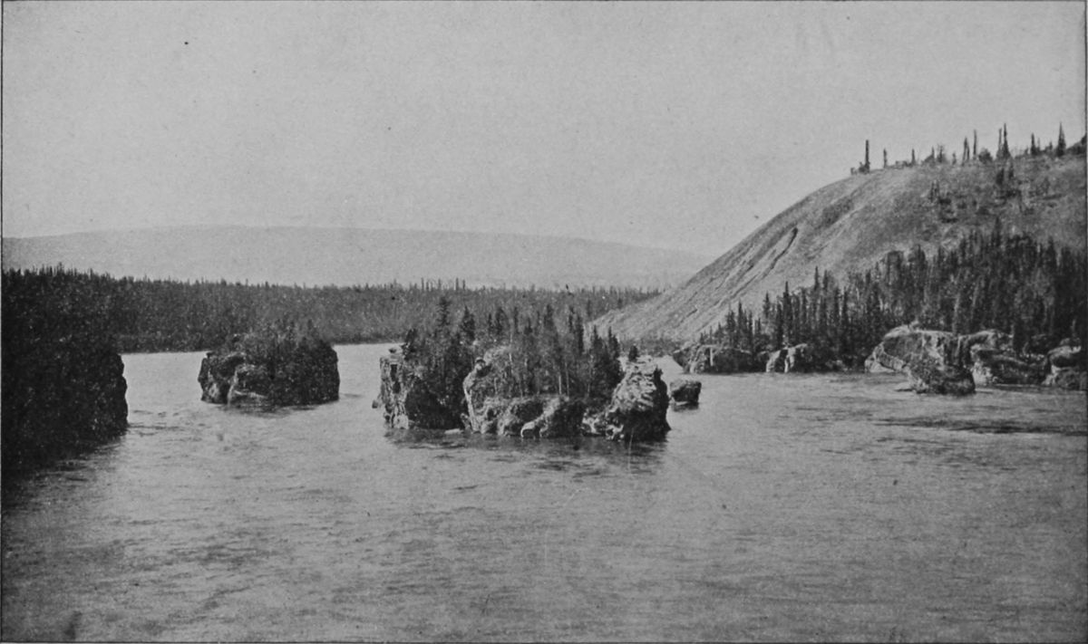 FIVE FINGER RAPIDS, YUKON RIVER.
Hundreds of claims were staked out and worked in all the little gulches opening along Bonanza, Eldorado, Hunker, Bear and other tributaries of the Klondike, and of Indian River, a stream thirty miles south of it, and a greater number seem to be of equal richness with those first worked. All this is within a radius south and east of 20 miles from Dawson City, and most of it far nearer. The country is rough, wooded hills, and the same trouble as to water is met there as elsewhere, yet riches were obtained by many men in a few weeks without exhausting their claims.
So remote and shut in has this region been in the winter that no word of this leaked out until the river opened and a party of successful miners came[92] down to the coast and took passage on the steamer Excelsior for San Francisco. They arrived on July 14, and no one suspected that there was anything extraordinary in the passenger list or cargo, until a procession of weather beaten men began a march to the Selby Smelting works, and there began to open sacks of dust and nuggets, until the heap made something not seen in San Francisco since the days of '49. The news flashed over the world, and aroused a fire of interest; and when three days later the Portland came into Seattle, bringing other miners and over $1,000,000 in gold, there was a rush to go north which bids fair to continue for months to come, for one of the articles of faith in the creed of the Yukon miner is that many other gulches will be found as rich as these. One elderly man, who went in late last fall and with partners took four claims on Eldorado Creek, told a reporter that his pickings had amounted to $112,000, and that he was confident that the ground left was worth $2,000,000 more. "I want to say," he exclaims, "that I believe there is gold in every creek in Alaska. Certain on the Klondike the claims are not spotted. One seems to be as good as another. It's gold, gold, gold, all over. It's yards wide and deep. All you have to do is to run a hole down."
One might go on quoting such rhapsodies, arising[93] from success, to end of the book, but it is needless, for every newspaper has been full of them for a month.
One man and his wife got $135,000; another, formerly a steamboat deck-hand, $150,000; another, $115,000; a score or more over $50,000, and so on. These sums were savings after having the heavy expenses of the winter, and most of them had dug out only a small part of their ground.
It is curious in view of this success to read the only descriptive note the present writer can discover in early writings as to this gold river. It occurs in Ogilvie's report of his explorations of 1887, and is as follows: "Six and a half miles above Reliance the Tou-Dac River of the Indians (Deer River of Schwatka) enter from the east. It is a small river about 40 yards wide at the mouth and shallow; the water is clear and transparent and of a beautiful blue color. The Indians catch great numbers of salmon here. A miner had prospected up this river for an estimated distance of 40 miles in the season of 1887. I did not see him."
in the Klondike region and elsewhere along the Yukon are different from those pursued elsewhere, owing to the fact that from a point about three feet below the surface the ground is permanently frozen. The early men tried to strip off the gravel down to the gold lying in its lower levels or beneath it, upon the bed rock, and found it exceedingly slow and laborious work; moreover, it was only during the short summer that any work could be done. Now, by the aid of fires they sink shafts and then tunnel along the bed rock where the gold lies. A returned miner described the process as follows, pointing out the great advantage of being able to work under ground during the winter:
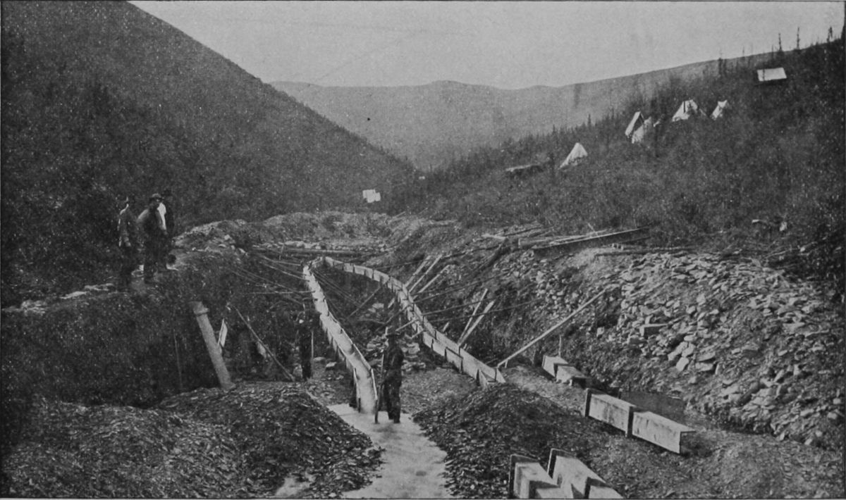 PLACER MINE, CLAIM No. 3, ON MILLER CREEK.
"The miners build fires over the area where they
wish to work and keep these lighted over that territory
for the space of twenty-four hours. Then the
gravel will be melted and softened to a depth of perhaps
six inches. This is then taken off and other
fires are built until the gold bearing layer is reached.
When the shaft is down that far other fires are built
at the bottom, against the sides of the layer and tunnels
made in the same manner. Blasting will do[95]
[96]
[97]
no good, the charge not cracking off but blowing
out of the hole. The matter taken out, and containing
the gold is piled up until spring, when the torrents
come down, and is panned and cradled by
these. It is certainly very hard labor."
Another quotation may be given as a practical example of this process:
"The gold so far as has been taken from Bonanza and Eldorado, both well named, for the richness of the placers are truly marvelous. Eldorado, thirty miles long, is staked the whole length and as far as worked has paid.
"One of our passengers, who is taking home $100,000 with him, has worked one hundred feet of his ground and refused $200,000 for the remainder, and confidently expects to clean up $400,000 and more. He has in a bottle $212 from one pan of dirt. His pay dirt while being washed averaged $250 an hour to each man shoveling in. Two others of our miners who worked their own claim cleaned up $6,000 from one day's washing.
"There is about fifteen feet of dirt above bed rock, the pay streak averaging from four to six feet, which is tunnelled out while the ground is frozen. Of course, the ground taken out is thawed by building fires, and when the thaw comes and water rushes in they set their sluices and wash the dirt. Two of[98] our fellows thought a small bird in the hand worth a large one in the bush, and sold their claims for $45,000, getting $4,500 down, and the remainder to be paid in monthly installments of $10,000 each. The purchasers had no more than $5,000 paid. They were twenty days thawing and getting out dirt. Then there was no water to sluice with, but one fellow made a rocker, and in ten days took out the $10,000 for the first installment. So, tunnelling and rocking, they took out $40,000 before there was water to sluice with."
Commissioner Hermann, of the General Land Office, has announced that the following laws of the United States extend over Alaska, where the general land laws do not apply:
First—The mineral land laws of the United States.
Second—Town-site laws, which provide for the incorporation of town-sites and acquirement of title thereto from the United States Government by the town-site trustees.
Third—The laws providing for trade and manufactures, giving each qualified person 160 acres of land in a square and compact form.
The coal land regulations are distinct from the mineral regulations or laws, and as in the case of the general land laws Alaska is expressly exempt from this jurisdiction.
On the part of Canada, however, the provisions of the Real Property act of the Northwest Territories will be extended to the Yukon country by an order in council, a register will be appointed, and a land title office will be established.
The act approved May 17, 1884, providing a civil government for Alaska, has this language as to mines and mining privileges:
"The laws of the United States relating to mining claims and rights incidental thereto shall, on and after the passage of this act, be in full force and effect in said district of Alaska, subject to such regulations as may be made by the Secretary of the Interior and approved by the President," and "parties who have located mines or mining privileges therein, under the United States laws applicable to the public domain, or have occupied or improved or exercised acts of ownership over such claims, shall not be disturbed therein, but shall be allowed to perfect title by payment so provided for."
There is still more general authority. Without the special authority, the act of July 4, 1866, says: "All valuable mineral deposits in lands belonging to the United States, both surveyed and unsurveyed, are hereby declared to be free and open to exploration and purchase, and lands in which these are found to occupation and purchase by citizens of the United States and by those who have declared an intention to become such, under the rules prescribed by law and according to local customs or rules of miners in the several mining districts, so far as the same are applicable and not inconsistent with the laws of the United States."
The patenting of mineral lands in Alaska is not a new thing, for that work has been going on, as the cases have come in from time to time, since 1884.
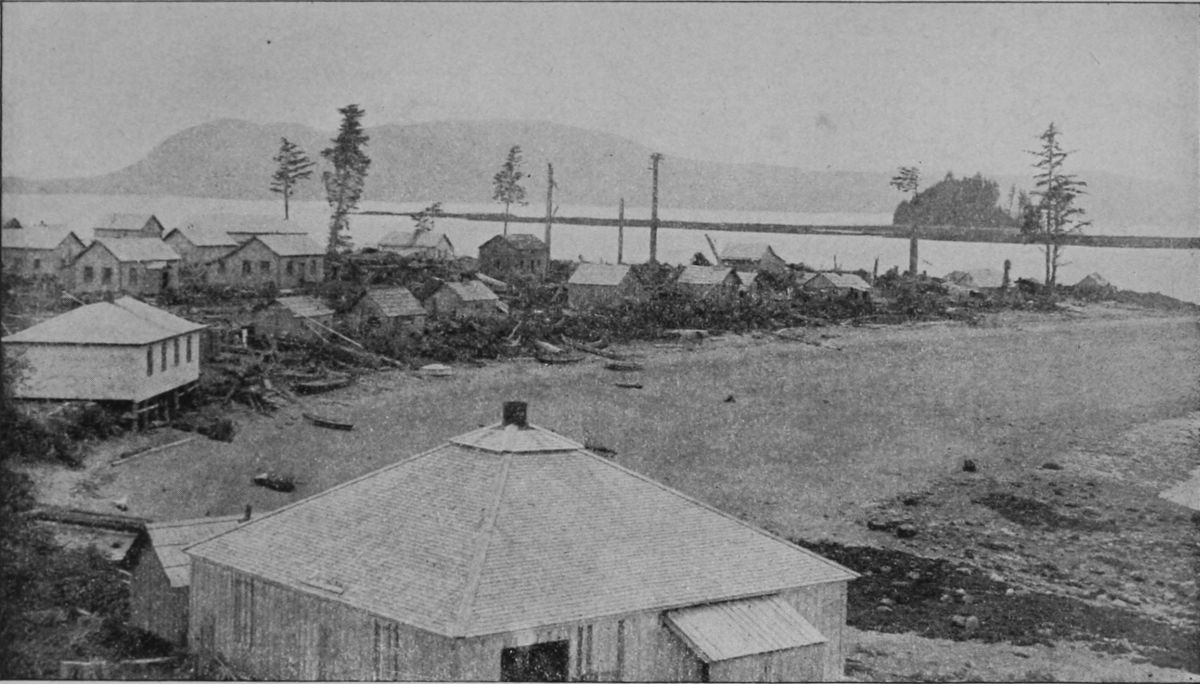 THE POINT AND BEACH AT METLAKAHTLA.
One of the difficulties that local capitalists find in
their negotiations for purchase of mining properties
on the Yukon is the lack of authenticated records
of owners of claims. Different practices prevail on
the two sides of the line and cause more or less confusion.
The practice has been at most of the new
camps to call a miners' meeting at which one of the
parties was elected recorder, and he proceeded to
enter the bearings of stakes and natural marks to
define claims. Sometimes the recorder would give[101]
[102]
[103]
a receipt for a fee allowed by common consent for
recording, and also keep a copy for future reference,
but in a majority of cases even this formality was
dispensed with, and the only record kept was the
rough minutes made at the time.
On the Canadian side a different state of affairs exists. The Dominion Government has sent a commissioner who is empowered to report officially all claims, and while no certificate is issued to the owners thereof, properties are thoroughly defined and their metes and bounds established. The commissioner in the Klondike district, whose name is Constantine, also exercises semi-judicial functions, and settles disputes to the best of his ability, appeal lying to the Ottawa Government.
As to courts and the execution of civil and criminal law generally, none were existent in the upper Yukon Valley on the American side of the line during 1897. The nearest United States judge was at Sitka. At Circle City and other centers of population the people had organized into a sort of town-meeting for the few public matters required; and a sort of vigilance committee took the place of constituted authority and police. As a matter of fact, however, the people were quiet and law-abiding and little need for the machinery of law is likely to arise before courts, etc., are set up. A movement toward sending[104] a garrison of United States troops thither was vetoed by the War Department.
Canada, however, awoke to the realization that her interests were in jeopardy, and took early steps to profit by the wealth which had been discovered within her borders and the international business that resulted. The natural feeling among the Canadians was, and is, that the property belongs to the Canadian public, and that no good reason exists why the mineral and other wealth should be exhausted at once, mainly by outsiders, as has largely happened in the case of Canada's forests. A prohibitory policy was urged by some, but this seemed neither wise nor practicable; and the Dominion Government set at work to save as large a share as it could. As there are gold fields on the Alaska side of the line, and the approaches lie through United States territory, a spirit of reciprocal accommodation was necessary. One difficulty has been averted last spring by President Cleveland's veto of the Immigration bill, one provision of which would have prevented Canadian laborers drawing wages in this country, and probably would have provoked a retaliatory act.
Canada has already placed customs officers on the passes and at the Yukon crossing of the boundary to collect customs duties not only on merchandise[105] but on miner's personal outfits. There is practically no exception, and the duty comes below 20 per cent. on but few articles. On most of the goods the duty is from 30 to 35 per cent., and in several instances higher, but the matter may be very simply adjusted by purchasing tools and outfits in Victoria or Vancouver, for thus far the United States has placed no corresponding obstruction in the way of Canadian travellers to the gold-fields, but, on the contrary, has made Dyea a sub-port of entry, largely to accommodate British transportation lines. The Canadian Government is represented in that region now only by customs officers and 20 mounted police, but it is taking steps to garrison the whole upper Yukon Valley with its mounted police,—a body of officers, whose functions are half military, half civil, and which, it may as well be conceded once for all, cannot be trifled with. There is no question but that they will do their level best to enforce the laws to the utmost. The commander of each detachment will be constituted a magistrate of limited powers, so that civil examinations and trials may be speedily conducted.
The plan is to erect a strong post a short distance north of the sixtieth degree of latitude, just above the northern boundary of British Columbia, and beyond the head of the Lynn Canal, where the Chilkoot[106] Pass and the White Pass converge. This post will command the southern entrance to the whole of that territory. Further on small police posts will be established, about fifty miles apart, down to Fort Selkirk, while another general post will patrol the river near the international boundary, with headquarters, probably, in the Klondike valley.
The mining regulations of Canada, applying to the Yukon placer claims, are as follows:
"Bar diggings" shall mean any part of a river
over which water extends when the water is in its
flooded state and which is not covered at low water.
"Mines on benches" shall be known as bench diggings,
and shall for the purpose of defining the size
of such claims be excepted from dry diggings. "Dry
diggings" shall mean any mine over which a river
never extends. "Miner" shall mean a male or female
over the age of eighteen, but not under that
age. "Claims" shall mean the personal right of
property in a placer mine or diggings during the
time for which the grant of such mine or diggings
is made. "Legal post" shall mean a stake standing
not less than four feet above the ground and squared
on four sides for at least one foot from the top.
"Close season" shall mean the period of the year
during which placer mining is generally suspended.
The period to be fixed by the gold commissioner[107]
[108]
[109]
in whose district the claim is situated. "Locality"
shall mean the territory along a river (tributary of
the Yukon) and its affluents. "Mineral" shall include
all minerals whatsoever other than coal.
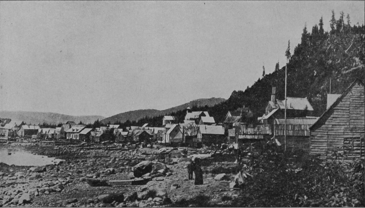 FORT WRANGELL.
1. Bar diggings. A strip of land 100 feet wide at highwater mark and thence extending along the river to its lowest water level.
2. The sides of a claim for bar diggings shall be two parallel lines run as nearly as possible at right angles to the stream, and shall be marked by four legal posts, one at each end of the claim at or about high water mark; also one at each end of the claim at or about the edge of the water. One of the posts shall be legibly marked with the name of the miner and the date upon which the claim is staked.
3. Dry diggings shall be 100 feet square and shall have placed at each of its four corners a legal post, upon one of which shall be legibly marked the name of the miner and the date upon the claim was staked.
4. Creek and river claims shall be 500 feet long, measured in the direction of the mineral course of the stream, and shall extend in width from base to base of the hill or bench on each side, but when the hills or benches are less than 100 feet apart the claim may be 100 feet in depth. The sides of a claim shall be two parallel lines run as nearly as[110] possible at right angles to the stream. The sides shall be marked with legal posts at or about the edge of the water and at the rear boundary of the claim. One of the legal posts at the stream shall be legibly marked with the name of the miner and the date upon which the claim was staked.
5. Bench claims shall be 100 feet square.
6. In defining the size of claims they shall be measured horizontally, irrespective of inequalities on the surface of the ground.
7. If any person or persons shall discover a new mine and such discovery shall be established to the satisfaction of the gold commissioner, a claim for the bar diggings 750 feet in length may be granted. A new stratum of auriferous earth or gravel situated in a locality where the claims are abandoned shall for this purpose be deemed a new mine, although the same locality shall have previously been worked at a different level.
8. The forms of application for a grant for placer mining and the grant of the same shall be according to those made, provided or supplied by the gold commissioner.
9. A claim shall be recorded with the gold commissioner in whose district it is situated within three days after the location thereof if it is located within ten miles of the commissioner's office. One day[111] extra shall be allowed for making such record for every additional ten miles and fraction thereof.
10. In the event of the absence of the gold commissioner from his office for entry a claim may be granted by any person whom he may appoint to perform his duties in his absence.
11. Entry shall not be granted for a claim which has not been staked by the applicant in person in the manner specified in these resolutions. An affidavit that the claim was staked out by the applicant shall be embodied in the application.
12. An entry fee of $15 shall be charged the first year and an annual fee of $100 for each of the following years.
13. After recording a claim the removal of any post by the holder thereof or any person acting in his behalf for the purpose of changing the boundaries of his claim shall act as a forfeiture of the claim.
14. The entry of every holder for a grant for placer mining must be renewed and his receipt relinquished and replaced every year, the entry fee being paid each year.
15. No miner shall receive a grant for more than one mining claim in the same locality; but the same miner may hold any number of claims by purchase, and any number of miners may unite to work their[112] claims in common upon such terms as they may arrange, provided such agreement be registered with the Gold Commissioner and a fee of $15 for each registration.
16. And miner may sell, mortgage, or dispose of his claims, provided such disposal be registered with and a fee of $5 paid to the Gold Commissioner.
17. Every miner shall, during the continuance of his grant, have the exclusive right of entry upon his own claim for the miner-like working thereof, and the construction of a residence thereon, and shall be entitled exclusively to all the proceeds realized therefrom; but he shall have no surface rights therein, and the Gold Commissioner may grant to the holders of adjacent claims such rights of entry thereon as may be absolutely necessary for the working of their claims, upon such terms as may to him seem reasonable. He may also grant permits to miners to cut timber thereon for their own use, upon payment of the dues prescribed by the regulation in that behalf.
18. Every miner shall be entitled to the use of so much of the water naturally flowing through or past his claim, and not already lawfully appropriated as shall in the opinion of the Gold Commissioner be necessary for the due working thereof, and shall be entitled to drain his own claim free of charge.
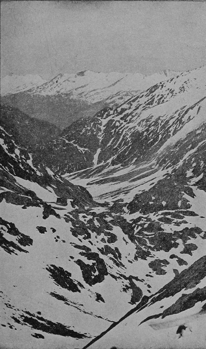 CHILKOOT PASS.
19. A claim shall be deemed to be abandoned and open to occupation and entry by any person when the same shall have remained unworked on working days by the guarantee thereof or by some person in his behalf for the space of seventy-two hours unless sickness or some other reasonable cause may be shown to the satisfaction of the Gold Commissioner, or unless the guarantee is absent on leave given by the commissioner, and the Gold Commissioner, upon obtaining satisfactory evidence that this provision is not being complied with, may cancel the entry given in the claim.
20. If the land upon which a claim has been located is not the property of the Crown it will be necessary for the person who applies for entry to furnish proof that he has acquired from the owner of the land the surface right before entry can be granted.
21. If the occupier of the lands has not received a patent thereof the purchase money of the surface rights must be paid to the Crown and a patent of the surface rights will issue to the party who acquired the mining rights. The money so collected will either be refunded to the occupier of the land when he is entitled to a patent there or will be credited to him on account of payment of land.
22. When the party obtaining the mining rights[116] cannot make an arrangement with the owner thereof for the acquisition of the surface rights it shall be lawful for him to give notice to the owner or his agents or the occupier to appoint an arbitrator to act with another arbitrator named by him in order to award the amount of compensation to which the owner or occupier shall be entitled.
The royalty and reserve additions to this, made since the recent discoveries and on account of them, are as follows:
1. A royalty of 10 per cent will be collected for the government on all amounts taken out of any one claim up to $500 a week, and after that 20 per cent. This royalty will be collected on gold taken from streams already being worked, but in regard to all future discoveries the government proposes
2. That upon every river and creek where mining locations shall be staked out every alternate claim shall be the property of the government.
These regulations, say the Canadians, are made with the purpose of developing a country, which, as elsewhere shown in this pamphlet, is capable of supporting a large permanent population and varied industries. Whether they can be enforced remains to be seen, and difficulties will certainly attend the collection of a royalty on gold-dust. The effect of these regulations, it is believed by the authors, will[117] be to encourage permanent settlement and the treatment of mining as a regular industry and not simply as an adventurous speculation. Another effect, undoubtedly, will be to cause immigrants, including Canadians themselves, to prospect and mine on the United States side of the line, whenever they have an equal opportunity for success.
The boundary dispute does not as yet seriously affect the question or rights and privileges in the new gold regions, as the disputed part of the line, southeast of Alaska, runs through a region not yet occupied, and practically the whole of Lynn Canal is administered by the United States, and the Canadians act as though it were decided that their boundary was farther inland than some of them pretend. From Mt. St. Elias north, the 141st meridian is the undisputed boundary, and this has been fixed by an international commission, crossing the Yukon at a marked point near the mouth of Forty Mile Creek. Nearly or quite all of the diggings upon which are written Alaskan territory, as also are the valuable placers on Birch and Miller creeks. It will be a matter of extreme difficulty along this part of the boundary to prevent smuggling, to discover and collect Canadian royalties, and to capture criminals except by international coöperation.
The Weather Bureau has made public a statement in regard to the climate of Alaska, which says: "The climates of the coast and the interior of Alaska are unlike in many respects, and the differences are intensified in this as perhaps in few other countries by exceptional physical conditions. The fringe of islands that separates the mainland from the Pacific Ocean from Dixon Sound north, and also a strip of the mainland for possibly twenty miles back from the sea, following the sweep of the coast as it curves to the northwestward to the western extremity of Alaska form a distinct climatic division which may be termed temperate Alaska. The temperature rarely falls to zero; winter does not set in until Dec. 1, and by the last of May the snow has disappeared except on the mountains.
"The mean winter temperature of Sitka is 32.5, but little less than that of Washington, D. C. The rainfall of temperate Alaska is notorious the world over, not only as regards the quantity, but also as to the manner of its falling, viz.: in long and incessant rains and drizzles. Cloud and fog naturally abound, there being on an average but sixty-six clear days in the year.[119]
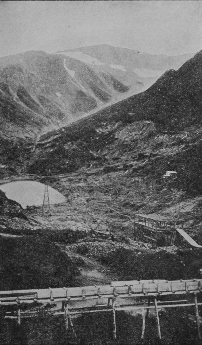 GENERAL VIEW OF SILVER BOW BASIN, NEAR JUNEAU.
"North of the Aleutian Islands the coast climate becomes more rigorous in winter, but in summer the difference is much less marked.
"The climate of the interior is one of extreme rigor in winter, with a brief but relatively hot summer, especially when the sky is free from cloud.
"In the Klondike region in midwinter the sun rises from 9:30 to 10 a. m., and sets from 2 to 3 p. m., the total length of daylight being about four hours. Remembering that the sun rises but a few degrees above the horizon and that it is wholly obscured on a great many days, the character of the winter months may easily be imagined.
"We are indebted to the United States coast and geodetic survey for a series of six months' observations on the Yukon, not far from the site of the present gold discoveries. The observations were made with standard instruments, and are wholly reliable. The mean temperatures of the months October, 1889, to April, 1890, both inclusive, are as follows: October, 33 degrees; November, 8 degrees; December, 11 degrees, below zero; January, 17 below zero; February, 15 below zero; March, 6 above; April 20 above. The daily mean temperature fell and remained below the freezing point (32 degrees) from Nov. 4, 1889, to April 21, 1890, thus giving 168 days as the length of the closed season of 1889-'90,[122] assuming that outdoor operations are controlled by temperature only. The lowest temperatures registered during the winter were: Thirty-two degrees below zero in November, 47 below in December, 59 below in January, 55 below in February, 45 below in March, and 26 below in April.
"The greatest continuous cold occurred in February, 1890, when the daily mean for five consecutive days was 47 degrees below zero.
"Greater cold than that here noted has been experienced in the United States for a very short time, but never has it continued so very cold for so long a time as in the interior of Alaska. The winter sets in as early as September, when snow-storms may be expected in the mountains and passes. Headway during one of those storms is impossible, and the traveler who is overtaken by one of them is indeed fortunate if he escapes with his life. Snowstorms of great severity may occur in any month from September to May, inclusive.
"The changes of temperature from winter to summer are rapid, owing to the great increase in the length of the day. In May the sun rises at about 3 a. m. and sets about 9 p. m. In June it rises about half past 1 in the morning, and sets at about half past 10, giving about twenty hours of daylight and diffuse twilight the remainder of the time.
"The mean summer temperature in the interior doubtless ranges between 60 and 70 degrees, according to elevation, being highest in the middle and lower Yukon valleys."
Accurate data of the temperature in the Klondike district were kept at Fort Constantine last year. The temperature first touched zero Nov. 10, and the zero weather recorded in the spring was on April 29.
Between Dec. 19 and Feb. 6 it never rose above zero. The lowest actual point, 65 below, occurred on Jan. 27, and on twenty-four days during the winter the temperature was below 50.
On March 12 it first rose above the freezing point, but no continuous mild weather occurred until May 4, after which date the temperature during the balance of the month frequently rose above 60 degrees.
The Yukon River froze up on Oct. 28 and broke up on May 17.
The long and severe winter and the frozen moss-covered ground are serious obstacles to agriculture and stock raising. The former can change but little with coming seasons, but the latter, by gradually burning off areas, can be overcome to some extent. On such burned tracts hardy vegetables have been and may be raised, and the area open to such use[124] is considerable. Potatoes do well and barley will mature a fair crop.
Live stock may be kept by providing an abundance of shelter and feed and housing them during the winter. In summer an abundance of the finest grass pasture can be had, and great quantities of natural hay can be cut in various places.
Diseases: In spite of all that is heard in the newspapers regarding the healthfulness of the climate of Alaska and the upper Yukon, the Census Report of Alaska offers its incontestable statistics to the effect that the country is not more salubrious, nor its people more healthy than could be expected in a region of violent climate, where the most ordinary laws of health remain almost totally ignored. From the Government Report we quote the following:
"Those diseases which are most fatal to life in one
section of Alaska seem to be applicable to all others.
In the first place, the native children receive little
or no care, and for the first few years of their lives
are more often naked than clothed, at all seasons of
the year. Consumption is the simple and comprehensive
title for the disease which destroys the
greater number of the people of Alaska. Aluet, Indian
and Eskimo suffer from it alike; and all alike
exhibit the same stolid indifference to its slow and[125]
[126]
[127]
fatal progress, make no attempt to ward it off, take
no special precautions even when the disease reaches
its climax.
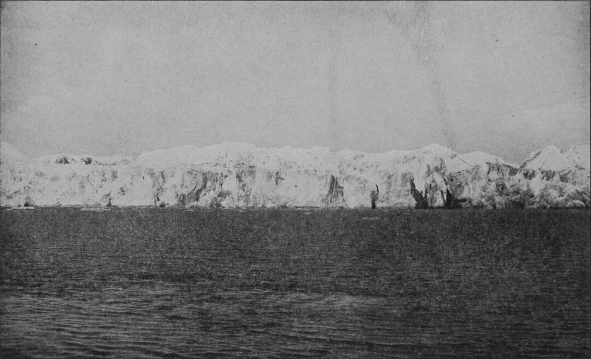 MUIR GLACIER (MIDDLE PORTION).
Next to consumption, the scrofulous diseases, in the forms of ulcers, eat into the vitals and destroy them until the natives have the appearance of lepers to unaccustomed eyes. As a consequence of their neglect and the exigencies of the native life, forty or fifty years is counted among them as comparatively great age, and none are without the ophthalmic diseases necessarily attendant on existence in smoky barabaras. Against snow-blindness the Eskimo people use peculiar goggles, but by far the greater evil, the smoke poisoning of the opthalmic nerve is neither overcome nor prevented by any of them. All traders carry medicine chests and do what they can to relieve suffering, but it requires a great deal of medicine to make an impression on the native constitution, doses being about four times what would suffice an Englishman or American.
Houses.—Almost every item has been taken into consideration by the prospectors starting out to face an Alaskan winter except the item of shelter when they shall have put their boats in winter dock. The result will be that many hundreds will find themselves in the bleak region with plenty of money and victuals, but insufficient protection from the cold weather. From accounts that have come from Alaska and British Columbia, there are more men there skilled in digging and bookkeeping than in carpentry, and more picks and shovels than axes and planes. With the arrival of parties that have lately gone to the headwaters of the Yukon, there will necessarily be an immense demand for houses, for without them the miners will freeze. This matter is beginning to receive attention in San Francisco and Seattle, and preparations are now under way to provide gold seekers with houses.
Within a week negotiations have been conducted
between parties in San Francisco and this city for
the shipment of entire houses to the gold regions.
The houses will be constructed in sections,
so that they may be carried easily in boats up the
Yukon or packed on sleds and carried through the
rough country in baggage trains. A New York[129]
[130]
[131]
firm which makes a specialty of such houses has received
orders for as many as can be sent there.
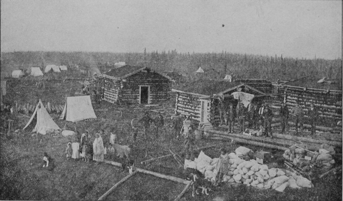 SUPPLY STATION FOR CIRCLE CITY.
No tents are used in winter, as they become coated with ice from the breath of the sleepers and are also apt to take fire.
Clothing for Men.—A year's supply of winter clothing ought be taken, especial pains being taken to supply plenty of warm, durable underwear. Old-timers in the country wear in winter a coat or blouse of dressed deer skin, with the hair on, coming down to the knees and held by a belt round the waist. It has a hood which may be thrown back on the shoulders when not needed. This shirt is trimmed with white deerskin or wolfskin, while those worn in extreme weather are often lined with fur. Next in importance to them are the torbassâ or Eskimo boots. These are of reindeer skin, taken from the legs, where the hair is short, smooth and stiff. These are sewed together to make the tops of the boots which come up nearly to the knee, where they are tied. The sole is of sealskin, turned over at heel and toe and gathered up so as to protect those parts and then brought up on each side. They are made much larger than the foot and are worn with a pad of dry grass which, folded to fit the sole, thickens the boot and forms an additional protection to the foot. A pair of strings tied about the ankle[132] from either side complete a covering admirably adapted to the necessities of winter travel. If the newcomer can get such garments as these he will be well provided against winter rigors.
Women going to the mines are advised to take two pairs of extra heavy all-wool blankets, one small pillow, one fur robe, one warm shawl, one fur coat, easy fitting; three warm woollen dresses, with comfortable bodices and shirts knee length, flannel-lined preferable; three pairs of knickers or bloomers to match the dresses, three suits of heavy all-wool underwear, three warm flannel night dresses, four pairs of knitted woollen stockings, one pair of rubber boots, three gingham aprons that reach from neck to knees, small roll of flannel for insoles, wrapping the feet and bandages; a sewing kit, such toilet articles as are absolutely necessary, including some skin unguent to protect the face from the icy cold, two light blouses or shirt waists for summer wear, one oilskin blanket to wrap her effects in, to be secured at Juneau or St. Michael; one fur cape, two pairs of fur gloves, two pairs of surseal moccasins, two pairs of muclucs—wet weather moccasins.
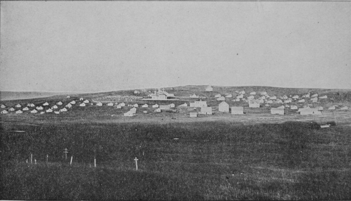 VILLAGE OF ST. PAUL.
She wears what she pleases en route to Juneau or
St. Michael, and when she makes her start for the
diggings she lays aside every civilized traveling
garb, including shoes and stays, until she comes out.[133]
[134]
[135]
Instead of carrying the fur robe, fur coat and rubber
boots along, she can get them on entering Alaska,
but the experienced ones say, take them along.
Leggings and shoes are not so safe nor desirable as
the moccasins. A trunk is not the thing to transport
baggage in. It is much better in a pack, with
the oilskin cover well tied on. The things to add
that are useful, but not absolutely necessary, are
chocolate, coffee and the smaller light luxuries.
Beds are made on a platform raised a few feet from the floor, and about seven feet wide. Often consists of a reindeer skin with the hair on and one end sewn up so as to make a sort of bag to put the feet in. A pillow of wild goose feathers, and a pair of blankets. Sheets, which have been unknown heretofore, may become essential, but such a conventionality as a counterpane would better be left behind.
Provisions.—There was a report that Canadian mounted police would guard the passes during the latter part of the summer of 1897 and refuse admission to anyone who did not bring a year's provisions with him. This has been estimated as weighing 1,800 pounds. Whether this is true or not, it is certain that no one should go into the Yukon country without taking a large supply of food, and taking it from his starting-point. Whatever is the most[136] condensed and nutritious is the cheapest, and this should be collected with great care. There is well-grounded fear that famine may overtake all the camps there before the opening of navigation in the spring. Newspapers on August 2nd reported agents of the Alaska Commercial Company as saying:
"We shall refuse to take passengers at all in our next steamer. We could sell every berth at the price we have been asking—$250, as against $120 last spring—but we shall not sell one. We shall fill up with provisions, and I have no doubt the Pacific Coast Company will do the same. We are afraid. Those who are mad to get to the diggings will probably be able to get transportation by chartering tramp steamers, and there is a serious risk that there will not be food enough for them at Juneau or on the Yukon. After the season closes it will be next to impossible to get supplies into the Yukon country, and a large proportion of the gold seekers may starve to death. That would be an ominous beginning for the new camp. Alaska is not like California or Australia or South Africa. It produces nothing. When the supplies from outside are exhausted, famine must follow—to what degree no one can tell."
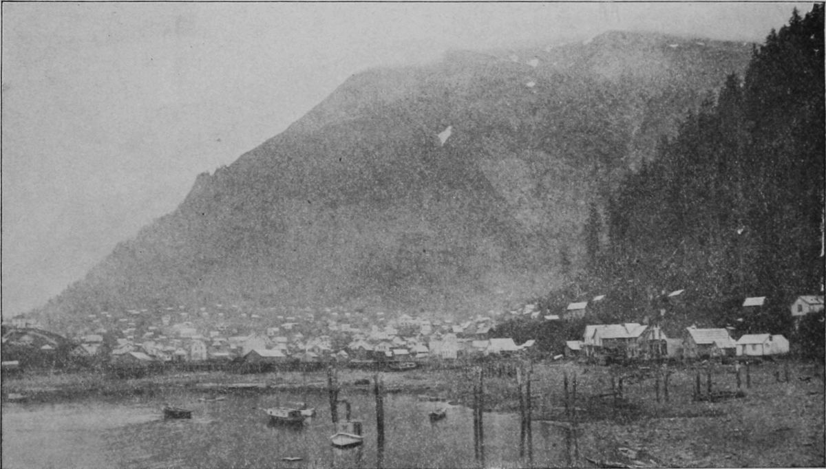 PANORAMIC VIEW OF JUNEAU.
It was further understood at this date that there
are 2,000 tons of food at St. Michael, and the Alaska[137]
[138]
[139]
Company has three large and three small steamers
to carry it up river. It is hard to ascertain how
much there is at Juneau; it is vaguely stated that
there are 5,000 tons. At a pinch steamers might
work their way for several months to come through
the ice to that port from Seattle, which is only
three days distant. But it may be nip and tuck if
there is any rush of gold seekers from the East.
Alaskan Mails.—Between Seattle and Sitka the mail steamers ply regularly. On the City of Topeka there has been established a regular sea post-office service. W. R. Curtis is the clerk in charge. Between Sitka and Juneau there is a closed pouch steamboat service. Seattle makes up closed pouches for Douglas, Fort Wrangel, Juneau, Killisnoo, Ketchikan, Mary Island, Sitka, and Metlakatlah. Connecting at Sitka is other sea service between that point and Unalaska, 1,400 miles to the west. This service consists of one trip a month between Sitka and Unalaska from April to October and leaves Sitka immediately upon arrival of the mails from Seattle. Captain J. E. Hanson is acting clerk. From Unalaska the mails are dispatched to St. Michael and thence to points on the Yukon.
The Postoffice department has perfected not only a summer but a winter star route service between Juneau and Circle City. The route is overland and[140] by boats and rafts over the lakes and down the Yukon, and is 900 miles long. A Chicago man named Beddoe carries the summer mail, making five trips between June and November, and is paid $500 a trip. Two Juneau men, Frank Corwin and Albert Hayes, operate the winter service and draw for each round trip $1,700 in gold. About 1,200 letters are carried on each trip. The cost of forwarding letters from Circle City to Dawson City is one dollar for each letter and two for each paper, the mails being sent over once a month. The Chilkoot Pass is crossed with the mail by means of Indian carriers. On the previous trips the carriers, after finishing the pass, built their boats, but they now have their own to pass the lakes and the Lewes River.
In the winter transportation is carried on by means of dogsleds, and it is hoped that under the present contracts there will be no stoppage, no matter how low the temperature may go. The contractor has reported that he was sending a boat, in sections, by way of St. Michael, up the Yukon River, to be used on the waterway of the route, and it is thought much time will be saved by this, as formerly it was necessary for the carriers to stop and build boats or rafts to pass the lakes.
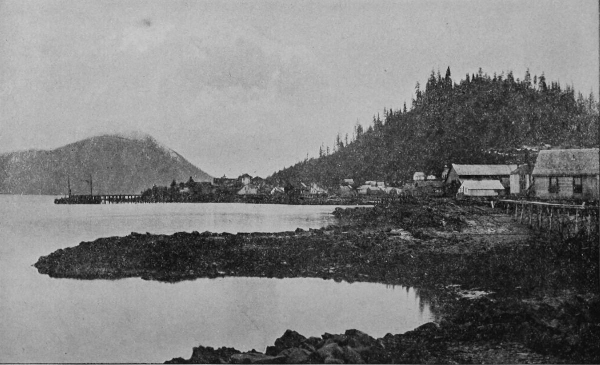 VIEW OF WRANGELL (FROM CHIEF'S HOUSE).
Contracts have been made with two steamboat
companies for two trips from Seattle to St. Michael.[141]
[142]
[143]
When the steamers reach St. Michael, the mail will
be transferred to the flat-bottomed boats running
up the Yukon as far as Circle City. It is believed
the boats now run further up.
The contracts for the overland route call for only first-class matter, whereas the steamers in summer carry everything, up to five tons, each trip.
Sledges and Dogs.—The sleds are heavy and shod with bone sawed from the upper edge of the jaw of the bowright whale. The rest of the sled is of spruce and will carry from six to eight hundred pounds. The sleds used in the interior are lighter and differently constructed. They consist of a narrow box four feet long, the front half being covered or boxed in, mounted on a floor eight feet long resting on runners. In this box the passenger sits, wrapped in rabbit skins so that he can hardly move, his head and shoulders only projecting. In front and behind and on top of the box is placed all the luggage, covered with canvas and securely lashed, to withstand all the jolting and possible upsets, and our snow shoes within easy reach.
An important item is the dog-whip, terrible to the dog if used by a skillful hand and terrible to the user if he be a novice; for he is sure to half strangle himself or to hurt his own face with the business end of the lash. The whip I measured had a handle[144] nine inches long and lash thirty feet, and weighed four pounds. The lash was of folded and plaited seal hide, and for five feet from the handle measured five inches round, then for fourteen feet it gradually tapered off, ending in a single thong half an inch thick and eleven feet long. Wonderful the dexterity with which a driver can pick out a dog and almost a spot on a dog with this lash. The lash must be trailing at full length behind, when a jerk and turn of the wrist causes it to fly forward, the thick part first, and the tapering end continuing the motion till it is at full length in front, and the lash making the fur fly from the victim. But often it is made to crack over the heads of the dogs as a warning.
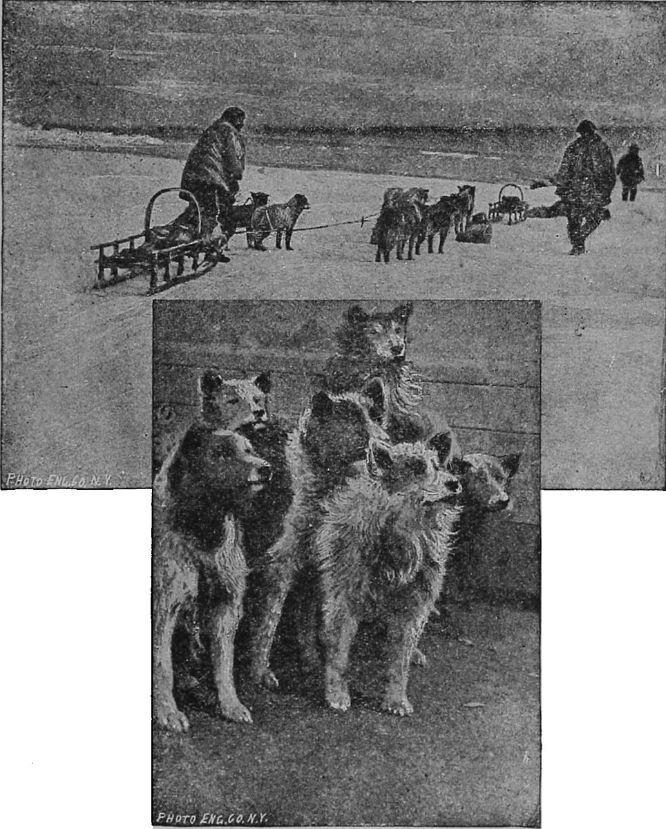 A TEAM OF DOGS AND DOG SLEDGES.
The eleven dogs were harnessed to the front of
the sled, each by a separate thong of seal hide, all
of different lengths, fastened to a light canvas harness.
The nearest dog was about fifteen feet from
the sled, and the leader, with bells on her, about
fifty feet, the thongs thus increasing in length by
about three feet. When the going is good the dogs
spread out like the fingers of a hand, but when the
snow is deep they fall into each other's tracks in
almost single file. As they continually cross and
recross each other, the thongs get gradually plaited
almost up to the rearmost dog, when a halt is called,[145]
[146]
[147]
the dogs are made to lie down, and the driver carefully
disentangles them, taking care that no dog
gets away meanwhile. They are guided by the
voice, using "husky," that is, Eskimo words:
"Owk," go to the right; "arrah," to the left, and
"holt," straight on. But often one of the men must
run ahead on snowshoes for the dogs to follow him.
The dogs are of all colors, somewhat the height of the Newfoundland, but with shorter legs. The usual number is from five to seven, according to the load.
List of prices that have been current in Dawson City during 1897:
| Flour, per 100 lbs. | $12.00 | to | $120.00 |
| Moose ham, per lb. | 1.00 | to | 2.00 |
| Caribou meat, lb. | .65 | ||
| Beans, per lb. | .10 | ||
| Rice, per lb. | .25 | to | .75 |
| Sugar, per lb. | .25 | ||
| Bacon, per lb. | .40 | to | .80 |
| Butter, per roll | 1.50 | to | 2.50 |
| Eggs, per doz. | 1.50 | to | 3.00 |
| Better eggs, doz. | 2.00 | ||
| Salmon, each | 1.00 | to | 1.50 |
| Potatoes, per lb. | .25 | ||
| Turnips, per lb. | .15 | ||
| Tea, per lb. | 1.00 | to | 3.00 |
| Coffee, per lb. | .50 | to | 2.25 |
| Dried fruits, per lb. | .35[148] | ||
| Canned fruits | .50 | to | 2.25 |
| Lemons, each | .20 | to | .25 |
| Oranges, each | .50 | ||
| Tobacco, per lb. | 1.50 | to | 2.00 |
| Liquors, per drink | .50 | ||
| Shovels | 2.50 | to | 18.00 |
| Picks | 5.00 | to | 7.00 |
| Coal oil, per gal. | 1.00 | to | 2.50 |
| Overalls | 1.50 | ||
| Underwear, per suit | 5.00 | to | 7.50 |
| Shoes | 5.00 | to | 8.00 |
| Rubber boots | 15.00 | to | 18.00 |
Based on supply and demand the above quoted prices may vary several hundred per cent. on some articles at any time.
Fare to Seattle by way of Northern Pacific, $81.50.
Fee for Pullman sleeper, $20.50.
Fee for tourist sleeper, run only west of St. Paul, $55.
Meals served in dining car for entire trip, $16.
Meals are served at stations along the route a la carte.
Distance from New York to Seattle, 3,290 miles.
Days required to make the journey, about six.
Fare for steamer from Seattle to Juneau, including cabin and meals, $35.
Days, Seattle to Juneau, about five.
Number of miles from Seattle to Juneau, 725.
Cost of living in Juneau, about $3 per day.
Distance on Lynn Canal to Healey's Store, steamboat, seventy-five miles.
Number of days, New York to Healey's Store, twelve.
Cost of complete outfit for overland journey, about $150.
Cost of provisions for one year, about $200.
Cost of dogs, sled and outfit, about $150.
Steamer leaves Seattle once a week.
Best time to start is early in the Spring.
Total cost of trip, New York to Klondike, about $667.
Number of days required for journey, New York to Klondike, thirty-six to forty.
Total distance, New York to the mines at Klondike, 4,650 miles.
No. 477. | Doane & McDonald 233-235 Monroe St., Chicago, Ill. Leather and Duck Clothing Fur Garments and Robes Prospectors' Clothing Three-Point Blankets Exquimaux Suits Sleeping Bags | 
No. 21. |
The Routes from
| DAWSON | LEWIS RIVER |
| FORT RELIANCE | CHILKOOT PASS |
| FORTY MILE CREEK | CHILKAT PASS |
| SIXTY MILE CREEK | WHITE PASS |
| FORT SELKIRK | ATLIN LAKE |
| JUNEAU | WRANGELL |
| TELEGRAPH CREEK | TESLIN LAKE |
| TESLIN RIVER | TAMZILLA RIVER |

The story is well told.—Herald, New York.
A real romance—just the kind of romance one delights in.—Times, Boston.
Full of stirring incident and picturesque description.—Press, Philadelphia.
The interest holds the reader until the closing page.—Inter-Ocean, Chicago.
Told with great fascination and brightness. * * * The general impression delightful. * * * Many thrilling scenes.—Herald, Chicago.
A thrilling story of passion and action.—Commercial, Memphis.
A genuine art work.—Chicago Tribune.
A remarkable book, original and dramatic in conception, and pure and noble in tone.—Boston Literary World.
REV. DAVID SWING said:—The books of Marah Ellis Ryan give great pleasure to all the best class of readers. "A Pagan of the Alleghanies" is one of her best works; but all she writes is high and pure. Her words are all true to nature, and, with her, nature is a great theme.
ROBERT G. INGERSOLL says:—Your description of scenery and seasons—of the capture of the mountains by spring—of tree and fern, of laurel, cloud and mist, and the woods of the forest, are true, poetic, and beautiful. To say the least, the pagan saw and appreciated many of the difficulties and contradictions that grow out of and belong to creeds. He saw how hard it is to harmonize what we see and know with the idea that over all is infinite power and goodness * * * the divine spark called Genius is in your brain.
Vigorous, natural, entertaining.—Boston Times.
A notable performance.—Chicago Tribune.
A very strong story, indeed.—Chicago Times.
A book that is more than clever. It is healthy, brave, and inspiring.—St. Louis Post-Dispatch.
The character of Stuart is one of the finest which has been drawn by an American woman in many a day, and it is depicted with an appreciation hardly to be expected even from a man.—Boston Herald.
There are imagination and poetical expressions in the stories, and readers will find them interesting.—New York Sun.
The longest story, "Galeed," is a strong, nervous story, covering a wide range, and dealing in a masterly way with some intricate questions of what might be termed amatory psychology.—San Francisco Chronicle.
MERZE; The Story of an Actress.
We can not doubt that the author is one of the best living orators of her sex. The book will possess a strong attraction for women.—Chicago Herald.
This is the story of the life of an actress, told in the graphic style of Mrs. Ryan. It is very interesting.—New Orleans Picayune.
| WATER-PROOF CLOTHING, |
| WATER-PROOF DUNNAGE BAGS, Etc. |
The Board of Directors are a sufficient guarantee that the affairs of the Company will be well managed.
| DIRECTORS. |
| JAMES RICE, |
| Late Secretary State of Colorado. |
| WM. SHAW, |
| Capitalist, Chicago. |
| E. M. TITCOMB, Vice-Pres't and Gen'l Manager, |
| Eastman Fruit Despatch Co. |
| H. C. FASH, |
| Member Maritime Exchange, New York. |
| GEO. W. MORGAN, |
| Circle City, Alaska. |
For information, address,
We make a specialty of outfitting, and can supply you with everything you eat, wear, or use. We have ...
Jumbo Shirts, Underwear and Hosiery
for the Northern Regions, sold by us exclusively,
In fact, we can supply you with anything and everything you'll need during your stay in Alaska. Our General Catalogue and Buyers' Guide Tells the prices. Send 15 cents to partly pay postage or expressage, and we'll send you a copy. It has nearly 800 pages, over 13,000 illustrations, and more than 40,000 descriptions of everything you wear or use. MONTGOMERY WARD & Co. 111 to 120 Michigan Ave., CHICAGO. | ||||||||||||||||
Obvious punctuation errors repaired. Text uses Shagway, Shkagway and Skagway once each.
The remaining corrections made are listed below and indicated by dotted lines under the corrections. Scroll the mouse over the word and the original text will appear.
Page iv, "intensly" changed to "intensely" (is intensely curious)
Page vi, repeated word "to" removed original read (travelers to to that far-away)
Page 49, "guage" changed to "gauge" (for a narrow gauge)
Page 50, "Lindemann" changed to "Lindeman" (miles below Lake Lindeman)
Page 52, "oulet" changed to "outlet" (The outlet is a clear)
Page 73, "reconnoisance" changed to "reconnaissance" (examined until the reconnaissance)
Page 75, "Cambell" changed to "Campbell" (1840 Robert Campbell)
Page 79, "completely" changed to "completed" (completed, when, on August)
Page 80, "exhorbitant" changed to "exorbitant" (at an exorbitant profit)
Page 85, "murcury" changed to "mercury" (rocks with the mercury)
Page 118, "ACRICULTURE" changed to "AGRICULTURE" (CLIMATE, AGRICULTURE AND HEALTH)
Page 123, "accurred" changed to "occurred" (65 below, occurred)
Page 127, "ophmalmic" changed to "opthalmic" (the opthalmic nerve)
Page 135, "raindeer" changed to "reindeer" (of a reindeer skin with)