The Project Gutenberg EBook of Encyclopaedia Britannica, 11th Edition,
Volume 2, Slice 7, by Various

This eBook is for the use of anyone anywhere at no cost and with
almost no restrictions whatsoever.  You may copy it, give it away or
re-use it under the terms of the Project Gutenberg License included
with this eBook or online at www.gutenberg.org


Title: Encyclopaedia Britannica, 11th Edition, Volume 2, Slice 7
       "Arundel, Thomas" to "Athens"

Author: Various

Release Date: November 4, 2010 [EBook #34209]

Language: English

Character set encoding: ISO-8859-1

*** START OF THIS PROJECT GUTENBERG EBOOK ENCYC. BRITANNICA, VOL 2, SLICE 7 ***


Produced by Marius Masi, Don Kretz and the Online
Distributed Proofreading Team at https://www.pgdp.net
|
Transcriber’s note:
|
One typographical error has been corrected. It
appears in the text like this, and the
explanation will appear when the mouse pointer is moved over the marked
passage. Sections in Greek will yield a transliteration
when the pointer is moved over them, and words using diacritic characters in the
Latin Extended Additional block, which may not display in some fonts or browsers, will
display an unaccented version.
Links to other EB articles: Links to articles residing in other EB volumes will
be made available when the respective volumes are introduced online.
|
THE ENCYCLOPÆDIA BRITANNICA
A DICTIONARY OF ARTS, SCIENCES, LITERATURE AND GENERAL INFORMATION
ELEVENTH EDITION
VOLUME II SLICE VII
Arundel, Thomas to Athens
Articles in This Slice
| ARUNDEL, THOMAS | ASSAB |
| ARUNDEL (town) | ASSAM |
| ARUNDELL OF WARDOUR, THOMAS ARUNDELL | ASSAMESE |
| ARUSIANUS MESSIUS | ASSAROTTI, OTTAVIO GIOVANNI BATTISTA |
| ARVAL BROTHERS | ASSARY |
| ARVALS | ASSASSIN |
| ARVERNI | ASSAULT |
| ARYAN | ASSAYE |
| ARYA SAMAJ | ASSAYING |
| ARYTENOID | ASSEGAI |
| ARZAMAS | ASSELIJN, HANS |
| AS | ASSEMANI |
| ASA | ASSEMBLY, UNLAWFUL |
| ASAFETIDA | ASSEN |
| ASAF-UD-DOWLAH | ASSER |
| ASAPH | ASSESSMENT |
| ASBESTOS | ASSESSOR |
| ASBJÖRNSEN, PETER CHRISTEN | ASSETS |
| ASBURY, FRANCIS | ASSIDEANS |
| ASBURY PARK | ASSIGNATS |
| ASCALON | ASSIGNMENT |
| ASCANIUS | ASSINIBOIA |
| ASCENSION | ASSINIBOIN |
| ASCENSION, FEAST OF THE | ASSISE |
| ASCETICISM | ASSISI |
| ASCHAFFENBURG | ASSIUT |
| ASCHAM, ROGER | ASSIZE |
| ASCHERSLEBEN | ASSMANNSHAUSEN |
| ASCIANO | ASSOCIATE |
| ASCITANS | ASSOCIATION OF IDEAS |
| ASCITES | ASSONANCE |
| ASCLEPIADES (Greek physician) | ASSUAN |
| ASCLEPIADES (of Samos) | ASSUMPSIT |
| ASCLEPIODOTUS | ASSUMPTION, FEAST OF |
| ASCOLI, GRAZIADIO ISAIA | ASSUR (land of Assyria) |
| ASCOLI PICENO | ASSUR (capital of Assyria) |
| ASCONIUS PEDIANUS, QUINTUS | ASSUR (god of Assyria) |
| ASCOT | ASSUR-BANI-PAL |
| ASCUS | ASSUS |
| ASELLI, GASPARO | ASSYRIA |
| ASGILL, JOHN | AST, GEORG ANTON FRIEDRICH |
| ASH | ASTARA |
| A‘SHĀ | ASTARABAD |
| ASHANTI | ASTARTE |
| ASH‘ARĪ | ASTELL, MARY |
| ASHBOURNE | ASTER |
| ASHBURNHAM, JOHN | ASTERIA |
| ASHBURTON, ALEXANDER BARING | ASTERID |
| ASHBURTON, JOHN DUNNING | ASTERISK |
| ASHBURTON (river) | ASTERIUS (of Cappadocia) |
| ASHBURTON (town) | ASTERIUS (bishop of Amasia) |
| ASHBY, TURNER | ASTHMA |
| ASHBY-DE-LA-ZOUCH | ASTI |
| A-SHE-HO | ASTLEY, JACOB ASTLEY |
| ASHER | ASTLEY, SIR JOHN DUGDALE |
| ’ASHER BEN-YEHIEL | ASTON, ANTHONY |
| ASHEVILLE | ASTON MANOR |
| ASHFORD | ASTOR, JOHN JACOB |
| ‘ASHI | ASTORGA, EMANUELE D’ |
| ASHINGTON | ASTORGA (city) |
| ’ASHKENAZI, SEBI | ASTORIA |
| ASHLAND (Kentucky, U.S.A.) | ASTRAEA |
| ASHLAND (Pennsylvania, U.S.A.) | ASTRAGAL |
| ASHLAND (Virginia, U.S.A.) | ASTRAKHAN (government of Russia) |
| ASHLAND (Wisconsin, U.S.A.) | ASTRAKHAN (town of Russia) |
| ASHLAR | ASTROLABE |
| ASHLEY, WILLIAM JAMES | ASTROLOGY |
| ASHMOLE, ELIAS | ASTRONOMY |
| ASHRAF | ASTROPALIA |
| ASHREF | ASTROPHYSICS |
| ASHTABULA | ASTRUC, JEAN |
| ASHTON-IN-MAKERFIELD | ASTURA |
| ASHTON-UNDER-LYNE | ASTURIAS |
| ASH WEDNESDAY | ASTYAGES |
| ASHWELL, LENA | ASTYLAR |
| ASIA (continent) | ASUNCIÓN |
| ASIA (Roman province) | ASVINS |
| ASIA MINOR | ASYLUM |
| ASIENTO | ASYLUM, RIGHT OF |
| ASIR | ATACAMA |
| ASISIUM | ATACAMA, DESERT OF |
| ASKABAD | ATACAMITE |
| ASKAULES | ATAHUALLPA |
| ASKE, ROBERT | ATALANTA |
| ASKEW, ANNE | ATARGATIS |
| AṢMA‘Ī | ATAULPHUS |
| ASMARA | ATAVISM |
| ASMODEUS | ATBARA |
| ASMONEUS | ATCHISON |
| ASNIÈRES | ATE |
| ASOKA | ATELLA |
| ASOLO | ATELLANAE FABULAE |
| ASOR | ATESTE |
| ASP | ATH |
| ASPARAGINE | ATHABASCA |
| ASPARAGUS | ATHALARIC |
| ASPASIA | ATHALIAH |
| ASPASIUS | ATHAMAS |
| ASPEN | ATHANAGILD |
| ASPENDUS | ATHANARIC |
| ASPER, AEMILIUS | ATHANASIUS |
| ASPER, HANS | ATHAPASCAN |
| ASPERGES | ATHARVA VEDA |
| ASPERN-ESSLING | ATHEISM |
| ASPHALT | ATHELM |
| ASPHODEL | ATHELNEY |
| ASPHYXIA | ATHENA |
| ASPIC | ATHENAEUM |
| ASPIDISTRA | ATHENAEUS |
| ASPIROTRICHACEAE | ATHENAGORAS |
| ASPIROZ, MANUEL DE | ATHENODORUS |
| ASPROMONTE | ATHENRY |
| ASQUITH, HERBERT HENRY | ATHENS (Greece) |
| ASS | ATHENS (Georgia, U.S.A.) |
| ASS, FEAST OF THE | ATHENS (Ohio, U.S.A.) |
709
ARUNDEL, THOMAS (1353-1414), archbishop of Canterbury,
was the third son of Richard Fitzalan, earl of Arundel and
Warenne, by his second wife, Eleanor, daughter of Henry
Plantagenet, earl of Lancaster. His family was an old and
influential one, and when Thomas entered the church his preferment
was rapid. In 1373 he became archdeacon of Taunton,
and in April 1374 was consecrated bishop of Ely. During the
early years of the reign of King Richard II. he was associated
with the party led by Thomas, duke of Gloucester, Henry, earl
of Derby, afterwards King Henry IV., and his own brother
Richard, earl of Arundel, and in 1386 he was sent with Gloucester
to Eltham to persuade Richard to return to parliament. This
mission was successful, and Arundel was made lord chancellor
in place of Michael de la Pole, duke of Suffolk, and assisted to
make peace between the king and the supporters of the commission
of regency. In April 1388 he was made archbishop of York,
and, when Richard declared himself of age in 1389, he gave up
the office of chancellor, to which, however, he returned in 1391.
During his second tenure of this office he removed the courts of
justice from London to York, but they were soon brought back
to the metropolis. In September 1396 he was translated from
York to Canterbury, and again resigned the office of chancellor.
He began his new rule by a vigorous attempt to assert his rights,
warned the citizens of London not to withhold tithes, and decided
appeals from the judgments of his suffragans during a thorough
visitation of his province. In November 1396 he had officiated
at the marriage of Richard and Isabella, daughter of Charles VI.,
king of France, and his fall was the sequel of the king’s sudden
attack upon the lords appellant in 1397. After the arrest of
Gloucester, Warwick and Arundel, the archbishop was impeached
by the Commons with the king’s consent, although Richard,
who had not yet revealed his hostility, held out hopes of safety
to him. He was charged with assisting to procure the commission
of regency in derogation of the royal authority, and sentence
of banishment was passed, forty days being given him during
which to leave the realm. Towards the end of 1397 he started
for Rome, and Pope Boniface IX., at the urgent request of the
king, translated him to the see of St Andrews, a step which the
pope afterwards confessed he repented bitterly. This translation
virtually deprived Arundel of all authority, as St Andrews did
not acknowledge Boniface. He then became associated with
Henry of Lancaster, but did not return to England before 1399,
and the account which Froissart gives telling how he was sent by
the Londoners to urge Henry to come and assume the crown is
thought to refer to his nephew and namesake, Thomas, earl of
Arundel. Landing with Henry at Ravenspur, he accompanied
him to the west. He took his place at once as archbishop of
Canterbury, witnessed the abdication of Richard in the Tower
of London, led the new king, Henry IV., to his throne in presence
of the peers, and crowned him on the 13th of October 1399.
The main work of his later years was the defence of the church,
and the suppression of heresy. To put down the Lollards, he
called a meeting of the clergy, pressed on the statute de haeretico
comburendo, and passed sentence of degradation upon William
Sawtrey. He resisted the attempt of the parliament of 1404 to
disendow the church, but failed to induce Henry to pardon
Archbishop Scrope in 1405. In 1407 he became chancellor for
the fourth time, and in 1408 summoned a council at Oxford,
which drew up constitutions against the Lollards. These he
published in January 1409, and among them was one forbidding
the translation of the Bible into English without the consent of
the bishop of the diocese, or of a provincial synod. In 1411 he
went on an embassy abroad, and in 1412 became chancellor
again, his return to power being accompanied by a change in the
foreign policy of Henry IV. In 1397 he had sought to vindicate
his right of visitation over the university of Oxford, but the
dispute remained unsettled until 1411 when a bull was issued by
Pope John XXIII. recalling one issued by Pope Boniface IX.,
which had exempted the university from the archbishop’s
authority. In 1413 he took a leading part in the proceedings
against Sir John Oldcastle, Lord Cobham, and in the following
year he died on the 19th of February, and was buried at Canterbury.
A legend of a later age tells how, just before his death,
he was struck dumb for preventing the preaching of the word of
God.
The chief authorities are T. Walsingham, Historia Anglicana, ed.
by H.T. Riley (London, 1863-1864); Eulogium historiarum sive
temporis, ed. by F.S. Haydon (London, 1858-1863); the Monk
of Evesham, Historia vitae et regni Ricardi II., ed. by T. Hearne
(Oxford, 1729); W.F. Hook, Lives of the Archbishops of Canterbury,
vol. iv. (London, 1860-1876).
ARUNDEL, a market town and municipal borough in the
Chichester parliamentary division of Sussex, England, 58 m.
S.S.W. from London by the London, Brighton & South Coast
railway. Pop. (1901) 2739. It is pleasantly situated on the
slope of a hill above the river Arun, which is navigable for small
vessels to Littlehampton at the mouth, 6 m. south. From the
summit of the hill rises Arundel Castle, which guarded the passage
along the river through the hills. For its connexion with the
title of earl of Arundel see Arundel, Earldom of. A castle
existed in the time of King Alfred, and at the time of the Conquest
it was rebuilt by Roger de Montgomerie, but it was taken from
his son, who rebelled against the reigning monarch, Henry I.
In 1397 it was the scene of a conspiracy organized by the earl
of Arundel, archbishop of Canterbury and duke of Gloucester,
to dethrone Richard II. and murder the lords of his council, a
plot which was discovered before it could be carried into execution.
During the civil wars of the 17th century, the stronghold
was frequently assaulted by the contending parties, and consequently
greatly damaged; but it was restored by Charles, 11th
duke of Norfolk (d. 1815), who made it what it now is, one of
the most splendid baronial mansions in England. Extensive
reconstruction, in the style of the 13th century, was undertaken
towards the close of the 19th century. The town, according
to the whimsical etymology shown on the corporation seal, takes
its name from hirondelle (a swallow). The town hall is a castellated
building, presented to the corporation by the duke of
Norfolk. The church of St Nicholas, founded about 1375, is
Perpendicular with a low tower rising from the centre. In the
north aisle of the chancel there are several ancient monuments of
the earls of Arundel. The church is otherwise remarkable for
its reredos and iron work. The chancel is the property of the
duke of Norfolk and is screened from the rest of the building,
710
although in 1880 this exercise of right by the owner was made
the subject of an action at law and subsequent appeal. The
Roman Catholic church of St Philip Neri was built by the duke
of Norfolk (1873). Some remains of a Maison Dieu, or hospital,
erected in the time of Richard II., still exist. The borough is
under a mayor, 4 aldermen and 12 councillors. Area, 2053 acres.
The first mention of Arundel (Harundell) comes as early as 877,
when it was left by King Alfred in his will to his nephew Æthelm.
In the time of Edward the Confessor the town seems to have consisted
of the mill and a fortification or earthwork which was probably
thrown up by Alfred as a defence against the Danes; but it had
increased in importance before the Conquest, and appears in Domesday
as a thriving borough and port. It was granted by the Conqueror
to Roger de Montgomery, who built the castle on the site of the
ancient earthwork. From very early times markets were held
within the borough on Thursday and Saturday, and in 1285 Richard
Fitzalan, earl of Arundel, obtained a grant of two annual fairs on
the 14th of May and the 17th of December. The borough returned
two members to parliament from 1302 to 1832 when the Reform
Act reduced the membership to one; in 1868 it was disfranchised
altogether. There are no early charters extant, but in 1586 Elizabeth
acknowledged the right of the mayor and burgesses to be a body
corporate and to hold a court for pleas under forty shillings, two
weekly markets and four annual fairs—which rights they claimed
to have exercised from time immemorial. James II. confirmed in
1688 a charter given two years before, and incorporated the borough
under the title of a mayor, 4 aldermen and 12 burgesses. The
town was half destroyed by fire in 1338, but was soon rebuilt.
Arundel was formerly a thriving seaport, and in 1813 was connected
by canal with London.
See M.A. Tierney, The History and Antiquities of the Castle and
Town of Arundel (London, 1834);
Victoria County History—Sussex.
ARUNDELL OF WARDOUR, THOMAS ARUNDELL, 1st
Baron (c. 1562-1639), son of Sir Mathew Arundell of Wardour
Castle in Wiltshire, a member of the ancient family of Arundells
of Lanherne in Cornwall, and of Margaret, daughter of Sir Henry
Willoughby, was born about 1562. In 1579 he was personally
recommended by Queen Elizabeth to the emperor Rudolph II.
He greatly distinguished himself while serving with the imperial
troops against the Turks in Hungary, and at the siege of Gran or
Esztergom on the 13th of August 1595, he captured the enemy’s
banner with his own hand. He was created by Rudolph II. a
count of the Holy Roman Empire in December 1595, and returned
to England after suffering shipwreck and barely preserving his
life in January 1596. His assumption of the foreign title created
great jealousy among the English peers, who were wont to give a
precedence by courtesy to foreign nobles, and he incurred the
resentment of his father, who objected to his superior rank and
promptly disinherited him. The queen, moreover, was seriously
displeased, declared that “as chaste wives should have no glances
but for their own spouses, so should faithful subjects keep their
eyes at home and not gaze upon foreign crowns,” and committed
him to the Fleet immediately on his arrival, while she addressed
a long letter of remonstrance on the subject to the emperor.
Arundell remained under arrest till April, when he was liberated
after an examination. In April 1597, however, he was again
confined, but declared innocent of any charge save that of
“practising to contrive the justification of his vain title with
Ministers beyond the seas.” In December he was liberated and
placed under the care of his father, but next year he was again
arrested and accused of a conspiracy against the government.
His petitions for a licence to undertake an expedition by sea,
wherein he declared “his end was honour which some base
minds call ambition,” were refused, but in 1599 he was apparently
again restored to favour. On the 4th of May 1605 he was
created by James I. Baron Arundell of Wardour, but fell again
under temporary suspicion at the time of the Gunpowder Plot.
In 1623 he once more got into trouble by championing the cause
of the recusants, of whom he was himself one, on the occasion of
the visit of the Spanish envoys, and he was committed to custody,
and in 1625 all the arms were removed by the government from
Wardour Castle. After the accession of Charles I. he was
pardoned, and attended the sittings of the House of Lords. He
was indicted in the king’s bench about the year 1627 for not
paying some contribution, and in 1632 he was accused of harbouring
a priest. In 1637 he was declared exempt from the
recusancy laws by the king’s order, but in 1639 he again
petitioned for relief. The same year he paid £500 in lieu of
attending the king at York. He died on the 7th of November
1639. Arundell was an earnest Roman Catholic, but the suspicions
of the government as to his loyalty were probably unfounded
and stifled a career destined by nature for successful
adventure. He married (1) Mary, daughter of Henry Wriothesley,
2nd earl of Southampton, by whom besides other children
he had Thomas, who succeeded him as 2nd baron; and (2) Anne,
daughter of Miles Philipson, by whom he had several daughters.
Henry Arundell, 3rd Baron Arundell of Wardour (c. 1607-1694),
son of Thomas, 2nd baron, and of Blanche, daughter of
Edward, earl of Worcester, was born on the 21st of July 1607,
and succeeded on his father’s death in 1643 to the family title
and estates. A strong royalist and Roman Catholic, he supported
the king’s cause, and distinguished himself in 1644 by the recapture
of his castle at Wardour from the parliamentarians, who
had taken it in the previous year in spite of his mother’s brave
defence of the place. In 1648 he was one of the delinquents
exempted from pardon in the proposals sent to Charles in the
Isle of Wight. His estates had been confiscated, but he was
permitted about 1653 to compound for them in the sum of
£35,000. In 1652, in consequence of his being second at a duel
in which one of the combatants was killed, he was arrested, and
tried in 1653; he pleaded his peerage, but the privilege was
disallowed as the House of Lords had been abolished. At the
Restoration he regained possession of the family estates, and in
1663 was made master of the horse to Henrietta Maria. He was
one of the few admitted to the king’s confidence concerning the
projects for the restoration of the Roman Catholic religion and
the alliance with France. In 1669 he took part in the secret
council assembled by Charles II., and in October was sent to
France, ostensibly for the funeral of Henrietta Maria, but in
reality to negotiate with Louis XIV. the agreement which took
shape in 1670 in the treaties of Dover (see Charles II.). In
1676 he was privy to James’s negotiations with Rome through
Coleman. He was accused in 1678 by Titus Oates of participation
in the popish plot, and was one of the five Roman Catholic
peers arrested and imprisoned in the Tower in October, found
guilty by the Middlesex grand jury of high treason, and
impeached subsequently by the parliament. Lord Stafford was
found guilty and executed in December 1680, but after the
perpetration of this injustice the proceedings were interrupted,
and the three surviving peers were released on bail on the 12th
of February 1684. On the 22nd of May 1685, after James II.’s
accession, the charge was annulled, and on the 1st of June 1685
they obtained their full liberty. In February 1686, with other
Roman Catholics, Arundell urged upon the king the removal
of his mistress, Lady Dorchester, on account of her strong
Protestantism. In spite of his religion he was made a privy councillor
in August 1686, and keeper of the privy seal in 1687, being
excused from taking the oaths by the king’s dispensation. He
presented the thanks of the Roman Catholics to James in June
1687 for the declaration of indulgence. His public career ended
with the abdication of the king, and he retired to Breamore, the
family residence since the destruction of Wardour Castle. He
died on the 28th of December 1694. He was the author of five
religious poems said to be composed during his confinement in
the Tower in 1679, published the same year and reprinted in
A Collection of Eighty-six Loyal Poems in 1685. His piety and
benevolence to his unfortunate co-religionists were conspicuous.
Evelyn calls him “very good company” and he was a noted
sportsman, the Quorn pack being descended from his pack of
hounds at Breamore. He married Cecily, daughter of Sir Henry
Compton, by whom besides other children he had Thomas, who
succeeded him as 4th baron.
The barony is still held in the Arundell family, which has
never ceased to be Roman Catholic. The 14th baron (b. 1859)
was a direct descendent of the 6th.
ARUSIANUS MESSIUS, or Messus, Latin grammarian,
flourished in the 4th century A.D. He was the author of a small
extant work Exempla Elocutionum, dedicated to Olybrius and
Probinus, consuls for the year 395. It contains an alphabetical
711
list, chiefly of verbs admitting more than one construction, with
examples from each of the four writers, Virgil, Sallust, Terence
and Cicero. Cassiodorus, the only writer who mentions Arusianus,
refers to it by the term Quadriga.
See Keil, Grammatici Latini, vii.; Suringar, Historia
Critica Scholiastarum Latinorum (1834-1835); Van der Hoeven,
Specimen Literarium (1845).
ARVAL BROTHERS (Fratres Arvales), in Roman antiquities,
a college or priesthood, consisting of twelve members, elected
for life from the highest ranks in Rome, and always apparently,
during the empire, including the emperor. Their chief duty was
to offer annually public sacrifice for the fertility of the fields
(Varro, L. L. v. 85). It is generally held that the college was
founded by Romulus (see Acca Larentia). This legend probably
arose from the connexion of Acca Larentia, as mater Larum,
with the Lares who had a part in the religious ceremonies of the
Arvales. But apart from this, there is proof of the high antiquity
of the college, which was said to have been older than Rome itself,
in the verbal forms of the song with which, down to late times,
a part of the ceremonies was accompanied, and which is still
preserved. It is clear also that, while the members were themselves
always persons of distinction, the duties of their office were
held in high respect. And yet it is singular that no mention of
them occurs in Cicero or Livy, and that altogether literary
allusions to them are very scarce. On the other hand, we possess
a long series of the acta or minutes of their proceedings, drawn
up by themselves, and inscribed on stone. Excavations, commenced
in the 16th century and continued to the 19th, in the
grove of the Dea Dia about 5 m. from Rome, have yielded 96 of
these records from A.D. 14 to 241. The brotherhood appears
to have languished in obscurity during the republic, and
to have been revived by Augustus. In his time the college
consisted of a master (magister), a vice-master (promagister),
a flamen, and a praetor, with eight ordinary members, attended
by various servants, and in particular by four chorus boys, sons
of senators, having both parents alive. Each wore a wreath of
corn, a white fillet and the praetexta. The election of members
was by co-optation on the motion of the president, who, with a
flamen, was himself elected for one year. The great annual
festival which they had to conduct was held in honour of the
anonymous Dea Dia, who was probably identical with Ceres.
It occupied three days in May. The ceremony of the first day
took place in Rome itself, in the house of the magister or his
deputy, or on the Palatine in the temple of the emperors, where
at sunrise fruits and incense were offered to the goddess. A
sumptuous banquet took place, followed by a distribution of
doles and garlands. On the second and principal day of the
festival the ceremonies were conducted in the grove of the Dea
Dia. They included a dance in the temple of the goddess, at
which the song of the brotherhood was sung, in language so
antiquated that it was hardly intelligible (see the text and
translation in Mommsen, Hist, of Rome, bk. i. ch. xv.) even to
Romans of the time of Augustus, who regarded it as the oldest
existing document in their mother-tongue. Especial mention
should be made of the ceremony of purifying the grove, which
was held to be defiled by the felling of trees, the breaking of a
bough or the presence of any iron tools, such as those used by
the lapidary who engraved the records of the proceedings on
stone. The song and dance were followed by the election of
officers for the next year, a banquet and races. On the third day
the sacrifice took place in Rome, and was of the same nature as
that offered on the first day. The Arvales also offered sacrifice
and solemn vows on behalf of the imperial family on the 3rd of
January and on other extraordinary occasions. The brotherhood
is said to have lasted till the time of Theodosius. The British
Museum contains a bust of Marcus Aurelius in the dress of a
Frater Arvalis.
Marini, Atti e Monumenti de’ Fratri Arvali (1795); Hoffmann,
Die A. (1858): Oldenberg, De Sacris Fratrum A. (1875);
Bergk, Das Lied der Arvalbrüder (1856); Bréal, “Le Chant des
Arvals” in Mém. de la Soc. de Linguistique (1881); Edon,
Nouvelle Étude sur le Chant Lémural (1884); Corpus
Inscriptionum Latinarum, vi. 2023-2119; Henzen, Acta Fratrum
Arvalium (1874).
ARVALS, Arvels or Arthels (O. Norse Arfr, inheritance,
and öl, A.S. Ale, a banquet), primarily the funeral dinner, and
later, especially in the north of England, a thin, light, sweet cake,
spiced with cinnamon and nutmeg, served to the poor at such
feasts. The funeral meal was called the Arvel-dinner. The
custom seems to have been to hold on such occasions an informal
inquest, when the corpse was publicly exposed, to exculpate the
heir and those entitled to the property of the dead from all
accusations of foul play.
ARVERNI, the name of an ancient Gaulish tribe in the
Auvergne, which still bears its name. It resisted Caesar longer
than most of Gaul; when once vanquished it adopted Roman
civilization readily. Its tribal deity, the god of the mountain,
the Puy de Dôme, rechristened in Roman phrase Mercurius
Dumias, was famous far beyond its territory. Part of his temple
has been excavated recently.
ARYAN, a term which has been used in a confusing variety
of significations by different philologists. By Max Müller
especially it was employed as a convenient short term for the
whole body of languages more commonly known as Indo-European
(q.v.) or Indo-Germanic. In the same way Max Müller
used Aryas as a general term for the speakers of such languages,
as in his book published in 1888, Biographies of Words and the
Home of the Aryas. “Aryas are those who speak Aryan languages,
whatever their colour, whatever their blood. In calling
them Aryas we predicate nothing of them except that the
grammar of their language is Aryan” (p. 245). It is to be
observed, therefore, that Max Müller is careful to avoid any
ethnological signification. The Aryas are those who speak
Aryan without regard to the question whether Aryan is their
hereditary language or not. As he says still more definitely
elsewhere in the same work (p. 120), “I have declared again and
again that if I say Aryas, I mean neither blood nor bones, nor
hair nor skull; I mean simply those who speak an Aryan
language. The same applies to Hindus, Greeks, Romans
Germans, Celts and Slaves. When I speak of them I commit
myself to no anatomical characteristics. The blue-eyed and
fair-haired Scandinavians may have been conquerors or conquered,
they may have adopted the language of their darker
lords or their subjects, or vice versa. I assert nothing beyond
their language when I call them Hindus, Greeks, Romans,
Germans, Celts and Slaves; and in that sense, and in that sense
only, do I say that even the blackest Hindus represent an earlier
stage of Aryan speech and thought than the fairest Scandinavians....
To me an ethnologist who speaks of Aryan race, Aryan
blood, Aryan eyes and hair, is as great a sinner as a linguist
who speaks of a dolichocephalic dictionary or a brachycephalic
grammar.”
From the popularity of Max Müller’s works on comparative
philology this is the use of the word which is most familiar to
the general public. The arguments in support of this use are
set forth by him in the latter part of lecture vi. of the Lectures
on the Science of Language (first series) and as an appendix to
chap. vii. of the final edition (i. pp. 291 ff.). The Sanskrit usage
of the word is fully illustrated by him from the early Sanskrit
writings in the article “Aryan” in the ninth edition of this
encyclopaedia. From the earliest occurrences of the word it is
clear that it was used as a national name not only in India but
also in Bactria and Persia (in Sanskrit árya- and ārya, in Zend
airya-, in Old Persian ariya-). That it is in any way connected
with a Sanskrit word for earth, ira, as Max Müller asserts, is far
from certain. As Spiegel remarks (Die arische Periode, p. 105),
though it is easy enough to connect the word with a root ar-,
there are several roots of that form which have different meanings,
and there is no certain criterion whereby to decide to which of
them it is related. Nor are the other connexions for the word
outside this group free from doubt. It is, however, certain that
the connexion with Erin (Ireland), which Pictet in his article
“Iren and Arier” (Kuhn and Schleicher’s Beiträge, i. 1858,
pp. 81 ff.) sought to establish, is impossible (Whitley Stokes in
Max Müller’s Lectures, 1891, i. pp. 299 f.), though the word may
have the same origin as the Ario- of names like Ariovistus,
712
which is found in both Celtic and Germanic words (Uhlenbeck,
Kurzgefasstes etymologisches Wörterbuch der altindischen Sprache,
s.v.). The name of Armenia (Old Persian Armina-), which has
often been connected, is of uncertain origin. Within Sanskrit
itself probably two words have to be distinguished: (1) árya,
the origin of Aryan, from which the usual term ārya is a
derivative; (2) aryá, which frequently appears in the Rig Veda as
an epithet of deities. In many passages, however, aryás may
equally well be the genitive of arí, which is explained as “active,
devoted, pious.” Even in this word probably two originally
separate words have to be distinguished, for the further meanings
which Grassmann in his dictionary to the Rig Veda attaches
to it, viz. “greedy” (for treasure and for battle), “godless,”
“enemy,” seem more appropriately to be derived from the same
source as the Greek ἔρι-ς, “strife.” The word árya- is not
found as a national name in the Rig Veda, but appears in the
Vājasaneyi-sainhita, where it is explained by Mahīdhara as
Vaisya-, a cultivator or a man of the third among the original
four classes of the population. So in the Atharva Veda (iv. 20. 4;
xix. 62. 1) it is contrasted with the Śudra or fourth class (Spiegel,
Arische Periode, p. 102). In the Avesta, airya- is found both as
adjective and substantive in the sense of Aryan, but no light is
thrown upon the history of the word. Darius describes himself
in an inscription as of Aryan stock, Dārayahvahuš ariyahčivrah.
In the Avesta the derivative airyana- is also found in the sense
of Aryan. In both India and Persia a word is found (Skt.
aryaman-; Zend airyahman-) which is apparently of the same origin.
In both Sanskrit and Zend it means something like “comrade”
or “bosom friend,” but in Zend is used of the priestly or highest
class. In Sanskrit, besides this use in which it is contrasted
with the Dāsa or Dāsyu, the enemies, the earlier inhabitants, the
word is often used for the bridegroom’s spokesman, and in both
languages is also employed as the name of a divine being. In the
Rig Veda, Aryaman- as a deity is most frequently coupled with
Mitra and Varuna (Grassmann, Wörterbuch, s.v.); in Zend,
according to Bartholomae (Altiranisches Wörterbuch, s.v.), from
the earliest literature, the Gathas, there is nothing definite to be
learnt regarding Airyaman.
Whatever the origin of arya-, however, it is clear that it is a
word with dignified associations, by which the peoples belonging
to the Eastern section of the Indo-Europeans were proud to call
themselves. It is now used uniformly by scholars to indicate
the Eastern branch as a whole, a compound, Indo-Aryan, being
employed for that part of the Eastern branch which settled in
India to distinguish them from the Iranians (Iran is of the same
origin), who remained in Bactria and Persia, while Aryo-Indian
is sometimes employed to distinguish the Indian people of this
stock from the Dravidian and other stocks which also inhabit
parts of the Indian peninsula. Of the stages in the occupation
of the Iranian table-land by the Aryan people nothing is known,
the people themselves having apparently no tradition of a time
when they did not hold these territories (Spiegel, Arische Periode,
p. 319). Though the Hindus have no tradition of their invasion
of India, it is certain that they are not an indigenous people,
and, if they are not, it is clear that they could have come in no
other direction save from the other side of the Hindu Kush. At
the period of their earliest literature, which may be assigned
roughly to about 1000 B.C., they were still settled in the valley
of the Indus, and at this time the separation probably had not
long taken place, the Eastern portion of the stock having pushed
their way along the Kabul valley into the open country of the
Indus. According to Professor E.W. Hopkins (India Old and
New, 1901, p. 31) the Rig Veda was composed in the district
about Umballa. He argues that the people must have been then
to the west of the great rivers, otherwise the dawn could not be
addressed as one who “in shining light, before the wind arises,
comes gleaming over the waters, making good paths.” The
vocabulary is still largely the same; whole sentences can be
transliterated from one language to the other merely by making
regular phonetic changes and without the variation of a single
word (for examples see Bartholomae, Handbuch der altiranischen
Dialekte, 1883, p. v.; Williams Jackson, Avesta Grammar, 1892,
pp. xxxi. f.; Grundriss der iranischen Philologie, 1895, i. p. 1).
It is noteworthy that it is those who remain behind whose
language has undergone most change.
By four well-marked characteristics the Aryan group is easily
distinguishable from the other Indo-European languages. (1)
By the confusion of original e and o, both long and short, with
the original long and short a sound; (2) the short schwa-sound ə
is represented here, and in this group only, by i (pita, “father,”
as compared with πατήρ, &c.); (3) original s after i, u and some
consonants becomes ṣ; (4) the genitive plural of stems ending
in a vowel has a suffix-nām borrowed by analogy from the stems
ending in -n (Skt. ásvānām, “of horses”; Zend aspānām;
Old Persian aspānām). The distinctions between Sanskrit and
Iranian are also clear, (1) The Aryan voiced aspirates gh, dh, bh,
which survive in Sanskrit, are confused in Iranian with original
g, d, b, and further changes take place in the language of the
later parts of the Avesta; (2) the Aryan breathed aspirates
kh, th, ph, except in combination with certain consonants,
become spirants in Iranian; (3) Aryan s becomes h initially
before vowels in Iranian and also in certain cases medially,
Iranian in these respects resembling Greek (cf. Skt. saptá;
Zend hapta; Gr. ἑπτά, “seven”); (4) in Zend there are many
vowel changes which it does not share with Old Persian. Some
of these arise from the umlaut or epenthesis which is so prevalent,
and which we have already seen in airya- as compared with the
Skt. árya. In other respects the languages are remarkably alike,
the only striking difference being in the numeral “one”—Skt.
eka-; Zend aeva-; Old Persian aiva-, where the Iranian group
has the same stem as that seen in the Greek οἶ(F)ο-ς, “alone.”
For the subdivisions of the two groups see the articles on
Persia: Language, and Indo-Aryan Languages. Dr Grierson
has shown in his monograph on “The Pisaca Languages of
North-Western India” (Royal Asiatic Society, 1906) that there
is good reason for regarding various dialects of the north-western
frontier (Kafiristan, Chitral, Gilgit, Dardistan) as a separate
group descended from Aryan but independent of either Sanskrit
or Iranian.
The history of the separation of the Aryan from the other
Indo-European languages is not yet clear (see Indo-European
Languages). Various attempts have been made, with little
success, to identify fragments of unknown languages in cuneiform
inscriptions with members of this group. The investigation has
entered a new and more favourable stage as the result of the
discoveries made by German excavators at Boghaz Keui (said
to be identical with Herodotus’ Pteria in Cappadocia), where
treaties between the king of the Hittites and the king of Mitanni,
in the beginning of the 14th century B.C., seem almost certainly
to contain the names of the gods Mitra, Varuna and Indra,
which belong to the early Aryan mythology (H. Winckler,
Mitteilungen der deutschen Orientgesellschaft, No. 35; E. Meyer,
Sitzungsberichte der Berliner Akademie, 1908, pp. 14 ff.;
Zeitschrift für vergleichende Sprachforschung, 42, 1908, pp. 24 ff.).
Still further light is to be expected when the vast collections of the
German expedition to Turfan (Turkestan) have been sifted. Up
to 1909 only a preliminary account had been given of Tocharish,
a hitherto unknown Indo-European language, which is reported
to be in some respects more akin to the Western groups than to
Aryan. But further investigation is still required (see E. Sieg
and W. Siegling, “Tocharisch, die Sprache der Indoskythen,” in
Sitzungsberichte der Berl. Akad. (July 1908, pp. 915 ff.).
(P. Gi.)
ARYA SAMAJ, a Hindu religious association with reforming
tendencies, which was founded by a Guzerati Brahman named
Dayanand Saraswati. This man was born of a Saivite family
about 1825, but in early manhood grew dissatisfied with
idol-worship. He undertook many pilgrimages and studied the Vedic
philosophy in the hope of solving the old problem of the
Buddha,—how to alleviate human misery and attain final liberation.
About 1866, when he had begun to teach and to gather disciples,
he first saw the Christian scriptures, which he vehemently
assailed, and the Rig Veda, which he correspondingly exalted,
though in the conception which he ultimately formed of God the
former was much more influential than the latter. Dayanand’s
713
treatment of the Vedas was peculiar, and consisted of
reading into them his own beliefs and modern scientific
discoveries. Thus he explains the Yajna (sacrificial cult) as “the
entertainment of the learned in proportion to their worth, the
business of manufacture, the experiment and application of
chemistry, physics and the arts of peace; the instruction of the
people, the purification of the air, the nourishment of vegetables
by the employment of the principles of meteorology, called
Agni-Notri in Sanskrit.” He denied that the Vedas warranted
the caste system, but wished to retain the four grades as orders
of learning to which admission should be won by examination.
These views naturally met with scanty acceptance among the
Brahmans to whom he introduced them, and Dayanand turned
to the masses and established Samajes in various parts of India,
the first being at Bombay in 1875. He chose the epithet Arya
as being more dignified than the slightly contemptuous term
Hindu. After a successful series of tours, during which he
debated publicly with orthodox pundits and with Christian
missionaries, he died at Ajmere in 1883.
The Arya Samaj is not an eclectic system like the Brahma
Samaj, which strives to find the common basis underlying all
the great religions, and its narrower scope and corresponding
intensity of conviction have won it a greater strength. It
seemed to meet the feeling of many educated natives whose faith
in current Hinduism was undermined, but who were predisposed
against any foreign religious influence. Their patriotic ardour
gladly seized on “a view of the original faith of India that
seemed to harmonize with all the discoveries of modern science
and the ethics of European civilization,” and they cheerfully
supported their leader’s strange polemic with the agnostic and
rationalist literature of Europe. By 1890 their numbers had
increased to 40,000, by 1900 to over 92,000. Divisions had,
however, set in, especially a cleavage into the Ghasi or vegetarian,
and the Mansi or flesh-eating sections. To the latter belong
those Rajputs who though generally in sympathy with the
movement declined to adhere to the tenet of the Samaj which
forbade the destruction of animal life and the consumption of
animal food. The age of admission to the Samaj is eighteen,
and members are expected to contribute to its funds at least
1% of their income.
The ten articles of their creed may be summarized thus:—
1. The source of all true knowledge is God.
2. God is “all truth, all knowledge, all bliss, boundless, almighty,
just, merciful, unbegotten, without a beginning, incomparable,
the support and Lord of all, all-pervading, omniscient,
imperishable, immortal, eternal, holy, and the cause of the
universe; worship is due to him alone.”
3. The medium of true knowledge is the Vedas.
4. and 5. The truth is to be accepted and to become the guiding
principle.
6. The object of the Samaj is to benefit the world by improving
its physical, social, intellectual and moral conditions.
7. Love and justice are the right guides of conduct.
8. Knowledge must be spread.
9. The good of others must be sought.
10. In general interests members must subordinate themselves to
the good of others; in personal interests they should retain
independence.
The sixth clause comprehends a wide programme of reform,
including abstinence from spirituous liquors and animal food,
physical cleanliness and exercise, marriage reform, the promotion
of female education, the abolition of caste and of idolatry.
ARYTENOID (or arytaenoid; from Gr. ἀρύταινα, a funnel or
pitcher), a term, meaning funnel-shaped, applied to cartilages
such as those of the larynx.
ARZAMAS, a town of Russia, in the government of, and 76 m.
by rail S. of the town of, Nizhniy-Novgorod, on the Tesha river,
at its junction with the Arsha. It is an important centre of
trade, and has tanneries, oil, flour, tallow, dye, soap and iron
works; knitting is an important domestic industry. Sheepskins
and sail-cloth are articles of trade. The town has several
churches. Pop. (1897) 10,591.
AS, the Roman unit of weight and measure, divided into
12 unciae (whence both “ounce” and “inch”); its fractions
being deunx 11⁄12, dextrans 5⁄6, dodrans ¾, bes 2⁄3, septunx 7⁄12,
semis ½, quincunx 5⁄12, triens 1⁄3, quadrans ¼, sextans 1⁄6, sescuncia 1⁄8,
uncia 1⁄12. As really denoted any integer or whole; whence the
English word “ace.” The unit or as of weight was the libra
(pound: = about 114⁄5 oz. avoirdupois); of length, pes (foot:
= about 113⁄5 in.); of surface, jugerum (= about 2⁄3 acre); of
measure, liquid amphora (about 53⁄5 gal.), dry modius (about
9⁄10 peck). In the same way as signified a whole inheritance;
whence heres ex asse, the heir to the whole estate, heres ex semisse,
heir to half the estate. It was also used in the calculation of
rates of interest.
As was also the name of a Roman coin, which was of different
weight and value at different periods (see Numismatics,
§ Roman). The first introduction of coined money is ascribed to
Servius Tullius. The old as was composed of the mixed metal
aes, an alloy of copper, tin and lead, and was called as libralis,
because it nominally weighed 1 ℔ or 12 ounces (actually 10).
Its original shape seems to have been an irregular oblong bar,
which was stamped with the figure of a sheep, ox or sow. This,
as well as the word pecunia for money (pecus, cattle), indicates
the fact of cattle having been the earliest Italian medium of
exchange. The value was indicated by little points or globules,
or other marks. After the round shape was introduced, the one
side was always inscribed with the figure of a ship’s prow, and
the other with the double head of Janus. The subdivisions of
the as had also the ship’s prow on one side, and on the other the
head of some deity. The First Punic War having exhausted
the treasury, the as was reduced to 2 oz. In the Second Punic
War it was again reduced to half this weight, viz. to 1 oz.
And lastly, by the Papirian law (89 B.C.) it was further reduced
to the diminutive weight of half an ounce. It appears to have
been still more reduced under Octavian, Lepidus and Antony,
when its value was 1⁄3 of an ounce. Before silver coinage was
introduced (269 B.C.) the value of the as was about 6d., in the
time of Cicero less than a halfpenny. In the time of the emperor
Severus it was again lowered to about 5⁄24 of an ounce. During
the commonwealth and empire aes grave was used to denote the
old as in contradistinction to the existing depreciated coin;
while aes rude was applied to the original oblong coinage of
primitive times.
ASA, in the Bible, son (or, perhaps, rather brother) of Abijah,
the son of Rehoboam and king of Judah (1 Kings xv. 9-24). Of
his long reign, during which he was a contemporary of Baasha,
Zimri and Omri of Israel, little is recorded with the exception
of some religious reforms and conflicts with the first-named.
Baasha succeeded in fortifying Ramah (er-Rām), 5 m. north of
Jerusalem, and Asa was compelled to use the residue of the
temple-funds (cf. 1 Kings xiv. 26) to bribe the king of Damascus
to renounce his league with Baasha and attack Israel. Galilee
was invaded and Baasha was forced to return; the building
material which he had collected at Ramah being used by Asa to
fortify Geba, and Mizpah to the immediate north of Jerusalem.
The Book of Chronicles relates a story of a sensational defeat of
Zerah the “Cushite,” and a great religious revival in which Judah
and Israel took part (2 Chron. xiv.-xv. 15) (see Chronicles).
Asa was succeeded by his son Jehoshaphat.
“Cushite” may designate an Ethiopian or, more probably,
an Arabian (Cush, the “father” of the Sabaeans, Gen. x. 7).
“If by Zerah the Ethiopian or Sabaean prince be meant, the
only real difficulty of the narrative is removed. No king Zerah
of Ethiopia is known at this period, nor does there seem to be
room for such a person.” (W.E. Barnes, Cambridge Bible,
Chronicles, p. xxxi.). The identification with Osorkon I. or II.
is scarcely tenable considering Asa’s weakness; but inroads by
desert hordes frequently troubled Judah, and if the tradition
be correct in locating the battle at Mareshah it is probable that
the invaders were in league with the Philistine towns. Similar
situations recur in the reigns of Ahaz and Jehoram.
See also Wellhausen, Prolegomena, 208; S.A. Cook,
Expositor (June 1906), p. 540 sq.
(S. A. C.)
ASAFETIDA (asa, Lat. form of Persian aza = mastic, and
fetidus, stinking, so called in distinction to asa dulcis, which was
a drug highly esteemed among the ancients as laser cyrenaicum,
714
and is supposed to have been a gummy exudation from Thapsis
garganica), a gum-resin obtained principally from the root of
Ferula fetida, and probably also from one or two other closely
allied species of umbelliferous plants. It is produced in eastern
Persia and Afghanistan, Herat and Kandahar being centres of
the trade. Ferula fetida grows to a height of from 5 to 6 ft., and
when the plant has attained the age of four years it is ready for
yielding asafetida. The stems are cut down close to the root,
and the juice flows out, at first of a milky appearance, but quickly
setting into a solid resinous mass. Fresh incisions are made as
long as the sap continues to flow, a period which varies according
to the size and strength of the plant. A freshly-exposed surface
of asafetida has a translucent, pearly-white appearance, but it
soon darkens in the air, becoming first pink and finally reddish-brown.
In taste it is acrid and bitter; but what peculiarly
characterizes it is the strong alliaceous odour it emits, from
which it has obtained the name asafetida, as well as its German
name Teufelsdreck (devil’s dung). Its odour is due to the presence
of organic sulphur compounds. Asafetida is found in commerce
in “lump” or in “tear,” the latter being the purer form.
Medicinally, asafetida is given in doses of 5 to 15 grains and acts
as a stimulant to the intestinal and respiratory tracts and to
the nervous system. An enema containing it is useful in relieving
flatus. It is sometimes useful in hysteria, which is essentially
a lack of inhibitory power, as its nasty properties induce sufficient
inhibitory power to render its readministration superfluous.
It may also be used in an effervescing draught in cases of
malingering, the drug “repeating” in the mouth and making
the malingering not worth while. The gum-resin is relished as a
condiment in India and Persia, and is in demand in France for
use in cookery. In the regions of its growth the whole plant is
used as a fresh vegetable, the inner portion of the full-grown stem
being regarded as a luxury.
ASAF-UD-DOWLAH, nawab wazir of Oudh from 1775 to 1797,
was the son of Shuja-ud-Dowlah, his mother and grandmother
being the begums of Oudh, whose spoliation formed one of the
chief counts in the charges against Warren Hastings. When
Shuja-ud-Dowlah died he left two million pounds sterling buried
in the vaults of the zenana. The widow and mother of the
deceased prince claimed the whole of this treasure under the
terms of a will which was never produced. When Warren
Hastings pressed the nawab for the payment of debt due to the
Company, he obtained from his mother a loan of 26 lakhs of
rupees, for which he gave her a jagir of four times the value;
he subsequently obtained 30 lakhs more in return for a full
acquittal, and the recognition of her jagirs without interference
for life by the Company. These jagirs were afterwards confiscated
on the ground of the begum’s complicity in the rising
of Chai Singh, which was attested by documentary evidence.
The evidence now available seems to show that Warren Hastings
did his best throughout to rescue the nawab from his own
incapacity, and was inclined to be lenient to the begums.
See The Administration of Warren Hastings, 1772-1785, by G.W.
Forrest (1892).
ASAPH, the eponym of the Asaphite gild of singers, one of the
hereditary choirs that superintended the musical services of the
temple at Jerusalem in post-exilic times. The names occur
in the titles of certain Psalms, and the writer of the Book of
Chronicles makes Asaph a seer (2 Chron. xxix. 30), contemporary
with David and Solomon, and chief of the singers of his time.
ASBESTOS, a fibrous mineral from Gr. ἄσβεστος, unquenchable,
by transference, incombustible, in allusion to its power of
resisting the action of fire. The word was applied by Dioscorides
and other Greek authors to quicklime, but Pliny evidently used
it in its modern sense. It was occasionally woven by the ancients
into handkerchiefs, and, it has been said, into shrouds which were
used in cremation to prevent the ashes of the corpse from
mingling with the wood-ashes of the pyre.
In different varieties of asbestos the fibres vary greatly in
character. When silky and flexible they are sometimes known
as mountain flax. The finer kinds are often termed amianthus
(q.v.). When the fibres are naturally interwoven, so as to form
a felted mass, the mineral passes under such trivial names as
mountain leather, mountain cork, mountain paper, &c. The
asbestos formerly used in the arts was generally a fibrous form
of some kind of amphibole, like tremolite, or anthophyllite,
though occasionally perhaps a pyroxene. In recent years,
however, most of the asbestos in the market is a fibrous variety
of serpentine, known mineralogically as chrysotile, and probably
some of the ancient asbestos was of this character (see Amianthus).
Both minerals possess similar properties, so far as
resistance to heat is concerned. The amphibole-asbestos, or
hornblende-asbestos, is usually white or grey in colour, and may
present great length of fibre, some of the Italian asbestos reaching
exceptionally a length of 5 or 6 ft., but it is often harsh and
brittle. The serpentine-asbestos occurs in narrow veins, yielding
fibres of only 2 or 3 in. in length, but of great tensile strength:
they are usually of a delicate silky lustre, very flexible and elastic,
and of yellowish or greenish colour.
The Canadian asbestos, which of all kinds is at present the
most important industrially, occurs in a small belt of serpentine
in the province of Quebec, principally near Black Lake and
Thetford, where it was first recognized as commercially valuable
about 1877. The rock is generally quarried, cobbed by hand,
dried if necessary, crushed in rock-breakers, and then passed
between rollers; it is reduced to a finer state of division by
so-called fiberizers, and graded on a shaking screen, where the
loosened fibres are sorted. The process varies in different mills.
In the United States asbestos is worked only to a very limited
extent. An amphibole-asbestos is obtained from Sall Mountain,
Georgia; and asbestos has also been worked in the serpentine
of Vermont. It occurs also in South Carolina, Virginia, Massachusetts,
Arizona and elsewhere. Dr G.P. Merrill has shown
that some asbestos results from a process of shearing in the rocks.
Formerly asbestos was obtained almost exclusively from Italy
and Corsica, and a large quantity is still yielded by Italian
workings. This is mostly an amphibole. It is in some cases
associated with nodules of green garnet known as “seeds”—
Semenze dell’ amianto. Asbestos is widely distributed, but only
in a few localities does it occur in sufficient abundance and purity
to be worked commercially; it is found, for example, to a limited
extent, at many localities in Tirol, Hungary and Russia;
Queensland, New South Wales and New Zealand. In the British
Isles it is not unknown, being found among the old rocks of North
Wales and in parts of Ireland. Byssolite or asbestoid is a blue
or green fibrous amphibole from Dauphiny.
The Asbestos Mountains in Griqualand West, Cape Colony,
yield a blue fibrous mineral which is worked under the name of
Cape asbestos. This is referable to the variety of amphibole
called crocidolite (q.v.). It occurs in veins in slaty rocks,
associated with jaspers and quartzites rich in magnetite and
brown iron-ore. Their geological position is in the Griqua Town
series, belonging to what are known in South Africa as the
Pre-Cape rocks.
Asbestos was formerly spun and woven into fabrics as a rare
curiosity. Charlemagne is said to have possessed a tablecloth
of this material, which when soiled was purified by being thrown
into the fire. At a meeting of the Royal Society in 1676 a
merchant from China exhibited a handkerchief of “salamander’s
wool,” or linum asbesti. By the Eskimos of Labrador asbestos
has been used as a lamp-wick, and it received a similar application
in some of the sacred lamps of antiquity. In recent times
asbestos has been applied to a great variety of uses in the
industrial arts, and its applications are constantly increasing.
Its economic value depends not only on its power of withstanding
a high temperature, but also on its low thermal conductivity
and its partial resistance to the attack of acids: hence it is used
for jacketing boilers and steam-pipes, and as a filtering medium
for corrosive liquids. It has also come into use as an electric
insulator. It is made into yarn, felt, millboard, &c., and is
largely employed as packing for joints, glands and stopcocks
in machinery. Fire-proof sheathing and felt are used for flooring
and roofing; fire-proof curtains have been made for the
stage, and even clothing for firemen. Asbestos enters into the
715
composition of fire-proof cements, plasters and paints: it is used
for packing safes; and is made into balls with fire-clay for gas-stoves.
Various preparations of asbestos with other materials
pass in trade under such names as uralite, salamandrite, asbestolith,
gypsine, &c. “Asbestic” is the name given to a Canadian
product formed by crushing the serpentine rock containing thin
seams of asbestos, and mixing the result with lime so as to form
a plaster.
References.—Fritz Cirkel, Asbestos, its Occurrence, Exploitation
and Uses (Ottawa, 1905); J.H. Pratt and J.S. Diller in Annual Reports
on Mineral Resources, U.S. Geol. Survey; G.P. Merrill, The Non-metallic
Minerals (New York, 1904); R.H. Jones, Asbestos and
Asbestic (London, 1897).
(F. W. R.*)
ASBJÖRNSEN, PETER CHRISTEN (1812-1885), and MOE,
JÖRGEN ENGEBRETSEN (1813-1882), collectors of Norwegian
folklore, so closely united in their life’s work that it is unusual
to name them apart. Asbjörnsen was born in Christiania on
the 15th of January 1812; he belonged to an ancient family of
the Gudbrandsdal, which is believed to have died with him.
He became a student at the university in 1833, but as early as
1832, in his twentieth year, he had begun to collect and write
down all the fairy stories and legends which he could meet with.
Later he began to wander on foot through the length and breadth
of Norway, adding to his stores. Moe, who was born at Mo i
Hole parsonage, in Sigdal Ringerike, on the 22nd of April 1813,
met Asbjörnsen first when he was fourteen years of age. A close
friendship began between them, and lasted to the end of their
lives. In 1834 Asbjörnsen discovered that Moe had started
independently on a search for the relics of national folklore; the
friends eagerly compared results, and determined for the future to
work in concert. By this time, Asbjörnsen had become by profession
a zoologist, and with the aid of the university made a
series of investigating voyages along the coasts of Norway,
particularly in the Hardanger fjord. Moe, meanwhile, having
left Christiania University in 1839, had devoted himself to the
study of theology, and was making a living as a tutor in
Christiania. In his holidays he wandered through the mountains, in
the most remote districts, collecting stories. In 1842-1843
appeared the first instalment of the great work of the two friends,
under the title of Norwegian Popular Stories (Norske Folkeeventyr),
which was received at once all over Europe as a most valuable
contribution to comparative mythology as well as literature.
A second volume was published in 1844, and a new collection in
1871. Many of the Folkeeventyr were translated into English
by Sir George Dasent in 1859. In 1845 Asbjörnsen published,
without help from Moe, a collection of Norwegian
fairy tales (huldreeventyr og folkesagn). In 1856 the attention
of Asbjörnsen was called to the deforestation of Norway,
and he induced the government to take up this important
question. He was appointed forest-master, and was sent
by Norway to examine in various countries of the north of
Europe the methods observed for the preservation of timber.
From these duties, in 1876, he withdrew with a pension; he
died in Christiania on the 6th of January 1885. From 1841 to
1852 Moe travelled almost every summer through the southern
parts of Norway, collecting traditions in the mountains. In
1845 he was appointed professor of theology in the Military
School of Norway. He had, however, long intended to take holy
orders, and in 1853 he did so, becoming for ten years a resident
chaplain in Sigdal, and then (1863) parish priest of Bragernes.
He was moved in 1870 to the parish of Vestre Aker, near Christiania,
and in 1875 he was appointed bishop of Christiansand.
In January 1882 he resigned his diocese on account of failing
health, and died on the following 27th of March. Moe has a special
claim on critical attention in regard to his lyrical poems, of which
a small collection appeared in 1850. He wrote little original
verse, but in his slender volume are to be found many pieces of
exquisite delicacy and freshness. Moe also published a delightful
collection of prose stories for children, In the Well and the Churn
(I Bronde og i Kjærnet), 1851; and A Little Christmas Present
(En liden Juleegave), 1860. Asbjörnsen and Moe had the advantage
of an admirable style in narrative prose. It was usually
said that the vigour came from Asbjörnsen and the charm from
Moe, but the fact seems to be that from the long habit of writing
in unison they had come to adopt almost precisely identical modes
of literary expression.
(E. G.)
ASBURY, FRANCIS (1745-1816), American clergyman, was
born at Hamstead Bridge in the parish of Handsworth, near
Birmingham, in Staffordshire, England, on the 20th of August
1745. His parents were poor, and after a brief period of study in
the village school of Barre, he was apprenticed at the age of
fourteen to a maker of “buckle chapes,” or tongues. It seems
probable that his parents were among the early converts of
Wesley; at any rate, Francis became converted to Methodism
in his thirteenth year, and at sixteen became a local preacher.
He was a simple, fluent speaker, and was so successful that in
1767 he was enrolled, by John Wesley himself, as a regular
itinerant minister. In 1771 he volunteered for missionary work
in the American colonies. When he landed in Philadelphia in
October 1771, the converts to Methodism, which had been introduced
into the colonies only three years before, numbered
scarcely 300. Asbury infused new life into the movement, and
within a year the membership of the several congregations was
more than doubled. In 1772 he was appointed by Wesley
“general assistant” in charge of the work in America, and
although superseded by an older preacher, Thomas Rankin
(1738-1810), in 1773, he remained practically in control. After
the outbreak of the War of Independence, the Methodists, who
then numbered several thousands, fell, unjustly, under suspicion
of Loyalism, principally because of their refusal to take the
prescribed oath; and many of their ministers, including Rankin,
returned to England. Asbury, however, feeling his sympathies
and duties to be with the colonies, remained at his post, and
although often threatened, and once arrested, continued his
itinerant preaching. The hostility of the Maryland authorities,
however, eventually drove him into exile in Delaware, where he
remained quietly, but not in idleness, for two years. In 1782
he was reappointed to supervise the affairs of the Methodist
congregations in America. In 1784 John Wesley, in disregard
of the authority of the Established Church, took the radical step
of appointing the Rev. Thomas Coke (1747-1814) and Francis
Asbury superintendents or “bishops” of the church in the United
States. Dr Coke was ordained at Bristol, England, in September,
and in the following December, in a conference of the churches
in America at Baltimore, he ordained and consecrated Asbury,
who refused to accept the position until Wesley’s choice had been
ratified by the conference. From this conference dates the actual
beginning of the “Methodist Episcopal Church of the United
States of America.” To the upbuilding of this church Asbury
gave the rest of his life, working with tireless devotion and
wonderful energy. In 1785, at Abingdon, Maryland, he laid the
corner-stone of Cokesbury College, the project of Dr Coke and
the first Methodist Episcopal college in America; the college
building was burned in 1795, and the college was then removed
to Baltimore, where in 1796, after another fire, it closed, and in
1816 was succeeded by Asbury College, which lived for about
fifteen years. Every year Asbury traversed a large area,
mostly on horseback. The greatest testimony to the work that
earned for him the title of the “Father of American Methodism”
was the growth of the denomination from a few scattered bands
of about 300 converts and 4 preachers in 1771, to a thoroughly
organized church of 214,000 members and more than 2000
ministers at his death, which occurred at Spottsylvania,
Virginia, on the 31st of March 1816.
His Journals (3 vols., New York, 1852), apart from their importance
as a history of his life work, constitute a valuable commentary
on the social and industrial history of the United States during the
first forty years of their existence. Consult also F.W. Briggs,
Bishop Asbury (London, 1874); W.P. Strickland, The Pioneer
Bishop; or, The Life and Times of Francis Asbury (New York,
1858); J.B. Wakeley, Heroes of Methodism (New York, 1856):
W.C. Larrabee, Asbury and His Co-Laborers (2 vols., Cincinnati,
1853); H.M. Du Bose, Francis Asbury (Nashville, Tenn., 1909);
see also under Methodism.
ASBURY PARK, a city of Monmouth county, New Jersey,
U.S.A., on the Atlantic Ocean, about 35 m. S. of New York City
(50 m. by rail). Pop. (1900) 4148; (1905) 4526; (1910) 10,150.
716
It is served by the Central of New Jersey and the Pennsylvania
railways, and by electric railway lines connecting it with other
New Jersey coast resorts both north and south. Fresh-water
lakes, one of which, Deal Lake, extends for some distance into
the wooded country, form the northern and southern boundaries.
It is one of the most popular seaside resorts on the Atlantic coast,
its numerous hotels and cottages accommodating a summer
population that approximates 50,000, and a large transient
population in the autumn and winter months. There is an
excellent beach, along which extends a board-walk about 1 m.
long; the beach is owned and controlled by the municipality.
The municipality owns and operates its water-works, water being
obtained from artesian wells. Asbury Park was founded in 1869,
was named in honour of the Rev. Francis Asbury, was incorporated
as a borough in 1874, and was chartered as a city in 1897.
In 1906 territory to the west with a population estimated at
6000 was annexed.
ASCALON, now ‘Asḳalān, one of the five chief cities of
the Philistines, on the coast of the Mediterranean, 12 m. N. of
Gaza. The place is mentioned several times in the Tell
el-Amarna correspondence. It revolted from Egypt on two
occasions, but was reconquered, and a sculpture at Thebes
depicts the storming of the city. Ascalon was a well-fortified
town, and the seat of the worship of the fish-goddess Derketo.
Though situated in the nominal territory of the tribe of Judah,
it was never for any length of time in the possession of the
Israelites. The only incident in its history recorded in the Bible
(the spoliation by Samson, Judg. xiv. 19) may possibly have
actually occurred at another place of the same name, in the hill
country of Judaea. Sennacherib took it in 701 B.C. The
conquest of Alexander hellenized its civilization, and after his
time it became tributary alternately to Syria and Egypt. Herod
the Great was a native of the city, and added greatly to its
beauty; but it suffered severely in the later wars of the Romans
and Jews. In the 4th century it again rose to importance;
and till the 7th century, when it was conquered by the Moslems,
it was the seat of a bishopric and a centre of learning. During
the first crusade a signal victory was gained by the Christians in
the neighbouring plain on the 15th of August 1099; but the city
remained in the hands of the caliphs till 1157, when it was taken
by Baldwin III., king of Jerusalem, after a siege of five months.
By Baldwin IV. it was given to his sister Sibylla, on her marriage
with William of Montferrat in 1178. When Saladin (1187) had
almost annihilated the Christian army in the plain of Tiberias,
Ascalon offered but a feeble resistance to the victor. At first he
repaired and strengthened its fortifications, but afterwards,
alarmed at the capture of St Jean d’Acre (Acre) by Richard
Cœur de Lion in 1191, he caused it to be dismantled. It was
restored in the following year by the English king, but only to
be again abandoned. From this time Ascalon lost much of its
importance, and at length, in 1270, its fortifications were almost
totally destroyed by Sultan Bibars, and its port was filled up
with stones. The place is now a desolate heap of ruins, with
remains of its walls and fragments of granite pillars. The
surrounding country is well watered and very fertile.
See a paper by Guthe, “Die Ruinen Ascalons,” in the Zeitschrift
of the Deutsche Palastina-Verein, ii. 164 (translated in Palestine
Exploration Fund Quarterly Statement, 1880, p. 182). See also
C.R. Conder in the latter journal, 1875, p. 152.
(R. A. S. M.)
ASCANIUS, in Roman legend, the son of Aeneas by Creüsa or
Lavinia. From Livy it would appear that tradition recognized
two sons of Aeneas called by this name, the one the son of his
Trojan, the other of his Latin wife. According to the usual
account, he accompanied his father to Italy on his flight from
Troy. On the death of Aeneas, the government of Latium was
left in the hands of Lavinia, Ascanius being too young to undertake
it. After thirty years he left Lavinium, and founded Alba
Longa. Ascanius was also called Ilus and Iulus, and the
Julian gens claimed to be descended from him. Several more
or less contradictory traditions may be found in Dionysius of
Halicarnassus, Strabo and other writers.
Virg. Aen. ii. 666; Livy i. 3; see also Klausen. Aeneas und die
Penaten (1840).
ASCENSION, an island in the Atlantic Ocean, between 7° 53′
and 8° S., and 14° 18′ and 14° 26′ W., 800 m. N.W. of St Helena,
about 7½ m. in length and 6 in breadth, with an area of 38 sq. m.
and a circumference of about 22 m. The island lies within the
immediate influence of the south-east trade-wind. The lee side of
the island is subject to the visitation of “rollers,” which break
on the shore with very great violence. Ascension is a volcanic
mass erected on a submarine platform. Numerous cones exist.
Green Mountain, the principal elevation, is a huge elliptical
crater, rising 2820 ft. above the sea, while the plains or table-lands
surrounding it vary in height from 1200 to 2000 ft. On the
north side they sweep gradually down towards the shore, but
on the south they terminate in bold and lofty precipices. Steep
and rugged ravines intersect the plains, opening into small bays
or coves on the shore, fenced with masses of compact and cellular
lava; and all over the island are found products of volcanic
action. Ascension was originally destitute of vegetation save
on the summit of Green Mountain, which owes its verdure to
the mists which frequently enshroud it, but the lower hills have
been planted with grasses and shrubs. The air is clear and light,
and the climate remarkably healthy, notwithstanding the high
temperature—the average day temperature on the shore being
85° F., on Green Mountain 75° F. The average rainfall is about
20 in., March and April being the rainy months. Ascension is
noted for the number of turtles and turtle eggs found on its
shores, the season lasting from December to May or June. The
turtles are caught and kept in large ponds. The coasts abound
with a variety of fish of excellent quality, of which the most
important are the rock-cod, the cavalli, the conger-eel and the
“soldier.” Numbers of sheep are bred on the island, and there
are a few cattle and deer, besides goats and wild cats. Feathered
game is abundant. Like St Helena, the island does not possess
any indigenous vertebrate land fauna. The “wideawake”
birds frequent the island in large numbers, and their eggs are
collected and eaten. Beetles and land-shells are well represented.
Flies, ants, mosquitoes, scorpions, centipedes and crickets abound.
The flora includes purslane, rock roses and several species of
ferns and mosses.
The island was discovered by the Portuguese navigator, João
da Nova, on Ascension Day 1501, and was occasionally visited
thereafter by ships. In 1701 William Dampier was wrecked on
its coast, and during his detention discovered the only spring of
fresh water the island contains. Ascension remained uninhabited
till after the arrival of Napoleon at St Helena (1815), when it
was taken possession of by the British government, who sent
a small garrison thither. A settlement, named George Town
(locally known as Garrison), was made on the north-west coast,
water being obtained from “Dampier’s” springs in the Green
Mountain, 6 m. distant. The island is under the rule of the
admiralty, and was likened by Darwin to “a huge ship kept in
first-rate order.” It is governed by a naval captain borne on the
books of the flagship of the admiral superintendent at Gibraltar.
A depot of stores for the navy is maintained, but the island is used
chiefly as a sanatorium. Ascension is connected by cable with
Europe and Africa, and is visited once a month by mail steamers
from the Cape. Formerly letters were left by passing ships in a
crevice in one of the rocks. The population, about 300, consists
of seamen, marines, and Krumen from Liberia.
See Africa Pilot, part ii., 5th ed. (London, 1901); C. Darwin,
Geological Observations on the Volcanic Islands visited during the
Voyage of H.M.S. “Beagle” (London, 1844); Report of the Scientific
Results of the Voyage of the “Challenger,” vol. i. part 2 (London,
1885); and Six Months in Ascension, by Mrs Gill (London, 1878), an
excellent sketch of the island and its inhabitants. It was at Ascension
that Mr, afterwards Sir, David Gill determined, in 1877, the
solar parallax.
ASCENSION, FEAST OF THE, one of the oecumenical festivals
of the Christian Church, ranking in solemnity with those of
Christmas, of Easter and of Pentecost. It is held forty days after
Easter, or ten days before Whitsunday, in celebration of Christ’s
ascension into heaven forty days after the resurrection. It
always falls on a Thursday, and the day is known as Ascension
Day, or Holy Thursday. The festival is of great antiquity; and
717
though there is no discoverable trace of it before the middle of
the 4th century, subsequent references to it assume its long
establishment. Thus St Augustine (Ep. 54 ad Januar.) mentions
it as having been kept from time immemorial and as probably
instituted by the apostles. Chrysostom, in his homily on the
ascension, mentions a celebration of the festival in the church
of Romanesia outside Antioch, and Socrates (Hist. eccles. vii. 26)
records that in the year 390 the people of Constantinople “of
old custom” (ἐξ ἔθους) celebrated the feast in a suburb of the
city. As these two references suggest, the festival was associated
with a professional pilgrimage, in commemoration of the passing
of Christ and his apostles to the Mount of Olives; such a procession
is described by Adamnan, abbot of Iona, as taking place
at Jerusalem in the 7th century, when the feast was celebrated
in the church on Mount Olivet (de loc. sanct. i. 22). The Peregrinatio
of Etheria (Silvia), which dates from c. A.D. 385, says
that the festival was held in the Church of the Nativity at
Bethlehem (Duchesne, Chr. Worship, p. 515). In the West,
however, in the middle ages, the procession with candles and
banners outside the church was taken as symbolical of Christ’s
triumphant entry into heaven.
In the East the festival is known as the ἀνάληψις, “taking
up,” or ἐπισωζομένη, a term first used in the Cappadocian
church, and of which the meaning has been disputed, but which
probably signifies the feast “of completed salvation.” The
word ascensio, adopted in the West, implies the ascension of
Christ by his own power, in contradistinction to the assumptio,
or taking up into heaven of the Virgin Mary by the power of God.
In the Roman Catholic Church the most characteristic ritual
feature of the festival is now the solemn extinction of the paschal
candle after the Gospel at high mass. This candle, lighted at
every mass for the forty days after Easter, symbolizes the
presence of Christ with his disciples, and its extinction his parting
from them. The custom dates from 1263, and was formerly
confined to the Franciscans; it was prescribed for the universal
church by the Congregation of Rites on the 19th of May 1697.
Other customs, now obsolete, were formerly associated with the
liturgy of this feast; e.g. the blessing of the new beans after the
Commemoration of the Dead in the canon of the mass (Duchesne,
p. 183). In some churches, during the middle ages, an image
of Christ was raised from the altar through a hole in the roof,
through which a burning straw figure representing Satan was
immediately thrown down.
In the Anglican Church Ascension Day and its octave continue
to be observed as a great festival, for which a special
preface to the consecration prayer in the communion service is
provided, as in the case of Christmas, Easter, Whitsunday, and
Trinity Sunday. The celebration of the Feast of the Ascension
was also retained in the Lutheran churches as warranted by
Holy Scripture.
See Herzog-Hauck, Realencyklopädie (1900), s. ”Himmelfahrtsfest”;
L. Duchesne, Christian Worship (2nd Eng. ed., London, 1904);
The Catholic Encyclopaedia (London and New York, 1907).
ASCETICISM, the theory and practice of bodily abstinence
and self-mortification, generally religious. The word is derived
from the Gr. verb ἀσκέω, “I practise,” whence the noun ἄσκησις
and the adjective ἀσκητικός; and it embodies a metaphor taken
from the ancient wrestling-place or palaestra, where victory
rewarded those who had best trained their bodies. Not a few
other technical terms of Greek philosophic asceticism, used in
the first instance by Cynics and Neo-pythagoreans, and then
continued among the Greek Jews and Christians, were metaphors
taken from athletic contests—but only metaphors, for all
asceticism, worthy of the name, has a moral purport, and is
based on the eternal contrast of the proposition, “This is right,”
with the proposition, “That is pleasant.” The ascetic instinct
is probably as old as humanity, yet we must not forget that early
religious practices are apt to be deficient in lofty spiritual meaning,
many things being esteemed holy that are from a modern
point of view trifling and even obscene. We may therefore
expect in primitive asceticism to find many abstentions and
much self-torture apparently valueless for the training of
character and discipline of the feelings, which are the essence of
any healthy asceticism. Nevertheless these non-moral taboos or
restraints may have played a part in building up in us that
faculty of preferring the larger good to the impulse of the moment
which is the note of real civilization. Aristotle in his Ethics
defines, as the barbarian’s ideal of life, “the living as one likes.”
Yet nothing is less true; for the savage, more than the civilized
man, is tied down at every step with superstitious scruples and
restrictions barely traceable in higher civilizations except as
primitive survivals. It is not that savages are devoid of the
ascetic instinct. It is on the contrary over-developed in them,
but ill-informed and working in ways unessential or even morally
harmful. It is the note of every great religious reformer, Moses,
Buddha, Paul, Mani, Mahomet, St Francis, Luther, to enlighten
and direct it to higher aims, substituting a true personal holiness
for a ritual purity or taboo, which at the best was viewed as a
kind of physical condition and contagion, inherent as well in
things and animals as in man.
It is useful, therefore, in a summary sketch of asceticism, to
begin with the facts as they can be observed among less advanced
races, or as mere survivals among people who have reached the
level of genuine moral reflection; and from this basis to proceed
to a consideration of self-denial consciously pursued as a method
of ethical perfection. The latter is as a rule less cruel and
rigorous than primitive forms of asceticism. Under this head
fall the following:—Fasting, or abstention from certain meats
and drinks; denial of sexual instinct; subjection of the body
to physical discomforts, such as nakedness, vigils, sleeping on
the bare ground, tattooing, deformation of skull, teeth, feet, &c.,
vows of silence to be observed throughout life or during pilgrim-ages,
avoidance of baths, of hair-cutting and of clean raiment,
living in a cave; actual self-infliction of pain, by scourging,
branding, cutting with knives, wearing of hair shirts, fire-walking,
burial alive, hanging up of oneself by hooks plunged into the
skin, suspension of weights by such hooks to the tenderer parts
of the body, self-mutilation and numerous other, often ingenious,
modes of torture. Such customs repose on various superstitions;
for example, the self-mutilation of the Galli or priests of Cybele
was probably a magical ceremony intended to fertilize the soil
and stimulate the crops. Others of the practices enumerated,
probably the greater part of them, spring from demonological
beliefs.
Fasting (q.v.) is used in primitive asceticism for a variety of
reasons, among which the following deserve notice. Certain
animals and vegetables are taboo, i.e. too holy, or—what among
Semites and others was the same thing—too defiling and unclean,
to be eaten. Thus in Leviticus xi. the Jews are forbidden to
eat animals other than cloven-footed ruminants; thus the
camel, coney, hare and swine were forbidden; so also any water
organisms that had not fins and scales, and a large choice of
birds, including swan, pelican, stork, heron and hoopoe. All
winged creeping things that have four feet were equally abominable.
Lastly, the weasel, mouse and most lizards were taboo.
All or nearly all of these were at one time totem animals among
one or another of the Semitic tribes, and were not eaten because
primitive men will not eat animals between which and themselves
and their gods they believe a peculiar tie of kinship to exist.
Men do not eat an animal for which they have a reverential
dread, or if they eat it at all, it is only in a sacramental feast and
in order to absorb into themselves its life and holy properties.
Such abstinences as the above, though based on taboo, that is, on
a reluctance to eat the totem or sacred animal, are yet ascetic
in so far as they involve much self-denial. No flesh is more
wholesome or succulent than beef, yet the Egyptians and
Phoenicians, says Porphyry (de Abst. ii. 11), would rather eat
human flesh than that of the cow, and so would two hundred and
fifty millions of modern Hindus. The privation involved in
abstention from the flesh of the swine, a taboo hardly less widespread, is obvious.
Similar prohibitions are common in Africa, where fetish priests
are often reduced to a diet of herbs and roots. That such dietary
restrictions were merely ceremonial and superstitious, and not
718
intended to prevent the consumption of meats which would revolt
modern tastes, is certain from the fact that the Levitical law
freely allowed the eating of locusts, grasshoppers, crickets and
cockroaches, while forbidding the consumption of rabbits, hares,
storks, swine, &c. The Pythagoreans were forbidden to eat beans.
Another widespread reason for avoiding flesh diet altogether
was the fear of absorbing the irrational soul of the animal,
which especially resided in the blood. Hence the rule not to eat
meats strangled, except in sacramental meals when the god
inherent in the animal was partaken of. It is equally a soul or
spirit in wine which inspires the intoxicated; the old Egyptian
kings avoided wine at table and in libations, because it was the
blood of rebels who had fought with the gods, and out of whose
rotting bodies grew the vines; to drink the blood was to imbibe
the soul of these rebels, and the frenzy of intoxication which
followed was held to be possession by their spirits. The medieval
Jews also held that there is a cardiac demon in wine which
takes possession of drunken men; and the Mahommedan
prohibition of wine-drinking is based on a similar superstition.
The avoidance of wine, therefore, by Rechabites, Nazirites, Arab
dervishes and Pythagoreans, and also of leaven in bread, is
parallel to and explicable in the same way as abstention from
flesh. Porphyry (de Abst. i. 19) acquaints us with another widespread
scruple against flesh diet. It was this, that the souls of
men transmigrated into animals, so that if you ate these, you
might consume your own kind, cannibal-wise. Contemporary
meat-eaters set themselves to combat this prejudice, and argued
that it was a pious duty to kill animals and so release the human
souls imprisoned. In the same tract Porphyry relates (ii. 48)
how wizards acquired the mantic powers of certain birds, such
as ravens and hawks, by swallowing their hearts. The soul of
the bird, he explains, enters them with its flesh, and endows
them with power of divination. The lover of wisdom, who is
priest of the universal God, rather than risk the taking into
himself of inferior souls and polluting demons, will abstain from
eating animals. Such is Porphyry’s argument.
The same fear of imbibing the irrational soul of animals, and
thereby reinforcing the lower appetites and instincts of the
human being, inspired the vegetarianism of Apollonius of Tyana
and of the Jewish Therapeutae, who in their sacred meals were
careful to have a table free from blood-containing meats; and
the fear of absorbing the animal’s psychic qualities equally
motived the Jewish and early Christian rule against eating
things strangled. It was an early belief, which long survived
among the Manichaean sects, that fish, being born in and of the
waters, and without any sexual connexion on the part of other
fishes are free from the taint which pollutes all animals quae
copulatione generantur. Fish, therefore, unlike flesh, could be
safely eaten. Here we have the origin of the Catholic rule of
fasting, seldom understood by those who observe it. The same
scruple against flesh-eating is conveyed in the beautiful
confession, in the Cretans of Euripides, of one who had been initiated
in the mysteries of Orpheus and became a “Bacchos.” The last
lines of this, as rendered by Dr Gilbert Murray, are as follows:—
“Robed in pure white, I have borne me clean
From man’s vile birth and coffined clay,
And exiled from my lips alway
Touch of all meat where life hath been.”
|
This Orphic fast from meat was only broken by an annual
sacramental banquet, originally, perhaps, of human, but later of
raw bovine flesh.
The Manichaeans held that in every act of begetting, human or
otherwise, a soul is condemned afresh to a cycle of misery by
imprisonment in flesh—a thoroughly Indian notion, under the
influence of which their perfect or elect ones scrupulously
abstained from flesh. The prohibition of taking life, which
they took over from the Farther East, in itself entailed fasting
from flesh. A fully initiated Manichaean would not even cut his
own salad, but employed a catechumen to commit on his behalf
this act of murder, for which he subsequently shrived him.
We come to a third widespread reason for fasting, common
among savages. Famished persons are liable to morbid excitement,
and fall into imaginative ecstasies, in the course of which
they see visions and spectres, converse with gods and angels,
and are the recipients of supernatural revelations. Accordingly
King Saul “ate no bread all the day nor all the night” in which
the witch of Endor revealed to him the ghost of Samuel. Weak
and famished, he hardly wanted to eat the fatted calf when the
vision was over. Among the North American Indians ecstatic
fasting is regularly practised. A faster writes down his visions
and revelations for a whole season. They are then examined by
the elders of the tribe, and if events have verified them, he is
recognized as a supernaturally gifted being, and rewarded with
chieftaincy. All over the world fasting is a recognized mode of
evoking, consulting and also of overcoming the spirit world.
This is why the Zulus and other primitive races distrust a
medicine man who is not an ascetic and lean with fasting. In
the Semitic East it is an old belief that a successful fast in the
wilderness of forty days and nights gives power over the Djinns.
The Indian yogi fasts till he sees face to face all the gods of his
Pantheon; the Indian magician fasts twelve days before producing
rain or working any cure. The Bogomils fasted till they
saw the Trinity face to face. From the first, fasting was practised
in the church for similar reason. In the Shepherd of Hermas a
vision of the church rewards frequent fasts and prayer; and it is
related in extra-canonical sources that James the Less vowed
that he would fast until he too was vouchsafed a vision of the
risen Lord. After a long and rigorous fast the Lord appeared
to him. Not a few saints were rewarded for their fasting by
glimpses of the beatific vision. Dr Tylor writes on this point as
follows (Prim. Cult. ii. 415): “Bread and meat would have
robbed the ascetic of many an angel’s visit: the opening of the
refectory door must many a time have closed the gates of heaven
to his gaze.”
Among the Semites and Tatars worshippers lacerate themselves
before the god. So in I Kings xviii. 28 the priests of Baal
engaged in a rain-making ceremony, gashed themselves with
knives and lances till the blood gushed out upon them. The
Syriac word ethkashshaph, which means literally to “cut
oneself,” is the regular equivalent of to “make supplication.”
Among Greeks and Arabs, mourners also cut themselves with
knives and scratched their faces; the Hebrew law forbade such
mourning, and we find the prohibition repeated in many canons
of the Eastern churches. At first sight these rites seem intended
to call down the pity of heaven on man, but as Robertson Smith
points out, their real import was by shedding blood on a holy
stone or in a holy place to tie or renew a blood-bond between
the God and his faithful ones. We have no clear information
about the mind of the Flagellants, who in 1259, and again in
1349, swarmed through the streets of European cities, naked
and thrashing themselves, till the blood ran, with leather thongs
and iron whips. They were penitents, and no doubt imbued
with the ancient belief that without the shedding of blood there
is no remission of sins.
Asceticism then in its origin was usually not ascetic in a
modern sense, that is, not ethical. It was rather of the nature
of the savage taboo (q.v.), the outcome of totemistic beliefs or a
mode of averting the contaminating presence of djinns and
demons. Above all, fasting was a mode of preparing oneself
for the sacramental eating of a sacred animal, and as such often
assisted by use of purgatives and aperients. It was essential
in the old Greek rites of averting the Kêres or djinns, the ill
regulated ghosts who return to earth and molest the living, to
abstain from flesh. The Pythagoreans and Orphic mystae so
abstained all their life long, and Porphyry eloquently insists on
such a discipline for all who “are not content merely to talk
about Reason, but are really intent on casting aside the body
and living through Reason with Truth. Naked and without
the tunic of the flesh these will enter the arena and strive in the
Olympic contest of the soul.”
It is time to pass on to Buddhist asceticism, in its essence
a more ethical and philosophical product than some of the
forms so far considered. The keynote of Buddhist asceticism is
deliverance from life and its inevitable suffering. Once at a
719
village where he rested the Blessed One (Buddha) addressed
his brethren and said: “It is through not understanding and
grasping four Noble Truths, O brethren, that we have had to
run so long, to wander so long in this weary path of transmigration,
both you and I.” These noble truths were about sorrow,
its cause, its cessation and the path which leads to that cessation.
Once they are grasped the craving for existence is rooted out,
that which leads to renewed existence is destroyed, and there
is no more birth. The Buddha believed he had a way of Truth,
which if an elect disciple possessed he might say of himself,
“Hell is destroyed for me, and rebirth as an animal, or a ghost,
or in any place of woe. I am converted, I am no longer liable
to be reborn in a state of suffering, and am assured of final
salvation.”
Suffering, said the sage in his great sermon at Benares, is
inseparable from birth and old age. Sickness is suffering, so is
death, so is union with the unloved, and separation from the
loved; not to obtain what one desires is suffering; the entire
fivefold clinging to the earthly is suffering. Its origin is the
thirst for being which leads from birth to birth, together with
lust and desire, which find gratification here and there; the
thirst for pleasures, for being, for power. This thirst must be
extinguished by complete annihilation of desire, by letting it
go, expelling it, separating oneself from it, giving it no room.
This extinction is achieved in eight ways, namely rectitude of
faith, resolve, speech, action, living, effort, thought,
self-concentration.
In this gospel we must be done with the outer world, participation
in which is not the self, yet means for the self birth
and death, appetites, longings, emotions, change and suffering,
pleasure and pain. He that has put off all lust and desire, all
hope and fear, all will to exist as a sinful, because a sentient,
being, has won to the heaven of extinction or Nirvana. He may
still tread the earth, but he is a saint or Brahman, is in heaven,
has quitted the transient and enjoys eternity.
Such was the Buddha’s gospel, as his most ancient scriptures
enunciate it. Nirvana is constantly defined in them as supreme
happiness. It is not even clear how far, if we interpret it strictly,
this philosophy leaves any self to be happy. However this be,
its practical expression is the life of the monk who has separated
himself from the world. Five commandments must be observed
by him who would even approach the higher life of saint and
ascetic. They are these: to kill no living thing; not to lay
hands on another’s property; not to touch another’s wife;
not to speak what is untrue; not to drink intoxicating drinks.
Though couched in the negative, these rules must be interpreted
in the amplest and widest sense by all believers. The
Order, however, which the would-be ascetic can enter by regular
initiation, when he is twenty years of age, entails a discipline
much more severe. He has gone forth from home into homelessness,
and has not where to lay his head. He must eat only the
morsels he gets by begging; must dress in such rags as he can
pick up; must sleep under trees. Mendicancy is his recognized
way of life. Furthermore, he must abstain all his life from
sexual intercourse; he may not take even a blade of grass
without permission of the owner; he must not kill even a worm
or ant; he must not boast of his perfection. In practice the
lives of Buddhist monks are not so squalid as these rules would
lead us to suppose. Thanks to the reverent charity of the
laymen, they do not live much worse than Benedictine monks;
and the prohibition to live in houses does not extend to caves.
Everywhere in India and Ceylon they hollowed out cells and
churches in the cliffs and rocks, which are the wonder of the
European tourist.
But long before the advent of Buddhism, the hermit, or
wandering beggar, was a familiar figure in India. No formal
initiation was imposed on the would-be ascetic, save (in the case
of young men) the duty to live at first in his teacher’s house.
One who had thus fulfilled the duties of the student order must
“go forth remaining chaste,” says the Āpastamba, ii. 9. 8. He
shall then “live without a fire, without a house, without pleasures,
without protection; remaining silent and uttering speech only
on the occasion of the daily recitation of the Veda; begging so
much food only in the village as will sustain his life, he shall
wander about, neither caring for this world nor for heaven.
He shall only wear clothes thrown away by others. Some
declare that he shall even go naked. Abandoning truth and
falsehood, pleasure and pain, the Vedas, this world and the next,
he shall seek the Universal Soul, in knowledge of which standeth
eternal salvation.”
Such a life was specially recommended for one who has lived
the life of a householder, and, having begotten sons according
to the sacred law and offered sacrifices, desires in his old age to
abandon worldly objects and direct his mind to final liberation.
He leaves his wife, if she will not accompany him, and goes
forth into the forest, committing her and his house to his sons.
He must indeed take with him the sacred fire and implements
for domestic sacrifice, but until death overtakes him he must
wander silent, alone, possessing no hearth nor dwelling, begging
his food in the villages, firm of purpose, with a potsherd for an
alms bowl, the roots of trees for a dwelling, and clad in coarse
worn out garments. “Let him not desire to die, let him not
desire to live; let him wait for his appointed time, as a servant
waits for the payment of his wages. Let him drink water
purified by straining with a cloth, let him utter speech purified
by truth, let him keep his heart pure. Let him patiently bear
hard words, let him not insult anybody, let him not become any
one’s enemy for the sake of this perishable body.... Let him
reflect on the transmigrations of men, caused by their sinful
deeds, on their falling into hell, and on their torments in the
world of Yama.... A twice-born man who becomes an
ascetic thus shakes off sin here below and reaches the highest
Brahman” (Laws of Manu, by G. Bühler, vi. 85).
This old-world wisdom of the Hindus, a thousand years before
our era, is worthily to be paralleled from the Manichaeism of
about the year 400. Augustine has preserved (contra Faustum,
v. 1) the portraiture of a Manichaean elect as drawn by himself:—
“I have given up father and mother, wife, children and all else
that the gospel bids us, and do you ask if I accept the gospel?
Are you then still ignorant of what the word gospel means? It is
nothing else than the preaching and precept of Christ. I have cast
away gold and silver, and have ceased to carry even copper in my
belt, being content with my daily bread, nor caring for the morrow,
nor anxious how my belly shall be filled or my body clothed; and
do you ask me if I accept the gospel? You behold in me those
beatitudes of Christ which make up the gospel, and you ask me if
I accept it. You behold me gentle, a peacemaker, pure of heart,
a mourner, hungering, thirsting, bearing persecutions and hatreds
for righteousness’ sake, and do you doubt whether I accept the
gospel.... All that was mine I have given up, father, mother,
wife, children, gold, silver, eating, drinking, delights, pleasures.
Deem this a sufficient answer to your question and deem yourself
on the way to be blessed, if you have not been scandalized in me.”
The Greek Cynics (see Cynics) played a great part in the
history of Asceticism, and they were so much the precursors of
the Christian hermits that descriptions of them in profane
literature have been mistaken for pictures of early monasticism.
In striving to imitate the rugged strength and independence of
their master Socrates, they went to such extremes as rather
to caricature him. They affected to live like beggars, bearing
staff and wallet, owning nothing, renouncing pleasures, riches,
honours. For older thinkers like Plato and Aristotle the perfect
life was that of the citizen and householder; but the Cynics
were individualists, citizens of the world without loyalty or
respect for the ancient city state, the decay of which was
coincident with their rise. Their zeal for renunciation often
extended not to pleasures, marriage and property alone, but to
cleanliness, knowledge and good manners as well, and in this
respect also they were the forerunners of later monks.
Philo (20 B.C.-A.D. 40) has left us many pictures of the life
which to his mind impersonated the highest wisdom, and they
are all inspired by the more respectable sort of cynicism, which
had taken deep root among Greek Jews of the day. One such
picture merits citation from his tract On Change of Names (vol.
i. 583, ed. Mangey): “All this company of the good and wise
have of their own free will divested themselves of too copious
wealth; nay, have spurned the things dear to the flesh. For of
720
good habit and lusty are athletes, since they have fortified
against the soul the body which should be its servant; but the
disciples of wisdom are pale and wasted, and in a manner reduced
to skeletons, because they have sacrificed the whole of their
bodily strength to the faculties of the soul.”
His own favourite ascetics, the Therapeutae, whose chief
centre was in Egypt, had renounced property and all its temptations,
and fled, irrevocably abandoning brothers, children, wives,
parents, throngs of kinsmen, intimacy of friends, the fatherlands
where they were born and bred (see Therapeutae). Here we
have the ideal of early Christian renunciation at work, but apart
from the influence of Jesus. In the pages of Epictetus the same
ideal is constantly held up to us.
In the Christian Church there was from the earliest age a
leaning to excessive asceticism, and it needed a severe struggle
on the part of Paul, and of the Catholic teachers who followed
him, to secure for the baptized the right to be married, to own
property, to engage in war and commerce, or to assume public
office. One and all of the permanent institutions of society were
condemned by the early enthusiasts, especially by those who
looked forward to a speedy advent of the millennium, as alien to
the kingdom of God and as impediments to the life of grace.
Marriage and property had already been eschewed in the
Jewish Essene and Therapeutic sects, and in Christianity the
name of Encratite was given to those who repudiated marriage
and the use of wine. They did not form a sect, but represented
an impulse felt everywhere. In early and popular apocryphal
histories the apostles are represented as insisting that their
converts should either not contract wedlock or should dissolve
the tie if already formed. This is the plot of the Acts of Thecla,
a story which probably goes back to the first century. Repudiation
of the tie by fervent women, betrothed or already wives,
occasioned much domestic friction and popular persecution.
In the Syriac churches, even as late as the 4th century, the married
state seems to have been regarded as incompatible with the
perfection of the initiated. Renunciation of the state of wedlock
was anyhow imposed on the faithful during the lengthy, often
lifelong, terms of penance imposed upon them for sins committed;
and later, when monkery took the place, in a church become
worldly, partly of the primitive baptism and partly of that
rigorous penance which was the rebaptism and medicine of the
lapsed, celibacy and virginity were held essential thereto, no
less than renunciation of property and money-making.
Together with the rage for virginity went the institution of
virgines subintroductae, or of spiritual wives; for it was often
assumed that the grace of baptism restored the original purity
of life led by Adam and Eve in common before the Fall. Such
rigours are encouraged in the Shepherd of Hermas, a book which
emanated from Rome and up to the 4th century was read in
church. They were common in the African churches, where they
led to abuses which taxed the energy even of a Cyprian. They
were still rife in Antioch in 260. We detect them in the Celtic
church of St Patrick, and, as late as the 7th century, among the
Celtic elders of the north of France. In the Syriac church as late
as 340, such relations prevailed between the “Sons and daughters
of the Resurrection.” It continued among the Albigenses and
other dissident sects of the middle ages, among whom it served
a double purpose; for their elders were thus not only able to
prove their own chastity, but to elude the inquisitors, who were
less inclined to suspect a man of the catharism which regarded
marriage as the “greater adultery” (maius adulterium) if they
found him cohabiting (in appearance at least) with a woman.
There was hardly an early council, great or small, that did not
condemn this custom, as well as the other one, still more painful
to think of, of self-emasculation. In the Catholic church, however,
common sense prevailed, and those who desired to follow the
Encratite ideal repaired to the monasteries.
Authorities.—E.B. Tylor, Primitive Culture (London, 1903);
Robertson Smith, Religion of the Semites (London, 1901); J.E.
Harrison, Prolegomena to the Study of Greek Religion; F. Max Müller,
The Sacred Books of the East; Victor Henry, La Magie dans l’Inde
antique; J.G. Frazer, The Golden Bough (London, 1900), and
Adonis, Attis, Osiris (London, 1906); Georges Lafay, Culte des
divinitês d’Alexandrie (Paris, 1884); Döllinger, Sectengeschichte des
Mittelalters (Munich, 1890); Fr. Cumont, Mysteries of Mithra
(Chicago, 1903); Zöckler, Gesch. der Ascese (1863). See also under
Purification. Goldziher, “De l’ascetisme aux premiers temps
de l’Islam,” in Revue de l’histoire des religions (1898), p. 314;
Muratori, De Synisactis et Agapetis (Pavia, 1709); Jas. Martineau,
Types of Ethical Theory (Oxford, 1885); T.H. Green, Prolegomena
to Ethics (Oxford, 1883); Franz Cumont, Les Religions orientales
dans le paganisme romain (Paris, 1907); Porphyrius, De Abstinentia;
Plutarchus, De Carnium Esu.
(F. C. C.)
ASCHAFFENBURG, a town of Germany, in the kingdom of
Bavaria, on the right bank of the Main, at its confluence with the
Aschaff, near the foot of the Spessart, 26 m. by rail S.E. of
Frankfort-On-Main. Pop. (1900) 18,091; (1905) 25,275. Its
chief buildings are the Johannisburg, built (1605-1614) by
Archbishop Schweikard of Cronberg, which contains a library
with a number of incunabula, a collection of engravings and
paintings; the Stiftskirche, or cathedral, founded in 980 by Otto
of Bavaria, but dating in the main from the early 12th and the
13th centuries, in which are preserved various monuments by
the Vischers, and a sarcophagus, with the relics of St Margaret
(1540); the Capuchin hospital; a theatre, which was formerly
the house of the Teutonic order; and several mansions of the
German nobility. The town, which has been remarkable for its
educational establishments since the 10th century, has a
gymnasium, lyceum, seminarium and other schools. There is an
archaeological museum in the old abbey buildings. The graves
of Klemens Brentano and his brother Christian (d. 1851) are in
the churchyard; and Wilhelm Heinse is buried in the town.
Coloured and white paper, ready-made clothing, cellulose,
tobacco, lime and liqueurs are the chief manufactures, while
a considerable export trade is done down the Main in wood,
cattle and wine.
Aschaffenburg, called in the middle ages Aschafaburg and also
Askenburg, was originally a Roman settlement. The 10th and
23rd Roman legions had their station here, and on the ruins of
their castrum the Frankish mayors of the palace built a castle.
Bonifacius erected a chapel to St Martin, and founded a
Benedictine monastery. A stone bridge over the Main was built by
Archbishop Willigis in 989. Adalbert increased the importance
of the town in various ways about 1122. In 1292 a synod was
held here, and in 1474 an imperial diet, preliminary to that of
Vienna, in which the concordat was decided which has therefore
been sometimes called the Aschaffenburg Concordat.
The town suffered greatly during the Thirty Years’ War,
being held in turn by the various belligerents. In 1842-1849,
King Louis built himself to the west of the town a country house,
called the Pompeianum, from its being an imitation of the house
of Castor and Pollux at Pompeii. In 1866 the Prussians inflicted
a severe defeat on the Austrians in the neighbourhood.
The principality of Aschaffenburg, deriving its name from the
city, comprehended an area of 654 English sq. m. It formed part
of the electorate of Mainz, and in 1803 was made over to the
archchancellor, Archbishop Charles of Dalberg. In 1806 it was
annexed to the grand-duchy of Frankfort; and in 1814 was
transferred to Bavaria, in virtue of a treaty concluded on the
19th of June between that power and Austria. With lower
Franconia, it now forms a district of the kingdom of Bavaria.
ASCHAM, ROGER (c. 1515-1568), English scholar and writer,
was born at Kirby Wiske, a village in the North Riding of
Yorkshire, near Northallerton, about the year 1515. His name
would be more properly spelt Askham, being derived, doubtless,
from Askham in the West Riding. He was the third son of John
Ascham, steward to Lord Scrope of Bolton. The family name
of his mother Margaret is unknown, but she is said to have been
well connected. The authority for this statement, as for most
others concerning Ascham’s early life, is Edward Grant, headmaster
of Westminster, who collected and edited his letters and
delivered a panegyrical oration on his life in 1576.
Ascham was educated not at school, but in the house of Sir
Humphry Wingfield, a barrister, and in 1533 speaker of the
House of Commons, as Ascham himself tells us, in the Toxophilus,
p. 120 (not, as by a mistake which originated with Grant and has
been repeated ever since, Sir Anthony Wingfield, who was nephew
721
of the speaker). Sir Humphry “ever loved and used to have
many children brought up in his house,” where they were under
a tutor named R. Bond. Their sport was archery, and Sir
Humphry “himself would at term times bring down from
London both bows and shafts and go with them himself to the
field and see them shoot.” Hence Ascham’s earliest English
work, the Toxophilus, the importance which he attributed to
archery in educational establishments, and probably the
provision for archery in the statutes of St Albans, Harrow and
other Elizabethan schools. From this private tuition Ascham
was sent “about 1530,” at the age, it is said, of fifteen, to St
John’s College, Cambridge, then the largest and most learned
college in either university. Here he fell under the influence of
John Cheke, who was admitted a fellow in Ascham’s first year,
and Sir Thomas Smith. His guide and friend was Robert
Pember, “a man of the greatest learning and with an admirable
facility in the Greek tongue.” On his advice he practised
seriously the precept embodied in the saying, “I know nothing
about the subject, I have not even lectured on it,” and “to
learn Greek more quickly, while still a boy, taught Greek to
boys.” In Latin he specially studied Cicero and Caesar. He
became B.A. on the 18th of February 1534/5. Dr Nicholas
Metcalfe was then master of the college, “a papist, indeed, and
yet if any young man given to the new learning as they termed
it, went beyond his fellows,” he “lacked neither open praise,
nor private exhibition.” He procured Ascham’s election to a
fellowship, “though being a new bachelor of arts, I chanced
among my companions to speak against the Pope ... after
grievous rebuke and some punishment, open warning was given
to all the fellows, none to be so hardy, as to give me his voice at
that election.” The day of election Ascham regarded as his
“birthday,” and “the whole foundation of the poor learning I
have and of all the furtherance that hitherto elsewhere I have
obtained.” He took his M.A. degree on the 3rd of July 1537.
He stayed for some time at Cambridge taking pupils, among
whom was William Grindal, who in 1544 became tutor to Princess
Elizabeth. Ascham himself cultivated music, acquired fame
for a beautiful handwriting, and lectured on mathematics.
Before 1540, when the Regius professorship of Greek was
established, Ascham “was paid a handsome salary to profess the
Greek tongue in public,” and held also lectures in St John’s
College. He obtained from Edward Lee, then archbishop of
York, a pension of £2 a year, in return for which Ascham
translated Oecumenius’ Commentaries on the Pauline Epistles. But
the archbishop, scenting heresy in some passage relating to the
marriage of the clergy, sent it back to him, with a present indeed,
but with something like a reprimand, to which Ascham answered
with an assurance that he was “no seeker after novelties,” as
his lectures showed. He was on safer ground in writing in
1542-1543 a book, which he told Sir William Paget in the summer
of 1544 was in the press, “on the art of Shooting.” This was
no doubt suggested partly by the act of parliament 33 Henry
VIII. c. 9, “an acte for mayntenaunce of Artyllarie and debarringe
of unlawful games,” requiring every one under sixty, of good
health, the clergy, judges, &c., excepted, “to use shooting in the
long bow,” and fixing the price at which bows were to be sold.
Under the title of Toxophilus he presented it to Henry VIII. at
Greenwich soon after his triumphant return from the capture of
Boulogne, and promptly received a grant of a pension of £10 a
year, equal to some £200 a year of our money. A novelty of the
book was that the author had “written this Englishe matter
in the Englishe tongue for Englishe men,” though he thought it
necessary to defend himself by the argument that what “the
best of the realm think it honest to use” he “ought not to suppose
it vile for him to write.” It is a Platonic dialogue between Toxophilus
and Philologus, and nowadays its chief interest lies in its
incidental remarks. It may probably claim to have been the
model for Izaak Walton’s Compleat Angler.
From 1541, or earlier, Ascham acted as letter-writer to the
university and also to his college. Perhaps the best specimen
of his skill was the letter written to the protector Somerset in
1548 on behalf of Sedbergh school, which was attached to St
John’s College by the founder, Dr Lupton, in 1525, and the
endowment of which had been confiscated under the Chantries
Act. In 1546 Ascham was elected public orator by the university
on Sir John Cheke’s retirement.
Shortly after the beginning of the reign of Edward VI., Ascham
made public profession of Protestant opinions in a disputation
on the doctrine of the Mass, begun in his own college and then
removed for greater publicity to the public schools of the
university, where it was stopped by the vice-chancellor. Thereon
Ascham wrote a letter of complaint to Sir William Cecil. This
stood him in good stead. In January 1548, Grindal, the princess
Elizabeth’s tutor, died. Ascham had already corresponded with
the princess, and in one of his letters says that he returns her
pen which he has mended. Through Cecil and at the princess’s
own wish he was selected as her tutor against another candidate
pressed by Admiral Seymour and Queen Katherine. Ascham
taught Elizabeth—then sixteen years old—for two years, chiefly
at Cheshunt. In a letter to Sturm, the Strassburg schoolmaster,
he praises her “beauty, stature, wisdom and industry. She
talks French and Italian as well as English: she has often talked
to me readily and well in Latin and moderately so in Greek.
When she writes Greek and Latin nothing is more beautiful than
her handwriting ... she read with me almost all Cicero and
great part of Titus Livius: for she drew all her knowledge of
Latin from those two authors. She used to give the morning
to the Greek Testament and afterwards read select orations of
Isocrates and the tragedies of Sophocles. To these I added
St Cyprian and Melanchthon’s Commonplaces.” In 1550 Ascham
quarrelled with Elizabeth’s steward and returned to Cambridge.
Cheke then procured him the secretaryship to Sir Richard
Morrison (Moryson), appointed ambassador to Charles V. It
was on his way to join Morrison that he paid his celebrated
morning call on Lady Jane Grey at Bradgate, where he found
her reading Plato’s Phaedo, while every one else was out hunting.
The embassy went to Louvain, where he found the university
very inferior to Cambridge, then to Innsbruck and Venice.
Ascham read Greek with the ambassador four or five days a week.
His letters during the embassy, which was recalled on Mary’s
accession, were published in English in 1553, as a “Report”
on Germany. Through Bishop Gardiner he was appointed Latin
secretary to Queen Mary with a pension of £20 a year. His
Protestantism he must have quietly sunk, though he told Sturm
that “some endeavoured to hinder the flow of Gardiner’s
benevolence on account of his religion.” Probably his never
having been in orders tended to his safety. On the 1st of June
1554 he married Margaret Howe, whom he described as niece of
Sir R. (? J., certainly not, as has been said, Henry) Wallop. By
her he had two sons. From his frequent complaints of his
poverty then and later, he seems to have lived beyond his income,
though, like most courtiers, he obtained divers lucrative leases
of ecclesiastical and crown property. In 1555 he resumed his
studies with Princess Elizabeth, reading in Greek the orations of
Aeschines and Demosthenes’ De Corona. Soon after Elizabeth’s
accession, on the 5th of October 1559, he was given, though a
layman, the canonry and prebend of Wetwang in York minster.
In 1563 he began the work which has made him famous,
The Scholemaster. The occasion of it was, he tells us (though
he is perhaps merely imitating Boccaccio), that during the
“great plague” at London in 1563 the court was at Windsor,
and there on the 10th of December he was dining with Sir
William Cecil, secretary of state, and other ministers. Cecil
said he had “strange news; that divers scholars of Eaton be
run away from the schole for fear of beating”; and expressed
his wish that “more discretion was used by schoolmasters in
correction than commonly is.” A debate took place, the party
being pretty evenly divided between floggers and anti-floggers,
with Ascham as the champion of the latter. Afterwards Sir
Richard Sackville, the treasurer, came up to Ascham and told
him that “a fond schoolmaster” had, by his brutality, made him
hate learning, much to his loss, and as he had now a young son,
whom he wished to be learned, he offered, if Ascham would name
a tutor, to pay for the education of their respective sons under
722
Ascham’s orders, and invited Ascham to write a treatise on “the
right order of teaching.” The Scholemaster was the result. It
is not, as might be supposed, a general treatise on educational
method, but “a plaine and perfite way of teachyng children to
understand, write and speake in Latin tong”; and it was not
intended for schools, but “specially prepared for the private
brynging up of youth in gentlemen and noblemens houses.”
The perfect way simply consisted in “the double translation of
a model book”; the book recommended by this professional
letter-writer being “Sturmius’ Select Letters of Cicero.” As a
method of learning a language by a single pupil, this method
might be useful; as a method of education in school nothing
more deadening could be conceived. The method itself seems
to have been taken from Cicero. Nor was the famous plea for
the substitution of gentleness and persuasion for coercion and
flogging in schools, which has been one of the main attractions
of the book, novel. It was being practised and preached at that
very time by Christopher Jonson (c. 1536-1597) at Winchester;
it had been enforced at length by Wolsey in his statutes for his
Ipswich College in 1528, following Robert Sherborne, bishop
of Chichester, in founding Rolleston school; and had been repeatedly
urged by Erasmus and others, to say nothing of William
of Wykeham himself in the statutes of Winchester College in
1400. But Ascham’s was the first definite demonstration in
favour of humanity in the vulgar tongue and in an easy style
by a well-known “educationist,” though not one who had any
actual experience as a schoolmaster. What largely contributed
to its fame was its picture of Lady Jane Grey, whose love of
learning was due to her finding her tutor a refuge from pinching,
ear-boxing and bullying parents; some exceedingly good
criticisms of various authors, and a spirited defence of English
as a vehicle of thought and literature, of which it was itself an
excellent example. The book was not published till after
Ascham’s death, which took place on the 23rd of December
1568, owing to a chill caught by sitting up all night to finish a
New Year’s poem to the queen.
His letters were collected and published in 1576, and went through
several editions, the latest at Nuremberg in 1611; they were re-edited
by William Elstob in 1703. His English works were edited
by James Bennett with a life by Dr Johnson in 1771, reprinted in
8vo in 1815. Dr Giles in 1864-1865 published in 4 vols. select letters
with the Toxophilus and Scholemaster and the life by Edward Grant.
The Scholemaster was reprinted in 1571 and 1589. It was edited
by the Rev. J. Upton in 1711 and in 1743, by Prof. J.E.B. Mayor
in 1863, and by Prof. Edward Arber in 1870. The Toxophilus was
republished in 1571, 1589 and 1788, and by Prof. Edward Arber in
1868 and 1902.
(A. F. L.)
ASCHERSLEBEN, a town of Germany, in the Prussian province
of Saxony, 36 m. by rail N.W. from Halle, and at the junction
of lines to Cothen and Nienhagen. Pop. (1900) 27,245; (1905)
27,876. It contains one Roman Catholic and four Protestant
churches, a synagogue, a fine town-hall dating from the 16th
century, and several schools. The discovery of coal in the
neighbourhood stimulated and altered its industries. In addition
to the manufacture of woollen wares, for which it has long been
known, there is now extensive production of vinegar, paraffin,
potash and especially beetroot-sugar; while the surrounding
district, which was formerly devoted in great part to market-gardening,
is now turned almost entirely into beetroot fields.
There are also iron, zinc and chemical manufactures, and the
cultivation of agricultural seeds is carried on. In the neighbourhood
are brine springs and a spa (Wilhelmsbad). Aschersleben
was probably founded in the 11th century by Count Esico of
Ballenstedt, the ancestor of the house of Anhalt, whose grandson,
Otto, called himself count of Ascania and Aschersleben, deriving
the former part of the title from his castle in the neighbourhood
of the town. On the death of Otto III. (1315) Aschersleben
passed into the hands of the bishop of Halberstadt, and at the
peace of 1648 was, with the bishopric, united to Brandenburg.
ASCIANO, a town of Tuscany, in the province of Siena, 19 m.
S.E. of the town of Siena by rail. Pop. (1901) 7618. It is
surrounded by walls built by the Sienese in 1351, and has some
14th-century churches with paintings of the same period. Six
miles to the south is the large Benedictine monastery of Monte
Oliveto Maggiore, founded in 1320, famous for the frescoes by
Luca Signorelli (1497-1498) and Antonio Bazzi, called Sodoma
(1505), in the cloister, illustrating scenes from the legend of St
Benedict; the latter master’s work is perhaps nowhere better
represented than here. The church contains fine inlaid choir
stalls by Fra Giovanni da Verona. The buildings, which are
mostly of red brick, are conspicuous against the gray clayey and
sandy soil. The monastery is described by Aeneas Sylvius
Piccolomini (Pope Pius II.) in his Commentaria. Remains of
Roman baths, with a fine mosaic pavement, were found within
the town in 1898 (G. Pellegrini in Notizie degli scavi, 1899, 6).
ASCITANS (or Ascitae; from ἀσκός, the Greek for a wine-skin),
a peculiar sect of 2nd-century Christians (Montanists), who
introduced the practice of dancing round a wine-skin at their
meetings.
ASCITES, (ἀσκίτης dropsical, from ἀσκός sc.
νόσος disease), the term in medicine applied to an effusion
of non-inflammatory fluid within the peritoneum. It is not a
disease in itself, but is one of the manifestations of disease
elsewhere—usually in the kidneys, heart, or in connexion with
the liver (portal obstruction). Portal obstruction is the
commonest cause of well-marked ascites. It is produced by
(1) diseases within the liver, as cirrhosis (usually alcoholic) and
cancer; (2) diseases outside the liver, as cancer of stomach,
duodenum or pancreas, causing pressure on the portal vein,
or enlarged glands in the fissure of the liver producing the same
effect. Ascites is one of the late symptoms in the disease, and
precedes dropsy of the leg, which may come on later, due to
pressure on the large veins in the abdominal cavity by the
ascitic fluid. In ascites due to heart disease, the dropsy of the
feet and legs precedes the ascites, and there will be a history of
palpitation, shortness of breath, and perhaps cough. In the
ascites of kidney troubles there will be a history of general
oedema—puffiness of face and eyes on rising in the morning probably
having attracted the attention of the patient or his friends
previously. Other less common causes of ascites are chronic
peritonitis, either tuberculous in the young, or due to cancer in
the aged, and more rarely still pernicious anaemia.
ASCLEPIADES, Greek physician, was born at Prusa in Bithynia
in 124 B.C., and flourished at Rome in the end of the 2nd century
B.C. He travelled much when young, and seems at first to have
settled at Rome as a rhetorician. In that profession he did not
succeed, but he acquired great reputation as a physician. He
founded his medical practice on a modification of the atomic or
corpuscular theory, according to which disease results from an
irregular or inharmonious motion of the corpuscles of the body.
His remedies were, therefore, directed to the restoration of
harmony, and he trusted much to changes of diet, accompanied
by friction, bathing and exercise, though he also employed
emetics and bleeding. He recommended the use of wine, and
in every way strove to render himself as agreeable as possible
to his patients. His pupils were very numerous, and the school
formed by them was called the Methodical. Asclepiades died
at an advanced age.
ASCLEPIADES, of Samos, epigrammatist and lyric poet, friend
of Theocritus, flourished about 270 B.C. He was the earliest
and most important of the convivial and erotic epigrammatists.
Only a few of his compositions are actual “inscriptions”;
others sing the praises of the poets whom he specially
admired, but the majority of them are love-songs. It is doubtful
whether he is the author of all the epigrams (some 40 in number)
which bear his name in the Greek Anthology. He possibly gave
his name to the Asclepiadean metre.
ASCLEPIODOTUS, Greek military writer, flourished in the
1st century B.C. Nothing is known of him except that he was
a pupil of Poseidonius the Stoic (d. 51 B.C.). He is the supposed
author of a treatise on Graeco-Macedonian tactics (Τακτικὰ Κεφάλαια), which, however, is probably not his own work, but
the skeleton outline of the lectures delivered by his master, who
is known to have written a work on the subject.
ASCOLI, GRAZIADIO ISAIA (1820-1907), Italian philologist;
of Jewish family, was born at Görz at an early age showed a
723
marked linguistic talent. In 1854 he published his Studii
orientali e linguistici, and in 1860 was appointed professor of
philology at Milan. He made various learned contributions to
the study of Indo-European and Semitic languages, and also of
the gipsy language, but his special field was the Italian dialects.
He founded the Archivio glottologico italiano in 1873, publishing
in it his Saggi Ladini, and making it in succeeding years the
great organ of original scholarship on this subject. He was
universally recognized as the greatest authority on Italian
linguistics, and his article in the Encyclopaedia Britannica
(9th ed., revised for this edition) became the classic exposition
in English. (See Italy: Language.)
ASCOLI PICENO1 (anc. Ausculum) a town and episcopal see
of the Marches, Italy, the capital of the province of Ascoli Piceno,
17 m. W. of Porto d’ Ascoli (a station on the coast railway, 56 m.
S.S.E. of Ancona), and 53 m. S. of Ancona direct, situated on
the S. bank of the Tronto (anc. Truentus) at its confluence with
the Castellano, 500 ft. above sea-level, and surrounded by lofty
mountains. Pop. (1901) town, 12,256; commune, 28,608. The
Porta Romana is a double-arched Roman gate; adjacent are
remains of the massive ancient city walls, in rectangular blocks
of stone 2 ft. in height, and remains of still earlier fortifications
have been found at this point (F. Barnabei in Notizie degli scavi,
1887, 252). The church of S. Gregorio is built into a Roman
tetrastyle Corinthian temple, two columns of which and the
cella are still preserved; the site of the Roman theatre can be
distinguished; and the church and convent of the Annunziata
(with two fine cloisters and a good fresco by Cola d’ Amatrice
in the refectory) are erected upon large Roman substructures
of concrete, which must have supported some considerable
building. Higher up is the castle, which now shows no traces of
fortifications older than medieval; it commands a fine view of
the town and of the mountains which encircle it. The town
has many good pre-Renaissance buildings; the picturesque
colonnaded market-place contains the fine Gothic church of
S. Francesco and the original Palazzo del Comune, now the
prefecture (Gothic with Renaissance additions). The cathedral
is in origin Romanesque,2 but has been much altered, and was
stored in 1888 by Count Giuseppe Sacconi (1855-1905). The
frescoes in the dome, of the same date, are by Cesare Mariani.
The cope presented to the cathedral treasury by Pope Nicholas
IV. was stolen in 1904, and sold to Mr J. Pierpont Morgan, who
generously returned it to the Italian government, and it was
then placed for greater safety in the Galleria Corsini at Rome.
The baptistery still preserves its ancient character; and the
churches of S. Vittore and SS. Vincenzo ed Anastasio are also
good Romanesque buildings. The fortress of the Malatesta,
constructed in 1349, has been in the main destroyed; the part
of it which remains is now a prison. The present Palazzo
Comunale, a Renaissance edifice, contains a fine museum,
chiefly remarkable for the contents of prehistoric tombs found
in the district (including good bronze fibulae, necklaces, amulets,
&c., often decorated with amber), and a large collection of
acorn-shaped lead missiles (glandes) used by slingers, belonging
to the time of the siege of Asculum during the Social War (89 B.C.).
There is also a picture gallery containing works by local masters,
Pietro Alamanni, Cola d’ Amatrice, Carlo Crivelli, &c. The
bridges across the ravines which defend the town are of considerable
importance; the Ponte di Porta Cappucina is a very fine
Roman bridge, with a single arch of 71 ft. span. The Ponte di
Cecco (so named from Cecco d’ Ascoli), with two arches, is also
Roman and belongs to the Via Salaria; the Ponte Maggiore
and the Ponte Cartaro are, on the other hand, medieval, though
the latter perhaps preserves some traces of Roman work. Near
Ascoli is Castel Trosino, where an extensive Lombard necropolis
of the 7th century was discovered in 1895; the contents of the
tombs are now exhibited in the Museo Nazionale delle Terme
at Rome (Notizie degli scavi, 1895, 35).
The ancient Asculum was the capital of Picenum, and it
occupied a strong position in the centre of difficult country.
It was taken in 268 B.C. by the Romans, and the Via Salaria was
no doubt prolonged thus far at this period; the distance from
Rome is 120 m. It took a prominent part in the Social War
against Rome, the proconsul Q. Servilius and all the Roman
citizens within its walls being massacred by the inhabitants
in 90 B.C. It was captured after a long siege by Pompeius
Strabo in 89 B.C. The leader, Judacilius, committed suicide, the
principal citizens were put to death, and the rest exiled. The
Roman general celebrated his triumph on the 25th of December
of that year. Caesar occupied it, however, as a strong position
after crossing the Rubicon; and it received a Roman colony,
perhaps under the triumvirs, and became a place of some importance.
In A.D. 301 it became the capital of Picenum Suburbicarium.
In 545 it was taken by Totila, but is spoken of by
Paulus Diaconus as the chief city of Picenum shortly afterwards.
From the time of Charlemagne it was under the rule of its
bishops, who had the title of prince and the right to coin money,
until 1185, when it became a free republic. It had many struggles
with Fermo, and in the 15th century came more directly under
the papal sway.
See N. Persichetti in Romische Mitteilungen (1903), 295 seq.
(T. As.)
1 The
epithet distinguishes it from Ascoli Satriano (anc. Ausculum),
which lies 19 m. S. of Foggia by rail.
2 It
contains a fine polyptych by Carlo Crivelli (1473).
ASCONIUS PEDIANUS, QUINTUS (9 B.C.-A.D. 76; or A.D.
3-88), Roman grammarian and historian, was probably a native
of Patavium (Padua). In his later years he resided at Rome,
where he died, after having been blind for twelve years, at the
age of eighty-five. During the reigns of Claudius and Nero he
compiled for his sons, from various sources—e.g. the Gazette (Acta
Publica), shorthand reports or “skeletons” (commentarii) of
Cicero’s unpublished speeches, Tiro’s life of Cicero, speeches and
letters of Cicero’s contemporaries, various historical writers, e.g.
Varro, Atticus, Antias, Tuditanus and Fenestella (a contemporary
of Livy whom he often criticizes)—historical commentaries on
Cicero’s speeches, of which only five, viz. in Pisonem, pro Scauro,
pro Milone, pro Cornelio and in toga Candida, in a very mutilated
condition, are preserved. In a note upon the speech pro Scauro,
he speaks of Longus Caecina (d. A.D. 57) as still living, while his
words imply that Claudius (d. 54) was not alive. This statement,
therefore, must have been written between A.D. 54 and 57.
These valuable notes, written in good Latin, relate chiefly to
legal, historical and antiquarian matters. A commentary, of
inferior Latinity and mainly of a grammatical character, on
Cicero’s Verrine orations, is universally regarded as spurious.
Both works were found by Poggio in a MS. at St Gallen in 1416.
This MS. is lost, but three transcripts were made by Poggio,
Zomini (Sozomenus) of Pistoia and Bartolommeo da Montpulciano.
That of Poggio is now at Madrid (Matritensis x. 81),
and that of Zomini is in the Forteguerri library at Pistoia (No. 37).
A copy of Bartolommeo’s transcript exists in Florence (Laur.
liv. 5). The later MSS. are derived from Poggio’s copy. Other
works attributed to Asconius were: a life of Sallust, a defence
of Virgil against his detractors, and a treatise (perhaps a
symposium in imitation of Plato) on health and long life.
Editions by Kiessling-Schöll (1875), and A.C. Clark (Oxford,
1906), which contains a previously unpublished collation of Poggio’s
transcript. See also Madvig, De Asconio Pediano (1828).
ASCOT, a village in the Wokingham parliamentary division
of Berkshire, England, famous for its race-meetings. Pop. of
parish of Ascot Heath (1901), 1927. The station on the Southwestern
railway, 29 m. W.S.W. of London, is called Ascot and
Sunninghill; the second name belonging to an adjacent township
with a population (civil parish) of 4719. The race-course is
on Ascot Heath, and was laid out by order of Queen Anne in
1711, and on the 11th of August in that year the first meeting
was held and attended by the queen. The course is almost
exactly 2 m. in circumference, and the meetings are held in June.
The principal race is that for the Ascot Gold Cup, instituted in
1807. The meeting is one of the most fashionable in England,
and is commonly attended by members of the royal family.
The royal procession, for which the meeting is peculiarly famous,
was initiated by George IV. in 1820.
See R. Herod, Royal Ascot (London, 1900).
724
ASCUS (Gr. ἀσκός, a bag), a botanical term for the membranous
sacs containing the reproductive spores in certain
lichens and fungi. Various compounds of the word are used,
e.g. ascophorous, producing asci; ascospore, the spore (or sporule)
developed in the ascus; ascogonium, the organ producing it, &c.
ASELLI [Asellius, or Asellio], GASPARO (1581-1626),
Italian physician, was born at Cremona about 1581, became
professor of anatomy and surgery at Pavia, and practised at
Milan, where he died in 1626. To him is due the discovery of
the lacteal vessels, published in De Lactibus (Milan, 1627).
ASGILL, JOHN (1659-1738), English writer, was born at
Hanley Castle, in Worcestershire, in 1659. He was bred to the
law, and gained considerable reputation in his profession,
increased by two pamphlets—the first (1696) advocating the
establishment of some currency other than the usual gold and
silver, the second (1698) on a registry for titles of lands. In
1699, when a commission was appointed to settle disputed claims
in Ireland, he set out for that country, attracted by the hopes
of practice. Before leaving London he put in the hands of the
printer a tract, entitled An Argument proving that, according to
the Covenant of Eternal Life revealed in the Scripture, Man may
be translated from hence into that Eternal Life without passing
through Death (1700). Coleridge has highly praised the “genuine
Saxon English,” the “irony” and “humour” of this
extraordinary pamphlet, which interpreted the relation between God
and man by the technical rules of law, and insisted that, Christ
having wiped out Adam’s sin, the penalty of death must consequently
be illegal for those who claim exemption. How far it
was meant seriously was doubted at the time, and may be
doubted now. But its fame preceded the author to Ireland,
and was of material service in securing his professional success,
so that he amassed money, purchased an estate, and married
a daughter of the second Lord Kenmare. He was returned both
to the Irish and English parliaments, but was expelled from
both on account of his “blasphemous” pamphlet. He was also
involved in money difficulties, and litigation about his Irish estate,
and these circumstances may have had something to do with his
trouble in parliament. In 1707 he was arrested for debt, and
the remainder of his life was spent in the Fleet prison, or within
the rules of the king’s bench. He died in 1738. Asgill also
wrote in 1714-1715 some pamphlets defending the Hanoverian
succession against the claims of the Pretender.
ASH1 (Ger. Esche), a common name (Fr. fréne) given to certain
trees. The common ash (Fraxinus excelsior) belongs to the
natural order Oleaceae, the olive family, an order of trees and
shrubs which includes lilac, privet and jasmine. The Hebrew
word Oren, translated “ash” in Isaiah xliv. 14, cannot refer to
an ash tree, as that is not a native of Palestine, but probably
refers to the Aleppo pine (Pinus halepensis). The ash is a native
of Great Britain and the greater part of Europe, and also extends
to Asia. The tree is distinguished for its height and contour,
as well as for its graceful foliage. It attains a height of from
50 to 80 ft., and flowers in March and April, before the leaves
are developed. The reddish flowers grow in clusters, but are
not showy. They are naked, that is without sepals or petals,
and generally imperfect, wanting either stamens or pistil. The
large leaves, which are late in appearing, are pinnately compound,
bearing four to seven pairs of gracefully tapering toothed leaflets
on a slender stalk. The dry winged fruits, the so-called keys,
are a characteristic feature and often remain hanging in bunches
long after the leaves have fallen in autumn. The leaves fall
early, but the greyish twigs and black buds render the tree
conspicuous in winter and especially in early spring.
The ash is in Britain next in value to the oak as a timber-tree.
It requires a good deep loam with gravelly subsoil, and a situation
naturally sheltered, such as the steep banks of glens, rivers or
lakes; in cold and wet clay it does not succeed. As the value of
the timber depends chiefly on its toughness and elasticity, it is
best grown in masses where the soil is good; the trunk is thus
drawn up free from large side-branches. The tree is easily
propagated from seeds; it throws up strong root shoots. The
ash requires much light, but grows rapidly, and its terminal
shoots pierce easily through thickets of beech, with which it is
often associated. Unmixed ash plantations are seldom satisfactory,
because the foliage does not sufficiently cover the ground;
but when mixed with beech it grows well, and attains great
height and girth. Owing to the dense mass of roots which it
sends out horizontally a little beneath the surface of the ground,
the ash does much harm to vegetation beneath its shade, and
is therefore obnoxious as a hedgerow tree. Coppice shoots yield
excellent hop-poles, crates, hoops, whip-handles, &c. The
timber is much used for agricultural implements, and by coach-builders
and wheelwrights.
A variety of the common species, known as var. heterophylla,
has simple leaves. It occurs wild in woods in Europe and
England. Another variety of ash (pendula) is met with in which
the branches are pendulous and weeping. Sometimes this
variety is grafted on the tall stem of the common ash, so as to
produce a pleasing effect. It is said that the weeping variety
was first observed at Gamlingay, in Cambridgeshire. A variety
(crispa) occurs with curled leaves, and another with warty stems
and branches, called verrucosa. F. Ornus is the manna ash (see
Manna), a handsome tree with greenish-white flowers and native
in south Europe. In southern Europe there is a small-leaved
ash, called Fraxinus parvifolia. F. floribunda, a large tree with
terminal panicles of white flowers, is a native of the Himalayas.
In America there are several species—such as Fraxinus americana,
the white ash; F. pubescens, the red ash; and F. sambucifolia,
the black ash.
The “mountain ash” belongs to a totally different family
from the common ash. It is called Pyrus Aucuparia, and belongs
to the natural order Rosaceae, and the tribe Pomeae, which
includes also apples, pears, &c. Its common name is probably
due to its resemblance to the true ash, in its smooth grey bark,
graceful ascending branches, and especially the form of the leaf,
which is also pinnately compound but smaller than in the true
ash. Its common name in Scotland is the rowan tree; it is
well known by its clusters of white blossoms and succulent
scarlet fruit. The name of poison ash is given to Rhus venenata,
the North American poison elder or sumach, belonging to the
Anacardiaceae (Cashew family). The bitter ash of the West
Indies is Simaruba excelsa, which belongs to the natural order
Simarubaceae. The Cape ash is Ekebergia capensis, belonging
to the natural order Meliaceae, a large tree, a native of the Cape
of Good Hope. The prickly ash, Xanthoxylon Clava-Herculis
(nat. ord. Xanthoxyleae), a native of the south-eastern United
States, is a small tree, the trunk of which is studded with corky
tubercles, while the branches are armed with stout, sharp,
brown prickles.
1 The homonym, ash or (pl.) ashes, the residue (of a body, &c.)
after burning, is a common Teutonic word, Ger. Asche, connected
with the root found in Lat. ardere, to burn.
A‘SHĀ [Maimūn ibn Qais], Arabian poet, was born before
Mahomet, and lived long enough to accept the mission of the
prophet. He was born in Manfuha, a village of al-Yemāma in
the centre of Arabia, and became a wandering singer, passing
through all Arabia from Hadramut in the south to al-Hīra in
the north, and naturally frequenting the annual fair at Okaz
(Ukāz). His love poems are devoted to the praise of Huraira,
a black female slave. Even before the time of Mahomet he is
said to have believed in the resurrection and last judgment,
and to have been a monotheist. These beliefs may have been
due to his intercourse with the bishop of Nejran (Najrān) and the
‘Ibādites (Christians) of al-Hīra. His poems were praised for
their descriptions of the wild ass, for the praise of wine, for their
skill in praise and satire, and for the varieties of metre employed.
His best-known poem is that in praise of Mahomet.
His poems have been collected from various sources in L. Cheikho’s
Les Poètes arabes chrétiens (Jesuit press, Beirut, 1890), pp. 357-399.
His eulogy of Mahomet has been edited by H. Thorbecke, Al AšSa’s
Lobgedicht auf Muhammad (Leipzig, 1875).
(G. W. T.)
ASHANTI, a British possession in West Africa, bounded W.
by the (French) Ivory Coast colony, N. by the British
Protectorate known as Northern Territories of the Gold Coast (see
725
Gold Coast), and E. by the river Volta (which separates it from
the German colony of Togoland); the southern frontier is
conterminous with the northern frontier of the (British) Gold
Coast colony. It forms an irregular oblong, with a triangular
projection (the country of the Adansi) southward. It has an
area of 23,000 sq. m., and a population estimated (1907) at
500,000.
Physical Features; Flora and Fauna.—A great part of Ashanti
is covered with primeval and almost impenetrable forest.1
Many of the trees, chiefly silk-cotton and hardwood, attain
splendid proportions, the bombax reaching a height of over 200
ft., but the monotony is oppressive, and is seldom relieved by
the sight of flowers, birds or beasts. Ferns are abundant, and
the mimosa rises to heights of from 30 to 60 ft. All over the
forest spread lianas, or monkey-ropes, their usual position being
that of immense festoons hanging from tree to tree. To these
lianas (species of which yield one kind of the rubber of commerce)
is due largely the weird aspect of the forest. The country round
the towns, however, is cultivated with care, the fields yielding
in abundance grain, yams, vegetables and fruits. In the north-eastern
districts the primeval forest gives place to park-like
country, consisting of plains covered with high coarse grass,
and dotted with occasional baobabs, as well as with wild plum,
shea-butter, dwarf date, fan palms, and other small trees. Among
the wild animals are the elephant (comparatively rare), the
leopard, varieties of antelope, many kinds of monkeys and
numerous venomous snakes. Crocodiles and two kinds of
hippopotami, the ordinary and a pygmy variety, are found in
the rivers. Of birds, parrots are the most characteristic. Insect
life is abundant.
About 25 m. south-east of Kumasi is Lake Busumchwi, the
sacred lake of the Ashanti. It is surrounded by forest-clad hills
some 800 ft. high, is nearly circular and has a maximum diameter
of 6 m. The Black Volta, and lower down the Volta (q.v.), form
the northern frontier, and various tributaries of the Volta,
running generally in a northerly direction, traverse the eastern
portion of the country. In the central parts are the upper
courses of the Ofin and of some tributaries of the Prah. Farther
west are the Tano and Bia rivers, which empty their waters into
the Assini lagoon. In their course through Ashanti, the rivers,
apart from the Volta, are navigable by canoes only. The
elevation of the country is generally below 2000 ft., but it rises
towards the north.
Climate.—The climate, although unsuited to the prolonged
residence of Europeans, is less unhealthy than that of the coast
towns of West Africa. The water-supply is good and abundant.
The rainy season lasts from the end of May until October;
storms are frequent and violent. The mean temperature at
Kumasi is 76° F., the mean annual rainfall 40 ins.
Inhabitants.—The most probable tradition represents the
Ashanti as deriving their origin from bands of fugitives, who in
the 16th or 17th century were driven before the Moslem tribes
migrating southward from the countries on the Niger and
Senegal. Having obtained possession of a region of impenetrable
forest, they defended themselves with a valour which, becoming
part of their national character, raised them to the rank of a
powerful and conquering nation. They are of the pure negro
type, and are supposed to be originally of the same race as the
Fanti, nearer the coast, and speak the same language. The
separation of Fanti and Ashanti has been ascribed to a famine
which drove the former south, and led them to live on fan, or
herbs, while the latter subsisted on san, or Indian corn, &c.,
whence the names Fanti and Santi. The Ashanti are divided
into a large number of tribes, of whom a dozen may be
distinguished, namely, the Bekwai, Adansi, Juabin, Kokofu,
Kumasi, Mampon, Nsuta, Nkwanta, Dadiassi, Daniassi, Ofinsu
and Adjisu. Each tribe has its own king, but from the beginning
of the 18th century the king of Kumasi was recognized as king
paramount, and was spoken of as the king of Ashanti. As
paramount king he succeeded to the “golden stool,” the symbol
of authority among the Ashanti. After the deposition of
Prempeh (1896) no king of Kumasi was chosen; Prempeh
himself was never “enstooled.” The government of Ashanti
was formerly a mixture of monarchy and military aristocracy.
The confederate tribes were originally organized for purposes of
war into six great divisions or clans, this organization developing
into the main social fabric of the state. The chiefs of the clans,
with a few sub-chiefs having hereditary rights, formed the King’s
Council, and the king, unless of exceptionally strong character,
often exercised less power than the council of chiefs, each of
whom kept his little court, making a profuse display of barbaric
pomp. Land is held in common by the tribes, lands unallotted
being attached to the office of head chief or king and called
“stool lands.” Polygamy is practised by all who can afford it.
It is stated by the early chroniclers that the king of Ashanti was
bound to maintain the “fetish” number of 3333 wives; many
of these, however, were employed in menial services. The
crown descended to the king’s brother, or his sister’s son, not to
his own offspring. The queen mother exercised considerable
authority in the state, but the king’s wives had no power. The
system of human sacrifices, practised among the Ashanti until
the closing years of the 19th century, was founded on a sentiment
of piety towards parents and other connexions—the chiefs
believing that the rank of their dead relatives in the future
world would be measured by the number of attendants sent after
them. There were two periods, called the great Adai and little
Adai, at which human victims, chiefly prisoners of war or
condemned criminals, were immolated. There is reason to
believe that the extent of this practice was not so great as was
currently reported.
There are a few Mahommedans in Ashanti, most of them
traders from other countries, and the Basel and Wesleyan
missionaries have obtained some converts to Christianity; but
the great bulk of the people are spirit-worshippers. Unlike many
West African races, the Ashanti in general show a repugnance to
the doctrines of Islam.
Towns and Trade.—Besides the capital, Kumasi (q.v.),
with a population of some 6000, there are few important towns in
Ashanti. Obuassi, in the south-west, is the centre of the gold-mining
industry. Wam is on the western border, Nkoranza,
Atabubu and Kintampo in the north. Kintampo is a town of
some size and is about 130 m. north-east of Kumasi. It is the
meeting-place of traders from the Niger countries and from
the coast. Formerly one of the great slave and ivory marts
of West Africa, it is now a centre of the kola-nut commerce
and a depot for government stores. The Ashanti are skilful in
several species of manufacture, particularly in weaving cotton.
Their pottery and works in gold also show considerable skill.
A large quantity of silver-plate and goldsmiths’ work of great
value and considerable artistic elaboration was found in 1874
in the king’s palace at Kumasi, not the least remarkable
objects being masks of beaten gold. The influence of Moorish
art is perceptible.
The vegetable products do not differ greatly from those found
on the Gold Coast; the most important commercially is the
rubber tree (Funtumia elastica). The nut of the kola tree
is in great demand, and since 1905 many cocoa plantations have been
established, especially in the eastern districts. Tobacco is
cultivated in the northern regions. Gum copal is exported.
Part of the trade of Ashanti had been diverted to the French port
of Assini in consequence of the wars waged between England and
the Ashanti, but on the suppression of the revolt of 1900 measures
were taken to improve trade between Kumasi and Cape Coast.
Kumasi is the distributing centre for the whole of Ashanti and
the hinterland. Gold exists in the western districts of the
country, and several companies were formed to work the mines
in the period 1895-1901. Most of the gold exported from the
Gold Coast in 1902 and following years came from the Obuassi
mines. The gold output from Ashanti amounted in 1905 to
68,259 oz., valued at £254,790. The railway to Kumasi from
Sekondi, which was completed in 1903, passes through the
auriferous region. As far as the trade goes through British
726
territory southward, the figures are included in those of the Gold
Coast; but Ashanti does also a considerable trade with its
French and German neighbours, and northwards with the Niger
countries. Its revenue and expenditure are included in those of
the Gold Coast. Revenue is obtained principally from caravan
taxes, liquor licences, rents from government land and
contributions from the gold-mining companies.
Communications.—The railway to Kumasi, cut through one
of the densest forest regions, is described under Gold Coast.
The usual means of communication is by tortuous paths through
the forest, too narrow to admit any wheeled vehicle. A wide
road, 141 m. long, has been cut through the bush from Cape
Coast to Kumasi, and from Kumasi ancient caravan routes go
to the chief trading centres farther inland. Where rivers and
swamps have to be crossed, ferries are maintained. A favourite
mode of travelling in the bush is in a palanquin borne on the
heads of four carriers. Telegraph lines connect Kumasi with the
coast towns and with the towns in the Northern Territories.
There is a well-organized postal service.
History.—The Ashanti first came under the notice of Europeans
early in the 18th century, through their successful wars with the
kingdoms bordering the maritime territory. Osai Tutu
may be considered as the real founder of the Ashanti
Early relations with the British.
power. He either built or greatly extended Kumasi;
he subdued the neighbouring state of Denkera (1719)
and the Mahommedan countries of Gaman (Jaman) and Banna,
and extended the empire by conquests both on the east and west.
At last he was defeated and slain (1731); but his successor, Osai
Apoko, made further acquisitions towards the coast. In 1800,
Osai Tutu Quamina, an enterprising and ambitious man, who
appears early to have formed the desire of opening a communication
with white nations, became king. About 1807, two chiefs
of the Assin, whom he had defeated in battle, sought refuge
among the Fanti, the ruling people on the coast. On the refusal
of the Fanti to deliver up the fugitives, Osai Tutu invaded their
country, defeated them and drove them towards the sea. The
Ashanti reached the coast near Anamabo, where there was then
a British fort. The governor exhorted the townsmen to come
to terms and offered to mediate; but they resolved to abide
the contest. The result was the destruction of the town, and the
slaughter of 8000 of the inhabitants. The Ashanti, who lost over
2000 men, failed, however, to storm the English fort, though the
garrison was reduced from twenty-four to eight men. A truce
was agreed to, and the king refusing to treat except with the
governor of Cape Coast, Colonel G. Torrane (governor 1805-1807)
repaired to Anamabo, where he was received with great pomp.
Torrane determined to surrender the fugitive Assin chiefs, but
one succeeded in escaping; the other, on being given up, was
put to death by the Ashanti. Torrane concluded an agreement
with the Ashanti, acknowledging their conquest of Fantiland, and
delivering up to them half the fugitives in Anamabo fort (most
of the remainder were sold by Torrane and the members of his
council as slaves). The governor also agreed to pay rent to the
Ashanti for Anamabo fort and Cape Coast castle. The character
of this man, who died on the coast in 1808, is indicated by Osai
Tutu’s eulogy of him. “From the hour Governor Torrane
delivered up Tchibbu [one of the Assin fugitives] I took the
English for my friends,” said the king of Ashanti, “because I
saw their object was trade only and they did not care for the
people. Torrane was a man of sense and he pleased me
much.”
In consequence of repeated invasions of Fantiland by the
Ashanti, the British in 1817 sent Frederick James, commandant
of Accra fort, T.E. Bowdich and W. Hutchinson on a mission to
Kumasi. After one or two harmonious interviews, the king
advanced a claim for the payment of the quit rents for Anamabo
fort and Cape Coast castle, rents the major part of which the
Fanti had induced the British to pay to them, leaving only a
nominal sum for transmission to Kumasi. Mr James, the head
of the mission, volunteered no satisfactory explanation, whereupon
the king broke into uncontrollable rage, calling the emissaries
cheats and liars. Bowdich and Hutchinson, thinking
that British interests and the safety of the mission were endangered,
took the negotiation into their own hands. Mr James
was recalled, and a treaty was concluded, by which the king’s
demands were satisfied, and the right of the British to control
the natives in the coast towns recognized.
The government at home, though they demurred somewhat
to the course that had been pursued, saw the wisdom of cultivating
intercourse with this powerful African kingdom. They sent
out, therefore, to Kumasi, as consul, Mr Joseph Dupuis, formerly
consul at Mogador, who arrived at Cape Coast in January 1819.
By that time fresh difficulties had arisen between the coast
natives, who were supported by the British, and the Ashanti.
Dupuis set out on the 9th of February 1820, and on the 28th
arrived at Kumasi. After several meetings with the king, a
treaty was drawn up, which acknowledged the sovereignty of
Ashanti over the territory of the Fanti, and left the natives of
Cape Coast to the mercy of their enemies. Mr J. Hope Smith,
the governor of Cape Coast, disowned the treaty, as betraying
the interests of the natives under British protection. Mr Hope
Smith was supported by the government in London, which in
Sir Charles M‘Carthy’s fate.
1821 assumed direct control of the British settlements.
Sir Charles M‘Carthy, the first governor appointed by
the crown, espoused the cause of the Fanti, but was
defeated in battle by the Ashanti, the 21st of January 1824,
at a place beyond the Prah called Essamako. The Ashanti
had 10,000 men to Sir Charles’s 500. Sir Charles and eight other
Europeans were killed. The skull of the governor was afterwards
used at Kumasi as a royal drinking-cup. It was asserted that
Sir Charles lost the battle through his ordnance-keeper bringing
up kegs filled with vermicelli instead of ammunition. The fact is
that the mistake, if made, only hastened the inevitable
catastrophe. On the very day of this defeat Osai Tutu Quamina
died and was succeeded by Osai Okoto. A state of chronic
warfare ensued, until the Ashanti sustained a signal defeat at
Dodowah on the 7th of August 1826. From this time the power
of the Ashanti over the coast tribes waned, and in 1831 the king
was obliged to purchase peace from Mr George Maclean, then
administrator of the Gold Coast, at the price of 600 oz. of
gold, and to send his son as a hostage to Cape Coast. The
payment of ground rent for the forts held by the British had
ceased after the battle of Dodowah, and by the treaty concluded
by Maclean the river Prah was fixed as the boundary of the
Ashanti kingdom, all the tribes south of it being under British
protection.
The king (Kwaka Dua I.), who had succeeded Osai Okoto in
1838, was a peace-loving monarch who encouraged trade, but
in 1852 the Ashanti tried to reassert authority over the Fanti
in the Gold Coast protectorate, and in 1863 a war was caused by
the refusal of the king’s demand for the surrender by the British
of a fugitive chief and a runaway slave-boy. The Ashanti were
victorious in two battles and retired unmolested. The governor,
Mr Richard Pine, urged the advisability of an advance on
Kumasi, but this the British government would not allow. No
further fighting followed, but the prestige of the Ashanti greatly
increased. “The white men” (said Kwaka Dua) “bring many
cannon to the bush, but the bush is stronger than the cannon.”
In April 1867 Kwaka Dua died, and after an interval of civil
war was succeeded by Kofi Karikari, who on being enstooled
swore, “My business shall be war.” Thereafter preparations
were made throughout Ashanti to attack the Fanti tribes, and
the result was the war of 1873-74.
Two distinct events were the immediate cause of the war.
The principal was the transference of Elmina fort from the
Dutch to the British, which took place on the 2nd of
April 1872. The Elmina were regarded by the Ashanti
The war of 1873-1874.
as their subjects, and the king of Ashanti held the
Elmina “custom-note,”—that is, he received from
the Dutch an annual payment, in its origin a ground rent for
the fort, but looked upon by the Dutch as a present for trade
purposes. The Ashanti greatly resented the occupation by
Britain of what they considered Ashanti territory. Another
but minor cause of the war was the holding in captivity by the
727
Ashanti of four Europeans. An Ashanti force invaded Krepi, a
territory beyond the Volta, and in June 1869 captured Mr Fritz
A. Ramseyer, his wife and infant son (the child died of privation
shortly afterwards), and Mr J. Kühne, members of the Basel
mission. Monsieur M.J. Bonnat, a French trader, was also
captured at another place. The captives were taken to Kumasi.
Negotiations for their release were begun, but the Europeans
were still prisoners when the sale of Elmina occurred. The
Ashanti delayed war until their preparations were complete,
whilst the Gold Coast officials appear to have thought the risk of
hostilities remote. However, on the 22nd of January 1873 an
Ashanti force crossed the Prah and invaded the British protectorate.
They defeated the Fanti, stirred up disputes at
Elmina, and encamped at Mampon near Cape Coast, to the great
alarm of the inhabitants. Measures were taken for the defence
of the territory and the punishment of the assailants, which
culminated in the despatch of Sir Garnet (afterwards Viscount)
Wolseley as British administrator, £800,000 being voted by
parliament for the expenses of the expedition. On landing
(October 2) at Cape Coast, Wolseley found the Ashanti, who
had been decimated by smallpox and fever, preparing to
return home. He determined, however, to march to Kumasi,
whilst Captain (afterwards Sir) John Glover, R.N., administrator
of Lagos, was with a force of native levies to co-operate from
the east and take the Ashanti in rear. Meanwhile the enemy
broke up camp, and, although harassed by native levies raised
by the British, effected an orderly retreat. The Ashanti army
re-entered Kumasi on the 22nd of December. Wolseley asked
for the help of white troops, and the 2nd battalion Rifle
Brigade, the 23rd Fusiliers and 42nd Highlanders were despatched.
Seeing the preparations made by his enemy, Kofi
Karikari endeavoured to make peace, and in response to General
Wolseley’s demands the European captives were released
(January 1874). Sir Garnet determined that peace must be
signed in Kumasi and continued his advance. On the 20th of
January the river Prah was crossed by the European troops;
on the 24th the Adansi hills were reached; on the 31st there was
severe fighting at Amoaful; on the 1st of February Bekwai was
captured; and on the evening of the 4th the victorious army
was in Kumasi, after seven hours’ fighting. The king, who had
led his army, fled into the bush when he saw the day was lost.
As the 42nd Highlanders pushed forward to Kumasi, the town
was found full of Ashanti soldiers, but not a shot was fired at the
invaders. Sir Garnet Wolseley sent messengers to the king,
but Kofi Karikari refused to surrender. As his force was small,
provisions scarce, and the rainy season setting in, and as he was
encumbered with many sick and wounded, the British general
decided to retire. On the 6th, therefore, the homeward march
was commenced, the city being left behind in flames. In the
meantime Captain Glover’s force had crossed the Prah on the
15th of January, and the Ashanti opposition weakening after
the capture of Kumasi, Glover was able to push forward. On
the 11th of February, Captain (later General) R.W. Sartorius,
who had been sent ahead with twenty Hausa only, found Kumasi
still deserted. Captain Sartorius and his twenty men marched
50 m. through the heart of the enemy’s country. On the 12th
Glover and his force of natives entered the Ashanti capital.
The news of Glover’s approach induced the king, who feared also
the return of the white troops, to sue for peace. On the 9th of
February a messenger from Kofi Karikari overtook Sir Garnet,
who on the 13th at Fomana received the Ashanti envoys. A
treaty was concluded whereby the king agreed, among other
conditions, to pay 50,000 oz. of gold, to renounce all claim to
homage from certain neighbouring kings, and all pretensions of
supremacy over any part of the former Dutch protectorate, to
promote freedom of trade, to keep open a road from Kumasi to
the Prah, and to do his best to check the practice of human
sacrifice. Besides coloured troops, there were employed in this
campaign about 2400 Europeans, who suffered severely from
fever and otherwise, though the mortality among the men was
slight. Seventy-one per cent of the troops were on the sick
list, and more than forty officers died—only six from wounds.
The success of the expedition was facilitated by the exertions of
Captain (afterwards General Sir William) Butler and Captain
(afterwards General W. L.) Dalrymple, who effected diversions
with very inadequate resources.
One result of the war of 1873-74 was that several states
dependent on Ashanti declared themselves independent, and
sought British protection. This was refused, and the
inaction of the colonial office contributed to the
A British protectorate established.
reconsolidation of the Ashanti power.2 Shortly after
the war the Ashanti deposed Kofi Karikari, and
placed on the golden stool—the symbol of sovereignty—his
brother Mensa. This monarch broke almost every article of
the Fomana treaty, and even the payment of the indemnity
was not demanded. (In all, only 4000 oz. of gold, out of the
50,000 stipulated for, were paid.) Mensa’s rule was tyrannous
and stained with repeated human sacrifices. In 1883 a revolution
displaced that monarch, who was succeeded by Kwaka Dua II.—a
young man who died (June 1884) within a few months of his
election. In the same month died the ex-king Kofi Karikari,
and disruption threatened Ashanti. At length, after a desolating
civil war, Prince Prempeh—who took the name of Kwaka Dua
III.—was chosen king (March 26, 1888), the colonial government
having been forced to intervene in the dispute owing to the
troubles it occasioned in the Gold Coast. The election of
Prempeh took place in the presence and with the sanction of an
officer of the Gold Coast government. Prempeh defeated his
enemies, and for a time peace and prosperity returned to Ashanti.
However in 1893 there was fresh trouble between Ashanti and
the tribes of the protectorate, and the roads were closed to
traders by Prempeh’s orders. The British government was
forced to interfere, more especially as the country, by international
agreement, had been included in the British sphere of
influence. A mission was despatched to Prempeh, calling upon
him to fulfil the terms of the 1874 treaty, and further, to accept
a British protectorate and receive a resident at Kumasi. The
king declined to treat with the governor of the Gold Coast, and
despatched informal agents to England, whom the secretary of
state refused to receive. To the demands of the British mission
relative to the acceptance of a protectorate and other matters,
Prempeh made no reply in the three weeks’ grace allowed, which
expired on the 31st of October 1895. To enforce the British
demands, to put an end to the misgovernment and barbarities
carried on at Kumasi, and to establish law, order and security
for trade, an expedition was at length decided upon. The force,
placed under Colonel Sir Francis Scott, consisted of the 2nd West
Yorkshire regiment, a “special service corps,” made up of
detachments from various regiments in the United Kingdom,
under specially selected officers, the 2nd West India regiment,
and the Gold Coast and Lagos Hausa. The composition of the
special service corps was much criticized at the time; but as it
was not called upon for fighting purposes, no inferences as to its
efficiency are possible. The details of the expedition were carefully
organized. Before the arrival of the staff and contingent
from England (December 1895) the native forces were employed
in improving the road from Cape Coast to Prahsu (70 m.), and
in establishing road stations to serve as standing camps for the
troops. About 12,000 carriers were collected, the load allotted
to each being 50 ℔ In addition, a force of native scouts, which
ultimately reached a total of 860 men, was organized in eighteen
companies, and partly armed with Snider rifles, to cover the
advance of the main column, which started on the 27th of
December, and to improve the road. The king of Bekwai having
asked for British protection, a small force was pressed forward
and occupied this native town, about 25 m. from Kumasi, on the
4th of January 1896. The advance continued, and at Ordahsu
a mission arrived from King Prempeh offering unconditional
submission. On the 17th of January Kumasi was occupied, and
Colonel Sir F. Scott received the king. Effective measures
728
were taken to prevent his escape, and on the 20th Prempeh
made submission to Mr (afterwards Sir W. E.) Maxwell, the
Prempeh deposed.
governor of Cape Coast, in native fashion. After this act
of public humiliation, the king and the queen mother
with the principal chiefs were arrested and taken as
prisoners to Cape Coast, where they were embarked on board
H.M.S. “Racoon” for Elmina. The fetish buildings at Bantama
were burned, and on the 22nd of January Bokro, a village 5 m.
from Kumasi, and Maheer, the king’s summer palace, were
visited by the native scouts and found deserted. On the same
day, leaving the Hausa at Kumasi, the expedition began the
return march of 150 m. to Cape Coast. The complete success
of the expedition was due to the excellent organization of the
supply and transport services, while the promptitude with which
the operations were carried out probably accounts in great
measure for the absence of resistance. Although no fighting
occurred, a heavy strain was thrown upon all ranks, and fever
claimed many victims, among whom was Prince Henry of
Battenberg, who had volunteered for the post of military
secretary to Colonel Sir F. Scott.
After the deportation of Prempeh no successor was appointed
to the throne of Ashanti. A British resident, Captain Donald W.
Stewart, was installed at Kumasi, and whilst the
other states of the confederacy retained their king and
Siege and relief of Kumasi.
tribal system the affairs of the Kumasi were administered
by chiefs under British guidance. Mr and Mrs
Ramseyer (two of the missionaries imprisoned by King Kofi
Karikari for four and a half years) returned to Kumasi, and
other missionaries followed. A fort was built in Kumasi and
garrisoned with Gold Coast constabulary. Though outwardly
submissive, the Kumasi chiefs were far from reconciled to
British rule, and in 1900 a serious rebellion broke out. The
tribes involved were the Kumasi, Adansi and Kokofu; the
other tribes of the Ashanti confederation remained loyal. The
rebels were, however, able to command a force reported to
number 40,000. On the 28th of March, before the rebellion had
declared itself, the governor of the Gold Coast, Sir F. Hodgson,
in a public palaver at Kumasi, announced that the Ashanti
chiefs would have to pay the British government 4000 oz. of
gold yearly, and he reproached the chiefs with not having
brought to him the golden stool, which the Kumasi had kept
hidden since 1896. Three days afterwards the Kumasi warriors
attacked a party of Hausa sent with the chief object of discovering
the golden stool. (In the previous January a secret attempt to
seize the stool had failed.) The Kumasi, who were longing to
wipe out the dishonour of having let Prempeh be deported
without fighting, next threatened the fort of Kumasi. Mr
Ramseyer and the other Basel missionaries, and Sir F. and
Lady Hodgson, took refuge in the fort, and reinforcements
were urgently asked for. On the 18th of April 100 Gold Coast
constabulary arrived. On the 29th the Kumasi attacked in
force, but were repulsed. The same day a party of 250 Lagos
constabulary reached Kumasi. They had fought their way up,
and came in with little ammunition. On the 15th of May Major
A. Morris arrived from the British territory north of Ashanti,
also with 250 men. The garrison now numbered 700. The 29
Europeans in the fort included four women. Outside the fort
were gathered 3000 native refugees. Famine and disease soon
began to tell their tale. Sir F. Hodgson sent out a message on
the 4th of June (it reached the relieving force on the 12th of
June), saying that they could only hold out to the 11th of June.
However, it was not till the 23rd of June that the governor and
all the Europeans save three, together with 600 Hausa of all
ranks, sallied out of the fort. Avoiding the main road, held by
the enemy in force, they attacked a weakly held stockade, and
succeeded in cutting their way through, with a loss of two
British officers mortally wounded, 39 Hausa killed, and double
that number wounded or missing. The governor’s party reached
Cape Coast safely on the 10th of July.
A force of 100 Hausa, with three white men (Captain Bishop,
Mr Ralph and Dr Hay), was left behind in Kumasi fort with
rations to last three weeks. Meantime a relief expedition had
been organized at Cape Coast by Colonel James Willcocks. This
officer reached Cape Coast from Nigeria on the 26th of May.
The difficulties before him were appalling. Carriers could
scarcely be obtained, there were no local food supplies, the rainy
season was at its height, all the roads were deep mire, the bush
was almost impenetrable, and the enemy were both brave and
cunning, fighting behind concealed stockades. It was not until
the 2nd of July that Colonel Willcocks was able to advance to
Fumsu. On the next day he heard of the escape of the governor
and of the straits of the garrison left at Kumasi. He determined
to relieve the fort in time, and on the 9th of July reached Bekwai,
the king of which place had remained loyal. Making his final
dispositions, the colonel spread a report that on the 13th he
would attack Kokofu, east of Bekwai, and this drew off several
thousands of the enemy from Kumasi. After feinting to attack
Kokofu, Colonel Willcocks suddenly marched west. There was
smart fighting on the 14th, and at 4.30 P.M. on the 15th, after a
march since daybreak through roads “in indescribably bad
condition,” the main rebel stockade was encountered. It was
carried at the point of the bayonet by the Yoruba troops, who
proved themselves fully equal to the Hausa. “The charge
could not have been beaten in élan by any soldiers.” Kumasi
was entered the same evening, a bugler of the war-worn garrison
of the fort sounding the “general salute” as the relieving
column came in view. Most of the defenders were too weak to
stand. Outside the fort nothing was to be seen but burnt-down
houses and putrid bodies. The relieving force that marched
into Kumasi consisted of 1000 fighting men (all West Africans),
with 60 white officers and non-commissioned officers, two
75-millimetre guns, four seven-pounder guns and six Maxims.
Kumasi relieved, there remained the task of crushing the
rebellion. Colonel Willcocks’s force was increased by Yaos and
a few Sikhs from Central Africa to a total of 3368 natives, with
134 British officers and 35 British non-commissioned officers.
In addition there were Ashanti levies. On the 30th of September
the Kumasi were completely beaten at Obassa. Thereafter
many of the rebel chiefs surrendered, and the only two remaining
in the field were captured on the 28th of December. Thus
1901 opened with peace restored. The total number of casualties
during the campaign (including those who died of disease) was
1007. Nine British officers were killed in action, forty-three
were wounded, and six died of disease. The commander,
Colonel Willcocks, was promoted and created a K.C.M.G.
By an order in council, dated the 26th of September 1901,
Ashanti was formally annexed to the British dominions, and
given a separate administration under the control of
the governor of the Gold Coast. A chief commissioner
Progress under British administration.
represents the governor in his absence, and is assisted
by a staff of four commissioners and four assistant
commissioners. A battalion of the Gold Coast regiment
is stationed in the country with headquarters at Kumasi. The
order in council mentioned, which may be described as the first
constitution granted Ashanti by its British owners, provides
that the governor, in issuing ordinances respecting the administration
of justice, the raising of revenue, or any other matter,
shall respect any native laws by which the civil relations of any
chiefs, tribes or populations are regulated, “except so far as
they may be incompatible with British sovereignty or clearly
injurious to the welfare of the natives themselves.” After the
annexation of the country in 1901 the relations between the
governing power and the governed steadily improved. Mr F.C.
Fuller, who succeeded Sir Donald Stewart as chief commissioner
early in 1905, was able to report in the following year that
among the Ashanti suspicion of the “white man’s” ulterior
motives was speedily losing ground. The marked preference
shown by the natives to resort to the civil and criminal courts
established by the British demonstrated their faith in the impartial
treatment awarded therein. Moreover, the maintenance
of the tribal system and the support given to the lawful chiefs
did much to win the confidence and respect of a people naturally
suspicious, and mindful of their exiled king.
Bibliography.—For a general survey of the country, see Travels
729
in Ashanti and Jaman, by R.A. Freeman (London, 1898); Historical
Geography of the British Colonies, vol. iii. “West Africa,” by C.P.
Lucas (Oxford, 1900); and the Annual Reports, Ashanti, issued from
1906 onward by the Colonial Office, London. The Tshi-speaking
Peoples of the Gold Coast, by Col. A.B. Ellis (London, 1887), deals
with ethnology. Of early works on the country the most valuable
are A Mission from Cape Coast Castle to Ashantee, by T.E. Bowdich
(London, 1819); and Journal of a Residence in Ashantee (London,
1824), by J. Dupuis. For history generally, see A History of the
Gold Coast of West Africa, by Col. A.B. Ellis (London, 1893); and
History of the Gold Coast and Asante ... from about 1500 to 1860,
by C.C. Reindorf, a native pastor of the Basel mission (Basel, 1895).
For the British military campaigns, in addition to the official blue-books,
consult: Narrative of the Ashantee War, 2 vols., by (Sir)
Henry Brackenbury (London, 1874); The Story of a Soldier’s Life
by Viscount Wolseley, vol. ii. chs. xliii.-l. (London, 1903); Coomassie,
by (Sir) H.M. Stanley, being the story of the 1873-74 expedition
(new ed., London, 1896); Life of Sir John Hawley Glover, by Lady
Glover, chs. iii.-x. (London, 1897); The Downfall of Prempeh, by
(General) R.S.S. Baden-Powell, an account of the 1895-96 expedition
(London, 1896); From Kabul to Kumassi (chs. xv. to end), by
Sir James Willcocks, (London, 1904); The Ashanti Campaign of
1900, by Capt. C.H. Armitage and Lieut.-Col. A.F. Montanaro
(London, 1901); The Relief of Kumasi, by Capt. H.C.J. Biss
(London, 1901). The two bocks following are by besieged residents
in Kumasi: The Siege of Kumasi, by Lady Hodgson (London,
1901); Dark and Stormy Days at Kumasi, 1900, from the diary of
the Rev. Fritz Ramseyer (London, 1901). Many of the works
quoted under Gold Coast deal also with Ashanti.
(F. R. C.)
1 The exact area of dense forest land is unknown, but
is estimated at fully 12,000 sq. m.
2 An attempt was made late in 1875, by the despatch of Dr V.S.
Gouldsbury on a mission to Eastern Akim, Juabin and Kumasi, to
repair the effects of the previous inaction of the colonial government,
but without success.
ASH‘ARĪ [Abū-l Hasan ‘Ali ibn Isma‘īl ul-Ash‘arī], (873-935),
Arabian theologian, was born of pure Arab stock at Basra, but
spent the greater part of his life at Bagdad. Although belonging
to an orthodox family, he became a pupil of the great Mu‘tazalite
teacher al-Jubbā‘ī, and himself remained a Mu‘tazalite until
his fortieth year. In 912 he returned to the faith of his fathers
and became its most distinguished champion, using the philosophical
methods he had learned in the school of heresy. His
theology, which occupied a mediate position between the
extreme views on most points, became dominant among the
Shafi‘ites. He is said to have written over a hundred works,
of which only four or five are known to be extant.
See W. Spitta, Zur Geschichte Abu ‘l-Hasan al Aš‘ari’s (Leipzig,
1876); A.F. Mehren, Exposé de la reforme de l’Islamisme commencée
par Abou. ‘l-Hasan Ali el-Ash‘ari (Leiden, 1878); and D.B. Macdonald’s
Muslim Theology (London, 1903), especially the creed of
Ash‘ari in Appendix iii.
(G. W. T.)
ASHBOURNE, a market-town in the western parliamentary
division of Derbyshire, England, 13 m. W.N.W. of Derby, on
the London & North-Western and the North Staffordshire
railways. Pop. of urban district (1901) 4039. It is pleasantly
situated on rising ground between two small valleys opening
into that of the Dove, and the most beautiful scenery of Dovedale
is not far distant. The church of St Oswald is cruciform, Early
English and later; a fine building with a central tower and
lofty octagonal spire. Its monuments and brasses are of much
interest. The town has a large agricultural trade and a manufacture
of corsets. The streams in the neighbourhood are in
favour with trout fishermen. Ashbourne Hall, an ancient
mansion, has associations with “Prince Charlie,” who occupied
it both before and after his advance on Derby in 1745. There
are also many connexions with Dr Johnson, a frequent visitor
here to his friend Dr Taylor, who occupied a house opposite
the grammar school.
ASHBURNHAM, JOHN (c. 1603-1671), English Royalist, was
the son of Sir John Ashburnham of Ashburnham in Sussex.
He early entered the king’s service. In 1627 he was sent to
Paris by his relative the duke of Buckingham to make overtures
for peace, and in 1628 he prepared to join the expedition to
Rochelle interrupted by the duke’s assassination. The same
year he was made groom of the bedchamber and elected member
of parliament for Hastings, which borough he also represented
in the Long Parliament of 1640. In this capacity he rendered
services by reporting proceedings to the king. He made a
considerable fortune and recovered the Ashburnham estates
alienated by his father. He became one of the king’s chief
advisers and had his full confidence. He attended Charles at
York on the outbreak of the war with Scotland. In the Civil
War he was made treasurer of the royal army, in which capacity
he aroused Hyde’s jealousy and remonstrances by infringing
on his province as chancellor of the exchequer. In 1644 he was
a commissioner at Uxbridge. He accompanied Charles in his
flight from Oxford in April 1646 to the Scots, and subsequently
escaped abroad, joining the queen at Paris, residing afterwards
at Rouen and being sent to the Hague to obtain aid from the
prince of Orange. After the seizure of Charles by the army,
Ashburnham joined him at Hampton Court in 1647, where he
had several conferences with Cromwell and other army officers.
When Charles escaped from Hampton Court on the 11th of
November, he followed Ashburnham’s advice in opposition to
that of Sir John Berkeley, who urged the king to go abroad, and
took refuge in the Isle of Wight, being placed by Ashburnham
in the hands of Robert Hammond, the governor. “Oh, Jack,”
the king exclaimed when he understood the situation, “thou
hast undone me!” when Ashburnham, “falling into a great
passion of weeping, offered to go and kill Hammond.” By this
fatal step Ashburnham incurred the unmerited charge of
treachery and disloyalty. Clarendon, however, who censures
his conduct, absolves him from any crime except that of folly
and excessive self-confidence, and he was acquitted both by
Charles I. and Charles II. He was separated with Berkeley from
Charles on the 1st of January 1648, waited on the mainland in
expectation of Charles’s escape, and was afterwards taken and
imprisoned at Windsor, and exchanged during the second Civil
War for Sir W. Masham and other prisoners. He was one of the
delinquents specially exempted from pardon in the treaty of
Newport. In November he was allowed to compound for his
estates, and declared himself willing to take the covenant. After
the king’s death he remained in England, an object of suspicion
to all parties, corresponded with Charles II., and underwent
several terms of imprisonment in the Tower and in Guernsey.
At the Restoration he was reinstated in his former place of
groom of the bedchamber and was compensated for his losses.
He represented Sussex in parliament from 1661 till the 22nd of
November 1667, when he was expelled the House for taking a
bribe of £500 from French merchants for landing their wines.
He died on the 15th of June 1671.
He had eight children, the eldest of whom, William, left a
son John (1656-1710), who in 1689 was created Baron Ashburnham.
John’s second son, John (1687-1737), who became 3rd
Baron Ashburnham on his brother’s death in 1710, was created
Viscount St Asaph and earl of Ashburnham in 1730. The 5th
earl (b. 1840) was his direct descendant. Bertram (1797-1878),
the 4th earl, was the collector of the famous Ashburnham
library, which was dispersed in 1883 and 1884.
A Letter from Mr Ashburnham to a Friend, defending John Ashburnham’s
conduct with regard to the king, was published in 1648.
His longer Narrative was published in 1830 by George, 3rd earl of
Ashburnham (the latter’s championship of his ancestor, however,
being entirely uncritical and unconvincing); A Letter to W. Lenthall
(1647) repudiates the charge brought against the king of violating
his parole (Thomason Tracts, Brit. Museum, E 418 [4]).
ASHBURTON, ALEXANDER BARING, 1st Baron1 (1774-1848),
English politician and financier, 2nd son of Sir Francis
Baring (the founder of the house of Baring Brothers & Co.)
and of Harriet, daughter of William Herring, was born on the
27th of October 1774, and was brought up in his father’s business.
He was sent by the latter to the United States; married Anne,
daughter of William Bingham, of Philadelphia, and formed wide
connexions with American houses. In 1810, by his father’s
death, he became head of the firm. He sat in parliament for
Taunton (1806-1826), Callington (1826-1831), Thetford (1831-1832),
North Essex (1832-1835). He regarded politics from the
point of view of the business man, opposed the orders in council,
and the restrictions on trade with the United States in 1812,
and in 1826 the act for the suppression of small bank-notes.
He was a strong antagonist of Reform. He accepted the post
of chancellor of the exchequer in the duke of Wellington’s
projected ministry of 1832; but afterwards, alarmed at the
scene in parliament, declared “he would face a thousand devils
rather than such a House of Commons,” and advised the recall
730
of Lord Grey. In 1834 he was president of the board of trade
and master of the mint in Sir Robert Peel’s government, and on
the latter’s retirement was created Baron Ashburton on the 10th
of April 1835, taking the title previously held by John Dunning,
his aunt’s husband. In 1842 he was despatched to America,
and the same year concluded the Ashburton or Webster-Ashburton
treaty. A compromise was settled concerning the
north-east boundary of Maine, the extradition of certain criminals
was arranged, each state agreed to maintain a squadron of at
least eighty guns on the coast of Africa for the suppression of the
slave trade, and the two governments agreed to unite in an effort
to persuade other powers to close all slave markets within their
territories. Despite his earlier attitude, Lord Ashburton disapproved
of Peel’s free-trade projects, and opposed the Bank
Charter Act of 1844. He was a trustee of the British Museum
and of the National Gallery, a privy councillor and D.C.L. of
Oxford. He published, besides several speeches, An Enquiry
into the Causes and Consequences of the Orders in Council (1808),
and The Financial and Commercial Crisis Considered (1847).
He died on the 13th of May 1848, leaving a large family, his
eldest son becoming 2nd baron. The 5th baron (b. 1866) succeeded
to the title in 1889.
1 i.e. in the existing line; see below for the earlier creation.
ASHBURTON, JOHN DUNNING, 1st Baron1 (1731-1783),
English lawyer, the second son of John Dunning of Ashburton,
Devonshire, an attorney, was born at Ashburton on the 18th of
October 1731, and was educated at the free grammar school of
his native place. At first articled to his father, he was admitted,
at the age of nineteen, to the Middle Temple, and called to the bar
in 1756, where he came very slowly into practice. He went the
western circuit for several years without receiving a single brief.
In 1762 he was employed to draw up a defence of the British East
India Company against the Dutch East India Company, which
had memorialized the crown on certain grievances, and the
masterly style which characterized the document procured him
at once reputation and emolument. In 1763 he distinguished
himself as counsel on the side of Wilkes, whose cause he conducted
throughout. His powerful argument against the validity of
general warrants in the case of Leach v. Money (June 18, 1763)
established his reputation, and his practice from that period
gradually increased to such an extent that in 1776 he is said to
have been in the receipt of nearly £10,000 per annum. In 1766
he was chosen recorder of Bristol, and in December 1767 he was
appointed solicitor-general. The latter appointment he held till
May 1770, when he retired with his friend Lord Shelburne. In
1771 he was presented with the freedom of the city of London.
From this period he was considered as a regular member of the
opposition, and distinguished himself by many able speeches in
parliament. He was first chosen member for Calne in 1768, and
continued to represent that borough until he was promoted to
the peerage. In 1780 he brought forward a motion that the
“influence of the crown had increased, was increasing, and ought
to be diminished,” which he carried by a majority of eighteen.
He strongly opposed the system of sinecure officers and pensions;
but his probity was not strong enough to prevent his taking
advantage of it himself. In 1782, when the marquis of Rockingham
became prime minister, Dunning was appointed chancellor of
the duchy of Lancaster, a rich sinecure; and about the same time
he was advanced to the peerage, with the title of Lord Ashburton.
Under Lord Shelburne’s administration he accepted a pension of
£4000 a year. He died at Exmouth on the 18th of August 1783.
Though possessed of an insignificant person, an awkward
manner and a provincial accent, Lord Ashburton was one of
the most fluent and persuasive orators of his time. He had
married Elizabeth Baring, and was succeeded as 2nd baron by
his son Richard, at whose death in 1823 the title became extinct,
being revived in 1835 by Alexander Baring.
Besides the answer to the Dutch memorial, Lord Ashburton is
supposed to have assisted in writing a pamphlet on the law of libel,
and to have been the author of A Letter to the Proprietors of East
India Stock, on the subject of Lord Clive’s Jaghire, occasioned by his
Lordship’s Letter on that Subject (1764, 8vo). He was at one time
suspected of being the author of the Letters of Junius.
1 i.e. of the first creation; for the present title see above.
ASHBURTON, a river of Western Australia, rising in the
mountains west of the Great Sandy Desert, and following a
course north-westward for 400 m., into Exmouth Gulf. In its
upper reaches it flows through a rich gold-bearing district to
which it gives name, and nearer its mouth it traverses a vast
tract of fine pastoral country. The outlet for both these districts
is the port of Onslow, at the mouth of the river, near which there
are several pearl-fishing stations. The river is not navigable.
ASHBURTON, a market-town in the Ashburton parliamentary
division of Devonshire, England, 24 m. N.W. by W. of Plymouth,
on a branch of the Great Western railway. Pop. of urban
district (1901) 2628. It lies in a valley surrounded by hills,
at a short distance from the river Dart; the scenery, towards
Dartmoor and in the neighbourhood of Buckland and Holne
Chase, being unsurpassed in the county. The church of St.
Andrew is cruciform with a lofty tower. It was built early in
the 15th century, and contains a fine old oak roof over the north
aisle, and a tablet in memory of John Dunning, solicitor-general
and 1st Baron Ashburton (1731-1783). The inscription is by
Dr Johnson. Lord Ashburton was educated at the grammar
school, which was founded as a chantry in 1314. Serge is
manufactured in Ashburton, and there are breweries, paint
factories and saw-mills. A large deposit of umber is worked in
the neighbourhood. Slate quarries and copper and tin mines
were formerly valuable. A neighbouring centre of the serge
industry is the urban district of Buckfastleigh (pop. 2520),
3 m. S S.W. Between the two towns is Buckfast Abbey,
said to have been, before the Conquest, a Benedictine house, and
refounded for Cistercians in 1137. It was restored to use in 1882
by a French Benedictine community, the fine Perpendicular
abbot’s tower remaining, while other parts have been rebuilt on
the original lines.
Ashburton (Essebretona, Asperton, Ashperton) is a borough by
prescription and an ancient stannary town. It was governed by a
portreeve and bailiff, elected annually at the court leet held by the
lord of the manor. According to Domesday, Ashburton was held
in chief by Osbern, bishop of Exeter, and rendered geld for six
hides. In 1552, as the two manors of Ashburton Borough and
Ashburton Foreign, it was sold by the bishop, and subsequently
became crown property. Finally, it was acquired in moieties by the
Clinton family, and the present Lord Clinton is joint lord of the
manor with Sir Robert Jardine. In 1298 and 1407 Ashburton
returned two members, from 1407 until 1640 one member only,
and then again two members, until deprived of one by the Reform
Act of 1832 and of the other by the Reform Act of 1885. In the
reign of Edward II. Bishop Stapledon obtained a Saturday market,
and two annual fairs lasting three days at the feasts of St Laurence
(August 10) and St Martin in winter (November 11). In 1672 John
Ford was granted a Tuesday market for the sale of wool and
woollen goods made from English yarn, and in 1705 Andrew Quicke
obtained two annual fairs, on the first Thursdays in March and
June, for the sale of cattle, corn and merchandise.
ASHBY, TURNER (1824-1862), American cavalry leader in
the Confederate army, was born in Fauquier county, Virginia,
in 1824. Before the Civil War he was a planter in Markham,
Fauquier county, and a local politician. When hostilities
began he raised a regiment of cavalry, which he led with conspicuous
success in the Valley campaigns of 1861-62, under
Joseph Johnston and Stonewall Jackson. He was promoted a
brigadier-general shortly before his death, which took place in
a cavalry skirmish at Harrisonburg, Va., on the 6th of June
1862. By his early death the Confederates lost one of the best
cavalry officers in their service.
ASHBY-DE-LA-ZOUCH, a market-town in the Bosworth
parliamentary division of Leicestershire, England; 118 m.
N.W. by N. from London by the Midland railway, on the
Leicester-Burton branch. Pop. of urban district (1901) 4726.
The church of St Helen is a fine Perpendicular building, restored
and enlarged (1880); it contains monuments of the Huntingdon
family, and an old finger-pillory for the punishment of misbehaviour
in church. The Ivanhoe baths, erected in 1826, are
frequented for their saline waters, which, as containing bromine,
are found useful in scrofulous and rheumatic complaints. The
springs are at Moira, 3 m. west. There is a Queen Eleanor cross
commemorating the countess of Loudoun, by Sir Gilbert Scott.
To the south of the town are the extensive remains of Ashby
731
Castle. There are extensive coal-mines in the neighbouring
district, as at Moira, whence the Ashby-de-la-Zouch canal runs
south to the Coventry canal.
At the time of the Domesday survey Ashby-de-la-Zouch formed
part of the estates of Hugh de Grentmaisnel. Soon after it was held
by Robert Beaumeis, from whom it passed by female descent to the
family of la Zouch, whence it derived the adjunct to its name,
having been hitherto known as Ashby or Essebi. The earliest record
of a grant of market rights is in 1219, when Roger la Zouch obtained
a grant of a weekly market and a two days’ fair at the feast of
St Helen, in consideration of a fine of one palfrey. In the 15th
century the manor was held by James Butler, earl of Ormond, after
whose attainder it was granted in 1461 to Lord Hastings, who in
1474 obtained royal licence to empark 3000 acres and to build and
fortify a castle. At this castle Mary queen of Scots was detained
in 1569 under the custody of the earls of Huntingdon and Shrewsbury.
During the Civil War Colonel Henry Hastings fortified
and held it for the king, and it was visited by Charles in 1645. In
1648, at the close of the war, it was dismantled by order of parliament.
It plays a great part in Sir Walter Scott’s Ivanhoe. In the
18th century Ashby was celebrated as one of the best markets for
horses in England, and had besides prosperous factories for woollen
and cotton stockings and for hats.
See Victoria County History—Leicestershire; History of
Ashby-de-la-Zouch (Ashby-de-la-Zouch, 1852).
A-SHE-HO (Manch. Alchuku), a town of Manchuria, China,
125 m. N.E. of Kirin, and 30 m. S. of the Sungari. It is governed
by a mandarin of the second class. Pop. about 60,000.
ASHER, a tribe of Israel, called after the son of Jacob and
Zilpah, Leah’s maid. The name is taken by the narrator of
Gen. xxx. 12 seq. (J) to mean happy or propitious, possibly an
allusion to the fertility of the tribe’s territory (with which cf.
Gen. xlix. 20, Deut. xxxiii. 24); on the other hand, like Gad, it
may have been originally a divine title. The district held by this
tribe bordered upon Naphtali, and lay to the north of Issachar
and Zebulun, and to the south of Dan. But the boundaries are
not definite and the references to its territory are obscure.
Asher is blamed for taking no part in the fight against Sisera
(Judg. v. 17), and although it shares with Zebulun and Naphtali
in Gideon’s defeat of the Midianites (Judg. vi. 35, vii. 23), the
narrative in question is not the older of the two accounts of the
event, and the incorporation of the name is probably due to a
late redactor. Lying as it did in the closest proximity to
Phoenicians and Aramaeans, its population must have been
exceptionally mixed, and the description of the occupation of
Palestine in Judg. i. 31 seq. shows that it contained a strong
Canaanite element. In the Blessing of Moses it is bidden to
defend itself—evidently against invasion (Deut. xxxiii. 25).
Even in the time of Seti I. and Rameses II. (latter half of 14th
cent. B.C.) the district to the west of Galilee appears to have been
known to the Egyptians as Aser(u), so that it is possible to infer
either (a) that Asher was an Israelite tribe which, if it ever went
down into Egypt, separated itself from its brethren in Egypt
and migrated north, “an example which was probably followed
by some of the other tribes as well” (Hommel, Ancient Hebrew
Tradition, p. 228); or (b) it was a district which, if never closely
bound to Israel, was at least regarded as part of the national
kingdom, and treated as Israelite by the genealogical device of
making it a “son” of Jacob. It is possible that some of its
Israelite population had followed the example of Dan and moved
from an earlier home in the south. Two of the clans of Asher,
Heber and Malchiel, have been associated with Milk-ili and
Habiri, the names of a hostile chief and people in the Amarna
Tablets (Jastrow, Journal Bibl. Lit. xi. pp. 118 seq., xii.
pp. 61 seq., Hommel), but it is scarcely probable that events of
about 1400 B.C. should have survived only in this form. This
applies also to the suggestion that the name Asher has been
derived from a famous Abd-ashirta of the same period (Barton,
ib. xv. p. 174). Some connexion with the goddess Ashir(t)a,
however, is not unlikely.
See further H.W. Hogg, Ency. Bibl. col. 327 seq.; E. Meyer,
Israeliten, pp. 540 sqq.
(S. A. C.)
’ASHER BEN-YEHIEL (known as Rosh), Jewish rabbi and
codifier, was born in the Rhine district c. 1250, and died in
Toledo 1327. Endangered by the persecutions inflicted on the
German Jews in the 13th century, ’Asher fled to Spain, where
he was made rabbi of Toledo. His enforced exile impoverished
him, and from this date begins an important change in the
status of medieval rabbis. Before the 14th century, rabbis had
obtained a livelihood by the exercise of some secular profession,
particularly medicine, and received no salary for performing
the rabbinic function. This was now changed. A disciple of
Meir of Rothenburg, ‘Asher’s sole interest was in the Talmud.
He was a man of austere piety, profound and narrow. He was
a determined opponent of the study of philosophy, and thus was
antipathetic to the Spanish spirit. The Jews of Spain continued,
nevertheless, devotees of secular sciences as well as of rabbinical
lore. ’Asher was the first of the German rabbis to display strong
talent for systematization, and his chief work partook of the
nature of a compendium of the Talmud. Compiled between
1307 and 1314, ’Asher’s Compendium resembled, and to a large
extent superseded, the work of ’Al-phasi (q.v.). ’Asher’s Compendium
is printed in most editions of the Talmud, and it differed
from previous Compendia in greater simplicity and in the
deference shown to German authorities. ’Asher’s son Jacob,
who died at Toledo before 1340, was the author of the four Turim,
a very profound and popular codification of rabbinical law.
This work was the standard code until Joseph Qaro directly
based on it his widely accepted Code of Jewish law, the Shulḥan
‘Arukh.
(I. A.)
ASHEVILLE, a city and the county-seat of Buncombe county,
North Carolina, U.S.A., in the mountainous Blue Ridge region in
the west part of the state, about 210 m. W. of Raleigh. Pop.
(1890) 10,235; (1900) 14,692, of whom 4724 were negroes;
(1910, census) 18,762. Asheville is situated at the junction
of three branches of the Southern railway, on a high terrace on
the east bank of the French Broad river, at the mouth of the
Swannanoa, about 2300 ft. above the sea. The city is best known
as one of the most popular health and pleasure resorts in the
south, being a summer resort for southerners and a winter
resort for northerners. It has a dry and equable climate and
beautiful scenery. Among its social clubs are the Albemarle,
the Asheville, the Elks, the Tahkeeostee and the Swannanoa
Country clubs. An extensive system of city and suburban
parks, connected by a series of beautiful drives, adds to the
city’s attractiveness. There are great forests in the vicinity.
Among the public buildings are the city hall, the court house,
the Federal building, the public library and an auditorium.
In or near Asheville are a normal and collegiate institute for
young women (1892), and, occupying the same campus, a
home industrial school (1887) for girls, both under the control
of the Woman’s Board of Home Missions of the Presbyterian
Church; the Asheville farm school for boys, an industrial
school for negroes; the Asheville school for boys (5 m. west of
Asheville); and the Bingham school (1793), founded at Pittsboro,
N.C., by William Bingham (d. 1826), and removed to its present
site (3 m. north-west of Asheville) in 1891. About 2 m. south-east
of the city is Biltmore, the estate of George W. Vanderbilt,
its 125,000 acres constituting what is probably the finest country
place in the United States. The central feature of the estate is
a château (375 × 150 ft.) of French Renaissance design, after the
famous château at Blois, France. In the neighbourhood is a
model village, with an elementary school, an industrial school
for whites, a hospital and a church, maintained by Mr Vanderbilt.
Both the château and the village were designed by Richard M.
Hunt; the landscape gardening was done by Frederick Law
Olmsted. A collection of woody plants, one of the largest and
finest in the world, and a broad forest and hunting preserve,
known as Pisgah Forest (100,000 acres), are also maintained by
the owner. Asheville is a market for live-stock, dairy products,
lumber and fruits, and has various manufactories (in which a
good water-power is utilized), including tanneries, cotton mills,
brick and tile factories, and a wood-working and veneer plant.
The value of the city’s factory products increased from $1,300,698
in 1900 to $1,918,362 in 1905, or 47.5%. The city was named
in honour of Samuel Ashe (1725-1813), chief-justice of North
Carolina from 1777 to 1796, and John Ashe (1720-1781), a
North Carolina soldier who distinguished himself in the War of
732
Independence, was settled about 1790, and was incorporated in
1835. The city’s boundaries were enlarged in 1905.
ASHFORD, a market-town in the Southern or Ashford parliamentary
division of Kent, England, 56 m. S.E. of London by
the South-Eastern & Chatham railway. Pop. of urban district
(1901) 12,808. It is pleasantly situated on a gentle eminence
near the confluence of the upper branches of the river Stour. It
has a fine Perpendicular church dedicated to St Mary, with a
lofty, well-proportioned tower and many interesting monuments.
The grammar school was founded by Sir Norman Knatchbull in
the reign of Charles I. Ashford has agricultural implement
works and breweries; and the large locomotive and carriage
works of the South-Eastern & Chatham railway are here. At
Bethersden, between Ashford and Tenterden, marble quarries
were formerly worked extensively, supplying material to the
cathedrals of Canterbury and Rochester, and to many local
churches. At Charing, north-west of Ashford, the archbishops
of Canterbury had a residence from pre-Conquest times, and
ruins of a palace, mainly of the Decorated period, remain. On
the south-eastern outskirts of Ashford is the populous village of
Willesborough (3602).
Ashford (Esselesford, Asshatisforde, Essheford) was held at the
time of the Domesday survey by Hugh de Montfort, who came to
England with William the Conqueror. A Saturday market and an
annual fair were granted to the lord of the manor by Henry III. in
1243. Further annual fairs were granted by Edward III. in 1349
and by Edward IV. in 1466. In 1672 Charles II. granted a market
on every second Tuesday, with a court of pie-powder. James I.
in 1607, at the petition of the inhabitants of Ashford, gave Sir John
Smith, Kt., the right of holding a court of record in the town on every third Tuesday. The fertility of the pasture-land in Romney Marsh
to the south and east of Ashford caused the cattle trade to increase
in the latter half of the 18th century, and led to the establishment
of a stock market in 1784. The town has never been incorporated.
See Edward Hasted, History and Survey of Kent (Canterbury,
1778-1799, 2nd ed. 1797-1801); Victoria County History—Kent.
’ASHI (352-427), Jewish ’amora, the first editor of the Talmud,
was born at Babylon. He was head of the Sura Academy, and
there began the Babylonian Talmud, spending thirty years of his
life at it. He left the work incomplete, and it was finished by his
disciple Rabina just before the year 500 A.D. (See Talmud.)
ASHINGTON, an urban district in the Wansbeck parliamentary
division of Northumberland, England, 4 m. E. of Morpeth, on the
Newbiggin branch of the North Eastern railway. Pop. (1901)
13,956. The district, especially along the river Wansbeck, is not
without beauty, but there are numerous collieries, from the
existence of which springs the modern growth of Ashington. At
Bothal on the river (from which parish that of Ashington was
formed) is the castle originally belonging to the Bertram family,
of which Roger Bertram probably built the gatehouse, the only
habitable portion remaining, in the reign of Edward III. The
ruins of the castle are fragmentary, but of considerable extent.
The church of St Andrew here has interesting details from Early
English to Perpendicular date, and in the neighbouring woods
is a ruined chapel of St Mary. The mining centre of Ashington
lies 2 m. north-east, on the high ground north of the Wansbeck.
’ASHKENAZI, SEBI (1656-1718), known as Ḥakham Ṣebi,
for some time rabbi of Amsterdam, was a resolute opponent of
the followers of the pseudo-Messiah, Sabbatai Ṣebi (q.v.). He had
a chequered career, owing to his independence of character. He
visited many lands, including England, where he wielded much
influence. His Responsa, are held in high esteem.
ASHLAND, a city of Boyd county, Kentucky, U.S.A., on the
Ohio river, about 130 m. E. by N. of Frankfort. Pop. (1890)
4195; (1900) 6800 (489 negroes); (1910) 8688. It is served by
the Chesapeake & Ohio (being a terminal of the Lexington and
Big Sandy Divisions) and the Norfolk & Western railways, and
is connected with Huntington, West Virginia, by an electric line.
The city has a fine natural park (Central Park) of about 30
acres; and Clyffeside Park (maintained by a private corporation),
of about 75 acres, just east of the city, is a pleasure resort and a
meeting-ground (with a casino seating 3000 people) for the
Tri-State “Chautauqua” (for certain parts of Kentucky, Ohio
and West Virginia). The surrounding country abounds in coal,
iron ore, oil, clay, stone and timber, for which the city is a
distributing centre. Ashland has considerable river traffic,
and various manufactures, including pig iron, nails, wire rods,
steel billets, sheet steel, dressed lumber (especially poplar),
furniture, fire brick and leather. Ashland was settled in 1854,
and was chartered as a city in 1870.
ASHLAND, a borough of Schuylkill county, Pennsylvania,
U.S.A., about 50 m. N.E. of Harrisburg and about 100 m. N.W.
of Philadelphia. Pop. (1890) 7346; (1900) 6438 (969 foreign-born);
(1910) 6855. It is served by the Lehigh Valley and the
Philadelphia & Reading railways, and by the electric lines of
the Schuylkill Railway Company and the Shamokin & Mount
Carmel Transit Company. The borough is built on the slope
of Locust Mountain, about 885 ft. above sea-level. Its chief
industry is the mining of anthracite coal at several collieries
in the vicinity; and at Fountain Springs, 1 m. south-east, is
a state hospital for injured persons of the Anthracite Coal
Region of Pennsylvania, opened in 1883. The municipality
owns and operates the waterworks. Ashland was laid out as a
town in 1847, and was named in honour of Henry Clay’s home
at Lexington, Ky.; in 1857 it was incorporated.
ASHLAND, a village of Hanover county, Virginia, U.S.A.,
17 m. N.W. of Richmond. Pop. (1900) 1147; (1910) 1324.
It is served by the Richmond, Fredericksburg & Potomac
railway, and is a favourite resort from Richmond. Here is
situated the Randolph-Macon College (Methodist Episcopal,
South), one of the oldest Methodist Episcopal colleges in the
United States. In 1832, two years after receiving its charter,
it opened near Boydton, Mecklenburg county, Virginia, and in
1868 was removed to Ashland. The college in 1907-1908 had
150 students and a faculty of 16; it publishes an endowed
historical series called The John P. Branch Historical Papers
of Randolph-Macon College; and it is a part of the “Randolph-Macon
System of Colleges and Academies,” which includes,
besides, Randolph-Macon Academy (1890) at Bedford City,
Virginia, and Randolph-Macon Academy (1892) at Front
Royal, Virginia, both for boys; Randolph-Macon Woman’s
College (1893) at Lynchburg, Virginia, which in 1907-1908 had
an enrolment of 390; and Randolph-Macon Institute, for girls,
Danville, Virginia, which was admitted into the “System”
in 1897. These five institutions are under the control of a single
board of trustees; the work of the preparatory schools is thus
correlated with that of the colleges. About 7 m. out of Ashland
is the birthplace of Henry Clay, and about 15 m. distant is the
birthplace of Patrick Henry. Ashland was settled in 1845 and
was incorporated in 1856.
ASHLAND, a city and the county-seat of Ashland county,
Wisconsin, U.S.A., situated about 315 m. N.W. of Milwaukee,
and about 70 m. E. of Superior and Duluth, in the N. part of
the state, at the head of Chequamegon Bay, an arm of Lake
Superior. Pop. (1890) 9956; (1900) 13,074, of whom 4417
were foreign-born; (1910, census) 11,594. It is served by
the Chicago & North-Western, the Northern Pacific, the Chicago,
St Paul, Minneapolis & Omaha, and the Wisconsin Central
railways, and by several steamboat lines on the Great Lakes.
The city is attractively situated, has a dry, healthful climate,
and is a summer resort. It has a fine Federal building, one of
the best high-school buildings in Wisconsin, the Vaughn public
library (1895), a Roman Catholic hospital, and the Rinehart
hospital, and is the seat of the Northland College and Academy
(Congregational). Ashland has an excellent harbour, has large
iron-ore and coal docks, and is the principal port for the shipment
of iron ore from the rich Gogebic Range, the annual ore shipment
approximating 3,500,000 tons, valued at $12,000,000, and
it has also an extensive export trade in lumber. Brownstone
quarried in the vicinity is also an important export. The lake
trade amounts to more than $35,000,000 annually. Ashland
has large saw-mills, iron and steel rolling mills, foundries and
machine shops, railway repair shops (of the Chicago & North-Western
railway), knitting works, and manufactories of
dynamite, sulphite fibre, charcoal and wood-alcohol. In 1905
its total factory product was valued at $4,210,265. Settled
733
about 1854, Ashland was incorporated as a village in 1863 and
received a city charter in 1887.
ASHLAR, also written Ashler, Ashelere, &c. (probably
from Lat. axilla, diminutive of axis, an axle), hewn or squared
stone, generally applied to that used for facing walls. In a
contract of date 1398 we read—“Murus erit exterius de puro
lapide vocato achilar, plane incisso, interius vero de lapide fracto
vocato roghwall.” “Clene hewen ashler” often occurs in medieval
documents; this no doubt means tooled or finely worked,
in contradistinction to rough-axed faces.
An “ashlar piece” in building is an upright piece of timber
framed between the common rafters and the wall plate.
ASHLEY, WILLIAM JAMES (1860- ), English economist,
was born in London on the 25th of February 1860. He was
educated at St Olave’s grammar school and Balliol College,
Oxford, and became a fellow of Lincoln College. In 1888 he was
appointed professor of political economy and constitutional
history in Toronto University, a post which he resigned in 1892,
in order to become professor of economic history at Harvard
University. In 1901 he was appointed professor of commerce
and finance in Birmingham University and in 1902 dean of the
faculty of commerce. Professor Ashley became well known for
his work on the early history of English industry, and for his
prominence among those English economists who supported
Mr Chamberlain’s tariff reform movement. His most important
works are Early History of the English Woollen Industry (1887);
Introduction to English Economic History and Theory (2 parts,
1888-1893); Surveys, Historic and Economic (1900); Adjustment
of Wages (1903); the Tariff Problem (2nd ed. 1904); Progress
of the German Working Classes (1904).
ASHMOLE, ELIAS (1617-1692), English antiquarian, and
founder of the Ashmolean Museum at Oxford, was born at
Lichfield on the 23rd of May 1617, the son of a saddler. In 1638
he became a solicitor, and in 1644 was appointed commissioner
of excise. At Oxford, whither this brought him when the
Royalist Parliament was sitting there, he made friends with
Captain (afterwards Sir) George Wharton, through whose
influence he obtained the king’s commission as captain of horse
and comptroller of the ordnance. In 1646 he was initiated as a
Freemason—the first gentleman, or amateur, to be “accepted.”
In 1649 he married Lady Mainwaring, some twenty years his
senior and a relative of his first wife who had died eight years
before. This marriage placed him in a position of affluence that
enabled him to devote his whole time to his favourite studies.
His interest in astrology, aroused by Wharton, and by William
Lilly,—whom with other astrologers he met in London in 1646,—seems,
in the following years, to have subsided in favour of
heraldry and antiquarian research. In 1657 his wife petitioned
for a separation, but failing to gain her case returned to live with
him. Between this crisis in his domestic life and the time of her
death in 1668, Ashmole was in high favour at court. He was
made successively Windsor herald, commissioner, comptroller
and accountant-general of excise, commissioner for Surinam and
comptroller of the White Office. He afterwards refused the
office of Garter king-at-arms in favour of Sir William Dugdale,
whose daughter he had married in 1668. In 1672 he published
his Institutions, Laws and Ceremonies of the Order of the Garter,
a work which was practically exhaustive, and is an example of
his diligence and years of patient antiquarian research. Five
years later he presented the Ashmolean Museum, the first public
museum of curiosities in the kingdom, the larger part of which
he had inherited from a friend, John Tradescant, to the university
of Oxford. He made it a condition that a suitable building
should be erected for its reception, and the collection was not
finally installed until 1683. Subsequently he made the further
gift to the university of his library. He died on the 18th of
May 1692.
ASHRAF (Shurefa, Sherifs), a small scattered tribe of
African “Arabs” settled near Tokar, in the valleys of the Gash
and Baraka, and in the Amarar country north of Suakin. They
call themselves Beni Hashin, and claim descent from Mahomet;
hence their name, sherif (plural ashraf) being the title applied to
descendants of the prophet. In the time of the khalifa Abdulla
(1885-1898), Ashraf was the name by which the family and
adherents of his late master the mahdi were known, the mahdi’s
family claiming to be Ashraf. The Ashraf of Tokar remained
loyal to Egypt during the Sudan troubles.
See Anglo-Egyptian Sudan, edited by Count Gleichen (London,
1905); Fire and Sword in the Sudan, by Slatin Pasha (London,
1896); for the Ashraf or Sherifs in Arabia, see Arabia: Geography.
ASHREF, a town of Persia in the province of Mazandaran,
about 50 m. W. of Astarabad and 5 m. inland from the Caspian
Sea, in 36° 42′ N. and 53° 32′ E. The population is about 6000,
comprising descendants of some Georgians introduced by Shah
Abbas I. (1587-1629) and a number of Gudars, a peculiar pariah
race, probably of Indian origin. The place was without importance
until 1612, when Shah Abbas began building and laying
out the palaces and gardens in the neighbourhood now
collectively known as Bagh i Shah (the garden of the shah). The
palaces, completed in 1627, are now in ruins, but the gardens with
their luxuriant vegetation and gigantic cypress and orange trees
ate well worth a visit. There were originally six separate gardens,
all contained within one large wall but separated one from
another by high walls. The principal palace was the Chehel
Situn (forty pillars), destroyed by the Afghans in 1723, and,
although rebuilt by Nadir Shah in 1731, already in ruins in 1743.
About ¾ m. north of the town is the Safi-abad garden, with a
palace built by Shah Safi (1629-1642) for his daughter. It is
situated on a lovely wooded hill, and was repaired and in part
renovated about 1870 by Náṣiru’d-Din Shah.
ASHTABULA, a city of Ashtabula county, Ohio, U.S.A., in
Ashtabula township, on the Ashtabula river and Lake Erie,
and 54 m. N.E. of Cleveland. Pop. (1890) 8338; (1900) 12,949,
of whom 3688 were foreign-born; (1910, census) 18,266.
There is a large Finnish-born population in the city and in Ashtabula
county, and the Amerikan Sanomat, established here in
1897, is one of the most widely read Finnish weeklies in the
country. Ashtabula is served by the Pennsylvania, the Lake
Shore & Michigan Southern, and the New York, Chicago & St
Louis railways, and by inter-urban electric lines. The city is
built on the high bank of the river about 75 ft. above the lake,
and commands good views of diversified scenery. There is a
public library. Ashtabula has an excellent harbour, to and from
which large quantities of iron ore and coal are shipped. More
iron ore is received at this port annually than at any other port
in the country, or, probably, in the world; the ore is shipped
thence by rail to Pittsburg, Youngstown and other iron manufacturing
centres. In 1907 the port received 7,542,149 gross tons
of iron ore, and shipped 2,632,027 net tons of soft coal. Among
the city’s manufactures are leather, worsted goods, agricultural
implements, and foundry and machine shop products; in 1905
the total value of the factory product was $1,895,454, an increase
of 114.3% in five years. There are large green-houses in and
near Ashtabula, and quantities of lettuce, cucumbers and
tomatoes are raised under glass and shipped to Pittsburg and
other large cities. The first settlement here was made about
1801. Ashtabula township was created in 1808, and from it
the townships of Kingsville, Plymouth and Sheffield have
subsequently been formed. The village of Ashtabula was incorporated
in 1831, and received a city charter in 1891. The name
Ashtabula is an Indian word first applied to the river and said
to mean “fish river.”
ASHTON-IN-MAKERFIELD, an urban district in the Newton
parliamentary division of Lancashire, England, 4 m. S. of Wigan,
on the Great Central railway. Pop. (1901) 18,687. The district
is rich in minerals, and has large collieries, and a colliery
company’s institute; iron goods are manufactured.
ASHTON-UNDER-LYNE, a market-town and municipal and
parliamentary borough of Lancashire, England, on the river
Tame, a tributary of the Mersey, 185 m. N. W. by N. from London
and 6½ E. from Manchester. Area, 1346 acres. Pop. (1891)
40,486; (1901) 43,890. It is served by the London & North-Western
and the Lancashire & Yorkshire railways (Charlestown
station), and by the Great Central (Park Parade station).
734
The church of St Michael is Perpendicular, but almost wholly
rebuilt. In the vicinity are barracks. The Old Hall, or manor
house of the Asshetons, remains in an altered form, with an
ancient prison adjoining, and the name of Gallows Meadow, still
preserved, recalls the summary execution of justice by the lords
of the manor. In the vicinity of Ashton a few picturesque old
houses remain among the numerous modern residences. Stamford
Park, presented by Lord Stamford, is shared by the towns
of Ashton and Stalybridge, which extends across the Tame into
Cheshire. A technical school, school of art and free library, and
several hospitals are maintained. Chief among industries are
cotton-spinning, hat-making and iron-founding and machinery
works; and there are large collieries in the neighbourhood.
The parliamentary borough, which returns one member, extends
into Cheshire. The corporation consists of a mayor, 8 aldermen
and 24 councillors.
The derivation from the Saxon æsc (ash) and tun (an enclosed
place) accounts for the earliest orthography Estun. The addition
subtus lineam is found in ancient deeds and is due to the position
of the place below the line or boundary of Cheshire, which once
formed the frontier between the kingdoms of Northumbria and
Mercia. The manor was granted to Roger de Poictou by
William I., but before the end of his reign came to the Greslets
as part of the barony of Manchester. It was held by the
Asshetons from 1335 to 1515, when it passed by marriage to the
Booths of Dunham Massey, and is now held by the earl of
Stamford, the representative of that family. The lord of the
manor still holds the ancient court-leet and court-baron half-yearly
in May and November, in which cognizance is taken of
breaches of agreement among the tenants, especially concerning
the repair of roads and cultivation of lands. The place had long
enjoyed the name of borough, but it was not till 1847 that a
charter of incorporation was granted. Under the Reform Act
(1832) it returns one member. One of the markets dates back
to 1436. The ancient industry was woollen, but soon after the
invention of the spinning frame the cotton trade was introduced,
and as early as 1769 the weaving of ginghams, nankeens and
calicoes was carried on, and the weaving of cotton yarn by
machinery soon became the staple industry. A chapel or church
existed here as early as 1261-1262.
ASH WEDNESDAY, in the Western Church, the first day of
Lent (q.v.), so called from the ceremonial use of ashes, as a symbol
of penitence, in the service prescribed for the day. The custom,
which is ultimately based on the penance of “sackcloth and
ashes” spoken of by the prophets of the Old Testament, has been
dropped in those of the reformed Churches which still observe
the fast; but it is retained in the Roman Catholic Church, the
day being known as dies cinerum (day of ashes) or dies cineris et
cilicii (day of ash and sackcloth). The ashes, obtained by burning
the palms or their substitutes used in the ceremonial of the
previous Palm Sunday, are placed in a vessel on the altar before
High Mass. The priest, vested in a violet cope, prays that God
may send His angel to hallow the ash, that it become a remedium
salubre for all penitents. After another prayer the ashes are
thrice sprinkled with holy water and thrice censed. Then the
priest invites those present to approach and, dipping his thumb
in the ashes, marks them as they kneel with the sign of the cross
on the forehead (or in the case of clerics on the place of tonsure),
with the words: Memento, homo, quid pulvis es et in pulverem
reverteris (Remember, man, that thou art dust and unto dust thou
shall return). The celebrant himself either sprinkles the ash on
his own head in silence, or receives it from the priest of highest
dignity present.
This ceremony is derived from the custom of public penance
in the early Church, when the sinner to be reconciled had to
appear in the congregation clad in sackcloth and covered with
ashes (cf. Tertullian, De Pudicitia, 13). At what date this use
was extended to the whole congregation is not known. The
phrase dies cinerum appears in the earliest extant copies of the
Gregorian Sacramentary, and it is probable that the custom
was already established by the 8th century. The Anglo-Saxon
homilist Aelfric, in his Lives of the Saints (996 or 997), refers to
it as in common use; but the earliest evidence of its authoritative
prescription is a decree of the synod of Beneventum in
1091.
Of the reformed Churches the Anglican Church alone marks
the day by any special service. This is known as the Commination
service, its distinctive element being the solemn reading of
“the general sentences of God’s cursing against sinners, gathered
out of the seven and twentieth chapter of Deuteronomy, and
other places of Scripture.” The lections for the day are the
same as in the Roman Church (Joel ii. 12, &c., and Matt. vi. 16,
&c.). In the American Prayer Book the office of Commination
is omitted, with the exception of the three concluding prayers,
which are derived from the prayers and anthems said or sung
during the blessing and distribution of the ashes according to
the Sarum Missal. The ceremonial of the ashes was not proscribed
in England at the Reformation; it was indeed enjoined
by a proclamation of Henry VIII. (February 26, 1538) and
again in 1550 under Edward VI.; but it had fallen into complete
disuse by the beginning of the 17th century.
See Wetzer and Welte, Kirchenlexikon, and Herzog-Hauck,
Realencyklopädie (3rd ed.), s. “Aschermittuoch”; L. Duchesne,
Christian Worship, trans. by M.L. McClure (London, 1904).
ASHWELL, LENA (1872- ), English actress, was the
daughter of Commander Pocock, R.N. In 1896 she married
the actor Arthur Playfair, whom she divorced in 1908; later in
the latter year she married Dr Simson. In 1895 she played
Elaine in Sir Henry Irving’s production of King Arthur at
the Lyceum, and again acted with him in 1903 in Dante.
She made her first striking success, however, on the London
stage in Mrs Dane’s Defence with Sir Charles Wyndham in 1900,
and a few years later her acting in Leah Kleschna confirmed her
position as one of the leading actresses in London. In 1907 she
started under her own management at the Kingsway theatre.
ASIA, the name of one of the great continents into which the
earth’s surface is divided, embracing the north-eastern portion
of the great mass of land which constitutes what is generally
known as the Old World, of which Europe forms the north-western
and Africa the south-western region.
Much doubt attaches to the origin of the name. Some of the
earliest Greek geographers divided their known world into two
portions only, Europe and Asia, in which last Libya (the Greek
name for Africa) was included. Herodotus, who ranks Libya
as one of the chief divisions of the world, separating it from Asia,
repudiates as fables the ordinary explanations assigned to the
names Europe and Asia, but confesses his inability to say whence
they came. It would appear probable, however, that the former
of these words was derived from an Assyrian or Hebrew root,
which signifies the west or setting sun, and the latter from a
corresponding root meaning the east or rising sun, and that they
were used at one time to imply the west and the east. There
is ground also for supposing that they may at first have been
used with a specific or restricted local application, a more
extended signification having eventually been given to them.
After the word Asia had acquired its larger sense, it was still
specially used by the Greeks to designate the country around
Ephesus. The idea of Asia as originally formed was necessarily
indefinite, and long continued to be so; and the area to which
the name was finally applied, as geographical knowledge increased,
was to a great extent determined by arbitrary and not very
precise conceptions, rather than on the basis of natural relations
and differences subsisting between it and the surrounding
regions.
Geography
The northern boundary of Asia is formed by the Arctic
Ocean; the coast-line falls between 70° and 75° N., and so lies
within the Arctic circle, having its extreme northern
point in Cape Sivero-Vostochnyi (i.e. north-east)
Boundaries.
or Chelyuskin, in 78° N. On the south the coast-line
is far more irregular, the Arabian Sea, the Bay of Bengal, and
the China Sea reaching about to the northern tropic at the
mouths of the Indus, of the Ganges and of the Canton river;
735
while the great peninsulas of Arabia, Hindostan and Cambodia
descend to about 10° N., and the Malay peninsula extends
within a degree and a half of the equator. On the west the
extreme point of Asia is found on the shore of the Mediterranean,
at Cape Baba, in 26° E., nor far from the Dardanelles. Thence
the boundary passes in the one direction through the Mediterranean,
and down the Red Sea to the southern point of Arabia,
at the strait of Bab-el-Mandeb, in 45° E.; and in the other
through the Black Sea, and along the range of Caucasus, following
approximately 40° N. to the Caspian, whence it turns to the
north on a line not far from the 60th meridian, along the Ural
Mountains, and meets the Arctic Ocean nearly opposite the
island of Novaya Zemlya. The most easterly point of Asia is
East Cape (Vostochnyi, i.e. east, or Dezhnev), in 190° E., at the
entrance of Bering Strait. The boundary between this point
and the extremity of the Malay Peninsula follows the coast of
the Northern Pacific and the China Sea, on a line deeply broken
by the projection of the peninsulas of Kamchatka and Korea,
and the recession of the Sea of Okhotsk, the Yellow Sea, and the
Gulfs of Tongking and Siam.
On the east and south-east of Asia are several important
groups of islands, the more southern of which link this continent
to Australia, and to the islands of the Pacific. The
Kurile islands, the Japanese group, Luchu, Formosa
Islands.
and the Philippines, may be regarded as unquestionable outliers
of Asia. Between the islands of the Malay archipelago from
Sumatra to New Guinea, and the neighbouring Asiatic continent,
no definite relations appear ever to have existed, and no distinctly
marked boundary for Asia has been established by the
old geographers in this quarter. Modern science, however, has
indicated a line of physical separation along the channel between
Borneo and Celebes, called the Straits of Macassar, which
follows approximately 120° E., to the west of which the flora
and fauna are essentially Asiatic in their type, while to the south
and east the Australian element begins to be distinctly marked,
soon to become predominant. To this boundary has been given
the name of Wallace’s line, after the eminent naturalist, A.R.
Wallace, who first indicated its existence.
Owing to the great extent of Asia, it is not easy to obtain a
correct conception of the actual form of its outline from ordinary
maps, the distortions which accompany projections of
large spherical areas on a flat surface being necessarily
Form of continent.
great and misleading. Turning, therefore, to a globe,
Asia, viewed as a whole, will be seen to have the form of a great
isosceles spherical triangle, having its north-eastern apex at
East Cape (Vostochnyi), in Bering Strait; its two equal sides,
in length about a quadrant of the sphere, or 6500 m., extending
on the west to the southern point of Arabia, and on the east to
the extremity of the Malay peninsula; and the base between
these points occupying about 60° of a great circle, or 4500 m.,
and being deeply indented by the Arabian Sea and the Bay of
Bengal on either side of the Indian peninsula. A great circle,
drawn through East Cape and the southern point of Arabia,
passes nearly along the coast-line of the Arctic Ocean, over the
Ural Mountains, through the western part of the Caspian, and
nearly along the boundary between Persia and Asiatic Turkey.
Asia Minor and the north-western half of Arabia lie outside such
a great circle, which otherwise indicates, with fair accuracy, the
north-western boundary of Asia. In like manner a great circle
drawn through East Cape and the extremity of the Malay
peninsula, passes nearly over the coasts of Manchuria, China
and Cochin-China, and departs comparatively little from the
eastern boundary.
Asia is divided laterally along the parallel of 40° north by a
depression which, beginning on the east of the desert of Gobi, extends
westwards through Mongolia to Chinese Turkestan. To
the west of Kashgar the central depression is limited by
General physiography.
the meridional range of Sarikol and the great elevation
of the Pamir, of which the Sarikol is the eastern face.
The level of this depression (once a vast inland sea) between the
mountains which enclose the sources of the Hwang-ho and the
Sarikol range probably never exceeds 2000 ft. above sea, and modern
researches tend to prove that in the central portions of the Gobi
(about Lop Nor) it may be actually below sea-level. A vast
proportion of the continent north of this central line is but a few hundred
feet in altitude. Shelving gradually upward from the low flats of
Siberia the general continental level rises to a great central water-parting,
or divide, which stretches from the Black Sea through the
Elburz and the Hindu Kush to the Tian-shan mountains in the
Pamir region, and hence to Bering Strait on the extreme north-east.
This great divide is not always marked by well-defined ranges facing
steeply either to the north or south. There are considerable spaces
where the strike, or axis, of the main ranges is transverse to the
water-parting, which is then represented by intermediate highlands
forming lacustrine regions with an indefinite watershed. Only a
part of this great continental divide (including such ranges as the
Hindu Kush, Tian-shan, Altai or Khangai) rises to any great height,
a considerable portion of it being below 5000 ft. in altitude. South
of the divide the level at once drops to the central depression of
Gobi, which forms a vast interior, almost waterless space, where
the local drainage is lost in deserts or swamps. South of this
enclosed depression is another great hydrographic barrier which
parts it from the low plains of the Amur, of China, Siam and India,
bordered by the shallows of the Yellow Sea and the shoals which
enclose the islands of Japan and Formosa, all of them once an integral
part of the continent. This second barrier is one of the most
mighty upheavals in the world, by reason both of its extent and
its altitude. Starting from the Amur river and reaching along the
eastern margin of the Gobi desert towards the sources of the Hwang-ho,
it merges into the Altyn-tagh and the Kuen-lun, forming the
northern face of the vast Tibetan highlands which are bounded on
the south by the Himalaya. The Pamir highlands between the base
of the Tian-shan mountains and the eastern buttresses of the Hindu
Kush unite these two great divides, enclosing the Gobi depression
on the west; and they would again be united on the east but for
the transverse valley of the Amur, which parts the Khingan mountains
from the Yablonoi system to the east of Lake Baikal.
If we consider the whole continent to be divided into three sections,
viz. a northern section with an average altitude of less than 5000 ft.
above sea, where all the main rivers flow northward to the Mediterranean,
the Arctic Sea, or the Caspian; a central section of depression,
where the drainage is lost in swamps or hamūns, and of which
the average level probably does not exceed 2000 ft. above sea; and
a southern section divided between highly elevated table-lands from
15,000 to 16,000 ft. in altitude, and lowlands of the Arabian, Indian,
Siamese and Chinese peninsulas, with an ocean outlet for its drainage;
we find that there is only one direct connexion between northern
and southern sections which involves no mountain passes, and no
formidable barrier of altitudes. That one is afforded by the narrow
valley of the Hari Rud to the west of Herat. From the Caspian to
Karachi it is possible to pass without encountering any orographic
obstacle greater than the divide which separates the valley of the
Hari Rud from the Helmund hamūn basin, which may be represented
by an altitude of about 4000 ft. above sea-level. This fact
possesses great significance in connexion with the development of
Asiatic railways.
If we examine the hydrographic basins of the three divisions of
Asia thus indicated we find that the northern division,
Hydrography.
including the drainage falling into the Arctic Sea, the Aralo-Caspian
depression, or the Mediterranean, embraces an area
of about 6,394,500 sq. m., as follows:—
| | Sq. m. |
| Area of Arctic river basins | 4,367,000 |
| ” Aralo-Caspian basin | 1,759,000 |
| ” Mediterranean | 268,500 |
| | ———— |
| Total | 6,394,500 |
The southern division is nearly equal in extent—
| | Sq. m. |
| Pacific drainage | 3,641,000 |
| Indian Ocean | 2,873,000 |
| | ———— |
| Total | 6,514,000 |
The interior or inland basins, including the lacustrine regions south
of the Arctic watershed, the Gobi depression, Tibetan plateau, the
Iranian (or Perso-Afghan) uplands, the Syro-Arabian inland basin,
and that of Asia Minor, amount to 3,141,500 sq. m. or about half
the extent of the other two.
By far the largest Asiatic river basin is that of the Ob, which
exceeds 1,000,000 sq. m. in extent. On the east and south the Amur
embraces no less than 776,000 sq. m., the Yang-tsze-kiang including
685,000, the Ganges 409,500, and the Indus 370,000 sq. m.1
The lakes of Asia are innumerable, and vary in size from an inland
sea (such as Lakes Baikal and Balkash) to a highland loch, or the
indefinitely extended swamps of Persia. Many of them are at high
elevations (Lake Victoria, 13,400 ft., being probably the most elevated),
and are undoubted vestiges of an ancient period of glaciation.
Such lakes, as a rule, show indications of a gradual decrease in size.
Others are relics of an earlier geological period, when land areas
736
recently upheaved from the sea were spread at low levels with alternate
inundations of salt and fresh water. Of these Lop Nor and the
Helmund hamūns are typical. Such lakes (in common with all the
plateau hamūns of south-west Baluchistan and Persia) change their
form and extent from season to season, and many of them are
impregnated with saline deposits from the underlying strata. The
kavirs, or salt depressions, of the Persian desert are more frequently
widespread deposits of mud and salt than water-covered areas.
Although for the purposes of geographical nomenclature, boundaries
formed by a coast-line—that is, by depressions of the earth’s
solid crust below the ocean level—are most easily recognized and are of special convenience; and although such
boundaries, from following lines on which the continuity of
Political divisions.
the land is interrupted, often necessarily indicate important differences
in the conditions of adjoining countries, and of their political and
physical relations, yet variations of the elevation of the surface above
the sea-level frequently produce effects not less marked. The changes
of temperature and climate caused by difference of elevation are
quite comparable in their magnitude and effect on all organized
creatures with those due to differences of latitude; and the relative
position of the high and low lands on the earth’s surface, by modifying
the direction of the winds, the fall of rain, and other atmospheric
phenomena, produce effects in no sense less important than those
due to the relative distribution of the land and sea. Hence the study
of the mountain ranges of a continent is, for a proper apprehension
of its physical conditions and characteristics, as essential as the
examination of its extent and position in relation to the equator
and poles, and the configuration of its coasts.
From such causes the physical conditions of a large part of Asia,
and the history of its population, have been very greatly influenced
by the occurrence of the mass of mountain above described,
which includes the Himalaya and the whole
Himalayan boundary.
elevated area having true physical connexion with that
range, and occupies an area about 2000 m. in length and
varying from 100 to 500 m. in width, between 65° and 100° east and
between 28° and 35° north. These mountains, which include the
highest peaks in the world, rise, along their entire length, far above
the line of perpetual snow, and few of the passes across the main
ridges are at a less altitude than 15,000 or 16,000 ft. above the sea.
Peaks of 20,000 ft. abound along the whole chain, and the points
that exceed that elevation are numerous. A mountain range such
as this, attaining altitudes at which vegetable life ceases, and the
support of animal life is extremely difficult, constitutes an almost
impassable barrier against the spread of all forms of living creatures.
The mountain mass, moreover, is not less important in causing a complete
separation between the atmospheric conditions on its opposite
flanks, by reason of the extent to which it penetrates that stratum
of the atmosphere which is in contact with the earth’s surface and
is effective in determining climate. The highest summits create
serious obstructions to the movements of nearly three-fourths of the
mass of the air resting on this part of the earth, and of nearly the
whole of the moisture it contains; the average height of the entire
chain is such as to make it an almost absolute barrier to one-half of
the air and three-fourths of the moisture; while the lower ranges
also produce important atmospheric effects, one-fourth of the air
and one-half of the watery vapour it carries with it lying below
9000 ft.
This great mass of mountain, constituting as it does a complete
natural line of division across a large part of the continent, will form
a convenient basis from which to work, in proceeding, as will now
be done, to give a general view of the principal countries contained
in Asia.
The summit of the great mountain mass is occupied by Tibet, a
country known by its inhabitants under the name of Bod or Bodyul.
Tibet is a rugged table-land, narrow as compared with its
length, broken up by a succession of mountain ranges,
Tibet.
which follow as a rule the direction of the length of the table-land,
and commonly rise into the regions of perpetual snow; between the
flanks of these lie valleys, closely hemmed in, usually narrow, having
a very moderate inclination, but at intervals opening out into wide
plains, and occupied either by rivers, or frequently by lakes from
which there is no outflow and the waters of which are salt. The
eastern termination of Tibet is in the line of snowy mountains which
flanks China on the west, between the 27th and 35th parallels of
latitude, and about 103° east. On the west the table-land is prolonged
beyond the political limits of Tibet, though with much the same
physical features, to about 70° east, beyond which it terminates; and
the ranges which are covered with perpetual snow as far west as
Samarkand, thence rapidly diminish in height, and terminate in low
hills north of Bokhara.
The mean elevation of Tibet may be taken as 15,000 ft. above the
sea. The broad mountainous slope by which it is connected with
the lower levels of Hindostan contains the ranges known as the
Himalaya; the name Kuen-lun is generally applied to the northern
slope that descends to the central plains of the Gobi, though these
mountains are not locally known under those names, Kuen-lun
being apparently a Chinese designation.
The extreme rigour of the climate of Tibet, which combines great
cold with great drought, makes the country essentially very poor,
and the chief portion of it little better than desert. The vegetation
is everywhere most scanty, and scarcely anything deserving the name
of a tree is to be found unless in the more sheltered spots, and then
artificially planted. The population in the lower and warmer valleys
live in houses, and follow agriculture; in the higher regions they are
nomadic shepherds, thinly scattered over a large area.
China lies between the eastern flank of the Tibetan plateau and
the North Pacific, having its northern and southern limits about
on 40° and 20° N. respectively. The country, though
China.
generally broken up with mountains of moderate elevation,
possesses none of very great importance apart from those of its
western border. It is well watered, populous, and, as a rule, highly
cultivated, fertile, and well wooded; the climate is analogous to
that of southern Europe, with hot summers, and winters everywhere
cold and in the north decidedly severe.
From the eastern extremity of the Tibetan mountains, between
the 95th and 100th meridians, high ranges extend from about 35° N.
in a southerly direction, which, spreading outwards as
they go south, reach the sea at various points in Cochin-China,
Indo-Chinese region.
the Malay peninsula, and the east flank of Bengal.
Between these ranges, which are probably permanently
snowy to about 27° N., flow the great rivers of the Indo-Chinese
peninsula, the Mekong, the Menam, the Salween, and the Irrawaddy,
the valleys of which form the main portions of the states of Cochin-China
(including Tongking and Cambodia), of Siam (including Laos)
and of Burma. The people of Cochin-China are called Anam; it
is probably from a corruption of their name for the capital of Tongking,
Kechao, that the Portuguese Cochin has been derived. All
these countries are well watered, populous and fertile, with a
climate very similar to that of eastern Bengal. The geography of
the region in which the mountains of Cochin-China and Siam join
Tibet is still imperfectly known, but there is no ground left for doubting
that the great river of eastern Tibet, the Tsanpo, supplies the
main stream of the Brahmaputra. The two great rivers of China,
the Hwang-ho and the Yang-tsze-kiang take their rise from the
eastern face of Tibet, the former from the north-east angle, the
latter from the south-east. The main stream of this last is called
Dichu in Tibet, and its chief feeder is the Ya-lung-kiang, which rises
not far from the Hwang-ho, and is considered the territorial boundary
between China and Tibet.
British India comprises approximately the area between the 95th
and 70th meridians, and between the Tibetan table-land and the
Indian Ocean. The Indian peninsula from 25° N. southwards
is a table-land, having its greatest elevation on the
British India.
west, where the highest points rise to over 8000 ft., though
the ordinary altitude of the higher hills hardly exceeds 4000 ft.;
the general level of the table-land lies between 3000 ft. as a maximum
and 1000 ft.
From the delta of the Ganges and Brahmaputra on the east to
that of the Indus on the west, and intervening between the table-land
of the peninsula and the foot of the Himalayan slope of the
Tibetan plateau, lies the great plain of northern India, which rises
at its highest point to about 1000 ft., and includes altogether, with
its prolongation up the valley of Assam, an area of about 500,000
sq. m., comprising the richest, the most populous and most civilized
districts of India. The great plain extends, with an almost unbroken
surface, from the most western to the most eastern extremity of
British India, and is composed of deposits so finely comminuted,
that it is no exaggeration to say that it is possible to go from the
Bay of Bengal up the Ganges, through the Punjab, and down the
Indus again to the sea, over a distance of 2000 m. and more, without
finding a pebble, however small.
The great rivers of northern India—the Ganges, the Brahmaputra
and the Indus—all derive their waters from the Tibetan
mountain mass; and it is a remarkable circumstance that the
northern water-parting of India should lie to the north of the Himalaya
in the regions of central Tibet.
The population of India is very large, some of its districts being
among the most densely peopled in the world. The country is
generally well cleared, and forests are, as a rule, found only along
the flanks of the mountains, where the fall of rain is most abundant.
The more open parts are highly cultivated, and large cities abound.
The climate is generally such as to secure the population the necessaries
of life without severe labour; the extremes of heat and
drought are such as to render the land unsuitable for pasture, and
the people everywhere subsist by cultivation of the soil or commerce,
and live in settled villages or towns.
The island of Ceylon is distinguished from the neighbouring parts
of British India by little more than its separate administration
and the Buddhistic religion of its population. The highest point in
Ceylon rises to about 9000 ft. above the sea, and the mountain slopes
are densely covered with forest. The lower levels are in climate
and cultivation quite similar to the regions in the same latitude on
the Malay peninsula.
Of the islands in the Bay of Bengal the Nicobar and Andaman
groups are alone worth notice. They are placed on a line joining
the north end of Sumatra and Cape Negrais, the south-western
extremity of Burma. They possibly owe their existence to the
volcanic agencies which are known to extend from Sumatra across
this part of the Indian Ocean.
(Click to enlarge left side.)
(Click to enlarge right side.)
The Laccadives and Maldives are groups of small coral islands,
737
situated along the 73rd meridian at no great distance from the
Indian peninsula on which they have a political dependency.
The portion of Asia west of British India excluding Arabia and
Syria forms another extensive plateau covering an area as large
as that of Tibet though at a much lower altitude. Its
southern border runs along the Arabian Sea, the Persian
The Nearer East.
Gulf, the Tigris and thence westward to the north-east
angle of the Levant, on the north the high land follows
nearly 36° N. to the southern shore of the Caspian and thence to
the Black Sea and Sea of Marmora. Afghanistan, Baluchistan, Iran
or Persia, Armenia and the provinces of Asia Minor occupy this
high region with which they are nearly conterminous. The eastern
flank of this table-land follows a line of hills drawn a short distance
from the Indus between the mouth of that river and the Himalaya,
about on the 72nd meridian, these hills do not generally exceed
4000 or 5000 ft. in elevation but a few of the summits reach 10,000 ft.
or more. The southern and south western face follows the coast
closely up the Persian Gulf from the mouth of the Indus, and is
formed farther west by the mountain scarp, which, rising in many
points to 10,000 ft. flanks the Tigris and the Mesopotamian plains,
and extends along Kurdistan and Armenia nearly to the 40th
meridian, beyond which it turns along the Taurus range, and the
north eastern angle of the Mediterranean. The north eastern
portion of the Afghan table-land abuts on the Himalaya and Tibet,
with which it forms a continuous mass of mountain between the
71st and 72nd meridians and 34° and 36° N. From the point of
intersection of the 71st meridian with the 36th parallel of latitude,
an unbroken range of mountain stretches on one side towards the
north east, up to the crest of the northern slope of the Tibetan
plateau, and on the other nearly due west as far as the Caspian.
The north eastern portion of this range is of great altitude, and
separates the headwaters of the Oxus, which run off to the Aral Sea,
from those of the Indus and its Kabul tributary, which, uniting
below Peshawar are thence discharged southward into the Arabian
Sea. The western part of the range, which received the name of
Paropamisus Mons from the ancients, diminishes in height west of
the 65th meridian and constitutes the northern face of the Afghan
and Persian plateau rising abruptly from the plains of the Turkoman
desert which lies between the Oxus and the Caspian. These mountains
at some points attain a height of 10,000 or 12,000 ft. Along
the south coast of the Caspian this line of elevation is prolonged as
the Elburz range (not to be confused with the Elburz of the Caucasus),
and has its culminating point in Demavend, which rises to 19,400 ft.
above the sea thence it extends to the north west to Ararat, which
rises to upwards of 17,000 ft. from the vicinity of which the Euphrates
flows off to the south west across the high lands of Armenia.
Below the north east declivity of this range lies Georgia, on the other
side of which province rises the Caucasus, the boundary of Asia and
Europe between the Caspian and Black Seas, the highest points of
which reach an elevation of nearly 19,000 ft. West of Ararat high
hills extend along the Black Sea between which and the Taurus
range lies the plateau of Asia Minor reaching to the Aegean Sea,
the mountains along the Black Sea, on which are the Olympus and
Ida of the ancients rise to 6000 or 7000 ft., the Taurus is more
lofty—reaching 8000 and 10,000 ft.—both ranges decline in altitude
as they approach the Mediterranean.
This great plateau extending from the Mediterranean to the
Indus has a length of about 2500 m. from east to west, and a breadth
of upwards of 600 m. on the west and nowhere of less than 250 m.
It lies generally at altitudes between 2000 ft. and 8000 ft. above
the sea level. Viewed as a whole the eastern half of this region,
comprising Persia, Afghanistan and Baluchistan, is poor and
unproductive. The climate is very severe in the winter and extremely
hot in summer. The rainfall is very scanty, and running waters
are hardly known excepting among the mountains which form the
scarps of the elevated country. The population is sparse, frequently
nomadic, and addicted to plunder, progress in the arts and habits
of civilization is small. The western part of the area falls within
the Turkish empire. Its climate is less hot and and its natural
productiveness much greater and its population more settled and
on the whole more advanced.
The peninsula of Arabia with Syria, its continuation to the north-west,
has some of the characteristics of the hottest and driest parts
Persia and Baluchistan. Excepting the northern part
of this tract which is conterminous with the plain of
Arabia.
Mesopotamia (which at its highest point reaches an elevation of about
700 ft. above the sea) the country is covered with low mountains,
rising to 3000 or 4000 ft. in altitude having among them narrow
valleys in which the vegetation is scanty with exceptional regions
of greater fertility in the neighbourhood of the coasts where the
rainfall is greatest. In northern Syria the mountains of Lebanon
rise to about 10,000 ft. and with a more copious water supply
the country becomes more productive. The whole tract, excepting
south eastern Arabia is nominally subject to Turkey but the people
are to no small extent practically independent living a nomadic
pastoral and freebooting life under petty chiefs in the more arid
districts, but settled in towns in the more fertile tracts where agriculture
becomes more profitable and external commerce is established.
The area between the northern border of the Persian high lands
and the Caspian and Aral Seas is a nearly desert low lying plain,
extending to the foot of the north-western extremity of the
great Tibeto-Himalayan mountains and prolonged eastward
Trans-Caspian region and central Asia.
up the valleys of the Oxus (Amu Darya) and
Jaxartes (Syr-Darya), and northward across the country
of the Kirghiz to the south western border of Siberia.
It includes Bokhara, Khiva and Turkestan proper in
which the Uzbeg Turks are dominant, and for the most
part is inhabited by nomadic tribes, who are marauders, enjoying
the reputation of being the worst among a race of professed robbers.
The tribes to the north, subject to Russia, are naturally more peaceable,
and have been brought into some degree of discipline. In this
tract the rainfall is nowhere sufficient for the purposes of agriculture,
which is only possible by help of irrigation, and the fixed population
(which contains a non-Turkish element) is comparatively small,
and restricted to the towns and the districts near the rivers.
The north-western extremity of the elevated Tibeto-Himalayan
mountain plateau is situated about on 73° E. and 39° N. This
region is known as Pamir, it has all the characteristics of the highest
regions of Tibet, and so far fitly receives the Russian designation
of steppe, but it seems to have no special peculiarities, and the
reason of its having been so long regarded as a geographical enigma
is not obvious. From it the Oxus, or Amu, flows off to the west,
and the Jaxartes, or Syr, to the north, through the Turki state of
Khokand, while to the east the waters run down past Kashgar to
the central desert of the Gobi, uniting with the streams from the
northern slope of the Tibetan plateau that traverse the principalities
of Yarkand and Khotan, which are also Turki. Here the Tibetan
mountains unite with the line of elevation which stretches across
the continent from the Pacific, and which separates Siberia from
the region commonly spoken of under the name of central Asia.
A range of mountains, called Stanovor, rising to heights of 4000
or 5000 ft., follows the southern coast of the eastern extremity of
Asia from Kamchatka to the borders of Manchuria, as far as
the 135th meridian, in lat. 55° N. Thence the Yablonoi
Manchuria.
range, continuing in the same direction, divides the
waters of the river Lena, which flows through Siberia into the
Arctic Sea, from those of the river Amur, which falls into the North
Pacific, the basin of this river, with its affluents, constitutes Manchuria.
From the north of Manchuria the Khingan range stretches
southward to the Chinese frontier near Peking, east of which the
drainage falls into the Amur and the Yellow Sea, while to the west
is an almost rainless region, the inclination of which is towards the
central area of the continent, Mongolia.
From the western end of the Yablonoi range, on the 115th
meridian, a mountainous belt extends along a somewhat irregular
line to the extremity of Pamir, known under various names
in its different parts, and broken up into several branches,
Mongolia.
enclosing among them many isolated drainage areas, from which
there is no outflow, and within which numerous lakes are formed.
The most important of these ranges is the Tian-shan or Celestial
Mountains, which form the northern boundary of the Gobi desert,
they lie between 40° and 43° N., and between 75° and 95° E., and
some of the summits are said to exceed 20,000 ft. in altitude, along
the foot of this range are the principal cultivated districts of central
Asia, and here too are situated the few towns which have sprung
up in this barren and thinly peopled region. Next may be named
the Ala-tau, on the prolongation of the Tian-shan, flanking the Syr on
the north, and rising to 14,000 or 15,000 ft. It forms the barrier
between the Issyk-kul and Balkash lakes, the elevation of which is
about 5000 ft. Last is the Altai, near the 50th parallel, rising to
10,000 or 12,000 ft., which separates the waters of the great rivers
of western Siberia from those that collect into the lakes of north-west
Mongolia, Dzungaria and Kalka. A line of elevation is continued
west of the Altai to the Ural Mountains, not rising to considerable
altitudes; this divides the drainage of south-west Siberia
from the great plains lying north east of the Aral Sea.
The central area bounded on the north and north-west by the
Yablonoi Mountains and their western extension in the Tian-shan,
on the south by the northern face of the Tibetan plateau and on the
east by the Khingan range before alluded to, forms the great desert
of central Asia, known as the Gobi. Its eastern part is nearly
conterminous with south Mongolia, its western forms Chinese or eastern
Turkestan. It appears likely that no part of this great central
Asiatic desert is less than 2000 ft. above the sea level. The elevation
of the plain about Kashgar and Yarkand is from 4000 to 6000 ft.
The more northern parts of Mongolia are between 4000 and 6000 ft.,
and no portion of the route across the desert between the Chinese
frontier and Kiakhta is below 3000 ft. The precise positions of the
mountain ridges that traverse this central area are not properly
known, their elevation is everywhere considerable, and many points
are known to exceed 10,000 or 12,000 ft.
In Mongolia the population is essentially nomadic, its wealth consisting
in herds of horned cattle, sheep, horses and camels. The
Turki tribes, occupying western Mongolia, are among the least
civilized of human beings, and it is chiefly to their extreme barbarity
and cruelty that our ignorance of central Asia is due. The climate is
very severe, with great extremes of heat and cold. The drought is
very great, rain falls rarely and in small quantities. The surface
is for the most part a hard stony desert, areas of blown sand occurring
but exceptionally. There are few towns or settled villages, except
738
along the slopes of the higher mountains, on which the rain falls
more abundantly, or the melting snow supplies streams for irrigation.
It is only in such situations that cultivated lands are found, and
beyond them trees are hardly to be seen.
The portion of Asia which lies between the Arctic Ocean and the
mountainous belt bounding Manchuria, Mongolia and Turkestan
on the north is Siberia. It includes an immense high
and broken plateau which spreads from south-west to
Siberia.
north-east, losing in width and altitude as it advances north-east.
It is fringed on either side by high border ridges, which subside on
the north-west into a stretch of high plains, 1500 to 2000 ft. high,
finally dropping to lowlands a few hundred feet above sea-level.
The extremes of heat and cold are very great. The rainfall, though
not heavy, is sufficient to maintain such vegetation as is compatible
with the conditions of temperature, and the surface is often swampy
or peaty. The mountain-sides are commonly clothed with pine
forests, and the plains with grasses or shrubs. The population is
very scanty; the cultivated tracts are comparatively small in extent
and restricted to the more settled districts. The towns are entirely
Russian. The indigenous races are nomadic Mongols, of a peaceful
character, but in a very backward state of civilization. The Ural
Mountains do not exceed 2000 or 3000 ft. in average altitude, the
highest summits not exceeding 6000 ft., and one of the passes being
as low as 1400 ft. In the southern half of the range are the chief
mining districts of Russia. The Ob, Yenisei and Lena, which traverse
Siberia, are among the largest rivers in the world.
The southern group of the Malay Archipelago, from Sumatra to
Java and Timor, extends in the arc of a circle between 95° and
127° E., and from 5° to 10° S. The central part of the
Malay Archipelago.
group is a volcanic region, many of the volcanoes being
still active, the summits frequently rising to 10,000 ft.
or more.
Sumatra, the largest of the islands, is but thinly peopled; the
greater part of the surface is covered with dense forest, the cultivated
area being comparatively small, confined to the low lands, and chiefly
in the volcanic region near the centre of the island. Java is the most
thickly peopled, best cultivated and most advanced island of the
whole Eastern archipelago. It has attained a high degree of wealth
and prosperity under the Dutch government. The people are peaceful
and industrious, and chiefly occupied with agriculture. The
highest of the volcanic peaks rises to 12,000 ft. above the sea. The
eastern islands of this group are less productive and less advanced.
Borneo, the most western and the largest of the northern group
of islands which extends between 110° and 150° E., as far as New
Guinea or Papua, is but little known. The population is small, rude
and uncivilized; and the surface is rough and mountainous and
generally covered with forest except near the coast, to the alluvial
lands on which settlers have been attracted from various surrounding
countries. The highest mountain rises to nearly 14,000 ft., but
the ordinary elevations do not exceed 4000 or 5000 ft.
Of Celebes less is known than of Borneo, which it resembles in
condition and natural characteristics. The highest known peaks
rise to 8000 ft., some of them being volcanic.
New Guinea extends almost to the same meridian as the eastern
coast of Australia, from the north point of which it is separated by
Torres Straits. Very little is known of the interior. The
mountains are said to rise to 20,000 ft., having the appearance
Pacific Islands.
of being permanently covered with snow; the surface
seems generally to be clothed with thick wood. The inhabitants are
of the Negrito type, with curly or crisp and bushy hair; those of
the west coast have come more into communication with the traders
of other islands and are fairly civilized. Eastward, many of the
tribes are barbarous savages.
The Philippine Islands lie between 5° and 20° N., between Borneo
and southern China. The highest land does not rise to a greater
height than 10,250 ft.; the climate is well suited for agriculture,
and the islands generally are fertile and fairly cultivated, though not
coming up to the standard of Java either in wealth or population.
Formosa, which is situated under the northern tropic, near the coast
of China, is traversed by a high range of mountains, reaching nearly
13,000 ft. in elevation. On its western side, which is occupied by
an immigrant Chinese population, are open and well-cultivated
plains; on the east it is mountainous, and occupied by independent
indigenous tribes in a less advanced state.
The islands of Japan, not including Sakhalin, of which half is
Japanese, lie between the 30th and 45th parallels. The whole group
is traversed by a line of volcanic mountains, some of which are in
activity, the highest point being about 13,000 ft. above the sea.
The country is generally well watered, fertile and well cultivated.
The Japanese people have added to their ancient civilization and
their remarkable artistic faculty, an adaptation of Western methods,
and a capacity for progress in war and commerce, which single them
out among Eastern races as a great modern world-force.
Exploration
The progress of geodetic surveys in Russia had long ago extended
across the European half of the great empire, St Petersburg being
connected with Tiflis on the southern slopes of the Caucasus by a
direct system of triangulation carried out with the highest scientific
precision. St Petersburg, again, is connected with Greenwich by
European systems of triangulation; and the Greenwich meridian
is adopted by Russia as the zero for all her longitude values. But
beyond the eastern shores of the Caspian no system of direct geodetic
measurements by first-class triangulation has been possible, and the
surveys of Asiatic Russia are separated from those of Europe by the
width of that inland sea. The arid nature of the trans-Caspian
deserts has proved an insuperable obstacle to those rigorous methods
of geodetic survey which distinguish Russian methods in Europe,
so that Russian geography in central Asia is dependent on other
means than that of direct measurement for the co-ordinate values
in latitude and longitude for any given point. The astronomical
observatory at Tashkent is adopted for the initial starting-point of
the trans-Caspian triangulation of Russia; the triangulation ranks
as second-class only, and now extends to the Pamir frontier beyond
Osh. The longitude of the Tashkent observatory has been determined
by telegraph differentially with Pulkova as follows:—
| | | H. | M. | S. |
| In 1875 via Ekaterinburg | and Omsk | 2 | 35 | 52.151 |
| In 1891 via Saratov | and Orenburg | 2 | 35 | 52.228 |
| In 1895 via Kiev | and Baku | 2 | 35 | 51.997 |
With these three independent values, all falling within a range of 0S.25,
it is improbable that the mean value has an error as large as 0S.10.
Exact surveys in Russia, based upon triangulation, extend as
far east as Chinese Turkestan in longitude about 75° E.
of Greenwich. In India geodetic triangulation furnishes
Extent of exact surveys in Asia.
the basis for exact surveys as far east as the eastern
boundaries of Burma in longitude about 100° E.
The close of the 19th century witnessed the forging
of the final links in the great geodetic triangulation of India, so far
as the peninsula is concerned. Further geodetic connexion with the
European systems remains to be accomplished. Since 1890 further
and more rigorous application of the telegraphic method of determining
longitudes differentially with Greenwich has resulted in a
slight correction (amounting to about 2″ of arc) to the previous
determination by the same method through Suez. This last determination
was effected through four arcs as follows:—
| I. | Greenwich—Potsdam. |
| II. | Potsdam—Teheran. |
| III. | Teheran—Bushire. |
| IV. | Bushire—Karachi. |
Each arc was measured with every precaution and a multitude of
observations. The only element of uncertainty was caused by the
retardation of the current, which between Potsdam and Teheran
(3000 m.) took 0S.20 to travel; but it is probable that the final value
can be accepted as correct to within 0S.05.
The final result of this latest determination is to place the Madras
observatory 2′ 27″ to the west of the position adopted for it on the
strength of absolute astronomical determinations.
But while we have yet to wait for that expansion of principal
triangulation which will bring Asia into connexion with Europe
by the direct process of earth measurement, a topographical
Connexion between Russian and Indian surveys.
connexion has been effected between Russian
and Indian surveys which sufficiently proves that the
deductive methods employed by both countries for the
determination of the co-ordinate values of fixed points so
far agree that, for all practical purposes of future Asiatic
cartography, no difficulty in adjustment between Indian and Russian
mapping need be apprehended.
In connexion with the Indian triangulation minor extensions
carried out on systems involving more or less irregularity have
been pushed outwards on all sides. They reach through
Afghanistan and Baluchistan to the eastern districts of
Extension of geographical surveys.
Persia, and along the coast of Makran to that of Arabia.
They have long ago included the farther mountain
peaks of Nepal, and they now branch outwards towards
western China and into Siam. These far extensions furnish the
basis for a vast amount of exploratory survey of a strictly geographical
character, and they have contributed largely towards
raising the standard of accuracy in Asiatic geographical surveys to
a level which was deemed unattainable fifty years ago. There is
yet a vast field open in Asia for this class of surveys. While at
the close of the 19th century western Asia (exclusive of Arabia)
may be said to have been freed from all geographical perplexity,
China, Mongolia and eastern Siberia still include enormous areas of
which geographical knowledge is in a primitive stage of nebulous
uncertainty.
Of scientific geographical exploration in Asia (beyond the limits of
actual surveys) the modern period has been so prolific that it is only
possible to refer in barest outline to some of the principal
expeditions, most of which have been directed either to
Indian explorers.
the great elevated table-land of Tibet or to the central
depression which exists to the north of it. In southern Tibet the
trans-Himalayan explorations of the native surveyors attached to
the Indian survey, notably Pundits Nain Singh and Krishna, added
largely to our knowledge of the great plateau. Nain Singh explored
the sources of the Indus and of the Upper Brahmaputra in the years
1865-1867; and in 1874-1875 he followed a line from the eastern
frontiers of Kashmir to the Tengri Nor lake and thence to Lhasa, in
which city he remained for some months. Krishna’s remarkable
journey in 1879-1882 extended from Lhasa northwards through
739
Tsaidam to Sachu, or Saitu, in Mongolia. He subsequently passed
through eastern Tibet to the town of Darchendo, or Tachienlu, on
the high road between Lhasa and Peking, and on the borders of
China. Failing to reach India through Upper Assam he returned
to the neighbourhood of Lhasa, and crossed the Himalayas by a more
westerly route. Both these explorers visited Lhasa.
In 1871-1873 the great Russian explorer, Nicolai Prjevalsky,
crossed the Gobi desert from the north to Kansu in western China.
He first defined the geography of Tsaidam, and mapped
the hydrography of that remarkable region, from which
Russian explorers.
emanate the great rivers of China, Siam and Burma.
He penetrated southwards to within a month’s march of Lhasa.
In 1876 he visited the Lop Nor and discovered the Altyn Tagh range.
In 1879 he followed up the Urangi river to the Altai Mountains, and
demonstrated to the world the extraordinary physical changes which
have passed over the heart of the Asiatic continent since Jenghiz
Khan massed his vast armies in those provinces. He crossed, and
named, the Dzungarian extension of the Gobi desert, and then
traversed the Gobi itself from Hami to Sachu, which became a point
of junction between his journeys and those of Krishna. He visited
the sources of the Hwang-ho (Yellow river) and the Salween, and
then returned to Russia. His fourth journey in 1883-1885 was to
Sining (the great trade centre of the Chinese borderland), and thence
through northern Tibet (crossing the Altyn Tagh to Lop Nor), and
by the Cherchen-Keriya trade route to Khotan. From Khotan he
followed the Tarim to Aksu.
Following Prjevalsky the Russian explorers, Pevtsov and Roborovski,
in 1889-1890 (and again in 1894), added greatly to our knowledge
of the topography of western Chinese Turkestan and the
northern borders of Tibet; all these Russian expeditions being conducted
on scientific principles and yielding results of the highest
value. Among other distinguished Russian explorers in Asia, the
names of Lessar, Annentkov (who bridged the Trans-Caspian deserts
by a railway), P.K. Kozlov and Potanin are conspicuous during the
19th century.
Although the establishment of a lucrative trade between India
and central Asia had been the dream of many successive Indian
viceroys, and much had been done towards improving
the approaches to Simla from the north, very little was
Other explorations in central Asia.
really known of the highlands of the Pamirs, or of the
regions of the great central depression, before the mission of
Sir Douglas Forsyth to Yarkand in 1870. Robert Barkley
Shaw and George Hayward were the European pioneers
of geography into the central dominion of Kashgar, arriving at
Yarkand within a few weeks of each other in 1868. Shaw subsequently
accompanied Forsyth’s mission in 1870, when Henry Trotter
made the first maps of Chinese Turkestan. The next great accession
to our knowledge of central Asiatic geography was gained with the
Russo-Afghan Boundary Commission of 1884-1886, when Afghan
Turkestan and the Oxus regions were mapped by Colonel Sir T.H.
Holdich, Colonel St George Gore and Sir Adelbert Talbot; and when
Ney Elias crossed from China through the Pamirs and Badakshan
to the camp of the commission, identifying the great “Dragon
Lake,” Rangkul, on his way. About the same time a mission,
under Captain (afterwards Sir Willaim) Lockhart, crossed the Hindu
Kush into Wakhan, and returned to India by the Bashgol valley
of Kafiristan. This was Colonel Woodthorpe’s opportunity, and he
was then enabled to verify the results of W.W. M‘Nair’s previous
explorations, and to determine the conformation of the Hindu Kush.
In 1885 Arthur Douglas Carey and Andrew Dalgleish, following
more or less the tracks of Prjevalsky, contributed much that was
new to the map of Asia; and in 1886 Captain (afterwards Sir Francis)
Younghusband completed a most adventurous journey across the
heart of the continent by crossing the Muztagh, the great mountain
barrier between China and Kashmir.
It was in 1886-1887 that Pierre G. Bonvalot, accompanied by
Prince Henri d’Orléans, crossed the Tibetan plateau from north
to south but failed to enter Lhasa. In 1889-1891 the
American traveller, W.W. Rockhill, commenced his
Tibetan explorations.
Tibetan journeys, and also attempted to reach Lhasa,
without success. By his writings, as much as by his
explorations, Rockhill has made his name great in the annals of
Asiatic research. In 1891 Hamilton Bower made his famous journey
from Leh to Peking. He, too, failed to penetrate the jealously-guarded
portals of Lhasa; but he secured (with the assistance of
a native surveyor) a splendid addition to our previous Tibetan
mapping. In 1891-1892-1893 the gallant French explorer, Dutreuil
de Rhins, was in the field of Tibet, where he finally sacrificed his life
to his work; and the same years saw George N. (afterwards Lord)
Curzon in the Pamirs, and St George Littledale on his first great
Tibetan journey, accompanied by his wife. Littledale’s first journey
ended at Peking; his second, in 1894-1895, took him almost within
sight of the sacred walls of Lhasa, but he failed to pass inside. Greatest
among modern Asiatic explorers (if we except Prjevalsky) is the
brave Swede, Professor Sven Hedin, whose travels through the deserts
of Takla Makan and Tibet, and whose investigations in the glacial
regions of the Sarikol mountains, occupied him from 1894 to 1896.
His is a truly monumental record. From 1896 to 1898 we find two
British cavalry officers taking the front position in the list of Tibetan
travellers-Captain M.S. Wellby of the 18th Hussars and Captain
H. Deasy of the 16th Lancers, each striking out a new line, and
rendering most valuable service to geography. The latter continued
the Pamir triangulation, which had been carried across the Hindu
Kush by Colonels Sir T.H. Holdich and R.A. Wahab during the
Pamir Boundary Commission of 1895, into the plains of Kashgar
and to the sources of the Zarafshan.
Since the beginning of the century the work of Deasy in western
Tibet has been well extended by Dr M.A. Stein and Captain C.
G. Rawling, who have increased our knowledge of ancient fields
of industry and commerce in Turkestan and Tibet. Ellsworth
Huntington threw new light on the Tian-shan plateau and the Alai
range by his explorations of 1903; and Sven Hedin, between 1899
and 1902, was collecting material in Turkestan and Tibetan fields,
and resumed his journeys in 1905-1908, the result being to revolutionize
our knowledge of the region north of the upper Tsanpo
(see Tibet). The mission of Sir Francis Younghusband to Lhasa in
1904 resulted in an extension of the Indian system of triangulation
which finally determined the geographical position of that city, and in
a most valuable reconnaissance of the valleys of the Upper Brahmaputra
and Indus by Captains C.H.D. Ryder and C.G. Rawling.
Meanwhile, in the Farther East so rapid has been the progress of
geographical research since the first beginnings of investigation into
the route connexion between Burma and China in 1874
(when the brave Augustus Margary lost his life), that a
Chinese explorations.
gradually increasing tide of exploration, setting from
east to west and back again, has culminated in a flood
of inquiring experts intent on economic and commercial development
in China, essaying to unlock those doors to trade which are
hereafter to be propped open for the benefit of humanity. Captain
William Gill, of the Indian survey, first made his way across China
to eastern Tibet and Burma, and subsequently delighted the world
with his story of the River of Golden Sand. Then followed another
charming writer, E.C. Baber, who, in 1877-1878, unravelled the
geographic mysteries of the western provinces of the Celestial
empire. Mark Bell crossed the continent in 1887 and illustrated
its ancient trade routes, following the steps of Archibald Colquhoun,
who wandered from Peking to Talifu in 1881. Meanwhile, the
acquisition of Burma and the demarcation of boundaries had opened
the way to the extension of geographical surveys in directions
hitherto untraversed. Woodthorpe was followed into Burmese
fields by many others; and amongst the earliest travellers to those
mysterious mountains which hide the sources of the Irrawaddy, the
Salween and the Mekong, was Prince Henri d’Orleans. Burma
was rapidly brought under survey; Siam was already in the map-making
hands of James M’Carthy, whilst Curzon and Warrington
Smyth added much to our knowledge of its picturesque coast districts.
No more valuable contribution to the illustration of western Chinese
configuration has been given to the public than that of C.C. Manifold
who explored and mapped the upper basin of the Yang-tsze river
between the years 1900 and 1904, whilst our knowledge of the
geography of the Russo-Chinese borderland on the north-east has
been largely advanced by the operations attending the Russo-Japanese
war which terminated in 1905.
Turning our attention westwards, no advance in the progress of
scientific geography is more remarkable than that recorded on the
northern and north-western frontiers of India. Here
there is little matter of exploration. It has rather been a
Indian frontiers—Afghanistan, Baluchistan, Persia.
wide extension of scientific geographical mapping.
Afghan war of 1878-80; the Russo-Afghan Boundary
Commission of 1884-1885; the occupation of Gilgit and
Chitral; the extension of boundaries east and north of
Afghanistan, and again, between Baluchistan and Persia—these,
added to the opportunities afforded by the
systematic survey of Baluchistan which has been steadily progressing
since 1880—combined to produce a series of geographical maps
which extend from the Oxus to the Indus, and from the Indus
to the Euphrates.
In these professional labours the Indian surveyors have been
assisted by such scientific geographers as General Sir A. Houtum
Schindler, Captain H.B. Vaughan and Major Percy M. Sykes in
Persia, and by Sir George Robertson and Cockerill in Kafiristan and
the Hindu Kush.
In still more western fields of research much additional light has
been thrown since 1875 on the physiography of the great deserts and
oases of Arabia. The labours of Charles Doughty and
Wilfrid S. Blunt in northern Arabia in 1877-1878 were
Arabia.
followed by those of G. Schweinfurth and E. Glaser in the south-west
about ten years later. In 1884-1885 Colonel S.B. Miles made his
adventurous journey through Oman, while Theodore Bent threw
searchlights backwards into ancient Semitic history by his investigations
in the Bahrein Islands in 1888 and in Hadramut in 1894-1895.
In northern Asia it is impossible to follow in detail the results
of the organized Russian surveys. The vast steppes and forest-clad
mountain regions of Siberia have assumed a new geographical
aspect in the light of these revelations, and
Northern Asia, Siberia, &c.
already promise a new world of economic resources
to Russian enterprise in the near future. A remarkable
expedition by Baron Toll in 1892 through the regions
watered by the Lena, resulted in the collection of material which
740
will greatly help to elucidate some of the problems which beset
the geological history of the world, proving inter alia the primeval
existence of a boreal zone of the Jurassic sea round the North Pole.
In no other period of the world’s history, of equal length of time,
has so much scientific enterprise been directed towards the field of
Asiatic inquiry. The first great result of recent geographical
research has been to modify pre-existing ideas of
General results of investigation.
the orography of the vast central region represented by
Tibet and Mongolia. The great highland plateau which
stretches from the Himalaya northwards to Chinese
Turkestan, and from the frontier of Kashmir eastwards to China,
has now been defined with comparative geographical exactness.
The position of Sachu (or Saitu) in Mongolia may be taken as an
obligatory point in modern map construction. The longitude value
now adopted is 94° 54′ E. of Greenwich, which is the revised value
given by Prjevalsky in the map accompanying the account of his
fourth exploration into central Asia. Other values are as follows:—
| Prjevalsky, by his second and third explorations | 94° 26′ |
| Krishna | 94° 23′ |
| Carey and Dalgleish | 94° 48′ |
| Littledale | 94° 49′ |
| Kreitner (with Szecheny’s expedition) | 94° 58′ |
The longitude of Darchendo, or Tachienlu, on the extreme east,
may be accepted as another obligatory point. The adopted value
by the Royal Geographical Society is 102° 12″. Krishna gives
102° 15″, Kreitner 102° 5″, Baber 102° 18″.
South and west the bounding territories are well fixed in geographical
position by the Indian survey determinations of the value
of Himalayan peaks. On the north the Chinese Turkestan explorations
are now brought into survey connexion with Kashmir and
India.
No longer do we regard the Kuen-lun mountains, which extend
from the frontiers of Kashmir, north of Leh, almost due east to the
Chinese province of Kansu, as the southern limit of the Gobi or
Turkestan depression. This very remarkable longitudinal chain is
undoubtedly the northern limit of the Chang Tang, the elevated
highland steppes of Tibet; but from it there branches a minor
system to the north-east from a point in about 83° E. longitude,
which culminates in the Altyn Tagh, and extends eastwards in a
continuous water-divide to the Nan Shan mountains, north of the
Koko Nor basin. Thus between Tibet and the low-lying sands
of Gobi we have, thrust in, a system of elevated valleys (Tsaidam),
8000 to 9000 ft. above sea-level, forming an intermediate steppe
between the highest regions and the lowest, east of Lop Nor. All
this is comparatively new geography, and it goes far to explain why
the great trade routes from Peking to the west were pushed so far
to the north.
On the western edge of the Kashgar plains, the political boundary
between Russia and China is defined by the meridional range of
Sarikol. This range (known to the ancients as Taurus
and in medieval times as Bolor) like many others of the
Russo-Chinese boundary.
most important great natural mountain divisions of the
world, consists of two parallel chains, of which the western
is the water-divide of the Pamirs, and the eastern (which has been
known as the Kashgar or Kandar range) is split at intervals by
lateral gorges to allow of the passage of the main drainage from the
eastern Pamir slopes.
In western Asia we have learned the exact value of the mountain
barrier which lies between Merv and Herat, and have mapped
its connexion with the Elburz of Persia. We can now
fully appreciate the factor in practical politics which
Indian frontiers—Afghanistan, &c.
that definite but somewhat irregular mountain system
represents which connects the water-divide north of
Herat with the southern abutment of the Hindu Kush,
near Bamian. Every pass of importance is known and recorded;
every route of significance has been explored and mapped; Afghanistan
has assumed a new political entity by the demarcation of
a boundary; the value of Herat and of the Pamirs as bases of
aggression has been assessed, and the whole intervening space of
mountain and plain thoroughly examined.
Although within the limits of western Asiatic states, still under
Asiatic government and beyond the active influence of European
interests, the material progress of the Eastern world has
appeared to remain stationary, yet large accessions to
Persia.
geographical knowledge have at least been made, and in some instances
a deeper knowledge of the surface of the country and modern
conditions of life has led to the straightening of many crooked paths
in history, and a better appreciation of the slow processes of advancing
civilization. The steady advance of scientific inquiry into
every corner of Persia, backed by the unceasing efforts of a new
school of geographical explorers, has left nothing unexamined that
can be subjected to superficial observation. The geographical map
of the country is fairly complete, and with it much detailed information
is now accessible regarding the coast and harbours of the
Persian Gulf, the routes and passes of the interior, and the possibilities
of commercial development by the construction of trade
roads uniting the Caspian, the Karun, the Persian Gulf, and India,
via Seistan. Persia has assumed a comprehensible position as a
factor in future Eastern politics.
In Arabia progress has been slower, although the surveys carried
out by Colonel Wahab in connexion with the boundary determined
in the Aden hinterland added more exact geographical
knowledge within a limited area. Little more is known
Arabia.
of the wide spaces of interior desert than has already been given to
the world in the works of Sir Richard F. Burton, Wm. Gifford
Palgrave and Sir Lewis Pelly amongst Englishmen, and Karsten
Niebuhr, John Lewis Burckhardt, Visconte, Joseph Halévy and
others, amongst foreign travellers. Charles Doughty and Wilfrid
S. Blunt have visited and illustrated the district of Nejd, and described
the waning glories of the Wahabi empire. But extended
geographical knowledge does not point to any great practical issue.
Commercial relations with Arabia remain much as they were in 1875.
In Asia Minor, Syria and Mesopotamia there is little to record
of progress in material development beyond the promises held
out by the Euphrates Valley railway concession to a
Asia Minor, &c.
German company. The exact information obtained by
the researches of English surveyors in Palestine and
beyond Jordan, or by the efforts of explorers in the regions that lie
between the Mediterranean and the Caspian, have so far led rather
to the elucidation of history than to fresh commercial enterprise or
the possible increase of material wealth.
Asiatic Russia, especially eastern Siberia and Mongolia, have
been brought within the sphere of Russian exploration, with results
so surprising as to form an epoch in the history of Asia.
Russia in Asia.
Here there has been a development of the resources
of the Old World which parallels the best records of the
New.
The great central depression of the continent which reaches from
the foot of the Pamir plateau on the west through the Tarim desert
to Lop Nor and the Gobi has yielded up many interesting
secrets. The remarkable phenomenon of the periodic
Chinese Turkestan and Oxus basin.
shifting of the Lop Nor system has been revealed by the
researches of Sven Hedin, and the former existence of
highly civilized centres of Buddhist art and industry in
the now sand-strewn wastes of the Turkestan desert has been clearly
demonstrated by the same great explorer and by Dr M.A. Stein.
The depression westward of the Caspian and Aral basins, and the
original connexion of these seas, have also come under the close
investigation of Russian scientists, with the result that the theory
of an ancient connexion between the Oxus and the Caspian has been
displaced by the more recent hypothesis of an extension of the
Caspian Sea eastwards into Trans-Caspian territory within the
post-Pleiocene age. The discovery of shells (now living in the Caspian)
at a distance of about 100 m. inland, at an altitude of 140 to 280 ft.
above the present level of the Caspian, gives support to this hypothesis,
which is further advanced by the ascertained nature of the
Kara-kum sands, which appear to be a purely marine formation
exhibiting no traces of fluviatile deposits which might be considered
as delta deposits of the Oxus.
In the discussion of this problem we find the names of Baron A.
Kaulbars, Annentkov, P.M. Lessar, and A.M. Konshin prominent.
Further matter of interest in connexion with the Oxus basin was
elucidated by the researches of L. Griesbach in connexion with the
Russo-Afghan Boundary Commission. He reported the gradual
formation of an anticlinal or ridge extending longitudinally through
the great Balkh plain of Afghan Turkestan, which effectually shuts
off the northern affluents of that basin from actual junction with the
river. This evidence of a gradual process of upheaval still in action
may throw some light on the physical (especially the climatic) changes
which must have passed over that part of Asia since Balkh was the
“mother of cities,” the great trade centre of Asia, and the plains of
Balkh were green with cultivation. In the restoration of the outlines
of ancient and medieval geography in Asia Sven Hedin’s discoveries
of the actual remains of cities which have long been buried
under the advancing waves of sand in the Takla Makan desert,
cities which flourished in the comparatively recent period of Buddhist
ascendancy in High Asia, is of the very highest interest, filling
up a blank in the identification of sites mentioned by early geographers
and illustrating more fully the course of old pilgrim routes.
With the completion of the surveys of Baluchistan and Makran
much light has also been thrown on the ancient connexion between
Baluchistan and Makran.
east and west; and the final settlement of the southern
boundaries of Afghanistan has led to the reopening of
one at least of the old trade routes between Seistan
and India.
Farther east no part of Asia has been brought under more careful
investigation than the hydrography of the strange mountain
wilderness that divides Tibet and Burma from China.
In this field the researches of travellers already mentioned,
Burma and China.
combined with the more exact reconnaissance
of native surveyors and of those exploring parties which have
recently been working in the interests of commercial projects, have
left little to future inquiry. We know now for certain that the great
Tsanpo of Tibet and the Brahmaputra are one and the same river;
that north of the point where the great countermarch of that river
from east to west is effected are to be found the sources of the
Salween, the Mekong, the Yang-tsze-kiang and the Hwang-ho, or
Yellow river, in order, from west to east; and that south of it, thrust
in between the extreme eastern edge of the Brahmaputra basin
741
and the Salween, rise the dual sources of the Irrawaddy. From the
water-divide which separates the most eastern affluent of the
Brahmaputra, eastwards to the deep gorges which enclose the most
westerly branch of the upper Yang-tsze-kiang (here running from
north to south), is a short space of 100 m.; and within that space
two mighty rivers, the Salween and the Mekong, send down their
torrents to Burma and Siam. These three rivers flow parallel to each
other for some 300 m., deep hidden in narrow and precipitous troughs,
amidst some of the grandest scenery of Asia; spreading apart
where the Yank-tsze takes its course eastwards, not far north of
the parallel of 25°.
The comparatively restricted area which still remains for close
investigation includes the most easterly sources of the Brahmaputra,
the most northerly sources of the Irrawaddy, and some 300 m. of
the course of the upper Salween.
Modern Boundary Demarcation.—The period from about 1880
has been an era of boundary-making in Asia, of defining the
politico-geographical limits of empire, and of determining the responsibilities
of government. Russia, Persia, Afghanistan, Baluchistan, India
and China have all revised their borders, and with the revision the
political relations between these countries have acquired a new
and more assured basis. See also the articles on the different
countries. We are not here concerned with understandings as to
“spheres of influence,” or with arrangements such as the
Anglo-Russian Convention of 1907 concerning Persia.
The advance of Russia to the Turkoman deserts and the Oxus
demanded a definite boundary between her trans-Caspian conquests
and the kingdom of Afghanistan. This was determined
on the north-west by the Russo-Afghan Boundary Commission
Southern boundary of Russia in Asia.
of 1884-1886. A boundary was then fixed
between the Hari Rud (the river of Herat) and the Oxus,
which is almost entirely artificial in its construction.
Zulfikar, where the boundary leaves the Hari Rud, is about 70 m.
south of Sarakhs, and the most southerly point of the boundary
(where it crosses the Kushk) is about 60 m. north of Herat. From
the junction of the boundary with the Oxus at Khamiab about
150 m. above the crossing-point of the Russian Trans-Caspian
railway at Charjui, the main channel of the Oxus river becomes the
northern boundary of Afghanistan, separating that country from
Russia, and so continues to its source in Victoria Lake of the Great
Pamir. Beyond this point the Anglo-Russian Commission of 1895
demarcated a line to the snowfields and glaciers which overlook the
Chinese border. Between the Russian Pamirs and Chinese Turkestan
the rugged line of the Sarikol range intervenes, the actual
dividing line being still indefinite. Beyond Kashgar the southern
boundary of Siberia follows an irregular course to the north-east,
partly defined by the Tian-shan and Alatau mountains, till it attains
a northerly point in about 53° N. lat. marked by the Sayan range
to the west of Irkutsk. It then deflects south-east till it touches
the Kerulen affluent of the Amur river at a point which is shown
in unofficial maps as about 117° 30′ E. long, and 49° 20′ N. lat.
From here it follows this affluent to its junction with the Amur river,
and the Amur river to its junction with the Usuri. It follows the
Usuri to its head (its direction now being a little west of south),
and finally strikes the Pacific coast on about 42° 30′ N. lat. at the
mouth of the Tumen river 100 m. south of the Amur bay, at the head
of which lies the Russian port of Vladivostok. At two points the
Russian boundary nearly approaches that of provinces which are
directly under British suzerainty. Where the Oxus river takes its
great bend to the north from Ishkashim, the breadth of the Afghan
territory intervening between that river and the main water-divide
of the Hindu Kush is not more than 10 or 12 m.; and east of the
Pamir extension of Afghanistan, where the Beyik Pass crosses
the Sarikol range and drops into the Taghdumbash Pamir, there
is but the narrow width of the Karachukar valley between the
Sarikol and the Muztagh. Here, however, the boundary is again
undefined. Eastwards of this the great Kashgar depression, which
includes the Tarim desert, separates Russia from the vast sterile
highlands of Tibet; and a continuous series of desert spaces of low
elevation, marking the limits of a primeval inland sea from the
Sarikol meridional watershed to the Khingan mountains on the
western borders of Manchuria, divide her from the northern provinces
of China. From the Khingan ranges to the Pacific, south
of the Amur, stretch the rich districts of Manchuria, a province
which connects Russia with the Korea by a series of valleys formed
by the Sungari and its affluents—a land of hill and plain, forest
and swamp, possessing a delightful climate, and vast undeveloped
agricultural resources. Throughout this land of promise Russian
influence was destroyed by Japan in the war of 1904. The possession
of Port Arthur, and direct political control over Korea, place
Japan in the dominant position as regards Manchuria.
Coincident with the demarcation of Russian boundaries in Turkestan
was that of northern Afghanistan. From the Hari Rud on the
west to the Sarikol mountains on the east her northern
limits were set by the Boundary Commissions of 1884-1886
Afghan political boundaries.
and of 1895 respectively. Her southern and eastern
boundaries were further defined by a series of minor
commissions, working on the basis of the Kabul agreement
of 1893, which lasted for nearly four years, terminating with the
Mohmand settlement at the close of an expedition in 1897.
The Pamir extension of Afghan territory to the north-east reaches
to a point a little short of 75° E., from whence it follows the water-divide to the head of the Taghdumbash Pamir, and is thenceforward
defined by the water-parting of the Hindu Kush. It leaves the
Hindu Kush near the Dorah Pass at the head of one of the minor
Chitral affluents, and passing south-west divides Kafiristan from
Chitral and Bajour, separates the sections of the Mohmands who
are within the respective spheres of Afghan and British sovereignty,
and crosses the Peshawar-Kabul route at Lundi-Khana. It thus
places a broad width of independent territory between the boundaries
of British India (which have remained practically, though not
absolutely, untouched) and Afghanistan; and this independent
belt includes Swat, Bajour and a part of the Mohmand territory
north of the Kabul river. The same principle of maintaining an
intervening width of neutral territory between the two countries
is definitely established throughout the eastern borders of Afghanistan,
along the full length of which a definite boundary has been
demarcated to the point where it touches the northern limits of
Baluchistan on the Gomal river. From the Gomal Baluchistan
itself becomes an intervening state between British India and
Afghanistan, and the dividing line between Baluchistan and
Afghanistan is laid down with all the precision employed on the more
northerly sections of the demarcation.
Baluchistan can no longer be regarded as a distinct entity amongst
Asiatic nations, such as Afghanistan undoubtedly is. Baluchistan
independence demands qualification. There is British
Baluchistan par excellence, and there is the rest of Baluchistan which exists in various degrees of independence, but
Baluchistan.
is everywhere subject to British control. British Baluchistan officially includes the districts of Peshin, Sibi and of
Thal-Chotiali. As these districts had originally been Afghan, they were transferred to British
authority by the treaty of Gandamak in 1879, although nominally
they had been handed over to Kalat forty years previously. Now
they form an official province of British Baluchistan within the
Baluchistan Agency; and the agency extends from the Gomal to
the Arabian Sea and the Persian frontier. Within this agency there
are districts as independent as any in Afghanistan, but the political
status of the province as a whole is almost precisely that of the native states of the Indian peninsula. The agent to the
governor-general of India, with a staff of political assistants, practically exercises supreme control.
The increase of Russian influence on the northern Persian border
and its extension southwards towards Seistan led to the appointment
of a British consul at Kirman, the dominating
Kirman.
town of southern Khorasan, directly connected with
Meshed on the north; and the acquisition of rights of administration
of the Nushki district secured to Great Britain the trade
between Seistan and Quetta by the new Helmund desert route.
While British India has so far avoided actual geographical contact
with one great European power in Asia on the north and west,
she has touched another on the east. The Mekong river
which limits British interests in Burma limits also those
Boundary between French territory and India.
of France in Tongking. The eastern boundaries of
Burma are not yet fully demarcated on the Chinese
frontier. At a point level in latitude with Mogaung,
near the northern termination of the Burmese railway
system, this boundary is defined by the eastern watershed of the
Nmaikha, the eastern of the two great northern affluents of the
Irrawaddy. Then it follows an irregular course southwards to a
position south-east of Bhamo in lat. 24°. It next defines the northern
edge of the Shan States, and finally strikes the Mekong river in
lat. 21° 45′ (approximately). From that point southwards the river
becomes the boundary between the Shan States and Tongking for
some 200 m., the channel of the river defining the limits of occupation
(though not entirely of interest) between French and British subjects.
Approximately on the parallel of 20° N. lat. the Burmese boundary
leaves the Mekong to run westwards towards the Salween, and thereafter
following the eastern watershed of the Salween basin it divides
the Lower Burma provinces from Siam.
The following table shows the areas of territories in Asia
Area and political division.
(continental and insular) dependent on the various extra-Asiatic
powers, and of those which are independent or
nominally so:—
| Territory | Sq. m. |
| Russian | 6,495,970 |
| British | 1,998,220 |
| Dutch | 586,980 |
| French | 247,580 |
| U.S.A. | 114,370 |
| German | 193 |
| Turkish | 681,980 |
| Chinese | 4,299,600 |
| Japanese | 161,110 |
| Other independent territories | 2,232,270 |
The total area of Asia, continental and insular, is therefore somewhat
over 16,819,000 sq. m. (but various authorities differ considerably
in their detailed estimates). The population may be set down
roughly as 823,000,000, of which 330,000,000 inhabit Chinese territory,
302,000,000 British, and 25,000,000 Russian.
(T. H. H.*)
742
Geology
The geology of Asia is so complex and over wide areas so little
known that it is difficult to give a connected account of either the
structure or the development of the continent, and only the broader
features can be dealt with here.
In the south, in Syria, Arabia and the peninsula of India, none
but the oldest rocks are folded, and the Upper Palaeozoic, the Mesozoic
and the Tertiary beds lie almost horizontally upon them. It is
a region of quiescence or of faulting, but not of folding. North of
this lies a broad belt in which the Mesozoic deposits and even the
lower divisions of the Tertiary system are thrown into folds which
extend in a series of arcs from west to east and now form the principal
mountain ranges of central Asia. This belt includes Asia Minor,
Persia, Afghanistan, Baluchistan, the Himalayas, the Tian-shan,
and, although they are very different in direction, the Burmese
ranges. The Kuen-lun, Nan-shan and the mountain ranges of
southern China are, perhaps, of earlier date, but nevertheless they
be in the same belt. It is not true that throughout the whole width
of this zone the beds are folded. There are considerable tracts
which are but little disturbed, but these tracts are enclosed within
the arcs formed by the folds, and the zone taken as a whole is distinctly
one of crumpling. North of the folded belt, and including
the greater part of Siberia, Mongolia and northern China, lies another
area which is, in general, free from any important folding of Mesozoic
or Tertiary age. There are, it is true, mountain ranges which are
formed of folded beds; but in many cases the direction of the chains
is different from that of the folds, so that the ranges must owe their
elevation to other causes; and the folds, moreover, are of ancient
date, for the most part Archaean or Palaeozoic. The configuration
of the region is largely due to faulting, trough-like or tray-like
depressions being formed, and the intervening strips, which have
not been depressed, standing up as mountain ridges. Over a large
part of Siberia and in the north of China, even the Cambrian beds
still lie as horizontally as they were first laid down. In the extreme
north, in the Verkhoyansk range and in the mountains of the Taimyr
peninsula, there are indications of another zone of folding of Mesozoic
or later date, but our information concerning these ranges is
very scanty. Besides the three chief regions into which the mainland
is thus seen to be divided, attention should be drawn to the festoons
of islands which border the eastern side of the continent, and which
are undoubtedly due to causes similar to those which produced the
folds of the folded belt.
Of all the Asiatic ranges the Himalayan is, geologically, the best
known; and the evidence which it affords shows clearly that the
folds to which it owes its elevation were produced by an overthrust
743
from the north. It is, indeed, as if the high land of central Asia had
been pushed southward against and over the unyielding mass formed
by the old rocks of the Indian peninsula, and in the process the edges
of the over-riding strata had been crumpled and folded. Overlooking
all smaller details, we may consider Asia to consist of a northern
mass and a southern mass, too rigid to crumple, but not too strong
to fracture, and an intermediate belt of softer rock which was capable
of folding. If then by the contraction of the earth’s interior the outer
crust were forced to accommodate itself to a smaller nucleus, the
central softer belt would yield by crumpling, the more rigid masses
to the north and south, if they gave way at all, would yield by
faulting. It is interesting to observe, as will be shown later, that
during the Mesozoic era there was a land mass in the north of Asia
and another in the south, and between them lay the sea in which
ordinary marine sediments were deposited. The belt of folding
does not precisely coincide with this central sea, but the
correspondence is fairly close.
The present outline of the eastern coast and the nearly enclosed
seas which lie between the islands and the mainland, are attributed
by Richthofen chiefly to simple faulting.
Little is known of the early geological history of Asia beyond the
fact that a large part of the continent was covered by the sea during
the Cambrian and Ordovician periods. But there is positive evidence
that much of the north and east of Asia has been land since the
Palaeozoic era, and it has been conclusively proved that the peninsula
of India has never been beneath the sea since the Carboniferous
period at least. Between these ancient land masses lies an area in
which marine deposits of Mesozoic age are well developed and which
was evidently beneath the sea during the greater part of the Mesozoic
era. The northern land mass has been named Angaraland by
E. Suess; the southern, of which the Indian peninsula is but a
fragment, is called Gondwanaland by Neumayr, Suess and others,
while the intervening sea is the central Mediterranean sea of
Neumayr and the Tethys of Suess. The greater part of western
Asia, including the basin of the Obi, the drainage area of the Aral
Sea, together with Afghanistan, Baluchistan, Persia and Arabia, was
covered by the sea during the later stages of the Cretaceous period,
but a considerable part of this region was probably dry land in
Jurassic times.
The northern land mass begins in the north with the area which
lies between the Yenisei and the Lena. Here the folded Archean
rocks are overlaid by Cambrian and Ordovician beds, which still
lie for the most part flat and undisturbed. Upon these rest patches
of freshwater deposits containing numerous remains of plants.
They consist chiefly of sandstone and conglomerate, but include
workable seams of coal. Some of the deposits appear to be of
Permian age, but others are probably Jurassic, and they are all
included under the general name of the Angara series. Excepting
in the extreme north, where marine Jurassic and Cretaceous fossils
have been found, there is no evidence that this part of Siberia has
been beneath the sea since the early part of the Palaeozoic era.
Besides the plant beds extensive outflows of basic lava rest directly
upon the Cambrian and Ordovician strata. The date of these
eruptions is still uncertain, but they probably continued to a very
recent period.
South and east of the Palaeozoic plateau is an extensive area
consisting chiefly of Archean rocks, and including the greater part
of Mongolia north of the Tian-shan. Here again there are no marine
beds of Mesozoic or Tertiary age, while plant-bearing deposits
belonging to the Angara series are known. Structurally, the folds
of this region are of ancient date, but the area is crossed by a series
of depressions formed by faults, and the intervening strips, which
have not been depressed to the same extent, now stand up as mountain
ranges. Farther south, in the Chinese provinces of Shansi and
Shensi, the geological succession is similar in some respects to that
of the Siberian Palaeozoic plateau, but the sequence is more complete.
There is again a floor of folded Archean rocks overlaid by nearly
horizontal strata of Lower Palaeozoic age, but these are followed
by marine beds belonging to the Carboniferous period. From the
Upper Carboniferous onward, however, no marine deposits are
known; and, as in Siberia, plant bearing beds are met with.
Southern China is very different in structure, consisting largely of
folded mountain chains; but the geological succession is very similar,
and excepting near the Tibetan and Burmese borders, there are no
marine deposits of Mesozoic or Tertiary age.
Thus it appears that from the Arctic Ocean there stretches a broad
area as far as the south of China, in which no marine deposits of
later date than Carboniferous have yet been found, except in the
extreme north. Freshwater and terrestrial deposits of Mesozoic age
occur in many places, and the conclusion is irresistible that the
greater part of this area has been land since the close of the
Palaeozoic era. The Triassic deposits of the Verkhoyansk Range show that
this land did not extend to the Bering Sea, while the marine Mesozoic
deposits of Japan on the east, the western Tian-shan on the west and
Tibet on the south give us some idea of its limits in other directions.
In the same way the entire absence of any marine fossils in the
peninsula of India, excepting near its borders, and the presence of
the terrestrial and freshwater deposits of the Gondwana series,
representing the whole of the geological scale from the top of the
Carboniferous to the top of the Jurassic, show that this region also
has been land since the Carboniferous period. It was a portion
of a great land mass which probably extended across the Indian
Ocean and was at one time united with the south of Africa.
But these two land masses were not connected. Between India
and China there is a broad belt in which marine deposits of Mesozoic
and Tertiary age are well developed. Marine Tertiary beds occur
in Burma; in the Himalayas and in south Tibet there is a nearly
complete series of marine deposits from the Carboniferous to the
Eocene; in Afghanistan the Mesozoic beds are in part marine and
in part fluviatile. The sea in which these strata were deposited
seems to have attained its greatest extension in Upper Cretaceous
times when its waters spread over the whole of western Asia and
even encroached slightly upon the Indian land. The Eocene sea
however cannot have been much inferior in extent.
It was after the Eocene period that the main part of the elevation
of the Himalayas took place, as is shown by the occurrence of
nummulitic limestone at a height of 20,000 ft. The formation of this
and of the other great mountain chains of central Asia resulted in
the isolation of portions of the former central sea, and the same
forces finally led to the elevation of the whole region and the union
of the old continents of Angara and Gondwana. Gondwanaland,
however, did not long survive, and the portion which lay between
India and South Africa sank beneath the waves in Tertiary times.
Leaving out of consideration all evidence of more ancient volcanic
activity, each of the three regions into which, as we have seen, the
continent may be divided has been, during or since the Cretaceous
period, the seat of great volcanic eruptions. In the southern region
of unfolded beds are found the lavas of the “harras” of Arabia,
and in India the extensive flows of the Deccan Trap. In the central
folded belt lie the great volcanoes, now mostly extinct, of Asia Minor,
Armenia, Persia and Baluchistan. In Burma also there is at least
one extinct volcano. In the northern unfolded region great flows
of basic lava lie directly upon the Cambrian and Ordovician beds
of Siberia, but are certainly in part of Tertiary age. Similar flows
on a smaller scale occur in Manchuria, Korea and northern China.
In all these cases, however, the eruptions have now almost ceased,
and the great volcanoes of the present day lie in the islands off the
eastern and south eastern coasts.
References—E. Suess, Das Antlitz der Erde (see, especially,
vol. iii. part 1.); F.V. Richthofen, “Ueber Gestalt und Gliederung
einer Grundlinie in der Morphologie Ost-Asiens,” Sitz. k. preuss.
Akad. Wiss. (Berlin, 1900), pp. 888-925, and Geomorphologische
Studien aus Ostasien, ibid., 1901, pp. 782-808, 1902, pp. 944-975,
1903, pp. 867-918.
(P. La.)
Climate.
Among the places on the globe where the temperature falls lowest
are some in northern Asia; and among those where it rises highest
are some in southern Asia. The mean temperature of
the north coast of eastern Siberia is but a few degrees
Temperature.
above the zero of Fahrenheit; the lowest mean temperature
anywhere observed is about 4° Fahr., at Melville Island,
north of the American continent. The isothermals of mean annual
temperature lie over northern Asia on curves tolerably regular in
their outline, having their western branches in a somewhat higher
latitude than their eastern; a reduction of 1° of latitude corresponds
approximately—and irrespective of modifications due to elevation—to
a rise of ½° Fahr., as far say as 30° N, where the mean temperature
is about 75° Fahr. Farther south the increase is slower, and
the highest mean temperature anywhere attained in southern Asia
is not much above 82° Fahr.
The variations of temperature are very great in Siberia, amounting
near the coast to more than 100° Fahr., between the mean of the
hottest and coldest months, and to still more between the extreme
temperatures of those months. In southern Asia, and particularly
near the sea, the variation between the hottest and coldest monthly
means is very much less, and under the equator it is reduced to about
5°. In Siberia the difference between the means of the hottest and
coldest months is hardly anywhere less than 60° Fahr. On the Sea
of Aral it is 80° Fahr., and at Astrakhan, on the Caspian, more
than 50°. At Tiflis it is 45°. In northern China, at Peking, it is
55°, reduced to 30° at Canton, and to 20° at Manila. In northern
India the greatest difference does not exceed 40°, and it falls off to
about 15° at Calcutta and to about 10° or 12° at Bombay and Madras.
The temperatures at the head of the Persian Gulf approximate
to those of northern India, and those of Aden to Madras. At Singapore
the range is less than 5°, and at Batavia in Java, and Galle
in Ceylon, it is about the same. The extreme temperatures in
Siberia may be considered to lie between 80° and 90° Fahr. for
maxima, and between −40° and −70° Fahr. for minima. The extreme
of heat near the Caspian and Aral Seas rises to nearly 100° Fahr.,
while that of cold falls to −20° Fahr. or lower. Compared with these
figures, we find in southern Asia 110° or 112° Fahr. as a maximum
hardly ever exceeded. The absolute minimum in northern India,
in lat. 30°, hardly goes below 32°; at Calcutta it is about 40°, though
the thermometer seldom falls to 50°. At Madras it rarely falls as
low as 65°, or at Bombay below 60°. At Singapore and Batavia the
thermometer very rarely falls below 70°, or rises above 90°. At Aden
the minimum is a few degrees below 70°, the maximum not much
exceeding 90°.
744
These figures sufficiently indicate the main characteristics of the
air temperatures of Asia. Throughout its northern portion the
winter is long and of extreme severity; and even down to the circle
of 35° N. lat., the minimum temperature is almost as low as zero of
Fahrenheit. The summers are hot, though short in the northern
latitudes, the maximum of summer heat being comparatively little
less than that observed in the tropical countries farther south. The
moderating effect of the proximity of the ocean is felt in an important
degree along the southern and eastern parts of Asia, where
the land is broken up into islands or peninsulas. The great elevations
above the sea-level of the central part of Asia, and of the table-lands
of Afghanistan and Persia, tend to exaggerate the winter cold;
while the sterility of the surface, due to the small rainfall over the
same region, operates powerfully in the opposite direction in increasing
the summer heat. In the summer a great accumulation of solar
heat takes place on the dry surface soil, from which it cannot be
released upwards by evaporation, as might be the case were the soil
moist or covered with vegetation, nor can it be readily conveyed
away downwards as happens on the ocean. In the winter similar
consequences ensue, in a negative direction, from the prolonged loss
of heat by radiation in the long and clear nights—an effect which is
intensified wherever the surface is covered with snow, or the air little
charged with vapour. In illustration of the very slow diffusion of
heat in the solid crust of the earth, and as affording a further indication
of the climate of northern Asia, reference may here be made
to the frozen soil of Siberia, in the vicinity of Yakutsk. In this
region the earth is frozen permanently to a depth of more than 380 ft.
at which the temperature is still 5° or 6° Fahr. below the freezing
point of water, the summer heat merely thawing the surface to a
depth of about 3 ft. At a depth of 50 ft. the temperature is about
15 Fahr. below the freezing point. Under such conditions of the
soil, the land, nevertheless, produces crops of wheat and other
grain from fifteen to forty fold.
The very high summer temperatures of the area north of the
tropic of Cancer are sufficiently accounted for, when compared with
those observed south of the tropic, by the increased length of the
day in the higher latitude, which more than compensates for the
loss of heat due to the smaller mid-day altitude of the sun. The
difference between the heating power of the sun’s rays at noon on the
21st of June, in latitude 20° and in latitude 45°, is only about 2%;
while the accumulated heat received during the day, which is
lengthened to 15½ hours in the higher latitude, is greater by about 11%
than in the lower latitude, where the day consists only of 13¼ hours.
Although the foregoing account of the temperatures of Asia
supplies the main outline of the observed phenomena, a very important
modifying cause, of which more will be said hereafter, comes
into operation over the whole of the tropical region, namely, the
periodical summer rains. These tend very greatly to arrest the
increase of the summer heat over the area where they prevail, and
otherwise give it altogether peculiar characteristics.
The great summer heat, by expanding the air upwards, disturbs
the level of the planes of equal pressure, and causes an outflow
of the upper strata from the heated area. The winter
cold produces an effect of just an opposite nature, and
Pressure and Winds.
causes an accumulation of air over the cold area. The
diminution of barometric pressure which takes place all
over Asia during the summer months, and the increase in the winter,
are hence, no doubt, the results of the alternate heating and cooling
of the air over the continent.
The necessary and immediate results of such periodical changes
of pressure are winds, which, speaking generally, blow from the area
of greatest to that of least pressure—subject, however, to certain
modifications of direction, arising from the absolute motion of the
whole body of the air due to the revolution of the earth on its axis
from west to east. The south-westerly winds which prevail north
of the equator during the hot half of the year, to which navigators
have given the name of the south-west monsoon (the latter word
being a corruption of the Indian name for season), arise from the
great diminution of atmospheric pressure over Asia, which begins
to be strongly marked with the great rise of temperature in April
and May, and the simultaneous relatively higher pressure over the
equator and the regions south of it. This diminution of pressure,
which continues as the heat increases till it reaches its maximum in
July soon after the solstice, is followed by the corresponding development
of the south-west monsoon; and as the barometric pressure
is gradually restored, and becomes equalized within the tropics soon
after the equinox in October, with the general fall of temperature
north of the equator, the south-west winds fall off, and are succeeded
by a north-east monsoon, which is developed during the winter
months by the relatively greater atmospheric pressure which then
occurs over Asia, as compared with the equatorial region.
Although the succession of the periodical winds follows the progress
of the seasons as just described, the changes in the wind’s direction
everywhere take place under the operation of special local influences
which often disguise the more general law, and make it difficult to
trace. Thus the south-west monsoon begins in the Arabian Sea with
west and north-westerly winds, which draw round as the year advances
to south-west and fall back again in the autumn by north-west
to north. In the Bay of Bengal the strength of the south-west
monsoon is rather from the south and south-east, being
succeeded by north-east winds after October, which give place to
northerly and north-westerly winds as the year advances. Among
the islands of the Malay Archipelago the force of the monsoons is
much interrupted, and the position of this region on the equator
otherwise modifies the directions of the prevailing winds. The
southerly summer winds of the Asiatic seas between the equator
and the tropic do not extend to the coasts of Java, and the south-easterly
trade winds are there developed in the usual manner. The
China Sea is fully exposed to both monsoons, the normal directions
of which nearly coincide with the centre of the channel between the
continent of Asia and the eastern islands.
The south-west monsoon does not generally extend, in its character
of a south-west wind, over the land. The current of air flowing in
from over the sea is gradually diverted towards the area of least
pressure, and at the same time is dissipated and loses much of its
original force. The winds which pass northward over India blow as
south-easterly and easterly winds over the north-eastern part of
the Gangetic plain, and as south winds up the Indus. They seem
almost entirely to have exhausted their northward velocity by the
time they have reached the northern extremity of the great Indian
plain; they are not felt on the table-lands of Afghanistan, and
hardly penetrate into the Indus basin or the ranges of the Himalaya,
by which mountains, and those which branch off from them into the
Malay peninsula, they are prevented from continuing their progress
in the direction originally imparted to them.
Among the more remarkable phenomena of the hotter seas of Asia
must be noticed the revolving storms or cyclones, which are of
frequent occurrence in the hot months in the Indian Ocean and
China Sea, in which last they are known under the name of typhoon.
The cyclones of the Bay of Bengal appear to originate over the
Andaman and Nicobar islands, and are commonly propagated in
a north-westward direction, striking the east coast of the Indian
peninsula at various points, and then often advancing with an
easterly tendency over the land, and passing with extreme violence
across the delta of the Ganges. They occur in all the hot months,
from June to October, and more rarely in November, and appear to
be originated by adverse currents from the north meeting those of
the south-west monsoon. The cyclones of the China Sea also occur
in the hot months of the year, but they advance from north-east to
south-west, though occasionally from east to west; they originate
near the island of Formosa, and extend to about the 10th degree of
N. lat. They are thus developed in nearly the same latitudes and in
the same months as those of the Indian Sea, though their progress is in
a different direction. In both cases, however, the storms appear to
advance towards the area of greatest heat. In these storms the
wind invariably circulates from north by west through south to east.
The heated body of air carried from the Indian Ocean over
southern Asia by the south-west monsoon comes up highly charged
with watery vapour, and hence in a condition to release a large
body of water as rain upon the land, whenever it is
Rainfall.
brought into circumstances which reduce its temperature
in a notable degree. Such a reduction of temperature is brought
about along the greater part of the coasts of India and of the Burmo-Siamese
peninsula by the interruption of the wind current by continuous
ranges of mountains, which force the mass of air to rise
over them, whereby the air being rarefied, its specific capacity for
heat is increased and its temperature falls, with a corresponding
condensation of the vapour originally held in suspension.
This explanation of the principal efficient cause of the summer
rains of south Asia is immediately based on an analysis of the complicated
phenomena actually observed, and it serves to account
for many apparent anomalies. The heaviest falls of rain occur along
lines of mountain of some extent directly facing the vapour-bearing
winds, as on the Western Ghats of India and the west coast of the
Malay peninsula. The same results are found along the mountains
at a distance from the sea, the heaviest rainfall known to occur anywhere
in the world (not less than 600 in. in the year) being recorded
on the Khasi range about 100 m. north-east of Calcutta, which
presents an abrupt front to the progress of the moist winds flowing
up from the Bay of Bengal. The cessation of the rains on the
southern border of Baluchistan, west of Karachi, obviously arises
from the projection of the south-east coast of Arabia, which limits
the breadth of the south-west monsoon air current and the length
of the coast-line directly exposed to it. The very small and irregular
rainfall in Sind and along the Indus is to be accounted for by the
want of any obstacle in the path of the vapour-bearing winds,
which, therefore, carry the uncondensed rain up to the Punjab,
where it falls on the outer ranges of the western Himalaya and
of Afghanistan.
The diurnal mountain winds are very strongly marked on the
Himalaya, where they probably are the most active agents in determining
the precipitation of rain along the chain—the monsoon
currents, as before stated, not penetrating among the mountains.
The formation of dense banks of cloud in the afternoon, when the
up wind is strongest, along the southern face of the snowy ranges
of the Himalaya, is a regular daily phenomenon during the hotter
months of the year, and heavy rain, accompanied by electrical
discharges, is the frequent result of such condensation.
Too little is known of the greater part of Asia to admit of any
more being said with reference to this part of the subject, than to
745
mention a few facts bearing on the rainfall. In northern Asia there
is a generally equal rainfall of 19 to 29 in. between the Volga and
the Lena in Manchuria and northern China, rather more considerable
increase in Korea, Siam and Japan. At Tiflis the yearly fall is
22 in.; on the Caspian about 7 or 8 in.; on the Sea of Aral 5 or 6 in.
In south-western Siberia it is 12 or 14 in., diminishing as we proceed
eastward to 6 or 7 in. at Barnaul, and to 5 or 6 in. at Urga in northern
Mongolia. In eastern Siberia it is about 15 to 20 in. In China we
find about 23 in. to be the fall at Peking; while at Canton, which lies
nearly on the northern tropic and the region of the south-west
monsoon is entered, the quantity is increased to 78 in. At Batavia
in Java the fall is about 78 in.; at Singapore it is nearly 100 in.
The quantity increases considerably on that part of the coast
of the Malay peninsula which is not sheltered from the south-west
by Sumatra. On the Tenasserim and Burmese coast falls of more
than 200 in. are registered, and the quantity is here nowhere less
than 75 or 80 in., which is about the average of the eastern part
of the delta of the Ganges, Calcutta standing at about 64 in. On the
hills that flank Bengal on the east the fall is very great. On the
Khasi hills, at an elevation of about 4500 ft., the average of ten
years is more than 550 in. As much as 150 in. has been measured
in one month, and 610 in. in one year. On the west coast of the
Indian peninsula the fall at the sea-level varies from about 75 to
100 in., and at certain elevations on the mountains more than
250 in. is commonly registered, with intermediate quantities at intervening
localities. On the east coast the fall is far less, nowhere rising
to 50 in., and towards the southern apex of the peninsula being
reduced to 25 or 30 in. Ceylon shows from 60 to 80 in. As we
recede from the coast the fall diminishes, till it is reduced to about
25 or 30 in. at the head of the Gangetic plain. The tract along the
Indus to within 60 or 80 m. of the Himalaya is almost rainless, 6 or
8 in. being the fall in the southern portion of the Punjab. On the
outer ranges of the Himalaya the yearly fall amounts to about 200 in.
on the east in Sikkim, and gradually diminishes on the west, where
north of the Punjab it is about 70 or 80 in. In the interior of the
chain the rain is far less, and the quantity of precipitation is so small in
Tibet that it can be hardly measured. It is to the greatly reduced
fall of snow on the northern faces of the highest ranges of the Himalaya
that is to be attributed the higher level of the snow-line, a
phenomenon which was long a cause of discussion.
In Afghanistan, Persia, Asia Minor and Syria, winter and spring
appear to be the chief seasons of condensation. In other parts of
Asia the principal part of the rain falls between May and September,
that is, in the hottest half of the year. In the islands under the
equator the heaviest fall is between October and February.
(R. S.)
Flora and Fauna
The general assemblage of animals and plants found over northern
Asia resembles greatly that found in the parts of Europe which are
adjacent and have a similar climate. Siberia, north of the 50th
parallel, has a climate not much differing from a similarly situated
portion of Europe, though the winters are more severe and the
summers hotter. The rainfall, though moderate, is still sufficient
to maintain the supply of water in the great rivers that traverse
the country to the Arctic Sea, and to support an abundant vegetation.
A similar affinity exists between the life of the southern
parts of Europe and that in the zone of Asia extending from the
Mediterranean across to the Himalaya and northern China. This
belt, which embraces Asia Minor, northern Persia, Afghanistan, and
the southern slopes of the Himalaya, from its elevation has a temperate
climate, and throughout it the rainfall is sufficient to maintain
a vigorous vegetation, while the summers, though hot. and the
winters, though severe, are not extreme. The plants and animals
along it are found to have a marked similarity of character to
those of south Europe, with which region the zone is virtually
continuous.
The extremely dry and hot tracts which constitute an almost
unbroken desert from Arabia, through south Persia and Baluchistan,
to Sind, are characterized by considerable uniformity in the types
of life, which closely approach to those of the neighbouring hot and
dry regions of Africa. The region of the heavy periodical summer
rains and high temperature, which comprises India, the Indo-Chinese
peninsula, and southern China, as well as the western part
of the Malay Archipelago, is also marked by much similarity in the
plants and animals throughout its extent. The area between the
southern border of Siberia and the margin of the temperate alpine
zone of the Himalaya and north China, comprising what are
commonly called central Asia, Turkestan, Mongolia and western
Manchuria, is an almost rainless region, having winters of extreme
severity and summers of intense heat. Its animals and plants have
a special character suited to the peculiar climatal conditions, more
closely allied to those of the adjacent northern Siberian tract than
of the other bordering regions. The south-eastern parts of the Malay
Archipelago have much in common with the Australian continent,
to which they adjoin, though their affinities are chiefly Indian.
North China and Japan also have many forms of life in common.
Much still remains to be done in the exploration of China and eastern
Asia; but it is known that many of the special forms of this region
extend to the Himalaya, while others clearly indicate a connexion
with North America.
The foregoing brief review of the principal territorial divisions
according to which the forms of life are distributed in Asia, indicates
how close is the dependence of this distribution on climatic conditions,
and this will be made more apparent by a somewhat fuller
account of the main features of the flora and fauna.
Flora.—The flora of the whole of northern Asia is in essentials
the same as that of northern Europe, the differences being due rather
to variations of species than of genera. The absence of
Northern Asia.
the oak and of all heaths east of the Ural may be noticed.
Pines, larch, birch are the principal trees on the mountains;
willow, alders and poplars on the lower ground. The
northern limit of the pine in Siberia is about 70° N.
Along the warm temperate zone, from the Mediterranean to the
Himalaya, extends a flora essentially European in character. Many
European species reach the central Himalaya, though few are known
in its eastern parts. The genera common to the Himalaya and
Europe are much more abundant, and extend throughout the chain,
and to all elevations. There is also a corresponding diffusion of
Japanese and Chinese forms along this zone, these being most numerous
in the eastern Himalaya, and less frequent in the west.
The truly tropical flora of the hotter and wetter regions of eastern
India is continuous with that of the Malayan peninsula and islands,
and extends along the lower ranges of the Himalaya, gradually
becoming less marked and rising to lower elevations as we go
westward, where the rainfall diminishes and the winter cold
increases.
The vegetation of the higher and therefore cooler and less rainy
ranges of the Himalaya has greater uniformity of character along the
whole chain, and a closer general approach to European forms is
maintained; an increased number of species is actually identical,
among these being found, at the greatest elevations, many alpine
plants believed to be identical with species of the north Arctic regions.
On reaching the Tibetan plateau, with the increased dryness the
flora assumes many features of the Siberian type. Many true
Siberian species are found, and more Siberian genera. Some of the
Siberian forms, thus brought into proximity with the Indian flora,
extend to the rainy parts of the mountains, and even to the plains of
upper India. Assemblages of marine plants form another remarkable
feature of Tibet, these being frequently met with growing at
elevations of 14,000 to 15,000 ft. above the sea, more especially in
the vicinity of the many salt lakes of those regions.
The vegetation of the hot and dry region of the south-west of the
continent consists largely of plants which are diffused over Africa,
Baluchistan and Sind; many of these extend into the hotter parts
of India, and not a few common Egyptian plants are to be met with
in the Indian peninsula.
The whole number of species of plants indigenous in the region of
south-eastern Asia, which includes India and the Malayan peninsula
and islands, from about the 65th to the 105th meridian,
was estimated by Sir J.D. Hooker at 12,000 to 15,000.
Indian region.
The principal orders, arranged according to their numerical
importance, are as follows:—Leguminosae, Rubiaceae, Orchidaceae,
Compositae, Gramineae, Euphorbiaceae, Acanthaceae, Cyperaceae
and Labiatae. But within this region there is a very great variation
between the vegetation of the more humid and the more arid regions,
while the characteristics of the flora on the higher mountain ranges
differ wholly from those of the plains. In short, we have a somewhat
heterogeneous assemblage of tropical, temperate and alpine plants,
as has been already briefly indicated, of which, however, the tropical
are so far dominant as to give their character to the flora viewed as a
whole. The Indian flora contains a more general and complete
illustration of almost all the chief natural families of all parts of the
world than any other country. Compositae are comparatively rare;
so also Gramineae and Cyperaceae are in some places deficient, and
Labiatae, Leguminosae and ferns in others. Euphorbiaceae and
Scrophulariaceae and Orchidaceae are universally present, the last
in specially large proportions.
The perennially humid regions of the Malayan peninsula and
western portion of the archipelago are everywhere covered with
dense forest, rendered difficult to traverse by the thorny cane, a
palm of the genus Calamus, which has its greatest development in
this part of Asia. The chief trees belong to the orders of Terebinthaceae,
Sapindaceae, Meliaceae, Clusiaceae, Dipterocarpaceae, Ternstroemiaceae,
Leguminosae, laurels, oaks and figs, with Dilleniaceae,
Sapotaceae and nutmegs. Bamboos and palms, with Pandanus and
Dracaena, are also abundant. A similar forest flora extends along
the mountains of eastern India to the Himalaya, where it ascends to
elevations varying from 6000 to 7000 ft. on the east to 3000 or 4000
ft. on the west.
The arboreous forms which least require the humid and equable
heat of the more truly tropical and equatorial climates, and are best
able to resist the high temperatures and excessive drought of the
northern Indian hot months from April to June, are certain Leguminosae,.
Bauhinia, Acacia, Butea and Dalbergia, Bombax, Skorea,
Nauclea, Lagerstroemia, and Bignonia, a few bamboos and palms,
with others which extend far beyond the tropic, and give a tropical
aspect to the forest to the extreme northern border of the Indian
plain.
Of the herbaceous vegetation of the more rainy regions may be
noted the Orchidaceae, Orontiaceae, Scitamineae, with ferns and other
746
Cryptogams, besides Gramineae and Cyperaceae. Among these
some forms, as among the trees, extend much beyond the tropic and
ascend into the temperate zones on the mountains, of which may be
mentioned Begonia, Osbeckia, various Cyrtandraceae,
Scitamineae, and a few epiphytical orchids.
Of the orders most largely developed in south India, and more
sparingly elsewhere, may be named Aurantiaceae, Dipterocarpaceae,
Balsaminaceae, Ebenaceae, Jasmineae, and Cyrtandraceae; but
of these few contain as many as 100 peculiar Indian species.
Nepenthes may be mentioned as a genus specially developed in
the Malayan area, and extending from New Caledonia to Madagascar;
it is found as far north as the Khasi hills, and in Ceylon, but does
not appear on the Himalaya or in the peninsula of India. The
Balsaminaceae may be named as being rare in the eastern region
and very abundant in the peninsula. A distinct connexion between
the flora of the peninsula and Ceylon and that of eastern tropical
Africa is observable not only in the great similarity of many of the
more truly tropical forms, and the identity of families and genera
found in both regions, but in a more remarkable manner in the
likeness of the mountain flora of this part of Africa to that of the
peninsula, in which several species occur believed to be identical
with Abyssinian forms. This connexion is further established by
the absence from both areas of oaks, conifers and cycads, which,
as regards the first two families, is a remarkable feature of the flora
of the peninsula and Ceylon, as the mountains rise to elevations in
which both of them are abundant to the north and east. With these
facts it has to be noticed that many of the principal forms of the
eastern flora are absent or comparatively rare in the peninsula and
Ceylon.
The general physiognomy of the Indian flora is mainly determined
by the conditions of humidity of climate. The impenetrable shady
forests of the Malay peninsula and eastern Bengal, of the west
coast of the Indian peninsula, and of Ceylon, offer a strong contrast
to the more loosely-timbered districts of the drier regions of
central India and the north-western Himalaya. The forest areas of
India include the dense vegetation and luxuriant growth of the
Tarai jungles at the foot of the eastern Himalaya, and wide stretches
of loosely-timbered country which are a prevailing feature in the
Central Provinces and parts of Madras. Where the lowlands are
highly cultivated they are adorned with planted wood, and where
they are cut off from rain they are nearly completely desert.
The higher mountains rise abruptly from the plains; on their
slopes, clothed below almost exclusively with the more tropical forms,
a vegetation of a warm temperate character, chiefly evergreen, soon
begins to prevail, comprising Magnoliaceae, Ternstroemiaccae, subtropical
Rosaceae, rhododendron, oak, Ilex, Symplocos, Lauraceae,
Pinus longifolia, with mountain forms of truly tropical orders, palms,
Pandanus, Musa, Vitis, Vernonia, and many others. On the east
the vegetation of the Himalaya is most abundant and varied. The
forest extends, with great luxuriance, to an elevation of 12,000 ft.,
above which the sub-alpine region may be said to begin, in which
rhododendron scrub often covers the ground up to 13,000 or 14,000 ft.
Only one pine is found below 8000 ft., above which several other
Coniferae occur. Plantains, tree-ferns, bamboos, several Calami,
and other palms, and Pandanus, are abundant at the lower levels.
Between 4000 and 8000 ft. epiphytal orchids are very frequent, and
reach even to 10,000 ft. Vegetation ascends on the drier and less
snowy mountain slopes of Tibet to above 18,000 ft. On the west,
with the drier climate, the forest is less luxuriant and dense, and the
hill-sides and the valleys better cultivated. The warm mountain
slopes are covered with Pinus longifolia, or with oaks and
rhododendron, and the forest is not commonly dense below 8000 ft.,
excepting in some of the more secluded valleys at a low elevation. From
8000 to 12,000 ft., a thick forest of deciduous trees is almost universal,
above which a sub-alpine region is reached, and vegetation as on the
east continues up to 18,000 ft. or more. The more tropical forms
of the east, such as the tree-ferns, do not reach west of Nepal. The
cedar or deodar is hardly indigenous east of the sources of the
Ganges, and at about the same point the forms of the west begin
to be more abundant, increasing in number as we advance towards
Afghanistan.
The cultivated plants of the Indian region include wheat, barley,
rice and maize; various millets, Sorghum, Penicillaria, Panicum
and Eleusine; many pulses, peas and beans; mustard and rape;
ginger and turmeric; pepper and capsicum; several Cucurbitaceae;
tobacco, Sesamum, poppy, Crotolaria and Cannabis; cotton,
indigo and sugar; coffee and tea; oranges, lemons of many sorts; pomegranate,
mango, figs, peaches, vines and plantains. The more
common palms are Cocos, Phoenix and Borassus, supplying cocoa-nut
and toddy. Indian agriculture combines the harvests of the tropical
and temperate zones. North of the tropic the winter cold is sufficient
to admit of the cultivation of almost all the cereals and vegetables
of Europe, wheat being sown in November and reaped early in April.
In this same region the summer heat and rain provide a thoroughly
tropical climate, in which rice and other tropical cereals are freely
raised, being as a rule sown early in July and reaped in September
or October. In southern India, and the other parts of Asia and of
the islands having a similar climate, the difference of the winter and
summer half-years is not sufficient to admit of the proper cultivation
of wheat or barley. The other cereals may be seen occasionally,
where artificial irrigation is practised, in all stages of progress at
all seasons of the year, though the operations of agriculture are,
as a general rule, limited to the rainy months, when alone is the
requisite supply of water commonly forthcoming.
The trees of India producing economically useful timber are
comparatively few, owing to the want of durability of the wood, in
the extremely hot and moist climate. The teak, Tectona grandis,
supplies the finest timber. It is found in greatest perfection in the
forests of the west coasts of Burma and the Indian peninsula, where
the rainfall is heaviest, growing to a height of 100 or 150 ft., mixed
with other trees and bamboos. The sal, Shorea robusta, a very
durable wood, is most abundant along the skirts of the Himalaya
from Assam to the Punjab, and is found in central India, to which
the teak also extends. The sal grows to a large size, and is more
gregarious than the teak. Of other useful woods found in the plains
may be named the babool, Acacia; toon, Cedrela; and sissoo,
Dalbergia. The only timber in ordinary use obtained from the
Himalaya proper is the deodar, Cedrus deodara. Besides these are the
sandalwood, Santalum, of southern India, and many sorts of bamboo
found in all parts of the country. The cinchona has recently been
introduced with complete success; and the mahogany of America
reaches a large size, and gives promise of being grown for use as
timber.
The flora of the rainless region of south-western Asia is continuous
with the desert flora of northern and eastern Africa, and extends
from the coast of Senegal to the meridian of 75° E., or from
the great African desert to the border of the rainless tract
Western Asia.
along the Indus and the southern parts of the Punjab.
It includes the peninsula of Arabia, the shores of the Persian Gulf,
south Persia, and Afghanistan and Baluchistan. On the west its
limit is in the Cape Verde Islands, and it is partially represented in
Abyssinia.
The more common plants in the most characteristic part of this
region in southern Arabia are Capparidaceae, Euphorbiaceae, and
a few Leguminosae, a Reseda and Dipterygium; palms, Polygonaceae,
ferns, and other cryptogams, are rare. The number of families
relative to the area is very small, and the number of genera and
species equally restricted, in very many cases a single species being
the only representative of an order. The aspect of the vegetation
is very peculiar, and is commonly determined by the predominance
of some four or five species, the rest being either local or sparingly
scattered over the area. The absence of the ordinary bright green
colours of vegetation is another peculiarity of this flora, almost all
the plants having glaucous or whitened stems. Foliage is reduced to
a minimum, the moisture of the plant being stored up in massive
or fleshy stems against the long-continued drought. Aridity has
favoured the production of spines as a defence from external attack,
sharp thorns are frequent, and asperities of various sorts predominate.
Many species produce gums and resins, their stems being encrusted
with the exudations, and pungency and aromatic odour is an almost
universal quality of the plants of desert regions.
The cultivated plants of Arabia are much the same as those of
northern India—wheat, barley, and the common Sorghum, with
dates and lemons, cotton and indigo. To these must be added coffee,
which is restricted to the slopes of the western hills. Among the
more mountainous regions of the south-western part of Arabia,
known as Arabia Felix, the summits of which rise to 6000 or 7000 ft.,
the rainfall is sufficient to develop a more luxuriant vegetation, and
the valleys have a flora like that of similarly situated parts of
southern Persia, and the less elevated parts of Afghanistan and
Baluchistan, partaking of the characters of that of the hotter
Mediterranean region. In these countries aromatic shrubs are abundant.
Trees are rare, and almost restricted to Pistacia, Celtis and Dodonaea,
with poplars, and the date palm. Prickly forms of Statice and
Astragalus cover the dry hills. In the spring there is an abundant
herbaceous vegetation, including many bulbous plants, with genera,
if not species, identical with those of the Syrian region, some of which
extend to the Himalaya.
The flora of the northern part of Afghanistan approximates to that
of the contiguous western Himalaya. Quercus Ilex, the evergreen
oak of southern Europe, is found in forests as far east as the Sutlej,
accompanied with other European forms. In the higher parts of
Afghanistan and Persia Boraginaceae and thistles abound; gigantic
Umbelliferae, such as Ferula, Galbanum, Dorema, Bubon, Peucedanum,
Prangos, and others, also characterize the same districts, and some
of them extend into Tibet.
The flora of Asia Minor and northern Persia differs but little from
that of the southern parts of Europe. The mountains are clothed,
where the fall of rain is abundant, with forests of Quercus, Fagus,
Ulmus, Acer, Carpinus and Corylus, and various Coniferae. Of
these the only genus that is not found on the Himalaya is Fagus.
Fruit trees of the plum tribe abound. The cultivated plants are
those of southern Europe.
The vegetation of the Malayan Islands is for the most part that
of the wetter and hotter region of India; but the greater uniformity
of the temperature and humidity leads to the predominance
of certain tropical forms not so conspicuous in India,
Eastern Asia.
while the proximity of the Australian continent has
permitted the partial diffusion of Australian types which are not
seen in India. The liquidambar and nutmeg may be noticed among
747
the former, the first is one of the most conspicuous trees in java,
on the mountains of the eastern part of which the casuarina, one
of the characteristic forms of Australia, is also abundant. Rhododendrons
occur in Borneo and Sumatra, descending to the level of
the sea. On the mountains of Java there appears to be no truly
alpine flora, Saxifraga is not found. In Borneo some of the temperate
forms of Australia appear on the higher mountains. On the
other islands similar characteristics are to be observed, Australian
genera extending to the Philippines, and even to southern China.
The analysis of the Hong Kong flora indicates that about three-fifths
of the species are common to the Indian region, and nearly
all the remainder are either Chinese or local forms. The number
of species common to southern China, Japan and northern Asia is
small. The cultivated plants of China are, with a few exceptions,
the same as those of India South China, therefore seems, botanically
hardly distinct from the great Indian region, into which many
Chinese forms penetrate, as before noticed. The flora of north
China, which is akin to that of Japan, shows manifest relation to that
of the neighbouring American continent, from which many temperate
forms extend, reaching to the Himalaya, almost as far as Kashmir.
Very little is known of the plants of the interior of northern China,
but it seems probable that a complete botanical connexion is established
between it and the temperate region of the Himalaya.
The vegetation of the dry region of central Asia is remarkable for
the great relative number of Chenopodiaceae, Salicornia and other
salt plants being common; Polygonaceae also are abundant,
leafless forms being of frequent occurrence, which
Central Asia.
gives the vegetation a very remarkable aspect. Peculiar
forms of Leguminosae also prevail, and these with many of the other
plants of the southern and drier regions of Siberia, or of the colder
regions of the desert tracts of Persia and Afghanistan, extend into
Tibet, where the extreme drought and the hot (nearly vertical) sun
combine to produce a summer climate not greatly differing from that
of the plains of central Asia.
Fauna.—The zoological provinces of Asia correspond very closely
with the botanical. The northern portion of Asia, as far south as
the Himalaya, is not zoologically distinct from Europe,
and these two areas, with the strip of Africa north of the
Zoological Regions.
Atlas, constitute the Palaearctic region of Dr. Sclater,
whose zoological primary divisions of the earth have met with the
general approval of naturalists. The south-eastern portion of Asia
with the adjacent islands of Sumatra, Java, Borneo and the Philippines,
form his Indian region. The extreme south-west part of the
continent constitutes a separate zoological district, comprising
Arabia, Palestine and southern Persia, and reaching, like the hot
desert botanical tract, to Baluchistan and Sind, it belongs to what
Dr. Sclater calls the Ethiopian region, which extends over Africa,
south of the Atlas. Celebes, Papua, and the other islands east of
Java beyond Wallace’s line fall within the Australian region.
Nearly all the mammals of Europe also occur in northern Asia,
where however, the Palaearctic fauna is enriched by numerous
additional species. The characteristic groups belong
mostly to forms which are restricted to cold and temperate
Mammals and birds.
regions. Consequently the Quadrumana, or monkeys,
are nearly unrepresented, a single species occurring in Japan, and
one or two others in northern China and Tibet. Insectivorous bats
are numerous, but the frugivorous division of this order is only represented
by a single species in Japan. Carnivora are also numerous,
particularly the frequenters of cold climates, such as bears, weasels,
wolves and foxes. Of the Insectivora, numerous forms of moles,
shrews and hedgehogs prevail. The Rodents are also well represented
by various squirrels, mice, and hares. Characteristic forms
ot this order in northern Asia are the marmots (Arctomys) and the
pikas or tailless hares (Lagomys). The great order of Ungulata is
represented by various forms of sheep, as many as ten or twelve wild
species of Ovis being met with in the mountain chains of Asia, and
more sparingly by several peculiar forms of antelope, such as the
saiga (Saiga tatarica) and the Gazella gutturosa, or yellow sheep.
Coming to the deer, we also meet with characteristic forms in
northern Asia, especially those belonging to the typical genus Cervus.
The musk deer (Moschus) is also quite restricted to northern Asia,
and is one of its most peculiar types.
The ornithology ot northern Asia is even more closely allied to
that of Europe than the mammal fauna. Nearly three fourths of
the well-known species of Europe extend through Siberia into the
islands of the Japanese empire. Here again, we have an absence of
all tropical forms, and a great development of groups characteristic
of cold and temperate regions. One of the most peculiar of these
is the genus Phasianus, of which splendid birds all the species are
restricted in their wild state to northern Asia. The still more
magnificently clad gold pheasants (Thaumalea), and the eared
pheasants (Crossoptilon) are also confined to certain districts in the
mountains of north eastern Asia. Amongst the Passeres, such forms
as the larks, stone chats, finches, linnets, and grosbeaks are well
developed and exhibit many species.
The mammal fauna of the Indian region of Asia is much more
highly developed than that of the Palaearctic. The Quadrumana
are represented by several peculiar genera, amongst which are
Semnopithecus, Hylobates and Simia. Two peculiar forms of the
Lemurine group are also met with. Both the insectivorous and
frugivorous divisions of the bats are well represented. Amongst
the Insectivora very peculiar forms are found, such as Gymnura
and Tupaia. The Carnivora are likewise numerous, and this region
may be considered as the true home of the tiger, though this animal
has wandered far north into the Palaearctic division of Asia. Other
characteristic Carnivora are civets, various ichneumons, and the
benturong (Arctictis). Two species of bears are likewise restricted
to the Indian region. In the order of Rodents squirrels are very
numerous and porcupines of two genera are met with. The Indian
region is the home of the Indian elephant—one of the two sole remaining
representatives of the order Proboscidea. Of the Ungulates, four
species of rhinoceros and one of tapir are met with, besides several
peculiar forms of the swine family. The Bovidae or hollow-horned
ruminants, are represented by several genera of antelopes, and by
species of true Bos—such as B. sondaicus, B. frontalis and B. bubalus.
Deer are likewise numerous, and the peculiar group of chevrotains
(Tragulus) is characteristic of the Indian region. Finally, this
region affords us representatives of the order Edentata, in the shape
of several species of Manis, or scaly ant-eater.
The assemblage of birds of the Indian region is one of the richest
and most varied in the world, being surpassed only by that of
tropical America. Nearly every order, except that of the Struthiones
or ostriches, is well represented, and there are many peculiar genera
not found elsewhere, such as Buceros, Harpactes, Lophophorus,
Euplocamus, Pajo and Ceriornis. The Phasianidae (exclusive of
true Phasianus) are highly characteristic ot this region, as are likewise
certain genera of barbets (Megalaema), parrots (Palaeornis), and
crows (Dendrocitta, Urocissa and Cissa). The family Eurylaemidae
is entirely confined to this part of Asia.
The Ethiopian fauna plays but a subordinate part in Asia, intruding
only into the south-western corner, and occupying the desert
districts of Arabia and Syria, although some of the characteristic
species reach still farther into Persia and Sind, and even into western
India. The lion and the hunting leopard, which may be considered
as in this epoch at least, Ethiopian types extend thus far, besides
various species of jerboa and other desert-loving forms.
In the birds, the Ethiopian type is shown by the prevalence of larks
and stone chats, and by the complete absence of the many peculiar
genera of the Indian region.
The occurrence of mammals of the Marsupial order in the Molucca
Islands and Celebes, while none have been found in the adjacent
islands of Java and Borneo, lying on the west of Wallace’s line, or
in the Indian region, shows that the margin of the Australian region
has here been reached. The same conclusion is indicated by the
absence from the Moluccas and Celebes of various other Mammals,
Quadrumana, Carnivora, Insectivora and Ruminants, which abound
in the western part of the Archipelago. Deer do not extend into
New Guinea, in which island the genus Sus appears to have its
eastern limit. A peculiar form of baboon, Cynopithecus, and the
singular ruminant, Anoa, found in Celebes, seem to have no relation
to Asiatic animals, and rather to be allied to those in Africa.
The birds of these islands present similar peculiarities. Those of
the Indian region abruptly disappear at, and many Australian forms
reach but do not pass, the line above spoken of. Species of birds akin
to those of Africa also occur in Celebes.
Of the marine orders of Sirenia and Cetacea the Dugong, Halicore,
is exclusively found in the Indian Ocean and a dolphin, Platanista,
peculiar to the Ganges, ascends that river to a great distance from
the sea.
Of the sea fishes of Asia, among the Acanthopterygii, or spiny-rayed
fishes, the Percidae, or perches, are largely represented, the
genus Serranus, which has only one species in Europe, is
very numerous in Asia, and the forms are very large.
Fishes.
Other allied genera are abundant and extend from the Indian seas
to eastern Africa. The Squamipennes, or scaly-finned fishes, are
principally found in the seas of southern Asia, and especially near
coral reefs. The Mullidae or red mullets are largely represented
by genera differing from those of Europe. The Polynemidae, which
range from the Atlantic through the Indian Ocean to the Pacific,
supply animals from which isinglass is prepared; one of them, the
mango fish, esteemed a great delicacy, inhabits the seas from the
Bay of Bengal to Siam. The Sciaenidae extend from the Bay
of Bengal to China, but are not known to the westward. The
Stromateidae, or pomfrets, resemble the dory, a Mediterranean form,
and extend to China and the Pacific. The sword fishes Xiphidae,
the lancet fishes, Acanthuridae, and the scabbard fishes, Trichuridae,
are distributed through the seas of south Asia. Mackerels of various
genera abound, as well as gobies, blenniesm and mullets.
Among the Anacanthim, the cod family so well known in Europe
shows but one or two species in the seas of south Asia, though the
soles and allied fishes are numerous along the coasts. Of the Physostomi,
the siluroids are abundant in the estuaries and muddy waters;
the habits of some of these fishes are remarkable, such as that of the
males carrying the ova in their mouths till the young are hatched.
The small family of Scopelidae affords the gelatinous Harpodon, or
bumalo. The gar-fish and flying fishes are numerous, extending
into the seas of Europe. The Clupeidae or herrings, are most
abundant, and anchovies, or sardines, are found in shoals, but at
irregular and uncertain intervals. The marine eels, Muraenidae, are
more numerous towards the Malay Archipelago than in the Indian
748
seas. Forms of sea-horses (Hippocampus), pipe-fishes (Syngnathus),
fife-fishes (Sclerodermus), and sun-fish, globe-fish, and other allied
forms of Gymnodontes, are not uncommon.
Of the cartilaginous fishes, Chondropterygii, the true sharks and
hammer-headed sharks, are numerous. The dog-fish also is found,
one species extending from the Indian seas to the Cape of Good
Hope. The saw-fishes, Pristidae, the electrical rays, Torpedinae,
and ordinary rays and skates, are also found in considerable numbers.
The fresh waters of southern Asia are deficient in the typical
forms of the Acanthopterygii, and are chiefly inhabited by carp,
siluroids, simple or spined eels, and the walking and climbing fishes.
The Siluridae attain their chief development in tropical regions.
Only one Silurus is found in Europe, and the same species extends
to southern Asia and Africa. The Salmonidae are entirely absent
from the waters of southern Asia, though they exist in the rivers
that flow into the Arctic Ocean and the neighbouring parts of the
northern Pacific, extending perhaps to Formosa; and trout, though
unknown in Indian rivers, are found beyond the watershed of the
Indus, in the streams flowing into the Caspian. The Cyprinidae, or
carp, are largely represented in southern Asia, and there grow to a
size unknown in Europe; a Barbus in the Tigris has been taken of
the weight of 300 ℔ The chief development of this family, both
as to size and number of forms, is in the mountain regions with a
temperate climate; the smaller species are found in the hotter regions
and in the low-lying rivers. Of the Clupeidae, or herrings, numerous
forms occur in Asiatic waters, ascending the rivers many hundred
miles; one of the best-known of Indian fishes, the hilsa, is of this
family. The sturgeons, which abound in the Black Sea and Caspian,
and ascend the rivers that fall into them, are also found in Asiatic
Russia, and an allied form extends to southern China. The walking
or climbing fishes, which are peculiar to south-eastern Asia and
Africa, are organized so as to be able to breathe when out of the
water, and they are thus fitted to exist under conditions which
would be fatal to other fishes, being suited to live in the regions of
periodical drought and rain in which they are found.
The insects of all southern Asia, including India south of the
Himalaya, China, Siam and the Malayan Islands, belong to one
group; not only the genera, but even the species are often
the same on the opposite sides of the Bay of Bengal.
Insects.
The connexion with Africa is marked by the occurrence of many
genera common to Africa and India, and confined to those two
regions, and similarities of form are not uncommon there in cases
in which the genera are not peculiar. Of Coleopterous insects known
to inhabit east Siberia, nearly one-third are found in western
Europe. The European forms seem to extend to about 30° N.,
south of which the Indo-Malayan types are met with, Japan being
of the Europeo-Asiatic group. The northern forms extend generally
along the south coast of the Mediterranean up to the border of the
great desert, and from the Levant to the Caspian.
Of the domesticated animals of Asia may first be mentioned the
elephant. It does not breed in captivity, and is not found wild west
of the Jumna river in northern India. The horse is produced,
in the highest perfection in Arabia and the hot
Domesticated animals.
and dry countries of western Asia. Ponies are most
esteemed from the wetter regions of the east, and the
hilly tracts. Asses are abundant in most places, and two wild species
occur. The horned cattle include the humped oxen and buffaloes of
India, and the yak of Tibet. A hybrid between the yak and Indian
cattle, called zo, is commonly reared in Tibet and the Himalaya.
Sheep abound in the more temperate regions, and goats are universally
met with; both of these animals are used as beasts of burden
in the mountains of Tibet. The reindeer of northern Siberia call
also for special notice; they are used for the saddle as well as for
draught.
(R. S.)
Ethnology
Asia, including its outlying islands, has become the dwelling-place
of all the great families into which the races of men have been
divided. By far the largest area is occupied by the
Mongolian group. These have yellow-brown skins, black
Racial types.
eyes and hair, flat noses and oblique eyes. They are short
in stature, with little hair on the body and face. In general terms
they extend, with modifications of character probably due to admixture
with other types and to varying conditions of life, over the
whole of northern Asia as far south as the plains bordering the
Caspian Sea, including Tibet and China, and also over the Indo-Malayan
peninsula and Archipelago, excepting Papua and some of
the more eastern islands.
Next in numerical importance to the Mongolians are the races
which have been called by Professor Huxley Melanochroic and
Xanthochroic. The former includes the dark-haired people of
southern Europe, and extends over North Africa, Asia Minor,
Syria to south-western Asia, and through Arabia and Persia to India.
The latter race includes the fair-haired people of northern Europe,
and extends over nearly the same area as the Melanochroi, with
which race it is greatly intermixed. The Xanthochroi have fair
skins, blue eyes and light hair; and others have dark skins, eyes and
hair, and are of a slighter frame. Together they constitute what
were once called the Caucasian races. The Melanochroi are not
considered by Huxley to be one of the primitive modifications of
mankind, but rather to be the result of the admixture of the Xanthochroi
with the Australoid type, next to be mentioned.
The third group is that of the Australoid type. Their hair is dark,
generally soft, never woolly. The eyes and skin are dark, the beard
often well developed, the nose broad and flat, the lips coarse, and
jaws heavy. This race is believed to form the basis of the people
of the Indian peninsula, and of some of the hill tribes of central
India, to whom the name Dravidian has been given, and by its
admixture with the Melanochroic group to have given rise to the
ordinary population of the Indian provinces. It is also probable that
the Australoid family extends into south Arabia and Egypt.
The last group, the Negroid, is represented by the races to which
has been given the name of Negrito, from the small size of some of
them. They are closely akin to the negroes of South Africa, and
possess the characteristic dark skins, woolly but scanty beard and
body hair, broad flat noses, and projecting lips of the African; and
are diffused over the Andaman Islands, a part of the Malay peninsula,
the Philippines, Papua, and some of the neighbouring islands. The
Negritos appear to be derived from a mixture of the true Negro with
the Australoid type.
The distribution of the Mongolian group in Asia offers no particular
difficulty. There is complete present, and probably previous
long-existing, geographical continuity in the area over
which they are found. There is also considerable similarity
Mongolians.
of climate and other conditions throughout the
northern half of Asia which they occupy. The extension of modified
forms of the Mongolian type over the whole American continent
may be mentioned as a remarkable circumstance connected with
this branch of the human race.
The Mongolians of the northern half of Asia are almost entirely
nomadic, hunters and shepherds or herdsmen. The least advanced
of these, but far the most peaceful, are those that occupy Siberia.
Farther south the best-known tribes are the Manchus, the Mongols
proper, the Moguls and the Turks, all known under the name
of Tatars, and to the ancients as Scythians, occupying from east
to west the zone of Asia comprised between the 40th and 50th
circles of N. lat. The Turks are Mahommedans; their tribes extend
up the Oxus to the borders of Afghanistan and Persia, and to the
Caspian, and under the name of Kirghiz into Russia, and their
language is spoken over a large part of western Asia. Their letters
are those of Persia. The Manchus and Mongols are chiefly Buddhist,
with letters derived from the ancient Syriac. The Manchus are now
said to be gradually falling under the influence of Chinese civilization,
and to be losing their old nomadic habits, and even their peculiar
language. The predatory habits of the Turkish, Mongolian and
Manchu population of northern Asia, and their irruptions into other
parts of the continent and into Europe, have produced very remarkable
results in the history of the world.
The Chinese branch of the Mongolian family are a thoroughly
settled people of agriculturists and traders. They are partially
Buddhist, and have a peculiar monosyllabic, uninflected language,
with writing consisting of symbols, which represent words, not
letters.
The countries lying between India and the Mongolian are occupied
by populations chiefly of the Mongolian and Chinese type,
having languages fundamentally monosyllabic, but using letters
derived from India, and adopting their religion, which is almost
everywhere Buddhist, from the Indians. Of these may be named
the Tibetans, the Burmese and the Siamese. Cochin-China is more
nearly Chinese in all respects. It is known that to the Tibeto-Chinese
modifications of the pure Mongolian type all the eastern
Burmese tribes—Chins, Kachins, Shans, &c.—belong (as indeed
do the Burmese themselves), and that a cognate race occupies the
Himalaya to the eastern limits of Kashmir.
Some light has been thrown on the connexion between the Tibetan
race and certain tribes of central India, the Bhils and Kols; and it
seems more probable that these tribes are the remnants of a Mongolian
race which first displaced a yet earlier Negroid population,
and was then itself shouldered out by a Caucasian irruption, than
that they entered India by any of the northern passages within
historic times. Mongolian settlements have lately been found very
much farther extended into the border countries of north-west India
than has been hitherto recognized. The Mingals, who, conjointly
with the Brahuis, occupy the hills south of Kalat to the limits of the
Rajput province of Las Bela, claim Mongolian descent, and traces
of a Mongolian colony have been found in Makran.
The Malays, who occupy the peninsula and most of the islands of
the Archipelago called after them, are Mongols apparently modified
by their very different climate, and by the maritime life
Malays.
forced upon them by the physical conditions of the
region they inhabit. As they are now known to us, they have undergone
a process of partial civilization, first at the hands of the Brahminical
Indians, from whom they borrowed a religion, and to some
extent literature and an alphabet, and subsequently from intercourse
with the Arabs, which has led to the adoption of Mahommedanism
by most of them.
The name of Aryan has been given to the races speaking languages
derived from, or akin to, the ancient form of Sanskrit, who now
occupy the temperate zone extending from the Mediterranean,
across the highlands of Asia Minor, Persia and Afghanistan, to
Aryans.
749
India. The races speaking the languages akin to the ancient
Assyrian, which are now mainly represented by Arabic, have been
called Semitic, and occupy the countries south-west of
Persia, including Syria and Arabia, besides extending into
North Africa. Though the languages of these races are very different
they cannot be regarded as physically distinct, and they are both
without doubt branches of the Melanochroi, modified by admixture
with the neighbouring races, the Mongols, the Australoids and the
Xanthochroi.
The Aryans of India are probably the most settled and civilized
of all Asiatic races. This type is found in its purest form in the north
and north-west, while the mixed races and the population referred
to the Australoid type predominate in the peninsula and southern
India. The spoken languages of northern India are very various,
differing one from another in the sort of degree that English differs
from German, though all are thoroughly Sanskritic in their vocables,
but with an absence of Sanskrit grammar that has given rise to
considerable discussion. The languages of the south are Dravidian,
not Sanskritic. The letters of both classes of languages, which also
vary considerably, are all modifications of the ancient Pali, and
probably derived from the Dravidians, not from the Aryans. They
are written from left to right, exception being made of Urdu or
Hindostani, the mixed language of the Mahommedan conquerors of
northern India, the character used for writing which is the Persian.
From the river Sutlej and the borders of the Sind desert, as far as
Burma and to Ceylon, the religion of the great bulk of the people
of India is Hindu or Brahminical, though the Mahommedans are
often numerous, and in some places even in a majority. West of the
Sutlej the population of Asia may be said to be wholly Mahommedan
with the exception of certain relatively small areas in Asia Minor
and Syria, where Christians predominate. The language of the
Punjab does not differ very materially from that of Upper India.
West of the Indus the dialects approach more to Persian, which
language meets Arabic and Turki west of the Tigris, and along the
Turkoman desert and the Caspian. Through the whole of this tract
the letters are used which are common to Persian, Arabic and
Turkish, written from right to left.
Considerable progress has been made in the classification of the
various races which occupy the continent to the west of the great
Mongolian region. The ancient Sacae, or Scyths, are
recognized in the Aryan population, who may be found
Racial distribution.
in great numbers and in their purest form in the more
inaccessible mountains and glens of the central highlands.
These Tajiks (as they are usually called) form the underlying population
of Persia, Baluchistan, Afghanistan and Badakshan, and their
language (in the central districts of Asia) is found to contain words
of Aryan or Sanskrit derivation which are not known in Persian.
They have been for the most part dispossessed of their country by
Turkish immigration and conquests, but they still retain their original
intellectual superiority over the Turkish and other mixed tribes by
which they are surrounded. Uzbegs and Kirghiz have but small
affinity with the Mongol element of Asia. They are the representatives
of those countless Turkish irruptions which have taken place
through all history. Of the two divisions (Kara Kirghiz and Kassak
Kirghiz) into which the Kirghiz tribes are divided by Russian
authorities, the Kassak Kirghiz is the more closely allied to the
Mongol type; the Kara Kirghiz, who are found principally in the
valleys of the Tian-shan and Altai mountains, being unmistakably
Turkish. The Kipchaks are only a Kirghiz clan. The language of
the Kirghiz is Turki and their religion that of Mahomet. As a
nomadic people they have great contempt for the Sarts, who represent
the town dwellers of the tribe. The Kalmucks are a Buddhist
and Mongolian people who originated in a confederacy of tribes
dwelling in Dzungaria, migrated to Siberia, and settled on the
Lower Volga. From thence they returned late in the 18th century
to the reoccupation of their old ground in Kulja under the Chinese.
The Turkoman is the purest form of the Turk element, and his language
is the purest form of the Turkish tongue, which is represented
at Constantinople by a comparatively mongrel, or mixed, dialect.
Ethnographers have traced a connexion between the Turkoman of
central Asia and the Teutonic races of Europe, based on a similarity
of national customs and immemorial usage. Evidence of an original
affinity between Turkoman and Rajput has also been found in the
mutual possession by these races of a ruddy skin, so that as ethnographical
inquiry advances the Turk appears to recede from his
Mongolian affinities and to approach the Caucasian. Turks and
Mongols alike were doubtless included under the term Scyth by the
ancients, and as Tatars by more modern writers, insomuch that the
Turkish dynasty at Delhi, founded by Baber, is usually termed the
Mogul dynasty, although there can be no distinction traced between
the terms Mogul and Mongol. The general results of recent inquiry
into the ethnography of Afghanistan is to support the general
correctness of Bellew’s theories of the origin of the Afghan races.
The claim of the Durani Afghan to be a true Ben-i-Israel is certainly
in no way weakened by any recent investigation. The influence of
Greek culture in northern India is fully recognized, and the distribution
of Greek colonies previous to Alexander’s time is attested
by practical knowledge of the districts they were said to occupy.
The habitat of the Nysaeana, and the identity of certain tribes of
Kafiristan with the descendants of these pre-Alexandrian colonists
from the west, are also well established. To this day hymns are unwittingly
sung to Bacchus in the dales and glens of Kafiristan. The
ethnographical status of the mixed tribes of the mountains that lie
between Chitral and the Peshawar plains has been fairly well fixed
by John Biddulph, and much patient inquiry in the vast fields of
Baluchistan by Major Mockler, G.P. Tate and others has resulted
in quite a new appreciation of the tribal origin of the great conglomeration
of Baluch peoples.
The result of trans-border surveys to the north and west of India
has been to establish the important geographical fact that it is by
two gateways only, one on the north-west and one on the west of
India, that the central Asiatic tides of immigration have flowed
into the peninsula. The Kabul valley indicates the north-western
entrance, and Makran indicates that on the west. By the Kabul
valley route, which includes at its head the group of passes across
the Hindu Kush which extend from the Khawak to the Kaoshan, all
those central Asian hordes, be they Sacae, Yue-chi, Jats, Goths or
Huns, who were driven towards the rich plains of the south, entered
the Punjab. Some of them migrated from districts which belong to
eastern Asia, but none of them penetrated into India by eastern
passes. Such tides as set towards the Himalaya broke against their
farther buttresses, leaving an interesting ethnographical flotsam
in the northern valleys; but they never overflowed the Himalayan
barrier. Later most of the historic invasions of India from central
Asia followed the route which leads directly from Kabul to Peshawar
and Delhi.
By the western gates of Makran prehistoric irruptions from
Mesopotamia broke into the plains of Lower Sind, and either passed
on towards the central provinces of India or were absorbed in the
highlands south of Kalat. In later centuries the Arabs from the
west reached the valley of the Indus by their western route, and
there established a dynasty which lasted for 300 years. The identification
of existing peoples with the various Scythic, Persian and
Arab races who have passed from High Asia into the Indian borderland,
has opened up a vast field of ethnographical inquiry which has
hardly yet found adequate workers for its investigation. To such
fields may be added the yet more complicated problems of those
reflex waves which flowed backwards from India into the border
highlands.
(T. H. H.*)
History
1. The borders assigned to Asia on the west are somewhat
arbitrary. The Urals indicate no real division of races, and in
both Greek and Turkish times Asia Minor has been connected
with the opposite shores of Europe rather than with the lands
lying to the east. A juster view of early history is probably
obtained by thinking of the countries round the Mediterranean
as interacting on one another than by separating Palestine and
Asia Minor as Asiatic.
2. The words “Asiatic” and “Oriental” are often used as
if they denoted a definite and homogeneous type, but Russians
resemble Asiatics in many ways, and Turks, Hindus,
Chinese, &c., differ in so many important points that
Asiatic characteristics.
the common substratum is small. It amounts to this,
that Asiatics stand on a higher level than the natives
of Africa or America, but do not possess the special material
civilization of western Europe. As far as any common mental
characteristic can be assigned it is also somewhat negative,
namely, that Asiatics have not the same sentiment of independence
and freedom as Europeans. Individuals are thought of as
members of a family, state or religion, rather than as entities
with a destiny and rights of their own. This leads to autocracy
in politics, fatalism in religion and conservatism in both. Hence,
too, Asiatic history has large and simple outlines. Though
longer chronologically than the annals of Europe, it is less
eventful, less diversified and offers fewer personalities of interest.
But the same conditions which render individual eminence
difficult procure for it when once attained a more ready recognition,
and the conquerors and prophets of Asia have had more
power and authority than their parallels in Europe. Jenghiz
Khan and Timur covered more ground than Napoleon, and no
European has had such an effect on the world as Mahomet.
3. Attention has often been called to the religious character
of Asia. Not only the great religions of the world—Buddhism,
Christianity, Islam—but those of secondary importance,
such as Judaism, Parseeism, Taoism, are all
Religion and civilisation.
Asiatic. No European race left to itself has developed
any thing more than an unsystematic paganism. It is
true that Greek philosophy advanced far beyond this stage, but
it produced nothing sufficiently popular to be called a religion.
750
On the other hand Christianity, though Asiatic in its origin and
essential ideas, has to a large extent taken its present form on
European soil, and some of its most important manifestations—
notably the Roman Church—are European reconstructions in
which little of the Asiatic element remains. Christianity has
made little way farther east then Asia Minor. Modern missions
have made no great conquests there, and in earlier times the
Nestorians and Jacobites who penetrated to central Asia, China
and India, received respectful hearing, but never had anything
like the success which attended Buddhism and Islam. Yet
Buddhism has never made much impression west of India; and
Islam is clearly repugnant to Europeans, for even when under
Moslem rule (as in Turkey) they refuse to accept it in a far larger
proportion than did the Hindus in similar circumstances. Hence
there is clearly a deep-seated difference between the religious
feelings of the two continents.
Since Asiatic records go back much farther than those of
Europe, it is natural that Asia should be thought the birthplace
of civilization. But this originality cannot be absolute, for,
whatever may have been the relations of Babylonia and the
Aryans, the latter brought civilization to India from the west,
and it is not always clear whether similarity of government and
institutions is the result of borrowing or of parallel development.
Both in Europe and in Asia small feudal or aristocratic states
tended to consolidate themselves into monarchies, but whereas
in Europe from the early days of Rome onwards royalty has often
been driven out and replaced temporarily or permanently by
popular government, this change seems not to occur in Asia,
where revolution means only a change of dynasty. The few
cases where the government is not monarchical, as Arabia, seem
to represent the persistence of very ancient conditions.
The contemplation of Asia suggests that progress is most
rapid when accompanied by the migration of races or the transplantation
of ideas and institutions. Thus Greece excelled the
Eastern countries from whom she may have derived her civilization,
and Buddhism had a far more brilliant career outside India
than in it.
4. In many parts of southern Asia are found semi-barbarous
races representing the earliest known stratum of population, such
as the Veddahs of Ceylon, and various tribes in China
and the Malay Archipelago. Some of them offer
General historical outlines.
analogies to the Australians. This connexion, if true,
must be very ancient, since it apparently goes back to
a time when the distribution of land and water was other than
at present. In northern Asia are found other aborigines, such
as the Ainus of Japan and the so-called hyperborean races
(Chukchis, &c.), but no materials are at present forthcoming
for their history. There is some record of the migrations of the
later races superimposed on these aborigines. The Chinese came
from the west, though how far west is unknown: the Hindus
and Persians from the north-west: the Burmese and Siamese
from the north. We do not know if the Mongols, Turks, &c.,
had any earlier home than central Asia, but their extensive
movements from that region are historical.
The antiquity of Asiatic history is often exaggerated. With
the exception of Babylonia and Assyria, we can hardly even
conjecture what was the condition of this continent much before
1500 B.C. At that period the Chinese were advancing along the
Hwang-ho, and the Aryans were entering India from the north-west.
Both were in conflict with earlier races. The influence
of Babylonian civilization was probably widespread. Some
connexion between Babylonia and China is generally admitted,
and all Indian alphabets seem traceable to a Semitic original
borrowed in the course of commerce from the Persian Gulf.
Apart from European conquests, the internal history of Asia
in the last 2000 years is the result of the interaction of four main
influences: (a) Chinese, (b) Indian, (c) Mahommedan, (d) Central
Asian. Of these the first three represent different types of
civilization: the fourth has little originality, but has been of
great importance in affecting the distribution of races and
political power.
(a) China has moulded the civilization of the eastern mainland
and Japan, without much affecting the Malay Archipelago. In
the sphere of direct influence fall Korea, Japan and Annam;
in the outer sphere are Mongolia, Tibet, Siam, Cambodia and
Burma, where Indian and Chinese influence are combined, the
Indian being often the stronger. These countries, except Japan,
have all been at some time at least nominal tributaries of China.
Where Chinese influence had full play it introduced Confucianism,
a special style in art and the Chinese system of writing. After
the Christian era it was accompanied by Chinese Buddhism.
The cumbrous Chinese script maintains itself in the Far East,
but has not advanced west of China proper and Annam.
(b) Indian influence may be defined as Buddhism, if it is
understood that Buddhism is not at all periods clearly distinguishable
from Hinduism. Its sphere includes Indo-China, much of
the Malay Archipelago, Tibet and Mongolia, Moreover, China
and Japan themselves may be said to fall within this sphere, in
view of the part which Buddhism has played in their development.
The Buddhist influence is not merely religious, for it is
always accompanied by Indian art and literature, and often by
an Indian alphabet. Much of this art is Greek in origin, being
derived from the Perso-Greek states on the north-west frontiers
of India. Indian alphabets have spread to Tibet, Cambodia, Java
and Korea. The history of Indian civilization in Indo-China
and the Archipelago is still obscure, in spite of the existence of
gigantic ruins, but it would appear that in some parts at least two
periods must be distinguished, first the introduction of Hinduism
(or mixed Hinduism and Buddhism), perhaps under Indian
princes, and secondly a later and more purely ecclesiastical
introduction of Sinhalese Buddhism, with its literature and art.
(c) Mahommedanism or Islam is perhaps the greatest transforming
force which the world has seen. It has profoundly
affected and to a large extent subjugated all western Asia
including India, all eastern and northern Africa as well as Spain,
and all eastern Europe. Its open advocacy of force attracts
warlike races, and the intensity of its influence is increased by
the fusion of secular and religious power, so that the Moslem
Church is a Moslem state characterized by slavery, polygamy,
and, subject to the autocracy of the ruler, by the theoretical
equality of Moslems, who in political status are superior to non-Moslems.
Thus, whenever the population of a Moslem country
is of mixed belief, a ruling caste of Moslems is formed, as in
Turkey at the present day and India under the Moguls. Islam
is paramount in Turkey, Persia, Arabia and Afghanistan. India
is the dividing line: Islam is strong in northern and central India,
weaker in the south. But only one-fifth of the whole population
is Moslem. Beyond India it has spread to Malacca and the
Malay Archipelago, where it overwhelmed Hindu civilization,
and reached the southern Philippines. But it made no progress
in Indo-China or Japan; and though there is a large Moslem
population in China the Chinese influence has been stronger, for
alone of all Asiatics the Chinese have succeeded in forcing Islam
to accept the ordinary limitations of a religion and to take its
place as a creed parallel to Buddhism or any other.
Even more than Buddhism Islam has carried with it a special
style of art and civilization. It is usually accompanied by the use
of the Arabic alphabet, and in the languages of Moslem nations
(notably Turkish, Persian, Hindustani and Malay) a large
proportion of the vocabulary is borrowed from Arabic. Hindi
and Hindustani, two forms of the same language as spoken by
Hindus and Mahommedans respectively, are a curious example
of how deeply religion may affect culture.
(d) The great part which central Asian tribes have played in
history is obscured by the absence of any common name for
them. Linguistically they can be divided into several groups
such as Turks, Mongols and Huns, but they were from time to
time united into states representing more than one group, and
their armies were recruited, like the Janissaries, from all the
military races in the neighbourhood. Soon after the Christian
era central Asia began to boil over, and at least seven great
invasions and more or less complete conquests can be ascribed
to these tribes without counting minor movements, (i.) The
early invasions of Europe by the Avars, Huns and Bulgarians.
751
(ii.) The invasion and temporary subjection of Russia by the
Mongols, who penetrated as far west as Silesia, (iii.) The
conquests of Timur. (iv.) The conquest of Asia Minor and
eastern Europe by the Turks. (v.) The conquest of India by the
Moguls. (vi.) The conquest of China by the Mongols under
Kublai. (vii.) The later conquest of China by the Manchus. To
these may be added numerous lesser invasions of India, China
and Persia.
These tribes have a genius for warfare rather than for government,
art or literature, and with few exceptions (e.g. the Moguls
in India) have proved poor administrators. Apart from conquest
their most important function has been to keep up communications
in central Asia, and to transport religions and civilizations
from one region to another. Thus they are mainly responsible
for the introduction of Islam with its Arabic or Persian civilization
into India and Europe, and in earlier times their movements
facilitated the infiltration of Graeco-Bactrian civilization into
India, besides maintaining communication between China and
the West.
5. Babylonia and Assyria.—The movements mentioned above
have been the chief factors of relatively modern Asiatic history,
but in early times the centre of activity and culture lay farther
west, in Babylonia and Assyria. These ancient states began to
decline in the 7th century B.C., and on their ruins rose the
Persian empire, which with various political metamorphoses
continued to be an important power till the 7th century A.D.,
after which all western Asia was overwhelmed by the Moslem
wave, and old landmarks and kingdoms were obliterated.
The materials for the study of their institutions and population
are abundant, but lend themselves to discussion rather than to
a summary of admitted facts. In the early history of south-western
Asia the Semites form the most important ethnic group,
which is primarily linguistic but also shares other remarkable
characteristics. Two of the greatest religions of the world,
Christianity and Islam, are Semitic in origin, as well as Judaism.
In politics these races have been less successful in modern times,
but the Semitic states of Babylonia and Assyria were once the
principal centres for the development and distribution of civilization.
It is generally agreed that this civilization can be traced
back to an earlier race, the Sumero-Akkadians, whose language
seems allied to the agglutinative idioms of central Asia. If this
ancient civilized race was really allied to the ancestors of the
Turks and Huns, it is a remarkable instance of how civilization
thrives best by being transplanted at a certain period of growth.
Still less is known of the early non-Aryan races of Asia Minor
such as the Hittites and Alorodians. One hypothesis supposes
that the shores of the Mediterranean were originally inhabited
by a homogeneous race neither Aryan nor Semitic.
The earliest Sumerian records seem to be anterior to 4000 B.C.
Shortly after that period Babylonia was invaded by Semites,
who became the ruling race. The city of Babylon came to the
fore as metropolis about 2285 B.C. under Khammurabi. Assyria
was an offshoot of Babylonia lying to the north-west, and apparently
colonized before the second millennium. While using
the same language as the Babylonians, the Assyrians had an
individuality which showed itself in art and religion. In the
9th and 8th centuries B.C. they became the chief power within
their sphere and the suzerain of their parent Babylon. But they
succumbed before the advance of the Medo-Persian power in
606 B.C., whereas it was not till 555 that Cyrus took Babylon.
Assyria, being essentially a military power, disappeared with
the destruction of Nineveh, but Babylon continued to exercise
an influence on culture and religion for many centuries after the
Persian conquest.
6. China.—This is the oldest of existing states, though its
authentic history does not go back much beyond 1000 B.C. It is
generally admitted that there was some connexion between
the ancient civilizations of China and Babylonia, but its precise
nature is still uncertain. It is clear, however, that the Chinese
came from the west, and entered their present territory along
the course of the Hwang-ho at an unknown period, possibly about
3000 B.C. In early historical times China consisted of a shifting
confederacy of feudal states, but about 220 B.C. the state of
Tsin or Chin (whence the name China) came into prominence,
and succeeded in forming a homogeneous empire, which advanced
considerably towards the south. The subsequent history of
China is mainly a record of struggles with various tribes, commonly,
but not very correctly, called Tatars. The empire was
frequently broken up by successful incursions, or divided
between rival dynasties, but at least twice became a great
Asiatic power: under the Han dynasty (about 200 B.C.-A.D. 220),
and the T’ang (A.D. 618-906). The dominions of the latter
extended across central Asia to northern India, but were dismembered
by the attacks of the Kitans, whence the name Cathay.
China proper, minus these external provinces, was again united
under the Sung dynasty (960-1127), but split into the northern
(Tatar) and southern (Chinese) kingdoms. In the 13th century
arose the Mongol power, and Kublai Khan conquered China.
The Mongol dynasty lasted less than a century, but the Ming,
the native Chinese dynasty which succeeded it, reigned for
nearly 300 years and despatched expeditions which reached
India, Ceylon and East Africa. In 1644 the Ming succumbed
to the attacks of the Manchus, a northern tribe who captured
Peking and founded the present imperial house.
Until the advent of Europeans, the Chinese were always in
contact with inferior races. Whether they expanded at the
expense of weak aboriginal tribes or were conquered by more
robust invaders, Chinese civilization prevailed and assimilated
alike the conquered and the conquerors. It is largely to this
that we must ascribe the national conservatism and contempt
for foreigners. The spirit of the Chinese polity is self-contained,
anti-military and anti-sacerdotal. Rank is nominally determined
by merit, as tested by competitive examinations. Society
is conceived as regulated by mutual obligations, of which the
duties of parents and children are the most important. The
emperor is head of the state and the high priest, who sacrifices
to Heaven on behalf of his people, but he can be deposed, and
no divine right is inherent in certain families as in Japan and
Turkey. On the contrary there have been 20 dynasties since
the Christian era.
The most conspicuous figure in Chinese literature is Confucius
(551-475 B.C.). Though he laid no claim to originality and
merely sought to collect and systematize the traditions of
antiquity, his influence in the Far East has been unbounded,
and he must be pronounced one of the most powerful advocates
of peace and humanity that have ever existed. Confucianism
is an ethical rather than a religious system, and hence was able
to co-exist, though not on very friendly terms, with Buddhism,
which reached China about the 1st century A.D. and was the
chief source of Chinese religious ideas, except the older ancestor
worship. But they are not a religious people, and like many
Europeans regard the church as a department of the state.
7. Japan appears to have been formerly inhabited by the
Ainus, who have traditions of an older but unknown population,
but was invaded in prehistoric times by a race akin to the
Koreans, which was possibly mingled with Malay elements
after occupying the southern part of the islands. Authentic
history does not begin till about the 6th century A.D., when
Chinese civilization and Buddhism were introduced. The
government was originally autocratic, but as early as the 7th
century the most characteristic feature of Japanese politics—the
power of great families who overshadowed the throne—makes
its appearance. We hear first of the Fujiwara family,
and then of the rivalry between the houses of Taira and Minamoto.
The latter prevailed, and in 1192 established the dual
system of government under which the emperor or Mikado
ruled only in name, and the real power was in the hands of a
hereditary military chief called Shogun. Japan has never been
invaded in historical times, but an attempt made by Kublai
Khan to conquer it was successfully repulsed. The chief power
then passed to the Ashikaga dynasty of Shoguns, who retained
it for about 200 years and were distinguished for their patronage
of the arts. The second half of the 16th century was a period
of ferment and anarchy, marked by the arrival of the Portuguese
752
and the rise of some remarkable adventurers, one of whom,
Hideyoshi, conquered Korea and apparently meditated the
invasion of China. His plans were interrupted by his death, and
his successor, Ieyasu, who shaped the social and political life
of Japan for nearly 300 years (1603-1868), definitely decided on a
policy of seclusion and isolation. All ideas of external conquest
were abandoned, Christianity was forbidden, and Japan closed
to foreigners, only the Dutch being allowed a strictly limited
commerce. In 1854-1859 the Christian powers, beginning
with the United States, successfully asserted their right to trade
with Japan. The influx of new ideas provoked civil war, in
which the already decadent Shogunate was abolished and the
authority of the Mikado restored. Recognizing that their only
chance of competing with Europeans was to fight them with
their own weapons, the Japanese set themselves deliberately
to assimilate the material civilization and to some extent
the institutions of Europe, such as constitutional government.
Their progress and success are without parallel. In 1895 they
defeated the Chinese and ten years later the Russians. Their
exceptional status among Asiatic nations has been recognized
by treaties which, contrary to the general practice in non-Christian
countries, place all foreigners in Japan under Japanese
law.
This sudden development of the Japanese is perhaps the
most important event of the second half of the 19th century,
since it marks the rise of an Asiatic power capable of competing
with Europe on equal terms. Their history is so different from
that of the rest of Asia that it is not surprising if the result is
different. The nation hardly came into existence till China and
India had passed their prime, and remained secluded and free
from the continual struggle against barbarian invaders, which
drained the energies of its neighbours. It was left untouched
by Mahommedanism, and for an unprecedentedly long period
kept Europeans at bay without wasting its strength in hostilities.
The military spirit was evolved, not in raids and massacres of
the usual Asiatic type which create little but intense racial
hatred, but in feuds between families and factions of the same
race, which restrained ferocity and tended to create a temper
like that of the feudal chivalry of Europe. On the other hand
it is noticeable that the Japanese have little which is original
in the way of religion, literature or philosophy. Unlike the
Chinese and Indians, they have hitherto not had the smallest
influence on the intellectual development of Asia, and though
they have in the past sometimes shown themselves intensely
nationalist and conservative, they have, compared with India
and China, so little which is really their own that their assimilation
of foreign ideas is explicable.
8. Korea received its civilization and religion from China, but
differs in language, and to some extent in customs. An alphabet
derived from Indian sources is in use as well as Chinese writing.
The country was at most periods independent though nominally
tributary to China. In the 16th century the Japanese occupied
it for a short period, and in 1894 they went to war with China
on account of her claims to suzerainty. In 1895 Korea was
declared independent.
9. India.—The population of India comprises at least three
strata: firstly, uncivilized aborigines, such as the Kols and
Santhals, and secondly, the Dravidians (Tamils, Kanarese, &c.),
who perhaps represent the earliest northern invaders, and appear
to have attained some degree of culture on their own account.
The most recent authorities are of opinion that the Kolarians
and Dravidians represent a single physical type; but, whatever
the historical explanation may be, they certainly have different
languages and show different stages of civilization. In prehistoric
times they were spread over the whole of India, but were
driven to the centre and south of the peninsula by the third
stratum of Aryans, and perhaps also by invasions of so-called
Mongolian races from the north-west. No historical record has
been preserved of these latter, but they appear to have profoundly
affected the population of Bengal, which is believed to be Mongolo-Dravidian
in composition. The Aryans appear to have been
settled to the north of the Hindu Kush, and to have migrated
south-eastwards about 1500 B.C. Their original home has been
a subject of much discussion, but the view now prevalent is that
they arose in southern Russia or Asia Minor, whence a section
spread eastwards and divided into two closely related branches—the
Hindus and Iranians. There were probably two successive
Aryan immigrations, and the tradition of a struggle between
them may be preserved in the Mahābhārata. The life of the
ancient Aryans, as portrayed in their sacred songs, the Rig Veda,
was quasi-nomadic and in many ways democratic, but by the
6th century B.C. settled states had been formed in the Ganges
valley. They were absolute monarchies, but the power of the
king was tempered by the extraordinary influence possessed by
the hereditary sacerdotal class or Brahmans. The position of
this class, which has remained till the present day, is connected
with the institution of caste, a division of the population into
groups founded partly on racial distinctions. The peaceful
progress of Brahmanism was hindered by the doctrine of the
Indian prince Gotama, called the Buddha, which grew into one
of the greatest religions of the world. For many centuries the
culture and development of the Hindus depended mainly on
the interaction of the old Brahmanical religion and Buddhism.
The latter was finally absorbed, and disappeared in India itself,
but has spread Indian influence over the whole of eastern Asia,
where it still flourishes.
In 326 B.C. Alexander invaded the Punjab. The immediate
result was small, but the establishment of Perso-Greek kingdoms
in central Asia had a powerful influence on Indian art and culture.
It may also have helped to familiarize the Hindu mind with the
idea of an empire, which appeared among them later than in
other Asiatic countries. The first empire, called Maurya, reached
its greatest extent in the time of Asoka (264-227 B.C.), who ruled
from Afghanistan to Madras. He was a zealous Buddhist and
gave the first example of a missionary religion, for by his exertions
the faith was spread over all India and Ceylon. No Hindu
empires have lasted long, and the Maurya dominions broke up
fifty years after his death.
In the next period (c. 150 B.C.-A.D. 300) India was invaded
from the north by tribes partly of Parthian and partly of Turki
(Yue-chi, &c.) origin. Owing to the absence of dated records,
the chronology of these invasions has not yet been set beyond
dispute, but the most important was that of the Kushans, whose
king Kanishka founded a state which comprised northern India
and Kashmir. They were Buddhists, and it is probable that
the Mahayana or northern form of Buddhism was due to an
amalgamation of Gotama’s doctrines with the ideas (largely
Greek and Persian) which they brought with them. Much of
Sivaism has probably the same origin. Another native empire,
known as Gupta, rose on the ruins of the Kushan kingdom,
and embraced nearly the whole peninsula, but it broke up
in the 5th century, partly owing to the attacks of new northern
invaders, the Huns. The Malava dynasty maintained Hindu
civilization in the 6th century, and from 606 to 646 Harsha
established a brief but brilliant empire in the north with its
capital at Kanauj. This epoch is marked by the renaissance of
Sanskrit literature and the gradual revival of Hinduism at the
expense of Buddhism. But after Harsha Hindu history is lost
in a maze of small and transitory states, incapable of resisting
the ever advancing Mahommedan peril. As early as 712 the
Arabs conquered Sind, and by the end of the 11th century the
whole of northern India was in Moslem hands. Two periods may
be distinguished, namely the Turki (1200-1526) and the Mogul
empire. The former comprised several dynasties of mixed Turki
and Iranian race, but was wanting in coherency. In the neighbourhood
of the Moslem capitals, Islam spread rapidly, but in
such districts as Rajputana and specially Vijayanagar (Mysore)
Hindu civilization and religion maintained themselves.
In 1526 the Moguls descended on India from Transoxiana and
seized the throne of Delhi. They never subjugated the south,
but the empire which they founded in the north was for about
two centuries, under such rulers as Akbar and Shah Jehan, one
of the most brilliant which Asia has seen. After 1707 it began
to decline: the governors became independent: a powerful
753
Mahratta confederacy arose in central India; Nadir Shah of
Persia sacked Delhi; and Ahmed Shah made repeated invasions.
A still more formidable danger, the power of the French and
English, continued to increase. Amidst such confusion the
authority of the Mogul empire rapidly disappeared, but it lasted
as a name till the Mutiny (1857).
Indian history until Mahommedan times is marked by the
unusual prominence of religious ideas, and is a record of intellectual
development rather than of political events. Whatever
national unity the Hindu peoples possessed came from the
persistent and penetrating influence of the Brahman caste.
Kings held a secondary position, and were generally regarded
as adventitious tyrants, rather than as the heads and representatives
of the nation. Even the great dynasties have left
few traces, and it is with difficulty that the patient historian
disinters the minor kingdoms from obscurity, but Indian religion,
literature and art have influenced all Asia from Persia to Japan.
10. Persia.—The Persians, with whom are often coupled the
Medes, appear to be pure Aryans in origin, and the earliest form
of their language and religion offers remarkable analogies to the
Vedas. It is reasonable to suppose that their ancestors and those
of the Hindus at one time formed a single tribe somewhere in
central Asia. The religion was remodelled by Zoroaster, who
seems to be a historical character and to have lived about the
7th century B.C. About the same time they shook off the
domination of Assyria. From the 6th century onwards their
empire, then known as Median, began to expand at the expense
of the surrounding states. They destroyed Nineveh in alliance
with the Babylonians, and half a century later Cyrus took
Babylon and founded the great dynasty of the Achaemenidae.
The substitution of the Persian for the Median power, which
took place with the advent of Cyrus, seems to indicate merely
the pre-eminence of a particular tribe and not conquest by
another race. The power of the Achaemenidae, when at its
maximum, extended from the Oxus and Indus in the east to
Thrace in the west and Egypt in the south, but fell before Greece,
after lasting for rather more than 200 years. Darius and Xerxes
were repulsed in their efforts to subjugate the Greek Peninsula,
and Alexander the Great conquered their successor Darius III.
in 329. But the greater part of the empire continued to exist
under new masters, the Seleucids, as a Hellenistic power which
was of great importance for the dissemination of Greek culture
in the East. Bactria soon became independent under an Indo-Greek
dynasty, and the blending of Greek, Persian, central
Asiatic and Hindu influences had an important effect on the art
and religion of India, and through India on all eastern Asia.
About the same period (250 B.C.-A.D. 227) the Parthian empire
arose under the Arsacids in Khorasan and the adjacent districts.
The Parthians appear to have been a Turanian tribe who had
adopted many Persian customs. They successfully withstood
the Romans, and at one time their power extended from India
to Syria. They succumbed to the Persian dynasty of the
Sassanids, who ruled successfully for about four centuries,
established the Zoroastrian faith as their state religion, and
maintained a creditable conflict with the East Roman empire.
But in the 7th century they were defeated by Heraclius, and
shortly afterwards were annihilated before the first impetus of
the Mahommedan conquest, which established Islam in Persia
and the neighbouring lands, sweeping away old civilizations
and boundaries. During the greater part of the Mahommedan
period Persia has been ruled by troubled and short-lived
dynasties. It attained a certain dignity and unity under
Abbas Shah (1585-1628), but in later times was distracted and
disorganized by Afghan invasions. The present dynasty, which
is of Turkoman origin, dates from 1789.
The achievements of the Persians in art, literature and
religion are by no means contemptible, but somewhat mixed and
cosmopolitan. Owing to its position, the Persian state, when it
from time to time became a conquering empire, overlapped Asia
Minor, Babylon and India, and hence acted as an intermediary
for transmitting art and ideas, sending for instance Greek
sculpture to India and the cult of Mithra to western Europe. It
is perhaps on account of this intermediate flavour that the
literature of Persia—for instance the adaptations of Omar
Khayyam—is more appreciated in Europe than that of other
Oriental nations. On the other hand, the wars between Persia
and Greece were recognized both at the time and afterwards
as a struggle between Europe and Asia; the fact that both
combatants were Aryans was not felt, and has no importance
compared to the difference of continent.
11. Jews.—The Israelites appear to have been originally a
nomadic tribe akin to the Arabs, whom they resemble in their
want of political instinct and in their extraordinary religious
genius. Among many remarkable qualities they have been
distinguished from the earliest times by a species of commensalism,
or power of living among other nations without becoming
either socially merged or politically distinct. Their traditional
history represents them as migrating to the borders of Egypt
and living there for some centuries. After the exodus, which
perhaps took place about 1300 B.C., they moved northwards
again and founded a state of modest dimensions, which attained
a short-lived unity under Solomon, but succumbed to internal
dissensions and to the attacks of Assyria and Babylon. Shalmanezer
destroyed the northern kingdom or Israel in 720, and
following the practice of the times deported the majority of the
population, whose traces became lost to history. There is no
reason why their descendants should not be found to-day in
various tribes, but the physical type commonly called Jewish is
characteristic not so much of Israel as of western Asia generally.
In 588 Nebuchadnezzar carried off the Jews in captivity, but
after the Persian conquest of Babylonia they were allowed to
return to Palestine in 538. Their institutions and ideas were
probably considerably modified during this period. Babylon
long continued to be a Jewish centre whence the Jews radiated
to other countries. The restored state of Jerusalem lived for
about six centuries in partial independence under Persian,
Egyptian, Syrian and Roman rule, often showing an aggressively
heroic attachment to its national customs, which brought it into
collision with its suzerains, until the temple was destroyed by
Titus in A.D. 70, and the country laid waste in the succeeding
years. But long before this period the Jews of the Dispersion
had become as important as the inhabitants of Palestine. From
choice or compulsion large numbers settled in Egypt in the time
of the Ptolemies, and added an appreciable element to Alexandrine
culture, while gradual voluntary emigration established
Jewish communities in Syria, Asia Minor, Greece and Italy, who
facilitated the first spread of Christianity. In spite of chronic
unpopularity and recurring persecutions they have spread over
nearly all Europe. At the end of the 13th century they were
expelled from Spain and many of the exiles moved eastwards.
At present the largest numbers are to be found in the eastern
parts of Europe. It is remarkable that though the Jews live in
relative peace with Asiatics, the great majority of them prefer
Europe as a residence.
12. Arabs.—The Arabs have hardly any history before the
rise of Islam, although their name is mentioned by surrounding
nations from the 9th century B.C. onwards. They appear to
have had few states or kings, but rather tribes and chiefs. Their
relationship to the Babylonians and Jews is indicated by linguistic
and ethnological data. The language and writing of the Semites
who, at an unknown period, settled in what is now Abyssinia,
show affinities with those of South Arabia, and these Semites
may have been immigrants into Africa from that region. It is
plain from early Moslem literature that Persian, Christian and
especially Jewish ideas had penetrated into Arabia.
With the rise of Mahommedanism occurred a sudden effervescence
of the Arabs, who during some centuries threatened to
impose not only their political authority but their civilization
and new religion on the whole known world. They successfully
invaded India and central Asia in the east, Spain and Morocco
in the west. The Caliphate under the Omayyads of Damascus,
and then the Abbasids of Bagdad, became the principal power in
the nearer East. It had not, however, a sufficiently coherent
organization for permanence; parts of it became independent,
754
others were first protected and then absorbed by the Turks.
The Arab rule in Spain, which once threatened to overwhelm
Europe and was turned back near Tours by Charles Martel, was
distinguished by its tolerance and civilization, and lingered on
till the 15th century.
The collapse of the political power of the Arabs was singularly
complete. The Caliphate, though Arabian, was always geographically
outside Arabia, and on its fall Arabia remained as
it was before Islam, isolated and inaccessible. It is still one of
the least known parts of the globe, and has hardly any political
link with the outside, for the Arabs of northern Africa form
separate states. But in spite of this total political collapse,
Arabic religion and literature are still one of the greatest forces
working in the western half of Asia, in northern Africa and to
some extent in eastern Europe.
13. Ceylon, though geographically an annex of India, has not
followed its fortunes historically. According to tradition it was
invaded by an Aryan-speaking colony from the valley of the
Ganges in the 6th century B.C. It received Buddhism from
north India in the time of Asoka, and has had considerable
importance as a centre of religious culture which has influenced
Burma and Siam. Its medieval history consists of struggles
between the native sovereigns and Tamil invaders. A powerful
native dynasty reigned in the 12th century, but in 1408 the
island was attacked by Chinese, and from 1505 onwards it was
distracted by the attacks and squabbles of Europeans. It was
partially subjugated, first by the Portuguese and then by the
Dutch. In 1796 the Dutch were expelled by the English.
14. Indo-China.—This is an appropriate name for Burma,
Siam, Cambodia, Annam, &c., for both in position and in civilization
they lie between India and China. Indian influence is
predominant as far as Cambodia (though with a Chinese tinge),
Indian alphabets being employed and the Buddhism being of
the Sinhalese type, but in Annam and Tongking the Chinese
script and many Chinese institutions are in use. The population
belongs to various races, and also comprises little-known wild
tribes, (i.) Languages of the group known as Mōn-Annam are
spoken in Annam and in Pegu, an ancient kingdom originally
distinct from Burma though now confounded with it. This
distribution seems to indicate that they once spread over the
whole region, and were divided by the later advance of the
Siamese and others. Until Annam was taken by the French,
its history consisted of a struggle with the Chinese, who alternately
asserted and lost their sovereignty. The Annamese are,
however, a distinct race. Cochin China was once the seat of a
kingdom called Champa, which appears to have had a hinduized
Malay civilization and to have been subsequently absorbed by
Annam. (ii.) The Burmese are linguistically allied to the
Tibetans, and probably entered Burma from the north-west.
The early history consists largely of conflicts between the
Burmese and Talaings. The kingdom which was annexed by
Britain in 1885 was founded about 1750 by Alompra, who
united his countrymen and broke the power of the Talaings.
He also invaded Siam. (iii.) The Khmers or Cambodians,
whose languages appear to belong to the Mōn-Annam group,
form a relatively ancient kingdom, much reduced in the last few
centuries by the advance of the Siamese and new a French
protectorate. Remarkable ruins dating from perhaps A.D. 800
to 1000 attest the former prevalence of strong Hindu influence,
(iv.) The Siamese or Thai, who speak a monosyllabic language
of the Chinese type, but written in an Indian alphabet, represent
a late invasion from southern China, whence they descended
about the 13th century.
15. Malays.—This widely-scattered race has no political
union and its distribution is a puzzle for ethnography. At
present it occupies the extremity of the Malay Peninsula, Java,
Sumatra, Borneo, the Philippines and other islands of the
Malay Archipelago as well as Madagascar, while the inhabitants
of most islands in the South Seas, including New Zealand and
Hawaii, speak languages which if not Malay have at least undergone
a strong Malay influence. It would seem from this distribution
that the Malays are not continental, but a seafaring
race with exceptional powers of dispersal, who have spread over
the ocean from some island centre—perhaps Java. The latest
theory, however, is that there is a great linguistic group (which
may or may not prove to correspond to an ethnic unity) comprising
the Mundā, Mōnkhmer, Malay, Polynesian and Micronesian
languages, and that the stream of immigration which
distributed them started from the extreme west. Three periods
can be traced in the history of the Asiatic Malays. In the first
(in which such tribes as the Dyaks have remained) they were
semi-barbarous. In the second, Hindu civilization reached the
Malay Peninsula, Java, Sumatra and other islands. The
presence of Hindu ruins, as well as of numerous Indian words
and customs, testifies to the strength of this influence. It was,
however, superseded by Islam, which spread to the Malay
Archipelago and Peninsula before the 16th century. At the
present time the Arabic alphabet is used on the mainland, but
Indian alphabets in Java, Sumatra, &c.
16. Tibet.—This remote and mountainous country has a
peculiar civilization. It has entirely escaped Islam, and though
it is a nominal vassal of China, direct Chinese influence has not
been strong. The most striking feature is the religion, a corrupt
form of late Indian Buddhism, known as Lamaism, which,
largely in consequence of the favour shown by Jenghiz Khan
and his successors, has attained temporal power and developed
into an ecclesiastical state curiously like the papacy.
17. Mongols.—Such civilization as the Mongols possess is a
mixture of Chinese and Indian, the latter derived chiefly through
Tibet, but their alphabet is a curious instance of transplantation.
It is an adaptation of the Syriac writing introduced by the
early Nestorian missionaries.
18. Almost all Asiatic countries have a literature, but it is
often not indigenous and consists of foreign works, chiefly
religious, read either in translations or the original.
Thus with the exception of a little folklore the literature
Literature, art, science.
of Indo-China, Tibet, Mongolia, Korea and Manchuria
is mainly Indian or Chinese. The chief original
literatures are Chinese, Sanskrit, Pali, Arabic and Persian. The
Japanese have produced few books of importance, and their
compositions are chiefly remarkable as being lighter and more
secular than is usual in Asia, but the older Chinese works take
high rank both for their merits and the effect they have had.
The extensive Sanskrit literature, which has reached in translations
China, Japan and Java, is chiefly theological and poetical,
history being conspicuously absent. India has also a considerable
medieval and modern literature in various languages. Pali,
though only a form of Hindu literature, has a separate history,
for it died in India and was preserved in Ceylon, whence it was
imported to Burma and Siam as the language of religion. The
Pali versions of Buddha’s discourses are among the most remarkable
products of Asia. The literatures of all Moslem peoples are
largely inspired by Arabic, which has produced a voluminous
collection of works in prose and poetry. Persian, after being
itself transformed by Arabic, has in its turn largely influenced
all west Asiatic Moslem literature from Hindustani to Turkish.
If one excepts the Old Testament, which is a product of the
extreme west of Asia, it is remarkable how small has been the
influence of Asiatic literature on Europe. Though Greek and
Slavonic almost ceased to be written languages under Turkish
rule, Europeans showed no disposition to replace them by
Ottoman or Arabic literature.
Without counting subdivisions there would seem to be three
main schools of art in Asia at present—Chinese, Indian and
Moslem. The first contains many original elements. It is
feeblest in architecture and strongest in the branches demanding
skill and care in a limited compass, such as painting, porcelain
and enamel. It is the main inspiration of Japanese art, which,
however, shows great originality in its treatment of borrowed
themes. Both China and Japan have felt through Buddhism
the influence of Indian art, which contains at least two elements—one
indigenous and the other Greco-Persian. Unlike Chinese art
it has a genius for architecture and sculpture rather than painting.
Mahommedan art is also largely architectural and has affected
755
nearly all Moslem countries. Except that the use of Arabic
inscriptions is one of its principal methods of decoration, it owes
little to Arabia and much to Byzantium. The Persian variety
of this art is more ornate, and less averse to representations of
living beings. Both Moslem and Chinese art are closely connected
with calligraphy, but Hindus rarely use writing for ornament.
In both art and literature modern Asia is inferior to the past
more conspicuously than Europe.
As for science, astronomy was cultivated by the Babylonians
at an early period, and it is probably from them that a knowledge
of the heavenly bodies and their movements spread over Asia.
Grammar and prosody were studied in India with a marvellous
accuracy and minuteness several centuries before Christ. Mathematics
were cultivated by the Chinese, Indians and Arabs, but
nearly all the sciences based on the observation of nature,
including medicine, have remained in a very backward condition.
Much the same, however, might have been said of Europe until
two centuries ago, and the scientific knowledge of the Arabs under
the earlier Caliphates was equal or superior to that of any of
their contemporaries. Histories and accounts of travels have
been composed both in Arabic and Chinese.
19. It is only natural that Europe should have chiefly felt the
influence of western Asia. Though Europeans may be indebted
to China for some mechanical inventions, she was
too distant to produce much direct effect, and the
Influence of Asia on other continents.
influence of India has been mainly directed towards
the East. The resemblances between primitive
Christianity and Buddhism appear to be coincidences,
and though both early Greek philosophy and later Alexandrine
ideas suggest Indian affinities, there is no clear connexion such
as there is between certain aspects of Chinese thought and India.
Any general statement as to the debt owed by early European
civilizations to western Asia would at present be premature, for
though important discoveries have been made in Crete and
Babylonia the best authorities are chary of positive conclusions
as to the relations of Cretan civilization to Egypt and Babylonia.
Egyptian influence within the Aegean area seems certain, and
the theory that Greek writing and systems for reckoning time are
Babylonian in origin has not been disproved, though the history
of the alphabet is more complex than was supposed.
In historic times Asia has attempted to assert her influence over
Europe by a series of invasions, most of which have been repulsed.
Such were the Persian wars of Greece, and perhaps one may
add Hannibal’s invasion of Italy, if the Carthaginians were
Phoenicians transplanted to Africa. The Roman empire kept
back the Persians and Parthians, but could not prevent a series
of incursions by Avars, Huns, Bulgarians, and later by Mongols
and Turks. Islam has twice obtained a footing in Europe, under
the Arabs in Spain and under the Turks at Constantinople.
The earlier Asiatic invasions were conducted by armies operating
at a distance from their bases, and had little result, for the
soldiery retired after a time (like Alexander from India), or more
rarely (e.g. the Bulgarians) settled down without keeping up any
connexion with Asia. The Turks, and to some extent the Arabs
in Spain, were successful because they first conquered the parts
of Asia and Africa adjoining Europe, so that the final invaders
were in touch with Asiatic settlements. Though the Turks have
profoundly affected the whole of eastern Europe, the result of
their conquests has been not so much to plant Asiatic culture in
Europe as to arrest development entirely, the countries under
their rule remaining in much the same condition as under the
moribund Byzantine empire.
In general, Europe has in historic times shown itself decidedly
hostile to Asiatic institutions and modes of thought. It is only
of recent years that the writings of Schopenhauer and the
researches of many distinguished orientalists have awakened
some interest in Asiatic philosophy.
The influence of Asia on Africa has been considerable, and
until the middle of the 10th century greater than that of Europe.
Some authorities hold that Egyptian civilization came from
Babylonia, and that the so-called Hamitic languages are older
and less specialized members of the Semitic family. The connexion
between Carthage and Phoenicia is more certain, and the
ancient Abyssinian kingdom was founded by Semites from
south Arabia. The traditions of the Somalis derive them from
the same region. The theory that the ruins in Mashonaland
were built by immigrants from south Arabia is now discredited,
but there was certainly a continuous stream of Arab migration
to East Africa which probably began in pre-Moslem times and
founded a series of cities on the coast. The whole of the north
of Africa from Egypt to Morocco has been mahommedanized,
and Mahommedan influence is general and fairly strong from
Timbuktu to Lake Chad and Wadai. South of the equator,
Arab slave-dealers penetrated from Zanzibar to the great lakes
and the Congo during the second and third quarters of the 19th
century, but their power, though formidable, has disappeared
without leaving any permanent traces.
The relation to Asia of the pre-European civilizations of
America is another of those questions which admit of no definite
answer at present, though many facts support the theory that
the semi-civilized inhabitants of Mexico and Central America
crossed from Asia by Bering Straits and descended the west
coast. Some authorities hold that Peruvian civilization had no
connexion with the north and was an entirely indigenous product,
but Kechua is in structure not unlike the agglutinative languages
of central and northern Asia.
20. European influence on Asia has been specially strong
at two epochs, firstly after the conquests of Alexander the
Great, and secondly from the 16th century onwards.
Alexander’s conquests resulted in the foundation of
Influence of Europe on Asia.
Perso-Greek kingdoms in Asia, which not only hellenized
their own area but influenced the art and religion
of India and to some extent of China. Then follows a long
period in which eastern Europe was mainly occupied in combating
Asiatic invasions, and had little opportunity of Europeanizing
the East. Somewhat later the Crusades kept up communication
with the Levant, and established there the power of the Roman
Church, somewhat to the detriment of oriental Christianity,
but intercourse with farther Asia was limited to the voyages
of a few travellers. Looking at eastern Europe and western
Asia only, one must say that Asiatic influences have on the
whole prevailed hitherto (though perhaps the tide is turning),
for Islam is paramount in this region and European culture at
a low ebb. But the case is quite different if one looks at the
two continents as a whole, for improvement in means of communication
has brought about strange vicissitudes, and western
Europe has asserted her power in middle and eastern Asia.
In the 16th century a new era began with the discovery by
the Portuguese of the route to India round the Cape, and the
naval powers of Europe started one after another on careers of
oriental conquest. The movement was maritime and affected
the nations in the extreme west of Europe rather than those
nearer Asia, who were under the Turkish yoke. Also the parts
of Asia affected were chiefly India and the extreme East. The
countries west of India, being less exposed to naval invasion,
remained comparatively untouched. It will thus be seen that
European (excluding Russian) power in Asia is based almost
entirely on improved navigation. There was no attempt to
overwhelm whole empires by pouring into them masses of
troops, but commerce was combined with territorial acquisition,
and a continuity of European interest secured by the presence
of merchants and settlers. The course of oriental conquest
followed the events of European politics, and the possessions of
European powers in the East generally changed hands according
to the fortunes of their masters at home. Portugal was
first on the scene, and in the 16th century established a considerable
littoral empire on the coasts of East Africa, India and China,
fragments of which still remain, especially Goa, where Portuguese
influence on the natives was considerable. Before the century
was out the Dutch appeared as the successful rivals of the
Portuguese, but the real struggle for supremacy in southern
Asia took place between France and England about 1740-1783.
Both entered India as commercial companies, but the disorganized
condition of the Mogul empire necessitated the use
756
of military force to protect their interests, and allured them to
conquest. The companies gradually undertook the financial
control of the districts where they traded and were recognized
by the natives as political powers. The ultimate victory of
England seems due less to any particular aptitude for dealing
with oriental problems than to a better command of the seas
and to considerations of European politics. At the end of the
Napoleonic wars Portugal had Macao and Goa, Holland Java,
Sumatra and other islands, France some odds and ends in India,
while England emerged with Hong Kong, Singapore, Ceylon
and a free hand in India. Guided by such administrators as
Warren Hastings, the East India Company had assumed more
and more definitely the functions of government for a great
part of India. In 1809 its exclusive trading rights were taken
away by Parliament, but its administrative status was thus
made clearer, and when after the mutiny of 1857 it was desirable
to define British authority in India there seemed nothing
unnatural in declaring it to be a possession of the crown.
Another category of European possessions in Asia comprises
those acquired towards the end of the 19th century, such as
Indo-China (France), Burma and Wei-Hai-Wei (Britain), and
Kiao-Chow (Germany). Whereas the earlier conquests were
mostly the results of large half-conscious national movements
working out their destinies in the East, these later ones were
annexations deliberately planned by European cabinets. It
seemed to be assumed that Asia was to be divided among the
powers of Europe, and each was anxious to get its share or
more.
The advance of Russia in Asia is entirely different from that
of the other powers, since it has taken place by land and not
by sea. Though the geographical extent of Russian territory
and influence is enormous, she has always moved along the line
of least resistance. She is a moderately strong empire lying to
the north of the great Moslem states, and having for neighbours
a series of very weak principalities or semi-civilized tribes.
The conquest of Siberia and central Asia presented no real
difficulties: Persia and Constantinople were left on one side,
and Russia was defeated as soon as she was opposed by a vigorous
power in the Far East. As the Russian possessions in Asia are
continuous with European Russia, it is only natural that they
should have been russified far more thoroughly than the British
possessions have been anglicized.
There has been great difference of opinion as to the extent
to which Alexander’s conquests influenced Asia, and it is equally
hard to say what is the effect now being produced by Europe.
Clearly such alterations as the construction of railways in
nearly all parts of the continent, and the establishment of
peace over formerly disturbed areas like India, are of enormous
importance, and must change the life of the people. But the
mental constitution of Asiatics is less easily modified than their
institutions, and even Japan has assimilated European methods
rather than European ideas.
(C. El.)
Authorities.—The modern bibliography of Asia, including the
works of travellers and explorers since 1880, is voluminous. It is
impossible to refer to all that has been written in the Survey Reports
and Gazetteers of the government of India, or in the records of the
Royal Asiatic Society, or the Asiatic Society, Bengal; but amongst
the more important popular works are the following:—Richthofen,
“China, Japan, and Korea,” vol. iv. Jour. R.G.S., China (Berlin,
1877); Regel, “Upper Oxus,” vol. i. Proc. R.G.S., 1879; Dr
Bellew, Afghanistan and the Afghans (London, 1879); Nicolas
Prjevalski, “Explorations in Asia,” see vols. i., ii., v., ix. and xi. of the
Proc. R.G.S., 1879-1889; W. Blunt, “A Visit to Jebel Shammar,”
vol ii. Proc. R.G.S., 1880; Captain W Gill, The River of Golden
Sand (London, 1880); Sir R. Temple, “Central Plateau of Asia,”
vol. iv. Proc. R.G.S. 1882; Baker, “A Journey of Exploration in
Western Ssu-Chuan,” vol. i. Supplementary Papers R.G.S., 1882-1885;
Sir C. Wilson, “Notes on Physical and Historical Geography
of Asia Minor,” vol. vi. Proc. R.G.S., 1884; General J.T. Walker,
“Asiatic Explorers of the Indian Survey,” vol. viii. Proc. R.G.S.,
1885; Samuel Beal, Buddhist Records of the Western World (Boston,
1885); Charles Doughty, Travels in Northern Arabia (Cambridge,
1886); Travels in Arabia Deserta (Cambridge, 1888); Venukoff,
“Explorations,” vol. viii. Proc. G.R.S., 1886; Ney Elias, “Explorations
in Central Asia,” see vols. viii. and ix. Proc. R.G.S., 1886-1887;
Arthur Carey, “Explorations in Turkestan,” see vol. ix.
Proc. R.G.S., 1887; Henry Lansdell, Through Central Asia (London,
1887); Archibald Colquhoun, Report on Railway Connexion between
Burma and China (London, 1887); Major C. Yate, Northern
Afghanistan (Edinburgh, 1888); Captain F. Younghusband, The
Heart of a Continent (London, 1893); A Journey through Manchuria,
&c. (Lahore, 1888); also see vol. x. Proc. R.G.S., and vol. v. Jour.
R.G.S.; Dutreuil de Rhins, L’Asie Centrale (Paris, 1889); Pierre
Bonvalot, Through the Heart of Asia, trans. Pitman (London, 1889);
From Paris to Tonkin, trans. Pitman (London, 1891); Roborovski,
translation from Russian Invalide, October 1889, vol. xii. Proc.
R.G.S.; “Central Asia,” vol. viii. Jour. R.G.S., 1896; Colonel Mark
Bell, “Trade Routes of Asia,” vol. xii. Proc. R.G.S., 1890; W.W.
Rockhill, “An American in Tibet,” Century Magazine, November
1890; The Land of the Lamas (London, 1891); Theodore Bent,
“Hadramut,” vol. iv. Jour. R.G.S., 1894; “Southern Arabia,”
vol. vi. Jour. R.G.S., 1896; “Bahrein Islands,” vol. xii. Proc.
R.G.S., 1890; Grombcherski, “Explorations in Kuen Lun,” vol. xii.
Proc. R.G.S., 1890; Lydekker, “The Geology of the Kashmir Valley
and Chamba Territories,” vols. xiii. and xiv. Geological Survey of
India; Max Müller, The Sacred Books of the East (Oxford, 1890-1894);
Elisée Reclus, The Earth and its Inhabitants (series, 1890);
G.W. Leitner, Dardistan; H.F. Blanford, Elementary Geography
of India, Burma, and Ceylon (London, 1890); Guide to the Climate
and Weather of India (London, 1889); Lord Dunmore, The Pamirs
(London, 1892); A. Tissandier, Voyage au tour du monde (Paris,
1892); Lord Curzon, Persia and the Persian Question (London,
1892); Russia and the Anglo-Russian Question (London, 1889);
Problems of the Far East (London, 1894); Captain Hamilton Bower,
Diary of a Journey across Tibet (Calcutta, 1893); Szechenyi, Die
wissenschaftlichen Ergebnisse der Reise des Grafen Béla Szechenyi
in Ostasien (Wien, 1893); R.D. Oldham, “Evolution of Indian
Geology,” vol. iii. Jour. R.G.S., 1894; Baron Toll, “Siberia,”
vol. iii. Jour. R.G.S., 1894; Delmar Morgan, “The Mountain
Systems of Central Asia,” Scottish Geological Magazine, No. 10, of
1894; Sir Frederick Goldsmid, “Persian Geography,” vol. vi. Jour.
R.G.S., 1895; Warrington Smyth, “Siam,” vol. vi. Jour. R.G.S.,
1895; “Siamese East Coast,” vol xi. Jour. 1898; Prince Kropotkin,
“Siberian Railway,” vol. v. R.G.S. Jour., 1895; W.R. Lawrence,
The Vale of Kashmir (Oxford, 1895); Captain Vaughan, “Persia,”
vol. viii. Jour. R.G.S., 1896; Prince H. d’Orleans, “Yunan to
India,” vol. vii. Jour. R.G.S., 1896; “Tonkin to Talifu,” vol. viii.
Jour. R.G.S., 1896; Sir T. Holdich, “Ancient and Medieval
Makran,” vol. vii. Jour. R.G.S., 1896; The Indian Borderland
(London, 1901); India (Oxford, 1904); Colonel Woodthorpe,
“Shan States,” vol. vii. Jour. R.G.S., 1896; Report of the Pamir
Boundary Commission (Calcutta, 1896); St George Littledale,
“Journey Across the Pamirs from North to South,” vol. iii. Jour.
R.G.S., 1894, and vol. vii. Jour. R.G.S., 1896; Sir G. Robertson,
The Kafirs of the Hindu Kush (London, 1896); Captain Stiffe,
“Persian Gulf Trading Centres,” vols. viii., ix. and x. Jour. R.G.S.,
1897; Ney Elias and Ross, A History of the Moghuls of Central Asia,
from the Tarskh-i-Rastisdi of Mirza Haidar (London, 1898); Grenard,
Mission scientifique sur la Haute Asie (Paris, 1898); Dr Sven Hedin,
Through Asia (London, 1898); Central Asia and Tibet (1903); Geographie
des Hochlandes van Pamir (Berlin, 1894); Captain M.S.
Wellby, “Through Tibet,” R.G.S. Jour., September 1898; Captain
P.M. Sykes, “Persian Explorations,” vol. x. Jour. R.G.S., 1898;
Ten Thousand Miles in Persia (1902); Kronshin, “Old Beds of the
Oxus,” Jour. R.G.S., September 1898; Sir W. Hunter, History of
British India, vol. i. (London, 1898); Captain H. Deasy, “Western
Tibet,” vol. ix. Jour. R.G.S.; In Tibet and Chinese Turkestan
(London, 1901); A. Little, The Far East (Oxford, 1905); Captain
Rawling, The Great Plateau (London, 1905); Journal of the Royal
Geogl. Society, vols. xv. to xxv. (1900-1905); Colonel A. Durand,
The Making of a Frontier (London, 1899); R. Cobbold, Innermost
Asia (London, 1900).
(T. H. H.*)
1 Authorities differ in their methods and results of computation
of these and other similar measurements.
ASIA, in a restricted sense, the name of the first Roman
province east of the Aegean, formed (133 B.C.) out of the kingdom
left to the Romans by the will of Attalus III. Philometor, king
of Pergamum. It included Mysia, Lydia, Caria and Phrygia,
and therefore, of course, Aeolis, Ionia and the Troad. In 84 B.C.,
on the close of the Mithradatic War, Sulla reorganized the
province, forming 40 regiones for fiscal purposes, and it was
later divided into conventus. From 80 to 50 B.C. the upper
Maeander valley and all Phrygia, except the extreme north,
were detached and added to Cilicia. In 27 B.C. Asia was made
a senatorial province under a pro-consul. As the wealthiest
of Roman provinces it had most to gain by the pax Romana, and
therefore welcomed the empire, and established and maintained
the most devout cult of Augustus by means of the organization
known as the Koinon or Commune, a representative council,
meeting in the various metropoleis. In this cult the emperor
came to be associated with the common worship of the Ephesian
Artemis. By the reorganization of Diocletian, A.D. 297, Asia
was broken up into several small provinces, and one of these,
757
of which the capital was Ephesus, retained the name of the
original province (see Asia Minor).
ASIA MINOR, the general geographical name for the peninsula,
forming part of the empire of Turkey, on the extreme west
of the continent of Asia, bounded on the N. by the Black Sea,
on the W. by the Aegean, and on the S. by the Mediterranean,
and at its N.W. extremity only parted from Europe by the
narrow straits of the Bosporus and Dardanelles. On the east,
no natural boundary separates it from the Armenian plateau;
but, for descriptive purposes, it will suffice to take a line drawn
from the southern extremity of the Giaour Dagh, east of the
Gulf of Alexandretta along the crest of that chain, then along
that of the eastern Taurus to the Euphrates near Malatia, then
up the river, keeping to the western arm till Erzingan is reached,
and finally bending north to the Black Sea along the course of
the Churuk Su, which flows out west of Batum. This makes the
Euphrates the main eastern limit, with radii to the north-east
angle of the Levant and the south-east angle of the Black Sea,
and roughly agrees with the popular conception of Asia Minor
as a geographical region. But it must be remembered that this
term was not used by classical geographers (it is first found in
Orosius in the 5th century A.D.), and is not in local or official
use now. It probably arose in the first instance from a vague
popular distinction between the continent itself and the Roman
province of “Asia” (q.v.), which at one time included most of
the peninsula west of the central salt desert (Axylon). The name
Anatolia, in the form Anadol, is used by natives for the western
part of the peninsula (cis Halym) and not as including ancient
Cappadocia and Pontus. Before the reconstitution of the provinces
as vilayets it was the official title of the principal eyalet
of Asia Minor, and was also used more generally to include all
the peninsular provinces over which the beylerbey of Anadoli,
whose seat was at Kutaiah, had the same paramount military
jurisdiction which the beylerbey of “Rumili” enjoyed in the
peninsular provinces of Europe. The term “Anatolia” appears
first in the work of Constantine Porphyrogenitus (10th century).
The greatest length of Asia Minor, as popularly understood, is
along its north edge, 720 m. Along the south it is about 650 m.
The greatest breadth is 420 m. from C. Kerembé to C. Anamur;
but at the waist of the peninsula, between the head of the Gulf of
Alexandretta and the southernmost bight of the Black Sea (at
Ordu), it is not quite 300 m. The greater portion of Asia Minor
consists of a plateau rising gradually from east to west, 2500 ft. to
4500 ft.; east of the Kizil Irmak (Halys), the ground rises more
sharply to the highlands of Armenia (q.v.). On the south the plateau
is buttressed by the Taurus range, which stretches in a broken
irregular line from the Aegean to the Persian frontier. On the north
the plateau is supported by a range of varying altitude, which
follows the southern coast of the Black Sea and has no distinctive
name. On the west the edge of the plateau is broken by broad
valleys, and the deeply indented coast-line throws out long rocky
promontories towards Europe. On the north, excepting the deltas
formed by the Kizil and Yeshil Irmaks, there are no considerable
coast plains, no good harbours except Sinope and Vona, and no
islands. On the west there are narrow coast plains of limited extent,
deep gulfs, which offer facilities for trade and commerce, and a
fringe of protecting islands. On the south are the isolated plains
of Pamphylia and Cilicia, the almost land-locked harbours of Marmarice,
Makri and Kekova, the broad bay of Adalia, the deep-seated
gulf of Alexandretta (Iskanderun), and the islands of Rhodes with
dependencies, Castelorizo and Cyprus.
Mountains.—The Taurus range, perhaps the most important
feature in Asia Minor, runs the whole length of the peninsula on the
south, springing east of Euphrates in the Armeno-Kurdish highlands,
and being prolonged into the Aegean Sea by rocky promontories
and islands. It attains in Lycia an altitude of 10,500 ft., and in the
Bulgar Dagh (Cilicia) of over 10,000 ft. The average elevation is
about 7000 ft. East of the Bulgar Dagh the range is pierced by the
Sihun and Jihun rivers, and their tributaries, but its continuity is
not broken. The principal passes across the range are those over
which Roman or Byzantine roads ran:—(1) from Laodicea to Adalia
(Attalia), by way of the Khonas pass and the valley of the Istanoz
Chai; (2) from Apamea or from Pisidian Antioch to Adalia, by Isbarta
and Sagalassus; (3) from Laranda, by Coropissus and the upper
valley of the southern Calycadnus, to Germanicopolis and thence to
Anemourium or Kelenderis; (4) from Laranda, by the lower Calycadnus,
to Claudiopolis and thence to Kelenderis or Seleucia; (5) from
Iconium or Caesarea Mazaca, through the Cilician Gates (Gulek
Boghaz, 3300 ft.) to Tarsus; (6) from Caesarea to the valley of the Sarus
and thence to Flaviopolis on the Cilician Plain; (7) from Caesarea over
Anti-Taurus by the Kuru Chai to Cocvsus (Geuksun) and thence to
Germanicia (Marash). Large districts on the southern slopes of the
Taurus chain are covered with forests of oak and fir, and there are
numerous yailas or grassy “alps,” with abundant water, to which
villagers and nomads move with their flocks during the summer
months.
Anti-Taurus is a term of rather vague and doubtful application,
(a) Some have regarded it as meaning the more or less continuous
range which buttresses up the central plateau on the north, parallel
to the Taurus, (b) Others take it to mean the line of heights and
mountain peaks which separates the waters running to the Black
Sea and the Anatolian plateau from those falling to the Persian
Gulf and the Mediterranean. This has its origin in the high land,
near the source of the Kizil Irmak, and thence runs south-west
towards the volcanic district of Mt. Argaeus, which, however, can
hardly be regarded as orographically one with it. After a low
interval it springs up again at its southern extremity in the lofty
sharp-peaked ridge of Ala Dagh (11,000 ft.), and finally joins Taurus.
(c) South of Sivas a line of bare hills connects this chain with another
range of high forest-clad mountains, which loses itself southwards
in the main mass of Taurus, and is held to be the true Anti-Taurus
by geographers. It throws off, in the latitude of Kaisarieh, a subsidiary
range, the Binboa Dagh, which separates the waters of the
Sihun from those of the Jihun. The principal passes are those
followed by the old roads:—(1) from Sebasteia to Tephrike and the
upper valley of the western Euphrates; (2) from Sebasteia to Melitene,
by way of the pass of Delikli Tash and the basin of the Tokhma Su;
(3) from Caesarea to Arabissus, by the Kuru Chai and the valley of
Cocysus (Geuksun). The range of Amanus (Giaour Dagh) is separated
from the mass of Taurus by the deep gorge of the Jihun, whence
it runs south-south-west to Ras el-Khanzir, forming the limit
between Cilicia and Syria, various parts bearing different names, as
Elma Dagh above Alexandretta. It attains its greatest altitude in
Kaya Duldul (6500 ft.), which rises abruptly from the bed of the
Jihun, and it is crossed by two celebrated passes:—(1) the Amanides
Pylae (Baghche Pass), through which ran the road from the Cilician
Plain to Apamea-Zeugma, on the Euphrates; (2) the Pylae Syriae or
“Syrian Gates” (Beilan Pass), through which passed the great
Roman highway from Tarsus to Syria. On the western edge of the
plateau several short ranges, running approximately east and west,
rise above the general level:—Sultan Dagh (6500 ft.); Salbacus-Cadmus
(8000 ft.); Messogis (3600 ft.); Latmus (6000 ft.); Tmolus
(5000 ft.); Dindymus (8200 ft.); Ida (5800 ft.); and the Mysian
Olympus (7600 ft.). The valleys of the Maeander, Hermus and
Caicus facilitate communication between the plateau and the
Aegean, and the descent to the Sea of Marmora along the valleys
of the Tembris and Sangarius presents no difficulties. The northern
border range, though not continuous, rises steadily from the west
to its culmination in the Galatian Olympus (Ilkaz Dagh), south of
Kastamuni. East of the Kizil Irmak there is no single mountain
chain, but there are several short ranges with elevations sometimes
exceeding 9000 ft. The best routes from the plateau to the Black
Sea were followed by the Roman roads from Tavium and Sebasteia
to Sinope and Amisus, and those from Sebasteia to Cotyora and
Cerasus-Pharnacia, which at first ascend the upper Halys. Several
minor ranges rise above the level of the eastern plateau, and in the
south groups of volcanic peaks and cones extend for about 150 m.
from Kaisarieh (Caesarea) to Karaman. The most important are
Mt. Argaeus (Erjish Dagh, 13,100 ft.) above Kaisarieh itself, the
highest peak in Asia Minor; Ali Dagh (6200 ft.); Hassan Dagh
(8000 ft.); Karaja Dagh; and Kara Dagh (7500 ft.). On the west
of the plateau evidences of volcanic activity are to be seen in the
district of Kula (Katakekaumene), coated with recent erupted
matter, and in the numerous hot springs of the Lycus, Maeander,
and other valleys. Earthquakes are frequent all over the peninsula,
but especially in the south-east and west, where the Maeander valley
and the Gulf of Smyrna are notorious seismic foci. The centre of the
plateau is occupied by a vast treeless plain, the Axylon of the Greeks,
in which lies a large salt lake, Tuz Geul. The plain is fertile where
cultivated, fairly supplied with deep wells, and in many places
covered with good pasture. Enclosed between the Taurus and
Amanus ranges and the sea are the fertile plains of Cilicia Pedias,
consisting in great part of a rich, stoneless loam, out of which rise
rocky crags that are crowned with the ruins of Greco-Roman and
Armenian strongholds, and of Pamphylia, partly alluvial soil, partly
travertine, deposited by the Taurus rivers.
Rivers.—The rivers of Asia Minor are of no great importance.
Some do not flow directly to the sea; others find their way to the
coast through deep rocky gorges, or are mere torrents; and a few
only are navigable for boats for short distances from their mouths.
They cut so deep into the limestone formation of the plateau as
to over-drain it, and often they disappear into swallow holes (duden)
to reappear lower down. The most important rivers which flow to
the Black Sea are the following:—the Boas (Churuk Su) which rises
near Baiburt, and flows out near Batum; the Iris (Yeshil Irmak),
with its tributaries the Lycus (Kelkit Irmak), which rises on the
Armenian plateau, the Chekerek Irmak, which has its source near
Yuzgat, and the Tersakan Su; the Halys (Kizil Irmak) is the longest
river in Asia Minor, with its tributaries the Delije Irmak (Cappadox),
which flows through the eastern part of Galatia, and the Geuk Irmak,
which has its sources in the mountains above Kastamuni. With
758
the exception of Sivas, no town of importance lies in the valley of
the Kizil Irmak throughout its course of over 600 m. The Sangarius
(Sakaria) rises in the Phrygian mountains and, after many changes
of direction, falls into the Black Sea, about 80 m. east of the
Bosporus. Its tributaries are the Pursak Su (Tembris), which has
its source in the Murad Dagh (Dindymus), and, after running north
to Eski-shehr, flows almost due east to the Sakaria, and the Enguri
Su, which joins the Sakaria a little below the junction of the Pursak.
To the Black Sea, about 40 m. east of Eregli, also flows the Billaeus
(Filiyas Chai). Into the Sea of Marmora run the Rhyndacus (Edrenos
Chai) and the Macestus (Susurlu Chai), which unite about 12 m.
from the sea. The most celebrated streams of the Troad are the
Granicus (Bigha Chai) and the Scamander (Menderes Su), both
rising in Mt. Ida (Kaz Dagh). The former flows to the Sea of Marmora;
the latter to the Dardanelles. The most northerly of the
rivers that flow to the Aegean is the Caicus (Bakir Chai), which runs
past Soma, and near Pergamum, to the Gulf of Chanderli. The
Hermus (Gediz Chai) has its principal sources in the Murad Dagh,
and, receiving several streams on its way, runs through the volcanic
district of Katakekaumene to the broad fertile valley through which
it flows past Manisa to the sea, near Lefke. So recently as about
1880 it discharged into the Gulf of Smyrna, but the shoals formed
by its silt-laden waters were so obstructive to navigation that it
was turned back into its old bed. Its principal tributaries are—the
Phrygius (Kum Chai), which receives the waters of the Lycus
(Gürduk Chai), and the Cogamus (Kuzu Chai), which in its upper
course is separated from the valley of the Maeander by hills that
were crossed by the Roman road from Pergamum to Laodicea. The
Caystrus (Kuchuk Menderes) flows through a fertile valley between
Mt. Tmolus and Messogis to the sea near Ephesus, where its silt has
filled up the port. The Maeander (Menderes Chai) takes its rise in a
celebrated group of springs near Dineir, and after a winding course
enters the broad valley, through which it “meanders” to the sea.
Its deposits have long since filled up the harbours of Miletus, and
converted the islands which protected them into mounds in a swampy
plain. Its principal tributaries are the Glaucus, the Senarus (Banaz
Chai), and the Hippurius, on the right bank. On the left bank are
the Lycus (Churuk Su), which flows westwards by Colossae through
a broad open valley that affords the only natural approach to the
eleated plateau, the Harpasus (Ak Chai), and the Marsyas (China
Chai). The rivers that flow to the Mediterranean, with two exceptions,
rise in Mt. Taurus, and have short courses, but in winter and
spring they bring down large bodies of water. In Lycia are the Indus
(Gereniz Chai), and the Xanthus (Eshen Chai). The Pamphylian
plain is traversed by the Cestrus (Ak Su), the Eurymedon (Keupri
Su), and the Melas (Menavgat Chai), which, where it enters the sea,
is a broad, deep stream, navigable for about 6 m. The Calycadnus
(Geuk Su) has two main branches which join near Mut and flow
south-east, and enter the sea, a deep rapid river, about 12 m. below
Selefke. The Cydnus (Tersous or Tarsus Chai) is formed by the
junction of three streams that rise in Mt. Taurus, and one of these
flows through the narrow gorge known as the Cilician Gates. After
passing Tarsus, the river enters a marsh which occupies the site of
the ancient harbour. The Cydnus is liable to floods, and its deposits
have covered Roman Tarsus to a depth of 20 ft. The Sarus (Sihun)
is formed by the junction of the Karmalas (Zamanti Su), which
rises in Uzun Yaila, and the Sarus (Saris), which has its sources in
the hills to the south of the same plateau. The first, after entering
Mt. Taurus, flows through a deep chasm walled in by lofty precipices,
and is joined in the heart of the range by the Saris. Before reaching
the Cilician Plain the river receives the waters of the Kerkhun Su,
which cuts through the Bulgar Dagh, and opens a way for the roads
from the Cilician Gates to Konia and Kaisarieh. After passing
Adana, to which point small craft ascend, the Sihun runs south-west
to the sea. There are, however, indications that at one period it flowed
south-east to join the Pyramus. The Pyramus (Jihun) has its principal
source in a group of large springs near Albistan; but before it
enters Mt. Taurus it is joined by the Sogutli Irmak, the Khurman
Su and the Geuk Su. The river emerges from Taurus, about 7 m.
west of Marash, and here it is joined by the Ak Su, which rises in some
small lakes south of Taurus. The Jihun now enters a remarkable
defile which separates Taurus from the Giaour Dagh, and reaches
the Cilician Plain near Budrun. From this point it flows west, and
then south-west past Missis, until it makes a bend to discharge its
waters south of Ayas Bay. The river is navigable as far as Missis.
The only considerable tributary of the Euphrates which comes
within our region is the Tokhma Su, which rises in Uzun Yaila and
flows south-east to the main river not far from Malatia. In the
central and southern portions of the plateau the streams either flow
into salt lakes, where their waters pass off by evaporation, or into
freshwater lakes, which have no visible outlets. In the latter cases
the waters find their way beneath Taurus in subterranean channels,
and reappear as the sources of rivers flowing to the coast. Thus the
Ak Geul supplies the Cydnus, and the Beishehr, Egirdir and Kestel
lakes feed the rivers of the Pamphylian plain.
Lakes.—The salt lakes are Tuz Geul (anc. Tatta), which lies in the
great central plain, and is about 60 m. long and 10 to 30 m. broad
in winter, but in the dry season it is hardly more than a saline
marsh; Buldur Geul, 2900 ft. above sea-level; and Aji-tuz Geul,
2600 ft. The freshwater lakes are Beishehr Geul (anc. Karalis),
3770 ft., a fine sheet of water 30 m. long, which discharges south-east
to the Soghla Geul; Egirdir Geul (probably anc. Limnae, a name
which included the two bays of Hoiran and Egirdir, forming the
lake), 2850 ft., which is 30 m. long, but less broad than Beishehr
and noted for the abundance and variety of its fish. In the north-west
portion of Asia Minor are Isnik Geul (L. Ascania), Abulliont
Geul (L. Apollonia), and Maniyas Geul (L. Miletopolis).
Springs.—Asia Minor is remarkable for the number of its thermal
and mineral springs. The most important are:—Yalova, in the
Ismid sanjak; Brusa, Chitli, Terje and Eskishehr, in the Brusa
vilayet; Tuzla, in the Karasi; Cheshme, Ilija, Hierapolis (with
enormous alum deposits), and Alashehr, in the Aidin; Terzili
Hammam and Iskelib in the Angora; Boli in the Kastamuni;
and Khavsa, in the Sivas. Many of these were famous in antiquity
and occur in a list given by Strabo. The Maeander valley is especially
noted for its hot springs.
Geology.—The central plateau of Asia Minor consists of nearly
horizontal strata, while the surrounding mountain chains form a
complex system, in which the beds are intensely folded. Around
the coast flat-lying deposits of Tertiary age are found, and these often
extend high up into the mountain region. The deposits of the
central, or Lycaonian, plateau consist of freshwater marls and limestones
of late Tertiary or Neogene age. Along the south-eastern
margin, in front of the Taurus, stands a line of great volcanoes,
stretching from Kara-Dagh to Argaeus. They are now extinct,
but were probably active till the close of the Tertiary period. On
its southern side the plateau is bounded by the high chains of the
Taurus and the Anti-Taurus, which form a crescent with its convexity
facing southwards. Devonian and Carboniferous fossils
have been found in several places in the Anti-Taurus. Limestones
of Eocene or Cretaceous age form a large part of the Taurus, but the
interior zone probably includes rocks of earlier periods. The folding
of the Anti-Taurus affects the Eocene but not the Miocene, while
in the Taurus the Miocene beds have been elevated, but without
much folding, to great heights. North of the Lycaonian plateau
lies another zone of folding which may be divided into the East
Pontian and West Pontian arcs. In the east a well-defined mountain
system runs nearly parallel to the Black Sea coast from Batum
to Sinope, forming a gentle curve with its convexity facing southwards.
Cretaceous limestones and serpentine take a large part in
the formation of these mountains, while even the Oligocene is involved
in the folds. West of Sinope Cretaceous beds form a long
strip parallel to the shore line. Carboniferous rocks occur at Eregli
(Heraclea Pontica), where they have been worked for coal. Devonian
fossils have been found near the Bosporus and Carboniferous
fossils at Balia Maden in Mysia. Triassic, Jurassic and Cretaceous
beds form a band south of the Sea of Marmora, probably the continuation
of the Mesozoic band of the Black Sea coast. Farther
south there are zones of serpentine, and of crystalline and schistose
rocks, some of which are probably Palaeozoic. The direction of the
folds of this region is from west to east, but on the borders of Phrygia
and Mysia they meet the north-westerly extension of the Taurus
folds and bend around the ancient mass of Lydia. Marine Eocene
beds occur near the Dardanelles, but the Tertiary deposits of this
part of Asia Minor are mostly freshwater and belong to the upper
part of the system. In western Mysia they are much disturbed,
but in eastern Mysia they are nearly horizontal. They are often
accompanied by volcanic rocks, which are mainly andesitic, and they
commonly lie unconformably upon the older beds. In the western
part of Asia Minor there are several areas of ancient rocks about
which very little is known. The Taurus folds here meet another
system which enters the region from the Aegean Sea.
Climate.—The climate is varied, but systematic observations are
wanting. On the plateau the winter is long and cold, and in the
northern districts there is much snow. The summer is very hot, but
the nights are usually cool. On the north coast the winter is cold,
and the winds, sweeping across the Black Sea from the steppes of
Russia, are accompanied by torrents of rain and heavy falls of snow.
East of Samsun, where the coast is partially protected by the
Caucasus, the climate is more moderate. In summer the heat is
damp and enervating, and, as Trebizond is approached, the vegetation
becomes almost subtropical. On the south coast the winter
is mild, with occasional frosts and heavy rain; the summer heat
is very great. On the west coast the climate is moderate, but the
influence of the cold north winds is felt as far south as Smyrna, and
the winter at that place is colder than in corresponding latitudes in
Europe. A great feature of summer is the inbat or north wind,
which blows almost daily, often with the force of a gale, off the sea
from noon till near sunset.
Products, &c.—The mineral wealth of Asia Minor is very great,
but few mines have yet been opened. The minerals known to exist
are—alum, antimony, arsenic, asbestos, boracide, chrome, coal,
copper, emery, fuller’s earth, gold, iron, kaolin, lead, lignite, magnetic
iron, manganese, meerschaum, mercury, nickel, rock-salt, silver,
sulphur and zinc. The vegetation varies with the climate, soil and
elevation. The mountains on the north coast are clothed with dense
forests of pine, fir, cedar, oak, beech, &c. On the Taurus range the
forests are smaller, and there is a larger proportion of pine. On the
west coast the ilex, plane, oak, valonia oak, and pine predominate.
On the plateau willows, poplars and chestnut trees grow near the
759
streams, but nine-tenths of the country is treeless, except for scrub.
On the south and west coasts the fig and olive are largely cultivated.
The vine yields rich produce everywhere, except in the higher
districts. The apple, pear, cherry and plum thrive well in the north;
the orange, lemon, citron and sugar-cane in the south; styrax and
mastic in the south-west; and the wheat lands of the Sivas vilayet
can hardly be surpassed. The most important vegetable productions
are—cereals, cotton, gum tragacanth, liquorice, olive oil, opium,
rice, saffron, salep, tobacco and yellow berries. Silk is produced in
large quantities in the vicinity of Brusa and Amasia, and mohair
from the Angora goat all over the plateau. The wild animals include
bear, boar, chamois, fallow red and roe deer, gazelle, hyena, ibex,
jackal, leopard, lynx, moufflon, panther, wild sheep and wolf. The
native reports of a maneless lion in Lycia (arslan) are probably based
on the existence of large panthers. Amongst the domestic animals
are the buffalo, the Syrian camel, and a mule camel, bred from
a Bactrian sire and Syrian mother. Large numbers of sheep and
Angora goats are reared on the plateau, and fair horses are bred on
the Uzun Yaila; but no effort is made to improve the quality of
the wool and mohair or the breed of horses. Good mules can be
obtained in several districts, and small hardy oxen are largely bred
for ploughing and transport. The larger birds are the bittern, great
and small bustard, eagle, francolin, goose; giant, grey and red-legged
partridge, sand grouse, pelican, pheasant, stork and swan.
The rivers and lakes are well supplied with fish, and the mountain
streams abound with small trout.
The principal manufactures are:—Carpets, rugs, cotton, tobacco,
mohair and silk stuffs, soap, wine and leather. The exports are:—Cereal,
cotton, cotton seed, dried fruits, drugs, fruit, gall nuts, gum
tragacanth, liquorice root, maize, nuts, olive oil, opium, rice, sesame,
sponges, storax, timber, tobacco, valonia, walnut wood, wine, yellow
berries, carpets, cotton yarn, cocoons, hides, leather, mohair, silk,
silk stuffs, rugs, wax, wool, leeches, live stock, minerals, &c. The
imports are:—Coffee, cotton cloths, cotton goods, crockery, dry-salteries,
fezzes, glass-ware, haberdashery, hardware, henna, ironware,
jute, linen goods, manufactured goods, matches, petroleum,
salt, sugar, woollen goods, yarns, &c.
Communications.—There are few metalled roads, and those that
exist are in bad repair, but on the plateau light carts can pass nearly
everywhere. The lines of railway now open are:—(1) From Haidar
Pasha to Ismid, Eski-shehr and Angora; (2) from Mudania to Brusa;
(3) from Eski-shehr to Afium-Kara-hissar, Konia and Bulgurli, east of
Eregli (the first section of the Bagdad railway). These lines are
worked by the German Gesellschaft der anatolischen Eisenbahnen.
(4) From Smyrna to Manisa, Ala-shehr and Afium-Kara-hissar, with
a branch line from Manisa to Soma. This line is worked by a French
company. (5) From Smyrna to Aidin and Dineir, with branches to
Odemish, Tireh, Sokia, Denizli, Ishekli, Seidi Keui and Bouja,
constructed and worked by an English company. (6) From Mersina
to Tarsus and Adana, an English line under a control mainly French.
There are two competing routes for the eastern trade—one running
inland from Constantinople (Haidar Pasha), the other from Smyrna.
The first is connected by ferry with the European railway system; the
second with the great sea routes from Smyrna to Trieste, Marseilles
and Liverpool. The right to construct all railways in Armenia
and north-eastern Asia Minor has been conceded to Russia, and the
Germans have a virtual monopoly of the central plateau.
Ethnology.—None of the conquering races that invaded Asia
Minor, whether from the east or from the west, wholly expelled
or exterminated the race in possession. The vanquished retired
to the hills or absorbed the victors. In the course of ages race
distinction has been almost obliterated by fusion of blood; by
the complete Hellenization of the country, which followed the
introduction of Christianity; by the later acceptance of Islam;
and by migrations due to the occupation of cultivated lands
by the nomads. It will be convenient here to adopt the modern
division into Moslems, Christians and Jews:—(a) Moslems.
The Turks never established themselves in such numbers as to
form the predominant element in the population. Where the
land was unsuitable for nomad occupation the agricultural
population remained, and it still retains some of its original
characteristics. Thus in Cappadocia the facial type of the non-Aryan
race is common, and in Galatia there are traces of Gallic
blood. The Zeibeks of the west and south-west are apparently
representatives of the Carians and Lycians; and the peasants
of the Black Sea coast range of the people of Bithynia,
Paphlagonia and Pontus. Wherever the people accepted Islam they
called themselves Turks, and a majority of the so-called “Turks”
belong by blood to the races that occupied Asia Minor before
the Seljuk invasion. Turkish and Zaza-speaking Kurds (see
Kurdistan) are found in the Angora and Sivas vilayets. There
are many large colonies of Circassians and smaller ones of Noghai
(Nogais), Tatars, Georgians, Lazis, Cossacks, Albanians and
Pomaks. East of Boghaz Keui there is a compact population
of Kizilbash, who are partly descendants of Shia Turks
transplanted from Persia and partly of the indigenous race. In the
Cilician plain there are large settlements of Nosairis who have
migrated from the Syrian mountains (see Syria). The nomads
and semi-nomads are, for the most part, representatives of the
Turks, Mongols and Tatars who poured into the country during
the 350 years that followed the defeat of Romanus. Turkomans
are found in the Angora and Adana vilayets; Avshars, a tribe
of Turkish origin, in the valleys of Anti-Taurus; and Tatars
in the Angora and Brusa vilayets; Yuruks are most numerous
in the Konia vilayet. They speak Turkish and profess to be
Moslems, but have no mosques or imams. The Turkomans have
villages in which they spend the winter, wandering over the great
plains of the interior with their flocks and herds during the
summer. The Yuruks on the contrary are a truly nomad race.
Their tents are made of black goats’ hair and their principal
covering is a cloak of the same material. They are not limited
to the milder districts of the interior, but when the harvest is
over, descend into the rich plains and valleys near the coast. The
Chepmi and Takhtaji, who live chiefly in the Aidin vilayet, appear
to be derived from one of the early races. (b) Christians.
The Greeks are in places the descendants of colonists from Greece,
many of whom, e.g. in Pamphylia and the Smyrna district, are
of very recent importation; but most of them belong by blood
to the indigenous races. These people became “Greeks” as
being subjects of the Byzantine empire and members of the
Eastern Church. On the west coast, in Pontus and to some
extent of late in Cappadocia, and in the mining villages, peopled
from the Trebizond Greeks, the language is Romaic; on the
south coast and in many inland villages (e.g. in Cappadocia)
it is either Turkish, which is written in Greek characters, or a
Greco-Turkish jargon. In and near Smyrna there are large
colonies of Hellenes. Armenians are most numerous in the
eastern districts, where they have been settled since the great
migration that preceded and followed the Seljuk invasion.
There are, however, Armenians in every large town. In central
and western Asia Minor they are the descendants of colonists
from Persia and Armenia (see Armenia), (c) The Jews live
chiefly on the Bosporus; and in Smyrna, Rhodes, Brusa and
other western towns. Gypsies—some Moslem, some
Christian—are also numerous, especially in the south.
History.—Asia Minor owes the peculiar interest of its history
to its geographical position. “Planted like a bridge between Asia
and Europe,” it has been from the earliest period a battleground
between the East and the West. The central plateau
(2500 to 4500 ft.), with no navigable river and few natural
approaches, with its monotonous scenery and severe climate, is a
continuation of central Asia. The west coast, with its alternation
of sea and promontory, of rugged mountains and fertile
valleys, its bright and varied scenery, and its fine climate, is
almost a part of Europe. These conditions are unfavourable to
permanence, and the history of Asia Minor is that of the march of
hostile armies, and rise and fall of small states, rather than that
of a united state under an independent sovereign. At a very early
period Asia Minor appears to have been occupied by non-Aryan
tribes or races which differed little from each other in religion,
language and social system. During the past generation much
light has been thrown upon one of these races—the “Hittites”
or “Syro-Cappadocians,” who, after their rule had passed away,
were known to Herodotus as “White Syrians,” and whose descendants
can still be recognised in the villages of Cappadocia.1
The centre of their power is supposed to have been Boghaz
Keui (see Pteria), east of the Halys, whence roads radiated to
harbours on the Aegean, to Sinope, to northern Syria and to the
Cilician plain. Their strange sculptures and inscriptions have
been found at Pteria, Euyuk, Fraktin, Kiz Hissar (Tyana), Ivriz,
Bulgar, Muden and other places between Smyrna and the
760
Euphrates (see Hittites). When the great Aryan immigration
from Europe commenced is unknown, but it was dying out in the
11th and 10th centuries B.C. In Phrygia the Aryans founded
a kingdom, of which traces remain in various rock tombs,
forts and towns, and in legends preserved by the Greeks. The
Phrygian power was broken in the 9th or 8th century B.C. by the
Cimmerii, who entered Asia Minor through Armenia; and on its
decline rose the kingdom of Lydia, with its centre at Sardis. A
second Cimmerian invasion almost destroyed the rising kingdom,
but the invaders were expelled at last by Alyattes, 617 B.C. (see
Scythia). The last king, Croesus (? 560-546 B.C.) carried the
boundaries of Lydia to the Halys, and subdued the Greek
colonies on the coast. The date of the foundation of these
colonies cannot be fixed; but at an early period they formed a
chain of settlements from Trebizond to Rhodes, and by the 8th
century B.C. some of them rivalled the splendour of Tyre and
Sidon. Too jealous of each other to combine, and too demoralized
by luxury to resist, they fell an easy prey to Lydia;
and when the Lydian kingdom ended with the capture of Sardis
by Cyrus, 546 B.C. they passed, almost without resistance, to
Persia. Under Persian rule Asia Minor was divided into four
satrapies, but the Greek cities were governed by Greeks, and
several of the tribes in the interior retained their native
princes and priest-dynasts. An attempt of the Greeks to
regain their freedom was crushed, 500-494 B.C., but later the
tide turned and the cities were combined with European Greeks
into a league for defence against the Persians. The weakness
of Persian rule was disclosed by the expedition of Cyrus and the
Ten Thousand Greeks, 402 B.C.; and in the following century
Asia Minor was invaded by Alexander the Great (q.v.), 334 B.C.
(See Greece; Persia; Ionia.)
The wars which followed the death of Alexander eventually
gave Asia Minor to Seleucus, but none of the Seleucid kings was
able to establish his rule over the whole peninsula. Rhodes became
a great maritime republic, and much of the south and west
coast belonged at one time or another to the Ptolemies of Egypt.
An independent kingdom was founded at Pergamum, 283 B.C.,
which lasted until Attalus III., 133 B.C., made the Romans his
heirs. Bithynia became an independent monarchy, and Cappadocia
and Paphlagonia tributary provinces under native princes.
In southern Asia Minor the Seleucids founded Antioch, Apamea,
Attalia, the Laodiceas and Seleuceias, and other cities as centres
of commerce, some of which afterwards played an important
part in the Hellenization (see Hellenism) of the country,
and in the spread of Christianity. During the 3rd century,
278-277 B.C., certain Gallic tribes crossed the Bosporus and
Hellespont, and established a Celtic power in central Asia
Minor. They were confined by the victories of Attalus I. of
Pergamum, c. 232 B.C., to a district on the Sangarius and
Halys to which the name Galatia was applied; and after their
defeat by Manlius, 189 B.C., they were subjected to the suzerainty
of Pergamum (see Galatia).
The defeat of Antiochus the Great at Magnesia, 190 B.C.,
placed Asia Minor at the mercy of Rome; but it was not until
133 that the first Roman province, Asia, was formed to include
only western Anatolia, without Bithynia. Errors in policy and
in government facilitated the rise of Pontus into a formidable
power under Mithradates, who was finally driven out of the
country by Pompey, and died 63 B.C. Under the settlement of
Asia Minor by Pompey, Bithynia-Pontus and Cilicia became
provinces, whilst Galatia and Cappadocia were allowed to retain
nominal independence for over half a century more under native
kings, and Lycia continued an autonomous League. A long
period of tranquillity followed, during which the Roman dominion
grew, and all Asia Minor was divided into two provinces. The
boundaries were often changed; and about A.D. 297, in Diocletian’s
reorganization of the empire, the power of the great
military commands was broken, and the provinces were made
smaller and united in groups called dioceses. A great change
followed the introduction of Christianity, which spread first along
the main roads that ran north and west from the Cilician Gates,
and especially along the great trade route to Ephesus. In some
districts it spread rapidly, in others slowly. With its advance
the native languages and old religions gradually disappeared,
and at last the whole country was thoroughly Hellenized, and
the people united by identity of language and religion.
At the close of the 6th century Asia Minor had become wealthy
and prosperous; but centuries of peace and over-centralization
had affected the moral of the people and weakened the central
government. During the 7th century the provincial system
broke down, and the country was divided into themes or military
districts. From 616 to 626 Persian armies swept unimpeded
over the land, and Chosroes (Khosrau) II. pitched his camp on
the shore of the Bosporus. The victories of Heraclius forced
Chosroes to retire; but the Persians were followed by the Arabs,
who, advancing with equal ease, laid siege to Constantinople,
A.D. 668. It almost appeared as if Asia Minor would be annexed
to the dominion of the Caliph. But the tide of conquest was
stemmed by the iconoclast emperors, and the Arab expeditions,
excepting those of Harun al-Rashid, 781 and 806, and of
el-Motasim, 838, became simply predatory raids. In the 10th
century the Arabs were expelled. They never held more than
the districts along the main roads, and in the intervals of peace
the country rapidly recovered itself. But a more dangerous
enemy was soon to appear on the eastern border.
In 1067 the Seljuk Turks ravaged Cappadocia and Cilicia; in
1071 they defeated and captured the emperor Romanus Diogenes,
and in 1080 they took Nicaea. One branch of the Seljuks
founded the empire of Rum, with its capital first at Nicaea and
then at Iconium. The empire, which at one time included
nearly the whole of Asia Minor, with portions of Armenia and
Syria, passed to the Mongols when they defeated the sultan of
Rum in 1243, and the sultans became vassals of the Great Khan.
The Seljuk sultans were liberal patrons of art, literature and
science, and the remains of their public buildings and tombs are
amongst the most beautiful and most interesting in the country.
The marches of the Crusaders across Asia Minor left no permanent
impression. But the support given by the Latin princes to the
Armenians in Cilicia facilitated the growth of the small warlike
state of Lesser Armenia, which fell in 1375 with the defeat and
capture of Leo VI. by the Mameluke sultan of Egypt. The
Mongols were too weak to govern the country they had conquered,
and the vassalage of the last sultan of Rum, who died in 1307,
was only nominal. On his death the Turkoman governors of his
western provinces drove out the Mongols and asserted their
independence. A contest for supremacy followed, which eventually
ended in favour of the Osmanli Turks of Brusa. In 1400
Sultan Bayezid I. held all Asia Minor west of the Euphrates;
but in 1402 he was defeated and made prisoner by Timur, who
swept through the country to the shores of the Aegean. On the
death of Timur Osmanli supremacy was re-established after
a prolonged straggle, which ended with the annexation by
Mahommed II. (1451-1481) of Karamania and Trebizond, and
the abandonment of the last of the Italian trading settlements
which had studded the coast during the 13th and 14th centuries.
The later history of Asia Minor is that of the Turkish empire.
The most important event was the advance (1832-1833) of an
Egyptian army, under Ibrahim Pasha, through the Cilician Gates
to Konia and Kutaiah.
The defeat of the emperor Romanus (1071) initiated a change
in the condition of Asia Minor which was to be complete and
lasting. A long succession of nomad Turkish tribes, pressing
forward from central Asia, wandered over the rich country in
search of fresh pastures for their flocks and herds. They did not
plunder or ill-treat the people, but they cared nothing for town
life or for agricultural pursuits, and as they passed onward they
left the country bare. Large districts passed out of cultivation
and were abandoned to the nomads, who replaced wheeled
traffic by the pack horse and the camel. The peasants either
became nomads themselves or took refuge in the towns or the
mountains. The Mongols, as they advanced, sacked towns and
laid waste the agricultural lands. Timur conducted his campaigns
with a ruthless disregard of life and property. Entire
Christian communities were massacred, flourishing towns were
761
completely destroyed, and all Asia Minor was ravaged. From
these disasters the country never recovered, and the last traces
of Western civilization disappeared with the enforced use of the
Turkish language and the wholesale conversions to Islam under
the earliest Osmanli sultans. The recent large increase of the
Greek population in the western districts, the construction of
railways, and the growing interests of Germany and Russia on
the plateau seem, however, to indicate that the tide is again
turning in favour of the West.
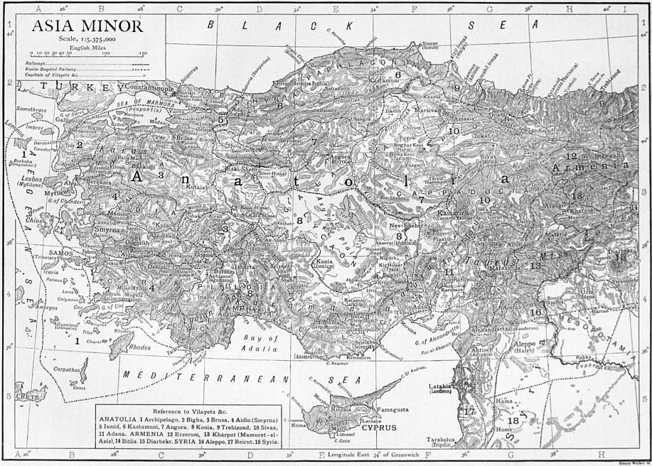
(Click to enlarge.)
Bibliography.—1. General Authorities:—C. Texier, Asie
Mineure (1843); P. Tchihatcheff, Asie Mineure (1853-1860);
C. Ritter, Erdkunde, vols. xviii. xix. (1858-1859); W.J. Hamilton,
Researches in Asia Minor (1843); E. Reclus. Nouv. Géog. Univ.
vol. ix. (1884); V. Cuinet, La Turquie d’Asie (1890); W.M. Ramsay,
Hist. Geog. of A. M. (1890); Murray’s Handbook for A. M. &c., ed. by
Sir C. Wilson (1895). For Geology see Tchihatcheff, Asie Mineure,
Géologie (Paris, 1867-1869); Schaffer, Cilicia, Peterm. Mitt.
Ergänzungsheft, 141 (1903); Philippson, Sitz. k. preuss. Akad. Wiss. (1903),
pp. 112-124; English, Quart. Journ. Geol. Soc. (London, 1904), pp. 243-295;
see also Suess, Das Antlitz der Erde, vol. iii. pp. 402-412, and
the accompanying references.
2. A. Western Asia Minor.—J. Spon and G. Wheler, Voyage
du Levant (1679); P. de Tournefort, Voyage du Levant (1718);
F. Beaufort, Ionian Antiquities (1811); R. Chandler, Travels (1817);
W.M. Leake, Journal of a Tour in A. M. (1820); F.V.J. Arundell,
Visit to the Seven Churches (1828), and Discoveries, &c. (1834);
C. Fellows, Excursion in A. M. (1839); C.T. Newton, Travels (1867),
and Discoveries at Halicarnassus, &c. (1863); Dilettanti Society,
Ionian Antiquities (1769-1840); J.R.S. Sterrett, Epigr. Journey
and Wolfe Exped. (Papers, Amer. Arch. Inst. ii. iii.) (1888); J.H.
Skene, Anadol (1853); G. Radet, Lydie (1893); O. Rayet and
A. Thomas, Milet et le Golfe Latmique (1872); K. Buresch, Aus
Lydien (1898); W.M. Ramsay, Cities and Bishoprics of Phrygia
(1895), and Impressions of Turkey (1898).
B. Eastern Asia Minor.—W.F. Ainsworth, Travels in A. M.
(1842); G. Perrot and E. Guillaume, Expl. arch, de la Galatie (1862-1872);
E.J. Davis, Anatolica (1874); H.F. Tozer, Turkish Armenia
(1881); H.J. v. Lennep, Travels (1870); D.G. Hogarth, Wandering
Scholar (1896); Lord Warkworth, Notes of a Diary, &c. (1898);
E. Sarre, Reise (1896); D.G. Hogarth and J.A.R. Munro, Mod.
and Anc. Roads (R.G.S. Supp. Papers iii.) (1893); H.C. Barkley,
A Ride through A. M. and Armenia (1891); M. Sykes, Dar ul-Islam
(1904); E. Chantre, Mission en Cappadocie (1898).
C. Southern Asia Minor.—F. Beaufort, Karamania (1817); C.
Fellows, Discoveries in Lycia (1841); T.A.B. Spratt and E. Forbes,
Travels in Lycia (1847); V. Langlois, Voy. dans la Cilicie (1861);
E.J. Davis, Life in Asiatic Turkey (1879); O. Benndorf and E.
Niemann, Lykien (1884); C. Lanckoronski, Villes de la Pamphylie
et de la Pisidie (1890); F. v. Luschan, Reisen in S.W. Kleinasien
(1888); E. Petersen and F. v. Luschan, Lykien (1889); K. Humann
and O. Puchstein, Reisen in Kleinasien und Nordsyrien (1890).
D. Northern Asia Minor.—J.M. Kinneir, Journey through A. M.
(1818); J.G.C. Anderson and F. Cumont, Studia Pontica (1903);
E. Naumann, Vom Goldenen Horn, &c. (1893).
See also G. Perrot and C. Chipiez, Hist. de l’art dans l’antiquité,
vols. iv. v. (1886-1890); J. Strzygowski, Kleinasien, &c. (1903).
Also numerous articles in all leading archaeological periodicals, the
Geographical Journal, Deutsche Rundschau, Petermann’s Geog.
Mitteilungen, &c. &c.
3. Maps.—H. Kiepert, Nouv. carte gén. des prov. asiat. de l’Emp.
ottoman (1894), and Spezialkarte v. Westkleinasien (1890); W. von
Diest, Karte des Nordwestkleinasien (1901); R. Kiepert, Karte von
Kleinasien (1901); E. Friederich, Handels- und Produktenkarte von
Kleinasien (1898); J.G.C. Anderson, Asia Minor (Murray’s Handy
Class. Maps) (1903).
(C. W. W.; D. G. H.)
1 The people, Moslem and Christian, are physically one and appear
to be closely related to the modern Armenians. This relationship is
noticeable in other districts, and the whole original population of
Asia Minor has been characterized as Proto-Armenian or Armenoid.
ASIENTO, or Assiento (from the verb asentar, to place, or
establish), a Spanish word meaning a farm of the taxes, or
contract. The farmer or contractor is called an asentista. The
word acquired a considerable notoriety in English and American
history, on account of the “Asiento Treaty” of 1713. Until 1702
the Spanish government had given the contract for the supply
of negroes to its colonies in America to the Genoese. But after
the establishment of the Bourbon dynasty in 1700, a French
company was formed which received the exclusive privilege of
the Spanish-American slave trade for ten years—from September
1702 to 1712. When the peace of Utrecht was signed the British
government insisted that the monopoly should be given to its
own subjects. By the terms of the Asiento treaty signed on the
16th of March 1713, it was provided that British subjects should
be authorized to introduce 144,000 slaves in the course of thirty
years, at the rate of 4800 per annum. The privilege was to
expire on the 1st of May 1743. British subjects were also
authorized to send one ship of 500 tons per annum, laden with
manufactured goods, to the fairs of Porto Bello and La Vera
Cruz. Import duties were to be paid for the slaves and goods.
This privilege was conveyed by the British government to the
South Sea Company, formed to work it. The privilege, to which
an exaggerated value was attached, formed the solid basis of
the notorious fit of speculative fever called the South Sea Bubble.
Until 1739 the trade in blacks went on without interruption, but
amid increasingly angry disputes between the Spanish and the
British governments. The right to send a single trading ship
to the fairs of Porto Bello or La Vera Cruz was abused. Under
pretence of renewing her provisions she was followed by tenders
which in fact carried goods. Thus there arose what was in fact
a vast contraband trade. The Spanish government established
a service of revenue boats (guarda costas) which insisted on
searching all English vessels approaching the shores of the
Spanish colonies. There can be no doubt that the smugglers
were guilty of many piratical excesses, and that the guarda
costas often acted with violence on mere suspicion. After many
disputes, in which the claims of the British government were
met by Spanish counterclaims, war ensued in 1739. When peace
was made at Aix-la-Chapelle in 1748 Spain undertook to allow the
asiento to be renewed for the four years which were to run when
war broke out in 1739. But the renewal for so short a period
was not considered advantageous, and by the treaty of El Retiro
of 1750, the British government agreed to the recession of the
Asiento treaty altogether on the payment by Spain of £100,000.
A very convenient account of the Asiento Treaty, and of the trade
which arose under it, will be found in Malachy Postlethwayt’s
Universal Dictionary of Trade and Commerce (London, 1751), s.v.
ASIR, a district in western Arabia, lying between 17° 30′ and
21° N., and 40° 30′ and 45° E.; bounded N. by Hejaz, E. by
Nejd, S. by Yemen and W. by the Red Sea. Like Yemen, it
consists of a lowland zone some 20 or 30 m. in width along the
coast, and of a mountainous tract, falling steeply on the west
and merging into a highland plateau which slopes gradually to
the N.E. towards the Nejd steppes. Its length along the coast
is about 230 m., and its breadth from the coast to El Besha about
180. The lowland, or Tehama, is hot and barren; the principal
places in it are Kanfuda, the chief port of the district, Marsa
Hali and El Itwad, smaller ports farther south. The mountainous
tract has probably an average altitude of between 6000 and
7000 ft., with a temperate climate and regular rainfall, and is
fertile and populous. The valleys are well watered and produce
excellent crops of cereals and dates. The best-known are the
Wadi Taraba and the W. Besha, both running north-east
towards the W. Dawasir in Nejd. Taraba, according to John
Lewis Burckhardt, is a considerable town, surrounded by palm
groves and gardens, and watered by numerous rivulets, and
tamous for its long resistance to Mehemet Ali’s forces in 1815.
Five or six days’ journey to the south-east is the district of
Besha, the most important position between Sana and Taif.
Here Mehemet Ali’s army, amounting to 12,000 men, found
sufficient provisions to supply it during a fortnight’s halt.
The Wadi Besha is a broad valley abounding with streams
containing numerous hamlets scattered over a tract some
six or eight hours’ journey in length. Its principal affluent,
the W. Shahran, rises 120 m. to the south and runs
through the fertile district of Khamis Mishet, the highest in
Asir. The Zahran district lies four days west of Besha on the
crest of the main range: the principal place is Makhwa, a large
town and market, from which grain is exported in considerable
quantities to Mecca. Farther south is the district of Shamran.
Throughout the mountainous country the valleys are well
watered and cultivated, with fortified villages perched on the
surrounding heights. Juniper forests are said to exist on the
higher mountains. Three or four days’ journey east and south-east
of Besha are the encampments of the Bani Kahtan, one of
the most ancient tribes of Arabia; their pastures extend into
the adjoining district of Nejd, where they breed camels in large
numbers, as well as a few horses.
The inhabitants are a brave and warlike race of mountaineers,
and aided by the natural strength of their country they have
762
hitherto preserved their independence. Since the beginning of
the 19th century they have been bigoted Wahhabis, though
previously regarded by their neighbours as very lax Mahommedans;
during Mehemet Ali’s occupation of Nejd their constant
raids on the Egyptian communications compelled him to send
several punitive expeditions into the district, which, however,
met with little success. Since the reconquest of Yemen by the
Turks, they have made repeated attempts to subjugate Asir,
but beyond occupying Kanfuda, and holding one or two isolated
points in the interior, of which Ibha and Manadir are the principal,
they have effected nothing.
The chief sources of information regarding Asir are the notes
made by J.L. Burckhardt at Taif in 1814 and those of the French
officers with the Egyptian expeditions into the country from
1814 to 1837. No part of Arabia would better repay exploration.
Authorities.—J.L. Burckhardt, Travels in Arabia (London,
1829); F. Mengin, Histoire de l’Égypte, &c. (Paris, 1823);
M.O. Tamisier, Voyage en Arabie (Paris, 1840).
(R. A. W.)
ASISIUM (mod. Assisi), an ancient town of Umbria, in a
lofty situation about 15 m. E.S.E. of Perusia. As an independent
community it had already begun to use Latin as well as Umbrian
in its inscriptions (for one of these recording the chief magistrates—marones—see
C.I.L. xi. 5390). It became a municipium in
90 B.C., but, though numerous inscriptions (C.I.L. xi. 5371-5606)
testify to its importance in the Imperial period, it is hardly
mentioned by our classical authorities. Scanty traces of the
ancient city walls may be seen; within the town the best-preserved
building is the so-called temple of Minerva, with six
Corinthian columns of travertine, now converted into a church,
erected by Gaius and Titus Caesius in the Augustan era. It
fronted on to the ancient forum, part of the pavement of which,
with a base for the equestrian statues of Castor and Pollux (as
the inscription upon it records) has been laid bare beneath the
present Piazza Vittorio Emanuele. The remains of the amphitheatre,
in opus reticulatum, may be seen in the north-east corner
of the town; and other ancient buildings have been discovered.
Asisium was probably the birthplace of Propertius.
(T. As.)
ASKABAD, or Askhabad, a town of Russian central Asia,
capital of the Transcaspian province, 345 m. by rail S.E. of
Krasnovodsk and 594 from Samarkand, situated in a small
oasis at the N. foot of the Kopet-dagh range. It has a public
library and a technical railway school; also cotton-cleaning
works, tanneries, brick-works, and a mineral-water factory.
The trade is valued at £250,000 a year. The population, 2500
in 1881, when the Russians seized it, was 19,428 in 1897, one-third
Persians, many of them belonging to the Babi sect.
ASKAULES (Gr. ἀσκαύλης [?] from ἀσκός, bag, αὐλός, pipe),
probably the Greek word for bag-piper, although there is no
documentary authority for its use. Neither it nor ἄσκαυλος
(which would naturally mean the bag-pipe) has been found in
Greek classical authors, though J.J. Reiske—in a note on Dio
Chrysostom, Orat. lxxi. ad fin., where an unmistakable description
of the bag-pipe occurs (“and they say that he is skilled to
write, to work as an artist, and to play the pipe with his mouth,
on the bag placed under his arm-pits”)—says that ἀσκαύλης was
the Greek word for bag-piper. The only actual corroboration
of this is the use of ascaules for the pure Latin utricularius in
Martial x. 3. 8. Dio Chrysostom flourished about A.D. 100;
it is therefore only an assumption that the bag-pipe was known
to the classical Greeks by the name of ἄσκαυλος. It need not,
however, be a matter of surprise that among the highly cultured
Greeks such an instrument as the bag-pipe should exist without
finding a place in literature. It is significant that it is not
mentioned by Pollux (Onomast. iv. 74) and Athenaeus (Deipnos.
iv. 76) in their lists of the various kinds of pipes.
See articles Aulos and Bag-pipe; art. “Askaules” in Pauly-Wissowa,
Realencyclopadie.
ASKE, ROBERT (d. 1537), English rebel, was a country
gentleman who belonged to an ancient family long settled in
Yorkshire, his mother being a daughter of John, Lord Clifford.
When in 1536 the insurrection called the “Pilgrimage of Grace”
broke out in Yorkshire, Aske was made leader; and marching
with the banner of St Cuthbert and with the badge of the “five
wounds,” he occupied York on the 16th of October and on the
20th captured Pontefract Castle, with Lord Darcy and the
archbishop of York, who took the oath of the rebels. He caused
the monks and nuns to be reinstated, and refused to allow the
king’s herald to read the royal proclamation, announcing his
intention of marching to London to declare the grievances of
the commons to the sovereign himself, secure the expulsion of
counsellors of low birth, and obtain restitution for the church.
The whole country was soon in the hands of the rebels, a military
organization with posts from Newcastle to Hull was established,
and Hull was provided with cannon. Subsequently Aske, followed
by 30,000 or 40,000 men, proceeded towards Doncaster, where
lay the duke of Norfolk with the royal forces, which, inferior
in numbers, would probably have been overwhelmed had not
Aske persuaded his followers to accept the king’s pardon, and
the promise of a parliament at York and to disband. Soon
afterwards he received a letter from the king desiring him to
come secretly to London to inform him of the causes of the
rebellion. Aske went under the guarantee of a safe-conduct
and was well received by Henry. He put in writing a full
account of the rising and of his own share in it; and, fully
persuaded of the king’s good intentions, returned home on the
8th of January 1537, bringing with him promises of a visit from
the king to Yorkshire, of the holding of a parliament at York,
and of free elections. Shortly afterwards he wrote to the king
warning him of the still unquiet state not only of the north but
of the midlands, and stating his fear that more bloodshed was
impending. The same month he received the king’s thanks for
his action in pacifying Sir Francis Bigod’s rising. But his
position was now a difficult and a perilous one, and a few weeks
later the attitude of the government towards him was suddenly
changed. The new rising had given the court an excuse for
breaking off the treaty and sending another army under Norfolk
into Yorkshire. Possibly in these fresh circumstances Aske
may have given cause for further suspicions of his loyalty, and
in his last confession he acknowledged that communications to
obtain aid had been opened with the imperial ambassador and
were contemplated with Flanders. But it is more probable
that the government had from the first treacherously affected
to treat him with confidence to secure the secrets of the rebels
and to effect his destruction. In March Norfolk congratulated
Cromwell on the successful accomplishment of his task, having
persuaded Aske to go to London on false assurances of security.
He was arrested in April, tried before a commission at Westminster,
and sentenced to death for high treason on the 17th of
May; and on the 28th of June he was taken back to Yorkshire,
being paraded in the towns and country through which he
passed. He was hanged at York in July, expressing repentance
for breaking the king’s laws, but declaring that he had promise
of pardon both from Cromwell and from Henry. It is related
that his servant, Robert Wall, died of grief at the thought of
his master’s approaching execution. Aske was a real leader,
who gained the affection and confidence of his followers; and
his sudden rise to greatness and his choice by the people point
to abilities that have not been recorded.
See Henry VIII. and the English Monasteries, by F.A. Gasquet
(1906); Letters and Papers of the Reign of Henry VIII., vols. xi.
and xii.; English Histor. Review, v. 330, 550 (account of the rebellion,
examination and answers to interrogations); Chronicle of
Henry VIII., tr. by M.A.S. Hume (1889); Whitaker’s Richmondshire,
i. 116 (pedigree of the Askes).
ASKEW, or Ascue, ANNE (1521?-1546), English Protestant
martyr, born at Stallingborough about 1521, was the second
daughter of Sir William Askew (d. 1540) of South Kelsey,
Lincoln, by his first wife Elizabeth, daughter of Thomas
Wrottesley. Her elder sister, Martha, was betrothed by her
parents to Thomas Kyme, a Lincolnshire justice of the peace,
but she died before marriage, and Anne was induced or compelled
to take her place. She is said to have had two children
by Kyme, but religious differences and incompatibility of temperament
soon estranged the couple. Kyme was apparently an
unimaginative man of the world, while Anne took to Bible-reading
with zeal, became convinced of the falsity of the doctrine
763
of transubstantiation, and created some stir in Lincoln by her
disputations. According to Bale and Foxe her husband turned her
out of doors, but in the privy council register she is said to have
“refused Kyme to be her husband without any honest allegation.”
She had as good a reason for repudiating her husband
as Henry VIII. for repudiating Anne of Cleves. In any case,
she came to London and made friends with Joan Bocher, who
was already known for heterodoxy, and other Protestants. She
was examined for heresy in March 1545 by the lord mayor, and
was committed to the Counter prison. Then she was examined
by Bonner, the bishop of London, who drew up a form of recantation
which he entered in his register. This fact led Parsons
and other Catholic historians to state that she actually recanted
but she refused to sign Bonner’s form without qualification.
Two months later, on the 24th of May, the privy council ordered
her arrest. On the 13th of June 1545, she was arraigned as a
sacramentarian under the Six Articles at the Guildhall; but no
witness appeared against her; she was declared not guilty by
the jury and discharged after paying her fees.
The reactionary party, which, owing to the absence of Hertford
and Lisle and to the presence of Gardiner, gained the upper hand
in the council in the summer of 1546, were not satisfied with this
repulse; they probably aimed at the leaders of the reforming
party, such as Hertford and possibly Queen Catherine Parr, who
were suspected of favouring Anne, and on the 18th of June 1546
Anne was again arraigned before a commission including the
lord mayor, the duke of Norfolk, St John, Bonner and Heath.
No jury was empanelled and no witnesses were called; she was
condemned, simply on her confession, to be burnt. On the same
day she was called before the privy council with her husband.
Kyme was sent home into Lincolnshire, but Anne was committed
to Newgate, “for that she was very obstinate and heady in
reasoning of matters of religion.” On the following day she was
taken to the Tower and racked; according to Anne’s own
statement, as recorded by Bale, the lord chancellor, Wriothesley,
and the solicitor-general, Rich, worked the rack themselves; but
she “would not convert for all the pain” (Wriothesley, Chronicle
i. 168). Her torture, disputed by Jardine, Lingard and others, is
substantiated not only by her own narrative, but by two
contemporary chronicles, and by a contemporary letter (ibid.;
Narratives of the Reformation, p. 305; Ellis, Original Letters, 2nd
Ser. ii. 177). For four weeks she was left in prison, and at length
on the 16th of July, she was burnt at Smithfield in the presence
of the same persecuting dignitaries who had condemned her to death.
Authorities.—Bale’s two tracts, printed at Marburg in November
1546 and January 1547, are the basis of Foxe’s account. See also
Acts of the Privy Council (1542-1547), pp. 424-462; Wriothesley’s
Chron. i. 155, 167-169; Narratives of the Reformation, passim;
Gough’s Index to Parker Soc. Publications; Burnet’s Hist. of the
Reformation; Dixon’s Hist. of the Church of England; Dict. Nat.
Biogr.
(A. F. P.)
AṢMA‘Ī [Abū Sa‘īd ‘Abd ul-Malik ibn Quraib] (c. 739-831),
Arabian scholar, was born of pure Arab stock in Basra and was
a pupil there of Abū ‘Amr ibn ul-‘Alā. He seems to have been a
poor man until by the influence of the governor of Basra he was
brought to the notice of Harūn al-Rashīd, who enjoyed his
conversation at court and made him tutor of his son. He became
wealthy and acquired property in Basra, where he again settled
for a time; but returned later to Bagdad, where he died in 831.
Aṣma‘ī was one of the greatest scholars of his age. From his
youth he stored up in his memory the sacred words of the Koran,
the traditions of the Prophet, the verses of the old poets and the
stories of the ancient wars of the Arabs. He was also a student
of language and a critic. It was as a critic that he was the great
rival of Abū ‘Ubaida (q.v.). While the latter followed (or led) the
Shu‘ūbite movement and declared for the excellence of all things
not Arabian, Aṣma‘ī was the pious Moslem and avowed supporter
of the superiority of the Arabs over all peoples, and of the freedom
of their language and literature from all foreign influence.
Some of his scholars attained high rank as literary men. Of
Aṣma‘ī’s many works mentioned in the catalogue known as the
Fihrist, only about half a dozen are extant. Of these the Book
of Distinction has been edited by D.H. Müller (Vienna, 1876);
the Book of the Wild Animals by R. Geyer (Vienna, 1887); the
Book of the Horse, by A. Haffner (Vienna, 1895); the Book of the
Sheep, by A. Haffner (Vienna, 1896).
For life of Aṣma‘ī, see Ibn Khallikān, Biographical Dictionary,
translated from the Arabic by McG. de Slane (Paris and
London, 1842), vol. ii. pp. 123-127. For his work as a grammarian,
G. Flügel, Die grammatischen Schulen der Araber (Leipzig, 1862),
pp. 72-80.
(G. W. T.)
ASMARA, the capital of the Italian colony of Eritrea, N.E.
Africa. It is built on the Hamasen plateau, near its eastern edge,
at an elevation of 7800 ft., and is some 40 m. W.S.W. in a direct
line of the seaport of Massawa. Pop. (1904) about 9000, including
the garrison of 300 Italian soldiers, and some 1000 native troops.
The European civil population numbers over 500; the rest
of the inhabitants are chiefly Abyssinians. There is a small
Mahommedan colony. The town is strongly fortified. The
European quarter contains several fine public buildings, including
the residence of the governor, club house, barracks and hospital.
Fort Baldissera is built on a hill to the south-west of the town
and is considered impregnable.
Asmara, an Amharic word signifying “good pasture place,” is
a town of considerable antiquity. It was included in the maritime
province of northern Abyssinia, which was governed by a
viceroy who bore the title of Bahar-nagash (ruler of the sea).
By the Abyssinians the Hamasen plateau was known as the plain
of the thousand villages. Asmara appears to have been one of
the most prosperous of these villages, and to have attained
commercial importance through being on the high road from
Axum to Massawa. When Werner Munzinger (q.v.) became
French consul at Massawa, he entered into a scheme for annexing
the Hamasen (of which Asmara was then the capital) to France,
but the outbreak of the war with Germany in 1870 brought the
project to nought (cf. A.B. Wylde, Modern Abyssinia, 1901).
In 1872 Munzinger, now in Egyptian service, annexed Asmara
to the khedivial dominions, but in 1884, owing to the rise of the
mahdi, Egypt evacuated her Abyssinian provinces and Asmara was
chosen by Ras Alula, the representative of the negus Johannes
(King John), as his headquarters. Shortly afterwards the Italians
occupied Massawa, and in 1889 Asmara (see Abyssinia: History).
In 1900 the seat of government was transferred from Massawa
to Asmara, which in its modern form is the creation of the
Italians. It is surrounded by rich agricultural lands, cultivated
in part by Italian immigrants, and is a busy trading centre. A
railway from Massawa to Asmara was completed as far as Ghinda,
at the foot of the plateau, in 1904. At Medrizien, 6 m. north of
Asmara, are gold-mines which have been partially worked.
See G. Dainelli, In Africa. Lettere dall’ Eritrea (Bergamo, 1908);
R. Perini, Di qua dal Mareb (Florence, 1905).
ASMODEUS, or Ashmedai, an evil demon who appears in later
Jewish tradition as “king of demons.” He is sometimes identified
with Beelzebub or Apollyon (Rev. ix. 11). In the Talmud he
plays a great part in the legends concerning Solomon. In the
apocryphal book of Tobit (iii. 8) occurs the well-known story of
his love for Sara, the beautiful daughter of Raguel, whose seven
husbands were slain in succession by him on their respective
bridal nights. At last Tobias, by burning the heart and liver of
a fish, drove off the demon, who fled to Egypt. From the part
played by Asmodeus in this story, he has been often familiarly
called the genius of matrimonial unhappiness or jealousy, and
as such may be compared with Lilith. Le Sage makes him the
principal character in his novel Le Diable boiteux. Both the
word and the conception seem to have been derived originally
from the Persian. The name has been taken to mean “covetous.”
It is in any case no doubt identical with the demon Aeshma of
the Zend-Avesta and the Pahlavi texts. But the meaning is not
certain. It is generally agreed that the second part of the name
Asmodeus is the same as the Zend daēwa, dēw, “demon.” The
first part may be equivalent to Aeshma, the impersonation of
anger. But W. Baudissin (Herzog-Hauck, Realencyklopädie)
prefers to derive it from ish, to drive, set in motion; whence
ish-mīn, driving, impetuous.
The legend of Asmodeus is given fully in the Jewish Encyclopaedia, s.v.
See also the articles in the Encyclopaedia Biblica, Hastings’
Dictionary of the Bible, and Herzog-Hauck, Realencyklopädie.
764
ASMONEUS, or Asamonaeus (so Josephus), great-grandfather
of Mattathias, the father of Judas Maccabaeus. Nothing more is
known of him, and the name is only given by Josephus (not in
1 Macc. ii. 1). But the dynasty was known to Josephus and the
Mishna (once) as “the sons (race) of the Asamonaeans (of A.)”;
and the Targum of 1 Sam. ii. 4 has “the house of the Hashmoneans
who were weak, signs were wrought for them and
strength.” If not the founder, Asmoneus was probably the home
of the family (cf. Heshmon, Jos. xv. 27).
See Schurer, Geschichte des jüdischen Volkes, i. 248 N; art.
“Maccabees,” § 2, in Ency. Biblica.
(J. H. A. H.)
ASNIÈRES, a town of northern France, in the department of
Seine, on the left bank of the Seine, about 1½ m. N.N.W. of the
fortifications of Paris. Pop. (1906) 35,883. The town, which
has grown rapidly in recent years, is a favourite boating centre
for the Parisians. The industries include boat-building and the
manufacture of colours and perfumery.
ASOKA, a famous Buddhist emperor of India who reigned
from 264 to 228 or 227 B.C. Thirty-five of his inscriptions on
rocks or pillars or in caves still exist (see Inscriptions: Indian),
and they are among the most remarkable and interesting of
Buddhist monuments (see Buddhism). Asoka was the grandson
of Chandragupta, the founder of the Maurya (Peacock) dynasty,
who had wrested the Indian provinces of Alexander the Great
from the hands of Seleucus, and he was the son of Bindusāra,
who succeeded his father Chandragupta, by a lady from Champā.
The Greeks do not mention him and the Brahmin books ignore
him, but the Buddhist chronicles and legends tell us much about
him. The inscriptions, which contain altogether about five
thousand words, are entirely of religious import, and their
references to worldly affairs are incidental. They begin in the
thirteenth year of his reign, and tell us that in the ninth year he
had invaded Kalinga, and had been so deeply impressed by the
horrors involved in warfare that he had then given up the desire
for conquest, and devoted himself to conquest by “religion.”
What the religion was is explained in the edicts. It is purely
ethical, independent alike of theology and ritual, and is the code
of morals as laid down in the Buddhist sacred books for laymen.
He further tells us that in the ninth year of his reign he formally
joined the Buddhist community as a layman, in the eleventh
year he became a member of the order, and in the thirteenth he
“set out for the Great Wisdom” (the Sambodhi), which is the
Buddhist technical term for entering upon the well-known, eightfold
path to Nirvana. One of the edicts is addressed to the
order, and urges upon its members and the laity alike the learning
and rehearsal of passages from the Buddhist scriptures.
Two others are proclamations commemorating visits paid by the
king, one to the dome erected over the ashes of Konāgamana, the
Buddha, another to the birthplace of Gotama, the Buddha (q.v.).
Three very short ones are dedications of caves to the use of
an order of recluses. The rest either enunciate the religion as
explained above, or describe the means adopted by the king for
propagating it, or acting in accordance with it. These means are
such as the digging of wells, planting medicinal herbs, and trees
for shade, sending out of missionaries, appointment of special
officers to supervise charities, and so on. The missionaries were
sent to Kashmir, to the Himalayas, to the border lands on the
Indus, to the coast of Burma, to south India and to Ceylon.
And the king claims that missions sent by him to certain Greek
kingdoms that he names had resulted in the folk there conforming
themselves to his religion. The extent of Asoka’s dominion
included all India from the thirteenth degree of latitude up to the
Himalayas, Nepal, Kashmir, the Swat valley, Afghanistan as
far as the Hindu Kush, Sind and Baluchistan. It was thus as
large as, or perhaps somewhat larger than, British India before
the conquest of Burma. He was undoubtedly the most powerful
sovereign of his time and the most remarkable and imposing of
the native rulers of India. “If a man’s fame,” says Köppen,
“can be measured by the number of hearts who revere his
memory, by the number of lips who have mentioned, and still
mention him with honour, Asoka is more famous than Charlemagne
or Caesar.” At the same time it is probable that,
like Constantine’s patronage of Christianity, his patronage of
Buddhism, then the most rising and influential faith in India,
was not unalloyed with political motives, and it is certain that
his vast benefactions to the Buddhist cause were at least one of
the causes that led to its decline.
See also Asoka, by Vincent Smith (Oxford, 1901); Inscriptions de
Piyadasi, by E. Senart (Paris, 1891); chapters on Asoka in T.W.
Rhys Davids’s Buddhism (20th ed., London, 1903), and Buddhist India
(London, 1903); V.A. Smith, Edicts of Asoka (1909).
(T. W. R. D.)
ASOLO (anc. Acelum), a town of Venetia, Italy, in the province
of Treviso, about 19 m. N.W. direct from the town of Treviso,
and some 10 m. E. of Bassanoby road. Pop. (1901) 5847. It is
well situated on a hill, 690 ft. above sea-level. Remains of
Roman baths and of a theatre have been discovered in the
course of excavation (Notizie degli scavi, 1877, 235; 1881, 205;
1882, 289), and the town was probably a municipium. It
became an episcopal see in the 6th century. It was to Asolo
that Catherine Cornaro, queen of Cyprus, retired on her abdication.
Here she was visited by Pietro Bembo, who conceived here
his Dialoghi degli Asolani, and by Andrea Navagero (Naugerius).
Paulus Manutius was born here. The village of Maser is 4½ m. to
the E., and near it is the Villa Giacomelli, erected by Palladio, containing
frescoes by Paolo Veronese, executed in 1566-1568 for Marcantonio
Barbaro of Venice, and ranking among his best works.
ASOR (Hebr. for “ten”), an instrument “of ten strings”
mentioned in the Bible, about which authors are not agreed.
The word occurs only three times in the Bible, and has not been
traced elsewhere. In Psalm xxxiii. 2 the reference is to “kinnor,
nebel and asor”; in Psalm xcii. 3, to “nebel and asor”; in
Psalm cxliv. to “nebel-asor.” In the English version asor is
translated “an instrument of ten strings,” with a marginal note
“omit” applied to “instrument.” In the Septuagint, the word
being derived from a root signifying “ten,” the Greek is ἐν δεκαχορδῷ
or ψαλτήριον δεκάχορδον, in the Vulgate in decachordo
psalterio. Each time the word asor is used it follows the
word nebel (see Psaltery), and probably merely indicates a
variant of the nebel, having ten strings instead of the customary
twelve assigned to it by Josephus (Antiquities, vii. 12. 3).
See also Mendel and Reissmann, Musikalisches Conversations-Lexikon,
vol. i. (Berlin, 1881); Sir John Stainer, The Music of the
Bible, pp. 35-37; Forkel, Allgemeine Geschichte der Musik, Bd. i.
p. 133 (Leipzig, 1788).
(K. S.)
ASP (Vipera aspis), a species of venomous snake, closely allied
to the common adder of Great Britain, which it represents
throughout the southern parts of Europe, being specially
abundant in the region of the Alps. It differs from the adder
in having the head entirely covered with scales, shields being
absent, and in having the snout somewhat turned up. The term
“Asp” ἀσπίς seems to have been employed by Greek and
Roman writers, and by writers generally down to comparatively
recent times, to designate more than one species of serpent;
thus the asp, by means of which Cleopatra is said to have ended
her life, and so avoided the disgrace of entering Rome a captive,
is now generally supposed to have been the cerastes, or horned
viper (Cerastes cornutus), of northern Africa and Arabia, a snake
about 15 in. long, exceedingly venomous, and provided with
curious horn-like protuberances over each eye, which give it a
decidedly sinister appearance. The snake, however, to which
the word “asp” has been most commonly applied is undoubtedly
the haje of Egypt, the spy-slange or spitting snake of the Boers
(Naja haje), one of the very poisonous Elarinae, from 3 to 4 ft.
long, with the skin of its neck loose, so as to render it dilatable
at the will of the animal, as in the cobra of India, a species from
which it differs only in the absence of the spectacle-like mark
on the back of the neck. Like the cobra, also, the haje has its
fangs extracted by the jugglers of the country, who afterwards
train it to perform various tricks. The asp (Pethen, פתן) is
mentioned in various parts of the Old Testament. This name
is twice translated “adder,” but as nothing is told of it beyond
its poisonous character and the intractability of its disposition,
it is impossible accurately to determine the species.
ASPARAGINE, C4H3N2O3, a naturally occurring base, found
in plants belonging to the natural orders Leguminosae and
765
Cruciferae. It occurs in two optically active forms, namely, as
laevo-asparagine and dextro-asparagine. Laevo-asparagine was
isolated in 1805 by L.N. Vauquelin. A. Piutti (Gazz. chim. Ital.,
1887, 17, p. 126; 1888, 18, p. 457) synthesized the asparagines
from the monomethyl ester of inactive aspartic acid by heating
it with alcoholic ammonia. In this way a mixture of the two
asparagines was obtained, which were separated by picking out
the hemihedral crystals.
HOOC·CH·NH2·CH2·COOC2H5 + NH3
= C2H5OH + HOOC·CH·NH2·CH2·CONH2.
Laevo-asparagine is slightly soluble in cold water and readily
soluble in hot water. It crystallizes in prisms, containing one
molecule of water of crystallization, the anhydrous form melting
at 234-235° C. Nitrous acid converts it into malic acid,
HOOC·CHOH·CH2·COOH. It is laevo-rotatory in aqueous or
in alkaline solution, and dextro-rotatory in acid solution (L.
Pasteur, Ann. Chim. Phys., 1851 [2], 31, p. 67). Dextro-asparagine
was first found in 1886 in the shoots of the vetch (Piutti). It
forms rhombic crystals possessing a sweet taste. It is dextro-rotatory
in aqueous or alkaline solution, and laevo-rotatory
in acid solution.
Hydrolysis by means of acids or alkalis converts the asparagines
into aspartic acid; whilst on heating with water in a sealed
tube they are converted into ammonium aspartate. The constitution
of the asparagines has been determined by A. Piutti
(Gazz. chim. Ital., 1888, 18, p. 457).
ASPARAGUS, a genus of plants (nat. ord. Liliaceae) containing
more than 100 species, and widely distributed in the temperate
and warmer parts of the Old World; it was introduced from
Europe into America with the early settlers. The name is
derived from the Greek ἀσπάραγος or ἀσφάραγος, the origin
of which is obscure. Sperage or sparage was the form in use from
the 16th to 18th centuries, cf. the modern Italian sparagio. The
vulgar corruption sparrow-grass or sparagrass was in accepted
popular use during the 18th century, “asparagus” being considered
pedantic. The plants have a short, creeping, underground
stem from which spring slender, branched, aerial shoots.
The leaves are reduced to minute scales bearing in their axils
tufts of green, needle-like branches (the so-called cladodes),
which simulate, and perform the functions of, leaves. In one
section of the genus, sometimes regarded as a distinct genus
Myrsiphyllum, the cladodes are flattened. The plants often
climb or scramble, in which they are helped by the development
of the scale-leaves into persistent spines. The flowers are
small, whitish and pendulous; the fruit is a berry.
Several of the climbing species are grown in greenhouses for
their delicate, often feathery branches, which are also valuable
for cutting; the South African Asparagus plumosus is an
especially elegant species. The so-called smilax, much used for
decoration, is a species of the Myrsiphyllum section, A.
medeoloides, also known as Myrsiphyllum asparagoides. The young
shoots of Asparagus officinalis have from very remote times been
in high repute as a culinary vegetable, owing to their delicate
flavour and diuretic virtues. The plant, which is a native of the
north temperate zone of the Old World, grows wild on the south
coast of England; and on the waste steppes of Russia it is so
abundant that it is eaten by cattle like grass. In common with
the marsh-mallow and some other plants, it contains asparagine
or aspartic acidamide. The roots of asparagus were formerly
used as an aperient medicine, and the fruits were likewise
employed as a diuretic. Under the name of Prussian asparagus,
the spikes of an allied plant, Ornithogalum pyrenaicum, are used
in some places. The diuretic action is extremely feeble, and
neither the plant nor asparagine is now used medicinally.
Asparagus is grown extensively in private gardens as well as
for market. The asparagus prefers a loose, light, deep, sandy soil;
the depth should be 3 ft., the soil being well trenched, and all
surplus water got away. A considerable quantity of well-rotted
dung or of recent seaweed should be laid in the bottom of the
trench, and another top-dressing of manure should be dug in
preparatory to planting or sowing. The beds should be 3 ft.
or 5 ft. wide, with intervening alleys of 2 ft., the narrower beds
taking two rows of plants, the wider ones three rows. The beds
should run east and west, so that the sun’s rays may strike
against the side of the bed. In some cases the plants are grown
in equidistant rows 3 to 4 ft. apart. Where the beds are made
with plants already prepared, either one-year-old or two-year-old
plants may be used, for which a trench should be cut sufficient
to afford room for spreading out the roots, the crowns being all
kept at about 2 in. below the surface. Planting is best done in
April, after the plants have started into growth. To prevent
injury to the roots, it is, however, perhaps the better plan to
sow the seeds in the beds where the plants are to remain. To
experience the finest flavour of asparagus, it should be eaten
immediately after having been gathered; if kept longer than one
day, or set into water, its finer flavour is altogether lost. If
properly treated, asparagus beds will continue to bear well for
many years. The asparagus grown at Argenteuil, near Paris,
has acquired much notoriety for its large size and excellent
quality. The French growers plant in trenches instead of
raised beds. The most common method of forcing asparagus
is to prepare, early in the year, a moderate hot-bed of stable
litter with a bottom heat of 70°, and to cover it with a common
frame. After the heat of fermentation has somewhat subsided,
the surface of the bed is covered with a layer of light earth or
exhausted tan-bark, and in this the roots of strong mature plants
are closely placed. The crowns of the roots are then covered
with 3 to 6 in. of soil. A common three-light frame may hold
500 or 600 plants, and will afford a supply for several weeks.
After planting, linings are applied when necessary to keep up
the heat, but care must be taken not to scorch the roots; air
must be occasionally admitted. Where there are pits heated
by hot water or by the tank system, they may be advantageously
applied to this purpose. A succession of crops must be maintained
by annually sowing or planting new beds.
The “asparagus-beetle” is the popular name for two beetles,
the “common asparagus beetle” (Crioceris asparagi) and the
“twelve-spotted” (C. duodecimpunctata), which feed on the
asparagus plant. C. asparagi has been known in Europe since
early times, and was introduced into America about 1856; the
rarer C. duodecimpunctata (sometimes called the “red” to
distinguish it from the “blue” species) was detected in America
in 1881. For an admirable account of these pests see F.H.
Chittenden, Circular 102 of the U.S. Dep. of Agriculture, Bureau
of Entomology, May 1908.
The “asparagus-stone” is a form of apatite, simulating asparagus
in colour.
ASPASIA, an Athenian courtesan of the 5th century B.C., was
born either at Miletus or at Megara, and settled in Athens, where
her beauty and her accomplishments gained for her a great
reputation. Pericles, who had divorced his wife (445), made her
his mistress, and, after the death of his two legitimate sons,
procured the passing of a law under which his son by her was
recognized as legitimate. It was the fashion, especially among
the comic poets, to regard her as the adviser of Pericles in all
his political actions, and she is even charged with having caused
the Samian and Peloponnesian wars (Aristoph. Acharn. 497).
Shortly before the latter war, she was accused of impiety, and
nothing but the tears and entreaties of Pericles procured her
acquittal. On the death of Pericles she is said to have become
the mistress of one Lysicles, whom, though of ignoble birth, she
raised to a high position in the state; but, as Lysicles died a year
after Pericles (428), the story is unconvincing. She was the
chief figure in the dialogue Aspasia by Aeschines the Socratic,
in which she was represented as criticizing the manners and
training of the women of her time (for an attempted reconstruction
of the dialogue see P. Natorp in Philologus, li. p. 489, 1892);
in the Menexenus (generally ascribed to Plato) she is a teacher
of rhetoric, the instructress of Socrates and Pericles, and a funeral
oration in honour of those Athenians who had given their lives
for their country (the authorship of which is attributed to
Aspasia) is repeated by Socrates; Xenophon (Oecon. lii. 14) also
speaks of her in favourable terms, but she is not mentioned by
Thucydides. In opposition to this view, Wilamowitz-Möllendorff
766
(Hermes, xxxv. 1900) regards her simply as a courtesan, whose
personality would readily become the subject of rumour, favourable
or unfavourable. There is a bust bearing her name in the
Pio Clementino Museum in the Vatican.
See Le Conte de Bièvre, Les Deux Aspasies (1736); J.B. Capefigue,
Aspasie et le siècle de Périclès (1862); L. Becq de Fouquières. Aspasie
de Milet (1872); H. Houssaye, Aspasie, Cléopâtre, Théodora (1899);
R. Hamerling, Aspasia (a romance; Eng. trans. by M.J. Safford,
New York, 1882); J. Donaldson, Woman (1907). Also Pericles.
ASPASIUS, a Greek peripatetic philosopher, and a prolific
commentator on Aristotle. He flourished probably towards the
close of the 1st century A.D., or perhaps during the reign of
Antoninus Pius. His commentaries on the Categories, De
Interpretatione, De Sensu, and other works of Aristotle are
frequently referred to by later writers, but have not come down
to us. Commentaries on Plato, mentioned by Porphyry in his
life of Plotinus, have also been lost. Commentaries on books
1-4, 7 (in part), and 8 of the Nicomachean Ethics are preserved;
that on book 8 was printed with those of Eustratius and others
by Aldus Manutius at Venice in 1536. They were partly (2-4)
translated into Latin by Felicianus in 1541, and have frequently
been republished, but their authenticity has been disputed.
The most recent edition is by G. Heylbut in Commentaria in
Aristotelem Graeca, xix. 1 (Berlin, 1889).
Another Aspasius, in the 3rd century A.D., was a Roman sophist
and rhetorician, son or pupil of the rhetorician Demetrianus. He
taught rhetoric in Rome, and filled the chair of rhetoric founded
by Vespasian. He was secretary to the emperor Maximin. His
orations, which are praised for their style, are lost.
ASPEN, an important section of the poplar genus (Populus)
of which the common aspen of Europe, P. tremula, may be taken
as the type,—a tall fast-growing tree with rather slender trunk,
and grey bark becoming rugged when old. The roundish leaves,
toothed on the margin, are slightly downy when young, but afterwards
smooth, dark green on the upper and greyish green on the
lower surface; the long slender petioles, much flattened towards
the outer end, allow of free lateral motion by the lightest breeze,
giving the foliage its well-known tremulous character. By their
friction on each other the leaves give rise to a rustling sound.
It is supposed that the mulberry trees (Becaim) mentioned in
1 Chronicles xiv. 14, 15 were really aspen trees. The flowers,
which appear in March and April, are borne on pendulous hairy
catkins, 2-3 in. long; male and female catkins are, as in the other
species of the genus, on distinct trees.
The aspen is found in moist places, sometimes at a considerable
elevation, 1600 ft. or more, in Scotland. It is an abundant tree
in the northern parts of Britain, even as far as Sutherland, and is
occasionally found in the coppices of the southern counties, but
in these latter habitats seldom reaches any large size; throughout
northern Europe it abounds in the forests,—in Lapland
flourishing even in 70° N. lat., while in Siberia its range extends
to the Arctic Circle; in Norway its upper limit is said to coincide
with that of the pine; trees exist near the western coast having
stems 15 ft. in circumference. The wood of the aspen is very
light and soft, though tough; it is employed by coopers, chiefly
for pails and herring-casks; it is also made into butchers’ trays,
pack-saddles, and various articles for which its lightness recommends
it; sabots are also made of it in France, and in medieval
days it was valued for arrows, especially for those used in target
practice; the bark is used for tanning in northern countries;
cattle and deer browse greedily on the young shoots and abundant
suckers. Aspen wood makes but indifferent fuel, but charcoal
prepared from it is light and friable, and has been employed in
gunpowder manufacture. The powdered bark is sometimes given
to horses as a vermifuge; it possesses likewise tonic and febrifugal
properties, containing a considerable amount of salicin. The
aspen is readily propagated either by cuttings or suckers, but
has been but little planted of late years in Britain. P. trepida,
or tremuloides. is closely allied to the European aspen, being
chiefly distinguished by its more pointed leaves; it is a native
of most parts of Canada and the United States, extending
northwards as far as Great Slave Lake. The wood is soft and
neither strong nor durable; it burns better in the green state
than that of most trees, and is often used by the hunters of the
North-West as fuel; split into thin layers, it was formerly
employed in the United States for bonnet and hat making. It
is largely manufactured into wood-pulp for paper-making. The
bark is of some value as a tonic and febrifuge. P. grandidentata,
the large-leaved American aspen, has ovate or roundish leaves
deeply and irregularly serrated on the margin. The wood is
light, soft and close-grained, but not strong. In northern New
England and Canada it is largely manufactured into wood-pulp;
it is occasionally used in turnery and for wooden-ware.
ASPENDUS (mod. Balkis Kalé, or, more anciently in the
native language, Estvedys (whence the adjective Estvedijys on
coins), an ancient city of Pamphylia, very strongly situated on
an isolated hill on the right bank of the Eurymedon at the
point where the river issues from the Taurus. The sea is now
about 7 m. distant, and the river is navigable only for about
2 m. from the mouth; but in the time of Thucydides ships could
anchor off Aspendus. Really of pre-Hellenic date, the place
claimed to be an Argive colony. It derived wealth from great
salines and from a trade in oil and wool, to which the wide
range of its admirable coinage bears witness from the 5th century
B.C. onwards. There Alcibiades met the satrap Tissaphernes in
411 B.C., and thence succeeded in getting the Phoenician fleet,
intended to co-operate with Sparta, sent back home. The
Athenian, Thrasybulus, after obtaining contributions from
Aspendus in 389, was murdered by the inhabitants. The city
bought off Alexander in 333, but, not keeping faith, was forcibly
occupied by the conqueror. In due course it passed from
Pergamene to Roman dominion, and according to Cicero, was
plundered of many artistic treasures by Verres. It was ranked
by Philostratus the third city of Pamphylia, and in Byzantine
times seems to have been known as Primopolis, under which
name its bishop signed at Ephesus in A.D. 431. In medieval
times it was evidently still a strong place, but it has now sunk,
in the general decay of Pamphylia, to a wretched hamlet.
The ruins still extant are very remarkable, and, with the
noble Roman theatre, the finest in the world, have earned for
the place (as is the case with certain other great monuments) a
legendary connexion with Solomon’s Sheban queen. On the
summit of the hillock, surrounded by a wall with three gates,
lie the remains of the city. The public buildings round the forum
can all be traced, and parts of them are standing to a considerable
height. They consist of a fine nympheum on the north with a
covered theatre behind it, covered market halls on the west, and
a peristyle hall and a basilica on the east. In the plain below are
large thermae, and ruins of a splendid aqueduct. But all else
seems insignificant beside the huge theatre, half hollowed out of
the north-east flank of the hill. This was first published by
C.F.M. Texier in 1849, and has now been completely planned,
&c., by Count Lanckoronski’s expedition in 1884. It is built of
local conglomerate and is in marvellous preservation. Erected
to the honour of the emperors Marcus Aurelius and L. Verus by
the architect Zeno, for the heirs of a local Roman citizen (as an
inscription repeated over both portals attests), its auditorium
has a circuit of 313.17 feet. There are forty tiers of seating,
divided by one diazoma, and crowned by an arched gallery of
rather later date, repaired in places with brick. This auditorium
held 7500 spectators. The seats are not perfect, but so nearly
so as to appear practically intact. The wooden stage has, of
course, perished, but all its supporting structures are in place,
and the great scena wall stands to its full height, and produces a
magnificent impression whether from within or from without.
Inwardly it was decorated with two orders of columns one above
the other, with rich entablatures, much of which survives. In
the tympanum is a relief of Bacchus (wrongly supposed to be of a
female, and called the Bal-Kis, i.e. “Honey Girl”). The position
of the sounding board above the stage is apparent. Under the
forepart of the auditorium, built out from the hill, are immense
vaults. The whole structure was enclosed within one great wall,
pierced with numerous windows. This structure was probably
put to some ecclesiastical Byzantine use, as certain mutilated
heads of saints appear upon it; and later it became a fortress
767
and received certain additions. It is now under the care of the
local aghá and not allowed to be plundered for building stone.
See C. Lanckoronski, Villes de la Pamphylie et de la Pisidie, i.
(1890).
(D. G. H.)
ASPER, AEMILIUS, Latin grammarian, possibly lived in the
2nd century A.D. He wrote commentaries on Terence, Sallust
and Virgil. Numerous fragments of the last show that as both
critic and commentator he possessed good judgment and taste.
They are printed in Keil, Probi in Vergilii Bucolica Commentarius
(1848); see also Suringar, Historia Critica Scholiastarum Latinorum
(1834); Gräfenhan, Geschichte der klassischen Philologie im
Alterthum. iv. (1843-1850). Two short grammatical treatises,
extant under the name of Asper, and of very little value, have
nothing to do with the commentator, but belong to a much
later date—the time of Priscian (6th century). Both are
printed in Keil, Grammatici Latini. See also Schanz, Geschichte
der römischen Litteratur, § 598.
ASPER, HANS (1499-1571), Swiss painter, was born and died
at Zürich. He wrought in a great variety of styles, but excelled
chiefly in flower and fruit pieces, and in portrait-painting.
Many of his pictures have perished, but his style may be judged
from the illustrations to Gessner’s Historia Animalium, for which
he is said to have furnished the designs, and from portraits of
Zwingli and his daughter Regula Gwalter, which are preserved
in the public library of Zürich. It has been usual to class Asper
among the pupils and imitators of Holbein, but an inspection of
his works is sufficient to show that this is a mistake. Though
Asper was held in high reputation by his fellow-citizens, who
elected him a member of the Great Council, and had a medal
struck in his honour, he seems to have died in poverty.
ASPERGES (“thou wilt sprinkle,” from the Latin verb
aspergere), the ceremony of sprinkling the people with holy water
before High Mass in the Roman Catholic Church, so called from
the first word of the verse (Ps. iv. 9) Asperges me, Domini,
hyssopo et mundabor, with which the priest begins the ceremony.
The brush used for sprinkling is an aspergill (aspergillum), or
aspersoir, and the vessel for this water an aspersorium. The act
of sprinkling the water is called aspersion.
ASPERN-ESSLING, Battle of (1809), a battle fought on the
21st and 22nd of May 1809 between the French and their allies
under Napoleon and the Austrians commanded by the archduke
Charles (see Napoleonic Campaigns). At the time of the
battle Napoleon was in possession of Vienna, the bridges over
the Danube had been broken, and the archduke’s army was on
and about the Bisamberg, a mountain near Korneuburg, on
the left bank of the river. The first task of the French was the
crossing of the Danube. Lobau, one of the numerous islands
which divide the river into minor channels, was selected as the
point of crossing, careful preparations were made, and on the
night of the 19th-20th of May the French bridged all the channels
from the right bank to Lobau and occupied the island. By the
evening of the 20th great masses of men had been collected there
and the last arm of the Danube, between Lobau and the left bank,
bridged. Massena’s corps at once crossed to the left bank and
dislodged the Austrian outposts. Undeterred by the news of
heavy attacks on his rear from Tirol and from Bohemia, Napoleon
hurried all available troops to the bridges, and by daybreak on
the 21st, 40,000 men were collected on the Marchfeld, the broad
open plain of the left bank, which was also to be the scene of
the battle of Wagram. The archduke did not resist the passage;
it was his intention, as soon as a large enough force had crossed,
to attack it before the rest of the French army could come to its
assistance. Napoleon had, of course, accepted the risk of such
an attack, but he sought at the same time to minimize it by
summoning every available battalion to the scene. His forces
on the Marchfeld were drawn up in front of the bridges facing
north, with their left in the village of Aspern (Gross-Aspern)
and their right in Essling (or Esslingen). Both places lay close
to the Danube and could not therefore be turned; Aspern,
indeed, is actually on the bank of one of the river channels.
But the French had to fill the gap between the villages, and also
to move forward to give room for the supports to form up.
Whilst they were thus engaged the archduke moved to the
attack with his whole army in five columns. Three under
Hiller, Bellegarde and Hohenzollern were to converge upon
Aspern, the other two, under Rosenberg, to attack Essling.
The Austrian cavalry was in the centre, ready to move out
against any French cavalry which should attack the heads of
the columns. During the 21st the bridges became more and
more unsafe, owing to the violence of the current, but the
French crossed without intermission all day and during the night.
The battle began at Aspern; Hiller carried the village at the
first rush, but Masséna recaptured it, and held his ground with
the same tenacity as he had shown at Genoa in 1800. The
French infantry, indeed, fought on this day with the old stubborn
bravery which it had failed to show in the earlier battles of the
year. The three Austrian columns fighting their hardest through
the day were unable to capture more than half the village; the
rest was still held by Masséna when night fell. In the meanwhile
nearly all the French infantry posted between the two villages
and in front of the bridges had been drawn into the fight on
either flank. Napoleon therefore, to create a diversion, sent
forward his centre, now consisting only of cavalry, to charge the
enemy’s artillery, which was deployed in a long line and firing
into Aspern. The first charge of the French was repulsed, but
the second attempt, made by heavy masses of cuirassiers, was
more serious. The French horsemen, gallantly led, drove off
the guns, rode round Hohenzollern’s infantry squares, and
routed the cavalry of Lichtenstein, but they were unable to do
more, and in the end they retired to their old position. In the
meanwhile Essling had been the scene of fighting almost as
desperate as that of Aspern. The French cuirassiers made
repeated charges on the flank of Rosenberg’s force, and for long
delayed the assault, and in the villages Lannes with a single
division made a heroic and successful resistance, till night ended
the battle. The two armies bivouacked on their ground, and in
Aspern the French and Austrians lay within pistol shot of each
other. The latter had fought fully as hard as their opponents,
and Napoleon realized that they were no longer the professional
soldiers of former campaigns. The spirit of the nation was in
them and they fought to kill, not for the honour of their arms.
The emperor was not discouraged, but on the contrary renewed
his efforts to bring up every available man. All through the
night more and more French troops were put across.
At the earliest dawn of the 22nd the battle was resumed.
Masséna swiftly cleared Aspern of the enemy, but at the same
time Rosenberg stormed Essling at last. Lannes, however,
resisted desperately, and reinforced by St Hilaire’s division,
drove Rosenberg out. In Aspern Masséna had been less fortunate,
the counter-attack of Hiller and Bellegarde being as
completely successful as that of Lannes and St Hilaire. Meantime
Napoleon had launched a great attack on the Austrian
centre. The whole of the French centre, with Lannes on the
right and the cavalry in reserve, moved forward. The Austrian
line was broken through, between Rosenberg’s right and Hohenzollern’s
left, and the French squadrons poured into the gap.
Victory was almost won when the archduke brought up his last
reserve, himself leading on his soldiers with a colour in his hand.
Lannes was checked, and with his repulse the impetus of the
attack died out all along the line. Aspern had been lost, and
graver news reached Napoleon at the critical moment. The
Danube bridges, which had broken down once already, had at
last been cut by heavy barges, which had been set adrift down
stream for the purpose by the Austrians. Napoleon at once
suspended the attack. Essling now fell to another assault of
Rosenberg, and though again the French, this time part of the
Guard, drove him out, the Austrian general then directed his
efforts on the flank of the French centre, slowly retiring on the
bridges. The retirement was terribly costly, and but for the
steadiness of Lannes the French must have been driven into the
Danube, for the archduke’s last effort to break down their
resistance was made with the utmost fury. Only the complete
exhaustion of both sides put an end to the fighting. The French
lost 44,000 out of 90,000 successively engaged, and amongst the
768
killed were Lannes and St Hilaire. The Austrians, 75,000 strong,
lost 23,360. Even this, the first great defeat of Napoleon, did
not shake his resolution. The beaten forces were at last withdrawn
safely into the island. On the night of the 22nd the
great bridge was repaired, and the army awaited the arrival of
reinforcements, not in Vienna, but in Lobau.
See sketch map in article Wagram.
ASPHALT, or Asphaltum. The solid or semi-solid kinds of
bitumen (q.v.) were termed ἄσφαλτος by the Greeks; and by
some ancient classical writers the name of pissasphaltum (πίσσα,
pitch) was also sometimes employed. The asphalt of the Dead
Sea (known as Lacus Asphaltites) received considerable notice
from early travellers, and Diodorus the historian states that the
inhabitants of the surrounding parts were accustomed to collect
it for use in Egypt for embalming. In common with other forms
of bitumen, asphalt is very widely distributed geographically
and occurs in greater or less quantity in rocks of all ages. There
is some divergence in the views expressed as to the precise
manner of its production, but it may certainly be said that the
principal asphalt deposits are merely the result of the evaporation
and oxidation of liquid petroleum which has escaped from
outcropping strata. The celebrated Pitch Lake of Trinidad
was long regarded as the largest deposit of asphalt in existence,
but it is said to be exceeded in area, if not in depth also, by one
in Venezuela. The Trinidad “Lake” has an area of 99.3 acres,
and is sufficiently firm in places to support a team of horses. The
deposit is worked with picks to a depth of a foot or two, and the
excavations soon become filled up by the plastic material flowing
in from below and hardening. The depth of the deposit is not
accurately known. The surface is not level but is composed of
irregularly tumescent masses of various sizes, each said to be
subject to independent motion, whereby the interior of each
rises and flows centrifugally towards the edges. As the spaces
between them are always filled with water, these masses are
prevented from coalescing. The softer parts of the lake constantly
evolve gas, which is stated to consist largely of carbon dioxide
and sulphuretted hydrogen, and the pitch, which is honeycombed
with gas-cavities, continues to exhibit this action for
some time after its removal from the lake. The working of the
deposit is in the hands of the New Trinidad Asphalt Company,
who hold the concession up to the year 1930 on payment to the
government of a minimum royalty of £10,000 a year. A circular
line of tramway, supported on palm-leaves, has been laid on
the lake to facilitate the removal of the asphalt. Very large
quantities are exported for paving and other purposes, the annual
shipments amounting to about 130,000 tons from the lake and
about 30,000 tons from other properties. The amount of asphalt
in the lake has been estimated at 158,400 tons for each foot of
depth, and if the average depth be taken at 20 ft. this would give
a total of 3,168,000 tons; but in 1908, though 1,885,600 tons
had been removed in the previous thirty-five years, there was
but little evidence of reduction in the quantity. The Venezuelan
deposit already referred to is in the state of Bermudez, and the
area of it is reported to be more than 1000 acres. The asphalt
of Cuba is a well-known article of commerce, of which 7252 tons
was exported to the United States in 1902. The principal
deposits are near the harbour of Cardenas (70 ft. thick), in the
Pinar del Rio, near Havana (18 ft. thick), at Canas Tomasita
(105 ft. thick); and a specially pure variety near Vuelta.
The comparative composition of Trinidad and Cuba asphalt
is given in the following table:—
| | Refined
Trinidad,
Melting
point
185° F. |
Refined
Cuba (soft),
Melting
point
115° F. |
Refined
Cuba (hard),
Melting
point
160° F. |
| Water. | 0.17 | 0.13 | 0.11 |
| Volatile bitumen. | 51.81 | 64.03 | 8.34 |
| Sulphur. | 10.00 | 8.35 | 8.92 |
| Ash (earthy matter). | 28.30 | 19.51 | 16.60 |
| Fixed carbon. | 9.72 | 7.98 | 66.03 |
| | 100.00 | 100.00 | 100.00 |
The chemical composition of Trinidad asphalt has been given as:—
| C. | H. | N. | O. | S. |
| 80.32 | 6.30 | 0.50 | 1.40 | 11.48 |
The following is a comparison of Trinidad and Venezuela
(Bermudez) asphalt:—
| | Refined
Trinidad. | Refined
Bermudez. |
| Specific gravity at 60° F. | 1.373 | 1.071 |
| Bitumen soluble in carbon bisulphide | 61.507% | 92.22% |
| Mineral matter (ash) | 34.51% | 1.50% |
| Non-bituminous organic matter | 3.983% | 1.28% |
| Portion of total bitumen soluble in alcohol | 8.24% | 11.66% |
| Portion of total bitumen soluble in ether | 80.01% | 81.63% |
| Loss at 212° F. | 0.65% | 1.37% |
| Loss at 400° F. in ten hours | 7.98% | 17.80% |
| Loss at 400° on total bitumen | 12.811% | 18.308% |
| Evolution of sulphuretted hydrogen at | 410° F. | none at 437° F. |
| Softening-point | 160° F. | none at 113° F. |
| Flowing-point | 192° F. | none at 150° F. |
Asphalt in its purest forms is generally black or blackish
brown in colour, and is frequently brittle at ordinary
temperatures. Apart from its principal use in the manufacture of
paving materials, it is largely employed in building as a
“damp-course” and as a water-excluding coating for concrete floors,
as well as in the manufacture of roofing-felt. It also enters
largely into the composition of black varnish. The material
chiefly used in the construction of asphalt roadways is an
asphaltic or bituminous limestone found in the Val de Travers,
canton of Neuchâtel; in the neighbourhood of Seyssel, department
of Ain; at Limmer, near the city of Hanover; and elsewhere.
The proportion of bitumen present in asphalt rock
usually ranges from 7 to 20%, but it is found that rock containing
more than 11% cannot be satisfactorily used for street pavements,
and it is accordingly customary to mix the richer and
poorer varieties in fine powder in such respective quantities
that the proportion of bitumen present is from 9 to 10%. The
richer rock is utilized as a source of asphalt “mastic,” which is
employed for footpaths, floors, roofs, &c. Excellent foundations
for steam-hammers, dynamos and high-speed engines are made
of asphaltic concrete.
(B. R.)
ASPHODEL (Asphodelus), a genus of the lily order (Liliaceae),
containing seven species in the Mediterranean region. The
plants are hardy herbaceous perennials with narrow tufted
radical leaves and an elongated stem bearing a handsome spike
of white or yellow flowers. Asphodelus albus and A. fistulosus
have white flowers and grow from 1½ to 2 ft. high; A. ramosus is
a larger plant, the large white flowers of which have a
reddish-brown line in the middle of each segment. Bog-asphodel
(Narthecium ossifragum), a member of the same family, is a small
herb common in boggy places in Britain, with rigid narrow radical
leaves and a stem bearing a raceme of small golden yellow flowers.
In Greek legend the asphodel is the most famous of the plants
connected with the dead and the underworld. Homer describes
it as covering the great meadow (ἀσφόδελος λειμών), the haunt of
the dead (Od. xi. 539, 573; xxiv. 13). It was planted on graves,
and is often connected with Persephone, who appears crowned
with a garland of asphodels. Its general connexion with death
is due no doubt to the greyish colour of its leaves and its yellowish
flowers, which suggest the gloom of the underworld and the pallor
of death. The roots were eaten by the poorer Greeks; hence
such food was thought good enough for the shades (cf. Hesiod,
Works and Days, 41; Pliny, Nat. Hist. xxi. 17 [68]; Lucian,
De luctu, 19). The asphodel was also supposed to be a remedy for
poisonous snake-bites and a specific against sorcery; it was fatal
to mice, but preserved pigs from disease. The Libyan nomads
made their huts of asphodel stalks (cf. Herod. iv. 190).
769
No satisfactory derivation of the word is suggested. The
English word “daffodil” is a perversion of “asphodel,” formerly
written “affodil.” The d may come from the French fleur
d’affodille. It is no part of the word philologically.
See Pauly-Wissowa, Realencyclopädie, s.v.; H.O. Lenz, Botanik
der alten Griechen und Römer (1859); J. Murr, Die Pflanzenwelt in
der griechischen Mythologie (1890).
ASPHYXIA (Gr. ἀ- priv., σφύξις, a pulse), a term in medicine,
literally signifying loss of pulsation, which is applied to describe
the arrestment of the function of respiration from some hindrance
to the entrance of air into the lungs. (See Respiratory System:
Pathology.)
ASPIC (French, from Lat. aspis), an asp or viper found in
Egypt whose bite is supposed to cause a swift and easy death,
hence poetically a term for any venomous snake. From association,
perhaps, with the coldness of the aspic (as in the French
proverb, froid comme un aspic), the word is used for a savoury
jelly containing meat, fish or eggs, &c. It is also the botanical
name of the Lavandula spica, or spikenard, from which a white,
aromatic and highly inflammable oil is distilled, called huile d’aspic.
ASPIDISTRA, a small genus of the lily order (Liliaceae),
native of the Himalayas, China and Japan. Aspidistra lurida is
a favourite pot-plant, bearing large green or white-striped leaves
on an underground stem, and small dark purplish, cup-shaped
flowers close to the ground.
ASPIROTRICHACEAE (O. Bütschli), an order of Ciliate
Infusoria, characterized by an investment, general or partial,
of nearly uniform cilia, without any distinct adoral wreath, and
one or two adoral endoral undulating membranes. With the
Gymnostomaceae it formed the Holotricha of Stein.
ASPIROZ, MANUEL DE (1836-1905), Mexican statesman and
diplomatist, was born at Puebla, and educated at the university
of Mexico, where he took his degree in 1855. He took part in the
war against the emperor Maximilian, and in 1867, on the
establishment of the republic, was appointed assistant secretary
of state for foreign affairs. In 1873 he became Mexican consul at
San Francisco, where he remained till his election to the Senate
in 1875. He was professor of jurisprudence at the college of
Puebla from 1883 to 1890, when he was again appointed assistant
secretary of foreign affairs. From 1899 till he died in 1905 he
was Mexican ambassador to the United States. Among his
writings may be mentioned; Código de extranjeria de los Estados-Unidos
Mexicanos (1876), and La liberdad civil como base del
derecho internacional privado (1896).
ASPROMONTE, a mountain of Calabria, Italy, rising behind
Reggio di Calabria, the west extremity of the Sila range. The
highest point is 6420 ft. and the slopes are clad with forest.
Here Garibaldi was wounded and taken prisoner by the Italian
troops under Pallavicini in 1862.
ASQUITH, HERBERT HENRY (1852- ), English statesman,
son of Joseph Dixon Asquith, was born at Morley, Yorkshire,
on the 12th of September 1852. He came of a middle-class
Yorkshire family of pronounced Liberal and Nonconformist
views, and was educated under Dr Edwin Abbott at the City of
London school, from which he went as a scholar to Balliol,
Oxford; there he had a distinguished career, taking a first-class
in classics, winning the Craven scholarship and being elected a
fellow of his college. He was president of the Union, and impressed
all his contemporaries with his intellectual ability, Dr
Jowett himself confidently predicting his signal success in any
career he adopted. On leaving Oxford he went to the bar, and
as early as 1890 became a K.C. In 1887 he unsuccessfully
defended Mr R.B. Cunninghame Graham and Mr John Burns
for their share in the riot in Trafalgar Square; and in 1889 he
was junior to Sir Charles (afterwards Lord) Russell as counsel
for the Irish Nationalists before the Parnell Commission—an
association afterwards bitterly commented upon by Mr T. Healy
in the House of Commons (March 30, 1908). But though he
attained a fair practice at the bar, and was recognized as a lawyer
of unusual mental distinction and clarity, his forensic success
was not nearly so conspicuous as that of some of his contemporaries.
His ambitions lay rather in the direction of the
House of Commons. He had taken a prominent part in politics
as a Liberal since his university days, especially in work for the
Eighty Club, and in 1886 was elected member of parliament
for East Fife, a seat which he retained in subsequent elections.
Mr Gladstone was attracted by his vigorous ability as a speaker,
and his evidence of sound political judgment; and in August
1892, though comparatively unknown to the general public, he
was selected to move the vote of want of confidence which
overthrew Lord Salisbury’s government, and was made home
secretary in the new Liberal ministry. At the Home Office he
proved his capacity as an administrator; he was the first to
appoint women as factory inspectors, and he was responsible for
opening Trafalgar Square to Labour demonstrations; but he
firmly refused to sanction the proposed amnesty for the dynamiters,
and he was violently abused by extremists on account of
the shooting of two men by the military at the strike riot at
Featherstone in August 1893. It was he who coined the phrase
(Birmingham, 1894) as to the government’s “ploughing the
sands” in their endeavour to pass Liberal legislation with a
hostile House of Lords. His Employers’ Liability Bill 1893
was lost because the government refused to accept the
Lords’ amendment as to “contracting-out.” His suspensory
bill, with a view to the disestablishment of the church in
Wales, was abortive (1895), but it served to recommend
him to the Welsh Nationalists as well as to the disestablishment
party in England and Scotland. During his three years
of office he more than confirmed the high opinion formed of
his abilities.
The Liberal defeat in 1895 left him out of office for eleven
years. He had married Miss Helen Melland in 1877, and was
left with a family when she died in 1891; in 1894, however, he
had married again, his second wife being the accomplished Miss
Margaret (“Margot”) Tennant, daughter of the wealthy ironmaster,
Sir Charles Tennant, Bart., a lady well known in London
society as a member of the coterie known as “Souls,” and
commonly identified as the original of Mr E.F. Benson’s Dodo
(1893). On leaving the Home Office in 1895, Mr Asquith decided
to return to his work at the bar, a course which excited much
comment, since it was unprecedented that a minister who had
exercised judicial functions in that capacity should take up again
the position of an advocate; but it was obvious that to maintain
the tradition was difficult in the case of a man who had no
sufficient independent means. During the years of Unionist
ascendancy Mr Asquith divided his energies between his legal
work and politics; but his adhesion to Lord Rosebery (q.v.)
as a Liberal Imperialist at the time of the Boer War, while it
strengthened his position in the eyes of the public, put him in
some difficulty with his own party, led as it was by Sir Henry
Campbell-Bannerman (q.v.), who was identified with the “pro-Boer”
policy. He was one of the founders of the Liberal League,
and his courageous definiteness of view and intellectual vigour
marked him out as Lord Rosebery’s chief lieutenant if that
statesman should ever return to power. He thus became identified
with the Roseberyite attitude towards Irish Home Rule;
and, while he continued to uphold the Gladstonian policy in
theory, in practice the Irish Nationalists felt that very little
could be expected from his advocacy. In spite of his Imperialist
views, however, he did much to smooth over the party difficulties,
and when the tariff-reform movement began in 1903, he seized
the opportunity for rallying the Liberals to the banner of
free-trade and championing the “orthodox” English political
economy, on which indeed he had been a lecturer in his younger
days. During the critical years of Mr Chamberlain’s crusade
(1903-1906) he made himself the chief spokesman of the Liberal
party, delivering a series of speeches in answer to those of the
tariff-reform leader; and his persistent following and answering
of Mr Chamberlain had undoubted effect. He also made useful
party capital out of the necessity for financial retrenchment,
owing to the large increase in public expenditure, maintained by
the Unionist government even after the Boer War was over;
770
and his mastery of statistical detail and argument made his
appointment as chancellor of the exchequer part of the natural
order of things when in December 1905 Mr Balfour resigned and
Sir Henry Campbell-Bannerman (q.v.) became prime minister.
During Sir Henry Campbell-Bannerman’s premiership, Mr
Asquith gradually rose in political importance, and in 1907 the
prime minister’s ill-health resulted in much of the leadership in
the Commons devolving on the chancellor of the exchequer.
At first the party as a whole had regarded him somewhat coldly.
And his unbending common-sense, and sobriety of criticism in
matters which deeply interested the less academic Radicals who
were enthusiasts for extreme courses, would have made the
parliamentary situation difficult but for the exceptional
popularity of the prime minister. In the autumn of 1907, however,
as the latter’s retention of office became more and more improbable,
it became evident that no other possible successor had equal
qualifications. The session of 1908 opened with Mr Asquith
acting avowedly as the prime minister’s deputy, and the course
of business was itself of a nature to emphasize his claims. After
two rather humdrum budgets he was pledged to inaugurate a
system of old-age pensions (forming the chief feature of the
budget of 1908, personally introduced by him at the beginning of
May), and his speech in April on the Licensing Bill was a triumph
of clear exposition, though later in the year, after passing the
Commons, it was thrown out by the Lords. On the 5th of April
it was announced that Sir Henry Campbell-Bannerman had resigned
and Mr Asquith been sent for by the king. As the latter
was staying at Biarritz, the unprecedented course was followed
of Mr Asquith journeying there for the purpose, and on the 8th
he resigned the chancellorship of the exchequer and kissed hands
as prime minister. The names of the new cabinet were announced
on the 13th. The new appointments were: Lord Tweedmouth
as lord president of the council (instead of the admiralty);
Lord Crewe as colonial secretary (instead of lord president of
the council); Mr D. Lloyd George, chancellor of the exchequer
(transferred from the Board of Trade); Mr R. McKenna, first
lord of the admiralty (instead of minister of education); Mr
Winston Churchill, president of the Board of Trade; and Mr
Walter Runciman, minister of education. Lord Elgin ceased
to be colonial secretary, but Lord Loreburn (lord chancellor),
Lord Ripon (lord privy seal), Mr H. Gladstone (Home Office),
Sir E. Grey (foreign affairs), Mr Haldane (War Office), Mr
Sinclair (secretary for Scotland; created in 1909 Lord Pentland),
Mr Burns (Local Government Board), Lord Carrington (Board
of Agriculture), Mr Birrell (Irish secretary), Mr S. Buxton
(postmaster-general), Mr L. Harcourt (commissioner of works),
Mr John Morley (India) and Sir Henry Fowler (duchy of Lancaster)
retained their offices, the two latter being created peers.
The Budget (see Lloyd George) was the sole feature of political
interest in 1909, and its rejection in December by the Lords led
to the general election of January 1910, which left the Liberals
and Unionists practically equal, with the Labour and Irish
parties dominating the situation (L. 275, U. 273, Lab. 40, I. 82).
Mr Asquith was in a difficult position, but the ministry remained
in office; and he had developed a concentration
of forces with a view to attacking the veto of the House of
Lords (see Parliament), when the death of the king in May
caused a suspension of hostilities. A conference between the
leaders on both sides was arranged, to discuss whether any
compromise was possible, and controversy was postponed to
an autumn session.
(H. Ch.)
ASS (O.E. assa; Lat. asinus), a common name (the synonym
“donkey” is supposed to be derived either by analogy
from “monkey,” or from the Christian name Duncan; cf.
Neddy, Jack, Dicky, &c.) for different varieties of the sub-genus
Asinus, belonging to the horse tribe, and especially for the
domestic ass; it differs from the horse in its smaller size, long
ears, the character of its tail, fur and markings, and its proverbial
dulness and obstinacy. The ancient Egyptians symbolized an
ignorant person by the head and ears of an ass, and the Romans
thought it a bad omen to meet one. In the middle ages the
Germans of Westphalia made the ass the symbol of St Thomas,
the incredulous apostle; the boy who was last to enter school
on St Thomas’ day was called the “Ass Thomas” (Gubernatis’s
Zoological Mythology, i. 362). The foolishness and obstinacy
of the ass has caused the name to be transferred metaphorically
to human beings; and the fifth proposition of Book i. of Euclid
is known as the Pons Asinorum, bridge of asses.
ASS, FEAST OF THE, formerly a festival in northern France,
primarily in commemoration of the biblical flight into Egypt,
and usually held on the 14th of January. A girl with a baby at
her breast and seated on an ass splendidly caparisoned was led
through the town to the church, and there placed at the gospel
side of the altar while mass was said. The ceremony degenerated
into a burlesque in which the ass of the flight became confused
with Balaam’s ass. So scandalous became the popular revels
associated with it, that the celebration was prohibited by the
church in the 15th century. (See Fools, Feast of.)
ASSAB, a bay and port on the African shore of the Red Sea,
60 m. N. of the strait of Bab-el Mandeb. Assab Bay was the
first territory acquired by Italy in Africa. Bought from the
sultan of Raheita in 1870, it was not occupied until 1880.
(See Eritrea, and Italy: History.)
ASSAM, a former province of British India, which was
amalgamated in 1905 with “Eastern Bengal and Assam” (q.v.).
Area 56,243 sq. m.; pop. (1901) 6,126,343. The province of
Assam lies on the N.E. border of Bengal, on the extreme
frontier of the Indian empire, with Bhutan and Tibet beyond
it on the N., and Burma and Manipur on the E. It comprises
the valleys of the Brahmaputra and Surma rivers, together
with the mountainous watershed which intervenes between them.
It is situated between 24° 0′ and 28° 17′ N. lat., and between
89° 46′ and 97° 5′ E. long. It is bounded on the N. by the
eastern section of the great Himalayan range, the frontier
tribes from west to east being successively Bhutias, Akas,
Daphlas, Miris, Abors and Mishmis; on the N.E. by the
Mishmi hills, which sweep round the head of the Brahmaputra
valley; on the E. by the unexplored mountains that mark
the frontier of Burma, by the hills occupied by the independent
Naga tribes and by the state of Manipur; on the S. by the
Lushai hills, the state of Hill Tippera, and the Bengal district
of Tippera; and on the W. by the Bengal districts of Mymensingh
and Rangpur, the state of Kuch Behar and Jalpaiguri
district.
Natural Divisions.—Assam is naturally divided into three
distinct tracts, the Brahmaputra valley, the Surma valley and
the hill ranges between the two. The Brahmaputra valley is
an alluvial plain, about 450 m. in length, with an average
breadth of 50 m., lying almost east and west. To the north is
the main chain of the Himalayas, the lower ranges of which rise
abruptly from the plain; to the south is the great elevated
plateau or succession of plateaus known as the Assam range.
The various portions of this range are called by the names of the
tribes who inhabit them—the Garo, the Khasi, the Jaintia, the
North Cachar and the Naga hills. The range as a whole is
joined at its eastern extremity by the Patkai to the Himalayan
system, and by the mountains of Manipur to the Arakan Yoma.
The highest points in the range are Nokrek peak (4600 ft.) in
the Garo hills, Shillong peak (6450 ft.) in the Khasi-Jaintia hills,
and Japva peak (nearly 10,000 ft.) in the Naga hills. South of the
range comes the third division of the province, the Surma
valley, comprising the two districts of Cachar and Sylhet. The
Surma valley is much smaller than the Brahmaputra valley,
covering only 7506 against 24,283 sq. m.; its mean elevation
is much lower and its rivers are more sluggish.
Physical Aspects.—Assam is a fertile series of valleys, with the
great channel of the Brahmaputra (literally, the Son of Brahma)
flowing down its middle, and an infinite number of tributaries and
watercourses pouring into it from the mountains on either side.
The Brahmaputra spreads out in a sheet of water several miles broad
during the rainy season, and in its course through Assam forms a
number of islands in its bed. Rising in the Tibetan plateau, far to
the north of the Himalayas, and skirting round their eastern passes
not far from the Yang-tsze-kiang and the great river of Cambodia, it
enters Assam by a series of waterfalls and rapids, amid vast boulders
and accumulations of rocks. The gorge, situated in Lakhimpur
771
district, through which the southernmost branch of the Brahmaputra
enters, has from time immemorial been held in reverence by
the Hindus. It is called the Brahmakunda or Parasuramkunda;
and although the journey to it is both difficult and dangerous, it is
annually visited by thousands of devotees. After a rapid course
westwards down the whole length of the Assam valley, the Brahmaputra
turns sharply to the south, spreading itself over the alluvial
districts of the Bengal delta, and, after several changes of name,
ends its course of 1800 m. in the Bay of Bengal. Its first tributaries
in Assam, after crossing the frontier, are the Kundil and the Digaru,
flowing from the Mishmi hills on the north, and the Tengapani and
Dihing, which take their rise on the Singpho hills to the south-east.
Shortly afterwards it receives the Dihang, flowing from the north-east;
but its principal confluent is the Dihong, which, deriving its
origin, under the name of the Tsangpo, from a spot in the vicinity of
the source of the Sutlej, flows in a direction precisely opposite to that
river, and traversing the table-land of Tibet, at the back of the great
Himalaya range, falls into the Brahmaputra in 27° 48′ N. lat.,
95° 26′ E. long., after a course of nearly 1000 m. Doubts were long
entertained whether the Dihong could be justly regarded as the
continuation of the Tsangpo, but these were practically set at rest
by the voyage of F.J. Needham in 1886. Below the confluence, the
united stream flows in a south-westerly direction, forming the
boundary between the districts of Lakhimpur and Darrang, situated
on its northern bank, and those of Sibsagar and Nowgong on the
south; and finally bisecting Kamrup, it crosses over the frontier
of the province and passes into Bengal. In its course it receives
on the left side the Dihing, a river having its rise at the south-eastern
angle of the province; and lower down, on the opposite side, it parts
with a considerable offset termed the Buri Lohir, which, however,
reunites with the Brahmaputra 60 m. below the point of divergence,
bearing with it the additional waters of the Subansiri, flowing from
Tibet. A second offset, under the name of the Kalang river, rejoins
the parent stream a short distance above the town of Gauhati.
The remaining rivers are too numerous to be particularized. The
streams of the south are not rapid, and have no considerable current
until May or June. Among the islands formed by the intersection
and confluence of the rivers is Majuli, or the Great Island, as it is
called by way of pre-eminence. This island extends 55 m. in length
by about 10 in breadth, and is formed by the Brahmaputra on the
south-east and the Buri Lohit river on the north-west. In the upper
part of the valley, towards the gorge where the Brahmaputra enters,
the country is varied and picturesque, walled in on the north and
east by the Himalayas, and thickly wooded from the base to the
snow-line. On either bank of the Brahmaputra a long narrow strip
of plain rises almost imperceptibly to the foot of the hills. Gigantic
reeds and grasses occupy the low lands near the banks of the great
river; expanses of fertile rice-land come next; a little higher up,
dotted with villages encircled by groves of bamboos and fruit trees
of great size and beauty, the dark forests succeed, covering the
interior table-land and mountains. The country in the vicinity of
the large rivers is flat, and impenetrable from dense tangled jungle,
with the exception of some very low-lying tracts which are either
permanent marshes or are covered with water during the rains.
Jungle will not grow on these depressions, and they are covered
either with water, reeds, high grasses or rice cultivation. On or
near such open spaces are collected all the villages. As the traveller
proceeds farther down the valley, the country gradually opens out
into wide plains. In the western district of Kamrup the country
forms one great expanse, with a few elevated tracts here and there,
varying from 200 to 800 ft. in height.
Soils.—The soil is exceedingly rich and well adapted to all kinds
of agricultural purposes, and for the most part is composed of a rich
black loam reposing on a grey sandy clay, though occasionally it
exhibits a light yellow clayey texture. The land may be divided into
three great classes. The first division is composed of hills, the largest
group within the valley being that of the Mikir Mountains, which
stand out upon the plain. Another set of hills project into the valley
at Gauhati. But these latter are rather prolongations of spurs from
the Khasi chain than isolated groups belonging to the plains. The
other hills are all isolated and of small extent. The second division
of the lands is the well-raised part of the valley whose level lies above
the ordinary inundations of the Brahmaputra. The channels of
some of the hill streams, however, are of so little depth that the
highest lands in their neighbourhood are liable to sudden floods. On
the north bank of the great river, lands of this sort run down the
whole length of the valley, except where they are interrupted by the
beds of the hill streams. The breadth of these plains is in some
places very trifling, whilst in others they comprise a tract of many
miles, according to the number and the height of the rocks or hills
that protect them from the aberrations of the river. The alluvial
deposits of the Brahmaputra and of its tributary streams may be
considered as the third general division of lands in Assam. These
lands are very extensive, and present every degree of fertility and
elevation, from the vast chars of pure sand, subject to annual inundations,
to the firm islands, so raised by drift-sand and the accumulated
remains of rank vegetable matter, as no longer to be liable
to flood. The rapidity with which wastes, composed entirely of sand
newly washed forward by the current during floods, become converted
into rich pasture is astonishing. As the freshets begin to lessen and
retire into the deeper channels, the currents form natural embankments
on their edges, preventing the return of a small portion of
water which is thus left stagnant on the sands, and exposed to the
action of the sun’s rays. It slowly evaporates, leaving a thin crust
of animal and vegetable matter. This is soon impregnated with the
seeds of the Saccharum spontaneum and other grasses that have been
partly brought by the winds and partly deposited by the water.
Such places are frequented by numerous flocks of aquatic birds,
which resort thither in search of fish and mollusca. As vegetation
begins to appear, herds of wild elephants and buffaloes are attracted
by the supply of food and the solitude of the newly-formed land, and
in their turn contribute to manure the soil.
Geology.—Geographically the Assam hills lie in the angle between
the Himalayas and the Burmese ranges, but geologically they
belong to neither. The older rocks are like those of Bengal, and the
newer beds show no sign of either the Himalayan or the Burmese
folding—on the top of the plateau they are nearly horizontal, but
along the southern margin they are bent sharply downwards in a
simple monoclinal fold. The greater part of the mass is composed of
gneiss and schists. The Sylhet traps near the southern margin are
correlated with the Rajmahal traps of Bengal. The older rocks are
overlaid unconformably by Cretaceous beds, consisting chiefly of
sandstones with seams of coal, the whole series thinning rapidly
towards the north and thus indicating the neighbourhood of the
old shore-line. The fossils are very similar to those of the South
Indian Cretaceous, but very different from those of the corresponding
beds in the Nerbudda valley. The overlying Tertiary series includes
nummulitic beds and valuable seams of coal.
The border ranges of the east and south of Assam belong to
the Burmese system of mountain chains (see Burma), and consist
largely of Tertiary beds, including the great coal seams of Upper
Assam. The Assam valley is covered by the alluvial deposits of the
Brahmaputra.
Of the mineral productions by far the most valuable is coal.
Compared with the Gondwana coal of the peninsula of India the
Tertiary coal seams of Assam are remarkable for their purity and
their extraordinary thickness. The “Thick Seam” of Margherita,
in Upper Assam, averages 50 ft., and in some places reaches as much
as 80 ft. The average percentage of ash in 27 assays of Assam coal
was 3.8 as against 16.3 in 17 assays of Raniganj coal. The coal
seams are commonly associated with petroleum springs. Gold is
found in the alluvial deposits, but the results of exploration have
not been very promising.
Earthquakes.—Assam is liable to earthquakes. There was a severe
earthquake in Cachar on the 10th of January 1869, a severe shock
in Shillong and Gauhati in September 1875, and one in Silchar in
October 1882; but by far the severest shock known is that which
occurred on the evening of 12th June 1897. The area of this seismic
disturbance extended over north-eastern India, from Manipur to
Sikkim; but the focus was in the Khasi and Garo hills. In the
station of Shillong every masonry building was levelled to the
ground. Throughout the country bridges were shattered, roads
were broken up like ploughed fields, and the beds of rivers were
dislocated. In the hills there were terrible landslips, which wrecked
the little Cherrapunji railway and caused 600 deaths. The total
mortality recorded was 1542, including two Europeans at Shillong.
The levels of the country were so affected that the towns of Goalpara
and Barpeta became almost uninhabitable during the rains.
Fauna.—The zoology of Assam presents some interesting features.
Wild elephants abound and commit many depredations, entering
villages in large herds, and consuming everything suitable to their
tastes. Many are caught by means of female elephants previously
tamed, and trained to decoy males into the snares prepared for
subjecting them to captivity. A considerable number are tamed
and exported from Assam every year. Many are killed every year
in the forests for the sake of the ivory which they furnish. The
government keddah establishment from Dacca captures large numbers
of elephants in the province, and the right of hunting is also sold
by auction to private bidders. The annual catch of the latter
averages about two hundred. The rhinoceros is found in the denser
parts of the forests and generally in swampy places. This animal
is hunted and killed for its skin and its horn. The skin affords
the material for the best shields. The horn is sacred in the eyes of
the natives. Contrary to the usual belief, it is stated that, if caught young, the rhinoceros is easily tamed and becomes strongly attached
to his keeper. Tigers abound, and though many are annually destroyed
for the sake of the government reward, their numbers seem
scarcely, if at all, to diminish. Leopards and bears are numerous;
and the sand-badger, the Arctonyx collaris of Cuvier, a small animal
somewhat resembling a bear, but having the snout, eyes and tail
of a hog, is found. Among the most formidable animals known
is the wild buffalo or gaur which is of great size, strength and
fierceness. The fox and the jackal exist, and the wild hog is very
abundant. Goats, deer of various kinds, hares, and two or three
species of antelope are found, as are monkeys in great variety.
The porcupine, the squirrel, the civet cat, the ichneumon and the
otter are common. The birds are too various to admit of enumeration.
Wild game is plentiful; pheasants, partridges, snipe and
water-fowl of many descriptions make the country a tempting field
for the sportsman. Vultures and other birds of prey are met with.
772
Crocodiles (commonly called alligators) swarm in all parts of the
Brahmaputra, and are very destructive to the fish, of which hundreds
of varieties are found, and which supply a valuable article of food.
The most destructive of the ferae naturae, as regards human
life, are, however, the snakes. Of these, several poisonous species
exist, including the cobra and karait (Naja tripudians and Bungarus
caeruleus). The bite of a fairly-grown healthy serpent of
either of these species is deadly; and it is ascertained that more
deaths occur from snake-bite than from all the other wild beasts put
together. Among the non-poisonous serpents the python ranks
first. This is an enormous boa-constrictor of great length and
weight, which drops upon his prey from the branch of a tree, or steals
upon it in the thick grass. He kills his victim by rolling himself
round the body till he breaks its ribs, or suffocates it by one irresistible
convolution round its throat. He seldom or never attacks
human beings unless in self-defence, and loss of life from this cause
is scarcely ever reported.
Agriculture.—The principal and almost the only food-grain of
the plains portion of the province is rice. The production of this
staple is carried on generally under the same conditions as in
Bengal; but the times of sowing and reaping and the names given
to the several crops vary much in different parts of the province.
In 1901-1902 out of a total cultivated area of 1,736,000 acres, there
were 1,194,000 acres under rice. In addition jute is grown to a
considerable extent in Goalpara and Sylhet; cotton is grown in
large quantities along the slopes of the Assam range. Rubber is
grown in government plantations and is also brought in by the hill
tribes; while lac, mustard and potatoes are also produced.
Tea Plantations.—The most important article of commerce produced
in Assam is tea. The rice crop covers a very great proportion
of the cultivated land, but it is used for local consumption, and the
Brahmaputra valley does not produce enough for its own consumption,
large quantities being imported for the coolies. The tea
plantations are the one great source of wealth to the province, and
the necessities of tea cultivation are the chief stimulants to the
development of Assam. The plant was discovered in 1823 by
Mr Robert Bruce, who had proceeded thither on a mercantile
exploration. The country, however, then formed part of the
Burmese dominions. But war with this monarchy shortly afterwards
broke out, and a brother of the first discoverer, happening to
be appointed to the command of a division of gunboats employed
in some part of the operations, followed up the pursuit of the subject,
and obtained several hundred plants and a considerable quantity
of seed. Some specimens were ultimately forwarded to the superintendent
of the botanic garden at Calcutta. In 1832 Captain F.
Jenkins was deputed by the governor-general of India, Lord William
Bentinck, to report upon the resources of the country, and the tea
plant was brought to his especial notice by Mr Bruce; in 1834 a
minute was recorded by the governor-general on the subject, in
which it is stated that his attention had been called to it in 1827
before his departure from England. In accordance with the views
of that minute, a committee was appointed to prosecute inquiries,
and to promote the cultivation of the plant. Communications were
opened with China with a view to obtain fresh plants and seeds, and
a deputation, composed of gentlemen versed in botanical studies,
was despatched to Assam. Some seeds were obtained from China;
but they proved to be of small importance, as it was clearly ascertained
by the members of the Assam deputation that both the black
and the green tea plants were indigenous here, and might be multiplied
to any extent; another result of the Chinese mission, that of
procuring persons skilled in the cultivation and manufacture of black
tea, was of more material benefit. Subsequently, under Lord
Auckland, a further supply of Chinese cultivators and manufacturers
was obtained—men well acquainted with the processes
necessary for the production of green tea, as the former set were
with those requisite for black. In 1838 the first twelve chests of tea
from Assam were received in England. They had been injured in
some degree on the passage, but on samples being submitted to
brokers, and others of long experience and tried judgment, the
reports were highly favourable. It was never, however, the intention
of government to carry on the trade, but to resign it to
private adventure as soon as the experimental course could be fairly
completed. Mercantile associations for the culture and manufacture
of tea in Assam began to be formed as early as 1839; and in 1849
the government disposed of their establishment, and relinquished
the manufacture to the ordinary operation of commercial enterprise.
In 1851 the crop of the principal company was estimated to produce
280,000 ℔ Since then the enterprise has rapidly developed. Tea
is now cultivated in all the plains district of the provinces. When
the industry was first established, the land which was supposed
to be best for the plant was hill or undulating ground; but now
it has been found in the Surma valley that with good drainage the
heaviest crops of tea can be raised from low-lying land, even such
as formerly supported rice cultivation. At the close of the year
1905 there were 942 gardens in all, with 422,335 acres, and employing
464,912 coolies. The majority of gardens are owned by Europeans,
405,486 acres belonging to them as against 16,849 to Indians.
The total out-turn for the province in 1905 was 193,556,047 ℔
Between 1893 and 1898 there was a great extension of tea cultivation,
with the result that the industry began to suffer from the congestion
that follows over-production. Also to meet the requirements of the
industry, an enormous number of coolies had to be brought into the
province from other parts of India, and in recent years the supply
of labour has begun to fall off, causing a rise in the cost of production.
For these reasons there was a crisis in the tea industry of
Assam, which was relieved to some extent by the reduction of the
English duty on tea in 1906.
Tea-Garden Coolies.—The labour required on the tea gardens
is almost entirely imported, as the natives of the province are
too prosperous to do such work. During the decade 1891-1901,
596,856 coolies were imported, or about a tenth of the total population
of the province. The importation of coolies is controlled
by an elaborate system of legislation, which provides for the registration
of contracts, the medical inspection of coolies during the
journey, and supervision over rates of pay, &c., on the gardens.
The first labour act was passed in 1863, and since then the law on the
subject has been changed by successive enactments. The measure
now in force is called Act VI. of 1901. Under this act the maximum
term of the labour contract is fixed at four years, and a minimum
monthly wage is laid down, the payment of which, however, is contingent
on the completion of a daily task by the labourer. Labourers
under contract deserting are liable to fine and imprisonment, and,
subject to certain restrictions, may be arrested without warrant
by their employers. In addition to the labourers engaged under
this act, a large number are employed under contract enforceable
by Act XIII, of 1859, which provides penalties for breach of the
contract, but does not allow of the arrest of deserters without
warrant. Neither does this act regulate in any way the terms of
the contract, nor contain any special provisions for the protection
of the labourer. Many labourers on the conclusion of their first
engagement under Act VI. of 1901 enter into renewed contracts
under Act XIII. of 1859. In 1905 there were in all 664,296 labourers,
and 24,209 fresh importations, of whom 62% chose the old act.
Railways.—The Assam-Bengal railway runs from the seaport of
Chittagong to the Surma valley, and thence across the hills to
Dibrugarh, at the head of the Brahmaputra valley, with a branch
to Gauhati lower down the Brahmaputra. The hill section of this
line was found exceedingly difficult of construction, and extensive
damage was done by the earthquake of 1897; but it is now complete.
This railway is financed by the government, though worked by a
company, and therefore ranks as a state line. At the end of 1904
its open mileage was 576 m. There are several short lines of light
railway or tramway in the province. The most important is the
Dibru-Sadiya railway, at the head of the Brahmaputra valley, with
a branch to the coal-fields.
Trade.-The external trade of Assam is conducted partly by
steamer, partly by native boat, and to a small extent by rail. In
the Brahmaputra valley steamers carry as much as 86% of the
exports, and 94% of the imports. In the Surma valley native
boats carry about 43% of both. In 1904-1905 the total exports
were valued at 726 lakhs of rupees. The chief items were tea, rice
in the husk, oil-seeds, tea-seed, timber, coal and jute. The imports
were valued at 457 lakhs of rupees. The chief items were cotton
piece-goods, rice not in the husk, sugar, grain and pulse, salt, iron
and steel, tobacco, cotton twist and yarn, and brass and copper.
No less than two-thirds of the total trade is conducted with Calcutta.
The trans-frontier trade is insignificant; and most of it is conducted
with the Bengal state of Hill Tippera. The trade through Chittagong
is increasing owing to the opening of the hill-section of the
Assam-Bengal railway, which gives direct communication between
the districts of Upper Assam and the port of Chittagong, and the
incorporation of that port in the new province of Eastern Bengal
and Assam.
Inhabitants.—The total population of Assam, according to
the census of 1901, was 6,126,343, of whom 3,429,099 were
Hindus, 1,581,317 Mahommedans and 1,068,334 Animists.
The number of foreigners in the population due to immigration
by the tea-garden coolies was 775,844. But in spite of this
immigration the rate of increase in the population was only
5.9% in the decade, and with the immigrants deducted 1.36%.
Amongst native-born Assamese during the decade there was a
serious decrease in Nowgong and some other districts, due to
kalaazar and other diseases. The Assamese are an interesting
race, of distinct origin from the neighbouring Bengalis. A large
proportion of them derive their origin from tribes who came
from the Himalayan ranges, from Burma or from the Chinese
frontier. The most important of these are the Ahoms or Ahams,
an offshoot of the Shan race of northern Burma. They were the
last conquerors of Assam before the Burmese, and they long
preserved their ancient traditions, habits and institutions.
Hinduism first made its encroachments among their kings and
nobility. Several generations ago they gave up eating beef,
and they are now completely Hinduized, except in a few remote
recesses of Assam. Hinduism has also impressed its language
773
upon the province, and the vernacular Assamese possesses a close
affinity to Bengali, with the substitution of s for the Bengali ch,
of a guttural h for the Bengali h or sh, and a few other dialectic
changes. Indeed, so close was the resemblance that for a time
Bengali was used as the court and official language of the province
under British rule. But with the development of the country
the Assamese tongue asserted its claims to be treated as a distinct
vernacular, and a resolution of government (1873) re-established
it as the language of official life and public business.
The Assam peasant, living in a half-populated province, and
surrounded by surplus land, is indolent, good-natured and, on
the whole, prosperous. He raises sufficient food for his wants
with very little labour, and, with the exception of a few religious
ceremonies, he has no demand made upon him for money, saving
the light rental of his fields. Under the peaceful influences of
British rule, he has completely lost his ancient warlike instincts,
and forgotten his predatory habits. In complexion he is a shade
or two fairer than the Bengali. His person is in general short
and robust, but devoid of the grace and flexibility of the Hindu.
A flat face, with high cheek-bones, presents a physiognomy
resembling the Chinese, and suggests no idea of beauty. His
hair is abundant, black, lank and coarse, but the beard is scanty,
and usually plucked out, which gives him an effeminate appearance.
The women form a striking contrast to the men; there is
more of feminine beauty in them than is commonly seen in the
women of Bengal, with a form and feature somewhat approaching
the European. The habits of life of the Assamese peasantry
are pre-eminently domestic. Great respect is paid to old age;
when parents are no longer capable of labour they are supported
by their children, and scarcely any one is allowed to become a
burden to the public. They have also in general a very tender
regard for their offspring, and are generous and kind to their
relations. They are hospitable to people of their own caste, but
to no others. The use of opium is very general.
Hill Tribes.—The hill and frontier tribes of Assam include the
Nagas, Singphos, Daphlas, Miris, Khamtis, Mishmis, Abors, &c.,
nearly all of whom, excepting the Nagas, are found near the frontiers
of Lakhimpur district. The principal of these, in point of
numbers, are the Nagas, who inhabit the hills and forests along
the eastern and south-eastern frontier of Assam. They reside
partly in the British district of the Naga hills and partly in
independent territory under the political control of the deputy-commissioner
of the adjoining districts. They cultivate rice,
cotton, yams and Indian corn, and prepare salt from the brine
springs in their hills. The different tribes of Nagas are independent
of and unconnected with one another, and are often
at war with each other. The Singphos are another of the main
population of the same race, who occupy in force the hilly
country between the Patkai and Chindwin rivers, and are nominally
subject to Burma. The Akas, Daphlas, Miris, Abors,
Mishmis and Khamtis are described under separate headings.
Under regulation V. of 1873, an inner line has been laid down
in certain districts, up to which the protection of British authority
is guaranteed, and beyond which, except by special permission,
it is not lawful for British subjects to go. This inner line has
been laid down in Darrang towards the Bhutias, Akas and
Daphlas; in Lakhimper towards the Daphlas, Miris, Abors,
Mishmis, Khamtis, Singphos and Nagas; and in Sibsagar towards
the Nagas. The inner line formerly maintained along the Lushai
border has since 1895 been allowed to fall into desuetude, but
Lushais visiting Cachar are required to take out passes from the
superintendent of the Lushai hills. The line is marked at
intervals by frontier posts held by military police and commanding
the roads of access to the tract beyond; and any
person from the plains who has received permission to cross the
line has to present his pass at these posts.
History.—Assam was the province of Bengal which remained
most stubbornly outside the limits of the Mogul empire and of
the Mahommedan polity in India. Indeed, although frequently
overrun by Mussulman armies, and its western districts annexed
to the Mahommedan vice-royalty of Bengal, the province maintained
an uncertain independence till its invasion by the Burmese
towards the end of the 18th century, and its final cession to the
British in 1826. It seems to have been originally included, along
with the greater part of north-eastern Bengal, in the old Hindu
territory of Kamrup. Its early legends point to great religious
revolutions between the rival rites of Krishna and Siva as a
source of dynastic changes. Its roll of kings extends deep into
prehistoric times, but the first rajah capable of indentification
flourished about the year 76 A.D. Kamrup, the Pragjotishpur
of the ancient Hindus, was the capital of a legendary king Narak,
whose son Bhagadatta distinguished himself in the great war of
the Mahābhārata.
When Hsüan Tsang visited the country in A.D. 640, a prince
named Kumar Bhaskara Barman was on the throne. The people
are described as being of small stature with dark yellow complexions;
they were fierce in appearance, but upright and
studious. Hinduism was the state religion, and the number of
Buddhists was very small. The soil was deep and fertile, and
the towns were surrounded by moats with water brought from
rivers or banked-up lakes. Subsequently we read of Pal rulers
in Assam. It is supposed that these kings were Buddhist and
belonged to the Pal dynasty of Bengal. Although the whole of
Kamrup appears from time to time to have been united into one
kingdom under some unusually powerful monarch, it was more
often split up into numerous petty states; and for several
centuries the Koch, the Ahom and the Chutia powers contested
for the Assam valley. In the early part of the 13th century
the Ahoms or Ahams, from northern Burma and the Chinese
frontiers, poured into the eastern districts of Assam, founded a
kingdom, and held it firmly for several centuries. The Ahoms
were Shans from the ancient Shan kingdom of Pong. Their
manners, customs, religion and language were, and for a long
time continued to be, different from those of the Hindus; but
they found themselves compelled to respect the superior civilization
of this race, and slowly adopted its customs and language.
The conversion of their king Chuchengpha to Hinduism took
place in the year A.D. 1655, and all the Ahoms of Assam
gradually followed his example. In medieval history, the
Assamese were known to the Mussulman population as a warlike,
predatory race, who sailed down the Brahmaputra in fleets of
innumerable canoes, plundered the rich districts of the delta,
and retired in safety to their forests and swamps. As the
Mahommedan power consolidated itself in Bengal, repeated expeditions
were sent out against these river pirates of the north-east.
The physical difficulties which an invading force had to
contend with in Assam, however, prevented anything like a
regular subjugation of the country; and after repeated efforts,
the Mussulmans contented themselves with occupying the
western districts at the mouth of the Assam valley. The following
details will suffice for the history of a struggle in which no
great political object was attained, and which left the Assamese
still the same wild and piratical people as when their fleets of
canoes first sallied forth against the Bengal delta. In 1638,
during the reign of the emperor Shah Jahan, the Assamese
descended the Brahmaputra, and pillaged the country round the
city of Dacca; they were expelled by the governor of Bengal,
who retaliated upon the plunderers by ravaging Assam. During
the civil wars between the sons of Shah Jahan, the king of Assam
renewed his predatory incursions into Bengal; upon the termination
of the contest, Aurangzeb determined to avenge these
repeated insults, and despatched a considerable force for the
regular invasion of the Assamese territory (1660-1662). His
general, Mir Jumla, defeated the rajah, who fled to the mountains,
and most of the chiefs made their submission to the conqueror.
But the rains set in with unusual violence, and Mir Jumla’s army
was almost annihilated by famine and sickness. Thus terminated
the last expedition against Assam by the Mahommedans, whose
fortunes in this country were never prosperous. A writer of the
Mahommedan faith says:—“Whenever an invading army has
entered their territories, the Assamese have sheltered themselves
in strong posts, and have distressed the enemy by stratagems,
surprises and alarms, and by cutting off their provisions. If
these means failed, they have declined a battle in the field, but
774
have carried the peasants into the mountains, burned the grain
and left the country desert. But when the rainy season has set
in upon the advancing enemy, they have watched their opportunity
to make excursions and vent their rage; the famished
invaders have either become their prisoners or been put to death.
In this manner powerful and numerous armies have been sunk
in that whirlpool of destruction, and not a soul has escaped.”
The same writer states that the country was spacious, populous
and hard to be penetrated; that it abounded in dangers; that
the paths and roads were beset with difficulties; and that the
obstacles to conquest were more than could be expressed. The
inhabitants, he says, were enterprising, well-armed and always
prepared for battle. Moreover, they had lofty forts, numerously
garrisoned and plentifully provided with warlike stores; and
the approach to them was opposed by thick and dangerous
jungles, and broad and boisterous rivers. The difficulties in the
way of successful invasion are of course not understated, as it
was the object of the writer to exalt the prowess and perseverance
of the faithful. He accounts for their temporary success by
recording that “the Mussulman hordes experienced the comfort
of fighting for their religion, and the blessings of it reverted to
the sovereignty of his just and pious majesty.” The short-lived
triumph of the Mussulmans might, however, have warranted a
less ambitious tone. About the middle of the 17th century the
chief became a convert to Hinduism. By what mode the conversion
was effected does not clearly appear, but whatever were
the means employed, it seems that the decline of the country
commenced about the same period. Internal dissensions, invasion
and disturbances of every kind convulsed the province,
and neither prince nor people enjoyed security. Late in the
18th century some interference took place on the part of the
British government, then conducted by Lord Cornwallis; but
the successor of that nobleman, Sir John Shore, adopting the
non-intervention policy, withdrew the British force, and abandoned
the country to its fate. Its condition encouraged the
Burmese to depose the rajah, and to make Assam a dependency
of Ava. The extension of their encroachments on a portion of
the territory of the East India Company compelled the British
government to take decisive steps for its own protection. Hence
arose the series of hostilities with Ava known in Indian history as
the first Burmese War, on the termination of which by treaty in
February 1826, Assam remained a British possession. In 1832
that portion of the province denominated Upper Assam was
formed into an independent native state, and conferred upon
Purandhar Singh, the ex-rajah of the country; but the administration
of this chief proved unsatisfactory, and in 1838 his
principality was reunited with the British dominions. After a
period of successful administration and internal development,
under the lieutenant-governor of Bengal, it was erected into a
separate chief-commissionership in 1874.
In 1886 the eastern Dwars were annexed from Bhutan; and
in 1874 the district of Goalpara, the eastern Dwars and the
Garo hills were incorporated in Assam. In 1898 the southern
Lushai hills were transferred from Bengal to Assam, and the
north and south Lushai hills were amalgamated as a district of
Assam, and placed under the superintendent of the Lushai hills.
Frontier troubles occasionally occur with the Akas, Daphlas,
Abors and Mishmis along the northern border, arising out of
raids from the independent territory into British districts. In
October 1905 the whole province of Assam was incorporated in
the new province of Eastern Bengal and Assam.
See E.A. Gait, The History of Assam (1906).
ASSAMESE, the Indo-Aryan language spoken in the Assam
valley. In 1901 the number of its speakers was 1,350,846.
It is closely related to Bengali and Oriya, forming with them
and with Bihari the Eastern Group of the Indo-Aryan vernaculars.
For further particulars see Bengali.
ASSAROTTI, OTTAVIO GIOVANNI BATTISTA (1753-1829),
the founder of schools for the education of deaf-mutes in Italy,
was born at Genoa in 1753. After qualifying himself for the
church, he entered the society of the Pietists, “Scuole Pie,”
who devoted themselves to the training of the young. His
superior learning caused him to be appointed to lecture on
theology to the students of the order. In 1801 he heard of the
Abbé Sicard’s training of deaf-mutes in Paris, and resolved to
try something similar in Italy. He began with one pupil, and
had by degrees collected a small number round him, when, in 1805,
Napoleon, hearing of his endeavours, ordered a convent to be
given him for a school-house, and funds for supporting twelve
scholars to be taken from the convent revenues. This order was
scarcely attended to till 1811, when it was renewed, and in the
following year Assarotti, with a considerable number of pupils,
took possession of the new school. Here he continued, with the
exception of a short interval in 1814, till his death in 1829. A
pension, which had been awarded him by the king of Sardinia,
he bequeathed to his scholars.
ASSARY, or Assarion, a Roman copper coin, the “farthing”
of Matthew x. 29.
ASSASSIN (properly Hashīshīn, from Hashish, the opiate
made from the juice of hemp leaves), a general term for a secret
murderer, originally the name of a branch of the Shiite sect
(see Shiites), known as Isma’īlites, founded by Ḥassan (ibn)
Ṣabbāḥ at the end of the 11th century, and from that time active
in Syria and Persia until crushed in the 13th century by the
Mongols under Hulaku (Hulagu) in Persia, and by the Mameluke
Bibars in Syria. The father of Ḥassan Ṣabbāḥ, a native of
Khorasan, and a Shiite, had been frequently compelled to profess
Sunnite orthodoxy, and from prudential motives had sent his
son to study under an orthodox doctor at Nishapur. Here
Ḥassan made the acquaintance of Nizām-ul-Mulk, afterwards
vizier of the sultan Malik-Shah (see Seljuks). During the
reign of Alp-Arslan he remained in obscurity, and then appeared
at the court of Malik-Shah, where he was at first kindly received
by his old friend the vizier. Ḥassan, who was a man of great
ability, tried to supplant him in the favour of the sultan, but was
outwitted and compelled to take his departure from Persia. He
went to Egypt (1078-79), and, on account of his high reputation,
was received with great honour by the lodge at Cairo. He soon
stood so high in the caliph Mostanṣir’s favour as to excite against
him the jealousy of the chief general, and a cause of open enmity
soon arose. The caliph had nominated first one and then
another of his sons as his successor, and in consequence a party
division took place among the leading men. Ḥassan, who
adopted the cause of Nizār, the eldest son, found his enemies too
strong for him, and was forced to leave Egypt. After many
adventures he reached Aleppo and Damascus, and after a sojourn
there, settled near Kuhistan (Kohistan). He gradually spread
his peculiar modification of Isma‘īlite doctrine, and, having
collected a considerable number of followers, formed them into a
secret society. In 1090 he obtained, by stratagem, the strong
mountain fortress of Alamūt in Persia, and, removing there
with his followers, settled as chief of the famous society afterwards
called the Assassins.
The speculative principles of this body were identical with
those of the Isma‘īlites, but their external policy was marked by
one peculiar and distinctive feature—the employment of secret
“assassination” against all enemies. This practice was introduced
by Ḥassan, and formed the essential characteristic of the sect.
In organization they closely resembled the western lodge at
Cairo. At the head was the supreme ruler, the Sheik-al-Jabal
(Jebel), i.e. Chief, or, as it is commonly translated, Old Man of
the Mountains. Under him were three Dā‘i-al-Kirbāl, or, as
they may be called, grand priors, who ruled the three provinces
over which the sheik’s power extended. Next came the body
of Dā‘is, or priors, who were fully initiated into all the secret
doctrines, and were the emissaries of the faith. Fourth were
the Refīqs, associates or fellows, who were in process of initiation,
and who ultimately advanced to the dignity of dā‘is. Fifth
came the most distinctive class, the Fedais (i.e. the devoted
ones), who were the guards or assassins proper. These were all
young men, and from their ranks were selected the agents for
any deed of blood. They were kept uninitiated, and the blindest
obedience was exacted from and yielded by them. When the
sheik required the services of any of them, the selected fedais
775
were intoxicated with the hashīsh. When in this state they were
introduced into the splendid gardens of the sheik, and surrounded
with every sensual pleasure. Such a foretaste of
paradise, only to be granted by their supreme ruler, made them
eager to obey his slightest command; their lives they counted as
nothing, and would resign them at a word from him. Finally,
the sixth and seventh orders were the Lāsiqs, or novices, and
the common people. Hassan well knew the efficacy of established
law and custom in securing the obedience of a mass
of people; accordingly, upon all but the initiated, the observances
of Islam were rigidly enforced. As for the initiated, they
knew the worthlessness of positive religion and morality; they
believed in nothing, and scoffed at the practices of the faithful.
The Assassins soon began to make their power felt. One of
their first victims was Hassan’s former friend, Nizam-ul-Mulk,
whose son also died under the dagger of a secret murderer. The
death by poison of the sultan Malik-Shah was likewise ascribed
to this dreaded society, and contributed to increase their evil
fame. Sultan Sinjar, his successor, made war upon them, but
he was soon glad to come to terms with enemies against whose
operations no precaution seemed available. After a long and
prosperous rule Hassan died at an advanced age in 1124. He
had previously slain both his sons, one on suspicion of having
been concerned in the murder of a dā‘i at Kuhistan, the other
for drinking wine, and he was therefore compelled to name as his
successor his chief dā‘i, Kia-Busurg-Omid.
During the fourteen years’ reign of this second leader, the
Assassins were frequently unfortunate in the open field, and
their castles were taken and plundered; but they acquired a
stronghold in Syria, while their numerous murders made them
an object of dread to the neighbouring princes, and spread abroad
their evil renown. A long series of distinguished men perished
under the daggers of the fedais; even the most sacred dignity
was not spared. The caliph Mostarshid was assassinated in his
tent, and not long after, the caliph Rashid suffered a similar fate.
Busurg-Omid was succeeded by his son Mahommed I., who, during the
long period of twenty-five years, ruthlessly carried out his
predecessor’s principles. In his time Massiat became the
chief seat of the Syrian branch of the society. Mahommed’s
abilities were not great, and the affections of the people were drawn
towards his son Hassan, a youth of great learning, skilled in all
the wisdom of the initiated, and popularly believed to be the promised
Imam become visible on earth. The old sheik prevented any attempt
at insurrection by slaying 250 of Hassan’s adherents, and the
son was glad to make submission. When, however, he attained the
throne, he began to put his views into effect. On the 17th of the
month Ramadan, 1164, he assembled the people and disclosed to them
the secret doctrines of the
initiated; he announced that the doctrines of Islam were now
abolished, that the people might give themselves up to feasting
and joy. Soon after, he announced that he was the promised
Imam, the caliph of God upon earth. To substantiate these
claims he gave out that he was not the son of Mahommed, but
was descended from Nizār, son of the Egyptian caliph Mostansir,
and a lineal descendant of Isma‘īl. After a short reign of four
years Hassan was assassinated by his brother-in-law, and his
son Mahommed II. succeeded. One of his first acts was to slay
his father’s murderer, with all his family and relatives; and his
long rule, extending over a period of forty-six years, was marked
by many similar deeds of cruelty. He had to contend with many
powerful enemies, especially with the great Atabeg sultan
Nureddin, and his more celebrated successor, Saladin, who had
gained possession of Egypt after the death of the last Fatimite
caliph, and against whom even secret assassination seemed
powerless. During his reign, also, the Syrian branch of the
society, under their dā‘i, Sinan, made themselves independent,
and remained so ever afterwards. It was with this Syrian branch
that the Crusaders made acquaintance; and it appears to have
been their emissaries who slew Count Raymund of Tripoli and
Conrad of Montferrat.
Mahommed II. died from the effects of poison, administered,
it is believed, by his son, Jelaleddin Hassan III., who succeeded.
He restored the old form of doctrine—secret principles for the
initiated, and Islam for the people—and his general piety and
orthodoxy procured for him the name of the new Mussulman.
During his reign of twelve years no assassinations occurred, and
he obtained a high reputation among the neighbouring princes.
Like his father, he was removed by poison, and his son, ‘Ala-ed-dīn
Mahommed III., a child of nine years of age, weak in mind and
body, was placed on the throne. Under his rule the mild
principles of his father were deserted, and a fresh course of
assassination entered on. In 1255, after a reign of thirty years,
‘Ala-ed-dīn was slain, with the connivance of his son, Rukneddin,
the last ruler of the Assassins. In the following year Hulaku
(Hulagu), brother of the Tatar, Mangu Khan, invaded the hill
country of Persia, took Alamūt and many other castles, and
captured Rukneddīn (see Mongols). He treated him kindly,
and, at his own request, sent him under escort to Mangu. On
the way, Rukneddīn treacherously incited the inhabitants of
Kirdkuh to resist the Tatars. This breach of good faith was
severely punished by the khan, who ordered Rukneddīn to be
put to death, and sent a messenger to Hulaku (Hulagu) commanding
him to slay all his captives. About 12,000 of the
Assassins were massacred, and their power in Persia was completely
broken. The Syrian branch flourished for some years longer,
till Bibars, the Mameluke sultan of Egypt, ravaged their country
and nearly extirpated them. Small bodies of them lingered about
the mountains of Syria, and are believed still to exist there.
Doctrines somewhat similar to theirs are still to be met with in
north Syria.
See J. von Hammer, Geschichte der Assassinen (1818); S. de Sacy,
Mémoires de l’lnstitut, iv. (1818), who discusses the etymology
fully; Calcutta Review, vols. lv., lvi.; A. Jourdain in Michaud’s
Histoire des Croisades, ii. pp. 465-484, and trans. of the Persian
historian Mirkhond in Notices et extraits des manuscrits, xiii.
pp. 143 sq.; cf. R. Dozy, Essai sur l’histoire de l’Islamisme
(Leiden and Paris, 1879); ch. ix.
(G. W. T.)
ASSAULT (from Lat. ad, to or on, and saltare, to leap),
in English law, “an attempt or offer with force or violence to do
corporal hurt to another, as by striking at another with a stick
or other weapon, or without a weapon, though the party misses
his aim.” Notwithstanding ancient opinions to the contrary,
it is now settled that mere words, be they ever so provoking,
will not constitute an assault. Coupled with the attempt or
threat to inflict corporal injury, there must in all cases be the
means of carrying the threat into effect. A battery is more than a
threat or attempt to injure the person of another; the injury
must have been inflicted, but it makes no difference however
small it may be, as the law does not “draw the line between
degrees of violence,” but “totally prohibits the first and lowest
stage of it.” Every battery includes an assault. A common
assault is a misdemeanour, and is punishable by imprisonment
with or without hard labour to the extent of one year, and if it
occasions bodily harm, with penal servitude for three years, or
imprisonment to the extent of two years, with or without hard
labour. There are various different kinds of assaults which are
provided against by particular enactments of parliament, such
as the Offences against the Person Act 1861, the Prevention of
Crimes Act 1871, &c.; and there are also certain aggravated
assaults for which the punishment is severer than for common
assault, as an assault with intent to murder, with intent to
commit a rape, &c. In certain cases an assault and battery is
sometimes justifiable, as in the case where a person in authority,
as a parent or schoolmaster, inflicts moderate punishment upon
a child, or in certain cases of self-defence, or in defence of one’s
goods and chattels. An assault may be both a tort and a crime,
giving a civil action for damages to the person injured, as well as
being the subject of a criminal prosecution.
United States.—The general principles applicable throughout
the United States are the same as in England. Riding a horse
threateningly near a person; or riding a bicycle against another
(Mercer v. Corbin, 117 Indiana Rep. 450); waking one from
sleep to present a milk bill (Richmond v. Fiske, 160 Mass. 34),
are assaults. A minor is liable for damages for an assault
(Hildreth v. Hancock, 156 Illinois Rep. 618). In Texas it has
776
been held that an assault with a knife is not necessarily an
aggravated assault (Warren v. State, 3 S.W. 240), and an axe
is not necessarily a “deadly weapon” with which to assault
(Gladney v. State, 12 S.W. 868), and the State must prove that it
would be likely to produce death or serious bodily injury (Melton
v. State, 17 S.W. 257). Neither a pistol nor brass knuckles are
necessarily deadly weapons; the State must show their size or
manner of use in making the assault (Ballard v. State, 13 S.W.
674; Miles v. State, 5 S.W. 250). But in 1903 a pistol was held
by the Texas Supreme Court to be a deadly weapon if not used
simply as a club (Lockland v. State, 73 S.W. 1054), and the same
court held in 1904 that a pistol is a deadly weapon (Pace v. State,
79 S.W. 531), and so the assault was an aggravated assault. In
North Carolina it has been held that an axe is ex vi termini a
“deadly weapon” (State v. Shields, 110 N.C. 49).
ASSAYE, a village of Hyderabad or the Nizam’s Dominions,
in southern India, just beyond the Berar frontier. The place is
celebrated as the site of a battle fought on the 23rd of September
1803 between the combined Mahratta forces Under Sindhia and
the rajah of Berar and the British under Major-General Wellesley,
afterwards the duke of Wellington. The Mahratta force consisted
of 50,000 men, supported by 100 pieces of cannon served
by French artillerymen, and entrenched in a strong position.
Against this the English had but a force of 4500 men, which,
however, after a severe struggle, gained the most complete
victory that ever crowned British valour in India. Of the
enemy 12,000 were killed and wounded; and General Wellesley
lost 1657—one-third of his little force—killed and wounded.
Assaye is 261 m. north-west of Hyderabad.
ASSAYING. To “assay” (or “essay”; Fr. essayer) is in
general to try, or attempt, so to make trial or test. In a restricted
sense the term assaying is applied in metallurgy to the determination
of the amount of gold or silver in ores or alloys; in this
article, however, it will be used in a wider technical signification,
and will include a description of the methods for the quantitative
determination of those elements in ores which affect their value
in metallurgical operations. It would be impossible to give in
detail here all the precautions necessary for the successful use
of the methods, and the descriptions will therefore be confined
to the principles involved and the general manner in which they
are applied to secure the desired results.
Gold and Silver.—Ores containing gold or silver are almost
invariably assayed in the dry way; that is, by fusion with
appropriate fluxes and ultimate separation of the elements in
the metallic form. One of the customs which has grown out of
our peculiar system of weights is the form of statement of the
results of such an assay. Instead of expressing the amounts of
gold and silver in percentages of the weight of ore, they are
expressed in ounces to the ton, the ounce being the troy ounce
and the ton that of 2000 avoirdupois pounds. To simplify
calculation and to enable the assayer to use the metric system
of weights employed in all chemical calculations, the “assay
ton” (“A.T.” = 29.166 grammes) has been devised, which bears
the same relation to the ton of 2000 ℔ avoirdupois that one
milligram does to the troy ounce; when one assay ton of ore is
used, each milligram of gold or silver found represents one ounce
to the ton.
The assay of an ore for gold or silver consists of two operations.
In the first the gold or silver is made to combine or alloy with
metallic lead, the other constituents of the ore being separated
from the lead as slag. In the second, the lead button containing
the gold or silver is cupelled and the resulting gold or silver button
is weighed. The first is conducted in one of two ways, known
respectively as the crucible method and the scorification method.
The crucible method is generally used for ores containing gold
in small amounts and for certain classes of silver ores. The
amount of ore taken for assay is generally one-half “A.T.,” but in
very low-grade ores one, two, and sometimes even four “A.T.s”
are used. In the scorification method one-tenth of an “A.T.” is
the amount commonly taken. While in both methods the same
result is sought, the means employed are quite different. In the
scorification method the ore is mixed in the scorifier (a shallow
dish of burned clay) with from ten to twenty times its weight of
granulated metallic lead (test lead) and a little borax glass, and
heated in a muffle, the front of which is at first closed. When
the lead melts and begins to oxidize, the lead oxide, or so-called
litharge, combines with or dissolves the non-metallic and readily
oxidizable constituents of the ore, while the gold and silver alloy
with the lead. As the slag thus formed flows off to the sides of
the scorifier, the assay clears and the melted metallic lead forms
an “eye” in the middle. The door of the muffle is then opened
and the current of air which is drawn over the scorifier rapidly
oxidizes the lead, while the melted litharge gradually closes over
the metal. When the “eye” has quite disappeared the door is
closed and the temperature raised to make the slag very liquid.
The scorifier is taken from the muffle in a pair of tongs and the
contents poured into a mould, the lead forming a button in the
bottom while the slag floats on top. When cold, the contents
of the mould are taken out and the lead button hammered into
the form of a cube, the slag, which is glassy and brittle, separating
readily from the metal, which is then ready for cupellation. In
the crucible method the ore is mixed with from once to twice its
weight of flux, which varies in composition, but of which the
following may be taken as a type:—
| Sodium bicarbonate | 8 parts. |
| Potassium carbonate | 3 ” |
| Powdered borax | 4 ” |
| Flour | 1 ” |
| Litharge | 9 ” |
The mixture is charged into a round clay crucible from 100 mm.
to 125 mm. high, and heated either in a muffle or in a crucible
furnace at a gradually increasing heat for forty or fifty minutes.
At the expiration of this time, when the charge should be perfectly
liquid and in a tranquil state of fusion, the crucible is removed
from the furnace and the contents are poured into a mould.
The resulting lead button hammered into shape and carefully
cleansed from slag is ready for the cupel. If the button is too
large for cupellation, or if it is hard, it may be scorified either
alone or mixed with test lead before cupellation. The character
and amount of the flux necessarily depend upon the character of
the ore, the object being to concentrate in the lead button all the
gold and silver while dissolving and carrying off in the slag the
other constituents of the ore. Under the most favourable conditions
there is a slight loss of gold and silver in the fusion, the
scorification and the cupellation, both by absorption in the slag
and by actual volatilization and absorption in the cupel. In ores
containing much copper, this metal is largely concentrated in the
lead button, making it hard, and necessitating repeated
scorifications and, in some cases, a preliminary removal of the
copper by solution of the ore in nitric acid. This leaves the gold
in the insoluble residue, which is filtered off, and the silver in
the solution is thrown down by hydrochloric acid. The resulting
precipitate of silver chloride is filtered, and the residue and the
precipitate are scorified together. Ores containing much arsenic
or sulphur are generally roasted at a low heat and the assay
is made on the roasted material.
The process of cupellation is briefly as follows:—The gold
alloy is fused with a quantity of lead, and a little silver if silver
is already present. The resulting alloy, which is called the lead
button, is then submitted to fusion on a very porous support,
made of bone-ash, and called a cupel. The fusion being effected
in a current of air, the lead oxidizes. The heat is sufficient to
keep the resulting lead oxide fused, and the porous cupel has the
property of absorbing melted lead oxide without taking up any
of the metallic globule, exactly in the same way that blotting-paper
will absorb water whilst it will not touch a globule of
mercury. The heat being continued, and the current of air
always passing over the surface of the melted lead button, and
the lead oxide being sucked up by the cupel as fast as it is formed,
the metallic globule rapidly diminishes in size until at last all
the lead has been got rid of. Now, if this were the only action,
little good would have been gained, for we should simply have
put lead into the gold alloy, and then taken it out again; but
another action goes on whilst the lead is oxidizing in the current
777
of air. Other metals, except the silver and gold, also oxidize,
and are carried by the melted litharge into the cupel. If the lead
is therefore rightly proportioned to the standard of alloy, the
resulting button will consist of only gold and silver, and these are
separated by the operation of parting, which consists in boiling
the alloy (after rolling it to a thin plate) in strong nitric acid,
which dissolves the silver and leaves the gold as a coherent
sponge. To effect this parting properly, the proportion of silver
to gold should be as 3 to 1. The operation by which the alloy is
brought to this standard is termed quartation or inquartation,
and consists in fusing the alloy in a cupel with lead and the
quantity of fine silver or fine gold necessary to bring it to the
desired composition.
Lead.—The “dry” or fire assay for lead is largely used for the
valuation of lead ores, although it is being gradually replaced by
volumetric methods. One part of the ore is mixed with from
three to five parts of a flux of the following composition:—
| Potassium carbonate | 40.6% |
| Sodium bicarbonate | 31.3% |
| Borax | 15.6% |
| Flour | 12.5% |
The mixture is charged into a clay crucible and heated for twenty
minutes at a good red heat. When the mixture has been in a
tranquil state of fusion for a few minutes it is poured into a mould.
When cold, the button is hammered, cleaned carefully from slag,
and weighed. The proportion is calculated from the amount
of ore used, and the result is expressed in parts in a hundred
or percentage of the ore. Various impurities, such as copper,
antimony and sulphur, go into the lead button, so that the result
is generally too high. The most accurate method for the determination
of lead in ores is the gravimetric method, in which it is
weighed as lead sulphate after the various impurities have been
separated. Nearly all lead ores contain more or less sulphur;
and as in the process of solution in nitric acid this is oxidized
to sulphuric acid which unites with the lead to form the very
insoluble lead sulphate, it is simpler to add sulphuric acid to
convert all the lead into sulphate and then evaporate until the
nitric acid is expelled. The salts of iron, copper, &c., are then
dissolved in water and filtered from the insoluble silica, lead
sulphate, and calcium sulphate, which are washed with dilute
sulphuric acid. The insoluble matter is treated with a hot solution
of alkaline ammonium acetate, which dissolves the lead
sulphate, the other materials being separated by filtration. The
lead sulphate, re-precipitated in the filtrate by an excess of
sulphuric acid and alcohol, is then filtered on an asbestos felt in
a Gooch crucible, washed with dilute sulphuric acid and alcohol,
ignited, and weighed. Lead sulphate contains 68.30% of
metallic lead.
There are several volumetric methods for assaying lead ores,
but the best known is that based on the precipitation of lead by
ammonium molybdate in an acetic acid solution. The lead
sulphate, obtained as described above and dissolved in ammonium
acetate, is acidulated with acetic acid diluted with hot water and
heated to boiling-point. A standardized solution of ammonium
molybdate is then added from a burette. As long as the solution
contains lead, the addition of the molybdate solution causes
a precipitation of white lead molybdate. An excess of the
precipitant is shown by a drop of the solution imparting a
yellow colour to a solution of tannin, prepared by dissolving
one part of tannin in 300 of water; drops of this solution are
placed on a white porcelain plate, and as the precipitant is added
to the lead solution a drop of the latter is removed from time to
time on a glass stirring-rod and added to one of the drops on the
porcelain plate. The appearance of a yellow colour shows that
all the lead has been precipitated and that the solution contains
an excess of molybdate. From the reading of the burette the
lead is calculated. The molybdate solution should be of such a
strength that 1 cc. will precipitate 0.01 gramme of lead. It is
standardized by dissolving a weighed amount of lead sulphate in
ammonium acetate and proceeding as described above.
Zinc.—Chemically the ores of zinc consist of the silicates,
carbonates, oxides, and sulphides of zinc associated with other
metals, some of which complicate the methods of assay. The
most modern and the most generally accepted method is volumetric,
and is based on the reaction between zinc chloride and
potassium ferrocyanide, by which insoluble zinc ferrocyanide
and soluble potassium chloride are formed; the presence of the
slightest excess of potassium ferrocyanide is shown by a brownish
tint being imparted by the solution to a drop of uranium nitrate.
The ore (0.5 gramme) is digested with a mixture of potassium
nitrate and nitric acid. A saturated solution of potassium
chlorate in strong nitric acid is added, and the mass evaporated
to dryness. It is then heated with a mixture of ammonium
chloride and ammonia, filtered and washed with a hot dilute
solution of the same mixture. The filtrate diluted to 200 cc. is
carefully neutralized with hydrochloric acid, and excess of 6 cc.
of the strong acid is added, and the solution saturated with
hydrogen sulphide, which precipitates the copper and cadmium,
metals which would otherwise interfere. Without filtering, the
standard solution is added from a burette, and from time to time
a drop of the solution is removed on the glass stirring-rod and
added to a drop or two of a strong solution of uranium nitrate,
previously placed on a white porcelain plate. The appearance
of a brown tint in one of these tests shows the end of the reaction.
When cadmium is not present the copper may be precipitated
by boiling the acidulated ammoniacal solution with test lead and
titrating, as before described, without removing the lead and
copper from the solution. The ferrocyanide solution is standardized
by dissolving 1 gramme of pure zinc in 6 cc. of hydrochloric
acid, adding ammonium chloride, and titrating as before. This
method is modified in practice by the character of the ores,
carbonates and silicates free from sulphides being decomposed
by hydrochloric acid, with the addition of a little nitric acid.
Copper.—The fire assay for copper ores was abandoned years
ago and the electrolytic method took its place; this in turn is
now largely replaced by volumetric methods. In the electrolytic
method from 0.5 to 5 grammes of ore are treated in a flask or
beaker, with a mixture of 10 cc. of nitric and 10 cc. of sulphuric
acid, until thoroughly decomposed. When this liquid is cold it
is diluted with cold water, heated until all the soluble salts are
dissolved, transferred to a tall, narrow beaker, and diluted to
about 150 cc. The electrodes are attached to a frame connected
with the battery and the beaker is placed on a stool, which can
be raised so that the electrodes are immersed in the liquid and
reach the bottom of the beaker. The electrodes consist of two
cylinders of platinum (placed one inside the other) about 75 mm.
high, the smaller of the two 37 mm. and the larger 50 mm. in
diameter, both pierced with 10 to 12 holes 5 mm. in diameter,
evenly distributed over the surfaces to facilitate diffusion of the
liquids. The surfaces of the cylinders are roughened with a sand
blast to increase the areas and make the deposited metals adhere
more firmly. Each cylinder has a platinum wire fused to the
upper circumference to connect with a clamp from which a wire
leads to the proper pole of the battery. The smaller cylinder is
generally the negative electrode on which the copper is deposited.
The framework carrying the clamps is arranged so that a number
of determinations may be made at one time, the wires from the
clamps running from a rheostat, so arranged that currents of any
strength may be used simultaneously. The cylinder, having
been carefully weighed, is placed in position, the beaker containing
the solution is adjusted, and the current passed until all
the copper is precipitated. This generally requires from two to
twelve hours. The cylinders are then removed from the solution
and washed with distilled water, the one holding the deposited
copper being washed with alcohol, dried and weighed; the
increase in weight represents the copper contents of the ore.
The deposited copper should be firmly adherent and bright rosy
red in colour. Silver, arsenic and cadmium, if present, are
precipitated with the copper and affect the accuracy of the
results; they should be removed by special methods.
Volumetric methods are more expeditious and require less
apparatus. The potassium cyanide method is based on the
fact that, when potassium cyanide is added to an ammoniacal
solution of a salt of copper, the insoluble copper cyanide is
778
formed, the end of the reaction being indicated by the disappearance
of the blue colour of the solution. One gramme of the ore
is treated in a flask with a mixture of nitric and sulphuric acids
and evaporated until all the nitric acid is expelled. After cooling
a little, water is added, and then a few grammes of aluminium
foil free from copper. On this foil the copper in the solution is
all precipitated by electrolytic action in a few minutes, and the
aluminium is dissolved by the addition of an excess of sulphuric
acid. Water is added, and as soon as the gangue and copper
particles have settled the clear solution is decanted, and the
residue washed several times in the same way. The copper is
then dissolved in 5 cc. of nitric acid; if silver is present a drop or
two of hydrochloric acid is added, the solution diluted to about
50 cc., and filtered. To the filtrate (or, if no silver is present, to
the diluted nitric acid solution) 10 cc. of ammonia are added,
and a standard solution of potassium cyanide is run in from
a burette until the blue colour has nearly disappeared. The
solution is filtered to get rid of the precipitate, and the titration
is finished in the nearly clear nitrate, which should be always
about 200 cc. in volume. The titration is complete when the
blue colour is so faint that it is almost imperceptible after the
flask has been vigorously shaken. The potassium cyanide solution
is standardized by dissolving 0.5 gramme of pure copper
in 5 cc. of nitric acid, diluting, adding 10 cc. of ammonia, and
titrating exactly as described above.
When potassium iodide is added to a solution of cupric acetate,
the reaction Cu(C2H3O2)2 + 2KI = CuI + 2K(C2H3O2) + I takes
place; that is, for each atom of copper one atom of iodine is
liberated. If a solution of sodium thiosulphate (hyposulphite)
is added to this solution, hydriodic acid, sodium iodide and
tetrathionate are formed; and if a little starch solution has been
added, the end of the reaction is indicated by the disappearance
of the blue colour, due to the iodide of starch. The amount of
iodine liberated is therefore a measure of the copper in the
solution, and when the sodium thiosulphate has been carefully
standardized the method is extremely accurate. The ore is
treated as described in the cyanide method until the copper
precipitated by the aluminium foil has been washed and dissolved
in 5 cc. of nitric acid; then 0.25 gramme of potassium chlorate
is added, and the solution boiled nearly dry to oxidize any
arsenic present to arsenic acid. The solution is cooled, 50 cc.
water added, then 5 cc. ammonia, and the solution is boiled for
five minutes. Next 5 cc. of glacial acetic acid are added, the
solution cooled, and 5 cc. of a solution of potassium iodide (300
grammes to the litre) and the standard solution of sodium
thiosulphate run in from a burette until the brown colour has
nearly disappeared. A few drops of starch solution are then
added, and when the blue colour has nearly vanished a drop or
two of methyl orange makes the end reaction very sharp. The
thiosulphate solution is standardized by dissolving 0.3 to 0.5
gramme of pure copper in 3 cc. of nitric acid, adding 50 cc. of
water and 5 cc. of ammonia, and titrating as above after the
addition of 5 cc. of glacial acetic acid and 5 cc. of the potassium
iodide solution.
Iron.—The methods used in the assay for iron are volumetric,
and are all based on the property possessed by certain reagents
of oxidizing iron from the ferrous to the ferric state. Two salts
are in common use for this purpose, potassium permanganate and
potassium bichromate. It is necessary in the first place, after
the ore is in solution, to reduce all the iron to the ferrous condition;
then the carefully standardized solution of the oxidizing
reagent is added until all the iron is in the ferric state, the
volume of the standard solution used being the measure of the
iron contained in the ore. The end of the reaction when potassium
permanganate is employed is known by the change in colour
of the solution. As the solution of potassium permanganate,
which is deep red in colour, is dropped into the colourless iron
solution, it is quickly decolorized while the iron solution
gradually assumes a yellowish tinge, the first drop of the permanganate
solution in excess giving it a pink tint. With potassium
bichromate solution, which is yellow, the iron solution becomes
green from the chromium chloride or sulphate formed, and the
end of the reaction is determined by removing a drop of the
solution on the stirring-rod and adding it to a drop of a dilute
solution of potassium ferricyanide on a white tile. So long as the
solution contains a ferrous salt, the drop on the tile changes to
blue; hence the absence of a blue coloration indicates the
complete oxidation of all the ferrous salt and the end of the
reaction. One gramme of ore is usually taken for assay and
treated in a small flask or beaker with 10 cc. of hydrochloric acid.
All the iron in the ore generally dissolves upon heating, and a
white residue is left. Occasionally this residue contains a small
amount of iron in a difficultly soluble form; in that case the
solution is slightly diluted with water and filtered into a larger
flask. The residue in the filter is ignited and fused with a little
sodium carbonate and nitrate, or with sodium peroxide. The
product is treated with water, filtered, and the residue dissolved
in hydrochloric acid and added to the main solution. This
solution, which should not exceed 50 cc. or 75 cc. in volume,
contains the iron in the ferric state and is ready for reduction.
In the reduction by metallic zinc, about 3 grammes of granulated
or foliated zinc are placed in the flask, which is closed with
a small funnel; when the iron is reduced, add 10 cc. of sulphuric
acid, and as soon as all the zinc is dissolved the solution is ready
for titration. In the reduction by stannous chloride the solution
of the ore in the flask is heated to boiling, and a strong solution
of stannous chloride is added until the solution is completely
decolorized; then 60 cc. of a solution of mercuric chloride (50
grammes to the litre) are run in and the contents of the flask
poured into a dish containing 600 cc. of water and 60 cc. of a
solution containing 200 grammes of manganous sulphate, 1 litre of
phosphoric acid (1.3 sp. gr.), 400 cc. of sulphuric acid, and 1600
cc. of water. The solution is then ready for titration with the
standard permanganate solution.
The permanganate or bichromate solution is standardized by
dissolving 0.5 of a gramme of pure iron wire in a flask, in
hydrochloric acid, oxidizing it with a little potassium chlorate,
boiling off all traces of chlorine, deoxidizing by one of the methods
described above, and titrating with the solution. As the wire
always contains impurities, the absolute amount of iron in the
wire must be determined and the correction made accordingly.
Pure oxalic acid may also be used, which, in the presence of
sulphuric acid, is oxidized by the standard solution according to
the reaction:—
5(H2C2O42H2O) + 3H2SO4 + 2KMnO4 = 10CO2 + 2MnSO4
+ K2SO4 + 18H2O
The reaction in case of ferrous sulphate is:—
10FeSO4 + 2KMnO4 + 8H2SO4 = 5Fe2(SO4)3 + K2SO4
+ 2MnSO4 + 8H2O;
that is, the same amount of potassium permanganate is required
to oxidize 5 molecules of oxalic acid that is necessary to oxidize
10 molecules of iron in the form of ferrous sulphate to ferric
sulphate, or 63 parts by weight of oxalic acid equal 56 parts by
weight of metallic iron. Ammonium ferrous sulphate may also be
used; it contains one-seventh of its weight of iron.
(A. A. B.)
ASSEGAI, or Assagai (from Berber-Arab as-zahayah, through
Portuguese azagaia), a weapon for throwing or hurling, a light
spear or javelin made of wood and pointed with iron, particularly
the spear used by the Zulu and other Kaffir tribes of South
Africa. In addition to the long-handled assegai there is a shorter
weapon for use at close quarters.
ASSELIJN, HANS (1610-1660), Dutch painter, was born at
Diepen, near Amsterdam. He received instruction from Esaias
Vandevelde (1587-1630), and distinguished himself particularly
in landscape and animal painting, though his historical works
and battle pieces are also admired. He travelled much in France
and Italy, and modelled his style greatly after Bamboccio (Peter
Laer). He was one of the first Dutch painters who introduced a
fresh and clear manner of painting landscapes in the style of
Claude Lorraine, and his example was speedily followed by other
artists. Asselijn’s pictures were in high estimation at Amsterdam,
and several of them are in the museums of that city.
Twenty-four, painted in Italy, were engraved.
779
ASSEMANI, the name of a Syrian Maronite family of famous
Orientalists.
1. Joseph Simon, a Maronite of Mount Lebanon, was born in
1687. When very young he was sent to the Maronite college in
Rome, and was transferred thence to the Vatican library. In
1717 he was sent to Egypt and Syria to search for valuable MSS.,
and returned with about 150 very choice ones. The success of
this expedition induced the pope to send him again to the East
in 1735, and he returned with a still more valuable collection.
On his return he was made titular archbishop of Tyre and
librarian of the Vatican library. He instantly began to carry
into execution most extensive plans for editing and publishing
the most valuable MS. treasures of the Vatican. His two great
works are the Bibliotheca Orientalis Clementino-Vaticana rec.
manuscr. codd. Syr., Arab., Pers., Turc., Hebr., Samarit., Armen.,
Aethiop., Graec., Aegypt., Iber., et Malab., jussu et munif. Clem.
XI. (Rome, 1719-1728), 9 vols. folio, and Ephraemi Syri opera
omnia quae extant, Gr., Syr., et Lat., 6 vols. folio (Rome, 1737-1746).
Of the Bibliotheca the first three vols. only were completed.
The work was to have been in four parts—(1) Syrian and allied
MSS., orthodox, Nestorian and Jacobite; (2) Arabian MSS.,
Christian and Mahommedan; (3) Coptic, Aethiopic, Persian
and Turkish MSS.; and (4) Syrian and Arabian MSS. not
distinctively theological; only the first part was completed,
but extensive preparations were made for the others. There is a
German abridgment by A.F. Pfeiffer.
2. Joseph Aloysius, brother of Joseph Simon, and professor
of Oriental languages at Rome. He died in 1782. Besides aiding
his brother in his literary labours, he published, in 1749-1760,
Codex Liturgicus Ecclesiae Universae in xv. libris (this is incomplete),
and Comment. de Catholicis sive Patriarchis Chaldaeorum
et Nestorianorum (Rome, 1775).
3. Stephen Evodius, nephew of Joseph Simon and Joseph
Aloysius, was the chief assistant of his uncle Joseph Simon in his
work in the Vatican library. He was titular archbishop of
Apamea in Syria, and held several rich prebends in Italy. His
literary labours were very extensive. His two most important
works were a description of certain valuable MSS. in his Bibliotheae
Mediceo-Laurentianae et Palatinae codd. manuscr. Orientalium
Catalogus (Flor. 1742), fol., and his Acta SS. Martyrum
Orientalium. He made several translations from the Syrian,
and in conjunction with his uncle he began the Bibliothecae
Apostol. Vatic. codd. manusc. Catal., in tres partes distributus.
Only three vols. were published, and the fire in the Vatican
library in 1768 consumed the manuscript collections which had
been prepared for the continuation of the work.
4. Simon, grandnephew of Joseph Simon, was born at Tripoli
in 1752, and was professor of Oriental languages in Padua. He
died in 1820. He is best known by his masterly detection of the
literary imposture of Vella, which claimed to be a history of the
Saracens in Syria.
ASSEMBLY, UNLAWFUL, the term used in English law for an
assembly of three or more persons with intent to commit a crime
by force, or to carry out a common purpose (whether lawful or
unlawful), in such a manner or in such circumstances as would
in the opinion of firm and rational men endanger the public
peace or create fear of immediate danger to the tranquillity of
the neighbourhood. In the Year Book of the third year of
Henry VII.’s reign assemblies were referred to as not punishable
unless in terrorem populi domini regis. It has been suggested
(Criminal Code Commission, 1879) that legislation first became
necessary at a time when it was usual for those landed proprietors
who were on bad terms with one another to go to market at the
head of bands of armed retainers (Statute of Northampton,
1328, 2 Edw. III. c. 3). An assembly, otherwise lawful, is not
made unlawful if those who take part in it know beforehand
that there will probably be organized opposition to it, and that
it may cause a breach of the peace (Beatty v. Gillbanks, 1882,
9 Q.B.D. 308). All persons may, and must if called upon to do
so, assist in dispersing an unlawful assembly (Redford v. Birley,
1822, 1 St. Tr. n.s. 1215; R. v. Pinney, 1831, 3 St. Tr. n.s. 11).
An assembly which is lawful cannot be rendered unlawful by
proclamation unless the proclamation is one authorized by
statute (R. v. Fursey, 1833, 3 St. Tr. n.s. 543, 567; R. v.
O’Connell, 1831, 2 St. Tr. n.s. 629, 656; see also the Prevention
of Crimes [Ireland] Act 1887). Meetings for training or drilling,
or military movements, are unlawful assemblies unless held under
lawful authority from the crown, the lord-lieutenant, or two
justices of the peace (Unlawful Drilling Act 1820, s. 11).
An unlawful assembly which has made a motion towards its
common purpose is termed a rout, and if the unlawful assembly
should proceed to carry out its purpose, e.g. begin to demolish a
particular enclosure, it becomes a riot (q.v.). All three offences
are misdemeanours in English law, punishable by fine and
imprisonment. The common law as to unlawful assembly
extends to Ireland, subject to the special legislation referred to
under the title Riot. The law of Scotland includes unlawful
assembly under the same head as rioting.
British Dominions Abroad.—The law of the British colonies
as a general rule as to unlawful assemblies follows the common
law of England. The definitions in the Criminal Codes of Canada
(1892, s. 79) and Queensland (1899, s. 61) are substantially the
same as the common-law definition above given. Under the
Indian Penal Code (s. 141) an assembly of five or more persons
is designated an unlawful assembly if the common object of the
persons composing that assembly is—(1) to overawe by criminal
force, or show of criminal force, the legislative or executive
government of India, or the government of any presidency or
any lieutenant-governor, or any public servant in the exercise
of the lawful power of such public servant; (2) to resist the
execution of any law or of any legal process; (3) to commit any
mischief or “criminal trespass” or other offence; (4) by means
of criminal force or show of criminal force to any person, to take
or obtain possession of any property, or to deprive any person of
the enjoyment of a right of way, or of the use of water, or other
corporeal right of which he is in possession or enjoyment, or
to enforce any right or supposed right; or (5) by means of
criminal force or show of criminal force, to compel any person
to do what he is not legally bound to do, or to omit to do
what he is legally entitled to do (see Mayne, Ind. Cr. Law, ed.
1896, p. 480). In South Africa and Mauritius the law on this
subject is derived from the Roman Dutch and French law (see
Riot.)
United States.—The common-law definition of unlawful
assembly is accepted in the United States subject to the special
legislation of the constituent states. The New York Penal Code
(s. 451) declares that whenever three or more persons being
assembled attempt or threaten any act tending towards a breach
of the peace or injury to person or property, or any unlawful
act, such assembly is unlawful (see Bishop, Amer. Crim. Law,
8th ed., 1892, vol. i. s. 534, vol. ii. s. 1256).
ASSEN, the capital of the province of Drente, Holland, 16 m.
by rail S. of Groningen, at the junction of the two canals which
run north and south to Groningen and Meppel respectively.
Pop. (1900) 11,329. It is partly surrounded by a small forest
belonging to the state. Assen possesses schools (a gymnasium
and burgher school), a chamber of commerce, a museum of
antiquities and a court-house. Peat-cutting forms a considerable
industry. Many prehistoric remains found in the neighbourhood
are in the museum at Leiden. Until the 19th century Assen was
a small place built round the convent in which Otto II. (of Lippe),
bishop of Utrecht, was murdered after being taken prisoner at
Koevorden in 1237.
ASSER, or Asserius Menevensis (d. c. 910), English bishop,
and author of a life of Alfred the Great, was a native of the
western part of Wales, and was related to Nobis, bishop of St
David’s. He became a monk at St David’s, and having acquired
some reputation for learning, he was invited by King Alfred to
his court. The king met the monk at Denu (probably East or
West Dean, near Seaford in Sussex), but Asser did not at once
accept the invitation of Alfred, and returned to Wales to consult
his colleagues. He then agreed to spend six months of each year
with the king and six months in his own land; but his first stay
at the royal court extended to eight months, and it is probable
780
that the annual visit to Wales was curtailed if not altogether
discontinued. It is difficult to fix the date of Asser’s arrival in
England, but it was probably about 885. He assisted the king
in his studies, received from him the monasteries of Congresbury
and Banwell, and sometime later “Exeter and its diocese in
Saxonland and Cornwall.” He became bishop of Sherborne
before 900, and his death is recorded in the Anglo-Saxon Chronicle
under the date 910, although it is possible that it occurred a
year or two earlier. The scanty details of Asser’s life are taken
from his biography of Alfred, from which it is inferred that he
was acquainted with one or two Frankish biographies, and
possibly had visited the continent of Europe.
Asser’s work, Annales rerum gestarum Alfredi magni, was
written about 893, and consists of a chronicle of English history
from 849 to 887, and an account of Alfred’s life, largely drawn
from personal knowledge, down to 887. The only manuscript
of which there is any record dates from about 1000, and was
destroyed by fire in 1731. From this manuscript an edition was
printed in 1574 under the direction of Matthew Parker, archbishop
of Canterbury; but this contained many interpolations
and alterations which were copied by subsequent editors. The
text has since been the subject of careful study, and the edition
edited by W.H. Stevenson (Oxford, 1904) distinguishes between
the original work of Asser and the later additions. Some doubt
has been cast upon the authenticity of the work, especially by
T. Wright in the Biographia Britannica literaria (London, 1842),
who ascribes the life to a monk of St Neots; but the latest
scholarship regards it as the work of Asser, although all the
difficulties which surround the authorship have not been removed.
The life was largely used by subsequent chroniclers, among
others by Florence of Worcester, Simeon of Durham, Roger of
Hoveden, and William of Malmesbury.
See W.H. Stevenson, Introduction to Asser’s Life of King Alfred
(Oxford, 1904); R. Pauli, Introduction to König Aelfred (Berlin, 1851).
ASSESSMENT, (from Lat. assessare, to sit beside, to judge), a
term expressing either an official valuation of income or property
for purposes of taxation, or the amount so determined (see
Taxation and Valuation). It is also applied to the amount
of damages fixed by a jury in a court of law (see Damages).
An assessment committee is a statutory committee appointed
under the Union Assessment Acts 1862, 1880, for the purpose of
making out the valuation lists upon which the poor-law rate is
based.
An assessment policy, in life insurance, is a policy issued at a
fixed premium, the excess of which over the portion necessary
to meet current claims and expenses goes to form a reserve fund
which is devoted to various forms of benefit for the policy-holders.
See Insurance and Friendly Societies.
ASSESSOR (Lat. assessare, assidere, to sit by), a Roman term
originally applied to a trained lawyer who sat beside a governor
of a province or other magistrate, to instruct him in the administration
of the laws (see Roll, De assessoribus magistratuum
Romanorum, Leipzig, 1872). The system is still exemplified in
Scotland, where it is usual in the larger towns for municipal
magistrates, in the administration of their civil jurisdiction, to
have the aid of professional assessors. In England, by the Judicature
Act 1873, the court of appeal and the High Court may
in any cause or matter call in the aid of assessors. The Patents
Act 1907 makes special provision for assessors in patent and
trade-mark cases. By the Supreme Court of Judicature Act
1891 the House of Lords may, in appeals in admiralty actions,
call in the aid of assessors, while in the admiralty division of the
High Court it is usual for the Elder Brethren of Trinity House to
assist as nautical assessors. In admiralty cases in the county
courts, too, the judge is frequently assisted by assessors of
“nautical skill and experience” (County Court Admiralty
Jurisdiction Act 1868). In the ecclesiastical courts assessors
assist the bishop in proceedings under the Church Discipline Act
1840, s. 11, while under the Clergy Discipline Act 1892, s. 2,
they assist the chancellor in determining questions of fact. By
the Appellate Jurisdiction Act 1876, s. 14, the king in council
may make rules for the attendance of archbishops and bishops
as assessors in the hearing of ecclesiastical cases by the judicial
committee of the privy council.
The term “assessor” is also very generally applied to persons
appointed to ascertain and fix the value of rates, taxes, &c.,
and in this sense the word is used in the United States.
In France and in all European countries where the civil law
system prevails, the term assesseur is applied to those assistant
judges who, with a president, compose a judicial court.
In Germany an Assessor, or Beisitzer, is a member of the legal
profession who has passed four years in actual practice and
become qualified for the position of a judge.
ASSETS (from the O. Nor. Fr. assetz, mod. Fr. assez, “enough”),
in English law, strictly the property of a debtor in the
hands of his representative sufficient for the satisfaction of his
creditors or legatees. Thus the property of a bankrupt is termed
his assets and is the fund out of which his liabilities must be paid.
All property of the debtor is assets, and it is not necessary that
it should have been reduced into possession by him.
The creditors of a debtor are either secured or unsecured. A
secured creditor, e.g. a mortgagee, has a prior claim to be paid his
debt out of his security. If on realization of the security there is
a balance after paying the debt, such balance becomes assets for
the unsecured creditors; if there is a deficit, then the creditor
becomes an unsecured creditor for such deficit. The unsecured
creditors were formerly divided into creditors by specialty and
by simple contract, the first being creditors secured by instrument
under seal who ranked in priority to simple contract creditors.
But by Hinde Palmer’s Act [the Executors Act] 1869 all unsecured
creditors rank alike.
Assets are divisible into legal assets and equitable assets, and
the former class is again divisible into assets real and personal.
These distinctions, though formerly of great importance, have
now lost most of their meaning, but it is necessary briefly to describe
the nature of these divisions and their consequences. The
distinction between assets legal and equitable depends entirely
upon the remedy open to the creditor to recover his debt and in
no way upon the nature of the property from which the debt is
sought to be recovered. If the creditor had to sue the executor
of a debtor at law to obtain payment out of the property, that
property was legal assets; but if the only remedy open to the
creditor to get at the property was to bring an action in chancery
for the administration of the estate, then the assets were
equitable.
Legal assets, as has been said, were divided into real and
personal assets. The personal assets were those which devolved
virtute officii on the executor or administrator; such assets are
since Hinde Palmer’s Act available equally for specialty and
simple contract creditors. The real assets consisted of those
descending to the heir or devised to a devisee, and were at law
only liable for specialty debts. However, by the Land Transfer
Act 1897 it is provided that the real estate of a deceased shall
devolve upon the executor and “shall be administered in the
same manner ... and with the same incidents as if it were
personal estate.” The distinction, therefore, between assets real
and personal has practically ceased to exist, and only continues
in regard to such property as is not included in the act, the most
important of which is land held in copyhold.
The equitable assets were treated otherwise. In the eyes of
equity all unsecured creditors stand upon the same footing,
and a creditor suing for administration of the estate sued on
behalf of himself and all other creditors of the estate, and the
distinction between specialty and simple contract creditors was
ignored. Land was not at law liable to satisfy simple contract
creditors; but if a testator expressly charged it with payment
of his debts or devised it to his executors upon trust
to pay his debts, equity treated it as equitable assets and so
made it available to satisfy simple contract creditors; and
finally by an act of 1833 it was provided that real estate
should in all cases be assets to be administered by equity
for the benefit of simple contract creditors as well as creditors
by specialty. It will be seen therefore that, generally speaking,
all creditors have now the same remedies against the executors
781
either at law or in equity. The only property as to which these
distinctions at all survive is that not touched by the Land
Transfer Act 1897.
The act of 1833 just mentioned does not, however, deal with
legacies, which continue to be payable only out of personalty
unless they are expressly charged upon the realty by the testator;
it has been contended that the effect of the Land Transfer Act
1897 has been to alter this and make the realty assets for the
purpose of paying legacies, but this view is believed to be unsound.
It is necessary for the representative so to distribute the assets
that any fund primarily liable shall bear its proper burden, and
that as far as possible all debts and legacies may be paid; this
is said to be “marshalling the assets,” and a few examples of
the principal cases of marshalling will make this clear. If the
personalty is exhausted in satisfying the creditors the legatees
are left without a fund from which to be paid. But inasmuch as
the creditor could have got paid out of the realty, as well as the
personalty, it is not fair that the legatee should suffer by the
creditor’s choice, and he will therefore get payment from the
real estate. So again if one legacy is charged upon the real
estate and another is not, then if the former be paid out of the
personalty the latter will stand in its place and be paid from
the real estate.
Finally it shall be noticed that an insolvent estate may be
administered in bankruptcy. In such a case the law of bankruptcy
regulates the order in which the assets are divided among
the creditors (see Bankruptcy), but by the Judicature Act 1875,
it is provided that an insolvent estate may be administered in
the chancery division, and in such a case “the same rules shall
prevail and be observed as to the respective rights of secured
and unsecured creditors and as to the debts and liabilities
provable and as to the valuation of annuities and future and
contingent liabilities respectively as may be in force for the time
being under the law of bankruptcy.” This clause must be
construed strictly, and it is only in the three cases specifically
mentioned that the rules of bankruptcy will be imported into
the administration of an insolvent estate by the chancery
division.
In a less strict sense, the term “assets,” or “an asset,” is
used derivatively as a synonym for any property, or as opposed
to “liabilities.” Cecil Rhodes once spoke of the British flag
as a “great commercial asset” in South Africa, meaning
merely that the imperial connexion was a source of strength and
credit.
ASSIDEANS (the Anglicized form, derived through the Greek,
of the Hebrew Ḥasidim, “the pious”), the name of a party or
sect which stood out against the Hellenization of the Jews in
the 2nd century B.C. After the massacre of those who fled from
the forces of Antiochus Epiphanes and would not resist on the
sabbath, Mattathias (or Judas) decided to set aside the law and
was joined by a company of Assideans, brave men of Israel
every one, who offered themselves willingly for the law (1 Macc.
ii. 42, cf. 2 Macc. viii. 1). On the appointment of Alcimus (162
B.C.), “a descendant of Aaron” as high-priest, “the Assideans
were the first who sought peace” (1 Macc. vii. 13 f.); but the
treacherous murder of sixty of them (ib. 16) threw them back
into the arms of Judas. According to 2 Macc. xiv., Alcimus
identified them with the whole party of the rebels, of which
they were only one, though the most important, section.
See Schurer, Geschichte des jüdischen Volkes, i. 203; art. in Jewish
Encyclopaedia, s.v. “Ḥasidim” (S.M. Dubnow).
(J. H. A. H.)
ASSIGNATS (from Lat. assignatus, assigned), a form of
paper-money issued in France from 1789 to 1796. Assignats were so
termed, as representing land assigned to the holders.
The financial strait of the French government in 1789 was
extreme. Coin was scarce, loans were not taken up, taxes had
ceased to be productive, and the country was threatened with
imminent bankruptcy. In this emergency assignats were issued
to provide a substitute for a metallic currency. They were
originally of the nature of mortgage bonds on the national lands.
These lands consisted of the church property confiscated, on the
motion of Mirabeau, by the Constituent Assembly on the 2nd
of November 1789, and the crown lands, which had been
taken over by the nation on the 7th of October (see French
Revolution).
The assignats were first to be paid to the creditors of the state.
With these the creditors could purchase national land, the
assignats having, for this purpose, the preference over other
forms of money. If the creditor did not care to purchase land,
it was supposed that he could obtain the face-value for them
from those who desired land. Those assignats which were returned
to the state as purchase-money were to be cancelled, and
the whole issue, it was argued, would consequently disappear as
the national lands were distributed.
A first issue was made of 400,000,000 francs’ worth of
assignats, each note being of 100 francs’ value and bearing
interest daily at a rate of 5%. They were to be redeemed by
the product of the sales, and from certain other sources, at the
rate of 120,000,000 francs in 1791, 100,000,000 francs in 1792,
80,000,000 francs in 1793 and 1794, and the surplus in 1795.
The success of the issue was undoubted, and, possibly, if the
assignats had been restricted, as Mirabeau at first desired, to
the extent of one-half the value of the lands sold, they would
not have shared the usual fate of inconvertible paper money.
Mirabeau was a strenuous advocate of the assignats. “They
represent,” he said, “real property, the most secure of all
possessions, the soil on which we tread.” “There cannot be a
greater error than the fear so generally prevalent as to the
over-issue of assignats ... reabsorbed progressively in the purchase
of the national domains, this paper-money can never become
redundant.”
In 1790 the interest was reduced to 3%, and as the treasury
had again become exhausted, a further issue was decided upon;
it was also decreed that the assignats were to be accepted as
legal tender, all public departments being instructed to receive
them as the equivalent of metallic money. This second issue
amounted to 800,000,000 francs and carried no interest. It was
solemnly declared in the decree authorizing the issue that the
maximum issue was never to exceed twelve hundred millions.
This pledge, however, was soon broken, and further issues
brought the total up to 3,750,000,000 francs. The consequence of
these further issues was instant depreciation, and the note of 100
francs nominal value sank to less than 20 francs coin. Recourse
was then had to protective legislation. The first step was to
decree the penalty of six years’ imprisonment against any
person who should sell specie for a more considerable quantity
of assignats, or who should stipulate a different price for commodities
according as the payment was to be made in specie or in
assignats. For the second offence the penalty was to be twenty
years’ imprisonment (August 1, 1793), for which the death
penalty was ultimately substituted (May 10, 1794). This
severe provision was, however, repealed after the fall of
Robespierre. Notwithstanding these precautions, the value of assignats
still declined, till the proportion to specie had become that of six
to one. Then came the passing by the Convention on the 3rd of
May 1793 of the absurd “maximum.” The decree required all
farmers and corn-dealers to declare the quantity of corn in their
possession and to sell it only in recognized markets. No person
was to be allowed to lay in more than one month’s supply. A
maximum price was fixed, above which no one was to buy or sell
under severe penalties. These measures were soon stultified by
further issues, and by June 1794 the total number of assignats
aggregated nearly 8,000,000,000, of which only 2,464,000,000
had returned to the treasury and been destroyed. The extension
of the “maximum” to all commodities only increased the
confusion. Trade was paralysed and all manufacturing
establishments were closed down. Attempts by the Convention to
increase the value of the assignats were of no avail. Too many
causes operated in favour of their depreciation: the enormous
issue, the uncertainty as to their value if the Revolution should
fail, the relation they bore to both specie and commodities,
which retained their value and refused to be exchanged for
a money of constantly diminishing purchasing power. Even
782
between the assignats themselves there were differences. The
royal assignats, which had been issued under Louis XVI., had
depreciated less than the republican ones. They were worth
from 8 to 15% more, a fact due to the hope that in case of a
counter-revolution they would be less likely to be discredited.
The Directory was guilty of even greater abuses in dealing
with the assignats. By 1796 the issues had reached the enormous
figure of 45,500,000,000 francs, and even this gigantic total was
swollen still more by the numerous counterfeits introduced into
France from the neighbouring countries. The assignats had now
become totally valueless—the abolition of the “maximum” the
previous year (1795) had produced no effect, and, though, by
various payments into the treasury, the total number had been
reduced to about 24,000,000,000 francs, their face-value was
about 30 to 1 of coin. At this value they were converted into
800,000,000 francs of land-warrants, or mandats territoriaux,
which were to constitute a mortgage on all the lands of the
republic. These mandats were no more successful than the
assignats, and even on the day of their issue were at a discount
of 82%. They had an existence of six months, and were finally
received back by the state at about the seventieth part of their
face-value in coin.
Authorities.—L.A. Thiers, Histoire de la révolution française,
gives a full and graphic account of the assignats, the causes of their
depreciation, &c.;
J. Garnier, Traité des Finances (1862);
J. Bresson, Histoire financière de la France (1829);
R. Stourm, Les Finances de l’ancien régime et de la révolution (1885);
F.A. Walker, Money (1891);
Henry Higgs, in the Cambridge Modern History, vol. viii. (1904).
(T. A. I.)
ASSIGNMENT, Assignation, Assignee (from Lat. assignare,
to mark out), terms which, as derivatives of the verb “to
assign,” are of frequent technical use in law. To assign is to
make over, and the term is generally used to express a transference
by writing, in contradistinction to a transference by actual
delivery. In England the usual expression is assignment, in
Scotland it is assignation. The person making over is called the
assignor or cedent; the recipient, the assign or assignee. An
assignee may be such either by deed, as when a lessee assigns his
lease to another, or in law, as when property devolves upon an
executor. The law as to assignment in connexion with each
particular subject, as the assignment of a chose in action,
assignment in contract, of dower, of errors, of a lease, &c., will be
found under the respective headings. In a colloquial sense,
“assignation” means a secretly contrived meeting between lovers.
ASSINIBOIA, a name formerly applied to two districts of
Canada, but not now held by any. (1) A district formed in 1835
by the Hudson’s Bay Company, having in it Fort Garry at the
junction of the Red and Assiniboine rivers in Rupert’s Land,
North America. It extended over a circular area, with a radius
of 50 m. from Fort Garry. It was governed by a local council
nominated by the Hudson’s Bay Company. It ceased to exist
when Rupert’s Land was transferred to Canada in 1870. (2) A
district of the North-west Territories, which was given definite
existence by an act of the Dominion parliament in 1875. Assiniboia
extended from the western boundary of Manitoba (99° W.
in 1875, and 101° 25′ W. in 1881) to 111° W., and from
49° N. to 52° N. The name was a misnomer, as it barely
touched the Assiniboine river. To the north of the district lay
the district of Saskatchewan, so that when the two were united
by the Dominion act of 1905, they were somewhat changed in
boundaries and the name Saskatchewan was given to the new
province. The derivation of Assiniboia is from two Ojibway
words, assini meaning a stone, and the termination “to cook
by roasting”; from these came a name first applied to a Dakota
or Sioux tribe living on the Upper Red river; afterwards when
this tribe separated from the Dakotas, its name was given to the
branch of the Red river which the tribe visited, the river being
known as the Assiniboine and the tribe as Assiniboin.
ASSINIBOIN (“Stone-Cookers”), a tribe of North American
Indians of Siouan stock. Their name (see above) is said to refer
to their method of boiling water by dropping red-hot stones into
it. Their former range was between the Missouri and the middle
Saskatchewan on both sides of the Canadian frontier. In 1904
there were 1234 in the United States, all on reservations in
Montana; and in 1902 there were 1371 in Canada.
See Handbook of American Indians, ed. F.W. Hodge (Washington, 1907).
ASSISE (from the Fr., derived from Lat. assidere, to sit beside),
a geological term for two or more beds of rock united by the
occurrence of the same characteristic species or genera.
ASSISI (anc. Asisium), a town and episcopal see of Umbria,
Italy, in the province of Perugia, 15 m. E.S.E. by rail from the
town of Perugia. Pop. (1901) town, 5338; commune, 17,240.
The town occupies a fine position on a mountain (1345 ft. above
sea-level) with a view over the valleys of the Tiber and Topino.
It is mainly famous in connexion with St Francis, who was
born here in 1182, and returned to die in 1226. The Franciscan
monastery and the lower and upper church of St Francis were
begun immediately after his canonization in 1228, and completed
in 1253, being fine specimens of Gothic architecture. The crypt
was added in 1818, when the sarcophagus containing his remains
was discovered. The lower church contains frescoes by Cimabue,
Giotto and others, the most famous of which are those over the
high altar by Giotto, illustrating the vows of the Franciscan
order; while the upper church has frescoes representing scenes
from the life of St Francis (probably by Giotto and his
contemporaries) on the lower portion of the walls of the nave, and
scenes from Old and New Testament history by pupils of Cimabue
on the upper. The church of Santa Chiara (St Clare), the
foundress of the Poor Clares, with its massive lateral buttresses,
fine rose-window, and simple Gothic interior, was begun in 1257,
four years after her death. It contains the tomb of the saint
and 13th-century frescoes and pictures. Santa Maria Maggiore
is also a good Gothic church. The cathedral (San Rufino) has a
fine façade with three rose-windows of 1140; the interior was
modernized in 1572. The town is dominated by the medieval
castle (1655 ft.), built by Cardinal Albornoz (1367) and added
to by Popes Pius II. and Paul III. Two miles to the east in
a ravine below Monte Subasio is the hermitage delle Carceri
(2300 ft.), partly built, partly cut out of the solid rock, given to
St Francis by Benedictine monks as a place of retirement.
Below the town to the south-west, close to the station, is the large
pilgrimage church of Santa Maria degli Angeli, begun in 1569
by Pope Pius V., with Vignola as architect; but not completed
until 1640. It contains the original oratory of St Francis and
the cell in which he died. Adjacent is the garden in which the
saint’s thornless roses bloom in May. Half a mile outside the
town to the south-east is the convent of San Damiano, erected
by St Francis, of which St Clare was first abbess.
In the early middle ages Assisi was subject to the dukes of
Spoleto; but in the 11th century it seems to have been independent.
It became involved, however, in the disputes of Guelphs
and Ghibellines, and was frequently at war with Perugia. It
was sacked by Perugia and the papal troops in 1442, and even
after that continued to be the prey of factions. The place is
now famous as a resort of pilgrims, and is also important for the
history of Italian art. The poet Metastasio was born here in 1698.
See L. Duff-Gordon, Assisi (“Mediaeval Towns” series, London,
1900). For ancient history see Asisium.
(T. As.)
ASSIUT, or Siut, capital of a province of Upper Egypt of the
same name, and the largest and best-built town in the Nile
Valley south of Cairo, from which it is distant 248 m. by rail.
The population rose from 32,000 in 1882 to 42,000 in 1900.
Assiut stands near the west bank of the Nile across which, just
below the town, is a barrage, completed in 1902, consisting of an
open weir, 2733 ft. long, and over 100 bays or sluices, each 16½
ft. wide, which can be opened or closed at will. At the western
end of the barrage begins the Ibrahimia canal, the feeder of the
Bahr Yusuf, the largest irrigation canal of Egypt. The
Ibrahimia canal is skirted by a magnificent embankment planted
with shady trees leading from the river to the town. There are
several bazaars, baths and handsome mosques, one noted for its
lofty minaret, and here the American Presbyterian mission has
established a college for both sexes. Assiut is famous for its red
and black pottery and for ornamental wood and ivory work,
783
which find a ready market all over Egypt. It is one of the chief
centres of the Copts. Here also is the northern terminus of the
caravan route across the desert, which, passing through the
Kharga oasis, goes south-west to Darfur. It is known as the
Arbain, or forty days road, from the time occupied on the journey.
Assiut (properly Asyūt) is the successor of the ancient Lycopolis
(Eg. Siöout), capital of the 13th nome of Upper Egypt. Here
were worshipped two canine gods (see Anubis), Ophoïs (Wepwoi)
being the principal god of the city, while Anubis apparently
presided over the necropolis. No ruins are visible, the mounds of
the old city being for the most part hidden under modern
buildings; but the slopes of the limestone hills behind it are
pierced with an infinity of rock-cut tombs, some of which were
large and decorated with sculptures, paintings and long inscriptions.
The archaeological commission of the Description de l’Égypte visited them in 1799, when the walls of many of the large
tombs were still almost intact; in the first half of the 19th century
(and to some extent later) an immense amount of destruction
was caused by blasting for stone. Three of the tombs illustrate
one of the darkest periods in Egypt’s history, when the princes of
Siut played a leading part in the struggle between Heracleopolis
and Thebes (Dyns. IX.-XI.); another, of the XIIth Dynasty,
contains a remarkable inscription detailing the contracts made
by the nomarch with the priests of the temples of Ophoïs
and Anubis for perpetual services at his tomb (see Breasted,
Ancient Records of Egypt, Historical Documents, vol. i. pp.
179, 258). Remains of the mummies of dogs and similar
animals sacred to these deities are scattered among the débris
on the hillside in abundance. Lycopolis was the birthplace
of Plotinus, the founder of Neo-Platonism (A.D. 205-270).
From the 4th century onwards its grottoes were the dwellings
of Christian hermits, amongst whom John of Lycopolis was
the most celebrated.
(F. Ll. G.)
ASSIZE, or Assise (Lat. assidere, to sit beside; O. Fr. assire,
to sit, assis, seated), a legal term, meaning literally a “session,”
but in fact, as Littleton has styled it, a nomen aequivocum, meaning
sometimes a jury, sometimes the sittings of a court, and
sometimes the ordinances of a court or assembly.
It originally signified the form of trial by a jury of sixteen
persons, which eventually superseded the barbarous judicial
combat; this jury was named the grand assize and was sworn
to determine the right of seisin of land (see Evidence). The
grand assize was abolished in 1833; but the term assize is still
applicable to the jury in criminal causes in Scotland.
In the only sense in which the word is not now almost
obsolete, assize means the periodical session of the judges of the
High Court of Justice, held in the various counties of England,
chiefly for the purposes of gaol delivery and trying causes at
nisi prius. Previous to Magna Carta (1215) writs of assize had
all to be tried at Westminster, or to await trial in the locality in
which they had originated at the septennial circuit of the justices
in eyre; but, by way of remedy for the great consequent delay
and inconvenience, it was provided by this celebrated act that
the assizes of mort d’ancestor and novel disseisin should be tried
annually by the judges in every county. By successive enactments,
the civil jurisdiction of the justices of assize was extended,
and the number of their sittings increased, till at last the necessity
of repairing to Westminster for judgment in civil actions was
almost obviated to country litigants by an act, passed in the reign
of Edward I., which provided that the writ summoning the jury
to Westminster should also appoint a time and place for hearing
such causes within the county of their origin. The date of the
alternative summons to Westminster was always subsequent to
the former date, and so timed as to fall in the vacation preceding
the Westminster term, and thus “Unless before,” or nisi prius,
issues came to be dealt with by the judges of assize before the
summons to Westminster could take effect. The nisi prius
clause, however, was not then introduced for the first time. It
occurs occasionally in writs of the reign of Henry III. The royal
commissions to hold the assizes are—(1) general, (2) special.
The general commission is issued twice a year to the judges of the
High Court of Justice, and two judges are generally sent on each
circuit. It covers commissions—(1) of oyer and terminer, by
which they are empowered to deal with treasons, murders,
felonies, &c. This is their largest commission; (2) of nisi prius
(q.v.) (3) of gaol delivery, which requires them to try every
prisoner in gaol, for whatsoever offence committed; (4) of the
peace, by which all justices must be present at their county
assizes, or else suffer a fine. Special commissions are granted for
inquest in certain causes and crimes. See also the articles
Circuit; Jury.
Assizes, in the sense of ordinances or enactments of a court or
council of state, as the “assize of bread and ale,” the “assize of
Clarendon,” the “assize of arms,” are important in early economic
history. As early as the reign of John the observance of
the assisae venalium was enforced, and for a period of 500
years thereafter it was considered no unimportant part of the
duties of the legislature to regulate by fixed prices, for the protection of the lieges, the sale of bread, ale, fuel, &c. (see
Adulteration). Sometimes in city charters the right to assize
such articles is specially conceded. Regulations of this description
were beneficial in the repression of fraud and adulteration.
Assizes are sometimes used in a wider legislative connexion by
early chroniclers and historians—the “assisae of the realme,”
e.g. occasionally meaning the organic laws of the country. For
the “assizes of Jerusalem” see Crusades.
The term assize, originally applying to an assembly or court,
became transferred to actions before the court or the writs
by which they were instituted. The following are the more
important.
Assize of darrien presentment, or last presentation, was a
writ directed to the sheriff to summon an assize or jury to
enquire who was the last patron that presented to a church
then vacant, of which the plaintiff complained that he was
deforced or unlawfully deprived by the defendant. It was
abolished in 1833 and the action of quare impedit (q.v.) substituted.
But by the Common Law Procedure Act 1860, no
quare impedit can be brought, so that an action in the king’s
bench of the High Court was substituted for it.
Assize of mort d’ancestor was a writ which lay where a plaintiff
complained of an “abatement” or entry upon his freehold,
effected by a stranger on the death of the plaintiff’s father,
mother, brother, sister, uncle, aunt, &c. It was abolished in 1833.
Assize of novel disseisin was an action to recover lands of which
the plaintiff had been “disseised” or dispossessed. It was
abolished in 1833. See Pollock and Maitland, Hist. Eng. Law.
Assize, clerk of, an officer “who writes all things judicially
done by the justices of assizes in their circuits.” He has charge
of the commission, and takes recognizances, records, judgments
and sentences, grants certificates of conviction, draws up orders,
&c. By the Clerks of Assize Act 1869 he must either have
been for three years a barrister or solicitor in actual practice, or
have acted for three years in the capacity of subordinate officer
of a clerk of assize on circuit.
United States.—There are no assize courts in the United States;
it is not the custom for supreme court judges of the states to go
on circuit, but the judges of the United States Supreme Court do
sit as members of the United States circuit courts in the several
states periodically throughout the year. These courts are not
assize courts, but are federal as distinguished from state courts,
and have a special and limited jurisdiction. In the several states
the highest court is divided into departments, in each of which
there are courts presided over by supreme court judges residing
in that department, thus avoiding the assize court or circuit-going
system.
ASSMANNSHAUSEN, a village of Germany, in the Prussian
province of Hesse-Nassau, on the right bank of the Rhine and
the railway from Frankfort-on-Main to Niederlahnstein. Pop.
1100. It has a lithium spring, baths and a Kurhaus, and is
famed for its red wine (Assmannshäuser), which resembles light
Burgundy. From here a railway ascends the Niederwald.
ASSOCIATE (Lat. associatus, from ad, to, and sociare to join).
one who is united with another, and so generally a companion—in
particular a subordinate member of an institution or society,
784
as an associate of the Royal Academy, or one holding a degree in
a learned society lower than that of fellow. In English law the
associates are officers of the supreme court, whose duties are to
draw up the list of causes, enter verdicts, hand the records to the
parties, &c., and generally to conduct the business of trials. By
the Judicature (Officers) Act 1879 they were styled masters of
the supreme court, but the office is now amalgamated with the
crown office department, of which they are clerks.
ASSOCIATION OF IDEAS, or Mental Association, a term
used in psychology to express the conditions under which
representations arise in consciousness, and also for a principle
put forward by an important historical school of thinkers to
account generally for the facts of mental life. Modern physiological
psychology has so altered the approach to this subject
that much of the older discussion has become antiquated, but it
may be recapitulated here for historical purposes.
Earlier Theory.—In the long and erudite Note D**, appended by
Sir W. Hamilton to his edition of Reid’s Works, many anticipations
of modern statements on association are cited from the works of
ancient or medieval thinkers; and for Aristotle, in particular, the
glory is claimed of having at once originated the doctrine and
practically brought it to perfection.1 As translated by Hamilton,
but without his interpolations, the classical passage from the De
Memoria et Reminiscentia runs as follows:—
“When, therefore, we accomplish an act of reminiscence, we pass
through a certain series of precursive movements, until we arrive
at a movement on which the one we are in quest of is habitually
consequent. Hence, too, it is that we hunt through the mental
train, excogitating from the present or some other, and from similar
or contrary or coadjacent. Through this process reminiscence takes
place. For the movements are, in these cases, sometimes at the
same time, sometimes parts of the same whole, so that the subsequent
movement is already more than half accomplished.”
The passage is obscure, but it does at all events indicate the various
principles commonly termed contiguity, similarity and contrast.
Similar principles are stated by Zeno the Stoic, by Epicurus (see
Diog. Laert. vii. § 52, x. § 32), and by St Augustine (Confessions,
x. e. 19). Aristotle’s doctrine received a more or less intelligent
expansion and illustration from the ancient commentators and the
schoolmen, and in the still later period of transition from the age
of scholasticism to the time of modern philosophy, prolonged in the
works of some writers far into the 17th century, Hamilton adduced
not a few philosophical authorities who gave prominence to the
general fact of mental association—the Spaniard Ludovicus Vives
(1492-1540) especially being most exhaustive in his account of
memory.
In Hobbes’s psychology much importance is assigned to what he
called, variously, the succession, sequence, series, consequence,
coherence, train of imaginations or thoughts in mental discourse.
But not before Hume is there express question as to what are the
distinct principles of association. John Locke had, meanwhile,
introduced the phrase “Association of Ideas” as the title of a supplementary
chapter incorporated with the fourth edition of his Essay,
meaning it, however, only as the name of a principle accounting for
the mental peculiarities of individuals, with little or no suggestion
of its general psychological import. Of this last Hume had the
strongest impression; he reduced the principles of association to
three—Resemblance, Contiguity in time and place, Cause and (or)
Effect. Dugald Stewart put forward Resemblance, Contrariety,
and Vicinity in time and place, though he added, as another obvious
principle, accidental coincidence in the sounds of words, and further
noted three other cases of relation, namely, Cause and Effect, Means
and End, Premisses and Conclusion, as holding among the trains of
thought under circumstances of special attention. Reid, preceding
Stewart, was rather disposed to make light of the subject of association,
vaguely remarking that it seems to require no other original
quality of mind but the power of habit to explain the spontaneous
recurrence of trains of thinking, when become familiar by frequent
repetition (Intellectual Powers, p. 387).
Hamilton’s own theory of mental reproduction, suggestion or
association is a development, greatly modified, of the doctrine expounded
in his Lectures on Metaphysics (vol. ii. p. 223, seq.), which
reduced the principles of association first to two—Simultaneity
and Affinity, and these further to one supreme principle of Redintegration
or Totality. In the ultimate scheme he posits no less than
four general laws of mental succession concerned in reproduction:
(1) Associability or possible co-suggestion (all thoughts of the same
mental subject are associable or capable of suggesting each other);
(2) Repetition or direct remembrance (thoughts coidentical in
modification, but differing in time, tend to suggest each other);
(3) Redintegration, direct remembrance or reminiscence (thoughts
once coidentical in time, are, however, different as mental modes,
again suggestive of each other, and that in the mutual order which
they originally held); (4) Preference (thoughts are suggested not
merely by force of the general subjective relation subsisting between
themselves, they are also suggested in proportion to the relation of
interest, from whatever source, in which they stand to the individual
mind). Upon these follow, as special laws:—A, Primary—modes
of the laws of Repetition and Redintegration—(1) law of Similars
(Analogy, Affinity); (2) law of Contrast; (3) law of Coadjacency
(Cause and Effect, &c.); B, Secondary—modes of the law of Preference,
under the law of Possibility—(1) laws of Immediacy and
Homogeneity; (2) law of Facility.
The Associationist School.—This name is given to the English
psychologists who aimed at explaining all mental acquisitions, and
the more complex mental processes generally under laws not other
than those which have just been set out as determining simple
reproduction. Hamilton, though professing to deal with reproduction
only, formulates a number of still more general laws of mental
succession—law of Succession, law of Variation, law of Dependence,
law of Relativity or Integration (involving law of Conditioned), and,
finally, law of Intrinsic or Objective Relativity—as the highest to
which human consciousness is subject; but it is in a sense quite
different that the psychologists of the so-called Associationist
School intend their appropriation of the principle or principles
commonly signalized. As far as can be judged from imperfect
records, they were anticipated to some extent by the experientialists
of ancient times, both Stoic and Epicurean (cf. Diogenes Laertius,
as above). In the modern period, Hobbes is the first thinker of
permanent note to whom this doctrine may be traced. Though,
in point of fact, he took anything but an exhaustive view of the
phenomena of mental succession, yet, after dealing with trains of
imagination, or what he called mental discourse, he sought in the
higher departments of intellect to explain reasoning as a discourse
in words, dependent upon an arbitrary system of marks, each
associated with, or standing for, a variety of imaginations; and,
save for a general assertion that reasoning is a reckoning—otherwise,
a compounding and resolving—he had no other account of knowledge
to give. The whole emotional side of mind, or, in his language,
the passions, he, in like manner, resolved into an expectation of
consequences, based on past experience of pleasures and pains of
sense. Thus, though he made no serious attempt to justify his
analysis in detail, he is undoubtedly to be classed with the associationists
of the next century. They, however, were wont to trace
their psychological theory no further back than to Locke’s Essay.
Bishop Berkeley was driven to posit expressly a principle of suggestion
or association in these terms:—“That one idea may suggest
another to the mind, it will suffice that they have been observed to
go together, without any demonstration of the necessity of their
coexistence, or so much as knowing what it is that makes them so to
coexist” (New Theory of Vision, § 25); and to support the obvious
application of the principle to the case of the sensations of sight
and touch before him, he constantly urged that association of sound
and sense of language which the later school has always put in the
foreground, whether as illustrating the principle in general or in
explanation of the supreme importance of language for knowledge.
It was natural, then, that Hume, coming after Berkeley, and assuming
Berkeley’s results, though he reverted to the larger inquiry of
Locke, should be more explicit in his reference to association; but
he was original also, when he spoke of it as a “kind of attraction
which in the mental world will be found to have as extraordinary
effects as in the natural, and to show itself in as many and as various
forms” (Human Nature, i. 1, § 4). Other inquirers about the same
time conceived of association with this breadth of view, and set
themselves to track, as psychologists, its effects in detail.
David Hartley in his Observations on Man, published in 1749
(eleven years after the Human Nature, and one year after the better-known
Inquiry, of Hume), opened the path for all the investigations
of like nature that have been so characteristic of English psychology.
A physician by profession, he sought to combine with an
elaborate theory of mental association a minutely detailed hypothesis
as to the corresponding action of the nervous system, based
upon the suggestion of a vibratory motion within the nerves thrown
out by Newton in the last paragraph of the Principia. So far, however,
from promoting the acceptance of the psychological theory,
this physical hypothesis proved to have rather the opposite effect,
and it began to be dropped by Hartley’s followers (as F. Priestley, in
his abridged edition of the Observations, 1775) before it was seriously
impugned from without. When it is studied in the original, and
not taken upon the report of hostile critics, who would not, or could
not understand it, no little importance must still be accorded to the
first attempt, not seldom a curiously felicitous one, to carry through
that parallelism of the physical and psychical, which since then has
come to count for more and more in the science of mind. Nor should
it be forgotten that Hartley himself, for all his paternal interest in the
doctrine of vibrations, was careful to keep separate from its fortunes
the cause of his other doctrine of mental association. Of this the point
lay in no mere restatement, with new precision, of a principle of
coherence among “ideas,” but in its being taken as a clue by which
785
to follow the progressive development of the mind’s powers. Holding
that mental states could be scientifically understood only as they
were analysed, Hartley sought for a principle of synthesis to explain
the complexity exhibited not only in trains of representative images,
but alike in the most involved combinations of reasonings and (as
Berkeley had seen) in the apparently simple phenomena of objective
perception, as well as in the varied play of the emotions, or, again,
in the manifold conscious adjustments of the motor system. One
principle appeared to him sufficient for all, running, as enunciated
for the simplest case, thus: “Any sensations A, B, C, &c., by being
associated with one another a sufficient number of times, get such a
power over the corresponding ideas (called by Hartley also vestiges,
types, images) a, b, c, &c., that any one of the sensations A, when
impressed alone, shall be able to excite in the mind b, c, &c., the
ideas of the rest.” To render the principle applicable in the cases
where the associated elements are neither sensations nor simple
ideas of sensations, Hartley’s first care was to determine the conditions
under which states other than these simplest ones have their
rise in the mind, becoming the matter of ever higher and higher
combinations. The principle itself supplied the key to the difficulty,
when coupled with the notion, already implied in Berkeley’s investigations,
of a coalescence of simple ideas of sensation into one complex
idea, which may cease to bear any obvious relation to its constituents.
So far from being content, like Hobbes, to make a rough generalization
to all mind from the phenomena of developed memory, as if
these might be straightway assumed, Hartley made a point of
referring them, in a subordinate place of their own, to his universal
principle of mental synthesis. He expressly put forward the law of
association, endued with such scope, as supplying what was wanting
to Locke’s doctrine in its more strictly psychological aspect, and
thus marks by his work a distinct advance on the line of development
of the experiential philosophy.
The new doctrine received warm support from some, as Law and
Priestley, who both, like Hume and Hartley himself, took the principle
of association as having the like import for the science of mind
that gravitation had acquired for the science of matter. The principle
began also, if not always with direct reference to Hartley, yet,
doubtless, owing to his impressive advocacy of it, to be applied
systematically in special directions, as by Abraham Tucker (1768)
to morals, and by Archibald Alison (1790) to aesthetics. Thomas
Brown (d. 1820) subjected anew to discussion the question of theory.
Hardly less unjust to Hartley than Reid or Stewart had been, and
forward to proclaim all that was different in his own position, Brown
must yet be ranked with the associationists before and after him
for the prominence he assigned to the associative principle in
sense-perception (what he called external affections of mind), and for his
reference of all other mental states (internal affections) to the two
generic capacities or susceptibilities of Simple and Relative Suggestion.
He preferred the word Suggestion to Association, which seemed
to him to imply some prior connecting process, whereof there was
no evidence in many of the most important cases of suggestion, nor
even, strictly speaking, in the case of contiguity in time where the
term seemed least inapplicable. According to him, all that could
be assumed was a general constitutional tendency of the mind to
exist successively in states that have certain relations to each other,
of itself only, and without any external cause or any influence
previous to that operating at the moment of the suggestion. Brown’s
chief contribution to the general doctrine of mental association,
besides what he did for the theory of perception, was, perhaps, his
analysis of voluntary reminiscence and constructive imagination—faculties
that appear at first sight to lie altogether beyond the explanatory
range of the principle. In James Mill’s Analysis of the
Phenomena of the Human Mind (1829), the principle, much as
Hartley had conceived it, was carried out, with characteristic
consequence, over the psychological field. With a much enlarged
and more varied conception of association, Alexander Bain re-executed
the general psychological task, while Herbert Spencer
revised the doctrine from the new point of view of the evolution-hypothesis.
John Stuart Mill made only occasional excursions into
the region of psychology proper, but sought, in his System of Logic
(1843), to determine the conditions of objective truth from the point
of view of the associationist theory, and, thus or otherwise being
drawn into general philosophical discussion, spread wider than any
one before him its repute.
The Associationist School has been composed chiefly of British
thinkers, but in France also it has had distinguished representatives.
Of these it will suffice to mention Condillac, who professed to explain
all knowledge from the single principle of association (liaison) of
ideas, operating through a previous association with signs, verbal
or other. In Germany, before the time of Kant, mental association
was generally treated in the traditional manner, as by Wolff. Kant’s
inquiry into the foundations of knowledge, agreeing in its general
purport with Locke’s, however it differed in its critical procedure,
brought him face to face with the newer doctrine that had been
grafted on Locke’s philosophy; and to account for the fact of synthesis
in cognition, in express opposition to associationism, as
represented by Hume, was, in truth, his prime object, starting, as
he did, from the assumption that there was that in knowledge which
no mere association of experiences could explain. To the extent,
therefore, that his influence prevailed, all inquiries made by the
English associationists were discounted in Germany. Notwithstanding,
under the very shadow of his authority a corresponding, if
not related, movement was initiated by J.F. Herbart. Peculiar,
and widely different from anything conceived by the associationists,
as Herbart’s metaphysical opinions were, he was at one with them,
and at variance with Kant, in assigning fundamental importance to
the psychological investigation of the development of consciousness,
nor was his conception of the laws determining the interaction and
flow of mental presentations and representations, when taken in its
bare psychological import, essentially different from theirs. In F.E.
Beneke’s psychology also, and in more recent inquiries conducted
mainly by physiologists, mental association has been understood in
its wider scope, as a general principle of explanation.
The associationists differ not a little among themselves in the
statement of their principle, or, when they adduce several principles,
in their conception of the relative importance of these. Hartley
took account only of Contiguity, or the repetition of impressions
synchronous or immediately successive; the like is true of James
Mill, though, incidentally, he made an express attempt to resolve
the received principle of Similarity, and through this the other
principle of Contrast, into his fundamental law—law of Frequency,
as he sometimes called it, because upon frequency, in conjunction
with vividness of impressions, the strength of association, in his
view, depended. In a sense of his own, Brown also, while accepting
the common Aristotelian enumeration of principles, inclined to the
opinion that “all suggestion may be found to depend on prior coexistence,
or at least on such proximity as is itself very probably a
modification of coexistence,” provided account be taken of “the
influence of emotions and other feelings that are very different
from ideas, as when an analogous object suggests an analogous
object by the influence of an emotion which each separately may
have produced before, and which is, therefore, common to both.”
To the contrary effect, Spencer maintained that the fundamental
law of all mental association is that presentations aggregate or
cohere with their like in past experience, and that, besides this law,
there is in strictness no other, all further phenomena of association
being incidental. Thus in particular, he would have explained
association by Contiguity as due to the circumstance of imperfect
assimilation of the present to the past in consciousness. A. Bain
regarded Contiguity and Similarity logically, as perfectly distinct
principles, though in actual psychological occurrence blending
intimately with each other, contiguous trains being started by a first
(it may be, implicit) representation through Similarity, while the
express assimilation of present to past in consciousness is always,
or tends to be, followed by the revival of what was presented in
contiguity with that past.
The highest, philosophical interest, as distinguished from that
which is more strictly psychological, attaches to the mode of mental
association called Inseparable. The coalescence of mental states
noted by Hartley, as it had been assumed by Berkeley, was farther
formulated by James Mill in these terms:—
“Some ideas are by frequency and strength of association so
closely combined that they cannot be separated; if one exists, the
other exists along with it in spite of whatever effort we make to
disjoin them.”—(Analysis of the Human Mind, 2nd ed. vol. i. p. 93.)
J.S. Mill’s statement is more guarded and particular:—
“When two phenomena have been very often experienced in conjunction,
and have not, in any single instance, occurred separately
either in experience or in thought, there is produced between them
what has been called inseparable, or, less correctly, indissoluble,
association; by which is not meant that the association must
inevitably last to the end of life—that no subsequent experience or
process of thought can possibly avail to dissolve it; but only that
as long as no such experience or process of thought has taken place,
the association is irresistible; it is impossible for us to think the
one thing disjoined from the other.”—(Examination of Hamilton’s
Philosophy, 2nd ed. p. 191.)
It is chiefly by J.S. Mill that the philosophical application of the
principle has been made. The first and most obvious application
is to so-called necessary truths—such, namely, as are not merely
analytic judgments but involve a synthesis of distinct notions.
Again, the same thinker sought to prove Inseparable Association
the ground of belief in an external objective world. The former
application, especially, is facilitated, when the experience through
which the association is supposed to be constituted is understood
as cumulative in the race, and transmissible as original endowment
to individuals—endowment that may be expressed either, subjectively,
as latent intelligence, or, objectively, as fixed nervous
connexions. Spencer, as before suggested, is the author of this
extended view of mental association.
Modern Criticism.—Of recent years the associationist theory has
been subjected to searching criticism, and it has been maintained
by many writers that the laws are both unsatisfactorily expressed
and insufficient to explain the facts. Among the most vigorous and
comprehensive of these investigations is that of F.H. Bradley in his
Principles of Logic (1883). Having admitted the psychological fact
of mental association, he attacks the theories of Mill and Bain
primarily on the ground that they purport to give an account of
mental life as a whole, a metaphysical doctrine of existence. According
to this doctrine, mental activity is ultimately reducible to
786
particular feelings, impressions, ideas, which are disparate and unconnected,
until chance Association brings them together. On this
assumption the laws of Association naturally emerge in the following
form:—(1) The law of Contiguity.—“Actions, sensations and states
of feeling, occurring together or in close connexion, tend to grow
together, or cohere, in such a way that, when any one of them is
afterwards presented to the mind, the others are apt to be brought
up in idea” (A. Bain, Senses and Intellect, p. 327). (2) The law of
Similarity.—“Present actions, sensation, thoughts or emotions tend
to revive their like among previous impressions or states” (A. Bain,
ibid. 457. Compare J.S. Mill, Logic, ii. p. 440, 9th ed.). The
fundamental objection to (1) is that ideas and impressions once
experienced do not recur; they are particular existences, and, as
such, do not persevere to recur or be presented. So Mill is wrong
in speaking of two impressions being “frequently experienced.”
Bradley claims thus to reduce the law to “When we have experienced
(or even thought of) several pairs of impressions (simultaneous or
successive), which pairs are like one another; then whenever an
idea occurs which is like all the impressions on one side of these pairs,
it tends to excite an idea which is like all the impressions on the other
side.” This statement is destructive of the title of the law, because
it appears that what were contiguous (the impressions) are not
associated, and what are associated (the ideas) were not contiguous;
in other words, the association is not due to contiguity at all.
Proceeding to the law of Similarity (which in Mill’s view is at the
back of association by contiguity), and having made a similar
criticism of its phrasing, Bradley maintains that it involves an even
greater absurdity; if two ideas are to be recognized as similar,
they must both be present in the mind; if one is to call up the other,
one must be absent. To the obvious reply that the similarity is
recognized ex post facto, and not while the former idea is being called
up, Bradley replies simply that such a view reduces the law to the
mere statement of a phenomenon and deprives it of any explanatory
value, though he hardly makes it clear in what sense this necessarily
invalidates the law from a psychological point of view. He further
points out with greater force that in point of fact mere similarity
is not the basis of ordinary cases of mental reproduction, inasmuch
as in any given instance there is more difference than similarity
between the ideas associated.
Bradley himself bases association on identity plus contiguity:—“Any
part of a single state of mind tends, if reproduced, to re-instate
the remainder,” or “any element tends to reproduce those elements
with which it has formed one state of mind.” This law he calls by
the name “redintegration,” understood, of course, in a sense different
from that in which Hamilton used it. The radical difference between
this law and those of Mill and Bain is that it deals not with particular
units of thoughts but with universals or identity between individuals.
In any example of such reproduction the universal appears in a
particular form which is more or less different from that in which it
originally existed.
Psychophysical Researches.—Bradley’s discussion deals with the
subject purely from the metaphysical side, and the total result
practically is that association occurs only between universals. From
the point of view of empirical psychologists Bradley’s results are
open to the charge which he made against those who impugned his
view of the law of similarity, namely that they are merely a statement—not
in any real sense an explanation. The relation between
the mental and the physical phenomena of association has occupied
the attention of all the leading psychologists (see Psychology).
William James holds that association is of “objects” not of “ideas,”
is between “things thought of”—so far as the word stands for an
effect. “So far as it stands for a cause it is between processes in
the brain.” Dealing with the law of Contiguity he says that the
“most natural way of accounting for it is to conceive it as a result
of the laws of habit in the nervous system; in other words to ascribe
it to a physiological cause.” Association is thus due to the fact that
when a nerve current has once passed by a given way, it will pass
more easily by that way in future; and this fact is a physical fact.
He further seeks to maintain the important deduction that the only
primary or ultimate law of association is that of neural habit.
The objections to the associationist theory are summed up by
G.F. Stout (Analytic Psychol., vol. ii. pp. 47 seq.) under three heads.
Of these the first is that the theory as stated, e.g. by Bain, lays far
too much stress on the mere connexion of elements hitherto entirely
separate; whereas, in fact, every new mental state or synthesis
consists in the development or modification of a pre-existing state or
psychic whole. Secondly, it is quite false to regard an association as
merely an aggregate of disparate units; in fact, the form of the new
idea is quite as important as the elements which it comprises.
Thirdly, the phraseology used by the associationists seems to assume
that the parts that go to form the whole retain their identity unimpaired;
in fact, each part or element is ipso facto modified by the
very fact of its entering into such combination.
The experimental methods now in vogue have to a large extent
removed the discussion of the whole subject of association of ideas,
depending in the case of the older writers on introspection, into a new
sphere. In such a work as E.B. Titchener’s Experimental Psychology
(1905), association is treated as a branch of the study of mental
reactions, of which association reactions are one division.
Bibliography.—See Psychology; and the works of Bradley,
Stout, and James, above quoted, and general works on psychology:
articles in Mind (passim); A. Bain, Senses and Intellect (4th ed.,
1894), and in Mind, xii. (1887) pp. 237-249; John Watson, An
Outline of Philosophy (1898); H. Höffding, Hist. of Mod. Philos.
(Eng. trans., Lond., 1900), Psychologie in Umrissen auf Grundlage
der Erfahrung (2nd ed., Leipzig, 1893); Jas. Sully, The Human
Mind (1892), and Outlines of Psych. (Lond., 1892); E.B. Titchener,
Outline of Psych. (New York, 1896), and in his trans. of O. Külpe’s
Outlines of Psych. (New York, 1895,); Jas. Ward in Mind, viii.
(1883), xii. (1887), new series ii. (1893), iii. (1894); G.T. Ladd,
Psychology, Descriptive and Explanatory (Lond., 1894); C.L.C.
Morgan, Introd. to Comparative Psych. (Lond., 1894); W. Wundt,
Princip. of Physiol. Psych. (Eng. trans., 1904), Human and Animal
Psych. (Eng. trans., 1894), pp. 282-307; Outlines of Psych. (Eng.
trans., 1897); E. Claparède, L’Association des idées (1903). For
associationism in Greek philosophy see J.I. Beare, Greek Theories
of Elementary Cognition (Oxford, 1906), part iii. §§ 14, 43 seq.
1 There are, however, distinct anticipations of the theory in
Plato (Phaedo), as part of the doctrine of ἀνάμνησις; thus we find
the idea of Simmias recalled by the picture of Simmias (similarity),
and that of a friend by the sight of the lyre on which he played
(contiguity).
ASSONANCE (from Lat. adsonare or assonare, to sound to or
answer to), a term defined, in its prosodical sense, as “the
corresponding or riming of one word with another in the accented
vowel and those which follow it, but not in the consonants”
(New English Dictionary, Oxford). In other words, assonance
is an improper or imperfect form of rhyme, in which the ear is
satisfied with the incomplete identity of sound which the vowel
gives without the aid of consonants. Much rustic or popular
verse in England is satisfied with assonance, as in such cases as
“And pray who gave thee that jolly red nose?
Cinnamon, Ginger, Nutmeg and Cloves,”
|
where the agreement between the two o’s permits the ear to
neglect the discord between s and v. But in English these
instances are the result of carelessness or blunted ear. It is not
so in several literatures, such as in Spanish, where assonance is
systematically cultivated as a literary ornament. It is an error
to confound alliteration,—which results from the close juxtaposition
of words beginning with the same sound or letter,—and
assonance, which is the repetition of the same vowel-sound in a
syllable at points where the ear expects a rhyme. The latter is
a more complicated and less primitive employment of artifice
than the former, although they have often been used to intensify
the effect of each other in a single couplet. Assonance appears,
nevertheless, to have preceded rhyme in several of the European
languages, and to have led the way towards it. It is particularly
observable in the French poetry which was composed before the
12th century, and it reached its highest point in the “Chanson
de Roland,” where the sections are distinguished by the fact that
all the lines in a laisse or stanza close with the same vowel-sound.
When the ear of the French became more delicate, and pure
rhyme was introduced, about the year 1120, assonance almost
immediately retired before it and was employed no more, until
recent years, when several French poets have re-introduced
assonance in order to widen the scope of their effects of sound.
It held its place longer in Provençal and some other Romance
literatures, while in Spanish it has retained its absolute authority
over rhyme to the present day. It has been observed that in the
Romance languages the ear prefers the correspondence of vowels,
while in the Teutonic languages the preference is given to
consonants. This distinction is felt most strongly in Spanish,
where the satisfaction in rimas asonantes is expressed no less in
the most elaborate works of the poets and dramatists than in
the rough ballads of the people. The nature of the language here
permits the full value of the corresponding vowel-sounds to be
appreciated, whereas in English—and even in German, where,
however, a great deal of assonant poetry exists—the divergence
of the consonants easily veils or blunts the similarity of sound.
Various German poets of high merit, and in particular Tieck
and Heine, have endeavoured to obviate this difficulty, but without
complete success. Occasionally they endeavour, as English
rhymers have done, to mix pure rhyme with assonance, but the
result of this in almost all cases is that the assonances, &c.,
which make a less strenuous appeal to the ear, are drowned and
lost in the stress of the pure rhymes. Like alliteration, assonance
is a very frequent and very effective ornament of prose style, but
such correspondence in vowel-sound is usually accidental and
involuntary, an instinctive employment of the skill of the writer.
To introduce it with a purpose, as of course must be done in
787
poetry, has always been held to be a most dangerous practice
in prose. Assonance as a conscious art, in fact, is scarcely
recognized as legitimate in English literature.
(E. G.)
ASSUAN, or Aswan, a town of Upper Egypt on the east bank
of the Nile, facing Elephantine Island below the First Cataract,
and 590 m. S. of Cairo by rail. It is the capital of a province of
the same name—the southernmost province of Egypt. Population
(1907) 16,128. The principal buildings are along the river
front, where a broad embankment has been built. Popular
among Europeans as a winter health resort and tourist centre,
Assuan is provided with large modern hotels (one situated on
Elephantine Island), and there is an English church. South-east
of the railway station are the ruins of a temple built by Ptolemy
Euergetes, and still farther south are the famous granite quarries
of Syene. On Elephantine Island are an ancient nilometer and
other remains, including a granite gateway built under Alexander
the Great at the temple of the local ram-headed god Chnubis or
Chnumis (Eg. Khnum), perhaps on account of his connexion
with Ammon (q.v.); two small but very beautiful temples of the
XVIIIth Dynasty were destroyed there about 1820. In the hill
on the opposite side of the river are tombs of the VIth to XIIth
dynasties, opened by Lord Grenfell in 1885-1886. The inscriptions
show that they belonged to frontier-prefects whose expeditions
into Nubia, &c., are recorded in them. Three and a
half miles above the town, at the beginning of the Cataract, the
Assuan Dam stretches across the Nile. This great engineering
work was finished in December 1902 (see Irrigation: Egypt;
and Nile). Above the dam the Nile presents the appearance of
a vast lake. Consequent on the rise of the water-level several
islands have been wholly and others partly submerged, among
the latter Philae (q.v.). On the east bank opposite Philae is the
village of Shellal, southern terminus of the Egyptian railway
system and the starting point of steamers for the Sudan.
In ancient times the chief city, called Yeb, capital of the
frontier nome, the first of the Upper Country, was on the island
of Elephantine, guarding the entrance to Egypt. But, owing to
the cataract, the main route for traffic with the south was by
land along the eastern shore. Here, near the granite quarries—whence
was obtained the material for many magnificent monuments—there
grew up another city, at first dependent on and
afterwards successor to the island town. This city was called
Swan, the Mart, whence came the Greek Syene and Arabic
Aswan. Syene is twice mentioned (as Seveneh) in the prophecies
of Ezekiel, and papyri, discovered on the island, and dated in
the reigns of Artaxerxes and Darius II, (464-404 B.C.), reveal
the existence of a colony of Jews, with a temple to Yahu (Yahweh,
Jehovah), which had been founded at some time before the conquest
of Egypt by Cambyses in 523 B.C. They also mention the
great frontier garrison against the Ethiopians, referred to by
Herodotus. Syene was one of the bases used by Eratosthenes
in his calculations for the measurement of the earth. In Roman
times Syene was strongly garrisoned to resist the attacks of the
desert tribes. Thither, in virtual banishment, Juvenal was sent
as prefect by Domitian. In the early days of Christianity the
town became the seat of a bishopric, and numerous ruins of
Coptic convents are in the neighbourhood. Syene appears also
to have flourished under its first Arab rulers, but in the 12th
century was raided and ruined by Bedouin and Nubian tribes.
On the conquest of Egypt by the Turks in the 16th century,
Selim I. placed a garrison here, from whom, in part, the present
townsmen descend. As the southern frontier town of Egypt
proper, Assuan in times of peace was the entrepôt of a considerable
trade with the Sudan and Abyssinia, and in 1880 its trade
was valued at £2,000,000 annually. During the Mahdia (1884-1898)
Assuan was strongly garrisoned by Egyptian and British
troops. Since the defeat of the khalifa at Omdurman and the
fixing (1899) of the Egyptian frontier farther south, the military
value of Assuan has declined.
For the Jewish colony see A.H. Sayce and A.E. Cowley, Aramaic
Papyri discovered at Assuan (Oxford, 1906); E. Sachau, Drei
Aramaische papyrus-Urkunden aus Elephantine (Berlin, 1907).
For the dam see W. Willcocks, The Nile Reservoir Dam at Assuan
(London, 1901).
(F. Ll. G.)
ASSUMPSIT (“he has undertaken,” from Lat. assumere), a
word applied to an action for the recovery of damages by reason
of the breach or non-performance of a simple contract, either
express or implied, and whether made orally or in writing.
Assumpsit was the word always used in pleadings by the plaintiff
to set forth the defendant’s undertaking or promise, hence the
name of the action. Claims in actions of assumpsit were ordinarily
divided into (a) common or indebitatus assumpsit, brought
usually on an implied promise, and (b) special assumpsit, founded
on an express promise. Assumpsit as a form of action became
obsolete after the passing of the Judicature Acts 1873 and 1875.
(See further Contract; Pleading and Tort.)
ASSUMPTION, FEAST OF. The feast of the “Assumption of
the blessed Virgin Mary” (Lat. festum assumptionis, dormitionis,
depositionis, pausationis B. V. M.; Gr. κοίμησις or ἀνάληψις τῆς θεοτόκου) is a festival of the Christian Church celebrated on the
15th of August, in commemoration of the miraculous ascent into
heaven of the mother of Christ. The belief on which this festival
rests has its origin in apocryphal sources, such as the εἰς τἡν κοίμησιν τῆς ὑπεραγίας δεσποίνης ascribed to the Apostle John,
and the de transitu Mariae, assigned to Melito, bishop of Sardis,
but actually written about A.D. 400. Pope Gelasius I. (492-496)
included them in the list of apocryphal books condemned by the
Decretum de libris recipiendis et non recipiendis; but they were
accepted as authentic by the pseudo-Dionysius (de nominbus
divinis c. 3), whose writings date probably from the 5th century,
and by Gregory of Tours (d. 593 or 594). The latter in his De
gloria martyrum (i. 4) gives the following account of the miracle:
As all the Apostles were watching round the dying Mary, Jesus
appeared with His angels and committed the soul of His Mother
to the Archangel Michael. Next day, as they were carrying the
body to the grave, Christ again appeared and carried it with Him
in a cloud to heaven, where it was reunited with the soul. This
story is much amplified in the account given by St John of
Damascus in the homilies In dormitionem Mariae, which are still
read in the Roman Church as the lesson during the octave of the
feast. According to this the patriarchs and Adam and Eve
also appear at the death-bed, to praise their daughter, through
whom they had been rescued from the curse of God; a Jew who
touches the body loses both his hands, which are restored to
him by the Apostles; and the body lies three days in the grave
without corruption before it is taken up into heaven.
The festival is first mentioned by St Andrew of Crete (c. 650),
and, according to the Byzantine historian Nicephorus Callistus
(Hist. Eccles. xvii. 28), was first instituted by the Emperor
Maurice in A.D. 582. From the East it was borrowed by Rome,
where there is evidence of its existence so early as the 7th century.
In the Gallican Church it was only adopted at the same time as
the Roman liturgy. But though the festival thus became
incorporated in the regular usage of the Western Church, the belief
in the resurrection and bodily assumption of the Virgin has
never been defined as a dogma and remains a “pious opinion,”
which the faithful may reject without imperilling their immortal
souls, though not apparently—to quote Melchior Cano (De Locis
Theolog. xii. 10)—without “insolent temerity,” since such
rejection would be contrary to the common agreement of the Church.
By the reformed Churches, including the Church of England,
the festival is not observed, having been rejected at the
Reformation as being neither primitive nor founded upon any “certain
warrant of Holy Scripture.”
See Herzog-Hauck, Realencyklopädie (ed. 3), s. “Maria”; Mgr. L.
Duchesne, Christian Worship (Eng. trans., London, 1904); Wetzer
and Welte, Kirchenlexikon, s. “Marienfeste”; The Catholic
Encyclopaedia (London and New York, 1907, &c.), s. “Apocrypha,”
“Assumption.”
ASSUR (Auth. Vers. Asshur), a Hebrew name, occurring in
many passages of the Old Testament, for the land and dominion
of Assyria.1 The country of Assyria, which in the Assyro-Babylonian
literature is known as mat Aššur (ki), “land of Assur,”
took its name from the ancient city of Aššur, situated at the
788
southern extremity of Assyria proper, whose territory, soon after
the first Assyrian settlement, was bounded on the N. by the
Zagros mountain range in what is now Kurdistan and on the S.
by the lower Zab river. The kingdom of Assyria, which was the
outgrowth of the primitive settlement on the site of the city of
Assur, was developed by a probably gradual process of colonization
in the rich vales of the middle Tigris region, a district
watered by the Tigris itself and also by several tributary streams,
the chief of which was the lower Zab.2
It seems quite evident that the city of Assur was originally
founded by Semites from Babylonia at quite an early, but as
yet undetermined date. In the prologue to the law-code of the
great Babylonian monarch Khammurabi (c. 2250 B.C.), the cities
of Nineveh and Assur are both mentioned as coming under that
king’s beneficent influence. Assur is there called A-usar (ki),3
in which combination the ending -ki (“land territory”) proves
that even at that early period there was a province of Assur more
extensive than the city proper. It is probable that this non-Semitic
form A-usar means “well watered region,”4 a most appropriate
designation for the river settlements of Assyria.
The problem as to the meaning of the name Assur is rendered
all the more confusing by the fact that the city and land are also
called Aššur (as well as A-usar), both by the Khammurabi records5
and generally in the later Assyrian literature.
Furthermore, the god- and country-name Assur also occurs at a late date in
Assyrian literature in the forms An-šar, An-šar (ki), which form6
was presumably read Assur. In the Creation tablet, the heavens
personified collectively were indicated by this term An-šar,
“host of heaven,” in contradistinction to the earth = Ki-šar,
“host of earth.” In view of this fact, it seems highly probable
that the late writing An-sar for Assur was a more or less conscious
attempt on the part of the Assyrian scribes to identify the
peculiarly Assyrian deity Asur (see Assur, the god, below) with
the Creation deity An-sar. On the other hand, there is an epithet
Ašir or Ashir (“overseer”) applied to several gods and particularly
to the deity Ašur, a fact which introduced a third element
of confusion into the discussion of the name Assur. It is probable
then that there is a triple popular etymology in the various forms
of writing the name Aššur; viz. A-usar,7
An-šar and the stem ašāru, all of which is quite in harmony
with the methods followed by the ancient Assyro-Babylonian philologists.8
See also A.H. Layard, Discoveries in the Ruins of Nineveh and Babylon (1853);
G. Smith, Assyrian Discoveries (1875);
R.W. Rogers, History of Babylonia and Assyria, i. 297;
ii. 13; ii. 30, 76, 102;
J.F. M‘Curdy, History, Prophecy and the Monuments,
§§ 74, 171 f., 247, 258, 283; 57, 59 f. (on the god).
(J. D. Pr.)
1 The name Assur is not connected with the Asshur of 1 Chron. ii. 24;
ii. 45. Note that it is customary to spell the god-name Ašur and the
country-name Aššur.
2 Cf. Rassam, Asshur and the Land of Nimrod, 250-251, and many other works.
3 Robert Harper, Code of Hammurabi, pp. 6-7, lines 55-58.
4 Thus already Delitzsch, Wo lag das Paradies? p. 252. The
element a means “water,” and in u-sar it is probable that u
also means “water,” while sar is “park, district.” See Prince,
Materials for a Sumerian Lexicon, s.v. usar.
5 The name appears as Aš-šur (ki) and Aš-šu-ur (ki). See King,
Letters and Inscriptions of Hammurabi, iv. p. 23, obv. 27; and Nägel,
Beiträge zur Assyriologie, iv. p. 404; also Cun. Texts from Bab.
Tablets, vi. pl. 19, line 7.
6 Meissner-Rost, Bauinschrift Sanheribs, K. 5413a; K. 1306, rev. 16.
7 See on this entire subject, Morris Jastrow, Jr., Journal Amer. Orient. Soc.,
xxiv. pp. 282-311; also Die Religion Bab. u. Assyr., pp. 207 ff.
8 On the philological methods of the ancient Babylonian priesthood,
see Prince, Materials for a Sumerian Lexicon, Introduction.
ASSUR, the primitive capital of Assyria, now represented by
the mounds of Kaleh Sherghat (Qal’at Shergat) on the west bank
of the Tigris, nearly midway between the Upper and Lower Zab.
It is still doubtful (see discussion on the name in the preceding
article) whether the national god of Assyria took his name from
that of the city or whether the converse was the case. It is
most probable, however, that it was the city which was deified
(see Sayce, Religion of Ancient Egypt and Babylonia, 1902, pp.
366, 367). Sir A.H. Layard, through his assistant Hormuzd
Rassam, devoted two or three days to excavating on the site,
but owing to the want of pasturage and the fear of Bedouin
attacks he left the spot after finding a broken clay cylinder
containing the annals of Tiglath-Pileser I., and for many years
no subsequent efforts were made to explore it. In 1904, however,
a German expedition under Dr W. Andrae began systematic
excavations, which have led to important results. The city
originally grew up round the great temple of the god Assur,
the foundation of which was ascribed to the High-priest Uspia.
For many centuries Assur and the surrounding district, which
came accordingly to be called the land of Assur (Assyria), were
governed by high-priests under the suzerainty of Babylonia.
With the decay of the Babylonian power the high-priests succeeded
in making themselves independent kings, and Assur
became the capital of an important kingdom. It was already
surrounded by a wall of crude brick, which rested on stone
foundations and was strengthened at certain points by courses of
burnt brick. A deep moat was dug outside it by Tukulti-Inaristi
or Tukulti-Masu (about 1270 B.C.), and it was further
defended on the land side by a salkhu or outwork. In the 15th
century B.C. it was considerably extended to the south in order
to include a “new town” which had grown up there. The wall
was pierced by “the gate of Assur,” “the gate of the Sun-god,”
“the gate of the Tigris,” &c., and on the river side was a quay
of burnt brick and limestone cemented with bitumen. The
temples were in the northern part of the city, together with
their lofty towers, one of which has been excavated. Besides
the temple of Assur there was another great temple dedicated to
Anu and Hadad, as well as the smaller sanctuaries of Bel, Ishtar,
Merodach and other deities. After the rise of the kingdom,
palaces were erected separate from the temples; the sites of
those of Hadad-nirari I., Shalmaneser I., and Assur-nazir-pal
have been discovered by the German excavators, and about a
dozen more are referred to in the inscriptions. Even after the
rise of Nineveh as the capital of the kingdom and the seat of the
civil power, Assur continued to be the religious centre of the
country, where the king was called on to reside when performing
his priestly functions. The city survived the fall of Assyria,
and extensive buildings as well as tombs of the Parthian age
have been found upon the site.
See Mitteilungen der deutschen Orient-Gesellschaft (1904-1906).
(A. H. S.)
ASSUR, Asur, or Ashur, the chief god of Assyria, was originally
the patron deity of the city of Assur on the Tigris, the ancient
capital of Assyria from which as a centre the authority of the
patesis (as the rulers were at first called) spread in various
directions. The history of Assyria (q.v.) can now be traced back
approximately to 2500 B.C., though it does not rise to political
prominence until c. 2000 B.C. The name of the god is identical
with that of the city, though an older form A-shir, signifying
“leader,” suggests that a differentiation between the god and
the city was at one time attempted. Though the origin of the
form Ashur (or Assur) is not certain, it is probable that the name
of the god is older than that of the city (see discussion on the
name above).
The title Ashir was given to various gods in the south, as
Marduk and Nebo, and there is every reason to believe that it
represents a direct transfer with the intent to emphasize that
Assur is the “leader” or head of the pantheon of the north.
He is in fact to all intents and purposes of the north. Originally
like Marduk a solar deity with the winged disk—the disk always
typifying the sun—as his symbol, he becomes as Assyria develops
into a military power a god of war, indicated by the attachment
of the figure of a man with a bow to the winged disk.1 While the
cult of the other great gods and goddesses of Babylonia was
transferred to Assyria, the worship of Assur so overshadowed
that of the rest as to give the impression of a decided tendency
towards the absorption of all divine powers by the one god.
Indeed, the other gods, Sin, Shamash (Samas), Adad, Ninib and
Nergal, and even Ea, take on the warlike traits of Assur in the
epithets and descriptions given of them in the annals and
votive inscriptions of Assyrian rulers to such an extent as to
make them appear like little Assurs by the side of the great one.
Marduk alone retains a large measure of his independence as a
789
concession on the part of the Assyrians to the traditions of the
south, for which they always manifested a profound respect.
Even during the period that the Assyrian monarchs exercised
complete sway over the south, they rested their claims to the
control of Babylonia on the approval of Marduk, and they or
their representatives never failed to perform the ceremony of
“taking the hand” of Marduk, which was the formal method
of assuming the throne in Babylonia. Apart from this concession,
it is Assur who pre-eminently presides over the fortunes of
Assyria.2 In his name, and with his approval as indicated by
favourable omens, the Assyrian armies march to battle. His
symbol is carried into the thick of the fray, so that the god is
actually present to grant assistance in the crisis, and the victory
is with becoming humility invariably ascribed by the kings
“to the help of Assur.” With the fall of Assyria the rule of
Assur also comes to an end, whereas it is significant that the
cult of the gods of Babylonia—more particularly of Marduk—survives
for several centuries the loss of political independence
through Cyrus’ capture of Babylonia in 539 B.C. The name of
Assur’s temple at Assur, represented by the mounds of Kaleh
Sherghat, was known as E-khar-sag-gal-kur-kurra, i.e. “House
of the great mountain of the lands.” Its exact site has been
determined by excavations conducted at Kaleh Sherghat since
1903 by the German Oriental Society. The name indicates the
existence of the same conception regarding sacred edifices in
Assyria as in Babylonia, where we find such names as E-Kur
(“mountain house”) for the temple of Bel (q.v.) at Nippur, and
E-Saggila (“lofty house”) for Marduk’s (q.v.) temple at Babylon
and that of Ea (q.v.) at Eridu, and in view of the general dependence
of Assyrian religious beliefs as of Assyrian culture in general,
there is little reason to doubt that the name of Assur’s temple
represents a direct adaptation of such a name as E-Kur, further
embellished by epithets intended to emphasize the supreme
control of the god to whom the edifice was dedicated. The
foundation of the edifice can be traced back to Uspia (Ushpia),
c. 2000 B.C., and may turn out to be even older. Besides the chief
temple, the capital contained temples and chapels to Anu, Adad,
Ishtar, Marduk, Gula, Sin, Shamash, so that we are to assume the
existence of a sacred precinct in Assur precisely as in the religious
centres of the south. On the removal of the seat of residence of
the Assyrian kings to Calah (c. 1300 B.C.), and then in the 8th
century to Nineveh, the centre of the Assur cult was likewise
transferred, though the sanctity of the old seat at Assur
continued to be recognized. At Nineveh, which remained the
capital till the fall of the Assyrian empire in 606 B.C., Assur had
as his rival Ishtar, who was the real patron deity of the place,
but a reconciliation was brought about by making Ishtar the
consort of the chief god. The combination was, however, of an
artificial character, and the consciousness that Ishtar was in
reality an independent goddess never entirely died out. She
too, like Assur, was viewed as a war deity, and to such an
extent was this the case that at times it would appear that
she, rather than Assur, presided over the fortunes of the Assyrian
armies.
(M. Ja.)
1 See Prince, Journ. Bibl. Lit., xxii. 35.
2 As essentially a national god, he is almost identical in character
with the early Yahweh of Israel. See Sayce, Hibbert Lectures,
Religion of Ancient Babylonia, p. 129.
ASSUR-BANI-PAL (“Assur creates a son”), the grand
monarque of Assyria, was the prototype of the Greek Sardanapalus,
and appears probably in the corrupted form of Asnapper
in Ezra iv. 10. He had been publicly nominated king of Assyria
(on the 12th of Iyyar) by his father Esar-haddon, some time
before the latter’s death, Babylonia being assigned to his
twin-brother Samas-sum-yukin, in the hope of gratifying the national
feeling of the Babylonians. After Esar-haddon’s death in 668
B.C. the first task of Assur-bani-pal was to finish the Egyptian
campaign. Tirhakah, who had reoccupied Egypt, fled to
Ethiopia, and the Assyrian army spent forty days in ascending
the Nile from Memphis to Thebes. Shortly afterwards Necho,
the satrap of Sais, and two others were detected intriguing with
Tirhakah; Necho and one of his companions were sent in chains
to Nineveh, but were there pardoned and restored to their
principalities. Tirhakah died 667 B.C., and his successor
Tandaman (Tanuat-Amon) entered Upper Egypt, where a general
revolt against Assyria took place, headed by Thebes. Memphis
was taken by assault and the Assyrian troops driven out of the
country. Tyre seems to have revolted at the same time.
Assur-bani-pal, however, lost no time in pouring fresh forces into the
revolted province. Once more the Assyrian army made its way
up the Nile, Thebes was plundered, and its temples destroyed,
two obelisks being carried to Nineveh as trophies (see Nahum iii. 8).
Meanwhile the siege of insular Tyre was closely pressed;
its water-supply was cut off, and it was compelled to surrender.
Assur-bani-pal was now at the height of his power. The land of
the Manna (Minni), south-east of Ararat, had been wasted, its
capital captured by the Assyrians, and its king reduced to vassalage.
A war with Teumman of Elam had resulted in the overthrow
of the Elamite army; the head of Teumman was sent to
Nineveh, and another king, Umman-igas, appointed by the
Assyrians. The kings of Cilicia and the Tabal offered their
daughters to the harem of Assur-bani-pal; embassies came from
Ararat, and even Gyges of Lydia despatched envoys to “the
great king” in the hope of obtaining help against the
Cimmerians. Suddenly the mighty empire began to totter. The
Lydian king, finding that Nineveh was helpless to assist him,
turned instead to Egypt and furnished the mercenaries with
whose help Psammetichus drove the Assyrians out of the country
and suppressed his brother satraps. Egypt was thus lost to
Assyria for ever (660 B.C.). In Babylonia, moreover, discontent
was arising, and finally Samas-sum-yukin put himself at the
head of the national party and declared war upon his brother.
Elamite aid was readily forthcoming, especially when stimulated
by bribes, and the Arab tribes joined in the revolt. The resources
of the Assyrian empire were strained to their utmost. But
thanks in some measure to the intestine troubles in Elam, the
Babylonian army and its allies were defeated and driven into
Babylon, Sippara, Borsippa and Cutha. One by one the cities
fell, Babylon being finally starved into surrender (648 B.C.) after
Samas-sum-yukin had burnt himself in his palace to avoid falling
into the conqueror’s hands. It was now the turn of the Arabs,
some of whom had been in Babylon during the siege, while
others had occupied themselves in plundering Edom, Moab and
the Hauran. Northern Arabia was traversed by the Assyrian
forces, the Nabataeans were almost exterminated, and the
desert tribes terrorized into order. Elam was alone left to be
dealt with, and the last resources of the empire were therefore
expended in preventing it from ever being again a thorn in the
Assyrian side.
But the effort had exhausted Assyria. Drained of men and
resources it was no longer able to make head against the
Cimmerian and Scythian hordes who now poured over western Asia.
The Cimmerian Dugdamme (Lygdamis in Strabo i. 3, 16), whom
Assur-bani-pal calls “a limb of Satan,” after sacking Sardis,
had been slain in Cilicia, but other Scythian invaders came to
take his place. When Assur-bani-pal died in 626 (?) B.C. his
empire was already in decay, and within a few years the end came.
He was luxurious and indolent, entrusting the command of his
armies to others whose successes he appropriated, cruel and
superstitious, but a magnificent patron of art and literature.
The great library of Nineveh was to a considerable extent his
creation, and scribes were kept constantly employed in it
copying the older tablets of Babylonia, though unfortunately
their patron’s tastes inclined rather to omens and astrology
than to subjects of more modern interest. The library was
contained in the palace that he built on the northern side of the
mound of Kuyunjik and lined with sculptured slabs which
display Assyrian art at its best. Whether Kandalanu
(Kinela-danos), who became viceroy of Babylonia after the suppression
of the revolt, was Assur-bani-pal under another name, or a
different personage, is still doubtful (see Sardanapalus).
Authorities.—George Smith, History of Assurbanipal (1871);
S.A. Smith, Die Keilschrifttexte Asurbanipals (1887-1889);
P. Jensen in E. Schrader’s Keilinschriftliche Bibliothek, ii. (1889);
J.A. Knudtzon, Assyrische Gebete an den Sonnengott (1893);
C. Lehmann, Schamashschumukin (1892).
(A. H. S.)
790
ASSUS [mod. Behram], an ancient Greek city of the Troad,
on the Adramyttian Gulf. The situation is one of the most
magnificent in all the Greek lands. The natural cleavage of the
trachyte into joint planes had already scarped out shelves
which it was comparatively easy for human labour to shape;
and so, high up this cone of trachyte, the Greek town of Assus
was built, tier above tier, the summit of the crag being crowned
with a Doric temple of Athena. The view from the summit is
very beautiful and of great historical interest. In front is Lesbos,
one of whose towns, Methymna, is said to have sent forth the
founders of Assus, as early, perhaps, as 1000 or 900 B.C. The
whole south coast-line of the Troad is seen, and in the south-east
the ancient territory of Pergamum, from whose masters the
possession of Assus passed to Rome by the bequest of Attalus III.
(133 B.C.). The great heights of Ida rise in the east. Northward
the Tuzla is seen winding through a rich valley. This valley was
traversed by the road which St Paul must have followed when he
came overland from Alexandria Troas to Assus, leaving his
fellow-travellers to proceed by sea. The north-west gateway, to which
this road led, is still flanked by two massive towers, of Hellenic
work. On the shore below, the ancient mole can still be traced
by large blocks under the clear water. Assus affords the only
harbour on the 50 m. of coast between Cape Lectum and the
east end of the Adramyttian Gulf; hence it must always have
been the chief shipping-place for the exports of the southern
Troad. The great natural strength of the site protected it against
petty assailants; but, like other towns in that region, it has
known many masters—Lydians, Persians, the kings of
Pergamum, Romans and Ottoman Turks. From the Persian wars
to about 350 B.C. Assus enjoyed at least partial independence.
It was about 348-345 B.C. that Aristotle spent three years at
Assus with Hermeas, an ex-slave who had succeeded his former
master Eubulus as despot of Assus and Atarneus. Aristotle has
left some verses from an invocation to Arete (Virtue),
commemorating the worth of Hermeas, who had been seized by
Persian treachery and put to death.
Under its Turkish name of Behram, Assus is still the
commercial port of the southern Troad, being the place to which
loads of valonia are conveyed by camels from all parts of the
country. Explorations were conducted at Assus in 1881-1883
by Mr J.T. Clarke for the Archaeological Institute of America.
The main object was to clear the Doric temple of Athena, built
about 470 B.C. This temple is remarkable for a sculptured
architrave which took the place of the ordinary frieze. The scenes
are partly mythological (labours of Heracles), partly purely
heraldic. Eighteen panels were transported to the Louvre in
1838; other fragments rewarded the Americans, and a scientific
ground-plan was drawn. The well-preserved Hellenistic walls
were also studied.
See J.T. Clarke, Assos, 2 vols., 1882 and 1898 (Papers of Arch.
Inst. of America, i. ii.); and authorities under Troad.
(D. G. H.)
ASSYRIA. The two great empires, Assyria and Babylon,
which grew up on the banks of the Tigris and Euphrates, can be
separated as little historically as geographically. From the
beginning their history is closely intertwined; and the power of
the one is a measure of the weakness of the other. This
interdependence of Assyrian and Babylonian history was recognized
by ancient writers, and has been confirmed by modern discovery.
But whereas Assyria takes the first place in the classical accounts
to the exclusion of Babylonia, the decipherment of the inscriptions
has proved that the converse was really the case, and that,
with the exception of some seven or eight centuries, Assyria
might be described as a province or dependency of Babylon.
Not only was Babylonia the mother country, as the tenth chapter
of Genesis explicitly states, but the religion and culture, the
literature and the characters in which it was contained, the
arts and the sciences of the Assyrians were derived from their
southern neighbours. They were similar in race and language.
(See Babylonia and Assyria.)
AST, GEORG ANTON FRIEDRICH (1778-1841), German
philosopher and philologist, was born at Gotha. Educated there
and at the university of Jena, he became privat-docent at Jena
in 1802. In 1805 he became professor of classical literature in
the university of Landshut, where he remained till 1826, when
it was transferred to Munich. There he lived till his death on
the 31st of October 1841. In recognition of his work he was
made an aulic councillor and a member of the Bavarian Academy
of Sciences. He is known principally for his work during the
last twenty-five years of his life on the dialogues of Plato. His
Platon’s Leben und Schriften (1816) was the first of those critical
inquiries into the life and works of Plato which originated in the
Introductions of Schleiermacher and the historical scepticism
of Niebuhr and Wolf. Distrusting tradition, he took a few of
the finest dialogues as his standard, and from internal evidence
denounced as spurious not only those which are generally
admitted to be so (Epinomis, Minos, Theages, Arastae, Clitophon,
Hipparchus, Eryxias, Letters and Definitions), but also the Meno,
Euthydemus, Charmides, Lysis, Laches, First and Second Alcibiades,
Hippias Major and Minor, Ion, Euthyphro, Apology,
Crito, and even (against Aristotle’s explicit assertion) The Laws.
The genuine dialogues he divides into three series:—(1) the
earliest, marked chiefly by the poetical and dramatic element,
i.e. Protagoras, Phaedrus, Gorgias, Phaedo; (2) the second,
marked by dialectic subtlety, i.e. Theaetetus, Sophist, Statesman,
Parmenides, Cratylus; (3) the third group, combining both
qualities harmoniously, i.e. the Philebus, Symposium, Republic,
Timaeus, Critias. The work was followed by a complete
edition of Plato’s works (11 vols., 1819-1832) with a Latin
translation and commentary. His last work was the Lexicon
Platonicum (3 vols., 1834-1839), which is both valuable and
comprehensive. In his works on aesthetics he combined the
views of Schelling with those of Winckelmann, Lessing, Kant,
Herder, Schiller and others. His histories of philosophy are
marked more by critical scholarship than by originality of
thought, though they are interesting as asserting the now
familiar principle that the history of philosophy is not the
history of opinions, but of reason as a whole; he was among
the first to attempt to formulate a principle of the development
of thought. Beside his works on Plato, he wrote, on aesthetics,
System der Kunstlehre (1805) and Grundriss der Aesthetik (1807);
on the history of philosophy, Grundlinien der Philosophie (1807,
republished 1809, but soon forgotten), Grundriss einer Geschichte
der Philosophie (1807 and 1825), and Hauptmomente der Geschichte
der Philosophie (1829); in philology, Grundlinien der Philologie
(1808), and Grundlinien der Grammatik, Hermeneutik und Kritik (1808).
ASTARA, a port of Russian Transcaucasia, government of
Baku, on the Caspian, in 38° 27′ N. lat. and 48° 53′ E. long., on
the river of the same name, which forms the frontier between
Persia and Russia. Russian merchandize is landed there and
forwarded to Azerbáiján and Tabriz via Ardebil.
ASTARABAD, a province of Persia bounded N. by the Caspian
Sea and Russian Transcaspian, S. by the Elburz Mountains,
W. by Mazandaran, and E. by Khorasan. The country,
mountainous in its southern portion, possesses extensive forests,
fertile valleys, producing rice, wheat and other grains in
abundance, and rich pasturages. The soil, even with little
culture, is exceedingly productive, owing to the abundance of
water which irrigates and fertilizes it. But while the province
in many parts presents a landscape of luxuriant beauty, it is a
prey to the ravages of disease, principally malarial fevers due
to the extensive swamps formed by waters stagnating in the
forests, and to the frequent incursions of the Goklan and Yomut
Turkomans, who have their camping-grounds in the northern
part of the province, and until about 1890 plundered caravans
sometimes at the very gates of Astarabad city, and carried
people off into slavery and bondage. The province has a population
of about 100,000 and pays a yearly revenue of about £30,000.
The inhabitants, notwithstanding the unhealthiness of their
climate, are a strong and athletic race, belying their yellow and
sickly appearance. The province has the following bulúk
(administrative divisions):—(1) Astarabad town; (2) Astarabad
rustak (villages); (3) Sadan rustak; (4). Anazan; (5) Katúl;
(6) Findarisk, with Kuhsar and Nodeh; (7) Shahkuh Sávar.
791
Astarabad, the capital of the province, is situated on the
Astar, a small tributary of the Kara Su (Black river), which
flows into the Caspian Sea 20 m. W. of the city, and about 18 m.
S. of the Gurgan river, in 36° 51′ N. lat. and 54° 26′ E. long.
It is surrounded by a mud wall about 30 ft. in height and about
3½ m. in circuit, but much of the enclosed space is occupied by
gardens, mounds of refuse, and ruins. At one time of greater
size, it was reduced by Nadir Shah within its present limits.
Astarabad owes its origin to Yazid ibn Mohallab, who occupied
the province early in the 8th century for Suleiman, the seventh
of the Omayyad caliphs (715-717), and was destroyed by
Timur (Tamerlane) in 1384. Jonas Hanway, the philanthropist
(d. 1786), visited the place in 1744, and attempted to open a
direct trade through it between Europe and central Asia.
Owing to the noxious exhalations of the surrounding forests
the town is so extremely unhealthy during the hot weather
as to have acquired the title of the “Abode of the Plague.”
It has post and telegraph offices, and a population of about
10,000. Since 1890 the Turkomans who impeded trade by their
perpetual raids have been kept more in check, and with the
decrease of insecurity the commercial activity of Astarabad
has increased considerably.
ASTARTE, a Semitic goddess whose name appears in the
Bible as Ashtoreth.1 She is everywhere the great female principle,
answering to the Baal of the Canaanites and Phoenicians2 and
to the Dagon of the Philistines. She had temples at Sidon and
at Tyre (whence her worship was transplanted to Carthage),
and the Philistines probably venerated her at Ascalon (1 Sam.
xxxi. 10). Solomon built a high-place for her at Jerusalem
which lasted until the days of King Josiah (1 Kings xi. 5; 2
Kings xxiii. 13), and the extent of her cult among the Israelites
is proved as much by the numerous biblical references as by the
frequent representations of the deity turned up on Palestinian
soil.3 The Moabites formed a compound deity, Ashtar-Chemosh
(see Moab), and the absence of the feminine termination occurs
similarly in the Babylonian and Assyrian prototype Ishtar.
The old South Arabian phonetic equivalent ‘Athtar is, however,
a male deity. Another compound, properly of mixed sex,
appears in the Aramaean Atargatis (‘At[t]ar-‘athe), worn down
to Derketo, who is specifically associated with sacred pools
and fish (Ascalon, Hierapolis-Mabog). (See Atargatis.)
The derivation of the name Ishtar is uncertain, and the original
attributes of the goddess are consequently unknown. She
assumes various local forms in the old Semitic world, and this
has led to consequent fusion and identification with the deities
of other nations. As the great nature-goddess, the attributes
of fertility and reproduction are characteristically hers, as
also the accompanying immorality which originally, perhaps,
was often nothing more than primitive magic. As patroness of
the hunt, later identification with Artemis was inevitable.
Hence the consequent fusion with Aphrodite, Artemis, Diana,
Juno and Venus, and the action and reaction of one upon the
other in myth and legend. Her star was the planet Venus, and
classical writers give her the epithet Caelestis and Urania.
Whether Astarte was also a lunar goddess has been questioned.
As the female counterpart of the Phoenician Baal (viewed as a
sun-god), and on the testimony of late writers (Lucian, Herodian)
that she was represented with horns, the place-name Ashteroth-Karnaim
in Gilead (“Ashteroth of the horns”) has been considered
ample proof in favour of the theory. But it is probable
that the horns were primarily ram’s horns,4 and that Astarte
the moon-goddess is due to the influence of the Egyptian Isis
and Hathor. Robertson Smith, too, argues that Astarte was
originally a sheep-goddess, and points to the interesting use of
“Astartes of the flocks” (Deut. vii. 13, see the comm.) to
denote the offspring. To nomads, Astarte may well have been
a sheep-goddess, but this, if her earliest, was not her only type,
as is clear from the sacred fish of Atargatis, the doves of Ascalon
(and of the Phoenician sanctuary of Eryx), and the gazelle or
antelope of the goddess of love (associated also with the Arabian
Athtar).
The literature is vast; see G.A. Barton, Amer. Journ. of Sem.
Lang. vols. ix. x., and his Semitic Origins; Driver, Hastings’
Dict. Bible, i. pp. 167-171; Zimmern, Keilinschr. und das alte
Test.3 pp. 420 sqq.; Lagrange, Études d. Relig. Sem. pp. 123-140;
and the articles Adonis, Aphrodite, Artemis, Baal.
(S. A. C.)
1 The vocalization suggests the Heb. bōsheth, “shame”; see Baal.
2 Add also the Hittites; for Sutekh, the Egyptian equivalent of
the male partner, see W.M. Müller, Mitt. d. vorderasiat. Gesell.
(1902), v. pp. 11, 38. Astarte was introduced also into Egypt and
had her temple at Memphis. See also S.A. Cook, Religion of
Ancient Palestine, Index, s.v.
3 Such figurines are in a sense the prototypes of the Venus of
Medici. On the influence of her cult upon that of the Virgin Mary,
see Rösch, Studien u. Krit. (1888), pp. 265 sqq.
4 A model of an Astarte with ram’s horns was unearthed by R.A.S.
Macalister at Gezer (Pal. Explor. Fund, Quart. Statement, 1903, p. 227
with figure facing).
ASTELL, MARY (1668-1731), English author, was born at
Newcastle-upon-Tyne. She was instructed by her uncle, a
clergyman, in Latin and French, logic, mathematics and
natural philosophy. In her twentieth year she went to London,
where she continued her studies. She published, in 1697, a work
entitled A Serious Proposal to the Ladies, wherein a Method is
offered for the Improvement of their Minds. With the same end
in view she elaborated a scheme for a ladies’ college, which
was favourably entertained by Queen Anne, and would have
been carried out had not Bishop Burnet interfered. The most
important of her other works was The Christian Religion, as professed
by a Daughter of the Church of England, published in 1705.
ASTER (Gr. ἀστήρ, a star), the name of a genus of plants,
given from the fact of the flowers having a radiated or star-like
appearance (see below). The Greek word also provides many
derivatives: e.g. asterism (Gr. ἀστερισμός), a constellation (q.v.);
asteroid (Gr. ἀστερο-ειδής, star-like), an alternative name for
planetoids or minor planets (see Planet).
The genus of composite plants named aster (natural order
Compositae) is found largely in North America, and scattered
sparingly over Asia, Europe and South America. They are
usually herbaceous perennials; their flowers arranged in
numerous heads (capitula) recall those of the daisy, whence
they are popularly known in England as Michaelmas daisies,
since many are in bloom about that time. They are valuable
plants in a garden, the various species flowering from late
summer right on to November or December. The only British
species is Aster Tripolium, found abundantly in saline marshes
near the sea. One of the species, Aster alpinus, grows at a considerable
height on the mountains of Europe. Some of them, such as
Aster spectabilis of North America, are very showy. They are
mostly easy to cultivate in ordinary garden soil, and are readily
propagated by dividing the roots in early spring. The following
are some of the better known forms:—A. alpinus, barely 1 ft.
high, and A. Amellus, 1½ ft., with its var. bessarabicus, have
broadish blunt leaves and large starry bluish flowers; A.
longifolius var. formosus, 2 ft., bright rosy lilac; A. acris,
2 to 3 ft., with blue flowers in August; A. ericoides, 3 ft., with
heath-like leaves and masses of small white flowers; A. puniceus,
4 to 6 ft., blue or rosy-lilac; A. turbinellus, 2 to 3 ft., mauve-coloured,
are showy border plants; and A. Novae-Angliae, 5 to 6
ft., rosy-violet; A. Novi-Belgii, 3 to 6 ft., pale blue; A. laevis,
2 to 6 ft., blue-lilac; and A. grandiflorus, 3 ft., violet, are
especially useful from their late-flowering habit.
The China aster (Callistephus chinensis) is also a member of
the order Compositae. It is a hardy annual, a native of China,
which by cultivation has yielded a great variety of forms. Some
of the best for ornamental gardening are the chrysanthemum-flowered,
the paeony-flowered, the crown or cockade, the comet,
and the globe-quilled. Crown asters have a white centre, and
dark crimson or purple circumference, and are very beautiful.
The colours range from white and blush through pink and rose to
crimson, and from lilac through blue to purple, in various shades.
They should be sown early in March in pans, in a gentle heat, the
young plants being quickly transferred to a cool pit, and there
pricked out in rich soil as soon as large enough, and eventually
planted out in the garden in May or June, in soil which has
been well worked and copiously manured, where they grow from
792
8 to 18 in. high, and flower towards the end of summer. They
also make handsome pot plants for the conservatory.
ASTERIA, or Star-stone (from Gr. ἀστήρ, star), a name
applied to such ornamental stones as exhibit when cut en
cabochon a luminous star. The typical asteria is the star-sapphire,
generally a bluish-grey corundum, milky or opalescent,
with a star of six rays. (See Sapphire.) In red corundum the
stellate reflexion is less common, and hence the star-ruby occasionally
found with the star-sapphire in Ceylon is among the
most valued of “fancy stones.” When the radiation is shown
by yellow corundum, the stone is called star-topaz. Cymophane,
or chatoyant chrysoberyl, may also be asteriated. In all these
cases the asterism is due to the reflexion of light from twin-lamellae
or from fine tubular cavities or thin enclosures definitely
arranged in the stone. The astrion of Pliny is believed to have
been our moonstone, since it is described as a colourless stone
from India having within it the appearance of a star shining
with the light of the moon. All star-stones were formerly
regarded with much superstition.
ASTERID, a group of starfish. They are the starfish proper,
and have the typical genus Asterias (see Starfish).
ASTERISK (from Gr. ἀστερίσκος, a little star), the sign *
used in typography. The word is also used in its literal meaning
in old writers, and as a description of an ornamental form
(star-shaped) in one of the utensils in the Greek Church.
ASTERIUS, of Cappadocia, sophist and teacher of rhetoric
in Galatia, was converted to Christianity about the year 300,
and became the disciple of Lucian, the founder of the school of
Antioch. During the persecution under Maximian (304) he
relapsed into paganism, and thus, though received again into
the church by Lucian and supported by the Eusebian party,
never attained to ecclesiastical office. He is best known as an
able defender of the semi-Arian position, and was styled by
Athanasius the “advocate” of the Arians. His chief work was
the Syntagmation, but he wrote many others, including commentaries
on the Gospels, the Psalms, and Romans. He attended
many synods, and we last hear of him at the synod of Antioch
in 341.
ASTERIUS, bishop of Amasia, in Pontus, c. 400. He was
partly contemporary with the emperor Julian (d. 363) and lived
to a great age. His fame rests chiefly on his Homilies, which
were much esteemed in the Eastern Church. Most of these have
been lost, but twenty-one are given in full by Migne (Patrol.
Ser. Gr. xl. 164-477), and there are fragments of others in Photius
(Cod. 271). Asterius was a man of much culture, and his works
are a valuable contribution to our knowledge of the history of
preaching.
ASTHMA (Gr. ἆσθμα, gasping, whence ἀσθμαίνω, I gasp for
breath), a disorder of respiration characterized by severe
paroxysms of difficult breathing (dyspnoea) usually followed by
a period of complete relief, with recurrence of the attacks at
more or less frequent intervals. The term is often loosely
employed in reference to states of embarrassed respiration,
which are plainly due to permanent organic disease of the
respiratory organs (see Respiratory System: Pathology).
The attacks occur quite suddenly, and in some patients at
regular, in others at irregular intervals. They are characterized
by extreme difficulty both in inspiration and expiration, but
especially in the latter, the chest becoming distended and the
diaphragm immobile. In the case of “pure,” “idiopathic” or
“nervous” asthma, there is no fever or other sign of inflammation.
But where the asthma is secondary to disease of some organ
of the body, the symptoms will depend largely on that organ and
the disease present. Such secondary forms may be bronchitic,
cardiac, renal, peptic or thymic.
The mode of onset differs very markedly in different cases.
In some the attack begins quite suddenly and without warning,
but in others various sensations well known to the patient
announce that an attack is imminent. According to the late
Dr Hyde Salter the commonest warning is that of an intense
desire for sleep, so overpowering that though the patient knows
his only chance of warding off the attack is to keep awake, he is
yet utterly unable to fight against his drowsiness. Among other
patients, however, a condition of unwonted mental excitement
presages the attack. Again the secondary forms of the disease
may be ushered in by flatulence, constipation and loss of appetite,
and a symptom which often attends the onset, though it is not
strictly premonitory, is a profuse diuresis, the urine being
watery and nearly colourless, as in the condition of hysterical
diuresis. In the majority of instances the attack begins during
the night, sometimes abruptly but often by degrees. The patient
may or may not be aware that his asthma is threatening. A few
hours after midnight he is aroused from sleep by a sense of
difficult breathing. In some cases this is a slowly increasing
condition, not becoming acute for some hour or more. But in
others the attack is so sudden, so severe, that the patient springs
from his bed and makes his way at once to an open window,
apparently struggling for breath. Most asthmatics have some
favourite attitude which best enables them to use all the
auxiliary muscles of respiration in their struggle for breath,
and this attitude they immediately assume, and guard fixedly
until the attack begins to subside. The picture is characteristic
and a very painful one to watch. The face is pale, anxious, and
it may be livid. The veins of the forehead stand out, the eyes
bulge, and perspiration bedews the face. The head is fixed in
position, and likewise the powerful muscles of the back to aid the
attempt at respiration. The breath is whistling and wheezing,
and if it becomes necessary for the patient to speak, the words are
uttered with great difficulty. If the chest be watched it is seen
to be almost motionless, and the respirations may become
extraordinarily slowed. Inspiration is difficult as the chest is
already over-distended, but expiration is an even far greater
struggle. The attack may last any time from an hour to several
days, and between the attacks the patient is usually quite at
ease. But notwithstanding the intensely distressing character
of the attacks, asthma is not one of the diseases that shorten life.
In the child, asthma is usually periodic in its recurrence, but
as he ages it tends to become more erratic in both its manifestations
and time of appearance. Also, though at first it may be
strictly “pure” asthma, later in life it becomes attended by
chronic bronchitis, which in its turn gives rise to emphysema.
As to the underlying cause of the disease, one has only to read
the many utterly different theories put forward to account for it,
to see how little is really known. But it has now been clearly
shown that in the asthmatic state the respiratory centre is in an
unstable and excitable condition, and that there is a morbid
connexion between this and some part of the nasal apparatus.
Dr Alexander Francis has shown, however, that the disease is not
directly due to any mechanical obstruction of the nasal passages,
and that the nose comparatively rarely supplies the immediate
exciting cause of the asthmatic attack. Paroxysmal sneezing is
another form in which asthma may show itself, and, curiously
enough, this form occurs more frequently in women, asthma of
the more recognized type in men. In infants and young children
paroxysmal bronchitis is another form of the same disease.
Dr James Goodhart notes the connexion between asthma and
certain skin troubles, giving cases of the alternation of asthma
and psoriasis, and also of asthma and eczema. The disease
occurs in families with a well-marked neurotic inheritance, and
twice as frequently in men as in women. The immediate cause
of an attack may be anything or nothing. Dr Hyde Salter notes
that 80% of cases in the young date from an attack of whooping
cough, bronchitis or measles.
In the general treatment of asthma there are two methods of
dealing with the patient, either that of hardening the individual,
widening his range of accommodation, and thus making him less
susceptible, or that of modifying and adapting the environment
to the patient. These two methods correspond to the two
methods of drug treatment, tonic or sedative. During the last
few years the method of treatment first used by Dr Alexander
Francis has come into prominence. His plan is to restore the
stability of the respiratory centre, by cauterizing the septal
mucous membrane, and combining with this general hygienic
measures. In his own words the operation, which is entirely
793
painless and insignificant, is performed as follows:—“After
painting one side of the septum nasi with a few drops of cocaine
and resorcin, I draw a line with a galvano-cautery point from a
spot opposite the middle turbinated body, forwards and slightly
downwards for a distance of rather less than half an inch. In
about one week’s time I repeat the operation on the other side.”
In his monograph on the subject, he classifies a large number of
cases treated in this manner, most of which resulted in complete
relief, some in very great improvement, and a very few in slight
or no relief.
ASTI (anc. Hasta), a town and episcopal see of Piedmont,
Italy, in the province of Alessandria, situated on the Tanaro;
it is 22 m. W. by rail from Alessandria. Pop. (1901) town,
19,787; commune, 41,047. Asti has still numerous medieval
towers, a fine Gothic cathedral of the 14th century, the remains
of a Christian basilica of the 6th century, and the octagonal
baptistery of S. Pietro (11th century). It was the birthplace of
the poet Vittorio Alfieri. In ancient times it manufactured
pottery. It is now famous for its sparkling wine (Asti spumante),
and is a considerable centre of trade.
ASTLEY, JACOB ASTLEY, Baron (1570-1652), royalist
commander in the English Civil War, came of a Norfolk family.
In 1598 he joined Counts Maurice and Henry of Orange in the
Netherlands, where he served with distinction, and afterwards
fought under the elector palatine Frederick V. and Gustavus
Adolphus in the Thirty Years’ War. He was evidently thought
highly of by the states-general, for when he was absent, serving
under the king of Denmark, his company in the Dutch army
was kept open for him. Returning to England with a well-deserved
reputation, he was in the employment of Charles I.
in various military capacities. As “sergeant-major,” or general
of the infantry, he went north in 1639 to organize the defence
against the expected Scottish invasion. Here his duties were as
much diplomatic as military, as the discontent which ended in
the Civil War was now coming to a head. In the ill-starred
“Bishops’ War,” Astley did good service to the cause of the
king, and he was involved in the so-called “Army Plot.” At
the outbreak of the Great Rebellion (1642) he at once joined
Charles, and was made major-general of the foot. His characteristic
battle-prayer at Edgebill has become famous: “O Lord,
Thou knowest how busy I must be this day. If I forget Thee,
do not forget me. March on, boys!” At Gloucester he commanded
a division, and at the first battle of Newbury he led the
infantry of the royal army. With Hopton, in 1644, he served
at Arundel and Cheriton. At the second battle of Newbury
he made a gallant and memorable defence of Shaw House. He
was made a baron by the king, and at Naseby he once more
commanded the main body of the foot. He afterwards served
in the west, and with 1500 men fought stubbornly but vainly
the last battle for the king at Stow-on-the-Wold (March 1646).
His remark to his captors has become as famous as his words
at Edgehill, “You have now done your work and may go play,
unless you will fall out amongst yourselves.” His scrupulous
honour forbade him to take any part in the Second Civil War,
as he had given his parole at Stow-on-the-Wold; but he had
to undergo his share of the discomforts that were the lot of
the vanquished royalists. He died in February 1651/2. The
barony became extinct in 1668.
ASTLEY, SIR JOHN DUGDALE, Bart. (1828-1894), English
soldier and sportsman, was a descendant of Lord Astley, and
son of the 2nd baronet (cr. 1821). From 1848 to 1859 he was in
the army, serving in the Crimean War and retiring as lieutenant-colonel.
He married an heiress in 1858, and thenceforth devoted
himself to horse-racing, pugilism and sport in general. He
succeeded to the baronetcy in 1873, and from 1874 to 1880 was
Conservative M.P. for North Lincolnshire. He was a popular
figure on the turf, being familiarly known as “the Mate,” and
won and lost large sums of money. Just before his death, on
the 10th of October 1894, he published some entertaining reminiscences,
under the title of Fifty Years of my Life.
ASTON, ANTHONY (fl. 1712-1731), English actor and
dramatist, began to be known on the London stage in the early
years of the 18th century. He had tried the law and other
professions, which he finally abandoned for the theatre. He
had some success as a dramatic author, writing Love in a
Hurry, performed in Dublin about 1709, and Pastora, or the Coy
Shepherdess, an opera (1712). For many years he toured the
English provinces with his wife and son, producing pieces which
he himself wrote, or medleys from various plays fitted together
with songs and dialogues of his own.
ASTON MANOR, a municipal and parliamentary borough of
Warwickshire, England, adjoining Birmingham on the north-east.
Pop. (1901) 77,326. There are extensive manufactures, including
those of motors and cycles with their accessories, also paper-mills,
breweries, &c., and the population is largely industrial.
Aston Hall, erected by Sir Thomas Holte in 1618-1635, is an
admirable architectural example of its period, built of red brick.
It stands in a large park, the whole property being acquired by
the corporation of Birmingham in 1864, when the mansion
became a museum and art gallery. It contains the panelling
of a room from the house of Edmund Hector, which formerly
stood in Old Square, Birmingham, where Dr Samuel Johnson
was a frequent visitor. Aston Lower Grounds, adjoining the
park, contain an assembly hall, and the playing field of the
Aston Villa Football Club, where the more important games
are witnessed by many thousands of spectators. Aston Manor
was incorporated in 1903. The parliamentary borough returns
one member. The corporation consists of a mayor, 6 aldermen
and 18 councillors. Area, 960 acres.
ASTOR, JOHN JACOB (1763-1848), American merchant,
was born at the village of Walldorf, near Heidelberg, Germany,
on the 17th of July 1763. Until he was sixteen he worked in the
shop of his father, a butcher; he then joined an elder brother
in London, and there for four years was employed in the piano
and flute factory of an uncle, of the firm of Astor & Broadwood.
In 1783 he emigrated to America, and settled in New York,
whither one of his brothers had previously gone. On the voyage
he became acquainted with a fur-trader, by whose advice he
devoted himself to the same business, buying furs directly from
the Indians, preparing them at first with his own hands for the
market, and selling them in London and elsewhere at a great
profit. He was also the agent in New York of the firm of Astor
& Broadwood. By his energy, industry and sound judgment
he gradually enlarged his operations, did business in all the fur
markets of the world, and amassed an enormous fortune,—the
largest up to that time made by any American. He devoted
many years to carrying out a project for organizing the fur
trade from the Great Lakes to the Pacific Ocean, and thence
by way of the Hawaiian Islands to China and India. In 1811
he founded at the mouth of the Columbia river a settlement
named after him Astoria, which was intended to serve as the
central depot; but two years later the settlement was seized
and occupied by the English. The incidents of this undertaking
are the theme of Washington Irving’s Astoria. A series of
disasters frustrated the gigantic scheme. Astor made vast
additions to his wealth by investments in real estate in New
York City, and erected many buildings there, including the
hotel known as the Astor House. The last twenty-five years of
his life were spent in retirement in New York City, where he
died on the 29th of March 1848, his fortune then being estimated
at about $30,000,000. He made various charitable bequests
by his will, and among them a gift of $50,000 to found an
institution, opened as the “Astor House” in 1854, for the
education of poor children and the relief of the aged and the
destitute in his native village in Germany. His chief benefaction,
however, was a bequest of $400,000 for the foundation and
endowment of a public library in New York City, since known
as the Astor library, and since 1895 part of the New York public
library.
See Parton’s Life of John Jacob Astor (New York, 1865).
His eldest son, William Backhouse Astor (1792-1875),
inherited the greater part of his father’s fortune, and chiefly by
judicious investments in real estate greatly increased it. He
was sometimes known as the “Landlord of New York.” Under
794
his direction the building for the Astor library was erected, and
to the library he gave about $550,000, including a bequest
of $200,000. His son, John Jacob Astor (1822-1890), was
also well known as a capitalist and philanthropist, giving
liberally to the Astor library.
The son of the last named, William Waldorf Astor (1848- ),
served in the New York assembly in 1877, and in the state
senate in 1880-81. He was United States minister to Italy from
1882 to 1885. He published two romances, Valentine (1885) and
Sforza (1889). His wealth, arising from property in New York,
where also he built the New Netherland hotel and the Waldorf
hotel, was enormous. In 1890 he removed to England, and in
1899 was naturalized. In 1893 he became proprietor of the Pall
Mall Gazette, and afterwards started the Pall Mall Magazine.
ASTORGA, EMANUELE D’ (1681-1736), Italian musical
composer, was born at Naples on the 11th of December 1681.
No authentic account of Astorga’s life can be successfully constructed
from the obscure and confusing evidence that has been
until now handed down, although historians have not failed to
indulge many pleasant conjectures. According to some of these,
his father, a baron of Sicily, took an active part in the attempt
to throw off the Spanish yoke, but was betrayed by his own
soldiers and publicly executed. His wife and son were compelled
to be spectators of his fate; and such was the effect upon them
that his mother died on the spot, and Emanuele fell into a state
of gloomy despondency, which threatened to deprive him of
reason. By the kindness of the princess Ursini, the unfortunate
young man was placed in a convent at Astorga, in Leon, where
he completed a musical education which is said to have been
begun in Palermo under Francesco Scarlatti. Here he recovered
his health, and his admirable musical talents were cultivated
under the best masters. On the details of this account no
reliance can safely be placed, nor is there any certainty that in
1703 he entered the service of the duke of Parma. Equally untrustworthy
is the story that the duke, suspecting an attachment
between hi? niece Elizabeth Farnese and Astorga, dismissed
the musician. The established facts concerning Astorga are
indeed few enough. They are: that the opera Dafne was
written and conducted by the composer in Barcelona in 1709;
that he visited London, where he wrote his Stabat Mater, possibly
for the society of “Antient Musick”; that it was performed in
Oxford in 1713; that in 1712 he was in Vienna, and that he
retired at an uncertain date to Bohemia, where he died on the
21st of August 1736, in a castle which had been given to him in
the domains of Prince Lobkowitz, in Raudnitz. Astorga deserves
remembrance for his dignified and pathetic Stabat Mater, and
for his numerous chamber-cantatas for one or two voices. He
was probably the last composer to carry on the traditions
of this form of chamber-music as perfected by Alessandro
Scarlatti.
ASTORGA, a city of N.W. Spain, in the province of Leon;
situated near the right bank of the river Tuerto, and at the
junction of the Salamanca-Corunna and Leon-Astorga railways.
Pop. (1900) 5573. Astorga was the Roman Asturica Augusta, a
provincial capital, and the meeting-place of four military roads.
Though sacked by the Goths in the 5th century, and later by the
Moors, it is still surrounded by massive walls of Roman origin.
A ruined castle, near the city, recalls its strategic importance in
the 8th century, when Asturias, Galicia and Leon were the
headquarters of resistance to the Moors. Astorga has been the
see of a bishop since the 3rd century, and was formerly known as
the City of Priests, from the number of ecclesiastics resident
within its walls. Its Gothic cathedral dates from the 15th
century. The city confers the title of marquis on the Osorio
family, the ruins of whose palace, sacked in 1810 by the French,
are still an object of interest.
For the history, especially the ecclesiastical history, of Astorga,
see the anonymous Historia de la ciudad de Astorga (Valladolid,
1840); with Fundación de la ... iglesia ... de Astorga, by P.A.
Ezpeleta (Madrid, 1634); and Fundación, nombre y armas de ...
Astorga, by P. Junco (Pamplona, 1635).
ASTORIA, a city, port of entry, and the county-seat of
Clatsop county, Oregon, U.S.A., on the Columbia river, 8 m.
from its mouth. Pop. (1890) 6184; (1900) 8381, of whom 3779
were foreign-born (many being Finns,—a Finnish weekly was
established here in 1905), and 601 were Chinese; (1910, census)
9599. It is served by the Astoria & Columbia River railroad
(Northern Pacific System), and by several coastwise and foreign
steamship lines (including that of the Oregon Railway & Navigation
Co.). The river here is about 6 m. wide, and the city has a
water-front of about 5 m. and a deep, spacious and placid
harbour. By dredging and the construction of jetties the Federal
government has since 1885 greatly improved the channel at the
mouth of the river. The business portion of the city occupies the
low ground of the river bottom; the residence portion is on the
hillsides overlooking the harbour. Astoria is the port of entry
for the Oregon Customs District, Oregon; in 1907 its imports
were valued at $21,262, and its exports at $329,103. The city
is especially important as a salmon fishing and packing centre
(cod, halibut and smaller fish also being abundant); it has also
an extensive lumber trade, important lumber manufactories,
pressed brick and terra-cotta factories, and dairy interests. In
1905 the value of the factory product was $3,092,628 (of which
$1,759,871 was the value of preserved and canned fish), being
an increase of 41.8% in five years. Astoria is the oldest American
settlement in the Columbia Valley. It was founded in 1811, as a
depot for the fur trade, by John Jacob Astor, in whose honour
it was named. It was seized by the British in 1813, but was
restored in 1818. In 1821, while occupied by the North-West
Fur Company, it was burned and practically abandoned, only
a few settlers remaining. It was chartered as a city in 1876.
See Washington Irving’s Astoria; or Anecdotes of an Enterprise
beyond the Rocky Mountains (Philadelphia, 1836).
ASTRAEA, in Greek legend, the “star maiden,” daughter of
Zeus and Themis, or of Astraeus the Titan and Eos, in which case
she is identified with Dikē. During the golden age she remained
among men distributing blessings, but when the iron (or bronze)
age came on, she was forced to withdraw, being the last of the
goddesses to quit the earth. In the heavens she is amongst the
signs of the zodiac as the constellation Virgo. She is usually
represented with a pair of scales and a crown of stars.
Ov. Met. i. 150; Juv. vi. 19; Aratus, Phaenomena, 96.
ASTRAGAL (from the Gr. ἀστράγαλος, the ankle-joint), an
architectural term for a convex moulding. This term is generally
applied to small mouldings, “torus” (q.v.) to large ones of
the same form. The Lesbian astragal referred to by Vitruvius,
bk. iv. ch. vi., was in all probability an astragal carved with a
bead and reel enrichment.
ASTRAKHAN, a government of S.E. Russia, on the lower
Volga, bounded N. by the governments of Samara and Saratov,
W. by Saratov and the government of the Don Cossacks, S. by
Stavropol and Terek, and E. by the Caspian Sea and the government
of the Urals. Area, 91,327 sq. m., of which 6730 sq. m.
belong to the delta of the Volga and its brackish lagoons, and
62,290 sq. m. are covered by the Kalmuck and Kirghiz Steppes.
The surface is a low-lying plain, except that in the west the
Ergeni Hills (500-575 ft.) form the water-parting between the
Volga basin and that of the Don. The climate is very hot and
dry, the average temperature for the year being 50° Fahr., for
January 21°, and for July 78°, rainfall 7.3 in., but often there
is no rain at all in the summer. Pop. (1897) 1,005,460, of whom
132,383 were urban. The Kalmucks (138,580 in 1897) and
Kirghiz (260,000) are semi-nomads. In addition to them the
population includes nearly 44,000 Tatars, 4270 Armenians, with
Poles and Jews. Fishing off the mouth of the Volga gives
occupation to 50,000 persons; the fish, chiefly herrings and
sturgeon, together with the caviare prepared from the latter, are
sold for the most part at Nizhniy-Novgorod. Over 300,000 tons
of salt are extracted annually from the lakes, principally those
of Baskunchak and Elton. Cattle-breeding is an important
industry. Market-gardening (mustard, water-melons, fruit) is
on the increase; but pure agriculture is relatively not much
developed. The government is divided into five districts, the
chief towns of which are Astrakhan, Enotayevsk (pop. 2810
in 1897), Krasnyi-yar (4680), Chernyi-yar (5140), and Tsarev
795
(8900). The Kalmucks and Kirghiz have their own local
administrations, and so have the Astrakhan Cossacks (25,600).
ASTRAKHAN, a town of E. Russia, capital of the government
of Astrakhan, on the left bank of the main channel of the Volga,
50 m. from the Caspian Sea, in 46° 21′ N. lat. and 48° 5′ E. long.
Since the growth of the petroleum industry of Baku and the
construction of the Transcaspian railway, Astrakhan has become
an important commercial centre, exporting fish, caviare, sugar,
metals, naphtha, cottons and woollens, and importing grain,
cotton, fruit and timber, to the aggregate value of £8,250,000
with foreign countries and of £14,500,000 with the interior of
Russia. The town gives its name to the “fur” called “astrakhan,”
the skin of the new-born Persian lamb, and so to an
imitation in rough woollen cloth. There is some tanning,
shipbuilding and brewing, and making of soap, tar and machinery.
Astrakhan is the chief port on the Caspian Sea and the
headquarters of the Russian Caspian fleet. The city consists
of (1) the kreml or citadel (1550), crowning a hill, on which
stand also the spacious brick cathedral containing the tombs
of two Georgian princes, the archbishop’s palace and the
monastery of the Trinity; (2) the Byelogorod or White Town,
containing the administrative offices and the bazaars; and (3)
the suburbs, where most of the population resides. The buildings
in the first two quarters are of stone, in the third of wood,
irregularly arranged along unpaved, dirty streets. The city is the see
of a Greek Catholic archbishop and of an Armenian archbishop,
and contains a Lamaist monastery, as well as technical schools,
an ichthyological museum, the Peter museum, with ethnographical,
archaeological and natural history collections, a
botanical garden, an ecclesiastical seminary, and good squares
and public gardens, one of which is adorned with a statue (1884)
of Alexander II. Vineyards surround the city. Astrakhan was
anciently the capital of a Tatar state, and stood some 7 m.
farther north. After this was destroyed by the Mongol prince
Timur the Great in 1395, the existing city was built. The Tatars
were expelled about 1554 by Ivan IV. of Russia. In 1569 the
city was besieged by the Turks, but they were defeated with
great slaughter by the Russians. In 1670 it was seized by the
rebel Stenka Razin; early in the following century Peter the
Great constructed here a shipbuilding yard and made Astrakhan
the base for his hostilities against Persia, and later in the same
century Catherine II. accorded the city important industrial
privileges. In 1702, 1718 and 1767, it suffered severely from
fires; in 1719 was plundered by the Persians; and in 1830 the
cholera swept away a large number of its people. In the middle
ages the city was known also as Jitarkhan and Ginterkhan.
Pop. (1867) 47,839; (1900) 121,580. Eight miles above Astrakhan,
on the right bank of the Volga, are the ruins of two ancient
cities superimposed one upon the other. In the upper, which
may represent the city of Balanjar (Balansar, Belenjer), have
been found gold and silver coins struck by Mongol rulers, as well
as ornaments in the same metals. The older and scantier
underlying ruins are supposed to be those of the once large and
prosperous city of Itil or Atel (Etel, Idl) of the Arab geographers,
a residence of the khan of the Khazars, destroyed by the Russians
in 969.
(P. A. K.)
ASTROLABE (from Gr. ἄστρον, star, and λαβῖν, to take), an
instrument used not only for stellar, but for solar and lunar
altitude-taking. The principle of the astrolabe is explained in
fig. 2. There were two kinds,—spherical and planispheric.
The earliest forms were “armillae” and spherical. Gradually,
from Eratosthenes to Tycho, Hipparchus playing the most
important part among ancient astronomers, the complex astrolabe
was evolved, large specimens being among the chief observatory
instruments of the 15th, 16th and even 17th centuries;
while small ones were in use among travellers and learned men,
not only for astronomical, but for astrological and topographical
purposes. Nearly every one of the modern instruments used for
the observations of physical astronomy is a part of the perfected
astrolabe. A collection of circles such as is the armillary sphere,
if each circle were fitted with a view-tube, might be considered
a complete astrolabe. Tycho’s armillae were astrolabes. In
fact the modern equatorial, and the altitude and azimuth circle
are astrolabes in the strictest and oldest meaning of the term;
and Tycho in one of his astrolabes came so near the modern
equatorial that it may be taken as the first of the kind.
Plate.
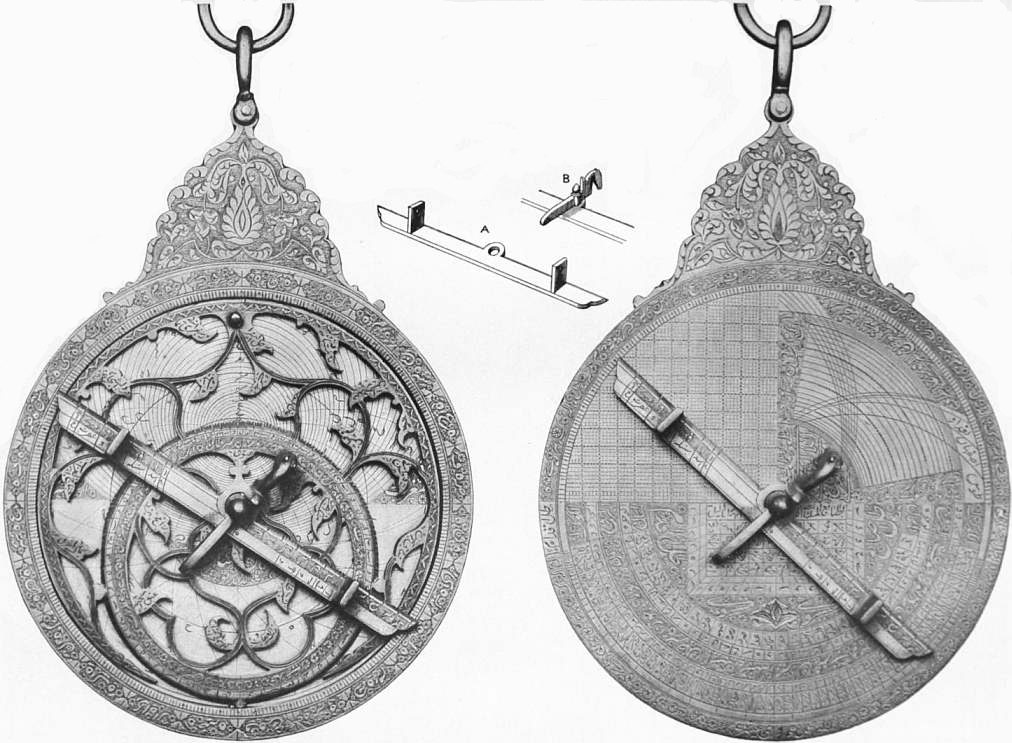 |
| Fig. 1.—PERSIAN ASTROLABE (c. 1712) INSCRIBED IN ARABIC. |
| Front, showing the Rete or Spider, a network of star
pointers. Beneath the Rete, in a hollow, are four thin brass
discs, called Tables or Climates, engraved with projections of the
sphere for different latitudes. |
Back, showing graduations, parallelogram for measuring heights;
and other tables, together with the Rule with sights (A)
held by a moveable pin (B), known as the Horse or Wedge. |
 |
Fig. 2.—Principle of the Astrolabe. If a solid circle be fixed
in any one position and a tube be pivoted on its centre so as to
move; and if the line C D be drawn upon the circle pointing
towards any object Q in the heavens which lies in the plane of
the circle, by turning the tube A B towards any other object
P in the plane of the circle, the angle BOD will be the angle
subtended by the two objects P and Q at the eye. |
 |
| From Exercises, by T. Blundeville. |
| Fig. 3.—Mariner’s Astrolabe, A.D. 1594. Made of brass, or of heavy
wood: it varied in size from a few inches to 1 ft. in diameter. |
The two forms of the planispheric astrolabe most widely
known and used in the 15th, 16th and even 17th centuries were:
(1) the portable astrolabe shown in
fig. 1 (Plate). This originated in
the East, and was in early use
in India, Persia and Arabia, and
was introduced into Europe by
the Arabs, who had perfected
it—perhaps as early as A.D. 700.
It combines the planisphere and
armillae of Hipparchus and
others, and the theodolite of
Theon, and was usually of brass,
varying in diameter from a
couple of inches to a foot or
more. It was used for taking the
altitudes of sun, moon and
stars; for calculating latitude;
for determining the points of the
compass, and time; for ascertaining
heights of mountains, &c.;
and for construction of horoscopes.
The instrument was a marvel of convenience and
ingenuity, and was called “the mathematical jewel.” Nevertheless
it passed out of use, because incapable of any great precision.
(2) The mariner’s astrolabe, fig. 3, was adapted from that of
astronomers by Martin Behaim, c. 1480. This was the instrument
used by Columbus. With the tables of the sun’s declination
then available, he could calculate his latitude by meridian
altitudes of the sun taken with his astrolabe. The mariner’s
astrolabe was superseded by John Hadley’s quadrant of 1731.
Authorities.—Chaucer, Treatise on the Astrolabe (Skeat’s edition
of Chaucer); J.J. Stöffler, Elucidatio Fabrice ususque Astrolabii,
&c.; Thomas Blundeville, His Exercises (1594);
F. Ritter, Astrolabium;
W.H. Morley, Description of Astrolabe of Shah Husain;
M.L. Huggins, “The Astrolabe” (Astrophysical Journal, 1894);
Penny Cyclopaedia, article “Astrolabe;”
R. Grant, History of Physical Astronomy.
(M. L. H.)
ASTROLOGY, the ancient art or science of divining the fate
and future of human beings from indications given by the positions
of the stars (sun, moon and planets). The belief in a
connexion between the heavenly bodies and the life of man has
played an important part in human history. For long ages
astronomy and astrology (which might be called astromancy,
on the same principle as “chiromancy”) were identified; and
a distinction is made between “natural astrology,” which predicts
the motions of the heavenly bodies, eclipses, &c., and
“judicial astrology,” which studies the influence of the stars on
human destiny. Isidore of Seville (d. 636) is one of the first to
distinguish between astronomy and astrology; nor did astronomy
begin to rid itself of astrology till the 16th century, when, with
the system of Copernicus, the conviction that the earth itself is
one of the heavenly bodies was finally established. The study of
astromancy and the belief in it, as part of astronomy, is found
in a developed form among the ancient Babylonians, and
directly or indirectly through the Babylonians spread to other
nations. It came to Greece about the middle of the 4th century
B.C., and reached Rome before the opening of the Christian
era. In India and China astronomy and astrology are largely
reflections of Greek theories and speculations; and similarly with
796
the introduction of Greek culture into Egypt, both astronomy
and astrology were actively cultivated in the region of the Nile
during the Hellenistic and Roman periods. Astrology was
further developed by the Arabs from the 7th to the 13th century,
and in the Europe of the 14th and 15th centuries astrologers
were dominating influences at court.
Even up to the present day men of intellectual eminence like
Dr Richard Garnett have convinced themselves that astromancy
has a foundation of truth, just as there are still believers in
chiromancy or other forms of divination. Dr Garnett (“A.G. Trent”)
insisted indeed that it was a mistake to confuse astrology
with fortune-telling, and maintained that it was a “physical
science just as much as geology,” depending like them on
ascertained facts, and grossly misrepresented by being connected
with magic. Dr Garnett himself looked upon the study of biography
in relation to the casting of horoscopes as an empirical
investigation, but it is difficult in practice to keep the distinction
clear, to judge by present-day text-books such as those of Dr
Wilde (Primer of Astrology, &c.). Dr Wilde insists on there being
“nothing incongruous with the laws of nature in the theory
that the sun, moon and stars influence men’s physical bodies
and conditions, seeing that man is made up of a physical part
of the earth.” There is an obvious tendency, however, for
astromancy to be employed, like palmistry, as a means of
imposing on the ignorant and credulous. How far the more
serious claim is likely to be revived in connexion with the
renewal of research into the “occult” sciences generally, it is
still too early to speculate; and it has to be recognized that
such a point of view is opposed to the generally established
belief that astrology is either mere superstition or absolute
imposture, and that its former vogue was due either to deception
or to the tyranny of an unscientific environment. But if the
progress of physical science has not prevented the rehabilitation
of much of ancient alchemy by the later researches into chemical
change, and if psychology now finds a place for explanations of
spiritualism and witchcraft which involve the admission of the
empirical facts under a new theory (as in the case of the
divining-rod, &c.), it is at least conceivable that some new synthesis
might once more justify part at all events of ancient and medieval
astromancy, to the extent of admitting the empirical facts where
provable, and substituting for the supposed influence of the stars
as such, some deeper theory which would be consistent with an
application to other forms of prophecy, and thus might reconcile
the possibility of dipping into futurity with certain
interrelations of the universe, different indeed from those assumed
by astrological theory, but underlying and explaining it. If
this is ever accomplished it will need the patient investigation
of a number of empirical observations by competent students
unbiassed by any parti pris—a difficult set of conditions to
obtain; and even then no definite results may be achieved.
The history of astrology can now be traced back to ancient
Babylonia, and indeed to the earliest phases of Babylonian
history, i.e. to about 3000 B.C. In Babylonia as well as in Assyria
as a direct offshoot of Babylonian culture (or as we might also
term it “Euphratean” culture), astrology takes its place in the
official cult as one of the two chief means at the disposal of the
priests (who were called bārē or “inspectors”) for ascertaining
the will and intention of the gods, the other being through the
inspection of the liver of the sacrificial animal (see Omen). Just
as this latter method of divination rested on a well-defined theory,
to wit, that the liver was the seat of the soul of the animal and
that the deity in accepting the sacrifice identified himself with
the animal, whose “soul” was thus placed in complete accord
with that of the god and therefore reflected the mind and will
of the god, so astrology is based on a theory of divine government
of the world, which in contrast to “liver” divination assumes
at the start a more scientific or pseudo-scientific aspect. This
theory must be taken into consideration as a factor in accounting
for the persistent hold which even at the present day astrology
still maintains on many minds. Starting with the indisputable
fact that man’s life and happiness are largely dependent upon
phenomena in the heavens, that the fertility of the soil is dependent
upon the sun shining in the heavens as well as upon the
rains that come from heaven, that on the other hand the mischief
and damage done by storms and inundations, to both of which
the Euphratean Valley was almost regularly subject, were to be
traced likewise to the heavens, the conclusion was drawn that
all the great gods had their seats in the heavens. In that early
age of culture known as the “nomadic” stage, which under
normal conditions precedes the “agricultural” stage, the moon
cult is even more prominent than sun worship, and with the
moon and sun cults thus furnished by the “popular” faith it
was a natural step for the priests, who correspond to the “scientists”
of a later day, to perfect a theory of a complete accord
between phenomena observed in the heavens and occurrences on
earth.
If moon and sun, whose regular movements conveyed to the
more intelligent minds the conception of the reign of law and
order in the universe as against the more popular notion of
chance and caprice, were divine powers, the same held good
of the planets, whose movements, though more difficult to
follow, yet in the course of time came to be at least partially
understood. Of the planets five were recognized—Jupiter,
Venus, Saturn, Mercury and Mars—to name them in the order
in which they appear in the older cuneiform literature; in later
texts Mercury and Saturn change places. These five planets
were identified with the great gods of the pantheon as
follows:—Jupiter with Marduk (q.v.), Venus with the goddess Ishtar (q.v.),
Saturn with Ninib (q.v.), Mercury with Nebo (q.v.),
and Mars with Nergal (q.v.). The movements of the sun, moon and five
planets were regarded as representing the activity of the five
gods in question, together with the moon-god Sin (q.v.) and the
sun-god Shamash (q.v.), in preparing the occurrences on earth.
If, therefore, one could correctly read and interpret the activity
of these powers, one knew what the gods were aiming to bring
about. The Babylonian priests accordingly applied themselves
to the task of perfecting a system of interpretation of the
phenomena to be observed in the heavens, and it was natural that the
system was extended from the moon, sun and five planets to the
more prominent and recognizable fixed stars. That system involved
not merely the movements of the moon, sun and planets,
but the observation of their relative position to one another and
to all kinds of peculiarities noted at any point in the course of
their movements: in the case of the moon, for instance, the
exact appearance of the new crescent, its position in the heavens,
the conditions at conjunction and opposition, the appearance
of the horns, the halo frequently seen with the new moon,
which was compared to a “cap,” the ring round the full moon,
which was called a “stall” (i.e. “enclosure”), and more of the
like. To all these phenomena some significance was attached,
and this significance was naturally intensified in the case of
such a striking phenomenon as an eclipse of the moon. Applying
the same method of careful observation to the sun and planets,
and later to some of the constellations and to many of the fixed
stars, it will be apparent that the body of observations noted
must have grown in the course of time to large and indeed to
enormous proportions, and correspondingly the interpretations
assigned to the nearly endless variations in the phenomena thus
observed. The interpretations themselves were based (as in the
case of divination through the liver) chiefly on two
factors:—(1) on the recollection or on written records of what
in the past had taken place when the phenomenon or phenomena
in question had been observed, and (2) association of
ideas—involving sometimes merely a play upon words—in
connexion with the phenomenon or phenomena observed. Thus if on a certain
occasion the rise of the new moon in a cloudy sky was followed
by victory over an enemy or by abundant rain, the sign in
question was thus proved to be a favourable one and its recurrence
would be regarded as a good omen, though the prognostication
would not necessarily be limited to the one or the other of
those occurrences, but might be extended to apply to other
circumstances. On the other hand, the appearance of the new
moon earlier than was expected was regarded as an unfavourable
omen—prognosticating in one case defeat, in another death
797
among cattle, in a third bad crops—not necessarily because
these events actually took place after such a phenomenon, but
by an application of the general principle resting upon association
of ideas whereby anything premature would suggest an
unfavourable occurrence. A thin halo seen above the new moon
was pictured as a cap, and the association between this and the
symbol of royalty, which was a conical-shaped cap, led to
interpreting the phenomenon as an indication that the ruler
would have a successful reign. In this way a mass of traditional
interpretation of all kinds of observed phenomena was gathered,
and once gathered became a guide to the priests for all times.
Astrology in this its earliest stage is, however, marked by two
characteristic limitations. In the first place, the movements
and position of the heavenly bodies point to such occurrences
as are of public import and affect the general welfare. The
individual’s interests are not in any way involved, and we must
descend many centuries and pass beyond the confines of
Babylonia and Assyria before we reach that phase which in
medieval and modern astrology is almost exclusively dwelt
upon—genethliology or the individual horoscope. In Babylonia and
Assyria the cult centred largely and indeed almost exclusively
in the public welfare and the person of the king, because
upon his well-being and favour with the gods the fortunes of
the country were dependent in accordance with the ancient
conception of kingship (see J.G. Frazer, The Early History of
Kingship). To some extent, the individual came in for his
share in the incantations and in the purification ritual through
which one might hope to rid oneself of the power of the demons
and of other evil spirits, but outside of this the important aim
of the priests was to secure for the general benefit the favour of
the gods, or, as a means of preparing oneself for what the future
had in store, to ascertain in time whether that favour would be
granted in any particular instance or would be continued in the
future. Hence in “liver” divination, as in astrology, the
interpretations of the signs noted all have reference to public
affairs and events and not to the individual’s needs or desires.
In the second place, the astronomical knowledge presupposed
and accompanying early Babylonian astrology is essentially of
an empirical character. While in a general way the reign of law
and order in the movements of the heavenly bodies was recognized,
and indeed must have exercised an influence at an early
period in leading to the rise of a methodical divination that was
certainly of a much higher order than the examination of an
animal’s liver, yet the importance that was laid upon the endless
variations in the form of the phenomena and the equally numerous
apparent deviations from what were regarded as normal conditions,
prevented for a long time the rise of any serious study of
astronomy beyond what was needed for the purely practical
purposes that the priests as “inspectors” of the heavens (as
they were also the “inspectors” of the sacrificial livers) had in
mind. True, we have, probably as early as the days of Khammurabi,
i.e. c. 2000 B.C., the combinations of prominent groups
of stars with outlines of pictures fantastically put together, but
there is no evidence that prior to 700 B.C. more than a number
of the constellations of our zodiac had become part of the
current astronomy. The theory of the ecliptic as representing
the course of the sun through the year, divided among twelve
constellations with a measurement of 30° to each division, is
also of Babylonian origin, as has now been definitely proved;
but it does not appear to have been perfected until after the fall
of the Babylonian empire in 539 B.C. Similarly, the other
accomplishments of Babylonian astronomers, such as their
system or rather systems of moon calculations and the drawing
up of planetary tablets, belong to this late period, so that the
golden age of Babylonian astronomy belongs not to the remote
past, as was until recently supposed, but to the Seleucid period,
i.e. after the advent of the Greeks in the Euphrates Valley.
From certain expressions used in astrological texts that are
earlier than the 7th century B.C. it would appear, indeed, that
the beginnings at least of the calculation of sun and moon
eclipses belong to the earlier period, but here, too, the chief
work accomplished was after 400 B.C., and the defectiveness of
early Babylonian astronomy may be gathered from the fact that
as late as the 6th century B.C. an error of almost an entire month
was made by the Babylonian astronomers in the attempt to
determine through calculation the beginning of a certain year.
The researches of Bouché-Leclercq, Cumont and Boll have
enabled us to fix with a considerable degree of definiteness the
middle of the 4th century B.C. as the period when Babylonian
astrology began its triumphal march to the west, invading the
domain of Greek and Roman culture and destined to exercise
a strong hold on all nations and groups—more particularly in
Egypt—that came within the sphere of Greek and Roman
influence. It is rather significant that this spread of astrology
should have been concomitant with the intellectual impulse that
led to the rise of a genuine scientific phase of astronomy in
Babylonia itself, which must have weakened to some extent
the hold that astrology had on the priests and the people. The
advent of the Persians, bringing with them a conception of religion
of a far higher order than Babylonian-Assyrian polytheism (see
Zoroaster), must also have acted as a disintegrating factor
in leading to the decline of the old faith in the Euphrates
Valley, and we thus have the interesting though not entirely
exceptional phenomenon of a great civilization bequeathing as
a legacy to posterity a superstition instead of a real achievement.
“Chaldaean wisdom” became among Greeks and Romans the
synonym of divination through the planets and stars, and it is
not surprising that in the course of time to be known as a
“Chaldaean” carried with it frequently the suspicion of
charlatanry and of more or less wilful deception. The spread of
astrology beyond Babylonia is thus concomitant with the rise
of a truly scientific astronomy in Babylonia itself, which in turn
is due to the intellectual impulse afforded by the contact with
new forms of culture from both the East and the West.
In the hands of the Greeks and of the later Egyptians both
astrology and astronomy were carried far beyond the limits
attained by the Babylonians, and it is indeed a matter of surprise
to observe the harmonious combination of the two fields—a
harmony that seems to grow more complete with each age, and
that is not broken until we reach the threshold of modern science
in the 16th century. To the Greek astronomer Hipparchus
belongs the credit of the discovery (c. 130 B.C.) of the theory of
the precession of the equinoxes, for a knowledge of which among
the Babylonians we find no definite proof; but such a signal
advance in pure science did not prevent the Greeks from developing
in a most elaborate manner the theory of the influence of the
planets upon the fate of the individual. The endeavour to trace
the horoscope of the individual from the position of the planets
and stars at the time of birth (or, as was attempted by other
astrologers, at the time of conception) represents the most
significant contribution of the Greeks to astrology. The system
was carried to such a degree of perfection that later ages made
but few additions of an essential character to the genethliology
or drawing up of the individual horoscope by the Greek
astrologers. The system was taken up almost bodily by the Arab
astronomers, it was embodied in the Kabbalistic lore of Jews and
Christians, and through these and other channels came to be the
substance of the astrology of the middle ages, forming, as already
pointed out, under the designation of “judicial astrology,” a
pseudo-science which was placed on a perfect footing of equality
with “natural astrology” or the more genuine science of the
study of the motions and phenomena of the heavenly bodies.
Partly in further development of views unfolded in Babylonia,
but chiefly under Greek influences, the scope of astrology was
enlarged until it was brought into connexion with practically all
of the known sciences, botany, chemistry, zoology, mineralogy,
anatomy and medicine. Colours, metals, stones, plants, drugs
and animal life of all kinds were associated with the planets and
placed under their tutelage. In the system that passes under the
name of Ptolemy, Saturn is associated with grey, Jupiter with
white, Mars with red, Venus with yellow, while Mercury, occupying
a peculiar place in Greek as it did in Babylonian astrology
(where it was at one time designated as the planet par
excellence), was supposed to vary its colour according to changing
798
circumstances. The sun was associated with gold, the moon with
silver, Jupiter with electrum, Saturn with lead, Venus with copper,
and so on, while the continued influence of astrological motives
is to be seen in the association of quicksilver, upon its discovery
at a comparatively late period, with Mercury, because of its
changeable character as a solid and a liquid. In the same way
stones were connected with both the planets and the months;
plants, by diverse association of ideas, were connected with the
planets, and animals likewise were placed under the guidance
and protection of one or other of the heavenly bodies. By this
curious process of combination the entire realm of the natural
sciences was translated into the language of astrology with the
single avowed purpose of seeing in all phenomena signs indicative
of what the future had in store. The fate of the individual, as
that feature of the future which had a supreme interest, led to
the association of the planets with parts of the body. Here, too,
we find various systems devised, in part representing the views
of different schools, in part reflecting advancing conceptions
regarding the functions of the organs in man and animals. In
one system the seat of Mercury, representing divine intelligence as
the source of all knowledge—a view that reverts to Babylonia
where Nebo (corresponding to Mercury) was regarded as the
divine power to whom all wisdom is due—was placed in the liver
as the primeval seat of the soul (see Omen), whereas in other
systems this distinction was assigned to Jupiter or to Venus.
Saturn, taking in Greek astrology the place at the head of the
planets which among the Babylonians was accorded to Jupiter-Marduk,
was given a place in the brain, which in later times was
looked upon as the centre of soul-life; Venus, as the planet of
the passion of love, was supposed to reign supreme over the
genital organs, the belly and the lower limbs; Mars, as the
violent planet, is associated with the bile, as well as with the
blood and kidneys. Again, the right ear is associated with
Saturn, the left ear with Mars, the right eye in the case of the male
with the sun and the left eye with the moon, while in the case
of the female it was just the reverse. From the planets the same
association of ideas was applied to the constellations of the
zodiac, which in later phases of astrology are placed on a par
with the planets themselves, so far as their importance for the
individual horoscope is concerned. The fate of the individual
in this combination of planets with the zodiac was made
dependent not merely upon the planet which happened to be
rising at the time of birth or of conception, but also upon its
local relationship to a special sign or to certain signs of the zodiac.
The zodiac was regarded as the prototype of the human body,
the different parts of which all had their corresponding section
in the zodiac itself. The head was placed in the first sign of the
zodiac—the Ram; and the feet in the last sign—the Fishes.
Between these two extremes the other parts and organs of the
body were distributed among the remaining signs of the zodiac,
the neck being assigned to the Bull, the shoulders and arms to
the Gemini (or twins), the breast to Cancer, the flanks to Leo,
the bladder to Virgo, the buttocks to the Balance, the pubis to
the Scorpion, the thighs to Sagittarius, the knees to Capricorn,
and the limbs to Aquarius. Not content with this, we find the
late Egyptian astrologers setting up a correspondence between
the thirty-six decani recognized by them and the human body,
which is thus divided into thirty-six parts; to each part a god
was assigned as a controlling force. With human anatomy thus
connected with the planets, with constellations, and with single
stars, medicine became an integral part of astrology, or,
as we might also put it, astrology became the handmaid of
medicine. Diseases and disturbances of the ordinary functions
of the organs were attributed to the influence of planets or
explained as due to conditions observed in a constellation or in
the position of a star; and an interesting survival of this bond
between astrology and medicine is to be seen in the use up to
the present time of the sign of Jupiter ♃, which still heads
medicinal prescriptions, while, on the other hand, the influence
of planetary lore appears in the assignment of the days of the
week to the planets, beginning with Sunday, assigned to the sun,
and ending with Saturday, the day of Saturn. Passing on into
still later periods, Saturn’s day was associated with the Jewish
sabbath, Sunday with the Lord’s Day, Tuesday with Tiw, the
god of war, corresponding to Mars of the Romans and to the
Nergal of the Babylonians. Wednesday was assigned to the
planet Mercury, the equivalent of the Germanic god Woden;
Thursday to Jupiter, the equivalent of Thor; and Friday to
Friga, the goddess of love, who is represented by Venus among
the Romans and among the Babylonians by Ishtar. Astrological
considerations likewise already regulated in ancient Babylonia
the distinction of lucky and unlucky days, which passing down
to the Greeks and Romans (dies fasti and nefasti) found a
striking expression in Hesiod’s Works and Days. Among the Arabs
similar associations of lucky and unlucky days directly connected
with the influence of the planets prevailed through all times,
Tuesday and Wednesday, for instance, being regarded as the
days for blood-letting, because Tuesday was connected with
Mars, the lord of war and blood, and Wednesday with Mercury,
the planet of humours. Even in modern times travellers relate
how, when an auspicious day has been proclaimed by the astrologers,
the streets of Bagdad may be seen running with blood
from the barbers’ shops.
It is unnecessary here to give a detailed analysis of the methods
of judicial astrology as an art, or directions for the casting of a
horoscope, or “nativity,” i.e. a map of the heavens at the hour
of birth, showing, according to the Ephemeris, the position of
the heavenly bodies, from which their influence may be deduced.
Each of the twelve signs of the zodiac (q.v.) is credited with its
own characteristics and influence, and is the controlling sign of
its “house of life.” The sign exactly rising at the moment of
birth is called the ascendant. The benevolent or malignant
influence of each planet, together with the sun and moon, is
modified by the sign it inhabits at the nativity; thus Jupiter
in one house may indicate riches, fame in another, beauty in
another, and Saturn similarly poverty, obscurity or deformity.
The calculation is affected by the “aspects,” i.e. according as
the planets are near or far as regards one another (in conjunction,
in semi-sextile, semi-square, sextile, quintile, square, trine,
sesqui-quadrate, bi-quintile, opposition or parallel acclination).
Disastrous signs predominate over auspicious, and the various
effects are combined in a very elaborate and complicated manner.
Judicial astrology, as a form of divination, is a concomitant
of natural astrology, in its purer astronomical aspect, but mingled
with what is now considered an unscientific and superstitious
view of world-forces. In the Janua aurea reserata quatuor
linguarum (1643) of J.A. Comenius we find the following
definition:—“Astronomus siderum meatus seu motus considerat:
Astrologus eorundem efficaciam, influxum, et effectum.” Kepler
was more cautious in his opinion; he spoke of astronomy as
the wise mother, and astrology as the foolish daughter, but he
added that the existence of the daughter was necessary to the
life of the mother. Tycho Brahe and Gassendi both began with
astrology, and it was only after pursuing the false science, and
finding it wanting, that Gassendi devoted himself to astronomy.
In their numerous allusions to the subtle mercury, which the one
makes when treating of a means of measuring time by the efflux
of the metal, and the other in a treatise on the transit of the
planet, we see traces of the school in which they served their first
apprenticeship. Huygens, moreover, in his great posthumous
work, Cosmotheoros, seu de terris coelestibus, shows himself a
more exact observer of astrological symbols than Kircher himself
in his Iter exstaticum. Huygens contends that between the
inhabitants of different planets there need not be any greater
difference than exists between men of different types on the earth.
“There are on the earth,” continues this rational interpreter
of the astrologers and chiromancers, “men of cold temperament
who would thrive in Saturn, which is the farthest planet from
the sun, and there are other spirits warm and ardent enough
to live in Venus.”
Those were indeed strange times, according to modern ideas,
when astrologers were dominant by the terror they inspired,
and sometimes by the martydom they endured when their predictions
were either too true or too false. Faith, to borrow their
799
own language, was banished to Virgo, and rarely shed her
influence on men. Cardan (1501-1576), for instance, hated
Luther, and so changed his birthday in order to give him an
unfavourable horoscope. In Cardan’s times, as in those of
Augustus, it was a common practice for men to conceal the day
and hour of their birth, till, like Augustus, they found a complaisant
astrologer. But, as a general rule, medieval and Renaissance
astrologers did not give themselves the trouble of reading
the stars, but contented themselves with telling fortunes by
faces. They practised chiromancy (see Palmistry), and relied
on afterwards drawing a horoscope to suit. As physiognomists
(see Physiognomy) their talent was undoubted, and according to
Vanini there was no need to mount to the house-top to cast a
nativity. “Yes,” he says, “I can read his face; by his hair
and his forehead it is easy to guess that the sun at his birth
was in the sign of Libra and near Venus. Nay, his complexion
shows that Venus touches Libra. By the rules of astrology he
could not lie.”
A few salient facts may be added concerning the astrologers
and their predictions, remarkable either for their fulfilment or
for the ruin and confusion they brought upon their authors. We
may begin with one taken from Bacon’s Essay of Prophecies:—“When
I was in France, I heard from one Dr Pena, that the
queen mother, who was given to curious arts, caused the king
her husband’s nativitie to be calculated, under a false name;
and the astrologer gave a judgment, that he should be killed in
a duell; at which the queene laughed, thinking her husband to
be above challenges and duels; but he was slaine, upon a course
at tilt, the splinters of the staffe of Mongomery going in at his
bever.” A favourite topic of the astrologers of all countries has
been the immediate end of the world. As early as 1186 the
earth had escaped one threatened cataclysm of the astrologers.
This did not prevent Stöffler from predicting a universal deluge
for the year 1524—a year, as it turned out, distinguished for
drought. His aspect of the heavens told him that in that year
three planets would meet in the aqueous sign of Pisces. The
prediction was believed far and wide, and President Aurial, at
Toulouse, built himself a Noah’s ark—a curious realization, in
fact, of Chaucer’s merry invention in the Miller’s Tale.
Tycho Brahe was from his fifteenth year devoted to astrology,
and adjoining his observatory at Uranienburg the astronomer-royal
of Denmark had a laboratory built in order to study
alchemy, and it was only a few years before his death that he
finally abandoned astrology. We may here notice one very
remarkable prediction of the master of Kepler. That he had
carefully studied the comet of 1577 as an astronomer, we may
gather from his adducing the very small parallax of this comet
as disproving the assertion of the Aristotelians that a solid
sphere enveloped the heavens. But besides this, we find him
in his character of astrologer drawing a singular prediction from
the appearance of this comet. It announced, he tells us, that in
the north, in Finland, there should be born a prince who should
lay waste Germany and vanish in 1632. Gustavus Adolphus,
it is well known, was born in Finland, overran Germany, and died
in 1632. The fulfilment of the details of this prophecy suggests
that Tycho Brahe had some basis of reason for his prediction.
Born in Denmark of a noble Swedish family, a politician, as were
all his contemporaries of distinction, Tycho, though no conjuror,
could foresee the advent of some great northern hero. Moreover,
he was doubtless well acquainted with a very ancient tradition,
that heroes generally came from the northern frontiers of their
native land, where they are hardened and tempered by the
threefold struggle they wage with soil, climate and barbarian
neighbours.
Kepler explained the double movement of the earth by the
rotation of the sun. At one time the sun presented its friendly
side, which attracted one planet, sometimes its adverse side,
which repelled it. He also peopled the planets with souls and
genii. He was led to his three great laws by musical analogies,
just as William Herschel afterwards passed from music to
astronomy. Kepler, who in his youth made almanacs, and once
prophesied a hard winter, which came to pass, could not help
putting an astrological interpretation on the disappearance of
the brilliant star of 1572, which Tycho had observed. Theodore
Beza thought that this star, which in December 1573 equalled
Jupiter in brilliancy, predicted the second coming of Christ.
Astronomers were only then beginning to study variable and
periodic stars, and disturbances in that part of the heavens,
which had till then, on the authority of Aristotle, been regarded
as incorruptible, combined with the troubles of the times, must
have given a new stimulus to belief in the signs in heaven.
Montaigne (Essais, lib. i. chap, x.) relates a singular episode
in the history of astrology. Charles V. and Francis I., who both
bid for the friendship of the infamous Aretino, surnamed the
divine, both likewise engaged astrologers to fight their battles.
In Italy those who prophesied the ruin of France were sure to be
listened to. These prophecies affected the public funds much
as telegrams do nowadays. “At Rome,” Montaigne tells us, “a
large sum of money was lost on the Change by this prognostication
of our ruin.” The marquis of Saluces, notwithstanding his
gratitude to Francis I. for the many favours he had received,
including his marquisate, of which the brother was despoiled
for his benefit, was led in 1536 to betray his country, being scared
by the glorious prophecies of the ultimate success of Charles V.
which were then rife. The influence of the Medici made astrologers
popular in France. Richelieu, on whose council was
Jacques Gaffarel (1601-1681), the last of the Kabbalists, did not
despise astrology as an engine of government. At the birth of
Louis XIV. a certain Morin de Villefranche was placed behind
a curtain to cast the nativity of the future autocrat. A generation
back the astrologer would not have been hidden behind a
curtain, but have taken precedence of the doctor. La Bruyère
dares not pronounce against such beliefs, “for there are perplexing
facts affirmed by grave men who were eye-witnesses.”
In England William Lilly and Robert Fludd were both dressed
in a little brief authority. The latter gives us elaborate rules
for the detection of a thief, and tells us that he has had personal
experience of their efficacy. “If the lord of the sixth house is
found in the second house, or in company with the lord of the
second house, the thief is one of the family. If Mercury is in
the sign of the Scorpion he will be bald, &c.” Francis Bacon
abuses the astrologers of his day no less than the alchemists, but
he does so because he has visions of a reformed astrology and a
reformed alchemy. Sir Thomas Browne, too, while he denies
the capacity of the astrologers of his day, does not venture to
dispute the reality of the science. The idea of the souls of men
passing at death to the stars, the blessedness of their particular
sphere being assigned them according to their deserts (the
metempsychosis of J. Reynaud), may be regarded as a survival
of religious astrology, which, even as late as Descartes’s day,
assigned to the angels the task of moving the planets and the stars.
Joseph de Maistre believed in comets as messengers of divine
justice, and in animated planets, and declared that divination
by astrology is not an absolutely chimerical science. Lastly,
we may mention a few distinguished men who ran counter to
their age in denying stellar influences. Aristarchus of Samos,
Martianus Capella (the precursor of Copernicus), Cicero, Favorinus,
Sextus Empiricus, Juvenal, and in a later age Savonarola
and Pico della Mirandola, and La Fontaine, a contemporary of
the neutral La Bruyère, were all pronounced opponents of
astrology.
In England Swift may fairly claim the credit of having given
the death-blow to astrology by his famous squib, entitled
Prediction for the Year 1708, by Isaac Bickerstaff, Esq. He begins,
by professing profound belief in the art, and next points out the
vagueness and the absurdities of the philomaths. He then, in
the happiest vein of parody, proceeds to show them a more
excellent way:—“My first prediction is but a trifle, yet I
mention it to show how ignorant these sottish pretenders to
astrology are in their own concerns: it refers to Partridge the
almanac-maker. I have consulted the star of his nativity by
my own rules, and find he will infallibly die upon the 29th of
March next about eleven at night of a raging fever. Therefore
I advise him to consider of it and settle his affairs in time.”
800
Then followed a letter to a person of quality giving a full and
particular account of the death of Partridge on the very day
and nearly at the hour mentioned. In vain the wretched
astrologer protested that he was alive, got a literary friend to
write a pamphlet to prove it, and published his almanac for 1709.
Swift, in his reply, abused him for his want of manners in giving
a gentleman the lie, answered his arguments seriatim, and
declared that the evidence of the publication of another almanac
was wholly irrelevant, “for Gadbury, Poor Robin, Dove and
Way do yearly publish their almanacs, though several of them
have been dead since before the Revolution.” Nevertheless a
field is found even to this day for almanacs of a similar type,
and for popular belief in them.
To astrological politics we owe the theory of heaven-sent rulers,
instruments in the hands of Providence, and saviours of society.
Napoleon, as well as Wallenstein, believed in his star. Many
passages in the older English poets are unintelligible without
some knowledge of astrology. Chaucer wrote a treatise on the
astrolabe; Milton constantly refers to planetary influences;
in Shakespeare’s King Lear, Gloucester and Edmund represent
respectively the old and the new faith. We still contemplate and
consider; we still speak of men as jovial, saturnine or mercurial;
we still talk of the ascendancy of genius, or a disastrous defeat.
In French heur, malheur, heureux, malheureux, are all derived
from the Latin augurium; the expression né sous une mauvaise
étoile, born under an evil star, corresponds (with the change of
étoile into astre) to the word malôtru, in Provençal malastrue;
and son étoile pâlit, his star grows pale, belongs to the same class
of illusions. The Latia ex augurio appears in the Italian sciagura,
sciagurato, softened into sciaura, sciaurato, wretchedness,
wretched. The influence of a particular planet has also left
traces in various languages; but the French and English jovial
and the English saturnine correspond rather to the gods who
served as types in chiromancy than to the planets which bear
the same names. In the case of the expressions bien or mal
luné, well or ill mooned, avoir un quartier de lune dans la tetê, to
have the quarter of the moon in one’s head, the German mondsüchtig
and the English moonstruck or lunatic, the fundamental
idea lies in the strange opinions formerly held about the moon.
Bibliography.—For the history of astrology with its affinities to
astronomy on the one hand, and to other forms of popular belief on
the other, the following works out of a large number that might
be mentioned are specially recommended:—A. Bouché-Leclercq,
L’Astrologie grecque (Paris, 1899), with a full bibliography; Franz
Boll, Sphaera (Leipzig, 1903); Franz Cumont, Catalogus Codicum
Astrologorum Graecorum (Brussels, 1898; 7 parts published up to
1909); Franz Boll, “Die Erforschung der antiken Astrologie” (in
Neue Jahrbucher fur das klassische Altertum, Band xxi. Heft 2, pp.
103-126); Franz Cumont, Les Religions orientates dans le paganisme
romain (Paris, 1907) (ch. vii. “L’Astrologie et la magie”); Alfred
Maury, La Magie et l’astrologie à l’antiquité et au moyen âge (4th ed.,
Paris, 1877); R.C. Thompson, Reports of the Magicians and Astrologers
of Nineveh and Babylon (2 vols., London, 1900); F.X.
Kugler, Sternkunde und Sterndienst in Babel (Freiburg, 1907;—to
be completed in 4 vols.); Ch. Virolleaud, L’Astrologie chaldéenne
(Paris, 1905—to be completed in 8 parts—transliteration and
translations of cuneiform texts); Jastrow, Religion Babyloniens und
Assyriens (Parts 13 and 14); also certain sections in Bouché-Leclercq,
Histoire de la divination dans l’antiquité (Paris, 1879),
vol. i. pp. 205-257; in Marcellin Berthelot, Les Origines de l’alchimie
(Paris, 1885), pp. 1-56; Ferd. Höfer, Histoire de l’astronomie (Paris,
1846), pp. 1-90; in Rudolf Wolf, Geschichte der Astronomie (Munich,
1877), ch. i. See also the article by Ernst Riess on Astrology in
Pauly-Wissowa, Realencyclopädie der klassischen Altertumswissenschaft,
vol. ii. (Stuttgart, 1896). For modern and practical astrology
the following works may be found useful in different ways:
E.M. Bennett, Astrology (New York, 1894); J.M. Pfaff, Astrologie
(Bamberg, 1816); G. Wilde, Chaldaean Astrology up to date (1901);
R. Garnett (“A.G. Trent”), “The Soul and the Stars,” in the
University Magazine, 1880 (reprinted in Dobson and Wilde, Natal
Astrology, 1893); Abel Haatan, Traité d’astrologie judiciaire (Paris,
1825); Fomalhaut, Manuel d’astrologie sphérique el judiciaire (Paris,
1897).
(M. Ja.)
ASTRONOMY (from Gr. ἄστρον, a star, and νέμειν, to classify
or arrange). The subject matter of astronomical science, considered
in its widest range, comprehends all the matter of the
universe which lies outside the limit of the earth’s atmosphere.
The seeming anomaly of classifying as a single branch of science
all that we know in a field so wide, while subdividing our knowledge
of things on our own planet into an indefinite number of
separate sciences, finds its explanation in the impossibility of
subjecting the matter of the heavens to that experimental
scrutiny which yields such rich results when applied to matter
which we can handle at will. Astronomy is of necessity a science
of observation in the pursuit of which experiment can directly
play no part. It is the most ancient of the sciences because,
before the era of experiment, it was the branch of knowledge
which could be most easily systematized, while the relations of
its phenomena to day and night, times and seasons, made some
knowledge of the subject a necessity of social life. In recent
times it is among the more progressive of the sciences, because
the new and improved methods of research now at command
have found in its cultivation a field of practically unlimited
extent, in which the lines of research may ultimately lead to a
comprehension of the universe impossible of attainment before
our time.
The field we have defined is divisible into at least two parts,
that of Astronomy proper, or “Astrometry,” which treats of
the motions, mutual relations and dimensions of the heavenly
bodies; and that of Astrophysics (q.v.), which treats of their
physical constitution. While it is true that the instruments and
methods of research in these two branches are quite different in
their details, there is so much in common in the fundamental
principles which underlie their application, that it is unprofitable
to consider them as completely distinct sciences.
Speaking in the most comprehensive way, and making an
exception of the ethereal medium (see Aether), which, being
capable of experimental study, is not included in the subject
of astronomy, we may say that the great masses of matter which
make up the universe are of two kinds:—(1) incandescent bodies,
made visible to us by their own light; (2) dark bodies, revolving
round them or round each other. These dark bodies are known
to us in two ways: (a) by becoming visible through reflecting
the light from incandescent bodies in their neighbourhood, (b)
by their attraction upon such bodies.
The incandescent bodies are of two classes: stars and nebulae.
Among the stars our sun is to be included, as it has no properties
which distinguish it from the great mass of stars except our
proximity to it. The stars are supposed to be generally spherical,
like the sun, in form, and to have fairly well-defined boundaries;
while the nebulae are generally irregular in outline and have no
well-defined limits. It is, however, probable that the one class
runs into the other by imperceptible gradations. In the relation
of the universe to us there is yet another separation of its bodies
into two classes, one comprising the solar system, the other
the remainder of the universe. The former consists of the sun
and the bodies which move round it. Considered as a part of
the universe, our solar system is insignificant in extent, though,
for obvious reasons, great in practical importance to us, and in
the facility with which we may gain knowledge relating to it.
Referring to special articles, Solar System, Star, Sun, Moon,
&c. for a description of the various parts of the universe, we
confine ourselves, at present, to setting forth a few of the most
general modern conceptions of the universe. As to extent, it
may be said, in a general way, that while no definite limits can
be set to the possible extent of the universe, or the distance of
its farthest bodies, it seems probable, for reasons which will be
given under Star, that the system to which the stars that we see
belong, is of finite extent.
As the incandescent bodies of the universe are visible by their
own light, the problem of ascertaining their existence and
position is mainly one of seeing, and our facilities for attacking
it have constantly increased with the improvement of our optical
appliances. But such is not the case with the dark bodies.
Such a body can be made known to us only when in the neighbourhood
of an incandescent body; and even then, unless its
mass or its dimensions are considerable, it will evade all the
scrutiny of our science. The question of the possible number
and magnitude of such bodies is therefore one that does not
admit of accurate investigation. We can do no more than
801
balance vague estimates of probability. What we do know is
that these bodies vary widely in size. Those known to be
revolving round certain of the stars are far larger in proportion
to their central bodies than our planets are in respect to the sun;
for were it otherwise we should never be able to detect their
existence. At the other extreme we know that innumerable
swarms of minute bodies, probably little more than particles,
move round the sun in orbits of every degree of eccentricity,
making themselves known to us only in the exceptional cases
when they strike the earth’s atmosphere. They then appear
to us as “shooting stars” (see Meteor).
A general idea of the relation of the solar system to the universe
may be gained by reflecting that the average distance between
any two neighbouring stars is several thousand times the extent
of the solar system. Between the orbit of Neptune and the
nearest star known to us is an immense void in which no bodies
are yet known to exist, except comets. But although these
sometimes wander to distances considerably beyond the orbit
of Neptune, it is probable that the extent of the void which
separates our system from the nearest star is hundreds of times
the distance of the farthest point to which a comet ever recedes.
We may conclude this brief characterization of astronomy
with a statement and classification of the principal lines on
which astronomical researches are now pursued. The most
comprehensive problem before the investigator is that of the
constitution of the universe. It is known that, while infinite
diversity is found among the bodies of the universe, there are
also common characteristics throughout its whole extent. In
a certain sense we may say that the universe now presents itself
to the thinking astronomer, not as a heterogeneous collection
of bodies, but as a unified whole. The number of stars is so vast
that statistical methods can be applied to many of the characters
which they exhibit—their spectra, their apparent and absolute
luminosity, and their arrangement in space. Thus has arisen
in recent times what we may regard as a third branch of astronomical
science, known as Stellar Statistics. The development of
this branch has infused life and interest into what might a few
years ago have been regarded as the most lifeless mass of figures
possible, expressing merely the positions and motions of innumerable
individual stars, as determined by generations of astronomical
observers. The development of this new branch requires
great additions to this mass, the product of perhaps centuries
of work on the older lines of the science. To the statistician of
the stars, catalogues of spectra, magnitude, position and proper
motions are of the same importance that census tables are to the
student of humanity. The measurement of the speed with which
the individual stars are moving towards or from our system is a
work of such magnitude that what has yet been done is scarcely
more than a beginning. The discovery by improved optical
means, and especially by photography, of new bodies of our
system so small that they evaded all scrutiny in former times,
is still going on, but does not at present promise any important
generalization, unless we regard as such the conclusion that our
solar system is a more complex organism than was formerly
supposed.
One characteristic of astronomy which tends to make its
progress slow and continuous arises out of the general fact that,
except in the case of motions to or from us, which can be determined
by a single observation with the spectroscope, the motion
of a heavenly body can be determined only by comparing its
position at two different epochs. The interval required between
these two epochs depends upon the speed of the motion. In the
case of the greater number of the fixed stars this is so slow that
centuries may have to elapse before motion can be deduced.
Even in the case of the planets, the variations in the form and
position of the orbits are so slow that long periods of observation
are required for their correct determination.
The process of development is also made slow and difficult by
the great amount of labour involved in deriving the results of
astronomical observations. When an astronomer has made an
observation, it still has to be “reduced,” and this commonly
requires more labour than that involved in making it. But
even this labour may be small compared with that of the theoretical
astronomer, who, in the future, is to use the result as the
raw material of his work. The computations required in such
work are of extreme complexity, and the labour required is still
further increased by the fact that cases are rather exceptional in
which the results reached by one generation will not have to be
revised and reconstructed by another; processes which may
involve the repetition of the entire work. We may, in fact, regard
the fabric of astronomical science as a building in the construction
of which no stone can be added without a readjustment of some
of the stones on which it has to rest. Thus it comes about that
the observer, the computer, and the mathematician have in astronomical
science a practically unlimited field for the exercise of
their powers.
In treating so comprehensive a subject we may naturally
distinguish between what we know of the universe and the
methods and processes by which that knowledge is acquired.
The former may be termed general, and the latter practical,
astronomy. When we descend more minutely into details we
find these two branches of the subject to be connected by certain
principles, the application of which relates to both subjects.
Considering as general or descriptive astronomy a description of
the universe as we now understand it, the other branches of the
subject generally recognized are as follows:—
Geometrical or Spherical Astronomy, by the principles of which
the positions and the motions of the heavenly bodies are defined.
Theoretical Astronomy, which may be considered as an extension
of geometrical astronomy and includes the determination of
the positions and motions of the heavenly bodies by combining
mathematical theory with observation. Modern theoretical
astronomy, taken in the most limited sense, is based upon
Celestial Mechanics, the science by which, using purely deductive
mechanical methods, the laws of motion of the heavenly bodies
are derived by deductive methods from their mutual gravitation
towards each other.
Practical Astronomy, which comprises a description of the
instruments used in astronomical observation, and of the
principles and methods underlying their application.
Spherical or Geometrical Astronomy.
In astronomy, as in analytical geometry, the position of a
point is defined by stating its distance and its direction from a
point of reference taken as known. The numerical quantities by
which the distance and direction, and therefore the position, are
defined, are termed co-ordinates of the point. The latter are
measured or defined with regard to a fixed system of lines and
planes, which form the basis of the system.
The following are the fundamental concepts of such a system.
(a) An origin or point of reference. The points most generally
taken for this purpose in astronomical practice are the following:—
(1) The position of a point of observation on the earth’s surface.
We conceive its position to be that occupied by an observer. The
position of a heavenly body is then defined by its direction and
distance from the supposed observer.
(2) The centre of the earth. This point, though it can never be
occupied by an observer, is used because the positions of the heavenly
bodies in relation to it are more readily computed than they can be
from a point on the earth’s surface.
(3) The centre of the sun.
(4) In addition to these three most usual points, we may, of
course, take the centre of a planet or that of a star in order to define
the position of bodies in their respective neighbourhoods.
Co-ordinates referred to a point of observation as the origin are
termed “apparent,” those referred to the centre of the earth are
“geocentric,” those referred to the centre of the sun, “heliocentric.”
(b) The next concept of the system is a fundamental plane,
regarded as fixed, passing through the origin. In connexion with it
is an axis perpendicular to it, also passing through the origin. We
may consider the axis and the plane as a single concept, the axis
determining the plane, or the plane the axis. The fundamental
concepts of this class most in use are:—
(1) When a point on the earth’s surface is taken as the origin,
the fundamental axis may be the direction of gravity at that point.
This direction defines the vertical line. The fundamental plane
which it determines is horizontal and is termed the plane of the
horizon. Such a plane is realized in the surface of a liquid, a basin
of quicksilver, for example.
802
(2) When the centre of the earth is taken as origin, the most
natural fundamental axis is that of the earth’s rotation. This axis
cuts the earth’s surface at the North and South Poles. The fundamental
plane perpendicular to it is the plane of the equator. This
plane intersects the earth’s surface in the terrestrial equator.
Co-ordinates referred to this system are termed equatorial. A system
of equatorial co-ordinates may also be used when the origin is on the
earth’s surface. The fundamental axis, instead of being the earth’s
axis itself, is then a line parallel to it, and the fundamental plane is
the plane passing through the point, and parallel to the plane of the
equator.
(3) In the system of heliocentric co-ordinates, the plane in which
the earth moves round the sun, which is the plane of the ecliptic,
is taken as the fundamental one. The axis of the ecliptic is a line
perpendicular to this plane.
(c) The third concept necessary to complete the system is a fixed
line passing through the origin, and lying in the fundamental plane.
This line defines an initial direction from which other directions are
counted.
 |
| Fig. 1. |
The geometrical concepts just defined are shown in fig. 1. Here O
is the origin, whatever point it may be; OZ is the fundamental
axis passing through it. In order to represent in the figure the
position of the fundamental
plane, we conceive
a circle to be drawn
round O, lying in
that plane. This
circle, projected in
perspective as an
ellipse, is shown in
the figure. OX is
the fixed initial
line by which
directions are to be
defined.
Now let P be any point in space,
say the centre of
a heavenly body. Conceive a perpendicular PQ to be dropped from
this point on the fundamental plane, meeting the latter in the
point Q; PQ will then be parallel to OZ. The co-ordinates of P will
then be the following three quantities:—
(1) The length of the line OP, or the distance of the body from the
origin, which distance is called the radius vector of the body.
(2) The angle XOQ which the projection of the radius vector upon
the fundamental plane makes with the initial line OX. This angle
is called the Longitude, Right Ascension or Azimuth of the body, in
the various systems of co-ordinates. We may term it in a general
way the longitudinal co-ordinate.
(3) The angle QOP, which the radius vector makes with the
fundamental plane. This we may call the latitudinal co-ordinate.
Instead of it is frequently used the complementary angle ZOP,
known as the polar distance of the body. Since ZOQ is a right angle,
it follows that the sum of the polar distance and the latitudinal
co-ordinates is always 90°. Either may be used for astronomical
purposes.
It is readily seen that the position of a heavenly body is completely
defined when these co-ordinates are given.
One of the systems of co-ordinates is familiar to every one, and
may be used as a general illustration of the method. It is our system
of defining the position of a point on the earth’s surface by its latitude
and longitude. Regarding O (fig. 1) as the centre of the earth, and
P as a point on the earth’s surface, a city for example, it will be seen
that OZ being the earth’s axis, the circle MN will be the equator.
The initial line OX then passes through the foot of the perpendicular
dropped from Greenwich upon the plane of the equator, and meets
the surface at N. The angle QOP is the latitude of the place and
the angle NOQ its longitude. The longitudes and latitudes thus
defined are geocentric, and the latitude is slightly different from that
in ordinary use for geographic purposes. The difference arises from
the oblateness of the earth, and need not be considered here.
The conception of the co-ordinates we have defined is facilitated
by introducing that of the celestial sphere. This conception is
embodied in our idea of the vault of heaven, or of the sky. Taking
as origin the position of an observer, the direction of a heavenly
body is defined by the point in which he sees it in the sky; that is
to say, on the celestial sphere. Imagining, as we may well do, that
the radius of this sphere is infinite—then every direction, whatever
the origin, may be represented by a point on its surface. Take for
example the vertical line which is embodied in the direction of the
plumb line. This line, extended upwards, meets the celestial sphere
in the zenith. The earth’s axis, continued indefinitely upwards,
meets the sphere in a point called the Celestial Pole. This point in
our middle latitudes is between the zenith and the north horizon,
near a certain star of the second magnitude familiarly known as the
Pole Star. As the earth revolves from west to east the celestial
sphere appears to us to revolve in the opposite direction, turning on
the line joining the Celestial Poles as on a pivot.
As we conceive of the sky, it does not consist of an entire sphere
but only as a hemisphere bounded by the horizon. But we have no
difficulty in extending the conception below the horizon, so that the
earth with everything upon it is in the centre of a complete sphere.
The two parts of this sphere are the visible hemisphere, which is
above the horizon, and the invisible, which is below it. Then the
plumb line not only defines the zenith as already shown, but in a
downward direction it defines the nadir, which is the point of the
sphere directly below our feet. On the side of this sphere opposite
to the North Celestial is the South Pole, invisible in the Northern
Terrestrial Hemisphere but visible in the Southern one.
The relation of geocentric to apparent co-ordinates depends upon
the latitude of the observer. The changes which the aspect of the
heaven undergoes, as we travel North and South, are so well known
that they need not be described in detail here; but a general statement
of them will give a luminous idea of the geometrical co-ordinates
we have described. Imagine an observer starting from the North
Pole to travel towards the equator, carrying his zenith with him.
When at the pole his zenith coincides with the celestial pole, and as
the earth revolves on its axis, the heavenly bodies perform their
apparent diurnal revolutions in horizontal circles round the zenith.
As he travels South, his zenith moves along the celestial sphere,
and the circles of diurnal rotation become oblique to the horizon.
The obliquity continually increases until the observer reaches the
equator. His zenith is then in the equator and the celestial poles are
in the North and South horizon respectively. The circles in which
the heavenly bodies appear to revolve are then vertical. Continuing
his journey towards the south, the north celestial pole sinks below
the horizon; the south celestial pole rises above it; or to speak
more exactly, the zenith of the observer approaches that pole. The
circles of diurnal revolution again become oblique. Finally, at the
south pole the circles of diurnal revolution are again apparently
horizontal, but are described in a direction apparently (but not
really) the reverse of that near the north pole. The reader who will
trace out these successive concepts and study the results of his
changing positions will readily acquire the notions which it is our
subject to define.
We have next to point out the relation of the co-ordinates we
have described to the annual motion of the earth around the sun.
In consequence of this motion the sun appears to us to describe
annually a great circle, called the ecliptic, round the celestial sphere,
among the stars, with a nearly uniform motion, of somewhat less
than 1° in a day. Were the stars visible in the daytime in the
immediate neighbourhood of the sun, this motion could be traced
from day to day. The ecliptic intersects the celestial equator at
two opposite points, the equinoxes, at an angle of 23° 27′. The
vernal equinox is taken as the initial point on the sphere from
which co-ordinates are measured in the equatorial and ecliptic
systems. Referring to fig. 1, the initial line OX is defined as directed
toward the vernal equinox, at which point it intersects the celestial
sphere.
The following is an enumeration of the co-ordinates which we
have described in the three systems:—
Apparent System.
Latitudinal Co-ordinate; Altitude or Zenith Distance.
Longitudinal ” Azimuth.
Equatorial System.
Latitudinal Co-ordinate; Declination or Polar Distance.
Longitudinal ” Right Ascension.
Ecliptic System.
Latitudinal Co-ordinate; Latitude or Ecliptic Polar Distance.
Longitudinal ” Longitude.
Relation of the Diurnal Motion to Spherical Co-ordinates.—The
vertical line at any place being the fundamental axis of the apparent
system of co-ordinates, this system rotates with the earth, and so
seems to us as fixed. The other two systems, including the vernal
equinox, are fixed on the celestial sphere, and so seem to us to
perform a diurnal revolution from east towards west. Regarding the
period of the revolution as 24 hours, the apparent motion goes on
at the rate of 15° per hour. Here we have to make a distinction of
fundamental importance between the diurnal motions of the sun
and of the stars. Owing to the unceasing apparent motion of the
sun toward the east, the interval between two passages of the same
star over the meridian is nearly four minutes less than the interval
between consecutive passages of the sun. The latter is the measure
of the day as used in civil life. In astronomical practice is introduced
a day, termed “sidereal,” determined, not by the diurnal revolution
of the sun, but of the stars. The year, which comprises 365.25 solar
days, contains 366.25 sidereal days. The latter are divided into
sidereal hours, minutes and seconds as the solar day is. The conception
of a revolution through 360° in 24 hours is applicable to
each case. The sun apparently moves at the rate of 15° in a solar
hour; the stars at the rate of 15° in a sidereal hour. The latter
motion leads to the use, in astronomical practice, of time instead of
angle, as the unit in which the right ascensions are to be expressed.
Considering the position of the vernal equinox, and also of a star
on the celestial sphere, it will be seen that the interval between
the transits of these two points across the meridian may be used
to measure the right ascension of a star, since the latter amounts to
803
15° for every sidereal hour of this interval. For example, if the right
ascension of a star is exactly 15°, it will pass the meridian one sidereal
hour after the vernal equinox. For the relations thus arising, and
their practical applications, see Time, Measurement of.
Theoretical Astronomy.
Theoretical Astronomy is that branch of the science which,
making use of the results of astronomical observations as they are
supplied by the practical astronomer, investigates the motions of
the heavenly bodies. In its most important features it is an
offshoot of celestial mechanics, between which and theoretical
astronomy no sharp dividing line can be drawn. While it is true
that the one is concerned altogether with general theories, it is
also true that these theories require developments and modifications
to apply them to the numberless problems of astronomy,
which we may place in either class.
Among the problems of theoretical astronomy we may assign the
first place to the determination of orbits (q.v.), which is auxiliary to
the prediction of the apparent motions of a planet, satellite or star.
The computations involved in the process, while simple in some cases,
are extremely complex in others. The orbit of a newly-discovered
planet or comet may be computed from three complete observations
by well-known methods in a single day. From the resulting elements
of the orbit the positions of the body from day to day may be
computed and tabulated in an ephemeris for the use of observers.
But when definitive results as to the orbits are required, it is necessary
to compute the perturbations produced by such of the major planets
as have affected the motions of the body. With this complicated
process is associated that of combining numerous observations with
a view of obtaining the best definitive result. Speaking in a general
way, we may say that computations pertaining to the orbital
revolutions of double stars, as well as the bodies of our solar system,
are to a greater or less extent of the classes we have described. The
principal modification is that, up to the present time, stellar astronomy
has not advanced so far that a computation of the perturbations in
each case of a system of stars is either necessary or possible, except
in exceptional cases.
Celestial Mechanics.
Celestial Mechanics is, strictly speaking, that branch of applied
mathematics which, by deductive processes, derives the laws of
motion of the heavenly bodies from their gravitation towards
each other, or from the mutual action of the parts which form
them. The science had its origin in the demonstration by Sir
Isaac Newton that Kepler’s three laws of planetary motion, and
the law of gravitation, in the case of two bodies, could be mutually
derived from each other. A body can move round the sun in an
elliptic orbit having the sun in its focus, and describing equal
areas in equal times, only under the influence of a force directed
towards the sun, and varying inversely as the square of the
distance from it. Conversely, assuming this law of attraction, it
can be shown that the planets will move according to Kepler’s
laws.
Thus celestial mechanics may be said to have begun with
Newton’s Principia. The development of the science by the
successors of Newton, especially Laplace and Lagrange, may be
classed among the most striking achievements of the human
intellect. The precision with which the path of an eclipse is laid
down years in advance cannot but imbue the minds of men with
a high sense of the perfection reached by astronomical theories;
and the discovery, by purely mathematical processes, of the
changes which the orbits and motions of the planets are to
undergo through future ages is more impressive the more fully
one apprehends the nature of the problem. The purpose of the
present article is to convey a general idea of the methods by which
the results of celestial mechanics are reached, without entering
into those technical details which can be followed only by a
trained mathematician. It must be admitted that any intelligent
comprehension of the subject requires at least a grasp of the
fundamental conceptions of analytical geometry and the infinitesimal
calculus, such as only one with some training in these
subjects can be expected to have. This being assumed, the hope
of the writer is that the exposition will afford the student an
insight into the theory which may facilitate his orientation, and
convey to the general reader with a certain amount of mathematical
training a clear idea of the methods by which conclusions
relating to it are drawn. The non-mathematical reader may
possibly be able to gain some general idea, though vague, of the
significance of the subject.
The fundamental hypothesis of the science assumes a system of
bodies in motion, of which the sun and planets may be taken as
examples, and of which each separate body is attracted toward all
the others according to the law of Newton. The motion of each body
is then expressed in the first place by Newton’s three laws of motion
(see Motion, Laws of, and Mechanics). The first step in the
process shows in a striking way the perfection of the analytic method.
The conception of force is, so to speak, eliminated from the conditions
of the problem, which is reduced to one of pure kinematics. At the
outset, the position of each body, considered as a material particle,
is defined by reference to a system of co-ordinate axes, and not by
any verbal description. Differential equations which express the
changes of the co-ordinates are then constructed. The process of
discovering the laws of motion of the particle then consists in the
integration of these equations. Such equations can be formed for a
system of any number of bodies, but the process of integration in a
rigorous form is possible only to a limited extent or in special cases.
The problems to be treated are of two classes. In one, the bodies
are regarded as material particles, no account being taken of their
dimensions. The earth, for example, may be regarded as a particle
attracted by another more massive particle, the sun. In the other
class of problems, the relative motion of the different parts of the
separate bodies is considered; for example, the rotation of the
earth on its axis, and the consequences of the fact that those parts
of a body which are nearer to another body are more strongly
attracted by it. Beginning with the first branch of the subject,
the fundamental ideas which it is our purpose to convey are embodied
in the simple case of only two bodies, which we may call
the sun and a planet. In this case the two bodies really revolve
round their common centre of gravity; but a very slight modification
of the equations of motion reduces them to the relative motion of
the planet round the sun, regarding the moving centre of the latter
as the origin of co-ordinates. The motion of this centre, which arises
from the attraction of the planet on the sun, need not be considered.
In the actual problems of celestial mechanics three co-ordinates
necessarily enter, leading to three differential equations and six
equations of solution. But the general principles of the problem
are completely exemplified with only two bodies, in which case the
motion takes place in a fixed plane. By taking this plane, which is
that of the orbit in which the planet performs its revolution, as the
plane of xy, we have only two co-ordinates to consider. Let us use
the following notation:
x, y, the co-ordinates of the planet relative to the sun as the origin.
M, m, the masses of the attracting bodies, sun and planet.
r, the distance apart of the two bodies, or the radius vector of m
relative to M. This last quantity is analytically defined by the
equation—
r² = x² + y²
t, the time, reckoned from any epoch we choose.
The differential equations which completely determine the
changes in the co-ordinates x and y, or the motion of m relative to
M, are:—
(1)
These formulae are worthy of special attention. They are the
expression in the language of mathematics of Newton’s first two
laws of motion. Their statement in this language may be regarded
as perfect, because it completely and unambiguously expresses the
naked phenomena of the motion. The equations do this without
expressing any conception, such as that of force, not associated
with the actual phenomena. Moreover, as a third advantage, these
expressions are entirely free from those difficulties and ambiguities
which are met with in every attempt to express the laws of motion
in ordinary language. They afford yet another great advantage
in that the derivation of the results requires only the analytic
operations of the infinitesimal calculus.
The power and spirit of the analytic method will be appreciated
by showing how it expresses the relations of motion as they were
conceived geometrically by Newton and Kepler. It is quite evident
that Kepler’s laws do not in themselves enable us to determine the
actual motion of the planets. We must have, in addition, in the
case of each special planet, certain specific facts, viz. the axes and
eccentricity of the ellipse, and the position of the plane in which it
lies. Besides these, we must have given the position of the planet
in the orbit at some specified moment. Having these data, the
position of the planet at any other time may be geometrically
constructed by Kepler’s laws. The third law enables us to compute
the time taken by the radius vector to sweep over the entire area of
the orbit, which is identical with the time of revolution. The
problem of constructing successive radii vectores, the angles of
which are measured off from the radius vector of the body at the
original given position, is then a geometric one, known as Kepler’s
problem.
In the analytic process these specific data, called elements of the
804
orbit, appear as arbitrary constants, introduced by the process of
integration. In a case like the present one, where there are two
differential equations of the second order, there will be four such
constants. The result of the integration is that the co-ordinates x
and y and their derivatives as to the time, which express the position,
direction of motion and speed of the planet at any moment, are found
as functions of the four constants and of the time. Putting
a, b, c, d,
for the constants, the general form of the solution will be
x = ƒ1(a, b, c, d, t)
y = ƒ2(a, b, c, d, t)
(2)
From these may be derived by differentiation as to t the velocities
| dx | = ƒ′1(a, b, c, d, t) = x′ |
| dt |
| dy | = ƒ′2(a, b, c, d, t) = y′ |
| dt |
(3)
The symbols x′ and y′ are used for brevity to mean the velocities
expressed by the differential coefficients. The arbitrary constants,
a, b, c and d, are the elements of the orbit, or any quantities from
which these elements can be obtained. We note that, in the actual
process of integration, no geometric construction need enter.
 |
| Fig. 2. |
Let us next consider the problem in another form. Conceive that
instead of the orbit of the planet, there is given a position P (fig. 2),
through which the planet passed at an assigned
moment, with a given velocity, and in a given
direction, represented by the arrowhead. Logically
these data completely determine the orbit
in which the planet shall move, because there
is only one such orbit passing through P, a
planet moving in which would have the given
speed. It follows that the elements of the
orbit admit of determination when the
co-ordinates of the planet at an assigned moment
and their derivatives as to time are given.
Analytically the elements are determined from
these data by solving the four equations just given, regarding
a, b, c and d as unknown quantities, and x, y, x′, y′ and t as given
quantities. The solution of these equations would lead to expressions
of the form
a = φ1(x, y, x′, y′, t)
b = φ2(x, y, x′, y′, t)
&c. &c.
(4)
one for each of the elements.
The general equations expressing the motion of a planet considered
as a material particle round a centre of attraction lead to theorems
the more interesting of which will now be enunciated.
(1) The motion of such a planet may take place not only in an
ellipse but in any curve of the second order; an ellipse, hyperbola,
or parabola, the latter being the bounding curve between the other
two. A body moving in a parabola or hyperbola would recede
indefinitely from its centre of motion and never return to it. The
ellipse is therefore the only closed orbit.
(2) The motion takes place in accord with Kepler’s laws, enunciated
elsewhere.
(3) Whewell’s theorem: if a point R be taken at a distance from
the sun equal to the major axis of the orbit of a planet and, therefore,
at double the mean distance of the planet, the speed of the
latter at any point is equal to the speed which a body would acquire
by falling from the point R to the actual position of the planet.
The speed of the latter may, therefore, be expressed as a function of
its radius vector at the moment and of the major axis of its orbit
without introducing any other elements into the expression. Another
corollary is that in the case of a body moving in a parabolic orbit
the velocity at any moment is that which would be acquired by the
body in falling from an infinite distance to the place it occupies at
the moment.
(4) If a number of bodies are projected from any point in space
with the same velocity, but in various directions, and subjected
only to the attraction of the sun, they will all return to the point
of projection at the same moment, although the orbits in which they
move may be ever so different.
(5) At each distance from the sun there is a certain velocity
which a body would have if it moved in a circular orbit at that
distance. If projected with this velocity in any direction the point
of projection will be at the end of the minor axis of the orbit, because
this is the only point of an ellipse of which the distance from the focus
is equal to the semi-major axis of the curve, and therefore the only
point at which the distance of the body from the sun is equal to its
mean distance.
(6) The relation between the periodic time of a planet and its
mean distance, approximately expressed by Kepler’s third law,
follows very simply from the laws of centrifugal force. It is an
elementary principle of mechanics that this force varies directly as
the product of the distance of the moving body from the centre of
motion into the square of its angular velocity. When bodies revolve
at different distances around a centre, their velocities must be such
that the centrifugal force of each shall be balanced by the attraction
of the central mass, and therefore vary inversely as the square of the
distance. If M is the central mass, n the angular velocity, and a the
distance, the balance of the two forces is expressed by the equation
an² = M/a²,
whence a³n² = M, a constant.
The periodic time varying inversely as n, this equation expresses
Kepler’s third law. This reasoning tacitly supposes the orbit to be
a circle of radius a, and the mass of the planet to be negligible.
The rigorous relation is expressed by a slight modification of the
law. Putting M and m for the respective masses of the sun and
planet, a for the semi-major axis of the orbit, and n for the mean
angular motion in unit of time, the relation then is
a³n² = M + m.
What is noteworthy in this theorem is that this relation depends
only on the sum of the masses. It follows, therefore, that were any
portion of the mass of the sun taken from it, and added to the planet,
the relation would be unchanged. Kepler’s third law therefore
expresses the fact that the mass of the sun is the same for all the
planets, and deviates from the truth only to the extent that the
masses of the latter differ from each other by quantities which are
only a small fraction of the mass of the sun.
Problem of Three Bodies.—As soon as the general law of
gravitation was fully apprehended, it became evident that, owing to the
attraction of each planet upon all the others, the actual motion of the
planets must deviate from their motion in an ellipse according to
Kepler’s laws. In the Principia Newton made several investigations
to determine the effects of these actions; but the geometrical
method which he employed could lead only to rude approximations.
When the subject was taken up by the continental mathematicians,
using the analytical method, the question naturally arose whether
the motions of three bodies under their mutual attraction could not be
determined with a degree of rigour approximating to that with which
Newton had solved the problem of two bodies. Thus arose the
celebrated “problem of three bodies.” Investigation soon showed that
certain integrals expressing relations between the motions not only
of three but of any number of bodies could be found. These were:—
First, the law of the conservation of the centre of gravity. This
expresses the general fact that whatever be the number of the bodies
which act upon each other, their motions are so related that the
centre of gravity of the entire system moves in a straight line with
a constant velocity. This is expressed in three equations, one for
each of the three rectangular co-ordinates.
Secondly, the law of conservation of areas. This is an extension
of Kepler’s second law. Taking as the radius vector of each body
the line from the body to the common centre of gravity of all, the
sum of the products formed by multiplying each area described,
by the mass of the body, remains a constant. In the language of
theoretical mechanics, the moment of momentum of the entire system
is a constant quantity. This law is also expressed in three equations,
one for each of the three planes on which the areas are projected.
Thirdly, the entire vis viva of the system or, as it is now called,
the energy, which is obtained by multiplying the mass of each body
into half the square of its velocity, is equal to the sum of the quotients
formed by dividing the product of every pair of the masses, taken
two and two, by their distance apart, with the addition of a constant
depending on the original conditions of the system. In the language
of algebra putting m1, m2, m3, &c. for the masses of the bodies,
r1.2, r1.3, r2.3, &c. for their mutual distances apart;
v1, v2, v3, &c., for the velocities with which they are moving
at any moment; these quantities will continually satisfy the equation
| ½(m1v1² +m2v2² + ...) = |
m1m2 | + |
m1m3 | + |
m2m3 | + ... + a constant. |
| r1.2 |
r1.3 |
r2.3 |
The theorems of motion just cited are expressed by seven integrals,
or equations expressing a law that certain functions of the variables
and of the time remain constant. It is remarkable that although
the seven integrals were found almost from the beginning of the
investigation, no others have since been added; and indeed it has
recently been shown that no others exist that can be expressed in
an algebraic form. In the case of three bodies these do not suffice
completely to define the motion. In this case, the problem can be
attacked only by methods of approximation, devised so as to meet
the special conditions of each case. The special conditions which
obtain in the solar system are such as to make the necessary
approximation theoretically possible however complex the process
may be. These conditions are:—(1) The smallness of the masses
of the planets in comparison with that of the sun, in consequence of
which the orbit of each planet deviates but slightly from an ellipse
during any one revolution; (2) the fact that the orbits of the planets
are nearly circular, and the planes of their orbits but slightly inclined
to each other. The result of these conditions is that all the quantities
required admit of development in series proceeding according to
the powers of the eccentricities and inclinations of the orbits, and
the ratio of the masses of the several planets to the mass of the sun.
Perturbations of the Planets.—Kepler’s laws do not completely
express the motion of a planet around a central body, except when
no force but the mutual attraction of the two bodies comes into play.
When one or more other bodies form a part of the system, their action
produces deviations from the elliptic motion, which are called
perturbations. The problem of determining the perturbations of the
805
heavenly bodies is perhaps the most complicated with which the
mathematical astronomer has to grapple; and the forms under which
it has to be studied are so numerous that they cannot be easily
arranged under any one head. But there is one conception of
perturbations of such generality and elegance that it forms the
common base of all those methods of determining these deviations
which have high scientific interest. This conception is embodied
in the method of “variation of elements,” originally due to J.L.
Lagrange. The simplest method of presenting it starts with the
second view of the elliptic motion already set forth.
We have shown that, when the position of a planet and the
direction and speed of its motion at a certain instant are given,
the elements of the orbit can be determined. We have supposed
this to be done at a certain point P of the orbit, the direction and
speed being expressed by the variables x, y, x′ and y′. Now, consider
the values of these same variables expressing the position of
the planet at a second point Q, and the speed with which it passes
that point. With this position and speed the elements of the orbit
can again be determined. Since the orbit is unchanged so long as
no disturbing force acts, it follows that the elements determined by
means of the two sets of values of the variables are in this case the
same. In a word, although the position and speed of the planet and
the direction of its motion are constantly changing, the values of
the elements determined from these variables remain constant.
This fact is fully expressed by the equations (4) where we have
constants on one side of the equation equal to functions of the
variables on the other. Functions of the variables possessing this
property of remaining constant are termed integrals.
Now let the planet be subjected to any force additional to that of
the sun’s attraction,—say to the attraction of another planet.
To fix the ideas let us suppose that the additional attraction is only
an impulse received at the moment of passing the point P. The
first effect will evidently be to change either the velocity or the
direction in which the planet is moving at the moment, or both. If,
with the changed velocity we again compute the elements they
will be different from the former elements. But, if the impulse is
not repeated, these new elements will again remain invariable. If
repeated, the second impulse will again change the elements, and so
on indefinitely. It follows that, if we go on computing the elements
a, b, c, d from the actual values of x, y, x′ and y′, at each moment
when the planet is subject to the attraction of another body, they
will no longer be invariable, but will slowly vary from day to day
and year to year. These ever varying elements represent an ever
varying elliptic orbit,—not an orbit which the planet actually
describes through its whole course, but an ideal one in which it is
moving at each instant, and which continually adjusts itself to the
actual motion of the planet at the instant. This is called the
osculating orbit.
The essential principle of Lagrange’s elegant method consists in
determining the variations of this osculating ellipse, the co-ordinates
and velocities of the planet being ignored in the determination.
This may be done because, since the elements and co-ordinates
completely determine each other, we may concentrate our attention
on either, ignoring the other. The reason for taking the elements
as the variables is that they vary very slowly, a property which
facilitates their determination, since the variations may be treated
as small quantities, of which the squares and products may be
neglected in a first solution. In a second solution the squares and
products may be taken account of, and so on as far as necessary.
If the problem is viewed from a synthetic point of view, the stages
of its solution are as follows. We first conceive of the planets as
moving in invariable elliptic orbits, and thus obtain approximate
expressions for their positions at any moment. With these expressions
we express their mutual action, or their pull upon each other
at any and every moment. This pull determines the variations of
the ideal elements. Knowing these variations it becomes possible
to represent by integration the value of the elements as algebraic
expressions containing the time, and the elements with which we
started. But the variations thus determined will not be rigorously
exact, because the pull from which they arise has been determined
on the supposition that the planets are moving in unvarying orbits,
whereas the actual pull depends on the actual position of the planets.
Another approximation is, therefore, to be made, when necessary, by
correcting the expression of the pull through taking account of the
variations of the elements already determined, which will give a yet
nearer approximation to the truth. In theory these successive
approximations may be carried as far as we please, but in practice the
labour of executing each approximation is so great that we are
obliged to stop when the solution is so near the truth that the
outstanding error is less than that of the best observations. Even this
degree of precision may be impracticable in the more complex cases.
The results which are required to compare with observations are
not merely the elements, but the co-ordinates. When the varying
elements are known these are computed by the equations (2) because,
from the nature of the algebraic relations, the slowly varying elements
are continuously determined by the equations (4), which express
the same relations between the elements and the variables as do
the equations (2) and (3). This method is, therefore, in form at least,
completely rigorous. There are some cases in which it may be applied
unchanged. But commonly it proves to be extremely long and
cumbrous, and modifications have to be resorted to. Of these
modifications the most valuable is one conceived by P.A. Hansen.
A certain mean elliptic orbit, as near as possible to the actual varying
orbit of the planet, is taken. In this orbit a certain fictitious planet
is supposed to move according to the law of elliptic motion. Comparing
the longitudes of the actual and the fictitious planet the
former will sometimes be ahead of the latter and sometimes behind
it. But in every case, if at a certain time t, the actual planet has a
certain longitude, it is certain that at a very short interval dt before
or after t, the fictitious planet will have this same longitude. What
Hansen’s method does is to determine a correction dt such that, being
applied to the actual time t, the longitude of the fictitious planet
computed for the time t + dt, will give the longitude of the true
planet at the time t. By a number of ingenious devices Hansen
developed methods by which dt could be determined. The computations
are, as a general rule, simpler, and the algebraic expressions
less complex, than when the computations of the longitude itself
are calculated. Although the longitude of the fictitious planet at
the fictitious time is then equal to that of the true planet at the true
time, their radii vectores will not be strictly equal. Hansen, therefore,
shows how the radius vector is corrected so as to give that of the
true planet.
In all that precedes we have considered only two variables as
determining the position of the planet, the latter being supposed to
move in a plane. Although this is true when there are any number
of bodies moving in the same plane, the fact is that the planets
move in slightly different planes. Hence the position of the plane of
the orbit of each planet is continually changing in consequence of
their mutual action. The problem of determining the changes is,
however, simpler than others in perturbations. The method is
again that of the variation of elements. The position and velocity
being given in all three co-ordinates, a certain osculating plane is
determined for each instant in which the planet is moving at that
instant. This plane remains invariable so long as no third body acts;
when it does act the position of the plane changes very slowly,
continually rotating round the radius vector of the planet as an
instantaneous axis of rotation.
Secular and Periodic Variations.—When, following the preceding
method, the variations of the elements are expressed in terms of the
time, they are found to be of two classes, periodic and secular. The
first depend on the mean longitudes of the planets, and always tend
back to their original values when the planets return to their original
positions in their orbits. The others are, at least through long
periods of time, continually progressive.
A luminous idea of the nature of these two classes of variation
may be gained by conceiving of the motion of a ship, floating on an
ocean affected by a long ground swell. In consequence of the
swell, the ship is continually pitching in a somewhat irregular way,
the oscillations up and down being sometimes great and sometimes
small. An observer on board of her would notice no motion except
this. But, suppose the tide to be rising. Then, by continued
observation, extended over an hour or more, it will be found that,
in the general average, the ship is gradually rising, so that two
different kinds of motion are superimposed on each other. The
effect of the rising tide is in the nature of a secular variation, while
the pitching is periodic.
But the analogy does not end here. If the progressive rise of the
ship be watched for six hours or more, it will be found gradually to
cease and reverse its direction. That is to say, making abstraction
of the pitching, the ship is slowly rising and falling in a total period
of nearly twelve hours, while superimposed upon this slow motion is
a more rapid motion due to the waves. It is thus with the motions
of the planets going through their revolutions. Each orbit continually
changes its form and position, sometimes in one direction and
sometimes in another. But when these changes are averaged
through years and centuries it is found that the average orbit has a
secular variation which, for a number of centuries, may appear as a
very slow progressive change in one direction only. But when this
change is more fully investigated, it is found to be really periodic,
so that after thousands, tens of thousands, or hundreds of thousands
of years, its direction will be reversed and so on continually, like the
rising and falling tide. The orbits thus present themselves to us
in the words of a distinguished writer as “Great clocks of eternity
which beat ages as ours beat seconds.”
The periodic variations can be represented algebraically as the
resultant of a series of harmonic motions in the following way:
Let L be an angle which is increasing uniformly with the time, and
let n be its rate of increase. We put L0 for its value at the moment
from which the time is reckoned. The general expression for the
angle will then be
L = nt + L0.
Such an angle continually goes through the round of 360° in a
definite period. For example, if the daily motion is 5°, and we
take the day as the unit of time, the round will be completed in
72 days, and the angle will continually go through the value which it
had 72 days before. Let us now consider an equation of the form
U = a sin (nt + L0).
The value of U will continually oscillate between the extreme
values +a and −a, going through a series of changes in the same
806
period in which the angle nt + L0 goes through a revolution. In this
case the variation will be simply periodic.
The value of any element of the planet’s motion will generally be
represented by the sum of an infinite series of such periodic quantities,
having different periods. For example
U = a sin (nt + L0) + b sin (mt + L1) + c sin (kt + L2) &c.
In this case the motion of U, while still periodic, is seemingly
irregular, being much like that of a pitching ship, which has no one
unvarying period.
In the problems of celestial mechanics the angles within the
parentheses are represented by sums or differences of multiples of
the mean longitudes of the planets as they move round their orbits.
If l be the mean longitude of the planet whose motion we are considering,
and l′ that of the attracting planet affecting it, the periodic
inequalities of the elements as well as of the co-ordinates of the
attracted planet, may be represented by an infinite series of terms
like the following:—
a sin (l′ − l) + b sin (2l′ − l) + c sin (l′ − 2l) + &c.
Here the coefficients of l and l′ may separately take all integral
values, though as a general rule the coefficients a, b, c, &c. diminish
rapidly when these coefficients become large, so that only small
values have to be considered.
 |
| Fig. 3. |
The most interesting kind of periodic inequalities are those known
as “terms of long period.” A general idea both of their nature and
of their cause will be gained by taking as a special case one celebrated
in the history of the subject—the great inequality between Jupiter
and Saturn. We begin by showing what the actual fact is in the case of these two planets. Let
fig. 3 represent the two
orbits, the sun being at
C. We know that the
period of Jupiter is nearly
twelve years, and that of
Saturn a little less than
thirty years. It will be
seen that these numbers
are nearly in the ratio of
2 to 5. It follows that
the motions of the mean
longitudes are nearly in
the same proportion reversed.
The annual
motion of Jupiter is
nearly 30°, that of Saturn
a little more than 12°.
Let us now consider the
effect of this relation upon
the configurations and
relations of the two
planets. Let the line CJ represent the common direction of the
two planets from the sun when they are in conjunction, and let us
follow the motions until they again come into conjunction. This
will occur along a line CR1, making an angle of nearly 240° with CJ.
At this point Saturn will have moved 240° and Jupiter an entire
revolution + 240°, making 600°. These two motions, it will be seen,
are in the proportion 5 : 2. The next conjunction will take place
along CS1, and the third after the initial one will again take place
near the original position JQ, Jupiter having made five revolutions
and Saturn two.
The result of these repetitions is that, during a number of revolutions,
the special mutual actions of the two planets at these three
points of their orbits repeat themselves, while the actions corresponding
to the three intermediate arcs are wanting. Thus it happens
that if the mutual actions are balanced through a period of a few
revolutions only there is a small residuum of forces corresponding
to the three regions in question, which repeats itself in the same way,
and which, if it continued indefinitely, would entirely change the
forms of the two orbits. But the actual mean motions deviate
slightly from the ratio 2 : 5, and we have next to show how this
deviation results in an ultimate balancing of the forces. The annual
mean motions, with the corresponding combinations, are as follows:—
| Jupiter:—n | = 30°.349043 |
| Saturn:—n′ | = 12°.221133 |
| 2n | = 60°.69809 |
| 5n′ | = 61°.10567 |
| 5n′ − 2n | = 0°.40758 |
If we make a more accurate computation of the conjunctions from
these data, we shall find that, in the general mean, the consecutive
conjunctions take place when each planet has moved through an
entire number of revolutions + 242.7°. It follows that the third
conjunction instead of occurring exactly along the line CQ1 occurs
along CQ2, making an angle of nearly 8° with CQ1. The successive
conjunctions following will be along CR2, CS2, CQ3, &c., the law of
progression being obvious.
The balancing of the series of forces will not be complete until the
respective triplets of conjunctions have filled up the entire space
between them. This will occur when the angle whose annual motion
is 5n′ − 2n has gone through 360°. From the preceding value of
5n′ − 2n we see that this will require a little more than 883 years.
The result of the continued action of the two planets upon each other
is that during half of this period the motion of one planet is constantly
retarded and of the other constantly accelerated, while during the
other half the effects are reversed. There is thus in the case of each
planet an oscillation of the mean longitude which increases it and
then diminishes it to its original value at the end of the period of
883 years.
The longitudes, latitudes and radii vectores of a planet, being
algebraically expressed as the sum of an infinite periodic series of
the kind we have been describing, it follows that the problem of
finding their co-ordinates at any moment is solved by computing
these expressions. This is facilitated by the construction of tables
by means of which the co-ordinates can be computed at any time.
Such tables are used in the offices of the national Ephemerides to
construct ephemerides of the several planets, showing their exact
positions in the sky from day to day.
We pass now to the second branch of celestial mechanics viz. that
in which the planets are no longer considered as particles, but as
rotating bodies of which the dimensions are to be taken into account.
Such a body, in free space, not acted on by any force except the
attraction of its several parts, will go on rotating for ever in an
invariable direction. But, in consequence of the centrifugal force
generated by the rotation, it assumes a spheroidal form, the equatorial
regions bulging out. Such a form we all know to be that of the
earth and of the planets rotating on their axes. Let us study the
effect of this deviation from the spherical form upon the attraction
exercised by a distant body.
 |
| Fig. 4. |
We begin with the special case of the earth as acted upon by the
sun and moon. Let fig. 4 represent a section of the earth through its
axis AB, ECQ being a diameter of the equator. Let the dotted
lines show the direction of the distant
attracting body. The point E, being
more distant than C, will be attracted
with less force, while Q will be attracted
with a greater force than will the centre
C. Were the force equal on every point
of the earth it would have no influence
on its rotation, but would simply draw
its whole mass toward the attracting
body. It is therefore only the difference of the forces on different
parts of the earth that affects the rotation.
Let us, therefore, divide the attracting forces at each point into
two parts, one the average force, which we may call F, and which
for our purpose may be regarded as equal to the force acting at C;
the others the residual forces which we must superimpose upon the
average force F in order that the combination may be equal to the
actual force. It is clear that at Q this residual force as represented
by the arrow will be in the same direction as the actual force. But
at E, since the actual force is less than F, the residual force must
tend to diminish F, and must, therefore, act toward the right, as
shown by the arrow. These residual forces tend to make the whole
earth turn round the centre C in a clockwise direction. If nothing
modified this tendency the result would be to bring the points
E and Q into the dotted lines of the attraction. In other words the
equator would be drawn into coincidence with the ecliptic. Here,
however, the same action comes into play, which keeps a rotating top
from falling over. (See Gyroscope and Mechanics.) For the same
reason as in the case of the gyroscope the actual motion of the earth’s
axis is at right angles to the line joining the earth and the attracting
centre, and without going into the details of the mathematical
processes involved, we may say that the ultimate mean effect will
be to cause the pole P of the earth to move at right angles to the
circle joining it to the pole of the ecliptic. Were the position of the
latter invariable, the celestial pole would move round it in a circle.
Actually the curve in which it moves is nearly a circle; but the
distance varies slightly owing to the minute secular variation in the
position of the ecliptic, caused by the action of the planets. This
motion of the celestial pole results in a corresponding revolution of
the equinox around the celestial sphere. The rate of motion is
slightly variable from century to century owing to the secular
motion of the plane of the ecliptic. Its period, with the present
rate of motion, would be about 26,000 years, but the actual period
is slightly indeterminate from the cause just mentioned.
The residual force just described is not limited to the case of an
ellipsoidal body. It will be seen that the reasoning applies to the
case of any one body or system of bodies, the dimensions of which
are not regarded as infinitely small compared with the distance of
the attracting body. In all such cases the residual forces virtually
tend to draw those portions of the body nearest the attracting
centre toward the latter, and those opposite the attracting centre
away from it. Thus we have a tide-producing force tending to deform
the body, the action of which is of the same nature as the force
producing precession. It is of interest to note that, very approximately,
this deforming force varies inversely as the cube of the
distance of the attracting body.
The action of the sun upon the satellites of the several planets
and the effects of this action are of the same general nature. For
the same reason that the residual forces virtually act in opposite
directions upon the nearer and more distant portions of a planet
807
they will virtually act in the case of a satellite. When the latter is
between its primary and the sun, the attraction of the latter tends to
draw the satellite away from the primary. When the satellite is in
the opposite direction from the sun, the same action tends to draw
the primary away from the satellite. In both cases, relative to the
primary, the action is the same. When the satellite is in quadrature
the convergence of the lines of attraction toward the centre of the
sun tends to bring the two bodies together. When the orbit of the
satellite is inclined to that of the primary planet round the sun, the
action brings about a change in the plane of the orbit represented by
a rotation round an axis perpendicular to the plane of the orbit of
the primary. If we conceive a pole to each of these orbits, determined
by the points in which lines perpendicular to their planes
intersect the celestial sphere, the pole of the satellite orbit will
revolve around the pole of the planetary orbit precisely as the pole
of the earth does around the pole of the ecliptic, the inclination of the
two orbits remaining unchanged.
If a planet rotates on its axis so rapidly as to have a considerable
ellipticity, and if it has satellites revolving very near the plane of the
equator, the combined actions of the sun and of the equatorial
protuberances may be such that the whole system will rotate almost
as if the planes of revolution of the satellites were solidly fixed to
the plane of the equator. This is the case with the seven inner
satellites of Saturn. The orbits of these bodies have a large inclination,
nearly 27°, to the plane of the planet’s orbit. The action of the
sun alone would completely throw them out of these planes as each
satellite orbit would rotate independently; but the effect of the
mutual action is to keep all of the planes in close coincidence with
the plane of the planet’s equator.
Literature.—The modern methods of celestial mechanics may
be considered to begin with Joseph Louis Lagrange, whose theory
of the variation of elements is developed in his Mécanique
analytique. The practical methods of computing perturbations of the
planets and satellites were first exhaustively developed by Pierre
Simon Laplace in his Mécanique céleste. The only attempt since
the publication of this great work to develop the various theories
involved on a uniform plan and mould them into a consistent whole
is that of de Pontécoulant in Théorie analytique du système du
monde (1829-46, Paris). An approximation to such an attempt is that
of F.F. Tisserand in his Traité de mécanique céleste (4 vols., Paris).
This work contains a clear and excellent résumé of the methods
which have been devised by the leading investigators from the time
of Lagrange until the present, and thus forms the most encyclopaedic
treatise to which the student can refer.
Works less comprehensive than this are necessarily confined to
the elements of the subject, to the development of fundamental
principles and general methods, or to details of special branches.
An elementary treatise on the subject is F.R. Moulton’s Introduction
to Celestial Mechanics (London, 1902). Other works with
the same general object are H.A. Resal, Mécanique céleste; and
O.F. Dziobek, Theorie der Planetenbewegungen. The most complete
and systematic development of the general principles of the
subject, from the point of view of the modern mathematician, is
found in J.H. Poincaré, Les Méthodes nouvelles de la mécanique
céleste (3 vols., Paris, 1899, 1892, 1893). Of another work of
Poincaré, Leçons de mécanique céleste, the first volume appeared in
1905.
Practical Astronomy.
Practical Astronomy, taken in its widest sense, treats of the
instruments by which our knowledge of the heavenly bodies
is acquired, the principles underlying their use, and the methods
by which these principles are practically applied. Our knowledge
of these bodies is of necessity derived through the medium
of the light which they emit; and it is the development and
applications of the laws of light which have made possible the
additions to our stock of such knowledge since the middle of the
19th century.
At the base of every system of astronomical observation is the law
that, in the voids of space, a ray of light moves in a right line. The
fundamental problem of practical astronomy is that of determining
by measurement the co-ordinates of the heavenly bodies as already
defined. Of the three co-ordinates, the radius vector does not admit
of direct measurement, and must be inferred by a combination of
indirect measurements and physical theories. The other two
co-ordinates, which define the direction of a body, admit of direct
measurement on principles applied in the construction and use of
astronomical instruments.
In the first system of co-ordinates already described the fundamental
axis is the vertical line or direction of gravity at the point
of observation. This is not the direction of gravity proper, or of the
earth’s attraction, but the resultant of this attraction combined with
the centrifugal force due to the earth’s rotation on its axis. The
most obvious method of realizing this direction is by the plumb-line.
In our time, however, this appliance is replaced by either of two
others, which admit of much more precise application. These are
the basin of mercury and the spirit-level. The surface of a liquid
at rest is necessarily perpendicular to the direction of gravity, and
therefore horizontal. Considered as a curved surface, concentric
with the earth, a tangent plane to such a surface is the plane of the
horizon. The problem of measuring from an axis perpendicular to
this plane is solved on the principle that the incident and reflected
rays of light make equal angles with the perpendicular to a reflecting
surface. It follows that if PO (fig. 5) is the direction of a ray, either
from a heavenly body or from a terrestrial point, impinging at O upon
the surface of quicksilver, and reflected in the direction OR, the
vertical line is the bisector OZ, of the angle POR. If the point P
is so adjusted over the quicksilver that the ray is reflected back
on its own path, P and R lying on the same line above O, then we
know that the line PO is truly vertical. The zenith-distance of an
object is the angle which the ray of light from it makes with the
vertical direction thus defined.
 |
| Fig. 5. |
Fig. 6. |
To show the principle involved in the spirit-level let MN (fig. 6)
be the tube of such a level, fixed to an axis OZ on which it may
revolve. If this axis is so adjusted that in the course of a revolution
around it the bubble of the level undergoes no change of position,
we know that the axis is truly vertical. Any slight deviation from
verticality is shown by the motion of the bubble during the revolution,
which can be measured and allowed for. The level may not
be actually attached to an axis, a revolution of 180° being effected
round an imaginary vertical axis by turning the level end for end.
The motion of the bubble then measures double the inclination of
this imaginary axis, or the deviation of a cylinder on which the level
may rest from horizontality.
 |
| Fig. 7. |
 |
| Fig. 8. |
The problem of determining the zenith distance of a celestial
object now reduces itself to that of measuring the angle between
the direction of the object and the direction of the vertical line
realized in one of these ways. This measurement is effected by a
combination of two instruments, the telescope and the graduated
circle. Let OF (fig. 7) be a section of the telescope, MN being its
object glass. Let the parallel dotted lines represent rays of light
emanating from the object to be observed, which, for our purpose,
we regard as infinitely distant, a star for example. These rays come
to a focus at a point F lying in the focal plane of the telescope. In
this plane are a pair of cross threads or spider lines which, as the
observer looks into the telescope, are seen as AB and CD (fig. 8).
If the telescope is so pointed that the image of the star is seen in
coincidence with the cross threads, as represented in fig. 8, then we
know that the star is exactly in the
line of sight of the telescope, defined
as the line joining the centre of the
object glass, and the point of intersection
of the cross threads. If the
telescope is moved around so that the
images of two distant points are
successively brought into coincidence
with the cross threads, we know that
the angle between the directions of
these points is equal to that through
which the telescope has been turned.
This angle is measured by means of a graduated circle, rigidly
attached to the tube of the telescope in a plane parallel to the line
of sight. When the telescope is turned in this plane, the angular
motion of the line of sight is equal to that through which the circle
has turned.
 |
| Fig. 9. |
Stripped of all unnecessary adjuncts, and reduced to a geometric
form, the ideal method by which the zenith distance of a heavenly
body is determined by the combination which we have described is
as follows:—Let OP (fig. 9) be the direction of a celestial body at
which a telescope, supplied with a graduating circle, is pointed. Let
OZ be an axis, as nearly vertical as it can easily be set, round which
808
the entire instrument may revolve through 180°. After the image
of the body is brought into coincidence with the cross threads, the
instrument is turned through 180° on the axis, which results in the
line of sight of the telescope pointing
in a certain direction OQ, determined
by the condition QOZ = ZOP. The
telescope is then a second time pointed
at the object by being moved through
the angle QOP. Either of the angles
QOZ and ZOP is then one half that
through which the telescope has been
turned, which may be measured by
a graduated circle, and which is the
zenith distance of the object measured
from the direction of the axis OZ.
This axis may not be exactly vertical.
Its deviation from the vertical line
is determined by the motion of the
bubble of a spirit-level rigidly
attached either to the axis, or to the
telescope. Applying this deviation
to the measured arc, the true zenith
distance of the body is found.
When the basin of quicksilver is used, the telescope, either before
or after being directed toward P, is pointed directly downwards, so
that the observer mounting above it looks through it into the reflecting
surface. He then adjusts the instrument so that the cross
threads coincide with their images reflected from the surface of the
quicksilver. The angular motion of the telescope in passing from this
position to that when the celestial object is in the line of sight is the
distance (ND) of the body from the nadir. Subtracting 90° from
(ND) gives the altitude; and subtracting (ND) from 180° gives the
zenith distance.
In the measurement of equatorial co-ordinates, the polar distance
is determined in an analogous way. We determine the apparent
position of an object near the pole on the celestial sphere at any
moment, and again at another moment, twelve hours later, when,
by the diurnal motion, it has made half a revolution. The angle
through the celestial pole, between these two positions, is double
the polar distance. The pole is the point midway between them.
This being ascertained by one or more stars near it, may be used to
determine by direct measurements the polar distances of other
bodies.
The preceding methods apply mainly to the latitudinal co-ordinate.
To measure the difference between the longitudinal co-ordinates
of two objects by means of a graduated circle the instruments must
turn on an axis parallel to the principal axis of the system of
co-ordinates, and the plane of the graduated circle must be at right
angles to that axis, and, therefore, parallel to the principal co-ordinate
plane. The telescope, in order that it may be pointed in any direction,
must admit of two motions, one round the principal axis, and
the other round an axis at right angles to it. By these two motions
the instrument may be pointed first at one of the objects and then
at the other. The motion of the graduated circle in passing from
one pointing to the other is the measure of the difference between
the longitudinal co-ordinates of the two objects.
In the equatorial system this co-ordinate (the right ascension)
is measured in a different way, by making the rotating earth perform
the function of a graduated circle. The unceasing diurnal motion
of the image of any heavenly body relative to the cross threads of a
telescope makes a direct accurate measure of any co-ordinate except
the declination almost impossible. Before the position of a star can
be noted, it has passed away from the cross threads. This troublesome
result is utilized and made a means of measurement. Right
ascensions are now determined, not by measuring the angle between
one star and another, but, by noting the time between the transits
of successive stars over the meridian. The difference between these
times, when reduced to an angle, is the difference of the right ascensions
of the stars. The principle is the same as that by which the
distance between two stations may be determined by the time
required for a train moving at a uniform known speed to pass from
one station to the other. The uniform speed of the diurnal motion
is 15° per hour. We have already mentioned that in astronomical
practice right ascensions are expressed in time, so that no
multiplication by 15 is necessary.
Measures made on the various systems which we have described
give the apparent direction of a celestial object as seen by the
observer. But this is not the true direction, because the ray of light
from the object undergoes refraction in passing through the atmosphere.
It is therefore necessary to correct the observation for this
effect. This is one of the most troublesome problems in astronomy
because, owing to the ever varying density of the atmosphere,
arising from differences of temperature, and owing to the impossibility
of determining the temperature with entire precision at any
other point than that occupied by the observer, the amount of
refraction must always be more or less uncertain. The complexity
of the problem will be seen by reflecting that the temperature of the
air inside the telescope is not without its effect. This temperature
may be and commonly is somewhat different from that of the observing
room, which, again, is commonly higher than the temperature of
the air outside. The uncertainty thus arising in the amount of the
refraction is least near the zenith, but increases more and more as the
horizon is approached.
The result of astronomical observations which is ordinarily wanted
is not the direction of an object from the observer, but from the centre
of the earth. Thus a reduction for parallax is required. Having
effected this reduction, and computed the correction to be applied
to the observation in order to eliminate all known errors to which
the instrument is liable, the work of the practical astronomer is
completed.
The instruments used in astronomical research are described
under their several names. The following are those most used in
astrometry:—
The equatorial telescope (q.v.) is an instrument which can be
directed to any point in the sky, and which derives its appellation
from its being mounted on an axis parallel to that of the earth.
By revolving on this axis it follows a star in its diurnal motion, so
that the star is kept in the field of view notwithstanding that motion.
Next in extent of use are the transit instrument and the meridian
circle, which are commonly united in a single instrument, the transit
circle (q.v.), known also as the meridian circle. This instrument
moves only in the plane of the meridian on a horizontal east and
west axis, and is used to determine the right ascensions and
declinations of stars. These two instruments or combinations are a
necessary part of the outfit of every important observatory. An
adjunct of prime importance, which is necessary to their use, is an
accurate clock, beating seconds.
Use of Photography.—Before the development of photography,
there was no possible way of making observations upon the heavenly
bodies except by the eye. Since the middle of the 19th century the
system of photographing the heavenly bodies has been introduced,
step by step, so that it bids fair to supersede eye observations in
many of the determinations of astronomy. (See Photography:
Celestial.)
The field of practical astronomy includes an extension which
may be regarded as making astronomical science in a certain sense
universal. The science is concerned with the heavenly bodies.
The earth on which we live is, to all intents and purposes, one of
these bodies, and, so far as its relations to the heavens are concerned,
must be included in astronomy. The processes of measuring great
portions of the earth, and of determining geographical positions,
require both astronomical observations proper, and determinations
made with instruments similar to those of astronomy. Hence geodesy
may be regarded as a branch of practical astronomy.
(S. N.)
History of Astronomy.
A practical acquaintance with the elements of astronomy is
indispensable to the conduct of human life. Hence it is most
widely diffused among uncivilized peoples, whose
existence depends upon immediate and unvarying
Origin of the science.
submission to the dictates of external nature. Having
no clocks, they regard instead the face of the sky;
the stars serve them for almanacs; they hunt and fish, they
sow and reap in correspondence with the recurrent order of
celestial appearances. But these, to the untutored imagination,
present a mystical, as well as a mechanical aspect; and barbaric
familiarity with the heavens developed at an early age, through
the promptings of superstition, into a fixed system of observation.
In China, Egypt and Babylonia, strength and continuity were
lent to this native tendency by the influence of a centralized
authority; considerable proficiency was attained in the arts of
observation; and from millennial stores of accumulated data,
empirical rules were deduced by which the scope of prediction
was widened and its accuracy enhanced. But no genuine science
of astronomy was founded until the Greeks sublimed experience
into theory.
Already, in the third millennium B.C., equinoxes and solstices
were determined in China by means of culminating stars. This
is known from the orders promulgated by the emperor
Yao about 2300 B.C., as recorded in the Shu Chung,
Chinese astronomy.
a collection of documents antique in the time of
Confucius (550-478 B.C.). And Yao was merely the
renovator of a system long previously established. The Shu
Chung further relates the tragic fate of the official astronomers,
Hsi and Ho, put to death for neglecting to perform the rites
customary during an eclipse of the sun, identified by Professor
S.E. Russell1 with a partial obscuration visible in northern
China 2136 B.C. The date cannot be far wrong, and it is by far
the earliest assignable to an event of the kind. There is, however,
no certainty that the Chinese were then capable of predicting
809
eclipses. They were, on the other hand, probably acquainted,
a couple of millenniums before Meton gave it his name, with
the nineteen-year cycle, by which solar and lunar years were
harmonized;2 they immemorially made observations in the
meridian; regulated time by water-clocks, and used measuring
instruments of the nature of armillary spheres and quadrants.
In or near 1100 B.C., Chou Kung, an able mathematician,
determined with surprising accuracy the obliquity of the ecliptic;
but his attempts to estimate the sun’s distance failed hopelessly
as being grounded on belief in the flatness of the earth. From
of old, in China, circles were divided into 365¼ parts, so that the
sun described daily one Chinese degree; and the equator began
to be employed as a line of reference, concurrently with the
ecliptic, probably in the second century B.C. Both circles, too,
were marked by star-groups more or less clearly designated and
defined. Cometary records of a vague kind go back in China
to 2296 B.C.; they are intelligible and trustworthy from 611 B.C.
onward. Two instruments constructed at the time of Kublai
Khan’s accession in 1280 were still extant at Peking in 1881.
They were provided with large graduated circles adapted for
measurements of declination and right ascension, and prove
the Chinese to have anticipated by at least three centuries some
of Tycho Brahe’s most important inventions.3
The native astronomy was finally superseded in the 17th century by the
scientific teachings of Jesuit missionaries from Europe.
Astrolatry was, in Egypt, the prelude to astronomy. The
stars were observed that they might be duly worshipped. The
importance of their heliacal risings, or first visible
appearances at dawn, for the purposes both of practical
Egyptian astronomy.
life and of ritual observance, caused them to be
systematically noted; the length of the year was accurately
fixed in connexion with the annually recurring Nile-flood; while
the curiously precise orientation of the Pyramids affords a lasting
demonstration of the high degree of technical skill in watching
the heavens attained in the third millennium B.C. The
constellational system in vogue among the Egyptians appears to
have been essentially of native origin; but they contributed
little or nothing to the genuine progress of astronomy.
With the Babylonians the case was different, although their
science lacked the vital principle of growth imparted to it by
their successors. From them the Greeks derived their
first notions of astronomy. They copied the Babylonian
Babylonian astronomy.
asterisms, appropriated Babylonian knowledge
of the planets and their courses, and learned to predict
eclipses by means of the “Saros.” This is a cycle of 18 years
11 days, or 223 lunations, discovered at an unknown epoch in
Chaldaea, at the end of which the moon very nearly returns to
her original position with regard as well to the sun as to her own
nodes and perigee. There is no getting back to the beginning
of astronomy by the shores of the Euphrates. Records dating
from the reign of Sargon of Akkad (3800 B.C.) imply that even
then the varying aspects of the sky had been long under expert
observation. Thus early, there is reason to suppose, the
star-groups with which we are now familiar began to be formed.
They took shape most likely, not through one stroke of invention,
but incidentally, as legends developed and astrological persuasions
became defined.4 The zodiacal series in particular seem
to have been reformed and reconstructed at wide intervals of
time (see Zodiac). Virgo, for example, is referred by P. Jensen,
on the ground of its harvesting associations, to the fourth
millennium B.C., while Aries (according to F.K. Ginzel) was
interpolated at a comparatively recent time. In the main,
however, the constellations transmitted to the West from
Babylonia by Aratus and Eudoxus must have been arranged
very much in their present order about 2800 B.C. E.W. Maunder’s
argument to this effect is unanswerable.5 For the space of the
southern sky left blank of stellar emblazonments was necessarily
centred on the pole; and since the pole shifts among the stars
through the effects of precession by a known annual amount,
the ascertainment of any former place for it virtually fixes the
epoch. It may then be taken as certain that the heavens
described by Aratus in 270 B.C. represented approximately
observations made some 2500 years earlier in or near north
latitude 40°.
In the course of ages, Babylonian astronomy, purified from
the astrological taint, adapted itself to meet the most refined
needs of civil life. The decipherment and interpretation by the
learned Jesuits, Fathers Epping and Strassmeier, of a number
of clay tablets preserved in the British Museum, have supplied
detailed knowledge of the methods practised in Mesopotamia
in the 2nd century B.C.6 They show no trace of Greek influence,
and were doubtless the improved outcome of an unbroken
tradition. How protracted it had been, can be in a measure
estimated from the length of the revolutionary cycles found for
the planets. The Babylonian computers were not only aware
that Venus returns in almost exactly eight years to a given
starting-point in the sky, but they had established similar
periodic relations in 46, 59, 70 and 83 years severally for Mercury,
Saturn, Mars and Jupiter. They were accordingly able to fix
in advance the approximate positions of these objects with
reference to ecliptical stars which served as fiducial points for
their determination. In the Ephemerides published year by
year, the times of new moon were given, together with the
calculated intervals to the first visibility of the crescent, from
which the beginning of each month was reckoned; the dates
and circumstances of solar and lunar eclipses were predicted;
and due information was supplied as to the forthcoming heliacal
risings and settings, conjunctions and oppositions of the planets.
The Babylonians knew of the inequality in the daily motion of
the sun, but misplaced by 10° the perigee of his orbit. Their
sidereal year was 4½m too long,7 and they kept the ecliptic
stationary among the stars, making no allowance for the shifting
of the equinoxes. The striking discovery, on the other hand, has been made by the
Rev. F.X. Kugler8 that the various periods underlying their lunar
predictions were identical with those heretofore believed to have
been independently arrived at by Hipparchus, who accordingly
must be held to have borrowed from Chaldaea the lengths of the
synodic, sidereal, anomalistic and draconitic months.
A steady flow of knowledge from East to West began in the 7th
century B.C. A Babylonian sage named Berossus founded a
school about 640 B.C. in the island of Cos, and perhaps
Greek astronomy. Thales.
counted Thales of Miletus (c. 639-548) among his pupils.
The famous “eclipse of Thales” in 585 B.C. has not, it is true,
been authenticated by modern research;9 yet the story told
by Herodotus appears to intimate that a knowledge of the Saros,
and of the forecasting facilities connected with it,
was possessed by the Ionian sage.
Pythagoras of Samos (fl. 540-510 B.C.) learned on his travels
Pythagoras.
in Egypt and the East to identify the morning and
evening stars, to recognize the obliquity of the ecliptic,
and to regard the earth as a sphere freely poised in
space. The tenet of its axial movement was held by many of his
followers—in an obscure form by Philolaus of Crotona after the
middle of the 5th century B.C., and more explicitly by Ecphantus
and Hicetas of Syracuse (4th century B.C.), and by Heraclides
Heraclides.
of Pontus. Heraclides, who became a disciple of Plato in 360 B.C.,
taught in addition that the sun, while circulating round the earth,
was the centre of revolution to Venus and Mercury.10 A genuine
heliocentric system, developed by Aristarchus of Samos (fl. 280-264 B.C.),
was described by Archimedes in his Arenarius, only to be set aside
810
with disapproval. The long-lived conception of a series of
crystal spheres, acting as the vehicles of the heavenly bodies, and
attuned to divine harmonies, seems to have originated with
Pythagoras himself.
The first mathematical theory of celestial appearances was
devised by Eudoxus of Cnidus (408-355 B.C.).11
The problem he attempted to solve was so to combine uniform
circular movements as to produce the resultant effects actually
Eudoxus.
observed. The sun and moon and the five planets were, with
this end in view, accommodated each with a set of variously
revolving spheres, to the total number of 27. The Eudoxian or
“homocentric” system, after it had been further elaborated by
Callippus and Aristotle, was modified by Apollonius of Perga
(fl. 250-220 B.C.) into the hypothesis of deferents and epicycles,
which held the field for 1800 years as the characteristic embodiment
of Greek ideas in astronomy. Eudoxus further wrote two works
descriptive of the heavens, the Enoptron and Phaenomena,
which, substantially preserved in the Phaenomena of Aratus
(fl. 270 B.C.), provided all the leading features of modern stellar
nomenclature.
Greek astronomy culminated in the school of Alexandria.
It was, soon after its foundation, illustrated by the labours of
School of Alexandria.
Aristyllus and Timocharis (c. 320-260 B.C.), who
constructed the first catalogue giving star-positions as
measured from a reference-point in the sky. This
fundamental advance rendered inevitable the detection
of precessional effects. Aristarchus of Samos observed at Alexandria 280-264 B.C.
His treatise on the magnitudes and distances of the sun and moon,
Aristarchus.
edited by John Wallis in 1688, describes a theoretically valid method
for determining the relative distances of the sun and
moon by measuring the angle between their centres when half the
lunar disk is illuminated; but the time of dichotomy being widely
indeterminate, no useful result was thus obtainable. Aristarchus
in fact concluded the sun to be not more than twenty times,
while it is really four hundred times farther off than our satellite.
His general conception of the universe was comprehensive
beyond that of any of his predecessors.
Eratosthenes (276-196 B.C.), a native of Cyrene, was summoned
from Athens to Alexandria by Ptolemy Euergetes to take charge
of the royal library. He invented, or improved
armillary spheres, the chief implements of ancient
Eratosthenes.
astrometry, determined the obliquity of the ecliptic at
23° 51′ (a value 5′ too great), and introduced an effective mode
of arc-measurement. Knowing Alexandria and Syene to be
situated 5000 stadia apart on the same meridian, he found the
sun to be 7° 12′ south of the zenith at the northern extremity of
this arc when it was vertically overhead at the southern extremity,
and he hence inferred a value of 252,000 stadia for the entire
circumference of the globe. This is a very close approximation
to the truth, if the length of the unit employed has been correctly
assigned.12
Among the astronomers of antiquity, two great men stand out
with unchallenged pre-eminence. Hipparchus and Ptolemy
entertained the same large organic designs; they
worked on similar methods; and, as the outcome,
Hipparchus.
their performances fitted so accurately together that
between them they re-made celestial science. Hipparchus
fixed the chief data of astronomy—the lengths of the tropical and
sidereal years, of the various months, and of the synodic periods
of the five planets; determined the obliquity of the ecliptic and
of the moon’s path, the place of the sun’s apogee, the eccentricity
of his orbit, and the moon’s horizontal parallax; all with
approximate accuracy. His loans from Chaldaean experts appear,
indeed, to have been numerous; but were doubtless independently
verified. His supreme merit, however, consisted in the
establishment of astronomy on a sound geometrical basis. His
acquaintance with trigonometry, a branch of science initiated by
him, together with his invention of the planisphere, enabled him
to solve a number of elementary problems; and he was thus led
to bestow especial attention upon the position of the equinox, as
being the common point of origin for measures both in right
ascension and longitude. Its steady retrogression among the
stars became manifest to him in 130 B.C., on comparing his own
observations with those made by Timocharis a century and a
half earlier; and he estimated at not less than 36″ (the true
value being 50″) the annual amount of “precession.”
The choice made by Hipparchus of the geocentric theory of the
universe decided the future of Greek astronomy. He further
elaborated it by the introduction of “eccentrics,” which
accounted for the changes in orbital velocity of the sun and moon
by a displacement of the earth, to a corresponding extent, from
the centre of the circles they were assumed to describe. This
gave the elliptic inequality known as the “equation of the
centre,” and no other was at that time obvious. He attempted
no detailed discussion of planetary theory; but his catalogue of
1080 stars, divided into six classes of brightness, or
“magnitudes,” is one of the finest monuments of antique astronomy.
It is substantially embodied in Ptolemy’s Almagest (see
Ptolemy).
An interval of 250 years elapsed before the constructive
labours of Hipparchus obtained completion at Alexandria.
His observations were largely, and somewhat arbitrarily,
employed by Ptolemy. Professor Newcomb,
Ptolemy.
who has compiled an instructive table of the equinoxes severally
observed by Hipparchus and Ptolemy, with their errors deduced
from Leverrier’s solar tables, finds palpable evidence that the
discrepancies between the two series were artificially reconciled
on the basis of a year 6m too long, adopted by Ptolemy on trust
from his predecessor. He nevertheless holds the process to have
been one that implied no fraudulent intention.
The Ptolemaic system was, in a geometrical sense, defensible;
it harmonized fairly well with appearances, and physical reasonings
had not then been extended to the heavens. To the ignorant
it was recommended by its conformity to crude common sense;
to the learned, by the wealth of ingenuity expended in bringing
it to perfection. The Almagest was the consummation of Greek
astronomy. Ptolemy had no successor; he found only
commentators, among the more noteworthy of whom were Theon of
Alexandria (fl. A.D. 400) and his daughter Hypatia (370-415).
With the capture of Alexandria by Omar in 641, the last glimmer
of its scientific light became extinct, to be rekindled, a century
and a half later, on the banks of the Tigris.
The first Arabic translation of the Almagest was made
Arab astronomers.
by order of Harun al-Rashid about the year 800; others followed,
and the Caliph al-Mamun built in 829 a grand observatory at
Bagdad. Here Albumazar (805-885) watched the skies
and cast horoscopes; here Tobit ben Korra (836-901)
developed his long unquestioned, yet misleading theory of
the “trepidation” of the equinoxes; Abd-ar-rahman al-Sūf
(903-986) revised at first hand the catalogue of Ptolemy;13
and Abulwefa (939-998), like al-Sūfi,
a native of Persia, made continuous planetary observations,
but did not (as alleged by L. Sédillot) anticipate Tycho Brahe’s
discovery of the moon’s variation. Ibn Junis (c. 950-1008), although
the scene of his activity was in Egypt, falls into line with the
astronomers of Bagdad. He compiled the Hakimite Tables of the planets,
and observed at Cairo, in 977 and 978, two solar eclipses which, as
being the first recorded with scientific accuracy,14 were made
available in fixing the amount of lunar acceleration.
Nasir ud-din (1201-1274) drew up the Ilkhanic Tables, and determined
the constant of precession at 51″. He directed an observatory
established by Hulagu Khan (d. 1265) at Maraga in Persia, and
equipped with a mural quadrant of 12 ft. radius, besides altitude
and azimuth instruments. Ulugh Beg (1394-1449), a grandson
of Tamerlane, was the illustrious personification of Tatar
811
astronomy. He founded about 1420 a splendid observatory at
Samarkand, in which he re-determined nearly all Ptolemy’s
stars, while the Tables published by him held the primacy for
two centuries.15
Arab astronomy, transported by the Moors to Spain, flourished
temporarily at Cordova and Toledo. From the latter city the
Moorish Astronomy.
Toletan Tables, drawn up by Arzachel in 1080, took
their name; and there also the Alfonsine Tables,
published in 1252, were prepared under the authority
of Alphonso X. of Castile. Their appearance signalized the dawn of European science,
and was nearly coincident with that of the Sphaera Mundi,
European Astronomy.
a text-book of spherical astronomy, written by a Yorkshireman,
John Holywood, known as Sacro Bosco (d. 1256). It had an immense
vogue, perpetuated by the printing-press in fifty-nine
editions. In Germany, during the 15th century, a
brilliant attempt was made to patch up the flaws in Ptolemaic
doctrine. George Purbach (1423-1461) introduced into Europe
Purbach.
Walther.
the method of determining time by altitudes employed
by Ibn Junis. He lectured with applause at Vienna
from 1450; was joined there in 1452 by Regiomontanus (q.v.);
and was on the point of starting for Rome to inspect a manuscript
of the Almagest when he died suddenly at the age of thirty-eight.
His teachings bore fruit in the work of Regiomontanus, and of
Bernhard Walther of Nuremberg (1430-1504), who
fitted up an observatory with clocks driven by
weights, and developed many improvements in practical
astronomy.
Meantime, a radical reform was being prepared in Italy.
Under the searchlights of the new learning, the dictatorship of
Ptolemy appeared no more inevitable than that of Aristotle;
advanced thinkers like Domenico Maria Novara (1454-1504) promulgated
sub rosa what were called Pythagorean opinions; and
Copernicus.
they were eagerly and fully appropriated by Nicolaus
Copernicus during his student-years (1496-1505) at
Bologna and Padua. He laid the groundwork of
his heliocentric theory between 1506 and 1512, and brought it
to completion in De Revolutionibus Orbium Coelestium (1543).
The colossal task of remaking astronomy on an inverted design
was, in this treatise, virtually accomplished. Its reasonings
were solidly founded on the principle of the relativity of motion.
A continuous shifting of the standpoint was in large measure
substituted for the displacements of the objects viewed, which
thus acquired a regularity and consistency heretofore lacking to
them. In the new system, the sphere of the fixed stars no longer
revolved diurnally, the earth rotating instead on an axis directed
towards the celestial pole. The sun too remained stationary,
while the planets, including our own globe, circulated round him.
By this means, the planetary “retrogradations” were explained
as simple perspective effects due to the combination of the earth’s
revolutions with those of her sister orbs. The retention, however,
by Copernicus of the antique postulate of uniform circular motion
impaired the perfection of his plan, since it involved a partial
survival of the epicyclical machinery. Nor was it feasible, on
this showing, to place the sun at the true centre of any of the
planetary orbits; so that his ruling position in the midst of
them was illusory. The reformed scheme was then by no means
perfect. Its simplicity was only comparative; many outstanding
anomalies compromised its harmonious working.
Moreover, the absence of sensible parallaxes in the stellar
heavens seemed inconsistent with its validity; and a mobile
earth outraged deep-rooted prepossessions. Under these
disadvantageous circumstances, it is scarcely surprising that the
heliocentric theory, while admired as a daring speculation, won
its way slowly to acceptance as a truth.
The Tabulae Prutenicae, calculated on Copernican principles
by Erasmus Reinhold (1511-1553), appeared in 1551. Although
they represented celestial movements far better than the
Alfonsine Tables, large discrepancies were still apparent, and the
desirability of testing the novel hypothesis upon which they
were based by more refined observations prompted a reform of
methods, undertaken almost simultaneously by the landgrave
William IV. of Hesse-Cassel (1532-1592), and by Tycho Brahe.
Observatory of Cassel.
The landgrave built at Cassel in 1561 the first observatory
with a revolving dome, and worked for some years
at a star-catalogue finally left incomplete. Christoph
Rothmann and Joost Bürgi (1552-1632) became his
assistants in 1577 and 1579 respectively; and through the skill
of Bürgi, time-determinations were made available for measuring
right ascensions. At Cassel, too, the altitude and azimuth
instrument is believed to have made its first appearance in
Europe.16
Tycho’s labours were both more strenuous and more effective.
He perfected the art of pre-telescopic observation. His
instruments were on a scale and of a type unknown since
the days of Nasir ud-din. At Augsburg, in 1569, he
Tycho Brahe.
ordered the construction of a 19-ft. quadrant, and of a
celestial globe 5 ft. in diameter; he substituted equatorial for
zodiacal armillae, thus definitively establishing the system of
measurements in right ascension and declination; and improved
the graduation of circular arcs by adopting the method of
“transversals.” By these means, employed with consummate
skill, he attained an unprecedented degree of accuracy, and as
an incidental though valuable result, demonstrated the unreality
of the supposed trepidation of the equinoxes.
No more congruous arrangement could have been devised than
the inheritance by Johann Kepler of the wealth of materials
amassed by Tycho Brahe. The younger man’s genius
supplied what was wanting to his predecessor. Tycho’s
Kepler.
endowments were of the practical order; yet he had never
designed his observations to be an end in themselves. He
thought of them as means towards the end of ascertaining the
true form of the universe. His range of ideas was, however,
restricted; and the attempt embodied in his ground-plan of the
solar system to revive the ephemeral theory of Heraclides failed
to influence the development of thought. Kepler, on the
contrary, was endowed with unlimited powers of speculation,
but had no mechanical faculty. He found in Tycho’s ample
legacy of first-class data precisely what enabled him to try,
by the touchstone of fact, the successive hypotheses that he
imagined; and his untiring patience in comparing and
calculating the observations at his disposal was rewarded by a
series of unique discoveries. He long adhered to the traditional
belief that all celestial revolutions must be performed
equably in circles; but a laborious computation of seven recorded
oppositions of Mars at last persuaded him that the planet
travelled in an ellipse, one focus of which was occupied by the sun.
Pursuing the inquiry, he found that its velocity was uniform
with respect to no single point within the orbit, but that the
areas described, in equal times, by a line drawn from the sun to
the planet were strictly equal. These two principles he extended,
by direct proof, to the motion of the earth; and, by analogy,
to that of the other planets. They were published in 1609 in
De Motibus Stellae Martis. The announcement of the third of
“Kepler’s Laws” was made ten years later, in De Harmonice
Mundi. It states that the squares of the periods of circulation
round the sun of the several planets are in the same ratio as the
cubes of their mean distances. This numerical proportion, as
being a necessary consequence of the law of gravitation, must
prevail in every system under its sway. It does in fact prevail
among the satellite-families of our acquaintance, and presumably
in stellar combinations as well. Kepler’s ineradicable belief in
the existence of some such congruity was derived from the
Pythagorean idea of an underlying harmony in nature; but his
arduous efforts for its realization took a devious and fantastic
course which seemed to give little promise of their surprising
ultimate success. The outcome of his discoveries was, not only
to perfect the geometrical plan of the solar system, but to enhance
very materially the predicting power of astronomy. The
Rudolphine Tables (Ulm, 1627), computed by him from elliptic
elements, retained authority for a century, and have in principle
never been superseded. He was deterred from research into the
812
orbital relations of comets, by his conviction of their perishable
nature. He supposed their tails to result from the action of
solar rays, which, in traversing their mass, bore off with them
some of their subtler particles to form trains directed away from
the sun. And through the process of waste thus set on foot,
they finally dissolved into the aether, and expired “like spinning
insects.” (De Cometis; Opera, ed. Frisch, t. vii. p. 110.)
This remarkable anticipation of the modern theory of light-pressure
was suggested to him by his observations of the great comets
of 1618.
The formal astronomy of the ancients left Kepler unsatisfied.
He aimed at finding out the cause as well as the mode of the
planetary revolutions; and his demonstration that the planes
in which they are described all pass through the sun was an
important preliminary to a physical explanation of them. But
his efforts to supply such an explanation were rendered futile
by his imperfect apprehension of what motion is in itself. He
had, it is true, a distinct conception of a force analogous to that
of gravity, by which cognate bodies tended towards union.
Misled, however, into identifying it with magnetism, he imagined
circulation in the solar system to be maintained through the
material compulsion of fibrous emanations from the sun, carried
round by his axial rotation. Ignorance regarding the inertia of
matter drove him to this expedient. The persistence of movement
seemed to him to imply the persistence of a moving power.
He did not recognize that motion and rest are equally natural,
in the sense of requiring force for their alteration. Yet his
rationale of the tides in De Motibus Stellae is not only memorable
as an astonishing forecast of the principle of reciprocal attraction
in the proportion of mass, but for its bold extension to the earth
of the lunar sphere of influence.
Galileo Galilei, Kepler’s most eminent contemporary, took
a foremost part in dissipating the obscurity that still hung over
the very foundations of mechanical science. He had, indeed,
precursors and co-operators. Michel Varo of Geneva wrote
correctly in 1584 on the composition of forces; Simon Stevin
of Bruges (1548-1620) independently demonstrated the principle;
and G.B. Benedetti expounded in his Speculationum Liber
(Turin, 1585) perfectly clear ideas as to the nature of accelerated
motion, some years in advance of Galileo’s dramatic experiments
at Pisa. Yet they were never assimilated by Kepler; while,
on the other hand, the laws of planetary circulation he had
enounced were strangely ignored by Galileo. The two lines of
inquiry remained for some time apart. Had they at once been
made to coalesce, the true nature of the force controlling celestial
movements should have been quickly recognized. As it was,
the importance of Kepler’s generalizations was not fully appreciated
until Sir Isaac Newton made them the corner-stone of his
new cosmic edifice.
Galileo’s contributions to astronomy were of a different
quality from Kepler’s. They were easily intelligible to the general
public: in a sense, they were obvious, since they
could be verified by every possessor of one of the
Galileo.
Dutch perspective-instruments, just then in course of wide and
rapid distribution. And similar results to his were in fact
independently obtained in various parts of Europe by Christopher
Scheiner at Ingolstadt, by Johann Fabricius at Osteel in Friesland,
and by Thomas Harriot at Syon House, Isleworth. Galileo
was nevertheless by far the ablest and most versatile of these
early telescopic observers. His gifts of exposition were on a par
with his gifts of discernment. What he saw, he rendered conspicuous
to the world. His sagacity was indeed sometimes at
fault. He maintained with full conviction to the end of his life
a grossly erroneous hypothesis of the tides, early adopted from
Andrea Caesalpino; the “triplicate” appearance of Saturn
always remained an enigma to him; and in regarding comets
as atmospheric emanations he lagged far behind Tycho Brahe.
Yet he unquestionably ranks as the true founder of descriptive
astronomy; while his splendid presentment of the laws of
projectiles in his dialogue of the “New Sciences” (Leiden,
1638) lent potent aid to the solid establishment of celestial
mechanics.
The accumulation of facts does not in itself constitute science.
Empirical knowledge scarcely deserves the name. Vere scire
est per causas scire. Francis Bacon’s
Gravitational Astronomy.
prescient dream, however, of a living astronomy by which the physical
laws governing terrestrial relations should be extended
the highest heavens, had long to wait for realization.
Kepler divined its possibility; but his
thoughts, derailed (so to speak) by the false analogy of magnetism,
Bacon.
Descartes.
brought him no farther than to the rough draft of the
scheme of vortices expounded in detail by René Descartes in
his Principia Philosophiae (1644). And this was a Descartes
cul-de-sac. The only practicable road struck aside
from it. The true foundations of a mechanical theory of the
heavens were laid by Kepler’s discoveries, and by Galileo’s
dynamical demonstrations; its construction was facilitated by
the development of mathematical methods. The invention
of logarithms, the rise of analytical geometry, and the evolution
of B. Cavalieri’s “indivisibles” into the infinitesimal calculus,
all accomplished during the 17th century, immeasurably widened
the scope of exact astronomy. Gradually, too, the nature of
the problem awaiting solution came to be apprehended. Jeremiah
Horrocks had some intuition, previously to 1639, that the
motion of the moon was controlled by the earth’s gravity, and
disturbed by the action of the sun. Ismael Bouillaud (1605-1694)
stated in 1645 the fact of planetary circulation under the
sway of a sun-force decreasing as the inverse square of the
distance; and the inevitableness of this same “duplicate ratio”
was separately perceived by Robert Hooke, Edmund Halley
Newton.
and Sir Christopher Wren before Newton’s discovery
had yet been made public. He was the only man of
his generation who both recognized the law, and had power to
demonstrate its validity. And this was only a beginning. His
complete achievement had a twofold aspect. It consisted,
first, in the identification, by strict numerical comparisons,
of terrestrial gravity with the mutual attraction of the heavenly
bodies; secondly, in the following out of its mechanical consequences
throughout the solar system. Gravitation was thus
shown to be the sole influence governing the movements of planets
and satellites; the figure of the rotating earth was successfully
explained by its action on the minuter particles of matter;
tides and the procession of the equinoxes proved amenable to
reasonings based on the same principle; and it satisfactorily
accounted as well for some of the chief lunar and planetary
inequalities. Newton’s investigations, however, were very far
from being exhaustive. Colossal though his powers were, they
had limits; and his work could not but remain unterminated,
since it was by its nature interminable. Nor was it possible to
provide it with what could properly be called a sequel. The
synthetic method employed by him was too unwieldy for common
use. Yet no other was just then at hand. Mathematical
analysis needed half a century of cultivation before it was fully
available for the arduous tasks reserved for it. They were
accordingly taken up anew by a band of continental inquirers,
Euler, Clairault, D’Alembert.
primarily by three men of untiring energy and vivid
genius, Leonhard Euler, Alexis Clairault, and Jean
le Rond d’Alembert. The first of the outstanding
gravitational problems with which they grappled
was the unaccountably rapid advance of the lunar perigee.
But the apparent anomaly disappeared under Euler’s powerful
treatment in 1749, and his result was shortly afterwards
still further assured by Clairault. The subject of planetary
perturbations was next attacked. Euler devised in 1753 a
new method, that of the “variation of parameters,” for their
investigation, and applied it to unravel some of the earth’s
irregularities in a memoir crowned by the French Academy
in 1756; while in 1757, Clairault estimated the masses of the
moon and Venus by their respective disturbing effects upon
terrestrial movements. But the most striking incident in the
history of the verification of Newton’s law was the return of
Halley’s comet to perihelion, on the 12th of March 1759, in
approximate accordance with Clairault’s calculation of the
delays due to the action of Jupiter and Saturn. Visual proof
813
was thus, it might be said, afforded of the harmonious working
of a single principle to the uttermost boundaries of the sun’s
dominion.
These successes paved the way for the higher triumphs of
Joseph Louis Lagrange and of Pierre Simon Laplace. The
subject of the lunar librations was treated by Lagrange
with great originality in an essay crowned by the Paris
Lagrange.
Academy of Sciences in 1764; and he filled up the lacunae in
his theory of them in a memoir communicated to the Berlin
Academy in 1780. He again won the prize of the Paris Academy
in 1766 with an analytical discussion of the movements of
Jupiter’s satellites (Miscellanea, Turin Acad. t. iv.); and in
the same year expanded Euler’s adumbrated method of the
variation of parameters into a highly effective engine of
perturbational research. It was especially adapted to the tracing
out of “secular inequalities,” or those depending upon changes
in the orbital elements of the bodies affected by them, and hence
progressing indefinitely with time; and by its means, accordingly,
the mechanical stability of the solar system was splendidly
demonstrated through the successive efforts of Lagrange and
Laplace. The proper share of each in bringing about this memorable
result is not easy to apportion, since they freely imparted
and profited by one another’s advances and improvements;
it need only be said that the fundamental proposition of the
invariability of the planetary major axes laid down with restrictions
by Laplace in 1773, was finally established by Lagrange
in 1776; while Laplace in 1784 proved the subsistence of such
a relation between the eccentricities of the planetary orbits on
the one hand, and their inclinations on the other, that an increase
of either element could, in any single case, proceed only to a
very small extent. The system was thus shown, apart from
unknown agencies of subversion, to be constructed for indefinite
permanence. The prize of the Berlin Academy was, in 1780,
adjudged to Lagrange for a treatise on the perturbations of
comets, and he contributed to the Berlin Memoirs, 1781-1784,
a set of five elaborate papers, embodying and unifying his
perfected methods and their results.
The crowning trophies of gravitational astronomy in the 18th
century were Laplace’s explanations of the “great inequality”
of Jupiter and Saturn in 1784, and of the “secular
acceleration” of the moon in 1787. Both irregularities
Laplace.
had been noted, a century earlier, by Edmund Halley; both had,
since that time, vainly exercised the ingenuity of the ablest
mathematicians; both now almost simultaneously yielded their
secret to the same fortunate inquirer. Johann Heinrich Lambert
pointed out in 1773 that the motion of Saturn, from being
retarded, had become accelerated. A periodic character was
thus indicated for the disturbance; and Laplace assigned its
true cause in the near approach to commensurability in the
periods of the two planets, the cycle of disturbance completing
itself in about 900 (more accurately 929½) years. The lunar
acceleration, too, obtains ultimate compensation, though only
after a vastly protracted term of years. The discovery, just
one hundred years after the publication of Newton’s Principia,
of its dependence upon the slowly varying eccentricity of the
earth’s orbit signalized the removal of the last conspicuous
obstacle to admitting the unqualified validity of the law of
gravitation. Laplace’s calculations, it is true, were inexact.
An error, corrected by J.C. Adams in 1853, nearly doubled
the value of the acceleration deducible from them; and served
to conceal a discrepancy with observation which has since given
occasion to much profound research (see Moon).
The Mécanique céleste, in which Laplace welded into a whole
the items of knowledge accumulated by the labours of a century,
has been termed the “Almagest of the 18th century” (Fourier).
But imposing and complete though the monument appeared, it
did not long hold possession of the field. Further developments
ensued. The “method of least squares,” by which the most
probable result can be educed from a body of observational data,
was published by Adrien Marie Legendre in 1806, by Carl
Friedrich Gauss in his Theoria Motus (1809), which described also
a mode of calculating the orbit of a planet from three complete
observations, afterwards turned to important account for the
recapture of Ceres, the first discovered asteroid (see Planets,
Minor). Researches into rotational movement were facilitated
by S.D. Poisson’s application to them in 1809 of Lagrange’s
theory of the variation of constants; Philippe de Pontécoulant
successfully used in 1829, for the prediction of the impending
return of Halley’s comet, a system of “mechanical quadratures”
published by Lagrange in the Berlin Memoirs for 1778; and in
his Théorie analytique du système du monde (1846) he modified
and refined general theories of the lunar and planetary revolutions.
P.A. Hansen in 1829 (Astr. Nach. Nos. 166-168, 179)
left the beaten track by choosing time as the sole variable, the
orbital elements remaining constant. A.L. Cauchy published
in 1842-1845 a method similarly conceived, though otherwise
developed; and the scope of analysis in determining the movements
of the heavenly bodies has since been perseveringly
widened by the labours of Urbain J.J. Leverrier, J.C. Adams,
S. Newcomb, G.W. Hill, E.W. Brown, H. Gyldén, Charles
Delaunay, F. Tisserand, H. Poincaré and others too numerous to
mention. Nor were these abstract investigations unaccompanied
by concrete results. Sir George Airy detected in 1831 an
inequality, periodic in 240 years, between Venus and the earth.
Leverrier undertook in 1839, and concluded in 1876, the formidable
task of revising all the planetary theories and constructing
from them improved tables. Not less comprehensive has been
the work carried out by Professor Newcomb of raising to a higher
grade of perfection, and reducing to a uniform standard, all the
theories and constants of the solar system. His inquiries afford
the assurance of a nearly exact conformity among its members to
strict gravitational law, only the moon and Mercury showing
some slight, but so far unexplained, anomalies of movement.
The discovery of Neptune in 1846 by Adams and Leverrier
marked the first solution of the “inverse problem” of perturbations.
That is to say, ascertained or ascertainable effects were
made the starting-point instead of the goal of research.
Observational astronomy, meanwhile, was advancing to
Descriptive and practical astronomy.
some extent independently. The descriptive branch found its
principle of development in the growing powers of
the telescope, and had little to do with mathematical
theory; which, on the contrary, was closely
allied, by relations of mutual helpfulness, with practical
astronomy, or “astrometry.” Meanwhile,
the elementary requirement of making visual acquaintance with the
stellar heavens was met, as regards the unknown southern skies,
Bayer.
Gassendi.
when Johann Bayer published at Nuremberg in 1603 a
celestial atlas depicting twelve new constellations
formed from the rude observations of navigators across the line.
In the same work, the current mode of star-nomenclature by the
letters of the Greek alphabet made its appearance.
On the 7th of November 1631 Pierre Gassendi watched
at Paris the passage of Mercury across the sun. This was the
first planetary transit observed. The
next was that of Venus on the 24th of November (O.S.) 1639,
of which Jeremiah Horrocks and William Crabtree were the sole
Horrocks.
Huygens.
spectators. The improvement of telescopes was prosecuted by Christiaan
Huygens from 1655, and promptly led to his discoveries of the
sixth Saturnian moon, of the true shape of the Saturnian
appendages, and of the multiple character of
the “trapezium” of stars in the Orion nebula. William Gascoigne’s
invention of the filar micrometer and of the adaptation
of telescopes to graduated instruments remained
submerged for a quarter of a century in consequence of
Gascoigne.
Hevelius.
his untimely death at Marston Moor (1644). The latter
combination had also been ineffectually proposed in 1634 by Jean
Baptiste Morin (1583-1656); and both devices were recontrived
at Paris about 1667, the micrometer by Adrien Auzout (d. 1691),
telescopic sights (so-called) by Jean Picard (1620-1682), who
simultaneously introduced the astronomical use of pendulum-clocks,
constructed by Huygens eleven years previously.
These improvements were ignored or rejected by Johann
Hevelius of Danzig, the author of the last important
star-catalogue based solely upon naked-eye determinations.
814
He, nevertheless, used telescopes to good purpose in his studies
of lunar topography, and his designations for the chief
mountain-chains and “seas” of the moon have never been superseded.
He, moreover, threw out the suggestion (in his Cometographia,
1668) that comets move round the sun in orbits of a parabolic form.
The establishment, in 1671 and 1676 respectively, of the
French and English national observatories at once typified and
stimulated progress. The Paris institution, it is true,
The Paris observatory.
lacked unity of direction. No authoritative chief was
assigned to it until 1771. G.D. Cassini, his son
and his grandson were only primi inter pares. Claude
Perrault’s stately edifice was equally accessible to all the more
eminent members of the Academy of Sciences; and researches
were, more or less independently, carried on there by (among
others) Philippe de la Hire (1640-1718), G.F. Maraldi (1665-1729),
and his nephew, J.D. Maraldi, Jean Picard, Huygens, Olaus
Römer and Nicolas de Lacaille. Some of the best instruments
then extant were mounted at the Paris observatory.
G.D. Cassini
G.D. Cassini brought from Rome a 17-ft. telescope by
G. Campani, with which he discovered in 1671 Iapetus,
the ninth in distance of Saturn’s family of satellites;
Rhea was detected in 1672 with a glass by the same maker of
34-ft. focus; the duplicity of the ring showed in 1675; and, in
1684, two additional satellites were disclosed by a Campani
telescope of 100 ft. Cassini, moreover, set up an altazimuth in
1678, and employed from about 1682 a “parallactic machine,”
provided with clockwork to enable it to follow the diurnal motion.
Both inventions have been ascribed to Olaus Römer, who used
Römer.
but did not claim them, and must have become familiar with
their principles during the nine years (1672-1681)
spent by him at the Paris observatory. Römer, on the
other hand, deserves full credit for originating the transit-circle
and the prime vertical instrument; and he earned undying
fame by his discovery of the finite velocity of light, made at Paris
in 1675 by comparing his observations of the eclipses of Jupiter’s
satellites at the conjunctions and oppositions of the planet.
The organization of the Greenwich observatory differed
widely from that adopted at Paris. There a fundamental scheme
of practical amelioration was initiated by John
Flamsteed, the first astronomer royal, and has never
Flamsteed.
since been lost sight of. Its purpose is the attainment of so
complete a power of prediction that the places of the sun, moon
and planets may be assigned without noticeable error for an
indefinite future time. Sidereal inquiries, as such, made no part
of the original programme in which the stars figured merely as
points of reference. But these points are not stationary. They
have an apparent precessional movement, the exact amount
of which can be arrived at only by prolonged and toilsome
enquiries. They have besides “proper motions,” detected in
1718 by E. Halley in a few cases, and since found to prevail
universally. Further, James Bradley discovered in 1728 the
annual shifting of the stars due to the aberration of light (see
Aberration), and in 1748, the complicating effects upon
precession of the “nutation” of the earth’s axis. Hence, the
preparation of a catalogue recording the “mean” positions of
a number of stars for a given epoch involves considerable
preliminary labour; nor do those positions long continue to satisfy
observation. They need, after a time, to be corrected, not only
systematically for precession, but also empirically for proper
motion. Before the stars can safely be employed as route-marks
in the sky, their movements must accordingly be tabulated, and
research into the method of such movements inevitably follows.
We perceive then that the fundamental problems of sidereal
science are closely linked up with the elementary and
indispensable procedures of celestial measurement.
The history of the Greenwich observatory is one of strenuous
efforts for refinement, stimulated by the growing stringency of
theoretical necessities. Improved practice, again, reacted upon
theory by bringing to notice residual errors, demanding the
correction of formulae, or intimating neglected disturbances.
Each increase of mechanical skill claims a corresponding gain in
the subtlety of analysis; and vice versa. And this kind of
interaction has gone on ever since Flamsteed reluctantly
furnished the “places of the moon,” which enabled Newton to
lay the foundations of lunar theory.
Edmund Halley, the second astronomer royal, devoted most
Halley.
Bradley.
of his official attention to the moon. But his plan of attack was
not happily chosen; he carried it out with deficient
instrumental means; and his administration (1720-1742)
remained comparatively barren. That of his successor,
though shorter, was vastly more productive.
James Bradley chose the most appropriate tasks, and executed
them supremely well, with the indispensable aid of John
Bird (1700-1776), who constructed for him an 8-ft. quadrant
of unsurpassed quality. Bradley’s store of observations has
accordingly proved invaluable. Those of 3222 stars, reduced
by F.W. Bessel in 1818, and again with masterly insight by
Dr A. Auwers in 1882, form the true basis of exact astronomy,
and of our knowledge of proper motions. Those relating to the
moon and planets, corrected by Sir George Airy, 1840-1846,
form part of the standard materials for discussing theories of
Bliss.
Maskelyne.
movement in the solar system. The fourth astronomer royal, Nathaniel Bliss, provided in
two years a sequel of some value to Bradley’s performance.
Nevil Maskelyne, who succeeded him in 1764, set on foot, in 1767, the
publication of the Nautical Almanac, and about the same time
had an achromatic telescope fitted to the Greenwich mural quadrant.
The invention, perfected by John Dollond in 1757, was long debarred
from becoming effective by difficulties in the manufacture of glass,
aggravated in England by a heavy excise duty levied until 1845.
More immediately efficacious was the innovation made by
Pond.
Airy.
John Pond (astronomer royal, 1811-1836) of substituting
entire circles for quadrants. He further introduced,
in 1821, the method of duplicate observations by direct vision
and by reflection, and by these means obtained results of very
high precision. During Sir George Airy’s long term of office (1836-1881)
exact astronomy and the traditional purposes of the royal
observatory were promoted with increased vigour, while the scope
of research was at the same time memorably widened. Magnetic,
meteorological, and spectroscopic departments were added
to the establishment; electricity was employed, through the medium
of the chronograph, for the registration of transits;
and photography was resorted to for the daily automatic record
of the sun’s condition.
Meanwhile, advances were being made in various parts of the
Wargentin.
Lacaille.
continent of Europe. Peter Wargentin (1717-1783), secretary
to the Swedish Academy of Sciences, made a special
study of the Jovian system. James Bradley had
described to the Royal Society on the 2nd of July
1719 the curious cyclical relations of the three inner satellites;
and their period of 437 days was independently discovered by
Wargentin, who based upon it in 1746 a set of tables, superseded
only by those of J.B.J. Delambre in 1792.
Among the fruits of the strenuous career of Nicolas Louis de Lacaille
were tables of the sun, in which terms depending upon
planetary perturbations were, for the first time, introduced (1758);
an extended acquaintance with the southern heavens;
and a determination of the moon’s parallax from observations
made at opposite extremities of an arc of the meridian 85°
Tobias Mayer.
in length. Tobias Mayer of Göttingen (1723-1762)
originated the mode of adjusting transit-instruments
still in vogue; drew up a catalogue of nearly a thousand
zodiacal stars (published posthumously in 1775); and deduced
the proper motions of eighty stars from a comparison of their
places as given by Olaus Romer in 1706 with those obtained by
himself in 1756. He executed besides a chart and forty drawings
of the moon (published at Göttingen in 1881), and calculated
lunar tables from a skilful development of Euler’s theory, for
which a reward of £3000 was in 1765 paid to his widow by the
British government. They were published by the Board of
Longitude, together with his solar tables, in 1770. The material
interests of navigation were in these works primarily regarded;
815
but the imaginative side of knowledge had also potent representatives
Lalande.
during the latter half of the 18th century.
In France, especially, the versatile activity of J.J.
Lalande popularized the acquisitions of astronomy, and enforced
its demands; and he had a German counterpart in J.E. Bode.
Between the time of Aristarchus and the opposition of Mars
in 1672, no serious attempt was made to solve the problem of
the sun’s distance. In that year, however, Jean
Richer at Cayenne and G.D. Cassini at Paris made
Distance of the sun.
combined observations of the planet, which yielded
a parallax for the sun of 9.5″, corresponding to a mean
radius for the terrestrial orbit of 87,000,000 m. This result,
though widely inaccurate, came much nearer to the truth than
any previously obtained; and it instructively illustrated the
feasibility of concerted astronomical operations at distant parts
of the earth. The way was thus prepared for availing to the full
of the opportunities for a celestial survey offered by the transits
of Venus in 1761 and 1769. They had been signalized by E. Halley
in 1716; they were later insisted upon by Lalande; an
enthusiasm for co-operation was evoked, and the globe, from
Siberia to Otaheite, was studded with observing parties. The
outcome, nevertheless, disappointed expectation. The instants
of contact between the limbs of the sun and planet defied precise
determination. Optical complications fatally impeded sharpness
of vision, and the phenomena took place in a debateable borderland
of uncertainty. J.F. Encke, it is true, derived from them
in 1822-1824 what seemed an authentic parallax of 8.57″, implying
a distance of 95,370,000 m.; but the confidence it inspired was
finally overthrown in 1854 by P.A. Hansen’s announcement
of its incompatibility with lunar theory. An appeal then lay
to the 19th century pair of transits in 1874 and 1882; but no
peremptory decision ensued; observations were marred by the
same optical evils as before. Their upshot, however, had lost
its essential importance; for a fresh series of investigations
based on a variety of principles had already been started.
Leverrier, in 1858, calculated a value of 8.95″ for the solar
parallax (equivalent to a distance of 91,000,000 m.) from the
“parallactic inequality” of the moon; Professor Newcomb,
using other forms of the gravitational method, derived in 1895
a parallax of 8.76″. Again, since the constant of aberration
defines the ratio between the velocity of light and the earth’s
orbital speed, the span of the terrestrial circuit, in other words,
the distance of the sun, is immediately deducible from known
values of the first two quantities. The rate of light-transmission
was accordingly made the subject of an elaborate set of
experiments by Professor Newcomb in 1880-1882; and the result,
taken in connexion with the aberration-constant as determined
at Pulkowa, yielded a solar parallax of 8.79″, or a distance (in
round numbers) of 93,000,000 m. But the direct or geometrical
mode of attack has still the preference over any of the indirect
plans. Sir David Gill derived a highly satisfactory value of
8.78″ for the long-sought constant from the opposition of Mars
in 1877, and from combined heliometer observations at five
observatories in 1888-1889 of the minor planets Iris, Victoria
and Sappho, the apparently definitive value of 8.80″ (equivalent
distance, 92,874,000 m.). But an unlooked-for fresh opportunity
was afforded by the discovery in 1898 of the singularly
circumstanced minor planet Eros, which occasionally approaches the
earth more nearly than any other heavenly body except the moon.
The opposition of November 1900, though only moderately
favourable, could not be neglected; an international photographic
campaign was organized at Paris with the aid of 58 observatories;
and the voluminous collected data imply, so far as they have been
discussed, a parallax for the sun a little greater than 8.8″.
(See also Parallax.)
The first specimen of a reflecting telescope was constructed
by Isaac Newton in 1668. It was of what is still called
“Newtonian” design, and had a speculum 2 in. in
diameter. Through the skill of John Hadley (1682-1743)
Reflecting telescopes.
William Herschel.
and James Short of Edinburgh (1710-1768)
the instrument unfolded, in the ensuing century, some
of its capabilities, which the labours of William Herschel
enormously enhanced. Between 1774 and 1789 he built scores of
specula of continually augmented size, up to a diameter
of 4 ft., the optical excellence of which approved itself
by a crowd of discoveries. Uranus (q.v.) was recognized
by its disk on the 13th of March 1781; two of its satellites,
Oberon and Titania, disclosed themselves on the 11th of January
1787; while with the giant 48-in. mirror, used on the “front-view”
plan, Mimas and Enceladus, the innermost Saturnian
moons, were brought to view on the 28th of August and the
17th of September 1789. These were incidental trophies;
Herschel’s main object was the exploration of the sidereal
heavens. The task, though novel and formidable, was executed
with almost incredible success. Charles Messier (1730-1817) had
catalogued in 1781 103 nebulae; Herschel discovered 2500,
laid down the lines of their classification, divined the laws of
their distribution, and assigned their place in a scheme of
development. The proof supplied by him in 1802 that coupled stars
mutually circulate threw open a boundless field of research;
and he originated experimental inquiries into the construction
of the heavens by systematically collecting and sifting stellar
statistics. He, moreover, definitively established, in 1783, the
fact and general direction of the sun’s movement in space, and
thus introduced an element of order into the maze of stellar
Sir John Herschel.
proper motions. Sir John Herschel continued in the northern, and extended
to the southern hemisphere, his father’s work. The third earl of Rosse mounted,
at Parsonstown in 1845, a speculum 6 ft. in diameter, which
afforded the first indications of the spiral structure shown in
recent photographs to be the most prevalent characteristic
Lord Rosse.
of nebulae. Down to near the close of the 19th century, both the use and the
improvement of reflectors were left mainly in British hands;
but the gift of the “Crossley” instrument in 1895, to the Lick
observatory, and its splendid subsequent performances in nebular
photography, brought similar tools of research into extensive use
among American astronomers; and they are now, for many of the
various purposes of astrophysics, strongly preferred to refractors.
Acquaintance with the asteroidal family began as the 19th
Giuseppe Piazzi.
Max Wolf.
century opened. On the 1st of January 1801 Giuseppe Piazzi
(1746-1826) discovered Ceres, at Palermo, while
engaged in collecting materials for his star-catalogues.
A prolonged succession of similar events followed.
But in the mode of detecting these swarming bodies, a typical
change was made on the 22nd of December 1891,
when Dr Max Wolf of Heidelberg photographically
captured No. 323. Repetitions of the feat are now counted by
the score.
Practical astronomy was only secondarily concerned with
Lassell.
the addition of Neptune, on the 23rd of September 1846, to the
company of known planets; but William Lassell’s
discovery of its satellite, on the 10th of October
following, was a consequence of the perfect figure and high polish
of his 2-ft. speculum. With the same instrument, he further
detected, on the 19th of September 1848, Hyperion, the seventh
of Saturn’s attendants, and, on the 24th of October 1851, Ariel
and Umbriel, the interior moons of Uranus.
Simultaneously with Lassell, on the opposite shore of the
Bond.
Atlantic, W.C. Bond identified Hyperion; and he perceived,
on the 15th of November 1850, Saturn’s dusky ring, independently
observed, a fortnight later, by W.R. Dawes, at Wateringbury
in Kent. With the Washington 26-in. refractor, on the 11th of August 1877,
Hall.
Barnard.
Professor Asaph Hall descried the moons of Mars, Deimos and Phobos;
and a minute light-speck, noticed by Professor E.E. Barnard
in the close neighbourhood of Jupiter on the 9th of September
1892, proved representative of a small inner satellite,
invisible with less perfect and powerful instruments than the
Lick 36-in. achromatic. The Jovian system has been reinforced
by three remote and extremely faint members, two
Perrine.
W.H. Pickering.
photographed by Professor C.D. Perrine with the
Crossley reflector in 1904-1905, and the third at Greenwich in
816
1908; and a pair of Saturnian moons, designated Phoebe and
Themis, were tracked out by Professor W.H. Pickering,
in 1898 and 1905 respectively, amid the thicket
of stars imprinted on negatives taken at Arequipa with
the Bruce 24-in. doublet lens. This raises to 26 the number of
discovered satellites in the solar system.
Cometary science has ramified in unexpected ways during the
last hundred years. The establishment of a class of
“short-period” comets by the computations of J.F. Encke
in 1819, and of Wilhelm von Biela in 1826, led to the
Comets.
theory of their “capture” by the great planets, for which a
solid mathematical basis was provided by H. Newton, F.
Tisserand and O. Callandreau. An argument for the aboriginal
connexion of comets with the solar system, founded by R.C.
Carrington in 1860 upon their participation in its translatory
movement, was more fully developed by L. Fabry in 1893; and
the close orbital relationships of cometary groups, accentuated
by the pursuit of each other along nearly the same track by the
comets of 1843, 1880 and 1882, singularly illustrated the probable
vicissitudes of their careers. The most remarkable event,
however, in the recent history of cometary astronomy was its
Meteors.
assimilation to that of meteors, which took unquestionable
cosmical rank as a consequence of the Leonid
tempest of November 1833. The affinity of the two classes of
objects became known in 1866 through G.V. Schiaparelli’s
announcement that the orbit of the bright comet of 1862 agreed
strictly with the elliptic ring formed by the circulating Perseid
meteors; and three other cases of close coincidence were soon
afterwards brought to light. Tebbutt’s comet in 1881 was the
first to be satisfactorily photographed. The study of such
objects is now carried on mainly through the agency of the
sensitive plate. The photographic registration of meteor-trails,
too, has been lately attempted with partial success. The full
realization of the method will doubtless provide adequate data
for the detailed investigation of meteoric paths.
The progress of science during the 19th century had no more
distinctive feature than the rapid growth of sidereal astronomy
Sidereal astronomy.
(see Star). Its scope, wide as the universe, can be
compassed no otherwise than by statistical means,
and the collection of materials for this purpose involves
most arduous preliminary labour. The multitudinous enrolment
of stars was the first requisite. Only one “catalogue of
precision”—Nevil Maskelyne’s of 36 fundamental stars—was
available in 1800. J.J. Lalande, however, published in 1801, in his Histoire
céleste, the approximate places of 47,390 from a re-observation
Star catalogues.
of which the great Paris catalogue (1887-1892) has been compiled. A
valuable catalogue of about 7600 stars was issued by Giuseppe
Piazzi in 1814; Stephen Groombridge determined 4239 at
Blackheath in 1806-1816; while through the joint and successive
work of F.W. Bessel and W.A. Argelander, exact acquaintance
was made with 90,000, a more general acquaintance with the
324,000 stars recorded in the Bonn Durchmusterung (1859-1862).
The southern hemisphere was subsequently reviewed on a similar
duplicate plan by E. Schönfeld (1828-1891) at Bonn, by B.A.
Gould and J.M. Thome at Córdoba. Moreover, the imposing
catalogue set on foot in 1865 at thirteen observatories by the
German astronomical society has recently been completed; and
adjuncts to it have, from time to time, been provided in the
publications of the royal observatories at Greenwich and the
Cape of Good Hope, and of national, imperial and private
establishments in the United States and on the continent of
Europe. But in the execution of these protracted undertakings,
the human eye has been, to a large and increasing extent,
superseded by the camera. Photographic star-charting was begun
by Sir David Gill in 1885, and the third and concluding volume
of the Cape Photographic Durchmusterung appeared in 1900. It
gives the co-ordinates of above 450,000 stars, measured by
Professor J.C. Kapteyn at Groningen on plates taken by C. Ray
Woods at the Cape observatory. And this comprehensive work
was merely preparatory to the International Catalogue and
Chart, the production of which was initiated by the resolutions
of the Paris Photographic Congress of 1887. Eighteen observatories
scattered north and south of the equator divided the sky
among them; and the outcome of their combined operations
aimed at the production of a catalogue of at least 2,000,000
strictly determined stars, together with a colossal map in 22,000
sheets, showing stars to the fourteenth magnitude, in numbers
difficult to estimate. (Sea Photography, Celestial.)
The arrangement of the stars in space can be usefully discussed
only in connexion with their apparent light-power, or
“magnitude.” Photometric catalogues, accordingly, form
an indispensable part of stellar statistics; and
Photometric catalogues.
their construction has been zealously prosecuted.
The Harvard Photometry of 4260 lucid stars was
issued by Professor E.C. Pickering in 1884, the Uranometria
Nova Oxoniensis, giving the relative lustre of 2784 stars, by
C. Pritchard in 1885. The instrument used at Harvard was a
“meridian photometer,” constructed on the principle of polarization;
while the “method of extinctions,” by means of a wedge
of neutral-tinted glass, served for the Oxford determinations.
At Potsdam, some 17,000 stars have been measured by C.H.G.
Müller and P.F.F. Kempf with a polarizing photometer; but
by far the most comprehensive work of the kind is the Harvard
Photometric Durchmusterung (1901-1903), embracing all stars
to 7.5 magnitude, and extended to the southern pole by measurements
executed at Arequipa. The embarrassing subject of photographic
photometry has also been attacked by Professor Pickering.
The need is urgent of fixing a scale, and defining standards
of actinic brightness; but it has not yet been successfully met.
The investigation of double stars was carried on from 1819
to 1850 with singular persistence and ability at Dorpat and
Pulkowa by F.G.W. Struve, and by his son and
successor, O.W. Struve. The high excellence of the
Double stars.
data collected by them was a combined result of their
skill, and of the vast improvement in refracting telescopes
due to the genius of Joseph Fraunhofer (1787-1826). Among
the inheritors of his renown were Alvan Clark and Alvan G.
Clark of Cambridgeport, Massachusetts; and the superb definition
of their great achromatics rendered practicable the division
of what might have been deemed impossibly close star-pairs.
These facilities were remarkably illustrated by Professor S.W.
Burnham’s record of discovery, which roused fresh enthusiasm
for this line of inquiry by compelling recognition of the
extraordinary profusion throughout the heavens of compound objects.
Discoveries with the spectroscope have ratified and extended
this conclusion.
Only spurious star-parallaxes had claimed the attention of
astronomers until F.W. Bessel announced, in December 1838,
the perspective yearly shifting of 61 Cygni in an ellipse
with a mean radius of about one-third of a second.
Stellar parallax.
Thomas Henderson (1798-1844) had indeed measured
the larger displacements of α Centauri at the Cape
in 1832-1833, but delayed until 1839 to publish his result. Out of
several hundred stars since then examined, seventy or eighty have
yielded fairly accurate, though very small parallaxes. But this
amount of knowledge, however valuable in itself, is utterly
inadequate to the needs of sidereal research; and various
attempts have accordingly been made, chiefly by Professors
J.C. Kapteyn and Simon Newcomb, to estimate, through the
analysis of their proper motions, the “mean parallax” of stars
assorted by magnitude. And the data thus arrived at are
reassuringly self-consistent. A wide photographic survey, by
which parallaxes might be secured wholesale, has further been
recommended by Kapteyn; but is unlikely to be undertaken
in the immediate future.
The exhaustive ascertainment of stellar parallaxes, combined
with the visible facts of stellar distribution, would enable us
to build a perfect plan of the universe in three dimensions.
Its perfection would, nevertheless, be undermined
Proper motions.
by the mobility of all its constituent parts.
Their configuration at a given instant supplies no information
as to their configuration hereafter unless the mode and laws of
their movements have been determined. Hence, one of the leading
817
inducements to the construction of exact and comprehensive
catalogues has been to elicit, by comparisons of those for widely
separated epochs, the proper motions of the stars enumerated
in them. Little was known on the subject at the beginning of the
19th century. William Herschel founded his determination in
1783 of the sun’s route in space upon the movements of thirteen
stars; and he took into account those of only six in his second
solution of the problem in 1805. But in 1837 Argelander
employed 390 proper motions as materials for the treatment of
the same subject; and L. Struve had at his disposal, in 1887,
no less than 2800. From the re-observation of Lalande’s stars,
after the lapse of not far from a century, J. Bossert was enabled
to deduce 2675 proper motions, published at Paris in four
successive memoirs, 1887-1902; and the sum-total of those
ascertained probably now exceeds 6000. Yet this number,
although it represents a portentous expenditure of labour, is
insignificant compared with the multitude of the stellar throng;
nor had any general tendency been discerned to regulate what
seemed casual flittings until Professor Kapteyn, in 1904, adverted
to the prevalence among all the brighter stars of opposite
stream-flows towards two “vertices” situated in the Milky Way (see
Star). The assured general fact as regards the direction of stellar
movements was that they included a common parallactic element
due to the sun’s translation. And it is by the consideration
of this partial accordance in motion that the advance through
space of the solar system has been ascertained.
The apex of the sun’s way was fixed by Professor Newcomb
in 1898 at a point about 4° S. of the brilliant star Vega; but
was shifted nearly 7° to the S.W. by J.C. Kapteyn’s inquiry
in 1901; so that the range of uncertainty as to its position
continues unsatisfactorily wide. The speed with which our
system progresses is, on the other hand, fairly well known.
It cannot differ much from 12½ m. a second, the rate assigned
to it by Professor W.W. Campbell in 1902. He employed in
his discussion the radial velocities of 280 stars, spectroscopically
Astrophysics.
determined; and the upshot signally exemplified the community
of interests between the rising science of astrophysics and the
ancient science of astrometry. Their characteristic
purposes are, nevertheless, entirely different. The
positions of the heavenly bodies in space, and the
changes of those positions with time, constitute the primary
subject of investigation by the elder school; while the new
Spectrum analysis.
astronomy concerns itself chiefly with the individual
peculiarities of suns and planets, with their chemistry,
physical habitudes and modes of luminosity.
Its distinctive method is spectrum analysis, the invention and
development of which in the 19th century have fundamentally
altered the purpose and prospects of celestial inquiries.
A beam of sunlight admitted into a darkened room through
a narrow aperture, and there dispersed into a vario-tinted band
by the interposition of a prism, is not absolutely
Wollaston.
Fraunhofer.
continuous. Dr W.H. Wollaston made the experiment
in 1802, and perceived the spaces of colour to be interrupted
by seven obscure gaps, which took the shape of lines owing to
his use of rectangular slit. He thus caught a preliminary glimpse of the “Fraunhofer lines,”
so called because Joseph Fraunhofer brought them into prominent
notice by the diligence and insight of his labours upon
them in 1814-1815. He mapped 324, chose out nine, which he
designated by the letters of the alphabet, to be standards of
measurement for the rest, and ascertained the coincidence in
position between the double yellow ray derived from the flame
of burning sodium and the pair of dark lines named by him “D”
in the solar spectrum. There ensued forty-five years of groping
for a law which should clear up the enigma of the solar reversals.
Partial anticipations abounded. The vital heart of the matter
was barely missed by W.A. Miller in 1845, by L. Foucault in
1849, by A.J. Ångström in 1853, by Balfour Stewart in 1858;
while Sir George Stokes held the solution of the problem in the
Kirchhoff.
hollow of his hand from 1852 onward.
But it was the synthetic genius of Gustav Kirchhoff which first gave
unity to the scattered phenomena, and finally reconciled what was
elicited in the laboratory with what was observed in the sun.
On the 15th of December 1859 he communicated to the Berlin
Academy of Sciences the principle which bears his name. Its
purport is that glowing vapours similarly circumstanced absorb
the identical radiations which they emit. That is to say, they
stop out just those sections of white light transmitted through
them which form their own special luminous badges. Moreover,
if the white light come from a source at a higher temperature
than theirs, the sections, or lines, absorbed by them show dark
against a continuous background. And this is precisely the
case with the sun. Kirchhoff’s principle, accordingly, not only
afforded a simple explanation of the Fraunhofer lines, but
availed to found a far-reaching science of celestial chemistry.
Chemistry of the sun.
Thousands of the dark lines in the solar spectrum
agree absolutely in wave-length with the bright rays
artificially obtained from known substances, and
appertaining to them individually. These substances
must then exist near the sun. They are in fact suspended in a
state of vapour between our eyes and the photosphere, the
dazzling prismatic radiance of which they, to a minute extent,
intercept, thus writing their signatures on the coloured scroll
of dispersed sunshine. By persistent research, powerfully aided
by the photographic camera and by the concave gratings invented
by H.A. Rowland (1848-1901) in 1882, about forty terrestrial
elements have been identified in the sun. Among them, iron,
sodium, magnesium, calcium and hydrogen are conspicuous;
but it would be rash to assert that any of the seventy forms
of matter provisionally enumerated in text-books are wholly
absent from his composition.
Solar physics has profited enormously by the abolition of
glare during total eclipses. That of the 8th of July 1842 was
the first to be efficiently observed; and the luminous
appendages to the sun disclosed by it were such as
Solar eclipses.
to excite startled attention. Their investigation has
since been diligently prosecuted. The corona was photographed
at Königsberg during the totality of the 28th of July 1851;
similar records of the red prominences, successively obtained
by Father Angelo Secchi and Warren de la Rue, as the shadow-track
crossed Spain on the 18th of July 1860, finally demonstrated
their solar status. The Indian eclipse of the 18th of August
1868 supplied knowledge of their spectrum, found to include
the yellow ray of an exotic gas named by Sir Norman Lockyer
“helium.” It further suggested, to Lockyer and P. Janssen
separately, the spectroscopic method of observing these objects
in daylight. Under cover of an eclipse visible in North America
on the 7th of August 1869, the bright green line of the corona
was discerned; and Professor C.A. Young caught the “flash
spectrum” of the reversing layer, at the moment of second
contact, at Xerez de la Frontera in Spain, on the 22nd of December
1870. This significant but evanescent phenomenon, which
represents the direct emissions of a low-lying solar envelope,
was photographed by William Shackleton on the occasion of an
eclipse in Novaya Zemlya on the 9th of August 1896; and it
has since been abundantly registered by exposures made during
the obscurations of 1898, 1900, 1901 and 1905. A singular and
unlooked-for result of eclipse-work has been to include the
corona within the scope of solar periodicity. Heinrich Schwabe
established, in 1851, the cyclical variation, in eleven years, of
spot-frequency; terrestrial magnetic disturbances manifestly
obeyed the same law; and the peculiar winged aspect of the
corona disclosed by the eclipse of the 29th of July 1878, at an
epoch of minimum sun-spots, intimated to A.C. Ranyard a
theory of coronal types, changing concurrently with the
fluctuations of spot-activity. This was amply verified at
subsequent eclipses.
The photography of prominences was, after some preliminary
trials by C.A. Young and others, fully realized in 1891 by
Professor George E. Hale at Chicago, and independently
by Henri Deslandres at Paris. The pictures were
Prominence photography.
taken, in both cases, with only one quality of light;
the violet ray of calcium, the remaining superfluous
beams being eliminated by the agency of a double slit. The
818
last-named expedient had been described by Janssen in 1867.
Hale devised on the same principle the “spectroheliograph,”
an instrument by which the sun’s disk can be photographed in
calcium-light by imparting a rapid movement to its image
relatively to the sensitive plate; and the method has proved
in many ways fruitful.
The likeness of the sun to the stars has been shown by the
spectroscope to be profound and inherent. Yet the general
agreement of solar and stellar chemistry does not
exclude important diversities of detail. Fraunhofer
Stellar spectroscopy.
was the pioneer in this branch. He observed, in 1823,
dark lines in stellar spectra which Kirchhoff’s discovery
supplied the means of interpreting. The task, attempted by
G.B. Donati in 1860, was effectively taken in hand, two years
later, by Angelo Secchi, William Huggins and Lewis M. Rutherfurd.
There ensued a general classification of the stars by Secchi
into four leading types, distinguished by diversities of spectral
pattern; and the recognition by Huggins of a considerable
number of terrestrial elements as present in stellar atmospheres.
Nebular chemistry was initiated by the same investigator when,
on the 29th of August 1864, he observed the bright-line spectrum
of a planetary nebula in Draco. About seventy analogous
objects, including that in the Sword of Orion, were found by him
to give light of the same quality; and thus after seventy-three
years, verification was brought to William Herschel’s hypothesis
of a “shining fluid” diffused through space, the possible raw
material of stars. In 1874, Dr H.C. Vogel published a modification
of Secchi’s scheme of stellar diversities, and gave it organic
meaning by connecting spectral differences with advance in
“age.” And in 1895, he set apart, as in the earliest stage of
growth, a new class of “helium stars,” supposed to develop
successively into Sirian, solar, Antarian, or alternatively into
carbon stars.
On the 5th of August 1864, G.B. Donati analysed the light of
a small comet into three bright bands. Sir William Huggins
repeated the experiment on Winnecke’s comet in 1868,
obtained the same bands, and traced them to their
Spectra of comets.
origin from glowing carbon-vapour. A photograph of
the spectrum of Tebbutt’s comet, taken by him on the 24th
of June 1881, showed radiations of shorter wave-lengths but
identical source, and in addition, a percentage of reflected solar
light marked as such by the presence of some well-known
Fraunhofer lines. Further experience has generalized these
earlier results. The rule that comets yield carbon-spectra has
scarcely any exceptions. The usual bands were, however,
temporarily effaced in the two brilliant apparitions of 1882 by
vivid rays of sodium and iron, emitted during the excitement of
perihelion-passage.
The adoption, by Sir William Huggins in 1876, of gelatine or
dry plates in celestial photography was a change of decisive
import. For it made long exposures possible; and
only with long exposures could autographic impressions
Progress in spectrography.
be secured of such faint objects as nebulae, telescopic
comets, and the immense majority of stars, or
of the dim ranges of stellar and nebular spectra. The first
conspicuous triumph of the new “spectrographic” art thus
established was the record by Huggins in 1879 of the dispersed
light of several “white” or Sirian stars, in which the chief traits
of absorption were the rhythmical series of hydrogen-lines, then
memorably discovered. Again by Sir William Huggins, the
spectrum of the Orion nebula was photographed on the 7th of
March 1882; and the method has gradually become nearly
exclusive in the study of nebular emanations. The “Draper
Catalogue” of 10,351 stellar spectra was published by Professor
E.C. Pickering in 1890. The materials for it were rapidly
accumulated by the use of an objective prism, that is, of a prism
placed in front of, instead of behind the object-lens, by which
means the spectra of all the stars in the field, to the number often
of many score, imprinted themselves simultaneously on the
sensitive plate. The progress of this survey was marked by a
number of important discoveries of “new” and variable stars
and of spectroscopic binaries, mainly through the acumen of
Mrs Williamina Paton Fleming of Harvard College in scrutinizing
the negatives forming the data for the great catalogue.
The principle that the refrangibility of light is altered by end-on
motion was enunciated by Christian Doppler of Prague in 1842.
The pitch of a steam-whistle quite obviously rises and
falls as the engine to which it is attached approaches
Doppler’s principle.
and recedes from a stationary auditor; and light-pulses
are modified like sound-waves by velocity in the line of
sight. They are crowded together and therefore rendered shorter
and more frequent by the advance of their source, but drawn
apart and lengthened by its recession. These effects vary with
the rate of motion, which they consequently serve to measure;
and they are produced indifferently by movements of the
spectator or of the light-source. But Doppler’s idea that they
might be detected by colour-change was entirely illusory. It
would apply only if the spectrum had no infra-red and ultraviolet
extensions. These, however, since they share the general
lengthening or shortening of wave-length through motion, are
thereby shifted, to a certain definite extent, into visibility, and
so produce accurate chromatic compensation. Integrated light,
accordingly, tells nothing about velocity; but analysed light
does, when it includes bright or dark rays the normal positions of
which are known. The distinction was pointed out by Hippolyte
Fizeau in 1848. By comparison with their analogues in the
laboratory it can be determined whether, in which direction, and
how much, lines of recognized origin are displaced in the spectra
of the heavenly bodies. This subtle mode of research was made
available by Sir William Huggins in 1868. He employed it, with
an outcome of striking promise, to measure the radial speed of
some of the brighter stars. In the following year, Sir Norman
Lockyer was enabled to prove, by its means, the extraordinary
vehemence of chromospheric disturbances, the bright prominence-rays
in his spectroscope betraying, through their opposite shiftings,
movements and counter-movements up to 120 m. a second;
while its validity and refinement were, in 1871, vouched for by
H.C. Vogel’s observations on the 9th of June 1871, of differences
due to the sun’s rotation in the refrangibility of Fraunhofer lines
derived respectively from the east and west limbs. Stellar
line-of-sight work, however, made no satisfactory progress until, in
1888, Vogel changed the venue from the eye to the camera. A
high degree of precision in measurement thus became attainable,
and has since been fully attained. Not only the grosser facts
concerning radial velocity, but variations in it so small as a mile,
or less, per second, have been recorded and interpreted in terms
of deep meaning. For the investigation of the general scheme
of sidereal structure, the multiplication of results of the kind is
indispensable. But as yet, the recessional or approaching movements
of only a few hundred stars have been registered; and this
store of information is scanty indeed compared with the needs of
research. How the stars really move in space, and how the sun
travels among them, can be ascertained only with the aid of
materials collected by the spectrograph, which has now
fortunately been brought to comply with the arduous conditions of
exactitude requisite for collaboration with the transit instrument
and its allies, the clock and chronograph. And here, to their
great mutual advantage, the old and the new astronomies meet
and join forces.
Authorities.—R. Grant, History of Physical Astronomy (1852);
Sir G. Cornewall Lewis, An Historical Survey of the Astronomy of
the Ancients (1862);
J.B.J. Delambre,
Hist. de l’astr. ancienne;
Hist. de l’astr. au moyen âge;
Hist. de l’astr. moderne;
Hist, de l’astr. au XVIIIe siècle;
J.S. Bailly, Histoire de l’astronomie (5 vols., 1775-1787);
J.F. Weidler, Historia Astronomiae (1741);
J.H. Mädler, Geschichte der Himmelskunde (1873);
R. Wolf, Geschichte der Astronomie (1876);
Handbuch der Astronomie (1890-1892);
W. Whewell, Hist. of the Inductive Sciences;
A.M. Clerke, Hist. of Astronomy during the 19th Century (4th ed., 1903);
A. Berry, Hist. of Astronomy (1898);
J.K. Schaubach,
Geschichte der griechischen Astronomie bis auf Eratosthenes (1802);
Th. H. Martin, “Mémoire sur l’histoire des hypotheses astronomiques,”
Mémoires de l’lnstitut, t. xxx. (Paris, 1881);
P. Tannery, Recherches sur l’histoire de l’astronomie ancienne (1893);
O. Gruppe, Die kosmischen Systeme der Griechen (1851);
G.V. Schiaparelli, I Precursori del Copernico (1873);
Le Sfere Omocentriche di Eudosso (1875);
P. Jensen, Kosmologie der Babylonier (1890);
819
F.X. Kugler, Die babylonische Mondrechnung (1900);
J. Epping and J.N. Strassmeier, Astronomisches aus Babylon (1889);
F.K. Ginzel, Die astronomischen Kenntnisse der Babylonier (1901);
C.L. Ideler, Historische Untersuchungen über die astronomischen
Beobachtungen der Alten (1806);
Handbuch der math. Chronologie (2 vols., 1825-1826);
Untersuchungen über den Ursprung der Sternnamen (1809);
G. Costard, History of Astronomy (1767);
J. Narrien,
An Historical Account of the Origin and Progress of Astronomy (1833);
J.L.E. Dreyer, Hist. of the Planetary Systems (1906);
G.W. Hill, “Progress of Celestial Mechanics,” The Observatory,
vol. xix. (1896).
(A. M. C.)
1 The Observatory, Nos. 231-234, 1895.
2 Observations of Comets, translated
from the Chinese Annals by John Williams, F.S.A. (1871).
3 J.L.E. Dreyer,
Proc. Roy. Irish Acad. vol. iii. No. 7 (December 1881).
4 F.K. Ginzel, “Die astronomischen Kenntnisse
der Babylonier,” C.F. Lehmann, Beiträge zur alten Geschichte,
Heft i. p. 6 (1901).
5 Knowledge and Scientific News, vol. i. pp. 2, 228.
6 Astronomisches aus Babylon (Freiburg im Breisgau, 1889).
7 Ginzel, loc. cit. Heft ii. p. 204.
8 Die babylonische Mondrechnung, p. 50 (1900).
9 S. Newcomb, Astr. Nach. No. 3682;
P.H. Cowell, Month. Notices Roy. Astr. Soc. lxv. 867.
10 G.V. Schiaparelli, I Precursori del Copernico, pp. 23-28,
Pubbl. del R. Osservatorio di Brera, No. iii. (1873).
11 G.V. Schiaparelli, I Precursori del Copernico,
pp. 23-28, Pubbl. del R. Osservatorio di Brera, No. ix.
12 Marie. Hist. des sciences, t. i. p. 79;
P. Tannery, Hist. de l’astronomie ancienne, ch. v. p. 115.
13 Published by H.C. Schjellerup in a French translation
(St Petersburg, 1874).
14 Newcomb, Researches on the Motion of the Moon,
Washington Observations for 1875, Appendix ii. p. 20.
15 F. Baily, Memoirs Roy. Astr. Society, vol. xiii. p. 19.
16 J.L.E. Dreyer, Life of Tycho Brahe, p. 321.
ASTROPALIA (classical Astypalaea), an island, with good
harbours, in the south part of the Aegean, situated in 36.5° N.
and immediately west of 26.5° E. It was colonized by Megara,
and its constitution and buildings are known from numerous
inscriptions. The Roman emperors recognized it as a free state,
and in the middle ages it was called Stampalia, and belonged to
the noble Venetian family of Quirini. It was taken by the Turks
in the 16th century, and is now noted for its sponges. The
customs and dress of the people, who speak a patois of romaic
origin, are interesting.
ASTROPHYSICS, the branch of astronomical science which
treats of the physical constitution of the heavenly bodies. So
long as these bodies could be known to men only as points or
disks of light in the sky, no such science was possible. Even
later, when the telescope was the only instrument of research,
knowledge on this subject was confined to the appearances
presented by the planets, supplemented by more or less probable
inferences as to the nature of their surfaces. When, in the third
quarter of the 19th century, spectrum analysis was applied to
the light coming to us from the heavenly bodies, a new era in
astronomical science was opened up of such importance that the
body of knowledge revealed by this method has sometimes been
termed the “new astronomy.” The development of the method
has been greatly assisted by photography, while the application
of photometric measurements has been a powerful auxiliary in
the work. It has thus come about that astrophysics owes its
recent development, and its recognition as a distinct branch of
astronomical science, to the combination of the processes involved
in the three arts of spectroscopy, photography and photometry.
The most general conclusions reached by this combination may
be summed up as follows:—
1. The heavenly bodies are composed of like matter with that
which we find to make up our globe. The sun and stars are
found to contain the more important elements with which
chemistry has made us acquainted. Iron, calcium and hydrogen
may be especially mentioned as three familiar chemical elements
which enter largely into the constitution of all the matter of the
heavens. It would be going too far to say that all the elements
known to us exist in the sun or the stars; nor is the question
whether the rarer ones can or cannot be found there of prime
importance. The general fact of identity in the main constituents
is the one of most fundamental importance. It would be going
too far in the other direction to claim that all the elements
which compose the heavenly bodies are found on the earth.
There are many lines in the spectra of the stars, as well as of
the nebulae, which are not certainly identified with those belonging
to any elements known to our chemistry. The recent discoveries
growing out of the investigation of newly discovered
forms of radiation lead to the conclusion that the question of
the forms of matter in the stars has far wider range than the
simple question whether any given element is or is not found
outside our earth. The question is rather that of the infinity
of forms that matter may assume, including that most attenuated
form found in the nebulae, which seem to be composed of matter
more refined than even the atoms supposed to make up the matter
around us.
2. The second conclusion is that, as a general rule, the
incandescent heavenly bodies are not masses of solid or liquid
matter as formerly assumed, but mainly masses either of gas,
or of substances gaseous in their nature, so compressed by the
gravitation of their superincumbent parts toward a common
centre that their properties combine those of the three forms of
matter known to us. We have strong reason to believe that
even the sun, though much denser than the general average of
the stars, may possibly be characterized as gaseous rather than
solid. Probabilities also seem to favour the view that this may,
to a certain extent, be true of the four great planets of our
system. The case of bodies like our earth and Mars, which are
solid either superficially or throughout, is probably confined to
the smaller bodies of the universe.
3. A third characteristic which seems to belong to the great
bodies of the universe is the very high temperature of their
interior. With a modification to be mentioned presently, we
may regard them as intensely hot bodies, probably at a temperature
higher than any we can produce by artificial means, of which
the superficial portions have cooled off by radiation into space.
A modification in this proposition which may hereafter be
accepted involves an extension of our ideas of temperature, and
leads us to regard the interior heat of the heavenly bodies as due
to a form of molecular activity similar to that of which radium
affords so remarkable an instance. This modification certainly
avoids many difficulties connected with the question of the
interior heat of the earth, sun, Jupiter and probably all the
larger heavenly bodies.
A limit is placed on our knowledge of astrophysics which, up
to the present time, we have found no means of overstepping.
This is imposed upon us by the fact that it is only when matter
is in a gaseous form that the spectroscope can give us certain
knowledge as to its physical condition. So long as bodies are
in the solid state the light which they emit, though different in
different substances, has no characteristic so precisely marked
that detailed conclusions can be drawn as to the nature of the
substance emitting it. Even in a liquid form, the spectrum of
any kind of matter is less characteristic than that of gas. Moreover,
a gaseous body of uniform temperature, and so dense as
to be non-transparent, does not radiate the characteristic
spectrum of the gas of which it is composed. Precise conclusions
are possible only when a gaseous body is transparent through
and through, so that the gas emits its characteristic rays—or
when the rays from an incandescent body of any kind pass
through a gaseous envelope at a temperature lower than that of
the body itself. In this case the revelations of the spectroscope
relate only to the constitution of the gaseous envelope, and not
to the body below the envelope, from which the light emanates.
The outcome of this drawback is that our knowledge of the
chemical constitution of the stars and planets is still confined
to their atmospheres, and that conclusions as to the constitution
of the interior masses which form them must be drawn by other
methods than the spectroscopic one.
When the spectroscope was first applied in astronomy, it was
hoped that the light reflected from living matter might be found
to possess some property different from that found in light
reflected from non-living matter, and that we might thus detect
the presence of life on the surface of a planet by a study of its
spectrum; but no hope of this kind has so far been realized.
We have, in this brief view of the subject, referred mainly to
the results of spectrum analysis. Growing out of, but beyond
this method is the beginning of a great branch of research which
may ultimately explain many heretofore enigmatical phenomena
of nature. The discovery of radio-activity may, by explaining
the interior heat of the great bodies of the universe, solve a
difficulty which since the middle of the 19th century has been
discussed by physicists and geologists—that of reconciling the
long duration which geologists claim for the crust of the earth
with the period during which physicists have deemed it possible
that the sun should have radiated heat. Evidence is also
accumulating to show that the sun and stars are radio-active
bodies, and that emanations proceeding from the sun, and
reaching the earth, have important relations to the phenomena
of Terrestrial Magnetism and the Aurora.
The subject of Astrophysics does not admit of so definite a
subdivision as that of Astrometry. The conclusions which researches
relating to it have so far reached are treated in the articles
Star; Sun; Comet; Nebula; Aurora Polaris, &c.
(S. N.)
ASTRUC, JEAN (1684-1766), French physician and Biblical
critic, was born on the 19th of March 1684 at Sauve, in Languedoc.
820
He graduated in medicine at Montpellier in 1703, and in 1710
he was appointed to the chair of anatomy at Toulouse, which
he retained till 1717, when he became professor of medicine
at Montpellier. Subsequently he was appointed successively
superintendent of the mineral waters of Languedoc (1721), first
physician to the king of Poland (1729), and regius professor
of medicine at Paris (1731). He died on the 5th of May 1766
at Paris. Of his numerous works, that on which his fame
principally rests is the treatise entitled De Morbis Venereis libri
sex, 1736. In addition to other medical works he published
anonymously Conjectures sur les mémoires originaux dont il
parait que Moyse s’est servi pour composer le livre de la Genèse,
(1753), in which he pointed out that two main sources can be
traced in the book of Genesis; and two dissertations on the
immateriality and immortality of the soul, 1755.
See Hauck, Realencyk. f. prot. Theol., 1897, vol. ii. pp. 162-170.
ASTURA, formerly an island, now a peninsula, on the coast
of Latium, Italy, 7 m. S.E. of Antium, at the S.E. extremity
of the Bay of Antium. The name also belongs to the river which
flowed into the sea immediately to the S.E., at the mouth of
which there was, according to Strabo, an anchorage. The
medieval castle of the Frangipani, in which Conradin of Swabia
vainly sought refuge after the battle of Tagliacozza in 1268,
is built upon the foundations of a very large villa, of opus reticulatum
with later additions in brickwork, and with a small
harbour attached to it on the south-east. Remains of buildings
also exist behind the sand dunes, which possibly mark the line
of the channel which separated the island from the mainland,
and these may have belonged to the post-station on the Via
Severiana. As far as can be seen at present, there are remains
of only one villa on the island itself;1 but along the coast a mile
to the north-west a line of villas begins, which continues as far
as Antium. To the south-east, on the other hand, remains are
almost entirely absent, and this portion of the coast seems to
have been as sparsely populated in Roman times as it is now.
The island seems to have existed as such in the time of Pope
Honorius III. Astura was the site of a favourite villa of Cicero,
whither he retired on the death of his daughter Tullia in 453 B.C.
It appears to have been unhealthy even in Roman times; according
to Suetonius, both Augustus and Tiberius contracted here
the illnesses which proved fatal to them.
See T. Ashby, in Mélanges de l’École Française de Rome (1905),
p. 207.
(T. As.)
1 Servius, in speaking of it as oppidum, must be referring to the
post-station.
ASTURIAS, an ancient province and principality of northern
Spain, bounded on the N. by the Bay of Biscay, E. by Old
Castile, S. by Leon and W. by Galicia. Pop. (1900) 627,069;
area, 4205 sq. m. By the division of Spain in 1833, the province
took the name of Oviedo, though not to the exclusion, in
ordinary usage, of the older designation. A full description of
its modern condition is therefore given under the heading
Oviedo; the present article being confined to an account of
its physical features, its history, and the resultant character
of its inhabitants. Asturias consists of a portion of the northern
slope of the Cantabrian Mountains, and is covered in all directions
with offshoots from the main chain, by which it is almost completely
shut in on the south. The higher summits, which often
reach a height of 7000-8000 ft., are usually covered with snow
until July or August, and the whole region is one of the wildest
and most picturesque parts of Spain. Until the first railway was
opened, in the middle of the 19th century, few of the passes
across the mountains were practicable for carriages, and most
of them are difficult even for horses. A narrow strip of level
moorland, covered with furze and rich in deposits of peat, coal
and amber, stretches inland, from the edge of the sheer cliffs
which line the coast, to the foot of the mountains. The province
is watered by numerous streams and rivers, which have hollowed
out deep valleys; but owing to the narrowness of the level
tract, their courses are short, rapid and subject to floods. The
most important is the Nalon or Pravia, which receives the waters
of the Caudal, the Trubia and the Narcea, and has a course
of 62 m.; after it rank the Navia and the Sella. The estuaries
of these rivers are rarely navigable, and along the entire littoral,
a distance of 130 m., the only important harbours are at Gijón
and Avilés.
A country so rugged, and so isolated by land and sea, naturally
served as the last refuge of the older races of Spain when hard
pressed by successive invaders. Before the Roman conquest,
the Iberian tribe of Astures had been able to maintain itself
independent of the Carthaginians, and to extend its territory
as far south as the Douro. It was famous for its wealth in horses
and gold. About 25 B.C., the Romans subjugated the district
south of the Cantabrians, to which they gave the name of
Augustana. Their capital was Asturica Augusta, the modern
Astorga, in Leon. The warlike mountaineers of the northern
districts, known as Transmontana, never altogether abandoned
their hostility to the Romans, whose rule was ended by the
Visigothic conquest, late in the 5th century. In 713, two years
after the defeat and death of Roderick, the last Visigothic king,
all Spain, except Galicia and Asturias, fell into the hands of the
Moors. One of the surviving Christian leaders, Pelayo the Goth,
took refuge with three hundred followers in the celebrated cave
of Covadonga, or Cobadonga, near Cangas de Onís, and from this
hiding-place undertook the Christian reconquest of Spain. The
Asturians chose him as their king in 718, and although Galicia
was lost in 734, the Moors proved unable to penetrate into the
remoter fastnesses held by the levies of Pelayo. After his death
in 737, the Asturians continued to offer the same heroic resistance,
and ultimately enabled the people of Galicia, Leon and Castile to
recover their liberty. The title of prince of Asturias, conferred
on the heir-apparent to the crown of Spain, dates from 1388,
when it was first bestowed on a Castilian prince. The title of
count of Covadonga is assumed by the kings of Spain. In modern
times Asturias formed a captaincy-general, divided into Asturias
d’Oviedo, which corresponds with the limits of the ancient principality,
and Asturias de Santillana, which now constitutes the
western half of Santander.
Owing to their almost entire immunity from any alien domination
except that of the Romans and Goths, the Asturians may
perhaps be regarded as the purest representatives of the Iberian
race; while their dialect (linguaje bable) is sometimes held to be
closely akin to the parent speech from which modern Castilian is
derived. It is free from Moorish idioms, and, like Galician and
Portuguese it often retains the original Latin f which Castilian
changes into h. In physique, the Asturians are like the Galicians,
a people of hardy mountaineers and fishermen, finely built, but
rarely handsome, and with none of the grace of the Castilian or
Andalusian. Unlike the Galicians, however, they are remarkable
for their keen spirit of independence, which has been fostered
by centuries of isolation. Despite the harsh land-laws and
grinding taxation which prevent them, with all their industry
and thrift, from securing the freehold of the patch of ground
cultivated by each peasant family, the Asturians regard themselves
as the aristocracy of Spain. This pride in their land, race
and history they preserve even when, as often happens, they
emigrate to other parts of the country or to South America, and
earn their living as servants, water-carriers, or, in the case of
the women, as nurses. They make admirable soldiers and sailors,
but lack the enterprise and commercial aptitude of the Basques
and Catalans; while they are differentiated from the inhabitants
of central and southern Spain by their superior industry, and
perhaps their lower standard of culture. It is, on the whole,
true that by the exclusion of the Moors they lost their opportunity
of playing any conspicuous part in the literary and artistic
development of Spain. One class of the Asturians deserving
special mention is that of the nomad cattle-drovers known as
Baqueros or Vaqueros, who tend their herds on the mountains of
Leitariegos in summer, and along the coast in winter; forming a
separate caste, with distinctive customs, and rarely or never
intermarrying with their neighbours.
For the modern condition of the principality (including climate,
fauna and flora), see S. Canals, Asturias: informancion sobre su
presente estado (Madrid, 1900); and G. Casal, Memorias de historia
821
natural y médica, de Asturias (Oviedo, 1900). For the history and
antiquities, there is much that is valuable in Asturias monumental,
epigráfica y diplomática, &c., by C.M. Vigil (Madrid, 1887)—folio,
with maps and illustrations. See also F. de Aramburu y Zuloaga,
Monografia de Asturias (Oviedo, 1899).
ASTYAGES, the last king of the Median empire. In the
inscriptions of Nabonidus the name is written Ishtuvegu (cylinder
from Abu Habba V R 64, col. 1, 32; Annals, published by Pinches,
Tr. Soc. Bibl. Arch. vii. col. 2, 2). According to Herodotus, he
was the son of Cyaxares and reigned thirty-five years (584-550
B.C.); his wife was Aryenis, the daughter of Alyattes of Lydia
(Herod, i. 74). About his reign we know little, as the narrative of
Herodotus, which makes Cyrus the grandson of Astyages by his
daughter Mandane, is merely a legend; the figure of Harpagus,
who as general of the Median army betrays the king to Cyrus,
alone seems to contain an historical element, as Harpagus and his
family afterwards obtained a high position in the Persian empire.
From the inscriptions of Nabonidus we learn that Cyrus, king of
Anshan (Susiana), began war against him in 553 B.C.; in 550,
when Astyages marched against Cyrus, his troops rebelled, and
he was taken prisoner. Then Cyrus occupied and plundered
Ecbatana. The captive king was treated fairly by Cyrus (Herod,
i. 130), and according to Ctesias (Pers. 5, cf. Justin i. 6) made
satrap of Hyrcania, where he was afterwards slain by Oebares
against the will of Cyrus, who gave him a splendid funeral.
Alexander Polyhistor and Abydenus in their excerpts from
Berossus, which Eusebius (Chron. i. pp. 29 and 37) and Syncellus
(p. 396) have preserved, give the name Astyages to the Median
king who reigned in the time of the fall of Nineveh (606 B.C.),
and became father-in-law of Nebuchadrezzar. This is evidently
a mistake; the name ought to be Cyaxares (in the fragments of
the Jewish history of Alexander Polyhistor, in Euseb. Praep.
Ev. ix. 39, the name is converted into Astibaras, who, according
to the unhistorical list of Ctesias, was the father of Astyages), and
there is no reason to invent an earlier king Astyages I., as some
modern authors have done. The Armenian historians render the
name Astyages by Ashdahak, i.e. Azhi Dahaka (Zohak), the
mythical king of the Iranian epics, who has nothing whatever to
do with the historical king of the Medes.
(Ed. M.)
ASTYLAR (from Gr. ἀ-, privative, and στῦλος, a column),
an architectural term given to a class of design in which neither
columns nor pilasters are used for decorative purposes; thus the
Ricardi and Strozzi palaces in Florence are astylar in their
design, in contradistinction to Palladio’s palaces at Vicenza,
which are columnar.
ASUNCIÓN (Nuestra Senora de la Asunción), a city and
port of Paraguay, and capital of the republic, on the left bank of
the Paraguay river in 25° 16′ 04″ S., 57° 42′ 40″ W., and 970 m.
above Buenos Aires. Pop. (est. in 1900) 52,000. The port is
connected with Buenos Aires and Montevideo by regular lines of
river steamers, which are its only means of trade communication
with the outer world, and with the inland town of Villa Rica
(95 m.) by a railway worked by an English company. The city
faces upon a curve in the river bank forming what is called the
Bay of Asunción, and is built on a low sandy plain, rising to pretty
hillsides overlooking the bay and the low, wooded country of
the Chaco on the opposite shore. The general elevation is only
253 ft. above sea-level. Asunción is laid out on a regular plan, the
credit for which is largely due to Dictator Francia; the principal
streets are paved and lighted by gas and electricity; and telephone
and street-car services are maintained. The climate is hot but
healthful, the mean annual temperature being about 72° F.
The city is the seat of a bishopric dating from 1547, and contains
a large number of religious edifices. It has a national
college and public library, but no great progress in education has
been made. The most prominent edifice in the city is the palace
begun by the younger Lopez, which is now occupied by a bank.
There are some business edifices and residences of considerable
architectural merit, but the greater part are small and inconspicuous,
a majority of the residences being thatched, mud-walled
cabins. Considerable progress was made during the last
two decades of the 19th century, however, notwithstanding
misgovernment and the extreme poverty of the people. Asunción
was founded by Ayolas in 1335, and is the oldest permanent
Spanish settlement on the La Plata. It was for a long time the
seat of Spanish rule in this region, and later the scene of a bitter
struggle between the church authorities and Jesuits. Soon after
the declaration of independence in 1811, the city fell under the
despotic rule of Dr Francia, and then under that of the elder and
younger Lopez, through which its development was greatly
impeded. It was captured and plundered by the Brazilians in
1869, and has been the theatre of several revolutionary outbreaks
since then, one of which (1905) resulted in a blockade of several
months’ duration.
(A. J. L.)
ASVINS, in Hindu mythology, twin deities of light. After
Indra, Agni and Soma, they are the most prominent divinities
in the Rig-Veda, and have more than fifty entire hymns addressed
to them. Their exact attributes are obscure. They appear
to be the spirits of dawn, the earliest bringers of light in the
morning sky; they hasten on in the clouds before Dawn and
prepare the way for her. In some hymns they are called sons
of the sun; in others, children of the sky; in others, offspring of
the ocean. They are youngest of the gods, bright lords of lustre,
honey-hued. They are inseparable. The sole purpose of one
hymn is to compare them with different twin objects, such as
eyes, hands, feet and wings. They have a common wife, Surya.
They are physicians, protectors of the weak and old, especially
of elderly unmarried women. They are the friends of lovers,
and bless marriages and make them fruitful.
See A.A. Macdonell, Vedic Mythology (Strassburg, 1897).
ASYLUM (from Gr. ἀ-, privative, and σύλη, right of seizure),
a place of refuge. In ancient Greece, an asylum was an “inviolable” refuge for persons fleeing from pursuit and in search of
protection. In a general sense, all Greek temples and altars
were inviolable, that is, it was a religious crime to remove by
force any person or thing once under the protection of a deity.
But it was only in the case of a small number of temples that
this protecting right of a deity was recognized with common
consent. Such were the sanctuaries of Zeus Lycaeus in Arcadia,
of Poseidon in the island of Calauria, and of Apollo at Delos,
they were, however, numerous in Asia Minor. They guaranteed
absolute security to the suppliant within their limits. The
right of sanctuary, originally possessed by all temples, appears
to have become limited to a few in consequence of abuses of it.
Asylums in this sense were peculiar to the Greeks. The asylum
of Romulus (Livy i. 8), which was probably the altar of Veiovis,
cannot be considered as such. Under Roman dominion, the
rights of existing Greek sanctuaries were at first confirmed, but
their number was considerably reduced by Tiberius. Under
the Empire, the statues of the emperors and the eagles of the
legions were made refuges against acts of violence. Generally
speaking, the classes of persons who claimed the rights of asylum
were slaves who had been maltreated by their masters, soldiers
defeated and pursued by the enemy, and criminals who feared
a trial or who had escaped before sentence was passed. (See
treatises De Asylis Graecis, by Förster, 1847; Jaenisch, 1868;
Barth, 1888.)
With the establishment of Christianity, the custom of asylum
or sanctuary (q.v.) became attached to the church or churchyard.
In modern times the word asylum has come to mean an institution
providing shelter or refuge for any class of afflicted or
destitute persons, such as the blind, deaf and dumb, &c., but
more particularly the insane. (See Insanity.)
ASYLUM, RIGHT OF (Fr. droit d’asile; Ger. Asylrecht), in
international law, the right which a state possesses, by virtue
of the principle that every independent state is sole master
within its boundaries, of allowing fugitives from another country
to enter or sojourn upon its territory. Extradition (q.v.) treaties
are undertakings between states curtailing the exercise of the
right of asylum in respect of refugees from justice, but the conditions
therein laid down invariably show that nations regard
the maintenance of this right of asylum as intimately connected
with their right of independent action, however weak as states
they may be, on their own soil. The neutral right to grant
asylum to belligerent forces is now governed by articles 57, 58
822
and 59 of the regulations annexed to the Hague Convention of
the 29th of July 1899, relating to the Laws and Customs of
War on Land. (See War.)
(T. Ba.)
ATACAMA, a province of northern Chile, bounded N. and S.
respectively by the provinces of Antofagasta and Coquimbo, and
extending from the Pacific coast E. to the Argentine boundary
line. It has an area of 30,729 sq. m., lying in great part within
the Atacama desert region (see below), and a population (1902)
of 71,446. The silver and copper mines of the province are
numerous, some of them ranking among the most productive
known, but the majority are worked with limited capital and on
a small scale. The silver ore was first discovered in 1832 by a
shepherd at a place which bears his name, Juan Godoi. The
nitrate and borax deposits are extensive and productive, and
common salt is a natural product of large areas in the elevated
desert regions of the Andes. The exports include copper and
silver and their ores, nitrate of soda, borax, guano and other
minerals in small quantities. The capital, Copiapó (est. pop.
8991 in 1902), is situated on a small river of the same name 37 m.
from the coast and 51 m. south-east by rail from Caldera, the
principal port of this great mining district. Before 1842, when
guano began to attract notice as an exportable product, Atacama
was considered as Bolivian territory, and Coquimbo the extreme
northern province of Chile. In that year Chile decided to explore
the desert coast, and in 1843 that part of the desert extending
north to the 26th parallel was organized into the province of
Atacama.
ATACAMA, DESERT OF, an arid, barren and saline region of
western South America, covering the greater part of the Chilean
provinces of Atacama and Antofagasta, the Argentine territory
of Los Andes, and the south-western corner of the Bolivian
department of Potosí. The higher elevations are known as the
Puna de Atacama, which is practically a continuation southward
of the great puna region of Peru and Bolivia. It is a broken,
mountainous region, volcanic in places, saline in others, and
ranges from 7000 to 13,500 ft. in general elevation. Its culminating
ridges are marked by an irregular line of peaks and
extinct volcanoes extending north by east from about 28° S.
into southern Bolivia. On the eastern side, occasional rainfalls
occur and streams from the snow-clads peaks produce some slight
displays of fertility, but the general aspect of the plateaus, which
are dry and cold in winter and in summer are swept by rainstorms
and covered by occasional tufts of coarse grass, is barren
and forbidding. They are also broken by great saline lagoons
and dry salt basins. This region forms the Argentine territory
of Los Andes and is habitable in places. On the western slope
the land descends gradually to the Pacific, being broken into great
basins, or terraces, by mountainous ridges in its higher elevations,
widening out into gently-sloping sandy plains below, famous
for their nitrate deposits, and terminating on the coast with
sharply-sloping bluffs, having an elevation of 800 to 1500 ft.,
and looking from the sea like a range of flat-topped hills. This
desolate region, which is rainless and absolutely barren, and
was considered worthless for three and a half centuries, is now
a treasure-house of mineral wealth, abounding in copper, silver,
lead, nickel, cobalt, iron, nitrates and borax. It is occupied
by many mining settlements, and includes some of the most
productive copper and silver mines of the world.
See L. Darapsky, “Zur Geographic der Puna de Atacama,” Zeits.
Ges. Erdk. zu Berlin, 1899; G.E. Church, “South America: an
Outline of its Physical Geography,” Geographical Journal, 1901;
John Ball, Notes of a Naturalist in South America (London, 1887);
F. O’Driscoll, “A Journey to the North of the Argentine Republic,”
Geographical Journal, 1904.
(A. J. L.)
ATACAMITE, a mineral found originally in the desert of
Atacama, and named by D. de Gallizen in 1801. It is a cupric
oxychloride, having the formula CuCl2·3Cu(OH)2, and crystallizing
in the orthorhombic system. Its hardness is about 3 and
its specific gravity 3.7, while its colour presents various shades of
green, usually dark. Atacamite is a comparatively rare mineral,
formed in some cases by the action of sea-water on various
copper-ores, and occurring also as a volcanic product on Vesuvian
lavas. Some of the finest crystals have been yielded by the
copper-mines of South Australia, especially at Wallaroo. It
occurs also, with malachite, at Bembe, near Ambriz, in West
Africa. From one of its localities in Chile, Los Remolinos, it
was termed Remolinite by Brooke and Miller. Atacamite, in
a pulverulent state, was formerly used as a pounce under the
name of “Peruvian green sand,” and was known in Chile as
arsenillo.
(F. W. R.*)
ATAHUALLPA (atahu, Lat. virtus, and allpa, sweet), “the
last of the Incas” (or Yncas) of Peru, was the son of the ruler
Huayna Capac, by Pacha, the daughter of the conquered sovereign
of Quito. His brother Huascar succeeded Huayna Capac
in 1527; for, as Atahuallpa was not descended on both sides
from the line of Incas, Peruvian law considered him illegitimate.
He obtained, however, the kingdom of Quito. A jealous feeling
soon sprang up between him and Huascar, who insisted that
Quito should be held as a dependent province of his empire.
A civil war broke out between the brothers, and, about the time
when the Spanish conqueror Pizarro was beginning to move
inland from the town of San Miguel, Huascar had been defeated
and thrown into prison, and Atahuallpa had become Inca.
Pizarro set out in September 1532, and made for Caxamarca,
where the Inca was. Messengers passed frequently between
them, and the Spaniards on their march were hospitably received
by the inhabitants. On the 15th of November, Pizarro entered
Caxamarca, and sent his brother and Ferdinando de Soto to
request an interview with the Inca. On the evening of the next
day, Atahuallpa entered the great square of Caxamarca, accompanied
by some five or six thousand men, who were either unarmed
or armed only with short clubs and slings concealed
under their dresses. Pizarro’s artillery and soldiers were planted
in readiness in the streets opening off the square. The interview
was carried on by the priest Vicente de Valverde, who addressed
the Inca through an interpreter. He stated briefly and dogmatically
the principal points of the Christian faith and the
Roman Catholic policy, and concluded by calling upon Atahuallpa
to become a Christian, obey the commands of the pope, give
up the administration of his kingdom, and pay tribute to Charles
V., to whom had been granted the conquest of these lands.
To this extraordinary harangue, which from its own nature
and the faults of the interpreter must have been completely
unintelligible, the Inca at first returned a very temperate answer.
He pointed out what seemed to him certain difficulties in the
Christian religion, and declined to accept as monarch of his
dominions this Charles, of whom he knew nothing. He then took
a bible from the priest’s hands, and, after looking at it, threw
it violently from him, and began a more impassioned speech,
in which he exposed the designs of the Spaniards, and upbraided
them with the cruelties they had perpetrated. The priest
retired, and Pizarro at once gave the signal for attack. The
Spaniards rushed out suddenly, and the Peruvians, astonished
and defenceless, were cut down in hundreds. Pizarro himself
seized the Inca, and in endeavouring to preserve him alive,
received, accidentally, on his hand the only wound inflicted
that day on a Spaniard. Atahuallpa, thus treacherously captured,
offered an enormous sum of money as a ransom, and
fulfilled his engagement; but Pizarro still detained him, until
the Spaniards should have arrived in sufficient numbers to
secure the country. While in captivity, Atahuallpa gave secret
orders for the assassination of his brother Huascar, and also
endeavoured to raise an army to expel the invaders. His plans
were betrayed, and Pizarro at once brought him to trial. He
was condemned to death, and, as being an idolater, to death
by fire. Atahuallpa, however, professed himself a Christian,
received baptism, and his sentence was then altered into death
by strangulation (August 29, 1533). His body was afterwards
burned, and the ashes conveyed to Quito. (See also Peru:
History.)
ATALANTA, in Greek legend, the name of two Greek heroines,
(1) The Arcadian Atalanta was the daughter of Iasius or Iasion
and Clymene. At her birth, she had been exposed on a hill,
her father having expected a son. At first she was suckled by a
she-bear, and then saved by huntsmen, among whom she grew
823
up to be skilled with the bow, swift, and fond of the chase,
like the virgin goddess Artemis. At the Calydonian boar-hunt
her arrows were the first to hit the monster, for which its head
and hide were given her by Meleager. At the funeral games
of Pelias, she wrestled with Peleus, and won. For a long time
she remained true to Artemis and rejected all suitors, but
Meilanion at last gained her love by his persistent devotion.
She was the mother of Parthenopaeus, one of the Seven against
Thebes (Apollodorus iii. 9; Hyginus, Fab. 99). (2) The
Boeotian Atalanta was the daughter of Schoeneus. She was
famed for her running, and would only consent to marry a suitor
who could outstrip her in a race, the consequence of failure being
death. Hippomenes, before starting, had obtained from Aphrodite
three golden apples, which he dropped at intervals, and
Atalanta, stopping to pick them up, fell behind. Both were
happy at the result; but forgetting to thank the goddess for
the apples, they were led by her to a religious crime, and were
transformed into lions by the goddess Cybele (Ovid, Metam.
x. 560; Hyginus, Fab. 185). The characteristics of these
two heroines (frequently confounded) point to their being
secondary forms of the Arcadian Artemis.
ATARGATIS, a Syrian deity, known to the Greeks by a
shortened form of the name, Derketo (Strabo xvi. c. 785; Pliny,
Nat. Hist. v. 23. 81), and as Dea Syria, or in one word Deasura
(Lucian, de Dea Syria). She is generally described as the
“fish-goddess.” The name is a compound of two divine names;
the first part is a form of the Himyaritic ’Athlar, the equivalent
of the Old Testament Ashtoreth, the Phoenician Astarte (q.v.),
with the feminine ending omitted (Assyr. Ishtar); the second
is a Palmyrene name ’Athe (i.e. tempus opportunum), which
occurs as part of many compounds. As a consequence of the
first half of the name, Atargatis has frequently, though wrongly,
been identified with Astarte. The two deities were, no doubt,
of common origin, but their cults are historically distinct. In
2 Macc. xii. 26 we find reference to an Atargateion or Atergateion
(temple of Atargatis) at Carnion in Gilead (cf. 1 Macc. v. 43),
but the home of the goddess was unquestionably not Palestine,
but Syria proper, especially at Hierapolis (q.v.), where she had
a great temple. From Syria her worship extended to Greece,
Italy and the furthest west. Lucian and Apuleius give descriptions
of the beggar-priests who went round the great cities
with an image of the goddess on an ass and collected money.
The wide extension of the cult is attributable largely to Syrian
merchants; thus we find traces of it in the great seaport
towns; at Delos especially numerous inscriptions have been
found bearing witness to its importance. Again we find the
cult in Sicily, introduced, no doubt, by slaves and mercenary
troops, who carried it even to the farthest northern limits of
the Roman empire. In many cases, however, Atargatis and
Astarte are fused to such an extent as to be indistinguishable.
This fusion is exemplified by the Carnion temple, which is
probably identical with the famous temple of Astarte at Ashtaroth-Karnaim.
Atargatis appears generally as the wife of Hadad (Baal).
They are the protecting deities of the community. Atargatis,
in the capacity of πολιοῦχος, wears a mural crown, is the ancestor
of the royal house, the founder of social and religious life, the
goddess of generation and fertility (hence the prevalence of
phallic emblems), and the inventor of useful appliances. Not
unnaturally she is identified with the Greek Aphrodite. By the
conjunction of these many functions, she becomes ultimately
a great Nature-Goddess, analogous to Cybele and Rhea (see
Great Mother of the Gods); in one aspect she typifies the
function of water in producing life; in another, the universal
mother-earth (Macrobius, Saturn, i. 23); in a third (influenced,
no doubt, by Chaldaean astrology), the power of destiny. The
legends are numerous and of an astrological character, intended
to account for the Syrian dove-worship and abstinence from fish
(see the story in Athenaeus viii. 37, where Atargatis is derived
from ἄτερ Γάτιδος “without Gatis,”—a queen who is said to
have forbidden the eating of fish). Thus Diodorus Siculus,
using Ctesias, tells how she fell in love with a youth who was
worshipping at the shrine of Aphrodite, and by him became the
mother of Semiramis, the Assyrian queen, and how in shame
she flung herself into a pool at Ascalon or Hierapolis and was
changed into a fish (W. Robertson Smith in Eng. Hist. Rev. ii.,
1887). In another story she was hatched from an egg found
by some fish in the Euphrates and by them thrust on the bank
where it was hatched by a dove; out of gratitude she persuaded
Jupiter to transfer the fish to the Zodiac (cf. Ovid, Fast. ii.
459-474, Metam. v. 331).
See articles s.v. in Herzog-Hauck, Realencyk. (1897), by W.
Baudissin; and Pauly-Wissowa, Realencyc.; Fr. Baethgen, Beiträge zur
Semit. Religiongesch. (1888); R. Pietschmann, Gesch. der Phönizier
(1889).
ATAULPHUS (the Latinized form of the Gothic Ataulf,
“Father-wolf,” from atta, father, and vulfs, wolf; mod. Germ.
Adolf, Latinized as Adolphus, the form used by Gibbon for the
subject of this article), king of the Goths (d. 415). On the death
of Alaric (q.v.) his followers acclaimed his brother-in-law Ataulphus
as king. In 412 he quitted Italy and led his army across
the Alps into Gaul. Here he fought against some of the usurpers
who threatened the throne of Honorius; he made some sort of
compact with that emperor and, in 414, he married his sister
Placidia, who had been since the siege of Rome a captive in the
camp of the Goths. The ex-emperor Attalus danced at the
marriage festival, which was celebrated with great pomp at
Narbonne. In 415 Ataulphus crossed the Pyrenees into Spain
and died at Barcelona, being assassinated by a groom. The
most important fact in his history is his confession, recorded by
Orosius, that he saw the inability of his countrymen to rear a
civilized or abiding kingdom, and that consequently his aim
should be to build on Roman foundations and blend the two
nations into one.
ATAVISM (from Lat. atavus, a great-great-great-grandfather
or ancestor), the term given in biology to the reproduction in a
living person or animal of the characteristics of an ancestor more
remote than its parents (see Heredity). Loosely used, it connotes
a reversion to an earlier type. Individuals reproduce
unexpectedly the traits of earlier ancestors, and ethnologists
and criminologists frequently explain by “atavism” the occurrence
of degenerate species of man; but the whole subject is
complicated by other possible explanations of such phenomena,
included in the scientific study of normal “variation.”
ATBARA (Bahr-el-Aswad, or Black River), the most northern
affluent of the river Nile, N.E. Africa. It rises in Abyssinia to
the N.W. of Lake Tsana, unites its waters with a number of
other rivers which also rise in the Abyssinian highlands, and
flows north-west 800 m. till its junction at Ed Damer with the
Nile (q.v.). The battle of the Atbara, fought near Nakheila,
a place on the north bank of the river about 30 m. above Ed
Damer, on the 8th of April 1898, between the khalifa’s forces
under Mahmud and Sir Herbert (afterwards Lord) Kitchener’s
Anglo-Egyptian army, resulted in the complete defeat of the
Mahdists and the capture of their leader, and paved the way for
the decisive battle of Omdurman on the 2nd of September
following (see Egypt: Military Operations).
ATCHISON, a city and the county-seat of Atchison county,
Kansas, U.S.A., on the west bank of the Missouri river, which
is navigable at this point but is utilized comparatively little for
commerce. Pop. (1890) 13,963; (1900) 15,722, of whom 2508
were of negro descent and 1308 were foreign-born; (1910)
16,429. Atchison is served by the Atchison, Topeka & Santa Fé,
the Chicago, Burlington & Quincy, the Chicago, Rock Island
& Pacific, and the Missouri Pacific railways. The city is the seat
of Midland College (Lutheran, 1887), St Benedict’s College
(Roman Catholic, 1858) for boys, Mt. Scholastics Academy
(Roman Catholic) for girls, and Western Theological Seminary
(Evangelical-Lutheran, 1893); a state soldiers’ orphans’ home
is also located here. Atchison’s situation and transportation
facilities make it an important supply-centre, its trade in grains
and live-stock being particularly large; it has large railway
machine shops, and its principal manufactures are flour, furniture,
lumber, hardware and drugs. The value of the city’s factory
824
products increased from $2,093,469 in 1900 to $4,052,274 in 1905,
or 93.6%. Atchison was founded in 1854 by pro-slavery
partisans, and was named in honour of their leader, David Rice
Atchison, a United States senator. The city was quickly surpassed
by Leavenworth in commercial importance, and during
the Kansas struggle was never of great political importance.
Its first city charter was granted in 1858. The Atchison Globe
(established 1878) is one of the best-known of western papers.
ATE, in Greek mythology, the personification of criminal
folly, the daughter of Zeus and Eris (Strife). She misled even
Zeus to take a hasty oath, whereby Heracles became subject to
Eurystheus. Zeus thereupon cast her by the hair out of Olympus,
whither she did not return, but remained on earth, working evil
and mischief (Iliad, xix. 91). She is followed by the Litae
(Prayers), the old and crippled daughters of Zeus, who are able
to repair the evil done by her (Iliad, ix. 502). In later times
Ate is regarded as the avenger of sin (Sophocles, Antigone,
614, 625).
See J. Girard, Le Sentiment religieux en Grèce (1869); J.F.
Scherer, De Graecorum Ates Notione atque Indole (1858);
E. Berch, Bedeutung der Ate bei Aeschylos (1876); C. Lehrs,
Populare Aufsatze aus dem Alterthum (1875); L. Schmidt,
Die Ethik der alten Griechen (1882).
ATELLA, an ancient Oscan town of Campania, 9 m. N. of
Naples and 9 m. S. of Capua, on the road between the two. It
was a member of the Campanian confederation, and shared the
fortunes of Capua, but remained faithful to Hannibal for a
longer time; the great part of the inhabitants, when they
could no longer resist the Romans, were transferred by him to
Thurii, and the town was reoccupied in 211 by the Romans,
who settled the exiled inhabitants of Nuceria there. The fate
of Atella at the end of the war, when the latter were able to
return to their own city, is unknown. Cicero was in friendly
relations with it, and exerted influence that it might retain its
property in Gaul, so that it is obvious that it had then recovered
municipal rights. The town is mainly famous as the cradle of
early Roman comedy, the Fabulae Atellanae (see below). Some
remains of the town still exist, including a tower of the city wall
in brick.
See J. Beloch, Campanien (2nd ed., Breslau, 1890), p. 379.
ATELLANAE FABULAE (“Atellan fables”), the name of a
sort of popular comedy amongst the ancient Romans. The
name is derived from Atella, an Oscan town in Campania; for
this reason, and from their being also called Osci Ludi, it has
been supposed that they were of Oscan origin and introduced at Rome
after Campania had been deprived of its independence. It
seems highly improbable that they were performed in the Oscan
language. Mommsen, however, rejects their Oscan origin
altogether; he regards them as purely Latin, the scene merely
being laid at Atella to avoid causing offence by placing it at
Rome or one of the Latin cities. These plays, or rather sketches,
contained humorous descriptions of country as contrasted with
town life, and found their subjects amongst the lower classes
of the people. The subjects alone were decided upon before
the performance began; the dialogue was improvised as it
proceeded. The Atellanae contained certain stock characters,
like the Italian harlequinades: Maccus (the fool), Bucco (fat-chaps),
Pappus (daddy), Dossennus (sharper); monsters and
bogeys like Manducus, Pytho, Lamia also made their appearance.
The performers were the sons of Roman citizens, who did not
lose their rights as citizens, and were allowed to serve in the
army: professional actors were excluded. The simple prose
dialogues were probably varied by songs in the rude Saturnian
metre: the language was that of the common people, accompanied
by lively gesticulation and movements. They were
characterized by coarseness and obscenity. In the time of Sulla
a literary form was given to the Atellanae by Pomponius of
Bononia and Novius, who made them regular written comedies.
Living persons seem to have been attacked, and even the doings
of the gods and heroes of mythology burlesqued. From this
time the Atellanae were used as after-pieces and performed
by professional actors. In 46 B.C. they were ousted by the
mimes, but regained popularity during the reign of Tiberius
(chiefly owing to a certain Mummius), until they were definitely
superseded by and merged in the mimes. They held their
ground in the small towns and villages of Italy during the last
days of the empire; they probably lingered on into the middle
ages, and were the origin of the Italian Commedie dell’ arte.
The scanty fragments of Pomponius and Novius are collected in
Ribbeck’s Comicorum Romanorum Reliquiae; see also Munk,
De Fabulis Atellanis (1840); and art. Latin Literature.
ATESTE (mod. Este, q.v.), an ancient town of Venetia, at the
southern foot of the Euganean hills, 43 ft. above sea-level;
22 m. S.W. of Patavium (Padua). The site was occupied in very
early times, as the discoveries since 1882 show. Large cemeteries
have been excavated, which show three different periods from
the 8th century B.C. down to the Roman domination. In the
first period (Italic) cremation burials closely approximating to
the Villanova type are found; in the second1 (Venetian) the
tombs are constructed of blocks of stone, and situlae (bronze
buckets), sometimes decorated with elaborate designs, are
frequently used to contain the cinerary urns; in the third
(Gallic), which begins during the 4th century B.C., though
cremation continues, the tombs are much poorer, the ossuaries
being of badly baked rough clay, and show traces of Gallic
influence, and characteristics of the La-Tène civilization. The
many important objects found in these excavations are preserved
in the local museum. See G. Ghirardini in Notizie degli Scavi;
Monumenti dei Lincei, ii. (1893) 161 seq., vii. (1897) 5 seq., x.
(1901) 5 seq.; Atti del Congresso Internazionale di Scienze
Storiche (Rome, 1904), v. 279 seq. Inscriptions show that the
national language asserted its existence even after Ateste came
into the hands of the Romans. When this occurred is not known;
boundary stones of 135 B.C. exist, which divide the territory of
Ateste from that of Patavium and of Vicetia, showing that the
former extended from the middle of the Euganean hills to the
Atesis (mod. Adige, from which Ateste no doubt took its name,
and on which it once stood). After the battle of Actium,
Augustus settled veterans from various of his legions in this
territory, Ateste being thenceforth spoken of as a colony. It
appears to have furnished many recruits, especially for the
cohortes urbanae. It appears but little in history, though its
importance is vouched for by numerous inscriptions, the majority
of which belong to the early Empire.
(T. As.)
1 This is by some authorities divided into two.
ATH, or Aath, an ancient town of the province of Hainaut,
Belgium, situated on the left bank of the Dender. Pop. (1890)
9868; (1904) 11,201. Formerly it was fortified, but after the
change in the defensive system of Belgium in 1858 the fortress
was dismantled and its ramparts superseded by boulevards.
Owing to a fire caused by lightning its fine church of St Julien,
dating from the 14th century, which had escaped serious injury
during many wars, was destroyed in 1817 (since rebuilt). This
left the Tour Burbant as its sole relic of the middle ages. This
tower formed part of the donjon of the fortress erected by
Baldwin IV., count of Hainaut, about the year 1150. Near Ath
is the fine castle of Beloeil, the ancient seat of the princely
family of Ligne. Ath is famous for its gild of archers, whose
butts are erected on the plain of the Esplanade in the centre of
the town. The town militia has the privilege of being armed
with bows and crossbows. Ath is also well known in Hainaut
for its annual fête called le jour de ducasse—ducasse being the
Walloon word for kermesse (fête). On this occasion a procession
escorting figures of two giants, Goliath, called locally Goyasse,
and Samson, forms the chief feature of the celebration. The
emperor Joseph II. stopped it for its “idolatrous” character,
but this act was one of the causes of the Brabant revolution of
1789. The procession, revived in 1790, was again stopped by
the French republicans five years later, but was revived under
the Empire, and has flourished ever since.
ATHABASCA (Athiapescow), or Elk, a river and lake Of the
province of Alberta, Canada. The river rises in the Rocky
Mountains near the Yellowhead Pass in 52° 10′ N. and 117° 10′
W., and flows north-east as far as Athabasca Landing, and thence
north into Lake Athabasca. It is 740 m. long and has a number
of important tributaries, including the McLeod, Pembina, Lesser
825
Slave, which drains the lake of that name, and Clearwater.
Athabasca lake is 195 m. long, west to east, from 20 to 32 m. wide
has an area of 3085 sq. m., and is 690 ft. above the sea. It discharges
its waters northward by Slave river and the Mackenzie
system to the Arctic Ocean. On its north shore the country is
high and rocky; on the south, sandy and barren. Shallow
draught steamers navigate the lake and river, and Lesser
Slave lake and river, with one interruption—at Grand Rapids
near the mouth of the Clearwater river.
ATHALARIC (516-534), king of the Ostrogoths, grandson of
Theodoric, became king of the Ostrogoths in Italy on his grandfather’s
death (526). As he was only ten years old, the regency
was assumed by his mother Amalasuntha (q.v.). The murmurs of
the Gothic nobles procured for their young sovereign too early
emancipation from the schoolroom. He drank heavily, and
indulged in vicious excesses which ruined his constitution. He
died on the 2nd of October 534.
ATHALIAH, in the Bible, the daughter of Ahab, and wife of
Jehoram, king of Judah. After the death of Ahaziah, her son
she usurped the throne and reigned for six years. She is said
to have massacred all the members of the royal house of
Judah (2 Kings xi. 1-3), but a similar atrocity is also ascribed
to Jehu (2 Kings x. 12-14); with both notices contrast 2 Chron.
xxi. 17. The sole survivor Joash was concealed in the temple by
his aunt, Jehosheba, wife of the priest Jehoida (2 Chron. xxii. 11)
These organized a revolution in favour of Joash, and caused
Athaliah and her adherents to be put to death (2 Kings xi.;
2 Chron. xxii. 10-12, xxiii., xxiv. 7).
The story of Athaliah forms the subject of one of Racine’s
best tragedies. It has been musically treated by Handel and
Mendelssohn.
ATHAMAS, in Greek mythology, king of the Minyae in
Boeotian Orchomenus, son of Aeolus, king of Thessaly, or of
Minyas. His first wife was Nephele, the cloud-goddess, by whom
he had two children, Phrixus and Helle (see Argonauts).
Athamas and his second wife Ino were said to have incurred the
wrath of Hera, because Ino had brought up Dionysus, the son of
her sister Semele, as a girl, to save his life. Athamas went mad,
and slew one of his sons, Learchus; Ino, to escape the pursuit of
her frenzied husband, threw herself into the sea with her other
son Melicertes. Both were afterwards worshipped as marine
divinities, Ino as Leucothea, Melicertes as Palaemon (Odyssey
v. 333). Athamas, with the guilt of his son’s murder upon him,
was obliged to flee from Boeotia. He was ordered by the oracle to
settle in a place where he should receive hospitality from wild
beasts. This he found at Phthiotis in Thessaly, where he
surprised some wolves eating sheep; on his approach they fled,
leaving him the bones. Athamas, regarding this as the fulfilment
of the oracle, settled there and married a third wife, Themisto.
The spot was afterwards called the Athamanian plain (Apollodorus
i. 9; Hyginus, Fab. 1-5; Ovid, Metam. iv. 416, Fasti,
vi. 485; Valerius Flaccus i. 277).
According to a local legend, Athamas was king of Halos in
Phthiotis from the first (Schol. on Apoll. Rhodius ii. 513). After
his attempt on the life of Phrixus, which was supposed to have
succeeded, the Phthiots were ordered to sacrifice him to Zeus
Laphystius, in order to appease the anger of the gods. As he was
on the point of being put to death, Cytissorus, a son of Phrixus,
suddenly arrived from Aea with the news that Phrixus was still
alive. Athamas’s life was thus saved, but the wrath of the gods
was unappeased, and pursued the family. It was ordained that
the eldest born of the race should not enter the council-chamber;
if he did so, he was liable to be seized and sacrificed if detected
(Herodotus vii. 197). The legend of Athamas is probably
founded on a very old custom amongst the Minyae—the sacrifice
of the first-born of the race of Athamas to Zeus Laphystius.
The story formed the subject of lost tragedies by Aeschylus,
Sophocles, Euripides and other Greek and Latin dramatists.
ATHANAGILD (d. 547) became king of the Visigoths (in
Spain) in 534, having invoked the aid of the emperor Justinian for
his revolt against his predecessor Agila. Athanagild, when himself
king, vainly tried to oust his late allies from the footing which
they had gained in Spain, nor were the Greeks finally expelled
from Spain till seventy years later. Athanagild himself is chiefly
remembered for the tragic fortunes of his daughters Brunechildis
and Gavleswintha, who married two Frankish brother kings,
Sigebert and Chilperic. Athanagild died (“peacefully,” as the
annalist remarks) in 547.
ATHANARIC (d. 381), a ruler of the Visigoths from about 366
to 380. He bore the title not of king but of judge, a title which
may be compared with that of ealdorman among the Anglo-Saxon
invaders of Britain. Athanaric waged, from 367 to 369,
an unsuccessful war with the emperor Valens, and the peace by
which the war was ended was ratified by the Roman and Gothic
rulers meeting on a barge in mid-stream of the Danube. Athanaric
was a harsh and obstinate heathen, and his short reign was
chiefly famous for his brutal persecution of his Christian fellow-countrymen.
In 376 he was utterly defeated by the Huns,
who a few years before had burst into Europe. The bulk of the
Visigothic people sought refuge within the Empire in the region
now known as Bulgaria, but Athanaric seems to have fled into
Transylvania. Being attacked there by two Ostrogothic chiefs
he also, in 381, sought the protection of the Roman emperor.
Theodosius I. received him courteously, and he was profoundly
impressed by the glories of Constantinople, but on the fifteenth
day after his arrival he died, and was honoured by the emperor
with a magnificent funeral.
ATHANASIUS (293-373), bishop of Alexandria and saint, one
of the most illustrious defenders of the Christian faith, was born
probably at Alexandria. Of his family and of his early education
nothing can be said to be known. According to the legend, the
boy is said to have once baptized some of his playmates and
thereupon to have been taken into his house by Bishop Alexander,
who recognized the validity of this proceeding. It is certain
that Athanasius was young when he took orders, and that he
must soon have entered into close relations with his bishop,
whom, after the outbreak of the Arian controversy, he accompanied
as archdeacon to the council of Nicaea. In the sessions
and discussions of the council he could take no part; but in
unofficial conferences he took sides vigorously, according to his
own evidence, against the Arians, and was certainly not without
influence. He had already, before the opening of the Council,
defined his personal attitude towards the dogmatic problem in
two essays, Against the Gentiles and On the Incarnation, without,
however, any special relation to the Arian controversy.
The essay On the Incarnation is the locus classicus for the
presentation of the teaching of the ancient church on the subject
of salvation. In this the great idea that God himself had entered
into humanity becomes dominant. The doom of death under
which mankind had sighed since Adam’s fall could only then be
averted, when the immortal Word of God (Λόγος) assumed a
mortal body, and, by yielding this to death for the sake of all,
abrogated once for all the law of death, of which the power had
been spent on the body of the Lord. Thus was rendered possible
the leading back of mankind to God, of which the sure pledge
lies in the grace of the resurrection of Christ. Athanasius would
hear of no questioning of this religious mystery. In the catchword
Homousios, which had been added to the creed at Nicaea,
he too recognized the best formula for the expression of the
mystery, although in his own writings he made but sparing use
of it. He was in fact less concerned with the formula than with
the content. Arians and Semi-Arians seemed to him to be
pagans, who worship the creature, instead of the God who
created all things, since they teach two gods, one having no
beginning, the other having a beginning in Time and therefore
of the same nature as the heathen gods, since, like them, he is a
creature. Athanasius has no terms for the definition of the
Persons in the one “Divine” (τὸ θεῖον), which are in their
substance one; and yet he is certain that this “Divine” is not
mere abstraction, but something truly personal: “They are
One,” so he wrote later in his Discourses against the Arians.
“not as though the unity were torn into two parts, which outside
the unity would be nothing, nor as though the unity bore two
names, so that one and the same is at one time Father and then
826
his own Son, as the heretic Sabellius imagined. But they are
two, for the Father is Father, and the Son is not the same, but,
again, the Son is Son, and not the Father himself. But their
Nature (φύσις) is one, for the Begotten is not dissimilar (ἀνόμοιος)
to the Begetter, but his image, and everything that is the
Father’s is also the Son’s.”
Five months after the return from the council of Nicaea
Bishop Alexander died; and on the 8th of February 326
Athanasius, at the age of thirty-three, became his successor.
The first years of his episcopate were tranquil; then the storms
in which the remainder of his life was passed began to gather
round him. The council had by no means composed the divisions
in the Church which the Arian controversy had provoked.
Arius himself still lived, and his friend Eusebius of Nicomedia
rapidly regained influence over the emperor Constantine. The
result was a demand made by the emperor that Arius should be
readmitted to communion. Athanasius stood firm, but many
accusers soon rose up against one who was known to be under
the frown of the imperial displeasure. He was charged with
cruelty, even with sorcery and murder. It was reported that a
bishop of the Meletian party (see Meletius) in the Thebaid,
of the name of Arsenius, had been unlawfully put to death by
him. He was easily able to clear himself of these charges; but
the hatred of his enemies was not relaxed, and in the summer of
335 he was peremptorily ordered to appear at Tyre, where a
council had been summoned to sit in judgment upon his conduct.
There appeared plainly a predetermination to condemn him,
and he fled from Tyre to Constantinople to appeal to the emperor
himself. Refused at first a hearing, his perseverance was at
length rewarded by the emperor’s assent to his reasonable request
that his accusers should be brought face to face with him in the
imperial presence. Accordingly the leaders of the council, the
most conspicuous of whom were Eusebius of Nicomedia and his
namesake of Caesarea, were summoned to Constantinople.
Here they did not attempt to repeat their old charges, but found
a more effective weapon to their hands in a new charge of a
political kind—that Athanasius had threatened to stop the
Alexandrian corn-ships bound for Constantinople. It is very
difficult to understand how far there was truth in the persistent
accusations made against the prince-bishop of Alexandria.
Probably there was in the very greatness of his character and
the extent of his popular influence a certain species of dominance
which lent a colour of truth to some of the things said against
him. On the present occasion his accusers succeeded at once in
arousing the imperial jealousy. Without obtaining a hearing,
he was banished at the end of 335 to Trèves in Gaul. This was
the first banishment of Athanasius, which lasted about one year
and a half. It was brought to a close by the death of Constantine,
and the accession as emperor of the West of Constantine II.,
who, in June 337, allowed Athanasius to return to Alexandria.
He reached his see on the 23rd of November 337, and, as he
himself has told us, “the people ran in crowds to see his face;
the churches were full of rejoicing; thanksgivings were everywhere
offered up; the ministers and clergy thought the day
the happiest in their lives.” But this period of happiness was
destined to be short-lived. His position as bishop of Alexandria
placed him, not under his patron Constantine, but under Constantius,
another son of the elder Constantine, who had succeeded
to the throne of the East. He in his turn fell, as his father had
done in later years, under the influence of Eusebius of Nicomedia,
who in the latter half of 339 was transferred to the see of Constantinople,
the new seat of the imperial court. A second
expulsion of Athanasius was accordingly resolved upon. The old
accusations against him were revived, and he was further charged
with having set at naught the decision of a council. On the
18th of March 339 the exarch of Egypt suddenly confronted
Athanasius with an imperial edict, by which he was deposed
and a Cappadocian named Gregory was nominated bishop in
his place. On the following day, after tumultuous scenes,
Athanasius fled, and four days later Gregory was installed by the
aid of the soldiery. On the first opportunity, Athanasius went
to Rome, to “lay his case before the church.” A synod assembled
at Rome in the autumn of 340, and the great council—probably
that which met at Sardica in 342 or 343, where the Orientals
refused to meet the representatives of the Western church—declared
him guiltless. This decision, however, had no immediate
effect in favour of Athanasius. Constantius continued for some
time implacable, and the bold action of the Western bishops
only incited the Arian party in Alexandria to fresh severities.
But the death of the intruder Gregory, on the 26th of June 345,
opened up a way of reconciliation. Constantius decided to yield
to the importunity of his brother Constans, who had succeeded
Constantine II. in the West; and the result was the restoration
of Athanasius for the second time, on the 21st of October 346.
Again he returned to Alexandria amid the enthusiastic demonstrations
of the populace, which is described by Gregory of
Nazianzus, in his panegyric on Athanasius, as streaming forth
like “another Nile” to meet him afar off as he approached the
city.
The six years of his residence in the West had given Athanasius
the opportunity of displaying a momentous activity. He made
long journeys in Italy, in Gaul, and as far as Belgium. Everywhere
he laboured for the Nicene faith, and the impression
made by his personality was so great that to hold fast the
orthodox faith and to defend Athanasius were for many people
one and the same thing. This was shown when, after the death
of the emperor Constans, Constantius became sole ruler of East
and West. With the help of counsellors more subtle than
discerning, the emperor, with the object of uniting the various
parties in the Church at any cost, sought for the most colourless
possible formula of belief, which he hoped to persuade all the
bishops to accept. As his efforts remained for years fruitless,
he used force. “My will is your guiding-line,” he exclaimed in
the summer of 355 to the bishops who had assembled at Milan
in response to his orders. A series of his most defiant opponents
had to go into banishment, Liberius of Rome, Hilarius of Poitiers
and Hosius of Corduba, the last-named once the confidant of
Constantine and the actual originator of the Homousios, and
now nearly a hundred years old. At length came the turn of
Athanasius, now almost the sole upholder of the banner of the
Nicene creed in the East. Several attempts to expel him failed
owing to the attitude of the populace. On the night of the 8th-9th
of February 356, however, when the bishop was holding the
Vigils, soldiers and police broke into the church of Theonas.
Athanasius himself has described the scene for us: “I was
seated upon my chair, the deacon was about to read the psalm,
the people to answer, ‘For his mercy endureth for ever.’ The
solemn act was interrupted; a panic arose.” The bishop, who
was at first unwilling to save himself, until he knew that his
faithful followers were in safety, succeeded in escaping, leaving
the town and finding a hiding-place in the country. The solitudes
of Upper Egypt, where numerous monasteries and hermitages had
been planted, seem at this time to have been his chief shelter.
In this case, benefit was repayed by benefit, for Athanasius during
his episcopate had been a zealous promoter of asceticism and
monachism. With Anthony the hermit and Pachomius the
founder of monasteries, he had maintained personal relations,
and the former he had commemorated in his Life of Anthony.
During his exile his time was occupied in writing on behalf of
his cause, and to this period belong some of his most important
works, above all the great Orations or Discourses against the
Arians, which furnish the best exposition of his theological
principles.
During his absence the see of Alexandria was left without a
pastor. It is true that George of Cappadocia had taken his
place; but he could only maintain himself for a short while
(February 357-October 358). The great majority of the population
remained faithful to the exile. At length, in November 361,
the way was opened to him for his return to his see by the death
of Constantius. Julian, who succeeded to the imperial throne,
professed himself indifferent to the contentions of the Church,
and gave permission to the bishops exiled in the late reign to
return home. Among others, Athanasius availed himself of this
permission, and in February 362 once more seated himself upon
827
his throne, amid the rejoicings of the people. He had begun his
episcopal labours with renewed ardour, and assembled his bishops
in Alexandria to decide various important questions, when an
imperial mandate again—for the fourth time—drove him from
his place of power. The faithful gathered around him weeping.
“Be of good heart,” he said, “it is but a cloud: it will pass.”
His forecast proved true; for within a few months Julian had
closed his brief career of pagan revival. As early as September
363, Athanasius was able to travel to Jovian, the new emperor,
who had sent him a letter praising his Christian fidelity and
encouraging him to resume his work. He returned to Alexandria
on the 20th of February 364. With the emperor he continued
to maintain friendly relations; but the period of repose was
short. In the spring of 365, after the accession of Valens to the
throne, troubles again arose. Athanasius was once more compelled
to seek safety from his persecutors in concealment (October
365), which lasted, however, only for four months. In February
366 he resumed his episcopal labours, in which he henceforth
remained undisturbed. On the 2nd of May 373, having consecrated
one of his presbyters as his successor, he died quietly
in his own house.
Athanasius was a man of action, but he also knew how to use
his pen for the furtherance of his cause. He left a large number
of writings, which cannot of course be compared with those of
an Origen, a Basil, or a Gregory of Nyssa. Athanasius was no
systematic theologian. All his treatises are occasional pieces,
born of controversy and intended for controversial ends. The
interest in abstract exposition of clearly formulated theological
ideas is everywhere subordinate to the polemical purpose. But
all these writings are instinct with a living personal faith, and
serve for the defence of the cause; for it was not about words
that he was contending. Even those who do not sympathize
with the cause which Athanasius steadfastly defended cannot
but admire his magnanimous and heroic character. If he was
imperious in temper and inflexible in his conception of the
Christian faith, he possessed a great heart and a great intellect,
inspired with an enthusiastic devotion to Christ. As a theologian,
his main distinction was his zealous advocacy of the essential
divinity of Christ. Christianity in its Arian conception would
have evaporated in a new polytheism. To have set a dam
against this process with the whole force of a mighty personality
constitutes the importance of Athanasius in the world’s history.
It is with good reason that the Church honours him as the
“Great,” and as the “Father of Orthodoxy.”
The best edition of the works of Athanasius is the so-called Maurine
edition of Bernard de Montfaucon in 3 vols. (Paris, 1698); this was
enlarged in the 3rd edition by Giustiniani (4 vols., Padua, 1777), and
is printed in this form in Migne’s Patrologia, vols. xxv.-xxviii. An
English translation of selections, with excellent introductions to the
several writings, was published by Archibald Robertson in the Library
of the Nicene and Post-Nicene Fathers, second series, vol. 4 (Oxford
and New York, 1892). There is no biography satisfactory from the
modern point of view. Studies preliminary to such a biography
began to be published by E. Schwartz in his essays, “Zur Geschichte
des Athanasius” (in the Nachrichten der koniglichen Gesellschaft der
Wissenschaften zu Göttingen, 1904, &c.). The life of Athanasius,
however, is so completely intertwined with the history of his time
that it is permissible to refer, for a knowledge of him, to the general
descriptions which will be found at the close of the article Arius. Of
the older literature, Tillemont’s Mémoires pour servir à l’histoire
ecclésiastique des six premiers siècles, vols. vi. and viii., are still a mine
of material for the historian. Of the newer literature the following
deserve to be read:—Johann Adam Möhler, Athanasius der Grosse
und die Kirche seiner Zeit, 2 vols. (2nd ed., Mainz, 1844); and
Fr. Boehringer, “Arius und Athanasius,” Die Kirche Christi und
ihre Zeugen, vol. i. part 2 (2nd ed., Stuttgart, 1874).
(G. K.)
ATHAPASCAN, a widely distributed linguistic stock of North
American Indians, the chief tribes included being the Chippewyan,
Navajo, Apache, Jicarilla, Lipan, Hupa and Wailaki.
The Athapascan family is geographically divided into Northern,
Pacific and Southern. The Northern division (Tinneh or Déné)
is about Alaska, and the Yukon and Mackenzie rivers,—the
eponymous “Athabasca” tribe living round Lake Athabasca,
in the province of Alberta in Canada. The Pacific division
covers a strip of territory, some 400 m. in length, from Oregon
southwards into California. The Southern division includes
Arizona and New Mexico, parts of Utah, Colorado, Kansas and
Texas, and the northern part of Mexico. The typical tribes are
those of the Northern division.
See Handbook of American Indians (Washington, 1907).
ATHARVA VEDA, the fourth book of the Vedas, the ancient
scriptures of the Brahman religion. Like the other Vedas it is
divided into Samhita, Brahmanas and Upanishads, representing
the spiritual element and its magical and nationalistic development.
The mantras or sayings composing the Samhita of the
Atharva Veda differ from those of the other Vedas by being in
the form of spells rather than prayers or hymns, and seem to
indicate a stage of religion lower than that of the Rig Veda.
ATHEISM (from Gr. ἀ-, privative, and θεός, God), literally
a system of belief which denies the existence of God. The
term as generally used, however, is highly ambiguous. Its
meaning varies (a) according to the various definitions of deity,
and especially (b) according as it is (i.) deliberately adopted
by a thinker as a description of his own theological standpoint,
or (ii.) applied by one set of thinkers to their opponents. As
to (a), it is obvious that atheism from the standpoint of the
Christian is a very different conception as compared with
atheism as understood by a Deist, a Positivist, a follower of
Euhemerus or Herbert Spencer, or a Buddhist. But the ambiguities
arising from the points of view described in (b) are much
more difficult both intellectually and in their practical social
issues. Thus history shows how readily the term has been used
in the most haphazard manner to describe even the most trivial
divergence of opinion concerning points of dogma. In other
words, “atheism” has been used generally by the orthodox
adherents of one religion, or even of a single sect, for all beliefs
which are different or even differently expressed. It is in fact
in these cases, like “heterodoxy,” a term of purely negative
significance, and its intellectual value is of the slightest. The
distinction between the terms “religion” and “magic” is,
in a similar way, often due merely to rivalry between the
adherents of two or more mutually exclusive religions brought
together in the same community. When the psalmist declares
that “the fool hath said in his heart, there is no God,” he
probably does not refer to theoretical denial, but to a practical
disbelief in God’s government of human affairs, shown in disobedience
to moral laws. Socrates was charged with “not
believing in the gods the city believes in.” The cry of the heathen
populace in the Roman empire against the Christians was
“Away with the atheists! To the lions with the Christians!”
The ground for the charge was probably the lack of idolatry
in all Christian worship. Spinoza, for whom God alone existed,
was persecuted as an atheist. A common designation of Knox
was “the atheist,” although it was to him “matter of satisfaction
that our most holy religion is founded on faith, not on
reason.”
In its most scientific and serious usage the term is applied
to that state of mind which does not find deity (i.e. either one
or many gods) in or above the physical universe. Thus it has
been applied to certain primitive savages, who have been
thought (e.g. by Lord Avebury in his Prehistoric Times) to have
no religious belief; it is, however, the better opinion that there
are no peoples who are entirely destitute of some rudimentary
religious belief. In the second place, and most usually, it is
applied to a purely intellectual, metaphysical disbelief in the
existence of any god, or of anything supernatural. In this connexion
it is usual to distinguish three types of atheism:—the
dogmatic, which denies the existence of God positively; the
sceptical, which distrusts the capacity of the human mind to
discover the existence of God; and the critical, which doubts the
validity of the theistic argument, the proofs for the existence
of God. That the first type of atheism exists, in spite of the
denials of those who favour the second or the third, may be
proved by the utterances of men like Feuerbach, Flourens or
Bradlaugh. “There is no God,” says Feuerbach, “it is clear
as the sun and as evident as the day that there is no God, and
still more that there can be none.” With greater passion
828
Flourens declares “Our enemy is God. Hatred of God is the
beginning of wisdom. If mankind would make true progress,
it must be on the basis of atheism.” Bradlaugh maintained
against Holyoake that he would fight until men respected the
name “atheist.” The answer to dogmatic atheism, that it
implies infinite knowledge, has been well stated in John Foster’s
Essays, and restated by Chalmers in his Natural Theology, and
its force is recognized in Holyoake’s careful qualification of the
sense in which secularism accepts atheism, “always explaining
the term atheist to mean ‘not seeing God’ visually or inferentially,
never suffering it to be taken for anti-theism, that is, hating
God, denying God—as hating implies personal knowledge as
the ground of dislike, and denying implies infinite knowledge
as the ground of disproof.” But dogmatic atheism is rare compared
with the sceptical type, which is identical with agnosticism
(q.v.) in so far as it denies the capacity of the mind of man to
form any conception of God, but is different from it in so far as
the agnostic merely holds his judgment in suspense, though, in
practice, agnosticism is apt to result in an attitude towards religion
which is hardly distinguishable from a passive and unaggressive
atheism. The third or critical type may be illustrated by
A Candid Examination of Theism by “Physicus” (G.J. Romanes),
in which the writer endeavours to establish the weakness of the
proofs for the existence of God, and to substitute for theism
Spencer’s physical explanation of the universe, and yet admits
how unsatisfying to himself the new position is. “When at
times I think, as think at times I must, of the appalling contrast
between the hallowed glory of that creed which once was mine,
and the lonely mystery of existence as now I find it—at such
times I shall ever feel it impossible to avoid the sharpest pang
of which my nature is susceptible.”
Atheism has to meet the protest of the heart as well as the
argument of the mind of mankind. It must be judged not only
by theoretical but by practical arguments, in its relations either
to the individual or to a society. Voltaire himself, speaking
as a practical man rather than as a metaphysician, declared
that if there were no God it would be necessary to invent one;
and if the analysis is only carried far enough it will be found
that those who deny the existence of God (in a conventional
sense) are all the time setting up something in the nature of
deity by way of an ideal of their own, while fighting over the
meaning of a word or its conventional misapplication.
ATHELM (d. 923), English churchman, is said to have been
a monk of Glastonbury before his elevation in 909 to the see of
Wells, of which he was the first occupant. In 914 he became
archbishop of Canterbury.
ATHELNEY, a slight eminence of small extent in the low
level tract about the junction of the rivers Tone and Parrett in
Somersetshire, England. It was formerly isolated by marshes
and accessible only by boat or artificial causeway, and under
these conditions it gained its historical fame as the retreat of
King Alfred in 878-879 when he was unable to withstand the
incursions of the Danes. After regaining his throne he founded
a monastery here in gratitude for the retreat afforded him by
the island; no traces of it exist above ground, but remains have
been excavated. There was also found here, in 1693, the celebrated
Alfred jewel, bearing his name, and preserved in the
Ashmolean Museum at Oxford. An inscribed pillar commemorating
the king was set up in 1801. The name of Athelney signifies
the Isle of Princes (A.S. Æthelingaea). Athelney is a railway
station on a branch of the Great Western line.
ATHENA (the Attic form of the Homeric Athene, also called
Athenaia, Pallas Athene, Pallas), one of the most important
goddesses in Greek mythology. With Zeus and Apollo, she
forms a triad which represents the embodiment of all divine
power. No satisfactory derivation of the name Athena has
been given1; Pallas, at first an epithet, but after Pindar used
by itself, may possibly be connected with παλλακή (“maiden”).
Athena has been variously described as the pure aether, the
storm-cloud, the dawn, the twilight; but there is little evidence
that she was regarded as representing any of the physical powers
of nature, and it is better to endeavour to form an idea of her
character and attributes from a consideration of her cult-epithets
and ritual. According to the legend, her father Zeus
swallowed his wife Metis (“counsel”), when pregnant with
Athena, since he had been warned that his children by her
might prove stronger than himself and dethrone him. Hephaestus
(or Prometheus) subsequently split open his head with a
hatchet, and Athena sprang forth fully armed, uttering a loud
shout of victory (Hesiod, Theogony, 886; Pindar, Olympia,
vii. 35). In Crete she was said to have issued from a cloud
burst asunder by Zeus. According to Roscher, the manner of
her birth represents the storm-cloud split by lightning; Farnell
(Cults of the Greek States, i. p. 285) sees in it an indication that,
as the daughter of Metis, Athena was already invested with a
mental and moral character, and explains the swallowing of
Metis (for which compare the story of Cronus and his children)
by the desire to attribute an extraordinary birth to one in whom
masculine traits predominated. In another account (as Τριτογένεια)
she is the daughter of the river Triton, to which various localities
were assigned, and wherever there was a river (or lake) of that
name, the inhabitants claimed that she was born there. It is
probable that the name originated in Boeotia (C.O. Müller,
Geschichten hellenischer Stamme, i. pp. 351-357; but see Macan
on Herodotus, iv. 180), whence it was conveyed by colonists
to Cyrene and thence to Libya, where there was a river Triton.
Here some local divinity, a daughter of Poseidon, connected
with the water and also of a warlike character, was identified
by the colonists with their own Athena. In any case, it is
fairly certain that Tritogeneia means “water-born,” although
an old interpretation derived it from τριτώ, a supposed Boeotian
word meaning “head,” which further points to the name having
originated in Boeotia. Roscher suggests that the localization
of her birthplace in the extreme west points to the western sea,
the home of cloud and storm.
In Homer Athena already appears as the goddess of counsel,
of war, of female arts and industries, and the protectress of
Greek cities, this last aspect of her character being the most
important and pronounced. Hence she is called πολιάς,
πολιοῦχος, in many Greek states, and is frequently associated
with Ζεὺς πολιεύς. The most celebrated festival of the city-goddess
was the Panathenaea at Athens and other places.
Other titles of kindred meaning are ἀρχηγέτις (“founder”)
and παναχαἶς, the protectress of the Achaean league. At Athens
she presided over the phratries or clans, and was known as
ἀπατουρία and φρατρία, and sacrifice was offered to her at the
festival Apaturia. The title μήτηρ, given her by the inhabitants
of Elis, whose women, according to the legend, she had blessed
with abundance of children, seems at variance with the generally-recognized conception of her as παρθένος; but μήτηρ may bear
the same meaning as κουροτρόφος, the fosterer of the young,
in harmony with her aspect as protectress of civic and family
life. At Alalcomenae, near the Tritonian lake in Boeotia,
she was ἀλαλκομενηἶς (“defender”). Her temple, which was
pillaged by Sulla, contained an ivory image, which was said to
have fallen from heaven. The inhabitants claimed that the
goddess was born there and brought up by a local hero Alalcomeneus.
Her images, called Palladia, which guarded the
heights (cf. her epithets ἀκρία, κραναία), represented her with
shield uplifted, brandishing her spear to keep off the foe. The
cult of Athena Itonia, whose earliest seat appears to have, been
amongst the Thessalians, who used her name as a battle-cry,
made its way to Coronea in Boeotia, where her sanctuary was
the seat of the Pamboeotian confederacy. The meaning of
Itonia is obscure: Dümmler connects it with ἰτεῶνες, the
“willow-beds” on the banks of the river Coralios (the river
829
of the maiden, i.e. Athena); Jebb (on Bacchylides, fr. xi. 2)
suggests a derivation from ίέναι, the goddess of the “onset.”
At Thebes she was worshipped as Athena Onka or Onga, of
equally uncertain derivation (possibly from ὄγκος, “a height”).
Peculiar to Arcadia is the title Athena Alea, probably = “warder
off of evil,” although others explain it as = “warmth,” and see
in it an allusion to her physical nature as one of the powers of
light. Farnell (Cults, p. 275) points out that at the same time
she is certainly looked upon as in some way connected with
the health-divinities, since in her temple she is grouped with
Asclepius and Hygieia (see Hygieia).
She already appears as the goddess of counsel (πολύβουλος)
in the Iliad and in Hesiod. The Attic bouleutae took the oath
by Athena Boulaia; at Sparta she was ἀγοραία, presiding over
the popular assemblies in the market-place; in Arcadia μηχανῖτις
the discoverer of devices. The epithet προνοία (“forethought”)
is due, according to Farnell, to a confusion with προναία, referring
to a statue of the goddess standing “before a shrine,” and arose
later (probably spreading from Delphi), some time after the
Persian wars, in which she repelled a Persian attack on the
temples “by divine forethought”; another legend attributes
the name to her skill in assisting Leto at the birth of Apollo and
Artemis. With this aspect of her character may be compared
the Hesiodic legend, according to which she was the daughter
of Metis. Her connexion with the trial of Orestes, the introduction
of a milder form of punishment for justifiable homicide,
and the institution of the court τὸ ἐπὶ Παλλαδίῴ, show the
important part played by her in the development of legal ideas.
The protectress of cities was naturally also a goddess of war.
As such she appears in Homer and Hesiod and in post-Homeric
legend as the slayer of the Gorgon and taking part in the battle
of the giants. On numerous monuments she is represented as
ἀρεία, “the warlike,” νικηφόρος, “bringer of victory,” holding
an image of Nike (q.v.) in her outstretched hand (for other
similar epithets see Roscher’s Lexikon). She was also the goddess
of the arts of war in general; στοιχεία, she who draws up the
ranks for battle, ζωστηρία, she who girds herself for the fray.
Martial music (cp. Ἀθήνη σάλπιγξ, “trumpet”) and the Pyrrhic
dance, in which she herself is said to have taken part to commemorate
the victory over the giants, and the building of
war-ships were attributed to her. She instructed certain of
her favourites in gymnastics and athletics, as a useful training
for war. The epithets ἱππία, χαλινῖτις, δαμάσιππος, usually
referred to her as goddess of war-horses, may perhaps be reminiscences
of an older religion in which the horse was sacred to her.
As a war-goddess, she is the embodiment of prudent and
intelligent tactics, entirely different from Ares, the personification
of brute force and rashness, who is fitly represented as
suffering defeat at her hands. She is the patroness and protectress
of those heroes who are distinguished for their prudence
and caution, and in the Trojan War she sides with the more
civilized Greeks.
The goddess of war develops into the goddess of peace and the
pursuits connected with it. She is prominent as the promoter of
agriculture in Attic legend. The Athenian hero Erechtheus
(Erichthonius), originally an earth-god, is her foster-son, with
whom she was honoured in the Erechtheum on the Acropolis.
Her oldest priestesses, the dew-sisters—Aglauros, Herse,
Pandrosos—signify the fertilization of the earth by the dew, and
were probably at one time identified with Athena, as surnames
of whom both Aglauros and Pandrosos are found. The story
of the voluntary sacrifice of the Attic maiden Aglauros on behalf
of her country in time of war (commemorated by the ephebi
taking the oath of loyalty to their country in her temple), and
of the leap of the three sisters over the Acropolis rock (see
Erechtheus), probably points to an old human sacrifice.
Athena also gave the Athenians the olive-tree, which was
supposed to have sprung from the bare soil of the Acropolis,
when smitten by her spear, close to the horse (or spring of water)
produced by the trident of Poseidon, to which he appealed in
support of his claim to the lordship of Athens. She is also
connected with Poseidon in the legend of Erechtheus, not as being
in any way akin to the former in nature or character, but as
indicating the contest between an old and a new religion. This
god, whose worship was introduced into Athens at a later date
by the Ionian immigrants, was identified with Erechtheus-Erichthonius
(for whose birth Athena was in a certain sense
responsible), and thus was brought into connexion with the
goddess, in order to effect a reconciliation of the two cults.
Athena was said to have invented the plough, and to have
taught men to tame horses and yoke oxen. Various arts were
attributed to her—shipbuilding, the goldsmith’s craft, fulling,
shoemaking and other branches of industry. As early as Homer
she takes especial interest in the occupations of women; she
makes Hera’s robe and her own peplus, and spinning and weaving
are often called “the works of Athena.” The custom of offering
a beautifully woven peplus at the Panathenaic festival is connected
with her character as Ergane the goddess of industry.2
As patroness of the arts, she is associated with Hephaestus (one
of her titles is Ἡφαιστία) and Prometheus, and in Boeotia she was
regarded as the inventress of the flute. According to Pindar,
she imitated on the flute the dismal wail of the two surviving
Gorgons after the death of Medusa. The legend that Athena,
observing in the water the distortion of her features caused by
playing that instrument, flung it away, probably indicates that
the Boeotians whom the Athenians regarded with contempt,
used the flute in their worship of the Boeotian Athena. The
story of the slaying of Medusa by Athena, in which there is no
certain evidence that she played a direct part, explained by
Roscher as the scattering of the storm-cloud, probably arose
from the fact that she is represented as wearing the Gorgon’s
head as a badge.
As in the case of Aphrodite and Apollo, Roscher in his Lexikon
deduces all the characteristics of Athena from a single conception—that
of the goddess of the storm or the thunder-cloud (for a
discussion of such attempts see Farnell, Cults, i. pp. 3, 263).
There seems little reason for regarding her as a nature-goddess
at all, but rather as the presiding divinity of states and cities,
of the arts and industries—in short, as the goddess of the whole
intellectual side of human life.
Except at Athens, little is known of the ceremonies or festivals
which attended her worship. There we have the following.
(1) The ceremony of the Three Sacred Ploughs, by which the
signal for seed-time was given, apparently dating from a period
when agriculture was one of the chief occupations of her
worshippers. (2) The Procharisteria at the end of winter, at
which thanks were offered for the germination of the seed.
(3) The Scirophoria, with a procession from the Acropolis to
the village of Skiron, in the height of summer, the priests who
were to entreat her to keep off the summer heat walking under
the shade of parasols (σκίρον) held over them; others, however,
connect the name with σκῖρος (“gypsum”), perhaps used for
smearing the image of the goddess. (4) The Oschophoria, at the
vintage season, with races among boys, and a procession, with
songs in praise of Dionysus and Ariadne. (5) The Chalkeia (feast
of smiths), at which the birth of Erechtheus and the invention
of the plough were celebrated. (6) The Plynteria and Callynteria,
at which her ancient image and peplus in the Erechtheum and
the temple itself were cleaned, with a procession in which bunches
of figs (frequently used in lustrations) were carried. (7) The
Arrhephoria or Errephoria (perhaps = Ersephoria, “dew-bearing”),
at which four girls, between seven and eleven years of
age, selected from noble families, carried certain unknown
sacred objects to and from the temple of Aphrodite “in the
gardens” (see J.E. Harrison, Classical Review, April 1889).
(8) The Panathenaea, at which the new robes for the image of
he goddess were carried through the city, spread like a sail on
a mast. The reliefs of the frieze of the cella of the Parthenon
enable us to form an idea of the procession. Athletic games,
open to all who traced their nationality to Athens, were part of
this festival. Mention should also be made of the Argive
830
ceremony, at which the xoanon (ancient wooden statue) of Athena
was washed in the river Inachus, a symbol of her purification
after the Gigantomachia.
The usual attributes of Athena were the helmet, the aegis,
the round shield with the head of Medusa in the centre, the lance,
an olive branch, the owl, the cock and the snake. Of these the
aegis, usually explained as a storm-cloud, is probably intended
as a battle-charm, like the Gorgon’s head on the shield and the
faces on the shields of Chinese soldiers; the owl probably
represents the form under which she was worshipped in primitive
times, and subsequently became her favourite bird (the epithet
γλαυκῶπις, meaning “keen-eyed” in Homer, may have originally
signified “owl-faced”); the snake, a common companion of the
earth deities, probably refers to her connexion with
Erechtheus-Erichthonius.
As to artistic representations of the goddess, we have first the
rude figure which seems to be a copy of the Palladium; secondly,
the still rude, but otherwise more interesting, figures of her,
as e.g. when accompanying heroes, on the early painted vases;
and thirdly, the type of her as produced by Pheidias, from which
little variation appears to have been made. Of his numerous
statues of her, the three most celebrated were set up on the Acropolis.
(1) Athena Parthenos, in the Parthenon. It was in ivory
and gold, and 30 ft. high. She was represented standing, in a long
tunic; on her head was a helmet, ornamented with sphinxes
and griffins; on her breast was the aegis, fringed with serpents
and the Gorgon’s head in centre. In her right hand was a Nike
or winged victory, while her left held a spear, which rested on a
shield on which were represented the battles of the Amazons
with the giants. (2) A colossal statue said to have been formed
from the spoils taken at Marathon, the so-called Athena
Promachos. (3) Athena Lemnia, so called because it had been
dedicated by the Athenian cleruchies in Lemnos. In this she
was represented without arms, as a brilliant type of virgin beauty.
The two last statues were of bronze. From the time of Pheidias
calm earnestness, self-conscious might, and clearness of intellect
were the main characteristics of the goddess. The eyes, slightly
cast down, betoken an attitude of thoughtfulness; the forehead
is clear and open; the mouth indicates firmness and resolution.
The whole suggests a masculine rather than a feminine form.
From Greece the worship of Athena extended to Magna
Graecia, where a number of temples were erected to her in various
places. In Italy proper she was identified with Minerva (q.v.).
See articles in Pauly-Wissowa’s Realencyclopädie; W.H. Roscher’s
Lexikon der Mythologie; Daremberg and Saglio’s Dictionnaire des
antiquités (s.v. “Minerva”); L. Preller, Griechische Mythologie;
W.H. Roscher, “Die Grundbedeutung der Athene,” in Nektar und
Ambrosia (1883); F.A. Voigt, “Beiträge zur Mythologie des Ares
und Athena,” in Leipziger Studien, iv. (1881); L.R. Farnell, The
Cults of the Greek States, i. (1896); J.E. Harrison, Prolegomena to
the Study of Greek Religion (1903), for the festivals especially;
O. Gruppe, Griechische Mythologie, ii. (1907). In the article Greek
Art, fig. 21 represents Athena in the act of striking a prostrate
giant; fig. 38 a statuette of Athena Parthenos, a replica of the work
of Pheidias.
(J. H. F.)
1 O. Gruppe (Griechische Mythologie, ii. p.
1194) thinks that it probably means “without mother’s milk,” either
in an active or in a passive sense “not giving suck,” or “unsuckled,”
in her character as the virgin goddess, or as springing from the head
of Zeus. In support of this view he
refers to Hesychius θήνιον γάλα and a passage in
Athenagoras (Legatio pro Christianis, 17), where
it is stated that Athena was sometimes called Ἀθηλᾶ
or Ἀθήλη. For Pallas, he prefers the old etymology
from πάλλω (to “shake”), rather in the sense of
“earth-shaker” than “lance-brandisher.”
2 According to J.E. Harrison in Classical Review (June 1894),
Athena Ergane is the goddess of the fruits of the field and the procreation
of children.
ATHENAEUM, a name originally applied in ancient Greece
(Ἀθήναιον) to buildings dedicated to Athena, and specially used
as the designation of a temple in Athens, where poets and men of
learning were accustomed to meet and read their productions.
The academy for the promotion of learning which the emperor
Hadrian built (about A.D. 135) at Rome, near the Forum, was also
called the Athenaeum. Poets and orators still met and discussed
there, but regular courses of instruction were given by a staff of
professors in rhetoric, jurisprudence, grammar and philosophy.
The institution, later called Schola Romana, continued in high
repute till the 5th century. Similar academies were also founded
in the provinces and at Constantinople by the emperor Theodosius II.
In modern times the name has been applied to various
academies, as those of Lyons and Marseilles, and the Dutch high
schools; and it has become a very general designation for literary
clubs. It is also familiar as the title of several literary periodicals,
notably of the London literary weekly founded in 1828.
ATHENAEUS, of Naucratis in Egypt, Greek rhetorician and
grammarian, flourished about the end of the 2nd and the beginning
of the 3rd century A.D. Suidas only tells us that he lived “in the
times of Marcus”; but the contempt with which he speaks of
Commodus (died 192) shows that he survived that emperor.
Athenaeus himself states that he was the author of a treatise on
the thratta—a kind of fish mentioned by Archippus and other
comic poets—and of a history of the Syrian kings, both of which
works are lost. We still possess the Deipnosophistae, which may
mean dinner-table philosophers or authorities on banquets, in
fifteen books. The first two books, and parts of the third,
eleventh and fifteenth, are only extant in epitome, but otherwise
we seem to possess the work entire. It is an immense storehouse
of miscellaneous information, chiefly on matters connected with
the table, but also containing remarks on music, songs, dances,
games, courtesans. It is full of quotations from writers whose
works have not come down to us; nearly 800 writers and 2500
separate writings are referred to by Athenaeus; and he boasts of
having read 800 plays of the Middle Comedy alone. The plan of
the Deipnosophistae is exceedingly cumbrous, and is badly carried
out. It professes to be an account given by the author to his
friend Timocrates of a banquet held at the house of Laurentius
(or Larentius), a scholar and wealthy patron of art. It is thus a
dialogue within a dialogue, after the manner of Plato, but a
conversation of sufficient length to occupy several days (though
represented as taking place in one) could not be conveyed in a
style similar to the short conversations of Socrates. Among the
twenty-nine guests are Galen and Ulpian, but they are all
probably fictitious personages, and the majority take no part in
the conversation. If Ulpian is identical with the famous jurist,
the Deipnosophistae must have been written after his death (228);
but the jurist was murdered by the praetorian guards, whereas
Ulpian in Athenaeus dies a natural death. The conversation
ranges from the dishes before the guests to literary matters of
every description, including points of grammar and criticism;
and they are expected to bring with them extracts from the poets,
which are read aloud and discussed at table. The whole is but a
clumsy apparatus for displaying the varied and extensive reading
of the author. As a work of art it can take but a low rank, but
as a repertory of fragments and morsels of information it is
invaluable.
Editio princeps, Aldine, 1524; Casaubon, 1597-1600; Schweighäuser,
1801-1807; Dindorf, 1827; Meineke, 1859-1867; Kaibel,
1887-1890; English translation by Yonge in Bohn’s Classical
Library.
ATHENAGORAS, a Christian apologist of the 2nd century A.D.,
was, according to an emendator of the Paris Codex 451 of the
11th century, a native of Athens. The only sources of information
regarding him are a short notice by Philip of Side, in
Pamphylia (c. A.D. 420), and the inscription on his principal work.
Philip—or rather the compiler who made excerpts from him—says
that he was at the head of an Alexandrian school (the
catechetical), that he lived in the time of Hadrian and
Antoninus, to whom he addressed his Apology, and that Clement
of Alexandria was his pupil; but these statements are more than
doubtful. The inscription on the work describes it as the “Embassy
of Athenagoras, the Athenian, a philosopher and a Christian
concerning the Christians, to the Emperors Marcus Aurelius
Antoninus and Lucius Aurelius Commodus, &c.” This statement
has given rise to considerable discussion, but from it and
internal evidence the date of the Apology (Πρεσβεία περὶ Χρίστιανῶν) may be fixed at about A.D. 177. Athenagoras is also the
author of a discourse on the resurrection of the body, which is not
authenticated otherwise than by the titles on the various manuscripts.
In the Apology, after contrasting the judicial treatment
of Christians with that of other accused persons, he refutes the
accusations brought against the Christians of atheism, eating
human flesh and licentiousness, and in doing so takes occasion
to make a vigorous and skilful attack on pagan polytheism and
mythology. The discourse on the resurrection answers objections
to the doctrine, and attempts to prove its truth from considerations
of God’s purpose in the creation of man, His justice and the
nature of man himself. Athenagoras is a powerful and clear
writer, who strives to comprehend his opponents’ views and is
831
acquainted with the classical writers. He used the Apology
of Justin, but hardly the works of Aristides or Tatian. His
theology is strongly tinged with Platonism, and this may account
for his falling into desuetude. His discussion of the Trinity has
some points of speculative interest, but it is not sufficiently
worked out; he regards the Son as the Reason or Wisdom of the
Father, and the Spirit as a divine effluence. On some other
points, as the nature of matter, the immortality of the soul and
the principle of sin, his views are interesting.
Editions.—J.C. Th. Eg. de Otto, Corpus Apol. Christ. Saec. II.
vol. vii. (Jena, 1857); E. Schwartz in Texte und Untersuchungen,
iv. 2 (Leipzig, 1891).
Translations.—Humphreys (London, 1714); B.P. Pratten
(Ante-Nic. Fathers, Edinburgh, 1867).
Literature.—A. Harnack, Gesch. der altchr. Litt. pp. 526-558, and
similar works by O. Bardenhewer and A. Ehrhard; Herzog-Hauck,
Realencyk.; G. Krüger, Early Chr. Lit. p. 130 (where additional
literature is cited). In 1559 and 1612 appeared in French a work
on True and Perfect Love, purporting to be a translation from the
Greek of Athenagoras; it is a palpable forgery.
ATHENODORUS, the name of two Stoic philosophers of the
1st century B.C., who have frequently been confounded.
1. Athenodorus Cananites (c. 74 B.C.-A.D. 7), so called
from his birthplace Canana near Tarsus (not Cana in Cilicia nor
Canna in Lycaonia), was the son of one Sandon, whose name
indicates Tarsian descent, not Jewish as many have held. He
was a personal friend of Strabo, from whom we derive our knowledge
of his life. He taught the young Octavian (afterwards
Augustus) at Apollonia, and was a pupil of Posidonius at Rhodes.
Subsequently he appears to have travelled in the East (Petra and
Egypt) and to have made himself famous by lecturing in the
great cities of the Mediterranean. Writing in 50 B.C., Cicero
speaks of him with the highest respect (cf. Ep. ad. Att., xvi.
11. 4, 14. 4), a fact which enables us to fix the date of his birth
as not later than about 74. His influence over Augustus was
strong and lasting. He followed him to Rome in 44, and is said to
have criticized him with the utmost candour, bidding him repeat
the letters of the alphabet before acting on an angry impulse.
In later years he was allowed by Augustus to return to Tarsus
in order to remodel the constitution of the city after the
degenerate democracy which had misgoverned it under Boethus.
He succeeded (c. 15-10 B.C.) in setting up a timocratic oligarchy
in the imperial interest (see Tarsus). Sir W.M. Ramsay is
inclined to attribute to the influence of Athenodorus the striking
resemblances which can be established between Seneca and Paul,
the latter of whom must certainly have been acquainted with his
teachings. According to Eusebius and Strabo he was a learned
scientist for his day, and some attribute to him a history of
Tarsus. He helped Cicero in the composition of the De Officiis.
His works are not certainly known, and none are extant. (See
Sir W.M. Ramsay in the Expositor, September 1906, pp. 268 ff.)
2. Athenodorus Cordylion, also of Tarsus, was keeper of
the library at Pergamum, and was an old man in 47 B.C. In his
enthusiasm for Stoicism he used to cut out from Stoic writings
passages which seemed to him unsatisfactory. He also settled
in Rome, where he died in the house of the younger Cato.
Among others of the name may be mentioned (3) Athenodorus
of Teos, who played the cithara at the wedding of Alexander the
Great and Statira at Susa (324 B.C.); (4) a Greek physician of the
1st century A.D., who wrote on epidemic diseases; and two sculptors,
of whom (5) one executed the statues of Apollo and Zeus which the
Spartans dedicated at Delphi after Aegospotami; and (6) the other
was a son of Alexander of Rhodes, whom he helped in the Laocoon
group.
ATHENRY, a market town of county Galway, Ireland, 14 m.
inland (E.) from Galway on the Midland Great Western main
line. Pop. (1901) 853. Its name is derived from Ath-na-riogh,
the ford of kings; and it grew to importance after the Anglo-Norman
invasion as the first town of the Burgs and Berminghams.
The walls were erected in 1211 and the castle in
1238, and the remains of both are noteworthy. A Dominican
monastery was founded with great magnificence by Myler de
Bermingham in 1241, and was repaired by the Board of Works
in 1893. Of the Franciscan monastery of 1464 little is left.
The town returned two members to the Irish parliament from
the time of Richard II. to the Union; but it never recovered
from the wars of the Tudor period, culminating in a successful
siege by Red Hugh O’Donnell in 1596.
ATHENS [Ἀθῆναι, Athenae, modern colloquial Greek Ἁθήνα],
the capital of the kingdom of Greece, situated in 23° 44′ E.
and 37° 58′ N., towards the southern end of the central and
principal plain of Attica. The various theories with regard to
the origin of the name are all somewhat unconvincing; it is
conceivable that, with the other homonymous Greek towns,
such as Athenae Diades in Euboea, Ἀθῆναι may be connected
etymologically with ἄνθος, a flower (cf. Firenze, Florence);
the patron goddess, Athena, was probably called after the place
of her cult.
I. Topography and Antiquities
The Attic plain, τὸ πεδίον, slopes gently towards the coast of
the Saronic Gulf on the south-west; on the east it is overlooked
by Mount Hymettus (3369 ft.); on the north-east by Pentelicus
or Brilessus (3635 ft.) from which, in ancient and modern times,
an immense quantity of the finest marble has been quarried;
on the north-west by Parnes (4636 ft.), a continuation of the
Boeotian Cithaeron, and on the west by Aegaleus (1532 ft.),
which descends abruptly to the bay of Salamis. In the centre
of the plain extends from north-east to south-west a series of
low heights, now known as Turcovuni, culminating towards the
south in the sharply pointed Lycabettus (1112 ft.), now called
Hagios Georgios from the monastery which crowns its summit.
Lycabettus, the most prominent feature in the Athenian landscape,
directly overhung the ancient city, but was not included
in its walls; its peculiar shape rendered it unsuitable for
fortification. The Turcovuni ridge, probably the ancient Anchesmus,
separates the valley of the Cephisus on the north-west from
that of its confluent, the Ilissus, which skirted the ancient city
on the south-west. The Cephisus, rising in Pentelicus, enters
the sea at New Phalerum; in summer it dwindles to an insignificant
stream, while the Ilissus, descending from Hymettus,
is totally dry, probably owing to the destruction of the ancient
forests on both mountains, and the consequent denudation of
the soil. Separated from Lycabettus by a depression to the
south-west, through which flows a brook, now a covered drain
(probably to be identified with the Eridanus), stands the remarkable
oblong rocky mass of the Acropolis (512 ft.), rising
precipitously on all sides except the western; its summit was
partially levelled in prehistoric times, and the flat area was
subsequently enlarged by further cutting and by means of retaining
walls. Close to the Acropolis on the west is the lower
rocky eminence of the Areopagus, Ἄρειος πάγος (377 ft.), the seat
of the famous council; the name (see also Areopagus) has been
connected with Ares, whose temple stood on the northern side
of the hill, but is more probably derived from the Ἁραί or
Eumenides, whose sanctuary was formed by a cleft in its north-eastern
declivity. Farther west of the Acropolis are three elevations;
to the north-west the so-called “Hill of the Nymphs”
(341 ft.), on which the modern Observatory stands; to the west
the Pnyx, the meeting-place of the Athenian democracy (351 ft.),
and to the south-west the loftier Museum Hill (482 ft.), still
crowned with the remains of the monument of Philópappus.
A cavity, a little to the west of the Observatory Hill, is generally
supposed to be the ancient Barathron or place of execution.
To the south-east of the Acropolis, beyond the narrow valley
of the Ilissus, is the hill Ardettus (436 ft.). The distance from
the Acropolis to the nearest point of the sea coast at Phalerum
is a little over 3 m.
The natural situation of Athens was such as to favour the
growth of a powerful community. For the first requisites of a
primitive settlement—food supply and defence—it
afforded every advantage. The Attic plain, notwithstanding
Influence of the geographical position.
the lightness of the soil, furnished an adequate
supply of cereals; olive and fig groves and vineyards
were cultivated from the earliest times in the valley of
the Cephisus, and pasturage for sheep and goats was abundant.
The surrounding rampart of mountains was broken towards the
832
north-east by an open tract stretching between Hymettus and
Pentelicus towards Marathon, and was traversed by the passes of
Decelea, Phylé and Daphné on the north and north-west, but
the distance between these natural passages and the city was
sufficient to obviate the danger of surprise by an invading land
force. On the other hand Athens, like Corinth, Megara and
Argos, was sufficiently far from the sea to enjoy security against
the sudden descent of a hostile fleet. At the same time the
relative proximity of three natural harbours, Peiraeus, Zea and
Munychia, favoured the development of maritime commerce
and of the sea power which formed the basis of Athenian hegemony.
The climate is temperate, but liable to sudden changes;
the mean temperature is 63°.1 F., the maximum (in July) 99°.01,
the minimum (in January) 31°.55. The summer heat is moderated
by the sea-breeze or by cool northerly winds from the
mountains (especially in July and August). The clear, bracing
air, according to ancient writers, fostered the intellectual and
aesthetic character of the people and endowed them with mental
and physical energy. For the architectural embellishment of
the city the finest building material was procurable without
difficulty and in abundance; Pentelicus forms a mass of white,
transparent, blue-veined marble; another variety, somewhat
similar in appearance, but generally of a bluer hue, was obtained
from Hymettus. For ordinary purposes grey limestone was
furnished by Lycabettus and the adjoining hills; limestone
from the promontory of Acté (the so-called “poros” stone),
and conglomerate, were also largely employed. For the ceramic
art admirable material was at hand in the district north-west of
the Acropolis. For sculpture and various architectural purposes
white, fine-grained marble was brought from Paros and Naxos.
The main drawback to the situation of the city lay in the insufficiency
of its water-supply, which was supplemented by an
aqueduct constructed in the time of the Peisistratids and by
later water-courses dating from the Roman period. A great
number of wells were also sunk and rain-water was stored in
cisterns.
For the purposes of scientific topography observation of the
natural features and outlines is followed by exact investigation of
the architectural structures or remnants, a process demanding
high technical competence, acute judgment and practical experience,
as well as wide and accurate scholarship. The building
material and the manner of its employment furnish evidence no
less important than the character of the masonry, the design and
Sources for Athenian topography.
the modes of ornamentation. The testimony afforded
by inscriptions is often of decisive importance, especially
that of commemorative or votive tablets or of boundary-stones
found in situ; the value of this evidence is, on
the other hand, sometimes neutralized owing to the former
removal of building material already used and its incorporation
in later structures. Thus sepulchral inscriptions have
been found on the Acropolis, though no burials took place there
in ancient times. In the next place comes the evidence derived
from the whole range of ancient literature and specially from descriptions
of the city or its different localities. The earliest known
description of Athens was that of Diodorus, ὁ περιηγτής, who lived
in the second half of the 4th century B.C. Among his successors were
Polemon of Ilium (beginning of 2nd century B.C.), whose great κοσμική περιήγησις gave a minute account of the votive offerings on the Acropolis
and the tombs on the Sacred Way; and Heliodorus (second half of
the 2nd century) who wrote fifteen volumes on the monuments of
Athens. Of these and other works of the earliest topographers only
some fragments remain. In the period between A.D. 143 and 159
Pausanias visited Athens at a time when the monuments of the great
age were still in their perfection and the principal embellishments
of the Roman period had already been completed. The first thirty
chapters of his invaluable Description of Greece (περιήγησις τῆς Ἑλλάδος)
are devoted to Athens, its ports and environs. Pausanias makes
no claim to exhaustiveness; he selected what was best worth
noticing (τὰ ἀξιολογώτατα). His account, drawn up from notes
taken in the main from personal observation, possesses an especial
importance for topographical research, owing to his method of
describing each object in the order in which he saw it during the
course of his walks. His accuracy, which has been called in question
by some scholars, has been remarkably vindicated by recent excavations
at Athens and elsewhere. The list of ancient topographers
closes with Pausanias. The literature of succeeding centuries furnishes
only isolated references; the more important are found in
the scholia on Aristophanes, the lexicons of Hesychius, Photius
and others, and the Etymologicum Magnum. The notices of Athens
during the earlier middle ages are scanty in the extreme. In 1395
Niccola da Martoni, a pilgrim from the Holy Land, visited Athens
and wrote a description of a portion of the city. Of the work of
Cyriac of Ancona, written about 1450, only some fragments remain,
which are well supplemented by the contemporaneous description
of the capable observer known as the “Anonymous of Milan.” Two
treatises in Greek by unknown writers belong to the same period.
The Dutchman Joannes Meursius (1579-1639) wrote three disquisitions
on Athenian topography. The conquest by Venice in
1687 led to the publication of several works in that city, including
the descriptions of De la Rue and Fanelli and the maps of Coronelli
and others. The systematic study of Athenian topography was
begun in the 17th century by French residents at Athens, the consuls
Giraud and Chataignier and the Capuchin monks. The visit of the
French physician Jacques Spon and the Englishman, Sir George
Wheler or Wheeler (1650-1723), fortunately took place before the
catastrophe of the Parthenon in 1687; Spon’s Voyage d’Italie, de
Dalmatie, de Grèce et du Levant, which contained the first scientific
description of the ruins of Athens, appeared in 1678; Wheler’s
Journey into Greece, in 1682. A period of British activity in research
followed in the 18th century. The monumental work of James
Stuart and Nicholas Revett, who spent three years at Athens (1751-1754),
marked an epoch in the progress of Athenian topography and
is still indispensable to its study, owing to the demolition of ancient
buildings which began about the middle of the 18th century. To
this period also belong the labours of Richard Pococke and Richard
Dalton, Richard Chandler, E.D. Clarke and Edward Dodwell.
The great work of W.M. Leake (Topography of Athens and the Demi,
2nd ed., 1841) brought the descriptive literature to an end and inaugurated
the period of modern scientific research, in which German
archaeologists have played a distinguished part.
Recent investigation has thrown a new and unexpected light on
the art, the monuments and the topography of the ancient city.
Numerous and costly excavations have been carried out
by the Greek government and by native and foreign
Recent research.
scientific societies, while accidental discoveries have been
frequently made during the building of the modern town. The
museums, enriched by a constant inflow of works of art and inscriptions,
have been carefully and scientifically arranged, and
afford opportunities for systematic study denied to scholars of the
past generation. Improved means of communication have enabled
many acute observers to apply the test of scrutiny on the spot to
theories and conclusions mainly based on literary evidence; five
foreign schools of archaeology, directed by eminent scholars, lend
valuable aid to students of all nationalities, and lectures are frequently
delivered in the museums and on the more interesting and
important sites. The native archaeologists of the present day hold
a recognized position in the scientific work; the patriotic sentiment
of former times, which prompted their zeal but occasionally warped
their judgment, has been merged in devotion to science for its own
sake, and the supervision of excavations, as well as the control of
the art-collections, is now in highly competent hands. Athens has
thus become a centre of learning, a meeting-place for scholars and
a basis for research in every part of the Greek world. The attention
of many students has naturally been concentrated on the ancient
city, the birthplace of European art and literature, and a great
development of investigation and discussion in the special domain
of Athenian archaeology has given birth to a voluminous literature.
Many theories hitherto universally accepted have been called in
question or proved to be unsound: the views of Leake, for instance,
have been challenged on various points, though many of his conclusions
have been justified and confirmed. The supreme importance
of a study of Greek antiquities on the spot, long understood by
scholars in Europe and in America, has gradually come to be recognized
in England, where a close attention to ancient texts, not always
adequately supplemented by a course of local study and observation,
formerly fostered a peculiarly conservative attitude in regard to the
problems of Greek archaeology. Since the foundation of the German
Institute in 1874, Athenian topography has to a large extent become
a speciality of German scholars, among whom Wilhelm Dörpfeld
occupies a pre-eminent position owing to his great architectural
attainments and unrivalled local knowledge. Many of his bold and
novel theories have provoked strenuous opposition, while others
have met with general acceptance, except among scholars of the
more conservative type.
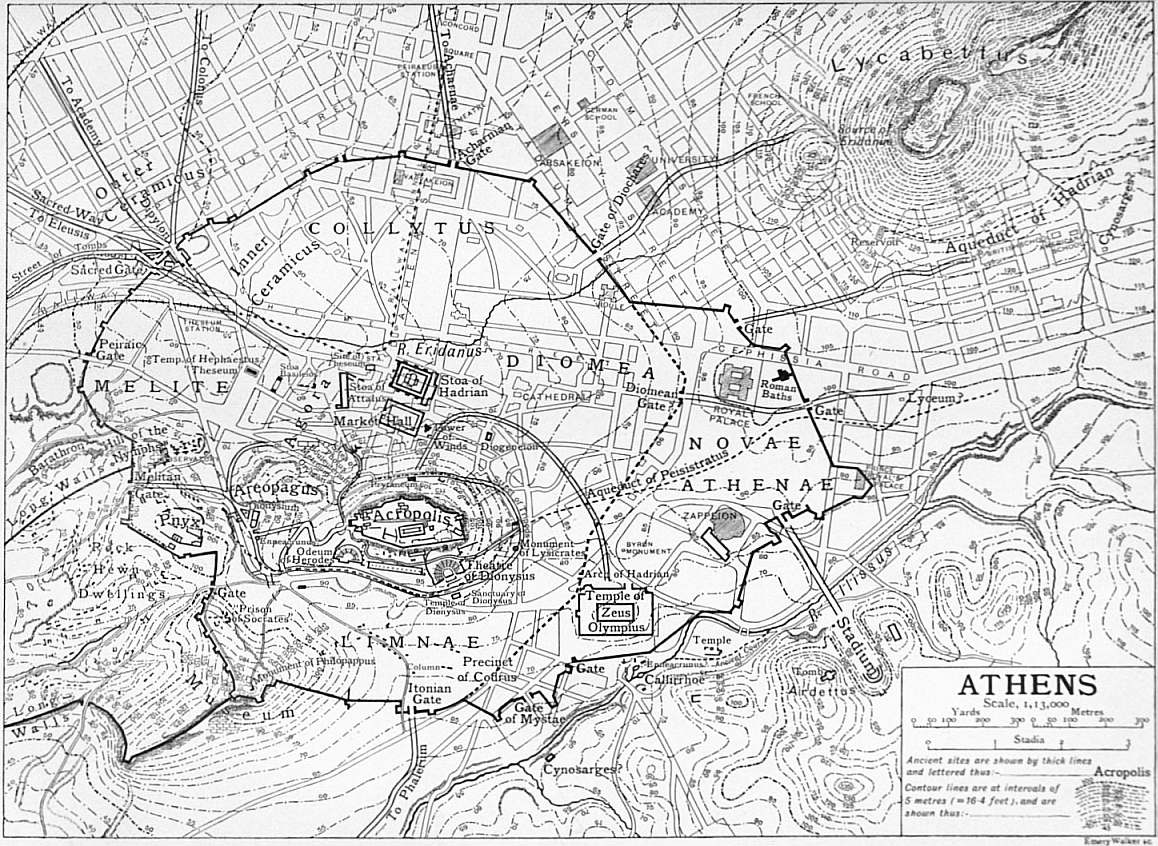
(Click to enlarge.)
Prehistoric Athens.—Numerous traces of the “Mycenaean”
epoch have recently been brought to light in Athens and its
neighbourhood. Among the monuments of this age
discovered in the surrounding districts are the rock-hewn
The early citadel.
tombs of Spata, accidentally revealed by a
landslip in 1877, and domed sepulchre at Menidí, near
the ancient Acharnae, excavated by Lolling in 1879. Other
“Mycenaean” landmarks have been laid bare at Eleusis,
Thoricus, Halae and Aphidna. These structures, however, are
of comparatively minor importance in point of dimensions and
decoration; they were apparently designed as places of sepulture
for local chieftains, whose domains were afterwards incorporated
in the Athenian realm by the συνοικισμός (synoecism) attributed
833
to Theseus. The situation of the Acropolis, dominating the
surrounding plain and possessing easy communication with
the sea, favoured the formation of a relatively powerful state—inferior,
however, to Tiryns and Mycenae; the myths of Cecrops,
Erechtheus and Theseus bear witness to the might of the princes
who ruled in the Athenian citadel, and here we may naturally
expect to find traces of massive fortifications resembling in some
degree those of the great Argolid cities. Such in fact have been
brought to light by the modern excavations on the Acropolis
(1885-1889). Remains of primitive polygonal walls which undoubtedly
surrounded the entire area have been found at various
points a little within the circuit of the existing parapet. The
best-preserved portions are at the eastern extremity, at the
northern side near the ancient “royal” exit, and at the south-western
angle. The course of the walls can be traced with a few
interruptions along the southern side. On the northern side are
the foundations of a primitive tower and other remains, apparently
of dwelling-houses, one of which may have been the πυκινὸς δόμος Ἐρεχθῆος mentioned by Homer (Od. vii. 81). Among the
foundations were discovered fragments of “Mycenaean” pottery.
The various approaches to the citadel on the northern side—the
rock-cut flight of steps north-east of the Erechtheum (q.v.),
the stairs leading to the well Clepsydra, and the intermediate
passage supposed to have furnished access to the Persians—are
all to be attributed to the primitive epoch. Two pieces of polygonal
wall, one beneath the bastion of Nike Apteros, the other in
a direct line between the Roman gateway and the door of the
Propylaea, are all that remain of the primitive defences of the
main entrance.
These early fortifications of the Acropolis, ascribed to the
primitive non-hellenic Pelasgi, must be distinguished from
the Pelasgicum Or Pelargicum, which was in all probability
an encircling wall, built round the base of the
The Pelasgicum.
citadel and furnished with nine gates from which it
derived the name of Enneapylon. Such a wall would be required
to protect the clusters of dwellings around the Acropolis as well
as the springs issuing from the rock, while the gates opening
in various directions would give access to the surrounding
pastures and gardens. This view, which is that of E. Curtius,
alone harmonizes with the statement of Herodotus (vi. 137) that
the wall was “around” (περί) the Acropolis, and that of Thucydides
(ii. 17) that it was “beneath” (ὑπό) the fortress. Thus
it would appear that the citadel had an outer and an inner line
of defence in prehistoric times. The space enclosed by the outer
wall was left unoccupied after the Persian wars in deference
to an oracular response apparently dictated by military considerations,
the maintenance of an open zone being desirable
for the defence of the citadel. A portion of the outer wall has
been recognized in a piece of primitive masonry discovered
near the Odeum of Herodes Atticus; other traces will probably
come to light when the northern and eastern slopes of the
Acropolis have been completely explored. Leake, whom Frazer
follows, assumed the Pelasgicum to be a fortified space at the
western end of the Acropolis; this view necessitates the assumption
that the nine gates were built one within the other, but
early antiquity furnishes no instance of such a construction;
Dörpfeld believes it to have extended from the grotto of Pan
to the sacred precinct of Asclepius. The well-known passage
of Lucian (Piscator, 47) cannot be regarded as decisive for any
of the theories advanced, as any portion of the old enceinte
dismantled by the Persians may have retained the name in later
times. The Pelasgic wall enclosed the spring Clepsydra, beneath
the north-western corner of the Acropolis, which furnished a water-supply
to the defenders of the fortress. The spring, to which a
staircase leads down, was once more included in a bastion during
the War of Independence by the Greek chief Odysseus.
To the “Pelasgic” era may perhaps be referred (with Curtius
and Milchhöfer) the immense double terrace on the north-eastern
slope of the Pnyx (395 ft. by 212), the upper portion
of which is cut out of the rock, while the lower is
The Pnyx.
enclosed by a semicircular wall of massive masonry; the theory
of these scholars, however, that the whole precinct was a sanctuary
of the Pelasgian Zeus cannot be regarded as proved, nor is it
easy to abandon the generally received view that this was the
scene of the popular assemblies of later times, notwithstanding
the apparent unsuitability of the ground and the insufficiency
of room for a large multitude. These difficulties are met by
the assumption that the semicircular masonry formed the base
of a retaining-wall which rose to a considerable height, supporting
a theatre-like structure capable of seating many thousand
persons. The masonry may be attributed to the 5th century;
the chiselling of the immense blocks is not “Cyclopean.” Projecting
from the upper platform at the centre of the chord of
the semicircular area is a cube of rock, 11 ft. square and 5 ft.
high, approached on either side by a flight of steps leading to the
top; this block, which Curtius supposes to have been the
primitive altar of Zeus Ὕψιστος, may be safely identified with
the orators’ bema, ὁ λίθος ἐν τῇ Πυκνί (Aristoph. Pax, 680).
Plutarch’s statement that the Thirty Tyrants removed the
bema so as to face the land instead of the sea is probably due to
a misunderstanding. Other cubes of rock, apparently altars,
exist in the neighbourhood. There can be little doubt that the
Pnyx was the seat of an ancient cult; the meetings of the
Ecclesia were of a religious character and were preceded by a
sacrifice to Zeus Ἀγοραῖος; nor is it conceivable that, but for
its sacred associations, a site would have been chosen so unsuitable
for the purposes of a popular assembly as to need the
addition of a costly artificial auditorium.
The Pnyx, the Hill of the Nymphs and the Museum Hill are
covered with vestiges of early settlements which extend to a
considerable distance towards the south-east in the
direction of Phalerum. They consist of chambers of
Rock-dwellings and tombs.
various sizes, some of which were evidently human
habitations, together with cisterns, channels, seats,
steps, terraces and quadrangular tombs, all cut in the rock.
This neighbourhood was held by Curtius to have been the site
of the primeval rock city, κρανάα πόλις (Aristoph. Ach. 75),
anterior to the occupation of the Acropolis and afterwards
abandoned for the later settlement. It seems inconceivable,
however, that any other site should have been preferred by the
primitive settlers to the Acropolis, which offered the greatest
advantages for defence; the Pnyx, owing to its proximity
to the centres of civic life, can never have been deserted, and
that portion which lay within the city walls must have been
fully occupied when Athens was crowded during the Peloponnesian
War. Some of the rock chambers originally intended
for tombs were afterwards converted, perhaps under pressure
of necessity, into habitations, as in the case of the so-called
“Prison of Socrates,” which consists of three chambers horizontally
excavated and a small round apartment of the “beehive”
type. The remains on the Pnyx and its neighbourhood cannot
all be assigned to one epoch, the prehistoric age. The dwellings
do not correspond in size or details with the undoubtedly prehistoric
abodes on the Acropolis. In view of the ancient law
which forbade burial within the city, the tombs within the
circuit of the city walls must either be earlier than the time of
Themistocles or several centuries later; in the similar rock-tombs
on the neighbouring slopes of the Acropolis and Areopagus
both Mycenaean and Dipylon pottery have been found. But
the numerous vertically excavated tombs outside the walls
are of late date and belong for the most part to the Roman
period.
The Areopagus is now a bare rock possessing few architectural
traces. The legend of its occupation by the Amazons (Aeschylus,
Eum. 681 seq.) may be taken as indicating its military
importance for an attack on the Acropolis; the
The Areopagus.
Persians used it as a point d’appui for their assault.
The seat of the old oligarchical council and court for homicide
was probably on its eastern height. Here were the altar of Athena
Areia and two stones, the λίθος Ὕβρεως, on which the accuser,
and the λίθος Ἀναιδείας, on which the accused, took their
stand. Beneath, at the north-eastern corner, is the cleft which
formed the sanctuary of the Σεμναί, or Erinyes. There is
no reason for disturbing the associations connected with this
834
spot as the scene of St Paul’s address to the Athenians (E.
Gardner, Anc. Athens, p. 505).
Hellenic Period.—While modern research has added considerably
to our knowledge of prehistoric Athens, a still greater light
has been thrown on the architecture and topography of the city
in the earlier historic or “archaic” era, the subsequent age of
Athenian greatness, and the period of decadence which set in with
the Macedonian conquest; the first extends from the dawn of
history to 480-479 B.C., when the city was destroyed by the
Persians; the second, or classical, age closes in 322 B.C., when
Athens lost its political independence after the Lamian War;
the third, or Hellenistic, in 146 B.C., when the state fell under
Roman protection. We must here group these important epochs
together, as distinguished from the later period of Roman rule,
and confine ourselves to a brief notice of their principal monuments
and a record of the discoveries by which they have been
illustrated in recent years.
The earliest settlement on the Acropolis was doubtless soon
increased by groups of dwellings at its base, inhabited by the
dependents of the princes who ruled in the stronghold.
These habitations would naturally in the first instance
The city in the “archaic” era.
lie in close proximity to the western approach; after
the building of the Pelasgicum they seem to have
extended beyond its walls towards the south and south-west—towards
the sea and the waters of the Ilissus. The district thus
occupied sloped towards the sun and was sheltered by the
Acropolis from the prevailing northerly winds. The Thesean
synoecism led to the introduction of new cults and the foundation
of new shrines partly on the Acropolis, partly in the inhabited
district at its base both within and without the wall of the
Pelasgicum. Some of the shrines in this region are mentioned
by Thucydides in a passage which is of capital importance for
the topography of the city at this period (ii. 15). By degrees
the inhabited area began to comprise the open ground to the
north-west, the nearer portion of the later Ceramicus, or “potters’
field” (afterwards divided by the walls of Themistocles into the
Inner and Outer Ceramicus), and eventually extended to the
north and east of the citadel, which, by the beginning of the
5th century B.C., had become the centre of a circular or
wheel-shaped city, πόλιος τροχοειδέος ἄκρα κάρηνα (Oracle apud
Herod, vii. 140). To this enlarged city was applied, probably
about the second half of the 6th century, the special designation
τὸ ἄστυ, which afterwards distinguished Athens from its port,
the Peiracus; the Acropolis was already ἡ πόλις (Thucyd. ii. 15).
The city is supposed to have been surrounded by a wall before
the time of Solon, the existence of which may be deduced from
Thucydides’ account of the assassination of Hipparchus (vi. 57),
but no certain traces of such a wall have been discovered;
the materials may have been removed to build the walls of
Themistocles.
The centre of commercial and civic life of the older group of
communities, as of the greater city of the classical age, was the
Agora or market. Here were the various public
buildings, which, when the power of the princes on
The Agora.
the citadel was transferred to the archons, formed the
offices of the administrative magistracy. The site of the primitive
Agora (ἀρχαία ἀγορά) was probably in the hollow between the
Acropolis and the Pnyx, which formed a convenient meeting-place for
the dwellers on the north and south sides of the fortress
as well as for its inhabitants. In the time of the Peisistratids
the Agora was enlarged so as to extend over the Inner Ceramicus
on the north-west, apparently reaching the northern declivities
of the Areopagus and the Acropolis on the south. After the
Persian Wars the northern portion was used for commercial,
the southern for political and ceremonial purposes. In the
southern were the Orchestra, where the Dionysiac dances took
place, and the famous statues of Harmodius and Aristogeiton
by Antenor which were carried away by Xerxes; also the
Metroum, or temple of the Mother of the Gods, the Bouleuterium,
or council-chamber of the Five Hundred, the Prytaneum, the
hearth of the combined communities, where the guests of the
state dined, the temple of the Dioscuri, and the Tholus, or Skias,
a circular stone-domed building in which the Prytaneis were
maintained at the public expense; in the northern were the
Leocorium, where Hipparchus was slain, the στοὰ βασιλική,
the famous στοὰ ποικίλη, where Zeno taught, and other structures.
The Agora was commonly described as the “Ceramicus,”
and Pausanias gives it this name; of the numerous buildings
which he saw here scarcely a trace remains; their position, for
the most part, is largely conjectural, and the exact boundaries
of the Agora itself are uncertain. What are perhaps the remains
of the στοὰ βασιλική, in which the Archon Basileus held his
court and the Areopagus Council sat in later times, were brought
to light in the winter of 1897-1898, when excavations were
carried out on the eastern slope of the “Theseum” hill. Here
was found a rectangular structure resembling a temple, but with
a side door to the north; it possessed a portico of six columns.
The north slope of the Areopagus, where a number of early
tombs were found, was also explored, and the limits of the
Agora on the south and north-west were approximately ascertained.
A portion of the main road leading from the Dipylon
to the Agora was discovered.
In 1892 Dörpfeld began a series of excavations in the district
between the Acropolis and the Pnyx with the object of determining
the situation of the buildings described by
Pausanias as existing in the neighbourhood of the
The Enneacrunus.
Agora, and more especially the position of the Enneacrunus
fountain. The Enneacrunus has hitherto
been generally identified with the spring Callirrhoe in the bed of
the Ilissus, a little to the south-east of the Olympieum; it is
apparently, though not explicitly, placed by Thucydides (ii. 15)
in proximity to that building, as well as the temple of Dionysus
ἐν λίμναις and other shrines, the temples of Zeus Olympius
and of Ge and the Pythium, which he mentions as situated
mainly to the south of the Acropolis. On the other hand,
Pausanias (i. 14. 1), who never deviates without reason from the
topographical order of his narrative, mentions the Enneacrunus
in the midst of his description of certain buildings which were
undoubtedly in the region of the Agora, and unless he is guilty
of an unaccountable digression the Enneacrunus which he saw
must have lain west of the Acropolis. It is now generally
agreed that the Agora of classical times covered the low ground
between the hill of the “Theseum,” the Areopagus and the
Pnyx; and Pausanias, in the course of his description, appears
to have reached its southern end. The excavations revealed
a main road of surprisingly narrow dimensions winding up from
the Agora to the Acropolis. A little to the south-west of the
point where the road turns towards the Propylaca was found a
large rock-cut cistern or reservoir which Dörpfeld identifies with
the Enneacrunus. The reservoir is supplied by a conduit of
6th-century tiles connected with an early stone aqueduct, the
course of which is traceable beneath the Dionysiac theatre and
the royal garden in the direction of the Upper Ilissus. These
elaborate waterworks were, according to Dörpfeld, constructed
by the Peisistratids in order to increase the supply from the
ancient spring Callirrhoe; the fountain was furnished with nine
jets and henceforth known as Enneacrunus. This identification
has been hotly contested by many scholars, and the question
must still be regarded as undecided. An interesting confirmation
of Dörpfeld’s view is furnished by the map of Guillet and Coronelli,
published in 1672, in which the Enneacrunus is depicted as a
well with a stream of running water in the neighbourhood of the
Pnyx. The fact that spring water is not now found in this
locality is by no means fatal to the theory; recent engineering
investigations have shown that much of the surface water of
the Attic plain has sunk to a lower level. In front of the reservoir
is a small open space towards which several roads converge;
close by is a triangular enclosure of polygonal masonry, in which
were found various relics relating to the worship of Dionysus,
a very ancient wine-press (ληνός) and the remains of a small
temple. Built over this early precinct, which Dörpfeld identifies
with the Dionysium ἐν λίμναις, or Lenaeum, is a basilica-shaped
building of the Roman period, apparently sacred to
Bacchus; in this was found an inscription containing the rules
835
of the society of the Iobacchi. There is an obvious difficulty in
assuming that λίμναι, in the sense of “marshes,” existed in
this confined area, but stagnant pools may still be seen here
in winter. Dörpfeld’s identification of the Dionysium, ἐν λίμναις
cannot be regarded as proved; his view that another Pythium
and another Olympieum existed in this neighbourhood is still
less probable; but the inconclusiveness of these theories does
not necessarily invalidate his identification of the Enneacrunus,
with regard to the position of which the language of Thucydides
is far from clear. Another enclosure, a little to the south, is
proved by an inscription to have been a sanctuary of the hitherto
unknown hero Amynos, with whose cult those of Asclepius and
the hero Dexion were here associated; under the name Dexion,
the poet Sophocles is said to have been worshipped after his
death. The whole district adjoining the Areopagus was found
to have been thickly built over; the small, mean dwelling-houses
intersected by narrow, crooked lanes convey a vivid idea of the
contrast between the modest private residences and the great
public structures of the ancient city.
The age of the Peisistratids (560-511 B.C.) marked an era in
the history of Athenian topography. The greatest of their
foundations, the temple of Olympian Zeus, will be
referred to later. Among the monuments of their
The Academy and Lyceum.
rule, in addition to the enlarged Agora and the
Enneacrunus, were the Academy and perhaps the
Lyceum. The original name of the Academy may have been
Hecademia, from Hecademus, an early proprietor (but see
Academy, Greek). The famous seat of the Platonic philosophy
was a gymnasium enlarged as a public park by Cimon; it lay
about a mile to the north-west of the Dipylon Gate, with which
it was connected by a street bordered with tombs. The Lyceum,
where Aristotle taught, was originally a sanctuary of Apollo
Lyceius. Like the Academy, it was an enclosure with a gymnasium
and garden; it lay to the east of the city beyond the
Diocharean Gate.
Little was known of the buildings on the Acropolis in the
pre-Persian period before the great excavations of 1885-1888,
which rank among the most surprising achievements of
modern research. The results of these operations, which were
conducted by the Archaeological Society under the direction of
Kavvadias and Kawerau, must be summarized with the utmost
The Acropolis before the Persian wars.
brevity. The great deposits of sculpture and pottery
now unearthed, representing all that escaped from the
the ravages of the Persians and the burning of the ancient
shrines, afford a startling revelation of the development
of Greek art in the 7th and 6th centuries. Numbers
of statues—among them a series of draped and richly-coloured
female figures—masterpieces of painted pottery, only
equalled by the Attic vases found in Magna Grecia and Etruria,
and numerous bronzes, were among the treasures of art now
brought to light. All belong to the “archaic” epoch; only a
few remains of the greater age were found, including some
fragments of sculptures from the Parthenon and Erechtheum. We
are principally concerned, however, with the results which add to
our knowledge of the topography and architecture of the Acropolis.
The entire area of the summit was now thoroughly explored,
the excavations being carried down to the surface of the
rock, which on the southern side was found to slope outwards to a
depth of about 45 ft. In the lower strata were discovered the
remnants of Cyclopean or prehistoric architecture already
mentioned. Of later date, perhaps, are the limestone polygonal
retaining walls on the west front, which extended on either side
of the early entrance. Of these a portion may probably be
attributed to the Peisistratids, in whose time the Acropolis once
more became the stronghold of a despotism. Its fortifications,
though not increased, were apparently strengthened by the
Tyrants. To its embellishment they probably contributed the
older ornamental entrance, facing south-west, the precursor of
the greater structure of Mnesicles (see Propylaea) and the
colonnade of the “Hecatompedon,” or earlier temple of Athena,
at this time the only large sacred edifice on the citadel. The
name was subsequently applied to the cella, or eastern chamber,
of the Parthenon, which is exactly 100 ft. long, and also became
a popular designation of the temple itself.
The ancient Hecatompedon may in all probability be identified
with an early temple, also 100 ft. long, the foundations of which
were pointed out in 1885 by Dörpfeld on the ground
immediately adjoining the south side of the
The old temple of Athena.
Erechtheum. On this spot was apparently the primitive
sanctuary of Athena, the rich temple πίων νηός of
Homer (Il. ii. 549), in which the cult of the goddess was associated
with that of Erechtheus; the Homeric temple is identified by
Furtwängler with the “compact house of Erechtheus” (Od. vii. 81),
which, he holds, was not a royal palace, but a place of worship,
and traces of it may perhaps be recognized in the fragments
of prehistoric masonry enclosed by the existing foundations.
The foundations seem to belong to the 7th century, except those
of the colonnade, which was possibly added by Peisistratus.
According to Dörpfeld, this was the “old temple” of Athena
Polias, frequently mentioned in literature and inscriptions, in
which was housed the most holy image ξόανον of the goddess
which fell from heaven; it was burnt, but not completely
destroyed, during the Persian War, and some of its external
decorations were afterwards built into the north wall of the
Acropolis; it was subsequently restored, he thinks, with or
without its colonnade—in the former case a portion of the
peristyle must have been removed when the Erechtheum was
built so as to make room for the porch of the maidens; the
building was set on fire in 406 B.C. (Xen. Hell. i. 6. 1), and
the conflagration is identical with that mentioned by Demosthenes
(In Timocr. xxiv. 155); its “opisthodomos” served as the
Athenian treasury in the 5th and 4th centuries; the temple is the
ἀρχαῖος νεὼς τῆς Πολιάδος mentioned by Strabo (ix. 16),
and it was still standing in the time of Pausanias, who applies to
it the same name (i. 27. 3). The conclusion that the foundations
are those of an old temple burnt by the Persians has been generally
accepted, but other portions of Dörpfeld’s theory—more especially
his assumption that the temple was restored after the Persian
War—have provoked much controversy. Thus J.G. Frazer
maintains the hitherto current theory that the earlier temple of
Athena and Erechtheus was on the site of the Erechtheum;
that the Erechtheum inherited the name ἀρχαῖος νεώς from its
predecessor, and that the “opisthodomos” in which the treasures
were kept was the west chamber of the Parthenon; Furtwängler
and Milchhöfer hold the strange view that the “opisthodomos”
was a separate building at the east end of the Acropolis, while
Penrose thinks the building discovered by Dörpfeld was possibly
the Cecropeum. E. Curtius and J.W. White, on the other hand,
accept Dörpfeld’s identification, but believe that only the
western portion of the temple or opisthodomos was rebuilt after
the Persian War. Admitting the identification, we may perhaps
conclude that the temple was repaired in order to provide a
temporary home for the venerated image and other sacred
objects; no traces of a restoration exist, but the walls probably
remained standing after the Persian conflagration. The removal
of the ancient temple was undoubtedly intended when the
Erechtheum was built, but superstition and popular feeling may
have prevented its demolition and the removal of the ξόανον
to the new edifice. The temple consisted of an eastern cella with
pronaos; behind this was the opisthodomos, divided into three
chambers—possibly treasuries—with a portico at the western end.
The peristyle, if we compare the measurements of the stylobate
with those of the drums built into the wall of the Acropolis, may
be concluded to have consisted of six Doric columns at the ends
and twelve at the sides. In one of the pediments was a gigantomachy,
of which some fragments have been recovered.
In 1896 excavations with the object of exploring the whole
northern and eastern slopes of the Acropolis were begun by
Kavvadias. The pathway between the citadel and
the Areopagus was found to be so narrow that it is
The grottoes of Pan and Apollo.
certain the Panathenaic procession cannot have taken
this route to the Acropolis. On the north-west rock
the caves known as the grottoes of Pan and Apollo were
cleared out; these consist of a slight high-arched indentation
836
immediately to the east of the Clepsydra and a double and
somewhat deeper cavern a little farther to the east. In the first
mentioned are a number of niches in which πίνακες (votive
tablets) were placed: some of these, inscribed with dedications to
Apollo, have been discovered. The whole locality was the seat of
the ancient cult of this deity, afterwards styled “Hypacraeus,”
with which was associated the legend of Creüsa and the birth
of Ion. The worship of Pan was introduced after the Persian
wars, in consequence of an apparition seen by Pheidippides,
the Athenian courier, in the mountains of Arcadia. Another
cave more to the west was revealed by the demolition of
the bastion of Odysseus. To the east a much deeper and hitherto
unknown cavern has been revealed, which Kavvadias identifies
with the grotto of Pan. Close to it are a series of steps hewn in
the rock which connect with those discovered in 1886 within the
Acropolis wall. Farther east is an underground passage leading
eastward to a cave supposed to be the sanctuary of Aglaurus
where the ephebi took the oath; with this passage is connected
a secret staircase leading up through a cleft in the rock to the
precinct of the Errephori on the Acropolis. It is conceivable
that the priestesses employed this exit when descending on their
mysterious errand.
In the fifty years between the Persian and the Peloponnesian
wars architecture and plastic art attained their highest perfection
in Athens. The almost complete destruction of the
buildings on the Acropolis and in the lower city, among
The classical period: the walls of Themistocles.
them many temples and shrines which religious sentiment
might otherwise have preserved, facilitated the
realization of the magnificent architectural designs
of Themistocles, Cimon and Pericles, while the rapid
growth of the Athenian empire provided the state with the
necessary means for the execution of these sumptuous projects.
Of the great monuments of this epoch few traces remain except
on the Acropolis. After the departure of the Persians the first
necessity was the reconstruction of the defences of the city and
the citadel. The walls of the city, now built under the direction
of Themistocles, embraced a larger area than the previous
circuit, with which they seem to have coincided at the Dipylon
Gate on the north-west where the Sacred Way to Eleusis was
joined by the principal carriage route to the Peiraeus and the
roads to the Academy and Colonus. The other more important
gates were the Peiraic and Melitan on the west; the Itonian on
the south leading to Phalerum, the Diomean and Diocharean on
the east, and the Acharnian on the north. The wall, which was
strengthened with numerous towers, enclosed the quarters of
Collytus on the north, Melite on the west, Limnae on the
south-west and south, and Diomea on the east. The scanty traces
which remain have not been systematically excavated except
in the neighbourhood of the Dipylon; the discovery of sepulchral
tablets built into the masonry illustrates the statement of
Thucydides with regard to the employment of such material
in the hasty construction of the walls. The circuit has been
practically ascertained in its general lines, though not in details;
it is given by Thucydides (ii. 13. 7) as 43 stades (about
5½ m.) exclusive of the portion between the points of junction
with the long walls extending to the Peiraeus, but the
whole circumference cannot have exceeded 37 stades. Possibly
Thucydides, who in the passage referred to is dealing with
the question of defence, included a portion of the contiguous
long walls in his measurement; this explanation derives
probability from his underestimate of the length of the long
walls.
The design of connecting Athens with the Peiraeus by long
parallel walls is ascribed by Plutarch to Themistocles. The
“Long Walls” (τὰ μακρὰ τείχη, τὰ σκέλη) consisted
of (1) the “North Wall” (τὸ βόρειον τεῖχος), (2) the
The “Long Walls”.
“Middle” or “South Wall” (τὸ διὰ μέσου τεῖχος, Plato,
Gorg. 555 Ε; τὸ νότιον τεῖχος); and (3) the “Phaleric
Wall” (τὸ Φαληρικὸν τεῖχος; The north and Phaleric walls
were perhaps founded by Cimon, and were completed about
457 B.C. in the early administration of Pericles; the middle wall
was built about 445 B.C. The lines of the north and middle walls
have been ascertained from the remnants still existing in the
18th century and the scantier traces now visible. The north
wall, leaving the city circuit at a point near the modern
Observatory, ran from north-east to south-west near the present road
to the Peiraeus, until it reached the Peiraeus walls a little to the
east of their northernmost bend. The middle wall, beginning
south of the Pnyx near the Melitan Gate, gradually approached
the northern wall and, following a parallel course at an interval
of 550 ft., diverged to the east near the modern New Phalerum
and joined the Peiraeus walls on the height of Munychia where
they turn inland from the sea. The course of the Phaleric wall
has been much disputed. The widely-received view of Curtius
that it ran to Cape Kolias (now Old Phalerum) on the east of
the Phaleric bay is not accepted by recent topographers. The
exigencies of the defensive system planned by Themistocles could
only have been satisfied by a juncture of the Phaleric wall with
that of the Peiraeus. The existence of any third wall was denied
by Leake, according to whose theory the southern parallel wall
would be identical with the Phaleric. The language of Thucydides,
however, seems decisive with regard to the existence of
three walls. The Phaleric wall, branching from the city circuit
at some point farther east than the middle or south wall, may
have followed the ridge of the Sikelia heights, where some traces
of fortifications remain, and then traversed the Phalerum plain
till it reached the Peiraeus defences at a point a little to the
north-west of their junction with the middle wall. The Phaleric
wall, proving indefensible, was abandoned towards the close of
the Peloponnesian war; with the other two walls it was completely
destroyed after the surrender of the city, and was not
rebuilt when they were restored by Conon in 393 B.C. The
parallel walls fell into decay, during the Hellenistic period, and
according to Strabo (ix. 396) were once more demolished by
Sulla.
The great advantages which the Peiraic promontory with its
three natural harbours offered for purposes of defence and
commerce were first recognized by Themistocles, in
whose archonship (493 B.C.) the fortifications of the
The Peiraeus.
Peiraeus were begun. Before his time the Athenians
used as a port the roadstead of Phalerum at the north-eastern
corner of Phalerum bay partly sheltered by Cape Kolias. As
soon as the building of the city walls had been completed,
Themistocles resumed the construction of the Peiraeus defences,
which protected the larger harbour of Cantharus on the west
and the smaller ports of Zea and Munychia (respectively south-west
and south-east of the Munychia heights), terminating in
moles at their entrances and enclosing the entire promontory on
the land and sea sides except a portion of the south-west shore
of the peninsula of Acte. The walls, built of finely compacted
blocks, were about 10 ft. in thickness and upwards of 60 ft. in
height, and were strengthened by towers. The town was laid
out at great expense in straight, broad streets, intersecting each
other at right angles, by the architect Hippodamus of Miletus
in the time of Pericles. In the centre was the Agora of Hippodamus;
on the western margin of the Cantharus harbour
extended the emporium, or Digma, the centre of commercial
activity, flanked by a series of porticoes; at its northern end,
near the entrance to the inner harbour, was another Agora, on
the site of the modern market-place, and near it the μακρὰ στοά,
the corn depot of the state. This inner and shallower harbour,
perhaps the κωφὸς λιμήν, was afterwards excluded from the
town precinct by the walls of Conon, which traversing its opening
on an embankment (τὸ διὰ μέσου χῶμα) ran round the outer shore
of the western promontory of Eëtionea, previously enclosed,
with some space to the north-west, by the wider circuit of
Themistocles. In the harbours of Zea and Munychia traces may
be seen of the remarkable series of galley-slips in which the
Athenian fleet was built and repaired. The galley-slips around
Zea were roofed by a row of gables supported by stone columns,
each gable sheltering two triremes. Among the other noteworthy
buildings of the Peiraeus were the arsenal (σκευοθήκη) of Philo
and the temples of Zeus Soter, the patron god of the sailors, of
the Cnidian Artemis, built by Cimon, and of Artemis Munychia,
837
situated near the fort on the Munychia height; traces of a temple
of Asclepius, of two theatres and of a hippodrome remain. The
fine marble lion of the classical period which stood at the mouth
of the Cantharus harbour gave the Peiraeus its medieval and
modern names of Porto Leone and Porto Draco; it was carried
away to Venice by Morosini.
In 1870 the Greek Archaeological Society undertook a series
of excavations in the Outer Ceramicus, which had already been
partially explored by various scholars. The operations,
which were carried on at intervals till 1890,
The Dipylon and Ceramicus.
resulted in the discovery of the Dipylon Gate, the
principal entrance of ancient Athens. The Dipylon
consists of an outer and an inner gate separated by an oblong
courtyard and flanked on either side by towers; the gates were
themselves double, being each composed of two apertures
intended for the incoming and outgoing traffic. An opening in
the city wall a little to the south-west, supposed to have been
the Sacred Gate (ἱερὰ πύλη), was in all probability an outlet
for the waters of the Eridanus. This stream, which has hitherto
been regarded as the eastern branch of the Ilissus rising at
Kaesariane, has been identified by Dörpfeld with a brook
descending from the south slope of Lycabettus and conducted in
an artificial channel to the north-western end of the city, where
it made its exit through the walls, eventually joining the Ilissus.
The channel was open in Greek times, but was afterwards covered
by Roman arches; it appears to have served as the main drain
of the city. Between this outlet and the Dipylon were found a
boundary-stone, inscribed ὄρος Κεραμεικοῦ, which remains in its
place, and the foundations of a large rectangular building,
possibly the Pompeium, which may have been a robing-room
for the processions which passed this way. On either side of the
Dipylon the walls of Themistocles, faced on the outside by a
later wall, have been traced for a considerable distance. The
excavation of the outlying cemetery revealed the unique “Street
of the Tombs” and brought to light a great number of sepulchral
monuments, many of which remain in situ. Especially noteworthy
are the stelae (reliefs) representing scenes of leave-taking,
which, though often of simple workmanship, are characterized
by a touching dignity and restraint of feeling. In this neighbourhood
were found a great number of tombs containing vases of all
periods, which furnish a marvellous record of the development
of Attic ceramic art. A considerable portion of the district
remains unexplored.
The Acropolis had been dismantled as a fortress after the
expulsion of Hippias; its defenders against the Persians found
it necessary to erect a wooden barricade at its entrance.
The fortifications were again demolished by the
The Acropolis of the classical period: its fortifications and area.
Persians, after whose departure the existing north
wall was erected in the time of Themistocles; many
columns, metopes and other fragments from the
buildings destroyed by the Persians were built into it,
possibly owing to haste, as in the case of the city walls,
but more probably with the design of commemorating the
great historic catastrophe, as the wall was visible from the
Agora. The fine walls of the south and east sides were built by
Cimon after the victory of the Eurymedon, 468 B.C.; they
extend considerably beyond the old Pelasgic circuit, the
intervening space being filled up with earth and the débris of the
ruined buildings so as to increase the level space of the summit.
On the northern side Cimon completed the wall of Themistocles
at both ends and added to its height; the ground behind was
levelled up on this side also, the platform of the Acropolis thus
receiving its present shape and dimensions. The staircase leading
down to the sanctuary of Aglaurus was enclosed in masonry.
At the south-western corner, on the right of the approach to the
old entrance, a bastion of early masonry was encased in a
rectangular projection which formed a base for the temple of
Nike. The great engineering works of Cimon provided a
suitable area for the magnificent structures of the age of
Pericles.
The greater monuments of the classical epoch on the Acropolis
are described in separate articles (see Parthenon, Erechtheum,
Propylaea). Next in interest to these noble structures is the
beautiful little temple of Athena Nike, wrongly designated Nike
The monuments on the Acropolis.
Apteros (Wingless Victory), standing on the bastion already
mentioned; it was begun after 450 B.C. and was probably
finished after the outbreak of the Peloponnesian
War. The temple, which is entirely of Pentelic marble,
is amphiprostyle tetrastyle, with fluted Ionic columns,
on a stylobate of three steps; its length is 27 ft., its
breadth 18½ ft., and its total height, from the apex of the pediment
to the bottom of the steps, 23 ft. The frieze, running round
the entire building, represents on its eastern side a number of
deities, on its northern and southern sides Greeks fighting with
Persians, and on its western side Greeks fighting with Greeks.
Before the east front was the altar of Athena Nike. The irregularly
shaped precinct around the temple was enclosed by a balustrade
about 3 ft. 2 in. in height, decorated on the outside with beautiful
reliefs representing a number of winged Victories engaged in the
worship of Athena. The elaborate treatment of the drapery
enveloping these female figures suggests an approach to the
mannerism of later times; this and other indications point to
the probability that the balustrade was added in the latter years
of the Peloponnesian War. The temple was still standing in
1676; some eight years later it was demolished by the Turks,
and its stones built into a bastion; on the removal of the bastion
in 1835 the temple was successfully reconstructed by Ross with
the employment of little new material. At either corner of the
Propylaea entrance were equestrian statues dedicated by the
Athenian knights; the bases with inscriptions have lately been
recovered. From the inner exit of the Propylaea a passage led
towards the east along the north side of the Parthenon; almost
directly facing the entrance was the colossal bronze statue of
Athena (afterwards called Athena Promachos) by Pheidias,
probably set up by Cimon in commemoration of the Persian
defeat. The statue, which was 30 ft. high, represented the goddess
as fully armed; the gleam of her helmet and spear could be
seen by the mariners approaching from Cape Sunium (Pausanias
i. 28). On both sides of the passage were numerous statues,
among them that of Athena Hygeïa, set up by Pericles to
commemorate the recovery of a favourite slave who was injured
during the building of the Parthenon, a colossal bronze image
of the wooden horse of Troy, and Myron’s group of Marsyas with
Athena throwing away her flute. Another statue by Myron, the
famous Perseus, stood near the precinct of Artemis Brauronia.
In this sacred enclosure, which lay between the south-eastern
corner of the Propylaea and the wall of Cimon, no traces of a
temple have been found. Adjoining it to the east are the
remains of a large rectangular building, which was apparently
fronted by a colonnade; this has been identified with the
Χαλκοθήκη, a storehouse of bronze implements and arms, which
was formerly supposed to lie against the north wall near the
Propylaea. Beyond the Parthenon, a little to the north-east,
was the great altar of Athena, and near it the statue and altar
of Zeus Polieus. With regard to the buildings on the east end of
the Acropolis, where the present museums stand, no certainty
exists; among the many statues here were those of Xanthippus,
the father of Pericles, and of Anacreon. Immediately west of the
Erechtheum is the Pandroseum or temenos of Pandrosos, the
daughter of Cecrops, the excavation of which has revealed no
traces of the temple (ναός) seen here by Pausanias (i. 27). The
site of this precinct, in which the sacred olive tree of Athena
grew, has been almost certainly fixed by an inscription found in
the bastion of Odysseus. At its north-western extremity is a
platform of levelled rock which may have supported the altar of
Zeus Hypsistus. Farther west, along the north wall of the Acropolis,
is the space probably occupied by the abode and playground
of the Errephori. Between this precinct and the Propylaea were
a number of statues, among them the celebrated heifer of Myron,
and perhaps his Erechtheus; the Lemnian Athena of Pheidias,
and his effigy of his friend Pericles.
The reconstruction of the city after its demolition by the
Persians was not carried out on the lines of a definite plan like
that of the Peiraeus. The houses were hastily repaired, and the
838
narrow, crooked streets remained; the influence of Themistocles,
The city in the classical period.
who aimed at transferring the capital to the Peiraeus, was
probably directed against any costly scheme of restoration,
except on the Acropolis. The period of Cimon’s
administration, however, especially the interval between
his victory on the Eurymedon and his ostracism
(468-461 B.C.), was marked by great architectural activity in
the lower city as well as on the citadel. To his time may be
referred many of the buildings around the Agora (probably
rebuilt on the former sites) and elsewhere, and the passage, or
δρόμος, from the Agora to the Dipylon flanked by long porticos.
The Theseum or temple of Theseus, which lay to the east of the
Agora near the Acropolis, was built by Cimon: here he deposited
the bones of the national hero which he brought from Scyros
about 470 B.C. The only building in the city which can with
certainty be assigned to the administration of Pericles is the
Odeum, beneath the southern declivity of the Acropolis, a
structure mainly of wood, said to have been built in imitation
of the tent of Xerxes: it was used for musical contests and the
rehearsal of plays. Of the various temples in which statues by
Pheidias, Alcamenes and other great sculptors are known to
have been placed, no traces have yet been discovered; excavation
has not been possible in a large portion of the lower city, which
has always been inhabited. The only extant structures of the
classical period are the Hephaesteum, the Dionysiac theatre,
and the choragic monument of Lysicrates. The remains of a
small Ionic temple which were standing by the Ilissus in the
time of Stuart have disappeared.
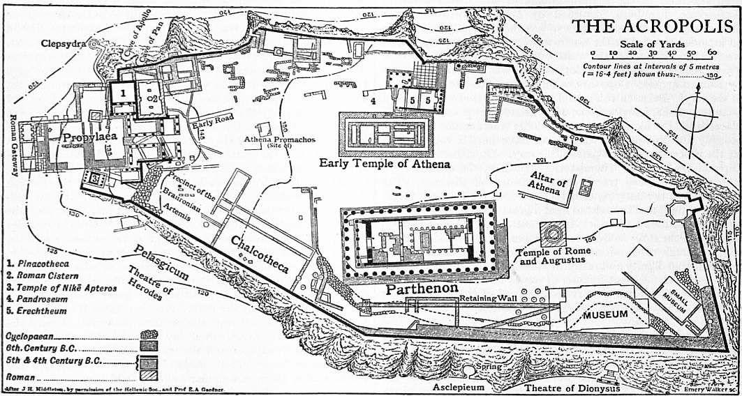
The Hephaesteum, the so-called Theseum, is situated on a
slight eminence, probably the Colonus Agoraeus, to the west
of the Agora. The best preserved Greek temple in
the world, it possesses no record of its origin; the
The Hephaesteum or Theseum.
style of its sculptures and architecture leads to the
conclusion that it was built about the same time
as the Parthenon; it seems to have been finished by 421
B.C. It has been known as the Theseum since the middle
ages, apparently because some of its sculptures represent the
exploits of Theseus, but the Theseum was an earlier sanctuary
on the east of the Agora (see above). The building has been
supposed by Curtius, Wachsmuth and others to be the Heracleum
in Melite, but its identification with the temple of Hephaestus
and Athena seen in this neighbourhood by Pausanias (i. 14. 6),
though not established, may be regarded as practically certain,
notwithstanding the difficulty presented by the subjects of the
sculptures, which bear no relation to Hephaestus. The temple
is a Doric peripteral hexastyle in antis, with 13 columns at the
sides; its length is 104 ft., its breadth 45½ ft., its height, to the
top of the pediment, 33 ft. The sculptures of the pediments
have been completely lost, but their design has been ingeniously
reconstructed by Sauer. The frieze of the entablature contains
sculptures only in the metopes of the east front and in those
of the sides immediately adjoining it; the frontal metopes
represent the labours of Heracles, the lateral the exploits of
Theseus. As in the Parthenon, there is a sculptured zophoros
above the exterior of the cella walls; this, however, extends
over the east and west fronts only and the east ends of the
sides; the eastern zophoros represents a battle-scene with
seated deities on either hand, the western a centauromachia.
The temple is entirely of Pentelic marble, except the foundations
and lowest step of the stylobate, which are of Peiraic stone, and
the zophoros of the cella, which is in Parian marble. The
preservation of the temple is due to its conversion into a church
in the middle ages.
The Dionysiac theatre, situated beneath the south side of the
Acropolis, was partly hollowed out from its declivity. The
representation of plays was perhaps transferred to
this spot from the early Orchestra in the Agora at the
The Dionysiac theatre and Asclepieum.
beginning of the 5th century B.C.; it afterwards
superseded the Pnyx as the meeting-place of the
Ecclesia. The site, which had been accurately determined
by Leake, was explored by Strack in 1862, and the
researches subsequently undertaken by the Greek
Archaeological Society were concluded in 1879. It was not, however,
till 1886 that traces of the original circular Greek orchestra were
pointed out by Dörpfeld. The arrangements of the stage and
orchestra as we now see them belong to Roman times; the
cavea or auditorium dates from the administration of the orator
Lycurgus (337-323 B.C.), and nothing is left of the theatre in
which the plays of Sophocles were acted save a few small remnants
of polygonal masonry. These, however, are sufficient to mark
out the circuit of the ancient orchestra, on which the subsequently
built proscenia encroached. The oldest stage-building was
erected in the time of Lycurgus; it consisted of a rectangular
hall with square projections (παρασκήνια) on either side; in
839
front of this was built in late Greek or early Roman times a
stage with a row of columns which intruded upon the orchestra
space; a later and larger stage, dating from the time of Nero,
advanced still farther into the orchestra, and this was finally
faced (probably in the 3rd century A.D.) by the “bema” of
Phaedrus, a platform-wall decorated with earlier reliefs, the
slabs of which were cut down to suit their new position. The
remains of two temples of Dionysus have been found adjoining
the stoa of the theatre, and an altar of the same god adorned
with masks and festoons; the smaller and earlier temple probably
dates from the 6th century B.C., the larger from the end of the
5th or the beginning of the 4th century.
Immediately west of the theatre of Dionysus is the sacred
precinct of Asclepius, which was excavated by the Archaeological
Society in 1876-1878. Here were discovered the foundations
of the celebrated Asclepieum, together with several inscriptions
and a great number of votive reliefs offered by grateful invalids
and valetudinarians to the god of healing. Many of the reliefs
belong to the best period of Greek art. A Doric colonnade with
a double row of columns was found to have extended along the
base of the Acropolis for a distance of 54 yds.; behind it in a
chamber hewn in the rock is the sacred well mentioned by
Pausanias. The colonnade was a place of resort for the patients;
a large building close beneath the rock was probably the abode
of the priests.
The beautiful choragic monument of Lysicrates, dedicated
in the archonship of Euaenetus (335-334 B.C.), is the only survivor
of a number of such structures which stood in the
“Street of the Tripods” to the east of the Dionysiac
The choragic monument of Lysicrates.
theatre, bearing the tripods given to the successful
choragi at the Dionysiac festival. It owes its preservation
to its former inclusion in a Capuchin convent.
The monument consists of a small circular temple of Pentelic
marble, 21½ ft. in height and 9 ft. in diameter, with six engaged
Corinthian columns and a sculptured frieze, standing on a rectangular
base of Peiraic stone. The delicately carved convex
roof, composed of a single block, was surmounted by the tripod.
The spirited reliefs of the frieze represent the punishment
of the Tyrrhenian pirates by Dionysus and their transformation
into dolphins. Another choragic monument was that of
Thrasyllus, which faced a cave in the Acropolis rock above the
Dionysiac theatre. A portion of another, that of Nicias, was
used to make the late Roman gate of the Acropolis. In one
of these monuments was the famous Satyr of Praxiteles.
The Cynosarges, from earliest times a sanctuary of Heracles,
later a celebrated gymnasium and the school of Antisthenes
the Cynic, has hitherto been generally supposed to
have occupied the site of the Monastery of the Asomati
The Cynosarges.
on the eastern slope of Lycabettus; its situation,
however, has been fixed by Dörpfeld at a point a little to the
south of the Olympieum, on the left bank of the Ilissus. Here
a series of excavations, carried out by the British School in
1896-1897 under the direction of Cecil Smith, revealed the
foundations of an extensive Greek building, the outlines of which
correspond with those of a gymnasium; it possessed a large
bath or cistern, and was flanked on two sides by water-courses.
An Ionic capital found here possibly belonged to the palaestra.
The identification, however, cannot be regarded as certain in
the absence of inscriptions.
With the loss of political liberty the age of creative genius
in Athenian architecture came to a close. The era of decadence,
of honorary statues and fulsome inscriptions, began.
The embellishments which the city received during
The Hellenistic period: the Stoa of Attalus.
the Hellenistic and Roman periods were no longer the
artistic expression of the religious and political life of
a great commonwealth; they were the tribute paid
to the intellectual renown of Athens by foreign potentates or
dilettanti, who desired to add their names to the list of its
illustrious citizens and patrons. Among the first of these benefactions
was the great gymnasium of Ptolemy, built in the neighbourhood
of the Agora about 250 B.C. Successive princes of
the dynasty of Pergamum interested themselves in the adornment
of the city: Attalus I. set up a number of bronze statues on
the Acropolis; Eumenes II. built the long portico west of the
Dionysiac theatre, which was excavated and identified in 1877;
Attalus II. erected the magnificent Stoa near the Agora, the remains
of which were completely laid bare in 1898-1902 and have
been identified by an inscription. The Stoa consisted of a series
of 21 chambers, probably shops, faced by a double colonnade,
the outer columns being of the Doric order, the inner unfluted,
with lotus-leaf capitals; it possessed an upper storey fronted
with Ionic columns.
The greatest monument, however, of the Hellenistic period
is the colossal Olympieum or temple of Olympian Zeus, “unum
in terris inchoatum pro magnitudine dei” (Livy
xli. 20), the remains of which stand by the Ilissus
The Olympieum.
to the south-east of the Acropolis. The foundations
of a temple were laid on the site—probably that of an ancient
sanctuary-by Peisistratus, but the building in its ultimate
form was for the greater part constructed under the auspices
of Antiochus IV. Epiphanes, king of Syria, by the Roman
architect Cossutius in the interval between 174 B.C. and 164 B.C.,
the date of the death of Antiochus. The work was then suspended
and its proposed resumption in the time of Augustus seems not
to have been realized; finally, in A.D. 129, the temple was
completed and dedicated by Hadrian, who set up a chryselephantine
statue of Zeus in the cella. The substructure was
excavated in 1883 by F.C. Penrose, who proved the correctness
of Dörpfeld’s theory that the building was octostyle; its length
was 318 ft., its breadth 132 ft. With the exception of the
foundations and two lower steps of the stylobate, it was entirely
of Pentelic marble, and possessed 104 Corinthian columns,
56 ft. 7 in. in height, of which 48 stood in triple rows under the
pediments and 56 in double rows at the sides; of these, 16 remained
standing in 1852, when one was blown down by a storm.
Fragments of Doric columns and foundations were discovered,
probably intended for the temple begun by Peisistratus, the
orientation of which differed slightly from that of the later
structure. The peribolos, a large artificial platform supported
by a retaining wall of squared Peiraic blocks with buttresses,
was excavated in 1898 without important results; it is to be
hoped that the stability of the columns has not been affected
by the operations.
The Roman Period.—After 146 B.C. Athens and its territory
were included in the Roman province of Achaea. Among the
earlier buildings of this period is the Horologium
of Andronicus of Cyrrhus (the “Tower of the Winds”),
The Horologium of Andronicus.
still standing near the eastern end of the Roman Agora.
The building may belong to the 2nd or 1st century B.C.;
it is mentioned by Varro (De re rust. iii. 5. 17), and therefore
cannot be of later date than 35 B.C. It is an octagonal marble
structure, 42 ft. in height and 26 ft. in diameter; the eight sides,
which face the points of the compass, are furnished with a
frieze containing inartistic figures in relief representing the
winds; below it, on the sides facing the sun, are the lines of a
sun-dial. The building was surmounted by a weathercock in the
form of a bronze Triton; it contained a water-clock to record the
time when the sun was not shining.
The capture and sack of Athens by Sulla (March 1, 86 B.C.)
seems to have involved no great injury to its architectural
monuments beyond the burning of the Odeum of
Pericles; a portion of the city wall was razed, the
Monuments of the Roman period.
groves of the Academy and Lyceum were cut down,
and the Peiraeus, with its magnificent arsenal and other
great buildings, burnt to the ground. After this catastrophe
the benefactors of Athens were for the most part Romans; the
influence of Greek literature and art had begun to affect the
conquering race. The New, or Roman, Agora to the north of
the Acropolis, perhaps mainly an oil market, was constructed
after the year 27 B.C. Its dimensions were practically determined
by excavation in 1890-1891. It consisted of a large open rectangular
space surrounded by an Ionic colonnade into which opened
a number of shops or storehouses. The eastern gate was adorned
with four Ionic columns on the outside and two on the inside, the
840
western entrance being the well-known Doric portico of Athena
Archegetis with an inscription recording its erection from
donations of Julius Caesar and Augustus. The whole conclave
may be compared with the enclosed bazaars or khans of Oriental
cities which are usually locked at night. The Agrippeum, a
covered theatre, derived its name from Vipsanius Agrippa,
whose statue was set up, about 27 B.C., beneath the north wing
of the Acropolis propylaea, on the high rectangular base still
remaining. At the eastern end of the Acropolis a little circular
temple of white marble with a peristyle of 9 Ionic columns
was dedicated to Rome and Augustus; its foundations were discovered
during the excavations of 1885-1888. The conspicuous
monument which crowns the Museum Hill was erected as the
mausoleum of Antiochus Philopappus of Commagene, grandson
of Antiochus Epiphanes, in A.D. 114-116. Excavations carried
out in 1898-1899 showed that the structure was nearly square;
the only portion remaining is the slightly curved front, with three
niches between Corinthian pilasters; in the central niche is
the statue of Philopappus.
The emperor Hadrian was the most lavish of all the benefactors
of Athens. Besides completing the gigantic Olympieum he
enlarged the circuit of the city walls to the east,
enclosing the area now covered by the royal
Novae Athenae: the buildings of Hadrian.
public gardens and the Constitution Square. This was
the City of Hadrian (Hadrianapolis) or New Athens
(Novae Athenae); a handsome suburb with numerous
villas, baths and gardens; some traces remain of its walls,
which, like those of Themistocles, were fortified with rectangular
towers. An ornamental entrance near the Olympieum,
the existing Arch of Hadrian, marked the boundary
between the new and the old cities. The arch is surmounted by a
triple attic with Corinthian columns; the frieze above the keystone
bears, on the north-western side, the inscription αἴδ᾽ εἴσ᾽ Ἀθῆναι, Θησέως ἡ πρὶν πόλις and on the south-eastern,
αἴδ᾽ εἴσ᾽ Ἁδριανοῦ καὶ οὐχὶ Θησέως πόλις. One of the
principal monuments of Hadrian’s munificence was the sumptuous
library, in all probability a vast rectangular enclosure,
immediately north of the New Agora, the eastern side of which was
explored in 1885-1886. A portion of its western front, adorned with
monolith unfluted Corinthian columns, is still standing—the
familiar “Stoa of Hadrian”; another well-preserved portion, with six
pilasters, runs parallel to the west side of Aeolus Street. The
interior consisted of a spacious court surrounded by a colonnade
of 100 columns, into which five chambers opened at the eastern
end. A portico of four fluted Corinthian columns on the western
side formed the entrance to the quadrangle. This cloistered
edifice may be identified with the library of Hadrian mentioned
by Pausanias; the books were, perhaps, stored in a square
building which occupied a portion of the central area. Strikingly
similar in design and construction is a large quadrangular building,
the foundations of which were discovered by the British
School near the presumed Cynosarges; this may perhaps be the
Gymnasium of Hadrian, which Pausanias tells us also possessed
100 columns. A Pantheon and temples of Hera and Zeus
Panhellenius were likewise built by Hadrian; the aqueduct,
which he began, was completed by Antoninus Pius (A.D. 138-161);
it was repaired in 1861-1869 and is still in use.
The Stadium, in which the Panathenaic Games were held,
was first laid out by the orator Lycurgus about 330 B.C. It was
an oblong structure filling a natural depression near
the left bank of the Ilissus beneath the eastern declivity
The Stadium and Odeum of Herodes Atticus.
of the Ardettus hill, the parallel sides and
semicircular end, or σφενδόνη around the arena being
partially excavated from the adjoining slopes. The
immense building, however, which was restored in
1896 and the following years, was that constructed in Pentelic
marble about A.D. 143 by Tiberius Claudius Herodes Atticus, a
wealthy Roman resident, whose benefactions to the city rivalled
those of Hadrian. The seats, rising in tiers, as in a theatre,
accommodated about 44,000 spectators; the arena was 670 ft.
in length and 109 ft. in breadth. The Odeum, built beneath the
south-west slope of the Acropolis after A.D. 161 by Herodes
Atticus in memory of his wife Regilla, is comparatively well
preserved; it was excavated in 1848 and in 1857-1858. The
plan is that of the conventional Roman theatre; the semicircular
auditorium, which seated some 5000 persons, is, like
that of the Dionysiac theatre, partly hollowed from the rock.
The orchestra is paved with marble squares. The façade, in
Peiraic stone, displays three storeys of arched windows. The
whole building was covered with a cedar roof. The Stadium
had been already completed and the Odeum had not yet been
built when Pausanias visited Athens; these buildings were the
last important additions to the architectural monuments of the
ancient city.
(J. D. B.)
II. The Modern City
At the conclusion of the Greek War of Independence, Athens
was little more than a village of the Turkish type, the poorly
built houses clustering on the northern and eastern slopes of
the Acropolis. The narrow crooked lanes of this quarter still
contrast with the straight, regularly laid-out streets of the
modern city, which extends to the north-west, north and east of the
ancient citadel. The greater commercial advantages offered
by Nauplia, Corinth and Patras were outweighed by the historic
claims of Athens in the choice of a capital for the newly founded
kingdom, and the seat of government was transferred hither
from Nauplia in 1833. The new town was, for the most part,
laid out by the German architect Schaubert. It contains several
squares and boulevards, a large public garden, and many handsome
public and private edifices. A great number of the public
institutions owe their origin to the munificence of patriotic
Greeks, among whom Andreas Syngros and George Averoff may
be especially mentioned. The royal palace, designed by Friedrich
von Gärtner (1792-1847), is a tasteless structure; attached to
it is a beautiful garden laid out by Queen Amalia, which contains
a well-preserved mosaic floor of the Roman period. On the
south-east is the newly built palace of the crown prince. The
Academy, from designs by Theophil Hansen (1813-1891), is
constructed of Pentelic marble in the Ionic style: the colonnades
and pediments are richly coloured and gilded, and may perhaps
convey some idea of the ancient style of decoration. Close by is
the university, with a colonnade adorned with paintings, and
the Vallianean library with a handsome Doric portico of Pentelic
marble. The observatory, which is connected with the university,
stands on the summit of the Hill of the Nymphs; like
the Academy, it was erected at the expense of a wealthy Greek,
Baron Sina of Vienna. In the public garden is the Zappeion, a
large building with a Corinthian portico, intended for the display
of Greek industries; here also is a monument to Byron, erected
in 1896. The Boulē, or parliament-house, possesses a considerable
library. Other public buildings are the Polytechnic Institute,
built by contributions from Greeks of Epirus, the theatre, the
Arsakeion (a school for girls), the Varvakeion (a gymnasium),
the military school (σχολὴ εὐελπίδων), and several
hospitals and orphanages. The cathedral, a large, modern structure
is devoid of architectural merit, but some of the smaller, ancient,
Byzantine churches are singularly interesting and beautiful. Among
private residences, the mansion built by Dr Schliemann, the
discoverer of Troy, is the most noteworthy; its decorations are
in the Pompeian style.
The museums of Athens have steadily grown in importance
with the progress of excavation. They are admirably arranged,
and the remnants of ancient art which they contain
have fortunately escaped injudicious restoration.
Museums.
The National Museum, founded in 1866, is especially rich in
archaic sculptures and in sepulchral and votive reliefs. A copy
of the Diadumenos of Polyclitus from Delos, and temple sculptures
from Epidaurus and the Argive Heraeum, are among the
more notable of its recent acquisitions. It also possesses the
famous collection of prehistoric antiquities found by Schliemann
at Tiryns and Mycenae, other “Mycenaean” objects discovered
at Nauplia and in Attica, as well as the still earlier remains
excavated by Tsountas in the Cyclades and by the British School
at Phylakopi in Melos; terra-cottas from Tanagra and Asia
841
Minor; bronzes from Olympia, Delphi and elsewhere, and
numerous painted vases, among them the unequalled white
lekythi from Athens and Eretria. The Epigraphical Museum
contains an immense number of inscriptions arranged by H.G.
Lolling and A. Wilhelm of the Austrian Institute. The Acropolis
Museum (opened 1878) possesses a singularly interesting collection
of sculptures belonging to the “archaic” period of Greek
art, all found on the Acropolis; here, too, are some fragments
of the pedimental statues of the Parthenon and several reliefs
from its frieze, as well as the slabs from the balustrade of the
temple of Nike. The Polytechnic Institute contains a museum
of interesting objects connected with modern Greek life and
history. In the Academy is a valuable collection of coins
superintended by Svoronos. Of the private collections those of
Schliemann and Karapanos are the most interesting: the latter
contains works of art and other objects from Dodona. There is
a small museum of antiquities at the Peiraeus.
Owing to the numbers and activity of its institutions, both
native and foreign, for the prosecution of research and the
encouragement of classical studies, Athens has become
once more an international seat of learning. The
Scientific institutions.
Greek Archaeological Society, founded in 1837,
numbers some distinguished scholars among its
members, and displays great activity in the conduct of excavations.
Important researches at Epidaurus, Eleusis, Mycenae,
Amyclae and Rhamnus may be numbered among its principal
undertakings, in addition to the complete exploration of the
Acropolis and a series of investigations in Athens and Attica.
The French École d’Athènes, founded in 1846, is under the
scientific direction of the Académie des Inscriptions et Belles-lettres.
Among its numerous enterprises have been the extensive
and costly excavations at Delos and Delphi, which have yielded
such remarkable results. The monuments of the Byzantine
epoch have latterly occupied a prominent place in its investigations.
The German Archaeological Institute, founded in 1874,
has carried out excavations at Thebes, Lesbos, Pares, Athens and
elsewhere; it has also been associated in the great researches at
Olympia, Pergamum and Troy, and in many other important
undertakings. The British School, founded in 1886, has been
unable, owing to insufficient endowment, to work on similar lines
with the French and German institutions; it has, however,
carried out extensive excavations at Megalopolis and in Melos,
as well as researches at Abae, in Athens (presumed site of the
Cynosarges), in Cyprus, at Naucratis and at Sparta. It has
also participated in the exploration of Cnossus and other important
sites in Crete. The American School, founded in 1882, is
supported by the principal universities of the United States.
In addition to researches at Sicyon, Plataea, Eretria and elsewhere,
it has undertaken two works of capital importance—the
excavation of the Argive Heraeum and of ancient Corinth.
An Austrian Archaeological Institute was founded in 1898.
Notwithstanding certain disadvantages inherent in its situation,
the trade and manufactures of Athens have considerably
increased in recent years. Industrial and commercial
activity is mainly centred at the Peiraeus, where
Industry and commerce.
cloth and cotton mills, 45 cognac distilleries, 14 steam
flour mills, 8 soap manufactories, 13 shipbuilding and
engineering works, chair manufactories, dye works, chemical
works, tanneries and a dynamite factory have been established.
The shipbuilding and engineering trades are active and advancing.
The export trade is, however, inconsiderable, as the
produce of the local industries is mainly absorbed by home
consumption. The principal exports are wine, cognac and
marble from Pentelicus. As a place of import, the Peiraeus
surpasses Patras, Syra and all the other Greek maritime towns,
receiving about 53% of all the merchandise brought into Greece.
The principal imports are coal, grain, manufactured articles and
articles of luxury. The total value of exports in 1904 was
£459,565; of imports, £2,459,278. The number of ships entered
and cleared in 1905 was 5020 with a tonnage of 5,796,590
tons, of which 416, with a tonnage of 609,822 tons, were
British.
The Peiraeus, which had never revived since its destruction by
the Romans in 86 B.C., was at the beginning of the 19th century
a small fishing village known as Porto Leone. When
Athens became the capital in 1833 the ancient name of
The Peiraeus.
its port was revived, and since that time piers and
quays have been constructed, and spacious squares and broad
regular streets have been laid out. The town now possesses an
exchange, a large theatre, a gymnasium, a naval school, municipal
buildings and several hospitals and charitable institutions erected
by private munificence. The harbour, in which ships of all nations
may be seen, as well as great numbers of the picturesque sailing
craft engaged in the coasting trade, is somewhat difficult of
access to larger vessels, but has been improved by the construction
of new breakwaters and dry docks. The port and
the capital are now connected by railway with Corinth and the
principal towns of the Morea; the line opening up communication
with northern Greece and Thessaly, when its proposed
connexion with the Continental railway system has been effected,
will greatly enhance the importance of the Peiraeus, already one
of the most flourishing commercial towns in the Levant.
The population of Athens has rapidly increased. In 1834 it
was below 5000; in 1870 it was 44,510; in 1879, 63,374; in
1889, 107,251; in 1896, 111,486. The Peiraeus, which
Population.
in 1834 possessed only a few hundred inhabitants,
in 1879 possessed 21,618; in 1889, 34,327; in 1896,
43,848. The total population of Athens in 1907 was 167,479
and of Peiraeus 67,982.
(J. D. B.)
III. History
1. The Prehistoric Period.—The history of primitive Athens
is involved in the same obscurity which enshrouds the early
development of most of the Greek city-states. The Homeric
poems scarcely mention Attica, and the legends, though numerous,
are rarely of direct historical value. In the Minoan epoch Athens
is proved by the archaeological remains to have been a petty
kingdom scarcely more important than many other Attic communities,
yet enjoying a more unbroken course of development
than the leading states of that period. This accords with the
cherished tradition which made the Athenians children of the
soil, and free from admixture with conquering tribes. Many
legends, however, and the later state organization, point to an
immigration of an “Ionian” aristocracy in late Mycenaean days.
These Ionian newcomers are almost certainly responsible for the
absorption of the numerous independent communities of Attica
into a central state of Athens under a powerful monarchy (see
Theseus), for the introduction of new cults, and for the division
of the people into four tribes whose names—Geleontes, Hopletes,
Argadeis and Aegicoreis—recur in several true Ionian towns.
This centralization of power (Synoecism), to which many Greek
peoples never attained, laid the first foundations of Athenian
greatness. But in other respects the new constitution tended to
arrest development. When the monarchy was supplanted in the
usual Greek fashion by a hereditary nobility—a process accomplished,
according to tradition, between about 1000 and 683
B.C.—all power was appropriated by a privileged class of
Eupatridae (q.v.); the Geomori and Demiurgi, who formed
the bulk of the community, enjoyed no political rights. It was
to their control over the machinery of law that the Eupatridae
owed their predominance. The aristocratic council of the
Areopagus (q.v.) constituted the chief criminal court, and
nominated the magistrates, among whom the chief archon (q.v.)
passed judgment in family suits, controlled admission to the
genos or clan, and consequently the acquisition of the franchise.
This system was further supported by religious prescriptions
which the nobles retained as a corporate secret. Assisted no
doubt by their judicial control, the Eupatridae also tended to
become sole owners of the land, reducing the original freeholders
or tenants to the position of serfs. During this period Athens
seems to have made little use of her militia, commanded by the
polemarch, or of her navy, which was raised in special local
divisions known as Naucraries (see Naucrary); hence no
military esprit de corps could arise to check the Eupatrid
842
ascendancy. Nor did the commons obtain relief through any
commercial or colonial enterprises such as those which alleviated
social distress in many other Greek states. The first attack upon
the aristocracy proceeded from a young noble named Cylon, who
endeavoured to become tyrant about 630 B.C. The people helped
to crush this movement; yet discontent must have been rife
among them, for in 611 the Eupatrids commissioned Draco (q.v.),
a junior magistrate, to draft and publish a code of criminal law.
This was a notable concession, by which the nobles lost that
exclusive legal knowledge which had formed one of their main
instruments of oppression.
2. The Rise of Athens.—A still greater danger grew out of the
widespread financial distress, which was steadily driving many
of the agricultural population into slavery and threatened the
entire state with ruin. After a protracted war with the neighbouring
Megarians had accentuated the crisis the Eupatridae
gave to one of their number, the celebrated Solon (q.v.), free
power to remodel the whole state (594). By his economic
legislation Solon placed Athenian agriculture once more upon
a sound footing, and supplemented this source of wealth by
encouraging commercial enterprise, thus laying the foundation
of his country’s material prosperity. His constitutional reforms
proved less successful, for, although he put into the hands of
the people various safeguards against oppression, he could not
ensure their use in practice. After a period of disorder and
party-feud among the nobles the new constitution was superseded
in fact, if not in form, by the autocratic rule of Peisistratus (q.v.), and his sons Hippias and Hipparchus. The age of despotism,
which lasted, with interruptions, from 560 to 510, was a period
of great prosperity for Athens. The rulers fostered agriculture,
stimulated commerce and industry (notably the famous Attic
ceramics), adorned the city with public works and temples,
and rendered it a centre of culture. Their vigorous foreign policy
first made Athens an Aegean power and secured connexions with
numerous mainland powers. Another result of the tyranny was the
weakening of the undue influence of the nobles and the creation
of a national Athenian spirit in place of the ancient clan-feeling.
The equalization of classes was already far advanced when
towards the end of the century a nobleman of the Alcmaeonid
family, named Cleisthenes (q.v.), who had taken the chief part
in the final expulsion of the tyrants, acquired ascendancy as
leader of the commons. The constitution which he promulgated
(508/7) gave expression to the change of political feeling by
providing a national basis of franchise and providing a new
state organization. By making effective the powers of the
Ecclesia (Popular Assembly) the Boulē (Council) and Heliaea,
Cleisthenes became the true founder of Athenian democracy.
This revolution was accompanied by a conflict with Sparta
and other powers. But a spirit of harmony and energy now
breathed within the nation, and in the ensuing wars Athens
worsted powerful enemies like Thebes and Chalcis (506). A
bolder stroke followed in 500, when a force was sent to support
the Ionians in revolt against Persia and took part in the sack
of Sardis. After the failure of this expedition the Athenians
apparently became absorbed in a prolonged struggle with Aegina
(q.v.). In 493 the imminent prospect of a Persian invasion
brought into power men like Themistocles and Miltiades (qq.v.),
to whose firmness and insight the Athenians largely owed their
triumph in the great campaign of 490 against Persia. After a
second political reaction, the prospect of a second Persian war,
and the naval superiority of Aegina led to the assumption of a
bolder policy. In 483 Themistocles overcame the opposition of
Aristides (q.v.), and passed his famous measure providing for a
large increase of the Athenian fleet. In the great invasion of
480-479 the Athenians displayed an unflinching resolution which
could not be shaken even by the evacuation and destruction of
their native city. Though the traditional account of this war
exaggerates the services of Athens as compared with the other
champions of Greek independence, there can be no doubt that
the ultimate victory was chiefly due to the numbers and efficiency
of the Athenian fleet, and to the wise policy of her great statesman
Themistocles (see Salamis, Plataea).
3. Imperial Athens.—After the Persian retreat and the
reoccupation of their city the Athenians continued the war with
unabated vigour. Led by Aristides and Cimon they rendered
such prominent service as to receive in return the formal leadership
of the Greek allies and the presidency of the newly formed
Delian League (q.v.). The ascendancy acquired in these years
eventually raised Athens to the rank of an imperial state. For
the moment it tended to impair the good relations which had
subsisted between Athens and Sparta since the first days of the
Persian peril. But so long as Cimon’s influence prevailed the
ideal of “peace at home and the complete humiliation of Persia”
was steadily unheld. Similarly the internal policy of Athens
continued to be shaped by the conservatives. The only notable
innovations since the days of Cleisthenes had been the reduction
of the archonship to a routine magistracy appointed partly by
lot (487), and the rise of the ten elective strategi (generals) as
chief executive officers (see Strategus). But the triumph of
the navy in 480 and the great expansion of commerce and
industry had definitely shifted the political centre of gravity
from the yeoman class of moderate democrats to the more radical
party usually stigmatized as the “sailor rabble.” Though
Themistocles soon lost his influence, his party eventually found
a new leader in Ephialtes and after the failure of Cimon’s foreign
policy (see Cimon) triumphed over the conservatives. The year
461 marks the reversal of Athenian policy at home and abroad.
By cancelling the political power of the Areopagus and multiplying
the functions of the popular law-courts, Ephialtes
abolished the last checks upon the sovereignty of the commons.
His successor, Pericles, who commonly ranked as the “completer
of the democracy,” merely developed the full democracy so as
to secure its effectual as well as its theoretical supremacy. The
foreign policy of Athens was now directed towards an almost
reckless expansion (see Pericles). The unparalleled success of
the Athenian arms at this period extended the bounds of empire
to their farthest limits. Besides securing her Aegean possessions
and her commerce by the defeat of Corinth and Aegina, her
last rivals on sea, Athens acquired an extensive dominion in
central Greece and for a time quite overshadowed the Spartan
land-power. The rapid loss of the new conquests after 447
proved that Athens lacked a sufficient land-army to defend
permanently so extensive a frontier. Under the guidance of
Pericles the Athenians renounced the unprofitable rivalry with
Sparta and Persia, and devoted themselves to the consolidation
and judicious extension of their maritime influence.
The years of the supremacy of Pericles (443-429) are on the
whole the most glorious in Athenian history. In actual extent
of territory the empire had receded somewhat, but in point of
security and organization it now stood at its height. The Delian
confederacy lay completely under Athenian control, and the
points of strategic importance were largely held by cleruchies
(q.v.; see also Pericles) and garrisons. Out of a citizen body
of over 50,000 freemen, reinforced by mercenaries and slaves, a
superb fleet exceeding 300 sail and an army of 30,000 drilled
soldiers could be mustered. The city itself, with its fortifications
extending to the port of Peiraeus, was impregnable to a land
attack. The commerce of Athens extended from Egypt and
Colchis to Etruria and Carthage, and her manufactures, which
attracted skilled operatives from many lands, found a ready sale
all over the Mediterranean. With tolls, and the tribute of the
Delian League, a fund of 9700 talents (£2,300,000) was amassed
in the treasury.
Yet the material prosperity of Athens under Pericles was
less notable than her brilliant attainments in every field of
culture. Her development since the Persian wars had been
extremely rapid, but did not reach its climax till the latter part
of the century. No city ever adorned herself with such an array
of temples, public buildings and works of art as the Athens of
Pericles and Pheidias. Her achievements in literature are hardly
less great. The Attic drama of the period produced many great
masterpieces, and the scientific thought of Europe in the departments
of logic, ethics, rhetoric and history mainly owes its origin
to a new movement of Greek thought which was largely fostered
843
by the patronage of Pericles himself. Besides producing
numerous men of genius herself Athens attracted all the great
intellects of Greece. The brilliant summary of the historian
Thucydides in the famous Funeral Speech of Pericles (delivered
in 430), in which the social life, the institutions and the culture
of his country are set forth as a model, gives a substantially true
picture of Athens in its greatest days.
This brilliant epoch, however, was not without its darker side.
The payment for public service which Pericles had introduced
may have contributed to raise the general level of culture of the
citizens, but it created a dangerous precedent and incurred the
censure of notable Greek thinkers. Moreover, all this prosperity
was obtained at the expense of the confederates, whom Athens
exploited in a somewhat selfish and illiberal manner. In fact
it was the cry of “tyrant city” which went furthest to rouse
public opinion in Greece against Athens and to bring on the
Peloponnesian War (q.v.) which ruined the Athenian empire
(431-404). The issue of this conflict was determined less by any
intrinsic superiority on the part of her enemies than by the
blunders committed by a people unable to carry out a consistent
foreign policy on its own initiative, and served since Pericles
by none but selfish or short-sighted advisers. It speaks well for
the patriotic devotion and discipline of her commons that
Athens, weakened by plague and military disasters, should have
withstood for so long the blows of her numerous enemies from
without, and the damage inflicted by traitors within her walls
(see Antiphon, Theramenes).
4. The Fourth Century—After the complete defeat of Athens
by land and sea, it was felt that her former services on behalf
of Greece and her high culture should exempt her from total
ruin. Though stripped of her empire, Athens obtained very
tolerable terms from her enemies. The democratic constitution,
which had been supplanted for a while by a government of
oligarchs, but was restored in 403 after the latter’s misrule had
brought about their own downfall (see Critias, Theramenes,
Thrasybulus), henceforth stood unchallenged by the Greeks.
Indeed the spread of democracy elsewhere increased the prestige
of the Athenian administration, which had now reached a high
pitch of efficiency. Athenian art and literature in the 4th century
declined but slightly from their former standard; philosophy
and oratory reached a standard which was never again equalled
in antiquity and may still serve as a model. In the wars of the
period Athens took a prominent part with a view to upholding
the balance of power, joining the Corinthian League in 395,
and assisting Thebes against Sparta after 378, Sparta against
Thebes after 369. Her generals and admirals, Conon, Iphicrates,
Chabrias, Timotheus, distinguished themselves by their military
skill, and partially recovered their country’s predominance in
the Aegean, which found expression in the temporary renewal
of the Delian League (q.v.). By the middle of the century Athens
was again the leading power in Greece. When Philip of Macedon
began to grow formidable she seemed called upon once more
to champion the liberties of Greece. This ideal, when put
forward by the consummate eloquence of Demosthenes and
other orators, created great enthusiasm among the Athenians,
who at times displayed all their old vigour in opposing Philip,
notably in the decisive campaign of 338. But these outbursts
of energy were too spasmodic, and popular opinion repeatedly
veered back in favour of the peace-party. With her diminished
resources Athens could not indeed hope to cope with the great
Macedonian king; however much we may sympathize with the
generous ambition of the patriots, we must admit that in the
light of hard facts their conduct appears quixotic.
5. The Hellenistic Period.—Philip and Alexander, who
sincerely admired Athenian culture and courted a zealous
co-operation against Persia, treated the conquered city with
marked favour. But the people would not resign themselves
to playing a secondary part, and watched for every opportunity
to revolt. The outbreak headed by Athens after Alexander’s
death (323) led to a stubborn conflict with Macedonia. After
his victory the regent Antipater punished Athens by the loss of
her remaining dependencies, the proscription of her chief patriots,
and the disfranchisement of 12,000 citizens. The Macedonian
garrison which was henceforth stationed in Attic territory
prevented the city from taking a prominent part in the wars
of the Diadochi. Cassander placed Athens under the virtual
autocracy of Demetrius of Phalerum (317-307), and after the
temporary liberation by Demetrius Poliorcetes (306-300),
secured his interests through a dictator named Lachares, who
lost the place again to Poliorcetes after a siege (295). After a
vain attempt to expel the garrison in 287, the Athenians regained
their liberty while Macedonia was thrown into confusion by the
Celts, and in 279 rendered good service against the invaders
of the latter nation with a fleet off Thermopylae. When Antigonus
Gonatas threatened to restore Macedonian power in
Greece, the Athenians, supported perhaps by the king of Egypt,
formed a large defensive coalition; but in the ensuing “Chremonidean
War” (266-263) a naval defeat off Andros led to their
surrender and the imposition of a Macedonian garrison. The
latter was finally withdrawn in 229 by the good offices of Aratus
(q.v.). At this period Athens was altogether overshadowed
in material strength by the great Hellenistic monarchies and
even by the new republican leagues of Greece; but she could
still on occasion display great energy and patriotism. The
prestige of her past history had now perhaps attained its zenith.
Her democracy was respected by the Macedonian kings; the
rulers of Egypt, Syria, and especially of Pergamum, courted her
favour by handsome donations of edifices and works of art,
to which the citizens replied by unbecoming flattery, even to
the extent of creating new tribes named after their benefactors.
If Athens lost her supremacy in the fields of science and scholarship
to Alexandria, she became more than ever the home of
philosophy, while Menander and the other poets of the New
Comedy made Athenian life and manners known throughout the
civilized world.
6. Relations with the Roman Republic.—In 228 Athens
entered into friendly intercourse with Rome, in whose interest
she endured the desperate attacks of Philip V. of Macedonia
(200-199). In return for help against King Perseus she acquired
some new possessions, notably the great mart of Delos,
which became an Athenian cleruchy (166). By her treacherous
attack upon the frontier-town of Oropus (156) Athens indirectly
brought about the conflict between Rome and the Achaean
League which resulted in the eventual loss of Greek independence,
but remained herself a free town with rights secured by treaty.
In spite of the favours displayed by Rome, the more radical
section of the people began to chafe at the loss of their international
importance. This discontent was skilfully fanned by
Mithradates the Great at the outset of his Roman campaigns.
His emissary, the philosopher Aristion, induced the people to
declare war against Rome and to place him in chief command.
The town with its port stood a long siege against Sulla, but was
stormed in 86. The conqueror allowed his soldiers to loot, but
inflicted no permanent punishment upon the people. This
war left Athens poverty-stricken and stripped of her commerce:
her only importance now lay in the philosophical schools, which
were frequented by many young Romans of note (Cicero,
Atticus, Horace, &c.). Greek became fashionable at Rome, and
a visit to Athens a sort of pilgrimage for educated Romans
(cf. Propertius iv. 21: “Magnum iter ad doctas proficisci
cogor Athenas”). In the great civil wars Athens sided with
Pompey and held out against Caesar’s lieutenants, but received
a free pardon “in consideration of her great dead.” Similarly
the triumvirs after Philippi condoned her enthusiasm for the
cause of Brutus. Antony repeatedly made Athens his headquarters
and granted her several new possessions, including
Eretria and Aegina—grants which Octavian subsequently
revoked.
7. The Roman Empire.—Under the new settlement Athens
remained a free and sovereign city—a boon which she repaid
by zealous Caesar-worship, for the favours bestowed upon her
tended to pauperize her citizens and to foster their besetting
sin of calculating flattery. Hadrian displayed his special
fondness for the city by raising new buildings and relieving
844
financial distress. He amended the constitution in some respects,
and instituted a new national festival, the Panhellenica. In the
period of the Antonines the endowment of professors out of the
imperial treasury gave Athens a special status as a university
town. Her whole energies seem henceforth devoted to academic
pursuits; the military training of her youth was superseded
by courses in philosophy and rhetoric; the chief organs of
administration, the revived Areopagus and the senior Strategus,
became as it were an education office. Save for an incursion
by Goths in A.D. 267 and a temporary occupation by Alaric in
395, Athens spent the remaining centuries of the ancient world
in quiet prosperity. The rhetorical schools experienced a
brilliant revival under Constantine and his successors, when
Athens became the alma mater of many notable men, including
Julian, Libanius, Basil and Gregory of Nazianzus, and in her
professors owned the last representatives of a humane and
moralized paganism. The freedom of teaching was first curtailed
by Theodosius I.; the edict of Justinian (529), forbidding the
study of philosophy, dealt the death-blow to ancient Athens.
The authorities for the history of ancient Athens will mostly be
found under Greece: History, and the various biographies. The
following books deal with special periods or subjects only:—(1)
Early Athens: W. Warde Fowler, The City-State, ch. vi. (London,
1893). (2) The fifth and fourth centuries: the “Constitution of Athens,”
ascribed to Xenophon; W. Oncken, Athen und Hellas (Leipzig, 1865);
U. v. Wilamowitz-Moellendorff, Aus Kydathen (Berlin, 1880);
L. Whibley, Political Parties at Athens (Cambridge, 1889); G. Gilbert,
Beiträge zur inneren Geschichte Athens (Leipzig, 1877); J. Beloch,
Die attische Politik seit Perikles (Leipzig, 1884). (3) The Hellenistic
and Roman periods: J.P. Mahaffy, Greek Life and Thought, from
323 to 146 (London, 1887), chs. v., vi., xvii.; A. Holm, Greek History
(Eng. trans., London, 1898), iv. chs. vi. and xxiii.; Wilamowitz-Moellendorff,
Antigonos von Karystos (Berlin, 1881), pp. 178-291;
W. Capes, University Life in Ancient Athens (London, 1877); A.
Dumont, Essai sur l’Ephebie attique (Paris, 1875). (4) The Latin
rule: G. Finlay, History of Greece (Oxford ed., 1877), vol. iv. ch. vi.
(5) Constitutional History: The Aristotelian “Constitution of
Athens”; U. v. Wilamowitz-Moellendorff, Aristoteles und Athen
(Berlin and Leipzig, 1893), vol. ii.; G. Gilbert, Greek Constitutional
Antiquities (Eng. trans., London, 1895), pp. 95-453; A.H.J.
Greenidge, Handbook of Greek Constitutional History (Oxford, 1896),
ch. vi.; J.W. Headlam, Election by Lot at Athens (Cambridge, 1891).
(6) Finance and statistics: A. Boeckh, The Public Economy of the
Athenians (Eng. trans., London, 1828); Ed. Meyer, Forschungen
zur alten Geschichte (Halle, 1899), vol. ii. pp. 149-195. (7) Inscriptions:
Corpus Inscriptionum Atticarum, with supplements (Berlin,
1873-1895). (8) Coins: B.V. Head, Historia Numorum (Oxford,
1887), pp. 309-328.
(M. O. B. C.)
8. Byzantine Period.—The city now sank into the position
of a provincial Byzantine town. Already it had been robbed
of many of its works of art, among them the Athena Promachos
and the Parthenos of Pheidias, for the adornment of Constantinople,
and further spoliation took place when the church of St
Sophia was built in A.D. 532. The Parthenon, the Erechtheum,
the “Theseum” and other temples were converted into Christian
churches and were thus preserved throughout the middle ages.
The history of Athens for the next four centuries is almost a
blank; the city is rarely mentioned by the Byzantine chronicles
of this period. The emperor Constantine II. spent some months
here in A.D. 662-663. In 869 the see of Athens became an archbishopric.
In 995 Attica was ravaged by the Bulgarians under
their tsar Samuel, but Athens escaped; after the defeat of
Samuel at Belasitza (1014) the emperor Basil II., who blinded
15,000 Bulgarian prisoners, came to Athens and celebrated
his triumph by a thanksgiving service in the Parthenon (1018).
From the Runic description on the marble lion of the Peiraeus it
has been inferred that Harold Hardrasda and the Norsemen
in the service of the Byzantine emperors captured the Peiraeus
in 1040, but this conclusion is not accepted by Gregorovius
(bk. i. pp. 170-172). Like the rest of Greece, Athens suffered
greatly from the rapacity of its Byzantine administrators. The
letters of Acominatus, archbishop of Athens, towards the close
of the 12th century, bewail the desolate condition of the city in
language resembling that of Jeremiah in regard to Jerusalem.
9. Period of Latin Rule: 1204-1458.—After the Latin conquest
of Constantinople in 1204, Otho de la Roche was granted
the lordship of Athens by Boniface of Montferrat, king of Thessalonica,
with the title of Megaskyr (μέγας κύριος = great lord). His
nephew and successor, Guy I., obtained the title duke of Athens
from Louis IX. of France in 1258. On the death of Guy II.,
last duke of the house of la Roche, in 1308, the duchy passed
to his cousin, Walter of Brienne. He was expelled in 1311 by
his Catalonian mercenaries; the mutineers bestowed the duchy
“of Athens and Neopatras” on their leader, Roger Deslaur, and,
in the following year, on Frederick of Aragon, king of Sicily.
The Sicilian kings ruled Athens by viceroys till 1385, when the
Florentine Nerio Acciajuoli, lord of Corinth, defeated the
Catalonians and seized the city. Nerio, who received the title
of duke from the king of Naples, founded a new dynasty. His
palace was in the Propylaea; the lofty “Tower of the Franks,”
which adjoined the south wing of that building, was possibly
built in his time. This interesting historical monument was
demolished by the Greek authorities in 1874, notwithstanding
the protests of Penrose, Freeman and other scholars. The
Acciajuoli dynasty lasted till June 1458, when the Acropolis
after a stubborn resistance was taken by the Turks under Omar,
the general of the sultan Mahommed II., who had occupied the
lower city in 1456. The sultan entered Athens in the following
month; he was greatly struck by its ancient monuments and
treated its inhabitants with comparative leniency.
10. Period of Turkish Rule: 1458-1833.—After the Turkish
conquest Athens disappeared from the eyes of Western civilization.
The principal interest of the following centuries lies in
the researches of successive travellers, who may be said to
have rediscovered the city, and in the fate of its ancient monuments,
several of which were still in fair preservation at the
beginning of this period. The Parthenon was transformed
into a mosque; the existing minaret at its south-western corner
was built after 1466. The Propylaea served as the residence
of the Turkish commandant and the Erechtheum as his harem.
In 1466 the Venetians succeeded in occupying the city, but
failed to take the Acropolis. About 1645 a powder magazine
in the Propylaea was ignited by lightning and the upper portion
of the structure was destroyed. Under Francesco Morosini
the Venetians again attacked Athens in September 1687; a
shot fired during the bombardment of the Acropolis caused a
powder magazine in the Parthenon to explode, and the building
was rent asunder. After capturing the Acropolis the Venetians
employed material from its ancient edifices in repairing its walls.
They withdrew in the following year, when the Turks set fire
to the city. The central sculptures of the western pediment of
the Parthenon, which Morosini intended to take to Venice, were
unskilfully detached by his workmen, and falling to the ground
were broken to pieces. Several ancient monuments were sacrificed
to provide material for a new wall with which the Turks
surrounded the city in 1778.
During the 18th century many works of art, which still remained
in situ, fell a prey to foreign collectors. The removal
to London in 1812 of most of the remaining sculptures of the
Parthenon by Lord Elgin possibly rescued many of them from
injury in the period of warfare which followed. In 1821 the
Greek insurgents surprised the city, and in 1822 captured the
Acropolis. Athens again fell into the hands of the Turks in 1826,
who bombarded and took the Acropolis in the following year;
the Erechtheum suffered greatly, and the monument of Thrasyllus
was destroyed. The Turks remained in possession of the
Acropolis till 1833, when Athens was chosen as the capital of
the newly established kingdom of Greece; since that date the
history of the city forms part of that of modern Greece. (See
Greece: History, modern.)
General Bibliography.—W.M. Leake, Topography of Athens
and the Demi (2nd ed., London, 1841); C. Wachsmuth, Die Stadt
Athen im Alterthum (vol. i., Leipzig, 1874; vol. ii. part i., Leipzig,
1890); E. Burnouf, La Ville et l’acropole d’Athènes aux diverses
époques (Paris, 1877); F.C. Penrose, Principles of Athenian Architecture
(London, 1888); J.E. Harrison, Mythology and Monuments
of Ancient Athens (London, 1890); E. Curtius and A. Milchhöfer,
Stadtgeschichte von Athen (Berlin, 1891); H. Hitzig and H. Blümner,
Pausanias (text and commentary; vol. i., Berlin, 1896); J.G.
Frazer, Pausanias (translation and commentary; 6 vols., London,
1898. The commentary on Pausanias’ description of Athens,
845
contained in vol. ii. with supplementary notes in vol. v., is an invaluable
digest of recent researches); H. Omont, Athènes au XVIIe siècle
(Paris, 1898, with plans and views of the town and acropolis and
drawings of the sculptures of the Parthenon); J.H. Middleton and
E.A. Gardner, Plans and Drawings of Athenian Buildings (London,
1900); E.A. Gardner, Ancient Athens (London, 1902); W. Judeich,
Topographie von Athen (Munich, 1905; forming vol. iii. part ii. second
half, in 3rd edition of I. von Müller’s Handbuch der klass.
Altertumswissenschaft). The history of excavations on the Acropolis is
summarized in M.L. d’Ooge, Acropolis of Athens (1909); see also
A. Bötticher, Die Akropolis von Athen (Berlin, 1888); O. Jahn,
Pausaniae descriptio arcis Athenarum (Bonn, 1900); A. Furtwängler,
Masterpieces of Greek Sculpture (appendix; London, 1895); A.
Milchhöfer, Über die alten Burgheiligtümer in Athen (Kiel, 1899).
For the Parthenon, A. Michaelis, Der Parthenon (texts and plates,
Leipzig, 1871); L. Magne, Le Parthénon (Paris, 1895); J. Durm,
Der Zustand der antiken athenischen Bauwerken (Berlin, 1895);
F.C. Penrose in Journal of Royal Institute of British Architects for
1897; N.M. Balanos in Ἐφήμερις τῆς κυβερνήσεως (Athens,
August 25, 1898). For the Dionysiac theatre, A.E. Haigh, The
Attic Theatre (Oxford, 1889); W. Dörpfeld and E. Reisch, Das
griechische Theater (Athens, 1896); Puchstein, Die griechische Bühne
(Berlin, 1901). For the “Theseum,” B. Sauer, Das sogenannte
Theseion (Leipzig, 1899). For the Peiraeus, E.I. Angelopoulos,
Περὶ Πειραιῶς καὶ τῶν λιμένων αὐτοῦ (Athens, 1898). For the
Attic Demes, A. Milchhöfer, Untersuchungen über die Demenordnung
des Kleisthenes (in transactions of Berlin Academy, Berlin, 1892);
Pauly-Wissowa, Realencyclopädie der class. Altertumswissenschaft
(supplement, part i., article “Athenai”; Stuttgart, 1903). For
the controversies respecting the Agora, the Enneacrunus and the
topography of the town in general, see W. Dörpfeld, passim in
Athenische Mittheilungen; C. Wachsmuth, “Neue Beiträge zur
Topographie von Athen,” in Abhandlungen der sächsischen Gesellschaft
der Wissenschaften (Leipzig, 1897). A. Milchhöfer, “Zur
Topographie von Athen,” in Berlin. philol. Wochenschrift (1900),
Nos. 9, 11, 12. For the Byzantine and medieval periods, William
Miller, Latins in the Levant (London, 1908); F. Gregorovius,
Geschichte der Stadt Athen im Mittelalter (2 vols., Stuttgart, 1889).
Periodical Literature. Mittheilungen des kais. deutsch. arch. Instituts
(Athens, from 1876); Bulletin de correspondance hellénique (Athens,
from 1877); Papers of the American School (New York, 1882-1897);
Annual of the British School (London, from 1894); Journal of
Hellenic Studies (London, from 1880); American Journal of Archaeology
(New York, from 1885); Jahrbuch des kais. deutsch. arch.
Instituts (Berlin, from 1886). The best maps are those in Die Karten
van Attika, published with explanatory text by the German
Archaeological Institute (Berlin, 1881). See also Baedeker’s Greece
(London, 1895); Murray’s Greece and the Ionian Islands (London,
1900); Guide Joanne, vol. i. Athènes et ses environs (Paris, 1896);
Meyer’s Turkei und Griechenländer (5th ed., 1901).
(J. D. B.)
ATHENS, a city and the county-seat of Clarke county, Georgia,
U.S.A., in the N.E. part of the state, about 73 m. E. by N. of
Atlanta. Pop. (1890) 8639; (1900) 10,245, of whom 5190
were negroes and only 114 were foreign-born; (1910, census)
14,913. It is served by the Georgia, the Central of Georgia, the
Southern, the Seaboard Air Line and the Gainesville Midland
railways. Athens is an important educational centre. It was
founded in 1801 as the seat of the university of Georgia, which
had been chartered in 1785. Franklin College, the academic
department of the university, was opened in 1801, and afterwards
the State College of Agriculture and Mechanic Arts (the School
of Science, 1872), the State Normal School (co-educational, 1891),
the School of Pharmacy (1903), the University Summer School
(1903), the School of Forestry (1906), and the Georgia State
College of Agriculture (1906), also branches of the university,
were established at Athens, and what had been the Lumpkin
Law School (incorporated in 1859) became the law department
of the university in 1867. Branches of the university not in
Athens are: the North Georgia Agricultural College (established
in 1871; became a part of the university in 1872), at Dahlonega;
the medical department, at Augusta (1873; founded as the
Georgia Medical College in 1829); the Georgia School of Technology
(1885), at Atlanta; the Georgia Normal and Industrial
College for Girls (1889), at Milledgeville; and the Georgia
Industrial College for Colored Youth (1890), near Savannah.
At Athens also are several secondary schools, and the Lucy Cobb
Institute (for girls), opened in 1858 and named in honour of a
daughter of its founder, Gen. T.R.R. Cobb (1823-1862). The
city has various manufactures, the most important being
fertilizers, cotton goods, and cotton-seed oil and cake; the value
of the total factory product in 1905 was $1,158,205, an increase
of 70.9% in five years. Athens was chartered as a city in 1872.
ATHENS, a village and the county-seat of Athens county,
Ohio, U.S.A., in the township of Athens, on the Hocking river,
about 76 m. E.S.E. of Columbus. Pop. (1890) 2620; (1900)
3066; (1910) 5463; of the township (1910) 10,156. It
is served by the Baltimore & Ohio Southwestern, the Toledo
& Ohio Central (Ohio Central Lines), and the Hocking Valley
railways. The village is built on rolling ground rising about
70 ft. above the river (which nearly encircles it), and commands
views of some of the most beautiful scenery in the state. There
are several ancient mounds in the vicinity. Athens is the seat
of Ohio University (co-educational), a state institution established
in 1804, and having in 1908 a college of liberal arts,
a state normal college (1902), a commercial college, a college
of music and a state preparatory school. In 1908 the University
had 53 instructors and 1386 students. South of the village,
and occupying a fine situation, is a state hospital for the insane.
In the vicinity there are many coal mines, and among the manufactures
are bricks, furniture, veneered doors, and shirts. The
municipality operates the water-works. When the Ohio Company,
through Manasseh Cutler, obtained from congress their
land in what is now Ohio, it was arranged that the income from
two townships was to be set aside “for the support of a literary
institution.” In 1795 the townships (Athens and Alexander)
were located and surveyed, and in 1800 Rufus Putnam and two
other commissioners, appointed by the Territorial legislature,
laid out a town, which was also called Athens. Settlers slowly
came; the town became the county-seat in 1805, was incorporated
as a village in 1811, and was re-incorporated in 1828.
End of the Project Gutenberg EBook of Encyclopaedia Britannica, 11th
Edition, Volume 2, Slice 7, by Various

*** END OF THIS PROJECT GUTENBERG EBOOK ENCYC. BRITANNICA, VOL 2, SLICE 7 ***

***** This file should be named 34209-h.htm or 34209-h.zip *****
This and all associated files of various formats will be found in:
        https://www.gutenberg.org/3/4/2/0/34209/

Produced by Marius Masi, Don Kretz and the Online
Distributed Proofreading Team at https://www.pgdp.net


Updated editions will replace the previous one--the old editions
will be renamed.

Creating the works from public domain print editions means that no
one owns a United States copyright in these works, so the Foundation
(and you!) can copy and distribute it in the United States without
permission and without paying copyright royalties.  Special rules,
set forth in the General Terms of Use part of this license, apply to
copying and distributing Project Gutenberg-tm electronic works to
protect the PROJECT GUTENBERG-tm concept and trademark.  Project
Gutenberg is a registered trademark, and may not be used if you
charge for the eBooks, unless you receive specific permission.  If you
do not charge anything for copies of this eBook, complying with the
rules is very easy.  You may use this eBook for nearly any purpose
such as creation of derivative works, reports, performances and
research.  They may be modified and printed and given away--you may do
practically ANYTHING with public domain eBooks.  Redistribution is
subject to the trademark license, especially commercial
redistribution.


*** START: FULL LICENSE ***

THE FULL PROJECT GUTENBERG LICENSE
PLEASE READ THIS BEFORE YOU DISTRIBUTE OR USE THIS WORK

To protect the Project Gutenberg-tm mission of promoting the free
distribution of electronic works, by using or distributing this work
(or any other work associated in any way with the phrase "Project
Gutenberg"), you agree to comply with all the terms of the Full Project
Gutenberg-tm License (available with this file or online at
https://gutenberg.org/license).


Section 1.  General Terms of Use and Redistributing Project Gutenberg-tm
electronic works

1.A.  By reading or using any part of this Project Gutenberg-tm
electronic work, you indicate that you have read, understand, agree to
and accept all the terms of this license and intellectual property
(trademark/copyright) agreement.  If you do not agree to abide by all
the terms of this agreement, you must cease using and return or destroy
all copies of Project Gutenberg-tm electronic works in your possession.
If you paid a fee for obtaining a copy of or access to a Project
Gutenberg-tm electronic work and you do not agree to be bound by the
terms of this agreement, you may obtain a refund from the person or
entity to whom you paid the fee as set forth in paragraph 1.E.8.

1.B.  "Project Gutenberg" is a registered trademark.  It may only be
used on or associated in any way with an electronic work by people who
agree to be bound by the terms of this agreement.  There are a few
things that you can do with most Project Gutenberg-tm electronic works
even without complying with the full terms of this agreement.  See
paragraph 1.C below.  There are a lot of things you can do with Project
Gutenberg-tm electronic works if you follow the terms of this agreement
and help preserve free future access to Project Gutenberg-tm electronic
works.  See paragraph 1.E below.

1.C.  The Project Gutenberg Literary Archive Foundation ("the Foundation"
or PGLAF), owns a compilation copyright in the collection of Project
Gutenberg-tm electronic works.  Nearly all the individual works in the
collection are in the public domain in the United States.  If an
individual work is in the public domain in the United States and you are
located in the United States, we do not claim a right to prevent you from
copying, distributing, performing, displaying or creating derivative
works based on the work as long as all references to Project Gutenberg
are removed.  Of course, we hope that you will support the Project
Gutenberg-tm mission of promoting free access to electronic works by
freely sharing Project Gutenberg-tm works in compliance with the terms of
this agreement for keeping the Project Gutenberg-tm name associated with
the work.  You can easily comply with the terms of this agreement by
keeping this work in the same format with its attached full Project
Gutenberg-tm License when you share it without charge with others.

1.D.  The copyright laws of the place where you are located also govern
what you can do with this work.  Copyright laws in most countries are in
a constant state of change.  If you are outside the United States, check
the laws of your country in addition to the terms of this agreement
before downloading, copying, displaying, performing, distributing or
creating derivative works based on this work or any other Project
Gutenberg-tm work.  The Foundation makes no representations concerning
the copyright status of any work in any country outside the United
States.

1.E.  Unless you have removed all references to Project Gutenberg:

1.E.1.  The following sentence, with active links to, or other immediate
access to, the full Project Gutenberg-tm License must appear prominently
whenever any copy of a Project Gutenberg-tm work (any work on which the
phrase "Project Gutenberg" appears, or with which the phrase "Project
Gutenberg" is associated) is accessed, displayed, performed, viewed,
copied or distributed:

This eBook is for the use of anyone anywhere at no cost and with
almost no restrictions whatsoever.  You may copy it, give it away or
re-use it under the terms of the Project Gutenberg License included
with this eBook or online at www.gutenberg.org

1.E.2.  If an individual Project Gutenberg-tm electronic work is derived
from the public domain (does not contain a notice indicating that it is
posted with permission of the copyright holder), the work can be copied
and distributed to anyone in the United States without paying any fees
or charges.  If you are redistributing or providing access to a work
with the phrase "Project Gutenberg" associated with or appearing on the
work, you must comply either with the requirements of paragraphs 1.E.1
through 1.E.7 or obtain permission for the use of the work and the
Project Gutenberg-tm trademark as set forth in paragraphs 1.E.8 or
1.E.9.

1.E.3.  If an individual Project Gutenberg-tm electronic work is posted
with the permission of the copyright holder, your use and distribution
must comply with both paragraphs 1.E.1 through 1.E.7 and any additional
terms imposed by the copyright holder.  Additional terms will be linked
to the Project Gutenberg-tm License for all works posted with the
permission of the copyright holder found at the beginning of this work.

1.E.4.  Do not unlink or detach or remove the full Project Gutenberg-tm
License terms from this work, or any files containing a part of this
work or any other work associated with Project Gutenberg-tm.

1.E.5.  Do not copy, display, perform, distribute or redistribute this
electronic work, or any part of this electronic work, without
prominently displaying the sentence set forth in paragraph 1.E.1 with
active links or immediate access to the full terms of the Project
Gutenberg-tm License.

1.E.6.  You may convert to and distribute this work in any binary,
compressed, marked up, nonproprietary or proprietary form, including any
word processing or hypertext form.  However, if you provide access to or
distribute copies of a Project Gutenberg-tm work in a format other than
"Plain Vanilla ASCII" or other format used in the official version
posted on the official Project Gutenberg-tm web site (www.gutenberg.org),
you must, at no additional cost, fee or expense to the user, provide a
copy, a means of exporting a copy, or a means of obtaining a copy upon
request, of the work in its original "Plain Vanilla ASCII" or other
form.  Any alternate format must include the full Project Gutenberg-tm
License as specified in paragraph 1.E.1.

1.E.7.  Do not charge a fee for access to, viewing, displaying,
performing, copying or distributing any Project Gutenberg-tm works
unless you comply with paragraph 1.E.8 or 1.E.9.

1.E.8.  You may charge a reasonable fee for copies of or providing
access to or distributing Project Gutenberg-tm electronic works provided
that

- You pay a royalty fee of 20% of the gross profits you derive from
     the use of Project Gutenberg-tm works calculated using the method
     you already use to calculate your applicable taxes.  The fee is
     owed to the owner of the Project Gutenberg-tm trademark, but he
     has agreed to donate royalties under this paragraph to the
     Project Gutenberg Literary Archive Foundation.  Royalty payments
     must be paid within 60 days following each date on which you
     prepare (or are legally required to prepare) your periodic tax
     returns.  Royalty payments should be clearly marked as such and
     sent to the Project Gutenberg Literary Archive Foundation at the
     address specified in Section 4, "Information about donations to
     the Project Gutenberg Literary Archive Foundation."

- You provide a full refund of any money paid by a user who notifies
     you in writing (or by e-mail) within 30 days of receipt that s/he
     does not agree to the terms of the full Project Gutenberg-tm
     License.  You must require such a user to return or
     destroy all copies of the works possessed in a physical medium
     and discontinue all use of and all access to other copies of
     Project Gutenberg-tm works.

- You provide, in accordance with paragraph 1.F.3, a full refund of any
     money paid for a work or a replacement copy, if a defect in the
     electronic work is discovered and reported to you within 90 days
     of receipt of the work.

- You comply with all other terms of this agreement for free
     distribution of Project Gutenberg-tm works.

1.E.9.  If you wish to charge a fee or distribute a Project Gutenberg-tm
electronic work or group of works on different terms than are set
forth in this agreement, you must obtain permission in writing from
both the Project Gutenberg Literary Archive Foundation and Michael
Hart, the owner of the Project Gutenberg-tm trademark.  Contact the
Foundation as set forth in Section 3 below.

1.F.

1.F.1.  Project Gutenberg volunteers and employees expend considerable
effort to identify, do copyright research on, transcribe and proofread
public domain works in creating the Project Gutenberg-tm
collection.  Despite these efforts, Project Gutenberg-tm electronic
works, and the medium on which they may be stored, may contain
"Defects," such as, but not limited to, incomplete, inaccurate or
corrupt data, transcription errors, a copyright or other intellectual
property infringement, a defective or damaged disk or other medium, a
computer virus, or computer codes that damage or cannot be read by
your equipment.

1.F.2.  LIMITED WARRANTY, DISCLAIMER OF DAMAGES - Except for the "Right
of Replacement or Refund" described in paragraph 1.F.3, the Project
Gutenberg Literary Archive Foundation, the owner of the Project
Gutenberg-tm trademark, and any other party distributing a Project
Gutenberg-tm electronic work under this agreement, disclaim all
liability to you for damages, costs and expenses, including legal
fees.  YOU AGREE THAT YOU HAVE NO REMEDIES FOR NEGLIGENCE, STRICT
LIABILITY, BREACH OF WARRANTY OR BREACH OF CONTRACT EXCEPT THOSE
PROVIDED IN PARAGRAPH 1.F.3.  YOU AGREE THAT THE FOUNDATION, THE
TRADEMARK OWNER, AND ANY DISTRIBUTOR UNDER THIS AGREEMENT WILL NOT BE
LIABLE TO YOU FOR ACTUAL, DIRECT, INDIRECT, CONSEQUENTIAL, PUNITIVE OR
INCIDENTAL DAMAGES EVEN IF YOU GIVE NOTICE OF THE POSSIBILITY OF SUCH
DAMAGE.

1.F.3.  LIMITED RIGHT OF REPLACEMENT OR REFUND - If you discover a
defect in this electronic work within 90 days of receiving it, you can
receive a refund of the money (if any) you paid for it by sending a
written explanation to the person you received the work from.  If you
received the work on a physical medium, you must return the medium with
your written explanation.  The person or entity that provided you with
the defective work may elect to provide a replacement copy in lieu of a
refund.  If you received the work electronically, the person or entity
providing it to you may choose to give you a second opportunity to
receive the work electronically in lieu of a refund.  If the second copy
is also defective, you may demand a refund in writing without further
opportunities to fix the problem.

1.F.4.  Except for the limited right of replacement or refund set forth
in paragraph 1.F.3, this work is provided to you 'AS-IS' WITH NO OTHER
WARRANTIES OF ANY KIND, EXPRESS OR IMPLIED, INCLUDING BUT NOT LIMITED TO
WARRANTIES OF MERCHANTIBILITY OR FITNESS FOR ANY PURPOSE.

1.F.5.  Some states do not allow disclaimers of certain implied
warranties or the exclusion or limitation of certain types of damages.
If any disclaimer or limitation set forth in this agreement violates the
law of the state applicable to this agreement, the agreement shall be
interpreted to make the maximum disclaimer or limitation permitted by
the applicable state law.  The invalidity or unenforceability of any
provision of this agreement shall not void the remaining provisions.

1.F.6.  INDEMNITY - You agree to indemnify and hold the Foundation, the
trademark owner, any agent or employee of the Foundation, anyone
providing copies of Project Gutenberg-tm electronic works in accordance
with this agreement, and any volunteers associated with the production,
promotion and distribution of Project Gutenberg-tm electronic works,
harmless from all liability, costs and expenses, including legal fees,
that arise directly or indirectly from any of the following which you do
or cause to occur: (a) distribution of this or any Project Gutenberg-tm
work, (b) alteration, modification, or additions or deletions to any
Project Gutenberg-tm work, and (c) any Defect you cause.


Section  2.  Information about the Mission of Project Gutenberg-tm

Project Gutenberg-tm is synonymous with the free distribution of
electronic works in formats readable by the widest variety of computers
including obsolete, old, middle-aged and new computers.  It exists
because of the efforts of hundreds of volunteers and donations from
people in all walks of life.

Volunteers and financial support to provide volunteers with the
assistance they need are critical to reaching Project Gutenberg-tm's
goals and ensuring that the Project Gutenberg-tm collection will
remain freely available for generations to come.  In 2001, the Project
Gutenberg Literary Archive Foundation was created to provide a secure
and permanent future for Project Gutenberg-tm and future generations.
To learn more about the Project Gutenberg Literary Archive Foundation
and how your efforts and donations can help, see Sections 3 and 4
and the Foundation web page at https://www.pglaf.org.


Section 3.  Information about the Project Gutenberg Literary Archive
Foundation

The Project Gutenberg Literary Archive Foundation is a non profit
501(c)(3) educational corporation organized under the laws of the
state of Mississippi and granted tax exempt status by the Internal
Revenue Service.  The Foundation's EIN or federal tax identification
number is 64-6221541.  Its 501(c)(3) letter is posted at
https://pglaf.org/fundraising.  Contributions to the Project Gutenberg
Literary Archive Foundation are tax deductible to the full extent
permitted by U.S. federal laws and your state's laws.

The Foundation's principal office is located at 4557 Melan Dr. S.
Fairbanks, AK, 99712., but its volunteers and employees are scattered
throughout numerous locations.  Its business office is located at
809 North 1500 West, Salt Lake City, UT 84116, (801) 596-1887, email
business@pglaf.org.  Email contact links and up to date contact
information can be found at the Foundation's web site and official
page at https://pglaf.org

For additional contact information:
     Dr. Gregory B. Newby
     Chief Executive and Director
     gbnewby@pglaf.org


Section 4.  Information about Donations to the Project Gutenberg
Literary Archive Foundation

Project Gutenberg-tm depends upon and cannot survive without wide
spread public support and donations to carry out its mission of
increasing the number of public domain and licensed works that can be
freely distributed in machine readable form accessible by the widest
array of equipment including outdated equipment.  Many small donations
($1 to $5,000) are particularly important to maintaining tax exempt
status with the IRS.

The Foundation is committed to complying with the laws regulating
charities and charitable donations in all 50 states of the United
States.  Compliance requirements are not uniform and it takes a
considerable effort, much paperwork and many fees to meet and keep up
with these requirements.  We do not solicit donations in locations
where we have not received written confirmation of compliance.  To
SEND DONATIONS or determine the status of compliance for any
particular state visit https://pglaf.org

While we cannot and do not solicit contributions from states where we
have not met the solicitation requirements, we know of no prohibition
against accepting unsolicited donations from donors in such states who
approach us with offers to donate.

International donations are gratefully accepted, but we cannot make
any statements concerning tax treatment of donations received from
outside the United States.  U.S. laws alone swamp our small staff.

Please check the Project Gutenberg Web pages for current donation
methods and addresses.  Donations are accepted in a number of other
ways including including checks, online payments and credit card
donations.  To donate, please visit: https://pglaf.org/donate


Section 5.  General Information About Project Gutenberg-tm electronic
works.

Professor Michael S. Hart was the originator of the Project Gutenberg-tm
concept of a library of electronic works that could be freely shared
with anyone.  For thirty years, he produced and distributed Project
Gutenberg-tm eBooks with only a loose network of volunteer support.


Project Gutenberg-tm eBooks are often created from several printed
editions, all of which are confirmed as Public Domain in the U.S.
unless a copyright notice is included.  Thus, we do not necessarily
keep eBooks in compliance with any particular paper edition.


Most people start at our Web site which has the main PG search facility:

     https://www.gutenberg.org

This Web site includes information about Project Gutenberg-tm,
including how to make donations to the Project Gutenberg Literary
Archive Foundation, how to help produce our new eBooks, and how to
subscribe to our email newsletter to hear about new eBooks.
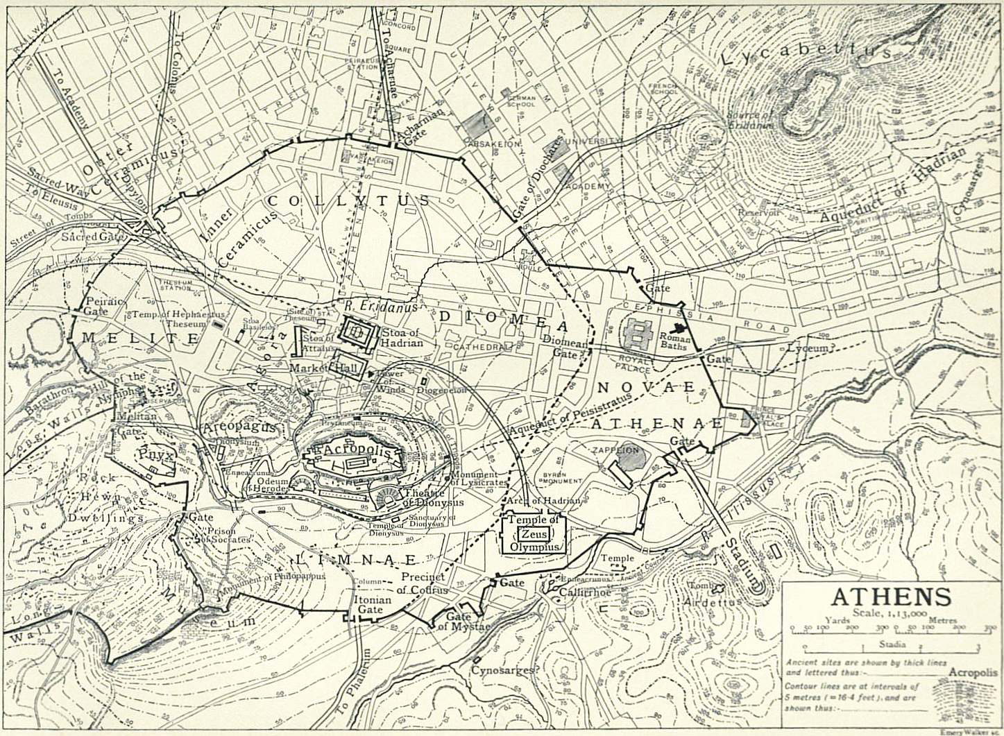