|
Contents. In certain versions of this etext, in certain browsers,
clicking on this symbol Index: A, B, C, D, E, F, G, H, J, K, L, M, N, O, P, R, S, T, V, W. (etext transcriber's note) |

VOLUMES IN THIS SERIES | |
| CAMBRIDGE | By W. MATTHISON and M. A. R. TUKER. |
| OXFORD | By JOHN FULLEYLOVE and EDWARD THOMAS. |
| SCOTLAND | By SUTTON PALMER and A. R. HOPE MONCRIEFF. |
| SURREY | By SUTTON PALMER and A. R. HOPE MONCRIEFF. |
| WARWICKSHIRE | By FRED WHITEHEAD and CLIVE HOLLAND. |
| WILD LAKELAND | By A. HEATON COOPER and MACKENZIE MACBRIDE. |
Other Volumes to follow. | |
AGENTS | |
| America | The Macmillan Company 64 & 66 Fifth Avenue, New York |
| Australasia | The Oxford University Press 205 Flinders Lane, Melbourne |
| Canada | The Macmillan Company of Canada, Ltd. St. Martin’s House, 70 Bond Street, Toronto |
| India | Macmillan & Company, Ltd. Macmillan Building, Bombay 300 Bow Bazaar Street, Calcutta Indian Bank Buildings, Madras |

First Edition, with 75 Illustrations, published in 1906
Reprinted in 1909, 1912, and 1915
Second Edition, revised, with 32 Illustrations, published in 1922
THE illustrations in this book speak for themselves. The writer feels it no easy undertaking to strike bass chords in prose that may worthily accompany these high notes of Surrey’s fame; but he has done his best towards pointing out its special charm of varied formation and surface, here displayed upon the course of excursions made in several directions, so as to bring in all the chief features. To author as well as artist, both at least long sojourners in this choice county that gives homes to many an adopted son, the work has been a labour of love. The moral enforced at once by pen and pencil is that few great cities are so lucky as London in having at its back-doors a playground, pleasure-ground, and garden-ground of such manifold interest and beauty.
PAGE | |
A “Home” County | |
The Riverside | |
Down the Wey | |
Up the Mole | |
The Pilgrims’ Way | |
The Roman Road | |
Leith Hill | |
Hindhead | |
Commons and Camps | |
The Brighton Roads | |
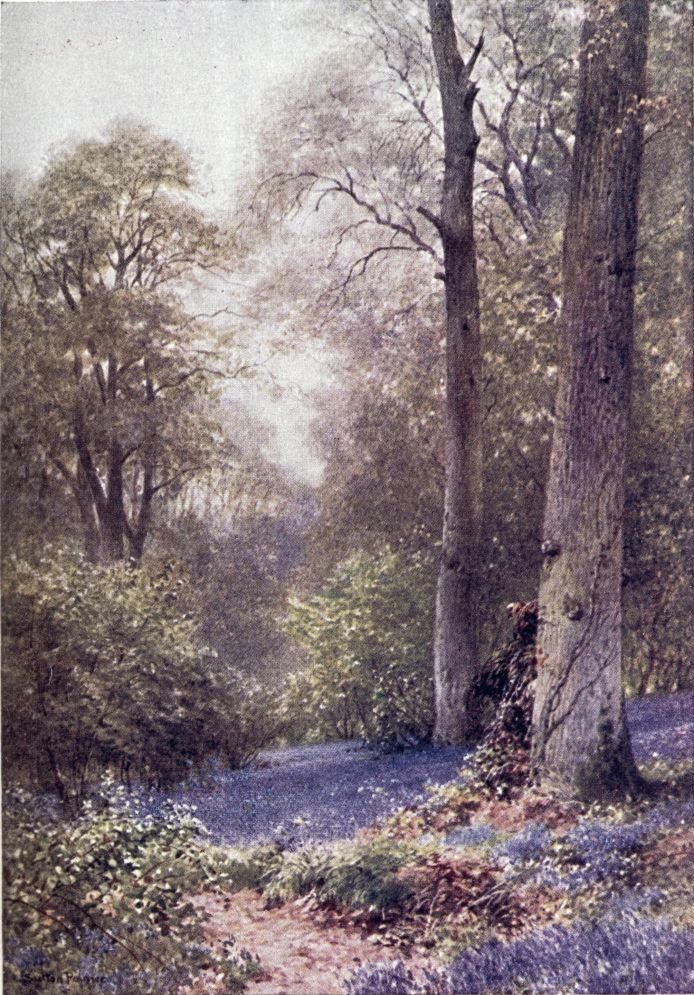
Bluebells, Ripley |
||
FACING PAGE | ||
Godalming—a Bit of the Old Town | ||
St. Catherine’s Chapel, near Guildford | ||
Windsor Castle from Cooper’s Hill, near Egham | ||
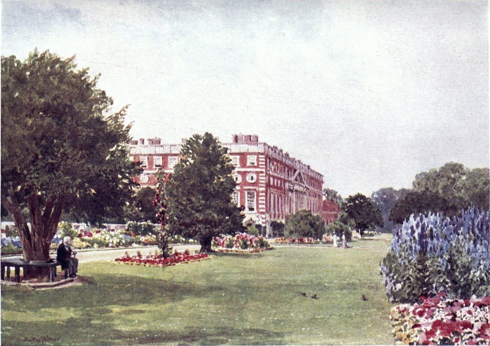
Hampton Court | ||
From Richmond Hill | ||
Richmond | ||
The Meads, Farnham | ||
Somerset Bridge, near Elstead | ||
A Hayfield, Wonersh | ||
Pyrford Church, near Woking | ||
Water Lane, near East Horsley | ||
A Corner of Esher Common | ||
The Village of Betchworth, near Dorking | ||
A Stream near Shalford | ||
Vale of Albury, from St. Martha’s Hill | ||
Autumn Weeds, Chilworth | ||
A Summer’s Eve, Milford Common | ||
Eashing, near Godalming | ||
Spring Blossoms, near Dorking | ||
The Vale of Dorking | ||
Friday Street, on the way to Leith Hill | ||
Abinger Hammer | ||
A Wide Stretch, from the Gibbet, Hindhead | ||
Witley Church | ||
Woodland Depths, Wotton | ||
An Old Farm, near Leith Hill | ||
The Great Pond, Frensham | ||
The Bourne, Chobham | ||
Reigate Heath, Evening | ||
Flanchford Mill | ||
A Slope of Bluebells, Hascombe |
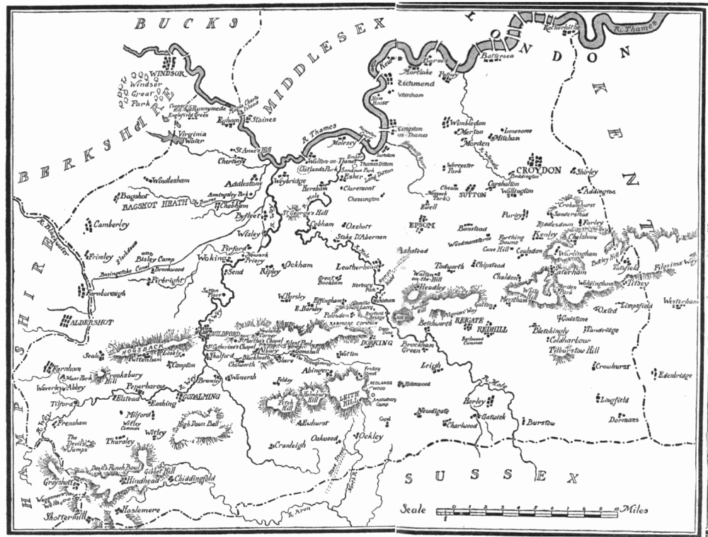
SURREY is but a small county, the latitudes or longitudes of which a good walker could traverse in a day; but perhaps no other in England can be found so close packed with scenes of manifold beauty. Among the “Home Counties,” at least, it seems best to answer Mr. P. G. Hamerton’s criterion of a perfect country as “one which, in a day’s drive, or half a day’s, gives you an entirely new horizon, so that you may feel in a different region, and have all the refreshment of a total change of scene within a few miles of your own house.” Its over-the-way neighbour Middlesex, which Cobbett, in his slap-dash style, puts down as all ugly, is at least comparatively tame and monotonous; and one must go as far as Derby or Devon for such boldly “accidented” heights{2} as those from which Surrey looks over the growth of London.
The county’s varied features run from north to south in zones a few miles broad, whose characteristic beauties not seldom dovetail into each other with fine effect of contrast. The north border of this “south land” is the winding Thames, its rich banks rising to wooded eminences like St. Ann’s Hill and St. George’s Hill, the swell of Richmond Park, the Ridgeway of Wimbledon, and those suburban eminences from which the Crystal Palace shines over Kent. The east side of this zone is masked by the spread of Greater London, rich and poor; and the west side, too, becomes more thickly dotted with villages and villas; while to the south that giant octopus goes on stretching its grimy tentacles over the green fields turned into “eligible building sites.” How far its process of urbanification will reach, seems to depend on the stability of Britain’s commercial greatness, which again depends, we are told, on the Fiscal question, if not on circumstances quite beyond our control, such as the stock still on hand in the national coal-cellar. When that New Zealand tourist comes to sketch the ruins of St. Paul’s, will he find Southwark, like ancient Croton,{3} fallen to a squalid fever-stricken townlet, or an American syndicate at work digging up the ruins of Kingston, as Nippur is now excavated after being forgotten for thousands of years? Babylon is “become heaps,” Nineveh a “dwelling-place for dragons.” What prophet, then, shall assure us that in a yet unbuilt Australian capital, or at some future transatlantic hub of the universe, fragments of jerry-builders’ brick and specimens of electroplated ware from Tooting or Woking may not come to be exhibited, even as our museums treasure Roman tiles and coins dug up in the fields of Surrey! There are scientific Cassandras who hint how no insurance office can guarantee that all these millions of smug citizens might not any night be roused to homeless terror by the shock of an earthquake, like that which ruined San Francisco.
Meanwhile the greatest city of the world thrives and goes on growing, so that almost all of Surrey which it does not already cover may be counted as its home-farm or pleasure-grounds. This generation is hardly moved to exclaim, as a writer of last century did on Denmark Hill: “The rich carpet of Nature decked with Flora’s choicest flowers, and wafting perfumes of odoriferous herbs floating on the breezes, expanded and made my{4} heart replete with joy!” William Black, indeed, found beauty at the doors of Camberwell; and the heights of Norwood deserve a better fate than to be covered with villas. But this mass of bold contours is exceptional so near South London. More often we must be content to get over a green rim of our scenic nosegay. From the undulating streets and suburban rows we usually pass on to a plain, presenting market-gardens and dairy-farms, where the open ground is not required for playing fields. Private groves and hedgerows make a show of timber; and when branches are bare, a frequent feature of the scenery will be those goal-posts which a critically observing foreigner has mistaken for gallows. Here we are in the first zone of Surrey, a stretch of London clay and brick earth, broken here and there by patches of gravel and sand, which, when large enough, are like to be marked out by the hungry game of golf.
This, where the builder is busiest “making the green one red,” may be called in general the stratum of surface brick, followed southwards by successive belts of chalk, sand, and clay. Some ten miles bring us to rising ground, on which cuttings and broken knobs reveal chalk built up at the bottom of the sea ages before London or Babylon had a{5} name. Here we reach the second zone, that of the North Downs, a chalk ridge running roughly straight across the county from Farnham to Tatsfield, near the eastern border reaching a highest point of about 880 feet. This central line, broadened to several miles at Croydon, narrowed to a high edge beyond Guildford, makes Surrey’s best-marked feature, its natural baldness much bewigged by the woods and parks of London’s luckier citizens; and thus adorned, there are those who hold the chalk heights, with their dry soil and clear air, dearer than the aspects more common in the next zone.
The steep south faces of the Downs look into the Holmesdale Valley of greensand and gault, across which, within a rifle-shot, rise a line of sandy hills whose more rugged and shaggy outlines often form the loveliest scenes in Surrey, to some tastes, certainly the wildest, though many corners have been tamed by grounds and gardens among stretches of bristling common and straggling pine wood. These heights stand usually lower than the Downs; but at more than one point, as Leith Hill, they are the most mountainous prominences of the south-eastern counties. Hants, Sussex, and Surrey meet about Hindhead and its neighbour{6} Blackdown, next in height to Leith Hill, where an illustrious settler has famed the view over
But here a prosaic describer must note how it is only from some point of vantage, and at some rarely clear hour, that through a gap the sea comes in view of Surrey hills, since their prospect southwards is usually bounded by the line of the South Downs, crossing Sussex to end in the bluff of Beachy Head.
Between stretches the Weald, a strip of which, except in that south-western corner filled by the broadened sand heights, belongs to Surrey and makes its southern zone of fresh features. This wide plain once lay shaded under the great Andredeswald, that was the Black Country of England before coal and steam came into play, and still earlier it raised a barrier parting the South Saxons from kindred invaders. Its hursts and woods hint how the clay soil bore a primæval forest, notably of oaks, patches of it still preserved in the parks dappling an expanse of farm land long ago cleared to feed the furnaces that cast cannon and other iron work, specimens of which may be found in churches and homes about this district. Less picturesque, on{7} the whole, than the zones to the north, the Surrey Weald is more remote from metropolitan sophistication, and keeps perhaps a larger proportion of the old weathered cottages and moated granges, which æsthetic citizens love to look on rather than to inhabit. It must be the Weald Fuller has in mind when he speaks of Surrey’s skirts as “rich and fruitful,” but its inward parts “hungry and barren,” though these, even in his day, “by reason of the clear air and clean ways, full of many genteel habitations.”
Some brooklets of the Weald run southward to the English Channel, else, nearly the whole of Surrey drains into the valley of the Thames, a river to make the landscape fortune of any county. If ever its scenes have a fault, from the artist’s point of view, this may appear to be the absence of water; yet some of its noblest prospects are where the Mole and the Wey break through the sand or chalk ridges to reach the river plain. Surrey has smaller streams less widely known. Ruskin, to deaf ears, lamented the defilement of the Wandle, its source, its curving course, and its mouth all now within the limits of Greater London. Do Putney boys trace to its head the Beverley Brook, as Charles Lamb’s companions tried to play{8} explorer up the New River? How many of the most schooled Londoners could tell through what parishes and by what suburban settlements flows the Hogsmill River, or the Bourne, or the Burway Ditch? A Brixton householder may hear the name of the Ephra without guessing how its course is below his feet. There are veteran ramblers in Surrey who know not the Deanoak Brook, nor the Blackwater. The motorist scorching along the Tillingbourne Valley road comes home ignorant what beautiful banks he has skirted, while one goggled eye was all upon his gear, and the other on the look-out for police traps.
The fact is that Surrey has plenty of water, often lost in the picturesque roughness of its contours. In smoother counties any hillock may disclose some Ouse or Avon shining miles away, whereas here the windings and branchings of the Wey and Mole go often unsuspected till one come close upon them. Below Surrey’s bare, bony prominences, its veins will lie lost in the plumpness of the valleys. Both chalk and sand hills, dry as their tops may seem, are full of springs, escaping not only in streams, but into stagnant or slowly trickling pools, that sometimes form a chain of lakelets, or, as in the case of Virginia Water, have{9}

been improved into trim sheets to leave no note wanting in the landscape scale. Even within the wider bounds of London sparkles a lake like that of Wimbledon Park, where in hard winters ice is coined into silver. Sandy commons, as well as marshy bogs, are unexpectedly found dotted with ponds, often beautifully hidden behind a curtain of foliage, as the “Silent Pool” of Albury, invisible to the cyclist spinning by within a hundred yards. The modest titles of some of these Surrey lakes may well deceive a stranger who has not opened his eyes upon the “Waggoners’ Wells” of Hindhead or the “Ponds” of Frensham. On the south side of the county, where they once lay among thick woods, such waters often preserve the title of “Hammer Ponds,” from the days when they were dammed up to work iron forges.
Surrey’s character for variety is carried out by the way in which green openings and barren scrubs are mixed up with the elaborate works of man. Who shall say where London begins or ends? If we think to get clear of it at Wandsworth, we find it breaking out again at Wimbledon. The country lad tramping up to those streets paved with gold, may meet them at Mitcham, and a little farther on lose himself on Figgs Marsh. The widest definition{10} of Great London is the Metropolitan Police District, taking in all parishes fifteen miles from Charing Cross, the Postal District being a little more restricted. But still, beyond these bounds, we come upon settlements of citizens making their homes an hour’s journey from the smoke and din of their work-place. Favourite sites for such colonies are the edges of commons so frequent on the south side of London, in Surrey to be counted by hundreds, open woodlands, stretches of copse and heath, well-worn playgrounds, down to the patches of green that seldom fail to grace the smallest hamlet. Several of these public pleasure-grounds run into London, where the south-western resident can make a round over Clapham, Wandsworth, Putney, Wimbledon, Mitcham, Tooting, Tooting Bec and Streatham Commons, with tramways or ’buses to bridge him from one open space to another. It is on the farther side of the county, of course, that we must look for the widest and wildest expanses of ground, not waste so long as it serves to keep jaded citizens in touch with the charms of untamed nature; yet even here begin to gather the shadows of villadom, and the haunts of vipers are dug out for tram-lines through brick and stucco avenues.{11}
Of Surrey’s population, over two millions, the greater part is concentrated on some fifty of the 755 square miles that make its measurement. In this county lie half a dozen of the metropolitan boroughs, to which may be tacked on Croydon, Richmond, and Kingston, and many a village promoted to be a “choice residential suburb.” The last census notes a slight decrease in what it terms the outer belt of suburbs; but that seems to mean only a shifting farther into the country, as trains and trams bring a wider circle within the area where the builder can claim fresh nooks as “ripe for development.” The once rustic “box” of the early Victorian citizen is apt to have come down in the world. Perhaps nine-tenths of my readers may look blank when reminded how Mr. Quirk’s “Alibi House” was at Camberwell, and Mr. Tagrag’s “Satin Lodge” at Clapham; yet surely they are aware of the miniature Walworth Castle, in which Mr. Wemmick kept an aged parent. “Lovell the Widower’s” home at Putney, and the palatial Roehampton villas of Thackeray’s city magnates may still stand high in house agents’ books. But in ex-suburbs, as a rule, such pleasure-houses of a former generation are in no demand now, their sites often covered by shabby streets, shops, or blocks of{12} flats; while leagues farther out, at Purley, Tadworth, or Claygate, spring up a fresh crop of smartly painted villas, in lines or knots, with white walls, red roofs, green water-butts and “modern conveniences,” to tempt Londoners who can afford fresh air for living in. Every year some new village or hamlet is strangled in the arms of the monster that has yearly been adding a score of miles to its myriad streets, and taking in new inhabitants enough to people a town. Yet Surrey has the surprising feature of a deserted village, and that on the very edge of the county of London. Fitly named Lonesome, it stands close to Streatham, a few minutes’ walk from more than one railway station. The builder is so busy hereabouts, that for all I know it may have been broken up before this page gets into print; but for a generation it has stood uninhabited, with cracked walls and smashed windows, an unlovely ruin, making a monument of some story in which an obstinate landlord, a disagreeable industry, or a disastrous enterprise are vaguely mixed up in my memory.
The old towns of Surrey have more or less undergone the same change as the metropolitan outskirts, some almost lost in the “Wen,” as{13} Cobbett loved to call it, some making a nucleus for a sort of remote suburb, much affected by the “dead weight” fund-holders and stock-jobbers so loudly denounced by that obstreperous patriot. The villages, too, are a conglomeration of old and new about their ancient or spick-and-spanly rebuilt churches, and their straggling greens, kept in time-honoured sanctuary from the weapons of the jerry-builder. The whole county betrays its metropolitan dependence in the many trim enclosures around modern mansions and villas, among which holds up its head here and there some lordly old hall like Sutton or Loseley, some once strong castle like those of Guildford or Farnham. There are not a few ivied manor-houses still standing; some fallen to the estate of farm-houses, some restored or enlarged to be choice residences for new owners. A weather-beaten cottage of gentility will command a fancy price, so long as it be not too near the madding crowd, nor yet too far from means of soon mingling with the same. Then Surrey is famed for those real cottages, “sacred to the poor,” that may appear in the very heart of some smug, commonplace suburb, but more often in out-of-the-way nooks, where nature better blends with their timbered and gabled quaintness, “each{14} a nest in bloom,” thatched, tiled, time-stained, patched, top-heavy, leaning-to as if ripe to tumble among a bed of flowers—
With such modestly hidden charms are contrasted a rank growth of conspicuous Institutions—schools, orphanages, “homes,” asylums, barracks, prisons and the like, thick set in certain spots, as about Sutton or Caterham. Some of these have been able to adapt stately old mansions to their use, as at Beddington and Roehampton; but more often they are modern, ungraceful, appalling, usurping, dominating landscapes thrown away on criminals or lunatics. It seems an ominous sign of the times that as often as one sees a new pile rising on Surrey heights, it is apt to turn out a{15} lunatic asylum, for which the flats about Hanwell surely offer a fitter site. The most showy of such structures are the far seen Holloway College above Egham, and the Sanatorium for the insane in the valley below, which cost over a million, made out of the profits of notorious patent medicines, to be given back thus to the public by a benefactor who here showed himself a posthumous humorist in bricks and mortar. Or was his will made in some mood of repentance, such as led mediæval cut-throats to endow churches and chantries? His College, for which olet would make an appropriate motto, is devoted to the higher education of women, that they may teach their children to put no faith in quackery, even when disguised under the American euphemism of “proprietary articles.”
Had I had the ear of such a pious founder, I would have counselled him to leave part of his ill-got gains as a fund for prosecuting, pillorying, pelting, daubing with hatred and ridicule, whipping at the cart’s tail of public opinion, transporting to some Malebolge, foul with their own concoctions, those unspeakable humbugs, who, not content with the lower-class religious papers as an area to be defiled by their lying advertisements, impudently deface the fair scenes of Surrey with{16} loathsome placards of this and that mischievous or worthless nostrum, to sicken the considerate passer-by at the thought of popular ignorance and credulity so easily preyed upon. Some day this mean offence may be repressed by law. Might we not begin by restricting the pill-and potion-mongers to Hackney Marsh or Barking Level as a sink for their shameless besliming? There is no spot in Surrey, not even the New Cut, Lambeth, nor the Sewage Farm of Croydon, that deserves such pollution. The endowment above invited may be vested in a body bearing the mystic device S. C. A. P. A., a league of champions sworn to slay this hideous Jabberwock, which one should not fear to mention by its legion names, for the last thing such an impostor dare do is to look twelve honest men in the face and have wrung out of him the composition of his panacea, swallowed so trustfully by the fools who enrich knaves.
Staringly mendacious advertisements are not the only scandal to raise the gorge of a poor but honest wayfarer on Surrey’s countless roads, alive with all kinds of travel, from farm-waggons to cycles, from four-horse coaches to tramps. At their London ends, the highways are cut up by{17}

tram-lines, which threaten to go far, unless this locomotive growth be nipped by the blast of motor cars. The invasion of the motor is still a sore subject along once quieter roadsides of Surrey. How Cobbett would have blustered if, on some rural ride, he had fallen in with a modern “dead weight” hurrying out of the “Wen” at full career, on his 60 h.-p. Mercedes, a flashy show of paint and furs! But one need not have any special spite against the “jews and jobbers” who were his bêtes noirs, to be choked by indignation in the fog of dust and smoke through which one catches a hasty glimpse of bugbears in armour, masked and bandaged, like the uncanny monstrosities of Mr. Wells’ stories. It is all very well to remember how railways, too, were banned by prejudice, so that some half-century ago a liberal-minded John Bull, like the chronicler of Jorrocks and Soapey Sponge, still undertakes to apologise for those novelties on the score of their useful service to country life. But trains do not drive people off the roads and out of snug homes that lie too near the dusty triumph of Goth and Vandal chariots, “rigged with curses dark.” Far more terrible are such swift Juggernauts than the insidious speed of the cyclist, who has lived down{18} his reproach as a “cad on castors,” being indeed kept considerate by the chance of getting the worst of it in case of collision with man or beast, whereas there can be no standing against the weighty momentum of those Bulls of Bashan, “hazing and mazing the blessed roads with the devil’s own team”—nay, the very fields, into which they scatter grit over strawberry beds and haycocks as well as hedgerows. And what one grudges most in the mad speed of the motorist is that, while he makes a moving blot on the landscape, his goggles can snatch but dim joy from prospects through which he is borne in such a whirl of excitement past one lunatic asylum to another.
Sportive sons of this tribe of Jehu have the enjoyment of an automobile race track laid down at Brooklands, near Weybridge, a sort of mechanical Epsom or Newmarket, and there has even been talk of a motor road all the way to Brighton. Did they never cast an eye on the miles of useless tunnels at Welbeck, which their present owner might be glad to have turned to some good purpose? There they could pant and fizz up and down at their own pace all day and night long in an exhilarating gleam of electric light, and smudge no fair scene flung away on their rushing course.{19} These machines are signs of the times, when, as Horace said—or something to this effect—in days that were not so high-geared:—
But let the humble pedestrian take heart when overshadowed by the proud passage of Sir Gorgius Midas. His car prevails on the highways, but on the byways it is helpless, all the more if the weight of its armour be five thousand shekels of brass. And Surrey abounds in byways, some still twisting through the outer streets of London, their original character to be guessed only by such titles as Coldharbour Lane, Cut-throat Lane, which perhaps was “Cut-through Lane” in its blossoming days, and the Worple Roads and Worple Ways of Richmond, Wimbledon, and Mortlake, whose villa-dwellers may be ignorant that these names denote old bridle-paths.
Country-folk or towns-folk, we are not always fully aware of our own blessings. Let not familiarity breed contempt for what strikes a stranger as one of the pleasantest traits in an English landscape.{20} Nathaniel Hawthorne is not the only American who, in visiting Our Old Home, has taken admiring note how:—
The high-roads are made pleasant to the traveller by a border of trees, and often afford him the hospitality of a wayside bench beneath a comfortable shade. But a fresher delight is to be found in the footpaths, which go wandering away from stile to stile, along hedges, and across broad fields, and through wooded parks, leading you to little hamlets of thatched cottages, ancient, solitary farm-houses, picturesque old mills, streamlets, pools, and all those quiet, secret, unexpected yet strangely familiar features of English scenery that Tennyson shows us in his idylls and eclogues. These by-paths admit the wayfarer into the very heart of rural life, and yet do not burden him with a sense of intrusiveness. He has a right to go whithersoever they lead him; for, with all their shaded privacy, they are as much the property of the public as the dusty high-road itself, and even by an older tenure. Their antiquity probably exceeds that of the Roman ways; the footsteps of the aboriginal Britons first wore away the grass, and the natural flow of intercourse between village and village has kept the track bare ever since. An American farmer would plough across any such path and obliterate it with his drills of potatoes and Indian corn; but here it is protected by law, and still more by the sacredness that inevitably springs up in this soil along the well-defined footpaths of centuries. Old associations are sure to be fragrant herbs in English nostrils; we pull them up as weeds.
Surrey is seamed with such immemorial rights of way, some, indeed, lost, stolen, or strayed into{21} more formal roads; but County Councils and the like are now vigilant against private usurpation of their charms. On the edge of the noisy town, and all over the quiet countryside, they may be found and followed, sometimes for miles, every kind of them, straight field-cuts, blooming hedgerow paths, hard-beaten tow-paths, green ridges, leafy archways, trim woodland avenues “for whispering lovers made,” free passages over lordly demesnes, straggling tracks across rough heaths, half-choked smugglers’ lanes, and old historic roads, here improved into a busy turnpike, there run wild as a grassy sward or shrunk to a doubtful footway, all open to lovers of virtue, who are quiet, and go a-walking, as a modern Izaak Walton might choose, now that the waters of the Mole and the Wandle are strictly preserved. Let other-minded excursionists stay in Middlesex.{22}
SURREY’S crooked northern border is washed by the Thames, “great father of the British floods,” to whom so many compliments, vows, and addresses have been offered in prose and verse:—
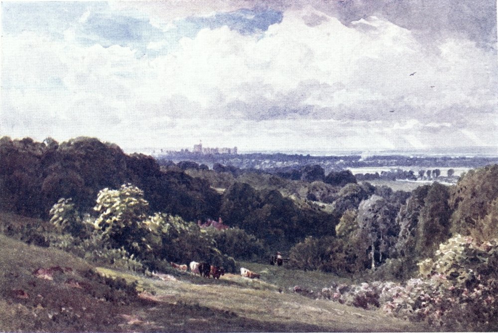
These lines, in which let no writer scorn to join chorus of quotation, are from Denham’s Cooper’s Hill, a title supplied by the “airy mountain” that raises its “proud head”—to a poetic height of 200 feet and more—upon the north-western corner of Surrey. Descending the river from Windsor, after passing Old Windsor Church, we enter this county beyond the “Bells of Ouseley,” to find the right bank edged by what plain prose must belittle as{23} a wooded rise, on whose top, pleasant rather than proud, stands a stately mansion that, in the course of its chequered history, grew into a banyan grove of buildings built in vain. Cooper’s Hill was in Victorian times the property of one of those meteoric financiers flashing across the sky of British commerce, the same who in London built for himself a house so large that no one ever lived in it. Then the place made itself a new name as a college for the Indian engineering service; but this institution came to be uprooted, and its halls passed into private occupation, after for a time standing desolate, as those of Ossian’s Balclutha, while there was question what to do with them. An academy for horse-marines, a week-end club for members of Parliament, a training-school for county councillors, are suggestions that could be made; but, to my mind, a truly Liberal Government might have endowed Cooper’s Hill as an asylum for minor poets.
This first though not foremost of Surrey heights is surrounded by fair and famous scenes to inspire the Denhams of our generation. Below it, on the Berkshire edge, lies Beaumont, once home of Warren Hastings, now a Roman Catholic Eton. Behind it opens Englefield Green, a village of much gentility, which has housed many well-known{24} persons, from Louis Napoleon to the late R. H. Hutton of the Spectator; and it is clearly the “Dinglefield” of Mrs. Oliphant’s Neighbours on the Green. Near this, at the Bishops Gate of Windsor Park, is the hamlet where Shelley wrote his Alastor, and did not let his views of Church or State be charmed by the sight of Windsor Castle that here rises royally into prospect. Windsor Park is mainly in Berkshire; yet, keeping down the woods and rhododendron walks on the east side, we should come upon Virginia Water, overflowing at one end into Surrey, which may claim a share of the royal demesne, and a large one of the wider bounds once known as Windsor Forest.
From the Thames slope of Cooper’s Hill, where “Denham’s Seat” makes a view-point across the river, expands a wider landscape over the flat fields of Bucks and Middlesex, watered by the branching Colne. The spire to the north marks a village known on maps as Wyrardisbury, but to men as Wraysbury; then a mile beyond, across the railway, comes Horton, home of Milton’s youth. But the scene of greatest fame lies in the foreground, at our feet, for this wide riverside meadow, degraded to a race-course as it has been, is Runnymede, on which King John was forced to sign the first great charter{25}
of our liberties. Some would have that historic stage to be Magna Charta island off the west end of the mede, where a stone is shown as the table of signing; but no Surrey patriot can allow such a pretension on the part of Buckinghamshire, while it may be that the king had his quarters at the Benedictine Nunnery of Ankerwyke on the other bank, if not at the old house in Staines pretending to that honour. It is remarkable what a number of places in many parts of England claim to have housed or lodged a so unpopular and worthless sovereign.
Above Runnymede, dropping off the ridge of Cooper’s Hill, one may come down to the pleasant town of Egham, its one long street lying a mile back from the river; but its accretions straggle on towards the bank, where the tow-path leads by havens of boating men and “Anglers’ Rests” to the bridge of Staines. This is a Middlesex town, the older part of it also lying back from the Thames, upon the Colne, whose damp flats form a somewhat dreary background, not enlivened by the banks of a huge reservoir for thirsty London. But Staines has a name on the Thames through its ancient stone, marking the limit of London City’s jurisdiction, thirty-six miles up the river. There may be{26} Londoners who never heard of this stone, which made the goal of a Lord Mayor’s progress eighty years ago, to be celebrated by his Lordship’s chaplain in a most amusing style, by no means meant to be amusing. Having spared the reader Akenside’s inscription for the column on Runnymede, I have half a mind to inflict upon him some account of this expedition, as raised to all the dignity of history, and all the interest of exploration, in the reverend gentleman’s now rare volume. But it might seem too like ancient history to a generation of impatient readers, who know the Lord Mayor’s State barge only from the heading of their Illustrated London News, and perhaps do not know how the Corporation’s Admiralship has passed into the farther reaching hands of the Thames Conservancy. “Suffice it, therefore, to say that though the party were three successive days—two of which included fifteen hours—upon the water; yet, such was the fine and ever-varying nature of the home scenery around them, which was itself sufficient to engross the attention, as the Thames made its azure sweeps round slopes of meadow land; so diversified were the occupations of reading, working, and conversation—conversation which, always easy and intelligent, was often such as to discover memories containing{27} ample registers of miscellaneous snatches and fragments of sentiments, both in prose and verse, which were sometimes applied with considerable tact and address to passing scenes; so well and interestingly, in short, were the several successive hours filled up”—that one must break off the chronicler’s long-winded sentence with his own admission, that “it would be difficult and tedious to detail all the particulars” of that civic voyage.
I do not aspire to emulate this author’s stilted gait on the trip from Staines to London, but I invite the reader to plod with me along the tow-path; that, as he is aware, will pass from one side to another, a matter hardly understood by an observant American writer, who made note how “one shore of the Thames, sometimes the right, sometimes the left, it seems, belongs to the public.” From the Bells of Ouseley to Staines Bridge the tow-path has been in Surrey; now it crosses to the pleasant river front of the town, the Surrey side being blocked by private paradises and boating-houses. To Chertsey, the next Surrey town, we might, indeed, cut across by a road that at one point comes close to the river; but the more inviting way is the path on the Middlesex bank, and at one of the locks we may have the luck to catch a{28} steamboat plying in summer between Kingston and Oxford on a river, of which that old poet might say more emphatically in our generation:—
The riches of the shore here are chiefly in trim gardens and flat fields, by which the tow-path leads windingly, yet spares us Father Thames’ most wayward aberration, the mile-long loop of Penton-Hook, across the mouth of which we cut by the lock in a couple of minutes. Before reaching this from Staines, is passed on the opposite bank a surprising collection of bungalows, shanties, and tents, one of those settlements of genteel gipseying that have grown up on the banks in our time. Beyond the lock, we come to the Middlesex village of Laleham, in whose churchyard lies Matthew Arnold, born here in his father’s pre-Rugby days. Below this leafy place, beginning to be overlaid by builders’ plans, road and tow-path run together beside Laleham Park towards Chertsey Bridge, the Surrey bank being fringed by willow copses, much sought for floating flirtations and picnic teas. But to reach the older part of Chertsey, one had better{29} cross by the ferry at Laleham, and take a mile of straight hedgerow path over the Abbey Mead, passing a crumbling fragment, all that now represents what was once the richest of Surrey’s monasteries, as it was the first founded in the county by St. Augustine.
Nowadays there is not much air of ecclesiastical dignity about Chertsey, rather of quiet prosperity in the long thoroughfare that crooks itself nearly two miles from the station to the bridge, connecting the new quarters that have sprung up at either end. The lion of this straggling town is the house on the right side of the way up to the station, marked by a tablet recording how “here the last accents flowed from Cowley’s tongue”; but such a relic has gone down in value since the days when Abraham Cowley ranked among the first flight of British poets. A name more familiar to this generation is that of Charles James Fox, who had his country retreat at St. Ann’s Hill. Another notable neighbour of Chertsey was Thomas Day, author of Sandford and Merton. About three miles behind the town, past Botley’s Park, Potter’s Park, and Ottershaw, the now rich woods of Anningsley make a monument to that earnest philanthropist, who fixed his home here on poor{30} sandy land that he might give employment in improving it by plantations. His death came about through too consistent carrying out of his principle that animals can always be managed by kindness; he was killed by being thrown from an unbroken colt; then the wife whom he had chosen with so much scrupulosity, after pupils trained for that post had failed to pass his examination of trying ordeals, showed herself a worthy helpmeet by spending the rest of her life in heart-broken seclusion.
Pleasant walks may be taken by those parks to the Basingstoke Canal and the valley of the Wey, a few miles behind Chertsey. But no one who has an hour to spare here should miss the ascent of St. Ann’s Hill, which lies a short mile to the west on the road leading out near the railway station. The grounds, with their grotto, “Temple to Friendship” and such like, are of course private; but at the “Golden Grove,” notable by a tree bearing up a platform in front, one can turn off the road for a public path leading over the hill. Though only about 200 feet high, this richly-wooded eminence looks far over the Thames valley; and through the foliage at the top vistas have been cut framing such prominent landmarks as Windsor Castle, the{31} Holloway College, Harrow-on-the-Hill, Richmond Hill, the Crystal Palace, and the Great Wheel at Earl’s Court, till it had ceased to obtrude itself on so many points of view to the west of London. There are traces of an old encampment that gave this hill the forgotten name of Aldbury; and hidden among the trees is a “Nun’s Well,” from which perhaps it was re-christened after a now vanished chapel of St. Ann.
A couple of miles above Chertsey, between the Thames and the big village of Addlestone, swells up Woburn Park, its grounds once celebrated as a ferme ornée, but now a nursery of the young idea, where prospect-hunters are out of bounds. Round it one may take a pleasant path from Chertsey Bridge, leading over the green level of Chertsey Mead, and curving into the Weybridge Road, where it crosses a Bourne not far from the canalised course of the Wey. This path cuts off the bends of the Thames tow-path, which as far as Weybridge keeps the Middlesex bank. But if one were going from Chertsey Bridge to Walton Bridge, more than half the distance is saved by taking the fairly straight road through Shepperton in Middlesex. Travellers on wheels are willing to give a wide berth to the Thames bendings, cyclists indeed{32} being warned off the tow-path; and the modern Great Western Road, like the old Roman way to Silchester, does not touch Surrey till the bridge at Staines has been crossed.
Thus Weybridge, lying off direct roads, entangled between the Thames and the Wey, seems not so well known as it deserves to be. Richmond excepted, I declare this the pleasantest riverside town in Surrey. It stretches roomily from the river to the railway, with one end in the lush meadowland of the Thames valley, and the other rising on the heath and pine-wood scenery so characteristic of West Surrey. I once met a honeymoon couple from the North who were pining among the tame richness of England, but their spirits revived at the “Hand and Spear,” near Weybridge station, which I prescribed as a tonic in their case. Here, behind the railway, begins the wooded ridge of St. George’s Hill, the top of which was an ancient camp, and one of Cæsar’s supposed stations in Surrey. Nearly the whole of this long height is a private enclosure, but it has been liberally set open to ramblers who will do no mischief. In a central glade among the pine woods is even provided a Swiss Châlet for refreshments; then a little south of this, where{33}
the ridge makes a sudden drop, opens a clear and wide view to the Downs. The southern gate of the park lets one out on a road between Byfleet and Cobham; and the winding tracks through the woods lead down on either side to varied scenes, on the west the mazes of the Wey, straightened out by its canalised arm, on the east an expanse of common and fir woods falling to the alluvial bed of the Mole.
It is no wonder, then, that many Londoners—too many, says the last comer—have built themselves villas on the dry upper slopes of Wey bridge, while the older part of the town on the river bank is better known to transient visitors of aquatic tastes. A link between the two quarters is the spire rising near the bridge over the Wey to mark the oldest part of all. The rebuilt church contains a tomb by Chantrey for the Duchess of York, whose residence at Oatlands is also commemorated by a pillar on the Green, a second-hand monument that once ornamented the Seven Dials of St. Giles. Another royalty, Louis Philippe, for a time found sepulchre in the Roman Catholic chapel here, till the bones of this exiled family might be removed to their native land.
Oatlands Park borders Wey bridge on the east.{34} If the general reader be surprised that Drayton, in his account of what Milton styles “Royal-towered Thames” couples Oatlands with Hampton Court and Richmond, that is because readers with so much to read forget how this, too, has been a palace, which made one stage of King Charles’s long journey to the scaffold; and his youngest son, as born here, was Henry of Oatlands. In the park stood two yew trees, some hundreds of yards apart, between which legend draws its long bow in measuring by them a feat of Queen Bess’s archery. The mansion is now an hotel; and the grounds have been encroached on for building plots. A century ago it belonged to George IV.’s military brother, that Duke of York whom Charles Greville, in his critical way, calls the only one of the royal princes bearing the character of an English gentleman; and he touches on the Duchess’s extraordinary love of dogs, parrots, and monkeys. The graves of her hundred pets still ornament the park, which has also to show such a costly grotto as was dear to Georgian “improvers.” Another feature of these grounds is the Broadwater Lake, representing a former course of the Thames. The tongue of land beyond was once Middlesex, but by alteration of the channel has been thrown into Surrey.{35}
To this side the tow-path crosses at Weybridge, and one can double the distance to Walton by following the bends of the river opposite Shepperton and Halliford. Near Walton Bridge is reached a scene of historic note, for Cowey Stakes here has been taken to be the ford by which Cæsar crossed the Thames on his pursuit of Cassivelaunus. What will be more obvious to the wayfarer is a very modern encampment of tents, with other shelters and conveniences, including a floating bath, which has sprung up of late years near the Middlesex end of Walton Bridge. The town of Walton-on-Thames stands mainly back from the river, its station being a mile behind. It has no such wild background as St. George’s Hill, but lies pleasantly mixed up with groves and parks, and seems a snug place of retreat for quiet-minded Londoners. Walton Church was the scene of Elizabeth’s cautiously Anglican view of the Sacrament:—
This church boasts the tomb of Lilly the astrologer, and monuments by Chantrey and Roubiliac; then{36} near it is to be seen the house of the regicide Bradshaw, now split up into cottages. In the churchyard is buried “bright, broken Maginn,” Thackeray’s “Captain Shandon,” who set so many tables in a roar.
But the literary and historic memories of such places may not much concern those who have come out for a day on the river. Each of these Thames-side towns is a haven for escaped Londoners, often familiar with little more of them than the boat-houses on their banks, and the inns, some of which seem too eager to make their hay while the sun shines. Each has its fleet of boats, moored thickly together in whole rafts, its clubs, and its annual gala day of the local regatta. On a fine Sunday or Saturday afternoon every lock is packed with youth and beauty, set off by gay colours and airy costumes. Every reach within railway ride of London may be found lively with a jumble of craft of all sorts, from Canadian canoes to Venetian gondolas, tiny yachts, skiffs, tubs, outriggers, punts, ferry-boats, eights, fours, “dongolas,” “randans,” pairs, rowed, poled, tugged, towed, or idly moored, like the big house-boats whose cramped luxury gives a lazy refuge from cares and taxes. Among all these the barges of business move like surly{37} and clumsy tyrants; and water-scorching machines sweep through the fluttered crowd as wolves in a sheepfold. Steamers and motor-launches have replaced the State barges in which Lord Mayors and such-like used to progress in the days when to be a “jolly young waterman” was more of a trade than a pleasure.
were winged by mercenary arms. It seems well that the golden or gilded youth of our generation are more active, taking their amusement moult tristement, as might be judged by an unsympathetic foreigner. An English writer has found fault with Thames boats as “built for woman and not for man, for lovely woman to recline, parasol in one hand and tiller ropes in the other, while man—inferior man—pulled and pulled and pulled as an ox yoked to the plough.” But that is hardly fair now that girls boyishly take their turn at the oar, even exhibiting the spectacle of whole galleys deftly womanned by crews of water-Amazons. The only right left to man here is the panting and perspiring toil of the tow-path, to which he bends devotedly like “the captives depicted on Egyptian monuments with cords about their necks.” Such{38} slavery may well be preferred to the aid of those exorbitant and foul-mouthed hirelings who infest the river banks in search of a job, which to Edwin makes a labour of love, so Angelina be drawn along cool, at ease, grateful, and admiring. With his dynamic energy, contrast the contemplative, perhaps misanthropic, and apparently celibate joys of the angler, throned upon his punt or posted on the bank, as he has been ever since Pope’s day—
Below Walton, the Thames winds quietly on between banks that again suggest a quotation from Denham—
The panorama is one of green meadows, garden grounds, shady islands, cuts and creeks, Sunbury Lock, boat-houses, inns, water-works, racecourse enclosures, and hints of villages lying back from the river; but Hampton Church stands out on the bank; then a string of islets brings us on to the mouth of the Mole opposite Hampton Court. This palace of popular resort, with its galleries,{39} courts, gardens, and park avenues, its barracks, its many houses of entertainment, and its terminus of London tramways, is in Middlesex; but its station is across the bridge in Surrey; and if one wanted matter to fill a few pages, one might fairly include a description of its treasures. But so much has to be said of the Surrey side, that we had better pass on with one look at this monument of old England, touched with graces of continental taste.
The tow-path, that has been in Surrey since we left Weybridge, again crosses to pass with princely breadth under the wall of Hampton Park. But on the Surrey side also, we are not kept far from the river, for, after a diversion through Molesey, the road comes to the bank by the old church of Thames Ditton; then, through the outskirts of Long Ditton, it joins the much-wheeled Ripley road, which in front of Surbiton becomes a waterside esplanade beseeming that most respectable London colony that has the name of being affected by west-end tradesmen and the like “warm” citizens. Such, at least, is the reproach brought against it by satirical scribblers, who perhaps live at Peckham or Camden Town, envious at heart of Surbiton’s social amenities as described in the{40} instructive life of “Mr. Bailey Martin.” Another novelist suggests how Surbiton wants nothing but a pier to look like a seaside resort, with its parade, bandstand, and so forth, along which, by two miles of houses, we come into the ancient borough of Kingston, that makes a core for so much villadom.
As an independent town, this, with its excrescences, Surbiton, Norbiton, Malden, is second for size in Surrey, overgrown only by Croydon; and Kingston has also a Middlesex Lambeth in its transpontine quarter, Hampton Wick. It is so far the county seat that the Hall of the County Council has been built here; while it no longer shares with Guildford and Croydon the dignity of assize town. There was a time when it might boast of higher rank, for in the tenth century the Saxon kings were crowned at this Rheims or Scone of South England. It seems always to have been a place of importance through its ford, then through a bridge which was long the next one above London Bridge. When a hostile attack on London failed from the Southwark side, the enemy had nothing for it but to march all the way round by Kingston, as Sir Thomas Wyat did to little purpose. In the Civil War a{41}

bridge of boats came to be thrown across the river at Putney. The first movement of this war was about Kingston, a place worth seizing as key of the road to Portsmouth, so in turn held by Royalists and Roundheads; and almost the last sharp encounter between the two parties was a running fight that ended in the outskirts of the town. London citizens of that day must have had stirring news, when more than once they heard of hostile forces so near their gates as at Hampton and Hounslow. The wayfarer on Wimbledon Common is still apt to be startled by the sight of train-bands slinking in knots from copse to hollow; but these are only our Boy Scouts practising the devices of modern war; and presently, we know, they will go home in peace to their tea. It was otherwise when Captain Hew-Agag-in-pieces, or the doughty Sir Hudibras, could not take his family on a trip up the river without the risk of falling into the hands of malignant Philistines, its banks a paradise lost to Milton, while perhaps Denham or Herrick might have safely ventured—
Near the end of Kingston Bridge, now crossed{42} by a tramway, stands the restored Church, which has the distinction of being one of the largest in Surrey, and contains old monuments, besides a show of modern memorial windows. The chapel where the Saxon kings were crowned has been destroyed; but the rough stone on which they traditionally sat is reverently enclosed in the market-place for all to see but not to touch. Could it speak for itself, this might tell strange tales of forgotten superstition, like that other boulder in Westminster Abbey, uneasy seat of Scottish kings, that must have travelled so far by land and sea since it made Jacob’s pillow. By a recently “restored” statue of Queen Anne before the Town Hall, Kingston also shows special devotion to the memory of that truly dead sovereign. Such are “the memorials and the things of fame that do renown this city”—as it might claim to style itself; and the market-place whereabout they stand makes often a lively and picturesque scene, on which the quasi-cockney mingles with the true rustic.
Kingston is a headquarter of Thames boating, and its population must to a considerable extent be made up of such “Jacks” as are the camp-followers of this exercise. It is also fortunate in{43} lying close to three royal parks that have all become practically public pleasure-grounds. The pleasantest way down the river is by the high edge of Richmond Park; but below also one may take the tow-path, now on the Surrey bank; while a middle way is the road passing over Ham Common. The Middlesex bank is almost entirely taken up by private grounds; though at Hampton Wick there is a tea-garden resort reached by a path from the road behind. In the secluded back-water opening here there used to be a capital bathing station, the nearest to London; but this has now been closed by the excessive modesty of suburban senators; and not till the shades of dusk may the youth of Teddington sally forth to make a noisy Arcadia of the tow-path. Teddington lies in Middlesex, between Hampton Wick and Twickenham, where the spread of villadom has not yet wholly overwhelmed market-gardens, like that cultivated lovingly but at a loss by the author of Lorna Doone.
At Teddington (Tide-end-town?) is the last rushing weir, and the Thames current is for the last time bridled by a lock, not counting that half-lock at Richmond. Henceforth, without ceasing to be a pleasure-stream, it attends more strictly to{44} business, and its voyagers have to reckon with the tide. Above Teddington, the river is frequented rather by more or less practised oarsmen; but on the Richmond reach we may find a larger proportion of land-lubbers splashing manfully as best they can; and on public holidays, it might be safer not to mingle in the throng of lasses and lads who are trying their prentice hands at aquatic pursuits, prices being then raised as the standard of experience is lowered.
All the building is still on the Middlesex side, where Twickenham has pleasant homes to show, as also celebrated ones like Pope’s Villa; but the main part of the town lies hidden away behind Eel Pie Island. The Surrey tow-path is bare, but for Ham House, whose famous avenue, beyond Twickenham Ferry, opens on to the bank, here a broad bowery sward, with room for all the engaged couples of Petersham and Richmond to keep aloof from each other. Eyes less preoccupied will be attracted to the trees and lawns of Orleans House and Marble Hill across the river, then arrested by the noble brow of Richmond Hill that seems to bar our way on.
Richmond, of old known as West Sheen, was once a royal residence, and its Green shows{45} a fragment of the palace in which Elizabeth and other sovereigns died. Most of Richmond’s antiquity has disappeared, down to the renowned Cobweb Cellar, swept away two or three years ago, beneath a rebuilt tavern; but much of the place still wears a dignified look of Georgian old fashion, borne out by the narrow, bent main thoroughfare that on a Saturday night will be more crowded than the Strand. The newer streets above are quiet and genteel enough; but all the quarter between the station and the front of busy boat-houses lays itself out for strangers brought by four railway lines from London; and the streets here are thickly set with houses of entertainment of every rank, including confectioners to provide the “maids of honour” cheese-cakes that are at Richmond what whitebait is or was at Greenwich. These two places long made rival goals of London junketings up and down the river; but automobiles now ply farther afield, carrying their best customers past the Richmond hotels, so that the renowned “Star and Garter” had to close its doors, to be reconstructed as a hospital for disabled soldiers.
The great sight here, of course, is Richmond Hill, to which a gradual ascent leads from the bridge, or from the bank above the boat-houses a{46} steeper one up the slope laid out as a beautiful public garden, its highest part a shady terrace, commanding that rich landscape over which gazed Jeanie Deans, in her heart perhaps preferring the view from Arthur’s Seat. “A huge sea of verdure, with crossing and intersecting promontories of massive and tufted groves, was tenanted by numberless flocks and herds, which seemed to wander unrestrained and unbounded through the rich pastures. The Thames, here turreted with villas and there garlanded with forests, moved on slowly and placidly, like the mighty monarch of the scene, to whom all its other beauties were but accessories.” Flocks and herds, indeed, are not so visible in our day; but the hundred barks and skiffs seen by Scott, may appear multiplied by tenfold on the reach of the river extending at our feet.
Passing on before the transformed “Star and Garter,” and through the gate of the Park, from this corner of it one has the same outlook—
Richmond Park is nearly nine miles in circuit, at its Robin Hood Gate almost adjoining the wilder expanse of Putney Heath and Wimbledon Common. It is a royal demesne, but by degrees, one of them a “village Hampden” lawsuit, it has come to be treated as a public pleasure-ground. Quite recently King Edward crowned former concessions by giving up game-preserving in the many thickets that shade its swards, stocked with herds of not too shy deer. In a central hollow are ponds that serve for skating. Every part is now open except the enclosures of several residences within the park, which are tenanted by royal favour. The White Lodge on the farther side was the youthful home of the Princess of Wales. Pembroke Lodge, near the Richmond Gate, was granted as retreat to the veteran statesman Earl Russell, having originally been built for that Countess of Pembroke young George III. loved in vain. On a mound here Henry VIII. is said to have watched for the rocket from Anne Boleyn’s scaffold on Tower Hill, as signal of his being a not disconsolate widower.{48}
On the riverside below Richmond Green, for public recreation is also given up the old Deer Park, over which the Chinese pagoda beacons us towards Kew Gardens. The Observatory here has now, through disturbance caused by the vicinity of electric lines, lost its function of testing delicate instruments. Along the road by the Lion Gate of the Gardens, Richmond and Kew almost run into each other. As usual, it is twice as far by the pleasanter path on the bank, which passes outside the Park and Gardens, with views across the river upon St. Margaret’s, then on Isleworth, on the grounds of Sion House, the home of an English Duke, but at Lisbon its keys are or long were kept by the sisterhood banished hence at the Reformation; then on the wharves and slums of Brentford, county town of Middlesex, where the Brent makes shamefaced confluence as a canal. Thus we come to the new Kew Bridge and Kew Green, which still keeps a look of the dignity it wore as a favourite residence of George III.; even in our own day it has housed a branch of the royal family at Cambridge Cottage. The place is a great resort of his present Majesty’s subjects, for whose refreshment appear many tea-houses and taverns. The grounds of Kew Palace are now thrown into the gardens, that,{49}

open at all reasonable hours, make such a famous sight. Every Londoner knows the Palm-Houses, the Botanical Houses, the show of aquatic plants, and the gallery of Miss North’s paintings from all over the world. But what many a visitor may pass unnoticed is what Richard Jefferies judged the best show of all, the enclosure called the Herbaceous Ground, “a living dictionary of English wildflowers,” to which “the meadow and the cornfield, the river, the mountain and the woodland, the sea shore, the very waste place by the roadside, each has sent its peculiar representatives,” so as here to present an essence of wild nature, and an epitome of the hills, woodland banks, and hedgerows of Surrey.
Thomson poetically speaks of Richmond as the place where “silver Thames first rural grows”; but in prosaic fact the Surrey bank below Kew may often be found a bushy solitude, sometimes a sloppy one, when overflowed by high tides; and on the other side, the villas of Gunnersbury once passed, the advance of Chiswick is masked by trees and market-gardens as yet occupying a tongue of flat land, round which the river makes a southward bend. The tow-path takes us on beside Mortlake, reached at its “White Hart” haven of London{50} omnibuses, and beneath the railway bridge, so crowded when this is the goal of the University boat-race. Did one care to explore Mortlake, in the Roman Catholic cemetery, behind the station, would be found an extraordinary modern tomb, a huge stone tent decorated with crescents and stars more conspicuous than crosses, beneath which Sir Richard Burton rests after his many travels. In the church is buried Dr. Dee, that “last of the magicians,” who was indeed one of the first of our mathematicians. Farther back Richmond Park is gained through the amenities of Sheen, now dwindling before the builder; but there is still a pretty patch of Sheen Common.
The river front of Mortlake almost touches that of Barnes. Here it is the turn of Surrey to throw out a flat promontory of market-gardens, across the neck of which one can make a short-cut to Putney or to Barnes Common. Keeping the bank, one has rather a dull walk round by the ferry to Chiswick Church, then opposite Chiswick Mall and the old-fashioned riverside front of Hammersmith, where the bridge would bring one fairly into London. The London County Council’s scheme to run regular steamers so far did not command the success it deserved; but in the fine{51} season ply occasional excursion Argoes, holding on up to Kew or still farther.
The river now becomes imprisoned in water-works, wharves, and piers; and at low tide it reveals unlovely stretches of mud below the scrubby withs that bind this shorn Samson’s writhings. Yet still, besides craft of business, it may be found alive with boats, including police-cruisers commissioned against boys surreptitiously bathing from a bit of rubbish-strewn wilderness on the Middlesex bank, that in a few years will be overflowed by the tide of houses creeping up behind. Meanwhile, why not leave those unshamed urchins alone, whose aquatic gambols till lately made a cooling sight from the opposite tow-path? One or two of them were drowned every year, it is said; but the sum of life saved by our grandmotherly councillors must fall far below the amount of health, cleanliness, and cheerfulness stolen on such waste spots; and it might well be considered what will become of this country a generation after its youth has been schooled and policed out of exulting to risk life, limb, and skin.
I forget what last-century autobiographer mentions a party of schoolfellows landing to bathe a little higher up in the grounds of Brandenburgh{52} House, then occupied by the Margravine of Anspach, and being surprised by her unserene Highness in person, who, armed with a riding whip, took the young Adams at sore disadvantage. This vivacious Amazon had been widow of Lord Craven, who built another house, called Craven Cottage, just below the osier-fronted waste at present awaiting reclamation. The Craven Cottage grounds have been fortified and garrisoned by a club that carries on the business of drawing enormous crowds to bet and roar over the performances of professional athletes, their din suggesting another hint as to the welfare of the next generation. But we may take hope to see how manfully the striplings of Putney and Hammersmith ply oar and sculls in what else might be their hours of ease; as everywhere within reach of the capital, that sympathetic visitor, Mr. John Burroughs, could admire “young athletic London, male and female, rushing forth as hungry for the open air and the water as young mountain herds for salt.”
Ramblers on the Surrey side get a tantalising glimpse of expensive pastimes, for the tow-path leads them beside the grounds of Barn Elms, home of more than one notability in the last three centuries, now arena of the Ranelagh Club’s{53} sports. At the end of this enclosure is bridged what looks like a muddy back-water, but is the mouth of the Beverley Brook, so idyllic as it flows by Wimbledon Common to Roehampton; then beyond we come to the boat clubs and taverns of Putney, facing the grounds of Fulham Palace, now turned into a public park along the river wall.
Putney is a suburb of much respectability, rising on to heights of gentility at the back, and merging with the super-gentility of Roehampton’s palatial villas. In future this birthplace of Gibbon may also be known as abode of the poet Swinburne. At present it has an annual hour of clamorous fame as starting-place of the University boat-race. In the past it made an appearance in history as headquarters of Cromwell’s army during the autumn of 1647, while negotiations went on with the Parliament at Westminster on one hand, and with the King at Hampton Court on the other. The church, then used as a council hall, has one fine old feature in the chantry of Bishop West; and the way in which it faces the corresponding tower of Fulham has provoked a legend of their having been built by two giant sisters, who, as in the case of St. Catherine’s and St. Martha’s Chapel near Guildford, are credited with using one{54} hammer between them, which they flung backwards and forwards across the river.
Putney, as yet unfettered by tramways, is closely linked with London by motor-buses plying all the way to northern and eastern suburbs, as well as by trains of more than one line. But now the tow-path fails us, and we must take ship to keep an eye on the Surrey shores. A little below, the river will touch the four-mile-circle from Charing Cross. Once more it is bordered by trees and lawns, but these belong to Hurlingham Club and to Wandsworth’s new park; and it has far to go before reaching green fields again on the shores of Kent and Essex. Shades of its prison-house close in upon it fast, beginning with the group of grimy wharves and mills amid which ends the bedraggled Wandle, turned to many a task from its source to its mouth. The old buildings of Wandsworth have been vanishing like the Mayoralty of Garratt Green behind it; but it has still some quaint nooks, and the true Surrey feature of its open Common.
The next steamboat stage is by Battersea Reach, where it takes an artist’s eye to catch the points of beauty dear to Turner. Battersea Park faces the restored dignity of Chelsea. A huge{55} railway arsenal covers the site of those Nine Elms that have long gone to make coffins for the dancers in Vauxhall Gardens. Doulton’s pottery works look across to the Tate Gallery. Lambeth Palace is passed, then St. Thomas’s Hospital stares from wakeful eyes at the House of Parliament. Below Westminster Bridge, Surrey is to give a site for the Hôtel de Ville of our County Council; but as yet the bank here makes a shabby contrast to the clubs and hotels of the Middlesex side. St. Paul’s looks down upon Southwark, which has now a Cathedral Church of its own in St. Saviour’s, with its old monuments and new memorial windows. This lies at the end of London Bridge, beyond which the tanneries of Bermondsey have hidden the very site of its once famous Abbey, opposite the Tower of London. The last Surrey parish is Rotherhithe, where Captain Lemuel Gulliver could find a pleasant retreat after his voyages, when it was known as Redriff; but now the name of its Cherry Orchard pier seems a mockery, till one searches out the groves and garden-beds of Southwark Park, hidden behind a front of wharves and warehouses. A dull change this from the green meads of Egham or the slopes of Richmond. But a painter in words, too early lost to his Surrey{56} home, George W. Steevens, can show colour, life, and romance in those avenues of dingy buildings and naked masts.
Always the benign sun-and-smoke clothes them with softness and harmony; it softens their vermilion advertisements to harmony with the tinted azure of the sky and the vague grey-brown of the water. Brutal business built them, to ship and unship, and be as crass and crude as they would, but the smoke turns them into the semblance of sleepy monsters basking by the river they love. Presently the tall sky-line breaks and drops; let in between the monsters appears a terrace of tiny riverside houses, huddled together as in a miniature. There is a tiny tavern with a plank-built terrace rising on piles out of the water, a tiny shop all aslant, a tiny brown house with a pot-belly of a bow-window. It all babbles of Jack and Poll, of crimps and tots of rum, and incredible yarns in the bar-parlour. Next, between the dusky wharves, an Italian church-tower soars up out of a nest of poor houses; the sun catches its white face and transfigures it. Then, the dearest sight of all—ships appearing out of the land, fore and main and mizzen, peak and truck, halliards and stays, and men like flies furling top-gallant sails above the roofs of London. As we open the region of the docks we are in a great city of ships—big steamers basking lazily with their red bellies half out of water, frantic spluttering tugs, placid brown-sailed barges, reckless banging lighters—and behind all this, clumps and thickets and avenues of masts and spars and tackle stretching stretching infinitely on every side. The houses have melted all away, and London is become a city of ships.
Here we go on shore from Father Thames, that{57}

sober and steady as he looks, leads so many a British stream to end its skittish, froward, and headstrong youth by running away to sea:—
Further on in his catalogue of rivers, Spenser gives the Mole a whole couplet to itself, well known to guide-book writers in search of copy. But one rubs one’s eyes to find him omitting Surrey’s principal tributary, so compliant, too, in yoke of rhyme,—the Wey, a clansman of the Welsh Wye, and also of that disguised “Thetis grey,” which turns out to be the stream flowing into the Thames at Cookham, on maps styled Wye, though a high authority suspects that it adopted this good old British name only by suggestion from its course beside Wycombe, even as the men of some broken clan might wrap themselves in the tartan of Campbell or Macdonald.{58}
THE chief river flowing through Surrey is one which Pope shows himself not infallible in mislabelling “the chalky Wey that pours a milky wave.” But as the Amazon is not altogether a Brazilian stream, so the Wey has its rise in other counties; and still further to compare great and small, there might be some question as to its main source. One branch springs on Blackdown in Sussex, flowing round Hindhead; another comes less deviously from beyond the Hampshire Alton, rising beside White’s Selborne. The latter has more honour in maps, so let us take this up where it enters a bulging south-western corner of Surrey near Farnham’s pleasant market-town, whose antiquity is vouched for by a scattering of old houses and cobbled ways about the long main street. Here the Wey crooks through green meadows, on{59} which oast-houses and stacked hop-poles, if not a show of trailing vines, reveal the rich gault soil making this corner of the country an oasis of hop cultivation, especially in the woodbine variety. It is but natural, then, that ale should be a renowned product of Farnham, which has also, at the outlying village of Wrecclesham, a notable manufactory of green pottery known as Farnham ware. If I am not mistaken, the hop-fields appear to have shrunk of late years hereabouts; but still Farnham would make a scene for that story of a learned stranger preaching on the evidences of design as evinced in the study of optics, and being duly complimented by the churchwarden: “capital sermon of yours, sir, about the ’opsticks; we mostly calls ’em ’oppoles in these parts; but we knew what you meant!”
The lion of the place is its Castle, originally built in Stephen’s troubled days, and now making a lordly abode for the Bishops of Winchester. Its most prominent appearance in our annals is during the Civil War, when it was held for the Parliament by George Wither, and for the King by a more loyal bard, Sir John Denham, but was partly blown up by the namesake of another poet, Sir William Waller; then it came to be dismantled{60} under Cromwell. Restored and modernised, it still preserves the ivied Keep enshrining a flower garden, Fox’s Tower, the stately hall, the ancient servants’ hall and kitchen, the chapel with its rich carvings, said to be by Grinling Gibbons, and other old features to put a prelate in no danger of forgetting his historic dignity. The park, with its elm avenue, open to the public, is a noble expanse sloping up towards Hungry Hill, by which one passes from this home of peaceful state to the dusty purlieus of Aldershot Camp.
Below the Castle, on the opposite side of the high-road, stands the Parish Church, among whose memorials the most interesting is the tomb of William Cobbett beside the porch. Inside the building also is a tablet in his honour, as could hardly have been foreseen by that porcupinish Tory-democrat, whose quills were so readily roused at the very name of a parson. He is believed, not without question, to have been born at the “Jolly Farmer” Inn, near the station; and he died at Normandy Farm, on the north side of the Hog’s Back. Amid his crabbed grumblings and cross-grained whims, his heart always warms at the recollection of boyish toils and pranks about Farnham, his early entrance on life as an unschooled{61} bird-scarer, his games of rolling and sliding down the sandy sides of Crooksbury, his bird’s-nesting sport on its tall trees, his trotting after the hounds, and his malicious trick of drawing a red herring across a hare’s scent to revenge himself for a cut from the huntsman’s whip.
Another memory honoured at Farnham is that of Augustus Toplady, author of “Rock of Ages,” better known than “Rural Rides,” who was born here, 1740. Izaak Walton was a sojourner at the Castle, and must have had many a day on the Wey, as in his old age on the Itchen. A writer of our own time connected with Farnham was “Edna Lyall,” more than one of whose novels contains sympathetic descriptions of the scenery around “Firdale,” the quiet market-town that “wound its long street of red-roofed houses along a sheltered valley, in between fir-crowned heights.”
But more resounding names are familiar in this neighbourhood. Just outside of the town, down the Wey, lies Moor Park, the seat of Sir William Temple, whose saturnine dependant Swift here ate the bitter bread of servitude, and at least began A Tale of a Tub, that would make such an inspiring model for Cobbett, the gardener’s boy, who on his runaway trip to Kew spent all the coppers he{62} had left on a copy of it, curiosity being for once stronger than hunger. For a time Moor Park was turned into a Hydropathic Establishment. A recent owner tried to shut up the old right of way through it, but was sturdily withstood by the Cobbetts of this generation; and one can walk unquestioned right beside the house and garden, where Temple’s heart is buried under a sundial; then on past the cavern keeping green the name of Mother Ludlam, a mistily white witch, whose caldron is still shown in Frensham Church. Thus may be reached the farther gate near the Wey, beside which a restored cottage is pointed out by vague tradition as the abode either of Swift or of Stella, or as their meeting-place.
Across the bridge here opens the gate of another park, in which are enclosed the remains of Waverley Abbey, the finest ecclesiastical ruins in Surrey, not very rich in such treasures. This was the first Cistercian monastery in England, whose scanty remains stand tangled in greenery, a beautiful sight, and still substantial enough to indicate its fallen grandeur. Recent excavations by the Surrey Archæological Society have been well rewarded. The eighteenth-century mansion kept the old monks’ garden, in which Cobbett worked{63} as a boy, and got his fill of fruit, for, he says, the produce could never have been consumed unless the servants lent a mouth. A visitor to the neighbourhood was Sir Walter Scott, who carried away the name of Waverley as a fruitful seed. His famous novel has nothing of the Abbey save its name; but Sir Nigel, a lively work of one of our generation’s romancers, Sir A. Conan Doyle, has brought this skeleton of a great religious house to life for us as it was in Plantagenet days.
In the centre lay the broad Abbey buildings, with church and cloisters, hospitium, chapter-house and fraterhouse, all buzzing with a busy life. Through the open window came the low hum of the voices of the brethren as they walked in pious converse in the ambulatory below. From across the cloisters there rolled the distant rise and fall of a Gregorian chaunt, where the precentor was hard at work upon the choir; while down in the chapter-house sounded the strident voice of Brother Peter, expounding the rule of St. Bernard to the novices. Abbot John rose to stretch his cramped limbs. He looked out at the green sward of the cloisters and at the graceful line of open Gothic arches which skirted a covered walk for the brethren within. Two and two, in their black and white garb, with slow step and heads inclined, they paced round and round. Several of the more studious had brought their illuminating work from the scriptorium and sat in the warm sunshine, with their little platters of pigments and packets of gold-leaf before them, their shoulders rounded and their faces sunk low over the white sheets of vellum. There, too, was the{64} copper-worker, with his burin and graver. Learning and art were not traditions with the Cistercians as with the parent Order of the Benedictines, and yet the library of Waverley was well filled both with precious books and with pious students. But the true glory of the Cistercian lay in his outdoor work; and so ever and anon there passed through the cloister some sunburned monk, soiled mattock or shovel in hand, with his gown looped to his knee, fresh from the fields or the garden. The lush green water-meadows speckled with the heavy-fleeced sheep, the acres of cornland reclaimed from heather and bracken, the vineyards on the southern slope of Crooksbury Hill, the rows of Hankley fishponds, the Frensham marshes drained and sown with vegetables, the spacious pigeon cotes, all circled the great Abbey round with the visible labours of the Order.
An active youth, like the hero of this tale, might have followed the windings of the Wey below Farnham, whence it sets out as with a bold design of tunnelling the Hog’s Back, but is content to turn away after piercing the railway. The heedful pedestrian had better not try to keep by its green banks. From Farnham station he has a pretty walk by a road that in half an hour brings him to the Waverley end of the bridge. For the longer way to the other side, he takes the Hog’s Back road, turning off on a byway marked “Moor Park.” Above this left bank, opposite Waverley Abbey, rise the well-wooded slopes of Crooksbury, that to Cobbett’s untravelled eyes seemed such{65}

a mighty mountain; but he may often have scampered up it in a few minutes. From the top there is an open look-out upon the line of the Hog’s Back to the north; in other directions the view is much impeded by the tall trees, ranked in sharp lines, that from some points suggest a gigantic yew clipped to a pattern.
An hour’s walk by road through the foot of these woods would bring us back to the much meandering course of the river at Elstead, but at the cost of leaving out Tilford, where comes in the branch from Blackdown. One should by all means turn off on the right to this picturesque village, with its islanded green, its old bridges, and its “King’s Oak,” reputed as marking the boundary of the Abbey lands in Stephen’s reign. Such great age for this landmark has been questioned, but it shows so plainly the burden of time that a colleague and successor has been provided which will authentically chronicle the date of Queen Victoria’s Diamond Jubilee. Tilford Church, not very attractive outside, has a reredos in memory of Charlotte Smith, that now forgotten novelist, who died a century ago at Tilford House, said to have been known to another author still well remembered in nurseries, Dr. Watts.{66}
From Tilford open beautiful rambles by Frensham Ponds on to the heaths of Hindhead, also to be gained from Elstead by way of Thursley and the Punch Bowl. On the other side of the river, fine commons rise up to the Hog’s Back. Between these swelling and bristling heights, we follow the green valley of the Wey, that below Elstead again ties itself into knots of vagary, then beyond the Somerset Bridge begins to behave more prettily as it enters the park of Peperharow. To the left side stands Lord Midleton’s mansion, near the Church, restored from the designs of Pugin, and enriched with interior ornamentation that make it one of the finest in this part of Surrey. On the other side, at the south edge of the Park, in Oxenford Farm, which keeps its fragment of real antiquity, Pugin reproduced an old English grange; and not far off the same architect built a shrine for Bonfield Well, one of old medical repute. As may be supposed from the fact of a parish church standing in the middle of this demesne, there is a public way through it, coming out at the village of Eashing, where one should not neglect to visit the picturesque old bridge, now guarded against parochial vandalism by the National Trust.{67}
The Godalming high-road, running by the south side of Peperharow, here deserts the Wey valley. Another road, crossing at Eashing, mounts up by the fine modern Church of Shackleford and over the heights of Hurtmore, to come down again to Godalming by the Charterhouse School. But the pedestrian should by all means keep a path near the left side of the Wey, passing under a high bank to the bend where, along a charming little bit of woodland, cleft by green gulleys, is reached a closed-in swimming-place. Beyond this first sign of Godalming he gets on a road again, below that hillside suburb that has grown up about the transplanted Charterhouse School.
Thackeray’s contemporaries would stare to see their old “Smithfield” seminary in its picturesque new surroundings, the chief buildings set on a hill, where they form a conspicuous landmark. Only foreigners may need to be told how Charterhouse is one of our oldest “public hives of puerile resort” fixed in the heart of London till a generation ago, when it set the example of swarming into the country, as has since been the tendency of other great London schools. From the original building, now occupied by Merchant Taylors’ School, was brought bodily the old archway, carved with{68} idle names, Thackeray’s among them; but the rest of the buildings wear an air of still spick-and-span dignity. The Chapel is worth seeing, and so is the Museum, which contains MSS. and drawings of Thackeray, letters of John Wesley and John Leech, and relics of the South African war given by another alumnus, General Baden Powell, who laid the foundation of the cloisters leading to the Chapel, as a memorial of old Carthusians not so fortunate in coming back from that war. Since the school was moved from London it has flourished well; for long under the head-mastership of Dr. Haig-Brown, of whom it is told that when the Mayor of Godalming, in proposing his health, complimented him as a combination of the fortīter in re with the suavīter in modo, this pained scholar professed to be overwhelmed not only by the quality but by the quantity of such praise.
With so scholastic a garrison in its citadel, Godalming may now stereotype its spelling and pronunciation. Pepys writes it as Godliman; and by old-fashioned folk in later days it was vernacularly spoken of somewhat as Gorlmin. The main part of the town lies out of sight behind the other bank, below which a trout of over{69} 12 lbs. was caught not many years ago; but coarse fish are the more frequent spoil of local anglers. Across the bridge the road takes us by the Church and up into the High Street, showing old inns, picturesque seventeenth-century dwellings, and a quaint Market House near the upper end. Above the station, on the farther side of the line, is Westbrook, the home of General Oglethorpe, the philanthropic founder of Georgia, which he designed as a refuge for poverty-stricken Britons and persecuted German Protestants.
Americans will admire this as a good specimen of the English market-town, old enough to be mentioned in King Alfred’s will. England has hundreds of such towns to show, but not many of them are surrounded by so beautiful a mingling of meadowland and woodland, of hill, heath, and water scenery, often illustrated by Creswick, Hook, and Birket Foster. In all directions there are lovely walks and drives. The water tower over the Charterhouse shows the heights above the Wey, across which go roads to Loseley, Compton, and the Hog’s Back. On the opposite side a more distant tower rises upon a swell of woods, parks, and heaths, through which is the way to Bramley and Wonersh. The high-road southward for{70} Portsmouth goes along a well-wooded valley to Milford, where it mounts the broken and pitted heaths for Hindhead, while the fork to the left follows the railway to Witley and Haslemere. Perhaps the finest walk in this direction is along the wooded heights to the east of the railway, where can be gained High Down Ball, a bare knoll looking over the woods; then by Hambledon Common one can turn down to Witley station in the valley, or keep the heights—
With such hints for divagation, let us resume our way down the river, henceforth navigable by barges and bridled by locks. Its course now is over the flat of Pease Marsh, towards the high chalk coast-line three or four miles ahead, shut in on either side by lower heights; and about half-way there opens a view of Guildford in the gap through which it will pass the Downs. On the right side was the junction of the now abandoned Wey and Arun Canal, its grass-grown trench making a peculiar and not unpleasing feature in the valley to the south-east, beneath the picturesque crests and clumps that hide Wonersh. The spire{71} of Shalford Church welcomes us to another of the many “prettiest villages in Surrey,” where is the confluence of the Tillingbourne flowing down from Leith Hill between the chalk and the sand ridges, by whose varied heights we are now beautifully surrounded. We pass under St. Catherine’s Chapel at the crossing of the Pilgrims’ Way, which mounts among the woods to high-perched St. Martha’s, two or three miles on the right. There are roads on either side the river as it winds into the Downs, but the tow-path, unless in wet weather, makes the best way, bordered as it is by noble trees hanging over from private grounds. And so, beside a picturesque mill-race, we come into the lower end of Guildford, near the railway station, where the playful river for the first time finds itself imprisoned by buildings.
Guildford is Surrey’s county town, though so far shorn of its dignity that the County Council meets at Kingston, and much overgrown by Croydon, not to speak of the South London suburbs. There is no question as to its antiquity. It seems to have been a place of note in Saxon days; then, soon after the Conquest, a lordly castle was built here, that came to be visited by several of our Norman sovereigns. The town was so happy as not to{72} figure much in history, and to this it may owe the preservation of so many old buildings. There is no southern county seat that looks its part better than Surrey’s, even since in our day its time-honoured features have been much overlaid by new ones, while everywhere it wears an air of roominess and thrivingness not always associated with the picturesque. Being only thirty miles from London, reached by three, nay four railway lines, it has become a favourite place of residence for business men and of retreat for officers, whose houses go on spreading up the dry and airy slopes of the Downs, above the old town rooted in the hollow of the Wey. Hence steeply-mounting, the broad main thoroughfare well displays its points of gabled roofs, projecting oriel windows and quaint doorways, more than one of the old houses, such as No. 25 and the Angel Inn with its vaults, being themselves notable sights. “Shall we go see the relics of this town?” If so, nearly all of them lie along or about its unique High Street, up which let us stroll, beginning from the bridge in the dip below the railway station, which is on the other side of the river.
Above the bridge stands up the tower of St. Nicholas, one of Guildford’s three parish churches,{73}
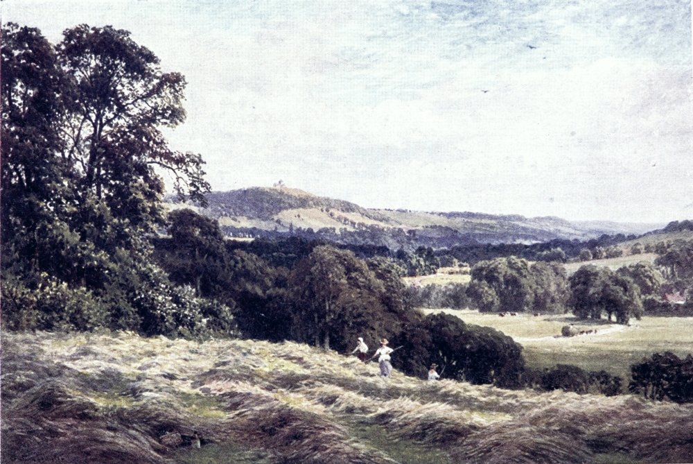
which has been more than once rebuilt, but preserves the ancient Loseley Chapel, containing fine monuments of the More family. A little way up the High Street, to the right, in Quarry Street, will be found the old church of St. Mary’s, partly built of chalk mixed with flint and rubble, showing many remarkable points of interest and controversy for archæologists, among them a bit claimed as Saxon, some grotesque corbels, and the vaulted roof of St. John’s Chapel, ornamented with grim mediæval frescoes, which, like those in Chaldon Church, have become much obliterated, but it is now proposed to revive them. Their subject seems to be various marvels and horrors, mostly connected with legends of St. John; and they have been taken for the work of William of Florence, an artist employed by Henry III.
On the other side of High Street, a projecting clock face marks the Guildhall, dating from the end of the seventeenth century. This is a place to be visited, for behind its striking exterior are treasured several royal portraits, among them Charles II. and James II. by Lely, also some curious carvings on the mantelpiece of the Council Chamber, with a collection of standard measures of 1601 given by Queen Elizabeth. The woolsacks in the town{74} arms commemorate a former renown for the making of cloth, also woven at surrounding villages, an industry said to have decayed through shortcomings on the part of the manufacturers. Aubrey asserts that Wonersh, now such a quiet village, flourished by making blue cloths for the Canary Islands, till the greedy clothiers hit on a trick of stretching out a web of 18 yards to 22 or 23, which led to their losing the market.
At the top of the ascent, on the right-hand side, is the High or Trinity Church, rebuilt in the eighteenth century, not very pleasing in itself, but enshrining some of the old memorials, as well as later ones. One of these, in all the absurdity of classical costume, shows the recumbent effigy of Speaker Onslow, who so long and so worthily filled the Chair of the House of Commons, and whose family are still Guildford’s great neighbours and patrons. The principal monument is the elaborate one to Archbishop Abbot of Canterbury (d. 1633), erected in the old church by his brother Sir Maurice Abbot, a Lord Mayor of London, to be beheld by Pepys among other tombs “kept mighty neat and clean with curtains before them.” This prelate stands high among the benefactors of his native town, though as a stalwart Puritan he has had{75} hard things said against him. His chief claim to remembrance is as one of the body of scholars who translated or edited the authorised version of the Bible. Another of “that happy ternion of brothers,” as Fuller calls them, was Robert Abbot, who by long display of learning came to be Bishop of Salisbury—“but alas! he was hardly warm in his see before cold in his coffin.” As for George, the archbishop, “he did first creep, then run, then fly into preferment,” yet to have his wings painfully clipped after he had reached the highest post of the English Church. Shooting deer at Bramshill Park, near what was to be the rectory of his descendant, Charles Kingsley, this muscular Christian primate had the ill-luck to kill a keeper. Like the keen sportsman he was, King James made light of the accident, as one that might happen to any one; and a jury threw the blame on the victim; but the scandal was so great that it seemed well to grant a royal pardon to the right reverend manslayer. Even then, three Bishops-elect, Laud among them, declined to receive consecration at his blood-stained hands. The unfortunate Archbishop showed himself greatly concerned; he settled a pension on the man’s widow, who with such a dowry soon got another husband; and he kept a monthly fast for{76} the rest of his life. The story goes that he never smiled again. For a time he went into retirement at the Hospital with which he had endowed Guildford, as an almshouse for the tradesmen whose decaying industry he strove to restore. But we hear of no remorse for what seems a darker offence than accidental manslaughter—the pains this Archbishop had taken, in 1611, to get two unfortunate men burned for their damnable guilt in disagreeing with him on a point of theology.
Abbot’s Hospital, standing just opposite the church, is one of the principal sights of the town, a building of stately picturesqueness that bettered its model, the similar institution founded by Archbishop Whitgift at Croydon. Passing through the noble archway adorned with the arms of Canterbury, and under the imposing tower with its domed turrets, the visitor finds himself back in a quiet nook of Jacobean England, where all seems in keeping with its motto, Deus nobis haec otia fecit. On the left of the gardened quadrangle are the apartments of the twelve brethren, on the right those of eight sisters, all bound not to practise forgery, heresy, sorcery, witchcraft and other crimes. Farther on are reached the Master’s house, and the entrance to the Hall and Chapel.{77} The panelled Hall preserves its old fittings, and some portraits of sound Protestant divines, while in the coloured glass will be noticed the inscription of a quite mediæval pun, Clamamus Abba Pater. The most striking feature of the Chapel is the two painted windows telling the story of Jacob, in pictures with Latin legends, the first representing Esau’s hunting errand, that must afterwards have been a sore subject with that pious founder.
High Street, now mounted to its highest, goes on as Spital Street to fork eventually as the Epsom and the London Roads, both of them, indeed, leading to London. Beyond this, all is smart and modern, where an airy suburb straggles on to the Downs. But on the right of Spital Street was passed the Grammar School, founded at the beginning of the sixteenth century, and still preserving some of its old features that make it worth a visit. Its treasure is a library of chained books, several scores in number, surpassed only by those at Wimborne Minster and at Hereford Cathedral. Schoolboys of our generation may be more interested in an antiquarian discovery of Dr. W. G. Grace, who found a musty record of the Guildford boys playing cricket so far back as the time of Queen Bess.{78}
To the last has been left that which is not the least of Guildford’s lions, its old Castle, standing above St. Mary’s, a little to the right of the Market as we came up High Street. Guildford Castle is believed to date from Henry II., but first comes to mention in King John’s time. What has been left of it by the power Edax rerum is mainly its grim keep, solidly planted on a mound that may have been the site of a pre-Norman fortress. Beside this, part of the area is prettily laid out as a public garden. Some curious bits of carving are to be noted in the keep. Within the gateway on the lower side will be found the Surrey Archæological Society’s Museum, not a very large one as yet, but containing a varied show of county antiquities. From the top of the keep there is a fine view of the Wey valley.
This view may be enlarged by mounting the lane behind, that leads to a much less imposing modern fort on the Downs, by which goes out the grand walk along them to Newland’s Corner, and on by the line of the Pilgrims’ Way. On the opposite block of the Downs, above Guildford, the cemetery affords another good prospect point, reached by taking the steep rise of the old Hog’s Back road leading up from the bridge below the station.{79} Near the entrance of this finely displayed burial-ground, a marble cross marks the grave of the author of Alice in Wonderland, with whom Guildford was a favourite sojourn. “There must have been something remarkable about that gentleman,” an official of the place opined to me, “for a good many has asked me where he lies.” One spectacle is no longer available on this stiff ascent, at the top of which, as Defoe states admiringly, the gallows used to stand so plain in view “that the Towns People from the High Street may sit at their Shop Doors and see the Criminals executed.”
Fair scenes about Guildford will be spoken of under another head. Let us here hold on down the Wey, which henceforth takes two forms, now coinciding, then going apart, the canalised Wey Navigation, and the wilful loops that could not be made to fit the course of this water-way, for which they have suffered depletion, but in flood time can yet assert themselves by turning the low meadows into lakes. As in the case of Hogarth’s “Industrious Apprentice,” the canal has thriven so that it may be called the main stream, while it is seldom so straight-lined or business-minded but that its tow-path makes a pleasant riverside walk. This canalisation was carried out as far back as the middle of the{80} seventeenth century, just after the Civil War, locks being then first introduced into England; and the opening of such a convenience for carrying corn and timber to London helped to bring back Guildford’s old prosperity.
Over flat meadows, the river goes out to the north, bending round the suburb of Stoke Park, then takes its course by a series of locks, bridges, and mills that make goals for boating parties. The first name of fame it reaches, some three straight miles from the town, is Sutton Place, standing back in its park that stretches down to the left bank. Loseley, above Guildford, is Sutton’s only rival as at once the stateliest and loveliest mansion in Surrey, taking a high place among the lordly halls of England. In the Reformation days, when donjon keeps could give place to orieled and gabled mansions, this was built by Sir Richard Weston, ancestor and namesake of the Wey’s canaliser. A peculiar feature is the use made of terra-cotta, on which, as on the windows of the Hall, is repeated the builder’s rebus, a bunch of grapes and a tun. It need hardly be said that such a house is rich in relics of the past. But indeed one cannot here speak worthily of what has had a whole sumptuous quarto devoted to it by Mr. Frederic Harrison,{81}
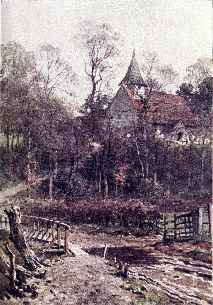
who may well call it a landmark of English architecture, one of the earliest great houses not built with a design of defence.
The house is almost contemporary with some of those exquisite châteaux of the age of Francis which are still preserved on the Loire. Like them, it possesses Italian features of a fancy and grace as remote from the Gothic as from the classical world. Like them, as was every fine work of that age, it is the embodiment of a single idea, of a personal sense of beauty of some creative genius; and thus it stands apart in the history of house-building in Europe, a cinque-cento conception in an English Gothic frame.... The house, too, has had the singular fortune to retain, at least on the outside, its original form, and to be quite free from later additions. Save that one side of the court has been removed, the principal quadrangle, as seen from within, is in every essential feature exactly as the builder left it. Nor, except by the removal or the renewal of some mullions, has the exterior on any side suffered any material change. It is not, like so many of our ancient mansions, a record of the caprice, the ambition, the decay or the bad taste, of successive generations. No Elizabethan architect has added a classical porch; no Jacobean magnate has thrown out a ponderous wing with fantastic gables and profusion of scrolls; no Georgian squire has turned it into a miniature Blenheim, or consulted his comfort by adding a square barrack.... This unity and peace, which seem to rest on the old house almost as on a ruin or a cloister whence modern improvements are shut out, are doubtless due to this: that from its building till to-day the place has remained in the same family, and that a family debarred by adherence to the ancient faith from taking active part in the world of affairs.
The Wey’s next turn is round the village of Send, where its navigable branch makes eastward, while vagrant channels stray off a little north to touch Woking. This name may seem familiar to London travellers, yet few of them will know where and what Woking is. The lively new town that has grown up so fast on the heaths about Woking Junction, stands nearly two miles north of the original village, huddled about the tower and tiled roof of its old church, a landmark conspicuous over the river flat. Even when Defoe made his tour, this place lay “so out of all Road, that ’tis very little heard of in England; it claims however some Honour from its being once the Residence of ... the old Countess of Richmond, Mother to King Henry VII., who made her last Retreat here,” and who, he might have added, had the singular fortune of being thrice a bride in her teens. The moated royal manor has long disappeared; but this back-water village preserves a Market Hall as token of former dignity.
When the branches of the Wey unite about a mile east of Old Woking, it is only to split up again in vagrant loops, tangled by the taking in of a tributary from the commons near Aldershot. The knot of tortuous channels here encloses one of{83} Surrey’s rare ruins, the remains of Newark Priory, of which the south transept walls still stand in broken state, impressive rather than imposing, to be a favourite rendezvous of picnic parties. Near the ruins a large old timber mill makes another landmark of these watery meadows, overlooked from the north by a bank bearing up the little church of Pyrford, with its faded wall paintings and like hints of antiquity.
Lying some two or three miles by sandy roads from Woking or from Byfleet stations, Newark is perhaps oftener visited by way of Ripley, a mile to the south, a pleasant village about a spacious green, where the “Talbot” and the “Anchor” have taken a new lease through the favour of cyclists. With this fraternity the Ripley road came to be a so frequent spin, that the Vicar, willing to run with the times, opened a free stable for cycles at his parsonage, and set apart special seats for their riders, who have repaid such hospitality by contributing a memorial window. Another hostelry, frequented by golfers, is the “Hautboy” of Ockham, birthplace of the scholastic theologian of that ilk. This oakland village is separated from Ripley by Ockham Park, a demesne of Earl Lovelace, Byron’s grandson, who has another seat not far{84} off at East Horsley, where its Clock Tower may be seen standing up in the woods along the south side of the Downs, that since we left Guildford have been drawing away from the course of the river.
Following the Wey from Newark Priory, again we find its industrious and its idle channels at cross purposes with each other, the latter making one particularly extravagant bend eastward, so as to infect with its own devious character the roads that must tack towards bridges. At the Anchor Lock, and its quaint old inn, one might turn off to the right, across a feeble branch, for the little church of Wisley, and by it push on to Wisley Common, with its fir-girdled lakelet on the Ripley road, and its “Hut” hostelry, a combination of a snug hotel and of a “Trust” model public-house. Beside this road, on the west edge of the common, a board shows the way among pine woods to a new feature of the Wey valley, the Horticultural Society’s Gardens, transplanted from Turnham Green, already a sight worth seeing, but not open without an order from a Fellow. The nearest stations are Effingham and Horsley, each about three miles off to the south-east; and over the common the high-road leads on in a couple of{85} miles to Street Cobham, near which the Mole comes within a mile or so of the Wey.
Striking off from the Wey Navigation on the other side, for instance by a footpath from a bridge half a mile beyond the Anchor Lock, one could soon reach Byfleet station on the main line, beyond which are the golf links of New Zealand and the woods of Anningsley. Now the straggling river waters the scattered hamlets of Byfleet, in which parish Henry VIII. is said to have been nursed at Byfleet Park. The main village, half an hour’s walk from the station, lies below the wooded ridge of St. George’s Hill, that now stands up to the right as a last stronghold of the heaths and pines of Surrey on the edge of the Thames valley.
Here the Wey Navigation seems to swerve needlessly to the left, meeting the branch with which it makes a junction beside the railway line. This branch is the Basingstoke Canal, of late years fallen into disuse, and in parts almost dried up, or choked with weeds; but there have been rumours of its being restored to activity. The tow-path of the united canal gives hence a plain walk to Weybridge, safe from the “Gadarene grunt” of the motor-car. The old channel takes an extremely{86} crooked course nearer the flank of St. George’s Hill, which at its southern end one might mount to pass through the private grounds as the pleasantest path to Weybridge station, a mile beyond which the Wey makes its last twist into the Thames. Thus ends a river that has led us through the heart of Surrey, itself a goodly stream, and often decked out in such rich green attire as would beautify the most frumpish canal.{87}
THE second river of Surrey is the Mole, a more untamed stream than the Wey, not harnessed to any occupation unless angling and pleasure-boating by stretches, or here and there the turning of a mill. The name has been taken for a little joke of our ancestors, as denoting the way in which at one part of its course this river tries a trick of burrowing in hot seasons—
But it seems doubtful whether the name of this retiring animal be as old in English as that of Molesey, the Mole island, where the river enters the Thames at what is now rather a chain of shady islands, a noted port of pleasure-boats; and the name Tagg, that has taken such banyan-like root here, seems also to have a smack of Saxon origin.{88} The Emlyn is the Mole’s old alias, which has been connected with a Celtic word for “mill”; and when we compare the Latin Mola and Molina a more probable origin of the name may be suggested. But such a derivation also is scouted by one of the chief pundits of English etymology, who guesses rather that “Mole has been manufactured by backward inferences out of Molesey, and that this contains the genitive of a personal name”—perhaps some Tagg of primitive days.
To its obscure name poets have added such epithets as the “sullen” Mole, the “soft and gentle” Mole, and the “silent” Mole. The “sulky” Mole sometimes suggests itself; and the “wild” Mole would be not out of place in flood time. In its upper course it has ripples and rushes; and as it pushes through the chalk it may give itself up to the freaks of its “swallows”; but in general this “wanton nymph” takes a rather tame career on a flat arena, showing its friskiness chiefly by curving turns, or by cascades too neat to be natural; often, too, it varies its mood between weedy shallows and curdling pools; now it seems to sleep under a crumbling meadow bank; now it tries a run beneath a wooded slope, or steals out of a vault of trees to be half-buried in “weeds of glorious{89}
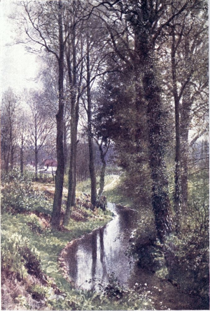
feature”; then at last it creeps slowly over the Thames plain, like an idle scholar who knows what tasks await the end of its holiday independence. In the final mile or two it makes an attempt at a delta of two branches, that to the right styled the Ember river.
The Mole justifies its name in seeming shyer than the Wey, keeping clearer of towns, and being not made familiar to wayfarers by a tow-path. Much of its stealthy course, indeed, is imprisoned in private grounds, whose owners may be jealous of angling rights; the Mole has even been chained and brought into law courts. In following it upwards, we must often be content to keep near its bed, sometimes only to be stuck to by ordeals upon muddy banks, in thorny gaps, over barbed wire fences, or in face of threatening notices to trespassers; and even the footpaths that lead from church to church, or cut off angles of high-roads, are seldom so far left to themselves as to follow the windings of this vagrant river.
If, like the author of “The Farmer’s Boy,” he would spend—
I do not advise my reader to track the river from{90} its mouth through East Molesey, though the police station here stands near such an Arcadian feature as a ford across the eastern branch. But behind the Hurst Park racecourse, opposite Hampton, he may take a road by West Molesey Church, that, straggling off southwards, soon ends in a fairly straight footpath, a mile on touching the left bank of the Mole at its old paper-mills. So far the path may seem not very attractive unless to lovers or philosophers; but beyond the railway it is enlivened by a prospect of the grounds of Esher Place on the farther bank. The gateway of ivied brick, so conspicuous here, is known as “Wolsey’s Tower,” a sturdy remnant of the Episcopal residence to which that proud Cardinal retreated after his disgrace, but found himself so unwell, perhaps from the dampness of an abode near the river, where “he wanted even the most ordinary parts of household stuff,” that he got leave to remove to Richmond for a time before being sent northward by the unrelenting king. The modern mansion has been built higher up, out of the way of floods and footpath starers.
Behind Esher Place is Sandown racecourse, which also has memories of ecclesiastical state and of the transitoriness of worldly things that might{91} serve as a text to its pleasure-seeking frequenters, if they cared for texts “worth following.” This was once the seat of a Priory and Hospital, whose brethren were all swept away by the Black Death, and every trace of its buildings has long disappeared. By its enclosure ascends the high-road, passing near Esher station, almost a mile away from Esher; but that seems close proximity in this part of the county, where some places lie twice as far from the stations deceivingly named after them for want of a nearer title.
From the river bank let us turn up into Esher, on the high ground above it. If this be styled a village, it is a village of much dignity, beset by mansions and villas, and looking conscious of courtly patronage, for at the farther end it has the park of Claremont, residence of more than one royal family, and now occupied by the widowed Duchess of Albany. Here died the lamented Princess Charlotte, whose husband afterwards became the first king of the Belgians. Here ended the eventful life of Louis Philippe. In the Church, that raises its graceful spire beside the cross-road leading up from the river, there is a monument to King Leopold, also a bust of the late Duke of Albany. The old church, by the main road, was disused more{92} than half a century ago; and the graveyard of the new one has had time to gather a good show of memorials, among them the tomb with recumbent effigies erected for himself in his lifetime by Lord Esher, Master of the Rolls. Samuel Warren, author of Ten Thousand a Year, is also buried here, as may be seen by any cycling Tittlebat Titmouse. The sisters Jane and Maria Porter lived for a time at Esher, as did William and Mary Howitt.
But the literary fame of Esher should rest on its identification with the Highbury of Jane Austen’s Emma, a matter which I am prepared to prove against those inconsiderate and presumptuous theorists who vainly put forward Leatherhead for such honour. The only scrap of evidence they have is the occurrence of the name “Randalls Park” near Leatherhead. It is a note of this beloved author—caviare as she may be to the general—that she did not put herself out of the way in christening her characters and scenes. Some of the names in Emma seem to have been suggested to her by tombstones opposite her seat in Chawton Church. At Esher Weston Green may well have prompted her “Mr. Weston”; and Weylands would easily become “Hartlands.” It might be thought far-fetched to connect Sandown with “Donwell{93} Abbey,” if one did not know that there is a well of old note beside the racecourse, and that Sandown was originally a priory. Now for more positive marks of identity. “Highbury” is in Surrey, and on a hill. The description of the Donwell grounds (chap, xlii.) exactly fits the banks of the Mole, which lies a Georgian lady’s “twenty minutes’ walk” below the place. This is introduced as being a large village, almost a small town. The market town (iv.) is Kingston; and Cobham is spoken of as within a walk. It is sixteen miles from London (passim), where Frank Churchill rode to get his hair cut; nine miles from Richmond (xxxvii.); and seven miles from Box Hill (xliii.). The only one of these distances that does not quite suit Esher is the last; but then the mileage would no doubt be minimised to soothe Mr. Woodhouse’s fidgety concern for his horses; and who can say that they were not to be put up at the “Running Horse” of Mickleham, a mile or two short of the scene which Mrs. Elton desired to explore? But Box Hill is only three miles from Leatherhead; and if Frank Churchill sojourned there, he could surely have had his hair cut at Dorking, where, for all we know, Mr. Stiggins’s grandfather carried on a barber’s business in the High Street. By this demonstration, I claim{94} to have for ever settled a controversy that has vexed generations of painful students, and seems to me too lightly passed over in Mr. W. H. Pollock’s book on the “immortal Jane.”
Had Miss Burney been the author of Emma, she would no doubt have made loyal mention of Claremont. This is a house with a history, even before it became a royal demesne. It was originally built by Sir John Vanbrugh, that playwright and architect of Queen Anne’s reign, who had such an unkind epitaph—
He sold the place to the Earl of Clare, from whom came the name Claremont. The improvements begun under this peer were carried out on a larger scale by the famous Lord Clive, who rebuilt the house and had the grounds laid out by “Capability Brown” at enormous expense. Macaulay tells us how Surrey peasants whispered that the wicked lord had the walls made so thick to keep himself from being carried away by the devil; and Clive’s unhappy death would not go to silence such rumours. After passing through the hands of successive owners, this classical mansion was bought{95} by the Crown about a century ago, and has served, as we saw, to house royal and princely families.
Though blocked up on one side by the Claremont enclosure, Esher has beautiful country open to it in most directions. The least pleasing scene is the upward course of the Mole, which recalls a Middlesex stream as it curves round by the big village of Hersham. It might now be followed viâ the high-road, the Ripley road of cyclists, that runs by the park wall, and below a pine-clad knoll on the other side, from which there is a good view over the river’s bends. Here the park ends, and one may turn off through the woods to the left, among which lies hidden the Black Pond, a characteristic specimen of Surrey “lochans.” About the road and eastward to the direct Guildford line, there opens some two miles breadth of woods and heaths, through which one may stray at will, Esher Common, Abrook Common, Oxshott Heath, and Fair Mile Common, all running into each other, with the park cut out of their expanse at the north end. Among the winding tracks and swelling pine banks of this fine wilderness it is easy to get lost, but the road and the railway on either hand will keep the wanderer not far out of his way for Cobham, the next place on the Mole,{96} whereabouts Pepys, travelling south, went astray for two or three hours, before these roads were so well equipped with guide-posts.
Cobham is a two-fold, indeed, a three-fold place: Street Cobham, on the road, as its name denotes, and Church Cobham, a mile or so east, towards the railway station of this name, that lies a mile beyond, where the village has broken out afresh in our time. The road takes us over the bridge of the Mole, successor of one said to have been originally built by Queen Maud, when one of her maids was drowned in crossing the ford, “for the repose of her soul,” which probably implies a chapel at the bridge end, taking toll of Christian charity. To the left-hand side of the road, near the bridge, is Pains Hill Cottage, where Matthew Arnold spent his last years; there is a brass to him in Cobham Church. On the farther bank the road mounts by Pains Hill, a demesne once celebrated for its grounds, laid out in the landscape garden style of such “improvements” as delighted the Mrs. Eltons of Jane Austen’s day. But this is not our road, for the Mole now takes a curving course east to west, and to keep near it we must turn aside for Church Cobham. Here it comes nearest to the Wey, at Pains Hill there{97}
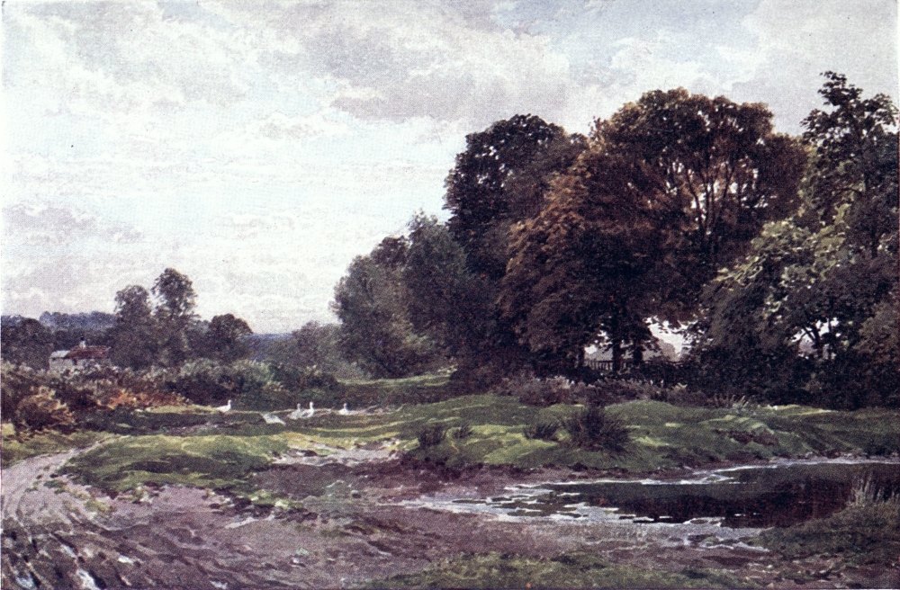
being only a mile or so between the crooks of the two rivers.
Cobham Park now stands in the way of our tracking the Mole’s meanders freely. From near Cobham station I have held the bank round a great loop to the south, and along that mill-pond opening which makes such a show from the railway; but, to tell the truth, this vagary is hardly worth trespassing for. Anglers are understood to be well off for time and temper; but the pedestrian will save both by keeping on the road across the railway, which takes him down to Stoke D’Abernon Church and manor-house, forming a picturesque group by the riverside. The relics of this church are of no small interest, for besides its Vincent and Norbury tombs, it contains what is believed to be the oldest brass in England, to Sir John D’Abernon (1277), and another to his son (1327), with some old glass as well as modern memorial windows. From the station, shared between Cobham and Stoke D’Abernon, or from Oxshott, the next one towards London, we might make for D’Abernon Chase, only one name in a long stretch of woods and commons lying between the railway and the Kingston-Leatherhead road, across which are gained the slopes of Ashstead and Epsom Commons. But{98} alas! in the heart of these woodlands Pachesham Park is turned into a golf ground, about which bristle warnings to trespassers, beside placards of “magnificent building plots.” Anyhow, this would be a divagation from the valley of the Mole, on either side of which a road, made devious by its bends, goes round about to Leatherhead.
A little beyond Stoke D’Abernon Church, one of these roads crosses the river, presently on its banks coming by another of Surrey’s antiquities, Slyfield manor-house, now a farm, notable for its carved staircase and fine ceilings and panelling. The road goes on southwards, swerving east over Great Bookham Common for Leatherhead. The Mole for its part makes another provoking loop to the north. I have nothing to say against the road, a very pleasant one as roads go. But the pedestrian may now take a via media across country by turning down the left bank of the river beside Slyfield, and presently bearing off right across fields, on a mounting path that leads pretty straight into a lane, growing into a road before it passes under the Leatherhead-Guildford line, which points straight to Leatherhead. From the road bending in this direction, one can gain the town along the bank of a mill-pond that might claim rank as a lake; or{99} holding on to the embankment of the Brighton line, one there finds a path leading by a cricket-field up the course of the Mole.
But it would be a pity not to turn aside into the ancient town of Leatherhead, displayed in full to wayfarers from Epsom to Guildford, its chief thoroughfare guiding them to the bridge at which stands the old “Running Horse.” This is taken to be the very tavern which Skelton, Henry VIII.’s learned tutor and doggerel poet, hoarsely sang of as keeping an open door—
But Skelton’s hostess is more than once said to dwell “on a hill” beside Leatherhead, and so to describe the riverside situation of this house seems a license not to be granted even by poetic sessions. A little way down the stream the cyclist might wash off his dust in a mill turned into a quaint swimming-bath. Leatherhead has fewer signs of antiquity than of prosperity, surrounded as it is by large houses, one of them St. John’s School for the sons of the clergy, a former headmaster of which had a son of his own known to novel readers as “Anthony Hope.” The two stations are close together on the{100} east side of the town, where a path leads down the bank of the Mole. On the other side is the Church, a mainly fourteenth-century one, with some noticeable coloured glass, lying beneath the yew-dappled slopes of Leatherhead Downs, which we shall presently come to by the Roman Road across them.
The high-road to Dorking goes out under the Church, to hold up the Mole valley. But the traveller not bound, Ixion-like, to a wheel, should by all means leave it by a lane just beyond the town, crossing the Mole and striking into the path above mentioned as turning off the Guildford road beside the railway. This path takes him near the river for a couple of miles, by the lower edge of Norbury Park, between its heights and those of Leatherhead Downs, a valley that becomes the finest stretch of the Mole’s scenery about Mickleham, judged by some the fairest spot in Surrey.
Here, too, come the renowned “Swallows” of the Mole, with which its name was rashly connected. This phenomenon is so much insisted on by old writers that one must take it to have been more frequent and on a larger scale in former days. Camden speaks of the river as disappearing for two miles near Mickleham so completely that flocks of{101} sheep could feed over it. In our time it sinks only at points, or is reduced to a chain of pools, after a continuance of dry weather, its current being swallowed up in subterranean recesses, as happens notably in Derbyshire, and most markedly in the Karst region of Austria, taken as the typical stage for this freak performance of nature. An eminent geologist tells us how the chasm which lets the Mole through the Downs is honeycombed beneath by a mixture of broken masses of chalk, interspersed with looser drifts. “The Swallows are evidently nothing more than the gullies which lead to the fissures and channels in the chalk rock beneath. When the supply of water in the river is copious, these hollows will be filled from above faster than the water is discharged below, and the phenomenon disappears. But when the quantity sent down by the river is small, the subterranean channels drain off the water, and the bed of the river is left dry.”
Above the pretty village of Mickleham comes the most glorious bouquet of the Mole, where it makes a grand curve below an amphitheatre of woods, shown from the railway in a tantalising glimpse. The lofty and leafy bank to the west is one face of Norbury Park, that so well displays its noble timber on slopes both gentle and abrupt. Its{102} most celebrated feature is the “Druids’ Grove” of yews, thus described by Mr. L. Jennings:—
The Druids’ walk is long and narrow, with a declivity, in some places rather steep, to the left hand, and rising ground to the right, all densely covered with trees. The yew begins to make its appearance soon after the little gate is passed, like the advance-guard of an army. In certain spots it seems to have successfully driven out all other trees. As the path descends the shadows deepen, and you arrive at a spot where a mass of yews of great size and vast age stretch up the hill, and beyond to the left as far as the eye can penetrate through the obscurity. The trees in their long and slow growth have assumed many wild forms, and the visitor who stands there towards evening, and peers into that sombre grove, will sometimes yield to the spell which the scene is sure to exercise on imaginative natures—he will half fancy that these ghostly trees are conscious creatures, and that they have marked with mingled pity and scorn the long processions of mankind come and go like the insects of a day, through the centuries during which they have been stretching out their distorted limbs nearer and nearer to each other. Thick fibrous shoots spring out from their trunks, awakening in the memory long-forgotten stories of huge hairy giants, enemies of mankind, even as the “double-fatal yew” itself was supposed to be in other days. The bark stands in distinct layers, the outer ridges mouldering away, like the fragments of a wall of some ruined castle. The tops are fresh and green, but all below in that sunless recess seems dead. At the foot of the deepest part of the grove there is a seat beneath a stern old king of the wood, but the genius loci seems to warn the intruder to depart—ancient superstitions are rekindled, and the haggard trees themselves seem to threaten that from a sleep beneath the “baleful yew” the weary mortal will wake no more.
Norbury, like other Surrey parks, had once a special renown also for walnut trees, among which an eighteenth-century owner saw reason to make havoc. At the end of that century the place belonged to Mr. W. Lock, friend and patron of famous artists, by whom the famous “picture room” had its walls and ceiling disguised with fictitious landscape scenes. This paradise is not accessible without permission; but there are rights of way through the park that open some of its sylvan treasures. One, as we have seen, leads above the Mole from Leatherhead. Another from the lodge and bridge at Mickleham runs up the slopes, in front of the house, and through a wood to the hollow below Fetcham Scrubbs, a down on which one can hold south by a path, becoming a road as it passes Polesden Lacy, then beyond winding as a leafy lane on to the thickets and swards of Ranmore Common.
But this beautiful digression would take one out of sight of the Mole and its wide prospects. Fortunate is he who from the brow of Norbury Park can with conscience clear of trespassing look down upon the Mole valley, now ringed in by the richest heights of Surrey—Ranmore, the outskirts of Leith Hill, the woods of Deepdene, Box Hill,{104} and Juniper Hill, among which the river has cleft its way through the ridge of the Downs. Box, juniper, and yew all flourish on the chalk soil; and the lordly parks on these hillsides have fostered a profusion of beeches, chestnuts, cedars, and rarer timber that in the flush of spring or the gorgeous decay of autumn hang like rich tapestry round the green meadows, through which the straight line of the railway makes a chord for the arcs of the river.
The highway leads along the east side of the valley, passing the hollow between Juniper Hill and Box Hill, for which latter goes off a winding road, but on foot it is more directly gained by the arduous path behind the Burford Bridge Hotel. Just outside of Mickleham a path turns to the right which would take one through the Fredley meadows, across the Mole, and on to West Humble, where is the Box Hill station of the Brighton line. On a slope near this station is conspicuous the long front of Camilla Lacey, a house that hangs by a tale, for it grew out of Camilla Cottage, built from the proceeds of Miss Burney’s Camilla, the most lucrative of her novels in its day, though not so well remembered as Evelina. By this time she had married M. D’Arblay, one of a colony of French émigrés belonging to the constitutional{105}
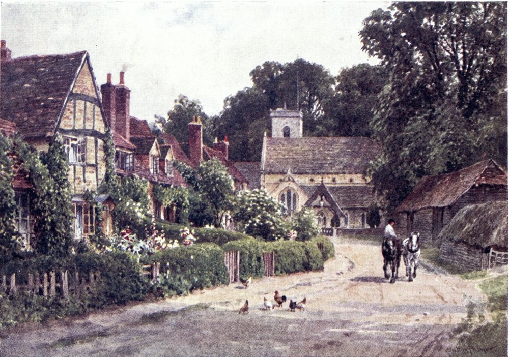
party, who from the excesses of their Revolution found refuge at Juniper Hall, on the other side of the valley.
Juniper Hall, behind its grand cedars, stands back from the high-road a short mile beyond Mickleham. It lies in the hollow, so as to have been nicknamed Juniper Hole by the lively novelist, and must not be confused with the mansion of Juniper Hill above Mickleham. The Hall in 1792 was let to a party of refugee nobles, who had such distinguished guests as Talleyrand and Madame de Staël, the latter making here what she calls a “delicious sojourn.” The Locks of Norbury Park were kind to those exiles; and so, as she could, was Fanny Burney’s sister, Mrs. Phillips, then occupying a cottage at Mickleham. Fanny became intimate with her sister’s friends, especially with the handsome General D’Arblay, with whom she exchanged lessons in their respective languages; then soon it came to exchanging the speech of the eyes. Dr. Burney was against the engagement from prudential considerations; but he did not play the stern father after the young couple, without his presence, had got married in Mickleham Church. Their only fixed income was the pension of a hundred pounds given by Queen Charlotte to{106} her ex-slave. She now set about writing Camilla, which was so well subscribed for, that after living in a small cottage at Bookham the ingenious husband could build one for himself in the Mole valley. But here they spent only a few years of happiness. After the peace of Amiens General D’Arblay went back to France, where his wife had her turn of exile when the war broke out again.
This nook of Surrey is rich in literary associations. Polesden Lacy, on the heights behind Camilla Lacey, was at one time occupied by Sheridan, as Dorking tradesmen had sore reason to know. Dr. Aikin and Mrs. Barbauld of Evenings at Home stayed at Dorking for a season. At his house in the Fredley meadows “Conversation Sharpe” was often visited by writers and thinkers like Francis Homer and Sir James Mackintosh, who from his Indian exile looked back fondly on what he called the “Happy Valley.” The two Mills, James and John, were also familiar with Mickleham as a summer retreat; during half the year they went down by coach for week ends; and it seems odd to find the zealous utilitarian writing in 1836 how the railway is not yet decided on, “but we are still in danger.” Sharpe’s house was afterwards occupied by the popular poet Charles Mackay,{107} father by adoption of the successful novelist Miss Marie Corelli. Among many illustrious guests of the “Hare and Hounds” at Burford Bridge have been Nelson and Hazlitt; and here Keats finished his Endymion, perhaps getting a hint or two from “thorny-green entanglement of underwood” on Box Hill, when “the good-night blush of eve was waning slow.” I am much mistaken if William Black also had not at one time the chance of making copy from such fine scenery. Matthew Arnold spent more than one summer at West Humble, where he mentions the Miss Thackerays as rusticating near him, also Herman Merivale, who “says it is the most enchanting country in England, and I am not sure but he is right”; only this critical poet, though privileged to fish in Wotton Park, is found sighing for stonier streams than the quiet Mole, which here indeed seems the antipodes of lakeland ghylls and forces. Grant Allen tenanted “The Nook” near Dorking, when he helped to bring up out of long neglect by the reading public the name of his neighbour, Mr. George Meredith, who then lived at Burford Bridge, beneath the Downs he has described so lovingly,—“springy turf bordered on a long line, clear as a racecourse, by golden gorse covers, and leftward over the{108} gorse the dark ridge of the fir and heath country ran companionably to the south-west, the valley between, with undulations of wood and meadow sunned or shaded, clumps, mounds, promontories, away to broad spaces of tillage banked by wooded hills, and dimmer beyond, and farther the faintest shadowiness of heights, as a veil to the illimitable.”
That view was over the Holmesdale Valley, into which we are coming round a corner of the Downs. To this part of the Mole’s basin we shall return in tracking the Pilgrims’ Way and the Roman Road, that crossed each other between Mickleham and Dorking. The Mole does not touch Dorking, but turns towards Box Hill, its old name White Hill, which has been somewhat denuded of box trees since the days when it made a favourite excursion for Epsom Spa visitors and for picnic parties from so far off as Emma’s “Highbury.” But it is a grandly wooded face under which the river crosses the Holmesdale Valley, on the other side winding round the avenues of Betchworth Park, where stand the so-called castle ruins that represent rather a tumble-down mansion. Above the park it passes by the trim village green of Brockham, then opposite a huge chalk scar on the{109} Downs crooks up the valley to Betchworth Church, at the east end of which is buried Captain Morris, that convivial lyrist of “the sweet shady side of Pall Mall,” who died near Brockham at the good old age of ninety-four, and the interior has a memorial to another unforgotten neighbour, Sir Benjamin Brodie, the surgeon.
One might now expect the Mole to be found running down the Holmesdale Valley, between the chalk and the greensand; but it seems seldom this river’s way to do what might be expected of it. Over a dip in the sand heights, it comes from the south, draining the wet Wealden clays beyond, where it is fed by more tributaries than there are forks of the Missouri. The main stream passes by Horley, and between the two arms of the Brighton road. But all the peaceful expanse of meadows, fields and woods stretching westward to the Horsham road, is seamed by its branching brooks, one of the largest the Deanoak, a name recalling the fame of this soil for oaks.
Among the vagaries of these modest streams, roads almost as crooked, or reaches of green path, would take us to secluded villages lying within a square of a few miles—Leigh (the way to which must be asked for as Lie, as Flanchford Bridge{110} near it is Flanchet in the vernacular), sought out for its church brasses and weathered mansions come down to farmhouses, one of them in tradition a haunt of Ben Jonson—Charlwood, with its fine old church, distinguished by a noble screen and decayed frescoes—Newdigate, so “far from the madding crowd”—Capel, that has not so much to show, unless the adjacent station of Ockley, where under the face of Leith Hill we get into oftener sought scenes. All this edge of the county makes a pleasant rambling ground, with many picturesque spots that lie out of the way of guide-books. Were we bent on tracking up the various head-waters of the Mole, we must follow them over into Sussex, what seems the most direct stream trickling north near Three Bridges station, and the longest affluent rising in St. Leonard’s Forest, not far from Horsham.{111}
AMONG Surrey’s manifold roads, the doyen is one now little traversed by the whirligigs of time, but of immemorial antiquity and mediæval fame. This is believed to be part of a British trackway stretching from Kent to Cornwall, perhaps the road by which the metals of the west were forwarded towards distant lands, where ancient bronze implements have been unearthed thousands of miles from a tin mine. It is said that ingots of tin have turned up on the eastern stretches of this way. Tradition traces it at least from the straits of Calais to Stonehenge, that Canterbury of heathendom reared on a plain which, as the Pamirs knot together the great Asian mountain chains, is meeting-place of several chalk ridges, offering natural roads above the marshy and jungly bottoms. {112}The road indeed may be older than Stonehenge, that might rise upon it, as churches and chapels came to be built along a section of it revived by Christian devotion. When its western end fell out of use, lost in wanderings across wide downs, the eastern stretch seems to have taken a new lease by throwing out a branch south, so as to join Winchester and Canterbury, respectively capitals of the throne and the altar in early Norman England.
Mr. H. Belloc, in his sumptuous volume, The Old Road, insists on the inevitable importance of these cities, each a fixed point of repair behind a group of bad ports, for one or other of which the seafarer must make as wind and tide served him to come to land about the Isle of Thanet or in the Solent. Each of the two cities stands up a river, where the tide formerly flowed higher than it does now, and anyhow is within easy reach of the open sea, while not too open to piratical attack, a situation paralleled in the case of Exeter and Norwich, Rouen and Caen, Lima and New York, Canton and Calcutta, not to mention a hundred other instances. The curved road passing along the Downs between these prosperous cities would have no lack of traffic; then, when Winchester ceased to be a royal abode, the murder of{113}
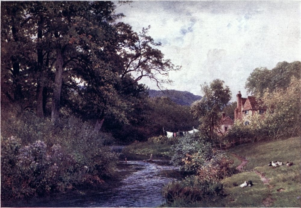
Thomas à Becket consecrated Canterbury as a famous shrine, that for centuries drew devotees and idlers from the Continent, as well as from all over England. Many of these would be our erstwhile fellow-subjects in Western France, who conveniently landed at or about Southampton. By their feet was beaten hard the track now broken to the eye, but well preserved in memory as the “Pilgrims’ Way.” There would also be a stream of pilgrimage in the other direction, to the watery halo of Winchester’s older St. Swithin; and foreigners who had trusted themselves in our island might well make assurance doubly sure by visiting two “ferne hallowes” whilst in the way with them, all such spiritual spas being held good for the soul’s health.
At each end this road finishes in a river valley, where the pilgrims had their goal clear before them, and might halt, giving way to such a passion of penitent devotion as moved the Crusaders at the first sight of Jerusalem. But most of their track passes along the face of the Downs, commonly keeping on the sunny and dry south side, and some little way above the bottom, into which it may drop to seek a ford or other convenience, or again, with less apparent reason, ascends to the{114} top, even crossing here and there to the other side. From shrine to shrine which were its stations, but avoiding the worldliness of towns, it may be traced with more or less clearness, as has been lovingly done by Mr. Belloc and Mrs. Ady, and in less minute fashion by the reader’s humble servant. Sometimes it is disguised as a modern road or absorbed in a park; sometimes its exact course is matter of conjecture or controversy; but short and long reaches of it are still plainly marked, thanks to the chalk, that has been easily trodden into half-natural terraces seldom inviting the plough on their steep contours. Often it is bordered by hedges of ancient yews, which, thriving on this chalk soil, seem associated with pilgrimage memories in their local alias of “palms,” probably palmer’s tree, a name grown so familiar that branches of yew are, or were, used in the county for Palm-Sunday decorations. There are fruit trees, also, growing wildly beside it, that may have sprung up from stones thrown away by mediæval pilgrims on their thirsty march. Another relic of them, in popular prejudice, is the large edible snail Helix pomatia, found on this line, said to have been introduced by French pilgrims, but more credibly attributed to a modern experiment at acclimatisation.{115}
It was not only in fine weather that folk longed to go on pilgrimage. The day of St. Thomas’s martyrdom fell at the very end of December, when the gloom of our climate must have made a pious mortification to the spirit, like peas in a pilgrim’s shoes. But we know how the carnal man was moved to such jaunts rather—
Later on, the chief celebration was the Feast of the Translation in July, when came the largest gatherings about the saint’s tomb—100,000 on one Jubilee occasion, it is said—while at all seasons there would be bands of impatient or belated pilgrims passing to and fro on their soul-saving or time-killing errand. Of no austere mood for the most part were these wayfarers, who went along with singing, revelry, and the telling of tales, less or more edifying; sometimes with roisterings that won them an ill name among scandalised rustics, always apt to be attended by a camp following of pedlars, minstrels, beggars, and knavish tramps. Pilgrimage was the tourist travel of the Middle Ages, undertaken with an eye to making the best of both worlds, to seeing life as well as preparing{116} for death. One who set out for Rome got to be called a roamer, as a saunterer took his name from the sainte terre; then both these adventurers came to bear not the best of characters in the quiet countrysides through which they might spread plague and pox, as do the votaries of Juggernaut or Benares at this day. That very fleshly personage the Wife of Bath had been thrice so far as Jerusalem; and among her companions to Canterbury were such as could be styled “Epicurus’ own son,” or “a good fellow”; one who had no concern about “nice conscience,” and another whose “study was but little on the Bible,” besides rascally parasites of the Church. Chaucer’s company, of course, came from London by Watling Street, while this southern road would be the way from the west country, as well as for numerous troops landing at Southampton from France. But, indeed, the fame of St. Thomas shone far over Latin Christendom, in days when British pilgrims crossed the sea to the Spanish shrine of St. James at Compostella.
From Winchester to Farnham, the Pilgrims’ Way runs through Hants in the valleys of the Itchen and the Wey, and seems roughly represented by the present high-road. Let us take it up where it enters Surrey, soon reaching the long{117} main street of Farnham, in which the “Bush” and the “Lion and Lamb” make halting-places for modern pilgrims to Winchester. At a humbler inn some way outside of the town I have found the Pilgrims’ Way quite an unknown name, mention of it being received with blank stares, and on the part of one elderly rustic with muttered comment on persons that “come poll-prying after other people’s business.” Yet it is to be seen from that house, and can be followed in a pretty straight line all along the side of the Hog’s Back.
Between Farnham and Guildford rises this block of Downs, which Polonius might well have judged “very like a whale,” a bold eight-mile ridge of sand crowned by chalk, along whose top, 400 to 500 feet high, goes an airy high-road dear to cyclists and pedestrians once they have mounted the long or steep ascents at either end. Taking the high-road from Farnham, just beyond the second milestone one finds a byroad forking on the right below the house called Whiteway’s End and the conspicuous red mansion of Downs End, on the butt of the bare ridge here dropping to the hop-fields beneath. This lower road, running level beside the fir-woods that swell up towards Crooksbury Hill, seems to have been the pilgrims{118}’ beaten track, indicated to our generation by a post-office box at the corner where it leaves the present highway. There is no need to quarrel with the supposition that some troops may have chosen the higher road along the top of the Hog’s Back. I would have it understood as not my purpose to enter upon byways of controversy, but merely to lead the reader along the general line taken by the pilgrims, perhaps turning aside here and there for the sake of a better view.
The Pilgrims’ Way keeps down upon the sand, passing by the villages that edge a sweep of woods, parks, and commons gently sloping to the meandering Wey; and at several points one can mount steeply to the high-road on the chine, where telegraph posts are more apparent than houses. On the lower level this reach of the Way goes by or near three parish churches. The first of these is Seale, prettily perched in a wooded hollow beside the Hog’s Back, about a mile on. The next mile or so is marked by the manor of Shoelands, its name interpreted as taken from the shoolers or beggars that beset pious wayfarers, to whom indiscriminate charity counted as a means of salvation. Then another mile brings us to Puttenham, with its much restored Norman church. At the lower{119} edge of a wood above, by which a lane goes up to a white lodge in the high-road, open some remarkable sand caves, believed to extend as a labyrinth of secret passages under the chalk, now inhabited by bats, as once by smugglers and outlaws like that Wild Man of Puttenham that makes such a grim appearance in Sir A. Conan Doyle’s local romance; but at present the only peril here seems to be from golf balls shot across the heath, where a flagstaff on a tumulus beacons our way onwards.
We have now taken leave of the hop poles that, as we came from Farnham, showed dwindling patches of gault beside the chalk. The sandy lane by which we reached Puttenham is an undoubted part of the Way, that passes half a mile to the north of the next church, being indeed far older than parishes or churches, which, however, might well be built on such a frequented thoroughfare. This church of Compton, older than À Becket’s martyrdom, is to archæologists one of the most interesting in the county through its puzzling peculiarities, notably the two-storied chancel, with a screen or arcade thought to be the oldest piece of woodwork in England. The situation is pretty, and the village worth a ramble among its bits of weather-worn antiquity. Such were the attractions{120} that have always brought a sprinkling of visitors to Compton, now endowed with a new group of rare sights that on a fine summer day fill its byroads with cycles and vehicles. On the pilgrims’ track, the late G. F. Watts, R.A., made for himself a home named Limnerslease, and beside it set up Artistic Pottery works, with a hostel for the youths trained here, in no mere commercial spirit. In the same block of buildings, shortly before his death, he opened a Gallery containing many of his most important works, and a remarkable show of portraits, shut Thursday, free on three days in the week, a small fee being charged on the others: this exhibition is to be kept up as a monument of the artist who thus illustrated such a pleasant spot. A little farther down the road is the new village cemetery, which he enriched with a mortuary chapel, decorated mainly, it is understood, by the handiwork of Mrs. Watts. This structure, so prominent on a green knoll, is externally notable for its terra-cotta mouldings, and inside it glows with colour in relief, the walls being covered with figures, making a show of symbolic art such as no other village in England can boast.
The wanderer who here ascends the ridge has the choice of coming down to Guildford either by{121}
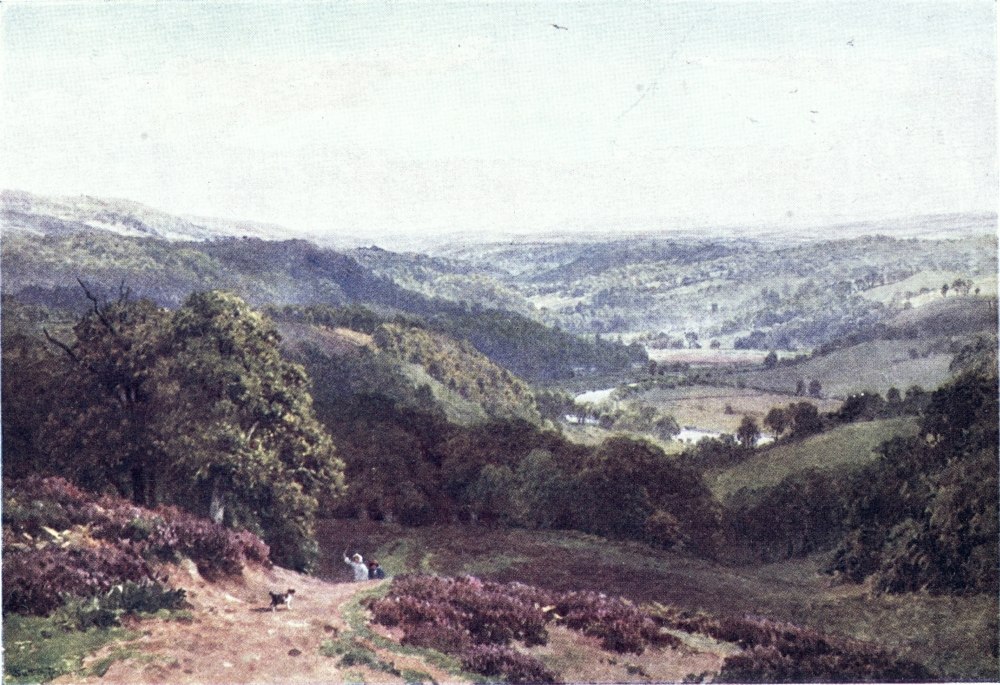
the steep old road past the cemetery, or by the more winding gradients of the new turnpike to the left. He who has descended as far as Compton Church may hold on by a pleasant path through Loseley Park and past the gabled house lying about half a mile south of the pilgrims’ course. This Elizabethan seat of the More family is, Sutton Place excepted, the noblest mansion in Surrey, even in its incompleted state; and its hall, the carvings of the drawing-room, its collection of valuable manuscripts and royal portraits, its moated terrace, its mullioned windows, yew hedges, pigeon-houses, and other old-time features, have their due fame in guide-books and photographs. The house had a romance told in letters preserved here, relating the secret love and marriage of its daughter and the poet Donne. Such a connoisseur in ghosts as the late Mr. Augustus Hare assures us that Loseley keeps no less than three of them,—“a green-coated hunter, a sallow lady, and a warrior in plate armour,” of whom the last ought surely to feel himself rather an anachronism, yet he once appeared most inconsiderately to scare “the kitchen-maid as she was drawing some beer in the cellar.”
From the footpath through Loseley Park one{122} must mount a little to regain the Pilgrims’ Way before it passes along a bold bluff overlooking the valley of the river, that now runs north into Guildford through a gap in the Downs. This height bears up the sturdy ruin of St. Catherine’s Chapel, which, built early in the fourteenth century, became a main station of the pilgrimage. Here, as at Shalford on the opposite bank, and at other points along their route, was the scene of a great fair, gathering together the parasites of these idle and not always impecunious travellers. General James, in his Notes on the Pilgrims’ Way, has suggested with some show of reason that Bunyan here got hints for his great work, such Vanity Fairs being kept up long after that earlier pilgrim’s progress had become a memory. It is believed that the inspired tinker found a refuge both at Guildford and at Shalford, where low marshy ground might well have been a “Slough of Despond”; and the actual name “Dowding (Doubting?) Castle” appears on the map of Surrey about a mile south of Tadworth. As for Delectable Hills, there is no want of them in the prospect from St. Catherine’s, where we see the course of our route leading by St. Martha’s Chapel up the Tillingbourne valley, between the bold chalk slopes{123} and the broken crests of the sand ridge to the south.
Some question arises as to the next stage of the Way. The original road would naturally have turned up to Shalford, the Shallow ford, whose church spire, village stocks, and picturesque old mill invite wayfarers of this generation to a slight diversion. But the convenience of a ferry almost opposite St. Catherine’s must have straightened out the pilgrims’ track, that from this ferry runs on over a park sward, then across the high-road up to an avenue under whose shade path, lane, and overgrown roadway go side by side. It is necessary to insist on these details, as here for a space the track does not as usual cling to the side of the chalk range. Its line is continued by a lane along the north side of a wooded ridge called the Chantries, till it reaches an opening of broken knolls, among which one might go wrong. But after falling into the path over the Downs from Guildford, and crossing a sandy descending lane, one should look out on the left for a marked “Bridle road to Albury,” which leads straight up by St. Martha’s Chapel.
This chapel, such a prominent landmark on a 500 feet swell of heath and copse, seems to have{124} had its name corrupted from “Martyrs’ Hill,” perhaps from Sancti Martyris, and to be really a shrine of St. Thomas, which would claim the special devotion of his votaries. The date of its building is unknown, but it contains an ancient coffin lid, supposed to be that of Cardinal Stephen Langton. At Tyting Farm below is an oratory of the twelfth or thirteenth century, taken to have been the residence of the priest in charge. The chapel itself, after long standing in ruins, was restored in the middle of last century, and Sunday services are held here. The week-day pilgrim will halt to enjoy the prospect of the Tillingbourne valley before him, edged to his left by the Downs, which a little way farther on have their famous view-point at Newlands Corner, said to be named from Abraham Newland, the most popular author of England in his time, as signing the Bank of England notes, then made at Chilworth in the valley below St. Martha’s, as Cobbett indignantly records. The Bank-note factory has gone; but still stand here the gunpowder mills which also excited Cobbett’s wrath; and here too was a well-known printing establishment, ruined by a fire. On the south side of St. Martha’s the view ranges over a hollow filled with commons, woods, and{125} lakelets, like the Mere at Great Tangley, a timbered manor-house which tradition makes one of King John’s many hunting-lodges. Beyond this valley bristling heights run westward till they rise to the conspicuous point of Ewhurst Windmill, between which and St. Martha’s might be steered a six or seven miles’ course over one of the wildest and most lovely tracts in Surrey.
Here indeed a conscientious guide must hesitate how to counsel the pilgrim of the picturesque as to his progress among an embarrassment of scenic riches. There is hardly such another walk in England as that dozen miles or so along the top of the Downs between Guildford and Dorking. From St. Martha’s Hill, one ascends to the stretch named the Roughs, a beautiful wilderness of beeches, yews, thorns, holly and other chalk-loving copsewood tangled in bracken and bramble. On the further side of this ridge there is a straight way up from Clandon station, coming out at Newlands Corner (567 feet). Thence, keeping eastwards along the wooded edge, one might in a mile or so drop down again into the valley by a deep coombe leading to Shere. But all along one can hold on by what is often a broad turf-way set in woods, with tracks going off south to the Tillingbourne{126} villages and the Dorking line, north to the stations of the railway between Guildford and Leatherhead, each of them base for rare rambles. One has only to keep the crest of the ridge, taking the successive names of Netley Heath, Hackhurst Downs, and White Downs, till the way opens out on the expanse of Ranmore Common, stretching over the end of this block of the Downs above the gap made by the Mole. Here, by Denbies Park, there is a charming descent to Dorking; or northwards one finds a network of grassy and leafy lanes leading across the ridge towards Leatherhead. But ridge has ceased to be the fittest term for a table-land of chalk opening out beyond Guildford to a belt several miles broad, dotted here and there by islands of other formation, and often roughened by patches of the wildest ground within a couple of hours’ walk of London tramway lines. As to the rutted sward-way along the Downs, usually a little back from the edge, its merit is romantic loneliness, hardly a house coming to view between Newlands Corner and Ranmore Common, where the crash of a woodman’s axe may recall American backwoods; but it has the defect of a want of prospects, shut out by lush greenery that suggests a valley rather than a height of several hundred feet.{127}
The pilgrims of old days seldom took more trouble than they could help, and their way lay below, near the foot of the Downs, where, after Chilworth, Albury is the next village in the Tillingbourne valley. There is much to be said, and something to be seen, at this old bury on the heath, to the south of which is the site of an ancient camp occupied by the Romans. The Way, after running along the north of a wooded swell in the valley, on the other side of which lies the village, enters Albury Park at an ornate pinnacled fane popularly known as the Irvingite Cathedral. For Albury was the cradle of the sect known to itself as the Catholic Apostolic Church, of which the eloquent enthusiast Edward Irving was not the only or the chief begetter. That distinction rather belonged to Henry Drummond, banker, squire, and Tory M.P., a curious amalgam of business ability and fanatical fancies. At his Albury mansion he was in the way of gathering like-minded friends for study of the Scriptures, and among them, by much brooding over the prophecies, was hatched the new communion that claimed to be a return to gifts and hopes of the Primitive Church. The parson of Albury in those days was the Rev. Hugh McNeile,{128} afterwards well known at Liverpool as a champion of sound Evangelical teaching, who sympathised with the early efforts of the movement, but withdrew from it when it began to take shape apart from the Church as by law established; and poor Irving was deposed by his own Presbyterian Church, while he fell into some suspicion even among his brother sectaries. Through the marriage of his daughter, Drummond came to be represented by the Duke of Northumberland, a family that inherited his part as patron of the body, gathering humbler adherents in a neighbourhood where Cobbett had found fault with the number of its “meeting-houses” and the proportion of its people gone crazy through religion. The elaborate services of the “Cathedral” are said to be still well attended. The parish church, near the mansion, was turned into a mortuary chapel and mausoleum by Mr. Drummond, who built a new one on a site more convenient for the village, itself mainly transplanted by him to a site more aloof from his house. Through the groves of the park, past the house, with its famous yew hedge, terrace, and the gardens, originally laid out by John Evelyn, ran the Pilgrims’ track, here losing its common character as a lonely hillside lane.{129}
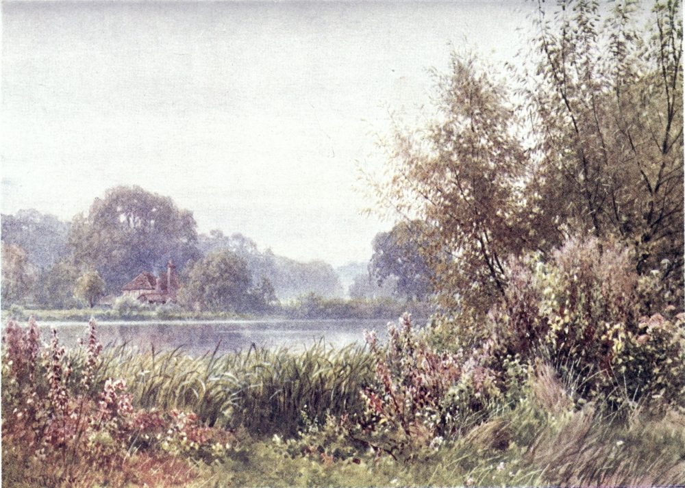
Another notable resident of Albury was Martin Tupper, that once widely-read proverbial philosopher whose fame enacted the tragi-comedy of the rocket and the stick. His name hardly got fair-play in a generation when to sneer at it became a commonplace with every criticaster, a kind of gentry apt to follow Mr. Pickwick’s advice as to shouting with the crowd. But to this much-bleating rhymester, thus shorn of his glory, the wind of criticism was tempered by most robust self-applause, as amusingly appears in his literary memoirs, illustrated by rills of the torrents of prose and verse flowing from a truly fountain pen. Some of his verses, indeed, as John Bull’s address to Jonathan, deserve not to be forgotten; and, while he had no patience with his neighbours the Irvingites, he is always warmly on the side of Protestantism, patriotism, and heart-of-oak sentiments. He claims, with reason, to have been a precursor of the volunteer movement, not only by his dithyrambic tootlings but by the practical foundation of an Albury rifle club. He especially “fancied himself” as trumpeter of this Holmesdale Valley and its history, as set forth in his romance, Stephen Langton; and he was the vates sacer of Albury’s “Silent Pool,” as he christened the Sherbourne Pond of rustics, haunted by the{130} spirit of a bathing maiden to whom King John played Actæon, with the effect of drowning that scared Diana.
This deep chalk basin of crystal water prettily set in a wooded dingle is now one of the lions of the place, yet so secluded that many seekers pass it by unseen. It lies at the foot of the Downs beside Sherbourne Farm, to the left of the road coming down from Newlands Corner and forking on the right for the Irvingite Church; just short of the fork a lane turns left to a cottage where the key of the enclosure may be had. It has been lately stated in the newspapers that the Silent Pool was being sucked dry by water-works on the Downs; but since then I found it deep and clear and cool as ever. Can it be that all we read in newspapers is not always true?
Past the Silent Pool, the road leads between the Downs and Albury Park to beautiful Shere, with its lime-tree avenue, its quaint cottages, whose gables, brackets, and barge-boards make such tempting “bits” for the sketcher, its good old “White Horse” inn, and its picturesque church on the bank of the Tillingbourne, which offers here the unusual village luxury of a small swimming-bath. This village is associated with memories of{131} the county historian, Bray, and of Grote, the more famous historian of Greece. Its charming environs have been so attractive to artists that a “Shere School” is noted among them. There is a house hereabouts that made the home of three R.A.’s successively. Vicat Cole was one of the early discoverers, also Mr. B. W. Leader, who still lives at Burrows’ Cross a little way towards the sand ridge.
A short mile on from Shere is Gomshall, whose “Black Horse” stands close to the station for both villages, as for the more distant charms of Abinger and Holmbury St. Mary. From the Tillingbourne, here harnessed to industry, also giving a subject to art in an often-painted mill, the Pilgrims’ Way now mounted on to the Downs, looking across to the park of Wotton and the sloping woodlands of Leith Hill. I have usually left the reader to imagine for himself the views from these heights; but here I may quote the description by that expert Mr. Baddeley, which figures in more than one guide-book.
Take the lane going off from the mill (near the Black Horse) up the hill. When the lane expands take path on left through the wood to a field with path going right up its steep incline. At top of field, before again entering the woods, a superb view eastward is obtained. Through a gap in the hills, between Box Hill and Deepdene, we look far{132} away over the Weald of Kent. The crowning height of Leith Hill with its tower lies south-east, then the eye ranges over the valley between the Chalk and Greensand ranges to Holmbury and Ewhurst Mill. The South Downs appear in the blue distance to the left of the Hambledon Hills, and the irregular crest of Hindhead west of them. The whole is framed by the woods on either side of the field in which we stand. Entering the wood at top of this field, the path soon rejoins the cart-track from the lane that we left, and we reach the open meadows on the hill-top. Here the woods shut out any view. Proceeding westward along two meadows, at some farm buildings we take a path leading left into the woods over Shere, and in a few yards after entering these, obtain a view south and west that is even more beautiful than the one just described. From no point does the Vale of Chilworth appear to such advantage. Albury Park and the village of Shere are immediately below us, and far away we trace the vale past Chilworth to Shalford. Ewhurst Mill is again prominent due south, and the sweep round to Hindhead, already described, is continued to the Hog’s Back, seen stretching westward like a long green gable roof. The prominent feature is St. Martha’s Hill, with its chapel standing out as a lonely beacon in the distance. Charter House is seen to the south-west, the Devil’s Jumps being to the right of it, and the hills of Hants beyond.
Without troubling oneself why the pilgrims now sought a more airy road, one may get on to the Downs and follow the crest. Or a little farther along the Dorking road, opposite a pond, goes off a pleasant way behind Abinger Hall and across the stretch of wild common known as{133} Evershed Rough, at the edge of which a cross marks the spot where Bishop Wilberforce of Winchester, riding across the Downs, was killed by a fall from his horse. Farther on, past the Deerleap Wood and Wotton Church, there is a rough scramble up the wooded coombe of Pickett’s Hole, or a more gradual road leads through Denbies Park, the drives of which are formally closed on the last day of the year, else open to pilgrims on horse or foot, but not to cyclists.
Thus we come to the final lofty expanse of Ranmore Common, where a graceful spire makes a far-seen beacon beside the upper edge of Denbies Park, whose mansion was the home of Mr. Cubitt, builder of Belgravia. Beyond this, the Downs are cut by the Mole valley, across which rises the bold promontory of Box Hill. How the Pilgrims’ Way crossed this gap makes again matter of question. Mr. Belloc is positive that the old road must have gone straight over the mouth of the valley, perhaps by that very lane in which the narrator of the “Battle of Dorking” had his baptism of fire. But tradition, supported by such names as Pray Meadow and Paternoster Lane, and by the ruins of a chapel in West Humble Lane behind the Box Hill station, avers that here the pilgrims turned to the north{134} side of the Downs, making thus for Burford Bridge, a mile down the river.
By Burford at all events is our best way up to the top of that Cockney paradise, Box Hill. Lucky are the citizens with such a scene within reach of their picnic excursions, and luckiest those sound enough in wind and limb to make the straight ascent from the hotel up the steep chalk slope, reached also by a zigzag road from Juniper Hall. The face towards Dorking is covered by an enclosure of rich wood, open to any one taking refreshment at the Swiss Cottage just within its gate. Beyond this one is free to roam over turf slopes and among the groves, where indeed of late years part of the land has been acquired by the War Office for fortifications to figure in any future Battle of Dorking; so here and there the forbidding initials W. D. remind us not to trespass upon the demesne of a power that is master of twenty legions. It appears, indeed, that this plan of fortification is not to be carried out. Keeping as near the edge as possible, one comes round to a brow looking over the next stretch of the Holmesdale Valley, where the Downs are cut by an enormous chalk pit, the largest I know in the county, taking its name from the village of Betchworth below.{135}
This yawning mouth has swallowed up the Pilgrims’ Way. To keep along the Downs, curving as an amphitheatre of some half-dozen miles on to Reigate, is no easy task. I have done it, and again I have failed to find a practicable path, since “W. D.” has in part closed the woods. A friend of mine who repeatedly achieved the adventure, reports that he never twice took quite the same line. Perhaps the stranger would save himself time and trouble if, at the “Hand in Hand,” he struck into the road that runs behind the ridge to fall into the London highway piercing its height through Pebble Coombe; then, from the edge of Walton Heath beyond, he may get back on to the Downs, in front of their coronet of woods. The Way, beyond that coombe, is traced by Mr. Belloc on rough high ground; but a line of yews slanting up from the picturesque village of Buckland with its church and court, a mile on in the valley, has been taken to mark its ascent to Colley Hill and the lofty park of Margery Grove. A mile farther on, it comes behind a beech wood on the brow overlooking Reigate, the view from which was dubbed by Cobbett’s dogged patriotism the finest in the world. This is now a public demesne of Reigate, a town lying just off the{136} Way, though no doubt intimately connected with it, as shown by the Chapel of St. Thomas, once to be visited where now stands its old Town Hall. A little farther, immediately above Reigate, among the copses of the height lurks a new fort, inconspicuous as is the nature of such latter-day strongholds; and where the Way passes through War Office property as a shady lane, it has been clearly labelled by name so as to point it out to the meanest topographical capacity. It crosses the Brighton road by another modern feature, a suspension bridge, from the seats beside which the prospect is most often enjoyed by cyclists.
Here is reached Gatton Park, where the Way, after rising to 700 feet, betakes itself to the north slope of the ridge. Tradition and the O. S. map make it coincide with the byroad leading beside the north edge of the park; but Mr. Belloc maintains that it must have presently run through this enclosure. One may enter at the lodge gate and walk among its lakelets and timbered knolls to the east side, where are the mansion, the church, and the “Town Hall,” a sort of garden temple on a little mound, in which till 1832 one person proceeded to the election of two members of parliament. This notorious rotten borough, as{137}

Mr. Belloc suggests, may have owed its privilege to former importance as crossing-place of roads north and south. The small church is a museum of ecclesiastical decoration, collected from far and wide by a former owner, Lord Monson, buried in the mausoleum adjoining the house. His mansion was designed on a lavish scale, carried out so far as the hall goes, which makes a rich show of coloured marbles, terra-cotta reliefs and frescoes, in imitation of a chapel at Rome; but it looks to be an artistic Tower of Babel, as if the builder’s ambitious plans had been nipped by the Reform Bill when it took away the special value of what Cobbett styled a “very rascally spot of earth.” A successor of this peer unfortunately lent his name to a too well-known financier; with the result that Gatton passed into the hands of a gentleman who boasts how he made his money from the mustard people superfluously leave on their plates, and of whom his Redhill neighbours have cause to think that he spends it with like liberality.
Beyond Gatton comes a descent into another gap of the Downs, filled by the pretty and prosperous village of Merstham, with its “Feathers” Inn, and its old Church on a knoll. In the valley, the high-road of Redhill and two railway lines have{138} obliterated the crossing of the Pilgrims’ Way on to the next face of the Downs, which now sweep back a little farther north. For a short mile, we may be content to take a road along the foot; then a path slanting up the slope brings us back to the crest, where the Pilgrims’ track has been transformed as approach to new houses. Near these turns north a byway to the Church of Chaldon, lying a mile or so behind our route.
This secluded Church is notable for the best of such fresco wall-paintings as were a feature of other churches in Surrey. The work seems to date from the generation after Becket, but became overlaid by plaster and white washing, under which it was discovered on the Church being restored a generation ago. Since their exposure, the colours have somewhat faded, so the short-sighted visitor, unversed in mediæval symbolism, may be told how the lower part displays the torments of the wicked at the hands of hideous devils, beside a serpent writhing among the fruit:—
From this grotesquely dismal scene, happier souls struggle up the Ladder of Salvation to where on one side Christ is seen triumphing over the powers{139} of Evil, and on the other St. Michael weighing souls in his balance. One of the figures below, holding a bottle, is interpreted as a temperance lesson, no doubt needed by some of the pilgrims, who must often have turned aside to profit by this pictorial sermon. The worst torment seems to be that of a millionaire of the period, who had perhaps not opened his money bags to relieve poor pilgrims.
For the Pilgrims’ Way we have only to keep the brow of White Hill, looking over to the southern ridge on which Bletchingley stands. After crossing the road from Caterham to Bletchingley, it is continued by a lane turning off beside a tower and past the mansion called Arthur’s Seat, to the War Coppice, once an ancient camp, but now, like the Cardinal’s Cap on White Hill, offered as a too eligible building site. Except by peeps, the view to the south becomes obstructed; and we look over the Harestone Valley, down which a pleasant path runs northward to Caterham. At Gravelly Hill and its Water Tower, new road-making seems to transmogrify the Way, that on the slope beyond must have taken a scramble into the deep hollow through which runs the high-road to Godstone. Perhaps the original track is represented by a narrow lane descending on the south face of the Downs.{140}
Across that quarried hollow, we again ascend the Downs for their last half-dozen miles in Surrey. A little below the milestone goes off a charmingly devious lane up Winder’s Hill and along the south side of Marden Park, past its white shooting “Castle” so conspicuous on the brow, then the lodge gate, through which there is a bridle-way running to Caterham or on to the farther end of the park, two miles north. Evelyn tells us how this fine demesne was made from a “barren warren” and a poor farm in a hardly populated parish, by that “prodigious rich scrivener” of his own time, Sir Robert Clayton, a Lord Mayor of London, whose virtues, or at least his fortunes, are attested by the monstrous monument covering a whole chancel wall of Bletchingley Church on the ridge to the south. Here, admiringly says our authority on such matters, the wealthy citizen so changed the face of hill, valley, and “solitary mountain,” that before long Marden looked like “some foreign country” which would “produce spontaneously pines, firs, cypress, yew, holly, and juniper,” not to mention “an infinite store of the best fruit.”
The sylvan riches of Marden Park may be sampled from a lovely lane winding round the outside of its enclosure to gain the open edge of{141} the heights. The Pilgrims’ Way here dropped to a lower level, passing by what is still called Palmer’s Wood and another wood on the face of the Downs, again hugely scarred by chalk cuttings. It next runs right through the middle of Titsey Park, where a Roman villa was discovered near its course. Titsey Place was the old seat of the Greshams, a name well known in City annals, whose monuments are preserved in the new church on the east side of the park. From this point eastwards the Way is a modern lane easily followed for miles.
The modern pilgrim may as well leave this lower road to be looked down on from the edge, along which he can hold on from Marden Park, by hints of War Office possession, and some lonely houses that mark an attempt at a new London settlement meant to take its name from Woldingham on the lower ground behind. Thus is gained the inconspicuous swell of Botley Hill, which appears to be the highest ground on the Surrey Downs (882 feet) but has no markedly prominent point to command a view, looking north across a somewhat featureless table-land to the towers of the Crystal Palace, and south over a more pleasing expanse of hills, dales, woods, and villages. Presently this prospect{142} is interrupted by woods, behind which five roads meet to make the perilous descent by Titsey, as other arduous lanes and paths have been seen dropping down towards Oxted and Limpsfield. Still we may keep the edge, taking the Westerham road, almost half a mile along which, at Cold Harbour Green, the highest face of the Surrey Downs (880 feet) is marked by a clump of beech trees above a farm named Pilgrims’ Lodge. A little farther along the high ground stands the last Surrey Church, Tatsfield, looking far over the vale by which the Way now enters Kent.
Many a weary league had the pilgrims yet to tramp or trot, up and down, along or above the Kentish Downs. Little thought had they to spare for the beauties of their long road, unless when some poetic soul was half-unconsciously moved by the freshness of a flowery mead or the coolness of the good greenwood where “smalle fowles maken melody.” Least of all did they admire the arduous steeps and the patches of wilderness on which a generation free from the fear of robbers and bogeys best loves to linger. In this too short account of some forty miles as the bird flies, which might well be doubled by turning here and there among varied{143} scenes and sites, I have been able only to outline one of the most alluring ways in England, which threads together nearly all Surrey’s fairest charms. If the gentle reader do not believe my report, let him make this pilgrimage for himself, as he may do, day after day, in stretches of some dozen miles, by striking into its road from Farnham, Guildford, Dorking, Redhill, or Caterham, each giving access to a fresh block of the Downs.{144}
AN improvement on the British trackways, comparable almost to railways in relation to turnpikes, must have been the paved and embanked Roman roads, with their milestones and stations. Several of them are known, either as straight stretches of modern highway, or fallen into miry and grassy desuetude, or only guessed at as having shaped parish boundaries. Least forgotten are the main roads connecting London with provincial towns and camps. Our long and nearly straight Edgware Road was Watling Street, with its branches making the Midland or London and North-Western system of Roman travel. John Gilpin’s road out by Tottenham and Edmonton for several miles followed Ermyn Street, the Great Northern line of the Romans. They had a Great Western road also, running by Staines to Silchester, which has{145}
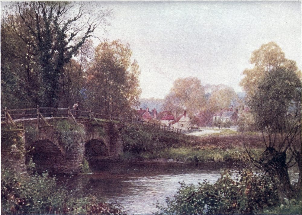
preserved no familiar name. Watling Street, which originally, till diverted to London Bridge, came down by our west-end parks to cross the Thames at Westminster, in Surrey turned eastward into Kent as their Chatham and Dover route. From either this or from Ermyn Street, or rather as a continuation of both, “Stane” Street went south towards Chichester, the Roman Regnum, with a branch that might be styled the Brighton line of the period, when indeed Pevensey was the important terminus on this coast. From earliest days of commerce, Surrey could not but be crossed by ways from London to the southern ports; and perhaps here, as elsewhere, the Romans only adapted older tracks, as our generation may turn a canal into a railway.
More than one Roman road was made here, but what has been remembered as the Roman road, is the ancient Stone Street that ran right through the centre of the county. This name, still in parts familiar, is borne out by excavations made at different times, when flints and other stones laid alternately, to a thickness of four or five feet, were found bedded in sand and gravel or cement. As in the case of the Pilgrims’ Way, part of its line has been more or less closely followed by{146} an actual road; part has become obliterated, the course only to be guessed by the rule of general straightness, unless where turned askew by insurmountable obstacles; but one stretch still remains clearly marked out, buried beneath a turf track that makes the joy of pedestrians. It begins just beyond the racecourse of Epsom, to which the Romans marched by much the same line as the cyclists’ road through Kennington, Clapham,—or Streatham,—Tooting, Morden, and Ewell. The name Newington Causeway is taken as a hint of Stone Street’s connection with London Bridge.
Before it gets clear of the suburbs, this road passes the remains of the once great Priory of Merton, hidden away behind a mill on the banks of the Wandle, and shut in by what may now be called a purlieu of Wimbledon, but could be described by Lackington, the autobiographical bookseller, as “the most rural village of the most beautiful county.” Here were educated Thomas à Becket, and the founder of Merton College; and here in 1236 a council of barons let their king know how they were unwilling to change the laws of England. What the Merton folk remember more clearly and proudly is the residence here of Nelson with his too intimate friends the Hamiltons,{147} in a house the identification of which was made matter of recent newspaper controversy, so blurred are the records of a century back. Confusion seems to have arisen from the fact that the Hamiltons temporarily occupied Merton Abbey House; but their fixed home was Merton Place, to the south of the Abbey, which has disappeared along with the stream in the grounds, by Lady Hamilton christened the Nile, in honour of her hero. The “Nelson’s Arms” and Nelson Grove Road preserve his memory here. Close to Merton Abbey station there is a gateway to be seen as the finest fragment of the old monastery, reached from the high-road by a path up the Wandle. To our generation the Abbey has perhaps been best known as site of William Morris’s factory of artistic decorations. Merton has grown so fast that a manorial mansion might well seem an anachronism here, as was recognised by its squire, Mr. John Innes, bequeathing his property in generous endowment for local amenities and benefactions to what is now a London suburb, yet not without some rustic features.
The next village, Morden, looks still not unfit to have a squire in its park; then two or three miles farther on, the cyclist spins unsuspecting by another name fallen from high estate. He approaches Ewell{148} and the springs of the Hogsmill River, along the wall of Nonsuch Park, in which once stood a stately palace built by Henry VIII.; and on the other side of the road the name of Worcester Park recalls how this outlying residential suburb also made part of a royal demesne, the neighbourhood of which fostered Epsom in Tudor and Stuart days. Nonsuch Palace became a favourite residence of Elizabeth and James I., and seems to have set a fashion of the day in names. The Virginian colonists christened Powhattan’s lodge Nonsuch, as “the strongest and most pleasant place in the country,” when John Smith also complimented Pocahontas with the title “Nonpareil of Virginia.” The present mansion keeps no more than the name of Nonsuch, the site of which was near the modern mock antiquity styled Ewell Castle and the ivied tower of the old church, that makes such a picturesque monument beside its successor. Pictures and Camden’s description preserve the grandeur of that vanished palace, still standing in the plague year, to be used as a government office, when Pepys hints how it was falling into decay, but Evelyn could admire the manner in which its walls “were all so covered with scales of slate, that it seemed carved in the wood and painted, the slate fastened{149} on the timber in pretty figures, that has, like a coat of armour, preserved it from rotting.”
So much for the high-road to Epsom. But if I were going there in no hurry and in dry weather, I once could walk almost all the way from Richmond Park or from Putney Heath over grass or green lanes, with only two bits of road tramping, one at Coombe, and one through the houses of Worcester Park: there has, indeed, been so much building hereabouts of late, that I should fear now to find the paths turning to streets. This way is mainly up the course of the Hogsmill River to Chessington, the parish where Fanny Burney visited the retreat of her “Daddy” Crispe. From the hillock on which the little church stands, more than one path leads on by the tower of the asylum at Horton and beneath the railway line into Epsom’s main thoroughfare.
Few able-bodied Londoners of our generation have not by one route or other visited Epsom, which has four railway lines from the capital, two of them indeed not taking the trouble to come beyond the famous racecourse on the Downs. The smart little town lies mainly along the Dorking high-road, in a dip between the Downs and the expanse of Epsom Common, which imperceptibly merges with{150} the wooded swell of Ashstead Common, named Leatherhead Common on a map of a century ago, before it became a resort of school-feasting Londoners. A conspicuous building on the Downs side is Epsom College, founded for the sons of medical men. That tall tower at Horton makes a landmark on the flat to the other side. The London end of the town is more commonplace, but farther on, about the Clock Tower that replaces the old watch-house, roomy openings, venerable inns, solid dwelling-houses, and shaded walks hint at the amenities of Epsom in its days of watering-place fame. Beyond this south end are the notable mansions of the Durdans and Woodcote Park, each in their well-wooded grounds. Above all, shining on the top of the Downs, the Grand Stand, more than once enlarged since its building in 1829, makes the Capitol or Acropolis of this Surrey Olympia.
Racing upon Banstead Downs, as the name then was, is first heard of under patronage of James I. on his visits at Nonsuch. A horse-race here is said to have been the excuse for that gathering of Cavaliers that ended so ill outside of Kingston, when they would have revived the Civil War. Foot- as well as horse-races, with cudgelling and wrestling{151} matches, drew spectators in simple days whereof Herrick tells us how—
The running footmen of the quality were in a manner professionals at the sport that made their duty. Pepys notes how one summer day the town talk among such quidnuncs as himself was “of nothing but the great foot-race run this day on Banstead Downs between Lee, the Duke of Richmond’s footman, and a tyler, a famous runner,” and how the athletic flunkey won, though the betting was three to four against him. Charles II. and his brother of York both lost money on this “event,” and let us hope they paid up.
These princes helped to make horse-racing fashionable, Newmarket being the chief scene of it, where the horses were ridden by noble sportsmen in person, our merry monarch himself acting the jockey. The Banstead gatherings were as yet not so celebrated, still Defoe in his Tour is quite enthusiastic about the spectacle on the Downs when “they are covered with Coaches and Ladies, and an innumerable Company of Horsemen, as well{152} Gentlemen as Citizens, attending the Sport; and then, adding to the Beauty of the Sight, the Racers flying over the Course, as if they neither touched not nor felt not the Ground they run upon: I think no sight except that of a Victorious Army, under a Protestant King of Great Britain, could exceed it.” That unlamented Prince Fred, “who was alive and is dead,” lived for a time at the Durdans, and then gave a cup to be run for at Epsom, which brought its course into more note. But its real fame and fortune date from about 1778, when a sporting Earl of Derby and his friends founded the Oaks and the Derby stakes, to be run for at what ought to be the brightest time of our year, yet the “blue ribbon of the turf” has been won in a snow-storm.
Before the height of its racing renown, Epsom had, we know, had a spell of prosperity as a spa. The mineral water, charged with sulphate of magnesia, is said to have been discovered early in the seventeenth century, through a countryman noticing how his cows—or his ass in a variant story—would not drink it, a reversal of the usual legend, as shown in the leading case of Bladud’s pigs at Bath. In Fuller’s day “Ebsham” was a resort of citizens coming from what even then{153}

might be styled “the worst of smokes into the purest of airs.” By the middle of the century the waters had won a name; and a little later Pepys found the place so full that he could not get a lodging. Nell Gwynne was another patron at this period. The height of its vogue seems to have been under Queen Anne, whose husband came to drink the waters. Nearness to London must have helped Epsom’s favour; and its people were not backward in laying themselves out to accommodate strangers, for whose entertainment were provided the usual gaieties of a watering-place, set off by its situation in what seemed “a great Park filled with little Groves, Lodges, and Retreats for coolness of Air and Shade from the Sun.” But it is only in summer, says Defoe, that visitors can be expected, the clays of the lowlands making ill roads for winter jaunts.
Defoe declares Tunbridge Wells then the more fashionable place, favoured by “the Nobility and Gentry, as Epsom rather by Merchants and Rich Citizens”; both frequented rather for “the Mirth and Company, for Gaming or Intriguing or the like,” than for “meer Physick”; and he states that Londoners of a lower class who sought serious treatment found it by walking out to the wells of{154} Dulwich and Streatham, so much beset on holidays by “an unruly and unmannerly” crowd that the “better sort” kept aloof from such Cockney haunts. One notes how a contemporary French Guide du Baigneur advertises Dulwich and Streatham as well as Epsom among our spas, though other more famous British resorts have not yet swum into the ken of this authority. The sulphur water of Streatham, indeed, may still be tasted, pumped up behind the counter of a dairy by a dispenser who has informed me that he finds it excellent as “supper beer”—de gustibus, etc.
John Toland in 1711 gives the wordiest account of Epsom spa and its company, lodged in a group of hamlets about the main street, with the paved Terrace, Assembly Room, and two rival bowling-greens as centres of intercourse. The writer himself had a “Hermitage” at Woodcote Green, from which he thus describes, is his Letter to Eudoxa:—
By the Conversation of those who walk there, you would fancy yourself to be this Minute on the Exchange, and the next Minute at St. James’s; one while in an East-India Factory, or a West-India Plantation, and another while with the Army in Flanders, or on Board the Fleet in the Ocean.... A fairer Circle was never seen at Baiae, or Cumae of old, nor of late at Carelsbad, or Aix-la-Chapelle, than is{155} to be admir’d on the High-Green and in the Long-Room, on a publick Day. If the German Baths out-number us in Princesses, we out-shine them in Nymphs and Goddesses, to whom their Princes wou’d be proud to pay Adoration. But not to dissemble any Thing, bountiful Nature has likewise provided us with many other Faces and Shapes, I may add, with another Sett of Dress, Speech, and Behaviour (not to mention Age) ordain’d to quench the cruel Flames, or to damp the inordinate Desires, which the Young, the Handsom, and the Accomplish’d, might undesignedly kindle.... The Rude, the Sullen, the Noisy, and the Affected, the Peevish, the Covetous, the Litigious, and the Sharping, the Proud, the Prodigal, the Impatient, and the Impertinent, become visible foils to the Well-bred, Prudent, Modest, and Good-humour’d, in the Eyes of all impartial Beholders. Our Doctors, instead of prescribing the Waters for the Vapours, or the Spleen, order their Patients to be assiduous at all publick Meetings, knowing that (if they be not themselves of the Number) they’ll find abundant Occasion to laugh at bankrupt Fortune-Hunters, crazy or superannuated Beaus, marry’d Coquets, intriguing Prudes, richly-dress’d Waiting-Maids and complimenting Footmen.... The Judicious Eudoxa will naturally conclude, that such a Concourse of all Ranks of People, must needs fill the Shops with most Sorts of useful and substantial Wares, as well as with finer Goods, Fancies, and Toys. The Taverns, the Inns, and the Coffee-houses answer the Resort of the Place. And I must do our Coffee-houses the Justice to affirm, that for social Virtue they are unequal’d by few, and exceeded by none; tho’ I wish they may be imitated by all. A Tory does not stare and leer when a Whig comes in, nor a Whig look sour and whisper at the Sight of a Tory. These distinctions are laid by with the Winter Suit at London, and a gayer, easier Habit worn in the Country.
Epsom’s credit appears to have been lost through the trickery of a certain apothecary, who set up “New Wells” with Assembly and gambling-rooms, which took for a time, till it leaked out how the virtue of this rival spring was only matter of imagination. That humbug had bought up the original well, and went so far as to close it by way of protecting his own dishonest enterprise. Then Epsom fell off as a resort; and though attempts were made to galvanise its repute, it never got back those throngs of visitors, while the artificial Epsom salts came to be a popular remedy. The once famous well is now obscurely enclosed in the grounds of a private mansion on the Common, to be seen above a row of cottages beside the railway, just outside the town. Among the Ashstead oaks, higher up on the Common, there is a still more neglected spring known as the “Roman Well,” the highest point of this open woodland having apparently been the site of a Roman camp.
The Roman Road is on the other side of the town, beginning at the south-west corner of the racecourse, to be followed in a nearly straight line from an inn below the Grand Stand. On the Ordnance Maps it is marked Ermyn Street, but Stone Street is the traditional name, though it{157} seems anything but stony in our macadamising days. An easy and pleasant way of striking into it from the town is to turn up left at the “Spread Eagle,” then presently right by a flagged path and a lane forking to the right, which brings one below Lord Rosebery’s seat, the Durdans, where a road goes straight up-hill to the inn above mentioned. One might, however, keep another in the same direction as the lane, presently bending up left round Woodcote Park, and past Ashstead Park on the right, till at the top of the ascent is struck the Roman Road.
There is no mistaking this deserted highway, here a broad stretch of turf, on which practical farmers must cast a covetous eye. At a height of about 400 feet, it makes a delightful walk, crossed by tempting pathways, on one side to the Dorking road through Ashstead and Leatherhead, on the other to Headley and Walton, by which one might cut across to the Reigate road. Pebble Lane is a local name, suggested by traces of the Roman construction that have been exposed to view; and there are hints of the old embankment, where to the careless eye nothing may appear but a swathe of waste land. The Church in Ashstead Park is believed to occupy the site of a Roman{158} villa, such as often stood a little way off these roads, like a modern gentleman’s house behind its avenue.
Among the divagations suggested by guide-posts, one might choose the mile or so’s walk behind Ashstead to the church of Headley-on-the-Hill, whose spire is a far seen landmark and a focus of several such footways, another of which would lead back to the Roman Road farther on. If one keep straight along it, after half an hour’s soft walking it grows narrower, rougher, and shadier, crooking its way through a wood as it comes upon the yew-dotted and tumulus-swollen slopes of the Downs above Leatherhead. All this part of Surrey is particularly rich in yews, such as we saw in the Druid’s Grove of Norbury across the Mole, which our road now approaches. Beneath it, beside the valley high-road, the grounds of Cherkley Court contain a mass of yews packed together over some ninety acres, some of the trees very large and beautiful in form. Dr. John Lowe, in his monograph on the Yew-trees of Great Britain and Ireland, speaks of this as “perhaps the finest collection of yews in existence.”
Leatherhead Downs run into the neighbour name of Mickleham Downs, which in part are still{159} much as they were described by Aubrey, but their clumps of ancient yews and thorn-trees are relieved by more artificial parks and woods, below which opens the lovely valley of the Mole, with Norbury Park on its opposite slope. The Roman Road seems to have dropped down into the hollow below Juniper Hill before crossing the Mole; but then its line becomes lost, though fragments of it are said to have been made out in living memory. Let us be content to take two or three miles of turnpike by Burford Bridge to Dorking, whose tall spire, reared in memory of Bishop Wilberforce, marks the traditional course of Stone Street by its churchyard.
As it left the chalk formation to mount upon the greensand, this old road must have crossed the central scene of that “Battle of Dorking” that has escaped mention by grave historians, who might indeed note the national characteristic which turns such a fable into the form of a wholesome warning, whereas the prophets of foreign fiction are more in the way of tickling their readers with glorious victories of imagination. The name thus used to point a moral and adorn a tale from Blackwood, was suggested by the position of Dorking at the foot of the steep Downs, making{160} a natural line of defence for the south side of London. In Domesday the town figures as Dorkinges, a name authentically famed through a breed of fowls said to have been introduced by the Romans. There can be no doubt about its antiquity, and its importance in good old days is vouched for by the size and number of its inns, the “White Horse” and “Red Lion” still flourishing, and others turned into shops in our own time. The curious stranger searches in vain for the sign of the “Marquis of Granby,” for the tomb of Mrs. S. Weller, sen., or for the chapel at which Mr. Stiggins ministered; but an actual coachman named Weller is said to have lived at Dorking in Mr. Pickwick’s time, and his chronicler seems to have had in view the “Old King’s Head,” which became the Post Office.
A peculiar custom of Dorking must probably be spoken of in the past tense, now that staid citizens have been resolute in putting it down, as happened earlier at Kingston and other towns. Here lasted longest in Surrey what seems a survival of Carnival roistering, a triple game of football played through the main streets on Shrove Tuesday, between sides living east and west of the church. On this afternoon, all shops being closed, three balls,{161}
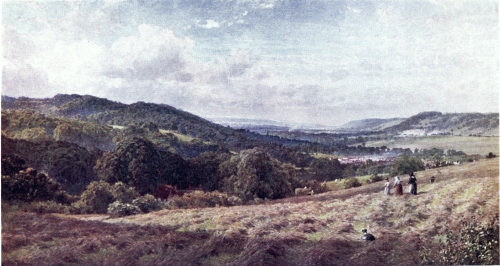
red, white, and blue, were carried out in procession to the music of a traditional tune, to be kicked off by the town crier at the Church passage. The red ball having been first worried by the boys, at 3 P.M. the blue ball was taken in foot by the men; and at 4 P.M. a grand final struggle, hundreds strong, began with the white ball, going on till the chimes rang at 6 P.M. These Saturnalian scrimmages proved as hard to extinguish as the bonfire-revels at Lewes on Guy Fawkes Day; but this year a dozen extra policemen appear to have been too many for young Dorking’s half-hearted conservatism; and for an illustration of the old Shrove Tuesday sports, one must go all the way to St. Colomb in Cornwall, where the ceremonial Hurling Match between “Town” and “Country” is still honoured in the observance.
These footballs were inscribed with the legend, “Wind and water is Dorking’s glory.” From some winds Dorking is well sheltered; but the lower part of the town has only too much water in the ponds filled by the Pipp Brook, at one time an attraction of the place, being stocked with perch, carp, and tench, that supplied the dish called “water souchy,” a stew of fish in esteem with London citizens. Sanitarians now shake their heads over this damp{162} and misty flat, and Dorking’s recent growth is rather upon the high ground behind the long, spacious main street. In point of picturesqueness its situation is most admirable, shut in among such heights as Ranmore Common, Box Hill, and the broken swell of parks and woods rising southwards to Leith Hill.
Much of this beautiful country is enclosed in renowned demesnes; most famous of them Deepdene, lying close behind the town. That paradise of almost European reputation takes in the adjoining Betchworth and Chart Parks; and the wood on the opposite face of Box Hill also belongs to the property, that in a circumference of a dozen miles makes a magnificent collection of English and exotic timber. The nucleus of it was the deep hollow or “Long Hope,” which Mr. Charles Howard, in Cromwell’s time, laid out as an amphitheatre of garden terraces, an open-air conservatory of flowers and rare plants, visited with due admiration by his neighbour John Evelyn, and also by Aubrey, who declared the sight “worthy of Cowley’s Muse.” At the beginning of last century the estate was bought and extended by “Anastasius” Hope, author of a celebrated Eastern romance, and liberal patron of such artists as Flaxman and Thorwaldsen,{163} with whose works he stored the mansion begun by him. As a guest here, Disraeli is understood to have written Coningsby. Another owner of note was Mr. Beresford Hope, the proprietor of the Saturday Review. In the hands of his heirs the estate fell among the Philistines, and after a succession of tenancies this lordly demesne has been turned into an hôtel de luxe. But if strangers cannot gain the lofty beech terrace, commanding such a rich woodland prospect, and from a lane outside must be content with a tantalising peep of the rhododendron show within, they may take a public path to the Glory Wood behind the town; or, on its east side, in the valley of the Mole, they find the avenues of Betchworth Park open as a way to Brockham; while the grounds of Box Hill, and some of the finest outskirts of Leith Hill, such as the Nower park-slopes, offer free rambles.
To follow the Roman Road’s course southwards from Dorking, one takes the Horsham Road over Holmwood Common below the eastern flanks of Leith Hill. On the right hand of this highway, a straight line under the Redland Woods is marked on the O.S. map as Stone Street, which here, indeed, needs an antiquary’s eye to trace it over private enclosures. Above it, by lanes winding{164} through the woods, is reached the lofty village of Coldharbour. This name, often occurring on or near an old road, is believed to denote an inn, like the caravanserais of the East, that supplied only bare walls. Evelyn reviles a poor Alpine inn as a “cold harbour, though the house had a stove in every room.” It is not improbable that a deserted Roman villa or military station would be turned to account as such a place of more or less imperfect shelter. Ruskin, in one of his rashest excursions ultra crepidam, opined that the Camberwell Coldharbour Lane might have been called after coluber, from its snake-like windings; but he seems not to know how many Coldharbours there are in England, and that several of them stand near Roman roads, whose character was anything but serpentine. Beside this lofty village is the Camp of Anstiebury, traditional harbour for an invading force of Danes, who sallied forth to be slaughtered on the slopes of Leith Hill or on Ockley Green below.
On the south side of Leith Hill, showing such a bold face to the flats of Ockley, the line of the Roman Road coincides with the modern one, still known as “Stone Street causeway,” that had been ascribed by country-folk in Aubrey’s time to the{165} work of the Devil. This road runs straight for about three miles, then, beyond its forks, the line of the old way is marked on maps as leading about as far ahead, across the Sussex border, into the valley of the Arun. As a practicable path, however, it seems to have fallen much out of use, overlaid by the woods and grounds of this generation. In the fork one can see no trace of it now, but, if one here take the right-hand road crooking up to the hamlet of Oakwood Hill, below this an inscription, Shut the Gate, shows the bridle-way preserved as drive of a modern mansion. Beside this house it passes as a green lane to be almost choked as it tunnels the copses that soon obscure its line for a stranger, though local wayfarers make out a right-of-way to Rowhook. Mr. Malden, the Surrey historian, who has patiently explored part of its lost course, finds that some ancient lanes take no heed of that older track, which he supposes to have been early abandoned as leading into the Wealden wilds, almost uninhabited at the date of Domesday.
Ockley itself is one of the pleasantest of Surrey villages, clustered about a broad green, beside which Stone Street has grown into a lordly avenue, shadowing what seems a Roman-like massiveness{166} of paving. About it, within the bounds of Surrey, green byways wind among swelling ridges and clumps of timber thick-set on the edge of the Weald. Two or three miles southward, on the right hand of Stone Street’s line, woodland paths lead to the sequestered chapel of Oakwood and on to Oakwood Hill, whence, half a dozen miles south-west, might be reached in Sussex the Baynards or the Rudgwick station of a line from Guildford, near the new quarters of the Bluecoat School converging with that other from Dorking, on which Warnham, the home of Shelley’s youth, has a station about as far to the south-east of Ockley. Eastward, one can seek the secluded Wealden villages caught in a network of the Mole’s branches, through which the free foot or wheel can thread a devious way to the Brighton road, or bend round into the Holmesdale valley. Westward, zigzag roads under the wooded crests of the sand-hills take one to Ewhurst, to Cranleigh, and on to Godalming, or by Bramley or Wonersh to Guildford. To the north rises the stiff ascent of Leith Hill, from which let us survey its choice surroundings.{167}
THE reader is now to be conducted on and about what, to my mind, makes the bouquet of the county’s scenery. Leith Hill is the highest point not only of Surrey, but in this corner of England, the topmost knoll on its southern brow being 965 feet above the sea, crowned by a tower that adds nearly 100 feet to the natural elevation. The tower was built in the eighteenth century by a local squire named Hull, apparently a “character,” who had himself buried in it, to the scandal of his neighbours. It has since been restored and opened by the present proprietors, the Evelyns of Wotton. Till lately it was garrisoned by an old dame who tramped up daily in tourist weather, and kept a supply of rudimentary refreshments, grateful to those who had made a hot ascent. But such a simple Brockenhaus is now supplemented by a{168} small and snug hotel on the shelf below, which may be reached by wheels; then from it there is one stiff tug up the steep bank, the approaches from behind being less arduous.
It is only on the southern side that Leith Hill makes a clear show of its height. The northern slopes are gentle, falling gradually for three or four miles into the Holmesdale valley. The broken contours of the sand show richly clad with woods, parks, commons, heather, bracken, patched too with quagmires and ragged gravel pits, seamed with lanes and hedgerows, so that all the most shaggily picturesque features of Surrey come here mixed together, in contrast with the smoother and barer outlines of the chalk Downs, like a mastiff lying side by side with a collie. The native wildness of this hill has been a good deal cut and polished, indeed; and a thick setting of private grounds, while throwing its rough facets into relief, has the fault of barring access by certain enviable nooks. But the upper part is left free; and by right-of-way or the liberality of owners, several lines of approach are open from different sides.
What may be termed the standard way up, the plainest and easiest, is the road from Dorking, a mainly gentle rising of some five miles to the{169}
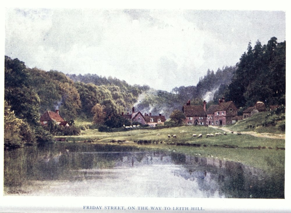
tower. At the west end of Dorking’s High Street, one turns up the Horsham Road, then at the fork on the right a board beacons the course to Leith Hill by a line of deep lanes along its east side, after a time skirting the edge of the Redland Woods, inside of which a footway may be taken. Had the pedestrian kept further along the Horsham Road, from Holmwood Common a couple of miles out, he might strike up through those woods to reach the upper way as it comes near the village of Coldharbour. Two or three miles of walking would be saved by taking the train on to Holmwood station, from which pleasant avenues mount through private grounds to Coldharbour.
This village stands 800 feet high, on a shoulder of the hill, about a mile from the tower, not yet in sight on its rugged head. Opposite the inn turns up a sandy lane, on which cyclists will have to push, winding to the bare knoll crowned by the tower. A better road, edged by the amenities of a park drive, leads round the southern face to the hotel. But those who depend on vehicles sit in no need of guidance. Henceforth I address myself to the amateur or miniature Alpinist, who does not shirk a walk of some dozen miles or so. To him the road above mentioned may be suggested{170} as best for coming down, perhaps by failing light and with stiff limbs.
The way I should choose for walking up Leith Hill from Dorking is by a valley opening about two miles west of the town, at which end is the Dorking station of the South-Eastern line. From the Box Hill station of this railway and the Dorking of the Brighton line, which puzzlingly adjoin one another beyond the other end, an omnibus plies to Westcott, by a pretty road past Bury Hill and Milton Heath, above that most picturesque old mansion, Milton Court.[A] From the Church on Westcott’s sloping Green one holds on pretty straight by a lane joining the high-road near the gate of the Rookery, a mansion known as the home of Malthus, that reverend bogey of sentimentalists like Cobbett. His father before him was also a literary notability, and author of the “improvements” which{171} made this demesne celebrated. One need not be shy of turning into the lordly avenue and by the rhododendron walks that lead up the ornamental waters of the Pipp Brook, for boards show a permitted way past the house, while, alas! on my last visit a placard at the gate bore the warning Mene, Mene, Tekel, Upharsin, a notice, to wit, that these choice grounds are destined to go the way of all eligible building sites within reach of infection by Cobbett’s “wen.” Above the house, one gets out of the park over a high bank, beyond which comes a change both of estate and watershed, for the Pipp Brook flows to the Mole, whereas the slopes westward drain into the Tillingbourne, tributary of the Wey.
[A] Not to confuse the reader with too many routes, I throw a very pleasant one into a footnote. Just before he reaches Westcott, from the road into it leads off, left, “Milton Street,” a charming hybrid between park avenue and cottaged lane. Passing through an iron turnstile at the top of this, then presently, turning right over a plank bridge, he finds a long reach of meadow path which, in the same general direction, with a trend left, leads him over two stiles and up a slope to a fork of lanes. Across the road here, a stile marks the continuation of the path winding on to a lonely farm. Through the yard of this, he turns left on a track soon entering the woods, where its left branch in half an hour or so leads shadily to Coldharbour, while divergences a little to the right might (or might not) bring him in view of the tower.
The way thenceforth is not quite so plain; but one cannot go far wrong by taking a green lane to the left and keeping pretty straight south up a central ridge-way till a glimpse of the tower is gained in the wood. Did one hold rather too much to the left, the worst of it would be wandering into the road at Coldharbour. Holding more to the right, one comes into a deep hollow above Wotton, where the ponds and cascades of the Tillingbourne lead up to Broadmoor, a model village among meadows opening out in the woods.{172} The narrowing hollow takes one straight to the tower by a beautiful and gradual ascent; but this route is not the best in wet weather. It properly belongs to the next line to be indicated, the base of which is Wotton, lying about midway between Dorking and Gomshall station.
Wotton is famous as the seat of John Evelyn, the diarist, and author of Sylva, who put his knowledge of trees so well in practice, that his hand is still seen not only about this Wood town but in other garden grounds of the county. Blackheath was an alias of the parish, which it perhaps better deserved before he set an example of planting the hill with his favourite firs; yet the estate must have been already well timbered, according to the account he gives of its sylvan wealth. On the high-road, up a stiff ascent beyond the Rookery, comes the inn called “Wotton Hatch,” beside the Park gate. Opposite this a way turns down to the Church, which lies below the north side of the road, beautifully embowered on a knoll, with the Deerleap Wood beyond it, and the coombe of Pickett’s Hole as invitation for a steep climb on the Downs.
In the Evelyn chapel of this church, “the dormitory of my ancestors, near to that of my{173} father and pious mother,” is the coffin-shaped tomb of John Evelyn, of whom his epitaph may tell without falsehood how, “Living in an age of Events and Revolutions, he learnt (as himself asserted) this Truth which, pursuant to his Intention, is here declared—That all is Vanity which is not Honest, and that there is no solid Wisdom but in real Piety.” Of the other family monuments the most noticeable is Westmacott’s memorial to Captain George Evelyn, with an inscription by Arnold of Rugby. In the churchyard stands the tomb of William Glanville, on which is still performed a ceremony devised by this kinsman of the Evelyns, to keep his memory green among successive rising generations. Dying 1718, by his will he directed forty shillings apiece to be paid to five poor boys of Wotton, below sixteen, who on the anniversary of his death should repeat by heart, with their hands laid on his gravestone, the Lord’s Prayer, the Creed, and the Decalogue, also as a further proof of scholarship reading 1 Corinthians xv., and writing legibly the first two verses. The Church porch in John Evelyn’s time was a school where, he tells us, he himself got the elements of learning, before not going to Eton, from which he was scared away by fear of the rod.{174}
The Park of Wotton, with “its rising grounds, meadows, woods, and water in abundance,” might well be styled by its best known owner “one of the most pleasant seats in the nation.” The mansion, still belonging to his descendants, a good deal enlarged and altered since he made it “the raree-show of the whole neighbourhood,” contains part of his collections, portraits, manuscripts, and other memorials of him, and such a treasured relic as the prayer-book used by Charles I. on the scaffold; but there is no admission to strangers, except occasionally in summer by tickets issued at a Dorking library. One has, however, a right-of-way through the lodge gate, presently leaving the drive by a path passing close beside the house and up into the woods for Friday Street. A little to the east of this line, reached by a lane behind the inn, is the already mentioned way up the ornamental waters of the Tillingbourne hollow. But the untired wanderer, who can steer a course without beacons, will do well to make for Friday Street, a little hamlet so ancient that it is supposed to have had the Saxon goddess Friga as a godmother: the name occurs again some nine miles to the south, across the Sussex border. This group of hermitages lies charmingly in a deep glen half filled by a sheet of{175} water, from the top of which goes up another way to the tower; but in case of doubt it would be well to bear left into the Tillingbourne’s course.
The shortest way from Gomshall station to Friday Street, about three miles, is by Abinger Church, standing above the west side of this hollow. On the main road, half a mile east of the station, one reaches Abinger Hammer, a name left by the now extinct iron working. On the green here, take the right-hand byroad for Felday, then at the top of its first slight rise, a path to the left running pretty straight over fields to a solitary farm, behind which a lane leads on to the churchyard of the high and dry hamlet styled Abinger Hatch. The church of Abinger has been well restored, but preserves some ancient features. On the Green beyond are the parish stocks, said to have been used almost within living memory. The inn here has been smartened and enlarged of late years, a hint how strangers appreciate the charms of a seclusion that begins to be broken in on by building. Hence one turns left to descend into the hollow of Friday Street. The road to the right is for Felday, whence, on the west side of Leith Hill, mounts one of its most lovely approaches.{176}
Thus, by one way or other, has been gained the crest, through woods among which it is often hid till one be close upon it. Standing on that craggy knoll, one at last has a clear view to the south, and from the top of the tower can overlook, it is said, a baker’s dozen of counties, spread out all round as on a map, shaded and dotted and streaked with heights, woods, streams, villages, churches and farms, melting away or running together in the distance like the smoke from a myriad of English homes. In the foreground lie the leafy lowlands of the Weald, bounded by the line of the South Downs, through a gap in which the sea might come into view, weather permitting. Points that may be made out in the circular panorama are Ditchling Beacon and other crests of the South Downs; Crowborough Beacon and Frant Church on the Forest Ridge of Sussex; the Kentish Downs; the Crystal Palace; the huge ant-hill of London; the Chiltern Hills in Bucks; Windsor Castle at one end of Berks, and at the other Inkpen Beacon, highest point of the chalk Downs; Highclere and Butser Hill in Hants, and Blackdown and Hindhead on the edge of Surrey. The travelled Evelyn calls this the best prospect he ever beheld; and if he may be{177}
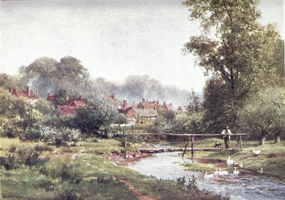
suspected of local prejudice, John Dennis, that gibbeted victim of Pope and Swift, is found breaking out into enthusiasm over a scene which he declares to surpass the finest in Italy. All the stranger, in Hone’s Table Book, reads a complaint of such a scene remaining in obscurity, “unknown to the very visitors of Epsom and Box Hill.” That reproach is certainly out of date in our active generation. Here one ought to produce a poetical description; but, so far as I know, the bards who must have often looked from Leith Hill seem to have been struck dumb by admiration of a landscape in which are lost so many—
Should it be the reader’s fortune to stand here by the light of the setting sun, he may presently have to consider how to get off this eminence. The steep road southwards falls to Ockley, which has a station two or three miles away; and there is another on the same line about as far off at Holmwood, the path to which is indicated beside the inn at Coldharbour. The road by Coldharbour to the more frequent trains of Dorking is plain. The tracks down the Tillingbourne to the Gomshall-Dorking{178} valley road were better not be attempted in the dark. But if a refreshed climber had still half a day before him, good shoe leather under him, and a stout heart for stiff ups and downs, I would invite him to follow other crests of the sand ridge westwards; or at least to visit Leith Hill’s neighbour, Holmbury Hill, about two miles in that direction.
Let us descend, then, into the valley between, bearing a little northward to strike the choice village that now knows itself as Holmbury St. Mary, but for country-folk around is more familiar under the old name of Felday, and part of it on the O.S. map is belittled as Pitland Street. This out-of-the-way place has raised its head since such a good judge of scenery as Mr. Louis Jennings could speak of it as a “wretched, half-deserted spot,” a “group of depressing habitations,” “very like a Hindoo village in Bengal,” with a “mean sort of house” for church, and “a melancholy roadside inn called the ‘Royal Oak.’” But other eyes took a more sympathetic view of poor Felday, whose “few scattered cottages” have come to be lodgings sought after by such æsthetic Londoners as will pay fancy rents for hovels on Arran or Dartmoor, while the slopes around this Cinderella of Surrey hamlets{179} have been but too much encroached on by smart new mansions. Among early settlers here was the architect G. E. Street, R.A., who, as a shrine for his wife’s tomb, replaced that humble house of prayer by what, at the height of his powers, he put forth as a model village church, beautifully adorned inside with coloured windows from his own designs, and with shows of Italian sacred art that do not please strict Protestantism.
Here opens a new fan of woodland walks. The road southwards leads to Gomshall station in about three miles. The best way from Felday to the top of Leith Hill is through a park gate beyond the “Hollybush,” then diverging on the right of the drive as an embowered lane where boards marked “private” keep one from straying till a road is reached, across which an open slope leads to the tower. Up the glade behind the village the footway splits into several tracks, and the middle one, trending right, passes a lonely umbrella-shaped fir, round which a path, now bearing left, runs along the ridge to the camp at the end of Holmbury Hill, that, only a hundred feet lower, has almost as fine a view as Leith Hill itself.
On the west side of the Holmbury hollow, paths take one over into a larger valley, through which{180} runs another road from Gomshall. Beyond this road rise the steep grassy sides of Pitch Hill (844 feet), then the adjoining height westward is marked by the far-seen and far-seeing Ewhurst windmill. The village of Ewhurst lies about two miles to the south, on the Weald edge; and about as far again, south-west, is Cranleigh, growing round its railway station and its old Church, behind which a path runs up to the heaths and woods of the ridge. Northwards one looks across the Tillingbourne valley to the Downs, for once surpassed in height by that grand group of sand tops to the south of Gomshall and Dorking.
The tramp who is in no hurry, and has an eye for country, may walk the ten or twelve miles to Guildford by keeping round the heights of the sand ridge above Cranleigh, bearing north-west for Wonersh, where a high-road and a pretty byroad drop into the valley of the Wey. If he turn down too soon on this side, he will be brought up by the line of the Guildford-Brighton railway. On the other side—where the Guildford-Redhill line, the course of the Tillingbourne, and the high-road below the Downs bound his wanderings to the north—he might lose himself among the beautifully broken ground of Hurtwood, Farley{181} Heath, and Blackheath, but with glimpses now and then of St. Martha’s Chapel on its hill as beacon of the straightest route to Guildford, for which he can hardly go far wrong, when he remembers how it lies in a gap of the Downs beyond the sand formation. Had the stranger begun his walk from Leatherhead, following the valley of the Mole to Dorking, and ended it thus at Guildford, this half-circle would have taken him through the cream of Surrey in one stride of seven-leagued boots.
But to the unwearied wayfarer, I have yet another hint to give for a divagation on which a free wheel will serve him better than on the sandy heaths. Across the Guildford-Brighton line he might turn into what is called the “Fold country,” a corner of the Surrey Weald bordered south by the north-west edge of Sussex, and west by the L. & S.W. line to Portsmouth. This is one of the most unsophisticated parts of the county, in which runs the abandoned Wey and Arun Canal, besides streams unknown to fame. The affix of its quiet villages, Alfold, Dunsfold, Chiddingfold, is said, not without question, to mean felled; but there can be no doubt about the Fernhurst, Siddinghurst, Killinghurst and other hursts that mark clearings in the woodland, with old farmhouses{182} and scattered cottages, which often show quaint fire-dogs and grate-backs as relics of the iron-working once busily plied around these quiet nooks. From Cranleigh to Haslemere station will be nine or ten miles as the crow flies; where one can’t be very confident of not losing one’s way a little in the lanes that tack through the woods from hamlet to hamlet, but may steer towards the long, dark cliff of Blackdown for Haslemere, lying beneath its west end. Guide-books and roadbooks are apt to shirk the mazes of this secluded district, through which, by one help or other, a course can be laid past many folds and hursts to the Zermatt or Chamouni of Surrey’s rival Alplet, Hindhead.{183}
I HAVE confessed to Leith Hill as the corner of Surrey that smiles for me above all others; but there are those who will call out on one for not preferring the severer beauties of Hindhead. This is, of course, a matter of taste, to some extent of upbringing. I was mainly reared in a country where stern and wild aspects of nature are cheaper than the lush charms of the South, that to my countrymen may appeal with a certain attraction of rarity. One has heard of a Swiss guide whose admiration was excited by a wide prospect of London chimney pots. A Corsican gentleman once undertook to show me what he called one of the finest scenes in his island, which I found too much like a market-garden. Cobbett, for his part, roundly abused Hindhead as “the most villainous spot God ever made,” by which he seems to mean{184} that the roads were rough and the soil not suited for growing the “Cobbett corn” or the acacias which, with different degrees of success, he was trying to naturalise in his native country, when he carried on the trade of a nursery-gardener along with that of an uprooting journalist. For once, he has a laugh against himself in his Rural Rides, with the story of how he tried to get from Liphook—or was it Liss?—to Thursley without crossing the abhorred moor, yet after all blundered in the dark on to the top of it, though he had taken a local guide, as Pepys was fain to do for the passage of that Surrey St. Bernard.
Our age has a new heart for such open heights as border the Portsmouth road between Thursley and Liphook. At its highest point, about 900 feet, the road passes along the brow of a wide and deep depression known as the Devil’s Punch Bowl, round which stretches of bracken, gorse and heath, broken dells, ponds and pine-crested ridges, fall into the valleys by slopes and hollows rich in green lanes, in tangled coppices, in old cottages, and in other picturesque “bits,” the whole airy swell making a smaller and drier edition of Dartmoor. This once thinly populated moorland could not but attract artists and authors, who began to settle here{185}
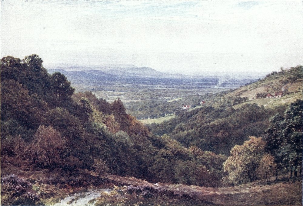
in what they hoped to find a congenial wilderness. Mr. Birkett Foster and Mr. Edmund Evans, the colour-printer, were, so far as I know, the first colonists who built adjoining houses for themselves beside Witley station. George Eliot came to live close by them at the “Heights,” after long searching for a home on the Surrey commons. The neighbourhood began to be so much affected by literary and scientific people, that the nickname Mindhead was suggested. More than one leading London consultant made his holiday retreat hereabouts, not keeping to himself the secret of the dry clear air in which delicate invalids can sit out of doors under winter sunshine. The merits of Hindhead as a health resort were advertised by Professor Tyndall building a house near the top, where he found himself able to spend the winter as well as on the Bel Alp. Mr. Grant Allen deserted the Riviera for Hindhead, from which he dated his “Hill-Top” novels, and here found many hints for “Moorland Idylls.” The local colour of one of Sir A. Conan Doyle’s romances betrays how he joined a colony where only successful novelists may now aspire to find house-room.
Twenty years ago, Hindhead had a loose scattering of villas and cottages round the Royal{186} Huts Inn at the cross-roads, its post-office being at Grayshott over the Hants border, which was the only thing like a village. Now mansions and bungalows are more or less thickly strung upon those old roads, and on new ones, with shops appearing here and there in what before long may be spoken of as streets. The “Huts,” improved into an hotel, has half a dozen rivals, from the mansion-like “Beacon” to the “Fox and Pelican” model public-house; and Glen Lea, oldest of Hindhead pensions, sees fresh competitors springing up every year. Houses are dear and lodgings hard to find in the fine season. As in the case of Davos and other health resorts whose merit lay in their untainted air, the place has been overbuilt from the curative point of view; and it begins to attract a gayer society than the early Crusoes of this bracing heath, on which such notable persons have staved off their latter end; while the works of so many writers show how they have been at least sojourners hereabouts.
Mrs. Humphry Ward at one time lived near Haslemere; and any one familiar with its environs can take a good guess at the locality of Robert Elsmere’s Surrey parish, into which its squire’s stately mansion may have been transposed from{187} Loseley or Sutton. Mrs. Oliphant must have been here, since The Cuckoo in the Nest, one of the best of her later novels, evidently deals with the neighbourhood, making a curious medley of real and fictitious names, and hardly doing justice to the scenery. An account of Hindhead a century ago is presented in an older novel called the King’s Mail. Then Mr. Baring-Gould’s Broom Squire opens with that grimly authentic romance Hindhead has of its own, the murder of a luckless sailor, commemorated by a stone at which Dickens makes Nicholas Nickleby sit down to rest on his weary tramp along the Portsmouth Road. A tomb in Thursley churchyard shows a rudely-carved representation of the crime, with this inscription—
IN MEMORY OF
A generous but unfortunate Sailor,
Who was barbarously murdered on Hindhead,
On Sept. 24th 1786,
BY THREE VILLAINS
After he had liberally treated them, and promised them his
further assistance on the road to Portsmouth.
The Huts Hotel exhibits a series of quaint pictures illustrating this tragedy. The murderers were hanged on what is still called Gibbet Hill, the highest point of the moorland, looking over to Haslemere from the edge of the Punch Bowl. The gibbet was soon blown down; then on its site a granite cross with a nobler inscription was erected by Chief Justice Sir William Erle. This spot, nearly 900 feet high, is the main point for picnic parties; and it seems time to tell the reader how to reach it.
About nine miles beyond Godalming, the Portsmouth road runs between the Gibbet Hill and the Punch Bowl, into which hollow leads a humbler footway from Thursley, lying about half a mile to the right where the road begins its long steady ascent. On the edge of the Punch Bowl, Nicholas Nickleby’s road has been brought down to a lower level, and the memorial stone with it; one must scramble up the sandy lane representing{189} the old road to get the view from the cross. No description can do justice to this panorama, seen at its best on a still autumn day; and guide-book editors are here saved much trouble by an orientation-table, on the top of which, as on a compass face, will be found indicated the names, direction, and distance of all the chief points around.
From the Gibbet Hill it is nearly a mile on to the inhabited part of Hindhead, whose nearest station is Haslemere, three miles off, in the valley below, to and from which now plies an omnibus. From Haslemere to Farnham also runs a service of motor-cars that would give a good trip over this district, but without touching that highest and wildest point. Half-way up the ascent, near Shottermill Church and its fish-ponds, was a temporary home of George Eliot, who did some of her best work in this vicinity. Most of Hindhead’s visitors come by way of Haslemere; and in any case this is a place worth visiting for its own sake.
The picturesque character of the neighbourhood becomes very manifest at Witley, the station before Haslemere, where one might get out to make a gradual ascent of Hindhead by lanes on which{190} it is easy to miss the way, unless by steering for clumps of wood high above the right of the railway some three miles on. Witley is also the station for Chiddingfold, a couple of miles south-eastward, whose picturesque old “Crown” Inn bespeaks former importance; and a factory of walking-sticks represents the iron and glass making that once flourished in this well-timbered district.
To the east of Witley station, Hambledon and Hascombe have some fine hill and wood scenery, rising to the height of 644 feet in the Beech Telegraph Hill, once a far-seen beacon point. To the north of this is Hascombe Church, whose lavish interior decoration makes it one of the sights of the vicinity. Severer features of interest are shown by Witley Church, standing a mile nearer London than the station. It contains a memorial of the murdered Duke of Clarence; and in the churchyard lies an ill-fated financier of our own time, under a costly tomb, with the inscription, “He loved the poor,” which seems suggested by the career of Robin Hood. On his home at Lea Park, above Witley, this notorious adventurer lavished so much of other people’s money, that there was some difficulty in disposing of a place which failed to be started as an hotel, even{191} although baited with a golf course and other attractions of sport. In a better organised state of society, it should be purchased by the nation as free lodgings for authors and artists, who might help it to live down its past by illustrating or advertising a vicinity which George Eliot hit off as mingling the charms of Scotland with those of the green heart of England. Luckily, the wilder part of the grounds has been purchased by subscription, to be thrown into nature’s own demesne, freely available for public enjoyment, while at the same time the neighbourhood has lately had to complain of other bits of common being enclosed or stripped of their old trees.
The highway from Godalming to Haslemere comes by Lea Park, avoiding Witley; but from its station, on the opposite side of the railway line, one has another road, five miles of up-and-down windings, with lovely views; and it would be only some couple of miles out of the way to go by Chiddingfold and along the edge of the Fold country. But, indeed, every approach to Haslemere, road or path, is charming, and would be more so, if not so often shut in by new red mansions and cottages “with a double coach-house.” This Surrey border town, which was{192} made a rather rotten borough in Elizabeth’s reign, fell away from such dignity, but in our time revived as centre of so choice a district, and has a busy station on the L. & S.W. Portsmouth line. The station lies beyond the roomy village or townlet, to which Hindhead pilgrims might well turn back for a glimpse of its broad street, forming a right angle at the modest Market Hall, junction point of byroads with the highway between Godalming and Midhurst. Its good old houses have been much overlaid by châlets and bungalows, for even in the valley here we are some hundreds of feet above the sea, and Haslemere has its own clientèle of health-seekers. The Church stands rather out of the way, across the railway line, but is worth a digression. In the nave, opposite the porch, a coloured window, the subject taken from Burne-Jones’s “Holy Grail,” makes a memorial to Tennyson. In the new part of the churchyard, near the gate, will be seen a curious mass of gorse and heather, which is Tyndall’s tomb, taking this form, it is understood, by his own desire, and rather painfully suggesting the remains of that “Screen” with which he disfigured the slopes of Hindhead in the unphilosophic design of fencing himself in against a neighbour.{193}

On the farther side of the town, above the main street, will be found a remarkable Museum and Library presented to Haslemere by the late Mr. Jonathan Hutchinson, long its special patron: this institution should not be overlooked by those who have any interest in geology, as it excellently displays the natural history of the neighbourhood. The Recreation Ground on the same height offers a fine view across the valley to Hindhead, and northwards over the Fold country. Here we are on the steeper slope of Blackdown, which is rather higher than Hindhead, and still more wild, not as yet so much invaded by the builder. Past the Museum goes one of several ways up its sides, where an hour’s walk brings us finely over the border of Surrey; then beyond we gain the Blackdown plateau, one of the highest points of Sussex, from which Tennyson’s summer home looks to the South Downs, across the view “long loved by me.”
In this neighbourhood, as in the Isle of Wight, amusing tales are told of the poet’s love of seclusion and the manner in which he repelled unwelcome visitors. But the reader, no doubt above listening to local gossip, may be waiting to know his way up to Hindhead from Haslemere.{194} The carriage road from the station is plain, passing under the railway, skirting the village of Shottermill on the left, then turning up a deep hollow to reach the top at the “Huts.” At the new church on Crichmere Green, a little way beyond the railway arch, the foot traveller should take a deep lane that looks as if it had strayed out of Devonshire, and this will bring him on the heath, over which a track bears left for the Huts, or he must keep up rather to the right for the Gibbet Hill. The finest footway to the Gibbet Hill, about three miles, is by the road mounting behind Haslemere Church, at the top of the ascent reaching a common, from which the bare ridge of Hindhead appears full in view, to be gained by a rough road over two intervening hollows, with pine-clad knolls high to the right, a scene that suggests Bonnie Scotland rather than Happy England.
From the top, the view over Hindhead itself has been criticised as somewhat featureless, but for points like the isolated row of sand hills to the north-west, known as the Devil’s Jumps, from such a legend as has so often arisen about any uncommon shape of scenery. The Devil’s Punch Bowl, alias Haccombe Bottom, is indeed a most imposing basin, that shelters a larger population of squatters than{195} might be guessed on a glance at its dark, wide hollow opening down to Thursley and the valley of the Wey. Beyond it, the villa settlement of Hindhead, with Grayshott as its nucleus, is marked by a new Water Tower, which has supplied a felt want, these houses having at first stood dependent on wells that sometimes failed them. Not that there is any want of water in clay bottoms below the sand. All around are found tarns and pools, still perhaps known as Hammer Ponds, beside huge furrows driven through the earth by old searchers for iron. The marshy ground below Thursley drains into several ponds like Pudmore, that figures in Mr. Baring-Gould’s story, as does the rock “Thor’s Stone,” haunted by a mythology older than legends of that devil who took such athletic jumps. High up on the heath, to the south of Grayshott, and about a mile to the right of the Portsmouth road, are the Waggoners’ Wells, a chain of lakelets among dark woods, pronounced by George Eliot an ideal scene for a murder, admired also by Tennyson, who is said to have written here his “Flower in the Crannied Wall.” On a lower level, to the north-west, beyond the Devil’s Jumps, close to the Wey and the Surrey border, lie the sparkling sheets of Frensham Great and Little Ponds, either{196} of them able to style itself a lake. A large pond above Shottermill, beside the high-road from Haslemere, is used for fish culture. It was by a short tenancy at Shottermill that George Eliot made the acquaintance of this country, which she describes as unsurpassable in “its particular style of beauty—perpetual undulation of heath and copse, and clear views of hurrying water, with here and there a grand pine-wood, steep wood-clothed promontories and gleaming pools.” If one might take exception to any words of such a writer, running water in clear view is not characteristic about Hindhead, unless at the bottom of the Punch Bowl, or in the case of that branch of the Wey which she had beside her in the Shottermill valley.
Such are hints of the scenes opening out to explorers on what may at first sight seem a monotonous stretch of heath and pine-woods, with this good quality for feeble folks, that, once at the top, they can ramble some way without any trying ups and downs. “Eyes or no eyes,” its visitors cannot but be sensible of that “ampler ether,” those restoring breezes that blow over Hindhead, untainted by smoky towns or misty flats. Too soon passes its season of purple glory; but it has other{197} charms that win on one by familiarity. Its very winter is apt to show a more cheerful face than on the sodden, muggy lowlands; then always it lies open to the painting of the sky, from crisp clear mornings, when “not yet are Christmas garlands sere,” till that evening of the year, when—
Keble, like other writers of our day, means by moor the heathy uplands that are the chief ornament of Hindhead. But Spenser’s “moorish Colne” hints to us how, in the south of England at least, this name has implied rather such marshy and rushy flats as, about Thursley, are still vernacularly called the “moor” par excellence. These lowerlying skirts have beauties of their own, and seldom fail to be at least patched with the richer material spread out to dry on the heights.
It will soon be found how Hindhead runs into a neighbourhood of swelling heaths, such as Frensham Common, Headley Common, Ludshott Common, and Bramshott Common, over which one can expatiate for hours to the west. A couple of miles south of the Huts, the Portsmouth road crosses a{198} here very jagged boundary of Surrey, reaching the “Seven Thorns” in Hampshire, and thence falling to Liphook on the edge of Woolmer Forest, which straggles on by the new Longmoor Camp to White’s Selborne. In the valley to the left, that is the course of the railway, runs the Sussex border, across which may be sought out scenes still more beautiful as more varied. Then on the north side lie another series of broken moorlands, by which the high ground slopes into the Wey valley—Milford Heath, Royal Common, Thursley Common, Kettlebury Hill, and Hankley Common, not to add minor names. Even Cobbett had kind thoughts of Thursley; and the author of Robert Elsmere, with an eye on this vicinity, if I err not, speaks the mind of our generation about the waste skirts of her hero’s parish:—
The heaths and woods of some districts of Surrey are scarcely more thickly peopled than the fells of Westmoreland; the walker may wander for miles, and still enjoy an untamed primitive earth, guiltless of boundary or furrow, the undisturbed home of all that grows or flies, where the rabbits, the lizards, and the birds live their life as they please, either ignorant of intruding man or strangely little incommoded by his neighbourhood. And yet there is nothing forbidding or austere in these wide solitudes. The patches of graceful birch-wood; the miniature lakes nestling among them; the brakes of ling, pink, faintly scented, a feast for every sense{199} the stretches of purple heather, growing into scarlet under the touch of the sun; the scattered farmhouses, so mellow in colour, so pleasant in outline; the general softness and lavishness of the earth and all it bears, make these Surrey commons not a wilderness but a paradise. Nature, indeed, here is like some spoilt petulant child. She will bring forth nothing, or almost nothing, for man’s grosser needs. Ask her to bear corn or pasture flocks, and she will be miserly and grudging. But ask her only to be beautiful, enticing, capriciously lovely; and she will throw herself into the task with all the abandonment, all the energy, the heart could wish.
These quiet heaths and copses “saw another sight” during the Great War, when about Witley Common sprang up a huge camp, in which 30,000 raw soldiers could be trained for service at the front. Latterly, it was much occupied by Canadians, restlessly impatient allies, not altogether as welcome in the vicinity as in Flanders. Too many of them had nothing to do with their high pay but to waste it on liquor prohibited them at home, so the police, if not the publicans of Godalming, were glad to see the backs of these roisterers, who, once let loose upon the enemy, turned their high spirit to better purpose.
But, to be sure, tents and warriors are no novelty on Surrey commons, as will be shown in the next chapter.{200}
COBBETT, so keenly appreciative of some aspects of English scenery, was only a little old-fashioned in his contempt for Hindhead. We know how writers of Johnson’s and Goldsmith’s school looked on such wilds, though Gray was already clearing the eyes of their generation, to which an elegant poet and philosopher lectured thus on the repulsive melancholy of the Highlands: “Long tracts of mountainous country, covered with dark heath, and often obscured by misty weather; narrow valleys thinly inhabited and bounded by precipices resounding with the fall of torrents, a soil so rugged, and a climate so dreary, as in many parts to admit neither the amenities of pasturage nor the labours of agriculture”—and the climax is, forsooth, “the grotesque and ghastly appearance of such a landscape by the light of the moon”—so much for the{201}

principles of taste in vogue with our long-skirted and night-capped great-grandfathers!
Considering that Cobbett had been brought up among some of the finest commons in Surrey, it seems strange what dislike he shows for heaths, on which he bestows such epithets as “intolerable,” “wretched,” “blackguardly” and “rascally.” Normandy Farm, where he died, is also in a heathy district; and the name Cobbett Hill here would be taken by him as no complimentary monument. This grudge may be not only the view of the practical farmer, but an unconscious mental legacy from his forbears, who had reason to look on half-savage “heathers” as undesirable neighbourhood. In old days the “forest” moors as well as the good greenwood harboured a sort of outlaws, good for nothing but to be pressed as soldiers, when the sheriff could set on foot a strong rounding up of the retreats where they lurked, like the Doones on Exmoor. Almost up to our own day, out-of-the-way parts of the county were inhabited by rough crews, apt to take a “heave-half-a-brick-at-him” attitude towards outsiders. Certain villages, even, had long a bad name as rustic Alsatias. The commons and woods of Surrey often made camps for gypsies and other Ishmaelites, between whom and{202} the constables of more civilised parishes there was a natural aloofness. To such prosaic agencies as the county police and schoolmasters, not to speak of roads and respectable houses of entertainment, our generation, more than it may guess, owes its secure enjoyment of “wild nature near London.”
The Surrey Commons, as we have seen, are sprinkled all over the county; but the widest stretch of them, extending also into Berkshire, almost covers Surrey’s western edge. The bed of “Bagshot sands” lying between the Hog’s Back and the Thames valley, Defoe speaks of as a dismal desert, over which indeed the traveller was once fain to hasten, keeping a sharp look-out for Bedouins in breeches. But the Sahara itself turns out to be not everywhere so black as it has been painted; and this Surrey wilderness has many an oasis of park and farm, gardened villages like Chobham and Windlesham, pine-crested knolls and tangled dingles, all the greener in contrast with their environment of dry slopes. The railway passenger between Weybridge and Woking can see for himself what grand fir-woods flourish on Defoe’s desert. The whole district fell into the bounds of the royal chase in days when trees made no necessary part of a forest’s character, so{203} Pope has his eye on a wider scene than that to which the name of Windsor Forest is now restricted:—
“Even the wild heath” is lit up by indulgent condescension in a poet of that periwigged period. Still this corner has large stretches of obstinate heath, sandy swells, boggy hollows, and sheets of gravel, which, given up by Ceres in despair, have been taken on easy terms by Mars. About two generations ago the God of War became a tenant in Surrey. Ever since standing armies had to be lodged, they would be quartered from time to time on the wastes near London—Blackheath, dark with the frowns of Cromwell’s veterans when they beheld the fugitive of Worcester return in triumph; Hounslow Heath, on which the Roman{204} soldiery were drilled in their day; and Finchley Common, where the Guards would now find scanty space for a bivouac. It seems to have been the Prince Consort who started or at least fostered the idea of camps of training and exercise on Surrey heaths. The first of these was at Chobham, in the summer before the Crimean War, after which was formed the more permanent camp at Aldershot. What a delightful novelty to Londoners was that military picnic may be seen in the faithful pages of Punch, setting forth the hardships of dandy guardsmen cramped in small room, the indiscreet curiosity of crinolined ladies, and the irreverence of small boys towards kilts and bearskins. After forty years of peace, the pomp and circumstance of war was something of a joke, as well as a sentiment, to that generation, as it was becoming for ours, till South Africa taught “duke’s son and cook’s son” what a serious business is the great game of kings, that may in future be stigmatised rather as the sport of newspapers.
Chobham, which gave its name to the camp in 1853, is not to be confused with Cobham in the Mole valley, nor with the Kentish Cobham renowned in Pickwick. This common takes its name from the village of Chobham lying to the{205} south of it, about an hour’s walk from Woking Junction, still so far out of the way as to remain much of an old-world Surrey village straggling round its ancient Church, a little smartened in our time. The camp was mainly on its north-eastern skirts, with headquarters about the hamlet of Long Cross, half-way on the road between Chertsey and Windlesham. The nearest station then was Chertsey, from which cabmen fixed a sovereign as their fare on field-days. Prominent points were Flutters Hill, a swell of park-land, and Staple Hill, which to Lord Seaton, the commanding officer, recalled the ridge of Busaco by its crest of thin firs, like his regiment’s battle-blown ranks on that bygone day. Farther west, a cross on Ship Hill marks the knoll from which Queen Victoria reviewed her troops bound for the East. This camp was pitched for only two or three summer months, and its smoke has gone into the infinite azure, while overgrown traces of fieldworks on the heaths may raise sore controversies among future Jonathan Oldbucks. Controversy at the time with influential residents is said to have stood in the way of Chobham being permanently occupied by Bellona, always apt to be complained of as a demoralising companion to the rustic{206} Venus; but the village has a Russian cannon to show as souvenir of its flirtation with the War Office.
A more dreadful campaign found its first scenes in this martial district, though luckily it is airy nothing to which a local habitation has here been given. The disaster of the Battle of Dorking pales into a shade before the lurid horrors of that War of the Worlds conceived by Mr. H. G. Wells’s teeming mind. According to his most blood-curdling history, the inhabitants of Mars find means of shooting huge projectiles across space, to hit the earth with such force that the heaths and pine-woods of Surrey take fire from the glowing impact. The first of these giant missiles half-buries itself in the Horsell sand-pits between Woking and Chobham, the second falls among the woods of Byfleet, and others follow in the same vicinity. What strikes one as an improbability is that the Martian gunners should fire with such precision as to get all their shots into the bull’s-eye of Surrey, but of course something must be allowed to an imaginative inventor; and one remembers how when a French romancer took a like daring flight of fancy, in which the world’s history was made to roll backwards as seen from a distant star,{207} it happened that Paris stood always in the foreground of the picture.
Most ingeniously our author reports those projectiles, at first received with curiosity as matter for newspaper paragraphs, then with wonder and terror, growing to frantic panic when it appeared that, like the Trojan horse, they held hostile beings equipped with supermundane weapons and means of locomotion. The fate of Troy would be a mere squib beside the awful conflagration raised by such irresistible invaders, stalking across the country on their jointed stilts, picking up bank directors and baker’s boys as we gather blackberries, trampling down the British army like ants, scorching up everything about them by an invisible heat-ray, and poisoning the landscape by fumes unknown to our chemistry, while all the artillery that can be hurried up for the defence of London has little more effect on them than pop-guns. Nervous readers may cry out at the gruesome incidents of page after page; but no one can deny the cleverness with which scientific imagination has been infused through the realistic details of this grim story. Its most marvellously simple device is that by which the triumphant giants are got off the stage. When London has been left empty to the{208} flames, when the Thames is choked up by the monstrous and prolific red vegetation of Mars, when the whole population of Britain are in mad flight, and civilised humanity is trembling all over our earth at what seems its inevitable fate, the most experienced novel-reader cannot for the life of him guess what is to be the necessary dénouement of deliverance; yet for overthrowing those Martian giants the author has in reserve means more ready and common than the pebbles of David’s sling. Old poets, in such a case, had to provide their heroes with flying chariots, clouds of invisibility, interfering gods and the like; but all such machinery appears clumsy beside the everyday natural wonders familiar to a biologist. Of this tale, equally winged by imagination and knowledge, I will only say further that it were best read on a sunny bank of Surrey, by no means beside a guttering candle amid the creakings and scratchings of some lonely moated grange.
At the opening of his chronicle, the narrator’s supposed stand-point is Maybury Hill, looking down on the Woking railway line, which might be taken as an eastern boundary for the district now in view, if the commons did not straggle over the line to the edge of the Wey valley. Here lies,{209}
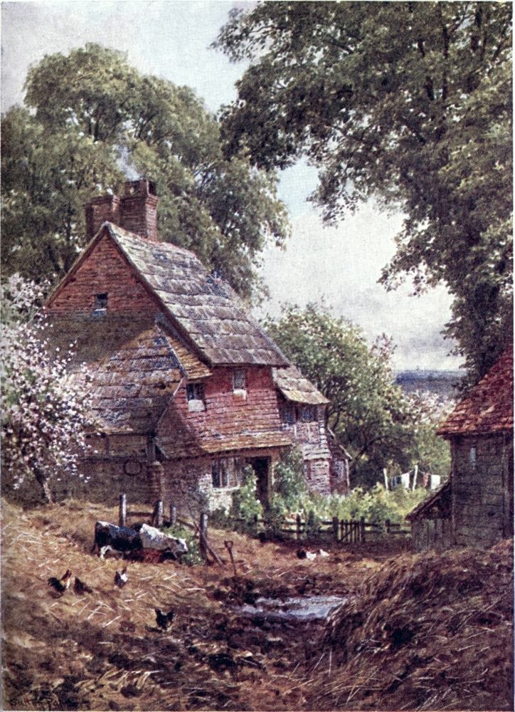
about Woking Junction, a town that has grown up fast in one generation to attract some score thousand people scattered roomily over a parish whose centre of gravity became shifted by the railway. Among its public buildings is one notable for singularity among Surrey pine-woods, a Mohammedan mosque at the south end of a row of brick buildings beside the down line of the railway as it approaches Woking station. This exotic institution was planted by the late Dr. Leitner as a college for Oriental students of different creeds; and at the other end the mosque had or was to have had its juwab in a temple for Hindoo devotions; but since the death of its eclectically pious founder, the enterprise seems to have come to nought.
The amplest stretch of what is called Chobham Common lies some miles away, upon the Berkshire edge. The best way of reaching this from London is to get out at the border station of Sunningdale; then at once one can mount to the common, on this side subdued by its inevitable destiny to be cut up with lines of houses and swept by a fire of golf balls. Due south one has still a fine open walk by sandy tracks and among ragged thickets, making what our fathers called a dreary waste; then come{210} the wooded ridges and peopled hollows of Windlesham, one of Surrey’s most pleasant nooks, that, fortunately for its peacefulness, is not too near a railway station. There is one at Bagshot, to which a path leads over the valley of the Windle, striking into the high-road from Egham beside Bagshot Park, a hunting lodge of former kings, now the seat of H. R. H. the Duke of Connaught. Bagshot, a noted coach station, twenty-six miles from London, that fell into some decay when railways overshadowed roads, has been reviving again in our time. Its chief fame is the nursery gardens of a well-known firm, with its huge holly hedges, the most imposing of which may be sought out above the Church.
Beyond, the road rises on Bagshot Heath, at the “Jolly Farmer,” a mile on, forking for Basingstoke and for Winchester by either side of Crawley Hill. This inn was once known as the “Golden Farmer,” a name connected with Dick Turpin, when the road over Bagshot Heath made a Harley Street of his profession. The then lonely heath has borne a crop of military and other institutions, which people the new town of Camberley in the fork of the roads, its villas also sought as a retreat for “captains and colonels and knights at arms.” The extensive woods on the Berkshire side are pierced{211} by a Roman road, and by a fan of long, straight ridges that look like War Office work, nine of them converging at a point called the Star Post, from which other fine woodland walks go northward to Ascot, westward to Broadmoor and Wellington College—but one must not be tempted to expatiate on this trim wilderness where Hants, Berks, and Surrey meet among the heaths and pine ridges shutting in the Blackwater valley.
The right fork of the high-road soon leads us past the Staff College and Sandhurst into Hampshire, reached by the left fork at Frimley. To keep inside of Surrey, and to have one of the finest walks in the county, I should choose the byroad which at the “Jolly Farmer” turns south along the Chobham ridges. Here, some miles west of Chobham village, rises a sandy bank about 400 feet high, beautifully covered with heath, ferny copses and pine-wood, where one might believe oneself in the Highlands but for the open prospects on either hand. The sides of late years have been cut up by the building of various institutions; and towards the farther end of the four-mile road it is frowned on by War Office notices that trespassers are within range of stray bullets from the Pirbright and Bisley ranges lying below the east side. While{212} firing goes on, there will be a red flag on the bold edge of Windmill Hill, which at the south end of the ridge drops brokenly to the railway and the Basingstoke Canal. This long unfortunate waterway, one understands, is now restored, and to be worked by a new proprietor. But whether full or empty, it gives a very pleasant walk by its bushy banks, often shaded by firs or birchwood, its winding reaches, its sedgy bays and lagoons, and its heathy environment. These features are especially un-canal-like on the first crooked bend beyond Windmill Hill towards Aldershot.
In the other direction, a couple of miles of it leads to Brookwood station, past the Pirbright Camp of the Guards on the opposite side. Behind this lie the ranges of Bisley, where the volunteer camp, transplanted from Wimbledon, blossoms out so gaily and jollily for a July fortnight, during which our amateur soldiers bear warlike hardships, made not too uncomfortable, the worst of it being usually a thunderstorm or two that put whiskered Pandours of Fleet Street to their shifts. The nucleus of permanent buildings appears on a low height north-west of Brookwood station, then, beyond, the ranges run up against the Chobham{213} ridge, where barren banks display the “Hundred Butts” and other groups of targets like that nicknamed “Siberia,” or the sliding course of the “Running Deer,” so familiar to ambitious marksmen. On the north side the knolls of the camp look to the no longer secluded village of Bisley, with its outskirts Donkey Green and West End, growing along the roads towards Bagshot and Windlesham.
On the other side of the railway spreads a great Camp of the Dead, which Londoners will style Woking Cemetery, to the indignation of that lively young town, three or four miles away. The Brookwood burying-ground, belonging to the London Necropolis Company, is the largest in the country, and in beauty grows into competition with some of the elaborate cemeteries of American cities. Laid out half a century ago, on part of a large estate belonging to the Company, it encloses 500 acres of sandy land, which, among its native turf and heather, has been planted with flower-beds, clumps of wood, banks of rhododendrons and other shrubs, that go to disguise the gloomy shadows of the grave. Apart from the division between those who have and have not the right to sleep in consecrated earth, certain areas are allotted to London parishes, or to communities{214} such as the London Bakers, the Foresters’ Society, etc., so that the associations of life are not lost in death; there is an “Actors’ Acre,” as well as an “Oddfellows Acre,” also a last common bivouac for the Chelsea Pensioners and the corps of Commissionaires; fellow-countrymen, too, can lie side by side, and fellow-believers of many a creed: a notable feature, for instance, is the Parsees’ resting-place, so far from their Eastern Towers of Silence. The Company has its own railway station in London, from which special funeral trains convey their mournful freight into the cemetery, all arrangements being carried out with as much reverence as is consistent with the conditions of crowded city life.
About a quarter of a century ago these conditions called forth a movement which will be remembered with respect by future generations. This was the founding of the Cremation Society, and the building of the first British Crematorium near Woking, that, after a delay of doubt and difficulty as to the law, has been in use since 1885 for carrying out in an hour or so, with due decency and complete safety to the living, those chemical processes which, sooner or later, nature will work on us all, however we seek to hinder her slow operation. The late Mr. J. N. Tata, that beneficent Parsee millionaire who{215} was not so rich in rupees as in culture and enlightenment, confessed to me that he looked forward with horror to the vulture burial of his creed, but that he would not indulge his own preference for cremation on account of paining his wife’s feelings. After all, she died a few weeks before his useful life ended, in Europe, and, as it chanced, he came to be buried at Brookwood. Some of the more enlightened of his community, I hear, are considering the question of substituting cremation for their repulsive form of sepulture. Devout Parsees have looked on fire as too sacred for such an office; but the objection of Christians is merely an ignorant prejudice, kept warm by the ashes of mediæval eschatology. The sentiment twining about a quiet country churchyard finds less deep root in a close-packed metropolitan cemetery, haunted by the hideous vulgarity of the undertaker’s art; yet even here thrives a superstition of half-savage regard for that part of us that yesterday made the tissues of a pig or an onion, and to-morrow may be passing into the meanest forms of life. A more truly Christian doctrine would inspire us to take care that our farewell to earth might surely do no harm to any fellow-man.
That prejudice has been so far broken down that{216} several other Crematoriums are now open over the country, two close to London, welcomed by the Cremation Society as taking away much of its business, one by no means worked on commercial principles. In the course of twenty years, over twenty-five hundred bodies were consumed at Woking, many of them names of eminence: travellers like Sir Samuel Baker and Sir Henry Layard; physicians like Sir Benjamin Richardson and Sir Spencer Wells; authors like George Macdonald and W. E. Henley, Eliza Lynn Linton and “Edna Lyall”; artists like Watts and Burne-Jones; philanthropists like Sir Isaac Pitman and Dr. Barnardo; clergymen like H. R. Haweis and Brooke Lambert, all concerned in their last dispositions to set such a good example. Two dukes have been cremated here, with a due proportion of duchesses and other members of the peerage; a judge or two can be counted; and a crowning triumph of the Society would be to get a bishop among its clients. At the outset of the movement one bishop came forward to denounce it, but he was put to silence by a reminder how certain distinguished prelates had been cremated alive, so far back as Queen Mary’s time, with no presumable damage to their souls’ welfare.{217}

As an original supporter of an enterprise that never sought to make money, I need not shrink from giving it bold advertisement. The one valid objection to cremation, that death by poisoning might be undetected, is obviated by the precautions all along insisted upon by the Cremation Society, which, along with its own aims, has advocated such more stringent examination into the cause of death as itself requires in every case. The proceedings are facilitated when, in lifetime, one has expressed a disposition for this kind of funeral. The cost of cremation has now been reduced to a few pounds, becoming lowered as the apparatus was more often used. The Golder’s Green Crematorium has almost extinguished the Society’s, which stands below the Knap Hill Barracks, and above the canal bank, a mile or two out of Woking, just beyond the church of St. John’s Hill. The building includes a chapel, where any religious service desired may be held, this and the final disposal of the remains being left to the friends of the deceased. The body, shrivelled up by a blast of hot air, is turned into a small handful of ashes, which can be preserved in an urn or buried in the ground, when its life is scattered through this world in the undying good or evil a man has helped to do. The Crematorium{218} enclosure has a close-packed show of tiny tombstones and dwarf crosses, that give a strange effect, as of a dolls’ cemetery, so inveterate is the desire for some visible memorial of our loved ones. For my part, I should wish what is not my real self to be thrown out on any of the breezy commons about Woking—
All this fair country has been used for sepulchres since, above the heaths trodden by funeral processions and cheerful warriors of our day, were heaped tumuli where long-forgotten chiefs “quietly rested under the drums and tramplings of three conquests.” The neighbourhood has some notable recent graves, besides those in the great gathering. Over the common to the west of Brookwood Cemetery is reached Pirbright, where, near the east end of the churchyard, Henry Stanley lies at rest beneath a huge block of rough stone, an appropriate monument for him whom the natives styled “stone-breaker,” in admiration of his masterful dealing with difficulties. At Frimley, on the Surrey border, is buried Bret Harte. A little to the south of this, beside Farnborough station, on a wooded hill rises a far-seen dome,{219} miniature of that which covers the great Napoleon at Paris, this one crowning a Benedictine Abbey built to enshrine the tombs of Louis Napoleon and his ill-fated son. On the other side of the line is the home of the Empress who, one might think, had little reason to love sights that should sorrowfully remind her how many a French mother’s son may have been spared through her untimely loss. Yet here this bereaved exile was neighbour to our chief national manufactory of martial death.
To reach Aldershot Camp, one crosses the Blackwater, the parting of Surrey and Hants, where the last great English prize-fight was fought between Sayers and Heenan on a meadow chosen for convenience of dodging either county’s police. The quarters extend for miles about the high-road running on from Farnborough station to Farnham, the North and South Camps being divided by the transverse line of the Canal. The bulk of the Camp is on Hampshire ground, but its ranges shoot into Surrey, where, on the Fox Hills or the Romping Downs, peaceably-minded strangers may be challenged by Roderick Dhus in khaki starting from copse and heath, or find themselves beset by the invisible rattle of skirmishers practising the{220} game of war. Across a projecting tongue of Hants we come back into Surrey again; anyhow, it is not straying far from our theme to take a glance at this great military station.
Aldershot Camp, dating from after the Crimean War, has grown so much in half a century that it now sends out suckers to spring up on more remote commons, like those of Longmoor and Borden towards Selborne, where the soldier is understood to pine, exiled from the joys of Aldershot. His officers are not always much in love with the main camp, if one may judge from military novels like Lockhart’s Doubles and Quits; I have heard subalterns wofully grumbling that they had nothing to do here but work, while their seniors profess to be reminded of Aden rather than of Eden. Of Aldershot as it was in earlier days, we get lively sketches in Mrs. Ewing’s Story of a Short Life, this author having been familiar with the place before lines of barracks had replaced the huts, “like toy boxes of wooden soldiers,” in which it seemed not easy to “put your pretty soldiers away at night when you had done playing with them, and get the lid to shut down.” In that touching story she tells us at what a cost Asholt Camp was constructed.{221}
Take a Highwayman’s Heath. Destroy every vestige of life with fire and axe, from the pine that has longest been a landmark, to the smallest beetle smothered in smoking moss. Burn acres of purple and pink heather, and pare away the young bracken that springs verdant from its ashes. Let flame consume the perfumed gorse in all its glory, and not spare the broom, whose more exquisite yellow atones for its lack of fragrance. In this common ruin be every lesser flower involved: blue beds of speedwell by the wayfarer’s path—the daintier milkwort and rougher red rattle—down to the very dodder that clasps the heather, let them perish and the face of Dame Nature be utterly blackened! Then: shave the heath as bare as the back of your hand, and if you have felled every tree, and left not so much as a tussock of grass or a scarlet toadstool to break the force of the winds; then shall the winds come, from the east and from the west, from the north and from the south, and shall raise on your shaven heath clouds of sand that would not discredit a desert in the heart of Africa. By some such recipe the ground was prepared for that Camp of Instruction.... Bare and dusty are the Parade Grounds, but they are thick with memories. Here were blessed the colours that became a young man’s shroud that they might not be a nation’s shame. Here march and music welcome the coming and speed the parting regiments. On this Parade the rising sun is greeted with gun-fire and trumpet clarions shriller than the cock, and there he sets to a like salute with tuck of drum. Here the young recruit drills, the warrior puts on his medal, the old pensioner steals back to watch them, and the soldiers’ children play—sometimes at fighting or flag-wagging, but oftener at funerals!
Before the Crimean War, this obscure parish had only a few hundred people. The little church{222} above Aldershot station betrays what a small place it originally was that has grown into a large town, its streets alive and alert with the varied uniforms of Mr. T. Atkins, some dozen or score thousand of him in ordinary times. The High Street, like certain more famous thoroughfares, has only one side, facing to the blocks of building and parade grounds of the South Camp on a ridge above the canal. The busier side streets bear such appropriate names as Union, Wellington, Victoria, while the blocks of soldiers’ quarters are inspiringly dubbed Corunna, Talavera, and so forth; and other names of military fame mark the Lines stretching over the canal to the North Camp, which has a station and “bazaar” quarter of its own. On very hot days, indeed, one might mistake parts of the camp for an Indian cantonment, till the eye catches ragged firs bordering this dusty maidan. The Cavalry lie to the west, beside the Winchester high-road, which is a boundary of the permanent barracks, while beyond it summer brings out mushroom-beds of tents for the volunteers and militia temporarily under training. On this side, to the south, opens the Long Valley, haunted by shadows of dust, where the Royal Pavilion makes a station for the Sovereign reviewing the troops in that “awful{223} Campus Martius.” On a knoll in a hollow hereabouts has been hidden the statue of the Great Duke that was laughed off its old perch on the arch at Hyde Park Corner. Farther south, on the right of the high-road, stands out Hungry Hill, and beyond it the bluff called Cæsar’s Camp, from which at a height of 600 feet there is a wide view northwards. Cæsar has other doubtful camps in Surrey, whose border is recrossed on these heights. Hence, by a hedge of public-houses with which Hale tempts the British Grenadier, or through the quiet shades of the Episcopal park, we come down to the hop grounds of Farnham, and across the Wey’s gault beds may gain that other series of commons about Hindhead.
All along this western side of the county sand has been mainly in evidence. Where we cross the chalk, between Aldershot and Farnham, its ridge is so much narrowed and lowered as not to force itself on the notice of unspectacled eyes. This is exceptional, for elsewhere in Surrey nature lays her record open, plain to read, leaf after leaf, only here and there a little crumpled and dog’s-eared at corners by the careless hands of time. So we can see clearly on our next transverse section, made nearer the eastern border.{224}
ALL the main roads running southwards from London would lead with more or less of a circumbendibus to Brighton; and the ideal way for a leisurely traveller might be to pass from one to another on short cross-roads, so as to pick out the best stretches of each. In Paterson’s road-book (1792) the Brighthelmston Road is indicated as going by Croydon, Godstone Green, East Grinstead and Lewes, fifty-nine miles, with a short-cut beyond Godstone by Lindfield, saving seven miles; but it also gives the “New Road” by Sutton, Reigate, and Crawley, fifty-four miles. A newer road by Croydon and Redhill, joining the Reigate route at Povey Cross, so as to save a mile or so, came in our time to bear the name of the Brighton Road par excellence, and was preferred by coaches and cycles, till the crush of Croydon traffic and tramways{225}

drove them back to the Sutton route, even at the cost of facing the steep windings of Reigate Hill.
This road through Sutton and Reigate seems to have been the standard one when the Prince Regent’s patronage made Brighton’s fortune. The lumbering stages of older days took a whole long day to go all the way round by Lewes; but early in the century lighter vehicles began to ply on a shorter route, their wheels soon greased by competition. Among the many faults Cobbett has to find with George IV.’s reign, one is that “great parcels of stock jobbers” live at Brighton with their families, who “skip backwards and forwards on the coaches” to business in the City. He speaks of at least twenty coaches running daily on three or four routes, by which the Brighton resident, “leaving not very early in the morning, reaches London by noon, and starting back two and a half hours after, reaches Brighton not very late at night.” If 7 A.M. would answer to this matutinal worthy’s idea of a not very early start, that allows five hours for a journey recorded to be done once, under William IV., in the exceptionally short time of three hours forty minutes. A more precise writer of Cobbett’s date gives six hours as a good rate for sixteen regular coaches plying all the year—besides eight “butterflies”{226} in summer—the “Times,” the “Regulator,” the “Rocket,” the “Patriot,” the “True Blue,” and so forth. In our own day of coaching revival a record run has been a little under eight hours to Brighton and back, with the disadvantage of more thronged thoroughfares to be traversed at either end. The cyclists’ record seems to be about seven hours for the double journey, which is only a little more than that of an amateur Dick Turpin on horseback. The famous Stock Exchange walk to Brighton was won in nine and a half hours. One can hardly say in what time the motor-car could devour this way, if it got a fair chance and a clear road, as the rail has for its rush of an hour or so. One of the latest appearances on the Brighton road has been a motor omnibus, that modestly professed to take four hours to Brighton. For some time the Post Office has been carrying its heavy traffic this way by a motor vehicle, which once encountered the old-fashioned peril of highway robbery. There has been talk of a special road from London to Brighton, reserved as a track on which such careering vehicles may consume their own dust at their own pace.
The Sutton route is certainly the best in that it soonest brings one out into something like open country. Once clear of tram lines at Tooting or{227} Streatham, roads from the west end and the city converge by Figgs Marsh on the flats of Mitcham. This is a widely straggling sucker of the metropolis which clings to relics of its rustic character, showing clumps of cottages, old inns, and patches of open ground not yet squeezed out of existence, while it has a fame of its own for the manufacture of tobacco and for the culture of aromatic herbs, that are distilled at Carshalton not far off. About several villages around, indeed, the air is perfumed by crops of lavender and peppermint, the essence of which makes an export to France. This neighbourhood had also an old name for walnuts, as mentioned by Fuller; and it still has room for gardens as well as golf ground. Let us trust that only scandal-mongering jealousy prompted a reproach once current among its neighbours:—
It may be that Mitcham got this bad reputation through the gypsies that long hung about it, and other undesirable aliens who gathered to the revels of Mitcham Fair.
Outside of Mitcham, when the road has passed{228} a very pleasant glimpse of the Wandle, it becomes truly rural, running for two or three miles by hedges, trees, and park palings, with as yet few hints of suburban expansion. Yet, truth to tell, this is but a commonplace prospect of Surrey; and the cyclist or pedestrian might do well to make a bend by the left for a more varied route, by Mitcham Common, Hackbridge, and Carshalton, with its old Church and the pond wept over by Ruskin, who would have mourned more loudly had he lived to see its well-timbered park invaded by the builder. Carshalton—spelt Casehorton in Georgian books, Cash-Haulton by Fuller—is one of those places that has a wilful pronunciation of its name, this and the spelling perhaps worn down from Cross Old Town; and it is old enough to figure in King Alfred’s will. Eastwards, by Wallington and Beddington, this choice place of residence almost runs into Croydon, to which a pretty walk may be taken by the bank of the Wandle opposite Beddington Park, where the stately Hall of the Carews, that has entertained Queen Elizabeth, is now an Orphan Asylum, and may be visited on week-day afternoons. In the gardens here it is said that oranges were acclimatised for a century, till an unusually severe frost{229} proved too much for them. The spirit of the nineteenth century turned part of Beddington Park into a sewage farm; but still this vicinity has some pretty peeps not yet blocked out by bricks and mortar.
Even in George I.’s time, Defoe tells us, the edge of the Downs hereabouts, as “the most agreeable spot on all this side of London,” was thickly set with citizens’ houses, some “built with such a Profusion of Expense that they look rather like Seats of the Nobility.” In our day, the merits of a high and dry site have spread building farther on to the chalk heights. Coming by Carshalton, one strikes Sutton in its centre, where beside the railway station the road, till not long ago, was spanned by the sign of the “Cock,” that held out longer than the turnpike gate below it. The high-road runs right through this long place, for two miles or so, first descending then ascending on the chalk slopes, where so many Londoners seek healthy homes that this must be the largest of our scores of South towns, one of the commonest place-names in England. Newtown is still more frequent, and not far behind Sutton comes Weston, whereas Nortons and Eastons appear comparatively rare.
The Sutton of Surrey seems more prosperous{230} than picturesque, its old features overlaid, and its parish monuments packed away into a handsome new Church. But a mile to the west, Cheam has more rural features scattered round a spire below which stands the chancel of the old Church, enshrining some stately monuments; then from this village one can walk on through Nonsuch Park to Ewell on the Epsom road. Cheam is perhaps best known by what seems the oldest private school in England, now a nursery for Eton, but it has passed through various phases, and was at one time kept by the Rev. William Gilpin, whose search for the picturesque came to be caricatured in the tours of Dr. Syntax.
Having cleared the Sutton villadom, about the twelfth milestone from Westminster once more we emerge into the open; yet for a time the green Downs are cumbered by huge institutions, a lunatic asylum, and other blocks of building till lately used as Metropolitan Union schools, whose pupils made an advertisement for Sutton’s salubrity; but one hears that they are now to be devoted to the care of more afflicted wards of our local government. Beyond, on the right, is seen the outlying place called Belmont, that hardly justifies its name. The unshackled wayfarer might bear over the{231} Downs to the left, making for the spire of the pretty village of Banstead, hidden among fine trees. Those who keep the high-road must not forget to turn round, near the crossing of the Epsom Downs line, for a view from the highest point, over 500 feet, looking across the southern suburbs to the dome of St. Paul’s, that may be seen on a clear day, and sometimes, it is said, the eye catches Windsor Castle to the west. Closer at hand are scenes that moved an eighteenth-century poet:—
Here we are fairly on Banstead Downs, stretching to the Epsom racecourse, that seems to have originally come under Banstead’s name. Epsom town lies two or three miles to our right, beyond Nork Park. To the left, on the north side of the Downs, is the park called the “Oaks,” seat of that Lord Derby who founded the race so named. On either side there are alluring byways, like that leading by Banstead along the ridge to Woodmansterne, at whose little Church guide-posts set{232} us on the way back to Carshalton, or into the Chipstead valley, where we might turn down to Purley, or up the valley to regain the high-road at Tadworth by a very pleasant path through Banstead woods and over Burgh Heath.
At Tadworth, where the Chipstead valley line to Tottenham Corner is crossed, the high-road forks, its right branch going to Dorking, its left to Reigate by the spire of Kingswood Church. The Dorking road runs over Banstead Heath and Walton Heath, where, at the height of nearly 600 feet, stands up Walton-on-the-Hill, so called in distinction from Walton low-lying on the Thames. Here there is a wide stretch of real stubbly heath, such as Cobbett would abuse as “villainous,” but the Romans had not such bad taste, who left the remains of a considerable villa to be unearthed on it. Walton Place is said to have been the retreat of Anne of Cleves after her lucky separation from the royal Bluebeard. In our day Walton is perhaps best famed for its excellent golf links. The whole district is a charming jumble of fields and woods among pitted sandhills and wrinkled chalk ridges, where a pedestrian will often be tempted to stray from the open road. A mile or so to the west of Walton,{233}
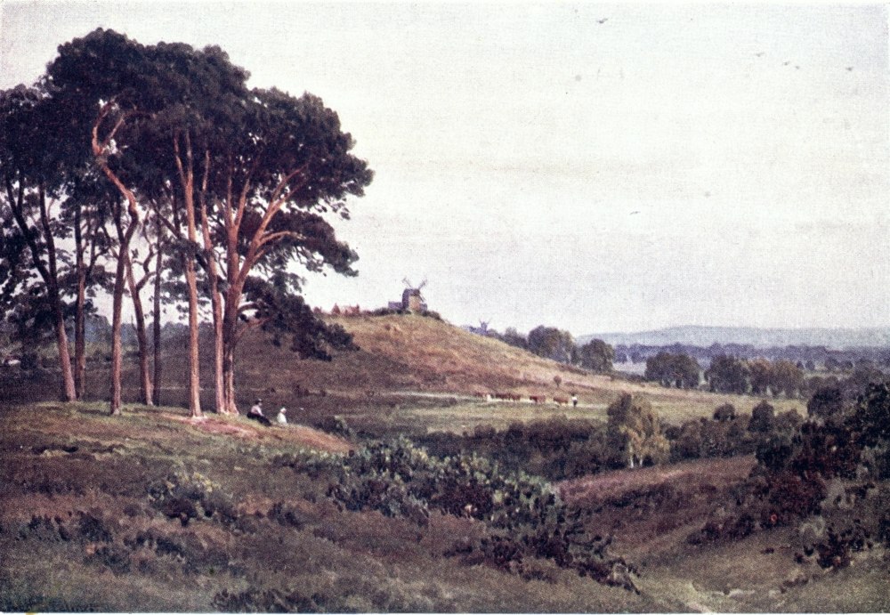
over a wooded hollow, is reached the conspicuous Church of Headley-on-the-Hill, already mentioned as goal of so many footpaths. From this may soon be gained the Roman Road; and southwards, from Walton or Headley, there are pleasant tracks leading to the edge of the Downs to strike the Pilgrims’ Way as it comes to pass above Reigate.
These heaths are skirted by our Brighton highway, which at Gatton Park, about three miles beyond the fork at Tadworth, approaches its grandest point. Through the cutting to lower its level, that gave such strange offence to Cobbett, it suddenly emerges on the steep brow above Reigate, passing under the Suspension Bridge of the Pilgrims’ Way, whence on the left a most leafy lane leads down to Redhill, the modern annexe of Reigate. A footpath runs along the cutting to the end of the Suspension Bridge, where are seats for enjoying the celebrated view from this brow; but from the open turf by the roadside the prospect is hardly diminished, embracing the whole south of the county. The Holmesdale Valley lies at our feet, with Reigate spread out in the foreground, backed by the sand ridge; far away to the east stretches the Weald of Kent; and the{234} towers of East Grinstead stand up to the south-east, across the Sussex border, with Crowborough Beacon beyond. Chanctonbury Ring and the Devil’s Dyke on the Sussex Downs can sometimes be made out to the south. To the west, the Holmesdale Valley is continued between Leith Hill and the Chalk Downs on which we stand; then on that hand the featureless ridge of Hindhead will close the view in fine weather.
The descent to Reigate requires caution, imposed on prudent wheels by its steep turns, and on imprudent ones by the fame of the local police, who have made themselves a terror to scorchers. In the valley, beyond the railway station, the road pierces into the heart of Reigate by the unusual feature of a tunnel beneath the hillock on which stand its Castle ruins and the brand-new block of Municipal Buildings.
Reigate, now so disguised in villas and wooded grounds, and so swollen by the railway growth of Redhill on its east side, is no mere mushroom-bed of London homes, but an old chief town of south-eastern Surrey. Here was built a Norman Castle of the De Warennes, a rival to that of Bletchingley on the sand ridge beyond Redhill. Till the last Reform Bill Reigate had a member of its own,{235} and two in olden days. When membership of Parliament was often felt a burden rather than a privilege, this neighbourhood was but too well represented, Gatton on the Downs above being one of the most notorious rotten boroughs, and Bletchingley another, that made a phosphorescent end with Lord Palmerston as its member.
The nucleus of the place is marked by a gathering of old inns and shops about the cross-roads, above which the site of the Castle has been laid out as a public garden. There is not much of the structure left, the chief sight being the sandstone caves underneath, which tradition, or perhaps no better authority than Tupper’s novel, Stephen Langton, makes the secret meeting-place of the barons conspiring to bring King John on his knees for the signing of Magna Charta. Still older legends haunt these caves, where rude carvings have been attributed to Roman soldiers quartered in them. Under other houses in or about the town there are caves or excavations said to be better worth seeing, but not always open to idle curiosity, one of them, indeed, being used for a rifle gallery. What will be apparent to the passer-by is a pleasant mixture of lawns, gardens, and clumps of fine foliage, among which footpaths lead one in{236} view of these private amenities well displayed on the swells of the valley.
Reigate, then, may prove a spot to “delay the tourist,” certainly for the charms of its situation between the varied features of chalk and sand closely facing each other from either side. On the north a steep ascent leads to the celebrated Beechwood view, from which one may wander along the timbered Downs to Box Hill. Up the valley runs the road to Dorking, going out by Reigate Heath, where on a byway to Leigh is found the curious feature of a windmill turned into a little church. Beyond the town the sand ridge leads eastward to the broken expanse of Earlswood Common; on the west side of the road it is crowned by the clumps and knolls of Reigate Park, open to the public for striking prospects both north and south; and from this enclosure one may hold on along the heights to come upon the Mole winding through one of the most Surreyish corners of Surrey.
The Brighton road mounts straight up the sand hill, deeply cut under the edge of Reigate Park, below which the old Augustinian Priory has been transformed into a mansion, whose late owner, Lady Henry Somerset, made herself a high name both in England and America as a temperance{237} reformer. By path to Redhill along the top of the ridge, or over Earlswood Common on its south side, one can now in a couple of miles strike across to the road through Croydon, soon to converge with that we have followed through Reigate. From Woodhatch, the latter drops on to the Weald, in four miles joining the other road at Povey Cross, twenty-six miles from London. A mile or so more brings us to the edge of Surrey, guarded by a “White Lion,” but no longer marked by the “County Oak,” whose time-seasoned timber has gone to make the screen of Ifield Church.
Henceforth this much travelled road belongs to Sussex. The last stretch of it in Surrey is not its most attractive part, from which, however, one could make a fine diversion among the branches of the Mole to the west, crossing over to the line of Stone Street. But our theme is the Brighton road, on which let us now skim backwards along the main branch viâ Croydon, that, more closely accompanying the Brighton rail, might be chosen by wayfarers bent on business or record-making.
Behind the convergence, this branch leads by the racecourse of Gatwick, then, across the Mole, by the new growth of Horley, that might be called the southernmost of London’s dependencies, if the{238} same thing were not to be said of Brighton; but the old yews by the Church, and the “Chequers” and “Six Bells” inns speak for Horley’s unvillaed antiquity. To carry out the sporting character of the neighbourhood, Horley is headquarters of the Surrey staghounds, and at Burstow, to the east, are the kennels of one of three packs of foxhounds that hunt this edge of the county, where Mr. Jorrocks must have had many a day before he came to his mastership at Handley Spa. To the east here extends a part of the Weald little famed in the tourist world, yet containing such points as Burstow with its monument to Flamsteed, our first Astronomer-Royal; Thunderfield Castle, taken to have been a Saxon fortress; and the old mansion of Smallfield Place, by which the free foot or wheel might wander across to the East Grinstead road.
On the Brighton road itself—where the reader must bear in mind that his head has been turned Londonwards—he finds not much of interest till it comes to switchback over Earlswood Common, between an artificial lake and the palace of the idiot asylum. Thus it mounts the sand ridge, stretching towards Reigate in boldly broken scars and tangled hollows of the red sandstone that{239} gives Redhill its name, here crowned by a circular clump to commemorate the Jubilee of 1897. On the other side this range invites a fine diversion, by either low or high roads, past Nutfield and Bletchingley to Godstone, on whose Green can be joined the road going southwards by Caterham.
Our business-like highway has now nothing for it but a long down and up through the main street of Redhill, in the central depression passing the big Junction and St. Ann’s Schools on the right, where, on the other side, the excrescence of Warwick Town has grown along the cross-road almost into Reigate. When the high-road gets out of Redhill, it is climbing the Downs, reached at Merstham below Gatton Park, and passed by a valley making the course of the Bourne, one of those English wadys so common in chalk countries, which, filled by the overflowing of some subterranean reservoir, may burst out in ravaging floods, as this one has often done. In the same hollow pass is pent up the railway that was apt to be choked by the trains of two lines, till the Brighton Company relieved the pressure by a new conduit from Earlswood to Purley.
The road through Croydon falls into Smitham Bottom, brightened for Londoners by such names as{240} Stoat’s Nest and Hooley Farm, but overshadowed by the great County Asylum on Cane’s Hill, and the buildings that have sprung up about it. By Cane’s Hill opens the Chipstead valley, running up to Kingswood and Walton Heath. On the other side rises the smooth swell of the Farthing or Fairdene Downs, which, with Coulsdon Common beyond, are a pleasure-ground of the City of London, as seems too little known to Londoners, unless it be the Guardsmen from Coulsdon Barracks, whose uniforms may appear as showy dots on the turf slopes, where sometimes hardly a human figure comes in sight over a mile of open prospect. Yet few finer rambles can be found so near London than by mounting from Coulsdon station to the bare top of this ridge, and keeping straight along, to hold on by a woodland lane for Chaldon and the brow of the Downs, with more than one rough path dropping off into the hollow on the left to straggle up again to Coulsdon Common and towards Caterham.
But our road, as Mrs. Gamp philosophically remarks, being born in a vale, must take the consequences of such a situation. It leads us humbly on to the violent outbreak of new houses about Purley, looked down on by the Reedham{241}

Orphanage to the right and the Warehousemen’s and Clerks’ School on Russell Hill to the left. Guide-books remind us how here Horne Tooke wrote his Diversions of Purley; but contemporary Radicals seem not much disposed to seek either amusement or instruction from the works of that philosophic grammarian and agitator. What will interest the present generation more is an effort to preserve Purley Beeches, a fine woodland on the Downs, as pleasure-ground for this fast-growing suburb.
On the east, beyond the railway, beside a face of quarried chalk, opens the Caterham valley, its hollow and its south side much choked up with streets and mansions, strung together by two railway lines; but the north slope opens in the steeps of Riddlesdown, where a thousand acres are preserved as a London park, with tea-gardens and other attractions much in favour with school-treat parties; and in the background, by a path to Warlingham, may perhaps be found a strong encampment of gypsies. The last time I passed that way, on a fine Sunday evening, I came upon a band of “burly chiels and clever hizzies” from the North, actually dancing about a piper—“to give them music was his charge,” as more rigid Scots{242} might quote grimly. The waters by which these cheerful exiles thus forgot the Sabbath songs of their Zion show, in the reservoirs of Kenley and Purley, a strikingly blue tint one guesses to be due to some process for softening their chalky impregnation; and this valley also has a subterranean bourne, to which fond tradition gives a periodicity of seven years. Again a word to the unshackled wanderer: let him pass up by the curving face of Riddlesdown and through the lower part of Caterham, past the Congregational College, then by a track up the Harestone valley, leading to a high brow of the Downs at the War Coppice. The Caterham valley itself is some hundreds of feet above the sea, so no wonder that so many well-to-do Londoners make their nests about what a local guide styles “its cluster of ambrosial hills.”
At Purley begins the long tram line that takes us through Croydon, and on to Norbury by still open spaces, shrinking like Balzac’s Peau de chagrin, where the footpaths that run off to the heights of Norwood may any year be found hedged by houses. Croydon ought to be well equipped with trams, for one of the first in the country was made hence to Wandsworth, the very first, in 1800, belonging to Derbyshire, the contrivance of{243} Benjamin Outram, from whose name Outramways is said to have been playfully derived; but the word tram is of course an old one. There is now only one hiatus, at Streatham, in the electric tram route from the Chalk Downs to the Thames bridges; and that seems like to be bridged over, for Croydon is running into London as fast as its own satellites, Purley, Sanderstead, Thornton Heath, and Beddington are drawn into the growing mass of Croydon.
Croydon has some right to resent its threatened absorption into the metropolis, for, as populous as London was three centuries ago, it is by far the largest independent municipality in Surrey. It was a town of high antiquity, and a main seat of the Archbishops of Canterbury in days when those prelates had a dozen palaces in their diocese. The “Colliers of Croydon” were once well known as burning charcoal in the woods around. Then the town lay mainly to the west of the present main thoroughfare, on low ground about the head-waters of the Wandle. This part has been swept and garnished in our day; and with other old taverns has gone the “King’s Head,” kept by Ruskin’s grandmother. But Croydon has still relics of the past among its smart modern features displayed by{244} electric light round the tower of its Town Hall. At the corner where the chief street is gained from the Central station stands Whitgift’s Hospital, a “haunt of ancient peace” since it was founded by Elizabeth’s archbishop; but it is now threatened with removal or alteration as standing too much in the way of the busy tram line, that seems already to have pushed the Brighton coaches off this road, where Croydon’s “Greyhound” was once a well-known stage. From the crossing at Whitgift’s Hospital, Church Street leads down to Croydon Church, destroyed by fire forty years ago, but reproduced by Sir Gilbert Scott, and containing some of the old monuments saved from that disaster. Close to it may be seen the remains of the Archbishops’ Palace, in part preserved and restored, now, after being turned to base offices, used as an orphanage school under care of the Kilburn Sisters. It is said to have been founded by Lanfranc, and was occupied by a long line of prelates up to George II.’s time.
When this palace was sold in 1780, the proceeds were used to buy Addington Park, on the heights to the east, which became the Archbishops’ country seat till it in turn came to be sold and replaced by a mansion at Canterbury in our time. The park,{245} several miles in circuit, shows a beautiful contrast of fir-woods and heath, recalling Scotland, with the softer features of an English demesne; so one hoped for it to escape the fate of being broken up for building lots, as seems now the doom of its seclusion. But the Addington Hills on the Croydon side, and the bare brow of Shirley, are open, giving a wide view over South London, with the Crystal Palace in the foreground upon the edge of Kent. Into a pretty corner of this county we soon pass by a conspicuous windmill and the high built spire of Shirley Church, outside which, at the east end, may be seen the tomb of Ruskin’s parents, with a characteristic inscription. Kent is entered a mile farther on, at West Wickham.
This is not the only fine point of view about Croydon. Just outside of the town, to the south-east, above Selsdon Road station, the high wooded bank called Crohamhurst is now a public park, about which pleasant footways lead over a country too rapidly being built over. On the other side, beyond the Duppas Hill Park, the Wandle is our guide to half-rural scenes of Waddon and Beddington, already mentioned as we passed by Mitcham.
The main road runs Croydon into Purley, passing the aerodrome station for Paris. A fork of it is the{246} oldest Brighton Road, which leaves the county below East Grinstead. From Croydon it goes by Caterham, dropping through a hollow in the Downs to Godstone Green, with its good old inns, then by Tilburstow Hill, a bold knob of the sand ridge, on to a stretch of the Weald, from which once more it rises to the Forest Ridge of Sussex. But we have already crossed this road at its best points; and fresh scenes will be opened out by taking a more devious line a little to the east, on which articulate guide-posts and more or less articulate men may be consulted to keep one in touch with straighter roads to Brighton.
From the main road, this line diverges by a fork to the left at the “Red Deer,” no longer the south terminus of Croydon trams. Past spreading suburbs it mounts up to Sanderstead, whose pretty Church stands at a height of 500 feet upon a sandy patch, from which our road soon passes on to the chalk tableland. An hour’s sharp walk would bring us to Warlingham above the Caterham valley, where the Church, with its ancient yews, has among other old features a faded fresco of St. Christopher. A mile or two farther on, the chalk is broken by gravel pits and traces of ancient excavation on Worms Heath; then the road rises to 800 feet{247} on Nore Hill, and still higher as by Botley Hill, the unpretending Mount Blanc of the Surrey Downs, about seven miles beyond Croydon, it reaches the sharp drop to Titsey, on the brow where five roads meet, between Tatsfield to the left and Woldingham to the right. This is the point we gained in passing along the edge of the Downs by Harden Park, above the Pilgrims’ Way.
On such a descent the cyclist needs no notice boards as warning to caution. The pedestrian may leave the careful course of the high-road for the steep chalky lane on the right, plunging straight down beside the woods of Titsey Park. Either road brings him by Titsey, across the line of the Pilgrims’ Way, to Limpsfield, a scattered village lying prettily against the farther slope, where the common makes a favourite golf ground. Village is hardly the word for what seems a roomy suburb, spreading itself on the broken ground that has given fine sites for such institutions as the Church Missionary Home and the Caxton Convalescent Home for printers; but here is well shown that scene so frequent around London, a quiet roadside Church and core of old houses beginning to be lost among rows of new ones, even as in{248} many a Surrey graveyard the heavy, flat, weather-worn slabs, under which “the rude forefathers of the hamlet sleep,” are now thrown into shade by a thickening display of choicer and fresher memorials that mark the passing of a more æsthetic generation to its last home.
Here one might turn aside on either hand through fine country. Near the station, shared by Limpsfield with Oxted, to the west of it stands the Church of the latter village, looking up to the Downs, which may be ascended by steep ways. A little beyond this Church is Barrow Green, the summer home of Jeremy Bentham, where he entertained James Mill and his well-taught son. By Oxted, an hour or so’s walk leads westward to Godstone, past or not far from Tandridge and Godstone Churches, both finely restored by Sir Gilbert Scott, who lived here under the brow of Marden Park. His alabaster monument to his wife in Tandridge churchyard, and the view from its ancient yew, are worth a slight bend to the south, bringing one in the latitude of Tilburstow Hill, that rises between Godstone Green and its far-off station; then along that sand ridge one might keep on for half a dozen miles to Redhill. There is a still finer walk to the east of Limpsfield, across{249}
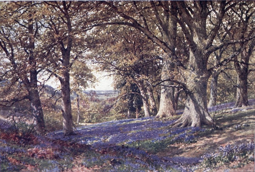
its common, with a windmill and the little Chart Church as landmarks to the left, then up an avenue-like road to Kent Hatch, where the wooded heath of Crockham Hill slopes suddenly to the Kentish Weald. A most beautiful round might be made of this excursion into Kent, by taking the path through Squerryes Park, behind Crockham Hill, to descend into the pretty town of Westerham, with its memories of Wolfe, from which some three miles bring one back over the Surrey border to Limpsfield.
But there still remains to be seen the south-eastern corner of the Surrey Weald, containing some notable sights. For them, from the “Plumbers’ Arms” cross-roads at Limpsfield, let the traveller trace out his way along labyrinthine byroads near the straight course of the L.B. & S.C. rail southward. Three miles on, a little to the west of this line, soon after it has been intersected by the S.E.R., he will find the old-world village of Crowhurst standing up among the remains of Wealden woods. The restored Church has two brasses, and one of the cast-iron tomb-stones common in this Black Country of old days; but its lion is the churchyard yew, taken as the oldest and largest in Surrey, thirty-two feet in girth, its fame sometimes confused{250} with that other great yew’s, that distinguishes likewise the Sussex Crowhurst. The yew-hedged farm close by was the manor-house of the Angell family, whose name revives in the highly respectable but commonplace Angell Road, Brixton. A mile farther south, to the right of the road, lies Crowhurst Place, one of the old moated granges of Surrey, still a delight to the artistic and antiquarian eye. A little more to the south, and rather farther off the road, Moat Farm is another old house to be sought out; and indeed the whole of this district makes a happy hunting-ground for the sketcher or photographer.
The road from Crowhurst goes on with the railway to Lingfield. If one have strayed as far west as the high-road through Godstone, at Blindley Heath a byroad turns off it for Lingfield, to which a footpath leads from Moat Farm. Lingfield is a place of varied note, not least for its quaint timber-fronted houses, and its “Star” inn, a type of hostelry now rare about London. The noble Church, formerly a collegiate one, is to be visited for its show of Cobham monuments and brasses, and other old features. The old College has disappeared; but a modern foundation here is the “Homestead” colony for the afflicted in{251} mind, body, or estate, a praiseworthy effort of the Christian Union for Social Service. Then, as the nettle grows near the dock, Lingfield has its noted racecourse, which may have ruined such lives as that colony strives to reclaim. What looks like a small-pox hospital to the south of Lingfield station turns out to be the Grand Stand and stables that bring noisy crowds to this else peaceful neighbourhood.
On a height to the south of the racecourse stands the last and latest village of Surrey, making a strong contrast with its time-weathered neighbours. This is the group of bungalows originally entitled Bellaggio, which a generation or so ago was built as a sort of co-operative country home for Londoners, standing in its own grounds round the tower of a club-house. The enterprise did not succeed very well; and the place has sought to gain a fresh start under the name of Dormans Park, the club being turned into an hotel, that does good business at the race meetings, and at other times would make a centre for exploring the skirts of Surrey, Kent, and Sussex, here converging. Beyond the grounds, ornamented with wood and water, across a dip rises in Sussex the edge of the Forest sand ridge, where the towers of East{252} Grinstead beacon us to “fresh woods and pastures new” of a county no less beautiful than Surrey.
But the reader must not be led farther afield, when space fails me to do justice to my proper theme. I have said nothing of Farley and Chelsham, that look so finely over Kent from the high and dry north-east corner of Surrey. I have barely mentioned the wooded and parked northern edge of the Downs which, so far back as Defoe’s time, could be spoken of as one line of gentlemen’s houses between Guildford and Leatherhead. I have not said enough of the stretch of broken land between the Wey valley and Leith Hill, nor of picturesque old villages and “greens” hidden among its wild commons and copses. Other points may have been unwillingly or unwittingly passed over, as not readily brought into view from the various routes by which we have crossed nearly every part of Surrey. But enough has been said at least to hint what are the varied leaves of chalk, sand, and clay with which nature makes up such a noble bouquet of landscapes laid at the feet of London.{253}
A, B, C, D, E, F, G, H, J, K, L, M, N, O, P, R, S, T, V, W.
Abinger, 175
Addington Park, 244
Addlestone, 31
Albury, 127
Aldershot, 219
Anningsley, 29
Anstiebury Camp, 164
Ashtead, 157
Bagshot Heath, 210
Banstead, 230
Barn Elms, 52
Barnes, 50
Basingstoke Canal, 85
Battersea, 54
Beddington, 228
Bellaggio, 251
Betchworth, 108
Bisley Camp, 212
Blackdown, 193
Blackheath, 84
Bletchingly, 140
Boating on Thames, 36
Botley Hill, 141
Box Hill, 108, 134
Bramley, 69
Brighton Road, the, 224
Brockham Green, 108
Brookwood, 213
Burford Bridge, 107
Burstow, 238
Byfleet, 85
Camberley, 210
Camilla Lacey, 104
Cane’s Hill, 240
Capel, 110
Carshalton, 228
Caterham, 241
Chaldon, 138
Chalk Downs, the, 5
Chantries Wood, 123
Charlwood, 110
Charterhouse School, 67
Cheam, 230
Chelsham, 252
Chertsey, 28
Chessington, 149
Chiddingfold, 190
Chilworth, 124
Chipstead, 240
Chobham, 204
—— Ridges, 211
Claremont, 94
Cobham, 96
Coldharbour, 164
Compton, 119
Cooper’s Hill, 22
Coulsdon, 240
Cowey Stakes, 35
Cranleigh, 180
Crohamhurst, 245
Crooksbury Hill, 64
Crowhurst, 249
Croydon, 242
Deepdene, 162
Denbies, 133
Devil’s Jumps, 194
—— Punch-bowl, 184{254}
Dorking, 159
Dormans, 251
Earlswood Common, 236
Eashing, 66
Effingham, 84
Egham, 25
Elstead, 64
Ember River, 89
Englefield Green, 23
Epsom, 149
Esher, 91
Evershed’s Rough, 133
Ewell, 147
Ewhurst, 180
Farley, 252
Farnborough, 218
Farnham, 59, 117
Farthing Downs, 240
Felday, 178
“Fold” Country, 181
Footpaths, 20
Frensham, 197
Friday Street, 174
Frimley, 218
Gatton, 136
Gatwick, 237
Gibbet Hill, 188
Godalming, 68
Godstone, 248
Gomshall, 139
Grayshott, 195
Great Bookham, 98
Guildford, 71
Ham House, 44
Hampton Court, 38
Haslemere, 193
Headley-on-the Hill, 158
Hersham, 95
High Down Ball, 70
Hindhead, 183
Hogsback, the, 117
Hogsmill River, 148
Holloway College, 15
Holmbury Hill, 178
Holmesdale Valley, 134
Holmwood, 169
Horley, 237
Horsley, 84
Juniper Hill, 105
Kenley, 242
Kent Hatch, 247
Kew, 48
Kingston-on-Thames, 40
Leatherhead, 99
Leigh, 108
Leith Hill, 167
Limpsfield, 247
Lingfield, 250
London suburbs, 29
“Lonesome,” 12
Long Ditton, 39
Losely, 121
Magna Charta Island, 25
Marden Park, 140
Merstham, 135
Morton, 146
Mickleham, 101
Milford, 70
Mitcham, 227
Mole, the, 87-110
Molesey, 87
Moor Park, 61
Morden, 147
Mortlake, 50
Necropolis, the, 213
Newark Priory, 83
Newdigate, 110
Newlands Corner, 124
Nonsuch Park, 148
Norbury Park, 100
Oakwood, 166
Oatlands Park, 33
Ockham, 83
Ockley, 165{255}
Oxshott, 97
Oxted, 248
Pease Marsh, 70
Peperharow, 66
Petersham, 44
Pilgrims’ Way, 111-143
Pirbright, 83
Pirford, 218
Polesden, 103
Population, 11
Purley, 240
Putney, 53
Puttenham, 118
Ranmore Common, 133
Redhill, 239
Redland Woods, 169
Reigate, 135, 223
Richmond, 44
Riddlesdown, 241
Ripley, 83
Rivers of Surrey, 7, 57
Roman Road, the, 144-166
Rotherhithe, 55
Runnymede, 24
St. Anne’s Hill, 29
St. Catherine’s Chapel, 122
St. George’s Hill, 32
St. Martha’s Chapel, 123
Sanderstead, 246
Sandown Park, 90
Seale, 118
Send, 82
Shalford, 122
Shere, 130
Shirley, 245
Shottermill, 189
“Silent Pool,” the, 129
Stoke D’Abernon, 97
“Stone Street,” 145
Surbiton, 39
Suspension Bridge view, 233
Sutton, 229
Sutton Place, 80
“Swallows” (of the Mole), 100
Tadworth, 232
Tandridge, 248
Tatsfield, 142
Thames, the, 22
Thames Ditton, 39
Thursley, 187
Tilburstow Hill, 248
Tilford, 64
Tillingbourne, the, 127
Titsey, 141
Towns and villages, 12
Virginia Water, 24
Waggoner’s Wells, 195
Wallington, 228
Walton-on-Thames, 35
Walton-on-the-Hill, 232
Wandle, the, 228, 245
Warlingham, 246
Watts Gallery, the, 120
Waverley Abbey, 62
Weald, the, 6
Westcott, 170
Wey River, 58-86
Weybridge, 32
White Hill, 139
Wimbledon, 41
Windlesham, 210
Windsor Park, 24
Wisley, 84
Witley, 189
Witley Common, 199
Woking, 82
Woldingham, 141
“Wolsey’s Tower,” 90
Wonersh, 74
Woodmansterne, 231
Worcester Park, 148
Wotton, 172
Printed in Great Britain by R. & R. Clark, Limited, Edinburgh.