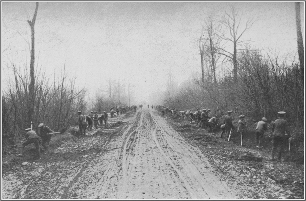
The Road up the Ancre Valley through Aveluy WoodToList
Title: The Old Front Line
Author: John Masefield
Release date: February 18, 2007 [eBook #20616]
Most recently updated: January 1, 2021
Language: English
Other information and formats: www.gutenberg.org/ebooks/20616
Credits: Produced by K Nordquist, David Edwards, Jeannie Howse and
the Online Distributed Proofreading Team at
https://www.pgdp.net
Transcriber's Note:
Inconsistent hyphenation and alternate spelling in the original document have been preserved.
Obvious typographical errors have been corrected in this text.
For a complete list, please see the end of this document.
| FACING PAGE | |
| The Road up the Ancre Valley | 16 |
| Artillery Transport in Bapaume Road | 28 |
| Troops Moving to the Front | 38 |
| An Artillery Team | 40 |
| View in Hamel | 42 |
| The Ancre River | 44 |
| The Ancre Opposite Hamel | 48 |
| The Leipzig Salient | 58 |
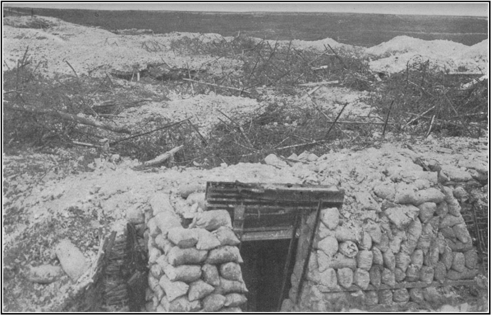
| Dugouts in La Boisselle | 66 |
| La Boisselle | 70 |
| Fricourt | 74 |
| Fricourt | 76 |
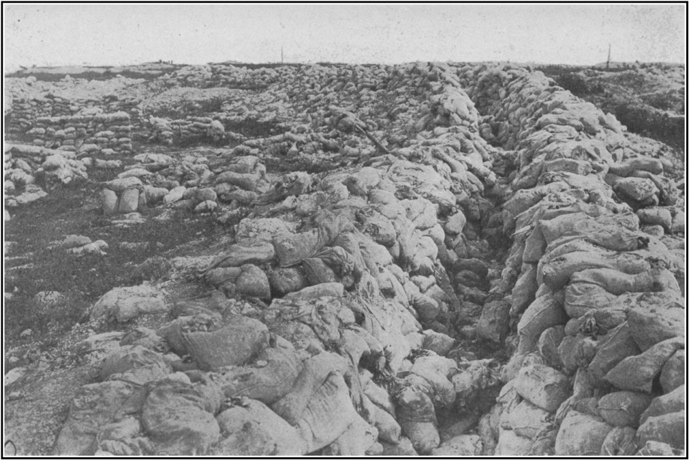
| Sandbags at Fricourt | 78 |
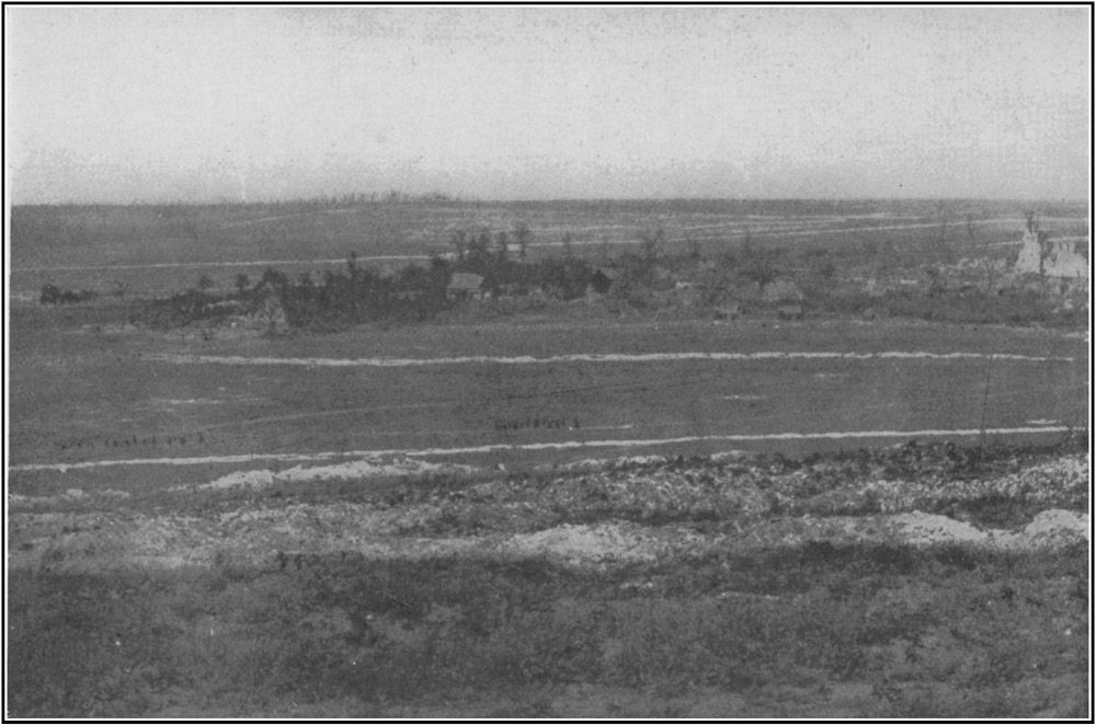
| Mametz | 82 |
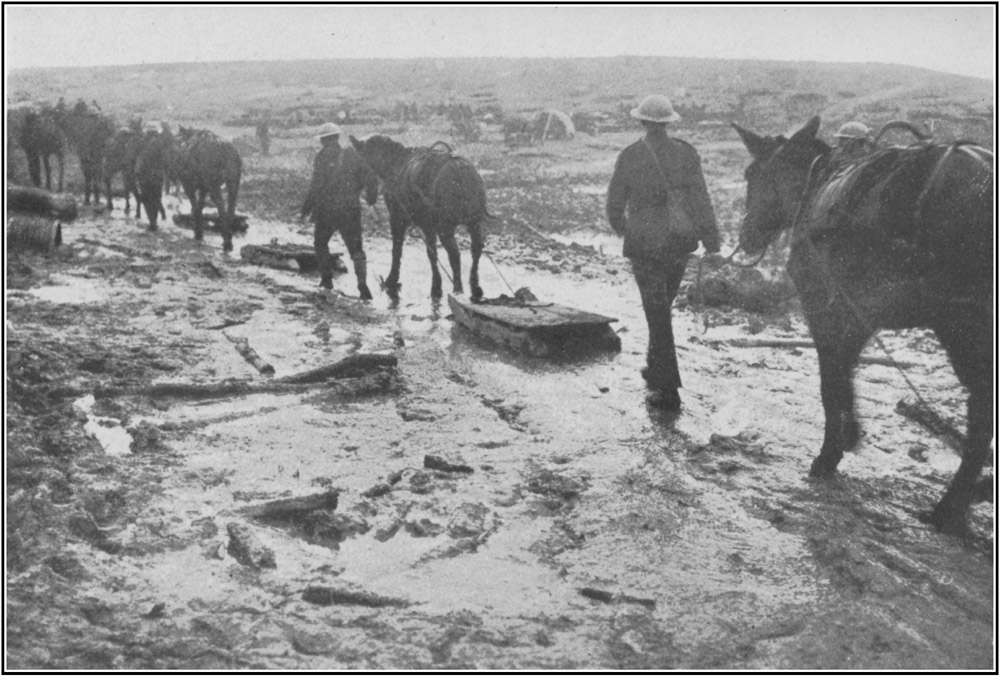
| Sleighs for the Wounded | 88 |
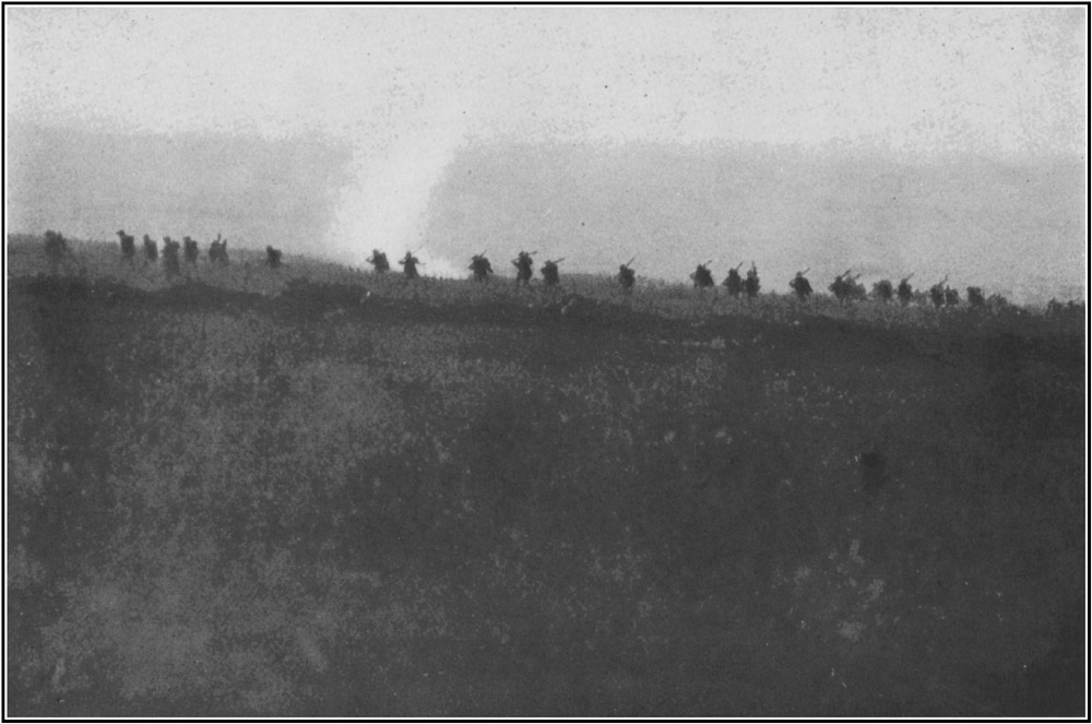
| The Attack on La Boisselle | 94 |
This description of the old front line, as it was when the Battle of the Somme began, may some day be of use. All wars end; even this war will some day end, and the ruins will be rebuilt and the field full of death will grow food, and all this frontier of trouble will be forgotten. When the trenches are filled in, and the plough has gone over them, the ground will not long keep the look of war. One summer with its flowers will cover most of the ruin that man can make, and then these places, from which the driving back of the enemy began, will be hard indeed to trace, even with maps. It is said that even now in some places the wire has been removed, the explosive salved, the trenches filled, and the ground ploughed with tractors. In a few years' time, when this war is a romance in memory, the soldier looking for his battlefield will find his marks gone. Centre Way, Peel Trench, Munster Alley, and these other paths to glory will be deep under the corn, and gleaners will sing at Dead Mule Corner.
10It is hoped that this description of the line will be followed by an account of our people's share in the battle. The old front line was the base from which the battle proceeded. It was the starting-place. The thing began there. It was the biggest battle in which our people were ever engaged, and so far it has led to bigger results than any battle of this war since the Battle of the Marne. It caused a great falling back of the enemy armies. It freed a great tract of France, seventy miles long, by from ten to twenty-five miles broad. It first gave the enemy the knowledge that he was beaten.
Very many of our people never lived to know the result of even the first day's fighting. For then the old front line was the battlefield, and the No Man's Land the prize of the battle. They never heard the cheer of victory nor looked into an enemy trench. Some among them never even saw the No Man's Land, but died in the summer morning from some shell in the trench in the old front line here described.
It is a difficult thing to describe without monotony, for it varies so little. It is like describing the course of the Thames from Oxford to Reading, or of the Severn from Deerhurst to Lydney, or of the Hudson from New York 11to Tarrytown. Whatever country the rivers pass they remain water, bordered by shore. So our front-line trenches, wherever they lie, are only gashes in the earth, fenced by wire, beside a greenish strip of ground, pitted with shell-holes, which is fenced with thicker, blacker, but more tumbled wire on the other side. Behind this further wire is the parapet of the enemy front-line trench, which swerves to take in a hillock or to flank a dip, or to crown a slope, but remains roughly parallel with ours, from seventy to five hundred yards from it, for miles and miles, up hill and down dale. All the advantages of position and observation were in the enemy's hands, not in ours. They took up their lines when they were strong and our side weak, and in no place in all the old Somme position is our line better sited than theirs, though in one or two places the sites are nearly equal. Almost in every part of this old front our men had to go up hill to attack.
If the description of this old line be dull to read, it should be remembered that it was dull to hold. The enemy had the lookout posts, with the fine views over France, and the sense of domination. Our men were down below with no view of anything but of stronghold after stronghold, just up above, being made stronger 12daily. And if the enemy had strength of position he had also strength of equipment, of men, of guns, and explosives of all kinds. He had all the advantages for nearly two years of war, and in all that time our old front line, whether held by the French or by ourselves, was nothing but a post to be endured, day in day out, in all weathers and under all fires, in doubt, difficulty, and danger, with bluff and makeshift and improvisation, till the tide could be turned. If it be dull to read about and to see, it was, at least, the old line which kept back the tide and stood the siege. It was the line from which, after all those months of war, the tide turned and the besieged became the attackers.
To most of the British soldiers who took part in the Battle of the Somme, the town of Albert must be a central point in a reckoning of distances. It lies, roughly speaking, behind the middle of the line of that battle. It is a knot of roads, so that supports and supplies could and did move from it to all parts of the line during the battle. It is on the main road, and on the direct railway line from Amiens. It is by much the most important town within an easy march of the battlefield. It will be, quite certainly, the centre from which, in time to come, travellers 13will start to see the battlefield where such deeds were done by men of our race.
It is not now (after three years of war and many bombardments) an attractive town; probably it never was. It is a small straggling town built of red brick along a knot of cross-roads at a point where the swift chalk-river Ancre, hardly more than a brook, is bridged and so channeled that it can be used for power. Before the war it contained a few small factories, including one for the making of sewing-machines. Its most important building was a big church built a few years ago, through the energy of a priest, as a shrine for the Virgin of Albert, a small, probably not very old image, about which strange stories are told. Before the war it was thought that this church would become a northern rival to Lourdes for the working of miraculous cures during the September pilgrimage. A gilded statue of the Virgin and Child stood on an iron stalk on the summit of the church tower. During a bombardment of the town at a little after three o'clock in the afternoon of Friday, January 15, 1915, a shell so bent the stalk that the statue bent down over the Place as though diving. Perhaps few of our soldiers will remember Albert for anything except this diving Virgin. Perhaps half of the 14men engaged in the Battle of the Somme passed underneath her as they marched up to the line, and, glancing up, hoped that she might not come down till they were past. From some one, French or English, a word has gone about that when she does fall the war will end. Others have said that French engineers have so fixed her with wire ropes that she cannot fall.
From Albert four roads lead to the battlefield of the Somme:
1. In a north-westerly direction to Auchonvillers and Hébuterne.
2. In a northerly direction to Authuille and Hamel.
3. In a north-easterly direction to Pozières.
4. In an easterly direction to Fricourt and Maricourt.
Between the second and the third of these the little river Ancre runs down its broad, flat, well-wooded valley, much of which is a marsh through which the river (and man) have forced more than one channel. This river, which is a swift, clear, chalk stream, sometimes too deep and swift to ford, cuts the English sector of the battlefield into two nearly equal portions.
Following the first of the four roads, one passes the wooded village of Martinsart, to the 15village of Auchonvillers, which lies among a clump of trees upon a ridge or plateau top. The road dips here, but soon rises again, and so, by a flat tableland, to the large village of Hébuterne. Most of this road, with the exception of one little stretch near Auchonvillers, is hidden by high ground from every part of the battlefield. Men moving upon it cannot see the field.
Hébuterne, although close to the line and shelled daily and nightly for more than two years, was never the object of an attack in force, so that much of it remains. Many of its walls and parts of some of its roofs still stand, the church tower is in fair order, and no one walking in the streets can doubt that he is in a village. Before the war it was a prosperous village; then, for more than two years, it rang with the roar of battle and with the business of an army. Presently the tide of the war ebbed away from it and left it deserted, so that one may walk in it now, from end to end, without seeing a human being. It is as though the place had been smitten by the plague. Villages during the Black Death must have looked thus. One walks in the village expecting at every turn to meet a survivor, but there is none; the village is dead; the grass is growing in the street; the bells are 16silent; the beasts are gone from the byre and the ghosts from the church. Stealing about among the ruins and the gardens are the cats of the village, who have eaten too much man to fear him, but are now too wild to come to him. They creep about and eye him from cover and look like evil spirits.
The second of the four roads passes out of Albert, crosses the railway at a sharp turn, over a bridge called Marmont Bridge, and runs northward along the valley of the Ancre within sight of the railway. Just beyond the Marmont Bridge there is a sort of lake or reservoir or catchment of the Ancre overflows, a little to the right of the road. By looking across this lake as he walks northward, the traveller can see some rolls of gentle chalk hill, just beyond which the English front line ran at the beginning of the battle.
A little further on, at the top of a rise, the road passes the village of Aveluy, where there is a bridge or causeway over the Ancre valley. Aveluy itself, being within a mile and a half of enemy gun positions for nearly two years of war, is knocked about, and rather roofless and windowless. A cross-road leading to the causeway across the valley once gave the place some little importance.
17Not far to the north of Aveluy, the road runs for more than a mile through the Wood of Aveluy, which is a well-grown plantation of trees and shrubs. This wood hides the marsh of the river from the traveller. Tracks from the road lead down to the marsh and across it by military causeways.
On emerging from the wood, the road runs within hail of the railway, under a steep and high chalk bank partly copsed with scrub. Three-quarters of a mile from the wood it passes through the skeleton of the village of Hamel, which is now a few ruined walls of brick standing in orchards on a hillside. Just north of this village, crossing the road, the railway, and the river-valley, is the old English front line.
The third of the four roads is one of the main roads of France. It is the state highway, laid on the line of a Roman road, from Albert to Bapaume. It is by far the most used and the most important of the roads crossing the battlefield. As it leads directly to Bapaume, which was one of the prizes of the victory, and points like a sword through the heart of the enemy positions it will stay in the memories of our soldiers as the main avenue of the battle.
The road leaves Albert in a street of dingy 18and rather broken red-brick houses. After passing a corner crucifix it shakes itself free of the houses and rises slowly up a ridge of chalk hill about three hundred feet high. On the left of the road, this ridge, which is much withered and trodden by troops and horses, is called Usna Hill. On the right, where the grass is green and the chalk of the old communication trenches still white and clean, it is called Tara Hill. Far away on the left, along the line of the Usna Hill, one can see the Aveluy Wood.
Looking northward from the top of the Usna-Tara Hill to the dip below it and along the road for a few yards up the opposite slope, one sees where the old English front line crossed the road at right angles. The enemy front line faced it at a few yards' distance, just about two miles from Albert town.
The fourth of the four roads runs for about a mile eastwards from Albert, and then slopes down into a kind of gully or shallow valley, through which a brook once ran and now dribbles. The road crosses the brook-course, and runs parallel with it for a little while to a place where the ground on the left comes down in a slanting tongue and on the right rises steeply into a big hill. The ground of the tongue bears traces of human habitation on it, all much 19smashed and discoloured. This is the once pretty village of Fricourt. The hill on the right front at this point is the Fricourt Salient. The lines run round the salient and the road cuts across them.
Beyond Fricourt, the road leaves another slanting tongue at some distance to its left. On this second tongue the village of Mametz once stood. Near here the road, having now cut across the salient, again crosses both sets of lines, and begins a long, slow ascent to a ridge or crest. From this point, for a couple of miles, the road is planted on each side with well-grown plane-trees, in some of which magpies have built their nests ever since the war began. At the top of the rise the road runs along the plateau top (under trees which show more and more plainly the marks of war) to a village so planted that it seems to stand in a wood. The village is built of red brick, and is rather badly broken by enemy shell fire, though some of the houses in it are still habitable. This is the village of Maricourt. Three or four hundred yards beyond Maricourt the road reaches the old English front line, at the eastern extremity of the English sector, as it was at the beginning of the battle.
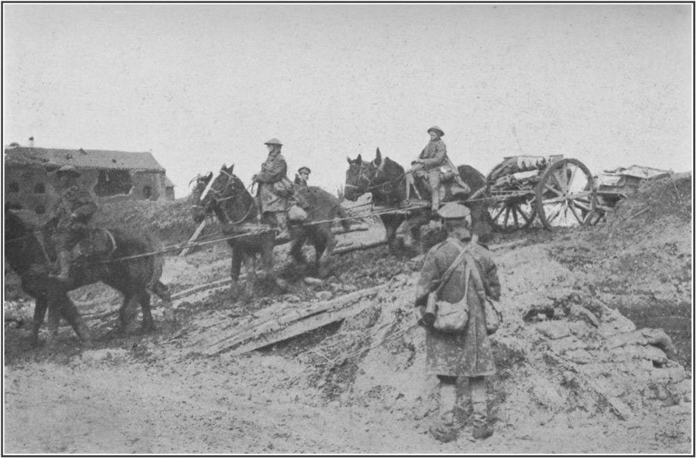
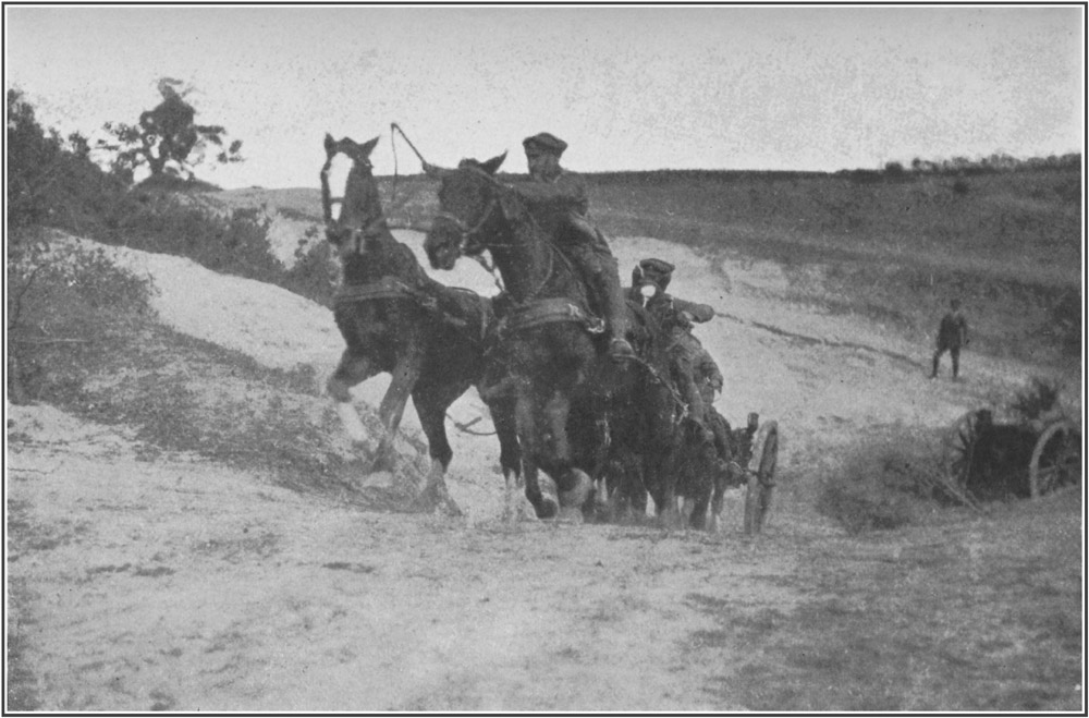
20These four roads which lead to the centre and the wings of the battlefield were all, throughout the battle and for the months of war which preceded it, dangerous by daylight. All could be shelled by the map, and all, even the first, which was by much the best hidden of the four, could be seen, in places, from the enemy position. On some of the trees or tree stumps by the sides of the roads one may still see the "camouflage" by which these exposed places were screened from the enemy observers. The four roads were not greatly used in the months of war which preceded the battle. In those months, the front was too near to them, and other lines of supply and approach were more direct and safer. But there was always some traffic upon them of men going into the line or coming out, of ration parties, munition and water carriers, and ambulances. On all four roads many men of our race were killed. All, at some time, or many times, rang and flashed with explosions. Danger, death, shocking escape and firm resolve, went up and down those roads daily and nightly. Our men slept and ate and sweated and dug and died along them after all hardships and in all weathers. On parts of them, no traffic moved, even at night, so that the grass grew high upon them. Presently, they will be quiet 21country roads again, and tourists will walk at ease, where brave men once ran and dodged and cursed their luck, when the Battle of the Somme was raging.
Then, indeed, those roads were used. Then the grass that had grown on some of them was trodden and crushed under. The trees and banks by the waysides were used to hide batteries, which roared all day and all night. At all hours and in all weathers the convoys of horses slipped and stamped along those roads with more shells for the ever-greedy cannon. At night, from every part of those roads, one saw a twilight of summer lightning winking over the high ground from the never-ceasing flashes of guns and shells. Then there was no quiet, but a roaring, a crashing, and a screaming from guns, from shells bursting and from shells passing in the air. Then, too, on the two roads to the east of the Ancre River, the troops for the battle moved up to the line. The battalions were played by their bands through Albert, and up the slope of Usna Hill to Pozières and beyond, or past Fricourt and the wreck of Mametz to Montauban and the bloody woodland near it. Those roads then were indeed paths of glory leading to the grave.
22During the months which preceded the Battle of the Somme, other roads behind our front lines were more used than these. Little villages, out of shell fire, some miles from the lines, were then of more use to us than Albert. Long after we are gone, perhaps, stray English tourists, wandering in Picardy, will see names scratched in a barn, some mark or notice on a door, some sign-post, some little line of graves, or hear, on the lips of a native, some slang phrase of English, learned long before in the wartime, in childhood, when the English were there. All the villages behind our front were thronged with our people. There they rested after being in the line and there they established their hospitals and magazines. It may be said, that men of our race died in our cause in every village within five miles of the front. Wherever the traveller comes upon a little company of our graves, he will know that he is near the site of some old hospital or clearing station, where our men were brought in from the line.
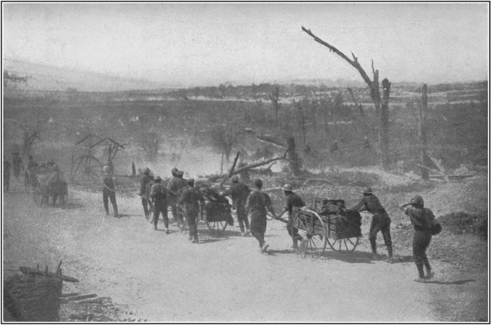
So much for the roads by which our men marched to this battlefield. Near the lines they had to leave the roads for the shelter of some communication trench or deep cut in the mud, revetted at the sides with wire to hinder it from 23collapsing inwards. By these deep narrow roads, only broad enough for marching in single file, our men passed to "the front," to the line itself. Here and there, in recesses in the trench, under roofs of corrugated iron covered with sandbags, they passed the offices and the stores of war, telephonists, battalion headquarters, dumps of bombs, barbed wire, rockets, lights, machine-gun ammunition, tins, jars, and cases. Many men, passing these things as they went "in" for the first time, felt with a sinking of the heart, that they were leaving all ordered and arranged things, perhaps forever, and that the men in charge of these stores enjoyed, by comparison, a life like a life at home.
Much of the relief and munitioning of the fighting lines was done at night. Men going into the lines saw little of where they were going. They entered the gash of the communication trench, following the load on the back of the man in front, but seeing perhaps nothing but the shape in front, the black walls of the trench, and now and then some gleam of a star in the water under foot. Sometimes as they marched they would see the starshells, going up and bursting like rockets, and coming down With a wavering slow settling motion, as white and bright as burning magnesium wire, shedding 24a kind of dust of light upon the trench and making the blackness intense when they went out. These lights, the glimmer in the sky from the enemy's guns, and now and then the flash of a shell, were the things seen by most of our men on their first going in.
In the fire trench they saw little more than the parapet. If work were being done in the No Man's Land, they still saw little save by these lights that floated and fell from the enemy and from ourselves. They could see only an array of stakes tangled with wire, and something distant and dark which might be similar stakes, or bushes, or men, in front of what could only be the enemy line. When the night passed, and those working outside the trench had to take shelter, they could see nothing, even at a loophole or periscope, but the greenish strip of ground, pitted with shell-holes and fenced with wire, running up to the enemy line. There was little else for them to see, looking to the front, for miles and miles, up hill and down dale.
The soldiers who held this old front line of ours saw this grass and wire day after day, perhaps, for many months. It was the limit of their world, the horizon of their landscape, the boundary. What interest there was in their life was the speculation, what lay beyond that 25wire, and what the enemy was doing there. They seldom saw an enemy. They heard his songs and they were stricken by his missiles, but seldom saw more than, perhaps, a swiftly moving cap at a gap in the broken parapet, or a grey figure flitting from the light of a starshell. Aeroplanes brought back photographs of those unseen lines. Sometimes, in raids in the night, our men visited them and brought back prisoners; but they remained mysteries and unknown.
In the early morning of the 1st of July, 1916, our men looked at them as they showed among the bursts of our shells. Those familiar heaps, the lines, were then in a smoke of dust full of flying clods and shards and gleams of fire. Our men felt that now, in a few minutes, they would see the enemy and know what lay beyond those parapets and probe the heart of that mystery. So, for the last half-hour, they watched and held themselves ready, while the screaming of the shells grew wilder and the roar of the bursts quickened into a drumming. Then as the time drew near, they looked a last look at that unknown country, now almost blotted in the fog of War, and saw the flash of our shells, breaking a little further off as the gunners "lifted," and knew that the moment had come. Then for one wild confused moment they knew that they 26were running towards that unknown land, which they could still see in the dust ahead. For a moment, they saw the parapet with the wire in front of it, and began, as they ran, to pick out in their minds a path through that wire. Then, too often, to many of them, the grass that they were crossing flew up in shards and sods and gleams of fire from the enemy shells, and those runners never reached the wire, but saw, perhaps, a flash, and the earth rushing nearer, and grasses against the sky, and then saw nothing more at all, for ever and for ever and for ever.
It may be some years before those whose fathers, husbands and brothers were killed in this great battle, may be able to visit the battlefield where their dead are buried. Perhaps many of them, from brooding on the map, and from dreams and visions in the night, have in their minds an image or picture of that place. The following pages may help some few others, who have not already formed that image, to see the scene as it appears to-day. What it was like on the day of battle cannot be imagined by those who were not there.
It was a day of an intense blue summer beauty, full of roaring, violence, and confusion of death, agony, and triumph, from dawn till 27dark. All through that day, little rushes of the men of our race went towards that No Man's Land from the bloody shelter of our trenches. Some hardly left our trenches, many never crossed the green space, many died in the enemy wire, many had to fall back. Others won across and went further, and drove the enemy from his fort, and then back from line to line and from one hasty trenching to another, till the Battle of the Somme ended in the falling back of the enemy army.
Those of our men who were in the line at Hébuterne, at the extreme northern end of the battlefield of the Somme, were opposite the enemy salient of Gommecourt. This was one of those projecting fortresses or flankers, like the Leipzig, Ovillers, and Fricourt, with which the enemy studded and strengthened his front line. It is doubtful if any point in the line in France was stronger than this point of Gommecourt. Those who visit it in future times may be surprised that such a place was so strong.
All the country there is gentler and less decided than in the southern parts of the battlefield. Hébuterne stands on a plateau-top; to the east of it there is a gentle dip down to a shallow hollow or valley; to the east of this again 28there is a gentle rise to higher ground, on which the village of Gommecourt stood. The church of Gommecourt is almost exactly one mile northeast and by north from the church at Hébuterne; both churches being at the hearts of their villages.
Seen from our front line at Hébuterne, Gommecourt is little more than a few red-brick buildings, standing in woodland on a rise of ground. Wood hides the village to the north, the west, and the southwest. A big spur of woodland, known as Gommecourt Park, thrusts out boldly from the village towards the plateau on which the English lines stood. This spur, strongly fortified by the enemy, made the greater part of the salient in the enemy line. The landscape away from the wood is not in any way remarkable, except that it is open, and gentle, and on a generous scale. Looking north from our position at Hébuterne there is the snout of the woodland salient; looking south there is the green shallow shelving hollow or valley which made the No Man's Land for rather more than a mile. It is just such a gentle waterless hollow, like a dried-up river-bed, as one may see in several places in chalk country in England, but it is unenclosed land, and therefore more open and seemingly on a bigger scale than such a 29landscape would be in England, where most fields are small and fenced. Our old front line runs where the ground shelves or glides down into the valley; the enemy front line runs along the gentle rise up from the valley. The lines face each other across the slopes. To the south, the slope on which the enemy line stands is very slight.
The impression given by this tract of land once held by the enemy is one of graceful gentleness. The wood on the little spur, even now, has something green about it. The village, once almost within the wood, wrecked to shatters as it is, has still a charm of situation. In the distance behind Gommecourt there is some ill-defined rising ground forming gullies and ravines. On these rises are some dark clumps of woodland, one of them called after the nightingales, which perhaps sing there this year, in what is left of their home. There is nothing now to show that this quiet landscape was one of the tragical places of this war.
The whole field of the Somme is chalk hill and downland, like similar formations in England. It has about it, in every part of it, certain features well known to every one who has ever travelled in a chalk country. These features occur even in the gentle, rolling, and not strongly 30marked sector near Hébuterne. Two are very noticeable, the formation almost everywhere of those steep, regular banks or terraces, which the French call remblais and our own farmers lynchets, and the presence, in nearly all parts of the field, of roads sunken between two such banks into a kind of narrow gully or ravine. It is said, that these remblais or lynchets, which may be seen in English chalk countries, as in the Dunstable Downs, in the Chiltern Hills, and in many parts of Berkshire and Wiltshire, are made in each instance, in a short time, by the ploughing away from the top and bottom of any difficult slope. Where two slopes adjoin, such ploughing steepens the valley between them into a gully, which, being always unsown, makes a track through the crops when they are up. Sometimes, though less frequently, the farmer ploughs away from a used track on quite flat land, and by doing this on both sides of the track, he makes the track a causeway or ridge-way, slightly raised above the adjoining fields. This type of raised road or track can be seen in one or two parts of the battlefield (just above Hamel and near Pozières for instance), but the hollow or sunken road and the steep remblai or lynchet are everywhere. One may say that no quarter of a mile of the whole field is without 31one or other of them. The sunken roads are sometimes very deep. Many of our soldiers, on seeing them, have thought that they were cuttings made, with great labour, through the chalk, and that the remblais or lynchets were piled up and smoothed for some unknown purpose by primitive man. Probably it will be found, that in every case they are natural slopes made sharper by cultivation. Two or three of these lynchets and sunken roads cross the shallow valley of the No Man's Land near Hébuterne. By the side of one of them, a line of Sixteen Poplars, now ruined, made a landmark between the lines.
The line continues (with some slight eastward trendings, but without a change in its gentle quiet) southwards from this point for about a mile to a slight jut, or salient in the enemy line. This jut was known by our men as the Point, and a very spiky point it was to handle. From near the Point on our side of No Man's Land, a bank or lynchet, topped along its edge with trees, runs southwards for about a mile. In four places, the trees about this lynchet grow in clumps or copses, which our men called after the four Evangelists, John, Luke, Mark, and Matthew. This bank marks the old English front line between the Point and the Serre Road a 32mile to the south of it. Behind this English line are several small copses, on ground which very gently rises towards the crest of the plateau a mile to the west. In front of most of this part of our line, the ground rises towards the enemy trenches, so that one can see little to the front, but the slope up. The No Man's Land here is not green, but as full of shell-holes and the ruin of battle as any piece of the field. Directly between Serre and the Matthew Copse, where the lines cross a rough lump of ground, the enemy parapet is whitish from the chalk. The whitish parapet makes the skyline to observers in the English line. Over that parapet, some English battalions made one of the most splendid charges of the battle, in the heroic attack on Serre four hundred yards beyond.
To the right of our front at Matthew Copse the ground slopes southward a little, past what may once have been a pond or quarry, but is now a pit in the mud, to the Serre road. Here one can look up the muddy road to the hamlet of Serre, where the wrecks of some brick buildings stand in a clump of tree stumps, or half-right down a God-forgotten kind of glen, blasted by fire to the look of a moor in hell. A few rampikes of trees standing on one side of this glen give the place its name of Ten Tree Alley. 33Immediately to the south of the Serre road, the ground rises into one of the many big chalk spurs, which thrust from the main Hébuterne plateau towards the Ancre Valley. The spur at this point runs east and west, and the lines cross it from north and south. They go up it side by side, a hundred and fifty yards apart, with a greenish No Man's Land between them. The No Man's Land, as usual, is the only part of all this chalk spur that is not burnt, gouged, pocked, and pitted with shell fire. It is, however, enough marked by the war to be bad going. When they are well up the spur, the lines draw nearer, and at the highest point of the spur they converge in one of the terrible places of the battlefield.
For months before the battle began, it was a question here, which side should hold the highest point of the spur. Right at the top of the spur there is one patch of ground, measuring, it may be, two hundred yards each way, from which one can see a long way in every direction. From this patch, the ground droops a little towards the English side and stretches away fairly flat towards the enemy side, but one can see far either way, and to have this power of seeing, both sides fought desperately.
Until the beginning of the war, this spur of 34ground was corn-land, like most of the battlefield. Unfenced country roads crossed it. It was a quiet, lonely, prosperous ploughland, stretching for miles, up and down, in great sweeping rolls and folds, like our own chalk downlands. It had one feature common to all chalk countries; it was a land of smooth expanses. Before the war, all this spur was a smooth expanse, which passed in a sweep from the slope to the plateau, over this crown of summit.
To-day, the whole of the summit (which is called the Redan Ridge), for all its two hundred yards, is blown into pits and craters from twenty to fifty feet deep, and sometimes fifty yards long. These pits and ponds in rainy weather fill up with water, which pours from one pond into another, so that the hill-top is loud with the noise of the brooks. For many weeks, the armies fought for this patch of hill. It was all mined, counter-mined, and re-mined, and at each explosion the crater was fought for and lost and won. It cannot be said that either side won that summit till the enemy was finally beaten from all that field, for both sides conquered enough to see from. On the enemy side, a fortification of heaped earth was made; on our side, castles were built of sandbags filled with 35flint. These strongholds gave both sides enough observation. The works face each other across the ponds. The sandbags of the English works have now rotted, and flag about like the rags of uniform or like withered grass. The flint and chalk laid bare by their rotting look like the grey of weathered stone, so that, at a little distance, the English works look old and noble, as though they were the foundations of some castle long since fallen under Time.
To the right, that is to the southward, from these English castles there is a slope of six hundred yards into a valley or gully. The slope is not in any way remarkable or seems not to be, except that the ruin of a road, now barely to be distinguished from the field, runs across it. The opposing lines of trenches go down the slope, much as usual, with the enemy line above on a slight natural glacis. Behind this enemy line is the bulk of the spur, which is partly white from up-blown chalk, partly burnt from months of fire, and partly faintly green from recovering grass. A little to the right or south, on this bulk of spur, there are the stumps of trees and no grass at all, nothing but upturned chalk and burnt earth. On the battlefield of the Somme, these are the marks of a famous place.
The valley into which the slope descends is a 36broadish gentle opening in the chalk hills, with a road running at right angles to the lines of trenches at the bottom of it. As the road descends, the valley tightens in, and just where the enemy line crosses it, it becomes a narrow deep glen or gash, between high and steep banks of chalk. Well within the enemy position and fully seven hundred yards from our line, another such glen or gash runs into this glen, at right angles. At this meeting place of the glens is or was the village of Beaumont Hamel, which the enemy said could never be taken.
For the moment it need not be described; for it was not seen by many of our men in the early stages of the battle. In fact our old line was at least five hundred yards outside it. But all our line in the valley here was opposed to the village defences, and the fighting at this point was fierce and terrible, and there are some features in the No Man's Land just outside the village which must be described. These features run parallel with our line right down to the road in the valley, and though they are not features of great tactical importance, like the patch of summit above, where the craters are, or like the windmill at Pozières, they were the last things seen by many brave Irish and Englishmen, and cannot be passed lightly by.
37The features are a lane, fifty or sixty yards in front of our front trench, and a remblai or lynchet fifty or sixty yards in front of the lane.
The lane is a farmer's track leading from the road in the valley to the road on the spur. It runs almost north and south, like the lines of trenches, and is about five hundred yards long. From its start in the valley-road to a point about two hundred yards up the spur it is sunken below the level of the field on each side of it. At first the sinking is slight, but it swiftly deepens as it goes up hill. For more than a hundred yards it lies between banks twelve or fifteen feet deep. After this part the banks die down into insignificance, so that the road is nearly open. The deep part, which is like a very deep, broad, natural trench, was known to our men as the Sunken Road. The banks of this sunken part are perpendicular. Until recently, they were grown over with a scrub of dwarf beech, ash, and sturdy saplings, now mostly razed by fire. In the road itself our men built up walls of sandbags to limit the effects of enemy shell fire. From these defences steps cut in the chalk of the bank lead to the field above, where there were machine-gun pits.
The field in front of the lane (where these pits were) is a fairly smooth slope for about 38fifty yards. Then there is the lynchet or remblai, like a steep cliff, from three to twelve feet high, hardly to be noticed from above until the traveller is upon it. Below this lynchet is a fairly smooth slope, so tilted that it slopes down to the right towards the valley road, and slopes up to the front towards the enemy line. Looking straight to the front from the Sunken Road our men saw no sudden dip down at the lynchet, but a continuous grassy field, at first flat, then slowly rising towards the enemy parapet. The line of the lynchet-top merges into the slope behind it, so that it is not seen. The enemy line thrusts out in a little salient here, so as to make the most of a little bulge of ground which was once wooded and still has stumps. The bulge is now a heap and ruin of burnt and tumbled mud and chalk. To reach it our men had to run across the flat from the Sunken Road, slide down the bank of the lynchet, and then run up the glacis to the parapet.
The Sunken Road was only held by our men as an advanced post and "jumping off" (or attacking) point. Our line lay behind it on a higher part of the spur, which does not decline gradually into the valley road, but breaks off in a steep bank cut by our soldiers into a flight of chalk steps. These steps gave to all this part 39of the line the name of Jacob's Ladder. From the top of Jacob's Ladder there is a good view of the valley road running down into Beaumont Hamel. To the right there is a big steep knoll of green hill bulking up to the south of the valley, and very well fenced with enemy wire. All the land to the right or south of Jacob's Ladder is this big green hill, which is very steep, irregular, and broken with banks, and so ill-adapted for trenching that we were forced to make our line further from the enemy than is usual on the front. The front trenches here are nearly five hundred yards apart. As far as the hill-top the enemy line has a great advantage of position. To reach it our men had to cross the open and ascend a slope which gave neither dead ground nor cover to front or flank. Low down the hill, running parallel with the road, is a little lynchet, topped by a few old hawthorn bushes. All this bit of the old front line was the scene of a most gallant attack by our men on the 1st of July. Those who care may see it in the official cinematograph films of the Battle of the Somme.
Right at the top of the hill there is a dark enclosure of wood, orchard, and plantation, with several fairly well preserved red-brick buildings in it. This is the plateau-village of Auchonvillers. On the slopes below it, a couple of 40hundred yards behind Jacob's Ladder, there is a little round clump of trees. Both village and clump make conspicuous landmarks. The clump was once the famous English machine-gun post of the Bowery, from which our men could shoot down the valley into Beaumont Hamel.
The English line goes up the big green hill, in trenches and saps of reddish clay, to the plateau or tableland at the top. Right up on the top, well behind our front line and close to one of our communication trenches, there is a good big hawthorn bush, in which a magpie has built her nest. This bush, which is strangely beautiful in the spring, has given to the plateau the name of the Hawthorn Ridge.
Just where the opposing lines reach the top of the Ridge they both bend from their main north and south direction towards the southeast, and continue in that course for several miles. At the point or salient of the bending, in the old enemy position, there is a crater of a mine which the English sprang in the early morning of the 1st of July. This is the crater of the mine of Beaumont Hamel. Until recently it was supposed to be the biggest crater ever blown by one explosion. It is not the deepest: one or two others near La Boisselle are 41deeper, but none on the Somme field comes near it in bigness and squalor. It is like the crater of a volcano, vast, ragged, and irregular, about one hundred and fifty yards long, one hundred yards across, and twenty-five yards deep. It is crusted and scabbed with yellowish tetter, like sulphur or the rancid fat on meat. The inside has rather the look of meat, for it is reddish and all streaked and scabbed with this pox and with discoloured chalk. A lot of it trickles and oozes like sores discharging pus, and this liquid gathers in holes near the bottom, and is greenish and foul and has the look of dead eyes staring upwards.
All that can be seen of it from the English line is a disarrangement of the enemy wire and parapet. It is a hole in the ground which cannot be seen except from quite close at hand. At first sight, on looking into it, it is difficult to believe that it was the work of man; it looks so like nature in her evil mood. It is hard to imagine that only three years ago that hill was cornfield, and the site of the chasm grew bread. After that happy time, the enemy bent his line there and made the salient a stronghold, and dug deep shelters for his men in the walls of his trenches; the marks of the dugouts are still plain in the sides of the pit. Then, on the 1st of July, 42when the explosion was to be a signal for the attack, and our men waited in the trenches for the spring, the belly of the chalk was heaved, and chalk, clay, dugouts, gear, and enemy, went up in a dome of blackness full of pieces, and spread aloft like a toadstool, and floated, and fell down.
From the top of the Hawthorn Ridge, our soldiers could see a great expanse of chalk downland, though the falling of the hill kept them from seeing the enemy's position. That lay on the slope of the ridge, somewhere behind the wire, quite out of sight from our lines. Looking out from our front line at this salient, our men saw the enemy wire almost as a skyline. Beyond this line, the ground dipped towards Beaumont Hamel (which was quite out of sight in the valley) and rose again sharply in the steep bulk of Beaucourt spur. Beyond this lonely spur, the hills ranked and ran, like the masses of a moor, first the high ground above Miraumont, and beyond that the high ground of the Loupart Wood, and away to the east the bulk that makes the left bank of the Ancre River. What trees there are in this moorland were not then all blasted. Even in Beaumont Hamel some of the trees were green. The trees in the Ancre River Valley made all that 43marshy meadow like a forest. Looking out on all this, the first thought of the soldier was that here he could really see something of the enemy's ground.
It is true, that from this hill-top much land, then held by the enemy, could be seen, but very little that was vital to the enemy could be observed. His lines of supply and support ran in ravines which we could not see; his batteries lay beyond crests, his men were in hiding places. Just below us on the lower slopes of this Hawthorn Ridge he had one vast hiding place which gave us a great deal of trouble. This was a gully or ravine, about five hundred yards long, well within his position, running (roughly speaking) at right angles with his front line. Probably it was a steep and deep natural fold made steeper and deeper by years of cultivation. It is from thirty to forty feet deep, and about as much across at the top; it has abrupt sides, and thrusts out two forks to its southern side. These forks give it the look of a letter Y upon the maps, for which reason both the French and ourselves called the place the "Ravin en Y" or "Y Ravine." Part of the southernmost fork was slightly open to observation from our lines; the main bulk of the gully was invisible to us, except from the air.
44Whenever the enemy has had a bank of any kind, at all screened from fire, he has dug into it for shelter. In the Y Ravine, which provided these great expanses of banks, he dug himself shelters of unusual strength and size. He sank shafts into the banks, tunnelled long living rooms, both above and below the gully-bottom, linked the rooms together with galleries, and cut hatchways and bolting holes to lead to the surface as well as to the gully. All this work was securely done, with balks of seasoned wood, iron girders, and concreting. Much of it was destroyed by shell fire during the battle, but much not hit by shells is in good condition to-day even after the autumn rains and the spring thaw. The galleries which lead upwards and outwards from this underground barracks to the observation posts and machine-gun emplacements in the open air, are cunningly planned and solidly made. The posts and emplacements to which they led are now, however, (nearly all) utterly destroyed by our shell fire.
In this gully barracks, and in similar shelters cut in the chalk of the steeper banks near Beaumont Hamel, the enemy could hold ready large numbers of men to repel an attack or to make a counter-attack. They lived in these dugouts in comparative safety and in moderate comfort. 45When our attacks came during the early months of the battle, they were able to pass rapidly and safely by these underground galleries from one part of the position to another, bringing their machine guns with them. However, the Ravine was presently taken and the galleries and underground shelters were cleared. In one underground room in that barracks, nearly fifty of the enemy were found lying dead in their bunks, all unwounded, and as though asleep. They had been killed by the concussion of the air following on the burst of a big shell at the entrance.
One other thing may be mentioned about this Hawthorn Ridge. It runs parallel with the next spur (the Beaucourt spur) immediately to the north of it, then in the enemy's hands. Just over the crest of this spur, out of sight from our lines, is a country road, well banked and screened, leading from Beaucourt to Serre. This road was known by our men as Artillery Lane, because it was used as a battery position by the enemy. The wrecks of several of his guns lie in the mud there still. From the crest in front of this road there is a view to the westward, so wonderful that those who see it realize at once that the enemy position on the Ridge, which, at a first glance, seems badly sited for 46observation, is, really, well placed. From this crest, the Ridge-top, all our old front line, and nearly all the No Man's Land upon it, is exposed, and plainly to be seen. On a reasonably clear day, no man could leave our old line unseen from this crest. No artillery officer, correcting the fire of a battery, could ask for a better place from which to watch the bursts of his shells. This crest, in front of the lane of enemy guns, made it possible for the enemy batteries to drop shells upon our front line trenches before all the men were out of them at the instant of the great attack.
The old English line runs along the Hawthorn Ridge-top for some hundreds of yards, and then crosses a dip or valley, which is the broad, fanshaped, southern end of a fork of Y Ravine. A road runs, or ran, down this dip into the Y Ravine. It is not now recognisable as a road, but the steep banks at each side of it, and some bluish metalling in the shell holes, show that one once ran there. These banks are covered with hawthorn bushes. A remblai, also topped with hawthorn, lies a little to the north of this road.
From this lynchet, looking down the valley into the Y Ravine, the enemy position is saddle-shaped, low in the middle, where the Y Ravine 47narrows, and rising to right and left to a good height. Chalk hills from their form often seem higher than they really are, especially in any kind of haze. Often they have mystery and nearly always beauty. For some reason, the lumping rolls of chalk hill rising up on each side of this valley have a menace and a horror about them. One sees little of the enemy position from the English line. It is now nothing but a track of black wire in front of some burnt and battered heapings of the ground, upon which the grass and the flowers have only now begun to push. At the beginning of the battle it must have been greener and fresher, for then the fire of hell had not come upon it; but even then, even in the summer day, that dent in the chalk leading to the Y Ravine must have seemed a threatening and forbidding place.
Our line goes along the top of the ridge here, at a good distance from the enemy line. It is dug on the brow of the plateau in reddish earth on the top of chalk. It is now much as our men left it for the last time. The trench-ladders by which they left it are still in place in the bays of the trenches. All the outer, or jumping-off, trenches, are much destroyed by enemy shell fire, which was very heavy here from both sides of the Ancre River. A quarter of a mile to the 48southeast of the Y Ravine the line comes within sight of the great gap which cuts the battlefield in two. This gap is the valley of the Ancre River, which runs here beneath great spurs of chalk, as the Thames runs at Goring and Pangbourne. On the lonely hill, where this first comes plainly into view, as one travels south along the line, there used to be two bodies of English soldiers, buried once, and then unburied by the rain. They lay in the No Man's Land, outside the English wire, in what was then one of the loneliest places in the field. The ruin of war lay all round them.
There are many English graves (marked, then, hurriedly, by the man's rifle thrust into the ground) in that piece of the line. On a windy day, these rifles shook in the wind as the bayonets bent to the blast. The field testaments of both men lay open beside them in the mud. The rain and the mud together had nearly destroyed the little books, but in each case it was possible to read one text. In both cases, the text which remained, read with a strange irony. The one book, beside a splendid youth, cut off in his promise, was open at a text which ran, "And Moses was learned in all the wisdom of the Egyptians and mighty in word and in deed." The other book, beside one who had been killed 49in an attack which did not succeed at the moment, but which led to the falling back of the enemy nation from many miles of conquered ground, read even more strangely. It was open at the eighty-ninth Psalm, and the only legible words were, "Thou hast broken down all his hedges; thou hast brought his strong holds to ruin."
From the hill-top where these graves are the lines droop down towards the second of the four roads, which runs here in the Ancre valley parallel with the river and the railway. The slope is steep and the ground broken with shallow gullies and lynchets. Well down towards the river, just above the road, a flattish piece of land leads to a ravine with steep and high banks. This flattish land, well within the enemy line, was the scene of very desperate fighting on the 1st of July.
Looking at the enemy line in front of our own line here, one sees little but a gentle crest, protected by wire, in front of another gentle crest, also wired, with other gentle crests beyond and to the left. To the right there is a blur of gentle crests behind tree-tops. It is plain from a glance that gullies run irregularly into the spurs here, and make the defence easy. All through the fighting here, it happened too often 50that the taking of one crest only meant that the winners were taken in flank by machine guns in the crest beyond, and (in this bit of the line) by other guns on the other side of the river.
Well to the back of the English line here, on the top of the plateau, level with Auchonvillers, some trees stand upon the skyline, with the tower of a church, battered, but not destroyed, like the banner of some dauntless one, a little to the west of the wood. The wood shows marks of shelling, but nothing like the marks on the woods attacked by our own men. There are signs of houses among the trees, and the line of a big wood to the east of them.
This church and the buildings near it are parts of Mesnil village, most of which lies out of sight on the further side of the crest. They are conspicuous landmarks, and can be made out from many parts of the field. The chalk scarp on which they stand is by much the most beautiful thing on the battlefield, and the sight of Mesnil church tower on the top of it is most pleasant. That little banner stood all through the war, and not all the guns of the enemy could bring it down. Many men in the field near Mesnil, enduring the mud of the thaw, and the lice, wet, and squalor of dugouts near the front, were cheered by that church tower. "For all 51their bloody talk the bastards couldn't bring it down."
The hill with the lines upon it slopes steeply down to the valley of the Ancre. Just where the lines come to the valley, the ground drops abruptly, in a cliff or steep bank, twenty-five feet high, to the road.
Our line on this slope covers the village of Hamel, which lies just behind the line, along the road and on the hill-slopes above it. The church and churchyard of Hamel, both utterly ruined, lie well up the hill in such a position that they made good posts from which our snipers could shoot across the river at men in the Schwaben Redoubt. Crocuses, snowdrops, and a purple flower once planted on the graves of the churchyard, but now escaped into the field, blossomed here in this wintry spring, long before any other plant on the battlefield was in bud.
Hamel in peace time may have contained forty houses, some shatters of which still stand. There are a few red-brick walls, some frames of wood from which the plaster has been blown, some gardens gone wild, fruit trees unpruned and more or less ragged from fire, and an air of desecration and desertion. In some of the ruins there are signs of use. The lower 52windows are filled with sandbags, the lower stories are strengthened with girders and baulks. From the main road in the valley, a country track or road, muddy even for the Somme, leads up the hill, through the heart of the village, past the church, towards our old line and Auchonvillers.
Not much can be seen from the valley road in Hamel, for it is only a few feet above the level of the river-bed, which is well grown with timber not yet completely destroyed. The general view to the eastward from this low-lying road is that of a lake, five hundred yards across, in some wild land not yet settled. The lake is shallow, blind with reeds, vivid with water-grass, and lively with moor-fowl. The trees grow out of the water, or lie in it, just as they fell when they were shot. On the whole, the trees just here, though chipped and knocked about, have not suffered badly; they have the look of trees, and are leafy in summer. Beyond the trees, on the other side of the marsh, is the steep and high eastern bank of the Ancre, on which a battered wood, called Thiepval Wood, stands like an army of black and haggard rampikes. But for this stricken wood, the eastern bank of the Ancre is a gentle, 53sloping hill, bare of trees. On the top of this hill is the famous Schwaben Redoubt.
The Ancre River and the marshy valley through which it runs are crossed by several causeways. One most famous causeway crosses just in front of Hamel on the line of the old Mill Road. The Mill from which it takes its name lies to the left of the causeway on a sort of green island. The wheel, which is not destroyed, still shows among the ruins. The enemy had a dressing station there at one time.
The marshy valley of the Ancre splits up the river here into several channels besides the mill stream. The channels are swift and deep, full of exquisitely clear water just out of the chalk. The marsh is rather blind with snags cut off by shells. For some years past the moor-fowl in the marsh have been little molested. They are very numerous here; their cries make the place lonely and romantic.
When one stands on this causeway over the Ancre one is almost at the middle point of the battlefield, for the river cuts the field in two. Roughly speaking, the ground to the west of the river was the scene of containing fighting, the ground to the east of the river the scene of 54our advance. At the eastern end of the causeway the Old Mill Road rises towards the Schwaben Redoubt.
All the way up the hill the road is steep, rather deep and bad. It is worn into the chalk and shows up very white in sunny weather. Before the battle it lay about midway between the lines, but it was always patrolled at night by our men. The ground on both sides of it is almost more killed and awful than anywhere in the field. On the English or south side of it, distant from one hundred to two hundred yards, is the shattered wood, burnt, dead, and desolate. On the enemy side, at about the same distance, is the usual black enemy wire, much tossed and bunched by our shells, covering a tossed and tumbled chalky and filthy parapet. Our own old line is an array of rotted sandbags, filled with chalkflint, covering the burnt wood. One need only look at the ground to know that the fighting here was very grim, and to the death. Near the road and up the slope to the enemy the ground is littered with relics of our charges, mouldy packs, old shattered scabbards, rifles, bayonets, helmets curled, torn, rolled, and starred, clips of cartridges, and very many graves. Many of the graves 55are marked with strips of wood torn from packing cases, with pencilled inscriptions, "An unknown British Hero"; "In loving memory of Pte. ——"; "Two unknown British heroes"; "An unknown British soldier"; "A dead Fritz." That gentle slope to the Schwaben is covered with such things.
Passing these things, by some lane through the wire and clambering over the heaps of earth which were once the parapet, one enters the Schwaben, where so much life was spent. As in so many places on this old battlefield, the first thought is: "Why, they were in an eyrie here; our fellows had no chance at all." There is no wonder, then, that the approach is strewn with graves. The line stands at the top of a smooth, open slope, commanding our old position and the Ancre Valley. There is no cover of any kind upon the slope except the rims of the shell-holes, which make rings of mud among the grass. Just outside the highest point of the front line there is a little clump of our graves. Just inside there is a still unshattered concrete fortlet, built for the machine gun by which those men were killed.
All along that front trench of the Schwaben, lying on the parapet, half buried in the mud, are the belts of machine guns, still full of 56cartridges. There were many machine guns on that earthen wall last year. When our men scrambled over the tumbled chalky line of old sandbags, so plain just down the hill, and came into view on the slope, running and stumbling in the hour of the attack, the machine gunners in the fortress felt indeed that they were in an eyrie, and that our fellows had no chance at all.
For the moment one thinks this, as the enemy gunners must have thought it; then, looking up the hill at the inner works of the great fort, the thought comes that it was not so happy a fate to have to hold this eyrie. Sometimes, in winter storms, the Atlantic is heaved aloft and tossed and tumbled under an evil heaven till all its wilderness is hideous. This hill-top is exactly as though some such welter of water had suddenly become mud. It is all heaped and tossed and tumbled as though the earth there had been a cross-sea. In one place some great earth wave of a trench has been bitten into and beaten back and turned blind into an eddy by great pits and chasms and running heaps. Then in another place, where the crown of the work once reared itself aloft over the hill, the heaps of mud are all blurred and pounded together, so that there is no design, no trace, no 57visible plan of any fortress, only a mess of mud bedevilled and bewildered. All this mess of heaps and hillocks is strung and filthied over with broken bodies and ruined gear. There is nothing whole, nor alive, nor clean, in all its extent; it is a place of ruin and death, blown and blasted out of any likeness to any work of man, and so smashed that there is no shelter on it, save for the one machine gunner in his box. On all that desolate hill our fire fell like rain for days and nights and weeks, till the watchers in our line could see no hill at all, but a great, vague, wreathing devil of darkness in which little sudden fires winked and glimmered and disappeared.
Once in a lull of the firing a woman appeared upon the enemy parapet and started to walk along it. Our men held their fire and watched her. She walked steadily along the whole front of the Schwaben and then jumped down into her trench. Many thought at the time that she was a man masquerading for a bet, but long afterwards, when our men took the Schwaben, they found her lying in the ruins dead. They buried her there, up on the top of the hill. God alone knows who she was and what she was doing there.
Looking back across the Ancre from the 58Schwaben the hill of the right bank of the river is clear from the woods near Mesnil to Beaucourt. All along that graceful chalk hill our communication trenches thrust up like long white mole-runs, or like the comb of rollers on a reef. At right angles to these long white lines are black streaks which mark the enemy's successive front lines. The later ones are visibly more ragged than those near our old line.
There are few more lonely places than that scene of old battles. One may stand on the Schwaben for many days together and look west over the moor, or east over the wilderness, without seeing any sign of human life, save perhaps some solitary guarding a dump of stores.
The hill on which the Schwaben is built is like a great thumb laid down beside the Ancre River. There is a little valley on its eastern side exactly like the space between a great thumb and a great forefinger. It is called Crucifix Valley, from an iron Calvary that stood in it in the early days of the war. It must once have been a lovely and romantic glen, strangely beautiful throughout. Even now its lower reach between a steep bank of scrub and Thiepval Wood is as lovely as a place can be after the passing of a cyclone. Its upper 59reach, which makes the eastern boundary of the Schwaben, is as ghastly a scene of smash as the world can show. It is nothing but a collection of irregular pools dug by big shells during months of battle. The pools are long enough and deep enough to dive into, and full to overflowing with filthy water. Sometimes the pressure of the water bursts the mud banks of one of these pools and a rush of water comes, and the pools below it overflow, and a noise of water rises in that solitude which is like the mud and water of the beginning of the world before any green thing appeared.
Our line runs across this Crucifix Valley in a strong sandbag barricade. The enemy line crosses it higher up in a continuation of the front line of the Schwaben. As soon as the lines are across the valley they turn sharply to the south at an important point.
The Schwaben spur is like a thumb; Crucifix Valley is like the space between a thumb and a forefinger. Just to the east of Crucifix Valley a second spur thrusts away down to the south like a forefinger. It is a long sloping spur, wooded at the lower end. It is known on the maps as Thiepval Hill or the Leipzig Salient. When the lines turn to the south after crossing Crucifix Valley they run along the side of this 60hill and pass out of sight round the end. The lines are quite regular and distinct. From the top of the Schwaben it looks as though the side of the hill were fenced into a neat green track or racecourse. This track is the No Man's Land, which lies like a broad green regular stripe between brown expanses along the hillside. All this hill was of the greatest importance to the enemy. It was as strong an eyrie as the Schwaben; it turned and made very dangerous our works in front of Hamel; and it was the key to a covered way to the plateau from which all these spurs thrust southward.
It is a bolder, more regular spur than the others which thrust from this plateau. The top slopes so slightly as to be almost level, the two flanks are rather steep.
Right at the top of it, just where it springs from the plateau, much where the knuckle of the imagined hand would be, and perhaps five hundred yards east from our old sandbag barricade in Crucifix Valley, there is a redness in the battered earth and upon the chalk of the road. The redness is patchy over a good big stretch of this part of the spur, but it is all within the enemy lines and well above our own. Where the shattered hillside slopes towards our lines there are many remnants of trees, some of 61them fruit trees arranged in a kind of order behind the burnt relics of a hedge, others dotted about at random. All are burnt, blasted, and killed. One need only glance at the hill on which they stand to see that it has been more burnt and shell-smitten than most parts of the lines. It is as though the fight here had been more than to the death, to beyond death, to the bones and skeleton of the corpse which was yet unkillable. This is the site of the little hill village of Thiepval, which once stood at a cross-roads here among apple orchards and the trees of a park. It had a church, just at the junction of the roads, and a fine seigneurial château, in a garden, beside the church; otherwise it was a little lonely mean place, built of brick and plaster on a great lonely heap of chalk downland. It had no importance and no history before the war, except that a Seigneur of Thiepval is mentioned as having once attended a meeting at Amiens. It was of great military importance at the time of the Battle of the Somme. In the old days it may have had a beauty of position.
It is worth while to clamber up to Thiepval from our lines. The road runs through the site of the village in a deep cutting, which may have once been lovely. The road is reddish with the smashed bricks of the village. Here 62and there in the mud are perhaps three courses of brick where a house once stood, or some hideous hole bricked at the bottom for the vault of a cellar. Blasted, dead, pitted stumps of trees, with their bark in rags, grow here and there in a collection of vast holes, ten feet deep and fifteen feet across, with filthy water in them. There is nothing left of the church; a big reddish mound of brick, that seems mainly powder round a core of cement, still marks where the château stood. The château garden, the round village pond, the pine-tree which was once a landmark there, are all blown out of recognition.
The mud of the Somme, which will be remembered by our soldiers long after they have forgotten the shelling, was worse at Thiepval than elsewhere, or, at least, could not have been worse elsewhere. The road through Thiepval was a bog, the village was a quagmire. Near the château there were bits where one sank to the knee. In the great battle for Thiepval, on the 26th of last September, one of our Tanks charged an enemy trench here. It plunged and stuck fast and remained in the mud, like a great animal stricken dead in its spring. It was one of the sights of Thiepval during the winter, 63for it looked most splendid; afterwards, it was salved and went to fight again.
From this part of Thiepval one can look along the top of the Leipzig Spur, which begins here and thrusts to the south for a thousand yards.
There are two big enemy works on the Leipzig Spur: one, well to the south of the village, is (or was, for it is all blown out of shape) a six-angled star-shaped redoubt called the Wonder Work; the other, still further to the south, about a big, disused, and very evil-looking quarry, towards the end of the spur, is, or was, called the Leipzig Salient, or, by some people, the Hohenzollern, from the Hohenzollern Trench, which ran straight across the spur about halfway down the salient.
In these two fortresses the enemy had two strong, evil eyries, high above us. They look down upon our line, which runs along the side of the hill below them. Though, in the end, our guns blasted the enemy off the hill, our line along that slope was a costly one to hold, since fire upon it could be observed and directed from so many points—from the rear (above Hamel), from the left flank (on the Schwaben and near Thiepval), and from the hill itself. 64The hill is all skinned and scarred, and the trace of the great works can no longer be followed. At the top of the hill, in the middle of a filthy big pool, is a ruined enemy trench-mortar, sitting up like a swollen toad.
At the end of the spur the lines curve round to the east to shut in the hill. A grass-grown road crosses the lines here, goes up to the hill-top, and then along it. The slopes at this end of the hill are gentle, and from low down, where our lines are, it is a pleasant and graceful brae, where the larks never cease to sing and where you may always put up partridges and sometimes even a hare. It is a deserted hill at this time, but for the wild things. The No Man's Land is littered with the relics of a charge; for many brave Dorsetshire and Wiltshire men died in the rush up that slope. On the highest point of the enemy parapet, at the end of the hill, is a lonely white cross, which stands out like a banner planted by a conquerer. It marks the grave of an officer of the Wilts, who was killed there, among the ruin, in the July attack.
Below the lines, where the ground droops away toward the river, the oddly shaped, deeply-vallied Wood of Authuille begins. It 65makes a sort of socket of woodland so curved as to take the end of the spur.
It is a romantic and very lovely wood, pleasant with the noise of water and not badly damaged by the fighting. The trees are alive and leafy, the shrubs are pushing, and the spring flowers, wood anemones, violets, and the oxlip (which in this country takes the place of the primrose and the cowslip) flower beautifully among the shell-holes, rags, and old tins of war. But at the north-eastern end it runs out in a straggling spinney along the Leipzig's east flank, and this horn of wood is almost as badly shattered as if the shell fire upon it had been English. Here the enemy, fearing for his salient, kept up a terrible barrage. The trees are burnt, ragged, unbarked, topped, and cut off short, the trenches are blown in and jumbled, and the ground blasted and gouged.
Standing in the old English front line just to the north of Authuille Wood, one sees the usual slow gradual grassy rise to the dark enemy wire. Mesnil stands out among its trees to the left; to the right is this shattered stretch of wood, with a valley beyond it, and a rather big, steep, green hill topped by a few trees beyond the valley. The jut of the Leipzig 66shuts out the view to the flanks, so that one can see little more than this.
The Leipzig, itself, like the Schwaben, is a hawk's nest or eyrie. Up there one can look down by Authuille Wood to Albert church and chimneys, the uplands of the Somme, the Amiens road, down which the enemy marched in triumph and afterwards retreated in a hurry, and the fair fields that were to have been the booty of this war. Away to the left of this is the wooded clump of Bécourt, and, beyond it, One Tree Hill with its forlorn mound, like the burial place of a King. On the right flank is the Ancre Valley, with the English position round Hamel like an open book under the eye; on the left flank is the rather big, steep, green hill, topped by a few trees, before mentioned. These trees grow in and about what was once the village of Ovillers-la-Boisselle. The hill does not seem to have a name; it may be called here Middle Finger Hill or Ovillers Hill.
Like the Schwaben and the Leipzig Hills this hill thrusts out from the knuckle of the big chalk plateau to the north of it like the finger of a hand, in this case the middle finger. It is longer and less regularly defined than the Leipzig Hill; because instead of ending, it merges into other hills not quite so high. The valley 67which parts it from the Leipzig is steeply sided, with the banks of great lynchets. The lines cross the valley obliquely and run north and south along the flank of this hill, keeping their old relative positions, the enemy line well above our own, so that the approach to it is up a glacis.
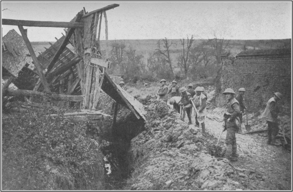
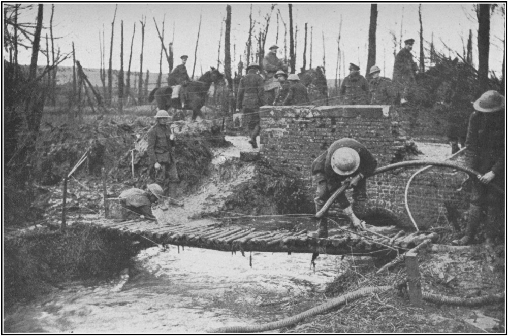
Dug-outs and barbed wire in La Boisselle. Usna-Tara
Hill, with English Support Lines in Background.
At Extreme Left is the
Albert-Bapaume RoadToList
As one climbs up along our old line here, the great flank of Ovillers Hill is before one in a noble, bare sweep of grass, running up to the enemy line. Something in the make of this hill, in its shape, or in the way it catches the light, gives it a strangeness which other parts of the battlefield have not. The rise between the lines of the trenches is fully two hundred yards across, perhaps more. Nearly all over it, in no sort of order, now singly, now in twos or threes, just as the men fell, are the crosses of the graves of the men who were killed in the attack there. Here and there among the little crosses is one bigger than the rest, to some man specially loved or to the men of some battalion. It is difficult to stand in the old English line from which those men started without the feeling that the crosses are the men alive, still going forward, as they went in the July morning a year ago.
Just within the enemy line, three-quarters of 68the way up the hill, there is a sort of small flat field about fifty yards across where the enemy lost very heavily. They must have gathered there for some rush and then been caught by our guns.
At the top of the hill the lines curve to the southeast, drawing closer together. The crest of the hill, such as it is, was not bitterly disputed here, for we could see all that we wished to see of the hill from the eastern flank. Our line passes over the spur slightly below it, the enemy line takes in as much of it as the enemy needed. From it, he has a fair view of Albert town and of the country to the east and west of it, the wooded hill of Bécourt, and the hill above Fricourt. From our line, we see his line and a few tree-tops. From the eastern flank of the hill, our line gives a glimpse of the site of the village of Ovillers-la-Boisselle, once one of the strong places of the enemy, and now a few heaps of bricks, and one spike of burnt ruin where the church stood.
Like most Picardy villages, Ovillers was compactly built of red brick along a country road, with trees and orchards surrounding it. It had a lofty and pretentious brick church of a modern type. Below and beyond it to the east is a long and not very broad valley which 69lies between the eastern flank of Ovillers Hill and the next spur. It is called Mash Valley on the maps. The lines go down Ovillers Hill into this valley and then across it.
Right at the upper end of this valley, rather more than a mile away, yet plainly visible from our lines near Ovillers, at the time of the beginning of the battle, were a few red-brick ruins in an irregular row across the valley-head.
A clump of small fir and cypress trees stood up dark on the hill at the western end of this row, and behind the trees was a line of green hill topped with the ruins of a windmill. The ruins, now gone, were the end of Pozières village, the dark trees grew in Pozières cemetery, and the mill was the famous windmill of Pozières, which marked the crest that was one of the prizes of the battle. All these things were then clearly to be seen, though in the distance.
The main hollow of the valley is not remarkable except that it is crossed by enormous trenches and very steeply hedged by a hill on its eastern flank. This eastern hill which has such a steep side is a spur or finger of chalk thrusting southward from Pozières, like the ring-finger of the imagined hand. Mash Valley curves round its finger-tip, and just at 70the spring of the curve the third of the four Albert roads crosses it, and goes up the spur towards Pozières and Bapaume. The line of the road, which is rather banked up, so as to be a raised way, like so many Roman roads, can be plainly seen, going along the spur, almost to Pozières. In many places, it makes the eastern skyline to observers down in the valley.
Behind our front line in this Mash Valley is the pleasant green Usna Hill, which runs across the hollow and shuts it in to the south. From this hill, seamed right across with our reserve and support trenches, one can look down at the enemy position, which crosses Mash Valley in six great lines all very deep, strong, and dug into for underground shelter.
Standing in Mash Valley, at the foot of Ring Finger Spur, just where the Roman Road starts its long rise to Pozières, one sees a lesser road forking off to the right, towards a village called Contalmaison, a couple of miles away. The fork of the road marks where our old front line ran. The trenches are filled in at this point now, so that the roads may be used, but the place was once an exceedingly hot corner. In the old days, all the space between the two roads at the fork was filled with the village or hamlet of La Boisselle, which, though a tiny 71place, had once a church and perhaps a hundred inhabitants. The enemy fortified the village till it was an exceedingly strong place. We held a part of the village cemetery. Some of the broken crosses of the graves still show among the chalk here.
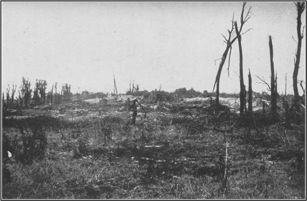
Photograph showing the Scene of the Successful British Advance at La Boisselle, taken from the British Front LineToList
To the left of the Roman Road, only a stone's throw from this ruined graveyard, a part of our line is built up with now rotting sandbags full of chalk, so that it looks like a mound of grey rocks. Opposite the mound, perhaps a hundred yards up the hill, is another, much bigger, irregular mound, of chalk that has become dirty, with some relics of battered black wire at its base. The space between the two mounds is now green with grass, though pitted with shell-holes, and marked in many places with the crosses of graves. The space is the old No Man's Land, and the graves are of men who started to charge across that field on the 1st of July. The big grey mound is the outer wall or casting of a mine thirty yards deep in the chalk and a hundred yards across, which we sprang under the enemy line there on that summer morning, just before our men went over.
La Boisselle, after being battered by us in our attack, was destroyed by enemy fire after 72we had taken it, and then cleared by our men who wished to use the roads. It offers no sight of any interest; but just outside it, between the old lines, there is a stretch of spur, useful for observation, for which both sides fought bitterly. For about 200 yards, the No Man's Land is a succession of pits in the chalk where mines have been sprung. Chalk, wire, stakes, friends, and enemies seem here to have been all blown to powder.
The lines cross this debated bit, and go across a small, ill-defined bulk of chalk, known as Chapes Spur, on the top of which there is a vast heap of dazzlingly white chalk, so bright that it is painful to look at. Beyond it is the pit of a mine, evenly and cleanly blown, thirty-five yards deep, and more than a hundred yards across, in the pure chalk of the upland, as white as cherry blossom. This is the finest, though not the biggest, mine in the battlefield. It was the work of many months, for the shafts by which it was approached began more than a quarter of a mile away. It was sprung on the 1st of July as a signal for the attack. Quite close to it are the graves of an officer and a sergeant, both English, who were killed in the attack a few minutes after that chasm in the 73chalk had opened. The sergeant was killed while trying to save his officer.
The lines bend down south-eastward from Chapes Spur, and cross a long, curving, shallow valley, known as Sausage Valley, famous, later in the battle, as an assembly place for men going up against Pozières. Here the men in our line could see nothing but chalk slope to right, left, or front, except the last tree of La Boisselle, rising gaunt and black above the line of the hill. Just behind them, however, at the foot of the Sausage Valley they had a pleasant wooded hill, the hill of Bécourt, which was for nearly two years within a mile of the front line, yet remained a green and leafy hill, covered with living trees, among which the château of Bécourt remained a habitable house.
The lines slant in a south-easterly direction across the Sausage Valley; they mount the spur to the east of it, and proceed, in the same direction, across a bare field, like the top of a slightly tilted table, in the long slope down to Fricourt. Here, the men in our front lines could see rather more from their position. In front of them was a smooth space of grass slightly rising to the enemy lines two hundred yards away. Behind the enemy lines is a grassy space, and 74behind this, there shows what seems to be a gully or ravine, beyond which the high ground of another spur rises, much as the citadel of an old encampment rises out of its walled ditch. This high ground of this other spur is not more than a few feet above the ground near it, but it is higher; it commands it. All the high ground is wooded. To the southern or lower end of it the trees are occasional and much broken by fire. To the northern or upper end they grow in a kind of wood though all are much destroyed. Right up to the wood, all the high ground bears traces of building; there are little tumbles of bricks and something of the colour of brick all over the pilled, poxed, and blasted heap that is so like an old citadel. The ravine in front of it is the gully between the two spurs; it shelters the sunken road to Contalmaison; the heap is Fricourt village, and the woodland to the north is Fricourt Wood. A glance is enough to show that it is a strong position.
To the left of Fricourt, the spur rises slowly into a skyline. To the right the lines droop down the spur to a valley, across a brook and a road in the valley, and up a big bare humping chalk hill placed at right angles to the spur on which Fricourt stands.
The spur on which Fricourt stands and the 75spur down which the lines run both end at the valley in a steep drop. Just above the steep fall our men fought very hard to push back the enemy a little towards Fricourt, so that he might not see the lower part of the valley, or be able to enfilade our lines on the other side of it. For about three hundred yards here the space between the lines is filled with the craters of mines exploded under the enemy's front line. In some cases, we seized and held the craters; in others the craters were untenable by either side. Under one of those held by us it was found that the enemy had sunk a big counter-mine, which was excavated and ready for charging at the time of the beginning of the battle, when Fricourt fell. This part of the line is more thickly coated with earth than most of the chalk hills of the battlefield. The craters lie in a blown and dug up wilderness of heaps of reddish earth, pocked with shell-holes, and tumbled with wire. The enemy lines are much broken and ruined, their parapets thrown down, the mouths of their dugouts blown in, and their pride abased.
The Fricourt position was one of the boasts of the enemy on this front. Other places on the line, such as the Leipzig, the Schwaben, and the trenches near Hamel, were strong, because 76they could be supported by works behind them or on their flanks. Fricourt was strong in itself, like Gommecourt. It was perhaps the only place in the field of which it could be said that it was as strong as Gommecourt. As at Gommecourt, it had a good natural glacis up to the front line, which was deep, strong, and well wired. Behind the front line was a wired second line, and behind that, the rising spur on which the village stood, commanding both with machine-gun emplacements.
Fricourt was not captured by storm, but swiftly isolated and forced to surrender. It held out not quite two days. It was the first first-rate fortress taken by our men from the enemy in this engagement. In the ruins, they saw for the first time the work which the enemy puts into his main defences, and the skill and craft with which he provides for his comfort. For some weeks, the underground arrangements of Fricourt, the stairs with wired treads, the bolting holes, the air and escape shafts, the living rooms with electric light, the panelled walls, covered with cretonnes of the smartest Berlin patterns, the neat bunks and the signs of female visitors, were written of in the press, so that some may think that Fricourt was better fitted than other places on the line. It is not so. 77The work at Fricourt was well done, but it was no better than that at other places, where a village with cellars in it had to be converted into a fortress. Our men took Fricourt at the beginning of the battle, in a fair state of preservation. Such work was then new to our men, and this good example was made much of.
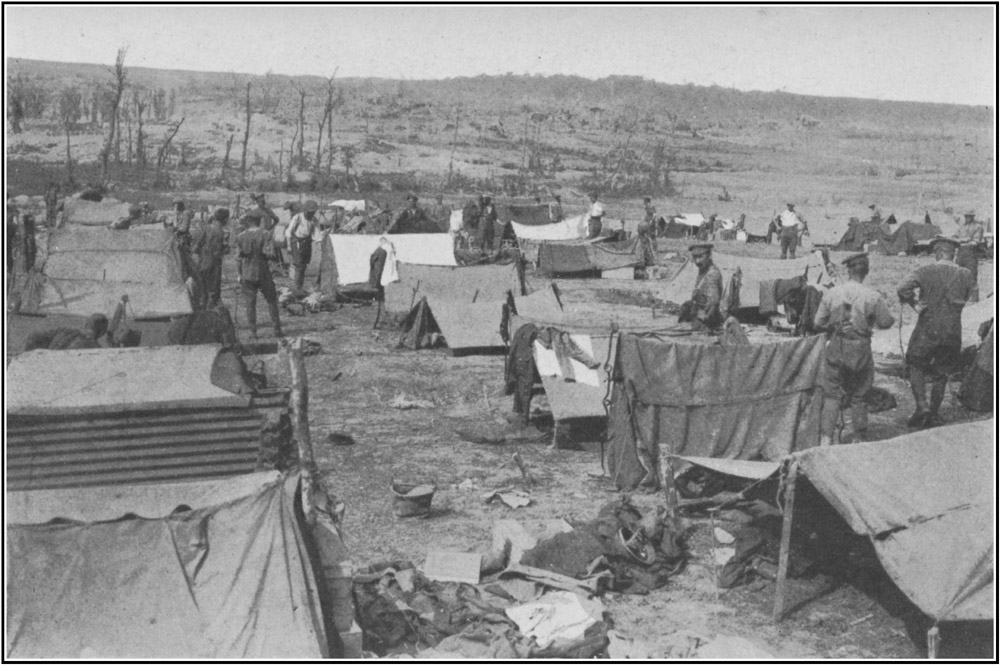
Looking at Fricourt and Fricourt Wood. Troops bivouac for a Short Rest under Ground Sheets laced togetherToList
In the valley below the village, in great, deep, and powerfully revetted works, the enemy had built himself gun emplacements, so weighted with timber balks that they collapsed soon after his men ceased to attend them. The line of these great works ran (as so many of his important lines have run) at the foot of a steep bank or lynchet, so that at a little distance the parapet of the work merged into the bank behind it and was almost invisible.
This line of guns ran about east and west across the neck of the Fricourt Salient, which thrust still further south, across the little valley and up the hill on the other side.
Our old line crosses the valley just to the east of the Fricourt Station on the little railway which once ran in the valley past Fricourt and Mametz to Montauban. It then crossed the fourth of the roads from Albert, at Fricourt cemetery, which is a small, raised forlorn garden of broken tombs at cross-roads, under 78the hill facing Fricourt. Here our line began to go diagonally up the lower slopes of the hill. The enemy line climbed it further to the east, round the bulging snout of the hill, at a steep and difficult point above the bank of a sunken road. Towards the top of the hill the lines converged.
All the way of the hill, the enemy had the stronger position. It was above us almost invisible and unguessable, except from the air, at the top of a steep climb up a clay bank, which in wet weather makes bad going even for the Somme; and though the lie of the ground made it impossible for him to see much of our position, it was impossible for us to see anything or his or to assault him. The hill is a big steep chalk hill, with contours so laid upon it that not much of it can be seen from below. By looking to the left from our trenches on its western lower slopes one can see nothing of Fricourt, for the bulge of the hill's snout covers it. One has a fair view of the old English line on the smoothish big slope between Fricourt and Bécourt, but nothing of the enemy stronghold. One might have lived in those trenches for nearly two years without seeing any enemy except the rain and mud and lice.
Up at the top of the hill, there is an immense 79prospect over the eastern half of the battlefield, and here, where the lines converge, it was most necessary for us to have the crest and for the enemy to keep us off it. The highest ground is well forward, on the snout, and this point was the only part of the hill which the enemy strove to keep. His line goes up the hill to the highest point, cuts off the highest point, and at once turns eastward, so that his position on the hill is just the northern slope and a narrow line of crest. It is as though an army holding Fleet Street against an army on the Embankment and in Cheapside should have seized Ludgate Hill to the top of the steps of St. Paul's and left the body of the cathedral to its opponent. The lines securing this important salient are of immense strength and intricacy, with many great avenues of approach. The front line is double across the greater part of the crest, and behind it is a very deep, strong, trebly wired support line which is double at important points.
Our old front line runs almost straight across the crest parallel with the enemy front line, and distant from it from forty to one hundred and fifty yards. The crest or highest ground is on both flanks of the hill-top close to the enemy line. Between the lines at both these points are the signs of a struggle which raged 80for weeks and months for the possession of those lumps of hill, each, perhaps, two hundred yards long, by fifty broad, by five high. Those fifteen feet of height were bartered for with more than their own weight of sweat and blood; the hill can never lose the marks of the struggle.
In those two patches of the hill the space between the lines is a quarry of confluent craters, twenty or thirty yards deep, blown into and under each other till the top of the hill is split apart. No man can now tell which of all these mines were sunk by our men. The quarry runs irregularly in heaps and hollows of chalk and red earth mingled like flesh and blood. On our side of the pits the marks of our occupation are plain. There in several places, as at La Boisselle and on the Beaucourt spur, our men have built up the parapet of our old front line by thousands of sandbags till it is a hill-top or cairn from which they could see beyond. The sandbags have rotted and the chalk and flints within have fallen partly through the rags, and Nature has already begun to change those heaps to her own colours, but they will be there for ever as the mark of our race. Such monuments must be as lasting as Stonehenge. Neither the mines nor the guns of the enemy could destroy them. From among 81them our soldiers peered through the smoke of burning and explosions at the promised land which the battle made ours.
From those heaps there is a wide view over that part of the field. To the left one sees Albert, the wooded clump of Bécourt, and a high green spur which hides the Sausage Valley. To the front this green spur runs to the higher ground from which the Fricourt spur thrusts. On this higher ground, behind Fricourt and its wood, is a much bigger, thicker, and better grown wood, about a mile and a half away; this is the wood of Mametz. Some short distance to the left of this wood, very plainly visible on the high, rather bare hill, is a clump of pollarded trees near a few heaps of red brick. The trees were once the shade-giving trees about the market-place of Contalmaison, a hamlet at a cross-roads at this point. Behind these ruins the skyline is a kind of ridge which runs in a straight line, broken in one place by a few shatters of trees. These trees are the remains of the wood which once grew outside the village of Pozières. The ridge is the Albert-Bapaume Road, here passing over the highest ground on its path.
Turning from these distant places and looking to the right, one sees, just below, twelve 82hundred yards to the east of Fricourt, across the valley at the foot of this hill of the salient, the end of an irregular spur, on which are the shattered bricks of the village of Mametz before mentioned.
To the north of Mametz the ground rises. From the eyrie of the salient one can look over it and away to the north to big rolling chalk land, most of it wooded. Mametz Wood is a dark expanse to the front; to the right of it are other woods, Bazentin Woods, Big and Little, and beyond them, rather to the right and only just visible as a few sticks upon the skyline, are two other woods, High Wood, like a ghost in the distance, and the famous and terrible Wood of Delville. High Wood is nearly five miles away and a little out of the picture. The other wooded heights are about three miles away. All that line of high ground marked by woods was the enemy second line, which with a few slight exceptions was our front line before the end of the third week of the battle.
From this hill-top of the salient the lines run down the north-eastern snout of the hill and back across the valley, so as to shut in Mametz. Then they run eastward for a couple of miles, up to and across a plateau in front of the hamlet of Carnoy, which was just 83within our line. From our line, in this bare and hideous field, little could be seen but the slope up to the enemy line. At one point, where the road or lane from Carnoy to Montauban crossed the enemy line, there was a struggle for the power to see, and as a result of the struggle mines and counter-mines were sprung here till the space between the lines is now a chaos of pits and chasms full of water. The country here is an expanse of smoothish tilted slopes, big, empty, and lonely, and crossed (at about the middle point) by a strange narrow gut or gully, up which the railway once ran to Montauban. No doubt there are places in the English chalk counties which resemble this sweep of country, but I know of none so bare or so featureless. The ground is of the reddish earth which makes such bad mud. The slopes are big and gradual, either up or down. Little breaks the monotony of the expanse except a few copses or sites of copses; the eye is always turning to the distance.
In front, more than half a mile away, the ground reaches its highest point in the ridge or bank which marks the road to Montauban. The big gradual sweep up is only broken by lines of trenches and by mud heaped up from 84the road. Some of the trees which once made Montauban pleasant and shady still stand over the little heaps of brick and solitary iron gate which show where the village used to stand. Rather to the right of this, and nearer to our lines, are some irregular red heaps with girders protruding from them. This is the enemy fortress of the brickworks of Montauban. Beyond this, still further to the right, behind the old enemy line, the ground loses its monotony and passes into lovely and romantic sweeping valleys, which our men could not see from their lines.
Well behind our English lines in this district and above the dip where Carnoy stands, the fourth of the four roads from Albert runs eastward along a ridge-top between a double row of noble trees which have not suffered very severely, except at their eastern end. Just north of this road, and a little below it on the slopes of the ridge, is the village of Maricourt. Our line turns to the southeast opposite Montauban, and curves in towards the ridge so as to run just outside Maricourt, along the border of a little wood to the east of the houses. From all the high ground to the north of it, from the enemy's second line and beyond, the place is useful to give a traveller his bearings. 85The line of plane-trees along the road on the ridge, and the big clumps of trees round the village, are landmarks which cannot be mistaken from any part of the field.
Little is to be seen from our line outside Maricourt Wood, except the enemy line a little beyond it, and the trees of other woods behind it.
The line turns to the south, parallel with the wood, crosses the fourth road (which goes on towards Peronne) and goes down some difficult, rather lovely, steep chalk slopes, wooded in parts, to the ruins of Fargny Mill on the Somme River.
The Somme River is here a very beautiful expanse of clear chalk water like a long wandering shallow lake. Through this shallow lake the river runs in half a dozen channels, which are parted and thwarted in many places by marsh, reed-beds, osier plots, and tracts of swampy woodland. There is nothing quite like it in England. The river-bed is pretty generally between five and six hundred yards across.
Nearly two miles above the place where the old enemy line comes down to the bank, the river thrusts suddenly north-westward, in a very noble great horse-shoe, the bend of which comes 86at Fargny where our lines touched it. The enemy line touched the horse-shoe close to our own at a curious wooded bank or slope, known (from its shape on the map, which is like a cocked hat) as the Chapeau de Gendarme. Just behind our lines, at the bend, the horse-shoe sweeps round to the south. The river-bed at once broadens to about two-thirds of a mile, and the river, in four or five main channels, passes under a most beautiful sweep of steep chalk cliff, not unlike some of the chalk country near Arundel. These places marked the end of the British sector at the time of the beginning of the battle. On the south or left bank of the Somme River the ground was held by the French.
Such was our old front line at the beginning of the battle, and so the travellers of our race will strive to picture it when they see the ground under the crops of coming Julys. It was never anything but a makeshift, patched together, and held, God knows how, against greater strength. Our strongest places were the half-dozen built-up observation posts at the mines near Fricourt, Serre, and La Boisselle. For the rest, our greatest strength was but a couple of sandbags deep. There was no concrete in 87any part of the line, very few iron girders and not many iron "humpies" or "elephant backs" to make the roofs of dugouts. The whole line gives the traveller the impression that it was improvised (as it was) by amateurs with few tools, and few resources, as best they could, in a time of need and danger. Like the old, hurriedly built Long Walls at Athens, it sufficed, and like the old camps of Cæsar it served, till our men could take the much finer lines of the enemy. A few words may be said about those enemy lines. They were very different lines from ours.
The defences of the enemy front line varied a little in degree, but hardly at all in kind, throughout the battlefield. The enemy wire was always deep, thick, and securely staked with iron supports, which were either crossed like the letter X, or upright, with loops to take the wire and shaped at one end like corkscrews so as to screw into the ground. The wire stood on these supports on a thick web, about four feet high and from thirty to forty feet across. The wire used was generally as thick as sailor's marline stuff, or two twisted rope-yarns. It contained, as a rule, some sixteen barbs to the foot. The wire used in front of our lines was generally galvanized, and 88remained grey after months of exposure. The enemy wire, not being galvanized, rusted to a black colour, and shows up black at a great distance. In places this web or barrier was supplemented with trip-wire, or wire placed just above the ground, so that the artillery observing officers might not see it and so not cause it to be destroyed. This trip-wire was as difficult to cross as the wire of the entanglements. In one place (near the Y Ravine at Beaumont Hamel) this trip-wire was used with thin iron spikes a yard long of the kind known as calthrops. The spikes were so placed in the ground that about one foot of spike projected. The scheme was that our men should catch their feet in the trip-wire, fall on the spikes, and be transfixed.
In places, in front of the front line in the midst of his wire, sometimes even in front of the wire, the enemy had carefully hidden snipers and machine-gun posts. Sometimes these outside posts were connected with his front-line trench by tunnels, sometimes they were simply shell-holes, slightly altered with a spade to take the snipers and the gunners. These outside snipers had some success in the early parts of the battle. They caused losses among our men by firing in the midst of them and by 89shooting them in the backs after they had passed. Usually the posts were small oblong pans in the mud, in which the men lay. Sometimes they were deep narrow graves in which the men stood to fire through a funnel in the earth. Here and there, where the ground was favourable, especially when there was some little knop, hillock, or bulge of ground just outside their line, as near Gommecourt Park and close to the Sunken Road at Beaumont Hamel, he placed several such posts together. Outside Gommecourt, a slight lynchet near the enemy line was prepared for at least a dozen such posts invisible from any part of our line and not easily to be picked out by photograph, and so placed as to sweep at least a mile of No Man's Land.
When these places had been passed, and the enemy wire, more or less cut by our shrapnel, had been crossed, our men had to attack the enemy fire trenches of the first line. These, like the other defences, varied in degree, but not in kind. They were, in the main, deep, solid trenches, dug with short bays or zigzags in the pattern of the Greek Key or badger's earth. They were seldom less than eight feet and sometimes as much as twelve feet deep. Their sides were revetted, or held from collapsing, by strong wickerwork. They had good, 90comfortable standing slabs or banquettes on which the men could stand to fire. As a rule, the parapets were not built up with sandbags as ours were.
In some parts of the line, the front trenches were strengthened at intervals of about fifty yards by tiny forts or fortlets made of concrete and so built into the parapet that they could not be seen from without, even five yards away. These fortlets were pierced with a foot-long slip for the muzzle of a machine gun, and were just big enough to hold the gun and one gunner.
In the forward wall of the trenches were the openings of the shafts which led to the front-line dugouts. The shafts are all of the same pattern. They have open mouths about four feet high, and slant down into the earth for about twenty feet at an angle of forty-five degrees. At the bottom of the stairs which led down are the living rooms and barracks which communicate with each other so that if a shaft collapse the men below may still escape by another. The shafts and living rooms are strongly propped and panelled with wood, and this has led to the destruction of most of the few which survived our bombardment. While they were needed as billets our men lived in them. Then the wood was removed, and the dugout and shaft collapsed.
91During the bombardment before an attack, the enemy kept below in his dugouts. If one shaft were blown in by a shell, they passed to the next. When the fire "lifted" to let the attack begin, they raced up the stairs with their machine guns and had them in action within a minute. Sometimes the fire was too heavy for this, for trench, parapet, shafts, dugouts, wood, and fortlets, were pounded out of existence, so that no man could say that a line had ever run there; and in these cases the garrison was destroyed in the shelters. This happened in several places, though all the enemy dugouts were kept equipped with pioneer tools by which buried men could dig themselves out.
The direction of the front-line trenches was so inclined with bends, juts, and angles as to give flanking fire upon attackers.
At some little distance behind the front line (a hundred yards or so) was a second fire line, wired like the first, though less elaborate and generally without concrete fortlets. This second line was usually as well sited for fire as the front line. There were many communication trenches between the two lines. Half a mile behind the second line was a third support line; and behind this, running along the whole front, a mile or more away, was the prepared 92second main position, which was in every way like the front line, with wire, concrete fortlets, dugouts, and a difficult glacis for the attacker to climb.
The enemy batteries were generally placed behind banks or lynchets which gave good natural cover; but in many places he mounted guns in strong permanent emplacements, built up of timber balks, within a couple of miles (at Fricourt within a quarter of a mile) of his front line. In woods from the high trees of which he could have clear observation, as in the Bazentin, Bernafay, and Trones Woods, he had several of these emplacements, and also stout concrete fortlets for heavy single guns.
All the enemy position on the battlefield was well gunned at the time of the beginning of the battle. In modern war, it is not possible to hide preparations for an attack on a wide front. Men have to be brought up, trenches have to be dug, the artillery has to prepare, and men, guns, and trenches have to be supplied with food, water, shells, sandbags, props, and revetments. When the fire on any sector increases tenfold, while the roads behind the lines are thronged with five times the normal traffic of troops and lorries, and new trenches, the attack or "jumping-off" trenches, are being 93dug in front of the line, a commander cannot fail to know that an attack is preparing. These preparations must be made and cannot be concealed from observers in the air or on the ground. The enemy knew very well that we were about to attack upon the Somme front, but did not know at which point to expect the main thrust. To be ready, in any case, he concentrated guns along the sector. It seems likely that he expected our attack to be an attempt to turn Bapaume by a thrust from the west, by Gommecourt, Puisieux, Grandcourt. In all this difficult sector his observations and arrangements for cross-fire were excellent. He concentrated a great artillery here (it is a legend among our men that he brought up a hundred batteries to defend Gommecourt alone). In this sector, and in one other place a little to the south of it, his barrage upon our trenches, before the battle, was very accurate, terrible, and deadly.
Our attacks were met by a profuse machine-gun fire from the trench parapets and from the hidden pits between and outside the lines. There was not very much rifle fire in any part of the battle, but all the hotly fought for strongholds were defended by machine guns to the last. It was reported that the bodies of some 94enemy soldiers were found chained to their guns, and that on the bodies of others were intoxicating pills, designed to madden and infuriate the takers before an attack. The fighting in the trenches was mainly done by bombing with hand-grenades, of which the enemy had several patterns, all effective. His most used type was a grey tin cylinder, holding about a pound of explosive, and screwed to a wooden baton or handle about a foot long for the greater convenience of throwing.
Early in the spring of 1916, it was determined that an attack should be made by our armies upon these lines of the enemy, so as to bring about a removal of the enemy guns and men, then attacking the French at Verdun and the Russians on the eastern front.
Preparations for this attack were made throughout the first half of the year. New roads were cut, old roads were remetalled, new lines of railways were surveyed and laid, and supplies and munitions were accumulated not far from the front. Pumping stations were built and wells were sunk for the supply of water to the troops during the battle. Fresh divisions were brought up and held ready behind the line. An effort was made to check the 95enemy's use of aeroplanes. In June, our Air Service in the Somme sector made it so difficult for the enemy to take photographs over our lines that his knowledge of our doings along the front of the planned battle was lessened and thwarted. At the same time, many raids were made by our aeroplanes upon the enemy's depots and magazines behind his front. Throughout June, our infantry raided the enemy line in many places to the north of the planned battle. It seems possible that these raids led him to think that our coming attack would be made wholly to the north of the Ancre River.
During the latter half of June, our armies concentrated a very great number of guns behind the front of the battle. The guns were of every kind, from the field gun to the heaviest howitzer. Together they made what was at that time by far the most terrible concentration of artillery ever known upon a battlefield. Vast stores of shells of every known kind were made ready, and hourly increased.
As the guns came into battery, they opened intermittent fire, so that, by the 20th of June, the fire along our front was heavier than it had been before. At the same time, the fire of the machine guns and trench mortars in our 96trenches became hotter and more constant. On the 24th of June this fire was increased, by system, along the front designed for the battle, and along the French front to the south of the Somme, until it reached the intensity of a fire of preparation. Knowing, as they did, that an attack was to come, the enemy made ready and kept on the alert. Throughout the front, they expected the attack for the next morning.
The fire was maintained throughout the night, but no attack was made in the morning, except by aeroplanes. These raided the enemy observation balloons, destroyed nine of them, and made it impossible for the others to keep in the air. The shelling continued all that day, searching the line and particular spots with intense fire and much asphyxiating gas. Again the enemy prepared for an attack in the morning, and again there was no attack, although the fire of preparation still went on. The enemy said, "To-morrow will make three whole days of preparation; the English will attack to-morrow." But when the morning came, there was no attack, only the never-ceasing shelling, which seemed to increase as time passed. It was now difficult and dangerous to move within the enemy lines. Relieving exhausted soldiers, carrying out the wounded, and bringing up food and 97water to the front, became terrible feats of war. The fire continued and increased, all that day and all the next day, and the day after that. It darkened the days with smoke and lit the nights with flashes. It covered the summer landscape with a kind of haze of hell, earth-coloured above fields and reddish above villages, from the dust of blown mud and brick flung up into the air. The tumult of these days and nights cannot be described nor imagined. The air was without wind yet it seemed in a hurry with the passing of death. Men knew not which they heard, a roaring that was behind and in front, like a presence, or a screaming that never ceased to shriek in the air. No thunder was ever so terrible as that tumult. It broke the drums of the ears when it came singly, but when it rose up along the front and gave tongue together in full cry it humbled the soul. With the roaring, crashing, and shrieking came a racket of hammers from the machine guns till men were dizzy and sick from the noise, which thrust between skull and brain, and beat out thought. With the noise came also a terror and an exultation, that one should hurry, and hurry, and hurry, like the shrieking shells, into the pits of fire opening on the hills. Every night in all this week the enemy said, "The 98English will attack to-morrow," and in the front lines prayed that the attack might come, that so an end, any end, might come to the shelling.
It was fine, cloudless, summer weather, not very clear, for there was a good deal of heat haze and of mist in the nights and early mornings. It was hot yet brisk during the days. The roads were thick in dust. Clouds and streamers of chalk dust floated and rolled over all the roads leading to the front, till men and beasts were grey with it.
At half-past six in the morning of the 1st of July all the guns on our front quickened their fire to a pitch of intensity never before attained. Intermittent darkness and flashing so played on the enemy line from Gommecourt to Maricourt that it looked like a reef on a loppy day. For one instant it could be seen as a white rim above the wire, then some comber of a big shell struck it fair and spouted it black aloft. Then another and another fell, and others of a new kind came and made a different darkness, through which now and then some fat white wreathing devil of explosion came out and danced. Then it would show out, with gaps in it, and with some of it level with the field, till another comber would fall and go up like a breaker and smash it out of sight again. Over all the 99villages on the field there floated a kind of bloody dust from the blasted bricks.
In our trenches after seven o'clock on that morning, our men waited under a heavy fire for the signal to attack. Just before half-past seven, the mines at half a dozen points went up with a roar that shook the earth and brought down the parapets in our lines. Before the blackness of their burst had thinned or fallen the hand of Time rested on the half-hour mark, and along all that old front line of the English there came a whistling and a crying. The men of the first wave climbed up the parapets, in tumult, darkness, and the presence of death, and having done with all pleasant things, advanced across the No Man's Land to begin the Battle of the Somme.
Typographical errors corrected in text:
Interesting words in this document:
A rampike is an erect broken or dead tree.
Eyrie is an alternate spelling for Aerie.
Tetter is a generic name for a number of skin diseases,
such as eczema, psoriasis, or herpes, characterized by
eruptions and itching.