Project Gutenberg's Yorkshire Painted And Described, by Gordon Home

This eBook is for the use of anyone anywhere at no cost and with
almost no restrictions whatsoever.  You may copy it, give it away or
re-use it under the terms of the Project Gutenberg License included
with this eBook or online at www.gutenberg.org


Title: Yorkshire Painted And Described

Author: Gordon Home

Release Date: August 13, 2004 [EBook #9973]
Last Updated: October 22, 2012

Language: English

Character set encoding: ISO-8859-1

*** START OF THIS PROJECT GUTENBERG EBOOK YORKSHIRE PAINTED AND DESCRIBED ***


Produced by Ted Garvin, Michael Lockey and PG Distributed
Proofreaders. Illustrated HTML file produced by David Widger

CONTENTS
ILLUSTRATIONS
York from the Central Tower of The Minster
Sleights Moor from Swart Houe Cross
Richmond Castle from the River
A Rugged View Above Wensleydale
View up Wensleydale from Leyburn Shawl
The Outermost Point of Flamborough Head

ACROSS THE MOORS FROM PICKERING TO WHITBY
The ancient stone-built town of Pickering is to a great extent the gateway to the moors of North-eastern Yorkshire, for it stands at the foot of that formerly inaccessible gorge known as Newton Dale, and is the meeting-place of the four great roads running north, south, east, and west, as well as of railways going in the same directions. And this view of the little town is by no means original, for the strategic importance of the position was recognised at least as long ago as the days of the early Edwards, when the castle was built to command the approach to Newton Dale and to be a menace to the whole of the Vale of Pickering.
The old-time traveller from York to Whitby saw practically nothing of Newton Dale, for the great coach-road bore him towards the east, and then, on climbing the steep hill up to Lockton Low Moor, he went almost due north as far as Sleights. But to-day everyone passes right through the gloomy cañon, for the railway now follows the windings of Pickering Beck, and nursemaids and children on their way to the seaside may gaze at the frowning cliffs which seventy years ago were only known to travellers and a few shepherds. But although this great change has been brought about by railway enterprise, the gorge is still uninhabited, and has lost little of its grandeur; for when the puny train, with its accompanying white cloud, has disappeared round one of the great bluffs, there is nothing left but the two pairs of shining rails, laid for long distances almost on the floor of the ravine. But though there are steep gradients to be climbed, and the engine labours heavily, there is scarcely sufficient time to get any idea of the astonishing scenery from the windows of the train, and you can see nothing of the huge expanses of moorland stretching away from the precipices on either side. So that we, who would learn something of this region, must make the journey on foot; for a bicycle would be an encumbrance when crossing the heather, and there are many places where a horse would be a source of danger. The sides of the valley are closely wooded for the first seven or eight miles north of Pickering, but the surrounding country gradually loses its cultivation, at first gorse and bracken, and then heather, taking the place of the green pastures.
At the village of Newton, perched on high ground far above the dale, we come to the limit of civilization. The sun is nearly setting. The cottages are scattered along the wide roadway and the strip of grass, broken by two large ponds, which just now reflect the pale evening sky. Straight in front, across the green, some ancient barns are thrown up against the golden sunset, and the long perspective of white road, the geese, and some whitewashed gables, stand out from the deepening tones of the grass and trees. A footpath by the inn leads through some dewy meadows to the woods, above Levisham Station in the valley below. At first there are glimpses of the lofty moors on the opposite side of the dale where the sides of the bluffs are still glowing in the sunset light; but soon the pathway plunges steeply into a close wood, where the foxes are barking, and where the intense darkness is only emphasized by the momentary illumination given by lightning, which now and then flickers in the direction of Lockton Moor. At last the friendly little oil-lamps on the platform at Levisham Station appear just below, and soon the railway is crossed and we are mounting the steep road on the opposite side of the valley. What is left of the waning light shows the rough track over the heather to High Horcum. The huge shoulders of the moors are now majestically indistinct, and towards the west the browns, purples, and greens are all merged in one unfathomable blackness. The tremendous silence and the desolation become almost oppressive, but overhead the familiar arrangement of the constellations gives a sense of companionship not to be slighted. In something less than an hour a light glows in the distance, and, although the darkness is now complete, there is no further need to trouble ourselves with the thought of spending the night on the heather. The point of light develops into a lighted window, and we are soon stamping our feet on the hard, smooth road in front of the Saltersgate Inn. The door opens straight into a large stone-flagged room. Everything is redolent of coaching days, for the cheery glow of the fire shows a spotlessly clean floor, old high-backed settles, a gun hooked to one of the beams overhead, quaint chairs, and oak stools, and a fox's mask and brush. A gamekeeper is warming himself at the fire, for the evening is chilly, and the firelight falls on his box-cloth gaiters and heavy boots as we begin to talk of the loneliness and the dangers of the moors, and of the snow-storms in winter, that almost bury the low cottages and blot out all but the boldest landmarks. Soon we are discussing the superstitions which still survive among the simple country-folk, and the dark and lonely wilds we have just left make this a subject of great fascination.
Although we have heard it before, we hear over again with intense interest the story of the witch who brought constant ill-luck to a family in these parts. Their pigs were never free from some form of illness, their cows died, their horses lamed themselves, and even the milk was so far under the spell that on churning-days the butter refused to come unless helped by a crooked sixpence. One day, when as usual they had been churning in vain, instead of resorting to the sixpence, the farmer secreted himself in an outbuilding, and, gun in hand, watched the garden from a small opening. As it was growing dusk he saw a hare coming cautiously through the hedge. He fired instantly, the hare rolled over, dead, and almost as quickly the butter came. That same night they heard that the old woman, whom they had long suspected of bewitching them, had suddenly died at the same time as the hare, and henceforward the farmer and his family prospered.
In the light of morning the isolation of the inn is more apparent than at night. A compact group of stable buildings and barns stands on the opposite side of the road, and there are two or three lonely-looking cottages, but everywhere else the world is purple and brown with ling and heather. The morning sun has just climbed high enough to send a flood of light down the steep hill at the back of the barns, and we can hear the hum of the bees in the heather. In the direction of Levisham is Gallows Dyke, the great purple bluff we passed in the darkness, and a few yards off the road makes a sharp double bend to get up Saltersgate Brow, the hill that overlooks the enormous circular bowl of Horcum Hole, where Levisham Beck rises. The farmer whose buildings can be seen down below contrives to paint the bottom of the bowl a bright green, but the ling comes hungrily down on all sides, with evident longings to absorb the scanty cultivation. The Dwarf Cornel a little mountain-plant which flowers in July, is found in this 'hole.' A few patches have been discovered in the locality, but elsewhere it is not known south of the Cheviots.
Away to the north the road crosses the desolate country like a pale-green ribbon. It passes over Lockton High Moor, climbs to 700 feet at Tom Cross Rigg and then disappears into the valley of Eller Beck, on Goathland Moor, coming into view again as it climbs steadily up to Sleights Moor, nearly 1,000 feet above the sea. An enormous stretch of moorland spreads itself out towards the west. Near at hand is the precipitous gorge of Upper Newton Dale, backed by Pickering Moor, and beyond are the heights of Northdale Rigg and Rosedale Common, with the blue outlines of Ralph Cross and Danby Head right on the horizon.
The smooth, well-built road, with short grass filling the crevices between the stones, urges us to follow its straight course northwards; but the sternest and most remarkable portion of Upper Newton Dale lies to the left, across the deep heather, and we are tempted aside to reach the lip of the sinuous gorge nearly a mile away to the west, where the railway runs along the marshy and boulder-strewn bottom of a natural cutting 500 feet deep. The cliffs drop down quite perpendicularly for 200 feet, and the remaining distance to the bed of the stream is a rough slope, quite bare in places, and in others densely grown over with trees; but on every side the fortress-like scarps are as stern and bare as any that face the ocean. Looking north or south the gorge seems completely shut in. There is much the same effect when steaming through the Kyles of Bute, for there the ship seems to be going full speed for the shore of an entirely enclosed sea, and here, saving for the tell-tale railway, there seems no way out of the abyss without scaling the perpendicular walls. The rocks are at their finest at Killingnoble Scar, where they take the form of a semicircle on the west side of the railway. The scar was for a very long period famous for the breed of hawks, which were specially watched by the Goathland men for the use of James I., and the hawks were not displaced from their eyrie even by the incursion of the railway into the glen, and only recently became extinct.
We can cross the line near Eller Beck, and, going over Goathland Moor, explore the wooded sides of Wheeldale Beck and its water-falls. Mallyan's Spout is the most imposing, having a drop of about 76 feet. The village of Goathland has thrown out skirmishers towards the heather in the form of an ancient-looking but quite modern church, with a low central tower, and a little hotel, stone-built and fitting well into its surroundings. The rest of the village is scattered round a large triangular green, and extends down to the railway, where there is a station named after the village.
ALONG THE ESK VALLEY
To see the valley of the Esk in its richest garb, one must wait for a spell of fine autumn weather, when a prolonged ramble can be made along the riverside and up on the moorland heights above. For the dense woodlands, which are often merely pretty in midsummer, become astonishingly lovely as the foliage draping the steep hill-sides takes on its gorgeous colours, and the gills and becks on the moors send down a plentiful supply of water to fill the dales with the music of rushing streams.
Climbing up the road towards Larpool, we take a last look at quaint old Whitby, spread out before us almost like those wonderful old prints of English towns they loved to publish in the eighteenth century. But although every feature is plainly visible—the church, the abbey, the two piers, the harbour, the old town and the new—the detail is all lost in that soft mellowness of a sunny autumn day. We find an enthusiastic photographer expending plates on this familiar view, which is sold all over the town; but we do not dare to suggest that the prints, however successful, will be painfully hackneyed, and we go on rejoicing that the questions of stops and exposures need not trouble us, for the world is ablaze with colour.
Beyond the great red viaduct, whose central piers are washed by the river far below, the road plunges into the golden shade of the woods near Cock Mill, and then comes out by the river's bank down below, with the little village of Ruswarp on the opposite shore. The railway goes over the Esk just below the dam, and does is very best to spoil every view of the great mill built in 1752 by Mr. Nathaniel Cholmley.
The road follows close beside the winding river and all the way to Sleights there are lovely glimpses of the shimmering waters, reflecting the overhanging masses of foliage. The golden yellow of a bush growing at the water's edge will be backed by masses of brown woods that here and there have retained suggestions of green, contrasted with the deep purple tones of their shadowy recesses. These lovely phases of Eskdale scenery are denied to the summer visitor, but there are few who would wish to have the riverside solitudes rudely broken into by the passing of boatloads of holiday-makers. Just before reaching Sleights Bridge we leave the tree-embowered road, and, going through a gate, find a stone-flagged pathway that climbs up the side of the valley with great deliberation, so that we are soon at a great height, with a magnificent sweep of landscape towards the south-west, and the keen air blowing freshly from the great table-land of Egton High Moor.
A little higher, and we are on the road in Aislaby village. The steep climb from the river and railway has kept off those modern influences which have made Sleights and Grosmont architecturally depressing, and thus we find a simple village on the edge of the heather, with picturesque stone cottages and pretty gardens, free from companionship with the painfully ugly modern stone house, with its thin slate roof. The big house of the village stands on the very edge of the descent, surrounded by high trees now swept bare of leaves.
The first time I visited Aislaby I reached the little hamlet when it was nearly dark. Sufficient light, however, remained in the west to show up the large house standing in the midst of the swaying branches. One dim light appeared in the blue-grey mass, and the dead leaves were blown fiercely by the strong gusts of wind. On the other side of the road stood an old grey house, whose appearance that gloomy evening well supported the statement that it was haunted.
I left the village in the gathering gloom and was soon out on the heather. Away on the left, but scarcely discernible, was Swart Houe Cross, on Egton Low Moor, and straight in front lay the Skelder Inn. A light gleamed from one of the lower windows, and by it I guided my steps, being determined to partake of tea before turning my steps homeward. I stepped into the little parlour, with its sanded floor, and demanded 'fat rascals' and tea. The girl was not surprised at my request, for the hot turf cakes supplied at the inn are known to all the neighbourhood by this unusual name.
The course of the river itself is hidden by the shoulders of Egton Low Moor beneath us, but faint sounds of the shunting of trucks are carried up to the heights. Even when the deep valleys are warmest, and when their atmosphere is most suggestive of a hot-house, these moorland heights rejoice in a keen, dry air, which seems to drive away the slightest sense of fatigue, so easily felt on the lower levels, and to give in its place a vigour that laughs at distance. Up here, too, the whole world seems left to Nature, the levels of cultivation being almost out of sight, and anything under 800 feet seems low. Towards the end of August the heights are capped with purple, although the distant moors, however brilliant they may appear when close at hand, generally assume more delicate shades, fading into greys and blues on the horizon.
Grosmont was the birthplace of the Cleveland Ironworks, and was at one time more famous than Middlesbrough. The first cargo of ironstone was sent from here in 1836, when the Pickering and Whitby Railway was opened.
We will go up the steep road to the top of Sleights Moor. It is a long stiff climb of nearly 900 feet, but the view is one of the very finest in this country, where wide expanses soon become commonplace. We are sufficiently high to look right across Fylingdales Moor to the sea beyond, a soft haze of pearly blue over the hard, rugged outline of the ling. Away towards the north, too, the landscape for many miles is limited only by the same horizon of sea, so that we seem to be looking at a section of a very large-scale contour map of England. Below us on the western side runs the Mirk Esk, draining the heights upon which we stand as well as Egton High Moor and Wheeldale Moor. The confluence with the Esk at Grosmont is lost in a haze of smoke and a confusion of roofs and railway lines; and the course of the larger river in the direction of Glaisdale is also hidden behind the steep slopes of Egton High Moor. Towards the south we gaze over a vast desolation, crossed by the coach-road to York as it rises and falls over the swells of the heather. The queer isolated cone of Blakey Topping and the summit of Gallows Dyke, close to Saltersgate, appear above the distant ridges.
The route of the great Roman road from the south to Whitby can also be seen from these heights. It passes straight through Cawthorn Camp, on the ridge to the west of the village of Newton, and then runs along within a few yards of the by-road from Pickering to Egton. It crosses Wheeldale Beck, and skirts the ancient dyke round July or Julian Park, at one time a hunting-seat of the great De Mauley family. The road is about 12 feet wide, and is now deep in heather; but it is slightly raised above the general level of the ground, and can therefore be followed fairly easily where it has not been taken up to build walls for enclosures.
If we go down into the valley beneath us by a road bearing south-west, we shall find ourselves at Beck Hole, where there is a pretty group of stone cottages, backed by some tall firs. The Eller Beck is crossed by a stone bridge close to its confluence with the Mirk Esk. Above the bridge, a footpath among the huge boulders winds its way by the side of the rushing beck to Thomasin Foss, where the little river falls in two or three broad silver bands into a considerable pool. Great masses of overhanging rock, shaded by a leafy roof, shut in the brimming waters.
It is not difficult to find the way from Beck Hole to the Roman camp on the hill-side towards Egton Bridge. The Roman road from Cawthorn goes right through it, but beyond this it is not easy to trace, although fragments have been discovered as far as Aislaby, all pointing to Whitby or Sandsend Bay. Round the shoulder of the hill we come down again to the deeply-wooded valley of the Esk. And in time we reach Glaisdale End, where a graceful stone bridge of a single arch stands over the rushing stream. The initials of the builder and the date appear on the eastern side of what is now known as the Beggar's Bridge. It was formerly called Firris Bridge, after the builder, but the popular interest in the story of its origin seems to have killed the old name. If you ask anyone in Whitby to mention some of the sights of the neighbourhood, he will probably head his list with the Beggar's Bridge, but why this is so I cannot imagine. The woods are very beautiful, but this is a country full of the loveliest dales, and the presence of this single-arched bridge does not seem sufficient to have attracted so much popularity. I can only attribute it to the love interest associated with the beggar. He was, we may imagine, the Alderman Thomas Firris who, as a penniless youth, came to bid farewell to his betrothed, who lived somewhere on the opposite side of the river. Finding the stream impassable, he is said to have determined that if he came back from his travels as a rich man he would put up a bridge on the spot he had been prevented from crossing.
THE COAST FROM WHITBY TO REDCAR
Along the three miles of sand running northwards from Whitby at the foot of low alluvial cliffs, I have seen some of the finest sea-pictures on this part of the coast. But although I have seen beautiful effects at all times of the day, those that I remember more than any others are the early mornings, when the sun was still low in the heavens, when, standing on that fine stretch of yellow sand, one seemed to breathe an atmosphere so pure, and to gaze at a sky so transparent, that some of those undefined longings for surroundings that have never been realized were instinctively uppermost in the mind. It is, I imagine, that vague recognition of perfection which has its effect on even superficial minds when impressed with beautiful scenery, for to what other cause can be attributed the remark one hears, that such scenes 'make one feel good'?
Heavy waves, overlapping one another in their fruitless bombardment of the smooth shelving sand, are filling the air with a ceaseless thunder. The sun, shining from a sky of burnished gold, throws into silhouette the twin lighthouses at the entrance to Whitby Harbour, and turns the foaming wave-tops into a dazzling white, accentuated by the long shadows of early day. Away to the north-west is Sandsend Ness, a bold headland full of purple and blue shadows, and straight out to sea, across the white-capped waves, are two tramp steamers, making, no doubt, for South Shields or some port where a cargo of coal can be picked up. They are plunging heavily, and every moment their bows seem to go down too far to recover.
The two little becks finding their outlet at East Row and Sandsend are lovely to-day; but their beauty must have been much more apparent before the North-Eastern Railway put their black lattice girder bridges across the mouth of each valley. But now that familiarity with these bridges, which are of the same pattern across every wooded ravine up the coast-line to Redcar, has blunted my impressions, I can think of the picturesqueness of East Row without remembering the railway. It was in this glen, where Lord Normanby's lovely woods make a background for the pretty tiled cottages, the mill, and the old stone bridge, which make up East Row,1 that the Saxons chose a home for their god Thor. Here they built some rude form of temple, afterwards, it seems, converted into a hermitage. This was how the spot obtained the name Thordisa, a name it retained down to 1620, when the requirements of workmen from the newly-started alum-works at Sandsend led to building operations by the side of the stream. The cottages which arose became known afterwards as East Row.
1 [ Since this was written one or two new houses have been allowed to mar the simplicity of the valley.—G.H.]
Go where you will in Yorkshire, you will find no more fascinating woodland scenery than that of the gorges of Mulgrave. From the broken walls and towers of the old Norman castle the views over the ravines on either hand—for the castle stands on a lofty promontory in a sea of foliage—are entrancing; and after seeing the astoundingly brilliant colours with which autumn paints these trees, there is a tendency to find the ordinary woodland commonplace. The narrowest and deepest gorge is hundreds of feet deep in the shale. East Row Beck drops into this canon in the form of a water-fall at the upper end, and then almost disappears among the enormous rocks strewn along its circumscribed course. The humid, hot-house atmosphere down here encourages the growth of many of the rarer mosses, which entirely cover all but the newly-fallen rocks.
We can leave the woods by a path leading near Lord Normanby's modern castle, and come out on to the road close to Lythe Church, where a great view of sea and land is spread out towards the south. The long curving line of white marks the limits of the tide as far as the entrance to Whitby Harbour. The abbey stands out in its loneliness as of yore, and beyond it are the black-looking, precipitous cliffs ending at Saltwick Nab. Lythe Church, standing in its wind-swept graveyard full of blackened tombstones, need not keep us, for, although its much-modernized exterior is simple and ancient-looking, the interior is devoid of any interest.
The walk along the rocky shore to Kettleness is dangerous unless the tide is carefully watched, and the road inland through Lythe village is not particularly interesting, so that one is tempted to use the railway, which cuts right through the intervening high ground by means of two tunnels. The first one is a mile long, and somewhere near the centre has a passage out to the cliffs, so that even if both ends of the tunnel collapsed there would be a way of escape. But this is small comfort when travelling from Kettleness, for the down gradient towards Sandsend is very steep, and in the darkness of the tunnel the train gets up a tremendous speed, bursting into the open just where a precipitous drop into the sea could be most easily accomplished.
The station at Kettleness is on the top of the huge cliffs, and to reach the shore one must climb down a zigzag path. It is a broad and solid pathway until half-way down, where it assumes the character of a goat-track, being a mere treading down of the loose shale of which the enormous cliff is formed. The sliding down of the crumbling rock constantly carries away the path, but a little spade-work soon makes the track firm again. This portion of the cliff has something of a history, for one night in 1829 the inhabitants of many of the cottages originally forming the village of Kettleness were warned of impending danger by subterranean noises. Fearing a subsidence of the cliff, they betook themselves to a small schooner lying in the bay. This wise move had not long been accomplished, when a huge section of the ground occupied by the cottages slid down the great cliff and the next morning there was little to be seen but a sloping mound of lias shale at the foot of the precipice. The villagers recovered some of their property by digging, and some pieces of broken crockery from one of the cottages are still to be seen on the shore near the ferryman's hut, where the path joins the shore.
This sandy beach, lapped by the blue waves of Runswick Bay, is one of the finest and most spectacular spots to be found on the rocky coast-line of Yorkshire. You look northwards across the sunlit sea to the rocky heights hiding Port Mulgrave and Staithes, and on the further side of the bay you see tiny Runswick's red roofs, one above the other, on the face of the cliff. Here it is always cool and pleasant in the hottest weather, and from the broad shadows cast by the precipices above one can revel in the sunny land- and sea-scapes without that fishy odour so unavoidable in the villages. When the sun is beginning to climb down the sky in the direction of Hinderwell, and everything is bathed in a glorious golden light, the ferryman will row you across the bay to Runswick, but a scramble over the rocks on the beach will be repaid by a closer view of the now half-filled-up Hob Hole. The fisherfolk believed this cave to be the home of a kindly-disposed fairy or hob, who seems to have been one of the slow-dying inhabitants of the world of mythology implicitly believed in by the Saxons. And these beliefs died so hard in these lonely Yorkshire villages that until recent times a mother would carry her child suffering from whooping-cough along the beach to the mouth of the cave. There she would call in a loud voice, 'Hob-hole Hob! my bairn's getten t'kink cough. Tak't off, tak't off.'
The same form of disaster which destroyed Kettleness village caused the complete ruin of Runswick in 1666, for one night, when some of the fisherfolk were holding a wake over a corpse, they had unmistakable warnings of an approaching landslip. The alarm was given, and the villagers, hurriedly leaving their cottages, saw the whole place slide downwards, and become a mass of ruins. No lives were lost, but, as only one house remained standing, the poor fishermen were only saved from destitution by the sums of money collected for their relief.
Scarcely two miles from Hinderwell is the fishing-hamlet of Staithes, wedged into the side of a deep and exceedingly picturesque beck.
The steep road leading past the station drops down into the village, giving a glimpse of the beck crossed by its ramshackle wooden foot-bridge—the view one has been prepared for by guide-books and picture postcards. Lower down you enter the village street. Here the smell of fish comes out to greet you, and one would forgive the place this overflowing welcome if one were not so shocked at the dismal aspect of the houses on either side of the way. Many are of comparatively recent origin, others are quite new, and a few—a very few—are old; but none have any architectural pretensions or any claims to picturesqueness, and only a few have the neat and respectable look one is accustomed to expect after seeing Robin Hood's Bay.
I hurried down on to the little fish-wharf—a wooden structure facing the sea—hoping to find something more cheering in the view of the little bay, with its bold cliffs, and the busy scene where the cobbles were drawn up on the shingle. Here my spirits revived, and I began to find excuses for the painters. The little wharf, in a bad state of repair, like most things in the place, was occupied by groups of stalwart fisherfolk, men and women.
The men were for the most part watching their womenfolk at work. They were also to an astonishing extent mere spectators in the arduous work of hauling the cobbles one by one on to the steep bank of shingle. A tackle hooked to one of the baulks of timber forming the staith was being hauled at by five women and two men! Two others were in a listless fashion leaning their shoulders against the boat itself. With the last 'Heave-ho!' at the shortened tackle the women laid hold of the nets, and with casual male assistance laid them out on the shingle, removed any fragments of fish, and generally prepared them for stowing in the boat again.
A change has come over the inhabitants of Staithes since 1846, when Mr. Ord describes the fishermen as 'exceedingly civil and courteous to strangers, and altogether free from that low, grasping knavery peculiar to the larger class of fishing-towns.' Without wishing to be unreasonably hard on Staithes, I am inclined to believe that this character is infinitely better than these folk deserve, and even when Mr. Ord wrote of the place I have reason to doubt the civility shown by them to strangers. It is, according to some who have known Staithes for a long long while, less than fifty years ago that the fisherfolk were hostile to a stranger on very small provocation, and only the entirely inoffensive could expect to sojourn in the village without being a target for stones.
No doubt many of the superstitions of Staithes people have languished or died out in recent years, and among these may be included a particularly primitive custom when the catches of fish had been unusually small. Bad luck of this sort could only be the work of some evil influence, and to break the spell a sheep's heart had to be procured, into which many pins were stuck. The heart was then burnt in a bonfire on the beach, in the presence of the fishermen, who danced round the flames.
In happy contrast to these heathenish practices was the resolution entered into and signed by the fishermen of Staithes, in August, 1835, binding themselves 'on no account whatever' to follow their calling on Sundays, 'nor to go out without boats or cobbles to sea, either on the Saturday or Sunday evenings.' They also agreed to forfeit ten shillings for every offence against the resolution, and the fund accumulated in this way, and by other means, was administered for the benefit of aged couples and widows and orphans.
The men of Staithes are known up and down the east coast of Great Britain as some of the very finest types of fishermen. Their cobbles, which vary in size and colour, are uniform in design and the brilliance of their paint. Brick red, emerald green, pungent blue and white, are the most favoured colours, but orange, pink, yellow, and many others, are to be seen.
Looking northwards there is a grand piece of coast scenery. The masses of Boulby Cliffs, rising 660 feet from the sea, are the highest on the Yorkshire coast. The waves break all round the rocky scaur, and fill the air with their thunder, while the strong wind blows the spray into beards which stream backwards from the incoming crests.
The upper course of Staithes Beck consists of two streams, flowing through deep, richly-wooded ravines. They follow parallel courses very close to one another for three or four miles, but their sources extend from Lealholm Moor to Wapley Moor. Kilton Beck runs through another lovely valley densely clothed in trees, and full of the richest woodland scenery. It becomes more open in the neighbourhood of Loftus, and from thence to the sea at Skinningrove the valley is green and open to the heavens. Loftus is on the borders of the Cleveland mining district, and it is for this reason that the town has grown to a considerable size. But although the miners' new cottages are unpicturesque, and the church only dates from 1811, the situation is pretty, owing to the profusion of trees among the houses, has railway-sidings and branch-lines running down to it, and on the hill above the cottages stands a cluster of blast-furnaces. In daylight they are merely ugly, but at night, with tongues of flame, they speak of the potency of labour. I can still see that strange silhouette of steel cylinders and connecting girders against a blue-black sky, with silent masses of flame leaping into the heavens.
It was long before iron-ore was smelted here, before even the old alum-works had been started, that Skinningrove attained to some sort of fame through a wonderful visit, as strange as any of those recounted by Mr. Wells. It was in the year 1535—for the event is most carefully recorded in a manuscript of the period—that some fishermen of Skinningrove caught a Sea Man. This was such an astounding fact to record that the writer of the old manuscript explains that 'old men that would be loath to have their credyt crackt by a tale of a stale date, report confidently that ... a sea-man was taken by the fishers.' They took him up to an old disused house, and kept him there for many weeks, feeding him on raw fish, because he persistently refused the other sorts of food offered him. To the people who flocked from far and near to visit him he was very courteous, and he seems to have been particularly pleased with any 'fayre maydes' who visited him, for he would gaze at them with a very earnest countenance, 'as if his phlegmaticke breaste had been touched with a sparke of love.'
The lofty coast-line we have followed all the way from Sandsend terminates abruptly at Huntcliff Nab, the great promontory which is familiar to visitors to Saltburn. Low alluvial cliffs take the place of the rocky precipices, and the coast becomes flatter and flatter as you approach Redcar and the marshy country at the mouth of the Tees. The original Saltburn, consisting of a row of quaint fishermen's cottages, still stands entirely alone, facing the sea on the Huntcliff side of the beck, and from the wide, smooth sands there is little of modern Saltburn to be seen besides the pier. For the rectangular streets and blocks of houses have been wisely placed some distance from the edge of the grassy cliffs, leaving the sea-front quite unspoiled.
The elaborately-laid-out gardens on the steep banks of Skelton Beck are the pride and joy of Saltburn, for they offer a pleasant contrast to the bare slopes on the Huntcliff side and the flat country towards Kirkleatham. But in this seemingly harmless retreat there used to be heard horrible groanings, and I have no evidence to satisfy me that they have altogether ceased. For in this matter-of-fact age such a story would not be listened to, and thus those who hear the sounds may be afraid to speak of them. The groanings were heard, they say, 'when all wyndes are whiste and the rea restes unmoved as a standing poole.' At times they were so loud as to be heard at least six miles inland, and the fishermen feared to put out to sea, believing that the ocean was 'as a greedy Beaste raginge for Hunger, desyers to be satisfyed with men's carcases.'
In 1842 Redcar was a mere village, though more apparent on the map than Saltburn; but, like its neighbour, it has grown into a great watering-place, having developed two piers, a long esplanade, and other features, which I am glad to leave to those for whom they were made, and betake myself to the more romantic spots so plentiful in this broad county.
THE COAST FROM WHITBY TO SCARBOROUGH
Although it is only six miles as the crow flies from Whitby to Robin Hood's Bay, the exertion required to walk there along the top of the cliffs is equal to quite double that distance, for there are so many gullies to be climbed into and crawled out of that the measured distance is considerably increased. It is well to remember this, for otherwise the scenery of the last mile or two may not seem as fine as the first stages.
As soon as the abbey and the jet-sellers are left behind, you pass a farm, and come out on a great expanse of close-growing smooth turf, where the whole world seems to be made up of grass and sky. The footpath goes close to the edge of the cliff; in some places it has gone too close, and has disappeared altogether. But these diversions can be avoided without spoiling the magnificent glimpses of the rock-strewn beach nearly 200 feet below. From above Saltwick Bay there is a grand view across the level grass to Whitby Abbey, standing out alone on the green horizon. Down below, Nab runs out a bare black arm into the sea, which even in the calmest weather angrily foams along the windward side. Beyond the sturdy lighthouse that shows itself a dazzling white against the hot blue of the heavens commence the innumerable gullies. Each one has its trickling stream, and bushes and low trees grow to the limits of the shelter afforded by the ravines; but in the open there is nothing higher than the waving corn or the stone walls dividing the pastures—a silent testimony to the power of the north-east wind.
After rounding the North Cheek, the whole of Robin Hood's Bay is suddenly laid before you. I well remember my first view of the wide sweep of sea, which lay like a blue carpet edged with white, and the high escarpments of rock that were in deep purple shade, except where the afternoon sun turned them into the brightest greens and umbers. Three miles away, but seemingly very much closer, was the bold headland of the Peak, and more inland was Stoupe Brow, with Robin Hood's Butts on the hill-top. The fable connected with the outlaw is scarcely worth repeating, but on the site of these butts urns have been dug up, and are now to be found in Scarborough Museum. The Bay Town is hidden away in a most astonishing fashion, for, until you have almost reached the two bastions which guard the way up from the beach, there is nothing to be seen of the charming old place. If you approach by the road past the railway station it is the same, for only garishly new hotels and villas are to be seen on the high ground, and not a vestige of the fishing-town can be discovered. But the road to the bay at last begins to drop down very steeply, and the first old roofs appear. The oath at the side of the road develops into a very lone series of steps, and in a few minutes the narrow street flanked by very tall houses, has swallowed you up.
Everything is very clean and orderly, and, although most of the houses are very old, they are generally in a good state of repair, exhibiting in every case the seaman's love of fresh paint. Thus, the dark and worn stone walls have bright eyes in their newly-painted doors and windows. Over their door-steps the fishermen's wives are quite fastidious, and you seldom see a mark on the ochre-coloured hearth-stone with which the women love to brighten the worn stones. Even the scrapers are sleek with blacklead, and it is not easy to find a window without spotless curtains. At high tide the sea comes half-way up the steep opening between the coastguards' quarters and the inn which is built on another bastion, and in rough weather the waves break hungrily on to the strong stone walls, for the bay is entirely open to the full force of gales from the east or north-east. All the way from Scarborough to Whitby the coast offers no shelter of any sort in heavy weather, and many vessels have been lost on the rocks. On one occasion a small sailing-ship was driven right into this bay at high tide, and the bowsprit smashed into a window of the little hotel that occupied the place of the present one.
The railway southwards takes a curve inland, and, after winding in and out to make the best of the contour of the hills, the train finally steams very heavily and slowly into Ravenscar Station, right over the Peak and 630 feet above the sea. On the way you get glimpses of the moors inland, and grand views over the curving bay. There is a station named Fyling Hall, after Sir Hugh Cholmley's old house, half-way to Ravenscar.
Raven Hall, the large house conspicuously perched on the heights above the Peak, is now converted into an hotel. There is a wonderful view from the castellated terraces, which in the distance suggest the remains of some ruined fortress. At the present time there is nothing to be seen older than the house whose foundations were dug in 1774. While the building operations were in progress, however, a Roman inscribed stone, now in Whitby Museum, was unearthed. It states that the 'Castrum' was built by two prefects whose names are given. This was one of the fortified signal stations built in the 4th century A.D. to give warning of the approach of hostile ships.
Following this lofty coast southwards, you reach Hayburn Wyke, where a stream drops perpendicularly over some square masses of rock.
There is a small stone circle not far from Hayburn Wyke Station, to be found without much trouble, and those who are interested in Early Man will scarcely find a neighbourhood in this country more thickly honey-combed with tumuli and ancient earth-works. There is no particularly plain pathway through the fields to the valley where this stone circle can be seen, but it can easily be found after a careful study of the large-scale Ordnance Map which they will show you at the hotel.
SCARBOROUGH
Dazzling sunshine, a furious wind, flapping and screaming gulls, crowds of fishing-boats, and innumerable people jostling one another on the sea-front, made up the chief features of my first view of Scarborough. By degrees I discovered that behind the gulls and the brown sails were old houses, their roofs dimly red through the transparent haze, and above them appeared a great green cliff, with its uneven outline defined by the curtain walls and towers of the castle which had made Scarborough a place of importance in the Civil War and in earlier times.
The wide-curving bay was filled with huge breaking waves which looked capable of destroying everything within their reach, but they seemed harmless enough when I looked a little further out, where eight or ten grey war-ships were riding at their anchors, apparently motionless.
From the outer arm of the harbour, where the seas were angrily attempting to dislodge the top row of stones, I could make out the great mass of grey buildings stretching right to the extremity of the bay.
I tried to pick out individual buildings from this city-like watering-place, but, beyond discovering the position of the Spa and one or two of the mightier hotels, I could see very little, and instead fell to wondering how many landladies and how many foreign waiters the long lines of grey roofs represented. This raised so many unpleasant recollections of the various types I had encountered that I determined to go no nearer to modern Scarborough than the pier-head upon which I stood. A specially big wave, however, soon drove me from this position to a drier if more crowded spot, and, reconsidering my objections, I determined to see something of the innumerable grey streets which make up the fashionable watering-place. The terraced gardens on the steep cliffs along the sea-front were most elaborately well kept, but a more striking feature of Scarborough is the magnificence of so many of the shops. They suggest a city rather than a seaside town, and give you an idea of the magnitude of the permanent population of the place as well as the flood of summer and winter visitors. The origin of Scarborough's popularity was undoubtedly due to the chalybeate waters of the Spa, discovered in 1620, almost at the same time as those of Tunbridge Wells and Epsom.
The unmistakable signs of antiquity in the narrow streets adjoining the harbour irresistibly remind one of the days when sea-bathing had still to be popularized, when the efficacy of Scarborough's medicinal spring had not been discovered, of the days when the place bore as little resemblance to its present size or appearance as the fishing-town at Robin Hood's Bay.
We do not know that Piers Gaveston, Sir Hugh Cholmley, and other notabilities who have left their mark on the pages of Scarborough's history, might not, were they with us to-day, welcome the pierrot, the switchback, the restaurant, and other means by which pleasure-loving visitors wile away their hardly-earned holidays; but for my part the story of Scarborough's Mayor who was tossed in a blanket is far more entertaining than the songs of nigger minstrels or any of the commercial attempts to amuse.
This strangely improper procedure with one who held the highest office in the municipality took place in the reign of James II., and the King's leanings towards Popery were the cause of all the trouble.
On April 27, 1688, a declaration for liberty of conscience was published, and by royal command the said declaration was to be read in every Protestant church in the land. Mr. Thomas Aislabie, the Mayor of Scarborough, duly received a copy of the document, and, having handed it to the clergyman, Mr. Noel Boteler, ordered him to read it in church on the following Sunday morning. There seems little doubt that the worthy Mr. Boteler at once recognized a wily move on the part of the King, who under the cover of general tolerance would foster the growth of the Roman religion until such time as the Catholics had attained sufficient power to suppress Protestantism. Mr. Mayor was therefore informed that the declaration would not be read. On Sunday morning (August 11) when the omission had been made, the Mayor left his pew, and, stick in hand, walked up the aisle, seized the minister, and caned him as he stood at his reading-desk. Scenes of such a nature did not occur every day even in 1688, and the storm of indignation and excitement among the members of the congregation did not subside so quickly as it had risen.
The cause of the poor minister was championed in particular by a certain Captain Ouseley, and the discussion of the matter on the bowling-green on the following day led to the suggestion that the Mayor should be sent for to explain his conduct. As he took no notice of a courteous message requesting his attendance, the Captain repeated the summons accompanied by a file of musketeers. In the meantime many suggestions for dealing with Mr. Aislabie in a fitting manner were doubtless made by the Captain's brother officers, and, further, some settled course of action seems to have been agreed upon, for we do not hear of any hesitation on the part of the Captain on the arrival of the Mayor, whose rage must by this time have been bordering upon apoplexy. A strong blanket was ready, and Captains Carvil, Fitzherbert, Hanmer, and Rodney, led by Captain Ouseley and assisted by as many others as could find room, seizing the sides, in a very few moments Mr. Mayor was revolving and bumping, rising and falling, as though he were no weight at all.
If the castle does not show many interesting buildings beyond the keep and the long line of walls and drumtowers, there is so much concerning it that is of great human interest that I should scarcely feel able to grumble if there were still fewer remains. Behind the ancient houses in Quay Street rises the steep, grassy cliff, up which one must climb by various rough pathways to the fortified summit. On the side facing the mainland, a hollow, known as the Dyke, is bridged by a tall and narrow archway, in place of the drawbridge of the seventeenth century and earlier times. On the same side is a massive barbican, looking across an open space to St. Mary's Church, which suffered so severely during the sieges of the castle. The maimed church—for the chancel has never been rebuilt—is close to the Dyke and the shattered keep, and so apparent are the results of the cannonading between them that no one requires to be told that the Parliamentary forces mounted their ordnance in the chancel and tower of the church, and it is equally obvious that the Royalists returned the fire hotly.
The great siege lasted for nearly a year, and although his garrison was small, and there was practically no hope of relief, Sir Hugh Cholmley seems to have kept a stout heart up to the end. With him throughout this long period of privation and suffering was his beautiful and courageous wife, whose comparatively early death, at the age of fifty-four, must to some extent be attributed to the strain and fatigue borne during these months of warfare. Sir Hugh seems to have almost worshipped his wife, for in his memoirs he is never weary of describing her perfections.
'She was of the middle stature of women,' he writes, 'and well shaped, yet in that not so singular as in the beauty of her face, which was but of a little model, and yet proportionable to her body; her eyes black and full of loveliness and sweetness, her eyebrows small and even, as if drawn with a pencil, a very little, pretty, well-shaped mouth, which sometimes (especially when in a muse or study) she would draw up into an incredible little compass; her hair a sad chestnut; her complexion brown, but clear, with a fresh colour in her cheeks, a loveliness in her looks inexpressible; and by her whole composure was so beautiful a sweet creature at her marriage as not many did parallel, few exceed her, in the nation; yet the inward endowments and perfections of her mind did exceed those outward of her body, being a most pious virtuous person, of great integrity and discerning judgment in most things.'
On one occasion during the siege Sir John Meldrum, the Parliamentary commander, sent proposals to Sir Hugh Cholmley, which he accompanied with savage threats, that if his terms were not immediately accepted he would make a general assault on the castle that night, and in the event of one drop of his men's blood being shed he would give orders for a general massacre of the garrison, sparing neither man nor woman.
To a man whose devotion to his beautiful wife was so great, a threat of this nature must have been a severe shock to his determination to hold out. But from his own writings we are able to picture for ourselves Sir Hugh's anxious and troubled face lighting up on the approach of the cause of his chief concern. Lady Cholmley, without any sign of the inward misgivings or dejection which, with her gentle and shrinking nature, must have been a great struggle, came to her husband, and implored him to on no account let her peril influence his decision to the detriment of his own honour or the King's affairs.
Sir John Meldrum's proposals having been rejected, the garrison prepared itself for the furious attack commenced on May 11.
The assault was well planned, for while the Governor's attention was turned towards the gateway leading to the castle entrance, another attack was made at the southern end of the wall towards the sea, where until the year 1730 Charles's Tower stood. The bloodshed at this point was greater than at the gateway. At the head of a chosen division of troops, Sir John Meldrum climbed the almost precipitous ascent with wonderful courage, only to meet with such spirited resistance on the part of the besieged that, when the attack was abandoned, it was discovered that Meldrum had received a dangerous wound penetrating to his thigh, and that several of his officers and men had been killed. Meanwhile, at the gateway, the first success of the assailants had been checked at the foot of the Grand Tower or Keep, for at that point the rush of drab-coated and helmeted men was received by such a shower of stones and missiles that many stumbled and were crushed on the steep pathway. Not even Cromwell's men could continue to face such a reception, and before very long the Governor could embrace his wife in the knowledge that the great attack had failed.
At last, on July 22, 1645—his forty-fifth birthday—Sir Hugh was forced to come to an agreement with the enemy, by which he honourably surrendered the castle three days later. It was a sad procession that wound its way down the steep pathway, littered with the debris of broken masonry: for many of Sir Hugh's officers and soldiers were in such a weak condition that they had to be carried out in sheets or helped along between two men, and the Parliamentary officer adds rather tersely, that 'the rest were not very fit to march.' The scurvy had depleted the ranks of the defenders to such an extent that the women in the castle, despite the presence of Lady Cholmley, threatened to stone the Governor unless he capitulated.
Three years later the castle was again besieged by the Parliamentary forces, for Colonel Matthew Boynton, the Governor, had declared for the King. The garrison held out from August to December, when terms were made with Colonel Hugh Bethell, by which the Governor, officers, gentlemen, and soldiers, marched out with 'their colours flying, drums beating, musquets loaden, bandeleers filled, matches lighted, and bullet in mouth, to a close called Scarborough Common,' where they laid down their arms.
Before I leave Scarborough I must go back to early times, in order that the antiquity of the place may not be slighted owing to the omission of any reference to the town in the Domesday Book. Tosti, Count of Northumberland, who, as everyone knows, was brother of the Harold who fought at Senlac Hill, had brought about an insurrection of the Northumbrians, and having been dispossessed by his brother, he revenged himself by inviting the help of Haralld Hadrada, King of Norway. The Norseman promptly accepted the offer, and, taking with him his family and an army of warriors, sailed for the Shetlands, where Tosti joined him. The united forces then came down the east coast of Britain until they reached Scardaburgum, where they landed and prepared to fight the inhabitants. The town was then built entirely of timber, and there was, apparently, no castle of any description on the great hill, for the Norsemen, finding their opponents inclined to offer a stout resistance, tried other tactics. They gained possession of the hill, constructed a huge fire, and when the wood was burning fiercely, flung the blazing brands down on to the wooden houses below. The fire spread from one hut to another with sufficient speed to drive out the defenders, who in the confusion which followed were slaughtered by the enemy.
This occurred in the momentous year 1066, when Harold, having defeated the Norsemen and slain Haralld Hadrada at Stamford Bridge, had to hurry southwards to meet William the Norman at Hastings. It is not surprising, therefore, that the compilers of the Conqueror's survey should have failed to record the existence of the blackened embers of what had once been a town. But such a site as the castle hill could not long remain idle in the stormy days of the Norman Kings, and William le Gros, Earl of Albemarle and Lord of Holderness, recognising the natural defensibility of the rock, built the massive walls which have withstood so many assaults, and even now form the most prominent feature of Scarborough.
Until 1923 there was no knowledge of there having been any Roman occupation of the promontory upon which the castle stands. Excavations made in that year have shown that a massively-built watch tower was maintained there during the last phase of Roman control in Britain. This was one of a chain of signal or lookout stations placed along the Yorkshire coast when the threat of raiders from the mouths of the German rivers had become serious.
WHITBY
|
Behold the glorious summer sea As night's dark wings unfold, And o'er the waters, 'neath the stars, The harbour lights behold. E. Teschemacher. |
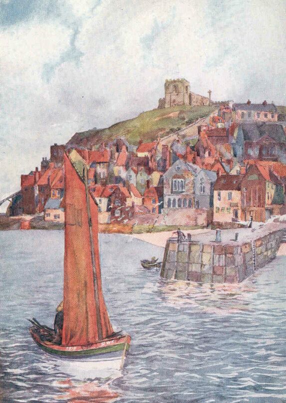
Despite a huge influx of summer visitors, and despite the modern town which has grown up to receive them, Whitby is still one of the most strikingly picturesque towns in England. But at the same time, if one excepts the abbey, the church, and the market-house, there are scarcely any architectural attractions in the town. The charm of the place does not lie so much in detail as in broad effects. The narrow streets have no surprises in the way of carved-oak brackets or curious panelled doorways, although narrow passages and steep flights of stone steps abound. On the other hand, the old parts of the town, when seen from a distance, are always presenting themselves in new apparel.
In the early morning the East Cliff generally appears as a pale grey silhouette with a square projection representing the church, and a fretted one the abbey.
But as the sun climbs upwards, colour and definition grow out of the haze of smoke and shadows, and the roofs assume their ruddy tones. At midday, when the sunlight pours down upon the medley of houses clustered along the face of the cliff, the scene is brilliantly coloured. The predominant note is the red of the chimneys and roofs and stray patches of brickwork, but the walls that go down to the water's edge are green below and full of rich browns above, and in many places the sides of the cottages are coloured with an ochre wash, while above them all the top of the cliff appears covered with grass. There is scarcely a chimney in this old part of Whitby that does not contribute to the mist of blue-grey smoke that slowly drifts up the face of the cliff, and thus, when there is no bright sunshine, colour and details are subdued in the haze.
In many towns whose antiquity and picturesqueness are more popular than the attractions of Whitby, the railway deposits one in some distressingly ugly modern excrescence, from which it may even be necessary for a stranger to ask his way to the old-world features he has come to see. But at Whitby the railway, without doing any harm to the appearance of the town, at once gives a visitor as typical a scene of fishing-life as he will ever find. When the tide is up and the wharves are crowded with boats, this upper portion of Whitby Harbour is at its best, and to step from the railway compartment entered at King's Cross into this picturesque scene is an experience to be remembered.
In the deepening twilight of a clear evening the harbour gathers to itself the additional charm of mysterious indefiniteness, and among the long-drawn-out reflections appear sinuous lines of yellow light beneath the lamps by the bridge. Looking towards the ocean from the outer harbour, one sees the massive arms which Whitby has thrust into the waves, holding aloft the steady lights that
|
'Safely guide the mighty ships Into the harbour bay.' |
If we keep to the waterside, modern Whitby has no terrors for us. It is out of sight, and might therefore have never existed. But when we have crossed the bridge, and passed along the narrow thoroughfare known as Church Street to the steps leading up the face of the cliff, we must prepare ourselves for a new aspect of the town. There, upon the top of the West Cliff, stand rows of sad-looking and dun-coloured lodging-houses, relieved by the aggressive bulk of a huge hotel, with corner turrets, that frowns savagely at the unfinished crescent, where there are many apartments with 'rooms facing the sea.'
Turning landwards we look over the chimney stacks of the topmost houses, and see the silver Esk winding placidly in the deep channel it has carved for itself; and further away we see the far off moorland heights, brown and blue, where the sources of the broad river down below are fed by the united efforts of innumerable tiny streams deep in the heather. Behind us stands the massive-looking parish church, with its Norman tower, so sturdily built that its height seems scarcely greater than its breadth. There is surely no other church with such a ponderous exterior that is so completely deceptive as to its internal aspect, for St. Mary's contains the most remarkable series of beehive-like galleries that were ever crammed into a parish church. They are not merely very wide and ill-arranged, but they are superposed one abode the other. The free use of white paint all over the sloping tiers of pews has prevented the interior from being as dark as it would have otherwise been, but the result of all this painted deal has been to give the building the most eccentric and indecorous appearance.
The early history of Whitby from the time of the landing of Roman soldiers in the inlet seems to be very closely associated with the abbey founded by Hilda about two years after the battle of Winwidfield, fought on November 15, A.D. 654; but I will not venture to state an opinion here as to whether there was any town at Streoneshalh before the building of the abbey, or whether the place that has since become known as Whitby grew on account of the presence of the abbey. Such matters as these have been fought out by an expert in the archaeology of Cleveland—the late Canon Atkinson, who seemed to take infinite pleasure in demolishing the elaborately constructed theories of those painstaking historians of the eighteenth century, Dr. Young and Mr. Lionel Charlton.
Many facts, however, which throw light on the early days of the abbey are now unassailable. We see that Hilda must have been a most remarkable woman for her times, instilling into those around her a passion for learning as well as right-living, for despite the fact that they worked and prayed in rude wooden buildings, with walls formed, most probably, of split tree-trunks, after the fashion of the church at Greenstead in Essex, we find the institution producing, among others, such men as Bosa and John, both Archbishops of York, and such a poet as Caedmon. The legend of his inspiration, however, may be placed beside the story of how the saintly Abbess turned the snakes into the fossil ammonites with which the liassic shores of Whitby are strewn. Hilda, who probably died in the year 680, was succeeded by Aelfleda, the daughter of King Oswiu of Northumbria, whom she had trained in the abbey, and there seems little doubt that her pupil carried on successfully the beneficent work of the foundress.
Aelfleda had the support of her mother's presence as well as the wise counsels of Bishop Trumwine, who had taken refuge at Streoneshalh, after having been driven from his own sphere of work by the depredations of the Picts and Scots. We then learn that Aelfleda died at the age of fifty-nine, but from that year—probably 713—a complete silence falls upon the work of the abbey; for if any records were made during the next century and a half, they have been totally lost. About the year 867 the Danes reached this part of Yorkshire, and we know that they laid waste the abbey, and most probably the town also; but the invaders gradually started new settlements, or 'bys,' and Whitby must certainly have grown into a place of some size by the time of Edward the Confessor, for just previous to the Norman invasion it was assessed for Danegeld to the extent of a sum equivalent to £3,500 at the present time.
After the Conquest a monk named Reinfrid succeeded in reviving a monastery on the site of the old one, having probably gained the permission of William de Percy, the lord of the district. The new establishment, however, was for monks only, and was for some time merely a priory.
The form of the successive buildings from the time of Hilda until the building of the stately abbey church, whose ruins are now to be seen, is a subject of great interest, but, unfortunately, there are few facts to go upon. The very first church was, as I have already suggested, a building of rude construction, scarcely better than the humble dwellings of the monks and nuns. The timber walls were most probably thatched, and the windows would be of small lattice or boards pierced with small holes. Gradually the improvements brought about would have led to the use of stone for the walls, and the buildings destroyed by the Danes may have resembled such examples of Anglo-Saxon work as may still be seen in the churches of Bradford-on-Avon and Monkwearmouth.
The buildings erected by Reinfrid under the Norman influence then prevailing in England must have been a slight advance upon the destroyed fabric, and we know that during the time of his successor, Serlo de Percy, there was a certain Godfrey in charge of the building operations, and there is every reason to believe that he completed the church during the fifty years of prosperity the monastery passed through at that time. But this was not the structure which survived, for towards the end of Stephen's reign, or during that of Henry II., the unfortunate convent was devastated by the King of Norway, who entered the harbour, and, in the words of the chronicle, 'laid waste everything, both within doors and without.' The abbey slowly recovered from this disaster, and the reconstruction commenced in 1220, still makes a conspicuous landmark from the sea. It was after the Dissolution that the abbey buildings came into the hands of Sir Richard Cholmley, who paid over to Henry VIII. the sum of £333 8s. 4d. The manors of Eskdaleside and Ugglebarnby, with all 'their rights, members and appurtenances as they formerly had belonged to the abbey of Whiby,' henceforward belonged to Sir Richard and his successors.
Sir Hugh Cholmley, whose defence of Scarborough Castle has made him a name in history, was born on July 22, 1600, at Roxby, near Pickering. He has been justly called 'the father of Whitby,' and it is to him we owe a fascinating account of his life at Whitby in Stuart and Jacobean times. He describes how he lived for some time in the gate-house of the abbey buildings, 'till my house was repaired and habitable, which then was very ruinous and all unhandsome, the wall being only of timber and plaster, and ill-contrived within: and besides the repairs, or rather re-edifying the house, I built the stable and barn, I heightened the outwalls of the court double to what they were, and made all the wall round about the paddock; so that the place hath been improved very much, both for beauty and profit, by me more than all my ancestors, for there was not a tree about the house but was set in my time, and almost by my own hand.'
In the spring of 1636 the reconstruction of the abbey house was finished, and Sir Hugh moved in with his family. 'My dear wife,' he says '(who was excellent at dressing and making all handsome within doors), had put it into a fine posture, and furnished with many good things, so that, I believe, there were few gentlemen in the country, of my rank, exceeded it.... I was at this time made Deputy-lieutenant and Colonel over the Train-bands within the hundred of Whitby Strand, Ruedale, Pickering, Lythe and Scarborough town; for that, my father being dead, the country looked upon me as the chief of my family.'
'I had between thirty and forty in my ordinary family, a chaplain who said prayers every morning at six, and again before dinner and supper, a porter who merely attended the gates, which were ever shut up before dinner, when the bell rung to prayers, and not opened till one o'clock, except for some strangers who came to dinner, which was ever fit to receive three or four besides my family, without any trouble; and whatever their fare was, they were sure to have a hearty welcome. As a definite result of his efforts, 'all that part of the pier to the west end of the harbour' was erected, and yet he complains that, though it was the means of preserving a large section of the town from the sea, the townsfolk would not interest themselves in the repairs necessitated by force of the waves. 'I wish, with all my heart,' he exclaims, 'the next generation may have more public spirit.'
THE CLEVELAND HILLS
On their northern and western flanks the Cleveland Hills have a most imposing and mountainous aspect, although their greatest altitudes do not aspire to more than about 1,500 feet. But they rise so suddenly to their full height out of the flat sea of green country that they often appear as a coast defended by a bold range of mountains. Roseberry Topping stands out in grim isolation, on its masses of alum rock, like a huge sea-worn crag, considerably over 1,000 feet high. But this strangely menacing peak raises his defiant head over nothing but broad meadows, arable land, and woodlands, and his only warfare is with the lower strata of storm-clouds, which is a convenient thing for the people who live in these parts; for long ago they used the peak as a sign of approaching storms, having reduced the warning to the easily-remembered couplet:
|
'When Roseberry Topping wears a cap, Let Cleveland then beware of a clap.' |
From the fact that you can see this remarkable peak from almost every point of the compass except south-westwards, it must follow that from the top of the hill there are views in all those directions. But to see so much of the country at once comes as a surprise to everyone. Stretching inland towards the backbone of England, there is spread out a huge tract of smiling country, covered with a most complex network of hedges, which gradually melt away into the indefinite blue edge of the world where the hills of Wensleydale rise from the plain. Looking across the little town of Guisborough, lying near the shelter of the hills, to the broad sweep of the North Sea, this piece of Yorkshire seems so small that one almost expects to see the Cheviots away in the north. But, beyond the winding Tees and the drifting smoke of the great manufacturing towns on its banks, one must be content with the county of Durham, a huge section of which is plainly visible. Turning towards the brown moorlands, the cultivation is exchanged for ridge beyond ridge of total desolation—a huge tract of land in this crowded England where the population for many square miles at a time consists of the inmates of a lonely farm or two in the circumscribed cultivated areas of the dales.
Eight or nine hundred years ago these valleys were choked up with forests. The Early British inhabitants were more inclined to the hill-tops than the hollows, if the innumerable indications of their settlements be any guide, and there is every reason for believing that many of the hollows in the folds of the heathery moorlands were rarely visited by man. Thus, the suggestion has been made that a few of the last representatives of now extinct monsters may have survived in these wild retreats, for how otherwise do we find persistent stories in these parts of Yorkshire, handed down we cannot tell how many centuries, of strange creatures described as 'worms'? At Loftus they show you the spot where a 'grisly worm' had its lair, and in many places there are traditions of strange long-bodied dragons who were slain by various valiant men.
On Easby Moor, a few miles to the south of Roseberry Topping, the tall column to the memory of Captain Cook stands like a lighthouse on this inland coastline. The lofty position it occupies among these brown and purply-green heights makes the monument visible over a great tract of the sailor's native Cleveland. The people who live in Marton, the village of his birthplace, can see the memorial of their hero's fame, and the country lads of to-day are constantly reminded of the success which attended the industry and perseverance of a humble Marton boy.
The cottage where James Cook was born in 1728 has gone, but the field in which it stood is called Cook's Garth. The shop at Staithes, generally spoken of as a 'huckster's,' where Cook was apprenticed as a boy, has also disappeared; but, unfortunately, that unpleasant story of his having taken a shilling from his master's till, when the attractions of the sea proved too much for him to resist, persistently clings to all accounts of his early life. There seems no evidence to convict him of this theft, but there are equally no facts by which to clear him. But if we put into the balance his subsequent term of employment at Whitby, the excellent character he gained when he went to sea, and Professor J.K. Laughton's statement that he left Staithes 'after some disagreement with his master,' there seems every reason to believe that the story is untrue.
I have seldom seen a more uninhabited and inhospitable-looking country than the broad extent of purple hills that stretch away to the south-west from Great Ayton and Kildale Moors. Walking from Guisborough to Kildale on a wild and stormy afternoon in October, I was totally alone for the whole distance when I had left behind me the baker's boy who was on his way to Hutton with a heavy basket of bread and cakes. Hutton, which is somewhat of a model village for the retainers attached to Hutton Hall, stands in a lovely hollow at the edge of the moors. The steep hills are richly clothed with sombre woods, and the peace and seclusion reigning there is in marked contrast to the bleak wastes above. When I climbed the steep road on that autumn afternoon, and, passing the zone of tall, withered bracken, reached the open moorland, I seemed to have come out merely to be the plaything of the elements; for the south-westerly gale, when it chose to do so, blew so fiercely that it was difficult to make any progress at all. Overhead was a dark roof composed of heavy masses of cloud, forming long parallel lines of grey right to the horizon. On each side of the rough, water-worn road the heather made a low wall, two or three feet high, and stretched right away to the horizon in every direction. In the lulls, between the fierce blasts, I could hear the trickle of the water in the rivulets deep down in the springy cushion of heather. A few nimble sheep would stare at me from a distance, and then disappear, or some grouse might hover over a piece of rising ground; but otherwise there were no signs of living creatures. Nearing Kildale, the road suddenly plunged downwards to a stream flowing through a green, cultivated valley, with a lonely farm on the further slope. There was a fir-wood above this, and as I passed over the hill, among the tall, bare stems, the clouds parted a little in the west, and let a flood of golden light into the wood. Instantly the gloom seemed to disappear, and beyond the dark shoulder of moorland, where the Cook monument appeared against the glory of the sunset, there seemed to reign an all-pervading peace, the wood being quite silent, for the wind had dropped.
The rough track through the trees descended hurriedly, and soon gave a wide view over Kildale. The valley was full of colour from the glowing west, and the steep hillsides opposite appeared lighter than the indigo clouds above, now slightly tinged with purple. The little village of Kildale nestled down below, its church half buried in yellow foliage.
The ruined Danby Castle can still be seen on the slope above the Esk, but the ancient Bow Bridge at Castleton, which was built at the end of the twelfth century, was barbarously and needlessly destroyed in 1873. A picture of the bridge has, fortunately, been preserved in Canon Atkinson's 'Forty Years in a Moorland Parish.' That book has been so widely read that it seems scarcely necessary to refer to it here, but without the help of the Vicar, who knew every inch of his wild parish, the Danby district must seem much less interesting.
GUISBOROUGH AND THE SKELTON VALLEY
Although a mere fragment of the Augustinian Priory of Guisborough is standing to-day, it is sufficiently imposing to convey a powerful impression of the former size and magnificence of the monastic church. This fragment is the gracefully buttressed east-end of the choir, which rises from the level meadow-land to the east of the town. The stonework is now of a greenish-grey tone, but in the shadows there is generally a look of blue. Beyond the ruin and through the opening of the great east window, now bare of tracery, you see the purple moors, with the ever-formidable Roseberry Topping holding its head above the green woods and pastures.
The destruction of the priory took place most probably during the reign of Henry VIII., but there are no recorded facts to give the date of the spoiling of the stately buildings. The materials were probably sold to the highest bidder, for in the town of Guisborough there are scattered many fragments of richly-carved stone, and Ord, one of the historians of Cleveland, says: 'I have beheld with sorrow, and shame, and indignation, the richly ornamented columns and carved architraves of God's temple supporting the thatch of a pig-house.'
The Norman priory church, founded in 1119, by the wealthy Robert de Brus of Skelton, was, unfortunately, burnt down on May 16, 1289. Walter of Hemingburgh, a canon of Guisborough, has written a quaintly detailed account of the origin of the fire. Translated from the monkish Latin, he says 'On the first day of rogation-week, a devouring flame consumed our church of Gysburn, with many theological books and nine costly chalices, as well as vestments and sumptuous images; and because past events are serviceable as a guide to future inquiries, I have thought it desirable, in the present little treatise, to give an account of the catastrophe, that accidents of a similar nature may be avoided through this calamity allotted to us. On the day above mentioned, which was very destructive to us, a vile plumber, with his two workmen, burnt our church whilst soldering up two holes in the old lead with fresh pewter. For some days he had already, with a wicked disposition, commenced, and placed his iron crucibles, along with charcoal and fire, on rubbish, or steps of a great height, upon dry wood with some turf and other combustibles. About noon (in the cross, in the body of the church, where he remained at his work until after Mass) he descended before the procession of the convent, thinking that the fire had been put out by his workmen. They, however, came down quickly after him, without having completely extinguished the fire; and the fire among the charcoal revived, and partly from the heat of the iron, and partly from the sparks of the charcoal, the fire spread itself to the wood and other combustibles beneath. After the fire was thus commenced, the lead melted, and the joists upon the beams ignited; and then the fire increased prodigiously, and consumed everything.' Hemingburgh concludes by saying that all that they could get from the culprits was the exclamation, 'Quid potui ego?' Shortly after this disaster the Prior and convent wrote to Edward II., excusing themselves from granting a corrody owing to their great losses through the burning of the monastery, as well as the destruction of their property by the Scots. But Guisborough, next to Fountains, was almost the richest establishment in Yorkshire, and thus in a few years' time there arose from the Norman foundations a stately church and convent built in the Early Decorated style.
One of the most interesting relics of the great priory is the altar-tomb, believed to be that of Robert de Brus of Annandale. The stone slabs are now built into the walls on each side of the porch of Guisborough Church. They may have been removed there from the abbey for safety at the time of the dissolution. Hemingburgh, in his chronicle for the year 1294, says: 'Robert de Brus the fourth died on the eve of Good Friday; who disputed with John de Balliol, before the King of England, about the succession to the kingdom of Scotland. And, as he ordered when alive, he was buried in the priory of Gysburn with great honour, beside his own father.' A great number of other famous people were buried here in accordance with their wills. Guisborough has even been claimed as the resting place of Robert Bruce, the champion of Scottish freedom, but there is ample evidence for believing that his heart was buried at Melrose Abbey and his body in Dunfermline Abbey.
The central portion of the town of Guisborough, by the market-cross and the two chief inns, is quaint and fairly picturesque, but the long street as it goes westward deteriorates into rows of new cottages, inevitable in a mining country.
Mining operations have been carried on around Guisborough since the time of Queen Elizabeth, for the discovery of alum dates from that period, and when that industry gradually declined, it was replaced by the iron mines of today. Mr. Thomas Chaloner of Guisborough, in his travels on the Continent about the end of the sixteenth century, saw the Pope's alum works near Rome, and was determined to start the industry in his native parish of Guisborough, feeling certain that alum could be worked with profit in his own country. As it was essential to have one or two men who were thoroughly versed in the processes of the manufacture, Mr. Chaloner induced some of the Pope's workmen by heavy bribes to come to England. The risks attending this overt act were terrible, for the alum works brought in a large revenue to His Holiness, and the discovery of such a design would have meant capital punishment to the offender. The workmen were therefore induced to get into large casks, which were secretly conveyed on board a ship which was shortly sailing for England.
When the Pope received the intelligence some time afterwards, he thundered forth against Mr. Chaloner and the workmen the most awful and comprehensive curse. They were to be cursed most wholly and thoroughly in every part of their bodies, every saint was to curse them, and from the thresholds of the holy church of God Almighty they were to be sequestered, that they might 'be tormented, disposed of, and delivered over with Dathan and Abiram, and with those who say unto the Lord God, "Depart from us; we desire not to know thy ways."'
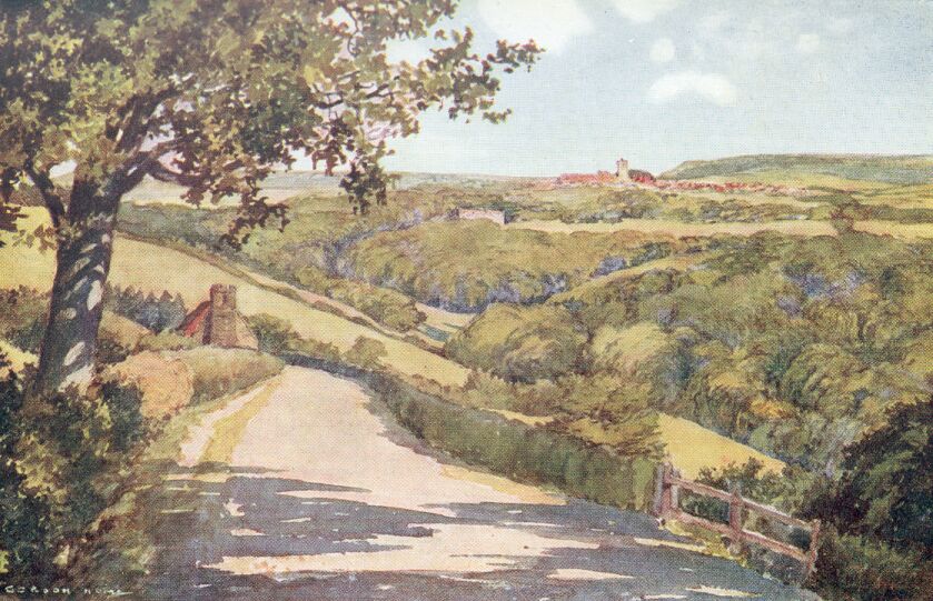
The broad valley stretching from Guisborough to the sea contains the beautifully wooded park of Skelton Castle. The trees in great masses cover the gentle slopes on either side of the Skelton Beck, and almost hide the modern mansion. The buildings include part of the ancient castle of the Bruces, who were Lords of Skelton for many years.
FROM PICKERING TO RIEVAULX ABBEY
The broad Vale of Pickering, watered by the Derwent, the Rye and their many tributaries, is a wonderful contrast to the country we have been exploring. The level pastures, where cattle graze and cornfields abound, seem to suggest that we are separated from the heather by many leagues; but we have only to look beyond the hedgerows to see that the horizon to the north is formed by lofty moors only a few miles distant.
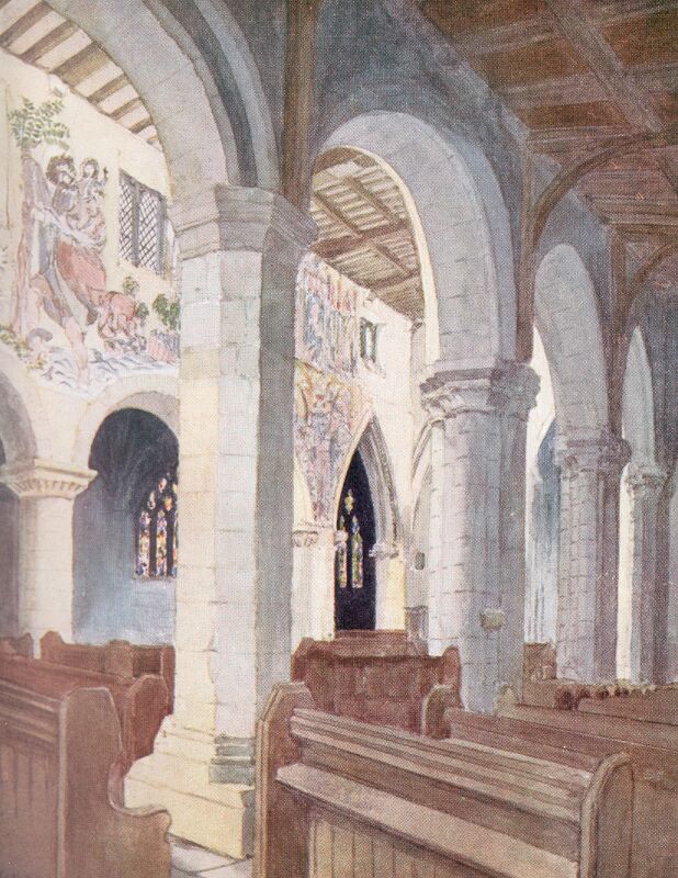
Just where the low meadows are beginning to rise steadily from the vale stands the town of Pickering, dominated by the lofty stone spire of its parish church and by the broken towers of the castle. There is a wide street, bordered by dark stone buildings, that leads steeply from the river to the church. The houses are as a rule quite featureless, but we have learnt to expect this in a county where stone is abundant, for only the extremely old and the palpably new buildings stand out from the grey austerity of the average Yorkshire town. In rare cases some of the houses are brightened with white and cream paint on windows and doors, and if these commendable efforts became less rare, Pickering would have as cheerful an aspect to the stranger as Helmsley, which we shall pass on our way to Rievaulx.
Approached by narrow passages between the grey houses and shops, the church is most imposing, for it is not only a large building, but the cramped position magnifies its bulk and emphasizes the height of the Norman tower, surmounted by the tall stone spire added during the fourteenth century. Going up a wide flight of steps, necessitated by the slope of the ground, we enter the church through the beautiful porch, and are at once confronted with the astonishingly perfect paintings which cover the walls of the nave. The pictures occupy nearly all the available wall-space between the arches and the top of the clerestory, and their crude quaintnesses bring the ideas of the first half of the fifteenth century vividly before us. There is a spirited representation of St. George in conflict with a terrible dragon, and close by we see a bearded St. Christopher holding a palm-tree with both hands, and bearing on his shoulder the infant Christ. Then comes Herod's feast, with the King labelled Herodi. The guests are shown with their arms on the table in the most curious positions, and all the royal folk are wearing ermine. The coronation of the Virgin, the martyrdom of St. Thomas à Becket, and the martyrdom of St. Edmund, who is perforated with arrows, complete the series on the north side. Along the south wall the paintings show the story of St. Catherine of Alexandria and the seven Corporal Acts of Mercy. Further on come scenes from the life of our Lord.
The simple Norman arcade on the north side of the nave has plain round columns and semicircular arches, but the south side belongs to later Norman times, and has ornate columns and capitals. At least one member of the great Bruce family, who had a house at Pickering called Bruce's Hall, and whose ascendency at Guisborough has already been mentioned, was buried here, for the figure of a knight in chain-mail by the lectern probably represents Sir William Bruce. In the chapel there is a sumptuous monument bearing the effigies of Sir David and Dame Margery Roucliffe. The knight wears the collar of SS, and his arms are on his surcoat.
When John Leland, the 'Royal Antiquary' employed by Henry VIII., came to Pickering, he described the castle, which was in a more perfect state than it is to-day. He says: 'In the first Court of it be a 4 Toures, of the which one is caullid Rosamunde's Toure.' Also of the inner court he writes of '4 Toures, wherof the Kepe is one.' This keep and Rosamund's Tower, as well as the ruins of some of the others, are still to be seen on the outer walls, so that from some points of view the ruins are dignified and picturesque. The area enclosed was large, and in early times the castle must have been almost impregnable. But during the Civil War it was much damaged by the soldiers quartered there, and Sir Hugh Cholmley took lead, wood, and iron from it for the defence of Scarborough. The wide view from the castle walls shows better than any description the importance of the position it occupied, and we feel, as we gaze over the vale or northwards to the moors, that this was the dominant power over the whole countryside.
Although Lastingham is not on the road to Helmsley, the few additional miles will scarcely be counted when we are on our way to a church which, besides being architecturally one of the most interesting in the county, is perhaps unique in having at one time had a curate whose wife kept a public-house adjoining the church. Although this will scarcely be believed, we have a detailed account of the matter in a little book published in 1806.
The clergyman, whose name was Carter, had to subsist on the slender salary of £20 a year and a few surplice fees. This would not have allowed any margin for luxuries in the case of a bachelor; but this poor man was married, and he had thirteen children. He was a keen fisherman, and his angling in the moorland streams produced a plentiful supply of fish—in fact, more than his family could consume. But this, even though he often exchanged part of his catches with neighbours, was not sufficient to keep the wolf from the door, and drastic measures had to be taken. The parish was large, and, as many of the people were obliged to come 'from ten to fifteen miles' to church, it seemed possible that some profit might be made by serving refreshments to the parishioners. Mrs. Carter superintended this department, and it seems that the meals between the services soon became popular. But the story of 'a parson-publican' was soon conveyed to the Archdeacon of the diocese, who at the next visitation endeavoured to find out the truth of the matter. Mr. Carter explained the circumstances, and showed that, far from being a source of disorder, his wife's public-house was an influence for good. 'I take down my violin,' he continued, 'and play them a few tunes, which gives me an opportunity of seeing that they get no more liquor than necessary for refreshment; and if the young people propose a dance, I seldom answer in the negative; nevertheless, when I announce time for return, they are ever ready to obey my commands.' The Archdeacon appears to have been a broad-minded man, for he did not reprimand Mr. Carter at all; and as there seems to have been no mention of an increased stipend, the parson publican must have continued this strange anomaly.
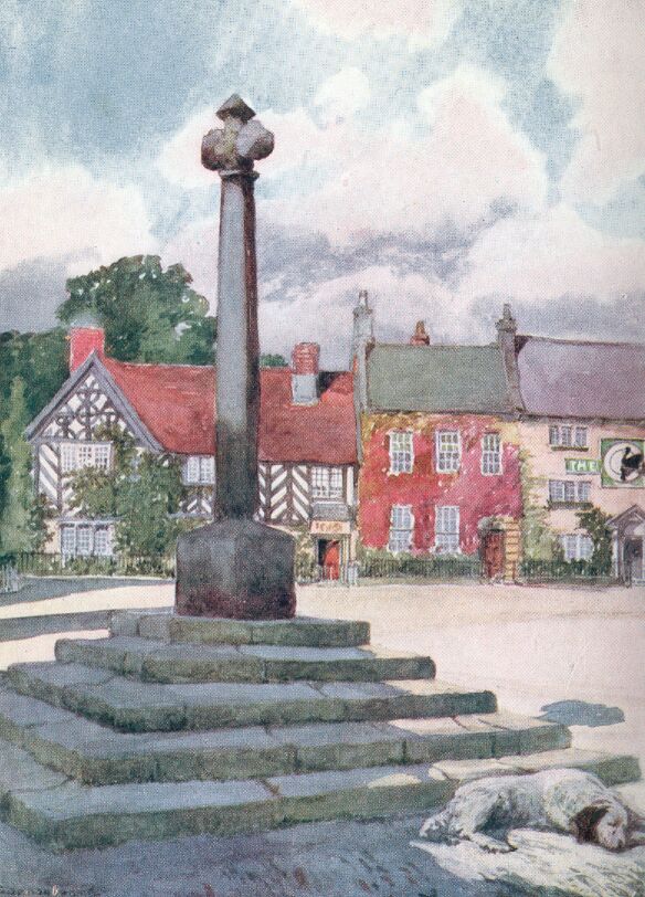
The writings of Bede give a special interest to Lastingham, for he tells us how King Oidilward requested Bishop Cedd to build a monastery there. The Saxon buildings that appeared at that time have gone, so that the present church cannot be associated with the seventh century. No doubt the destruction was the work of the Danes, who plundered the whole of this part of Yorkshire. The church that exists today is of Transitional Norman date, and the beautiful little crypt, which has an apse, nave and aisles, is coeval with the superstructure.
The situation of Lastingham in a deep and picturesque valley surrounded by moors and overhung by woods is extremely rich.
Further to the west there are a series of beautiful dales watered by becks whose sources are among the Cleveland Hills. On our way to Ryedale, the loveliest of these, we pass through Kirby Moorside, a little town which has gained a place in history as the scene of the death of the notorious George Villiers, second Duke of Buckingham, on April 17, 1687. The house in which he died is on the south side of the King's Head, and in one of the parish registers there is the entry under the date of April 19th, 'Gorges viluas, Lord dooke of Bookingam, etc.' Further down the street stands an inn with a curious porch, supported by turned wooden pillars, bearing the inscription:
|
'Anno: Dom 1632 October xi William Wood' |
Kirkdale, with its world-renowned cave, to which we have already referred, lies about two miles to the west. The quaint little Saxon church there is one of the few bearing evidences of its own date, ascertained by the discovery in 1771 of a Saxon sun-dial, which had survived under a layer of plaster, and was also protected by the porch. A translation of the inscription reads: 'Orm, the son of Gamal, bought St. Gregory's Minster when it was all broken and fallen, and he caused it to be made anew from the ground, for Christ and St. Gregory, in the days of King Edward and in the days of Earl Tosti, and Hawarth wrought me and Brand the prior (priest or priests).' By this we are plainly told that a church was built there in the reign of Edward the Confessor.
A pleasant road leads through Nawton to the beautiful little town of Helmsley. A bend of the broad, swift-flowing Rye forms one boundary of the place, and is fed by a gushing brook that finds its way from Rievaulx Moor, and forms a pretty feature of the main street.
A narrow turning by the market-house shows the torn and dishevelled fragment of the keep of Helmsley Castle towering above the thatched roofs in the foreground. The ruin is surrounded by tall elms, and from this point of view, when backed by a cloudy sunset makes a wonderful picture. Like Scarborough, this stronghold was held for the King during the Civil War. After the Battle of Marston Moor and the fall of York, Fairfax came to Helmsley and invested the castle. He received a wound in the shoulder during the siege; but the garrison having surrendered on honourable terms, the Parliament ordered that the castle should be dismantled, and the thoroughness with which the instructions were carried out remind one of Knaresborough, for one side of the keep was blown to pieces by a terrific explosion and nearly everything else was destroyed.
All the beauty and charm of this lovely district is accentuated in Ryedale, and when we have accomplished the three long uphill miles to Rievaulx, and come out upon the broad grassy terrace above the abbey, we seem to have entered a Land of Beulah. We see a peaceful valley overlooked on all sides by lofty hills, whose steep sides are clothed with luxuriant woods; we see the Rye flowing past broad green meadows; and beneath the tree-covered precipice below our feet appear the solemn, roofless remains of one of the first Cistercian monasteries established in this country. There is nothing to disturb the peace that broods here, for the village consists of a mere handful of old and picturesque cottages, and we might stay on the terrace for hours, and, beyond the distant shouts of a few children at play and the crowing of some cocks, hear nothing but the hum of insects and the singing of birds. We take a steep path through the wood which leads us down to the abbey ruins.
The magnificent Early English choir and the Norman transepts stand astonishingly complete in their splendid decay, and the lower portions of the nave, which, until 1922, lay buried beneath masses of grass-grown débris, are now exposed to view. The richly-draped hill-sides appear as a succession of beautiful pictures framed by the columns and arches on each side of the choir. As they stand exposed to the weather, the perfectly proportioned mouldings, the clustered pillars in a wonderfully good state of preservation, and the almost uninjured clerestory are more impressive than in an elaborately-restored cathedral.
DESCRIBES THE DALE COUNTRY AS A WHOLE
When in the early years of life one learns for the first time the name of that range of mountains forming the backbone of England, the youthful scholar looks forward to seeing in later years the prolonged series of lofty hills known as the 'Pennine Range.' His imagination pictures Pen-y-ghent and Ingleborough as great peaks, seldom free from a mantle of clouds, for are they not called 'mountains of the Pennine Range,' and do they not appear in almost as large type in the school geography as Snowdon and Ben Nevis? But as the scholar grows older and more able to travel, so does the Pennine Range recede from his vision, until it becomes almost as remote as those crater-strewn mountains in the Moon which have a name so similar.
This elusiveness on the part of a natural feature so essentially static as a mountain range is attributable to the total disregard of the name of this particular chain of hills. In the same way as the term 'Cumbrian Hills' is exchanged for the popular 'Lake District,' so is a large section of the Pennine Range paradoxically known as the 'Yorkshire Dales.'
It is because the hills are so big that the valleys are deep and it is owing to the great watersheds that these long and narrow dales are beautified by some of the most copious and picturesque rivers in England. In spite of this, however, when one climbs any of the fells over 2,000 feet, and looks over the mountainous ridges on every side, one sees, as a rule, no peak or isolated height of any description to attract one's attention. Instead of the rounded or angular projections from the horizon that are usually associated with a mountainous district, there are great expanses of brown table-land that form themselves into long parallel lines in the distance, and give a sense of wild desolation in some ways more striking than the peaks of Scotland or Wales. The thick formations of millstone grit and limestone that rest upon the shale have generally avoided crumpling or distortion, and thus give the mountain views the appearance of having had all the upper surfaces rolled flat when they were in a plastic condition. Denudation and the action of ice in the glacial epochs have worn through the hard upper stratum, and formed the long and narrow dales; and in Littondale, Wharfedale, Wensleydale, and many other parts, one may plainly see the perpendicular wall of rock sharply defining the upper edges of the valleys. The softer rocks below generally take a gentle slope from the base of the hard gritstone to the riverside pastures below. At the edges of the dales, where water-falls pour over the wall of limestone—as at Hardraw Scar, near Hawes—the action of water is plainly demonstrated, for one can see the rapidity with which the shale crumbles, leaving the harder rocks overhanging above.
Unlike the moors of the north-eastern parts of Yorkshire, the fells are not prolific in heather. It is possible to pass through Wensleydale—or, indeed, most of the dales—without seeing any heather at all. On the broad plateaux between the dales there are stretches of moor partially covered with ling; but in most instances the fells and moors are grown over at their higher levels with bent and coarse grass, generally of a browny-ochrish colour, broken here and there by an outcrop of limestone that shows grey against the swarthy vegetation.
In the upper portions of the dales—even in the narrow riverside pastures—the fences are of stone, turned a very dark colour by exposure, and everywhere on the slopes of the hills a wide network of these enclosures can be seen traversing even the most precipitous ascents. Where the dales widen out towards the fat plains of the Vale of York, quickset hedges intermingle with the gaunt stone, and as one gets further eastwards the green hedge becomes triumphant. The stiles that are the fashion in the stone-fence districts make quite an interesting study to strangers, for, wood being an expensive luxury, and stone being extremely cheap, everything is formed of the more enduring material. Instead of a trap-gate, one generally finds an excessively narrow opening in the fences, only just giving space for the thickness of the average knee, and thus preventing the passage of the smallest lamb. Some stiles are constructed with a large flat stone projecting from each side, one slightly in front and overlapping the other, so that one can only pass through by making a very careful S-shaped movement. More common are the projecting stones, making a flight of precarious steps on each side of the wall.
Except in their lowest and least mountainous parts, where they are subject to the influences of the plains, the dales are entirely innocent of red tiles and haystacks. The roofs of churches, cottages, barns and mansions, are always of the local stone, that weathers to beautiful shades of green and grey, and prevents the works of man from jarring with the great sweeping hill-sides. Then, instead of the familiar grey-brown haystack, one sees in almost every meadow a neatly-built stone house with an upper storey. The lower part is generally used as a shelter for cattle, while above is stored hay or straw. By this system a huge amount of unnecessary carting is avoided, and where roads are few and generally of exceeding steepness a saving of this nature is a benefit easily understood.
The villages of the dales, although having none of the bright colours of a level country, are often exceedingly quaint, and rich in soft shades of green and grey. In the autumn the mellowed tints of the stone houses are contrasted with the fierce yellows and browny-reds of the foliage, and the villages become full of bright colours. At all times, except when the country is shrivelled by an icy northern wind, the scenery of the dales has a thousand charms.
RICHMOND
For the purposes of this book we may consider Richmond as the gateway of the dale country. There are other gates and approaches, some of which may have advocates who claim their superiority over Richmond as starting-places for an exploration of this description, but for my part, I can find no spot on any side of the mountainous region so entirely satisfactory. If we were to commence at Bedale or Leyburn, there is no exact point where the open country ceases and the dale begins; but here at Richmond there is not the very smallest doubt, for on reaching the foot of the mass of rock dominated by the castle and the town, Swaledale commences in the form of a narrow ravine, and from that point westwards the valley never ceases to be shut in by steep sides, which become narrower and grander with every mile.
The railway that keeps Richmond in touch with the world does its work in a most inoffensive manner, and by running to the bottom of the hill on which the town stands, and by there stopping short, we seem to have a strong hint that we have been brought to the edge of a new element in which railways have no rights whatever. This is as it should be, and we can congratulate the North-Eastern Company for its discretion and its sense of fitness. Even the station is built of solid stonework, with a strong flavour of medievalism in its design, and its attractiveness is enhanced by the complete absence of other modern buildings. We are thus welcomed to the charms of Richmond at once. The rich sloping meadows by the river, crowned with dense woodlands, surround us and form a beautiful setting of green for the town, which has come down from the fantastic days of the Norman Conquest without any drastic or unseemly changes, and thus has still the compactness and the romantic outline of feudal times.
From whatever side you approach it, Richmond has always some fine combination of towers overlooking a confusion of old red roofs and of rocky heights crowned with ivy-mantled walls, all set in the most sumptuous surroundings of silvery river and wooded hills, such as the artists of the age of steel-engraving loved to depict. Every one of these views has in it one dominating feature in the magnificent Norman keep of the castle. It overlooks church towers and everything else with precisely the same aloofness of manner it must have assumed as soon as the builders of nearly eight hundred years ago had put the last stone in place. Externally, at least, it is as complete to-day as it was then, and as there is no ivy upon it, I cannot help thinking that the Bretons who built it in that long distant time would swell with pride were they able to see how their ambitious work has come down the centuries unharmed.
We can go across the modern bridge, with its castellated parapets, and climb up the steep ascent on the further side, passing on the way the parish church, standing on the steep ground outside the circumscribed limits of the wall which used to enclose the town in early times. Turning towards the castle, we go breathlessly up the cobbled street that climbs resolutely to the market-place in a foolishly direct fashion, which might be understood if it were a Roman road. There is a sleepy quietness about this way up from the station, which is quite a short distance, and we look for much movement and human activity in the wide space we have reached; but here, too, on this warm and sunny afternoon, the few folks who are about seem to find ample time for conversation and loitering.
On one side of us is the King's Head, whose steep tiled roof and square front has just that air of respectable importance that one expects to find in an old established English hotel. It looks across the cobbled space to the curious block of buildings that seems to have been intended for a church but has relapsed into shops. The shouldering of secular buildings against the walls of churches is a sight so familiar in parts of France that this market place has an almost Continental flavour, in keeping with the fact that Richmond grew up under the protection of the formidable castle built by that Alan Rufus of Brittany who was the Conqueror's second cousin. The town ceased to be a possession of the Dukes of Brittany in the reign of Richard II., but there had evidently been sufficient time to allow French ideals to percolate into the minds of the men of Richmond, for how otherwise can we account for this strange familiarity of shops with a sacred building which is unheard of in any other English town? Where else can one find a pork-butcher's shop inserted between the tower and the nave, or a tobacconist doing business in the aisle of a church? Even the lower parts of the tower have been given up to secular uses, so that one only realizes the existence of the church by keeping far enough away to see the sturdy pinnacled tower that rises above the desecrated lower portions of the building. In this tower hangs the curfew-bell, which is rung at 6 a.m. and 8 p.m., a custom, according to one writer, 'that has continued ever since the time of William the Conqueror.'
All the while we have been lingering in the market-place the great keep has been looking at us over some old red roofs, and urging us to go on at once to the finest sight that Richmond can offer, and, resisting the appeal no longer, we make our way down a narrow little street leading out to a walk that goes right round the castle cliffs at the base of the ivy-draped walls.
From down below comes the sound of the river, ceaselessly chafing its rocky bottom and the big boulders that lie in the way. You can distinguish the hollow sound of the waters as they fall over ledges into deep pools, and you can watch the silvery gleams of broken water between the old stone bridge and the dark shade of the woods. The masses of trees clothing the side of the gorge add a note of mystery to the picture by swallowing up the river in their heavy shade, for, owing to its sinuous course among the cliffs, one can see only a short piece of water beyond the bridge.
The old corner of the town at the foot of Bargate appears over the edge of the rocky slope, but on the opposite side of the Swale there is little to be seen beside the green meadows and shady coppices that cover the heights above the river.
There is a fascination in this view in its capacity for change. It responds to every mood of the weather, and every sunset that glows across the sombre woods has some freshness, some feature that is quite unlike any other. Autumn, too, is a memorable time for those who can watch the face of Nature from this spot, for when one of those opulent evenings of the fall of the year turns the sky into a golden sea of glory, studded with strange purple islands, there is unutterable beauty in the flaming woods and the pale river.
On the way back to the market-place we pass a decayed arch that was probably a postern in the walls of the town. There can be no doubt whatever of the existence of these walls, for Leland begins his description of the town with the words 'Richemont Towne is waullid,' and in another place he says: 'Waullid it was, but the waul is now decayid. The Names and Partes of 4 or 5 Gates yet remaine.' We cannot help wondering why Richmond could not have preserved her gates as York has done, or why she did not even make the effort sufficient to retain a single one, as Bridlington and Beverley did. The two posterns—one we have just mentioned, and the other in Friar's Wynd, on the north side of the market-place, with a piece of wall 6 feet thick adjoining—are interesting, but we would have preferred something much finer than these mere arches; and while we are grumbling over what Richmond has lost, we may also measure the disaster which befell the market-place in 1771, when the old cross was destroyed. Before that year there stood on the site of the present obelisk a very fine cross which Clarkson, who wrote about a century ago, mentions as being the greatest beauty of the town to an antiquary. A high flight of steps led up to a square platform, which was enclosed by a richly ornamented wall about 6 feet high, having buttresses at the corners, each surmounted with a dog seated on its hind-legs. Within the wall rose the cross, with its shaft made from one piece of stone. There were 'many curious compartments' in the wall, says Clarkson, and 'a door that opened into the middle of the square,' but this may have been merely an arched opening. The enrichments, either of the cross itself or the wall, included four shields bearing the arms of the great families of Fitz-Hugh, Scrope (quartering Tibetot), Conyers, and Neville. From the description there is little doubt that this cross was a very beautiful example of Perpendicular or perhaps Decorated Gothic, in place of which we have a crude and bulging obelisk bearing the inscription: 'Rebuilt (!) A.D. 1771, Christopher Wayne, Esq., Mayor'; it should surely have read: 'Perpetrated during the Mayoralty of Christopher Wayne Goth.'
Although, as we have seen, Leland, who wrote in 1538, mentions Frenchgate and Finkel Street Gate as 'down,' yet they must have been only partially destroyed, or were rebuilt afterwards, for Whitaker, writing in 1823, mentions that they were pulled down 'not many years ago' to allow the passage of broad and high-laden waggons. There can be little doubt, therefore, that, swollen with success after the demolition of the cross, the Mayor and Corporation proceeded to attack the remaining gateways, so that now not the smallest suggestion of either remains. But even here we have not completed the list of barbarisms that took place about this time. The Barley Cross, which stood near the larger one, must have been quite an interesting feature. It consisted of a lofty pillar with a cross at the top, and rings were fastened either on the shaft or to the steps upon which it stood, so that the cross might answer the purpose of a whipping-post. The pillory stood not far away, and the May-pole is also mentioned.
But despite all this squandering of the treasures that it should have been the business of the town authorities to preserve, the tower of the Grey Friars has survived, and, next to the castle, it is one of the chief ornaments of the town. Some other portions of the monastery are incorporated in the buildings which now form the Grammar School. The Grey Friars is on the north side of the town, outside the narrow limits of the walls, and was probably only finished in time to witness the dispersal of the friars who had built it. It is even possible that it was part of a new church that was still incomplete when the Dissolution of the Monasteries made the work of no account except as building materials for the townsfolk. The actual day of the surrender was January 19, 1538, and we wonder if Robert Sanderson, the Prior, and the fourteen brethren under him, suffered much from the privations that must have attended them at that coldest period of the year. At one time the friars, being of a mendicant order, and inured to hard living and scanty fare, might have made light of such a disaster, but in these later times they had expanded somewhat from their austere ways of living, and the dispersal must have cost them much suffering.
Going back to the reign of Henry VII. or there-abouts, we come across the curious ballad of 'The Felon Sow of Rokeby and the Freres of Richmond' quoted from an old manuscript by Sir Walter Scott in 'Rokeby.' It may have been as a practical joke, or merely as a good way of getting rid of such a terrible beast, that
|
'Ralph of Rokeby, with goodwill, The fryers of Richmond gave her till.' |
Friar Middleton, who with two lusty men was sent to fetch the sow from Rokeby, could scarcely have known that she was
|
'The grisliest beast that ere might be, Her head was great and gray: She was bred in Rokeby Wood; There were few that thither goed, That came on live [= alive] away. 'She was so grisley for to meete, She rave the earth up with her feete, And bark came fro the tree; When fryer Middleton her saugh, Weet ye well he might not laugh, Full earnestly look'd hee.' |
To calm the terrible beast when they found it almost impossible to hold her, the friar began to read 'in St. John his Gospell,' but
|
'The sow she would not Latin heare, But rudely rushed at the frear,' |
who, turning very white, dodged to the shelter of a tree, whence he saw with horror that the sow had got clear of the other two men. At this their courage evaporated, and all three fled for their lives along the Watling Street. When they came to Richmond and told their tale of the 'feind of hell' in the garb of a sow, the warden decided to hire on the next day two of the 'boldest men that ever were borne.' These two, Gilbert Griffin and a 'bastard son of Spaine,' went to Rokeby clad in armour and carrying their shields and swords of war, and even then they only just overcame the grisly sow.
If we go across the river by the modern bridge, we can see the humble remains of St. Martin's Priory standing in a meadow by the railway. The ruins consist of part of a Perpendicular tower and a Norman doorway. Perhaps the tower was built in order that the Grey Friars might not eclipse the older foundation, for St. Martin's was a cell belonging to St. Mary's Abbey at York and was founded by Wyman, steward or dapifer to the Earl of Richmond, about the year 1100, whereas the Franciscans in the town owed their establishment to Radulph Fitz-Ranulph, a lord of Middleham in 1258. The doorway of St. Martin's, with its zigzag mouldings must be part of Wyman's building, but no other traces of it remain. Having come back so rapidly to the Norman age, we may well stay there for a time while we make our way over the bridge again and up the steep ascent of Frenchgate to the castle.
On entering the small outer barbican, which is reached by a lane from the market-place, we come to the base of the Norman keep. Its great height of nearly 100 feet is quite unbroken from foundations to summit, and the flat buttresses are featureless. The recent pointing of the masonry has also taken away any pronounced weathering, and has left the tower with almost the same gaunt appearance that it had when Duke Conan saw it completed. Passing through the arch in the wall abutting the keep, we come into the grassy space of over two acres, that is enclosed by the ramparts. It is not known by what stages the keep reached its present form, though there is every reason to believe that Conan, the fifth Earl of Richmond, left the tower externally as we see it to-day. This puts the date of the completion of the keep between 1146 and 1171. The floors are now a store for the uniforms and accoutrements of the soldiers quartered at Richmond, so that there is little to be seen as we climb a staircase in the walls 11 feet thick, and reach the battlemented turrets. Looking downwards, we gaze right into the chimneys of the nearest houses, and we see the old roofs of the town packed closely together in the shelter of the mighty tower. A few tiny people are moving about in the market-place, and there is a thin web of drifting smoke between us and them. Everything is peaceful and remote; even the sound of the river is lost in the wind that blows freely upon us from the great moorland wastes stretching away to the western horizon. It is a romantic country that lies around us, and though the cultivated area must be infinitely greater than in the fighting days when these battlements were finished, yet I suppose the Vale of Mowbray which we gaze upon to the east must have been green, and to some extent fertile, when that Conan who was Duke of Brittany and also Earl of Richmond looked out over the innumerable manors that were his Yorkshire possessions. I can imagine his eye glancing down on a far more thrilling scene than the green three-sided courtyard enclosed by a crumbling grey wall, though to him the buildings, the men, and every detail that filled the great space, were no doubt quite prosaic. It did not thrill him to see a man-at-arms cleaning weapons, when the man and his clothes, and even the sword, were as modern and everyday as the soldier's wife and child that we can see ourselves, but how much would we not give for a half-an-hour of his vision, or even a part of a second, with a good camera in our hands?
In the lower part of what is called Robin Hood's Tower is the Chapel of St. Nicholas, with arcaded walls of early Norman date, and a long and narrow slit forming the east window. More interesting than this is the Norman hall at the south-east angle of the walls. It was possibly used as the banqueting-room of the castle, and is remarkable as being one of the best preserved of the Norman halls forming separate buildings that are to be found in this country. The hall is roofless, but the corbels remain in a perfect state, and the windows on each side are well preserved. The builder was probably Earl Conan, for the keep has details of much the same character. It is generally called Scolland's Hall, after the Lord of Bedale of that name, who was a sewer or dapifer to the first Earl Alan of Richmond. Scolland was one of the tenants of the Earl, and under the feudal system of tenure he took part in the regular guarding of the castle.
There is probably much Norman work in various parts of the crumbling curtain walls, and at the south-west corner a Norman turret is still to be seen.
Alan, who received from the Conqueror the vast possessions of Earl Edwin, was no doubt the founder of Richmond. He probably received this splendid reward for his services soon after the suppression of the Saxon efforts for liberty under the northern Earls. William, having crushed out the rebellion in the remorseless fashion which finally gave him peace in his new possessions, distributed the devastated Saxon lands among his supporters; thus a great part of the earldom of Mercia fell to this Breton.
The site of Richmond was fixed as the new centre of power, and the name, with its apparently obvious meaning, may date from that time, unless the suggested Anglo-Saxon derivation which gives it as Rice-munt—the hill of rule—is correct. After this Gilling must soon have ceased to be of any account. There can be little doubt that the castle was at once planned to occupy the whole area enclosed by the walls as they exist to-day, although the full strength of the place was not realized until the time of the fifth Earl, who, as we have seen, was most probably the builder of the keep in its final form, as well as other parts of the castle. Richmond must then have been considered almost impregnable, and this may account for the fact that it appears to have never been besieged. In 1174, when William the Lion of Scotland was invading England, we are told in Jordan Fantosme's Chronicle that Henry II., anxious for the safety of the honour of Richmond, and perhaps of its custodian as well, asked: 'Randulf de Glanvile est-il en Richemunt?' The King was in France, his possessions were threatened from several quarters, and it would doubtless be a relief to him to know that a stronghold of such importance was under the personal command of so able a man as Glanville. In July of that year the danger from the Scots was averted by a victory at Alnwick, in which fight Glanville was one of the chief commanders of the English, and he probably led the men of Richmondshire.
It is a strange thing that Richmond Castle, despite its great pre-eminence, should have been allowed to become a ruin in the reign of Edward III.—a time when castles had obviously lost none of the advantages to the barons which they had possessed in Norman times. The only explanation must have been the divided interests of the owners, for, as Dukes of Brittany, as well as Earls of Richmond, their English possessions were frequently endangered when France and England were at war. And so it came about that when a Duke of Brittany gave his support to the King of France in a quarrel with the English, his possessions north of the Channel became Crown property. How such a condition of affairs could have continued for so long is difficult to understand, but the final severing came at last, when the unhappy Richard II. was on the throne of England. The honour of Richmond then passed to Ralph Neville, the first Earl of Westmoreland, but the title was given to Edmund Tudor, whose mother was Queen Catherine, the widow of Henry V. Edmund Tudor, as all know, married Margaret Beaufort, the heiress of John of Gaunt, and died about two months before his wife—then scarcely fourteen years old—gave birth to his only son, who succeeded to the throne of England as Henry VII. He was Earl of Richmond from his birth, and it was he who carried the name to the Thames by giving it to his splendid palace which he built at Shene. Even the ballad of 'The Lass of Richmond Hill' is said to come from Yorkshire, although it is commonly considered a possession of Surrey.
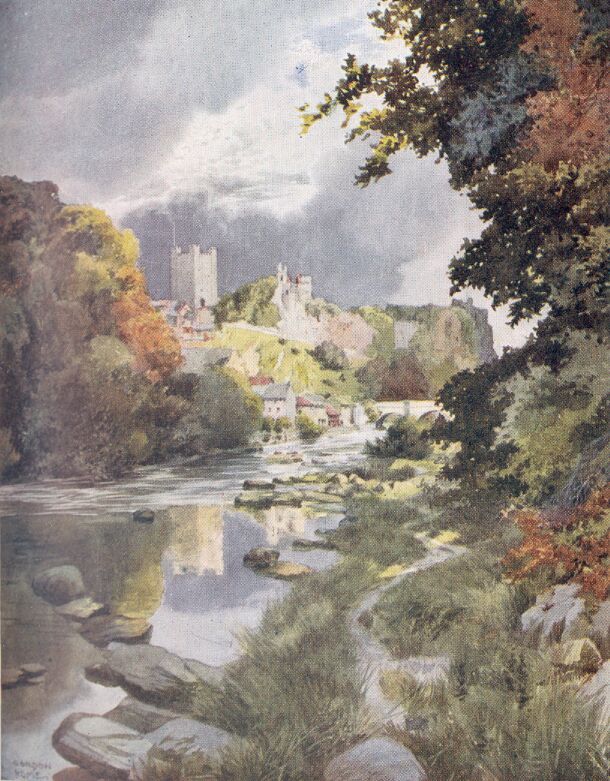
Protected by the great castle, there came into existence the town of Richmond, which grew and flourished. The houses must have been packed closely together to provide the numerous people with quarters inside the wall which was built to protect the place from the raiding Scots. The area of the town was scarcely larger than the castle, and although in this way the inhabitants gained security from one danger, they ran a greater risk from a far more insidious foe, which took the form of pestilences of a most virulent character. After one of these visitations the town of Richmond would be left in a pitiable plight. Many houses would be deserted, and fields became 'over-run with briars, nettles, and other noxious weeds.'
Easby Abbey is so much a possession of Richmond that we cannot go towards the mountains until we have seen something of its charms. The ruins slumber in such unutterable peace by the riverside that the place is well suited to our mood to go a-dreaming of the centuries which have been so long dead that our imaginations are not cumbered with any of the dull times that may have often set the canons of St. Agatha's yawning. The walk along the steep shady bank above the river is beautiful all the way, and the surroundings of the broken walls and traceried windows are singularly rich. There is nothing, however, at Easby that makes a striking picture, although there are many architectural fragments that are full of beauty. Fountains, Rievaulx and Tintern, all leave Easby far behind, but there are charms enough here with which to be content, and it is, perhaps, a pleasant thought to know that, although on this sunny afternoon these meadows by the Swale seem to reach perfection, yet in the neighbourhood of Ripon there is something still finer waiting for us. Of the abbey church scarcely more than enough has survived for the preparation of a ground-plan, and many of the evidences are now concealed by the grass. The range of domestic buildings that surrounded the cloister garth are, therefore, the chief interest, although these also are broken and roofless. We can wander among the ivy-grown walls which, in the refectory, retain some semblance of their original form, and we can see the picturesque remains of the common-room, the guest-hall, the chapter-house, and the sacristy. Beyond the ruins of the north transept, a corridor leads into the infirmary, which, besides having an unusual position, is remarkable as being one of the most complete groups of buildings set apart for this object. A noticeable feature of the cloister garth is a Norman arch belonging to a doorway that appears to be of later date. This is probably the only survival of the first monastery founded, it is said, by Roald, Constable of Richmond Castle, in 1152. Building of an extensive character was, therefore, in progress at the same time in these sloping meadows, as on the castle heights, and St. Martin's Priory, close to the town, had not long been completed. Whoever may have been the founder of the abbey, it is definitely known that the great family of Scrope obtained the privileges that had been possessed by the Constable, and they added so much to the property of the monastery that in the reign of Henry VIII. the Scropes were considered the original founders. Easby thus became the stately burying-place of the family and the splendid tombs that appeared in the choir of their church were a constant reminder to the canons of the greatness of the lords of Bolton. Sir Henry le Scrope was buried beneath a great stone effigy, bearing the arms—azure, a bend or—of his house. Near by lay Sir William le Scrope's armed figure, and round about were many others of the family buried beneath flat stones. We know this from the statement of an Abbot of Easby in the fourteenth century; and but for the record of his words there would be nothing to tell us anything of these ponderous memorials, which have disappeared as completely as though they had had no more permanence than the yellow leaves that are just beginning to flutter from the trees. The splendid church, the tombs, and even the very family of Scrope, have disappeared; but across the hills, in the valley of the Ure, their castle still stands, and in the little church of Wensley there can still be seen the parclose screen of Perpendicular date that one of the Scropes must have rescued when the monastery was being stripped and plundered.
The fine gate-house of Easby Abbey, which is in a good state of preservation, stands a little to the east of the parish church, and the granary is even now in use.
On the sides of the parvise over the porch of the parish church are the arms of Scrope, Conyers, and Aske; and in the chancel of this extremely interesting old building there can be seen a series of wall-paintings, some of which probably date from the reign of Henry III. This would make them earlier than those at Pickering.
SWALEDALE
There is a certain elevated and wind-swept spot, scarcely more than a long mile from Richmond, that commands a view over a wide extent of romantic country. Vantage-points of this type, within easy reach of a fair-sized town, are inclined to be overrated, and, what is far worse, to be spoiled by the litter of picnic parties; but Whitcliffe Scar is free from both objections. In magnificent September weather one may spend many hours in the midst of this great panorama without being disturbed by a single human being, besides a possible farm labourer or shepherd; and if scraps of paper and orange-peel are ever dropped here, the keen winds that come from across the moors dispose of them as efficaciously as the keepers of any public parks.
The view is removed from a comparison with many others from the fact that one is situated at the dividing-line between the richest cultivation and the wildest moorlands. Whitcliffe Scar is the Mount Pisgah from whence the jaded dweller in towns can gaze into a promised land of solitude,
|
'Where things that own not man's dominion dwell, And mortal foot hath ne'er or rarely been.' |
The eastward view of green and smiling country is undeniably beautiful, but to those who can appreciate Byron's enthusiasm for the trackless mountain there is something more indefinable and inspiring in the mysterious loneliness of the west. The long, level lines of the moorland horizon, when the sun is beginning to climb downwards, are cut out in the softest blue and mauve tints against the shimmering transparency of the western sky, and the plantations that clothe the sides of the dale beneath one are filled with wonderful shadows, which are thrown out with golden outlines. The view along the steep valley extends for a few miles, and then is suddenly cut off by a sharp bend where the Swale, a silver ribbon along the bottom of the dale, disappears among the sombre woods and the shoulders of the hills.
In this aspect of Swaledale one sees its mildest and most civilized mood; for beyond the purple hill-side that may be seen in the illustration, cultivation becomes more palpably a struggle, and the gaunt moors, broken by lines of precipitous scars, assume control of the scenery.
From 200 feet below, where the river is flowing along its stony bed, comes the sound of the waters ceaselessly grinding the pebbles, and from the green pastures there floats upwards a distant ba-baaing. No railway has penetrated the solitudes of Swaledale, and, as far as one may look into the future in such matters, there seems every possibility of this loneliest and grandest of the Yorkshire dales retaining its isolation in this respect. None but the simplest of sounds, therefore, are borne on the keen winds that come from the moorland heights, and the purity of the air whispers in the ear the pleasing message of a land where chimneys have never been.
Besides the original name of Whitcliffe Scar, this remarkable view-point has, since 1606, been popularly known as 'Willance's Leap.' In that year a certain Robert Willance, whose father appears to have been a successful draper in Richmond, was hunting in the neighbourhood, when he found himself enveloped in a fog. It must have been sufficiently dense to shut out even the nearest objects; for, without any warning, Willance found himself on the verge of the scar, and before he could check his horse both were precipitated over the cliff. We have no detailed account of whether the fall was broken in any way; but, although his horse was killed instantly, Willance, by some almost miraculous good fortune, found himself alive at the bottom with nothing worse than a broken leg.
It is a difficult matter to decide which is the more attractive means of exploring Swaledale; for if one keeps to the road at the bottom of the valley many beautiful and remarkable aspects of the country are missed, and yet if one goes over the moors it is impossible really to explore the recesses of the dale. The old road from Richmond to Reeth avoids the dale altogether, except for the last mile, and its ups and its downs make the traveller pay handsomely for the scenery by the way.
But this ought not to deter anyone from using the road; for the view of the village of Marske, cosily situated among the wooded heights that rise above the beck, is missed by those who keep to the new road along the banks of the Swale. The romantic seclusion of this village is accentuated towards evening, when a shadowy stillness fills the hollows. The higher woods may be still glowing with the light of the golden west, while down below a softness of outline adds beauty to every object. The old bridge that takes the road to Reeth across Marske Beck needs no such fault-forgiving light, for it was standing in the reign of Elizabeth, and, from its appearance, it is probably centuries older.
The new road to Reeth from Richmond goes down at an easy gradient from the town to the banks of the river, which it crosses when abreast of Whitcliffe Scar, the view in front being at first much the same as the nearer portions of the dale seen from that height. Down on the left, however, there are some chimney-shafts, so recklessly black that they seem to be no part whatever of their sumptuous natural surroundings, and might almost suggest a nightmare in which one discovered that some of the vilest chimneys of the Black Country had taken to touring in the beauty spots of the country.
As one goes westward, the road penetrates right into the bold scenery that invites exploration when viewed from 'Willance's Leap.' There is a Scottish feeling—perhaps Alpine would be more correct—in the steeply-falling sides of the dale, all clothed in firs and other dense plantations; and just where the Swale takes a decided turn towards the south there is a view up Marske Beck that adds much to the romance of the scene. Behind one's back the side of the dale rises like a dark green wall entirely in shadow, and down below half buried in foliage, the river swirls and laps its gravelly beaches, also in shadow. Beyond a strip of pasture begin the tumbled masses of trees which, as they climb out of the depths of the valley, reach the warm, level rays of sunlight that turns the first leaves that have passed their prime into the fierce yellows and burnt siennas which, when faithfully represented at Burlington House, are often considered overdone. Even the gaunt obelisk near Marske Hall responds to a fine sunset of this sort, and shows a gilded side that gives it almost a touch of grandeur.
Evening is by no means necessary to the attractions of Swaledale, for a blazing noon gives lights and shades and contrasts of colour that are a large portion of Swaledale's charms. If instead of taking either the old road by way of Marske, or the new one by the riverside, one had crossed the old bridge below the castle, and left Richmond by a very steep road that goes to Leyburn, one would have reached a moorland that is at its best in the full light of a clear morning.
The clouds are big, but they carry no threat of rain, for right down to the far horizon from whence this wind is coming there are patches of blue proportionate to the vast spaces overhead. As each white mass passes across the sun, we are immersed in a shadow many acres in extent: but the sunlight has scarcely fled when a rim of light comes over the edge of the plain, just above the hollow where Downholme village lies hidden from sight, and in a few minutes that belt of sunshine has reached some sheep not far off, and rimmed their coats with a brilliant edge of white. Shafts of whiteness, like searchlights, stream from behind a distant cloud, and everywhere there is brilliant contrast and a purity to the eye and lungs that only a Yorkshire moor possesses.
A short two miles up the road to Leyburn, just above Gill Beck, there is an ancient house known as Walburn Hall, and also the remains of the chapel belonging to it, which dates from the Perpendicular period. The buildings are now used as a farm, but there are still enough suggestions of a dignified past to revivify the times when this was a centre of feudal power.
Turning back to Swaledale by a lane on the south side of Gill Beck, Downholme village is passed a mile away on the right, and the bold scenery of the dale once more becomes impressive.
Two great headlands, formed by the wall-like terminations of Cogden and Harkerside Moors, rising one above the other, stand out magnificently. Their huge sides tower up nearly a thousand feet from the river, until they are within reach of the lowering clouds that every moment threaten to envelop them in their indigo embrace. There is a curious rift in the dark cumulus revealing a thin line of dull carmine that frequently changes its shape and becomes nearly obliterated, but its presence in no way weakens the awesomeness of the picture. The dale appears to become huger and steeper as the clouds thicken, and what have been merely woods and plantations in this heavy gloom become mysterious forests. The river, too, seems to change its character, and become a pale serpent, uncoiling itself from some mountain fastness where no living creatures besides great auks and carrion birds, dwell.
In such surroundings as these there were established in the Middle Ages, two religious houses, within a mile of one another, on opposite sides of the swirling river. On the north bank, not far from Marrick village, you may still see the ruins of Marrick Priory in its beautiful situation much as Turner painted it a century ago. Leland describes Marrick as 'a Priory of Blake Nunnes of the Foundation of the Askes.' It was, we know, an establishment for Benedictine Nuns, founded or endowed by Roger de Aske in the twelfth century. At Ellerton, on the other side of the river a little lower down, the nunnery was of the Cistercian Order; for, although very little of its history has been discovered, Leland writes of the house as 'a Priori of White clothid Nunnes.' After the Battle of Bannockburn, when the Scots raided all over the North Riding of Yorkshire, they came along Swaledale in search of plunder, and we are told that Ellerton suffered from their violence.
Where the dale becomes wider, owing to the branch valley of Arkengarthdale, there are two villages close together. Grinton is reached first, and is older than Reeth, which is a short distance north of the river. The parish of Grinton is one of the largest in Yorkshire. It is more than twenty miles long, containing something near 50,000 acres, and according to Mr. Speight, who has written a very detailed history of Richmondshire, more than 30,000 acres of this consist of mountain, grouse-moor and scar. For so huge a parish the church is suitable in size, but in the upper portions of the dales one must not expect any very remarkable exteriors; and Grinton, with its low roofs and plain battlemented tower, is much like other churches in the neighbourhood. Inside there are suggestions of a Norman building that has passed away, and the bowl of the font seems also to belong to that period. The two chapels opening from the chancel contain some interesting features, which include a hagioscope, and both are enclosed by old screens.
Leaving the village behind, and crossing the Swale, you soon come to Reeth, which may, perhaps, be described as a little town. It must have thrived with the lead-mines in Arkengarthdale and along the Swale, for it has gone back since the period of its former prosperity, and is glad of the fact that its situation, and the cheerful green which the houses look upon, have made it something of a holiday resort.
When Reeth is left behind, there is no more of the fine 'new' road which makes travelling so easy for the eleven miles from Richmond. The surface is, however, by no means rough along the nine miles to Muker, although the scenery becomes far wilder and more mountainous with every mile. The dale narrows most perceptibly; the woods become widely separated, and almost entirely disappear on the southern side; and the gaunt moors, creeping down the sides of the valley seem to threaten the narrow belt of cultivation, that becomes increasingly restricted to the river margins. Precipitous limestone scars fringe the browny-green heights in many places, and almost girdle the summit of Calver Hill, the great bare height that rises a thousand feet above Reeth. The farms and hamlets of these upper parts of Swaledale are of the same greys, greens, and browns as the moors and scars that surround them. The stone walls, that are often high and forbidding, seem to suggest the fortifications required for man's fight with Nature, in which there is no encouragement for the weak. In the splendid weather that so often welcomes the mere summer rambler in the upper dales the austerity of the widely scattered farms and villages may seem a little unaccountable; but a visit in January would quite remove this impression, though even in these lofty parts of England the worst winter snowstorm has, in quite recent years, been of trifling inconvenience. Bad winters will, no doubt, be experienced again on the fells; but leaving out of the account the snow that used to bury farms, flocks, roads, and even the smaller gills, in a vast smother of whiteness, there are still the winds that go shrieking over the desolate heights, there is still the high rainfall, and there are still destructive thunderstorms that bring with them hail of a size that we seldom encounter in the lower levels.
The great rapidity with which the Swale, or such streams as the Arkle, can produce a devastating flood can scarcely be comprehended by those who have not seen the results of even moderate rainstorms on the fells. When, however, some really wet days have been experienced in the upper parts of the dales, it seems a wonder that the bridges are not more often in jeopardy.
Of course, even the highest hills of Yorkshire are surpassed in wetness by their Lakeland neighbours; for whereas Hawes Junction, which is only about seven miles south of Muker, has an average yearly rainfall of about 62 inches, Mickleden, in Westmorland, can show 137, and certain spots in Cumberland aspire towards 200 inches in a year.
The weather conditions being so severe, it is not surprising to find that no corn at all is grown in Swaledale at the present day. Some notes, found in an old family Bible in Teesdale, are quoted by Mr. Joseph Morris. They show the painful difficulties experienced in the eighteenth century from such entries as: '1782. I reaped oats for John Hutchinson, when the field was covered with snow,' and: '1799, Nov. 10. Much corn to cut and carry. A hard frost.'
Muker, notwithstanding all these climatic difficulties, has some claim to picturesqueness, despite the fact that its church is better seen at a distance, for a close inspection reveals its rather poverty-stricken state. The square tower, so typical of the dales, stands well above the weathered roofs of the village, and there are sufficient trees to tone down the severities of the stone walls, that are inclined to make one house much like its neighbour, and but for natural surroundings would reduce the hamlets to the same uniformity. At Muker, however, there is a steep bridge and a rushing mountain stream that joins the Swale just below. The road keeps close to this beck, and the houses are thus restricted to one side of the way.
Away to the south, in the direction of the Buttertubs Pass, is Stags Fell, 2,213 feet above the sea, and something like 1,300 feet above Muker. Northwards, and towering over the village, is the isolated mass of Kisdon Hill, on two sides of which the Swale, now a mountain stream, rushes and boils among boulders and ledges of rock. This is one of the finest portions of the dale, and, although the road leaves the river and passes round the western side of Kisdon, there is a path that goes through the glen, and brings one to the road again at Keld.
Just before you reach Keld, the Swale drops 30 feet at Kisdon Force, and after a night of rain there are many other waterfalls to be seen in this district. These are not to me, however, the chief attractions of the head of Swaledale, although without the angry waters the gills and narrow ravines that open from the dale would lose much interest. It is the stern grandeur of the scarred hillsides and the wide mountainous views from the heights that give this part of Yorkshire such a fascination. If you climb to the top of Rogan's Seat, you have a huge panorama of desolate country spread out before you. The confused jumble of blue-grey mountains to the north-west is beyond the limits of Yorkshire at last, and in their strong embrace those stern Westmorland hills hold the charms of Lakeland.
If one stays in this mountainous region, there are new and exciting walks available for every day. There are gloomy recesses in the hillsides that encourage exploration from the knowledge that they are not tripper-worn, and there are endless heights to be climbed that are equally free from the smallest traces of desecrating mankind. Rare flowers, ferns, and mosses flourish in these inaccessible solitudes, and will continue to do so, on account of the dangers that lurk in their fastnesses, and also from the fact that their value is nothing to any but those who are glad to leave them growing where they are.
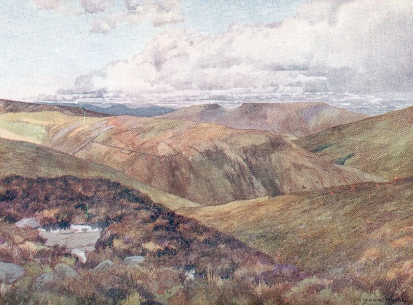
The approach from Muker to the upper part of Wensleydale is by a mountain road that can claim a grandeur which, to those who have never explored the dales, might almost seem impossible. I have called it a road, but it is, perhaps, questionable whether this is not too high-sounding a term for a track so invariably covered with large loose stones and furrowed with water-courses. At its highest point the road goes through the Buttertubs Pass, taking the traveller to the edge of the pot-holes that have given their name to this thrilling way through the mountain ridge dividing the Swale from the Ure.
Such a lonely and dangerous road should no doubt be avoided at night, but yet I am always grateful for the delays which made me so late that darkness came on when I was at the highest portion of the pass. It was late in September, and it was the day of the feast at Hawes, which had drawn to that small town farmers and their wives, and most, if not all, the young men and maidens within a considerable radius. I made my way slowly up the long ascent from Muker, stumbling frequently on the loose stones and in the water-worn runnels that were scarcely visible in the dim twilight. The huge, bare shoulders of the fells began to close in more and more as I climbed. Towards the west lay Great Shunnor Fell, its vast brown-green mass being sharply defined against the clear evening sky; while further away to the north-west there were blue mountains going to sleep in the soft mistiness of the distance. Then the road made a sudden zig-zag, but went on climbing more steeply than ever, until at last I found that the stony track had brought me to the verge of a precipice. There was not sufficient light to see what dangers lay beneath me, but I could hear the angry sound of a beck falling upon quantities of bare rocks. If one does not keep to the road, there is on the other side the still greater menace of the Buttertubs, the dangers of which are too well known to require any emphasis of mine. Those pot-holes which have been explored with much labour, and the use of winches and tackle and a great deal of stout rope, have revealed in their cavernous depths the bones of sheep that disappeared from flocks which have long since become mutton. This road is surely one that would have afforded wonderful illustrations to the 'Pilgrim's Progress,' for the track is steep and narrow and painfully rough; dangers lie on either side, and safety can only be found by keeping in the middle of the road.
What must have been the thoughts, I wonder, of the dalesmen who on different occasions had to go over the pass at night in those still recent times when wraithes and hobs were terrible realities? In the parts of Yorkshire where any records of the apparitions that used to enliven the dark nights have been kept, I find that these awesome creatures were to be found on every moor, and perhaps some day in my reading I shall discover an account of those that haunted this pass.
Although there are probably few who care for rough moorland roads at night, the Buttertubs Pass in daylight is still a memorable place. The pot-holes can then be safely approached, and one can peer into the blackness below until the eyes become adapted to the gloom. Then one sees the wet walls of limestone and the curiously-formed isolated pieces of rock that almost suggest columnar basalt. In crevices far down delicate ferns are growing in the darkness. They shiver as the cool water drips upon them from above, and the drops they throw off fall down lower still into a stream of underground water that has its beginnings no man knows where. On a hot day it is cooling simply to gaze into the Buttertubs, and the sound of the falling waters down in these shadowy places is pleasant after gazing on the dry fell-sides.
Just beyond the head of the pass, where the descent to Hawes begins, the shoulders of Great Shunnor Fell drop down, so that not only straight ahead, but also westwards, one can see a splendid mountain view. Ingleborough's flat top is conspicuous in the south, and in every direction there are indications of the geology of the fells. The hard stratum of millstone grit that rests upon the limestone gives many of the summits of the hills their level character, and forms the sharply-defined scars that encircle them. The sudden and violent changes of weather that take place among these watersheds would almost seem to be cause enough to explain the wearing down of the angularities of the heights. Even while we stand on the bridge at Hawes we can see three or four ragged cloud edges letting down on as many places torrential rains, while in between there are intervals of blazing sunshine, under which the green fells turn bright yellow and orange in powerful contrast to the indigo shadows on every side. Such rapid changes from complete saturation to sudden heat are trying to the hardest rocks, and at Hardraw, close at hand, there is a still more palpable process of denudation in active operation.
Such a morning as this is quite ideal for seeing the remarkable waterfall known as Hardraw Scar or Force. The footpath that leads up the glen leaves the road at the side of the 'Green Dragon' at Hardraw, where the innkeeper hands us a key to open the gate we must pass through. Being September, and an uncertain day for weather, we have the whole glen to ourselves, until behind some rocks we discover a solitary angler. There is nothing but the roughest of tracks to follow, for the carefully-made pathway that used to go right up to the fall was swept away half a dozen years ago, when the stream in a fierce mood cleared its course of any traces of artificiality. We are deeply grateful, and make our among the big rocks and across the slippery surfaces of shale, with the roar of the waters becoming more and more insistent. The sun has turned into the ravine a great searchlight that has lit up the rock walls and strewn the wet grass beneath with sparkling jewels. On the opposite side there is a dense blue shadow over everything except the foliage on the brow of the cliffs, where the strong autumn colours leap into a flaming glory that transforms the ravine into an astonishing splendour. A little more careful scrambling by the side of the stream, and we see a white band of water falling from the overhanging limestone into the pool about ninety feet below. Off the surface of the water drifts a mist of spray, in which a soft patch of rainbow hovers until the sun withdraws itself for a time and leaves a sudden gloom in the horseshoe of overhanging cliffs. The place is, perhaps, more in sympathy with a cloudy sky, but, under sunshine or cloud, the spout of water is a memorable sight, and its imposing height places Hardraw among the small group of England's finest waterfalls. The mass of shale that lies beneath this stratum is soft enough to be worked away by the water until the limestone overhangs the pool to the extent of ten or twelve feet, so that the water falls sheer into the circular basin, leaving a space between the cliff and the fall where it is safe to walk on a rather moist and slippery path that is constantly being sprayed from the surface of the pool.
John Leland wrote, nearly four hundred years ago, 'Uredale veri litle Corne except Bygg or Otes, but plentiful of Gresse in Communes,' and although this dale is so much more genial in aspect, and so much wider than the valley of the Swale, yet crops are under the same disabilities. Leaving Gayle behind, we climb up a steep and stony road above the beck until we are soon above the level of green pasturage. The stone walls still cover the hillsides with a net of very large mesh, but the sheep find more bent than grass, and the ground is often exceedingly steep. Higher still climbs this venturesome road, until all around us is a vast tumble of gaunt brown fells, divided by ravines whose sides are scarred with runnels of water, which have exposed the rocks and left miniature screes down below. At a height of nearly 1,600 feet there is a gate, where we will turn away from the road that goes on past Dodd Fell into Langstrothdale, and instead climb a smooth grass track sprinkled with half-buried rocks until we have reached the summit of Wether Fell, 400 feet higher. There is a scanty growth of ling upon the top of this height, but the hills that lie about on every side are browny-green or of an ochre colour, and there is little of the purple one sees in the Cleveland Hills.
The cultivated level of Wensleydale is quite hidden from view, so that we look over a vast panorama of mountains extending in the west as far as the blue fells of Lakeland. I have painted the westward view from this very summit, so that any written description is hardly needed; but behind us, as we face the scene illustrated here, there is a wonderful expanse that includes the heights of Addlebrough, Stake Fell, and Penhill Beacon, which stand out boldly on the southern side of Wensleydale. I have seen these hills lightly covered with snow, but that can give scarcely the smallest suggestion of the scene that was witnessed after the remarkable snowstorm of January, 1895, which blocked the roads between Wensleydale and Swaledale until nearly the middle of March. Roads were dug out, with walls of snow on either side from 10 to 15 feet in height, but the wind and fresh falls almost obliterated the passages soon after they had been cut. In Landstrothdale Mr. Speight tells of the extraordinary difficulties of the dalesfolk in the farms and cottages, who were faced with starvation owing to the difficulty of getting in provisions. They cut ways through the drifts as high as themselves in the direction of the likeliest places to obtain food, while in Swaledale they built sledges.
When we have left the highest part of Wether Fell, we find the track taking a perfectly straight line between stone walls. The straightness is so unusual that there can be little doubt that it is a survival of one of the Roman ways connecting their station on Brough Hill, just above the village of Bainbridge, with some place to the south-west. The track goes right over Cam Fell, and is known as the Old Cam Road, but I cannot recommend it for any but pedestrians. When we have descended only a short distance, there is a sudden view of Semmerwater, the only piece of water in Yorkshire that really deserves to be called a lake. It is a pleasant surprise to discover this placid patch of blue lying among the hills, and partially hidden by a fellside in such a way that its area might be far greater than 105 acres.
Those who know Turner's painting of this lake would be disappointed, no doubt, if they saw it first from this height. The picture was made at the edge of the water with the Carlow Stone in the foreground, and over the mountains on the southern shore appears a sky that would make the dullest potato-field thrilling.
A short distance lower down, by straying a little from the road, we get a really imposing view of Bardale, into which the ground falls suddenly from our very feet. Sheep scamper nimbly down their convenient little tracks, but there are places where water that overflows from the pools among the bent and ling has made blue-grey seams and wrinkles in the steep places that give no foothold even to the toughest sheep.
We lose sight of Semmerwater behind the ridge that forms one side of the branch dale in which it lies, but in exchange we get beautiful views of the sweeping contours of Wensleydale. High upon the further side of the valley Askrigg's gray roofs and pretty church stand out against a steep fellside; further down we can see Nappa Hall, surrounded by trees, just above the winding river, and Bainbridge lies close at hand. We soon come to the broad and cheerful green, surrounded by a picturesque scattering of old but well preserved cottages; for Bainbridge has sufficient charms to make it a pleasant inland resort for holiday times that is quite ideal for those who are content to abandon the sea. The overflow from Semmerwater, which is called the Bam, fills the village with its music as it falls over ledges or rock in many cascades along one side of the green.
There is a steep bridge, which is conveniently placed for watching the waterfalls; there are white geese always drilling on the grass, and there are still to be seen the upright stones of the stocks. The pretty inn called the 'Rose and Crown,' overlooking a corner of the green states upon a board that it was established in 1445.
A horn-blowing custom has been preserved at Bainbridge. It takes place at ten o'clock every night between Holy Rood (September 27) and Shrovetide, but somehow the reason for the observance has been forgotten. The medieval regulations as to the carrying of horns by foresters and those who passed through forests would undoubtedly associate the custom with early times, and this happy old village certainly gains our respect for having preserved anything from such a remote period. When we reach Bolton Castle we shall find in the museum there an old horn from Bainbridge.
Besides having the length and breadth of Wensleydale to explore with or without the assistance of the railway, Bainbridge has as its particular possession the valley containing Semmerwater, with the three romantic dales at its head. Counterside, a hamlet perched a little above the lake, has an old hall, where George Fox stayed in 1677 as a guest of Richard Robinson. The inn bears the date 1667 and the initials 'B.H.J.,' which may be those of one of the Jacksons, who were Quakers at that time.
On the other side of the river, and scarcely more than a mile from Bainbridge, is the little town of Askrigg, which supplies its neighbour with a church and a railway-station. There is a charm in its breezy situation that is ever present, for even when we are in the narrow little street that curves steeply up the hill there are quite exhilarating peeps of the dale. We can see Wether Fell, with the road we traversed yesterday plainly marked on the slopes, and down below, where the Ure takes its way through bright pastures, there is a mist of smoke ascending from Hawes. Blocking up the head of the dale are the spurs of Dodd and Widdale Fells, while beyond them appears the blue summit of Bow Fell. We find it hard to keep our eyes away from the distant mountains, which fascinate one by appearing to have an importance that is perhaps diminished when they are close at hand.
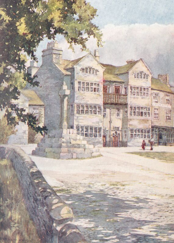
We find ourselves halting on a patch of grass by the restored market-cross to look more closely at a fine old house overlooking the three-sided space. There is no doubt as to the date of the building, for a plain inscription begins 'Gulielmus Thornton posuit hanc domum MDCLXXVIII.' The bay windows have heavy mullions and there is a dignity about the house which must have been still more apparent when the surrounding houses were lower than at present. The wooden gallery that is constructed between the bays was, it is said, built as a convenient place for watching the bull-fights that took place just below. In the grass there can still be seen the stone to which the bull-ring was secured. The churchyard runs along the west side of the little market-place, so that there is an open view on that side, made interesting by the Perpendicular church.
The simple square tower and the unbroken roof-lines are battlemented, like so many of the churches of the dales; inside we find Norman pillars that are quite in strange company, if it is true that they were brought from the site of Fors Abbey, a little to the west of the town.
Wensleydale generally used to be famed for its hand-knitting, but I think Askrigg must have turned out more work than any place in the valley, for the men as well as the womenfolk were equally skilled in this employment, and Mr. Whaley says they did their work in the open air 'while gossiping with their neighbours.' This statement is, nevertheless, exceeded by what appears in a volume entitled 'The Costume of Yorkshire.' In that work of 1814, which contains a number of George Walker's quaint drawings, reproduced by lithography, we find a picture having a strong suggestion of Askrigg in which there is a group of old and young of both sexes seated on the steps of the market-cross, all knitting, and a little way off a shepherd is seen driving some sheep through a gate, and he also is knitting.
From Askrigg there is a road that climbs up from the end of the little street at a gradient that looks like 1 in 4, but it is really less formidable. Considering its steepness the surface is quite good, but that is due to the industry of a certain road-mender with whom I once had the privilege to talk when, hot and breathless, I paused to enjoy the great expanse that lay to the south. He was a fine Saxon type, with a sunburnt face and equally brown arms. Road-making had been his ideal when he was a mere boy, and since he had obtained his desire he told me that he couldn't be happier if he were the King of England. The picturesque road where we leave him, breaking every large stone he can find, goes on across a belt of brown moor, and then drops down between gaunt scars that only just leave space for the winding track to pass through. It afterwards descends rapidly by the side of a gill, and thus enters Swaledale.
There is a beautiful walk from Askrigg to Mill Gill Force. The distance is scarcely more than half a mile across sloping pastures and through the curious stiles that appear in the stone walls. So dense is the growth of trees in the little ravine that one hears the sound of the waters close at hand without seeing anything but the profusion of foliage overhanging and growing among the rocks. After climbing down among the moist ferns and moss-grown stones, the gushing cascades appear suddenly set in a frame of such lavish beauty that they hold a high place among their rivals in the dale.
Keeping to the north side of the river, we come to Nappa Hall at a distance of a little over a mile to the east of Askrigg. It is now a farmhouse, but its two battlemented towers proclaim its former importance as the chief seat of the family of Metcalfe. The date of the house is about 1459, and the walls of the western tower are 4 feet in thickness. The Nappa lands came to James Metcalfe from Sir Richard Scrope of Bolton Castle shortly after his return to England from the field of Agincourt, and it was probably this James Metcalfe who built the existing house.
The road down the dale passes Woodhall Park, and then, after going down close to the Ure, it bears away again to the little village of Carperby. It has a triangular green surrounded by white posts. At the east end stands an old cross, dated 1674, and the ends of the arms are ornamented with grotesque carved heads. The cottages have a neat and pleasant appearance, and there is much less austerity about the place than one sees higher up the dale. A branch road leads down to Aysgarth Station, and just where the lane takes a sharp bend to the right a footpath goes across a smooth meadow to the banks of the Ure. The rainfall of the last few days, which showed itself at Mill Gill Force, at Hardraw Scar, and a dozen other falls, has been sufficient to swell the main stream at Wensleydale into a considerable flood, and behind the bushes that grow thickly along the riverside we can hear the steady roar of the cascades of Aysgarth. The waters have worn down the rocky bottom to such an extent that in order to stand in full view of the splendid fall we must make for a gap in the foliage, and scramble down some natural steps in the wall of rock forming low cliffs along each side of the flood. The water comes over three terraces of solid stone, and then sweeps across wide ledges in a tempestuous sea of waves and froth, until there come other descents which alter the course of parts of the stream, so that as we look across the riotous flood we can see the waters flowing in many opposite directions. Lines of cream-coloured foam spread out into chains of bubbles which join together, and then, becoming detached, again float across the smooth portions of each low terrace.
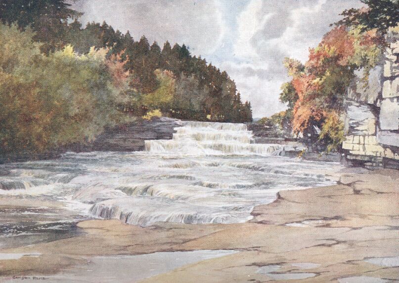
Some footpaths bring us to Aysgarth village, which seems altogether to disregard the church, for it is separated from it by a distance of nearly half a mile. There is one pleasant little street of old stone houses irregularly disposed, many of them being quite picturesque, with mossy roofs and ancient chimneys. This village, like Askrigg and Bainbridge, is ideally situated as a centre for exploring a very considerable district. There is quite a network of roads to the south, connecting the villages of Thoralby and West Burton with Bishop Dale, and the main road through Wensleydale. Thoralby is very old, and is beautifully situated under a steep hillside. It has a green overlooked by little grey cottages, and lower down there is a tall mill with curious windows built upon Bishop Dale Beck. Close to this mill there nestles a long, low house of that dignified type to be seen frequently in the North Riding, as well as in the villages of Westmorland. The huge chimney, occupying a large proportion of one gable-end, is suggestive of much cosiness within, and its many shoulders, by which it tapers towards the top, make it an interesting feature of the house.
The dale narrows up at its highest point, but the road is enclosed between grey walls the whole of the way over the head of the valley. A wide view of Langstrothdale and upper Wharfedale is visible when the road begins to drop downwards, and to the east Buckden Pike towers up to his imposing height of 2,302 feet. We shall see him again when we make our way through Wharfedale but we could go back to Wensleydale by a mountain-path that climbs up the side of Cam Gill Beck from Starbottom, and then, crossing the ridge between Buckden Pike and Tor Mere Top, it goes down into the wild recesses of Waldendale. So remote is this valley that wild animals, long extinct in other parts of the dales, survived there until almost recent times.
When we have crossed the Ure again, and taken a last look at the Upper Fall from Aysgarth Bridge, we betake ourselves by a footpath to the main highway through Wensleydale, turning aside before reaching Redmire in order to see the great castle of the Scropes at Bolton. It is a vast quadrangular mass, with each side nearly as gaunt and as lofty as the others. At each corner rises a great square tower, pierced, with a few exceptions, by the smallest of windows. Only the base of the tower at the north-east corner remains to-day, the upper part having fallen one stormy night in November, 1761, possibly having been weakened during the siege of the castle in the Civil War. We go into the court-yard through a vaulted archway on the eastern side. Many of the rooms on the side facing us are in good preservation, and an apartment in the south-west tower, which has a fireplace, is pointed out as having been used by Mary Queen of Scots when she was imprisoned here after the Battle of Langside in 1568. It was the ninth Lord Scrope who had the custody of the Queen, and he was assisted by Sir Francis Knollys. Mary, no doubt, found the time of her imprisonment irksome enough, despite the magnificent views over the dale which her windows appear to have commanded; but the monotony was relieved to some extent by the lessons in English which she received from Sir Francis, whom she describes as her 'good schoolmaster.' While still a prisoner, Mary addressed to him her first English letter, which begins: 'Master Knollys, I heve sum neus from Scotland'; and half-way through she begs that he will excuse her writing, seeing that she had 'neuur vsed it afor,' and was 'hestet.' The letter concludes with 'thus, affter my commendations, I prey God heuu you in his kipin. Your assured gud frind, MARIE R.'
On the opposite side of the steep-sided dale Penhill stands out prominently, with its flat summit reflecting just enough of the setting sun to recall a momentous occasion when from that commanding spot a real beacon-fire sent up a great mass of flame and sparks. It was during the time of Napoleon's threatened invasion of England, and the lighting of this beacon was to be the signal to the volunteers of Wensleydale to muster and march to their rendezvous. The watchman on Penhill, as he sat by the piled-up brushwood, wondering, no doubt, what would happen to him if the dreaded invasion were really to come about, saw, far away across the Vale of Mowbray, a light which he at once took to be the beacon upon Roseberry Topping. A moment later tongues of flame and smoke were pouring from his own hilltop, and the news spread up the dale like wildfire. The volunteers armed themselves rapidly, and with drums beating they marched away, with only such delay as was caused by the hurried leave-takings with wives and mothers, and all the rest who crowded round. The contingent took the road to Thirsk, and on the way were joined by the Mashamshire men. Whether it was with relief or disappointment I do not know; but when the volunteers reached Thirsk they heard that they had been called out by a false alarm, for the light seen in the direction of Roseberry Topping had been caused by accident, and the beacon on that height had not been lit.
Wensley stands just at the point where the dale, to which it has given its name, becomes so wide that it begins to lose its distinctive character. The village is most picturesque and secluded, and it is small enough to cause some wonder as to its distinction in naming the valley. It is suggested that the name is derived from Wodenslag, and that in the time of the Northmen's occupation of these parts the place named after their chief god would be the most important.
In the little church standing on the south side of the green there is so much to interest us that we are almost unable to decide what to examine first, until, realizing that we are brought face to face with a beautiful relic of Easby Abbey, we turn our attention to the parclose screen. It surrounds the family pew of Bolton Hall, and on three sides we see the Perpendicular woodwork fitted into the east end of the north aisle. The side that fronts the nave has an entirely different appearance, being painted and of a classic order, very lacking in any ecclesiastical flavour, an impression not lost on those who, with every excuse, called it 'the opera box.' In the panels of the early part of the screen are carved inscriptions and arms of the Scropes covering a long period, and, though many words and letters are missing, it is possible to make them more complete with the help of the record made by the heralds in 1665.
A charming lane, overhung by big trees, runs above the river-banks for nearly two miles of the way to Middleham; then it joins the road from Leyburn, and crosses the Ure by a suspension bridge, defended by two very formidable though modern archways. Climbing up past the church, we enter the cobbled market-place, which wears a rather decayed appearance in sympathy with the departed magnificence of the great castle of the Nevilles. It commands a vast view of Wensleydale from the southern side, in much the same manner as Bolton does from the north; but the castle buildings are entirely different, for Middleham consists of a square Norman keep, very massive and lofty, surrounded at a short distance by a strong wall and other buildings, also of considerable height, built in the Decorated period, when the Nevilles were in possession of the stronghold. The Norman keep dates from the year 1190, when Robert Fitz Randolph, grandson of Ribald, a brother of the Earl of Richmond, began to build the Castle.
It was, however, in later times, when Middleham had come to the Nevilles by marriage, that really notable events took place in this fortress. It was here that Warwick, the 'King-maker,' held Edward IV. prisoner in 1467, and in Part III. of the play of 'King Henry VI.,' Scene V. of the fourth act is laid in a park near Middleham Castle. Richard III.'s only son, Edward Prince of Wales, was born here in 1467, the property having come into Richard's possession by his marriage with Anne Neville.
We have already seen Leyburn Shawl from near Wensley, but its charm can only be appreciated by seeing the view up the dale from its larch-crowned termination. Perhaps if we had seen nothing of Wensleydale, and the wonderful views it offers, we should be more inclined to regard this somewhat popular spot with greater veneration; but after having explored both sides of the dale, and seen many views of a very similar character, we cannot help thinking that the vista is somewhat overrated. Leyburn itself is a cheerful little town, with a modern church and a very wide main street which forms a most extensive market-place. There is a bull-ring still visible in the great open space, but beyond this and the view from the Shawl Leyburn has few attractions, except its position as a centre or a starting-place from which to explore the romantic neighbourhood.
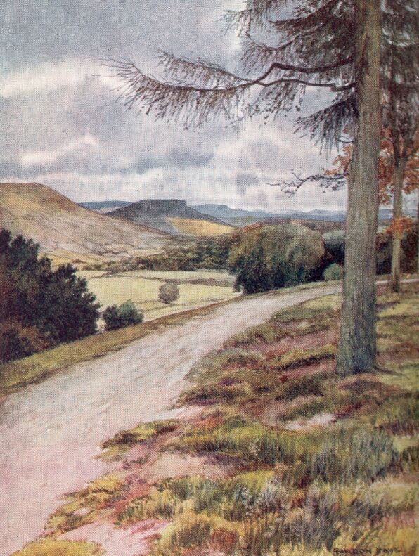
As we leave Leyburn we get a most beautiful view up Coverdale, with the two Whernsides standing out most conspicuously at the head of the valley, and it is this last view of Coverdale, and the great valley from which it branches, that remains in the mind as one of the finest pictures of this most remarkable portion of Yorkshire.
RIPON AND FOUNTAINS ABBEY
We have come out of Wensleydale past the ruins of the great Cistercian abbey of Jervaulx, which Conan, Earl of Richmond, moved from Askrigg to a kindlier climate, and we have passed through the quiet little town of Masham, famous for its fair in September, when sometimes as many as 70,000 sheep, including great numbers of the fine Wensleydale breed, are sold, and now we are at Ripon. It is the largest town we have seen since we lost sight of Richmond in the wooded recesses of Swaledale, and though we are still close to the Ure, we are on the very edge of the dale country, and miss the fells that lie a little to the west. The evening has settled down to steady rain, and the market-place is running with water that reflects the lights in the shop-windows and the dark outline of the obelisk in the centre. This erection is suspiciously called 'the Cross,' and it made its appearance nearly seventy years before the one at Richmond. Gent says it cost £564 11s. 9d., and that it is 'one of the finest in England.' I could, no doubt, with the smallest trouble discover a description of the real cross it supplanted, but if it were anything half as fine as the one at Richmond, I should merely be moved to say harsh things of John Aislabie, who was Mayor in 1702, when the obelisk was erected, and therefore I will leave the matter to others. It is, perhaps, an un-Christian occupation to go about the country quarrelling with the deeds of recent generations, though I am always grateful for any traces of the centuries that have gone which have been allowed to survive. With this thought still before me, I am startled by a long-drawn-out blast on a horn, and, looking out of my window, which commands the whole of the market-place, I can see beneath the light of a lamp an old-fashioned figure wearing a three-cornered hat. When the last quavering note has come from the great circular horn, the man walks slowly across the wet cobble-stones to the obelisk, where I watch him wind another blast just like the first, and then another, and then a third, immediately after which he walks briskly away and disappears down a turning. In the light of morning I discover that the horn was blown in front of the Town Hall, whose stucco front bears the inscription: 'Except ye Lord keep ye cittie, ye Wakeman waketh in vain.' The antique spelling is, of course, unable to give a wrong impression as to the age of the building, for it shows its period so plainly that one scarcely needs to be told that it was built in 1801, although it could not so easily be attributed to the notorious Wyatt. Notwithstanding much reconstruction there are still a few quaint houses to be seen in Ripon, and there clings to the streets a certain flavour of antiquity. It is the minster, nevertheless, that raises the 'city' above the average Yorkshire town. The west front, with its twin towers, is to some extent the most memorable portion of the great church. It is the work of Archbishop Walter Gray, and is a most beautiful example of the pure Early English style. Inside there is a good deal of transitional Norman work to be seen. The central tower was built in this period, but now presents a most remarkable appearance, owing to its partial reconstruction in Perpendicular times, the arch that faces the nave having the southern pier higher than the Norman one, and in the later style, so that the arch is lop-sided. As a building in which to study the growth of English Gothic architecture, I can scarcely think it possible to find anything better, all the periods being very clearly represented. The choir has much sumptuous carved woodwork, and the misereres are full of quaint detail. In the library there is a collection of very early printed books and other relics of the minster that add very greatly to the interest of the place.
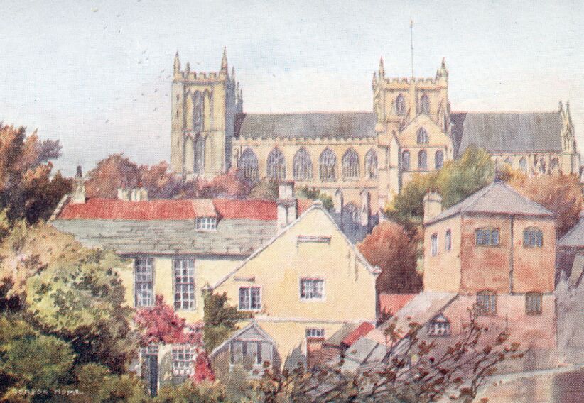
The monument to Hugh Ripley, who was the last Wakeman of Ripon and first Mayor in 1604, is on the north side of the nave facing the entrance to the crypt, popularly called 'St. Wilfrid's Needle.' A rather difficult flight of steps goes down to a narrow passage leading into a cylindrically vaulted cell with niches in the walls. At the north-east corner is the curious slit or 'Needle' that has been thought to have been used for purposes of trial by ordeal, the innocent person being able to squeeze through the narrow opening.
In reality it is probably nothing more than an arrangement for lighting two cells with one lamp. The crypt is of such a plainly Roman type, and is so similar to the one at Hexham, that it is generally accepted as dating from the early days of Christianity in Yorkshire, and there can be little doubt that it is a relic of Wilfrid's church in those early times.
At a very convenient distance from Ripon, and approached by a pleasant lane, are the lovely glades of Studley Royal, the noble park containing the ruins of Fountains Abbey. Below the well-kept pathway runs the Skell, but so transformed from its early character that you would imagine the pathways wind round the densely-wooded slopes, and give a dozen different views of each mass of trees, each temple, and each bend of the river. At last, from a considerable height, you have the lovely view of the abbey ruins illustrated here. At every season its charm is unmistakable, and even if no stately tower and no roofless arches filled the centre of the prospect, the scene would be almost as memorable. It is only one of the many pictures in the park that a retentive memory will hold as some of the most remarkable in England.
Among the ruins the turf is kept in perfect order, and it is pleasant merely to look upon the contrast of the green carpet that is so evenly laid between the dark stonework. The late-Norman nave, with its solemn double line of round columns, the extremely graceful arches of the Chapel of the Nine Altars, and the magnificent vaulted perspective of the dark cellarium of the lay-brothers, are perhaps the most fascinating portions of the buildings. I might be well compared with the last abbot but one, William Thirsk, who resigned his post, forseeing the coming Dissolution, and was therefore called 'a varra fole and a misereble ideote,' if I attempted in the short space available to give any detailed account of the abbey or its wonderful past. I have perhaps said enough to insist on its charms, and I know that all who endorse my statements will, after seeing Fountains, read with delight the books that are devoted to its story.
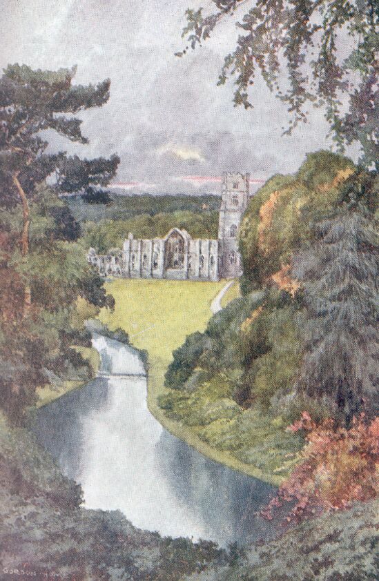
KNARESBOROUGH AND HARROGATE
It is sometimes said that Knaresborough is an overrated town from the point of view of its attractiveness to visitors, but this depends very much upon what we hope to find there. If we expect to find lasting pleasure in contemplating the Dropping Well, or the pathetic little exhibition of petrified objects in the Mother Shipton Inn, we may be prepared for disappointment. It seems strange that the real and lasting charms of the town should be overshadowed by such popular and much-advertised 'sights.' The first view of the town from the 'high' bridge is so full of romance that if there were nothing else to interest us in the place we would scarcely be disappointed. The Nidd, flowing smoothly at the foot of the precipitous heights upon which the church and the old roofs appear, is spanned by a great stone viaduct. This might have been so great a blot upon the scene that Knaresborough would have lost half its charm. Strangely enough, we find just the reverse is the case, for this railway bridge, with its battlemented parapets and massive piers, is now so weathered that it has melted into its surroundings as though it had come into existence as long ago as the oldest building visible. The old Knaresborough kept well to the heights adjoining the castle, and even to-day there are only a handful of later buildings down by the river margin.
When we have crossed the bridge, and have passed along a narrow roadway perched well above the river, we come to one of the many interesting houses that help to keep alive the old-world flavour of the town. Only a few years ago the old manor-house had a most picturesque and rather remarkable exterior, for its plaster walls were covered with a large black and white chequer-work and its overhanging eaves and tailing creepers gave it a charm that has since then been quite lost. The restoration which recently took place has entirely altered the character of the exterior, but inside everything has been preserved with just the care that should have been expended outside as well. There are oak-wainscoted parlours, oak dressers, and richly-carved fireplaces in the low-ceiled rooms, each one containing furniture of the period of the house. Upstairs there is a beautiful old bedroom lined with oak, like those on the floor below, and its interest is greatly enhanced by the story of Oliver Cromwell's residence in the house, for he is believed to have used this particular bedroom.
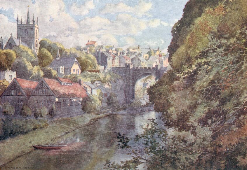
Higher up the hill stands the church with a square central tower surmounted by a small spike. It still bears the marks of the fire made by the Scots during their disastrous descent upon Yorkshire after Edward II.'s defeat at Bannockburn. The chapel north of the chancel contains interesting monuments of the old Yorkshire family of Slingsby. The altar-tomb in the centre bears the recumbent effigies of Francis Slingsby, who died in 1600, and Mary his wife. Another monument shows Sir William Slingsby, who accidentally discovered the first spring at Harrogate. The Slingsbys, who were cavaliers, produced a martyr in the cause of Charles I. This was the distinguished Sir Henry, who, in 1658, 'being beheaded by order of the tyrant Cromwell, ... was translated to a better place.' So says the inscription on a large slab of black marble in the floor of the chapel. The last of the male line of the family was Sir Charles Slingsby, who was most unfortunately drowned by the upsetting of a ferry-boat in the Ure in February, 1869.
When we have progressed beyond the market-place, we come out upon an elevated grassy space upon the top of a great mass of rock whose perpendicular sides drop down to a bend of the Nidd. Around us are scattered the ruins of Knaresborough Castle—poor and of small account if we compare them with Richmond, although the site is very similar; where before the siege in 1644 there must have been a most imposing mass of towers and curtain walls. Of the great keep, only the lowest story is at all complete, for above the first-floor there are only two sides to the tower, and these are battered and dishevelled. The walls enclosed about the same area as Richmond, but they are now so greatly destroyed that it is not easy to gain a clear idea of their position. There were no less than eleven towers, of which there now remain fragments of six, part of a gateway, and behind the old courthouse there are evidences of a secret cell. An underground sally-port opening into the moat, which was a dry one, is reached by steps leading from the castle yard.
The keep is in the Decorated style, and appears to have been built in the reign of Edward II. Below the ground is a vaulted dungeon, dark and horrible in its hopeless strength, which is only emphasized by the tiny air-hole that lets in scarcely a glimmering of light, but reveals a thickness of 15 feet of masonry that must have made a prisoner's heart sick. It is generally understood that Bolingbroke spared Richard II. such confinement as this, and that when he was a prisoner in the keep he occupied the large room on the floor above the kitchen. It is now a mere platform, with the walls running up on two sides only. The kitchen (sometimes called the guard-room) has a perfectly preserved roof of heavy groining, supported by two pillars, and it contains a collection of interesting objects, rather difficult to see, owing to the poor light that the windows allow. There is a great deal to interest us among the wind-swept ruins and the views into the wooded depths of the Nidd, and we would rather stay here and trace back the history of the castle and town to the days of that Norman Serlo de Burgh, who is the first mentioned in its annals, than go down to the tripper-worn Dropping Well and the Mother Shipton Inn.
The distance between Knaresborough and Harrogate is short, and after passing Starbeck we come to an extensive common known as the Stray. We follow the grassy space, when it takes a sharp turn to the north, and are soon in the centre of the great watering-place.
There is one spot in Harrogate that has a suggestion of the early days of the town. It is down in the corner where the valley gardens almost join the extremity of the Stray. There we find the Royal Pump Room that made its appearance in early Victorian times, and its circular counter is still crowded every morning by a throng of water-drinkers. We wander through the hilly streets and gaze at the pretentious hotels, the baths, the huge Kursaal, the hydropathic establishments, the smart shops, and the many churches, and then, having seen enough of the buildings, we find a seat supported by green serpents, from which to watch the passers-by. A white-haired and withered man, having the stamp of a military life in his still erect bearing, paces slowly by; then come two elaborately dressed men of perhaps twenty-five. They wear brown suits and patent boots, and their bowler hats are pressed down on the backs of their heads. Then nursemaids with perambulators pass, followed by a lady in expensive garments, who talks volubly to her two pretty daughters. When we have tired of the pavements and the people, we bid farewell to them without much regret, being in a mood for simplicity and solitude, and go away towards Wharfedale with the pleasant tune that a band was playing still to remind us for a time of the scenes we have left behind.
WHARFEDALE
Otley is the first place we come to in the long and beautiful valley of the Wharfe. It is a busy little town where printing machinery is manufactured and worsted mills appear to thrive. Immediately to the south rises the steep ridge known as the Chevin. It answers the same purpose as Leyburn Shawl in giving a great view over the dale; the elevation of over 900 feet, being much greater than the Shawl, of course commands a far more extensive panorama, and thus, in clear weather, York Minster appears on the eastern horizon and the Ingleton Fells on the west.
Farnley Hall, on the north side of the Wharfe, is an Elizabethan house dating from 1581, and it is still further of interest on account of Turner's frequent visits, covering a great number of years, and for the very fine collection of his paintings preserved there. The oak-panelling and coeval furniture are particularly good, and among the historical relics there is a remarkable memento of Marston Moor in the sword that Cromwell carried during the battle.
Ilkley has contrived to keep an old well-house, where the water's purity is its chief attraction. The church contains a thirteenth-century effigy of Sir Andrew de Middleton, and also three pre-Norman crosses without arms. On the heights to the south of Ilkley is Rumbles Moor, and from the Cow and Calf rocks there is a very fine view.
About six miles still further up Wharfedale, Bolton Abbey stands by a bend of the beautiful river. The ruins are most picturesquely placed on ground slightly raised above the banks of the Wharfe. Of the domestic buildings practically nothing remains, while the choir of the church, the central tower, and north transepts are roofless and extremely beautiful ruins. The nave is roofed in, and is used as a church at the present time, and it is probable that services have been held in the building practically without any interruption for 700 years. Hiding the Early English west end is the lower half of a fine Perpendicular tower, commenced by Richard Moone, the last Prior.
The great east window of the choir has lost its tracery, and the Decorated windows at the sides are in the same vacant state, with the exception of one. It is blocked up to half its height, like those on the north side, but the flamboyant tracery of the head is perfect and very graceful. Lower down there is some late-Norman interlaced arcading resting on carved corbels.
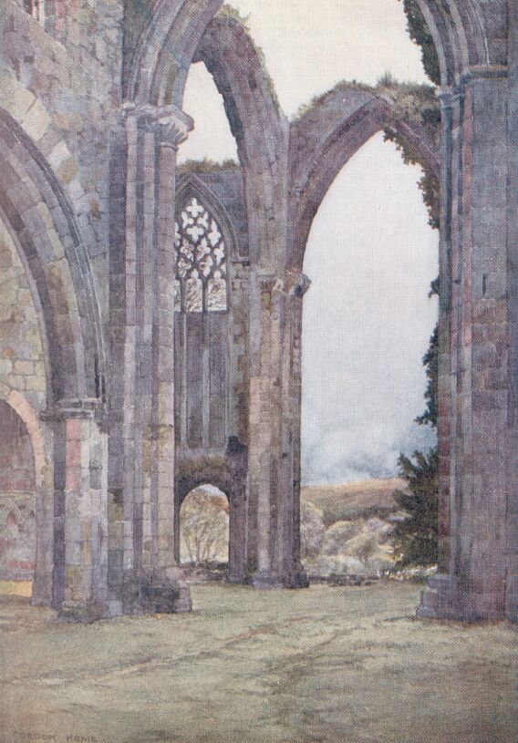
From the abbey we can take our way by various beautiful paths to the exceedingly rich scenery of Bolton woods. Some of the reaches of the Wharfe through this deep and heavily-timbered part of its course are really enchanting, and not even the knowledge that excursion parties frequently traverse the paths can rob the views of their charm. It is always possible, by taking a little trouble, to choose occasions for seeing these beautiful but very popular places when they are unspoiled by the sights and sounds of holiday-makers, and in the autumn, when the woods have an almost undreamed-of brilliance, the walks and drives are generally left to the birds and the rabbits. At the Strid the river, except in flood-times, is confined to a deep channel through the rocks, in places scarcely more than a yard in width. It is one of those spots that accumulate stories and legends of the individuals who have lost their lives, or saved them, by endeavouring to leap the narrow channel. That several people have been drowned here is painfully true, for the temptation to try the seemingly easy but very risky jump is more than many can resist.
Higher up, the river is crossed by the three arches of Barden Bridge, a fine old structure bearing the inscription: 'This bridge was repayred at the charge of the whole West R ... 1676.' To the south of the bridge stands the picturesque Tudor house called Barden Tower, which was at one time a keeper's lodge in the manorial forest of Wharfedale. It was enlarged by the tenth Lord Clifford—the 'Shepherd Lord' whose strange life-story is mentioned in the next chapter in connection with Skipton—but having become ruinous, it was repaired in 1658 by that indefatigable restorer of the family castles, the Lady Anne Clifford.
At this point there is a road across the moors to Pateley Bridge, in Nidderdale, and if we wish to explore that valley, which is now partially filled with a lake formed by the damming of the Nidd for Bradford's water-supply, we must leave the Wharfe at Barden. If we keep to the more beautiful dale we go on through the pretty village of Burnsall to Grassington, where a branch railway has recently made its appearance from Skipton.
The dale from this point appears more and more wild, and the fells become gaunt and bare, with scars often fringing the heights on either side. We keep to the east side of the river, and soon after having a good view up Littondale, a beautiful branch valley, we come to Kettlewell. This tidy and cheerful village stands at the foot of Great Whernside, one of the twin fells that we saw overlooking the head of Coverdale when we were at Middleham. Its comfortable little inns make Kettlewell a very fine centre for rambles in the wild dales that run up towards the head of Wharfedale.
Buckden is a small village situated at the junction of the road from Aysgarth, and it has the beautiful scenery of Langstrothdale Chase stretching away to the west. About a mile higher up the dale we come to the curious old church of Hubberholme standing close to the river, and forming a most attractive picture in conjunction with the bridge and the masses of trees just beyond. At Raisgill we leave the road, which, if continued, would take us over the moors by Dodd Fell, and then down to Hawes. The track goes across Horse Head Moor, and it is so very slightly marked on the bent that we only follow it with difficulty. It is steep in places, for in a short distance it climbs up to nearly 2,000 feet. The tawny hollows in the fell-sides, and the utter wildness spread all around, are more impressive when we are right away from anything that can even be called a path.
When we reach the highest point before the rapid descent into Littondale we have another great view, with Pen-y-ghent close at hand and Fountains Fell more to the south.
SKIPTON, MALHAM AND GORDALE
When I think of Skipton I am never quite sure whether to look upon it as a manufacturing centre or as one of the picturesque market towns of the dale country. If you arrive by train, you come out of the station upon such vast cotton-mills, and such a strong flavour of the bustling activity of the southern parts of Yorkshire, that you might easily imagine that the capital of Craven has no part in any holiday-making portion of the county. But if you come by road from Bolton Abbey, you enter the place at a considerable height, and, passing round the margin of the wooded Haw Beck, you have a fine view of the castle, as well as the church and the broad and not unpleasing market-place.
The fine gateway of the castle is flanked by two squat towers. They are circular and battlemented, and between them upon a parapet, which is higher than the towers themselves, appears the motto of the Cliffords, 'Desormais' (hereafter), in open stone letters. Beyond the gateway stands a great mass of buildings with two large round towers just in front; to the right, across a sloping lawn, appears the more modern and inhabited portion of the castle. The squat round towers gain all our attention, but as we pass through the doorways into the courtyard beyond, we are scarcely prepared for the astonishingly beautiful quadrangle that awaits us. It is small, and the centre is occupied by a great yew-tree, whose tall, purply-red trunk goes up to the level of the roofs without any branches or even twigs, but at that height it spreads out freely into a feathery canopy of dark green, covering almost the whole of the square of sky visible from the courtyard. The base of the trunk is surrounded by a massive stone seat, with plain shields on each side. The aspect of the courtyard suggests more that of a manor-house than a castle, the windows and doorways being purely Tudor. The circular towers and other portions of the walls belong to the time of Edward II., and there is also a round-headed door that cannot be later than the time of Robert de Romillé, one of the Conqueror's followers. The rooms that overlook the shady quadrangle are very much decayed and entirely unoccupied. They include an old dining-hall of much picturesqueness, kitchens, pantries, and butteries, some of them only lighted by very narrow windows. The destruction caused during the siege which took place during the Civil War might have brought Skipton Castle to much the same condition as Knaresborough but for the wealth and energy of that remarkable woman Lady Anne Clifford, who was born here in 1589. She was the only surviving child of George, the third Earl of Cumberland, and grew up under the care of her mother, Margaret, Countess of Cumberland, of whom Lady Anne used to speak as 'my blessed mother.' After her first marriage with Richard Sackville, Earl of Dorset, Lady Anne married the profligate Philip, Earl of Pembroke and Montgomery. She was widowed a second time in 1649, and after that began the period of her munificence and usefulness. With immense enthusiasm, she undertook the work of repairing the castles that belonged to her family, Brougham, Appleby, Barden Tower, and Pendragon being restored as well as Skipton.
Besides attending to the decayed castles, the Countess repaired no less than seven churches, and to her we owe the careful restoration of the parish church of Skipton. She began the repairs to the sacred building even before she turned her attention to the wants of the castle. In her private memorials we read how, 'In the summer of 1665 ... at her own charge, she caus'd the steeple of Skipton Church to be built up againe, which was pull'd down in the time of the late Warrs, and leaded it over, and then repaired some part of the Church and new glaz'd the Windows, in ever of which Window she put quaries, stained with a yellow colour, these two letters—viz., A. P., and under them the year 1655... Besides, she raised up a noble Tomb of Black Marble in memory of her Warlike Father.' This magnificent altar-tomb still stands within the Communion rails on the south side of the chancel. It is adorned with seventeen shields, and Whitaker doubted 'whether so great an assemblage of noble bearings can be found on the tomb of any other Englishman.' This third Earl was a notable figure in the reign of Elizabeth, and having for a time been a great favourite with the Queen, he received many of the posts of honour she loved to bestow. He was a skilful and daring sailor, helping to defeat the Spanish Armada, and building at his own expense one of the greatest fighting ships of his time.
The memorials of Lady Anne give a description of her appearance in the manner of that time: "The colour of her eyes was black like her Father's," we are told, "with a peak of hair on her forehead, and a dimple in her chin, like her father. The hair of her head was brown and very thick, and so long that it reached to the calf of her legs when she stood upright."
We cannot leave these old towers of Skipton Castle without going back to the days of John, the ninth Lord Clifford, that "Bloody Clifford" who was one of the leaders of the Lancastrians at Wakefield, where his merciless slaughter earned him the title of "the Butcher." He died by a chance arrow the night before the Battle of Towton, so fatal to the cause of Lancaster, and Lady Clifford and the children took refuge in her father's castle at Brough. For greater safety Henry, the heir, was placed under the care of a shepherd whose wife had nursed the boy's mother when a child. In this way the future baron grew up as an entirely uneducated shepherd lad, spending his days on the fells in the primitive fashion of the peasants of the fifteenth century. When he was about twelve years old Lady Clifford, hearing rumours that the whereabouts of her children had become known, sent the shepherd and his wife with the boy into an extremely inaccessible part of Cumberland. He remained there until his thirty-second year, when the Battle of Bosworth placed Henry VII on the throne. Then the shepherd lord was brought to Londesborough, and when the family estates had been restored, he went back to Skipton Castle. The strangeness of his new life being irksome to him, Lord Clifford spent most of his time in Barden Forest at one of the keeper's lodges, which he adapted for his own use. There he hunted and studied astronomy and astrology with the canons of Bolton.
At Flodden Field he led the men-at-arms from Craven, and showed that by his life of extreme simplicity he had in no way diminished the traditional valour of the Cliffords. When he died they buried him at Bolton Abbey, where many of his ancestors lay, and as his successor died after the dissolution of the monasteries, the "Shepherd Lord" was the last to be buried in that secluded spot by the Wharfe.
Skipton has always been a central spot for the exploration of this southern portion of the dales. To the north is Kirby Malham, a pretty little village with green limestone hills rising on all sides; a rushing beck coming off Kirby Fell takes its way past the church, and there is an old vicarage as well as some picturesque cottages.
We find our way to a decayed lych-gate, whose stones are very black and moss-grown, and then get a close view of the Perpendicular church. The interior is full of interest, not only on account of the Norman font and the canopied niches in the pillars of the nave, but also for the old pews. The Malham people seemingly found great delight in recording their names on the woodwork of the pews, for carefully carved initials and dates appear very frequently. All the pews have been cut down to the accepted height of the present day with the exception of some on the north side which were occupied by the more important families, and these still retain their squareness and the high balustrades above the panelled lower portions.
Just under the moorland heights surrounding Malham Tarn is the other village of Malham. It is a charming spot, even in the gloom of a wintry afternoon. The houses look on to a strip of uneven green, cut in two, lengthways, by the Aire. We go across the clear and sparkling waters by a rough stone footbridge, and, making our way past a farm, find ourselves in a few minutes at Gordale Bridge. Here we abandon the switchback lane, and, climbing a wall, begin to make our way along the side of the beck. The fells drop down fairly sharply on each side, and in the failing light there seems no object in following the stream any further, when quite suddenly the green slope on the right stands out from a scarred wall of rock beyond, and when we are abreast of the opening we find ourselves before a vast fissure that leads right into the heart of the fell. The great split is S-shaped in plan, so that when we advance into its yawning mouth we are surrounded by limestone cliffs more than 300 feet high. If one visits Gordale Scar for the first time alone on a gloomy evening, as I have done, I can promise the most thrilling sensations to those who have yet to see this astonishing sight. It almost appeared to me as though I were dreaming, and that I was Aladdin approaching the magician's palace. I had read some of the eighteenth-century writer's descriptions of the place, and imagined that their vivid accounts of the terror inspired by the overhanging rocks were mere exaggerations, but now I sympathize with every word. The scars overhang so much on the east side that there is not much space to get out of reach of the water that drips from every portion. Great masses of stone were lying upon the bright strip of turf, and among them I noticed some that could not have been there long; this made me keep close under the cliff in justifiable fear of another fall. I stared with apprehension at one rock that would not only kill, but completely bury, anyone upon whom it fell, and I thought those old writers had underrated the horrors of the place.
Wordsworth writes of
|
"Gordale chasm, terrific as the lair Where the young lions couch," |
and he also describes it as one of the grandest objects in nature.
A further result of the Craven fault that produced Gordale Scar can be seen at Malham Cove, about a mile away. There the cliff forms a curved front 285 feet high, facing the open meadows down below. The limestone is formed in layers of great thickness, dividing the face of the cliff into three fairly equal sections, the ledges formed at the commencement of each stratum allowing of the growth of bushes and small trees. A hard-pressed fox is said to have taken refuge on one of these precarious ledges, and finding his way stopped in front, he tried to turn, and in doing so fell and was killed.
At the base of the perpendicular face of the cliff the Aire flows from a very slightly arched recess in the rock. It is a really remarkable stream in making its debut without the slightest fuss, for it is large enough at its very birth to be called a small river. Its modesty is a great loss to Yorkshire, for if, instead of gathering strength in the hidden places in the limestone fells, it were to keep to more rational methods, it would flow to the edge of the Cover, and there precipitate itself in majestic fashion into a great pool below.
SETTLE AND THE INGLETON FELLS
The track across the moor from Malham Cove to Settle cannot be recommended to anyone at night, owing to the extreme difficulty of keeping to the path without a very great familiarity with every yard of the way, so that when I merely suggested taking that route one wintry night the villagers protested vigorously. I therefore took the road that goes up from Kirby Malham, having borrowed a large hurricane lamp from the "Buck" Inn at Malham. Long before I reached the open moor I was enveloped in a mist that would have made the track quite invisible even where it was most plainly marked, and I blessed the good folk at Malham who had advised me to take the road rather than run the risks of the pot-holes that are a feature of the limestone fells. The little town of Settle has a most distinctive feature in the possession of Castleberg, a steep limestone hill, densely wooded except at the very top, that rises sharply just behind the market-place. Before the trees were planted there seems to have been a sundial on the side of the hill, the precipitous scar on the top forming the gnomon. No one remembers this curious feature, although a print showing the numbers fixed upon the slope was published in 1778. The market-place has lost its curious old tolbooth, and in its place stands a town hall of good Tudor design. Departed also is much of the charm of the old Shambles that occupy a central position in the square. The lower story, with big arches forming a sort of piazza in front of the butcher's and other shops, still remains in its old state, but the upper portion has been restored in the fullest sense of that comprehensive term.
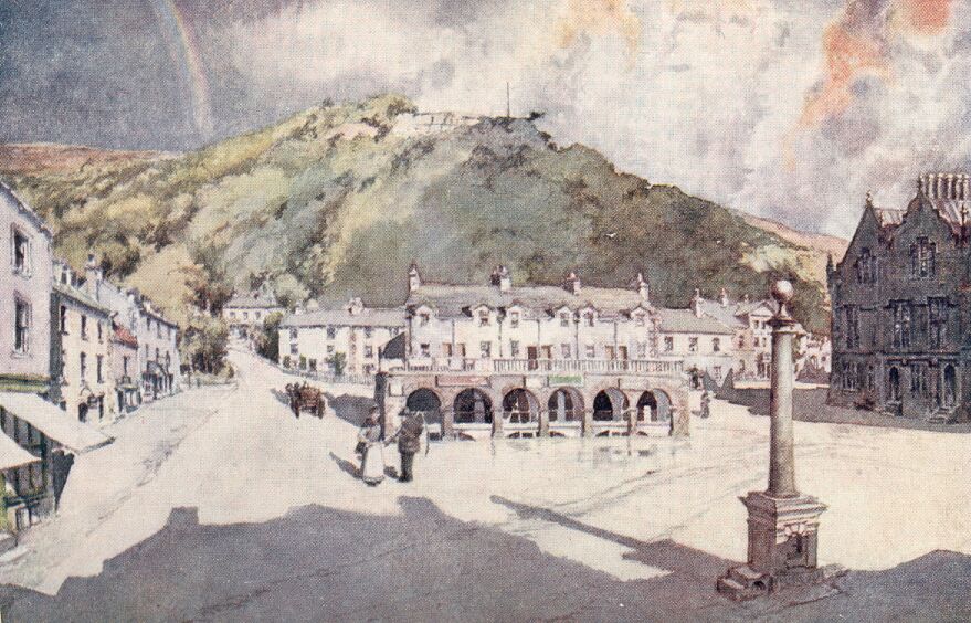
In the steep street that we came down on entering the town there may still be seen a curious old tower, which seems to have forgotten its original purpose. Some of the houses have carved stone lintels to their doorways and seventeenth-century dates, while the stone figure on 'The Naked Man' Inn, although bearing the date 1663, must be very much older, the year of rebuilding being probably indicated rather than the date of the figure.
The Ribble divides Settle from its former parish church at Giggleswick, and until 1838 the townsfolk had to go over the bridge and along a short lane to the village which held its church. Settle having been formed into a separate parish, the parish clerk of the ancient village no longer has the fees for funerals and marriages. Although able to share the church, the two places had stocks of their own for a great many years. At Settle they have been taken from the market square and placed in the court-house, and at Giggleswick one of the first things we see on entering the village is one of the stone posts of the stocks standing by the steps of the market cross. This cross has a very well preserved head, and it makes the foreground of a very pretty picture as we look at the battlemented tower of the church through the stone-roofed lichgate grown over with ivy. The history of this fine old church, dedicated, like that of Middleham, to St Alkelda, has been written by Mr. Thomas Brayshaw, who knows every detail of the old building from the chalice inscribed "THE. COMMVNION. CVPP. BELONGINGE. TO. THE. PARISHE. OF. IYGGELSWICKE. MADE. IN. ANO. 1585." to the inverted Norman capitals now forming the bases of the pillars. The tower and the arcades date from about 1400, and the rest of the structure is about 100 years older.
"The Black Horse" Inn has still two niches for small figures of saints, that proclaim its ecclesiastical connections in early times. It is said that in the days when it was one of the duties of the churchwardens to see that no one was drinking there during the hours of service the inspection used to last up to the end of the sermon, and that when the custom was abolished the church officials regretted it exceedingly. Giggleswick is also the proud possessor of a school founded in 1512. It has grown from a very small beginning to a considerable establishment, and it possesses one of the most remarkable school chapels that can be seen anywhere in the country.
The greater part of this district of Yorkshire is composed of limestone, forming bare hillsides honeycombed with underground waters and pot-holes, which often lead down into the most astonishing caverns. In Ingleborough itself there is Gaping Gill Hole, a vast fissure nearly 350 feet deep. It was only partially explored by M. Martel in 1895. Ingleborough Cave penetrates into the mountain to a distance of nearly 1,000 yards, and is one of the best of these limestone caverns for its stalactite formations. Guides take visitors from the village of Clapham to the inmost recesses and chambers that branch out of the small portion discovered in 1837.
In almost every direction there are opportunities for splendid mountain walks, and if the tracks are followed the danger of hidden pot-holes is comparatively small. From the summit of Ingleborough, and, indeed, from most of the fells that reach 2,000 feet, there are magnificent views across the brown fells, broken up with horizontal lines formed by the bare rocky scars.
CONCERNING THE WOLDS
On wide uplands of chalk the air has a raciness, the sunlight a purity and a sparkle, not to be found in lowlands. There may be no streams, perhaps not even a pond; you may find few large trees, and scarcely any parks; ruined abbeys and even castles may be conspicuously absent, and yet the landscapes have a power of attracting and fascinating. This is exactly the case with the Wolds of Yorkshire, and their characteristics are not unlike the chalk hills of Sussex, or those great expanses of windswept downs, where the weathered monoliths of Stonehenge have resisted sun and storm for ages.
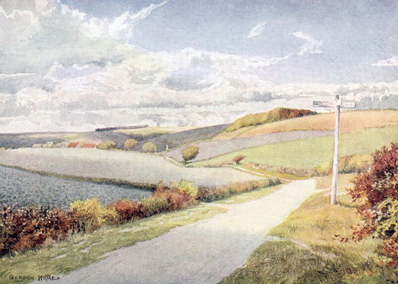
When we endeavour to analyse the power of attraction exerted by the Wolds, we find it to exist in the sweeping outlines of the land with scarcely a house to be seen for many miles, in the purity of the air owing to the absence of smoke, in the brilliance of the sunlight due to the whiteness of the roads and fields, and in the wonderful breezes that for ever blow across pasture, stubble, and roots.
Above the eastern side of the valley, where the Derwent takes its deep and sinuous course towards the alluvial lands, the chalk first makes its appearance in the neighbourhood of Acklam, and farther north at Wharram-le-Street, where picturesque hollows with precipitous sides break up the edge of the cretaceous deposits. Eastwards the high country, scarred here and there with gleaming chalk-pits, and netted with roads of almost equal whiteness, continues to the great headland of Flamborough, where the sea frets and fumes all the summer, and lacerates the cliffs during the stormy months. The masses of flinty chalk have shown themselves so capable of resisting the erosion of the sea that the seaward termination of the Wolds has for many centuries been becoming more and more a pronounced feature of the east coast of England, and if the present rate of encroachment along the low shores of Holderness is continued, this accentuation will become still more conspicuous.
The open roads of the Wolds, bordered by bright green grass and hedges that lean away from the direction of the prevailing wind, give wide views to bare horizons, or glimpses beyond vast stretches of waving corn, of distant country, blue and indistinct, and so different in character from the immediate surroundings as to suggest the ocean.
At Flamborough the white cliffs, topped with the clay deposit of the glacial ages, approach a height of 200 feet; but although the thickness of the chalk is estimated to be from I,000 to I,500 feet, the greatest height above sea-level is near Wilton Beacon, where the hills rise sharply from the Vale of York to 808 feet, and the beacon itself is 23 feet lower. On this western side of the plateau the views are extremely good, extending for miles across the flat green vale, where the Derwent and the Ouse, having lost much of the light-heartedness and gaiety characterizing their youth in the dales, take their wandering and converging courses towards the Humber. In the distance you can distinguish a group of towers, a stately blue-grey outline cutting into the soft horizon. It is York Minster. To the north-west lie the beautifully wooded hills that rise above the Derwent, and hold in their embrace Castle Howard, Newburgh Priory, and many a stately park.
Towards the north the descents are equally sudden, and the panorama of the Vale of Pickering, extending from the hills behind Scarborough to Helmsley far away in the west, is most remarkable. Down below lies the circumscribed plain, dead-level except for one or two isolated hillocks. The soil is dark and rich, and there is a marshy appearance everywhere, showing plainly the water-logged condition of the land even at the present day.
There is scarcely a district in England to compare with the Yorkshire Wolds for its remarkable richness in the remains of Early Man. As long ago as the middle of last century, when archaeology was more of a pastime than a science, this corner of the country had become famous for the rich discoveries in tumuli made by a few local enthusiasts.
It has been suggested that the flint-bearing character of the Wolds made this part of Yorkshire a district for the manufacture of implements and weapons for the inhabitants of a much larger area, and no doubt the possession of this ample supply of offensive material would give the tribe in possession a power, wealth, and permanence sufficient to account for the wonderful evidences of a great and continuous population. In these districts it is only necessary to go slowly over a ploughed field after a period of heavy rain to be fairly certain to pick up a flint knife, a beautifully chipped arrow-head, or an implement of less obvious purpose.
To those who have never taken any interest in the traces of Early Man in this country, this may appear a musty subject, but to me it is quite the reverse. The long lines of entrenchments, the round tumuli, and the prehistoric sites generally—omitting lake dwellings—are most invariably to be found upon high and windswept tablelands, wild or only recently cultivated places, where the echoes have scarcely been disturbed since the long-forgotten ages, when a primitive tribe mourned the loss of a chieftain, or yelled defiance at their enemies from their double or triple lines of defence.
In journeying in any direction through the Wolds it is impossible to forget the existence of Early Man, for on the sky-line just above the road will appear a row of two or three rounded projections from the regular line of turf or stubble. They are burial-mounds that the plough has never levelled—heaps of earth that have resisted the disintegrating action of weather and man for thousands of years. If such relics of the primitive inhabitants of this island fail to stir the imagination, then the mustiness must exist in the unresponsive mind rather than in the subject under discussion.
In making an exploration of the Wolds a good starting-place is the old-fashioned town of Malton, whence railways radiate in five directions, including the line to Great Driffield, which takes advantage of the valley leading up to Wharram Percy, and there tunnels its way through the high ground.
Choosing a day when the weather is in a congenial mood for rambling, lingering, or picnicking, or, in other words, when the sun is not too hot, nor the wind too cold, nor the sky too grey, we make our start towards the hills. We go on wheels—it is unimportant how many, or to what they are attached—in order that the long stretches of white road may not become tedious. The stone bridge over the Derwent is crossed, and, glancing back, we see the piled-up red roofs crowded along the steep ground above the further bank, with the church raising its spire high above its newly-restored nave. Then the wide street of Norton, which is scarcely to be distinguished from Malton, being separated from it only by the river, shuts in the view with its houses of whity-red brick, until their place is taken by hedgerows. To the left stretches the Vale of Pickering, still a little hazy with the remnants of the night's mist. Straight ahead and to the right the ground rises up, showing a wall chequered with cornfields and root-crops, with long lines of plantations appearing like dark green caterpillars crawling along the horizon.
The first village encountered is Rillington, with a church whose stone spire and the tower it rests upon have the appearance of being copied from Pickering. Inside there is an Early English font, and one of the arcades of the nave belongs to the same period.
Turning southwards a mile or two further on, we pass through the pretty village of Wintringham, and, when the cottages are passed, find the church standing among trees where the road bends, its tower and spire looking much like the one just left behind. The interior is interesting. The pews are all of old panelled oak, unstained, and with acorn knobs at the ends; the floor is entirely covered with glazed red tiles. The late Norman chancel, the plain circular font of the same period, and the massive altar-slab in the chapel, enclosed by wooden screens on the north side, are the most notable features. Going to the east we reach Helperthorpe, one of the Wold villages adorned with a new church in the Decorated style. The village gained this ornament through the generosity of the present Sir Tatton Sykes, of Sledmere, whose enthusiasm for church building is not confined to one place. In his own park at Sledmere four miles to the south, at West Lutton, East Heslerton, and Wansford you may see other examples of modern church building, in which the architect has not been hampered by having to produce a certain accommodation at a minimum cost. And thus in these villages the fact of possessing a modern church does not detract from their charm; instead of doing so, the pilgrim in search of ecclesiastical interest finds much to draw him to them.
As a contrast to Helperthorpe, the adjoining hamlet of Weaverthorpe has a church of very early Norman or possibly Saxon date, and an inscribed Saxon stone a century earlier than the one at Kirkdale, near Kirby Moorside. The inscription is on a sundial over the south porch in both churches; but while that of Kirkdale is quite complete and perfect, this one has words missing at the beginning and end. Haigh suggests that the half-destroyed words should read: "LIT OSCETVLI ARCHIEPISCOPI." Then, without any doubt comes: "[ILLUSTRATION] IN:
HONORE: SCE: ANDREAE APOSTOLI: HEREBERTUS WINTONIE: HOC MONASTERIVM
FECIT: I IN TEMPORE REGN." Here the inscription suddenly stops and leaves us in ignorance as to in whose time the monastery was built. There seems little doubt at all that Father Haigh's suggested completion of the sentence is correct, making it read: "IN TEMPORE REGN[ALDI REGIS SECUNDI]," which would have just filled a complete line.
The coins of Regnald II. of Northumbria bear Christian devices, and it is known that he was confirmed in 942, while his predecessor of that name appears to have been a pagan. If the restoration of the first words of the inscription are correct, the stone cannot be placed earlier than the year 952 (Dr. Stubbs says 958), when Oscetul succeeded Wulstan to the See of York. However, even in a neighbourhood so replete with antiquities this is sufficiently far back in the age of the Vikings to be of thrilling interest, for you must travel far to find another village church with an inscription carved nearly a thousand years ago, at a time when the English nation was still receiving its infusion of Scandinavian strength.
The arch of the tower and the door below the sundial have the narrowness and rudeness suggesting the pre-Norman age, but more than this it is unwise to say.
And so we go on through the wide sunny valley, watching the shadows sweep across the fields, where often the soil is so thin that the ground is more white than brown, scanning the horizon for tumuli, and taking note of the different characteristics of each village. Not long ago the houses, even in the small towns, were thatched, and even now there are hamlets still cosy and picturesque under their mouse-coloured roofs; but in most instances you see a transition state of tiles gradually ousting the inflammable but beautiful thatch. The tiles all through the Wolds are of the curved pattern, and though cheerful in the brilliance of their colour, and unspeakably preferable to thin blue slates, they do not seem to weather or gather moss and rich colouring in the same manner as the usual flat tile of the southern counties.
We turn aside to look at the rudely carved Norman tympanum over the church door at Wold Newton, and then go up to Thwing, on the rising ground to the south, where we may see what Mr. Joseph Morris claims to be the only other Norman tympanum in the East Riding. A cottage is pointed out as the birthplace of Archbishop Lamplugh, who held the See of York from 1688 to 1691. He was of humble parentage and it is said that he would often pause in conversation to slap his legs and say, "Just fancy me being Archbishop of York!" The name of the village is derived from the Norse word Thing, meaning an assembly.
Keeping on towards the sea, we climb up out of the valley, and passing Argam Dike and Grindale, come out upon a vast gently undulating plateau with scarcely a tree to be seen in any direction. A few farms are dotted here and there over the landscape, and towards Filey we can see a windmill; but beyond these it seems as though the fierce winds that assail the promontory of Flamborough had blown away everything that was raised more than a few feet above the furrows.
The village of Bempton has, however, contrived to maintain itself in its bleak situation, although it is less than two miles from the huge perpendicular cliffs where the Wolds drop into the sea. The cottages have a snug and eminently cheerful look, with their much-weathered tiles and white and ochre coloured walls. From their midst rises the low square tower of the church, and if it ever had a spire or pinnacles in the past, it has none now; for either the north-easterly gales blew them into the sea long ago, or else the people were wise enough never to put such obstructions in the way of the winter blasts.
Turning southwards, we get a great view over the low shore of Holderness, curving away into the haze hanging over the ocean, with Bridlington down below, raising to the sky the pair of towers at the west end of its priory—one short and plain, and the other tall and richly ornamented with pinnacles. Going through the streets of sober red houses of the old town, we come at length into a shallow green valley, where the curious Gypsy Race flows intermittently along the fertile bottom. The afternoon sunshine floods the pleasant landscape with a genial glow, and throws long blue shadows under the trees of the park surrounding Boynton Hall, the seat of the Stricklands. The family has been connected with the village for several centuries, and some of their richly-painted and gilded monuments can be seen in the church. One of these is to Sir William Strickland, Bart., and another to Lady Strickland, his wife, who was a sister of Sir Hugh Cholmley, the gallant but unfortunate defender of Scarborough Castle during the Civil War. In his memoirs Sir Hugh often refers to visits paid him by "my sister Strickland."
After passing Thorpe Hall the road goes up to the breezy spot, commanding wide views, where the little church of Rudstone stands conspicuously by the side of an enormous monolith. Although the church tower is Norman, it would appear to be a recent arrival on the scene in comparison with the stone. Antiquaries are in fairly general agreement that huge standing stones of this type belong to some very remote period, and also that they are "associated with sepulchral purposes"; and the fact that they are usually found in churchyards would suggest that they were regarded with a traditional veneration.
The road past the church drops steeply down into the pretty village, and, turning northwards, takes us to the bend of the valley, where North Burton lies, which we passed earlier in the day; so we go to the left, and find ourselves at Kilham, a fair-sized village on the edge of the chalk hills. Like Rudstone and a dozen places in its neighbourhood, Kilham is situated in a district of extraordinary interest to the archaeologist, the prehistoric discoveries being exceedingly numerous. Chariot burials of the Early Iron Age have been discovered here, as well as large numbers of Neolithic implements. There is a beautiful Norman doorway in the nave of the church, ornamented with chevron mouldings in a lavish fashion. Far more interesting than this, however, are the fonts in the two villages of Cottam and Cowlam, lying close together, although separated by a thinly-wooded hollow, about five miles to the west. Cottam Church and the farm adjoining it are all that now exists of what must once have been an extensive village. In the church is a Norman font of cylindrical form, covered with the wonderfully crude carvings of that period. There are six subjects, the most remarkable being the huge dragon with a long curly tail in the act of swallowing St. Margaret, whose skirts and feet are shown inside the capacious jaws, while the head is beginning to appear somewhere behind the dragon's neck. To the right is shown a gruesome representation of the martyrdom of St. Lawrence, and then follow Adam and Eve by the Tree of Life (a twisted piece of foliage), the martyrdom of St. Andrew, and what seems to be another dragon.
On each side of the bridle-road by the church you can trace without the least difficulty the ground-plan of many houses under the short turf. The early writers do not mention Cottam, and so far I have come upon no explanation for the wiping out of this village. Possibly its extinction was due to the Black Death in 1349.
It is about four miles by road to Cowlam, although the two churches are only about a mile and a half apart; and when Cowlam is reached there is not much more in the way of a village than at Cottam. The only way to the church from the road is through an enormous stackyard, speaking eloquently of the large crops produced on the farm. As in the other instance, a search has to be made for the key, entailing much perambulation of the farm.
At length the door is opened, and the splendid font at once arrests the eye. More noticeable than anything else in the series of carvings are the figures of two men wrestling, similar to those on the font from the village of Hutton Cranswick, now preserved in York Museum. The two figures are shown bending forwards, each with his hands clasped round the waist of the other, and each with a foot thrown forward to trip the other, after the manner of the Westmorland wrestlers to be seen at the Grasmere sports. It seems to me scarcely possible to doubt that the subject represented is Jacob wrestling with the man at Penuel.
At Sledmere, the adjoining village, everything has a well-cared-for and reposeful aspect. Its position in a shallow depression has made it possible for trees to grow, so that we find the road overhung by a green canopy in remarkable contrast to the usual bleakness of the Wolds. The park surrounding Sir Tatton Sykes' house is well wooded, owing to much planting on what were bare slopes not very many years ago.
The village well is dignified with a domed roof raised on tall columns, put up about seventy years ago by the previous Sir Tatton to the memory of his father, Sir Christopher Sykes; the inscription telling how much the Wolds were transformed through his energy 'in building, planting, and enclosing,' from a bleak and barren track of country into what is now considered one of the most productive and best-cultivated districts of Yorkshire. The late Sir Tatton Sykes was the sort of man that Yorkshire folk come near to worshipping. He was of that hearty, genial, conservative type that filled the hearts of the farmers with pride. On market days all over the Riding one of the always fresh subjects of conversation was how Sir Tatton was looking. A great pillar put up to his memory by the road leading to Garton can be seen over half Holderness. So great was the conservatism of this remarkable squire that years after the advent of railways he continued to make his journey to Epsom, for the Derby, on horseback.
A stone's-throw from the house stands the church, rebuilt, with the exception of the tower, in 1898 by Sir Tatton. There is no wall surrounding the churchyard, neither is there ditch, nor bank, nor the slightest alteration in the smooth turf.
The church, designed by Mr. Temple Moore, is carried out in the style of the Decorated period in a stone that is neither red nor pink, but something in between the two colours. The exterior is not remarkable, but the beauty of the internal ornament is most striking. Everywhere you look, whether at the detail of carved wood or stone, the workmanship is perfect, and without a trace of that crudity to be found in the carvings of so many modern churches. The clustered columns, the timber roof, and the tracery of the windows are all dignified, in spite of the richness of form they display. Only in the upper portion of the screen does the ornament seem a trifle worried and out of keeping with the rest of the work.
Sledmere also boasts a tall and very beautiful 'Eleanor' cross, erected about ten years ago, and a memorial to those who fell in the European war.
As we continue towards the setting sun, the deeply-indented edges of the Wolds begin to appear, and the roads generally make great plunges into the valley of the Derwent. The weather, which has been fine all day, changes at sunset, and great indigo clouds, lined with gold, pile themselves up fantastically in front of the setting sun. Lashing rain, driven by the wind with sudden fury, pours down upon the hamlet lying just below, but leaves Wharram-le-Street without a drop of moisture. The widespread views all over the Howardian Hills and the sombre valley of the Derwent become impressive, and an awesomeness of Turneresque gloom, relieved by sudden floods of misty gold, gives the landscape an element of unreality.
Against this background the outline of the church of Wharram-le-Street stands out in its rude simplicity. On the western side of the tower, where the light falls upon it, we can see the extremely early masonry that suggests pre-Norman times. It cannot be definitely called a Saxon church, but although 'long and short work' does not appear, there is every reason to associate this lonely little building with the middle of the eleventh century. There are mason marks consisting of crosses and barbed lines on the south wall of the nave. The opening between the tower and the nave is an almost unique feature, having a Moorish-looking arch of horseshoe shape resting on plain and clumsy capitals.
The name Wharram-le-Street reminds us forcibly of the existence in remote times of some great way over this tableland. Unfortunately, there is very little sure ground to go upon, despite the additional fact of there being another place, Thorpe-le-Street, some miles to the south.
With the light fast failing we go down steeply into the hollow where North Grimston nestles, and, crossing the streams which flow over the road, come to the pretty old church. The tower is heavily mantled with ivy, and has a statue of a Bishop on its west face. A Norman chancel arch with zigzag moulding shows in the dim interior, and there is just enough light to see the splendid font, of similar age and shape to those at Cowlam and Cottam. A large proportion of the surface is taken up with a wonderful 'Last Supper,' and on the remaining space the carvings show the 'Descent from the Cross,' and a figure, possibly representing St. Nicholas, the patron saint of the church.
When the lights of Malton glimmer in the valley this day of exploration is at an end, and much of the Wold country has been seen.
FROM FILEY TO SPURN HEAD
'As the shore winds itself back from hence,' says Camden, after describing Flamborough Head, 'a thin slip of land (like a small tongue thrust out) shoots into the sea.' This is the long natural breakwater known as Filey Brig, the distinctive feature of a pleasant watering-place. In its wide, open, and gently curving bay, Filey is singularly lucky; for it avoids the monotony of a featureless shore, and yet is not sufficiently embraced between headlands to lose the broad horizon and sense of airiness and space so essential for a healthy seaside haunt.
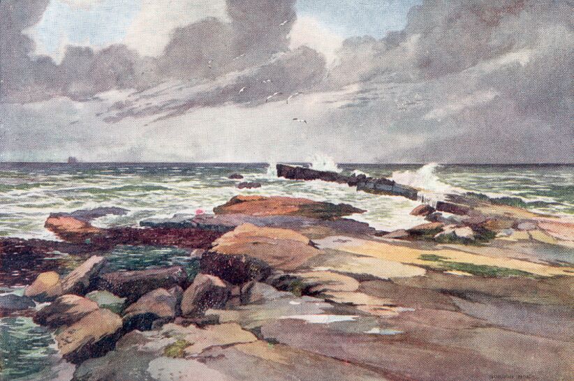
The Brig has plainly been formed by the erosion of Carr Naze, the headland of dark, reddish-brown boulder clay, leaving its hard bed of sandstone (of the Middle Calcareous Grit formation) exposed to the particular and ceaseless attention of the waves. It is one of the joys of Filey to go along the northward curve of the bay at low tide, and then walk along the uneven tabular masses of rock with hungry waves heaving and foaming within a few yards on either hand. No wonder that there has been sufficient sense among those who spend their lives in promoting schemes for ugly piers and senseless promenades, to realize that Nature has supplied Filey with a more permanent and infinitely more attractive pier than their fatuous ingenuity could produce. There is a spice of danger associated with the Brig, adding much to its interest; for no one should venture along the spit of rocks unless the tide is in a proper state to allow him a safe return. A melancholy warning of the dangers of the Brig is fixed to the rocky wall of the headland, describing how an unfortunate visitor was swept into the sea by the sudden arrival of an abnormally large wave, but this need not frighten away from the fascinating ridge of rock those who use ordinary care in watching the sea. At high tide the waves come over the seaweedy rocks at the foot of the headland, making it necessary to climb to the grassy top in order to get back to Filey.
The real fascination of the Brig comes when it can only be viewed from the top of the Naze above, when a gale is blowing from the north or north-east, and driving enormous waves upon the line of projecting rocks. You watch far out until the dark green line of a higher wave than any of the others that are creating a continuous thunder down below comes steadily onward, and reaching the foam-streaked area, becomes still more sinister. As it approaches within striking distance, a spent wave, sweeping backwards, seems as though it may weaken the onrush of the towering wall of water; but its power is swallowed up and dissipated in the general advance, and with only a smooth hollow of creamy-white water in front, the giant raises itself to its fullest height, its thin crest being at once caught by the wind, and blown off in long white beards.
The moment has come; the mass of water feels the resistance of the rocks, and, curling over into a long green cylinder, brings its head down with terrific force on the immovable side of the Brig. Columns of water shoot up perpendicularly into the air as though a dozen 12-inch shells had exploded in the water simultaneously. With a roar the imprisoned air escapes, and for a moment the whole Brig is invisible in a vast cloud of spray; then dark ledges of rock can be seen running with creamy water, and the scene of the impact is a cauldron of seething foam, backed by a smooth surface of pale green marble, veined with white. Then the waters gather themselves together again, and the pounding of lesser waves keeps up a thrilling spectacle until the moment for another great coup arrives.
Years ago Filey obtained a reputation for being 'quiet,' and the sense conveyed by those who disliked the place was that of dullness and primness. This fortunate chance has protected the little town from the vulgarizing influences of the unlettered hordes let loose upon the coast in summer-time, and we find a sea-front without the flimsy meretricious buildings of the popular resorts. Instead of imitating Blackpool and Margate, this sensible place has retained a quiet and semi-rural front to the sea, and, as already stated, has not marred its appearance with a jetty.
From the smooth sweep of golden sand rises a steep slope grown over with trees and bushes which shade the paths in many places. Without claiming any architectural charm, the town is small and quietly unobtrusive, and has not the untidy, half-built character of so many watering-places.
Above a steep and narrow hollow, running straight down to the sea, and densely wooded on both sides, stands the church. It has a very sturdy tower rising from its centre, and, with its simple battlemented outline and slit windows, has a semi-fortified appearance. The high pitched-roofs of Early English times have been flattened without cutting away the projecting drip-stones on the tower, which remain a conspicuous feature. The interior is quite impressive. Round columns alternated with octagonal ones support pointed arches, and a clerestory above pierced with roundheaded slits, indicating very decisively that the nave was built in the Transitional Norman period. It appears that a western tower was projected, but never carried out, and an unusual feature is the descent by two steps into the chancel.
A beautiful view from the churchyard includes the whole sweep of the bay, cut off sharply by the Brig on the left hand, and ending about eight miles away in the lofty range of white cliffs extending from Speeton to Flamborough Head.
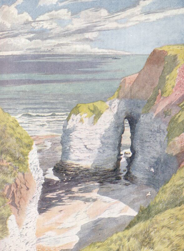
The headland itself is lower by more than a 100 feet than the cliffs in the neighbourhood of Bempton and Speeton, which for a distance of over two miles exceed 300 feet. A road from Bempton village stops short a few fields from the margin of the cliffs, and a path keeps close to the precipitous wall of gleaming white chalk.
We come over the dry, sweet-smelling grass to the cliff edge on a fresh morning, with a deep blue sky overhead and a sea below of ultramarine broken up with an infinitude of surfaces reflecting scraps of the cliffs and the few white clouds. Falling on our knees, we look straight downwards into a cove full of blue shade; but so bright is the surrounding light that every detail is microscopically clear. The crumpling and distortion of the successive layers of chalk can be seen with such ease that we might be looking at a geological textbook. On the ledges, too, can be seen rows of little whitebreasted puffins; razor-bills are perched here and there, as well as countless guillemots. The ringed or bridled guillemot also breeds on the cliffs, and a number of other types of northern sea-birds are periodically noticed along these inaccessible Bempton Cliffs. The guillemot makes no nest, merely laying a single egg on a ledge. If it is taken away by those who plunder the cliffs at the risk of their lives, the bird lays another egg, and if that disappears, perhaps even a third.
Coming to Flamborough Head along the road from the station, the first noticeable feature is at the point where the road makes a sharp turn into a deep wooded hollow. It is here that we cross the line of the remarkable entrenchment known as the Danes' Dyke. At this point it appears to follow the bed of a stream, but northwards, right across the promontory—that is, for two-thirds of its length—the huge trench is purely artificial. No doubt the vallum on the seaward side has been worn down very considerably, and the fosse would have been deeper, making in its youth, a barrier which must have given the dwellers on the headland a very complete security.
Like most popular names, the association of the Danes with the digging of this enormous trench has been proved to be inaccurate, and it would have been less misleading and far more popular if the work had been attributed to the devil. In the autumn of 1879 General Pitt Rivers dug several trenches in the rampart just north of the point where the road from Bempton passes through the Dyke. The position was chosen in order that the excavations might be close to the small stream which runs inside the Dyke at this point, the likelihood of utensils or weapons being dropped close to the water-supply of the defenders being considered important. The results of the excavations proved conclusively that the people who dug the ditch and threw up the rampart were users of flint. The most remarkable discovery was that the ground on the inner slope of the rampart, at a short distance below the surface, contained innumerable artificial flint flakes, all lying in a horizontal position, but none were found on the outer slope. From this fact General Pitt Rivers concluded that within the stockade running along the top of the vallum the defenders were in the habit of chipping their weapons, the flakes falling on the inside. The great entrenchment of Flamborough is consequently the work of flint-using people, and 'is not later than the Bronze Period.'
And the strangest fact concerning the promontory is the isolation of its inhabitants from the rest of the county, a traditional hatred for strangers having kept the fisherfolk of the peninsula aloof from outside influences. They have married among themselves for so long, that it is quite possible that their ancestral characteristics have been reproduced, with only a very slight intermixture of other stocks, for an exceptionally long period. On taking minute particulars of ninety Flamborough men and women, General Pitt Rivers discovered that they were above the average stature of the neighbourhood, and were, with only one or two exceptions, dark-haired. They showed little or no trace of the fair-haired element usually found in the people of this part of Yorkshire. It is also stated that almost within living memory, when the headland was still further isolated by a belt of uncultivated wolds, the village could not be approached by a stranger without some danger.
We find no one to object to our intrusion, and go on towards the village. It is a straggling collection of low, red houses, lacking, unfortunately, anything which can honestly be termed picturesque; for the church stands alone, a little to the south, and the small ruin of what is called 'The Danish Tower' is too insignificant to add to the attractiveness of the place.
All the males of Flamborough are fishermen, or dependent on fishing for their livelihood; and in spite of the summer visitors, there is a total indifference to their incursions in the way of catering for their entertainment, the aim of the trippers being the lighthouse and the cliffs nearly two miles away.
Formerly, the church had only a belfry of timber, the existing stone tower being only ten years old. Under the Norman chancel arch there is a delicately-carved Perpendicular screen, having thirteen canopied niches richly carved above and below, and still showing in places the red, blue, and gold of its old paint-work. Another screen south of the chancel is patched and roughly finished. The altar-tomb of Sir Marmaduke Constable, of Flamborough, on the north side of the chancel, is remarkable for its long inscription, detailing the chief events in the life of this great man, who was considered one of the most eminent and potent persons in the county in the reign of Henry VIII. The greatness of the man is borne out first in a recital of his doughty deeds: of his passing over to France 'with Kyng Edwarde the fourith, y[t] noble knyght.'
|
'And also with noble king Herre, the sevinth of that name He was also at Barwick at the winnyng of the same [1482] And by ky[n]g Edward chosy[n] Captey[n] there first of anyone And rewllid and governid ther his tyme without blame But for all that, as ye se, he lieth under this stone.' |
The inscription goes on in this way to tell how he fought at Flodden Field when he was seventy, 'nothyng hedyng his age.'
Sir Marmaduke's daughter Catherine was married to Sir Roger Cholmley, called 'the Great Black Knight of the North,' who was the first of his family to settle in Yorkshire, and also fought at Flodden, receiving his knighthood after that signal victory over the Scots.
Yorkshire being a county in which superstitions are uncommonly long-lived it is not surprising to find that a fisherman will turn back from going to his boat, if he happen on his way to meet a parson, a woman, or a hare, as any one of these brings bad luck. It is also extremely unwise to mention to a man who is baiting lines a hare, a rabbit, a fox, a pig, or an egg. This sounds foolish, but a fisherman will abandon his work till the next day if these animals are mentioned in his presence.
On the north and south sides of the headland there are precarious beaches for the fisherman to bring in their boats. They have no protection at all from the weather, no attempt at forming even such miniature harbours as may be seen on the Berwickshire coast having been made. When the wind blows hard from the north, the landing on that side is useless, and the boats, having no shelter, are hauled up the steep slope with the help of a steam windlass. Under these circumstances the South Landing is used. It is similar in most respects to the northern one, but, owing to the cliffs being lower, the cove is less picturesque. At low tide a beach of very rough shingle is exposed between the ragged chalk cliffs, curiously eaten away by the sea. Seaweed paints much of the shore and the base of the cliffs a blackish green, and above the perpendicular whiteness the ruddy brown clay slopes back to the grass above.
When the boats have just come in and added their gaudy vermilions, blues, and emerald greens to the picture, the North Landing is worth seeing. The men in their blue jerseys and sea-boots coming almost to their hips, land their hauls of silvery cod and load the baskets pannier-wise on the backs of sturdy donkeys, whose work is to trudge up the steep slope to the road, nearly 200 feet above the boats, where carts take the fish to the station four miles away.
In following the margin of the cliffs to the outermost point of the peninsula, we get a series of splendid stretches of cliff scenery. The chalk is deeply indented in many places, and is honey-combed with caves. Great white pillars and stacks of chalk stand in picturesque groups in some of the small bays, and everywhere there is the interest of watching the heaving water far below, with white gulls floating unconcernedly on the surface, or flapping their great stretch of wing as they circle just above the waves.
Near the modern lighthouse stands a tall, hexagonal tower, built of chalk in four stories, with a string course between each. The signs of age it bears and the remarkable obscurity surrounding its origin and purpose would suggest great antiquity, and yet there seems little doubt that the tower is at the very earliest Elizabethan. The chalk, being extremely soft, has weathered away to such an extent that the harder stone of the windows and doors now projects several inches.
In a record dated June 21, 1588, the month before the Spanish Armada was sighted in the English Channel, a list is given of the beacons in the East Riding, and instructions as to when they should be lighted, and what action should be taken when the warning was seen. It says briefly:
|
'Flambrough, three beacons uppon the sea cost, takinge lighte from Bridlington, and geving lighte to Rudstone.' |
There is no reference to any tower, and the beacons everywhere seem merely to have been bonfires ready for lighting, watched every day by two, and every night by three 'honest householders ... above the age of thirty years.' The old tower would appear, therefore, to have been put up as a lighthouse. If this is a correct supposition, however, the dangers of the headland to shipping must have been recognized as exceedingly great several centuries ago. A light could not have failed to have been a boon to mariners, and its maintenance would have been a matter of importance to all who owned ships; and yet, if this old tower ever held a lantern, the hiatus between the last night when it glowed on the headland, and the erection of the present lighthouse is so great that no one seems to be able to state definitely for what purpose the early structure came into existence.
Year after year when night fell the cliffs were shrouded in blackness, with the direful result that between 1770 and 1806 one hundred and seventy-four ships were wrecked or lost on or near the promontory. It remained for a benevolent-minded customs officer of Bridlington—a Mr. Milne—to suggest the building of a lighthouse to the Elder Brethren of Trinity House, with the result that since December 6, 1806, a powerful light has every night flashed on Flamborough Head. The immediate result was that in the first seven years of its beneficent work no vessel was 'lost on that station when the lights could be seen.'
The derivation of the name Flamborough has been conclusively shown to have nothing at all to do with the English word 'flame,' being possibly a corruption of Fleinn, a Norse surname, and borg or burgh, meaning a castle. In Domesday it is spelt 'Flaneburg,' and flane is the Norse for an arrow or sword.
At the point where the chalk cliffs disappear and the low coast of Holderness begins, we come to the exceedingly popular watering-place of Bridlington. At one time the town was quite separate from the quay, and even now there are two towns—the solemn and serious, almost Quakerish, place inland, and the eminently pleasure-loving and frivolous holiday resort on the sea; but they are now joined up by modern houses and the railway-station, and in time they will be as united as the 'Three Towns' of Plymouth. Along the sea-front are spread out by the wide parades, all those 'attractions' which exercise their potential energies on certain types of mankind as each summer comes round. There are seats, concert-rooms, hotels, lodging-houses, bands, kiosks, refreshment-bars, boats, bathing-machines, a switchback-railway, and even a spa, by which means the migratory folk are housed, fed, amused, and given every excuse for loitering within a few yards of the long curving line of waves that advances and retreats over the much-trodden sand.
The two stone piers enclosing the harbour make an interesting feature in the centre of the sea-front, where the few houses of old Bridlington Quay that have survived, are not entirely unpicturesque.
In 1642 Queen Henrietta Maria landed on whatever quay then existed. She had just returned from Holland with ships laden with arms and ammunition for the Royalist army. Adverse winds had brought the Dutch ships to Bridlington instead of Newcastle, where the Queen had intended to land, and a delay was caused while messengers were sent to the Earl of Newcastle in order that her landing might be effected in proper security. News of the Dutch ships lying off Bridlington was, however, conveyed to four Parliamentary vessels stationed by the bar at Tynemouth, and no time was lost in sailing southwards. What happened is told in a letter published in the same year, and dated February 25, 1642. It describes how, after two days' riding at anchor, the cavalry arrived, upon which the Queen disembarked, and the next morning the rest of the loyal army came to wait on her.
'God that was carefull to preserve Her by Sea, did likewise continue his favour to Her on the Land: For that night foure of the Parliament Ships arrived at Burlington, without being perceived by us; and at foure a clocke in the morning gave us an Alarme, which caused us to send speedily to the Port to secure our Boats of Ammunition, which were but newly landed. But about an houre after the foure Ships began to ply us so fast with their Ordinance, that it made us all to rise out of our beds with diligence, and leave the Village, at least the women; for the Souldiers staid very resolutely to defend the Ammunition, in case their forces should land. One of the Ships did Her the favour to flanck upon the house where the Queene lay, which was just before the Peere; and before She was out of Her bed, the Cannon bullets whistled so loud about her, (which Musicke you may easily believe was not very pleasing to Her) that all the company pressed Her earnestly to goe out of the house, their Cannon having totally beaten downe all the neighbouring houses, and two Cannon bullets falling from the top to the bottome of the house where She was; so that (clothed as She could) She went on foot some little distance out of the Towne, under the shelter of a Ditch (like that of Newmarket;) whither before She could get, the Cannon bullets fell thicke about us, and a Sergeant was killed within twenty paces of Her.'
In old Bridlington there stands the fine church of the Augustinian Priory we have already seen from a distance, and an ancient structure known as the Bayle Gate, a remnant of the defences of the monastery. They stand at no great distance apart, but do not arrange themselves to form a picture, which is unfortunate, and so also is the lack of any real charm in the domestic architecture of the adjoining streets. The Bayle Gate has a large pointed arch and a postern, and the date of its erection appears to be the end of the fourteenth century, when permission was given to the prior to fortify the monastery. Unhappily for Bridlington, an order to destroy the buildings was given soon after the Dissolution, and the nave of the church seems to have been spared only because it was used as the parish church. Quite probably, too, the gatehouse was saved from destruction on account of the room it contains having been utilized for holding courts. The upper portions of the church towers are modern restorations, and their different heights and styles give the building a remarkable, but not a beautiful outline. At the west end, between the towers is a large Perpendicular window, occupying the whole width of the nave, and on the north side the vaulted porch is a very beautiful feature.
The interior reveals an inspiring perspective of clustered columns built in the Early English Period with a fine Decorated triforium on the north side. Both transepts and the chancel appear to have been destroyed with the conventual buildings, and the present chancel is merely a portion of the nave separated with screens.
Southwards in one huge curve of nearly forty miles stretches the low coast of Holderness, seemingly continued into infinitude. There is nothing comparable to it on the coasts of the British Isles for its featureless monotony and for the unbroken front it presents to the sea. The low brown cliffs of hard clay seem to have no more resisting power to the capacious appetite of the waves than if they were of gingerbread. The progress of the sea has been continued for centuries, and stories of lost villages and of overwhelmed churches are met with all the way to Spurn Head. Four or five miles south of Bridlington we come to a point on the shore where, looking out among the lines of breaking waves, we are including the sides of the two demolished villages of Auburn and Hartburn.
From a casual glance at Skipsea no one would attribute any importance to it in the past. It was, nevertheless, the chief place in the lordship of Holderness in Norman times, and from that we may also infer that it was the most well-defended stronghold. On a level plain having practically no defensible sites, great earthworks would be necessary, and these we find at Skipsea Brough. There is a high mound surrounded by a ditch, and a segment of the great outer circle of defences exists on the south-west side. No masonry of any description can be seen on the grass-covered embankment, but on the artificial hillock, once crowned, it is surmised, by a Norman keep, there is one small piece of stonework. These earthworks have been considered Saxon, but later opinion labels them post-Conquest. In the time of the Domesday Survey the Seigniory of Holderness was held by Drogo de Bevere, a Flemish adventurer who joined in the Norman invasion of England and received his extensive fief from the Conqueror. He also was given the King's niece in marriage as a mark of special favour; but having for some reason seen fit to poison her, he fled from England, it is said, during the last few months of William's reign. The Barony of Holderness was forfeited, but Drogo was never captured.
[A worked flint was found in the moat not long ago by Dr. J. L. Kirk, of Pickering.]
Poulson, the historian of Holderness, states that Henry III. gave orders for the destruction of Skipsea Castle about 1220, the Earl of Albemarle, its owner at that time, having been in rebellion. When Edward II. ascended the throne, he recalled his profligate companion Piers Gaveston, and besides creating him Baron of Wallingford and Earl of Cornwall, he presented this ill-chosen favourite with the great Seigniory of Holderness.
Going southwards from Skipsea, we pass through Atwick, with a cross on a large base in the centre of the village, and two miles further on come to Hornsea, an old-fashioned little town standing between the sea and the Mere. This beautiful sheet of fresh water comes as a surprise to the stranger, for no one but a geologist expects to discover a lake in a perfectly level country where only tidal creeks are usually to be found. Hornsea Mere may eventually be reached by the sea, and yet that day is likely to be put further off year by year on account of the growth of a new town on the shore.
The scenery of the Mere is quietly beautiful. Where the road to Beverley skirts its margin there are glimpses of the shimmering surface seen through gaps in the trees that grow almost in the water, many of them having lost their balance and subsided into the lake, being supported in a horizontal position by their branches. The islands and the swampy margins form secure breeding-places for the countless water-fowl, and the lake abounds with pike, perch, eel, and roach.
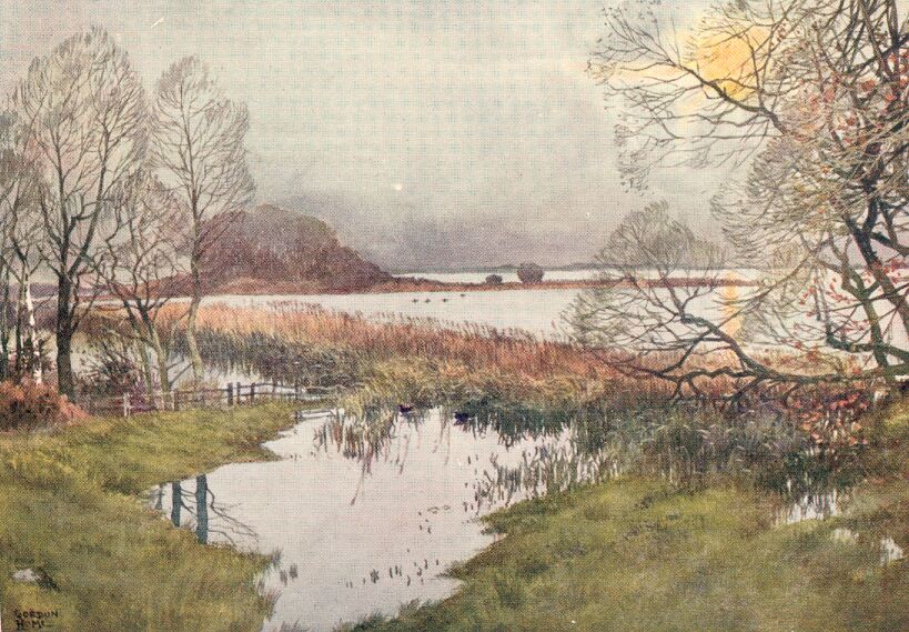
It was the excellent supply of fish yielded by Hornsea Mere that led to a hot discussion between the neighbouring Abbey of Meaux and St. Mary's Abbey at York. In the year 1260 William, eleventh Abbot of Meaux, laid claim to fishing rights in the southern half of the lake, only to find his brother Abbot of York determined to resist the claim. The cloisters of the two abbeys must have buzzed with excitement over the impasse and relations became so strained that the only method of determining the issue was by each side agreeing to submit to the result of a judicial combat between champions selected by the two monasteries. Where the fight took place I do not know, and the number of champions is not mentioned in the record. It is stated that a horse was first swum across the lake, and stakes fixed to mark the limits of the claim. On the day appointed the combatants chosen by each abbot appeared properly accoutred, and they fought from morning until evening, when, at last, the men representing Meaux were beaten to the ground, and the York abbot retained the whole fishing rights of the Mere.
Hornsea has a pretty church with a picturesque tower built in between the western ends of the aisles. An eighteenth-century parish clerk utilized the crypt for storing smuggled goods, and was busily at work there on a stormy night in 1732, when a terrific blast of wind tore the roof off the church. The shock, we are told, brought on a paralytic seizure of which he died.
By the churchyard gate stands the old market-cross, recently set up in this new position and supplied with a modern head.
As we go towards Spurn Head we are more and more impressed with the desolate character of the shore. The tide may be out, and only puny waves tumbling on the wet sand, and yet it is impossible to refrain from feeling that the very peacefulness of the scene is sinister, and the waters are merely digesting their last meal of boulder-clay before satisfying a fresh appetite.
The busy town of Hornsea Beck, the port of Hornsea, with its harbour and pier, its houses, and all pertaining to it, has entirely disappeared since the time of James I., and so also has the place called Hornsea Burton, where in 1334 Meaux Abbey held twenty-seven acres of arable land. At the end of that century not one of those acres remained. The fate of Owthorne, a village once existing not far from Withernsea, is pathetic. The churchyard was steadily destroyed, until 1816, when in a great storm the waves undermined the foundations of the eastern end of the church, so that the walls collapsed with a roar and a cloud of dust.
Twenty-two years later there was scarcely a fragment of even the churchyard left, and in 1844, the Vicarage and the remaining houses were absorbed, and Owthorne was wiped off the map.
The peninsula formed by the Humber is becoming more and more attenuated, and the pretty village of Easington is being brought nearer to the sea, winter by winter. Close to the church, Easington has been fortunate in preserving its fourteenth-century tithe-barn covered with a thatched roof. The interior has that wonderfully imposing effect given by huge posts and beams suggesting a wooden cathedral.
At Kilnsea the weak bank of earth forming the only resistance to the waves has been repeatedly swept away and hundreds of acres flooded with salt water, and where there are any cliffs at all, they are often not more than fifteen feet high.
BEVERLEY
When the great bell in the southern tower of the Minster booms forth its deep and solemn notes over the city of Beverley, you experience an uplifting of the mind—a sense of exaltation greater, perhaps, than even that produced by an organ's vibrating notes in the high vaulted spaces of a cathedral.
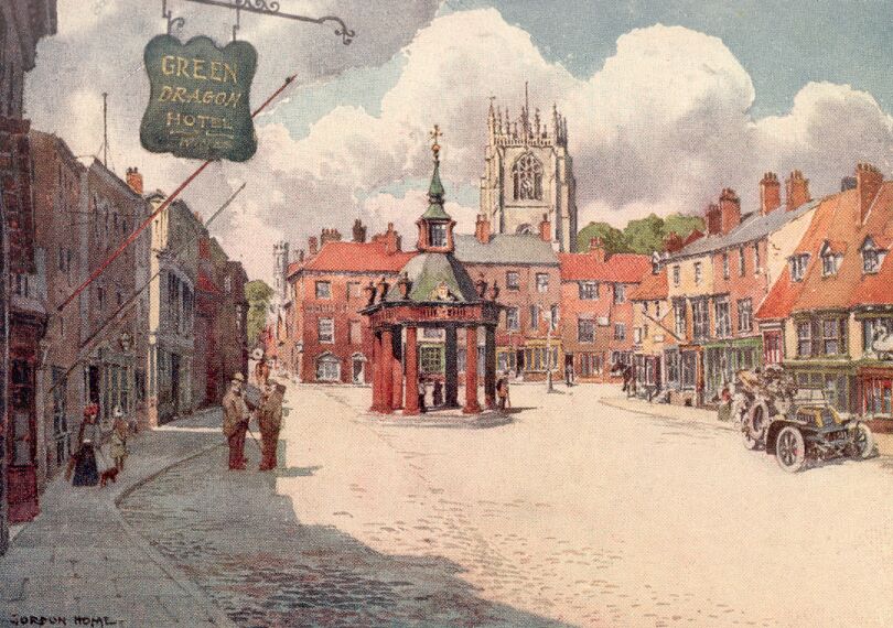
Beverley has no natural features to give it any attractiveness, for it stands on the borders of the level plain of Holderness, and towards the Wolds there is only a very gentle rise. It depends, therefore, solely upon its architecture. The first view of the city from the west as we come over the broad grassy common of Westwood is delightful. We are just sufficiently elevated to see the opalescent form of the Minster, with its graceful towers rising above the more distant roofs, and close at hand the pinnacled tower of St. Mary's showing behind a mass of dark trees. The entry to the city from this direction is in every way prepossessing, for the sunny common is succeeded by a broad, tree lined road, with old-fashioned houses standing sedately behind the foliage, and the end of the avenue is closed by the North Bar—the last of Beverley's gates. It dates from 1410, and is built of very dark red brick, with one arch only, the footways being taken through the modern houses, shouldering it on each side. Leland's account and the town records long before his day tell us that there were three gates, but nothing remains of 'Keldgate barr' and the 'barr de Newbygyng.'
We go through the archway and find ourselves in a wide street with the beautiful west end of St. Mary's Church on the left, quaint Georgian houses, and a dignified hotel of the same period on the opposite side, while straight ahead is the broad Saturday Market with its very picturesque 'cross.' The cross was put up in 1714 by Sir Charles Hotham, Bart., and Sir Michael Warton, Members of Parliament for the Corporation at that time.
Without the towers the exterior of the Minster gives me little pleasure, for the Early English chancel and greater and lesser transepts, although imposing and massive, are lacking in proper proportion, and in that deficiency suffer a loss of dignity. The eulogies so many architects and writers have poured out upon the Early English work of this great church, and the strangely adverse comments the same critics have levelled at the Perpendicular additions, do not blind me to what I regard as a most strange misconception on the part of these people. The homogeneity of the central and eastern portions of the Minster is undeniable, but because what appears to be the design of one master-builder of the thirteenth century was apparently carried out in the short period of twenty years, I do not feel obliged to consider the result beautiful.
In the Perpendicular work of the western towers everything is in graceful proportion, and nothing from the ground to the top of the turrets, jars with the wonderful dignity of their perfect lines.
A few years before the Norman Conquest a central tower and a presbytery were added to the existing building by Archbishop Cynesige. The 'Frenchman's' influence was probably sufficiently felt at that time to give this work the stamp of Norman ideas, and would have shown a marked advance on the Romanesque style of the Saxon age, in which the other portions of the buildings were put up. After that time we are in the dark as to what happened until the year 1188, when a disaster took place of which there is a record:
'In the year from the incarnation of Our Lord 1188, this church was burnt, in the month of September, the night after the Feast of St. Matthew the Apostle, and in the year 1197, the sixth of the ides of March, there was an inquisition made for the relics of the blessed John in this place, and these bones were found in the east part of his sepulchre, and reposited; and dust mixed with mortar was found likewise, and re-interred.'
This is a translation of the Latin inscription on a leaden plate discovered in 1664, when a square stone vault in the church was opened and found to be the grave of the canonized John of Beverley. The picture history gives us of this remarkable man, although to a great extent hazy with superstitious legend, yet shows him to have been one of the greatest and noblest of the ecclesiastics who controlled the Early Church in England. He founded the monastery at Beverley about the year 700, on what appears to have been an isolated spot surrounded by forest and swamp, and after holding the See of York for some twelve years, he retired here for the rest of his life. When he died, in 721, his memory became more and more sacred, and his powers of intercession were constantly invoked. The splendid shrine provided for his relics in 1037 was encrusted with jewels and shone with the precious metals employed. Like the tomb of William the Conqueror at Caen, it disappeared long ago. After the collapse of the central tower to its very foundations came the vast Early English reconstruction of everything except the nave, which was possibly of pre-Conquest date, and survived until the present Decorated successor took its place. Much discussion has centred round certain semicircular arches at the back of the triforium, whose ornament is unmistakably Norman, suggesting that the early nave was merely remodelled in the later period. The last great addition to the structure was the beautiful Perpendicular north porch and the west end—the glory of Beverley. The interior of the transepts and chancel is extremely interesting, but entirely lacking in that perfection of form characterizing York.
A magnificent range of stalls crowned with elaborate tabernacle work of the sixteenth century adorns the choir, and under each of the sixty-eight seats are carved misereres, making a larger collection than any other in the country. The subjects range from a horrible representation of the devil with a second face in the middle of his body to humorous pictures of a cat playing a fiddle, and a scold on her way to the ducking-stool in a wheel-barrow, gripping with one hand the ear of the man who is wheeling her.
In the north-east corner of the choir, built across the opening to the lesser transept on that side, is the tomb of Lady Eleanor FitzAllen, wife of Henry, first Lord Percy of Alnwick. It is considered to be, without a rival, the most beautiful tomb in this country. The canopy is composed of sumptuously carved stone, and while it is literally encrusted with ornament, it is designed in such a masterly fashion that the general effect, whether seen at a distance or close at hand, is always magnificent. The broad lines of the canopy consist of a steep gable with an ogee arch within, cusped so as to form a base at its apex for an elaborate piece of statuary. This is repeated on both sides of the monument. On the side towards the altar, the large bearded figure represents the Deity, with angels standing on each side of the throne, holding across His knees a sheet. From this rises a small undraped figure representing Lady Eleanor, whose uplifted hands are held in one of those of her Maker, who is shown in the act of benediction with two fingers on her head.
In the north aisle of the chancel there is a very unusual double staircase. It is recessed in the wall, and the arcading that runs along the aisle beneath the windows is inclined upwards and down again at a slight angle, similar to the rise of the steps which are behind the marble columns. This was the old way to the chapter-house, destroyed at the Dissolution, and is an extremely fine example of an Early English stairway. Near the Percy chapel stands the ancient stone chair of sanctuary, or frith-stool. It has been broken and repaired with iron clamps, and the inscription upon it, recorded by Spelman, has gone. The privileges of sanctuary were limited by Henry VIII, and abolished in the reign of James I; but before the Dissolution malefactors of all sorts and conditions, from esquires and gentlewomen down to chapmen and minstrels, frequently came in undignified haste to claim the security of St. John of Beverley. Here is a case quoted from the register by Mr. Charles Hiatt in his admirable account of the Minster:
'John Spret, Gentilman, memorandum that John Spret, of Barton upon Umber, in the counte of Lyncoln, gentilman, com to Beverlay, the first day of October the vii yer of the reen of Keing Herry vii and asked the lybertes of Saint John of Beverlay, for the dethe of John Welton, husbondman, of the same town, and knawleg [acknowledge] hymselff to be at the kyllyng of the saym John with a dagarth, the xv day of August.'
On entering the city we passed St. Mary's, a beautiful Perpendicular church which is not eclipsed even by the major attractions of the Minster. At the west end there is a splendid Perpendicular window flanked by octagonal buttresses of a slightly earlier date, which are run up to a considerable height above the roof of the nave, the upper portions being made light and graceful, with an opening on each face, and a pierced parapet. The tower rises above the crossing, and is crowned by sixteen pinnacles.
In its general appearance the large south porch is Perpendicular, like the greater part of the church, but the inner portion of its arch is Norman, and the outer is Early English. One of the pillars of the nave is ornamented just below the capital with five quaint little minstrels carved in stone. Each is supported by a bold bracket, and each is painted. The musical instruments are all much battered, but it can be seen that the centre figure, who is dressed as an alderman, had a harp, and the others a pipe, a lute, a drum, and a violin. From Saxon times there had existed in Beverley a guild of minstrels, a prosperous fraternity bound by regulations, which Poulson gives at length in his monumental work on Beverley. The minstrels played at aldermen's feasts, at weddings, on market-days, and on all occasions when there was excuse for music.
ALONG THE HUMBER
|
'Away with me in post to Ravenspurgh; But if you faint, as fearing to do so, Stay and be secret, and myself will go.' Richard II, Act II, Scene 1. |
The atrophied corner of Yorkshire that embraces the lowest reaches of the Humber is terminated by a mere raised causeway leading to the wider patch of ground dominated by Spurn Head lighthouse. This long ridge of sand and shingle is all that remains of a very considerable and populous area possessing towns and villages as recently as the middle of the fourteenth century.
Far back in the Middle Ages the Humber was a busy waterway for shipping, where merchant vessels were constantly coming and going, bearing away the wool of Holderness and bringing in foreign goods, which the Humber towns were eager to buy. This traffic soon demonstrated the need of some light on the point of land where the estuary joined the sea, and in 1428 Henry VI granted a toll on all vessels entering the Humber in aid of the first lighthouse put up about that time by a benevolent hermit.
No doubt the site of this early structure has long ago been submerged. The same fate came upon the two lights erected on Kilnsea Common by Justinian Angell, a London merchant, who received a patent from Charles II to 'continue, renew, and maintain' two lights at Spurn Point.
In 1766 the famous John Smeaton was called upon to put up two lighthouses, one 90 feet and the other 50 feet high. There was no hurry in completing the work, for the foundations of the high light were not completed until six years later. The sea repeatedly destroyed the low light, owing to the waves reaching it at high tide. Poulson mentions the loss of three structures between 1776 and 1816. The fourth was taken down after a brief life of fourteen years, the sea having laid the foundations bare. As late as the beginning of last century the illumination was produced by 'a naked coal fire, unprotected from the wind,' and its power was consequently most uncertain.
Smeaton's high tower is now only represented by its foundations and the circular wall surrounding them, which acts as a convenient shelter from wind and sand for the low houses of the men who are stationed there for the lifeboat and other purposes.
The present lighthouse is 30 feet higher than Smeaton's, and is fitted with the modern system of dioptric refractors, giving a light of 519,000 candle-power, which is greater than any other on the east coast of England. The need for a second structure has been obviated by placing the low lights half-way down the existing tower. Every twenty seconds the upper light flashes for one and a half seconds, being seen in clear weather at a distance of seventeen nautical miles.
In the Middle Ages great fortunes were made on the shores on the Humber. Sir William de la Pole was a merchant of remarkable enterprise, and the most notable of those who traded at Ravenserodd. It was probably owing to his great wealth that his son was made a knight-banneret, and his grandson became Earl of Suffolk. Another of the De la Poles was the first Mayor of Hull, and seems to have been no less opulent than his brother, who lent large sums of money to Edward III, and was in consequence appointed Chief Baron of the Exchequer and also presented with the Lordship of Holderness.
The story of Ravenser, and the later town of Ravenserodd, is told in a number of early records, and from them we can see clearly what happened in this corner of Yorkshire. Owing to a natural confusion from the many different spellings of the two places, the fate of the prosperous port of Ravenserodd has been lost in a haze of misconception. And this might have continued if Mr. J. R. Boyle had not gone exhaustively into the matter, bringing together all the references to the Ravensers which have been discovered.
There seems little doubt that the first place called Ravenser was a Danish settlement just within the Spurn Point, the name being a compound of the raven of the Danish standard, and eyr or ore, meaning a narrow strip of land between two waters. In an early Icelandic saga the sailing of the defeated remnant of Harold Hardrada's army from Ravenser, after the defeat of the Norwegians at Stamford Bridge, is mentioned in the lines:
|
'The King the swift ships with the flood Set out, with the autumn approaching, And sailed from the port, called Hrafnseyrr (the raven tongue of land).' |
From this event of 1066 Ravenser must have remained a hamlet of small consequence, for it is not heard of again for nearly two centuries, and then only in connexion with the new Ravenser which had grown on a spit of land gradually thrown up by the tide within the spoon-shaped ridge of Spurn Head. On this new ground a vessel was wrecked some time in the early part of the thirteenth century, and a certain man—the earliest recorded Peggotty—converted it into a house, and even made it a tavern, where he sold food and drink to mariners. Then three or four houses were built near the adapted hull, and following this a small port was created, its development being fostered by William de Fortibus, Earl of Albemarl, the lord of the manor, with such success that, by the year 1274, the place had grown to be of some importance, and a serious trade rival to Grimsby on the Lincolnshire coast. To distinguish the two Ravensers the new place, which was almost on an island, being only connected with the mainland by a bank composed of large yellow boulders and sand, was called Ravenser Odd, and in the Chronicles of Meaux Abbey and other records the name is generally written Ravenserodd. The original place was about a mile away, and no longer on the shore, and it is distinguished from the prosperous port as Ald Ravenser. Owing, however, to its insignificance in comparison to Ravenserodd, the busy port, it is often merely referred to as Ravenser, spelt with many variations.
The extraordinarily rapid rise of Ravenserodd seems to have been due to a remarkable keenness for business on the part of its citizens, amounting, in the opinion of the Grimsby traders, to sharp practice. For, being just within Spurn Head, the men of Ravenserodd would go out to incoming vessels bound for Grimsby, and induce them to sell their cargoes in Ravenserodd by all sorts of specious arguments, misquoting the prices paid in the rival town. If their arguments failed, they would force the ships to enter their harbour and trade with them, whether they liked it or not. All this came out in the hearing of an action brought by the town of Grimsby against Ravenserodd. Although the plaintiffs seem to have made a very good case, the decision of the Court was given in favour of the defendants, as it had not been shown that any of their proceedings had broken the King's peace.
The story of the disaster, which appears to have happened between 1340 and 1350, is told by the monkish compiler of the Chronicles of Meaux. Translated from the original Latin the account is headed:
'Concerning the consumption of the town of Ravensere Odd and concerning the effort towards the diminution of the tax of the church of Esyngton.
'But in those days, the whole town of Ravensere Odd.. was totally annihilated by the floods of the Humber and the inundations of the great sea ... and when that town of Ravensere Odd, in which we had half an acre of land built upon, and also the chapel of that town, pertaining to the said church of Esyngton, were exposed to demolition during the few preceding years, those floods and inundations of the sea, within a year before the destruction of that town, increasing in their accustomed way without limit fifteen fold, announcing the swallowing up of the said town, and sometimes exceeding beyond measure the height of the town, and surrounding it like a wall on every side, threatened the final destruction of that town. And so, with this terrible vision of waters seen on every side, the enclosed persons, with the reliques, crosses, and other ecclesiastical ornaments, which remained secretly in their possession and accompanied by the viaticum of the body of Christ in the hands of the priest, flocking together, mournfully imploring grace, warded off at that time their destruction. And afterwards, daily removing thence with their possession, they left that town totally without defence, to be shortly swallowed up, which, with a short intervening period of time by those merciless tempestuous floods, was irreparably destroyed.'
The traders and inhabitants generally moved to Kingston-upon-Hull and other towns, as the sea forced them to seek safer quarters.
When Henry of Lancaster landed with his retinue in 1399 within Spurn Head, the whole scene was one of complete desolation, and the only incident recorded is his meeting with a hermit named Matthew Danthorp, who was at the time building a chapel.
The very beautiful spire of Patrington church guides us easily along a winding lane from Easington until the whole building shows over the meadows.
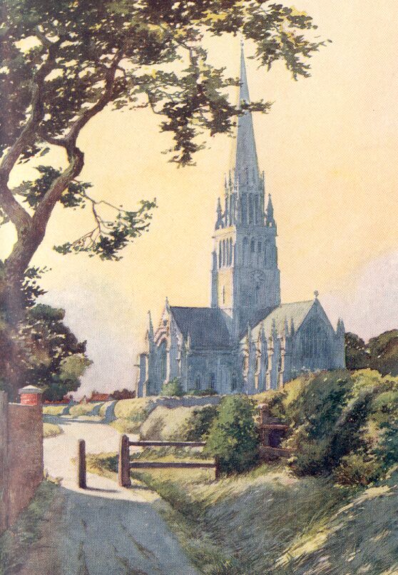
We seem to have stumbled upon a cathedral standing all alone in this diminishing land, scarcely more than two miles from the Humber and less than four from the sea. No one quarrels with the title 'The Queen of Holderness,' nor with the far greater claim that Patrington is the most beautiful village church in England. With the exception of the east window, which is Perpendicular, nearly the whole structure was built in the Decorated period; and in its perfect proportion, its wealth of detail and marvellous dignity, it is a joy to the eye within and without. The plan is cruciform, and there are aisles to the transepts as well as the nave, giving a wealth of pillars to the interior. Above the tower rises a tall stone spire, enriched, at a third of its height, with what might be compared to an earl's coronet, the spikes being represented by crocketed pinnacles—the terminals of the supporting pillars. The interior is seen at its loveliest on those afternoons when that rich yellow light Mr. W. Dean Howells so aptly compares with the colour of the daffodil is flooding the nave and aisles, and glowing on the clustered columns.
In the eastern aisles of each arm of the transept there were three chantry chapels, whose piscinae remain. The central chapel in the south transept is a most interesting and beautiful object, having a recess for the altar, with three richly ornamented niches above. In the groined roof above, the central boss is formed into a hollow pendant of considerable interest. On the three sides are carvings representing the Annunciation, St. Catherine of Alexandria, and St. John the Baptist, and on the under side is a Tudor rose. Sir Henry Dryden, in the Archaeological Journal, states that this pendant was used for a lamp to light the altar below, but he points out, at the same time, that the sacrist would have required a ladder to reach it. An alternative suggestion made by others is that this niche contained a relic where it would have been safe even if visible.
Patrington village is of fair size, with a wide street; and although lacking any individual houses calling for comment, it is a pleasant place, with the prevailing warm reds of roofs and walls to be found in all the Holderness towns.
On our way to Hedon, where the 'King of Holderness' awaits us, we pass Winestead Church, where Andrew Marvell was baptized in 1621, and where we may see the memorials of a fine old family—the Hildyards of Winestead, who came there in the reign of Henry VI.
The stately tower of Hedon's church is conspicuous from far away; and when we reach the village we are much impressed by its solemn beauty, and by the atmosphere of vanished greatness clinging to the place that was decayed even in Leland's days, when Henry VIII, still reigned. No doubt the silting up of the harbour and creeks brought down Hedon from her high place, so that the retreat of the sea in this place was scarcely less disastrous to the town's prosperity than its advance had been at Ravenserodd; and possibly the waters of the Humber, glutted with their rapacity close to Spurn Head, deposited much of the disintegrated town in the waterway of the other.
The nave of the church is Decorated, and has beautiful windows of that period. The transept is Early English, and so also is the chancel, with a fine Perpendicular east window filled with glass of the same subtle colours we saw at Patrington.
In approaching nearer to Hull, we soon find ourselves in the outer zone of its penumbra of smoke, with fields on each side of the road waiting for works and tall shafts, which will spread the unpleasant gloom of the city still further into the smiling country. The sun becomes copper-coloured, and the pure, transparent light natural to Holderness loses its vigour. Tall and slender chimneys emitting lazy coils of blackness stand in pairs or in groups, with others beyond, indistinct behind a veil of steam and smoke, and at their feet grovels a confusion of buildings sending forth jets and mushrooms of steam at a thousand points. Hemmed in by this industrial belt and compact masses of cellular brickwork, where labour skilled and unskilled sleeps and rears its offspring, is the nucleus of the Royal borough of Kingston-upon-Hull, founded by Edward I at the close of the thirteenth century.
It would scarcely have been possible that any survivals of the Edwardian port could have been retained in the astonishing commercial development the city has witnessed, particularly in the last century; and Hull has only one old street which can lay claim to even the smallest suggestion of picturesqueness. The renaissance of English architecture is beginning to make itself felt in the chief streets, where some good buildings are taking the places of ugly fronts; and there are one or two more ambitious schemes of improvement bringing dignity into the city; but that, with the exception of two churches, is practically all.
When we see the old prints of the city surrounded by its wall defended with towers, and realize the numbers of curious buildings that filled the winding streets—the windmills, the churches and monasteries—we understand that the old Hull has gone almost as completely as Ravenserodd. It was in Hull that Michael, a son of Sir William de la Pole of Ravenserodd, its first Mayor, founded a monastery for thirteen Carthusian monks, and also built himself, in 1379, a stately house in Lowgate opposite St. Mary's Church. Nothing remains of this great brick mansion, which was described as a palace, and lodged Henry VIII during his visit in 1540. Even St. Mary's Church has been so largely rebuilt and restored that its interest is much diminished.
The great Perpendicular Church of Holy Trinity in the market-place is, therefore, the one real link between the modern city and the little town founded in the thirteenth century. It is a cruciform building and has a fine central tower, and is remarkable in having transepts and chancel built externally of brick as long ago as the Decorated Period. The De la Pole mansion, of similar date, was also constructed with brick—no doubt from the brickyard outside the North Gate owned by the founder of the family fortunes. The pillars and capitals of the arcades of both the nave and chancel are thin and unsatisfying to the eye, and the interior as a whole, although spacious, does not convey any pleasing sensations. The slenderness of the columns was necessary, it appears, owing to the soft and insecure ground, which necessitated a pile foundation and as light a weight above as could be devised.
William Wilberforce, the liberator of slaves, was born in 1759 in a large house still standing in High Street, and a tall Doric column surmounted by a statue perpetuates his memory, in the busiest corner of the city. The old red-brick Grammar School bears the date 1583, and is a pleasant relief from the dun-coloured monotony of the greater part of the city.
In going westward we come, at the village of North Cave, to the southern horn of the crescent of the Wolds. All the way to Howden they show as a level-topped ridge to the north, and the lofty tower of the church stands out boldly for many miles before we reach the town. The cobbled streets at the east end of the church possess a few antique houses coloured with warm ochre, and it is over and between these that we have the first close view of the ruined chancel. The east window has lost most of its tracery, and has the appearance of a great archway; its date, together with the whole of the chancel, is late Decorated, but the exquisite little chapterhouse is later still, and may be better described as early Perpendicular. It is octagonal in plan, and has in each side a window with an ogee arch above. The stones employed are remarkably large. The richly moulded arcading inside, consisting of ogee arches, has been exposed to the weather for so long, owing to the loss of the vaulting above, that the lovely detail is fast disappearing.
About four miles from Howden, near the banks of the Derwent, stand the ruins of Wressle Castle. In every direction the country is spread out green and flat, and, except for the towers and spires of the churches, it is practically featureless. To the north the horizon is brought closer by the rounded outlines of the wolds; everywhere else you seem to be looking into infinity, as in the Fen Country.
The castle that stands in the midst of this belt of level country is the only one in the East Riding, and although now a mere fragment of the former building, it still retains a melancholy dignity. Since a fire in 1796 the place has been left an empty shell, the two great towers and the walls that join them being left without floors or roofs.
Wressle was one of the two castles in Yorkshire belonging to the Percys, and at the time of the Civil War still retained its feudal grandeur unimpaired. Its strength was, however, considered by the Parliament to be a danger to the peace, despite the fact that the Earl of Northumberland, its owner, was not on the Royalist side, and an order was issued in 1648 commanding that it should be destroyed. Pontefract Castle had been suddenly seized for the King in June during that year, and had held out so persistently that any fortified building, even if owned by a supporter, was looked upon as a possible source of danger to the Parliamentary Government. An order was therefore sent to Lord Northumberland's officers at Wressle commanding them to pull down all but the south side of the castle. That this was done with great thoroughness, despite the most strenuous efforts made by the Earl to save his ancient seat, may be seen to-day in the fact that, of the four sides of the square, three have totally disappeared, except for slight indications in the uneven grass.
The saddest part of the story concerns the portion of the buildings spared by the Cromwellians. This, we are told, remained until a century ago nearly in the same state as in the year 1512, when Henry Percy, the fifth Earl, commenced the compilation of his wonderful Household Book. The Great Chamber, or Dining Room, the Drawing Chamber, the Chapel, and other apartments, still retained their richly-carved ceilings, and the sides of the rooms were ornamented with a 'great profusion of ancient sculpture, finely executed in wood, exhibiting the bearings, crests, badges, and devises, of the Percy family, in a great variety of forms, set off with all the advantages of painting, gilding and imagery.'
There was a moat on three sides, a square tower at each corner, and a fifth containing the gateway presumably on the eastward face. In one of the corner towers was the buttery, pantry, 'pastery,' larder, and kitchen; in the south-easterly one was the chapel; and in the two-storied building and the other tower of the south side were the chief apartments, where my lord Percy dined, entertained, and ordered his great household with a vast care and minuteness of detail. We would probably have never known how elaborate were the arrangements for the conduct and duties of every one, from my lord's eldest son down to his lowest servant, had not the Household Book of the fifth Earl of Northumberland been, by great good fortune, preserved intact. By reading this extraordinary compilation it is possible to build up a complete picture of the daily life at Wressle Castle in the year 1512 and later.
From this account we know that the bare stone walls of the apartments were hung with tapestries, and that these, together with the beds and bedding, all the kitchen pots and pans, cloths, and odds and ends, the altar hangings, surplices, and apparatus of the chapel—in fact, every one's bed, tools, and clothing—were removed in seventeen carts each time my lord went from one of his castles to another. The following is one of the items, the spelling being typical of the whole book:
'ITEM.—Yt is Ordynyd at every Remevall that the Deyn Subdean Prestes Gentilmen and Children of my Lordes Chapell with the Yoman and Grome of the Vestry shall have apontid theime ii Cariadges at every Remevall Viz. One for ther Beddes Viz. For vi Prests iii beddes after ii to a Bedde For x Gentillmen of the Chapell v Beddes after ii to a Bedde And for vi Children ii Beddes after iii to a Bedde And a Bedde for the Yoman and Grom o' th Vestry In al xi Beddes for the furst Cariage. And the ii'de Cariage for ther Aparells and all outher ther Stuff and to have no mo Cariage allowed them but onely the said ii Cariages allowid theime.'
We have seen the astonishingly tall spire of Hemingbrough Church from the battlements of Wressle Castle, and when we have given a last look at the grey walls and the windows, filled with their enormously heavy tracery, we betake ourselves along a pleasant lane that brings us at length to the river. The soaring spire is 120 feet in height, or twice that of the tower, and this hugeness is perhaps out of proportion with the rest of the building; yet I do not think for a moment that this great spire could have been different without robbing the church of its striking and pleasing individuality. There are Transitional Norman arches at the east end of the nave, but most of the work is Decorated or Perpendicular. The windows of the latter period in the south transept are singularly happy in the wonderful amount of light they allow to flood through their pale yellow glass. The oak bench-ends in the nave, which are carved with many devices, and the carefully repaired stalls in the choir, are Perpendicular, and no doubt belong to the period when the church was a collegiate foundation of Durham.
THE DERWENT AND THE HOWARDIAN HILLS
Malton is the only town on the Derwent, and it is made up of three separate places—Old Malton, a picturesque village; New Malton, a pleasant and oldfashioned town; and Norton, a curiously extensive suburb. The last has a Norman font in its modern church, and there its attractions begin and end. New Malton has a fortunate position on a slope well above the lush grass by the river, and in this way arranges the backs of its houses with unconscious charm. The two churches, although both containing Norman pillars and arches, have been so extensively rebuilt that their antiquarian interest is slight.
On account of its undoubted signs of Roman occupation in the form of two rectangular camps, and its situation at the meeting-place of some three or four Roman roads, New Malton has been with great probability identified with the Delgovitia of the Antonine Itinerary.
Old Malton is a cheerful and well-kept village, with antique cottages here and there, roofed with mossy thatch. It makes a pretty picture as you come along the level road from Pickering, with a group of trees on the left and the tower of the Priory Church appearing sedately above the humble roofs. A Gilbertine monastery was founded here about the middle of the twelfth century, during the lifetime of St. Gilbert of Sempringham in Lincolnshire, who during the last year of his long life sent a letter to the Canons of Malton, addressing them as 'My dear sons.' Little remains of Malton Priory with the exception of the church, built at the very beginning of the Early English period. Of the two western towers, the southern one only survives, and both aisles, two bays of the nave, and everything else to the east has gone. The abbreviated nave now serves as a parish church.
Between Malton and the Vale of York there lies that stretch of hilly country we saw from the edge of the Wolds, for some time past known as the Howardian Hills, from Castle Howard which stands in their midst. The many interests that this singularly remote neighbourhood contains can be realized by making such a peregrination as we made through the Wolds.
There is no need to avoid the main road south of Malton. It has a park-like appearance, with its large trees and well-kept grass on each side, and the glimpses of the wooded valley of the Derwent on the left are most beautiful. On the right we look across the nearer grasslands into the great park of Castle Howard, and catch glimpses between the distant masses of trees of Lord Carlisle's stately home. The old castle of the Howards having been burnt down, Vanbrugh, the greatest architect of early Georgian times, designed the enormous building now standing. In 1772 Horace Walpole compressed the glories of the place into a few sentences. '... I can say with exact truth,' he writes to George Selwyn,' that I never was so agreeably astonished in my days as with the first vision of the whole place. I had heard of Vanburgh, and how Sir Thomas Robinson and he stood spitting and swearing at one another; nay, I had heard of glorious woods, and Lord Strafford alone had told me that I should see one of the finest places in Yorkshire; but nobody ... had informed me that should at one view see a palace, a town, a fortified city; temples on high places, woods worthy of being each metropolis of the Druids, vales connected to hills by other woods, the noblest lawn in the world fenced by half the horizon, and a mausoleum that would tempt one to be buried alive; in short, I have seen gigantic places before, but never a sublime one.'
The style is that of the Corinthian renaissance, and Walpole's description applies as much to-day as when he wrote. The pictures include some of the masterpieces of Reynolds, Lely, Vandyck, Rubens, Tintoretto, Canaletto, Giovanni Bellini Domenichino and Annibale Caracci.
Two or three miles to the south, the road finds itself close to the deep valley of the Derwent. A short turning embowered with tall trees whose dense foliage only allows a soft green light to filter through, goes steeply down to the river. We cross the deep and placid river by a stone bridge, and come to the Priory gateway. It is a stately ruin partially mantled with ivy, and it preserves in a most remarkable fashion the detail of its outward face.
The mossy steps of the cross just outside the gateway are, according to a tradition in one of the Cottonian manuscripts, associated with the event which led to the founding of the Abbey by Walter Espec, lord of Helmsley. He had, we are told, an only son, also named Walter, who was fond of riding with exceeding swiftness.
One day when galloping at a great pace his horse stumbled near a small stone, and young Espec was brought violently to the ground, breaking his neck and leaving his father childless. The grief-stricken parent is said to have found consolation in the founding of three abbeys, one of them being at Kirkham, where the fatal accident took place.
Of the church and conventual buildings only a few fragments remain to tell us that this secluded spot by the Derwent must have possessed one of the most stately monasteries in Yorkshire. One tall lancet is all that has been left of the church; and of the other buildings a few walls, a beautiful Decorated lavatory, and a Norman doorway alone survive.
Stamford Bridge, which is reached by no direct road from Kirkham Abbey, is so historically fascinating that we must leave the hills for a time to see the site of that momentous battle between Harold, the English King, and the Norwegian army, under Harold Hardrada and Harold's brother Tostig. The English host made their sudden attack from the right bank of the river, and the Northmen on that side, being partially armed, were driven back across a narrow wooden bridge. One Northman, it appears, played the part of Horatius in keeping the English at bay for a time. When he fell, the Norwegians had formed up their shield-wall on the left bank of the river, no doubt on the rising ground just above the village. That the final and decisive phase of the battle took place there Freeman has no doubt.
Stamford Bridge being, as already mentioned, the most probable site of the Roman Derventio, it was natural that some village should have grown up at such an important crossing of the river.
An unfrequented road through a belt of picturesque woodland goes from Stamford Bridge past Sand Hutton to the highway from York to Malton. If we take the branch-road to Flaxton, we soon see, over the distant trees, the lofty towers of Sheriff Hutton Castle, and before long reach a silent village standing near the imposing ruin. The great rectangular space, enclosed by huge corner-towers and half-destroyed curtain walls, is now utilized as the stackyard of a farm, and the effect as we approach by a footpath is most remarkable. It seems scarcely possible that this is the castle Leland described with so much enthusiasm. 'I saw no House in the North so like a Princely Logginges,' he says, and also describes 'the stately Staire up to the Haul' as being very magnificent.
We come to the north-west tower, and look beyond its ragged outline to the distant country lying to the west, grass and arable land with trees appearing to grow so closely together at a short distance, that we have no difficulty in realizing that this was the ancient Forest of Galtres, which reached from Sheriff Hutton and Easingwold to the very gates of York.
In the complete loneliness of the ruins, with the silence only intensified by the sounds of fluttering wings in the tops of the towers, we in imagination sweep away the haystacks and reinstate the former grandeur of the fortress in the days of Ralph Neville, first Earl of Westmorland. It was he who rebuilt the Norman castle of Bertram de Bulmer, Sheriff of Yorkshire, on a grander scale. Upon the death of Warwick, the Kingmaker, in 1471, Edward IV gave the castle and manor of Sheriff Hutton to his brother Richard, afterwards Richard III, and it was he who kept Edward IV's eldest child Elizabeth a prisoner within these massive walls. The unfortunate Edward, Earl of Warwick, the eldest son of George, Duke of Clarence, when only eight years old, was also incarcerated here for about three years. Richard III, the usurper, when he lost his only son, had thought of making this boy his heir, but the unfortunate child was passed over in favour of John de la Pole, Earl of Lincoln, and remained in close confinement at Sheriff Hutton until August, 1485, when the Battle of Bosworth placed Henry VII on the throne. Sir Robert Willoughby soon afterwards arrived at the castle, and took the little Earl to London. Princess Elizabeth was also sent for at the same time, but whether both the Royal prisoners travelled together does not appear to be recorded. The terrible pathos of this simultaneous removal from the castle lay in the fact that Edward was to play the part of Pharaoh's chief baker, and Elizabeth that of the chief butler; for, after fourteen years in the Tower of London, the Earl of Warwick was beheaded, while the King, after five months, raised up Elizabeth to be his Queen. Even in those callous times the fate of the Prince was considered cruel, for it was pointed out after his execution, that, as he had been kept in imprisonment since he was eight years old, and had no knowledge or experience of the world, he could hardly have been accused of any malicious purpose. So cut off from all the common sights of everyday life was the miserable boy that it was said 'that he could not discern a goose from a capon.'
Portions of the Augustinian Priory are built into the house called Newburgh Priory, and these include the walls of the kitchen and some curious carvings showing on the exterior. William of Newburgh, the historian, whose writings end abruptly in 1198—probably the year of his death—was a canon of the Priory, and spent practically his whole life there. In his preface he denounced the inaccuracies and fictions of the writings of Geoffrey of Monmouth. At the Dissolution Newburgh was given by Henry VIII to Anthony Belasyse, the punning motto of whose family was Bonne et belle assez. One of his descendants was created Lord Fauconberg by Charles I, and the peerage became extinct in 1815, on the death of the seventh to bear the title. The last owner—Sir George Wombwell, Bart.—inherited the property from his grandmother, who was a daughter of the last Lord Fauconberg. Sir George was one of the three surviving officers who took part in the charge of the Light Brigade at Balaclava on October 25, 1854.
The late Duke of Cambridge paid several visits to Newburgh, occupying what is generally called 'the Duke's Room.' Rear-Admiral Lord Adolphus Fitz-Clarence, whose father was George IV, died in 1856 in the bed still kept in this room. In a glass case, at the end of a long gallery crowded with interest, are kept the uniform and accoutrements Sir George wore at Balaclava.
The second Lord Fauconberg, who was raised from Viscount to the rank of Earl in 1689, was warmly attached to the Parliamentary side in the Civil War, and took as his second wife Cromwell's third daughter, Mary. This close connexion with the Protector explains the inscription upon a vault immediately over one of the entrances to the Priory. On a small metal plate is written:
'In this vault are Cromwell's bones, brought here, it is believed, by his daughter Mary, Countess of Fauconberg, at the Restoration, when his remains were disinterred from Westminster Abbey.'
The letters 'R.I.P.' below are only just visible, an attempt having been made to erase them. No one seems to have succeeded in finally clearing up the mystery of the last resting-place of Cromwell's remains. The body was exhumed from its tomb in Henry VII.'s Chapel at Westminster, and hung on the gallows at Tyburn on January 30, 1661—the twelfth anniversary of the execution of Charles I—and the head was placed upon a pole raised above St. Stephen's Hall, and had a separate history, which is known. Lord Fauconberg is said to have become a Royalist at the Restoration, and if this were true, he would perhaps have been able to secure the decapitated remains of his father-in-law, after their burial at the foot of the gallows at Tyburn. It has often been stated that a sword, bridle, and other articles belonging to Cromwell are preserved at Newburgh Priory, but this has been conclusively shown to be a mistake, the objects having been traced to one of the Belasyses.
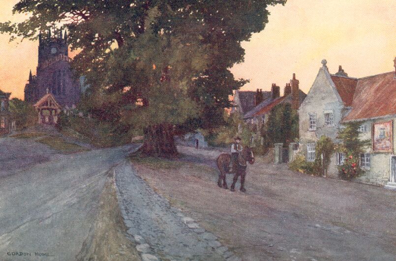
Coxwold has that air of neatness and well-preserved antiquity which is so often to be found in England where the ancient owners of the land still spend a large proportion of their time in the great house of the village. There is a very wide street, with picturesque old houses on each side, which rises gently towards the church. A great tree with twisted branches—whether oak or elm, I cannot remember—stands at the top of the street opposite the churchyard, and adds much charm to the village. The inn has recently lost its thatch, but is still a quaint little house with the typical Yorkshire gable, finished with a stone ball. On the great sign fixed to the wall are the arms and motto of the Fauconbergs, and the interior is full of old-fashioned comfort and cleanliness. Nearly opposite stand the almshouses, dated 1662.
The church is chiefly Perpendicular, with a rather unusual octagonal tower. In the eighteenth century the chancel was rebuilt, but the Fauconberg monuments in it were replaced. Sir William Belasyse, who received the Newburgh property from his uncle, the first owner, died in 1603, and his fine Jacobean tomb, painted in red, black and gold, shows him with a beard and ruff. His portrait hangs in one of the drawing-rooms of the Priory. The later monuments, adorned with great carved figures, are all interesting. They encroach so much on the space in the narrow chancel that a most curious method for lengthening the communion-rail has been resorted to—that of bringing forward from the centre a long narrow space enclosed with the rails. From the pulpit Laurence Sterne preached when he was incumbent here for the last eight years of his life. He came to Coxwold in 1760, and took up his abode in the charming old house he quaintly called 'Shandy Hall.' It is on the opposite side of the road to the church, and has a stone roof and one of those enormous chimneys so often to be found in the older farmsteads of the north of England. Sterne's study was the very small room on the right-hand side of the entrance doorway; it now contains nothing associated with him, and there is more pleasure in viewing the outside of the house than is gained by obtaining permission to enter.
During his last year at Coxwold, when his rollicking, boisterous spirits were much subdued, Sterne completed his 'Sentimental Journey.' He also relished more than before the country delights of the village, describing it in one of his letters as 'a land of plenty.' Every day he drove out in his chaise, drawn by two long-tailed horses, until one day his postilion met with an accident from one his master's pistols, which went off in his hand. 'He instantly fell on his knees,' wrote Sterne, 'and said "Our Father, which art in Heaven, hallowed be Thy name"—at which, like a good Christian, he stopped, not remembering any more of it.'
The beautiful Hambleton Hills begin to rise up steeply about two miles north of Coxwold, and there we come upon the ruins of Byland Abbey. Their chief feature is the west end of the church, with its one turret pointing a finger to the heavens, and the lower portion of a huge circular window, without any sign of tracery. This fine example of Early English work is illustrated here. The whole building appears to be the original structure built soon after 1177, for it shows everywhere the transition from Norman to Early English which was taking place at the close of the twelfth century. The founders were twelve monks and an abbot, named Gerald, who left Furness Abbey in 1134, and after some vicissitudes came to the notice of Gundred, the mother of Roger de Mowbray, either by recommendation or by accident. One account pictures the holy men on their way to Archbishop Thurstan at York, with all their belongings in one wagon drawn by eight oxen, and describes how they chanced to meet Gundreda's steward as they journeyed near Thirsk. Through Gundreda the monks went to Hode, and after four years received land at Old Byland, where they wished to build an abbey. This position was found to be too close to Rievaulx, whose bells could be too plainly heard, so that five years later the restless community obtained a fresh grant of land from De Mowbray, at a place called Stocking, where they remained until they came to Byland.
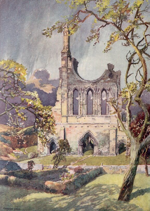
Recent excavation and preservation operations carried out by H.M. Office of Works have added many lost features to the ruins including the exposure of the whole of the floor level of the church hitherto buried under grassy mounds. Almost any of the roads to the east go through surprisingly attractive scenery. There are heathery commons, roads embowered with great spreading trees, or running along open hill-sides, and frequently lovely views of the Hambletons and more distant moors in the north.
In scenery of this character stands Gilling Castle, the seat of the Fairfaxes for some three centuries. It possesses one of the most beautiful Elizabethan dining-rooms to be found in this country. The walls are panelled to a considerable height, the remaining space being filled with paintings of decorative trees, one for each wapentake of Yorkshire. Each tree is covered with the coats of arms of the great families of that time in the wapentake. The brilliant colours against the dark green of the trees form a most suitable relief to the uniform brown of the panelling. In addition to the charm of the room itself, the view from the windows into a deep hollow clothed with dense foliage, with a distant glimpse of country beyond, is unlike anything I have seen elsewhere.
A BRIEF DESCRIPTION OF THE CITY OF YORK
Thoroughly to master the story of the city of York is to know practically the whole of English history. Its importance from the earliest times has made York the centre of all the chief events that have take place in the North of England; and right up to the time of the Civil War the great happenings of the country always affected York, and brought the northern capital into the vortex of affairs. And yet, despite the prominent part the city has played in ecclesiastical, military, and civil affairs through so many centuries of strife, it has contrived to retain a medieval character in many ways unequalled by any town in the kingdom. This is due, in a large measure, to the fortunate fact that York is well outside the area of coal and iron, and has never become a manufacturing centre, the few factories it now possesses being unable to rob the city of its romance and charm.
There could scarcely be a better approach to such a city than that furnished by the railway-station. Immediately outside the building, we are confronted with a sloping grassy bank, crowned with a battlemented wall, and we discover that only through its bars and posterns can we enter the city, and feast our eyes on the relics of the Middle Ages within. It is no dummy wall put up to please visitors, for right down to the siege of 1644, when the Parliamentary army battered Walmgate Bar with their artillery, it has withstood many assaults and investments. Repairs and restorations have been carried out at various times during the last century, and additional arches have been inserted by the bars and where openings have been made necessary, luckily without robbing the walls of their picturesqueness or interest. The bright, creamy colour of the stonework is a pleasant reminder of the purity of York's atmosphere, for should the smoke of the city ever increase to the extent of even the smaller manufacturing towns, the beauty and glamour of every view would gradually disappear.
Of the Roman legionary base called Eboracum there still remain parts of the wall and the lower portion of a thirteen-sided angle bastion while embedded in the medieval earthen ramparts there is a great deal of Roman walling.
The four chief gateways and the one or two posterns and towers have each a particular fascination, and when we begin to taste the joys of York, we cannot decide whether the Minster, the gateways, the narrow streets full of overhanging houses, or the churches, all of which we know from prints and pictures, call us most. In our uncertainty we reach a wide arch across the roadway, and on the inner side find a flight of stone steps leading to the top of the wall. We climb them, and find spread out before us our first notable view of the city. The battlemented stone parapet of the wall stops at a tower standing on the bank of the river, and on the further side rises another, while above the old houses, closely packed together beyond Lendal Bridge, appear the stately towers of the Minster.
On the plan of keeping the best wine until the last, we turn our backs to the Minster and go along the wall, trying to imagine the scene when open country came right up to encircling fortifications, and within were to be found only the picturesque houses of the fourteenth and fifteenth centuries, many of them new in those days, and yet so admirably designed as to be beautiful without the additional charm of age. Then, suddenly, we find no need to imagine any longer, having reached the splendid twelfth-century structure of Micklegate Bar. Its bold turrets are pierced with arrow-slits, and above the battlements are three stone figures. The archway is a survival of the Norman city. In gazing at this imposing gateway, which confronted all who approached York from the south, we seem to hear the clanking sound of the portcullis as it is raised and lowered to allow the entry of some Plantagenet sovereign and his armed retinue, and, remembering that above this gate were fixed the dripping heads of Richard, Duke of York, after his defeat at Wakefield; the Earl of Devon, after Towton, and a long list of others of noble birth, we realize that in those times of pageantry, when the most perfect artistry appeared in costume, in architecture, and in ornament of every description, there was a blood-thirstiness that makes us shiver.
The wall stops short at Skeldergate Bridge, where we cross the river and come to the castle. There is a frowning gateway that boasts no antiquity, and the courtyard within is surrounded by the eighteenth-century assize courts, a military prison, and the governor's house. Hemmed in by these buildings and a massive wall is the artificial mound surmounted by the tottering castle keep. It is called Clifford's Tower because Francis Clifford, Earl of Cumberland, restored the ruined wall in 1642. The Royal Arms and those of the Cliffords can still be seen above the doorway, but the structure as a whole dates from the twelfth century, and in 1190 was the scene of a horrible tragedy, when the people of York determined to massacre the Jews. Those merchants who escaped from their houses with their families and were not killed in the streets fled to the castle, but finding that they were unable to defend the place, they burnt the buildings and destroyed themselves. A few exceptions consented to become Christians, but were afterwards killed by the infuriated townspeople.
On the opposite side of the Foss, a stream that joins the Ouse just outside the city, the walls recommence at the Fishergate Postern, a picturesque tower with a tiled roof. After this the line of fortifications turns to the north, and Walmgate Bar shows its battlemented turrets and its barbican, the only one which has survived. The gateway itself, on the outside, is very similar in design to Micklegate and Monk Bars, and was built in the thirteenth century; inside, however, the stonework is hidden behind a quaint Elizabethan timber front supported on two pillars. This gate, as already mentioned, was much battered during the siege of 1644, which lasted six weeks. It was soon after the Royalists' defeat at Marston Moor that York capitulated, and fortunately Sir Thomas Fairfax gave the city excellent terms, and saved it from being plundered. Through him, too, the Minster suffered very little damage from the Parliamentary artillery, and the only disaster of the siege was the spoiling of the Marygate Tower, near St. Mary's Abbey, many of the records it contained being destroyed. Numbers were saved through the rewards Fairfax offered to any soldier who rescued a document from the rubbish, and as the transcribing of all the records had just been completed by one Dodsworth, to whom Fairfax had paid a salary for some years, the loss was reduced to a minimum.
Walmgate leads straight to the bridge over the Foss, and just beyond we come to fine old Merchants' Hall, established in 1373 by John de Rowcliffe. The panelled rooms and the chapel, built early in the fifteenth century, and many interesting details, are beautiful survivals of the days when the trade guilds of the city flourished. On the left, a few yards further on, at the corner of the Pavement, is the interesting little church of All Saints, whose octagonal lantern was illuminated at night as a guiding light to travellers on their way to York. The north door has a sanctuary knocker.
The narrowest and most antique of the old streets of York are close to All Saints' Church, and the first we enter is the Shambles, where butchers' shops with slaughter-houses behind still line both sides of the way. On the left, as we go towards the Minster, one of the shops has a depressed ogee arch of oak, and great curved brackets across the passage leading to the back. All the houses are timber-framed, and either plastered and coloured with warm ochre wash, or have the spaces between the oak filled with dark red brick. In the Little Shambles, too, there are many curious details in the high gables, pargeting and oriel windows. Petergate is a charming old street, though not quite so rich in antique houses as Stonegate, illustrated here. A large number of shops in Stonegate sell 'antiques,' and, as the pleasure of buying an old pair of silver candlesticks is greatly enhanced by the knowledge that the purchase will be associated with the old-world streets of York, there is every reason for believing that these quaint houses are in no danger. In walking through these streets we are very little disturbed by traffic, and the atmosphere of centuries long dead seems to surround us. We constantly get peeps of the great central tower of the Minster or the Early English south transept, and there are so many charming glimpses down passages and along narrow streets that it is hard to realize that we are not in some town in Normandy such as Lisieux or Falaise, and yet those towns have no walls, and Falaise, has only one gateway, and Lisieux none. It is surely justifiable to ask, in Kingsley's words, 'Why go gallivanting with the nations round' until you have at least seen what England can show at York and Chester? Skirting the west end of the Minster, and having a close view of its two towers built in late Perpendicular times, which are not so beautiful as those at Beverley, we come to what is in many ways the most romantic of all the medieval survivals of York. There is an open space faced by Bootham Bar, the chief gateway towards the north; behind are the weathered red roofs of many antique houses, and beyond them rises the stately mass of the Minster. The barbican was removed in 1831, and the interior has been much restored, without, however, destroying its fascination. We can still see the portcullis and look out of the narrow windows through which the watchmen have gazed in early times at approaching travellers. It was at this gateway that armed guides could be obtained to protect those who were journeying northwards through the Forest of Galtres, where wolves were to be feared in the Middle Ages.
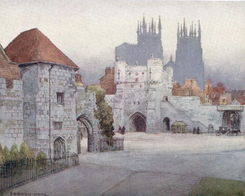
Facing Bootham Bar is a modern public building judiciously screened by trees, and adjoining it to the south stands the beautiful old house where, before the Dissolution, the abbots of St. Mary's Abbey lived in stately fashion.
When Henry VIII paid his one visit to York it was after the Pilgrimage of Grace led by Robert Aske, who was hanged on one of the gates. The citizens who had welcomed the rebels pleaded pardon, which was granted three years afterwards; but Henry appointed a council, with the Duke of Norfolk as its president, which was held in the Abbots' house, and resulted in the Mayor and Corporation losing most of their powers. The beautiful fragments of St. Mary's Abbey are close to the river, and the site is now included in the museum grounds. In the museum building itself there is a wonderfully fine collection of Roman coffins, dug up when the new railway-station was being built. One inscription is particularly interesting in showing that the Romans set up altars in their palaces, thus explaining the reason for the Jews refusing to enter the praetorium at Jerusalem when Christ was made prisoner, because it was the Feast of the Passover.
We can see the restored front of the Guildhall overlooking the river from Lendal Bridge, which adjoins the gates of the Abbey grounds, but to reach the entrance we must go along the street called Lendal and turn into a narrow passage. The hall was put up in 1446, and is therefore in the Perpendicular style. A row of tall oak pillars on each side support the roof and form two aisles. The windows are filled with excellent modern stained glass representing several incidents in the history of the city, from the election of Constantine to be Roman Emperor, which took place at York in A.D. 306, down to the great dinner to the Prince Consort, held in the hall in 1850.
The Church of St. Michael Spurriergate, built at the same period as the Guildhall, is curiously similar in its interior, having only a nave and aisles. The stone pillars are so slight that they are scarcely of much greater diameter than the wooden ones in the civic structure, and some of them are perilously out of plumb. There is much old glass in the windows.
St. Margaret's Church has a splendid Norman doorway carved with the signs of the zodiac; St. Mary's Castlegate is an Early English or Transitional building transformed and patched in Perpendicular times; St. Mary's Bishophill Junior has a most interesting tower, containing Roman materials, and the list could be prolonged for many pages if there were space.
We finally come back to the Minster, and entering by the south transept door, realize at once in the dim immensity of the interior that we have reached the crowning splendour of York. The great organ is filling the lofty spaces with solemn music, carrying the mind far beyond petty things.
Edwin's wooden chapel, put up in 627 for his baptism into the Christian Church nearly thirteen centuries ago, and almost immediately replaced by a stone structure, has gone, except for some possible fragments in the crypt. Vanished, too, is the building that was standing when, in 1069, the Danes sacked and plundered York, leaving the Minster and city in ruins, so that the great church as we see it belongs almost entirely to the thirteenth and fourteenth centuries, the towers being still later.
THE MANUFACTURING DISTRICT
It is not easy to understand how a massive structure such as that of Selby Abbey can catch fire and become a burnt-out shell, and yet this actually happened not many years ago.
It was before midnight on October 19, 1906, that the flames were first seen bursting from the Latham Chapel, where the organ was placed. The Selby fire brigade with their small engine were confronted with a task entirely beyond their powers, and though the men worked heroically, they were quite unable to prevent the fire from spreading to the roofs of the chancel and nave, and consuming all that was inflammable within the tower. By about three in the morning fire-engines from Leeds and York had arrived, and with a copious supply of water from the river, it was hoped that the double roof of the nave might have been saved, but the fire had obtained too fierce a hold, and by 4.30 a correspondent telegraphed:
'The flames are through the west-end roof. The whole building will now be destroyed from end to end. The flames are pouring out of the roof, and the lead of the roof is running down in molten streams. The scene is magnificent but pathetic, and the whole of the noble building is now doomed. The whole of the inside is a fiery furnace. The seating is in flames, and the firemen are in considerable danger if they stay any longer, as the false roof is now burned through.
'The false roof is falling in, and the flames are ascending 30 feet above the building. Dense clouds of smoke are pouring out.'
When the fire was vanquished, it had practically completed its work of destruction. Besides reducing to charred logs and ashes all the timber in the great building, the heat had been so intense that glass windows had been destroyed, tracery demolished, carved finials and capitals reduced to powder, and even the massive piers by the north transept, where the furnace of flame reached its maximum intensity, became so calcined and cracked that they were left in a highly dangerous condition.
Fortunately the splendid Norman nave was not badly damaged, and after a new roof had been built, it was easily made ready for holding services. The two bays nearest to the transept are early Norman, and on the south side the massive circular column is covered with a plain grooved diaper-work, almost exactly the same as may be seen at Durham Cathedral. All the rest of the nave is Transitional Norman except the Early English clerestory, and is a wonderful study in the progress from early Norman to Early English.
On the floor on the south side of the nave by one of the piers is a slab to the memory of a maker of gravestones, worded in this quaint fashion:
|
'Here Lyes ye Body of poor Frank Raw Parish Clark and Gravestone Cutter And ys is writt to let yw know: Wht Frank for Othrs us'd to do Is now for Frank done by Another. Buried March ye 31, 1706.' |
A stone on the floor of the retro-choir to John Johnson, master and mariner, dated 1737, is crowded with nautical metaphor.
|
'Tho' Boreas with his Blustring blasts Has tos't me to and fro, Yet by the handy work of God I'm here Inclos'd below And in this Silent Bay I lie With many of our Fleet Untill the Day that I Set Sail My Admiral Christ to meet.' |
The great Perpendicular east window was considered by Pugin to be one of the most beautiful of its type in England, and the risk it ran of being entirely destroyed during the fire was very great. The design of the glass illustrates the ancestry of Christ from Jesse, and a considerable portion of it is original.
Although Selby Abbey suffered severely in the conflagration, yet its greatest association with history, the Norman nave, is still intact. At the eastern end of the nave we can still look upon the ponderous arches of the Benedictine Abbey Church, founded by William the Conqueror in 1069 as a mark of his gratitude for the success of his arms in the north of England, even as Battle Abbey was founded in the south.
Going to the west as far as Pontefract, we come to the actual borders of the coal-mine and factory-bestrewn country. Although the history of Pontefract is so detailed and so rich, it has long ago been robbed of nearly every building associated with the great events of its past, and its present appearance is intensely disappointing. The town stands on a hill, and has a wide and cheerful market-place possessing an eighteenth-century 'cross' on big open arches. It is a plain, classic structure, 'erected by Mrs. Elisabeth Dupier Relict of Solomon Dupier, Gent, in a cheerful and generous Compliance with his benevolent Intention Anno Dom' 1734.'
The castle stood at the northern end of the town on a rocky eminence just suited for the purposes of an early fortress, but of the stately towers and curtain walls which have successively been reared above the scarps, practically nothing besides foundations remains. The base of the great round tower, prominent in all the prints of the castle in the time of its greatest glory, fragments of the lower parts of other towers and some dungeons or magazines are practically the only features of the historic site that the imagination finds to feed upon. A long flight of steps leads into the underground chambers, on whose walls are carved the names of various prisoners taken during the siege of 1648. Below the castle, on the east side, is the old church of All Saints with its ruined nave, eloquent of the destruction wrought by the Parliamentary cannon in the successive sieges, and to the north stands New Hall, the stately Tudor mansion of Lord George Talbot, now reduced to the melancholy wreck depicted in these pages. The girdle of fortifications constructed by the besiegers round the castle included New Hall, in case it might have been reached by a sally of the Royalists, whose cannon-balls, we know, carried as far, from the discovery of one embedded in the masonry. Coats of arms of the Talbots can still be seen on carved stones on the front walls over the entrance. The date, 1591, is believed to be later than the time of the erection of the house, which, in the form of its parapets and other details, suggests the style of Henry VIII's reign.
Although we can describe in a very few words the historic survivals of Pontefract, to deal even cursorily with the story of the vanished castle and modernized town is a great undertaking, so numerous are the great personages and famous events of English history connected with its owners, its prisoners, and its sieges.
The name Pontefract has suggested such an obvious derivation that, from the early topographers up to the present time, efforts have been made to discover the broken bridge giving rise to the new name, which replaced the Saxon Kyrkebi. No one has yet succeeded in this quest, and the absence of any river at Pontefract makes the search peculiarly hopeless. At Castleford, a few miles north-west of Pontefract, where the Roman Ermine Street crossed the confluence of the Aire and the Calder, it is definitely known that there was only a ford. The present name does not make any appearance until several years after the Norman Conquest, though Ilbert de Lacy received the great fief, afterwards to become the Honour of Pontefract, in 1067, the year after the Battle of Hastings. Ilbert built the first stone castle on the rock, and either to him or his immediate successors may be attributed the Norman walls and chapel, whose foundations still exist on the north and east sides of the castle yard.
The De Lacys held Pontefract until 1193, when Robert died without issue, the castle and lands passing by marriage to Richard Fitz-Eustace; and the male line again became extinct in 1310, when Thomas, Earl of Lancaster, married Alice, the heiress of Henry de Lacy. Henry's great-grandfather was the Roger de Lacy, Justiciar and Constable of Chester, who is famous for his heroic defence of Chateau Gaillard, in Normandy, for nearly a year, when John weakly allowed Philip Augustus to continue the siege, making only one feeble attempt at relief. Thomas, Earl of Lancaster, who was a cousin of Edward II, was more or less in continual opposition to the king, on account of his determination to rid the Court of the royal favourites, and it was with Lancaster's full consent that Piers Gaveston was beheaded at Blacklow Hill, near Warwick, in 1312. For this Edward never forgave his cousin, and when, during the fighting which followed the recall of the Despensers, Lancaster was obliged to surrender after the Battle of Boroughbridge, Edward had his revenge. The Earl was brought to his own castle at Pontefract, where the King lay, and there accused of rebellion, of coming to the Parliaments with armed men, and of being in league with the Scots. Without even being allowed a hearing he was condemned to death as a traitor, and the next day, June 19, 1322, mounted on a sorry nag without a bridle, he was led to a hill outside the town, and executed with his face towards Scotland.
In the last year of the same century Richard II died in imprisonment in the castle, not long after the Parliament had decided that the deposed King should be permanently immured in an out-of-the-way place. Hardyng's Chronicle records the journeying from one castle to another in the lines:
|
'The Kyng the[n] sent Kyng Richard to Ledis, There to be kepte surely in previtee, Fro the[n]s after to Pykeryng we[n]t he nedes, And to Knauesburgh after led was he, But to Pountfrete last where he did die.' |
Archbishop Scrope affirmed that Richard died of starvation, while Shakespeare makes Sir Piers of Exton his murderer.
During the Pilgrimage of Grace the castle was besieged, and given up to the rebels by Lord Darcy and the Archbishop of York. In the following century came the three sieges of the Civil War. The first two followed after the Battle of Marston Moor in 1644, and Fairfax joined the Parliamentary forces on Christmas Day of that year, remaining through most of January. On March 1 Sir Marmaduke Langdale relieved the Royalist garrison, and Colonel Lambert fell back, fighting stubbornly and losing some 300 men. The garrison then had an interval of just three weeks to reprovision the castle, then the second siege began, and lasted until July 19, when the courageous defenders surrendered, the besieging force having lost 469 men killed to 99 of those within the castle. Of these two sieges, often looked upon as one, there exists a unique diary kept by Nathan Drake, a 'gentleman volunteer' of the garrison, and from its wonderfully graphic details it is possible to realize the condition of the defence, their sufferings, their hopes, and their losses, almost more completely than of any other siege before recent times.
In the third and last investment of 1648-49 Cromwell himself summoned the garrison, and remained a month with the Parliamentary forces, without seeing any immediate prospect of the surrender of the castle. When the Royalists had been reduced to a mere handful, Colonel Morris, their commander, agreed to terms of capitulation on March 24, 1649. The dismantling of the stately pile by order of Parliament followed as a matter of course, and now we have practically nothing but seventeenth-century prints to remind us of the embattled towers which for so many months defied Cromwell and his generals.
Liquorice is still grown at Pontefract, although the industry has languished on account of Spanish rivalry, and the town still produces those curious little discs of soft liquorice, approximating to the size of a shilling, known as 'Pontefract cakes.'
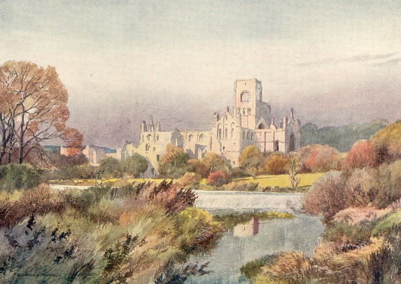
The ruins of the great Cistercian Abbey of Kirkstall, founded in the twelfth century by Henry de Lacy, still stand in a remarkable state of completeness, about three miles from Leeds. With the exception of Fountains, the remains are more perfect than any in Yorkshire. Nearly the whole of the church is Transitional Norman, and the roofless nave is in a wonderfully fine state of preservation. The chapter-house and refectory, as well as smaller rooms, are fairly complete, and the situation by the Aire on a sunny day is still attractive; yet owing to the smoke-laden atmosphere, and the inevitable indications of the countless visitors from the city, the ruins have lost much of their interest, unless viewed solely from a detached architectural standpoint. We do not feel much inclination to linger in this neighbourhood, and continue our way westwards towards the great rounded hills, where, not far from Keighley, we come to the grey village of Haworth.
More than half a century has gone since Charlotte Brontë passed away in that melancholy house, the 'parsonage' of the village. In that period the church she knew has been rebuilt, with the exception of the tower, her home has been enlarged, a branch line from Keighley has given Haworth a railway-station, and factories have multiplied in the valley, destroying its charm. These changes sound far greater than they really are, for in many ways Haworth and its surroundings are just what they were in the days when the members of that ill-fated household were still united under the grey roof of the 'parsonage,' as it is invariably called by Mrs. Gaskell.
We climb up the steep road from the station at the bottom of the deep valley, and come to the foot of the village street, which, even though it turns sharply to the north in order to make as gradual an ascent as possible, is astonishingly steep. At the top stands an inn, the 'Black Bull,' where the downward path of the unhappy Branwell Brontë began, owing to the frequent occasions when 'Patrick,' as he was familiarly called, was sent for by the landlord to talk to his more important patrons.
The churchyard is, to a large extent, closely paved with tombstones dating back to the seventeenth century, laid flat, and on to this dismal piece of ground the chief windows of the Brontës' house looked, as they continue to do to-day. It is exceedingly strange that such an unfortunate arrangement of the buildings on this breezy hill-top should have given a gloomy outlook to the parsonage. If the house had only been placed a little higher up the hill, and been built to face the south, it is conceivable that the Brontës would have enjoyed better health and a less melancholy and tragic outlook on life. An account of a visit to Haworth Parsonage by a neighbour, when Charlotte and her father were the only survivors of the family, gives a clear impression of how the house appeared to those who lived brighter lives:
'Miss Brontë put me so in mind of her own "Jane Eyre." She looked smaller than ever, and moved about so quietly and noiselessly, just like a little bird, as Rochester called her, barring that all birds are joyous, and that joy can never have entered that house since it was first built, and yet, perhaps, when that old man married, and took home his bride, and children's voices and feet were heard about the house, even that desolate crowded graveyard and biting blast could not quench cheerfulness and hope.'
Very soon after the family came to Haworth Mrs. Brontë died, when the eldest girl, Maria, was only six years old; and far from there having been any childish laughter about the house, we are told that the children were unusually solemn from their infancy. In their earliest walks, the five little girls with their one brother—all of them under seven years—directed their steps towards the wild moors above their home rather than into the village. Over a century has passed, and practically no change has come to the moorland side of the house, so that we can imagine the precocious toddling children going hand-in-hand over the grass-lands towards the moors beyond, as though we had travelled back over the intervening years.
The purple moors so beloved by the Brontës stretch away to the Calder Valley, and beyond that depression in great sweeping outlines to the Peak of Derbyshire, where they exceed 2,000 feet in height. Within easy reach of this grand country is Sheffield, perhaps the blackest and ugliest city in England. At night, however, the great iron and steel works become wildly fantastic. The tops of the many chimneys emit crimson flames, and glowing shafts of light with a nucleus of dazzling brilliance show between the inky forms of buildings. Ceaseless activity reigns in these industrial infernos, with three shifts of men working during each twenty-four hours; and from the innumerable works come every form of manufactured steel and iron goods, from a pair of scissors or a plated teaspoon to steel rails and armour plate.
End of Project Gutenberg's Yorkshire Painted And Described, by Gordon Home

*** END OF THIS PROJECT GUTENBERG EBOOK YORKSHIRE PAINTED AND DESCRIBED ***

***** This file should be named 9973-h.htm or 9973-h.zip *****
This and all associated files of various formats will be found in:
        https://www.gutenberg.org/9/9/7/9973/

Produced by Ted Garvin, Michael Lockey and PG Distributed
Proofreaders. Illustrated HTML file produced by David Widger


Updated editions will replace the previous one--the old editions
will be renamed.

Creating the works from public domain print editions means that no
one owns a United States copyright in these works, so the Foundation
(and you!) can copy and distribute it in the United States without
permission and without paying copyright royalties.  Special rules,
set forth in the General Terms of Use part of this license, apply to
copying and distributing Project Gutenberg-tm electronic works to
protect the PROJECT GUTENBERG-tm concept and trademark.  Project
Gutenberg is a registered trademark, and may not be used if you
charge for the eBooks, unless you receive specific permission.  If you
do not charge anything for copies of this eBook, complying with the
rules is very easy.  You may use this eBook for nearly any purpose
such as creation of derivative works, reports, performances and
research.  They may be modified and printed and given away--you may do
practically ANYTHING with public domain eBooks.  Redistribution is
subject to the trademark license, especially commercial
redistribution.


*** START: FULL LICENSE ***

THE FULL PROJECT GUTENBERG LICENSE
PLEASE READ THIS BEFORE YOU DISTRIBUTE OR USE THIS WORK

To protect the Project Gutenberg-tm mission of promoting the free
distribution of electronic works, by using or distributing this work
(or any other work associated in any way with the phrase "Project
Gutenberg"), you agree to comply with all the terms of the Full Project
Gutenberg-tm License (available with this file or online at
https://gutenberg.org/license).


Section 1.  General Terms of Use and Redistributing Project Gutenberg-tm
electronic works

1.A.  By reading or using any part of this Project Gutenberg-tm
electronic work, you indicate that you have read, understand, agree to
and accept all the terms of this license and intellectual property
(trademark/copyright) agreement.  If you do not agree to abide by all
the terms of this agreement, you must cease using and return or destroy
all copies of Project Gutenberg-tm electronic works in your possession.
If you paid a fee for obtaining a copy of or access to a Project
Gutenberg-tm electronic work and you do not agree to be bound by the
terms of this agreement, you may obtain a refund from the person or
entity to whom you paid the fee as set forth in paragraph 1.E.8.

1.B.  "Project Gutenberg" is a registered trademark.  It may only be
used on or associated in any way with an electronic work by people who
agree to be bound by the terms of this agreement.  There are a few
things that you can do with most Project Gutenberg-tm electronic works
even without complying with the full terms of this agreement.  See
paragraph 1.C below.  There are a lot of things you can do with Project
Gutenberg-tm electronic works if you follow the terms of this agreement
and help preserve free future access to Project Gutenberg-tm electronic
works.  See paragraph 1.E below.

1.C.  The Project Gutenberg Literary Archive Foundation ("the Foundation"
or PGLAF), owns a compilation copyright in the collection of Project
Gutenberg-tm electronic works.  Nearly all the individual works in the
collection are in the public domain in the United States.  If an
individual work is in the public domain in the United States and you are
located in the United States, we do not claim a right to prevent you from
copying, distributing, performing, displaying or creating derivative
works based on the work as long as all references to Project Gutenberg
are removed.  Of course, we hope that you will support the Project
Gutenberg-tm mission of promoting free access to electronic works by
freely sharing Project Gutenberg-tm works in compliance with the terms of
this agreement for keeping the Project Gutenberg-tm name associated with
the work.  You can easily comply with the terms of this agreement by
keeping this work in the same format with its attached full Project
Gutenberg-tm License when you share it without charge with others.

1.D.  The copyright laws of the place where you are located also govern
what you can do with this work.  Copyright laws in most countries are in
a constant state of change.  If you are outside the United States, check
the laws of your country in addition to the terms of this agreement
before downloading, copying, displaying, performing, distributing or
creating derivative works based on this work or any other Project
Gutenberg-tm work.  The Foundation makes no representations concerning
the copyright status of any work in any country outside the United
States.

1.E.  Unless you have removed all references to Project Gutenberg:

1.E.1.  The following sentence, with active links to, or other immediate
access to, the full Project Gutenberg-tm License must appear prominently
whenever any copy of a Project Gutenberg-tm work (any work on which the
phrase "Project Gutenberg" appears, or with which the phrase "Project
Gutenberg" is associated) is accessed, displayed, performed, viewed,
copied or distributed:

This eBook is for the use of anyone anywhere at no cost and with
almost no restrictions whatsoever.  You may copy it, give it away or
re-use it under the terms of the Project Gutenberg License included
with this eBook or online at www.gutenberg.org

1.E.2.  If an individual Project Gutenberg-tm electronic work is derived
from the public domain (does not contain a notice indicating that it is
posted with permission of the copyright holder), the work can be copied
and distributed to anyone in the United States without paying any fees
or charges.  If you are redistributing or providing access to a work
with the phrase "Project Gutenberg" associated with or appearing on the
work, you must comply either with the requirements of paragraphs 1.E.1
through 1.E.7 or obtain permission for the use of the work and the
Project Gutenberg-tm trademark as set forth in paragraphs 1.E.8 or
1.E.9.

1.E.3.  If an individual Project Gutenberg-tm electronic work is posted
with the permission of the copyright holder, your use and distribution
must comply with both paragraphs 1.E.1 through 1.E.7 and any additional
terms imposed by the copyright holder.  Additional terms will be linked
to the Project Gutenberg-tm License for all works posted with the
permission of the copyright holder found at the beginning of this work.

1.E.4.  Do not unlink or detach or remove the full Project Gutenberg-tm
License terms from this work, or any files containing a part of this
work or any other work associated with Project Gutenberg-tm.

1.E.5.  Do not copy, display, perform, distribute or redistribute this
electronic work, or any part of this electronic work, without
prominently displaying the sentence set forth in paragraph 1.E.1 with
active links or immediate access to the full terms of the Project
Gutenberg-tm License.

1.E.6.  You may convert to and distribute this work in any binary,
compressed, marked up, nonproprietary or proprietary form, including any
word processing or hypertext form.  However, if you provide access to or
distribute copies of a Project Gutenberg-tm work in a format other than
"Plain Vanilla ASCII" or other format used in the official version
posted on the official Project Gutenberg-tm web site (www.gutenberg.org),
you must, at no additional cost, fee or expense to the user, provide a
copy, a means of exporting a copy, or a means of obtaining a copy upon
request, of the work in its original "Plain Vanilla ASCII" or other
form.  Any alternate format must include the full Project Gutenberg-tm
License as specified in paragraph 1.E.1.

1.E.7.  Do not charge a fee for access to, viewing, displaying,
performing, copying or distributing any Project Gutenberg-tm works
unless you comply with paragraph 1.E.8 or 1.E.9.

1.E.8.  You may charge a reasonable fee for copies of or providing
access to or distributing Project Gutenberg-tm electronic works provided
that

- You pay a royalty fee of 20% of the gross profits you derive from
     the use of Project Gutenberg-tm works calculated using the method
     you already use to calculate your applicable taxes.  The fee is
     owed to the owner of the Project Gutenberg-tm trademark, but he
     has agreed to donate royalties under this paragraph to the
     Project Gutenberg Literary Archive Foundation.  Royalty payments
     must be paid within 60 days following each date on which you
     prepare (or are legally required to prepare) your periodic tax
     returns.  Royalty payments should be clearly marked as such and
     sent to the Project Gutenberg Literary Archive Foundation at the
     address specified in Section 4, "Information about donations to
     the Project Gutenberg Literary Archive Foundation."

- You provide a full refund of any money paid by a user who notifies
     you in writing (or by e-mail) within 30 days of receipt that s/he
     does not agree to the terms of the full Project Gutenberg-tm
     License.  You must require such a user to return or
     destroy all copies of the works possessed in a physical medium
     and discontinue all use of and all access to other copies of
     Project Gutenberg-tm works.

- You provide, in accordance with paragraph 1.F.3, a full refund of any
     money paid for a work or a replacement copy, if a defect in the
     electronic work is discovered and reported to you within 90 days
     of receipt of the work.

- You comply with all other terms of this agreement for free
     distribution of Project Gutenberg-tm works.

1.E.9.  If you wish to charge a fee or distribute a Project Gutenberg-tm
electronic work or group of works on different terms than are set
forth in this agreement, you must obtain permission in writing from
both the Project Gutenberg Literary Archive Foundation and Michael
Hart, the owner of the Project Gutenberg-tm trademark.  Contact the
Foundation as set forth in Section 3 below.

1.F.

1.F.1.  Project Gutenberg volunteers and employees expend considerable
effort to identify, do copyright research on, transcribe and proofread
public domain works in creating the Project Gutenberg-tm
collection.  Despite these efforts, Project Gutenberg-tm electronic
works, and the medium on which they may be stored, may contain
"Defects," such as, but not limited to, incomplete, inaccurate or
corrupt data, transcription errors, a copyright or other intellectual
property infringement, a defective or damaged disk or other medium, a
computer virus, or computer codes that damage or cannot be read by
your equipment.

1.F.2.  LIMITED WARRANTY, DISCLAIMER OF DAMAGES - Except for the "Right
of Replacement or Refund" described in paragraph 1.F.3, the Project
Gutenberg Literary Archive Foundation, the owner of the Project
Gutenberg-tm trademark, and any other party distributing a Project
Gutenberg-tm electronic work under this agreement, disclaim all
liability to you for damages, costs and expenses, including legal
fees.  YOU AGREE THAT YOU HAVE NO REMEDIES FOR NEGLIGENCE, STRICT
LIABILITY, BREACH OF WARRANTY OR BREACH OF CONTRACT EXCEPT THOSE
PROVIDED IN PARAGRAPH F3.  YOU AGREE THAT THE FOUNDATION, THE
TRADEMARK OWNER, AND ANY DISTRIBUTOR UNDER THIS AGREEMENT WILL NOT BE
LIABLE TO YOU FOR ACTUAL, DIRECT, INDIRECT, CONSEQUENTIAL, PUNITIVE OR
INCIDENTAL DAMAGES EVEN IF YOU GIVE NOTICE OF THE POSSIBILITY OF SUCH
DAMAGE.

1.F.3.  LIMITED RIGHT OF REPLACEMENT OR REFUND - If you discover a
defect in this electronic work within 90 days of receiving it, you can
receive a refund of the money (if any) you paid for it by sending a
written explanation to the person you received the work from.  If you
received the work on a physical medium, you must return the medium with
your written explanation.  The person or entity that provided you with
the defective work may elect to provide a replacement copy in lieu of a
refund.  If you received the work electronically, the person or entity
providing it to you may choose to give you a second opportunity to
receive the work electronically in lieu of a refund.  If the second copy
is also defective, you may demand a refund in writing without further
opportunities to fix the problem.

1.F.4.  Except for the limited right of replacement or refund set forth
in paragraph 1.F.3, this work is provided to you 'AS-IS' WITH NO OTHER
WARRANTIES OF ANY KIND, EXPRESS OR IMPLIED, INCLUDING BUT NOT LIMITED TO
WARRANTIES OF MERCHANTIBILITY OR FITNESS FOR ANY PURPOSE.

1.F.5.  Some states do not allow disclaimers of certain implied
warranties or the exclusion or limitation of certain types of damages.
If any disclaimer or limitation set forth in this agreement violates the
law of the state applicable to this agreement, the agreement shall be
interpreted to make the maximum disclaimer or limitation permitted by
the applicable state law.  The invalidity or unenforceability of any
provision of this agreement shall not void the remaining provisions.

1.F.6.  INDEMNITY - You agree to indemnify and hold the Foundation, the
trademark owner, any agent or employee of the Foundation, anyone
providing copies of Project Gutenberg-tm electronic works in accordance
with this agreement, and any volunteers associated with the production,
promotion and distribution of Project Gutenberg-tm electronic works,
harmless from all liability, costs and expenses, including legal fees,
that arise directly or indirectly from any of the following which you do
or cause to occur: (a) distribution of this or any Project Gutenberg-tm
work, (b) alteration, modification, or additions or deletions to any
Project Gutenberg-tm work, and (c) any Defect you cause.


Section  2.  Information about the Mission of Project Gutenberg-tm

Project Gutenberg-tm is synonymous with the free distribution of
electronic works in formats readable by the widest variety of computers
including obsolete, old, middle-aged and new computers.  It exists
because of the efforts of hundreds of volunteers and donations from
people in all walks of life.

Volunteers and financial support to provide volunteers with the
assistance they need, is critical to reaching Project Gutenberg-tm's
goals and ensuring that the Project Gutenberg-tm collection will
remain freely available for generations to come.  In 2001, the Project
Gutenberg Literary Archive Foundation was created to provide a secure
and permanent future for Project Gutenberg-tm and future generations.
To learn more about the Project Gutenberg Literary Archive Foundation
and how your efforts and donations can help, see Sections 3 and 4
and the Foundation web page at https://www.pglaf.org.


Section 3.  Information about the Project Gutenberg Literary Archive
Foundation

The Project Gutenberg Literary Archive Foundation is a non profit
501(c)(3) educational corporation organized under the laws of the
state of Mississippi and granted tax exempt status by the Internal
Revenue Service.  The Foundation's EIN or federal tax identification
number is 64-6221541.  Its 501(c)(3) letter is posted at
https://pglaf.org/fundraising.  Contributions to the Project Gutenberg
Literary Archive Foundation are tax deductible to the full extent
permitted by U.S. federal laws and your state's laws.

The Foundation's principal office is located at 4557 Melan Dr. S.
Fairbanks, AK, 99712., but its volunteers and employees are scattered
throughout numerous locations.  Its business office is located at
809 North 1500 West, Salt Lake City, UT 84116, (801) 596-1887, email
business@pglaf.org.  Email contact links and up to date contact
information can be found at the Foundation's web site and official
page at https://pglaf.org

For additional contact information:
     Dr. Gregory B. Newby
     Chief Executive and Director
     gbnewby@pglaf.org


Section 4.  Information about Donations to the Project Gutenberg
Literary Archive Foundation

Project Gutenberg-tm depends upon and cannot survive without wide
spread public support and donations to carry out its mission of
increasing the number of public domain and licensed works that can be
freely distributed in machine readable form accessible by the widest
array of equipment including outdated equipment.  Many small donations
($1 to $5,000) are particularly important to maintaining tax exempt
status with the IRS.

The Foundation is committed to complying with the laws regulating
charities and charitable donations in all 50 states of the United
States.  Compliance requirements are not uniform and it takes a
considerable effort, much paperwork and many fees to meet and keep up
with these requirements.  We do not solicit donations in locations
where we have not received written confirmation of compliance.  To
SEND DONATIONS or determine the status of compliance for any
particular state visit https://pglaf.org

While we cannot and do not solicit contributions from states where we
have not met the solicitation requirements, we know of no prohibition
against accepting unsolicited donations from donors in such states who
approach us with offers to donate.

International donations are gratefully accepted, but we cannot make
any statements concerning tax treatment of donations received from
outside the United States.  U.S. laws alone swamp our small staff.

Please check the Project Gutenberg Web pages for current donation
methods and addresses.  Donations are accepted in a number of other
ways including including checks, online payments and credit card
donations.  To donate, please visit: https://pglaf.org/donate


Section 5.  General Information About Project Gutenberg-tm electronic
works.

Professor Michael S. Hart was the originator of the Project Gutenberg-tm
concept of a library of electronic works that could be freely shared
with anyone.  For thirty years, he produced and distributed Project
Gutenberg-tm eBooks with only a loose network of volunteer support.


Project Gutenberg-tm eBooks are often created from several printed
editions, all of which are confirmed as Public Domain in the U.S.
unless a copyright notice is included.  Thus, we do not necessarily
keep eBooks in compliance with any particular paper edition.


Most people start at our Web site which has the main PG search facility:

     https://www.gutenberg.org

This Web site includes information about Project Gutenberg-tm,
including how to make donations to the Project Gutenberg Literary
Archive Foundation, how to help produce our new eBooks, and how to
subscribe to our email newsletter to hear about new eBooks.
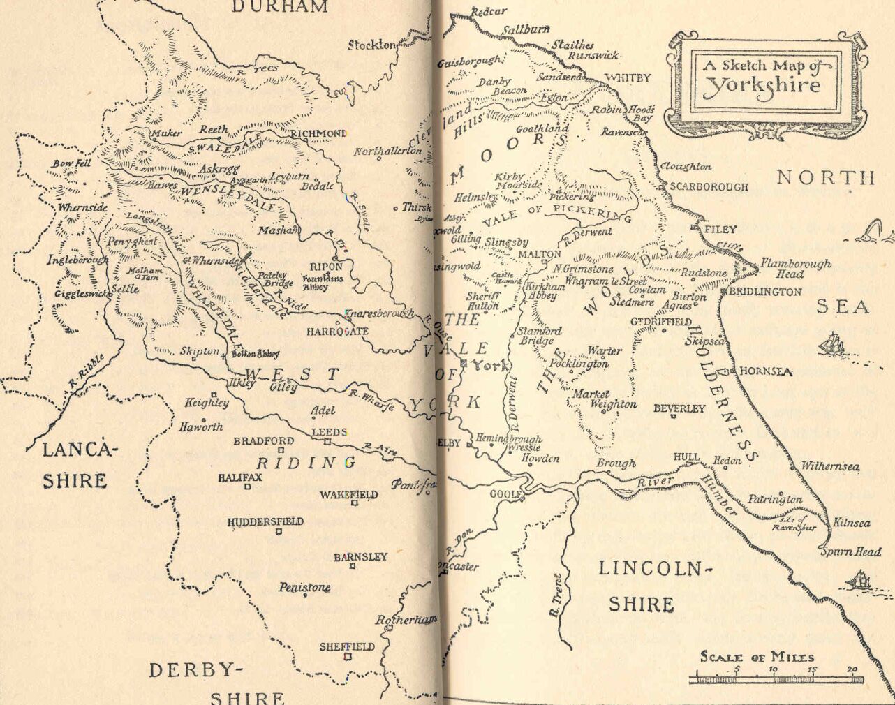