By
P. D. Peterson
J. Fred Olander Company
Pierre, S. D.
Copyright, 1929
P. D. Peterson
To my mother who has been an inspiration and a guide for me throughout my early training, ever helping her family to see and acquire the highest ideals possible; and to my wife who has assisted me in the compilation and revision of this book, the following pages are affectionately dedicated.
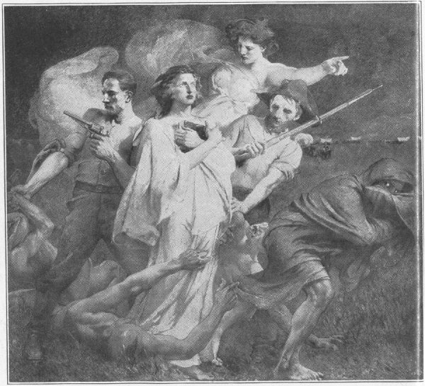
THE SPIRIT OF THE WEST
By Edwin H. Blashfield
This painting is in the Governor’s reception room in the S. D. Capitol building at Pierre.
This book is not a history, although it contains some historical accounts where such are necessary to bring out the importance of the scenery described. It makes no attempt at being a technical guide of any sort, although the treatment of various animals, trees, flowers, and minerals is as near accurate as a tourist could hope to obtain.
The main purpose of this book is to give a chronological or itinerary account of what may be seen in the Black Hills. It should acquaint the tourist with the things of interest to see on his trip. It should save him the chagrin of passing a point of interest without having known he did so. It should, further, give him a souvenir of the scenes and experiences of the trip. But one of the central purposes of this treatise is to give the school children and the grown-ups of South Dakota a picture of their own Black Hills and Bad Lands.
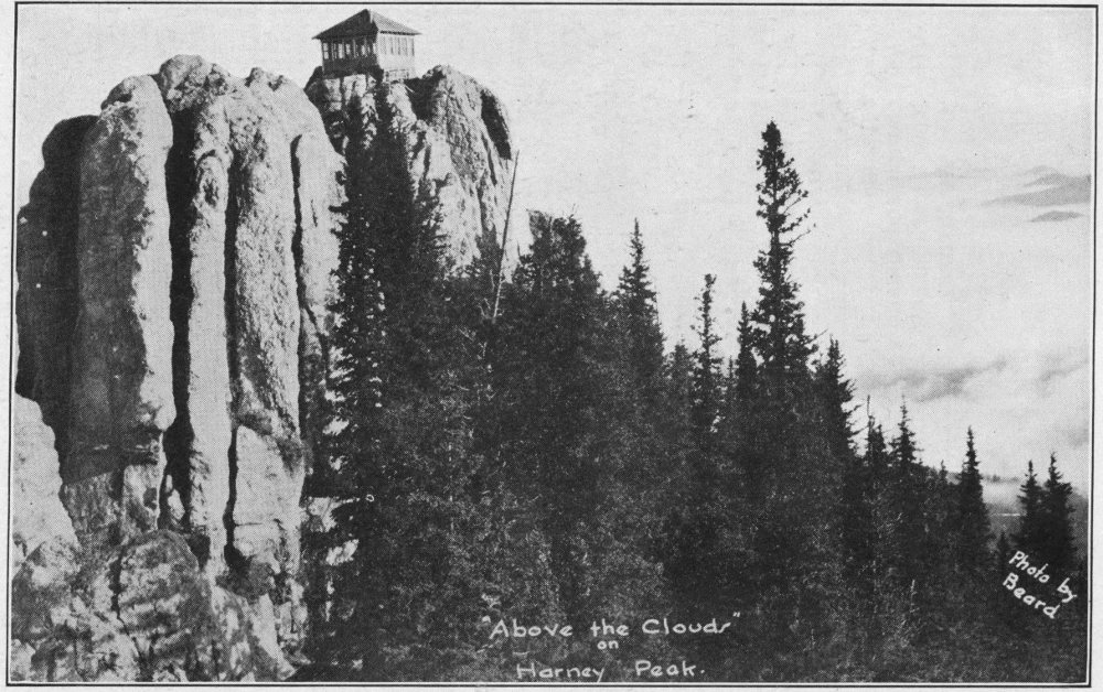
Harney Peak above the clouds. This is the highest point in the United States east of the Rocky Mountains.Photo by Beard
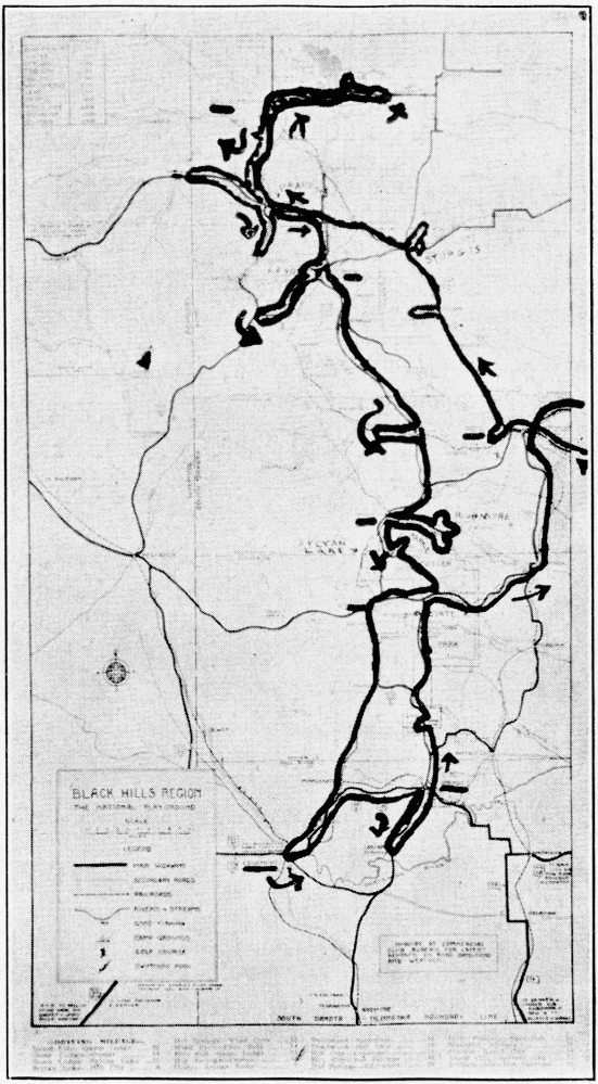
“The Wonderland of America” is not an overstatement of the scenic beauty of the Black Hills of South Dakota. One cannot but marvel at the endless new experiences that he has each day, whether it be on a three days’ or a three weeks’ trip through the Black Hills. In the shorter trip he will take in the more prominent points, scarcely departing from the main arterial highways. On the longer tour he will drive a thousand to fifteen hundred miles through deep canyons, up to the mines, and to many other places which at first would seem almost impenetrable but which upon inquiry will be found readily accessible. The more extensive trip should be the one selected if at all possible, for it leaves an impression on a person’s mind that cannot be erased by time or by any amount of traveling in any part of the world.
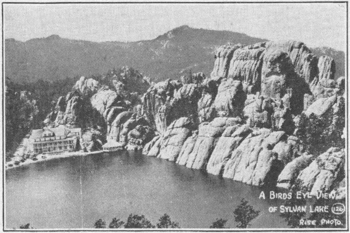
Birdseye view of Sylvan Lake
Rise Photo
The vast, impressive grandeur of the whole, gained by the views from mountain tops, from the floors of canyons, and from various other vantage points cannot help but leave with one a feeling of awe, a feeling that the Creator of these great magnificent sturdy formations, towering toward the 10 sky, penetrating the very clouds and fringed and capped by element defying monarchs of the evergreen family is a powerful Being. They leave with a person a feeling of safety under the protecting guidance of a Being powerful enough to create what lies before him.
All through the “Hills” this feeling of the marvelous greatness of the structures, and the intricate workmanship found in them grows upon a person, until when he speeds eastward (or westward) at the close of the trip with an occasional backward look, he cannot help feeling that his mind has been broadened and expanded proportionate to the impressiveness of what he has seen.
No attempt will be made in this volume at a systematic cataloging of the various things of interest to be seen. The account will be strictly chronological, in order, just as it was experienced on a trip through the “Hills.” Preceding the Black Hills accounts will come an account of a tour through the Great Badlands of South Dakota. A trip to the “Hills” is not complete without a visit to the Badlands, and the impressiveness of the latter is scarcely less than that of its neighbor. It is well to plan for this part of the trip before entering the “Hills.” Then, if it rains the Badlands must be postponed until the close, for the roads are somewhat bad when wet.
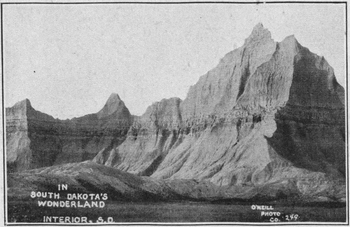
A peak in Cedar Pass
O’Neill Photo
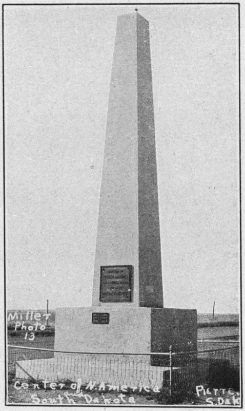
This Monument marks the center of the state of South Dakota and the approximate center of North America. It stands along the highway north of Pierre
Rotunda, Capitol, Pierre
No matter whether the entrance to South Dakota is made from the north, south, east, or west, all of the main roads are gravel surfaced. Many an Eastener will complain of the driving on these roads, but one may drive up to fifty or sixty miles per hour on them with comparative safety, with the average car. This is far beyond the legal limit of the state. Rain and other adverse weather conditions will not affect traveling. This holds true for most of the main highways in the “Hills.”
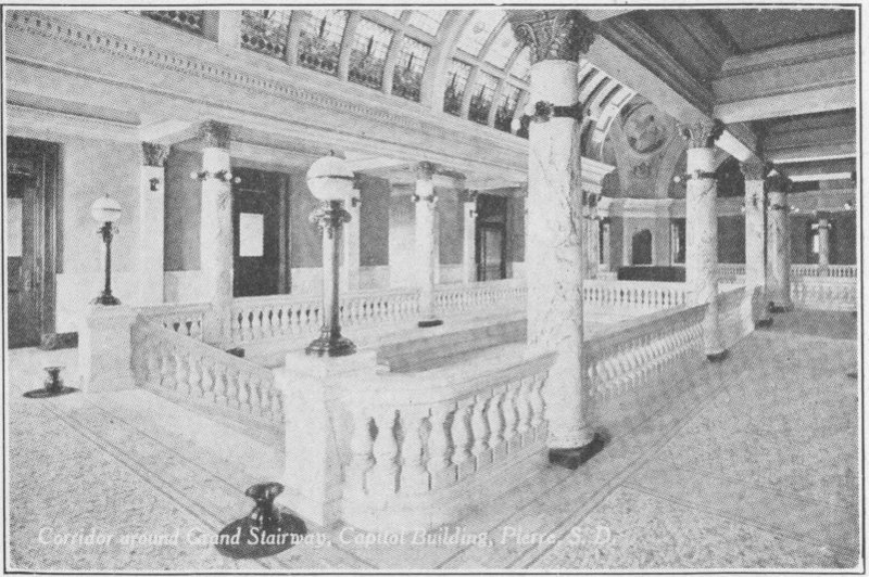
Corridor and Grand Stairway, Capitol Building, Pierre, S. D.
Over these gravelled highways, probably U. S. 14 or U. S. 16 we speed until we hit Pierre, the State capitol, located in the center of South Dakota. Here it might be well to stop for a few hours or overnight. The State welcomes everyone to a trip through the State Capitol. This trip is interesting and in many ways highly enlightening.
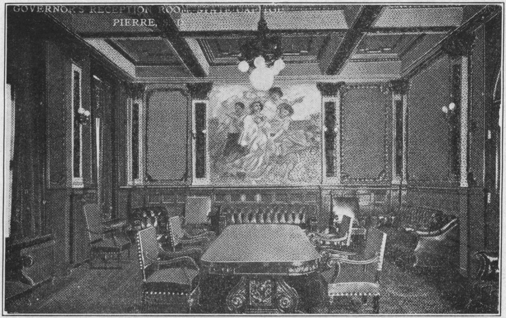
Governor’s Reception Room, State Capitol, Pierre, S. D.
Supreme Court Room, State Capitol, Pierre, S. D.
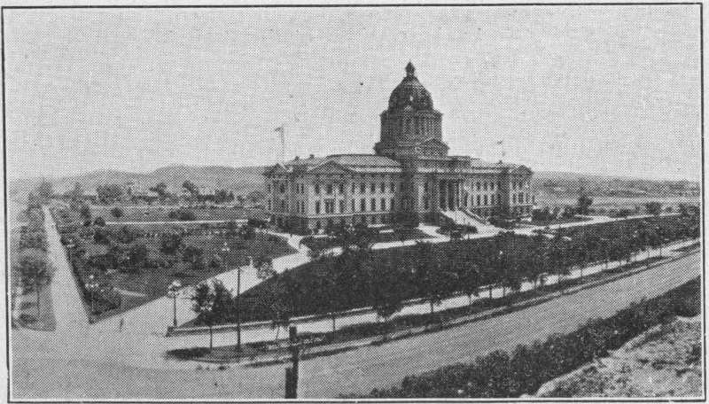
The Capitol, “up on the hill,” is probably the first building of Pierre to catch the eye when entering the city from any direction. Its great wings and massive dome cause it to stand out, and its height adds to its conspicuousness.
Capitol Avenue, coming from the east runs true with the world. It leads thus past the Governor’s residence to a beautiful arch bridge over the outlet from what is known as Capitol Lake.
On this placid lake, surrounded by splendid lawn, swans float gracefully and various other aquatic forms feed with varying degrees of industry.
From here Capitol Avenue turns in a north-westerly direction gradually ascending to the Capitol, two blocks distant. The Capitol lies parallel to the avenue, being on the 16 north-east side, facing the south-west. It is surrounded with beautiful trees, flowers, and an exceptionally beautiful lawn.
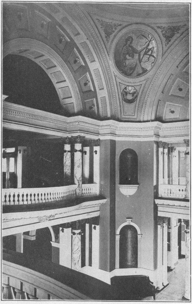
After climbing the long flight of stone steps (the whole building is of white stone), we enter the rotunda of the Capitol. There we are greeted by a beautiful Carrara marble interior, set off by statues and pictures of those responsible for the early progress of South Dakota. From the exact center of the building we may look up into the gigantic dome fringed with remarkable paintings above exquisite balconies and alcoves.

Grand Stairway, State Capitol, Pierre, S. D.
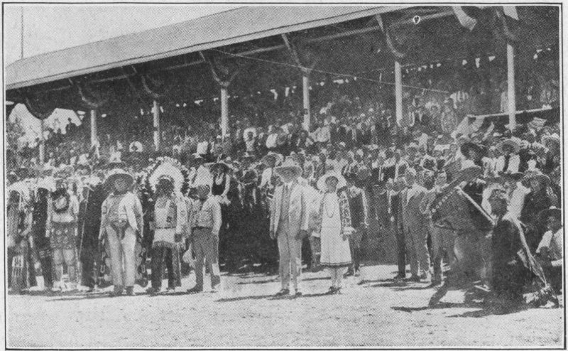
To the left of the entrance we step into the main reception room of the Governor. There we see that famous oil painting “The Spirit of Progress,” by Blashfield, covering the entire north-west wall. Into the room, if our visit were in 1927 or 1928, would come Governor Bulow, who greeted President Coolidge to his summer white house. Governor Bulow never failed to extend a warm welcome to the visitors at the Capitol. His words delivered at a high school track meet in 1928 are typical of him. “We are all competitors in contest of life. Upon our sportsmanship, fairness, and hard training depends our position at the finish.”
From the Governor’s suite we go to the office of the Secretary of State, and thence through the offices of the Commissioner of Public Lands, and that of the State Treasurer.
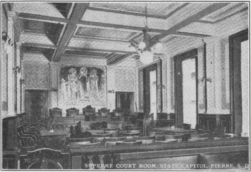
In the other wing we see the rooms of the Supreme Court of South Dakota, the offices of the judges, and the great Supreme Court Law Library.
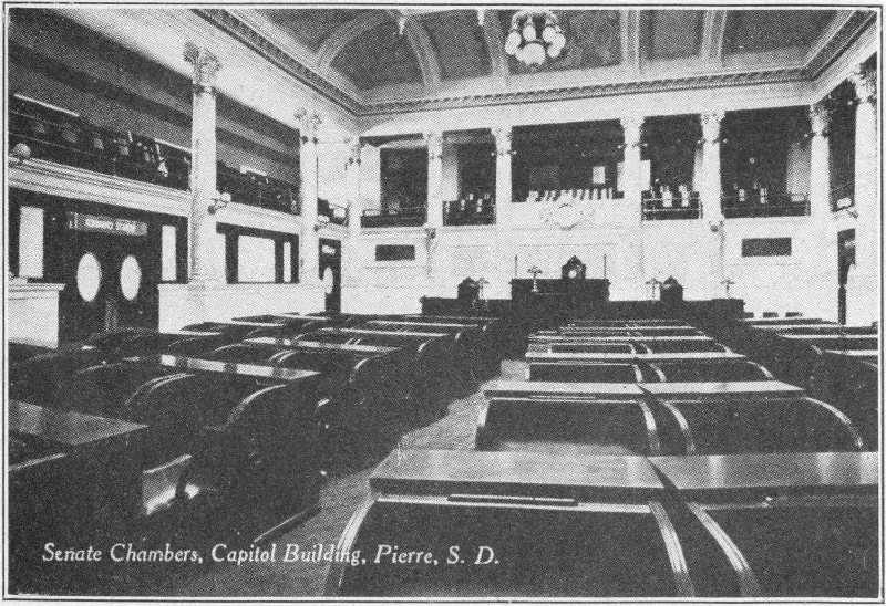
Senate Chamber, Capitol Building, Pierre, S. D.
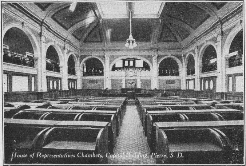
House of Representatives Chamber, Capitol Building, Pierre, S. D.
Now we descend the stairs to the lower floor. Here we find case after case lining the entire basement, filled with Indian costumes, stone instruments, arrow heads, war uniforms, and weapons of historical importance, stuffed birds of S. D., bones of animals, present and past, the first bag of sugar produced in South Dakota (encased in a silk bag) and various other curios. On the walls are large framed pictures of many of the early heroes and state officers of South Dakota.
On this floor are the offices of the state Railroad Commission, Attorney General, Public Examiner, Superintendent of Schools, Rural Credits Board, Library Commission, Historical Society, and State Sheriff. Under the steps is a lunch counter and confectionery stand, and in front of it an information desk. Last but not least, in the north-west end of the wing stands the gigantic moose.
On the second floor we find the rooms of the state Senate and House of Representatives, with adjoining lobbies and other rooms.
On the third floor are balconies to the legislative rooms, and various offices, including the automobile license department, the state banking department, state securities commission, and others.
From this floor a spiral stairway leads up, up, up, to the room above the inner dome. From the dome room one can see the mighty turbulent waters of the Missouri bubble and boil on their way. The great bridge is in full view, with the railway bridge beyond. The scenes from the “Capitol dome” are remarkable. A trip to Pierre would be incomplete without this part.
From the Capitol our trip takes us through the city of Pierre over the bridge to Fort Pierre where first evidences of white men in S. D. were found. A high flagpole now stands where the Verendrye Plate, planted in 1743, was found.
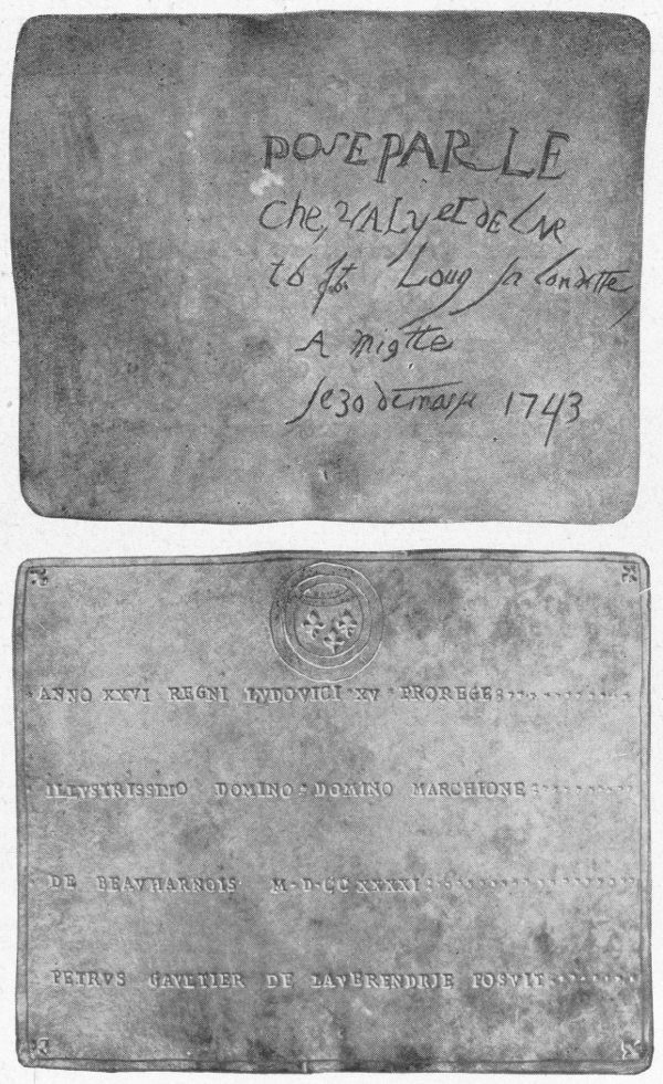
The Verendrye Plate, found on the bluffs above Fort Pierre, February 16, 1913. It was buried by La Verendrye, March 30, 1743, when he was exploring the land for France. This is the first evidence of white men in South Dakota.
See the plate in the corridor at the Capitol.
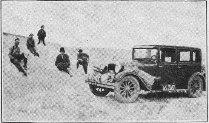
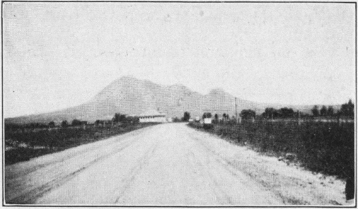
We cross the Missouri River on the morning of June 29th and speed along through comparatively new but highly productive agricultural land, through Hayes, Midland and Philip to Cottonwood. In Philip we find one of the most modern small cities of the state. It is worth stopping to see. When we arrive at Cottonwood, about three hours from Pierre, or a little less than one hundred ten miles, the weather seems favorable and the roads good so we turn south off U. S. highway 14. Only a few miles out of Cottonwood we look ahead and see the city-like elevations far in the distance. As we draw nearer this great wall of clay takes on a more artistic contour of multicolored towers, peaks, and walls, resembling ruins of ancient cities.
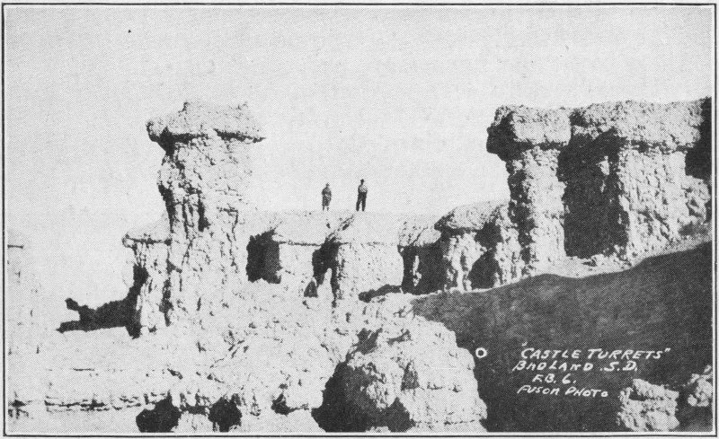
Castle Turrets Fuson Photo
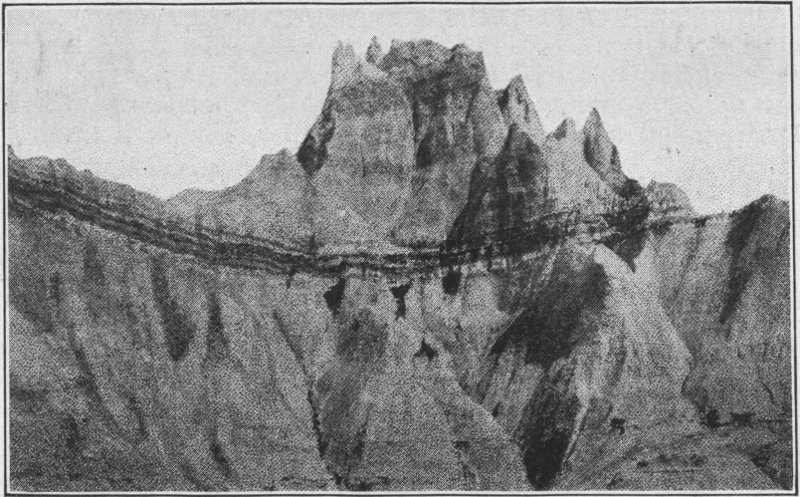
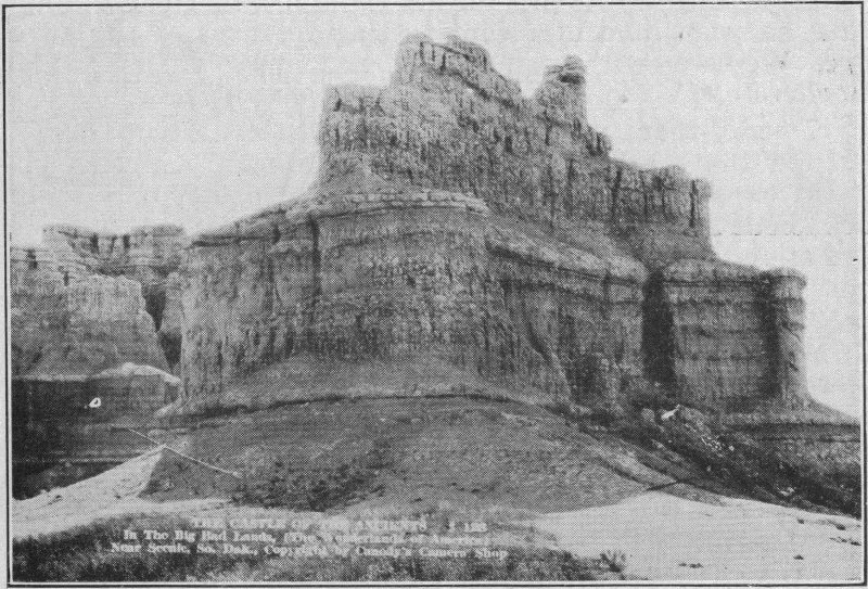
Countless theories and possibilities enter one’s mind to account for these magnificent walls, rising directly from a few feet to several hundred feet from level country. The level plains are grass covered, but the walls are practically bare. They are of almost pure sandy clay, with a little soft shale in a layer near the top. They average from a hundred to five hundred feet in height and are composed of several colors each, some containing yellow, pink, orange and blue, others having still different colors. For the most part the colors are plain or washed, but some are very pronounced.
Other sections of the Badlands are depressions from the grassy flats, with enormous areas seemingly fallen straight down two to twenty feet, with perpendicular sides. The beds of these great depressions are bare yellow or white clay.
Theories of the formation of these structures include “sea bottom,” “erosion,” “volcanic eruptions,” etc.
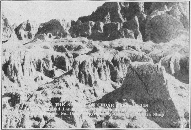
Summit of Cedar Pass, Interior Canedy Photo
Seventeen miles from Cottonwood we drive through Cedar Pass into the Badlands. The road winds around and 23 around, through depressions and through valleys between the great clay banks, ever leading upward. The grandeur of the enormous colored banks and walls would impress even the most barren minded person.
If one is coming over the C. B. H., (or A Y P.); (U. S. 16 to be specific), he must leave for S. D. No. 40 about fifteen miles west of Kadoka, and he will emerge at Cedar Pass the same as though he came from the north. The view is magnificent.
Finally the road gets narrow and precipitous. The passes become more crooked and the grades more steep. The road is bordered by profuse scrub cedar trees. There is a thrill in that drive! At first it looks dangerous, but the danger seems to minimize as we approach each more steep and more crooked and more narrow section. By taking it slowly the risk is small. (The road has since been improved.)
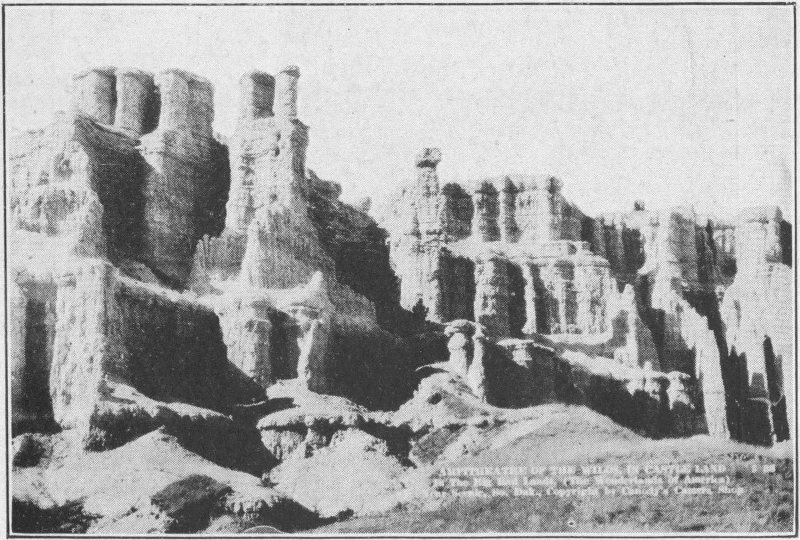
Amphitheatre of the Wilds. In the Bad Lands Canedy Photo
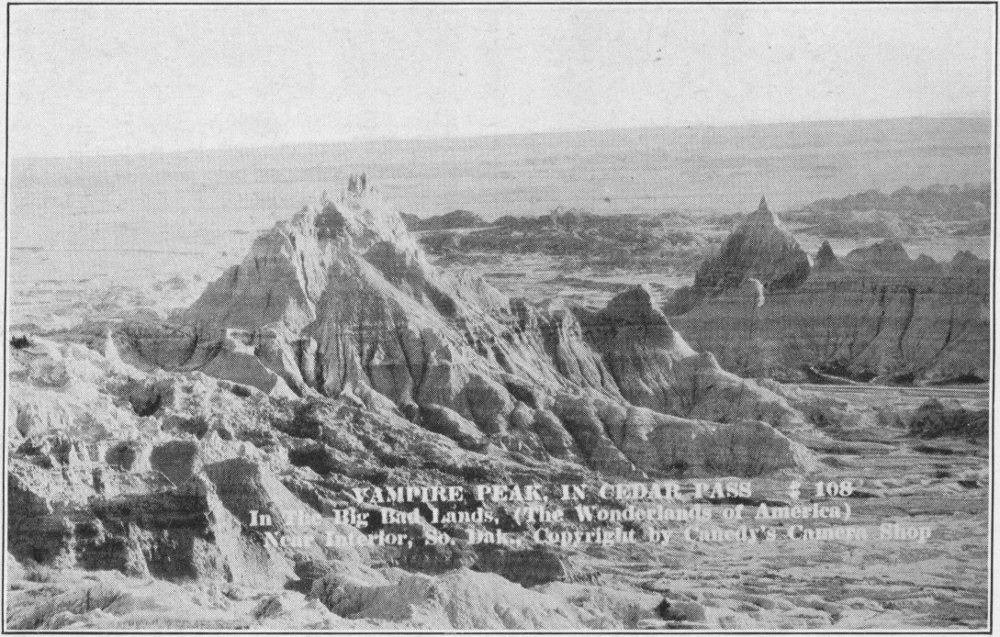
Vampire Peak in Cedar Pass, Interior. The entrance to the Big Bad Lands Canedy Photo
Studying the Bad Lands
Another Bad Lands Scene
We descend the south slope of the ridge, past the new Cedar Pass Camp, and drive five miles or so over a good road into Interior. On the way, however, we stop and walk for some distance among the hills. We find the clay to be hard and firm, resembling baked mud in texture. Each rain washes a little of the clay down, causing a gradual erosion through the years. This process has gradually uncovered the remains of life of this country at the time of its formation. We find a petrified tooth of some great animal. The tooth is about four inches long and two wide. Some distance farther we run across a mammoth rock formation embedded in the clay. It resembles and may have been the remains of a turtle six 26 or seven feet in diameter, with head and feet protruding out of the bank. From these same environs scientists have taken great petrified skeletons of ancient mastodons, reptiles, birds and beasts of all shapes and sizes. We can easily imagine how these beasts got bogged down in this once soft, spongy ex-sea-bottom, there to remain through these centuries.
We spend more time than we had planned examining the place, so we find ourselves in Interior for the night. We pitch camp, and during the night receive our first rain on the trip. Our sympathy for the poor little mouse who had appropriated a little of the tent roof for his nest is not very pronounced.
The next morning we rise early. We hike to “Big Foot,” a high clay ridge south of town, and climb it. It proves much higher and more difficult to climb than first appearances indicate. The climb is a thriller, especially as the clay is a bit slippery this morning.
Manitou Mountain in the Bad Lands
We return for breakfast, stopping in a field on the way to examine a huge oil drilling rig which has been wrecked many years ago. It is made almost entirely of oak, some 27 timbers being two feet square and very long. The main belt wheel is twelve feet in diameter, made also of wood. To us this is a sight.
Castle of Ancients, near ScenicCanedy Photo
The bacon and coffee are more than welcome when we return. After breakfast we strike camp and drive into town. There Palmer’s Curio shop attracts us for some time. We leave with several calcium silicate crystals and specimens of the world’s only sand crystals.
The most interesting person met on our trip is found in Interior. He is Mr. Henry Thompson, who runs a little souvenir stand called “The Wonderland.” He wears long, flowing white hair and a great flowing moustache of the same color. His acquaintance with the country dates back many a year.
No one going through Interior should miss him. He tells some very interesting tales of early days in the West. Recently a motion picture company used him in the role of the Patriarch Moses in the mountains. He gives us a rehearsal 28 of the role he played and recounts the garb of animal skins he wore, and other interesting features of the adventure. We listen with open mouths, and find it difficult to tear ourselves away for the continuance of our journey.
Twenty-four miles west of Interior, after traveling through the scenic splendor of the Badlands we come upon a vast expanse of land covered with a crust of once molten rock about an inch thick, now all broken into fragments. The formation consists of two hardened layers of once molten rock, probably of calcium silicate composition, smooth on the outer edges and joined together by countless papilae, making the whole look like two layers joined by a porous center. There is no doubt in one’s mind, upon viewing it, that Satan must surely have had his headquarters here at some time or other.
Castle Rock in the Bad Lands, near ScenicCanedy Photo
We follow State Highway Number 40 through other Badland wonders five miles farther. The road is very good. At Scenic we visit the widely known Museum Filling Station. Here we see a beautiful and interesting collection of stones 29 from the Black Hills. In fact the entire building is covered with rocks, fossils and other interesting things embedded in concrete. Prehistoric animal bones and Indian relics from the Badlands are within. The bones, the curious animals, the pictures, the petrified eggs, the skeletons, Indian relics and numerous other curios are remarkable.
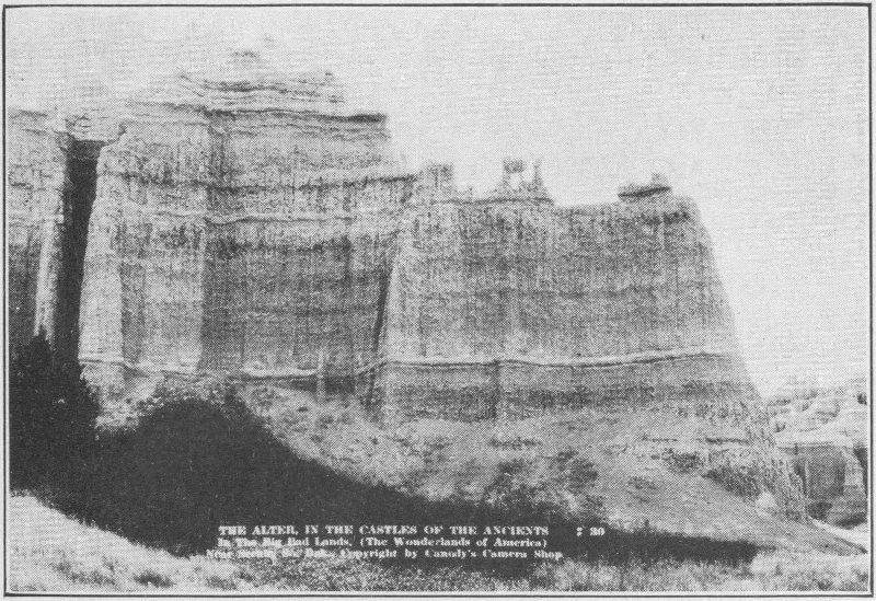
The Alter in the Castles of the AncientsCanedy Photo
They have attracted people from throughout the world, not for a hasty examination but for extensive study. This place is one of the important places to see in the Badlands. One cannot afford to miss it under any circumstances.
The vicinity of Scenic is known to scientists as the greatest fossil field in the United States. Scenic is also an Indian trading post.
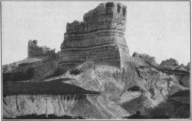
South of Scenic are some of the most spectacular examples of erosion in the United States. Some of the names assigned to them are: “Castle of the Ancients,” “The Altar of the Gods,” “Castle Rock,” “Castle Turrets,” “The Sphinx Twins,” “The Silent Sentinel,” “Amphitheater of the Wilds” and “The Devil’s Golf Course.” These remarkable formations almost hold us in reverent awe, so stupendous are they in their unusualness and grandeur.
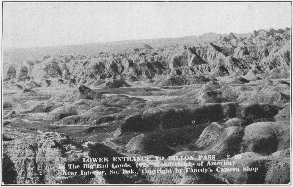
LOWER ENTRANCE TO DILLON PASSCanedy Photo
“Hell’s Ten Thousand Acres,” from Scenic south are equal in some ways to the Grand Canyon of Colorado in their ruggedness. “Hell’s Sunken Gardens,” south also, surpasses in beauty and magnitude anything of its kind in the world.

Bad Lands Museum, Scenic
Wounded Knee Battlefield, the last stand of the Sioux, is also south of Scenic. Here hundreds of Indians, men, women and children, were massacred by the soldiers when they stubbornly resisted the coming of law and government to take from them their hunting grounds. These Indians were all buried in one long grave, marked now with a tall marble slab on which are chiseled the odd names of the Indian dead.
The management of the Museum Filling Station is very enthusiastic about the “Great Badlands.” They will furnish any additional information desired and will furnish guides at a reasonable cost to those who desire such in visiting the wonders to the south.
From Scenic, trail 40 leads on to Rapid City. Some of the finer views of the Badlands are found along this road.
On to Rapid City we drive, over an excellent dirt road. We stop on the Cheyenne River to eat our lunch. These little picnic grounds all help to make the trip a really enjoyable vacation. We must stop at the turn in the road for a drink of Nature’s purest nectar flowing through a huge fountain. This is just a few miles before we reach Rapid City.
A Bad Lands Scene
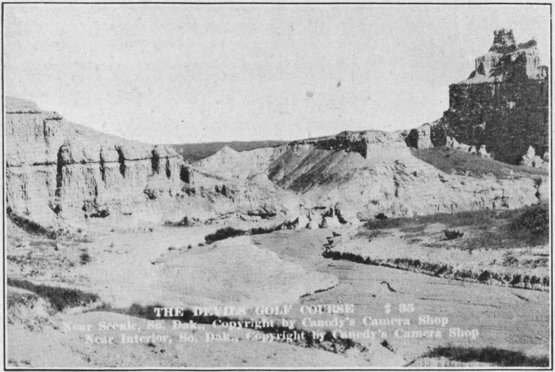
The Devil’s Golf Course, ScenicCanedy Photo
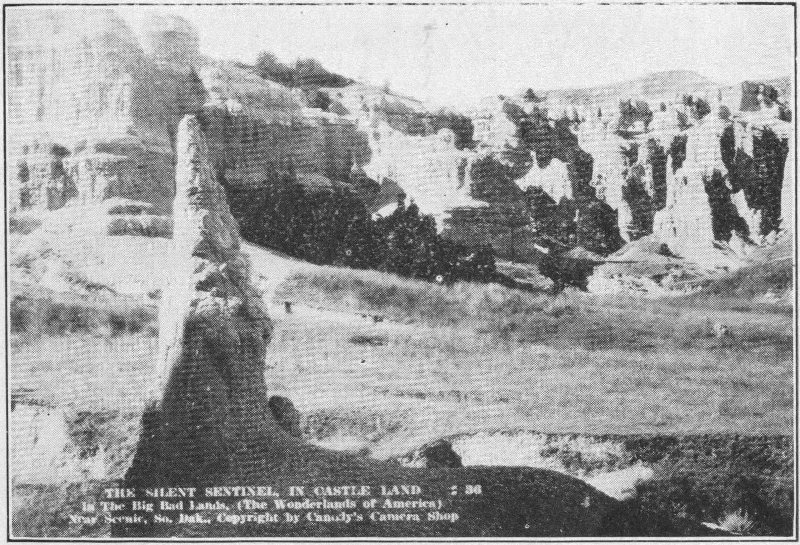
The Silent Sentinel, ScenicCanedy Photo
From Scenic to Rapid City is about forty-five miles. After leaving Scenic the silhouetted black mountains, soon come into view. They are visible in their magnificent grandeur, fifty miles distant, growing more distinct as they are approached. Upon nearing them, if one is familiar with the various peaks, he can pick each out and call it by name.
We reach Rapid City in the eastern foothills, at four o’clock. The School of Mines museum at the entrance to the city, also nationally and internationally known, is our first point of interest in the “Hills.”
The route taken
The School of Mines Museum is not an enormous affair. It is contained in one large room belonging to the School of Mines.
The bones of prehistoric animals are probably the best known and most widely advertised part of the museum. This collection includes skulls, jaw bones, teeth, leg bones, and in fact whole skeletons of the prehistoric monsters. One cannot but wonder what life was like, and how these animals acted in the days when they lived. The size and contour of these skeletons are truly remarkable.
On the Cheyenne
In cases throughout the room are displayed a vast variety of minerals, ores, types of rock formations, replicas of famous diamonds, and numerous other curios. On the south wall is an American flag, weighing 400 pounds, made of Black Hills minerals. On the east wall are two excellent relief maps of gigantic proportions, showing relative heights in the Black Hills. Guns and various other relics adorn the walls. No visitor to the “Hills” can afford to miss this part 36 of the trip. It may take one half hour to a day, depending on one’s interest in the displays, but the time is excellently spent.

Camp made
From the School we drive into Rapid City, and after a bit of shopping, on to the Municipal Tourist Camp. This camp is about four miles up Rapid Canyon west of the city.
By the time the tent is pitched and camp made a dinner does not meet an unwelcome reception. Why the camp stove should choose this time to balk is a still unanswered question. Somehow these appliances know when they can aggravate one the most.
Here in the Municipal Camp we receive a pleasant surprise. Instead of the expected camp grounds we find a beautiful spot for pitching our tent, “Old Swayback,” modern toilet facilities, a laundry with hot water, stores, and best of all an honest to goodness “swimmin hole” in Rapid Creek.
True to the spirit of the Black Hills, Rapid City Municipal Camp has its neat log cabin, with reading table, fireplace, electric lights, and other conveniences for its guests. Tourists are welcomed there at any and all times. These log cabins are a decided thrill to the traveler who is not familiar with them. Later in this account there will be a description of the typical log cabin.
The camp cots, in which we have so much confidence at first, have begun by this time to feel a bit hard, to seem a bit cold, and to afford a rather meager sort of rest. But here Yankee ingenuity might come into good play.
The desirability of light steel camp beds instead of the cots and the need of light mattresses becomes evident.
Sunday morning proves an excellent time to get acquainted with the habits of the Rapid Creek trout. Only three consent to being lured from their swim, however. The fishing is rather slow but nevertheless enjoyable. To a more experienced angler the luck is usually different.

Warren-Lamb Saw MillRise Photo
From fishing we turn to swimming. This proves to be a more lively sport. The water is fine, just a least bit cool. The current is the feature of this plunge. One no sooner gets out into it than he feels himself being pulled very rapidly downstream. The sensation is not exactly reassuring. In fact it frightens one. But it takes only a few strokes to get out of the swift water into more placid pools. This learned, it becomes pleasant to defy the current. Another surprise awaits. When one attempts to swim back to the side from which he entered, the current carries him past the precipitous rocks before he can pull himself out. No amount of 38 trying results otherwise. This is almost terrifying. Fortunately, at this point a man happens along who is familiar with the pool. He shows us where there is a small quiet spot where the swimmer can climb up on the rocks without danger of being carried downstream. Again a precarious situation develops into a pleasure.
We wish to attend church, but have no clothing along except our camping equipment. This convinces us that we should have brought along some more respectable clothing for it will not be amiss on several occasions during the trip.
Rapid Canyon, near Dark Canyon Photo by V
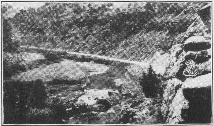
After lunch we drive up Rapid Canyon to Lockhart Inn. We go up the mountainside to see the moss sculpturing by Mr. Lockhart called “A Miner’s Dream.” Then we start the ascent up the Canyon on foot. This is a climb that will pay one well. From Rapid Canyon we turn into Dark Canyon ascending by rock ledge paths and canyon floor through beautiful formations of nature’s handiwork. One 39 cannot imagine the thrill, not only of the scenery but also the thrill of accomplishment, a hundred per cent pleasant that goes with this trip. Some of the sidelights of the trip are “Sitting Bull’s Kitchen,” “Victoria Falls,” (a beautiful waterfall), “Jungle of the Gods,” “Bridge of the Gods,” (a natural bridge formerly over the canyon but now fallen in), and “Bear Cave.” The picturesque grandeur of the panorama, the stupendous rocks, the great precipices, the straight tall trees, the swift, cold, clear streams and many other awe inspiring and pleasant experiences stamp themselves indelibly upon our minds. The experiences include climbing precipitous places, jumping and climbing over rocks, looking down over precipices hundreds of feet below, continually discovering something new to enjoy. The effect is invigorating, exhilarating, satisfying. The path is not dangerous at any place, though filled with thrills, especially on the paths built on ledges around the mountain. These are the rambles that mean most to vacationists, and unfortunately they are too often left out because of the time needed and the effort necessary to make them.
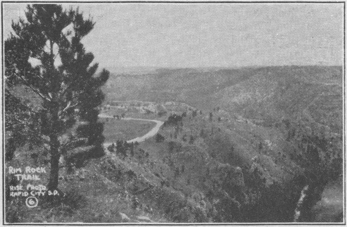
Rim Rock Highway in the Black HillsRise Studio, Rapid City, S. D.
Monday morning we strike camp at 9:00 a. m. We drive into Rapid City, get our snapshots of the Badlands which had been finished there, again shop a bit, and drive out to the cement plant.
First, however, a word about Rapid City. It is a thriving little city on the eastern entrance to the Hills. The streets have a modern air to them, with occasional reminders of the days of the “West.” During the tourist season the city fairly teems with life. Prices are reasonable and the people are courteous. The city resembles those farther east for the most part, not being without the familiar Woolworth and Penny stores. But the relics of cowboy days are still in evidence, and specimens of fish and game, alive or mounted, are shown with no little pride.
The high school, where President Coolidge had his summer Capitol in 1927, is a place worth stopping to see.
The State cement plant is run by the State of South Dakota. It employs about 150 people. The plant consists of the quarries, the sheds for raw rock, chutes, power house, crushers, the hydrating and baking plant, the furnaces, the drying tanks, the sacking department, and the offices. Each of the buildings is very large. The raw rock shed holds thousands of tons of rock. Each of the ten storage or drying tanks holds 15,000 barrels of cement. The plant can turn out twenty car loads a day, with eight hundred to a thousand sacks to each car.
The men work nine hours each day and sometimes ten. The plant closed five months the first year, three the second, and this last year it closed but one month. When we visit it, it has more orders than it can fill. The South Dakota cement is a superior quality and is much in demand.
To the person interested in machinery the huge turbines and generators are very interesting. These powerful affairs taking up but little room, generate enough electrical power to run the whole enormous plant.
In going through the plant one starts at the raw rock sheds. Here the loading devices carry the stone over a conveyor into the crushers. From there the material goes, by various processes to be soaked and made into mud, mixed, dried in blast tubes by very intense heat and flame, crushed again, run into drying tanks, and finally sacked and loaded into boxcars.
There are two men, known as sackers who, with the use of machinery, can fill 15,000 to 20,000 sacks a day. They receive the empty sacks, tied by wire at the top, and only open in one toe. This open toe is slipped over a nozzle through which the cement pours into the sack suspended upside down, resting on a small scale. When the proper weight of cement has entered, the scale lets the bag down upon a conveyor belt and at the same time shuts off the cement in the nozzle.
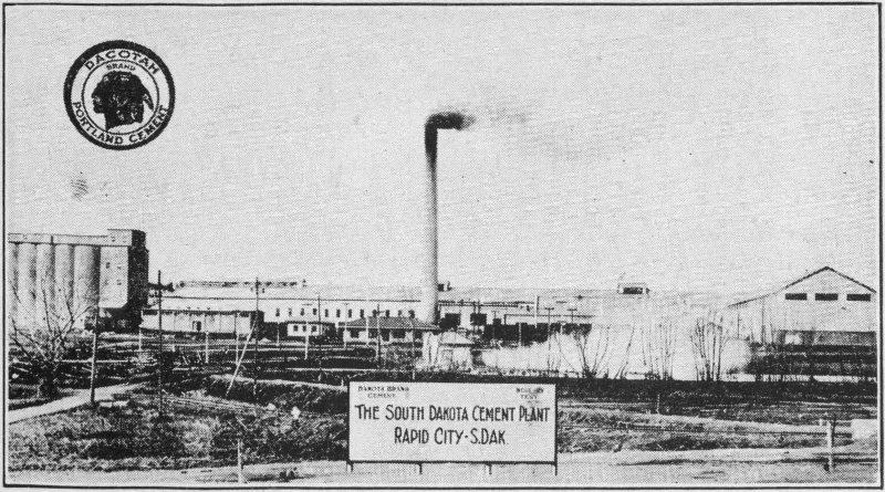
South Dakota State Cement Plant, Rapid City
The flap inside the toe of the sack pulls across the hole closing the sack. Each man has four sacks filling at once, 42 and he has just barely time to put on a sack and re-adjust his machinery before the next sack is ready. The conveyor belts carry the filled bags to a chute which deposits them in the box car, one on either side of the sacker. Each of the many machines throughout the plant is driven by a small but powerful electric motor.
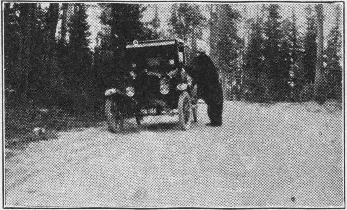
A visitor in the forests of the Black Hills
The cement plant is not one of nature’s wonders, but one of the products of God’s masterpiece, man. It and other mechanical achievements are hardly less to be marvelled at than the natural wonders, themselves.
From the cement plant we take U. S. Highway number 16 through Black Hawk and Piedmont to Crystal Cave. On this road we encounter the second notable man-made achievement. The car begins to register a few degrees of added heat in the cooling system. Before we reach the top of the great hill, (several miles long), we pass several cars which have not been as effectively cooled as our own. The grade has been gradual and even, clear from the bottom to the top of the mountain. The road winds around vale and crag, often having had to be cut through solid rock or cut into a niche on the steep side of the mountain. It is a feat of engineering skill capable of firing the imagination of anyone.
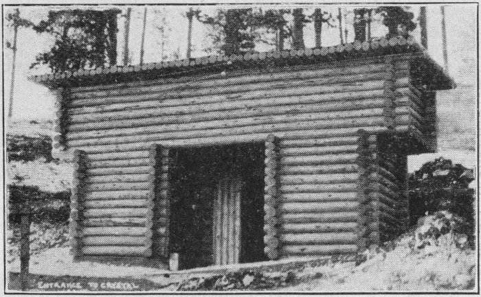
Entrance to Crystal Cave
About sixteen miles out of Rapid City we come to the huge arrow and sign pointing to Crystal Cave. The distance it was to be from the main road is given us on the sign board; it seems twice as far. The road is no longer smooth and surfaced or the grades regular or straight. These “side” roads are fast being improved, and probably by another year this 44 one will be fairly smooth, and wide enough for two cars to pass anywhere. We find it a bit rough, rutted, winding through dense vegetation, and narrow. However, in dry weather the driving there is safe, comparatively easy, and enjoyable. The scenery is quite picturesque. To those interested in birds, trees, and flowers this will be a splendid bit of road.
After some little time, a half hour or less, we arrive at the cave entrance.
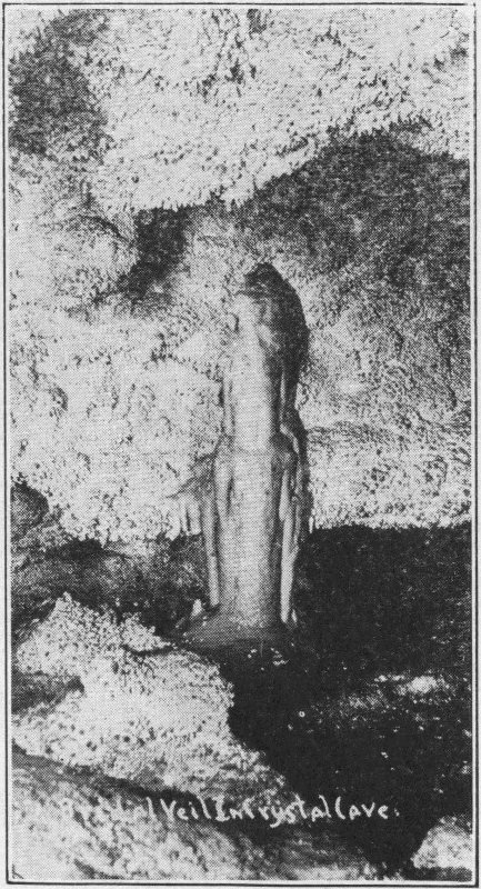
Bridal Veil, Crystal Cave
The headquarters are located in a little log cabin with a wide veranda where one can see specimens from the cave 45 and where souvenirs may be bought. The new cave entrance, pictured herewith is just above the cabin.
When a large enough party has gathered, a guide lights many gasoline lanterns and we are told to file into the cave entrance. As we do so the guide distributes the lights. After this he takes the lead.
We go into the cave in our regular clothing, without needing slickers or other special equipment. It might be said, however, khaki clothing and hobnailed boots are not so bad for a trip of this kind. The same holds for mountain climbing. High heels are decidedly a detriment to progress, and somewhat precarious as well, where the footing is moist or steep.

The Butcher’s Face, Crystal Cave
With our lanterns we file after the guide. He leads us down and forward into the bowels of the earth, stopping occasionally to explain the various formations which we are passing. His “line” is strongly based on fact, and if one has a good imagination he can enjoy the trip, being able to “see” the various animals, rooms, or formations which the guide points out.
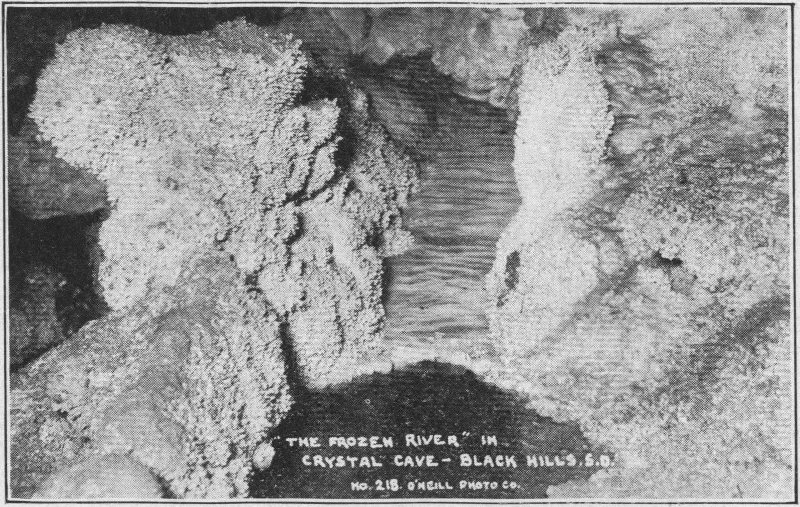
The Frozen River, Crystal CaveO’Neill Photo
First, the cave has been formed in limestone, through erosion by water, extending over many thousands of years. The mineral part of the water has hardened in perfect crystals, looking as though they had been cut. These crystals cling to the walls, creating a beautiful effect. They are as hard as rock.
Some of the high lights of the trip are “Devil’s Ice Box,” “Moses’s Meat Market,” with hams, bacon and a chicken hanging from the ceiling, “The Butcher Himself” (pictured), in his parlor, “Poverty Flats,” “Corcham’s Art Gallery,” which contained well hung walls, and even a goat. Then came “Cathedral Cave,” with its crystalline rolling clouds. “The Polar Bear,” “Diamond Rock,” made of pulverized mica, and “Santa Claus.”
There are stalactites hung from the tops of some of the caves and stalagmites built up from the floors, each of which if it could talk could tell stories that would be ancient history to Moses.
Going on, we come to “Old Man Cave” and “Black Hills Bakery.” In the latter were buns (of solid rock), rolls and loaves of bread, natural formations. From here we go into a room 300 feet below the surface and put out the lights. It is very dark there, even in the daytime.
We light the lanterns, pass on, and come to the “Whale that Jonah swallowed.” Next comes the “Mayflower,” and last the trip out. The “Bridal Veil” and “Frozen River” were among the most picturesque of the scenes, the exact position of which are not recalled.
Most of the rooms and passages are six to twelve feet in height. Some are hundreds of feet deep and some are too close to the floor for the unwary head. These rocks do not give very far when one’s head hits them.
Our guide is a decidedly congenial and unassuming young man. He wins the favor of all of the party, keeping the spirits high through the whole trip.
One half mile down, on the road from Crystal Cave is a sign pointing toward Knife Blade Rock. This is a gigantic thin rock formation rising 600 feet out of the bed of the canyon. The origin of this phenomenon also kindles one’s imagination.
When viewing Knife Blade Rock we stand on a high precipitous canyon wall and look nearly straight down hundreds of feet into the Elk Creek Canyon. This view is magnificent; the great deep canyon, the precipitous cliff, Knife Blade, and the expansive opposite bank covered with heavy vegetation.
From here we move on toward Sturgis about ten miles distant.
The road to Sturgis is pretty well crowded with cars headed for the Tri-State Roundup at Belle Fourche. We arrive about four o’clock. The next hour is spent in getting boots repaired, getting haircuts and in replenishing the food supply.
We still have a good supply of eggs, butter, bacon, fruit, and vegetables which we packed up on the farm before starting the trip. At each tourist camp we get plenty of fresh vegetables and milk. We appreciate the vegetable and store service of the camps. It is excellent. This, with the food stove, utensils and dishes we brought with us on the trip, makes our food question simple and economical as well as highly satisfactory. We enjoy every meal.
Bear Butte in the Distance
Sturgis has one of the best tourist parks we encountered on the trip. The camp is equipped with excellent little cottages for those who prefer them. It has a main camp building containing running spring water, modern toilet facilities with hot and cold water, shower baths and a laundry. Bear Butte 49 Creek flows directly behind our tent. Above our heads are electric lights. Beside the thrill and exhilaration of camping the conveniences are almost equal to those enjoyed in a first class hotel. The nice shady camp site, however, to the person enjoying the out-of-doors makes a hotel feel like a dungeon. The tent takes but a few minutes to set up and it adds tremendously to the pleasure of an outing.
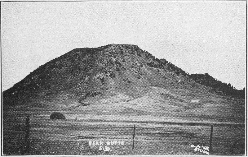
Bear Butte, close up O. A. Vik
We get a good night’s rest in the Sturgis park and rise early the following morning to partake of the nice hot flap-jacks, bacon, coffee and oatmeal. (We will need it all before lunch time).
We start out bright and early to climb Bear Butte. We take trail No. 79 out to the northeast of Sturgis. We leave the highway a few miles out and take the Bear Butte trail. What looked like a mile or two proves to be seven or eight, and what looked like a small mound proves to be a huge formation rising nearly a thousand feet above its base.
We had hoped to prance right up to the top on short notice. Our troubles start when we cannot decide whether we are supposed to go up the east or south slope. We find later that either is sufficiently difficult. We finally flounder around to a farm house near the south slope, leave the car and start up.
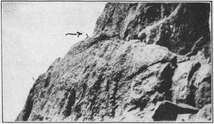
Climbing Bear Butte. It is more steep than it looked
The slope is steep and progress slow. The whole party of us begin the climb. When we reach the shale slope and have to climb instead of walk, only three of us are still going. Even our shoes show the effects of the rocks. Well, we climb for an hour and finally find ourselves on the top of this promontory which we have by this time learned to respect. The pictures show the size of the rocks compared with the humans climbing them.
The view from here is excellent. We can see Mt. Roosevelt, Harney Peak, White Rocks and other peaks with which we are acquainted standing out in distant relief. The plains stretch out for miles and miles to the north and east, and the picturesque mountains are spread in the other directions. It seems almost as though this peak towers above the entire surrounding country on all sides. The view is well worth the hard climb necessary to attain it. The U. S. Geological Survey marker on the top indicates that the height is 4439 feet 51 above the sea level, 987 feet above the city of Sturgis which, is 3452 feet. (See appendix.)
We descend in somewhat better time than it took us to go up, have lunch and return to camp. From here we take trail 24 for about two miles out to Ft. Meade, a military post. Here we watch a polo game and guard mount. In the camp are stationed about 750 U. S. regular army artillery men and cavalrymen.
While at Sturgis we should take the Boulder Canyon road to Deadwood but we miss this scenery as well as Rim Rock Drive above Rapid Canyon. Boulder Canyon is one of the most picturesque roads in the Hills, so enormous are its perpendicular figured rock walls.
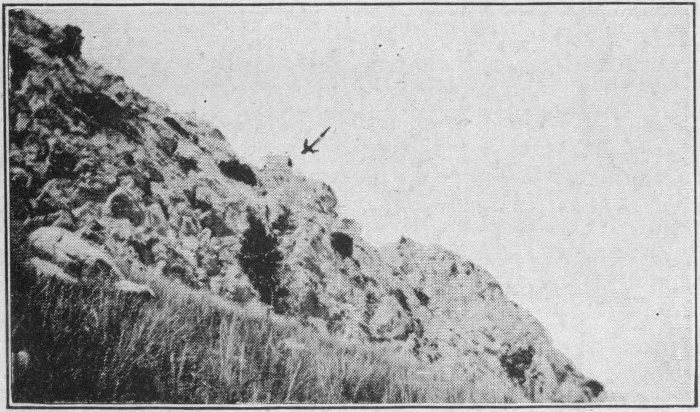
The Shale Slope, Bear Butte
We retire early on the night of the third and are on the road early the next morning, headed for Belle Fourche over U. S. 16. At Whitewood we go over another gigantic ridge of hills which taxes our heavily loaded car. At Spearfish we take U. S. 85 and gradually leave the mountains for the more level northern plains.
We arrive in a very busy Belle Fourche. The streets are lined with people, refreshment stands, side shows and various other gala sights. Parking room is scarce. The whole town reflects the western spirit. The predominating costume is that of the cowboy dressed up. Broad rimmed, high crowned hats and bright silk neckerchiefs are everywhere.
President Coolidge at the RoundupRise Studio, Rapid City, S. D.
Probably a Scotch visitor would not exactly appreciate the reception. The Roundup is a gala affair. The people come there to spend money. Those running the various amusements and refreshment stands seem to understand this perfectly and render all possible assistance. In the West the celebrations are not marked with the conservatism of the East.
We enjoy the day after we get our bearings. We have lunch after a couple of hours of “seeing Belle” and then go out to the Roundup. The road is packed; we have started none too soon. True to the training of school teachers, we try to conserve on costs as much as possible. We have paid a dollar apiece for general admission and now we decide a fifty cent seat will be nearly as good as one for a dollar or more.
An Exciting Ride
Bill Pawley on a high one.
Cody Stampede, 1921
We get excellent bleacher seats, but somehow they get surprisingly hard during the three hours and over that we sit there. The sun is uncomfortably hot and the folks climbing up and down are none too careful at whose expenses they get the dust brushed from their shoes. We can not see the events very plainly in some cases, but we are not cheated out of very much of the performance at that.
The clown car opens the day. Of course it is a Ford. But the clown has done his duty and the affair brings forth more than forced smiles. The Rapid City Bugle Corps, the Cavalry Band (mounted) from Fort Meade, and the C. & N. W. Band from Chicago are outstanding attractions.
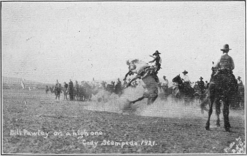
The cow pony race comes next, then roping and the cowboy relay. Those cowboys can certainly change saddles from one pony to another in a hurry and also ride. Following this comes exhibitions in horseback hurdling by cavalrymen. Then comes a contest of cowboys riding steers. The man who stays with his steer longest wins. Some of those fellows get pretty hard spills. The broncho riding contest is just as lively. The horses try hard enough to unseat their riders and many of them succeed. The clown, in enormous red “Shaps,” rides a bucking steer upon which he is mounted backward.
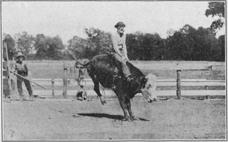
Steer riding
The cowgirl race is a close one, the winner almost having to win by the proverbial sticking out of the horse’s tongue.
After this comes stunt riding and trick riding. The men, and women, too, ride at a gallop doing head stands on the saddle, standing upright, at right angles to the horse, clinging beneath the horse’s neck, seated backward and in various 55 other ways. They do gymnastics on the horses in full gallop. One juggles balls in the air while riding, standing on the saddle at full gallop. One lies on his back whirling a rope while the horse beneath him runs. The clown rides a bucking Missouri mule.
The Horse Wins
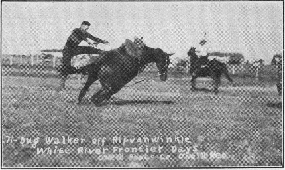
Dug Walker off Ripvanwinkle
White River Frontier DaysO’Neill Photo
For deviation, songs are sung amplified so that the crowd can hear them. One is “Black Hills Rosebud.” Governor Bulow gives a short talk, too.
Bulldogging steers, or riding up beside them, grasping them by the horns, at full run, dismounting and throwing them upon their backs seems to be the most popular sport. The record time is under nine seconds.
The cowgirl relay is another exciting event. A cowgirl then puts on a highly applauded solo dance. After this comes the calf roping contest. This calls for real action. Riders, mounted on two horses, one foot on each, furnished the next race. One girl is entered.
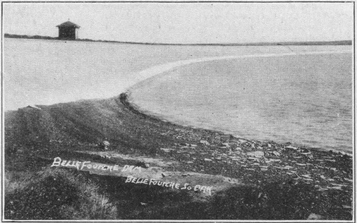
Orman Dam, Belle Fourche
Mabel Strickland, famous woman rider, puts on a steer roping exhibition and the bucking mule riding contest follows. Then comes the wild horse race. During the whole performance Clyde Ice of the Rapid Transit Co. is hovering over the fairgrounds with his tri-motored Ford passenger plane.
The last event is an exhibition by one of the girls riding a bucking horse. The horse throws the young lady before leaving the corral shute. Accidents occasionally occur in this rough play, though they are rarely fatal. All in all, the performance is very good.
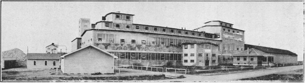
U. and I. Sugar Plant, Belle Fourche, South DakotaO’Neill Photo
This is one of the large plants for making sugar from beets located in the midwestern states. This plant is supplied with beets from the Belle Fourche Valley, irrigated from the great irrigation project administered by the United States Government, and located north of Belle Fourche. Needless to say this is one of the major industries of this part of the state.
After the program there are twenty thousand people trying to leave the grounds at once and soon after the roads from Belle Fourche receive a goodly share of these people. We follow the southbound stream as far as the tourist camp, a mile or two out.
Belle Fourche has a modern camp, although it is just in the process of construction and not yet as complete as some of the others. They have an outdoor dance floor, which is very popular on the night of the Fourth.
The morning of the fifth we drive back through Belle Fourche and east over U. S. Highway 212 to the “U. and I.” sugar plant. This is another of the Black Hills industries. We are given a pamphlet telling us that: the plant covers eight acres; the main building is five stories high; the length of the factory and warehouse is 587 feet; the capacity is fifteen hundred tons of beets each twenty-four hours, and the output 3600 hundred pound bags of sugar every day. Three hundred men are employed during refining season.
A guide takes us through. We first see six 400 horsepower boilers and two 1200 horsepower generators. These are enormous affairs. They develop the power for the plant. We proceed to the place where the beets are unloaded and conveyed through an open flume, through a trash catcher to the washer.
Spillway, Orman Dam
From here the beets are taken by an elevator to the top of the plant. There knives cut them into small strings less 59 than a half inch in diameter. These chips or “spaghetti” are run into diffusion tanks. They first go to a liming station, then through sulfur stoves, a bleaching process and on into evaporating tanks. Here the solution is concentrated from 12 per cent sugar to 65 per cent pure. Then the sugar is put through a centrifugal crystalizer and through a hot air blast dryer. It takes just twenty-four hours from beets to sugar. All machinery is electric.
The factory produced 183,000 bags of sugar last year or over eighteen million pounds. About one-fourth of this is in the warehouse when we visit it. The beets were grown on 11,000 acres in 1927 and the total crop was 35,000 tons of beets.
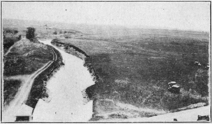
An Irrigation Canal
We go further east on the highway 212 to the byroad leading north to Orman Dam. The dam is a gigantic affair, holding back a tremendous amount of water for use in irrigating land for sugar beets and other crops. The water is so clear that we can see the fish swimming beneath its surface.
The Belle Fourche Reclamation Project is one of the wonders of the western part of South Dakota. It is not in the “Hills” proper, but is well worth going to see. We drive on to Nisland, observing the effects of irrigation as we go.
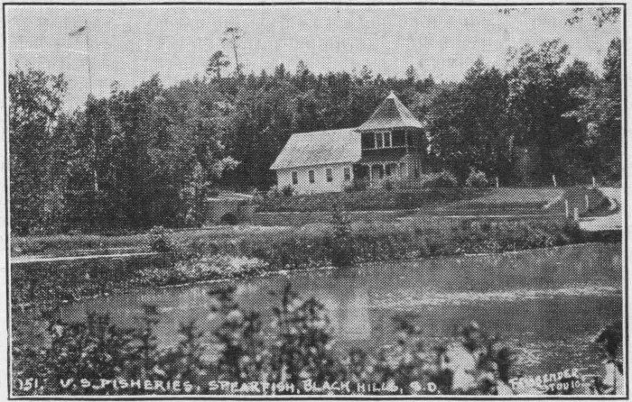
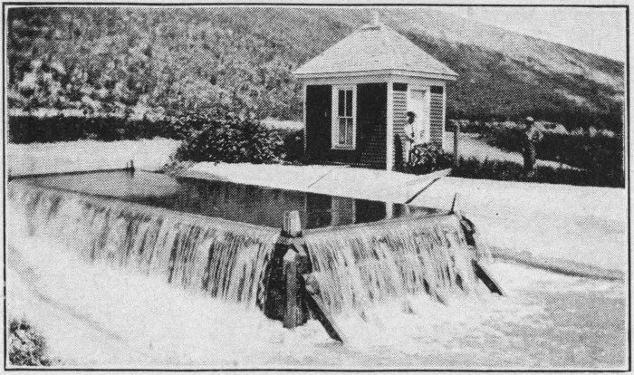
U. S. Government Fish Hatchery at Spearfish
From Nisland we retrace our route through Belle Fourche to Spearfish. There we find another splendid and modern camp. We enjoy staying at these camps of which their cities are justly proud. The cost is the same fifty cents per night as that of the less developed camps. But the modern toilet facilities, running water, wood, stoves, lights, community log cabins, dance floors, swimming pool, fishing and patrol system create in the traveler’s heart a warm feeling toward those cities or towns. In addition to this, the freedom with which people from all over the United States meet and talk over experiences is a source of lasting pleasure to the conversational type. The large cars of eastern manufacturers and the Fords of vagabonds from any place in South Dakota or the United States sleep side by side. Toward evening knots of people gather here and there about the camp or in the community building and the topic is likely to be anything from sheep raising in Perkins county or mica mining at Keystone 61 to the workings of the New York Stock Exchange. Roads are discussed, scenery and experiences are swapped and friendships are made. Everyone is congenial, all are neighbors and class spirit does not exist. It would surprise one how he can broaden his knowledge through these contacts.
No matter whether one’s interest is fishing, swimming, camping or gossiping, he or she will naturally fit into a group in camp.
Lookout Mountain near Spearfish
The United States trout hatchery is located beside the Spearfish camp, just across the bridge to the south. Here the United States government maintains tanks in which they raise several varieties of trout. There is a different size in each tank ranging from the frisky little baby trout to the sedate monsters that give a person a certain longing for just one chance at their like. These speckled and rainbow beauties are a sight to behold. If one can get around there at feeding time he will behold a still greater treat.
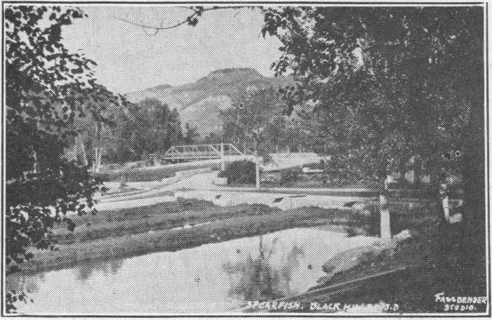
Across the road from the hatchery is a pretty decent little swimming pool, formed by a dam in Spearfish Creek. A swim in one of these clear mountain streams is a rare treat. The visitor in the “Hills” should plan to indulge as often as possible.
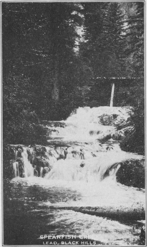
Spearfish Creek, Lead, S. D.
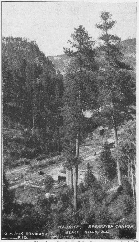
Maurice, In Spearfish CanyonO. A. Vik
Bridal Veil Falls
The next morning, July 6th, we take a trip up Spearfish Canyon. The road leads past the fish hatchery, plunging into the mountains and woods over ground owned or leased by the Homestake Mine Company. The road is fairly well worn but poorly marked. Nevertheless, this trip above all others is not one to be abandoned. Word just arrives that the road will be improved clear to Lead next summer. The road winds over gentle slopes and makes sharp turns. One must drive under twenty miles per hour and sound his horn often. But a person does not realize the marvelous beauty that lies hidden 65 in this valley until he actually penetrates, not a mile or two, but clear up as far as cars will go. One must get out and press through the timber until he comes to a place from which he can view a great expanse of the valley and wall before he can fully appreciate Spearfish Canyon.
Admiring the Falls
Wildcat Cave is located a few miles up the valley. The car must be parked beside the road and the ascent up the steep canyon wall continued on foot. The cave lies a quarter of a mile or so up. The climb to it is steep and part of the way is over rocks washed by springs.
The path leads through dense growths of timber and shrubs. At last we come to a huge overhanging cliff, below which is the Wildcat Cave. Over the top of the cliff clear cold spring water half drips, half runs continually. At various places in its walls springs ooze out, too. The one little waterfall over the center comes down through about fifty feet of space. If a person is adventuresome and ambitious he might climb the crags clear to the top of the mountain on the right.
Savoy Canedy Photo
Seven and a half miles up the canyon from Spearfish we come to Bridal Veil Falls. This is a beautiful waterfall, with not much volume but a great height. Probably it falls 200 feet and is twenty feet wide on the average. The spectacle of this is really awe inspiring. The flimsy lace like folds tumbling over the succeeding layers of rock make unquestionably the most beautiful waterfall in the Black Hills. We stop at its foot to eat our lunch while admiring its beauty.
Multiplex Falls
From Bridal Veil Falls the road winds up the canyon to the Spearfish hydro-electric water flume. Above that is Roughlock Falls and the Homestake hydro-electric plant, and 68 we must not forget Latchstring Inn. Foolish is the visitor who turns back before seeing all of these, if weather conditions permit.
After this the trail leads back to Spearfish and thence fifteen miles over into Wyoming. We could go on west to Devil’s Tower, but that would mean a long trip. So we just cross the State line and return. Here the fun begins for us. The rain has begun, slowly at first and has kept ever increasing. We have determined to make Pine Crest Park at Deadwood this evening, and accordingly break camp and set out. We have gone a few miles when the rain comes down in torrents. Fortunately the roads are good, but we have to drive with the windshield cleaner working constantly. We enjoy the beautiful scenery in spite of the rain.
We take U. S. 14 for eight miles or so, and then turn south on U. S. 85 for another five miles. On the way we come to Preacher Smith’s monument. This has been erected in honor of Mr. Smith, Deadwood’s first minister.
The story is told how he came to Deadwood with the first settlers when gold was discovered. He preached to whoever would listen to him. One day he headed for the vicinity of Whitewood to deliver a sermon. He was advised not to start out because the Indians were hostile. He insisted that his Bible was all the weapon he needed. Today a monument stands near where the Indians killed him. Several authors have told the story of Preacher Smith. Anyone interested in the story should by all means read it from some authentic source.
The road from Spearfish rises gradually. At the highest point on the road, thirteen miles from Spearfish, the entrance to Pine Crest Camp comes into view. This is a really beautiful camp. It is one hundred per cent what its name implies.
A camp built over one of the tent floors is comfortable even in rainy weather. However, if experience is any teacher, it might be said that trying to sleep under a hole in the tent roof on a rainy night is a pleasure only to the other fellow.
In the evening, after camp is built and dinner served, a walk to the community house proves a worth while venture. Pine Crest gives us the heartiest welcome of any place in the “Hills.” In the log community house, (it is a masterpiece of masterpieces), a cheerful fire awaits. The ample stone fireplace seems doubly welcome on a rainy night. Does it feel good? Say!
In the cabin are gathered a group of high school girls from Lead, a family from Kansas City, a Canadian, some Ohio people, Texans and several others. And a jolly time we have. Stories starts the program. Music follows and a lively community dance tops it off. The atmosphere is that of one great big family gathered together after a long separation.
Under the cabin, in a well finished basement are modern toilet rooms, a laundry, and shower baths. There is both hot and cold water. The whole is free to the tourists who are camped in the park. The initial fifty cents a night covers the entire cost.
Our enjoyable evening draws to a close and we return to the tent for a good night’s rest.
The experiences from now on are to be on historic ground.
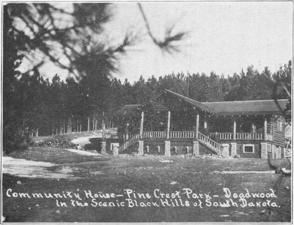
Community House—Pine Crest Park—Deadwood, S.D.
Pine Crest proves to be such a good camp that we decide to make it our headquarters for a day or two. In the morning we put up a lunch and drive over to Lead. Of course the first and foremost point of interest in Lead is Homestake Mine. We stop at the Burlington Railway station and register for the trip through the mine buildings. It is only a few moments before we are ready to start.
We follow our young lady guide up a steep incline. Half way up she stops us and asks us to face about. Clear across the gulch on the opposite side of town is a huge cut, where the hill is virtually cut in two. This, she tells us is the site of the first mine, a surface working. We are told that $20,000,000 worth of gold came from this cut.
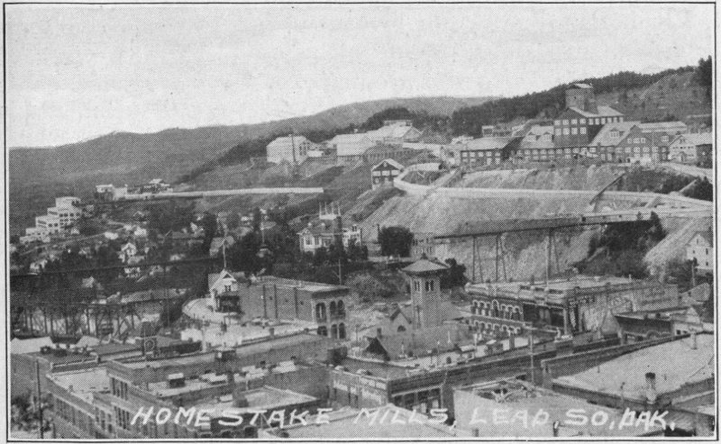
Homestake Mills, Lead, S.D.
We go on up the hill to the Ellison shaft, the one now being used most extensively. There the ore is coming up from the 2300 foot level, by hoists and seven ton cars. It is dumped into a conveyor belt, and passes the pickers. We go next to see the giant air compressors for maintaining circulation of air in the mines.
The hoist room contains large drums driven by 1400 horse power electric motors working on direct current. These huge affairs bring the heavy cars up from the mine in a very short time. Their speed and precision are remarkable, considering their enormous size. The room is immaculate.
From the hoist room we go to the shop where diamond drills are sharpened. These are tubular bars of hard iron, with hollow centers, and sharp edges on one end in the form of a cross. They are used with the electric drill down the mine, working on the plan of the electric riveter. When dull these points are brought to the surface, pounded into shape in a trip hammer, while white hot, and tempered very hard.
The motor generator which is driven by alternating current and delivers direct current is a huge affair. It has to be in order to develop enough direct current to drive the heavy machinery. Its flywheel alone weighs thirty-five tons.
In the blacksmith shop all of the blacksmith work of the mine is done. Repairs are made, castings are made, gears are cut, and iron is pounded into shape. A pair of shears is cutting iron ¾ inch thick for a boiler. The ease with which it goes through this mass is astounding. Lathes are plaining blocks of iron or gears into shape. These lathes are cutting shavings a half-inch thick. In the molding room molten iron is being poured into casts, covered with sand, and allowed to cool.
Now comes the real gold mill. The first part we come to is the rock crusher or rod mills. From the rod mills the material is taken to the stamper, where it is mixed with water. The solution passes to dewatering cones and cleaner troughs. Rod mills crush the ore to powder, which, with water makes a mud. The mud passes through troughs containing mercury. Most of the gold leaves the mud and clings to the mercury.
The remaining solution goes to sand slime separation cones and then to cyanide tanks. The tanks are filled with mud. The water drains off. Cyanide is poured over the mass. The cyanide sinks, carrying the remaining gold of the crushed ore to the bottom with it. This is reclaimed and the mud is washed out and sent down the gulch.
The trip is an interesting one. The guide now tells us that the gold is molded into bricks worth twenty-five to thirty thousand dollars. Approximately sixteen are made each month.
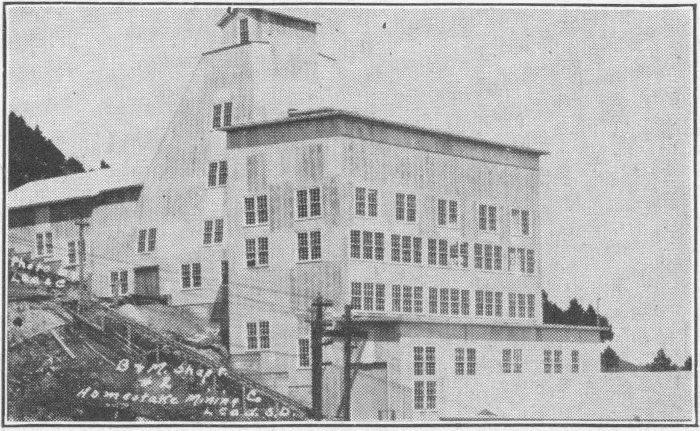
B & M. Shop #2
One of the buildings of the Homestake Mining Company’s
Lead, S.D.
Quoting from literature distributed by the mining company the following might be of interest:
“The Black Hills are highly mineralized, containing practically every known element to a greater or lesser degree. Lead is the home of the Homestake mining company, the largest gold mining concern in the world. The company has been running continuously since 1877 and has taken from the ground approximately 56,000,000 tons of ore yielding $200,000,000 of gold (now over $212,000,000.) In order to produce an annual output of $6,000,000 about 2,000 men are steadily employed. The average daily output is 43500 tons, or 1,750,000 tons annually. There is enough ore blocked out to furnish the mills with this many tons a day for nine years.
“More than 1,554,117 pounds, or 3,108,234 sticks of 40% dynamite was used in 1927, costing over $500 a day. In 1927, 3,816,724 feet or over 722 miles of fuse was used. If this were in one length it would take 971 days, 21 hours and 22 minutes and 8 seconds for the flame to traverse it. More than a million blasts were set off during the year.
“The company has never undertaken to furnish houses. It has, however, encouraged the building of homes by giving free permits to occupy company ground and by advancing the purchase price and allowing the employee to pay on the monthly payment plan with a low rate of interest on deferred payments. After forty years of continuous operation as the sole industry of the community there are few company owned houses in Lead. Under this policy the town has grown from a typical mining camp with its log cabins and board shacks, into a modern small city with paved streets, sewer and water systems, electric lights and beautiful homes, owned largely by their occupants. The grocer, the butcher, and the hardware dealer, the clothier and the real estate men carry on their business in this mining camp as in an ordinary town of equal size. Keen competition keeps prices at a reasonable level.
“No part of the welfare work at the Homestake has met the needs of the people more fully than the free library, originally a Christmas gift from the late Phoebe H. Hearst in 1894, now carried on through the generosity of her son William Randolph Hearst, with present quarters on the second floor of the recreation building. Now the library contains approximately 14,000 volumes. In the reading room are eighty periodicals, of which two are foreign. The close proximity of the high school enables the library to render valuable assistance to teachers and pupils.
“A smoking room is provided for the men, and the children have an alcove for their particular use, provided with low tables and suitable chairs. One end of the stack room is used for mineral exhibits, especially the minerals of the Black Hills region.
“The Kindergarten, opened in 1900, is also maintained by the generosity of the Hearst family.
“A small, but well kept park nearby provides a place for outdoor play during the summer months. The kindergarten has been an inestimable aid to the public school by giving the children of foreign birth a start in the English language and teaching them something of American ways and manners, thus relieving them of the handicap resulting from their foreign parentage. It has also proved a large factor in Americanizing the parents by both direct and indirect contact with the teachers.
“The Homestake company, supporting a liberal policy toward the schools, feels that it is fully repaid by the stabilizing influence on its working force, due to the fact that men with families are attracted to Lead on account of its educational advantages. Many of the young men who are now holding important positions in the shops, mills, assay and engineering departments are graduates of the Lead High School.
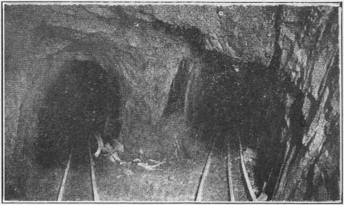
Old Mine Entrances
“The Homestake Recreation Building, built and equipped by the Homestake Mining Company at a cost of $250,000 was opened to the public in 1914. It is a three story brick and stone structure of the latest design and well lighted, heated, and ventilated. No expense is spared to make this the recreation place of the employes and their families, and all residents of Lead are given the same privileges as employes, so 76 that it is a community house in the fullest sense. No membership fee is charged. Everybody is welcome and all are treated as special guests by the attendants. The only rules posted are those governing the length of time one set of players may use the various tables and games, and specifying the days when the men, women, and children may use the plunge. The average monthly attendance is about 25,000.
“On the first floor of the building is a large rest room furnished with easy chairs and lounges with tables for chess, cards, and other games, and directly in the rear of this room is the billiard room, with two regulation billiard and two pocket billiard tables. In alcoves of the rest room are three tables for children between the ages of six and sixteen. About 2,500 persons play on these tables during the month.
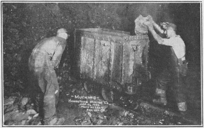
Mucking
April 21, 1933
Homestake Mining Co.
Working in the gold mines at Lead
“Below the rest room is the gymnasium and a bowling alley of six alleys equipped with automatic pin setters. Over 2,000 persons use these alleys each month, including the ladies who have one day each week. The gymnasium is well equipped, and is also used by two bands as a practice room.
“In the rear of the rest room, and with a separate street entrance is a well furnished theatre with a seating capacity of 1,000. Moving pictures are shown both afternoon and 77 evening, with road shows and vaudeville when available. The average monthly attendance is about 20,000.
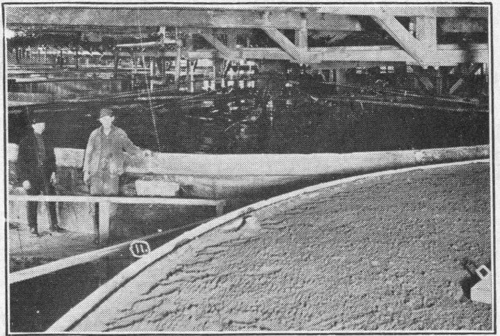
A view in the cyanide plant of the gold mining plant at Lead
“Under the theatre auditorium and directly in the rear of the bowling alley is a tank 25×75 feet with a depth of water ranging from 4 to 9 feet. The plunge and floor are lined with white tile. Change rooms, shower baths, and hair driers are provided for the bathers. The water is heated, filtered, disinfected, and changed frequently. The plunge is patronized by approximately 1800 persons per month, about equally divided among men, women, girls, and boys.
“A small room called the sun room, because of its particularly sunny exposure, is used as a meeting place by various clubs, societies, and committees.
“There is no charge for the use of any part of the building to Homestake employees and their families, or to residents of Lead, except for the theatre where a nominal charge is made to cover the cost of pictures and other attractions.
“The company erected at a cost of more than $60,000 a thoroughly modern brick hospital of thirty-five bed capacity which furnishes absolutely free to its employees and their dependents every type of medical, surgical and obstetric 78 treatment. No charge is made for any hospital care, operating fees, or for medicines.
“The employees and dependents make very great use of this service as shown by the 1922 annual report. Forty-three thousand people were taken care of in the dispensary, fourteen thousand visits were made at the homes and one hundred forty-three confinements were handled.”
The Homestake Employees Aid association is an organization to help the employees. Also:
“The company retires its old employees on account of old age, physical disability, giving them 25% of last year’s full pay plus $10.00 per year for each year’s service with the company, but in all not to exceed $600 per year.
“There were 64 men (1928) receiving pensions of from $350 to $600 per year. The average age of those receiving pensions, at the time of retirement was over 65 and the average years service is nearly thirty-one.
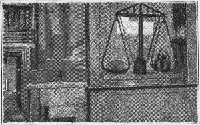
Weighing Gold Bricks in the assay office
“A pension is also paid to the widows of new men who lost their lives by accident prior to the enactment of the state compensation law.
“Every effort is made, both in the mine and in the surface plants to provide sanitary working conditions. Bubbling 79 drinking fountains are placed in convenient places both underground and in the mills and shops, and provided with clear, cold, wholesome water. Clean, well heated and ventilated change rooms are provided with hot and cold water and individual lockers for clothes. A special underground latrine is used in the mine. Ventilation of the underground workings is carefully supervised.
“Seventy-five per cent of the Homestake employees are English speaking nationalities. In the other twenty-five Italians predominate.
“Many religious denominations are represented in Lead, and most of them have an organization and a place of worship. The Homestake company makes a yearly contribution of $200 to each church holding regular services, and renders other material aid in various ways.”
Tourist Camp
Thus we see that South Dakota, and more specifically Lead has an industry not only of enormous size but with the most modern and progressive practices known to civilization. A trip through it is enough to stimulate the imagination rather decisively of anyone mechanically or industrially inclined. Here is an organization whose social, industrial, mechanical, 80 and personnel organization is worked out and administered on modern scientific principles, with the interests and safety of its employees ever in the fore.
From the mine we go up the hill through Lead to “Mile High Camp,” where we eat lunch. This camp is a very nice camp of little earlier date than some of the others. Jubilee camp on the West branch of U. S. 85, just on the edge of town is another good camp. It is situated on a very high point, overlooking Lead on one side and beautiful tree covered mountains, cliffs and valleys, on the other.
We follow U. S. 85 toward Cheyenne Crossing and Newcastle. The road leads through Icebox Canyon. This canyon was properly named. Even on this hot July day it is very decidedly cool. In addition, it is a beautiful drive. The tall stately pines have almost a noble look to them.
The road leads over long gradual grades, up hills and through valleys. There are camps and cabins along this route, and the trout fishing is good. Icebox Springs, is a very cold spring six miles from Lead and 6270 feet above sea level. Here we get a drink of clear, cold water, maintained as such without the aid of refrigeration. The spring pours right out of the side of the canyon. Terry Peak, within 200 feet of the same height as Harney, rises a short distance from the trail.
This again is historical ground. In the early days the Deadwood-Cheyenne stage and treasure coaches traveled over this route. Here were the scenes of the early hold-ups, fights with bandits, and murders of the stage people.
Here was the testing ground of civilization. To see the present Black Hills one could hardly believe that less than fifty years ago it went through the wild formative period of outlawry, Indian fighting, and the gold rush. Cheyenne Crossing is but a couple of small cabins, a sort of outpost. Here we turn about and return to “Pine Crest.”
From Lead we take the old mines road back to Deadwood. This leaves town near Jubilee camp, making a loop to the north. Along the road, just out of Lead are cabins variously named: “Travellers Rest,” “Tramp Inn,” “Saloon,” “Bucket o’Blood,” “Haven of Rest,” etc.
Along this road we see remains of old placer mines, mining mills, and various other remains of early mining. Most of them are now abandoned. Nevertheless one can imagine the life that must have been enacted here a few decades ago. Central City, and other former thriving cities are now but vestiges of what was once the splendor of Deadwood Gulch. Now, only an occasional inhabitant and a number of run down buildings remain.
It is almost marvelous to think that a country could pass from the extreme of an outlaw West to the highly modern civilization that Lead and Deadwood present today. No place on earth but the progressive pioneer western community with its fertile and indomitable brains could do it.
At the camp that night part of the crowd of the previous night is present, and quite a number of new people. Another very enjoyable evening is spent.
Deadwood, today. Located in Deadwood Gulch. Scene of the most exciting of Gold Rush Episodes
In Deadwood, the next morning we take our way to the Franklin Hotel, then south, over the railroad tracks to Mt. Moriah Cemetery. We are now, indeed on historic ground. Probably it would be well to reiterate some of the setting before going up to the cemetery to view the resting place of the famous early characters.
Deadwood was settled in 1876. When gold was discovered here approximately 25,000 people rushed for Deadwood. Rumor, brought to us through the years, says that within twenty-four hours after the city of Custer heard of the Deadwood gold discovery its population had decreased from between six and ten thousand to less than a hundred people. They left on horseback, on foot, by ox team, by stage, and by wagon, taking camping and mining equipment with them, and stores of food.
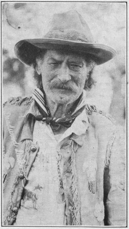
Richard Wm. Clark, and his original cabin Bell Photo
Deadwood was transformed from a gulch full of dead timber to a lawless city. The one aim of everybody was gold. Some got it in the thousands of industrious mining projects, most of them one man or a few men placer mines. Some got it by selling food and supplies, some got it by gambling, and some by robberies. Deadwood was in a state of wild chaos.
Preacher Smith, or Henry Weston Smith “drifted in” about this time. He had come from the East with the Custer gold rush and had migrated north to Deadwood, on foot, at the time of the discovery and boom there. He preached in the street mostly. He was a Methodist, about forty years of age, and of fine physique, quiet and unassuming.
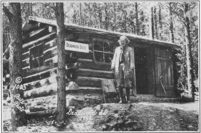
Deadwood DickBell Photo
The Roosevelt Monument near Deadwood
On August 20, 1876, Smith started for Crook City to preach a sermon. He left a note that he would be back at 3:00 P. M. if God were willing. But God had planned otherwise. The Indians killed him on the way. His body was discovered soon afterward and was brought to Deadwood. His remains now rest in Mt. Moriah Cemetery above Deadwood, while his monument stands near where he was killed.
Wild Bill came to Deadwood in June, 1876. He was not, as his name might indicate, a desperado, but rather a refined enforcer of law and order. His full name was James Butler Hicock. He had married a widow whose husband had been shot while attempting to prevent some desperadoes from forcing an entrance to his wagon show. Wild Bill travelled with the show to protect it and finally married the widow. With the gold rush he was drawn to Deadwood. His wife remained in Cheyenne.
Wild Bill earned his name by his expert pistol shooting. Before coming to the Black Hills he had been employed as a government scout, as a hunter of horse thieves, and as a gunman law enforcer. He had been hired by Abilene, Kansas, at $1,000 a month to clean up the town, and later by Ft. Hayes for the same purpose. His speed on the draw saved his life many times.
An Enjoyable drive along a Black Hills Creek
The law respecting faction in Deadwood finally decided to organize some form of local government. They did so and Wild Bill was suggested for chief of police. The rougher lawless element notified him that he would be shot if he did not leave town. His friends tried to get him to leave, but he was determined to stay. A notorious outlaw stole quietly through the side door of a saloon where Bill was playing cards, drew his gun, and shot Bill through the back of the 87 head, killing him instantly. The assassin was tried by his friends, acquitted, and permitted to leave the state. He was soon re-arrested, convicted, and hanged.
Wedge Rock
Wild Bill is Deadwood’s idol. On his gun at the time of his death there were thirty-six notches all alleged to have been in self defences and law enforcement. His remains, too, are interred in Mt. Moriah Cemetery. A Johnny Riordian chiseled statues of Preacher Smith and Wild Bill both of which now stand at the head of their respective graves.
Calamity Jane (Martha Jane Cannary) was a woman whose life was interwoven with the early history of the Black Hills. She was an army scout with General Crook, and later a desperate and notorious character as well as an idol of the region. Her life story is not that of a self-respecting woman, and yet her ideals in her attitude toward her fellow beings were very high. She was always ready to share her money and provisions with those who needed it. She fought Indians and desperadoes as unflinchingly as any man. Her aim saved many a man’s life, especially from the Indians. Once she had to hold up a store to obtain groceries for a family who were very ill and out of money. After the family were nursed back to health Jane went on her way.
Calamity Jane had a deep reverence and respect for Wild Bill. Her dying request was that she be buried beside him, and there, today, her grave is to be found. Her funeral was the largest Deadwood has ever seen.
Not only Deadwood but thousands of visitors climb this hill to visit the shrine of these three early idols.
Now we proceed up the hill to the cemetery. A good driver might pilot his car up and down later with comparative safety, but the hill is very steep, and ascent by foot might be more advisable.
The cemetery proper is located on the slope of a mountain, high up, overlooking the city of Deadwood. From the cemetery a path takes us higher and higher, to the very peak of the mountain, one mile and six feet high. The peak is of bare white rocks, and is so named, “White Rocks.” It is over 700 feet higher than the city. The view from here is remarkable. Hills, valleys, mountains, and cities are visible from the peak on clear days. Here is a worth while mountain climb, possible for everyone.
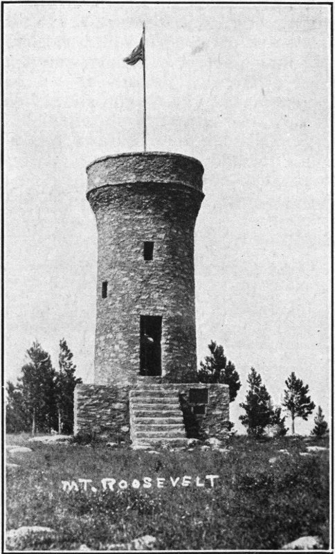
After descending from the cemetery we cross Deadwood Gulch right on main street beside the Franklin hotel. We take a steep street on the opposite (north) side, and follow a winding road up Mt. Roosevelt. The road is steep and precipitous, winding and none too wide, though cars can pass almost any place with a matter of inches to spare. The lower part of the road is good, up to the foot-path. But from there up, if one wishes to go by car the driver requires some skill, a good horn, and well adjusted brakes. With a little patience, and a few hazardous looks down the steep mountain sides we reach the summit. If the foot path is taken the trip is shorter and less hazardous. These mountain paths are excellent for exercise, believe it if you can, or try it.
The view from Mt. Roosevelt is probably as good or better than from any other elevation in the Black Hills. With field glasses on a clear day one may see four states from here. On the topmost peak of the mountain stands a monument, the first ever erected in honor of Theodore Roosevelt. It is, we are told, erected in the environment and among the scenes that Roosevelt loved. Visitors are requested to leave their autographs in a visitor’s book within the tower. One precaution, do not pick a cold cloudy day to visit Mt. Roosevelt.
After the return to Deadwood we must by all means spend some time in this metropolis of the interior of the “Hills.” The gold rush days are not much in evidence. Deadwood is a modern city and a thriving business center. The stores, curio shops, and souvenir sellers invite our curiosity, and are likely to hold us for sometime. The remains of mines, the slag heaps from smelting days, and the open mine shafts are indeed curiosities. While in Deadwood we must not forget the fine municipal bathing pool and park.
Here again we might take the Boulder Canyon road or leave it as an unseen point of interest.
The bed is a welcome place after the mountain climbing. Somehow the meals and rest afterward add to the satisfaction of these invigorating and inspirational tramps.
After three enjoyable nights at Pine Crest we leave for the central part of the Hills. We take S. D. 85 to the left, just before entering Deadwood. The road is an excellent, improved highway, bordered by interesting scenery.
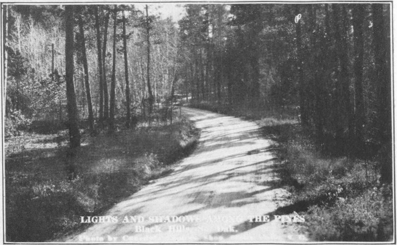
Lights and Shadows Among the PinesCanedy Photo
We start the trip with an upward climb of six and a half miles. This has a tendency somehow to warm up the motor a bit. Now we follow a mountain top trail. The scenery is beautiful as we skim along over good roads with gentle grades. In places the trees are thick, in other places thin. There are pines, cottonwood, aspen, spruce, and others. In places forest fires have left a devastated appearance. These sights 91 leave with one a feeling of sadness, that carelessness and destruction must claim these great potentialities of usefulness and beauty. They leave with us a deeper resolve to “Put out campfires before leaving them.”
It is thirty-one miles to Pactola on Rapid Creek. Just after we cross the creek and before crossing the railroad we turn to the right, following the creek, and drive up to Silver City. As near as we can find out they do not mine silver here. The place is a group of log cabins and is used for a summer resort. It is a beautiful little place.
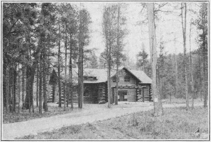
A Log CabinCanedy Photo
Going up the creek we take a winding road, almost a path. Along this road are many church and other camps. We come to Camp Wanzer a few miles beyond Silver City in Bear Canyon.
Camp Wanzer is not a tuberculosis camp. It is a camp for building up physically run-down children. No one with tuberculosis or other communicable disease is admitted. The plan is to have the children live out here away from vices and irregularities of city life, where proper hours, food, exercise and supervision may build up their run-down bodies. The records show remarkable results. Children are required 92 to rise at a certain time, observe exercise periods, rest periods, to eat wholesome meals at regular times and to sleep enough each night. They have a nice swimming hole, too. The children enjoy the vacation. They are kept for three to six weeks, and in practically every case leave there stronger and happier than when they came. A person is highly impressed with what this camp means to these children. There were fifty-five there in 1928. Children come from all parts of the state. Parents pay for it where they can and the Christmas seals sale pays for the rest. After seeing where our Christmas seal proceeds go we are ever so much more willing and even anxious to contribute to the fund.
We again follow a beautiful mountain stream, Spring Creek, through Sheridan and down to Hill City. Along the road we find some real rock cliffs running up several hundred feet and we can here see the plan of the rock layers, thrown in, tilted on edge, the formation which is general throughout the Black Hills. At Sheridan there is a good looking tourist camp, including cabins.
We put up for the night in one of the Hill City cabins. These are not in some ways as nice as some of the others, but are very comfortable nevertheless. We must try the cabins by all means while in the Hills. Most of them cost a dollar a night. In them, generally are a bed or two, a cook stove, table and cooking utensils, with possibly other conveniences including stove wood.
Hill City is in the heart of the Black Hills. It has excellent connections with various cities, fishing grounds and places of scenic interest. Sylvan Lake is nine miles distant, Rapid City 20, Deadwood 40, Custer 15 and the Game Lodge 27. Hill City is only a small place, but it is an “up and coming” progressive little town. They believe in advertising, and a few of its citizens are rather farsighted in their attitude toward visitors. The tourist park is not like some of the rest, but it affords shelter and many conveniences. In a few years it will be coming to the front.
We have not been in Hill City long before the “filling station information bureau” tell us that no trip to the Hills is complete without a visit to the Keystone mines and Rushmore Mountain. So, for them we start. Keystone is about ten miles from Hill City. We leave town at the north end, over the railroad tracks, headed due east. The road is very, very winding. It follows the valley of Battle Creek, going up and down over small hills, tributary springs and streams, and around rocks. It crosses the railroad no less than sixteen times in the ten miles, two times under the track.
Covering the entire road and surface of the hills is a layer of powdered mica. One must pinch himself to see if he is actually living and awake and not riding along over the 94 streets of gold in the hereafter. Maybe some of us had better take a good look, for our streets in the next life may be of coal dust or cinders.
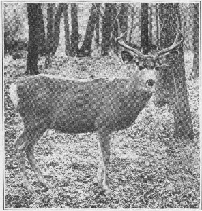
White Tail Buck
We stop along the road to collect a few specimens of the rocks of this vicinity. We hope that we may pick up some rose colored quartz, the rock that is most popular for decorative purposes in the “Hills.” Here an unexpected pleasure awaits us. A young fawn is standing across the ravine watching us innocently. When we discover it we cannot help 95 turning to stare, rapt in wonder. Soon a doe, then another, and behind them two bucks and more emerge from a thicket. One of the bucks raises his front foot and points his muzzle toward us. The whole herd turn and bound gracefully out of sight. It is a scene that will long remain in our memories.
Trout fishing is good in Battle Creek and Slate Creek on the other side of Hill City.
Just before reaching Keystone we turn up a side road to the right. We come to two very impressive log houses. These, we decide, are just the type we would like to build for ourselves. We drive in and ask the man in the yard what a house like that would cost. Imagine our chagrin when he tells us the houses belong to the millionaire owner of the Etta Lithia Mine, one of the larger mines of the Hills. The large house is the house in which the owner lives for two weeks each summer.
It cost $6,000, we are told. On the inside we find all sorts of fishing and other sporting equipment. There is a beautiful hardwood floor in the house, running spring water, soft rain water from a cistern, a fireplace in each room, rustic furniture with bark still on, and even twin beds.
The other cabin is only slightly less in finish and equipment, it being the residence of the manager of the mine. The owner lives in New Jersey. The sight of these is highly inspirational to those who appreciate this sort of life.
Upon invitation of the manager we go up into the hills to the mine. The road is well improved; it must be to carry the great truck loads of ore in all kinds of weather. After a little driving we round a bend in the road and gaze upon a great ridge of white quartz, probably nearly a hundred feet high. As one gazes at it he ponders upon the enormous potential wealth of this heap, if it could be put to use. Rumor tells us that a glass factory for the Black Hills is not out of reason and will probably soon be a reality.
At present this quartz is an undesirable stuff which must be separated from the mineral and piled into great scrap heaps. We climb the slope to the top of the ridge where a tunnel leads to the open cut spodumene mine.
But before going to the top we might look into the opening of the old underground mine.
A narrow gauge railroad runs into the tunnel. A warning is posted against the entrance. A gaze into the tunnel however, makes one think the walls are lined with gold. But on closer examination the gold turns out to be mica in very fine flakes.
On the top of the quartz pile, just outside the top tunnel or the one from the open cut another narrow gauge railroad takes the quartz to the end of the dump pile in small ore cars. Following the short tunnel through a hill we come to the mine proper. It is just a huge hole in the ground, not now worked, from which the ore was taken with dynamite, picks, shovels and derricks. The useful ore, valued at about fifty dollars a ton, stands in the layers of quartz and granite at a tipsy angle, like huge tree trunks of pure white. The sight is really worth seeing. Spodumene is a substance resembling grained rock embedded in quartz and mica but soft enough to be crushed in the hand. It is raised from the cut, emptied into cars and carried through the tunnel where it is dumped into a long chute. When the chute gets filled up, trucks back under the gate at the lower end, fill up with the mineral and take it to the railroad cars at Keystone. From here it is shipped east, where lithium oxide is made of it for storage batteries.
Going from the Etta Mine up, over the next rise, we come to the Juga Feldspar Mine. This, too, is an open cut mine in the top of a mountain.
The feldspar, used for enamel in lining bathtubs and making dishes, is found, mined, loaded and shipped much as is the lithia. Valuable by-products of the mine, mica, tourmaline and lepidolite and others are found in small quantities.
Back through the valley we go and up the opposite slope to a mica mine. This, too, is an open cut, the men working in the shade of a large tarpaulin awning. Slabs of mica varying from small scraps to large sheets are all loaded in the chute, hauled to Keystone and shipped east.
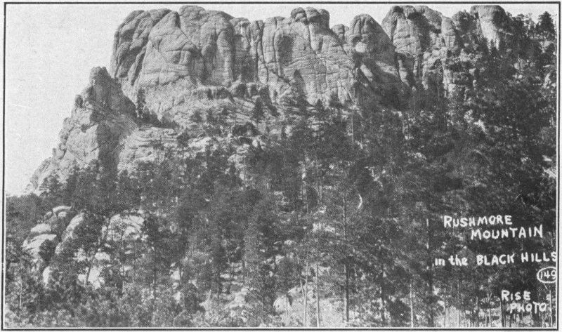
Rushmore Mountain, near Keystone. Upon the abrupt face of this mountain Borglum, the sculptor, is carving the Statues of Washington, Jefferson, Lincoln and RooseveltRise Studio, Rapid City, S. D.
We go down from the mines and take a winding road up to Rushmore Mountain. On the way we try fishing. Here one of the most exasperating experiences of the trip takes place. I peered into the clear stream and spied a beautiful speckled 98 beauty of somewhat larger than average proportion. Carefully I sent a fly up to him, but he was not interested. I tried every fly I had with the same result. Then I sent him a nice, fresh, green grasshopper, then a yellow one. Mr. Trout never batted an eye. I then offered him a frog leg. He only wagged his tail as though amused. The last resort was a nice juicy worm. I trailed it down the stream until it bumped him on the nose. That dumb trout was too lazy to even open his mouth. Possibly I misjudge him. He may have just had lunch, but at any rate he should have shown some interest in an extra bite. Well, I decided that if he was going to have his laugh on me, I’d get even with him.
I took my fishing rod and gave him a real poke in the ribs. I had the satisfaction of seeing him wake up rather hurriedly and disappear upstream.
On the way up to Rushmore we see a large leaning rock with a tree growing out of the top of it. This is only one of the phenomena of the “Hills” that fires the curiosity of the visitor.
The road up to Rushmore is on a mountain facing the one being carved. It is steep and winding. Cars go up several miles, but it is quite a climb. At the top is a long cable over which supplies are transported to the top of Rushmore. The carving is just begun. It has been discontinued for lack of funds, much to the regret of the people of the “Hills” and of South Dakota. If the work is finished it will be a monument of no mean calibre and a shrine for tourists. We did not take the footpath to the top, though such can be done. By climbing the steep precipitous crags facing it one gets a remarkable view of the grand and majestic bald peak.
From Rushmore we go on to Keystone. On the road we see abandoned gold mines and some still running. Within the town we come to the Keystone Consolidated Mines. At present they operate three gold mines with the main mill, the Columbia, the Keystone and the Holy Terror. Two stories are told of the naming of the last. One is that its inaccessibility clear up in the mountain top is responsible. The other is that the discoverer’s wife insisted that he name the mine after her. The miner went to take out his claim and when 99 he returned he answered, to his wife’s insistent queries, “yes, he had named the mine after her,” and he showed her the papers.
Going on through Keystone we stop at a miner’s house, and he shows us many kinds of ore including tin, tourmaline, spodumene, copper, topaz, several kinds of quartz, gold, ruby studded rocks and so on. We cross the creek then and pick up our own specimens of rubies.
Now we go back to Hill City and from there up a long gradual incline into the most noted scenic spot of the Black Hills.
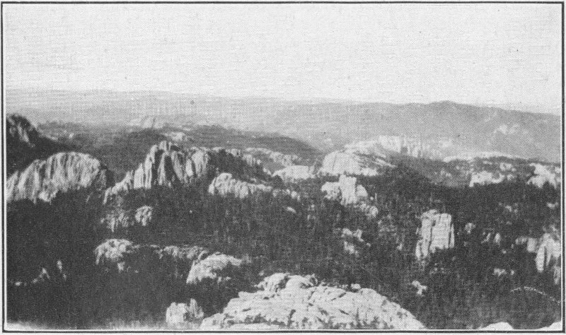
Rugged Formations
The road winds through the needle rocks, amid beautifully vegetated valleys and mountains to Sylvan Lake.
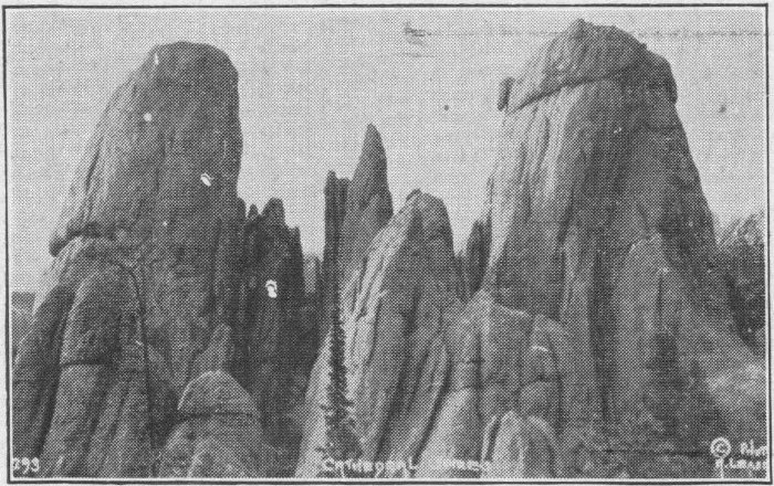
Cathedral Spires. Granite peaks in the Black HillsLease Photo
These roads are the much talked of feats of engineering skill. We can easily see why they are so considered. No barrier, no matter how formidable has proved indominable. In some places the road is merely a shelf on the side of a mountain. The rock is blasted out and the nice wide road, the perfect replica of our modern prairie highways, surfaced, is superimposed upon it. Slopes are gradual, the road wide enough for safety anywhere, and every other means of convenience to motorists has been considered. In one place there are possibly a half dozen switchbacks making it possible for a person to ascend a high mountain by gradual ascent on the shelf-like road, switchback and ascend more, almost straight above the road over which he has just come. You can look over the brink of the chasm and see several laps of the road up which you have come, and can look above and see the shelves built up there, over which you are to go before you reach the top. Marvelous, indeed, are the means that man through the divine guidance of a higher Being, we are forced to believe, has devised for overcoming the seemingly impossible problems. And the view from the road is marvelous. The great majestic stone mountains, the broad, deep, beautiful valleys, the swift tumbling mountains streams, fed by mountain springs, the so-called Needles, and last the sense of conquering all these, affords a feeling almost beyond description to the soul of the traveler.
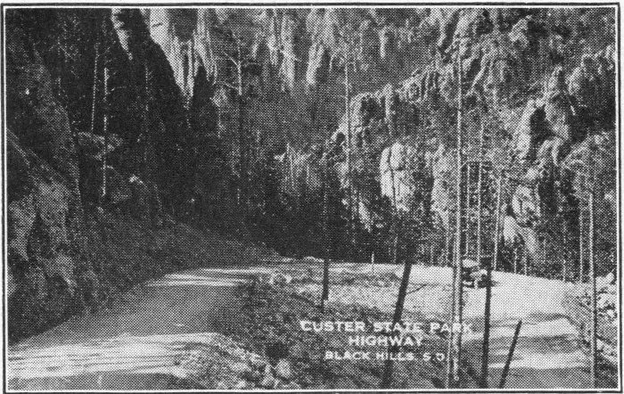
The “Needles Highway” in Custer State Park
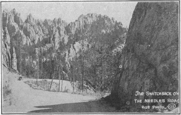
The Switchback on the Needles Road
A highway among the Needles of the Black HillsRise Photo
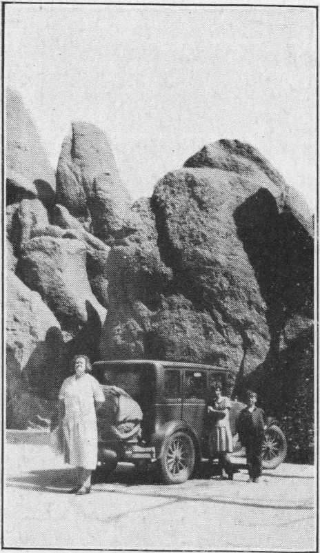
Stop on Needles Highway
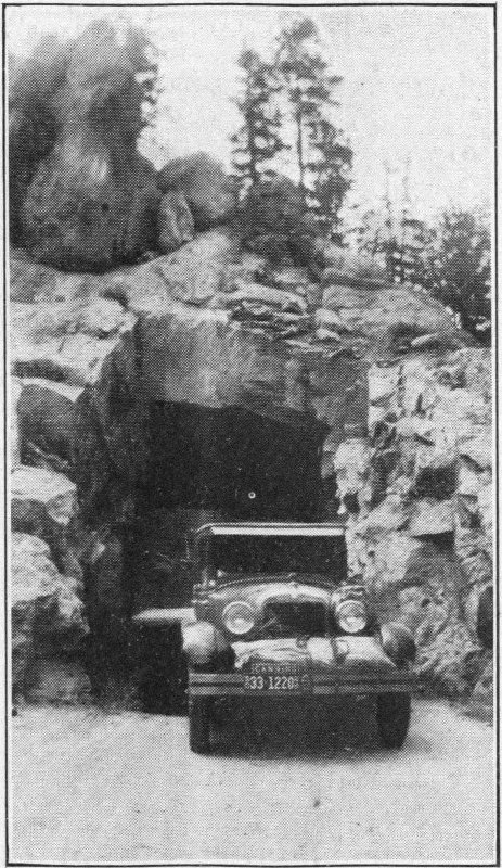
Through Iron Creek Tunnel
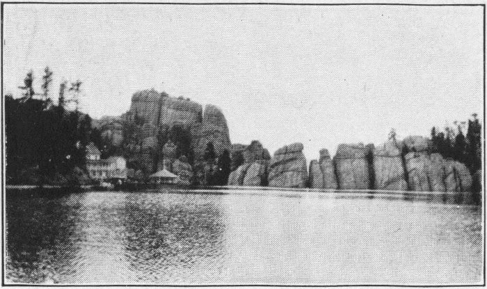
Sylvan Lake, as you round the turn
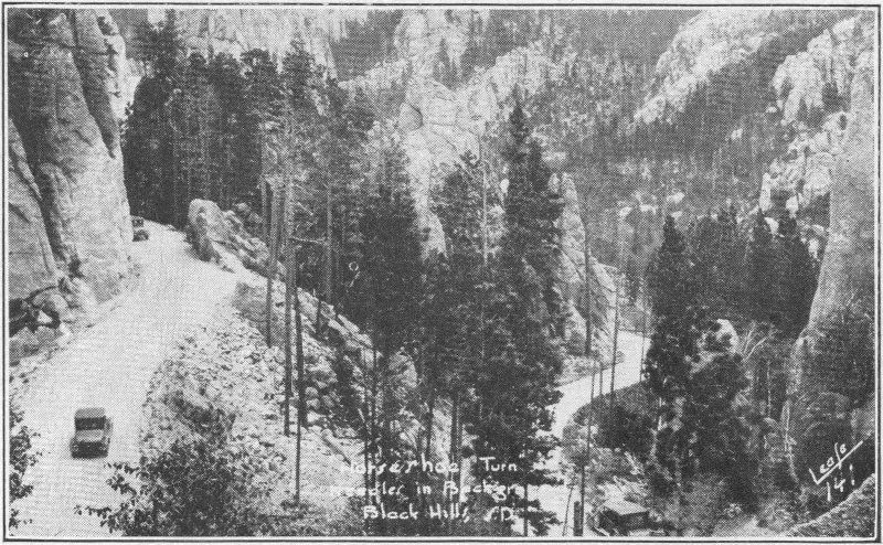
A Horseshoe Turn, Needles RoadLease
We drive down through heavily wooded roads to the lake, the most widely advertised place in the Black Hills. Sylvan Lake is about a half mile in length, located right in the top of the mountains. It owes its size to the fact that its north end is made up of a dam filling the gorge through which the water tumbled in its course from its mountain streams, through Sunday Gulch to Spring Creek.
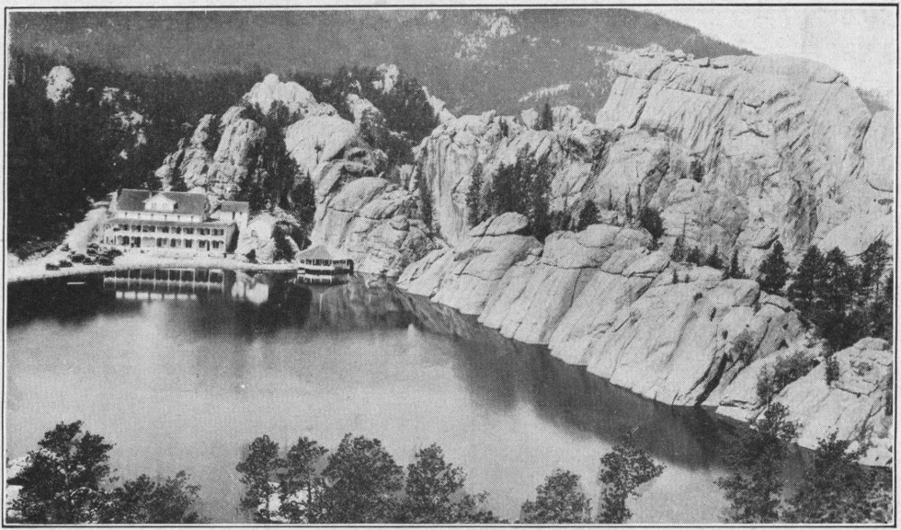
Sylvan Lake, and the Cliffs
The lake is a beautiful one, bounded by tall, cold, gray stones, majestically reaching for the sky, and fringed with luxuriant forest trees. On one side of the lake is the Sylvan Lake Hotel and on the other side is the camp grounds. The Indians have named the lake “Karanip” or “Tear of the Mountain.” We go directly to the camp grounds and get settled for the night. The camp is not overequipped with conveniences, but is nevertheless a good camp, with a little store conveniently close.
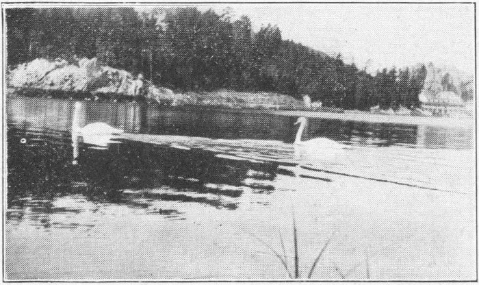
The Swans
We go to bed early so that we may get up early for the ascent of Harney Peak. Even with the early retiring three A. M. comes rather soon. But we are all life as soon as we awaken and we lose no time. Well shod we begin the ascent. This is to be an event. The climb covers three miles and a half. You’ll be ready to agree with me after making it, though these Black Hills people are very generous in the size of their miles. We start up the road marked “Harney Peak.” We could take our car part way, but the short distance and rough road makes this a poor policy.
We soon come to the stables where burros and ponies can be hired by those not wishing to make the trip on foot. These are not for the early or the ambitious. We pass them by.
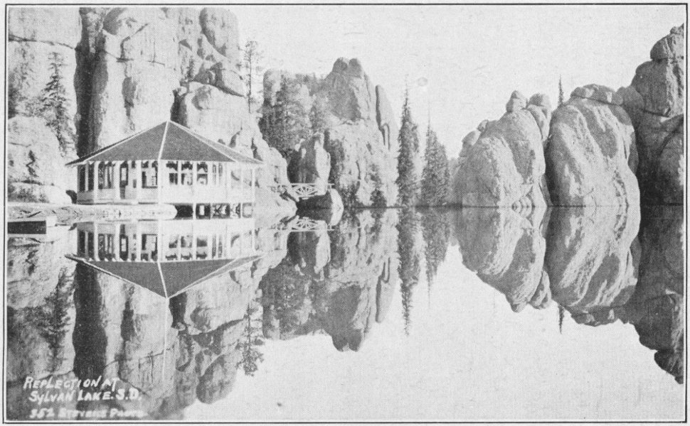
Reflection at Sylvan LakeStevens
The path soon begins to ascend. Progress becomes slower. The perfect road narrows into a footpath cut through the timber.
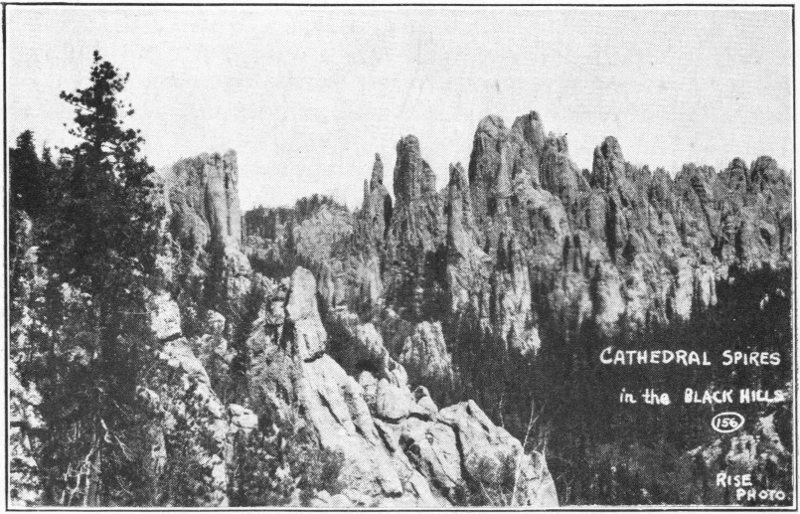
Cathedral Spires, from Harney PeakRise Photo
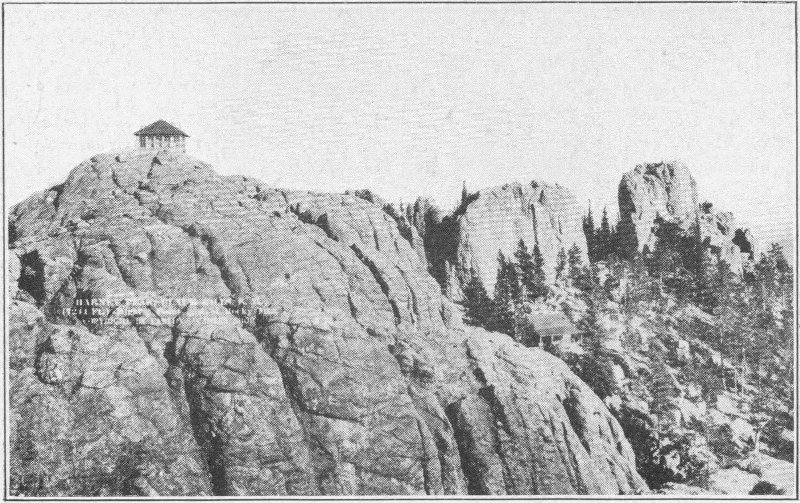
Harney Peak, Lookout Station, and Peak InnCanedy Photo
Up, up we go. At places the timber clears, giving us a grand view of the surrounding country. Then we plunge into the forest again and continue up, up, up. At the end of a mile or so we top a ridge and are relieved to begin descending into a shallow valley. This is a rest and encouraging. At the bottom of the valley is a brooklet of clear spring water. Here we take a drink before continuing our ascent.
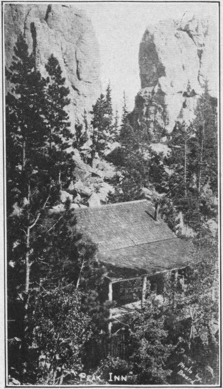
Peak InnBeard Photo
Now we begin a real climb. The path is easy and open and the slope is gradual. But even at that it begins to tax one’s muscles. Squirrels and chipmunks dart across the path and gaze at the intruders from a safe perch in the trees. And some of these trees are giants, probably the largest found in the Hills. Springs arise here and there along the way. Beautiful 109 flowers dot the path. Great gray rocks jut into the air at intervals. The path is indeed interesting. The coolness of the forest adds to its entrancing powers.
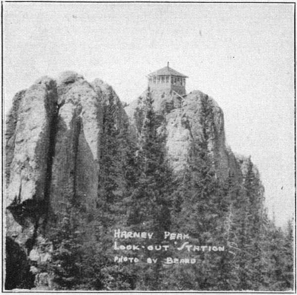
Another View of Harney Peak Look-out Station Photo by Beard
By and by the path grows steeper and we begin to take a switchback course up, up, up. Finally the vegetation thins out and the surface is mostly rock. We climb the rocks and at last emerge at the foot of a ladder leading up the crags where the fire lookout house is located. Up the ladder we go, and over the rocks toward the top. We catch a glimpse of the ranger giving us a dirty look as he hurriedly finishes his breakfast and makes up his bed. We give him plenty of time, while we gaze in four directions at the remarkable panorama extending a hundred miles before us. The sun, which we had expected to see rising, is smiling indulgently at us from far up in the sky. To the west we see Sylvan Hotel, mountains and forests. Turning toward the south we find ourselves looking at the historical Custer and on past into Wyoming. Far, far, to the south is the border of the hills. Closer are the Needles and Cathedral Spires and Mt. Coolidge. On to the east, fifty miles away and more, are the Badlands. Closer Mt. Rushmore sticks up its head as do various other bald heads. Away off to the northeast Bear Butte stands alone and to his left are Roosevelt Peak, Terry Peak and many of our other friends.
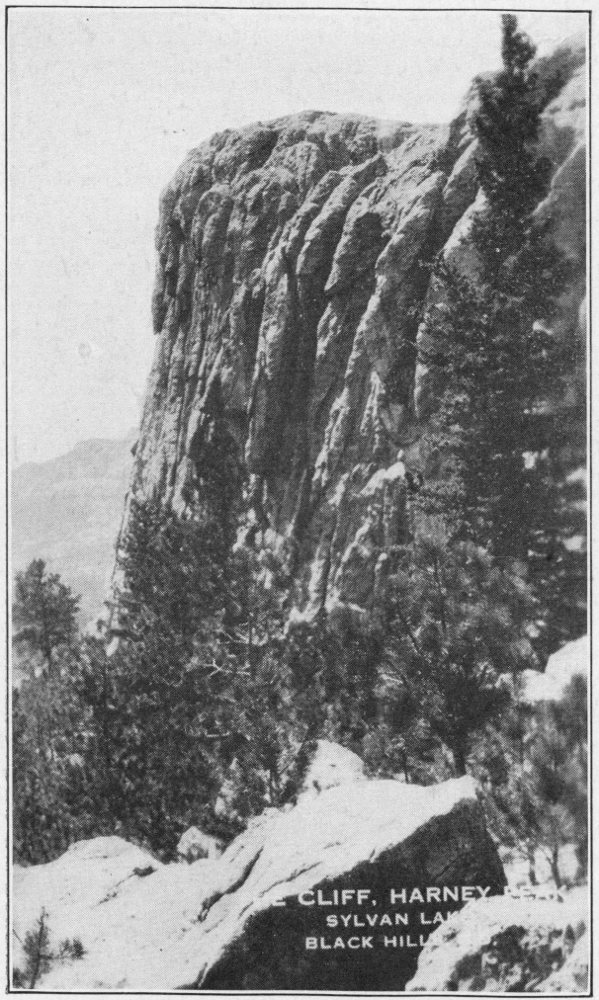
The Cliffs, Below Harney Peak, Sylvan Lake, S.D.
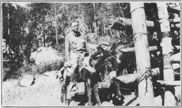
One way of climbing Harney
The view is nothing short of wonderful on a clear day, but is not as good when the clouds float below us or when the air is filled with mist. We go on up to the lookout station and register. Of course, we must ask the ranger our share of foolish questions. We would not be human if we did not display our ignorance up here. We just naturally feel that we must ask some kind of a question to commemorate the fact that we are up here.
We are now on the highest point in the Black Hills. Not only this, it is the highest point in the state and greater still, the highest point in the United States east of the Rocky Mountains. We are 7,244 feet above sea level and about a thousand feet above Sylvan Lake. This little house away up on the top of a rock looks pretty frail beside the boulders upon which it stands. One would think that a breeze would blow it over the precipice hundreds of feet straight down. The house, though, is pretty well established, with heavy steel cables firmly rooting it to its place. Even at that, they’d better not hire a forest ranger up there who walks in his sleep.
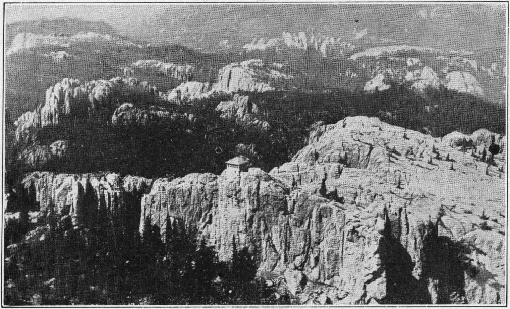
Airplane View of Harney Peak Rise Photo
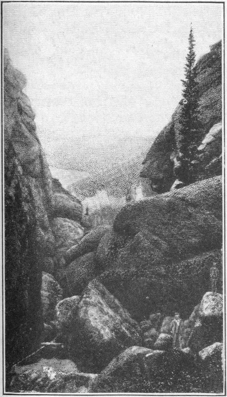
Looking Down the Gorge below Sylvan Lake
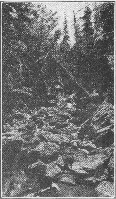
Farther down the Gorge
We are given a card telling us that in the “Harney National Forest 20,000,000 board feet of lumber is harvested annually and through reforestation about 1,587,667,000 board feet are maintained permanently. 12,000 horses and cattle and 4,000 sheep graze on the forest annually. The area (net) 114 is 508,000,057 acres. The annual revenue to the United States is $80,000 and to local counties $20,000. Summer sites may be secured from the Supervisor at Custer, S. D.”
The lookout away up here is for the purpose of spotting forest fires.
In the little house are instruments for seeing and exactly locating fires. By getting the exact angle of fires from two different stations and telephoning the results its location may be determined exactly by drawing a line at these angles from their respective stations. The fire would be where the lines crossed.
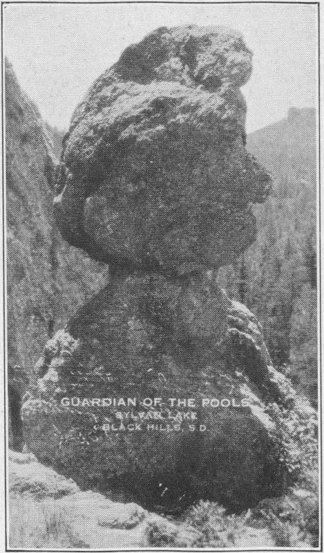
Guardian of the Pools, Sylvan Lake, S.D.

A Canyon in the Black HillsLease
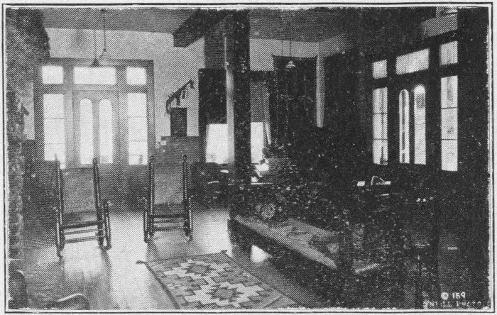
Reception Room, Sylvan LakeO’Neill Photo
Well, we are the first up there this morning and now we prepare to descend. We start down the rocks and meet several people coming up, they, too, thinking they had been first up this morning. We must take a few pictures before going down to convince the folks at home that we’ve climbed Harney.
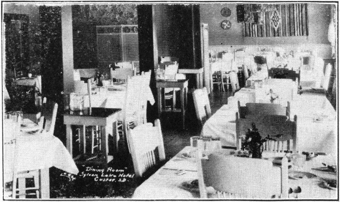
Dining Room, Sylvan Lake Hotel, Custer, S.D.Lease
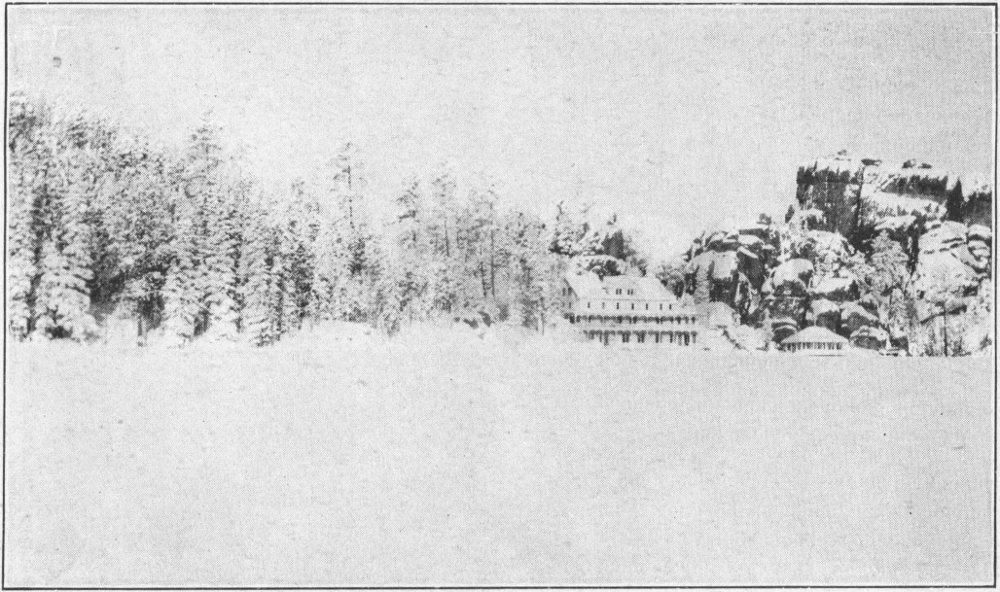
Sylvan Lake in the Winter
Down we go, down the ladder and around the corner to Peak Inn. Here refreshments and souvenirs may be procured. These have all been brought up the mountain by burroes at some little expense. An interesting trip, they tell us, is to make the return trip through Cathedral Spires. We, however, do not do this.
The descent can be made in a little less time than the ascent. Some short cuts can be made directly across where contours and cutbacks had to be made going up. Going down is decidedly easier than going up. All the way down we meet puffing folks; some fat, some tall, some carrying babies, all asking the same question, “How much farther?” Many a good natured joke is exchanged on the way. We meet troopers as well as pedestrians. The former seem about as anxious to reach the top as those walking. Perhaps those experienced in riding burros and trail ponies understand the reason for this.
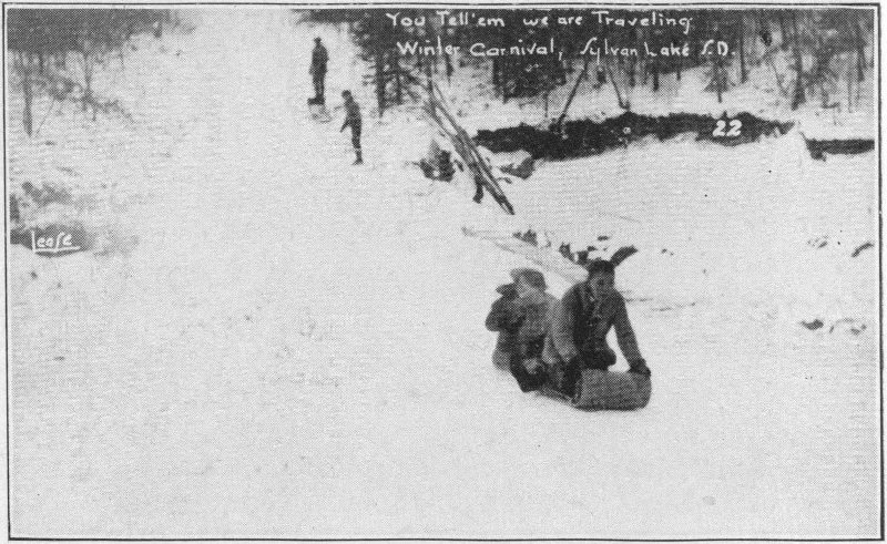
You Tell ’em we are Traveling.
Tobogganing. Winter Carnival, Sylvan Lake, S.D.Lease
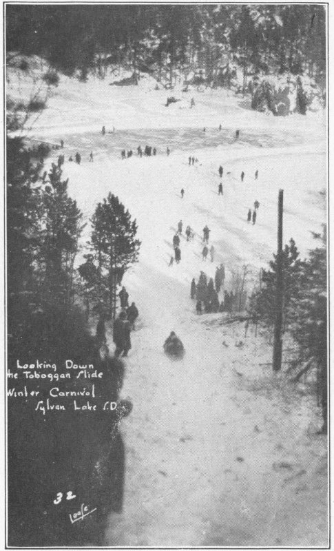
Looking Down the Toboggan Slide
Winter Carnival, Sylvan Lake S.D.Lease
Seven miles, at least, the round trip is quite a hike, but for those who can stand it (and this includes most of us), it is by far the better method of going up. Each one who makes it feels proud of the accomplishment. One boy about seven years of age remarked, “By Gawsh, I didn’t need to make it on any donkey. My own feet are good enough for me.” Well, we finally come to the stables again. We have met possibly fifty people going up and more are just starting. Some burros are all saddled and bridled, sleepily waiting for the start. Temptation prompts us to mount for a picture, even though our friends do insist on asking, “Now which is which?”
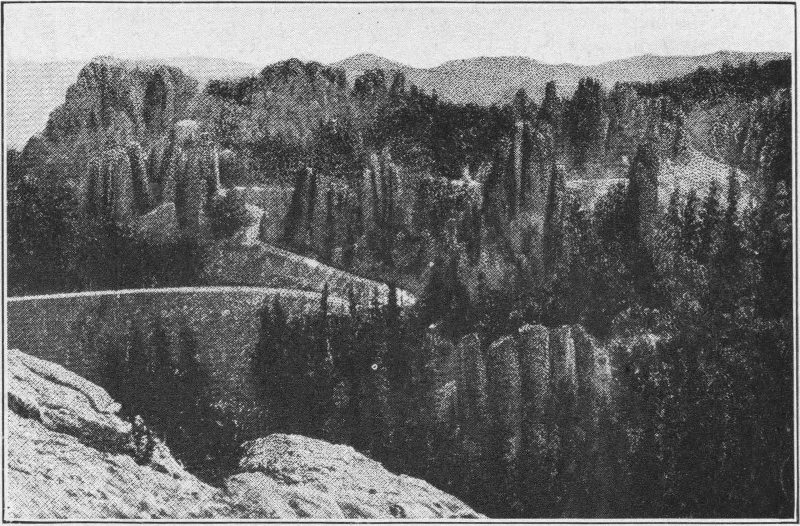
The Needles Highway. This is indeed a feat of engineering
We arrive back in camp about five hours after we had started up. Pancakes, bacon and eggs are awaiting us. The question “are we hungry?” is a mild way of putting it. Food seems to disappear like magic, not just a little but great quantities of it. This little stroll seems to make one ravenously hungry and we derive genuine satisfaction from this meal. Somehow our fatigue seems to be appeased with our hunger.
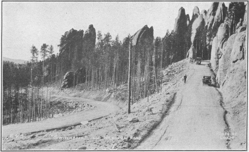
“The Switchback” along the “Needles Highway” in Custer State Park
Now we are ready for an inspection of the lake and its surroundings. The swans are the first things that draw our attention. They are beautiful, floating over the silvery surface.
Many are the fishermen trying for croppies and trout from the edge of the lake. Some have substantial strings of fish, too.

Custer State Park Highway
A typical scene along the Needles Highway
We take our leisurely way around the lake and find dozens of cars before the hotel. We join the group who are inspecting the souvenir shop and the hotel lobby. Both are interesting; both containing many curios from the hills. The hotel is especially interesting, and we must by all means take a meal with its charming host and hostess. We now go back through a slit in a rock to the gorge behind the dam. The first thing we see and hear is the water gurgling out of Gorge Springs and over the dam. From here we pick our way over the great boulders to the precipice where the water tumbles into the narrow gorge. What boy or girl or grownup is not thrilled by the descent, sometimes on foot, sometimes dangling sometimes crawling between huge rocks (the largest in the hills) sometimes leaping chasms, through dark holes around seemingly blind bends, finally emerging on the rocks far below, without having fallen off the rocks or getting our feet wet. Oh boy! it’s certainly great. We are now in the home of the elves. We can follow the stream down, down, until our view opens out far to the north.
We pick our way back and take a new route far up through the crags, towering above Sylvan Lake. Here again we get a marvelous view of the surrounding territory. Reluctantly we descend again, only to climb the crags on the opposite side of the gorge. Down again, we find our muscles getting a trifle fatigued.
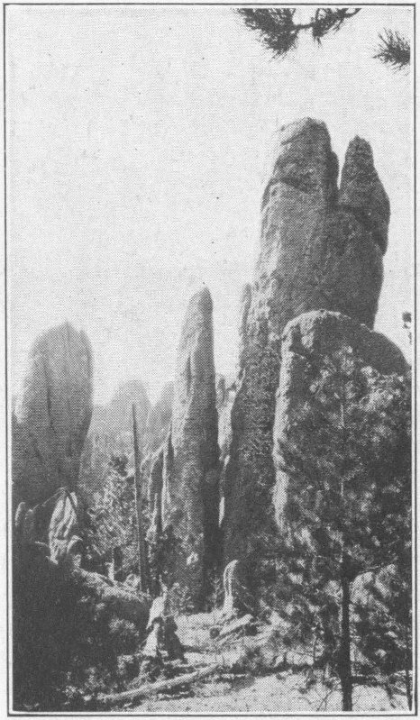
A Needles SceneCanedy Photo
We go back to camp near evening, having eaten lunch in the gorge. Now we get our dinner. Needless to say we are ready for it. We have packed several days’ experiences into a day. And it has been a memorable day. We spend the night and then start over that world’s renowned Needles Highway. The entrance is made through a gigantic gateway of towering rocks. A huge tunnel is blasted through one rock.
We must drive back to the wide ledge and park our car while we gaze over the edge of the precipice and past the great valleys to the high mountains of stone Needles in all directions. The view is indeed one to remember. The feeling of the grandeur of nature that this leaves with us is something that lives with us forever.
We pass on over this remarkable road cut through the mountain tops. The Needles Highway is all it is reputed to be. But one must take it slowly and stop to admire it to fully appreciate it.
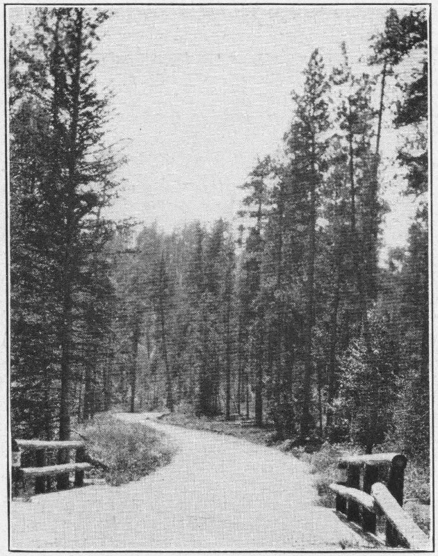
A Pleasant Drive
We go off to the left a few miles to the State Game Lodge. This is the famous Summer White House of President Coolidge. Before we reach it we see a fine group of elk along the road and another of deer. The latter bound gracefully into a thicket when we stop to watch them. Along this road are several tourist camps. Galena and the Game Lodge are the larger ones.
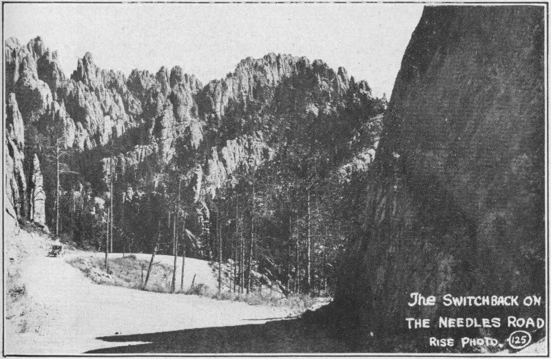
The Switchback on the Needles RoadRise Photo
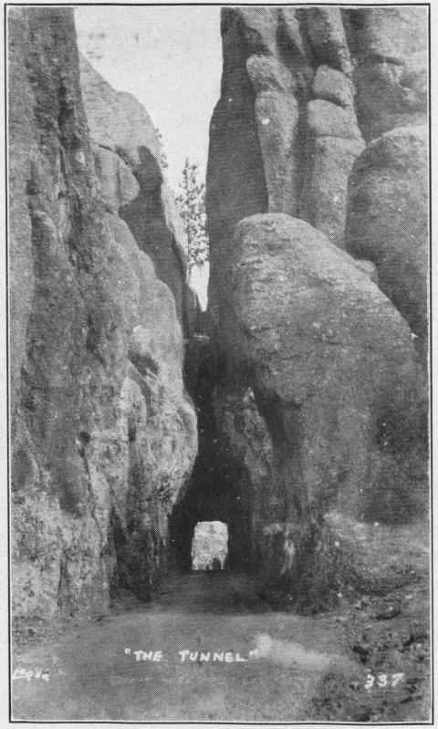
One of the Tunnels
We will leave the game lodge and zoo, however, and take them in our return from Hot Springs. Accordingly we take trail 36 back to Custer, about twenty miles. A few miles before we come to Custer we find a tall stone shaft rising beside the road. A bronze plate attached to it tells us that this is a monument erected to the memory of Mrs. Anna D. Tallent, the first white woman in the Hills. To the right, down a lane a few rods is a reconstructed replica of the old Gordon Stockade. The saplings are driven into the ground, spiked on top, just as the old fort had been. Within the inclosure are a couple of buildings, one where the Tallents lived and one where other folks of the party had lived. French Creek flows just south of the stockade.
Just when gold was discovered in the Hills is a question. Probably it was before 1850, or shortly thereafter. One tale runs that a party of sixteen left the California Trail at Fort Laramie in 1852 because friendly Indians reported gold in the Black Hills.
Restoration of the old Gordon Stockade built to protect the people from the Indians
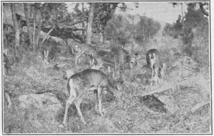
Deer in the Forest Reserve in South Dakota
The men journeyed north, trying several places to mine for gold. They got small quantities until they finally ended up near Deadwood. There the quantity became greater, and the men were elated. Three of the men started back to tell the people at Salt Lake City of their good fortune. The remainder kept on prospecting. One day one of those remaining went out to shoot a deer for meat. Upon his return the camp was in flames and the scalps of his comrades dangled at the ends of poles carried by the Indians. The man made sure that none of the party remained but himself, and he started out for the trail to the south. After terrible hardships, out of matches, with no ammunition left, living off berries and roots, he arrived at the trail too late for the last train of the season. His boots were soleless and his clothing in tatters. He hobbled on, and finally came almost at death’s door to a Mormon hunting party. They brought him slowly back to life and strength and he told them his story.
Record of early gold seekers in Black Hills, 1833-34—forty years before Custer’s expedition to the Hills. Stone found near Spearfish in 1887 and now in possession of State Historical Society, Pierre, South Dakota
The story of Ezra Kind is probably true. His Sandstone Carved with a jack-knife was found hidden among some rocks on Lookout Mountain. Indian traditions bear out the story. Much gold was taken by the Indians when the men were killed.
The Gordon Stockade party, however, was the party that started the rush to the Hills. One of General Custer’s mining engineers Horatio N. Ross found gold along French Creek near the present city of Custer, on July 27, 1874. William T. McKay shares honors with Ross. As soon as Custer’s report came out the government issued orders that no white people would be permitted to enter the Black Hills until a treaty could be made with the Indians, for this was guaranteed a hunting ground for them when the eastern land was wrested from them.
The first cabin built in the Black Hills
Now standing in Custer, S.D.
The Gordon party like many others decided to try to break through the troops and start mining gold. The party consisted of twenty-six men, one woman, and her son. They left Sioux City in October of 1874. They suffered many hardships in the trip, crossing the Badlands, swimming the Cheyenne River, and overcoming innumerable difficulties. They kept ever on, confident that they would all become millionaires 131 as a result of the expedition. They met Indians to whom they had to give much of their food. They finally struck the Hills near Sturgis and from there took General Custer’s trail south to Custer City. They arrived on French Creek December 23, built the stockade, and began panning for gold. They found paying quantities. In the meantime the government troops were trying in vain to follow the complicated trail that the party had purposely planned to lead them astray. A blizzard set in, finally, obliterating the trail. The party got together enough gold and on February 6, 1875 Gordon and one of the other men started for Sioux City with it on horseback. Sioux City went wild upon the arrival of the men with the bag of gold tied on a saddle horn. They immediately sent another expedition to the Hills. This party, however, was taken by government troops and their property was confiscated.
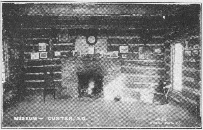
Museum, CusterO’Neill Photo
The Indians reported to the military authorities the presence of the white people in the Hills, and on April 4, 1875, the troops found the settlers, and gave them 24 hours to get ready to leave as prisoners for Fort Laramie, Wyoming.
Three times parts of the expedition tried to escape and go back to the stockade, but each time they were rearrested and brought back. The third time, however, they escaped 132 while being brought back and succeeded in reaching the stockade. Mrs. Tallent, herself, finally, the next year succeeded in returning to Custer, later going to Deadwood and Rapid City. There she became County Superintendent of Schools.
Miners found their way into Custer from all directions in 1875 in spite of the government troops. Mining in the Black Hills had come to stay.
Thus runs the story of the Gordon Stockade and Tallent monument, and their significance in the early life in the Hills. Their principals started Black Hills History.
The expedition camped in a valleyCourtesy of South Dakota Historical Society
We proceed to the municipal camp upon the hill past the town, and there pitch our tent. A storm is brewing. We hurry along, getting dinner over early. Then we go into the fine community building to get acquainted. There we meet a young man who has just graduated from the School of Mines and has accepted a position in the deserts of California where he is to develop certain mineral deposits owned by a large corporation of Oakland.
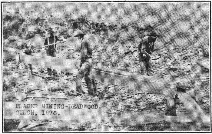
Placer Mining—Deadwood Gulch
Mining gold in the Black Hills in 1876
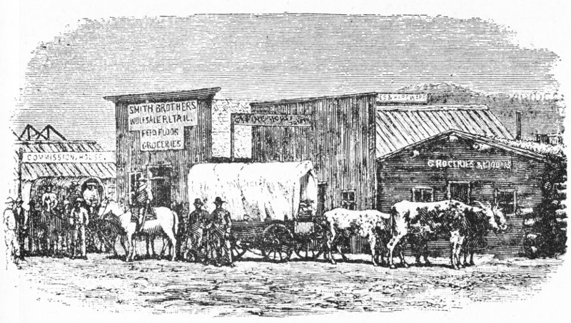
A Custer street in the Early Days
This young man shows us a case containing 205 minerals. They include practically all of the world’s minerals except some of the valuable ones such as diamonds and radium. He proceeds to tell us the story of the formation of the Hills. He tells us that in eons past there was a terrific granite upheaval. The layers were higher than they now are. Gradually they eroded and mineral bearing ores washed down between the crevices of granite. This left the great sloping layers of granite and minerals that we now find.
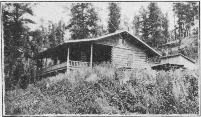
A Typical Log Cabin
After an interesting evening we retire, just before the storm breaks. It rains, while we sleep on.
The next morning having heard that log summer cabins could be built upon land leased from the government, we proceeded to the offices of the Harney National Forest Service Supervisor to learn the details. He tells us that the United States has surveyed sites along several streams, and South Dakota has done the same in the State Park. These sites are in the more desirable parts of the Hills, readily accessible from main roads. The government surveys the land and stakes out a group of plots in a line. These are leased to those desiring summer home sites at ten dollars a year, or fifteen if the site is to be sublet. The forest service marks certain trees which may be cut and used for making log cabins. These trees, used for building are sold to the lessee 135 at 2½ to 3 cents per lineal foot, depending upon the size. Thus a cabin amounts to a comparatively few dollars, and the annual fee is but few more.
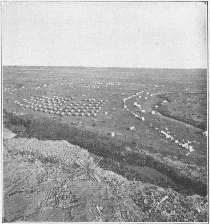
General Custer’s camp in 1874Photo by Illinworth, official photographer on the expeditionCourtesy of South Dakota Historical Society
The supervisor shows us maps which are made of the sites surveyed. Several fine sites are available on Rapid Creek, Spring Creek, French Creek, Battle Creek, Sunday Gulch, Sunday Creek, Chinaman’s Gulch, St. Elmo, and Balser Gulch. They are close to Custer, Hill City, Rapid City, the 136 Game Lodge, and Sylvan Lake. Other sites, he informs us, are available at Spearfish through the Black Hills National Forest Service’s office.
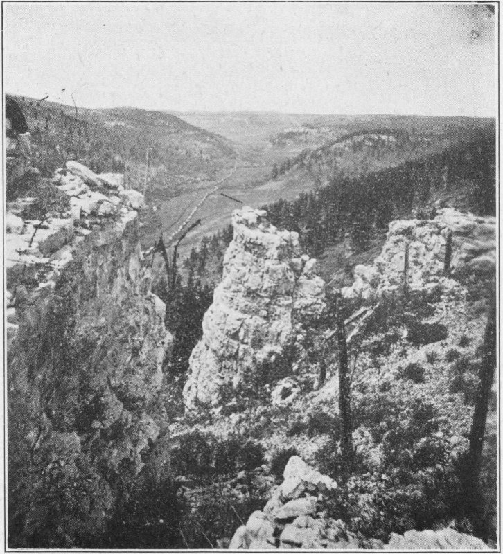
Custer EnrouteCourtesy of South Dakota Historical Society
Cabins have been built on many such sites. They are made of logs interlocked at the corners and chinked with oakum or filled with concrete, reinforced with barbed wire. One cannot help “falling for” them with their rustic construction, beautiful stone fireplaces, and attractive sites. We cannot help determining to come back to build a cabin for summer 137 and for hunting season. Rustic furniture may be built for equipment and other features to suit the fancy of the occupant.
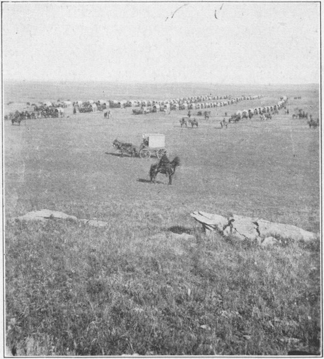
The Expedition in FormationCourtesy of South Dakota Historical Society
We leave the office filled with inspiration and wend our way toward the old museum cabin. On the way we pass a cabin built of Black Hills stone mounted in concrete with a beautiful fireplace of rose quartz, crystals, petrified wood, petrified moss, mica and tourmaline extending clear to the 138 ceiling. The effect is really one of splendor. Within the house are souvenirs of all kinds made of Black Hills stones, set in concrete. The place is one that should not be passed up. The Rose Quartz Soda Fountain is another rare sight. The whole town is filled with these beautiful mounted stones, even to the bridge lamp posts.
We reach the little cabin for which we have started and see the date 1875 on its gable.
Outside the door is a sluice box or pan used in the early days to pan gold. This is quite a curio. The gold, after going through a screen made of copper filled with nail holes, was supposed to stick on the sloping canvas bottom and let the water on through.
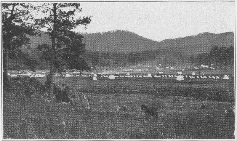
Camp on French CreekCourtesy of South Dakota Historical Society
Within the house is a great collection of early weapons, seats, pictures, an old wooden tombstone, saddles, implements, an ox yoke, rocks, horns, stuffed birds and beasts of that region and on the wall newspaper clippings of the early days. These relics are worth much time and thought. The newspaper clippings are colorful accounts of early shootings, 139 hangings, holdups and gold discoveries. Interesting? Say, just start on them and try to tear yourself away.
A camp sceneCourtesy of South Dakota Historical Society
One placard reads in part as follows: “This cabin, the oldest in the Black Hills, was built by the U. S. troops under General Crook in 1875. Visitors to the Black Hills were not welcomed here in those days. The Indians, who then owned the land, did their best to discourage them from coming and removed the scalps of such of them as fell into their hands 140 to mark their disapproval of their presence here. The U. S. Army, when they caught any gold seekers attempting to enter the Hills, burned their wagons and outfits and escorted them to Fort Laramie as prisoners.
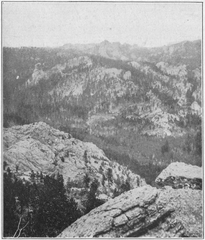
What the Black Hills looked like to Custer’s Expedition
“In spite of all efforts to keep miners from entering the Hills, many, in less than a year from the time that the discovery of gold on French Creek had been made by General 141 Custer’s expedition, had reached Custer city and were busy prospecting the country in all directions.
“Then came General Crook with troops and ordered all the miners who were in the Hills to vacate the country by August 10, 1875. While the troops were here they built this cabin, etc., etc., etc.”
We leave the cabin and saunter over to the gold discovery monument just west of it. This is a beautiful thing of Black Hills rocks and cement, with a bronze plate upon it denoting its significance.
Community Cabin, Custer
North of Main Street is the huge log community house, probably the largest in the Black Hills. It is a gigantic thing and very impressive. We strike camp at noon and leave town by the west road. We are taking 85 to Minnekahta and U. S. 18 from there on to Edgemont. Possibly this is an ill-advised trip, but we make it nevertheless, hoping to see the petrified forest. In this we are not altogether successful.
We pass the state tuberculosis sanitarium composed of many pure white buildings. The place is very impressive, but we do not stop.
Sawdust Pile, Custer
Petrified Log, Edgemont
Our next point of interest is the large sawmill beside the road. The huge blower and sawdust pile seen in the picture give us some idea of its size. The main rip saws are in gangs of three cutting boards one and two inches in thickness. Cross cut blades cut boards into the longest possible sizes. The bark and refuse slabs are fed into the fire to make steam to run the plant. We do not see any fine work or finishing here.
We pass on through Pringle. A short distance from here we find some interesting specimens which look like petrified acorns or small nuts embedded in limestone. But the next is the most peculiar specimen of all. As we cross the railroad well on the way from Pringle to Minnekahta, there stands, west of the track, in a pasture, a peculiar beast. It is made up of a log, with four prongs (branches) resembling legs. Another log is attached for a head and two root systems attached for horns. The result, with the addition of a little paint resembles very much a grotesque elk.
In Edgemont we see huge specimens from the petrified forest, one tree of solid rock weight 14,370 pounds. The specimens are remarkable, but we are not destined to see the petrified forest itself. In Hot Springs later we are to find all the petrified wood we care to carry home, however. We will speed back to Minnekahta and thence over U. S. 18 to Hot Springs.
Gray Rocks, Custer, S. D.

Battle Mountain Sanitarium for Old Soldiers
We arrive in Hot Springs late in the afternoon and look for a cabin for the night. All of them are filled up, so we look for a camp site. Evans Heights is too steep for our heavily loaded car, and we drive down to the Municipal Camp. After pitching camp we attempt to find out what there is in Hot Springs to see. We find that there is much and accordingly lay our plans for a big day.
After breakfast the first thing we do is to cross the railroad track on foot looking for petrified moss and wood. From the stream bed we get several particularly fine specimens of the moss. These we cache while we go into a pasture up the slope across S. D. 79 looking for petrified wood. Our search is soon rewarded. We find many fine specimens and return to camp well loaded with stone. The phenomenon of the mineral water turning vegetation into stone is a peculiar one.
We next take the twelve mile road down past the camp toward Cascade Springs. Ten miles from Hot Springs we come upon what at one time promised to be a fine modern city. Modern buildings were built, including brick business buildings with glass fronts. The hope was that “Cascade” was to be the center of medical baths instead of Hot Springs. At the head of the would-be town is a great warm spring, or we might say a geyser boiling out of a large hole in the ground. The water is highly medicated. Other similar springs are in close proximity.
We take the road on through the town and two miles farther on. We pass through a gate to the right and almost at once hear the rumble of Cascade Falls just below us. We drive over to the brink of the hill, dismount, and descend. A beautiful waterfall is before us. The water falls only about eight or ten feet, but it is impressive in its speed and volume. Vegetation of various kinds, petrified by the minerals in the 146 water or just in the process of petrification fills the channel above. Moss, waving to and fro in the water is like sand when we feel of it. It has a cool clammy mineral feeling rather than the soft sensation we had expected to find in moss. The bank high up, is lined with petrified moss of a coarse texture.
The whirl-pools just below the falls are deep enough for swimming but a few feet farther down the stream is just right for wading. This warm mineral water lives up to its reputation derived through long years as Indian medicine. One just seems to feel that this is something that tones him up ever so much. It reminds one of Ponce De Leon and his Fountain of Youth. Many people are out here today.
Battle Mountain Sanitarium, a National Hospital.
U. S. Veterans Bureau Hospital for Disabled Soldiers and Sailors at Hot SpringsStevens Photo
We decide that no prettier or more inspiring place can be found for our lunch, so we eat in the valley beside the falls. After lunch we inspect the aqueduct, for irrigation, I believe, that crosses just above the falls.
But we must be on our way. Some of us who are not accustomed to it wonder at the composition of the red soil in the Hills region. We see crops, good crops, growing on brick red soil. We can hardly credit our senses, but it must be true.
Back at camp we climb Catholican Hill, just above and to the south of us. From there we get an excellent view of Fall River, Cheyenne River, Harney Peak, The Soldiers Home, The Country Club, the city, and surrounding country.
We drive on into Hot Springs. This is one of the larger cities of the Hills. It is one of the most beautiful, as well. Probably the medicated springs and the hospital service are the things for which the city is best known. Many sick people come here to be cured.
The great Evans Plunge is a large indoor swimming pool. Into it the water at 90 degrees Fahr. pours in great volume. The mineral content makes it pleasant feeling and restful. Hundreds of people swim here daily in the busy season. This is a real swim.
Next we visit Minnekahta Plunge, the old original Indian spring. We are told that each gallon of its water contains approximately 62.55 grains residue consisting of Sodium Sulphate 16.07, Mica 2.46, Potassium Sulphate 16.51, Magnesium Sulphate 4.32, Calcium Sulphate 16.33, Sodium Chloride 13.79. Iron Sesqui oxide Trace.
The temperature is 96 degrees Fahr. This plunge is used as a medical plunge, largely, with tub service as well as the swimming pool. There is a hotel in connection with the baths.
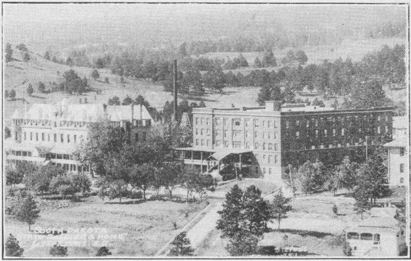
S. D. State Soldier’s HomeStevens
Battle Mountain Sanitarium, a National Hospital For Disabled Soldiers and Sailors, at Hot SpringsStevens Photo
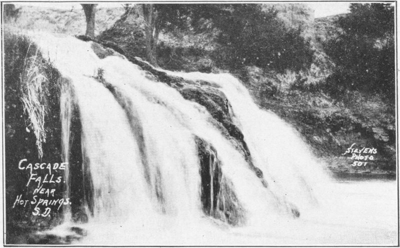
Cascade Falls, near Hot Springs, S.D.Stevens Photo
We spend another night in Hot Springs and leave early the next morning for Wind Cave over S. D. 85. We arrive just in time for the first trip through, register, pay our fee, and start.
Wind Cave is a series of passages under ground formed by the erosive action of water. Not all of the passages have been explored, but three main routes are well marked. Above the ground there is no indication of a cave, nothing but a low broad hill. There is a souvenir shop and refreshment place above the entrance, and government buildings across the road. The cave is a part of the Wind Cave National Park, owned and operated by the United States Government.
Wind Cave National Park, Hot Springs, S.D.
Wind Cave Entrance. We enter through the little building in the foregroundStevens Photo
Tradition tells us that the place was discovered by a cow-boy who was riding by when a strong current of air carried his hat down through a crevice in the earth. We wonder if he ever recovered his hat? Why is it these stories leave out the one question our curiosity prompts us to ask. Possibly his hat, though, was not as important as the discovery of the cave. They are still looking for the other end of that current of air.
Now we are ready to descend. We might profit by putting on clothes that will not be harmed when soiled, tho this is not necessary.
To the right of the entrance is a stone carving of Alvin McDonald, the first guide through the cave. As we enter, with gasoline lanterns, we feel a strong downward draft. This disappears as we proceed. We go down two long flights of stairs to start with. Down, down, down, we go, emerging in the Bridal Chamber, 212 feet below the surface.
Our guide tells us quite confidentially that a certain young lady wished to marry the young man of her choice, but she had promised her mother that she would not marry anyone on the face of the earth. To keep her word and still satisfy her love she was married down here below the face of the earth. When the Government took over the cave, however, they forbade the continuance of this, for it was running matrimony into the ground.
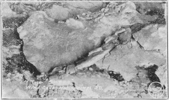
The Sheep, Wind CaveLease Photo
Farther on we see petrified prairie dogs, on a petrified mound. We hope our guide is strictly truthful, tho he tells us that even he cannot vouch for the accuracy of all he tells us. Then comes the Milky Way with petrified stars in a petrified sky, and after this the Snowball Chamber. The Post Office 240 feet down is filled with box work crystals in a sort of cobweb pattern, each box having some depth. We 151 are shown the foreign department and the great Sears Roebuck mail chute. These formations are beautiful and remarkable formations of water, heat, minerals, and natural phenomena.
Room number 23 is Nellie’s room and the Beauty Parlor follows it. Rouge, here is free. The petrified zoo confronts us; very interesting indeed if our imaginations are up to par. The Bleeding Rock is colored with iron oxide giving it a blood color, and sure enough the Liberty Bell is cracked. In the rookery is a petrified bird on a petrified nest (believe it if you can.)
Wind Cave
Frost Work, Garden of EdenLease Photo
Again, quite confidentially the guide tells us that one guide went over lovers leap the day before and six old maids followed. After the petrified whirlwind, imagine it, we see a map of South America, and then enter Opera Hall. From it we pass to Grant’s tomb on the Hudson and be hanged if there isn’t an Alligator going up to see it.
The Devil’s Lookout is 80 feet high, with his Dinner Gong close by. The Furnace Room, Hen and Chickens, Hanging Bridge and Bridal Veil Falls are very realistic. Sure enough, there sits a water spaniel dog begging for—daylight. Now we see some Swiss scenery, a mountain goat, cheese, bread and beer. Only the beer is not there, it was drunk by the last party through.
We next come to the Methodist Episcopal Church. It is the custom to bow as you enter the low door and also bow going out. We are especially requested not to spit on the altar. Bishop Fowler’s Cathedral is 190 feet across.
We can just see the appetizing popcorn in Popcorn Alley, and then we pass on to the Hanging Rock. We carefully avoid going beneath it. Three hundred feet down and half a mile in we come to Odd Fellow’s Hall. There is the all-seeing eye and the three links—Friendship, Love, and Truth, with the third slightly stretched. There also is the road to Jericho and the Goat.
We pass Samson’s Palace, The Queen’s Drawing Room, Capitol Hall, and Turtle Pass. Here the trail divides, the short route going to the Garden of Eden, the medium route to the Fair Grounds, and the long route to the Pearly Gates. We take the medium.
In order we pass Scalping Grounds, Masonic Temple, Elks Room, with an elk head within and an American Eagle alighting on a rock, then the Grand Canyon with its great clefts hundreds of feet underground.
Monte Cristo Palace is 390 feet down. Old Maid’s Glasses follows and Dog Tooth, made of five points spar crystals. McKinley’s memorial is next, and then Assembly Hall. Here, again is much artistic boxwork formation. Next is A. O. U. W. Hall. In it is a stone book which, our guide tells us, is 153 the only Natural History of Wind Cave. From here we go to the Giant’s Punch Bowl and on to Johnston’s Camp Grounds.
In the Bachelor’s apartments everything is upside down and all dusty. In his cupboard is a loaf of bread with a mouse gnawing at it. This leads us at last to the ticket office to the Fair Grounds. The Fair Grounds is a beautiful large room with a white ceiling, the whole covering about three acres. The first attraction is the South Dakota Teacher’s School Room with its calcite crystal wall. The Elephant’s Foot has fallen through the ceiling farther on. Then come S. D. Federation of Women’s Clubs Room, Ice Gorge, and The Northwestern Hotel Men’s assembly chamber. In the Farm Yard are a guinea hen, a little red rooster, a polar bear, the little red hen drinking, a guinea pig, a rabbit and a hen fighting, and a donkey. Last comes the jaw bone of a monster.
In the Meat Market hangs a ham, a goose, and some beef. Over high steps and under a low ceiling we pass into the Coliseum. The seats are of white rock. In Rambler’s Hall is a knife through the ceiling. Next are the Catacombs. Here we go down a rocky precipitous descent. Last comes the Elk’s Room, and then the return to the entrance. Everything we have seen is made of rock and our imagination.
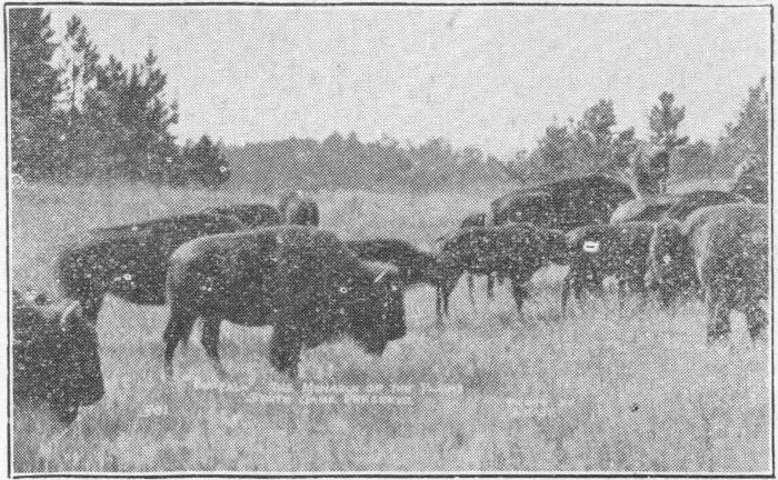
“Buffalo,” the Monarch of the Plains
Bison in the State Park
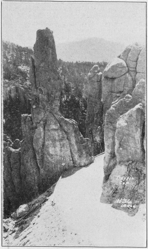
Traffic Cop, on a turn in the roadLease
This has been an eventful trip.
We drive on north over 85 and 81 to the South Dakota State Game Preserve. Here we see elk, deer, and buffalo. 155 On the way we find some specimens of rose quartz. At the Game Lodge we stop to see the zoo. In it are deer, mountain sheep, coyotes, foxes, bears, eagles, owls, badgers, raccoons, porcupines, bobcats, prairie dogs, spotted rabbits, and elk, all alive. These are particularly interesting to lovers of animals.
Bear in the Zoo
In the Zoo
The Game Lodge Hotel, which is the structure used by President Coolidge as the Summer White House of 1927, is a large well furnished affair, not altogether unsuited to the purpose for which it was used. Now, in the reception room 156 on opposite sides of the comfortable fireplace are large oil paintings of President Coolidge and Grace Coolidge. Here this first lady of the land and her distinguished husband will, in the spirit of the paintings, receive guests in behalf of the nation and the State of South Dakota for years to come. Elk and deer heads also adorn the walls, while huge fur rugs cover the floor. Great leather rocking chairs and davenports add to the comforts of the room.
The State Game Lodge in Custer State ParkRise Photo
So popular is the Game Lodge as a summer resort hotel that any one wishing to secure a room here must do so several days or weeks in advance. During the various hunting and fishing seasons of the year this place is frequented by hunters from many other states of the Union as well as South Dakota.
Special hunting licenses may be procured providing lodging here during the hunt.
We, at last, must tear away our mooring to the Hills and head for home. We still have a few things to see, but we have the feeling that it is all over, and the total addition to our beings has been tremendous, too great for measurement, and as time rolls by it grows still greater.
We miss one of the interesting spots of the Hills, Buffalo Gap. In Calico Canyon three miles west of town are located 157 the most beautiful colored sandstone in the Hills and a great natural bridge of rock.
Natural Bridge at Buffalo Gap
At Hermosa is a neat little tourist park, but we cannot partake of it. In Hermosa also we see the church which won so much publicity during President Coolidge’s stay. Its picture does it justice. Hermosa Crystal Cave is ten miles west of Hermosa. At last, we speed back to Rapid City. Hidden City is on the way. This is the probable vestiges of what was once an ancient building or buildings. We spend another night in that inviting municipal park; and reluctantly 158 with many a backward look, we head for home. Long after we leave the Hills we can look back and see those hazy black peaks rearing their majestic tops to the clouds. We can’t help recalling Morse’s old phrase, “What hath God wrought.” He indeed develops wonders here on earth at his almighty command.
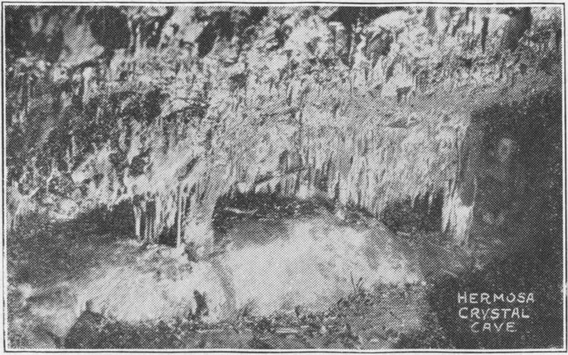
Hermosa Crystal Cave
We have been pretty much concerned about the sights, now we look around and see what our car looks like. The food is gone. The containers now house quartz, mica, granite, tourmaline, lithia, copper, gold ore, pictures, pine cones, and various other souvenirs. The car glides swiftly over the excellent roads, but nevertheless we feel it is heavily loaded. We weigh the car, and consternation; it weighs 4,285 pounds, or 1500 pounds more than it does empty. We may as well look at the speedometer too. It was 12,114 and now it is 13,584. We have gone 1470 miles. 250 of these might be subtracted as our trip inland from Pierre.
We have had our vacation, and now we go home to ponder. It has been a glorious trip.
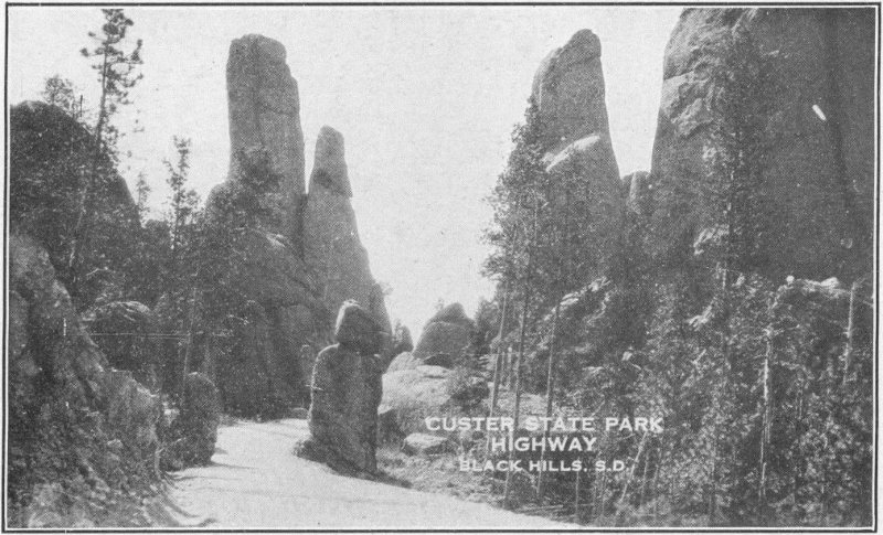
CUSTER STATE PARK HIGHWAY
BLACK HILLS, S.D.
Moonlight on the Missouri
Pierre, S.D.Miller Foto 39
The following are some of the more important peaks of the Black Hills.
| Mountain | Where located | Height, ft. |
|---|---|---|
| Battle Mountain | Hot Springs | 4431 |
| Bear Butte | Sturgis | 4422 |
| Crook’s Tower | Rochford | 7140 |
| Crow Peak | Spearfish | 5787 |
| Custer Peak | Deadwood-Pactola | 6794 |
| Deer Sars | 3500 | |
| Devil’s Tower | Sundance, Wyo. | 5117 |
| Flag Mountain | 6900 | |
| Harney Peak | Hill City-Custer | 7244 |
| Lookout Peak | Spearfish | 4485 |
| Missouri Buttes | 5372 | |
| Mt. Coolidge | Custer | 6000 |
| Mt. Pisgah | 6400 | |
| Ragged Top | 6207 | |
| Roosevelt Mountain | Deadwood | 5676 |
| Sheep Mountain | In Badlands | 3500 |
| Terry Peak | Lead | 7070 |
| Tow Top | 3732 | |
| White Rocks | Deadwood | 5286 |
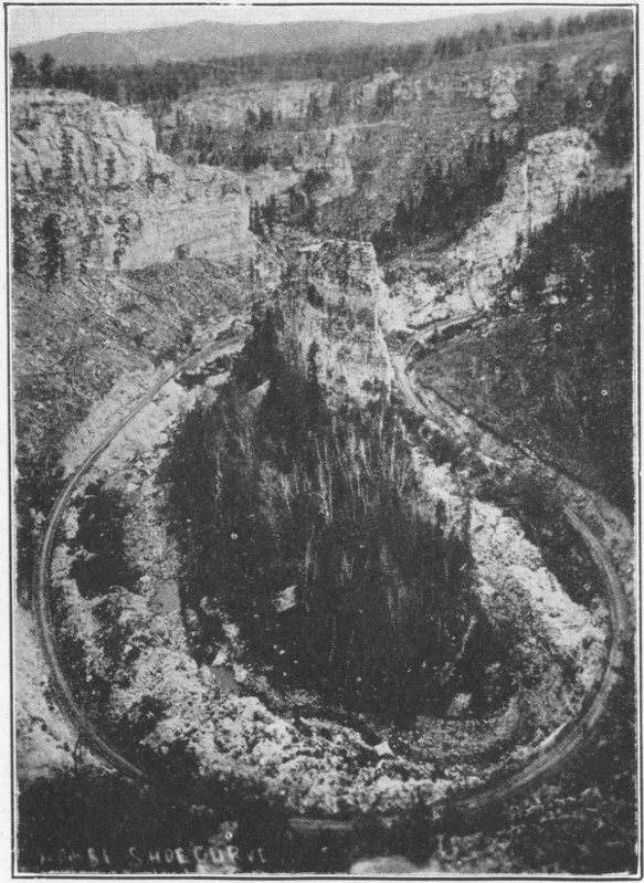
Large Horseshoe Curve, a long way around to get a short distance ahead
| Belle Fourche | 3011 |
| Buffalo Gap | 3258 |
| Camp Crook | 3200 |
| Cascade | 3406 |
| Crystal Cave | 4242 |
| Custer | 5301 |
| Deadwood | 4543 |
| Deerfield | 5900 |
| Edgemont | 3449 |
| Fairburn | 3310 |
| Ft. Meade | 3300 |
| Galena | 4832 |
| Hermosa | 3300 |
| Hill City | 4976 |
| Hot Springs | 3443 |
| Interior | 2381 |
| Jewel Cave | 5090 |
| Keystone | 4340 |
| Lead | 5119 |
| Minnekahta | 4159 |
| Mystic | 4835 |
| Pactola | 4459 |
| Philip | 2159 |
| Piedmont | 3463 |
| Pine Ridge | 3250 |
| Pringle | 4879 |
| Rapid City | 3229 |
| Rockford | 5299 |
| Savoy | 4956 |
| Scenic | 3812 |
| Silver City | 4592 |
| Spearfish | 3637 |
| State Game Lodge | 4400 |
| Sturgis | 3452 |
| Sylvan Lake | 6250 |
| Terry | 6165 |
| Wall | 2813 |
| Whitewood | 3644 |
| Wind Cave | 4100 |
| Pierre | 1457 |
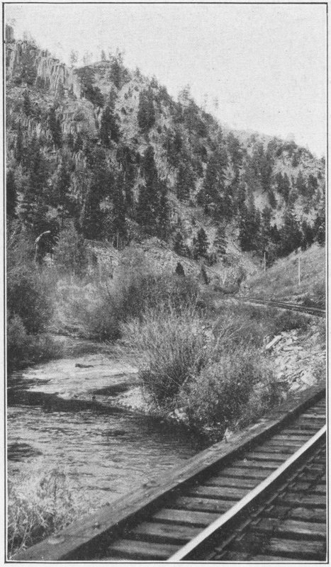
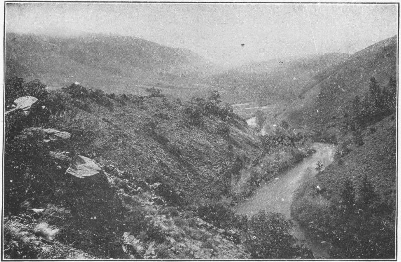
Originally there were no trout in the Black Hills. Now nearly every stream in the Hills is stocked with trout. The U. S. hatchery at Spearfish and the S. D. hatchery at Rapid City keep the streams well supplied. Approximately two million trout are thus put out each year. They are chiefly of four varieties: Loch Leven, Black spotted, Brook, and Rainbow. During our visit to the Hills we see fishermen practically in every part of every stream from the interior of the tourist camps to the headwaters in almost jungles. They use anything from the bargain one dollar complete angling outfit to the best outfit made. For bait they use anything from worms to flies. The local fishermen are better authorities on the subject than the author. However, many fine specimens are seen, and many large messes of trout are taken by all types of fishermen.
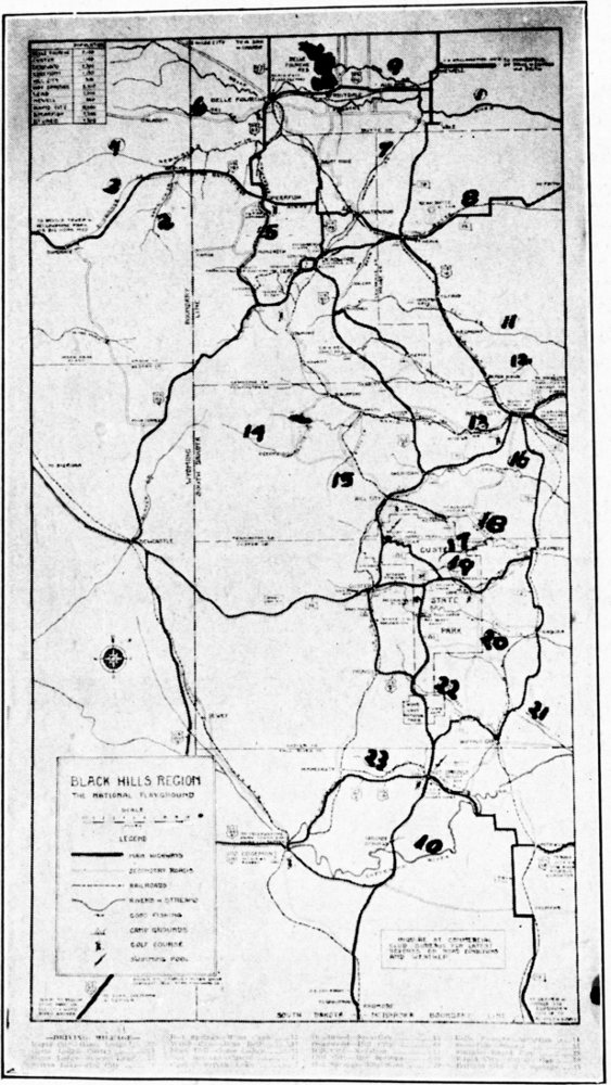
Black Hills Streams—See Page 169
Some of the more important streams of the Black Hills are:
Eventually these empty into the Cheyenne River.
Below these come the tributaries of the:
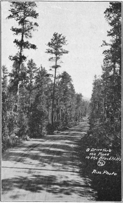
A drive through the pines in the Black Hills (76)Rise Photo
The camps themselves have been taken up to some extent in the body of this book. In 1928 the camps in Rapid City and the northern cities far surpassed those of the southern towns. But the people all over the Hills, especially in the larger cities are fast awakening to the realization that good parks play a tremendous part in the development of their localities. Spearfish, Sturgis, Rapid City, and Deadwood were the first to realize the value of service to their visitors. They have doubtlessly reaped rich reward for their investment, judging from the number of people who use those camp sites night after night.
The cost of the camps is generally fifty cents per car each night. This pays for the site, police protection, lights, in some places shower baths, swimming, laundry, toilets, pure water, firewood, reading room, community cabin, piano, and any other services the locality might afford; especially vegetable, milk, and grocery sales. Some of the camps are almost wonders in themselves.
For those who prefer cabins most of the camps have small log, wood, or tent cabins, variously furnished, accommodating from two to six people or more. These rent at a dollar plus the car fee of fifty cents to a little more for the larger ones. The added convenience of this method of camping is considerable.
Some of the high spots of a life-time occur in our meeting tourists from all parts of the state, nation, and world in these parks. These people range all the way from sheep herders to aviators and from students to corporatic magnates. They are all bent on the same quest, enjoyment of nature’s wonders; and all are congenial. All are as one great family, swapping yarns and experiences and discussing everything from the diet of fishworms to managing an oil company.
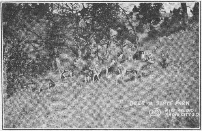
Deer in the Custer State ParkRise Photo, Rapid City, S.D.
A Log Cabin With Fire Place
Hotel rates are reasonable in the Hills, for those who prefer the best of conveniences rather than a complete outdoor vacation. Bus lines and train service from these afford excellent sight-seeing facilities. However, for some of us who enjoy freedom and independence the conventional tour seems to savor too much of routine. We lose some of the great pleasure of conquest and discovery of unusual and inaccessible places. And the privacy of our party, our own division of our time for the things that we personally are interested in, are features that make or break the success of the trip.
When one is on a vacation he likes to plan his trip so as best to satisfy his interests and humors. This can best be accomplished when he is his own boss and can give as much or as little time as he wishes to each place of interest. The scheduled tours are excellent, but if a person wishes to spend more time at the mines, in the Needles, seeing hydro-electric plants, or inspecting factories or mills he had best plan his own tour.
The cost of the trip is not excessive if carefully planned. The food is of course an item. Gasoline is another. Camp fees are small. The rest is more or less a matter of individual taste.
The question of camping equipment and clothing is not the easiest one with which we must wrestle.
First, possibly comes the food question. We might profit by carrying meat, butter, vegetables, salt, sugar, flour, pepper, and lard from home or bought in quantity at some point on the way, if we have a way to keep them from the effects of the sun. Carrots, potatoes, milk, lettuce, radishes, bread, fruit, canned goods, coffee, and groceries in general can be bought in or near most of the camps at the prices about the same as the home grocer charges. Carrying too much loads down the car excessively.
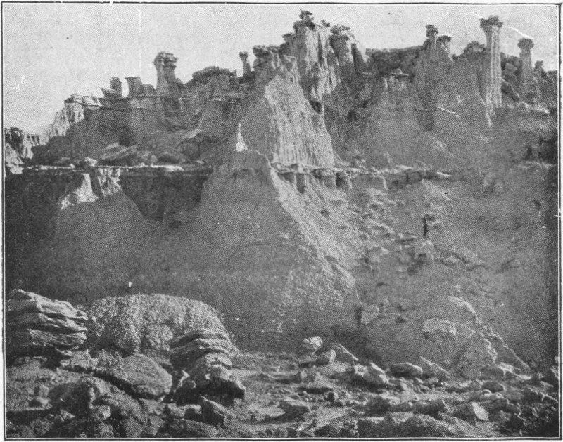
Head of Cottonwood Draw, in center of the “Bad Lands.” Layers of Sandstone in Clay Beds. The sandstone protects the clay from weathering and wearing away. The isolated caps are called “Ostrich Heads.”
Camping equipment is an enigma. A light tent, heavy enough to shed rain, large enough to accommodate all, and not having unwieldy poles, is the first essential; unless cabins, when accessible, or hotels are to be used. Second, enough cots should be provided to accommodate all. Car cushions and car beds are sometimes desirable. Probably the best is the small steel folding double camp bed with springs and a thin mattress. But these must be strong and not easily bent. Probably the greatest mistake of campers is to try to sleep with plenty of covering but not enough under them. Especially with the canvas cots the conduction of the cold air from below is considerable. Three woolen blankets or two and a pair of sheets and a mattress will keep two people comfortably warm under ordinary circumstances though some people prefer an extra blanket. High altitude makes the temperature drop perceptibly.
For clothing, khaki, whipcord, or corduroy breeches and high laced leather boots are the ideal, both for men and women for mountain climbing or rambling around through mines, forests, etc. They can be cleaned and they stand rough wear. They look well also. Have a good sunshade hat and khaki shirts; light colored ones or woolen ones are all good. (I prefer the wool, even in the hottest weather, because of its safeguard from cold.) Wear light underclothing of course. By all means have two sets of this type of clothing if the stay is prolonged, as laundry facilities are not always available. Two pairs of hose, well pulled up, are best, as they do not permit chafing of the feet and they protect the feet against bad results of sweat.
If at all possible to carry one without undue wrinkling, a good suit is desirable. There are occasions when one wishes to go to church, or to various other gatherings, dances or the like where a camping outfit is hardly proper.
The car will appreciate having the load well balanced. If a heavy trunk is suspended behind, the tent and cots had better be suspended above the front bumper to balance it. Cover all equipment from dust and rain. Do not pile up equipment in front of the radiator, in the uphill grades the engine will need all the air it can get. Do not barricade any of the car doors; you’ll be sorry if you do. It is best to supply a place for souvenirs. Very few people go out without loading up with “junk” of one sort or another before returning. (Our specialty was several hundred pounds of rocks and minerals.)
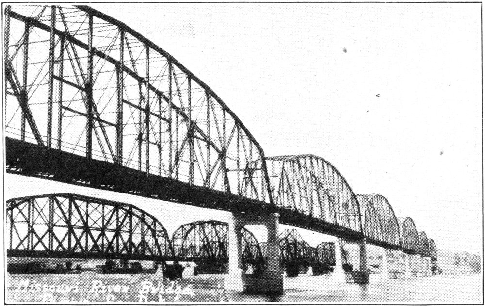
Railroad and Wagon Bridge over the Missouri between Pierre and Ft. PierreMiller Photo
Other desirable items of equipment are:
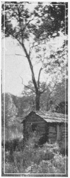
Since the body of this book has been written several new developments have come up which should be mentioned.
The United States Government has made an appropriation for the continuation of the carving on Rushmore Mountain. This work is going forward now at maximum speed. The form of the first figure is taking shape, and indications are that the work will go forward to rapid completion. When these figures are finished Rushmore will be one of the masterpieces of sculpturing of the world.
At the present time the roads to Rushmore are in very bad shape. Indications are, however, that a graded, surfaced highway will soon lead up to the mountain, the state and the local counties are putting forth every effort to improve the main roads and to make new roads where such are needed. In the not far remote future many of the scenic places not now readily accessible will be opened up to Black Hills visitors.
The South Dakota Department of Agriculture, the Black Hills Commercial Clubs, and various other organizations are calling attention to mining possibilities in the “Hills.” Many organizations from within the state and from outside the state are inquiring into these projects, and many mining leases are being let. Some of the newer developments are aluminum, onyx and glass.
Probably in the near future the Black Hills will have far greater commercial importance than they at present have.
The United States Government has also made a national park out of the Bad Lands. This means that many of the places that were not well known before will be brought to the sightseeing world. It also means that some of the heretofore bad roads will be surfaced, so the Bad Lands will not necessarily have to be left out because of rain. The Bad Lands is a truly remarkable sight, and should not be passed up by visitors to the “Hills.” The added mileage is not great, but the added experience gained through seeing them is enormous.
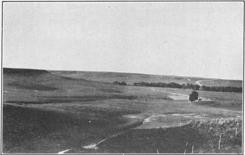
A typical scene, showing a valley flanked by hills, with prairie beyond, along a creek in Haakon County
Many of the scenic spots in Rapid Canyon and Spearfish Canyon have not been taken up in this volume. Either of these places afford many beautiful sights, especially the latter. The Spearfish Canyon leads clear up to Lead. On the way are many summer camps or taverns. There are many side canyons leading off the main Spearfish Canyon, each of which is in itself worth ascending. The best known of these is Little Spearfish Canyon. All through the Hills these beautiful but not well known canyons and gulches may be found.
The pools below Sylvan Lake is a place that should be visited, either by descent from the roadside marker, north of the lake, or by the path down from Sylvan Lake.
One place of interest not before mentioned is the beautiful “Pheasant Dining Room” at the Game Lodge. In it, just below the ceiling, are thirty-three pheasants, mounted in various positions, standing, flying, and alighting.
The Belle Fourche Roundup has been taken up in some detail. Other events of the summer season are not wanting. Rapid City has its Council of American Indians, Custer its Gold Discovery Day, Deadwood its Days of ’76, Interior its Roundup, and so on. All of these affairs are worth attending. They are first class, demonstrations of the things they convey, and there is a liberal education in them for the person uninformed in their field of thought.
Sometimes requests are made for lists of things to see on one or two days trips out of Rapid City. Following are four possible trips, calling for one or two days or even a week each:
1. First, the Rapid Canyon trip.
See the School of Mines Museum at the Eastern entrance to the city. From there go through the city past the “Old Mill Tea Room.” Take the Cement plant road from the Bacon camp. After seeing the cement plant return, and turn south at Bacon Camp. Take the road to Municipal Camp. Go through the Municipal Camp, and if possible, take a swim in the pool, over the ridge from the first row of cabins. You’ll remember that swim.
From Municipal Camp take the canyon road to the left of the camp gate. From here ascend the canyon to Lockhart’s Inn. Here, if such is desired, see Lockhart’s moss sculpturing. Go on foot up the track to the Dark Canyon trail. This leads for several miles around crags, up Dark canyon, to Victoria Falls. Go up as far as you wish. Return to Rapid City.
2. Northern Hills.
Take in any of the Rapid City sights before mentioned. Take U. S. 16 west, then north to Crystal Cave. Plan on a half day for this. Then continue north to Sturgis. There see Bear Butte. Climb it, if you feel ambitious. See the United States Military Post, Fort Meade, east of town on S. D. 24. Return, and either take Boulder Canyon, S. D. 24, or U. S. 16 to Spearfish. See the Municipal Camp and United States trout hatchery southwest of town, and possibly the teachers college north of the city. Take a trip up the canyon, at least to Bridal Veil Falls. Stop at Wildcat Cave on the way if you have time. Return to Spearfish, and take U. S. 85 north to Belle Fourche. There see the sugar plant and Orman Dam. Return to Spearfish and on U. S. 16 to U. S. 85 which takes you to Deadwood. See Preacher Smith’s monument on the way. Stop at Pine Crest camp. In Deadwood see Mt. Moriah Cemetery, White Rocks, and Roosevelt Mountain. Return to Deadwood, and then take the road right straight through main street west, over the old mines road to Lead. On this road, (it is gravel surfaced,) see the vestiges of old mines and the old Central City. In Lead see the Homestake Mine. This begins at the Burlington station near the eastern end of main street. After the mine, take Icebox Canyon road to Cheyenne crossing and return or go direct over S. D. 83 to Pactola, and Sheridan. From here take S. D. 40 back to Rapid City over the beautiful Spring Creek road.
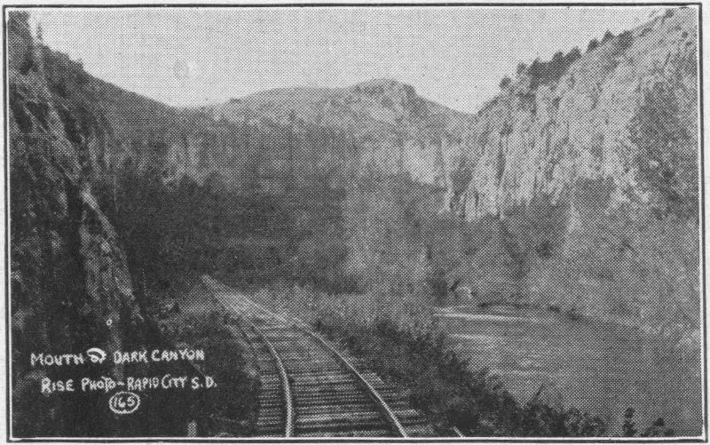
Mouth of Dark CanyonRise Photo—Rapid City, S.D.
3. Central Hills.
Again, see Rapid City. Take S. D. 40 through the beautiful Spring Creek valley to Sheridan and Hill City, and then back to Keystone, or you might go directly to Keystone. The roads might be rather rough. At Keystone see Keystone Consolidated Mines, Etta Mine, Juga Mine and a mica mine. Then see Rushmore mountain. Return to Hill City, or the mine trip may be left out. From Hill City take the road to Sylvan Lake. Here see the Lake and the Gorge. Climb Harney Peak, the highest point east of the Rocky Mountains. From Sylvan Lake take the Needles Highway twenty-seven miles, and double back over S. D. 36 to Custer. On the way you see the Tallent monument, and to the right a few paces the Gordon Stockade. See Jewell Cave, gold discovery monument, rose quartz mounted in masonry and the big log cabin and the museum. Take S. D. 36 through Galena, the Game Lodge and Hermosa, to Rapid City. In Hermosa see the church Pres. Coolidge attended.
If the roads are bad take S. D. 79 from the East end of main street when leaving Rapid City, instead of S. D. 40 to the west. Thus you see Hermosa, and President Coolidge’s little church, the Game Lodge, Custer and Sylvan Lake in reverse order, and then double back over the same route when returning.
4. Southern Hills.
Take S. D. 79 through Hermosa, Game Lodge and Galena. Leave 79 and take S. D. 81 south past Mt. Coolidge to Wind Cave. Go through this. Drive on to Hot Springs. See Cascade Springs and Cascade Falls. Ask the way at any filling station. See the petrified wood and petrified moss over the track east of the Municipal Camp. Take some of it with you. See Evans camp, and swim in Evans Plunge before you leave. Visit the old soldiers’ home. Take the same route back, or go west to Custer when you reach S. D. 36, and from there take in the Needles, Sylvan Lake, Harney Peak, Hill City, and Sheridan, thence back to Rapid City.
Make it as intensive a trip as your time will permit. If the time is limited some of the places must be left out.
If you wish, you may take the trip through the most interesting places by motor bus. These busses leave Rapid City at short intervals, and their trip is really enjoyable.
| Blackhawk | 16 | N. W. | 7 | |
| Piedmont | 16 | ” | 14 | |
| Crystal Cave | 16 | ” | 22 | |
| Tilford | 16 | ” | 28 | |
| Sturgis | 16 | ” | 30 | |
| Whitewood | 16 | ” | 38 | |
| Spearfish | 16-85 | ” | 51 | |
| Belle Fourche | 16-85 | ” | 64 | |
| Newell | 16 | ” | 62 | |
| Deadwood | 16 | Boulder | ” | 43 |
| Lead | 16 | Canyon | ” | 46 |
| Box Elder | 16 | East | 10 | |
| Underwood | 16 | ” | 22 | |
| Scenic | 40 | S. E. | 55 | |
| Interior | 40 | ” | 70 | |
| Pactola | 85 | West | 25 | |
| Hermosa | 70 | South | 21 | |
| Buffalo Gap | 79 | ” | 50 | |
| Hot Springs | 79 | ” | 63 | |
| Edgemont | 79-85 | ” | 96 | |
| State Lodge | 79-36 | ” | 35 | |
| Pringle | 79-36-85 | ” | 55 | |
| Sylvan Lake | 85 | ” | 52 | |
| Custer | 79-36 | ” | 42 | |
| Keystone | S. W. | 27 | ||
| Hill City | 40-85 | ” | 28 | |
| Rushmore | ” | 30 | ||
| Phillip | 16 | East | 93 | |
| Spearfish | 85-16 | N. W. | 13 |
| Belle Fourche | 85-16 | N. W. | 3 |
| Lead | 14 | West | 26 |
| Sturgis | Boulder | East | 12 |
| Crystal Cave | Boulder 14 | ” | 27 |
| Rapid City | Boulder 14 | ” | 43 |
| Pactola | 85 | South | 30 |
| Hill City | 85 | ” | 45 |
| Keystone | 85 | ” | 56 |
| Rushmore Mt. | 85 | ” | 56 |
| Sylvan Lake | 85 | ” | 52 |
| Game Lodge | 85-36 | ” | 72 |
| Hermosa | 85-36 | ” | 86 |
| Custer | 85 | ” | 58 |
| Custer-Needles | 85 | ” | 74 |
| Hot Springs | 85 | ” | 84 |
| Edgemont | 85 | ” | 95 |
Copyright, 1929
By
P. D. Peterson
Price, $1.35