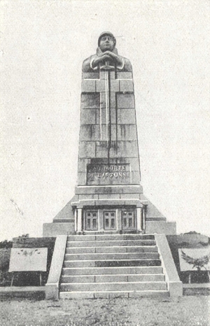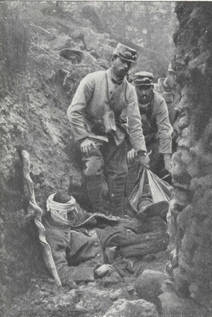
Diploma by Georges SCOTT, given to Subscribers,
by the Committee of the
Memorial Fund of the Mortuary of
Douaumont.
MICHELIN'S ILLUSTRATED GUIDES
TO THE BATTLE-FIELDS (1914-1918)
VERDUN
Argonne-Metz
1914-1918
MICHELIN & Cie—CLERMONT-FERRAND
MICHELIN TYRE Co Ltd—LONDON
MICHELIN TIRE Co—MILLTOWN, N.J., U.S.A.
Diploma by Georges SCOTT, given to Subscribers,
by the Committee of the
Memorial Fund of the Mortuary of
Douaumont.
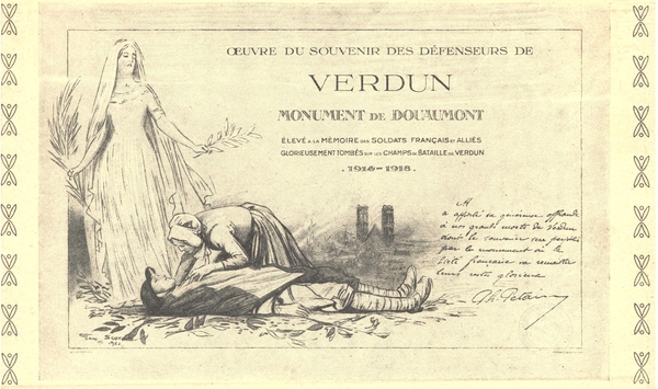
MEMORIAL FUND
TO THE
DEFENDERS OF VERDUN
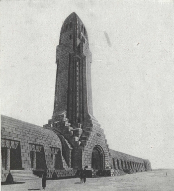
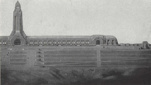
MORTUARY OF DOUAUMONT
(A War Fund authorised by Ministerial decree dated 3/12/19)
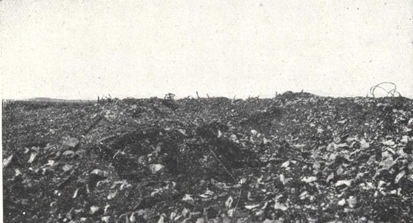
On the battlefield of Verdun, millions of men engaged in a battle of giants; 400,000 French soldiers fell there on a front of 20 kilometres.
A fund has been established with the object of erecting a Mortuary in the centre of the battlefield, at a point whence the whole field may be viewed.
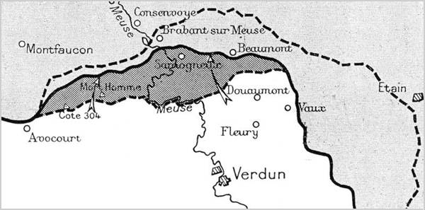
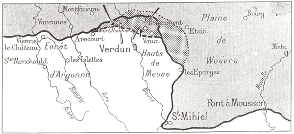
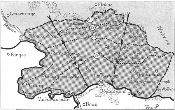
The site chosen is situated between the Fort of Douaumont and the Thiaumont redoubt (See pages 96-99 of this Guide).
The Patrons are Marshal Foch, M. Raymond Poincaré, and His Excellency, the cardinal Dubois.
The executive Committee, under the honorary presidency of Marshal Pétain, is presided over by S. G. Mgr Ginisty, Bishop of Verdun, General Boichut, commanding the 12th Infantry Division, the Commandant of Verdun, General Valantin, formerly commanding the town and forts of Verdun and the Hauts-de-Meuse.
The names of all subscribers will be registered in a golden Book to be kept in the basilica. At the top of the list will be the names of the Founder members who have subscribed 500 francs or more. On the inside walls of the monument will be carved inscriptions which families may wish to place in memory of their dead.
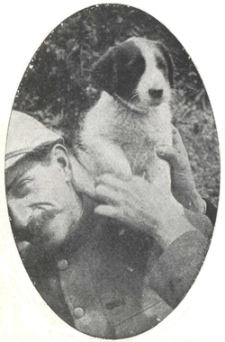
An artistic diploma by Georges Scott is sent to every subscriber of 20 francs, on which there is a reproduction of Marshal Pétain's autograph and an acknowledgement of the subscriber's interest in the memorial (Photo. herewith).
Subscriptions may be sent: to Verdun, to S. G. Mgr Ginisty, Bishop of Verdun, and to Me Schleiter, solicitor; to Paris, to Princess Henri de Polignac, 26, avenue Montaigne.
The Michelin Road Map
and Guide.
They complete one another, without overlapping.
Use them together.
IN MEMORY
OF THE MICHELIN EMPLOYEES
AND WORKMEN WHO DIED GLORIOUSLY
FOR THEIR COUNTRY
Copyright 1919 by Michelin & Cie.
All rights of translation, adaptation or reproduction (in part or whole) reserved in all countries.
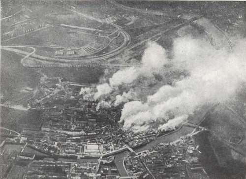
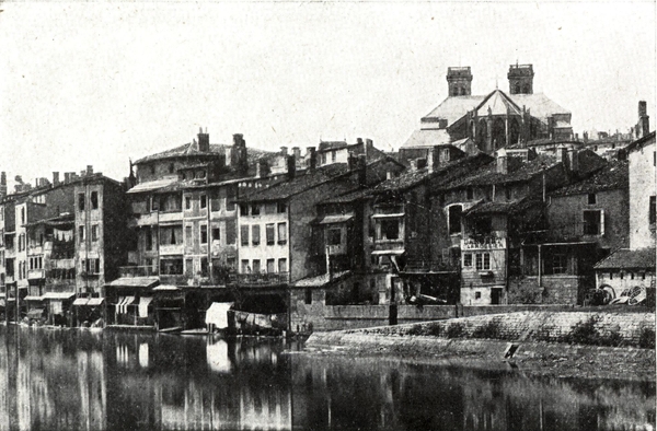
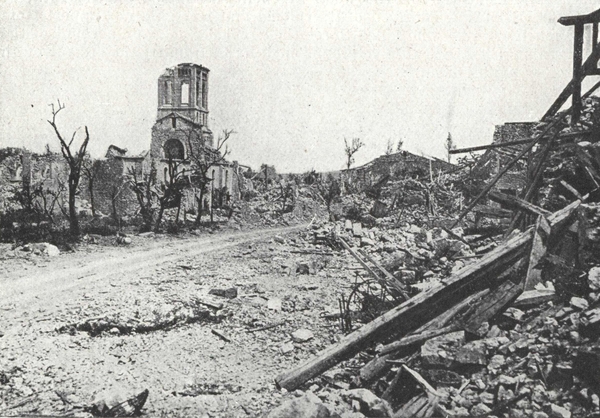
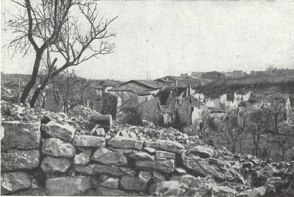
Verdun, one of France's most ancient cities, was first a Gallic, then under the name of Virodunum Castrum, a Roman fortress. In 843 the celebrated treaty which divided the Carolingian Empire and annexed Verdun to the Kingdom of Lorraine was signed there. From 870 to 879 Verdun became part of France, but in 923 it was incorporated in the German Empire. As a county, it was governed under the feudal system by the hereditary counts, the last of whom was Godefroy de Bouillon, and later by the episcopal counts and bishops.
In the 10th century, Bishop Haimont, of Verdun, persuaded the Count of Verdun to transfer his rights to him. The arrangement was confirmed by Emperor Othon III, but the count's heirs disputed the bishops' title to the town. Later, the burgesses revolted against the authority of the bishops, and after a sanguinary struggle succeeded in throwing off their yoke about the middle of the 13th century. After a long occupation by the Germans, Henri II, King of France, retook Verdun in 1552 and granted it privileges which were confirmed by François II in 1559. During the Religious Wars, the town was for the Leaguers, and only agreed to receive Henry IV's envoy, after that prince's conversion to the Roman Faith. The burgesses did not take the oath of allegiance to the King of France until 1601.
Both in respect of its geographical position and history, Verdun is a typical fortified town. From time immemorial it has played an important part in resisting invasion, as witness its fortified camp and citadel. Since 1870 it has been the centre of a stronghold formed by a rough semi-circle of hills and slopes bristling with defensive works and batteries.
Since the year 450, when Attila left it "like a field ravaged by wild beasts", it has been besieged at least ten times.
Charles the Fifth besieged and took it in 1544, but after a seven years occupation it was retaken by Henry II of France in 1552. The Huguenots tried to take it by surprise in 1589, but were unable to overcome the resistance of the citizens.
Siege of 1792.—In 1792, the Prussians attacked and bombarded the town, defended by Beaurepaire with only thirty-two guns and forty-four artillerymen. The Council of Defence, urged thereto by the Anti-Republican section of the population, decided to capitulate, in spite of opposition on the part of Beaurepaire, who died soon afterwards at the Town Hall by his own hand, according to some, others holding that he was assassinated. The Prussians occupied the town for six weeks, after the garrison had left. Although it is true that a few women went to the Camp of Bras with an offering of sweetmeats for the King of Prussia, it has not been established that the latter gave a ball at Regret, at which the women of Verdun danced. The victory of Valmy forced the Prussians to leave Verdun. On October 13th, Kellermann took possession of the Citadel, and on the 14th the troops of the Republic entered the town. Several of the visitors to the Camp of Bras expiated their regrettable act on the scaffold.
Siege of 1870.—In 1870, Verdun offered a more stubborn resistance. When the Saxon troops, about 10,000 in number, appeared to the east of the town, the garrison of the latter comprised only 1,500 regular troops, including fifty artillerymen, 2,000 untrained men and 1,400 men of the National Sedentary Guard, while its armament consisted of twenty mortars, twenty-one howitzers and ninety-six guns, of which the barrels of only forty-six were rifled. Under the command of General Guérin de Waldersbach, seconded by General Marmier, this small garrison repulsed a violent attack on August 24th, and refused to surrender. After being reinforced by 2,600 men who had escaped from Sedan, several sallies were made. By September 23rd the enemy had completely encircled the town, and were forcing the inhabitants of the surrounding villages to help with the siege-works. On the night of October 19th, thirty sappers, twenty-five artillerymen and 100 foot soldiers surprised the two German batteries on Heyvaux Hill, between Thierville and Regret, on the left bank, and after hand-to-hand fighting, spiked all the guns.
After the fall of Metz, Verdun, besieged by 15,000 men with 140 heavy guns, in addition to field artillery, surrendered on November 8th with the honours of war.
The town had been bombarded three times. On August 24th it received about 2,000 shells; on September 26th the Citadel received 1,000 to 1,200 shells in five hours; on October 13th, 14th and 15th 20,000 to 25,000 shells fell in the town, severely damaging the upper part and the Citadel.
The name of the German Prefect who governed Verdun and the Meuse province was Von Bethmann Hollweg.
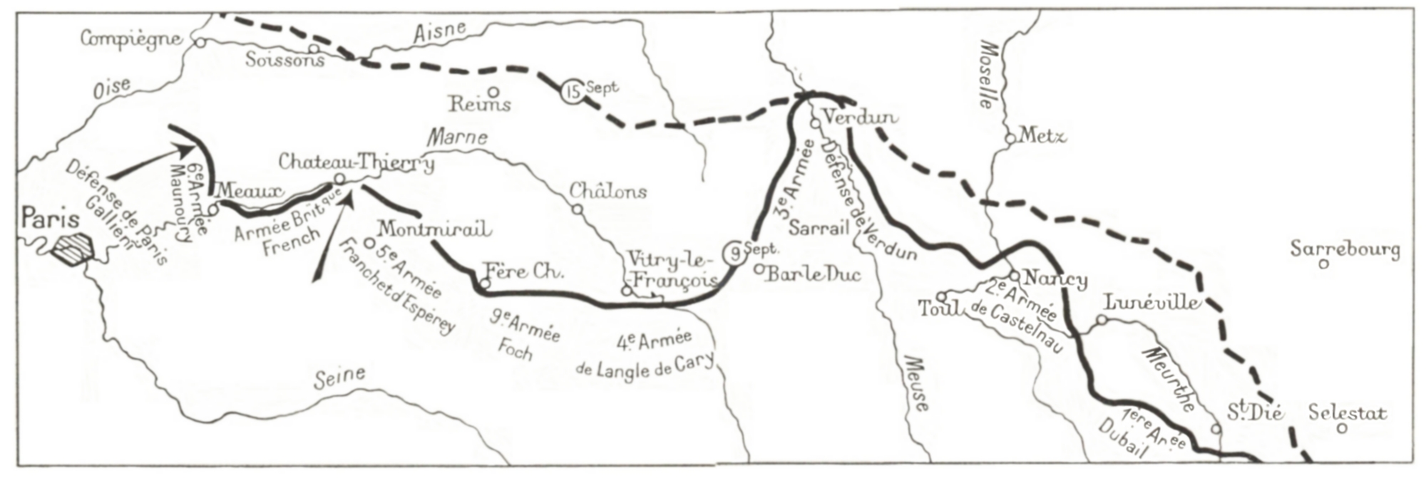
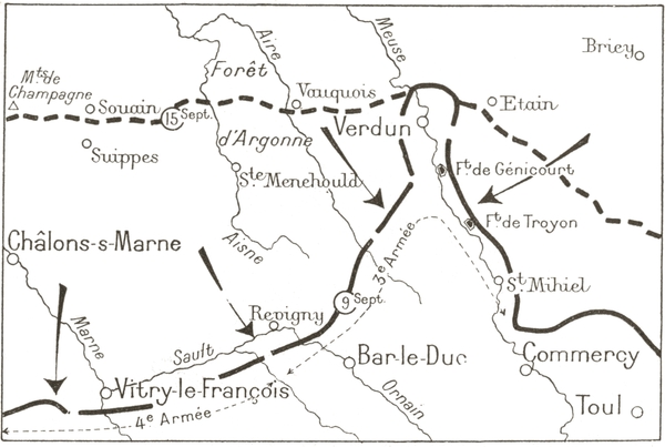
September 9th 1914.—The Battle of the Marne.
After the attack of the German right wing by Maunoury's army, the English army and Franchet d'Esperey's army threatened to break the communication between the first and second German armies and cause their hasty retreat which was reflected gradually all along the front.
After the French manœuvre at the frontiers was checked and with the threat of a German envelopment in the West, General Joffre steadfastly withdrew from the battle and ordered a general retreat until the moment when the French troops were reunited. As soon as a favourable moment offered, it would be possible to take up a position and then to drive back the enemy.
The plan was as follows: to carry out on the left a mass movement (6th Army under Maunoury) to outflank, at the propitious moment, the German right, while a general attack or at any rate a desperate resistance should take place on all the rest of the front, from Paris to the Vosges.
The enemy's objective was first of all to wipe out the allied forces, the right having instructions to pursue the French left and the English army, before turning upon Paris which was to be seized like a plum ready to be picked! In the centre, the Crown Prince was in command of the pursuit: he saw his fourth cavalry corps pushing out their scouts towards the line, Dijon-Besançon-Belfort.
Here were dreams of triumph destined to give place to surprise, then doubt and finally the bitterness of defeat.
On September 5th, Gallieni reported the Germans creeping towards the South-East. The moment for the French manœuvre had arrived and Joffre launched the general offensive.
On September 6th-7th, the Sixth Army attacked the German right wing. To guard himself against this flank menace, Von Kluck brought up three army corps in succession from his frontal attack.
(p. 5) September 7th-8th. This diminution of strength allowed the English Army and the second French Army under Franchet d'Esperey to advance.
September 9th-10th. The Second Army threatened to cut off the contact between the First and Second German Armies and to take them in rear. Under this threat they determined upon a hasty retreat the effect of which made itself gradually felt along the whole of the German front (September 10th-13th).
After the battle of the Frontiers, the Third Army likewise beat a retreat. Having reached the left bank of the Meuse, the army pivoted on its right which rested on the fortress of Verdun, stopping frequently to delay the pursuit of the Crown Prince's army.
September 6th, 7th and 8th. While the Duke of Wurtemburg pressed heavily upon the right of the Fourth Army (under Langle de Cary), the Crown Prince vigorously set upon the left of Sarrail in an attempt to break completely through the pivot by Trouée de Revigny, valleys of Ornain and Saulx. He hoped to cut off Sarrail who, when attacked at the same time in rear on the Heights of the Meuse, would find himself surrounded and forced to surrender. But these ambitious plans were thwarted by the vigorous action of the left of the Fifth Corps and the Fifteenth which was withdrawn en masse from the Army of Lorraine (under Castelnau).
September 9th. On its left the Third Army continued to engage the Germans on the flank, while the right wing, though vigorously holding (p. 6) its ground before frontal attacks, remained in a precarious position owing to the standing menace of the German forces in rear on the Hauts-de-Meuse. Sarrail received permission from the General-in-Chief to withdraw his right, if need be, and to leave the permanent garrison of Verdun to secure the defence of the Fortress. But the General of the Third Army held fast with heroic determination and would not give up his entrenched position as long as the Meuse was not liberated and while a ray of hope appeared.
September 10th. The forts of Troyon and Genicourt, on the Hauts-de-Meuse, continued to hold out against heavy artillery bombardment. The barrier of the Meuse was not cleared but, to guard against any eventuality, Sarrail transferred two divisions to the West of Saint-Mihiel.
September 11th, 12th, 13th, 14th. Coming from the German right, the advancing wave gradually overtook the armies of the Prince of Wurtemburg and the Crown Prince. The two latter, mad with rage, were forced to withdraw their forces in echelon, while Sarrail's army pivoting round Verdun harassed the enemy as far as Argonne. Thus the battle of the Marne was won by the same troops who had just undergone the repulse of the battle of the Frontiers and, when overwrought with fatigue, had successfully accomplished a retreat unprecedented in history. The undaunted spirit of Commander-in-Chief Joffre, the well-defined and masterful strategy which he planned and carried out in strict collaboration with his highly courageous army commanders, above all the superhuman bravery of the rank and file, to these factors is due what to-day we call "The Miracle of the Marne".
"The fate of the War was settled at its commencement, in 1914, on the Marne, where the French General indeed saved France against the fierce onslaught of a whole nation."
So wrote the Berliner Tageblatt after the War.
(p. 7) AFTER THE MARNE, THE BATTLE FOR VERDUN
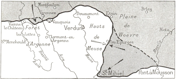
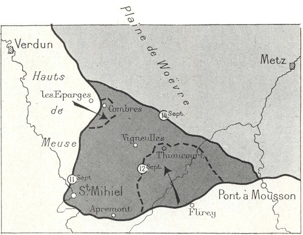
October 1914-August 1915.—The enemy strove to cut off Verdun. On the East, the Salient of Saint-Mihiel. On the West, the battle of Argonne.
February 1916-August 1916.—In a terrific and desperate encounter the enemy threw themselves at Verdun. They were hurled back by a magnificent defence.
October 1916-August 1917.—Three French attacks drove the enemy back to their original attacking positions.
September-November 1918. The Salient of Saint-Mihiel was straightened during the great final offensive when Verdun was completely liberated by the French-American forces.
After the battle of the Marne, the Crown Prince established his lines of resistance north of the fortress, on the line Avocourt-Melancourt-Brabant-Ornes.
On September 20th, the third Bavarian Corps attacked the 75th reserve division, advanced rapidly on the 22nd as far as the line Combres-Vigneulles-Thiaucourt (p. 9) and bombarded the forts of the Hauts-de-Meuse. This line was defended by mobile troops outnumbered by two to one.
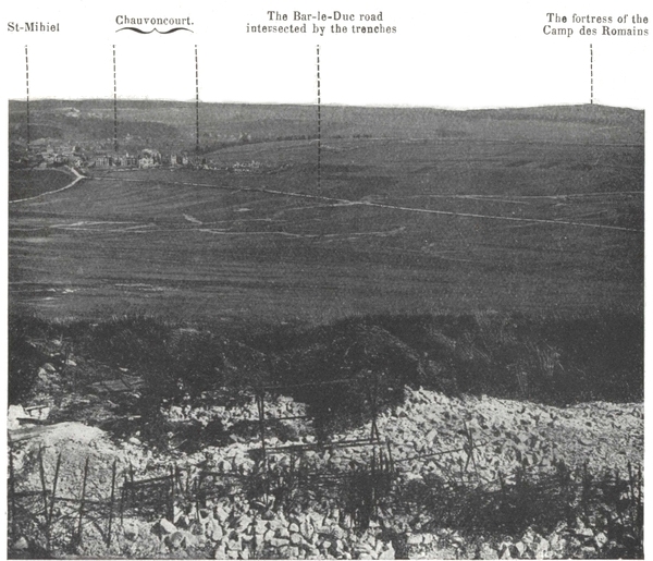
On the 25th, the Germans succeeded in getting a footing on the Hauts-de-Meuse in the region of Vigneulles. From there they pushed on to Saint-Mihiel and entered the town, without however being able to cross the Meuse. But on the following day, the river which was only defended at this point by a battalion of territorials was cleared, and the Germans started to climb again towards the valley of Aire, in the direction of Verdun. At this dangerous moment, the sixteenth corps which had left Nancy met the German forces, harassing them and forcing them to fall back on the suburbs of Saint-Mihiel. It did not, however, succeed in forcing them to withdraw on the right bank of the Meuse. On September 29th the line ran through Combres, Chauvoncourt, Apremont, Flirey, Le Bois le Prêtre.
The salient was made.
The enemy were attacked without cessation during the months of October, November and December. Towards Saint-Mihiel the enemy held their position on the left bank of the stream.
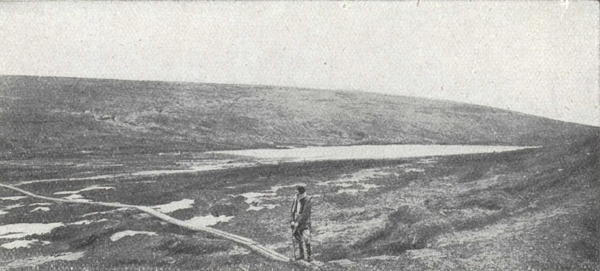
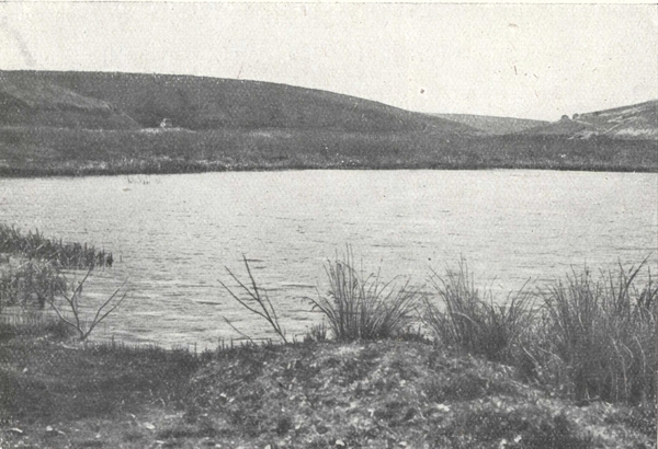
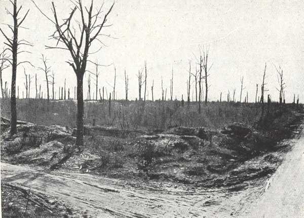
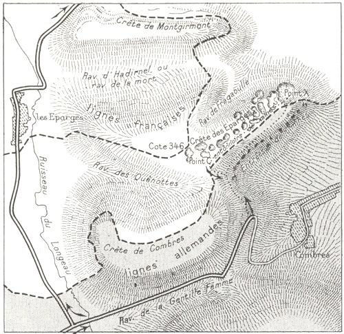
The crest of Les Éparges, after being held firmly by the enemy from September 1914, was strongly attacked on April 6th by the twelfth Infantry Division who struggled obstinately for over a month before they wrested from the Germans the observation posts which from this crest, gave near views towards the North. This brilliant action was followed by counter-attacks by the Fifth German Corps, which were particularly violent during the day-time of April 24th and May 5th. Starting from this moment, the struggle assumed a less stubborn character, but none the less keen and murderous. (See page 129.)
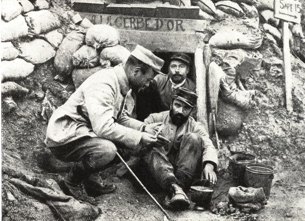
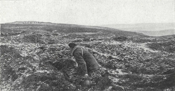
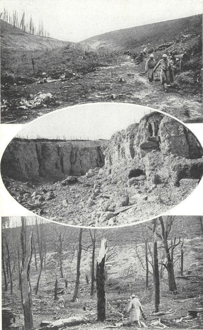
Les Éparges in 1915.
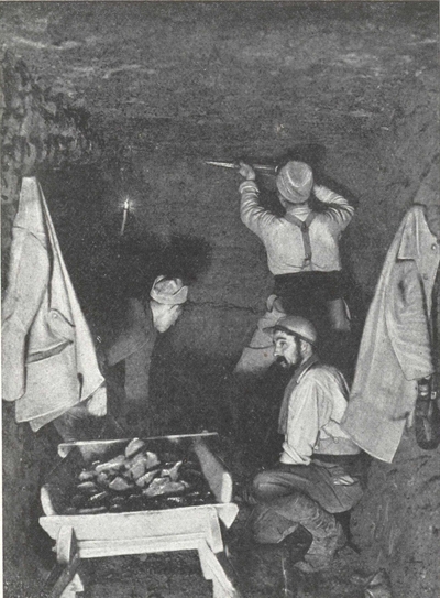
During a period of quiet, a plant for making rings has been installed at the entrance of a dug-out.
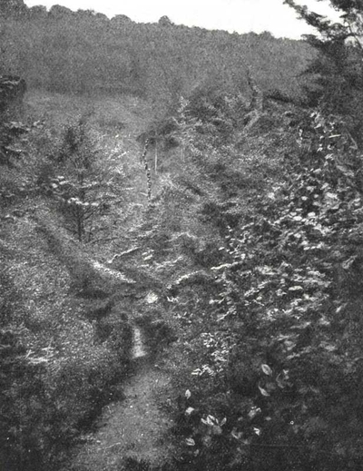
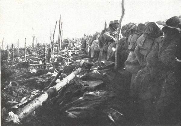
A ravine in the luxuriant forest of Argonne.
In the middle a company in Indian file is going up to the line.
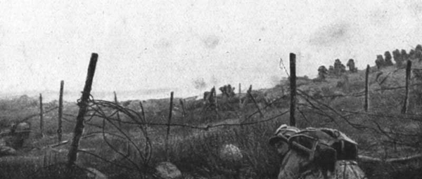
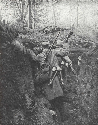
The stationary warfare assumed a special character in the Argonne. Lanes and footpaths formed the only breaks in the impenetrable thickets. There were no gentle slopes, no convenient firing positions for the infantry, no observation posts for the artillery—everything was concealed by the thick foliage.
Springs rose everywhere and rivulets ran over the clayey soil. Mud made the paths impassable, and filled up the trenches as soon as they were made. French and German trenches intersected. Firing was continuous, snipers perched here and there in trees taking careful aim, while at night rifle and machine gun fire at random continued uninterruptedly, sweeping the forest in order to prevent surprise and to make movement dangerous. But the rifle was merely an auxiliary weapon, as each army rained showers of grenades and bombs upon the other all day long.
Apart from actual battles, there were hundreds of casualties, killed and wounded, every day. In the attack or defence of a trench, the fighting immediately became a hand-to-hand struggle, with knives and revolvers. (p. 13) Underground there was a continuous digging of saps and mines; it was a contest of speed and skill between the opposing sappers. It was a case of blowing up the enemy first or being blown up by him. Over the wrecked trenches, destroyed by mines, through smoke and under a rain of earth thrown up by the explosions, the soldiers dashed forward to occupy the crater or to fight for it if the enemy had reached it first.
A fight with bombs.
French foot-soldiers throwing back at the enemy bombs which they have captured from them.
During the first three months of 1915, between Four-de-Paris and the valley of the Aire, the French sappers excavated over 3,000 metres of mine galleries and fired 52 mine chambers, using nearly 16,000 lbs of explosives.
Later on, the mine warfare developed considerably in other directions, and mine-chambers charged with more than 130,000 lbs of explosives were fired.
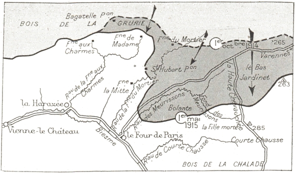
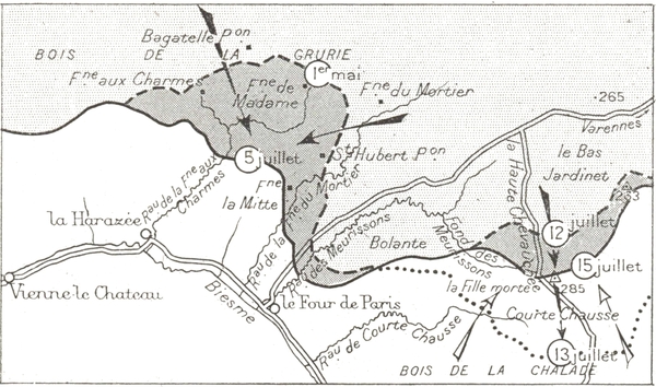
The enemy wanted to reach the valley of the Biesme across the wood of Grurie and Bolante.
In October, advancing to the sap, the Germans of von Mudra's army (p. 14) corps took Bagatelle and Saint-Hubert. At the end of November the Four-de-Paris—Varennes road was abandoned by the French.
At the end of December, the Second French Corps cleared Four-de-Paris.
In January, the Garibaldians (Italian volunteers) attacked in the direction of Bolante.
On January 8th, the Germans hurled themselves upon the outskirts of Bolante. For three whole days the foot soldiers of the 31st, 46th, 76th and 89th regiments as well as the Garibaldians were at close grips with the Silesian and Hessian chasseurs, fierce struggles taking place.
In spite of all their furious attacks, the enemy could not get to the Biesme, but they succeeded in driving a deep and narrow wedge in the French lines in the direction of Four-de-Paris.
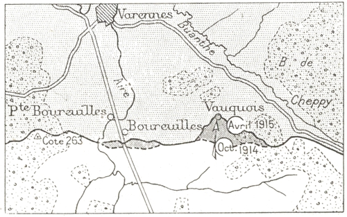
While these obstinate encounters were going on in the forest of Argonne, the 9th and 10th French Divisions (5th Corps) attacked in the valley of the Aire and set out to storm Vauquois, a village perched on a mound commanding all the valley, which the enemy had constituted a defensive centre and a first class observation post.
From December to February, on ground that was transformed into a sea of mud, attacks on Boureuilles carried the French lines to 250 metres from the village.
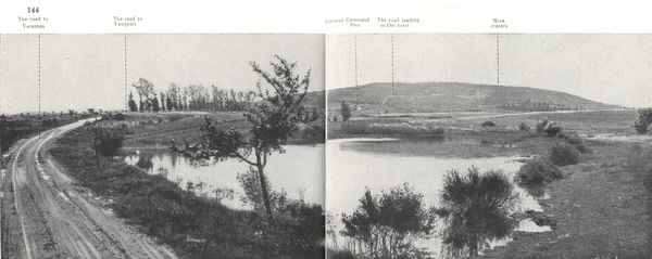
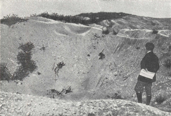
From October 28th 1914 to March 1st 1915, four attacks were launched against Vauquois, the summit of which was reached by the French troops of the 10th Division. The struggle extended around the mine craters until 1916. (See page 144.)
In June and July 1915, the German commander gave up local attacks and had recourse to massed attacks of men and material on fronts of 3 to 4 kilometres.
The first attack (on June 20th) was on the North side and then (July 2nd) on the East side of the salient of Fontaine-Madame.
On June 20th in the morning, after a violent bombardment of gas shells, two Prussian and Wurtemburg divisions attacked in the wood of Grurie. The foot-soldiers of the 32nd Corps, though gassed and almost buried in their trenches, put up a fierce resistance. Their positions were subjected to a veritable siege. The enemy, however, captured Fontaine-aux-Charmes.
Up to June 28th, French counter-attacks succeeded in recapturing part of the lost ground.
On June 30th, the Germans extended their attack up to the north of Four-de-Paris. The enemy advanced to within 8 kilometres of their objective, the railway station of Les Islettes. The fire of the 75's, however, barred the road and the French reserves counter-attacked.
On July 2nd, there was an artillery bombardment of even greater violence.
The famous 42nd Division of Fère-Champenoise and the Yser withstood the attack with a heroism that won admiration even from the enemy.
The Germans could not capture the valley of the Biesme, in spite of their terrific efforts and heavy sacrifices.
In July 1915, the French front in the sectors of Bolante and Fille-Morte, followed the ridge which dominates the ravine of the Meurrissons, and passed over perpendicularly the Haute-Chevauchée road, comprising the dominating hills 285 and further to the East 263.
From this line which was provided with good observation posts, a French attack could take in rear the German lines that were established in front of Four-de-Paris.
This attack after being fixed for July 11th was postponed to July 14th. (p. 16) The enemy, however, forestalled it by himself attacking on July 13th.
After a bombardment of exceptional ferocity (nearly 50,000 shells) and the blowing up of several mines, 5 regiments of the Metz army attacked. They came out from saps which had been run up to within a short distance of shell-shattered French trenches.
The enemy crept in by small columns and surrounded the front lines. Under an avalanche of heavy shells, which annihilated a large number of men in their dug-outs, the French gave ground, to avoid being overwhelmed or outflanked. The enemy patrols then crossed the second French line.
The reserves of the 5th Corps, 131st, 82nd, 89th Infantry Regiments and the 66th battalion of chasseurs were brought up along ravines infested with gas, to the counter-attack. Without artillery preparation, they deployed under heavy rifle fire and then proceeded to clear the forest at the point of the bayonet and retook part of the first position.
In October the Argonne front suddenly became as calm as it had previously been active. The Germans were content with a defensive policy. The struggle for the saps was renewed, trenches were blown up by mines and the mine craters were disputed by short bombing engagements.
In 1916, during the battle of Verdun, the Argonne was especially the scene of artillery duels and of mine warfare on the plateau of Bolante, at Hill 285 and at Vauquois.
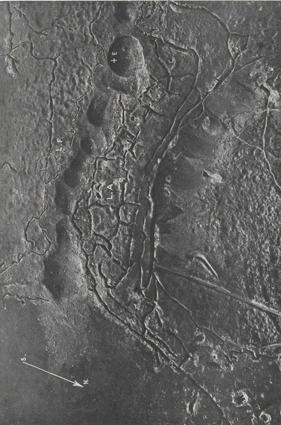
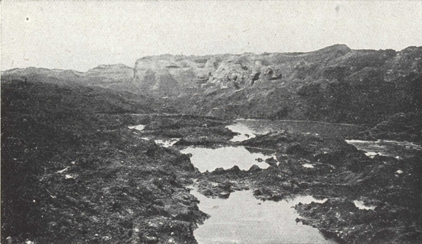
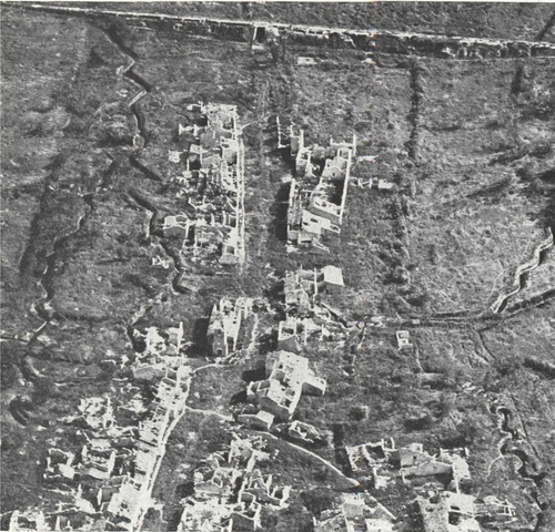
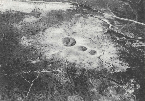
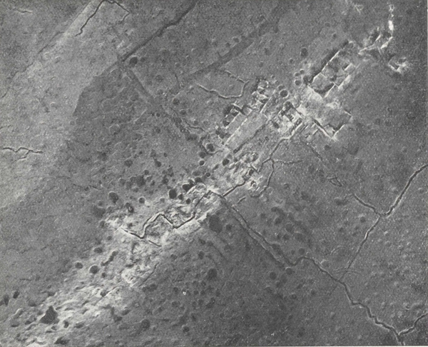
The Mound of Vauquois hollowed out by mine craters.
(View from the air, May 1917).
E. Site of the church.—L. F. French lines.—L. A. German lines.
The German mine opposite the church had been charged with 60 tons of explosives. Notice on the German side, the entrances to the galleries excavated under the mound.
During 1915, Germany was particularly on the defensive, in Artois (May-June) and in Champagne (September-October). Her successes in Serbia and Russia had not brought the final victory which could only be won on the Western front.
Germany feared an allied offensive and was anxious over the continual increase of their forces in men and material. To forestall this offensive would cause it to miscarry and keep the initiative in her own hands.
The Germans wanted too, to make an impression on the world at large which began to have doubts about her ultimate victory. Finally they were influenced by political considerations at home. The rationing of the population had lowered the general morale, and the prestige of the Crown Prince had slumped heavily on account of his failure in Argonne. A grand victory was necessary to strengthen the German morale, to appease dissension and to rehabilitate the prestige of the Imperial family. The German High Command chose Verdun. Was this choice of ground as paradoxical as it has been said?
"Verdun in all the war is the hinge of the door which swings open sometimes on France, sometimes on Germany". (L. Gillet.)
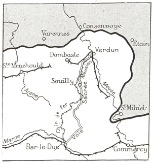
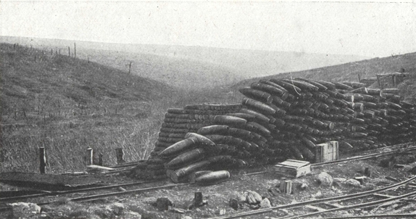
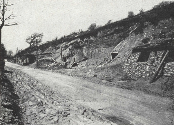
The only communication between Verdun and the rear was by the Meusian railway and the "Sacred Way". The Verdun-Commercy railway was cut by the Saint-Mihiel salient and the Verdun-Sainte-Menehould railway would be cut by shell fire at the very outset of the battle.
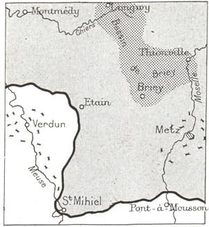
To capture Verdun was to threaten the whole French right wing, to gain an important stake, a stronghold fronting the rich basin of Briey, and to get the benefit of a great moral effect.
The Verdun salient lent itself to converging enemy attacks and concentrated fire. On the right bank the defenders of Verdun would be fighting with their backs to the Meuse. The neighbourhood of Verdun with its valleys and woods, facilitated the moving of troops and the concentration of artillery screened from view.
The enemy too had fourteen railways at his disposal and Metz close at hand from which to bring up troops and supplies.
On the French side, there was only one broad gauge railway connecting Verdun, via Saint-Menehould, with the rest of France. This railway, too, was always liable to be cut off by shell-fire. (See illustration opposite).
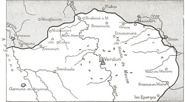
The table-lands of Verdun where the battle was to be fought are the last of the series of heights which form the top of the basin in which Paris lies. The Meuse which often overflows in winter divides them from North to South.
The terrace of the table-lands of the right bank, for some ten kilometres in width, separates the valley of the Meuse from the marshy plain of the Woëvre.
Numerous streams flow at a depth of more than a hundred metres for a very short distance, thus hollowing out deep ravines which give to the hills of the Meuse a contour "jagged, cut in festoons, as though it was hand-modelled in a clay substance". The summit line, where not indented, contains the highest points (388 m.), keys to the battle field.
"All this country with its partitions and compartments seemed built like a natural fortress. The sheltered ways and ravines provided covered approaches and first-rate artillery positions. Every wood and copse could be converted into a redoubt.
"If the branching off of the valleys and their innumerable ramifications added to the dangers of movement or manœuvre or facilitated surprise attacks, the ridges, on the other hand, made marvellous observation posts. On all sides were the very slopes, banks and flank protection which engineers could desire." (L. Gillet: La Bataille de Verdun).
Following the lesson of the offensives in Artois (May 1915) and Champagne (September 1915), the German commander intended to put into practice the French offensive methods but to add, by means of artillery fire, an unparalleled ferocity. To concentrate masses of artillery, to cut by shell fire the only broad-gauge railway that connected Verdun with France (see plan p. 18), to flatten out the French defences, to isolate the occupants by barrages of heavy shells, then to rush headlong on the town and crush the last resistance, at the same time sending forward overwhelming masses of troops, without regard to losses: such was the plan which the Germans carried out on February 21st, 1916.
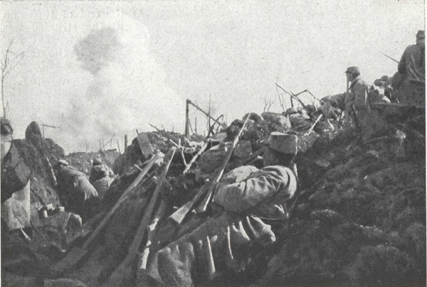
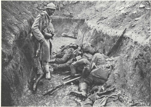
The battle of Verdun was a battle of annihilation, mutual annihilation. The method was to concentrate the fire of all the guns, not over a line but on a zone, and not only on the position to be captured but also as far as possible in rear on everything that could support the position. The simile that best expresses it is no longer that of a battering ram striking against a wall, but that of a rammer falling perpendicularly and hammering an encircled zone. The encircled zone was the part where the old territorials who were screening from observation a road behind the lines, ran almost as great a danger as men in other battles did in an attacking wave. Here, while the shells continued to fall, no fatigue party of men or munitions could go three hundred metres without being wiped out entirely. Here the wounded in deep-dug aid-posts went mad from lack of air. Here often a mug of water meant life or death to a man. This encircled zone was bounded by a narrow stretch of ground which the opposing artilleries tried to spare because the infantry were fighting there hand to hand, with bombs, machine guns, and flame-throwers; every square yard of ground being hotly disputed.
"In front of Verdun, one day, the O. C. of a new force asks the officer of the chasseurs whom he has just relieved: "Where does our line run here?—I'll show you. There where you will find on the ground my dead chasseurs, lying side by side, that is where our line runs".
"In front of Verdun, one day, a battalion commander being completely cut off sends twenty runners one after another, to the Colonel's headquarters. These runners are bound to follow a certain track to go and another to return. Not one comes back and on the next day he finds the bodies of all twenty, ten lying on the path there and ten on the path back.
"In front of Verdun, one day, at nightfall, a battalion commander goes up towards the front line to see his men and cheer them on. The front line is a string of shell holes and in these holes, one by one, the men are crouched. He leans over one of these pits of darkness, for the night was (p. 21) pitch black, and in a low voice so that the enemy may not hear asks: "How goes it?". There is no movement but a voice replies in muffled tones as though telling a secret: "All well, Colonel, they shall not pass". He goes on his way continuing his rounds "How goes it?" and from each dark shell-hole rises the same secret whisper.
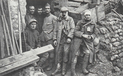
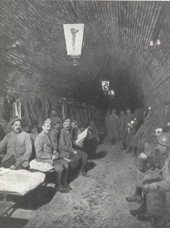
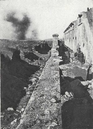
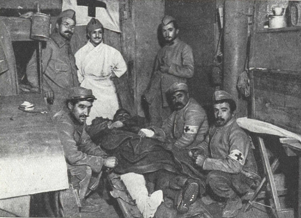
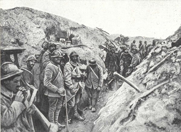
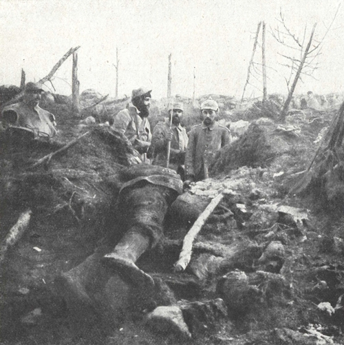
At the aid post of the fort or Tavannes, two wounded men and a runner leaving the "furnace".
Their privations and sufferings are written on their wan faces.
"Where was that? At Mort-Homme or Froideterre? At Haudromont farm or Chapelle Sainte-Fine? It makes no difference! It was "in front of Verdun, one day" any day you like in this battle, in which so many days were alike, and these innumerable stories, so magnificent that no poet could have had the genius to invent one of them, these stories—each one so immortal—are all as alike in their essentials as were the countless actions in this "battle of annihilation" (Joseph Bédier: L'Effort français).
The central attack (February 21st-25th) endangered the position of Verdun but the arrival of the first French reinforcements saved the place.
The enemy widened his attacking front, but his effort to outflank the position was a failure.
The defence was reorganised, road and rail taking their part in the battle. The enemy's attempts at attrition on the spot were a failure.
On July 1st the allied offensive was launched on the Somme.
As soon as this new engagement allowed him, the French Commander intended to turn the enemy's failure before Verdun into defeat.
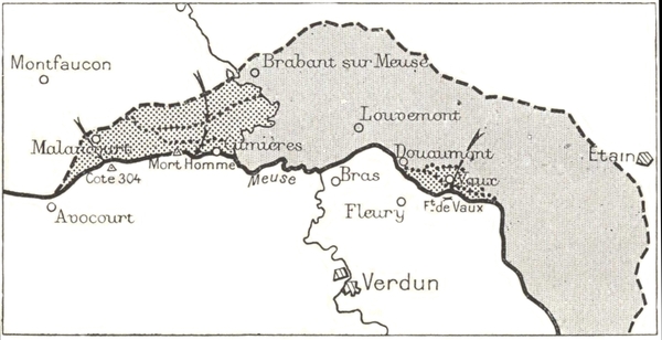
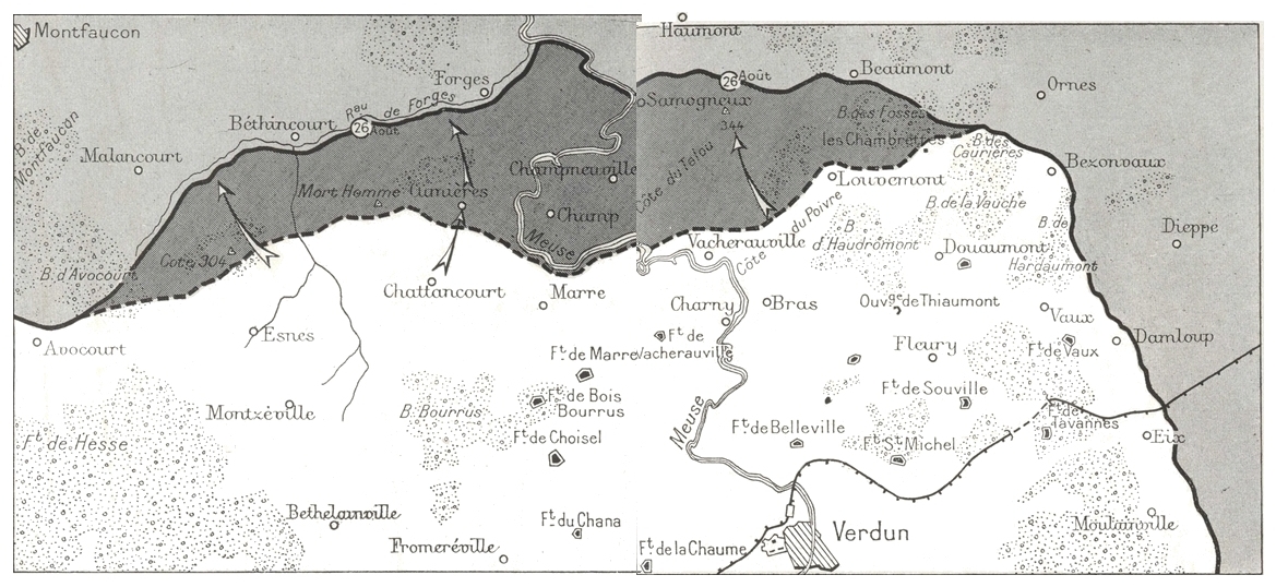
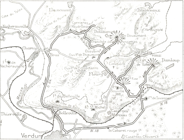
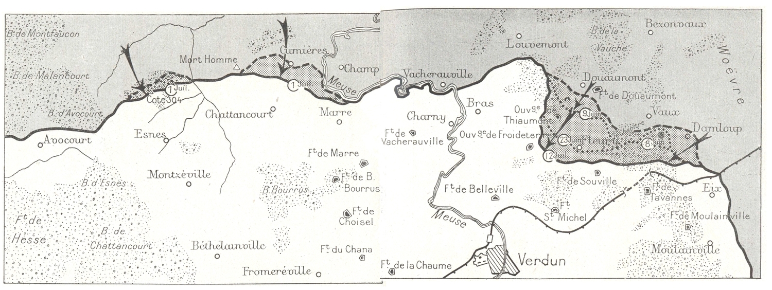
Three operations were prepared with the greatest skill and most energetically carried out, by which the enemy were driven out of the positions they had captured. These were the three victories of October 24th 1916 (Douaumont-Vaux), December 15th 1916 (Louvemont-Bezonvaux) and finally August 20th, 1917 (Samogneux-Mort-Homme, Hill 304).
The central attack (February 21st-26th 1916).
This attack was carried on from February 21st to 26th on the right bank of the Meuse and narrowed its front as it advanced, finally stopping on the sixth day at Poivre Hill and Douaumont.
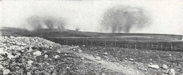
On February 21st 1916, at 7.15 a.m., the enemy opened fire on the two banks of the Meuse, over a front of 40 kilometres. Simultaneously Verdun was systematically bombarded, the last residents being evacuated by the military authority at midday on the 25th.
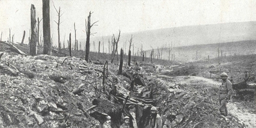
For nine hours, all the enemy guns and trench mortars kept up a running fire without intermission. In all the woods adjoining the front it was a regular fire-work display. A feature of this overwhelming bombardment was the enormous proportion of heavy calibre shells, 150's and 210's coming over like hailstones.
Under this deluge of projectiles all trenches were levelled, the woods became a twisted mass of trunks and branches, and villages collapsed and were blotted out.
The infantry attack was launched at 4.15 p.m. just before dusk, from the Haumont-Ornes wood.
Three army corps, the 7th, 18th and 3rd advanced. They thought that they had only to march, with their rifles slung, over ground like a ploughed field.
The 51st (Boulengé) and 72nd Divisions (Bapst) of the 30th Corps (Chrétien) sustained the first shock and for three days covered the arrival of French reinforcements.
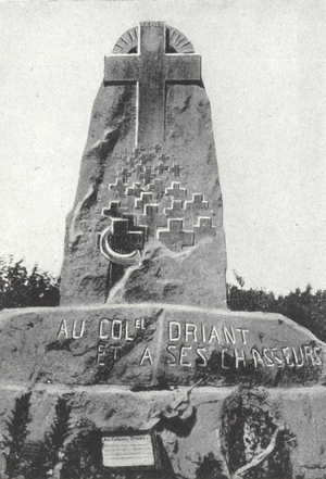
A heroic combat followed the most formidable artillery preparation hitherto known. The chasseurs of Colonel Driant resisted the attack, inch by inch, in the wood of Caures. By nightfall the advance of the enemy was insignificant compared with their losses. They succeeded, however, in capturing the wood of Haumont.
On the 22nd, with snow falling, the bombardment was resumed with, if possible, greater intensity. Colonel Driant in the wood of Caures was outflanked on both sides and died fighting, after first evacuating his chasseurs to Beaumont.
(p. 25) Meanwhile the sectors of Woëvre and the left bank of the Meuse were subjected to violent bombardment.
The fighting on the 23rd was even more furious. Brabant fell into the hands of the enemy after a fierce resistance by the 351st Infantry Regiment, which clung desperately to the ruins of Samogneux until nightfall. Further east the battle raged fiercely. The French counter-attacked unsuccessfully at Caures Wood and were attacked at Herbebois. The 51st Infantry Division, fell back, making the enemy pay dearly for his progress towards Fosses Wood. In the evening, the front extended along the Samogneux-Beaumont-Ornes line. Samogneux was captured by the enemy during the night. The situation was very critical.
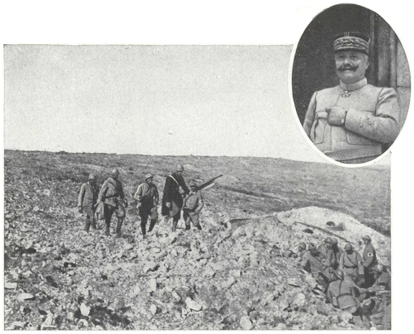
On the 24th, the enemy brought up fresh storm troops and, although harassed by the French artillery on the left bank of the Meuse, they succeeded in taking Hill 344 to the East of Samogneux, Fosses Wood and the village of Ornes. But on the same day French reinforcements arrived, namely the 37th Infantry Division of the 7th Corps, the 31st and 306th Brigades of the 20th Corps under General Balfourier who provisionally took charge from the Meuse to the Woëvre. At the same time also General Pétain took over the command of the army of Verdun from General de Castelnau.
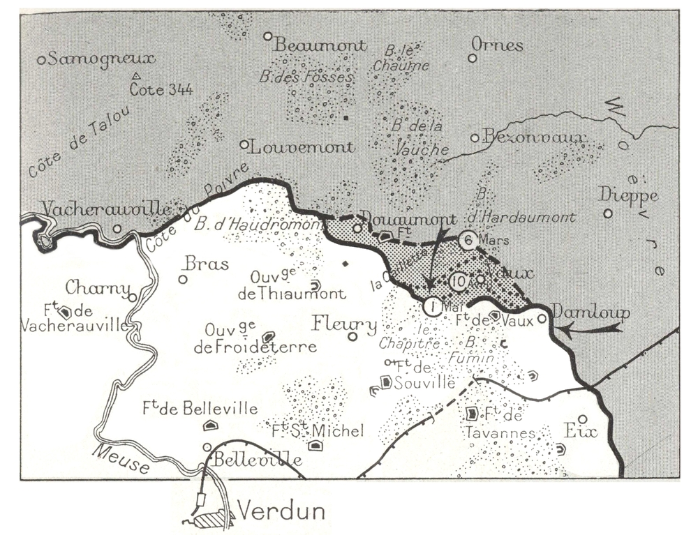
On the 25th, the 37th Infantry Division, with orders to defend Talou Hill and Louvemont village, resisted for a long time against incredibly furious attacks, but on their right the enemy succeeded in capturing Vauche Wood and, advancing towards Douaumont, carried the fort by surprise (see page 88). However, their efforts to take the village failed before the heroic tenacity of the 31st Brigade, while the 94th Infantry Division, covered itself with glory. The enemy advance from this side had the effect of compelling the 31st Infantry Division to abandon Talou Hill.
During this time, in Woëvre, the front which was a dangerous salient and only very lightly held, was withdrawn to the foot of the Meuse Hills. This falling back was carefully cloaked and under cover of a rearguard action a new front was organised.
Taking over the command on the night of the 25th, General Pétain at once divided the battle-line into four sectors, officered as follows: General Bazelaire, on the left bank, from Avocourt to the river; General Guillaumat, from the Meuse to Douaumont; General Balfourier, from this point to the Woëvre; General Duchesne, on the Meuse Heights.
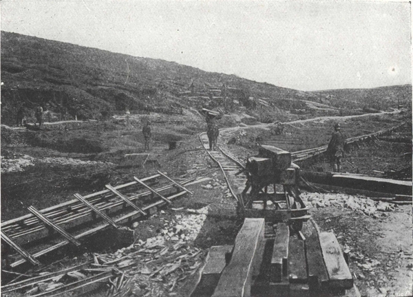
There were no trenches, but he ordered that the forts should at least be connected by a continuous line of entrenchments to be made while the battle was at its height and which the "poilus", in their disdain for the shovel and pick, called the "Panic Line". The entire 59th Division was told off to build the earthworks on the second and third lines. Thirteen battalions kept in repair the road from Bar-le-Duc to Verdun, via Souilly (the Sacred Way), which became the main artery for re-victualling the place in men and munitions, and along which 1,700 motor lorries passed each way daily. Lastly, General Pétain managed to imbue all ranks with his energy and faith, and the enemy's drive was stopped.
Indeed, during the day of the 26th, the 39th Division (Nourisson), which had relieved the 37th, repulsed all attacks on Poivre Hill, while the 31st Brigade continued to hold Douaumont until relieved in the evening by the 2nd Division (Guignabaudet).
On the following days the fighting continued about and in the streets of Douaumont, which the enemy finally captured on March 4th. The Germans now began to show signs of weakening. Their effort on the right bank had failed. Checked at Douaumont, they were taken in the rear by the French positions on the left bank, and were obliged to modify their plans. From that time they operated simultaneously or successively on both banks.
The German offensive was unable on the right bank of the Meuse to yield the expected results. The enemy intended to combine operations on both banks.
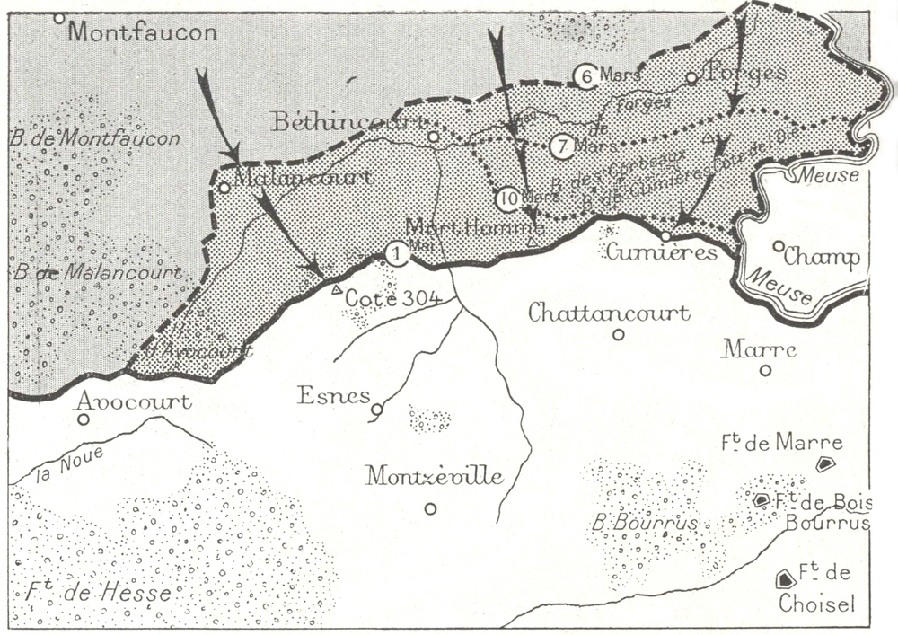
On March 6th, two German divisions attacked from Bethincourt to Forges, where the French front was held by the 67th Division (Aimé) and succeeded in taking Forges and Regnéville, but were checked by the positions on Oie Hill.
Continuing their advance, on the 7th, they succeeded in capturing these positions, as well as Corbeaux Wood. The village of Cumières was the scene of terrible fighting, but remained in the hands of the French, while further to the west the enemy's attacks broke down at Mort-Homme (See page 112).
On March 8th, while on the left bank French troops retook Corbeaux, on the right bank the Germans brought into line units of five army corps and began a general attack, which failed with very heavy losses, their only gain being the capture of part of Vaux village.
On the 9th, they succeeded in getting a footing on the slopes of Mort-Homme, but at the other end of the battle-line their attack on Vaux Fort failed. Their radiograms announcing the capture of the fort were untrue (See page 68).
On the 10th, Corbeaux Wood was taken by the Germans and the French withdrew to the line Bethincourt-Mort-Homme, south of the Corbeaux and Cumières Woods. The battle continued in the village and in front of Vaux Fort, strongly held by the French. The enemy temporarily ceased his massed attacks. In reality his offensive had failed.
On March 10th, Joffre was able to say to the soldiers of Verdun:
(p. 29) "For three weeks you have withstood the most formidable attack which the enemy has yet made. Germany counted on the success of this effort, which she believed would prove irresistible, and for which she used her best troops and most powerful artillery. She hoped by the capture of Verdun to strengthen the courage of her Allies and convince neutrals of German superiority. But she reckoned without you! The eyes of the country are on you. You belong to those of whom it will be said: "They barred the road to Verdun!"
From March 11th to April 9th the aspect of the battle changed. Wide front attacks gave place to local actions, short, violent and limited in scope. On March 14th the enemy captured, from the 75th Brigade, Hill 265 forming the Western portion of Mort-Homme, but they failed to take the Eastern portion. On the 20th, Avocourt and Malancourt Woods fell into the hands of the Bavarians, and after a fierce struggle the village of Malancourt was lost, and then Bethincourt on April 8th. On the right bank, after powerful attacks near Vaux, the enemy reached Caillette Wood and the Vaux-Fleury railway, only to be driven back by the 5th Division (Mangin).
A furious attack was made along both banks by the Germans at noon on April 9th; on the left bank, five divisions were engaged, failing everywhere except at the Mort-Homme, where, despite the heroic resistance of the 42nd Division (Deville), they gained a footing on the N. E. slopes; on the right bank, Poivre Hill was attacked but remained in French hands.
On the following day in his order of the day, General Pétain promulgated his famous message "Courage ... we shall beat them!" (Reproduction page 30).
On April 30th, General Nivelle superseded in supreme command of the Verdun forces General Pétain who had been appointed to the command of the central army group.
(p. 30) "April 9th was a glorious day for our armies", General Pétain declared in his order of the day dated the 10th, "the furious attacks of the soldiers of the Crown Prince broke down everywhere. The infantry, artillery, sappers and aviators of the 2nd Army vied with one another in valour.
"Honour to all.
"No doubt the Germans will attack again. Let all work and watch, that yesterday's success be continued.
"Courage! We shall beat them!"
Ch. Pétain
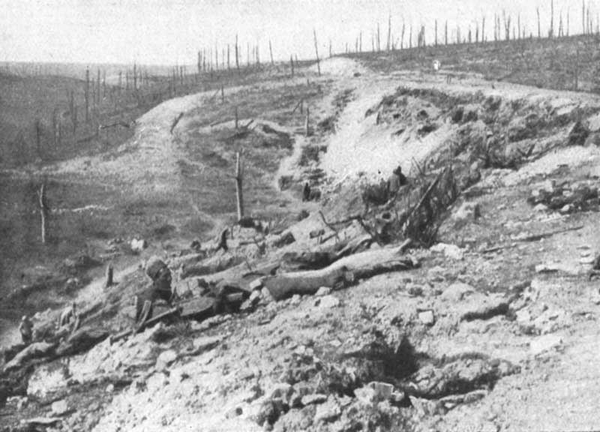
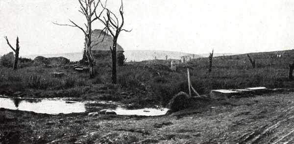
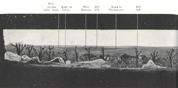
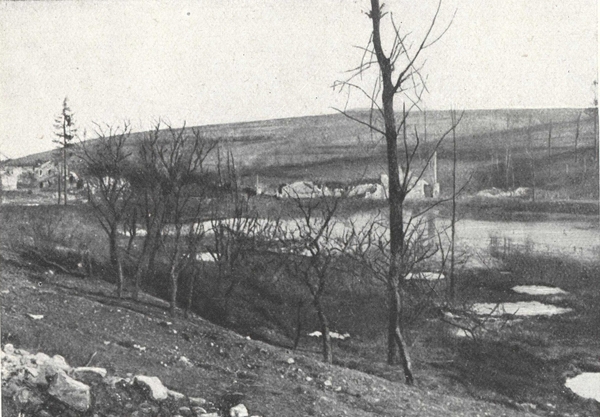
Mort-Homme.—Hills 286 and 295.
In the background, the valley of the Forges stream, Bethincourt on the left, Forges wood on the right.
Third Phase.—The Battle of Attrition (May-September 1916).
The struggle continued obstinately and without interruption on the two banks of the Meuse. The attempt of the enemy to wear down the French forces was in vain, the latter re-organising their defences. Division succeeded division in the defence of Verdun but then were relieved before they were exhausted, so that they came out of the furnace better able to stand its hardships.
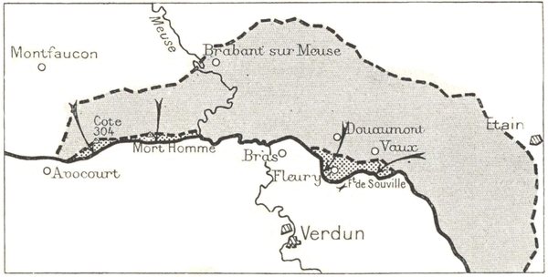
In May the enemy attacked on the left bank of the Meuse with an assault upon Mort-Homme. Then, widening their attacking front in a Westerly direction, they turned upon Hill 304, a strong key position and valuable observation post. The French lost this Hill on May 23rd but retook it the following day. A further month's bitter fighting only gained for the enemy the crest of Mort-Homme and the north slopes of Hill 304.
On May 22nd, with the object of clearing the left bank of the Meuse where the enemy were pressing, the 5th Division (Mangin) attacked on the right bank, in the direction of Douaumont. The central attack alone was successful, the enemy holding their ground inside the fort; their numerous reserves, among them the 1st Bavarian Corps, succeeded in dislodging the attackers on May 24th (See page 90).
Even though Douaumont remained in the enemy's hands, this attack was successful in freeing the left bank by drawing upon the German reserves. The struggle continued without respite or quarter. The Germans, alarmed by the preparations for the Franco-British offensive on the Somme, wished to be finished with Verdun. They, therefore, launched attack after attack but every time they were met by the irresistible will of the French.
The enemy, who in April had captured the village of Vaux, next furiously attacked the fort, and though on June 2nd they occupied the superstructure, it took them five days to subdue the garrison (See page 71).
At the same time they advanced from Douaumont towards Froideterre. On June 9th, Thiaumont Farm was captured, but the redoubt still held out. On the left bank, the enemy resumed their attacks. On May 31st, they (p. 33) outflanked Mort-Homme by the Meuse valley and reached Chattancourt station, but were driven back by a counter attack as far as Cumières. Even if they captured the summit of Hill 304, they could not conquer the South slopes, and they were still far from the fortified barrier of Bois Bourrus.
On the right bank, on the other hand, by holding Douaumont and Vaux the enemy were at hand to break through the barrier of Souville and had within view the basin of Verdun. Here it was that the enemy were going to work for the supreme decision.
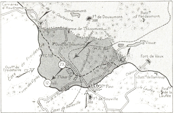
On June 23rd, 70,000 men attacked on the front Thiaumont-Fleury-Vaux. Thiaumont redoubt was captured, waves of attackers being hurled upon the Froideterre redoubt. A counter-attack, however, cleared the plain as far as Thiaumont. In the centre, the enemy by outflanking Fleury on both sides gained a footing there, but in front of Souville they failed utterly (See page 77).
On July 11th, the enemy narrowed their attacking front, from Fleury to Damloup. Putting 40,000 men into the attack, they went through Fleury and crept round by the ravine to the west of the village. They gained a temporary footing in Souville fort from which they were almost immediately ejected (See page 80).
In spite of partial successes, the enemy had failed in their main objectives. Their losses had been enormous and the Franco-British offensive, launched on the Somme on July 1st, took up their reinforcements.
After nearly five month's siege, Verdun was safe. Still bitter fighting raged right on until the middle of August, centreing chiefly round Thiaumont redoubt which changed hands 16 times, Fleury village, recaptured on August 18th after many attempts, and in the woods south of Vaux where the enemy endeavoured to outflank Souville.
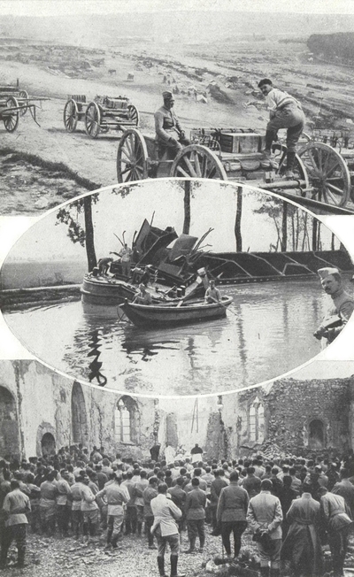
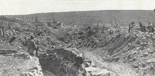
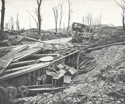
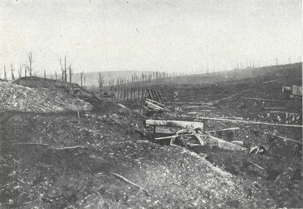
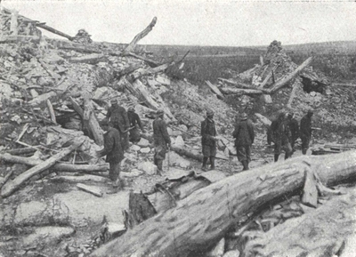
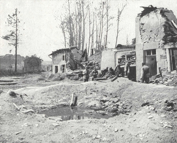
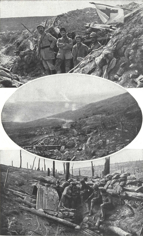
In rear of the battlefield.
Echelons of artillery on the slope of Houdainville.
A pinnace, used as a rest billet, hit by a 380.
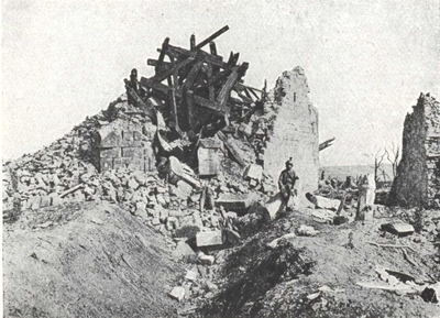
Mass being celebrated in the church of Vaubecourt which had been burnt by bombs from aeroplanes.
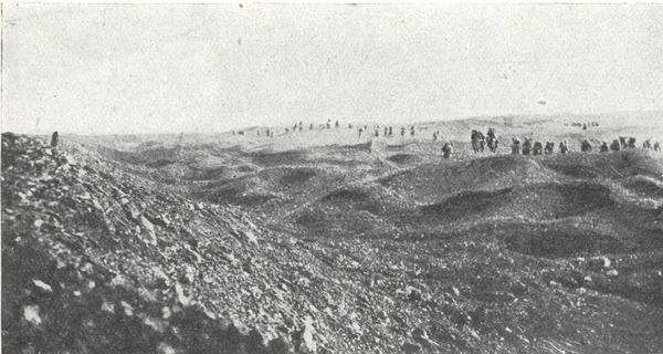
In the Vaux sector.
A fatigue party coming from Tavannes tunnel.—Trenches of the Laufée redoubt (June 1916).—Soldiers going to fetch water from shell-holes in the ravine of Tavannes.

Clearing Verdun on the right bank of the Meuse.
The French offensives of October 24th and December 15th 1916.
In August 1916, the battle of Verdun was a severe check to Germany. It was about to turn into a French victory.
The object was to link up once again the unbroken line of fortresses round Verdun. The time for small attacks aiming at the recapture of a few hundred yards was past. After having first straightened out the salients which the enemy had driven into the French line during June and July, it was only by a complete and simultaneous forward movement that they could make a really useful gain of ground.
To carry the operations to success, Generals Nivelle and Mangin had a powerful artillery force at their command, consisting of 290 field-guns and over 300 heavy guns. Three picked divisions were to form the front attacking line, the 38th (Guyot de Salins) reinforced on the left by the 11th Line Regiment, the 133rd (Passaga), known as "La Gauloise" and the 74th (de Lardemelle). The front line of the enemy consisted of seven divisions.
The French commander intended to win the day not only by the superiority of the troops under his command, but by giving them training and carrying out with precision a new tactical method of attack. The liaison which is so difficult between artillery and infantry was perfectly arranged, following a carefully pre-arranged time-table.
The attacking waves kept just behind a running barrage which slowly lifted forward according to programme.
The attack was made with a double line, and a halt was arranged to allow the units engaged to reorganise.
(p. 37) On October 21st, the artillery preparation started, and was carefully controlled and regulated day by day. On the 23rd a fire broke out in Douaumont fort. On the same day a feint attack gave away the position of new enemy batteries which were at once silenced. This feint deceived the Germans, the Crown Prince being actually deluded into announcing that he had broken up a strong French attack.
The enemy were on their guard; on the 23rd, a German officer taken prisoner said positively: "We shall not capture Verdun any more than you will retake Douaumont".
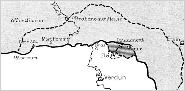
At 11 a.m. on the 24th, in a thick fog, the attack succeeded brilliantly, giving the French the Haudromont quarries, Thiaumont redoubts and farm, Douaumont fort and village (see page 92), the northern edge of Caillette wood, right up to Vaux pond, the edge of Fumin wood and Damloup battery. On the 24th and 25th more than 6,000 prisoners were taken and 15 guns. On November 2nd, when they re-entered Vaux fort which the enemy had abandoned, the French were practically on their line of February 25th.
On December 12th, General Nivelle took over supreme command. General Guillaumat took his place in command of the Verdun army.
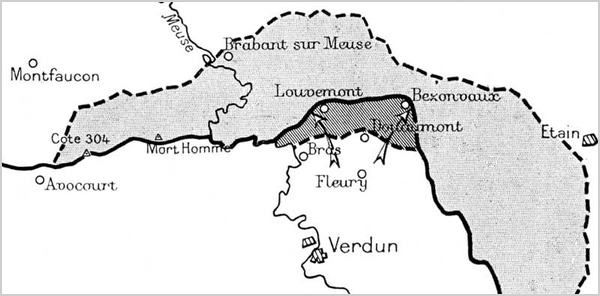
To completely clear Verdun to the east of the Meuse and give greater freedom to the reconquered forts of Vaux and Douaumont, General Mangin organised a new attack. A great amount of preparatory work was done by the army of Verdun, who constructed about eighteen miles of road including one of logs laid transversely for the artillery, besides more than 6 miles of narrow-gauge railway, together with out-going and incoming trenches, and depots for munitions, bombs and material generally. As soon as these very considerable preparations, often carried out under heavy enemy shell-fire, were finished, the attacking troops took up their positions; the 126th Infantry Division (Muteau), 38th Infantry Division (Guyot de Salins), 37th Infantry Division (Garnier-Duplessis) and 133rd Infantry Division (Passaga), with the 123rd, 128th, 21st and 6th Infantry Divisions as reserves. Two lines of artillery prepared and supported the attack. The six-mile German front from Vacherauville to Bezonvaux was held by 5 divisions in the first line with 4 divisions in reserve.
At 10 a.m., on December 15th, when Germany was proposing that France should sue for peace, the attacking waves were launched, protected by a moving curtain of artillery fire. Several of the objectives, including Vacherauville, the first and second lines before Louvemont, were reached in a few minutes at a single bound. The woods and ravines before Douaumont took longer to capture, while Vauche wood was carried at the point of the bayonet. Les Chambrettes and Bezonvaux were taken on the following days. The success was considerable, more than 11,000 prisoners, including 300 officers, 115 guns, several hundred machine-guns and important depots of munitions and material, being captured. The enemy who, in July, had been within a few hundred yards of Souville Fort, was now more than three miles away. In June, the Frankfort Gazette, celebrating the German successes at Verdun, declared: "We have clinched our victory and none can take it from us", but on December 18th they had lost all the ground it had taken five months and enormous sacrifices to conquer.
In congratulating the troops General Mangin reminded them that Germany had just invited France to sue for peace, adding that they had been "the true ambassadors of the Republic".
(p. 38)
 |
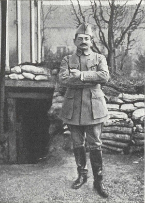 |
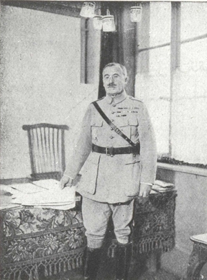
| General Nivelle. | General Mangin. |
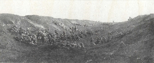
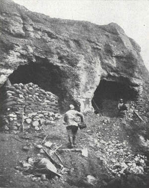
In the great quarries (500 yards west of Vaux fort).
Troops in reserve waiting for the time to move off.
For several months Verdun again became almost quiet, the battle area shifting to the Chemin des Dames, Flanders and the Isonzo. General Pétain decided to shatter the enemy on the Verdun front.
The victory of Louvemont-Bezonvaux, while completely clearing Douaumont, had left the observation posts on Talou Hill in the hands of the enemy, who still held, on the left bank, the excellent positions of Hill 304 and Mort-Homme.
These they had had plenty of time to fortify, and the troops were housed in deep tunnels and properly connected up positions. The enemy had noticed the French preparations for this new offensive and had accordingly considerably strengthened their artillery (to nearly 400 batteries) and their fighting effectives (to nine divisions on the Avocourt-Woëvre line, with five in reserve).
On the French side, the ground had been for several months prepared for the battle. Across the battlefield which had been shockingly cut up by fire, roads had been prepared, liaison strengthened and the question of supplies studied for a long while. Artillery preparations included 2,500 guns of all kinds.
In this battle, artillery was to play the most important part. An army corps of 20,000 infantrymen was to be supported by 40,000 artillerymen. Four corps, 13th (Linder), 16th (Corvisart), 15th (de Fontclare), 32nd (Passaga) comprising 8 divisions in the line and 2 in reserve, took part in this offensive.
(p. 41) The artillery bombardment started on August 13th and systematically flattened out the German positions. On August 20th, at dawn, under the eyes of the officers of the new American Army who from various observation posts followed the course of the battle, 8 divisions attacked. Mort-Homme, Oie Hill and Talou Hill were captured, Hill 304 alone remaining in enemy hands. There was a stream of prisoners and munitions, in the tunnels of Mort-Homme over 1,000 men being unable to escape. On the following day Samogneux and Regnéville fell, and a systematic attack led to the capture of Hill 304 on August 24th.
The booty from August 20th to 26th comprised 9,500 prisoners, 39 guns, 100 trench mortars and 242 machine guns.
On the left bank, the French line was advanced as far as the Forges stream.
On the right bank, the enemy unsuccessfully endeavoured, by strong counter-attacks, over a period of nearly two months, to recapture the lost ground.
Verdun was completely cleared and the first French lines were advanced to approximately 7 miles to the north.
Thus in 3 battles, October 24th, December 15th, August 20-21st, the Germans were driven out of all the positions which they had held since the third day of the battle. There was left in their hands only what had formed, in February 1916, the advance line of the French defence, where, during the first two days of the battle, the covering divisions had been sacrificed.
On the reconquered hill 304: An aid post (August 22nd 1917). At the foot of the reconquered hill 304: Bombardment by gas shells. South of Beaumont: Caurettes Wood.
The Battle of Verdun was not merely one of the hardest of the War's many battles, it was also one of the most serious checks received by the Germans. The enemy High Command had foreseen neither its amplitude nor its long duration. Whereas, "according to plan", Verdun—"Heart of France"—was speedily to be overpowered by a carefully prepared mass attack, the Germans found themselves involved in a formidable struggle, without being able either to obtain a decisive advantage or keep the relatively small advantages obtained at the beginning of the battle.
The battle did not develop "according to plan", its successive phases being determined by circumstances. The huge reinforcements which the Germans were compelled to call upon bring out very clearly the immensity of the enemy effort.
From February 21st 1916 to February 1st 1917 the Germans made use of fifty-six and a half divisions, i.e. 567 battalions, in front of Verdun. Of these fifty-six and a half divisions, six divisions appeared successively on both banks of the Meuse, eight others being also engaged twice and six three times. In reality, in the course of eleven months, eighty-two and a half German divisions (nearly 1,800,000 men), took part in the attacks on Verdun, which they had expected to crush in a few days with ten to twelve divisions. The contrast between this formidable effort and the meagre results obtained is striking, and is a splendid testimony to the courage and tenacity of the defenders.
This battle, by using up the best troops the Germans could put into the field, had serious strategic results for the enemy.
Hindenburg in his Memoirs states "This battle exhausted our forces like a wound that never heals."
"At Verdun France learnt to know herself", writes L. Gillet in his wonderful book The Battle of Verdun.
"The Marne was not enough to show France what she really was. A day of inspiration, a few hours of frenzy, a burst of enthusiasm, a sudden glow of rage and passion with Marseillaises sounding on all sides, the world knew us to be capable of flashes like these. But the world did not know—nor did we ourselves—our own sterling virtue.
"We were the country of improvisation, the country of laughing nonchalance, varied with attacks of fever: we had forgotten our strength of continuity. Thanks to the length of the battle, France was able to measure her reserves of endurance. In this continuous struggle which brought, one after another, men of every village to the same tragic scene, each was inspired with the determination to do at least as well as those who had preceded him. Then, when their turn had come to be relieved, after unheard of ordeals, they read again and again, in the communiqué's, the names of the same hills and awful woods where they had held the line, and learnt that others in their turn kept holding on....
"Instead of a succession of isolated deeds of valour, Verdun was for the whole French Army an heroic exploit in which all shared alike. France bled soldiers from all her wounds. At Verdun she was inspired with something solemn, sacred and unanimous, like the spirit of a religious crusade."
As President Poincaré declared on September 13th 1916, when he handed to the Mayor of Verdun the decorations conferred upon the town by the Allied Nations, it was before the walls of Verdun that "the highest hopes of Imperial Germany were crushed". At Verdun, Germany had sought to achieve an overwhelming spectacular success, and it was there that France had replied quietly but firmly "They shall never pass".
"For centuries to come, in all parts of the world the name of Verdun would continue to ring like a cry of victory and a sound of joy uttered by a people delivered from tyranny."
During the winter 1917-1918 the Verdun-Argonne front remained quiet, but the year 1918 opened with ill omens.
Russia gave in and Rumania, left to struggle alone, was forced to terms.
After the straightening out of the Château-Thierry and Amiens salients (July-August 1918).
The General Attack (October-November 1918.)
The Germans reckoned in 1918 to make an end of the Allies. They attacked successively in Picardy, on the Chemin des Dames, in front of Compiègne in Champagne. But whenever these attacks succeeded in driving small salients in the line, the front was at once reunited and the enemy fell short of victory. On July 18th, a decisive move was reached when the Allies in their turn took the initiative.
After the counter-attack of July, which drove the Germans from the Marne to the Vesle, the battle shifted to the flanks. Offensive followed offensive with unfailing regularity, first on the left (the Franco-British offensive (p. 46) of August 8th), then in Artois (the offensive of August 20th) and lastly against the whole of the Hindenburg line which the Allies attacked on September 1st.
The Germans were already greatly shaken but Marshal Foch gave them (p. 47) no respite, and to prevent their recovery he redoubled his attacks.
Three simultaneous offensives were envisaged, on the left wing, in Flanders, the combined Belgian, French and British Armies under King Albert; in the centre the 3rd and 4th British Armies and the 1st French Army; on the right wing, in Champagne and in Argonne, the 4th French Army (Gouraud) and the 1st American Army (Pershing).
As a prelude to taking its place in the line for the great offensive, the American Army had already fought the brilliant action of September 12th-14th which reduced the Saint-Mihiel salient.
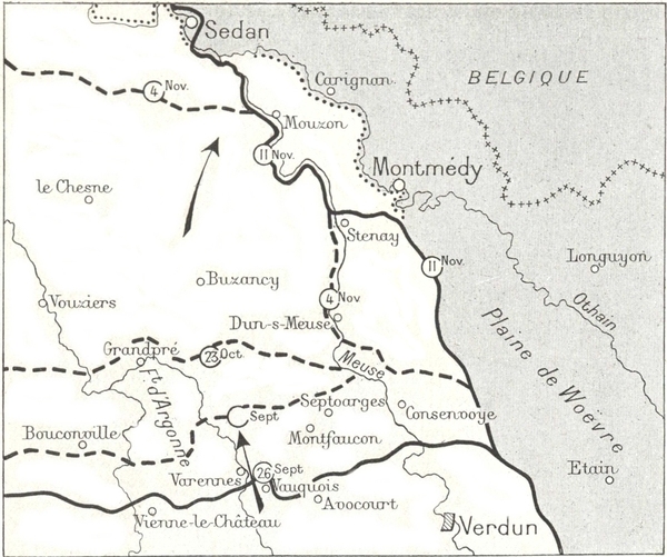
On September 26th, at the same time as the 4th French Army (General Gouraud) attacked the enemy in Champagne, the American Army under the command of General Pershing, took the offensive between the Argonne and the Meuse.
The artillery preparation was terrific but of short duration, lasting only three hours.
At 5.30 a.m. the Americans furiously assaulted the strong German positions on the left bank of the Meuse and captured the whole line from Avocourt to Forges right away. The artillery, keeping in close support, cleared the stream of Forges during the morning.
The woods which were strongly held were also cleared and by midday the Americans reached the south of Montfaucon.
During the afternoon a stubborn encounter took place on the positions (p. 48) covering Montfaucon, a formidable peak and the most valuable enemy observation post in the neighbourhood of Verdun.
The Americans wisely outflanked the peak on the right and advanced to Septsarges, so that by nightfall Montfaucon was encircled.
On the 27th and 28th, the advance was slower and continued westerly in spite of enemy counter-attacks; Montfaucon was captured.
The American spoils included 8,000 prisoners and 100 guns.
On October 4th, Pershing launched an attack on his whole army front. But the enemy stiffened their resistance by bringing up numerous reinforcements. On the right bank of the Meuse, the 17th French Army Corps (Claudel) and two American Divisions were then brought into the fray, reaching and quickly passing the famous line from which the Crown Prince, in February 1916, had launched his attack upon Verdun.
On October 14th a general attack was launched.
The Germans resisted desperately but could not regain any advantage. Their resources were diminishing and battalions were withdrawn to be hastily reorganised in rear and then put in the line again at once.
Round Grandpré a furious fight raged.
By the end of October the Germans had lost, on the two banks of the Meuse, since September 26th, 20,000 prisoners, 150 guns, 1,000 trench mortars, and 6,000 machine guns.
In the North, the Belgians had just cleared their coast-line, and were menacing the enemy by an advance into the very heart of Belgium. The British had occupied Lille and broken down the defences of the Hindenburg Line. Meanwhile, the French, relentlessly driving back the retreating enemy, had entered Laon, after forcing the formidable bastion of the Saint-Gobain Forest.
On November 1st, a new offensive was opened up by Gouraud's Army and the 1st American Army, resulting in a gain of several kilometres. The enemy fell back on the great Sedan-Metz highway, the approaches to which they wanted to defend at all cost.
On November 4th, the 3rd American Corps reached the Meuse between Mouzon and Stenay.
The Germans withdrew on the right bank.
On the 8th, the French entered Sedan and, on the 9th, Mézières.
On the 10th, the enemy was driven back on the extreme right, to the foot of the Meuse Heights and South of Stenay by the 17th French Army Corps.
On November 11th, with the threat of a fresh offensive in Lorraine, the Germans surrendered in open country to save themselves from complete destruction.

The valley of the Meuse to the south of Consenvoye.
A French photograph used in the preparation of the American offensive on the banks of the Meuse in September 1918.
The barbed-wire entanglements and trenches are plainly indicated.
Nine days before the German capitulation in open country on November 11th 1918.
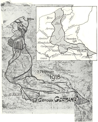
This sketch represents a set of maps scale 1/200,000 on which the Staff-major of the 20th Corps used to trace the line each day.
By strengthening the two lines of July 15th and November 2nd, which are accurately reproduced, and by adding a few lines inside and the point of the helmet, a draughtsman of the Staff-major obtained this curious figure of Germany brought to her knees.
From the plan one can easily recognise the salients of Ypres and Arras, the indentation of Montdidier, and that of Château-Thierry intersecting the Vesle, the salients of Reims and Verdun and the break through at Saint-Mihiel.
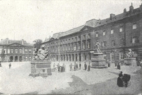
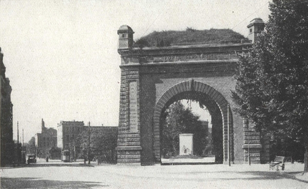
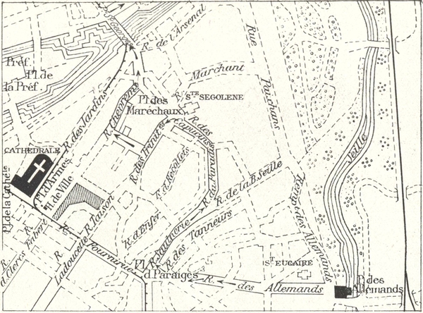
The motorist coming either from Sainte-Menehould or Bar-le-Duc, via the "Sacred Way" enters Verdun by the Porte de France, and reaches the cathedral by the Rues: Saint-Maur, Chevert, and la Belle-Vierge.
The tourist coming from the station by the Porte Saint-Paul, reaches the Cathedral by the Rues: Saint-Paul, Saint-Pierre and la Belle-Vierge.
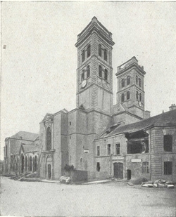
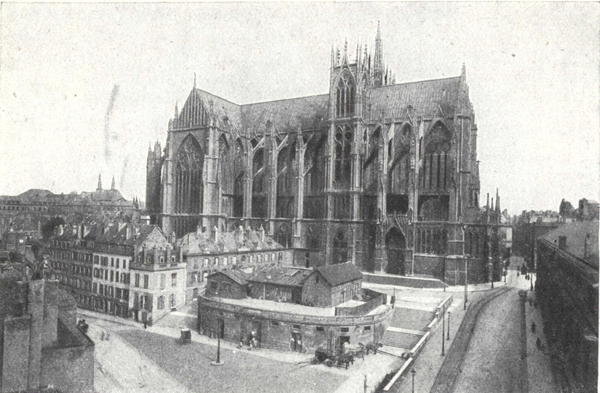
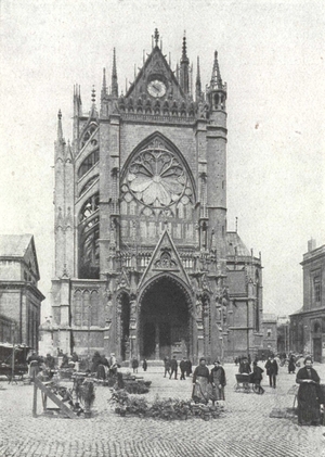
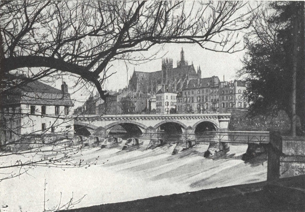
The tourist, arriving at the Place de la Cathédrale, via the Rue de la Belle-Vierge, finds himself in front of the North Façade (photo opposite).
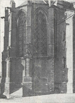
In the middle is the entrance porch; on the right, the Western transept and the towers enclosing the remarkable, square-shaped old Choir, on the left, the Eastern transept and the polygonal apse of the Great Choir with the Roman basement and Gothic buttresses (photo p. 52).
In front of the towers and on the right, in the photograph opposite, is the entrance to Margueritte College leading to the Bishop's Palace and the Cloister.
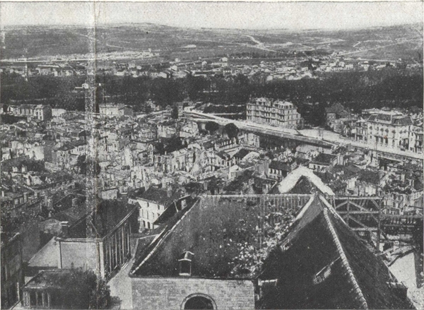
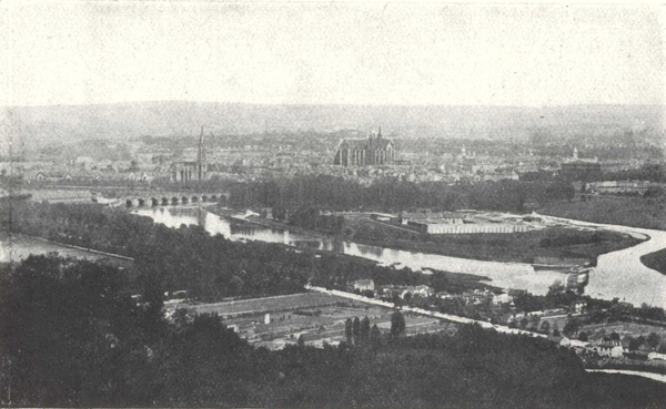
Verdun seen from one of the Cathedral Towers.
In the foreground: Roof of nave, transept and great choir of the Cathedral. In the middle-ground, The Meuse: on the left, the Porte Chaussée in the middle: Military Club. In the background: Line of trees marking the ramparts; behind Belleville Village (on the left) and the Faubourg Pavé. On the horizon: Belleville Hills.
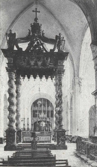
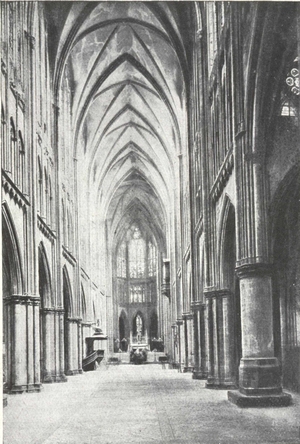
On entering the Cathedral by the central porch of the north façade, the old choir is on the right and on the left the great choir.
The old square choir is intersected by the great organ.
In the great choir, notice the elegant panelling of Rococo-style and the ciborium with canopy supported by twisted columns of grey marble.
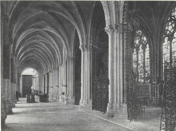
The numerous side-chapels are 14th, 15th and 16th century.
The most interesting is in the South Aisle, that of the Blessed Sacrament, Radial-Gothic in style (photo above).
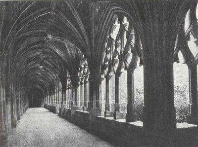
The door of Margueritte College (see photo page 51) leads to the courtyard of the Bishop's Palace (18th century) and thence to the Cloister (historical monument of the 13th and 14th centuries, photos p. 54.)
From the Bishop's palace, go along the Rue Chatel to the Place Chatel, then down the Rue des Hauts-Fins, and cross the Esplanade to the Citadelle.
The Cloister seen from one of the Cathedral Towers.
In the background: the East Gallery.—On the right: the ruins of the South Gallery.—In the town can be seen the church of Saint-Sauveur against the green background of the fortifications.
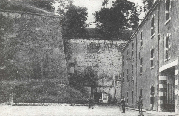
The Citadelle occupies the site of the ancient abbeys or churches of Sainte-Vanne, erected in the Merovingian period and the 15th century.
The first Citadelle was completed under Henry IV. The second was the work of Vauban. The church of Sainte-Vanne which had survived was pulled down in 1831. During the war, the deep underground caves were a safe place of refuge for the inhabitants before their departure and for relief troops during the battle.
On leaving the Citadelle, turn right and go down the slope towards the Meuse and the Rue de Rû, keeping to the right. Go by the stores and then the octroi where the shops are located, and enter the Citadelle by No. 4 listening-post, to visit some of the caverns fitted up as they were in the war.
Here can be seen in particular, under a military guide, the chamber of honour where were laid to rest in November 1920 the bodies of 8 unknown soldiers, from among whom was taken the Unknown Warrior who rests in Paris beneath the Arc de Triomphe.
Return from the Citadelle by the Rue de Rû, passing the theatre. Continue along the Rue Mazel to the site of the monument "Aux morts de Verdun" (see next page), return to the Place Mazel, turn right, cross the Meuse, and the Place Chevert is reached.
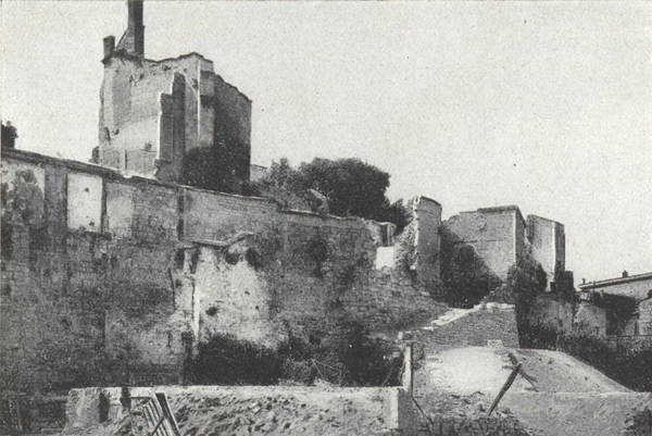
The Rue Mazel. The Old Ramparts in 1924.
Site of the War Memorial shown below.
(Photo Sommer.)
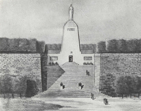
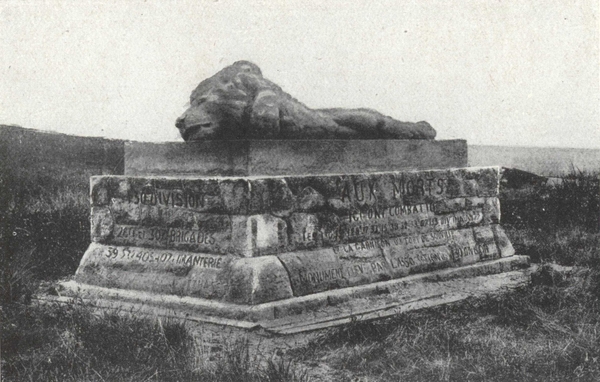
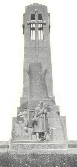
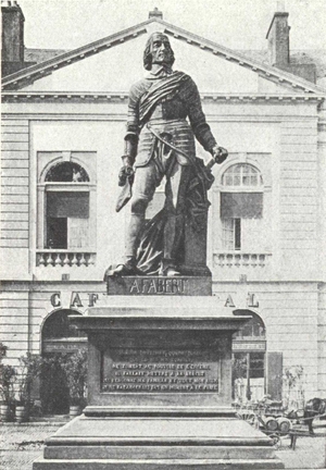
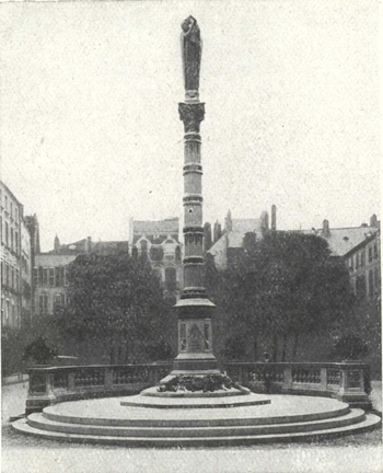
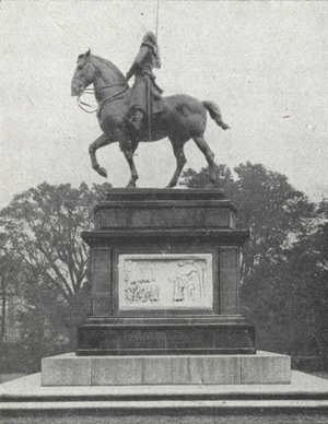
The Monument to the Soldiers of Verdun, erected by national subscription. (L. Chesnay, architect).
A crypt will be opened in the base of the monument where will be laid to rest the 7 Unknown Soldiers, a touching symbol of the sacrifice of the soldiers of Verdun (April 1925).
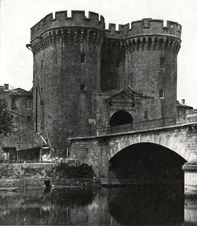
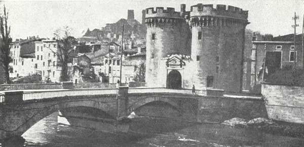
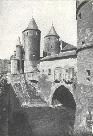
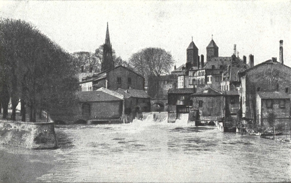
From the Place Chevert, follow the Meuse to the right to the Porte Chaussée.
Its architecture is reminiscent of the Bastille. Half of the left tower, on the river, was rebuilt in 1690 on exactly the same lines and with stones of the old tower: the semi-circular arcade and the pediment facing the bridge are of the same date.
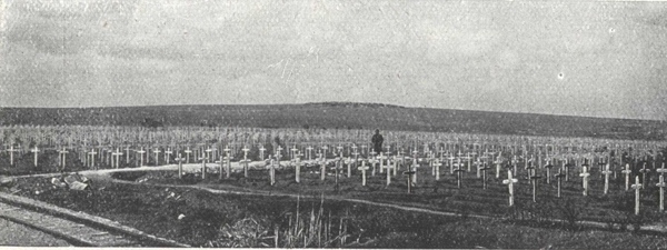
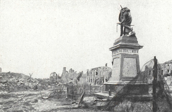
Four hundred thousand Frenchmen died for their Country on the battlefields of Verdun.
It is with feelings of deep respect that tourists visit the sacred ground and thus pay tribute to the heroes who there laid down their lives.
Four routes starting from Verdun lead to the most famous battle areas.
1st Route. The right bank of the Meuse and the forts of Tavannes, Vaux, Souville and Douaumont.
2nd Route. The left bank of the Meuse, Cumières, Mort-Homme, Hill 304 and the "Sacred Way".
(p. 61) 3rd Route. Calonne Trenches, Éparges Ridge and the Woëvre plain.
The battlefields of the Argonne adjoin on the West those of Verdun. We pick up at Esnes the route that leads to this region (2nd route opposite).
4th Route. Montfaucon, Romagne, Vauquois mound, Varennes, the forest of Argonne, Haute Chevauchée and the valley of the Biesme.
This volume ends with the visit to Metz, the Cathedral and the Place d'Armes, the Esplanade, and the new and old quarters.
Leave Verdun by the porte Chaussée, cross the Meuse, and the fortified enclosure and turn left along the Rue d'Étain (N. 18).
This takes one up the Faubourg Pavé used by relief troops holding the Vaux and Douaumont sectors.
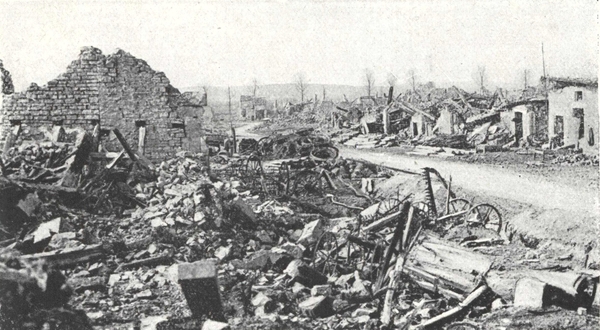
The bombardment of this suburb was incessant until after Verdun was completely cleared in December 1916.
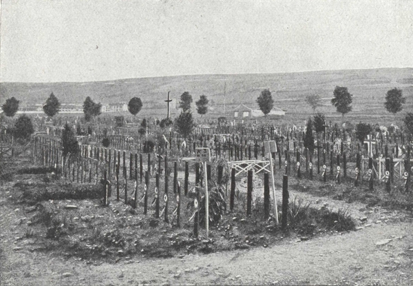
On the left, the tricolor floats over a military cemetery containing over 6,000 graves. This is the Faubourg Pavé cemetery.
On the crest of the hills, on the left, are the forts of Belleville, Saint-Michel and the Marceau barracks which were utterly destroyed. Here started the rear of the battlefield. Behind this crest the field kitchens of the units in the line were concealed. Every night, the fatigue parties, known as "cuistots", facing a thousand dangers started from here to take up food to the men in the line.
Follow the Route Nationale for about 6 km.; beyond the Cabaret Rouge Inn on the right, and the Valteline ravine on the left, the road ascends. Go past the cross-road at Bellevue farm and then turn left by the road leading to Tavannes fort.
The road runs downhill and then rises across the shattered Hospices Wood.
Take the metalled road on the right leading to Tavannes fort.
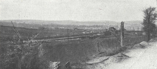
Built of stone about 1880 it was never concreted, like Vaux and Douaumont forts. Tavannes fort dominates the ground behind the Vaux-Souville line and the Étain-Verdun road. The Germans, in their effort to reach Souville, sought by frequent bombardments to destroy the fort which resisted stubbornly, but on May 7th a 17-inch shell destroyed one of the arches and caused serious damage. Looking westwards, the horizon is bounded by the long straight line of plateaux. There are three elevations on this line, three points which mark the tragic battlefield of Verdun; on the left the Saint-Michel fort which immediately dominates the basin of Verdun; in the centre nearer still, Souville fort; and finally, further away, on the right, Douaumont.
Return to the road by which the fort was reached and turn into it on the right, following it for about 300 metres until you come to the fork.
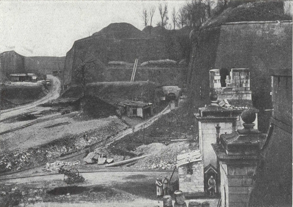
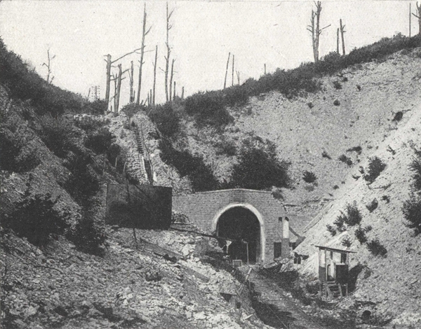
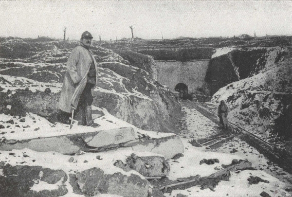
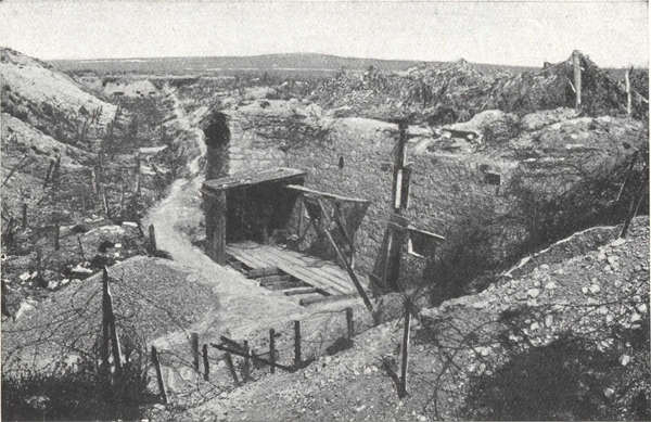
At this fork the road passes above Tavannes tunnel. By following to the left the line of telegraph poles the West entrance is reached.
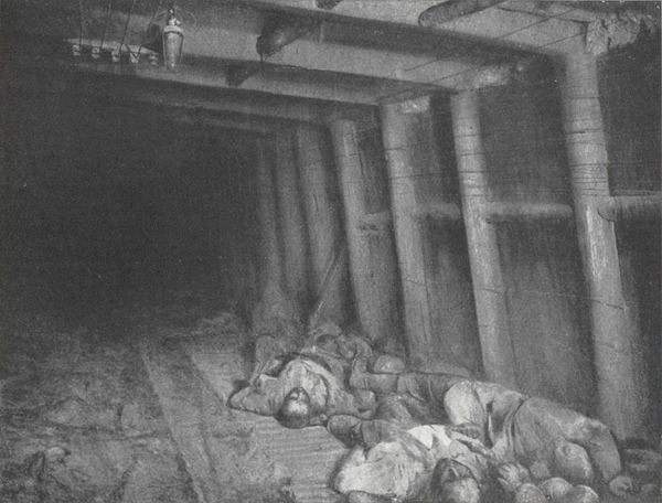
Although the entrances were constantly shelled by enemy artillery, this tunnel was used as a shelter for the reserves of the Vaux-Souville sector and as a munitions depot. Bunks were fitted up in three superimposed rows, 300 to 450 feet in length, and separated by spaces, where those who could not find bunks slept as they could on the ground. Despite the ventilating shafts in this tunnel 1,500 metres long, the air remained foul owing to the stenches of all kinds. On the night of September 4th-5th a grenade depot blew up, causing many victims.
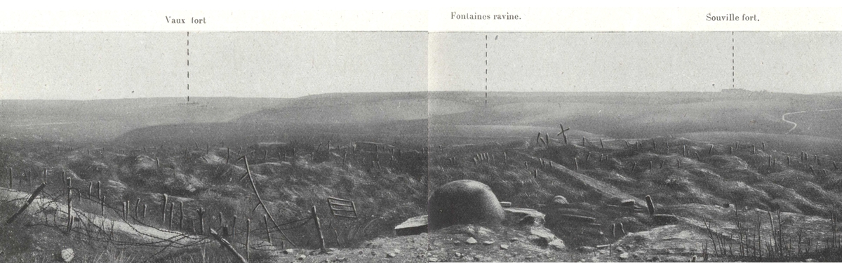
At the fork, take the road on the right to Vaux Fort. At a sharp bend on this road, the Tavannes ravine, where the railway from Verdun to Metz runs, dips down to the plain of the Woëvre.
The road rises to a plateau formerly wooded but now only a kind of brownish moorland, dotted with tree stumps. On the left can be seen what remains of Vaux-Chapitre Wood and, on the right, the remnants of Laufée and Chênois woods.
By crossing Horgne ravine an open plateau is reached, at the end of which is silhouetted a kind of rock, rugged and uneven "like sandbanks thrown up by a mighty sea over the ages". This rock is Vaux fort.
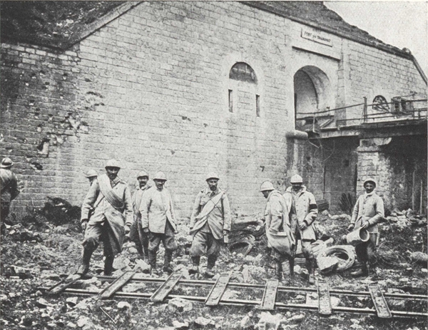
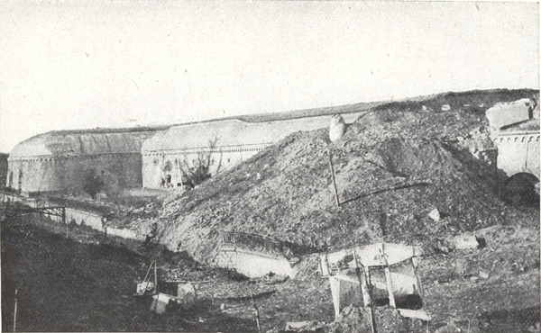
Built of masonry about 1880 and afterwards reconstructed in reinforced concrete, the fort was only completed in 1911. Smaller and less powerful than Douaumont fort, it dominates the plateau to the south of Vaux ravine and the reverse side of Douaumont plateau. Hence its importance.
To follow the battles which were unfolded round Vaux fort, let us climb on to the superstructure of the fort. From there a huge panorama lies before our eyes.
To the north is seen a deep ravine, Bazil ravine, at the bottom of which glistens Vaux pool. Vaux village, situated more to the right, has totally disappeared, Meusien station has been rebuilt there, its red-tiled roof shewing vividly against the dark mass of Hardaumont Ridge.
On the left, the ground rises towards a crest, forming the slopes of Fausse-Côte and Caillette woods. The projection on the crest is Douaumont fort.
On the right, the Woëvre plain extends to the horizon: in clear weather the blue line of the Moselle Heights is visible. The plain is overlooked by hills, on the nearest of which was the site of the Damloup battery. At the foot are the ruins of Damloup village where the Horgne ravine starts.
During the early days of March 1916, the Germans reached the crest on the horizon, to the north of Vaux fort, from Douaumont to Hardaumont redoubt.
To storm the entrance to Bazil ravine by capturing the village and Vaux pool, then to outflank the fort by the ravine at the same time as they delivered a frontal attack, such was the manœuvre which the enemy intended to attempt in March and April.
On March 1st, in front of Vaux village and fort, the French front was held by the 303rd Brigade (Naulin), 408th and 409th Regiments, which were going to be reinforced by the arrival of the 1st, 3rd and 31st Battalions of chasseurs and parts of the 38th, 86th, 158th, 149th infantry Regiments and the 71st territorial Regiment.
From March 6th to 11th the enemy, regardless of sacrifices, attacked madly in mass.
They reached the western edge of the village but were driven back at the point of the bayonet. Barricades blocked the main street of the village which was defended at all costs.
The enemy were so eager that they made a direct attack on the fort. The attacking waves climbed the brow. The slopes, which are very steep to start with, concealed them and gave them protection, but as soon as they reached the more gradual slopes leading to the fort, they were mown to the ground and fled back in disorder, leaving more than 200 corpses in front of the barbed wire.
The attack of March 9th was made with such confidence in their victory that the German commander announced in his communiqué: "Vaux village and fort, after a strong artillery preparation, were captured in a brilliant night attack by the 6th and 19th Posen Regiments".
On the next day, to justify this lying message, a new attack was ordered, which failed in spite of a deluge of fire rained upon the shell of the fort.
Colonel Naulin, commanding the 303rd Brigade, wrote in his report: "This period is particularly trying, especially from March 9th onwards. The iron rations have been eaten up: food supplies no longer reach us and we are out of water: on the 10th and 11th the garrison is reduced to drinking melted snow. In spite of everything, the morale has never been better. The men realise that the sacrifices cheerfully made have not been in vain and that behind them, Vaux fort though battered beyond recognition is still ours...."
The South-West edges of Vaux in May 1916.
On the left, Bazil ravine and the tip of Vaux pool.
In the centre, the village ranging along the northern slopes of hill containing Vaux fort.
The village and pool of Vaux in April 1916 viewed from Hardaumont crest.
In the background, the hill where Vaux fort is situated.
Losses were however, heavy on both sides, the 303rd Brigade when relieved having lost 2,500 men and 65 officers.
On the 31st, fighting broke out afresh. In the village of Vaux, the attackers surrounded the garrison which made its escape and clung to the Western outskirts.
On April 2nd, a fresh enemy division swarmed down the southern slopes (p. 71) of Caillette wood and reached Bazil ravine. It was a serious moment. Douaumont was outflanked to the South, and Vaux to the West.
The 3rd Corps (Nivelle) was rushed to the relief, the 5th Division (Mangin) at the head; Mangin had only the 74th Regiment available at the moment. There was no time to lose. Mangin reached Souville where he turned and said to the colonel of the 74th who accompanied him: "My friend, no half-measures here but get to close quarters with the Boches and get after them with bombs".
The 74th and then the whole 9th Brigade crossed Bazil ravine, which was filled with gas, cleared Caillette wood with bombs and at the point of the bayonet, and held fast to the recaptured line, repelling all counter-attack.
On April 9th and 10th the enemy again attacked unsuccessfully in front of the fort but captured Vaux village.
At the beginning of June the enemy planned to make violent attacks upon Vaux fort.
Occupying the village, they held the head of Bazil ravine. Their plan was to outflank the fort simultaneously on the West by Fumin ravine and wood and on the South-East by Horgne ravine.
On June 1st, in front of Damloup, their attack failed, but in the centre the bombardment overwhelmed and almost buried the 6th French Division which barred the Bazil ravine.
Deploying from the ravine the enemy advanced through Fumin wood.
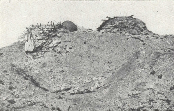
On June 2nd, after the fall of Damloup, the enemy progressed through Horgne ravine. The fort, pounded by a storm of 210, 380, and 420 shells was threatened simultaneously from 3 sides, and closely besieged. Survivors from the trenches at hand took refuge in the fort. In the redoubt to the west of the fort a handful of foot-soldiers of the 101st died fighting to the last man.
The Germans reorganised on the flanks of the hill and repulsed all counter-attacks.
Vaux Fort: the north moat has been half filled in; the casemates which guard it.
On the horizon, Douaumont fort.
(Photo Martin Collardelle.)
On June 3rd, at dawn, a wave of German pioneers crept through the fog and smoke, eluding the look-out men at the fort, captured the Casemates on the North Moat (Photo above), then got down into the half-filled moat, and crept stealthily along the funnels on to the superstructure of the fort, where they put their machine guns in position.
Since March, the fort and its surroundings had received no less than 8,000 heavy shells every day. The Commandant Raynal, who was O. C. of the fort, was imprisoned underground with his men. The garrison, regularly composed of the 6th company, a company of machine guns of the 142nd and about 40 artillery men and sappers was augmented by two companies of the 142nd, a company of the 101st and a company of machine guns of the 53rd who had taken refuge there.
To economise food and water, the surplus contingents were ordered by Commandant Raynal to leave the fort. On the night of the 4th-5th, a first detachment of the 142nd made its escape under the direction of Lieutenant Buffet, who returned next evening to the fort bringing orders. On the night of the 5th a hundred more men managed to get away. Carrier pigeons and optical signals soon furnished the only means of communication.
On the afternoon of the 4th, the last pigeon was released. On the morning of the 5th, thanks to two signalmen who volunteered to change a signal post which the Commandant had difficulty in observing, communications were maintained.
On the evening of the 5th, Commandant Raynal sent his last message that could be read in its entirety, and which ended: "We have reached the limit, officers and soldiers have done their duty. Long live France". Nevertheless, the fort continued to hold out and refused to surrender.
On the night of the 6th, 7th, reinforcements tried to relieve it and reached the moat, but after losing nearly all their officers they were compelled to fall back.
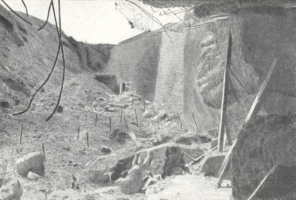
The north-east moat of Vaux Fort in April 1916.
View of the north casemate demolished by the bombardment.
The Germans who had gained a footing in the ruins of the superstructure, were only able to drive the French out of the casemates by lowering baskets of grenades with time fuses and by spurting liquid fire and asphyxiating gas.
Driven back in the underground passages, the defenders continued the fight with grenades and bayonets. The sand bags which were used to barricade the passages were thrown into the air by the rending explosions. Attackers ran at every turn against machine guns or bombers.
"Captain Tabourot, who was defending the north-east gate, lies writhing in agony, wounded in the stomach and with broken legs. The aid post is a hell where hundreds of wounded lie parched with thirst in the stinking darkness of paraffin lamps. Water is unobtainable. The stench increases, in the atmosphere of smoke and gas it is impossible to breathe. On the 7th, at 3.50 a.m. the fort signals again, and these are the only words that are read "... at the bitter end.... Vive la France!" (L. Gillet).
The 2nd regiment of Zouaves and the Colonial regiment of Morocco made a last effort on the morning of the 8th to relieve the garrison. They reached the approaches of the fort, from which clouds of thick black smoke, caused by a violent explosion in one of the casemates, were pouring. Exposed to the fire of the enemy machine-guns installed in the superstructure of the fort and attacked by constantly increasing reinforcements, they were unable to hold their ground.
On the 8th, at 4 p.m. when the German communiqué announced the capture of the fort, the heroic defenders were at last overpowered, the unwounded among them not having tasted a drop of water for two days.
By winning the admiration of the enemy, the Commandant Raynal was allowed to keep his sword in captivity and his heroic men were accorded special treatment.
Five months later, on November 2nd, after the victory of Douaumont, the Germans hurriedly evacuated the fort.
Under the escort of one of the garrison the interior of the fort may be viewed.
Notice in the passages the marks made by bursting bombs. The dummy barricades with loop holes which obstruct the passages were built by the French in 1917, after the recapture of the fort, they replace the walls of sandbags which Commandant Raynal's heroic garrison had put up.
On leaving Vaux fort, return along the same road to the fork of Tavannes tunnel.
A hundred metres beyond the first bend on this road, the furthest line reached by the Germans in September 1916 is crossed: this line then runs down to the left to Woëvre, passing between Damloup battery, captured on July 11th 1916, and Laufée redoubt.
The whole field of battle is entirely pounded up. A few rudimentary trenches can only be discerned with difficulty here and there.
The woods which used to cover the plateau of Vaux fort and the slopes of Horgne ravine have disappeared.—The much worn surface looks like a sponge.
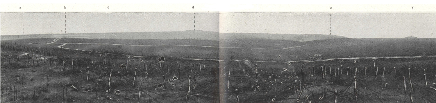
Panorama view of the north slopes of Souville.
a. Froideterre Hill.—b. Thiaumont Redoubt.—c. Douaumont Mortuary.—d. Douaumont Fort.—e. Hardaumont Crest.—f. Vaux Fort.
At the fork at Tavannes tunnel, turn right towards Souville fort seen immediately in front.
On the right, the ruins of Tunnel and Hôpital batteries; on the left, the ravine of Hôpital wood, with trees denuded of branches. This ravine was crammed with artillery batteries which were daily subjected to fire and deluged with poison gas.
The road turns to the right, at the foot of the escarpments of Souville fort, the shapeless mass of which dominates the ridge. After passing the ridge, the vast panorama of the Souville-Douaumont battlefield unfolds itself. This was "the supreme arena, captured and recaptured, the holy of holies of this sacred ground" where the soil has been ploughed and blistered with thousands of furrows like as it were to a cataclysm unprecedented in nature. No one can regard unaffectedly this battlefield, unique in the world, the furnace where for ten months millions of men fought face to face and nearly 700,000 laid down their lives.
To understand properly the battle which look place before Souville in June and July 1916, let us examine from left to right the vast panorama reproduced above.
On the left the horizon is bounded by the long Froideterre hill. (It was on this crest that the mortuary of Douaumont was afterwards built). On this straight line stand out conspicuously Froideterre and Thiaumont redoubts, then the ridge rises appreciably towards Douaumont fort which crowns the highest point, 388 metres.
Between Thiaumont and Douaumont a tricolor floats above the temporary mortuary of Douaumont. Lower the cemetery of Fleury is conspicuous by a big white patch, and the site of the village is a little more to the left on the reverse of a slight slope encircled, from East to West, by the ravines of Poudrière and Vignes. Nearer, at the cross-roads, is the site of Chapelle-Sainte-Fine; the road which branches off to the right plunges into Fontaines ravine and leads to Vaux.
To the right of Douaumont, the ridge drops slowly towards Hardaumont hill, separated from Vaux Fort hill by Bazil ravine.
Between Souville and Vaux stretch the old woods of Vaux-Chapitre, Fumin and Chênois.
Thiaumont redoubt, Froideterre hill, Fleury and Souville fort formed the last powerful barrier which the enemy, in June 1916, wanted to break through in order to get an uninterrupted view of the basin of Verdun.
With Souville captured, the enemy dominated the town at a distance of hardly two miles, while the defenders in acute danger were driven back upon the last zone Belleville, Saint-Michel, with the Meuse immediately behind.
Time was getting on and the enemy felt themselves menaced on the Somme and the eastern front. This is the time for success the Kaiser announced. A German officer, taken prisoner before the attack, was reported to have said "The capture of Verdun was anticipated in four days". A curious map distributed to each one of the attackers and later found on the prisoners showed the various stages to Verdun and with false figures of distances the road from Verdun to Paris.
From Froideterre to Vaux fort the French line was held by the 11th and 6th Corps (Mangin and Paulinie).
From the 21st, an unprecedented bombardment was directed upon the zone Froideterre-Fleury-Souville-Tavannes. The ridges were set on fire, smoking like volcanoes and black and yellow smoke clouds rose from all the ravines. It was a continuous bombardment, marked every now and then by the terrific bursts of enormous shells of 380 and 420 calibre which deluged down upon Froideterre, Souville and Tavannes.
On the evening of the 22nd, the enemy, to complete his task of annihilation, poured down upon the plateau of Souville, the ravines, the battery emplacements, and the tracks nearly 200,000 gas shells. The atmosphere became unbearable to the point of suffocation. The enemy expected to meet with no further resistance, so certain were they of having annihilated artillery, food and supply convoys, and supports.
Nevertheless, reinforcements proceeded up to the "furnace", under the protection of gas masks, stooping under the weight of their packs, stumbling in shell-holes, while shells were falling about them on all sides.
"All night long, the troops climbed this Calvary. In the morning, tired out, they would withstand the shock of the attacking infantry."
At daybreak on the 23rd, the bombardment reached an intensive fury.
"Masked, blinded, half-suffocated and half-buried in the earth thrown up by the incessant shell-fire, the troops in the line of the Garbit, Toulorge Giraudun Divisions knew perfectly that, when the tornado lifts, that moment (p. 78) would be the signal for the attack. They waited (and what a waiting that was!) on ground churned up by fire, listening to the pitiful cries of the wounded, and with the dead to keep them company. They waited, controlling their nerves, all on edge but strung towards one object, one idea, never to give ground but to fight and hold on. The sentries wiped with their benumbed fingers the glasses of their periscopes, and peered into the smoking horizon. The barrage lifts, the enemy are leaving their trenches, Ah! here they come!" (H. Bordeaux: La Bataille devant Souville).
It was 7 a.m. when across the hills and by all the ravines converging on the plateau, Couleuvre and Dame ravines which lead to Froideterre, Caillette and Bazil ravines which lead to Fleury, Fontaines ravine which extends from Vaux towards Souville, the thin columns wended their way, 80,000 "feldgrau": Bavarians, chasseurs of the Alpine Corps, troops inured to hardship, advanced on the 5 kilometre front.
In the first line, the storm battalions marched in mass formation, preceded by an extended line of bombers who held the handle of their bombs and leapt from hole to hole. In the rear, supporting troops assembled in the ravines. The French batteries kept up an incessant barrage, harrying these ravines which became charnel-houses of blood, poisoned with gas fumes.
On Froideterre hill, Thiaumont redoubt was forced to capitulate with its garrison. Attacked from front and flank, the chasseurs of the 121st Battalion struggled, outnumbered ten to one, and hand-to-hand fighting took place along the whole front of the battalion which was encircled, only sixty chasseurs being able to escape with their lives from the encounter. Through this breach in the line 4 Bavarian companies burst through as far as Froideterre redoubt. But the obstinate defence of Thiaumont enabled the 114th Battalion of chasseurs to come up, who then deployed, "as though on parade" and by a dashing display with bayonet and grenade harassed and overwhelmed the Bavarians who, for a moment, had got possession of Froideterre redoubt.
In the centre, Fleury village was outflanked. A battalion of the Alpine corps who had succeeded in crossing Bazil ravine before the lifting of the French barrage, hurled themselves against Fleury and gained a footing in the western outskirts.
Before Souville, fortunately, the main German attack was broken by the 307th Brigade (Colonel Bordeaux). The 407th Infantry Regiment held the line on the wooded slopes of Vaux-Chapitre. The right held on without (p. 79) giving way, but on the left contact was broken through a gap being made: this enabled the Germans to fall upon the defenders in rear. It was a critical moment, saved by the Colonel of the 407th who had posted several machine gun batteries near his headquarters, and was able to slow down the attacking waves. At the same time he improvised a force of reserves, adding telephonists, stretcher-bearers, pioneers, orderlies and cooks, and with these he attacked the enemy who were surprised and fell back.
The Souville road was still barred. The fort, where so many heroic artillery observers had been buried or blown to pieces by the bombardment, continued to remain the ever-alert sentinel of the battlefield.
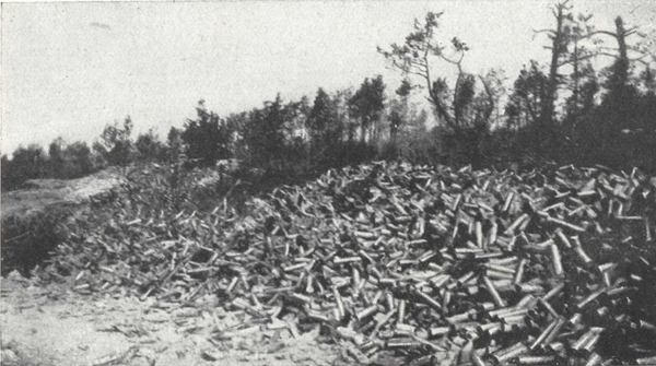
The heap of shell cases fired (45,000 in 3 days) by 8 guns, during the battle in front of Souville (June 1916).
The flags of the attacking German regiments, which had been sent up (p. 80) from the depots to the front to be unfurled in captured Verdun, were sent back to the rear by higher orders.
But the enemy had not yet finished his attempts to force the barrier. They captured Thiaumont and Fleury, and on July 11th they intended to try, by way of Poudrière and Vignes ravines, to outflank Souville fort on the West while at the same time making a direct attack upon the north slopes (Plan p. 78).
In front of Souville, the line was held by the 131st Infantry Division (Duport) and in front of Vaux fort by the 79th (Mordrelle), reinforced by the 128th Infantry Division (Riberpray).
In the Vaux sector the attack failed.
But on the left of the battle, the enemy passed Fleury and penetrated into Poudrière and Vignes ravines. On the 12th, at daybreak, they captured Chapelle Sainte-Fine, thereby threatening Souville fort. The enemy quickened his pace and climbed the slopes of the fort, with the French barrage playing right on them. Under this rain of fire the attackers swerved and a final headlong rush carried 150 Germans to the summit of the fort, "like the edges of foam from a packet steamer which dissolves into spray". All were captured or killed in an instant in the moats. The Germans could not take Souville.
From the slopes of Souville, go down to the cross roads of Chapelle Sainte-Fine, where the memorial (page 79) marks the limit of the German advance before Verdun.
From Chapelle Sainte-Fine, Vaux pool may be reached on the right by following the famous Fontaines ravine, between the stumps and the brushwood of Vaux-Chapitre wood and Fumin wood.
Five hundred metres from the cross roads of Chapelle Sainte-Fine, on the (p. 81) right, is Haie Renard, the scene of one of those undying exploits which contributed to the safety of Verdun. On August 1st 1916 the Germans had progressed as far as this crest which dominates the head of Fontaines ravine.
On August 5th, the enemy by a hustling attack on the 10th Regiment and the left of the 56th, forced a new indentation in the line whereby the position of the 4th Zouaves was threatened, more to the west. The colonel realising the danger decided to counter-attack in the neighbouring sector, but his whole reserve only numbered 24 zouaves, a pioneer section commanded by Lieutenant Charles.
The position was acute: on the other side of the ravine the Germans (p. 82) were continually advancing. The Colonel sent his section into action. The men fell to the bottom of the ravine which was beaten down by 150's, then crossed the road, and climbed up in the face of the enemy's fire. Lieutenant Charles calmly reorganised the line. This little band lay on the ground and fired full at the enemy.
Presently the order to charge with the bayonet was given: every man got ready. The leader rose and with a cry of "Advance" the Zouaves leapt forward. Disconcerted and wavering the Germans turned tail and raised their arms: those who resisted were run through and forty prisoners were sent back to the rear under charge of one man, for by this time Lieutenant Charles had only 7 Zouaves left. With his 7 Zouaves, 2 men and one sergeant of the 56th Lieutenant Charles held the recaptured line. In the middle of the night this handful of heroes was relieved by an entire battalion.
Continue towards Vaux pool and stop a hundred metres from the pool.
Make your way to Vaux pool on foot between the crests of Hardaumont and of Vaux fort.
Make a half turn and come back by the same road as far as the Chapelle (p. 84) Sainte-Fine cross roads. Then continue some 40 metres, taking the turn on the right to Douaumont.
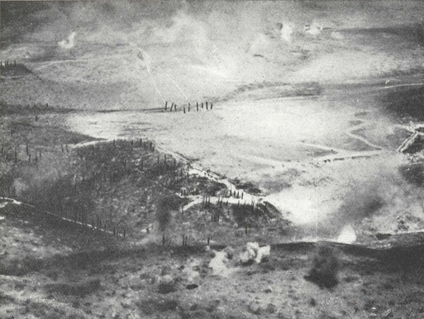
The Bombardment of the Fleury-Thiaumont sector seen from an aeroplane (August 1916).
In the foreground, on the crest, big calibre shells bursting. Then just behind, Poudrière ravine. The first white blot in the middle of the photograph is the Fleury sector. In the background, amid the smoke of exploding shells, Froideterre Hill and Thiaumont.
About 500 metres from the cross-roads is the site, on the left, of Fleury village. A slight raising of the soil is the only sign that is left that a village once existed. Captured on June 23rd, 1916, Fleury village was not definitely freed until August 18th, after two month's incessant fighting.
On June 26th, the 114th Battalion of chasseurs clung to the borders south and west of the village. On July 15th, in an attack made by the 3rd Zouaves, one battalion lost all its officers. On August 2nd, the 56th and 10th Infantry Regiments captured the station to the south of the village, with 350 prisoners and 11 machine guns. Next day, some units of the 207th crossed the village but they ran short of ammunition so that after a close combat somewhat ill-matched, they had to withdraw to their original line. On August 4th, the 134th Infantry Regiment captured some buildings, as also did the 8th Tirailleurs four days later.
On August 10th, at length, the colonial regiment of Morocco planned a systematic capture of the village. From the 10th to the 16th, they advanced to the sap and organised their starting points. On August 18th, supported by a battalion of the 8th Tirailleurs, the colonials attacked singing the Marseillaise and the Anthem of the Marines. Two battalions encircled the village, but in the centre each shell-hole and every hollow had become a miniature fort to be stormed in the teeth of machine gun fire. Next day was a fight of knives and bombs. At night a hundred surviving Germans gave themselves up. After the capture of the village the enemy concentrated a terrific artillery fire on it, and up to September they endeavoured to retake the ruins.
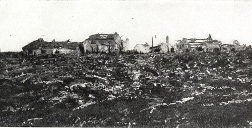
The Southern edges of Fleury, in July 1916.
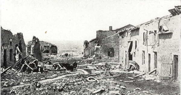
The Main Street of Fleury, in July 1916.
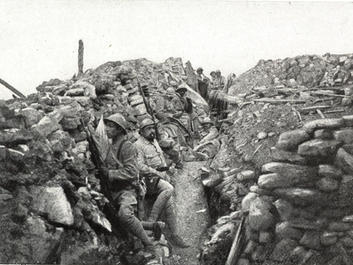
A trench in the ruins of Fleury, in October 1916.
Fleury during the Battle of Verdun.
One kilometre beyond the ruins of Fleury, the road divides; the left fork leads straight to Bras, but take the right hand one as far as the road to Douaumont fort, 300 metres to the right.
On the crest Thiaumont redoubt stands out prominently. To the left of the redoubt is Froideterre Hill, which was, at the end of June and July 1916, a palpitating centre of the battle. Thiaumont is, in fact, at the junction of several ravines, where Douaumont crest joins Froideterre and that of Thiaumont joins Souville. For three months the rival artilleries poured their fire on this tragic mound. The redoubt was almost pulverised and buried under these terrific bombardments, changing hands 16 times in all. Recaptured by the 128th, on June 30th, it was held by the 202nd Regiment when, on July 4th, the 6th Regiment of Prussian Guards attacked it after a tremendous bombardment.
The colonel of the 202nd, though lying wounded on a stretcher, assisted the commander who took his place. The latter took with him at all risks, to sound his orders, a bugler who had not finished his training and did not know much about bugling. Moreover, his instrument was far from perfect.
"Sound all the same", ordered the commandant, "Sound every time you see the Boche".
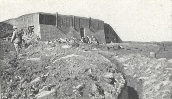
Thiaumont redoubt in French hands in May 1916.
The communicating trench in the foreground was levelled everyday by heavy shells and remade at night.
Though he extracted from his instrument some dreadful noises, the bugler conscientiously carried out his job, which made him a target for any number of projectiles. By his side in the same shell-hole a "feldwebel", captured at the outset of the action, was poking fun at him. When questioned, he arrogantly replied: "In half an hour, the Prussian guard will be here. You will see".
Provoked by this, the commandant shouted in his face: "You do not know my soldiers, it is they whom you will see". Then and there the commandant led a brilliant counter-attack which threw the enemy back on the Thiaumont road.
When the commandant returned to his post, the bugler blew a blast as loud as an ass brays: the "feldwebel" stood to attention, saluted and said "The French are brave, yes, brave": But he added, throwing a provoking glance upon the bugler: "Their music is ... rotten".
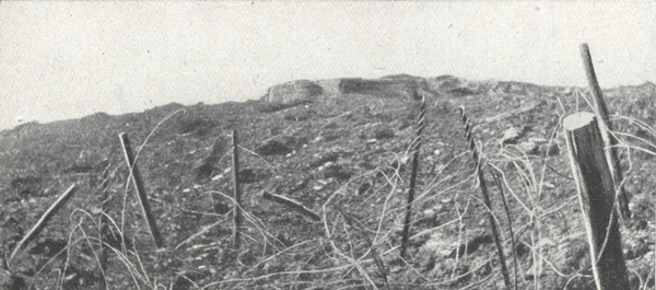
The Ruins of the Redoubt, a month later, in German hands.
In the foreground, the barbed wire entanglements in front of the French line.
The gorge of the fort with its heaped up moats is now reached.
Climb on to the superstructure of the fort, a kind of rough and devastated field where grass grows and the wind whistles.
Several French 400 shells and a German 420 have broken the thick shell of the fort; deep funnels mark their track.
From Douaumont fort, southwards, the plateau falls and ends in wooded slopes which overhang Bazil ravine: these are Caillette and Fausse-Côte woods. Above rise Vaux fort, then to the right Tavannes, and next Souville. The plateau which contains Douaumont extends to Froideterre Hill.
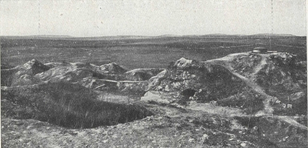
The superstructure of Douaumont fort.—On the right: An observation Post. On the horizon: a. Hill 378.—b. The Twin Ornes.
Turning towards the valley of the Meuse, the monument of "Bayonet (p. 89) Trench" can be seen about 1,500 metres away, the site of Douaumont village being half-way. Beyond the monument are the slopes which surround Dame and Helly ravines. On the horizon are outlined the heights of the left bank of the Meuse, Mort-Homme and Hill 304. The peak of Montfaucon also rises on the horizon.
To the north is the battlefield of the surprise attack of February 21st-25th. The plateau is marked with small hills and culminates at Hill 378, Vauche wood with its skeletony trees standing out: further to the right are two adjoining mounds, the Ornes twins, and finally to the West, by the Hardaumont Hill, the plateau falls on the plain of Woëvre.
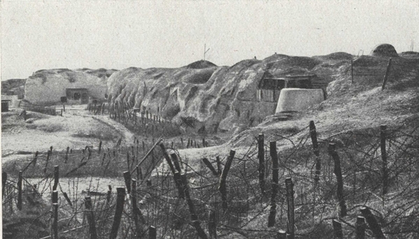
Douaumont fort in May 1921.
In front of the entanglements, the path leading up to the superstructure of the fort.
For four days the German infantry, advancing from the crests which formed the horizon to the North (the twin Ornes, Caures wood), made ground in the region of woods and ravines lying before the slopes of Douaumont, despite the heroic sacrifices of the 37th Division, the Chasseurs (2nd and 4th Battalions) of the 20th Corps and the 31st Brigade (Reibell), all hopelessly outnumbered.
On the 25th the enemy, encouraged by their advance, hurried forward their attacks. Near Vauche wood they climbed the slopes leading to the plateau of Douaumont. The units composing the van of the 24th Brandenburgers had orders to halt and reorganise about 800 metres from the barbed wire entanglements of the fort. One of the lieutenants commanding a company of this regiment decided, however, to take a chance and push on to the fort situated on the crest which was covered with snow. The company advanced under cover of patrols and made a breach in the entanglements. They then discovered the side casemates and, seeing no one, they slithered along the poles in the moats and then climbed up the wall of the scarp on a bank of snow. In this way they gained an entry into the fort which was only held by the turret artillerymen and a few engineers who were surprised and powerless.
The attackers were presently joined by another company of the same regiment.
The French officer in command of the fort had been misled by the snow storm into taking the attacking party for Frenchmen who were falling back and consequently made no effort to stop them.
Why was Douaumont fort almost unmanned?
After the fall, in 1914, of Liége and Maubeuge forts, the high Command had decided against garrisoning forts, and for merging the garrisons with the troops in the field.
Suddenly, on February 25th 1916, the fort till then in the third line, became the first line of defence and moreover at the junction of two units already widely deployed. On that particular day, the staff of General (p. 91) Balfourier which took the place of that of General Chrétien did not imagine for an instant that the fort was so denuded of defenders. Hence this unfortunate incident.
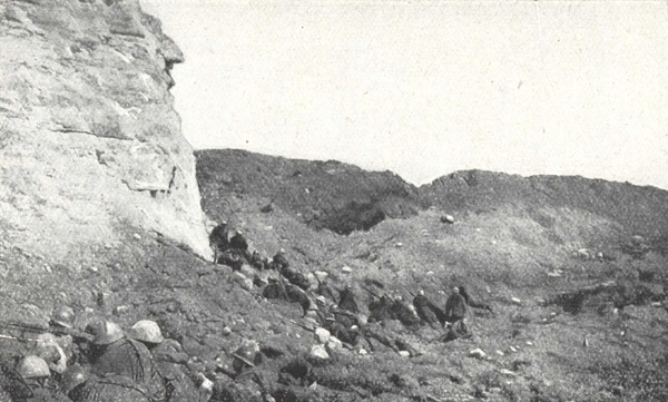
Foot soldiers and sappers of Mangin's brigade occupying the west moats of Douaumont fort on May 22nd 1916, at midday.
Douaumont became an excellent observation post for the enemy. On May 22nd, the 10th Brigade of Mangin's division intended to try and capture it.
From the 19th to the 22nd the French heavy guns bombarded the fort. On the 20th, the bursting of a 400 shell caused a tremendous fire in the fort, which blew up a munitions depot and annihilated a whole battalion, according to prisoners' accounts.
On the 22nd, at midday, the 129th Line Regiment occupied the west part of the fort, but the 74th, unable to take the east part, held on to the crest about 200 metres away.
During the night and the day of the 23rd, the enemy artillery pounded the narrow salient recaptured by the French. A battalion of the 74th lost 75% of its effectives.
On the 24th, the 1st Bavarian Corps reserved for the attack on the left bank of the Meuse, recaptured the fort and its approaches from the decimated troops of the 10th Brigade.
For five months the enemy progressed inch by inch from Douaumont fort to Chapelle Sainte-Fine. In a few hours on October 24th, Mangin's troops were destined to recapture all this field of battle.
On October 24th a dense fog overhung the whole plateau, but Mangin decided to attack all the same. At 11.40 a.m. three attacking divisions were launched.
They marched by the compass without hurrying, in good order and with assurance, over muddy ground, full of holes, where it was essential to avoid sinking in or stumbling. At first observation posts were useless but several aeroplanes went up, and as masters of the air and flying very low, they followed the progress of the troops and kept the Commander informed.
West of the fort, on Froideterre Hill, the "tirailleurs" of the Guyot de Salins division captured Thiaumont redoubt at a single dash, which had cost so much blood and effort. While the "tirailleurs" were consolidating the captured positions, the zouaves went through them and hurled themselves upon the village of Douaumont, outflanking the fort to the west.
East of the fort, chasseurs and foot soldiers of the Passaga division advanced towards Hardaumont Hill, crossed Bazil ravine, without check, and captured Caillette woods.
General Ancelin who commanded the left brigade of the division was killed at the start of the engagement.
The dense fog, which had concealed the starting of the attacking waves and had enabled them to reach the railway without having a single shell directed at them, cleared and showed Douaumont fort on the left.
This view magnetised the chasseurs and foot soldiers. A soldier waved a flag on the muzzle of his rifle, while another man, standing on the crest, madly sounded the charge.
But Douaumont fort was the prime objective and upon a Colonial regiment from Morocco, the one that captured Fleury, fell the glorious task of taking it.
Croll's battalion was to surround the fort, then go beyond and cut it off while Nicolay's battalion was to attack and enter it, drive out the enemy and take up their position there. However, in the thick fog, this battalion inclined too much to the West and was late. The captain commanding the first wave of Croll's battalion not catching sight of his comrades, instead of going round the fort, took the initiative of crossing the superstructure. There his men fell in with foot soldiers of the 321st Infantry Regiment the (p. 93) extreme left wing of Passaga's division, who were trying to find touch with the Colonials. The battalion came up at the very moment when the fog lifted and revealed the fort.
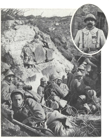
Infantry men of the Colonial regiment of Morocco occupying the moats of the recaptured fort. (October 25th 1916).—Inset: Commander Nicolay.
"With the French aeroplane cruising low just over the fort", wrote Commander Nicolay in his report, "the battalion approaches the moats in single column line, their leaders in front and rifles slung. Then they climb the steep slopes of the rampart gorge. On reaching the top of this rampart, they find in front of them the mouths of the casemates wide open, and, further forward, the court in an extraordinary state of disorder. In front of this chaos which the great fort had become, emblem of determination and power marvellously recovered, the heads of the column stand still and gaze. The battalion commander, who had halted for a moment at the bottom of the moat to see the movement was correctly carried out, rejoins at this instant the head, and while paying homage to this sacred and unforgettable sight, he gives orders to attack the machine guns which start to fire from the bottom of the casemates. This first resistance is overcome, and everyone reaches his objective (the operation having been fully rehearsed before the attack). All opposition from the turrets is likewise successively dealt with".
The superstructure of the fort was conquered. There remained the posts and the corridors to be attacked: bombers made themselves responsible for these and in a short while a hundred prisoners, including four officers, were brought in with 10 machine guns, 2 cannons, provisions and material of all kinds.
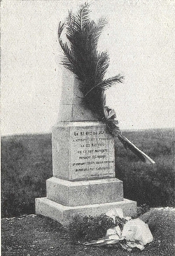
The monument erected to the memory of the soldiers of the 3rd Battalion of the 74th.
(Photo Martin Collardelle, Verdun.)
The prisoners assisted their conquerors in putting out the fire which was still burning.
During the night the line was advanced 400 metres more to the North. Douaumont fort, the famous "corner-stone" of the defence of Verdun, lost by surprise on a day of grief, was recaptured in a magnificent dash.
On the following December 15th, a new French offensive cleared the Douaumont line 2 miles more to the North, thus robbing the enemy of any possibility of re-taking the fort.
Visit the interior of the fort under the escort of one of the guard.
At the entrance, a casemate has been burst open by a French 400 shell.
The lower structure of the fort, corridors, casemates and rooms are almost intact.
In one casemate is a small museum of shells, grenades, trench mortars, machine guns and all kinds of respirators.
(p. 95) East of the fort the monument erected in honour of the 3rd battalion of the 74th Infantry Regiment can be reached.
On the other side, to the West, the tourist can go as far as the ruins of Douaumont village.
It was chiefly in front of this village that the surprise attack of February 21st was checked.
On the evening of February 25th, zouaves and the "tirailleurs" rescued it. From the 26th to the 28th, the 5th German Infantry Division made five furious attacks, but were unable to break down the resistance of the 95th Line Regiment and units of the 153rd Division which were defending the village. On March 2nd, after a preliminary bombardment which destroyed the village and isolated the battalion holding it, the 113th German Infantry Division attacked about 1.15 p.m., North and East. The Germans wore French helmets as they advanced. After a second bombardment the enemy again attacked, overwhelming the defenders, one company of whom resisted to the last man. The remains of the French battalion took their stand fifty metres South-East of the village and prevented the enemy from debouching. On the 3rd, two battalions of the 172nd and 174th Line Regiments retook the village at the point of the bayonet. During the night the Germans counter-attacked twice unsuccessfully with heavy loss, 800 dead being counted in front of one of the French trenches. On the 4th a third and more powerful counter-attack succeeded in driving the French from the village, but broke down against new positions 200 yards to the south.
Return to the Thiaumont road.
Continue to the left, towards the crest where the temporary mortuary of Douaumont is situated.
A memorial fund to the Defenders of Verdun is being raised for the purpose of erecting a mortuary in the centre of the battlefield, on a lofty point giving a clear view of the whole area. (See the yellow pages at the beginning of the Guide). The memorial will include, besides the mortuary, a large Catholic chapel and a mausoleum of each religion.
The remains will not be all placed together, as is the case in most existing mortuaries, but will be collected according to the sectors where they were found and placed in a hundred separate tombs. By this arrangement those who mourn a lost hero can kneel before a particular tomb with the hope that his remains are there.
On August 22nd, 1920, Marshal Pétain, honorary President of the Committee, laid the foundation stone of the permanent mortuary. That of the Catholic chapel was laid with the co-operation of M. James A. Flaherty, supreme head of the Chevaliers of Colomb.
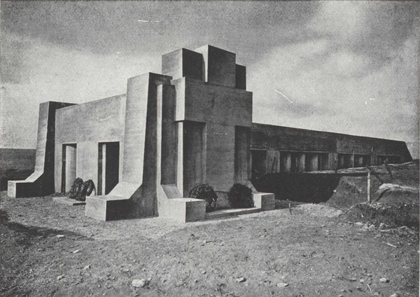
The monument of "Bayonet Trench" (A. Ventre, architect).
On the right, the trench leading to the porch of the monument.
From Douaumont mortuary, go down towards the monument of Bayonet Trench. The road passes through the ruins of Thiaumont farm, which once adjoined this road.
Near the bend in the road rises the monument of "Bayonet Trench", erected to the memory of the heroes of the 137th through the generosity of the American citizen, George F. Rand.
How were the foot soldiers of the 137th buried alive? Many stories centre round this tragic episode. The following version of the story is vouched for by one of the surviving officers, Lieutenant Foucher:
"Setting out from the citadelle of Verdun on June 9th 1916, the 1st battalion of the 137th reached the line on the night of the 10th-11th and relieved the 337th.
"Bayonet Trench" lay on the right of the 3rd company and on the left of the 4th company. On the morning of June 11th, a violent bombardment took place, lasting all that day and part of the night. During the course of the 11th under the bombardment of shells of 150, 210 and larger calibre, the trench assumed the appearance from which it gained its name. The men were awaiting the attack with fixed bayonets, but their rifles were propped against the parapet within reach, for they had in their hands bombs to be used as a first means of repelling the probable attack. Shells falling in front, behind and on the trench broke in the edges of the latter, burying our brave Vendéens and Bretons. Owing to the men not having their rifles in their hands, the bayonets stuck out after the collapse of the trenches. From that evening, June 11th 1916, the trench kept the appearance which it was found still to bear at the Armistice."
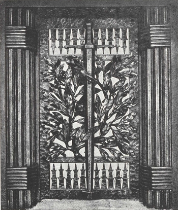
The wrought iron gate of the entrance porch of the Monument, carried out by M. E. Brandt, art iron-worker (101, Boulev. Murat, Paris).
The road merges into Dame ravine. Formerly, Nawé wood extended to the left, but now not even the stumps remain, so churned up is the ground. From the ridge to the bottom of the ravine the soil is pitted with shell-holes.
From June to October 1916, the first German lines ran over the ridge which stands out on the left. On October 24th 1916, the day of the victory of Douaumont, the Zouaves and the "tirailleurs" of the 36th Division cleared these slopes which were honeycombed with dug-outs. All who were cowering in these shelters gave up without a show of fight. An officer of high rank, was captured as he was getting out of bed and a quarter-master was made prisoner with all his mail.
During the following night, Sergeant Julien of the 4th Zouaves, returning from a ration party was captured by the Germans who were still occupying a dug-out. However, he took a high tone with them, telling them of the fall of Douaumont, and invited them to give themselves up in their turn, then and there. He so impressed them that they soon laid down their arms. He then collected them and brought back to the rear of the French lines his magnificent "bag", a company and six officers.
At a turning in the road Haudromont Quarries are shortly visible. Their steep white walls show up against the clay of the hill. The enemy had cut galleries in the stone, proof against the heaviest shells.
These quarries were captured from the enemy at the time of the taking of Douaumont by the 11th Infantry Regiment, who on the left wing extended the general attacking front.
The infantrymen set out, singing: "We shall get in the quarries when the Boches are no longer there ...", and surrounded the quarries from the North. They encircled the defenders, firing on them from top to bottom, while the Germans who had taken up their refuge there protracted the resistance. The fight continued with bombs in the galleries until evening.
From Haudromont quarries a further 300 metres to the right is Helly ravine.
On the left is Couleuvre ravine, to which the battered slopes of Chauffour wood, captured during the offensive of December 1917, descend.
These slopes are crowned on the east by Douaumont fort which is plainly silhouetted against the sky.
Next, return to the quarries and keep straight on to Bras.
Before reaching Bras, a road goes off to the right to Poivre Hill and Louvemont.
The road which goes uphill to Louvemont was reconstructed after the village in May 1921.
On the evening of February 25th, the 37th Infantry Division which had suffered severely and was afraid of being outflanked on the South-East, fell back on the ridge of Froideterre. Verdun was almost unguarded in the valley of the Meuse. The 39th Division of the 20th Corps promptly reoccupied Poivre Hill and barred the road to Bras.
Poivre Hill.
In the foreground, the last train to run at the foot of Poivre Hill in February 1916. It was wrecked on the spot by artillery fire.
(Photo Martin Collardelle.)
The enemy endeavoured to break through this barrier, but they were enfiladed by salvoes of artillery which was in position on the left bank of the Meuse. During the entire battle of Verdun, the southern slopes of (p. 105) Poivre Hill and the woods which extend down the slopes on to the Meuse formed, along the edge of the Meuse, an unbroken pivot of the whole of the French line on the right bank of the Meuse.
In 1916 the Germans converted the opposite slope, north of Poivre Hill, into a regular fortress, with concrete galleries, redoubts and armed posts. On December 15th 1916, three columns of the 112th Line Regiment, supported and covered on the march by quick-firing guns, rushed this fortress, flanking the entire German line. It was a complete surprise and in half an hour Poivre Hill was in our hands. German officers were captured as they were getting out of their beds. During this same attack, but more to the east, Commander Nicolay, one of the victors of Douaumont, was killed in front of a fortified cavern.
The tourist who wishes to see the monument of Caures wood, erected to the memory of Colonel Driant and his chasseurs will turn right at Bras, in the direction of Vacherauville, where he will turn right along G. C. 6a to Ville. The monument is situated about 4½ miles from Vacherauville at the junction of the road followed with the road which branches off to Flabas (See plan p. 60).
Return to Vacherauville and turn left towards Verdun along R. N. 64: the road follows the Meuse, and twists round the foot of Froideterre Hill, then Belleville and Saint-Michel. Verdun is re-entered by the Porte Chaussée.
Bras village seen from an aeroplane (1918).
The R. N. 64, camouflaged, crosses the village. On the right branch off the Louvemont road towards Poivre Hill, and the Douaumont road (itinerary). In the left foreground, the canal that runs parallel with the Meuse and a lock.
Leave Verdun by the Porte de France. Beyond the railway bridge, keep straight along the valley of the Meuse which is dominated on the right by Belleville Hill.
Pass through Thierville village.
Opposite is seen Marre fort. At the foot of the hill on which the fort stands, turn to the right. Leaving on the left the farm of Villers-les-Moines, the road then climbs a small eminence, Hill 243, below which is the Charny redoubt. The road branching off to the right crosses the railway and leads to Charny.
It was at Charny that the Germans crossed the Meuse in 1870. Here they shot the retired notary, M. Violard, on the pretext that he had aided the francs-tireurs in a surprise attack.
The road skirts the north slopes of the hills on which stand the modern forts of Vacherauville, Marre and Bois-Bourrus.
Marre will be found almost entirely destroyed. After passing the ruins of the church, take the right-hand road and keep straight on to Cumières. Half-way the station is passed on the right and on the left is the road to Chattancourt.
Attacked on March 14th, and destroyed by shell fire on April 25th, Cumières was only captured by the enemy during the night of May 23rd-24th. (p. 109) On May 26th, in the evening, after a desperate struggle the French retook the eastern portion.
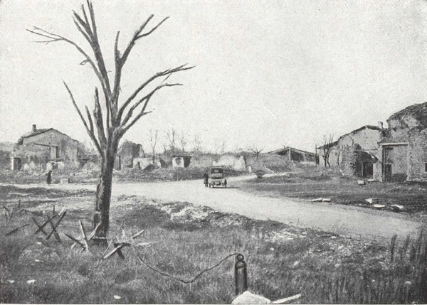
The ruins of Marre. After passing the church, the car turns right, towards Cumières. On the left, the road to Bourrus woods is impassable.
On May 29th and 30th, after two days of continuous bombardment, they were momentarily driven back by superior numbers towards Chattancourt, but a vigorous counter-attack brought the French again to the southern outskirts of the village. Caurettes wood, however, to the south-west of Cumières remained in the enemy's hands.
On August 20th 1917, Cumières village and wood were recaptured by a regiment of the Foreign Legion who attacked singing La Madelon.
From Cumières the road goes straight on to Oie Hill.
From Cumières, return to Chattancourt station and keep right along the road to Chattancourt. About 800 metres further on the village of Chattancourt, completely levelled to the ground, is reached.
From Chattancourt the positions of Mort-Homme can be visited by the road going to Bethincourt. Motor-cars can go as far as the top of Hill 295 or Mort-Homme, where it is necessary to turn the car round and return to Chattancourt, as the road is cut near Bethincourt by the Forges stream, which has entirely flooded the lower part of the village.
Like Hill 304, Mort-Homme was one of the most fiercely disputed positions on the left bank. It consists of twin hills: No. 265 (of which the Bethincourt-Cumières road skirts the summit) and No. 295 (the Morte-Homme proper, round which the road winds on the N. E.), and formed an excellent observation post and artillery position in front of the real line of resistance.
On March 5th, 1916, the German offensive, which, until then, had been confined to the right bank of the river, developed with great violence on the left flank, progressing in six days to the slopes of Mort-Homme.
On the 14th, after a bombardment lasting five hours, sometimes at the rate of 120 shells to the minute, consisting of shells of all kinds, time-fuse, percussion, poison gas and tear gas, the enemy's infantry attack on Mort-Homme began.
The 25th Division (Debeney), under orders not to fall back, was half buried and asphyxiated. Four colonels, including Colonel Garçon commanding the brigade, and their staffs fell, rifles in hand.
Hill 265 was taken but the infantry and zouaves, by a magnificent defence, held their ground on Hill 295, the key to the entire position. A counter-attack by the 15th Regiment further drove back the attackers to the North-West counter-slopes.
On April 9th, the enemy crept up the ravine of Corbeaux wood and attacked the line between the summits of Hills 265 and 295. During a struggle of unprecedented fury lasting over four hours and foiled four times in succession, the enemy reorganised and made fresh attacks until evening. (p. 113) The 8th and 16th battalions of chasseurs and the 2nd battalion of the 151st Line Regiment repulsed the Germans in terrific hand-to-hand fighting. The 8th battalion of chasseurs, "the battalion of Sidi Brahim" was outflanked on the wings and fought with three fronts, determined to hold on till the last man fell.
On the 20th, the 32nd French Corps (Berthelot), in their turn, took the offensive. After a careful artillery preparation, three battalions of the 40th Infantry Division passed Hill 295 and established their line on the north slopes. The enemy counter-attacked with an effort to outflank Mort-Homme by Hayette ravine but suffered terrible losses.
On the summit of Mort-Homme, the 150th Infantry Regiment repulsed all the attacks of a determined enemy and held Hill 295.
In order to ensure a greater measure of security, orders were given to protect, by means of wire entanglements, the small defensive post at the top of the hill. As soon as night fell, a man volunteered to put the first entanglement in place and was immediately shot dead. A second man immediately took his dead comrade's place and carried on with the work. He too, was killed. The same fate befell a third man, who after seeing his two fellow-soldiers killed, volunteered to continue with the task. A fourth man brought in the three bodies of the men who had just been killed in trying to put the entanglements in position, and then volunteered to fix a fourth entanglement alongside the others. Eventually the small outpost was entirely protected, and thanks to the sacrifice of these four brave men of the 150th Regiment, the enemy's efforts failed to pierce the defences.
Finally on May 23rd, a fresh German Corps was hurled against the summit of Mort-Homme, and succeeded in gaining possession of it.
From June 9th to 24th, the enemy were unable to debouch from Mort-Homme owing to the firm stand taken up by the 15th Corps (Maud'huy).
On June 15th, more than a kilometre of trenches was actually recaptured from the enemy.
In 1917, the sector was often the scene of violent combats, the Germans ending by occupying Hills 265 and 295. In these they organised formidable defences, according to their usual practice, especially as regards deep shell-proof tunnels. During the offensive of August 20th 1917 the 31st Infantry Division recaptured Mort-Homme and its tunnels.
Follow the clearly marked path which ascends the slopes of Mort-Homme as far as the monuments to the 40th and 69th Divisions. By following the trench a little beyond the monument to the 40th Infantry Division and to the right, one reaches the mouth of and steps down to the Bismarck tunnel. Continue along the ridge towards Corbeaux wood, from whence there is a panorama view of the valley of the Forges stream and the heights north of this valley (the old French line of March 1916). On the right can be seen Caurettes ravine with its denuded wood.
About 200 yards in front of the edge of Corbeaux wood, a stairway with a hundred steps gives access to an enormous German tunnel, joining Forges ravine and Caurettes ravine.
This tunnel, called Corbeaux tunnel by the French and Gallwitz tunnel by the Germans was captured by the 7th tirailleurs of the famous Morocco division.
On August 20th 1917, this tunnel was passed over but the enemy still held out in it.
Zouaves and tirailleurs kept careful watch at all the exits and ventilating shafts of this immense underground cavern, and it was not until the following day that the garrison of eleven hundred men including a colonel, three battalion commanders, and all their staff gave themselves up.
Continue as far as the northern edges of Corbeaux wood.
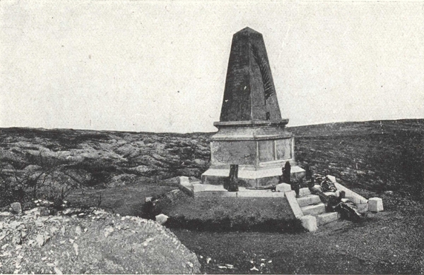
On the Summit of Mort-Homme, the Monument to the 40th Division.
(Photo Martin Collardelle.)
The table-lands dominated by the two Mort-Homme hills are cut on the north by a ravine bounded at the bottom by Corbeaux wood. This was a favourable spot for the massing and launching of attacking troops to reach Hill 295. On March 6th, the French line was brought back to the northern edges of the wood. On the 7th, the enemy succeeded in getting a footing there, wild hand-to-hand fighting being accompanied with so much bloodshed that in many places the snow became red. On the 8th, the 92nd Infantry Regiment retook the wood in twenty minutes; on the 10th, at nightfall, the 92nd, deprived of its colonel and receiving no support from the French artillery who failed to see their rocket signals on account of the intervening wood, had to give ground inch by inch under the assault of an entire German division.
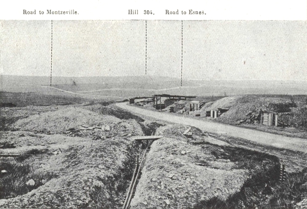
The road from Chattancourt to Esnes, at the foot of Hill 275.
In the background where the roads meet (Montzéville to the left, Esnes to the right), take the one on the right to Esnes.
Return to the car by the same path. From Mort-Homme go back to Chattancourt and take the road on the right to Esnes. This rather steep road climbs the northern slopes of Hill 275, bringing one to a pass from which Hill 304 may be seen opposite. Continue as far as the cross-roads where turn right to go into Esnes. After passing the ruins of Esnes church, keep straight on, taking the second turn on the right not the first which leads to Bethincourt.
Do not take the left-hand road which ends in a very steep rough track in a bad state of repair (plan p. 118). The second road to the right twists and turns, leading to the Calvary of Esnes, from which there is a magnificent view of the battlefields on the left bank from Mort-Homme to Bois-Bourrus. At the Calvary, take the right-hand of the two roads.
This road passes between Hill 287 and the famous Hill 304.
Hill 304, with Hills 287 and 310 South of Esnes, forms a line of natural fortresses which kept under their cross fire not only the roads of approach but also the bare glacis or the steep escarpments immediately bordering them.
The nearest sheltered approaches to Hill 304 are Avocourt and Malancourt woods. From these woods started the first attack conducted by the 11th Bavarian Division against the hill on March 20th 1916.
The Bavarians were checked, however, by the French cross fire, on the long barren slopes leading to the ridge. From March 20th to 22nd their three regiments lost, to no purpose, from fifty to sixty per cent of their effective strength. On April 9th, before Hill 287, the first German attacking wave succeeded in gaining the support trench, but the French survivors in the advance trench crawled out from among the dead and debris of their trench and annihilated the attackers.
On May 3rd, 80 German batteries concentrated their fire on Hill 304 and its approaches.
Clouds of black, green and yellow smoke rose from the hill-top as from a volcano, obscuring the sky to a height of 2,500 feet, according to the reports of aviators. As a British war correspondent put it: "The sky was like a dome of invisible rails on which fast trains ran madly". On May 4th and 5th, a fresh German division attempted to occupy the position, believing it and its defenders to have been annihilated. On the 4th, they gained a footing on the North slopes of Hill 304, from which they were dislodged during the night by the 68th, who then had to withdraw. On the 5th the same German division attacked the Camard Wood and Hill 287 on the left. In this wood, entirely levelled by an eleven-hour bombardment, the 66th Line Regiment first held up, then charged the assailants at the point of the bayonet. At Hill 287 a battalion of the 32nd Line Regiment likewise brilliantly repulsed two attacks. On May 7th, after a tremendous shelling, the enemy attacked Hill 304 simultaneously from three sides with troops from five different divisions. It was their greatest effort against this position. Thanks to two French regiments of picked troops (125th and 114th), one company of which charged, to the strains of La Marseillaise, the Germans were thrown into disorder and driven back to the N. slopes. During the rest of the month the enemy counter-attacked but without success.
On June 29th and 30th, the enemy endeavoured to outflank Hill 304 East and West, by means of liquid fire.
During December, fresh efforts came to nothing.
During 1917, the Germans continued stubbornly with their attacks on Hill 304.
On June 28th and 29th, a powerful attack carried Hill 304 and an advance was made between the hill and the south-east corner of Avocourt wood, in a slight hollow, known as Col de Pommerieux. This hollow was, however, reconquered on July 17th by the French 51st and 87th Infantry Regiments, supported by two battalions of the 97th Infantry Division (335th and 346th Regiments) and one battalion of the 73rd Infantry Division. After a remarkable artillery preparation, the French infantrymen, in half-an-hour, reached the fortified crest, and regained a kilometre of ground. The 87th Line Regiment, went 300 yards beyond their allotted objective and captured an observation post, in front of the crest, which they promptly christened "Le créneau de Gretchen". The attack caught the enemy off their guard at the very moment a relief was being carried out, and 520 prisoners belonging to three different divisions were taken.
On August 24th, Hill 304 was wrested from the Germans by the 272nd and 128th Infantry Regiments of the 5th Brigade (Nérel). This brigade which attacked in front of Hill 304, on the Pommerieux plateau and at Camard wood, captured prisoners belonging to five German divisions. On (p. 120) the same evening, after capturing Hill 304 this brigade stormed several redoubts and carried the first line to the Forges stream, i.e. more than two kilometres from the starting point.
From Hill 304, return to the Esnes Calvary and from there take the road on the right to Avocourt.
One of the finest feats of arms in the battle of Verdun was performed at Avocourt.
On March 20th, 1916, the Germans who had never been able to take the village, attacked the wood with a fresh division, the 11th Bavarian Division. (p. 121) The attack succeeded, with the help of liquid fire. A French counter-attack on the 29th by the 210th Infantry Regiment, and a battalion of the 157th, recaptured the wood and the redoubt known as the "Réduit d'Avocourt". The attacking troops which had not been revictualled for four days, had finished their reserve rations twelve hours previously. So fatigued were they that they slept standing despite the bombardment. To rouse them, their chiefs, at 3 a.m. next morning, ordered the buglers and drummers to play. As the day was breaking the music suddenly stopped, a shell having buried all save one drummer. Furious at this, the men, with the drummer at their head, rushed forward, and by 8 a.m. the wood had been entirely reconquered.
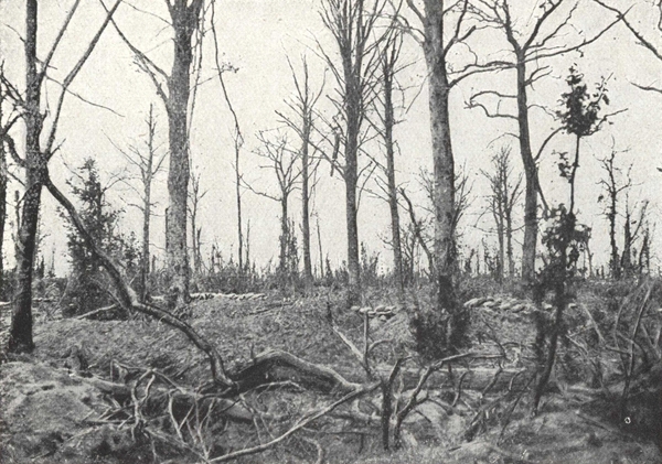
Malancourt Wood in 1916.
Photographed from the French line. The sandbags mark the German line.
From Avocourt, return to Esnes. Again take the Chattancourt road but about 1,500 metres from Esnes, take the road on the right to Montzéville, G. C. 18, as far as Dombasle-en-Argonne, where take R. N. 3 to Verdun.
Dombasle was one of the points where the Sainte-Menehould-Verdun railway was bombarded.
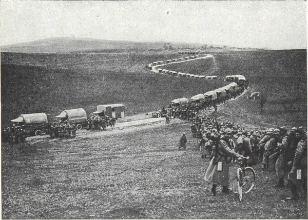
In the Circuit de Nixéville (the loop which bounds the "Sacred Way" on the north), a regiment entering lorries to be taken to rest billets.
Going through Blercourt, there are two level crossings to pass: after the second, the "Sacred Way" branches off on the right to Bar-le-Duc, via Souilly.
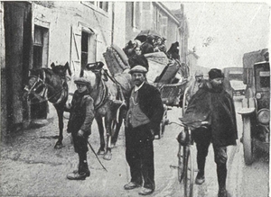
Refugees from the Verdun District passing through Souilly along the "Sacred Way" worn into furrows by motor convoys.
The fate of Verdun, even of France, depended on this road. Disintegrated by frost and thaw, and subjected to the wild rush of transport which in the space of five days raised the fighting strength of the Verdun army from 150,000 to 800,000, this road visibly sank. When General Pétain took command of the battle on February 25th, his first care was to ensure that this road was firm and sound. All along the road 16,000 men divided into gangs were engaged upon the task of repairing it. Quarries were opened in the vicinity, and without interrupting the convoys of lorries which ran at regular intervals, thousands of roadmen threw tons of stones on the road. The road stood up to the strain and carried all necessary supplies up to the vast battle.
Re-enter Verdun by the Porte de France.
Leave Verdun by the Pont Beaurepaire, Rue de l'Hôtel-de-Ville, Rue St-Sauveur, Rue St-Victor, the Porte Nationale and R. N. 3 (See plan of Verdun, exit III).
Follow R. N. 3 for two and a half kilometres and then take R. N. 64, on the right, which follows the Meuse valley, towards Houdainville and Dieue-sur-Meuse. At the latter village, turn left along I. C. 5 to Sommedieue. This very picturesque road climbs through Amblonville forest towards the Tranchée de Calonne, I. C. 3 which should be taken on the right.
It is almost straight, crossing the entire Amblonville forest. It was formerly the haunt of poachers and hunters only.
But now the Tranchée de Calonne evokes more tragic memories. From the word "Tranchée" it might be supposed that it was a relic of the Great War. It is not so, however, since for more than a century this name had been given to the road which M. de Calonne, Minister of Finance under Louis XVI, had had laid out on the ridge of hills to approach his château, built at the foot of the Heights of the Meuse. This château was destroyed during the Revolution.
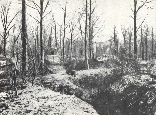
The Tranchée de Calonne.
French trenches and observation posts, on the right of the road, in the Taillis de Sauls, in front of the Éparges road (plan on opposite page).
The story goes that M. de Calonne hoped one day to receive the king in his residence, and wishing to welcome him in a worthy manner, had planted rose trees all along the road. Anyway, during the war wild roses could be seen blooming along this forest road which became indeed a "trench" in the military sense of the word.
The front cut the "tranchée de Calonne" a little to the south-west of Saint-Rémy. On both sides it was bombarded and kept busy with never-ending attacks and counter-attacks.
In March 1915, the French brought into position there naval 140 guns intended for firing at a 12,000 metre range over Éparges, right behind the enemy lines. It was with difficulty that the sailors installed their heavy guns in this clay soil.
This effective bombardment irritated the Germans, who on the 24th, launched a mass attack which reached the third support line.
The naval officers who were isolated in their post with their telephone wires cut and no contact with the infantry, rapidly organised their defence and swept the ground with the fire of their only heavy guns and a few 75s, dragged up by hand, which fired with their sights at zero.
The Germans, however, continued to advance, and on the 25th they were no more than one kilometre from the guns, the only protection for the sailors now being broken down trenches and the remains of barbed wire entanglements. On the 26th, while the sailors were preparing to make a firm stand against the enemy's attack, two French battalions of chasseurs, called in to reinforce, crawled through the undergrowth and gradually got up to the position from which they counter-attacked. On the 27th, the (p. 127) firing died down, but the Germans reorganised and again attacked on May 5th. The first rush gave them some advantages, which were quickly wrested from them by the arrival in the field of the Moroccan brigade and six battalions of chasseurs who recaptured, in a few hours, all the ground lost on April 24th.
The Tranchée de Calonne enters the forest, every part of which was used by both sides during the war for engineers' and artillery parks, aid posts, shelters, small-gauge railways and gun emplacements of which trace can still be found.
On the left the bifurcation of Mont-sous-les-Cotes is passed.
Soon the forest clears and then only blackened tree stumps are seen, cut by shot and shell, as the old lines are crossed.
Pass the road junction, to the left of the Éparges road, a road which is broken up and impassable. Continue along the Tranchée de Calonne which crosses, at 1,500 metres, the hill of Senoux near which were the enemy first line trenches. Turn left along I. C. 13 in the direction of Saint-Rémy. After 2½ kilometres the road descends as far as the stream of Longeau or Éparges.
All along this road, on the left side, the Germans had built into the hill concrete dug outs, pillboxes, underground galleries and headquarters posts and there are also some German tombs.
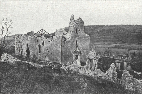
Saint-Rémy Church and Village.
On the right the horizon is bounded by Combres Ridge, on the left by Éparges Crest.
On reaching the valley, near the stream, there are cross-roads, the road (p. 128) on right leading to Saint-Rémy, the ruins of which can be seen. Continue straight on to Combres, along an uphill road. Beyond the crest, at a sharp turn to the right, opposite a large blockhouse, get out of the car and proceed left (p. 129) along the path to the Éparges crest, which at first runs along the south slope of the spur in the old German positions. Notice on the right the entrances to many huge mine galleries which, under the crest, communicate with the openings on the north slope. The path rises to the eastern edge of the spur, point X (on plan), whence there is a wide view over the Woëvre. Return along the trenches on the crest. On the north slopes were the French lines containing a series of huge mine craters organised into defensive positions. At the highest point marked by a sign post, an excellent general view of the position is obtained.
Éparges spur, 1,400 metres in length and 346 in height, dominates the Woëvre plain. Its sides are steep and slippery, springs break out of the soil and small streams drain down its slopes. It is in very truth, as it has been called, "a mountain of mud". It is a magnificent observation post which dominates the surrounding country. "He who holds Éparges, has all the roads under fire".
The Germans gained possession of Éparges on September 21st 1914 and quickly organised several lines of trenches between the summit and the valleys; at certain points five ranges of fire could be brought to bear on a point, and the whole crest was transformed into a strong redoubt, flanked east and west with two bastions.
The French occupied, to the North, the brow of Montgirmont and Éparges village, about 600 metres from the German trenches.
It was at the West part of the Spur (point C) that, at the end of October, (p. 130) the French commenced their attack, step by step, to the sap, at the same time penetrating into the woods which cover the flanks of the ravine.
In February there started a series of almost daily attacks and counter-attacks, only finishing at the beginning of April. On February 17th, thanks to a mine explosion, the French got a footing in the enemy first line; attacks and counter-attacks lasted five days during which Colonel Bacquel was mortally wounded at the head of his troops. The French held all the west bastion and they started to advance towards the east bastion. From March 13th to 21st, they returned to the attack and occupied the enemy front line.
On March 27th a battalion of chasseurs made a fresh push, bringing them nearer the summit. On April 5th, started the last big attack which the 12th Division was to carry on day and night until the 9th. The rain and muddy ground seemed for the moment to hold them back and render their efforts in vain.
In the evening, part of the crest was occupied but the use of aerial torpedoes which blotted out whole ranks of men, and a massed counter-attack, launched on the morning of the following day at 4.30 a.m., robbed them of the gains of the first advance. During the evening of the 6th and all the night of the 6-7th, in spite of a continuous downpour, the trenches were recaptured step by step, with 100 prisoners including several officers.
On the 8th the summit and the west ridge were firmly occupied and at midnight, after fifteen hours of furious and uninterrupted fighting practically the whole ridge was in French hands.
On the night of the 8-9th, it took fourteen hours to get fresh troops into position in squalls of rain and a blinding wind. The attack was resumed at 3 p.m. on the 9th, the ground being hollowed out into deep pits into which men sometimes disappeared altogether. Finally the French held the west bastion (point C), the fortified curtain and stood their ground in front of the east part (point X).
At the end of 1915 and in 1916 the struggle was rather less bitter but still deadly enough: the story of a mine exploded by the Germans, as told by a young Lieutenant of the 74th Infantry Regiment, brings out vividly the tragic side.
"On the evening before, I had relieved, between the point "X" and the point "C", a section of the 129th. My night had been spent in visiting my posts and establishing contact. At daybreak I returned to my hole, a mine listening gallery running down crosswise for about 15 metres. Everything was quiet and it appeared that the enemy had done no work for two days on their mine chamber. Were we going to be blown up? No one dreamt it would be so.
"About 4 p.m. we distinguished quite plainly the detonations of several petards. "Good, the Boches are working, we are alright for to-day!"
"At that very moment we heard a formidable rumbling, our dug-out rocked and came to earth again as though a Hercules had lifted it several metres high and then let it fall again with a bump. We were turned topsy-turvy one on top of the other in the darkness.
"Cries were heard, some one was wounded. We lighted a candle and extricated the man who fortunately had nothing the matter. "Come on, boys, at them with bombs".
"To get out—the exit was blocked three metres high at least. Moreover a stream of water had been let in at the higher end of the sap.
"Without loss of time we got down to work. To reach the piled up debris a man had to crawl in the midst of the stream, flat on his stomach, and only one could work at a time.
"An hour passed, then two, centuries it seemed. The water rose, the air became less and less pure.
"I spare you the agony of a man who perceived that his end was near, who saw it coming and knew that he could not escape it.
"It was now three hours since the mine went up. The water had reached our feet. The candles had gone out, we could breathe only with the greatest difficulty, and everything seemed to be going round.
"All of a sudden a cry was heard: "Lieutenant, here is the daylight." A man had succeeded in making a hole through the mud with the barrel of his rifle.
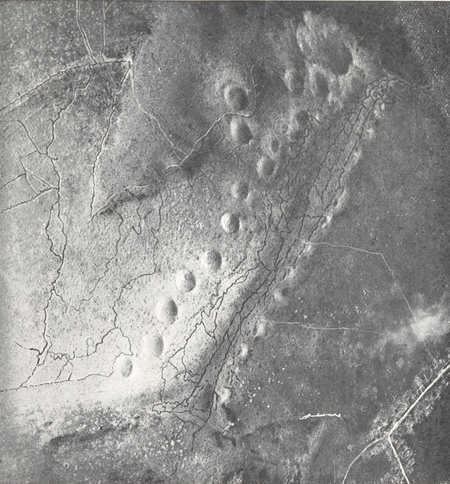
Éparges Spur photographed from the air.
The series of mine craters and chambers (see plan p. 115).
"At last! Everyone felt restored to life. Already we could breathe again. Our candles would burn.
"After another half-hour we got out of this hell and it was time too.
"Where were we? In the enemy's lines or our own? What had happened during these four hours? What had become of my posts?
"I pointed out to my men the direction of our lines and I tried to regain my bearings. But the aspect of the ground had completely altered. For half-an-hour I probed the darkness. I could make nothing of it, when, suddenly, I seemed to see two shadows. I made myself known, but the two men moved off and fired a star-shell in my direction. It was a German star-shell.
"I made my way to the rear and reached the Battalion Command Post at Bois Joli. I had been posted "missing".
"No one had news of my section. I went back to the line and found a corporal and two men who were in the line at the time of the explosion. For four hours they had prevented the enemy patrols from investigating the ground and occupying it. They were the sole survivors."
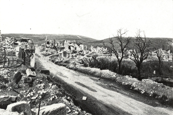
Coming into Éparges from Saint-Rémy in 1920.
On the right, Montgirmont mound. On the left, Hures Hill.
Return to the car by the same path.
Continue straight along and rejoin, at Combres, G. C. D. 10 that leads to Fresnes or making a half-turn, go down to the cross-roads of Saint-Rémy, turn to the right towards Éparges, cross the village, and keep on towards Trésauvaux passing between the crest of Montgirmont and Hures Hill, on the left (photo above), and so reach Fresnes-en-Woëvre.
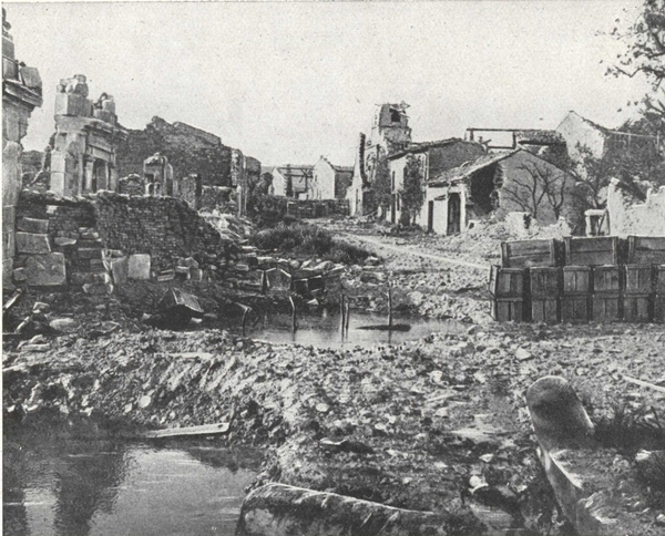
Éparges Village in 1915.
Barricade of boxes filled with earth barring the main street: on the right, the church.
At Fresnes turn left, on leaving the village, towards Manheulles and follow R. N. 3 straight on to Verdun.
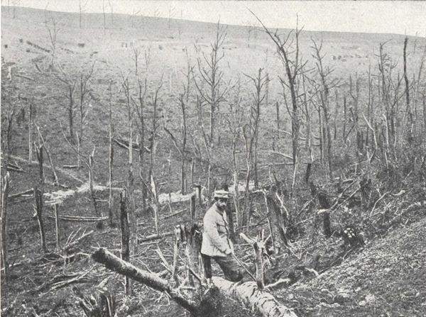
Mort Ravine (1915) (See plan p. 129).
Dug-outs and French mine entrances on the slope of Éparges Spur.
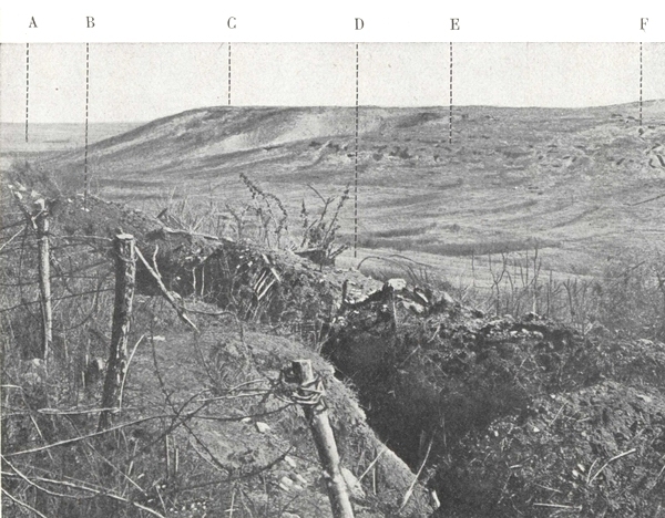
General view of the Éparges Range, taken from the crest of Montgirmont.
A. The Woëvre.—B. The trench from which the photo was taken, on the crest of Montgirmont.—C. The Éparges crest.—D. Mort ravine.—E. Dug-outs on the side of Éparges Hill, F. A Trench.
This itinerary is a continuation of the circuit of the left bank of the Meuse. It joins it at the village of Esnes (see plan above, on the right).
Tourists who do not wish to prolong their itinerary by the loop Montfaucon-Romagne can make straight for Vauquois, then, in Argonne, by the G. C. 28, the road from Esnes to Varennes via Avocourt and Vauquois.
Tourists starting from Sainte-Menehould can reach Varennes by R. N. 3 from Islettes and Clermont-en-Argonne road: from Clermont, climb the Aire valley as far as Varennes, then Vauquois by G. C. 2a and R. N. 46.
This itinerary joins up with that from Champagne via Vienne-la-Ville and Ville-sur-Tourbe.
Starting from Esnes by G. C. 18, the road climbs to Hill 304, then falls to Forges stream and Malancourt, beyond which were our first lines from 1914 to 1916.
The road then climbs towards the peak of Montfaucon, one of the most famous German observation posts along the whole front. This peak embraced a horizon extending from the plains of Champagne to the Heights of the Meuse.
From Hill 304 the tourist traverses the battle area of the 79th American Division when the latter attacked the formidable heights of Montfaucon on September 26th 1918.
To the 313th American Regiment fell the honour of making a direct attack on Montfaucon while the other regiments of the division had to outflank the peak right and left. Reaching the bottom of the slopes the 313th attacked with two tanks at nightfall. They were overwhelmed with a deluge of fire and forced to withdraw to the northern edges of Montfaucon wood.
On the following morning they returned to the attack, supported by tanks and a barrage of machine guns. At 11 a.m. the 313th entered the village and at 1 p.m. units of the 27th Division effected contact with the victors.
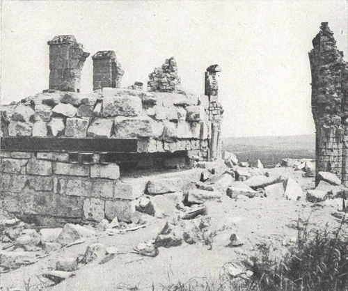
The Observation post of Montfaucon.
It was constructed on the site of and with the ruins of the church.
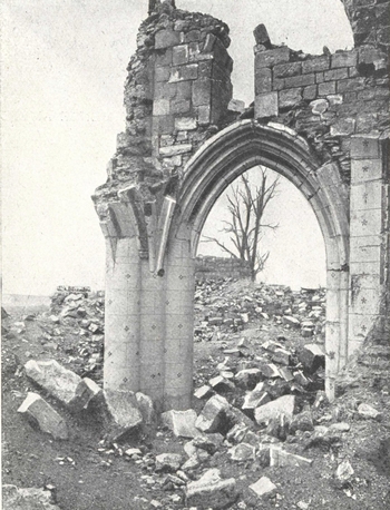
Montfaucon. Arch of the North Aisle, taken from the Choir.
In the background in front of the trees, the German observation post.
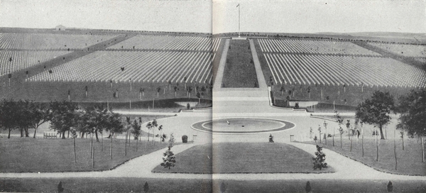
The immense American Necropolis of Romagne-sous-Montfaucon in 1922.
In this cemetery, the most impressive in existence, the Americans have massed together 25,500 graves.
(p. 143) A large number of bodies have since been taken to the United States, but 15,000 graves still remain in this cemetery.
From Montfaucon follow I. C. 4 to Cierges and Romagne. In Romagne, near the church keep right along the Cunel road and cross the bridge. About 250 metres beyond the village, the vast American cemetery of Romagne on the slopes of a hill comes into view. Return to the church, then follow the Charpentry-Varennes road, G. C. 2a.
Pass through Eclisfontaine and then Charpentry. Beyond this village the road descends the valley of Aire. Two kilometres beyond the village, turn left along R. N. 46 to Varennes.
In Varennes, after crossing the railway, and before reaching the church, turn left for 200 metres, then turn left again along G. C. 38 which goes down to Vauquois. Cross the railway and about 4 kilometres from Varennes, take the road leading right to the new village of Vauquois at the foot of the famous mound.
Vauquois is one of the famous points of the Argonne battlefield. The Germans took it in September, 1914, during a strong attack on the French 3rd Army, in their efforts to encircle Verdun. The ridge concealed their operations to the north of Varennes, covered the re-victualling of the Argonne front by the Four-de-Paris road, and in addition furnished their artillery with an excellent observation post. The importance of the position caused the Germans to convert it into a veritable fortress. Caves were made in the rock and connected by underground passages. The streets of the village were excavated, so that the vent-holes of the cellars formed loop-holes on a level with a man's head. The walls of the houses and gardens were battlemented, and trenches were dug in the slopes in front of the village. The position was supported and flanked by the guns in the Woods of Cheppy, Montfaucon and Argonne. Approach was the more difficult, in that the position was surrounded on all sides by ravines and glacis, which provided admirable firing positions for the machine-guns.
This formidable position, which, earlier in the war, before the improvement in the French artillery, would have been considered impregnable, was taken by the French 10th Infantry Division (Valdant) after heroic sacrifices. The first assaults especially, made without artillery preparation or support, cost the splendid French Infantry heavy losses.
The first attack was made on October 28, 1914, by two battalions of the 46th Regiment of the line. The French front lines were then on the Mamelon Blanc, facing Vauquois. Two companies debouching from Noir Wood attacked the western slopes of Vauquois, the sections deployed in (p. 145) skirmishing order, without artillery preparation, and without a single big French gun being fired on the village. As the men dashed forward up the slopes, they were shot down by the carefully concealed German riflemen, but continued nevertheless to advance, in spite of the rain of bullets, till an avalanche of big German shells overwhelmed and scattered them. At the end of half an hour almost all of them were out of action.
The second assault was made on the following day (the 29th), after a very short artillery preparation, during which only a few shells were fired, most of which failed to burst. Fresh companies attacked further to the right, near the Cigalerie. The men charged with the bayonet, but as on the previous day, were mown down by the German machine-guns and rifles, and failed, after heavy losses. At night, an attempt to rescue the wounded left on the field was unsuccessful, the enemy firing pitilessly on the stretcher-bearers, in spite of the Red Cross lantern.
The third assault was carried out on February 17th, 1915. The operation went near to success. The artillery preparation with 75's, 155's and 270's lasted more than twelve hours. Before the attack, three mines should have gone up and destroyed the enemy lines. Only one exploded, but not being dug deep enough into the hill, the effect was merely that of a small mine and the stones thrown up fell back for the most part on the starting off trench, killing or wounding 30 men. In spite of the confusion created by the mine, the men climbed the ladders and proceeded to the attack. The band of the 31st Line Regiment, grouped on the Mamelon Blanc, in full view of the enemy, played the Marseillaise. In a few minutes several bandsmen fell killed or wounded, but the attacking waves had gone forward and the surviving (p. 146) bandsmen sounded the charge. The colonel of the 31st, who was leading the attack, fell mortally wounded but the companies leading the attack scaled the slopes of Vauquois. The 31st charged into Vauquois and reached the ruins of the church, but caught by the fire of the Argonne and Montfaucon batteries and the machine guns of Cheppy, they were forced after heavy losses to fall back. Abandoning the plateau they held on half-way down the hill.
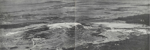
Vauquois Hill as seen from an aeroplane (August 1918).
V. V.: V. de Vauquois; B. N. Noir Wood; V. Vauquois, site of the village; C. Cigalerie Farm; M. the Maize; M. B. Mamelon Blanc; F. H. Hesse Forest; B. C. Cheppy Wood.
A fourth attack was carried out on February 28th with no more success. At last, on March 1st, the decisive attack was executed by the 31st, supported by the 46th and the 89th. The preparation was further improved. A plan of the village, of which only the ruins were left, was issued to the troops. Each company had its precise objectives and the men were armed, for the first time, with the new hand-grenades, charged with melanite.
The bombardment began at dawn. Big guns shattered the dug-outs, and 75's hoisted to the top of Mamelon Blanc, and fed by infantry who carried up shells on their backs, fired directly on the village.
The start off was magnificent. Suddenly, a flashing line of bayonets stood erect on the flank of the hill.
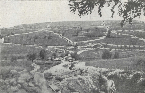
Vauquois Hill
The slope occupied by the French lines: view taken from the Mamelon Blanc.
In the foreground, the Gabionnade, then the road from Boureuilles to Cheppy and the communicating trenches leading to the front line at the top of the hill.
In the background was the pretty village of Vauquois of which nothing is left.
The slope was hard to climb. Standing on the parapet a bugler madly sounded the charge until he was laid low by a bullet. At his observation post, General Valdant, who was following the attack, turning with great emotion to his officers, raised his kepi, and said: "Gentlemen, salute!" The fight was stubborn: twice the troops, dashing from one shell-hole to another, reached the plateau, the second time standing firm. The houses were taken one by one, and the church reached. The village had been wiped out—only shell-holes, heaps of stones, bits of walls and shattered cellars remained. Throughout the next day the Germans shelled the defenders, (p. 148) who were armed only with rifles. Outflanked, the French were slowly forced back from shell-hole to shell-hole, fighting all the time, but their line of defence, organised under fire on the edge of the plateau, brought the enemy to a standstill.
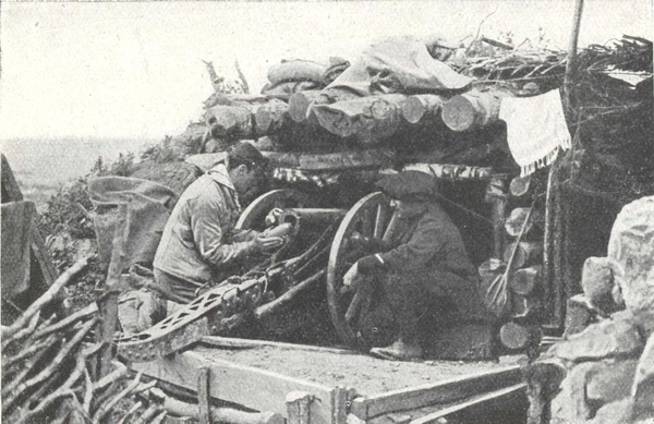
On Vauquois Hill
A mountain gun placed in position on Vauquois hill, after the attacks of March 1915. This photograph was taken ten minutes before the gun was destroyed by a 210 shell (See opposite).
At 2 p.m. the French infantry again attacked the village, carried the German trenches, entered the ruins at 2.35 p.m. and drove back the enemy at the point of the bayonet. At 3, 4, 5 and 5.30 p.m., the Germans counter-attacked, but although troops of fourteen different units were successively launched, they could not dislodge the French from the main street. Twice during the night they tried, in vain, to take the church. For four days and nights, under an incessant pounding by high-explosive shells and a rain of bullets, the French troops held on, without supplies, dependent for their food on the rations taken from the dead. The Colonial Infantry, who for a short time relieved the attacking troops, were decimated in a few days. The Germans were already making use of a powerful minenwerfer, to which the French could only reply with hastily-devised mortars roughly made out of 77 mm. shell-cases, and which carried only 100-150 yards. It was an unequal contest. The Germans attacked almost every night, but were repulsed with hand-grenades and rifle fire, sometimes with the bayonet. The position became untenable, and the French had either to retreat or advance. Once more they attacked.
On the afternoon of March 4th, the 76th Line Regiment took the German trenches west of the church, and reached the wall of the cemetery in spite of small mines being blown up under their feet, and the enemy's bombs. On the 5th a German counter-attack was repulsed.
The capture of Vauquois by the French was definite. During the night of the 15th-16th, a fresh German attack was easily repulsed. On the 16th, at the Cigalerie, which during the attacks of February and March had served as a dressing station, Standard-bearer Collignon, of the 46th Regiment of the line, Councillor of State, and former Secretary-General to the Presidency of (p. 149) the Republic, who had voluntarily enlisted at the age of fifty-eight, was killed by the explosion of a shell while trying to rescue a wounded man belonging to the 76th Regiment of the line. Ever since, at Regimental roll-calls, his name follows that of La Tour d'Auvergne, and the reply is made: "Died on the field of honour".
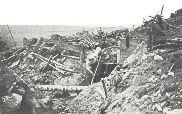
On Vauquois Ridge.
Clearing out the shelter under which the mountain gun, photographed opposite, used to fire, after its destruction by a 210.
Cazeneuve, of the Opéra Comique, Adjutant of the 46th Regiment of the line, who had volunteered at the age of fifty-four, was also killed at Vauquois by a bomb which shattered his dug-out.
Vauquois for long remained a particularly dangerous sector, the scene of frequent surprise attacks, of mining and counter-mining, and of continuous bombardment. The Germans were not reconciled to the loss of this position, which gave the French an outlook over Varennes and the road which formed a continuation of the light railway which they had built between Montfaucon and Spincourt. On March 22, 1915, near the ruins of the church, they attacked a trench with liquid fire. Mines were exploded almost every month, followed by fighting for possession of the craters.
The battle of Verdun was followed by comparative calm in this sector, both sides practically abandoning mine warfare. (p. 150) In 1917, there was hardly anything except surprise raids or reconnoitring parties. On September 26th 1918, the first day of the Franco-American offensive, the outskirts north of Vauquois were completely cleared and Boureuilles was captured by the Americans.
After visiting Vauquois, return to and follow G. C. 38 to Varennes (214 miles).
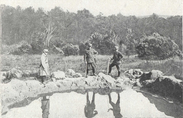
At the Foot of the Mamelon Blanc.
Crater formed by a 380 German shell. On the right, Colonel Cuny commanding the 31st I. R.
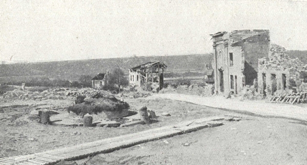
Varennes.—The Place du Marché.
On the right, the ruins of the house where Louis XVI was arrested.
Coming from Vauquois, the lower town is entered, opposite the church. Cross the bridge over the Aire. The Rue de la Basse-Cour brings you to the Place du Marché where you will see, on the right, the ruins of the house in which Louis XVI spent the night before his arrest.
Drouet who had recognised the king at Sainte-Menehould, reached Varennes before him by a short cut. The whole town, aroused by the tocsin, assembled and compelled the king's carriage to stop.
(p. 152) Ascend to the upper town which is situated on the slope of a hill. On leaving the village turn right along G. C. 38, the road to Vienne-le-Château, which climbs towards the forest of Argonne. At the edge of the plateau look behind for a view of the Aire valley and Vauquois Hill. About 3 kilometres past Varennes, a road leads right to some German dug-outs said to be those of the Crown Prince.
Return to the Vienne-le-Château road.
One kilometre further and 200 metres beyond the highest point of the road, the Haute-Chevauchée road branches off right and left, an old Roman road running along the central ridge of the Argonne plateau.
Turn left and drive carefully for the first two kilometres which are in pretty bad repair.
The road passes through Bas-Jardinet Woods, which are full of gun emplacements. On leaving the woods, the road climbs towards Hill 285. On the right and behind this hill are the sectors of Fille-Morte and Courte-Chausse, the scene of struggles as stubborn as those in Grurie Wood.
The Haute-Chevauchée road is the central pivot where the Germans endeavoured, on July 13th 1915, to dent in the French front so as to reach Clermont-en-Argonne and the Sainte-Menehould-Verdun railway.
On July 13th, the 113th Regiment held the sector of Haute-Chevauchée, on their right the 4th held Hill 263, while on the left the 91st were on the plateau of Bolante. After an annihilating fire which completely destroyed these sectors, five regiments of the 16th German Corps broke through the French lines. The Germans, who no longer had any troops to face, believed that they could march unhindered to the south. Already the enemy patrols had reached the cross road of Maison Forestière, 2 kilometres south of Hill 285.
The 82nd and 66th Battalions of chasseurs and the 131st who had just been relieved received warning at their billets and went up into the line under a barrage of enemy fire, by paths marked out with corpses, through ravines (p. 153) full of poison gas. The men, who were exhausted by a whole night's march, hurried forward, gasping and almost suffocated. The order was given to the infantry and chasseurs to counter-attack. The 3rd Battalion of the 131st, led by their commander, swarmed up the steep slope of Bolante plateau. The Germans crouching among the tall ferns endeavoured to withstand them, but they were sharply hustled and did not waste time in turning tail. Bolante plateau and the crest of Fille-Morte were cleared at the point of the bayonet, without artillery support. Further to the right, the 66th Battalion of chasseurs captured Hill 285, while the 82nd, with three battalions in the field, recaptured the crest joining Hills 285 and 263.
The 1st Battalion of the 82nd relieved the battalion of the 4th which was defending the redoubt of Hill 263.
The line was established along Hill 285.
By going on as far as the cross road at the Maison Forestière, the large cemetery is reached.
Return to the Varennes-Four-de-Paris road, downhill road skirting the Meurissons ravine.
It was in this wild ravine of the Meurissons spring that the Garibaldian regiment, placed at the disposal of General Gérard, commanding the 2nd Corps, received their baptism of fire. On December 26, 1914, the 2nd Garibaldian Battalion was detailed to take a German trench. The attacking front was limited, about 150 yards, but the position was strongly held and protected by a deep entanglement of barbed wire. After an artillery preparation (p. 154) lasting from midnight until dawn, the Garibaldian companies rushed forward, one behind the other, to make a breach at all costs, but were held up by the uncut wire. At one point an opening was made and a few men got through to the edge of the German trench, only to be killed there. It was during this engagement, which cost the 2nd Battalion 30 dead, 17 missing, and 111 wounded, that Second-Lieutenant Bruno Garibaldi—a grandson of Giuseppe Garibaldi, "the old red bird" whom, in 1870, the Prussian General Werder confidently expected to "catch in his nest" in the Vosges, but failed in the attempt—was killed. Bruno Garibaldi, though in reserve, advanced to the assault with the 2nd Battalion, his sword drawn, his green tunic unfastened, showing the traditional and symbolic red shirt. Wounded in the hand, he went back to the trench to have it dressed, then returned immediately to the fight. Struck by a bullet, he continued to urge his men forward, until another laid him low. Before dying, he embraced a wounded comrade near by, saying "Kiss my brothers for me".
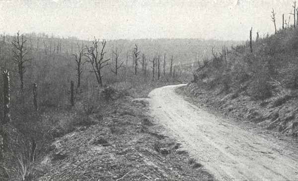
The Four-de-Paris—Varennes Road.
The German front line cut the road at this point. On the left, Meurissons ravine; on the horizon, Biesme valley.
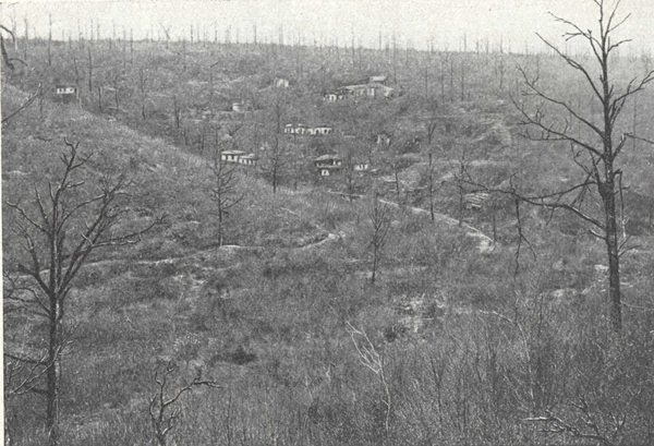
Meurissons Ravine.
German shelters on the counter slope. Bolante plateau riddled by machine gun fire.
On January 7th, after a half-hearted German attack, which was easily beaten off, rough trenches were dug on the plateau—in view of a possible retreat—by men belonging to the 46th French Regiment of the Line, who worked under heavy fire. General Gouraud, commanding the 10th Infantry Division, who came to examine the position, was wounded in the shoulder by a machine-gun bullet. On the following day a violent German artillery preparation began at dawn. At 7.30 a.m. three regiments of Bavarian chasseurs advanced to the attack. A trench held by men of the 89th Line Regiment was blown up and the Bavarians took the first and second lines held by troops of the 89th and 46th Regiments of the Line, who put up a fierce resistance. On the plateau the 11th Company of the 46th, which held the unfinished supporting trench, stopped the rush of the enemy. The Germans, unwilling to risk a frontal attack, turned the position on the right flank, and finally took the trench, but only after the gallant defenders had fired their last cartridges. The Germans penetrated into the ravine, capturing the regimental headquarters, and wounding the colonel and his staff. (p. 155) The 11th Company, however, still held on. On the crest, the cooks and the sick seized rifles and joined in the fight. At about 9.30 a.m. a blast of trumpets on the right announced the arrival of reinforcements. Units of the French 89th Regiment of the Line and 2nd Garibaldian Battalion charged through the undergrowth. A furious hand-to-hand struggle ensued in the copse-wood, no quarter being given. The French succeeded in saving their (p. 156) comrades of the 46th, and checked the enemy, who eventually evacuated the ravine.
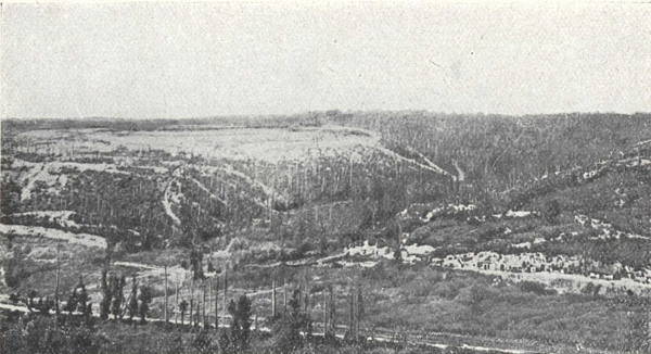
Le Four-de-Paris (as seen from an observation post).
In the foreground, the road from Paris to Varennes.
At Le Four-de-Paris, turn right along G. C. 63 towards La Harazée and Vienne-le-Château.
The road follows the valley of the Biesme, dominated on the right by a series of spurs separated by ravines where flow the streams of Fontaine au Mortier, Fontaine aux Charmes and Fontaine de Madame.
The crests and ravines covered by Grurie Wood were in 1914-1915 the scene of fierce struggles.
Bagatelle—Fontaine-aux-Charmes—Fontaine-Madame—Saint-Hubert—Marie-Thérèse, all these sectors were made famous by communiqués as the scenes of terrific fights.
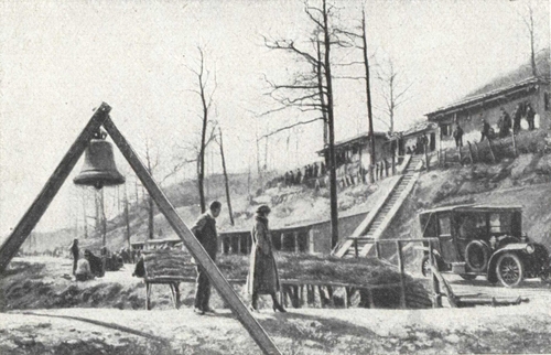
La Harazée.
The church bell was used as a gas alarm. It was placed on the new road, between Vienne-le-Château and La Harazée, on the right bank of the Biesme.
From La Harazée a path leads to Fontaine-aux-Charmes, following the stream which falls into the Biesme at La Harazée and to which it gives its name; another path follows the stream of Fontaine-Madame.
These two streams enclose a plateau broken by ravines along which the French advanced in September and October 1914, seeking to threaten the German lines of communication through the Argonne.
The German troops of Von Mudra decided to reach the valley of the Biesme by penetrating the ravines of Fontaine-aux-Charmes and Fontaine-Mortier towards La Harazée.
In Grurie Wood, the French line was held by regiments and battalions of chasseurs of the 32nd Corps. For over a year a desperate struggle was destined to take place without quarter day and night.
Attacks followed attacks and counter-attacks counter-attacks: every inch of a devastated area was disputed without truce or rest.
Every day saw the same fearful struggle in the depths of the forest: the rival trenches were hardly 30 metres apart, sometimes only 10, protected merely by line of barbed wire which could not be carried far out nor fixed down. Barricades of sandbags were built up in the communicating trenches, which often ran through the enemy lines, to mark the boundary, and, behind these, men kept watch. On each side the temptation was too strong to pay a surprise visit to this "no man's land" and to spring into the opposite trench.
The front trenches were blotted out by aerial torpedoes and mine explosions which completely demolished the frail barricades often made up of human corpses. Then followed hand-to-hand fighting with bayonets and knives.
Among the numerous encounters which all resembled each other, here is the account of one taken from the annals of the 150th Regiment, one of the gallant regiments of the 32nd Corps.
On April 18th, the 2nd Battalion attacked Bagatelle trench which was held by the Germans. Our attack, which started at 2 p.m., was successful and we advanced 80 metres. A German counter-attack straightway robbed us of the fruits of our effort. At 7 p.m. the 2nd Battalion again started the attack but were mown down by machine gun fire. A third attack was launched by the same battalion, only to be thwarted by a counter-attack. Their fourth effort ended at 11 p.m., with a gain of a yard and a half! Commander Grosset of the 1st Battalion was mortally wounded.
From April 25th to 27th the Germans unsuccessfully attacked, the 150th not yielding a single inch of ground.
On the evening of May 1st, at 5 p.m., the 3rd Battalion of the 150th relieved the 2nd Battalion of the 161st. At 5.30 p.m., before the relief was complete, the Germans blew up one of our block-houses by means of a mine (p. 159) and hurled themselves upon our trenches. On the whole front of the 3rd Battalion, the German attack broke out with ferocity, the enemy artillery firing behind our lines and reaching an extreme intensity, so that our companies in the front line were completely cut off. Liaison with the front line became impossible and no reinforcements could be sent up to the units in the first line trenches.
In the centre, the 9th company, commanded by Captain Juge, held on splendidly against the incessant attacks of the enemy who used liquid fire and an unlimited supply of bombs. To keep up the supply of ammunition in the sector was difficult, the 9th company running out of bombs: their casualties kept mounting and the situation was grave. Standing upright on the parapet, with his revolver clasped in his hand, Captain Juge cheered on his men. He fell wounded but got to his feet again shouting: "Stand your ground, stand your ground, my men, and be brave". He was wounded again but refused to be taken back to the rear. This valiant officer continued to keep up the courage of his men who stood on the exposed ground and fired point blank at the enemy who were making incessant attacks. Captain Juge was wounded a third time. By this time the company was reduced to one officer and 23 men, with no bombs and no cartridges. The 10th and 11th companies counter-attacked, checking slightly, though not stopping, the furious onslaught of the Germans. Attacked in rear, these two companies after losing many men were forced to fall back. The 10th, though they had run out of ammunition, only gave ground inch by inch, building up and defending nineteen barricades in succession while falling back 100 metres. At every one of the barricades there was furious hand-to-hand fighting: our men counter-attacked from the parapet with the bayonet and fought with the butt end of their rifles and thus succeeded in bringing the enemy advance to a standstill.
On the left, the 12th company held the Germans in check, and though at one time surrounded, they cut a way through with their bayonets.
At 7 p.m., the Germans attempted a new attack and wrested from us a second line trench. The 12th company under the command of Lieutenant de Marolles counter-attacked once more, regaining the lost ground. Our men snatched sacks of bombs from the hands of the German bombers, and supplied (p. 160) with these, the grenadiers of the 12th company following the irresistible lead of their officer, 2nd. Lieutenant Germain, went forward and captured a machine gun from the enemy after killing the gunners.
At 9 p.m. quiet again reigned. Our first line was left entirely in the enemy's hands, but the second line after being lost and recaptured, then lost again and again retaken, remained wholly in our possession....
On August 10th, the regiments and battalions of chasseurs of the 32nd Corps, all included under the command of the 3rd Army, were relieved by those of the 10th Corps.
After passing through La Harazée, Vienne-le-Château is reached. Turn left opposite the church and follow G. C. 67 to Vienne-la-Ville. The tourist reaches the edge of the Argonne plateau which gives place to the chalky plains of Champagne.
For a tour of this region, read the guide entitled: The Battles of Champagne.
Sainte-Menehould, on the Verdun-Paris railway, can be reached, by G. C. 67 and then G. C. 17, 15 kilometres.
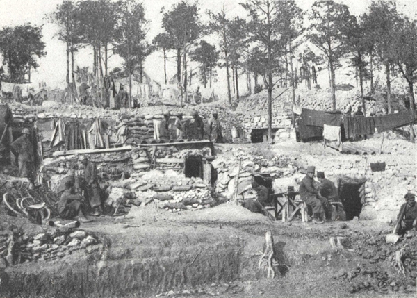
In October 1915, troops of the 1st Colonial Corps at rest in the cagnas built along the road to Marson ravine.
Picture taken from the Guide: "The Battles of Champagne".
Different moments of an attack during the offensive of September 25th 1915.
Before the attack, the first waves wait for "Zero" in the starting off trench: in the distance, smoke of the bursting shells used in the artillery preparation.
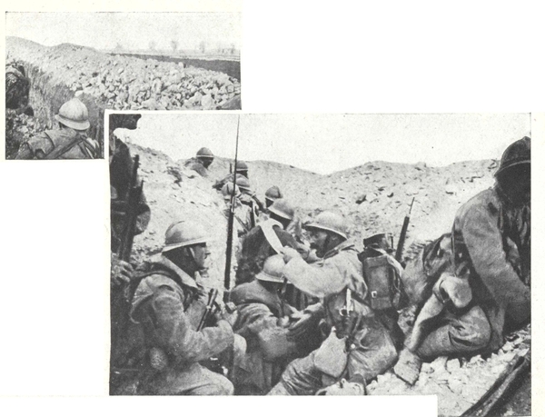
The first wave has gone over, and has just got into the first enemy trench from which they are about to start for their new objective.
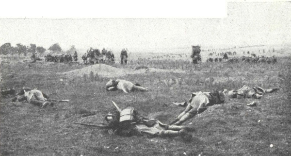
Supporting lines, scattered in the open in small columns follow the advance. In the foreground some attackers in the first wave caught by a storm of machine gun fire.
Pictures taken from the Guide: The "Battles of Champagne".
The tourist can go from Verdun to Metz either by the Route Nationale No. 3, the Porte Saint-Victor—Haudiomont—Mars-la-Tour and the battlefields of August 1870 (see page 166), or by the Route Nationale No. 18 (the Route d'Étain) and R. D. 1.
In 1914 Étain was bombarded on August 24th and 25th. On the 24th many inhabitants were killed. On the 25th, the inhabitants who took refuge in the cellars of the town hall perished under the ruins of the building, but 200 others escaped to Verdun.
On the same day the French forces, north of Étain, crushed the 33rd German D. R. Nevertheless the order to retire was given and the enemy occupied the town which they pillaged methodically. Every other day convoys took back to Germany, furniture, linen, wines, groceries, cloth, footwear, tools, and even materials.
In April 1915, the French troops came back quite near Étain where the line was established until February 1916.
In the town, which is partly destroyed, the church, much damaged, can be seen on the left.
Through the steeple which was cut in two by the bombardments can be seen the internal structure: the Germans had fitted up an observation post inside.
Viollet-le-Duc used to consider the church of Étain with its three naves one of the five noteworthy churches of the Meuse. It was commenced in the 13th century and finished in the 15th.
The majestic choir, with its large windows with manifold mullions, was 15th century. Inside (right aisle) could be seen the font and the Notre-Dame-de-Pitié by Ligier-Richier (photo page 164).
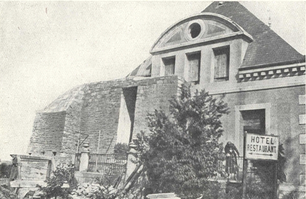
In 1920. At the entrance to Étain.—The Hôtel de la Sirène (Rue Nationale), formerly the Crown Prince's Headquarters in 1916.
The origin of Metz dates back to the Celtic epoch; it was the capital of the Mediomatrice. The Romans fortified it to defend the frontiers of the Empire against the Barbarians. Thus Metz became the starting point of the six great Roman roads which led to the distant provinces, two roads from Metz to Reims, two roads from Metz to Treves, one by the right bank, the other by the left bank of the Moselle: the road from Metz to Strasbourg and the road from Metz to Mayence.
Being a very rich and densely populated town, it was embellished with numerous Roman monuments, of which excavations have brought to light important traces: the Amphitheatre near the Porte Mazelle, and especially the Aqueduct of Gorze dating from the 4th century, which was 22 kilometres long, bringing to Metz the waters of Gorze. There are splendid remains to be seen at Jouy-aux-Arches.
The Roman Emperors during their stay at Metz lived in the palace of the governors which stood on the Place Sainte-Croix.
Metz was captured and devastated by the Huns in 451 A. D.
A half-century later the ruins were restored and the city became, on the death of Clovis (in 511 A. D.) the capital of Austrasie and the cradle of the Carolingian branch. Louis-le-Débonnaire was buried in the Abbey of Saint-Arnout. The treaty of Verdun (843 A. D.) gave it to Lothaire who made it the capital of his kingdom, Lotharingia, which became, later on, Lorraine. But thirty years later the treaty of Mersen (870 A. D.) assigned it to Louis-le-Germanique.
In the name of the Emperor it was first administered by counts and then by bishops. In 1220, on the death of Count Thiébault, the town was raised to a kind of republic under the title of "Imperial free town" and until 1552 was administered by sheriffs.
Under Henry II, the French, lead by Montmorency, occupied the town after a treaty had been concluded with Maurice de Saxe. The Duc de Guise, appointed governor, skilfully and energetically defended Metz to which the (p. 166) Emperor Charles V had laid siege (October 19th, 1552). On January 1st 1553, Charles V withdrew after losing 30,000 men. The kings of France for a long time held the title of Protector. Henry III was the first to be called the sovereign lord. The Parliament of Metz, constituted in 1633, finally brought about the downfall of its municipal independence and the treaty of Westphalia (1648) definitely made it part of France. It became the capital of the province of Trois-Évêchés, composed of Metz, Toul and Verdun.
Up to the Revolution, Metz escaped the horrors of war, though on every occasion the town suffered from the consequences. Troops were continually passing through and the barracks were used as a place of muster. Turenne, Villars, the Marquis de Créqui, and Marshal Villeroi encamped within its walls, and at Metz, Louis XV, in August 1744, fell seriously ill, and the whole of France prayed and fasted for the "Well-beloved".
In 1790, Metz became the headquarters of the new department of Moselle. Two sieges in 1814 and 1815 were successfully repulsed.
The year 1870, however, marked a sad date in the history of Metz, till then nicknamed Metz the Virgin City.
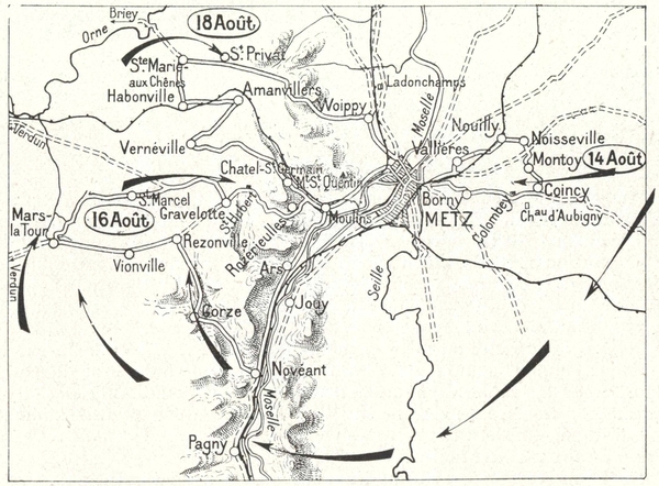
The French army of Moselle, beaten at the frontiers, fell back on Metz. Intending to rejoin the army of Mac-Mahon at Châlons, it began a slow and uncertain retreat. The Germans hindered this retreat (Borny, August, 14th), crossed the Moselle south of Metz and stopped the French columns on the march to Verdun. (Rezonville, Mars-la-Tour, August 16th), narrowed the circle round Metz and surrounded Bazaire (Gravelotte, Saint-Privat, August 18th.)
The battles of Borny (August 14th), Rezonville (August 16th), Saint-Privat (August 18th) forced Marshal Bazaine to fall back on the walls of the town. He put up a feeble resistance, being content to await developments, without even attempting a serious sally which might have saved his military honour. On October 28th, he put his name to the capitulation, and on the following day he handed over 173,000 men, 60 generals, 6000 officers, 58 standards, 622 field guns, 876 heavy guns, 72 machine guns, 137,000 chassepots, 123,000 other rifles and masses of untouched munitions. Six months later, the treaty of Frankfort (May 10th 1871) ceded to Germany Metz and a part of the department of Moselle. Metz became the capital of German Lorraine.
(p. 167) Marshal Fabert, Generals Custine, Richepanse and Lasalle, the composer Ambroise Thomas and the poet Paul Verlaine were born at Metz.
The situation of Metz destined it to become a stronghold of first importance. The Romans fortified the town, which had been built by the Gauls, and constructed the first citadel. The walls were preserved for a considerable time, and Bishop Robert in the 10th century, again utilised their outline. It was only in the 12th century that the new circumvallation was extended to the island formed by the two arms of the Moselle; it was composed of a high rampart protected by 68 towers. In 1532 the Duc de Guise ordered the engineer Pierre Strozzi to restore these fortifications which had undergone two sieges (1444 and 1552) and were in a pitiable state. Four years later (1556), Marshal de Vieilleville had a citadel flanked with four bastions constructed on the site of the ancient monastery. This citadel (which lasted till 1802) was on the spot now occupied by the Esplanade.
Vauban, nearly a century later, realised the strategic worth of Metz and conceived a vast project which the engineer Cormontaigne, in the 18th century, was to realise. At all events Vauban was able to construct a "horned redoubt" and to add eleven new bastions to those which already guarded the citadel, but it was Cormontaigne who carried out the plan of the inundation of the valley of the Seille, by using the vast waters of the pool of Lindre.
Metz became one of the most formidable fortresses of Europe. Under Louis-Philippe the fortifications were entirely remade and in 1866 preparations were in hand to reconstruct them on a new plan in accordance with the requirements of the then existing military armament. Of the four separate forts of Saint-Quentin, Plappeville, Queuleu and Saint-Julien, only the first two were completed in 1870.
The Germans considerably strengthened the wall of circumvallation by the addition of 19 bastions surrounded with moats, and themselves protected (p. 168) with 13 advance works. The extent of the zone of forts reached 30 kilometres and 11 new forts were added.
Before the War the Germans had drawn up their famous "black lists" in which were recorded numbers of manufacturers, political men, journalists, priests and members of Lorraine societies. The inhabitants of Metz were not spared in these lists; many were arrested on the suspicion of exercising "a provocative action and a pernicious influence over the population". Among them were M. Prevel, M. Winsback, secretary of the "Souvenir alsacien-lorrain", league which was dissolved in 1913; M. Gangloff, whose two sons and his brother-in-law, as French officers, laid down their lives for France. Some were able to escape, as occasion offered, and get back to France, like Paul Piquelle, editor-in-chief of the Messin, and the canon Collin, director of the Lorrain.
Before mobilisation had begun or hostilities declared, the "suspects" were forcibly torn from their families and confined in cells, without trial, in the military prison of Metz. A few days after they set out, without saying goodbye to their families, for Coblentz. When taken to the fort of Ehrenbreitstein they only escaped the frenzy of an excited populace on account of thirty German bayonets which surrounded them. Worn out with exhaustion, they were shut up in the casemates which were used some years before the war for confining to barracks soldiers undergoing disciplinary punishment and which had been evacuated under the orders of the authority on account of their unhealthy condition.
For months they existed in these dungeons under the most deplorable physical and moral conditions. Some of them, by depositing a surety of 30,000 marks, left to go and live under a kind of penal regime in the Prussian Rhineland. The less submissive element stayed where they were more than two years and were then subjected to the same regime as their comrades who had already left. They were absolutely forbidden to enter the fortress of Metz.
These "suspects" never knew the reasons for their arrest until August 1917. Permission to return to their town was given them in November 1918 by the "Soldiers Council" which had replaced the Imperial Government.
Several inhabitants of Metz were promptly seized and drafted into the units sent up to the front, especially the Russian front. Among them, one of the brothers Samain, president of the "Lorraine Sportive" was sent to the French front in the batteries most exposed to danger. When crippled in the legs he was brought back from the front and thrown into prison.
The Germans subjected Metz to a regime of terror. The German inquisition was not confined to the street, but it intruded into the homes. Everything that reminded them of France, books, sacred family relics, had to disappear.
Speaking French became a provocation.
To say "Merci, Monsieur" and "Bonjour, Madame" were court-martial offences at the courts—ordinary and extra-ordinary—which sat permanently at Metz. Sentences never stopped. All the French newspapers were suppressed and only the official German papers were allowed.
The German authorities instituted an organ, La Gazette de Lorraine, to be modelled on the infamous Gazette des Ardennes and to further the same purpose, the demoralisation of the French nation. In this gazette, the Germans carefully published, in the first issues all the sentences pronounced by the courts-martial, in the hope of terrifying and cowing the inhabitants of Metz. It was a vain hope: it had the opposite effect of strengthening their resistance. The system of spies and informers was widespread under official orders.
(p. 169) A young girl, slily exhibiting surprise at seeing a squadron of French aeroplanes pass overhead, shouted in front of her house: "Oh Kolossal!" Denounced by a loyal German woman, she was called before the court-martial (the first of three appearances).
To the military judges who tried to force her to admit to her anti-German sentiments, she replied: "My father who was imprisoned in a fortress is exiled with my mother in Prussia. My two brothers, French officers, are no doubt dead by this time, and I cannot yet love Germany". She was set free this time, but a stricter watch was kept on her.
Orders were given to celebrate the "great German victories". The "Mutte" of the Cathedral was rung. The Germans noisily showed their delight on the Esplanade round the statues of the "idols". The mayor, a noted German naturally, read the bulletin of victory from a window of the Hôtel de Ville decorated and illuminated.
The inhabitants shut themselves up in their homes. "Though we live side by side we shall never meet one another", they said. When forced to fly flags, they hoisted, as far as they could, the decorated emblem of the cross of Lorraine.
The bombardment of Verdun was audible at Metz and caused much anxiety. But the people of Metz saw the return of the "feldgrau" who, once mad with enthusiasm, now had fear in their eyes at the mention of Verdun.
Russia succumbed. Could they still hope? The most obstinate did not give up hope and they buoyed up the falling spirits. Pious families prayed in the churches.
1918.—The inhabitants of Metz felt that the end was near. Hunger held the German population in its grip, though the natives of Metz managed, by every known and unknown ruse, to conceal food which their friends in the country obtained for them almost under the noses of the police. The allied squadrons of aeroplanes came every night to bombard the station of Metz-Sablons. Forts thundered, bombs burst, and munition trains blew up. The Germans proclaimed with loud shouts the offensive that was to bring peace. At the end of July the newspapers, which had been extolling the German attack, started talking about defending themselves.
The people of Metz knew that they were certain of becoming French again. And now the battle drew near the fortress. With feverish haste the Germans manned and equipped the forts. Were they to undergo the devastation of a bombardment? Already American shells were falling on the south suburb of the town. "At what price shall we buy our liberty" was the feeling in every heart. Events moved swiftly and at the same time the iron discipline of the imperial army crumbled. In the numerous barracks soldiers grumbled, argued and refused to obey orders.
Threatened with an offensive in Lorraine, the Germans ceased holding some of the defences of the fortress.
The catastrophe was quite near. Mutiny broke out, and lead by the insurgent sailors who had come from Kiel, a howling mob of soldiers rushed headlong through the streets, seizing their officers, tearing their ensigns and smashing their rifles. Council of workmen and soldiers drove out the imperial government, proclaimed a republic and hoisted the red flag. The men of Lorraine who had been brigaded in the German army demobilised themselves and returned to their homes.
The Germans were reduced by all this to a standstill and signed the armistice. The inhabitants of Metz waited with silent pent up feelings for their deliverers.
The sad hours were finished and done with: the "wonderful hours of Freedom" sounded.
When the Armistice was signed on November 11th, the American artillery was within range of the forts of Metz which they had already bombarded several times, and the troops were all in position for the offensive fixed for November 16th.
Distribution of the first French newspapers on November 19th, 1918.
The Place de la République and the corner of the Rue Serpenoise.
(Cliché Prillot, Metz.)
By the terms of the Armistice, invaded countries, including Alsace and Lorraine, had to be evacuated by the 26th. So on Tuesday November 19th 1918 the French troops made their solemn entry into Metz, evacuated by the German soldiery, amid scenes of indescribable enthusiasm.
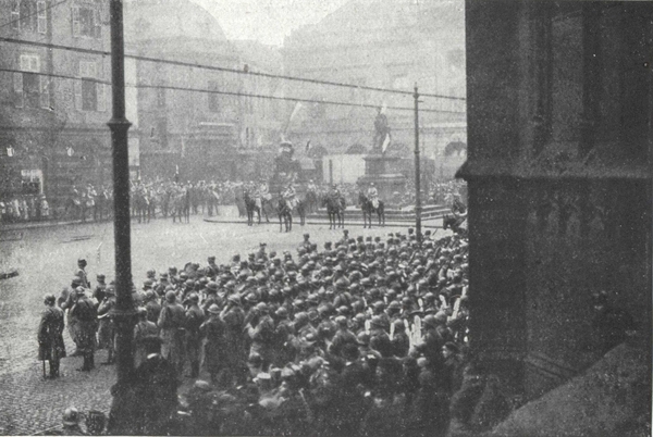
The Place d'Armes: the entry of Marshal Foch.
In the background, the statue of Marshal Fabert; on the right, the Cathedral.
(Cl. Prillot, Metz.)
(p. 172) Then the march past took place on the Esplanade in front of General Pétain who was appointed Marshal the same morning.
On a white horse and in his large blue cloak he took up his position in front of the statue of Marshal Ney: he was supported by General Fayolle, commanding an army group and General Buat, major-general.
General Mangin, commanding the 10th army, owing to an accident on his horse, was unable to be present, his place being taken by General Leconte for the parade. On the same day there took place the induction of M. Mirman, commissary of the Republic, who was received by General de Maud'huy, governor of Metz.
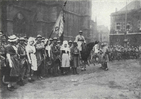
The people of Lorraine surrounding the French flag.
On the Place d'Armes, in front of the Cathedral.
(Cl. Prillot, Metz.)
Salvos of guns and the sounding of the "Mutte" in the Cathedral heralded this festal day.
On the following Sunday, November 24th, the chief men of Metz appointed the new municipal council and decided that the streets should revert to the names they held before 1870 and that the new streets should be named after generals and great men who had distinguished themselves during the War. The list was settled by a by-law on December 7th.
On Sunday, December 8th, President Poincaré, with a retinue consisting of the Minister for War, the President of the Council, G. Clemenceau, the Presidents of the Chambers, Ministers, Marshals and French and Allied Generals came to announce the definite restoration to France of the lost provinces.
It was an unforgettable day. Girls in Lorraine costume lined the streets and flowers were thrown from windows on to the procession. The review took place in the morning on the Esplanade, and also the presentation of the star-studded baton to Marshal Pétain. The ceremony was opened with a speech by the President. Then followed a touching scene, when M. Poincaré and M. Clemenceau approached each other and joined in a long embrace.
(p. 173) In the afternoon there was a reception at the Hôtel de Ville when President Poincaré conjured up all the history of Metz concluding thus:
"The years have passed on Metz, and Metz has not changed.
"The protests which her great Bishop, Mgr Dupont des Loges, used formerly to carry to the Reichstag in the name of all the people of Metz, in the name of all the inhabitants of Lorraine, have continued after his death with the same quiet firmness, you, inhabitants of Metz, have repealed them, year by year, in your pilgrimages to Mars-la-Tour, in your visits to the cemeteries, in your worship of the memory of France.
"Beloved town of Metz, your nightmare is past, here is France back again opening her arms to you".
The procession was then received with great ceremony by Mgr Fell at the Cathedral and visited the cemetery of Chambière to pay homage to the dead of 1870.
On October 27th, 1919, the Croix de Chevalier de la Légion d'Honneur was bestowed on the town of Metz with the following inscription:
Town whose persistent loyally to France never faltered during a captivity of 48 years;
Rich in a past glorious and without stain, unsullied by her misfortunes, exposed for centuries to the covetousness of a near enemy, she has richly deserved to be honoured because she has suffered so long.
She symbolises, in her deep affection for her Mother country, Lorraine, at last wholly restored as a French province.
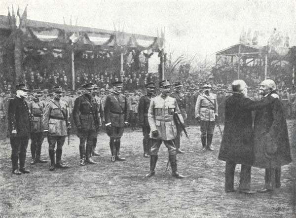
The embrace of the two Presidents after the presentation of the "Bâton de Commandement" to Marshal Pétain (December 8th, 1918).
Behind Marshal Pétain, from left to right: Marshal Joffre, Marshal Foch, Marshal Douglas Haig, General Pershing, General Gillain, General Albricci, and General Haller.
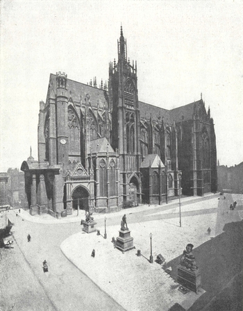
Metz Cathedral as it was before the German occupation.
The cathedral used to finish, on the left, with a Doric porch erected in the 18th century by Blondel who had in mind a similar style of architecture for the whole Place d'Armes. The Germans destroyed this porch in 1903 (See p. 179) and erected in its place a pseudo-Gothic construction which would undoubtedly have been better in keeping with the rest of the edifice, had it not been carried out in a stilted and unskilful manner.
The Place d'Armes, on to which the Cathedral and the Hôtel de Ville look, is adorned with fine buildings. On this site the cloister of the Cathedral, the musicians' quarters, several chapels and private houses used to stand.
In 1753 the Marshal de Belle-Isle, governor, decided that a "Place" should be made on this spot and that a West door giving access from the Cathedral to the Place should be constructed.
The plans of the architect Blondel necessitated a lowering of the ground level.
For months and years the canons and sheriffs set themselves against the work or held it up. During the night of August 9th 1755, M. de Belle-Isle called together the garrison and by the light of torches, had the whole work completed: by the morning the excavations were finished.
On the Place d'Armes the statue of Marshal Fabert, by Etex (1840), stands between military trophies.
The statue of the great Metz captain (1599-1662) who was governor of Sedan, has only the following words as his inscription:
"If, to prevent a place which the king has entrusted to me falling into the enemy's hands, I had to throw myself, my family, and all my possessions into the breach, I would not hesitate for a moment to do so".
Marshal Fabert, who was as clever an administrator as he was a magnificent soldier, restored agriculture and commerce in Champagne, and established at Sedan the manufacture of broadcloth, which till then belonged to Flanders and the Pays-Bas. King Louis XIV held him in very high esteem.
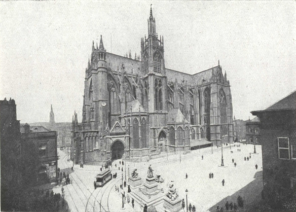
The Cathedral and the Place d'Armes.
On the left extremity of the cathedral is the pseudo-Gothic porch built by the Germans (see photograph on p. 179) in the decoration of which William II is represented as the prophet Daniel (Photo p. 178).
In the foreground, on the Place, the statue of Marshal Fabert.
(Cliché LL.)
All one side of the Place d'Armes is occupied by the Cathedral Saint-Étienne, a masterpiece of the pointed style. The fabric recalls Amiens and Beauvais. If from the outside it may seem curtailed, the interior (121 m. long, 22 wide and 43 high), with its resplendent stained windows, is vast and altogether beautiful.
The most ancient parts of the cathedral do not date back beyond the 13th century.
The nave has eight bays—it was completed in the 14th century; at the top of the fourth bay it is flanked by two square towers.
The north tower is the tower of the Mutte, so called from the municipal bell hung there. It is topped with a beautiful spire which forms an excellent observation post over the surrounding country.
Here was the post of the look-out man who had to report fires. On the other side of the nave rises the tower of the Chapter which was finished in 1839. A monumental door opens at the base of each of these towers.
Another tower, polygonal and smaller, called the Tour de l'Horloge, is added to the south aisle. On each side of the choir, where the branches of the transept meet, rise the two small towers of Charlemagne, so called in memory of those which stood in the Roman building. They lead by spiral staircases to the outside terraces which run along the cathedral.
While the nave is 13th century, the transept dates from the 15th, and the choir, built over a huge sepulchral crypt, is contemporaneous with the last period of Gothic art.
Although completed in 1546, the Cathedral had still to undergo numerous modifications. Fires caused repairs to be made and then in 1753, by the Governor's orders, Marshal de Belle-Isle, the making of a "Place" in front of the cathedral necessitated the demolition of the Bishop's quarters and the construction of a west door.
The ground level was lowered from 8 to 9 feet and the architect J. B. Blondel was instructed to make out elaborate plans.
They were worked out from 1761 to 1764 and were at once put into execution and continued with till 1771. While endeavouring to have regard to the ancient structure, Blondel strove not to make a west door to the Cathedral but rather to create in front of the cathedral an independent door, the classic lines of which would blend happily with the buildings of the "Place" but would contrast with the style of the edifice (See page 174).
In 1791 other alterations were made: following the plans of Gardeur-Lebrun the rood-loft was done away with, and likewise the ancient altars and the vaults. Finally the roof which was burnt on the night of May 6-7th 1877—the day of the entry of William I into Metz—was replaced in 1880-1882 by a copper roof, raised several metres.
The Doric fore-part of Blondel's design was pulled down in 1903 by the Germans, to make way for a west door conceived in the style of the rest of the church. It was not, however, a very happy effort. At the corners were (p. 178) sculptured statues of the prophets. One of these statues, that of Daniel, had the face of William II. The inhabitants of Metz, who had always resented the presence of this effigy at the entrance to their Cathedral, before the arrival of the French troops, fastened to its hands a chain from which hung a small board bearing the words: Sic transit gloria mundi.
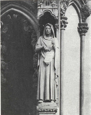
William II as the prophet Daniel over the porch erected by the Germans with The board in his hands commemorating his downfall:
"Sic transit gloria mundi".
It will be replaced by a work of Hanaux, a sculptor of Metz, who was responsible for the French monument of Noisseville.
There is no church which has so much space open to the light. In the transept and choir it has been calculated that there are 4,071 square metres of window and it is no exaggeration to say that the whole structure is like a huge stained-glass window.
Some of these windows date back to the 13th century. The large rose-window, at the bottom of the nave, which dates from the 16th century, is the work of the master glass worker Hermann. The windows of the north transept date from the 15th century. Those of the south transept, of the choir and the apse, are 16th century.
The bell named "La Mutte", which is in the tower of the same name, did not belong to the church but to the town. The existing bell, which is rung on all great occasions, was cast in 1505. It weighs 13,000 kilos, so that when it is put in motion, a perceptible swaying can be fell in the large spire and in the small spires. It bears the following inscription:
Dame Mutte suis baptisée,
De par la Cité ci-posée
Pour servir à la Cité
Aux jours de grandes solennités;
Et aussi pour crier justice,
Prendre ban de bonne police;
Les contredire quand bon me semble
Et pour convoquer gens ensemble.
(p. 180) From the top of the Cathedral tower the best general view is obtainable of Metz and the country round. One can realise the importance of its forts round which the Moselle seems to be an immense moat. On the left bank, the hills fall sheer and are a natural defence: on the right, the hills are not so high but are strengthened by a line of forts. Likewise, by seeing them glistening in the distance, a better idea is gained of the many streams which encompass or pass through Metz: the Seille and the stream of Saint-Pierre, the stream of Noisseville, the stream of Châtel-Saint-Germain—the Moselle which the canal doubles and which is itself divided, forming in front of Metz the large island Saint-Symphorien, then, near the dam called Wadrineau, the smaller island of Saulcy. At the foot of old Metz flows yet another branch of the Moselle which divides in two to isolate on an island the Préfecture and the Theatre. Beyond is the large island Chambière, recognisable by its drill ground and its cemeteries.
After leaving the Cathedral, the Hôtel de Ville is also to be found in the Place d'Armes. It was started in 1766 and finished in 1771. Its style is simple, the façade being ornamented with two pediments and fine grilles. A porch leads to a beautiful staircase. Opposite the stairs is to be seen a bas-relief in white marble on which are engraved the famous line of Ausonius:
"Salve magna parens frugumque virumque Mosella" ...
Hail, Moselle, illustrious mother of crops and men!
Inside there are vast banqueting halls where the public sessions of the Academy are held. The Academy of Metz was founded in 1760 by Marshal de Belle-Isle under the title of Royal Society of Letters, Sciences and Arts and endowed with a sum of £60,000.
It was suppressed at the Revolution and re-formed on March 14th, 1819 with the motto "l'Utile" and obtained from Charles X, on September 5th 1828, the title of Royal Academy. It consists of 36 titular members and 18 resident members, in addition to 4 honorary members, correspondents and associates.
The Academy has been largely instrumental in maintaining French culture in Lorraine during the years of annexation.
On the grand staircase are to be seen three stained-glass windows put up in 1582: the middle one is the Duc de Guise after the siege of Metz; the right, the Metz bishop Bertram; the left, the sheriff Pierre Baudoche.
The flag which floats on its façade is the one previously used in 1870. (p. 181) Carefully preserved in the Carnavalet Museum at Paris, it was returned to the Mayor by the vice-president of the Paris municipal council on December 25th, 1918.
On leaving the Hôtel de Ville, take, to the left of the Place d'Armes, the Rue Fabert (see, on left, the statue of the Virgin), then the Rue des Clercs which is a continuation of it. Coming to the bottom of the Rue des Clercs, on the left is the Place de la République, and on the right the Esplanade.
The magnificent space of the Esplanade was used as a parade ground for the garrison troops.
William I knocked off his pedestal by the people of Metz and replaced by the statue of the "Poilu".
Ney, Duc d'Elchingen, prince of the Moskwa, was born at Sarrelouis. He is depicted with his rifle in his hand, ready to fire (Photo p. 181).
Next, go to the end of the Esplanade, beyond the music kiosk, on the terrace: there is a magnificent view over Saint-Quentin Hill and Fort, Plappeville fort and the Moselle. The Island of Saulcy and Poudrière exactly opposite will also be seen.
The Statue of the "Poilu" in 1918,
erected on the pedestal on which William I used to stand.
(Cliché Prillot, Metz.)
On this terrace used to stand the bronze statue of William I on horseback (1892). The inscription on the pedestal used to state that the statue had been erected to the Emperor "by his grateful people". The conqueror (p. 183) pointed with his finger to Moselle and the powerful forts of Plappeville and Saint-Quentin which protect the town. William I was knocked down headlong some days before the entry of the French (Photo opposite).
In place of William, a statue "to the victorious poilu" was erected during the night of January 6-7th with the inscription: "We've beaten them". This was done as a pleasant surprise for Marshal Pétain who was coming on the following day to present colours to 16 regiments, and to confer decorations on several officers and men. This statue was made in seven days in a workshop of Metz by the sculptor Bouchard.
The Palais de Justice, built in 1776, looks out on to the Esplanade. On its site formerly rose the Hôtel de la Haute-Pierre, which belonged to the Duke of Suffolk, lover of Queen Mary of England. He had it pulled down, and built, in a year and six months, the beautiful "Hôtel de Suffolk", which for a long while was used as the town hall. Finally, in 1776, Clairisseaux built the existing palace. The following should be seen: the iron banisters of the great staircase, and, in the interior court, two bas-reliefs, one commemorating the humanity of the Duc de Guise in assisting the soldiers of the Duc d'Albe after the siege had been raised; the other commemorating the peace of 1783 concluded between England, France, Spain, United States of America and Holland. Behind the Palais de Justice stands the beautiful equestrian statue of Lafayette.
Return to the Place de la République and turn right along the Avenue de la (p. 184) Citadelle which separates the Esplanade from the Place de la République. Follow this road, which presently passes, on the left, the Engineers' barracks and then a garden.
After passing the garden, turn left into the Avenue du Maréchal-Joffre which leads to the Place du Roi-George (in front of the former station).
Not far from the Place, a round tower is visible, the remains of ramparts of the Middle Ages. Leave the old station behind you and go alongside the gardens by the Avenue Serpenoise which follows the tramway; immediately to the left is the Porte Serpenoise (1852).
The Monument of Déroulède.
On the right of the Porte Serpenoise stands the statue of Déroulède. To the right extend the modern quarters, with the General Post Office and the Station of Neo-Roman style in very questionable taste.
(Cliché Prillot.)
Beyond the Place de la République, follow the Rue Serpenoise which is a continuation of the avenue. It is the busiest street in Metz. It is further continued by the Rue Ladoucette which leads to the Rue Fournirue.
Keep right along the Rue Fournirue and then still right along the Rue du Change to reach the Place Saint-Louis.
The Place Saint-Louis or du Change was formerly occupied by sixty stalls of money-changers. Some of the houses in the "Place" have preserved their battlements, their pointed or semi-circular arches and their three-cusped casements as well as some Renaissance balconies. This name of Saint-Louis comes from a statue of Louis XIII, found in the ruins of the citadel and converted by the priest of Saint-Simplice into a Louis IX. Mystery plays were acted in the "Place". It was then used for the executions of criminals and after that a corn market.
At the far end of the "Place" take the Rue Royale and then turn left into the Rue Coislin which runs alongside the Coislin barracks (plan below).
At the bottom of the Rue Coislin take the Rue Pont-à-Seille which leads to the Place des Charrons, then at the end of the Place, the Rue du Grand-Wad leading to the Rampart des Allemands and continue left as far as the Porte des Allemands.
The Porte des Allemands, on the Seille, is a remarkable edifice.
It is mentioned as far back as 1324. In the 15th century it was entirely restored by the architect Henri de Banceval.
Opposite the Porte des Allemands, take the Rue des Allemands (see the interesting church of Saint-Eucaire on the right) and continue to the Place des Paraiges.
At the end of the Place, turn right along the Rue Saulnerie and its continuation on the left, the Rue du Paradis leading into the Rue des Capucins. At the end of the latter is the Place des Maréchaux where is Sainte-Ségolène Church, built on the site of an oratory founded by Saint Segolene in the 7th century. The present church, built at two different periods (the choirs, the nave and the doorway are earlier than the aisles) dates back to somewhere in the 13th century. The long and narrow windows are mostly in pairs and with a spear-head finish. The side chapels contain beautiful stained-glass windows and there is a curious openwork gallery in the organ-loft and some interesting pictures.
Turn left and take the Rue des Trinitaires, passing an old building with square turrets, near a gateway "Hostel Saint-Ligier". Then turn right into the Rue de la Bibliothèque.
In this street is situated, at the corner of the Rue Chèvremont, a huge building, formerly the church of Petits-Carmes, the work of Sébastien Leclerc, which includes both the Library (80,000 volumes and 1,987 manuscripts) and the Museum (collections of local archaeology, natural history, objets d'arts, and three picture galleries).
At the Museum, take the Rue Chèvremont which ends at the Rue de la Boucherie, into which turn left and so reach the Pont Saint-Georges, over the Moselle.
Cross this bridge from which there is a beautiful view (Photo page 190), and enter the Rue du Pont-Saint-Georges. Immediately to the right branches off the Rue Chambière leading to the Chambière Cemetery where are the graves of the French soldiers who fell during the siege of 1870.
The road runs between the vast slaughterhouse, the cattle market and the huts used as an army storehouse. An old cemetery is crossed with some monumental tombs standing in the midst, and then by skirting the Israelite cemetery and the Moselle the military cemetery is reached.
There are plain tombs under bushy trees. In the centre is a tall pyramid 12 m. high; all the base is represented by numerous coffins piled on each other. There rest the soldiers who died in the hospitals of Metz from wounds received at the battles of Borny, Gravelotte, Saint-Privat, Servigny, Pletre and Ladonchamps. There are 7,203 in all.
Wreathes, tri-coloured cockades, and ribbons have never ceased, for 48 years, to adorn these graves which the ladies of Metz piously decorate with flowers every anniversary.
Return by the same route to the Rue du Pont-Saint-Georges. The Rue Vincentrue is soon reached on the left and should be taken.
Then turn right into the Rue des Bénédictins.
Apply, at No. 7 in this street, to visit the Church of Saint-Clement.
It was started in 1668. The choir, the nave and the aisle were begun in 1680 by the Italian, Spinga. The West door was damaged in the Revolution. The church is now part of the College founded by the Jesuits, where Marshal Foch began his education.
Return to the Rue des Bénédictins and continue along it until the Rue Saint-Vincent is reached on the left, leading to the "Place" of the same name, on which stands the remarkable Church of Saint-Vincent built in 1248.
The straight-built nave supported by 12 small-columned pillars, the very regular choir, and the beautiful ogival chapels should certainly be seen.
Continue along the Rue Saint-Vincent on the other side of the "Place". The Rue Saint-Marcel, which is its continuation, leads to the Rue du Pont-à-Morts which should be followed to the left.
Cross the Moselle by the Pont-Moyen (pretty view). Follow the Rue Sainte-Marie which follows the bridge and then turn left along the Rue du Faisan leading to the small and charming Place de Chambre.
From the Place de Chambre return to the Cathedral and the Place d'Armes by the little Rue d'Estrées.
A
B
C
D
E
F
H
L
M
O
P
R
S
T
V
1-4-932-5-258—R. C. no 2.213 Clermont-Ferrand—Printed in France.
IMP. CUSSAC. PARIS 1927
The Michelin Road Map
of France in 36 sheets.
Scale 1:200,000 or 3.15 miles to the inch.

Note on the key-map the sheet numbers you require (Verdun No. 57)
The Michelin Road Map
of Great Britain and Ireland
in 24 sheets.
Scale: 3.15 miles to the inch.

On sale at all Booksellers and Michelin Stockists and Agents.
The Michelin Road Map
is the cheapest and the most practical

It opens like a book,
without risk of tearing in the wind

as occurs frequently with other Maps when unfolded.
The Michelin map is on sale at all
Booksellers, Michelin Stockists and Agents.
Transcriber's note:
Obvious printer's errors have been corrected.
Hyphenation and accentuation have been standardised; all other inconsistencies are as in the original. The author's spelling has been maintained.
Other changes made: