The Project Gutenberg eBook, The Argentine Republic, by Pierre Denis,
Translated by Joseph McCabe
This eBook is for the use of anyone anywhere in the United States
and most other parts of the world at no cost and with almost no
restrictions whatsoever. You may copy it, give it away or re-use it
under the terms of the Project Gutenberg License included with this
eBook or online at www.gutenberg.org. If you are not
located in the United States, you'll have to check the laws of the
country where you are located before using this ebook.
Title: The Argentine Republic
Its Development and Progress
Author: Pierre Denis
Release Date: November 2, 2014 [eBook #47264]
Language: English
Character set encoding: ISO-8859-1
***START OF THE PROJECT GUTENBERG EBOOK THE ARGENTINE REPUBLIC***
E-text prepared by Adrian Mastronardi, Martin Mayer,
and the Online Distributed Proofreading Team
(http://www.pgdp.net)
from page images generously made available by
Internet Archive
(https://archive.org)
[Pg 1]
THE ARGENTINE REPUBLIC
[Pg 2]
BY PIERRE DENIS
BRAZIL
Translated, and with an Historical Chapter by Bernard Miall. With a Supplementary
Chapter by Dawson A. Vindin,
a Map and 36 Illustrations
Cloth, 15/- net. Third Impression
"Altogether the book is full of information, which shows
the author to have made a most careful study of the
country."—Westminster Gazette.
T. Fisher Unwin Ltd London
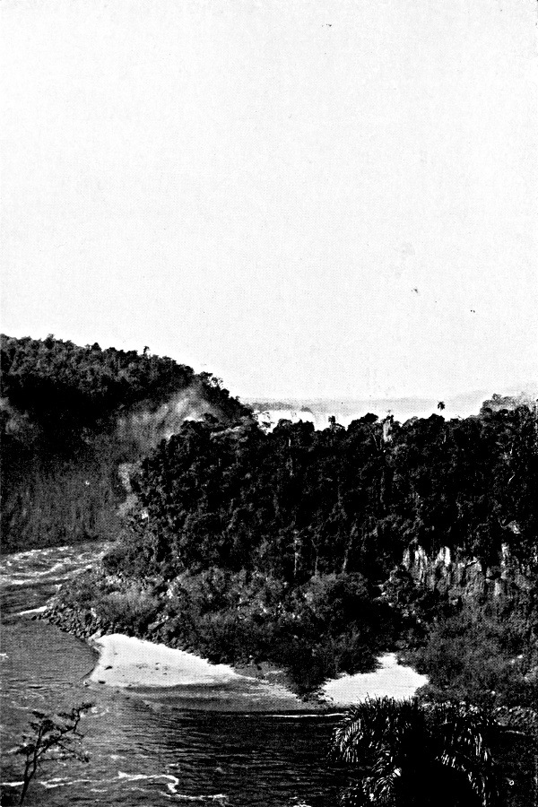
THE FALLS OF THE YGUASSU
Thirteen miles above the confluence with the Paraná.
Like the Paraná at the Salto Guayra, the river cuts
through a layer of basalt intercalated in the red sandstone.
The forest of the province of Misiones has a tropical
character near the river. The araucarias cover only the higher
parts of the tableland.
Plate I.
Click to view larger image.
[Pg 3]
THE ARGENTINE REPUBLIC ·
ITS DEVELOPMENT AND PROGRESS
By PIERRE DENIS, D. es L.
Agrégé d'Histoire et de Géographie
Translated by JOSEPH McCABE
T. FISHER UNWIN LTD
LONDON: ADELPHI TERRACE
[Pg 4]
First published in English in 1922
(All rights reserved)
[Pg 5]
In the following chapters I have endeavoured to indicate the
essential aspects of colonization in modern Argentina: the conquest
of the soil by man, the exploitation of its natural resources, the
development of agriculture and cattle-breeding, and the growth of the
population and enlargement of the urban centres.
For a new country like Argentina it is not convenient to adopt the
strictly regional plan which seems to be the best means of giving
a complete and methodical description of the historic countries of
western Europe, where it is the only way to keep in close touch with
the geographical facts. In western Europe each region is really an
independent unity. It has for ages lived upon its own resources; each
population-group has its horizon definitely limited; and the complex
action of the environment upon man, and of man upon the country,
has proceeded in each district rather on the lines of an isolated
and impassioned dialogue between the two. It is quite different in
Argentina. There, many of the facts which we have to record consist in
an expansion of the population, a spread of methods of exploitation
from zone to zone of the country, and the influence upon colonization
of commerce and of the varying needs of the markets of the world.
It may be well to reply in advance to a criticism which my Argentine
friends are sure to make. They will complain that I have paid no
attention to the
[Pg 6]
people of Argentina, the creators of the greatness of the country. It
is true that I have deliberately refrained from any reference to the
political and moral life of the Republic, the national character and
its evolution, the stoicism of the gaucho, the industry of the colonist
and the merchant, or the patriotism of the Argentinians generally.
My work is not a study of the Argentine nation, but a geographical
introduction to such a study.
I began the work during a stay in Argentina which lasted from April
1912 to August 1914. In the course of these two years I was able to
visit most parts of the country; and, as the information I gathered
during my travels is one of my chief sources, I give here a summary of
my itineraries.
October-November 1912: Rosario—Region of the
colonies of Santa Fé—Forestry-industries of the
Chaco Santiagueño—Bañados of the Rio
Dulce—Salta—Jujuy—Sierra de la Lumbrera.
November-December 1912: Tucumán—Valley of
Tapi—Santa Maria to the west of Aconcagua—Cafayate
(Valley of Calchaqui).
December 1912-January 1913:
Catamarca—Andalgala—Valley of
Pucara—Córdoba—Villa Maria.
January-February 1913: Region of the Pampas (Province of
Buenos Aires, south of Córdoba and of S. Luis, district
of the Central Pampa).
March 1913:
Corrientes—Posadas—Asunción—Forest-industries
of the Chaco of Santa Fé.
August 1913: Region of the Pampas (Province of Buenos
Aires).
March 1914: Lake Nahuel Huapi—Valcheta—San
Antonio—The Rio Negro.
April 1914: Rioja—Sierra de los Llanos—San
Juan—Mendoza.
July 1914: Entre Rios.
These journeys, by rail or on well-known roads, were not supposed to
be for the purpose of exploration
[Pg 7]
or discovery. Their one object was to enable me to make a
provisional classification of the chief types of country and
forms of colonization, and to draw up a methodical programme
for more thorough research. The work which I trusted to do in
a more leisurely way was, however, suspended in 1914, and,
in spite of my very strong desire to do so, I was unable to
resume it on the spot in 1919. I have therefore been compelled
to publish my first observations, completing them, as well
as I could, by a bibliographical study of the country. I
have made use of some fragments of a popular work which I
began, at the request of the Argentine Commission, for the
International Exhibition at San Francisco, of which several
chapters were published in my absence by the University of
Tucumán (Pierre Denis, Modern Argentina: Chapters of
Economic Geography. Publications of the University during the
Centenary of the Congress of Tucumán of 1816. Buenos
Aires, 1916).1
My knowledge of the publications on Argentina has two conspicuous
gaps. The first is deliberate. I declined to study at second hand the
documents and chronicles which are our sources, to the end of the
eighteenth century, for the history of the various provinces that were
to form Argentina. Hence the historical data on colonization which
will be found in the following chapters relate almost entirely to the
nineteenth century.
The second gap I was, to my great disappointment, unable to
fill up. A large part of the local publications—official or
other—maps, statistics, etc., never reached Europe, and Buenos
Aires is the only place where one can make a thorough study of them.
These publications were available to me until 1914. Since then I have
been restricted to the resources of the Paris and London libraries,
which are very scanty; and less has been sent from Argentina since the
war. I have not the complete statistics up to date.
[Pg 8]
I trust, however, that this picture of Argentina has much more
than a retrospective character; that it is not out of date before it
is published. I may add that no statistics would enable one to solve
the problem which Argentina in 1920 presents to an observer. Has the
European War merely retarded the economic evolution of the country,
or has it given that evolution a new direction? Will or will not the
relations which Argentina is now resuming with the rest of the world be
of the same character as the pre-war relations?
The effects of the war upon the life of the country must not all be
put on the same footing. That some of the exporters to Argentina have
gained by the war and others lost—that the share of the United
States, and even of Japan, has greatly increased—is a fact that
may be regarded from the Argentinian point of view as of secondary
importance. The war has, moreover, had the effect of disorganizing
marine transport and bringing about a sort of relative isolation which
is not yet quite over. The reduction in the imports of English coal has
made the petroleum wells of Rivadavia of greater value to the country.
It has compelled the Argentinians to make a hurried inventory of their
natural resources in the way of fuel. Local industries have tried to
meet the needs of the Argentinian market, where they had no longer to
bear the competition of European goods. The grave disturbance of prices
has enabled them to export certain products which had hitherto been
confined to home markets. The war has, moreover, not interfered with
the existing streams of export on a large scale from Argentina. The
Republic continues to send its cereals, meat, hides and wool to Europe;
and there is no reason to suppose that
[Pg 9]
the competition of buyers is likely to diminish, or that the
cultivation of wheat and lucerne must become less profitable.
The two essential effects of the war seem to have been the stopping
of the stream of immigration and the progressive reduction of the
support which Europe gave to the work of colonization in the form of
advances of capital.
From 1914 to 1918 only 272,000 immigrants landed
at Buenos Aires, while 482,000 emigrants left the
country. In 1918 the figure of immigration and emigration
was only 47,000, less than a tenth of what it
was in a normal year before the war. The withdrawal
of European capital was felt from the very beginning
of the war, and it has gone on uninterruptedly, capital
from North America not being enough to supply the
deficiency entirely. At the same time the extraordinarily
favourable balance of trade has led to the storing
of an ample reserve of capital in the country. Argentina
has, in a very short time, won a financial independence
which, in normal conditions, would have
entailed long years of work and prosperity.
However it may seem, these two facts—the interruption
of immigration and the accumulation of capital—cannot
be considered independently of each other.
The inquiry opened by the Social Museum of Argentina
(La immigracióninmigración
despues después de la guerra, Museo Social
Argentino, "Bol. Mensual," viii, 1919, nos. 85-90)
show that a speedy restoration of immigration is expected
in the Republic. Certainly it seems clear that the
political and social insecurity in Europe, the misery
of the old world, will probably enhance the attractions
of Argentina. We must remember, however, that the
stream of emigration from Europe to the Republic in
the nineteenth, and the beginning of the twentieth,
century was provoked by a complex combination of
economic conditions which were closely related to each
other. High wages in Argentina were connected with
[Pg 10]
the high interest on money; that is to say, in other
words, with the scarcity of capital. The future will
decide whether immigration, and the rapid progress
of colonization and production, which characterize
pre-war Argentina can be adjusted to the policy of
accumulation of capital to which the war has condemned
the country.
[Pg 11]
- PAGE
-
INTRODUCTION
5
-
ILLUSTRATIONS
13
-
MAPS 15
-
CHAPTER I
THE NATURAL REGIONS OF ARGENTINA
17
The physical environment—Colonization and the natural
regions—The struggle with the Indians—Argentine
unity—Argentina and the world.
-
CHAPTER II
THE OASES OF THE NORTH-WEST36
The inhabited zones of the Andes in the
north-west—Valles,
Quebradas, Puna—The irrigation of the
valles—The historic
routes—Convoys of stock—The breeding of mules
and the fairs—The struggle of the breeders against
drought—The Sierra de los Llanos.
-
CHAPTER III
TUCUMÁN AND MENDOZA 68
Tucumán and the road to Chile—The
climate and the cultivation of the sugar-cane—The
problem of manual labour—Irrigation at
Mendoza—Water-rights—Viticulture—Protection
and the natural conditions.
-
CHAPTER IV
THE EXPLOITATION OF THE FORESTS
96
Manual labour on the obrajes—The land of
the bañados and the agricultural cantons of
Corrientes—The timber-yards of the Chaco and the
tannic-acid works of the Paraná—The exploitation
of the maté—The forestry industry and
colonization.
[Pg 12]
-
CHAPTER V
PATAGONIA AND SHEEP-REARING
119
The arid tableland and the region of glacial
lakes—The first settlements on the Patagonian
coast and the indigenous population—Extensive
breeding—The use of pasture on the lands of the Rio
Negro—Transhumation.
-
CHAPTER VI
THE PLAIN OF THE PAMPAS 161
The limits of the prairie—The rains—The
wind and the formation of the clay of the Pampas—The
wind and the contour—The zones of colonization
on the Pampas—Hunting wild cattle and primitive
breeding—The sheep-farms—The ranches—The
region of "colonies"—The region of lucerne,
maize, and wheat—The combination of agriculture
and breeding—The economic mechanism of
colonization—The exchanges between the different zones
of the Pampas.
-
CHAPTER VII
ROADS AND RAILWAYS 209
Roads on the plain—The salt road—The "trade
route"—Transport by ox-waggons—Arrieros and
Troperos—Railways and colonization—The trade
in cereals—Home traffic and the reorganization of the
system.
-
CHAPTER VIII
THE RIVER-ROUTES 234
The use of the river before steam
navigation—Floods—The river plain—The bed
of the Paraná and its changes—The estuary and
its shoals—Maritime navigation—The boats on the
Paraná.
-
CHAPTER IX
THE POPULATION 260
The distribution of the population—The streams of
emigration to the interior—Seasonal migrations—The
historic towns—The towns of the Pampean
region—Buenos Aires.
-
BIBLIOGRAPHY
277
-
NOTES 290
-
INDEX 291
[Pg 13]
[Pg 14]
[Pg 15]
[Pg 16]
[Pg 17]
The Argentine Republic
CHAPTER I
THE NATURAL REGIONS OF ARGENTINA
The physical environment—Colonization and the natural
regions—The struggle with the Indians—Argentine
unity—Argentina and the world.
The South-American continent is divided, from west to east, into
three great zones. The lofty chains of the Andes stretch along the
Pacific coast; at the foot of these are immense alluvial tablelands;
further east are the level plains of the Atlantic coast. The eastern
zone, the tablelands, ends southward at the mouth of the Rio de la
Plata. It enters Argentine territory only in the north-east corner of
the province of Misiones. Below 35° S. lat. the alluvial plains
open freely upon the ocean. The position of Buenos Aires, in the
threshold of the plain of the Pampas, is somewhat like that of Chicago
at the beginning of the prairies; if you imagine the north-eastern
States and eastern Canada struck off the map, and the sea penetrating
inland as far as the Lakes.
The three essential aspects of Argentine scenery are mountain,
plain, and river. The Paraná, indeed, is a whole natural region
in itself, with its arms and its islands, and the ever-changing low
plain over which its floods spread, as one sees it from the top of the
clay barrancas (cliffs); though it is so broad
that one cannot see the opposite bank. It wanders over the plain like
[Pg 18]
a foreigner, an emissary from tropical America; for it has a flora of
its own and tepid waters which often cause a fog over the estuary
where they mingle with the waters of the sea.
From the general mass of the Argentine plains, we must set apart the
region between the Paraná and the Uruguay, which Argentinians
call "Mesopotamia." While æolian clays form the soil of the Pampa
on the right bank of the Paraná, fluvial deposits—sands
and gravel, in which it is impossible to distinguish the contribution
of the Uruguay from that of the Paraná—cover a great part
of Mesopotamia. The earlier beds of the rivers may be traced here,
not only by the alluvial deposits they have left, but by the lagoons
which still mark their course. Running waters have shaped the landscape
and scooped out a system of secondary valleys, and these reflect the
history of the river itself and the variations of base-level which led
to alternate periods of erosion and deposit.
On the right bank, on the contrary, the Paraná has no
tributaries of any importance except at the extreme north of the
country. The scarcity of running water is, in fact, one of the
characteristic features of the plain of the Pampas. Except in the
east, along the Paraná, where a network of permanent streams
develops on a comparatively impermeable and fairly humid soil, and
except at the foot of the mountains, where irregular torrents and
streams, swollen after a storm and scanty in the dry season, disappear,
as a rule, within sight of the hills that gave them birth, there is
no superficial organized drainage. As a whole, the alluvial covering
of the Pampas, the upper beds of which are cut through by the barranca of the Paraná, is not of river origin;
it was brought and distributed by the wind, which took the place of
running water. The clay of the Pampas is a present from the winds. The
increasing dryness of the climate toward the west, as one approaches
the Cordillera,
[Pg 19]
explains the feebleness of the erosion by water and the extent of the
erosion by wind.
It is aridity, too, that gives their particular character to the
Argentine Andes. They have little trace of perpetual snow, the lower
limit of which approaches to within about four miles of the Bolivian
frontier. There are no glaciers there; they reappear in the south
only in the latitude of San Juan and Mendoza, on the flanks of the
three giants of the southern Cordillera, Mercedario, Aconcagua, and
Tupungato. Below the small number of steep furrows which the glaciers
have carved, and usually up to the top of the mountain, there spreads
what has been called, very expressively, "the zone of rubbish." In this
the winter's snows, fretted by the sun in that clear atmosphere, form
those multitudes of narrow pyramids which the Argentinians compare to
processions of white-robed pilgrims. The underlying rock is rarely
visible. It is covered with a thick cloak of rubbish, split off by the
frost, which the slow-moving waters released by the melting of the
snows heap up at the foot of the slopes, at the bottom of depressions.
The half-buried summits are succeeded by basins of accumulation. In
the valleys round the mountains there are immense beds of detritic,
half-rounded shingle. The torrents have cut their way through the
alluvial mass, and they flow at the foot of high terraces which mark
the sites of former valleys.
The spread of colonization toward the south during the last
generation has extended Argentine territory beyond the limits of
these classic scenes. The Patagonian Andes differ profoundly from the
Northern Andes; and the change is not more sudden than that of the
climate, to which it is due. Going toward the south, one passes, almost
without a break, from the Atlas Mountains to Scandinavia. The moisture
increases in proportion as the mean temperature falls. The mountains
are covered with snow, and the glaciers
[Pg 20]
lengthen. In one part of Patagonia they still form a continuous cap,
an "inland sea," concealing the rock over the entire central zone
of the Cordillera; though they are only the shrunken remainder of a
glacial cap which was once far more extensive. Here ice was the chief
sculptor of the scenery. It has made elevated tablelands, broadened
the deep valleys which cut the flank of the mountain, polished their
sides, and deposited at the point where they open out the amphitheatres
of the moraines, behind which the waters have accumulated and formed
lakes; and these lakes stretch back like fiords to the heart of the
Cordillera, and are the pride of Patagonia.
The waters of these moisture-laden mountains have, to the east,
carved out the Patagonian tableland. It is crossed by broad and boldly
cut valleys, several of which, abandoned by the rivers which scoured
them, are now dead valleys. The rubbish from the wearing down of the
mountains and the glacial moraine has been spread over the whole face
of the tableland in the form of beds of gravel. But the rivers that
rise in the Andes cross a country of increasing aridity as they descend
eastward. There is no tributary to add to their volume. There is none
of that softening of lines, of that idle flow of a meandering stream
which characterizes the final stage of a river in a moist district.
Their inclination remains steep, and their waters continue to plough up
coarse sediment; and everywhere, up to the fringes of the valleys, the
fluting of the sandstone and steepness of the cliffs bear witness, like
the edges of the hamadas of the Sahara, to some
other form of erosion than that effected by running water—the
influence on the country of the westerly winds. On the tableland the
wind polishes the rounded pebbles, makes facets on them, and gives them
the colouring of the desert.
Thus from the north to the south of Argentina there is a complete
contrast in the way in which the
[Pg 21]
controlling forces of the landscape are distributed. In the north the
moist winds come from the east; the rains lessen as they pass westward.
The clays, capped with black soil, of Buenos Aires are æolian
deposits, brought by the wind from the desolate steppes which close the
Pampa to the west, fixed and transformed by the vegetation of a moister
region. In the south, on the contrary, the rains come from the Pacific,
and the fluvio-glacial alluvial beds of the Patagonian tableland are
evidence of copious reserves of moisture in the Andes; but the arid
climate in which the waters have left them has made its mark upon their
surface.
This diversity of the physical environment is only fully brought
out by colonization. It is colonization, the efforts and attempts
of human industry to adjust agricultural or pastoral practices to
the natural conditions, which enable us to assign the limits of the
natural regions. In this differentiation it is essential to notice the
historical element.
The introduction of new crops gives a geographical meaning, which
had hitherto escaped observation, to climatological limits such, for
instance, as the line of 400 millimetres of rainfall which is the
western frontier of the region of cereals. These limits of crops remain
uncertain for a time, then experience and tradition gradually fix them.
They always keep a certain elasticity, however, advancing or receding
according as the market for the particular produce is favourable or
unfavourable.
Improvement in the methods of exploiting the soil—the adoption
of better agricultural machinery, dry farming, etc.—usually leads
to the extension of the sphere of a particular type of colonization, as
it enables this type to overcome some natural obstacle which restricted
its expansion. Sometimes, however, it brings to light a new obstacle
and creates a new geographical limit.
To this category belongs the northern limit of the
[Pg 22]
belt of selective breeding, which slants across the plain of the
Pampas from the Sierra de Córdoba to the Paraná.
The more or less degenerate cattle of the natives had spread over
the whole of the South American continent, except the tropical
forests, since the seventeenth century, adapting themselves easily
to very different climatic conditions, from the Venezuelan llanos to the sertao of
Bahía and the plains of Argentina. But pedigree animals, more
valuable and more delicate, introduced on to the Pampas fifty years
ago, are not able to resist the malady caused by a parasite called the
garrapate. Hence the southern limit of the garrapate suddenly became a most important element in
the economic life of the Republic. It would lose its importance if we
discovered a serum that would give the animals immunity against Texas
fever.
The range of one and the same cause varies infinitely with the
circumstances. The limit of the prairie, as of the scrub (monte) which surrounds it on every side, and keeps it
at a distance of 320 to 440 miles from Buenos Aires, had no decisive
influence on primitive colonization. Whether covered with grasses or
brushwood, the plain is equally suitable for extensive breeding. The
ranches are the same on both sides of the border. At the end of the
nineteenth century, however, when the area of cultivation increased,
the prairie was at once found to be superior. The labour required
for clearing the brushwood before the plough can work is enough to
divert from it, at least for some time, the stream of agricultural
colonization. While the population of the monte,
wood-cutters and breeders, are indigenous, the prairie has absorbed
the immigrants from Europe, and the border of the scrub has become
in many places an ethnographical frontier.2

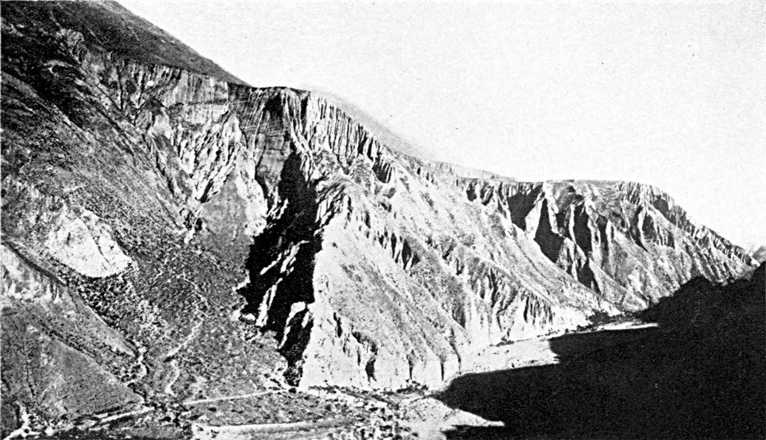
THE ARID ANDES. PUNTA VACAS, ON THE TRANS-ANDEAN RAILWAY.
The bottom of the valley is 8,000 feet
above sea-level; the sides buried under rubbish. It is
especially in this latitude, above a height of 10,600 feet, in
the zone where the moisture falls as snow even in summer, that
the rock is everywhere buried under its own rubbish. This is
Keidel's Schuttzone. It extends to the foot of the
Alpine peaks, carved by glaciers.
Photograph by Moody, Buenos Aires.
Click to view larger image.
QUEBRADA DE IRUYA.
Eastern slope of the Sierra de Santa
Victoria, 65 miles from the Bolivian frontier, in the zone of
summer rain. The valleys have been filled with an enormous
mass of torrential alluvia. The water afterwards made a course
through the mobile deposits.
Photograph by Keidel, Mines Division.
Plate II.
Click to view larger image.
[Pg 23]
The changes which man has made in the floral landscape are, as a
rule, slight. The limits of the forest zone have scarcely been altered.
The beech forest of the southern Andes seems to be less tenacious than
the monte which surrounds the Pampa, and it has
been ravaged by fire along the whole edge of the southern steppe at
37° S. lat. The work of man is generally confined to changing the
primitive complexion of the natural formations, without altering their
general appearance. Thus valuable essences are disappearing from the
forest and the scrub, the larch and the cypress from the district of
the Patagonian Lakes, and the red quebracho from
Santiago del Estero.
A change that is scarcely visible, but is of considerable economic
importance, thus takes place in the vegetation of the prairie owing
to the presence of herds. The pasto fuerte,
composed of rough grasses, which is the natural vegetation, is being
succeeded by the pasto dulce, in which annual
species, soft grasses, leguminous plants, etc., predominate. It is
mainly composed of plants of European origin. The difference between
the pasto dulce and the pasto
fuerte or duro is so important for the
farmer that there is hardly a single work on Argentina which does
not dwell on it. The idea, however, that the pasto
dulce has advanced steadily westward, starting from the vicinity
of Buenos Aires and constantly enlarging its domain, is not strictly
accurate. In 1895 Holmberg3 traced the western limit of
the zone of the pasto dulce through Pergamino,
Junin, Bragado, Azul, Ayacucho, and Mar Chiquita. When we compare this
with earlier observations, we see that in the course of the nineteenth
century the zone of the pasto dulce has extended
by about a hundred miles on the southern Pampa. When Darwin travelled
from Bahía Blanca to Buenos Aires in 1833, he found no pasto dulce except round Monte, on the right bank of
the Salado. Further north, on the other
[Pg 24]
hand, the extent of the pasto dulce does not
seem to have altered appreciably. The expedition to the Salt Lakes in
1778 found that there were already thistles beyond the line of the
ranches, and these are characteristic of the pasto
dulce in the Chivilcoy region on the Salado, which was then
abandoned to herds of wild cattle. "There was thistle enough to cook,"
says the journal of the expedition. The difference is connected
with the history of colonization in the province of Buenos Aires,
where ground was gained only toward the south between 1800 and 1875.
Since 1895 the pasto duro has been eliminated
by agriculture rather than by the feet of the herds. Hence the
advance of the pasto dulce is no longer in a
continuous line moving toward the west. It is sporadic, depending
upon the construction of new railways which open up the plain to the
plough.4
Colonization does more than emphasize the individuality of each
of the natural regions. It connects together different features, and
blends them in a complex vital organism which goes on evolving and
renewing itself.
The occupation of the whole of the soil of Argentina by white
colonists is quite a recent event. The second half of the nineteenth
century was characterized by a rapid territorial expansion, and over
more than half the country the expression "new land" must be taken
literally. It is only one generation since it was taken from the
Indians. There can be no question here of tracing the history of the
relations between the white population and the free Indians of the
Chaco and the Pampa. The most formidable of these were, in the north,
the Abipones and the Tobas. On the Pampa, the foes of the colonists
were Indians of Araucanian descent, Ranqueles, Pehuenches, etc., who
came down from the mountains and took to horses. At the close of the
eighteenth century the frontier of Buenos Aires was on the nearer
side of the Salado, and was bordered on the south-east and north-west
by the fortresses of Chascomus, Monte, Lobos, Navarro, Areco, Salto,
Rojas, and Melincue. The proposal of D'Azara to extend it as far as
the Salado was not carried out, and it was not until 1828 that there
was a fresh advance westward.5
[Pg 25]
The new frontier, which would not be altered until 1875, passed
by Veinte Cinco de Mayo and Blanca Grande, at the north-western
extremity of the Sierra de Tandil. It included the entire region which
lies between the Sierra de Tandil and the lower Salado, where the
village of Tandil had been established in 1823. In addition, a line of
forts stretched from Blanca Grande in the south-west to Bahía
Blanca. The expedition sent in search of a port south of the mouth
of the Plata had not found any nearer site that was suitable. But
Bahía Blanca was to remain an isolated advance post until 1880,
sharply separated from both the colonized zone of the Pampas and the
establishments on the Patagonian coast.
While the cultivated area was thus growing toward the south, it was
being reduced in the north of the province of Buenos Aires and the
south of Córdoba. The lands of the lower Rio Cuarto were not
occupied. About 1860 (Martin de Moussy) the farthest establishments
in this sector were S. José de la Esquina and Saladillo on the
Tercero. The road to Chile by the Rio Cuarto, Achiras, and San Luis
was threatened. The advance of colonization in this zone was at first
in the west to Villa Mercedes on the Rio Quinto. The line of the Rio
Cuarto by Carlota was reoccupied, and before 1875 the frontier had been
pushed back to the Rio Quinto, where it joined the forts of southern
Buenos Aires by way of Sarmiento, Gainza, and Lavalle.
[Pg 26]
At last, in 1878, General Roca abandoned the classical methods
of fighting the Indians, and took the offensive. He deprived the
Indians of their refuges to the south of San Luis and the Central
Pampa, and threw them back toward the desert. The Argentine troops
followed in their steps as far as the Andes and the Rio Negro.
There are to-day few traces in the immense territory that was won
of the indigenous population. Its extreme mobility had masked its
numerical inferiority.6
The history of the northern frontier is much the same. At the
end of the eighteenth century the Spanish outposts ran along the
course of the Salado. To the north of Santa Fé, at Sunchales,
Soledad, and San Javier, they protected the direct route from Santa
Fé to Santiago del Estero. These outposts were abandoned during
the revolutionary period, and the Indians advanced as far as the
suburbs of Santa Fé. The roads both to Santiago and, by the
Quebracho Herrado, to Córdoba were cut.7 Urquiza
reorganized the Santa Fé frontier, first as far as San Javier,
then below 29° S. lat. between Arroyo del Rey on the Paraná
and Tostado on the Salado. The expedition of 1884 brought the Argentine
army as far as the Bermejo, and broke the resistance of the Tobas. The
forts which, more to the north, guarded the province of Salta, on the
further side of the Sierras de la Lumbrera and Santa Barbara, had been
dismantled at the beginning of the nineteenth century, as the tribes
in this part of the Chaco were not hostile.8
[Pg 27]
The memory of the fights with the Indians is so completely
blotted out to-day, and the menace of invasion by the tribes has been
so rapidly extinguished, that it is difficult to realize fully the
profound influence they once had on colonization. The line of forts
was a frail barrier that was constantly broken through. The Indians
of the Pampa stole cattle from the ranches of Buenos Aires, and sold
them in Chile. Colonel Garcia calculates in 1816 that about 40,000
animals were stolen every year.9 Colonel Roca gives the
same figure in 1876. The Pampa put no natural difficulties in the
way of the movements of the Indians, no points which might serve as
bases for the frontier. D. Pedro Pablo Pabon points out that the
proximity of the Sierra, instead of giving protection to outposts in
the Tandil region, would be an additional source of insecurity, as it
increased the difficulty of keeping watch. In the north the Indian
incursions followed the clearings in the scrub, avoiding the dense and
impenetrable parts. The lagoon of Mar Chiquita, to the west of Santa
Fé, was a valuable rampart, in the shelter of which a fairly
large population had established itself round Concepción del
Tio.
[Pg 28]
The enlargements of the frontier were sometimes due to expansive
movements of colonization, the breeders occupying new land beyond the
line of forts and demanding protection, and sometimes to the arbitrary
action of a Government which was eager to extend its territory, though
it was still without the means of exploiting it. Roca has well shown
the defects of this system of premature military occupation. "To go
far away from the populated districts in acquiring new territory
is, in my opinion, only an aggravation of the inconveniences of
defensive war, and it places a desert between the new lines and the
settled regions.... Invasions occur at once."10
We should therefore be likely to make serious mistakes if we were to
identify the history of colonization with that of military occupation.
Moreover, the garrisons of the forts did not take a very active part
in the exploitation of the soil. The plan which D'Azara proposed, of
making blandengues (lancers) colonists and
rooting them to the soil by distributing it amongst them, seems to have
been purely Utopian. His description of the frontier shows clearly
how slight a hold the early colonization had on the Pampa, where the
only relatively industrious element was represented by the groups of
civilians (paisanos) who gathered about the
works and moats of the forts. It was different on the Santiago del
Estero frontier, where there was agriculture as well as breeding.
Here the fort was identical with the village, and each soldier had
his plot of wheat, maize, or water-melons.11

MAP I.—ARGENTINA. THE NATURAL REGIONS.
The map shows the distribution of the
natural regions—the dry Andes in the north-west, with
irrigated cultivation; the monte, or brush, which is still
used for extensive breeding; and the Pampa, with its great
areas of cereals and lucerne. The line marking the frontier of
1875 shows the speed at which colonization has developed in
the western half of the plain of the Pampas. The only regions
not given on the map are the plateau of Misiones, with its
tropical forests, and the wet Andes of Patagonia.
Click
to view larger image.
The provinces which were to combine in forming the Argentine
Republic had no economic unity. They were really two countries, two
separate worlds, the coast regions and the mountain regions (de arriba), joined together, but not blended, by
the main road from Buenos Aires to Peru, by way of Córdoba,
Tucumán, and Salta. They represented two different branches of
Spanish colonization. "Two human streams," says Mitre, "contributed
to the peopling of the vice-royalty.... The first came directly from
Spain, the mother country. It occupied and peopled
[Pg 29]
the banks in the basin of the Rio de la Plata, in the name of the right
of discovery and conquest, and fertilized them by its labour. The other
stream came from the ancient empire of the Incas, already subdued by
the Spanish armies. This spread toward the interior of the country as
it passed from the Pacific to the Atlantic, occupied the land in virtue
of the same rights, and exploited it by means of a feudal system....
The same year, 1535, saw the foundation of the two towns, Buenos
Aires and Lima, and was the centre of these two cycles of discoveries
and conquests. Thirty-eight years later, in the same year, 1573, the
Conquistadores who came from Peru founded the town of Córdoba,
two hundred miles away from the Paraná, while those who came
from the Rio de la Plata founded the town of Santa Fé on the
banks of that river."12
Tucumán and Salta were established by conquerors from Peru,
while San Juan and Mendoza were built by the Chilean Spaniards. The
line of demarcation between the two zones of colonization crosses the
immense desert plains of the interior, not the elevated tablelands of
the Andes.
The two types of Argentinians differed in every respect, in blood
as well as in environment. The indigenous race, which was eliminated
on the coast, mingled intimately with the conquering race in the
interior.
The establishments on the Rio de la Plata had originally been
merely stages on the road to Peru, and had no value of themselves. The
elevated tablelands of the Andes long remained the economic centre of
Spanish America, and the provinces of the interior, which sold them
cattle and mules, depended very closely upon them. The end of the
eighteenth century was marked by more rapid progress in the region of
the Pampas. The vice-royalty of La Plata was created.
[Pg 30]
Freedom of trade was secured between Buenos Aires and the Spanish
ports. The export of hides increased. The influence of Buenos
Aires spread over the interior and, in spite of the Córdoba
tariff, reached the regions of the north-west. "The creation of
the vice-royalty," says Dean Funes, "and the new direction taken
by commerce had the effect that Buenos Aires became the centre
of considerable and important business."13
This commercial development, which seemed destined to bring closer
together the two halves of Argentinian territory, was interrupted
in the first half of the nineteenth century. This did not, however,
break the connections between the provinces to the north-west of the
tableland and those on the Pacific slope, and indeed, they became
more varied and more binding. Packs of mules, carrying the ore of
San Juan and La Rioja to the foundries of the Chilean side, added
life to the Cordillera. When Chile, transformed into an agricultural
country, could not meet its own demand for cattle, the oases of the
Argentine side were sown with lucerne for fattening the cattle which
were to cross the mountains. The provinces of Mendoza, San Juan, La
Rioja, Catamarca, Tucumán, and Salta were held within the orbit
of the Andes districts.14 There are historical
reasons for this set-back to the influence of Buenos Aires. The wars
of the revolutionary period and the conflicts between the Buenos Aires
Government and the maritime powers checked the commercial enterprise
on the banks of the Plata. This political isolation of the province of
Buenos Aires, under the Rosas Government, lasted until 1853. Poncel
gives us statistics of the imports of Catamarca which show the great
importance of this date in the history of Argentine commerce:
[Pg 31]
| 1850 | 1851 | 1852 | 1853 | 1854 | |
| Imports into the Province of Catamarca: |
| From the Pacific across the Cordillera (in millions of piastres) |
72 |
50 |
71 |
40 |
12 |
|
| From the Atlantic (Buenos Aires or Rosario) |
11 |
7 |
20 |
64 |
116 |
15
|
In 1854-5 the Cordillera route definitely ceased to be of commercial
importance to Catamarca, and it was afterwards used merely for the
export of cattle.
But the attraction of Buenos Aires after 1853 was not merely due to
its commercial life and its intermediate position between the provinces
of the interior and Europe. It was chiefly based upon the economic
development of the region of the Pampas, which began about this date,
and altered the balance between the two halves of Argentina. The
exploitation of the Pampa, the improvement in breeding methods, and the
introduction and expansion of agriculture on the plain of the Pampa,
which fill all publications on modern Argentina, are in themselves
one of the great events in the economic history of the nineteenth
century. They had also an indirect but profound influence upon the
life of other parts of Argentina. The consuming capacity of the Pampa
increased simultaneously with its wealth and population. It absorbed
the products of the neighbouring provinces and in turn made customers
of them, distributing amongst them, according to the services they
rendered, part of the gold it obtained from beyond the Atlantic. One
after the other the provinces lost the relations which had hitherto
connected them with foreign lands. There was the same development all
over the zone of cereals and lucerne—the direction of the stream
of commerce
[Pg 32]
was reversed. In some places, as at Tucumán and Mendoza the
change was accomplished a generation ago. In other places, as at Salta
and San Juan, it is still going on. In yet other places, the more
remote valleys, like Jachal and Santa Maria, it will occur in the near
future. By a singular anomaly the Far West of North America, which
sprang up half a century ago, tends to withdraw more and more from the
influence of the eastern States, which provided it with capital and
immigrants, while the Far West of Argentina, which is just as old as
the east and by no means a creation of the east, since it developed in
isolation and freedom, and was already adult and rich when they came
into contact, has nevertheless fallen into complete dependence upon the
east in the course of a few years.
The life of the whole country depended upon the great colonization
movement which transformed the plain of the Pampas. This brought about
an economic unity which was at once reflected in the political world.
The railway from Buenos Aires reached Tucumán before 1880;
Mendoza, San Juan, Salta, and Catamarca before 1890; and La Rioja
before 1900. The establishment of closer economic relations between the
coast and the provinces of the interior has nearly always inaugurated a
period of great prosperity for the latter. In every case the influence
of Buenos Aires vitalized them, put an end to their slumbers, and made
them rich.
Not only did the coast take for itself the products of the western
provinces, which had hitherto found their way to other markets, but new
centres of production had to be created to meet its needs. The forests
of the Chaco received a great influx of wood-cutters, to provide the
sleepers for the railways. The valley of the Rio Negro was planted
with vines, to provide the wines of the colonies in the district of
Bahía Blanca. The attraction of the Pampa was felt as far as the
frontiers. Paraguay competed with Corrientes in
[Pg 33]
the supply of tobacco and oranges; with Misiones in the supply of yerba maté. Each district chose the particular
crop which was best suited to its climate, in order to secure the
highest possible advantage from its relations with Buenos Aires.
The two most brilliant satellites of the Pampa, the most important
productive centres of the interior, are Tucumán and Mendoza. All
the other important towns of Argentina belong themselves to the region
of the Pampas. Tucumán and Mendoza, which live by supplying the
Pampa with sugar and wine, have become in turn secondary centres of
attraction. They are a sort of regional capitals, and they have their
own spheres of economic influence. A network of commercial streams
has developed about them, and this has led to the formation of new
roads. These lines of local interest are easily recognized on a map
of the railways, where one sees them superimposed upon the regular
fan of lines which converges toward Buenos Aires. La Rioja provides
the props for the vines of San Juan and Mendoza. From the north of
Córdoba to Salta, a distance of about 250 miles, the wood is
cut for the fuel of the sugar-works of Tucumán. Santiago dries
the fodder for its troops of mules. The prairies of Catamarca, which
once fattened the cattle that were intended for Chile, and often came
even from Tucumán, now sell their beasts to the butchers of
Tucumán. The wines of San Juan find their best customers at
Tucumán. Even the nearest portions of the plain of the Pampas,
to the north-east of Santa Fé and the south of San Luis, supply
maize and wheat to Tucumán and Mendoza, instead of sending them
to the ports for export.
While Argentina lives on the Pampa, the Pampa lives on export. It
has been developed through the inflow of European immigrants, and
Europe pays by sending its manufactured products and capital. Except as
regards emigration, the United States had,
[Pg 34]
before the war, much the same relation to Argentina as the countries
of Western Europe. Thus the economic prosperity of the Republic binds
it more and more closely to the life of the whole world. Its position
in the temperate zone of South America had retarded its entrance
into world-commerce, and this explains the slowness with which its
colonization proceeded at first. Its climate and products were too
similar to those of Spain. Not only the mining and metallurgical
centres of the Andes and of Mantiqueria, but even the sugar and cotton
regions of Brazil, the Antilles, and the Guianas, were developed before
the plains of the Pampas.
The turn of the Argentine Republic did not come until the growth of
population in the industrial countries of Europe made them dependent
upon foreign lands for their food, and until the application of steam
to ships made it possible to export wool, meat, and cereals on a large
scale.
When we compare the economic organization of Argentina with that of
the United States, we see that it is both less complex and less capable
of being self-contained. The difference is due to the architecture of
the country. I said at the beginning of this chapter that Argentina has
no equivalent for the zone of the Atlantic tablelands, which is now the
great industrial region of North America. The industrial prosperity of
eastern North America provides a safe home market for the farmers of
the west, and relieves them of the need of exporting their produce.
Moreover, the Atlantic tablelands, the original centres of population,
where the first generations of colonists lived on land that was often
poor, have seen the gradual formation of reserves of labour and capital
which were afterwards used in colonizing the west. The east sifted, in
a sense controlled, the influence of modern Europe in the colonization
of the United States. It classified and assimilated the new emigrants
who set out for the west,
[Pg 35]
mingled with the troops of native pioneers on their way to the
prairies. In the same way, when European capital flowed into the United
States, it found in the eastern cities a large treasury and a body of
financiers in whose hands it had to remain.
In Argentina, on the contrary, everything speaks of the close and
direct dependence of the country upon oversea markets. The soil itself
bears the marks of this solidarity. It is seen in the network of the
railways, the concentration of the urban population in the ports, and
the distribution of the cultivated districts in concentric circles
which are often limited, not by a physical obstacle, but by the cost of
freightage between the productive centre and the port. Thus we get a
geographical expression of facts which seem at first sight to belong to
the purely economic or sociological order.
[Pg 36]
CHAPTER II
THE OASES OF THE NORTH-WEST AND PASTORAL LIFE IN THE SCRUB
The inhabited zones of the Andes in the
north-west—Valles,
Quebradas, Puna—The irrigation of the
valles—The historic
routes—Convoys of stock—The breeding of mules
and the fairs—The struggle of the breeders against
drought—The Sierra de los Llanos.
The whole life and wealth of the arid provinces of north-western
Argentina depend upon irrigation; the water-supply definitively settles
the sites of human establishments. The water resources are irregularly
distributed. They are especially abundant in the south (San Juan,
Mendoza, and San Rafael), where the torrents of the Cordillera are fed
by the glaciers, and on the outer fringe of the hills above the Chaco,
at the foot of Aconcagua, which gathers masses of cloud and rain on its
flanks (Tucumán). In the intermediate district, on the contrary,
in the regions of La Rioja and Catamarca, and in the interior of the
hilly zone to the north-west of Tucumán, the amount of available
water is small; the oases shrink into small spots far removed from each
other.
This natural inequality was not felt at first. For a long time the
spread of cultivation and the progress of wealth were restricted only
by the scarcity of population, the difficulties of transport, and the
inadequacy of the markets. The best endowed oases paid no attention to
the surplus supply of water, for which they had no use. We have to come
down to the close
[Pg 37]
of the nineteenth century to find men reaching the limits which nature
has set to colonization, and mapping out their domain. It is not until
then that La Rioja ceases to compete with Mendoza, or Catamarca with
Tucumán. While large industrial enterprises develop at Mendoza
and Tucumán, strong centres of urban life arise, the population
increases, and immigrants stream in, the oases of the interior
scarcely change. Their population does not keep its level. Life has
an archaic character that one finds nowhere else in Argentina. The
physical conditions have retarded, one would almost say crystallized,
the economic development. The living generation exploits the soil in
ways that to some extent go back as far as the indigenous tribes,
the masters of their Spanish conquerors in the art of irrigation.
The industry of fattening and convoying cattle, which was once the
chief source of wealth of the whole country, is still alive in those
districts.
The zone of the elevated tablelands of the Andes without drainage
toward the sea—the Puna—has still, below 22° S.
latitude on the northern frontier of Argentina, a width of about 250
miles. This breadth steadily contracts southward as far as 28°
S. latitude, where the Puna ends about the level of the road from
Tinogasta to Copiapo.
To the east and south of the Puna the Argentine Andes are cut from
north to south by a series of long gullies and large basins, between
which there are lofty and massive chains with steep flanks. Some of
these lie in the heart of the mountains, while others often open like
gulfs upon the edge of the plain. These depressions with rectilinear
contours are a common feature of the topography of the Andes in this
latitude. The central plain of Chile is closely related to them. In
the Argentine speech they are called valles:
Valle de Lerma, Valle Calchaqui, Valle de Iglesias, de Calingasta,
d'Uspallata. They are, however, not "valleys" in
[Pg 38]
the sense of hollows made by erosion by running water. They owe
their formation to tectonic movements, subsidences of the surface.
The scanty rivers of the arid Anacs are not capable of doing work
of that kind. When they enter the already formed bed of a valle, they seem to be lost in the immense space.
Often they dry up in it, leaving behind the sediment and salts with
which the water was laden. In other places they cut at right angles
across the valle, escaping by narrow breaches in
it, while the depression continues its course on either side, taking in
sections of a number of independent streams.
Opposed to the valle is the eroded ravine,
carved out by water, the quebrada. It opens
upon a valle with a V-shaped mouth, which
widens out at the top, and one can recognise at sight the various
slopes and the successive stages of erosion. Narrow and winding, a
level bed of shingle filling the entire base of the valley, it rises
rapidly toward the mountains and provides a route from the valle to the puna. These
valles, quebradas
and puna are the three inhabited zones of
the Andes. The first is the richest. The inhabitant of the valle, proud of his comparative comfort, has for
his neighbour in the quebrada or the puna—the coyada—a
contempt such as one finds the inhabitants of the good land in Europe
feeling for the people in poorer districts.
The narrower the valle, the less rain
there is. The observations give 112 millimetres of rain per year
at Tinogasta, 290 at Andalgala, and 200 at Santa Maria. Salta and
Jujuy have a much moister climate, and have no less than 570 and 740
millimetres of rain annually. This is because the eastern chain of
the Andes, which stretches from the Sierra de Santa Victoria on the
Bolivian frontier to Aconcagua, sinks lower at the latitude of Salta,
and lets in the moisture of the Chaco to the heart of the zone of the
Andes. The rains of Salta and Jujuy are suspended during the winter,
but they are so heavy during the summer months (November to March) that
maize, which needs only the summer rain, can be cultivated without
irrigation. But when we follow the Valle de Lerma southward from Salta
the maize harvest becomes more and more uncertain, and it is no longer
sown in dry soil when we get to about twenty miles from Salta, in the
latitude of the confluence of the Arias and the Juramento. However, the
summer rains, which are good for maize, are very injurious to the vine;
they spoil the grapes. Thus the southern limit of the cultivation of
maize in dry soil almost coincides with the northern limit of the vine.
At that point we have the real beginning of the typical scenery of the
valles.

THE PATAGONIAN ANDES.
Mount Tronador (11,500 feet) on the Chilean
frontier, dominating the road from Lake Nahuel Huapi to Chile.
The glaciers still reach the bottom of the valley, which they
filled at one time. A burnt forest in the foreground.
Plate III.
Click to view larger image.
[Pg 39]
The need of irrigation is due to the scarcity of rain, but
it is accentuated by a number of causes which tend to increase
the aridity. The valles are the scene of
scorching day-winds, the zonda, like the
Föhn of the Swiss Alps, which, there
being no snow, dry up the water of the springs and of the irrigation
trenches, or use the deposits left by the waters to form dunes, which
they push southward, sometimes like veritable glaciers of sand.
Moreover, the soil of the valles is generally
composed of coarse and permeable alluvial deposits, which absorb the
rain-storms immediately. There is at the foot of both sides of the
hills which enclose each valle an immense
and far-lying bed of imperfectly rounded shingle. This double zone
of detritus is strangely desolate, for the vegetation on it is
restricted to isolated bushes of jarilla and
tola. From the sheepfolds on the mountains
to the oases in the valleys one hardly meets a single house. The
bed of the valley is not so desolate. A broad ribbon of sand marks
the dry bed of a torrent, and on the clays of its banks, if the
sheet of water underground is not too deep, one finds, in spite of
the goats and asses and charcoal-burners, little forests of algarrobas, which the foundries use for fuel.
The modern alluvial beds, gravel and sand, represent
[Pg 40]
the upper stratum of a considerable series of continental deposits
which lie on the Paleozoic crystalline rock of the Andes.16 They chiefly consist of red sandstone and
coloured marls, which crop up here and there through the alluvial
covering and give the landscape a rugged character, worn by water and
wind. There is no trace of humus: nothing to soften the vivid colours
of the rock. Bodenbender, to whom we owe the first general attempt
to classify the series, points out the importance of distinguishing
the different strata in connection with the question of water
supply and the conditions of human life.17
A complete geographical study would have to follow the geological
description in detail. In places—on the eastern edge of the
Sierra de los Llanos—the fine modern clays are in contact with
the granites of the hills and form above them a thick bed that is rich
in fresh water. In other places—south-westward of the Sierra
de la Famatina, as far as the Bermejo—the outcrop is of red
sandstone only. The tablelands of Talampaya and Ischigualasta, which
are cut across by the gorges of the tributaries of the Bermejo, form
one of the most conspicuously desert regions in the whole Republic.
Wherever the gypsiferous marls of the Calchaqui are near the surface,
the springs are saline. The undulations of the impermeable rocky
substratum bring to light the water that gathers in the alluvial
beds. Thus the streams which come down the Famatina range in the
west disappear in the alluvial beds on the fringe of the Sierra, but
re-appear presently in the oasis of Pagancillo.
[Pg 41]
Hence the valles are by no means wholly
productive. The oases represent only a limited portion of them.
It would be impossible to imagine a more striking contrast than
that of the freshness and life of the oases compared with the
surrounding desert. Screens of poplars shelter them from the zonda. The water runs along trenches paved with round
pebbles under the spreading vines, at the foot of which, to economize
water and space, lucerne is sown. Each garden feeds a family. Near the
raw-brick houses there are large earthenware vessels, as tall as a
man, in which the corn is kept. The hammering of the cooper fills the
air.
In places the oasis is watered by a stream. In those cases there is
on each side of the bed of the stream a narrow fringe, a continuous
ribbon, of smiling gardens, which hide the path. Above and below Santa
Maria a trench is opened every mile in the wet sands of the Rio. The
water rises in it and fills it, and is directed by it toward one of the
banks, where it is jealously collected and distributed. The water which
flows from the irrigated fields and returns to the river, as well as
that which the porous side of the trench has permitted to escape, goes
to fill another trench and supply other fields farther on. The region
of Los Sauces, in the northern part of the province of La Rioja, to the
south of Tinogasta, shows a different type of irrigated cultivation,
on account of the sandy course of the stream. The fields follow the
feeding artery for about fifty miles. It is bled at the beginning of
each bend, the waters remaining underground like hidden wealth.
In most cases however, the valle
has no running water. What reaches it from the lateral quebradas is lost in the alluvial beds accumulated at
the point where the quebrada enters the valle. In order to make use of it the cultivated areas
are grouped on the cone of deposition; at least, that is the position
in the great majority of the oases. A costa is a
line of separate
[Pg 42]
oases with their backs to the same slope. When the valle is narrow, the costas
on either side of the sterile depression face each other, like two
parallel roads. The water of the quebrada is
never sufficiently abundant to irrigate the whole of the cone of the
torrent. In order to create an oasis there, they have selected the most
easily cultivable zone, which is usually the foot of the cone, where
the deposits are finer and more fertile, retain the moisture better,
and require less watering. The summit of the cone is composed of
coarse stones, the first to be dropped by the torrent as it loses its
strength. These are bad lands, where the water is wasted.
To meet the occasional drought and the danger of sudden floods in
this fluvial zone, which is entirely the domain of the torrent, there
is need of constant care and ingenuity. At Colalao del Valle the
cultivated fields are five or six miles from the summit of the cone.
After a number of successive years of drought the stream of water
which reached them on the flanks of the cone lost half its volume
and threatened to disappear altogether. They then built a stone dam
at the outlet of the quebrada, and the water
accumulates behind this during the night. At three o'clock in the
morning the sluices are opened, and the stream, having thus nursed
its strength, reaches the fields down below about seven o'clock. Then
the sun and the wind rise, just at the time when the reservoir is
empty, and by the middle of the day the stream ceases, and irrigation
is suspended. At Andalgala, above which rises the glittering crest of
Aconcagua, the waters of the melting snows which feed the torrent have
not time to be "decanted" before they reach the valley. They come down
laden with mud and sand. Above the points where the irrigation-channels
begin the people make, in the bed of the torrent, a dam of branches of
trees which filters the water. It is swept away by every flood that
occurs, and is at once restored.
[Pg 43]
What is even more admirable than the ingenuity of the vallista in utilizing the natural resources is
the minute detail of the water-rights. It seems as if the vallista is even more cunning in protecting himself
from his neighbour than in dealing with nature. The water-customs of
these Andean valleys are worth an extensive study. The water does not
belong to the State, and is not used by concession from the State. It
is private property. The owner uses or abuses it as he pleases on the
lands which he has selected. A man may be poor in land and rich in
water, which he accordingly sells. There are frequent business deals in
regard to water-rights, just as in regard to the soil and its produce.
Appropriation of water often precedes appropriation of the soil. Many
oases are communities where the non-irrigated lands are common to the
whole population, and the irrigated fields alone are divided.
A primary group of customs regulates the relations to each other of
communities higher up and lower down the same stream. At Catamarca the
water of a certain stream is shared by Piedra Blanca and Valle Viejo.
Piedra Blanca, in the upper part, absorbs the whole of the water for
a week, but it must then suspend its irrigation during the following
week and permit the stream to flow down the valley. The same evening,
or the next morning, according to the season, the water reaches Valle
Viejo. It is a custom known as the quiebras
in the southern valleys of the desert side of Peru, where it allows
different stages of cultivation to proceed simultaneously. In the same
way, above Santa Maria, where several communities (S. José, Loro
Huasi, etc.) receive the water brought by a channel from the Rio Santa
Maria, each of them has a right to the full output of the channel for
three days. At the end of that time the sluices are closed, and the
water passes to the next community. There is grave trouble for any
oasis that has its rights infringed or
[Pg 44]
does not compel the communities higher up to respect them.
Amongst individuals the water-right is generally defined by a
measurement of time, a certain number of days or hours—during
which the owner controls the entire flow of the spring or stream. It
is only when the water is more abundant that we find another method
of fixing the right of water, defining it by bulk. The water is then
said to be demarcada, as the unit is customarily
the marco, or the volume which passes through
an opening about twenty-one centimetres in width and eight in height.
The marco has infinite divisions, and each
subdivision has its own name—the naranja,
the bombilla, the paja,
and so on.
As all the water is utilized, and the rights of all are
equally entitled to respect, the division of the water into marcos (demarcacion) is in
practice merely a proportional distribution of it amongst those who
have rights to it. If the sum total of rights expressed in marcos represents something like the total flow of
a stream during an average season, in the time of low water it is
disproportionate, and the water no longer flows to the tops of the
marcos. In other words, the quantity of water
granted to each rises or falls with the rise or fall of the stream
itself.
Theoretically, when the water-right is defined in marcos it is permanent. Often, however, it is
impossible to grant each proprietor a permanent title to the
water. Even in oases where the water is "demarked," the turno—that is to say, the turn of the
proprietors to have water—which is the absolute rule in the
poorest oases, reappears during the months of scarcity, in winter, when
there is no rain, and at the beginning of summer. It reappears also
when the right of ownership has been broken up into fractions that
are too small, and it is better to grant a larger volume of water for
several hours instead of a constant stream of water which would be too
scanty for profitable use. At
[Pg 45]
Andalgala the "turn" is sometimes obligatory, and regulated by custom,
in channels where the irrigating proprietors are too numerous; at
other times optional, and settled by convention amongst the owners
themselves, when water is scanty. At Valle Viejo (Catamarca), when
the water runs low, they set up the mita; that
is to say, the sluices remain closed in each channel during four
days out of eight, each proprietor in turn giving up his right to a
permanent supply in order to have a double allowance when his turn
comes. The turno is, therefore, a general
practice. Everywhere we can see the farmers on the watch along the
acequias, waiting for the moment to close their
neighbour's trench with a pellet of clay and to let the stream into
their own trenches with a blow of the spade.
The most minute precautions are taken in order that no one shall
suffer injury. As the irrigation is always slower and less thorough
during the night, they take it in turns to have the day and the night
alternately. When the community receives the water from another
community higher up the stream, the succession of "turns" amongst its
members differs every time. The water comes down charged with sediment,
pushing in front of it a mass of liquid mud, as the flush of a torrent
does. It takes some time for the stream to become regular and clear.
The first irrigator therefore exercises his right under unfavourable
conditions. In the local phraseology the volcada
de agua is not as good as the corte de
agua, which means the irrigation that begins when the acequia is full.
Irrigation entails the services of quite a staff of arbitrators
and administrators. The head men, who have jurisdiction of a higher
order and secure the accurate distribution of the water amongst a
number of channels or communities, are now, as a rule, officials of
the administration, appointed by the provincial authorities (juez de Irrigacion at Catamarca, juez
de rio at Rosario de Lerma). But the juez de
agua of each
[Pg 46]
community or each channel is a syndic elected by the interested
parties. At Santa Maria the juez de agua is
elected by the owners and confirmed by the Government. He controls
irrigation throughout the department, settling all differences,
submitting plans of work to a meeting of the owners, and assigning
their respective charges in labour and contributions according to their
rights.
This land of customs and traditions is also a land of lively
movement. The briskness of the traffic is primarily due to continuous
exchange between the various zones of the mountainous district.
This large trade, so scattered that the railways could not dream of
satisfying its needs, is carried, in the old fashion, on the backs of
mules. The lively aspect of the roads between the tableland and the
lower valleys of the region, the brisk interchange of goods between
zones with different climates, is one of the common features of life on
the Andes.
But the classic spectacle presents a different aspect in
different latitudes. In Peru, and in southern Bolivia, the
higher valleys—Jauja, Cuzco, the Pampas of Cochabamba and
Sucre—have centres of dense population and agricultural
wealth at a height of between 9,000 and 11,000 feet. They
raise cereals, and receive from the tropical districts (montañas and yungas) sugar, cane-brandy,
cocoa, and coca-leaf. The valleys of the Argentine Andes are usually
at a less elevation than the yungas and montañas of Bolivia and Peru. But they are
not hot districts, and have not tropical vegetation. Frost prevents
the harvesting of sugar-cane at Salta, at a height of 4,000 feet. As
to the coca-leaf, which is not as much used here as in the north,
the Argentine valles do not send it to the
tableland, but receive it indirectly from there, through the southern
yungas. In default of tropical crops, the
Argentine valles sow wheat and maize, which they
sell to the
[Pg 47]
Indians of the cold districts of the Puna for wool and salt.
These commercial currents are of very ancient, probably
pre-Columbian origin. Boman has discovered ears of maize in the
prehistoric tombs of the Puna de Atacama.18 The
Puna, at a height of 11,000 to 12,000 feet, is permanently inhabited,
unlike the high valleys of the Cordillera de San Juan, which are
occupied only during the summer season by Chilean shepherds. It is
primarily a pastoral and mining region, but it has some tilled land,
at more than 6,700 feet above the level of the valleys. The higher
limit of annual cultivation in the cold districts, which is fixed
by the summer temperature, does not fall in the same way as that of
arboriculture in warm districts, because trees suffer from the winter
frosts. The Indians of Cochinoca and Susques sow lucerne and barley
for fodder, and the quinoa and potato for food.
Transport between the Puna and the valles
is carried on by the inhabitants of the Puna, and is not shared by
the vallistas. They are especially active
in the north, in the province of Jujuy. Belmar shows how important
the sales of the Puna woollen goods were by the middle of the
nineteenth century.19 These fabrics were used
by the mill-owners of the Rio Grande de Jujuy to pay for the work
of the Indians of the Chaco, whom they employed in the sugar-cane
harvest. The competition of the manufactured products of Europe now
menaces the domestic weaving of the Puna, just as the competition of
the flour of the Pampa menaces the cultivation of cereals in the valles.
Besides this traffic of local interest the valles serve for a traffic of a higher, almost a
continental character. It seems certain that during the pre-Spanish
period
[Pg 48]
the road from the Peruvian tablelands to Chile avoided the inhospitable
desert of the Puna de Atacama, entered the region of the valles to the east, and crossed the Cordillera in the
latitude of Tinogasta, or even a little further south. That was the
route of the armies of the Incas, which in the fourteenth century came
as far as Maule. The pre-Columbian roads, of which Boman has found
traces between the Valle de Lerma and the Valle Calchaqui, seem to
correspond with this direction of traffic. By this route the long quechua passed amongst the Diaguites populations. The
conquerors followed the Indian guides. Almagro, in going from Peru to
Chile, passed through the valles at the eastern
edge of the Andes.
Later the valles were incorporated in the
many variations of the historic high road, one of the first and
busiest of Spanish America, which goes from the Rio de la Plata to
Lima: a route both for armies and merchants. The plan proposed by
Matienzo (1566) to make a road from the silver mines to the estuary
of the Paraná, through the Valle de Calchaqui, seems to have
been intended merely to improve a line of communication that had
already been in use. Buenos Aires for a long time received European
goods by this road. About 1880 the Salta route recovered for a
time its continental importance, during the Pacific War and the
occupation by the Chileans of the maritime provinces of Bolivia.20 At that time it was the only outlet for
Bolivia.
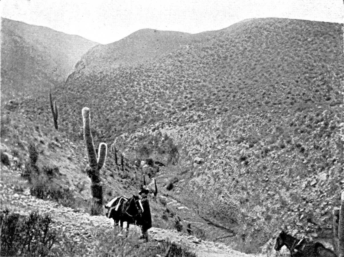
VEGETATION OF THE INTERIOR VALLEYS (ANDES OF THE NORTH-WEST).
Descent of Tafi del Valle, going to Santa Maria.
The ravine is excavated out of the mass of coarse deposits which forms
a fringe between the mountain and the valley. On this permeable soil
the vegetation is particularly thin. Cactus.
Photograph by the Author.
Click to view larger image

FOREST ON THE OUTER SLOPE OF THE SUB-ANDEAN CHAINS.
Sierra de San Antonio (Salta province).
Perennial foliage, creepers, ferns.
Photograph by the Author.
Plate IV.
Click to view larger image
[Pg 49]
But of all the forms of traffic that have enlivened the valles the most constant, and the form that has had
the most profound influence on their existence, is the movement of
cattle. The cattle trade has been of fundamental importance in the
history of the colonization of South America. Animals were the only
goods that could be conveyed any great distance. At the beginning of
the conquest the productive regions of the continent, which supplied
the export trade with Europe, were very limited in extent. Pastoral
colonization began at once, and spread over a very wide area. Herds of
oxen, for meat or draught, horses, and mules, made their way toward the
centres of consumption: towns like Lima, Bahía, and Rio, the
Peruvian mines, and the sugar-refineries of the north-east of Brazil,
and later toward the yerbales of Paraguay or the
seaports of the Caribs and the Rio Grande do Sul, where the jerked meat
industry developed. The cattle routes converge upon these centres.
The export of cattle and mules from the Argentine plains to Peru
was fully established by the close of the sixteenth century, and it
seems to have continued without interruption ever since. Upper Peru
is, however, not the only market on which the Argentine breeders
lived. At the end of the eighteenth century D'Azara demanded that
they should permit the sale of horses and mules to Brazil, for use in
the mines. The cattle traffic with Portuguese territory had not then
assumed the form of a regular commerce, and the Brazilians made raids
on the north-eastern provinces for the animals they needed—60,000
a year, D'Azara says.21 The export of cattle to
Paraguay and Misiones was, on the other hand, of substantial economic
importance in the eighteenth century. Before the Revolution, Rengger
says, as many as 200,000 head of cattle passed yearly from Corrientes
to Paraguay, which paid for them in maté
and tobacco.22 This trade was kept up
intermittently in the nineteenth century. The exports from Corrientes
were especially important at the time when the Paraguay stock was
reconstituted after the war (40,000 head of cattle in 1875).
[Pg 50]
Finally, the Chilean market was opened to the Argentine breeders
about the middle of the nineteenth century. In the time of Martin de
Moussy the convoys of cattle to Chile were so numerous that the lucerne
fields of both slopes were stripped bare at the very beginning of the
season; and they were rented at a high price.23 Not
only the mining provinces of the north, but central Chile also, bought
Argentine cattle. The opening of the Chilean market was followed by a
remarkable expansive movement in the pastoral colonization of Argentine
territory. We can follow the progress of this not only in Martin de
Moussy's book, but in all contemporary works of travel. Its chief
theatres are the provinces of San Luis and of Santiago del Estero,
north of the Rio Dulce, where Hutchinson, in particular, describes the
activity of the ranches.24 Finally, after the
Pacific War (1880) the nitrate district, taken from Bolivia and Peru by
Chile, received a great influx of population, and works sprang up in
the midst of the desert. The nitrate fields, wholly barren and doomed,
under their shroud of grey dust, to an unalterable desolation, became
at once one of the chief centres of consumption for Argentine stock.
[Pg 51]
It is difficult to give accurate details of the volume of trade in
cattle in colonial Argentine. However, the facts given by travellers
(though they often merely borrow from each other) suffice to show how
important this traffic was in the life of the country and the extent
of the zone that was occupied with it. As early as the middle of the
seventeenth century Córdoba seems to have exported to Peru
as many as 28,000 to 30,000 mules annually.25 At
the close of the eighteenth century, we read in D'Azara, 60,000 mules
were exported; and Helms gives the same figure.26 The
mules were bought young by Córdoba dealers at Buenos Aires,
Santa Fé, and Corrientes, reared at Córdoba, and then
sent to Salta, where they were sold in their third year to mule-dealers
from Peru.
An article in the Telegrafo Mercantil of September
9, 1801 (reproduced in the Junta de Historia y Numismatica
americana, Buenos Aires, 2 vols., 1914-5) contains very valuable
information in regard to the mule trade. From 1760 to 1780 Salta sent
between 40,000 and 50,000 mules annually to Peru. At Salta they were
worth ten piastres each before they were broken in, and thirteen or
fourteen afterwards; and they were sold at the age of four years.
The arrieros, who conveyed European goods
and home products (ropas y frutas), bought a
large number of them. The Telegrafo complains that this
trade has been gradually transformed. The mules now came from Santa
Fé and Córdoba to Salta two years old, and after the
invernada they were still, at fair time, barely
three years old. They suffered much during the long journey to Lima,
and the losses of the caravans were heavy. They could not be loaded
for the journey, and, as the arrieros could no
longer secure adult and strong animals, the freight to the tableland
had risen, to the serious loss of merchants on the coast. The reply of
a Potosi mule-dealer (December 13th) clearly shows that the last years
of the eighteenth century had been marked by increasingly heavy demands
from Peru for Argentine mules. In order to meet these demands the
Córdoba breeders had developed production. The buyers, coming to
Salta from Lima, Cuzco, and Arequipa, took, without discussion
[Pg 52]
or examination, the batches that were offered them. The correspondent
of the Telegrafo complains bitterly of these caballeritos who came
from Peru with their 100,000 piastres, and raised the price at Salta,
alleging that their instructions were to get mules at any cost.
Robertson gave in 1813 the recollections of a mule-dealer as to
the convoys of mules between Santa Fé and the Andes, which had
already ceased at that time. Each convoy or arreo comprised 5,000
to 6,000 mules. They came from Entre Rios, or even from the Uruguay,
whence they were brought, after crossing the Paraná, to the
Santa Fé ranches. The Santa Fé breeders owned the best
part of the land on the left bank of the river. The expedition also
included thirty waggons of goods and 500 draught-oxen; and fifty
gauchos were in charge of it. The main expense was then tobacco
and yerba. One feature of this mule traffic that is emphasized in
all the descriptions is that it was divided into two stages, with an
interval between them, for breaking in. As we have already learned
from Azcarate, Córdoba, Santa Fé, Santiago, and Salta
kept the mules for two or three years before sending them to Peru.
Córdoba and Santiago del Estero seem to have been important in
connection with the industry of breaking in the mules.
The sending of cattle on foot to Bolivia and Chile is now only a
subsidiary element of the national economy, but it is not yet quite
extinct, as the table on p. 53 shows.
Whatever its point of departure, the traffic in stock always
passed through the valles. Transport of cattle was particularly
difficult in the Argentine Andes. The chief obstacles were not the
elevation of the passes or the steepness of the roads, but the scarcity
of water and the extent of the travesias, which were equally poor
in pasturage and water, and had to be crossed rapidly by doubling the
stages. The difficulties of the journey were very profitable to the
oases that lay along the route. The cattle-driver could not dispense
with the hospitality of the vallista or dispute the price he cared to
charge.
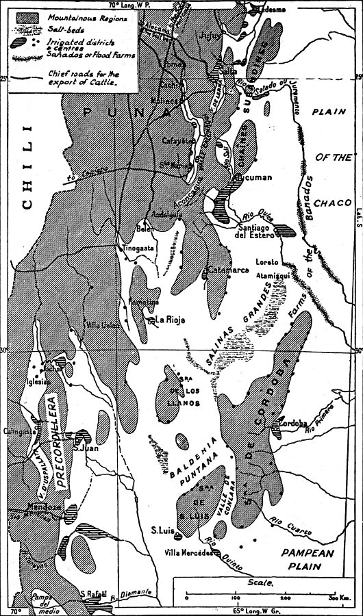
MAP II.—IRRIGATION IN THE WEST AND NORTH-WEST OF ARGENTINA.
Extent of the irrigations in the north
(zone of the great summer rains), and the south (glacier zone)
The historic industry of fattening cattle in the invernadas
and the export of cattle to the Andean regions only survive in
part. On the other hand large modern industries have developed
at Tucumán, Jujuy (sugar-cane), Mendoza, and San Juan
(vines), and they supply the Buenos Aires market.
Click to view larger image.
[Pg 53]
The length of the journey and the difficulty of keeping the animals
in good condition in the poor pastures of the breeding districts
made it advisable to stay longer in the oases. There thus arose
lucerne-farms—the invernadas—to receive and fatten the
cattle which passed through. Lucerne is the characteristic and most
profitable produce of the valles. It is grown wherever there is an
assured supply of water, and is invariably found in the upper section
of the system of irrigation-channels; the cereals are sown lower down,
and are the first to suffer from drought. In the quebradas, where
space is more limited, the lucerne-fields cover the entire oasis.
Every cattle track has a corresponding line of invernadas, which is
often completed on the opposite slope by a last group of lucerne-farms
where the beasts recover from the journey before they are sold and
dispersed.
|
1910 |
1911 |
1912 |
1913 |
1914 |
| Export of Cattle: |
| To Bolivia |
3,600 |
6,600 |
6,200 |
6,300 |
4,800 |
| To Chile |
61,200 |
87,500 |
68,400 |
58,800 |
28,300 |
| Export of Mules: |
| To Bolivia |
2,700 |
4,600 |
7,900 |
8,300 |
2,500 |
| To Chile |
2,300 |
3,200 |
5,000 |
2,600 |
3,500 |
| Export of Asses: |
| To Bolivia |
9,000 |
10,500 |
15,000 |
15,600 |
14,40027
|
[Pg 54]
Besides the official routes there have for a long time been
clandestine tracks, through more difficult ravines, by which stolen
cattle were conveyed with impunity. Guachipas was the gathering place
for cattle of suspicious origin, and, to avoid being seen in Salta
and Jujuy, they passed through the Quebrada del Toro or the Quebrada
d'Escoïpe. When Brackebusch visited Guachipas in 1880 the
inhabitants still kept something of their reputation as smugglers.
A map of the cattle-tracks which are still used in the Argentine
Andes is a complicated network in which we can trace two main
directions, crossing each other at right angles. One set of tracks
leads to the west, toward the Pacific coast, the other set to the
north, toward the Bolivian tableland.
The cattle traffic is now restricted to Chile. It survives at San
Juan, Jachal, Vinchina, and Tinogasta. The cattle descend to Chile
about Coquimbo, Vallenar, or Copiapo. But the trade is now busiest in
the region of the saltpetre-beds. The roads lead from the Valle de
Lerma and the Valle Calchaqui toward the tableland by the Quebrada del
Toro or the Quebrada de Cachi or de Luracatao, crossing lofty passes
at the foot of the Nevados of Acay and Cachi, and reuniting between
Santa Rosa de Pastos Grandes and San Antonio de los Cobres to cross the
Puna de Atacama. Vegas (pastures) and fresh water are scarce here.
The track passes interminably by depressions covered with a carpet of
glistening salt, dominated by volcanic crests. It is used in every
season of the year, but in winter the caravans are exposed to the cold
wind laden with snow, the viento blanco. San Pedro is the port in
this desolation. Here there are, on the flanks of the enormous cone of
Licancour, fields of lucerne and groups of figs and algarrobas. The
cattle are left there for a few days' rest, to prepare them for the
last stage, the Calama oasis on the Antofágasta railway.
The centre of this trade is Salta, or, rather, the little
[Pg 55]
village of Rosario de Lerma, nine miles south of it, where most of
the caravans are formed. The saltpetre works make yearly contracts
in advance with the Rosario dealers, fixing the number and price of
the beasts to be delivered at Calama. The cost of transport includes,
besides the pay of the cattle-drivers—eighty to a hundred
piastres a journey—the shoeing of the mules, the rent of pasture
at San Pedro, and the value of the beasts which die on the way. In 1913
the number of animals exported by this route was put at 30,000. The
saltpetre works buy also draught-mules for their waggons. Draught-mules
must be heavy, and only animals over five feet in height are sent to
Chile. Bolivia is now the only market for the smaller mules and for
asses.
The trade in mules in its traditional form and the industry
of breaking-in still flourish at Santa Maria. The mule-dealer's
business is very different from that of the cattle-dealer. The
mules are so tough that it is possible to send them by roads
which would be unsuitable for cattle.28 The journeys are longer, and the contracts
are less settled in advance. Moreover, breaking-in is a delicate
operation that requires experience. The survival of the mule-trade at
Santa Maria is an example of the maintenance of an industry owing to
the presence of skilled handicraft. The men who break in the mules at
Santa Maria have a remarkable caste-pride. Their first job is to go to
Santiago or Córdoba to buy the mules. They bring them back to
Santa Maria by way of Catamarca or the valley of Tafi. At Santa Maria
the mules are broken in, then taken to the lucerne-farms at Poma to
be put into good condition. There they remain in pasture for several
months; and at length, when the season is suitable, the little band
of Santa Marieños gathers together and, driving the now docile
beasts in front of them, and putting no loads on them in order that
they may keep fresh, make for the fair at Huari in Bolivia, or even as
far as Sucre. There they sell at a hundred and fifty piastres each the
animals which they had bought for half that price before being broken
in. The number of mules hibernating at Poma is about 4,000.
[Pg 56]
The business done in the fairs of the southern Andes is very
varied in character, but their main function was always as markets
for stock.29 They are held in March
or April, when the rains do not fall, but pasture is still abundant
and travelling easy. The fair at Vilque, north of Lake Titicaca, is
no longer visited by dealers in Argentine mules. The Salta fair which
was held at Sumala, near Rosario de Lerma, has ceased to be important;
at the close of the eighteenth century it was the chief centre of
the mule-trade. The fair held at Jujuy is still, like the annual
pilgrimage to the Virgen del Valle de Catamarca, one of the great dates
in the life of the Andes. In the eighteenth century it was mainly
a cattle-fair, but it is now frequented only by mule-dealers. The
development of the railways is gradually causing it to decline.
The cattle-trade has long been really a form of barter. The
Argentinians who took their herds to Peru brought back with them
European goods that had come via Panama and the Pacific. At Jachal
direct communication with Argentina is still so costly that they
prefer to get many manufactured articles from Chile. Everywhere
else, however, the sellers of stock take payment in cash. The Santa
Marieños bring back from Bolivia only a few bags of coca and,
for chief payment, letters of exchange, which they cash in the Salta
banks when they return. Their gains swell the profits of the merchants
of Salta, Catamarca, and Jujuy, who get their goods at the large
importing houses of Buenos Aires. It is the first form under which the
influence of Buenos Aires reaches the valles. It gets their custom
before it begins to absorb their produce.
[Pg 57]
A large proportion of the stock sent to Chile now comes from the
Andean valleys themselves. The most arid and desolate regions round
the oases breed only goats and asses; but as soon as the soil improves
sufficiently to give a better vegetation, it is found good enough for
a hardy and tenacious breed of horned cattle. The land is divided
into large ranches, and the owners have also lucerne-farms, either
individually or communally, the tillers of the oasis each putting in
their beasts, which wander about in small groups without control.
During the summer they go of their own accord up to the cerros,
where the rains have brought out the vegetation, and drinking-water is
found in the ravines for several months. In the winter they return to
the valley, within range of the reservoirs and permanent acequias.
Bodenbender gives us a few details about movements from place to place
owing to such differences, as they are in vogue in the western part of
the province of La Rioja, in the district of Guandacol. There the herds
are taken during years of drought up to the mountains of the west.
Apart from the Andes, the zone which used to feel the influence of
the trans-Andean markets has been steadily reduced in the last forty
years. At one time it comprised the whole range of the scrub, and
even overflowed upon the prairie region, but it is now limited to the
nearest cantons to the fringe of the mountains. Over the greater part
of the monte the cattle are now sent in other directions; either to
Buenos Aires or to other Argentine towns with a growing population,
such as Córdoba, Mendoza, and Tucumán.
The rupture of commercial relations with Chile has,
[Pg 58]
however, not made any notable change in the pastoral industry. Pastoral
life in the scrub has very uniform characters. It is chiefly dominated
by the question of water-supply. Natural open water is scarce, and
the cattle can drink only where man's industry makes it possible. The
problem of taming the beasts, which the breeders on the prairies have
not always been able to solve, is simplified by the scarcity of water.
There is no need to hunt the cattle, no periodical rodeos, when the
herd is drawn in every night by thirst to the water-supply. Advance in
colonization means the provision of wells and reservoirs (baldes
and represas), without which the breeders cannot occupy the plain
permanently, but have to fall back during the dry season upon the few
streams that cross it. The word balderia means districts where the
presence of a sheet of water not far underground has enabled them to
form a system of wells. The best known is the Balderia Puntana, in the
northern part of the province of San Luis.
Of the regions apart from the Andes which still depend on the
Chilean market it will be enough to mention two, which may be regarded
as typical. The first is the Chaco Salteño, on the eastern slope
of the Sierra de la Lumbrera. The Lumbrera is a lofty anticlinal range
of limestones and red sandstones, which pass to the west underneath the
clay of the Chaco plain, and separate it from the great longitudinal
sub-Andean corridor, which was followed by the old road, and is now
followed by the railway from Tucumán to Jujuy. Colonization
began beyond the Lumbrera in the eighteenth century by passing round
it, from south to north, by the valleys of the Juramento and the San
Francisco (which joins the Bermejo). The ranches, which employed
the Indians—the occupation of the Chaco at this point being
pacific—bordered the Bermejo and the Rio del Valle, which flows
from the Lumbrera range toward the former bed of the Bermejo, and
washes the foot of the range at the edge of the plain.

DRY SCRUB OF THE CENTRAL CHACO.
On the Añatuya line (province of Santiago
del Estero). Cactus. The leafless tree in the foreground is a red
quebracho. The leafy trees are white quebrachos.
Photograph by the Author.
Click to view larger image.
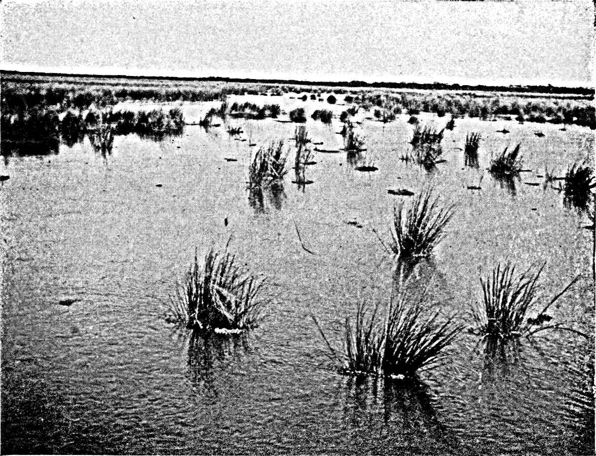
MARSHES (ESTEROS OR CAÑADAS) OF THE EASTERN CHACO.
On the Tartagal line (province of Santa Fé).
It is by means of these marshes, which form in the forest, that
this part of the plain is drained.
Photograph by the Author.
Plate V.
Click to view larger image.
[Pg 59]
The cattle live in the scrub during the summer, when the rains have
brought out the grasses. In winter they go up to the moist forest,
with perennial vegetation, which covers the flanks of the range.30 The comparative abundance of water lessens
the labour of the breeders and, at the same time, the discipline of
the herds. When the time comes, the whole ranch is mobilized for the
purpose of collecting the adult cattle and making a convoy of them.
Horsemen, with the double leather apron which hangs at the saddle-bow
to protect them from the branches, ride up the range with their dogs
and plunge into the scrub. The savage beasts are rounded up and held
at bay. The procession is formed, and sets out, either by the rugged
paths across the forest and mountain or along the easier tracks over
the plain to Embarcación or Lumbreras, where they reach the
railway. If buyers from the sugar-refineries at Jujuy do not take them,
the cattle are put into trucks and sent to the Salta market, where
there are sales all the year round. At Salta the beasts are fattened on
the lucerne-farms before crossing the Cordillera. There is hardly any
tillage, either because the winter drought makes the result dubious or
because the breeders are not good at agricultural work.
[Pg 60]
The Sierra de los Llanos in La Rioja is another centre for extensive
breeding. From the railway, which follows the range at some distance,
between Chañar and Puntá de los Llanos, before it reaches
La Rioja, no one would have the least suspicion of the importance
and life of the region. It is, nevertheless, one of the main foci of
Argentine history. It has proved a cradle of population and wealth. It
was there that Quiroga and, later, the strange adventurer who was known
by the nickname of the "Chacho" gathered the strength that enabled them
to dominate part of Argentina. Colonization is even older here than in
the Chaco Salteño. It occupied two distinct periods, separated
by a long interval. At first it advanced from north to south, passing
round the foot of the Sierra. It is marked by a line of springs, poor
but permanent, the waters of which are absorbed as soon as they flow
down to the porous alluvial beds of the plain. They appear much in the
names of the district—agüitas,
aguaditas, and so on, abound. The road from La Rioja
to San Luis passed these springs, and some population grew up about
them. Thus the two sides of the range—the costa
baja in the east and the costa alta
in the west—became inhabited. The estate of Facundo is one of
these aguaditas of the costa
alta.
The two costas form the historic territory of the Llanos.
It was from there that colonization swarmed over the plain long
afterwards. This expansive movement began about 1850; that is to say,
at a time when the breeders enjoyed comparative peace and security,
and especially when the invernadas of San Juan and Mendoza were
developed, together with the export of cattle to the agricultural
provinces of Chile. The price of stock rose, and the unoccupied land
became of value. The occupation and exploitation of the plain was the
work of the last two generations. They pushed on to the very edge
of the salt lakes, leaving no vacant space. The travesias which
surrounded the narrow inhabited zone of the costas were filled
with life. The Sierra and its two costas are no longer an oasis in
the desert, as they were in the time of Sarmiento; though they still
differ from the remainder of the pastoral zone in the density of their
population and the variety of their resources.
The early date of the colonization may be traced in a special system
of tenure, though this is also found in parts of the provinces of
Catamarca and Santiago del Estero. On the plain the right of ownership
was
[Pg 61]
obtained in the nineteenth century by purchase or by concessions
of public lands which belonged to the provincial Government. They
were allotted in very large estates, and these, intact or broken up,
are the actual ranches. In approaching the foot of the range one
passes estates in the mercedes. The name indicates concessions that
date from the colonial epoch, and they are, in all parts of South
America that were early colonized, the source of land-ownership.
But what is peculiar to the mercedes of the Llanos is that they
have never been divided amongst the heirs of the first owner.31 Sometimes the number of co-proprietors is
small. They are conscious of their relationship to each other and know
the value of the rights of each. The merced is in that case only an
undivided property held in common. Sometimes, however, the numbers of
comuneros is so great that they have lost count of the exact share of
the merced which belongs to each of them. The merced feeds a whole
population, legitimate heirs and usurpers mixed together. In these
cases it is a real communal property, and one might compare it, in
spite of its different origin, with the Indian communities which exist
in Argentine territory as well as that of most of the other Andean
States.
[Pg 62]
The economy of the Llanos is less simple than that of the Chaco
Salteño. There is agriculture as well as breeding. There is
not much rain, and it is confined to the summer months. The mean
rainfall is, no doubt, higher than what we find at La Rioja (about 30
centimetres), but it is not good enough to dispense with irrigation.
The aguadas, springs and brooks at the foot of the range, are the
only provision of permanent water, and it is very limited. The oases
watered by these springs and brooks cover only a few acres at the foot
of the steep cliffs of the range. It has not been possible to cultivate
the land far from the mountains. At Chamical a trench that was made to
convey water to the railway dried up. All that can be done is to follow
for a few miles with a line of wells a subterranean stream of fresh and
not very deep water. At Bella Vista a comunero has dug an acequia
several miles long, and he sells the water at a rate of five piastres
for forty-eight hours. But when it reaches the end of the acequia, it
is lost between the trench and the field to which they would conduct
it. At Ulapes, though it is one of the chief centres, it takes the full
outflow of the spring during sixteen hours to irrigate one cuadra (a
little over two acres), and each man's "turn" is for seventeen days.
The entire oasis measures about fifty acres. At Olta the thin stream of
water is surrounded by so many cupidities that the "turn" comes only
every fifty-eight days, so that each field has to live fifty-eight days
on one watering. At Catuna where a trickle of brackish water is eagerly
collected at the foot of a dejection-cone, the water-right is regulated
by an arrangement of turns that covers ninety days, so that plants die
of thirst in the interval. The plots vary according to the quantity,
quality, and regularity of the water. The orange-tree is the most
exacting, the fig the most tenacious, of the trees. The poorest oases
consist only of a few gardens of dusty fig-trees.
However small it is, the oasis always stands for a rudiment of
communal life, a poblado, a centre round which life is organized in
this pastoral, anarchic, amorphous world. Land that has a water-right
is regarded as detached from the merced and never remains
undivided.
Besides these properly irrigated lands there are the
bañados: cultivated plots in the hollows, where the moisture
left by the storms is concentrated and preserved. These are much more
extensive, and they
[Pg 63]
are very irregularly distributed. Inequalities of the alluvial ground
that almost escape the eye are sufficient to direct the streaming of
the water after rain, and it is quickly absorbed. Man assists nature
as well as he can, and one sees everywhere tiny ridges of earth across
the paths, for the purpose of diverting the water to the plots. These
are the tomas. When you follow a toma downward, you see it after
a time pass under a hedge of dry thorn, and this encloses a field, a
cerco. The crops have to be jealously guarded against the cattle
which roam in the scrub. The cercos are sometimes so numerous that
they give the impression of a regular agricultural district. Most of
them are planted with maize. The maize harvest rarely fails in the
summer, for it is then, on account of the regular rains, that the
maize grows and ripens. When the ears have been gathered, the cattle
are let into the cerco, as maize-straw is excellent fodder. But
wheat also grows well in the bañados. Provided the year has
had a few late showers, the wheat sown in autumn stands the winter
drought more or less well, and ripens after the early rains, at the
beginning of summer. The Llanos produce a hard wheat; it is not milled,
but eaten, like rice, in the grain. There have been times when the
Llanos have exported wheat. The census of 1888 gives the Department of
General Belgrano, on the eastern slope of the Llanos, an area of 900
acres under maize and 1,900 under wheat. When the Chilecito railway
was constructed, this wheat competed with that brought on mules from
Jachal, in the mining district of the Famatina range. Like the gardens
in the oases, the cercos may be divided, and they are the personal
property of those who cultivate them.
Sowing and reaping are, however, mere episodes in the life of the
Llanero. He is mainly occupied with cattle-breeding. The quality of
the pasture differs considerably according to the nature of the soil
and the good and bad character of the season. Sometimes
[Pg 64]
it forms a thick carpet under the brushwood, but in other places it is
poor and there is nothing but the leaves and pods of the algarroba.
If the herd is too large, the grass will not grow again; the breeder
recognizes at a glance the campo recargado—the field which
has had its capacity overstrained. The pasture has to be carefully
nursed. But the most urgent problem is to get a supply of water for
the cattle. Round the Sierra the underground water is often fresh, and
there are plenty of wells. Still, in order to avoid having to draw
the water, they dig large trenches at suitable spots in the clay, and
round these they arrange the earth that has been dug out, with an
opening toward the hills to catch the water when it is raining. These
are the represas. As in the case of the bañados, ridges
of earth direct the stream to the represa. It is surrounded by a
hedge as carefully as the field is. On the plain rain is rare, and
the represas are usually the only reserve. They have to last the
whole year; even two years if there is a particularly dry summer that
prevents re-filling. Thus they become sometimes veritable lakes. From
a distance you can see, above the top of the brushwood, the bald curve
of the mound of beaten earth which encircles them. The water flows over
it when there has been much rain. The mound is sometimes 4½ to
5½ yards high; as it is at Tello, between the Sierra d'Ulapes
and the Sierra de los Llanos, where the San Juan coach used to change
horses.
The represa is the real centre of the estate. The house is built
near it, and guards the entrance. From early morning until dusk the
cattle come to it, singly or in groups. The rancher admits them, lets
them drink, and closes the gate behind them. If the thirsty cattle have
not his mark and belong to a neighbour, he sends them to drink at their
own represa; but he gives water to lost beasts, from a distance,
whose owner will presently come for them. Near the represa
[Pg 65]
is the enclosure (potrero) for calves that have
just been born. The cows come there every morning, and they are milked
for a few months to make cheese. Like the cerco,
the represa is the personal property of the man
who made it, or of one who has inherited it and sees to its upkeep.
The cattle of the Llanos move a good deal. There are certain
irregular migrations, and others that are periodic or connected with
the seasons. Everywhere on the fringe of the Sierra the cattle remain
in the ravine and on the foot-hills during the winter. In the summer
they return of themselves to their querencia
on the plain. The irregular migrations are due to scarcity of water
or pasture. Driven by hunger, the beasts travel a long distance of
their own accord. They mingle with other herds, sometimes so far
from the ranches where they were born that no one recognizes their
mark. Sometimes, again, the rancher himself goes, when his represa is dry, to ask hospitality in some more
favoured canton. He is fortunate if the drought has not been general;
if part of the country has been spared and can offer a refuge.
But it sometimes happens that the whole district has suffered, and
the land is naked and scorched everywhere. There is then no help except
a long journey, to San Luis or to the lucerne-farms of San Juan, for
the cattle. The misfortune of the Llanos sends up at once the rent
of the invernadas all round. A general evacuation of the cattle is
a desperate remedy, and is, in fact, often impracticable. During the
whole summer the men wait patiently, hoping for the end of the drought.
There is room for hope until April, when storms are still possible. If
the month ends without rain, it is too late to remove the exhausted
cattle; the stages across the desolated country are too severe.
The memory of the worst years of drought—the "epidemics," as
the Llanero calls them—lives for a
[Pg 66]
long time. They make a deep impression on the popular imagination, and
legend makes plagues of them, in the Biblical way. The drought of 1884
was particularly disastrous. The herds were destroyed, and families
that had been wealthy the day before set out on foot, "having nothing
to put a saddle on": a touching picture of misery for this race of
centaurs, people who feel themselves mutilated when they are not on
horse. The rain returns next year. The pasture grows all the better
because the herd is smaller, and the Llanos give the traveller who
crosses them an exaggerated impression of their natural wealth.
Until quite a recent date the cattle reared in the Llanos were
destined exclusively for Chile. Dealers from Jachal or Tinogasta came
in the autumn, and the cattle passed the winter in the invernadas
at the foot of the Cordillera. From the Sierra d'Ulapes, which is a
southward continuation of the Llanos, the cattle destined for Chile
were first sent to San Juan. They took one or two weeks to reach it.
Five men were needed for a herd of a hundred beasts: eight for a herd
of two hundred. The caravan was directed by an estanciero (rancher)
or his capataz, or by dealers who came originally from the Llanos.
Exports to Chile have not entirely ceased. In 1913 the dealers from
Tinogasta and Jachal, who had not appeared in 1912, came back. The
southern part of the Sierra d'Ulapes, which is some distance from the
railway, reserves its cattle for San Juan. The cattle are, however,
more and more sent by rail to the coast. In the Sierra d'Ulapes the
dealers from Villa Mercedes, which has become one of the great markets
of Argentina, come every year, rent an enclosure (protrero), and
collect in it, one by one, a herd of cattle, which they then take away
on foot. They are sold at the fair at Villa Mercedes, and they disperse
in every direction toward the fattening zones of the Pampa.
This commercial revolution has led to a rise in the
[Pg 67]
price of cattle, and this in turn has raised the value of land.
When the value of the land rises, the methods of working it are
necessarily improved, there is greater security, and thefts of cattle
(cuatrerismo) become impossible. The farmers are not content merely
to enlarge their represas or dig deeper wells. They divide the fields
by fences—cheap iron wire stretched on home-made posts, or hedges
of spines like those which protect the bañados. Thus pasture
can be reserved untouched for the difficult months.
This subdivision of the land by fences began in the south, in the
Ulapes district, in touch with the richer districts of San Luis and
Córdoba. In the Llanos proper the practice has scarcely begun.
At Ulapes it is even done on the mercedes. Each comunero, without
opposition, encloses as much space as he can, and leaves his cattle
outside, on the common land, as long as possible. He only brings them
into his enclosed land when the common pasture is exhausted. This
will bring about the end of the mercedes; and, indeed, communal
ownership is not suited to modern conditions. The latest sign of
progress is the appearance of lucerne fields. Lucerne can be grown
on the bañados wherever anything else can be grown; and the
creation of lucerne-farms will give the pastoral industry a security
and stability it never had before, besides enabling the breeders to
collect stores of dry forage and exploit the full pastoral capacity of
the monte.
[Pg 68]
CHAPTER III
TUCUMÁN AND MENDOZA THE GREAT INDUSTRIAL ENTERPRISES
Tucumán and the road to Chile—The
climate and the cultivation of the sugar-cane—The
problem of manual labour—Irrigation at
Mendoza—Water-rights—Viticulture—Protection
and the natural conditions.
The great industrial forms of cultivation, the sugar-cane and the
vine, gave a new aspect to the scenery of Tucumán and Mendoza
at the end of the nineteenth century. The increase of population and
wealth which they entailed was so sudden, the economic advance so
swift, that the owners of vineyards and the sugar-makers have now
lost all recollection of the primitive industries which gave life
to colonial Tucumán and Mendoza, and were maintained until
the last generation. Nevertheless, if one compares Tucumán or
Mendoza with some centre of irrigated tillage in north-west Argentina,
one quickly perceives the original features which three centuries of
history have given them. The system of land-tenure, water-rights, the
distribution of the cultivated zones, and a thousand other features,
show that the colonization is old. The exploitation of the soil and
utilization of the water have not proceeded on a methodical plan,
conceived in advance, which would make each piece of work—the
dams and channels of distribution, for instance—subordinate to
the whole. The engineers who constructed the great modern dams of
Mendoza, San Juan and Sali, had not to create a region of new estates,
but merely to
[Pg 69]
improve the water-supply, which was used wastefully by the existing
estates. There is nothing more suggestive than the contrast between
these stone dams, built according to all the rules of hydraulics, and
the network of irregular channels, following the accidental variations
of the land and the slope, which preceded them, and to which they have
been accommodated as far as possible. In some cases the primitive
acequias could not be altered so as to start from the dam. The
accumulations of water succeed each other down the slope, held up by a
simple barrier of branches and earth which is periodically destroyed
by floods. The modern flood-proof dam (dique nivelador), which cuts
the torrent in its entire width, and enables them to make use of its
whole volume, allows a certain amount of water to pass, for the use of
the acequias lower down. This falls back into the broad, stony bed,
exposed to evaporation and infiltration as it was before.
Long before the development of the sugar industry on a large
scale, there was a typically urban life, added to the common fund
of pastoral life, at Tucumán. The neighbouring cantons of
the scrub—Trancas, Burruyacu, and Graneros—sent cattle
and mules to Peru and Chile, like the other Argentine plains. But
Tucumán drew still greater profit from its position as chief
stage on the high road to Peru, at the point where the plain passes
into the mountain. Primitive Tucumán was an excellent type
of high-road village. The road determined its position at the point
where the Sali had to be crossed. The first site of the town, near
Monteros, was abandoned in the eighteenth century, when the high road
to Peru settled in the sub-Andean region and ceased to run through the
Calchaqui valley. The road sustained its chief industries, tanning and
harness-making for the muleteers of the Andes, and waggon-making for
the troperos of the plain. The road and the people travelling along
it afforded an
[Pg 70]
outlet for its wheat and flour, and facilitated the export of its
tobacco to the coast-provinces. The waggon-owners were really
contractors, conveying stuff at their own cost. Moreover, part of
Bolivia came to make its purchases at the shops (tiendas) of
Tucumán, and the merchants of the town took in exchange Bolivian
ore for export. Thus the road built up a nucleus of available capital
at Tucumán. This capital was invested, at the close of the
nineteenth century, in sugar; and it has increased a hundredfold. Most
of the works still belong to old families of the town.
The sugar-region is comparatively small. It covers an area which
has exceptional climatic features, owing to the vicinity of Mount
Aconcagua. While the higher chains of the Andes further north are
separated from the Chaco plain by lower ranges, on which the east winds
leave their stores of moisture less freely, Tucumán has on its
west the great mass of Aconcagua. It rises, a giant landmark, at the
beginning of the plains, from which there is nothing to separate it,
and gathers the clouds round it.
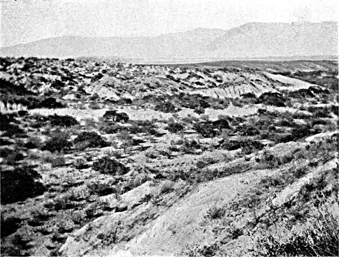
THE VALLE OF SANTA MARIA, NORTH-WEST OF MOUNT ACONCAGUA.
At the bottom of the valle one can see the
sandy bed of the river as a white line in the foreground. Zone
of torrential terraces, which follows the edge of the valle.
Photograph by the Author.
Click to view larger image.

THE OASIS OF ANDALGALA.
At the western foot of Aconcagua, the snowy
crest of which can be seen.
Photograph by the Author.
Plate VI.
Click to view larger image.
[Pg 71]
On the eastern slope of Aconcagua is the limit of the crescent of
tropical forest, which begins about three thousand miles away, on the
flank of the Venezuelan and Colombian Cordilleras, and is connected
in the centre, in the equatorial zone, from Guaviare to Mamore, with
the forests of the Amazon region. At its two ends it is reduced to a
narrow belt which does not reach, in the east, the alluvial plains,
the savannahs of the Orinoco and the scrub of the Chaco. The humid
forest of the Argentine Andes is nowhere more luxuriant than near its
southern limit, above Tucumán. There are no palms or tree-ferns,
but the convolvulus abounds, and the evergreen trees are covered with
epiphytes. Aconcagua is one of the sharpest climatological limits
in the world. In the latitude of Salta one has only to go about 150
miles to pass from the moist forests of the sub-Andean chain of the
Lumbrera to the arid valley of Cachi. On both sides of Aconcagua there
are less than fifty-five miles between the sugar-cane fields won from
the forest and the oasis of Andalgala, or that of Santa Maria, which
are right in the desert zone. According as one approaches Aconcagua
from the east or the west, one finds, from base to summit, either the
successive stages of vegetation of the humid Andes—from forest
to grain-sown prairie (paramo or pajonal)—or those which
are characteristic of the arid Andes, from the spiny scrub of the
valleys to the fields of resinous tola of the Puna. The contrast
of climates is repeated in the character of the soils. Aconcagua
contains in itself the entire Andes in miniature. At the foot of
the narrow zone of Alpine crests, in the few square miles of the
elevated valleys of Tafi and Pucara, there is a small agricultural and
pastoral world, in a temperate climate, that has nothing quite like
it elsewhere, narrowly confined between the forest and the desert.32
[Pg 72]
The sugar district of Tucumán is not, properly speaking, an
oasis; that is to say, it is not an irrigated canton in the midst of
a desert, but a moist patch in the heart of a less favoured region.
The traveller who comes from the Chaco finds that the dust disappears
from the moister air as he approaches Tucumán. The rainfall
approaches 974 millimetres at Tucumán. Irrigation is a valuable
aid to the farmer, but it is not indispensable. Maize is generally
raised without watering, and part even of the sugar-cane crop is
raised on land that is not irrigated. It is not the relatively heavy
rainfall that has led to the development of the sugar-cane estates
at Tucumán, but the evenness of the temperature, together
with the atmospheric moisture and the rareness of frost. The mists
which develop at the foot of Aconcagua form a protecting mantle above
Tucumán which prevents nocturnal radiation. The nearer one
gets to the mountain, the later, rarer, and lighter the frosts are.
If, on the contrary, one goes out some distance westward toward the
plain, the frost becomes more severe, and it is impossible to grow
sugar-cane. Not only the humidity, but the contour also, has some
influence on the changes of temperature and the distribution of frost.
The depressions in which the cold air accumulates, in virtue of the
well-known meteorological phenomenon of inversion of temperature, are
more exposed than sloping districts, where the air circulates regularly
and freely. The eastern limit of the zone spared by the frosts passes
about thirty-five miles from the foot of Aconcagua. It has only been
made clear by experiment, and one can still see there the traces of
abandoned plantations.
The water-supply in the Tucumán district consists, primarily,
of numerous evenly flowing streams which come down the eastern flank of
Aconcagua (Lules, Famailla, Angostura, Gastona, Medinas, etc.). They
join the Sali to the south of Tucumán. The Sali is an irregular
torrent which rises in the sub-Andean depression to the north and
Tucumán, and, after squeezing Aguadita between the north-eastern
extremity of Aconcagua and the sub-Andean chain of Burruyacu, enters
the plain at Tucumán. It then flows southward, meandering over a
large bed of shingle in which it has not had force enough to excavate a
valley, and the inclination of the land on its left bank (to the east)
is toward the east and south-east. The lands on the right bank of the
Sali are consequently better provided with water than those on the left
bank. The difference is so marked that, as the estates on the right
bank get most of their supply elsewhere, the water of the Sali nearly
all goes to the left bank. In 1912 a siphon
[Pg 73]
was actually constructed underneath the bed of the Sali to convey the
unused water of the Rio Lules to the right bank. Lastly, to the north
of Tucumán the Sierra de Burruyacu provides a few intermittent
streams of water, which the estancias (ranches) formerly conducted,
with great labour, to their represas. These do not suffice for
irrigation on a large scale.
The sugar-cane was first grown at the gates of the town and,
to the east, at Cruz Alta, on the left bank of the Sali. These
were some distance from the mountain because, as there was
less rain and the soil was fairly dry, the natural vegetation
was less luxuriant, and it cost less to prepare the ground.33 The Central Córdoba Railway, which
passes along the right bank of the Sali south of Tucumán, is the
axis of another zone of cultivation and of old factories. Colonization
afterwards went further west. A new provincial railway, describing
a section of a circle, was grafted at Tucumán (1888-90) and
Madria upon the Central Córdoba line. It keeps close to the
foot of the range, the falda, and enables farmers to settle on it.
The new estates have not confined themselves to the alluvial plain;
they have crept up the foot hills, and are constantly going higher.
In the latitude of Tucumán the mountain approaches within
eight or twelve miles of the Sali, and the possibilities of extension
westward are strictly limited; indeed, they are already exhausted.
Further south, on the contrary, the plain extends more than fifteen
miles to the east of the provincial railway. West of Monteros,
Concepción, and the existing line of works, there is a reserve
of available land; there is room for a fresh advance westward. There
is also room for expansion to the north-east, at the foot of the
sub-Andean chain of Burruyacu, where the frosts are slight. It is in
this direction that most of the clearing is now going on.
[Pg 74]
These various districts do not offer quite the same conditions to
the farmer. The Falda is the most suitable, not only on account of
the rareness of frost, but because of the fertility of the soil, as
the tropical forest has accumulated inexhaustible stores of humus. The
sugar-cane returns are higher there than anywhere else. Irrigation
is not necessary, but, on the other hand, the humidity reduces the
proportion of sugar in the cane. Irrigation is the rule in the next
belt, between the local railway and the Central Córdoba line (on
the right bank of the Sali). On the left bank a large number of the
estates must still do without watering.
The most original feature of the organization of the sugar industry
at Tucumán is the maintenance of a class of independent
cultivators, the cañeros, side by side with the large
enterprises. This survival of small and medium properties is a
fact to which we find no parallel in the other sugar districts of
tropical America.34 Everywhere else,
in Brazil and in the Antilles, the farms which worked up their own
produce, on primitive methods, have been absorbed by the central
works. The home-worker has lost his land as well as been ruined in his
industry by the competition of the modern factory. At Tucumán,
on the contrary, the sugar industry never passed through the stage of
domestic production. It was set up in full development, some devoting
their capital to building works, others to growing the cane. Irrigation
seemed from the first to dictate a concentration of ownership; the
refineries at Cruz Alta constructed costly special canals to bring the
water of the Sali. It is only large proprietors who have the resources
needed to carry out work of this kind, and sufficient influence to
secure permission to conduct the water over adjoining estates. However,
the law of 1897 reorganized irrigation and withdrew the water-supply
from the control of a few privileged big capitalists. Public works,
undertaken by the provincial authorities, brought the water within the
reach of every farmer. Since 1897 the number of water-concessions has
risen from 230 to nearly 2,000.
[Pg 75]
The interests of the factory (ingenio) and the farmers
(cañeros) are not indissolubly connected. Their respective
parts in the final product of the sugar industry are not invariable.
The increase in the number of factories means an increase in the number
of cane-buyers, and so tends to raise the price. During the years
antecedent to 1895 the refineries improved their machinery, and their
productive capacity increased faster than the cultivated acreage. The
price of the cane then rose to about twenty piastres a ton. As this
figure is far above the net cost, the refineries endeavoured to profit
themselves by the advantages that accrued to the cañeros,
and they bought land for cultivation. It is to this period that the
big concerns of Cruz Alta belong. Afterwards the production of cane
increased, and nearly met the demands of the refineries, so that their
competition relaxed. They ceased to buy land, and the price of cane was
lowered.
The refineries now deal with cane which they grow themselves, with
paid workers of their own; with cane that they buy at a reduced price
from tenants (colonos), who grow it on their own estates; and with
cane sold them by cañeros who own their own fields. The range
of the country absorbed by each refinery is often very extensive.
The Sugar Congress of 1894 estimated that half the cane-harvest was
transported by rail, and that freight from one canton to another in
the sugar district brought the railways more than a third of what they
got for conveying sugar from Tucumán to the coast. Each railway
company tries to keep along its own line the cane it carries to the
refineries, so that the transport of the sugar when it is made will
fall to itself. Thus the cane-market is
[Pg 76]
divided into two separate compartments, with very little exchange
between them. The first comprises the zone that depends on the Central
Argentine and the State Railway; the second is the zone of the
Central Córdoba and the old local line bought by the Central
Córdoba.
Certain parts, such as Cruz Alta and the district round the town,
have too many works in proportion to their production of cane, and they
are centres of import. The price of the cane is always higher here
than in the agricultural districts. Each works has its customers. At
the stations it instals weighing machines for receiving and weighing
the cane. It is only the more important cañeros who have the
privilege of selling by the truck-load, or selling to distant works.
The small growers are compelled to deal with the local refinery. They
sell it their canes direct, or, sometimes, through agents and dealers.
In the days when the works were competing for cane it became the
custom to sign the purchase-contracts as early as possible; sometimes
at the beginning of October, as soon as the harvest of the year is
over. In order to make sure of the loyalty of the cañero the
manufacturers advance money to him, in proportion to their difficulty
in getting cane.
Cañeros and mill-owners have had to work together to
settle the problem of labour. There was not enough at hand, and it
had to be recruited elsewhere. Agents were sent all round—to
Catamarca and Santiago del Estero, and even to the province of
Córdoba—to collect and bring gangs of workers. They were
a mixed, unsteady, undisciplined lot. The owners of the works advanced
them money in order to keep them, and then, fearing to lose the money
advanced, would not dismiss them for laziness and irregularities. These
troubles are not felt as much now as they were at the time when the
industry was expanding. The population of immigrant workers has settled
down and taken
[Pg 77]
root. Besides creoles it includes a small number of Italians and
Spaniards; but while the creoles have been definitely incorporated in
the sugar industry, the European immigrants use their savings to buy a
bit of land and take to farming.
In normal times Tucumán has all the labour it requires, but
the harvest always compels it to seek help in other provinces. In
May and June the agents, well supplied with money, set out for the
Salado, the districts round the Sierra d'Ancasti, etc. The temporary
attraction of Tucumán at this season is felt over a considerable
distance. At Santa Maria, on the far side of Mount Aconcagua, 600
people—men, women, and children—emigrate for five months,
and live on the cane-fields. The merchants of Santa Maria make them
advances, in the name of the refiners, to the amount of about sixty
piastres per worker. Further north the Tucumán enganchadores
come into collision with those from Salta and Campo Santo, and they
divide the available labour between them. Some of the temporary
immigrants settle down permanently every year, and swell the normal
population of the sugar industry.
Outside the Tucumán district an unfortunate attempt was
made to plant the sugar industry at Santiago del Estero, and large
works were constructed. But the frost is severe there. For some years
they tried to keep the Santiago works going with cane brought from
Tucumán, but the freight was too heavy, and the works had to be
abandoned, or else dismantled and set up elsewhere. The valley of the
Rio Grande, from Jujuy to 200 miles north of Tucumán, in the
sub-Andean depression between the Sierra de Zenta and the Lumbrera,
has, on the other hand, suitable conditions for the cultivation of the
cane. Frost is rare. The climate is warmer than at Tucumán,
the canes ripen more quickly, and the average return is higher. The
water-supply also is good. There have long been
[Pg 78]
plantations in this region. Their first market was the region of the
tableland and the valleys, where they chiefly sold brandy: a traffic of
long standing, which one always finds round the cold districts of the
Andes, from Colombia to the north of Argentina. The modern refineries
of Ledesma and San Pedro took the place of the primitive mills as soon
as the railway approached Jujuy, and even before it entered the valley
of the Rio Grande. They then sent their sugar by waggon in November and
December, between the close of the sugar season and the commencement of
the rains, which spoil the roads.
The sugar district of Jujuy now has a very different economic and
social organization from that of Tucumán. Here there are no
farmer-proprietors. Each centre is a large estate, in the midst of the
forest, where the workers are lodged and fed by the works that employs
them. The contractors who clear the ground for them are obliged by
the terms of their contract to import their workers directly from the
south, so that they will not take any away from the farming. There is
no available labour, no free market, on the spot. Since the completion
of the Quebrada de Humahuaca line, however, there has been a good
deal of immigration, to settle or temporarily, of the mountaineers of
the tableland. The sphere of influence of San Pedro now extends as
far as Bolivia. For the harvest, which, like that of Tucumán,
requires a good deal of additional manual labour, the works look to the
wild Indians of the Chaco. This curious stream of seasonal migration,
which the sugar campaign of Jujuy provokes every winter outside the
zone of white colonization, is of very old date, going back more than
sixty years. Belmar notices it about the middle of the nineteenth
century. The recruiting agents of San Pedro and Ledesma set out from
Embarcación, where the railway ends, and enter the Chaco, from
which each of them brings a troop of some hundreds of natives between
March and June.
[Pg 79]
The number of these temporary immigrants seems to be about 6,000. The
Chiriguanos of the north leave their families on the Chaco, and the men
come alone. The Matacos immigrate in whole tribes. They camp in huts
like those of their own villages, under the shelter of the works, and
are paid in maize, meat, and cigars. In October, when the algarroba
flowers and makes them dream of their own country, they receive the
remainder of their pay in money, and spend it in brandy, clothing,
knives, and firearms.
The history of Mendoza resembles that of Tucumán in many
ways. In the province of Cuyo, as at Tucumán, urban life has
been precocious. In the middle of the eighteenth century Mendoza and
San Juan exported wines, dried fruit (pasas and orejones), and
flour to the coast and to Paraguay. Part of the so-called "Chilean
flour" consumed on the Pampa, really came from Jachal and Mendoza.
This trade ceased in the nineteenth century, but San Juan and Mendoza
found another source of wealth in fattening cattle and sending them
to Chile. Belmar, in 1856, estimates the extent of the lucerne
farms of Cuyo to have been 150,000 cuadres(440,000 acres). 35 As at Tucumán, the present period is
characterized by a rapid expansion of cultivation and a rapid growth of
population. But, whereas at Tucumán the neighbouring provinces
have provided the whole of the manual labour required, and the actual
population is essentially creole, at Mendoza there has been a larger
number of foreign immigrants. In 1914, foreigners were 310 per 1,000
of the entire population of Mendoza: a larger proportion than for
the whole country. The immigrants going straight to Mendoza from the
ports numbered 12,000 in 1911, and 15,000 in 1912; almost as much as
for the province of Santa Fé, and more than for the province
of Córdoba. Thus Mendoza plays a part of its own in the charm
which Argentina has for the imagination of Europe. When we examine a
chart of the population of South America, we notice that the oases of
Cuyo contain the only important groups of European population at any
distance from the coast.
[Pg 80]
The prosperity of Mendoza to-day depends upon the cultivation of
the vine, just as that of Tucumán depends upon sugar. The
cultivation of the vine is possible in the greater part of Argentina.
In the early days of colonization there were vineyards as far as the
Paraguay. They still flourish at Concordia on the Uruguay and at San
Nicolas on the lower Paraná. But the wet summers of the eastern
provinces are not suitable for them. The climate for them improves as
one goes westward, and there is less rain. The dry zone of eastern
Argentina is the special field of the vine. There it has spread
over nearly twenty degrees of latitude, and it depends, like other
cultivation, upon irrigation. In the Andean valleys of the north-west
it rises to a height of 7,500 feet. South of Mendoza the higher
limit of the vine sinks rapidly, and there are no vineyards in the
mountainous district itself. On the other hand, its range increases; in
the east it spreads as far as the Atlantic coast, in the valley of the
Rio Negro.
The former centres of viticulture in the north-west, in the oases
of the costas of La Rioja, Catamarca, and Salta, have scarcely
been affected by the advance; and, in any case, their extent is very
limited. The vine-district of the Rio Negro is only in process of
creation, and its output is still small. Thus the area of production
on a large scale is limited to the three oases of San Juan, Mendoza,
and San Rafaël, which in 1913 yielded 4,750,000 hectolitres, out
of the total Argentine production of 5,000,000 hectolitres. These
three centres differ from each other to-day rather in their economic
development than in their physical conditions. At San Juan, the
transformation of the earlier methods of production and the traditional
creole industries is
[Pg 81]
only now taking place. At Mendoza it is quite finished. The San
Rafaël centre, on the other hand, is of recent origin; it was
created on the site of a fortress which guarded the Indian frontier
until 1880. Cultivated areas have appeared on virgin soil, in the midst
of the desert. These different circumstances account for diversities
which, though they will disappear in the course of time, are still
obvious to the traveller. The general scene is the same everywhere.
Arid and desolate mountains close the horizon in the west; at their
feet spreads the immense alluvial deposit on which the vineyards,
surrounded by rows of poplars, grow wherever water is to be found.
There are so few gaps in the lower slopes of the Cordillera that the
available water is gathered at a small number of points. The Rio San
Juan alone drains a belt of the Cordillera at least 140 miles broad.
Each of the two oases, Mendoza and San Rafaël, has two streams
of water to feed it. The Mendoza and the Tunuyan at Mendoza, and the
Diamante and the Atuel at San Rafaël, approach each other, when
they leave the mountains, so closely that the estates they water blend
into a continuous area. Then, however, instead of uniting, they diverge
and are lost, separately, in the plain. These streams have less fall
than the thinner torrents of the oases of the north-west, and the
average inclination of the dejection-cones which bear the vineyards is
slight. The upper slopes of the cone, where thin beds of clay lie upon
shingle, give clear wines of excellent aroma. Hence, in the Mendoza
district, the vineyards of Lujan and, further down, of Godoy Cruz,
Guaymallen, and Maipu produce choice brands. On the plain, to the east
of Mendoza, at San Martin and Junin, the harvest is larger, but the
wine is rough, and one can often taste the saltpetre of the clayey
soil. There is the same difference between the upper and lower district
at San Juan and San Rafaël.
[Pg 82]
The oases of San Juan and San Rafaël spread evenly over the
most suitable parts of the alluvial talus, but the oasis of Mendoza
has a peculiar shape which can only be explained by historical causes.
The cultivated belt is a narrow strip along the Tunuyan, for more than
sixty miles, as far as the heart of the plain, out of sight of the
Cordillera. It is one instance, out of a thousand, of the influence of
traffic on colonization. As a matter of fact, the road from Mendoza
to the coast, by which the cattle convoys of San Luis went to the
invernadas, passes along the Tunuyan. The estates grew up by the
side of it. The villages of Santa Rosa, Las Catitas, and La Paz, which
mark the various stages of it, are all of ancient origin. Strangers
are rarely found there. One still sees in them very old houses, built
before the railway was made, dating from the days of the carril or
waggon-road. The importance of this line of water across the desert is
clearly seen on the Woodbine Parish map.
The use of irrigation in this district raised different technical
problems from those of the north-western provinces. In this latitude
the torrents of the Andes are formidable when the snows meetmelt, at the
beginning of summer. The flood is all the greater and more sudden as
the heat is late. From all the ravines of the mountains the muddy
waters then converge toward the valley. The flood scours the bed of
the river, erodes its banks, and threatens to find a way amongst the
estates. Even the towns of Mendoza and San Juan have more than once
been in danger. The fear of diverting the flood and of bringing it
upon themselves compelled them to be content with raising only light
and frail dams in the path of the torrent. At San Juan they used, for
a long time, the waters of the Arroyo del EesteroEstero, a small brook fed by
infiltration from the Valle de Zenda, and it was some time before they
ventured to draw upon the river itself.

THE OASIS DEL RINCON, BELOW SAUJIL (ANDALGALA
LINE, PROVINCE OF CATAMARCA).
The dejection-cone, at the foot of which is the
very small oasis, is seen resting against the Sierra d'Ambato.
Photograph by the Author.
Click to view larger image.
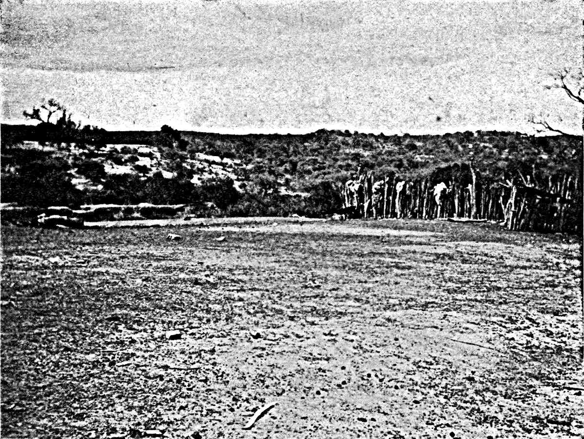
THE MONTE AT EL YESO.
Zone of clay hills at the foot of the Sierra
de San Antonio, at the edge of the Chaco. Corral (cattle park)
made from tree-trunks.
Photograph by the Author.
Plate VII.
Click to view larger image.
[Pg 83]
Another problem, which the smaller oases of the north-west hardly
know—the problem of drainage—is of paramount importance at
San Juan and Mendoza, as far as a large part of the irrigated surface
is concerned. The water infiltrating into the soil forms a subterranean
sheet which approaches more or less to the surface according to the
topography. It comes to the surface at the foot of the cone, where the
slope diminishes and the cone gradually passes into the plain. Hence
the cone has, at its base, a belt of marshes (ciénagas), and
sometimes a line of good springs (barbollon). At San Juan, if you
move far enough away to get a comprehensive view of the whole of the
estates, you see that they occupy the middle belt, half-way down the
cone, the top of which is composed of coarse shingle, while the bottom
is too wet. The advance of the plots upward and the steadily increasing
use of the available water tends to raise the level of the underground
sheet and enlarge the area of marsh.
There is a fine black soil, very fertile when it is drained, and
no irrigation is needed; as it is possible, according to the depth
of the drainage-trenches, to regulate the level of the underground
water so as to make it reach and feed the roots. The draining of the
marshes, again, opens up a field for the further expansion of the
estates, especially at San Juan, where it has scarcely begun. Moreover,
the water that is obtained by draining the marshes enables them to
create new irrigated estates further on. At Mendoza there is already a
considerable area irrigated by drainage-canals (desagüe).
The level of the water in the marshes sinks in the summer and rises
in winter, at the time when the irrigation of the upper districts is
suspended or greatly reduced, and when the surplus of the acequias,
which the fields no longer take, flows or infiltrates downward in any
way that it can. Thus, contrary to the torrent itself, it is in winter
that the drainage-canals are at
[Pg 84]
their fullest. At Barriales (Mendoza), and on the lower course of the
Zanjon canal, thousands of acres, watered by the drainage-canals and
exposed to drought in the summer, have the right to take water from the
river or the canal during the three summer months, from November to
January. During the remainder of the year they are restricted to the
use of the drainage-canals. This sort of concession seems to provide a
means of using the surplus of the river during the summer.
With this exception there are no temporary rights limited to the
high-water season and enabling them to raise quick crops, that ripen
in a few months, round the area of perennials. At least, the expansion
of the estates and the wish to use the full water-supply have led to
the creation of eventual rights, besides the definitive rights. They
do not come into play, theoretically, until the definitive rights
have had their full supply, and then only in a fixed order. They
are subordinated to the ordinary rights, and the market value of
land with eventual water-rights is much lower than that of land with
definitive rights.36 At San Rafaël,
where colonization preceded the systematic inventory of the natural
resources, the concession of eventual water-rights was a means of
facilitating the development of estates; though they were very badly
informed as to the surplus of the Atuel and the Diamante and the area
that the new land might cover.
In practice, the co-existence of eventual and definitive rights
presents many difficulties, and more than one pretext for fraud.
Somtimes Sometimes the owners of eventual rights have access to the river
higher up than the older intakes, which ought to be served first. A
whole group of canals feeding land with eventual rights is in this
way grafted upon the Tunuyan above La Paz, the rights of which are
definitive and ancient.
[Pg 85]
At Mendoza and San Juan the water-rights, codified in provincial
laws which date, like the dams, from the end of the nineteenth century,
are very different from the water-rights which hold in the Andean
provinces of the north-west. The variety of the physical conditions
is reflected in the institutions. Here water is not an object of
private ownership independently of the soil. The concession of water
is assigned to a definite estate, and it is formulated in superficial
measurements. The law fixes the volume of water that goes with each
unit of surface. If the output of the river is not large enough to
provide the volume stated in the law to the whole of the irrigated
district, all the lands with definitive rights receive at least an
equal amount, and the available water is shared by the canals in
proportion to the extent of the surface they irrigate.
No law could secure for the farmers of Cuyo, even those with
definitive rights, a constant supply of water, or save them from
suffering in common from the variation in the volume of the torrents,
and it was not even possible to guarantee them water in any permanent
fashion. The turno is used everywhere when the water is low. Lower
down, where the drought lasts nearly the whole year, the turno is
the standing rule. At La Paz, on the fringe of the irrigated area,
it has to be applied rigorously. The turn of each owner comes every
eight, ten, or twelve days. In normal times he receives the suerte de
agua; that is to say, the output of a sluice of a fixed size during a
half-hour for each hectare (a little over two acres) of land. But if
the river runs low, it becomes impossible to supply several neighbours
simultaneously, and, in order to avoid making the interval between
supplies too long, the duration of the suerte de agua is reduced by
half or three-quarters.
[Pg 86]
The oases of Cuyo are like the small oases of the north-west as
regards the function of those who are engaged in the administration of
irrigation. The water-laws give the provincial functionaries general
directions. Below them, however, to arrange the distribution of the
water and the upkeep of the canals in detail, they have allowed to
survive, and have merely regulated, certain primitive democratic
organisms. At San Juan the superintendence of the irrigation is
entrusted to elected municipal councils and the governor of the
department. At Mendoza, the owners appoint a council of three delegates
and an inspector for each canal, and these settle the annual budget of
the canal, submit it to the provincial authorities, receive the taxes,
carry out the necessary repairs, and so on. The great subdivision
of property and the large number of electors make these little
republics very lively; and they are very jealous of their autonomy.37
Even within the narrow limits of the Cuyo district the
climatological conditions, which control the growth of
the vine, are not everywhere the same. The opening of the
vineyards varies by several weeks, according to the locality.38 The northern slope of the cone, exposed to
the sun and protected from the southern winds, is more precocious. Some
districts, poorly sheltered from the southern winds, and very liable
to have late frost, have not been planted with vines (district of the
Tucuyan below San Carlos, to the south of Mendoza). Everywhere the
dryness of the atmosphere causes the ripe grapes to remain long on the
vine, so that the harvest may last two months or more without any harm.
It thus requires a relatively small supplement of manual labour, and
does not necessitate seasonal migrations. The length of the harvest,
moreover, facilitates the trade in grapes, which is one of the special
features of the Argentine vine-industry.
[Pg 87]
The climate is not so suitable for making wine as it is for growing
vines. The temperature is high at the time of the harvest, and it
retards fermentation in the cellars. The grapes have too much sugar
and too little acid for the transformation of the must to proceed
of itself. Hence it is necessary to have an expensive equipment,
improved cellars, and skilled workers. This industrial organization
is beyond the reach of the small cultivators. The cultivation of the
vine and the making of wine are, therefore, not always associated.
They are taken up by two different classes of the population.
Tucumán has its cañeros and factories, and Mendoza,
by a division of labour which seems to the European visitor as
strange as the climate which partly explains it, has its vine-growers
(viñateros) and its manufactures (bodegueros).39
Each of these two classes has had its share in the common work. The
viñatores have created the vineyard. The creole vine, imported
into Peru from the Canaries and spreading over the whole of the
southern Andes, yields great quantities of a sugary, but rough fruit,
which does not lend itself to imitating the wines of Europe. At Mendoza
it has almost entirely disappeared, though it survives at San Juan. It
is grown on trellis-work, wooden frames resting on forked branches of
algarroba; though sometimes the strong stems rise without support to
a height of about six feet and are crowned with shoots and leaves. The
new vine has been grown from French cuttings. While the creole vines
look like orchards, the French vines are grown in rows of iron wire.
[Pg 88]
The plantations were first made by creole workmen, who were paid by
the day. Afterwards, as immigration from Europe increased, long-term
contracts came into vogue, in virtue of which the colonist received
the bare land and undertook to have it planted with vines at the end
of three, four, or five years. The owner supplied the material, and
at the end of the contract the colonist received a few centavos for
each vine, or sold the whole or part of the first harvest. On account
of these contracts there were always a great many foreigners in the
districts where vineyards were in course of formation. The proportion
is now less at Mendoza than at San Rafaël, where colonization is
more recent. Whenever they could, the owners left to the colonists,
not only the business of planting the vines, but the upkeep of adult
vineyards. In those cases the colonist receives a fixed sum per hectare
(100 piastres, for instance), and has to dig, prune, irrigate, etc. A
large number of these agricultural workers and small contractors have
saved a small capital, and purchased land of their own. This they have
planted, and they thus form a new class of working owners.
While the viñatores were multiplying vineyards, the
bodegueros were transforming the methods of making wine. The weakness
of imperfectly fermented wines, which turn sour and evaporate quickly,
was all the worse for the growers of the colonial period because
transport was slow, and there was no protection against the sun, which
cooked the algarroba casks or the leather bottles on the backs of
the mules. The vineyard-owners often preferred to distil their wine
and export brandy, flavoured with aniseed, to the Andean tablelands
or the coast. The climate and the risks of transport had brought into
existence an astonishing variety of methods of treating the must.
Sometimes it was concentrated by boiling until it became a thick syrup
[Pg 89]
(arrope), something like, apparently, the thick wines of the
Mediterranean in former times. At other times the must was cooked
without thickening it, to prevent immediate fermentation, as is done
with the chicha in Chile to-day; or sour wines were mixed with boiled
must and ashes of the shoots, which masked the acidity.
These traditions are now lost, but it is curious to see the
bodegueros still endeavouring to meet the taste of the creole
population of the north-west, which has retained the preference for
sweet and fruity wines. San Juan, which caters to these customers,
manufactures mistelas—fresh boiled must with an addition of
alcohol—which are mixed with mature wines in order the imitate
the imperfect fermentation of earlier days. Perhaps there is no part
of the world where the art of wine-making has been pushed so far as in
the bodegas of Mendoza. The correction of the must, and the analysis
and treatment of diseased wines, follow the most modern of methods.
The bodegas produce a very steady wine, which is guaranteed by their
trade marks. The wine of the Mendoza type, which they endeavour to
produce, is a strong red wine, of heavy colour, with twelve or thirteen
per cent. of alcohol. It may euphemistically be called a blended wine,
but is in reality diluted wine. Argentina does not produce very light
wines, and has no use for diluted wine.
The number of wine-making cellars in 1913 was 997 at Mendoza and 336
at San Juan. But they differ very much from each other in size. Most
of them have only a small equipment and modest capital. Some, on the
other hand, are large enterprizes which could produce enough to supply
a city: vast constructions of brick or adobe, with light roofs as a
precaution against earthquakes.
The owners of the cellars almost always have their own vineyards,
but they also buy the harvests of cultivators who have not cellars. In
1908 it was calculated that 140,000 tons of grapes were sent to the
press
[Pg 90]
by the owners and 175,000 tons bought by the bodegueros.40
The conflicts of the interests of the viñateros and
the bodegueros are the very woof of life at Mendoza. The price
of grapes is infinitely more variable than that of wine, and the
viñatero who has no cellar is at the mercy of the bodeguero.
If he does not want to see his harvest go to waste, he has to accept
unconditionally the price that is offered him. The bodeguero has,
moreover, the advantage of disposing of the grapes grown on his own
estates. If the circumstances do not encourage him to produce all he
can, he sends to the press merely his own harvest and will not buy
any other. Thus the whole burden of commercial crises falls upon the
vineyard with no cellar.
The prices paid for the grapes differ a little for different
parts of the vineyard, but the variation is more due to the number
of bodegas in the district and their capacity
than to the quality of the grapes. Transport of the grapes to a great
distance is very expensive. In exceptional times grapes have been
brought from San Rafaël to the Mendoza cellars, but each bodega gets its supply as far as possible from its own
district. At San Juan the capacity of the cellars is proportionately
less than at Mendoza, and the bodegueros have
imposed very hard conditions on the growers. The price fixed in the
purchase-contract does not of itself give a complete idea of the
benefits which the bodeguero enjoys. The grapes
are purchased by weight, but the bodeguero
reserves the right to say at what date they are to be delivered. He
begins to harvest his own vines when the fruit is scarcely ripe, but he
puts back the harvesting of the grapes he buys as far as possible, even
to April or May. These grapes exposed on the plant to the heat of the
sun, become overripe; they gain in sugar and lose in weight. They
[Pg 91]
make vineswines with a higher percentage of alcohol, and with these he can
correct the lighter wines made during the preceding weeks. Finally, the
bodeguero does not advance money to the viñatero, as the manufacturer does to the cañero in the sugar industry.
The only safeguard of the vine-growers is the lack of understanding
between the bodegueros and the competition
between them. Although there are conventions amongst the bodegueros which lay down officially, before the
vintage, the basis of all transactions, they are not respected except
in so far as they serve a man's interest. If it is expected that
the wine will easily be sold, and that grapes will be short, buyers
are abundant, and contracts are signed before the fruit appears.
It is a sort of gamble, as in the case of wheat and cotton. Bulls
and bears struggle for the market. If the bulls win, the viñateros grow rich.41
When we compare the diagrams which show the production of wine
and sugar in Argentina during the last thirty years, we see that
they clearly illustrate the condition of dependence of the vineyard
industry and the sugar industry as regrads regards
the home market. The prosperity of the region of the Pampas,
especially during the years before 1914, is reflected at Mendoza and
Tucumán. The expansive movement of the estates is similarly
bound up with the construction of railways to connect them with the
coast. Industry, on a large scale, began at Tucumán in 1876:
that is to say, at the opening of the Central Córdoba line. The
area planted with cane rose from 2,200 hectares in 1876 to 14,800 in
1886. The production of sugar was trebled
[Pg 92]
in four years, from 1876 to 1880. But the Central Córdoba was
a narrow-gauge line, expensive to use and necessitating a transfer of
goods at Córdoba. In 1891 the broad-gauge line from Buenos Aires
to Rosario was extended to Tucumán; and in 1892 the narrow-gauge
line from Rosario to Santa Fé, San Cristobal, and Tucumán
was also brought into use. The following years were marked by rapid
advances of the sugar industry. From 1891 to 1895 the area planted
with canes rose from 14,200 to 40,700 hectares, and the manufacture of
sugar from 31,000 to 135,000 tons. At Mendoza, also, the development
of the vineyards dates from the completion of the San Luis Railway in
1885. Plantations were at once started, and three years later they came
into touch. In 1887, the railway carried 27,000 hectolitres of wine
from Mendoza to the coast; in 1890-91 it carried 268,000 hectolitres.
Production had increased tenfold in that short space of time.
As the home-production of wine and sugar increased, the imports
from abroad fell. As early as 1885 Tucumán was able to meet the
home demand for raw sugar, and refined only was imported. In 1888, a
refinery was erected at Rosario to deal with Argentine sugar which came
by rail, and foreign sugar which came up the river. Import ceased at
this date, or there have since only been occasional years of import,
to meet a scarcity. The imports of ordinary foreign wines continued
to increase until 1890 (800,000 hectolitres), or as long as the wine
produced at Mendoza did not suffice to meet the demand. They have
steadily declined since that date (350,000 hectolitres in 1913), and
are now only seven per cent. of the national production. We should add
that, even in regard to ordinary wines, the Mendoza and the imported
wine are not strictly comparable, that the competition between them
is not simply a matter of price, and that some customers continue to
prefer foreign wine.
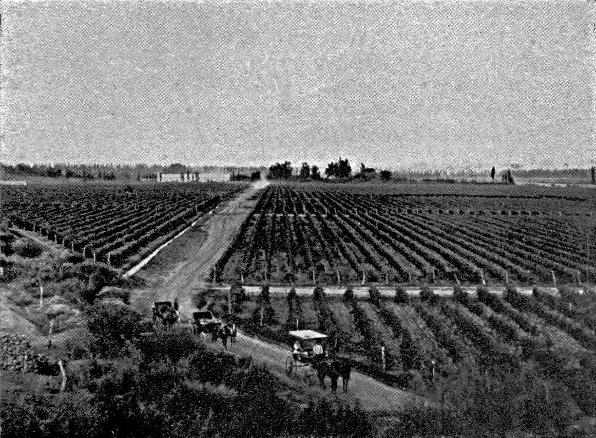
A VINEYARD AT MENDOZA.
French vines on wire. An irrigation-trench
along the path. In the foreground (left) a wine-cellar (bodega).
Photograph by Soc. Fotografica de Aficionados,
Buenos Aires.
Plate VIII.
Click to view larger image.
[Pg 93]
The elimination of foreign wines and sugar and the development of
Mendoza and Tucumán were facilitated by a Protectionist tariff.
The details of this are very curious, as they had to be adjusted to
the natural conditions. The need of protection is chiefly due to
the distance of the market from the productive centres. Mendoza is
650 miles from Buenos Aires, Tucumán more than 750 miles.
Freightage on the railways is dear. It is thirty-five piastres a
ton for wine between Mendoza and Buenos Aires, or nearly double the
normal maritime freight for the European wines sent from Bordeaux or
Genoa. The charge for sugar is about thirty piastres a ton between
Tucumán and Buenos Aires. Thus the cost of transport is nearly
one sixth the entire cost of production. In spite of this common
burden, the need of protection is not at all the same in Mendoza and
Tucumán. The climate of Mendoza is excellent for the vine. The
dryness of the atmosphere keeps down cryptogamic diseases, and the
risks of cultivation are slight. The crop is abundant, the frosts
late, and not serious. Hail is frequent, it is true, at the mouths of
the Cordillera valleys, but it is never general; it affects only a
small part of the harvest. The curve of production is very regular.
It rises every year very gradually, and in proportion to the increase
of the cultivated area. As a result of all this, the wine market has
a stability which the vine-growing countries of Europe, with their
less reliable climate, do not enjoy. The protective tariff, therefore,
remains fixed. The duty on foreign wines in the cask—eight
centimes (gold) per litre—has not been altered since the
introduction into Argentina of the wine-industry on a large scale.42
[Pg 94]
The curve of sugar-production is just as irregular as that of
wine-production is regular. From one year to another the output may
vary by as much as 100 per cent., and the changes cannot be predicted:
147,000 tons in 1912, 335,000 tons in 1914, 150,000 tons in 1915. The
reason is that the sugar output depends upon the season. Canes which
have been touched by frost go sour and ferment in the ground. They
have to be milled quickly, and the harvest must not be prolonged. Even
in good years the costly equipment of the works is active during only
three months (July to September, but at Jujuy, July to October).
This irregularity of production, which makes protection inevitable,
also complicates it infinitely in practice. Sometimes the harvest
is not large enough to meet home demands, and imports have to be
permitted. Sometimes production is far beyond the home demand, and
the sugar-manufacturers have to export the surplus so as to prevent
a slump in prices on the overloaded home market. In order to meet
these very different situations, the protecting tariff has had to be
repeatedly modified and complicated. But it is impossible for us to
give the history of it in detail here. The duties on foreign sugar were
fixed, in successive instalments, between 1883 and 1891; and special
protective measures were taken in the interest of the refiners in 1888.
Over-production appeared for the first time in 1895. Export at a loss,
to relieve the home market, was at first organized by an association
of the producers themselves (in 1896). But in 1897 the Government
developed it by putting a premium on export. The export period lasted
from 1897 to 1904. The law of 1912, which gives its latest form to the
Protectionist regime, gives the Government
[Pg 95]
the right to suspend for a time the duties on imports and allow
foreign sugar to come in. As at Mendoza, the provincial Government
intervenes as well as the national. The alternation of bad and
exceptionally good harvests leads to the appearance of all sorts
of unforeseen laws, modifying the bases of taxation, regulating
production in the works, and restricting the acreage of cultivation.43 Thus Tucumán has lived in an
atmosphere of storm and uncertainty and unceasing discussion, of
discouragement and insecurity; the price of its geographical position
at the extreme limit of the area in which cane can be grown.
[Pg 96]
CHAPTER IV
THE EXPLOITATION OF THE FORESTS
Manual labour on the obrajes—The land of
the bañados and the agricultural cantons of
Corrientes—The timber-yards of the Chaco and the
tannic-acid works of the Paraná—The exploitation
of the maté—The forestry industry and
colonization.
From the Andes of Tucumán and Salta to the banks of the
upper Paraná in the province of Misiones the north of Argentina
is now a vast timber-yard for the exploitation of the forests. It
resounds everywhere with the axe. This exploitation of the forest is
of early origin on the river; in the eighteenth century Buenos Aires
was supplied with wood from the Paraná. In the western Chaco
the difficulty of transport by land retarded the development of the
forestry industry. The only market for the timber of Tucumán was
the Andean region. It was not sent to Mendoza after the beginning of
the nineteenth century, when the willow was acclimatized in the oases
of Cuyo. Below Rosas the wood of the quebracho was at first taken in
waggons from Santiago to Buenos Aires, but this traffic ceased when the
river-route was reopened, and we do not find it resumed until recent
times, when railways were constructed.
The outer fringe of the forest and the scrub where the industry has
had to find labour, is inhabited by a very sparse pastoral population.
There are, however, besides the thinly populated districts of the
farms, certain busy hives which lend animation to the scrub. These
over-populated cantons are districts of cultivation by
[Pg 97]
bañados, or the cultivation of flood-lands. There is constant
intercourse between these ancient centres of creole life and the
timber-yards of the forest. The forestry industry recruits its workers
there, on temporary contracts. The wages paid are brought back to these
centres and spent there. They help to maintain social groups of an
archaic type, which the meagreness of their production would otherwise
doom to extinction.
The bañados are scattered over the range of all the
sierras within the limits reached by the torrents from the mountains
before they are lost. They also stretch along the two rivers that are
considerable enough to cross the scrub, the Salado and the Dulce.
The course of the Bermejo, where the natural conditions are much the
same, lies outside the sphere of primitive creole colonization. The
tilled lands are not continuous on the Salado or the Dulce. There
are no bañados wherever the bed of the river is enclosed
by high banks which prevent flooding. The course of the Salado
threads together, in the manner of a rosary, three main groups of
bañados below 26° S. lat., (Matoque and Boqueron) between
27° and 28° S. lat. (Brea), and between 28° and 29°
S. lat. (Le Bracho and Navicha). But the classic country of the
bañados, where they cover the widest extent and sustain the
most considerable body of population, is the interior delta of the
Rio Dulce below Santiago del Estero, in the departments of Loreto,
Atamisqui, and Salavina.
Santiago is situated almost at the top of it. In its upper part
the Rio Dulce is enclosed between high clay cliffs (department of the
Rio Hondo). Below Santiago the river seems to run to the top of a sort
of flattened alluvial cone, over which it wanders. Instances of the
migration of rivers during the historical period are plentiful in the
north of the Argentine plain. The scrub is scored east of the Salado
with a network of dry beds, the edges of which gradually disappear as
the
[Pg 98]
vegetation extends over them. But there is no other part where
the erratic nature of the waters is so marked, the vagabondage so
considerable, as in this section of the basin of the Rio Dulce. The
small towns of Atamisqui and Salavina, which lived on the waters of the
Dulce, were suddenly ruined in 1825, when the river, in consequence
of a particularly violent flood, turned away to the south and lost
itself in the Salinas Grandes. A canal was dug in 1897 to irrigate the
district of Loreto, on the left bank of the Dulce, but the entrance
was badly protected, and the flood of 1901 swept into it, and, guided
by it, reached the bed it had abandoned a century before, going
south-eastward toward Atamisqui. That town and Salavina recovered their
prosperity, while it was necessary to abandon the farms on the Rio des
Salines, which now has water only during high floods. Actual beds, old
beds that are always ready to serve again, and traces of canals changed
and cut by the stream, form a great network in the midst of the plain;
and the flood rolls to one side or the other according to the road open
to it, and the facility with which the various elements of the network
lend themselves to the passage of the water. Such is the land of the
bañados.
You enter it to-day at Loreto station, where the line from Santiago
to Frias approaches within a few miles of it. This station is erected
in the midst of the arid monte, and owes its existence to the
neighbouring bañados. Turning eastward from the railway, as
soon as one has crossed the broad, sandy bed of the Rio des Salines,
one finds oneself in the heart of the bañados farms. The
road passes between hedges (cercas), over the top of which one sees
the green of the wheat and lucerne. The plots are very small: gardens
rather than fields. In clearing the ground they have preserved the
best-situated trees, and the light foliage gives a useful shade to the
crops. The crown of the algarrobas rises everywhere above the top of
the hedges.
The fields do not cover the whole area of the annual
[Pg 99]
inundations. They are confined to the part where the flood is
fertilizing; where it leaves behind it a fine, useful clay which keeps
the store of moisture for several months. In other places the current
is too rapid. It furrows the soil, leaves large holes in it like the
lônes in the flood-area of the Rhone, and sweeps away the
barriers; or the water brings sterile sand which it deposits in long
stretches; or again, if it is not drained away in time and evaporates
on the spot, it deposits the salts it contains, and the land, looking
as if it had a white leprosy, becomes unfit for vegetation.
The floods begin in summer, during November or December. They are
caused by the rain-storms in the Tucumán district, and are very
irregular. Some of the houses are evacuated, and others are protected
by walls of earth, which are raised from hour to hour according to the
rise of the waters. Behind these walls the people await the abatement
of the flood. When the mud which is left behind has the proper
consistency, they till it and sow wheat. The wheat grows in the winter,
and is harvested in November quickly, so that the fresh flood may not
overtake it.
The caprices of the flood compel them frequently to change the sites
of their houses and fields. The ancient village of Loreto was evacuated
after a flood, and is now merely a mass of deserted ruins. Round the
naked trunks of the algarrobas, killed by excessive deposits of
sand or salt, are uniform colonies of plants of the same age and the
same species, which invade the area where the adult scrub has been
destroyed. The mill has been rebuilt less than a mile away, and has not
lost its customers, who have raised their ranchos some distance away.
The insecurity of the plots has prevented the development of small
ownership. The farmers are tenants of the ranches, which stretch from
the river to a considerable distance in the interior.
The use of bañados for agriculture is of long standing. It
probably goes back to the pre-Columbian period.
[Pg 100]
Father Dobritzhoffer, who is the first to refer clearly to it,
compares the Rio Dulce to the Nile44; and in point of fact, the bañados
have some resemblance to farming in Pharaonic Egypt, while there
is nothing like them in the irrigated zones of the Andean valleys.
The bañados were then devoted to the cultivation of wheat
and pumpkins. The pumpkin, which is of American origin, had not yet
been eliminated by wheat, which was introduced by the Spaniards. The
wheat produced in the bañados maintained a fairly active
export trade at the beginning of the nineteenth century, and the
bañados were at times called, with some exaggeration, the
"granary of the Vice-royalty." It is difficult to trace accurately
the movements of the population of the bañados because of
the constant changes of the administrative areas in the province
of Santiago. The total population of the province is not now more
than three per cent. of the total population of Argentina, but its
comparative importance was much greater in the middle of the nineteenth
century (nearly eight per cent. at the census of 1861). The departments
of Loreto, Atamisqui, and Salavina on the Rio Dulce, which live mainly
on the estates of the bañados, comprised 46,000 inhabitants in
1861, and only 43,000 in 1895. The Woodbine Parish map and Hutchinson's
description clearly give one an impression of a dense population in
the area of the bañados. I refer elsewhere to the antiquity
and constancy of the streams of temporary immigration which spread the
population of the bañados over a large part of the territory
of Argentina.45 The temporary
emigration of the Santiagueños is distributed amongst most of
the provinces of central and northern Argentina, but it is chiefly of
interest in connection with the frontier region. The Santiagueño
is a woodman above all else, and the forest area has the advantage over
the other labour-markets of wanting workers at all seasons, summer
or winter, whereas the sugar-cane harvest at Tucumán and the
harvest in the south only last a few months. They emigrate from the
bañados to Tucumán in May; to Córdoba and Santa
Fé in October, November and December; but to the forests of the
Chaco all the year round.
[Pg 101]
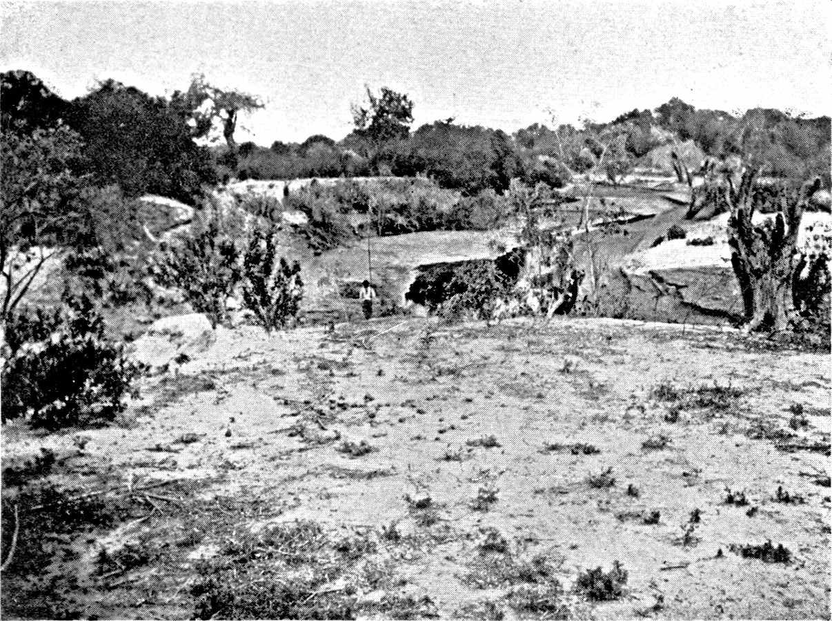
THE LAND OF THE BAÑADOS.
On the Rio Dulce, near Loreto, in the dry season.
Its actual bed, excavated at a recent date by a flood in soft
clay, is not yet stable.
Photograph by the Author.
Click to view larger image.
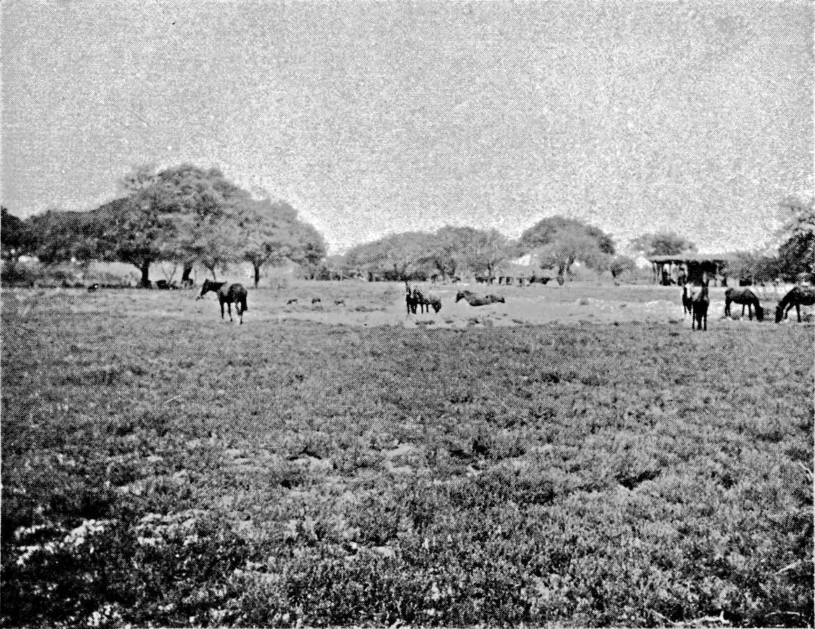
LORETO: FARMING BY INUNDATION.
In the zone of the scrub, where the floods
of the Rio Dulce spread. The interior delta of the Rio Dulce is
one of the earliest centres of population in Argentina.
Photograph by the Author.
Plate IX.
Click to view larger image.
Apart from the bañados of the Dulce and the Salado,
the province of Corrientes contains the main reservoir from which
the timber industry drew its manual workers. Just as at Santiago
del Estero, one finds at Corrientes also the opposition between
agricultural and breeding districts which is so common in the older
colonized regions of South America. The estancieros (ranchers),
who are breeders, are the masters of Corrientes, but the line of low
hills of sand and red clay, punctuated by lagoons, which crosses
the north-western corner of the province, is not subject to their
domination. There the land is subdivided; there are once more fields.
Tobacco was an article of export for this fraction of Corrientes,
especially after the political isolation of Paraguay, the chief
producer of tobacco in the nineteenth century. During the whole of
the first half of the nineteenth century the tobacco-buyers travelled
all over Corrientes after the harvest, in January and February. The
fertile soil, moreover, with a mild climate in which tropical plants
flourish as well as those of the temperate zone, provides the elements
of a local comfort which is complete in itself. Here again agricultural
colonization has created a relatively dense nucleus of population,
capable of great increase. Although the administrative divisions do not
exactly correspond with the natural divisions, the unequal distribution
of the population in Corrientes is made plain by the figures given
in the census of 1895. The density rises in the agricultural areas
to eight inhabitants per square kilometre, in the department of
Bellavista; ten at San Cosma; fourteen at Lomas; thirty at San Roque.
It is only between one and two in the purely pastoral departments
(Concepción and Mercedes).
[Pg 102]
Corrientes also has its forests, and in these we find most of the
species of the forests of the Chaco, in straight lines, along the
water-courses, and in somewhat larger patches on the tablelands which
separate the lower valleys near the Paraná. They at first
supplied the Curupai bark which was used in the Corrientes tanneries.
The yards for the construction of river-boats emigrated from Paraguay
to Corrientes at the beginning of the nineteenth century, at the same
time and for the same reasons as the tobacco trade. The exploiting of
the red quebracho did not begin until about 1850. In 1887 Virasaro
relates that fifty ships are engaged in loading with Nandubai timber
on the banks of the Rio Corrientes and transporting it to Rosario.46 Born on the left bank of the Paraná,
the forestry industry emigrated toward the end of the century to the
right bank, whither the workers of Corrientes followed it.
We find the same movement further north, on the Paraguay. The
exploitation of the woods is in that case a very old industry on
the tributaries of the left bank. D'Azara draws attention to its
importance.47 Robertson found, when
he went from Corrientes to Asunción in 1814, a population of
wood-cutters in the marshy belt near the river. During floods they took
refuge in the agricultural cantons of the frontier on high ground,
where they were well received. It seems, then, that wood-cutting
was already a seasonal industry at this time. The exploitation of
the forests is now rapidly invading the right bank, which was long
abandoned to the wild Indians.
The Santiagueños and Correntinos do not mix. The two zones
of expansion and of forestry, of which they are the pioneers, are
independent of each other. The
[Pg 103]
quechua, which is the language of the
bañados of the Rio Dulce, is
spoken in the timber-yards of the Chaco de Santiago; the
guarani, the language of Corrientes and the
Paraguay, is most common along the river, in the Chaco de
SantaSanta Fé. Their respective spheres
will not come into touch with each other until the Quimili branch of
the Central Norte Railway, which comes from the Santiago province,
joins the line of penetration at Resistencia, on the Paraná, in
the west.
The forestry industry of the interior and that of the
river-districts differ not only in the character of the workers, but
in their organization and their market. The variety of red
quebracho which is exploited in the west is not quite
the same as the variety that is found in the east. Each has a name
of its own—quebracho santiagueño
and quebraco quebracho
chaqueño. The former contains ten per cent. of tannin,
the latter thirty per cent. The former is cut down for timber, the
latter in order to extract the tannic acid. The one is sold in
Argentina, and the other sent abroad.
The working of the timber at Santiago has remained in the hands
of a number of small capitalists and contractors who do not own the
land and do not work there. They are content to buy in small amounts
and according to the demand at the moment, the right to exploit the
forests (derecho de monte or derecho de leña). The trunks of
exceptionally large quebracho provide logs that are sold by cubic
measurement, but the district of the quebracho santiagueño
mainly exports sleepers. Quebracho sleepers have been used in
constructing the railways, both narrow and broad gauge, during the last
twenty years on the Pampa. Tall and thin trees make telegraph posts;
the smaller branches make stakes for wire fences. In parts of the
bush where there is no red quebracho, the retamo is used, to make
posts for enclosures, and also the white quebracho, which is sold in
round logs. Finally, the forests provide wood for fuel. The works at
Tucumán, and the locomotives over
[Pg 104]
a good part of the land, use wood-fuel. The wood of the red quebracho, if left for some years in the yards where
the sleepers are made and is rid of the sap-wood, which rots and falls
out—the leña campana—is
excellent fuel. Charcoal is cheaper to transport than the wood, and
can therefore be sent farther over the whole prairie district. It is
made in the monte, along all the railways, and
especially in the thinner forests on the edge of the prairie.
The forestry of the interior is unstable as well as scattered and
primitive. The equipment—saws that are easily taken down and set
up—is not costly, and does not require much capital. When one
canton of the forest has been exhausted, the saws are taken down and
removed. The cuttings are not made in such a way as to allow the forest
to recover, and so permit a continuous exploitation. Everything of any
value is taken. The quebracho is, moreover,
a tree of slow growth. The forestry industry has at times returned,
after an interval, to land that had been stripped, but that is not
because they had planted a new generation of trees. It is because it
became profitable, as the state of the market and the cost of transport
changed, to cut down the small trees which had not been considered good
enough on the earlier occasion.
When the master obrajero removes,
he is followed by the greater part of the workers. But to
induce them to emigrate, or to recruit cutters in the bañados who will agree to work in remote or
new districts, he has to be liberal and offer higher wages. Hence the
conditions of work and the rate of wage are not the same in every part
of the forest. The oldest area of working, which is crossed by the
Central Córdoba, between the provinces of Catamarca and Santiago
del Estero, has a surplus of good workers. On the other hand, the obrajeros of the valley from San Francisco to Jujuy,
where the exploitation is more recent, have only a moderate amount of
labour at their command. The returns
[Pg 105]
are not higher there than in the south, though the forests are
incomparably denser and richer. It has been very expensive to bring
about a continuous stream of immigration toward the main region of
forest work, which is now called the Chaco, along the railway that
starts from Añatuya and goes about 130 miles further north.
As the worker is on piece-work, the price per sleeper when the work
was begun on the Chaco had to be double, on the Añatuya line,
what was paid in the older line from Santiago to Frias, close to the
bañados.
The work is profitable only within a short distance from the
railways. Waggon transport raises the price rapidly. Moreover,
the forestry industry is just as dependent on the railways for
provisions as it is for the carriage of its wood. The obraje has no source of food-supply on the spot. The
marshy estates which begin to spread in the area of irrigation-canals
at Banda, eastward of Santiago del Estero, supply only their customers
at Añatuya and the Chaco line. Sometimes the railway has to
bring water as well as food. Over a great part of the Chaco de Santiago
there is no running water, and the underground sheets are little known,
or inaccessible, or salty. The obraje is a land
of thirst. In order to meet the demand for water they dig reservoirs
like the represas on the ranches, which are
filled by the rains. But as soon as the dry season sets in they become
stagnant green pools, and the men have to rely on waggon-cisterns.
While the Chaco de Santiago is now a democracy of mall
small obrajeros and contractors, the
eastern Chaco, alongsalong the Paraná, has
quite a different type of society. It is entirely in the hands of the
big tannic-acid factories, where the quebracho
trunks are stripped and boiled, and their sap is concentrated in a
viscous resin. The lofty chimneys of these works rise above the forest
at intervals. Here the work assumes a capitalistic and industrial
character which it has not in other places. It is controlled
[Pg 106]
by powerful concerns, highly organized, which conduct it on
a pre-arranged plan. It is true that the works do not deal
with the entire output of quebracho,48 but they almost control the market, even
as regards the unworked wood which is exported, and they reserve a
good deal of it for their branches in Europe. In order to secure the
heavy loans which the works represent, the companies that have built
them have been obliged to take over large forests, and they have come
to own these. The concentration of the area in their hands goes on
daily, and the number of companies is reduced by amalgamation or by the
purchase of rival concerns and their estates. On the territory of the
Chaco, where the administration of public lands was in the hands of the
Federal Government, some precautions were taken to prevent the monopoly
of the country; but the forests of the province of Santa Fé
belong entirely to two firms.
The eastern Chaco has received from Europe, not only the capital
that was needed for the construction of works, but also a number of
workers, either for administration or for technical direction. These
have proved more exacting than the creoles of the Santiago saw-mills.
Beside most of the works there are now comfortable villas and brick
towns for the workers. The expense was quite prudently incurred, as
the industry is less erratic in this region. A tannic-acid factory
cannot be removed like a saw-mill. When the timber-supply is exhausted
in the district, the works gets its material from a distance, as long
as the freightage permits. It depends on the railway, not only for the
carriage of its products, as the saw-mills do, but for the supply of
raw material.
[Pg 107]
The works are not all equally wealthy. They are scattered over about
ten degrees of latitude, north of 30° S. lat., within reach of the
river, which keeps them in communication with the world, and at the
same time has enabled them to tackle the full breadth of the forest.
The quebracho is particularly abundant north of Santa Fé and
south of the Argentine part of the Chaco, where it is the life and soul
of the forest. The works which have been set up there, in the midst
of the denser forests, have plenty of capital, and this enables them
to nurse their supplies and buy timber at a distance. The forest is
still almost virginal at their gates, so that they have a long future
in front of them. On the other hand, the oldest works, on the southern
fringe of the forest, and that of Corrientes, on the left bank of the
Paraná, are already paralysed for want of timber.
The works are all at a short distance from the river; not only for
convenience of exporting their products, but because this is the only
part of the Chaco where one can find fresh water. And the tannic-acid
factory needs a great deal of fresh water. Along the river, in a belt
about thirty to sixty miles wide, we find a permanent hydrographic
network such as is found nowhere else on the plain. It consists of long
series of marshes covered with rushes (cañadas), and in places
they become at their mouths regular streams with well defined beds. The
underground water also is generally fresh and plentiful, whether it is
due to the abundant rain or to infiltration from the Paraná,
and many of the works have successfully bored for it. In these parts
one suffers from too much water as frequently as from thirst. On
these immense and almost horizontal surfaces the water spreads from
the cañadas over the whole forest. The railway, and even the
houses, then stand out of a sheet of stagnant water, which takes months
to disappear. Trunks which are badly placed, lying in the stations to
be removed—sometimes, according to the market, lying there for
years—are half buried in the mud. The waggons find it hard to
move in the roads. Mules,
[Pg 108]
which pay very well in the dry forests of the west, could not make
the effort that is required here, and they use oxen—the finest
beasts for a muddy country. The long-horned, lean creole cattle drag
the waggons with difficulty, and a correntino, with long slender
legs, shod with mud, guides and urges them, looking like a crane with
his slow and cautious steps. The work of these drivers is much harder
than that of the wood-cutters. They earn nearly twice as much, and it
is the difficulty of getting enough men for this work that keeps down
production.
The importance and stability of the large works has fixed the labour
market on the right bank of the Paraná, and there is no need
to go to Corrientes to look for men. They come of their own accord. A
daily service of small steamers brings them to all the ports which
dispatch quebracho. The left bank, on Argentine territory, has also
no hiring centre, such as there still are at Asunción and
Concepción in Paraguay.
Even on its own land the works leaves the working of the forest
to contractors, from whom it buys the timber. But the obrajeros,
whether they work in the company's forests or their own, are very
dependent upon the works. The contracts vary according as they are
owners or otherwise; according to whether they undertake to deliver the
timber at the stations or leave it where it is felled; and according
to whether they have the requisite oxen and waggons or have to loan
these from the company. They draw advances from the company, and, on
the other hand, they pledge themselves to purchase what they require
for their workers at the company's stores. The profit of these sales
increases the revenue of the works. The company monopolizes all trade,
both import and export. It exercises an absolute sovereignty over the
forest. It has merely deigned to grant the railway company space enough
to construct its lines and its stations.
The last forestry centre in modern Argentina is in
[Pg 109]
the province of Misiones on the upper Paraná. Posadas is
its chief station, and protects its southern outlet. Its influence
extends beyond the Argentine frontier, over a small part of Brazil
and Paraguay. In Misiones there are two types of forest, which differ
a good deal from each other, while neither resembles the quebracho
forest. One is the forest of araucarias (pinos) which covers the
elevated tablelands at a height above 2,000 feet. The other is the
tropical forest, rich in essences and of perennial vegetation, which
fills the bottoms and slopes of the valleys. The pine, which is
also much worked on the Brazilian tableland, yields an excellent
white wood, suitable instead of the northern pine. It would find
a ready market at Buenos Aires, but it has never been worked on
Argentine territory because of the great distance of the woods from
a navigable river. On account of its position on the tableland
the araucaria has to wait for the railways of some future date.49 As to the leafy tropical forest it includes
a number of useful varieties (timbo, lapacho, etc.), but the
most esteemed of all is the cedar. Its wood is rose-coloured, scented,
and fine-grained, and very suitable for furniture. At the time of
D'Orbigny's travels the inhabitants of Corrientes were looking out for
cedars from the mountains brought down the river when in flood. The
obrajes of cedar-wood now extend twenty miles or so on the Argentine
bank, and forty miles in the Paraguay bank, which is more even and
better for transport. The trunks are floated in rafts down to Posadas;
as the cedar, which is less dense than the quebracho, not only
floats, but is improved by parting with sap in the water. At Posadas
the rafts are taken to pieces, and the trunks are delivered to the
saw-mills.
But timber is not the chief forest industry in Misiones,
as it is on the Chaco. Beside the obraje in the forest
there is the yerbal, a works for dealing with the maté
[Pg 110]
(Ilex paraguayensis). It is well known that an infusion of
maté (a kind of tea) is an important element in the food
of the western States of South America. Gathering the leaves of the
maté has been a profitable occupation for centuries: a unique
instance, perhaps, in the forest industries of South America. It has
never been interrupted, though it has often changed its locality.
The plantations made by the Jesuits were abandoned when the
missionaries were dispersed. After the close of the eighteenth century
Paraguay became the chief area of production. Villa Rica seems
to have been the most prolific centre of the yerba. After that
date, however, the Jujuy basin, further north, was exploited, and
the yerbateros, who came from Curuguati, advanced eastward as far
as the Falls of the Guayra on the Paraná. In the nineteenth
century the trade in Paraguay maté seems to have suffered
less than the tobacco trade from the policy of isolation adopted
by the Dictators of Paraguay. The descriptions given by Mariano
Molas, Demersay, and others, show that the business continued fairly
actively. It even extended northward, and reached as far as the Rio
Apa. Villa Concepción became a rival yerba market to Villa
Rica. The monopoly exercised by the Paraguay Government, however, and
the restrictions put upon the navigation of the river, led to the
development of the yerba industry in the eastern Misiones on the left
bank of the Uruguay. Itaquy served as port of embarkation. In the last
third of the nineteenth century the yards moved from the left to the
right bank of the Uruguay. Since 1870 the Paraná has supplanted
the Uruguay, and the yerba trade has concentrated at Candelaria. This
meant the resurrection of Misiones. In 1880 San Javier, on the Uruguay,
worked up 800 tons of yerba, and Candelaria more than 1,000 tons. The
yerbales round San Javier began to run out, and the yerbateros had
to go further and further up the Uruguay, toward the yerbales of the
tableland of Fracan and San Pedro. Candelaria
[Pg 111]
was mainly fed by the yerbales of the right bank of the
Paraná, on Paraguayan territory. Posadas has now succeeded
Candelaria, and the yerbales that depend upon it are scattered over
both banks up the Paraná.
The yerbales of Misiones lie outside the tropical forest proper.
They are on the lower fringe of the pine-forest, and begin at some
distance from the river, with which they are connected by muddy and
difficult mule-tracks. Maté can bear a cost of transport that
would be fatal to timber. At the point where these tracks reach the
river, the river-steamers stop at the foot of a shed that is almost
hidden in the foliage. These are the "ladders" of the yerbales.
Work in the yerbales lasts six months out of the twelve. The
pruners who collect the bunches of leaves and bring them to the
furnaces, where they are dried, include Brazilians, Paraguayans
and Argentinians. The Brazilians go to the yerbal to offer their
services. The Paraguayans and Argentinians, nearly all from the
province of Corrientes, are recruited at Posadas and the sister-town of
Encarnación, which is opposite to it on the Paraguay bank.
The hiring at Posadas is done according to a traditional custom that
does not seem to have changed for more than a century. The description
given by D'Azara is not yet out of date. "The people of Villa Rica,"
he says, "depend mainly on being hired for the yerbales. The yerba
industry is sometimes profitable to the masters, but never to the
natives, who work cruelly without any profit. Not only are they paid in
goods for the yerba they gather, but the goods are put at so high a
price that it is terrible. They have even to pay for the hire of a bill
for cutting the maté.... The natives contract as much debt as
they can before they start for the yerbales, and as soon as they have
done a little work, they say good-bye to the yerbatero, who loses his
money. And the yerbatero in turn is exploited by the merchants who
control him." Before he starts for the yerbal, says
[Pg 112]
Robertson, the contractor (habilitado) gets an advance of four
or five thousand piastres. With this he hires about fifty workers,
supplies their needs, and gives them two or three months' pay
in advance. The three essential and inseparable elements of the
maté business are the yerbal in the forest, a shop at
Posadas for hiring and paying wages in advance, and a yerba mill at
Rosario or Buenos Aires.
The forestry industry in its various forms is not a definite
occupation of the soil by man. After having stripped the forest, it
leaves, and the land is open for colonization. Nearly everywhere there
is a complete separation between forestry and permanent colonization.
They do not employ the same workers; the wood-cutter (hachador) and
the charcoal-burner are not the men who clear the soil. The clearing
away of the stumps, which must precede agricultural work, is not their
business, but the work of diggers. At Tucumán, where most of
the workers in the cane-fields are Santiagueños, Italians and
Spaniards are used for clearing the soil. The gangs of Mendocinos who
go to cut props crops in the bush round Villa Mercedes will not sign on for
clearing the ground in order to plant lucerne.

LORETO. THE RIO PINTO IN THE DRY SEASON.
One of the arms through which the flood of the Dulce flows.
Photograph by the Author.
Click to view larger image.
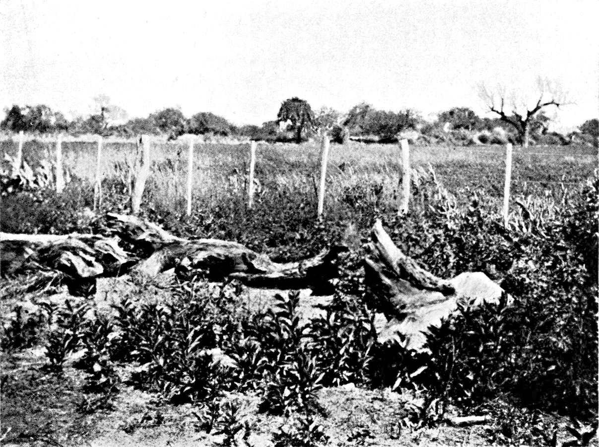
LA BANDA (SANTIAGO DEL ESTERO).
Irrigated lucerne fields on the left bank of
the Rio Dulce. Zone of modern colonization: a contrast with the
older farms of the flood-zone.
Photograph by the Author.
Plate X.
Click to view larger image.
[Pg 113]
The history of forestry and colonization is one of the most
diversified chapters in the general economic history of modern
Argentina. Round the region of the Pampas, the first point where
agricultural colonization came into touch with the forest belt is the
district of the older colonies of Santa Fé. There it found the
forestry industry already long established, on the banks both of the
Salado and of the Paraná. The export of timber and charcoal
to Buenos Aires and the lime-kilns of Entre Rios was at this time
one of the few elements of economic life which Santa Fé had
preserved. The colonists did not enter the forest, and did not mingle
with the charcoal-burners, but they profited indirectly from their
presence by selling them maize. Later, agricultural work spread over
the Central Pampa and the province of Córdoba, as far as the
edge of the scrub in all parts of the prairie. Wood-cutting is carried
on there, on a small scale, everywhere, at Toay as well as at Villa
Mercedes and Villa Maria. The price of the wood he sells is a small
supplementary income to the farmer, and clearing the soil helps to
fill up his time during the dead season for agriculture. The lands
covered with brushwood remained for a long time at a lower price than
cleared land. They thus formed a sort of reserve which partly escaped
the speculations in land, and on which small owners can find a footing
more easily than on the Pampa. There is to-day a movement of Santa
Fecinos eastward and southward in the belt of scrub to the south of Mar
Chiquita along the line from Lehmann to Dean Funes.
The forest area of the Chaco, in northern Argentina, between the
Andes and the Paraná, seems on the other hand to be intended
for pastoral colonization. In point of fact, the forest of the Chaco,
as well as the lighter scrub which is its southern extension, can be
used for breeding without preliminary labour. The Indians have fed
cattle and horses on it since the seventeenth century. The herds find
food on every side, both in the very numerous clearings (abras) which
cross the forest and in the forest itself, where the underwood and the
herbaceous carpet grow fairly thick beneath the scanty foliage of the
mimosas and quebrachasquebrachos.
Over a good deal of the western Chaco pastoral colonization is
earlier than the forestry. In the district of Santiago del Estero the
farmers had advanced far beyond the wood-cutter and the railway; beyond
the Salado, almost as far as the existing line from Añatuya
to Tintina, where there are sheets and wells of fresh water. The old
ranches go as far as Alhuampa. The old pastoral population has taken
very little part in the forestry industry. It has been content to
profit by it by renting the scrub to the obrajes. It was a sheer gift
[Pg 114]
to them, as the felling of a few trees does not in the least lower the
value of the pasture. The forestry has not entailed any change in the
ownership of the land or in the breeding methods. The obrajes are
merely passing guests whose traces are quickly obliterated.
In the eastern Chaco, however, the wood-cutters are real pioneers.
It is they who have made the conquest of the forest, often in direct
touch with the Indians, and the ownership of the land fell to them.
They have themselves played an essential part in the actual development
of breeding.
Leaving the river and travelling toward the forest on the west, one
first crosses a narrow belt of estates which form an almost unbroken
line from San Javier to Resistencia. These are old colonies, mostly
founded about 1870, at the same time as the first colonies in the
centre of Santa Fé. They had the advantage of being within
reach of the river-route, the network of railways that serves the
colonies of Sante Santa Fé not being constructed until after 1880.
They have not shown the same capacity for extension as the colonies
on the prairie, but they are firmly rooted, on high and well-drained
land, very different from the clays of the Chaco, where the alluvial
beds of the Paraná alternate with stuff that seems to come
from the left bank. They grow flax, earth-nuts, sugar cane, and
cotton. Behind this slight agricultural façade are the large
estates of the factories. In the division of the land the industrial
firms sought the districts which were richest in quebracho. Buyers
of land who had no industrial plans—foreign capitalists
and Porteños—and who obtained large concessions in
little-known regions, sold back to the factories the plots where there
was plenty of wood, after they had taken stock of their property. They
converted the remainder into estancias (ranches). The district to
the north of the Central Norte Railway, from San Cristobal to Tostado,
where the forest, which will presently yield to the plain, breaks
into patches and looks like a park, includes a number of these modern
estancias, in which lucerne is beginning to replace the grasses of
the natural vegetation.

QUEBRACHO TRUNKS LYING AT THE STATIONS.
Eastern Chaco, on the Resistencia line (Santa
Fé province). Here the quebracho is exploited for tannic
acid, not sleepers.
Photographs by the Author.
Plate XI.
Click to view larger image.
[Pg 115]
When one passes to the interior, the pastoral industry at once
assumes a more primitive character. The quebracho concerns themselves
go in for breeding, in order to make use of their large estates,
when the timber has been removed but the works have not yet been set
up. They need a large number of cattle, both for moving the timber
and feeding their workers, and they endeavour to meet their needs
themselves. In this district the forest is capable of feeding a far
heavier herd than is the more arid scrub of the eastern Chaco. There
are often a thousand head of cattle to 2,500 hectares. To the north
and west of that part of the forest where the big companies have taken
over the whole of the land, in the province of Chaco, a fairly large
number of estates has been created. Further still, on either side of
the Bermejo, cattle from Corrientes and the Paraguay have been put on
the public lands by men with no rights. As their future is uncertain,
they cannot do any expensive work, such as making wells, reservoirs,
and enclosures. Sometimes they are compelled by drought to fall back
upon the river.
Conditions are quite different in the forests of Misiones. The
damp forest of Misiones does not lend itself to breeding. While the
forest-workers on the west of the Paraná eat fresh meat, thanks
to the proximity of the breeders, in the yerbales and obrajes of
Misiones, the use of dried or "jerked" meat (carne seca), which
is brought some distance, has remained the common practice, as
it is in most parts of tropical America. On the other hand, there
is now developing in Misiones an agricultural colonization of an
original kind, quite distinct from the ordinary Argentinian type.
This is because Misiones is a province apart in Argentina. It really
belongs, by its geological structure and its climate, to the Brazilian
tableland. The colonies in Misiones are merely an
[Pg 116]
extension into Argentine territory of the great belt of colonies of
southern Brazil, which stretches from the neighbourhood of Santa
Catalina and the Rio Grande do Sul to the River Paraguay. The Brazilian
type of colonization is based upon work with the hoe, in clearings that
have been made in the forest by the axe and by fire. Ordinary farming
would be impracticable between the large stumps which the clearers have
to leave in the ground, to rot there slowly. It would, moreover, be
useless, as the land, though rich in humus, is light and aërated.
The red soil, a decomposition-product of the diabases which are at the
root of all agricultural wealth in southern Brazil, covers a great part
of Misiones. The economic inferiority of this agricultural colonization
in the forest to the Pampean type which has conquered the grassy plains
of the Rio de la Plata, is twofold. On the one hand, the surface that a
man can develop is very small. The plots of the Brazilian colonies are
ten times smaller than the average estate on the Pampa. On the other
hand, it is difficult to get about in the forest, and this hinders the
export of the produce.
The colonies in Misiones are still confined to the edge of the
great forest, into which they will advance as the agricultural
population grows. They form two groups: one on the river above
Posadas (Candelaria, Bonpland, Corpus, San Ignacio, and Santa Ana),
the other on the slopes of the hills, above the line from Posadas to
Uruguay (San José and Apostoles). Foodstuffs, tobacco, fowl
and eggs, which they now send by rail as far as Buenos Aires, are
their chief resources. As it is possible for them to reach the big
markets of the Pampas, by river or rail, they have a certain advantage
over the Brazilian colonies. On the other hand, the various elements
of their population are inferior. They are very mixed, comprising
aboriginals—relics of the ancient Indian or half-breed population
of Misiones who have got land but are in no hurry to cultivate
it—Poles (grouped in a few villages, such as Apostoles and San
José), and German-Brazilians
[Pg 117]
from the left bank of the Uruguay. At the present time there is a
constant stream of German-Brazilians through the province of Misiones,
to embark at Posadas, sail up the Paraná, and settle, further
north, in Matto Grosso. No doubt it would be possible to induce part
of them to settle on Argentinian territory by offering them suitable
land.
These peasant clearers of the land rarely find means to sell their
timber. The tropical forest has an immense variety of species, but only
a few of these are of value. The obrajero does not cut down the whole
forest; he chooses his victims. In the waste land of the colonist it is
by no means possible to utilize everything. Even in the area where the
forestry industry flourishes, trunks with no faults, felled in order to
make room for farming, are pitilessly burned and destroyed.
Yet the indirect advantages of the forestry to agriculture are
numerous. Just as in the whole of southern Brazil, it affords a good
market for agricultural produce. The crops from the colonies are stored
in the shops at Posadas, and from there they go to the obrajes and
yerbales. In addition, the industry finds work for more men. On the
Rio Grande do Sul, and later on the Paraná, the wages paid
for collecting maté have long been the surest resource of
the colonies, and it is this that enabled them to subsist during the
difficulties of their early period. In Misiones the attraction of
the yerbales is not so strongly felt by the inhabitants. There are
comparatively few colonists who are willing to leave their plots and
hire themselves for distant work. The yerbales find their recruits,
not amongst the immigrants from Europe, but amongst the ancient
pobladores; that is to say, men who hold land without a title, whose
position was recognized when the colony was formed—a floating
population, not deeply rooted in the soil.
Agricultural colonization in turn will react upon the forestry
industry in developing the cultivation of maté. Large
plantations of ilex have already been established
[Pg 118]
above Posadas. Already they enter the common life. They are scattered
either over the estates of the national colonies or over the larger
estates of the richer colonists; for planting demands a considerable
expenditure. Some of them belong to dealers who also work natural
yerbales elsewhere. They are, if possible, set up in the forest,
or at least on the fringe of it, in order to have a good supply of
wood to dry the leaves. Thus the primitive industry of collecting
maté is undergoing transformation while the natural growths
are disappearing.
[Pg 119]
CHAPTER V
PATAGONIA AND SHEEP-REARING
The arid tableland and the region of glacial
lakes—The first settlements on the Patagonian
coast and the indigenous population—Extensive
breeding—The use of pasture on the lands of the Rio
Negro—Transhumation.
The northern limit of the Patagonian region passes to the north
of the Colorado, in the latitude of the Cerro Payen and of the ridge
which leads from Malarüe to the Rio Grande in the sub-Andean zone
(36° S. lat)., and to the Sierra de Lihuel Calel in the southern
part of the Pampa province. South of this line, from the Andes to the
Atlantic, on the territory of the Neuquen, the Rio Negro, the Chubut,
and the Santa Cruz, is the region of the sheep farms, their refuge
since more profitable branches of farming have driven the sheep from
the Pampa. The extensive breeding practised on these poor lands is
not profitable enough to justify much expenditure, and is therefore
all the more controlled by the physical conditions. It is true that
cattle-breeding was once undertaken in the Spanish settlements of
the lower Negro, and still exists in western Patagonia at the foot
of the Andes, but one never finds there the particular combination
of cattle-breeding and sheep-breeding which is characteristic of the
Pampean region, in which the main function of the cattle is to improve
the pasture and make it ready for sheep.
The climate is trying. The west winds are violent during the greater
part of the year, especially on the
[Pg 120]
coast, and merely relax a little in the winter. The mean temperature on
the Atlantic coast falls nearly one degree for each degree of latitude
(14.6° at San Antonio, below 41° S. lat.; 8.5° at Santa
Cruz, below 50° S. lat.; and 5.3° at Ushuaia, below 55°
S. lat.). The summer temperature falls even more steeply, but the
difference is less notable in winter (21.4° at San Antonio, 14°
at Santa Cruz, and 9.2° at Ushuaia). The low summer temperature
does not allow cereals to ripen south of the Chubut. In the sub-Andean
valleys the summer is comparatively warm (16° in January at Diez y
seis de Octubre at a height of 1,800 feet), but there is severe frost,
especially at the beginning of the winter, and no month of the year is
quite free from it.
Rain is plentiful in the Cordillera, and on its western border: 800
millimetres at Junin, nearly two metres at San Martin (which the wet
westerly winds reach by the gap of Lake Lacar), and nearly a metre at
Bariloche, on Lake Nahuel Huapi. It diminishes rapidly, however, as
soon as one leaves the mountainous region and goes further east over
the tableland. The whole tableland has a rainfall of less than 200
millimetres (Las Lajas 180, Limay 150, San Antonio 180, Santa Cruz
135). It is only south of the Rio de Santa Cruz that the rainfall rises
once more (Gallegos 400 millimetres, Ushuaia 500 millimetres). Hence
Patagonia as a whole is, with the exception of a narrow belt at the
foot of the Andes, a semi-arid region with a sub-desert climate. In the
Patagonian Andes the rain falls, as on the coast of Chile, mainly in
winter. Between Mendoza, which has the summer-rain feature of central
and tropical Argentina, and Chosmalal, in the Neuquen Andes, the
contrast is absolute. The summer months there (January and February)
are dry, and the rain is confined to the winter months, from May to
August. It is the same further south, at Bariloche and at Diez y seis
de Octubre. On the
[Pg 121]
Atlantic coast the winter-rain feature is less regular and uniform.
At San Antonio the heaviest rains fall in autumn (April and May).
There is a secondary maximum in August, and a few more showers
in the spring (September and October). South of San Antonio the
winter maximum, which is always marked, is cut by a short dry period
(July and August at Camerones, June at Deseado and Santa Cruz).50 In the interior, on the other hand, the
winter-rain system remains unchanged. The predominance of the
precipitations of the cold season is of great importance to the
breeders. As a rule, they come down in the form of snow, which melts
slowly, and the small quantity of moisture is at least all absorbed in
the soil. South of the Santa Cruz the humidity increases, but the rainy
season alters. At Gallegos the wettest month is December; at Ushuaia,
the rains last from September to March. The snow-season (May-August)
is the dry season, and the snowfalls are not heavy enough to interfere
with breeding.
[Pg 122]
The surface of the Patagonian tableland is very uneven, though it
bears traces of having been much worn by the agencies of its desert
climate, which seems to have lasted through the whole Tertiary Era.
Going up the Rio Negro, one sees the grey sandstones and Tertiary
tufas which form the cliffs, on both sides of the lower valley. They
give place higher up to the variegated marls and red sandstones of
the Cretaceous which form the tableland at the foot of the first
Andean chains. The core of ancient granites and porphyries crops up at
places from under the mantle of Cretaceous and Tertiary sandstones.
The horizon of the peneplain passes from the Tertiary and Cretaceous
tableland to level masses of crystalline rock, the contour of which
has been almost entirely effaced. Volcanic eruptions have occurred
until quite recent times, and so eruptive areas are the salient
features of the tableland, at Añecon and at Somuncurra, south
of the district of the Rio Negro, in the ridge on the left bank of the
middle Senguerr, in the Chubut province. The basalts have spread out
in sheets, the surface of which seems to have cooled not long ago.
Basalt flows are found as far as northern Patagonia, south of Valcheta
and Maquinchao; but their chief seat is in eastern Patagonia. They
cover the inhospitable tablelands to the east of Lakes Buenos Aires and
Pueyrredon. The Rio Chico and the Santa Cruz cross them for the upper
two-thirds of their course, South of Coile and Gallegos they spread
almost to the coast, and the Tertiary Pampas in this part are dominated
by an archipelago of small volcanic cones.
The tableland is crossed from west to east by deep and broad
valleys, enclosed between high cliffs, often strangled by ridges of
basaltic or crystalline rock, and very little ramified. The ravines
(cañadones), which make breaches in their cliffs on both
sides, go only a little way into the sandstone Pampa or the lava
tableland. Only a certain number of these valleys are occupied by
important rivers (the Rio Negro and the Santa Cruz, for instance) which
are born in the Andes, but receive little addition from the light
rains of eastern Patagonia. Most of the valleys have only intermittent
streams (Sheuen, Coile) or are altogether dry and sown with salt lakes
(Deseado). The west wind is now the ruler of this network of fossil
valleys. It carves their slopes, and brings into them sand, with which
it makes dunes.
We must not confuse with these dead valleys the long depressions,
with no outlet, which are scattered over the granite and sandstone
tableland (bajos, valles,
cuencas). Some have obstinately, but wrongly,
sought in these the traces of rivers that have disappeared;
[Pg 123]
and the bajos of Gualicho and Valcheta have wrongly been regarded as
the former bed of the Rio Negro and the Limay. Erosion by wind seems to
have had something to do with these depressions. Their persistence, at
all events, is one of the effects of the aridity which prevents normal
erosion from moulding the surface of the tableland. The chief of them
are centres for collecting running water. There is a group of valleys
all round them, and alluvial beds accumulate in them.
The climate determines the character of the soil in Patagonia.
The rounded pebbles of granite and eruptive rock, so often described
since the time of Darwin, sometimes free and sometimes embedded in red
sand or limestone,51 are spread over
the tableland like aureoles round the masses of rock, and they are
particularly abundant in the coast region. On the Rio Negro they
seem to be confined to the vicinity of the valley; they disappear as
one goes away from it. The progressive reduction in the volume of
the Rio Negro gravels, as one goes downward, has been observed to
begin in the Andean zone, and it is from the Andes that they come.
South of Santa Cruz, in a moister climate, in which the circulation
of the water is less localized, the bed is more continuous, and it
covers the Tertiary sandstones and clays. It is of fluvio-glacial
origin, and comes from the destruction of the old moraines, before the
excavation of the actual valleys. But it is the wind that explains the
concentration of the gravel at the surface. It separates the pebbles
from the more mobile material about them. Wherever the outcrop-strata
contain pebbles, the wind eventually converts the place into a field of
shingle. It has done this with the terraces of the Limay. The Tertiary
marine deposits of the coast region also are rich in pebbles torn from
the rocky promontories of the shore; hence the extent of stony soils in
the coast region. The wind similarly strips naked the angular stones,
of local origin and incompletely worn, round the isolated rocks of the
desert tableland or on the flanks of the secondary ravines.
[Pg 124]
On the other hand, the bedding action of the wind creates deposits
consisting of small and uniform elements from the sands of the dunes to
the finest dust. The lightest particles, caught up repeatedly by the
squalls and carried to a great height in the atmosphere, go beyond the
Patagonian region and reach the bottom of the Atlantic or the plain
of the Pampa. Some of this, however, is deposited in the depressions
of the tableland, where the moisture fixes it and prevents the wind
from regaining it. These æolian deposits in the depressions,
a dark-grey clay, which hardens when it is dry, but is softened by
water, form two entirely different kinds of soil. If the depression
is closed in, or if the circulation of the water is too slight, there
is a concentration of the mineral salts; this is the salitral,
either naked or sustaining a halophytic vegetation, which the saline
efflorescences cover with a white coat during the dry season. If
on the other hand, the underground waters have a free course, the
æolian clay forms the mallin. Bushes and fine grasses grow on
it, and, as they decay, gradually give it a darker shade and modify its
composition. The soil above the mallin is rich in organic elements.
It covers the bottom of the valleys between low terraces, covered with
faceted pebbles, and dominated by the vertical cliffs of tufa and
lava. The contrast between the verdure of the mallin and the arid,
dusty, yellow steppe of the tableland is one of the most characteristic
features of Patagonian scenery. The area in which mallin has been
formed coincides with the most humid districts
[Pg 125]
in the vicinity of the Andes and round the higher hills. On the
road that runs along the right bank of the Limay, at some distance
from the river, on the surface of the tableland, the limit between
the country of the salitrales and that of the mallinas passes
between Tricaco and Chasico, a hundred miles south-east of Neuquen;
it almost tallies with the curve of a 200 millimetres rainfall.52 Though the word mallin is not used at Santa
Cruz, similar æolian soils are found in the western part of the
tableland up to this latitude. Further south glacial deposits, clays
with moraine-blocks, fill the valleys, and from Gallegos onward, cover
the greater part of the tableland.
On the eruptive flows of recent date the rock is naked. The
wind carries away the products of its decomposition, and the dust
accumulates only in the fissures. Traffic is difficult, sometimes
impossible.
[Pg 126]
Toward the west the tableland is separated from the Cordillera by
a longitudinal depression, though the continuity of this has been
exaggerated. This depression, which outlines the contact between
the folded zone of the Andes and the flat zone of the tableland, is
very important from the point of view of colonization. Just at the
frontier of the steppe and the forest, it is the most hospitable part
of Patagonia, the richest in natural resources. Amidst the glacial
lacustrine deposits which are accumulated on it there rise masses of
different kinds of rock which break it up into compartments, granitic
ridges of laccolites exposed to view, eruptive structures that have
been dismantled. In the south the sub-Andean depression forms a broad
passage between Lake Maravilla and Puntá Arenas, about two
hundred miles long, enclosed between the basalt cliffs of the tableland
on the east and the mountains of the Brunswick Peninsula and William
IV Land. The bottom of it is a singular glacial landscape, sown with
lagoons, punctuated by scattered hills, with an impermeable soil of
drift and mud. From Lake Argentina to Lake Buenos Aires the elevated
tablelands, which rise to a height of 5,000 feet, back upon the
Cordillera, and the sub-Andean depression is interrupted. Similarly,
between Lake Buenos Aires and Lake General Paz the contour of the
Patagonian tableland is not very marked above the sub-Andean zone. The
glacial alluvia at the foot of the Cordillera rise to the level of
the tableland, which sinks steadily eastward toward the Genua and the
Senguerr. To the north, between Carrenleufu and Lake Nahuel Huapi, the
retreat of the lakes has left long narrow beds right in the Cordillera,
such as the Valle Nuevo del Bolson, the bed of which has been taken
over by the Futaleufu west of the Cerro Situación. Further east
the topographical features of the edge of the tableland (the valleys of
the Chubut, Tecka, and Norquineo) lie from north to south. Hence within
a space of little more than a hundred kilometres the sub-Andean zone
has a series of parallel roads, communicating with each other by means
of broad, transverse gaps, which at one time were occupied by the lower
lobes of the glaciers. The sub-Andean depression does not go north of
Lake Nahuel Huapi.
[Pg 127]
The morphological features of the Patagonian Andes begin at
36° S. lat.53 The edge of the
Cordillera, in the Malargüe depression, below 35° S.
lat., still presents the typical scenery of the central Andes. The
dejection-cone of the Atuel resembles that of the Mendoza. The fringe
of torrential deposits, distributed in cones over which the waters
spread, is due to the rapidity of the disintegration of the rocks in a
desert climate. Keidel has pointed out the part played by the summer
rains in transporting mobile elements, which the water drops as soon
as the slope diminishes; the amount of precipitation being too slight
to permit the formation and spread over the plain of a regular network
of streams. From the Rio Grande onward the dejection cones disappear.
The streams tend to become permanent, and sink into narrow valleys.
The summer rains cease, and the water produced by the melting of the
snows has only a feeble capacity for transporting stuff. The soil of
the Cordillera is protected by a denser vegetation. The first thickets
of molle appear in the valleys, the first scattered cypresses on the
slopes, at the Rio Agrio, a tributary of the Neuquen. Then the forest
invades the mountain: at first, from 38° S. lat. to 39° 30′ S.
lat., a resinous forest of araucarias. At length, at Lake Nahuel Huapi,
the forest assumes the general appearance which it has as far as the
Magellan region. It is chiefly made up of different kinds of beeches.
The coihue (Notofagus dombeyi) is the most conspicuous for about
three quarters of a mile, rising above an impenetrable undergrowth of
bamboo. Higher up the domain of the lenga (Notofagus
[Pg 128]
pumilio) extends as far as the fringe of the Alpine forests. The
forest does not reach the eastern limit of the lakes. In the sub-Andean
depression it is reduced to thickets of ñirre (Notofagus
antarctica) and mayten and clumps of calafate (something like
myrtles).
It is on the Alumine, about 39° S. lat., that we find traces of
glacial erosion, as they spread over the landscape. At present there
is no ice on the mountain except on the peaks of Lanin and Tronador,
but from the Rio Puelo onward (42° S. lat.), glaciers clothe all
the summits which rise above 6,500 feet. North of the Aisen they form
a narrow, but almost continuous, line. From the Aisen to the Calen
fiord, and beyond the gap of the fiord as far as 52° S. lat., the
ice spreads in a considerable sheet which in some places attains a
breadth of eighty miles. The tongues of the glaciers reach the Pacific
below 46° S. lat., and Lake San Martin on the Argentine slope below
49° S. lat. In Tierra del Fuego the snow-line is at 2,300 feet, and
the glaciers which the snows feed, reach as far as the fiords and Lake
Fagnano.
Lake Carri Lauquen, on the Barrancas (36° 20′ S. lat.), which
was almost entirely drained in 1914 through the breaking down of
the natural dam of soft earth which confined its waters, is not a
glacial lake.54 The chain of glacial
lakes stretches from the Alumine to the Seno de la Ultima Esperanza,
and is continued southward by Skyring Water, Otway Water, and
Useless Bay—genuine lakes in communication with the Pacific
by means of narrow channels. The lakes sometimes lie in a narrow
and deep glacial valley, the bottom of which they fill; sometimes
they branch out into the neighbouring valleys; at other times
they advance eastward beyond the zone of the mountains and spread
into round basins surrounded by circles of moraines. The largest
of them include groups of ramified fiords, which represent their
western half, while the eastern half spreads between lower banks.55

YOKE OF CREOLE OXEN USED FOR THE TRANSPORT
OF TIMBER ON THE EASTERN CHACO, OR CHACO OF SANTA FÉ.
On the Central (or Santiago) Chaco mules are
used for transport.
Photograph by the Author.
Click to view larger image.

WORKS AT TARTAGAL (EASTERN CHACO) FOR MAKING TANNIC ACID.
These works, built by powerful firms, are permanent
centres, drawing timber from a great stretch of forest, while
the saw-mills of the Central Chaco move about freely, to be
near the felling sites.
Photograph by the Author.
Plate XII.
Click to view larger image.
[Pg 129]
Pastoral colonization has now spread over almost the entire surface
of Patagonia. The parts that are not yet occupied are of slight
extent; they consist only of the most desolate regions in the south
of the Rio Negro district and north of Santa Cruz. The expansion of
white colonization began only about 1880. Until then the interior was
abandoned to the indigenous tribes and was almost entirely unknown.
The Atlantic coast alone had been explored. The travels of Villarino
along the Rio Negro and the Limay as far as Lake Nahuel Huapi had left
only a faded memory.56 North of the Rio
Negro, Woodbine Parish (1859), making use of the notes left by Cruz,
who had crossed the Andes and the Indian territory between Antuco
and Melincue in 1806, was the first to publish definite information,
to which no addition would be made during the next forty years.57
[Pg 130]
The settlements founded on the coast by the Spaniards at the
close of the eighteenth century (S. José and P. Deseado) were
ephemeral. Only one of them maintained an obscure existence, Carmen
de Patagones, some miles above the mouth of the Rio Negro. One of its
chief resources was the export of salt. Expeditions for this purpose
began on the Patagonian coast about the middle of the eighteenth
century (Journey from San Martin to Puerto San Julian about 1753,
Coll. de Angelis, V). After the revolution, Buenos Aires finally
abandoned these costly expeditions by land to the salt districts
of the Pampa, and was supplied with salt by schooners from Carmen.
During the war with Brazil and the blockade of the Rio de la Plata,
Carmen, protected by the bar of the Rio Negro, and the Bay of San Blas
were the harbours in which Argentine, English and French privateers
concealed their prizes and did their repairs after the storms of
the Gulf of Santa Catarina. D'Orbigny visited Carmen during this
period of equivocal prosperity. One of the most curious effects of
the hospitality offered to the privateers was the unloading upon the
Patagonian coast of blacks, intended for Brazil, who were taken from
the slave-traders. Thus an unforeseen eddy brought to the south of the
Pampean region part of the current of the slave-trade intended for the
sugar-cane plantations in tropical America. A number of the Carmen
ranches had coloured workers at this time.
[Pg 131]
Breeding, in fact, was just beginning to spread in the neighbourhood
of Carmen at the time. The cattle had been brought by land from Buenos
Aires, and had multiplied along the coast and the river above Carmen.
South of Carmen, at San José, the cattle had run wild after
the fort was abandoned. The Carmen herds were estimated, before the
revolution, at 40,000 head. They disappeared during the revolutionary
period, but were reconstituted immediately afterwards, and even during
the war with Brazil there was an active export of hides and salt beef.
Carmen profited mainly by trade with the Indians. It lived in terror
of them, and had garrisons to give the alarm on the routes by which
they could approach. But this state of chronic warfare did not prevent
trade. Near Carmen there was a group of peaceful Indians who served as
intermediaries with the tribes of the interior, who were jealous and
hostile. Guides and interpreters were found in this colony, and through
it came the first news of the interior. The traffic with the Indians
continued for a long time to be of great use to the colonists. In 1865
the Welsh colony established on the Chubut, which had many difficulties
at first, was saved from complete disaster by its trade with the
Indians.
The indigenous population comprised two groups: the Tehuelches,
or Patagonians proper, men of tall stature, and the Araucans,
the Ranqueles, the Pehuenches and the Pampas. There was no fixed
geographical limit between them. The Tehuelches lived in southern
Patagonia; but the Araucans advanced eastward
[Pg 132]
as far as the Pampas region and southward beyond the Chubut.
The Indian population of the valley of the Genua and the
Sanguerr, south of the colony of San Martin, comprised in
1880,58 and still comprises,59 a mixture of Araucans and Tehuelches. The
Araucans were acquainted with agriculture, but, once they had tamed
the horse, they became mainly a pastoral and hunting people, like the
Tehuelches.
In so far as they were hunters, the Indians of Patagonia were
nomadic. The taming of the horse only made it easier for them to shift
from place to place, and gave them a greater range. Their nomadism
has too often been regarded as an aimless wandering. They had laws,
settled by the physical conditions; and we can gather a few of these.
They kept away from the coastal districts except in winter; that is the
season when the rains provide water-courses there. It has been observed
that names of Indian origin are lacking on the coast of Patagonia. The
Spanish navigators who landed there during the summer found the country
deserted and the camps abandoned. On the other hand, the share of the
Indians in giving names is very considerable in the interior, as far
as the foot of the Andes. During the summer the Indians approached the
mountains, where they found good hunting grounds. In particular they
chased the young guanacos in the breeding season, December and January.
Popper has indicated similar migrations amongst the Onas of Patagonia;
they approach the coast in winter, and leave it in summer, to hunt
in the interior.60 The district of Lake
Nahuel Huapi and Collon Cura had some attraction from afar. The forest
of araucarias produced seeds (pinones) which the Indians went to
gather; and they also liked the wild apples which ripened on the former
estates of the old Jesuit missions. The clusters of bamboo on the
Cordillera provided the lances of the Aucas and Tehuelches.
[Pg 133]
Lake Nahuel Huapi is the first stage of the busiest of the routes
used by the Indians. It came from the lower Santa Cruz, went up the Rio
Chico, and from there northward followed the foot of the Cordillera.
D'Orbigny was told about it: "All the Indians who live near the Andes
go along the eastern foot of the mountains in their journeys, because
they find water there, whereas they would find none if they went by the
coast; in that way they travel from the Straits of Magellan to the Rio
Negro." The Indian track only left the sub-Andean depression between
the Rio Chico and Lake Buenos Aires, in the district where the high
basalt mesetias extend as far as the Cordillera, and on the Pampa of
the Sanguerr.
From Lake Nahuel Huapi the Indians of the south descended the Limay
and the Rio Negro, and reached the island of Choele Choel, some 230
miles above Carmen, where they met the Aucas and Puelches. There they
exchanged their guanacos hides for woollen fabrics made by the Aucas.
Choele Choel was the only large, purely indigenous market; the whites
never visited it. Geographical reasons fixed the site of this market of
the nomads. In the latitude of Choele Choel the Rio Negro approaches
the Colorado and the archipelago of the Sierras of the southern Pampa,
which mark so many stages on the routes from the Pampa to the Andes.
To the south the coast-route, less exposed to snow than the sub-Andean
track, began from Choele Choel. The Indians followed this to reach the
Gulf of San Jorge and the Santa Cruz in winter, during the rainy
season. Darwin notes the importance of the site and the ford of Choele
Choel. Villarino had suspected it, and had, as early as 1782, pleaded
for the building of a fort there. By holding this point, he said, they
could prevent the tribes from
[Pg 134]
attacking Buenos Aires, or from approaching the Patagonian coast
in the district of San José.61
As far back as we can go, the life of the Indians seems to have
been deeply influenced by their relations with the whites. The Aucas
brought to Choele Choel, not only the products of their industry, but
also objects stolen or bought from the Christians on the Pampa. The
report of Musters, who followed a Tehuelche tribe from Santa Cruz to
the country of the Manzanas ("land of apples"), shows clearly that the
attraction of the Nahuel Huapi region for the Indians was less due to
its natural resources than to the presence of the Chilean settlements
at Valdivia, from which came across the passes of the Cordillera
certain quantities of brandy.
The Indian never took to cattle-breeding. His herd never consisted
of more than mares and a few sheep. But trade in stolen cattle quickly
became the chief occupation of the tribes. It would, however, be a
mistake to imagine that the thievish Indian was merely and always a
dreaded enemy of the ranches of Carmen. They sometimes had recourse to
his services and profited by his misdeeds. After the Revolution, it was
the Indians who helped to fill once more the ranches of the Rio Negro,
bringing runaway cattle which had remained in the San José
district. Later, Carmen bought the cattle stolen by the Indians at
Buenos Aires. From 1823 to 1826 the number of the cattle sold by the
Indians to the colonists on the Rio Negro is estimated at 40,000. Hence
the breeders of Carmen had, as regards the Indians, alternate periods
of armed conflict and complicity.
[Pg 135]
But Chile was always the great market for stolen cattle. Raids
(malones) and the crossing of the Cordillera by convoys began in the
eighteenth century, and continued throughout the nineteenth, until
1880, when the consolidation of Argentine authority on the eastern
side gave a more regular form to the cattle-trade. The convoys came to
a halt at Antuco and Chillan from which the Chilean buyers sometimes
accompanied the Indian tribes as far as the tolderias on the edge of
the Pampa. The trade in stolen cattle made use of all the passes of
the Cordillera, from the Planchon pass below 35° S. lat., which
Roca had covered in 1877 by the fortress of Alamito, to the source
of the Bio Bio. The one most used was the Pichachen or the Antuco
pass. On the tableland the cattle-tracks formed a regular network
with innumerable strands, spreading over a width of about two hundred
miles. The most northern route started east of the Poitague district
and, after fording the Salado and the Atuel, and passing the aguadas
of Cochico and Ranquilco, entered the Cordillera at the bend of the
Rio Grande. Another track ascended the Colorado and then reached the
high valley of Neuquen. A third crossed from the Colorado to the Rio
Negro, and, above the confluence of the Limay, to the Rio Agrio or the
Alumine.
The first exact information about the range of the Patagonian
Indians is supplied by a group of bold travellers who followed their
tracks from 1870 to 1880: Musters, Moreno, Moyano, Ramon Lista, etc.
Their discoveries had already outlined the geographical survey of
Patagonia when the campaign of 1879-1883 opened it to colonization.
The story of white colonization since 1880 shows us several distinct
streams of population. The first, starting from the region of the
Pampa, went from north to south along the Atlantic coast, and gradually
extended its sphere toward the interior. The breeders used the
sea-route, the ancient Indian track with recognized sources of water,
to convey their first herds. In 1884, the only spot inhabited on the
coast between the Rio Negro and the Deseado was the Welsh colony on the
Chubut. In 1886 Fontana reports ranches
[Pg 136]
in the Puntá Delfin district, south of the Chubut.62 About 1890 the whole district round
the Gulf of San Jorge was occupied; and a little later the
stream from the north met the stream from the south about San
Julian and Santa Cruz. The expansion of colonization was less
rapid in the interior. Ambrosetti tells us of the establishment
of the first ranches round the Sierra de Lihuel Calel in 1893,63 and at the same time Siemiradzki
still found few traces of colonization on the Colorado.64
The second stream of colonization came from the Magellan region. It
started in Chilean territory, about Puntá Arenas. It was about
1878 that sheep-breeding spread round Puntá Arenas, and between
1885 and 1892 was the most rapid growth of the ranches of the Magellan
district. North of the Straits they occupied the lowlands round Skyring
Water and Otway Water, then the plateau south of Gallegos. They spread
along the Atlantic as far as the Santa Cruz. In 1896 the limit of the
sheep-region was on the Santa Cruz about forty miles from the coast.65 To the west, Puerto Consuelo was founded in
1892, and in 1896 colonization came up against the mountain barrier
which the Cerro Payen and the basalt tableland of the Cerro Vizcachas
interpose between Lake Argentine and Ultima Esperanza fiord.
[Pg 137]
The spheres of primitive colonization in southern Patagonia on the
coast still differ from each other in regard to density of population.
But breeders in search of unoccupied land have not hesitated to push
beyond. In 1895 and 1900 they passed west of the Gulf of San Jorge
toward the basin of the Sanguerr and the Genua, (establishment of the
Sarmiento colony, south of Colhuapi, 1897: establishment of San Martin
on the Genua 1900). Since 1900 the population has also advanced up the
Santa Cruz and the Rio Chico as far as the zone of the Andes, and the
lagoon which still existed twenty years ago, between the district of
the Sanguerr and that of Lake Argentino, and is easily recognized on
the maps of the Frontier Commission, has been almost entirely filled
up.
The story of colonization in the northern part of the Patagonian
Andes is more complicated. Immediately after the campaign of 1883 the
valleys of the Neuquen were invaded by Chilean immigrants, half-breeds
of the frontier, who cannot always be easily distinguished from pure
Araucans. A certain number of Chilotes, and even Germans from the
southern colonies of Chile, were mixed with the half-breeds. This
stream of immigration had begun before the conquest. As early as 1881
Host notices that there are at Chosmalal various families of Chilean
farmers who held their lands from the Indian cacique. During the
summer they took care of the migratory herds from the Chilean plain.
Once the country was pacified, they grew rapidly in number. It was
they who provided the manual labour for the placer miners of the
Neuquen, where gold began to be worked in 1890. The area of Chilean
colonization extends from the Rio Atuel, where Villanueva found
Chilean immigrants in 1884, to the south of Lake Nahuel Huapi, where
Chileans were still met by Vallentin in 1906, on the Rio Pico, close
to 44° S. lat.66 South of Nahuel
Huapi there is no regularly used route across the Cordillera.67 The Chilean colonists of the southern zone
came from the north, therefore, along the eastern foot of the Andes.
Bailey Willis calculated that there were 2,000 Chileans in a total
population of 3,500 in the sub-Andean area from Nahuel Huapi to Diez y
seis de Octubre. The total number of Chilean immigrants may be about
20,000. It is not on the increase, as immigration from Chile was
suspended from 1890 to 1895. Since the reconstruction of the frontier
the Chilean Government has tried to bring back part of the emigrants
to its own territory. Many have gone to settle in the valley of the
Lonquimay. In 1896 Moreno saw traces everywhere in the valley of the
Collon Cura of the departure of Chilean colonists who had left the
country.
[Pg 138]
At first it was only the Argentinians of the western
provinces, San Juan and Mendoza, who vied with the Chileans for
the soil. It is they whom Furque found in 1888 at Roca, on the
Rio Negro. But beginning with 1890-95, immigrants of various
nationalities have settled on the Neuquen and the Negro.68 Foreign capitalists organized their first
ranches there. In 1888, on the other hand, the Welsh of the lower
Chubut, led by Indian guides, went from the coast to the sub-Andean
region, and settled in the valley of Diez y seis de Octubre. Between
1895 and 1900 the neighbouring valleys began to be inhabited,
and the colonization areas of Nahuel Huapi and the Sanguerr came
into contact.69
[Pg 139]
The most striking feature of colonization in Patagonia is the very
low density of population. The Census of 1914 gives 81,000 inhabitants
altogether for the territories of the Rio Negro, the Neuquen, the
Chubut, the Santa Cruz, and Tierra del Fuego. A well-kept ranch of
25,000 square kilometres has only a staff of about a hundred men at
the most, counting strangers, settled on its land; three hundred
inhabitants, or scarcely more than one to ten square kilometres.
This population falls into two distinct classes. One is the class of
proprietors with regular titles: a rooted and stable class. At first
the Government granted enormous concessions, which were taken up
especially by English buyers, but it now seeks to break up the land,
and the plots which it puts on the market for new pastoral colonies
have not more than 625 hectares. This is too small for breeding, no
matter how good the situation may be, and there will inevitably be,
one would think, a concentration of estates in the hands of a few
proprietors. The other part of the population occupy lands which they
do not own. They are displaced steadily as the regular concessions
are sold to new ranches. They live, so to say, on the margin of
colonization, and are more and more restricted to the poorest lands.
Sometimes these intrusos or pobladores get hospitality for their
herds on the land of some ranch in return for their services. They
have little capital, and never make material improvements. They take
no care to nurse the pasture, and it matters little to them if it is
impoverished.
The climate divides Patagonia into two distinct regions. In the
west, the moist Andean zone is suitable for cattle-breeding. About
1870 the Chileans of Valdivia hunted wild cattle in the Nahuel Huapi
district. Similarly the Frontier Commission met large herds of wild
cattle on the shores of Lake San Martin, which were not yet occupied.
Sheep do not get on well in the moist zone, where the rains have washed
out the soil and carried away the salts which seem to be indispensable
to the sheep. It is the arid tableland that
[Pg 140]
is the land of the sheep. There it has displaced cattle, even in the
area which the early breeders at the end of the eighteenth century
had filled with cattle. Between the sheep-area and the cattle-area
is a mixed region, where the two are combined. It extends more or
less according as the transition from a moist to a desert climate is
gradual or sudden. It is especially important in the districts where
colonization is already old, as in the Fuegian and Neuquen regions.
It is lacking in districts where the colonization is recent (Chubut
and Santa Cruz), where the sheep-breeders have had a free run as far
as the Andes. The ranches of the Cordillera, which specialize in
cattle-breeding, all have small flocks of sheep for their own use,
their staff being so small that it does not pay to kill the cattle.
The sheep-area is by far the more extensive of the two. The patches
of agricultural colonization are very scattered and small on its
surface. They are restricted to the river-oases of the Rio Negro and
the Chubut. These small tilled districts have preserved a remarkable
economic independence as regards the pastoral zone, in which they seem
lost. Thus the farmers on the Chubut exported their wheat to Buenos
Aires until about 1900, and they still send their bales of dry lucerne
there. Some of the ranches have tilled small oases in suitable places,
but these are merely intended to increase their stores of fodder; not
for their flock of sheep, but for the saddle-horses used in watching
the estate and the draught-horses used for transport.
The pastoral capacity of the Patagonian scrub is, on the average,
from 800 to 1,200 head of sheep to 25 square kilometres: less than a
tenth that of the prairies of the eastern Pampa. The ranch fixes its
residence in the best part of the estate, where there is least fear of
a shortage of water, and where pasture is most plentiful. To this the
sheep are brought periodically to receive disinfecting baths against
the scab,
[Pg 141]
and for shearing. These incessant movements toward the centre of the
ranch cause an almost permanent strain on the pasture, and this is
one of the chief anxieties of the breeder. The area of the estate is
divided as soon as possible into sections (potreros) by steel-wire
fences, which enables them to watch over the reproduction and
improvement of the flock and make the best use of the pasture. Fencing
is more advanced near the Cordillera, as timber for the posts is found
there.
Certain districts are still uninhabited on account of the lack
of water. Some of the sources of water are permanent. The water
issues at the base of the volcanic rocks, when the underlying rock is
impermeable, and above the various levels of the marl in the Patagonian
swamps; for instance, in the cañadones round the Gulf of San
Jorge. Besides this, the rain and melting snow leave on the surface
of the tableland a great number of pools, which evaporate in the dry
season. These are temporary supplies, the manantiales, to which the
breeders are reduced over large areas of the tableland. Most of the
stagnant sheets of water which are permanent are saline. The proportion
of salt in them is very variable, and changes in each case according to
the cycle of dry and wet years. The water of the Carilaufquen was fresh
in 1900, and in 1914 it had become brackish, though it could still be
used for the flocks.
Finding permanent sources of water is the first concern of the
breeder. In some districts he has succeeded in tapping sheets of
fresh water by means of wells. There are none of these wells in the
crystalline zones, the closed hollows, where the sheets of water are
often large, but they are always saline. Neither are there any in the
red sandstone district, the dryest of all. In the western region the
wells are sunk in the arid valleys, along the track of the underground
stream. Thus the Picun Leufu, the visible course of which is
[Pg 142]
lost seventeen miles above its confluence with the Limay, may be
traced by a continuous line of wells. It is especially in the coastal
districts that the wells have transformed the conditions of breeding.
Water was first discovered at the foot of the dunes, along the coast
itself (district of Viedma, San José, etc.). Since then deep
borings have been made over the whole of the Tertiary platform on both
sides of the lower part of the Rio Negro, north of San Antonio. There
every ranch has its sheet-iron tank, sheltered by a clump of tamarinds,
with a windmill to fill it.
All pastures are not equally available in every season. Those
which are at a height of more thatthan 4,000 feet in the north, and
2,300 to 2,600 feet in the south, are covered in winter with a thick
mantle of snow. These are summer pastures. During the winter the
animals are brought down to the principal valleys or to sheltered
cañadones below the level of the tableland. The mallin
is, as a rule, a winter pasture. When it is too wet, however, it is
treacherous, and the animals are buried in it. They have to wait for
fine weather before going into it. The pastures, too, which have no
permanent water supply, or have only manantiales, which dry up at
the beginning of summer, can only be used during the winter. Hence
each ranch has to have, besides its assured water supply, a suitable
combination of summer and winter pasturage, and it is far from certain
that this will be found on every estate, cut up geometrically for
colonization, as they were, by the administration of lands.

THE VOLCANO PUNTIAGUDO.
On the Chilean side, to the north of the road from Lake
Nahuel Huapi. The glaciers come down lower on the western
side, as the moist winds come from the west, and the rain
becomes less and less frequent as one goes eastward toward the
Patagonian tableland.
Click to view larger image.

CERCAS ON THE LIMAY (RISING IN LAKE NAHUEL HUAPI),
NEAR THE CONFLUENCE OF THE TRAFUL.
Here the Limay enters the sub-desert tableland.
Last trees (cypresses) in the valley in the foreground.
Photograph by Bailey Willis.
Plate XIII.
Click to view larger image.
[Pg 143]
The constitution of the flock and the first occupation of the
land have compelled breeders to undertake difficult journeys, and
more than one of these proved disastrous. The earliest arrivals,
driving their sheep along little-known tracks, could not avoid losses
in crossing the arid parts of the tableland: parts which D'Orbigny,
translating literally the Spanish word travesia, calls "crossings."70 When the ranch is established, the breeding
does not necessitate any further movements of the flocks to a great
distance, apart from certain special migrations, or "transhumations,"
which I will consider later. It is on each ranch, sometimes on
each group of ranches combined in a single estate, that they pass
alternately from winter to summer pasture. The only transport necessary
is that of wool. The fleeces, which the west wind has heavily laden
with dust, are collected in the sheds belonging to the ranch, or, in
the case of the intrusos, on the premises of certain small traders
(bolicheros) who are scattered over the tableland even at its extreme
limits. Convoys of wagons then take them to the ports on the coast.
For some years now, however, wool has ceased to be the sole product
of the ranches. A little before 1895 the first slaughter-houses, for
killing the older sheep that were no longer fertile, were erected on
the Straits of Magellan. Refrigerators have succeeded these, and were
opened at Puerto Callegos and San Julian. A third refrigerator is being
constructed (1915) at Puerto Deseado. In southern Patagonia, also, part
of the flock is sent to the refrigerators or to the slaughter houses
of the Pampean region. The creation of the refrigerator has compelled
breeders to adapt their work to the new economic conditions. The merino
breed is being eliminated by the Lincoln in all districts which feel
the influence of the refrigerator; the Lincoln is of greater weight and
quicker growth, but the merino survives in arid northern Patagonia.
[Pg 144]
Besides this, the establishment of the refrigerators has caused
important movements of transport. The flocks which are to go to the
refrigerators or the northern railways are moved in the good season,
after the shearing, from November to April. The routes they take are
not invariable. One of the most frequented, leading from the sub-Andean
tablelands to San Julian, follows the Santa Cruz valley. When the land
was cut up, there was no reason to foresee these movements, and nothing
was done to facilitate them. The roads cross the ranches, which are
compelled to allow it. It is a serious burden for some of them, unless
they can make a profit out of their situation on the road by hiring
pasture for the flocks as they pass.
The Andean zone itself is still mainly pastoral, but it is
nevertheless far more varied and richer in possibilities of development
than the tableland. Agriculture is already combined with breeding in
that area.
The name vegas, which in the Puna and at San Juan means alpine
pasture, is applied here to tilled patches in the Andean valleys.
They are found in the north in the valley of the Neuquen, round
Chosmalal. In the south, the valley of the Rio Pico marks the limit of
cultivation. Irrigation is almost always necessary north of Lake Nahuel
Huapi, where the vegas have, as a rule, a soil of coarse alluvia or
permeable tufa, which dries up quickly. Water is plentiful, it is true,
and increases in quantity rapidly as one travels southward. The chief
obstacle to the extension of cultivation is the frequency of frost in
spring and summer. The deep hollows of the sub-Andean depression south
of Lake Nahuel Huapi, the height of which drops to 1,000 feet at the
Bolson, and 1,600 feet at Diez y seis de Octubre, have no frosts in
summer, and they sustain small agricultural communities. At higher
levels, in the basin of the lake or on the vegas of the Traful and
Lake Lacar, at an altitude of about 2,600 feet, the distribution of the
summer frosts is closely related to the contour and lie of the land,
which may facilitate or impede the circulation of the layers of cold
air, and the play of what has been called atmospheric drainage. The
valleys which are very open from west to east,
[Pg 145]
at the outlet of the lakes, where the west winds have a free passage,
are little liable to frost. Wherever frost is frequent, cultivation
has to be restricted to fodder plants. The more favoured cantons,
which grow wheat, rye and potatoes, help to feed the local pastoral
population, and export part of their produce to some distance on the
tableland.
Cattle-breeding is, like sheep-breeding on the tableland, practised
both by the pobladores on public lands and by ranchers who have
settled on regular concessions, which they have worked up and fenced
round. The high alpine pastures, above the fringe of the forest, are
partly used, from December to March, as summer-pasture. The forest also
serves for pasture; it is a sort of common land, available both in
winter and summer. Below the height of 3,500 feet the clumps of bamboos
in the underwood provide shelter during the winter and fodder which
is not buried under snow. The fires lit by the breeders have changed
part of the primitive forest into a scrub which has been invaded by a
leguminous climbing fodder, and it has superior pastoral capacity to
the forest. East of the forest, the prairie, which is too much exposed
to the winds, is not generally suitable for winter-pasture. The cattle
take refuge in sheltered valleys and in the mayten thickets which
follow the depressions. Bailey Willis puts the pastoral capacity of the
virgin forest at 400 cattle to each 2,500 hectares, 600 for the burnt
forest, and 350 for the sub-Andean prairies. The essential problem in
connection with the question of completely developing the pastoral
resources of the sub-Andean region is the problem of transit. There
are no roads from one district to another and to the higher prairies.
The fallen trunks which lie about the forest obstruct the way of the
cattle. Collecting the animals for sale and watching them are both
difficult.
It seems that the profit of exploiting the timber must necessarily
be small. The forest, thinned by
[Pg 146]
fire and difficult of access, is partly composed of trees that are too
old. The libocedrus has disappeared from one-third of it. The larch,
which is the most valuable, passes into Argentine territory at few
places. Saw-mills are not so numerous on the eastern slope of the Andes
as they are in the Magellan area.
The essential function of the forest is, according to Argentine
experts on forestry, to control the water-circulation. In this land
of glacial erosion and recent captures, where the water-courses have
always a great variety of form, and there are lakes to make their
output more regular, it is particularly easy to make use of hydraulic
power. "White coal" will, Bailey Willis says, make a great industrial
region of it, and plant an urban life in it. Bailey Willis, whose
optimism and prophetic gift will not fail to surprise the European
reader, has drawn the plans in detail of a future town of 40,000
souls at the eastern end of Lake Nahuel Huapi. The Patagonian land
will supply the raw material of its industries; timber, leather, and
wool.
One, at least, of the indispensable conditions of the development of
urban life is fully realized in the district of Lake Nahuel Huapi and
the Limay. It is a remarkable meeting-place of natural roads, and its
economic value will increase in the future. It is the point where the
road from eastern Patagonia by the sub-Andean depression, from the Gulf
of San Antonio on the Atlantic, and from the Rio Negro by the Limay,
and the roads that lead to Chile across the Cordillera, meet. The whole
zone of the Andes between 36° S. lat. and 42° S. lat., the
latitude of the southern part of the Chilean plain, has numerous and
easy passes. There has always been close communication between the two
slopes, and people have emigrated freely from one to the other. But
north of 39° S. lat. the passes are rarely lower than 5,000 feet.
They are covered with snow in the winter, and can be used for traffic
only in certain seasons. It is not the same
[Pg 147]
south of the volcano Lanin. That is the beginning of the glacial
valleys which go to the heart of the Cordillera, some of them crossing
the mountains from east to west. They have not yet been entirely
explored. The Bariloche pass, south of the Tronador, by which the
Chilean missionaries reached Nahuel Huapi in the eighteenth century,
is no longer used. The Cajon Negro pass, west of Lake Traful, through
which Bailey Willis traces the line of a southern trans-Andean railway,
was only recently discovered, and the valleys which run into it on the
Chilean side are not yet well known. The two best-known trans-Andean
routes to-day are the Perez Rosales road, which leads from Chile to
Nahuel Huapi by the north of the Tronador, and further north, the
road from Lake Lacar to San Martin. Both these have received some
attention, and the lakes are connected by telegraph or telephone. The
frequent need to unload and reload makes the traffic costly, but it is
permanent and is not interrupted in winter. The reduction of the export
of cattle to Chile has cut down the traffic for a time, but it is sure
to recover. The permanent importance of it is one of the facts most
clearly written by nature upon the soil of South America.
[Pg 148]
It is not easy, in the absence of documents, to attempt to give for
Patagonia as a whole a detailed description of the pastoral industry,
and to follow step by step on the spot its efforts to adjust itself
to the natural conditions. But the analysis may be attempted in
regard to the region between San Antonio and Lake Nahuel Huapi south
of the Rio Negro,71 the valley of the Rio
Negro, and the tableland which stretches westward between the Neuquen
and the Limay. This part of Patagonia is now easily accessible, and it
is entered by two parallel railways. One starts from San Antonio on
the Atlantic, and goes westward to Lake Nahuel Huapi. It has (1914)
reached Maquinchao, on the tableland, mid-way across the Andes. The
other starts from Bahía Blanca. At Choele Choel it enters the
valley of the Rio Negro, and ascends it as far as the confluence of the
Neuquen. Then it goes 130 miles westward as far as Zapala, at the foot
of the first sub-Andean chains. Each of these lines is ambitious to
attract the trans-Andeans. At all events, they are in a hurry to reach
the humid zone at the foot of the Andes, which could maintain a busier
traffic than the desolate tableland.
The railway from San Antonio, and the road which is a continuation
of it west of Maquinchao, cover a distance of 320 miles from the
Atlantic to the Andes, and cross five distinct regions. The first is
the coastal plain, composed of horizontal marine Tertiary sedimentary
rocks, both of sand and clay. The plain rises slowly toward the west,
and it attains a height of 650 feet at a distance of seventy miles
from the coast. This coastal platform divides, on the north-west,
the enclosed hollow of the Bajo del Gualicho from the Gulf of San
Antonio. Its surface is very even. The gravel on it has formed a sort
of conglomerate, and in spite of appearances, this gravelly soil is
not bad for vegetation. It quickly absorbs the rain-water, which thus
escapes evaporation. The vegetation is comparatively rich. There are
no springs, but the autumn rains sustain manantiales in the marly
surface, and these do not dry up until the spring. During the summer
the plain is deserted, and there is no water. But the flocks return in
the winter and remain there until spring. There is very little snow, as
the temperature is moderate. In spite of the density of the pastoral
population in winter, the pasturage is not injured. The grass grows
plentifully amongst the thickets. This is because the flocks leave the
district before the season when the grasses flower and reproduce, so
the next generation is secured.
[Pg 149]
Part of the flocks which winter on the coastal plain pass the summer in
the south-west, on the high basaltic tablelands of Somuncura. However,
the whole of the surface of the tableland cannot be used permanently,
or during the entire summer. There is plenty of water in spring, when
the snows have melted. In the middle of the summer the flocks collect
round the permanent springs, and they scatter once more over the
mountain pastures during the autumn rains, before they return to the
plain.
The second region is that of Valcheta. From Aguada Cecilia to Corral
Chico the railway follows for sixty miles the edge of the outpour of
lava from the south, which covers the Tertiary clays. In front of the
basalt cliff the land dips in the north toward a closed depression, the
Bajo de Valcheta, the bottom of which consists of clays impregnated
with salt. Tertiary marine strata surround this hollow in the west and
north, where they divide it from the Bajo del Gualicho, but here they
form only a thin skin which covers the crystalline platform. The line
of contact of the basalt and the Tertiary marls is marked by a series
of good springs, and these give rise to permanent streams, such as the
Arroyo Valcheta and the Nahuel Niyeu. At first they flow in a narrow
valley crowned by basalts, with peaty prairies at the bottom, then over
Tertiary marls, and, in the latitude of the railways, they pass into a
gorge cut through the granites before losing themselves to the north in
the salitral. A small agricultural oasis is sustained by the waters
of the Valcheta.
The site of Valcheta has an exceptional importance in the story of
Patagonian colonization. It marks a necessary stage in the Indian track
from the Atlantic to Nahuel Huapi, which is now followed by the line
of the railway. Musters halted there. The track from Choele Choel, on
the Rio Negro, to the southern coast and the Santa Cruz also passed by
there. It was so much used, says Ezcurra, that the hoofs of the horses
[Pg 150]
had hollowed it.72 The Argentine village
dates from 1890. At first it lived by supplying fodder to the convoys
of wagons which carried the wool. The railway has suppressed this
traffic, and the only outlet of the oasis to-day is the small port
of San Antonio, where the wool is shipped, and where the district is
unsuitable for any kind of cultivation.
Like the coast region, the Valcheta district seems marked out by
its moderate altitude to serve as winter pasture. In point of fact, it
is used during the whole year. The springs do not dry up in summer.
The streams which flow from the south toward the Bajo de Valcheta are
permanent. In addition, a few wells have been bored in the Tertiary
strata. Contrary to experience on the coast, therefore, cattle can be
kept here during the summer. There is less chance for the grasses to
reproduce, and the pasture tends to become impoverished.
The third zone, 130 miles from the coast, is that of the tableland
of the Cerros Colorados, where low masses of red granite rise like
an archipelago amongst the Tertiary formations deposited in the
intervening depressions. In the west its altitude rises from 650 to
1,300 feet. It is one of the poorest parts of the tableland, and the
size of the flock is reduced to 600 head to the square league. The
naked rock crops up, not covered, as it is further east, by a bed of
gravel. In the valleys there is little water, and it lies very deep.
There are no periodical removals of the animals. Winter and summer they
remain within range of a few poor springs, which are caused by various
outcrops of lava of limited extent; and they leave these, and wander
over the tableland, only in the rainy season.
Beyond the Cerros Colorados the line rises rapidly, and at
Maquinchao it reaches the basin of Lake Carilaufquen.
[Pg 151]
This occupies the bottom of a closed depression, at an altitude of
3,000 feet, dominated on every side by a plateau of lava, toward
which, in the south, a number of important valleys run (Nahuel Niyeu,
Quetriquile, Maquinchao). These valleys rise in the south in the basalt
plateau, at a height of 4,000 and 4,700 feet, and have no running water
except at their upper ends. South of Carilaufquen they open upon a
broad plain, round which there is a sombre cornice of lava, about 350
feet high. Water has collected on the plain, which consists of alluvial
beds redistributed by wind: angular pebbles from the terraces, fine
dust from the mallinas, and sand from the dunes round the lake.
This region is much better than that of the Cerros Colorados.
There are many springs at the base of the lava-flows, on the sides
of the valleys, and it has as yet not been necessary to look for the
subterranean sheets which accompany some of the valleys. The elevated
basin of the Quetriquile, though it is only occupied by intrusos,
seems to have a particularly high pastoral density, and, I am told,
feeds 500,000 sheep. In the western part of the region the spring
is late, and there is risk of snow during the lambing season. There
are, however, no rams there; the lambs are brought from Maquinchao.
This arrangement of special zones for the multiplication of the flock
enables them rapidly to improve the breed. Here again there are no
removals of the animals to a great distance in order to use the
pasture. The vegetation of the valleys suffered from the continuous
presence of the flocks during the years of drought before 1914; the
reproduction of useful grasses was prevented. There is, however, less
danger here than on the Cerros Colorados, because the mallinas are
extensive, and they suffice for feeding the sheep during the periods
when the manantiales of the tableland dry up, and the animals are
confined to the valleys.
The fifth region comprises the high ridge which divides
[Pg 152]
the basin of the Carilaufquen from Nahuel Huapi, the water of which
flows northward toward the Limay and southward toward the Chubut:
successive eruptions have covered the surface with lava and ash, which
at Añecon rise to a height of 6,700 feet. The granite platform
which emerges in the north, at the Cerro Aspero and the Quadradito,
rises to a height of 4,400 and 4,700 feet, and in some places presents
a bold and rejuvenated aspect. The whole has been cut up in all
directions by erosion, and it affords comparatively easy means of
getting about, which the Indian tracks have followed. Below the higher
slopes the valleys deepen into gorges, and these broaden out in the
soft tufa and are lost at the cross-streams of lava or the outcrops
of the granite. In so varied a land, with such marked differences of
altitude, the winter and summer pastures are always close together.
Precipitation is more plentiful than at a distance from the Cordillera;
the pasturage is richer, and the size of the flock rises to 1,600 sheep
to the league. The sheep pass the winter on the lower slopes, where
they are sheltered from the winds and the snow. They descend to the
mallin when the dry season sets in and makes the soil firm. In summer
they go on to the tablelands, where the pastures extend to a height of
5,000 feet.
Bailey Willis, studying the improvements that might be made in the
pastoral processes, concluded that the essential point was to use each
pasturage in its best season, and establish a carefully considered
rotation on the various lands. This system, which alone would enable
them to nurse the natural resources of the scrub in the way of plants
for fodder, is used to-day in only a small number of districts—in
the east, where the flocks winter on the coastal plain and spend
the summer on the Somuncura tableland, and in the west, round the
Añecon, where the summer and winter pastures are not far from
each other. The custom
[Pg 153]
ought to be general. The area which ought to be reserved for winter
pasture comprises the coastal plains, the whole of the low-lying
district round Valcheta, and the lower part of the valleys to the
south of the Carilaufquen. They are less extensive than the available
summer pastures, but their capacity could be enlarged by developing
the irrigated areas in the Bajo de Valcheta, and sowing lucerne in the
mallinas of the basin of the Carilaufquen. The low valleys round the
Carilaufquen ought to be reserved for winter pasture. In the summer the
sheep would be taken south to the higher-level valleys, which afford
permanent pasture. From there they would spread after the melting of
the snow, and after the first rains in autumn, over the high tablelands
which surround them.
This plan is obstructed in the first place by the actual terms of
ownership, which were imprudently fixed before the examination of
the country in detail had been concluded. Thus the Maquinchao ranch,
in the lower valley, does not own the upper valley with the summer
pastures that ought to belong to it. A more serious obstacle is that
it is extremely difficult to remove the sheep. It is not merely
roads that are wanting, but a water supply at the various stages.73
Between the railway that runs from San Antonio to Lake Nahuel Huapi
and the Rio Negro, there is a desert region about seventy miles in
width. Red sandstone predominates in it, and it remains uninhabited.
North of this travesia the valley of the Rio Negro opens. Its width
between Neuquen and Patagones ranges from five to fifteen miles. Its
slope diminishes gradually toward the bottom (from 0.67 to 0.49 per
1,000 above Chelfaro; from 0.45 to 0.29 per 1,000 above Conesa).
[Pg 154]
The sandstone and marl cliffs which enclose it become gradually
lower as one goes downward. They dominate the valley at a height of
650 feet at the confluence of the Neuquen, and are only 100 to 130
feet high at Patagones. At the foot of them are broad terraces cut
by dissymetrical ravines, in which the beds of sandstone outcrop on
the western slope, exposed to the winds, while the eastern slopes are
covered with gravel. On the banks of the river there is a strip about
two miles wide with abundant herbaceous vegetation between lines of
willows. This is covered by the normal floods. The remainder of the
river plain, to the foot of the cliffs, has only a thin scrub, with
dunes at intervals. Saline clays here overlie the river gravels. The
level of the underground water, which is fed by the river, sinks
lower as one goes from the banks toward the cliffs. Few parts of the
tableland have so desolate an aspect as the bottom of these great
Patagonian valleys, when they have not been transformed by irrigation.
The pasturage is poor. At Conesa, however, the valley (costa) is used
as summer pasture when there is a shortage of water on the surrounding
tableland (planeza).
The water-supply is good, the volume of the river ranging from 200
to 900 cubic metres a second. Low water lasts from February to April
(end of the summer). From May to July the river has sudden and violent
floods—an effect of the autumn rains. The curve sinks again
in August and September, to rise once more in October and December,
when the snow melts on the Andes. The Limay, the upper basin of which
contains large, lacustrine sheets, is more regular than the Neuquen,
which has very pronounced low-water, as well as dangerous floods in
the autumn. The first attempts at irrigation date from 1885, when the
canal of the Roca colony was dug. Others were made lower down at a
later date. The co-operative groups organized for the administration
of the canals have not been quite as successful as might have been
expected. The advance of agricultural colonization has been slow.
Costly preparatory work is needed to level the ground and organize the
drainage, otherwise saline patches form and spread like leprosy at the
expense of the cultivable areas. Lastly, the centre of the valley is
exposed to floods.74
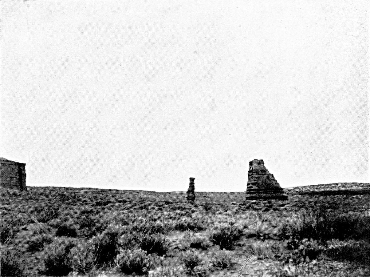
THE PATAGONIAN TABLELAND (NEUQUEN).
Indigenous vegetation. Rocks eroded by wind.
Photographs by Windhausen, Mining Division.
Plate XIV.
Click to view larger image.
[Pg 155]
The chief crops are lucerne, cereals, and the vine. All the efforts
and hopes of the colonists are now centred upon the vine. It is for the
purpose of extending the vineyards that they are endeavouring to secure
more workers. These are a singularly mixed lot, Chileans from the
Neuquen rubbing shoulders with Latin immigrants (Italian and Spanish)
from the region of the Pampas.
The lucerne is made up in bales and exported by rail to Bahía
Blanca and Buenos Aires. The economic life of the agricultural oasis of
the Rio Negro is no more connected with that of the pastoral tableland
than is life on the Chubut. Neither sheep nor cattle are fattened on
the Rio Negro. It is a curious contrast to the spectacle offered by
the Andean regions of western and north-western Argentina, where for
generations there has been a close association between the breeding
industry of the scrub and the fattening on the lucerne-farms. This is
because the currents of the cattle-trade are not here as permanent and
stable as they are in the north. The time when the convoys of Pampean
cattle bound for Chile used the valley of the Rio Negro preceded the
agricultural colonization of the banks of the river. The conquest
of Patagonia put an end to this traffic. There was an interval of
twenty-five years between the period of the export of Pampean cattle
to Chile and the export of cattle from the Neuquen to Buenos Aires,
to which I will refer presently. As to sheep-breeding, it did not for
a long time rear the animals for the meat-market, and it is only a
few years since it found transport necessary. The farmers of the Rio
Negro, who have little capital, and who sell and are paid in advance
for their dry fodder, have not yet been able to take advantage of the
reorganization of the cattle-trade.
[Pg 156]
West of the confluence of the Neuquen and the Limay the railway
ascends the sandstone tableland, from 1,700 to 3,000 feet high, and
goes as far as the foot of the first sub-Andean chain, the Zapala
ranch. The eruptive rocks here have thrown up the sandstone, and the
profiles raised north and south of Zapala, across the Sierra de la
Vaca Muerta and the Cerro Lotena, cut through folds of Mesozoic strata
which have been reduced by erosion to the level of the plateau. One
already feels the vicinity of the Cordillera. Pasture is plentiful,
the mallin is thick, and springs abound. The sheep-area stretches
westward of Zapala, as far as the Rio Cataluin and the Rio Agrio.
East of Zapala, on the other hand, the desolate condition of the
country gets worse and worse. The supplies of water dry up in the
summer, and the entire zone that lies east of 70° W. long. is
useless, on account of the lack of permanent water, except as winter
commonage. Hence, transhumation is here indispensable. It has been
practised for a long time on the Chilean slope of the Cordillera from
the latitude of Coquimbo and San Juan to the north of Lake Quillen.
At present it tends to disappear from the Andes of the Neuquen.75 But there is still transhumation on the
Argentine side. The sheep of the plateau, driven from their winter
pasture when the water dries up, ascend the Cordillera. Sometimes the
mountains are not yet free from snow. In that case the journey is
delayed, and the sheep feed on the way, to the great detriment of the
land they cross.
[Pg 157]
There are many routes, and frequently they coincide with those which
were formerly taken by the cattle of the Pampas in ascending to the
passes of the Cordillera. Groeber mentions a transhumation track south
of the Rio Barrancas and Lake Carri Lauquen. From the left bank of the
Neuquen the flocks ascend by Chosmalal and Butamallin to the pasture
of the Pichachen pass, or by Las Lajas to the Pino Hachado pass. From
Zapala and the tableland further south they go to spend the summer
in the Cataluin Cordillera, where the number of sheep in summer is
calculated to be 70,000. Others go still further, to the source of the
Alumine and the Arco pass. The volcano Lanin almost marks the southern
limit of the zone of transhumation. The chief group of migrating sheep
comes from the district of the Coyunco, the Cañadon Grande, and
the Picun Leucu.
Transhumation is practised only by the intrusos. They go from the
unowned lands of the tableland to the unowned lands of the Cordillera.
The renting of winter pasture to owners is quite exceptional. The
concessions of land granted by the Argentine Government are steadily
reducing the area of the migrators in the Cordillera, and also the
ways of communication between the tableland and the mountains. The
proprietors do not care to receive the migrating flocks, and they
put obstacles in their way by enclosing the land. The routes of the
transhumation are now fixed by the spaces which remain open between the
enclosed ranches. Moreover, the migrating intrusos are haunted by
the fear of finding the winter pasture occupied by others during their
absence, and they
[Pg 158]
have no proprietary title. The splitting up of the land and the
organization of ownership will before long lead to the extinction of
the practice of transhumation, and the greater part of the winter
pasturage will be turned into permanent pasture by boring wells and
nursing the water-supply.
The district round the Zapala ranch has become very busy since the
construction of the railway, which has deeply affected the conditions
of life there. It has made a sort of capital of Zapala. It is curious
to contrast the renaissance which has followed upon the appearance of
the railway in this district with the much less material changes which
it has made at Maquinchao. The life which the railway concentrates at
Zapala includes not only the wool trade, as at Maquinchao, but also the
cattle trade. The herds which are to be exported gather round the ranch
at the same time as the tropas of wagons, and a good price is paid
for the right of pasturage. While the Maquinchao line ends at the port
of San Antonio, which is merely fitted up for the export of wool, the
Zapala railway feeds the refrigerator at Bahía Blanca. It joins
up with the network of railways of the Pampa. Sheep arrive at Zapala,
not only from the surrounding district and from the Neuquen, but from a
good part of the Rio Negro, and even the Chubut. The convoys of animals
coming from the south find it best to keep near the Cordillera, where
the pasturage is better. Only a few of them descend the Limay as far
as Senillosa. From Zapala to Senillosa there is no suitable road in
connection with the railway, and further east it is necessary to go as
far as Choele Choel to find tracks which lead to it. The exporting of
the sheep lasts five months, from November to March.
Zapala station is also a point of convergence of herds of cattle.
There are people at Zapala who still remember the time when the cattle
brought from the Pampa to go to Chile passed through their valley.
Although these
[Pg 159]
exports of Pampean cattle to Chile ceased after 1885, the whole Andean
region of the Neuquen still lived entirely on the Chilean market until
very recently. The attraction of the Chilean market is one of the
reasons for the survival of transhumation. It was to the advantage
of the Argentine breeders to keep near the Cordillera and the passes
through which the buyers came from Chile in the summer. The life of the
small centres in the upper valleys which developed rapidly after the
conquest (Chosmalal, Ñorquin, Codihue, Junin, and San Martin)
was bound up with the Chilean cattle trade, and was reflected on the
opposite side of the Andes in the prosperity of the corresponding
markets in Chile.
In the years immediately preceding 1914, a sudden revolution upset
the cattle traffic on the Neuquen, and the attraction of Buenos Aires
took the place of that of the Chilean market. The commercial influence
of Buenos Aires was first felt in the wool-market. The tropas of
wagons which brought wool to Zapala loaded up, in exchange, with the
flour and salt that were needed for sheep-breeding in the pastures
of the Cordillera (pastos dulces). The import trade followed the
path traced by the export trade. The small Chilean wagons which still
cross the Cordillera now only bring to the Neuquen the coarse flour of
Chile, haricot beans, and wine. They return empty to Chile. After the
wool-buyers, the cattle-merchants of Buenos Aires next found their way
to the Cordillera. The centres where the sales of cattle for Chile used
to be held are now in decay, and have lost part of their population.
The cattle are sent to the fattening centres on the Pampa, or to the
Bahía Blanca and Buenos Aires markets. Thus we have under
our eyes, unexpectedly, in the north of Patagonia a transformation
that occurred gradually half a century ago in all the western and
north-western parts of Argentina. In its many forms it is the essential
fact in the modern history of Argentine
[Pg 160]
colonization. The more distant provinces are detached in succession
from foreign markets, and the whole national life is being organized
round the great economic focus which the region of the Pampas has
become.
[Pg 161]
CHAPTER VI
THE PLAIN OF THE PAMPAS
The limits of the prairie—The rains—The wind
and the formation of the clay of the Pampas—The
wind and the contour—The zones of colonization
on the Pampas—Hunting wild cattle and primitive
breeding—The sheep-farms—The ranches—The
region of "colonies"—The region of lucerne,
maize, and wheat—The combination of agriculture
and breeding—The economic mechanism of
colonization—The exchanges between the different zones
of the Pampas.
The Pampean landscape is doubtless one of the most uniform in the
world. Its monotony is tiring to the eye; it is partly responsible for
the mediocrity of most of the descriptions of the Pampas. But this
uniformity is an advantage for the purpose of colonization. Attention
has often been drawn to the rapidity with which plants and animals
introduced by Europeans spread in the Buenos Aires district, and,
pushing ahead of the breeders and farmers, colonized the Pampas. In the
second half of the nineteenth century, when the whole extent of the
plain beyond the ancient Indian frontier was occupied, the development
of it was so much easier because it was possible to use simpler and
more uniform methods of exploitation. It needed neither large capital
nor long personal experience on the part of the immigrant. Basques
and Italians who had only just landed could take an active part in
it almost without apprenticeship. The primitive groups of population
could advance from one zone of the plain to another and take with them
their own methods of farming and breeding, their own form of rural
economy.
[Pg 162]
A close study will, however, enable us to detect appreciable
physical differences in the Pampean plain. Neither climate nor soil is
the same all over it.
The name "Pampa" chiefly means a vegetal growth, a prairie. Its
limits are the frontier of the scrub (monte),
and strange as it may seem, it is still difficult to trace them
exactly. North of Santa Fé, between the Salado and the
Paraná, the Pampa stretches as far as Fives-Lille, a little
beyond 30° S. lat.76 On the Central Norte and the Central Argentine
lines the fringe of the monte reaches to Fuertin
Inca and Malbran, about 170 miles north-west of Santa Fé. It
then turns south-east and south, passing round the entire depression
of Los Porongos and Mar Chiquita; and the line from Santa Fé to
Córdoba crosses it at Francia and approaches the Rio Secundo.
South of the Rio Secundo it goes westward and joins the foot of the
Sierra de Córdoba south of the Rio Tercero (at the stream
Tequia). From this point to La Cambre, some sixteen miles east of
San Luis, the prairie extends as far as the edge of the sierras, and
penetrates into the southern half of the Conlara depression, between
the hills of Córdoba and of San Luis (Pampa de Naschel). The
mimosa forest enters the steppe in narrow belts along the Rio Quinto
to within a few leagues below Villa Mercedes, along the Rio Tercero
as far as the confluence of the Saladillo, and along the Salado to
the south of Santa Fé. There are, in addition, many isolated
clumps of chañares and more extensive
patches of wood in the north-west corner of the prairie (Santa
Fé province). The monte along the Salado
is continued south of Santa Fé along the Paraná, as
far as the point where the chief arm of the river reaches the cliffs
on the right bank, at San Lorenzo. This is the domain of the ombu, a tree with thick trunk and naked roots which is
found scattered over the prairie in the Paraná region as far as
south of Buenos Aires.
[Pg 163]
In the west, between San Luis and the mouth of the Colorado, the
transition from the Pampa to the monte is gradual. Just as at Santa
Fé, the approach of the monte is announced by the appearance
of chañares, in the south-west corner of the Córdoba
province and on the southern slope of the Sierra de la Ventana. The
monte, properly so called, though impoverished, invaded by the
jarilla, and mainly composed (as in northern Patagonia) of dwarf
mimosas, covers the area of the Pampean sierras on the left bank of
the Chadi Leuvu and the Colorado. Between this area and a line passing
through Rancul, Anguil, Atreuco, and Bernasconi, where the naked
prairie begins, there is a mixed zone which one may call the calden
zone. This mimosa, a near relative of the algarroba, which has a
wider range than the other plants of the monte in this latitude,
forms woods at intervals in the south of the San Luis province and
on the flanks of the parallel valleys of the central Pampa. Between
these woods the tableland is generally covered by the prairie, with
occasional patches of chañares. About twenty-five miles east
of Buena Esperanza the line from San Rafael touches the far corner of a
forest of caldenes, which stretches south-westward, and reaches the
Rio Salado about 35° 30′ S. lat. Beyond Buena Esperanza it keeps
on the prairie as far as the crossing of the Salado, which here marks
the limit of the monte. The Rio Negro line passes directly from the
prairie to the Patagonian scrub mid-way between Bahía Blanca and
the Colorado.
Within these limits the prairie extends without a break. The sierras
of the Buenos Aires province have no arborescent vegetation.
The zone of the prairie, intermediate between tropical Argentina and
the sub-desert regions of western
[Pg 164]
Patagonia, has a medium rainfall. It decreases gradually from
north-east to south-west. There is a rainfall of 1,200 to 1,000
millimetres on the lower Paraná, and only 400 to 600 millimetres
on the western edge of the Pampa. The zone which lies between the 800
millimetres and 600 millimetres average is more than 270 miles in
breadth. But what is most characteristic of the climate of the Pampa is
the equal distribution of the rain throughout the year, and the absence
of a real dry season. In this the Pampa differs from the surrounding
regions, both in the south-west and the north. At Buenos Aires the
six months of the (relatively) dry season yield, nevertheless, 44
per cent. of the total rainfall, and at Bahía Blanca 40 per
cent. This regularity diminishes in proportion as one approaches the
coast. At Rosario the six months of the dry season only yield 30 per
cent. of the year's rain; at Villa Mercedes (San Luis province) 25
per cent. When one goes beyond the limits of the prairies the ratio
of rain in the dry season decreases rapidly; it is only 20 per cent.
at Córdoba and 18 per cent. at San Luis. At Córdoba,
the curve of the rainfall indicates a typical tropical regime, with a
summer maximum and a very low minimum in winter. Passing south-eastward
from Córdoba, at Bellville, Villa Maria and especially Rosario,
the dryness of the winter diminishes, and at the same time a secondary
minimum appears in the middle of summer (January-February). At Buenos
Aires, the form of the curve changes completely. The summer minimum
is almost as low as the winter minimum, and most of the rainfall is
in the spring (September) and the beginning of the autumn (March).77
[Pg 165]
These various shades of the Pampean climate are of essential
importance in the history of colonization and the spread of
cultivation. The belt of summer rain is the belt of maize-growing,
whereas the cultivation of wheat requires spring rain and a
comparatively dry summer.
While the isohyetic curves, which represent the precipitation for
the whole year, are orientated from north-west to south-east, the
curves of rainfall during the cold season, from April to September
(dry season in the north), cut diagonally across the preceding, and
are oriented directly north and south. Bahía Blanca receives
in winter as much rain as Rosario, and General Acha (in the district
of the central Pampa) as much as Córdoba. Unless one attends
to this, one cannot explain the extension of wheat-growing, in the
south-west, as far as the 400 millimetre curve, and even beyond it on
the Atlantic coast.
The relief of the Pampean plain is known fairly accurately, thanks
to the observations made along the railways. The ground rises slowly
toward the west. The 100-metre curve describes a deep gulf some 300
miles west-south-west of Buenos Aires. The belt comprised between 100
and 150 metres above sea-level is more than sixty miles broad in the
latitude of Santa Fé, and 130 miles in the latitude of Buenos
Aires. Beyond the 150-metre curve the land rises rapidly toward the
west and north-west, and reaches 400 metres in the Córdoba
district and 500 in the Villa Mercedes district. It is at the altitude
of 150 metres, and the break in the inclination which this marks, that
the Rio Quinto is lost, near Amarga, south of General Lavalle.
[Pg 166]
The ridge between the Pampa and the basin of the Salado in the south
of the San Luis province is about 450 metres above sea-level. South of
the province of Buenos Aires the Sierras de Tandil and de la Ventana
are joined together by a ridge which does not fall below 200 metres.
Certain irregularities of the surface, such as the depression of Mar
Chiquita to the east of Córdoba, the thrust of the plateau on
the right bank of the Paraná, south of Villa Constitución
and San Nicolas, can, apparently, only be explained by recent tectonic
movements.
The Pampean deposits which cover the plain rest upon a rocky
base of which the salient representatives are the sierras of
the province of Buenos Aires and the hills at Córdoba
and San Luis. This base also appears east of the Pampean basin
in the granite island of Martin Garcia, in the middle of the
estuary of the Plata, and in the hills on the coast of Uruguay.78
Underneath the even sheet of the alluvial deposits the surface
of the sub-Pampean platform is very irregular. Its shape has
been discovered by deep borings in search of arterial waters. It
has been warped and cut up by faults, some of these deformations
being probably synchronous with the formation of the Pampean
deposits which have concealed them as they have been produced. A
subterranean rocky ridge continues the Sierra de Córdoba
southward and joins it with the sierras of the Colorado. The granite
emerges at Chamaico, on the western railway, and on both sides
the borings have passed through great depths of clay and sand.79 This ridge isolates the eastern Pampa from
the sub-Andean chains, and marks the limit of the area with sheets of
underground water. In the north of the Pampean region, between the
Sierra de Córdoba and the Paraná, the loose continental
formations are more than 2,000 feet thick at Bellville, and more than
3,500 feet north-west of Santa Fé (fodder farms of San Cristobal
and El Tostado). At Buenos Aires the granite has been found 985 feet
below the surface.

THE PAMPEAN PLAIN. TRES ARROYES (BUENOS AIRES
PRAIRIE BETWEEN THE SIERRA DE TANDIL AND THE SIERRA DE LA VENTANA).
Zone of wheat and oats on large scale. The
Pampa is a tableland here (400 feet above sea-level), with
clay overlying the limestone of the Tosca. The valleys are
well marked.
Photograph by the Author.
Click to view larger image.

THE PAMPEAN PLAIN. TOAY, ON THE CENTRAL PAMPA (590 FEET).
The tableland, with a strong framework of limestone
Tosca, is cut across by well-marked dry valleys which sink
lower toward the east. At the edges of the valleys the sand
is the prey of the winds. Here we are near the limit of the
wheat belt.
Photograph by the Author.
Plate XV.
Click to view larger image.
[Pg 167]
The Pampean formation consists almost entirely of loose
deposits, sand and clays of various sorts. There is no gravel.80 Even in the vicinity of the sierras the beds
of gravel, with round or angular pebbles, are almost always covered
by clay, and are exposed only in the banks of the streams. Olascoaga
mentions the surprise of the gauchos of General Roca's army when they
found Patagonian pebbles on the ground during their stay at Choele
Choel on the Colorado, in the course of the compaign campaign on the Rio Negro.
Officers and soldiers dismounted to pick them up. Sand and clay form a
thick bed of continental alluvia. The Tertiary maritime transgressions,
which have left their mark in the clays and limestones of the left bank
of the lower Paraná, and the layers of shells at San Pedro on
the right bank, never penetrated far into the interior of the Pampean
region, and one finds no trace of them when one leaves the coast or the
river.
[Pg 168]
The source of the elements which compose the Pampean alluvia is
very uncertain. Their composition does not clearly show their origin.
The clays are comparatively rich in calcareous matter, which seems to
indicate that they do not come from tropical America or the upper basin
of the Paraná. Wright and Fenner insist upon the high proportion
of siliceous glass of volcanic origin which they contain, which points
to an intense eruptive activity during or before their formation.81 Doering had already noticed in the
Córdoba region the prevalence of beds of volcanic ash, which
become thicker as one approaches the sierra. It is certain that the
Pampean sierras have had their share in the formation of the Pampean
beds. But the main mass is probably of Andean origin. However that may
be, as soon as one gets away from the fringe of the mountains, the only
variety noticeable in the lands of the Pampa is that which they owe to
the conditions in which they have been deposited.
River deposits strictly so called, estuary deposits,
lagoon deposits, æolian deposits, æolian deposits
redistributed by water, river deposits redistributed by
wind—all these different types are represented in the Pampean
formation, but their relative importance is still disputed.82
[Pg 169]
When we confine ourselves to studying the actual conditions in which
the deposits were formed, we are first struck by the poverty of the
hydrographic network of the Pampa. It is slight except in the vicinity
of the sierras, where the slope of the ground is pronounced, and in
the eastern area, on the right bank of the Paraná and Entre
Rios, where the climate is more humid, and the streams flowing over an
impermeable soil more numerous. The only one of the streams born in the
Pampean sierras that reaches the Paraná is the Rio Tercero or
Carcaraña. All the others dwindle as they descend, and disappear
in a low-lying district marked by lagoons which they only reach in time
of flood. The floods themselves never bring the Rio Cuarto and the Rio
Quinto and the Salado de Buenos Aires into touch with each other. The
waters of the northern slope of the Sierra de Tandil, and even those of
the Sierra de Curumalal, on the other hand, reach the Salado after the
rains, either by way of streams which drain the strings of lagoons, or
by flood-sheets, which spread over large areas.
The watercourses of the plain are unstable in their direction.
The traces of their wanderings remain in the form of stretches of
alluvial sand crossing the fine æolian clays. These river sands
sometimes spread over extensive areas, the distribution depending upon
a hydrographic scheme which is now partially effaced. The sands of the
departments of General Lopez (south of the Santa Fé province)
and General Arenales (Buenos Aires province), where the Salado is now
developed, were probably brought by the Rio Cuarto, and mark an earlier
junction of the Cuarto and the Salado. These sands run along the Salado
as far as the confluence of the Saladillo, and the contrast between the
light soil and the clay of the bank of the Paraná is so
[Pg 170]
striking that the sand has long been regarded as a marine deposit,
indicating an ancient shore. Along the Saladillo also, north-west of
the Guamini lagoons, there is a sandy belt which corresponds with an
important direction taken by the actual flow of the river, crossing the
Bolivar and Veinte Cinco de Mayo departments.
While the agency of running water in transporting alluvia is
confined to certain sections of the plain, the action of the wind
is seen over its entire surface. The wind everywhere supplements or
replaces running water. Like running water, it classifies the elements
it conveys, and selects them according to their weight and size, the
finest clays being deposited in the moist eastern zone and the coarsest
sands in the sub-desert zone of the west. The mechanism of erosion
explains this contrast. The grains of sand that are driven by the wind
travel at the surface of the ground as long as the vegetation is too
sparse to fix them. If one goes further east, to a moister district
with a thicker vegetal carpet, the grains of sand no longer move at
the surface of the ground, but the wind still carries fine particles
of clay, which it bears to a great height. The bed of clay does not
at all imply an arid climate, as is said sometimes, but corresponds
to the region of the steppes, with moderate rainfall. It is, however,
during dry seasons that the deposition of clay is at its greatest.
Darwin mentions that after the droughts of 1827-1830 in the area round
the Paraná, the marks were buried under dust to such an extent
that one could no longer recognize the limits of the various lands.
Apart, however, from these sorts of floods or storms of dust caused by
the pampero, the summer atmosphere is clearly laden with dust, which
colours the skies in the east of the Buenos Aires province, as far as
Entre Rios.
The contour of the plain bears, like the soil, the double marks of
erosion by running water and æolian erosion. The rivers of the
Pampa, when they leave the sierras,
[Pg 171]
flow between high cliffs, the height diminishing as one goes downward.
Presently these barrancas become low, approach each other, and at
last merely mark the banks of a larger bed which the floods fill. There
is no trace of valleys. Bailey Willis, surprised at this weakness of
watercourses that have, nevertheless, an appreciable fall, attributes
it to the fact that the cycle of erosion opened by the last upheaval
of the Pampa has not yet had time to penetrate into the interior. In
reality, it means that here we are at the limit of the zone of erosion
by running water, and that in this climate the essential factor in
shaping the landscape is the wind.
The region of the right bank of the Paraná (east of the
Salado), which alone has a complete hydrographic network, must be
considered apart. From the latitude of Rosario to that of Buenos Aires
it is cut by flat-bottomed valleys which are sometimes a hundred feet
deep. The excavation of these valleys is due to an upheaval which
raised this part of the Pampa above the base-level. The rapids of
the lower Carcaraña also bear witness to this resumption of
excavation. Farther on an inverse movement has put the bottom of the
valleys below this level, and led to their being filled up (lagoon
deposits of the Lujanense of Ameghino). South of Buenos Aires the
upheaval has been less important, and the valleys are not so deep.
Some of them (middle Salado and its tributaries on the left bank) are
now occupied by long lagoons with steep banks, branching along the
side-valleys, and these owe their origin to the same negative movement,
subsequent to the excavation of the valleys. The upheaval did not
extend to the eastern part of the province of Buenos Aires south of
the Salado, a low-lying flat area, badly drained, exposed to floods,
the contour of which has been minutely studied in connection with the
construction of a great network of drainage-canals. North of Rosario,
on the only slightly permeable clay, the water circulates, after rain,
not by means of valleys in the proper sense,
[Pg 172]
but along broad and almost imperceptible depressions (cañadas)
where the current is slow, and the water dries up in the dry season.
Their general relations are not yet known.
The loose deposits of the Pampean offer little resistance to
erosion. The cycles are run through rapidly, and the traces of earlier
cycles are faint, and are soon effaced.83
An ancient erosion-surface, dissected by the existing valleys,
has survived in the south-west of the Pampean plain, thanks to the
presence on the surface of a sheet of hard limestone, the tosca.
The tosca is the result of the concentration of calcareous elements
contained in clay at the surface in a dry climate. The formation
of it implies a prolonged stability of the surface on which it has
accumulated. Like the deep decomposition-soils in moister regions, it
indicates a peneplain on which erosion has ceased. The bed of tosca
covers the whole district between the Sierra de Tandil and the Sierra
de la Ventana, the south-western slope of the Ventana, and most of
the area of the central Pampa. In the north it does not go beyond the
line from Buenos Aires to San Rafael. Its eastern limit goes almost
by Ingeniero Malmen, Monte Nievas, and Atreuco, where it joins the
southern bank of the lagoons of Carhue and Guamini in the east.84 In some places the tosca is about forty feet
thick.
[Pg 173]
To-day the region of the tosca forms a plateau cut by narrow
valleys, sometimes 200 feet deep, west of the Sierra de la Ventana and
in the central Pampa. These parallel valleys, with few ramifications,
generally lying south-west to north-east, open to the east upon the
Pampean plain about the frontier of the Buenos Aires province. On
the other hand, the southernmost of them begin at the foot of the
Ventana, and seem to blend in the south-west with a general depression
that is still little known, though it appears to end at the bottom
of the estuary of Bahía Blanca. None of them has permanent
running water.85 The origin of the dry
valleys of the tosca is one of the most obscure problems of the
morphology of the Pampean plain. Perhaps they are due to æolian
erosion, like the depressions which are found on the plateau of the
Colorado and the Rio Negro further south.
The action of the wind in shaping the landscape is more clearly
seen in the formation of the dunes. When one starts from Buenos Aires
or Rosario, and gets beyond the region of the level Pampas, the dunes
are the first feature to meet the eye on the surface of the plain. The
first fresh dunes are encountered at Carlota, on the line from the Rio
Cuarto; at Lavalle on the line from Villa Mercedes; and at Trenque
Lauquen on the line from Toay. The dunes spread northward as far as the
latitude of Mar Chiquita, but do not enter the Chaco. They are also
found in parts of the scrub on the west, but their proper domain is the
western border of the steppe, the upper part of the plain at the foot
of the Sierra de Córdoba, the south of the San Luis province,
and the central Pampa.
[Pg 174]
Any accident that causes the vegetal covering to disappear, such as
the tread of cattle near a drinking place or an enclosure, is enough to
set æolian erosion at work. The wind raises the sand in a sort
of tossing sea. Then the dune assumes a circular shape. A depression
appears in the centre, and it deepens until it reaches the average
level of the plain. Frequently there is a little lake in it. From this
point onward the deformations are less rapid. The vegetation again
creeps over the ground, and the dune falls a prey to the rains, which
slowly reduce its mass.
In the central Pampa, where the elevation is considerable, the dunes
do not form separate circular patches, but stretch in lines parallel to
the valleys—sometimes in the heart of the valley, at other times
backing against one of its slopes.
Far to the east of the zone of the quick dunes, in the south of the
Córdoba province and the centre of the Buenos Aires province,
there are certain soft undulations, covered with vegetation, with
a sandier soil than that of the plain around them. These are dead
dunes. The district of the dead dunes is characterized by the extreme
irregularity of the surface-soil, the humus, which gains in richness
and depth, as a general rule, as one goes eastward, because there it is
in some places covered by recent æolian deposits.
The distribution of the dead dunes is connected with the stretches
of river sand across the Pampa, which have offered an easy victim to
the winds. A line of dead dunes follows the upper course of the Salado
in the district of Junin and Bragado. On the line from Buenos Aires to
San Luis one crosses it between Chacabuco and Vedia, and then one comes
again upon the horizontal plain, which has fresh dunes, only further
west, at 120 miles from Villa Mercedes. Its elevation is so conspicuous
on the level plain that the first breeders who used its pasturage gave
it the emphatic name of the cerillada. D'Azara correctly appreciated
the nature of it. "It is," he says, "only a dune of very fine sand."
It is only a few yards high. The dead dunes of the Bolivar and Veinte
Cinco de Mayo departments, which Parchappe described, have a more
conspicuous relief, and in their disposition sometimes
[Pg 175]
remind us of the fresh circular dunes with a central lagoon. The lines
of coastal dunes in the eastern part of the Buenos Aires province
obstruct the proper flow of the water there, and form a group apart,
which must be clearly distinguished from the dunes on the plain.86
Thus the impression of monotony which the Pampa makes in us is
corrected to some extent by close observation. High and low land
alternate on it. Parchappe himself had noticed the contrast between
the area that stretches from Buenos Aires to the Salado, with its soft
undulations and its well-developed hydrographic network, the horizontal
plains on the right bank of the Salado, with their irregular dunes, and
the southern plateau of the tosca between the Sierra de Tandil and
the Sierra de la Ventana.
We may now distinguish the following regions in the Pampa as a
whole:
[Pg 176]
1. The central part of the Santa Fé province forms what is
called the district of the "colonies": that is to say, the domain
of the colonies established two generations ago, and the zone in
which the type of cultivation introduced by them took root. The chief
crops here are wheat and flax. Hedges of service trees (paraisos)
surround the fields. In contrast with the parts of the Pampa which have
remained naked, the region of the colonies seems a veritable grove. It
stretches westward beyond the frontier of the Córdoba province,
and it reaches the fringe of the monte between San Francisco and Mar
Chiquita. For the north, Miatello gives 30° S. lat. as the normal
limit of the wheat-growing area; beyond this it suffers both from the
low rainfall of winter and the excessive rainfall in summer. As a
matter of fact, the large estates only reach this latitude on the line
from San Francisco to Ceres. On the Resistencia line, north of Santa
Fé, they stop at 30° 30′ S. lat. In the intervening district
the limit of the region of the colonies almost coincides with that of
the department of Castellanos, about 30° 45′ S. lat. The area lying
between this line and the northern edge of the Pampa is given up to
breeding. In the south the region of the colonies stretches as far as
Las Bandurias and Irigoyen.
2. South of the region of the colonies, the tableland on the right
bank of the Paraná, west of Rosario and San Nicolas, is the
maize region, the corn belt of Argentina. Flax is generally cultivated
as well as maize. It is the agricultural country par excellence of
Argentina. The soil, of fine clay, dark red in colour and retentive
of moisture, and the abundant summer rains, are very suitable for
maize. The limits of the maize region describe an arc of a circle round
Rosario with a radius of 60 to 100 miles. They do not quite reach the
frontier of Córdoba in the west, and they leave out the entire
south-western corner of the Santa Fé province. The maize belt
touches the Paraná between 32° S. lat. and the Baradero.
In the north it passes suddenly into the region of the colonies. In
the south, on the other hand, there is at the edge of the corn belt an
extensive transition-area, where maize and wheat occupy pretty much the
same surface; it stretches as far as the Rio Salado de Buenos Aires.
3. The region of the lucerne farms is much larger. It comprises the
whole north-west corner of the Buenos Aires province, from the Salado,
in the district of Junin,
[Pg 177]
to the southern limit of the Nueve de Julio and Pehuajo departments,
and as far as the latitude of Guamini. The limit of the lucerne farms
does not include the lands of the central Pampa, but advances westward
and takes in part of the Pedernera department in the San Luis province.
The lucerne farms run along the San Rafael line to Batavia, and at this
point they reach the limits of the colonized zone. In addition, the
zone of the lucerne farms includes the whole south-eastern part of the
Córdoba province, as high up as the line from Villa Mercedes to
Villa Maria, and the southern part of the Santa Fé province. In
the whole of this area, fifteen to twenty-five per cent. of the surface
is planted with lucerne. The conditions required for its cultivation
are a moderate depth of the underground water and a light soil that
allows the roots to penetrate easily. The eastern belt of clays is not
good for lucerne, which survives there for much less time than in the
west, where it may live fifteen or twenty years.
The lucerne belt is above all a great breeding area for horned
cattle, as sheep-pasturage injures the lucerne. It is not nearly so
monotonous, however, as the preceding regions. In the south-east,
in the Buenos Aires province, the creation of the lucerne farms was
undertaken at a time when agricultural colonization had already
begun. We therefore find two types of exploitation side by side. The
cultivation of maize enters it in the south-west, in spite of the
comparatively unfavourable climatic conditions. The centre of the
lucerne area in the south of the Córdoba province is also a
great agricultural zone; but there agriculture is directly connected
with the creation of the lucerne estates. It is, in fact, entrusted to
colonists who till the ground for four or five years, and restore it
to the owners sown with lucerne at the expiration of their lease. The
crops consist almost exclusively of wheat and flax. Lastly, in the west
(San Luis province
[Pg 178]
and extreme south-west of Córdoba province) the soil gets
increasingly more sandy, and the climate drier. A single tillage
suffices to destroy the natural vegetation and clear the place
for lucerne. The lucerne fields have been created by the breeders
themselves, the sole masters of the region, without the aid of the
colonists.
4. Beyond the lucerne belt, at the point where the plain rises
toward the Sierra de San Luis and the Sierra de Córdoba, the
subterranean water sinks deeper. This zone at the foot of the ranges,
unsuitable for lucerne, yet with a soil comparatively rich in humus,
has been taken up by agricultural workers. The wheat area extends, in
the San Luis province, as far as Fraga and Naschel, in the Conlara
depression. The maize area extends to Oncativo, in the Córdoba
province, between the Tercero and Secundo rivers, where the summer
rainfall is heavier. Thanks to the nearness of the mountains, this area
has a water-supply for irrigation, and this sustains several small
centres of good farms.
5. The south of the Buenos Aires province and the central Pampa are
the wheat zone. The bed of tosca, which is not far below the soil,
does no harm to the wheat except in years of drought. The valleys,
where the tosca is interrupted, and the dunes, where the soil is
deep, are very carefully used for lucerne fields of limited extent.
Wheat-growing seems now, both in this and the preceding zone, to have
reached its limit, as the dryness makes it improbable that there will
be any extension westward.
6. Lastly, the east of the Buenos Aires province, the centre of
which is fairly indicated by the little town of Dolores, is the only
part of the Pampean plain which has not been reached by agricultural
colonization. The land lies low, and is badly drained. The only change
that has taken place in the vegetation is a progressive improvement due
to the hoofs of the cattle during their long stays there. This pastoral
area is
[Pg 179]
clearly limited in the south by the Sierra de Tandil. In the north
it is continued in the more varied region that lies between Buenos
Aires and the lower Salado, where the alternation of winter pasture
on the dry lands and summer pasture in the valleys, encourages the
best methods of breeding, and has made it the region of the dairy
industry.
In the Entre Rios province the limit of the large estates of wheat
and flax is marked by 32° S. lat. The part of Entre Rios which
extends north of 32° and the Corrientes province do not strictly
belong to the Pampean region.
Extensive breeding was the first form taken by white colonization on
the Pampa. The word breeding is, in fact, hardly the correct name for
an industry that mainly consisted of hunting, and was wholly distinct
from the patient and advanced methods used at the same time in the
northern provinces.
"The real wealth of the province of Buenos Aires," says
Dean Funes, "was, and always will be, the trade in hides" (la
pellejería).87 A good part of
the hides exported came from the hunting of the wild cattle and
horses which had grown numerous on the area of the Pampa beyond
the Rio Salado.88 It was mainly after
1778, when trade with Spain had been authorized and there was an
increased demand for hides, that the hunting of these ownerless beasts
was taken up. Two thousand Spaniards from Buenos Aires, Santa Fé
and Mendoza hunted every day, says D'Azara, killing an animal for each
of their meals in addition to those they killed for hides. From 1775
to the Revolution, the Spanish Government made continuous efforts to
regulate and reduce the massacre of the herds. It laid down penalties
for every person selling hides that did not bear his own mark; it
farmed out the right to hunt animals with no mark, and organized the
destruction of wild dogs, etc. The ranches developed under shelter of
this legislation. Still, the Revolution did not witness the end of this
cattle-hunting. D'Orbigny took part in 1828 in two hunts of wild horses
(baguales) in Entre Rios. The Argentine gaucho long retained the
ways of a hunter rather than those of a breeder in the strict sense;
witness Urquiza's soldiers who, says Demersay, during the campaign of
1846, when they could not find trees to which they could fasten their
horses, killed cattle and tied the reins to their horns.
[Pg 180]
Passing from the hunting country to the zone of ranches, one notices
that the main work of the breeder is to prevent his cattle from running
wild. "The ranches of this country," said Dean Funes, "having been set
up on immense plains, on which it was not easy to confine the herds
within fixed limits, it sometimes happened that the animals went vast
distances in search of water or pasture, and ended by being regarded
as wild and ownerless," When D'Azara wants to show that the ranches
of Paraguay are superior to those of Buenos Aires, he is content to
say that there the animals are tamer (mansos). With the wild animal
(alzado) is contrasted the de rodeo animal: that is to say, the
cattle which are rounded up periodically in the centre of the ranch to
be taken to the pasture where they must live (aquerenciar). It is the
difficulty of preventing the dispersal of the herd that fixes the price
of the rincones (surrounded by inundated areas) of Corrientes, in
which the animals are captives.
MacKann's description of pastoral life in the Buenos
[Pg 181]
Aires province in the middle of the nineteenth century give us a very
clear impression of the stage of transition between exploiting the
natural increase of a herd that multiplies without man's intervention,
and breeding in the strict sense. The value of a horse in the former
case is almost exclusively the cost of breaking it in. The breeder is
actually anxious when he sees his horses increase, as he fears he
may not have the resources for breaking them in. The most formidable
of the dangers that threatened the feeble discipline of the herd
was drought. That in the year 1827 was a disaster. The animals
left the ranches in a body to go southward, where they mixed.89
[Pg 182]
Revolutions and wars interrupted the work of taming the cattle.
When Galvez went from the Córdoba province to Buenos Aires
at the end of the Rosas Government, he was struck by the condition
of the ranches.90 Many of them had
been confiscated, or their owners driven into exile. Cattle were
no longer marked, and they had become wild. The troubles of the
emancipation-period were much less injurious to the Buenos Aires
breeders than to those of Entre Rios. The Entre Rios herd was almost
annihilated during the revolution, and some of the ranchers of the left
bank crossed to the right bank of the Paraná. After 1823 the
pastoral wealth of Entre Rios was rapidly restored, thanks to raids on
Brazilian territory. They were so profitable that the whole population
took part in them. In 1827 the inhabitants of Bajada went there in such
numbers that the town was half deserted. Every day thousands of cattle
were collected on the bank of the Uruguay, and crossed the river.
Some of them were even taken beyond the Paraná, to the Santa
Fé province. Woodbine Parish confirms this rapid restoration
of Entre Rios, of which D'Orbigny was a witness. But this period of
prosperity did not last long. The war with Uruguay, under Rosas, again
ruined the Entre Rios ranches, and the drought of 1846 helped to
scatter the remaining herds. Extensive breeding is only lightly rooted
in the soil. The chief centres of production change their locality, as
the political circumstances change, from one part of the Pampean plain
to another.
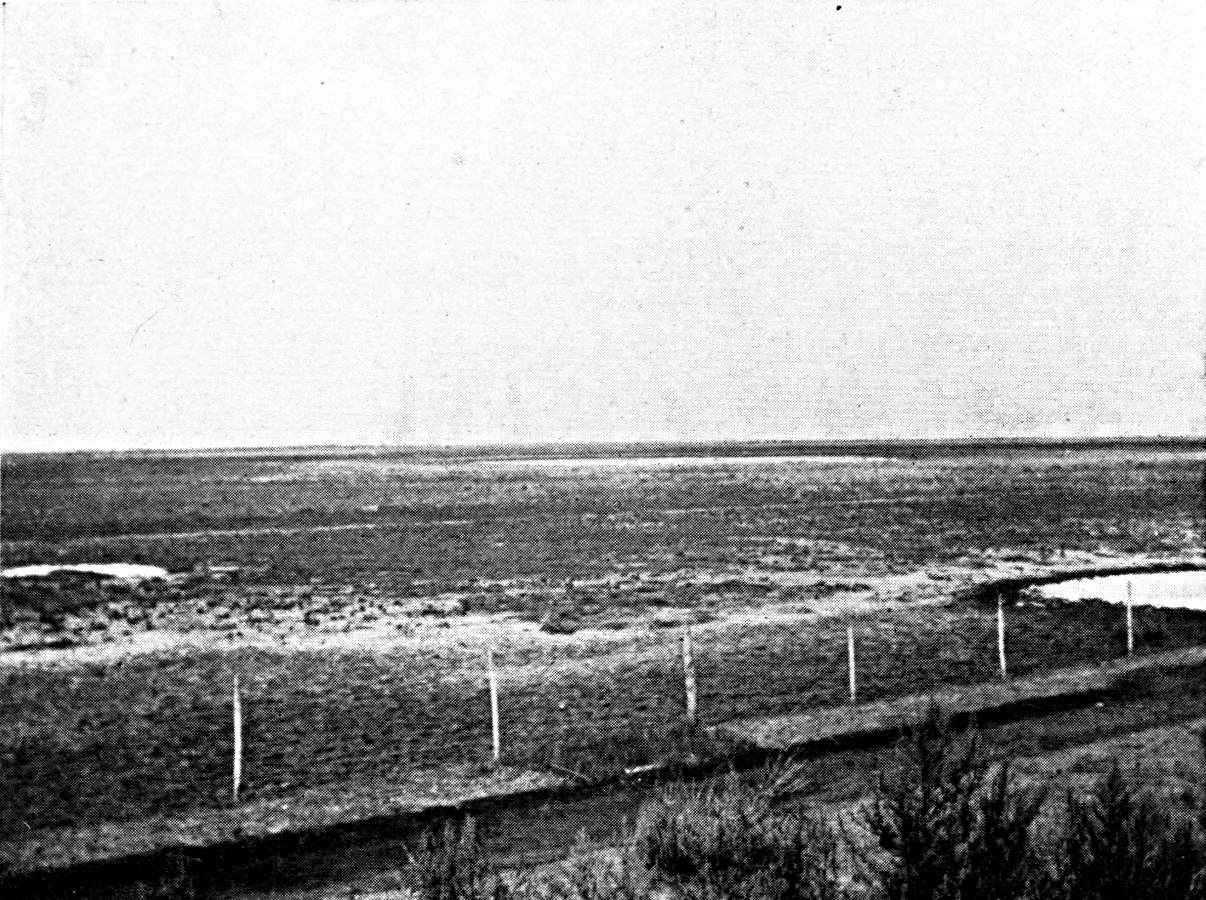
THE PAMPEAN PLAIN. THE RIO BAMBA (IN THE
SOUTH OF THE CÓRDOBA PROVINCE, 500 FEET ABOVE SEA-LEVEL).
Small circular lagoons. The underground water,
which comes from the Sierras to the north-west, here reaches
the surface. Zone of lucerne farms.
Photograph by the Author.
Click to view larger image.
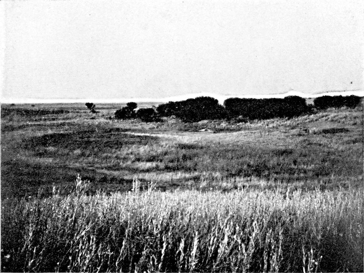
THE PAMPEAN PLAIN. BUENA ESPERANZA (SAN LUIS
PROVINCE, 1,166 FEET ELEVATION).
The plain is sown with quick and dead dunes,
often shaped in a circle round a lagoon. A dune invaded by
vegetation.
Photograph by the Author.
Plate XVI.
Click to view larger image.
[Pg 183]
Primitive breeding affords few examples of periodical migration
for the better use of pasturage. In 1822, in the course of a journey
amongst the Sierras de Tandil and de la Ventana, Colonel Garcia
noticed that the Indians kept their cattle round the temporary lagoons
of the plain in the winter, and went up to the mountain-streams in
summer. Transhumation movements of this kind were difficult for the
creole ranchers, whose fairly large herds could not be handled easily.
The Chascomus breeders, however, at the close of the eighteenth
century, drove their cattle to the low banks of the Salado during
the dry season.91 Garcia also notices
the importance of the Salado pastures for the ranches of Salto,
Areco, and Lujan.92 The need to remove
the herds in the dry season, and to find invernadas within reach of
the former ranches, was due to the change brought about in the natural
vegetation of the Pampa and the spread of the pasto dulce. The
annual herbs which compose the pasto dulce die and disappear after
fertilization. Until the autumn rain they leave the ground quite naked,
whereas the tough grasses of the pasto duro afforded a thin but
permanent pasture.
The first improvements of the pastoral industry of the Pampa are
connected with the development of sheep-breeding. Exports of wool
began about 1840, and made great progress after 1855 (17,000 tons
in 1860, 65,000 tons in 1870). From 1850 to about 1890 the economic
returns on sheep-breeding were far better than on cattle-breeding.
During the whole of this period the multiplication of sheep farms was
only restricted by the supply of workers. The first shepherds had been
Basques, in the south of the Buenos Aires province, and Irish, in the
north. The owner settled them as small farmers in the puestos on the
edge of the ranch, the central part of which was devoted to cattle.
They could thus, while they guarded their sheep, see that the limits of
the estate were respected, and prevent the cattle from roaming.
[Pg 184]
Wool was for a long time the only product of the sheep-rearing
industry. From 1866 onward it was decided to use the hides and tallow
also. As the material of the grease-works was cheap, they spread all
over the sheep zone. Many ranches had works of their own. From 1867
to 1877 the saladeros that had been built long before for killing
cattle undertook the slaughter of sheep on a large scale. The number
of sheep sold to the saladeros rose to 3,000,000 a year. In 1880 the
first cargoes of frozen mutton were sent abroad. The creation of the
grease-works had made no difference to the breeding, but the building
of the refrigerators brought about a rapid transformation of the flock.
The Lincoln breed, heavier and more meaty, displaced the fine-wool
Merinos. This substitution of Lincolns for Merinos is now complete
throughout the Pampean region.
Until 1880 sheep-rearing was concentrated east of the Salado, north
and south of Buenos Aires, beginning with a line that passes through
Quilmes, San Vicente, Pilar, and Campana, which marks the limit of the
suburban zone. In addition it had spread on the right bank of the lower
Salado as far as the foot of the Sierra de Tandil, in an area where the
first stations date from 1823, though the population did not make much
progress until after 1855. About 1880, after the pacification of the
Pampa, the sheep-farms began to expand westward. It was then that the
wool of the pasto fuerte appeared on the Buenos Aires market. It came
from the Azal district in 1870, from Olavarria in 1880, from Bolivar in
1885, and from Villegas in 1890. The Census of 1889 ascribes 51,000,000
sheep to the province of Buenos Aires; that of 1895 gives much the same
figure (52,000,000). Detailed comparison of the two enumerations shows
that the expansive movement to the west continued, and was completed
during this period. The flocks in the north-west zone of the province
(Lincoln, Villegas, Trenque, Lauquen) more than doubled; the flocks of
the south-west area
[Pg 185]
(Alsina, Puan, Bahía Blanca, Villarino) continued to grow, and
increased by a third. Those on the lands of the central Pampa increased
threefold. On the other hand, in the departments north and south of
the Sierra de Tandil, where colonization is older, sheep-breeding
is stationary. The north-east and south-east areas, between the
Paraná and the Salado, have diminished: one losing a fifth, and
the other a half, of its flocks.
From 1895 onward the number of flocks of sheep on the Pampean
plain decreased rapidly. The number of sheep had sunk from 34,000,000
in 1908 to 18,000,000 in 1915 for the Buenos Aires province; from
2,800,000 in 1908 to 2,300,000 in 1914 for the central Pampa. The
reduction was general, and found in every district; but it was not
equally great everywhere, and did not begin at the same date in every
district. Sheep-breeding has almost entirely disappeared from the
eastern belt, east of the Salado, which was its cradle. South of Buenos
Aires the sheep are giving place to horned cattle, and they had almost
disappeared by 1908. North of Buenos Aires they survived long, but
the reduction of the flocks has only been the more rapid since 1908.
This corresponds with the advance of maize-growing. In six years the
Bartolome Mitre and Pergamino departments have lost, respectively,
four-fifths and five-sixths of their sheep. In the north-west of the
Buenos Aires province the sheep began to be reduced at the time when
the lucerne farms were founded, about 1900. The decrease has since
gone on uninterruptedly. The actual flocks represent one-fourth of
the flocks of 1895. In the south-west (wheat belt) there was a rapid
shrinkage before 1908, but it seems to have almost been arrested since
then, thanks to the combining of sheep-rearing with wheat and oats. The
actual flocks are about one-half the flocks of 1895. Finally, in the
area north of the Sierra de Tandil the sheep retreat before the cattle,
as they do
[Pg 186]
further north, but they are not so completely wiped out as in the
lucerne belt, and the flocks are still two fifths of the flocks of
twenty years ago.
In the province of Entre Rios and south of Corrientes the number
of sheep continued to rise until 1908, but the increase is only in
the northern departments, outside the agricultural belt. The southern
departments, which are large growers of wheat and flax, lost one-third
of their flocks between 1895 and 1908.
Cattle-breeding was restricted for a long time by the difficulty
of disposing of its products. The hides alone found ready buyers. The
making and export of salt beef dates from the eighteenth century, and
it was to help this industry that the expeditions to the salt-beds of
the Pampa and the journeys of salters to the Patagonian coast were
organized. From 1792 to 1796 no less than 39,000 quintals of jerked
beef were sent from the Rio de la Plata to Havana. But the market for
salt meat (tasajo) was always limited. It consisted only of the
Antilles and Brazil, and the saladeros never fully exploited the
meat-producing capacity of the Argentine herds. The crisis of the
saladeros occurred before the time when the refrigerators began to
compete with them. By 1889 there were only three left in the province
of Buenos Aires.
Although the price of cattle was not very remunerative, and provided
no incentive to improve the breeding; although the saladero was not
at all exorbitant, merely asking for animals in good condition, the
improvement of the herd by introducing selected pedigree-breeders had
begun about the middle of the nineteenth century. The Basque dairies
established in the district near Buenos Aires sold pedigree-calves
to the ranches, and these were used for breeding purposes.93 About 1880 the advance of sheep-breeding
pressed the cattle-ranches back and disputed the space with them
more and more, within the ancient Indian frontier. The smallness of
the market for cattle and their slight mercantile value were very
favourable circumstances for the occupation of the new lands, thrown
open at this date by the submission of the Indians. The herds which
found no buyers were sent to the campos de afuera. The ranches
developed very rapidly. Daireaux has very accurately described this
period of pastoral colonization, and the starting of convoys that
were intended to give a population to the west of the Pampa. Cattle
were there several years before sheep. As a matter of fact, breeders
do not regard cattle as having a value of their own. They are merely
auxiliaries that must improve the pasture and prepare the ground for
sheep. The cattle themselves are preceded by troops of half-wild
horses which first take possession of the virgin field and begin the
transformation of it.
[Pg 187]
The number of cattle increases rapidly. In 1875 it was
estimated that there were 5,000,000 head of cattle in the province
of Buenos Aires. In 1889 there were 8,500,000. Since that date
the variations have been comparatively slight. The Census of
1895 gives 7,700,000; that of 1908 gives 10,300,000; that of
1914 gives 9,000,000; and that of 1915 gives 11,300,000.94 But the value of the cattle has gone up
rapidly. The exports of live meat, which lasted from 1889 to 1900, were
the beginning of the rise. It was strengthened when the refrigerators
ceased to confine themselves to killing sheep and began to buy cattle.
The exports of chilled or frozen beef increased after 1898. The value
of them rose to 10,000,000 gold piastres in 1904, double that in 1909,
and more than quadruple in 1914.
[Pg 188]
The difference between the price paid by the refrigerators for
pedigree-cattle and the price of animals of creole blood, which the
local market takes, hurries up the transformation of the herd. In
order to watch reproduction and nurse the pasture, the ranches put
up wire-fences. But the breeding methods are especially modified by
the introduction of lucerne. It spread in the south of Córdoba
and west of the Buenos Aires province from 1895 onward, and from 1905
onward in part of the San Luis province. There were already small
lucerne farms in the Buenos Aires province. A description that was
written at the end of the eighteenth century speaks of lucerne farms
round the town which were reserved for feeding draught cattle.95 But the area from which the cultivation
of lucerne started at the close of the nineteenth century is the
district of the Córdoba province that is crossed by the line
from Rosario to Córdoba, completed about 1870 to Bellville
and Villa Marina. The lucerne farms there were not created by the
breeders, and the lucerne was at first intended for export to Rosario
and Buenos Aires in the form of dry fodder. The trade in dry fodder
has remained good there. The 1908 Census gives 128 square kilometres
of lucerne for cutting in the Tercero Abajo department (Villa Maria)
and 267 square kilometres in the Union department (Bellville).96

MAP III.—THE CATTLE-BREEDING AREAS.
The density of the herd is slight in the
maize belt. It is considerable in the centre and east of the
Pampean region, which supply the refrigerators with pedigree
stock of good weight. The density is considerable also in the
north of Mesopotamia, but the cattle there are less valuable
and are taken by the saladeros of the Uruguay. The presence
of the tick, which inoculates cattle with Texas fever, is the
chief obstacle to the improvement of the herd in the north of
Argentina.
Click to view larger image.
[Pg 189]
The lucerne spread southward and south-westward from this point; and
the improvement of the herds kept pace with it. I have shown elsewhere
how this improvement was checked north of a line along the course of
the Paraná, the northern frontier of the Constitución and
General Lopez departments, in the province of Santa Fé and on
the Rio Cuarto, and in the Córdoba province, by the presence of
the garrapate, which inoculates the cattle with a dreaded disease,
Texas fever. The creole cattle are immunized against the garrapate,
but pedigree cattle quickly succumb to it. In order to protect the
southern zone, where the garrapate does not reproduce, the Argentine
Government imposes severe restrictions on the transport of cattle
from north to south; the cattle have to have disinfectant baths at
the frontier-stations. This cuts pastoral Argentina in two. While the
Durham cattle of the south are intended for the refrigerators, the
creole cattle of the north still supply the saladeros, which have
disappeared from Buenos Aires, but survive on the Uruguay. Yet the
advantages of crossing with European breeds are such that the northern
breeders, in spite of the risk and the expense, have not given up all
hope of accomplishing it. The transformation of the herd, however, is
bound to be very slow. Pedigree breeders are brought from the south and
kept in the stable. Their progeny, born on the spot, resist Texas fever
better and can be put out to pasture. There has been more progress in
the contaminated zone on the right bank of the Paraná than in
Entre Rios and Corrientes. Pedigree animals have been introduced at
Santa Fé, not only in the region of the colonies, but further
north, in the extreme northern corner of the Pampa (San Cristobal
department), colonized by ranchers from the north of Buenos Aires and
the south of Santa Fé, who were ousted by the progress of maize.
They have brought with them to the new lands the cultivation of lucerne
and the methods they followed on their former property. At Corrientes,
on the other hand, breeding is an historic industry. The staff of the
ranches is indigenous. The pastoral traditions are unchanged.
When we study the variations in the numbers of cattle in different
parts of the Pampa, by comparing
[Pg 190]
the results of recent Censuses we find that the number has risen
rapidly since 1895 in the whole of the eastern area, north of the
Sierra de Tandil. The increase is particularly conspicuous north of
the Rio Salado, in the dairy district. (Mean density in 1915, 40 to 60
horned cattle per square kilometre.) In the south-west region (wheat
belt) the density has always been low (12 per square kilometre), and
it shows no tendency to increase. In the north and western region of
Buenos Aires (lucerne belt) there has been a rapid increase, especially
between 1895 and 1908 (creation of the lucerne farms), and it has not
been interrupted since (density 50 to the square kilometre). There
is the same increase in the whole area of the lucerne farms in the
Córdoba, Santa Fé, and San Luis provinces, where the
herds doubled between 1895 and 1908. Only two regions have suffered a
reduction: the agricultural area of the centre (Chacabuco, Chivilcoy),
where there has been a decrease since 1895, and the maize district
(north of Buenos Aires), where cattle-rearing did not diminish until
after 1908.
Agriculture had begun to develop by the end of the eighteenth
century in the district round Buenos Aires. D'Azara admits the enormous
preponderance of breeding, but mentions that the right bank of the
Paraná exported flour to the left bank, which was exclusively
pastoral. Barrero also observes that between the belt of orchards
and lucerne fields, about a league in width, which surrounded Buenos
Aires, and the area of the ranches, which did not begin for six or
eight leagues, there was an agricultural belt, the district of the
chacras de pan llevar. The main crop was wheat, and the tillage was
chiefly done in the rich soils at the bottom of the valleys, which are
called cañadas in the local dialect (cañada de Moron,
cañada de Rio Lujan, etc.).
It was, however, not at Buenos Aires, but in the Santa Fé
province, that modern agricultural colonization
[Pg 191]
began in the nineteenth century. It goes back to the foundation (in
1854) of the colony of Esperanza, west of Santa Fé, from
which it was separated by the strip of forest which follows the
course of the Salado. European immigrants—Swiss, French, and
Piedmontese—had settled there. The early years of colonization
at Santa Fé were difficult, and the colonies did not begin to
develop rapidly until after 1870. About that date we can distinguish
three nuclei of agricultural colonization at Santa Fé. The
first group of colonies was settled in the north, on the bank of the
Paraná. In the centre the Esperanza group advanced steadily
westward. A third group of colonies lay along the Central Argentine
railway from Rosario to Córdoba.
The Esperanza colonists had at first grown maize, but the
prosperity of the colonies was mainly due to wheat. Zeballos, who
visited the colonies in 1882, describes them as a vast lake of wheat.
Wheat predominates, not only in the department of Las Colonias,
west of Santa Fé, where it survives in full strength, but
further north, at Garay, whence it has since been displaced by flax
and earth-nuts, and in the south, round Rosario, in the belt which
is now given up to maize. It is for the wheat that the mills of
Carcaraña and the granaries of Rosario have been built. The
land sown with wheat at Santa Fé rose in 1882 to 102,000
hectares out of a total of 127,000 hectares of cultivated land.97 By 1889 the area of wheat was quadrupled. It
spread like a drop of oil, reaching Rafäela and Castellanos on
the west. In 1895 the advance was still more rapid. Wheat-growing has
crossed the Córdoba frontier, and spread round San Francisco and
east of Mar Chiquita (departments of San Justo and Marcos Juarez). The
agricultural regions in the centre of the Santa Fé province
and those of the Central Argentine have met, and the wheat has invaded
the whole of the San Martin department. It extends even south of the
old colonies of the Central Argentine toward the south-west of Santa
Fé, in the General Lopez department.
[Pg 192]
The 1908 Census shows a very different state of things. The density
of the wheat-cultivation has continued to grow appreciably in the whole
of the northern region, and also in the south-west of the province, at
some distance from the Paraná (General Lopez department). On the
other hand, it has been reduced in the adjoining district of Rosario
(departments of Iriondo, Belgrana, Caseros, and Constitución),
where maize-growing has developed. Maize has won part of the wheat
belt.
| Departments.98 |
Wheat Area (in kilometres). |
Maize Area (in kilometers). |
| 1889 |
1895 |
1908 |
1889 |
1895 |
1908 |
| Las Colonias |
} 1,623 { |
1,307 |
1,621 |
} 82 { |
24 |
31 |
| Castillanos |
1,845 |
3,425 |
4 |
7 |
| S. Jeronimo |
} 664 { |
854 |
849 |
} 65 { |
15 |
264 |
| S. Martin |
964 |
1,884 |
22 |
35 |
| Iriondo |
} 971 { |
929 |
442 |
} 65 { |
81 |
641 |
| Belgrano |
1,137 |
638 |
37 |
296 |
| S. Lorenzo |
} 652 { |
387 |
1,390 |
} 178 { |
150 |
1,169 |
| Caseros |
1,139 |
468 |
83 |
970 |
| Gal. Lopez |
} 12 { |
888 |
1,370 |
} 51 { |
373 |
1,558 |
| Constitución |
227 |
165 |
575 |
736 |
| S. Justo |
} 12 { |
732 |
2,345 |
} 48 { |
7 |
34 |
| M. Juarez |
1,504 |
1,442 |
53 |
92 |
Restricted in the south by the extension of the maize belt, the
region of the colonies has now a very distinctive character amongst
the agricultural areas of the Pampa.
[Pg 193]
This originality is not so much in virtue of its crops (hard wheat
and flax) as on account of the age of colonization and the division of
property. Most of the colonists are owners, and estates of 50 to 200
hectares are the rule. The houses are comfortable; they are surrounded
by orchards and kitchen-gardens. Moreover, the rural economy has been
complicated, and it has assumed a familiar aspect for the European
observer, owing to the introduction of cattle-rearing on a small scale
by the farmers. The number of horned cattle doubled between 1908 and
1914 in the Castellanos department, and increased by a third in Las
Colonias. The area of lucerne has extended in proportion. The farms
have been multiplied on the low lands (cañadas), unsuitable
for wheat, which the older colonists had disdained; but they are
now regarded as the best bits of land. The recent rise in the value
of land in the region of the colonies is connected, not with an
increase of agricultural production, but a development of breeding. A
few co-operative diary dairy societies have been established. In general,
however, breeding is solely for the meat-market. The cattle-trade
goes on very different lines from those of the large estates and
ranches. It has remained in the hands of small dealers (Jews of
Moïsesville).
Agricultural colonization in the Buenos Aires province was at first
entirely independent of the Santa Fé colonization. The crops
of the adjoining region of Buenos Aires never disappeared altogether.
In the period to which Daireaux's description of the economic life of
the Pampa refers (1880-89), the farmers disputed with the breeders a
belt some ten leagues broad round the capital. But sheep-breeding left
no place for agriculture in the next belt, which enclosed the first
on every side, and extended almost as far as the Salado. Agricultural
colonization had found free land only beyond the sheep-farm area, 170
miles west of Buenos Aires, round Chivilcoy, Chacabuco, and
[Pg 194]
Bragado. As early as 1872 the Chivilcoy district produced 130,000
hectolitres of wheat; or nearly half the total production of the Buenos
Aires province. In 1889 it formed a comparatively dense agricultural
patch, the cultivated area being devoted half to wheat and half to
maize.
| Wheat. | Maize. |
|---|
| Chivilcoy | 307 | kms. | 399 | kms. |
| Chacabuco | 155 | " | 164 | " |
| Bragado | 147 | " | 261 | " |
At that date the whole west and south of the Buenos Aires
province was exclusively pastoral. There were only two isolated
nuclei of agricultural colonization. The first was round Olavarria,
on the old Indian frontier, where Russo-German colonies had been
established in 1878. The second was in the Suarez department,
at the extreme north of the Sierra de la Ventana, where a group
of French colonists settled five years later, at Pigüe.99 The opening of the line from Buenos Aires
to Bahía Blanca ought, one would think, to have prepared the
way for agricultural colonization in this section. However, the 1895
Census shows a check to these first attempts at tillage in the south.
It fell by one half at Suarez, and by three-fourths at Olavarria. The
Pigüe colonists have succeeded in keeping to their lands, but
those of Olavarria have abandoned them, and most of them have emigrated
to the Entre Rios province.
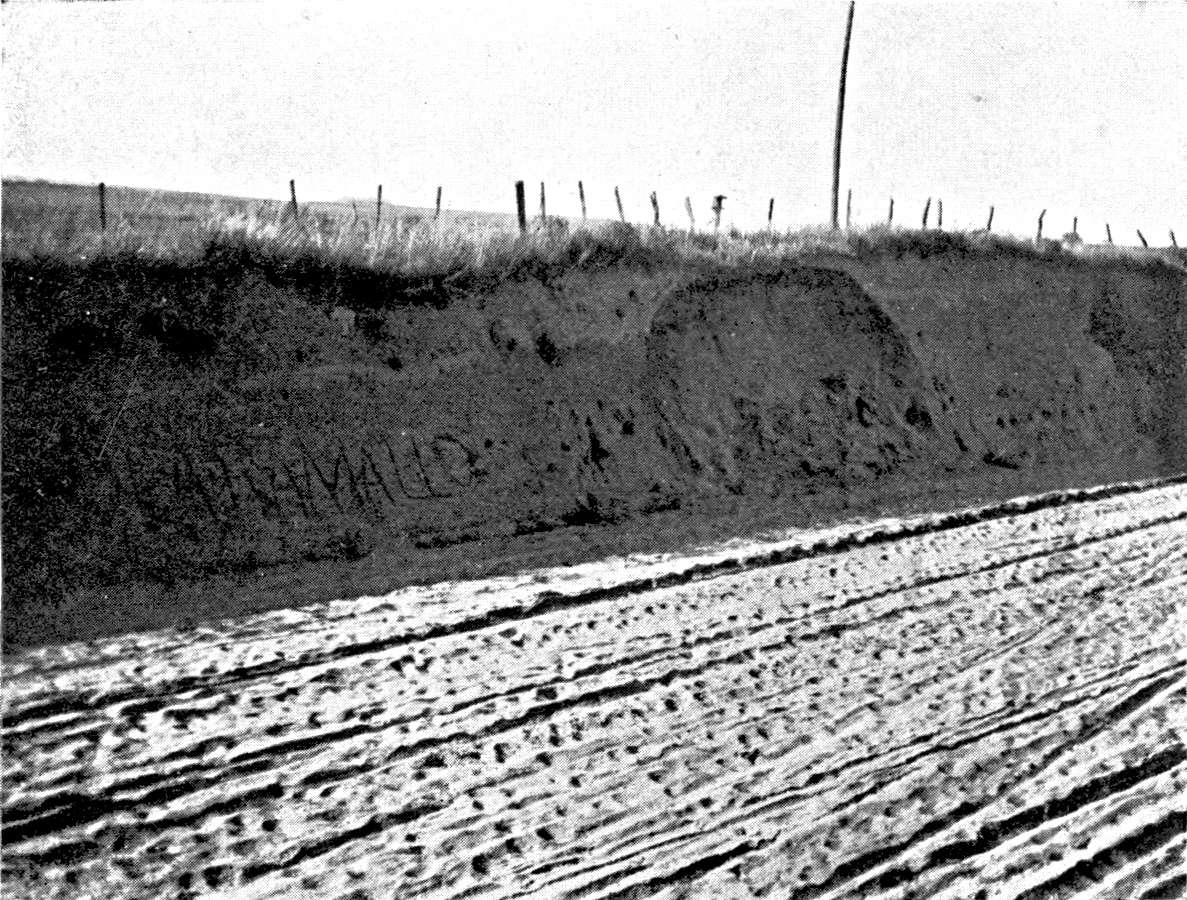
THE PAMPEAN PLAIN. JUNIN (150 MILES WEST OF BUENOS
AIRES, 330 FEET ELEVATION).
The clays. A line of dead dunes crosses the
Junin district, following the course of the Salado. They are
indicated by light, sandy soil, very different from the clays
of the north of Buenos Aires province.
Photograph by the Author.
Plate XVII.
Click to view larger image.
[Pg 195]
On the other hand, colonization has kept the land won in the
district of the middle Salado, and it extends in a sporadic way toward
the south-west and west. (Nueve de Julio, 252 square kilometres of
wheat and 400 of maize: Veinte Cinco de Mayo, 84 square kilometres
of wheat and 218 of maize: Junin, 197 square kilometres of wheat
and 204 of maize in 1895). It has been maintained ever since, with
slow progress, but without being ousted by breeding. This is one of
the regions of the Pampa where the most different types of rural
exploitation are mingled together. Agricultural colonization has
been carried on both by small proprietors and farmers or tenants.
Wheat and maize seem to be permanently associated, and the climate
is equally good for both; the maize crop being the better if the
summer is wet, and the wheat crop when the summer is dry. The two
cereals follow each other on the same land, in rotation, the wheat
being helped by the constant weeding and clearing which the maize
requires. The colonists use oxen in the work, and fatten them
afterwards.100
Agricultural colonization in the lucerne region dates
from 1895 to 1905:
|
Wheat Area (in kilometres). |
Flax Area (in kilometres). |
| 1895 |
1908 |
1895 |
1908 |
| Buenos Aires: | | | | |
| Lincoln | 152 | 819 | | 100 |
| Pehuajo | 106 | 727 | | |
| Guamini | 20 | 528 | | |
| Trenque Lauquen | 100 | 1,439 | | 59 |
| Villegas | 4 | 812 | 1 | 84 |
| Pinto | | 469 | | 60 |
| Córdoba: | | | | |
| Gal. Roca | | 1,009 | | 89 |
| Rio Quarto | 5 | 1,156 | | 172 |
| Juarez Celman | 144 | 1,679 | | 183 |
| Union | 373 | 2,548 | 12 | 316 |
[Pg 196]
I have shown how this was bound up with the development of the
lucerne farms themselves. The extreme west of the lucerne belt
(Pedernera department and San Luis) is the only place where the
cultivated area was reduced. The contracts by which the ranchers
entrust their lands to the colonists, on condition of returning
them sown with lucerne, were gradually modified as the stream of
colonization developed. The land was at first left to the colonist rent
free, the rancher being paid by the creation of the lucerne fields. But
in proportion to the increasing volume of the stream of immigrants,
and the keener competition of the colonists, the rancher asked better
terms. There are similar contracts in regard to the restoration of
lucerne fields which have been worn out by pasturage, so that the land
has to be ploughed up periodically. The men who clear the land in the
lucerne belt have mostly been recruited in the district of the old
colonies of Santa Fé, where the new generation had begun to feel
the pinch. The crops which they raise during the four or five years of
their lease are chosen without any idea of sparing lands which they are
not to keep. Wheat succeeds wheat, and the first and last crop is often
flax. The proportion of flax is lower only in the southern part of the
lucerne belt. In the Buenos Aires province the colonist grows lucerne
on his own account, either to sell as dry fodder or for breeding or
fattening.
Colonization does not in these parts correspond with the division
of property. Not only does the farmer not become the owner of the soil,
but he does not live on it permanently; he is a veritable nomad. His
house has a temporary look that strikes one at the first glance. The
area cultivated is almost stable, if the region is considered as a
whole. But cultivation passes periodically from one section to another,
and its removals cause sudden alterations or crises in the railway
traffic and the development of the urban centres.
The lucerne belt has been peopled by Santafecinos, and it has in
turn sent colonists to the western agricultural
[Pg 197]
belt at the foot of the Sierras de San Luis and de Córdoba.
They have less suitable climatological conditions, but they have the
advantage of greater stability, as the breeders do not dispute the land
with them.
While agricultural colonization has been an aid to pastoral
colonization in the north-west of Buenos Aires, it tends to displace
breeding, or restrict its sphere, in the north-east and the south.
Maize-growing started on the banks of the Paraná, where it was
already paramount in 1889, between Campana (north of Buenos Aires) and
San Nicolas. In 1895 it advanced up the Paraná as far as the
Santa Fé province (Constitución) and spread over the
interior for some sixty miles in the Salto department. In the next few
years it made rapid progress toward the west and north-west, covering
the departments of Pergamino, Rojas, and Colon, and part of General
Lopez, San Lorenzo, and Constitución in the province of Santa
Fé.
|
Maize Area. |
Flax Area. |
| 1889 |
1895 |
1908 |
1889 |
1895 |
1908 |
| Campana |
67 |
45 |
22 |
15 |
31 |
17 |
| Baradero |
339 |
260 |
291 |
26 |
78 |
173 |
| S. Pedro |
398 |
353 |
420 |
5 |
73 |
235 |
| Arrecifes |
124 |
126 |
155 |
15 |
50 |
265 |
| Salto |
16 |
326 |
236 |
13 |
3 |
75 |
| Gal. Lopez |
} 51 { |
373 |
1,538 |
|
70 |
752 |
| Constitución |
575 |
736 |
|
270 |
404 |
| Pergamino |
168 |
160 |
340 |
50 |
30 |
275 |
| Rojas |
86 |
81 |
247 |
4 |
23 |
275 |
| Colon |
|
44 |
126 |
|
14 |
78 |
| S. Lorenzo |
178 |
150 |
1,169 |
11 |
36 |
450 |
| Caseros |
|
83 |
990 |
|
13 |
319 |
Export of Argentine maize on a large scale began in 1895.
Flax-growing was not added to maize until 1900.
The heavy land requires a good deal of harrowing,
[Pg 198]
and the weeding and harvesting of the maize give employment to a
comparatively large staff. The estates are of moderate size, often only
50 hectares. Ownership was not divided at the period of colonization,
the land, thanks to the breeders, having already acquired so high a
value that the colonists could not buy it. On the lands which have been
farmed out there has developed a rural, and often far from docile,
proletariat. It is in the maize region that the worst agricultural
strikes have taken place. The struggles of the owners and the colonists
are the more prolonged because the sowing of the maize can be put back
to the end of the spring without much harm being done. The adjoining
zone of the Paraná produced some of the maiseros who have
scattered over the north-west. But the modern colonies include,
in addition, a large proportion of immigrants who have recently
landed from Italy and Spain. The maize growers do not mix with the
wheat-growers. Each group has its own area.
The increase of wheat-growing in the south dates only from 1898:
| Wheat Area (in kilometres). |
|---|
| 1895 | 1908 |
|---|
| Alsina | 45 | 1,296 |
| Puan | 52 | 1,321 |
| Suarez | 104 | 978 |
| La Madrid | 75 | 249 |
| Pringles | 13 | 724 |
| Darrego | | 885 |
| Terr. de la Pampa | | 1,731 |

MAP IV.—DENSITY OF THE MAIZE CROP.
As it needs more heat and moisture than wheat, the maize
does not go so far to the west and south. It is concentrated
for export at the ports of the Rio de la Plata and the
Paraná, especially at Rosario. The Argentine "corn
belt," the chief maize area, extends back of Rosario and San
Nicolas to beyond Casilda and Pergamino.
Click to view larger image.
[Pg 199]
Wheat first spread along the line from Buenos Aires to Bahía
Blanca, west of the Sierra de la Ventana, then in the coastal district,
east of Bahía Blanca. These two wheat-areas became connected
after 1904, when the opening of the direct line from Olavarria to
Buenos Aires facilitated the development of the intermediate region
(Pringles-Laprida). From Bahía Blanca it spread to the west and
north-west along the Toay line, and southward as far as Colorado on
the coast. In the whole area of the Central Pampa it is still possible
to distinguish two strata of immigrants, of different dates, one
superimposed upon the other: the sheep-breeders and the farmers. Round
Toay the contrast between the two elements of the population is even
more striking, because the first pastoral colonization, which dates
from 1890, was to a great extent the work of creole puntanos (from
the San Luis province). The actual agricultural colonies, on the other
hand, include recent European immigrants and colonists from other parts
of the provinces of Buenos Aires and Entre Rios.
The yield of the wheat grows less and less as one goes westward. The
harvest may be injured either by late frost or drought, or, especially,
by hot winds which scorch the plants and blight the half-realized hopes
of the farmers in the weeks just before the harvest. But the relative
poorness of the return is compensated by the extent of the farms and
the cheapness of labour. The harvest is often done with machines that
peel and pack the wheat, and the workers are not compelled, as they are
at Santa Fé, to wait for the threshing machine. The aridity does
not permit flax-growing, but oats can be grown, especially between the
Sierra de la Ventana and the Sierra de Tandil; and it is good to sow
oats when the land has been impoverished by consecutive crops of wheat.
Exports of oats through Bahía Blanca began in 1906.
The displacement of breeding by farming is less thorough than in
the maize belt. Oats, sown about the beginning of autumn, serve for
fodder. The animals are kept in the fields during the winter, and
the oats are cut and put into the mill, without being threshed, as a
reserve fodder. Moreover, the wheat
[Pg 200]
farmers have themselves taken to rearing sheep, and the sheep feed in
the stubble and fallow.
From this short account of the history of colonization we draw
certain important conclusions. At the time when agricultural
colonization began, it was admitted that farming was the best way
to exploit the soil, and that the Pampa would sooner or later pass
from the pastoral to the agricultural cycle; or, to use the local
phraseology, that the "colony" would replace the ranch everywhere. This
idea was wrong. The only area in which the facts seem to give it any
support is the corn belt. The general rule is, on the contrary, that
in its progress colonization develops a mixed type of exploitation,
combining farming and breeding; either one alternates with the other in
a sort of periodic rotation, as in the lucerne area, or both proceed
together, the farmers including breeding amongst their occupations, as
in the district of the Santa Fé colonies or in the wheat area in
the south of the Buenos Aires province.
It seems, moreover, that the development of colonization depends not
only upon physical conditions, but upon factors of a purely economic or
social character, which the geographer must not overlook. It will be
enough here to indicate the chief of these.
We have seen the part that has been played in the exploitation of
the soil by groups of colonists who swarm from one area to another.
Whether we think of the ranchers of the eastern part of Buenos Aires
transplanting themselves to Córdoba or north of Santa Fé,
the sheep-breeders moving westward, or the Santa Fé colonists
settling in the lucerne area, they all take with them their own habits
and methods of work, and they take time to adjust them to a new
environment.

MAP V.—DENSITY OF THE WHEAT CROP.
The wheat belt stretches in a broad
section of a circle from Bahía Blanca to Santa
Fé, which is now reached by maritime vessels. The
cultivation of wheat crosses the line of 600 millimetres of
rainfall and even the 400-millimetre line, in proportion as
one passes from the area of summer rain to that of spring and
autumn rain.
Click to view larger image.
[Pg 201]
The colonist, whether breeder or farmer, is not left to himself.
Colonization is sustained and directed by speculation in land, and
is influenced by it. Speculation discounts the work of the colonist,
and attaches to the land a value which is not based upon the revenue
it has produced, but upon that which the speculator calculates that
it may produce in the future. If the speculator is audacious, he does
not let himself be discouraged by initial bad experiences; it takes
repeated checks to exhaust his optimism. The colonist, even if his
farming accounts do not show a profit, may nevertheless gain something
if the value of his land goes up. The increase of his capital conceals
from him the smallness of his returns, especially as he can easily get
advances on the value of his property from the banks, and this enables
him to draw upon his wealth every year.
Speculation is concerned with new lands on the fringe of the area
already colonized, where the soil is, as a general rule, already in the
hands of the exploiters themselves. The speculators, having paid a high
price for these lands, try to organize the development of them. It is
partly owing to their influence that colonization continuously enlarges
its domain, instead of concentrating its labour in the older districts
where it might sometimes be more productive. In fine, speculation in
land has a profound influence on the conditions of colonization, making
it more difficult for the colonist to buy the land he is developing.
The owner who grants him the use of the land means to keep for himself
any increment of its value. He rents, but he will not sell.
Thus the history of colonization cannot be separated from the
traffic in land. The special features of this traffic in the Pampean
region—its concentration at Buenos Aires; the creation of a
land-market resembling a stock market; the practice of selling on the
instalment plan, which enables small capitalists to enter the market;
the repeated transfers of pieces of land which the buyers have never
seen and which they know only from plans—are one of the most
original aspects of modern Argentina. They are partly due to a fact of
a geographical nature—the
[Pg 202]
uniformity of the Pampean plain, on which every piece of land is worth
about as much as the adjoining piece.
Colonization is easy and rapid in proportion as it requires less
capital and labour. The expansion of breeding in the west between 1880
and 1890 was facilitated by the low market price of cattle at that
time. Breeding has the advantage over farming of not needing so large
a staff, but it requires a larger capital. Of the crops, assuming that
the conditions of soil and climate are equally favourable, wheat is
better than maize for colonization, because the preparing of the soil
and the harvest can be done more speedily, and the same number of hands
can plant a larger area with wheat than with maize.
[Pg 203]
The action of the Argentine Government and the provincial
authorities has been restrained, apart from the earliest period
of the establishment of the Santa Fé colonies, both as
regards the securing of immigrants, the distribution of lands,
and the administration of the colonies.101
Colonization has been, on the whole, a private affair. The work
of organizing colonization has at times been undertaken by the
proprietors themselves; they leased pieces of land and got a good price
for them, at the same time increasing the surplus value of the plots
they kept for themselves by promoting the increase of population.
Sometimes it was undertaken by Colonization Companies, which bought
land to divide and sell. More frequently it was undertaken by merchants
who advanced credit to the colonists they settled, on condition that
the colonists bought what they needed of the merchants, and entrusted
them with the sale of their crops. The migration of the Santa Fé
colonists was partly due to, and sustained by, a corresponding
migration of merchants who had acquired wealth in the older colonies,
and who thus got a larger body of customers. The merchant who organizes
colonization often acts as the intermediary between the owner and
the colonist, guaranteeing the owner a fixed rent for his land and
receiving so much per cent. of his harvest from the farmer. This system
is very widespread in the corn belt, but it is found all over the plain
of the Pampas. It tends to disappear when the colony is older and
deeper-rooted, as the colonist gradually earns his independence; he
buys his lease, his equipment, and his furniture, and controls the sale
of his own crops. In the districts where he has not become owner, the
leases are generally variations of two types: farming leases, where the
colonist has capital enough for working, and renting leases, where the
capital is provided by the owner or the middleman.
Lastly, colonization can make no progress unless it finds markets
on which it can put its produce. Up to the present western Europe has
been the chief market for the wool, leather, meat, and cereals of the
Pampean region; tropical America absorbs part of the output of the
saladeros, flour, and dry fodder; and North America has recently
begun to compete with Europe for wool, leather, and frozen meat. The
facility with which the products of the Pampa have found their way into
the world's markets, as is seen in the comparative stability of the
returns, explains the continuous advance of colonization and the short
duration of the crises which have disturbed it.
The home market, however, has had an importance in connection with
colonization that must not be overlooked. When wheat-growing spread at
Santa Fé the crop was at first devoted to supplying Buenos
[Pg 204]
Aires, and as late as 1883 Zeballos thought that the essential result
of agricultural colonization was the fact that Chilean flour was beaten
off the Argentine market. Even to-day the districts on the outskirts of
the cereal area depend upon the home market. The Villa Mercedes mill
supplies Mendoza. Córdoba and Santa Fé send their flour
to Tucumán. The price of cereals still shows slight fluctuations
in these parts as compared with prices in Buenos Aires.
Table of Exports of the Chief Products of the Pampean region
(in thousands of tons):
| 1901 | 1905 | 1910 | 1913 | 1914 |
|---|
| Wheat | 904 | 2,868 | 1,883 | 2,812 | 980 |
| Maize | 1,112 | 2,222 | 2,660 | 4,806 | 3,542 |
| Flax | 338 | 654 | 604 | 1,016 | 841 |
| Flour | 71 | 144 | 115 | 124 | 67 |
| Wool | 228 | 191 | 150 | 120 | 117 |
| Salted hides | 28 | 40 | 61 | 65 | 63 |
| Dried hides | 26 | 24 | 29 | 21 | 14 |
| Chilled beef | 44 | 152 | 253 | 306 | 368 |
| Chilled mutton | 63 | 78 | 75 | 45 | 58 |
The heading "cereals" appears in the statistics of
Argentine exports in 1882. In 1900 the value of the
agricultural produce exported is equal to that of the products
of breeding. In 1904 it is higher.
Pastoral colonization, again, has not been entirely independent of
the home market. Martin de Moussy says, it is true, that the area which
sent the products of breeding to Europe in 1865 extended as far as the
Sierra de Córdoba. But this statement needs correction. The
hides from the whole of this zone were, in point of fact, sent down to
the ports on the Rio de la Plata, but live animals were sent to Chile
from the whole of the north-west of the Pampean region. It was for the
purpose of selling cattle to Chile that ranches were multiplied about
1860 in the neighbourhood of Villa Mercedes and lower down, on the Rio
Quinto. Jegou's
[Pg 205]
description shows that even in 1883 the breeders of the San Luis
province devoted themselves exclusively to supplying the Chilean
market.102 Buyers from Chile
and the Andean provinces still visit Villa Mercedes, and until a recent
date they came to Villa Maria, in the province of Córdoba. The
Santa Fé ranches found their customers, until the opening of the
Córdoba line (1870) amongst the troperos, who bought draught
oxen for their waggons. The loss of these customers and the crisis that
followed are one of the reasons why agricultural colonization met with
so little resistance on the part of the breeders, and was able to take
root so easily at Santa Fé. In the San Cristobal department
the breeders who settled there after 1890 found their first market in
the obrajes of the neighbouring forest. The opening of the railway
to Tucumán afterwards enabled them to send their cattle to the
provinces of the north-west. The Buenos Aires buyers were late in this
remote canton of the Pampean plain. They did not arrive until 1911.
The importance of the Pampean region itself as a market of
consumption grew in proportion to the increase of its population. The
extent to which it absorbs the products of breeding and agriculture
varies a good deal. For some of them it is paramount. Horse-breeding,
for instance, which is still one of the great industries of the Pampa,
has never contributed to the export trade. It is the same with regard
to potatoes, which are concentrated in two strictly limited districts,
round Rosario and north of the Sierra de Tandil. Only a small part of
the dry fodder is exported. As regards cereals, a comparison of the
statistics of production with the statistics of export shows that the
home consumption is about one-third of the production. It is almost nil
for flax, and nearly fifty per cent for wheat.
[Pg 206]
The average of production and export for the years 1912, 1913,
and 1914, in thousands of tons, is:
|
Wheat. |
Maize. |
Flax. |
Total (including Oats). |
| Production | 4,241 | 6,398 | 931 | 12,662 |
| Export | 2,140 | 4,227 | 790 | 8,038 |
As the chief centres of consumption are the ports themselves, it
follows that the commercial currents that have to supply them are
confused with the currents which maintain the exports. The exchanges
between the various regions of the Pampa are more interesting to the
geographer. In their tendency to specialize, these regions have ceased
to be self-contained, and they have to look to adjoining regions. The
feeding of the mills necessitates the transport of wheat in different
directions. The chief mills are at Buenos Aires, where they are
suitably located to work both for the home market and for export; and
the mills in the interior have some difficulty in competing with them.
Some of these, however, are still active. They mix hard wheat, bought
in the district of the Santa Fé colonies, with the soft wheat
that is grown in the middle and south of Buenos Aires province.
But this inter-regional transport of cereals is a small thing in
comparison with the transport of cattle. The extension of the lucerne
farms has developed the fattening industry in many districts, while
others still confine themselves to breeding in the ordinary sense, and
they feed the other centres. The most specialized fattening district is
that of Villa Mercedes and the western part of the lucerne belt, while
the eastern part of the province of Buenos Aires and Entre Rios are
still areas of production. The differentiation of the pastoral zones
can be gathered from a study of the statistics. According to the 1908
Census, milch
[Pg 207]
cows represent 53 per cent. of the whole of the cattle in all the
departments which form the heart of the breeding area east of Buenos
Aires, and only 45 per cent. in the departments of the north-west
of Buenos Aires and south of Córdoba and in the Pedernera
department of San Luis, where fattening is common.
According to the 1914 Census oxen are 24 per cent. of the herd in
the same departments of eastern Buenos Aires; 24 per cent. also in
Entre Rios; and the proportion rises to 31 per cent. in the lucerne
area. Dolores department (eastern Buenos Aires) has 64 per cent. milch
cows and 21 per cent. oxen. Pedernera department (San Luis, in the
lucerne area) has 49 per cent. cows and 38 per cent. oxen. General
Roca department (Córdoba) has 48 per cent. cows and 34 per
cent. oxen. Arenales (Buenos Aires) has 39 per cent. cows and 46 per
cent. oxen.103
Oxen intended for the refrigerators are bought either on the ranches
or at Buenos Aires, where beasts in good condition are consigned to
buyers, but oxen for fattening are bought at fairs which are held
periodically in the towns of the interior. Another transaction at
these fairs is the trade in pedigree breeders. The best known of them
is held at Villa Mercedes (province of San Luis), where 8,000 oxen
are sold every month. At the Mercedes fairs one may see Durham steers
from the east of Buenos Aires which are to be fattened and sent back
to the refrigerators or the slaughter-houses of Buenos Aires. There
are also creole cattle from the north of the San Luis province and
Rioja which will later be eaten in Mendoza or in Chile. There is, in
fact, on the western frontier of the Pampa no line of demarcation
corresponding to that set up in the north by the limit of the area
contaminated by the garrapate, separating the district of creole
breeding from that of selective breeding. There is free communication
here between the two zones, and the lucerne fields for fattening at
Villa Mercedes are used in common by the breeders of the Pampa and
of the bush.104
[Pg 208]
Cultivated Areas in the Argentine Republic (in
square kilometres, almost exclusively in the Pampean
region).
|
Wheat. |
Maize. |
Oats. |
Flax. |
Lucerne. |
| 1896 |
25,000 |
14,000 |
— |
5,600 |
8,000 |
| 1900 |
33,000 |
12,000 |
— |
6,000 |
15,000 |
| 1902 |
36,000 |
18,000 |
— |
15,000 |
17,000 |
| 1905 |
56,000 |
22,000 |
700 |
10,000 |
29,000 |
| 1910 |
62,000 |
32,000 |
8,000 |
15,000 |
54,000 |
| 1912 |
69,000 |
38,000 |
12,000 |
17,000 |
59,000 |
| 1913 |
65,000 |
41,000 |
11,600 |
17,000 |
66,000 |
| 1914 |
62,000 |
42,000 |
11,400 |
17,000 |
— |
Exports for 1913, 1914, and 1915 at each port.
|
Wheat. |
Maize. |
Flax. |
Oats. |
Totals. |
Average. |
| Rosario |
782 |
1,757 |
275 |
13 |
2,829 |
2,716 |
| 242 |
1,952 |
248 |
1 |
2,445 |
| 717 |
1,790 |
366 |
— |
2,875 |
|
| Buenos Aires |
441 |
1,389 |
246 |
240 |
2,318 |
2,051 |
| 297 |
906 |
55 |
78 |
1,537 |
| 511 |
1,349 |
342 |
96 |
2,299 |
|
| Bahía Blanca |
927 |
2 |
— |
462 |
1,393 |
1,075 |
| 241 |
— |
— |
222 |
463 |
| 921 |
— |
— |
442 |
1,364 |
|
| S. Nicolas |
5 |
910 |
74 |
— |
989 |
651 |
| 1 |
430 |
60 |
— |
492 |
| 5 |
420 |
48 |
— |
474 |
|
| La Plata |
333 |
358 |
14 |
170 |
876 |
459 |
| 160 |
51 |
16 |
49 |
278 |
| 152 |
45 |
6 |
16 |
222 |
|
| Santa Fé |
265 |
51 |
158 |
— |
476 |
278 |
| 7 |
23 |
128 |
— |
159 |
| 114 |
7 |
77 |
— |
199 |
[Pg 209]
Roads on the plain—The salt road—The "trade
route"—Transport by ox-waggons—Arrieros and
Troperos—Railways and colonization—The trade
in cereals—Home traffic and the reorganization of the
system.
The chapter devoted to primitive breeding and the transport of
cattle contains a sketch of the network of routes over the Andes. One
cannot expect to find in the scheme of routes over the Argentine plains
the stern and obvious influence of natural conditions. The surface of
these plains is, as a whole, broadly open to traffic. Still, the map of
the roads bears much evidence of geographical exigencies.
The hills which rise like islands out of the alluvial plain are not
all incapable of being crossed, and the roads do not always skirt them.
The road from Buenos Aires to Peru runs north of 30° 40′
S. lat. on the very axis of the granite peneplain which forms the
northern part of the Sierra de Córdoba. The Dean Funes ridge,
which begins with an altitude of 2,500 feet between the Sierra Chica
and these tablelands, has always been used for communication between
Córdoba and the north-western provinces. There the railway has
taken the place of the primitive track. Another important track crosses
the Sierra de Córdoba in the north of the Pampa de Achala, and
used to join Córdoba with Villa Dolores and the north of the San
Luis province. The southern part of the Sierra de Córdoba and
the Sierra de San Luis are, on the
[Pg 210]
other hand, an insurmountable obstacle, which diverts southward the
high road to Chile via Achiras, San José, del Morro, and San
Luis.
The sierras of the Buenos Aires province are not so high and
extensive. They are, moreover, broken into isolated hills with the
plain passing between them. As early as 1822 Colonel Garcia pointed
out the importance, in connection with the migrations of the Indian
tribes, of the passage between the Sierra Amarilla and the Sierra de
Curaco, that is to say, the Olavarria ridge. It is there that the
first railway between Buenos Aires and Bahía Blanca crosses
the line of sierras. It then skirts the Sierra de la Ventana, to the
north, by the Pigüe ridge, between the mass of Curumalan and the
Puan hills. The dunes of the western Pampa also are an impediment
to traffic, not so much because of their height as because of the
looseness of the ground. The strip between General Acha and Toay
was very trying for the stage-coaches. Travellers had to cross the
dunes on foot during the winter season, when the horses were in a bad
condition.105
Natural supplies of water increase in number as one gets away from
the Andean zone toward the east. Still, the chief work, often the only
work, to be done in making a road is the arrangement of permanent
supplies of water. Martin de Moussy mentions the digging of wells on
the new road from Córdoba to Rosario, which was opened about
1860. The aiguade was generally a represa, a reservoir, where the
water accumulated behind a barrier of earth raised across the course
of an intermittent stream. The upkeep of the represa is the chief
duty of the post-master. The edge of the sierras and the opening
point of the ravines which come down them is a good place for making
represas, and the roads frequently keep to these (variant of the
road from Córdoba to Tucumán via Totoral, Dormida, Rio
Seco and Sumampa, on the eastern edge of the Sierra de Córdoba,
etc.) Long stages with no water supplies, the travesías, are
not found on the made roads, as a rule, except west of the meridian,
of Córdoba. However, the direct road from Santa Fé to
Santiago del Estero by the lagoon of Los Porongos, which was used in
the eighteenth century, seems to have been abandoned afterwards, as
much on account of the difficulty of supplying water as because it was
exposed to attack from the Indians.
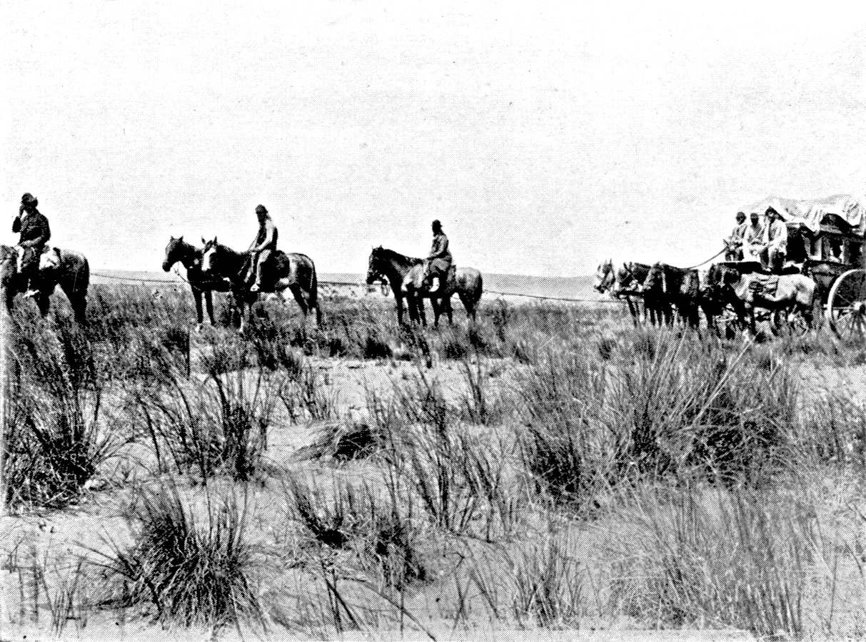
THE MAIL COACH.
The horses saddled with the cincha.
Photograph by Soc. Fotografica de Aficionados.
Plate XVIII.
Click to view larger image.
[Pg 211]
The only difficulty which the caravans encountered on the roads over
the plain was the crossing of the rivers. They were forded. Fords with
a muddy bottom on the lower course of the rivers, such as that on the
Saladillo near the confluence of the Rio Tercero, were more difficult
for wagons than the fords with sandy bottoms in the upper course, near
the fringe of the mountains, such as those of the Rio Tercero on the
Córdoba road, or of the Rio Cuarto on the road to Chile. After
rain, certain parts of the plain are flooded and impassable. That is
the case in the district to the south of the lower Salado, at the very
spot where Père Cardiel notices the lack of water in the dry
season (1747). The direct road from Buenos Aires to the sierras was
at that point exposed, alternately, to drought and flood. The line
of the Southern railway, which crosses this low district, is still
cut periodically on both sides of Las Flores by floods. The lack of
an organized network of streams, the irregularity of the rains, the
difficulty of ascertaining the inclination, and the flow of the waters
over a plain which seems to the eye to be perfectly level, have led to
more than one miscalculation on the part of the railways, which were
constructed hurriedly, and before the general survey of the Pampa was
finished. Some lines, on the Pampa or on the Chaco,
[Pg 212]
have had to be partially reconstructed, and raised higher, after a
series of rainy years.106
The colonization of that part of the plain which actually
constitutes the province of Buenos Aires was late. It belongs to the
era of the railways. There is only one historic road crossing this
area, which remained until the last third of the nineteenth century
in the hands of the Indian tribes. This is the salt road. We do not
know exactly when it began to be used. In the eighteenth century, in
spite of the competition of salt from Cadiz and Patagonia, imported by
sea, the Pampa salt was the main part of the supply of Buenos Aires.
The salt road was not abandoned until after 1810. We still have the
diary of several journeys from Buenos Aires to the salt-pits. They
were military expeditions. Hundreds of wagons, with a strong escort,
collected at Lujan and Chivilcoy, and they reached Atreuco, west of the
Guamini and Carbuë lakes, after a fifteen to twenty-five days'
march.
[Pg 213]
The itinerary was fixed in detail. In 1796 D'Azara noticed the
wells sunk by the salters, north of the Palentelen lagoon (Bragado),
when they found the lagoon dry. From Palentelen south-westward the
salt road followed the track used by the Indians of the south-west in
their expeditions against the ranches of the Buenos Aires frontier.
Near Lake Epecuen, north of Carbuë, it was joined by another
track which came from Olavarria, the stages of which were marked by
the streams that came from the Sierra de Curumalan. The Carbuë
district, the cross-roads of the tracks, was one of the places where
the tribes collected. "This place," says the diary of the 1778
expedition, "is the first point where the hostile Indians meet and
rest when they leave the Sierra and on returning from their invasions.
They not only rest there, but have their winter pasture there" (in the
dry season).107 Zeballos has
described the Indian track, the rustrillada, between Epecuen,
Atreuco and Traru Lauquen, where the travesia on the road to
Chile began.108 It was not less
than 1,000 feet in width. At the foot of the dunes there were deep
parallel grooves made by the feet of the raided cattle, which were
taken away by the "Chileños."
The two main roads of the colonial period are the roads to Chile
and Peru. On leaving Buenos Aires there was one road for a distance
of about 320 miles. The "trade road" passed through Lujan, Areco and
Sauce, and reached the Carcaraña, or Rio Tercero, at Esquina.
It therefore kept at some distance from the Paraná (32 to 16
miles), on the tableland, crossing the valleys which were embedded in
it and represented so many bad parts. It then ascended the Tercero on
the right bank as far as the Paso Fereira, at the spot where Villa
Maria is to-day. At Esquina de Medrano (Villa Maria) the road to Chile
branched off to the south-east, reached San Luis by following the Rio
Cuarto, going through Achiras and San José del Morro, and, after
a travesia seventy-eight miles in length, came to the Rio Tunuyan at
La Paz, and ascended the river to Mendoza.109
[Pg 214]
From Esquina de Medrano the Peru road made for Córdoba in
the north-west. From the tablelands which continue the Sierra de
Córdoba northward it descended toward the Rio Dulce, which it
reached west of Atamisqui, and which it followed as far as Santiago
del Estero, where it crossed to the north bank. It crossed the Sali in
the latitude of Tucumán, and, passing through Tracas and Metan,
followed the depression which separates the Andes from the sub-Andean
chains. From Salta it went north to Jujuy, and passed through the
Quebrada de Humahuaca to reach the Puna.
The influence of rivers is not much seen in the scheme of the
primitive roads. There were in the sixteenth century many routes from
Peru to the Paraguay, across the Chaco, but not a permanent road in the
strict sense. In the eighteenth century there was a direct road from
Santa Fé to Tucumán, by the north of the Los Porongos
lagoon and the course of the Rio Dulce. There was another from Santa
Fé to Córdoba. These roads were not exclusively used for
conveying cattle. The river route which they joined at Santa Fé
provided them with a certain amount of traffic coming from the higher
provinces. Paraguayan maté reached the Andean regions by
this road, and in return the boatmen at Santa Fé loaded up
with the wines and dried fruit of the Andean provinces to take to
Asunciôn.
The question of joining the road on to a river was not of very great
importance until the time when the Paraná began to be used for
Argentine imports and exports, and to maintain the communication of
the interior provinces with Europe. This question of connection with a
river controls the history of the
[Pg 215]
construction of the railway system. But the great importance of it
can be seen from the first half of the nineteenth century. D'Orbigny
had a presentiment of it. Speaking of the future of Santa Fé,
he says: "When peace is restored, it is certain that the wares of
Córdoba may, instead of going by land from that town to
Buenos Aires, be sent to Santa Fé, where shipping them to
the Argentine capital will reduce to one-third the journey by land,
which is always more costly than going by water." Martin de Moussy,
foreseeing the making of a road across the Chaco from Tucumán
to the Paraná, in the latitude of Corrientes, calculates that
Corrientes may later serve as port for part of the west and north
of Argentina. At the date of the publication of his book, however,
it was neither Santa Fé nor Corrientes, but the new town
Rosario, that began to play the part of interior port, and led to
the construction of a new system of roads. Traffic between Rosario
and Córdoba at first followed the old road from Buenos Aires
to Peru, which one struck after leaving Rosario and making a detour
to the south-west, on the right bank of the Carcaraña (at
Rio Tercero). But this itinerary was presently replaced by a direct
road to the west-northwest, following the line which the railways
would adopt.110
[Pg 216]
In the greater part of Argentina transport was by means of wagons
before railways were constructed. The limit between the area of
wagon-transport and the area in which goods were conveyed on the backs
of animals is quite stable. It is still of some significance, in
spite of the development of the railways; wagons and mules are used
at each station to collect and distribute goods. The area of farming
and of selective breeding on the Pampa, the sheep-area in Patagonia,
and the timber belt on the Chaco, still make use of wagons; and goods
are carried on the backs of mules in the Andean area. The Peru road
was, broadly speaking, fit for wagons as far as Salta, but it is rough
between Tucumán and Salta, and wagons that used it generally
stopped at Salta. In this way wagons avoided the ford of the Sali,
which was easier for mules. On the plain itself the water-sources were
often so distant from each other, and the stages so long, that mules
had to be used instead of wagons. Wagons could easily get to Mendoza by
the road along which the Tunuyan runs at its driest section, but all
the convoys from Córdoba to San Juan, or Rioja to Catamarca,
were composed of mules. Hence Córdoba was, like Tucumán,
a station for changing on the road from Buenos Aires to the north-west.
Lastly, while the scrub presented no insuperable obstacle to wagons,
they could not enter the humid tropical forest, where the soil never
dries. On the fringe of the Misiones forest, the wagons that came from
San Tome unloaded at San Javier, and mules took the goods on to the
yerbales.
The two areas of different kinds of transport were not sharply
distinct. The muleteers (arrieros) sometimes avoided the domain
of the wagoners, and competed with them as far as the banks of the
Paraná. In 1860 (Hutchinson) the muleteers carried about a
fifth, in weight, of the goods from the interior to Rosario, and they
got more than a third of the transport from Rosario to the interior.
They had, however,
[Pg 217]
to offer to carry goods at two-thirds the price charged by the
wagoners. It appears that this invasion by the muleteers is connected
with a transport-crisis in the Andean area, which left a number of the
San Juan muleteers without work. It did not last. By 1862 mule-back
transport between Rosario and the interior was almost over.
The wagons of the Argentine plain have often been described by
travellers. They were heavy vehicles, carrying 150, sometimes 180,
arrobes (1,725 to 2,070 kgs.), covered with a leather hood stretched
on hoops. A long spur decorated with ostrich feathers was balanced
on a ring fixed in the roof, and was used to guide the front pair of
oxen. An earthenware pot containing water enough for each stage hung
between the rear uprights. As a rule, three pair of oxen were yoked to
it, one pair being in the shafts. At Corrientes it was necessary to
cross the marshes and esteros, and a special type of wagon had been
evolved. It had a sort of horizontal division forming an upper story,
and the driver sat in this. Everywhere, on the Pampa as well as at
Corrientes, the wheels were enormous; sometimes, as Darwin says, ten
feet in diameter. They were, therefore, able to get through the bad
parts. Mud was, as a matter of fact, the worst enemy of the convoys.
The soil of the Pampa is clayey and soft in the districts near the
river. As the road was not limited in width, the wagons turned to the
right or the left when the ruts became too deep, and the track in time
covered a broad belt of ground. This, however, could not be done in the
vicinity of towns, where the traffic was concentrated. Buenos Aires
came to be surrounded by formidable quagmires that dried up only in the
summer. The paving of the streets and environs was becoming a problem
of national importance when the construction of the railway began.
Wagons did not travel singly. The tropero, or
[Pg 218]
contractor for transport, organized caravans. In peaceful districts,
where no military escort was required, the convoys could be split up;
they consisted, as a rule, of from fifteen to fifty wagons. Besides
the six oxen yoked to the wagon, there had to be others for relief
as well as horses for the staff. Usually they allowed ten oxen to
each wagon; in exceptional cases twenty.111 The convoy to the salt-lakes in 1778 had
no less than 12,000 oxen to 600 wagons. There was a driver to each
wagon, but there had also to be drivers for the starting animals, and
carpenters to make repairs. The leader of the caravan, the capataz,
was generally a master-carpenter. He looked after the interests of the
tropero. There were about three men to each wagon. The carreros
were an original type, nomadic, and very different in costume and
character from the gauchos (breeders) of the plain. At the close of
the eighteenth century Buenos Aires had more than a thousand wagons
employed in the traffic to Mendoza and Tucumán (Borrero).
The stages were rarely more than four or five leagues of five
kilometres each (thirteen to sixteen miles). At this rate it took
a convoy forty to fifty days to go from Buenos Aires to Mendoza,
thirty days from Rosario to Tucumán, three months (with the
necessary rests) from Buenos Aires to Salta.112 When water ran short, the journey might
be greatly prolonged, as the animals could do less work, or not work
at all if the aiguades had dried up. The season was a matter for
consideration. In the Buenos Aires district the winter made the ground
sodden and traffic difficult. Farther north, winter is the dry season,
so that pasture was scarce, and it was difficult to feed the tropas.
The summer had difficulties of its own. In January and February the
floods of the Rio Dulce often made it impossible to cross the ford at
Santiago. The carriers preferred to start from the northern provinces
about the end of the summer, in April or May. The best season for
leaving Buenos Aires was the spring, from August to November. In this
way each tropa could make the double journey once a year.
[Pg 219]
There had been attempts to speed up the transport before the
railways were made. The galera (diligence), with its swarm of horses
harnessed with the cincha (saddle to which the lasso was attached),
did not carry goods. It did not replace the convoy of wagons, but the
tropilla of spare horses which travellers on the plain drove before
them. The galeriagalera went from Rosario to Córdoba in three
days and to Mendoza in ten days, and from Córdoba to Salta in
fourteen days. About 1860 a quicker goods service was organized, light
wagons drawn by mules replacing the ox-wagons. They made the journey
from Rosario to Córdoba in six days. Similarly, on the Pampa,
the ox-wagons had been replaced before 1889 by quicker wagons, drawn by
horses, to convey wool from the ranches to the railway stations.
The cost of transport by wagon was, naturally, high. It also varied
a good deal, but we cannot possibly go into these variations here.
It will be enough to give, by way of illustration, the details which
Hutchinson gives for the year 1862. The freightage was fixed either for
a complete load of 150 arrobes (1,725 kgs.) or so much per arrobe
(11½ kgs.). Conveying a load from Rosario to Córdoba cost
forty to fifty piastres (eight to ten pounds). The
[Pg 220]
cost of carrying an arrobe from Rosario to Mendoza was five to six
reales (about two shillings to two-and-six); from Rosario to Tucuman
nine reales (three shillings and fourpence); from Rosario to Salta
eighteen reales (seven shillings and sixpence). The tropas were,
therefore, quickly ousted by the railways. In a few places they made a
very unequal fight against the railways. The Memoria del departemento
de Ingenieros de la Nacion of 1876, quoted by Rebuelto, mentions the
competition of the tropas with the Andino railway, opened from Villa
Maria to the Rio Cuarto in 1873 and to Villa Mercedes in 1875. The
merchants of San Juan and Mendoza continued to use them. The railway
had to sign a contract with the troperos by which wagons were to
bring goods as far as Villa Mercedes, where they could be entrained.
The total freight was fifty Bolivian centavos (about two shillings)
per arrobe from Mendoza to Rosario, and sixty centavos from San
Juan. Of this the share of the railway was fifteen centavos.
The first Argentine railway was opened in 1859, between Buenos Aires
and Maron, a distance of about thirteen miles.
In 1870 the Argentine railways formed two independent systems. The
first radiated fan-wise from Buenos Aires (Western line, open as far
as Chivilcoy in 1870, and Southern line, open as far as Chascomus
in 1865). Farther north a line (the Central Argentine) started from
Rosario, and reached Bellville in 1866 and Córdoba in 1870.

SACKS OF WHEAT READY FOR LOADING ON THE RAILWAY.
There are elevators only in a few of the ports.
Photograph by Soc. Fotografica de Aficionados.
Plate XIX.
Click to view larger image.
[Pg 221]
The political isolation of Buenos Aires between 1852 and 1862,
during the time when the first concessions were issued, made upon
the railway system an impression that would not be effaced until
twenty-five years afterwards. It was not until 1886 that Rosario
was connected by rail with Buenos Aires. The line to Mendoza and
Chile, begun in 1870 (F. C. Andino), joins the line from Rosario to
Córdoba. It reached Mendoza at the foot of the Andes before
going on to Buenos Aires; and it was in 1888 that the Pacific railway
was completed between Buenos Aires and Villa Mercedes, and established
direct communications between the capital and the province of Cuyo.
The line from Rosario to Córdoba is, therefore, the chief
branch round which the Argentine system developed. It is remarkable
that at the time of the original concession in 1855 a westward
extension was contemplated, and that there was some idea of making it
a stage in a trans-Andean. The first concessionaire, Wheelwright, had
made the oldest railway in South America, from Caldera to Copiapo, in
Chile in 1851. The 1855 concession authorized Wheelwright to extend the
Córdoba line westward and link it with the Copiapo line. When he
opened the Córdoba station in 1870, Wheelwright, not suffering
himself to be discouraged at the slowness with which the line had
crossed the Pampa, still said that the goal was the Pacific, by way of
Rioja, Copacabana and the San Francisco pass. This ambitious programme
deserves to be recalled, if only as a reminiscence of the former
orientation of the trade of Rioja and Tinogasta toward the Pacific,
and as a proof of the importance, in the imagination of the men of
that generation, of the old trans-Andean roads from north-western
Argentina.
Even before the Rosario line had reached Córdoba, it had
been continued northward as far as Tucumán. The work was
pushed vigorously, and Tucumán was reached in 1875. The
Córdoba-Tucumán line was the first to be constructed
entirely in the region of the scrub, and quebracho sleepers were
then used for the first time. The earliest lines of the Buenos Aires
province and the Argentine had, on the model of the Indian railways,
a gauge of 5 feet 8 inches, but the Central Córdoba, from
Córdoba to Tucumán, had a
[Pg 222]
narrow gauge of forty inches. Hence goods coming from Tucumán
had to be transferred at Córdoba. At the same time (1875) the
line from Concordia to Monte Caseros was opened, and this made it
possible to avoid the rapids of the Uruguay, which was to be a source
of supply to the whole Mesopotamian system. Its gauge was fifty-seven
inches. Differences of gauge are, and will continue to be, one of the
characteristics of the Argentine system.
During the period from 1875 to 1890 were constructed the main lines
which took the place of the old roads from province to province. The
Andean railway reached San Luis in 1882 and Mendoza and San Juan in
1885. Branches of the Central Córdoba reached Santiago del
Estero in 1884 and Catamarca in 1889. In 1891 the Central Argentine
opened a new direct broad-gauge line from Rosario to Tucumán;
and almost at the same time the narrow-gauge line of the Central Norte,
from Santa Fé to Tucumán, was finished further north. The
Tucumán line was continued northward to the foot of the Andes as
far as Salta. In the province of Buenos Aires the Bahía Blanca
line was opened in 1884. Since 1900 the railways have pushed on to
the frontiers and are linked in various directions with those of the
adjoining countries. The Cumbre tunnel on the Mendoza trans-Andean was
completed in 1910, and traffic with Chile by rail is now permanent.
The Salta line was continued in 1908 to the Bolivian tableland. In
Mesopotamia, in fine, the north-eastern line reached Posadas in 1911
and effected a junction with the Paraguay line.
These details, however, give a very imperfect idea of the history of
the development of the Argentine railway system. It has not merely been
superimposed upon the old roads, but has, on the other hand, helped
to open up and develop new lands, which could not have been colonized
without it. As early as 1883
[Pg 223]
Valiento Noailles, examining the general plan of the system, noticed
the profound difference between the railways of Argentine and those
of Europe. "In Europe," he said, "the railways are constructed to
serve existing centres of production and consumption.... Our Argentine
railways are to facilitate colonization." Corresponding to each
occupation of a new area of the Pampean plain by the farmer or the
breeder is the construction in that area of a new network of lines
which are fed by its traffic and in turn help it to increase its
production. The more productive the region is, the closer are the
meshes of this network. They are wider in the pastoral than in the
agricultural areas. The period of the development of the southern
lines in the province of Buenos Aires corresponds with the expansion
of breeding when the Pampa had been pacified. The railway reached
Azul in 1876. The Ayacucho branch was opened in 1880, and continued
as far as Tres Arroyos in 1887. The completion of the Bahía
Blanca line, via Azul and Olavarria, in 1884, is itself merely one of
the dates in this colonizing period. The great period of agricultural
colonization at Santa Fé and the construction of the system
of lines that serve it begin a little later, and last from 1880 to
1890 (extension of the Central Argentine system, the railways of the
province of Santa Fé, and the narrow-gauge railway from Rosario
to Córdoba).
The part that the railway has played in colonization is plainly seen
in the present completion of the system which has developed freely on
the even surface of the Pampean plain. The lines radiate round the port
of Buenos Aires and, in a less degree, round the ports of Rosario and
Bahía Blanca. What seems at first sight to be the symmetry of
the railway map will be found on closer examination to be less perfect;
while the Atlantic coast between La Plata and Bahía Blanca has
no ports, the Paraná has quite a number of suitable
[Pg 224]
places for shipping cereals. La Plata, San Nicolas and Villa
Constitución are served by lines which cut across the lines
going to Rosario and Buenos Aires. This complexity of the system west
of the Paraná continues to the north of Rosario, where the lines
that go to Santa Fé cut across all the lines going to Rosario.
The lines which run along the southern frontier of the province of
Buenos Aires (at Juancho, Necochea, etc.) have, unlike the lines
serving the secondary parts of the Paraná, all their traffic
directed toward the interior, and they serve only to bring to Buenos
Aires and Bahía Blanco the crops of the districts they cross.
They are dependencies of the main lines of the southern system, and not
rival lines.
When the most fertile part of the Pampean plain, on which there
is a regular rainfall to guarantee the crops, had been completely
colonized and covered with railways, the national Government took up
the policy of colonization by rail in the national territories. The
minister Ramos Mejia has attached his name to this work. It has been
suspended since the beginning of the war, but it filled the last period
of construction of the Argentine railways. Ramos Mejia's railways
include the lines penetrating the Chaco opened toward the north-west
from Resistencia and Formosa, and the lines leading to the interior of
Patagonia from the ports of San Antonio, Puerto Deseado, and Rivadavia.
We must add the line from Neuquen to the Andes, made by the Southern
Company, but with a Government subvention.113 These lines, serving districts with little
population and inadequate resources, will not for a long time make
any profit.114
[Pg 225]
Hence railway construction must be regarded in modern Argentina
as one of the aspects of the problem of developing the soil. The
railway companies have been compelled to intervene directly in the
work of colonization. In 1863 the Central Argentine received from the
Government a strip of land three miles wide on each side of the line
it was making, between Rosario and Córdoba, on condition that
it colonized the land. The company had its own immigration agents
and its colonizing staff, and it opened its first colonies west of
Rosario between 1870 and 1872. This kind of concession is exceptional
in Argentina. On the other hand, the irrigation law of 1909 obliges
the railway companies to undertake, on behalf of the Government, the
work that is necessary to develop irrigation in the areas they serve,
such work being immediately reflected in an increase of population
and traffic. In compliance with this law the Southern railway is
constructing a canal which will water the whole valley of the Rio Negro
below the confluence of the Neuquen. The Central Argentine and the
Pacific also have undertaken to construct dams on the Rio Tercero and
Rio Quinto, in the provinces of Córdoba and San Luis.
As it is the essential function of a railway to convey the produce
of the area it serves to the exporting port, the problem of the
relations between the administration of railways and the administration
of ports is of primary importance. The chief ports served by different
companies, such as Rosario and
[Pg 226]
Buenos Aires, may maintain their independence, but a secondary port
will be at the mercy of the single line which conveys goods to it.
In such circumstances the ports have become, in many cases, mere
dependencies of the railways. The port of Colastiné belongs to
the railways of the Santa Fé province. The port of Bahía
Blanca consists of a number of distinct ports constructed by the
different railway companies, and run by them. Each of them ships the
goods which it brings. The port Ingeniero White, which belongs to the
Southern Company, was constructed in 1885, immediately after the
opening of the line from Buenos Aires to Bahía Blanca. Puerto
Galvan belongs to the Pacific Company. Puerto Belgrano is the port
of the line from Rosario to Bahía Blanca. At Buenos Aires the
Southern Railway Company has acquired control of the Buenos Aires
Southern Dock Company. At La Plata it manages the docks.
The spread of agricultural colonization was at first hampered by
the cost of freightage which cereals could bear over an area with a
radius of about 200 miles from the ports. That is the figure given
by Girola in the Investigación Agricola of 1904. The period
1895-1905 saw the birth of a series of plans for making canals in
the Pampean region for the purpose of transporting grain in the area
which the railway did not seem able to serve economically. Not one of
them was carried out, but the railways quickly enlarged their sphere
of influence in the interior. There is, however, a reminiscence of
this pause in colonization in what Argentinians call "the parabolic
tariffs." The Argentine railways practically, apart from cases of
competition with rival lines, use proportional tariffs up to a distance
of 218 miles, and degressive tariffs beyond that limit. In this way the
railways have helped in the conquest of the west. Degressive tariffs
have certainly played a part in the spread of colonization during the
years antecedent to 1912. They have helped to mask the inferiority of
the new land to the better land in the east.115

MAP VI.—THE RAILWAYS.
It is impossible to give the entire system. Only the main
lines are given. Of the narrow-gauge lines of the Pampean
region only those which connect the system of northern
Argentina with Buenos Aires are given. The map shows the
double direction of the Pacific system from Villa Mercedes,
to Buenos Aires and Bahía Blanca. It gives only an
imperfect idea of the way in which the lines ending at the
ports of the Paraná and the Rio de la Plata (Santa
Fé, Rosario, San Nicolas, Buenos Aires and La Plata)
overlap and cross each other.
Click to view larger image.
[Pg 227]
The rise in the value of land and the advance of colonization led,
at each of those crises of development which characterize the recent
history of Argentina, to a multiplication of railway concessions
granted by the national Government and the various provincial
authorities. These have to be bought up by the leading companies, as
each of them wanted to keep exclusive control of the region in which it
had established itself. This concentration could not be accomplished
in a perfectly methodical way, and the various systems now overlap,
which is not to the interest of the companies. Thus Villa Maria, on the
Central Argentine line from Rosario to Córdoba, is also served
by a line belonging to the Santa Fé railways and by a line of
the Pacific Company which puts it in communication with Buenos Aires.
On the other hand, the Central Argentine penetrates to the very heart
of the area of the Pacific at Junin.
[Pg 228]
However, competition between the various companies has had the
effect of dividing the Pampean plain into three great spheres of
influence. The first, in the north, is that of the Central Argentine
and the Buenos Aires y Rosario line. In 1908 the Argentine Government
officially sanctioned the fusion of the two companies, though it had
really been accomplished a few years before. The second sphere, in
the south, is that of the Pacific, the attraction of which was the
line from Buenos Aires to Villa Mercedes, and which in 1907 bought the
line from Villa Mercedes to Mendoza and the Trans-Andean, a natural
continuation of its system. Moreover, in 1904 the Pacific absorbed the
line from Bahía Blanca to the north-west, which has been linked
up once more with its original system at Villa Mercedes. It thus has
two outlets, to Buenos Aires and Bahía Blanca, and completely
encloses the third sphere with its branches. The third sphere, which
comprises the centre and south of the Pampean plain, is the domain of
the Southern and Western Companies. In 1912 these two companies asked
the Argentine Government to authorize them to amalgamate. Although they
withdrew their proposal in 1914, in face of the conditions imposed upon
them, they are still closely associated. Part of the traffic of the
western lines of the Western passes over Southern lines at Carbuë,
and is shipped at the port Ingeniero White. At Buenos Aires also, and
at La Plata, part of the Western Company's traffic in cereals and
cattle uses the premises of the Southern Company. The Western and
the Southern, jointly, bought in 1908, before it was finished, the
narrow-gauge Midland of Buenos Aires line at Carbuë, which was to
cross their sphere of influence. It was opened in 1911.
The importance of the transport of cereals in the life of the
leading Argentine systems will be seen from the following figures.
In percentages of the total of goods carried, both from the interior
to the ports and vice versa, the tonnage of exported cereals
was:—
| 1913 | 1914 | 1916 | Average. |
|---|
| Southern | 31.0 | 34.3 | 32.5 | 32.6 |
| Western | 58.3 | 61.7 | 55.1 | 58.4 |
| Pacific | 29.0 | 41.8 | 33.8 | 35.0 |
| Central | 36.5 | 46.6 | 34.8 | 39.5 |
The figures are rather less for the Southern, which covers an
area that has remained chiefly pastoral and, by means of its Rio
Negro line, serves for part of the transport of cattle from Patagonia
(cattle-transport on the Southern, average for the years 1913,
[Pg 229]
1914 and 1916: 17.2 per cent. of the total tonnage, 19 per cent.
of total receipts; 1.4 per cent. of tonnage and 6.5 per cent. of
receipts). They are higher for the Western, the only system that lies
entirely in the Pampean region and has no continuations beyond it, as
the Pacific has to Mendoza and the Central to Tucumán.
The share of each company in the total traffic varies from year
to year according to the harvest. Of the four to ten million tons
of cereals carried every year, the greater part—about a
third—falls to the Central Argentine, and one-sixth to the
Southern. The Central Argentine carries the greater part of the maize
and flax, the maize alone representing 26 per cent. of the total
tonnage carried by the line, and the flax 5.6 per cent. Of the other
lines the Western alone carries any appreciable quantity of maize,
which comes from the Junin district (19 per cent. of its tonnage, but
only 12 per cent. of its receipts, because of the slight distances the
stuff is carried). The transport of wheat is about equally divided
amongst the four leading lines, but the proportion of it to total
traffic is highest in the case of the Western (34.4 per cent. of total
traffic). The Southern is the chief carrier of oats (9.8 per cent.
of the total tonnage). The tonnage carried annually is particularly
irregular in the case of the Central, on account of the irregularity
of the maize crops, and the Pacific, because its lines north-west of
Buenos Aires serve a wheat-area that is exposed to drought (wheat
carried by the Pacific in 1913, 15.9 per cent. of the total tonnage; in
1914, 27.2 per cent.).
The clearing of the cereals gives the Argentine railways a delicate
problem in the organization of traffic. The crops of flax, wheat and
oats must be cleared in the four to six months following the harvest
(December-January). The maize harvest, which is later, is also much
slower; it lasts the whole of the
[Pg 230]
autumn. Hence the removal of the maize is spread over a long
period, and sometimes the work of one year runs into that of the
next. This gives the Central an advantage over the other lines.
The wool also must, on account of its great value, be transferred
to the ports speedily after the shearing; but this is only a
matter of about a hundred thousand tons.116
Export, however, is by no means the one source of traffic on
the Argentine railways. Transport of goods for home consumption
is chiefly a question of a large part of the wheat crop. Building
materials also—bricks, lime and stone—are an important
item on the various lines which link Buenos Aires with the Sierra
de Córdoba and the Sierra de Tandil. In 1913 the Southern
line carried 1,134,000 tons of minerals, including 997,000 tons of
stone and 101,000 tons of lime from the Sierra de Tandil and 34,000
tons of salt from the salt-mines of Lavalle, between Bahía
Blanca and the Colorado. In the same year, the Pacific, Central
Argentine, Central Córdoba and State railway carried
880,000 tons of minerals (half being lime) from the Sierra de
Córdoba.117 All the timber
carried on the lines of northern Argentina, except the quebracho from
the banks of the Paraná, is for home use: sleepers, fence-posts,
firewood and charcoal are the chief items on most of the lines in the
scrub. The war has checked railway construction and reduced the use of
sleepers, but it has also deprived Argentina of combustible minerals
and increased the transport of firewood. Even on railways like the
Pacific and Central Argentine, which have very few of their lines on
the scrub, the tonnage of wood carried is 6 per cent. of the whole
(average for 1913, 1914 and 1916), and the proportion rises to 30 per
cent. of the total tonnage on the Central Córdoba. For several
companies the sugars of Tucumán and the wines of Mendoza are
an important element of their receipts, not so much on account of the
tonnage as the high cost of freightage and the great distance to the
centres of consumption in the Pampean region. The carriage of wine and
casks brings the Pacific 38.3 per cent. of its receipts (1913-14-16).
The transport of sugar on the Central Argentine in a normal year
amounts to 5 per cent. of its receipts. On the Central Córdoba
the tonnage of sugar-cane and sugar carried amounted in 1914, a year
of exceptional harvest, to 42 per cent. of the total tonnage, and was
still 20 per cent. in 1916, a year of very poor crop. The supplying of
meat to the market of Buenos Aires and the Pampean area, with its dense
population, means a good deal of long-distance traffic in cattle; the
refrigerators taking the better cattle of the adjoining region for the
foreign market, and the slaughter houses of Buenos Aires being forced
to content themselves with inferior beasts reared in the provinces and
the adjoining districts.
[Pg 231]
The importance of these currents of internal traffic has made
itself felt in the organization of the Argentine system. It has
made it necessary for each system to have not only an outlet to an
exporting town, but a direct connection with the chief centre of home
consumption, Buenos Aires. The narrow-gauge system, which until the
end of the nineteenth century had been restricted to the northern half
of Argentine territory, north of the latitude of Rosario, developed
in the province of Buenos Aires after 1900, and ventured to compete in
the carriage of cereals with the broad-gauge system (Company of the
Province of Buenos Aires and Provincial railway of La Plata). This
system connected with the narrow-gauge lines of the north. The Central
Córdoba, which had reached
[Pg 232]
Rosario in 1912 and so had escaped the need to transfer its
export-traffic at Córdoba to the broad-gauge, began immediately
afterwards to effect a direct communication with Buenos Aires (Central
Córdoba, extension to Buenos Aires, opened in 1913). The line
from Rosario to Buenos Aires of the Province of Buenos Aires Company
also serves to carry trains of the Province of Santa Fé
Company, which is closely associated with it. The medium-gauge lines
of Mesopotamia also have effected a communication with Buenos Aires by
means of a ferry-boat that plies on the Paraná between Ibicuy
and Zarate, and by using a section of the Buenos Aires Central.
The concentration of narrow-gauge and medium-gauge lines seemed
to be issuing in a complete fusion of their interests in 1913. The
Argentine Railway Company got control of the lines of Entre Rios,
Corrientes and the Paraguay. It promoted the development and extension
of the Central Córdoba, and it also had large interests in the
French companies of the Buenos Aires and Santa Fé provinces.
All the narrow-gauge lines would have concentrated in its hands if
it had been able to get the State railway. The broad-gauge line from
Rosario to Puerto Belgrano had, as its interest conflicted with those
of the great broad-gauge English systems, joined the narrow-gauge group
engineered by the Argentine railway. But the amalgamation attempted
by the Argentine railways did not succeed, and, after its failure,
the companies it had temporarily brought together resumed their
independence.
The river-route of the Paraná has sometimes been an
auxiliary, at other times a rival, of the railways.
Until the line from Buenos Aires to Rosario was opened in 1886, the
navigation of the Paraná was the only link between the system of
northern Argentina and that of the Buenos Aires province. Before the
line was completed, the company had established a
[Pg 233]
service of boats on the Paraná, and in this way it kept up a
traffic in goods consigned to stations on the Central Argentine, to be
transferred at Rosario. These combinations of railway and river service
disappeared when the line from Buenos Aires to Rosario was finished.
In regard to export traffic the railways have not attempted
to compete with the river anywhere where it is open to maritime
navigation; they have merely been concerned to connect with it. On
the other hand, the railway and the river are rivals for the home
traffic and the traffic of the upper districts which sea-going boats
do not reach. Before the time of the railways the river had taken all
the goods traffic, but had tolerated on its left bank a post-road
between Santa Fé, Corrientes and Asunción. The railway
still has the advantage over the river in regard to speed (in carrying
passengers between Rosario and Buenos Aires, and live cattle from
the Chaco and the Paraguay for Buenos Aires or the salting works
of the lower Uruguay). Even in regard to certain kinds of heavy
goods—quebracho timber—the river has not secured a
monopoly, and there is a good deal of transport by rail.
[Pg 234]
The use of the river before steam
navigation—Floods—The river plain—The bed
of the Paraná and its changes—The estuary and
its shoals—Maritime navigation—The boats on the
Paraná.
The problem of the use of the river-routes of the Paraná
and the Paraguay is not of interest to Argentina alone. It affects
the whole history of colonization in South America. The very name of
the Rio de la Plata is a reminiscence of the anxieties of the early
navigators who landed there, chiefly in search of a route to the
mineral districts of the Andes [Plata = silver]. It is remarkable
that the Amazon, which opens a more direct and better route to the
Andes, was never used for reaching Peru. It was at the most, and only
occasionally, used as a return-route, whereas expeditions to the
Cordillera were organized on the banks of the Paraná during the
whole of the sixteenth century. The routes linking the Paraná
and the Paraguay with the tableland furrow the whole plain of the Pampa
and the Chaco, from the latitude of the estuary to about 16° S.
lat. (expedition of Ñuflo de Chavez in 1557). An especially
close network starts from the river between 18° and 22° S.
lat. and ends at Santa Cruz, the most northern centre established
by the Spaniards on the plain, at the foot of the Andes, as a
consequence of the use of the Paraná.118
[Pg 235]
Spanish colonization, however, did not succeed in making permanent
settlements on the Chaco. The Indians, who were masters of it, disputed
their passage, and the only practicable route was the southernmost of
the roads to the tableland, south of the Rio Salado, which ends at the
estuary. From this time onward the prosperity of Buenos Aires eclipsed
that of Asunción. The river ceased to be a great continental
route.
The division of the Paraná between the Spanish and the
Portuguese was a check upon the full development of the river-route.
The Portuguese held the upper part of its basin, which now belongs
to Brazil. They expelled the Spanish missionaries from the upper
Paraná about the middle of the seventeenth century, and made
themselves masters of the Paraguay north of 20° S. lat. Their
forts at Coimbre and Albuquerque prevented any from ascending. D'Azara
insists that it would have been Spain's interest to disarm these forts;
it would have enabled them to go up the river as far as the Spanish
missions to the Mojos and the Chiquitos. On their side, the Portuguese
only used the upper section of the river, where it is joined by the
Paulist road north of the Coimbre, as a means of access to the gold
mines of the Matto Grosso. Even now, although the Paraná is open
to every flag, the development of the river-route is not independent of
political conditions. In making the railway from Saint Paul to Corumba,
and so creating on its own territory a means of direct communication
with the upper Paraguay, Brazil diverts from the lower districts part
of the traffic which ought normally to go there. Again, the ports
of southern Brazil and the lines which go to them try to attract to
the Atlantic the produce of the basins of the Uruguay and the upper
Paraná, which would have followed the thread of the river to
foster the trade of Buenos Aires if the frontiers had been fixed
otherwise.
[Pg 236]
Before the Revolution the river-trade was confined to exchanges
between the Misiones and Paraguay on the one hand, and Buenos Aires
and the Andean provinces on the other. After the extinction of the
missions Paraguay was the chief centre of traffic on the river. At
the close of the eighteenth century it had a fairly large population.
According to D'Azara, it amounted to 97,000, and 47,000 for the area of
the former Missions (Misiones), while Buenos Aires, Santa Fé,
Entre Rios and Corrientes had not more than 103,000 inhabitants
collectively. Paraguay exported tobacco, maté and timber by
the river. The Buenos Aires Estano received 800 tons of tobacco a
year. The exports of maté from Paraguay to Peru, Chile and
the interior provinces amounted to 1,725 tons, and 2,250 tons went to
Buenos Aires. The timber came mostly from the Tebicuary, where the
angadas (loads of timber) were formed. The chief constructive sheds
also were on the Tebicuary. Boats of twenty to 200 tons were launched
there; and they had armed boats, when they went down the river, to
detect ambushes of the Indians, who were masters of the right bank
north of Santa Fé.
The development of navigation on the Paraná during the first
half of the nineteenth century was checked by the disturbances and wars
of the period of the emancipation and unification of Argentina. The
river was blockaded several times and traffic interrupted. Only a few
smuggling schooners succeeded in getting through the side branches,
which the ships stationed in the river could not watch. Robertson
escaped the Spanish vessels in this way. The picture which D'Orbigny
has given us of the life of the river belongs to the year 1827. At that
time the estuary was blockaded by the Brazilian fleet in the whole
area of the delta as far as San Pedro. Piracy was so rife, and the
insecurity so great, on the Uruguay and the Paraná, that few
ventured as far as Buenos Aires, the ships being linked in convoys. Up
stream, Corrientes was the limit of navigation. The dictator Francis
closed the Paraguay, and even the small boats no longer sailed on the
upper Paraná, along the frontier of Paraguay. The Correntinos,
who spoke Guarani, could merely get permission at rare intervals
to send a few boats up river. Armed boats convoyed these as far as
Neembucu, and they returned with hides and maté. Corrientes
thus became the market-centre of the upper river and replaced
Asunción in the trade. The flotilla on the Paraná
included flat-bottomed barges, which were only used in coming down, and
strong keeled ships—schooners, sloops and brigs—with their
ropes made of leather. Down stream there was a little more diversity in
the traffic. The island sent cargoes of firewood and charcoal to Santa
Fé and Buenos Aires. The orchards of the delta provided Buenos
Aires with oranges and peaches. Hides for export were shipped at Goya
and Santa Fé. But the chief freight was lime from La Bajada,
which was burned in the kilns on the Barranca, at the outcrops of the
beds of conchiferous limestone.

CONFLUENCE OF THE YGUASSU AND THE PARANÁ.
In the foreground is the left bank of the Yguassu,
on Argentine territory. The right bank is Brazilian territory.
At the back, on the right bank of the Paraná, is Paraguayan
territory.
Plate XX.
Click to view larger image.
[Pg 237]
The navigation was fairly easy, the journey from Corrientes
to Buenos Aires (675 miles) lasting, as a rule, from fifteen to
twenty days. Going up, the time was more irregular. They had
to stop when there was no south wind, or a little progress was
made by hauling (silgar). D'Orbigny took a month to travel
up.119 In 1822, before
the war with Brazil, there were 651 boats entered at Buenos Aires for
coasting trade on the rivers and 1,035 at San Fernando or on the Tigre,
the advance port of Buenos Aires. In 1833 Isabelle put at one thousand
the number of vessels at work on the Paraná and the Uruguay.
[Pg 238]
In 1841 Rosas forbade navigation on the river. There was then a
double blockade checking the trade of Argentina. The Franco-British
fleet closed the Rio de la Plata and blockaded Buenos Aires, where
the Government of Rosas was established. In addition, Rosas's troops
on the barranca of the right bank prevented any from going up the
Paraná, and cut off the interior provinces from the rest of
the world. The injury then done to interests which were already fully
self-conscious may be gathered from the agitation provoked by the
decision of France and England in 1845 to break the blockade of the
river. A convoy was at once organized at Montevideo, consisting of no
less than ninety-eight ships, of 6,900 tons in all (MacKann). It went
up the Paraná under the protection of war-ships, which removed
the chains slung across it by Rosas. The convoy dispersed up river as
soon as it was out of range of Rosas. But it had needed so great an
effort that the attempt could not be made again before the fall of
Rosas.
The closing of the Paraná compelled a diversion of the trade
of Paraguay toward the south-east. It crossed the isthmus of Misiones,
between the Paraná and the Uruguay, and passed down the Uruguay.
At this time the whole commercial activity of Paraguay was concentrated
at Itapua, on the upper Paraná. The prosperity of the Uruguay
was some compensation for the misery that reigned on the Paraná.
The populations of Paysandu and Montevideo greatly increased.
In 1852, at the fall of Rosas, the modern period began for the
Paraná. The river-population changed rapidly. It ceased to be
exclusively creole. Basques, and later Italians, had settled upon the
Uruguay ten years before, and they now spread along the Paraná.
In 1850 MacKann found fifty vessels, of 20 to 100 tons, belonging to
Italians at Santa Fé. This wave of immigration coincided with
the development of
[Pg 239]
relations between the Paraná and the port of Montevideo. From
1852 to 1860 Buenos Aires was isolated, and it remained outside the
economic life of Argentina. Montevideo took its place. Urquiza's
administration sought, in addition, to establish direct maritime
communication between over-seas ports and the ports on the river:
Gualeguy in Entre Rios, and Rosario in Santa Fé. Under a system
of preferential duties (1857-59), which reduced the burden on goods
carried by the river, Rosario grew rapidly, and between 1853 and 1858
increased its population from 4,000 to 22,700. The period from 1852
to 1860 was also the time when steam-navigation was developing, and
this doubled the value of the river-route. From 1860 onward Buenos
Aires was connected by regular services of steamboats with Rosario,
Santa Fé, Corrientes, Asunción and Cuyaba. On the upper
Paraná goods (timber, tobacco and oranges) were still carried
by sailing boats between Corrientes and Apipé, where they
stopped at the commencement of the rapids. Steamboats did not sail
up the rapids of Apipé until 1868.120 From 1850 to 1860 there were repeated
explorations of the Salado and the Bermejo, as the interior provinces
hoped to be able to find a connection with the vivifying artery of the
Paraná (voyage of Page on the Salado from Salta in 1855, and of
Lavarello on the Bermejo in 1855 and 1863).
In 1860 the entry of Buenos Aires into the Confederation
re-established the normal condition of free competition between Buenos
Aires and Rosario. From that time the life of the river reflects the
advance of colonization in the Pampean region. The Paraná became
the highway for the export of cereals.
[Pg 240]
The two rivers, of which the Rio de la Plata forms the common
estuary, differ considerably in their features. The Uruguay has
irregular floods, especially in autumn (May) and at the end of the
winter (August-October). Low water is in summer (January-February).
Its basin belongs to the temperate zone, and does not extend northward
as far as the area of tropical summer-rain. The Uruguay also differs
from the Paraná in its low capacity for transport and alluvial
deposit. While the Paraná has built up a vast deltaic plain,
the Uruguay ends in an ordinary estuary, with rocky or sandy bed and
clear water. The estuary of the Uruguay is 130 miles long and five or
six miles wide. The eastern shore is rocky and broken. The Argentine
shore is low. It is formed in the south by the deposits of the delta
of the Paraná, while further north, from Gualeguacha to
Concepción, the hills of Entre Rios are hidden behind a screen
of flat islands covered with palms, formed by the stuff brought by the
streams of Entre Rios. The river-floods are lost in the great sheet of
the estuary. The tide in the estuary or a flood in the Paraná is
enough to turn the current.
Maritime navigation goes beyond the estuary and beyond Paysandu,
as far as the rapids which prevent further advance at Salto. The
twin towns of Concordia (right bank) and Salta (left bank) mark the
limit of navigation on the inner course of the river. It begins
again above the falls, at Monte Caseros, from which the river-boats
go to San Tomé and occasionally to Concepción. Small
ships go higher, as far as Salto Grande in Misiones (27° 20′
S. lat.).121
[Pg 241]
The navigable system of the Paraná is four times as
large. The first survey of the river was made about the middle of
the nineteenth century by the British Navy. At the beginning of
the twentieth century the Argentine Government took up the study
of the bed and the peculiarities of the Paraná, and the
Ministry of Public Works published a map, on the scale 1:100,000,
of the course of the river between Posadas and San Pedro, at the
beginning of the delta. A precise survey was made, and twenty-six
fluvio-metrical scales were established, the zero of which represents
mean low-water.122 Transverse
soundings were taken at equal distances of 670 and 1,000 feet, the
distance being reduced to 160 and even 80 feet at critical points.
Thanks to this work, the Paraná is now, no doubt, the best known
of all rivers of that size.
Its output is estimated at 6,000 cubic metres a second at mean
low-water, in the latitude of Rosario, and 25,000 to 30,000 cubic
metres a second during flood at a height of six metres above
low-water.123 Its features bear
the mark of its tropical origin. The tropical character is typical on
the Paraguay, which is, by its situation in the central South-American
plain, the real continuation of the lower Paraná. The slightness
of the fall of the Paraguay, however, and the extent of the marshes
over which it spreads in Brazil and Paraguay, have the effect of
regulating and retarding the flood, which only attains its maximum at
Asunción in May. The flood of the Paraguay extends the period
of high water on the lower Paraná until the end of autumn.
The upper Paraná has most of its basin in the tropical zone
of summer rain. But its behaviour is also influenced by the spring
or autumn rains of the southern part of the Brazilian tableland. Its
floods are sudden and violent. They reach a height of sixty or seventy
feet in the region of the confluence of the Yguassu. They sweep rapidly
down stream, and reach the lower Paraná before the flood of the
Paraguay, which they hold back.
[Pg 242]
From Posadas the flood-waves reach Corrientes in five days (235
miles). From Corrientes they reach Paraná in eight days (380
miles), travelling about two miles an hour. That is one-third the speed
of the current, as the flood is retarded, and more or less absorbed, by
the ramifications of the broader bed in which it moves.
At Bajada Grande the lowest water is in September. The flood appears
in December or January, though sometimes in October or November. The
maximum is in March or April. The rise is rapid at first, but it
gradually moderates, and the level of the water is raised about one
metre per month during three months. It then sinks in corresponding
order. The ebb is often interrupted in June, and sometimes as late
as August, by a sudden leap upward of the curve, representing an
ascensional movement of the water three times as rapid as that of the
main flood (one metre in ten days). The level reached in this late
flood is sometimes higher than that of the normal flood in April or
May. The range of the ordinary flood-movements is from ten to sixteen
feet. Exceptional floods rise to a height of twenty-three feet above
the low-water mark.
The curves established for the years 1908 to 1910 by the Argentine
hydrographical service enable us to analyse the mechanism of the
flood with a good deal of confidence. The beginning of the flood at
Bajada Grande in October corresponds to the first flood of the upper
Paraná. During this first phase the curve
[Pg 243]
of the Bajada is parallel (thirteen days later) to that of Posadas.
There is the same parallelism in November, December and January. If the
summer rains are light on the upper Paraná, the flood is late on
the lower Paraná, and the water is still low there in December
(0.20 below the low-water mark on December 31, 1910). At the beginning
of March, before the maximum of the flood, the curve of Bajada Grande
differs from the curve of Posadas. It is the time when the flood of the
lower river is caused by the rise of the Paraguay. The secondary floods
of June and July again have their origin in the upper Paraná,
but, as they are added to the flood of the Paraguay on the lower
river, they reach a higher level there than at Posadas; the difference
gradually disappears as the flood of the Paraguay subsides. It is the
addition of the late floods of the upper Paraná to the flood of
the Paraguay that causes on the lower river the abnormal floods that
occur there at irregular intervals (in 1825, 1833, 1858, 1878, 1905 and
1917).
Below the Bajada the height of the floods progressively declines.
On the estuary they are no longer perceptible; variations of level
are due entirely to the tides. In the channels of the delta of the
Paraná the tide does not reverse the current as it does in the
estuary of the Uruguay, but it causes a slight rise of the water;
and this has been observed sometimes, at very low water, as far as
Rosario.
It is near Corpus, about forty miles above Posadas, that the upper
Paraná escapes from the restraint of the Brazilian tableland,
which imprisons its valley, from the falls of the Guayra, in a deep
fissure between lofty basalt cliffs. Below Posadas the river leaves the
region of hills and red earth. Below Corrientes it flows everywhere
over its own alluvia. Even above Corrientes its form has surprising
characteristics of youth. The precise survey done on its banks has
brought to light a very distinct break of its fall above
[Pg 244]
Villa Urquiza, about 400 miles from Buenos Aires. The fall, which
from Corrientes onward remains between sixty and forty millimetres
per kilometre, sinks suddenly to thirteen over a stretch of
twenty-five miles, and then rises again to thirty to forty-five
millimetres.124 Below Rosario the
mean descent is twelve millimetres to the kilometre, below San Pedro
only six.
Above Corrientes the width of the main arm of the Paraná
varies, as a rule, from 2,600 to 6,500 feet. The width of the
river-plain over which the floods spread is still more irregular.
Between Santa Fé and Paraná, where it is especially
narrow, it is still ten miles wide. Lower down it gradually broadens to
a width of sixty-five miles at the head of the estuary. The scenery is
not the same in all sections of it. The vegetation on the islands is
richer and more varied up river, and tropical essences (laurel-timbo)
are found below the Bajada, forming clumps of trees covered with
creepers.

THE BARRANCA AT PARANÁ (ENTRE RIOS), LEFT BANK.
It is composed of clays and of beds of conchiferous
terrestrial limestone, which have supplied the lime-kilns for
more than a century.
Photograph by Boote.
Plate XXI.
Click to view larger image.
[Pg 245]
But the different scenes of the river region are most of all due
to different conditions of erosion and formation. Above Rosario the
configuration is due to floods. Each succeeding flood alters it and
leaves some trace of itself in the topography. The beds of sand that
it lays down are fixed by rushes and floating weeds, then by willows
(Salix humboldtiana). This screen of vegetation encourages accretion,
and the edges tend to rise higher. In the middle of the island are low,
marshy lands. The irregularity of the alluvial deposits causes marked
undulations in the whole region of the river, and everywhere gives rise
to alternate beds of clay and sand. Below Rosario the river gradually
loses its power. The islands become more stable and flatter. Clumps
of willow and spiny ceibos (Erythrina cristagalli) still cover
the edges of them, and sometimes spread over the interior. But as the
climate is now less humid, the vegetation fixes the soil less firmly,
and the wind becomes the chief sculptor of the landscape. It heaps up
the sand during the low-water season, and makes dunes which rise above
the level of the greatest floods. These dunes form an unbroken line
along the land in the southern part of Entre Rios, in the north of the
main arm, with ridges at right angles, advancing toward the south,
which rest upon the river clay; like the one which the Ibicuy railway
follows across the floodable area. The cattle of the district take
refuge on the dunes during floods. During periods of drought, on the
other hand, they retain a quantity of water, and this is drawn from
surface-wells at their base.
The limits of the zone of the river are clearly marked on the whole
of the lower Paraná. It is enclosed on both sides by high
barrancas (cliffs), vertical in places where the main current washes
their feet, but sloping slightly where there is only a secondary arm
with little erosive power. The cliff is broken only at the confluences
of small valleys, the flat, filled-up bottoms of which are on the
level of the alluvial plain of the Paraná. The cliffs are at
their highest in the district of Villa Paraná, where they rise
in places to a height of 300 feet. On the right bank the cliffs show
a section of the upper layers of the Pampean clays. On the left bank
there are æolian clays only at the top of them. Below these are
Tertiary marine strata (marls and sandstones with beds of shells).
The cliffs of the left bank stretch northwards, with a few breaks,
as far as Corrientes, and even into Misiones. Their height gradually
diminishes, and the Tertiary marine strata
[Pg 246]
are replaced by granitic red sandstone.125 On the right bank the height of the cliffs
gradually diminishes up river. They are still conspicuous at the
confluence of the Carcaraña, but at Santa Fé they rise
only about thirty-four feet. North of 31° S. lat., and for some
distance beyond Pilcomayo, the plain of the Chaco is very low, and it
is impossible to define exactly the limit of the alluvial zone of the
Paraná. The fine clays, grey and white, which form the soil of
the Chaco, reach the left bank north of Corrientes, in the esteros of
Neembucu. The red sandstone hills of the Asunción district rise
like an archipelago out of this level bed of lacustrine deposits.
There is no obstacle to navigation in the entire stretch from
Posadas to the falls of the Guayra on the Paraná and the Salto
Grande on the Yguassa. Sixteen miles below Posadas the Paraná
passes through a series of graduated rapids for about sixty miles
(1,467 kil. to 1,558 kil. from Buenos Aires) wrongly called the Salto
de Apipé. The current then rises to a speed of eight knots, and
the depth is three feet at low water. These rapids are due to beds of
melaphyre, which emerge amongst the granitic sandstone, and the water
makes its way between large rocky islands. At Ituzaingo (1,455 kil.)
the current loses force. There is, however, still a rocky bottom lower
down, for ninety miles, at a depth of five feet. Below this the rock
only appears on the left bank, and in a few ridges near the bank, or in
isolated reefs which it has been easy to mark with buoys.
From Corrientes to La Paz the river flows from north to south at
the feet of the Corrientes cliffs. These line the main stream between
Corrientes and Empedrado, and for thirty-five miles south of Bella vista.
[Pg 247]
In the latitude of Riachucho, especially about Bellavista, the cliffs
form a series of creeks and capes, in which the west winds create a
heavy sea that was dreaded by ships of light draught coming down the
river. North of Bellavista, and for more than a hundred miles south
of Goya, the main stream is separated from the cliff by a series of
alluvial islands; behind these are lateral arms (riachos) into which
pour the rivers of Corrientes. These arms were much used by the early
navigators.
Between Esquina and La Paz the main bed, which is not in touch
with the land on either of its banks, flows in a meandering path for
some seven miles, the scale of the bends being double that of the
meandering of the Paraguay north of the confluence. The islands are
very small, and are strung in a rosary at the top of each bend. The
depth is sixty feet at the top of the bend. The shallows are in a line
with the islands at the point where the current runs evenly again
before the next curve. The depth here is seven, and sometimes even
five feet.126 These shallows
change their places quickly, and it is not always the same bad spot
that determines the maximum draught for ships that are to be used in
this section. This migration of the shallows is very different from the
permanence of the rocky bottom of the stretch between Corrientes and
Posadas.
[Pg 248]
From La Paz to Paraná the main course is outlined by the
Entre Rios cliffs. There is no further meandering. The cliffs of hard
rock offer far more resistance than the soft alluvia over which the
river wanders freely. The permanence of the bed in front of the cliffs
leads to a depth of as much as eighty feet. Only here and there a
fringe of alluvial stuff separates the channel for a time from the
cliff. These curves seem, as a rule, to coincide with the confluence
of rivers, which bring a heavy load of clay from the tableland; as,
does, for instance, the San Feliciano, north of Hernandarias. They
are marked by shallows, in strong contrast to the great depths of the
straight sections. The San Feliciano paso, which is twelve feet broad
to-day, was only six feet broad in 1908. It appeared on Sullivan's
map in 1847.127
Below Paraná, as far as the estuary, the careful observations
that have been made since 1903 on the movement of the river have
enabled us to learn some of its laws.128 We can distinguish four sections of unequal
length. From Paraná to Diamante the river remains in touch
with the cliffs of the left bank. It is not straight; it describes a
series of linked crescents of equal radius, which seem to be traces
of so many meanders. Only one in two of the windings of the cliff is
followed by the channel. The wandering of the river is confined within
limits as in a fixed mould. The Paracao shallow, which for a long time
prevented ships from reaching Santa Fé (gradually deepened by
dredging from eight to nineteen feet between 1907 and 1911) is at the
angle where two of these curves meet. On the right bank the secondary
arms continue to follow the river (Paraná viejo, Riacho de
Coronda).129
[Pg 249]
Below Diamante the river leaves the cliff on the left bank and
slants across the alluvial plain to the cliff on the right bank, which
it reaches at San Lorenzo. Over the whole of its thirty miles width
it resumes the freedom and regularity of features which it had above
La Paz. A comparison of the successive maps of the river shows that
the scheme of its movements, which one would be tempted to draw up
with a regular migration of the islands and loops down river, would
not be accurate. The changes of the bed of the river are essentially
due to variations in the volume of the different arms, which are
constantly changing their size and adapting their shape to the body
of water that flows in them. The radius of the curve of each arm is
proportional to its volume. A long island is formed between two arms
of equal size which both describe symmetrical curves. If the volume of
one of them is reduced, its original curve is replaced by sinuosities
of smaller radius, and these nibble the edges of the island and give
it an irregular shape. If the volume increases again, the winding bed
is abandoned and becomes a dead bed, and a larger meander begins. The
track followed by the ships then breaks up into a series of meanders
over a course of about eight miles and a half, and this means the
concentration in a single channel of the greater part of the water of
the river, and in narrower bends in the sections where the current is
divided between several arms.
From San Lorenzo to San Pedro the river flows by the cliff of the
right bank. It is remarkably regular, and has only one slight bend: an
exceptionally good site, on which the town of Rosario is built. At
almost equal intervals, differing by only about ten to thirteen miles,
the river leaves the cliff, and is separated from
[Pg 250]
it by an alluvial strand, or by an insular zone a few miles in
width.130 Below this bend
the current again touches the cliff and landing is easy. The small,
older ports of the Paraná—Constitución, San
Nicolas, Puerto Obligado and San Pedro—are built on similar
sites. It does not seem that the islands at the foot of the cliff
tend to extend downward in front of these ports; the points where the
river reaches the cliff are fixed. The depth is often considerable
at the foot of the cliff (138 feet opposite Puerto Obligado). The
shoals are distributed irregularly at the bends, where the channel
moves away from the cliff. They all have to-day a minimum depth of
twenty-one feet.131 On the left bank
the secondary arms sprawl over the alluvial plain for thirty-five miles
north of the river.
The delta begins at San Pedro. The Paraná Guazu, or main arm,
leaves the cliff on the right bank and passes to the Uruguayan bank
opposite Carmelo. The Paraná de las Palmas, which branches off
from it to the south and passes before Campana and Zarate at the foot
of the tableland, is deep and easy to navigate, but it is closed at the
bottom of the estuary by a six-foot bar, which makes it a sort of blind
alley opened only above. The arms of the zone of the delta differ from
those of the river-zone proper in the irregularity of their course.
Flowing between long islands, they sometimes lie in straight stretches
and at other times in meanders or almost perfect buckles. The channels
of the southern part of the delta, near Buenos Aires, are called
caracoles (snails) on account of their winding shape. The weakness
of the current, which is held up by the tide, is seen also in the
distribution of the greater depths; they are no longer uniformly found
along the concave edge of the bends, but are scattered irregularly. On
the Paraná Guazu a depth of 130 feet has been ascertained. Its
minimum depth is twenty-two feet.

THE PARANÁ ABOVE THE ESTUARY.
Right bank. The river has moved away from the
barranca, leaving at its foot an alluvial plain of
imperfect spiral form.
Plate XXII.
Click to view larger image.
[Pg 251]
The study of the estuary may be taken separately from that of the
river. It consists of three parts, unequal in size, which open with
increasing breadth toward the Atlantic. The upper Rio de la Plata,
above Colonia and Puntá Lara, has a width of about thirty-five
miles. The middle Plata, twice as wide, extends to the latitude of
Montevideo and Puntá de las Piedras. Then the outer harbour
opens between Maldonado and Puntá Rasa. The water is still fresh
in the middle estuary up to eighty miles below Buenos Aires.
The bottom is alluvial except in the channels between Martin Garcia
and Colonia.132 Differently from up
the river, where the channels have sandy bottoms, while the banks are
of fine clay, the channels of the estuary have bottoms of mud and clay.
In the outer harbour the pilots recognize the approach of banks by the
sand which is brought up by the sounding-lead. The action of the waves,
which is not found in the river, accumulates stuff of comparatively
large size and weight on the banks.
In spite of the conclusions embodied in the nautical instructions,
which describe the estuary as a theatre of rapid changes "occasioned by
the continual deposits of sand brought down by the Paraná and
the Uruguay,"133 the estuary is,
as a matter of fact, in a remarkable state of equilibrium, and there
is no trace of a gradual accumulation of alluvia, or of important
changes of channel. The shore of the delta north of the Paraná
de las Palmas, covered with rushes which protect it from the attack
of the waves, shows neither advance nor retreat. The broad lines
of the hydrography of the Rio de la Plata are plainly indicated on
Woodbine Parish's map. The English Navy map of 1869 (on the basis
of observations in 1833, 1844 and 1856) only differs in detail from
the present map. The stability of the channels is surprisingly
different from the changes in the bed of the river in the flood-zone.
The permanence of the bottom, in spite of the loose deposits of
the estuary, is explained by the regularity of the currents. These
currents, which determine the submarine topography of the Rio de la
Plata and the distribution of the banks, are not of river origin. They
are tidal currents.
[Pg 252]
There are two groups of shoals in the estuary. The first, the Playa
Honda, occupies the whole western part of it up to a line drawn from
Buenos Aires to Colonia. These banks leave a narrow passage in the
north, opposite the Uruguayan shore, and this is followed by ships
going to Uruguay and the Paraná Guazu. The second group of
shoals is the Ortiz Bank, triangular in shape, which rests in the
north on the Uruguay coast below Colonia, while its point extends
south-eastward to eighteen miles north of the Puntá de las
Piedras. It keeps the zone of deepest water in the middle estuary to
the south, near the Argentine shore. In the latitude of the point
of the Ortiz Bank, on a line from Montevideo to Puntá de las
Piedras, the middle estuary is separated from the outer harbour by a
bar (barra del Indio) with thirty-eight feet of water, caused by the
transverse currents which circulate from point to point inside the
English Bank.
The tide in the estuary is very irregular. The south-east winds
increase the flow and retard the ebb. When they are blowing, it often
happens that the level of the water in the upper estuary keeps up from
one
[Pg 253]
tide to the next, sometimes for several days. The tide, which is slight
at Montevideo, is greater at the bottom of the harbour on the Barra
del Indio, sometimes rising nearly forty inches there. From there it
advances with difficulty northward, over the Ortiz Bank, along the
Uruguayan shore, whereas it passes freely into the deeper zone on the
Argentine side.134 At Buenos Aires it
still has a depth of thirty inches. From there it advances northward by
the Martin Garcia channels beyond the Playa Honda. The channel of the
Pozos del Barca Grande, which crosses the Playa Honda bank from north
to south, parallel to the edge of the delta, is oriented in conformity
with the tidal currents and maintained by them. It is not attached to
the river, and it is separated from the mouths of the Paraná de
las Palmas or the Paraná Mini by shallows which are navigable
only to small boats. The Rias of the Uruguay, where the tide raises
the water twelve inches, forms a sort of reservoir which, at the ebb,
feeds a strong current round Martin Garcia and sweeps the channels
there.
The work done for the improvement of the estuary includes the
deepening to thirty feet of the Barra del Indio and the dredging of a
straight channel from that point to Buenos Aires. Steamers of large
tonnage going up the Paraná leave this channel twenty-six
miles east of Buenos Aires, and turn north in order to pass east of
Martin Garcia, and enter the river by the Paraná Guazu or the
Paraná Bravo. Since 1901 the Argentine Government has considered
a plan of opening a direct route from Buenos Aires to the Paraná
de las Palmas, either by cutting an artificial canal at the foot of
the cliffs, across the Tigre archipelago, or by using the channel of
the Pozos del Barca Grande and cutting the narrow bar which closes the
Paraná de las Palmas below. If this were done, the ports of
the Paraná de las Palmas would have direct access to the sea.
Moreover, the new route from the Paraná to the Atlantic would
be entirely within Argentine territory, out of range of the Uruguayan
shore, and Buenos Aires would become a necessary port of call both on
departure and return.
[Pg 254]
Above the estuary, the work for the improvement of the Paraná
began in 1904 and 1905. Since 1910 the material dredged from the
bed of the river has risen to 3,500,000 cubic metres a year on the
average. The experience gained in the course of this work has enabled
the Argentine hydrographic service to adjust its methods to the
incomparable force of the river. It is impossible to maintain a general
rectification of the bed and the banks, as is possible with European
rivers. The only thing to do is to submit quietly to the plan which
the river sketches for itself, and be content to deepen the difficult
passages on the line of the main arm. Suction dredges, which work
easily in the sand, attack each ridge or paso from below, making a
channel into which the waters flow, so that it tends to enlarge itself
up stream. The dredges are shifted from bank to bank according as the
soundings tell of the formation of fresh obstacles to navigation.
They were at first concentrated below Rosario, where the Argentine
Government had to carry out certain engagements contracted with the
Port Company; then they were scattered as far up as Santa Fé.
The actual equipment suffices to carry out the programme that had been
drawn up—to maintain a depth of twenty-one feet as far as Rosario
and of nineteen feet as far as Santa Fé.

MAP VII.—ESTUARY OF THE RIO DE LA PLATA.
The channels of the estuary are parallel to
the direction of the tidal currents, which account for their
depth. Those which cross the shoals of the Playa Honda, at
the bottom of the estuary, finish as no-thoroughfares, and
do not give access to the southern arms of the river. From
Buenos Aires ships going up the river have to go round by Martin
Garcia and the mouths of the Paraná Guazu.
Click to view larger image.
[Pg 255]
As regards the section above Santa Fé, the engineer Repossini
advises that, instead of adopting a programme of expensive dredging
with uncertain results, they should first think of adjusting navigation
to the natural conditions, and they are such as would be considered
very favourable in Europe. The hydrographic service would, however,
still have two functions: in the first place, the topographical study
of the river and the constant placing of buoys, and, in the second
place, the observation of its behaviour and anticipation of variations
of level. The utility of the work of foreseeing floods, which has been
carried on since 1907, has been abundantly proved. It published a daily
bulletin of forecasts, based upon observation of the pluviometric
scales of the upper river, which is equally valuable to the navigators
and to breeders in the floodable area. It enables the breeders to get
their cattle into safety before the floods come. On the other hand, the
ship can, thanks to the bulletin, foretell what depth of water it will
find at critical passages, and calculate exactly the load it can carry,
and so complete its cargo lower down. The service of forecast of floods
has morally improved navigation on the Paraná by suppressing
every possible pretext for wilful stranding, which had become a current
form of speculation.
Nothing is more varied than the fleet which now serves the
Paraná. It includes tramps, and long, slim European ships, which
load up with cereals and meat; large river boats, luxurious and light;
barges and tugs, lighters and schooners, which have compensation for
their slowness in their cheapness.
As regards navigation, the river is now divided into three sections.
Maritime navigation ascends as far as Santa Fé. At Rosario and
Santa Fé it goes right to the heart of the zone of cereals and
to the fringe of the forest area. The upper section, between Rosario
and Santa Fé, is less safe than the lower section, and this is
reflected in the cost of freightage from Santa Fé.
The ports of the lower Paraná, between Santa Fé and
Buenos Aires, may be classed in three categories. The ports of the
first group are built on low land
[Pg 256]
that is liable to be flooded. Every year the floods threaten their
traffic. That is the character of Colastiné, east of Santa
Fé, which specializes in shipping quebracho timber, or
Ibicuy, on the Paraná Pavon, in the south of the province of
Entre Rios, which, however, is protected by excellent works. The
small ports of the barranca of the southern bank, on the main river
and on the Paraná de las Palmas, form a second group. They
ship meat (Campana and Zarate) and cereals (San Nicolas and Villa
Constitución), and they are admirably adapted for this by their
natural situation. Steamers come right up to the cliff without any need
of special works on the shore. The sacks of wheat are let into the
ships down sloping gangways from stores excavated in the cliff or from
wagons. None of these ports are equipped for receiving imports. The
third group comprises ports with complete apparatus for both export and
import. The chief of these is Rosario. It was the increase of imports
between 1850 and 1860 that stimulated its early progress. To-day the
tonnage of the goods unloaded at Rosario is nearly one-half the tonnage
of the cereals shipped there. Yet, in spite of appearances, it is the
imports that account mainly for the busy life of its quays. The port
company does the unloading itself, as well as the handling and storing
of the goods imported, but it is content to receive dues on all exports
within the area for which it has a monopoly. Only a small part of the
cereals exported uses its elevators. A deep-water port, equipped like
that at Rosario for import and export, has just been constructed at
Santa Fé. Already it competes with Colastiné for the
export of quebracho. Its import trade is still small, as such trade
requires large capital and a whole network of relations with the
adjoining country, and that is not the work of a day.
The second section of the river stretches from Santa Fé to
Corrientes, and is continued up the Paraguay.
[Pg 257]
The transport of quebracho timber and tannic acid is the chief item
of its trade. The maximum draught of the vessels it admits at normal
low water is six feet. Some of the ports on the left bank (Esquina,
Goya) and all the ports on the right bank (Reconquista, Barranqueras,
etc.) are at some distance from the main bed, or lateral arms. The
Chaco works have generally a flotilla of steamers and barges. It is
the exporters of timber and extract of quebracho to Europe who most
strongly demand the deepening of the bed of the Paraná above
Santa Fé. Sailing ships share with the river steamers the
transport of the products of the Paraguay and of Corrientes (hides,
tobacco and maté). The transport of oranges alone from San
Antonio, Villeta, Pilar and Humaïta represents an item of tens of
thousands of tons.
The third section of the river stretches from Corrientes to Posadas,
and beyond. Sailing ships have disappeared from this section, as they
cannot make the Apipé rapids. Steamers of four and a-half feet
draught and 150 tons are now used on it, but they cannot proceed at
low water. They provide a direct service between Buenos Aires and
Posadas, though the service is not very economical, because it does
not permit them to use to the full the transport-capacity of the
river below Corrientes. Most of the goods for Posadas are, therefore,
trans-shipped at Ituzaingo, below the rapids, or at Corrientes. The
steamboat companies which serve Posadas are obliged, in order to secure
the economical transport of goods shipped on the upper Paraná,
to maintain lines which go up the Paraguay as far as Asunción,
and take on at Corrientes the goods that come from Posadas. Higher up,
the falls of the Guayra and the Yguassu set an impassable limit to the
enterprise of Argentine vessels. Boats on the stretch above Yguassu on
the Paraná feed the railways of the Brazilian tableland. The
traffic of the upper Paraná consists chiefly of maté
from Misiones
[Pg 258]
and cedar-planks from the Posadas saw-mills. Rafts of timber are
stopped at Posadas and rarely follow the river further.
The Argentine statistics of navigation are obscure. They confuse
under one heading the river-traffic between Posadas and Brazilian
territory, or between Corrientes and the Paraguay, and the exports of
the Pampean region to Europe. It is difficult to get from them an idea
of the real traffic, or to distinguish the tonnage loaded or unloaded
at each port from that which merely touches its quays in ships going
up or coming down the river. They credit a score of ports with a total
tonnage of (entries and clearances together) more than 500,000 tons.
At all events, they do enable us to distinguish between ports
exclusively devoted to river traffic and those with direct relations
to oversea ports. Nearly all the boats destined for the Paraná
touch at Buenos Aires, which remains the chief importing centre, on the
way up, and unload there. They then go empty to Rosario, San Nicolas,
or Santa Fé to take on a full cargo of cereals or timber, and
set out down the Paraná for Europe without calling at Buenos
Aires. Clearances for interior navigation at the port of Buenos Aires
are far more numerous than entries. From 1912 to 1914 Buenos Aires
received on the average, coming from interior ports, 1,750,000 tons,
of which 1,635,000 were cargo. It cleared for the same ports ships
totalling 3,275,000 tons, of which 1,580,000 were in ballast. The
latter figure fairly represents the tonnage of sea-going ships sent
up river empty after discharging on the quays of Buenos Aires. At
Rosario, San Nicolas and San Pedro, on the other hand, the tonnage
of clearances for Argentine ports is much less than the tonnage of
entries.135 The total movement
of goods at the port of Rosario is 410,000 tons entries and 375,000
tons clearances for interior navigation, and 1,100,000 tons entries
and 1,824,000 tons clearances for navigation abroad.
[Pg 259]
According to Repossini's calculations the tonnage of exports on the
lower Paraná south of Santa Fé rose in 1910 to 4,000,000
or 4,500,000. The imports, almost entirely confined to Rosario, were
about a fourth of this figure. For the middle and upper Paraná,
Repossini estimated the volume of the traffic at 800,000 tons, of which
quebracho was two-fifths.
The navigation of the Paraná is one of the chief sources
of the prosperity of Buenos Aires. Even if the development of the
import trade at Rosario or Santa Fé is partly at the expense
of the capital, and the boats laden with cereals do not stop at its
quays, still the coasting traffic on the river is in great part meant
for Buenos Aires. In returning, rather than go empty, the boats take
cargoes of European products bought from the Buenos Aires importers.
By means of the Paraná the import-trade sphere of influence
of Buenos Aires reaches beyond the frontiers of Argentina, as far as
Paraguay and part of Brazil. Buenos Aires is, moreover, the main centre
for equipping the steamboats of the river. Its capital dominates the
Paraná. Lastly, the Paraná supplies it with an export
freight which must not be overlooked. It is at Buenos Aires that the
hides, tobacco and timber and extracts of quebracho for oversea
markets, shipped on schooners in the upper reaches of the river which
are impassable for steamers, are trans-shipped for abroad.
[Pg 260]
The distribution of the population—The streams of
emigration to the interior—Seasonal migrations—The
historic towns—The towns of the Pampean
region—Buenos Aires.
A large-scale chart of the mean density of the population for
each province—like those which were published in the latest
Argentine Census-reports—has no geographical value for the west
and north-west, where oases of slight extent are separated by vast
desolate stretches, deserted because of the lack of water. In the
Pampean region, on the other hand, the population is distributed in a
very regular manner, and the mean densities calculated fairly represent
the facts.
To the several types of exploitation, of which we have studied
the distribution on the Pampa, there correspond unequal densities
of population. Cattle-breeding, for instance, requires only a thin
population. The early pastoral colonization of the plain on the west
of the Salado was carried out, between 1880 and 1890, with a very
small number of workers. A large ranch of 400 square kilometres on the
northern edge of the Pampa (the Tostado ranch) only employs about a
hundred men, or one for four square kilometres. The density increases
appreciably for sheep-breeding on the pastos tiernos of Buenos Aires
province, where a ranch of a hundred square kilometres, devoted to
producing wool, with fifty or sixty shepherds, sustains at least 200
persons, or two to the square
[Pg 261]
kilometre.136 The density is not appreciably greater in the
area of wheat-growing on a large scale, where the extent cultivated
by one family reaches, including fallow, 200 hectares. But it may,
even apart from the urban population, be more than ten to the square
kilometre in the maize belt.
The growth of the population of Argentina can be followed closely
from the middle of the eighteenth century. A Census taken in 1774
gives the Buenos Aires district within the first line of forts 6,000
inhabitants. At the end of the eighteenth century (Census of 1797,
quoted by D'Azara) the population of the province of Buenos Aires,
without the town, was a little over 30,000 souls, the zone occupied
having been extended in the meantime, at least in part, as far as the
Salado. Woodbine Parish estimates the population at 80,000 in 1824, at
the time when the expansion southward, beyond the Salado, as far as the
Sierra de Tandil, began. It doubled between 1824 and 1855. The northern
departments then counted 45,000 inhabitants, the western 58,000 and the
southern 63,000. The density was still a little greater in the north,
along the road to Peru, but the advance of sheep-rearing in the south
was beginning to change the centre of gravity of colonization. The
first regular Census of the Argentine Republic in 1869 showed a still
more rapid advance. The population of the Buenos Aires province had
grown to 315,000 inhabitants. The increase was greatest in the west,
where tillage began to extend round Chivilcoy, beyond the pastoral
area, and in the south, where sheep-farms multiplied. The population of
the southern departments more than doubled in fourteen years (137,000
inhabitants to 70,000 square kilometres in occupation, or two to the
square kilometre).
[Pg 262]
However, the Pampean region—Buenos Aires (including
the capital), Santa Fé, and the southern part of
Córdoba—still had a smaller population than that of the
northern and north-western provinces: 626,000 as compared with 813,000.
The Mesopotamian provinces had then 263,000 inhabitants.
The proportion was reversed twenty-five years later at the 1895
Census. The population of the Pampas had increased threefold, and was
more than a half of the entire population of the country. That of the
western and north-western provinces was about a third of the whole, and
had only increased by fifty per cent.
If one considers in detail the distribution of the population of
the Pampean plain in 1895, one sees that beyond the suburbs of Buenos
Aires the area of greatest density—five to eight per square
kilometre—was in the north-west, between San Andres de Giles and
Pergamino, a district of advanced methods, where the cultivation of
maize was beginning to occupy a good part of the land. The population
was confined to the west of the preceding zone, in the agricultural
area of Junin, Chacabuco and Chivilcoy. This area, where maize and
wheat were next each other, already embraced Viente Cinco de Mayo (five
to the square kilometre) on the west and Nueve de Julio (2.5). In the
south of Buenos Aires, the departments of the left bank of the Salado,
which were entirely given up to breeding, but long colonized, had a
density of three to five per square kilometre. The region lying between
the lower Salado and the Sierra de Tandil, a sheep-breeding area, then
giving good returns but of recent colonization, had not more than
three. The density falls rapidly as one goes westward. It sinks to less
than one in the north-west and west of the Buenos Aires province, in
the area where the cattle-breeders from the east had settled. At Santa
Fé, the region of the colonies, at the level both of Rosario and
Santa Fé, had five inhabitants per square kilometre. But beyond
the Córdoba frontier the density falls to two in the San Justo
department, and still less further south, at Marcos Juarez, Union and
General Lopez.
[Pg 263]
In 1914 the density was more than fifteen in the whole of the
maize area in the Buenos Aires and Santa Fé provinces, and it
approached this figure in the departments of the old agricultural
colonies on the middle Salado. In the region of the lucerne farms it
was three to five, except in the south-east (departments of Veinte
Cinco de Mayo, Nueve de Julio and Bolivia), where it rose, thanks to
the co-existence of ranches and of wheat and maize. It sank to between
two and three in the wheat area in the south and south-east of Buenos
Aires. At Santa Fé the district of the colonies had seven to the
square kilometre.
The growth of the population is partly explained by immigration
from Europe. Foreigners were, in 1914, 30 per cent. of the total
population.137 The proportion of
foreigners to the total population is one of the indications by which
we can best follow the advance of colonization. As soon as it relaxes
in any region, the number of immigrants diminishes. (The children
born of foreign colonists in Argentina are considered indigenous in
Argentine statistics.) In 1869 the proportion of foreigners rose to
417 per 1,000 in the province of Buenos Aires (without the capital).
This was the great period of pastoral colonization and the development
of sheep-breeding. It was then only 156 per 1,000 at Santa Fé.
In 1895 the proportion of foreigners sank to 309 per 1,000 at Buenos
Aires, but rose to 419 at Santa Fé, where the date almost
marks the end of the great period of agricultural colonization. In
1914 the proportion of foreigners at Buenos Aires rose to 340 per
1,000 (development of the maize region and the southern wheat area).
It sank at Santa Fé (350 per 1,000), in spite of considerable
immigration in the southern maize-growing departments. At the same
time there was a great influx of foreign population in the province of
Córdoba (200 per 1,000) and in the area of the Central Pampa
(360 per 1,000).138
[Pg 264]
The recent enumerations also enable us to follow the displacements
of the indigenous population on Argentine territory and the part this
has had in colonization. Outside the Pampean region the parts of the
country which have proved centres of attraction for the Argentine
population are the sugar provinces of Tucumán and Jujuy and the
province of Mendoza. In 1895 Tucumán had 40,000 inhabitants who
had been born in other provinces, Jujuy 15,000 and Mendoza 19,000. The
attraction of Tucumán was mainly felt in the adjoining province
of Santiago (12,000 immigrants) and Catamarca (12,000). At Mendoza the
immigrants came mainly from San Juan (7,000) and San Luis (3,000). The
attraction of the timber region is more difficult to estimate, because
most of the obrajes are in the province of Santiago, which found
the workers itself, and the enumerations have not taken into account
displacements within each province. Nevertheless, immigration into the
land of the quebracho Chaqueño, along the Paraná, can
be recognised from 1895 onward. It was maintained by the Corrientes
province. Santa Fé has 10,000 immigrants from Corrientes, of
whom 6,500 are in the forestry departments of Reconquista and Vera.
The Chaco region maintains 2,000 Corrientes wood-cutters and several
hundred from Santiago
[Pg 265]
and Salta. Corrientes has also sent 5,000 emigrants to Misiones.
In the Pampean region the population of Buenos Aires in 1895
included very few who came from other provinces. The population of
Santa Fé was more mixed. The attraction of the agricultural
colonies had brought 65,000 Argentine immigrants. They came mainly from
the left bank of the Paraná and Córdoba. The immigrants
from Córdoba are localized along the railway from Rosario to
Córdoba, in the Belgrano and Iriondo departments and the town
of Rosario. The migration of the Santa Fé colonists to the new
lands in the west had scarcely begun at that time. They were still
only 3,000 in the Buenos Aires province, and 5,000 at Córdoba;
most of them were in departments adjacent to the old colony area. The
colonization of Córdoba began simultaneously in the east, toward
Santa Fé, and in the south-west, in the Rio Cuarto department,
to which the breeders from San Luis went. Similarly, the Argentine
population of the Central Pampa includes elements from the east as
well as European colonists and elements from the north-west (10,000
immigrants from the Buenos Aires province, 3,000 from San Luis).
The 1914 Census has less complete details in regard to interior
immigration than its predecessor. The migrations had not ceased. The
attraction of Tucumán and Mendoza had, in fact, decreased.
The province of Tucumán had 55,000 Argentine immigrants, the
province of Jujuy 15,000, the province of Mendoza 34,000. The provinces
of Mendoza and Corrientes remained nuclei of considerable immigration
(38,000 and 63,000 immigrants). At Santa Fé the number of
emigrants who left the province to settle at Córdoba and in
the remainder of the Pampean region rose from 14,000 to 87,000. The
Patagonian territory also had a large excess of immigrants from other
provinces.
[Pg 266]
Periodic migrations with no definitive change of residence are not
given in the official statistics. The importance of these migrations
in northern Argentina has been noted in the chapters we devoted to
Tucumán and the forestry industry. They occur also in the
Pampean region, where they are due chiefly to he the need of labour for
the harvest and the threshing of wheat and flax, and for reaping the
maize. Miatello has given us a detailed analysis of the phenomenon for
the province of Santa Fé in 1904. The period when the wheat
and flax growers need help is from November to February. It begins
in March for the maize farmers, and lasts so much longer when the
harvest is good. The temporary immigrants come partly from Europe.
Not only is the stream of immigration to Argentina fuller during the
months which precede the harvests, while the stream of re-emigration
to Europe is greatest in the autumn, but it is not a rare thing for
Italians to go every year to Argentina merely to stay there during
the harvest, when wages are high. This seasonal immigration from
Italy is of long standing; it is mentioned by Daireaux in 1889.
These foreigners, however, are only part of the adventurous crowd
enlisted for the harvests on the Pampean plain. Seasonal migration is
everywhere a national practice. The labour employed in reaping the
maize includes elements borrowed from the towns near the maize belt.
But all the provinces round the Pampean region send their contingent of
temporary immigrants. Some even come from the valley of the Rio Negro
at Bahía Blanca, from San Luis, and even from Mendoza to the
Central Pampa and the Córdoba province.
The oldest, and still the largest, stream is that which comes
from the Santiago province. D'Orbigny notices in 1827 the temporary
streaming of Santiagueños to the coast. In that year slow
progress was made with the wheat-harvest of Buenos Aires
[Pg 267]
because of the shortage of labour. "The forced levies for the army
prevented the Santiagueños from going to hire themselves,
as was their custom, in fear lest they should be compelled to
serve."139
Temporary emigration began, no doubt, with the journeys
which brought the northerners to Buenos Aires as drivers of
convoys of wagons. Santiagueños were numerous amongst these
troperos. Lorenzo Fazio collected reminiscences of these journeys
in the land of the bañados.140 They go back to the first quarter of the
nineteenth century, the period before the diversion of the Rio Dulce
and the ruin of Salavina and Atamisqui. "My father," said one of his
informants, "drove wagons of wheat to Córdoba, and sometimes to
Buenos Aires, where he sold them and bought goods-stuffs in exchange.
He bought the wheat at Loreto, Atamisqui or Salavina. It was a year
before he got back, because it was necessary to wait for the rain and
the growth of the vegetation, otherwise his animals would have died of
thirst or hunger on the road." The journeys of the troperos meant a
long spell of idleness in the Pampean region, precisely at the harvest
season. Naturally, they would lend a hand in it.
The temporary emigration of the Santiagueños continued
throughout the nineteenth century. It was maintained even during the
disturbances under the government of Rosas, which almost entirely put
an end to commercial relations between Buenos Aires and the northern
provinces. When Galvez passed through the villages on the Rio Dulce
he noticed that there were few men in them. They had scattered over
the roads or were, as he says, andariegos. Only the women remained.
The province of Buenos Aires received the Santiagueños in
crowds, offering their services. Chivilcoy and the whole region of the
chacras of maize and wheat received their caravans for the harvest,
and some were kept for the sowing. Even the ranchers took advantage of
this reinforcement, and hired the men for marking. In the autumn they
went back with their tropillas, much dreaded by the breeders whose
land they crossed, stealing any horses that were not well guarded.
[Pg 268]
The province of Santa Fé, especially in the agricultural
departments of the north-west, is now the chief theatre in the Pampean
region for the immigration of the Santiagueños. It does not
always come by rail, but has to some extent preserved its primitive
and picturesque features. The immigrants arrive in troops on mules and
horses, and scatter in November over the colonies.
The population of Argentina has also felt the attraction of the
urban centres. The growth of the towns is due to both foreign and
national immigration. The development of urban life, which is one
of the characteristic features of modern Argentina, is a recent
phenomenon. There was no indication of its coming in the eighteenth
century. D'Azara was, on the contrary, struck by the absence of
communal life (pueblos unidos). The scattering of the population
was a result of the predominance of breeding. "If these people
found profit in agriculture, one would see them gather together
in villages, instead of the whole population being dispersed in
ranches."141 It is this
scattering of the population rather than an absolute numerical
inferiority—the solitude, "the desert, the universal
horizon that forced itself into the very entrails of the
land"142—that moulded
the fiery soul of the gaucho.
[Pg 269]
The primitive urban sites were all either on the river or on the
historic roads to Chile and Peru. The only towns of the Paraná
region at the end of the eighteenth century were Buenos Aires, Santa
Fé and Corrientes. As to towns in the interior, Helms's
journey in 1778 gives us some idea of their size. Córdoba,
at the crossing of the Peru road and the tracks to the province of
La Rioja, had then 1,500 white inhabitants and 4,000 blacks. As it
was near the Sierra, which provided granite and lime, it had some
semblance of architecture, and had paved streets, which struck even
the traveller from Buenos Aires. The attraction of its schools
was felt over a wide area. We still have a list of students from
Paraguay who studied at Córdoba University in the eighteenth
century.143 Tucumán and
Salta, especially Salta, also were busy centres. Salta had 600 Spanish
families and 9,000 inhabitants in all, and its influence extended as
far as Peru and Chile. Jujuy, on the other hand, was a very small town.
Helms mentions the decay of Santiago del Estero. The trade which had
once flourished there had, he says, gone in a different direction.
The prosperity of Santiago was, as a matter of fact, connected with
traffic on the direct route from Santa Fé to Tucumán,
which ceased at the close of the eighteenth century. Santa Fé
also was a decaying town at the close of the eighteenth century, and
would remain such until the middle of the nineteenth. Its distress was
due, not merely to the suspension of its direct trade with Peru, but
also to the decay and isolation of Paraguay, which had provided most
of its trade and for which it acted as intermediary with the Andean
provinces.
[Pg 270]
The great development of urban life in Argentina dates from the
time of the colonization of the Pampean region. The ratio of the urban
population has risen considerably during the last twenty-five years.
In 1895, 113 centres with more than 2,000 inhabitants comprised 37
per cent. of the total population of Argentina; in 1914 the number
of urban centres was 322, and they comprised 53 per cent. of the
population. The population of towns with 5,000 to 20,000 inhabitants
has increased threefold in twenty years, rising from 312,000 in 1895 to
977,000 in 1914. Large new towns like Rosario and Bahía Blanca
were created. The relative sizes of the older towns changed rapidly.
Tucumán and Mendoza (121,000 and 92,000 inhabitants) shot beyond
Santiago and Salta (22,000 and 28,000 inhabitants). The towns of the
north-west, Catamarca and Rioja, are, on the other hand, scarcely
developed.
When one examines a chart of the urban population of the Pampean
region, one finds that colonization has led to the creation in it of
ten chief centres, of from 15,000 to 25,000 inhabitants, and some fifty
secondary centres, of from 5,000 to 12,000 inhabitants, which all
have a distinctly urban character. This association of urban centres
and a scattered agricultural or pastoral population is one of the
original features of the way in which the Pampa was peopled. There is
no village, or purely rural group. The distribution of these centres
on the plain is fairly regular. They are a little closer together in
the districts near the Paraná, to the north of Buenos Aires,
where the population is older, and where the density, even of the rural
population, is at its highest. The territory of the Pampa is divided
between the spheres of influence of these various centres. Their radius
is as low as ten miles in the north-west, and is about twenty miles in
the south of Buenos Aires and twenty-five in the extreme west.
A secondary railway nucleus has generally settled the sites of them
(San Francisco-Pergamino, Junin). Their population comprises all the
workers needed for the flow of the economic life of the Pampa: agents
for the exporters of cereals, merchants who supply the
[Pg 271]
colonies with imported goods—especially agricultural
machinery—bankers and insurance companies, surveyors and
lawyers. Those which have the best service of trains have a certain
amount of industry—mills and breweries—the products of
which are absorbed locally. These towns derive all the elements
of their life from the Pampean region itself, and have no direct
relations either with foreign markets or with other parts of
Argentina.144
But the towns of the Pampa which have grown
most rapidly are the ports. Rosario rose from 23,000
inhabitants in 1869 to 91,000 in 1895 and to 245,000
in 1914; Bahía Blanca from 9,000 in 1895 to 62,000
in 1914. The actual population of the Pampa ports
is not at all in proportion to the part which each
plays in the export of Pampean products:—
Export of Cereals in thousands of tons.
| (Average for 1913-1915) |
|---|
| Rosario. |
Buenos Aires. |
Bahía Blanca. |
San Nicolas. |
La Plata. |
Santa Fé. |
| 2,716 |
2,051 |
1,075 |
651 |
459 |
278 |
|
Population in 1914.
|
| 245,000 |
1,575,000 |
62,000 |
19,000 |
137,000 |
64,000 |
[Pg 272]
Some centres, such as Campana, Zarate, San Pedro or San Nicolas,
which load up meat or grain in great quantities, have nevertheless
remained small towns. Neither the trade in meat nor that in cereals
is enough of itself to sustain a busy urban life. In point of
fact, the growth of the Pampa ports is mainly connected with their
function as importing ports and markets of capital. The close
dependence of Bahía Blanca upon Buenos Aires in both these
respects seems to forbid it all hope of ever becoming the equal of
Rosario. The prosperity of Rosario was founded during the time when
Buenos Aires was isolated, between 1853 and 1860; this enabled them
to organize an import trade there and to accumulate a nucleus of
independent capital.145
The development of Buenos Aires must be studied separately. It
does not merely reflect the success of the colonization of the
Pampa; it is a phenomenon of a national order. The attraction
of Buenos Aires has been felt throughout the whole land. In
1895, of a total population of Argentine birth of 318,000
souls, more than a half—167,000—were born in the
provinces.146 The way in which
the prosperity of Buenos Aires is bound up, not only with that of the
adjacent territory but with that of the whole country, is seen in the
stability of the figure representing the number of the inhabitants
who have come from foreign lands. While the proportion of foreigners
in each of the provinces varies from one census to another, according
to the displacements of the stream of colonization, it remains almost
the same at Buenos Aires: 496 per 1,000 in 1869, 520 in 1895, 493 in
1914.
The population of the city of Buenos Aires was estimated by Helms
in 1788 to be between 24,000 and 30,000. D'Azara put it at 40,000
in 1799. The Revolution did not interrupt its growth. According to
the estimate of Woodbine Parish the city had 81,000 inhabitants in
1824. On the other hand, the Rosas Government involved a period of
stagnation (90,000 inhabitants in 1855). But after 1855 Buenos Aires
resumed its progress, even before the political unity of Argentina was
re-established, and has never since relaxed. Its population has doubled
almost regularly at intervals of fifteen years: 177,000 in 1869,
433,000 in 1887, 663,000 in 1895, and 1,575,000 in 1914. The latter
figure, in fact, is inadequate. Greater Buenos Aires, including the
outlying parts, has really 1,990,000 inhabitants.
[Pg 273]
The site on which the city is built is a regular plateau, sixty-five
feet above sea level, cut by flat-bottomed, marshy valleys. The
Riachuelo, at the mouth of one of these valleys, provided Buenos Aires
with its first port. The low and badly drained lands of the valleys are
occupied by the poorest quarters. Their sides, the barrancas, bear
the aristocratic residences, and the gardeners have been able to use
the sites to great advantage in their plans.
As a whole, the growth of Buenos Aires presents the same feature of
regularity, on account of the uniformity of the soil, as the spread
of colonization over the plain of the Pampas. The city is distributed
in concentric zones, and it is thus a model on a small scale of the
distribution of the various types of exploitation on the Pampa which
surrounds it. The central nucleus, the business quarter, contains not
only the offices, but the warehouses of imported goods. Round this
centre, with a radius of one to three miles, are the residential
quarters in which the density is greatest (250 to 350 to the hectare).
Beyond this the density sinks to less than 200 per hectare and less
than fifty on the outskirts. The central quarters developed the maximum
density after 1900. Those of the first outer zone have gained greatly
between 1904 and 1909. Since the latter date, the progress of these
quarters has been arrested in turn, and the recent growth is mainly in
the remote working-class suburbs in the south and on the bank of the
Riachuelo.
[Pg 274]
Buenos Aires has preserved in its central district, and reproduces
in all its outer districts, the primitive draught-board plan of a
Spanish colonial city. This plan is not suited to its needs to-day. The
rapid growth of the city and its expansion—the mean density is
not more than fifty-four inhabitants to the hectare, as against 360 at
Paris—complicate the problem of transport. At the present time
the city is considering plans for reconstructing its thoroughfares
and making diagonal streets, starting from the centre and following
the direction of the main streams of traffic. In this way the city
would reproduce the fan-wise distribution of railways over the Pampean
plain.
Buenos Aires is the intermediary between the provinces and oversea
countries. It has three titles to this profitable part. In the first
place, it is the chief centre of the import trade. The merchants of the
cities in the interior are customers of the Buenos Aires importers,
and are closely bound to them by a system of long-term credit. Buenos
Aires is, secondly, the centre for the distribution of the European
capital which has been used in the development of the country. Lastly,
it divides immigrant workers amongst the provinces, just as it divides
capital. As an immigration port its position is unrivalled. The efforts
that were made to divert part of the immigrants to Bahía Blanca
failed, and direct immigration to the Santa Fé province ceased
at the close of the first period of colonization, about 1880. It is
also at Buenos Aires that immigrants who are not going to settle in
Argentina embark; re-emigration, which is regarded as a national
plague by Argentine economists, is another source of profit to the
capital. Hence the fortune of Buenos Aires is due in the first place to
the close contact between the economic life of Argentina and that of
Europe and North America.
But its very growth has led to a gradual change in the part it plays
in the interior of the country. In
[Pg 275]
proportion as its population and wealth grew, it became a great
national market. The products of the provinces go to it, not merely to
meet its own needs as consumer, but in order to be distributed over the
entire country. The figures of the cattle trade on the Buenos Aires
market are instructive in this respect. From January to July 1919 there
were 1,130,000 head of cattle sold, 240,000 being for the supply of the
capital and 700,000 for the refrigerators.147 Of the remainder, 120,000 were bought for
fattening and 40,000 by the butchers of other towns. The capital of
its own which has accumulated at Buenos Aires is invested either in
real estate or in industry, which has found great profit both in the
development of local consumption and in the great stock of labour
provided by immigration. Buenos Aires is not now content to be merely
an intermediary between the country and foreign lands. It contributes
by its own resources and work to the task of colonization and the
supply of manufactured articles to the agricultural and pastoral
districts. It is, finally, a luxurious city, with every opportunity
for the men who have grown rich by the rise in the price of lands to
spend their income, and providing pleasure for the country folk who
come up occasionally, tired of their laborious, rough and solitary
existence.
[Pg 276]
[Pg 277]
I give here only the most important and most recent works. A list of
the articles I have consulted would be long and uninteresting, while
a complete list of those which might have been consulted, and from
which information might have been gleaned, is impossible. For a work
of this character there is no account of travel, no study of the soil,
the climate, or the vegetation, no statistical document or journal or
purely historical text, that has not a perfect right to be regarded as
a source.
1. Periodicals.
Of the periodicals published in Argentina, and partly or wholly
devoted to the study of the land and its development, the principal
are:—
Boletin del Instituto Geografico Argentino (Buenos Aires, since
1879; vol. i, 1879, vol. ii, 1881; one vol. yearly from 1881 to 1901;
has appeared irregularly since).
Anales de la Sociedad Cientifica Argentina (Buenos Aires, 2 vols,
yearly from 1876).
Revista de la Sociedad Geografica Argentina (Buenos Aires, only
appeared from 1883 to 1889).
Boletin de la Academia Nacional de Ciencias de Córdoba
(Córdoba, since 1874, 23 vols. to 1918).
The publications of the Buenos Aires and La Plata museums also
contain, besides copious anthropological, archæological,
palæontological, and historical material, a large number of
articles of interest to geographers:—
Anales del Museo Nacional de Historia Natural de Buenos Aires.
Begins 1864, 25 vols., folio and quarto, to 1914.
Anales del Museo de la Plata. First series 1890-1900, second
series from 1907.
[Pg 278]
Revista del Museo de la Plata. From 1890-1891, 17 vols. to
1910-1911.
All these reviews contain especially articles on the parts of the
country which were last explored—Patagonia, Chaco, Misiones. They
contain little about the parts that were early colonized, though these
are not always the best known.
2. Maps.
The maps published in the eighteenth century (D'Anville's map, 1733,
in the Lettres édifiantes, 19th collection, Paris, 1734:
Bellin's map in vol. ii of the Histoire du Paraguay of the R.P.P.F.X.
de Charlevoix, Paris, 1756, 3 vols., etc.) are based upon information
collected by the Jesuit missionaries.
D'Azara's map (1809) shows a remarkable advance.
Important corrections of D'Azara's map are found in Woodbine
Parish's map (1838).
Brackebusch's two maps are essential documents: Mapa del interior
de la Republica Argentina, por el Dr. L. Brackebusch, 1:1,000,000
(Gotha, 1835) and Mapa geologico del interior de la Republica
Argentina, 1:1,000,000 (Gotha, 1890).
The results of earlier work have been used in the Atlas de la
Republica Argentina construido y publicado por el Instituto Geografico
Argentino (Buenos Aires, 1894), which includes a list of its
sources.
Since that date many maps have been published: maps of the various
provinces and surveys drawn up by the railway companies, the Chile
Frontier Commission (see Patagonia), the Mines Division (see Natural
Regions), and the Ministerio de Obras Publicas (see River Routes). A
brief account of the history of Argentine cartography and a list of
maps of provinces will be found in Colonel B. Garcia Aparicio, La
carta de la Republica (Anuario del Instituto Geografico Militar, i,
1912, Buenos Aires, pp. 1-27).
The Military Geographical Institute has itself published a large
number of maps, either on the basis of fresh surveys or by compiling
earlier work, chiefly:—
About thirty sheets on the scale 1:25,000 (Pampean region) since
1904, interesting for studying the relief of the plain.
[Pg 279]
"Governacion de la Pampa," 1:500,000 (Estado Mayor, 3A Division,
Buenos Aires, 1909).
Three sheets on the scale 1:1,000,000 (Buenos Aires, Concordia,
and Corrientes). Buenos Aires, provisional edition 1911 of a map of
Argentina on the scale 1:1,000,000, which is to comprise twenty-one
sheets.
A convenient reference map, though of no scientific value, is
the map of the railways, on the scale 1:2,000,000, in three sheets,
published in 1910 by the Ministerio de Obras Publicas.
3. Statistics.
A summary of the chief statistics is published annually in The
Argentine Yearbook (from 1902 at Buenos Aires; from 1909 at Buenos
Aires and London).
The Anuario de la Dirección General de Estadistica, which
has appeared since 1880 in one, two or three vols. quarto, gives the
figures of trade, immigration, agriculture, railways, navigation, etc.
(last volume consulted is for 1914, Buenos Aires, 1915).
In the third volume of the Anuario for 1912 will be found a
list of the publications of the Dirección de Estadistica.
Besides the Anuario the Dirección publishes a bulletin with
commercial statistics (last number consulted 181, "El comercio exterior
Argentino en los primeros trimestres de 1918 y 1919," Buenos Aires,
1919). Boletin 176 contains a review of Argentine trade from 1910 to
1917.
The statistical department of the Ministry of Agriculture, under the
direction of E. Lahitte, publishes the Boletin Mensual de Estadistica
Agricola (last volume consulted, xxi, 1919).
4. General Descriptions.148
[Pg 280]
The scientific study of this part of South America may be traced
back as far as D'Azara. His observations are collected in Don Felix de
Azara, Voyages dans l'Amérique méridionale, published
by Walckenaër (Paris, 1809, 4 vols. in 12mo and atlas)
and Descripción e historia del Paraguay y del Rio de la Plata,
published by D. Agustin de Azara (Madrid, 1847, 2 vols. octavo).
The Voyage dans l'Amérique méridionale of Alcide
d'Orbigny contains his observations on the Paraná, the province
of Corrientes, the Pampa (Parchappe's voyages), and Patagonia (1828).
(Historical section, vol. i, Paris, 1835; vol. ii, Paris, 1839-43; vol.
iii, third part, geology, Paris, 1842).
Darwin also visited the coast of Patagonia and crossed the Pampa
(1833): Narrative of the Surveying Voyage of H.M.S. "Adventure"
and "Beagle" ... vol. iii, as Journal and Researches (London,
1839).
Sir Woodbine Parish's work, Buenos Aires and the Provinces of the
Rio de la Plata (London, 1838), is remarkably well-informed, and is
based upon a thorough study of previous publications and archives.
W. MacKann's Ten Thousand Miles' Ride through the Argentine
Republic (London, 1855, 2 vols.) is interesting, and the work of a
close observer.
Martin de Moussy, Description géographique et statistique de
la Confédération argentine (Paris, 1858, 3 vols. octavo
and atlas), is unequal, but full of information.
The work of H. Burmeister, Description physique de la
République argentine (Paris, 2 vols., 1876), is of little
value, and has been overrated.
Richard Napp, Die Argentinische Republik (Buenos Aires, 1876, I
vol. octavo), includes a valuable chapter by P. G. Lorentz on the flora
("Vegetationsverhaeltnisse Argentiniens," pp. 87-149).
[Pg 281]
The second volume ("Territoire") of the Second recensement de la
République argentine (Buenos Aires, 1898) includes a joint
geographical study by a number of writers.
Géologie, by J. Valentin.
Climat, by G. G. Davis.
Flore, by E. L. Holmberg.
Some attempt at a general consideration of our geographical
knowledge of Argentina has been made by E. A. S. Delachaux, "Las
regiones físicas de la Republica Argentina" (Rev. Mus. Plata,
xv, 1908, pp. 102-131).
Our physical knowledge of Argentina has been greatly promoted by
the work of the Dirección de Minas. The results are summarized
in the Memorias de la Dirección general de Minas, Geologia,
e Hidrologia, published from 1908 onward (Anales del Ministerio de
Agricultura, Sección geologia, mineralogia, y mineria: last
volume published for the year 1915, Buenos Aires, vol. xii, No. 2).
Special works are published in the same section of the Anales del
Min. Agric., and in the Boletines de la Dirección de Minas,
Geologia, e Hidrologia. See, especially, series B (Geologia). These
reports and the accompanying maps are the basis of all work on the
geography of Argentina. They already cover a great deal of Argentine
territory. The work of Keidel, in particular, which is an essential
contribution to the geological history of the South-American continent,
and that of Windhausen, are largely concerned with physical geography,
the study of the relief, and the influence of the climate on the
landscape.
A summary of the history of study of the soil of Argentina will
be found in E. Hermitte, La geologia y mineria Argentina in 1914
(Tercer Censo Nacional, vol. vii, pp. 407-494).
As to climate: Buenos Aires Ministerio de Agricultura, Servicio
Meteorologico Argentino, Historia y Organisacion, con un resumen de los
resultados, preparado bajo la dirección de G. G. Davis (Buenos
Aires, 1914, quarto), dispenses one from consulting any previous
works.
There is a very complete bibliography of works on the botany
and geographical botany of Argentina in F. Kurtz, "Essai d'une
bibliographie botanique de l'Argentine" (2nd edition, Bol. Acad. Nac.
Ciencias Córdoba, xx, 1915, pp. 369-467).
[Pg 282]
There is a convenient summary of our knowledge of the primitive
population in Felix F. Outes and Carlos Bruch, Los aborigenes de la
Rep. argentina (Buenos Aires, 1910).
5. North-West Argentina.
The most complete general work on irrigation is that of E. A.
Soldano, La irrigación en la argentina (Buenos Aires, 1910,
octavo). See also C. Wouters, "La irrigación en el valle de
Lerma" (An. Soc. Cient. Argentina, lxvi, 1908, pp. 117-145).
The best description of the Puna de Atacama and the country of the
Valles is in Eric Boman, "Antiquités de la région andine
de la Republique Argentine et du désert d'Atacama" (Mission
scientifique G. de Crequi, Montfort, et E. Senechal de la Grange,
Paris, 1908, 2 vols.).
L. Brackebusch, "Ueber die Bodensverhaeltnisse des nordwestlichen
Teiles der Argentinischen Republik mit Bezugnahme auf die Vegetation"
(Petermann's Mitteilungen, 1893, p. 153) is a general description of
the whole of north-western Argentina; but Brackebusch's description
of his journey, "Viaje a la provincia de Jujuy" (Bol. Inst. Geog.
Argent., iv, 1883, pp. 9-17, 204-211, and 217-226) is fresher and more
useful.
I have mentioned in the note to p. 40 Bodenbender's work on the
province of La Rioja.
Of the various articles, from all quarters, on North-Western
Argentina the following may be noticed:—
J. B. Ambrosetti, "Viaje a la Puna de Atacama de Salta a Caurchari"
(Bol. Inst. Geog. Argent., xxi, 1900, pp. 87-116).
F. Kühn, "Descripción del camino desde Rosario de Lerma
hasta Cachi" (Bol. Inst. Geog. Argent., xxiv, 1910, pp. 42-50).
H. Seckt, "Contribución al conocimiento de la
vegetación del Nordeste de la Rep. Arg.—Valles de
Calchaqui y Puna de Atacama" (An. Soc. Cient. Arg., lxxiv, 1912, pp.
185-225).
Juan F. Barnabe, "Informe sobre el distrito minero de Tinogasta"
(An. Min. Agric., Seccion Geol. Mineralogia y Mineria, x, No. 4,
Buenos Aires, 1915).
[Pg 283]
On the Puna de Atacama:
L. Caplain, "Informe sobre el estado de la mineria en el Territorio
de los Andes" (An. Min. Agric., Seccion Geol. Mineralogia y Mineria,
vii, No. 1, Buenos Aires, 1912).
On the sub-Andean chains:—
Guido Bonarelli, "Las Sierras subandinas del Alto y Aguaragüe y
los yacimientos petroliferos del distrito minero de Tartagal" (ibid.,
viii, No. 4, Buenos Aires, 1913). See also Dirección General
de Minas, Geol., e Hidrol, Boletin, series B, No. 9 (Buenos Aires,
1914).
On the Chaco Salteño:—
L. Arnaud, "Expedición al Chaco" (Bol. Inst. Geog. Argent.,
vi, 1885, pp. 201-210).
On the part of the San Luis province that lies in the zone of the
scrub:—
Avé-Lallemant, "Datos orograficos e hidrograficos sobre
la Provincia de San Luis" (Bol. Inst. Geog. Argent., v, 1884, pp.
191-196, and 222-224), and "Apuntes sobre represas y baldes en San
Luis" (An. Soc. Cient. Arg., xi, 1881, pp. 178-188).
A. L. Cravetti, "Investigación agricola en la Provincia
de San Luis" (Buenos Aires, 1904, An. Min. Agric., Sección
Agric., Botanica, y Agronomia, vol. i, No. 5).
On the scrub south of Mar Chiquita:—
H. Frank, "La repoblación forestal en la region de la Mar
Chiquita" (Bol. Dep. gen. Agric. y Ganaderia, Prov. Córdoba,
ii, 1912, pp. 52-57), and "Contribución al conocimiento de la
Mar Chiquita" (ibid., pp. 87-101).
6. Tucumán and Mendoza.
On Tucumán see Emilio Lahitte, La industria azucarera,
apuntes de actualidad (Buenos Aires, 1902).
The best source of the economic history of the sugar industry is
the file of the Revista azucarera ("organa de los cultivadores de
caña y fabricantes de azucar," Buenos Aires).
On Mendoza, "Investigación vinicola" (Buenos Aires, 1903,
Anales, Min. Agric., Sección Comercio, Industrias, y Economia,
i, No. 1).
[Pg 284]
7. Forestry Industries.
Rudolf Leutgens, "Beiträge zur Kenntniss des Quebracho-Gebietes
in Argentinien und Paraguay" (Mitteil. Geogr. Ges. Hamburg, xxv,
1911, pp. 1-70).
8. Patagonia.
A. The Tableland.
Apart from Villarino's journey on the Rio Negro in the eighteenth
century, the first journey across the Patagonian tableland is that of
G. Chaworth Musters, At Home with the Patagonians (London, 1871).
In the early volumes of the Bol. Inst. Geog. Argent. will be found
the results of various explorations between 1878 and 1885 by Argentine
travellers.
With this group of documents, which provided the first material
for his conclusions, we may associate the geological studies of
Florentino Ameghino, "L'âge des formations sédimentaires
de Patagonie" (An. Soc. Cient. Argentina, l, 1900, pp. 109-130,
145-160, and 209-229; li, 1901, pp. 20-39 and 65-90; lii, 1901, pp.
189-197 and 244-250; liii, 1902, pp. 161-181, 220-249 and 282-342)
and "Les formations sédimentaires du crétacé
supérieur et du tertiaire en Patagonie" (An. Mus. Nac. Buenos
Aires, series ii, vol. viii, 1906, pp. 1-568).
On the southern part of Patagonia, south of 50° S.
lat.:—
Svenska Expeditionen till Magellanslaenderna (Wissenschaftliche
Ergebnisse der Schwedischen Expedition nach den Magellans Laendern,
1895-1897, unter Leitung von Dr. Otto Nordenskjoeld, Band I, Geologie,
Geographie und Anthropologie, Stockholm, 1907).
On the Magellan region and that of the Santa Cruz:—
Reports of the Princeton University Expeditions to Patagonia,
1896-9, i, J. B. Hatcher, Narrative of the Expeditions, Geography of
Southern Patagonia (Princeton and Stuttgart, 1903).
On the Rio Negro district:—
S. Roth, "Apuntes sobre la Geologia y la Paleontologia de las
Territorios del Rio Negro y Neuquen" (Rev. Mus. Plata, ix, 1899, pp.
141-196).
[Pg 285]
Of more recent works we must especially notice those of the
engineers of the Dirección de Minas:—
R. Stappenbeck y F. Reichert, "Informe preliminar relativo a
la parte sudeste del Territorio del Chubut" (An. Min. Agric.,
Sección Geol. Mineral., y Minas, vol. ix, No. 1, Buenos Aires,
1909).
Ricardo Wichmann, various studies of the eastern part of the plateau
of the Rio Negro (ibid., xiii, Nos. 1, 3 and 4, Buenos Aires, 1918
and 1919).
A. Windhausen, studies on the Rio Negro and the Neuquen (ibid., x,
No. 1, Buenos Aires, 1914). The geological results of Windhausen's work
are summarized in articles that appeared in the American Journal of
Science (4th series, xlv, 1918, pp. 1-53) and in the Bol. Acad. Nac.
Ciencias Córdoba (xxiii, 1918, pp. 97-128 and 319-364).
We must add G. Rivereto, "La valle del Rio Negro" (Bol. Soc.
Geologica Ital., xxxi, 1912, pp. 181-237, and xxxii, 1913, pp.
101-142).
B. The Andes.
Numerous articles in the Bol. Inst. Geog. Argent. and the An.
Soc. Cient. Argentina, immediately after the military expedition of
1879-1880 (Host, Avé-Lallemant, etc.).
A detailed study of the Andean region was undertaken at the time of
the frontier-quarrel between Argentina and Chile, and this led to a
number of publications. The work done by the Argentinians under F. P.
Moreno is used in Frontera Argentina-Chilena, Memoria presentada al
tribunal nombrado por el Gobernio de su Majestad Britanica (London,
1902, 2 vols. quarto, 1 vol. maps, and 1 vol. photographs), and in the
Breve Replica a la memoria Chilena (London, 1 vol. quarto, 1902).
See a summary of the results in L. Gallois, "Les Andes de Patagonie"
(Annales de Géographie, x, 1901, pp. 232-259).
In the Revista and the Anales of the La Plata Museum will be
found part of the research made during this period (1897-1900) by
Argentine experts; especially the work of Burckhardt and Wehrli on
the Neuquen Cordillera. The Chilean work which served as the basis of
the Statement presented on behalf of Chile in reply to the Argentine
Report
[Pg 286]
(London, 1902, 4 vols. and 2 vols. as appendices) is, on the whole,
less valuable.
Of later travellers we must mention P. D. Quensel, "On the
influence of the Ice Age on the continental watershed of Patagonia"
(Bull. Geol. Inst. Univ. Upsala, ix, 1908-9, pp. 60-92), and
"Geologisch-petrographische studien in der Patagonischen Cordillera"
(ibid., xi, 1912, pp. 1-114).
Very important surveys in the Cordillera and on the plateau
of the Rio Negro were made under the direction of Bailey Willis
(Northern Patagonia, Ministry of Public Works, Bureau of Railways,
Argentine Republic; text and maps by the Comisión de Estudios
hidrologicos, Bailey Willis Director, 1911-1914, New York, 1914, 1 vol
and atlas).
On the Patagonian forest (Argentine slope from 40° S. lat.
to Cape Horn) see Max Rothkugel, Los Bosques Patagonicos (Minist.
Agric., Dirección Gen. Agric. y Defensa Agricola: Officina de
Bosques y Yerbales, Buenos Aires, 1916).
9. The Pampean Region.
The occupation of the western part of the Pampa between 1875 and
1880 led to a fairly large amount of research. The most important work
is the Informe oficial de la Comisión cientifica agregada
al Estado Mayor General de la Expedición al Rio Negro, vol.
iii, Geologia, by Dr. Ad. Doering (Buenos Aires, 1882). We must
also notice G. Avé-Lallemant, "Excursión al Territorio
indio del Sud" (Bol. Inst. Geogr. Argent., ii, 1881, pp. 41-49);
D. Dupont, "Notas geograficas sobre el païs de los Ranqueles"
(Bol. Inst. Geog. Argent., 1790, pp. 47-56); and Est. Zeballos,
Descripción amena de la Republica Argentina, vol. i, Viaje al
païs de las Araucanos (Buenos Aires, 1881).
Of general works on the Pampa and the Pampean deposits:
Fl. Ameghino, La formación Pampeana (Paris and Buenos
Aires, 1881), and "Las formaciones sedimentarias de la región
litoral de Mar del Plata y Chapalmalan" (An. Mus. Nac. Buenos Aires,
series ii, vol. x, 1908, pp. 348-428).
G. Bodenbender, "La cuenca del valle del rio Primero en
Córdoba: Descripción geologica del valle del rio Primero
desde la Sierra de Córdoba hasta la Mar Chiquita" (Bol.
[Pg 287]
Acad. Nac. Ciencias Córdoba, xii, 1890, pp. 1-54); and "Die
Pampa Ebene in Osten der Sierra von Córdoba in Argentinien"
(Petermann's Mitteilungen, 1893, pp. 201-237 and 258-264).
Santiago Roth, "Beobachtungen ueber Entstehung und Alter der
Pampasformationen in Argentinien" (Zeitschrift der Deutschen
Geol. Ges., xi, 1888, pp. 375-464); "Beitrag zur Gliederung der
Sedimentablagerungen in Patagonien und der Pampas Region" (Neues
Jahrbuch für Min., Geol., und Paläont., Beilage, Band xxvi,
Stuttgart, 1908, pp. 92-150); and "La construcción de un Canal
de Bahía Blanca a las provincias andinas bajo el punto de vista
hidrogeologico" (Rev. Museo de la Plata, xvi, 1909).
Nouvelles recherches sur la formation pampéenne et l'homme
fossile de la Republique argentine. A collection of scientific
articles published by R. Lehmann-Nitsche (Rev. Mus. Plata, xiv, 1907,
pp. 143-488), which contains, especially, one by C. Burckhardt, "La
formation pampéenne de Buenos Aires et Santa Fé," and one
by Ad. Doering, "La formation pampéenne de Córdoba."
Ales Hrdlicka, Early Man in South America (Smithsonian
Institution, Bull. 52, Washington, 1912—geological part by Bailey
Willis).
On the district of the Central Pampa, R. Stappenbeck,
"Investigaciones hidrogeologicas de los valles de Chapalco y
Quehuë y sus alrededores" (Min. Agric., Dir. Gen. Minas, Geol., e
Hidrol., Bol. No. 4, Buenos Aires, 1913).
On various points in detail one may consult:—
Lavalle y Medici, "Las nivelaciones de la Provincia" (Bol. Inst.
Geog. Argent., vii, 1866, pp. 57-71).
P. A. Bovet, El Problema de los Medanos en el Pais (Buenos Aires,
1910).
R. Velasco, "Los Medanos de la Provincia de Córdoba"
(Bol. Dep. Gen. Agric. y Ganaderia, Prov. Córdoba, i, pp.
155-173).
Among descriptions of an economic character, which are generally of
poor value, we must make an exception in favour of Emile Daireaux, La
vie et les moeurs à la Plata (Paris, 1889).
A few useful notes on colonization will be found in Teod.
Morsbah, "Estudios economicos sobre el Sud de la Provincia
[Pg 288]
de Buenos Aires" (Bol. Inst. Geog. Argent., ix, 1888,
pp. 143-151) and in E. Segui, "La provincia de Buenos Aires"
(Bol. Inst. Geog. Argent., xix, 1898, pp. 419-440).
A very useful summary of the results of a general inquiry into
agriculture will be found in "Investigación agricola en la Rep.
argent." (Anales Min. Agric. Agronomia, vol. i, No. 1, 2 and 3, Buenos
Aires, 1904: "Preliminares," by Carlos D. Girola, "Investigación
agricola en la region septentrional de la Provincia de Buenos Aires,"
by Ricardo J. Huergo, and "Investigación agricola en la
Provincia de Santa Fé," by Hugo Miatello).
With this inquiry is associated G. D. Girola, El cultivo del trigo
en la provincia de Buenos Aires (Buenos Aires, 1904).
Agricultural censuses have been taken repeatedly. For 1888 F.
Latzina, L'agriculture et le bétail dans la République
argentine (Paris, 1889). For 1895 (Secundo censo, see Population)
the results are given in C. P. Salas, Bureau central de Statistique
de la province de Buenos Aires and L'agriculture, l'élevage,
et le commerce dans la province en 1895 (La Plata, 1897; maps by
Delachaux). For 1908, Censo agro-pecuario nacional. La ganaderia
y la agricultura en 1908 (Buenos Aires, 3 vols. quarto, 1909). Vol.
iii contains a series of monographs dealing not only with the Pampean
region, but the economic history of the whole country.
For 1914 (Tercer censo, see Population) the publication of vol.
v, relating to agriculture, is unfortunately delayed. There is
also available a census of cattle made in 1915 for the Buenos Aires
province, Provincia de Buenos Aires, Min. Obras Publicas, Censo
Ganadero (1916).
10. The Railways.
For the history of the railways see Rebuelto, "Historia del
desarollo de los ferrocarriles argentinas" (Bol. Obras Publicas, vol.
v, 1911, pp. 113-172, vol. vi, 1913, pp. 1-48 and 81-110, and vol.
viii, 1913, pp. 1-32), and the entire series of the Boletin de Obras
Publicas.
A sort of annual of the Argentine railways has been published every
year since 1906 under the title Killik's Argentine Railway Manual
(London, 1 vol. with map, last issue 1918).
[Pg 289]
11. The Paraná.
E. A. S. Delachaux, "Los problemas geograficos del territorio
Argentino" (Rev. Univ. Buenos Aires, 1906, v), includes a study of
the floods of the Paraná.
The chief source is the memoir of Repossini, "Memoria sobre el rio
Paraná" (Bol. Obras Publicas, vol. vi, 1912, pp. 141-168
and 254-264, vol. vii, 1912, pp. 31-48 and 163-186, and vol. viii,
1913, pp. 33-99). It contains on a reduced scale the map issued by
the Ministry of Public Works, which is not available in France. The
defect is supplied by the English Admiralty Charts, "Rio de la Plata,"
1869 (No. 2544 in the Catalogue of Admiralty Charts), and "River
Paraná," parts i, ii, iii, iv, v, and vi of 1905 (Nos. 1982/A
and 1982/B).
There is an interesting economic summary in W. S. Barclay, "The
River Paraná, an economic survey" (Geogr. Journal, xxxiii,
1909, pp. 1-10).
On the estuary:—
Alej. Foster, "Regimen del Rio de la Plata y su corrección"
(An. Soc. Cient. Argent., lii, 1901, pp. 209-234).
G. Rovereto, "Studi di geomorfologia argentina," ii, "Il rio della
Plata" (Bol. Soc. Geol. Ital., xxx, 1911).
12. Population.
Besides municipal and provincial censuses, there have been three
general censuses:
First census made in 1869, one folio volume published in 1872. I
have only been able to consult Oficina del Censo. Informe sobre la
operación y resultado del Primer censo argentino (Buenos Aires,
1870, octavo).
Second census of the Argentine Republic, May 10, 1895 (2 vols,
quarto, Buenos Aires, 1898).
Tercer Censo Nacional levantado el 1º de junio de 1914 (10
vols, quarto, Buenos Aires, 1916-1917). Only the fifth volume, on
agriculture, is not yet to hand.
A geographical interpretation of the distribution of the population
was attempted by E. A. S. Delachaux, "La población de la Rep.
Argent." (Rev. Univ. Buenos Aires, iii, 1905).
[Pg 290]
[Pg 291]
- Abipones, the, 24
- Acequia, the, 45, 69, 83
- Aconcagua, 19, 38, 59, 70, 71
- Æolian deposits, 21, 124, 170
- Agricultural Centres Law, the, 202
- Aguadas, 61, 210
- Algarrobas, 39, 54, 64
- Alhuampa, 113
- Alumine, the, 128, 129
- Ambrosetti, J. B., 136, 282
- Ameghino, F., 168
- Andalgala, 42
- Andes, the Argentine, 19, 37, 46, 54, 57, 70, 126
- Andes, the Patagonian, 19, 120, 126, 129
- Añecon, 122, 151
- Antofágasta, 54, 55
- Apipé rapids, the, 239
- Apostoles, 116
- Araucanians, the, 24, 121
- Argentine hydrographic service, 254
- Arrieros, the, 51, 216, 217
- Arroyo del Rey, 26
- Asses, trade in, 53
- Atamisqui, 97, 98
- Atuel, the, 81, 84
- Azcarate, 51, 52
- Bahía Blanca, 25, 32, 148, 155, 164, 168, 173, 198, 223, 227, 271
- Bajada Grande, the, 242, 243
- Bamboo, 133
- Bañados, the, 62, 63, 67, 97, 98, 101
- Barra del Indio, the, 253
- Barrancas, 17, 245
- Basalt, 122, 125, 149
- Basques in Argentina, 183, 186
- Bellavista, 246
- Bellville, 167, 188
- Bermejo, the, 40, 115
- Bodegueros, 87-90
- Bodenbender, G., 40, 57, 168, 286
- Bolivia, relations with, 48, 50, 52, 53, 70
- Boman, E., 47, 282
- Brackebusch, L., 48, 54, 278, 282
- Brazil, 109, 116, 182, 235
- Breeding, 22, 131, 179, 188, 189
- British Navy in Argentine waters, 238, 248, 252
- Buenos Aires, 17, 29, 30, 32, 57, 109, 112, 155, 159, 164, 184, 209, 218, 220, 239, 254, 259, 272-275
- Burruyacu, Sierra de, 72, 73
[Pg 292]
- Calchaqui, 48, 54
- Caldenes,163
- Cañadas, 107
- Cañadones, 122-141
- Candelaria, 110, 116
- Cañeros, the, 74, 75
- Carcaraña, the, 171, 212, 246
- Carilaufquen, the, 141
- Carmen, 130
- Carri Lauquen, Lake, 128, 151, 157
- Catamarca, 31, 43, 45, 55, 80
- Cattle, creole, 22, 131, 179-183, 189
- Cattle, pedigree, 22, 188, 189
- Cattle fairs, 209
- Cattle trade, the, 48, 50, 53, 66, 80, 131, 179-189, 206-208
- Catuna, 62
- Cedar-forests, 109
- Central Argentine Railway, 76, 191, 220, 225
- Central Córdoba, 74, 76, 91, 104, 221
- Central Norte Railway, 114
- Cerco, the, 63
- Cerro Payen, the, 119, 136
- Cerros Colorados, 150, 151
- Chaco, the, 32, 78, 96, 104-115
- Chaco, Salteño, the, 58-60
- Chamical, 62
- Chañares, 163
- Charcoal-burners, 112
- Chicago and Buenos Aires, 17
- Chile, relations with, 25, 29, 30, 48, 49, 53, 54, 57, 134, 137, 138, 204, 205, 210
- Chile road, the, 210, 213
- Chilean flour, 79
- Chiriguanos, the, 79
- Chivilcoy, 190, 194, 195, 212, 263
- Choele Choel, 133, 134, 149
- Chosmalal, 120, 137, 144
- Chubut, the, 138, 140, 155
- Climate, 46, 70, 71, 72, 77, 80, 92, 119, 120, 139
- Coilrue, the, 127
- Colalao del Valle, 42
- Colastiné, 226, 253
- Colonia, 251, 252
- Colonies, the, 191, 193, 195, 196
- Colonization Companies, 202
- Colonos,75
- Colorado, the, 172
- Conlara, 178
- Cordillera, the, 19, 20, 48, 81, 121, 126, 129
- Córdoba, 29, 33, 50, 57, 164
- Córdoba, Sierra de, 209
- Corrientes, 32, 49, 102, 107, 108, 189, 215, 257, 269
- Costa, the, 41, 42, 60
- Cruz Alta, 73, 74, 75
- Cuarto, the Rio, 25, 211
- Cuenca Vidal, 155
- Cumbre Tunnel, 222
- Cuyo, 79, 85, 86, 96
- Cypresses, 127
- Daireaux, E., 187, 193, 287
- Dairies, 186, 190, 193
- Dams, 69-70
- Darwin, C, 23, 123, 133, 170, 217, 280
- D'Azara, F., 25, 28, 49, 102, 174, 180, 212, 279, 280
- Dead valleys, 122, 129
- Demarcación, 44
- Diamante, 248, 249
- Diamante, the, 81, 84
- Diez y seis de Octubre, 120, 144
- Doering, A., 168, 286
- Dolores, 178
- D'Orbigny, A., 130, 131, 133, 142, 180, 236, 237, 280
- Drainage, 83
- Drought, 65, 66, 105, 120
- Dulce, the Rio, 97, 98
- Dunes, 173, 174, 181
- Durham cattle, 189, 207
- English Bank, the, 252
- Entre Rios, 169, 182, 186, 194
- Epecuen Lake, 212
- Exhibition, San Francisco, 7
- Falda, the, 73, 74
- Famatina, Sierra de la, 40
- Fiords, the Patagonian, 20, 128
- Flax, 176, 196, 197
- Floods, 97, 99, 211
- Floods on the rivers, 240, 241
- Forests, 23, 96-118
- Forts, the early, 26, 27
- Frontiers, early, 25
- Funes, Dean G., 30, 179
- Galeria, the, 218
- Gallegos, 120, 121, 136
- Garcia, Colonel, 27, 182, 183, 210
- Garrapate, the, 22, 189, 207
- Gauchos, 218
- Gauge, differences of, 221, 222, 231, 232
- General La valle, 165
- Geological formations, 40, 121, 122, 124-126, 129, 166, 168
- Glaciers, the Patagonian, 19, 36, 123, 128, 129
- Gold, 138
- Goods, traffic, analysis of, 228-231
- Granite, 121, 125, 149
- Guapichas, 54
- Guayra, the, 246
[Pg 293]
- Harvest, labour and the, 266
- Helms, A. Z., 51
- Hides, 178-180
- Holmberg, E. L., 23, 281
- Hrdlicka, A., 168, 287
- Huari, 56
- Hutchinson, F. J., 50
- Immigration, 9, 116, 137, 191, 263, 264
- Indians, relations with the, 24-28, 47, 131-135
- Indians, the Patagonian, 131-135
- Ingeniero White, 226
- Intrusos, 139, 157
- Invernadas, the, 51, 53, 60, 65, 183
- Irrigation, 36, 41-46, 61, 64, 74, 83-86, 144, 154
- Itinerary of author, 6
- Ituzaingo, 246, 257
- Japan, trade with, 8
- Jegou, A., 205
- Jerked meat, 115
- Jesuit missions, 110
- Jujuy, 38, 56, 77
- Junin, 194
- Labour-supply, 76, 77, 79, 88, 108-111
- Lacar, Lake, 144
- Land-ownership, 61, 201-203
- Land, speculation in, 201
- Lanin, Mount, 128-147
- Larch, the, 146
- La Rioja, 32, 33, 59, 80, 209
- Ledesma, 78
- Lenga, the, 127
- Lima, 29, 48
- Limay, the, 120, 123, 124, 130, 146, 154
- Lincoln sheep, 184
- Los Sauces, 41
- Lucerne-farms, 53, 67, 155, 176-178, 196
- Lumbrera, Sierra de la, 58, 70, 77
- MacKann, W., 180, 280
- Maize, 71, 192-194, 197, 198, 230
- Mallin, 124, 125, 142, 151
- Manantiales, 142, 148
- Maquinchao, 148, 150, 151, 153, 158
- Mar Chiquita, 113, 162, 173, 176, 191
- Markets, Argentine, 203-210
- Martin Garcia, 166, 251, 253
- Matacos, the, 79
- Maté, 33, 109-112, 117
- Matto Grosso, 117, 235
- Mayten, 128
- Mejia, Ramos, 224
- Mendoza, 19, 32, 33, 50, 57, 79-93, 218, 270, 271
- Merced, the, 61, 67
- Mercedario, 19
- Merino sheep, 184
- Mesopotamia, the Argentine, 18
- Miatello, 176
- Migrations of cattle, 65, 143, 157-159
- Migrations of indigenous population, 264-267
- Misiones, 33, 109-112, 115
- Molle, 127
- Monte, the, 22, 96
- Montevideo, 238, 251
- Moussy, Martin de, 25, 50, 204, 210
- Muleteers, the, 216-7
- Mule-trade, the, 49, 51-2, 53, 55
- Nahuel Huapi, Lake, 120, 126, 127, 130, 132, 133, 144, 225, 245, 247
- Navigation, statistics of, 258
- Negro, the Rio, 32, 80, 119, 121, 130, 153
- Negroes captured, 131
- Neuquen, the, 129, 130, 137, 138, 153
[Pg 294]
- Oases, 36, 41, 86
- Oats, 199
- Obrajes, the, 103-105, 107
- Olavarria, 194
- Olta, 62
- Omber, the, 163
- Ortiz Bank, the, 252
- Otway Water, 129, 136
- Pagancillo, 40
- Pampa, the, 17, 21, 33, 161-208, 261, 262
- Pampa, extent of the, 102
- Parabolic tariffs, 226
- Paracao, 248
- Paraguay, 109, 110, 236, 269
- Paraguay, the river, 116, 165, 235, 241, 247
- Paraisos, 175
- Paraná, the, 17, 26, 111, 112, 171, 214, 234, 236-50
- Paraná de las Palmas, the, 250, 252, 253
- Paraná Guazu, the, 251
- Paraná Mini, the, 253
- Parish, Sir Woodbine, 30, 100, 130, 182, 213, 215, 261, 280
- Paso Paraguayo, the, 250
- Pasto dulce, 23, 24, 183
- Pasto duro, 23, 24, 183
- Pasto fuerto, 23
- Patagones, 153, 154
- Patagonia, 119-160
- Pehuenches, the, 24, 131
- Peru, relations with, 28, 29, 49, 51
- Peru road, the, 209, 210, 213, 214, 216
- Piedra Blanca, 43
- Pine forests, 109
- Plata, Rio de la, 28, 29, 234, 239
- Playa Honda, the, 252, 253
- Poma, 56
- Poncel, B., 31, 53
- Population, growth of, 261-263
- Ports, 225
- Portuguese, relations with the, 235
- Posadas, 111, 116, 242, 248, 249
- Potatoes, 205
- Pozos del Barca Grande, 253
- Protectionism, 93, 94
- Puerto Belgrano, 232
- Pumpkin, the, 100
- Puna, the, 37, 38
- Puna de Atacama, 47, 48
- Punta Arenas, 136
- Quebracho, the, 23, 96, 103, 256-7
- Quebracho Herrado, 26
- Quebradas, 38, 41, 53
- Quetriquile, 151
- Quinto, the Rio, 26
- Quiroga, 59
- Railways, 74, 76, 91, 104, 114, 191, 211, 220-233
- Railway tariffs, 226
- Rainfall, 21, 38, 39, 71, 72, 80, 120-121, 164
- Ranqueles, the, 24, 131
- Refrigerators, 143, 187, 188, 209
- Repossini, 254
- Represa, the, 64, 210
- Riachucho, 247
- Rincones, 180
- River-floods, 240, 241, 243
- River-traffic, 235-258
- Roads, 210-220
- Roca, General, 26, 27
- Rosario, 92, 164, 171, 173, 191, 215, 221, 239, 245, 253
- Rosario de Lerma, 55, 56
- Rosas, General, 30, 238
[Pg 295]
- Saladeros, 184, 189
- Salado, the, 23, 26, 112, 171
- Sali, the, 69, 77
- Salitral, 124, 149
- Salt Lakes, the, 24
- Salt Road, the, 212
- Salta, 29, 32, 33, 38, 46, 48, 51, 59, 70, 214, 218
- San Cristobal, 114
- San Feliciano, 248
- San Javier, 110, 114, 249
- San José, 116, 134
- San Juan, 19, 32, 33, 50, 66, 79, 82
- San Lorenzo, 249
- San Luis, 33
- San Pedro, 78, 289, 250
- San Rafaël, 80, 81, 82, 172, 177
- Sancho, 71
- Santa Cruz, the, 120, 121, 122
- Santa Fé, 26, 52, 112, 114, 175, 191, 196, 198, 253
- Santa Maria, 55, 56, 77
- Santiago del Estero, 26, 28, 50, 60, 77, 97, 113
- Saw-mills, 106-8
- Scrub, the, 22, 96
- Seasonal migrations, 266
- Selective breeding, 21, 179, 188, 189
- Sheep-breeding, 139-144, 183-186
- Shipping, 236,
740240, 253-259
- Sierra de los Llanos, 59-63, 67
- Sierra d'Ulapes, 66
- Somuncura, 122, 152
- Spaniards, the early, 28, 29, 48
- Stage-coaches, 210
- Straits of Magellan, 129
- Sugar-industry, the, 69-79
- Suerte de agua, the, 85
- Tablelands, the alluvial, 17, 37
- Tandil, Sierra de, 25, 172, 179, 182, 184, 190
- Tannin, 102, 105, 106, 107
- Tehuelches, the, 131
- Texas fever, 22, 189
- Teran, M. J. B., 7
- Tercero, the Rio, 211, 213
- Tierra del Fuego, 128, 140
- Tinogasta, 48
- Tobacco, 101
- Tobas, the, 24, 26
- Toma, the, 63
- Tosca, the, 123, 172, 173, 178
- Tostado, 114
- Trans-Andean railway, 220, 221, 222
- Transhumation, 143, 156-159, 182
- Transport, evolution of, 215-220, 228
- Travelling, early difficulties of, 211-219, 237-238
- Travesias, the, 52, 60, 142, 211
- Tronador, Mount, 128, 147
- Troperos, the, 217-19
- Tucumán, 29, 32, 33, 69-79, 218, 221, 270, 271
- Tunuyan, the, 81, 82
- Tupungato, 19
- Turno, the, 44, 85, 86
- United States, comparison with 32, 34
- United States, trade with, 8
- Urban centres, 268, 269
- Urquiza, 26, 180, 215
- Uruguay, 116
- Uruguay, the river, 110, 235, 238, 259
- Useless Bay, 129
- Valcheta, 122, 123, 149, 150, 153
- Valle de Lerma, 48, 54
- Valle Viejo, 43, 45
- Valles, 37-48
- Vegas, 54, 144
- Veinte cinco de Mayo, 194, 262
- Ventana, Sierra de, 172, 182, 198, 199
- Villa Concepción, 110
- Villa Maria, 113, 213
- Villa Mercedes, 25, 66, 113, 164, 174, 177, 207, 221
- Villa Paraná, 245
- Villa Rica, 110, 111
- Villarino, 130, 133
- Villa Urquiza, 244
- Vilque, 56
- Viñatores, 87-93
- Vineyards, 80-93
- Volcada de agua, 45
- Volcanic eruptions, 122, 125
- Wagons, travel by, 216, 217
- War, the European, effect of, 8
- Water-power in Patagonia, 146
- Water-rights, 43-46, 61, 64, 84-86
- Water-supply, 36, 38, 39, 41-46, 61, 64, 72, 83-86, 141, 154, 181
- Welsh in Patagonia, 138
- Wheat, 190-192, 194, 198, 199, 230
- Wheelwright, 221
- Wild cattle, 179-181
- Willis, Bailey, 138, 146, 147, 152, 171
- Wind, action of the, 20, 124, 170
- Wine-industry, the, 80-95
- Wool, 139, 183-185
[Pg 296]
Printed in Great Britain by
UNWIN BROTHERS, LIMITED, THE GRESHAM PRESS, LONDON AND WOKING
The cover image was created by the transcriber and is
placed in the public domain.
Transcriber's note:
Apparent printer's errors have been corrected.
The following table lists changes made by the transcriber.
| PAGE | ORIGINAL | CHANGED TO |
|---|
| 9 | inmigración | immigración |
| 9 | despues | después |
| 14 | Sante | Santa |
| 22 | fisicas | físicas |
| 22 | Republica | República |
| 23 | Republica | República |
| 23 | Republica | República |
| 52 | Córdoba | Córdoba, |
| 82 | meet | melt |
| 82 | Eestero | Estero |
| 91 | vines | wines |
| 84 | Somtimes | Sometimes |
| 91 | regrads | regards |
| 103 | Sante | Santa |
| 103 | quebraco | quebracho |
| 105 | mall | small |
| 105 | alongs | along |
| 112 | props | crops |
| 113 | quegrachas | quebrachos |
| 114 | Sante | Santa |
| 136 | Farschungsreise | Forschungsreise |
| 142 | that | than |
| 157 | are | are are |
| 167 | compaign | campaign |
| 175 | enlarges | enlarge |
| 181 | Sente | Santa |
| 193 | diary | dairy |
| 219 | galeria | galera |
| 266 | he | the |
| 291 | 24 | 248 |
| 287 | Hrdlicker | Hrdlicka |
| 295 | 740 | 240 |
***END OF THE PROJECT GUTENBERG EBOOK THE ARGENTINE REPUBLIC***
******* This file should be named 47264-h.htm or 47264-h.zip *******
This and all associated files of various formats will be found in:
http://www.gutenberg.org/4/7/2/6/47264
Updated editions will replace the previous one--the old editions will
be renamed.
Creating the works from print editions not protected by U.S. copyright
law means that no one owns a United States copyright in these works,
so the Foundation (and you!) can copy and distribute it in the United
States without permission and without paying copyright
royalties. Special rules, set forth in the General Terms of Use part
of this license, apply to copying and distributing Project
Gutenberg-tm electronic works to protect the PROJECT GUTENBERG-tm
concept and trademark. Project Gutenberg is a registered trademark,
and may not be used if you charge for the eBooks, unless you receive
specific permission. If you do not charge anything for copies of this
eBook, complying with the rules is very easy. You may use this eBook
for nearly any purpose such as creation of derivative works, reports,
performances and research. They may be modified and printed and given
away--you may do practically ANYTHING in the United States with eBooks
not protected by U.S. copyright law. Redistribution is subject to the
trademark license, especially commercial redistribution.
START: FULL LICENSE
THE FULL PROJECT GUTENBERG LICENSE
PLEASE READ THIS BEFORE YOU DISTRIBUTE OR USE THIS WORK
To protect the Project Gutenberg-tm mission of promoting the free
distribution of electronic works, by using or distributing this work
(or any other work associated in any way with the phrase "Project
Gutenberg"), you agree to comply with all the terms of the Full
Project Gutenberg-tm License available with this file or online at
www.gutenberg.org/license.
Section 1. General Terms of Use and Redistributing Project
Gutenberg-tm electronic works
1.A. By reading or using any part of this Project Gutenberg-tm
electronic work, you indicate that you have read, understand, agree to
and accept all the terms of this license and intellectual property
(trademark/copyright) agreement. If you do not agree to abide by all
the terms of this agreement, you must cease using and return or
destroy all copies of Project Gutenberg-tm electronic works in your
possession. If you paid a fee for obtaining a copy of or access to a
Project Gutenberg-tm electronic work and you do not agree to be bound
by the terms of this agreement, you may obtain a refund from the
person or entity to whom you paid the fee as set forth in paragraph
1.E.8.
1.B. "Project Gutenberg" is a registered trademark. It may only be
used on or associated in any way with an electronic work by people who
agree to be bound by the terms of this agreement. There are a few
things that you can do with most Project Gutenberg-tm electronic works
even without complying with the full terms of this agreement. See
paragraph 1.C below. There are a lot of things you can do with Project
Gutenberg-tm electronic works if you follow the terms of this
agreement and help preserve free future access to Project Gutenberg-tm
electronic works. See paragraph 1.E below.
1.C. The Project Gutenberg Literary Archive Foundation ("the
Foundation" or PGLAF), owns a compilation copyright in the collection
of Project Gutenberg-tm electronic works. Nearly all the individual
works in the collection are in the public domain in the United
States. If an individual work is unprotected by copyright law in the
United States and you are located in the United States, we do not
claim a right to prevent you from copying, distributing, performing,
displaying or creating derivative works based on the work as long as
all references to Project Gutenberg are removed. Of course, we hope
that you will support the Project Gutenberg-tm mission of promoting
free access to electronic works by freely sharing Project Gutenberg-tm
works in compliance with the terms of this agreement for keeping the
Project Gutenberg-tm name associated with the work. You can easily
comply with the terms of this agreement by keeping this work in the
same format with its attached full Project Gutenberg-tm License when
you share it without charge with others.
1.D. The copyright laws of the place where you are located also govern
what you can do with this work. Copyright laws in most countries are
in a constant state of change. If you are outside the United States,
check the laws of your country in addition to the terms of this
agreement before downloading, copying, displaying, performing,
distributing or creating derivative works based on this work or any
other Project Gutenberg-tm work. The Foundation makes no
representations concerning the copyright status of any work in any
country outside the United States.
1.E. Unless you have removed all references to Project Gutenberg:
1.E.1. The following sentence, with active links to, or other
immediate access to, the full Project Gutenberg-tm License must appear
prominently whenever any copy of a Project Gutenberg-tm work (any work
on which the phrase "Project Gutenberg" appears, or with which the
phrase "Project Gutenberg" is associated) is accessed, displayed,
performed, viewed, copied or distributed:
This eBook is for the use of anyone anywhere in the United
States and most other parts of the world at no cost and with almost
no restrictions whatsoever. You may copy it, give it away or re-use
it under the terms of the Project Gutenberg License included with
this eBook or online
at www.gutenberg.org. If you
are not located in the United States, you'll have to check the laws
of the country where you are located before using this
ebook.
1.E.2. If an individual Project Gutenberg-tm electronic work is
derived from texts not protected by U.S. copyright law (does not
contain a notice indicating that it is posted with permission of the
copyright holder), the work can be copied and distributed to anyone in
the United States without paying any fees or charges. If you are
redistributing or providing access to a work with the phrase "Project
Gutenberg" associated with or appearing on the work, you must comply
either with the requirements of paragraphs 1.E.1 through 1.E.7 or
obtain permission for the use of the work and the Project Gutenberg-tm
trademark as set forth in paragraphs 1.E.8 or 1.E.9.
1.E.3. If an individual Project Gutenberg-tm electronic work is posted
with the permission of the copyright holder, your use and distribution
must comply with both paragraphs 1.E.1 through 1.E.7 and any
additional terms imposed by the copyright holder. Additional terms
will be linked to the Project Gutenberg-tm License for all works
posted with the permission of the copyright holder found at the
beginning of this work.
1.E.4. Do not unlink or detach or remove the full Project Gutenberg-tm
License terms from this work, or any files containing a part of this
work or any other work associated with Project Gutenberg-tm.
1.E.5. Do not copy, display, perform, distribute or redistribute this
electronic work, or any part of this electronic work, without
prominently displaying the sentence set forth in paragraph 1.E.1 with
active links or immediate access to the full terms of the Project
Gutenberg-tm License.
1.E.6. You may convert to and distribute this work in any binary,
compressed, marked up, nonproprietary or proprietary form, including
any word processing or hypertext form. However, if you provide access
to or distribute copies of a Project Gutenberg-tm work in a format
other than "Plain Vanilla ASCII" or other format used in the official
version posted on the official Project Gutenberg-tm web site
(www.gutenberg.org), you must, at no additional cost, fee or expense
to the user, provide a copy, a means of exporting a copy, or a means
of obtaining a copy upon request, of the work in its original "Plain
Vanilla ASCII" or other form. Any alternate format must include the
full Project Gutenberg-tm License as specified in paragraph 1.E.1.
1.E.7. Do not charge a fee for access to, viewing, displaying,
performing, copying or distributing any Project Gutenberg-tm works
unless you comply with paragraph 1.E.8 or 1.E.9.
1.E.8. You may charge a reasonable fee for copies of or providing
access to or distributing Project Gutenberg-tm electronic works
provided that
- You pay a royalty fee of 20% of the gross profits you derive from
the use of Project Gutenberg-tm works calculated using the method
you already use to calculate your applicable taxes. The fee is owed
to the owner of the Project Gutenberg-tm trademark, but he has
agreed to donate royalties under this paragraph to the Project
Gutenberg Literary Archive Foundation. Royalty payments must be paid
within 60 days following each date on which you prepare (or are
legally required to prepare) your periodic tax returns. Royalty
payments should be clearly marked as such and sent to the Project
Gutenberg Literary Archive Foundation at the address specified in
Section 4, "Information about donations to the Project Gutenberg
Literary Archive Foundation."
- You provide a full refund of any money paid by a user who notifies
you in writing (or by e-mail) within 30 days of receipt that s/he
does not agree to the terms of the full Project Gutenberg-tm
License. You must require such a user to return or destroy all
copies of the works possessed in a physical medium and discontinue
all use of and all access to other copies of Project Gutenberg-tm
works.
- You provide, in accordance with paragraph 1.F.3, a full refund of
any money paid for a work or a replacement copy, if a defect in the
electronic work is discovered and reported to you within 90 days of
receipt of the work.
- You comply with all other terms of this agreement for free
distribution of Project Gutenberg-tm works.
1.E.9. If you wish to charge a fee or distribute a Project
Gutenberg-tm electronic work or group of works on different terms than
are set forth in this agreement, you must obtain permission in writing
from both the Project Gutenberg Literary Archive Foundation and The
Project Gutenberg Trademark LLC, the owner of the Project Gutenberg-tm
trademark. Contact the Foundation as set forth in Section 3 below.
1.F.
1.F.1. Project Gutenberg volunteers and employees expend considerable
effort to identify, do copyright research on, transcribe and proofread
works not protected by U.S. copyright law in creating the Project
Gutenberg-tm collection. Despite these efforts, Project Gutenberg-tm
electronic works, and the medium on which they may be stored, may
contain "Defects," such as, but not limited to, incomplete, inaccurate
or corrupt data, transcription errors, a copyright or other
intellectual property infringement, a defective or damaged disk or
other medium, a computer virus, or computer codes that damage or
cannot be read by your equipment.
1.F.2. LIMITED WARRANTY, DISCLAIMER OF DAMAGES - Except for the "Right
of Replacement or Refund" described in paragraph 1.F.3, the Project
Gutenberg Literary Archive Foundation, the owner of the Project
Gutenberg-tm trademark, and any other party distributing a Project
Gutenberg-tm electronic work under this agreement, disclaim all
liability to you for damages, costs and expenses, including legal
fees. YOU AGREE THAT YOU HAVE NO REMEDIES FOR NEGLIGENCE, STRICT
LIABILITY, BREACH OF WARRANTY OR BREACH OF CONTRACT EXCEPT THOSE
PROVIDED IN PARAGRAPH 1.F.3. YOU AGREE THAT THE FOUNDATION, THE
TRADEMARK OWNER, AND ANY DISTRIBUTOR UNDER THIS AGREEMENT WILL NOT BE
LIABLE TO YOU FOR ACTUAL, DIRECT, INDIRECT, CONSEQUENTIAL, PUNITIVE OR
INCIDENTAL DAMAGES EVEN IF YOU GIVE NOTICE OF THE POSSIBILITY OF SUCH
DAMAGE.
1.F.3. LIMITED RIGHT OF REPLACEMENT OR REFUND - If you discover a
defect in this electronic work within 90 days of receiving it, you can
receive a refund of the money (if any) you paid for it by sending a
written explanation to the person you received the work from. If you
received the work on a physical medium, you must return the medium
with your written explanation. The person or entity that provided you
with the defective work may elect to provide a replacement copy in
lieu of a refund. If you received the work electronically, the person
or entity providing it to you may choose to give you a second
opportunity to receive the work electronically in lieu of a refund. If
the second copy is also defective, you may demand a refund in writing
without further opportunities to fix the problem.
1.F.4. Except for the limited right of replacement or refund set forth
in paragraph 1.F.3, this work is provided to you 'AS-IS', WITH NO
OTHER WARRANTIES OF ANY KIND, EXPRESS OR IMPLIED, INCLUDING BUT NOT
LIMITED TO WARRANTIES OF MERCHANTABILITY OR FITNESS FOR ANY PURPOSE.
1.F.5. Some states do not allow disclaimers of certain implied
warranties or the exclusion or limitation of certain types of
damages. If any disclaimer or limitation set forth in this agreement
violates the law of the state applicable to this agreement, the
agreement shall be interpreted to make the maximum disclaimer or
limitation permitted by the applicable state law. The invalidity or
unenforceability of any provision of this agreement shall not void the
remaining provisions.
1.F.6. INDEMNITY - You agree to indemnify and hold the Foundation, the
trademark owner, any agent or employee of the Foundation, anyone
providing copies of Project Gutenberg-tm electronic works in
accordance with this agreement, and any volunteers associated with the
production, promotion and distribution of Project Gutenberg-tm
electronic works, harmless from all liability, costs and expenses,
including legal fees, that arise directly or indirectly from any of
the following which you do or cause to occur: (a) distribution of this
or any Project Gutenberg-tm work, (b) alteration, modification, or
additions or deletions to any Project Gutenberg-tm work, and (c) any
Defect you cause.
Section 2. Information about the Mission of Project Gutenberg-tm
Project Gutenberg-tm is synonymous with the free distribution of
electronic works in formats readable by the widest variety of
computers including obsolete, old, middle-aged and new computers. It
exists because of the efforts of hundreds of volunteers and donations
from people in all walks of life.
Volunteers and financial support to provide volunteers with the
assistance they need are critical to reaching Project Gutenberg-tm's
goals and ensuring that the Project Gutenberg-tm collection will
remain freely available for generations to come. In 2001, the Project
Gutenberg Literary Archive Foundation was created to provide a secure
and permanent future for Project Gutenberg-tm and future
generations. To learn more about the Project Gutenberg Literary
Archive Foundation and how your efforts and donations can help, see
Sections 3 and 4 and the Foundation information page at
www.gutenberg.org.
Section 3. Information about the Project Gutenberg
Literary Archive Foundation
The Project Gutenberg Literary Archive Foundation is a non profit
501(c)(3) educational corporation organized under the laws of the
state of Mississippi and granted tax exempt status by the Internal
Revenue Service. The Foundation's EIN or federal tax identification
number is 64-6221541. Contributions to the Project Gutenberg Literary
Archive Foundation are tax deductible to the full extent permitted by
U.S. federal laws and your state's laws.
The Foundation's principal office is in Fairbanks, Alaska, with the
mailing address: PO Box 750175, Fairbanks, AK 99775, but its
volunteers and employees are scattered throughout numerous
locations. Its business office is located at 809 North 1500 West, Salt
Lake City, UT 84116, (801) 596-1887. Email contact links and up to
date contact information can be found at the Foundation's web site and
official page at www.gutenberg.org/contact
For additional contact information:
Dr. Gregory B. Newby
Chief Executive and Director
gbnewby@pglaf.org
Section 4. Information about Donations to the Project Gutenberg
Literary Archive Foundation
Project Gutenberg-tm depends upon and cannot survive without wide
spread public support and donations to carry out its mission of
increasing the number of public domain and licensed works that can be
freely distributed in machine readable form accessible by the widest
array of equipment including outdated equipment. Many small donations
($1 to $5,000) are particularly important to maintaining tax exempt
status with the IRS.
The Foundation is committed to complying with the laws regulating
charities and charitable donations in all 50 states of the United
States. Compliance requirements are not uniform and it takes a
considerable effort, much paperwork and many fees to meet and keep up
with these requirements. We do not solicit donations in locations
where we have not received written confirmation of compliance. To SEND
DONATIONS or determine the status of compliance for any particular
state visit www.gutenberg.org/donate.
While we cannot and do not solicit contributions from states where we
have not met the solicitation requirements, we know of no prohibition
against accepting unsolicited donations from donors in such states who
approach us with offers to donate.
International donations are gratefully accepted, but we cannot make
any statements concerning tax treatment of donations received from
outside the United States. U.S. laws alone swamp our small staff.
Please check the Project Gutenberg Web pages for current donation
methods and addresses. Donations are accepted in a number of other
ways including checks, online payments and credit card donations. To
donate, please visit: www.gutenberg.org/donate
Section 5. General Information About Project Gutenberg-tm electronic works.
Professor Michael S. Hart was the originator of the Project
Gutenberg-tm concept of a library of electronic works that could be
freely shared with anyone. For forty years, he produced and
distributed Project Gutenberg-tm eBooks with only a loose network of
volunteer support.
Project Gutenberg-tm eBooks are often created from several printed
editions, all of which are confirmed as not protected by copyright in
the U.S. unless a copyright notice is included. Thus, we do not
necessarily keep eBooks in compliance with any particular paper
edition.
Most people start at our Web site which has the main PG search
facility: www.gutenberg.org
This Web site includes information about Project Gutenberg-tm,
including how to make donations to the Project Gutenberg Literary
Archive Foundation, how to help produce our new eBooks, and how to
subscribe to our email newsletter to hear about new eBooks.