Every attempt has been made to replicate the original as printed. No attempt has been made to correct or normalize the spelling of non-English words. Some typographical errors have been corrected; a list follows the text. In certain versions of this etext, in certain browsers,
clicking on this symbol Contents. (etext transcriber's note) |
![]()

TABOR.
A Record of Discovery and Adventure.
BY
CLAUDE REIGNIER CONDER, R.E.,
OFFICER IN COMMAND OF THE SURVEY EXPEDITION.
Published for the Committee of the Palestine Exploration Fund.
With Illustrations by J. W. Whymper.
New Edition.
![]()
LONDON:
RICHARD BENTLEY & SON, NEW BURLINGTON STREET,
Publishers in Ordinary to Her Majesty the Queen.
1887.
[All Rights Reserved.]
TO HIS ROYAL HIGHNESS
T H E P R I N C E OF W A L E S
This Work is Dedicated,
WITH HIS ROYAL HIGHNESS’ GRACIOUS PERMISSION,
BY THE AUTHOR.
THE Survey of Western Palestine was commenced under Captain Stewart, R.E., in January, 1872. Ill-health obliged that officer to return almost immediately. Lieutenant Conder, R.E., was appointed to the command, and arrived in Palestine in the summer of the same year. The work meantime had been conducted under the charge of the late Mr. C. F. Tyrwhitt Drake.
Lieutenant Conder returned to England in October, 1875, having surveyed 4700 square miles.
The remaining 1300 square miles of the Survey were finished by Lieutenant Kitchener in 1877.
The present volume contains Lieutenant Conder’s personal history of his work, without specially entering on the scientific results. These will be published with the great map in the form of memoirs, twenty-six in number, one to every sheet.
Lieutenant Conder’s conclusions and proposed identifications are, it will be understood, his own. The Committee do not, collectively, adopt the conclusions of any of their officers.
| CHAPTER | PAGE | |
| PREFACE | v | |
| INTRODUCTION | xi | |
| I. | THE ROAD TO JERUSALEM | 1 |
| II. | SHECHEM AND THE SAMARITANS | 15 |
| III. | THE SURVEY OF SAMARIA | 41 |
| IV. | THE GREAT PLAIN OF ESDRAELON | 58 |
| V. | THE NAZARETH HILLS | 71 |
| VI. | CARMEL AND ACRE | 88 |
| VII. | SHARON | 103 |
| VIII. | DAMASCUS, BAALBEK AND HERMON | 121 |
| IX. | SAMSON’S COUNTRY | 139 |
| X. | BETHLEHEM AND MAR SABA | 145 |
| XI. | JERUSALEM | 160 |
| XII. | THE TEMPLE AND CALVARY | 182 |
| XIII. | JERICHO | 199 |
| XIV. | THE JORDAN VALLEY | 214 |
| XV. | HEBRON AND BEERSHEBA | 236 |
| XVI. | THE LAND OF BENJAMIN | 251 |
| XVII. | THE DESERT OF JUDAH | 260 |
| XVIII. | THE SHEPHELAH AND PHILISTIA | 273 |
| XIX. | GALILEE | 289 |
| XX. | THE ORIGIN OF THE FELLAHÎN | 298 |
| XXI. | LIFE AND HABITS OF THE FELLAHÎN | 315 |
| XXII. | THE BEDAWÎN | 336 |
| XXIII. | JEWS, RUSSIANS, AND GERMANS | 350 |
| XXIV. | THE FERTILITY OF PALESTINE | 364 |
| XXV. | THE FUTURE OF PALESTINE | 375 |
| PAGE | |
| TABOR—Frontispiece. | |
From the summit of Jebel Dŭhy. From a water-colour sketch by the Author. | |
| TITLE-PAGE. | |
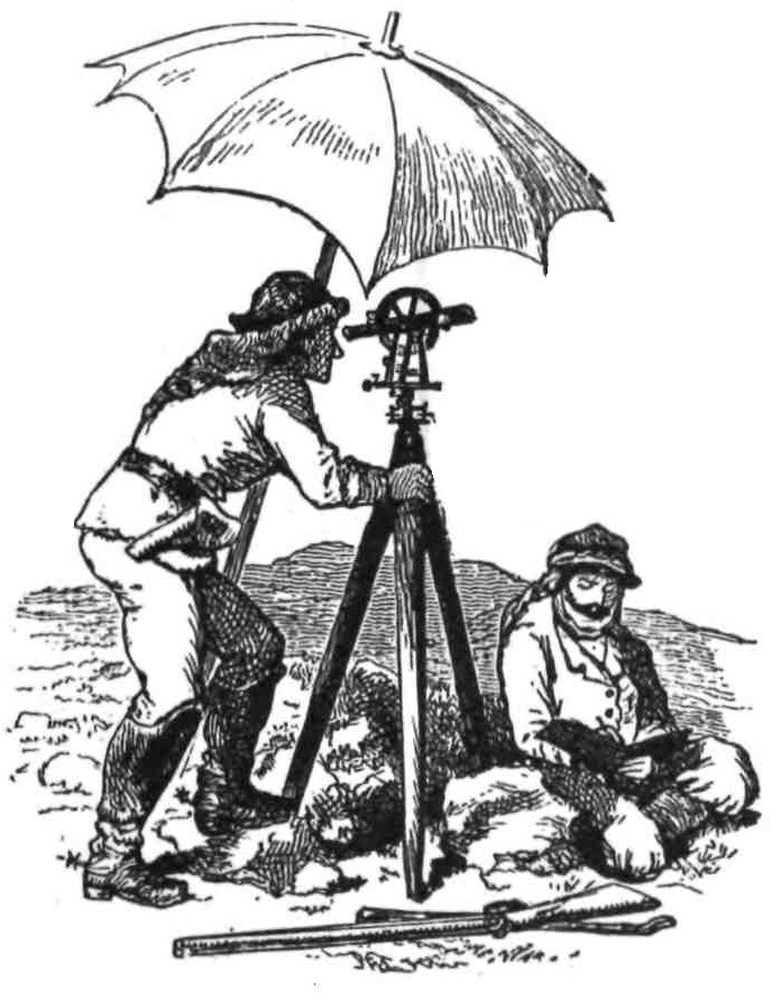
From a sketch by the Author. A theodolite-party at work. | |
| JACOB’S WELL | 15 |
From a sketch made by the Author in the vault over the well; looking south. | |
| TOMB OF PHINEHAS | 41 |
From a sketch by the Author; looking south-west. | |
| HEROD’S COLONNADE AT SAMARIA | 43 |
From a photograph; looking east. | |
| GUEST HOUSE | 52 |
From a sketch by the Author made in the village of Kuriet-Jit. | |
| VIEW FROM JENIN | 58 |
From a water-colour sketch by the Author; looking north. | |
| CHURCH OF ST. ANNE, AT SEFFURIEH | 71 |
From a photograph by Lieut. Kitchener, R.E.; looking east. | |
| CARMEL | 88 |
From a water-colour sketch by the Author; looking west from near the village of Mujeidil. | |
| CONSTANTINE’S BASILICA AT BETHLEHEM | 145 |
From a photograph by Lieut. Kitchener, R.E.; looking east. | |
| MAR SABA | 157 |
From a photograph; looking north-east. | |
| THE DOME OF THE ROCK | 160 |
From a photograph; looking north. | |
| THE TEMPLE WALL | 182 |
From a sketch made by the Author in a chamber outside the west wall, near the north corner. | |
| GILGAL | 199 |
From a sketch made by the Author on the spot; the view is north-west, over the Plain of Jericho. | |
| DEBIR | 236 |
From a sketch by the Author; looking south-west. | |
| THE VALLEY OF MICHMASH | to face 256 |
From a photograph by Lieut. Kitchener, R.E.; looking east. | |
| ENGEDI | 260 |
From a sketch by the Author; looking south. | |
| GATH | 273 |
From a sketch by the Author; looking south-east. | |
| COLUMBARIA, NEAR BEIT JIBRÎN | 275 |
From a photograph by Lieut. Kitchener, R.E. | |
| THE SEA OF GALILEE | 289 |
From a water-colour sketch by the Author; looking north from Kaukab el Hawa. | |
| A DERWÎSH | 298 |
From a sketch by the Author. | |
| COSTUMES OF MOSLEM PEASANTRY NEAR SHECHEM | 315 |
From a sketch by the Author. | |
| MALE DANCERS | 325 |
From a sketch by the Author. | |
| A BEDAWI WOMAN | 336 |
From a coloured sketch by the Author. | |
| HAIFA | 364 |
From a water-colour drawing by the Author. View from the shore west of the German Colony; looking east. | |
THE Survey of Palestine was actually commenced at the end of the year 1871. Preliminary reconnaissances of parts of Palestine had been previously made by Captain Anderson, R.E., and Captain Warren, R.E., and the Ordnance Survey of the neighbourhood of Jerusalem, with the line of levels from the Mediterranean to the Dead Sea, and from Jerusalem to Solomon’s Pools, had been executed by Major Wilson, R.E.
It was by the advice of these experienced explorers that the Committee of the Palestine Exploration Fund undertook the Survey of Western Palestine, to the scale of one inch to the mile, the object being the complete examination of the whole country, with an amount of accuracy approaching that of Ordnance work.
The officer to whom this great work was entrusted was Captain Stewart, R.E., and his staff consisted of Sergeant Black and Corporal Armstrong, R.E.; Mr. C. F. Tyrwhitt Drake was also appointed as linguist and archæologist to the expedition.
The work met with a most serious check at its commencement. Captain Stewart, arriving in the most unhealthy time of the year, and engaged in a most unhealthy part of the country, while measuring the base line, was struck down with fever and invalided home. The Committee then honoured me with the offer of the command, as his successor, and I was instructed to proceed as soon as possible to Palestine.
In the meantime the little party, under the care of Mr. Tyrwhitt Drake, pursued its labours, and carried the Survey up the country to Jerusalem, and thence to Nâblus, accomplishing in the first half of 1872 about 500 square miles. This work has since, under my direction, been re-examined, and the excellent character of this part of the map reflects the highest credit on the zeal and care of the two surveyors, who, though ignorant of the language and unaccustomed to the style of work required, yet succeeded in recovering everything of value in the district; nor does it less reflect credit on the tact and judgment of my lamented friend Mr. Tyrwhitt Drake, on whom devolved the arduous task of organising and managing the infant expedition.
I reached Palestine on the 8th of July, 1872, and from that date, until the 1st October, 1875, the work was pushed on with scarcely any interruption, except during my absence for four months in 1874, when I returned to England to recruit my health, which was seriously impaired by the hardships encountered in the Jordan Valley.
After the attack on the party at Safed in 1875, the work was suspended for a year. When I left Palestine four-fifths of the Survey was completed, and the remaining fifth was happily carried out during the year 1877 under the command of Lieutenant Kitchener, and the great map now extends over 6000 square miles, from Dan to Beersheba, and from Jordan to the Mediterranean Sea.
Palestine is thus brought home to England, and the student may travel, in his study, over its weary roads and rugged hills without an ache, and may ford its dangerous streams, and pass through its malarious plains without discomfort.
This work was thus carried out by a party never stronger than five in number as regards Europeans, and was completed in little over five years in the field. The account given of the country will, I hope, be more complete than anything of the kind yet attempted for any Eastern land.
The results of the Survey are published as follows: First, a map in twenty-six sheets to the scale of one inch to the statute mile. Secondly, a reduced map engraved on copper to the scale of 660 yards to the inch.
The one-inch sheets are each accompanied by a memoir containing all the information collected by the Survey Party. Section A gives a geographical and topographical account of the country included in the sheet. Section B is an archæological description of the ruined sites. Section C includes the ethnographical notes and the local traditions of the district. The text of this memoir, with exception of Sections A and B, for sheets 1, 2, 3, 4 and 6, has been my work, under the editorship of Mr. G. Grove and Colonel C. W. Wilson, R.E. The nomenclature of the Survey, including about 9000 Arabic names, has been arranged in indexes for each sheet, and edited by Professor E. H. Palmer. The memoir will contain information which I have at various times carefully abstracted from more than fifty standard works, including Egyptian, Samaritan, and Talmudic writings, the early Christian Itineraries, and the mediæval chronicles, besides the Bible narrative, and the works of Josephus and other classical authorities.
It is evident that so great a work requires some general résumé, to bring it within the reach of the general public, who might not read the memoir, or would fail to obtain from it any very vivid idea of Palestine, or of the discoveries made there during the execution of the Survey.
The present volume is intended to supply this want, and to form a popular introduction to the work of the Survey Party.
The main object of the Survey of Palestine may be said to have been to collect materials in illustration of the Bible. Few stronger confirmations of the historic and authentic character of the Sacred Volume can be imagined than that furnished by a comparison of the Land and the Book, which shows clearly that they tally in every respect. Mistaken ideas and preconceived notions may be corrected; but the truth of the Bible is certainly established, on a firm basis, by the criticisms of those who, familiar with the people and the country, are able to read it, not as a dead record of a former world or of an extinct race, but as a living picture of manners and of a land, which can still be studied by any who will devote themselves to the task.
The study is threefold. It includes the minute investigation of the detailed topography of the Bible. Former explorers have done much in this respect; but it may be claimed for the Survey that the new discoveries are almost as numerous as all those of former travellers put together.
The second branch is that of archæology. The Survey includes a complete examination of the ancient condition of the country. The old cultivation is traced by the wine-presses, olive-presses, ruined terraces, and rude garden watch-towers. The ancient sites are recognised by their tombs, cisterns, and rocky scarps. Thus we are entitled to draw conclusions as to the ancient cultivation, climate, and water-supply of Palestine, in Bible times.
The third branch is the study of the people. To this I offer a contribution in the chapters devoted to the peasantry and to other inhabitants of Palestine. I trust they may serve to show how rich a field of inquiry is opened to the student among the ancient indigenous population of the Holy Land.
In concluding these remarks, I would say a few words on the subject of identification. What is an identification? It is the recovery of an ancient historic site, still known to the natives under its original name, or a modification of that name, though unknown to Europeans. It is evident that the requisites for a satisfactory identification are—first, the suitability of the position to all the known accounts of the place; second, the preservation of all the radical parts of the name; third, in the case of the loss of the name, we require definite indications—such as measured distances, or some connection with existing buildings, or relative position to known sites. The site must show traces of antiquity, and the name must be placed beyond the suspicion of being of recent or spurious origin; the correspondence of the modern and ancient titles must, also, not be merely apparent, but must be radically exact. Failing these requirements, no identification will stand the criticism which is now brought to bear on newly-proposed discoveries.
A second question is intimately connected with this subject—namely, the authority of Christian tradition. We should not underrate this valuable means of tracing ancient and sacred sites, which has, we may hope, handed down to us the positions of such holy places as the Grotto of Bethlehem, and Jacob’s well at Shechem; nor lay aside tradition because it is tradition, disregarding one of the few ways of settling the locality of places which were quite as sacred in the fourth century as they are now.
On the other hand, a careful and minute inspection of the fourth-century writings cannot but lead to one conclusion: that Christian tradition can be taken only as an indication, not as an authority. Unsupported by other evidence, the tradition is not, in itself, sufficient to fix any site as authentic; yet most valuable hints may often be obtained by a study of these early descriptions of the land.
We may take as an example the famous Onomasticon of Eusebius and Jerome. We are now able to point out, on the map, almost every place, the position of which is clearly defined in the Onomasticon by measurement, or by reference to neighbouring places; for in almost every case the name still exists, and these places number about 200 in all.
There is thus no question that the land was thoroughly well known to Jerome and Eusebius; but when we turn from their facts to their theories, we find that the confusion is hopeless; the places proposed as identical with those noticed in the Bible are quite as often impossibly guessed as correctly fixed. In fact, the early fathers too often jumped at conclusions, and, in the fourth century, there were no critics to contradict them. This view may be supported by any number of instances. In the cases of Shiloh and Bethhoron, the sites mentioned are those now accepted. In those of Nob and Ajalon, Jerome’s identifications are not in any way capable of being reconciled with the Scripture narrative. Thus it is only as regards personal acquaintance with ancient Palestine fifteen centuries ago, that the Onomasticon has any real value.
The observations which apply to this work—the earliest and ablest of the Christian descriptions of Palestine—apply with equal force to all succeeding accounts; and few writers would attempt to justify the wild theories of the mediæval chroniclers, whose identifications, in many cases, contradict alike the Biblical accounts, and the views of the earlier Byzantine pilgrims.
With a single exception, Christian tradition regarding sacred places cannot be traced back earlier than the fourth century—the exception is the Grotto of Bethlehem. But Christian sites appear often to be fixed by Jewish tradition: and when such is the case, their reliability is evidently increased, their history being carried back to an earlier source. This latter really reliable class of traditions is distinguished by the fact that the Jewish or Samaritan, and generally the Moslem traditions point, in such cases, to the same spots venerated by the Christians. The sites of the Temple, and of Jacob’s well, with Joseph’s tomb, the sepulchres of the Patriarchs, and of Joshua, Phinehas, and Eleazar, are pointed out at the same spots by Jew, Christian, and Moslem; and there is every reason to suppose these to be authentic traditions.
It is, therefore, by consent of evidence that the true and indigenous origin of a tradition may be tested. Where this consent does not exist, it is to the Jewish and indigenous, rather than to the later Christian tradition, that we should turn, as the latter must evidently be in such cases of foreign origin.
This distinction will be carefully observed in the following pages; and, by pointing out the cases in which there is a general consent of the Jewish, Moslem, and Christian traditions, it is hoped that everything of real value preserved by tradition will be finally selected.
C. R. C.
Christmas, 1877.
TENT WORK IN PALESTINE.
THE morning of Monday the 8th of July, 1872, brought us in sight of the coast of Palestine, near Jaffa. The town rose from the shore on a brown hillock; the dark, flat-roofed houses climbing the hill one above another, but no prominent building breaking the sky outline. The yellow gleaming beach, with its low cliffs and sand-dunes, stretched away north and south, and in the distance the dim blue Judean hills were visible in shadow.
Jaffa is called the Port of Jerusalem, but has no proper harbour at present. In ancient times the “Moon Pool,” south of the town, now silted up, was perhaps the landing-place for Hiram’s rafts of cedar-wood; but the traveller passes through a narrow opening in a dangerous reef running parallel with the shore, or, if the weather is bad, he is obliged to make a long detour round the northern end of the same reef. By ten in the morning the land breeze rises, and a considerable swell is therefore always to be expected. The entrance through the reef is only sufficient for one boat, and thus every year boats are wrecked on the rocks and lives lost. It is said also that each year at least one person is killed by the sharks close to land.
The little Russian steamer was anchored about two miles from shore, and rolled considerably. The decks were crowded with a motley assemblage, specimens of every Levantine nationality. Each deck passenger had his bedding with him, and the general{2} effect was that of a great rag-heap, with human faces—black, brown and white—legs, arms, and umbrellas, sticking out of the rags in unexpected places. Apart from the rest sat a group of swarthy Bedawin, with their huge head-shawls, not unlike a coal-scuttle in effect, bound with a white cord round the brow. They wore their best dresses, the black hair cloak, with red slippers. The rugged dark faces with white beards and sun-scorched eyes wore a curious mixed expression of assumed dignity and badly concealed curiosity concerning the wonders of civilisation surrounding them.
The colouring of these various groups would have been a treat to an artist. The dull rich tints were lit up here and there by patches of red leather and yellow silk. Like all oriental colour, it was saved from any gaudiness of effect by the large masses of dull brown or indigo which predominated.
The steamer was soon besieged by a fleet of long flat boats with sturdy rowers, and into these the passengers were precipitated, and their luggage dropped in after them. The swell was so great that we were in constant danger of being capsized under the accommodation-ladder. As we rowed off, and sank in the trough of the waves, the shore and town disappeared, and only the nearest boats were visible high up on the crest of the rollers.
The exciting moment of reaching the reef came next; the women closed their eyes, the rowers got into a regular swing, chanting a rude rhyme; and waiting for the wave we were suddenly carried past the ugly black rocks into smooth water close to the wharf.
The landing at Jaffa has been from time immemorial an exciting scene. We have the terrible and graphic account of the old pilgrim (Sæwulf) who, “from his sins or from the badness of the ship,” was almost wrecked, and who witnessed from the shore the death of his companions, helpless in a great storm in the offing. We have the account of Richard Lion-Heart springing, fully-armed, into the surf and fighting his way on shore. The little port, made by the reef, has been long the only place south of Acre where landing was possible; but the storms which have covered the beach with modern wrecks were equally fatal to the Genoese galleys and Crusading war-ships.
The town of Jaffa contains little of interest, though it is sufficiently striking to a new comer. The broad effects of light and{3} shadow are perhaps enhanced here by the numerous arched streets and the flights of steps which climb from the sea-level to the higher part of the town. The glory of Jaffa consists in its beautiful gardens, which stretch inland about a mile and a half, and extend north and south over a length of two miles. Oranges, lemons, palms, bananas, pomegranates, and other fruits grow in thick groves surrounded by old cactus hedges having narrow lanes between them deep in sand. Sweet water is found in abundance at a moderate depth. The scent of the oranges is said to be at times perceptible some miles from land, to approaching ships. Still more curious is the fact that the beautiful little sun-bird, peculiar to the Jordan valley, is also to be found in these gardens. How this African wanderer can have made its way across districts entirely unfitted for its abode, to spots separated by the great mountain chain, it is not easy to explain.
Outside the town on the north-east is the little German colony, the neat white houses of which were built originally by an American society which was almost exterminated by fever, and finally broken up by internal differences, caused, I understand, by some resemblance in the views of the chief to those of Brigham Young. The land and buildings were bought by the thrifty German settlers, members of the Temple Society, with the views and history of which sect I became further acquainted during the following winter.
The soil of the Jaffa plain is naturally of great fertility. Even the negligent tillage of the peasantry produces fine harvests. The Germans ploughed deeper, and were rewarded by a crop of thistles, which to a good farmer would have been a subject of satisfaction as proving the existence of virgin soil, only requiring to be scoured by other crops for a year or two in order to yield fine harvests of corn. At this time of year, the barley had been gathered in, and only the dry stubble was left.
Our first ride was not a long one, as we only intended to reach Ramleh that night, and we arrived before sundown in sight of the town, which is first visible from a rise of ground on the road. The long olive-groves here formed a dark oasis in the treeless plain, and above them rose the beautiful tower of the “Forty,” belonging to the fine old ruined building called the “White Mosque,” built in the fourteenth century by the son of Kalawûn.{4} The Forty were, according to the Moslems, companions of the Prophet; according to the later Christian tradition, forty martyrs of Cappadocia. A second mosque, now in use, exists in the middle of the town. This I was afterwards able to visit, and found it to be probably the most perfect specimen of a fine twelfth century church in Palestine, unchanged except that the beautiful western doorway is closed, a prayer recess scooped in the southern wall, and the delicate tracery of the columns defaced by whitewash and plaster—a vandalism not peculiar to Moslem restorers.
This fine church, which we were the first to examine and plan, is probably that visited by the old English pilgrim Sir John Maundeville, dedicated according to him to the Virgin, “where Our Lord appeared to Our Lady in the likeness which betokeneth the Trinity.”
Ramleh, like many another town in this ruined land, is full of contrasts of past prosperity and of present squalor and decay. The walls of fine stone houses are enclosed in wretched hovels of mud. Here and there an ornate Cufic or Arabic inscription is left, telling of Moslem conquerors and munificent Caliphs; but the bazaars are deserted, and starved dogs and helpless lepers meet the eye on every side.
Many attempts have been made to identify Ramleh with some ancient site. Thus the learned Rabbi Benjamin of Tudela regarded it as the birthplace of Samuel, while Christians have supposed it to be Arimathæa or Ramoth Lehi. But, against all such views, the testimony of historians, both Moslem and Christian, is decisive. They agree in representing Ramleh as founded by the son of the Caliph ’Abd el Melik early in the eighth century, after the destruction of Lydda. In Crusading history the town, which was then walled, plays a conspicuous part, and under the early successors of Saladin it rose to considerable importance; but the site, which is, as its name indicates, “sandy,” is not a natural one for a great city, and the water-supply is entirely artificial, from wells and huge tanks having Cufic inscriptions on their sides. Picturesque as is the scene, especially from among the palms on the east, Ramleh is nevertheless a modern place, when compared with the high antiquity of sites near to it.
In crossing Palestine at any point three districts are passed{5} through, each of which receives a distinctive name in the Bible and in Jewish writings. First we cross the flat sea plain, in part sandy and barren, scattered with the black tents or reed cabins of the small encampments of Bedawin, a pastoral race gradually losing ground before the peasantry; in part a cultivated and very rich corn land, with wretched villages of mud perched on eminences whence the breeze is better felt. To the new comer these hamlets, most of which represent sites older than the time of Joshua, have a deserted appearance. The eye misses the contrast between roof and wall, and the glazed windows and wooden doors seen in Europe. The peasant hut in the lowlands of Palestine consists merely of four walls of mud, with a roof of boughs covered also with mud; hence the village, which consists of perhaps fifty or sixty such cabins huddled together without plan or order, and gradually climbing the slope so that the floor of one is level with the roof of another, has an uniform grey colour only broken by the whitewashed dome of the little chapel dedicated to the patron “Prophet” or Sheikh. In the plain there are scarcely any springs, and the village is supplied as a rule by cisterns and by a pond of stagnant rain-water banked round freshly every year. The most conspicuous object outside is the huge rubbish-heap where refuse of every kind is thrown. Savage mangy half-starved dogs keep watch above, and annoy the stranger until boldly attacked in turn. They belong to no one, are cared for by no one, and their only food appears to be an occasional carcass of a donkey or bullock. It is said that they eat mice and beetles when nothing else is to be found. All night they vie with the jackal in their howls, and they are often really dangerous when rearing their puppies.
Upon the refuse-heap, in the shade of the wall, the village elders may be seen seated smoking in rows, whilst the blue-gowned women toil up the hill with the goat-skin water-bags bound to their heads or the red pottery jars balanced upon them, holding in their tattooed lips the corner of the white head-veil which prevents their mouths being visible.
The plain once passed, the traveller enters the district called Shephelah, or “lowlands” in the Bible, consisting of low hills, about 500 feet above the sea, of white soft limestone, with great bands of beautiful brown quartz running between the strata. The broad valleys among these hills forming the entrances to the third{6} district produce fine crops of corn, and on the hills the long olive-groves flourish better than in either of the other districts. This part of the country is also the most thickly populated, and ancient wells, and occasionally fine springs, occur throughout. The villages are partly of stone, partly of mud; the ruins are so thickly spread over hill and valley that in some parts there are as many as three ancient sites to two square miles. All along the base of these hills, commanding the passes to the mountains, important places are to be found, such as Gath and Gezer, Emmaus and Beth Horon, and no part of the country is more rich in Bible sites or more famous in Bible history.
With dawn on the 9th July we entered the “lowland” district, and before us were some of the ancient places above noticed. South of the great road, Gezer, on the road, Latrûn, north of it Emmaus.
The recovery of the site of Gezer we owe to M. Clermont Ganneau. The position is one well suited for an important place, and Gezer was a royal city of the Canaanites. The modern name, Tell Jezer, “Mound of Gezer,” represents the Hebrew exactly, the meaning being “cut off” or “isolated.”
The origin of the title is at once clear, for the site is an outlier—to use a geological term—of the main line of hills, and the position commands one of the important passes to Jerusalem. As is the case with many equally important places, there is not much to be seen at Gezer. The hill-side is terraced, and the eastern end occupied by a raised foundation, probably the ancient citadel. Tombs and wine-presses, cut in rock, abound, and there are traces of Christian buildings in a small chapel, and a tomb apparently of Christian origin.
Beneath the hill on the east there is a fine spring, which wells up in a circular ring of masonry; it is called ’Ain Yerdeh, or the “Spring of the Gatherings,” and its existence is a strong argument in favour of the antiquity of the neighbouring site.
The little Mukâm, or Moslem shrine, on the hill, commands a fine view of the plain of Sharon. On the south-west are the bare sandy dunes of “barren” Ekron, beyond which is Makkedah, and Jamnia famous for its school of learned doctors of the law, where the Sanhedrin sat after Bether had fallen. Due south the white cliff of Gath projects into the plain; on the north-west Ramleh{7} stands among its olive-gardens, palms, and cactus hedges, and the great tower of the “Forty” rises like a belfry above them: farther north another white minaret is seen above the Church of St. George at Lydda, and olive groves again hide the houses in their midst. Many of the towns of Dan, now mere mud hamlets, are scattered over the plain, and the view is bounded by the range of yellow sand-dunes and the shining waters of the great sea; on the east rise the Judean mountains, the third district, which we were about to enter.
A most interesting and curious discovery was made in 1874 at Gezer. M. Ganneau was shown by the peasantry a rude inscription deeply cut in the flat surface of the natural rock. It appears to be in Hebrew, and to read “Boundary of Gezer,” with other letters, which are supposed to form the Greek word Alkiou. M. Ganneau has brought forward an ingenious theory that Alkios was Governor of Gezer at the time this boundary was set, and he supports it by another inscription from a tomb on which the same name occurs. This theory might seem very risky, were it not strengthened by the discovery of a second identical inscription close to the last, containing the same letters, except that the name Alkiou is written upside down. In both it is true the letters are hard to read, being rudely formed, but they are deeply cut, and of evident antiquity, whilst it can scarcely be doubted that the inscription is the same in both cases. M. Ganneau attributes them to Maccabean times; it is curious that they should thus occur in the open country, at no definite distance from the town, and unmarked by any column or monument. Altogether they are among the many archæological puzzles of Palestine, and their origin and meaning will probably always remain questionable.
On the road itself stands the old Crusading fortress, called Castellum Emmaus, and apparently also Toron of the Knights, according to Benjamin of Tudela. From the latter name (an old French word, meaning a hill) the present name, Latrûn, seems derived; by a process common enough in the Fellâh dialect, el Atrûn has taken the place of el Turûn, as Ajfât is the common pronunciation of Jefât, or Ajdûr of Jedûr. In the sixteenth century, however, a curious explanation of the name is given. It is called the Castle “Boni Latronis” of the good or repentant thief Dismas, but this is quite a late explanation. In the earlier chronicles{8} of the twelfth century Latrûn is called the town of the Maccabees, and in the fourteenth their sepulchral monuments were shown there; but this nation cannot be traced back in earlier chronicles, and there is nothing at Latrûn which seems older than Crusading times.
The third site north of the road is one of even greater interest. The rude village of ’Amwâs preserves the name of Emmaus, famous in Maccabean history. The early Christians recognised this place as being also the Emmaus of the New Testament to which the two disciples walked upon the Resurrection Day. This view continued to be held till the fifteenth century, when it was observed that the distance given in most texts of the Gospel is “sixty furlongs,” whereas the present site is just 160 from Jerusalem. This is generally held to be fatal to the tradition, although the Sinaitic Manuscript actually reads 160 stadia instead of sixty.
The neighbourhood of Emmaus was the scene of the second great Maccabean struggle. Judas had already overthrown the army advancing on Jerusalem by the northern pass, the famous Beth Horon battle-field. A second, yet more formidable army was encamped at the mouth of the western approach to the Holy City, and so certain were its leaders of victory, that merchants accompanied the camp with money to give for Jewish slaves, and fetters to put on their limbs when sold. The battle of Emmaus was the Maccabean Austerlitz. The little band of devotees came down by night from the ancient praying-place at Mizpeh, and whilst the main part of the Greek host was enticed into the hills, the Jews advanced northwards on the camp, and took it, cutting off the retreat of the heathen. Never again in the history of this struggle did any Greek general attempt to attack Jerusalem from the western pass.
There are still ruins of the little chapel in Emmaus, which the early Christians built on the supposed spot where the Lord was recognised in breaking bread. Near to it also was a spring, thought to have healing virtues. This tradition is of Rabbinical origin, but the Christians added to it the assumption that its power was due to the touch of Christ. The name Emmaus itself means a “healing bath,” as Josephus informs us, speaking of the Galilean place of the same name. At the present day a well is shown at{9} ’Amwâs by the peasantry, called the “Well of the Plague,” and it is said that a great plague originated from the spot.
Leaving Latrûn, we entered the third district—the mountain country—through the well-known pass called Bâb el Wâd, or the “Gate of the Valley.”
In the conformation of the Judean hills the secret of the immense vitality of the Jewish nationality is probably to be found. Had the capital of Judea been placed at Cæsarea, on the high-road from Greece to Egypt—had it even been permanently fixed at Shechem, accessible through the open valley of Samaria, it cannot be doubted that Greek or Egyptian influence would have affected far more the manners and religion of the Jews. Remote and inaccessible in its rugged mountains, Jerusalem was removed from the highway by which the hosts of the Pharaohs advanced on Assyria. It could only be reached by one of three difficult passes, unless the whole country of Samaria were in the hands of the enemy. Hence in the mountains of Judea the national faith had a secure home. The Philistines overran the plains and even came up into the Shephelah; Egyptian and Assyrian monarchs conquered Samaria and Galilee, but a small band of undisciplined peasants was able, under the Maccabees, to hold at bay the armies of the Seleucidæ, and it required the fullest efforts of Roman energy and discipline to compass the destruction of Jerusalem under Titus or under Hadrian. The history again repeats itself in Crusading times. The Judean hills resisted long after all other parts of the country had been lost, and Saladin held Jerusalem undisturbed while Richard overran the plains.
The same natural conformation renders the construction of a railway to Jerusalem an engineering project of no little difficulty. Within the distance of a few miles the hills rise suddenly from the level of the Shephelah towards the narrow plateau, 2500 feet above the sea, on which the city stands; the ascent is rough and steep, and the valleys very deep, with rugged stony sides, and ledges of hard grey rock, thickly covered with shrubs, principally lentisks and arbutus, while here and there terraces have been artificially built up with dry stone walls for the cultivation of the olive.
Near the Gate of the Valley there is a little ruined Mukâm or “station” sacred to the famous Imâm ’Aly, to whom the deeds of Samson and Joshua are commonly accredited by the peasantry.{10} It is conspicuous from the fine group of aged terebinths which shade the little mihrab or prayer niche. Ascending thence past the ancient village of Sarîs, we reached at length the hill above the modern Kuriet el ’Anab, a place which calls for more special description.
Kuriet el ’Anab, or the “town of grapes,” is generally called Kurieh only by the peasantry, and this suggests its identity with Kirjath of Benjamin, in the territory of which tribe the village appears to lie. It was supposed in the early Christian times to be the site of Kirjath Jearim, the “town of forests,” but this appears to be an unsatisfactory identification for several reasons. The place seems scarcely on the line of the boundary of Judah, as Kirjath Jearim was; it is not a hill with a “high” place, as we should gather Kirjath Jearim to have been from the account of the hill where the ark was kept; and lastly, the important part of the name bears no reference to the ancient title, derived from some mountain covered with thick wild growth which does not exist near the village.
The Crusaders fixed upon Kuriet el ’Anab as being the ancient Anathoth, their reasons being as usual very difficult to understand. They erected a magnificent church over a spring in the valley north of the village, dedicated to Saint Jeremiah of Anathoth, and this structure remains almost intact. On its walls the dim shadows of former frescoed paintings can be traced, and over these the names of pilgrims rudely scrawled like those of the modern tourists. The church is peculiar from the careless manner in which it has been constructed, the walls not being at right angles; thus the east wall is two and a half feet longer than the west, as we found in making the plan.
The village itself consists of stone houses of better appearance than those in the plain, surrounded by beautiful vineyards, the vines trailing over the stone walls like a green cataract flowing to the valley. The place, which derives its name from these vineyards, was once the seat of the famous native family of Abu Ghôsh. The most notorious of its chiefs, a robber, who held all pilgrims to the capital in terror, was killed by the Egyptian Government, pursuing its usual policy of exterminating the great native families; since death he has been canonised, and a Mukâm erected to him near the village. At Easter, the children of the place (which is{11} often called Abu Ghôsh after the family) are to be seen seated along the road offering water in spouted bottles to the pilgrims. This charitable custom is rare in Palestine, though occasionally in use on some of the other pilgrim routes.
The next ascent brought us in sight of a very remarkable village on the right, now called Sôba. It is separated from the ridge on which the road runs by the deep and impassable valley which, for the greater part of its length, forms the northern boundary of Judah. The place struck me much at the time—a high conical hill crowned by a village surrounded by steep rocky ledges with thick growth of wild shrubs mingled with olives. I had afterwards occasion to visit it, and found it to be undoubtedly an ancient site. Not only are there traces of a Crusading fortress, which was called Belmont, but also many ancient Jewish sepulchres cut in rock. The peasantry say it was the palace of the Sultan of the Fenish, and that his daughter lived at a certain ruined convent near the road, which we saw surrounded with ancient trees—the wilderness formed from its original garden.
Since the telegraph line has been laid to Jerusalem, this tradition has been supplemented with the detail that the Fenish had a telegraphic wire from the hill palace to that in the valley. Another favourite abode of the daughter was not far from Latrûn. Again at Beit Jibrîn and at Keratîya we found a cavern, a garden, and a castle of the Fenish; and the fact that this tradition is confined to the district south of the Jerusalem road and on the edge of the hills, leads one to suspect that the Fenish were no other than the Felish or Philistines, for the peasantry almost invariably change their L’s into N’s in this manner.
But to return to Sôba. This fine site, standing out black against the sky, with its grand ravine and wild copses, is evidently an important spot; yet the name Sôba does not recall any Scriptural place, though not far different from the Hebrew Zuph where Saul met Samuel. In modern Arabic it means “a heap,” such as the grain-heaps of the threshing-floors, a title which applies well to the shape of the hill, but probably this is a corruption of some older word.
Sôba also was at one time honoured, like Latrûn, as the ancient Modin, the true site of which was however known to Saint Jerome, east of Lydda, where El Medieh is now found. The distance of{12} El Medieh from Jerusalem is close on that given in the Talmud for Modin, although the tomb supposed by M. Guérin to have been that of the Hasmoneans proves to be of Christian origin.
And now at length we arrived at the top of the ascent, and spurring along under the stony knoll on which the little village of Kŭstŭl—an ancient “castellum” of the Roman conquerors—stands, we fully expected to see Jerusalem. Instead of this we saw before us a huge valley over 1000 feet deep, and beyond it a straight line of hills more lofty and barren than those before passed. We could well picture the disappointment, so graphically described by the old chronicler, of the weary hosts of women and children who toiled footsore and thirsty in rear of the Crusading army, faintly asking, as each height was passed and a new view opened, “Is that Jerusalem?” If to us, well mounted and well fed, the journey was wearisome, what was it to the pilgrims harassed by Saracen skirmishers, and afraid to stop and bury those who fell, lest, as one writer says, a man might be found to be but digging his own grave.
A stony winding road led down to the bottom, a stony winding ascent led up on the other side. Around us were mountains of strikingly wild and barren character, with the dark iron-grey rocks tinged in parts with black and russet and capped by a softer white chalk. The long blue shadows, the large rounded outlines, the hardness and ruggedness of the slopes, combined to produce a scene of wild grandeur more striking than anything yet met except the dark thickets of the Sôba ridge.
The valley beneath is full of grey olive-groves; the white torrent bed is sinuous and winds gradually round west. In the hollow, south of its course, the village of ’Ain Kârim stands on an eminence, and close to it the white convent wall, with its dark cypresses, marks the traditional birthplace of John the Baptist.
The valley is a place famous in Jewish history. It commences north of Jerusalem, and leads down past Lifta (Eleph) to a little village called Kolônia which was on the road beneath us. Thence by ’Ain Kârim southwards to join the Bether valley, and by Kesla it runs down to Zoreah and Eshtaol and widens out into the great corn valley of Sorek, and so past Ekron and Jamnia to the sea. Thus it was one of those passes by which the Philistines were able to penetrate into the heart of the Jewish mountains. It was{13} down this valley that Samuel drove the defeated host from Mizpeh, north of Jerusalem, to Ebenezer, a place probably at the entrance of the hills. In their flight they passed under Bethcar, which is not impossibly the present ’Ain Kârim. Along the stony bed of this great valley at our feet, we may picture to ourselves the nomadic hosts with their mail-clad champions flying before the followers of the prophet, while far away on the white hills the tabernacle would be seen high on the ridge of Mizpeh.
The valley was also once the scene of more peaceful events at the yearly festival of “tabernacles.” Kolônia has near it a ruin called Beit Mizzeh, the ancient Motza or “Spring-head,” a town of Benjamin. The Talmudic doctors tell us that Motza was a colonia or place free from taxes, whence the origin of the modern name, and beside the banks of the stream from the spring-head grew, and still grow, the willows used at the feast. By the restaurant and the ruins of a small monastery, the stream flows under a little bridge; and round its course shady orange-gardens and olive-yards, beneath the village perched on the hillside, often tempt the inhabitants of Jerusalem to come out for an afternoon siesta. It would seem also that on the Day of Atonement this place used to be the scene of a festival so peculiar and so unlike any other part of Jewish custom that we are tempted to believe that it was an innovation of the later Hellenising faction. The daughters of Jerusalem were encouraged to come out to meet the youths who were celebrating the newly-acquired purification from sin, with palms in their hands and songs and dances. Twice a year this festival of maidens took place, and the contrast to the stern precepts of the Talmudic doctors, who discountenanced any gaiety in which women took part, forbade a student to speak to or look at any woman but his wife, and even counselled that the less he talked to her the better, is certainly suggestive of foreign origin for the feast of Motza.
Passing by this little oasis in the hills, which has thus from time immemorial been the site of festal excursions from the capital, we began the long ascent which led, not, as we hoped, to Jerusalem, but to the edge of the plateau on the opposite side of which the city stands. The road, afterwards so familiar to me, seemed longer when the distance was unknown than when every way-mark was recognised as showing nearer approach to the end of the journey;{14} and we did not halt to admire, as I often did afterwards, the fine view from the brow of the hill.
From that brow the great valley is seen winding southwards, and the high rounded ascent to Kŭstŭl bars out the view of the plain. Northwards the conical point of Neby Samwîl, crowned with its minaret, is a conspicuous object, and in the evening when the long shadows steal up the rugged hillsides, and the western slopes are ruddy in the setting sun, the breadth and grandeur of the colouring of the wild shapeless mountains is extremely striking, and grows upon one every time the scene opens before one’s eyes.
The first approach to Jerusalem from the west is decidedly disappointing. From the east, north, and south, the aged walls, the mosque, and Holy Sepulchre, come into view at some distance, and the scene is striking; but from the west the city is approached within less than a quarter of a mile before it is seen. The first object is the huge Russian cathedral outside the town, built in 1864. The white walls and heavy leaden roofs in the Neobyzantine style block out ancient Jerusalem. Standing on the approximate site of the old tower of Psephinus, the Russian Hospice commands the whole town, and is thought by many to be in a position designedly of military strength.
When, however, these ugly modern buildings are passed, together with the many white stone villas, country residences of Europeans or rich Jews, which form “New Jerusalem,” the traveller at length comes in view of a long grey battlemented wall, a tower, the dark trees of the Armenian convent garden, and behind all the pale blue line of the Moab hills. He enters between groups of tawny, groaning camels, and black donkeys loaded with firewood, under a dark archway, and forcing a path through a noisy bright-coloured crowd of peasantry, under the shadow of the great Tower of David he alights at a German hotel within the walls of Jerusalem.{15}
![]()

JACOB’S WELL.
THE Survey Camp at the time of my arrival in Palestine was fixed at Shechem, where I proceeded after a few days’ rest at Jerusalem, accompanied by Sergeant Black, R.E.
About sunset we began to descend into the narrow, stony gorge of the Robber’s Fountain. The road is not improved by the habit of clearing the stones off the surrounding gardens into the public path. It descends through olive-groves to a narrow pass with a precipice on the left, beneath which is the little spring. A ruined castle commands the pass on the Jerusalem side, and is still called “Baldwin’s Tower” by the peasantry, having no doubt been built by one of the kings of that name. The gorge once passed, we emerged into an open valley, and on our left was Sinjil, named from Raymond of Saint Gilles, who there fixed his camp when advancing{16} on Jerusalem. The short twilight gave place to almost total darkness, as we began to climb the watershed which separates the plain of Moreh from the valley coming down from Shiloh, and the moon had risen when the great shoulder of Gerizim became dimly visible some ten miles away, with a silvery wreath of cloud on its summit. Creeping beneath its shadow we gained the narrow valley of Shechem, and followed a stony lane between walnut trees under a steep hillside. The barking of dogs was now heard, and the lights in camp at length came into view.
Shechem is the first Syrian town mentioned in the history of Abraham, and the ground round Jacob’s well was the first possession of Jacob in the Holy Land. Shechem is recognised in the Pentateuch as the capital of central Palestine, ranking with Hebron in the south, and Kadesh in the north, as a city of refuge. Later on we find Rehoboam crowned here, and indeed it is not too much to say that Shechem may be considered the natural capital of Palestine. Its central situation, its accessibility, its wonderfully fine water-supply, are advantages not enjoyed by any other city in the land. The one disadvantage which perhaps as early as the time of Rehoboam prevented its being selected as a capital, consists in its being commanded by a hill on either side so close to the town, that the old geographer, Marino Sanuto, in the fourteenth century, considers the place to be untenable by any military force, because stones might be rolled down upon the houses from either Ebal or Gerizim. It was at Shechem that the solemnities which were to be performed on the conquest of the country—the reading of the law and erection of the altar—were commanded by Moses to be performed, yet, soon after, we find the religious capital at Shiloh, and, in a few years after the great schism, the political capital of Israel was removed to Tirzah, and afterwards to Samaria.
But while the town is interesting from its antiquity and from the vicissitudes of its history, the Samaritan people are yet more so.
Who are the Samaritans? What is their origin, and relation to the other natives of the country? The answer is usually a short one. They are Cuthim, strangers from beyond Jordan—settlers who replaced the Israelites led away by Sargon. It seems to me, however, that these conclusions must be received with great reserve.
Soon after my arrival we received a visit from Amram, the Samaritan{17} high-priest, accompanied by Jacob Shellaby. The high-priest was a wonderfully handsome old man, with fine aquiline features, and he wore the crimson turban distinctive of his race. He could speak no languages except Arabic and Samaritan, and his ideas were perhaps rather limited, as he pronounced Gerizim to be the highest mountain in the world. We represented to him that Ebal, close by, was nearly 230 feet higher. He allowed that it appeared to be so, but could not in reality be, because Gerizim was the highest mountain in the world. This fine old dignitary died in 1874. It was thought that his successor was to be a mere doll in the hands of Jacob Shellaby; a gentleman who is an accomplished savant. In England he appeared for some time in the character of a Samaritan prince. He supplied travellers with many ancient Samaritan hymn books, purloined, it is said, while the congregation were reverently prostrating themselves. He described to us with immense gusto the mode of preparing ancient manuscripts, by steeping a skin in coffee-grounds, and placing it for a month or two under the pillows of the diwan. Many an unwary traveller has been taken in by his false antiquities, stones, and manuscripts. It was thought that Shellaby would succeed, on the death of Amram, in obtaining the ancient roll of the law itself; but this is the Samaritan Fetish, and the young high-priest would not connive at such a deed—which would indeed have been the killing of the golden goose, as the manuscript brings in a yearly income—and excommunicated Jacob, who, after holding an heretical passover of his own on Gerizim, finally left the congregation and repaired to Jerusalem, where I saw him in 1875.
Jacob Shellaby’s ideas were perhaps not far in advance of the high-priest’s. He related very naïvely his delight at the supposed discovery of a gigantic emerald, which he showed us, and which was merely a large fragment of green slag from some old glass-works. He also fully believed in the story of a cave guarded by genii, and full of gold, which might be carried away, but invariably flew back by night to its place, from wherever it might be taken.
Two things struck me very much in my intercourse with the Samaritans during this first visit, and during another stay of a few days in 1875 in Nablus.
First of all it is indisputable that both in features and in figure they bear a strikingly close family likeness to the Jews. It may{18} be urged that the Cuthim are supposed to have been Semitic, but so are the Syrians and Bedawin, yet they are not at all like the Jews. The Samaritans are a very pure stock, the beauty of their priestly family is remarkable; the aquiline nose, the lustrous brown eyes, the thick under lip, the crisp hair, the peach-like down of the complexion, are features pre-eminently Jewish. The lean and weedy figure is again peculiar also to the Palestinian Jews, and contrasts forcibly with the obesity of the Turks and the sturdiness of the peasantry. For hundreds of years the Jews have kept their race pure, and so have the Samaritans. Since the time of Christ at least, Jews and Samaritans have probably never inter-married, yet we find them now closely alike in their characteristic physiognomy.
In the second place, the Samaritans preserve an ancient copy of the Pentateuch, which, though differing in some marked peculiarities, is yet substantially the same as the Jewish text. It is written in the Samaritan character, which closely approaches the most ancient forms of Jewish writing. It cannot be supposed that these Samaritans would have adopted the religion and sacred books of a nation that they despised and hated, and the evidence of the character employed is in favour of the original copies having been made before the time of Ezra, when, according to the Rabbis, the square alphabet was adopted, before indeed the schism between Jew and Samaritan became so intense as it afterwards grew to be.
These facts naturally incline one primâ facie to consider the Samaritans as originally of the same stock with the Jews, and an investigation of the question seems to me to show that they are the last remnants of the scattered Israel, the lost Ten Tribes, whose history has always excited curiosity in the minds of so many.
It will be allowed that but little reliance can be placed on the partisan descriptions of Josephus and of the Rabbinical writers. Unfortunately we gather but little from the Bible which can throw light on the subject, and the Samaritan accounts are all very late, their oldest chronicles dating back only to the twelfth century, though apparently founded on more ancient material. It may, however, be interesting to sketch what is known of their history from various sources.{19}
Sargon, who on his monuments is described as “Destroyer of the city of Samaria and of all Beth Omri,” took away with him in 721 B.C. all the more important and a great host of minor captives, to Assyria. Still a certain proportion of the Israelites would seem to have been left behind, as we find Hezekiah, in 717 B.C., sending messengers through the country of Ephraim and Manasseh, inviting Israelites to the Passover, which might not be eaten by strangers, and some actually attended it (2 Chron. xxx. 18). Worshippers from Shechem and Samaria are also noticed as coming to Jerusalem after its destruction by Nebuchadnezzar (Jer. xli. 5); thus, though foreign colonists from Cutha, Ava, Hamath, and Sepharvaim were sent into Samaria, there is reason to suppose that many of the original Israelite population were left.
The Talmudic doctors invariably call the Samaritans Cuthim. Cutha is a district as yet unknown, but it may be noticed that the Biblical account represents the men of Cutha as serving Nergal, who is known from Cuneiform inscriptions to have been a “lion-god,” worshipped by inhabitants of Cutha, and therefore an appropriate deity to appease when a plague of lions was devastating the land. It is not impossible that the Jews seized upon the close similarity of the name Cuthim with the title Kûsânîya, or “true people,” by which one Samaritan sect distinguished themselves from a second, the Lifânîyeh. The first sect believed in the future life, in future reward and punishment; the latter confined the promises of the law to temporal matters; the latter were named from a word meaning “to make light,” because, like the pupils of the Jewish Hillel, they made the law less stringent, whereas the stronger sect, the Kûsânîya, made its burden heavier, following the example of the school of Shammai.
The foreign colonists, from Cutha, found themselves, as they simply supposed, unable to appease the deity of their new country without special instructions in the peculiarities of his rite. They petitioned therefore for a priest, and an Israelite priest returned and dwelt at Bethel. It is perhaps only natural to suppose that the place here intended in the Bible is Gerizim, which was held by the Samaritans to be the site of Jacob’s vision. It follows from this account that at least one priestly family returned to Samaria, and the Samaritans claimed a descent for their priesthood from Phinehas the grandson of Aaron.{20}
Another curious allegation, brought forward by Josephus and also to be found in the Targums, is that the Samaritans claimed to be Sidonians; this is however plainly contradictory to the view that they were Cuthim, and only serves to show the small reliance that can be placed on the later Jewish accounts.
Having then indications that the Israelites were not all carried to Assyria, and that one at least of their priests returned, and having the invariable assertion of the Samaritans that they are descendants of this small remnant, and in confirmation of this their physiognomical characteristics, their religion, their possession of an ancient text of the books of Moses, their observation of the Jewish Passover, according to the most ancient form of the rite, we may fairly place the Samaritan literature in the balance against the accounts of the Pharisees—Josephus and the Talmudic doctors—which, as above shown, are in themselves contradictory.
It seems probable that the cause of the division of the Hebrew monarchy is to be sought in an original jealousy between the great tribes of Judah and Joseph who first seized on the land; but, as we have seen above, the religious schism was not complete before the time of the revival under Ezra. Worshippers from Shechem had been received at Jerusalem, and on the return of the Jews the Samaritans were anxious to take part in the restoration of the Temple in the Jewish capital. With regard to the history of the quarrel, Jewish and Samaritan accounts are, as might be expected, diametrically opposed. Josephus, in a passage which has no parallel in the Book of Ezra (Ant. xi 4. 9.), represents ambassadors, including Zerubbabel, as going to Darius and obtaining a decree against the Samaritans, forbidding them to interfere with the building of the Temple. From the Book of Ezra it appears, however, that the enemies of Judah succeeded in stopping the work of restoration (Ezra iv. 24). The Samaritan account is in agreement with this; according to their chronicle the whole of Israel, with the exception of the Jews, wished to build the Temple on Gerizim. An appeal was made to the King, and copies of the law made by Sanballat and Zerubbabel were cast into a great fire; the former leapt out thrice unhurt, the latter were immediately consumed. These traditions cannot of course be put in the same category with the sober history of the Book of Ezra; but in the main the accounts are not discordant, as both acknowledge an{21} appeal to Darius and the hindrance of the Jews by Samaritan opposition.
In tracing the history of the schism, it is important to remember the great similarity of doctrine which certainly existed between the Samaritans and the Sadducees. The Jews never placed their enemies in quite the same category with the heathen. In the remarkable tract on the Cuthim, a Jew is allowed to hold intercourse with a Samaritan in all cases where it might be to his own advantage, but not when it is against his interests. The two tenets which caused the exclusion of Cuthim from the congregation are stated to have been—first, their belief in Gerizim as the true religious centre; second, their denial of the resurrection, which opinion they shared with the Sadducees.
Many details of the Samaritan faith were identical with Karaite and Sadducean tenets, and the view taken of their error appears to have been, with one Jewish party, that, while originally orthodox, they had become mixed with the priests of the high places and corrupted the purity of the faith.
It cannot be doubted that it was the Pharisees who were the deadly enemies of the Samaritans. This sect, originating in the “separation” under Ezra, at once excluded the Samaritans from participation in the building of the Temple. Sanballat was connected by marriage with the Sadducean high-priest—a fact which favours the view that he was an Israelite, not a foreigner—but against this affinity Ezra set his face, and the schism was thus rendered more complete. Gradually the Pharisees gained in power as the Sadducees declined; under the Hasmoneans they obtained at length the high-priesthood, and Hyrcanus succeeded in destroying the Samaritan Temple in 129 B.C. With the exception of a short interval the Pharisees were in power until 35 B.C., and the constant reprisals which for four hundred years had been indulged in on both sides, had left such indelible hatred between the two nations that nothing but entire submission and the abandonment of Gerizim would have induced even the Sadducees to receive into the congregation a people whose religion in other respects was almost indistinguishable from their own.
The Samaritans are, indeed, in the peculiarities of their doctrine almost identical with the original Jewish party—the Karaite and{22} Sadducean sects. They are even called Sadducees in Jewish writings, and their denial of the resurrection was, like that of the Sadducees, based on the declaration that nothing was to be found in the law of Moses on the subject. Again, their version of the law is closely similar to that of the Septuagint, which was a translation authorised by a Sadducean high-priest from a text differing from that finally established by the Pharisees. The animosity of Josephus—who was a Pharisee—the fierce denunciations of the Talmud, written by Pharisees, the destruction of the Gerizim Temple by Hyrcanus—also a Pharisee—all combine to indicate that the Jewish hatred had nothing to do with any foreign origin of the race, but rather was roused by the religious differences of a people whom they knew to be their kith and kin.
It is often supposed that the Samaritans borrowed their religion from the Sadducees. It is surely a simpler explanation that they were a sect originally identical because originally Israelite.
The Samaritan chronicles give a plain account of the origin of their people. At the time of the return from captivity a certain number of the congregation carried into Assyria came back to Palestine under Sanballat. Some thirty thousand, however, remained behind awaiting the Prophet whom they expected as a leader.
Sanballat is called in the Bible “the Horonite.” From this title it has been supposed that he was a foreigner, though the Samaritans call him Lawîni the “Levite.” The place where Israel assembled before crossing into Palestine, and where the first quarrel as to where the Temple was to be built occurred, was Horân, and this may perhaps account for the term Horonite. The Jews, under Zerubbabel, repaired to Jerusalem, the test of the congregation, three hundred thousand in all, beside youths, women, children, and strangers (probably the colonists from Cutha, Hamath, and Ava), were led to Gerizim, where they established the Temple on the 9th of Tizri. Such is the Samaritan account, which gains credibility when we compare it with the Book of Ezra, and from the fact that Sanballat was connected by marriage with a Sadducean high-priest in Jerusalem. The name Lawîni or “Levite” is still preserved as the name of a prophet whose tomb is shown to the west of Shechem.
The quarrels and recriminations of Jews and Samaritans it is{23} useless to follow in detail. The beautiful lessons of Christ were lost on both alike, and the large charity of the parable of the good Samaritan, with the truth that neither at Jerusalem nor on Gerizim was God exclusively to be sought, seem to have been far beyond the comprehension of the disputants. Even in their own accounts the falseness and cruelty of the Samaritans are repulsively prominent; nor does the Jewish character stand high by contrast either for ingenuousness or for charity to their enemies.
By the time of our Lord the hatred of the two people had become greater than their aversion to the heathen. Wine for the Temple passing through Samaria became unfit for use, a Jew was forbidden to help a wounded Samaritan or a Samaritan woman in trouble. On the other hand, murder and treachery are charged against the Cuthim; they lighted false beacons in order to confuse the Jewish calendar depending on the appearance of the new moon; they betrayed the Jews to the Romans; they polluted the Temple with bones. Such crimes could never be forgiven, and the Jews in contempt cast them out as heathen and foreigners.
The later history of the Samaritans has been often told; under Pilate they raised a tumult, headed by a leader who (probably assuming the character of Messiah) promised to show them the golden vessels said to have been buried by Moses on Gerizim. The cruelty with which this revolt was repressed led to Pilate’s final disgrace.
In the time of Vespasian they again rebelled, and were again repressed. Under Hadrian they assisted the Romans against the Pharisees led by Bar Cocheba, but under Severus they took part in rebellion with the Jews.
The greatest revolt appears to have been, however, in the time of Justinian, when the whole race rose, in May 529 A.D., attacked the Christians, put the Bishop of Neapolis to death, and crowned a certain Julian. Their punishment was cruel, and henceforward they disappear from history, having probably been almost exterminated.
The Emperor Zeno had in 474 A.D. erected a church on Gerizim. This church Justinian converted into a sort of fortress by building a second wall round it. He also caused five churches (possibly all now represented by mosques) to be rebuilt in Neapolis.
In the fifth century the Samaritans had begun to spread over{24} Egypt and southern Palestine, in 493 A.D. they had a synagogue in Rome. In the seventh century, according to their own records, they occupied the whole of Palestine except the Judean hills. Up to some fifty years ago they had a synagogue in Gaza, the last of their communities, which in the seventeenth century also existed in Cairo and Damascus. At the present day they are found only in the town of Nablus, and appear to have become extinct in other towns about the year 1820 A.D.
In the middle ages they seem to have been undistinguished from the Jews, and thus it is only in the writings of a Jew (R. Benjamin of Tudela) that they are described. He speaks of about one hundred Cutheans “who observe the law of Moses only,” that is to say, do not recognise the later books. Though writing with the usual Pharisaic prejudice, the Rabbi admits the priestly family to be descendants of Aaron.
The existence of an ancient roll of the law, in possession of the Samaritans, was known to Scaliger; a copy was obtained by Pietro Della Valle in 1616 A.D., and this brought the Samaritans again into notice. They became a sort of pet people among learned men, and long correspondences were held with them. Thus, although the ancient copy at Shechem has never been collated, the value of the Samaritan version of the Pentateuch is well known to students.
The most striking peculiarity of the Samaritan text is its close resemblance to the Septuagint version. This caused a most exaggerated estimate of its value to be at one time formed. It was supposed that the Masoretic text, from which our English version has been taken, was corrupt, and the Samaritan and Greek the more ancient. The labours of the great scholar Gesenius have, however, almost placed these questions at rest. He points out that though the Samaritan and Greek agree against the Masoretic text in about one thousand passages, there are numerous instances where Greek and Hebrew agree against the Samaritan. He further holds that the archaic forms of the Hebrew have been modernised in the Samaritan, and numerous corruptions introduced from purely theological reasons. The variations of the text he divided into three classes: first, Samaritan forms of words; secondly, blunders and emendations in the text; thirdly, alterations for the glorification of Gerizim and of the Samaritans. It cannot be{25} doubted that in some cases, however, the Samaritan and Greek preserve the sense which has been lost in the Jewish version. Gesenius’s conclusion will commend itself to all by its moderation and impartiality. He holds that Samaritan and Greek are both derived from ancient codices, differing among themselves and also from the text which became received later by the Jews. Kennicott goes yet further in saying that the authority of both the versions should be recognised. The antiquity of the text from which our English version is derived, is however established by the comparison, and unless the oldest Samaritan roll differs very materially from all other copies as yet collated, we cannot expect to get much of any permanent value or interest from its examination.
The Rolls of the Law, or Five Books of Moses (considered by the Samaritans to form a single work), now found in the Synagogue at Nablus are three in number. I have twice been enabled to see them; at Jerusalem also I was shown another manuscript, not a roll but in the form of a book, which is called “The Fire-Tried,” as it claims to be one of Sanballat’s copies before noticed. These venerable documents may now be briefly described.
The Samaritan synagogue stands in the Samaritan quarter, the south-western part of the town of Nablus. It is a mean room, with white-washed walls, and a dome with a skylight. A dirty counterpane is hung before a recess, called the Musbah, in which is a cupboard. From behind this veil the manuscripts are produced. At my first visit the high-priest Amram brought out the latest scroll. It is written in black ink on parchment, and rolled on two rollers, enclosed in two cylinders of brass, covered with a florid arabesque of thin silver plates fastened on to the brass. The scroll is kept on a shelf of the cupboard, the other two are locked up. The case is enveloped in a green silk wrapper, embroidered with arabesques. Mr. Drake, who accompanied me, now asked to see the next. The high-priest answered, after affecting great surprise, that his nephew Jacob had the key; he, however, was soon persuaded to send his son to fetch it, and brought out from the locker the second, which is of older appearance, also in a brass case, with huge knobs to the rollers. By means of these rollers the parchment is slipped round, so that each column of the roll is visible in turn. The workmanship in this case is better than that{26} of the first. The cherubim, pot of manna, Aaron’s rod, and other sacred objects, are shown in the arabesque. There is a legend with the date 820 A.H., or 1456 A.D., which gives the name of the maker as Jacob ben Phoki, a Damascene. The writing in this manuscript appears to have been touched up later.
The high-priest and his nephew Jacob now declared that there was no older scroll, but Mr. Drake said he had seen it, and at length they were reduced to saying that being ceremonially unclean they could not touch it. We accordingly stepped behind the veil, the locker was opened, and we saw the famous roll of Abishuah in a solid silver cover of modern workmanship. The greatest reluctance was manifested in showing us this sacred relic; the priests exclaimed, “Permission!” and “In the name of God.” The roll is said to have been written on the skins of about twenty rams, which were slain as thank-offerings, the writing being on the hair side; the handwriting is small and rather irregular, the lines far apart; the ink is faded and of a purplish hue, the parchment much torn, very yellow, and patched in places, and bound at the edges with green silk.
Down the centre of the scroll runs the famous title called Tarîkh or “Inscription,” a sort of acrostic. By thickening one or two letters in each line in a vertical column, the following has been obtained:
“I Abishuah, son of Phinehas, son of Eleazar, son of Aaron the priest, the favour of Jehovah be upon them, for His glory I have written this Holy Torah (copy of the law) in the entrance of the tabernacle of the congregation on Mount Gerizim, even Bethel, in the thirteenth year of the possession by the children of Israel of the land of Canaan and all its boundaries. I thank the Lord.”
My second visit was paid after the death of Amram, in company with Lieutenant Kitchener and Mr. Elkarey the missionary. Jacob, the old man’s nephew, was now high-priest; on the 10th of June, 1875, we repaired again to the synagogue. The high-priest, an eminently handsome man about thirty-five years of age, received us, dressed in robes of dark purple, with the crimson turban; his brown beard long and square, not marred at the corners; his dark eyes with drooping lids, the beautiful olive complexion and delicate aquiline nose, perhaps a little too square at the end, made him a model of beauty of a certain type—the Jewish beauty, for{27} which the priestly family of the Hasmoneans was so famous, and which captivated Herod the Great in Mariamne, the last of her race.
Hastily admitting us, he locked the door, and brought us to the veil now covered over with a gorgeous yellow satin cloth. A younger priest brought out the second manuscript, but was hastily told “not that one;” and the silver case once more appeared, and was placed on a sort of trestle. Whilst we examined it, some urchins got up on the roof and looked through the skylight. The priest was alarmed, he drove them away, replaced the old scroll, unlocked the door, and showed us the other two.
There is a marked difference in the treatment Abishuah’s roll receives at the hands of the priests. It is indeed a Samaritan Fetish, and is only seen by the congregation once a year, when elevated above the priest’s head on the Day of Atonement.
The so-called “Fire-tried Manuscript” belongs to a poor widow in Jerusalem, named Mrs. Ducat. She lent it to a German savant named Dr. Jacob Frederic Kraus, and his essay on the manuscript is kept with it. The whole consists of 217 leaves, containing the Torah or law, from the twenty-ninth verse of the first chapter of Genesis to the blessing of Moses in Deuteronomy. Six leaves are added in a smaller hand on parchment at the beginning, the first being almost illegible. The real manuscript only begins at Gen. xi. 11; three leaves are added at the end for protection, after Deut. xxix. 30. The whole is much worn, and measures eleven inches by nine inches, and three inches in thickness. The text is divided into paragraphs, with verses, sentences, and words separated by a single dot; words are not allowed to be broken by the line, but in order to fill up the line the last letters are further apart, unless they form the word Jehovah which is read Elwem. The letters are not so small as those of Abishuah’s roll, nor as large as those of the later roll; the hand is steady and uniform. The Decalogue is not numbered by marginal letters, in this respect it resembles Abishuah’s roll, and so also the paragraphs are neither numbered nor stated in either text. These points seem to show the Fire-tried Manuscript to be ancient.
Some hundreds of the Samaritan copies of the law have the acrostic like Abishuah’s roll, each giving the name, place, and date of the text; but the Fire-tried Manuscript has a note instead at the end of Genesis, to this effect:{28}
“This holy Torah has been made by a wise, valiant, and great son, a good, a beloved, and an understanding leader, a master of all knowledge, by Shelomo, son of Saba, a valiant man, leader of the congregation, by his knowledge and his understanding, and he was a righteous man, an interpreter of the Torah, a father of blessings, of the sons of Nun (may the Lord be merciful to them!); and it was appointed to be dedicated holy to the Lord, that they might read therein with fear and prayer in the House of the High-Priesthood in the seventh month, the tenth day; and this was done before me, and I am Ithamar, son of Aaron, son of Ithamar the High-Priest; may the Lord renew his strength! Amen.”
A note at the end of the Book of Numbers connects this manuscript with the story given above from the Samaritan Book of Joshua.
“It came out from the fire by the power of the Lord to the hand of the King of Babel, in the presence of Zerubbabel the Jew, and was not burnt. Thanks be to the Lord for the Law of Moses.”
This curious manuscript, which has been photographed for the Palestine Exploration Fund, came into Mr. Ducat’s hands from a Samaritan in payment of a bad debt. It has been in England, and was then offered for sale for £1000. In 1872, £200 was asked for it. There were faint traces of gilding on the proper names still visible when shown to me in August of the same year.
Turning again to the Samaritans themselves. In 1872 the little community numbered 135 souls, of whom no less than eighty were males. The Moslems say that the number is never exceeded, and that one of the eighty dies as soon as a child is born. By the defection of Jacob Shellaby with his family, they have been reduced to a total of 130 souls.
Year by year the Samaritans are dying out. Clinging to Shechem and the Holy Mountain, they are the last left of the nation which in the fifth and seventh centuries spread far over Palestine and Egypt.
The religion of the Samaritans approaches probably closer to original Judaism than anything among the Jews themselves. Even their view that Gerizim was intended to be the Temple mountain is not without foundation, for while the blessings and curses are placed on the two Samaritan mountains, Jerusalem is not noticed in the books of Moses.
The first Samaritan doctrine is the Unity of God and His{29} special revelation to Israel. They hold Moses to be the one messenger of God, and superior even to their expected Prophet; they believe in the immutability and perfection of the written law, and finally in Gerizim as the earth’s centre, the house of God, the highest mountain on earth, the only one not covered by the flood, the site of altars raised by Adam, Seth, and Noah, the Mount Moriah of Abraham’s sacrifice, the Bethel or Luz of Jacob’s vision, the place where Joshua erected first an altar, next the tabernacle, finally a temple. On its slope the cave of Makkedah is also shown, though now closed up. From all these sacred memories it becomes naturally the central shrine of Samaritan faith.
It appears also that they believe in future retribution, and in angels and devils as ministers of God in the unseen world, but their views as to the future life seem to be vague.
Still more interesting is the question of the Samaritan belief in a future prophet who is to be of the sons of Joseph. This expectation, founded on the words of Moses, “The Lord thy God will raise up unto thee a Prophet like unto me” (Deut. xviii. 15), is identical with the Jewish expectation in Maccabean times. It is to this belief, no doubt, that the Samaritan woman refers in the conversation at Jacob’s well, “I know that Messias cometh” (John v. 25). In 1860 the Samaritans believed the Prophet to be already on earth. His name is to begin with the letter M, his titles are Taheb the “restorer,” and El Mahdy the “guide.” Following his direction the congregation will repair to Gerizim, under the famous “twelve stones” will find the Ten Commandments, and under the stone of Bethel the golden vessels of the Temple and the manna. After one hundred and ten years the Prophet is to die and be buried beside Joseph in the valley. Soon after, on the conclusion of seven thousand years from its foundation, the world is to come to an end.
Whilst agreeing with the Jews in the acceptance of the law in its strictest and most limited interpretation as immutable and everlasting, the Samaritans differ in many minor points as to its interpretation, not only as regards Gerizim, but also in such matters for instance as the rights of the widow who is married to the nearest relation and not to the brother of her husband. They allow bigamy if the first wife be childless, but do not permit more than two wives; they do not allow earrings to be worn, because{30} of the use of earrings in the moulding of the golden calf. Any member of the priest’s family may be made a priest if twenty-five years old, and if his hair has never been cut. The men marry at fifteen, the girls at twelve, the dowry given by the husband being from forty to sixty pounds. Generally speaking they adhere more closely to the original spirit of the law than do the Jews, and have not invented any of those evasions which are described in the Talmud.
These details, with many more too minute to be now discussed, will be found in Juynboll’s edition of the Samaritan Book of Joshua, in Nutt’s “Sketch of Samaritan History,” and in Mills’ “Modern Samaritans.” It is needless to say that the various accusations of idolatry which have been brought against these unorthodox Israelites (unorthodox from a Jewish point of view) are groundless. They do not and never have worshipped a dove, the story originating probably in their belief in a miraculous dove which carried letters for Joshua; as to the statement that they hold the world to have been created by a goat, it appears to be altogether an invention.
A few words must be added as to the great feasts held yearly, though I have never been so fortunate as to witness the Passover on Gerizim. In addition to this great festival, the Samaritans keep the Feast of Pentecost, and the Fast of Atonement when the Torah is displayed and kissed, the law read, and sleeping, eating, and talking alike forbidden. On the first day of the Feast of Tabernacles they repair to booths of arbutus boughs pitched on the side of Gerizim: these, with the Sabbath, which is very strictly observed, and a feast in memory of the deliverance from Egypt, form their principal festivals.
The sacrifice on Gerizim, called Karaban Afsah, has been graphically described by one of the most picturesque writers on the Holy Land. A brief résumé of his and other accounts will render the present sketch more complete.
After special preparation by prayer and the reading of the Law, the congregation repair to the plateau or lower spur, running out west from the high ridge of Gerizim, on which are the ruins of the ancient Temple, and it is at this time covered with white tents; it is, however, only within the last thirty years that this has been allowed by the Moslems. At sunset on the 15th of Nizan the{31} service begins, the high-priest standing on a large stone surrounded by a low dry stone wall. A certain proportion of the congregation wear long white robes, and all have white turbans instead of the usual red one. Six sheep are slain, as the sun goes down, by the Samaritan butcher cutting their throats; the entrails and right fore-legs are cut off and burnt; the bodies are scalded with water from two huge cauldrons heated over a fire of brushwood, the fleeces removed, the legs skewered, and the bodies then thrust into a sort of oven in the ground (Tannûr in Arabic), covered with a hurdle and with sods of earth. Here for five hours they are baked. The oven, lined with stone, can be seen on the mountain all the year round. The men of the congregation gird themselves with ropes, and with staves in their hands and shoes on their feet as though prepared for a journey, they surround the meat when brought out, and generally eat standing or walking; of late years, however, they have been seen seated. The Jews have always eaten the Passover seated, in Palestine, but until lately the Samaritans have adhered to the ancient and prescribed form to eat “in haste.” The scene of the feast, dimly visible by the light of a few candles, is one of unique interest, taking the spectator back for thousands of years to the early period of Jewish history. The men eat first, the women next; the scraps are burnt, and a bonfire kindled and fed with the fat; the rest of the night is spent in prayer for four hours. On the following day rejoicings continue; fish, rice, and eggs are eaten, wine and spirits drunk, and hymns, generally impromptu, are sung. On the 21st of the month another pilgrimage is made to Gerizim, forming the eighth festival held by the nation.
Such is a slight sketch, compiled partly from personal inquiries and partly from various standard authorities, of the history and customs of the Samaritans. To sum up the points principally worthy of consideration. We have seen that while the later Jewish accounts are contradictory as to the origin of this people, and the Bible itself silent, we have their own assertion that they are the remaining descendants of the Ten Tribes of Israel. We have noticed that their physiognomy leads to the conclusion that they are of the same stock with the Jews, that their sacred book is a version of the Pentateuch and their religion a very pure form of Judaism, that the first became apparently their religious standard{32} before the time of Ezra, and that it is inconceivable that they should have adopted Jewish dogmas at a period when they were distinguished by their hatred of that nation. Finally, we see their doctrines to be in the main identical with those of the most ancient Jewish party, the Karaite or Sadducean.
From these various reasons the conclusion which appears to me personally to follow is, that the Samaritans are to be believed in respect of their account of their own origin, and that in them we find the only true descendants of Israel, and the only remnant of the Ten Tribes with exception perhaps of those still dispersed in Assyria, who have, however, in many cases deserted their original faith.
The subject which naturally next claims attention is that of the Samaritan sacred places, and of their relation to the Biblical history. The sites in question are all grouped in the immediate vicinity of Shechem.
The modern town of Nâblus (the Roman Neapolis) probably occupies, in part at least, the site of the ancient Shechem, as is indicated by the proximity of the modern cemetery to the greater number of the Jewish rock-cut sepulchres. It is a town of some thirteen thousand inhabitants, of whom all but about six hundred are Moslems of a very fanatical spirit. The town is well built, containing several fine houses and a good bazaar. It is surrounded with walls and is long and narrow, situate at the head of the great valley, called “Valley of Barley,” which runs west to Samaria.
The Vale of Shechem is from a quarter to half a mile wide north and south, hemmed in between the twin mountains Ebal and Gerizim, the summits of which are two miles apart in a line. The valley is the most luxuriant in Palestine; long rivulets, fed by no less than eighty springs (according to the natives), run down the hill-slopes and murmur in the deep ravine; gardens surround the city walls; figs, walnuts, mulberries, oranges, lemons, olives, pomegranates, vines, plums, and every species of vegetable grow in abundance, and the green foliage and sparkling streams refresh the eye. But as at Damascus, the oasis is set in a desert, and the stony, barren mountains contrast strongly with the green orchards below.
The Crusaders have left their mark on the town: the ruined “Leper’s Mosque” to the east seems to have been probably the{33} Hospital: the Great Mosque is a Byzantine Basilica, with an outer court, having on the east a fine Gothic portal. The little chapel of the “Wailing of Jacob” (over his lost son Joseph) was also once a Christian church. The names of the six quarters of the city appear to be ancient.
Just inside the town wall is a modern Moslem mosque, dedicated to the “Ten Sons of Jacob,” and the site is probably connected with an ancient tradition of the tombs of the sons of Israel mentioned by St. Jerome in his account of St. Paula’s travels. Olive-groves extend eastwards for half a mile from the town, and on the west also there are groves where the lepers have taken up their abode. The ancient ruins extend some way beyond the walls on the east, and the foundations of a former monastery exist above the road on the south-west.
South of Nâblus rises the rocky and steep shoulder of Gerizim. The mountain is L-shaped; the highest ridge (2848·8 feet above the sea) runs north and south, and a lower ridge projects westwards from it. The top is about 1000 feet above the bottom of the valley east of Shechem. As compared with other Judean mountains, the outline of Gerizim is very fine; the lower part consists of white chalk, which has been quarried, leaving huge caverns visible above the groves which clothe the feet of the hill. Above this formation comes the dark blue Nummulitic limestone, barren and covered with shingle, rising in ledges and long slopes to the summit. The whole of the northern face of the mountain abounds with springs, the largest of which, with ruins of a little Roman shrine to its Genius, was close to our camp.
In ascending to the summit of the western spur of Gerizim, by the path up the gully behind our camp, the contrast was striking between the bright green of the gardens, dotted with red pomegranate blossoms, and the steel-grey of the barren slope. Riding eastwards and gradually ascending, we first reached the little drystone enclosures and the oven used during the Passover. There are scattered stones round, but no distinct ruins of any buildings; the place is called Lôzeh or Luz, but the reason of this appears to have escaped notice. The title is of Samaritan origin, and is due to their view that Gerizim is the real site of Bethel or Luz, the scene of Jacob’s vision.
The highest part of the mountain is covered by the ruins of{34} Justinian’s fortress, built 533 A.D., in the midst of which stands Zeno’s church, constructed in 474 A.D. The foundations alone are visible, showing an octagon with its entrance on the north, and remains of six side chapels; the fortress is a rectangle 180 feet east and west, 230 north and south, with towers at the corners; that on the south-west being now a little mosque dedicated to Sheikh Ghanim, who is, according to the Samaritans, Shechem the son of Hamor. The fortress walls are built of those constantly recurring drafted stones which are often loosely described as Jewish or Phœnician masonry, though the practised eye soon discriminates between the original style of the Temple at Jerusalem, and the rude rustic bosses of the Byzantines and Crusaders.
A large reservoir exists, north of the castle which is called El Kŭl’ah in Arabic, and below this a spur of the hill projects, artificially severed by a ditch and covered with the traces of a former fortress. This is perhaps the station of the Roman guards, who thus prevented the Samaritans from approaching Gerizim, for it commands the north-eastern ascent to the mountain.
Of the ancient Samaritan Temple, probably the only relics are the remains of massive masonry known as the “Ten Stones” (’Asherah Balatât), near the west wall of Justinian’s fortress. They are huge blocks rudely squared, forming one course of a foundation, the north-west corner of which was laid bare by Captain Anderson’s excavation in 1866. There are two courses, and the lower one contains thirteen stones; this course, however, was not formerly visible, and the Samaritans considered ten stones alone to lie buried, and to be those brought from Jordan at the time of Joshua—thus supposing some supernatural agency sufficient to carry such huge blocks up a steep slope 1000 feet high, to say nothing of the journey from the Jordan. Under these stones, as before noticed, the treasures of the old Temple are supposed to lie hidden.
South of the fortress is one of those flat slabs of rock which occur all over the summit. It shelves slightly down westward, and at this end is a rock-cut cistern. The whole is surrounded by a low drystone wall. This is the Sacred Rock of the Samaritans, and the cave is traditionally that in which the tabernacle was made. At the time of my second visit some peasants were using{35} the Sacred Rock as a threshing-floor. Rude stone walls extend on every side, and farther south there is a curious flight of steps leading down east. They are called the “seven steps of Abraham’s altar,” and just beneath them, on the edge of the eastern precipice at the southern extremity of the plateau, there is a little trough cut in the rock resembling the Passover oven. This the Samaritans suppose to be the site of Abraham’s sacrifice of Isaac, for their version of the story reads “Moreh” instead of Moriah, and makes Gerizim the scene of the Patriarch’s trial.
This question has been taken up by Dean Stanley, who favours the Samaritan view; but it must not be forgotten that Moriah is distinctly stated in the Bible (2 Chron. iii. 1) to be the hill on which the Temple was built at Jerusalem, as also the scene of Isaac’s sacrifice (Gen. xxii. 2).
The view from the summit of Gerizim is extensive and interesting. Northward the dome-like top of Ebal shuts out the distance, whilst the eastern half of Nâblus, with its gardens, is seen below. The numerous hills of the “Land of Tampne,” as the Crusaders called it, with the dark wooded height of Jebel Hazkin, or “Ezekiel’s Mountain,” and the gorge which leads down by Salem to the waters of Ænon, appear to the right. On the east the broad Plain of Moreh lies at our feet, and the mountains of Gilead rise blue and clear behind; in the middle of the plain stands ’Awertah, the place of entombment of the sons of Aaron; farther south are the mountains round Shiloh, and Tell ’Asûr (the ancient Baal Hazor), loftier than even Ebal itself by some 300 feet. The ridge of Gerizim joins on the south the chain of Mount Salmon, on whose summit in 1874 the snow lay white and thick as late as March. Gradually turning to the south-west the gleaming sand-hills and the shining sea appear, and the stone villages of the Beni S’ab hills stand up like towers in mid distance. Here on a clear day the brown ruins of Cæsarea, once the scene of bloody feuds between Jews and Samaritans, can be descried; and farther north the range above Samaria is seen over the shoulder of Gerizim, and behind this the dark woods and volcanic crater of Sheikh Iskander, with Carmel faint and blue in the extreme distance.
Crossing the narrow valley on another July day, the Survey-party ascended the eastern brow of Ebal. The Mount of the Curses is even more barren than Gerizim, the Mount of Blessing.{36} Cactus-hedges clothe its feet, on which the culture of the cochineal insect has lately been tried without success. The slope of steel-blue rock is less abrupt than that of Gerizim, but a band of precipitous cliffs exists near the summit. The mountain is dome-shaped, its top (3076·5 feet above the sea) is higher than those of any mountains near, though both in Judea and in Galilee more lofty points occur; thus Ebal is a conspicuous object from all sides, especially from the north and from the maritime plain. The southern face of the hill has no springs on it, but many occur on the north. The southern slopes are covered with corn, and at sunset the orange-coloured flush over the bare rocks produces a startling contrast to the rich foliage of the valley beneath.
There are three curious places on Ebal; one of which is a rude stone building, enclosing a space of fifty feet square, with walls twenty feet thick, in which are chambers. The Samaritans call it part of a ruined village, but its use and origin are a mystery. It resembles most the curious monuments near Hizmeh, called the “Tombs of the Sons of Israel.” The second place is the little cave and ruined chapel of Sitt Eslamîyeh, “the Lady of Islam,” who has given her name to the mountain. It is perched on the side of a precipice, and is held sacred by the Moslems, who have a tradition that the bones of the Saint were carried hither through the air from Damascus. The third place is a site the importance of which has not been previously recognised. It is a little Moslem Mukâm, said once to have been a church, called ’Amâd ed Dîn, the “Monument of the Faith.” The name thus preserved has no connection with Samaritan tradition, but it is undisputed that the sacred places of the peasantry often represent spots famous in Bible history. It is therefore perhaps possible that the site thus reverenced is none other than that of the monumental altar of twelve stones from Jordan, which Joshua erected, according to the Biblical account, on Ebal, and not on Gerizim as the Samaritans believe, charging the Jews with having altered the names (Deut. xxvii. 4). The hill-top on which this monument stands is called Râs el Kâdy, “Hill of the Judge.” It was here that the Crusaders placed Dan, the site of Jeroboam’s Calf Temple, and the present name may perhaps be connected with this theory, Dan (“the Judge”) being translated into the Arabic Kâdy (“Judge”), just as it has been at the true Dan, now Tell el Kâdy, at the source of{37} Jordan. The idea that Dan was to be sought on Ebal originated, no doubt, in the acceptance by the Crusaders of the Samaritan site of Bethel on Gerizim, at the foot of which mountain, according to the mediæval writers, the golden calves were made. This view cannot, however, be supported from the Bible narrative.
In the account given of the reading of the Law, we find that the Israelites stood half “over against” Gerizim, half over against Ebal, and that an altar of whole stones was built “in Mount Ebal,” where also a copy of the law was written by Joshua (Josh. viii. 30, 33). Later on we find reference to a great stone under an oak by “the holy place of Jehovah” (Josh. xxiv. 26), and the same place is probably intended by “the oak of the pillar that was in Shechem” (Judges ix. 6); it is even conjectured that the “oak which was by Shechem,” where Jacob hid the strange gods (Gen. xxxv. 4), was the same place. The pillar of the oak must not be confused with the altar on Ebal, and we have next to discuss the question of the probable position of this sacred oak.
It has been pointed out by Canon Williams and other writers that a natural amphitheatre exists, between Ebal and Gerizim, in the sloping sides of two recesses opposite each other, formed by a tributary valley from each hill; there is space for the assembly of a vast multitude, and the voice of a speaker in the valley could probably have been heard by the entire congregation, though such a requirement is not necessarily involved in the description of the reading of the law. It is striking to find here at the foot of Gerizim a place called the “Pillar,” but it cannot represent the altar on Ebal, and if it be the great stone by the oak, where Joshua made a covenant with Israel, it has no direct connection with the reading of the law. The Mosque of the Pillar (el ’Amûd) is a little shrine similar to many in the country, with small whitewashed domes and a wall surrounding a little garden. The gate is on the north, and cool pitchers of water here await the thirsty pilgrim; within is a paved court shaded by an aged tree, shrubs and palms are visible through the doorway, and the small building stands in the midst with whitewashed walls and wooden door. The modern Samaritans seem to regard this as the true site of Joshua’s stone by the oak (Josh. xxiv. 26).
It is not, however, at this mosque that the Samaritan chronicles and the early Christian pilgrims seem to agree in placing the site{38} of the oak. Jerome and Eusebius speak of a place called Balanus or Balata, the Samaritan or Aramaic equivalent of Elon an “oak,” and the same place is noticed in the Samaritan chronicles under the Arabic titles of Balâta and Shejr el Kheir (the “tree of grace”). The site is thus carried about half a mile east, to the village of Balâta (equivalent to Ballut, an “oak”), close to Jacob’s Well.
The sites which next attract attention are situate at the point where the Vale of Shechem opens into the Plain of the Mŭkhnah or “camp.” Here close together we find Jacob’s Well and Joseph’s Tomb, and in connection with them our attention turns naturally to the Sychar of St. John’s Gospel.
The tradition of Jacob’s Well is one in which Jews, Samaritans, Moslems, and Christians alike agree. Its credibility is thus much increased, for there are only three other sites as to the position of which such unanimity exists, namely the site of the Temple at Jerusalem and those of Joseph’s and Eleazar’s tombs. In addition to this argument there are other reasons which lead to the belief that the tradition is trustworthy; the proximity of Joseph’s Tomb, and of Sychar, and finally the fact of a well existing at all in a place abounding with streams, one of which is within one hundred yards’ distance. No other important well is found near, and the utility of such a work can only be explained on the assumption that it was necessary for the Patriarch to have water within his own land, surrounded as he was by strangers who may naturally be supposed to have guarded jealously their rights to the springs. By digging the well Jacob avoided those quarrels from which his father had suffered in the Philistine country, pursuing a policy of peace which appears generally to have distinguished his actions.
The well then, as being one of the few undoubted sites made sacred by the feet of Christ, is a spot of greater interest than any near Shechem. Its neighbourhood is not marked by any very prominent monument, and indeed it would be quite possible to pass by it without knowing of its existence. Just east of the gardens of Balâta, a dusty mound by the road half covers the stumps of three granite columns. After a few moments’ search a hole is found south-west of them, and by this the visitor descends through the roof of a little vault, apparently modern, as shown in the illustration. The vault stretches twenty feet east and west, and is ten feet broad, the hole in the pointed arch of the roof{39} being in the north-east corner. The floor is covered with fallen stones which block the mouth of the well; through these we let down the tape and found the depth to be seventy-five feet. The diameter is seven feet six inches, the whole depth cut through alluvial soil and soft rock receiving water by infiltration through the sides. There appears to be occasionally as much as two fathoms of water, but in summer the well is dry. The little vault is built on to a second, running at right angles northwards from the west end, but the communication is now walled up. In this second vault there are said to be remains of a tesselated pavement, and the bases of the three columns above mentioned rest on this floor, the shafts sticking out through the roof—a sufficient proof that the vault is modern.
The view from the well is good: on the south the rugged slopes of Gerizim; on the west the olives in the Vale of Shechem, with Ebal rising behind, and the little hamlet of Balâta with its fig gardens, the whitewashed walls and dome of Joseph’s Tomb, the mud huts of Sychar: on the north-east the neighbourhood of Shalem whence Jacob first came; and on the east the broad brown Plain of the Mŭkhnah, named perhaps (for the word is of Hebrew origin) from the great encampment of Israel at the time of the first conquest.
A Christian church was built before 383 A.D. round Jacob’s Well, but did not exist apparently in 333 A.D., when the Bordeaux Pilgrim visited the spot. Bishop Arculph, in 700 A.D., gives a plan which shows the building as cruciform, with the well in the middle; and St. Willibald (722 A.D.) mentions it as standing in his day. It was probably founded by Constantine and destroyed in the invasion of Omar, for in Crusading times it had disappeared. To this church the pavement and pillars seem to have belonged. As late as 1555 A.D. a little altar stood in the vault on which yearly mass was offered, but this practice is now discontinued.
About six hundred yards north of the well is the traditional Tomb of Joseph, venerated by the members of every religious community in Palestine. The building stands east of the road from Balâta to ’Askar, at the end of a row of fine fig trees. The enclosure is square and roofless, the walls whitewashed and in good repair, for, as an inscription on the south wall in English informs the visitor, it was rebuilt by Consul Rogers, the friend of the Samaritans, in 1868; it is about twenty-five feet square, and{40} on the north is another building of equal size, but older and partly ruinous, surmounted by a little dome. The tomb itself resembles most of the Moslem cenotaphs—a long narrow block with an arched or vaulted roof having a pointed cross section. It is rudely plastered, and some seven feet long and three feet high. It is placed askew, and nearest to the west wall of the court. A stone bench is built into the east wall, on which three Jews were seated at the time of our second visit, book in hand, swinging backwards and forwards as they crooned out a nasal chant—a prayer no doubt appropriate to the place.
The most curious point to notice is, however, the existence of two short pillars, one at the head, the other at the foot of the tomb, having shallow cup-shaped hollows at their tops. These hollows are blackened by fire, for the Jews have the custom of burning sacrifices on them, small articles such as handkerchiefs, gold lace, or shawls being consumed. Whether this practice is also observed by the Samaritans is doubtful.
The tomb points approximately north and south, thus being at right angles to the direction of Moslem tombs north of Mecca. How the Mohammedans explain this disregard of orientation in so respected a Prophet as “our Lord Joseph,” I have never heard; perhaps the rule is held to be only established since the time of Mohammed. The veneration in which the shrine is held by the Moslem peasantry is, at all events, not diminished by this fact.
The little village of ’Askar stands on the slope of Ebal within sight of Jacob’s Well, about half a mile from it and little over a mile from Nâblus. It is merely a collection of mud-hovels like Balâta or any village near, but it has a spring issuing from a curious cave, and ancient rock-cut sepulchres beneath it, so that it is in all probability an ancient site.
It is here no doubt that we recognise the Sychar of the Fourth Gospel. An unaccountable confusion has grown up lately between Sychar and Shechem, for which the Crusaders are originally responsible, as they are indeed for most of the false theories on sacred sites. It is only through careful study, and by such work as that of the Survey, that we are beginning to escape from the entanglements and confusion caused by the ignorance of knights and priests, arriving, in the twelfth century, strangers and illiterate enthusiasts in a hostile country.
It will be evident to all readers of the Gospel narrative that{41} Sychar, “a city of Samaria” near Jacob’s Well (John iv. 5, 6), is a description hardly to be expected of Shechem, which is moreover mentioned by its original name in the New Testament (Acts vii. 16). The early Christians recognised the distinction, and place Sychar a mile east of Shechem, as noticed in the “Itinerary of Jerusalem,” 333 A.D. It is clear that they refer to ’Askar, and the identity is maintained by Canon Williams and others; but a difficulty has always been felt by students because the modern name begins with a guttural, which cannot have occurred in the name Sychar. This difficulty the Samaritan Chronicle seems to me to remove, for in it we find a town mentioned apparently near Shechem, called Ischar, which is merely a vulgar pronunciation of Sychar; and the Samaritans themselves, in translating their Chronicle into Arabic, call it ’Askar. Thus the transition is traceable from the Hebrew form, having no meaning in Arabic but originally “a place walled in,” through the Samaritan Ischar to the modern ’Askar, “a collection” or “army” in Arabic.
![]()

TOMB OF PHINEHAS.
But one group of sacred places remains to be noticed, in the village of ’Awertah called Abearthah in the Samaritan dialect. It stands in the Plain of the Mŭkhnah, and is sacred to the Samaritans and to the Jews as containing the tombs of Phinehas and Eleazar, Abishuah and Ithamar. It is probably to be recognised{42} as the Hill of Phinehas, where Eleazar was buried according to the Bible (Josh. xxiv. 33), and which is described as in Mount Ephraim.
In 1872 I visited the village and examined the two principal monuments. That of Eleazar, west of the houses, is a rude structure of masonry in a court open to the air. It is eighteen feet long, plastered all over, and shaded by a splendid terebinth. In one corner is a little mosque with a Samaritan inscription bearing the date 1180 of the Moslem era. The Tomb of Phinehas is apparently an older building, and the walls of its court have an arcade of round arches now supporting a trellis covered with a grape-vine; the floor is paved. A Samaritan inscription exists here as well as at the little mosque adjacent. The tombs of Ithamar, and of Abishuah, the supposed author of the famous roll, are shown by the Samaritans close by.
The “Holy King Joshua” is said by the Samaritans to have been buried at Kefr Hâris, which they identify with Timnath Heres. This village is nine miles south of Nâblus.
The Jewish pilgrim Rabbi Jacob of Paris visited Caphar Cheres—presumably Kefr Hâris, in 1258 A.D., and mentions the tombs of Joshua, Nun, and Caleb. The Samaritans also hold that Caleb was buried with Joshua, and thus we have the curious result that Jews and Samaritans agree as to the site of these tombs, both placing them within the boundaries of Samaria. The Crusading writers point to the same site for Joshua’s Tomb, and the place is marked on the map of Marino Sanuto (1322 A.D.) in the relative position of Kefr Hâris.
The modern village has three sacred places: one of Neby Nûn, the second Neby Lush’a, the third Neby Kifl. In the two first we recognise Nun and Joshua; Neby Kifl was an historic character, but his shrine possibly occupies the place of the medieval Tomb of Caleb.
The site of Joshua’s Tomb seems therefore to be preserved by an indigenous tradition at least as authentic as that which fixes Joseph’s Tomb. It has been supposed that Jerome indicates a different site, but a careful reading of his account of St. Paula’s journey seems to show that he also refers to the tomb at Kefr Hâris.{43}
![]()

HEROD’S COLONNADE. SAMARIA.
IT is a remarkable fact, but one which can scarce be disputed, that while the descriptions given of tribe boundaries and cities in the Book of Joshua are full and minute in the territory of Judea, and scarcely less so in Galilee, they are fragmentary and meagre within the bounds of Samaria. A short inspection of the topographical lists will convince any student of this fact; he will find there is no account of the conquest of Samaria, that the list of Royal Cities does not include the famous Samaritan towns, Shechem, Thebez, Acrabbi, and others; that no list of the cities of Ephraim and Manasseh is included in the topographical chapters of the Book of Joshua, no description of the northern limits of Manasseh, and only a very slight one of the southern border, where that tribe marched with Ephraim. However it may be accounted for, the plain fact remains that this portion of the Book of Joshua is manifestly incomplete.
The places of primary interest between the pass of the Robber{44}’s Fountain on the south and the Great Plain of Esdraelon on the north, are five in all. Shiloh just south of the Samaritan boundary, Samaria, Tirzah, Ænon, and Dothan, north of the Vale of Shechem.
There is no site in the country fixed with greater certainty than that of Shiloh. The modern name Seilûn preserves the most archaic form which is found in the Bible in the ethnic Shilonite (1 Kings xi. 29). The position of the ruin agrees exactly with the very definite description given in the Old Testament of the position of Shiloh as “on the north side of Bethel (now Beitîn), on the east side of the highway that goeth up from Bethel to Shechem, and on the south of Lebonah” (Lubben) (Judges xxi. 19). It is just here that Seilûn still stands in ruins. The traveller leaves Bethel, descends into the gorge of the Robber’s Fountain, and emerges into open ground near Sinjil (Casale St. Gilles of the Crusaders). Here he leaves the main road to Shechem on the west, and passes over the corn-plain of Turmus Eyya (the Thormasia of the Talmud). The scenery of the wild mountains is finer than that in Judea; the red colour of the cliffs, which are of great height, is far more picturesque than the shapeless chalk mounds near Jerusalem; the fig-gardens and olive-groves are more luxuriant, but the crops are poor compared to those in the plain and round Bethlehem; Judea is the more fertile district, Mount Ephraim the more rugged and picturesque.
We approached Shiloh from the south, by a mountain-road of evident antiquity, from the little plain. The ruins of a modern village here occupy a sort of Tell or mound. On the east and north the site is shut in by bare and lofty hills of grey limestone, dotted over with a few fig-trees; on the south the plateau looks down on the plain just crossed. A deep valley runs behind the town on the north, and in its sides are many rock-cut sepulchres; following its course westward, we again reached the main road, thus avoiding a steep pass, and turning northwards found the village of Lebonah perched on the hillside to the west of the road and north of Shiloh, as described in the Bible.
Shiloh was for about 400 years the chosen abode of the Tabernacle and Ark. It is a question of no little interest whether this was the first spot selected after the conquest of the hills by Joshua. That Shiloh became the gathering-place after the conquest of{45} Shechem there is abundant proof (Josh. xxii. 12), and it may be inferred that the Tabernacle was placed there early; but, on the other hand, we find “Sanctuary of the Lord” (or Holy Place of Jehovah) mentioned, by the Oak near Shechem (Josh. xxiv. 26), and we may perhaps gather that, though not recognised by the doctors of the Mishna, there was a time when the Tabernacle stood, as is believed by the Samaritans, near Shechem. The date which they give for its transference to Shiloh, in the time of Eli, whom they consider to have been the first schismatical leader of the children of Judah, does not, however, accord with the Biblical account, and the story no doubt originated in consequence of religious hatred.
The site being so certainly known, it becomes of interest to speculate as to the exact position of the Tabernacle. Below the top of the hill, on the north of the ruins, there is a sort of irregular quadrangle, sloping rather to the west, and perched above terraces made for agricultural purposes. The rock has here been rudely hewn in two parallel scarps for over 400 feet, with a court between, seventy-seven feet wide, and sunk five feet below the outer surface. Thus there would be sufficient room for the court of the Tabernacle in this area, and it is worthy of notice that the measurement north and south agrees very closely with the width of the court (fifty cubits), which was also measured north and south. From the Mishna we learn that the lower part of the Tabernacle erected at Shiloh was of stone, with a tent above.
There are, however, two other places which demand attention as possible sites, one being perhaps a synagogue, the other a little building called the “Mosque of the Servants of God.”
The building which I have called a synagogue is situate on a slope south of the ruins of Shiloh. It is thirty-seven feet square, and built of good masonry. The door is on the north, and is surmounted by a flat lintel, on which is a design in bold relief, representing vases and wreaths. Inside there are pillars with capitals seemingly Byzantine. A sloping scarp has been built against the wall on three sides, and a little mosque sacred to El Arb’ain—“the Forty” Companions of the Prophet—is built on to the east wall. There is a pointed arch on the west wall. Thus we have at least three periods—that of the old synagogue represented by the lintel, which is similar to the lintels of Galilean{46} synagogues, that of a later Christian erection, and finally the Moslem mosque, built probably where the apse of the chapel would have been placed.
The Jami’a el Yeteim, or “Mosque of the Servants of God,” is situate at the southern foot of the Tell. It is shaded by a large oak-tree, and is of good masonry like that of the last; there was nothing very remarkable in the little low chamber within, but the name seems to preserve a tradition of the position of the Tabernacle.
The only water close to the village was once contained in a little tank with steps, south of the lower mosque. There is, however, a fine spring placed, as is often to be observed in Palestine, at a distance of no less than three quarters of a mile from the town, at the head of the valley which comes down behind the ruins from the east. A good supply of water here issues into a rocky basin, and was once carried by an underground aqueduct to a rock-cut tank, but is now allowed to run waste.
The vineyards of Shiloh have disappeared, though very possibly once surrounding the spring, and perhaps extending down the valley westwards, where water is also found. With the destruction of the village desolation has spread over the barren hills around.
A yearly feast was held at Shiloh, when the women came out to dance in the vineyards (Judges xxi. 21). It is possible that a tradition of this festival is retained in the name Merj el ’Aid, “Meadow of the Feast,” to the south of the present site.
Shiloh lies in so remote a situation, so hidden by its surrounding hills, and so out of the main highways, that neither the early pilgrims nor the Crusaders seem to have ever known of its position, and it is unnoticed by any writer but Jerome before the sixteenth century. The Crusaders considered Neby Samwîl (or Mount Joy, as they preferred to call it) to be Shiloh, and also Ramathaim Zophim, or Gibeah of Saul. Such wild ideas are sufficient to show their ignorance of the Bible, and are only noticeable as among the curiosities of Palestine geography.
The Tabernacle and Ark remained so long at this spot that it was regarded by the Jews as only second to Jerusalem in sanctity. A curious peculiarity of their worship is noticed in the Mishna, where they are said to have been allowed to eat certain sacrifices at any spot whence the Tabernacle could be seen, but not farther{47} from it. As Shiloh was shut in by mountains, the effect must have been to gather the congregation much oftener to this remote valley, than when, at Nob or Gibeon, the same sacrifices (the second tithes) might be eaten in any of the cities of Israel.
The road from Shechem to Samaria leads down the course of the western valley through groves of ancient olives with gardens of pomegranates and figs. The olives are more picturesque than in Judea, as the trees are not regularly arranged in quincunx order, but grow almost wild with a tangled underwood. Those in the valley beneath Nâblus seem to be of great age, and have split up into two or three stems from one root, with numerous suckers. Leaving these groves, the road climbs the side of a white chalk swell, where the ground is strewn with gravel from the huge blocks of beautiful brown flint conglomerate like agate, which runs in bands through the rock. It finally descends into a valley, open and well watered, and passes beneath the Hill of Samaria, which is thickly covered with olives.
Samaria is in a position of great strength, and though it would now be commanded from the northern range, it must, before the invention of gunpowder, have been almost impregnable. It stands some 400 feet above the valley, the sides of the hill being steep, and terraced in every direction for cultivation, or perhaps for defensive purposes, as Josephus tells us the hill was scarped by Herod the Great (Ant., xv. 8, 5); broad and open valleys stretch north and south, and the hill is thus almost isolated, being joined only by a low tongue on the east to the chain of Ebal. The view northwards extends to the high ridge a few miles off which divides the Nâblus district from the outskirts of the great plain. On the east the lower slopes which run out of the great dome of Ebal are visible, on the south and west the flat Samaritan hills stretch away, covered with olives, and crowned by numerous villages which stand on high knolls, generally with a central tower or larger house. It is wonderful to reflect how great the antiquity of most of these hamlets is. For four thousand years, in some instances, the little hill has been covered by a succession of probably just the same sort of cottages which now rise upon the ruins of their predecessors; for four thousand years the women have gone down to the same spring, quarrelled, talked scandal, and returned with their brown jars on their heads; for four thousand years the{48} cattle have trampled the corn and the wind has borne the chaff from the great yellow corn-heap; for all this time the same race has lived on, and has handed down the same village name, scarcely changed from the time of Abraham to the present day.
The village of Sebŭstieh, representing the ancient Samaria, is built on the brow of the great white hill, and immediately north-east of the mud-hovels are the ruins of the beautiful Crusading church of St. John Baptist, where, in a crypt, now held sacred by the Moslem peasantry, the saint was supposed to have been beheaded. The tradition, though erroneous, is ancient, and existed in 380 A.D. The church is a mere shell, its roof and the pillars of the nave having been destroyed.
The site of the Paradise of Samaria, mentioned in the Talmud, is perhaps represented by the spring and gardens to the south of the hill. The ancient tombs, which included those of the Kings of Israel, seem to have been situate to the north, on the opposite side of the valley, and none have as yet been discovered on the hill itself.
The most interesting ruins, however, are those of Herod’s colonnade to the west of the modern village. This building seems to have run round the hill on a flat terrace, in the middle of which rises a rounded knoll on which the Temple, dedicated to Augustus, and stated by Josephus to have been in the middle of the town, presumably stood.
The cloister measures about 2100 feet east and west, and 660 feet north and south; the walk being fifty feet wide in the one case, and 100 feet in the other. The total circuit is thus some 5500 feet, but Josephus (Ant. xv. 8) estimates it at twenty furlongs or 10,000 feet; his statement is therefore considerably exaggerated, but is no doubt to be considered as conjectural only.
In the south-west angle there seems to have been a gateway flanked by small towers, the rock scarps of which remain. On the north-east there is another street of columns at the bottom of the hill, running in a line oblique to the sides of the upper colonnade. This seems to have been an avenue of approach 180 feet wide, 1450 feet long; but it may have been a distinct building, as no pillars remain on the upper slopes.
The pillar shafts are principally monoliths; they are not, however, of colossal size like Herod’s work in Jerusalem, but only sixteen feet high and two feet thick.{49}
Samaria is not a city which can compare in antiquity with Shechem or Hebron, for only just before Ahab’s time Omri bought the Hill of Shemer. In the Talmud we find it called Shomron or “watch-tower” as in the Bible, and also Sebustieh as at present, Sebaste being Herod’s name for the town in honour of Augustus, to whom the Temple was dedicated. Strategical reasons may be supposed to have dictated the choice of the capital of Omri, for on the north the hill commands the main road to Jezreel over a steep pass, on the west it dominates the road to the coast, and on the east that to the Jordan through Wâdy Fâr’ah, the highway to Gilead. Thus we find that when the Syrians, under Benhadad, raised the siege, and fled by night down the great Fâr’ah valley to Jordan, their panic was due to the fear of reinforcements which they imagined they could hear advancing over the pass from the northern land of the Hittites, and on the west up the open valley from Egypt (2 Kings vii. 6).
The history of Samaria has often been summarised. It shared the vicissitudes of Shechem, and was destroyed by John Hyrcanus in 129 B.C. when he demolished the Temple on Gerizim. It rose to importance under Herod, and then disappears for a time from history. It became the see of a Crusading bishop about 1155 A.D., and is mentioned by many of the Christian pilgrims. It is not, however, connected with the religion of the people like Shechem, and there is therefore comparatively little to describe in the political capital of Israel.
The traveller who rides across from Samaria behind Ebal, or who follows the stony road in the magnificent gorge east of the same mountain, finds himself gradually descending to the springs which lie at the head of the great Fâr’ah valley, the open highway from the Dâmieh ford of Jordan to Shechem. It was up this valley that Jacob drove his flocks and herds from Succoth to Shalem near Shechem. It was along the banks of its stream that the “garments and vessels” of the hosts of Benhadad were strewn as far as Jordan. It was here also that Israel, returning from captivity (according to the Samaritans), purified themselves before going up to Gerizim to build the Temple; but the place possesses a yet higher interest as the probable site of “Ænon near to Salem” where John was baptizing, “because there was much water there” (John iii. 23).{50}
The head-springs are found in an open valley surrounded by desolate and shapeless hills. The water gushes out over a stony bed, and flows rapidly down in a fine stream surrounded by bushes of oleander. The supply is perennial, and a continual succession of little springs occurs along the bed of the valley, so that the current becomes the principal western affluent of Jordan south of the Vale of Jezreel. The valley is open in most parts of its course, and we find the two requisites for the scene of baptism of a multitude—an open space and abundance of water.
Not only does the name of Salem occur in the village three miles south of the valley, but the name Ænon, signifying “springs,” is recognisable at the village of ’Ainûn four miles north of the stream. There is only one other place of the latter name in Palestine, Beit ’Ainûn near Hebron, but this is a place which has no very fine supply of water and no Salem near it. On the other hand, there are many other Salems all over Palestine, but none of them have an Ænon near them. The site of Wâdy Fâr’ah is the only one where all the requisites are met—the two names, the fine water supply, the proximity of the desert, and the open character of the ground.
The identification has been questioned on the assumption that Ænon should be found near the desert of Judea, where John first preached (Matt. iii. 1), but it will afterwards be seen that there is good reason for placing Bethabara, where also he baptized, far from Judea and higher up the valley of the Jordan than even this site of Ænon; and the large area thus supposed to have been the theatre of the Baptist’s wanderings fully accords with the words of the third Gospel, “He came into all the country about Jordan, preaching the baptism of repentance” (Luke iii. 3).
Here then in the wild desert valley, beneath the red precipices where the hawk and kite find nests in “the stairs of the rocks,” or by the banks of the shingly stream with its beautiful oleander blossoms shining in the dusky foliage of luxuriant shrubs, we may picture the dark figure of the Baptist in his robe of camel’s hair, with the broad leather Bedawi belt round his loins, preaching to the Judean multitude of pale citizens, portly grey-bearded Rabbis, Roman soldiers in leathern armour and shining helmets, sharp-faced publicans, and, above all, to the great mass of oppressed peasantry, the “beasts of the people,” uncared for, stricken with{51} palsy, with blindness, with fever, with leprosy, but eagerly looking forward to the appearance of that Messiah who came to preach the Gospel of the poor.
The scenery of Samaria differs from that both of Judea and of Galilee; with the exception of the rugged hills south of Gerizim—the Mount Heres (or “rough mountain”) of the Bible—the greater part of the district consists of chalk hills covered with olives, and of open valleys and plains which are wonderfully fertile. The great mountain blocks of Galilee belong to the wilder ranges of Lebanon, and the long ridges of hard limestone in Judea to a class of far less picturesque scenery.
It was among these hills and valleys that the Survey was extended during the months of July and August, 1872. The land was stony and colourless, dried up by the sun, the flowers long dead, and the glare from the white rock very trying; between the ledges the little owls stared out on us; the huge grey lizards lifted their tails like race-horses, scampering across the path, or nodding angrily behind a stone with a sort of mimicry of Moslem prayer-attitudes which causes them to be killed by the Mohammedans whenever caught. In the olive-groves the hoopoes were strutting with their crests lifted, on the rocks the gazelles now and then bounded past, or a stray jackal was to be seen gazing from a safe distance. Herds of black long-eared goats, tended by the ragged shepherd boys, roamed over the uncultivated hills; by the springs the little red cattle, scarcely larger than an English calf, were huddled in the shade, flipping off the flies; and processions of blue-robed women came down from the dust-coloured villages to fetch back water.
The slabs of rock were slippery from the smooth feet of the great camels which came swinging along the highway, led by men on diminutive brown donkeys. All was grey and dusty under a sky of lead in the east wind, or deep blue when it came from the west. At the villages the corn was being threshed and winnowed with instruments as old as the time of Abraham, in their peculiarities of form. Palestine was in fact at its worst as far as picturesqueness is concerned; but all was novel and strange, and the interest had scarce time to subside before the fine changes of autumn set in.
On one of our rides we visited the little village of Kuriet Jît,{52} west of Nâblus, in which there was a very high house fitted for a point in the triangulation. It was generally better to choose a mountain-top, as the curiosity of the villagers is often annoying. They were, however, here unaccustomed to travellers, and behaved with the solemn courtesy which used to be distinctive of the peasantry before European vulgarity and European “backsheesh” had spoiled them. They stared hard at the theodolite, which was variously conjectured to be a watch, a compass, a telescope, or a combination of all three. At noon we retired into the room which is kept especially for chance guests in every village. Here we consumed breakfast, the Sheikh and elders sitting opposite to see us feed, and afterwards invited to share the remains with our native followers. The scene in colouring was almost equal to that of Rembrandt’s interiors, the bright light through the little door touching here and there the outlines of the swarthy figures in their mantles of tawny camel’s-hair, striped with darker brown. The Sheikh was glad of our escort back, as he was carrying the taxes to Nâblus. He inquired, as he rode with us, how soon the English were coming to take the country and “build it up again.”
![]()

GUEST HOUSE, KURIET JIT.
On the 16th of August we left Nâblus and moved the camp northwards to the village of Jeb’a.
The district thus entered is very rich, the villages large and flourishing, with good stone houses in them, and the olives and corn very fine. It is called the “Eastern District of the Jerrâr,” from the name of a famous family of native chiefs, once the governors of all the hills from the Great Plain to Nâblus on the south. The Sheikh of the village at which we camped was one of this family, and we were treated by its members with much courtesy, although this politeness may not have been altogether disinterested.
The village of Jeb’a was on the east of our camp, on a hillside, and well built of stone, with olives around it; on the north we looked across a narrow plain to Remeth of Issachar, and other ancient villages perched on heights; behind us the hills rose suddenly and stretched westwards in the long spur from Mount Ebal. East of Jeb’a stands the strong fortified village of Sânûr, on an isolated hill guarding the pass into a small plain, called the “Drowned Meadow,” which has no natural drainage, and thus becomes a marsh in the winter, drying up only in May or June.
This fortified village has often been supposed identical with the Bethulia of the Book of Judith, a place which was near Dothan; but Sânûr does not fulfil one of the main requisites for the site, as it does not command a view of the Plain of Esdraelon. It is curious that the village of Mithilia, a little farther north, has been overlooked, the name of which approaches closely to that of Bethulia, whilst the plain is seen from the ridge near the village.
The head of the house of the Jerrâr lived at Sânûr, his nephew was Sheikh of Jeb’a; the younger members of the family were innumerable, and we were plagued with endless visits from them all. The Jeb’a family invited us to dinner, and we were thus able to witness a phase in peasant life not often seen by Europeans.
About six in the evening a man was sent to the camp to escort us, and we walked through the village to the highest house, that of the Sheikh. The inhabitants are wonderfully fine men, and used to be famous for their feuds with the men of ’Arrâbeh, some miles to the north; they are still redoubtable thieves, but in 1868{54} the Government came down on them after a riot, killed some thirty or forty, fined the village heavily, and took most of the young men for soldiers. The Sheikh’s house was well built and new; the reception-room, on an upper floor, had a raised daïs, with a low wooden rail, about six inches high, on the step. It was carpeted, and pillows arranged against the walls at the upper end in the corners, where we were requested to sit. The walls were covered with plaster very brown and cracked. A gallery for sleeping was built at the lower end of the room.
The Sheikh now appeared in his white robe, with a yellow silk kufeyeh on his head bound with a black cord; removing his red slippers from his well-washed feet, he stepped on to the daïs, touched our hands and then his own breast, lips, and head, in token of the submissive formula, “On my heart, my mouth, and my head.” The oft-repeated greetings, “How is your health?” “How is your excellency?” “your worship,” “your lordship,” next followed, with repetitions of the former signs, which are, very gracefully executed. The host sat at a distance, or rather knelt, until pressed to come near, when he gradually approached and sunk sideways on one thigh, with his feet carefully hidden. An aged elder followed, and then the son of the host; a third and fourth dropped in, and as each appeared we rose and the same ceremonies were repeated with a dignity and decorum which made one forget for a time that we were dealing with ignorant and degraded peasants.
The Natûr, or village-watchman, and some servants now brought in a round wooden table, about a yard in diameter, on legs some six inches high; it was of rough wood, and folded down the centre. A huge brass basin followed, with a brass ewer having a long spout like a coffee-pot; the Sheikh’s son distributed towels, and we washed our right hands preparatory to eating with them—to eat with the left hand being almost as bad a breach of manners as to show the sole of the foot. A dozen dishes were then brought in succession, taken by the young man from the servants and placed on the board; they contained lentils, tomatoes, and kuzah, a sort of vegetable-marrow, which were stuffed with rice; bowls of sour milk (leben), a delicious sauce to such fare, were placed between, but the centre of the table was still bare, until three huge wooden dishes of rice, piled up in cones, with fragments of{55} boiled meat sticking out, were brought in. The most delicate dish, however, was a kid (as we then thought, but afterwards doubted whether it were not our own little gazelle which was lost soon after) dressed whole, with its head and legs still on.
As we were Europeans, the great innovation of a pewter spoon and fork was allowed, no doubt being considered as a wonderful mark of civilisation by the Sheikh; thin discs of bread, unleavened and very leathery, about a foot in diameter, were scattered on the carpet beside each guest. We were invited to draw near, but had to press our host for some time before he ventured to eat with us; finally he sat down with two more, and the son carved—that is to say, pulled the meat in pieces with his right hand, and made up little parcels wrapped in a funnel of bread for us to eat: the liver and kidneys of the kid were placed inside the ribs and considered great delicacies; the whole fare was tender and good, but rather too oily for European palates, and the want of salt rendered it insipid. No water was placed on the board, but a servant brought it when required in a green glass; as each guest drank, his nearest neighbour turned with a bow and said, “Digestion,” to which the answer is (for every formula has its proper answer), “The Lord increase your digestion,” accompanied by a touching of the head with the hand.
The meal completed we retired to our corners, and the basin was brought again with water and soap—a necessity after using the fingers in eating. Coffee was then handed round, whilst a fresh batch of guests fell upon the feast, and was succeeded by a third, who left but little remaining. The coffee was made clear, as among the Bedawin, which is far more delicious than the thick Turkish coffee usually given to travellers. The guests drank quickly, with a loud sipping sound, the cups being about the size of an egg-cup and only half full, for to fill the cup is an intimation that the host is anxious for you to go soon, as is also the offer of a third cup soon after the second. A narghili or hubble-bubble followed for each of us two, with pipes and cigarettes, and Drake talked, describing England, London, and the railways, while I, naturally, had to sit silent, not as yet knowing the language. The Sheikh supposed we were looking for crosses cut on the ruins, and that we should afterwards claim ownership of all such places—a belief probably originating from the crosses cut on the lintels of every ruined monastery of Crusading and Byzantine times.{56}
About seven p.m. we retired, the host accompanying us to his door. We slipped a coin into the servant’s hands, and afterwards sent a present of gunpowder to the Sheikh.
Some days later we had a repetition of this scene at Sânûr. The host, an unwieldy man in a black cloak, was yet more dignified, and the purple jackets and green waistcoats of the younger men marked them out as great dandies and local grandees. This village was so strong that it once stood several days’ assault by regular troops, and only yielded on being bombarded by the Pacha. An aged elder described seeing a cannon-ball enter a room where cotton was stored, and roll the soft heap round itself. The old Sheikh, once governor of the district, declaimed bitterly against the Turks. “They rob and impoverish me,” he said. “Are my women to carry wood and fetch water? Are my sons to plough the ground?” The Government were following the same policy with the Jerrâr family which has ruined the Zeidanîyin in the north, and the Abu Ghôsh in the south, and has certainly broken the national spirit, while curbing the turbulence of the factions which caused constant local outbreaks between neighbouring villages.
The most remarkable point in the behaviour of these native gentry was the reverence for age shown even by grey-bearded men to those some ten years older. We noticed also that the religious Sheikh of the village sat above our host after the Jeb’a banquet.
On Friday, the 30th of August, we left Jeb’a and moved on to Jenîn.
By noon we reached Dothan, the scene of Joseph’s betrayal by his brethren, and halted under a spreading fig-tree beside a long cactus hedge. Just north of us was the well called Bîr el Hŭfîreh, “Well of the Pit,” and east of us a second, with a water-trough, thus accounting for the name Dothan, “two wells.” Above the wells on the north rises the shapeless mound where the town once stood, and on the west spread the dark brown plain of ’Arrâbeh, across which runs the main Egyptian road—the road by which the armies of Thothmes and Necho came up from the sea-coast, and by which the Midianite merchants went down with their captive. The cattle stood by the well, huddling in the shade, waiting to be watered, and rude cowherds and goatherds gathered around us in groups which were no doubt not far different in dress or language from Joseph’s brethren four thousand years ago.{57}
One place of interest must be noticed in concluding this chapter—Tirzah, once the capital of Israel, famous for its beauty.
It is the only Samaritan town mentioned among the royal cities taken by Joshua, and even this name was changed by the Rabbinical writers into Tiran, a place in Galilee.
Just twelve miles east of our Jeb’a camp, on a plateau where the valleys begin to dip suddenly towards Jordan, stands the mud hamlet of Teiâsîr. We afterwards visited it from the Jordan camp, and found it to have been once a place of importance, judging from the numerous, rock-cut sepulchres burrowing under the houses, the fertile lands and fine olives round, and the monument of good masonry, seemingly a Roman tomb. Just north of it we discovered a ruin called Ibzîk, which is unquestionably a Bezek known to Eusebius, and probably the place where Saul collected his army before attacking the Ammonites (1 Sam. xi. 8).
In the latter ruin is a little chapel dedicated to Neby Hazkîn, “the Prophet Ezekiel,” and the high mountain crowned with thicket behind is called “Ezekiel’s Mountain.”
This name Teiâsîr I suppose to be Tirzah. It contains the exact letters of the Hebrew word, though the two last radicals are interchanged in position, a kind of change not unusual among the peasantry. The beauty of the position and the richness of the plain on the west, the ancient remains, and the old main road to the place from Shechem, seem to agree well with the idea of its having once been a capital; and if I am right in the suggestion, then the old sepulchres are probably, some of them, those of the early kings of Israel before the royal family began to be buried in Samaria.{58}
![]()

VIEW FROM JENIN.
OUR new camp was fixed at Jenîn, the ancient Engannim or “Spring of Gardens,” at the southern extremity of the Great Plain, a border city of Galilee according to Josephus, now a picturesque town of three thousand inhabitants, with a bazaar and a mosque, surrounded by groves of olives, through which a little stream finds its way in spring. Our camp was west of the place, and looked out on the white mosque of ’Azz ed Dîn with its minaret, the great threshing-floor with its heaps of yellow grain, the beautiful gardens of palms, oranges, and tamarisks set in cactus hedges, while behind, on the east, was the stony range of Gilboa, on the north the brown plain, the blue Nazareth hills, the volcanic cone of Jebel Dŭhy, and the shoulder of Carmel towards the west.
The Great Plain extends northwards fourteen miles from Jenîn, to Junjâr at the foot of the Nazareth chain, whilst from Jezreel on the east, to Legio on the west, is about nine miles. The elevation{59} is about 200 to 250 feet above the sea, and a Y-shaped double range of hills bounds it east and west, with an average elevation of 1500 feet above the plain. On the north-east are the two detached blocks of Neby Dŭhy and Tabor, and on the north-west a narrow gorge is formed by the river Kishon, which springs from beneath Tabor and collecting the whole drainage of this large basin, passes from the Great Plain to that of Acre. On the east of the plain the broad valley of Jezreel gradually slopes down towards Jordan, and Jezreel itself (the modern Zer’in) stands on the side of Gilboa above it. On the west are the scarcely less famous sites of Legio, Taanach, and Jokneam, while the picturesque conical hill of Dŭhy, just north of the Jezreel valley, has Shunem on its south slope, and Nain and Endor on the north. Thus seven places of interest lie at the foot of the hills east and west, but no important town was ever situate in the plain itself—a flat expanse of arable land, the loose basaltic soil of which is extremely fertile.
The Great Plain was once the favourite resort of the Bedawin when driven by war or famine across Jordan. At times it used to be covered with camels “like the sand which is by the sea-shore innumerable.” The Ruwalla (a branch of the great Arab nation called ’Anazeh), the Sukr and other important tribes came over to pasture their camels, and like the Midianites whom Gideon encountered advancing by the same great highway—the valley of Jezreel, they oppressed the native population settled in the villages. Thus in 1870 only about a sixth of the beautiful corn-land was tilled, and the plain was black with Arab “houses of hair.” But the Turks wrought a great and sudden change; they armed their cavalry with the Remington breech-loading rifle, and the Bedawin disappeared as though by magic. It was of course to be expected that when external troubles had weakened the Government, the lawless nomads would again encroach and levy toll and tribute as before; for the history of Palestine seems constantly to repeat itself from the earliest period recorded, in a recurring struggle between the settled population and the nomads, Midianites, Shasu, Bedawin, or whatever other name you may call them; thus during the year 1877 Fendi el Faiz and the Sukr again invaded the plain and levied black-mail on the luckless peasantry. In 1872 no less than nine-tenths of the plain was{60} cultivated, nearly half with corn, the rest with millet, sesame, cotton, tobacco, and the castor-oil plant. The springs on the west are copious; from near Legio a considerable affluent flows north to join the Kishon, and even in August the streams are running to waste at the foot of the hills. The Great Plain is indeed one of the richest natural fields of cultivation in Palestine—perhaps one might say in the world.
The night came down on our newly-erected camp before even a hasty glance could be obtained of all this interesting scenery. There is something peculiarly soothing in the Syrian starlight; the planets are brighter than in the north, the milky way looks like a long white cloud, the moon, as she rises, is often accompanied by a silvery vapour floating over the mountain-tops. The silence is broken by the sigh of the night wind among the olives which form a black lattice-work overhead. In the village at intervals one hears the barking of the troops of savage dogs, and in the open plain the shrill gamut of the jackals, rising note by note, and ending in a sort of shake or quavering sound. The cicalas are asleep, but the piping of the black mole-crickets continues all night. Occasionally a horse wakes with a snort, or the English terriers hear a strange step and give the short sharp warning bark, so different from the mongrel howls of the native dogs; then once more all is still but the wind, and the silence becomes almost oppressive.
The Great Plain was the place chosen for the measurement of our second base to check the accuracy of the triangulation carried up some sixty miles from its starting-point in the Jaffa plain. On the 2nd of September we laid out the line for a distance of four and a half miles, directing it on the white dome of Neby S’ain above Nazareth, and thus obtaining a prolongation for calculation of nearly six miles. The high hills east and west gave us a second line of fifteen miles almost at right angles, and from this, large well-shaped triangles were carried away to the north. The check was perfectly satisfactory, and the closing line, when calculated in 1876 at Southampton, had a margin of only twenty feet, which is an invisible distance on the one inch scale.
One of our trigonometrical stations was placed on a high hill above the smaller plain of ’Arrâbeh in which Dothan stands just south-west of the Great Plain. Here there is a chapel dedicated{61} to Sheikh Shibleh, a famous Emir who in 1697 waylaid the traveller Maundrell. This writer remarks drily that after extorting black-mail, “he eased us in a very courteous manner of some of our coats, which now began to grow not only superfluous but burdensome.” The Emir died, and was canonised, and his tomb looks down from the stony hill-top on the scene of his former prowess; but he is not the only sainted bandit in the Syrian pantheon.
In returning from this ride we passed through the little Christian village of Burkîn, where we were hailed with a pleasure very different from the hollow courtesy of the Moslem natives. The old Khûri or curé hastened down to show us his church on the hillside, a small whitewashed room, with a stone screen on the east shutting off the apses, as in all Greek churches in the country, and with three entrances guarded by curtains. The silver plate and ewer were kept in the north apse, the altar stood in the central one; the church was very rudely built, about fifty feet square, with a dome some twenty feet high. Two stone lecterns held the books near the screen, and a stone chair on the south side had arms with rude dogs’ heads carved on them. The pictures were all painted on wood in a stiff pre-Raffaelite style, with gaudy colouring dimmed by age. One represented the ascent of Elijah in a chariot with a red cloud beneath, and four winged horses harnessed to it, with traces looking like white tapes attached to the spokes of the wheels. Elisha below receives the mantle, and is again represented as at a greater distance striking Jordan with it, whilst a group of sons of the prophets stand like a shock of corn in a square block with gilded glories on their heads. Other pictures represented St. George, the Virgin, the Baptist with red wings and a title in Russian and Arabic characters, St. Nicholas, and the Saviour enthroned.
The Khûri, was a native, and his robes could not well have been dirtier or shabbier. He was accompanied by two acolytes who held our horses; his pride and satisfaction in showing his church were immense.
Whilst at Jenîn we had the unusual honour of a visit from a lady, who came to ask for medical advice. Peasants suffering from ophthalmia, or from indigestion, which they explained by saying “the head of my heart hurts me,” we had to doctor every{62} day, and one poor old gentleman, at Mujeidil, we afterwards treated with carbolic acid and nearly cured of a skin disease; but he had many other ailments which we could not treat, and he consequently became a decided nuisance. The lady came attended by her slave, a little girl in white with large dark eyes, one of which, for some unknown reason, she kept steadily shut. The mistress was dressed in yellow and white striped cotton, with the izâr or white veil above; her face-veil she was obliged to remove to show her tongue, and her eyes had a deep fringe of blue kohel all round, the eyebrows painted to meet, whilst on her chin, forehead, and upper lip, were small dots tattooed in blue in a sort of trefoil pattern; her hands had bands of blue paint and dots on the knuckles. She wore heavy rings and a blue glass bracelet; the sleeves were tight to the wrist, and under her frock she wore the gay-coloured trousers as we call them, which are in reality a petticoat sewn up, and the prettiest article of Syrian costume. Her nails and the palms of her hands were dyed orange colour with henna, and on her feet she wore the red curly-toed slippers used in walking out of doors. She described her symptoms with the usual high querulous tone and rapid chatter peculiar to the native women, and was made happy by a couple of pills.
The places visited from this camp lay principally east of the plain. We ascended the high conical peak of Jebel Dŭhy, so-called after Neby Dŭhy (“the leader or general”), a prophet whose sacred place is on the summit. Who this prophet was I am unable to say, nor can we with any certainty apply a Biblical name to the mountain. The Crusaders called it sometimes Mount Endor, and generally Little Hermon, a title still known to the Nazareth Christians. The latter name was given in consequence of the expression, “Tabor and Hermon shall rejoice in Thy name,” whence they seemed to have argued that Hermon was to be sought close to Tabor. They can never have looked northwards from the neighbourhood of Endor, or they would have seen the rounded, isolated mound, like a huge mole-hill, which is Tabor, and behind it far away the magnificent, snowy dome of the second sacred mountain of the text—the true Hermon.
The top of the mountain is composed of blocks of basalt, covered with grey lichen. The view is magnificent, extending{63} from the Safed ranges on the north to Mount Ebal on the south, and from the peaks east of the great Hauran plateau to Carmel and the sea. Fifteen hundred feet below us is Nain, and north of this the plain in which the mediæval tradition supposed Abraham to have met Melchisedek, with the unique outline of Tabor, the Nazareth block, and distant Hermon. On the south side the broad valley of Jezreel is just below, and the villages of Kûmieh and Shŭtta, seen almost in bird’s-eye view on their little knolls surrounded by long patches of arable land, whilst on the south side of the valley the limestone of the Gilboa ridge is twisted into wavy lines by the eruptive basalt beneath, and the range is seen, end on as it were, rising shelf above shelf, while conspicuous on its knoll of rugged rock, Jezreel stands at the north-west horn of the crescent-shaped range, 500 feet above the bright pool of “Goliath’s Spring,” where the early Christians, by some curious misconception, imagined David to have fought the giant. On a clear autumn day the little Survey cairn was plainly visible on Mount Ebal at a distance of twenty-six miles. The prospect is indeed one of the finest in Palestine, with a variety of outline and extent of view rarely to be found.
The village of Nain lies below on a sort of spur to the north of Neby Dŭhy, and the road from Nazareth ascends in a hollow to the west of it. On the right of the road, yet farther west, are the rock-cut tombs, and thus the procession bearing the young man’s body would have come down the slope towards the little spring westwards, meeting our Lord on the main road. The mud-hovels on the grey tongue of limestone have no great marks of antiquity, but the surrounding ruins show the village to have been once larger, and a little mosque called “the Place of our Lord Jesus” marks, no doubt, the site of an early chapel. There are, as far as we could see, no traces of a wall, and I think we should understand by “gate of the city,” the place where the road enters among the houses, just as the word is used often in Greek, and in modern Arabic in such expressions as “gate of the pass,” “gate of the valley,” and even “gate of the city,” where no wall or gate exists.
East of Nain is a second similar village of mud-huts, with hedges of prickly pear. This is Endor, famous in connection with the tragic history of the death of Saul. The adventurous{64} character of Saul’s night journey is very striking, when we consider that the Philistines pitched in Shunem on the southern slopes of the mountain, and that Saul’s army was at Jezreel; thus, to arrive at Endor, he had to pass the hostile camp, and would probably creep round the eastern shoulder of the hill, hidden by the undulations of the plain, as an Arab will now often advance unseen close by you in a fold of the ground. We are accustomed, probably from the various pictures of the scene, to think of the witch as living in a cave; and caves exist at Endor, but they are small, and seem to be probably modern, having been dug out in seeking for the marl used in making mortar. The hillside is bare and stony, with a low ledge of rock in which the rude entrances are cut; round one cave there is a curious circle of rocks, which form a sort of protection, and resemble somewhat a druidical circle, though the formation is probably natural. This cave would, however, offer an appropriate scene for the meeting of the sorceress with the unhappy king, whom God answered “neither by dreams, nor by Urim, nor by prophets” (1 Sam. xxviii. 6).
On the southern slope stands a third and similar village called Sûlem, the ancient Shunem. There is nothing specially to mark it as an ancient site, for it is only a mud-hamlet, with cactus hedges and a spring, yet it is undoubtedly the place known in the fourth century as Shunem. West of the houses there is a beautiful garden, cool and shady, of lemon-trees, watered by a little rivulet, and in the village is a fountain and trough. Westward the view includes Fûleh—the Crusading Castle of the Bean, with its fosse and marshy pool outside, and extends as far as Carmel, fifteen miles away. Thus the whole extent of the ride of the Shunamite woman (2 Kings iv. 24) under the burning noontide sun of harvest-time is visible. Were the houses of that time no larger than the mud-cabins of the modern village, it was not a great architectural undertaking to build “a little chamber” for the prophet, and the enumeration of the simple furniture of that chamber—the bed, perhaps only a straw mat, the table, the stool, and the lamp, seems to indicate that it was only such a little hut that was intended. Another point may be noted: how came it that Elisha so constantly passed by Shunem? The answer seems simple; he lived habitually on Carmel, but he was a native of{65} Abel Meholah, “the Meadow of Circles,” a place now called ’Ain Helweh, in the Jordan valley, to which the direct road led past Shunem down the Valley of Jezreel.
Crossing the valley, we see before us the site of Jezreel on a knoll 500 feet high. The position is very peculiar, for whilst on the north and north-east the slopes are steep and rugged, on the south the ascent is very gradual, and the traveller coming northwards is astonished to look down suddenly on the valley, with its two springs, one (’Ain Jâlûd) welling out from a conglomerate cliff, and forming a pool about 100 yards long, with muddy borders; the other (’Ain Tub’aûn), the Crusaders’ Fountain of Tubania, where the Christian armies were fed “miraculously” for three days on the fish which still swarm in most of the great springs near.
The main road ascends from near these springs and passes by the “Dead Spring,” which was re-opened by the Governor of Jenîn, and now forms a shallow pool between rocks of black basalt, covered with red and orange-coloured lichen, and also full of little fish; thence it passes on the east side beneath the knoll of Zer’în (Jezreel) to the plain on the south. Climbing up to the village, we are again struck by the absence of any traces of antiquity; the buildings, including the central tower, are all modern, and only the great mound beneath, and perhaps some of the innumerable cisterns, seem ancient; yet the site is undoubted, and has never been really lost. Here from a tower, perhaps standing where the modern one is erected, the watchman could see down the broad Valley of Jezreel as far as Bethshan, and watch the dust and the gleam of the armour advancing. The course of the two horsemen and of Jehu’s chariot was distinctly seen beneath the hill, and the distances are sufficiently extensive to give time for the succession of events.
On the east and south-east there are rock-cut wine presses on the rugged hills, where no doubt the “portion of the field of Naboth” and his vineyard are to be placed,—a good instance of the decay of vine cultivation in Palestine.
It was by the “fountain which is in Jezreel” that Saul pitched before the fatal battle of Gilboa. The Philistines removed from Shunem to Aphek, and, according to Josephus, to Rangan. Perhaps these are the modern Fukû’a and ’Arrâneh, in which case the strong position of Jezreel was turned on the south-west, where it{66} is most assailable, and the doomed monarch was hemmed in between the enemy on the south and the precipices of the mountain on the north.
On the 28th of September we left the Jenîn camp, where we suffered from the east wind and the great heat, to find a retreat in the western hills above the Great Plain, at the modern village of Umm el Fahm.
The large and flourishing stone village above us was built within the present century, and is called Umm el Fahm, “Mother of Charcoal.” It is perched on the slope of a high, conical, wooded hill, called from the little chapel on the top Sheikh Iskander, or “Chief Alexander.” The Kadi of the village, an amusing little native, who could read and write, told us many legends of this saint. He was identified apparently with Alexander the Great, for he was said to have had two ram’s horns, and also seemingly with Melchisedek, as he was reported to have had a meeting with Abraham in the valley.
This district was almost entirely unknown in 1872; the cone is a volcanic crater, and small volcanic outbreaks exist west of it, and also at the edge of the Great Plain on the east. The range is covered with thickets of lentisk and spurge laurel, and on the western slopes is an open wood of good-sized oaks; but on the north a broad valley called Wâdy ’Arah, divides this range from a plateau of white chalk called “the Breezy Land” (Belâd er Rûhah), bare of trees and reaching to Carmel. The thickets of Sheikh Iskander reach southwards almost to the plain of Dothan; the Yahmûr or roebuck gives its name to one of the valleys in this region, and every kind of game abounds.
On the western edge of the Great Plain there are three famous sites, Taanach, Legio, and Jokneam, concerning which a few words may be said.
The ruined site of Lejjûn is the Roman Legio, a town mentioned as a military station, and an important place in the fourth century. On the maps it will be found marked as the ancient Megiddo, but this is only an instance of the very slender basis on which conclusions as to the positions of important places in Palestine have been somehow founded. There is nothing definite in the Bible as to the position of Megiddo. It is often mentioned with Taanach, the site of which, with its name unchanged, exists about four miles{67} south of Lejjûn; but it also occurs in connection with Jezreel, and with Bethshean, east of the Great Plain. In the time of Jerome Megiddo was unknown, though the Great Plain was apparently then supposed to be the Valley of Megiddon. Dr. Robinson, in suggesting the Lejjûn site, appears to have been influenced by the Crusading chronicles, which he, as a rule, condemns. Marino Sanuto, in 1321 A.D., places Megiddo at a town which he calls Sububa, and shows it on his map as on the west side of the plain. This is evidently the present Ezbûba, a mud village two miles north of Taanach, and three miles and a quarter south-east of Lejjûn. But Crusading topography is unfortunately more remarkable than reliable, and we seek in vain for further confirmation. Dr. Robinson has relied on Jerome’s comment on a passage in Zechariah (xii. 11), “As the mourning of Hadad Rimmon in the Valley of Megiddon,” concerning which St. Jerome says that Hadad Rimmon was a town afterwards called Maximianopolis in the Valley of Megiddon; and this place we learn from the Bordeaux Pilgrim was ten miles from Jezreel on the road to Cæsarea. This distance evidently points to Rummâneh south of Lejjûn, seven and a quarter English miles from Jezreel. But we are still no nearer to the satisfactory fixing of Megiddo, for we have to depend on Jerome, first for the fact of Hadad Rimmon being a town at all (a fact disputed by many authorities who make it the name of an idol); secondly, for the town, if it was one, being the same as Maximianopolis. Supposing these premises both to be granted, it still does not follow that the town Megiddo was west of the Plain of Megiddo; nor, if it were, does it follow that it was at Lejjûn.
Such is the flimsy chain of argument which has been considered sufficient to fix the site. When we discover that there is a large ruin between Jezreel and Bethshean, which still bears the name Mujedd’a, a name which occurs in no other part of Palestine, these arguments cannot be considered worth weighing against so important an indication; and the new site, as will afterwards be seen, seems perhaps to fit better the few requirements for the ancient Megiddo.
Lejjûn was indeed once a large town, with a fine water supply from a beautiful spring, but Legio appears to have been the chief town of this part of Palestine, and to it the ruins are plainly to{68} be ascribed, the distance from Taanach fitting with that given by Jerome.
North of Lejjûn the Great Wâdy el Milh runs down from the white plateau of the “Breezy Land,” which it separates from the southern end of Carmel. Here at the mouth stands a huge Tell or mound called Keimûn, on which are remains of a little Byzantine chapel, and of a small fort erected by the famous native chief Dhahr el ’Amr. The Samaritans have a curious legend connected with this site. According to them Joshua was challenged by the giants, and enclosed here with his army in seven walls of iron. A dove carried his message thence to Nabih, king of the tribes east of Jordan, who came to his assistance. The magic walls fell down, and the King of Persia, Shobek, was transfixed by an arrow which nailed him on his horse to the ground.
The present name is a slight modification of the ancient Jokneam of Carmel, but the Crusaders seem to have been puzzled by it, and transformed Keimûn into Cain Mons, or Mount Cain, whence arose the curious legend that Cain was here slain with an arrow by Lamech, which they supposed to be the murder referred to in the Song of Lamech (Gen. iv. 23). The chapel no doubt shows the spot once held to be the site of the death of Cain, but the derivation of the name was as fanciful as that of Haifa from Cephas or from Caiaphas the high-priest.
From our pleasant camp at Umm el Fahm, where are no less than twenty springs within the village lands, and fine gardens of oranges, lemons, and large shaddocks, we marched north-west to the town of Mujeidil in the Nazareth hills. On this day (the 19th of October) we crossed the Kishon and found by experience how treacherous are the banks of this apparently insignificant stream. The subject which naturally concludes the account of the Plain, is therefore the great battle in which the host of Sisera was drowned in the swollen waters of this river.
The amount of light which can now be thrown on this episode is very great. The topography has hitherto been obscure, but the Survey does much to explain it. To suppose that Sisera fled from the Great Plain to the neighbourhood of Kedes in Upper Galilee (a distance of over thirty miles) has always appeared to me to be contrary to what we know of the general character of the Biblical stories, the scenes of which are always laid in a very confined area;{69} nor has the name of the plain, Bitzaanaim, near Kedesh, been recovered in this direction. Bitzaanaim was a town of Issachar near Adami (Ed Dâmieh) and should therefore be sought east of Tabor in the plateau over the sea of Galilee, where we still find it in the modern Bessûm. The Kedesh of the narrative where Barak assembled his troops is therefore possibly Kedîsh on the shore of the sea of Galilee, only twelve miles from Tabor. There is thus, from a military point of view, a consistency in the advance to Tabor (a strong position in the line by which the enemy were approaching), which is lacking if we suppose a descent from the stronger hills of Upper Galilee. The Kings of Canaan assembled in Taanach and by the waters of Megiddo, but it was not at either of these places that the battle was fought. Sisera was drawn to the river Kishon (Judges iv. 7), and the host perished near Endor, “at the brook Kishon” (Psalm lxxxiii. 10). The battle-field indeed was almost identical with that from which Napoleon named the “battle of Mount Tabor,” when the French drove the Turks into that same treacherous quagmire of the Kishon springs.
There are few episodes in the Old Testament more picturesque than this of the defeat of the Canaanites. Tabor, the central position, a mountain whose summit is 1500 feet above the plain, is bare and shapeless on the south, but to the north it is steep, and wooded with oaks and thickets in which the fallow-deer finds a home. About three miles west are the springs from which the Kishon first rises, and from this point a chain of pools and springs, fringed with reeds and rushes, marks, even in the dry season, the course of the river. Along this line, at the base of the northern hills, the chariots and horsemen of Sisera fled. The sudden storm had swollen the stream, “the river Kishon swept them away, that river of battles the river Kishon.” The remainder fled to Harosheth, now only a miserable village (El Harathîyeh), named from the beautiful woods above the Kishon at the point where, through a narrow gorge, the stream, hidden among oleander bushes, enters the Plain of Acre.
The flight of Sisera himself was in an opposite direction, under the slopes of Tabor and across the great lava plateau on which stood, near Bessûm, the black tent of Heber the Kenite.
The Bedawin have a delicious preparation of curdled milk called Leben, which is offered to guests but generally considered a{70} delicacy; from personal experience I know that it is most refreshing to a traveller when tired and hot, but it has also a strange soporific effect, which was so sudden in its action on one English clergyman after a long ride, that he thought he had been poisoned. It was perhaps not without a knowledge of its probable effects, that Jael gave to her exhausted guest a tempting beverage which would make his sleep sound and long.
One final illustration may be added. In the magnificent song of Deborah, the great storm which swelled the Kishon is described:
“They fought from heaven, the stars from their courses fought against Sisera” (Judg. v. 20).
The season was probably that of the autumn storms which occur early in November. At this time the meteoric showers are commonest, and are remarkably fine in effect, seen in the evening light at a season when the air is specially clear and bright. The scene presented by the falling fiery stars, as the defeated host fled away by night, is one very striking to the fancy, and which would form a fine subject for an artist’s pencil.{71}
![]()

CHURCH OF ST. ANNE, SEPPHORIS.
PAST Gilboa, Jezreel, Shunem, Nain, and Endor, we sped to the foot of the great cliff 1000 feet high, which rises straight from the plain by the narrow pass to the Nazareth hills. From the middle ages down, this cliff has been shown as that from which the Nazarenes would have precipitated the Saviour. Old Maundeville quaintly terms it “the Leap of our Lord,” and other pilgrims were shown a hollow where the rock had become soft as wax, and formed a hiding-place where Christ was said to have been concealed.
Up the pass a long train of camels and of black donkeys toiled, laden with the rich crop of sesame just reaped. Ascending the steep and slippery track, we reached the soft white chalk which forms the upper portion of the range, and which produces all round Nazareth a neighbourhood of bare, white, rolling hills, quite distinct from the bold mountains of Upper Galilee and from the oak-clad downs near Carmel. Here in the valley which we were{72} following is a beautiful garden or orchard; oranges, figs, nuts, lemons, and pomegranates grow beside a spring, the rich green contrasting with the glaring white of the chalk and the brown of the burnt grass between the ledges. Still riding north-east a busy scene greeted our eyes—a great threshing-floor, on which horses and cows were being driven round, some dragging the rude threshing-sledge, some trampling only with their feet, while great cones of corn were being winnowed with a fork. Here we turned a corner, and suddenly all Nazareth was before us, gleaming white and new-looking on the side of the hill.
The position of the village is secluded, and it is only visible from its immediate neighbourhood. The range of hills runs north-east, and the south slopes are steep; a valley comes down westward on this side, and then gradually burrows south to its mouth, at the pass by which we had come up. At the point where it turns an open dell or hollow plateau is formed, where are the gardens of Nazareth—a sort of little mountain-plain, shelving down southwards. On it stand the Greek Church of the Annunciation and the Virgin’s Fountain; the town itself climbs up from it westwards, and hangs on the side of the steep hill, on the summit of which is the Moslem Chapel of Neby S’ain. The total extent of the village or town is only about a quarter of a mile either way, but the houses stand close together, so that in this small area a population of nearly 6000 souls is crowded, of whom one third only are Moslem.
Very characteristic of the history of the Holy Land it is to find within so small an area the sacred places of no less than six sects. The most ancient building is the Latin Church over the Holy House, in the strong monastery with its shady garden and palms. North of it the graceful minaret and the dark cypresses of the mosque rise close to the Governor’s house. On the west, yet higher up the hill, white and new stands the Gothic tower of the English Church; still farther west is the Maronite chapel. In the main street by the market the Greek Catholics hold possession of the chapel where they believe the synagogue of Nazareth once to have stood; high above the town on the north a large orphanage, built by German labour with English money, has been erected by the Society for Female Education in the East. Farther east is the palace of the Greek bishop, and above the fountain is the church (also on the foundations of a building mentioned as early as 709 A.D.),{73} where the Greeks hold the Salutation of Mary to have occurred beside the springhead beneath the hill.
Thus we see at a glance how the little town is the centre of Christian love and veneration, and the goal to which men’s thoughts have been attracted from the west, from the north, from the east, and from the south, from civilised Europe, from rough but believing Russia, from the hills of Lebanon, even from the plains of Mecca.
Twenty years ago Nazareth was a poor village, now it is a flourishing town. The freedom given to religious worship by the Turks has been indeed remarkable compared with the tyranny of Arab or Egyptian governors; thus two Latin Churches, a Latin Hospice, the English Church, and many fine houses have been built within the last dozen years or so, and hence the very white and new appearance of the town of which they are the most prominent buildings.
Past the fortress convent, where a monk was alighting from a richly-caparisoned horse, up the narrow lanes, between the little hovels of the older part of the town, up rubbish-heaps, and over slippery cobbles, we rode to the parsonage, and were hospitably entertained by Mr. Zeller, the clergyman. The next day we returned early, and thus a more intimate acquaintance with the town was reserved until later, when I spent nearly three weeks in the Latin Hospice, and again visited the city twice for a few days in 1875.
Nazareth is probably not a very ancient place, for it is not noticed in the Old Testament, though situated very near the boundary of Zebulun; nor was it probably ever a very large town, for it has but one spring. Its name is most likely derived from the colour of the hills around, and may mean “white,” though the early fathers loved to render it “flower,” and others make it to mean “watchtower.” Ancient Nazareth probably stood rather higher on the slope than modern Nazareth; the place, in fact, has slid down the hill, as is indicated by the position of the old cisterns and tombs. Thus the “brow of the hill” is more probably one of the cliffs now above the town, or perhaps another hidden beneath the houses, and there is no necessity to seek it at so great a distance as that of the Saltus Domini precipice.
It is curious that Jerome scarcely seems ever to have been in{74} Nazareth, though travelling far and wide over Palestine. In 700 A.D. Bishop Arculph found it an open village, with two churches—one over the grotto, one over the spring, both very large; but soon after troubles began, and it was not till the time of the Crusades that Nazareth became a bishopric. In 1102 Sæwulf found it entirely wasted, only a few columns remaining at the fountain, and though enjoying a temporary prosperity under the Christian monarchy, it was again devastated by the Moslems, and in 1322 Sir John Maundeville writes of it that it was “formerly a great and fair city, but now there is but a small village;” whilst of its inhabitants he says, “they are very wicked and cruel Saracens, and more spiteful than in any other place, and have destroyed all the churches.” It is not only Sir John, unfortunately, who can attest this fact: the zealous missionaries who have seen Moslem and Christian, Latin and Greek, shedding one another’s blood, Captain Burton who there nearly lost his life, and my own party who fared but ill in the neighbourhood, will alike bear witness to the turbulence of the Nazarenes—an evil character for which they seem to have been notorious ever since the days when they sought to stone our Lord, and gave cause yet earlier for the Jewish proverb, “Can any good thing come out of Nazareth?”
The people of the town are remarkable for the gay colouring of their dresses, and the Christian women for their beauty. Many a charming bit of colour, many a shapely figure set off by picturesque costume, many a dark eye and ruddy cheek, have I seen in the streets or by the spring. This beauty is peculiar to the Christians of Bethlehem and Nazareth, and various reasons are given which agree, however, in supposing a mixture of European blood. As to the dress, the causes are manifest; the costume is that commonly worn by Christians, and is only striking by contrast because the villagers of the neighbouring places are Moslem; the townsmen are also richer, and can afford better dress, and this partly accounts for the superior beauty of the better-fed women when contrasted with the worn faces of the overworked and half-starved peasant women of the surrounding poor hamlets.
A more special description of the people, their dress, customs, and religion, must, however, be reserved until they can be treated with the rest of the natives in a future chapter: suffice it here to notice that they present a far more pleasing and picturesque appearance{75} than most of the inhabitants of Syrian towns. Leaving the question for the present, we may next turn attention to the two sacred places of Nazareth—the Grotto of the Annunciation and the Virgin’s Spring.
The site of the Holy House was shown, as noticed above, as early as 700 A.D. in a rock-cut grotto. The pillars of the Crusading church built round it were still visible in 1620 A.D., but the new building erected in 1730 A.D. with the rest of the present monastery, has no connection with the plan of the former, the foundations of which still exist beneath. The modern church is a whitewashed, square structure, seventy feet long and fifty broad, directed north and south. The high altar above the sacred grotto is reached by a flight of stairs, from each side of the seventeen marble steps which lead down to the vestibule, called the Chapel of the Angel, where left and right are the altars of St. Joachim and the angel Gabriel. Behind the high altar is the choir, dark and roomy like that at Bethlehem. Descending into the grotto and passing through the vestibule, the old Franciscan led me into the little rock-cut chamber, with marble floor, and an altar on the north wall. This is the outer half of the grotto, and a wall of separation divides it from the inner half. The outer is called Grotto of the Annunciation, the inner that of St. Joseph. From the roof of the former, which measures twenty feet across and seven feet in depth, hangs pendant near the west side the shaft of a red granite pillar, apparently a column of the old chapel in the grotto, and believed to be miraculously suspended over the very place where the angel stood when bringing the message to Mary. Lighting the little taper on the altar, and kneeling for a moment in prayer, the monk drew the veil from before an Italian picture of the Annunciation, soft and mellow in colour, with a sweet Virgin face, and tawdry silver crown and nimbus sewn on above her head and that of Gabriel.
By the narrow entrance on the right we passed into the inner part of the chapel, dark and damp, equal in width, but double the depth of the outer part. It is only just about high enough to stand in: its altar is placed at the back of the last described, with a picture of St. Joseph. From this a narrow passage twenty feet long, with seventeen steps, leads up obliquely to the inmost part of the cave, a chamber of irregular shape, traditionally supposed to{76} be the Virgin’s kitchen, with a chimney hewn in the rock on the east, and an entrance, now walled up, on the west, by which the father informed me the Virgin used to go out to fetch water from the spring. The whole place is very dark and low, with a damp odour, and resembles the ancient cisterns of which many exist in Nazareth; yet for nearly twelve centuries this spot has been visited by millions from every Christian land as the early home of Christ and of His mother. I observed to the monk that it was dark for a dwelling-house, but he answered very simply, “The Lord had no need of much light.”
It is hardly worth while to describe the modern sanctuary of “St. Joseph’s Workshop,” a Latin chapel, built only in 1859, about two hundred yards north of the monastery, in the Moslem Quarter; or the Mensa Christi, a block of rock rudely oval ten feet across and three feet high, in a church built in 1861 in the west quarter of the town. The only other ancient site is that of the Virgin’s Fountain, six hundred yards north-east of the Latin Monastery at the end of a lane hedged with prickly pear, and near the flat camping ground among the olives.
As early as 700 A.D. we find Bishop Arculph visiting here a church over the spring. The present building is only about eighty years old, but occupies the same site. It is dedicated to St. Gabriel, and even the Latins admit it to be on the site where first the angel became visible. It is curious that no artist has pitched upon so charming a subject as that suggested by a meeting with the Heavenly messenger at the Fountain, an idea not discordant with the words of the Gospel. As in the eighth century, so now the spring is under the floor of the church, which is itself half subterranean. The water is led to the left of the high altar, past a well-mouth, by which it is drawn up for pilgrims, and so by a channel to the masonry fountain, where it comes out through metal spouts under an arched recess broad enough for fifteen women to stand side by side. A pool is formed below at the trough, and here the constant succession of the Nazareth women may be seen all day filling their great earthenware jars, standing ankle-deep in water, their pink or green-striped baggy trousers tucked between their knees; their heads are covered, if Moslems, with the moon-shaped tire, if Christians, with a gay handkerchief or the hair platted in long tails. A negress in blue here and there mingles with the crowd, which is chattering, screaming, gossiping, and sometimes fighting.{77}
The Protestant buildings in Nazareth are the most conspicuous, because higher placed than either the beautiful minaret of the mosque or the strong pile of the monastery. The hospital, presided over by Dr. Varten, an accomplished surgeon and a kind doctor, stands towards the north; the church, well built with a pretty garden and capable of containing five hundred persons, is to the west, tastefully decorated within, and having over the altar-table, in Arabic, the words read by the Saviour in the Synagogue of Nazareth, “the Spirit of the Lord is upon me ... to preach the Gospel to the poor; He hath sent Me to heal the broken-hearted, to preach deliverance to the captives” (Luke iv. 18).
Highest placed of all, however, half-way up the hill, the great orphanage has been building since 1872, and is now complete, and designed to hold two hundred girls. It is built in the symbolic but very inconvenient form of a cross with the sides filled in, and is but ill designed though well executed, and externally a very fine building. From its esplanade the town is visible, spread out almost like a map on the lower slopes, with olive and fig-gardens, cactus hedges and yellow threshing-floors, backed by barren stony hills.
A volume might be written on the history and topography of Nazareth, but the present sketch is necessarily a short one. A chief feature of the place must not, however, be forgotten—the view from the summit of the hill by the little chapel of Neby S’ain, whose untranslatable name is a puzzle to the residents.
We can scarcely doubt that this scene, unchanged as it must be in its noble natural features, was one often before the eyes of Christ in childhood and manhood, and it is remarkable how much that is stirring in the history of Israel was enacted within the theatre of rolling hills which bound the view.
Here on the south the broad brown Plain of Esdraelon stretches away to the hills of Samaria. The peak of the Precipitation stands above it at the end of the plateau of Nazareth, and beyond, the top of Tabor and the cone of Jebel Duhy rise up on the left. The ridge of Gilboa appears farther south, cliff above cliff, tilted eastwards and shelving down gently to the plain on the west. Turn-to the right the eye follows the broken outline of mountains rising into the volcanic cone of Sheikh Iskander, and farther on, the whole range of Carmel, in its length of twelve miles, is stretched dark and wooded from the Peak of the Sacrifice to the Convent{78} promontory where Haifa nestles at its feet. Over the ridge far south the gleaming sea appears; to the north is the hollow bay of Acre with its white circle of surf, the town itself not visible; behind us again on the north are the steep Galilean hills, the Safed mountains, the beautiful plain of Asochis where Kânah stands on the slope; farthest away of all is the snowy dome of Hermon.
Very beautiful on a clear day is this panorama, and striking indeed is the jagged and broken hill horizon, purple against the orange sunset.
Here, then, the Saviour may have stood, and seen before His eyes the theatre of many a tragedy of Jewish history. Tabor, from which the army of Barak burst on the host of horse and chariots by the Kishon springs beneath; Endor where Saul crept round the hillside by night to the witch’s cave; the broad valley down which Gideon drove the Midianites, up which Jehu came in his chariot to Jezreel, visible on its rocky knoll; Gilboa, on whose slopes Saul and Jonathan had perished, caught between the Philistines and the precipices; Carmel, the site of the great triumph of the God of Elijah, and the great sea on which still in autumn the little cloud comes up like a man’s hand and swells till huge thunder-pillars are piled black and high above the mountains. On the north Sepphoris the Roman capital, Seph the “city set on a hill,” Rumeh where some said Messias was first to appear, the road to Capernaum, and the solitary ridges of Hermon where the transfigured Saviour was seen by the three Apostles.
But, as we look round, nineteen centuries later, we mark the influence of the history of the Gospels, and of the growth of tradition. On the south the traditional Leap of our Lord, two miles from the city built on the brow of the hill. In Nain, beneath and unseen, the Christian chapel, commemorative of the raising of the widow’s son, now in turn a Moslem mosque. On Carmel a grotto of Elijah, venerated by Christians and Druses. On the hill of Sepphoris a ruined church, six centuries old, once thought to be the home of Joachim and Anne, the Virgin’s parents. On the plain, a ruined Cana, perhaps only dating from Crusading times. On Tabor a false site for the Transfiguration, and three churches in ruins.
Yet with a history so long and eventful, the land itself is unchanged; the brown plains, the grey barren hills, the wooded cliffs{79} of Carmel, the gleaming sea, the snow-clad Hermon, are still the same that Christ once looked on; and we merely add to the theatre of Jewish victory or defeat the sites venerated, in loving, if mistaken zeal by the Christian pilgrims of the eighteen centuries before our time.
From the hill-top northwards, the view extends to the ruin of Kânah, a village destroyed not long ago, to judge from the existing remains; beneath the hills north-east lies hidden the prosperous village of Kefr Kenna. These are the two places which claim each to represent Cana of Galilee, the site of Christ’s first miracle.
Unfortunately there is scarcely anything in Scripture which would lead to a choice between the two, nor do the chance references of Josephus enable us to do more than speculate as to the comparative likelihood of the sites. In the Talmud, Cana is not noticed; thus there is nothing in contemporary literature to enable us to decide.
One thing only seems pretty certain—that the Crusaders believed Khŭrbet Kânah to be Cana. Sæwulf in 1102 A.D. gives a very particular description of the place as six miles north of Nazareth, with a place called Roma half-way, which he describes as a castle near the road from Acre to Tiberias, where travellers broke the journey.
Fetellus, again (1130 A.D.), places Cana five miles from Nazareth, Sepphoris two, and Tabor four. In the “Citez de Jherusalem” (1187 A.D.), it is made to be three leagues from Nazareth, with a well a bowshot off; Sepphoris being one league, and Tabor three. John Poloner in 1422 A.D. makes it four leagues east of Acre, and two leagues north of Sepphoris. Marino Sanuto describes it most carefully, and draws it on his map as north of a plain reaching south to Sepphoris, with a mountain behind it on the north; he gives the distance as four miles, Tabor also as four, and Sepphoris as two. Brocardus agrees with this description, and Quaresmius in 1620 A.D. notices the same site as an old traditional position for Cana.
These accounts, though the distances seem only approximative, agree in placing Cana at a distance from Nazareth equal to or greater than that of Tabor, and north of Sepphoris and of Roma. They can only therefore apply to Khŭrbet Kânah, situate with a plain to the south, a mountain to the north, and a cave like the{80} crypt described by John Poloner, to the west. They cannot be applied to Kefr Kenna south of Roma (now Rûmeh), almost equidistant with Sepphoris from Nazareth and nearer than Tabor, with a mountain to the south and plain to the north.
The true distances are as follows:
| Nazareth to Kefr Kenna | 3¾ | English miles. |
| Nazareth to Kânah | 8 | English miles. |
| Nazareth to Rûmeh | 6 | English miles. |
| Nazareth to Seffûrieh | 3½ | English miles. |
| Nazareth to Tabor | 5½ | English miles. |
These measurements, as a glance at the map will show, serve to place Crusading Cana from the twelfth to the seventeenth centuries at the northern site of Khŭrbet Kânah. John of Wirtzburg, indeed (1100 A.D.), might be thought to mean Kefr Kenna, because he makes Cana east instead of north-east of Sepphoris; but he gives its distance as double that of the latter town from Nazareth (four miles, whilst Sepphoris is two according to him), the long mile used by most of his contemporaries being evidently intended. The distances thus serve to point in this case also to Khŭrbet Kânah.
Unfortunately the Crusading locality is not of necessity the true one. Writers who could believe that Shiloh was south of Bethel, who could place Tyre south of Carmel and Capernaum on the shore of the Mediterranean, cannot well be received as authorities on such a difficult question. Their identification is thus merely a matter of curiosity. The early pilgrims, before the Crusades, are generally more correct in their views, but even they cannot be received as certainly informed, so many and so curiously perverse are their errors in other points; in this case, moreover, they scarcely mention the place. St. Willibald (722 A.D.) gives a hint of its whereabouts in noticing Cana as on his road from Nazareth to Tabor—a position which seems to suit neither Kânah nor Kefr Kenna. St. Paula (383 A.D.) also passed it on her way from Nazareth to Sea of Galilee; and Theodorus (530 A.D.) makes it equidistant with Nazareth from Sepphoris (both five Roman miles), but does not mention the direction.
The comparative claims of the two places may thus be summed{81} up: Khŭrbet Kânah approaches nearest in name, Kefr Kenna is in the most suitable position.
As regards the name, the word Cana, as spelt in the Greek, seems undoubtedly to represent Kanah as spelt in Hebrew with the “Koph,” a name occurring in the Book of Joshua as that of a town near Sidon (now Kânah) and that of a valley south of Shechem. Kenna spelt with the “Caf” is quite a different word; the root of Kanah has the meaning “reedy,” and this applies well to Khŭrbet Kânah, situate above a large marsh; the root of Kenna signifies “roofed,” and would be spelt properly in Greek with the X, not the K.
As regards position, it seems far more probable that Kenna, on the road to Tiberias, would be the place twice visited by Christ, than the remote Kânah, which is on no main line of travel. The objections also that the word Kefr has to be accounted for, and that no signs of antiquity are found at Kefr Kenna, were removed by the Survey, for we found an old ruin called Kenna near the beautiful spring west of the village of Kefr Kenna.
There is, however, another place which has never, I believe, been noticed, and which fits better than either with the early Christian site noticed by Willibald. The little village of Reineh is on the road north-east of Nazareth, and only a mile and a half away; from it a main road leads to Tabor, and by this road is a fine spring called ’Ain Kânah, spelt as the Greek leads us to suppose the Hebrew form of Cana must have been. In the absence of more definite indications, it seems to me that this third site may well rank with either of the others before mentioned.
The Crusaders, then, believed Cana to be north of the Buttauf Plain, the early Christians placed it south. In the seventeenth century both sites were known, but finally ecclesiastical sanction was given to Kefr Kenna; thus the northern site presents now only ruined walls and dry wells in the rock on the slope of the rugged mountain which is also named Kânah, whilst the southern place is a flourishing Christian village of flat-roofed huts standing above the beautiful gardens and orchards which surround its spring. Like many others of the New Testament towns, Ænon, Bethabara, or Nazareth, there is nothing in the Gospel definitely to fix the position of the place; Josephus and the Talmud give us{82} no aid, and the question appears to me destined to remain always unsettled from want of any evidence sufficiently conclusive.
The survey of the country round Cana and Nazareth, as far west as Kishon, and north to the beautiful valley called Wâdy el Malak, occupied seven weeks from the 20th of October to the 10th of December. It was a period of constantly recurring difficulties, caused partly by the fanaticism of the Moslems, partly by the unhealthy season. The adventures of the party were far from pleasant, and the anxiety was considerable; all, however, was in the end successfully carried through, and Christmas found us safely housed in Haifa.
Warned by the misfortunes of others, we encamped first at some little distance from the quarrelsome town of Nazareth, in the flourishing village of Mujeidil west of it, a place containing Christians and even a few Protestants.
On the night of our arrival the weather broke, and on the following day the thunder-pillars, which had been piled over the dark slate-coloured ridge of Carmel, gradually approached; the effect was magnificent, with a mid distance of low hills covered with oak woods. The storm burst suddenly, the rain descending with violence, hissing on the ground as if not able to come down fast enough, and accompanied with gusts of wind, thunder, and lightning. This naturally called to mind the great storm after the sacrifice on Carmel, when Ahab sped over the plain before the swollen Kishon became sufficiently full to intercept him. In the evening the lightning over Carmel, in broad sheets and vivid forks, was equally fine. The face of the country was soon changed: crocuses, narcissus, lilies, squills, and red anemone appeared, the grass began soon to sprout, and the birds to arrive, and the yellow wagtail appeared by the springs; long wreaths of cloud formed on the hills, and bursts of sunlight or of rain alternated. The extreme clearness of the atmosphere was most remarkable, and distances became most difficult to judge, being apparently only half what they were in reality.
The scenery in the Nazareth hills differs very much in different parts; round the city itself it consists of rolling, rounded mountains of bare white limestone, but on the west these are hidden beneath a growth of forest trees. The wood consists almost entirely of oak, and in places is open with corn beneath the trees;{83} but for the greater part of its extent it is very dense, especially near Harosheth (El Harithîyeh), a place thence named, where underwood, more or less thick, is found. Through this forest runs the beautiful valley called Wâdy el Malak, generally rendered “King’s Valley,” but perhaps better “Valley of Pasture.” Such a valley, with its cool brook and clear springs, its broad cornfields and patches of turf, its flocks and herds, we may suppose David to have in remembrance in the twenty-third Psalm. On either side the slopes are covered by the oak-forest, and innumerable wild doves find shelter for their nests among the branches. For quiet beauty we saw nothing in Palestine equal to this valley, up which in 1875 we ran the levels, thus visiting it day after day for more than a week.
Yet even here the absence of song-birds was very remarkable. Birds of prey, eagles, kites, hawks, vultures, and griffons may be seen almost anywhere in Palestine; the twittering of swallows and the screaming of the Galilean swift are also common; the jays and the comical little “boomehs,” as the owls are called, are always found in the olive-trees; but only at Jericho did we come across the bulbul, and only once (near Jerusalem) did I hear the nightingale. The noise of the cicalas in summer in the olives, and at night the peculiar gamut of the “wâwis” or jackals, and occasionally the bark of a hyena, and the shrill note of the great black crickets, are the most familiar sounds in tent life.
Mujeidil being a place visited by the missionaries, we here witnessed a curious scene. The native Protestant schoolmaster invited us to breakfast, and to the service held by an ordained native clergyman. The school was cool and roomy, with a bright glare through the window and door; the flat roof of wood was supported on masonry arches at intervals, and consisted of boughs smoke-blackened and untrimmed; the walls and floor were shiny with plaster also stained with smoke. Hence the effect was that so peculiar to these interiors, of broad dusky shadow and little bright patches of light: here and there faint lines of tobacco smoke curled in the air, and along the step of the diwan was a row of old slippers of the congregation. Three or four pigeons flew cooing about, and a dozen purple swallows were half hidden in the rafters, whilst an old hen with a tuft on her head stood in a corner.
On one side sat the men, some of them great villains in appearance{84}, in old worn “kufeyehs” and brown “abbas;” behind them a young woman, probably only looking in out of curiosity, to see the Franks, dressed in the Nazareth Christian style, with the baggy trousers—a plump, dusky face, very bright eyes, and hair all tangled. Farther on the old schoolmaster, in a black mantle and white under-robe, hook-nosed, bald-headed, and grey-bearded; by him eight children of various ages, with fat, dark faces, rather pretty, but, as usual, coarse in feature, with bright sparkling eyes, white teeth, and well-shaped mouths. One girl had a sort of stomacher of silver coins, a second was in pink-striped calico, with a huge black Bible. A handsome little boy wore an olive-green jacket, a scarlet fezz, a salmon-coloured waistcoat bound with black braid, and white trousers.
Conversation with the minister, dressed in black overcoat and white gown, opened the proceedings; lemonade, coffee, and a cigarette followed. All the congregation then rose, the minister removed his fezz, and a prayer, a chapter, and a short sermon formed the service, concluding with the Lord’s Prayer, in which all joined, and the blessing; the whole in Arabic. The natives were reverential and attentive, but some of the children got tired of the sermon and set to teasing one another.
Leaving Nazareth as soon as possible, we made our new camp at the village of Sheikh Abreik, situate on a white hill, which projects as a bastion from the rest, forming one side of the narrow gorge where, under the cliffs of Carmel, the Kishon leaves the great Plain of Esdraelon to enter that of Acre. Here we spent a pleasant fortnight, but here also we had troubles with the neighbouring peasantry.
Sheikh Abreik stands on the site of an unknown town of no little importance. To the west the hillside is completely undermined by extensive excavations and systems of tombs which required many days to examine. Under the town is one called “the Cave of Gehenna,” and on the hill is another consisting of chamber within chamber, the first entered being painted with palm-branches, ivy-leaves, and other mortuary emblems in red; in one tomb the inscription “Parthene” is written in Greek, in another we found graves unopened, and the entrances most carefully closed; but unfortunately the roof had fallen in, and all that our excavation brought us was a delicate little tear-bottle, the glass{85} oxidised by age, and covered with a prismatic crust which scaled off easily.
Into every entrance I could find I forced a way, sometimes opening up the door with a spade just enough to force my shoulders through, and creeping into the dark chamber, where the taper revealed ghastly creeping insects, and in one case a scorpion, which stung me pretty sharply. This inspection laid the foundation of a systematic comparison of many hundred tombs throughout the country, which has led to conclusions of some value with regard to the comparative antiquity of various kinds of sepulchres. It is pretty clear, for instance, that the tomb with a loculus parallel to the side of the central chamber is a later arrangement, used by the Jews about the Christian era, instead of the Kokim tomb, in which the body was placed in a sort of pigeon-hole, with its feet nearest the chamber; and further, that the rolling stone was also a later contrivance, being found almost exclusively with the loculi or later tombs. These conclusions fully accord with the description of the Holy Sepulchre as a tomb with a rolling stone to its door, for our Lord’s tomb must have been one with a loculus or grave parallel to the side of the chamber, because two angels are described as sitting, “the one at the head, the other at the feet, where the body of Jesus had lain” (John xx. 12), which would have been clearly impossible in the more primitive form of Jewish tomb with Kokim.
Sheikh Abreik was a great place for game; a flight of woodcock arrived on the 7th of November, and, in spite of the constant massacre which they underwent at our hands (Drake being a very good shot), they stayed a week, during which time we killed and eat about fifty, sending some as presents to Nazareth. Quail and red-legged partridge were also to be found near the camp. One day we had an exciting hunt, over the cotton-fields, after gazelles. The dogs chased a huge wild-cat, over the hill and down a chimney cut in the rock, so that it alighted on the heads of our astonished grooms, in a cave which formed our stable beneath. They also unearthed some fine specimens of the ichneumon, almost as large as themselves, and speedily put them to death. There were large flocks of lapwings recently arrived, but very shy, and in the marshy ground the small bustard was to be found, and occasionally a snipe near the river.{86}
The first really serious attack on the party—though not the last nor the worst—was made near this camp. Sergeant Black was quietly surveying near the village of El-Harithîyeh, where, as it appeared afterwards in evidence, a fête or “fantasia” was being held. The young men were firing at a mark, and one or more turning at right angles, deliberately fired at the sergeant on the neighbouring hill. He must have been in no little danger, as he brought home two bullets which had fallen near him. Our soldier (Husein) behaved with great pluck, and charged up the hill at the crowd to disperse them. We at once wrote to the Governor of Acre, and I lost no time in telegraphing to the Consul-general, Mr. Eldridge, at Beirut. The governor sent a party to the village and took fifteen prisoners, though the inhabitants were at first inclined to make resistance.
The Lieutenant-Governor of Nazareth, of whose conduct we had much cause to complain, appears to have been reprimanded, for he came down to our camp to make friends. He was a most extraordinary character—Faris Effendi by name. His personal appearance was not improved by the affectation of European costume, a purple flannel shirt, a bright brown jacket, trousers of greenish hue, with broad black stripes; on his head a cotton pocket-handkerchief with purple border, put on to guard from sunstroke, under a shabby old red fezz; on his eyes huge blue goggles. For an hour and a half he stayed, showering protestations of love and friendship upon us, and, even to the last, he continued his chatter, and disappeared still talking in an excited manner.
Of this official and his predecessors I was told many curious stories by Mr. Zeller, the Protestant clergyman. Faris Effendi had one passion—his slûkîs or hunting-dogs, which he petted almost like children. He had curious ways also of increasing his income, his salary being a mere pittance on which he could not live; one was to levy a tax on his subjects of all the white hens in the villages; wherever on his travels through the Nazareth district he saw a white hen, it is said he sent to claim it as his own. Mr. Zeller related that another official offered to give his good services, in some difficulties about a schoolhouse, in consideration of the present of a pair of white trousers. A colonel in the Jordan valley, in command of a camp of 3000 men, held a review in honour of some passing travellers, and afterwards demanded a “bakshîsh” of{87} ten francs. Another dignitary was entertained with a game of chess, at Mr. Zeller’s house, in presence of his admiring circle of followers; finding himself, however, in danger of being beaten, he waited till Mr. Zeller’s attention was for the moment diverted, and then quietly removed his opponent’s queen. It is said he expressed much satisfaction at his own ability in winning the game, after having taken this rather unusual method of retrieving his fortunes.
One curious fact, as showing the infamous condition of the administration, we here also ascertained. A Greek banker named Sursuk, to whom the Government was under obligations, was allowed to buy the northern half of the Great Plain and some of the Nazareth villages for the ridiculously small sum of £20,000 for an extent of seventy square miles; the taxes of the twenty villages amounted to £4000, so that the average income could not be stated at less than £12,000, taking good and bad years together. The cultivation was materially improved under his care, and the property would have been immensely valuable if the title had been secure; but the Government subsequently seized the land when it became worth while to do so.
The peasantry attributed the purchase to Russian intrigue, being convinced that their hated enemy has his eyes greedily turned to Palestine and to Jerusalem as a religious capital, and is ever busy in gaining a footing in the country.
The preceding pages give but a sketch of the labours of our first autumn. The information collected cannot be condensed into a few pages, and it forms a very considerable section of the memoir to the map. The main points of interest have been touched upon, but the discoveries of aqueducts, tombs, a hermitage, etc., the exploration of Crusading churches, Roman sepulchral buildings, and other ruins, must be at present passed over in silence.
On the 10th of December the weather threatened to break up, and we marched down to the neat little house which we had hired for the winter, in the German colony at Haifa.{88}
![]()

CARMEL.
CARMEL is best described as a triangular block of mountains, the apex being the promontory on which the Carmelite monastery stands. The watershed runs south-east from this point for twelve miles, to the Mahrakah or “place of burning,” a peak visible from Jaffa in fine weather: south of which lies Wâdy el Milh, and above that valley a large volcanic outbreak near the apparent centre of upheaval of the Carmel ridge. Another centre also exists farther west near Ikzim. The highest part of the mountain is 1740 feet above the sea at the Druse village of ’Esfia. The Peak of Mahrakah is only 1687 feet high, and the promontory by the monastery 500, but the slope of the shed is gradual. Long spurs run out westwards from this ridge and fill up the triangle, their western extremities having steep slopes above a narrow plain along the sea-coast. In the valleys among them are two fine springs, and others smaller. The north-eastern declivity of the ridge is extremely steep, and fine cliffs occur in places. At the foot of the mountain are numerous{89} springs feeding the Kishon, which runs beneath, gradually diverging northwards. The little town of Haifa nestles under the promontory, by which it is sheltered from the south-west wind, its bay forming the best harbour on the coast. On the north side of the bay is St. Jean d’Acre, twelve miles along the curve of the shore from Haifa. On the narrow plain, between Carmel and the sea, there are also many places of interest. Sycaminon, Geba of Horsemen, Calamon, Elijah’s Fountain, the Crusading Capernaum, and the strong and beautiful Château Pelerin with its little advanced port of Le Detroit. On Carmel itself is a ruined synagogue, and on the south of the range beneath the inland cliffs are the fine springs feeding the Crocodile river.
First of all in interest comes the cliff of El Mahrakah, “the place of burning” or of sacrifice, a peak forming the south-east extremity of the main range, and tilted high above the white downs south of the mountain, in consequence, as we discovered, of volcanic disturbance. The peak is a semi-isolated knoll with a cliff some forty feet high looking south-east; beneath it a small plateau of arable soil with olives; bushes and shrubs grow up the cliff, and among them a little modern chapel stands near a large dry reservoir; below the plateau, at the very edge of the steep slope which descends to the plain, is a well, cut in hard rock and shaded by a large locust-tree. It contained water even in December before the rains, though not in great quantity, and it was infested with large hornets. From the summit of the cliff the view was wonderfully interesting: on the west the spurs of Carmel, the yellow sand-hills round Cæsarea, the far horizon of sea; on the north Acre, the Galilean hills, Lebanon and Hermon; on the east Nazareth, Tabor, Nain, Endor, Shunem, Bethshan, Gilboa with Jezreel at its feet, the Great Plain, distant Gilead, the Kishon, and Jenîn; at the foot of the mountain, Keimûn the Crusading Cain-Mons, the Biblical Jokneam.
At least as early as the close of the last century, the Carmelite fathers looked on this peak as the scene of Elijah’s sacrifice. The place seems to fit the account well. A plateau gives space for the assembly of the multitude. A well close by may have supplied water. Fourteen hundred feet below is Kishon, where the priests were slain. The sea is invisible, except from the summit, and thus it was only by climbing up to the top of Carmel, from the plateau,{90} where the altar may have stood, that the prophet’s servant could have seen the little cloud, no bigger than a man’s hand, spreading gradually over the sea, the plain, and the bushy mountain spurs. We require a site for the altar near the summit, or the prophet’s servant must have taken at least an hour for each journey; on the other hand, we require water other than that in the Kishon, if the sacrifice took place near the summit, or the water-carrying would have taken three or four hours to complete. Both requisites are found in the site at El Mahrakah.
It is possible perhaps to lay too much stress on the name, for its antiquity is not known, and it is thought to be connected with Druse sacrifices yearly performed here. The Druses are not natives of Carmel, and their tradition can therefore scarcely be thought to have come down from the time of Elijah, but is far more probably derived from the monks, with whom they evidently live on good terms, for, as we had occasion to see for ourselves, they present votive offerings to the old wooden image of Elijah in the chapel of the monastery. It is certain that mediæval Christian legends are preserved by the wild Bedawin near Jericho, and there is therefore some probability of more modern monkish traditions, derived from the monastery, remaining current among the Druses of Carmel. There is a second name which has been thought also to have a connection with the grand tragedy of the slaughter of the priests of Baal occurring near the Kishon; this is Tell el Kassîs, “the hillock of the priest,” a name applied to a shapeless mound near the river-bank; but, in this case also, much caution is necessary before accepting the supposed derivation, for Kassîs is the word applied to a Christian priest, and the word Kohen or Kamir would more naturally be expected if there was any real connection with the idolatrous priests of Baal. Yet, however the tradition of the sacrifice became attached to this peak, there is no point on the ridge which appears more suitable for the dramatic incidents of the Bible story or for the erection of a mountain altar.
Carmel, “the place of thickets,” was at one time cultivated, as shown by the rock wine-presses among its copses. In 1837 it had many villages on its slopes, but these were ruthlessly destroyed by Ibrahim Pacha, and only two now remain—’Esfia on the main ridge, Ed Dâlieh on a high spur; both are inhabited by the{91} mountain-loving Druses, and are remarkable for their race of fine handsome men and beautiful women, some with flaxen curly hair and blue eyes. The whole mountain is covered thickly with brushwood, mastic, hawthorn, the spurge laurel, and, on the top, dwarf pines; the luxuriance of the vegetation, rolling down the valleys between the steep grey and rusty cliffs like a dark cataract, attests the richness of the red soil, and the fine mountain air makes Carmel the healthiest district in Palestine. Among the thickets game abounds,—the Nimr or hunting leopard, wild pigs, gazelles, and fallow-deer; partridges and other birds are seen continually in riding about the mountain. To this known fauna we were able to make an important addition.
From natives of Haifa we learnt that a kind of deer called Yahmûr was to be found on Carmel, and, offering a reward, we procured for some of the Arab charcoal-burners a specimen which resembled the English roebuck. The flesh we ate and found excellent, the skin and bones Mr. Drake sent to the museum at Cambridge; and in 1876 I was informed by competent authority that the specimen was indistinguishable from the English roebuck. Now the interest of this discovery lies in the name. The Yahmûr gives a title to a large valley in a wooded district south of Carmel, and in translating the nomenclature I found that it was a Hebrew word used in the Bible (Deut. xiv. 5) to designate a kind of deer. The authorised version renders it “fallow-deer,” but this latter animal is properly called Ayal in Hebrew and Rîm in Arabic. Thus until we were able to ascertain the existence of the roebuck, previously heard of but not seen by Dr. Tristram, and to obtain the name Yahmûr, there was no clue to the true identification of the deer which furnished Solomon’s table daily with choice venison (1 Kings iv. 23).
The history of the Carmelite settlement is interesting and not generally known. The information which I was able to collect in 1875 from their records and by word of mouth from the monks may be briefly summarised.
Carmel has been a sacred mountain from the time of its earliest appearance in history. Elijah himself “repaired the altar of the Lord that was broken down” (1 Kings xviii. 30), from which we infer that a sacred place or Makom had existed on the summit of the mountain at an earlier period, though, according to the Talmud,{92} such high places became for ever unlawful after the building of the Temple at Jerusalem. From Tacitus we learn that Vespasian visited a place on Carmel, sacred to the deity of the mountain, but without either statue or altar, and even now, as above noted, the Druses hold the site at El Mahrakah in reverence as a sacred place.
In the early Christian period the memory of Elijah consecrated Carmel, and it became a favourite resort of hermits, to whom in 412 A.D. John, the forty-second Bishop of Jerusalem, gave a rule of life. In 1185, after Jerusalem had been taken by the Crusaders, a church rose over the sacred Grotto of Elijah, and in 1209 another monastery of St. Margaret or St. Brocardus was built in a steep gorge south of the promontory. We visited from Haifa its ruins, with a cave containing sedilia for the monks and an upper open story, a spring with sedilia beside it, and below, at the opening of the valley, a second spring, and a garden of fruit trees, pomegranates, apricots, and figs. The lower spring was called after Elijah, and the title still remains in the corrupted form El Haiyeh (“the snake”), applied to the stream from it. A tradition exists that Elijah turned the fruits of the garden to stone, and the huge geodes in the white chalk of the valley are shown as the petrified fruit. This monastery was sacked by the Saracens in 1238, the monks were massacred and thrown into a rock-cut tank by the lower spring, and hence the place is still called “the Valley of Martyrs.”
In 1245 St. Simon Stock, a Kentish man, became General of the Carmelites. He is said to have received from the Virgin the scapular or distinctive tabard worn by the monks of this order; for sixteen years he lived in a cave on Carmel, and was visited by St. Louis during his stay in Palestine.
A monastery of St. Bertoldo rose round his cave, and its ruins are still shown on the slope north-west of the present building, under the lighthouse, near the chapel containing the cave of Simon Stock. In 1291, however, the Saracens fell upon the monks whilst chanting the “Salve Regina,” and massacred them all.
The history of the two subsequent monasteries gives a good example of that energy and persistence which once formed the main characteristics of the Church of Rome. In 1620 the order of Carmelites was extinct in Palestine when a certain Father{93} Prospero, of the monastery of Biscaglia near Genoa, was ordered by his General to proceed with his monks to Persia—probably he was found to be a dangerous man at home, for his history bears witness to his ambitious and energetic character. He got no farther than Carmel, where he left his companions and returned to Rome to obtain leave from the Propaganda to establish a missionary hospice on the mountain. In a second journey he obtained from the Pope the title of Prior for himself and his successors, and, in 1631, he bought the land round the Grotto of Elijah, where the present monastery stands, and round the cave called “School of the Prophets” (now El Khudr) at the foot of the promontory. He erected chapels in both places, but a Moslem derwish succeeded in establishing himself at the latter place, and in 1635 the Moslems took it by force and made it a mosque. Quarrels and persecutions followed; in 1653 robbers stripped Father Prospero and tied him to a tree. Soon after he died, and was buried in the upper chapel.
In 1761 the famous Dhahr el ’Amr, of whom there is much to be said later, had already made himself lord of Acre and king of Galilee; he despoiled the monastery, and in 1767 ordered its destruction on the plea that it was in a dangerous position on the slope of the hill. In 1775 he was beheaded at Acre, and his son ’Aly in revenge massacred all the monks.
In 1799 the sick of Napoleon’s army were sheltered in the monastery, but, on his retreat, they were all killed by the Moslems. A pyramid in the front garden of the monastery marks the grave where their bones were afterwards laid by the monks. In 1821, by order of the Pacha of Acre, the monastery was destroyed, and the new monks arriving from Europe saw it in flames on the hill-top.
Warned by the natives not to land, they returned to Europe, but three of them came back in 1825—Fra Gianbattista of Frascati, Fra Matteo of Philippopolis, and Fra Giusto of Naples. They built the present monastery from a design by the first named, and so strong has it been made, with high walls and an apse which affords flank protection on the east (where also, as being more exposed, there is a ditch), that the monks need scarcely fear further massacres. In 1830 other monks arrived. In 1872 Fra Matteo died in extreme old age, the last survivor of the three{94} founders. This information I obtained in 1875 from Fra Cirillo, the lame lay brother, a courteous old man who delighted in stories of the monastery.
Situate at the end of the ridge, five hundred feet above the sea, reached by a steep ascent of steps, and guarded by a carefully-constructed entrance to the courtyard and by savage dogs, the old monastery stands facing the fresh breeze, and surrounded by vineyards and gardens, among which small chapels are dedicated to the Virgin, to St. John Baptist, and to St. Theresa, patroness of the bare-footed or reformed Carmelites. The huge pile, square and lofty, with a dome to its chapel and a broad flat roof, looks more like a castle than a house of devotion. Seventeen monks inhabit it, but there is room for thirty, and beds are provided for twenty-eight guests besides. The monastery owns three hundred goats and twenty oxen, the monks dry tobacco for snuff, and make a scent called “Eau de Carme” from the flowers of the mountain. They are supposed only to eat meat when ill, but it is said that if a deer is shot, some of the brethren are at once placed on the sick list; fish they may eat, and they include under this category anything staying longer in the water than on land—as for instance wild-duck and other sea-fowl. Living in the monastery for six weeks, I found the monks to be good-natured and fond of gossip, but fully convinced that in England the sun was never seen, and that the people all lived on potatoes and cold meat.
The chapel of the monastery is octagonal, and under the high altar is a cave five yards long and three yards broad, with an altar of rock dedicated to Elijah. Lighting two tapers, the old lay brother drew back a curtain and showed us the statue of the Madonna del Carmine over the high altar, well modelled in wood, life-size, and robed in white satin, with the infant on her right arm, and in her left hand some of the little square black charms so often worn round the neck in Italy. The statue was made in Genoa early in this century. The niche is surrounded with silver lamps offered by pilgrims.
Tradition says that in the “little cloud” over the sea Elijah beheld the future Virgin Mother typified. It is remarkable, however, that the native Christians prefer to offer vows to the old wooden statue of Elijah on a side altar. It is covered with chains, bracelets, and anklets, presented by peasants. A gold Austrian{95} coin, worth five Napoleons, is hung round its neck, with a filigree silver cross presented by an English convert.
There is nothing remarkable in the chapel, which is gaudily painted in modern Italian style. Over a side altar to the south, the heart of the Count of Craon lies entombed, having been brought to the monastery in 1864.
Carmel is remarkable for the profusion of its flowers. In November we found on its sides the cytisus, crocus, narcissus, the pink cistus, and large camomile daisies, the colocasia, and the hawthorn in bud. The Judas tree I have also twice found in remote parts, and in spring, wild tulips, the dark red anemone like a poppy, the beautiful pink phlox, the cyclamen, little purple stocks, large marigolds, wild geranium, and saxifrage, with rock roses of three kinds, pink, yellow, and white. Butterflies also flourish: orange-tips, sulphurs, the great swallow-tail (Machaon), and a transparent species something like the Apollo, apparently peculiar to the mountain, are the commonest.
Leaving the wild ridges of Carmel we must, however, descend to the plain beneath, to the thriving town of Haifa, which has gradually grown in size as Acre has sunk into decay, and which bids fair to be a place of much importance should the prosperity of Palestine ever become greater.
Napoleon is said to have held that Acre was the key to Syria. The natural advantages of the position are great. The bay is the only harbour of importance south of Tyre; from Acre roads lead into Upper Galilee, and southwards they ascend gradually to the watershed of Judea. The whole of the great corn harvest of the Hauran finds a port at Acre, and the rich Plain of Esdraelon close by forms a natural highway across Palestine. But while Acre is the more important town, the south end of the bay at Haifa is the best harbour, both because the projection of the Carmel promontory breaks the force of the sea, and because the high ridge of the mountain forms a shelter against equinoctial and other south-western gales.
Haifa is not noticed in the Bible. In the Talmud it appears under the same name, which means “a haven.” In the middle ages the place was called Porphyreon by a strange mistake, the real town of that name being north of Sidon. It was also known as Cayphas, and the derivations given are very curious. Some supposed{96} the name to come from Cephas, “a stone,” from the stony mountain; others thought it was named from Simon Peter, who was said to have fished here; whilst Sir John Maundeville boldly asserts that it was built by and named after Caiaphas, the high-priest.
The curious rock cemetery is mentioned by many Jewish travellers. It is of value as showing both kinds of loculus to have been used by the Jews, the tombs being close to the present Jewish graveyard, and having the golden candlestick more than once represented on the façades. The place appears, indeed, to have been always a favourite resort of the Jews, and over 1000 are still to be found within its walls, forming a quarter of the population, which includes 1100 Moslems and 1000 Greek Christians, besides Latins, Greek Catholics, and Maronites.
The town is walled and well-built, with a mosque, a court-house, and many large private dwellings. On the west side the extensive ruins of “Ancient Haifa” stretch along the shore beyond the German colony; and the magnificence of former buildings is attested by the fragments of marble, granite, porphyry, and green-stone lying in the shingle on the beach.
Two miles farther south-west are the remains of another large town, at the place called Tell es Semak. There can scarcely be a doubt that this is the ancient Sycaminon, often confused with Haifa, but a place distinct and named from its sycamine fig-trees—a stunted specimen of which still stands near, with its little figs growing out of the stem.
The appearance of the bay in winter was very fine. In calm weather we looked northwards to the long ridge of Galilean mountains, with the strong walls and white minaret of Acre beneath, and the snowy dome of Hermon above. For five minutes every evening a glorious crimson flush spread over the mountains, gradually dying out as the cold blue shadow crept up the slopes. In the morning the long curve of the bay, the misty hills, the beautiful line of palms along the dunes, with the sun rising behind, made a subject fit for Turner’s pencil. The town itself, backed by the Carmel bluff, was equally picturesque, with the old tower above its walls, riddled by English shot and shell in 1840, yet still mounting one gun. As the winter went on, the heavy seas came rolling in round the promontory, and a cormorant, or a Mother Carey{97}’s chicken, might be seen hovering over the waves, or a flight of wild duck bobbing on the rollers. Great shoals of fish came in, and were caught with the primitive cast-nets of the naked fishermen; and, after the storm, the beach would be found strewn with shells, amongst which the Murex trunculus was common, from which the Tyrian purple was derived.
The Khilzon, or murex, is, indeed, closely connected with Carmel. The Rabbis understood the expression, “riches of the deep,” to refer to the Khilzon, and to be promised to the tribe of Zebulon as an inheritance. The Khilzon was fished at a place called after it, and as far north as Phœnicia. Its name still exists in the modern Wâdy Halzûn, a valley tributary to the Belus River, near Acre, in which river the murex was found. The expression in the Song of Songs, “thine head ... like Carmel ... the hair of thine head like purple” (vii. 5), was also understood by the Jews to refer to the Khilzon, and, by a natural elision, to its being found under Carmel.
The murex gave many colours, from green and deep blue to red, but the Tyrian purple was the dark blood-colour, like the darkest of “black roses” as the ancients called them, and only one drop of the dye was found in the vein of the mollusk, which circumstance accounted for the expensiveness of the Tyrian garments.
The Kishon, as noticed in a former chapter, enters the plain of Acre by a narrow gorge under the cliffs of Carmel, on the north side of the ridge. From this point it gradually works away north-west, and is fed by fine springs from the foot of the mountain, and also from near the low hills on the right bank. Most of these springs, but especially ’Ain S’adeh and the ’Ayûn el Werd, flowing from among the rocks near the foot of Carmel, are perennial. Thus, beneath the main ford, west of El Harathîyeh (Harosheth of the Gentiles), the river is full of water even in autumn. Above this point its stony bed is hidden by the oleander bushes, but below it flows slowly through a barren, marshy plain, between banks some ten feet high—an impassable stream, having a fall of eighty feet in the last five miles of its course.
The mouth is curious; the prevailing winds blow from the south-west, and the dunes are gradually heaping up and advancing on this side, so that the river is always forming new mouths farther{98} north. The lagoons now existing behind the dunes on the left bank are perhaps results of the former course. The river breaks through the sand and flows to the sea when the wind is from the east; but, even in wet years, a bar is formed whenever the wind is in the west, blowing on shore. Thus I have found it almost impassable in September, before the rains, but quite dry in January, after they had fallen, according to the wind.
Few scenes more picturesque and more thoroughly Oriental are to be found in Palestine than that at the mouth of the Kishon. The palms, which flourish only on the coast, where water and sand occur together and frost is never experienced, are here found all along the dunes and round the lagoons; the banks, some thirty yards apart, are fringed with rushes and a sort of pink, fleshy-leaved plant. Along the sides stand the grey herons, watching for fish, whilst here and there a white egret steps daintily about, and on the sand the Kentish dottrell runs hastily seawards as the waves ebb out, and the red-shanks and sandpipers skim along in large flocks. Behind all rises the dark steep slope of Carmel, with white piles of cloud above, and a foreground of palms sets the scene in an appropriate frame.
The birds are very numerous. Wild-duck and snipe are found in the marshes, the African king-fisher hovers over the stream, and various species of gulls flit along the shore. The crabs swarm along the line of the bay, and occasionally a great number of rays and skates. In the deeper water a porpoise is sometimes to be seen, and many species of good edible fish are caught.
Acre is a walled town, with a single gate on the south-east. Its trade is now much reduced, and the bazaars are deserted; the richest inhabitant is not worth £1000. The ramparts, blown up by the English in 1840, remain in ruins, and the whole place has a desolate appearance. The port was filled up in the seventeenth century, by Fakhr ed Din, and, in the whole space between the walls and the old Crusading pier—a breadth of 700 yards east and west, by 350 north and south—the greatest depth of water is only six feet, the average being two or three. The appearance of the town outside is picturesque; with brown walls, a tower on a rock in the sea, called, from the fourteenth century downwards (and perhaps earlier) El Manâra, yellow stone houses, with two higher buildings, roofed with red tiles, and with green shutters; above all,{99} the large white mosque of Jezzar Pacha, a square building, with a dome and a graceful minaret, surrounded by palms, and with chambers for the students, covered by rows of little round domes; behind this, the modern barrack, on the site of the old Crusading castle.
Entering the town, I found many of the bazaars turned into cavalry stables, and only about one shop in ten inhabited. In the southern part, however, a busier scene may be witnessed.
Near the Greek convent I found, in ruins, the tombs of two English officers, who fell in a sortie in 1799, Major Oldfield and Colonel Walker, of the Marines. The name-plate of the second had been stolen, and the whole monument was in a disgraceful condition. I afterwards had these two tombs repaired, and a new title and head-stone made by Mr. Shumacher for that of Colonel Walker, whose name I obtained from the English Consular agent. I had them railed in, and thus protected from insult, and public proclamation was made by the Governor to cause them to be respected. Unfortunately, I have never been able to revisit them since they were repaired, though I believe they are still in good order.
The walls of Acre are of masonry, drafted after the fashion used by the Crusaders, and they probably date in part from that period. The powder magazine, blown up in 1840 by the English, is still in ruins; rusty guns are pointed in the embrasures. On the north and east are bastions with a very slight projection, a glacis, and ravelin. Two mortars were shown as left behind by Napoleon, and English cannon-balls are visible sticking in the walls of the castle.
The great mosque of Jezzar Pacha is built of materials brought from ’Athlît, Cæsarea, and Haifa. The north entrance, from the rudely-paved street leading to the castle, is flanked by a beautiful little fountain with rich lattice-work of marble. The square yard within is paved with black and white marble in bands; lofty palms grow between the paved walks, and a colonnade runs round, supported on shafts of marble and red granite, with rude capitals not originally made for the pillars. In the centre is an octagonal fountain of marble, some five feet high, surmounted by a wooden dome, once beautifully painted. The mosque within has a porch, with lofty granite columns, capped with marble. It is a large{100} square building, cased in coloured marble, with little cloisters on three sides, the dome above painted and whitewashed, with a gallery round the drum. The fresco-painting is much worn. An English clock is placed at each side of the door, set to Arabic time (six o’clock being noon), and standing in a high case of walnut. The Mihrab, or prayer-niche, on the south wall, is handsomely adorned with flagging of marble, and is high enough to stand in.
The Moslems were at prayer. A peasant, in a gorgeous head-shawl, a dark blue jacket, and a robe (kumbâz) of pink and white stripes, was performing the usual genuflections and prostrations. A wooden torch, six feet high, in imitation of the wax torches brought from Mecca (such as exist at Jerusalem in the mosque), is placed on either side of the Mihrab, and to the right is a handsome marble pulpit. A long inscription in yellow letters on a blue ground runs round the walls of the mosque. Two beautifully carved stone tombs are shown in the courtyard near the minaret; but the tomb of the founder is in the north-east corner of the town.
Passing through the crooked, narrow, ill-paved lanes of Acre, where huge camels jostle the crowd of bright-coloured peasants and Bedawin, we visited the “galères,” or convict prison, so much dreaded by the natives, because hard labour is enforced on the prisoners. The dark vaults are entered by a wooden door, from between the bars of which heads and arms were stuck out, the convicts shouting for charity—the whole scene a perfect pandemonium.
There were no less than 300 cavalry in Acre, well mounted on fine half-bred horses; but the place has no real strength, and its fortifications could not resist the attacks of modern warfare.
Acre is not a city famous in Scripture. It is noticed, indeed, under the names Accho and Ptolemais; but the Jews were not a maritime people, and it had not, therefore, in their eyes, the importance which afterwards made it “the key to Syria.”
The Crusaders recognised at once the value of its position, and Baldwin I. besieged it in 1103, as soon as Jerusalem was secured. The garrison were relieved by a fleet from Tyre; but, in the following year, it fell into the hands of the Christians, after twenty-five days’ siege. In the disastrous year, 1187, Saladin took it without a blow; but the place was too important to be lost, and{101} the Christians again took it in 1191. In 1229, the Knights Hospitallers settled here, whence its modern title, St. Jean d’Acre; but it was finally lost, in 1291, when the son of Kalawûn levelled it to the ground.
In its palmy days, the town contained a church to St. Andrew, of which a few arches still remain near the sea; a second of St. Michael, now destroyed; a third of St. John, possibly now a mosque; a castle, where the modern barrack stands; a hospital of the Knights of St. John, now the military hospital; and a patriarchate, now perhaps a monastery. On the south the mole ran out south-east and east, closing in the port, and terminated by the rock and tower of El Manâra. There were two lines of wall on the north and east, and in the angle was the famous tower called “Tower of Flies,” or “Maledictum,” which long resisted King Richard, when besieging the town from the great mound called Turon, on the east, where also Napoleon made his attack.
There was a sort of suburb on the north, with a double wall, which now seems to have disappeared entirely, though the sea-rampart is, in all probability, Crusading work. The southern quarter of the town belonged to the Venetians, and north of them the Germans had several streets. The Templars and Hospitallers had each their Custodia; and, in the thirteenth century, the Teutonic knights had wide possessions, in the plains round Acre, and among the villages, or “casales,” as they called them, of Lower Galilee.
The splendid buildings of the Christians were levelled to the ground, and the place remained desolate until 1749 A.D.
The rebuilding of ’Akka, as the town is now called, was effected by the celebrated Dhahr el ’Amr, of the Zeidaniyîn family. The rise and fall of this famous house forms a natural parallel to that of the native Jewish ruling family of the Hasmoneans. Zeidan was a chief of Arab race settled in the town of ’Arrâbeh, north of the Buttauf plain. The power of the family gradually extended, until Dhahr el ’Amr, his grandson, became virtually King of Galilee. Under this famous Sheikh, who paid no tribute, and who governed all Lower and a great part of Upper Galilee, eight districts, including 162 villages, were ruled by his eight sons. Strong forts were erected all over the country, many of which still{102} remain, while in the other cases the foundations only are visible. The mosque and Serai (or court-house) of Haifa, the castles of Shefa-’Amr, Jedin, and Seffurieh, the fortress of Deir Hanna, the walls and mosques of Tiberias, and part of the fortifications of Acre, were built by this family, while many mills and works of irrigation by the Sea of Galilee date from the same period. The country appears to have been prosperous under the rule of its native chiefs, and their buildings are remarkable for good workmanship and well-chosen positions.
But, in 1775, Dhahr, who had long been governor at Acre—where his walls still stand, with an inscription on them, giving the date of their construction—was seized and beheaded by the cruel Bosnian Pacha called Jezzar, or “butcher,” from his many murders. The old man was nearly ninety when he died. His family decayed in power, and it has been so persecuted by the Turks, that now only one representative remains in the village of B’aîneh. From him we obtained lists of the possessions of the Zeidaniyîn, of their fortresses and towns, their mosques and public buildings, with the names of the various builders and approximate dates.
Under Jezzar Pacha, Acre again declined in prosperity. The cruelties of this governor are well known, and remembered among the people. His murder of seven of his wives, whom he beheaded with his own hand, the mutilation of his servants, and of all who offended him, are often spoken of. It was Jezzar whom Sir Sidney Smith assisted, in 1799, against Napoleon, when besieging Acre from King Richard’s Hill, and the defeat of the Emperor was followed, as before noticed, by the massacre of the sick on Carmel.
Jezzar died in 1804, and, since then, Acre has had no history, excepting in 1840, when the English fleet bombarded the town, and drove out the forces of Ibrahim Pacha, who had taken it in 1832. There are many inhabitants who can well remember the short, sharp engagement, and the terrific explosion of the powder magazine, which killed 2000 Egyptians. Since this disaster, the prosperity of the place has dwindled more and more, so that it now contains only some 8000 inhabitants. Should Palestine, however, be destined to form the theatre of future military operations, the name of Acre will no doubt be often heard again in English mouths.{103}
THE preceding chapters bring down the history of the Survey to the end of the campaign of 1872. In the winter Mr. Drake’s health became so much affected that he was obliged to try the effect of a sea voyage to Egypt. Thus, on the 1st of February, he left me alone for a month. On the 26th I marched out from Haifa, and again took the field, our intention being to fill in the broad tract of plain and low hills between Carmel and Jaffa, and from the sea to the Samaritan mountains previously surveyed.
Our first camp was at a village not marked on any map and much wanted, for it was known that a place called Geba of Horsemen, which Herod’s veterans colonised, must have existed near Carmel, and here we found the required spot in the present Jeb’a at the foot of the hill.
All round us were places of interest. The village had rock-cut tombs, and a fine olive-grove, amongst the trees of which sat the little “boomehs,” or Athenian owls only some ten inches high. By day their peculiar cry, a sort of mew, is the only indication of their lurking-place, but by night their big eyes can be seen in the branches.
To the south-east we discovered a large volcanic outbreak at Ikzim, which appears to have been a submarine crater according to the geologist’s verdict on our specimens.
To the west was ’Athlît, amongst the ruins of which we spent several days measuring and planning. This place was one of the{104} most famous Crusading strongholds of Palestine. It was built by the Templars in 1218, and a contemporary description of their work exists. Jaques de Vitry describes the outer enceinte, the ditch and strong wall, built across the neck of the promontory, and protecting the town on the east. He notices the two great towers behind, of which only a single wall, belonging to the northern one, remains; he speaks of the church now destroyed, and of the great vaults still existing. Thus we have here a dated specimen of Gothic architecture in Palestine, and the magnificent ruins are worthy of the great order which erected the fortress. The place was called Pilgrim’s Castle by the knights, and long resisted every effort of the Moslems to capture it. Only in 1291, just before the fall of Acre, was it finally lost to the Christians, and with its capture the last hopes of the Christian dominion in the country were overthrown. The chronicler describes the huge stones, which could scarcely be dragged by a yoke of oxen; and to the wheels of the carts, which brought the blocks from the quarry for the walls, we may ascribe the deep ruts in the soft rock, on the roads leading from the quarried cliff on the east, towards the town. Here also we have proof that the Crusaders themselves hewed stones with a marginal draft and a rude rustic boss, for no old materials are used up in ’Athlît, and drafted stones occur even in the voussoirs of the pointed arches.
Just outside this position is a little fort with a rock-cut ditch and rock-hewn stables with mangers still in place. It is called Dustrey, and the name is a corruption of District or Destroit, the name of a little tower which the Templars, in 1218, found guarding a narrow passage in the rocks. The passage was called “House of Narrow Ways,” and is mentioned as near the camping ground of Richard Lion-Heart on his march southwards to Jaffa.
’Athlît then was the point where the pilgrims of the thirteenth century landed. Their road was protected for them, both towards Nazareth and towards Jerusalem, by chains of forts still remaining at distances of an easy day’s journey.
It is curious to observe how many ancient sites the Crusaders grouped round the Pilgrim’s Castle. The religious devotee was shown, as soon as he landed, no less than three famous places—ancient Tyre, Capernaum, Meon (the home of Nabal),—and probably Sarepta also; of these the true sites were separated by{105} distances of many days’ journey, in parts not held by the Christians, and one is tempted to suppose that design, rather than ignorance, was the true cause why they were so grouped. Caipha (or Haifa) just north was shown as a place where Simon Peter used to fish. ’Athlît itself was called ancient Tyre, perhaps because near a place named Tîreh, and Sarepta was possibly shown at Surafend close by. Meon was here placed because a confusion existed, in the Crusading mind, between Carmel, the city of the south of Judah whence Abigail came, and Mount Carmel, the scene of Elijah’s sacrifice. But, stranger still, Capernaum was shown in the same district, for reasons not easy to penetrate. The place is mentioned more than once, and Benjamin of Tudela speaks of its distance from Haifa, by means of which we are able to identify it with a village near ’Athlît, now called Kefr Lâm. Capernaum was a fortress, and remains of its towers and walls still exist; but there is nothing to show whether it was supposed to be the real town of our Lord, or merely a place of similar name.
These places, and many other ruins of interest, lie in the narrow plain extending twenty miles south of the Carmel promontory. This plain suddenly enlarges to more than double its width, or to about nine miles, south of the Nahr ez Zerka, or Crocodile River; and a cliff above the beautiful springs, whence this stream is fed near Mâmâs, forms the end of the Carmel block. The Zerka is a deep perennial stream, fringed with rushes and full of Syrian papyrus, forming a blue pool in one place where it is dammed across to collect its waters, and thence rushing down, even in autumn, in a strong stream to the sea; its mouth is guarded by a Crusading fort, and near it are the remains of a Crusading bridge. North and south of the stream there are large marshes, full of tamarisk and of tall canes. The clear springs, under the hills, are perennial, and by them are remains of a Roman theatre at Mâmâs, which has been converted later into a fortress. This stream has been known from the time of Strabo and Pliny as the Crocodile River, and in it the crocodile still exists, being, according to general native evidence, unknown in any other stream in Palestine.
On the sides of Carmel we discovered also a ruin called Semmaka, or the “Sumach tree,” where are remains of what seems to me to have been undoubtedly a synagogue. The dimensions and{106} ornamentation of the lintel stones and pillars reproduce exactly those of the Galilean synagogues; and the place is a very likely one, as the town of Haifa has been a favourite residence of the Jews, from the time of Christ to the present day.
The district we now entered is rarely visited by travellers. The natives are savage and unruly, and the Government finds much difficulty in repressing their internal feuds. They are robbers and murderers, and we were astonished at the number of skulls and bones, in the old tombs, until we found that many were fractured, and we were told that they had belonged to persons murdered by the villagers. In one case I entered a Jewish sepulchre, the door of which was open, and found, to my horror, some six newly-interred corpses, lying on the floor in various directions, not with the right side and face to Mecca according to the proper form of sepulture among Moslems. These corpses therefore belonged apparently to strangers recently murdered.
Early in March, Drake returned and remained with us until the 1st of May, when he left for England and did not rejoin us until October. Thus, for the greater part of the year 1873, I was working with the only assistance of my excellent sergeant and corporal.
The weather was still uncertain. On the night of our arrival at Jeb’a, we had a heavy thunderstorm: again on the 18th of March we had, in a single storm, no less than 1·74 inches of rain. Yet, notwithstanding this, it was a pleasant time, for the air was cool and fresh, the hills carpeted with wild flowers, and the country round the camp full of objects of interest.
On the 21st of March we struck our tents, and marched south to Kannîr, on the edge of the Plain of Sharon, and opposite to Cæsarea, nine miles away. Scarcely had we settled down in our new position, when on the 15th the equinoctial gales came upon us, and found us in a bare flat field, without the shelter of either houses or trees.
The district west of camp was all plain, and to the east were the lower slopes of the “breezy land.” Both the slopes and the plain were covered with an open forest of oaks, less dense than that on the Nazareth hills, but of finer trees; and this woodland is the last remains of the great forest of Sharon, which is mentioned by Strabo as a “mighty wood.” The scenery is very pretty, and{107} the streams, of which there are three between the Zerka and the ’Aujeh near Jaffa (all noticed in the march of the English in 1191 under King Richard), are, even in autumn, full of water.
The famous rose of Sharon (Cant. ii. 1) is apparently the beautiful white narcissus, so common on the plain in spring. The Jews themselves, in their Targum commentaries, so explain the word, and the modern name Buseil, used by the peasantry, is radically identical with the Hebrew title in the Bible. The “lily of the valleys” is probably the blue iris which is now called Zembakîyeh in Palestine.
From Kannîr we visited the magnificent remains of Cæsarea, lying low among the broad dunes of rolling, drifted sand, and so hidden on the land side as only to be seen when within a mile of the walls. The survey of the ruins occupied nearly a week, the principal points of interest only can here be touched upon.
Cæsarea is one of Herod’s cities, completed in 13 B.C. on the old site of Strato’s Tower. The magnificence of Herod’s work at Samaria, Ascalon, Antipatris, and above all at this seaport town, probably far surpassed that of any of the work of the kings of Israel and Judah, excepting Solomon’s great walls at Jerusalem. It is instructive, therefore, to note how little is left of Herod’s buildings, for if of erections so solid and large, constructed at so comparatively recent a period, there remain now but scattered fragments, surely it is most unreasonable to expect an explorer to unearth the “Ivory House” of Ahab (even allowing this to have been a palace at all), or to recover the Calves of Bethel, and the Ark of the Covenant.
At Cæsarea we are brought face to face with another vexed question—the reliability of Josephus. Some Writers have extolled the Jewish historian as a model of almost infallible veracity, but a reaction against this exaggerated view has led to a depreciation of the author, which seems to be now very general. Where authorities are so few, it is surely dangerous to underrate their value: but the question with regard to Josephus is a double one. First, did he write truthfully? secondly, is the present text free from corruption? To this we may often add the inquiry how far are arguments drawn from Whiston’s faulty translation, rather than from the original Greek?
That the present text is often corrupt, there is abundant evidence{108} to prove. That Josephus wrote descriptions which he knew to be exaggerated, it is more difficult to show. Eastern descriptions always lack the exactitude which belongs to the Western mind, and hyperbole seems to be inseparable, in Eastern thought, from elegant description. In the case of Josephus, also, personal feeling undoubtedly interferes. On visiting the spot, one cannot fail to notice how exaggerated is his description of Jotopata, which he defended, and how the ingrained conceit of the Semitic mind appears in his account of his own doings; but at Masada we shall have cause to admire the fidelity of his detailed account of the fortress.
It must also be noticed that far greater correctness of detail is to be found (as would naturally be expected) in his descriptions of events occurring, and of places existing, during his own lifetime, and that for this reason his first production—the Wars, is far more valuable than his compilation of the Antiquities, though even in this he draws from early sources external to the Old Testament.
Here at Cæsarea we have a description of the port and public buildings which contains undoubted inaccuracies. He represents the port as equal in size to the Piræus, but it measures scarcely two hundred yards across either way, whilst the famous harbour of Athens was three quarters of a mile long and over six hundred yards in breadth. Josephus also speaks of the mole on the south side of the harbour as being “two hundred feet.” This can hardly mean in length, for the present measure is more than a hundred and thirty yards, and, if he means in breadth, the estimate is exaggerated, for the greatest width at present is eighty-five feet.
Thus, without taking any notice of the great length given for the stones sunk to form part of the breakwater, we find that Josephus estimates the harbour as equal to one of twenty times its capacity, and the mole at over double its real width. It must indeed be remembered that he wrote neither at Cæsarea nor at Piræus, and that exact surveys had then no existence. Yet this case is sufficient to prove that the measurements twice given (Ant. xv. 9, B.J. i. 21) are unreliable, and the descriptions exaggerated.
In shape the port of Cæsarea was not unlike the Piræus. The southern mole was adorned with towers, and had three colossi{109} at the end, supported on two huge blocks of stone; on the north side a reef ran out, and was also adorned with three colossi on a tower. A temple of white stone stood opposite the mouth of the port, and of this the foundations appear still to exist—a wall with niches for statues, well worthy of examination as being of white stones, whilst all the other buildings are of brown-coloured masonry. In this temple were colossal statues of Cæsar and of Rome.
An amphitheatre, still remaining, was also built, to the south by the sea, capable of holding, as Josephus says, a vast number, for its diameter is 560 feet, and it could contain 20,000 persons. The theatre appears to have been within its circuit, where it still remains, but the hippodrome, over 1000 feet long, seems unnoticed by the historian. It is to the east, and in it are the remains of a goal post of granite, a magnificent truncated cone seven feet six inches high, once standing apparently on a base, a single block of red granite thirty-four feet long. How such blocks were moved it is difficult to imagine; nor was the material to be obtained in Palestine, being a fine kind of granite, so hard that the peasantry endeavouring to cut the stele into millstones, have only penetrated a few inches into the stone.
The wall of the Roman town was traced, and found to embrace an area of four hundred acres; but Crusading Cæsarea was much smaller, being only about thirty acres, within a rectangle of six hundred yards by two hundred and fifty.
Cæsarea was considered, after the fall of Jerusalem, to be the capital of Palestine. Sometimes it was spoken of as part of the “land” by the Jews, sometimes it was excluded. Jews, Syrians, and Samaritans dwelt in it, and the place was the scene of many bloody feuds between them. In the Talmud the port (Leminah), and the famous promenade along the mole are noticed, but I find no ancient account of the great aqueducts which brought water to the city, otherwise supplied only by a single well. One of these is carried from springs on the Carmel hills, a distance of eight miles, on arches with a double channel, and is perhaps the finest engineering work in the country, evidently of Roman origin; the second, or low level, brings water from the pool above the dam in the Crocodile River. The manner in which the rocky ridge along the coast is pierced, and long rock-staircases cut down to the tunnel, with the separation of the two channels when crossing the great{110} marshes, are indications of high scientific education in the builders. The native tradition says that the two aqueducts were made, by two daughters of a king, for a wager as to who should first convey water to the capital.
The history of Cæsarea is one of many vicissitudes. It became a bishopric in 200 A.D., and was the home of Origen and of Eusebius. The Franks took it in 1001, when the green glass dish, called “the Holy Grail,” was found by the Genoese. Saladin conquered it in the fatal year 1187; but its walls were again erected by Gautier d’Avesnes, in 1218, and the place was taken back by the Moslems the same year. Ten years later it was again taken, and again fell. In 1251 it was re-fortified by St. Louis; but the invincible Bibars destroyed it in 1265. The restorations of St. Louis are still plainly distinguishable from the older work of Gautier.
On the south side of the town the Crusading towers project into the sea along the great mole, and stand probably on the site of Herod’s tower Drusus. On the north the pillars of the Roman town have been used up to form a long jetty, running parallel with the reefs; and other shafts have, as at Ascalon, been built into the walls. On the top of the southern hill, within the Crusading walls, are the foundations of the fine cathedral, and to the north is a second smaller church. These are the only public buildings which remain distinguishable, and the whole extent, within the Roman enceinte, is now but a mass of fallen masonry, excepting the dark, dismantled towers and scarps of the thirteenth-century fortress, and the shapeless tower on the mole.
In our rides to and from Cæsarea, we constantly had reason to admire the faint, harmonious colouring of the wild flowers on the untilled plain. Cæsarea was surrounded by fields of the yellow marigold, which produced a bad kind of hay-fever, and gilded our legs in riding. Ancient ruins in Palestine are, in spring, easily distinguished, by the growth of this plant, and of the marsh-mallow. Other flowers were also conspicuous—the red pheasant’s eye, in some cases as big as a poppy; blue pimpernels, moon-daisies, the lovely phlox, gladioles, and huge hollyhocks. Swarms of “painted-lady” butterflies fluttered over the mallows; the hoopoes had just arrived, and were fanning their crests up and down in the oak boughs; the storks were solemnly marching over the plain; and the air was full of the white-footed lesser kestrel, also a migratory bird.{111}
Early in April the corn was ripening under the oaks; but a great portion of the plain is covered with marshes, among which the Ghawarni Arabs, who are almost independent, have their camps. The tracks through the boggy land are known only by themselves, and the government is thus unable to do more than inflict a poll-tax on them. Here the shaggy brown buffaloes might often be seen sunk, like hippopotami, in the deep, muddy stream, the nose and horns only visible—for the peculiar set of the neck allows the head to be extended quite horizontally, the nose, ears, and eyes in line, as in the hippopotamus.
We made diligent inquiry as to the crocodiles, and visited Abu Nûr, the miller on the river. He took us up a ladder into the loft above the mill, where we sat in state on carpets, as he prepared coffee, our eyes blinded with wood-smoke, and our ears deafened with the whirl of the mill-wheel. The old man promised to do all in his power—“Inshallah,” he would get us a crocodile. He also criticised my riding-whip, which he pronounced good, but not equal to one he had seen, which could also be used as a chair and umbrella, with a sword-blade inside.
The Arabs and Turkomans of the plain are rich in flocks and herds. Long lines of the Syrian fat-tailed sheep, black goats, and small red oxen covered the plain. The rich people in the hills had sent down their horses for spring grazing, and camps were pitched, round which forty or fifty fine horses were picketed, feeding on the grass and flowers. Here also I noticed the peculiar fashion of sewing the ears of donkey colts together, to make them stand up, and of splitting the cows’ ears, so that they appear to have two pairs of horns as well as ears.
On the 8th of April we moved south to Zeita, on the edge of the hills. From this camp no discoveries of much importance were made; but we visited two Crusading towers which formed fine stations in the plain—one at Kâkôn, a place mentioned, in 1160, by Benjamin of Tudela, as being the ancient Keilah; the second at Kŭlŭnsaweh (which means “mitred”), where is a beautiful hall, probably part of the Castle of Plans, built by the Templars in 1191.
On one of our expeditions along the coast from Mukhâlid, we perceived, to our astonishment, unknown rocks or islands out at sea. Soon, however, I saw that our islands were moving, and{112} came to the conclusion that they were drifting wrecks or rafts, wrecked vessels being very common all along this harbourless coast; but presently the blocks broke up and soared into the air; they were two large flocks of pelicans, rocking on the summer sea.
The country near the coast was here all of blown sand, with scattered bushes, and, farther inland, are dunes of semi-consolidated red sandstone. Near Jaffa there are low oak-bushes, which spring from the roots of a forest, now entirely felled; and, east of our camp, an open woodland exists, with a ruin called Umm es Sûr, “mother of the wall.” In this name we see probably remains of Assur, the name of a forest near the coast, through which the English and the Templars fought their way before arriving at Arsûf, during the famous march of Richard Lion-Heart.
The Emîr of the Howârith Arabs was camped near us, and pressed us to visit his tent, which was pitched in the middle of the plain among coarse grass and thistles—a low black camel’s-hair cloth stretched over rude poles, and the sides closed in with reed matting. The women’s apartment was on the north, shut off with matting; on the south and west the tent was open. Carpets were spread, and gay-coloured pillows strewn on the ground. The Emîr’s black slave, Sheikh Saleh, and a little black demon, his head all shaven except the shûsheh, or top-knot, took our horses. The Emîr was not content with our sipping coffee; he insisted on our eating salt with him. A sound of grinding arose behind the matting, and two good-looking women in the dark blue, sweeping, long-sleeved robes peculiar to Bedawin, went off to fetch water, with large jars balanced on their heads. The elders of the tribe sat, half asleep, around us, one being remarkable for a fine pair of silver-mounted pistols.
Other guests began soon to arrive, on good grey mares. The young men were shaved, all but their mustachios, and gaily dressed, having red leather top-boots with tassels. One had baggy trousers of chocolate colour, and the usual square lambskin jacket, wool inside, which is worn in winter; in his hand was a spear, fifteen feet long. They alighted, touching head, lips, and heart to the Emîr, who clasped their hands and kissed them on each cheek. The Arabs do not, as a rule, actually kiss, but lay their foreheads together and make a sound of kissing with their mouths.{113}
The Bedawin are immensely superior to the peasantry in politeness and quietness of manner. Life in the country of the Arabs is really nearer civilisation, in many respects, than that among the villagers, and nothing is a greater error than to speak of the Bedawin as savages. My pleasantest expeditions were always those among the “houses of hair,” and with the wild Arabs we had far less difficulty in dealing than with the Fellahin.
The conversation was curious. We gave the Emîr our staple bit of astonishing information, that the English Queen had more Moslems under her rule than the Sultan; and he inquired how long we had ruled India. One of the elders disagreed with our reply, and said the English had held it only forty-five years. The Emîr made him a cutting answer, and he collapsed.
About one p.m. dinner appeared. A wooden bowl, nearly four feet in diameter, was carried in on a mat. It was piled with rice and portions of roast lamb just killed, with bread and vegetables below, and melted butter over all. We despised the three brass spoons, and, washing our right hands, boldly plunged them in, squeezing the rice into balls. A negro attended with a green glass tumbler of water. As soon as we retired, hungry Arabs slowly filled the vacant places, at the invitation of the Emîr, who only tasted a few mouthfuls until his guests were fed. The dogs licked up the scraps, and the calves walked in and lay by us in the shade. Soap and water, coffee and tobacco followed, and we retired, sending a small tin of gunpowder to our host in the evening.
Our camp was not a pleasant one; the peasantry were surly, and the Arabs dangerous. Almost every night attempts were made to steal our horses and mules, and were only frustrated by the vigilance of Habib, who lay, gun in hand, by the line of tethered animals, and fired on the thieves more than once. The place was also infested with scorpions, and I was stung by one in six places along the leg, before I could get off my riding-breeches in which it had hidden. Habib licked the bitten places carefully, having, as he assured me, once eaten a scorpion, and thus obtained the power of healing the stings; this is a common idea among the natives; the stings were certainly less painful than on a former occasion.
The view from the Mukhâlid camp was very extensive; the Carmel ridge and the Mahrakah peak were plainly seen, with the{114} whole broken line of the watershed blue in the distance, and white villages on little knolls, sharply defined against the shadow of the long flat curve of Ebal; the crater of Sheikh Iskander, with the lower plateau to the north, was distinctly shown against the sky-line, and, yet more distant, appeared the Safed mountains and a silver thread of snow on Hermon, one hundred miles away. To the south, the eye roamed over low sand-dunes with patches of red and of bright yellow, with a few scattered oaks, over corn-land, and, farthest off, a long line of cliff, with a promontory on which the town of Jaffa was seen distinctly. Thus the panorama from Hermon to Jaffa embraced a distance of 120 miles.
On the 7th we marched up into the hills, to a place called Kefr Zîbâd, and experienced a frightfully hot sirocco. The treeless plain was scorched with heat, the flowers all dead and the corn all reaped. The grey hills, the olives, houses, and ruins, had a fossilised appearance, and, over all, a terrible leaden sky was spread; the poor dogs hid from the sun in the thorny bushes, and had to be thrown into every pond that was passed to cool them.
Next day was as bad, but, on the 9th, the fresh breeze from the sea came back, and the work became less arduous. The country was one scarcely visited before by Europeans, and the villagers were in some cases so alarmed by our appearance and our arms, that they fled in the greatest terror; but a report got about that we were sent by the Sultan, to see which of the villages had become ruinous, and hence we became favourites, and every possible ruin in the village lands was shown to us with the greatest eagerness, as it was supposed that taxes would be remitted in proportion to the amount of desolation.
At one place called Bâka the great gig umbrella over the theodolite attracted much attention; and here, as at Kâkôn, the chief delight to elderly men was a peep through the theodolite telescope.
“What do you see, O father?” cried the less fortunate who crowded round the observer.
“I see Hammad and his cows, two hours off, as if he were close here!” replied the delighted elder.
Here also we were near Kûr, the head-quarters of another of the great native families like our old friends the Jerrâr; and the head{115} of the house—which is called Beit Jiyûs, came to see me with some twenty followers. My knowledge of Arabic was still most rudimentary, and I found conversation very difficult; but the old man was quite happy, staring at all the European novelties, and exclaiming at all he saw and heard: “O prophet! O Lord Mohammed! Mashallah!”
The business connected with certain prisoners taken from a tribe which had attacked Corporal Armstrong on the 3rd May, near Mukhâlid, now took me to Nâblus. It appeared that all the offenders had been allowed to leave prison, apparently in consequence of monetary arrangements with persons in authority; yet no sooner was it understood that I was to be expected in Nâblus, than they were recaptured and produced for me to see. The Deputy-Governor invited me to attend their examination by the Mejlis, or Town Council, where a curious scene was presented. The Kâdi sat on a diwân, in the whitewashed room serving as a justice hall—a stout man (Kâdis become fat for a well-known reason), his eyelids drooping, his dress a long robe striped yellow and white, with a short blue cloth jacket and the huge white turban—emblem of superior holiness and incorruptibility; and by him, a thin clerk, in a red fezz and white clothes. The military element was represented by a colonel in blue, with gold sleeves, his frock-coat unbuttoned, as is usual with Turkish officers. Other members were less remarkable. Mr. Elkarey, the missionary, kindly escorted me, and interpreted for me. The majesty of the council was upheld by a guard at the door, and a smart sergeant in black would have been almost European in appearance, but for a green silk comforter over his coat.
Two prisoners, both horribly squalid in appearance, were brought up. They did not deny that they belonged to the Nefei’at, or “club-bearing Arabs.” One was a very short man, his face dreadfully pitted by small-pox, and with only one eye; the second, a very tall, thin man, of a Don Quixote type of face, with beautiful white teeth. Evidence was first taken of the two together, then of each separately, by which means their various versions were made to prove contradictory. The tall man wept and wrung his hands; the little man held up a corner of his shirt, and shook it, to testify his innocence, repeating many times that he “feared God.” The Kâdi inquired whether they were Howareth dogs, Belauneh dogs,{116} or Nefei’at dogs, and invoked destruction on most of their relations. The other councillors shouted all at one time, and some stood up on the diwân, after which fresh pipes and coffee were brought. A witness was called, and, while he was coming, the case of a big miller and his man was taken up; and in the middle of it in came the old high-priest of the Samaritans, looking like Moses in Millais’ picture, attired in coffee colour, with the crimson turban, and accusing a debtor of defrauding him of a shilling, which the latter denied, winking at the judge in secret. Presently the Vice-Governor came in, a man of peculiarly sanctimonious appearance, and notoriously corrupt. The shouting was then redoubled, three cases apparently being all tried and decided at once.
The scene was a farce as far as justice was concerned, but the policy which always appeared to me best was to insist only on imprisonment, and to make sure this was actually enforced, leaving it to the authorities to inflict some sort of monetary punishment, without my asking for fines, well knowing that once in prison, a Syrian does not get out without paying something to somebody. This line of conduct made us quite popular with some governors, whose incomes were ridiculously small.
On Friday, the 23rd of May, we again marched south, and suffered even more than in the last move. First of all, no camels could be got, until the Sheikh of the village had been solemnly warned of the result of disobeying the Sultan’s firman; then, all the long day through, a scorching sirocco blew from the east, and the road was almost impassable, across valleys a thousand feet deep, including the great boundary of Kânah. The heat was even worse next day, the glass being over 106° F. in the shade; at Gaza, the same day, it stood at 118°, while in Beyrout most of the mulberry-trees were killed by the wind, and the silk crop failed. On the third day, the Sunday, I was waked in the afternoon by a churning noise, and saw a whirlwind coming rapidly through the olive-grove towards the camp, tearing up the thorny plants, the stubble, dust, and small stones, whilst all round a dead calm prevailed. Fortunately, its path was to one side of the tents, and it passed by without doing any damage. Next morning the fresh west wind returned, and surveying became once more a possibility.{117}
The country round us was some of the wildest in Palestine. The villagers had never before seen a Frank, and on the maps it is almost a blank. The hills were stony, but very fine groves of beautiful old olive-trees existed all round the villages.
Here, on the 30th of May, I received an addition to the party, by the arrival of Corporal Brophy, R.E.
Many fine ruins existed round us, showing that it is probably to the agency of man, rather than to the gradual action of weather, that the utter destruction of ruins in more accessible parts of Palestine is to be ascribed.
A good instance of the valuable finds made by the Survey party in this unknown district, is that of the ruin called Deir Serûr. Here we discovered the site of an important town, with public buildings of good masonry, and rock-cut tombs, evidently a place of great importance. This conspicuous site is not marked on any modern map, nor described by any previous traveller, so far as I have been able to find. On a map of the last century, an episcopal town of the fifth century called Sosura, is, however, shown in just the position of this ruin of Serûr, and the character of the buildings seems to agree with this identification.
At Kurâwa we found also a rock-cut sepulchre, with a classic façade, rivalling any of those at Jerusalem, and apparently to be attributed to the first or second century of the Christian era; yet, on this fine monument, there is not a single letter of inscription to tell the names of its former occupants. These are but single instances of the large number of interesting discoveries, in central Palestine, which are stored up in the memoir of the map.
On the 3rd of June we moved again south, and crossed the most difficult valley we had yet encountered. It was nearly a thousand feet deep, and only a narrow goat-walk led down its precipitous sides, above which hangs the fine ruin called Deir Kŭl’ah, the “Convent Castle.”
This valley forms the boundary between Judea and Samaria, and runs into the plain near Râs el ’Ain. We were obliged to follow its course westward for some distance before it became possible to take the pack-animals up the other side.
Our new camp at Rentîs was in more open ground, and but little remained to be done in order to join on to the old limits of the Survey on the south. A hole in the work was, however, here{118} left in the plain which weather forbade our attempting to fill in, and, as nearly all our horses were laid up with sore-back and lameness, the summer rest, which we had now earned, came none too soon to save the party from demoralisation.
Two places of great interest came within our district from the Rentîs camp, namely, Tibneh, in the hills to the east, and Râs el ’Ain to the west: the first supposed by some to represent Timnath Heres, the burial-place of Joshua; the second, Antipatris, built by Herod the Great.
Tibneh is a ruined site on one of the great Roman roads from Lydda and Râs el ’Ain to Jerusalem. A mound, or Tell, stands on the south bank of a deep valley, surrounded with desolate mountains; by it, a clear spring issues from a cave; to the south-west is a beautiful oak-tree, the largest I saw in Palestine, called by the natives Sheikh et Teim, “the Chief, the Servant of God.” South of the Tell, the hillside is hollowed out with many tombs, most of which are choked up. One of these has a porch with two rude pilasters, and along the façade are over two hundred niches for lamps; the trailing boughs of the bushes above hang down picturesquely, and half cover the entrance. Within there are fifteen Kokim, or graves, and through the central one it is possible to creep into a second chamber, with only a single Koka. Other tombs exist farther east, one having a sculptured façade; but the tomb described is the one popularly supposed to be that of Joshua.
It seems to me very doubtful how far we can rely on the identity of the site with that of Timnath Heres. It is certain that this is the place called Timnatha by Jerome, a town of importance, capital of a district in the hills, and on the road from Lydda to Jerusalem, the position of which is fixed by references to surrounding towns. But the Jewish tradition, and also that of the modern Samaritans, points to Kefr Hâris as the burial-place of Joshua, as already noticed in Chapter II. It is remarkable, however, that a village called Kefr Ishw’a, or “Joshua’s hamlet,” exists in the immediate neighbourhood of the ruin of Tibneh.
With regard to Antipatris, we have fortunately far greater certainty; but the place is of less interest, being mentioned in the Bible only as the limit of St. Paul’s night journey from Jerusalem (Acts xxiii. 31). It was well known in the fourth century, but its{119} site was lost to the Crusaders, who identified it at Arsûf, the ancient Apollonia, where also the more ignorant supposed Ashdod to have stood. It is only within the last twenty years that attention has been directed to the true site.
Josephus describes Antipatris as a city in the plain, close to the hills, in a position well watered, with a river encompassing the city, and with groves of trees. Now, as there is but one river in the plain of Sharon, anywhere, near the required part, and as there is on that river but one important ancient site, surrounded by water and near the hills, we can have little doubt as to the locality of the town, first apparently identified by the late Consul Finn, in 1850; but, in addition to this, we have, in the old itineraries, various measurements to surrounding places which, though not quite exact, still serve to indicate the same site. They are as follows:
| R.M. | R.M. | ||
| Antipatris to Galgula (Kalkilia) | 6, | measures | 6½ |
| Antipatris to Lydda | 10, | measures | 11½ |
| Antipatris to Betthar (Tireh) | 10, | measures | 9¼ |
| Antipatris to Cæsarea | 28, | measures | 30½ |
These measurements on the Survey bring us to the Râs el ’Ain, a large mound covered with ruins, from the sides of which, on the north and west, the River ’Aujah (the Biblical Mejarkon, or “yellow water”) gushes forth, a full-sized stream.
A confusion has arisen between Antipatris and a town called Caphar Saba, in consequence of the loose description, given by Josephus, of a ditch dug by Alexander Balas, “from Cabarzaba, now called Antipatris,” to Joppa (Ant. xiii. 15, 1); but the same author afterwards explains that Caphar Saba was a district name, applied to the plain near Antipatris (Ant. xvi. 5, 2).
In the Talmud, the two towns, Antipatris and Caphar Saba, are both noticed in a manner which leaves little doubt that they were separate places. Of Antipatris, we learn that it was a town on the road from Judea to Galilee, the boundary of “the Land” on the side of Samaria; and, as I have noted above, the great boundary valley actually runs into the plain at this point. But while Antipatris was a Jewish city, Caphar Saba was in the district which was considered foreign ground, as within Samaritan territory; and an{120} idolatrous tree existed there, perhaps now represented by the great sacred tree at Neby Serâkah, close to Kefr Sâba, five and a half miles north of Râs el ’Ain.
Antipatris, with two other places, Jishub and Patris, is mentioned as a station at the entrance to “the King’s Mountain,” as the Jews called the Judean hills. This agrees with its situation at the base of the hills, the other places being, perhaps, Sûfin and Budrus, in the same district.
The site thus fixed, by the Survey measurements, is one naturally better fitted for an important town than any in the district. The name has indeed vanished, being a Greek title derived from the name of Herod’s father, and always awkward to the mouths of the natives; but the stream, the mound of ruins, and the neighbouring hills, remain; the deep blue pools of fresh water well up close beneath the hillock, surrounded by tall canes and willows, rushes, and grass. A sort of ragged lawn extends some two hundred yards southwards, and westwards the stream flows rapidly away, burrowing between deep banks, and rolling to the sea, a yellow, turbid, sandy volume of water, unfordable in winter, and never dry, even in summer.
The ruins of Herod’s city are now covered with the shell of a great Crusading castle. The knights seem to have taken the name Mirr, or “Passage,” applied to a hamlet near the ford, and transformed it into Mirabel, by adding “bel,” a word which occurs in the names of several of their fortresses, such as Belfort, Belvoir, etc. The castle is flanked with round towers, and resembles that of Capernaum (near ’Athlît), on a larger scale. It was here that Manasseh, the cousin of Queen Melisinda, was besieged, in 1149, by Baldwin III., and obliged to capitulate. In 1191 Mirabel was dismantled by Saladin, on the approach of King Richard, in common with Plans, Capernaum, and many other castles; nor does it appear to have been subsequently restored.{121}
THE order of the narrative now takes us away from Palestine itself, to the more northern parts of Syria, where the Survey party spent the months of July, August, and September, recruiting their health, and arranging the field-work.
On the morning of June the 16th, 1873, we arrived in the Bay of Beyrout, and landed just as Midhat Pacha left the harbour, having been superseded, in the post of Governor of Syria, in favour of Hallet Pacha. The praises of Midhat as an able, upright, and liberal statesman were in the mouths of all European residents, and his dismissal was sincerely regretted.
On Tuesday, the 24th of June, I set out, at the head of my party, on a march to Damascus, along the French road. We wound slowly up the sides of Lebanon, here covered with pines, and veiled above with fleecy clouds, which, when the wind blows from the sea, gather daily on the summits, and swell the grapes by a soft damp mist, giving great potency to the Lebanon wine. Arriving at a height of over three thousand feet, we lost sight of the plain and the white city, and marched on in the mist until two p.m., only resting at a little mud cottage, where was a stream of icy water. We then began to descend, and beneath us was spread out one of the finest views in Syria. The broad flat plain of the Litany River separates the two ranges of Lebanon and Anti-Lebanon, and runs north and south, with the river in the middle. The outline of Anti-Lebanon was beautifully varied, with a long{122} succession of blunt peaks, rolling ridges, knife-edged spurs, divided by deep narrow ravines, the whole bathed in the soft bright afternoon sunlight; some hills were thin and blue in the distance, some rocky and rugged in front, while the shadows were already creeping slowly up the feet of the mountains and across the plain. The Bukei’a, as the plain itself is called, was all yellow with corn, the white road, skirted by tall poplars, running across it; and, on the south, the background was formed by the dark ridge of Hermon, on which a solitary streak of snow still remained.
In a couple of hours we reached the plain, the horses being much fatigued, and one unfit for riding. We remained for the night at a miserable wooden house at Stûra.
On the first day we had ridden twenty-nine miles in seven hours. We were now once more in the saddle by 7.30 a.m., and accomplished forty-one miles in eight hours (including stoppages), the baggage animals also arriving at Damascus the same day.
Our way lay at first across the plain, which is well watered, and covered with corn-fields. Herds and flocks and black Arab tents were visible everywhere; the storks were still abundant, their long necks stretched out above the barley, and their shadows sailing along, as they wheeled above in great circles, before leaving for the north; the swallows, also, sat in long rows on the telegraph wires. Soon, however, after crossing the river, we began to enter the pass of Wâdy el Kurn, and the bare grey hills, steep crags, and wilderness of Jentisk, succeeded the more fertile scenery of the Bukei’a. Here were no signs of animal life, beyond an occasional eagle or vulture. The old yellow diligence, with three mules at the pole and three horses in front, rumbled past us down the hill. Soon a rocky range, with castellated crags, appeared in front, and we ascended hills of glaring white chalk, with here and there a black basaltic seam; at length the top of a poplar appeared in front, and we rested, for nearly an hour, by a mud stable, near a beautiful spring in the yellow rocks, round which the ruddy-coloured little oxen lay, chewing the cud, in blazing sunlight.
The country grew yet more barren as we advanced—a succession of rolling hills of an ochre colour, with here and there a steep grey crag. About two p.m. we arrived at a barren plateau, across which the road led—a streak of blinding white. In front was a range of steep hills like those left behind; great black shadows came sliding{123} down the slopes, and so along the plain and up the eastern ridges; behind were banks of fleecy cloud, but above us a broiling sun and cloudless heaven, while before us not a trace of Damascus was to be seen. It was, indeed, wearisome work, toiling over this plateau, uncheered by any distant view of the goal, and with the apparent necessity of climbing another mountain range; great, therefore, was my relief when the road dived suddenly down into a narrow winding valley.
The scenery now became very remarkable, resembling most that of a Sinaitic oasis. The crags on either side were glaring in the sun, reddish-yellow in colour, without even a bush or shrub on the slopes, and with an intensely blue sky above; but below them, in the valley, the road led beside a swirling stream, which ran rapidly over boulders and pebbles, under the cool shadow of tall poplar groves, and gardens of cool, green foliage. The grass grew rank beside the path, trailing vines, peaches, plums, and other fruit-trees flourished on either bank. A paradise was, in short, set in a frame of most barren desert, an oasis between bare crags of sun-scorched limestone. The white road wound down the valley, which became constantly more luxuriant, whilst the hills grew higher and glared more desolate. On every side tributary streams gushed down, and we began to pass by white villas, with primitive frescoes on the walls, by groups of veiled ladies on white donkeys, and by rich merchants on fine mares. At last the valley opened, and our cavalcade, of seven horsemen, came cantering down an avenue of poplars, until, turning a sharp corner, we came suddenly in sight of the entrance to Damascus.
This approach to the city is not favourable to a just appreciation of its peculiar beauties. In front of the houses there is a sort of green, covered with short grass, and divided by the river. A large white mosque, with two tall minarets, was in front, and the castle to the right; but no great wall, as at Jerusalem, bounds the city, which has, in spite of domes and minarets, rather the appearance of a straggling village of mud houses, with windows of wood lattice, flat mud roofs, and overhanging upper stories.
We stopped at the hotel, and at once became acquainted with the real glory of Damascus—namely, its interiors. The house was built round an ample paved court, its inner walls of stucco, painted in horizontal bands of white, red, and blue. In the centre was a{124} large square basin, surrounded by little jets, whence the water trickled slowly. It was shaded by tall lemon and orange-trees, peaches, and plums. On one side of the court opened the diwân, a cool, lofty apartment, with raised floors surrounded by low sofas, and with an octagonal fountain in the narrow central passage. The roof of this central part was more lofty, and clerestory windows let in a subdued light. The diwân walls were marble, and the roofs of inlaid woodwork, gorgeously painted on a dark-brown ground.
Damascus is an oval town divided into two unequal portions, the largest to the south, by the river Barada (the ancient Abana). The houses appear to be principally of mud, or sun-dried brick, with wooden frames; but the public buildings and better private dwellings are of stone. The bazaars form the heart of the town, and ramify in various directions. To Europeans there is something very curious in the collection of fifty or sixty small shops, in one street, all selling the same article. Thus, from the meat-market one strolls into a long, covered lane, where red and yellow slippers are sold; thence into the fragrant scent bazaar, or to the grimy silversmiths’ smithies, or to the long rows of shops where silks and embroidered stuffs are sold. Each salesman sits calmly, on the raised floor of the little pigeon-hole, surrounded by shelves on which his goods are packed, smoking his V-shaped water-pipe, or engaged in prayer, and apparently quite indifferent as to custom.
The bazaars are delightfully cool and shady, and the absence of wheeled vehicles makes them very quiet. They are very narrow, and consequently much crowded. Huge camels, loaded with firewood, come rolling by, and oblige you to crouch against the wall to avoid the sweep of the load. Ladies in long veils, white, or checked with blue with embroidered edges, walk by in yellow knee-boots, or slippers with a sort of thick-soled leather golosh drawn over them. Some are mounted on the white donkeys, which have a thick protuberance to the two sides of their necks—a sort of fold running sometimes all along the back. The saddles on which they are perched aloft, with their feet in front over the animal’s neck, are of red morocco and velvet.
The peasants wear blue, baggy trousers, gathered in at the knee. The Maronite women, with rich apple-red cheeks, have a black band bound over the forehead. Among these the fierce Bedawin are mingled, dark and dusky in complexion, gaunt and stealthy in{125} mien. The broad-shouldered and moustachioed Kurds are again quite distinct, and contrast with the ghastly faces and weakly figures of the townsmen born—the fanatical Softas and Ulema, in their long pale gabardines and scanty white turbans, incarnations of narrow bigotry and ignorant hate. The bazaar is roofed in, with openings at intervals, and the ever-changing crowd is dimly visible in the shadow, or lit up by a beam of sunlight from the roof.
The great charm of the scene consists in its unmixed Oriental character. No French fashion or Gothic building destroys the general effect. You walk in the Damascus of the “Thousand Nights and a Night,” and the grim story of the wooden roof-prop at the corner, from which you may chance any day to see a criminal hanging, reminds you of the justice of Haroun-er-Rashid. Here, through a grating, you look in on the tomb of Saladin’s brother, under its green pall; there, into the cool court of a khan, or the outer chamber of a bath. Dark-eyed beauties, who are not ashamed to show their tattooed faces and nose-rings, meet you at every corner; and, if you know the city well, you may penetrate into the recesses of the wicked bath-houses, or visit the slave-market. Damascus is still the scene of intrigue and passion, as of old; the yearly poisonings are incredibly numerous, and the place is one of the chief strongholds of that obstinate fanaticism which refuses to see anything good in the manners and civilisation of the “heathen.”
The great mosque epitomises the history of Damascus. Once a heathen temple, then a Christian church, it is now a Moslem sanctuary. By a covered street with a great fountain beside it, we arrived at the bronze gates, on which the Sacramental cup is twice repeated, with Arabic inscriptions nailed on above. The enclosure is not as large as that of the Jerusalem Sanctuary; the mosque stretches for 800 feet along the south side, and is about 300 wide. The court is paved, with a central fountain beneath a dome, where Moslems wash before prayer. Broad cloisters run round the court, supported on classic columns.
The building itself is divided by columns into a nave and aisles, and the floor covered with carpets. Four mihrabs, or apses, for prayer, are made in the south wall, belonging to various sects, and each is flanked by tall wax torches from Mecca. A long row of worshippers stood before the central mihrab—soldiers and civilians,{126} old and young, facing the wall and praying together, led by a Sheikh with a melodious voice.
An old water-carrier brought us sweet water from the holy well of the Prophet Yahyah (John the Baptist), to the east of the mosque. The whole sanctuary is whitewashed; but patches of the old glass mosaic, which once covered all the walls, are still visible, and the effect must formerly have been very magnificent.
The mosque has three minarets—that of the Bride to the north, a square, blue tower, from the upper gallery of which four stout Muedhens were chanting, in beautiful time and shrill falsetto notes, the call to prayer, a cry which can be heard like a bell over the entire city. The second minaret is that of “Our Lord Jesus”—a slender grey needle, upon the summit of which the Moslems believe that Christ will descend in the last day. We ascended the third minaret, in the south-west corner, by a winding stair of one hundred and ninety steps, leading to a wooden gallery, whilst forty more lead up to a narrow ledge beneath the little dome.
From this point a really characteristic view presented itself. On every side was a flat expanse of mud roofs, only broken here and there by a little whitewashed dome, and set in a dense rich belt of deep green, extending for a mile from the houses on every side. Beyond the gardens were ranges of hills, barren and desolate, brown and white in colour, and terminated by the steep Hermon ridge.
The charm of the view, however, was due to the interiors. Each house was built round an open court, with a cool central fountain, and with green trees, some of great size, overtopping the roof. The courts were paved with marble, and galleries of carved woodwork ran around them; the walls were banded in courses of black and white marble, or coloured blue and red. Above the roofs rose the countless minarets, in endless variety; some blue or green, square and squat; others of beautiful grey stone, with richly ornamented stone pendants, wood lattices, and Arab or Cufic inscriptions; some whitewashed and crowned with a sort of snuffer-shaped roof, others domed. Bristling against the green bed in which the mud city lies, they gave a rich variety of effect, which is lost in the narrow lanes or roofed bazaars.
Damascus is a centre of the faith, second only to Mecca. The Greek cathedral is hustled into a corner, and guarded by a great {127}white minaret. A second great mosque is built on the west, outside the town, its architect having lost his head for so placing it, to be given back to him—so says the grim Arabic inscription—when the sanctuary stands in the middle of Damascus. On the west of the town is a brown fortress, outwardly formidable, inwardly a ruin—fit emblem of Turkish rule.
From the silversmiths’ bazaar we visited the exterior of the southern wall of the mosque, jumping over a narrow street, and running along the house-roofs. Here we found a fine Byzantine doorway, with a well-carved cornice, and along its frieze the famous Greek inscription: “Thy kingdom, O Christ, is an everlasting kingdom, and Thy dominion endureth throughout all generations.”
On the 4th of July we left this fascinating city for the cooler retreat in the mountains, where the English Vice-Consul was staying. Passing once more up the narrow valley, with its green groves amid desolate crags, we crossed the Saharah, or desert plateau, and, diverging towards the right, we made for a fine gorge, with high precipices. The Barada, a clear, broad, green stream, here comes slipping rapidly down over ledges of rock and through deep pools, and by its channel is the mud village called Sûk Wâdy Barada. The river makes a sudden bend at the gorge, and passes between high rocks, burrowed with tombs, which are in many cases inscribed with barbarous Greek texts. The stream falls over a low precipice, and forms a broad pool—a delightful bathing-place, reminding me on each visit of Naaman’s boast about this very river, “better than all the waters of Israel.” A more picturesque spot than this gorge, with its Roman road cut in the cliff, its cemetery, its tall poplars and rushing stream, its crags, above which is the traditional tomb of Abel, we did not again meet. This place is the ancient Abila, and its name is still recognisable in the tradition of Abel’s tomb, where, after carrying the corpse for a hundred years, Cain was allowed to lay it down. On the 24th of July we revisited the gorge, and inspected the antiquities. A tablet, cut in the side of the precipice above the ancient road, identifies the town as Abila, and is repeated again a little farther on; below it is an aqueduct tunnel, and lower down the valley, on the left bank opposite the village, are remains of a small temple. On this visit we discovered no less than six inscriptions previously unknown, all on tombstones.{128}
Crossing the stream, just above the waterfall, by a single arch, we continued along the left bank. The Barada has worn a deep bed, and on either side the remains of petrified leaves and stems are visible in the rude conglomerate of the banks. The stream pours over boulders and broken blocks, and is half-covered with luxuriant bushes. Gradually ascending, the road leads into the long plain of Zebdâny—a sort of repetition of the Stûra plain on a smaller scale, flanked on the west by the ragged and castellated ridges of the Anti-Lebanon, and on the east by a range of equal height. The plateau is bare and treeless, except towards the north, where are groves of poplar. Through the centre runs the river, its course marked by green bushes. In the middle of the plain it springs up suddenly from a great blue pool, or small lake, of unfathomable depth, resembling the springs of Antipatris mentioned in the last chapter. The stream is here actually broader than at the gorge, and emerges in full volume from the earth. The basin is of hard yellow rock. At first the stream is sluggish, the banks clayey and grassy, fringed with tall canes; and the water of the pool is full of fish and frequented by water-fowl; lower down, however, the fall is very rapid, and, from the gorge to Damascus, the current is extremely quick.
The western mountains were already dark in the blue afternoon shadow, as we began to climb the white slopes to the east of the plain. Here, at a height 5000 feet above the sea, our summer camp was to be fixed, at the village of Bludân, below the Consul’s house.
On the 11th of August the Consul rode down to Damascus, accompanied by Mr. Wright and myself. On this occasion I was able to see something of Damascus by night, guided by the missionary; and in the afternoon we penetrated into one of the slave-markets, ascending a rickety staircase to a miserable wooden verandah, on to which the little rooms opened. In one chamber was a negress, gaily dressed, seated on a straw mat, and dandling a small black baby. She seemed in very good spirits; but her next-door neighbour was nursing a sick child, and looked unhappy enough. In the third room were three negresses, and a white girl, pale and thin, who, instead of greeting us in the jovial manner of the black women, drew her veil round her and fled into an inner chamber. Theoretically, the purchase of fresh slaves is{129} forbidden in the Turkish dominions; but there are two of these slave establishments in Damascus—one just behind or in a mosque—and newly-imported slaves from Africa arrive here every year.
On the following day I was honoured by Hallet Pacha, Governor-General of Syria, with an invitation to accompany the Consul to breakfast. About ten a.m. we were driven through the bazaar, and arrived at the Pacha’s house, on a terrace above the green meadow, west of the town. A tent was spread in the garden, and the Governor, a man of immense corpulence, sat on a velvet sofa within. His staff sat round, wearing red fezzes and black frock-coats.
The Pacha belonged to the Old Turkish party, and cordially hated all “pagans.” The breakfast was studiously Oriental in character, no French dishes being allowed, and no wine offered. A great brass tray, on a plain wooden stand, formed a table for eight people. Among the guests were Mohammed S’aid Pacha—the fierce Kurd who broke in the mountaineers of Nâblus for the Turks—Holo Pacha, and other dignitaries. The first course consisted of tomato soup and macaroni, with lemons; rissoles of rice, and mutton cutlets in bread-crumbs followed, with little dishes of caviar, and bowls of leben, or sour milk, with cucumbers; next came a kind of sweet muffins; then six dishes of various vegetables stuffed with rice, and a broiled chicken; last of all, a huge pilau, and dessert of figs and melons.
Though hungry at first, I was quite unable to eat a quarter of the amount consumed by the Pacha, and ceased to wonder at the almost universal obesity of the Turkish dignitaries. The guests all ate from their hands; and the conversation was such as would not be countenanced in an ordinary barrack-room, though apparently much enjoyed by the Pacha and his staff.
To suppose this picture to be universally characteristic of Turkish high life would no doubt be an error; able and honest men are not altogether wanting among the Government officials of high standing, and Midhat Pacha, the immediate predecessor of my host, has since become famous as a patriot and statesman; but it is the misfortune of Turkey, that the majority of the governing class are men ignorant and fanatical, sensual and inert, notoriously corrupt and tyrannical, who have succeeded{130} only in ruining and impoverishing the countries they were sent to govern.
On the 19th of August, the whole party proceeded, from Bludân, on a visit to Baalbek, where I was ordered to report on the condition of the ruins.
Descending from our mountain camp, we rode north-west, over the well-watered plain, with its long rows of poplars, narrow strips of green turf beside the streams, and long vineyards, with vines trained into little bushes, as in Burgundy. Thence we ascended a rugged path over the grey rocky slopes of Anti-Lebanon, and our view extended over the broad brown Bukei’a, and as far as the long gleaming ridge of Lebanon, “the milk-white mountain,” the outline of which is broken by cones and rounded tops, whilst below a dusky fringe of brushwood creeps up the slopes. After five hours’ riding, we began to descend, over downs of blinding white chalk, to the great plain, and at length came in sight of a village, lying low in an oasis of green trees, with a fine spring to the east, from which ran a stream fringed with willows and poplars.
The village, or town, of Baalbek is extensive and flourishing. At the gate of the governor’s house a fine statue, of colossal size, headless, and seated between sculptured lions, has been placed in a corner of the road. Passing through the main street, we rode on, between dry-stone walls, in a narrow lane, which had a perfect screen of poplars above; and, behind this, rose a huge tawny fortress-wall, like that of the Temple at Jerusalem; while, to the right, stood a little temple, staggering, as it were, after the last earthquake, the joints of the magnificent masonry yawning, and the columns and cornices bending over. The great wall is crowned by a Saracenic battlement, with loopholes, and its masonry is a perfect patchwork; but below, the ancient drafted ashlar, with Greek masons’ marks on the stones, remains intact.
We now found ourselves riding, three abreast, through a dark tunnel of enormous masonry, and looked back on the green paradise of foliage; while in front a glaring dust-heap indicated the ascent into the great enclosure; hence we emerged into the centre of the ruins, with the famous Six Columns and the Temple of Jupiter in front.
So gracefully are these great buildings proportioned, that the mind fails at first to appreciate their enormous size. It is only{131} when standing beneath the pillars, the bases of which, alone, are higher than a man’s stature, that one can believe the columns to be seventy-five feet high. Even the rich tracery of the roofs and cornices, is scarcely more striking than the orange rusty colour which the stone has assumed in weathering. As at Jerusalem, this colour is most remarkable on the side from which the winter storms beat on the ruins.
The position of the Kŭl’ah, or “Castle,” as the enclosure is called, is very low; but the plateau is supported on vaults some thirty feet high, the space enclosed being, roughly, 1000 feet east and west, by 400 north and south. On the east is a hexagonal structure, with a vestibule, to which a flight of magnificent steps originally led up, but was destroyed by the Saracens in converting the temple into a fortress.
The hexagon and the great court beyond, are surrounded with alcoves, most richly decorated, and once including statues, some of which now, no doubt, lie hidden beneath the rubbish. The domed roofs of the alcoves are all richly carved; in one, a head surrounded with a web of scaly wings; in another, a winged dragon straggling over the whole roof. The shattered shafts of granite columns lie before the recesses, and mounds of rubbish cover the floor.
A Christian basilica once stood close to the Sun Temple; but its dimensions are dwarfed by the huge columns, which seem to bear witness to the grandeur of the genius of their Roman founder, dwarfing the puny attempts of Byzantine art and intellect. The church is all gone, except the foundations. The great pillars of the Sun Temple have fallen one by one; but six weather-beaten survivors still resist the fury of the winter and the constant eating away of the frost, though their bases have all been sapped by the natives, in seeking for the metal cores run into the joints. The pillars are seventy-five feet high, and seven and a half feet in diameter; the cornice has a weight of nearly four tons to the square foot. As the capitals of some pillars are worn away, and the bases of all six are undermined, they cannot be expected long to remain standing, and any winter may bring the destruction of the most eastern column, and perhaps of the next two.
The method of erection of these gigantic masses of masonry{132} remains a mystery. The Egyptian obelisks were monolithic, and could be swung into a vertical position; but the building up of the three great stones in a shaft, the placing of its capital, and the crowning labour of raising the cornice blocks into position, seem to require superhuman power, and the simple explanation of the Arabs, that the sons of the Jann were employed to pile the great masses, seems almost a tempting theory.
The most beautiful and perfect building is the smaller Temple of Jupiter, to the south. It is 118 feet long east and west, by sixty-five feet broad in the interior, with a porch twenty-six feet wide in front. The doorway, twenty-one feet broad, was spanned by a lintel in three pieces. The central block, or key-stone, weighing sixty tons, has slipped down, and is supported on a wall built by the Turks. Five attached columns, with fluted shafts, are built against each wall inside, and a rich cornice runs above them, whilst two rows of brackets, with canopies over them, once held statues between the pillars. The carving of the canopies is marvellously bold and intricate; every detail is sharply cut; the rosettes and graceful arabesques stand out almost separated from the stone. The wall across the temple, dividing off the altar part, is covered with graceful undulating figures, unfortunately headless; beneath are great vaults, covered with hard cement.
The door, forty-two feet high in the clear, has huge jambs in three courses, inside each of which a little staircase is hollowed out, ascending to the roof. The cornice above the door is perhaps the richest design of all; and, on the soffit, or under side, a great spread eagle is flanked by winged genii and wreaths. A correct drawing of one niche in Baalbek would take almost a day to do, and there are at least two hundred such niches.
The Temple of Jupiter is surrounded by a cloister, comparatively narrow—eight feet ten inches in the clear—its columns fifty-eight feet high. The low-arched roof above is covered with colossal busts in high relief, set in frames of rich design. The effect of height, obtained by the very great disproportion in width, is more striking than even that of the loftier Six Columns.
Nine pillars remain on the north side of the cloister, and the roof, with its sculptured kings, queens, and warriors holding palm branches, is intact; but the rich cornice is dropping piecemeal from above. On the south only three pillars remain standing, and{133} one great shaft leans against the walls, its three stones still adhering firmly together.
The greatest marvel of Baalbek has, however, still to be noticed. The western fortress-wall is intact, and consists of drafted stones fifteen to twenty feet long; the third course from the ground is composed, however, of three huge blocks, each more than sixty-three feet long. In the quarry lies a fourth, sixty-eight feet long, thirteen feet eight inches broad, fourteen feet high, along which three horsemen might ride abreast; it is called the “pregnant stone,” from a legend which is also found connected with the great column of the Huldah gate in the Temple.
Such are the main features of this mightiest temple ever built by Roman genius. In size Baalbek dwarfs Palmyra, and equals it in richness of workmanship. No doubt the superabundance of ornamentation is a mark of decadence in art; but the magnificence of the proportions seems to allow of any amount of tracery, without injury to the effect as a whole.
The sun was getting low as I sat sketching the Six Columns, which stood out dark and desolate against the glowing sky. A stork stood on one leg on the cornice; his mate was in a nest below. As I turned eastward, the scene was yet grander. The Temple of Jupiter was in dark shadow, with a foreground of tumbled columns, like fallen giants, sprawling over crushed blocks and ruined cornices. The wall on which I sat was battered in by the thud of one huge shaft tossed against it. Beyond the temple, the rich tracery of the Moslem mihrab on the south wall was visible; and, behind this again, was the dark foliage of mulberries, poplars, and willows, and the bare grey hills tipped with crimson from the setting sun.
It was indeed an impressive scene; the majesty of the Pagan, the pride of the Moslem, superhuman power and inexhaustible fancy—all alike things of the past; and beyond the puny works of man, the “everlasting hills,” with the rose of evening on their summits, unchanged as they stood long before the golden plates of the great temple had first caught the dying beams, and as they may still glow evening after evening, long after the huge columns have crumbled to dust. The stork stood on one leg, and no doubt considered the matter; the stars came out one by one, and unbroken stillness prevailed throughout the ruins.{134}
On the 21st we rode back to Bludân, and on Monday, the 8th of September, we again set out, this time in company with Mr. Kirby Green, on an expedition to the summit of Hermon.
The first day’s ride was a long one. Pushing rapidly over the Zebdâny plain, we reached, in three hours, the French road, and, crossing it, ascended a long valley, bare and grey with cliffs and a few oak bushes. We passed the famous temple called Deir-el-Ashaiyir, described by Captain Warren, and then lost our way; but were at length directed by a charcoal-burner—one of the very few natives whom we met—to the little village of Rukhleh, on the steep barren slopes of Hermon. Here we were joined by Mr. Wright and Sergeant Armstrong, from Damascus. We visited the ruins and copied several inscriptions.
There are at Rukhleh two temples, one called “the King’s Castle;” there is also a tower on a rocky knoll, and a Christian church built of the fragments of the temples. In the church-wall is part of a lintel representing an eagle, and a fine block with a head in bold relief, surrounded by a circle ornamented with honeysuckle pattern; the head is nearly five feet high.
In the afternoon we continued our ride along a rugged mountain path, passing by Kefr Kûk, where are beautiful vineyards, and a plain, which in winter becomes a lake, the water rushing out suddenly, with a roaring noise, from a cavern, and flooding the whole area.
Passing by Aiha, where are remains of another temple, we hurried on to the large town of Rashaiyeh, built about half-way up the side of Hermon, and presenting a striking appearance, in the moonlight, with long slopes of vineyard, terrace above terrace—a cataract of green trailing foliage. Our entry was triumphal. The Lieutenant-Governor, on a grey steed, pranced forth to receive the English Consul’s party, at the head of an army of ten men, who formed line and presented arms. The cavalry—six irregulars in all—galloped somewhat wildly about, and one rider was kicked over his horse’s head; we then got jammed in a narrow street, the horses fought, and the Kaimakam (or Governor) was nearly kicked, and retired hastily.
The summit of Hermon was only about three hours distant from Rashaiyeh; so we did not start till late next day. A reception was first held in the little whitewashed room in which we slept.{135} The Governor, the Kadi, the Druse Sheikh, the Greek Pope, the Protestant schoolmaster, and their friends, all came together to do honour to the Consul. At the farther end of the room sat three old Druses, seemingly dyers—as their hands were blue with indigo—who expressed extreme approval of every remark that was made, and laughed loudly at the slightest symptom of a joke.
According to etiquette, the Governor’s visit was returned in half an hour’s time. The military again turned out, and lemonade was brought by a soldier, who held an embroidered cloth under our chins as we drank. The Governor was old and fat, with a cough; he was informed that I came to look at the stars from the top of Hermon, and supposed it was because they could be seen better at so great a height, being so much nearer.
We commenced the ascent of some 5000 feet about 10.30 a.m., passing first through the fine vineyards, into which the bears often come down, from the summit, to eat grapes; thence along lanes with stone walls, passing bushes of wild rose, of oak, and of hawthorn, and honeysuckle in flower. We thus reached the bottom of the main peak, consisting entirely of grey rocks, worn by snow and rain into jagged teeth and ridges, covered with a loose shingle or gravel. It seemed impossible for horses, and still more for laden mules, to toil up; but the breeze grew fresher, and the bracing mountain air seemed to give vigour to man and beast. Resting at intervals, we gradually clambered up, passing by the little cave where the initiated Druses retire, for three or four months, and perform unknown rites. Ridge above ridge, of rock and grey gravel, appeared, each seemingly the last, each only hiding one above. Not an animal was to be seen, except an occasional vulture, and not a tree or shrub, for the snow covers all this part of the mountain till late in summer. By two o’clock we reached the summit.
A glorious panorama repaid us for our labour. South of us lay Palestine, visible as far as Carmel and Tabor, some eighty miles away; eastwards a broad plain, with detached hills on the dim horizon beyond; westwards the Lebanon and the golden sea; northwards, mountains as high as Hermon, Lebanon, and Anti-Lebanon.
As the sun sank lower, Palestine became more distinct, and appeared wonderfully narrow. The calm, green Sea of Galilee{136} lay, dreamlike, in its circle of dark-grey hills. Tabor was just visible to the south, and from it the plateau ran out east to the Horns of Hattin. The broken chain of the Upper Galilean Hills, 4000 feet high, lay beneath the eye, and terminated in the Ladder of Tyre. The mole of Tyre stood out black against the gleaming water; and the deep gorge of the Litany could be seen winding past the beautiful fortress of Belfort. Dim and misty beyond, lay the ridge of Carmel, from the promontory to the peak of Sacrifice. The white domes in Tiberias were shining in the sun, and many of the Galilean towns, including Safed, could be distinguished.
The scene presented a great contrast on the east and west. In the brown, desolate, and boundless plain to the east, stood the distant green oasis of Damascus, and the white city, with its tall minarets. The flat horizon was broken only by the peaks of Jebel Kuleib, the “Hill of Bashan,” some seventy miles away. South-east of Damascus was the terrible Lejja district, a basin of basalt seamed with deep gorges, like rough furrows, and with isolated cones, into which one appeared to look down, so distinctly were the shadows marked inside the hollow broken craters. No trees or water relieved the dusky colour; but the great dust whirlwinds were swirling slowly along over the plains, the bodies, as the Arabs tell us, of huge malignant spirits, carrying destruction in their path. At the foot of the mountain little villages were perched on the rocks, and a stream glittered in a green valley. In most of these hamlets there is a temple facing the rising sun, which appears first from behind the great plain on the east.
On the west, high mountain walls, ridge behind ridge, reached out towards Beyrout, and, on the north, cedar clumps and ragged peaks, grey and dark with long sweeping shadows, were thrown in strong contrast against the shining sea.
The sun began to set, a deep ruby flush came over all the scene, and warm purple shadows crept slowly on. The Sea of Galilee was lit up with a delicate greenish-yellow hue, between its dim walls of hill. The flush died out in a few minutes, and a pale, steel-coloured shade succeeded, although to us, at a height of 9150 feet, the sun was still visible, and the rocks around us still ruddy.
A long pyramidal shadow slid down to the eastern foot of{137} Hermon, and crept across the great plain; Damascus was swallowed up by it, and finally the pointed end of the shadow stood out distinctly against the sky—a dusky cone of dull colour against the flush of the afterglow. It was the shadow of the mountain itself, stretching away for seventy miles across the plain—the most marvellous shadow perhaps to be seen anywhere.
The sun underwent strange changes of shape in the thick vapours—now almost square, now like a domed temple—until at length it slid into the sea, and went out like a blue spark.
Our tent was pitched in the hollow, and six beds crowded into it. Until one in the morning we continued to observe the stars, but the cold was very considerable, though no snow was left, and the only water we had was fetched from a spring about a third of the way down, and tasted horribly of the goat-skin. In the morning I ran to the peak, and saw the sun emerge behind the distant plain, and the great conical shadow, stretching over the sea and against the western sky, becoming gradually more blunt, until it shrivelled up and was lost upon the hills beneath.
The top of Hermon consists of three rocky peaks; two, north and south, of equal height—the third, to the west, considerably lower. On the southern peak are the ruins called Kŭsr esh Shabîb—a rock-hewn hollow or trench, and a circular dwarf-wall, with a temple just below the peak on the south. On the plateau is a rudely-excavated cave, with a rock-cut pillar supporting the roof, and a flat space levelled above, probably once the floor of a building over the cave. Of all these objects of interest we made careful plans, as well as of the shape of the summit.
There is one remarkable natural peculiarity of Hermon still to be noticed—namely, the extreme rapidity of the formation of cloud on the summit. In a few minutes a thick cap forms over the top of the mountain, and as quickly disperses and entirely disappears.
In the accounts of our Lord’s Transfiguration, we read that whilst staying at Cæsarea Philippi, He retired with His disciples to a “high mountain apart;” and there can be but little doubt that some part of Hermon, and very probably the summit, is intended. From the earliest period the mountain has been a sacred place; in later times it was covered with temples; to the present day it is a place of retreat for the Druses. This lofty solitary peak{138} seems wonderfully appropriate for the scene of so important an event; and in this connection the cloud formation is most interesting, if we remember the cloud which suddenly overshadowed the Apostles and as suddenly cleared away, when they found “no man any more, save Jesus only, with themselves.” (Mark ix. 8.){139}
ON the 24th of September we left our pleasant camp at Bludân, and on the 29th we started southwards from Beirût, reaching Jaffa on the afternoon of the 3rd of October.
Thus, in a continuous march of five days along the sea coast, with pack-animals, we had come 144 miles—a distance equal to the total length of Palestine—and not one of our beasts was laid up, or refused its feed in the evening. Although I have, subsequently, ridden farther at a stretch than the distance we rode on any one day in this march, we never undertook another journey so trying to our animals.
Arriving at Jaffa on Friday, we rested until Monday, and then rode up to Jerusalem, where we remained until Friday, the 10th of October, and thence marched out, to re-commence the Survey from a camp at Beit ’Atâb, a village in the hills some twelve miles south-west of Jerusalem.
The new district is one of considerable interest from a Biblical point of view. It is called the ’Arkûb, or “ridge,” and consists of a long spur, about 2000 feet above the sea, with numerous smaller ridges branching off, and two important valleys to the north and south—the first the Valley of Sorek, the second that of Elah. Our camp was a place of considerable interest, if I am correct in identifying it with the Rock Etam, in which Samson took refuge from the Philistines. West of us were Sorek, Zoreah, Eshtaol, and Bethshemesh; and east of us Bether, the scene of the great{140} destruction of the partisans of Barcocheba, and Beth Zacharias, the theatre of the battle in which Eleazar, the Hasmonean, perished under the elephant.
Another site of yet greater interest was also perhaps recovered during this campaign, namely, the Emmaus of St Luke’s Gospel, sixty stadia from Jerusalem. This village has been variously identified with Kolonia, or with Kuriet el ’Anab; with ’Amwâs (in the fourth century) and with el Kubeibeh (since the 15th); but its name has never been found as yet at any site sixty stadia from Jerusalem—a distance which Josephus mentions, as well as the Evangelist, as that of the village Emmaus. (Luke xxiv. 13; B. J. vii. 6, 6.)
South-west of Beit ’Atâb will be found marked on the Survey the ruin of Khamasa, at a distance of about sixty stadia from the Holy City. The site is close to the village of Wâd Fukîn (Pekiin of the Talmud), with rock-cut tombs and other indications of antiquity.
The name Khamasa seems a natural corruption of Khammath, “a hot bath,” whence Emmaus is derived. The valley, with its abundant springs and gardens shady with dark orange foliage, seems an appropriate scene for the meeting of the unrecognised Master with His sad disciples; and one of the ancient Roman highways from Jerusalem passes close to the ruin. Here also a delightful retreat would have been found for the colony of Roman pensioners settled at Emmaus.
The reading of the Sinaitic MS. (160 stadia), mentioned in the first chapter of this volume, is abandoned, it may be noted, by most scholars as not agreeing with the words of Josephus, and as making the distance from Jerusalem to Emmaus too great to have been twice traversed by the disciples within the time specified in the Gospel.
Three places called Etam are noticed in the Old Testament. One a town of the south country (1 Chron. iv. 32), probably the place which we discovered in 1874, called ’Aitûn; the second, a city fortified by Rehoboam (2 Chron. xi. 6), near Bethlehem and Tekoa, and which has probably left its name in the spring called ’Ain ’Atân, near the so-called Solomon’s Pools. The third Etam does not seem to have been a town at all, but “a strong rock,” as Josephus calls it, in the territory of Judah, and is to be sought in{141} that part of the country to which most of Samson’s exploits are confined. (Judg. xv. 8.)
About two miles west of Beit ’Atâb, a valley, running north and south, separates the high rugged mountains of the ’Arkûb from the low rolling hills of the Shephelah district, beyond which is the Philistine plain. This valley joins the great gorge which bounded Judah on the north, and forms a broad vale, half a mile across, filled with luxuriant corn, with a pebbly torrent-bed in the middle, and low white hills on either side. The vale is called Wâdy Sŭrâr (a Hebrew word, meaning “pebbles”), and is the ancient Valley of Sorek. The ruins of Bethshemesh lie on a knoll surrounded by olive-groves, near the junction of the two valleys above mentioned. On the south is Timnah, where Samson slew the lion; and on the north are the little mud villages, Sŭr’a and Eshû’a—the ancient Zoreah and Eshtaol—the hero’s home. The scene, looking up the great corn valley to the high and rugged hills above, is extremely picturesque, and is that which was spread before the eyes of the five lords of the Philistines, as they followed the lowing oxen, which bore the ark on the “straight way” from Ekron to Bethshemesh.
Here also, at the edge of the mountains, is the village of Deir Abân, supposed, by the early Christians, to mark the site of Ebenezer, the boundary of Samuel’s pursuit of the Philistines, and of the land held by the Jews at that period. On the north brink of the Vale of Sorek (in which also Delilah lived) there is a conspicuous white chapel on the hill, dedicated to Neby Samit, and close to the village of Zoreah. Confused traditions—which are, however, probably of Christian origin—connect this prophet with Samson, whose name is recognisable in other parts of this district Under the forms Shemshûn, Sanasîn, and ’Aly (as at Gaza), and also a little farther south as Shemsîn and Samat. It appears probable that the tomb now shown at Zoreah, is that known, to the Jews, in the fourteenth century as Samson’s; and the tradition, thus traced to other than monkish origin, is very possibly as genuine as that which fixes the tombs of Joseph and Phinehas near Shechem. Here, then, we are in Samson’s country, and close to Zoreah we should naturally look for the Rock Etam.
The substitution of B for M is so common (as in Tibneh for Timnah), that the name “ ’Atâb” may very properly represent the{142} Hebrew Etam (or “eagle’s nest”); and there are other indications of the identity of the site. It is pre-eminently a “rock”—a knoll of hard limestone, without a handful of arable soil, standing, above deep ravines, by three small springs. The place is also one which has long been a hiding-place, and the requirements of the Bible story are met in a remarkable way; for the word rendered “top of the Rock Etam” is in reality “cleft” or “chasm;” and such a chasm exists here—a long, narrow cavern, such as Samson might well have “gone down” into, and which bears the suggestive name Hasûta, meaning “refuge” in Hebrew, but having in modern Arabic no signification at all.
This remarkable “cave of refuge” is two hundred and fifty feet long, eighteen feet wide, and five to eight feet high; its south-west end is under the centre of the modern village; its north-east extremity, where is a rock shaft, ten feet deep, leading down from the surface of the hill, is within sixty yards of the principal spring.
The identification thus proposed for the Rock Etam is, I believe, quite a new one; and it cannot, I think, fail to be considered satisfactory, if we consider the modern name, the position, and the existence of this remarkable chasm. Ramath Lehi, where the Philistines assembled when searching for Samson (Judg. xv. 9, 10), is naturally to be sought in the vicinity of Zoreah—Samson’s home, and of the Rock Etam where he took refuge.
A little way north-west of Zoreah, seven miles from Beit ’Atâb, is a low hill, on the slope of which are springs called ’Ayûn Abu Mehârib, or the “fountains of the place of battles.” Close by is a little Moslem chapel, dedicated to Sheikh Nedhîr, or “the Nazarite chief;” and, higher up, a ruin with the extraordinary title Ism Allah—“the name of God.” The Nazarite chief is probably Samson, whose memory is so well preserved in this small district, and the place is perhaps connected with a tradition of one of his exploits. The Ism Allah is possibly a corruption of Esm’a Allah—“God heard”—in which case the incident intended might be the battle of Ramath Lehi. Finally, we were informed by a native of the place that the springs were sometimes called ’Ayûn Kâra, in which name we should recognise easily the En Hak-Kore, or “fountain of the crier.” (Judg. xv. 19.)
To say that this spot certainly represents Ramath Lehi—“the{143} hill of the jaw-bone”—would be too bold. It seems, however, clear that a tradition, of one of Samson’s exploits lingers here; the position is appropriate for the scene of the slaughter with the jaw-bone, and we have not succeeded in finding any other likely site.
Next in interest to the scenery of Samson’s life comes the site of Bether, the scene of the final overthrow of the Jewish power in Palestine by the Romans.
Bar Choseba, the Jewish leader, possibly took his name from the town Choseba, which is perhaps the modern Kueizîba. Claiming to be the long-expected King-Messiah, he assumed the title Bar Cocheba—“Son of the Star”—and it is remarkable that near Kueizîba, not far south-east of Bether, is the sacred tomb of Abu Nujeim, which in the vulgar dialect means “Son of the Star.” His last retreat was Bether, a strong fortress, near Jerusalem, and forty Jewish miles from the sea. For three years and a half the fanatical party here held out, and are said to have been finally betrayed by a Samaritan.
Dion Cassius relates that 580,000 Jews were massacred when the fortress fell. Rabbi Akiba, the friend and banner-bearer of Bar Choseba, was flayed alive, repeating with his last breath the noble words of the Shema, or morning prayer of the Temple: “Hear, O Israel! the Lord our God is one Lord.” (Deut. vi. 4.) The valley below Bether is said, in the Talmud, to have run blood to the sea, and the Romans lost a great number of troops in the siege. The power of the Jews was broken for ever by a destruction which must have decimated the nation, and the seat of the Sanhedrim was withdrawn finally to Galilee, having been situated at Jamnia up to this date since the time of the destruction of Jerusalem.
The only site which seems really suited for the important fortress of Bether is the village Bittîr, on the south side of the valley of the same name, thirty-five English miles from the sea, and about five from Jerusalem. On every side, except the south, it is surrounded by deep and rugged gorges, and it is supplied with fresh water from a spring above the village. On the north the position would have been impregnable, as steep cliffs rise from the bottom of the ravine, upon which the houses are perched. The name exactly represents the Hebrew, and the distances agree with{144} those noticed by Eusebius and in the Talmud. Nor must the curious title be forgotten, which is applied to a shapeless mass of ruin on the hill, immediately west of Bittîr, for the name, Khŭrbet el Yehûd—“ruin of the Jews”—may be well thought to hand down traditionally, among the natives of the neighbourhood, the memory of the great catastrophe of Bether.
The lofty but narrow ridge of the watershed which runs out south from Bittîr is the scene of another great tragedy in Jewish history. It is a bare and rocky hill, the summit of which, 3260 feet above the sea, is called Râs Sherifeh, and it extends to a lower saddle, upon which stand the ruins of Beit Skâria, the ancient Beth Zachariah. The ridge commands a fine view both east and west, being the very backbone of Judea. On the one side are the bare white hills round Bethlehem, and the fantastic peaks of the Judean Desert, with the great wall of the Moab mountains far beyond; on the other, the long spurs of the ’Arkûb, resembling waves, with gleams of white chalk, like the surf, on their sides.
From a military point of view, the position is a fine one. The great western road from the plain ran beneath the hill-top, gradually ascending, and was joined by a second main Roman highway from the south-west; while the Hebron road was also commanded on the other side. The very steep slopes on the east, and the precipices and deep valleys on the west, rendered the position impregnable on its flanks, and in rear the retreat to Jerusalem was easy, while abundant water was obtainable from neighbouring springs.
Such was the position in which Judas Maccabeus, with true military instinct, awaited the attack of Antiochus, emerging from the difficult defiles between Bethzur and Beth Zacharias, into the more open ground near the so-called Solomon’s Pools. The Jews were apparently not expert horsemen at this period of their history, any more than at the present day; and the superiority of the Greeks in cavalry and elephants must have been almost neutralised by the character of the ground. Few scenes have been more vividly described in history than the impetuous advance of the Greek army, the shining of their brazen helmets, and the ponderous wooden towers upon their elephants, the devotion of Eleazar, and the timely retreat of Judas.{145}
![]()

CONSTANTINE’S BASILICA AT BETHLEHEM.
THE tradition which indicates the grotto in the old basilica at Bethlehem, as the site of the stable where Christ was born, is the most venerable of its kind in existence, the place being noticed by Justin Martyr in the second century. It is almost the only site which we can trace earlier than the time of Constantine, and the tradition seems to me credible, because, throughout this part of Palestine, there are innumerable instances of stables cut in rock, resembling the Bethlehem grotto. Such stables I have planned and measured at Tekoa, ’Azîz, and other places south of Bethlehem, and the mangers existing in them leave no doubt as to their use and character.
The credibility of this tradition thus appears to be far greater than that attaching to the later discoveries, by which the enthusiastic Helena and the politic Constantine settled the scenes of other Christian events; and the rude grotto with its rocky manger{146} may, it seems to me, be accepted even by the most sceptical of modern explorers.
Bethlehem is a long town of solidly-built stone houses, crowning the summit of two knolls, connected by a lower saddle, on a white chalk ridge, with steep declivities to the north and south. The monastery and basilica are at the east end of the town, overlooking the northern valley. The population of 5000 souls is almost entirely Christian, and the inhabitants are remarkable for their enterprise and energy in trade. The contrast between Bethlehem and Hebron is very striking; it is the contrast between Christianity and Islam, between the vitality of the religion of progress and civilisation and the hopeless stagnation of a fatalistic creed. Hebron is a city of the past, wrapped in contemplation of its sacred tombs. Bethlehem is a thriving modern town—the birthplace of a faith that looks forward rather than back.
The Church of the Virgin now stands inside a fortress monastery, in which Latin, Greek, and Armenian monks find a common retreat. The basilica was erected, according to cotemporary evidence, by order of Constantine, and is thus the oldest church in Palestine, and perhaps in the world. It has escaped destruction on every occasion when other churches in Palestine were overthrown, and the greater part of the work is stated, by competent authority, to be of the original design. In the eleventh century, when the mad Caliph Hakim destroyed the Holy Sepulchre churches, the Bethlehem basilica was spared; in 1099 the Crusaders sent a detachment of troops to protect it and it thus again escaped, nor was it destroyed in the thirteenth century, although threatened by the Moslems. In this basilica, therefore, we have the only undisputed erection of the time of Constantine in Palestine, and its value cannot be overrated.
Architectural authorities are of opinion that our information as to the progress of Byzantine art in the East is still very imperfect. M. de Vogüé has done much to elucidate the subject, in his work on the great buildings of northern Syria, many of which are dated with exactitude. In Palestine we have two valuable examples, one of fourth century, and one of sixth century architecture—the basilica at Bethlehem, and Justinian’s fortress on Gerizim, with which we may compare ruins of unknown date; and in the first we find M. de Vogüé’s opinion confirmed, with respect to the slowness{147} with which Byzantine art developed in style in the East, in comparison with the more rapid progress of the western Romanesque.
The basilica is moreover interesting because its general plan resembles, very closely, the description given by Eusebius of Constantine’s buildings over the Holy Sepulchre at Jerusalem. On the west was an atrium or outer court, parts of the outer walls of which and shafts of its columns still remain. A narrow vestibule or narthex, entered by a door scarcely four feet high, leads into the basilica itself, which consists of a nave and four aisles, with four rows of eleven columns each, a total breadth of about thirty yards, and a length about equal.
The aisles have flat roofs, above the pillars which are nineteen feet high, but the nave has a clerestory, with walls some thirty feet high above the capitals, and a pointed roof. A wall has been built across the east end of the basilica, separating off the chancel, which has three apses, north, south and east, and which forms the Greek church. Beneath the chancel is the Grotto of the Nativity. North of the basilica is the more modern Latin chapel of St. Catherine, from which a staircase leads down to vaults communicating with the grotto.
The pillar shafts are monoliths of red and white marble, painted with figures of saints, now dim with age, and scrawled over with the crests and titles of knightly pilgrims of the Crusading ages. The capitals are of the Corinthian order, debased in style, with the cross carved on the rosettes of each. The wall above was once decorated all over with glass mosaic, fragments of which still remain, representing scenes in our Lord’s life, portraits of angels and of Scripture characters, with arabesques and Greek inscriptions. These mosaics, with those on the chancel walls, were executed by order of the Greek Emperor, Manuel Comnenos, in the middle of the twelfth century. The roof above, once painted and gilded, was put up in 1482, the fine rafters having been given by Philip of Burgundy, the lead (stripped off later by the Moslems to make bullets) by Edward IV. of England; and the work was executed in Venice, and brought on camels from Jaffa. Further restorations were made in 1478, and again in 1672 and 1842, but the majority of the work appears to belong to the original structure of the time of Constantine.
On the 24th of October, 1873, we first approached Bethlehem{148} from the west, passing by the great tanks near Urtâs, commonly called Solomon’s Pools, but more probably of the same date with the aqueduct passing by them, which was constructed by Pontius Pilate.
The olive harvest had commenced, and picturesque groups were gathered in the groves, whilst little hammocks for the babies were slung between the trees. The Bethlehem women are famous for their beauty, for their delicate complexions and aquiline features; they are distinguished by their head-dress, a tall felt hat, in shape a truncated cone, over which a white veil is arranged, and from which heavy strings of coins are suspended. Their dresses are also remarkable from the square patches of red and yellow, which are introduced into the blue or striped fabric of which they are composed.
Bethlehem is supplied with water by cisterns, and from the great aqueduct which passes through the hill. The famous well for the waters of which David thirsted, is supposed to be represented by an ancient and extensive cistern with many mouths, on the north-west. It is not impossible that this may be the “pit,” as Josephus calls it, which was beside the gate of the city.
Two feasts are yearly held at Bethlehem, on the Greek and Latin Christmas Eve. The scene on the latter occasion is especially interesting, and may here be described, though I did not witness it until the Christmas of 1874.
Arriving at Bethlehem on that occasion, we visited the church, and descended into the sacred grotto. The floor of the chancel is raised, but the transepts are on the same level with the basilica, and from them two staircases lead down to the grotto, which is about twelve yards long, and three or four wide. It was profusely decorated, and the passages were hung with cloth of gold. The exact place of the Saviour’s birth is shown near the east, in a recess beneath an altar. The manger is on the south; both are cased in marble, but two old columns, supporting the roof, appear to be of rock. The western passage, to the Latin chapel, was decorated with paper hangings, with paintings of scenes in our Lord’s life, and, over the hangings, were some pictures so old that the tarnished gold backgrounds were covered with prismatic tints.
The Latin chapel is a long vaulted room on the north of the basilica, once painted in fresco, but now whitewashed. It was hung with red silk. On the east is a large altar, with a screen and{149} large wax torches: behind it is the choir. The chapel is principally remarkable for its fine silver lamps.
Mass was being performed, and the music and singing were impressive, in a land where song seems almost unknown. The Latin Patriarch, in cloth-of-silver, with a mitre of gold and jewels, and a handsome silver crook, sat on his throne to the north. He was an Italian, a man of dignified mien and delicate features, but apparently of very weak health. After the service he was disrobed, and again robed in purple, with a beautiful ermine cape, the dress of a Canon of the church. In this attire, after a few prayers at a side altar, he was conducted out in procession.
We now wandered through the vaults, where the tombs of Eusebius of Cremona, of Paula, and of her daughter Eustochia, are shown, and the famous study—a gloomy, rock-cut cell—where St. Jerome is said to have spent so many years of his life, engaged on the noble Vulgate translation of the Scriptures.
We left the building in order to witness the entry of the French Consul, who attends the ceremony on this day as representative of the “Eldest son of the Church.” First came the village elders in gay dresses, capering madly on horses and mules; then about a couple of dozen cavalry-soldiers in black, with red fezzes and facings. The four kawasses on good brown horses, dressed in crimson hussar jackets, braided with gold and black, with blue trousers and silk head-shawls, and carrying great maces with gilded tops. The Consul and his secretary came last.
At ten in the evening the bell began to ring, and we again entered the Latin chapel. The place was quite full, and the congregation pushed and struggled, and chattered at the top of their voices. The French Consul appeared in full uniform, covered with orders, and we also obtained good places near the altar. The heat was fearful, and many persons fainted and had to be dragged out.
The long wearisome service, almost entirely choral, with occasional solos, went on for two hours. The Patriarch, in his hot and heavy vestments of cloth-of-gold, looked much exhausted. His mitre was changed at various times, one being of silver, a second of gold, a third jewelled. The whole service was directed by an extremely active priest, who appeared to be a sort of master of the ceremonies.{150}
At midnight the climax was reached, the storm of song and music suddenly ceased, and, in the stillness, the clock struck, and the seventh candle on the high altar was lighted. A curtain was drawn back, and above the altar was a little glass-fronted ebony box, from which the rosy face of a small wax image looked down representing an infant swathed in cloth-of-gold. The great convent-bell swung with a deep sound, heralding the news of Christmas morn, and the little red-cassocked choristers burst forth, in memory of the angels, with the “Gloria! gloria in excelsis!” The organ struggled and pealed in a mad and powerful symphony, and was accompanied by a pipe or reed, in memory of the music of the shepherds’ pipes. The mystic ceremonies of the early mass were commenced, and the weary congregation became interested.
There was something at once touching and ridiculous in this curious scene: ridiculous when one considered the rude and inadequate symbolism employed, and on the other hand impressive, when one reflected that for fifteen centuries the Christmas morn had yearly been celebrated within these walls, and the riches of the Church, the genius of great composers, the intellect of a powerful priesthood, all combined to pay honour to the birthday of the little Jewish child, who had been born in the rude rock stable one wintry night, in a small village of a remote and despised province of the empire of Rome.
Two more hours of singing and music followed, and the great procession to the grotto was then formed. Long wax torches were given to the Consul and his secretary, and candles to the rest of the congregation. A second wax image, in a little wicker cradle, was placed on the altar beneath the former, and borne thence by the Patriarch, who came last. As he passed me, I saw that the figure was surrounded with long strips of paper, like swaddling-clothes loosed from its limbs, one of its hands being raised in benediction.
Very striking was the scene in passing through the Greek chancel. The dark building was lighted only by the torches and tapers, which made the silver lamps above shine out against the dusky background. A dense crowd was kept in its ranks by two lines of Turkish soldiers with loaded Snider rifles. The variety of costumes and faces was wonderful, while the dark columns and grim figures in the glass mosaics, the forest of rafters in the ancient{151} roof, and the rich screen before the apse, formed a dim and effective background, to the glittering line of priests and acolytes in cloth of silver and gold.
The thought could not but suggest itself, how different was the scene thus enacted, amidst the awe-stricken veneration of the multitude, with all the pomp and magnificence which could be lavished on it by a rich and long-established Church, from that first Christmas scene in the dark damp stable beneath, the events of which day were now symbolised by the dressing and undressing of a small wax doll.
The grotto was filled with priests, and blazed with crimson silk, silver and gold, lit up by rows of silver lamps above. The Gospel for the day was read in Latin, and at the words “Et peperit filium suum primogenitum,” the image was laid by the Patriarch on the marble slab, supposed to mark the spot where Christ was born.
The paper bands were wound round the limbs of the image.
The priest descended to the recess with little rock columns, and laid the cradle on one of the two altars within. The Gospel was continued from the words “And there were shepherds abiding in the fields,” until the Gloria in Excelsis had again been sung, and the Patriarch, after censing the image where it lay, returned with equal state to the Latin chapel, where the mass was resumed.
The crowd was now so thick that we could scarcely move without treading on some one. On the right were the women in gay-coloured dresses with white veils, the married ones wearing the Bethlehem cap. On the left were the men, who had removed their turbans, but still retained their cotton skull-caps. At five in the morning, after seven hours of heat and discomfort, we left the Patriarch still engaged in his arduous office.
East of Bethlehem is a narrow plain or open valley, bare and treeless, with white stony slopes and a few crumbling ruins. One of these ruins is a large building called Sîr el Ghanem, “the sheep-fold,” apparently an ancient monastery; a second site is called “the Church of the Flocks,” a subterranean Greek chapel, with mediæval ruins above, first mentioned in Crusading chronicles.{152} It is here that Migdal Eder, “the Tower of the Flock,” is supposed by Jerome to have stood, where, according to the Jews, Messiah was first to appear; and it is on this plain, according to tradition, that the angelic messenger appeared to the shepherds, and that the Gloria in Excelsis was first sung.
On the 5th of November we marched across the Shepherds’ Plain and entered the terrible wilderness which stretches above the Dead Sea on the west, and creeps up almost to the vines and olive-groves of Bethlehem.
Two remarkable places may be noticed south-east of Bethlehem at the entrance of this desert; namely, Herodium and the Cave of Khureitûn. The first is a great conical mound on the north side of the valley which runs down from the so-called Solomon’s Pools to the Dead Sea. In the scenery south of Jerusalem, and in views of the country round Bethlehem, this mountain forms a most remarkable feature. It is commonly called, by Christians, “the Frank Mountain,” from a fifteenth-century tradition that it was defended by Franks, for a long time, against the Saracens, after the loss of Jerusalem. By natives it is called Jebel Fureidîs, “Hill of the little Paradise,” possibly a corruption of its old name, Herodium. It was here that Herod the Great built his summer palace, and also his tomb. There is a large reservoir on the flat ground at the foot of the cone, with a central fountain once fed by an aqueduct from the spring at Etam, and near it are buildings which resemble, very closely, those attributable to Herod at Masada. The cone rises 400 feet above this platform. It is truncated, and surrounded by a circular wall, on which are four round towers. On arriving at the summit one looks down into a sort of crater 290 feet in diameter, full of debris. The view from the top is a fine one, with a long succession of barren hills, and the blue waters of the Dead Sea, and the precipices of Moab beyond. The architecture is of great interest as the most perfect specimen of this early date in Palestine.
The Cave at Khureitfûn is the most remarkable cavern in the country. The entrance is reached by creeping along a very narrow ledge, on the side of a high precipice of hard limestone, in a magnificent desert gorge. The entrance is double, and is protected by a great block of stone. The narrow passage leads to a great circular hall cut in rock, and, from this, other narrow winding{153} passages run yet farther into the heart of the mountain; the windings are extremely intricate, leading from one chamber to another, the farthest being some 200 yards from the entrance. A whole day was spent in planning the place. For 100 feet I followed a long burrow, so narrow and low that I could only just drag myself along it on my hands and knees, with a candle in one hand; huge bats flew into my face and more than once extinguished the light, but I succeeded in reaching the very end, and in searching out the extremity of every other passage in this extraordinary cavern.
It appears probable that the whole of the caves and passages are formed by water action; here and there, in the outermost chambers, the walls have been shaped with a pick, but the general character is not unlike other water-worn caverns in limestone country.
In the twelfth century the Crusaders fixed upon the Khureitûn Cave, with their usual hasty judgment, as being the Cave of Adullam, no doubt because it was the most remarkable place of the kind that they could find. The early Christians, however, had been better informed, and the true site, as will be seen later, is to be sought in the Valley of Elah, many miles west of Bethlehem; for Josephus tells us that the cave was at the city of Adullam, which was in the low hills west of the watershed mountains (Ant. vi. 12, 2), and this agrees with the use of the word “hold” or “fortress” in connection with the cave (1 Chron. xi. 16). David’s stronghold, moreover, was not in the “land of Judah” (1 Sam. xxii. 5), but on the border of the Philistine country.
Our first camp in the desert was fixed beside the Monastery of St. Saba, a famous settlement of Greek monks. We here entered into an entirely distinct region. The character of the rock was different from the stratified limestone of the mountains above; it is a white soft chalk, which is worn, by the winter rain, into long knife-edged ridges, separated by narrow ravines with stony beds. The sea breeze never visits this ghastly desert, which is fitly called in Scripture Jeshimon or “solitude.” Thus, though in spring the naked slopes are thinly covered with grass and flowers, it presents, throughout nearly the whole year, a long succession of glaring ridges, with fantastic knolls and peaks, and sharp ragged spurs, absolutely treeless and waterless. The fauna also changes; the tawny desert-partridge takes the place of the red-legged Greek species, common in other districts. The ibex succeeds the{154} gazelle, and many birds unknown in other parts of Palestine are here abundant. The people also are a distinct race; their language is as different from that of the peasantry as is broad Scotch from Devonshire dialect; their habits, dress, dwellings and traditions are those of an entirely different people.
Everything in this desert is of one colour—a tawny yellow. The rocks, the partridges, the camels, the foxes, the ibex, are all of this shade, and only the dark Bedawîn and their black tents are distinguishable in the general glare.
The convent of Mar Saba stands on the south side of the huge fissure or gorge called the Valley of Fire, by which the water from Jerusalem comes down to the Dead Sea. East of it is a plateau between mountains on the west side and precipices rising eight hundred feet from the shores of the lake on the east. This plateau is also of waterworn marl with innumerable ridges, knolls, peaks, ravines, and iron crags around it.
It was from a “Tubg” or terrace, east of the plateau, that we first looked down on that marvellous sea (1300 feet lower than the Mediterranean), which swallows up all Jordan and all the snows of Hermon, and yet has no outlet, but yearly gives off the surplus supply in the heavy steam of evaporating water, which in summer hides it in a hot haze.
The morning sun cast purple, dusky shadows over the great mountains to the east, leaving patches of bright light on their level summits. The high piles of cumulus rose, in silvery brilliancy, above a long grey base of stratus cloud. The sea itself lay unruffled by a single breath of wind, blue and glossy, shining like oil, with long bands of white scum here and there stretching across it. The foreground was yet more extraordinary—fawn-coloured marl with bands of dark brown flint, in a tumbled confusion of cones and knolls, without a single tree or shrub, but streaked, on the north, with a pinkish colour, and capped with harder limestone. Part of this district still bears, among the Bedawîn, the title ’Amrîyeh, which represents the Hebrew Amorah or Gomorrah. A few scattered ruins exist on the plateau, and the Arabs have a tradition that these are remains of vineyards, which once existed, according to them, throughout this scorched and desolate solitude.
The hills west of the plateau are well worthy of notice. They consist of hard brown limestone, and I discovered a feature of great{155} geological interest, in a fault which runs north and south, at the point where the white marl commences: showing that a violent, and probably sudden subsidence has here taken place, at a period so late (geologically speaking) as to be subsequent to the chalk era. The general bearing of this observation on the history of the lake, will be noticed in a subsequent chapter.
The heat was terrible. Not only was the actual temperature high, but not a blade of grass nor a breath of wind gave relief. The caves were the only places where any shade could be found, and they were even hotter than the glaring desert. There are probably few places in Asia where the sun beats down with as fierce and irresistible a power as in the Desert of Judah.
The western mountains, above the plateau, form a long ridge running north and south, the highest point of which is called El Muntâr, the “watch tower,” while the rest is named El Hadeidûn. A steep slope, unbroken save by precipices, comes sheer down from the top to the plateau, and the mountain is barren and fawn-coloured like the rest of the country. Now this hill, as I afterwards found out, is a place of historical interest, and the story is as follows:
According to the Law of Moses the Scapegoat was led to the wilderness and there set free. This was not, however, the practice of the later Jews. A scapegoat had once come back to Jerusalem, and the omen was thought so bad that the ordinary custom was modified, to prevent the recurrence of such a calamity. The man who led the goat arrived at a high mountain, called Sook, and there was at this place a rolling slope, down which he pushed the unhappy animal, which was shattered to atoms in the fall.
The Scapegoat was led out on the Sabbath, and in order to evade the law of the Sabbath-day’s journey, a tabernacle was erected at every term of two thousand cubits, and became the domicile of the messenger, who, after eating bread and drinking water, was legally able to travel another stage. Ten such tabernacles were constructed between Sook and Jerusalem, and the distance was thus about six and a half English miles. The district was called Hidoodim, and the high mountain Sook. The first means “sharp,” the second “narrow,” both applying well to the knife-edged ridges of the desert. The distance brings us to the great hill of El Muntâr, and here, beside the ancient road from{156} Jerusalem, is a well called Sûk, while in the name Hadeidûn, applied to part of the ridge, we recognise the Hebrew Hidoodim.
Here then, I think, we may fairly conclude is the Mountain of the Scapegoat. From this high ridge the unhappy victim was yearly rolled down into the narrow valley beneath, at the entrance of the great desert, which first unfolded itself before the eyes of the messenger as he gained the summit half a mile beyond the well of Sûk. Beside this well stood probably the tenth booth to which he returned after the deed, and where he sat until sundown, when he was permitted to return to Jerusalem.
From a very early period this horrible wilderness appears to have had an attraction for ascetics, who sought a retreat from the busy world of their fellow men, and who thought to please God by torturing the bodies which He had given them. Thus the Essenes, the Jewish sect whose habits and tenets resembled so closely those of the first Christians, retired into this wilderness and lived in caves. Christian hermits, from the earliest period, were also numerous in all the country between Jerusalem and Jericho, and the rocks are riddled with caves in inaccessible places where they lived. About 480 A.D., St. Saba and St. Euthymius followed the general custom, and established here, in the Fire Valley, the first nucleus of the present monastery.
The Mar Saba Laura clings to the side of a precipice some four hundred feet high, and is built against the cliff with huge flying buttresses to support the walls. The buildings are scarcely distinguishable in colour from the brown crags on which they stand. The deep crevice, which seems to have been rent in some great convulsion of nature, is bare and tawny like the rest of the country. The silence of the desert surrounds it, and only the shrill note of the golden grackle, or the howl of a jackal, breaks this solemn stillness. Not a tree or shrub is in sight, walls of white chalk and sharp ridges shut out the western breeze, and the sigh of the wind in the trees is a sound never heard in the solitude. The place seems dead. The convent and its valley have a fossilised appearance. Scarcely less dead and fossil are its wretched inmates, monks exiled for crimes or heresy, and placed in charge of a few poor lunatics.
![]()
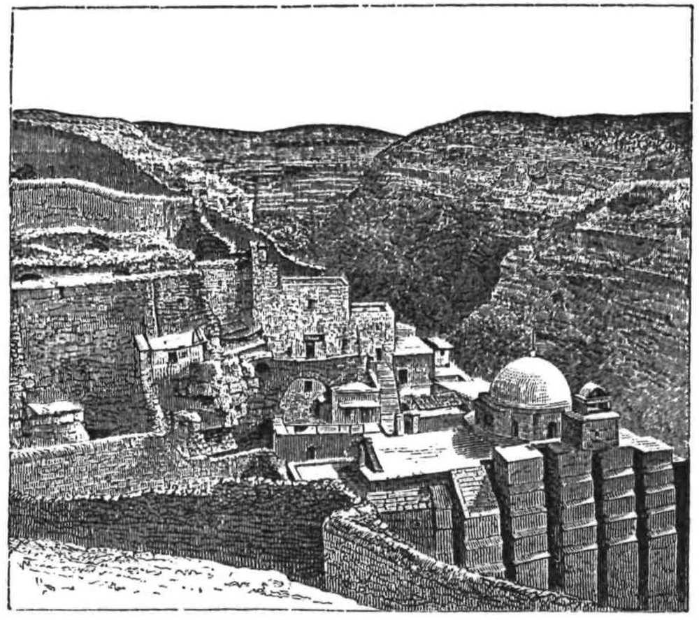
MAR SABA.
Ladies are not admitted into the monastery, but we were provided with a letter to the Superior. A little iron door in a high{157} yellow wall gives admission from the west, thence a long staircase leads down into a court before the chapel. The walls within are covered with frescoes, some old, some belonging to the time when the monastery was rebuilt, in 1840, by the Russian Government; Greek saints, hideous figures in black and grey dresses, with stoles on which the cross, and ladder and spear, are painted in white, stand out from gilded backgrounds. Against these ghosts of their predecessors the monks were ranged, in wooden stalls, or miserere benches with high arms, which supported their weary figures under the armpits. The old men stood, or rather drooped in their places, with pale sad faces, which spoke of ignorance and of hopelessness, and sometimes of vice and brutality; for the Greek monk is perhaps the most degraded representative of Christianity, and these were the worst of their kind. Robed in long sweeping gowns, with the cylindrical black felt cap on their heads, they looked more like dead bodies than living men, propped up against the quaint Byzantine background. One could fancy one’s self suddenly brought back to the dark ages of the fifth and sixth{158} centuries, when art, and literature, and even human intellect seem to have sunk into a second childhood, and that these were the very men who had fought so obstinately for and against the Monophysite heresy, which St. Saba succeeded in putting down.
The floor of the church was unoccupied, and paved with marble; the transept was closed by the great screen, blazing with gold, and covered with dragons and arabesques, and gaudy pictures of saints and angels on wood. A smell of incense filled the church, and the nasal drawl of the officiating priest soon drove us away to the outer air. We next visited the dark cave covered with pictures, which, after the Greek fashion, were cased in silver, and gleamed in the darkness, and where, behind a grating, are the skulls of the martyrs of a former massacre. Next we went up and down, by winding stairs in the rock, on to the roof of the church to see the nawâkîs, or wooden beams, which are struck instead of bells, though bells are also hung in the belfry. The convent pets came about us, the beautiful black birds with orange wings, which live only in the Jordan Valley, and have been named “Tristram’s grackle,” after that well-known explorer. They have a beautifully clear note, the only pleasant sound ever heard in the solitude, and the monks have tamed them, so that they flock round them to catch raisins, which they pounce upon in mid air. In the valley below, the foxes and jackals also come for alms, the monks throwing down loaves for them.
There is a tall solitary palm, said to have been planted by St. Saba, and to have sprung up bearing dates without stones, which he ate the same day on which it was planted. There is also a cavern in the rock reached by a few steps, where he lived, and in the side of it, a little cupboard about three feet square, where his lion slept. The whole cave belonged to the lion, but the saint seems to have had little regard to the rights of property, and considerable obstinacy of character. Three times he was ejected by the beast, but each time he returned to his meditations undaunted, and the lion finally relinquished to the invader the greater part of his cave.
The monks scattered a little rosewater over our hands, and we left this gloomy abode of the dead-alive in the desert. Scarcely half the monks can read the valuable manuscripts in their library, yet they hide them carefully from the eyes of heretics. Within{159} the walls they may neither smoke nor eat meat, yet raw spirits find their way past the porter, as we were able to prove. A more hopeless, purposeless, degraded life can scarcely be imagined than that of such hermits.
Yet even for these poor outcasts in the stony wilderness, lifeless and treeless though it be, nature prepares every day a glorious picture, quickly-fading but matchless in brilliance of colour; the distant ranges seem stained with purple and pink; in autumn the great bands of cloud sweep over the mountains with long bars of gleaming light between, and for a few minutes, as the sun sets, the deep crimson blush comes over the rocks, and glorifies the whole landscape with an indescribable glow.{160}
![]()

THE DOME OF THE ROCK.
WE approach at length the centre of interest in Palestine—the Holy City. In this chapter are gathered up the results of fifteen visits to the capital, and of two winters, one passed in a country villa outside, and a second within the walls, in our “own hired house.” During this time I penetrated into almost every nook and corner of the city, and visited its underground passages, and its smallest churches and mosques.
From my room in the Mediterranean Hotel I looked out at dawn. The orange-coloured light behind the Mount of Olives showed a black outline of mosque and tree and hill, with steel-coloured mountains to the right, capped by long wreaths of leaden vapour. The town lay in darkness below, its roofs shining wet with the heavy dew. Dimly visible the great dome of the Chapel{161} of the Rock shone with its new coat of lead, and the tall minaret on the north wall of the Haram, together with the dark cypresses, was just distinguishable. A vapour went up over the whole city, and gave it a weird and dream-like aspect.
Soon the town awoke, and the morning hubbub began. Long trains of camels came in, and the swarthy Bedawîn wrangled with the soldiers at the gate. The market-girls from Bethlehem appeared under David’s Tower, and, as the crowd thickened, black priests in saucepan-like hats jostled sickly Jews, with fur caps, long lovelocks, and dirty gabardines. The heavily-shod, unkempt Russian pilgrims mingled with sleek Rabbis, with Europeans, and German residents; Armenians with apple-cheeks and broad red sashes, and fierce Kurds with long moustachios and swords, were also numerous.
So motley a scene as that which is presented daily in David Street and in the market-place under David’s Tower, is perhaps to be found nowhere else. The chatter of the market-people, the shouting of the camel-drivers, the tinkling of bells, mingle with the long cry of the naked derwish, as he wanders, holding his tin pan for alms, and praising unceasingly “the Eternal God.” The scene is most remarkable in the morning, before the glare of the sun, beating down on the stone city, has driven its inhabitants into the shadow; for, later on, the white houses, white chalk hills, and dull grey domes, present a truly unattractive prospect; but about eight a.m. the market still lies in cool shadow, under the huge ochre-coloured tower, with a background of cypresses, and of white walls belonging to the Bible Warehouse. The foreground is composed of a tawny group of camels lying down, donkeys bringing in vegetables or carrying out rubbish, and women in blue and red dresses slashed with yellow, their dark faces and long eyes (tinged with blue) shrouded in white veils, which are fringed perhaps with black or red. Soldiers in black, and Softas in spotless robes, are haggling about their change, or praying in public undisturbed by the din. Horsemen ride by in red boots with red saddles, and spears fifteen feet long. The Greek Patriarch walks past on a visit, preceded by his macebearers and attended by his secretary. Up the narrow street comes the hearse of a famous Moslem, followed by a long procession of women, in white “izars,” which envelop the whole figure, swelling out like balloons, and leaving{162} only the black mask of the face-veil visible; their voices are raised in the high-pitched tremulous ululation which is alike their cry for the dead and their note of joy for the living. Next, perhaps, follows a regiment of sturdy infantry marching back to the castle, with a colonel on a prancing grey—men who have shown their mettle since then, and fat, unwieldy officers, who have perhaps broken down under the strain of campaigning. Their bugles blow a monotonous tune, to which the drums keep time, and the men tread, not in step, but in good cadence to the music. If it be Easter, the native crowd is mingled with the hosts of Armenian and Russian pilgrims, the first ruddy and stalwart, their women handsome and black-eyed, the men fierce and dark; the Russians, yet stronger in build and more barbarian in air, distinguished from every other nationality by their unkempt beards, their long locks, their great fur caps, and boots. Not less distinct are the Spanish, Mughrabee, Russian, and German Jews, each marked by a peculiar and characteristic physiognomy.
Jerusalem is a city of contrasts, and differs widely from Damascus, not merely because it is a stone town in mountains, whilst the latter is a mud city in a plain, but because, while in Damascus Moslem religion and Oriental custom are unmixed with any foreign element, in Jerusalem every form of religion, every nationality of East and West, is represented at one time.
Jerusalem is quite a small town, the circumference of its walls being only two miles and three-quarters; yet within this space it contains a population of 20,000 souls. Ten sects or religions are established in it, and, if their various sub-divisions are counted, they amount to a total of twenty-four, more than half of which are Christian. Prophets and visionaries of no particular sect are also not wanting at any time in the Holy City.
Jerusalem is a very ugly city. It is badly built of mean stone houses perched on the slope of the watershed, and seems in constant danger of sliding into the Kedron Valley. Beautiful bits of architecture are to be admired in its interior—the Gothic façade of the Holy Sepulchre, the grand walls of the Temple, the glowing interior of the mosque; the view towards the east is also very fine, a long wall of far-off mountains, with a foreground of embattled parapets and slender minarets standing out against the distance. Yet, with all this, the city as a whole is not beautiful; its flat-roofed{163} houses and dirty lanes are neither pleasing nor healthy, and the surrounding chalk hills are barren and shapeless. Shechem is a fine well-watered city. Damascus is bedded in gardens, and bristles with minarets, but there is nothing in the site or architecture of Jerusalem, as a whole, which can save it from the imputation of ugliness.
Going down David Street and through the fruit bazaar, with its background of arches, wooden balconies, marble portals brown with age, and fragments of Crusading architecture, you come at length through a bye-lane to the Jews’ wailing-place—a narrow street with the high Temple rampart rising on the east. All along the narrow court the Jews are crowded on Friday. The scene is striking from the great size and strength of the mighty stones, which rise without door or window up to the domes and cypresses above, suggesting how utterly the original worshippers are cast out, by men of alien race and faith, as they here congregate to bewail “our people that are wanderers, our priests that are defiled, our Temple that is cast down.”
Nearest to us stood the Pharisees from Germany, the Ashkenazi Jews, dressed in their best; the old men with grey locks and thin grey beards, on their heads the high black velvet cap edged with fur, their lovelocks curling on either side of their lank faces, their robes long gabardines of many colours; the younger men had blue-black hair, and pale strongly-marked features; here and there one saw a richly-dressed boy, a few little red-haired children, and occasionally an old woman, their faces all stamped with that subtle likeness which betrays the Jews in any country, and in any dress.
There were bits of colour in these groups which would have delighted Rembrandt. An aged white-haired man, in a mulberry gabardine and black velvet cap, contrasted with the black satin and fur of his next neighbour, and in front of both was a third in a green dress. All these dark rich costumes were set in a warm background of tawny colour made by the great wall towering above.
Beyond the Ashkenazi were the Spanish and Mughrabee Jews, in quieter colours with black turbans, brown-eyed and more dignified in bearing. Presently came in a hulking fellow in citron-coloured coat and blue trousers, with a tall black pointed lambs-wool{164} cap—a Russian Jew. The little Pharisees seemed to dwindle beside this giant, and his handsome, fresh-coloured face, blue eyes, and russet beard, seemed hardly to allow of his being one of the same nation; but it is the greatest peculiarity of the Jews that while never intermarrying, they yet approach in appearance most nearly the natives of the country in which they live, without entirely losing national traits of a distinctive character—a striking proof of the influence of climate and surroundings on race.
The emotion of a few of the worshippers was affecting. Here an aged woman in a white veil stood mute, her eyes fixed on the great stones of the Eternal House; there an elder leant his tearful face against the wall, his lips moving, his prayer-book unheeded. But as a rule the crowd maintained the tranquillity of an English congregation, and their dress and appearance was rather ludicrous than otherwise. The Rabbi read verse by verse the touching lamentation service, leaning his book on the wall, and lighted by two or three ordinary candle-lanterns placed before him. The assembly gave the responses in the peculiar manner of the Jews, which reminds one of the buzzing of a swarm of flies when disturbed, and they swayed their bodies all the time with the extraordinary bobbing motion which always accompanies their prayers.
Strange and indeed unique is the spectacle, and it reminds one forcibly of the unchanged character of the Jews. After nineteen centuries of wandering and exile, they are still the same as ever, still bound by the iron chain of Talmudic law, a people whose slavery to custom outruns even that of the Chinese to etiquette, and whose veneration for the past appears to bar the way of progress or improvement in the present.
Entering by the gate of the Cotton Bazaar, we stand at length within the Temple courts. Before us are the steps which lead up to the platform where shoes must be removed; for while the outer court, like the old Court of the Gentiles, is a promenade, the paved platform is a sacred enclosure, not to be trodden except barefoot.
From the bright sunlight we pass suddenly into the deep gloom of the interior, lit with the “dim religious light” of the glorious purple windows. The gorgeous colouring, the painted wood-work, the fine marble, the costly mosaics, the great dome flourished all over with arabesques and inscriptions, and gilded to the very top, all this splendour gleams out here and there from the darkness.{165}
And in honour of what is this beautiful chapel built? A low canopy of rich silk covers the dusty limestone ledge round which the “Dome of the Rock” has risen. The Rock of Paradise is the scene of Mohammed’s ascension, the source of the rivers of Paradise, the Place of Prayer of all the Prophets, the Foundation-stone of the World.
Such was the holy spot enshrined by the Dome. The sacred rock, recovered and purified by Omar, was soon after enclosed by the Khalif Abd el Melek, and the inscriptions on the walls give the history of this building with most remarkable detail.
The Arab historians relate that the Dome of the Chain was the model for the Dome of the Rock. Now this is possible, if we except the outer wall of the latter. Take that wall away, and you have a building consisting of two concentric polygons, with pillars bound together by a wooden beam, and supporting arcades. The Dome of the Rock is just three times the size of the Dome of the Chain, and the various measures of plan and height are proportional. The smaller building may therefore have been originally the model of the larger.
Over the outer arcade of the Dome of the Rock runs the great Cufic inscription, giving the date of the erection of the building in 688 A.D. The name of Abd el Melek, the fourth of the Ommiyah Khalifs, has been taken out at a later period, and that of Mamûn, one of the Abbasîyeh Khalifs, substituted; but the clumsy forger has forgotten the date, and has used a lighter blue in the grounding, thus the antiquity of the text is the more confirmed by the alteration.
This inscription dates the arcade, and thus apparently the inner circle, but not necessarily the outer wall, which may be later. The doors in this outer wall bear Cufic inscriptions dating 831 A.D., at which time Mamûn restored the building; the beams in the roof resting on the wall bear the date 913 A.D. In the ninth century the pointed arch began to be used by the Arabs, and the outer wall cannot be dated later than this; but if it be, as may naturally be supposed, of the same date with its doors, it is part of the work of El Mamûn, and this agrees with the idea that ’Abd el Melek’s Dome of the Rock consisted of two concentric arcades only, proportional to those of the Dome of the Chain. The symmetry of the present proportions is destroyed by the great breadth of the{166} larger building in comparison with its height, which is due simply to the addition of the outer wall. Once remove the outer wall, and the pleasing proportions of the Dome of the Chain are reproduced to three times their scale.
The Dome of the Rock belongs to that obscure period of Saracenic art when the Arabs had not as yet created an architectural style of their own, and when they were in the habit of employing Byzantine architects to build their mosques. Among the rare specimens of their work at this time, is the Mosque of ’Amrû, at Cairo, commenced in 642 A.D., and apparently almost rebuilt by that very ’Abd el Melek whose work in Jerusalem we are now considering.
Of the Egyptian building Mr. Fergusson writes: “It probably now remains in all essential parts as left by these two Caliphs” (’Abd el Melek and his successor, Walid). It is therefore very interesting to compare the Jerusalem Haram with the Cairo mosque, and the resemblance is striking.
In both there is a large rectangular area surrounded by colonnades; the pillars in the Cairo mosque are torn from older buildings, and support round arches, and a wooden beam runs above the capitals,—details also observable in the Dome of the Rock.
In both cases there is a mosque on the south wall of the enclosure, that at Jerusalem being, however, a Christian church adapted to Moslem worship, as is the great mosque at Damascus, also partly rebuilt by Walid.
In both the enclosures there is also the same feature of an octagonal building in the centre of the area, with an inner arcade supporting the dome; and this kind of structure is found in many other mosques at Damascus and in Cairo, being essentially an Arab building, suited either to give shade to a fountain useful for ablutions before prayer, or for the protection of some spot sacred, as the Mukam or “standing-place” of a saint or prophet. Such is the Dome of the Rock, not a mosque, as it is sometimes wrongly called, but a “station” in the outer court of the Aksa mosque.
In 831 A.D. the Khalif El Mamûn restored the Dome of the Rock, and if I am correct, enclosed it with an outer wall and gave it its present appearance. The beams in the roof of the arcade bear, as above stated, the date 913 A.D.: a well-carved wooden{167} cornice, hidden by the present ceiling, must then have been visible beneath them.
In 1016 A.D. the building was partly destroyed by earthquake. To this date belong restorations of the original mosaics in the dome, as evidenced by inscriptions. The present wood-work of the cupola was erected by Husein, son of the Sultan Hakem, as shown by an inscription dated 1022 A.D.
The place next fell into the hands of the Crusaders, who christened it Templum Domini, and established in 1112 A.D. a chapter of Canons. The Holy Rock was then cut into its present shape and covered with marble slabs, an altar being erected on it. The works were carried on from 1115 A.D. to 1136 A.D. The beautiful iron grille between the pillars of the drum, and various fragments of carved work are of this date, including small altars with sculptured capitals, having heads upon them—abominations to the Moslem, yet still preserved within the precincts. The interior of the outer wall was decorated in the twelfth century with frescoes, traces of which still remain. The exterior of the same wall is surmounted by a parapet, with dwarf pillars and arches, which is first mentioned by John of Wurtzburg, but must be as old as the round arches of the windows below. The Crusaders would seem to have filled up the parapet arches, and to have ornamented the whole with glass mosaic, as at Bethlehem.
In 1187 A.D. Saladin won the city, tore up the altar, and once more exposed the bare rock, covered up the frescoes with marble slabs, and restored and regilded the dome, as evidenced by an inscription in it dating 1189 A.D.
In 1318 A.D. the lead outside and the gilding within were restored by Nakr ed Dîn, as evinced by an inscription.
In 1520 A.D. the Sultan Soliman cased the bases and upper blocks of the columns with marble. The wooden cornice, attached to the beam between the pillars, seems to be of this period, and the slightly pointed marble casing of the arches under the dome is probably of the same date. The windows bear inscriptions of 1528 A.D. The whole exterior was at this time covered with Kishâni tiles, attached by copper hooks, as evidenced by inscriptions dated 1561 A.D. The doors were restored in 1564 A.D., as also shown by inscriptions.
The date of the beautiful wooden ceiling of the cloisters is not{168} known, but it partly covers the Cufic inscription, and this dates 72 A.H. (688 A.D.), and it hides the wooden cornice, dating probably 913 A.D. The ceiling is therefore probably of the time of Soliman.
In 1830 A.D. the Sultan Mahmûd, and in 1873-5 A.D. the late ’Abd el ’Azîz, repaired the Dome, and the latter period was one specially valuable for those who wished to study the history of the place.
Such is a plain statement of the gradual growth of the building. The dates of the various inscriptions on the walls fully agree with the circumstantial accounts of the Arab writers who describe the Dome of the Rock.
The materials employed were all apparently designed for their present uses and positions, with exception of the columns supporting the dome and the outer arcade. These have a Byzantine character, and they appear to have been torn from some other building or buildings, probably from Christian churches, just as in the case of the Mosque of ’Amrû at Cairo, or like the pillars which Jezzar Pacha at Acre collected for his mosque. Of every capital in the place I made a careful sketch; of those under the dome, as shown in the illustration, only three are alike. The cross is said to occur on one boss, as at Bethlehem. I have searched for this in vain, though I have a sketch of every boss, but there would be no impossibility in its presence if the pillar came from a church. The bases differ as much as the capitals, as we saw when the marble slabs were removed in 1875. The shafts are also of various heights and diameters, and one at least is upside down, with the capital of another pillar placed on its base end.
Leaving this beautiful and interesting building we crossed the platform southward, having on our right the old sun-dial, which the Crusaders held to mark the site of the Temple altar; and passing the beautiful summer pulpit we descended to the southern court. The most picturesque view is from this point. The Dome of the Rock is seen behind the venerable cypresses of the lower court—a great cupola on which sit innumerable doves, while, beneath it, the walls are resplendent with the harmonious colouring of the tiles—white, blue, green, black, and yellow, in elegant tracery which cannot now be imitated. In front are the flat steps leading up to the pillars and arches called “balances” by the{169} Moslems, and below them are the little chambers of the Sheikhs who live in the enclosure.
The black fanatics who guard the holy place lounged among the trees, and a funeral procession was slowly marching, with subdued murmurs, round the Chapel of the Rock, while, by a curious coincidence, a gorgeous wedding-party in bright-coloured silks, was also approaching the same place.
The great enclosure outside the platform is not paved; it is covered with grass and planted with olives and cypresses. Only the platform is fairly level, and its flagging in parts is covered with Crusading masons’-marks. There is, as above noticed, only one mosque in the enclosure—the great building on the south wall. The whole area is called Haram esh Sherîf, “High Sanctuary,” and Masjid el Haram, “Praying-place of Sanctuary;” also sometimes Masjid el Aksa, “the far-off praying-place,” in allusion to its distance from Mecca and to the Prophet’s long night journey. The mosque itself is called Jami’a el Aksa, or the “far-off meeting-house.” To it we next repaired.
The history of the mosque differs from that of the Dome of the Rock. Justinian, in the sixth century, erected a basilica in honour of the Virgin, partly supported by vaults beneath. The remains of such a basilica are distinguishable in the Aksa, and the vault beneath the mosque has the peculiarity of Byzantine vaulting—the narrow keystone, which is not found in the round arches of the Kubbet es Sakhrah, or Dome of the Rock.
In 637 A.D. the Church of St Mary was visited by Omar, and the “station” where he prayed is still shown in the Aksa. In 688 A.D. Abd el Melek covered the doors with gold and silver plates. Additions were made in the eighth century, and the width of the building was increased. The cupola bears the date 728 A.D. The Crusaders called the place Solomon’s Palace, Solomon’s Porch, or Solomon’s Temple. The Templars remodelled it, adding an apse on the east and a long hall on the west. Again it fell into Moslem hands, and further alterations were made; thus at the present day it presents a confusion of style and plan requiring the eye of a practised architect to distinguish the various additions.
The general effect is poor, for the interior is whitewashed and coarsely painted; only at the south end do any remains of the old{170} glass mosaics still exist, and here are found close together the beautiful pulpit of parquetted wood-work from Damascus, and the new glass chandelier from Constantinople, the twisted columns of the Templars’ dining-hall, and the heavy basket-work capitals of the Byzantine basilica, while, in the vault beneath, is the huge monolith, which three men can scarcely girth, supporting the porch of the Temple-gate—a mixture of styles which cannot perhaps be found in any other building in the world.
Many chapters might be written on the High Sanctuary and its buildings, but space is wanting to describe the gates, the underground passages, the chambers and cisterns, which I again and again explored, and which had, already, been minutely examined and described by Major Wilson and Captain Warren. We must hasten therefore to another building, surpassing in interest even the Temple enclosure itself, namely, the Church of the Holy Sepulchre.
It is a grim and wicked old building that we now approach. Perhaps no other edifice has been directly the cause of more human misery, or defiled with more blood. There are those who would willingly look upon it as the real place of the Saviour’s Tomb, but I confess that, for myself, having twice witnessed the annual orgy which disgraces its walls, the annual imposture which is countenanced by its priests, and the fierce emotions of sectarian hate and blind fanaticism which are called forth by the supposed miracle, and remembering the tale of blood connected with the history of the Church, I should be loth to think that the Sacred Tomb had been a witness for so many years of so much human ignorance, folly, and crime.
The place is nevertheless venerable from its many memories, for whether or no it encloses the Sepulchre of Christ, it may at least claim to be the site which Christians, from the fourth century downwards, have venerated as such. Of this we cannot well have any doubt when we review the descriptions of the place which have been written in consecutive centuries, including several recently published.
Jerome places Golgotha north of Sion, and the early Christians included under the title Sion only the Upper City of Josephus. Eucherius, Bishop of Lyons, writing in 440 A.D., repeats this description of its position, and speaks of Siloam as below the city{171} wall, and beneath the precipitous eastern rock of Sion—a description of relative position which can only apply to the hill now known as Mount Sion. Jerome himself speaks of Sion as the citadel of the town, which is still true of the modern site.
Theodorus, in 530 A.D., is quite as explicit with regard to the position of the church. “In the middle of the city,” he says, “is a basilica; from the west side you may enter to the Holy Resurrection, where is the Sepulchre of our Lord Jesus Christ, and there is the Mount of Calvary, to which Mount the way is by steps, and it is under one roof.”
We know by contemporary evidence (the Pascal Chronicle) that this Basilica of Constantine was destroyed, in 614 A.D., by Chosroes the Persian. Several small chapels were soon after erected instead, by the monk Modestus, and they are described in 630 A.D. In 700 A.D. Arculphus gives a detailed account of these new buildings, including the round Church of the Holy Sepulchre, the square Church of the Virgin, the Chapel of Golgotha, and, on the east, the Basilica of Constantine separated by an open space from the round church and from Golgotha. The relative positions of Calvary and of the Sepulchre in this account, are the same described by the previous writers, and by Eusebius in his history of the building of the original Basilica in 333 A.D. Arculphus’ description of the Sepulchre as a place “large enough to allow nine men to pray standing,” might have been written of the Holy Tomb in the present church. In 722 A.D. it is again described, and the door of the tomb is then said to be, as it still is, on the east.
We are thus able to identify the site chosen by Constantine in the fourth century, with that recognised in the fifth, sixth, seventh, and eighth centuries. The chapels of Modestus were destroyed, according to contemporary writers, in 1009 A.D. by the mad Khalif Hakem, but were restored in 1048. From the year 1033 down to 1099 A.D. innumerable pilgrimages took place, but accounts of the buildings are not known. The Crusaders, however, replaced the third system of churches by a magnificent cathedral, and united once more the Sepulchre and Calvary under one roof. Their erection dated from 1103 A.D., and remained intact till 1808, when it was partly destroyed by fire; the southern façade is however still attributable to the twelfth century. Of the position of{172} the Crusading site there is also no doubt, and it is shown on charts of the fourteenth century. Sæwulf, in 1102 A.D., places the site of Calvary “on the declivity of Mount Sion,” thus agreeing with Eucherius, who had described it in the fifth century as “placed outside Mount Sion, where a knoll of scanty size exists to the north.” Both these expressions fit well, as the plan will show, with the actual site of the present building.
We approach the church from the south, where is an open court in which, according to the legend, the Wandering Jew stays for a moment once in every century to beg admission, and hears a voice which bids him resume his endless journey. In front of us rise the beautiful Gothic doorways, the pillars scrawled over with the names of pilgrims, and with dates from the fourteenth century downwards; beneath our feet lies old Philip D’Aubigny, close by the threshold, and over his head each year thousands of pilgrims press through the narrow portal.
Passing through the doorway we enter the vestibule, in which is the Stone of Unction, a slab of marble with lanterns of ground-glass hung above it. On the left is the diwân of the Turkish custodians, to the right the stairs of the Chapel of Calvary, beneath which is the place where the “rent in the rock” is shown, and where were once the tombs of Godfrey and Baldwin. Immense wax candles, reaching half-way to the lofty roof, flank the Stone of Unction, which is devoutly kissed by the pilgrims. Passing round it to the left, the rotunda of the church is reached; to the right a narrow passage, with small chapels, runs behind the apses of the Greek Church, and here a flight of steps leads down to the subterranean Chapel of Helena, with its picturesque lighting and heavy eighth-century basket-work capitals; beneath this again is the dark cave so suggestively named “Chapel of the Invention of the Cross.”
The rotunda is well lighted, with a dome, light blue in colour and covered with golden lilies in memory of its repair by the French; the drum is of good white stone. In the centre rises the old Chapel of the Sepulchre, dark and gloomy, of marble discoloured by age, surmounted by a queer cupola, of Italian taste, and ornamented all along the top with gilt nosegays and modern framed pictures. Its entrance is flanked by very handsome marble candlesticks, and in front of the vestibule are hung beautiful gold{173} and silver lamps, suspended by chains, and glowing with a subdued light through glass cups, red, yellow, and green; they number forty-three in all, thirteen for Franciscans, Greeks, and Armenians respectively, and four for the poor Copts.
Stooping to enter, we pass into the vestibule or Chapel of the Angel, walled with marble slabs, and thence into the inner Chapel of the Sepulchre itself, where the darkness is only relieved by the glowing lamps over the altar on the Tomb.
The most impressive portion of the church is, however, the nave east of the rotunda belonging to the Greeks, with its great screen in front of the three eastern apses. The floor is unoccupied, save by the short column marking the “centre of the world.” The dome above is poor, rudely whitewashed, and painted in fresco, with the long strings of globular lamps usually seen in Greek churches; but the glory of the place consists in the lofty screen and the panelling of the side walls. Into the panelling dark pictures are framed, and gilded thrones for the bishop and patriarch stand, one each side, beyond the dark wooden choir-stalls. The screen towers up to the roof, and presents figures, in rows one above another, standing in canopied recesses, but all in low relief: in the screen are the gates of the apses, and over each gale is a little purple glass lamp, the colour of which, in the gloom and beside the tarnished gilding, is truly magnificent. Four candlesticks of grey marble beautifully carved, the central pair eight feet high, stand before the steps to the screen; they are presents from the Czar, and have the Russian eagle on them.
Passing over without description the many minor chapels, which are dingy and uninteresting, there remains only the Chapel of Calvary to notice. It is as dark as the greater part of the rest of the church, yet on arriving at the top of the steep stairs, the general effect is a blaze of gold. Nearly the whole of the east end is occupied by the Greek altar. The pictures above it have been covered with gold plates, leaving only the faces visible. The lamps are gold, the sacred vessels are gold. The roof is very low, and painted in well executed and ancient fresco on a blue ground. A faint smell of rosewater pervades the chapel, mingled with an odour of stale incense.
Sunday after Sunday we revisited the venerable church, and followed the brown Franciscans in their march round the sacred{174} stations, listening to the deep sonorous tones of their chant. On one occasion this was suddenly drowned by the high nasal scream of the Armenians, and we found the celebrant of the latter rite in the Calvary Chapel,—a priest with a long beard and peaked Armenian hood. The responses were made by black-robed acolytes in fezzes, and a second minister, in gaudy robes, with a gilt-paper crown much too large for him, swung a censer. The Latin ritual seemed simple and dignified, its music melodious, and its ministers reverential, when contrasted with the unearthly screeching and childish mummeries of the Oriental sect.
The plaintive chant of the Franciscans attracted us to the spot where the officiating priest stood, at the door of the Chapel of the Angel. The monks knelt in a double row, and the scene was impressive; the background was formed by the great screen; in front was the dark chapel—a church within a church. Not less affecting was the aspect of the congregation, many with sad pale faces telling of no common histories. One man especially used to draw my attention; light haired, pale, gaunt, and shabby, kneeling with his little taper in one hand, the other held out in an attitude of entreaty; his wild eyes were fixed on the marble Tomb, as though he could hardly believe that, after many miles of journey, he at last really beheld the Holy Sepulchre. In him one might fancy a penitent of the old Crusading times, sent on pilgrimage to expiate some great crime; and the memories of seven centuries rose up—of the king who refused to be crowned where his Master had suffered; of the strong men in mail who had knelt in tears on these stones, and clanked their iron heels about the church; of the time when the proudest chivalry of Europe had devoted their lives to redeem the few feet of rock, where they believed the Holy Saviour to have hung on the cross.
But the time to see the church is the season of Easter. In 1873 and 1875 I was present at the so-called Holy Fire. On the first occasion alone, on the second with Lieut. Kitchener, with whom I rode sixty miles in one day from Gaza to see the spectacle.
On the evening before the day of the Fire, the whole huge building was full of pilgrims, and the long winding passages and galleries were blocked with human beings, fast asleep, crouched against the walls or extended on mattresses. In the passage from the door to the rotunda, Armenian women were propped in long{175} rows against the walls, on a kind of bench. Most of the pilgrims were asleep, but some still showed by frequent crossings, prostrations, and sighs, that the keenness of their ecstasy was unabated.
In 1875 the pilgrimage to Neby Mûsa was going on at the same time, and parties of wild fanatical Moslems paraded the streets of Jerusalem, bearing green banners surmounted with the crescent and inscribed with Arabic texts. A bodyguard armed with battle-axes, spears, and long brass-bound guns accompanied each flag, and a couple of big drums with cymbals followed. It speaks well for the Turks, that with all the elements of a bloody riot thus ready to hand, with crowds of fanatics, Christian and Moslem, in direct contact, still no disturbances occurred.
By 11.30 a.m. on the 19th of April, 1873, and by the same time on the 22nd of April, 1875, we had been marshalled to a place in the Latin gallery, west of the Sepulchre, and looking down on the rotunda. Between the Chapel of the Sepulchre and the rotunda wall is a space some fifteen paces wide; a double line of Turkish soldiers kept open a narrow lane, in the middle of this space, round the tomb—a lane sufficiently wide for three men to walk abreast. On either side the crowd was packed against the rotunda wall, and against that of the Sepulchre chapel, and packed so thickly, that it seemed impossible for one single body more to be squeezed in. To say that you could walk on the heads of the crowd conveys but a poor idea of its compactness; the whole mass seemed welded into one body, and any movement of a single individual swayed the entire crowd, which seemed to tremble like a huge jelly.
But who can describe this wonderful scene? The sunlight came down from above on the north side where the Greeks were gathered, while on the south all was in shadow. The mellow grey of the marble was lit up, and a white centre of light was formed by the caps, shirts, and veils of the native Christians.
A narrow cross-lane was made at the fire-hole on the north side, and here first two, and in 1875 six herculean guardians, in jerseys and with handkerchiefs bound to their heads, kept watch—the only figures plainly distinguishable among the masses.
The effect of colour was remarkable; it seemed to run in patches, as all of one nationality were near one another. In the sunlight, brown faces and arms, salmon colour, pink, light blue,{176} and cinnamon in the clothing, were blended with the white; but, in the shadow, the dark blue uniforms, the black dresses of nuns, and the brown frieze and red sashes of the Armenians, were streaked across by the long line of the soldiers’ red fezzes.
On the west a striking contrast was observable; here stood and sat the Abyssinians and Copts, silent and dusky, with many women among them, some with small babies in their arms, whose cries of half-suffocation were plainly heard above the din of many voices and many languages. The Coptic men were in loose dark robes, with white, twisted turbans, the women were closely veiled, in flowing indigo-coloured garments. The Abyssinians, swathed in voluminous white drapery, sat gloomily silent against the wall. On the east a few Arabs were gathered, also in dark robes, and behind them was seen the rich colouring of the Greek chancel, dark and dusky in the dim light.
The pilgrims had been standing in their places for at least ten hours, yet they showed no signs of weariness. Every face was turned to the fire-hole, and but one interest seemed to absorb them, save when the great pewter cans of water, supplied by the charity of the priests, were brought round.
The variety of national character was also remarkable. Patient and stolid the Russians and Armenians stood in their places, and a little forest of candles rose from amongst them, ready to receive the fire, each pilgrim having a bunch of perhaps a dozen in his hand. Silent and motionless sat the Egyptians, awaiting the event with all the apathy and dignified indifference of Orientals. On the north, however, an entirely different scene was enacted. Here stood the Greek Christians, mostly Syrians by birth, who were worked up into a state of hysterical frenzy which would not allow them to be quiet for a moment, and which seemed ever on the increase. Every now and then a man would struggle on to the shoulders of his neighbours; in one case six arms, extended full length, supported him, three to each foot, whilst his baggy trousers were grasped to keep him steady; another man was pushed and rolled along, over the people’s heads, as if he was swimming. These individuals became fugle-men, and led the numerous well-known chants, of which I collected the following:
This is the most common chant, meaning “This is the Tomb of{177} our Lord,” and repeated by hundreds of voices in perfect time with the accentuation as given above. Another chant was to the same cadence:
“God help the Sultan.” The next was rarely heard:
“O Jews, O Jews! your feast is a feast of apes.”
Two longer chants were also used pretty frequently.
“The Christ is given us, with His blood He bought us. We celebrate the day, and the Jews bewail.”
“The seventh is the fire and our feast, and this is the Tomb of our Lord.”
Nothing was more remarkable than the patience of the soldiery who had to keep order. The Greeks gave most trouble, and in 1873 the feeling evinced by them was very bitter, because their favourite Patriarch had just been deposed. A very fat old colonel walked up and down, armed with a murderous kurbaj, or whip of hippopotamus hide; he would sit on the floor and look at the crowd, sometimes putting an additional big soldier at a weak point in the line. The men were armed with the Snider, and were very stalwart and tall. Sometimes the crowd became dangerous, and hissed. As fast as his legs could carry him, the Colonel rushed to the spot, and down came the whip; then where a moment before were angry faces and arms stretched out with clenched fists, there was suddenly nothing but a flat surface of backs, or a few arms raised to protect the heads. Yet on the whole it was a good-natured crowd, and the soldiers were wonderfully patient. Little incidents of a comic nature occurred, and an Arab chief, who tried to swagger down the lane, found his{178} head-shawl off and far away in a moment, tossed from hand to hand amid shouts of laughter.
Two wooden galleries were erected, under the arches to the west, each three storeys high; and here sat native women of the better class, in their best silks, yellow and red stuffs, cachemire shawls, white muslin and blue cloth, with flashing eyes and painted faces. They lay scattered over the bright carpets, presenting an effect of colour more brilliant than that of the broad masses of sombre tints below.
About one o’clock in the afternoon, the natives of Jerusalem arrived—a long wave of human beings bursting suddenly in from the south, and surging along the narrow lane. Many were stripped to their vests and drawers—in regular fighting costume. They rushed at the fire-hole, and the first comers thrust their arms into it to keep their places. The effect of this crowd within a crowd—a moving wave, ploughing through the two packed masses—was very curious. No sooner was it pushed and swept into place and the lane cleared, than it burst into one long loud shout of repetition—
which was repeated twenty or thirty times at a breath; and a big man was hoisted up, and fairly pounded the walls of the Sepulchre with his fist, shrieking the same refrain and pointing at the chapel with his fingers, while the crowd joined in the last syllable—a tremendous shout of “Na!”
And now the rotunda contained some 2000 persons, and the church probably 10,000 in all, when, at 2.15 p.m., the procession was formed, and the nasal chant of the priests was heard in the Greek church.
First came the banners, looking very shabby, the crosses above them bent on one side in bygone fights. The procession was a short and hurried one; the old Patriarch (just elected in 1872) had a frightened air, and shuffled along, flanked by the Archimandrite and by another dignitary, each carrying a great silver globe, with holes in it, mounted on a silver handle, and intended to hold the fire. The tuneless singing was interrupted by the chorus of the crowd and the shrill cries of the women. For a moment, in 1873, there seemed danger of a riot. A man raised his arm and{179} shouted something at the Patriarch in a loud voice. Instantly an officer was on the spot; the man, who had hidden, was dragged out, held by the legs, and beaten over head and face, then thrust back into the crowd, and an extra guard placed over him.
And now a moment of breathless silence followed. Many faces were raised to the roof, perhaps expecting the fire to drop through the quiet shaft of light above, or the dove, which used to be let loose, to appear. Two priests stood bareheaded by the fire-hole, guarded by the giants on either side.
Suddenly a lighted torch was in their hands passed from within, where was the Patriarch. The two priests turned and fled, and the giants closed in round them, trampling like furies through the crowd. In a moment the thin line of soldiers was gone, and two huge hustling masses surged up like waves round the great torch, which, now high, now low, was tossed on the seething flood, scattering sparks right and left, but gradually drifting towards the exterior of the church, where the horseman sat, ready to take the fire to Bethlehem. A great forest of arms was stretched out towards the torch, and they seemed to writhe like serpents after it; but not a single taper was lighted. Soon, however, other torches were passed out of the fire-hole, and the fire spread over the church, as the roar grew louder and louder. A flame next broke out behind the grating of the Coptic chapel, and a yet more wonderful scene here presented itself. The dark mass of blue and black was streaked with livid flesh-colour, as bare arms stretched towards the light with their bundles of tapers. Woe to the owner of the taper first lit; it was snatched from him, and extinguished by a dozen others thrust into it. Delicate women and old men fought like furies; long black turbans flew off and uncoiled like snakes on the ground, and what became of the babies I do not know.
The change from the stagnation of the motionless crowd to the wild storm now raging was as marvellous as it was sudden. The flame spread, seeming to roll over the whole crowd, till the church was a sea of fire, which extended over the roof of the chapel, and ran up the galleries and along the choir. Meantime a dreadful bell was clanging away, and the grey-bearded Patriarch was borne out aloft into the chancel, on the shoulders of a body-guard of{180} priests. A dense blue fog, made by the smoke, and a smell of burning wax rose up, and above all the quiet gleam of light shone down from the roof.
The fury of the crowd seemed to increase. A stalwart negro, struggling and charging like a mad bull, ran round the church, followed by the writhing arms; then, as all got their candles lighted, men might be seen bathing in the flame, and singeing their clothes in it, or dropping wax over themselves as a memorial, or even eating it. The dancing is not allowed now; but here and there knots were formed, of men who jumped and hopped, rolling along the centre and out of the church. The whip came down on crowd and soldiers alike, until the lane had been re-formed; and at last the excitement abated, as the gorgeous second procession came forth in an endless string.
This procession is the grandest to be seen in Jerusalem, but only a few of the Greeks assist at it.
First came a priest in yellow, with a crown and great jewelled cross, flanked by others in pink satin, with censers; four banners followed, and six priests in embroidered cloth of gold; next came twenty Armenians in cloth of silver; next, two censer-bearers with red-and-gold crowns, and four priests in cloth of gold, with candles; then came the Armenian bishop, in a large cope lined with rose satin, with a white beard and a gigantic mitre of gold, having a central medallion of enamel; on each side of him was a priest in a black cap, holding his robe. Next came the Copts, with six banners, a cross, and two books in silver covers; the priests in cloth of gold, with crowns of red-velvet and gold; then six monks in the same, with white hoods; two censer-bearers with yellow tippets, and crowns; followed by the Coptic bishop, in cloth of silver lined with crimson, and with a great silver crown; two acolytes and a banner-bearer in silver and white went before him. A cross, four banners, and two censers were borne next; then came four priests in silver embroidered with blue, bearing books in rich silver covers; then the Syrian bishop, in plain cloth-of-gold, with a hood of the same; and behind him a banner, borne by a priest in pink and silver robes embroidered with flowers.
Again in the evening we went to the church, and found our way into the gallery, where we remained till one in the morning. The crowd was almost as thick, but the majority were Russian women;{181} and the old cry, “Hadha kuber Saidna,” still rang at intervals. A new procession of eighty priests and seven crowned bishops in silver robes was formed, these being of the Greek rite. The glare of countless candles lit up the scene; and after the procession had gone thrice round the Tomb, the bells began clanging, the crowd roared, and all the banners and crosses were spun round and round with a rapid whirl, till the flashing, the noise, and this extraordinary spinning of the flags made one giddy.
Such is a plain account of this wonderful feast, from notes made on the spot. The Latins have long discountenanced the imposture, though it was once recognised by them, and dates back to the miraculous lighting of lamps in the time of the Christian kings of Jerusalem, and is even mentioned by the monk Bernard the Wise in 867 A.D. Every educated Greek knows it to be a shameful imposition; but the ignorant Syrians and the fanatical Russian peasants still believe the fire to descend from heaven. The clergy dare not enlighten them, and that crafty diplomacy which encourages pilgrimages to Jerusalem by government aid, fosters the superstition which is the main inducement for the Russian pilgrims to visit the Holy City.{182}
![]()
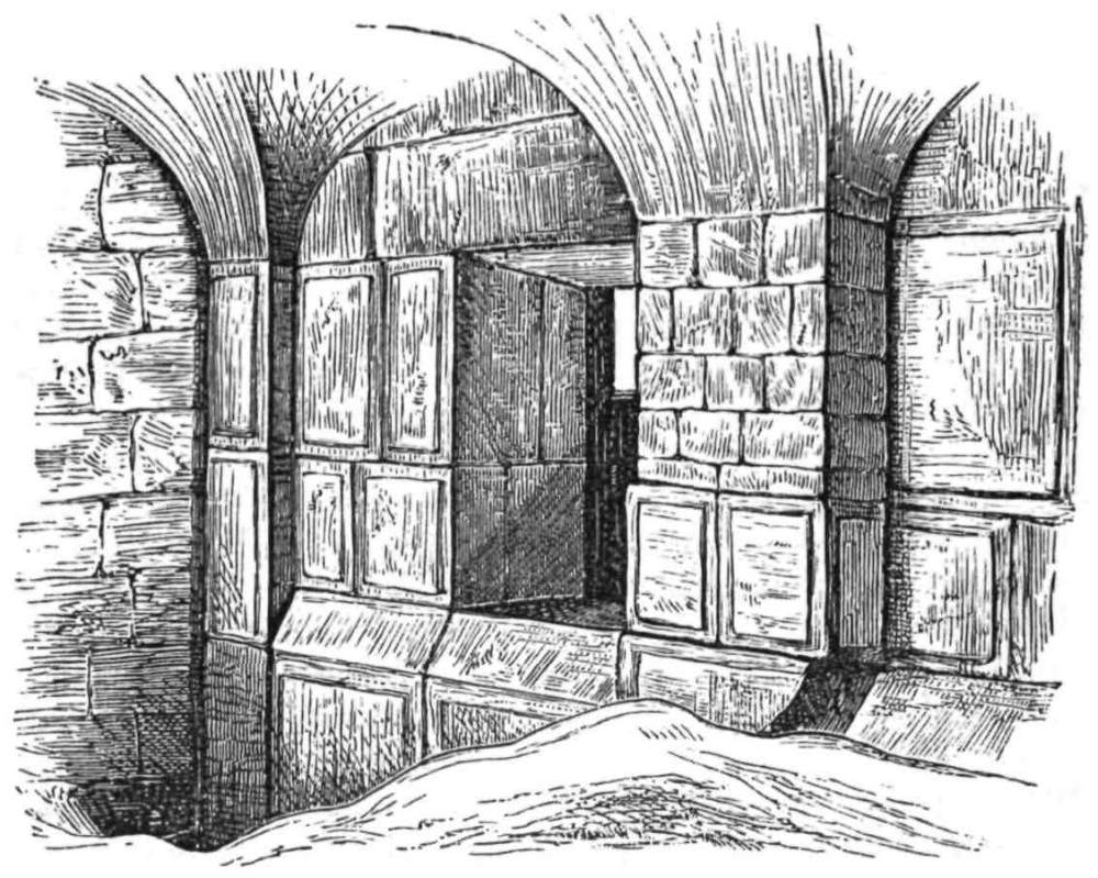
THE TEMPLE WALL.
THE subject of Jerusalem topography is too large to be minutely treated in the present volume; and I hope to be able to write a separate work on it at some future time. The following chapter is devoted to the two questions of primary interest—the Temple and Calvary.
The sources of our information as to the Temple are two—the first Josephus, the second the Talmud. The first is simply a general and pictorial account; the second is a laborious and minute description by men in whose eyes the subject was all-important; and the tract of the Mishna, called Middoth, or “measurements,” gives the details of arrangement, in some parts, with an exactitude which is rare among Jews, and which allows of plans being made. We have also this great advantage—that all{183} the scattered accounts in the Talmud have been summarised and arranged by the famous Maimonides, “the second Moses,” a man of great ability and thoroughly trustworthy, and that every statement he makes in his systematic account of the Holy House can be traced back to the original passages hidden away in the Talmud.
While, therefore, it is from Josephus that we get a general idea of the appearance and arrangements of the Temple, it is from the Talmud, and from Maimonides, that we obtain that exact information which enables us to make a plan of the Holy House and of its courts.
A considerable initial difficulty arises, for Josephus makes the area of the Temple to have been a square furlong, or 625 feet side, and the Talmud gives it as 500 cubits, which, as will be seen, is probably 666 feet; but the Haram has a mean measurement of 982 feet by 1565 feet—a trapezoid, containing an area of thirty-five acres, or three and a half times the area given by the Talmud. Thus the question arises, has the present boundary any connection with that of the Temple? And if it has, where are we to place the smaller area within the larger?
There are many indications leading to the conclusion that the present outer wall of the Haram is the old boundary of the Temple Hill. In the south-west corner we have the remains of the great bridge which Josephus so often mentions. The south wall is trisected by the line of the two underground portals, answering to the two Huldah or “Mole-gates” of the Temple. Captain Warren’s excavations have also shown us that the south wall is probably all of one date and in one piece, with a “Master Course” six feet high, except near the west, where, for over 200 feet, this feature is wanting, and where the stones below the original surface existing at the time of the great bridge are less finished, being probably never visible. In the south-east corner, where the stones are smoothly finished down to the rock, are the Phœnician mason’s marks, denoting the courses; and from this corner to the Golden Gate the masonry is apparently of the same character. The junction of the Ophel wall at the south-east corner serves to identify this angle of the Haram, with the corresponding angle of Herod’s Temple enclosure. The west wall has been examined for nearly half its length, and proves to be of the same{184} style as that on the south-east. Finally, in 1873, I found the same masonry, in the north corner of the west wall, reaching up to a higher level than that at which it was previously known in any other part of the Haram, and founded on rock. The natural conclusion is that all this beautiful and gigantic masonry is of one period, and formed one area. The question is, to what period does it belong?
I may, perhaps, insist upon an indication of date connected with the dressing of the stones, which I have never seen brought to bear on the question. Drafted masonry, imitating that on these walls, was used by Byzantine builders and by Crusading masons; but they never dressed their stones in the manner in which those of the Temple are dressed. This is distinctive and unique. It consists of a careful cross-chiselling, on the draft, and for a depth of three inches round the margin of the raised part of the stone—a regular “criss-cross” pattern, never found in the later masonry. This dressing also occurs on the stones of the voussoirs of the great Tyropæon bridge, an indication which I have never seen noticed before. The bridge and the wall then are, to all appearance, of one period; the lower courses of the wall are proved, by excavation, to be in situ, and thus the existing line must, I conclude, be referred to the time of the bridge. No one has disputed as to when this bridge was built. Captain Warren has shown that an older arch fell, and a pavement was made over it, before the present ruined bridge was built; thus the present arch is generally thought to be not earlier than Herod’s time; and hence the Haram wall is attributable, according to the indications obtained from its masonry (as was long ago pointed out by the Comte de Vogüé, arguing from different premises), to the time when Herod rebuilt the work of Solomon, doubling the area enclosed (Wars. i. 21, 1), and in part, if not altogether, “took away the old foundations” (Ant. xv. 11, 3).
On the north other important indications exist which require careful consideration. Josephus tells us that a tower called Baris (probably meaning “the castle”) was built by Hyrcanus and repaired by Herod. It was on a hill which originally joined that of Bezetha, but was severed by an artificial trench. The fortress was re-named Antonia; it stood on a rock fifty cubits high (B. J. v. 5, 8), and at the north-west corner of the Temple, which{185} it commanded, being on the “top of the hill” (B. J. vi. 1, 5). Now there is just such a rock-fortress in the north-west part of the Haram. It is a great scarp, with vertical faces on the south and north, standing up forty feet above the interior court, and separated from the north-eastern hill of Jerusalem by a ditch fifty yards broad, in which are now the “Twin Pools”—the Bethesda of St. Jerome. This block of rock is “the top of the hill,” and occupies a length of 350 feet along the course of the north wall of the Haram. No other such scarp exists in or near the enclosure of the High Sanctuary. Can we, then, hesitate to place Antonia here?
The foregoing observations knit together the various parts of the Haram enclosure, as constituting a single building of one period. The east wall, from the Golden Gate southwards, is in one piece with the south wall; the south-west corner has the remains of Herod’s bridge contemporary with the wall; the west wall is all of one style with the rest; at the south-east angle the Ophel wall is found joining the east wall of the enclosure as described by Josephus, and the north-west corner is occupied by Antonia.
But we have still the north-east corner of the Haram to consider, and here we have, I think, indications that it was not originally part of the Temple enclosure. There is no rock north-east of the present platform for a great depth: a valley runs across this part of the area, and even the present surface is very low. It is also ascertained that the east wall has, near the north-east corner, a character distinct from the remainder, and much rougher, and that it runs beyond the present north-east corner of the Haram without a break.
Nor can it, I think, well be doubted, that the north wall of the Haram, east of the rock scarp, is less ancient than the other walls. In the first place, the vaults in this part, which Captain Warren explored, and which I also visited, are Crusading or Saracenic work; they are of masonry, with groined roofs and pointed arches, not of rock, like the great passages under the Platform. In the second place, the north wall consists of at least two thicknesses of rough small masonry, which was once covered with the plaster of the great pool called Birket Israîl. This masonry is certainly more modern than the time of Herod, and the pool is not clearly mentioned, in any account of Jerusalem before the twelfth century, about which period, perhaps, it was first constructed. Had a fine{186} wall existed on the north side of the Haram, surely the cement would have been spread directly over it, and not over a facing of inferior stonework far more liable to leak. A boring through the wall would here be most valuable as an exploration, but, even without it, there is I think ample evidence that the north-east corner of the Haram, east of Antonia, north of the Golden Gate, is not a part of Herod’s enclosure, as its walls and subterranean vaults are distinct in character.
Assuming the outer boundary of the Temple Hill, to have been thus defined, as coinciding with the Haram walls except on the north-east, we have next to explain the statements of the Talmud, which make the “Mountain of the House” 500 cubits by 500.
The explanation is not difficult. Maimonides tells us, in a passage of which Dr. Chaplin kindly sent me a translation, in 1873: “The men who built the second Temple, when they built it in the days of Ezra, they built it like Solomon’s, and in some things according to the explanation in Ezekiel.”
The learned Professor Constantine l’Empereur, speaking of the same question in 1630 A.D., quotes the Talmud Commentary as follows:
“The Mountain of the House was to the north of Jerusalem, and the mountain was indeed much greater than five hundred cubits on each side would contain, but to the outer part of it the sanctity did not extend.”
In this particular, then, the men of the second Temple followed the injunction in the Book of Ezekiel. “Five hundred long and five hundred broad, to make a separation between the sanctuary and the profane place” (Ezekiel xlii. 20); or, in the words of the Revelation (xi. 2): “The court which is without ... measure it not, for it is given unto the Gentiles.”
Thus the 500 cubits refers apparently to that part of the Temple, within the Soreg or Druphax, which could not be entered by any Gentile.
The measurements of Josephus are only approximate. They cannot, as we have seen in the case of Cæsarea, be relied on for accuracy, and in one particular (the measurement of the altar) they are impossible. But it is otherwise with his general descriptions. Dimensions estimated in a distant country may be incorrect, and figures are liable to alteration in copying; but general position{187} and arrangement we must accept, unless we condemn the author as thoroughly untrustworthy. As to the position of the Holy House, Josephus and the Talmudic writers are in accord. The Temple stood on the top of the hill, which, at first, was scarcely large enough for the Holy House and the Altar (B. J. v. 5, 1). This statement is the proper starting-point for any reconstructive plan of the Temple and its courts.
The top of the Temple Hill is, without dispute, the Sakhrah Rock; from it the mountain slopes down on all sides, and we now know accurately the general lie of the rock. At the Sakhrah, consequently, Josephus places the Holy House.
Three traditions consent in pointing to the same spot. In other cases, such as Joseph’s Tomb, Jacob’s Well, and the Tomb of Eleazar, we also find such a consent of tradition, and the latter sites are generally accepted as real. When, as in the case of David’s Tomb, traditions are not in accord, we get but little help from them; but, in the few instances where both Moslem and Christian traditions agree with that accepted by the Jews, we may fairly argue that from the Jews they were originally derived. This is the case in the present instance. A rock called “Stone of Foundation” (Eben Shatiyeh) existed, according to the Jews, in the Holy of Holies; round it the world was first gathered together, in it the Ark was hidden, and over it the Mercy-Seat originally stood. The same tradition seems to be repeated in the Crusading chronicles, and the Christians of the twelfth century placed the Holy of Holies above the Sakhrah rock. Moslem tradition also connects the Sakhrah with the Stone of Foundation, for it is, in their eyes, the foundation of the world, as in the tradition of the Jews was the Eben Shatiyeh under the Holy of Holies.
After taking this position for the Holy of Holies as a starting-point, a serious question at once confronts us, namely, the length of the cubit. Here again we must trust to the Jews. The measure they used was not an Egyptian cubit, not a Babylonian cubit, not a Greek or Roman cubit; it was a measure of their own, the Hebrew Amah. Maimonides tells us that the Temple cubit was of forty-eight barley-corns, and any one who will take the trouble to measure barley-corns, will find that three go to the inch. This gives us sixteen inches for the cubit, or the average measure from the elbow to the first joint of the finger, which the Amah is{188} said to have been. I am the more inclined to accept this length, because I find that the Galilean synagogues, measured by it, give round numbers. Thus in the synagogue of Umm el ’Amed, which I measured in 1875, I found the pillars to be ten cubits high, their bases one cubit, their capitals half a cubit, and the synagogue itself thirty cubits by forty, taking the cubit used to have been sixteen inches. The dimensions of the Haram masonry are also commensurate with a sixteen-inch unit; and the piers at the north-west angle have an interval of ten cubits of sixteen inches.
The result obtained from these data is extremely striking. The weak point of all restorations of the Temple which I have as yet seen is this, that no attention has been paid to the character of the ground, or to the elevation of the building. If we apply the well-known measures of the Temple courts, given in the Middoth, to the ground, on the assumption that the Sakhrah is the Holy of Holies, the result is satisfactory, and in fact exact, as regards level. The various levels of the courts we know from the writings of Maimonides; they agree to a foot with those of the rock round the Sakhrah, as a glance at the plan will show: but only in this position is it possible to make them agree; in any other we are obliged to suppose gigantic masonry foundations which are not mentioned by the writer who says the Temple was built on “the higher part of the hill” (B. J. v. 5, 2), and of which not a trace has been found inside the Haram.
The plan shows this agreement better than words can explain it; there is only space here to point out some of the special tests which can be applied.
Placing the floor of the Holy House on the level of the top of the Sakhrah, 2440 feet above the Mediterranean, the Altar-Court should be at a level six cubits lower (2432). The rock is actually known to have the level 2432, immediately west of the supposed position of the Altar on the present plan.
The Court of the Women should have a level 2418·6. The rock in this part is known to be lower than 2419 over a considerable area. The gates north and south of the Temple led down to a level about 2425. The rock in their immediate neighbourhood has been fixed at the levels 2425 and 2426. The outer part, near the Soreg or Wall of Partition, had, on the east, a level 2410. The rock is here known at the level 2409 and 2406.{189}
Nor are these the only indications of exactness in detail. North of the Court of the Priests was the great Gate-house Moked, “the house of the fireplace,” from which a gallery, apparently that noticed by Josephus (Ant. xv. 11, 7), ran under the Sanctuary to the subterranean gate Tadi or Teri, and from this gate the Bath-house was reached. The great subterranean passage called No. 1 on the Ordnance Survey, starts from the north wall of the Court of the Priests, as placed on the present plan, and it leads just as far as the boundary of the 500 cubits. On this same line is the north end of the great excavation No. 3, which Captain Warren has proposed as representing the Bath-house; somewhere on the line of No. 1 gallery, then, I would place Tadi, just outside the Sanctuary, close to the entrance of the Bath-house vault. I may remark that a visit in 1874 showed me that these great galleries are closed on the north by rude modern walls, and the vaults may very possibly run on to meet near the north wall of the Platform.
On the south we have another indication. The Water-Gate of the Holy House was on this side, and was connected with a cistern outside the Court of the Priests. A glance at the plan shows that the shaft leading down to the long rock-cut reservoir No. 5, is on the present theory just outside the position of the Water-Gate as defined by the Mishna.
There is not space to go farther into detail, though the investigation has been pursued farther; but the above facts are, perhaps, sufficient to speak for themselves. We see the Holy House in its natural and traditional position, on the top of the mountain; we see the Courts descending on either side according to the present slopes of the hill; we find the great rock-galleries dropping naturally into their right places; and finally we see the Temple, by the immutability of Oriental custom, still a Temple, and the site of the great Altar still consecrated by the beautiful little Chapel of the Chain. Push the Temple a little to the north or south, and the levels cease to agree; lengthen the cubit to the Egyptian standard of twenty-one inches, and the exactitude of the adaptation is at once destroyed.
And now we must turn from this interesting question to one not less important—that of the position of Calvary. I have no wish to review the long controversies which have arisen on this subject.{190} But I may give in detail some new indications which appear to me of importance.
It is a recognised fact that Calvary was outside the city-wall that existed in the time of Our Lord. This fact was also understood by the early fathers, and Eusebius gives a long description of the growth of New Jerusalem, to account for the position of Constantine’s site almost in the heart of the town. Sæwulf also, in 1108, says: “We know that Our Lord suffered without the gate, but the Emperor Hadrian, who was called Ælius, rebuilt Jerusalem and the Temple of the Lord, and added to the city as far as the Tower of David, which was previously a considerable distance from the city.” St. Willibald (723 A.D.) echoes the same feeling, speaking of “the place of Calvary which was formerly outside of Jerusalem,” and Sir John Maundeville (1322) says the same. Thus, even as early as the eighth century, attention had been drawn to the fact that the accepted site was apparently too near the middle of the city, but the modesty and faith of pilgrims rendered them willing to accept, without question, the answers which they received from the monks regarding their difficulty as to the site.
The main arguments in favour of the present site are two. The first, insisted on by the Comte de Vogüé and others, is the existence of an undoubted Jewish tomb, just outside the rotunda of the Church of the Sepulchre, and now called the Tomb of Nicodemus. This has been cited as evidence that the place was outside the old city-wall, but we know from the Rabbis that the Tombs of the Kings of Judah were left within Jerusalem, and there seems good reason to suppose that they actually refer to the ancient tomb now called the Sepulchre of Nicodemus. The second argument, brought forward by Chateaubriand, is that tradition had handed down the site, and that its exact position was known in the fourth century, because Hadrian had built a Temple to Venus on the spot. Of the latter fact we have no intimation in any known author of the time of Hadrian, though several buildings of his in Jerusalem are noticed by contemporary writers. Coins of Antoninus Pius representing a Temple to Venus in Jerusalem have been found, but no ancient author pretends that any tradition was handed down to the fourth century respecting the site of the Holy Sepulchre. Moreover, as regards continuity{191} of tradition, we have a break during the time when the Christians, flying to Pella, were absent from the city; finally we have no sound reason for supposing that the early Christians paid any attention to the site of the Sepulchre. As Jews, their horror of dead bodies would naturally have prevented their visiting a place which would pollute them; and had it been considered important to hand down the exact position of the Tomb, we should surely have had sufficient indications in the Gospel narrative to fix its locality, whereas nothing can be gathered from the New Testament, further than the statement of the Epistle that “Christ suffered without the gate” (Heb. xiii. 12), with the incidental remarks of St. John, that the Sepulchre was “nigh at hand” to Calvary (John xix. 42), and that Calvary was “nigh unto the city” (20).
The Church of the Holy Sepulchre stands near the centre of the lower part of modern Jerusalem, but this is unimportant, if it can be shown to have been outside Jerusalem in the time of Christ.
On this question the new rock levels have a most important bearing, and the indications obtained from them will now be summed up as concisely as the subject will allow.
The account which Josephus gives of the site on which Jerusalem was built is explicit and easily understood. It was placed on two hills (B. J. v. 4) opposite each other, with a valley between. The hill of the Upper City was the highest and largest; the second, that of Acra, was lower; a third hill, lower still, was to the east, separated by another valley, which was filled up by the Hasmoneans. The first valley—the Tyropœon, which divided the Upper and Lower City—ran down to Siloam. Other deep valleys with precipices existed beyond the city on all sides, except on the north where three successive lines of fortification protected the town.
Turning to the plan of the rock beneath modern Jerusalem, which is given in illustration, we see just such a site before us. On the south is a large and high hill, the top 2540 feet above the sea, with a deep valley to the south and west, and a second valley, almost equal in size, to the north and east. Down the last-mentioned valley David Street now runs, but the accumulation of rubbish is in parts fifty feet deep. By the observations taken in{192} making excavations in the old Hospital of the Knights of St. John, and in a vault farther east, as well as at the foundations of the Bishops’ Palace and of the hotel near David’s Tower, we ascertain the following details: that the valley, breaking down suddenly eastward, has its head at a narrow saddle at a level about 2500 feet above the sea, and that this saddle separates the head of the eastern valley from that of Wâdy Rabâbeh, which runs to the west of the Jaffa Gate: the eastern valley proves to have a depth of more than 100 feet below the summit of the southern hill. Other observations, farther east, show that the precipice, visible just opposite the great bridge from the south-west corner of the Haram, runs north and turns westward, where either a vertical scarp, or a very steep slope, forms the north-east angle of the southern hill above the corner where the great valley sweeps round southwards descending towards Siloam.
The plan further shows that the ground rises again north of the valley, and forms a small knoll in the neighbourhood of the Church of the Holy Sepulchre, with a second valley head to the east. This knoll is actually fifty feet lower than the top of the southern hill, and, from the lie of the ground, it appears to be still lower than it really is. The second valley on the east of the knoll separates off a third hill now occupied by the Mohammedan quarter of Jerusalem, and this is divided from the Temple Hill, of which it is really a part, by the rock-cut trench forty feet deep, hewn on the north side of the scarp, which I have endeavoured to show was the Castle of Antonia. The third hill is lower again by fifty feet than the knoll last mentioned.
I do not see how we can hesitate in applying to this “rock site” the names given by Josephus. The southern, higher, and larger hill must be the Upper City, the “Mountain Fort” of Zion; the knoll north of it is Acra (which is identified by the Septuagint Version with Millo), the site of the Lower City; the broad valley between is the Tyropœon; the second valley is the Hasmonean; the third hill is Bezetha, north of the Temple.
The existence of the narrow saddle at the head of the valley, as will shortly appear, is an important indication. The fact is proved by no less than ten distinct observations, made in sinking the foundations of three large buildings, and the rock is here found to be slightly higher than the top of the Acra knoll.{193}
The conformation of ground in Jerusalem is not radically different, even now, from that existing before the rubbish accumulated. David Street is indeed forty feet above the bed of the Tyropœon, but it still is reached from the southern hill by a steeply sloping street with steps. The ground falls away east of the Acra knoll to the Hasmonean Valley on somewhat the same line which the rock beneath it follows, and it again rises into the third hill on the north-east. Thus any observer from the roofs will see in modern Jerusalem a very fair reproduction of the ancient city beneath; the main features are the same, but the differences of level, in the hills and valleys, are less marked.
Such being the rock site, Josephus’s description of the walls is easily followed. The first wall embraced only the Upper City, and in its north-west corner were the Royal Towers, which formed the fortress of that part of the town. The north line of the wall is that most important to define, and it can scarcely be doubted that a line from David’s Tower (where Hippicus and its two companions are placed in almost every plan) towards the Haram will represent the First Wall. Remains of towers have been found along this line, and, as above noticed, it is the line of the northern crest of the hill of the Upper City. As to this there is but little dispute between various authorities, nor is there any radical difference of opinion as to the line on the south and west sides of the Upper City. The valuable excavations made in 1874 by Mr. Maudslay have thoroughly opened up the great scarp which formed the south-west corner of ancient Jerusalem. Captain Warren’s adventurous shafts have shown where the great wall joined the Temple. The line between these points might be traced without much difficulty, by simply following out the work already done.
From the first wall the second had its start, and here the difficulty arises, and here also the real value of the rock-levels is most noticeable. Can the wall be drawn to exclude the traditional Calvary, or must it of necessity include that spot? The answer, I think, may be given without hesitation, and the present site of the Holy Sepulchre will probably be discarded by any unprejudiced inquirer, if the following facts are taken into consideration.
The description of Josephus is tantalising from its brevity; but{194} one word seems wanting—a word which must be supplied by the rocks themselves.
“The second wall took its beginning from the Gate Gennath, which belonged to the first wall. It encircled the north quarter of the city, and reached as far as the Tower Antonia” (B. J. v. 4, 2).
The word rendered “encircled” cannot well be construed with any other meaning. The wall had no angles, as had the first and third, it therefore required no lengthy description. The second wall started from the first wall, and running in a curve enclosed the Lower City, and terminated at the north-east corner of the Temple.
The one statement wanted is that which should fix the Gennath Gate, which, as is generally admitted, was somewhere in the north face of the wall of the Upper City.
Now, as we have seen above, a great valley separates the Upper City from Acra, and a second valley runs southwards on the west side of the upper hill. No military man will suppose for a moment that the wall of a fortress could have been constructed in a deep valley and commanded from without by high ground immediately near. The wall must have stood on the high ground, and must have included one valley and excluded the other. Thus we are confined to a very narrow limit—to that saddle of rock at the head of the Tyropœon, which connects the great peninsula of the Upper City with the Acra knoll, for this little saddle is the only place where the rampart could protect the lower ground east of it, and command the valley to the west.
Here, therefore, hidden by the palace of the Protestant Bishop, still perhaps exists the foundation or the rock scarp, in which was the Gennath Gate; and from this isthmus of high land the second wall circled round to Antonia. The sudden deepening and the great breadth of the Tyropœon appear to me to render it impossible to draw the line farther east.
If we accept this new indication, the wall can hardly be drawn otherwise than to include the Church of the Holy Sepulchre; for the knoll on which that building stands is, as contended above, the knoll of Acra—the Lower City included by the wall; and if this knoll be excluded, the same military objection will again arise—the “encircling” wall would be commanded by a hill immediately outside it.{195}
The line of argument thus followed is, I believe, a new one, though the result is old. The observation of the rock-levels is a matter of primary importance, and the special observations on which the argument has been based have never before been published. The military consideration seems to me to set the matter at rest; and, to state the idea in a nutshell—“fortresses stand on hills, not in deep ravines.”
The course of the third wall is a matter which has little bearing on the question of the site of Calvary; but it may be noted that the line laid down on the plan is controlled by three considerations. First, the necessity of placing the great corner tower, Psephinus, on very high ground, the position indicated being the very top of the watershed; second, the distance from the Women’s Towers to the Tomb of Helena, which was three furlongs according to Josephus; third, the line passing through the “Caverns of the Kings,” as described by the same author, and extending to the Tower of the Corner.
The third wall was built by Agrippa about ten years after the Crucifixion, to enclose the suburbs north of the city. There seems every probability therefore that the greater part of this suburb already existed in the time of Christ—an additional argument, were one needed, against the claims of the traditional sites of Calvary and of the Holy Sepulchre.
Will any reader who holds in veneration so sacred a spot feel disappointed at such a result? In the last chapter I endeavoured to give a faithful account of the yearly Pandemonium which disgraces the ancient walls, and of scenes which lower the Christian faith in the eyes of the Moslem. Surely none who read those pages could still wish to believe that the place thus annually desecrated is the Tomb of Christ.
The question which naturally next demands attention is that of the real site of Calvary; but the Gospel gives us no indication sufficient to settle the matter, though the words in the Epistle are enough to condemn the miraculously-discovered fourth-century site.
There is a fact bearing on this question which has never been published. It was mentioned to me by Dr. Chaplin, and by his consent I now make use of it.
The place called Calvary was, according to our general idea,{196} the public place of execution. Some have supposed its name—Golgotha, or “place of the skull”—to be derived from this fact; though others, including many of the early fathers, suppose it to refer to the shape of the ground—a rounded hill, in form like a skull. We look naturally for some spot just outside the city, and beside one of the great roads.
We have yet another indication—namely, that Calvary should be near the cemetery in which was the tomb of Joseph of Arimathea, in the garden beyond the city. Now the great cemetery of Jewish times lies north of Jerusalem, on either side of the main north road; here we have the sepulchre of Simon the Just, preserved by Jewish tradition; here is the magnificent monument of Helena, Queen of Adiabene, fitted with a rolling-stone, such as closed the mouth of the Holy Sepulchre. The first of these tombs dates from three centuries before Christ; the second was cut in the first century of His era. Thus the northern cemetery was probably that which was in use in His time.
The Holy Sepulchre cannot have been one of the kokim tombs originally used by the Jews, in which each body lay in a long pigeon-hole, with its feet towards the central chamber; for in that case angels could not have been seated “one at the head and the other at the feet where the body of Jesus had lain.” It must have been one of the later kind of tombs, in which the body lay in a rock sarcophagus under a rock arch parallel with the side of the chamber. This is the kind of tomb which throughout Palestine we find closed by a rolling-stone; it is the kind in use in the late Jewish times, and the kind, moreover, which is found north of Jerusalem. Here, then, among the olive-gardens and vineyards of Wâdy el Jôz, one would naturally look for the site of the new tomb in the garden, far beyond the Acra hill, and in the cemetery which was used by the Jews at the time of Christ.
These considerations would lead us to fix Calvary—the place of execution—north of Jerusalem, near the main road to Shechem, and near the northern cemetery. Now, close to this road, on the east, is a rounded knoll, with a precipice on the south side, containing a cave known to Christians as Jeremiah’s Grotto. The knoll is called by the natives El Heidhemîyeh. The Arabic word is, however, known to be a corruption of El Heiremîyeh, “the place of Jeremiah.{197}”
A venerable tradition has fixed on this neighbourhood as the scene of the martyrdom of St. Stephen. A church dedicated to him stood, in the fifth century, near the knoll. There can be little doubt that the stoning of Stephen occurred at the place of public execution, and if we are right in supposing that place to be Calvary, then we have traditional reason for identifying the latter with the neighbourhood of the Heidhemîyeh knoll.
But a stronger confirmation remains to be noticed. I have before shown how valuable is tradition, when, by common consent, Jew and Christian point to the same spot. In this case also the Jewish tradition agrees with that above mentioned. Dr. Chaplin tells me that the Jews still point out the knoll by the name Beth has Sekilah, “the Place of Stoning” (Domus lapidationis), and state it to be the ancient place of public execution which is mentioned in the Mishnah, and which was apparently well known at the time at which the tract Sanhedrim was written. Thus to “a green hill far away, beside a city wall,” we turn from the artificial rocks and marble slabs of the monkish Chapel of Calvary.
I wish I could bring before the reader’s mind as vividly as it now rises in my memory, the appearance of this most interesting spot. The stony road comes out from the beautiful Damascus Gate, and runs beside the yellow cliff, in which are excavated caverns, perhaps once part of the great Cotton Grotto. Above the cliff, which is some thirty feet high, is the rounded knoll without any building on it, bare of trees, and in spring covered in part with scanty grass, while a great portion is occupied by a Moslem cemetery. To the north are olive-groves, to the west, beneath the knoll, is a garden, in which the remains of the Crusading Asnerie, or Hospice of the Templars, were found in 1875. From the knoll a view of the city, backed by the Moab hills, is obtained, and of the long white chalky ridge of Olivet dotted with olives. The place is bare and dusty, surrounded by stony ground and by heaps of rubbish, and exposed to the full glare of the summer sun. Such is the barren hillock which, by consent of Jewish and Christian tradition, is identified with the Place of Stoning, or of execution according to Jewish law.
I have but a word in conclusion to add in support of these views. Immutability is the most striking law of Eastern life. The Bible becomes a living record to those who have heard in men{198}’s mouths the very phrases of the Bible characters. The name of every village almost is Hebrew, each stands on the great dust-heap into which the ancient buildings beneath its present cabins have crumbled, and the old necropolis is cut in rock, near the modern site. For thousands of years the people have gone on living in the same way and in the same place, venerating (perhaps in ignorance) the same shrines, building their fortresses on the same vantage-ground.
This is also the case in Jerusalem. The great barracks of Antonia are still barracks. The fortress of the Upper City is still a fortress. On the rock-scarp of the “Tower of the Corner,” a corner tower now stands. On the high ground, where the stronghold of Psephinus once stood, the Russians have erected buildings which are regarded by many as a menace to the city. The Upper Market is a market, the Lower Market (mentioned with the former in the Talmud) is the main bazaar of Jerusalem. The old Iron Gate retains its name in the present Bâb el Hadîd. The Temple Area is still a sanctuary; finally, the Rock of Foundation is still covered by a sacred building, and the “Place of the Skull” is now a cemetery, while close to it is the slaughter-house of the city.
Knowing the immutability of sites in Palestine, we cannot, I would urge, consider these facts to be mere coincidences; they are rather strong confirmations of the accuracy of the more generally accepted views regarding the topography and monuments of ancient Jerusalem.{199}
![]()

GILGAL.
THE 15th of November, 1873, dawned, and the tents of the Survey Camp were once more struck, on a rainy morning, and packed wet on the small Bedawîn camels, the loading of which gave us much more trouble than that of the larger pack animals of the peasantry. We were starting on an anxious and difficult undertaking, and were to attempt what no European had ever done before, in settling down for several months to life in the wild and unhealthy district of the Ghôr, in order to survey it with an amount of accuracy of detail equal to that which we had obtained in the more civilised country of the settled population.
Through the white desert of the Bukei’a we marched north to a deep gorge, and descended into the broad flat plain of Jericho—a dusty expanse, with a black oasis of trees near the hills, and a black line of jungle round Jordan.
In this descent we came for the first time upon beds of the{200} curious “stink-stone,” or bituminous shale, probably part of the bed of a former Salt Sea at a higher level. It is a rock outwardly white like limestone, inwardly black, with a strong odour, and burning freely; here also the knolls and peaks of marl are striped with pink and yellow, and interstratified with great layers of flint.
Reaching Jericho we were again disappointed. The long groves which appear so charming at a distance are entirely composed of thorny shrubs. The Dôm or Zizyphus grows into a tree, with small green leaves and formidable prickles; the Nebk, another species, forms long hedges of briar, of which it is said the cruel Crown of Thorns was woven, for which reason it is called Spina Christi. The Zakkûm or balsam-tree (Balanites) is equally thorny, and beneath these grow poisonous nightshades, and other noxious plants. The distant beauty of the groves is only a mockery, and the environs of Jericho, when reached, are as stony and unlovely as any other part of the country.
Yet, in some respects, the place is still charming. Here, late in autumn, the sound of running water, and the song of birds greeted our ears. Among the high mounds, or Tellûl, bare and dusty, a fresh beautiful stream was flowing from ’Ain es Sultân, the site of the first Jericho. The great spring wells up in a stony pool, under a high hillock, and opposite to this Tell is a jungle crowned by a very large castor-oil tree and other thick foliage. In this grateful shade the birds have found a retreat. The great grey shrikes (Abu Zereik) sit on the top branches, and the queer “hopping thrushes,” with their tails stuck up like rapiers, bound about beneath. The bulbul also sings in the groves—a grey bird with a black head and a curious yellow patch at the root of the tail. Still more beautiful are the great Smyrna kingfishers (Abu Nukr), in their blue coats and chocolate-coloured waistcoats, white-throated, with bills like red sealing-wax; and the grey African species (Abu Kubeia), which also flutters above the stream. Last, but not least, come the lovely sun-birds (Suweid), peculiar to the Jordan Valley, darting about like little black wrens, but resplendent, when seen close, with all the colours of the prism.
The days were short, for night comes on in the valley almost an hour earlier than on the hills; but on awaking next morning early, the view from the tents on every side was very fine. To the south we looked out over the long thorn-groves, towards the open{201} plain stretching for eight miles to the Dead Sea, which appeared as a gleaming thread, shut in by long dim ridges of mountain, while the square tower of the modern Erîha or Jericho appeared in mid distance. In the early morning I looked out, and saw the long steel-blue ranges capped with rolling wreaths of cloud, behind which the ruddy streak of dawn ran out, the very light which, morning after morning, used to be watched by the priests in the Temple, gradually spreading towards the Hebron mountains.
West of us rose the steep precipice of Kŭrŭntŭl, or Quarantania, the traditional mountain of Our Lord’s forty days of fasting, a cliff a thousand feet high, burrowed with caves, chapels and cells, and crowned with a fortress of the Templars. Northwards the low shelf of gleaming marl hills ran out into a curious cone, called “Raven’s Nest,” of which more hereafter; to the east was Jordan, hidden between his banks; and behind rose the fine rounded summit of Mount Nebo, and the Moabitic chain.
The district around us was full of places of interest—Jericho, Gilgal, the Cities of the Plain, Jordan and the Salt Sea. The ruins were also important—Roman and later aqueducts, Crusading monasteries, and rock chapels. The results summed up in the following pages, represent the continuous labour of more than a month, during which I was in the saddle till late every day, and engaged till midnight in writing and drawing, rising before the sun began to appear behind the Moab wall. Twice again in the following years I returned to the valley, and revisited the sites round Jericho.
There is only one natural position for a large town in the plains of Jericho, namely, the neighbourhood of the beautiful fountain called “the Sultan’s Spring,” near the foot of the Quarantania precipice. Nothing can well explain the choice of a new position, but the fact that Jericho was cursed by Joshua, and that the curse was fulfilled. Thus it is by the spring that we naturally place the Jericho of Joshua’s time, and this view receives confirmation from the account of the flight of the spies “to the mountain;” for if situated in the immediate vicinity of the great crag of Kŭrŭntŭl, the city was so near that the fugitives might easily have crept through the cane jungle and thorn-groves to the shelter of one of the innumerable caverns in the face of its precipices.
Of ancient Jericho nothing now remains but the bright spring,{202} and the shapeless mound above it. We can hardly wonder at this when we find that even the Jericho of Herod has disappeared, and that only a vague conjecture can be made as to the position of Thrax and Taurus, the great towers which once defended it. It seems probable that this second town stood south of ancient Jericho, and even closer to the hills, for the great aqueduct which brought water, a distance of four miles, from the fine spring at the head of the wild Kelt chasm leads just to the opening of the plain, and seems to be the only one of the numerous aqueducts which dates back to Roman times. At the mouth of the pass, also, is the rock-fort called Jubr or Chubr, in which title we may recognise, as my companion, Mr. Drake, pointed out, a relic of the name Cupros, which was given to a tower above Herod’s Jericho.
Jerome tells us that there were in his day two Jerichos, and in 333 A.D. the anonymous pilgrim of Bordeaux found a town at the foot of the pass. Here also we have remains of a bridge which has the opus reticulatum of Roman masonry, and this, with a few strewn fragments and with two great mounds of sun-dried brick, seems all that is left of the second Jericho. The Byzantine, or fourth-century town, mentioned by Jerome as the second Jericho, is no doubt represented by the foundations and fragments of cornice and capital, over which the rider stumbles among the thorn-groves east of the ’Ain es Sultân.
By 700 A.D. Jericho had again disappeared, and thus, in the twelfth century, we find the site once more moved. The modern Erîha then springs into existence near a square tower, such as the Crusaders erected along their pilgrim-roads, and a tradition of the “Garden of Abraham” comes into existence as early as the time of Sæwulf (1102 A.D.). In the fourteenth century Sir John Maundeville finds Jericho a little village, and Abraham’s Garden is then stated to be at the foot of the Quarantania. Fetellus makes the distance between Jericho and the latter mountain two miles, and thus it is pretty clear that the modern Erîha represents the site which was created in the Crusading period.
A question of even greater interest is that of the long-sought site of Gilgal, and our inquiries were rewarded with success. Robinson had heard the name Jiljûlieh, but had not been able to fix the site. A German traveller (Herr Schokke), in 1865, had been more fortunate, and was shown the place at a mound about a mile east{203} of Erîha. It was important to ascertain the reliability of this discovery, and I succeeded in recovering the spot visited by this traveller, by means of the compass-bearing which he had been wise enough to take. I found three persons who knew the site by the name Jiljûlieh, and one of them conducted me to ruins to which a curious tradition applies.
There was, however, still a difficulty to be met; for Captain Warren had been shown another place, as the true site of Gilgal, north of this Jiljûlieh, where are ruins of a large mediæval monastery. The explanation is, however, the usual one. Our Jiljûlieh is the Gilgal known to the early Christians, which St. Willibald (724 A.D.) places two miles from the Jericho of his time, and five miles from Jordan; Captain Warren’s site is just in the position in which Gilgal is shown on the mediæval map of Marino Sanuto. The Crusaders have again in this instance changed the site, and both traditions are extant among the natives. The questions naturally rise, which is the true one, or whether either is worthy of notice? The ruins of Jiljûlieh, east of Jericho, appear to me to bear away the palm, for two reasons; first, the position is that described in the Bible, “in the east border of Jericho” (Josh. iv. 19); secondly, the fourth-century site is noticed by Jerome, not as fixed by a monkish tradition, but as held in reverence by the inhabitants of the country, and thus apparently connected with a genuine or indigenous tradition. It is true that the existing ruins, with hewn stones and tesseræ of glass, indicate traces of the early Byzantine monastery which is noticed as containing the Church of Galgalis, but this does not militate against the genuine character of the site, for the tradition, in this case, appears to be derived from a more authentic source than that which fixes most of the early Christian sacred spots.
The recovery of Gilgal ranks as one of the most important successes of the Survey work. The name is not commonly known among the natives, for the site is generally called Shejeret el Ithleh, “the tamarisk-tree,” from the very large tamarisk just west of the ruins. The tradition connected with the place is, however, apparently common among the Arabs of the neighbourhood.
South-east of the tamarisk is an oblong tank lined with rubble, measuring one hundred feet by eighty. It resembles other reservoirs found in early Byzantine buildings, especially in{204} monasteries. Near it are about a dozen mounds some ten feet in diameter and three or four feet high, which, when excavated, proved to consist of sandy marl, with pottery, glass, and tesseræ imbedded. North-east of the tree is a modern Arab graveyard, showing, perhaps, that the place is held sacred by the Bedawîn, as they generally prefer to bury in the neighbourhood of consecrated ground. The grave-stones are blocks apparently belonging to some ancient building, and many other stones are strewn round. These remains—stones, tesseræ, and the tank—indicate the former existence of a monastery similar to the numerous other religious establishments which once covered the plain. The mounds are called Telleilât Jiljûlieh, “the little hillocks of Gilgal;” the tank is named Birket Jiljûlieh, “the Pool of Gilgal.”
The site is conspicuous from a distance, because of the magnificent old tamarisk, and the view from it is very fine, extending up the Jordan Valley as far as the grand peak of Sŭrtubeh, which stands out, like a bastion, in front of the line of hills, and culminates in a sharp cone, not unlike the outline of Monte Viso, seen near Turin. The ’Osh el Ghŭrâb, or “Raven’s Nest,” in front, equally white, and almost as pointed, repeats the Sŭrtubeh in miniature, and above the Quarantania crag stands the lofty summit of Jebel Nejmeh 3000 feet above the valley. The white marl banks—shores of a former Dead Sea—skirt the Jericho plain thinly dotted with Dôm-trees, balsam-trees, and tamarisks, and reach the foot of Quarantania. In front are the shapeless mounds round the Sultan’s Spring, and the thorn-groves reaching to the tower of Erîha, which is brown and square, with a solitary palm beside it. The rest of the view is almost the same as that seen from ’Ain es Sultân.
The Bedawîn of the district have a well-known tradition regarding the site of Jiljûlieh. Over the coffee and pipes in the evening, after the day’s work was done, they related it to us. By the old tamarisk once stood the City of Brass, which was inhabited by Pagans. When Mohammed’s creed began to spread, ’Aly, his son-in-law, “the lion of God,” arrived at the city, and rode seven times round it on his horse, Maimûn. The brazen walls fell down, destroyed by his breath, and the Pagans fled, pursued by the Faithful towards Kŭrŭntŭl; but the day drew to a close, and darkness threatened to shield the infidels. Then ’Aly, standing{205} on the hill which lies due east of the Kŭrŭntŭl crag, called out to the sun, “Come back, O blessed one!” And the sun returned in heaven, so that the hill has ever since been called the “Ridge of the return.” Here stands the Mukâm, or sacred station of ’Aly, and here also is the place where Belâl ibn Rubâh, the Muedhen of the Prophet, called the Faithful to prayer after the victory.
Such is the legend. In it we see mixed up and assigned to the Imâm ’Aly ibn Abu Tâleb, and to Belâl ibn Rubâh, two episodes of the life of Joshua—the fall of Jericho and the battle of Ajalon.
At first one is tempted to believe this to be a genuine tradition, for Jerome tells us that Gilgal was shown, in his time, as a deserted place, “two miles from Jericho, and held in wondrous reverence (miro cultu) by the people of that region.” When, however, we examine the question more fully, the original source of the story seems doubtful. It attaches to the site of a monastery, it is related by the descendants of a race which only entered Palestine with Omar in the seventh century; and, above all, it is connected most probably with another Crusading tradition, for the Chapel of the Apparition of St. Michael to Joshua stood, in 1185 A.D. (as Phocas tells us), below Quarantania, apparently just where the present Mukâm of ’Aly is to be found.
It may appear strange, and perhaps improbable, that the Bedawîn should retain and hand down Christian traditions derived from monks. Yet, within this very district, there is a second undoubted instance which may here be given as illustrating the above.
The Quarantania, or Kŭrŭntŭl mountain, has, from the twelfth century down, been shown as the place to which Our Lord retired for the forty days of fasting in the desert. Near to it the Crusaders also looked for the “exceeding high mountain” whence the Tempter showed Our Lord “all the kingdoms of the world and the glory of them” (Matt. iv. 8). Sæwulf tells us that the site of this mountain was three miles from Jericho. Fetellus places it north of that town, and two miles from Quarantania. The measurements bring us to the remarkable cone before noticed, called ’Osh el Ghŭrâb, or “Raven’s Nest.”
The story is wonderfully illustrative of the simplicity of men’s minds in the twelfth century, for the summit of the “exceeding{206} high mountain,” whence all the kingdoms of the world were to have been seen, is actually lower than the surface of the Mediterranean, and it is surrounded on every side by mountains more than double its height. This tradition is nevertheless still extant among the Bedawîn. The valley which comes down from the side of the mountain is called Mesâ’adet ’Aisa, “the ascension of Jesus;” and the name has, no doubt, its origin in the tradition that Our Lord was carried by Satan to this conspicuous summit. It can hardly then be doubted that mediæval monkish traditions still linger among the Arabs of the Jordan Valley.
Another great antiquarian question claimed our careful attention from the Jericho camp. It was that of the “Cities of the Plain” or “Ciccar.” The Crusaders placed them south of the Dead Sea, and their supposed sites of Sodom (Usdum) and Zoar (Zûeirah) are easily recovered. The Moslems believe, as did also Josephus, that the wicked cities lie beneath the Sea of Lot, as they call the Lake Asphaltites; but the geological evidence all goes to prove that the Dead Sea must have existed pretty much in its present condition in the time of Abraham, and that such a convulsion as they suppose cannot have occurred within historical times. Modern scholars, therefore, have sought anew for the sites of Sodom and Gomorrah, Zoar, Zeboim, and Admah. It seems almost certain that these cities should be placed north of the lake, because the term Ciccar applies properly to the Jordan Valley and to the Jericho plain; our utmost efforts were therefore directed to the discovery of the sites of the Cities of the Plain (or Ciccar) in this direction. Over almost every acre of ground between Jericho and the Dead Sea, I rode day by day. The whole is a white desert, except near the hills, where rich herbage grows after the rains. The time of year was most favourable for such exploration, because no long grass existed to hide any ruins. In all that plain I found no ruin, except the old monastery of St. John and a little hermit’s cave, and it seems to me probable that no other ruins will ever there be found.
With regard to this subject several points require to be kept in memory. The ancient record, which commences so curiously “in the days of Amraphel king of Shinar” (Gen. xiv. 1), refers to events which occurred four thousand years ago. The cities are said to have been overwhelmed by fire, and their names were{207} blotted out of the later topography of the time of Joshua. To expect to find their ruins is manifestly to disregard the Bible history, and even had they not been overthrown, what hope could there be of their preservation at the present time, when the buildings of Herod, twenty-one centuries later, are not now in existence?
In the second place, there is no very accurate indication in the Bible of the position of the cities: they were in the Vale of Siddim, “which is the Salt Sea,” but they may have been very far apart. One thing alone seems pretty certain. If they were near the Salt Sea they would also probably have been situated near fresh-water springs, as Engedi is situated. Such springs are few and far between in the neighbourhood of the Dead Sea, and none occur along the north shore, or in the plain immediately near it. On the north-west, however, there is one fine outflow of water at ’Ain Feshkhah, and higher up the Jordan Valley springs are abundant.
Although no ruins were found by the Survey party, and, as I have urged above, were not to be expected, yet there are names in the district, applying to portions of the ground, which seem to me to have a possible connection with those of Gomorrah, Admah, and Zeboim.
The great spring of ’Ain Feshkhah is a probable site for one of the Cities of the Plain, and the great bluff not far south of it is called Tubk ’Amrîyeh, and the neighbouring valley Wâdy ’Amrîyeh. This word is radically identical with the Hebrew Gomorrah, or Amorah as it is spelt in one passage (Gen. x. 19), meaning, according to some authorities, “depression,” according to others “cultivation.” It is possible then that the name of Gomorrah is preserved in this modern district title.
Admah means “red earth,” a description which would hardly apply to the ground near the Dead Sea. A “city Adam” is noticed in the Book of Joshua, and the name Ed Dâmieh applies to the neighbourhood of the Jordan ford east of the Sŭrtubeh, about twenty-three miles up the valley. It has always seemed to me possible that Adam and Admah were one and the same; for the Ciccar or “plain” extended yet higher up the Jordan Valley, and included Succoth (Tell Der’alah) within its limits (2 Chron. iv. 17).{208}
Zeboim means “hyenas,” and is identical with the Arabic Dub’a. Now the cliff just above the plain, near the site of Roman Jericho, is called Shakh ed Dub’a, “lair of the Hyena;” but the title is Hebrew, not Arabic:—Shakh being a word not found in the Arabic dictionaries. Might not Zeboim, I would ask, have stood here?
Sodom alone remains without a suggestion, and of this word we find no trace west of Jordan. I may note, however, that the word Siddim is apparently the same with the Arabic Sidd, which is used in a peculiar sense by the Arabs of the Jordan Valley as meaning “cliffs” or banks of marl, such as exist along the southern edge of the plains of Jericho, the ordinary meaning being a “dam” or obstruction. Thus the Vale of Siddim might well, so far as its name is concerned, have been situated in the vicinity of the northern shores of the Dead Sea.
Such are the only suggestions I am able to offer on this interesting question. To discover the sites of these cities, on the north shores of the Dead Sea, will, I feel convinced, be impossible, unless springs of fresh water be also there discovered, which are not to be found on the Survey sheets.
A morning ride brings the traveller from the Sultan’s Spring to the banks of Jordan, at the spot where the Kelt valley debouches, and where the Crusading monastery of St. John-on-Jordan, replacing the original building erected by the Emperor Anastasius, stands on the marl hillocks, by the fine reservoir built by Justinian for the former structure.
From the fourth century downwards, the great ford at this place has been pointed out as the scene of Our Lord’s Baptism—the Bethabara of the fourth Gospel. This view is sanctioned by the Greek and Latin churches alike, and pilgrims yearly repair hither at Easter-time to bathe in Jordan.
Writers who have endeavoured to cast discredit on the Gospels, have, from an early period, caught at this identification as showing a physical impossibility. Bethabara was a spot where certain events took place on consecutive days, while on the “third day,” Christ was at Cana of Galilee (John i. 29, 35, 43; ii. 1). Now Cana was at least seventy miles from the neighbourhood of Jericho, and the distance is manifestly too great for one day’s journey. But the error lies, not with the Evangelist, but with his opponents, who assume that the fourth-century tradition is necessarily correct.{209} The name Bethabara is not to be found in the neighbourhood of Jericho, and the site discovered, by the Survey party, in 1874 (to be described in the next chapter) is much higher up the valley. The existence of the name in another direction, where the requisites of the New Testament narrative are fully borne out, is therefore, I think, fatal to the traditional site. But though the spot in question cannot apparently claim to be the real Bethabara, there is every reason to suppose that it is the place where Joshua and his host crossed over in front of Jericho, and it has thus an historical interest of a scarcely inferior degree.
Leaving behind us the mud hovels and black tents among low vineyards, which now make up modern Jericho, since the fire which lately destroyed the village, we rode through cornfields, and over open plains where the alkali plant (Hubeibeh) grows; descending a sort of step we came upon an extent of white-crusted mud, too salt for any plant to grow on, and so to the Zor, or broad trench in which the river flows. The Zor is full of Dôm trees and tamarisks in which the sun-birds swarm, while the ground is riddled with the burrows of the jerboa. The river itself flows in a brown swirling rapid stream, amid a thick jungle of tamarisk, cane, and willow. Here the Nimr or hunting leopard, much feared by the Arabs, finds a retreat, and, beside the river, I came suddenly on a wolf prowling alone.
The lower valley teemed with wild life along the stony bed of the Kelt; the desert partridges marched in a file of eight or ten, and the blunt noses of the jerboas peeped out of their holes. A large black water-bird was slowly flying up stream, and a flock of wild pigeons hovered over the opposite cliff.
Just where the Kelt falls into the Jordan there is a great bend westward, and an open shingly shore to the river. The opposite bank, some twenty yards off, is a flat expanse of mud, with a perpendicular marl-cliff above, some fifty feet high. North of this ford is a group of magnificent tamarisks, apparently of great antiquity; on the south the thick jungle again hides the stream.
From the Pilgrim’s Bathing-place we rode down by the beautiful blue pool of ’Ain Hajlah, and over the desolate expanse of grey, salt mud, to the mouth of Jordan, where a delta of soft marsh and vegetable debris is formed, and so along the open pebbly beach of the Dead Sea.{210}
The scenery round the sea is very fine. It is compared, by those who have seen both, to that of the Lake of Geneva. The appearance of the shore is desolate in the extreme, in consequence of the long line of white driftwood—dry trunks of tamarisks and willows, brought down by the winter floods, and now bleaching fifteen feet above the summer level of the water, crusted over with white and bitter salt.
The present chapter is too short to allow of an account of the sea itself, of its nauseous taste, its high specific gravity, or of the peculiar sensations of bathing in its waters. On my first visit I had to swim out to the curious island, called Rujm el Bahr (the Cairn of the Sea), covered with stones, and connected by a stony causeway with the land—a place which seems to me to be the ruin of an artificial pier or jetty. When I got back, very sore and with smarting eyes, I soon became coated with white salt. On this day also I noticed flocks of wild-fowl swimming about half a mile from shore—a practical contradiction of the old fable that birds flying over the Dead Sea fall into it dead. I have never, however, found any living animal in the water, though many fish, brought down by the Jordan current, lie salted and pickled along the shores.
On the east side of the Jordan stretches a plain, corresponding to the Jericho plain, in which possibly Sodom once stood. Above this, on the south-east, rise the steep cliffs of the Ammonite ranges. On the west there are precipitous hills, 800 feet high, with a narrow beach, and a marl-cliff, or Sidd, below. Here lies the curious ruin of Kumrân, and beneath it is a cane-brake extending to the Feshkhah springs, where the beach is terminated by the promontory of the same name rising sheer from the water, its base surrounded with the huge fallen “fragments” from which the title Feshkhah seems derived. This spot, with the running stream, the broad shallow pool, the cane-brake, and the steep precipice behind, is perhaps the most picturesque on the shore.
There is one other remarkable natural feature in this interesting plain of Jericho which demands attention—the Kelt Valley, running from the spring of that name, and south of Erîha, past Jiljûlieh to Jordan. There seems no doubt that this is the Valley of Achor, in which Achan was stoned; and the bed of the valley is full of boulders and pebbles of every size, which would account{211} for its being chosen as the scene of the execution, as there is hardly a stone in the greater part of the plain round it.
Wâdy Kelt has been also thought to be the Brook Cherith, and the scene seems well fitted for the retreat of the prophet who was fed by the “ ’Oreb,” whom some suppose to have been Arabs. The whole gorge is wonderfully wild and romantic; it is a deep fissure rent in the mountains, scarcely twenty yards across at the bottom, and full of canes and rank rushes between vertical walls of rock. In its cliffs the caves of early anchorites are hollowed, and the little monastery of St. John of Choseboth is perched above the north bank, under a high, brown precipice. A fine aqueduct from the great spring divides at this latter place into three channels, crossing a magnificent bridge seventy feet high, and running a total distance of three miles and three-quarters, to the place where the gorge debouches into the Jericho plain. On each side the white chalk mountains tower up in fantastic peaks, with long knife-edged ridges, and hundreds of little conical points, with deep torrent-seams between. All is bare and treeless, as at Mar Saba. The wild pigeon makes its nest in the “secret places of the stairs” of rock; the black grackle suns its golden wings above them; the eagle soars higher still, and over the caves by the deep pools the African kingfisher flutters; the ibex also still haunts the rocks. Even in autumn the murmuring of water is heard beneath, and the stream was one day swelled by a thunderstorm in a quarter of an hour, until it became a raging torrent, in some places eight or ten feet deep.
The mouth of the pass is also remarkable; for on either side is a conical peak of white chalk—one on the south called the “peak of the ascent” (Tuweil el ’Akabeh), while that to the north is named Bint Jebeil, “daughter of the little mountain,” or Nusb ’Aweishîreh, “monument of the tribes.”
These peaks are again, to all appearance, connected with a Christian tradition. Jerome speaks of Gebal and Gerizim as two mountains close together, shown in his day just west of Jericho. In the name Jebeil we may perhaps recognise the Gebal of this tradition; and in that case the “monument of the tribes” would be the traditional altar of Joshua in Ebal. If this be so, the southern peak must be the early Christian Gerizim; but the name is apparently lost.{212}
The neighbourhood of Jericho has been a favourite retreat for hermits since the fourth century. In the twelfth it was full of monasteries, and the ruins of no less than seven of these buildings remain, without counting the chapels on Kŭrŭntŭl, or the Templars’ church in the fortress on the summit of the same mountain. The interior walls of these ruins were covered with frescoes, in some cases well preserved, and all the designs have painted inscriptions. The character used fixes the frescoes as not earlier than the twelfth century, and the masonry and pointed arches lead to the same conclusion regarding the date of these buildings.
The monastery in Wâdy Kelt was dedicated to the anchorite St. John of Choseboth; the names of Athanasius, Gerasmius of Calamon, and St. Joachim—traditionally held to have here lived in seclusion—are written above the figures of three saints on its walls. A barbarous inscription in Greek and Arabic states the monastery to have been restored, by a certain Abraham and his brothers, of the Christian village of Jufna.
The Kŭrŭntŭl chapels, which we visited in 1873, are perched half-way up the crag, and full of frescoes with the names of Gregory, Basil, Chrysostom, Athanasius, and other fathers of the Church. In the great monastery of St. John of Beth Hogla, half-way between Jericho and the Dead Sea, we found the names, Andrew of Crete, John Eleemon (Patriarch of Jerusalem, in 630 A.D.), Sophronius of Jerusalem, and Sylvester, Pope of Rome (probably the famous Sylvester II., 998 A.D.). The remaining monastic sites include St. John on Jordan, now called “Jews’ Castle,” and Tell Mogheifir, or Tell el Kursi (“mound of the throne”), in which name we perhaps find a trace of that of the old monastery of St. Chrysostom, rebuilt in the twelfth century.
Such was the work which occupied us in the end of November, 1873. The Arabs round us were willing and intelligent; they made good guides, and shot for us, not only birds, but also a fine “bedn,” or ibex. The Sheikh Jemîl, an old friend of Dr. Tristram’s, accompanied me day after day, and often inquired after the Doctor, whom he called “the father of the beard.” He rode an elegant little dromedary, which was extremely tame. The great speed which could be got out of the animal was surprising, but the rider seemed regularly shaken to pieces by the pace, when keeping up with my horse at a canter. He was a good shot, and one of{213} the best fellows I ever met among the Bedawîn, though avaricious, as are all Arabs who come much in contact with Europeans.
The autumn rains commenced in 1873 with a great thunderstorm on the 24th of November; and now the face of the country suddenly changed, and the cool, clear, delightful autumn weather set in—most treacherous of all the seasons in Palestine, as the sun then draws out the reeking miasma from the softened ground. The plains became green with tender grass, the great cloud-banks rose behind the hills, and I awoke one morning to hear, to my dismay, the croaking of frogs close to the camp. With the experience of one more year, we should at once have moved to higher ground. We stayed however where we were, and suffered in consequence.
The climate of Jericho must have altered greatly since Josephus described the place as “a region fit for gods.” Thrice we visited the Jordan Valley; three times the terrible remittent fever of Jericho threatened valuable lives in our party, and once it proved fatal. The change of climate is due, I imagine, to the decay of cultivation. Herod planted palm-groves, and watered them by aqueducts still remaining. The groves existed in the seventh, and even in the twelfth century; but now only two trees can be found. The Crusaders also undertook cultivation, and made sugar at the ruined mills under Quarantania, still called the “sugar mills.” At the present day the land is quite as productive as ever; but the Arabs disdain agriculture, and the inhabitants of Erîha are so enervated, by the climate, that they bring men down from the hills to reap their scanty crops. Every kind of vegetable will grow here—tomatoes, vegetable marrows, grapes and indigo; yet the beautiful streams of Kelt and of Elisha’s Fountain (’Ain es Sultân) are allowed to run to waste, or to form malarious pools, and thus the unfilled lands in the plain reek with miasma.{214}
THE Jordan Valley is not only the most remarkable feature of Palestine, but one of the most curious places in the world. It has no exact counterpart elsewhere, and the extraordinary phenomenon of clouds sweeping as a thick mist 500 feet below the level of the sea, is one which few European eyes have seen, but which we witnessed in the early storms of the spring of 1874.
The Jordan rises as a full-grown river, issuing from the cave at Baniâs, about 1000 feet above the level of the Mediterranean. In the short distance of twelve miles it falls not less than 1000 feet, passing through the papyrus-marshes, and reaching the Huleh Lake. This lake is four miles long, and from its southern extremity to the north end of the Sea of Galilee is ten and a half miles. The second lake has been determined, by our line of levels, as 682 feet below the Mediterranean; thus in twenty-six and a half miles there is a fall of 1682 feet, or more than sixty feet to the mile.
The Sea of Galilee is twelve miles and a half long, or about the length of Windermere, and thence the Jordan flows sixty-five miles measuring in a straight line (the bends make it a good deal more) to the Dead Sea, 1292 feet below the Mediterranean. The fall in this distance is, however, not regular. Above the Jisr Mujâmi’a it is over forty feet to the mile. From the south end of the Sea of Galilee to the Dâmieh ford is a distance of forty-two miles, and a fall of only 460 feet. From the Dâmieh to the mouth{215} of Wâdy el ’Aujeh is thirteen miles, with sixty feet fall, and thence to the Dead Sea is ten miles, with ninety feet of fall.
It will be seen from above that the total direct length of Jordan is about 104 miles, or only half the length of the Thames; that the fall to the Sea of Galilee is over sixty feet to the mile; thence to the Dâmieh, at first forty feet, afterwards not quite eleven feet per mile; from the Dâmieh to the ’Aujeh not much over four and a half feet to the mile; and for the last ten miles, about nine feet per mile. The break down of the immense chasm may thus be said to commence immediately north of the Sea of Galilee.
The valley may be divided into eight sections. First the portion between Banîas and the Huleh, where it is some five miles broad, with steep cliffs some 2000 feet high on either side and a broad marsh between. Secondly, from the Huleh to the Sea of Galilee, where the stream runs close to the eastern hills, and about four miles from the base of those on the west, which rise towards the high Safed mountains, more than 3500 feet above the lake. Thirdly, for thirteen miles from the south end of the Sea of Galilee to the neighbourhood of Beisân, the valley is only one and a half miles broad west of the river, and about three on the east, the steep cliffs of the plateau of Kaukab el Hawa on the west reaching an altitude of 1800 feet above the stream.
South of Beisân is the fourth district, with a plain west of Jordan, twelve miles long and six miles broad, the line of hills on the east being straight, and the feet of the mountains on this side about two miles from the river. In the neighbourhood of Beisân the cross section of the plain shows three levels: that of the shelf on which Beisân stands, about 300 feet below sea-level; that of the Ghôr itself, some 400 feet lower, reached by an almost precipitous descent; and that of the Zor, or narrow trench, from half to a quarter of a mile wide, and about 150 feet lower still. The higher shelf extends westward to the foot of Gilboa; it dies away on the south, but on the north it gradually rises into the plateau of Kaukab and to the western table-land above the Sea of Galilee, 1800 feet above Jordan.
After leaving the Beisân plain, the river passes through a narrow valley twelve miles long and two to three miles wide, with a raised table-land to the west, having a level averaging about 500 feet above the sea. The Beisân plain is full of springs of fresh water,{216} some of which are thermal, but a large current of salt warm water flows down Wâdy Mâleh, at the north extremity of this fifth district.
In the sixth district, the Dâmieh region, the valley again opens to a width of about three miles on the west, and five on the east of Jordan. The great block of the Kurn Sŭrtŭbeh here stands out like a bastion, on the west, 2400 feet above the river. Passing this mountain the seventh district is entered—a broad valley extending from near Fusâil to ’Osh el Ghŭrâb, north of Jericho. In this region the Ghôr itself is five miles broad, west of the river, and rather more on the east; the lower trench or Zor is also wider here and more distinctly separated from the Ghôr. A curious geographical feature of this region was also discovered by the Survey party. The great affluents of the Fâr’ah and ’Aujeh do not flow straight to Jordan, but turn south about a mile west of it, and each runs, for about six miles, nearly parallel with the river; thus the mouth of the Fâr’ah is actually to be found just where that of the next valley is shown on most maps. This curious feature was not discovered even by Captain Warren, and nothing more surprised me, in surveying the district, than the unsuspected parallel course of the streams. The whole of the valley in the seventh region is full of salt springs and salt marshes, but the Fâr’ah, flowing from the Ænon springs, is a perennial stream of fresh water.
The eighth and last district is that of the plain of Jericho, which with the corresponding basin (Ghôr-es-Seisebân) east of Jordan, measures over eight miles north and south, and more than fourteen across, with Jordan about in the middle. The Zor is here about a mile wide, and some 200 feet below the broad plain of the Ghôr.
To sum up shortly the regions thus enumerated. First we have the Huleh marshes; secondly, the basin of the Sea of Galilee; thirdly, the narrow gorge of Kaukab; fourthly, the plain of Beisân; fifthly, the narrow valley below the Bukei’a of Tûbâs; sixthly, the broader region of the Fâr’ah; seventhly, the wide Fusâil Valley; eighthly, the great basin of the Jericho plain; in short, four broad regions connected by two narrow ones, with a marshy lake and valley highest of all, suggestive, as a glance at the map will show, of a former chain of great lakes connected by a river, which have gradually dwindled in area till three small sheets of water alone remain, with the broad dry beds of two others, represented by the Beisân and Jericho basins.{217}
The question thus suggested of the original formation of this great chasm, is not only interesting in itself, but it has a direct bearing on that of the position of the Cities of the Plain.
Various causes of the great depression of the valley have been suggested, among which the action of glaciers has been one of the latest. M. Lartet, the French geologist, was, I believe, the first to point out the clear indications of a great fault or crack, extending all along the valley, which has, in fact, slid down towards the centre of the earth. Special observations were, however, much wanted, and we were able to supply these all along the western side, where apparently they were the most necessary.
To enter into the details of these observations would be impossible in the present work. I propose to sum up the results which seem to me most important, and which I have submitted to geologists for criticism.
The main reason for conjecturing the existence of a fault, is that the formations on the east and west are not the same. On the west we have strata of the age of the English chalk, which dip down very suddenly towards the centre of the valley. On the east we have the Nubian sandstone, with hard limestone above it geologically coeval with our greensand. The section of the present bed of the Dead Sea tells the same story; the deepest part is towards the east, where there is more than ten times the depth of water found near the western shore, and here the mountains rise almost sheer from the lake, while on the west, a succession of steps occurs between the sea and the watershed.
The precise manner in which the slopes of the Palestine watershed fall towards the Ghôr differs in the different regions, but in principle it is the same throughout; there is everywhere a violent contortion of the strata, sometimes forming a fault or fissure running north and south, and sometimes a sharp dip down eastwards. We first studied the section above the Bukei’a, near Mar Saba, and here, as I have before noticed, there appears to be a well-defined fault. In the neighbourhood of Fusâil I found the rocks tilted up at an angle of 30°, and the same violent contortion has formed the great fissure of Wâdy el Hamâm, west of the Sea of Galilee. The Fâr’ah Valley is a great rent seemingly due to the same causes, and thus the whole of the geological evidence goes apparently to prove the occurrence of a violent and probably{218} sudden collapse of the whole Jordan Valley commencing north of the Sea of Galilee.
This depression must have taken place at a comparatively late geological period; all the cretaceous rocks had been deposited before it occurred, for their strata all dip down east, on the west side of the valley. There are even the means of fixing the period pretty exactly, for there are marine formations deposited on the cretaceous rocks which seem to have no dip, namely, the coloured marls and bituminous limestones which occur at Neby Musa, and again at the edge of the plain of Beisân, in the first case 200 feet higher than the Mediterranean, in the latter, 200 feet below that level; these strata are, I believe, attributed to the Eocene period. It appears that even at an earlier epoch the region was bituminous: the latest of the cretaceous formations disturbed by the depression contain bitumen which seems to have been once liquid, and, near Masada, there are even black bituminous stalactites on the rock. The Eocene coloured marls contain innumerable fossils, and the formation appears to have been deposited under water. It is probable that in Eocene times the Dead Sea reached up nearly to Hermon, and to the Red Sea, with which the Mediterranean must have been then in full connection, as the Isthmus of Suez had not then been formed.
A further change was wrought still later, for the convulsions which were accompanied by the great outflow of lava which has covered so large a district west and north of the Sea of Galilee, and in the Lejja country, are, I believe, dated by geologists as of the Tertiary period, and in one place the lava appeared to me to overlie the coloured marls. The chain of Gilboa, Little Hermon, and Tabor, with the Galilean hills, have all been more or less affected by this volcanic disturbance, and perhaps the depression of the valley may then have increased still more.
The valley having sunk to its present depression, the melting snows of Hermon probably began to pour into it, and as the chasm had now no outlet (the watershed of the ’Arabah on the south having been raised about 800 feet above sea-level), a large salt lake must have formed at its southern end; the history of the sheets of water then occupying the distance of 150 miles, appears to be recorded in the formations now found in the valley.{219}
The present north shore of the Dead Sea is a shingly beach, with a ridge of pebbles at the top of a somewhat steep slope. Some thirty feet above the high-water mark a second similar beach may be seen inland; and about a hundred feet above the water is a third. There can be little doubt that we see in these raised beaches former limits of the lake. Above the beaches, some 300 feet higher than the water, there are flat shelves of marl with steep slopes much worn by water-action. These marls are deposited against the high Dolomitic cliffs, the tops of which are about the level of the Mediterranean. The shelves (the “Sidd” of the Arabs) have also been recognised as former shores of the sea, and this level may be called the Siddim level.
When the marl beds are closely investigated they are found to consist of very thin strata of various materials, mud, small pebbles, and shingle, in layer above layer, strongly impregnated with salt and bitumen. They have the appearance of being deposited in still, deep water, and the present bottom of the Dead Sea must be of much the same character. The whole area over which they occur, reaching up the Jordan Valley for about four miles, is so salt that no vegetation will grow upon it; thus there is every reason to regard these formations as once forming the bottom of a lake resembling the present Dead Sea.
But our observations were carried still farther. North of Jericho is a curious terrace, in form not unlike a croquet-ground on a large scale, called Meidân el ’Abd, “the open place of the slave” (or perhaps better “the barren plateau”). The study of the Dead Sea beaches shows, by comparison, that this is another old shore-line of a former sea, and, a little south of it, there is a cliff of conglomerate, which has also the appearance of a shore formation. The line of this former beach runs south, to the marl deposits which have been formed at the foot of Kŭrŭntŭl; thus we find yet another level some 600 or 700 feet below the Mediterranean, forming the shore at a time when the plains of Jericho were under water, and when the Dead Sea must have reached to the foot of the Sŭrtŭbeh, or eighteen miles farther north than at present. The shelf on which Beisân stands looks like another similar shore-line, and thus, perhaps, the Beisân plain was also, at this period, under water.
From these observations we infer the gradual desiccation of the{220} Jordan Valley; the Beisân Lake and the Jericho end of the Dead Sea having disappeared. Thus the present lake may be compared to one of the little pools on its own banks, left by the waves in the hollow of a rock, and gradually evaporating, surrounded by a crust of dry white salt. Into its thick oily waters—more than one-fourth part solid salt—the winter rains, and the streams from the salt springs, bring down all the chlorides which were once spread over the larger basin of the former great lake, and which are now accumulating in the smaller area, so that the sea seems to be almost in process of evaporating into a salt-marsh.
There is, however, a curious indication still to be noticed. Hitherto evaporation has been on the increase. Is this still the case? The fords near the Lisân, which used to be passable by donkeys, are said now to be much deeper than formerly, and Sheikh Jemîl, the most intelligent of the Arabs near Jericho, told me that in his father’s days the sea did not generally reach farther inland than the Rujm el Bahr, whereas now the connecting causeway is always under water. This represents a rise of some ten feet in the water-level. In fact, according to this statement, the sea has now more water in it than it used to have half a century ago.
If the theory of desiccation be correct, the idea that the Dead Sea was first formed at the time when the Cities of the Plain were overthrown is a fallacy. Geologists hold that the lake had reached its present condition before man was created, and thus the vale of Siddim is, no doubt, still represented by the district of the Sidds round the northern shores of the sea; for the four successive Dead Seas, which we have traced above, had all dried up before the days of Abraham.
Turning from the question of the probable formation of the valley, we may next notice the most remarkable of its antiquities, namely, the Tellûl or Tells there found.
The word Tell (meaning a “heap”) is used for many different things; for a conical mountain, for a little sand-hillock, for an artificial mound, or for a heap of ruins. The Jordan Valley has Tells of all these kinds in it, but the class of artificial mounds is the one more peculiarly interesting. Of these there are seven at Jericho, twenty-four at Beisân, several others between, and others again east of Jordan. They have been described as ruined sites{221} of cities or fortresses, commanding the passes; the following peculiarities seem to be invariably recognisable.
The Tell is a mound with steep slopes, from two or three to twenty or thirty feet high; a large Tell is often surrounded by smaller ones irregularly scattered; they are of no particular shape, and they show no signs of stone masonry, being outwardly earthen mounds, whilst inwardly, Captain Warren’s excavations proved them in some cases to consist of sun-dried bricks.
The Tells all occur in alluvial soil, and I believe there is scarcely an instance in which water—a spring or a stream—is not found close by. It is true that Tells exist near the passes of the hills and by the Jordan fords, but this is, I think, no proof that they were fortresses, for half the number are placed in positions of no strategical value, and those which are so placed will be found also to stand by water either springing from the hills or flowing into Jordan.
Brick mounds in clay land by water are suggestive of brick-making. Travellers from India and from Egypt have recognised a similarity between the Jordan Valley Tells and the great mounds of refuse bricks, found in both those countries, on which other bricks are laid out to dry in the sun. This seems to me the most probable origin of the Tells.
The preceding observations are intended to give a general idea of the physical features of the Jordan Valley, and of their relation to its probable origin, as well as of the most striking archæological features. We may now return to the history of the second Jordan Valley campaign, and to the principal Biblical discoveries which rewarded us for months of most severe exertion.
The Survey was interrupted from the 4th of December 1873 to the 24th of February 1874, in consequence of the severe attacks of fever from which the whole party suffered at Jericho, and afterwards while wintering in Jerusalem; but on the 24th of February we marched down into the valley, and by the 20th of April we had completed the work to within three miles of the Sea of Galilee; the rate obtained was nearly 300 square miles per month, being treble that which had been possible with the smaller, and inexperienced party, which I had conducted through the Samaritan mountains.
Descending by the familiar pass of Wâdy Kelt, we found the{222} valley completely changed in appearance. It was no longer all white and glaring chalk, but a broad expanse of deep pasture; the Kelt was a rapid stream running with a loud murmur in its rocky chasm.
As a precaution, we now encamped on the top of the fatal Tell by Elisha’s Fountain, beneath which we had suffered so much three months before. It was no longer a mound of dust, but a hillock, hidden deep in luxuriant mallows with immense round leaves.
We visited the Dead Sea once more, to fix up poles for observing the water-levels; these poles had been carefully made in Jerusalem, and were marked with figures. The first we drove, without difficulty, at the water’s edge, but the second it was almost impossible to fix. Floating on my back, I held it upright in the water with my feet, while Drake swam and drove it with a mallet. There was a strong current, which made the operation most difficult, but at length it was so far fixed that I was able to climb on to it, and to drive it down farther with the mallet from above. We were nearly an hour in the water, and Drake suffered from the over-exertion. Within a week the Arabs pulled up the poles, for the sake of the iron, in spite of the reiterated assurances of the Sheikhs that they should be respected.
We next visited the spring encampment of Sheikh Jemîl, and, after the coffee, we were treated to a repast consisting of a sort of omelette and a dish of sweet rice, both very good, as was also the thin wafer-like bread just baked. From the tent-door we looked out on the flowery slopes and the gleaming lake, on the children, camels and donkeys, goats and kids, and lambs with speckled fleeces, such as Jacob chose from Laban’s flocks. Here and there a female figure stole out, robed in the dark green and indigo-coloured sweeping garments peculiar to the Bedawîn women; and inside the black camel’s-hair tent, on bright cushions and carpets, our friends sat round—Jemîl, the educated chief, who could read and write; Jedû’a, his brother, the great hunter of the ibex; the young flaxen-haired Sheikh who had been one of our principal guides; and many others with faces then quite familiar to me.
On Tuesday the 26th of February we struck camp, and marched north to Fusâil, the ancient Phasaelis founded by Herod. Our procession was spread over a quarter of a mile as I reviewed it from a hillock beside the road. Five Englishmen on horseback{223} came first, eight mules, and eight camels followed, we had four Bedawîn guides, seven muleteers, six servants, and a Bashi-Bazouk, three donkeys, and Sheikh Jemîl’s dromedary—in all, twenty-seven individuals and thirty-four animals, including six dogs.
The new camp was not in the territory of Sheikh Jemîl, and I had procured letters to the Emir of the Mes’aid Arabs. Our old friends left us, and Jemîl seemed disappointed by the present I gave him, though it was worth five pounds, but was radiant on the receipt of another five shillings.
About two p.m., on the 28th, the Emîr was announced; he was seen coming across the plain, with ten horsemen armed with long lances, and swords, and with guns which they kept firing off. They dismounted with much ceremony, and coffee was served; the Emîr was rather a handsome man, with delicate features and very small hands and feet. He left his son and nephew with us, but was very anxious we should come on to the Fâr’ah Valley where his camp was pitched. We had intended to give him a dinner, but the provisions did not arrive, and he intimated, through the servants, that money would be more acceptable, so I had two half-sovereigns wrapped up in paper, and slipped one into his hand and one into that of his cousin; I also sent out to him a black abba, and the great prince rode off happily. I suppose that had I offered such a present during the troublous year 1877, when Fendi-el-Faiz took £300 from Tiberias, the Emir would not have been so contented with the amount.
We found it very difficult to keep any Arabs at Fusâil; some said it was not their country, others that the fever was always bad there, others again that they were afraid of a ghoul in the ruins. In reality the country here belongs to the Fellahîn, and I imagine no Arabs had a right to camp there. We were much hindered by weather; rain and snow fell, and though the latter never came into the valley it lay thick on the hills; and on the summit of the Kurn Sûrtûbeh we were caught in a fall of sleet. Corporal Brophy had to ride up 3000 feet every morning before he got to his work, and the transitions of temperature were far from improving our health.
We were now almost at the foot of the Sûrtûbeh block, one of the finest features of the valley; and I surveyed the detail on the mountain myself; for ever since 1873 I had been in the habit of{224} taking part in the survey of detail. In addition to this I had my duties as commander, and the writing of notes and reports, studies of archæological and antiquarian questions, plan-making, hill-shading, accounts, and general provisioning, all of which duties fell upon me personally.
The Sŭrtŭbeh is a block of chalk which has slid down the face of the tilted dolomitic limestone of the watershed hills. Its summit, two thousand four hundred feet above the valley, is capped by a cone two hundred and seventy feet high, with steep smooth sides like those of the so-called Frank Mountain (Herodium) near Bethlehem. The building on the top appears to be the foundation of a Crusading fort with large drafted stones; beneath are caves all round the hill, and lower still a sort of terrace like a garden. An aqueduct follows the contour of the mountain, collecting surface-drainage and leading to some large reservoirs cut in rock. A wall, enclosing a space some thirty yards by ninety, surrounds the foundations of the tower, which are about eighteen feet in height.
This mountain, under which we lived for just a month, has so remarkable an appearance, and yet so slight a history, that one could not help imagining a mystery about it. We asked the Arabs, but they said that Sŭrtŭbeh was a king who built a castle on the top. It has by some been supposed to be the Tower of Alexandrium near Corea, noticed more than once by Josephus; but Corea was on the boundary of the lands of Judea and Samaria, and near the watershed, as Josephus expressly tells us.
The name Surtuba occurs in the Talmud, as that of a beacon-station on the way from Jerusalem to the Hauran, which was lighted when the new moon appeared. This fact is, no doubt, connected with the title Dalûk, applied, not to the conical summit, but to one close to it on the chain, and meaning “burning” in Hebrew; and also perhaps with the name “Mother of the New Moon” applied to a prominent point on the mountain. Sŭrtŭbeh means, as Dr. Chaplin pointed out to me, neither more nor less than “Bellevue,” and is certainly a title very appropriate to this fine point. I have only been able to find one later reference to the place, Marino Sanuto speaking of it as the fortress of Docus where Simon the Hasmonean was murdered; but this is a mistake, and other mediæval writers point out the true site near ’Ain Dûk.{225}
In 1874 I proposed to identify the Kurn with the place where the great monumental altar of Ed was erected, by the children of Gad, Reuben and Manasseh. The site seems wonderfully appropriate for a monument intended to show that the trans-Jordanic tribes were not cast out from their participation in the religious rites of the western tribes. The place stands above the great ford, by which they perhaps crossed in going from Shiloh to the land of Gilead, and the name Ed is perhaps recognisable in the Tal’at Abu ’Aid on the side of the mountain. There are, however, objections to the theory; first that the tribes crossed by the “passage of the children of Israel” (Josh. xxii. 11) after leaving Shiloh, and this seems to point, not to the Dâmieh, but to the Jericho ford; secondly, Josephus says that the altar was east of Jordan; thirdly, Abu ’Aid, “father of the feast,” may be (as it sometimes is) a proper name of a person born on a feast-day. The idea is therefore merely a conjecture, and far from being an identification.
The Jordan Valley was now one blaze of beautiful flowers, growing in a profusion not often to be found, even in more fertile lands. The ground was literally covered with blossoms: the great red anemone, like a poppy, grew in long tracts on the stony soil: on the soft marls patches of delicate lavender colour were made by the wild stocks; the Retem or white broom (the juniper of Scripture) was in full blossom, and the rich purple nettles contrasted with fields of the Kutufy or yellow St. John’s wort. There were also quantities of orange-coloured marigolds, and long fields of white and purple clover, tall spires of asphodel and clubs of snapdragon, purple salvias and white garlic, pink geraniums and cistus, tall white umbelliferous plants, and large camomile daisies, all set in a border of deep green herbage which reached the shoulders of the horses. Even the Zor was green, and Jordan’s banks covered with flowers, while the brown Turfah or tamarisks and the canebrake hid the rushing stream, and the white marl banks stood out in striding contrast.
Rain, and Bedawîn unpunctuality, delayed our move for several days, but on Tuesday the 10th of March we got to Wâdy Fâr’ah—the open plain north of the Sŭrtŭbeh, which Vandevelde marks as “beautiful” on his map. Drake and the men went on before, and I sat on a box waiting for the camels. Six Arabs appeared, at last, on horseback, escorting a drove of about fifteen camels, ranging{226} from a patriarch with a pendent lower lip to a little woolly thing not as high as a pony, who came along making constant attempts to get refreshment from his mother. Very picturesque no doubt! but they had no proper saddles. The owners proposed to put our boxes in sacks, as they put their own camp-furniture. We bound the things on somehow, and various little negro boys mounted the humps of the camels. They had no bridles, and took seven hours to go as many miles, stopping to crop the grass at intervals; but we were thankful to get any beasts at all in this wild region.
We commenced the triangulation from the new camp at once, and rode out on the 11th to a hill north of it, whence a fine view of the Ghôr could be obtained. On the south was the wide valley, flanked by steep ranges, with the Sŭrtŭbeh in the foreground, and the gleaming Dead Sea in the far distance. On the north the valley became narrower, and its surface was broken into mud-islands, and marl mounds scored with hundreds of intricate watercourses—a region well called by the Arabs “the Mother of Steps.” In the middle of it the snaky Jordan wriggled along, with brown tamarisk swamps on either bank; far away were black volcanic ranges and the white dome of snowy Hermon, with the long white line of Anti-Libanus to the west Eastward was the rugged Mount Gilead, crowned by a Crusading castle (Kŭl’at er Rubud) and on the west the shapeless hills north of Nablus, the mediæval land of Tampne.
On Wednesday the 25th, we at length got a fine morning, and spite of the very boggy nature of the ground, we set out for Wâdy Mâleh, the only place at a suitable distance where water was reported. It was not a change for the better by any means. The Fâr’ah Valley is a most delightful place in early spring, when it does not rain, but Wâdy Mâleh was quite the worst camp we ever went into. Down the Fâr’ah a perennial stream flows from near Tullûza, in which stream we may perhaps recognise the “much water” between Salem and Ænon. Part of the course is through a narrow gorge, between low precipitous cliffs of dark limestone, with iron-coloured bands of flint and many natural caverns. Lower down it broadens into an open vale a mile across, the whole of which was now knee-deep in beautiful flowers. The canes in the stream had been swept down, and piled in heaps, covered with mud, in consequence of the late floods. The{227} oleander bushes grow all along the bed of the river in great luxuriance, and they were now in full flower.
Leaving this charming valley hidden among its rolling hills, we ascended northwards on to the Bukei’a, or plateau, on which the ruin ’Ainûn (Ænon) stands. Here the flowers were also abundant; the pheasant’s-eye was as large almost as an anemone; two beautiful species of bugloss formed patches of sky-blue, and the pink cistus (comparatively rare in Palestine) grew between the rocks; the veronicas, blue and red, with here and there a bunch of the dark iris (the “lily of the field”), were interspersed with large maroon-coloured velvety arums. The plain is good corn-land, but seems to have a bad natural drainage; and our mules floundered in deep bogs, sometimes up to the girths.
Still farther north, we began to descend a long valley, and came on a different kind of country. A basaltic outbreak appeared, and cliffs tilted in every direction. The valley-bed was strewn with fragments of hard basalt. Passing over a bare ridge, where the beautiful white Retem broom (Elijah’s juniper) abounded, we descended into a most desolate valley, where, between green rolling hills like those of the Judean desert, a muddy stream was flowing. We had ridden fifteen miles, and it now began to rain again. We found, to our dismay, that this was where we had to camp, as no other supply of water existed in a position central to the new work.
The valley comes down from a narrow gorge, dominated by a Crusading castle, and beneath this is a great outbreak of basalt. We rode up the gorge, hoping to find a better place; but the pass was too rugged to expect to get camels up it in the then state of the road, so we resigned ourselves to a camp in the lower ground by the stream.
We soon made a still more unpleasant discovery. The valley was full of clear springs, but they were all tepid and salt. The head spring has a temperature of 100° F., and the stream from it is about 80° F. If the Survey was to be done at all, it appeared that we should have to drink brackish water for ten days or more. Here, then, we sat down on the wet grass, in a driving drizzle of rain, by the brackish stream; not a soul was to be seen, either Bedawî or peasant, and it was evident that food would have to be brought from a distance.{228}
The mules soon arrived with our tents and beds, which, though soaked with rain, we set up on the bare ground.
News of the camels reached us after dark; they had been unable to struggle any farther, and one had sprained its leg slipping on the rocks; they had, therefore, halted a few miles farther south.
Next morning things looked a little better, and we went out to choose points for the theodolite; we also discovered a spring of cold fresh water about a mile away, and found a peasant, from whom we bought an aged goat.
The Emîr and his party left us, having been thoroughly disgusted with the journey and with the rain.
The morning of the 27th promised well, and Sergeant Armstrong and I set out to ascend a hill called Râs Jâdir, six miles from camp, and 2500 feet above it. We again floundered through deep bogs, and had the greatest difficulty in making any progress. As we got to the summit, we experienced a wind so cutting and strong that we had to dismount, being nearly blown off our horses; and the theodolite was scarcely adjusted before a pelting hail-storm followed. Wrapped in our waterproofs, we waited under a tree, when suddenly the sun burst out, and a very clear view was obtained. Half the observations were taken, when a second hail-storm came on; and a third broke over us before we had finished. It was piercing cold, and the wind at times almost a hurricane; but it was clear between the squalls, and we obtained very good observations, though my hands were so cold that I could scarcely write them down.
Such were the difficulties which attended our third Jordan Valley camp in 1874. Against them we may count the exploration of Ænon, Abel-Meholah, and Tirzah, the plotting of a region scarcely known before, and the discovery of an important volcanic centre and of hot springs. Perhaps no European will again be obliged to linger so long in this inhospitable region.
East of camp, Wâdy Mâleh ran out into the south part of the Beisân plain—a broad open valley, gay with flowers, dotted with Tells all hidden by dark mallows, and frequented by the solemn white storks, called “fathers of good luck,” or “little pilgrims,” by the Arabs. On the north-west the heights of Gilboa closed the view, with Tabor and Neby Duhy peeping over them. A black{229} mound represented the ruins of Beisân, and the high plateau rose behind, crowned by the Crusading castle of Belvoir overlooking Jordan. A silver thread seen through the gap below was the Sea of Galilee; the hills of Safed were pale and blue beyond; and farther yet was Hermon, in the full glory of his fresh winter robe of snow, his rounded bulk dwarfing the lower ranges and closing the scene.
From the banks of the Ghôr we looked down also on Jordan, a turbid coffee-coloured stream, breaking in one place over stones down a small rapid, and varying from some forty to seventy yards in width, being now very full. Little islands covered with tamarisks occurred at intervals, and the river wound like a snake, looking wild and desolate, and flowing, as Josephus says, “through a desert.” The Zor is here not continuous, and in places there are cliffs a hundred feet high immediately over the stream. The low ground was covered with barley, already very high.
The only places of interest in this part of the Beisân plain were ’Ain Helweh, a spring with ruins, at the distance from Beisân at which Jerome places Abel Meholah; and Sâkût, which has been thought by some to be Succoth. The name is, however, radically different, and Succoth has been recovered under its later name Tarala at Tell Dar’ala, north-east of the Dâmieh ford; but Sâkût is probably a Crusading site, for Marino Sanuto seems to mark it on his map as Succoth, though Jerome places this Biblical site east of Jordan.
On the 4th of April, after having endured our camp for ten days, we were able once more to march north to Beisân (the Biblical Bethshean), one of the best-watered places in Palestine, and at that time literally streaming with rivulets from some fifty springs. Here, then, we rested, for Easter Sunday, surrounded by interesting ruins, and near a fine pool in the Jalûd river in which we could swim. We had a boar’s head, pigeons, quail, and fish from Jordan for dinner, and enjoyed the change from the succession of patriarchal goats which we had devoured in Wâdy Mâleh.
The fords of Jordan were collected and marked in the natural course of the Survey, the names carefully obtained, and every precaution taken to ensure their being applied to the right places. It was not, however, until the next winter that I became aware{230} how valuable a result had been obtained. Looking over the nomenclature for the purpose of making an index, I was struck with the name ’Abârah applying to a ford. The word means “passage,” or “ferry,” and is radically the same word found in the name Bethabara. I looked ’Abârah out at once on the map, and found that it is one of the main fords, just above the place where the Jalûd river, flowing down the valley of Jezreel and by Beisân, debouches into Jordan.
One cannot but look on this as one of the most valuable discoveries resulting from the Survey; and I have not, as yet, seen any argument directed against the identification which seems to shake it. It may be said that the name ’Abârah is merely descriptive, and perhaps applies to several fords. That it is descriptive may be granted; so is the name Bethabara, or Bethel, or Gibeah, or Ramah. That it is a common name may be safely denied. We have collected the names of over forty fords, and no other is called ’Abârah; nor does the word occur again in all the 9000 names collected by the Survey party.
Nor do we depend on the name alone. An identification may be defined as the recovery of a site unknown to Europeans, but known to the natives of the country. Evidently places can only be known by their names, unless we have measured distances by which to fix them. If in England we endeavoured to recover an ancient site, and knew the district in which it should occur, we should be satisfied if we found the ancient name applying to one place, and one only, in that district. Without the name, we should still be in doubt. Does not this apply to Palestine? It is true that name alone will not be sufficient; position must be suitable also. No one would try to identify Yarmouth in Norfolk with Yarmouth in the Isle of Wight. But, on the other hand, without the name it is merely conjecture, not identification, that is possible.
Here at ’Abârah we have the name, and nowhere else, as yet, has the name been found; the question then arises, is the position suitable?
We speak commonly of Bethabara as the place of Our Lord’s baptism. Possibly it was so, but the Gospel does not say as much. It is only once mentioned as a place where John was baptising, and where certain events happened on consecutive days. These{231} events are placed in the Gospel harmonies immediately after the Temptation, when Christ would appear to have been returning from the desert (perhaps east of Jordan) to Galilee. Bethabara, “the house of the ferry,” was “beyond Jordan;” but the place of baptism was no doubt at the ford or ferry itself; hence the ford ’Abârah is the place of interest. It cannot be Christian tradition which originates this site, for Christian tradition has pointed, from the fourth century down to the present day, to the fords of Jericho as the place of baptism by St. John.
“And the third day there was a marriage in Cana of Galilee” (John ii. 1). Here is the controlling passage. The hostile critics of the fourth Gospel have taken hold of it; they have supposed the traditional site to be undoubtedly the true one, and have thence argued the impossibility that in one day Christ could have travelled eighty miles to Cana. To the fourth-century inquirer the difficulty would never have occurred; he would have answered at once that Our Lord was miraculously carried from one place to the other; but the Gospel does not say so, and we should therefore look naturally for Bethabara within a day’s journey of Cana. The ford ’Abârah is about twenty-two miles in a line from Kefr Kenna, and no place can be found, on Jordan, much nearer or more easily accessible to the neighbourhood of Cana.
I leave these facts to the reader, asking him to choose, between the difficulties attendant on the traditional site, and the suitability of the new site, where alone as yet the name of Bethabara has been recovered.
There is, however, another point with regard to Bethabara which must not be overlooked. The oldest MSS. read, not Bethabara, but Bethany, beyond Jordan. Origen observed this, yet chose the present reading, and we can hardly suppose that the early fathers of the Church made such an alteration without some good reason; perhaps the original text contained both names, “Bethabara in Bethany” beyond Jordan being a possible reading.
The author of “Supernatural Religion” has made a point of this reading in arguing against the authenticity of the fourth Gospel. He supposes that Bethany beyond Jordan has been confused in the Evangelist’s mind with Bethany near Jerusalem, forgetting that this very Gospel speaks of the latter place as “nigh unto Jerusalem, about fifteen furlongs off” (John xi. 18). The assumption{232} of the confusion is quite gratuitous. Bathania, meaning “soft soil,” was the well-known form used in the time of Christ, of the old name Bashan, which district was in Peræa, or the country beyond Jordan.
If Bethabara be a true reading, the place should thus most probably be sought in Bathania, and the ford should therefore lead over to Bashan. This again strengthens the case for the ’Abârah ford, which is near the hills of Bashan, whereas the Jericho fords are far away, leading over towards Gilead and Moab.
A second site of primary interest may here be noticed in its proper place, namely that of Megiddo.
In a former chapter we have seen, that the identification proposed by Robinson rests on a wholly insufficient basis. Here again it is a question of recovering the name. The position of Megiddo is not fixed very definitely in the Biblical narrative, though the town is noticed in connection with Taanach, west of the Great Plain, and with Jezreel, Bethshan, and other places near the Jordan Valley. A broad valley was named from the city, and the “waters of Megiddo” are also noticed in Scripture. All these requisites are met by the large ruined site of Mujedd’a at the foot of Gilboa—a mound from which fine springs burst out, with the broad valley of the Jalûd river to the north. It is the only place, as yet discovered, at which any name like the Hebrew Megiddon exists, and the position seems to suit also with the march of Thothmes III. towards the Sea of Galilee, through Aaruna (perhaps ’Arrâneh), and Kalna (possibly Kâ’aûn), to the plains of Megiddo.
A remarkable confirmation of this identification is moreover found in the translation which Brugsch gives of a passage in the historic papyrus of the time of Rameses II., called “Travels of a Mohar,” which runs thus:
“Describe Bethsheal (Beisân) Tarkaal (Taricheæ, or Kerak), the ford of Jirduna (Jordan, or perhaps better Wâdy Jalud near Beisân, as the Egyptian word may also be read Jelduna). Teach me to know the passage in order to enter the city of Megiddo which lies in front of it.”
This passage seems clearly to place Megiddo in the vicinity of Beisân, where the important ruin of Mujedd’a is now found. The term Bikath Megiddon, which is rendered “Valley of Megiddon{233}” (Zech. xii. 11), and has generally been supposed to refer to the plain of Esdraelon, may very properly be applied to the broad basin of the Jordan Valley in the vicinity of Mujedd’a, just as the word Bikath is applied in another passage (Deut. xxxiv. 3) to the plains of Jericho. No name at all approaching to that of Megiddo was found by the Survey party in any other suitable position.
A third place of importance is the Spring of Harod, where Gideon divided his troops. This appears, according to Josephus, to have been near Jordan, while from the Bible we gather it to have been in the neighbourhood of Gilboa, being towards the south of the Valley of Jezreel, and opposite the Midianite host (Judg. vi. 33; vii. 1). The Mount Gilead of the passage is very possibly the name of part of the chain above the river now called Jalûd (see Judg. vii. 3). It is very striking to find in this position a large spring with the name ’Ain el Jem’aîn, or “fountain of the two troops,” and there seems no valid objection to the view that this is the Spring of Harod.
Beisân itself, where we were now encamped, is a miserable hamlet of mud hovels, amid the ruins of the important town of Scythopolis, which was a bishopric, from the fifth century, until the change of the see to Nazareth, in the twelfth century. In the Bible it is famous as the place where the body of Saul was fastened to the wall (1 Sam. xxxi. 10), but the remains of a theatre, hippodrome, and temple, of fine structural tombs, and baths, with a Crusading fortress and bridge, are among the best preserved antiquities of western Palestine. Christian martyrs, in the fourth century, here fought wild beasts in the theatre, and the cages with the sockets of the iron bars, and the narrow passages from the outside, are still intact in the ruined theatre of black basalt.
On the 14th of April Sergeant Black accompanied me on a flying expedition, to carry the work farther north, camping in the old Crusading castle of Belvoir, six miles nearer the Sea of Galilee.
The black basalt fortress, beside the ditch of which our tent stood, had cost the lives of numbers of Saracens when attacked by Saladin in 1182, more of the assailants perishing from heat and sunstroke than by the sword. Jordan wound along, 1800 feet beneath us, spanned by two bridges, and joined by the tortuous Yermûk. The heat had already withered the flowers, but green{234} patches of corn on the plateau contrasted with the dry grass. The round Lake of Galilee lay among its hills, and mirrored in its glassy surface the dome of Hermon; the Horns of Hattin, the rugged range of Safed, and the low Nazareth hills, were all visible, Nazareth itself gleaming white among the latter, while Tabor, like a gigantic molehill, dotted with oaks, was backed by the blue Carmel range, visible from the peak of sacrifice, right away to the monastery at the sea end. The whole breadth of the land was thus seen—some thirty miles across, from Jordan to the promontory above Haifa. South of Tabor rose the Neby Duhy cone, with the black tents of the Sukr, coming up, like the Philistines and Midianites of old, by the highway of the Jezreel Valley, to levy black-mail from the villagers of the Great Plain, and unopposed by any modern Saul or Gideon. Farther south the tower of Jezreel was visible above the valley, and the peak of Sheikh Iskander behind it. Gilboa hid the Great Plain; but, behind the Beisân Valley and the hills of Wâdy Mâleh, the cone of the Sŭrtŭbeh stood up like a great inverted funnel; and the Moab mountains could be seen almost as far as the Dead Sea. The length of the land, as well as the breadth, was included in this magnificent panorama from the castle of Belvoir.
We moved up, on the 17th, to Shunem, and on the next night we experienced an adventure. Our party was so small—consisting of only three persons—that the Sukr Arabs were tempted to try and steal our horses. A short, sharp bark from our big dog warned my servant, and the thieves, creeping through the long grass, were seen and fired on just as they reached the tethering-rope. Half an hour later, just as we were dropping asleep, we heard a distant Bedawîn war-song coming nearer and nearer, and several shots were fired. Our guards from the village shouted lustily for help, and I got up, put on my boots, and loaded my gun, while the Sergeant prepared his pistol. The noise grew louder as the enemy approached, when suddenly the village woke up. It was pitch dark, but we could hear the shouts of the peasants as they ran out to meet the Arabs. The dark outline of the mountain could just be distinguished, with the twinkling stars above, and soon there were flashes on every side; but the guns seemed only to go off about once in four times. The war-song grew fainter, and the Arabs appeared to be easily driven back.{235} They never came to our tents, but they got hold of a cow from the village, and so retreated.
On the 20th we marched to the pleasant gardens of Jenin, and felt as if returning to civilisation. The horses were shod, and the party became wonderfully high-spirited, relieved from the abnormal pressure of the air below sea-level, and looking forward to rest and better food.
Such is the history of the Survey of the Jordan Valley. The results were more important than could have been hoped. The cost was the complete exhaustion of Drake and myself. Being ordered home by medical advice, I left Drake with many apprehensions about his health. We clasped hands and parted, never to meet again, for almost the first news I got, on reaching England, was that he had been again attacked with the horrible typhoid fever of Jericho. After reaching Jerusalem the exposure and malaria proved too much for his constitution, and we paid a heavy price for our success, for he died at his post in the summer. It is a sad consolation to remember that we had been cordial and entirely of one mind, during the two years we had spent together, and that not a single unkind or hasty word had passed between us. In the gallant gentleman who had been my only companion for so long, I lost a friend whose fine qualities I had learned to appreciate, and whose tact and courtesy had lightened the burden of the command which I held.{236}
![]()
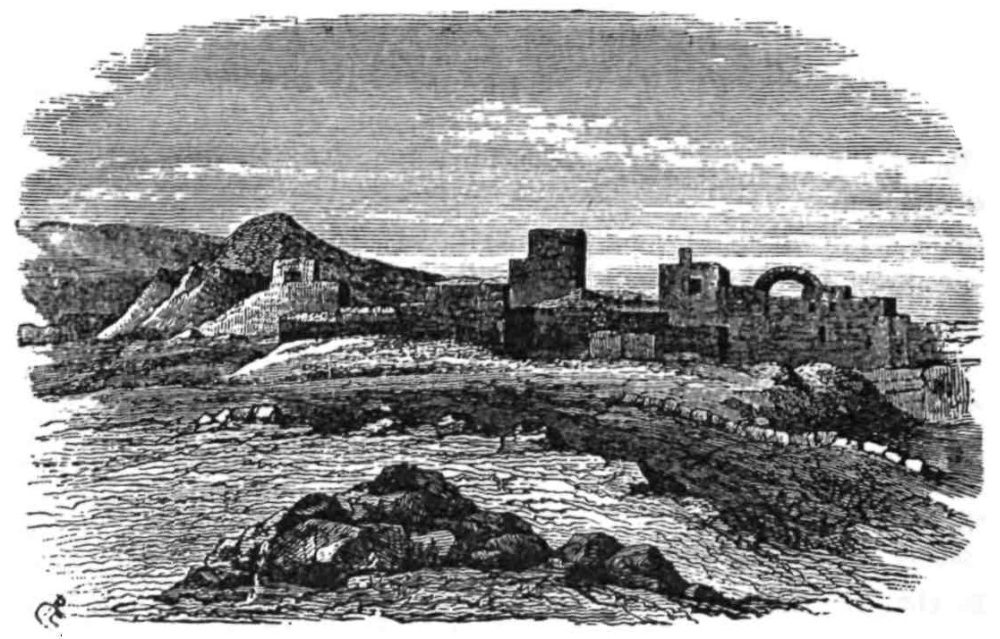
DEBIR.
ON the 20th of September, 1874, I once more landed in Palestine, having been absent for nearly five months, four of which were spent in England, where I was detained on account of my health. During this period the party had been engaged, under charge of Sergeant Black, in office work and survey, in the vicinity of Jerusalem.
On the 5th of October we camped at ’Ain Dhirweh, just by Hŭlhûl. This village stands on the watershed of the Hebron hills, 3300 feet above the sea, and only three miles north of Hebron itself. My object was to avoid camping at the latter town, and thus to escape the suspicion of wishing to attempt an entrance into the Hebron Haram.
The fountain of Dhirweh is traditionally that at which St. Philip baptised the Eunuch, and traces of an old chapel are visible above it; but it seems improbable that chariots could ever have travelled along these stony mountain paths, and the road to Gaza by which{237} the Apostle was travelling on that occasion should rather be sought in the plain.
Opposite to our camp was Bethsur, famous in Maccabean times—a stony hill with a ruined tower on the top. To the north we discovered a ruin called Kueizîba, perhaps Chozeba, the home of Bar Cochebas; and near it we found the head of Pilate’s great aqueduct to Jerusalem, never before traced to its real commencement, which is thirteen miles from Jerusalem as the crow flies, and forty-one and a half by the aqueduct, the fall being 365 feet in that distance.
Riding on the 10th of October to the hill above Dûra, we obtained a glimpse of the extreme southern boundary of the Survey. The view was fine; to the east was the great ridge on which stands the traditional tomb of Lot; on the west the Philistine plain lying in a hot haze which towards Gaza hid it entirely; on the south were rolling hills, isolated mounds, and a broad plain, with a dark patch near the Beersheba wells; and yet farther were grey misty ridges, the land appearing to descend in steps towards the Desert of Wanderings.
In returning to camp we passed through the luxuriant vineyards of the supposed Vale of Eshcol, carefully enclosed between dry-stone walls. The grapes, mellowed by the autumn mists, were in full beauty; the rich amber-green foliage covered the whole of the open valley; beyond was a stone town, and a fortress gleaming with a recent coating of whitewash, having a tall minaret above. A barren hill and a few grey olives rose behind. Such was our first view of Hebron, the ancient city which, as the Bible tells us, “was built seven years before Zoan (or Tanis) in Egypt” (Num. xiii. 22).
The results of the fuller acquaintance which we gained with the town, in three subsequent visits of several days’ duration, may here be gathered up. Hebron is a long stone town on the western slope of a bare terraced hill; it extends along the valley, and the main part reaches about 700 yards north and south, including the Mosque Quarter, and the Quarter of the Gate of the Corner. On the north is a separate suburb, named from the mosque of ’Aly Bukka, who died in 670 A.H.; on the south also, and west of the road, is another small suburb. The Haram stands above the middle of the main Quarter. The Sultan’s Pool—a large well-built{238} reservoir, occupies part of the valley. West of the city is an open green below the Quarantine, surrounded by hills which are covered with olives.
The contrast between Hebron and Bethlehem has been already noticed; the town has a dead-alive appearance, and the sullen looks of the Moslem fanatics contrast with the officious eagerness of the Bethlehem Christians. There are some 17,000 Moslems in Hebron, according to the Governor’s account; and about 600 Jews are tolerated in the Quarter of the Corner Gate. The town is the centre of commerce for the southern Arabs, who bring their wool and camel’s-hair to its market. It has also a sort of trade in glass ornaments and in leather water-buckets, but the bustle and stir of Bethlehem are not found in its streets; the inhabitants seem wrapped in contemplation of the tombs of their forefathers, and boast that no pagan Frank has yet desecrated the holy shrines with his presence, or built his house in the town.
The place of chief interest in Hebron is the Cave of Machpelah containing the tombs of the Patriarchs. There seems no reason to doubt the genuine character of the site now surrounded by the Haram, and here again we have that valuable consent of traditions—Jewish, Christian, and Moslem, which seems to distinguish the true sites, from those less genuine concerning which two or more discordant traditions have arisen.
Only two trustworthy witnesses—Dean Stanley and Mr. Fergusson—have had the opportunity of describing the interior of this sanctuary; and it seems very doubtful if any living being has ever descended into the mysterious cavern beneath the floor since the Moslem conquest of Palestine; nor will it be possible to explore this cave so long as the Moslems have possession of the place, unless unexpected changes occur in their religious feelings. One curious story was, however, told me. It is said that when Ibrahim Pacha threatened the town, the inhabitants carried their property to the cave for safety. If this be true the area must be considerable, and the iron door on the north-west, mentioned by Captain Warren, may perhaps be the same iron door mentioned by Benjamin of Tudela as leading into the cave in the twelfth century.
The surrounding wall is one of the mysteries of Palestine, and a monument inferior only to the Temple Enclosure, which it resembles in style. It measures about 112 feet east and west, by{239} 198 feet north and south, and has eight pilasters on the short sides, and sixteen oh the long, resembling those which I found, as before noticed, at the north-west corner of the Jerusalem Haram. The stones also are scarcely inferior in dimensions, and one is said to be thirty-eight feet long, and three and a half feet high; they are all drafted with the real Jewish draft, broad, shallow, and beautifully cut, as at Jerusalem. Judging from the similarity of style, one is led to ascribe the building to the Herodian period—a view supported by Mr. Fergusson in his able paper on the subject, his opinion being based on historical grounds.
Josephus speaks of monuments of the Patriarchs as existing in his day (B. J. iv. 9, 7), but is silent as to the enclosure. Had it, however, existed in the Old Testament times, we should surely find some record of its origin in the Bible; nor does it seem likely that it was built later than Herod’s time, for the earliest Christian pilgrim in 333 A.D. found it already standing.
The great walls are surmounted by two high white minarets on the south-east and north-west. The southern portion of the area is occupied by a Gothic twelfth-century building, presumably a church; the nave has a pointed roof and clerestory windows, the aisles are lower and their roofs rest against the fortress wall. Within are the cenotaphs of Isaac and Rebecca, supposed to stand above their true graves in the cavern. Outside the building, in separate chambers, are the tombs of Abraham and Sarah, flanking the entrance. On the north side of the open court Jacob and Leah have similar cenotaphs, covered, like the rest, with richly embroidered green cloths. A modern building is erected against the western fortress wall on the exterior. This is called the Tomb of Joseph, whose bones are said, by Josephus, to have been removed hither from Shechem—a story no doubt due to Jewish jealousy of the shrine at Shechem, which was in the hands of the Samaritans.
Cenotaphs like those in the present building are mentioned as early as 700 A.D. Rabbi Benjamin of Tudela states, however, that Jews were able in his days to descend, through an iron door, into the cavern, which was in three compartments, and where the real tombs were shown. The twelfth-century writers, in describing the fortress, which they quaintly name the “Castle of St. Abraham,” also call the cavern Spelunca Duplex, “the double{240} cave”—a title probably derived from the Hebrew Machpelah, signifying “the place divided”: Sir John Maundeville, in 1322, states that one chamber was above the other.
An idea appears to have existed at an early period that Hebron was not originally built on its present site, but on the hill north-west of the modern town. Arculphus mentions this in 700 A.D., and Marino Sanuto in the fourteenth century says the same, both apparently referring to ancient ruins then visible in the direction of the present site of Abraham’s Oak. There are traces of the same theory in the writings of many intermediate visitors, and the Bible narrative itself seems to require a position opposite the Haram, if the true Machpelah be beneath that enclosure, for the cave was not in Hebron, but in a field “before Mamre—the same is Hebron” (Gen. xxiii. 19). Thus, though a new city may have grown up around the sacred tombs, even in Jewish times, the original Hebron, Mamre, or Kirjath-Arba of Abraham, must have had a different site; and it may be noted, that the principal springs, and many of the rock-cut tombs dating from the Jewish period, are now found north-west of Hebron.
The Crusaders had other traditions connected with this neighbourhood. The grave of Abner was then shown within a church in Hebron, probably the same place now found in the house of a Moslem. The grave of Esau was fixed in a suburb of the town, as also those of Adam and Judah, which have now disappeared. The open green, west of the town, was known as the “Field of Damascus,” apparently because owned by the Sultan of Damascus. The place where Cain killed Abel was a little farther south, and on the north was the cave in which Adam and Eve lived for a century, which appears to have been the modern rock-hewn spring called ’Ain-el-Judeideh, “the excavated fountain,” which is covered by an arch and reached by steps. Here Adam mourned for Abel, and hence the spot is called by some chroniclers the Vale of Tears; here also Adam was made of the red earth of the place. Hebron was considered to have obtained its name Kirjath-Arba, “city of four,” from the four patriarchs, including Adam—an explanation derived from the Rabbinical commentators, but not in accordance with the reason given in the Bible, “And the name of Hebron before was Kirjath-Arba, which Arba was a great man among the Anakim” (Josh. xiv. 15).{241}
On our last visit to Hebron we were shown an ancient Jewish tomb with nine graves, or kokim, close to ’Ain-el-Judeideh, and to this we obtained the curious name Kabr Hebrûn, “the grave of Hebron.” We did not, however, learn the origin of the title, or the source of the tradition. A little higher up the hill is a ruined monastery, in a corner of which the tomb of Jesse is shown.
The Oak (or plain, as our version renders it) of Mamre has been shown at various times in different directions. Jerome places it at the modern Râmeh, where is a fine unfinished stone enclosure with a large well. The walls measure 162 feet north and south by 214 east and west, and one stone is fifteen feet long. A little farther east the remains of Constantine’s basilica are distinguishable, and the great enclosure may perhaps be the market where the Jews were sold by Hadrian, after the fall of Bether.
The present site of the Oak is farther south, and the magnificent tree stands among the vineyards north-west of Hebron. It is called Ballûtet Sebta, “the oak of rest,” and has branches fifty feet long, one of which was broken by the snow in 1857. This Oak is thought to be more than two hundred years old, but cannot be the one seen by Sir John Maundeville, for it is covered with leaves, whereas that which was shown to Sir John he calls “the dry tree.” “They say,” he continues, “that it has been there since the beginning of the world, and that it was once green, and bore leaves till the time that Our Lord died on the Cross, and then it dried, and so did all the trees that were then in the world.” Jerome, however, is more moderate in his assertions, and speaking of the northern site of Mamre at Râmeh, distant two miles from modern Hebron, and now called “Abraham’s House” by the Jews, he says that the Oak was still visible, and worshipped by the peasantry in the days of Hadrian, but disappeared during his own time. We have thus no certainty as to the position of Mamre or of the Oak, which Josephus places only six furlongs from Hebron (B. J. iv. 9, 7).
There are two other springs near Hebron which deserve notice; one is east of the “Oak of Rest,” and is called ’Ain Kheir ed Dîn, “Spring of the chosen of the faith,” perhaps in connection with Abraham’s history. The second is more important, because almost undoubtedly a Biblical site.{242}
After his interview with David, Abner set out on his way to Jerusalem, and had gone as far as the Spring of Sirah, when Joab’s messengers overtook him and brought him back to Hebron, where he was murdered in the gate (2 Sam. iii. 26). Now on approaching the modern town by the old paved road to the north, the first spring beside the way is called Sârah. Like the Hebrew Sirah, the word means “withdrawn,” and the title is, no doubt, due to the fact that the spring is under a stone arch, at the end of a little alley with drystone walls, and is thus withdrawn from the high-road. This place may therefore be considered as one of the few genuine sites in the neighbourhood of Hebron.
On the 22nd of October we marched south, to camp at Yuttah, the ancient Levitical town of Juttah, five miles south of Hebron.
We were now entering on a new district, differing in character from the rest of the Judean hills. In the neighbourhood of Yuttah, Dûra, and Yekîn, the country descends by a sudden step, and forms a kind of plateau, divided into two by the great valley which runs from north of Hebron to Beersheba, and thence west, to Gerar, and the sea. The plateau is about 2600 feet above sea-level, and 500 feet below the general level of the Hebron watershed. It consists of open wolds and arable land, the soil being a white soft chalk, geologically a later formation than the hard limestone of the hills. There are no springs in this region, but the water, where not contained in tanks and cisterns, sinks through the porous rocks, and runs in the valleys below the surface of the ground. On the south another step leads down to the white marl desert of Beersheba; on the west are the Philistine plains; on the east, 300 feet below, is the dreary Jeshimon, or “solitude.” The plateau has only two inhabited villages on it, but is covered with ruins. It is dry and treeless, but rich in flocks and herds. It seems to have been the country of the Horites, for the place is riddled with caves intended for habitations, and the name of this troglodytic race is preserved in the titles of two of the ruined towns.
The plateau formed part of the district called Negeb, or “dry land,” in the Bible; and here, in the southern part of the possessions of Caleb we should seek for Debir, which he gave to his daughter; for the Choresh Ziph, where David and Jonathan met; and for the hill of Hachilah, where David hid from Saul.{243}
One is at once struck with the fitness which the plateau presents for the adventures of the fugitive bandit chief who was destined to become the king of Israel. The inhabitants, like Nabal of Carmel, are rich in sheep and oxen. The villagers of Yuttah owned 1700 sheep, of which 250 belonged to the Sheikh. All along the borders of the Jeshimon and Beersheba deserts there is fine pasturage, to which the peasants descend in spring-time, having made some sort of agreement with the neighbouring Bedawîn to protect them from other tribes. Thus we find perpetuated the old system under which David’s band protected the cattle of Nabal.
The story of David’s wanderings is one of the most interesting episodes of the Old Testament, and we have now so recovered its topography, that the various scenes seem as vivid as if they had occurred only yesterday. First we have the stronghold of Adullam, to be described later, guarding the rich corn valley of Elah; then Keilah, a few miles south, perched on its steep hill above the same valley. The forest of Hareth lay close by, on the edge of the mountain chain where Kharas now stands, surrounded by the “thickets” which properly represent the Hebrew “Yar,”—a word wrongly supposed to mean a woodland of timber trees.
Driven from all these lairs, David went yet farther south to the neighbourhood of Ziph (Tell Zîf); and here also our English version speaks of a forest—the “Wood (Choresh) of Ziph,” where David met with Jonathan. A moment’s reflection will, however, convince any traveller that as the dry, porous formation of the plateau must be unchanged since David’s time, no wood of trees could then have flourished over this unwatered and sun-scorched region. The true explanation seems to be that the word Choresh is a proper name with a different signification, and such is the view of the Greek version and of Josephus. We were able considerably to strengthen this theory by the discovery of the ruin of Khoreisa and the Valley of Hiresh (the same word under another form), close to Ziph, the first of which may well be thought to represent the Hebrew Choresh Ziph. Should this word appear as a proper name in the new English Version, a very marked improvement will be made in what might be called the orientalising of the Bible, substituting the actual language of the land, for that essentially English tone which has been imparted to the narrative by{244} the expressions of translators to whom the East was less familiar than their own fair country.
The treachery of the inhabitants of Ziph, like that of the men of Keilah, appears to have driven David to a yet more desolate district, that of the Jeshimon, or “Solitude,” by which is apparently intended the great desert above the western shores of the Dead Sea, on which the Ziph plateau looks down. As a shepherd-boy at Bethlehem, David may probably have been already familiar with this part of the country, and the caves, still used as sheepcotes by the peasant herdsmen, extend all along the slopes at the edge of the desert.
East of Ziph is a prominent hill on which is the ruined town called Cain in the Bible; hence the eye ranges over the theatre of David’s wanderings.
On the south are the wolds of the Negeb plateau, with the plains of Beersheba beyond. On the east is the “Solitude,” with white peaks and cones of chalk, and deep, narrow watercourses, terminated by the great pointed cliff of Ziz, above Engedi, and by the precipices over the Dead Sea, two thousand feet high. Here, among the “rocks of the wild goats,” the herds of ibex may be seen bounding, and the partridge is still chased on the mountains, as David was followed by the stealthy hunter Saul. The blue sea is visible in its deep chasm, and is backed by the dark precipice of Kerak, “scarred with a hundred wintry watercourses.”
The great hump of rock on which Maon—the home of Nabal—stands, is seen to the south, and rather nearer is the Crusading castle at Carmel, where were Nabal’s possessions; the ruined mound of Ziph is to the west, and Juttah among its olives. Thus the whole scenery of the flight of David, and of Saul’s pursuit, can be viewed from this one hill.
The stronghold chosen by the fugitive was the hill Hachilah, in the wilderness of Ziph, south of Jeshimon. This I would propose to recognise in the long ridge called El Kôlah, running out of the Ziph plateau towards the Dead Sea desert, or Jeshimon—a district which, properly speaking, terminates about this line, melting into the Beersheba plains. On the north side of the hill are the “Caves of the Dreamers,” perhaps the actual scene of David’s descent on Saul’s sleeping guards.
Pursued even to Hachilah, David descended farther south, to a{245} rock or cliff in the wilderness of Maon, which was named Sela Ham-mahlekoth, “Cliff of Divisions” (1 Sam. xxiii. 2-8). Here he is represented as being on one side of the mountain, while Saul was on the other.
Now between the ridge of El Kôlah and the neighbourhood of Maon there is a great gorge called “the Valley of Rocks,” a narrow but deep chasm, impassable except by a detour of many miles, so that Saul might have stood within sight of David, yet quite unable to overtake his enemy; and to this “Cliff of Division” the name Malâky now applies, a word closely approaching the Hebrew Mahlekoth. The neighbourhood is seamed with many torrent-beds, but there is no other place near Maon where cliffs, such as are to be inferred from the word Sela, can be found. It seems to me pretty safe, therefore, to look on this gorge as the scene of the wonderful escape of David, due to a sudden Philistine invasion, which terminated the history of his hair-breadth escapes in the South Country.
On the 5th of November we moved once more south, and encamped at Dhâherîyeh, a village which, there seems to me to be every reason for supposing to be the ancient Debir, a place not identified before the Survey. The name has the same meaning, derived from its situation on the “back” of a long ridge; and the position between Shochoh (Shuweikeh), Dannah (Idhnah), Anab (’Anâb), and Eshtemoa (Es Semû’a), seems very suitable (Josh. xv. 48). The place, moreover, is evidently an ancient site of importance, to which several old roads lead from all sides. The springs near Debir given to Achsah (Judg. i. 15) might well be the beautiful springs of Dilbeh, about seven miles north of the town, and the identification seems to me to be amongst the most valuable of those due to the Survey.
On the 10th of November I proceeded, accompanied by Sergeant Armstrong, to Beersheba, to complete the south boundary of the map. We had with us only one servant, one groom, the scribe, a guide, and the Sheikh of Dhâherîyeh, for whom I had a great liking. We took two tents, five mules, and three horses, carrying also provisions for three days and one theodolite. The rest of the expedition remained at the village.
Following a long valley, we arrived at a broad undulating plain, grey and dry, like the muddy basin of a former sea. The hills{246} end very suddenly, and the boundary is thus sharply defined between the lands of the settled population and the district of the Bedawîn, who, though nomadic, cultivate a little tobacco and barley round Beersheba.
The scenery was tame and featureless, with a single dark Tell in front, and white marl peaks capped with flint to the west. The heat and glare were oppressive, and we were glad at noon to rest under a white chalk cliff, and were able to realise the force of the poetic language of Isaiah, “The shadow of a great rock in a weary land” (Isaiah xxxii. 2).
We ascended the Tell or mound of Seb’a, which is two and a half miles east of the Wells of Beersheba, and thence we had a fine view of the great boundary valley which limited our work on the south, joining the long ravine which comes down from Hebron, and running west in a broad, flat, gravelly bed, between high walls of brown earth. The pebbles were white and dry, yet water-worn, for, as we found in the following spring, a river will occasionally flow for hours along the Wâdy bed. East of us there were remarkable white chalk hills called El Ghurrah, and on the west a low ridge shut out the maritime plain. To the north were the hills of Judah, dotted with lotus-trees, and to the south stretched the endless Desert of Wanderings.
No mules appeared, and we therefore rode down towards the wells, passing by innumerable burrows of the jerboa, and by numerous herds of camels, with a distant view of black “houses of hair.” At length we spied a tent, and our servants talking with mounted Arabs near the principal well. At the same moment I saw a pigeon by one of the wells, and fired, killing it on the spot. I noticed that the Arabs rode away immediately after, and I found that they had been insolent, and had ordered the servants to take down the tent, but, seeing a well-armed party approaching, and conceiving a great respect for a gun that could kill at such a distance, with characteristic Bedawîn caution, they made off before we came up.
The desert of Beersheba is a beautiful pasture-land in spring, when the grass and flowers cover the grey mud, as in the Jordan Valley; but in November it is very desolate; not a tree exists near the wells, and only the foundations of a flourishing fourth-century town remain.
Our tents were by the principal well, which is twelve feet three{247} inches in diameter, and over forty-five feet deep, lined with rings of masonry to a depth of twenty-eight feet. A second well, five feet in diameter, exists about 300 yards to the west, and on the east is a third, which is dry, twenty-three feet deep, and nine feet two inches in diameter. The sides of all the wells are furrowed by the ropes of the water-drawers; but we made one discovery which was rather disappointing, namely, that the masonry is not very ancient. Fifteen courses down, on the south side of the large well, there is a stone with an inscription in Arabic, on a tablet dated, as well as I could make out, 505 A.H., or in the twelfth century. This stone must be at least as old as those at the mouth, which are furrowed with more than a hundred channels by the ropes of seven centuries of water-drawers.
The wells have no parapets, and I nearly fell into the dry one, so little was it visible until quite near; round the two which contain water there are rude stone troughs, which may be of any age—nine at the larger, five at the lesser well.
The sun began to set, and we hurried back to observe the pole-star from the Tell, but were foiled by a rising bank of clouds. Returning to camp, we secured our horses with fetters and tethers, so that they could not be stolen, and then retired to sleep in peace.
We now found how useful dogs may be in camp. In the spring our colley had saved the horses at Sulem, and I had intended to take him on our rather risky visit to Beersheba, but somehow he was left behind, and thus not one of our faithful guards was with us. During the night a thief came into the tents: he ripped up the saddle-bag containing our provisions, and took them all with him, and he even came to the head of my bed and stole Bulwer’s “Disowned,” but only took it about a hundred yards from camp. It is evident that he must have crept on his stomach, since he only took what was near the ground and left my watch lying on the table, and (which was for the moment more important) he also left me my boots, though he removed the tin washing-basin. Our plates, bread, chickens, and some barley in a nosebag, he (or they) stole from the servants’ tent, all this being nearly accomplished in about ten minutes.
After taking some observations from near the well, we started for Tell el Mihl, fourteen miles east of Beersheba. Our faces{248} were turned towards the road by which Rebecca had come to Beersheba: like Isaac we lifted up our eyes, and “behold the camels were coming.” As far as the view extended the plain was covered with hundreds of them, each moving alone towards the wells, each casting before it a long shadow in the light of the rising sun. Dusky, half-naked boys sat on the humps, and, arriving at the well, they stripped off what clothes they had on, and let down to the water the goat-skin bags which served them as buckets, drawing them up with great rapidity in time with a rude chant, and evidently vying in the rate of watering their herds; both the wells were besieged, and a thick crowd of camels had collected before we left.
We once more passed the Tell and found another smaller well near it. Marching east, we came on flocks of sheep, with a few goats among them, driven mostly by girls under twelve years of age—the age no doubt of Leah when Jacob first came to Haran. As is still the custom of the Bedawîn, the girls over fourteen were no doubt, in Jacob’s time, withdrawn to the privacy of the women’s apartments in the tents, and this seems to agree with the account of Jacob’s kissing his cousins, for if they were more than children such a salute would surely have been quite contrary to Eastern ideas of propriety. Small as the flocks appeared, from the great extent of the plain, the smallest contained at least twenty head, and the average was over one hundred, so that we came across at least eight hundred in all. This gives an idea of the immense number of the flocks which exist in this apparently sterile desert, where it seems impossible that they can find anything to eat in autumn.
We also saw large coveys of the sand-grouse or pintail, which is not found in the hills of Palestine, though in summer it comes up the Jordan Valley; the crops of those we shot were full of hard round seeds and of small pebbles.
The journey was tedious, and the scenery very monotonous. Ten miles from Beersheba we came upon another ruined town with two wells, also containing water. The place has lost its old name, and is now only known as El Meshâsh, “the water-pits.” It must have been a very important town, yet hitherto it has escaped notice, other travellers having gone by routes east and west of the place, and never across country; thus the discovery was{249} left for us, and the utility of systematic survey once more exemplified.
After travelling for miles without seeing a living thing, we came suddenly on this site, with brown ruins, and a crowd of dusky naked men drawing water in a frenzied manner, and a few women in sweeping garments, driving diminutive donkeys laden with black water-skins.
Tell el Milh is a third site of character similar to the last; it is the Malatha of the fourth century, and possibly the “City of Salt” (as the modern name signifies) noticed in the Bible (Josh. xv. 62). There is here a great hillock with Arab graves on the top, ruins of an extensive town, and on the north two wells, just like those at Beersheba. Crowds of horses, goats, sheep, and camels surrounded them, and the song of the water-drawers was loud and wild.
We sat down under the steep bank of the valley, north of the wells, and very soon a crowd of naked savages collected above us. They demanded “bucksheesh,” and made rude remarks as to our being Christians. “Look at the big watch,” said one, observing our aneroid; “Look at the guns and pistols,” said another. Some of the chiefs (who wore clothes) came down to talk to our Sheikh, and, putting their foreheads against his, made a sound representing the kiss of peace. The Sheikh, though not a Bedawî, seemed not at all afraid of the crowd, and abused the wild Arabs roundly, telling them to be off. As for us, we turned our backs on them and smoked in peace.
I ordered all the provisions we had left to be served out to the party, for the natives had eaten no breakfast. Just as darkness came on we heard the song of the messenger from our main camp, and he came in dead tired, after trotting for eleven hours on a rough mule: with him came one of our soldiers on his mare, followed by its colt, which was also much fatigued.
We made great preparations in the shape of traps for thieves, but none came. That evening, the 11th of November, 1874, nearly proved the close of my existence, for I was seen, in the dusk, at some little distance, and my servant fired, mistaking me for a Bedawî robber, the ball passing very near my head. During the night we slept but little, being in constant fear of losing the horses, or of a night attack from the Arabs.{250}
By seven next morning we had set off for the hills, and passed by the ruined towns of Ghurrah, S’awi (perhaps the ancient Jeshua), and Haura, which are noticeable for the walls of flint-conglomerate, possibly very ancient, surrounding their sites; in the afternoon we reached Dhâherîyeh, and found all well except Sergeant Black, who was suffering much from dysentery. Sheikh Hamzeh, the well-known guide from Hebron, and Abu Dahûk, chief of the Jâhalîn Arabs, were in camp. I had arranged with them to start for Beersheba on the 10th, and had gone without them as they did not come on that day. This lesson in punctuality was very useful when I again required their services.
On the 19th of December, Lieut. Kitchener joined the Survey party. The work was then interrupted by violent gales, and subsequently by illness in the party which wintered in Jerusalem, whence Sergeant Black was invalided home early in January.{251}
NORTH of Jerusalem lies a narrow district, which contains more places of interest than can, perhaps, be found in any other part of Palestine within an equal area.
This district was allotted to the tribe of Benjamin, and includes about two hundred square miles of hills, extending ten miles from Jerusalem to Bethel, and about twenty from the lower Beth Horon to the deserts above Jericho.
We are now able to draw, with a great amount of accuracy, the north boundary of Benjamin, from Bethel to Archi (’Ain ’Arîk), and thence to “Ataroth Adar, near the hill that lieth on the south side of the nether Bethoron,” exactly where we discovered the ruins of Ed Dârieh still existing. South of these limits are the famous towns Bethel, Ai, Michmash, Geba, Ramah, Nob, Mizpeh, Gibeon, with others of minor importance. To these places the present chapter is devoted.
It is clear from the Old Testament that the place where Jacob’s vision occurred was Bethel or Luz, as it was originally called, on the boundary of Ephraim and Benjamin. Later traditions have been busy with the site, and (as we have seen before) the Samaritans claim that the true place is on Gerizim, while in the twelfth century the sacred rock on the Temple Hill was held to be the Beth-el, or House of God, of the narrative in Genesis.
Bethel at the present day is one of the most desolate-looking places in Palestine; not from lack of water, for it has four good{252} springs, but from the absence of soft soil on its rocky hills. All the neighbourhood is of grey, bare stone, or white chalk. The miserable fields are fenced in with stone walls, the hovels are rudely built of stone, the hill to the east is of hard rock, with only a few scattered fig-gardens, the ancient sepulchres are cut in a low cliff, and a great reservoir south of the village is excavated in rock. The place seems as it were turned to stone, and we can well imagine that the lonely patriarch found nothing softer than a stone for the pillow under his head, when on the bare hill side he slept, and dreamed of angels.
It is very remarkable that in this narrative the word “place” occurs in a manner which suggests that it is used with a special significance. Jacob came not to any city, but to a “certain place” (Gen. xxviii. 11), the stones of which formed his pillow.
The word “place” (Makom) occurs five times in the same chapter, and the place called Bethel is distinguished specially from the neighbouring city of Luz (verse 19). The same word (Makom) is used to denote the sacred places of the Canaanites (Deut. xii. 2), and in the Talmud to denote the shrines held to be lawful for Israel before the Temple was built.
It is thus, perhaps, a sacred place that is intended as having been Jacob’s refuge on his way; and we at once recall the altar which Abraham raised between Bethel and Ai—towns which, as now identified, were only two miles apart. Abraham’s altar must have been close to the city of Luz, subsequently named from it Bethel, “the House of God;” and it was perhaps from the stones of this ancestral shrine that Jacob’s pillow was made.
Bethel continued to be a religious centre after the establishment of the Tabernacle at Shiloh, in the time of Phineas, grandson of Aaron. We find the Ark established—at least during the campaign against the men of Gibeah—at Bethel; for there can be no reasonable doubt that Josephus is right in supposing the place called in our version “the House of God,” to be the town of Bethel (Judg. xx. 26, 27; Ant. v. 2, 10), as will be seen by comparison of the strategical lines occupied by the besieged Benjamites of Gibeah, one of which was the “highway which goeth up to Bethel” (verse 31). Even in the time of Samuel, sacrifice seems to have been offered at Bethel (1 Sam. x. 3), and the establishment of a Calf Temple by Jeroboam at Bethel was thus no innovation,{253} but merely the restoration of an ancient high place. The extraordinary mixture of true and false worship which thus seems to have occurred—Bethel being the school of the prophets of Jehovah, while the Calf Temple still stood there—is a subject well worthy of consideration.
The prophecy of Hosea, and that of Amos as well, connect Bethel and Bethaven in such a way as to make it appear that they were the same place. Such is the opinion of the Jewish commentators, and we may thus perhaps trace the origin of the present corruption of Beitîn for Bethel back to the early time of Jeroboam. Bethaven, however, means “house of naught,” and the title was originally given to the desert east of Bethel, because of its barren character, though in the prophecy there is a play on the word: “Gilgal (freedom) shall go into captivity, and Bethel shall come to naught” (Aven).
Another town of almost equal interest existed in the same neighbourhood, namely Ai, east of Bethel, a place which was quite unknown in the fourth century, but concerning the general position of which there is but little dispute. The various notices in the Bible (Gen. xii. 8; Josh. viii. 9-14) define its situation with much exactitude, as being east of and close to Bethel (Josh. xii. 9), with a valley north of the town, and low ground to the west, where an ambush might be set unseen from the city, while on the opposite side was a plain (verse 14). This description applies, in a very complete manner, to the neighbourhood of the modern village of Deir Diwân, and there are here remains of a large ancient town, bearing the name Haiyân, which approaches closely to Aina, the form under which Ai appears in the writings of Josephus. The special meaning of the Hebrew word rendered “beside,” but meaning “close to,” forbids us to accept any of the alternative sites at greater distances from Bethel, which some writers have advocated. Rock-cut tombs and ancient cisterns, with three great reservoirs cut in the hard limestone, are sufficient to show this to have been a position of importance. To the west is an open valley called “Valley of the City,” which, gradually curving round eastward, runs close to the old road from Jericho by which Joshua’s army would probably have advanced. To the north of the site there is also a great valley, and the plain or plateau on which the modern village stands close to the old site, expands from a narrow{254} and rugged pass leading up towards Bethel, which is two miles distant on the watershed.
Beside this pass and north of the ruins, is a large terraced knoll, very stony, and crowned by a few olives—a conspicuous object in the landscape. It is called simply Et Tell, “the mound,” and a connection has been supposed between this name and the fact that Joshua made Ai “a heap (Tell in the Hebrew) for ever.” The place does not, however, show traces of having at any time been covered by buildings, and the rock-cut tombs and cisterns above noticed seem too far from it to indicate Et Tell as the exact site of Ai; being close to the pass, it has, moreover, no valley such as would seem fitted for the ambush immediately west of it.
From this Tell a fine view is obtained towards the plains of Jericho. The village of Deir Diwân is seen on its little plateau in the foreground, while the desolate hills of Benjamin rise beyond, with the chain of the Quarantania Mountain, hiding the western half of the Dead Sea and of the plain of Jericho, though the mouth of Jordan and the eastern ranges of Moab with Mount Nebo are visible, forming the extreme distance.
Advancing a few miles farther south, we come on the scene of one of the most romantic of Old Testament stories—the attack made by Jonathan and his armour-bearer, on the Philistine camp, near Michmash.
A great valley, as we have seen above, has its head west of Ai, and curving round eastwards it runs to Jericho: about two miles south-east of Ai it becomes a narrow gorge with vertical precipices some 800 feet high—a great crack or fissure in the country which is peculiar in this respect, that you only become aware of its existence when close to the brink, for on the north the narrow spur of hills hides it, and on the south a flat plateau extends to the top of the crags.
On the south side of this great chasm (the true head of the Kelt valley) stands Geba of Benjamin, on a rocky knoll, with caverns beneath the houses and arable land to the east. Looking across the valley, the stony hills and white chalky slopes present a desolate appearance; and on the opposite side, considerably lower than Geba, is the little village of Michmash, on a sort of saddle, backed by an open and fertile corn-valley. The existence of this valley no doubt accounts for the place having been famous for its{255} barley, so that the Talmudic proverb, “to bring barley to Michmash,” represents exactly our “carrying coals to Newcastle.”
The pass between these two towns appears to have been more than once the place of meeting between the Jews and their enemies, though to a military man it seems curious that the main road along the watershed should not always, as it did in Maccabean times, have formed the line of Jewish defence north of Jerusalem.
The town of Geba, south of the valley, is generally understood to be that notorious in the history of the extermination of the tribe of Benjamin, and to have been the place where Jonathan smote the garrison of the Philistines (1 Sam. xiii. 3). If this be so, then it must apparently be the “hill of God” (Geba-ha-Elohim) where was the garrison of the Philistines (1 Sam. x. 5), and where some of Saul’s family seem to have lived (verse 14). Thus Geba of Benjamin seems to be connected with Gibeah of Saul, but the latter name appears to have applied to a district as well as to a town, for the neighbouring city of Ramah is said in one passage to have been “in Gibeah” (1 Sam. xxii. 6).
Josephus tells us of a village called Gabaoth Saule which was by the Valley of Thorns, and about thirty stadia from Jerusalem. This reminds us at once of the name Seneh, “thorn” or “acacia,” which was applied to one of the crags at the place where Jonathan crossed to the Philistine camp at Michmash. The modern name of the great valley between Geba and Michmash is Suweinît, or the “valley of the little thorn-tree” (acacia), and if this identification of the Valley of Thorns with Wâdy Suweinît be correct, the town of Gibeah of Saul is apparently to be placed at the present Jeb’a, though the distance given by Josephus is not exact.
The site of the Philistine camp at Michmash, which Jonathan and his armour-bearer attacked, is very minutely described by Josephus. It was, he says, a precipice with three tops, ending in a long sharp tongue and protected by surrounding cliffs. Exactly such a natural fortress exists immediately east of the village of Michmash, and it is still called “the fort” by the peasantry. It is a ridge rising in three rounded knolls above a perpendicular crag, ending in a narrow tongue to the east with cliffs below, and having an open valley behind it, and a saddle towards the west on which Michmash itself is situate.
Opposite this fortress, on the south, there is a crag of equal{256} height and seemingly impassable; thus the description of the Old Testament is fully borne out—“a sharp rock on one side, and a sharp rock on the other” (1 Sam. xiv. 4).
The southern cliff, as we have noticed above, was called Seneh, or “the acacia,” and the same name still applies to the modern valley, due to the acacia-trees which dot its course. The northern cliff was named Bozez, or “shining,” and the true explanation of this name only presents itself on the spot.
The great valley runs nearly due east, and thus the southern cliff is almost entirely in shade during the day. The contrast is surprising and picturesque between the dark cool colour of the south side and the ruddy or tawny tints of the northern cliff, crowned with, the gleaming white of the upper chalky strata. The picture is unchanged since the days when Jonathan looked over to the white camping-ground of the Philistines, and Bozez must then have shone as brightly as it does now, in the full light of an Eastern sun.
The watchmen of Saul in Gibeah of Benjamin must have seen clearly, across the chasm, the extraordinary conflict of two men against a host, as the “multitude melted away and they went on beating down one another.” The noise in the host was also, no doubt, clearly heard at the distance of only two miles, and the army would have crossed the passage with comparatively little difficulty by the narrow path which leads down direct from Geba to Michmash, west of the Philistine camp. Thence the pursuit was towards Bethel, across the watershed, and headlong down the steep descent of Aijalon—that same pass where the first great victory of Joshua had been gained, and where the valiant Judas was once more in later times to drive back the enemies of Israel to the plains.
The town of Ramah was, as above noticed, in the district of Gibeah, which surrounded Geba and reached to Migron (1 Sam. xiv. 2), or to “the precipice” of the Michmash Valley. Ramah was a well-known town of Benjamin, but it is not generally regarded as that Ramah, or Ramathaim Zophim, which was Samuel’s home and burial-place.
![]()

THE VALLEY OF MICHMASH.
To face Page 256.
As regards this famous subject of controversy, it is safest to say that we do not know where Ramathaim Zophim was; like all controversies; it arises from the fact that there is very little absolute{257} information to be obtained on the subject. The main points to be observed seem to me to be: first, that the city was in Mount Ephraim; secondly, that a place called Sechu lay on the road from it to Gibeah; thirdly, that Samuel belonged to the family of the Kohathites who possessed Beth-Horon (1 Chron. vi. 67), from which it might be argued that his native town was probably near Beth-Horon; lastly, that the name Ramathaim Zophim means “the heights of the views,” so that it is natural to expect a position commanding an expensive prospect. These considerations seem to point to Râm Allah, east of Beth-Horon on the west slopes of Mount Ephraim, overlooking the maritime plain, and in confirmation of this proposition we find a ruined village called Sûeikeh, perhaps the Sechu of the Bible (1 Sam. xix. 22), on the high-road from Geba to Râm Allah.
There are yet two sites to be noticed which are equally indeterminate—the sacred cities of Nob and Mizpeh; but the Survey has done little to throw light on this question. There is however a remarkable connection between the two places which leads to the supposition that they were either close to one another or, perhaps, identical. The names Nob, “a high place,” Mizpeh, “a watch-tower,” suggests a similarly commanding position. Nob was for many years the place where the Tabernacle stood, as we may infer from the Bible, and as we are expressly told in the Mishna: Mizpeh in like manner was the gathering-place of Israel, “where they prayed” (1 Macc. iii. 46). Nob was on the high road to the capital, seemingly in sight of Jerusalem (Isaiah x. 32), and Mizpeh was “over against Jerusalem.” Mizpeh is not mentioned in episodes where the name of Nob occurs, nor does Nob occur in passages where Mizpeh is noticed.
Most writers, including Mr. Grove and Dean Stanley, place Mizpeh in the neighbourhood of the modern Sh’afât, or between it and the hill Scopus. From either place Jerusalem is visible, and either would suit the order in which Nob occurs in the lists (Neh. xi. 32), between Anathoth (’Anâta) and Ananiah (B. Hannîna); but this is a good instance of the uncertainty which must always remain as to ancient sites, unless the old names can be recovered. There are plenty of Nobs and of Mizpehs in Palestine, but in positions quite inapplicable, whereas, in the right direction there is no name of the kind (so far as has yet been discovered){258} for Sh’afât is not apparently derived from Mizpeh, but is a name very like that of Jehosaphat, and the natives of the place say that it was called after a Jewish king. In Crusading times the town seems to be also mentioned under the title Jehosaphat.
The early Christians placed Mizpeh in quite another direction, and Nob at Beit Nûba, which is famous in the history of Richard Lion-Heart. Their site for Mizpeh was near Sôba, west of Jerusalem, and here we found a ruin with the title Shûfa, which in meaning is equivalent to the Hebrew Mizpeh, but this place cannot be described as “over against Jerusalem,” and its recovery is thus a matter of minor interest.
There is one other site which has been proposed for Mizpeh, though it is merely a conjecture and not a name which might lead to the identification; this site is the remarkable hill called Neby Samwîl, north of Jerusalem. The place is conspicuous from the tall minaret which crowns the old Crusading church on the summit, and within the church is the cenotaph now revered by the Moslems as the tomb of Samuel,—a modern monument covered with a green cloth.
The Crusaders, with their usual contempt for facts, fixed on this hill as the ancient Shiloh; they also called it Ramah, and added besides a title of their own. “Two miles from Jerusalem,” says Sir John Maundeville, “is Mount Joy, a very fair and delicious place. There Samuel the prophet lies in a fair tomb, and it is called Mount Joy because it gives joy to pilgrims’ hearts, for from that place men first see Jerusalem.”
The tradition which places Samuel’s tomb here seems, however, to be only recent. Rabbi Benjamin of Tudela, who is a tolerably safe guide as regards Jewish sacred sites, discredits the story and speaks of a change of site. “When the Christians took Ramleh, which is Ramah, from the Mohammedans,” says the Rabbi, “they discovered the sepulchre of Samuel the Ramathi, near the Jewish Synagogue, and removed his remains to Shiloh, where they erected a large place of worship over them called St. Samuel of Shiloh to the present day.”
This statement, though exhibiting an amount of ignorance quite equal to that of the Christian twelfth-century writers, still serves to show that the tomb at Neby Samwîl does not come into the category of sites recognised by the Jews; and the ancient name of{259} the hill of St. Samuel remains unknown. There is nothing at the site necessarily older than Crusading times, though the fine water-supply to the east would point to the suitability of the neighbourhood for an ancient city. At the foot of the mountain, hidden among olives, we discovered Hazzûr, evidently the ancient Hazor of Benjamin (Neh. xi. 33). On the top of the mountain we planned the old church, the rock-cut scarps and stables, with other Crusading remains; but we found no Jewish tombs near the modern village. Perhaps this commanding situation was first chosen for a fortress by the Latin Kings of Jerusalem, and afterwards came to be regarded as an old site; the very difficult approach, the magnificent panoramic view, and the numerous springs, including “the King’s spring,” “the Emir’s spring,” etc., would have indicated the place as a fitting position for a fortress, flanking the two main north roads to Jerusalem.
Looking down from the roof of the church, one sees the old site of Gibeon (El Jib) on a rounded hillock to the north, with its famous fountain under a cliff south-east of the village. Dean Stanley has proposed to recognise in Neby Samwîl the high-place of Gibeon, so famous for the dream of Solomon when visiting the Tabernacle then erected at the spot; but it must not be forgotten that the distance between the two places is a mile and a quarter, and that a broad valley separates them. We can now only conjecture the name by which Neby Samwîl was known in Bible times, because the ancient name—if ever there was one—has been for ever lost, while the mediæval tradition of the tomb of Samuel has furnished an appellation familiar to the Moslem peasantry, who now reverence the place just as they do Christian traditional sites, in Jerusalem, in Samaria, and at St. Matthew, south of the capital.{260}
![]()
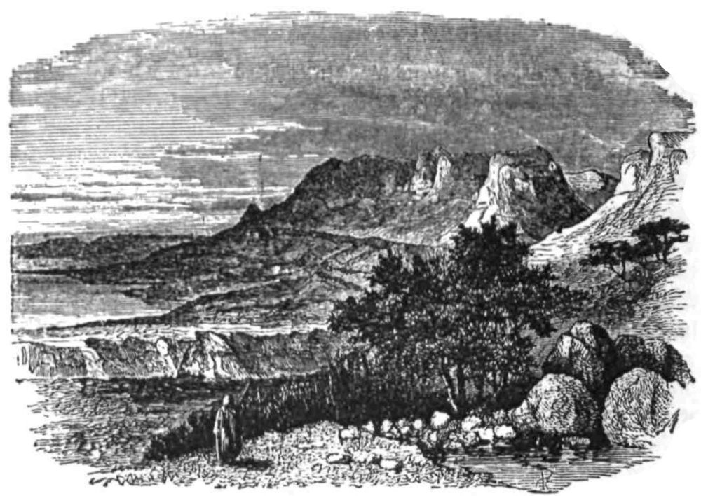
ENGEDI.
THE history of the Survey has been brought down, in the preceding chapters, to the end of the third year, at which time three districts remained to be completed: the Desert of Judah; the Philistine Plain, with the low hills east of it; and Galilee as far north as Tyre and Cæsarea Philippi.
On the 25th of February I once more took the field, with a light and compact expedition, my intention being to push as rapidly as possible through the desert west of the Dead Sea, as far south as the line of Beersheba. Lieutenant Kitchener was scarcely convalescent from a very severe attack of Jericho fever, and our headman, Habib, was also unfit for hard work. So, as I expected to meet with very rough weather, and to have to undergo extraordinary fatigue, it seemed prudent to leave the two invalids in comfortable quarters, until the desert work was done, and the easier task of surveying the Philistine Plain could be undertaken.{261}
I determined to follow in this case the same policy which had been successful in the Jordan Valley, and to go down among the Arabs without any previous formalities. Most travellers who have passed through this desert—the Jeshimon or “Solitude” of the Bible—have summoned the Arab chiefs to Mâr Sâba or Hebron, and there entered into stipulations with them, which have not, as a rule, been carried out; but we had a strong party, we knew the language and the ways of the Bedawîn, and it was therefore safe for us to proceed in a manner which would be impossible for Europeans strange to the country.
We bought in Jerusalem three gaily-coloured head-shawls and one pair of red leather boots as presents. Thus prepared, we marched straight to the nearest Arab camp and pitched close by, without asking leave; and so we became, as it were, the guests of the Sheikh, and were received hospitably. The result of this policy—which was considered risky in Jerusalem—was, that we spent only five pounds in presents and payments to guides, whereas, in just the same length of time, a former party had given thirty pounds. The saving effected in the Jordan Valley was at the same rate; and including the visit to Beersheba, and the other occasions when we went into the Bedawîn districts, we saved, I believe, about £100 for the Palestine Exploration Fund by this method of treating the Arabs. A peculiarity of the Survey of Palestine which should be fully recognised, is the very cheap way in which it was carried out. If it be remembered that the expense in the field was only one penny per acre, it will, I think, be allowed that a very severe economy of time and money was effected, in order to survey a country containing 6000 square miles so completely, in so short a period as five years, and in spite of the hindrances due to long winters, and to seasons of sickness. To keep a party of about sixteen men and sixteen animals (not including those required for moving camp) at the rate of one shilling and sixpence per diem for a man and one shilling for a horse, required constant attention and careful planning, in order to prevent a single day in the field from being wasted.
In the afternoon of the 26th of February, 1875, we reached Wâdy Hasâseh, “the valley of gravel,” and found a triangular encampment of thirty black tents. The tribe was that of the Tâ’amirah, or “cultivating Arabs,” so called because they have actually{262} degraded themselves by sowing barley, which they sell in Bethlehem. They have a very bad name as thieves and murderers, but we found them extremely willing and civil, and the chief, ’Abd el Gâder (as they called him), was a capital fellow. The tribe is remarkable for wearing the turban, which none of the other tribes use, the heads of the Bedawîn being usually either bare, or covered with the kufeyeh, or shawl. The Tâ’amirah also wear shoes, instead of sandals, and they are indeed not true Bedawîn, but of the same stock with the peasantry.
We now found that the storm which had driven us to Jerusalem in the winter had saved us from greater misfortunes. Even after the winter rains had fallen, we still found hardly any water in the desert, and there can have been none before the wet season, at the time of our first attempt to reach this district; in addition to which, the climate had been so unhealthy during the past autumn, that if we had gone down into the desert at that season we should, in all probability, have had a repetition of our Jericho experience, under circumstances even more unfavourable.
On the 27th of February the Survey began, Sergeant Armstrong marching out with one Arab in the Engedi direction, while Corporal Brophy accompanied me northwards. The country was almost impassable, and our progress was painfully slow. In four and a half hours of hard riding we advanced only six miles, so deep were the valleys which we were obliged to cross. Our guides were disgusted, and ’Abd el Gâder was afraid of the high-fed and frolicksome mule which we gave him to ride, feeling sure, as he repeated with a resigned air, that it would end by breaking his head.
We gained a lofty peak, called Er Rueikbeh, where we put up the instrument, and got our observations finished, just as a haze or fog began to spread over the view. This afterwards cleared off, but threatened at first to develop into a simoon, or dust-storm, such as we had once before experienced in the Jericho plains in autumn.
The wonderful strength of the Arabs was here exemplified, for at least one thousand feet below us was an encampment, from which three men came running up to the top of the hill, and they never ceased to shout as they came, and mounted up with wonderful swiftness, though one of them was quite an old man.{263}
The view from the height was most extraordinary; on every side were other ridges equally white, steep, and narrow; their sides were seamed by innumerable torrent-beds, their summits were sharp and ragged in outline. These ridges stood almost isolated, between broad flat valleys of soft white marl scattered with flints, and with a pebbly torrent-course in the middle. There was not a tree visible, scarcely even a thorny shrub; the whole was like the dry basin of a former sea, scoured by the rains, and washed down in places to the hard foundation of metamorphic limestone, which underlies the whole district, and forms precipices two thousand feet high over the shores of the Dead Sea.
The various observations which we were able to make as to the habits of the Arabs, will form part of a subsequent chapter; it is sufficient here to say that, though mere unlettered and ignorant savages, they have a system of patriarchal government, a code of laws, morals, and habits of hospitality and courtesy, which represent a rude kind of civilisation, surpassing in many respects that of the peasantry, whom they despise; but it is only by living long among these interesting nomadic tribes, that one can really understand their motives and ideas.
On the 28th February I visited and surveyed part of the country south of Wâdy Hasâsah, and of Wâdy el Ghâr, accompanied by Sheikh ’Abd el Gâder only.
About noon we halted, under a blazing sun, in the middle of a plateau of glaring white soil. A distant hillock was visible, on which sat a solitary figure, singing a rude chant with considerable energy. Soon after, a most extraordinary person approached us; an elderly man, with grizzled beard and the true dusky complexion of the Bedawî, which differs from the mahogany colour of the peasants and of the Tâ’amirah; he had on a ragged indigo-coloured head-shawl, a sheepskin jacket, and a very short shirt; his well-braced calves and thighs were bare, and his feet, shod with sandals, were remarkable for the fine ankles. Over his shoulder was slung a brass-bound flint-lock gun of portentous length; and thus arrayed, he came jumping from rock to rock, like one of the wild goats of his own desert, leading with him a boy of about ten or twelve, who was clad simply in a shirt that once had been white.
This extraordinary figure came up close to the very feet of my guide, whom he knew, and saluted him in the usual curt, imperious{264} manner, adopted by the Bedawîn when treading on uncertain ground. Their creed is that a man should always appear terrible to his enemies, for which reason nothing more disconcerts them, when affecting a menacing frown, than a quiet smile or a question of a humorous nature; the champion at once feels himself ridiculous, and generally grins or looks foolish.
I was seated on the ground, eating an orange, and threw away the skin, which the old Bedawî at once seized and devoured. He then made signs to me to mount my horse, and also signs indicative of a wish to smoke, if I felt inclined to provide the tobacco. We went slowly back, as I now saw that we were in the territory of a strange tribe, and was doubtful how far my guide might be on good terms with them. As we came to the foot of a hill, two more Arabs appeared, starting from concealment; at first they seemed afraid, and then ran down full speed. One was a young man, with a long gun; the other was a boy with a club, which he whirled over his head with a threatening mien. ’Abd el Gâder gravely rebuked him, and he dropped the weapon, saluting in the gruffest voice he could assume, with the same short, sharp accent, which reminds one most of the snorting of a goat or sheep when it advances in alarm on a strange dog. Perhaps this demeanour is intended to show how brave and independent the Bedawî feels, while really hiding a considerable amount of inward trepidation.
The young man seized my bridle, but he let go on receiving a gentle kick from my offside boot, and fell in with the party behind, eagerly inquiring who I was. ’Abd el Gâder was not, I think, at his ease, but he showed great coolness, explaining that I was an English Consul, come to see the condition of the country. A Consul, it must be understood, represents the highest dignity amongst Europeans in the Bedawîn eyes, as a “Milord” does among the Lebanon mountaineers.
The immediate result of this announcement was a burst of eloquence from the Arabs. “Look at our country, O Consul!” they said; “it has no water, no vineyards, no corn; when will you come and give us water, and make us vineyards?” I replied with a comprehensive nod of the head and the remark that “God made the country for the Bedawî.” These people seem to have a firmly-rooted conviction that Christians can command the rain, and that they had once made vineyards in this part of the wilderness.{265}
The new-comers next descended to the more engrossing, if less poetic, topic of tobacco, but I pretended not to understand. These Arabs smoke “hunting-pipes” with a stem half an inch long, and generally fill them with dried stalks or wood-chips. They always ask either for tobacco or for gunpowder.
We reached a high, narrow saddle, when suddenly, from a hollow, six more men, fully armed, sprang up and joined the others, who were apparently the advanced scouts. I rode in front at a slow pace, and carefully refrained from looking round or showing any signs of uneasiness, as Bedawîn eyes are very sharp in watching for symptoms of alarm which may encourage them to bully. I confess that it is unpleasant to be followed by ten loaded guns, in the middle of a lonely desert, without a European to help in case of a fight, or any protection beyond the very doubtful one of a single Bedawî of another tribe.
The wild figures hovered round, half clad and entirely savage, skipping like wild goats, and gesticulating energetically: and I could not but think of David’s band of outlaws, who had once scoured this very wilderness, hiding in the hollows, or descending on the unwary sleepers by night. Powder and tobacco alone make the difference between the ancient and the modern nomads, and show that even the Bedawî is not untouched by modern civilisation.
At length we reached the boundary valley, and descended into it. Looking back, I saw the K’aabneh, perched on fragments of rock, watching to see that we really kept in the Tâ’amireh district; and, satisfied at last, they filed along a goat-track on the white cliff above us, and disappeared just as we stopped at a well. ’Abd el Gâder was much relieved, and he took care to tell me that his influence alone had prevented my being killed and robbed on the spot.
On Monday, the 1st of March, we moved to Engedi, accompanied by ’Abd el Gâder and by six of his men. Our road was across rolling downs of white marl, only remarkable for the jerboa burrows. We passed by the graves of some of the Rushâideh Arabs, who had been killed, I believe, by the Egyptians, and our guides reverently kissed the tombstones, which were marked with the tribe Wusm, or sign. By one o’clock we reached the top of the cliffs over the spring, 2000 feet above the Dead Sea, where is{266} a flat plateau, with cliffs on three sides, bounded by two magnificent gorges, which run down towards the shore; and on this plateau we camped.
The cliffs are vertical, but their feet are covered by a steep slope of soft débris. Both the gorges have springs in them, and both run with water in winter. The northern gorge is the finest, and as we looked down we could not but shudder when an Arab said quietly, “A man once fell from the top of this cliff.”
The Arabs wished us to go down to the spring; but it would probably have cost us the loss of several of the pack animals if we had attempted to take them, loaded and fatigued as they were, down the winding track cut in the face of the precipice. I decided to camp above, and sent the beasts down unloaded to drink. They took an hour to go down, and another to come up, and all that time, as we watched from above, a stone might have been dropped on to their saddles. We afterwards found a hollow in the rocks above the cliffs with rain-water in it; and on this the whole party, with twenty-two animals, lived for two days, at the end of which time the water was exhausted.
Next morning I descended the pass to the warm spring of Engedi, 1340 feet beneath our camp; there is no scene more vividly impressed on my memory than that of this magnificently rocky and savage pass, and the view from the spring which is given in the illustration.
The spring itself, 83° F. in temperature, comes out from under a great boulder, and the water streams over a steep cliff, the course being marked by a fringe of vegetation beside the cascade. There is a little sloping plateau with remains of a square drystone platform, not unlike an altar; and round the spring there is a cane-brake and thicket of Solanum and prickly bushes, with the ’Osher trees, or “apples of Sodom,” growing above, the fruit of which consists chiefly of skin and white pith, but is hollow within, while the leaves of the tree are thick and fleshy. Among these thickets the beautiful black grackles, with gold-tipped wings, with the bulbuls, and hopping thrushes, were the only living things visible.
The view extended across the calm blue sea to the great eastern precipices. The broad tongue of the Lisân ran out only some few feet above the water-level, and high above, the great Castle of Kerak, with its towers and bastions, stood distinct and white on{267} its rocky scarps, taking one back in imagination to the middle ages.
On the south the scene was equally grand. The long western beach of the sea stretched away with a succession of little white capes running out into the blue water, and, above this, the great cliffs—bastion beyond bastion of castellated crags divided by great gorges, succeeded one another. A steep slope of débris lay at their feet, and beneath this was a second line of white terrace—the Siddim cliffs, which are shores of a former lake. A dark, square, rocky promontory was capped by a building conspicuous against the sky-line, being part of the fortress of Masada, and yet farther off the salt mountain of Usdûm, and the blue range of the Arabah closed the view, but were half hidden by the smoke of burning reeds in the marshes south of the lake.
Descending six hundred feet from the spring, by the ruins of former gardens, we rode northwards for about half a mile, and then, leaving our horses at a spot where the boulders were too rough to allow them a footing, we toiled along the shore for two and a half miles, in search of the sulphur springs discovered by Dr. Tristram. Scrambling over cliffs, or walking in the water round promontories, we reached the place; but the season had brought only a little rain to this part of the desert, and the springs were dry, being only recognisable by the strong local smell of the sulphur. Along this desolate shore we found the pickled bodies of fish from Jordan, and here and there a palm stem, carried over from the east, while in the hollows of the rocks we noticed the waves splashing up, leaving little pools which dried rapidly, and made a white bed of crystalline salt on the stones.
On the morning of the 3rd of March, we were visited by a kind of simoon, a violent wind, accompanied by a dusty mist which hid the sea. Our tents were in the greatest danger of being blown over the cliff, and they soared up like balloons, being only kept back by turning out the whole party to hold the ropes.
I now saw reason to credit the stories of fighting having occurred farther south, and it seemed well to have some one with us who was known to the Jâhalîn Arabs. I sent therefore to Hebron, and in the evening old Sheikh Hamzeh—the well-known guide whom Professor Palmer employed, and who accompanied Dr.{268} Tristram—came into camp. Though over eighty years of age, he had walked all the way, seventeen miles, in about six hours.
Next morning we parted from our Tâ’amireh friends, for whom I had a great liking, and we marched south. None of the animals had been watered for about twelve hours, and the eagerness with which the horses rushed over slippery rocks to a pool left by the rains was not surprising.
Our new camp was on an open plateau, nine miles from Engedi, beside a rock-cut tank, full of water, and the water full of frogs—the only supply for drinking within several miles. This place is called Bîr esh Sherky, “the Eastern well.”
Rain fell during the night, but the morning was fine, and we set out to visit the magnificent fortress of Sebbeh, or Masada, the last Jewish stronghold after the destruction of Jerusalem by Titus. Old Hamzeh was mounted on a pony and rode gaily before us, flourishing his pipe, while his white beard floated in the wind, as he carolled a war-song in a very cracked voice.
We had five of the Jâhalîn Arabs with us, whom we had picked up from the neighbourhood; they were the hardiest runners I have ever seen in any country, their muscles being strung like whipcord, and their lungs magnificent. Scantily clad, shod with sandals, and armed with long fowling-pieces, which were brass-bound, with flint locks, they trotted in front of the horses as we cantered.
After passing over undulating hills, we reached the head of a gorge finer than any we had seen before, and crossing the shingly bed of the great valley, we climbed on to a white plain, at the end of which, eight miles from camp, we perceived an isolated square block of hill, with a flat plateau at the top, and vertical walls of rock all round. This crag has a great valley on either side, and a narrow plain beneath it on the east, reaching to the Dead Sea shore. As we descended into the northern gorge, we saw a large herd of what I at first took for gazelles, but as they cantered across the plain their great rounded horns showed them to be the Beden, or ibex, the “wild goats” of the Bible, which abound among the precipices in this pathless waste.
The rock of Masada measures 350 yards east and west, by 690 yards north and south, and its cliffs are 1500 feet in height above the plain on the east. Two paths lead up to the plateau on the{269} top, that on the east being a winding ascent, now almost impassable, but by which Captain Warren went up; this is apparently the path called the “Serpent” by Josephus. The second path, on the west, ascends from a narrow sloping bank of white marl, which is about 1000 feet high, and which Josephus calls the “White Promontory;” upon this rises the great ramp, about 300 feet high, which the Romans piled up against the rock during the siege, a work so laborious that it seems almost incredible that human efforts could have accomplished it, in so short a time. At the top of the ramp is the masonry wall which the besiegers built as a foundation for their engines, before discovering the great tragedy that had been enacted within the fortress, where the garrison had fallen by one another’s swords (B. J. vii. 8, 4).
A fatiguing climb brought us to the plateau at the top. Here is a pointed archway, indicative of Crusading masons, and scored with the tribe-marks of the Jâhalin, and Rushâideh Arabs, which were on a former occasion mistaken by a distinguished Frenchman for planetary signs.
We fell to work at once with tape and compass to plan and describe the ruins. The buildings are principally on the north-west part of the rock, and they are of various dates. The most ancient appear to be the long rude walls, resembling the buildings at Herodium (Jebel Fureidis), but the majority of the masonry is to be ascribed to the Christians of the fifth or twelfth centuries. There is a chapel on the plateau, and also a cave, in which I found a curious inscription with crosses, which is, apparently, a new discovery. It is painted in red, and resembles some of the twelfth and thirteenth century inscriptions near Jericho.
The most extraordinary feature of this wonderful place has yet to be noticed. The Romans in their attack on Masada followed the same method which had reduced Jerusalem. They surrounded the unhappy Jews with a wall of circumvallation. Looking down from the summit, the ruins of this wall—a drystone parapet, running across the plain and up the southern hill-slopes—could be distinctly traced.
Two large camps, also walled with stone, lay spread out behind this line on the west and east, and six smaller ones, like redoubts, on the low ground; the entire length of the wall was not less than 3000 yards, as measured on our plan, and the whole remains{270} almost as it was left eighteen centuries ago, when the victorious army marched away to Italy, leaving behind, in this waterless wilderness, proofs of the genius of the great nation of engineers, which found no task beyond its power, and which, even here, eleven miles away from the nearest considerable spring, and twenty miles from any source of provisions, was capable of crushing the desperate resistance of a nation which had so long defied the monarchs of Asia and Egypt.
At Cæsarea we had occasion to reflect on Josephus’s exaggerated statements, but at Masada we cannot but admire the exactitude of his description. The wall of the citadel he makes to be seven furlongs in length, the actual measurement being 4880 feet. The length of thirty furlongs, which he states as that of the “Serpent” ascent, would give a gradient about equal to that of the great descent at Engedi. The remains of a building 200 feet square still lie close to the western ascent, where Josephus places Herod’s palace. On the “White Promontory” Silva erected his mound, 200 cubits high, and on the top of the mound he built a stone wall, fifty cubits high, making a total of some 350 feet, which seems a very correct estimate of the height of the existing ramp and wall at the western ascent. Finally, Silva’s camp was pitched in a convenient place, where the hills approached nearest to the rock of the fortress, and just at this point, opposite, the western ascent, the ruins of the largest Roman camp still stand.
The silent record of the great struggle is the circle of stone which, guarded by Roman soldiers, shut out from the Sicarii all hope of escape; but though we know the history of the siege, no tradition exists of it among the Arabs. I pointed out the wall and camp to our guides, and received the usual reply: “They are ruined vineyards of the Christians.”
For five hours we worked hard on the summit of the hill, and it was no easy task to drag the measuring line against the furious wind, which now began to rage, and over the fallen blocks of Herod’s palace. I was disappointed in my attempt to reach the towers which lie half-way down the cliff on the north. The rope-ladders were too short, and there was nothing to which we could fix them, while the fury of the wind would have rendered the descent over the crag most hazardous.
We rode back to Bîr esh Sherky much fatigued, but the great{271} wind kept us awake all night, and rain again fell heavily on our unprotected beasts.
On Saturday the 6th of March, we moved on six and a half miles, to the main encampment of the Jâhalîn in Wâdy Seiyâl. The wind was so strong, that in crossing the great ridges we were scarcely able to sit on our horses. We saw a large body of cavalry at one of the Arab encampments, sent by the Government to settle the recent quarrel with the Dhullâm. In the afternoon I looked down from a high ridge upon the main camp of Abu Dahûk, and sent our scribe to announce my arrival. I then rode up to the principal tent, and was invited to enter, but I noticed that the Arabs were extremely surly, owing no doubt to recent defeats.
“You have brought the Tâ’amireh here,” said Abu Dahûk, a most villainous-looking young chief, half negro in features. “Is this their land?” I asked. “No, by the life of Allah,” he said fiercely; “all the land to Engedi is ours.”
I told him that I had lived three years in the Arab country, and knew their customs. “Tâ’amireh in Tâ’amireh country, Jâhâlîn in Jâhâlîn land” were, I said, my guides and friends. This speech was received with much satisfaction, and coffee was handed round. The tribe, however, impressed me very unfavourably, as dirty, and ill-mannered, in comparison with others.
In about an hour the rest of the party arrived, and the camp was set up, but the great wind still blew fiercely, and the rain began at night.
We passed a wretched Sunday in the wind and rain, the poor horses suffering from the cold, and standing over their fetlocks in mud. I was pestered with visits from the Arabs, who sat and blew down their empty pipes as a hint to me to fill them. At length Abu Dahûk asked point-blank for a pipeful, but I told him I could not fill a “finjan” (coffee-cup), in allusion to the enormous size of the pipe-bowls of the whole tribe.
In the afternoon I turned out the party in order to exercise the horses by riding them bareback. The Arabs admired this exhibition extremely, and brought out their guns and fired them off to give greater effect to the Fantazîa.
Monday came, and still the high wind blew and the cold drizzle descended. Our stores had quite run out, and there was neither{272} barley for the horses, nor food for the men; so I ordered a march to Hebron, sixteen miles distant, the Survey work being finished, excepting a piece which could be done on the way.
Poor old Hamzeh, curled up on a little pony, looked the picture of misery, though he still strove to be useful as a guide. The beasts groaned and the dogs whined; a mule fell, and was with difficulty reloaded; the wind blew the loads over to one side, and the beasts at times refused to face it. By 8 p.m. the whole party was, however, safely lodged in a Jew’s house in Hebron.
Such was the conclusion of the Survey of the desert; in ten days of very hard work a party of three Englishmen had filled in 330 square miles, including visits to the various ruins in the district, and half a day spent at Masada. We had just finished the work when the great storm broke, and could now rest in a dry house with our beasts in a warm stable, and enjoy the reflection that this difficult piece of the Survey was happily accomplished.{273}
![]()

GATH.
ON the 11th of March we at last marched down from the hills to our new camp at Beit Jibrîn. Past the “Oak of rest,” and the Russian Hospice now building near it, we rode westwards to a narrow valley, wandering through vineyards and down rocky hillsides gay with flowers, and through hollows full of sprouting barley, and over slopes covered with grey olives. The road led to the hill-town of Tuffûh (Beth Tappuah), thence down to the mud village of Idhnah (Dannah), and then north-west through an open corn valley by Deir Nakhâs which is perched on a hill; and finally we came to the camping-place by a long village, on low ground, surrounded by hills, which hide it completely, and by long olive-groves. North of the houses are the traces of the old fortifications (which King Fulco constructed in 1134 A.D.) extending some 2000 yards. To the south is a fortress, and about one mile south-east, up the hill, is the old Byzantine Church of St. Anne, which was repaired at a later period by the Crusaders.
Dr. Robinson was the first to show, by means of the distances{274} to surrounding places, that Beit Jibrîn is the ancient Eleutheropolis; but this name has disappeared, as is usually the case with foreign names for places in Palestine. The present name, Jibrîn, was thought by the Crusaders to have some connection with the angel Gabriel, and they seem to have erected a church to St. Gabriel, of which only the north aisle remains, though the site is still remembered by the peasants, who there venerate a piece of open ground, which probably marks the old nave, and is now dedicated to Neby Jibrîn, “the Prophet Gabriel.” Here again we find the Moslems unconsciously worshipping at a Christian shrine.
The Gibilin of the Crusaders is the Beto Gabra of the fourth century, and the name can be traced yet farther back. The Talmudic scholars understood “the dew of heaven from above” (Gen. xxvii. 39) to have some mysterious reference to Beth Gubrin, in Idumæa, and to its fertile neighbourhood; thus the present name is carried back to Jewish times, and there is no reason to suppose that the place ever had any other Hebrew name.
Beit Jibrîn is famous for its great caverns, hollowed out in the white soft rock on every side of the village. They have generally names of little importance, but one is called “Cavern of the Fenish” (or Philistines), and the ground near it is “the Garden of the Fenish.” It is, perhaps, from these great caves, numbering eleven in all, that the place came to be considered as a former habitation of the Horites, or “cave-dwellers.” Jerome states that Eleutheropolis, or “the City of Freemen,” was once inhabited by the Horites, which he renders “freemen.” This idea is derived, as are many of Jerome’s more fantastic criticisms, straight from the Jews, for the same connection between these two names is to be found in the Talmud.
The question of the date of the great caverns is difficult. One of them has been enlarged, so as to cut into an old Jewish tomb, and it must therefore be comparatively recent. In another there are niches for funeral urns, which date back no doubt to Roman times. Others have inscriptions in Cufic on the walls, containing in one instance the name of Saladin. In one we discovered rudely-carved figures, perhaps intended to symbolise the Crucifixion, and there are many Latin crosses, and apses pointing east. One long tunnel with sculptured walls is called “the Horse’s Cavern,” but it seems to have been a chapel, fifty feet long and eighteen wide.{275} Altogether there is not any evidence that the caverns, as they now exist, are older than the twelfth century, when the town was fortified, and there are indications that, if not originally excavated, they were at least enlarged in times subsequent to the Jewish epoch. There are, however, near Beit Jibrîn, ancient tombs (one having thirty-four Kokim), and also cisterns and wine-presses, showing the village to be a Jewish site, and a great vault containing 1774 niches for urns; there are also domed caverns with flights of rock-cut steps, which seem to have been used for storing water. The site is extensive, and several days were occupied in its exploration; but it is not a naturally strong position, and we should not therefore expect it to represent any one of the great Palestine strongholds.
![]()
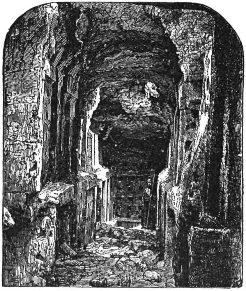
COLUMBARIA NEAR BEIT JIBRÎN.
On the 13th of March we rode to the white cliff called Tell es Sâfi, the site of the Crusading fortress of Blanche Garde, which was{276} built in 1144 A.D., as an outpost for defence against the people of Ascalon. Of the fortress nothing remains beyond the rock scarps, which are only dimly traceable; but the position is one of immense natural strength, guarding the mouth of the Valley of Elah, and the situation is that in which Jerome describes the Philistine Gath. Identification is impossible without the recovery of the ancient name, but there is, I think, no place which has stronger claims than this site to be identified with Gath. It is now a mud village with olives beneath it; the cliff on which it is built is 300 feet high, and is burrowed with caves on the north; on the south a narrow saddle joins it to the ridge, but on every other side the “Shining Hill,” as it is well called, is impregnable, and when protected by fortifications on the weaker side, it must have been a most important post.
Beit Jibrîn had suffered severely from the fever of the last autumn. It was said that 500 people out of 1000 had died in the neighbourhood. The “cursed water” had appeared, by which title was intended a series of stagnant pools in the valley, which if not dry by autumn always foreboded fever in the village. I asked why the villagers did not drain them; the Sheikh replied, “It is from Allah.” Such is the fatalistic indolence of the peasantry, which prevents any chance of progress or of civilisation so long as the hopelessness of the creed of Islam bars the way.
From Beit Jibrîn we visited a site which is of primary interest, as representing apparently the Cave of Adullam.
This famous hold, where David collected “every one that was in distress and every one that was in debt, and every one that was discontented,” was, according to Josephus, at the city called Adullam (Ant. vi. 12, 3). This city was one of the group of fifteen (Josh. xv. 35) situate in the Shephelah or “lowlands.” The towns next on the list, including Jarmuth (El Yermûk), Socoh (Shuweikeh), and others, lie north-east of Beit Jibrîn, and are close together. The term Shephelah is used in the Talmud to mean the low hills of soft limestone, which, as already explained, form a distinct district between the plain and the watershed mountains. The name Sifla, or Shephelah, still exists in four or five places within the region round Beit Jibrîn, and we can therefore have no doubt as to the position of that district, in which Adullam is to be sought.{277}
M. Clermont Ganneau was the fortunate explorer who first recovered the name, and I was delighted to find that Corporal Brophy had also collected it from half a dozen different people, without knowing that there was any special importance attaching to it. The title being thus recovered, without any leading question having been asked, I set out to examine the site, the position of which agrees almost exactly with the distance given by Jerome, between Eleutheropolis and Adullam—ten Roman miles.
The Great Valley of Elah (Wâdy es Sunt) is the highway from Philistia to Hebron; it has its head not far from Terkûmieh, and runs down northwards, past Keilah and Hareth, dividing the low hills of the Shephelah from the rocky mountains of Judah; eight miles from the valley-head stands Shochoh, and Wâdy es Sunt is here a quarter of a mile across; just north of this ruin it turns round westward, and so runs, growing deeper and deeper, between the rocky hills covered with brushwood, becoming an open vale of rich corn-land, flanked by ancient fortresses, and finally debouching at the cliff of Tell es Sâfi.
About two and a half miles south of the great angle near Shochoh, there is a very large and ancient terebinth, one of the few old trees of the species, along the course of the valley, which took its Hebrew name of Elah from them. This terebinth is towards the west side of the vale, just where a small tributary ravine joins Wâdy es Sunt; and near it are two ancient wells, not unlike those at Beersheba, with stone water-troughs round them; south of the ravine is a high rounded hill, almost isolated by valleys, and covered with ruins, a natural fortress, not unlike the well-known Tells which occur lower down the Valley of Elah.
This site seems to be ancient, not only because of the wells, but judging from the caves, the tombs, and the rock quarryings which exist near it. The hill is crowned with a little white-domed building, dedicated to “the notable chief” (Sheikh Madhkûr), who seems to have no other name. The ruins round it are named from the Sheikh.
But although to the site itself no name except Sheikh Madhkûr is applied, there are ruins below the hill and near the well, which are called ’Aid el Ma, or ’Aid el Miyeh, “Feast of the Water,” or “Feast of the Hundred.” Both pronunciations are recognised, and either is radically identical with the Hebrew Adullam. The{278} ’Aid represents the Hebrew Ed, “monument,” and the Ma, “water,” reminds one of Jerome’s curious translation of the name Adullam—“Testimonium Aquæ, Monument of Water.”
But if this ruined fortress be, as there seems no good reason to doubt it is, the royal city of Adullam, where, we should naturally ask, is the famous cave? The answer is easy, for the cave is on the hill.
We must not look for one of the greater caverns, such as the Crusaders fixed upon in the romantic gorge east of Bethlehem, for such caverns are rarely inhabited in Palestine; and there is nothing in the Bible narrative to show that anyone except David himself lived in the cave. His four hundred men may have inhabited the “hold” or fortress on the top of the hill.
The site at Adullam is ruinous, but not deserted. The sides of the tributary valley are lined with rows of caves, and these we found inhabited, and full of flocks and herds; but still more interesting was the discovery of a separate cave, on the hill itself, a low, smoke-blackened burrow, which was the home of a single family. We could not but suppose, as we entered this gloomy abode, that our feet were standing on the very footprints of the Shepherd-King, who here, encamped between the Philistines and the Jews, covered the line of advance on the cornfields of Keilah, and was but three miles distant from the thickets of Hareth.
No doubt many travellers will visit the famous site thus recovered, but I saw nothing more to describe than the bare chalky hill, with its black cave, its white dome, and scattered blocks of masonry, the ancient round stone wells below, the magnificent old terebinth, and the cave stables in the opposite hillside.
The hill is about 500 feet high; it commands a fine view eastwards over the broad valley (up which the high-road to Hebron runs), its course dotted with terebinths and rich with corn; in the distance are high rocky mountains, dark with brushwood, and steeply sloping, with a small village, here and there, perched on a great knoll, and gleaming white.
There is ample room to have accommodated David’s four hundred men in the caves, and they are, as we have seen, still inhabited. The meaning of the old name of the site is now quite lost, and there is a confused tradition of a feast of one hundred guests, by which it is generally explained.{279}
It is interesting to observe that the scene of David’s victory over Goliath is distant only eight miles from the cave at ’Aid el Ma. It was in the Valley of Elah, between Shochoh and Azekah, that the Philistines encamped in “Ephes Dammim,” or “the Boundary of Blood.” Saul, coming down by the highway from the Land of Benjamin, encamped by the valley (1 Sam. xvii. 2) on one of the low hills; and between the two hosts was the Gai or “ravine.” Even of the name Ephes Dammim we have perhaps a trace in the modern Beit Fased, or “House of Bleeding,” near Shochoh.
Two points required to be made clear as to the episode of David’s battle with Goliath; one was the meaning of the expression Gai or “ravine;” the other was the source whence David took the “smooth stones.” A visit to the spot explains both. In the middle of the broad open valley we found a deep trench with vertical sides, impassable except at certain places—a valley in a valley, and a natural barrier between the two hosts; the sides and bed of this trench are strewn with rounded and water-worn pebbles, which would have been well fitted for David’s sling.
Here, then, we may picture to ourselves the two hosts, covering the low rocky hills opposite to each other, and half hidden among the lentisk bushes; between them was the rich expanse of ripening barley and the red banks of the torrent with its white shingly bed; behind all were the distant blue hill-walls of Judah, whence Saul had just come down. The mail-clad champion advanced from the west, through the low corn, with his mighty lance perhaps tufted with feathers, his brazen helmet shining in the sun; from the east, a ruddy boy, in his white shirt and sandals, armed with a goat’s-hair sling, came down to the brook, and, according to the poetic fancy of the Rabbis, the pebbles were given voices, and cried: “By us shall thou overcome the giant.”
The champion fell from an unseen cause, and the wild Philistines fled to the mouth of the valley, where Gath stood towering on its white chalk cliff, a frontier fortress, the key to the high-road leading to the corn-lands of Judah, and to the vineyards of Hebron.
The Survey work round Beit Jibrîn was unusually heavy, for, on an average, three or four ruined sites were found to every two square miles, and the number of names was very large. The{280} storms also interrupted us, and thus it was only on the 1st of April, or three weeks from the date of our arrival in the district, that we could move on.
The spring flowers, including the delicate cyclamens, were now in full bloom, the hoopoes and storks had arrived, and Palestine was at its best. The work had extended over 180 square miles in the three weeks, and 424 names, only 50 of which were previously known, had been collected, including more than 200 ruins.
There was always some difficulty in ascertaining names; suspicion, ignorance and fanatical feeling were against us, but we here found a new difficulty, for the peasantry were convinced that the Franks knew the old names better than they did themselves. One guide, pointing out the ruin of Horân, said that the real name was Korân. I asked why, and he answered that a European had told him. Thus, also, at Kefr Saba we were told that the Frank name was Antifatrûs; and at Adullam one man refused to tell me the name of the place, saying that the Franks knew it best.
I protest against the immorality of corrupting the native traditions, by relating to the peasantry the theories of modern writers as authentic facts, for it destroys the last undoubted source of information as to ancient topography. The confusion caused by Crusading and early Christian traditions which have been engrafted in a precisely similar manner, forms already a most serious difficulty; and if in addition we are to have modern foreign theories disseminated among the peasantry, identification will be impossible. Throughout the course of the Survey, we never allowed the peasantry to suppose that we attached more value to one name which they gave, than to another, and we never asked leading questions or gave them any information as to ancient sites.
Our next camp was at the village of Mejdel, near the shore, just north of Ascalon, separated from Beit Jibrîn by nineteen miles of corn-land and sandy downs. The plain was dotted with brown mud villages, and was coloured with patches of purple lupines. We passed on our march through Keratîya, in which we probably recognise the name of the Philistine Cherethites, and where is a Crusading tower now known as Kŭl’at el Fenish, “Castle of the Philistines,” thence crossing over the sand-ridge we looked down on green hedgeless fields, brown ploughland, and beautiful olive-groves,{281} and on the village of Mejdel, with its conspicuous minaret and tall palm-grove.
This place is the principal town between Gaza and Jaffa: it boasts of a bazaar and has a weekly market. The inhabitants are rich and well-disposed. There are sandy lanes, hedged with the prickly pear, round the town, and on the west a large cemetery near the sand-dunes. To the north, under a row of aged olive trees, we found a most pleasant camping ground.
From this camp we made the large-scale survey of Ascalon, and cleared up the curious question as to the two Episcopal towns of that name which existed in the fifth century, the one being apparently Ascalon by the sea, the second a ruined site called ’Askelôn in the hills near Beit Jibrîn.
Ascalon, “the bride of Syria,” is now entirely ruinous, and only the fragments of its great walls, built by the English, under Richard Lion-Heart, in 1191 A.D., remain half buried by the great dunes of rolling sand, which are ever being blown up by the sea breeze from the south-west. The whole interior of the site is covered with rich soil, to a depth of about ten feet, and the natives find fragments of fine masonry, shafts, capitals, and other remains of the old city, by digging in this.
The walls inclose a half circle, or bow, as described by William of Tyre, the string being towards the sea, where are cliffs about fifty feet high, above the beach. The town measures one mile and three-quarters round, and three-eighths of a mile from east to west. The foundations of the five great towers, noticed by the chronicler of King Richard’s expedition, are all discernible, with the land-gate, the sea-gate, the church, and some other ruins. The whole place is now full of gardens, containing palms, olives, apples, lemons, almonds, pomegranates, and tamarisks, irrigated by no less than forty wells of sweet water.
The walls are of small masonry, which is much less solid than the work of the Christian kings of Jerusalem; but the mortar is so hard that, in places, the stone has given way and cracked, while the mortar joints remain unbroken. A huge tower-foundation lies tilted up on one side, like a great cheese, close to the land-gate; it is twenty feet in diameter, and six feet thick.
The fruits here ripen a month earlier than in other parts of Palestine; and were it not that now, as in King Richard’s time,{282} Ascalon has no port, it would no doubt be a place of importance.
Of Herod’s beautiful colonnades, nothing now remains. The Crusaders had little respect for antiquities, and the innumerable granite pillar-shafts, which are built horizontally into the walls, are no doubt those originally brought to the town by Herod.
The Jews held Ascalon to be no part of “the Land.” Even as late as the twelfth century, three hundred Samaritans lived there. The famous Temple of Derceto, in the town, is noticed in the Mishna, as well as the idol Serapia, which was here worshipped. A place called Yagur is also noticed in the Talmud as on the boundary of “the Land,” apparently outside the walls of Ascalon; this, no doubt, is represented by the modern village of El Jûrah, on the north-east, beyond the fosse, among gardens and lanes which are half covered with sand.
It is indeed quite mournful to see how the dry blown sand, advancing, it is said, a yard every year, has climbed over the southern walls of the town, and has already quite destroyed the fruitful gardens on that side.
We heard a curious tradition at Ascalon. A tomb had been opened by the peasantry, near the ruins, some thirty years ago. Under a great slab, in the eastern cemetery, they found a perfectly preserved body, apparently embalmed, lying in its robes, with a sword by its side, and a ring on its finger. The dead eyes glared so fiercely on the intruders, that they let fall the slab, and as one of the party soon after died, they came to the conclusion that it was a Neby or “Prophet” whom they had disturbed, and the place has thus become surrounded with a mysterious sanctity.
Seven and a half miles north of Mejdel is the site of the famous city of Ashdod, now only a mud village of moderate size, on the eastern slope of a knoll which is covered with loose sandy soil and hedged in with prickly pear. On this knoll the old city no doubt stood, and though its elevation is not great, it commands the surrounding land, which accounts for the siege of twenty-nine years by Psammetichus, that Ashdod underwent. On the south is a small white mosque, a water-wheel, and the fine Khân which has fallen into ruins within the last thirty years. There is a great mud-pond on the east, with palms near it, and to the south a marsh, fig gardens and numerous sycamore trees. The corn-lands are{283} wide and fertile, but the place has no antiquities beyond a few bad coins and gems.
The ever-rolling sand-dunes have here encroached no less than three miles, and are lapping against the village. Riding due west from Ashdod we reached the shore, at a point which seems to have been rarely visited by former travellers. There are here extensive ruins of a town, stretching along the shore, and a square fort with round corner towers, probably of Crusading date. This is no doubt the ancient port of Ashdod, mentioned in the fifth century, and the place is still used as a landing by small boats.
The name which is given to this harbour as well as to the ports of Abu Zabûra, Yebna, and Ghŭzzeh, is very interesting; they are each known as El Mîneh, but the word is not Arabic. The Talmud speaks of the harbour of Caesarea as Limineh, and here we have the solution of the puzzle. The Jews were not a race of sailors; the only notices of the sea in the Bible, show the awe with which they regarded its rolling waves. They had no harbours along the coast, and apparently no word in their language for a port; thus they adopted a foreign epithet, and naturalised the Greek Limen, now further corrupted into the modern El Mîneh.
One other great city occupied our attention from the Mejdel camp, namely Lachish, a place which seems to have been still known in the fourth century. We visited Umm Lags, the site proposed by Dr. Robinson, and could not but conclude that no ancient or important city ever stood there, nor has the name any radical similarity to that of Lachish. Much nearer indeed would be the title El Hesy, applying to a large ancient site with springs, near the foot of the hills, about in the proper position for Lachish. The modern name means “a water-pit,” and, if it is a corruption of Lachish, it would afford a second instance of a change which is well known to have taken place in the case of Michmash—the K being changed to guttural H. The distance from Beit Jibrin to Tell el Hesy, is not much greater than that given by the Onomasticon for Lachish, while the proximity of Eglon (’Ajlân), and the position south of Beit Jibrin, on a principal road, near the hills, and by one of the only springs in the plain, all seem to be points strongly confirming this view.
On the 15th of April we marched fourteen miles south to Gaza, over rolling corn-lands with patches of red sandy cliff, and by{284} brown mud villages, with white domes, and large ponds in which the little red oxen were standing knee-deep. Riding up a low ridge, we came upon a great avenue of very ancient olives, which stretches south for four miles to the houses of Gaza.
This ancient city, the capital of Philistia, is very picturesquely situated, having a fine approach down the broad avenue from the north, and rising on an isolated hill a hundred feet above the plain. On the higher part of the hill are the Governor’s house, the principal mosque (an early Crusading church), and the bazaars. The green mounds traceable round this hillock are probably remains of the ancient walls of the city.
Gaza bristles with minarets, and has not less than twenty wells. The population is now eighteen thousand, including sixty or seventy houses of Greek Christians.
The Samaritans in the seventh century seem to have been numerous in Philistia, near Jaffa, Ascalon, and Gaza. Even as late as the commencement of the present century, they had a synagogue in this latter city, but are now no longer found there.
There are two large suburbs of mud cabins on lower ground, to the east and north-east, making four quarters to the town in all. East of the Serai is the reputed tomb of Samson, whom the Moslems call ’Aly Merwân or “Aly the enslaved.” On the north-west is the mosque of Hâshem, the father of the Prophet. The new mosque, built some forty years since, is full of marble fragments, from ancient buildings which were principally found near the sea-shore.
The town is not walled, and presents the appearance of a village grown to unusual size; the brown cabins rise on the hillside row above row, and the white domes and minarets, with numerous palms, give the place a truly Oriental appearance. The bazaars are large and are considered good.
Riding round the town to the east, I found the Moslem inhabitants celebrating a festival, in tents pitched in the cemeteries, where black-robed women, wearing the Egyptian veil, sat in circles, singing and clapping their hands to keep time. On the south-east of the city is a very conspicuous isolated hill called El Muntâr, “the watch-tower;” and on it another place sacred to ’Aly, a little white building, with three domes, surrounded with graves. This{285} is traditionally the hill to which Samson carried the gates of Gaza, and a yearly festival of the Moslems is held here.
An interesting discovery was made in 1879 at Tell el’Ajjûl south of Gaza. A statue, fifteen feet high, was found buried in the sand, representing an old man with a beard. There can be little doubt that it is the statue of Marnas, the Jupiter of Gaza, whose temple was still standing near the city in the fifth century of our era.
On the 16th of April I rode out to a point north-east of Gaza, accompanied by Corporal Brophy and by a native soldier from the town. The Teiâha Arabs were at war with the ’Azâzimeh, who had called in the Terabîn to assist them, and battles were being fought within a few miles of the city, quite unnoticed by the Turkish Governor.
We were riding across a heavy ploughed field, when I heard cries of “There they are!” and looking back I saw the main road occupied by a band of about twenty horsemen, half hidden by a swell of the ground. They were all well mounted, and armed with swords, guns, and pistols, and with great lances of cane with long iron heads and tufts of ostrich feathers. As I looked six spearmen started out and spurred full speed at our Bashi-Bazouk, who was some two hundred yards behind us. They came down like a whirlwind, shaking their lances horizontally, and kicking up a great cloud of dust. It was an awkward moment, for we were out-numbered, and flight or resistance would have been equally vain. I resolved to face it out, and turning back we also galloped up towards the six champions, who drew up round our soldier, and dug their spear-butts into the ground, then suddenly wheeled round and cantered back to the main body, which, to my great relief, filed slowly away eastwards. It appeared that they had mistaken us for Terabîn Arabs, but, finding that we were English, and protected by the Gaza government, they had been afraid to interfere with us.
This little adventure gave us a good idea of the tactics of the Bedawîn in warfare. The military advantage of superior numbers is thoroughly recognised by these wary and pretentious warriors.
From Gaza we also visited Deir el Belah, the Crusading Darum fortified by King Amalrich in 1170 A.D.—a village with remains of a Greek Church of St. George and numerous date-palms, whence{286} its present name “Convent of Dates” is derived. From Darum we also went to Umm el Jerrâr, the site identified by Vandevelde with the Gerar of Abraham and Isaac. A large Tell exists here, but no ancient wells like those of Beersheba, and I was thus led to the conclusion that Abraham’s wells, which the Philistines filled up, and which Isaac is said to have dug again, were probably similar to the pits which the Arabs still dig near this site, to reach the water flowing beneath the surface in the shingly bed of the great trench which runs through the flat alluvial plain of Gerar.
News of a serious fight near Beersheba, in which 700 Arabs were killed and wounded, determined us to set our faces northwards, leaving the district north-west of Beersheba to be finished during the autumn of 1877. On the last day of April we left our Gaza camp, and marched back to Mejdel, and thence, on the following day, to Yebnah, the ancient Jamnia, famous as the seat of the Sanhedrim after the fall of Bether.
The great Valley of Sorek, which rises north of Jerusalem, and runs down by Zoreah (Sŭr’ah) and Beth Shemesh (’Ain Shemes), reaches the sea north of Yebnah. It is here called “Reuben’s River,” from the little enclosure sacred to the “Prophet Reuben,” which, from the middle ages, has been a Moslem shrine for pilgrimage. The harbour north-west of Yebnah is known also as Mînet Rubîn.
The district round Yebnah is full of sacred shrines. Neby Shît or Seth, Neby Yûnis or Jonah, and Neby Kunda, probably “the Chaldean,” with many minor saints, have domes within a few miles of one another. The mosque of Yebnah, with its little minaret, was a Christian church, which was partly rebuilt and altered in 673 A.H. There are three other sacred places near it, one being a mosque dedicated to Abu Harîreh, Companion of the Prophet.
The town of Yebnah stands on an isolated hillock, with olives to the north, and it is supplied by wells with water-wheels, or Sâkia, as at Ashdod. There is nothing of great antiquity at the place, and even the walls of the Crusading fortress of Ibelin, built at Yebnah in 1144 A.D., have disappeared. The Crusaders considered Yebnah (or Jamnia) to be the site of Gath; but, as usual, their views are not supported by the facts of earlier history.
Three miles east of Jamnia the Valley of Sorek passes through a defile, having a hill on either side; on each hill a village stands{287} above the rich corn-land, and each village is an ancient site. The southern—now Katrah—is supposed to be Gederoth; the northern, El Mŭghâr (“the Cave”) is the site which Captain Warren proposes for Makkedah.
This latter is a remarkable place, and one of the most conspicuous sites in the plain. A promontory of brown sandy rock juts out southwards, and at the end is the village climbing up the hillside. The huts are of mud, and stand in many cases in front of caves; there are also small excavations on the north-east, and remains of an old Jewish tomb, with Kokim. From the caves the modern name is derived, and it is worthy of notice that this is the only village in the Philistine plain at which we found such caves. The proximity of Gederoth (Katrah) and Naamah (Na’aneh) to El Mŭghâr also increases the probability that Captain Warren’s identification of El Mŭghâr with Makkedah is correct, for those places were near Makkedah (Josh. xv. 41).
North-east of Makkedah, Ekron still stands, on low rising ground—a mud hamlet, with gardens fenced with prickly pears. There is nothing ancient here, any more than at Ashdod or Jamnia, but one point may be mentioned which is of some interest. Ekron means “barren,” yet the town stood in the rich Philistine plain. The reason is, that north of the Sorek Valley there is a long sandy swell reaching to the sea-coast—an uncultivated district, now called Deirân, the Arabic name being equivalent to its old title, Daroma; Ekron stands close to this dry, barren spur, and above the fertile corn-lands in the valley.
Our last Philistine camp was at the edge of the low hills, in a fig-garden, just south of Dhenebbeh. We reached it on the 8th of May, and left on the 15th, on which day we completed one thousand square miles, which had been surveyed in eleven weeks, since the 25th of February—the most rapid piece of work during the whole course of the Survey.
The village of Dhenebbeh lies south of Wâdy Sŭrâr, the old Valley of Sorek. The view up this valley, looking eastward, is picturesque. The broad vale, half a mile across, is full of corn, and in the middle runs the white shingly bed of the winter torrent. Low white hills flank it on either side, and the high rugged chain of the mountains of Judah forms a picturesque background. On the south, among the olives, is the ruin of Beth Shemesh, to{288} which place the lowing kine dragged the rude cart through the barley-fields. On the north, a little white building with a dome is dedicated to Sheikh Samat, and stands close to Zoreah.
Such is a slight sketch of the Philistine campaign, the full details of which must be left to be enumerated in the memoir of the map, of which they form a large section. We must hasten on now to other questions of greater interest and importance.{289}
![]()

THE SEA OF GALILEE.
THE Philistine campaign was followed by three weeks’ rest at Jerusalem during the east winds of May. On the 8th of June we once more marched out with our whole expedition, intending to finish the northern district, of 1000 square miles, within the year, if possible.
One of the principal pieces of work to be done was the running of a line of levels from the Mediterranean to the Sea of Galilee, for which purpose the British Association had voted £100. The line which I chose, and which was approved, was the shortest possible, and Wâdy el Melek afforded us a most convenient line of ascent to the Buttauf Plain, whence we were to descend to Tiberias. Under my direction, nineteen miles were run in 1875, and in 1877 Lieutenant Kitchener finished the remaining seventeen miles on the low ground, which could not be entered in summer. By this means the level of the Sea of Galilee, variously{290} computed at from 300 to 600 feet below the Mediterranean, has been fixed as 682·5 feet.
Our most valuable discoveries in this part of the country included the probable site of a synagogue at Tireh east of Shefa ’Amr, and the recovery of Osheh, a town known to have been close to Shefa ’Amr (or Shafram) and one of the places where the Sanhedrim sat for many years; it seems undoubtedly to be the present ruin of Hûsheh. We also found a very remarkable tomb at Shefa ’Amr, profusely covered with sculpture, and with a Greek inscription and crosses. Outside the door are sculptured lions, a grape-vine with birds in the branches, and other designs. It appears to be a Christian sepulchre, probably of the fourth or fifth century, but perhaps earlier. A Byzantine church also exists in the village.
On the last day of June we marched east to the miserable little hamlet of El B’aîneh, which, with two others, stands on the north slopes of Jebel Tôr’an, an isolated block of mountain rising out of the plateau of the Buttauf. Here we found the inhabitants all fever-stricken from the malarious exhalations of the great swamp, which even as late as July extended over half the plain. The place was evidently unhealthy, and we were tortured by the armies of large musquitoes rendering sleep impossible at night. The levelling operations required us to camp in the plain, but we hastened on the work as much as possible, looking forward to a retreat into the mountains of Upper Galilee, which, being 4000 feet above the sea, would be cool and pleasant, and, as we hoped, safe from the scourge of cholera, which had already devastated Damascus, and was creeping slowly south.
The view from the summit of Tôr’an is interesting and extensive. The Sea of Galilee is visible, and we were able to fix the direction of many points along its shore.
On the south, separated from Tôr’an by a second plain, lay the low bare range of the Nazareth hills, Neby S’ain, and Gath Hepher with the tomb of Jonah, being visible, while rather farther east Kefr Kenna stood among its olive-groves and gardens of pomegranates.
Tabor, crowned with two monasteries, was also plainly visible, east of the Nazareth range, the slopes partly hidden by oak-groves. Through a gap, between it and the western hills, the outline{291} of Gilboa and part of Jebel ed Duhy could be seen. The plain of Esdraelon was hidden, but the cone of Sheikh Iskander was visible to the south-west.
To the west the view extended over the low wooded hills to the long range of Carmel, which was visible, from the Peak of Sacrifice to the white monastery where, on a little spit, stands the German wind-mill, which showed up quite black against the gleaming sea.
The brown and fertile plain of the Buttauf, in the basaltic soil of which tobacco, corn, maize, sesame, cotton, and every species of vegetable grow luxuriantly, lay at our feet. The high blunt top of Jebel Deidebeh (“mountain of the watch-tower”), crowned with its ring of thicket, rose behind, shutting out the view. Beyond this was the chain of hills running eastwards, with rolling grey up-lands dotted with olives, while farther still, some ten or twelve miles away, rose the mountain wall of Upper Galilee, culminating in Jebel Jermûk, a bare craggy ridge which closed the view to the north. Turning yet farther east, the large town of Safed shone white on the mountain-side, divided into two quarters, with a double-pointed summit behind them. Beyond all, dark and dreamlike, the great Hermon, “Sheikh of the mountains,” was seen streaked with silver lines of snow.
But the view due east of Tôr’an was yet more interesting. A yellow plateau shelves down from the foot of the mountains of Upper Galilee and runs into little tongues and promontories, separated by tiny bays, along the north-western shores of the Sea of Galilee: only in one part of this line is there a cliff, just where the little fertile plain of Gennesaret terminates at Khân Minieh; the rest is shelving ground almost to the water’s edge.
The deep chasm running down from Safed, and known as “the Valley of Doves” (W. el Hamâm), debouches into the green oasis of the Ghŭweir—the plain of Gennesaret. East of the sea the long flat plateau of Bashan stretches from the precipices which enclose the lake, and reaches away to the volcanic cones and dreary lava-fields which are backed by the peaks of Jebel ed Drûz.
Tiberias was hidden below the cliffs, and only about half the blue and limpid lake was seen behind them; most conspicuous on this line are the Horns of Hattin, so fatal to the Christian{292} kingdom in 1187, and here also, as on the east, a broad plateau runs almost to the top of the precipices.
It is wonderful to reflect how numerous are the ancient towns which encircled this little lake; speaking of the west side alone, they number more than twenty. Hidden by the cliffs we have Tiberias, or Rakkath, and Hammath (El Hummâm), Taricheæ (Kerek), Sinnabris (Sennâbreh), and Magdala (Mejdel), with Kedîsh, the probable site of the Kadesh of Barak.
On the western plateau stand Adamah (Admah), Adami (Ed Damieh), Bitzaanaim (Bessûm), Lasharon (Sarôna), Shihon (Sh’aîn), and other sites of Biblical interest. Arbela, with the synagogue of Rabbi Nitai (200 B.C.), Hattîn (the ancient Zer), Yemma (the Talmudic Caphar Yama), Kefr Sabt, (Caphar Sobthi), Seiyâdeh (the Talmudic Ziadethah), Tell M’aûn (Beth Maon), Sha’arah (Beth Sharaim), and several other towns of later times swell the long list of cities. The district is full of sacred places: Rabbi Akiba, Rabbi Meir, and the great Maimonides, were buried near Tiberias, and the supposed tombs of Jethro and Habakkuk are still shown on the hills above.
One site alone is conspicuous by its absence—the tomb of Nahum, which was known to the Jews in the fourteenth century, but is apparently now lost for ever. This loss is a subject of real regret, for could we light upon the tomb of Nahum, we could perhaps settle for ever the position of Capernaum, “the village of Nahum.”
The various scholars and explorers who have written since Robinson are divided into two parties, one placing Capernaum at the ruins near Khân Minieh, the other selecting the large site at Tell Hûm. The places are only two and a half miles apart, but modern disputants are not content with such wide limits. There is a point which strikes one as curious in the controversy. In all the arguments usually brought forward, no reference is made to the information which can be deduced from Jewish sources dating later than Bible times. To this information I would call attention.
Identification, properly so called, is impossible when the old name is lost; but in the case of Capernaum traces of the name may perhaps be recovered still. It is generally granted that the Talmudic Caphar Nahum, or “Village of Nahum,” was probably{293} identical with the New Testament Capernaum, and it is on this supposition that the only philological claim of Tell Hûm is based; but the loss implied of an important radical at the commencement of the name Hûm, if it be supposed to be a corruption of Nahum, is a change of which we have scarcely any instance; moreover, Hûm in Hebrew means “black,” and still retains its original signification in Arabic. Tell Hûm was so named, no doubt, from the black basalt which covers the site. If we are to seek for an ancient corresponding title, I would suggest Caphar Ahim, a town mentioned in the Talmud with Chorazin, and famous for its wheat, as being probably the ancient name of the ruined site at Tell Hûm. Even if this town were standing in the time of Christ, there seems no more reason why its name should be mentioned in the Gospels, than that Taricheæ or Sepphoris should be so noticed, or that Chorazin should be mentioned by Josephus when speaking of the same district.
An investigation of the name Minieh is more satisfactory. In Hebrew it is derived from a root meaning “lot,” or “chance.” In Aramaic it has an identical meaning, and the Talmud often mentions the Minai, or “Diviners,” under which title were included not only every kind of sorcerer and enchanter, but also the early Jewish converts to Christianity.
Now this word Minai is intimately connected with Capernaum. In the Talmud there is a curious passage (quoted in Buxtorf’s great Lexicon) where “sinners” are defined as “sons of Caphar Nahum:” and these Huta (or sinners) we find from another passage, were none other than the Minai.
It is evident that the Jews looked on Capernaum as the head-quarters of the Christians, whom they contemptuously styled “sorcerers;” and the importance thus attached by them to that town, as a Christian centre, is in accordance with the expression in the Gospel, where Capernaum is called Our Lord’s “own city” (Matt. ix. 1).
The Talmudic doctors speak, then, of Capernaum as the city of Minai, and as such it continued to be regarded by the Jews down to the fourteenth century. In 1334 A.D. Isaac Chelo travelled from Tiberias to Caphar Anan (Kefr ’Anân), presumably by the direct road passing near the “Round Fountain.” He was shown on his way the ruins of Caphar Nahum, and in them the tomb of{294} Nahum, and he remarks incidentally as to the place, “here formerly dwelt the Minai.” It is evident that he cannot be supposed, without twisting the narrative, to refer to any place so far from his route as is Tell Hûm. The site at Minieh would have been within a mile and a half of his road, and the name is apparently connected with Capernaum by his valuable note about the Minai.
The same connection is traced in 1616 A.D., when Quaresmius speaks of Capernaum as shown at a place called Minieh, and thus we are able to trace back an apparently unbroken Jewish tradition connecting Capernaum with the “Village of the Minai,” and with the ruined site of Minieh.
In addition to the Jewish tradition connecting Minieh with Capernaum, there is a second indication which favours that identification. Josephus speaks of the fountain which watered the plain of Gennesaret, and which was called Capharnaum. It contained a fish named Coracinus, which was also found in the Nile. There are two springs to which this account has been supposed to apply, the one two and a half miles south of Minieh, the other scarcely three quarters of a mile east of the same site. The first irrigates a great part of the plain of Gennesaret; the Coracinus has been found in it, and the waters are clear and fresh; this is called ’Ain-el-Madowerah, “the round spring.” The second is called ’Ain Tâbghah, and Dr. Tristram points out that the water being warm, brackish, and muddy, is unfit for the Coracinus, which has never as yet been found in it.
’Ain Tâbghah is not in the plain of Gennesaret. It is a spring surrounded by an octagonal reservoir, which was built up to its present height by one of the sons of the famous Dhahr-el-’Amr in the last century, and the water is thus dammed up to about fifty-two feet above the lake. An aqueduct, of masonry apparently modern, leads from the level of the reservoir to the cliff at Minieh, where is a rock-cut channel three feet deep and broad, resembling more the great rock-cutting of the Roman road at Abila, than any of the rock-cut aqueducts of the country. The water was conducted through this channel to the neighbourhood of the Khân, or just to the edge of the plain of Gennesaret. It is important to notice that the spring can only have watered the neighbourhood{295} of Minieh after the reservoir had been built, and that it was probably always unfitted for the presence of the Coracinus.
As ’Ain Tâbghah is not in the plain of Gennesaret, and as it does not irrigate that plain—the modern aqueduct being apparently constructed to supply some mills near Minieh—it seems impossible to identify this spring with that mentioned by Josephus as the abode of the Coracinus. And even if the Tâbghah spring were that of Capharnaum, the case for Tell Hûm is not thereby strengthened, the distance from the spring to that ruin (nearly two miles) being double that from the spring to Minieh—scarcely three quarters of a mile.
In favour of the Minieh site we have then Jewish tradition, and the existence of a spring fulfilling the description of Josephus; but it must not be denied that in favour of Tell Hûm we have a Christian tradition from the fourth century downwards.
Jerome places Capernaum two miles from Chorazin. If, as seems almost certain, by the latter place he means the ruin of Kerâzeh, the measurement is exactly that to Tell Hûm.
The account of Theodorus (532 A.D.) is more explicit, and seems indeed almost conclusive as to the site of his Capernaum. Two miles from Magdala he places the Seven Fountains, where the miracle of feeding the five thousand was traditionally held to have taken place; these, as will presently appear, were probably close to Minieh; and two miles from the fountains was Capernaum, whence it was six miles to Bethsaida, on the road to Banias. These measurements seem to point to Tell Hûm as the sixth-century Capernaum.
Antoninus Martyr (600 A.D.) speaks of the great basilica in Capernaum, which it is only natural to identify with the synagogue of Tell Hûm, which seems probably (by comparison with those at Meirûn) to be the work of Simeon Bar Jochai, the Cabbalist, who lived about 120 A.D.
Arculphus (700 A.D.) visited the fountain where the five thousand were fed, and from the hill near it he saw Capernaum at no great distance on a narrow tract between the lake and the northern hills. His account thus agrees with that of Theodorus, though in itself so indefinite, that it has been brought as evidence in favour of both the sites advocated for Capernaum.
Sæwulf (1103 A.D.) proceeded along the shore for six miles,{296} going north-east from Tiberias, to the mountain where the five thousand were fed, then called Mensa, or “table,” which had a church of St. Peter at its feet. It is evident, from the measurements, that this hill was in the neighbourhood of Minieh, where Theodorus also seems to place the scene of the miracle, as above noticed.
John of Würtzburg (about 1100 A.D.) speaks of the mountain called Mensa, with a fountain a mile distant, and Capernaum two miles away.
Fetellus (1150 A.D.) is yet more explicit. Capernaum, he says, is at the head of the lake, two miles from the descent of the mountain, and apparently three from the fountain where the five thousand were fed, which fountain would probably be ’Ain-et-Tîn, a large source, west of Minieh, and not far from the hill which Sæwulf points out as being the Mensa.
The whole of this topography is summed up by Marino Sanuto, whose valuable chart of Palestine shows us the position of the various traditional sites of the fourteenth century. On this chart the Mensa is shown in a position which is unmistakable. The valleys which run down to the plain of Gennesaret are drawn with some fidelity, and the Mensa is placed north of them; at the border of the lake, Bethsaida is shown, about in the position of Minieh, and Capernaum near that of Tell Hûm; in the letter-press the account is equally clear, Capernaum being placed near the north-east corner of the lake, and Bethsaida just where the lake begins to curve round southward.
Christian tradition points, then, to Tell Hûm as being Capernaum, but Jewish hatred has preserved the Jewish site under the opprobrious epithet of Minieh; the question is simply whether—setting aside the important testimony of Josephus—Jewish or Christian tradition is to be accepted. A single instance will be sufficient to show the comparative value of the two. Jerome speaks of Ajalon, for example, as three miles north-east of Bethel, just where the ruin of ’Alya now stands; he very honestly adds, however, that the Jews pointed out another site at a village called Alus, which, from his description, may be proved to be the modern Yalo. Recent discovery has shown that Jerome was wrong and the Jews right; and yet, further, Jerome’s site cannot possibly be reconciled with the position in which he himself correctly places{297} Beth Horon. This is but one instance out of many in which Jerome blunders when differing from the Jews, and no impartial reader can study the Onomasticon with Jerome’s translation, without seeing that in the fourth century the topography of Palestine was only imperfectly understood.
It may be safely said that Christian tradition, though affording often valuable indications, cannot be taken as authoritative, for the chances are equal that it is correct or the reverse. When, as in the case of the Temple, of the Place of Stoning, of Joseph’s Tomb, and of Jacob’s Well, it agrees with Jewish tradition, the sites thus preserved invariably appear to be authentic, and fulfil the required indications found in the Bible; but when these two traditions are discordant, the Christian ceases to be of much value, for it is evident that the traditions of the Jews, handed down unbroken by an indigenous population which was never driven from the country, must take precedence of the foreign ecclesiastical traditions of comparatively later times, which can so often be proved self-inconsistent, or founded on a fallacy.
It is a wonderful reflection that to Jewish hatred we perhaps owe our only means of fixing one of the most interesting sites in Palestine, and that through the opprobrious epithet of Minai or “Sorcerers,” the position of Christ’s own city is handed down to the Christians of the nineteenth century.
On Saturday, 10th July, 1875, the Survey party marched to Safed, where they were endangered by a fanatical attack by the Moorish settlers of the town. The Survey was suspended in consequence; and the spread of cholera necessitated the withdrawal of the party from Palestine. The chief offenders were however imprisoned at Acre, and a sum of £270 was paid as a fine to the Committee of the Palestine Exploration Fund.{298}
![]()

A DERWISH.
IN order to obtain some knowledge of the native peasantry of Palestine, it is necessary to examine their character, language, and religion, which are the three fundamental questions regarding any nation. We may thus be able to conjecture their origin, and to account for their peculiarities. To these three subjects the present chapter is devoted.{299}
The character of the peasantry is a curious mixture of virtues and vices, exaggerated by the entire absence of education. Among their finer qualities may be noticed their great patience and power of endurance, their sobriety, their good-nature, and kindness to animals, their strong sense of religion, and of submission to the Divine Will, their personal courage, which is often remarkable, and their great natural intelligence and quickness of perception, with their power of adapting themselves to novel situations; their docility under recognised leaders is not less remarkable, as are also the natural dignity, courtesy, and modesty of their behaviour in those parts of the country where they are unspoilt by the influence of the worst class of tourists.
Their vices, on the other hand, are often most repulsive, and their uncleanness and brutal immorality are well known, though not subjects for discussion. Their love of money is evidenced by their ordinary conversation; for a passing group, when casually overheard, is almost invariably talking of piastres. Insolence of demeanour to strangers whom they suppose to be unable to assist themselves, is also common; but this is due perhaps in part to oppression and religious hatred, though also, in great measure, to that exclusiveness of feeling which restricts all ideas of benevolence to the small circle of the community or family. The worst vice of all is their universal untruthfulness; and the shamelessness of the peasantry in this respect is evidenced by their proverb, “A lie is the salt of a man.” A successful liar is spoken of as shâter ketîr, or “very clever,” and nothing is more respected than the capacity for cheating everyone. May not this be considered as a characteristic of the Semitic people from the days of Jacob downwards?
Though liars by nature, and often forced to lie by the oppression of an unjust government, the peasantry are able to appreciate truthfulness in other nations. There is an expression which is common amongst them, and of which we have reason to be proud; for in striking a bargain they will promise by the Kelim Inkleez, or “Englishman’s word,” as equivalent to saying that they will faithfully perform their undertakings. This reputation for trustworthiness is well supported by many an Englishman in the country, and we never lost an opportunity of reminding the peasantry that an Englishman’s word was his bond.
These traits of the national character are all characteristic of{300} Semitic origin, and are not less distinctive of the Jews; high religious zeal, endurance, intelligence, energy, and courage of a peculiar kind, are qualities eminently remarkable in the Jewish character, and, on the other hand, love of money, craft, exclusiveness, and lying, are vices which have always been chargeable against that nation.
With qualities such as those above enumerated the native peasantry are capable, under a wise government, of becoming a fine people: the present rule of the Turks discourages them in every way; their natural quickness is uncherished by education, their industry is rendered useless by unjust taxation and robbery, their worst vices are unchecked, and they have become broken-spirited and hopeless, under an oppression of which no idea can be formed in England; their only object is therefore to drag on their miserable lives with as little trouble as possible.
One trait remains to be noticed as forming a serious drawback in any attempt to improve the condition of the people. This again is a Semitic characteristic, namely, unbounded personal conceit and vanity—a peculiarity of the people which is most striking and disagreeable to anyone dealing with them.
A Syrian believes himself to be far more capable of conducting the most difficult affairs than a European specially educated; and the peasantry—perhaps not well impressed by the behaviour of tourists ignorant of the language—are generally convinced that the Franks are far less clever than themselves, while the marvels of civilisation are commonly attributed to a knowledge of magic which the Franks are universally believed to possess.
Such childish ideas are no doubt due to the want of any education; yet education does not always improve the Syrian, but rather renders him more insufferable; and in speaking of politics, or any other branch of ordinary conversation, the Syrian townsman exhibits, with ludicrous self-complacency, the meagre information which, in his eyes, is enough to fit him for delivering an authoritative opinion on the destinies of nations, or on deep scientific subjects.
This self-conceit is not less noticeable in religion; spiritual pride, and the conviction that they alone are fitted to understand the true faith, make the conversion of this nation to Christianity practically an impossibility, and incline them to accept without{301} question the studious misrepresentations which are disseminated by their religious teachers.
Such conceit is also eminently characteristic of the Jews. Among the Rabbinical writers it reaches a pitch which is little short of insanity, and the lesson of humility taught in the parable of the Publican and the Pharisee might well be inculcated daily on Jew and Syrian alike.
Among minor traits, the want of appreciation of humour is the most remarkable, and it is no doubt connected with the above mentioned self-conceit. The Eastern people are by nature grave and dignified, and they have but little sense of the ludicrous. Thus what is known amongst us as “chaff” is never heard in conversation among natives of Palestine, and their only attempts at witticisms are feeble puns. This again may be said to be a peculiarity of the Jews, puns being common in Hebrew writing.
In order to trace the origin of any people it is necessary, as Max Müller tells us, to know the language they speak, and to trace its history. The examination of the peasant language in Palestine is therefore of the highest interest.
The Syrians speak a dialect of Arabic, which ranks between the purer Egyptian and the very corrupt Mughrabee language, in the scale which has for a standard the Arabic of the Bedawîn of Arabia. The main characteristics of pronunciation are as follows:
The letter Jîm is pronounced like J in joy, not hard, like G, which is the Hebrew pronunciation of the letter still used in Egypt. The Dhal is confused in pronunciation with the Zain, with which it has a common origin in Hebrew. The Tha and the Sin are in the same way both pronounced like S, and both represent the Hebrew Sin. The Kaf is almost always pronounced Chaf; the Kof is sometimes sounded like hard G, as among the Bedawîn, and sometimes it is yet further changed into J, while among the people near Jerusalem, as well as in Damascus, it is hardly sounded at all, being represented by a catch in the breath, like the letter Hamzah. The Lam and Nun are confounded, and used for one another, especially at the end of words, where the L is almost always changed to N. Further peculiarities to be noted are, the addition of sh to negatives, as ma fish (“there is not,”) for ma fi, the broad pronunciation of the vowels (the Wow being often sounded where it does not really exist), and the unnecessary use{302} of diminutives or double diminutives. Lastly, the Alef is prefixed to words of which it forms no radical part, as in the cases Ajdûr for Jedûr, Abzîk for Bezîk, etc.
Now these peculiarities, in almost every case, serve to connect the peasant dialect with the old Aramaic, which Jerome tells us was the language of the natives of Palestine in the fourth century. The addition of unnecessary vowels is remarkable in the Rabbinical dialect, and, as has been shown above, the Fellahîn, in their vulgar pronunciation, preserve the most archaic sound of certain letters which were (according to Gesenius and scholars of equal authority) originally indistinguishable from others, but which in the polite pronunciation of the townsmen have now quite distinct sounds. Thus, for instance, in the modern Idhen we should scarcely recognise the Hebrew Uzen, “an ear,” but when this word is pronounced by a peasant in Palestine it resumes its old sound of Uzen.
Nor is it from pronunciation alone that we are able to judge of the character of the language; words in common use are equally instructive. Thus, for instance, almost all the words used in the Bible to express such natural features as rocks, torrents, pools, springs, etc., etc., are still in use in the peasant language quite unchanged, not only in connection with ancient sites, but in the common nomenclature of the country. A few words do, indeed, appear to have lost their original meaning, as in the cases of the Hebrew Tireh, “a fenced city;” Bireh, “a fortress;” and Râmeh, “a hill,” names still commonly applied to villages, but the meaning of which appears not to be understood by the peasantry; these cases seem, however, to be exceptions, which prove the rule that Aramaic, and even Hebrew words—not now used in the Arabic language—are of common occurrence among the peasantry, their original signification being still understood.
There are also words apparently peculiar to the peasant dialect, such as ’Arâk, for a “cavern” or “cliff,” which is not found in any dictionary. Space will not allow of a further disquisition on this subject, but it might easily be shown how simple an explanation of local names is often afforded by translating them, when not otherwise intelligible, as though of Aramaic origin. On the whole, the language appears to bear so strong an affinity to that which we know to have been commonly spoken in the country as{303} late as the fourth century, that the peasantry may, without exaggeration, be said to speak Aramaic rather than Arabic, or at least a dialect formed by the influence of the language of their Arab conquerors on the original Aramaic tongue.
One of the most valuable results of this inquiry is, that a philological reason is thus afforded for that general preservation of the names of ancient sites in Palestine, which has always been considered extraordinary, and perhaps doubtful. The language being unchanged, it is evidently natural that local names should be also unchanged, the original meaning being understood by the peasantry in most cases. Many instances of this might be brought forward, and the alteration which has occurred in the nomenclature of the country, as a whole, seems wonderfully small, almost every important site retaining its Biblical name. The investigation of the language appears to me to raise the study of identification from an empirical pursuit of fancied resemblances, to the level of a science governed by recognised laws of change and modification, laws which must be observed strictly in all cases of really satisfactory identification.
If we may judge the origin of any people by language, then by their dialect, the descent of the Fellahîn, or “tillers,” may be traced from older inhabitants of Palestine, and perhaps from the pre-Israelite population, which—despite the fierce onslaught of the first Jewish conquerors under Joshua—was, as we may gather from the Bible, never entirely outrooted, but remained in the land (in much the same position as that which the Saxons occupied under their Norman rulers) as a distinct people, though members of the same great family (the Semitic race), regarded as inferior to the Jewish dominant class, “hewers of wood,” “drawers of water,” “the beasts of the people.” It was precisely to this peasantry that the educated Jews of the second century of our era assigned the Aramaic language; the holy Hebrew of the Sacred Books being confined to the priests, by whom chiefly, after the return from the Captivity, that more ancient tongue appears to have been studied.
It is interesting to inquire whether foreign influence is traceable in the peasant language. Foreign words do indeed occur, such as “Burj” for a tower, or “burg,” and El Mineh for a harbour, which has already been explained to be a corruption of the Greek Limen; but these words, with many Crusading names of places{304} which are attached to mediæval or later sites, cannot properly be said to be commonly used in the language; in fact, it is extraordinary to note how very small the influence of foreign conquerors, Greek, Roman, or Frank, seems to have been on the language. The pretentious titles, Eleutheropolis, Nicopolis, Scythopolis, etc., have quite disappeared, and the old native names of these cities, Beth Gubrin, Emmaus, Bethshean, etc., are those now known, with the important exception of Nâblus, the modern name for Neapolis, the ancient Shechem—a change which may perhaps be traced to Jewish hatred of the name of Shechem.
Their language, then, seems to show that the Fellahîn are a people well worthy of study, because apparently of a very ancient stock, which is still preserved comparatively pure; and we may therefore naturally expect their religion, habits, and customs to have an interesting bearing on the graphic accounts of peasant life which are found in the Bible.
By their religious peculiarities, still further light is thrown on the history of the modern Fellahîn.
The professed religion of the country is Islam, the simple creed of “one God, and one messenger of God;” yet you may live for months in the out-of-the-way parts of Palestine without seeing a mosque, or hearing the call of the Muedhen to prayer. Still the people are not without a religion which shapes every action of their daily life, a religion of most complex growth, requiring the utmost patience to enable us to trace it to its various original sources.
In almost every village in the country a small building surmounted by a whitewashed dome is observable, being the sacred chapel of the place; it is variously called Kubbeh, “dome;” Mazâr, “shrine;” or Mukâm, “station,” the latter being a Hebrew word used in the Bible for the “places” of the Canaanites, which Israel was commanded to destroy “upon the high mountains, and upon the hills, and under every green tree” (Deut. xii. 2).
Just as in the time of Moses, so now, the position chosen for the Mukâm is generally conspicuous. On the top of a peak, or on the back of a ridge, the little white dome gleams brightly in the sun; under the boughs of the spreading oak or terebinth; beside the solitary palm, or among the aged lotus-trees at a spring, one lights constantly on the low building, standing isolated, or surrounded by the shallow graves of a small cemetery. The trees{305} beside the Mukâms are always considered sacred, and every bough which falls is treasured within the sacred building.
The Mukâms are of very various degrees of importance; sometimes, as at Neby Jibrîn, there is only a plot of bare ground, with a few stones walling it in; or again, as at the Mosque of Abu Harîreh (a Companion of the Prophet), near Yebnah, the building has architectural pretensions, with inscriptions and ornamental stone-work. The typical Mukâm is, however, a little building of modern masonry, some ten feet square, with a round dome, carefully whitewashed, and a Mihrab or prayer-niche on the south wall. The walls round the door, and the lintel-stone are generally adorned with daubs of orange-coloured henna, and a pitcher for water is placed beside the threshold to refresh the pilgrim. There is generally a small cenotaph within, directed with the head to the west, the body beneath being supposed to lie on its right side facing Mecca. A few old mats sometimes cover the floor, and a plough, or other object of value, is often found stored inside the Mukâm, where it is quite safe from the most daring thief, as none would venture to incur the displeasure of the saint in whose shrine the property has thus been deposited on trust.
This Mukâm represents the real religion of the peasant. It is sacred as the place where some saint is supposed once to have “stood” (the name signifying “standing-place”), or else it is consecrated by some other connection with his history. It is the central point from which the influence of the saint is supposed to radiate, extending in the case of a powerful Sheikh to a distance of perhaps twenty miles all round. If propitious, the Sheikh bestows good luck, health, and general blessings on his worshippers; if enraged, he will inflict palpable blows, distraction of mind, or even death. If a man seems at all queer in his manner, his fellow-villagers will say, “Oh, the Sheikh has struck him!” and it is said that a peasant will rather confess a murder, taking his chance of escape, than forswear himself on the shrine of a reputed Sheikh, with the supposed certainty of being killed by spiritual agencies.
The cultus of the Mukâm is simple. There is always a guardian of the building; sometimes it is the civil Sheikh, or elder of the village, sometimes it is a Derwîsh, who lives near, but there is always some one to fill the water-pitcher, and to take care of the{306} place. The greatest respect is shown to the chapel, where the invisible presence of the saint is supposed always to abide. The peasant removes his shoes before entering, and takes care not to tread on the threshold; he uses the formula, “Your leave, O blessed one,” as he approaches, and he avoids any action which might give offence to the numen of the place.
When sickness prevails in a village, votive offerings are brought to the Mukâm, and I have often seen a little earthenware lamp brought down by some poor wife or mother, whose husband or child was sick, to be burnt before the shrine.
A vow to the saint is paid by a sacrifice called Kôd, or “requital,” a sheep being killed close to the Mukâm, and eaten at a feast in honour of the beneficent Sheikh.
At the festival of Bairam, processions are often made to these shrines; and at the more famous Mukâms—such as Neby Mûsa, near the Dead Sea, or Neby Rubîn, south of Jaffa—hundreds of pilgrims gather round the little building. In 1874 I saw one of these ceremonies at the village of Dhâherîyeh. The chief men of the place assembled in the morning, clad in their best dresses, with spotless turbans and new cloaks, each with his pipe (a luxury forbidden during Ramadân) in his mouth. They marched, chanting, through the village in a compact body, with the Sheikh in front, and they visited two little domed buildings in succession. They did not enter the chamber, though one man looked in through the window, but in conclusion, eight elders, closely packed in a circle, with their arms on one another’s shoulders, swayed slowly backwards and forwards, in a weird and solemn dance resembling an incantation. It was thus, perhaps, that David danced before the ark.
The worship of local personal divinities by the peasantry reminds one strongly of the ancient cultus of the Canaanite tribes, which seems never to have been stamped out during the period recorded in the Bible; and the veneration of sacred trees and sacred hill-tops, which seems thus handed down, is also specially denounced in the Mishna. The Mukâm worship thus forms one more striking point of resemblance between the modern Fellahîn and the original inhabitants of Palestine.
A very curious circumstance with regard to the Mukâms comes to light on careful examination. It is striking to find that the{307} saint or prophet has often a name unmistakably Christian; Bulus (Paul), Budrus (Peter), Metta (Matthew), are instances. In almost all the great Crusading towns, El Khŭdr will be found to have a chapel, now venerated by the Moslems; and El Khŭdr is St. George, as can easily be shown, as, for example, at Darum, where he is also called by the latter name. The plain fact of the matter is, that the peasantry have adopted Christian sacred sites, and have received Christian saints into their Pantheon. This can be proved by innumerable instances, of which the following are among the most striking:
In 1631 A.D., a little chapel was erected by the monks near a cave at the foot of Carmel, and called by them “the School of the Prophets.” In 1635 A.D., a Moslem Derwîsh took possession of the building, and the Mohammedans still hold it. This place is regarded as sacred by the Moslem peasantry, though the shrine is well known to be of Christian origin.
In 1187 A.D., a chapel of St. John stood near the caves of certain hermits, which were opposite Castel Pelegrino, now ’Athlît. A glance at the Survey shows caves still existing east of that fortress, and near them is a little Mukâm of the Prophet Ahia, which is the native name of John the Baptist. Here, then, the Moslems have again adopted a Christian shrine.
In 1432 A.D., Bertrandon de la Brocquiére was shown a mountain between Gaza and Hebron, called the “Penance Mountain of St. John.” A hill called “the place of separation of Ahia” is still shown by the peasantry in that direction.
Nor is it Christian tradition alone which is thus absorbed. Jacob Shelleby, the Samaritan, complained to me that the Moslems had robbed the Samaritans of the “Mosque of the Pillar,” which the latter now believe to have been the scene of Joshua’s “pillar by the oak,” near Shechem, just as they robbed the Christians of the little chapel at the Hizn Y’akûb, also close to Nâblus.
It might, perhaps, be argued that the reason of this adoption of Christian sites by Moslems is to be sought in a common origin of Christian and native tradition, and that the adoption proves the sites to be authentic. It is easier to advance this theory than to disprove it; yet the tomb of Samuel is now fixed by a tradition, which was not generally accepted until after the twelfth century, and the venerated tomb of Moses, which is connected with the{308} site of an old monastery, is now shown west of Jordan, in plain contradiction to Scripture. Surely these, at least, are not genuine sites; but above all, the tradition still preserved by the Bedawîn which connects the “high mountain” of Our Lord’s Temptation with a hill 500 feet below the level of the Mediterranean (see page 205) cannot be regarded as anything but a monkish legend.
Stories may be collected among the peasantry which are evidently garbled versions of Scriptural episodes. The actors are sometimes local worthies, such as Sheikh Samat, whose tomb seems to be the supposed sepulchre of Samson, which was shown by the Jews in the fourteenth century; in other cases they are the companions of the Prophet, and especially Imâm ’Aly, while the enemies of the Faithful are represented as Christians.
It has been thought by some that these tales are really ancient and of value; but I believe that a much more probable origin is to be found in the teachings of mediæval monks. In more than one case the sites connected with these stories were also recognised in the middle ages; as, for instance, the so-called tomb of Samson—not in Zoreah, but in Gaza—now called by the Moslems “Aly the Enslaved,” and corresponding to the mediæval tomb of Samson also at one time shown in Gaza. The site of the Tomb of David in Jerusalem can also be traced to a Christian tradition of late date, and so with many others too numerous to mention; and there is, as far as I have been able to find, no proof that any of these garbled versions of Bible events are genuinely ancient or derived from native tradition. Even the legend of the Fenish, or Philistines, which seems to be the most probably genuine tradition yet collected, is of dubious origin, for the peasants say that the Fenish were Christians, and the sites connected with the name are invariably Crusading towns or fortresses.
The very general preservation of mediæval and Byzantine sacred places among the peasantry is evidence of the great influence which the monks in the middle ages must have possessed. Jerome speaks of the “great number of the brethren” living in Palestine in his days, and the ruins found in every part of the country show that from the fifth to the thirteenth centuries it must have literally swarmed with monks and hermits. The peasantry seem to retain almost an affectionate memory of the convents; the titles “Monastery of Good Luck,” “Charitable Convent,” etc., show the{309} appreciation in which these institutions were formerly held; and perhaps the sincere efforts of many good men for the conversion of the heathen may still be traced in the blind veneration which is bestowed by Moslems, who “know not what they worship,” on sanctuaries which were, as their modern names show, originally dedicated to the patron saints of the now despised and hated Christians, who once ruled the land.
The Mukâms may be divided into the following six groups. First, there are the places Sacred to well-known Scriptural characters, the sites being generally derived from Jewish tradition, and apparently authentic—as, for instance, the tombs of Abraham, Isaac, Jacob, Joseph, Eleazar, and Phinehas. Noah also has many Mukâms in Palestine; and to one, at least, is attached a curious tradition of the Flood, which is supposed to have welled up from a spring near the sacred place. Seth, Shem and Ham have also Mukâms in Philistia, and the twelve patriarchs have places sacred to them, with the exception of Gad, Issachar, Asher, and Naphtali. The tomb of Joshua seems also to be preserved, as noticed in a former chapter.
The second class of Mukâms consists of sacred places derived from Christian tradition, which, as above shown, is a very large one.
The third includes many saints who cannot easily be identified, as the Prophets Kamil, ’Anîn, Baliân, and Nurân, with many others. In this class many pairs of saints may be included, as “the Sheikh of the Olive” and his mother; Sheikh Waheb (“the devoted”) with his sister S’adeh, and many others, survivals perhaps of the old Phœnician duads and triads: to this class we may add a number of female saints who have descriptive names.
The fourth class consists of well-known historical characters now held in high veneration, including the various Companions of the Prophet, and many yet more modern personages, such as Sheikh Shibleh and Sheikh Abu Ghôsh, who were famous bandits in 1700 and 1813 respectively.
The fifth class of Sheikhs, consisting of those with descriptive titles, is, perhaps, in some respects the most important; for from these we learn most of the common ideas of the peasantry as to their saints. Thus we have among them Sheikhs called the Persian, the Median, the Æthiopian, the raingiver, the healer, the inspired, the madman, the idiot, the protector, the just, the wise,{310} the serpent-charmer, the pilgrim, and the champion, with a host of others, showing how varied are the supposed characters and powers of these invisible guardians.
The sixth class includes those Sheikhs with common names, such as Abraham, David, Joseph, Mohammed, etc., which, as a rule, are of but little importance.
We have, then, in this great Pantheon of local deities, a jumble of traditions, Jewish, Christian and Moslem, showing the various influences which have successively acted on the peasantry. There are, indeed, indications of possibly ancient traditions, but the large majority at least of those current among the peasantry are probably traceable to monkish origin, and in many cases are evidently not older than the middle ages.
The stories usually related of the Sheikhs are neither interesting in themselves, nor do they apparently conceal any mythological meaning. One saint flew through the air after death in her coffin; a second prayed with his cloak spread on the sea; the bones of a third were collected by his dog, and carried to a mountain-top where they still lie buried; a fourth called the remains of his camel, which had been partly eaten by infidels, from a dust-heap, the camel answering his appeal with an audible voice, and gathering its scattered limbs and bones to form a living beast again. In the main the stories are childish, and resemble those current among the Italian peasantry of the present day in connection with Christian saints.
These traditions are not easily collected, partly because of the distrust which the peasants show towards strangers, partly from their fear of the displeasure of the saint, partly because such stories are considered rather the women’s business; in many cases the real history is, however, evidently forgotten, and the peasant answers that it is “from ancient times,” and that he worships because his father and grandfather did so before him. Such forgetfulness or ignorance as to the origin of certain Mukâms is universal among the peasantry, and I have been assured by those best acquainted with the natives that it is genuine.
There is a difference in intelligence between inhabitants of different districts, and in different grades of peasant society, but even the least ignorant know scarcely anything, while the cowherds and goatherds are very little better than brute beasts. There was{311} something almost pathetic in the childish confidence which the poor peasants seemed to repose in the wisdom and power of the English. Habîb told one man that the English would some day take the country, and that then the poor would be made rich; and his listener actually believed that, because he was the poorest, he would be made king of the district. Another Fellah said he had heard that the French had bought the sea; a third thought that we were going to take away the ground in boxes.
Most of the peasantry believed we were seeking for hid treasure, which by incantation would be wafted to England; and some supposed that we were parcelling out the land, and erecting cairns on the high mountains where the chief men would build their houses. Sometimes they dug for gold under our cairns; often they pulled them down, and had in consequence to be imprisoned. A shepherd in Galilee saw us levelling, and had a vague idea we were making a railway. “Will you let the sea into Jordan?” he asked; “or will the steamships go on wheels?” Such are a few instances of common Fellah ideas. The peasantry could hardly believe that in England there were no Arabs living in tents, and no camels; and they supposed that though Christians might be more numerous there than among themselves, still the majority of the population in every European country must be Moslem.
Belief in the supernatural powers of certain persons of superior sanctity is not confined, among the peasantry, to the dead. Many living saints are also recognised in Palestine. Thus we heard of a man who fell into a well, and called on a famous living Wely or “favourite of God” at Jaffa; a hand, he said, pulled him out, and on going to the house of the Wely, the latter declared he had heard him some ten miles off, and had assisted him. The peasants are naturally prone to believe the marvellous, and such stories are devoutly credited.
The most peculiar class of men in the country is that of the Derwîshes, or sacred personages, who wander from village to village, performing tricks, living on alms, and enjoying certain social and domestic privileges, which very often lead to scandalous scenes. Some of these men are mad, some are fanatics, but the majority are, I imagine, rogues. They are reverenced not only by the peasantry, but also sometimes by the governing class. I have seen the Kady of Nazareth ostentatiously preparing food for a{312} miserable and filthy beggar, who sat in the justice hall, and was consulted as if he had been inspired.
A Derwîsh of peculiar eminence is often dressed in good clothes, with a spotless turban, and is preceded by a banner-bearer, and followed by a band, with drum, cymbal, and tambourine. In one case at Kannîr, the banner-bearer was a negro, who worked himself into a sort of fury, foamed at the mouth, and charged at us with the sharp spear-head of the flag. As a rule, however, the saint is half-naked, and perhaps blind, and holds a tin pot or plate for alms. One of this class, a fine old mendicant from Mecca, with a shock head of uncut locks, came, spear in hand, to our Jeb’a camp and offered, for a fee, to “pray for the column (or cairn) in the day of our journeying.” Another ran before us for a mile or more (as Elijah ran before Ahab’s chariot), shouting loudly as he went.
It is natural to reflect whether the social position of the Prophets among the Jews may not have resembled that of the Derwîshes. Revered by the people, but hated by the ruling class when their influence was directed against the king, or the court religion, the Prophets, though solitary, poor, and unaided, became powerful in times of religious revival, when they suddenly assumed the position of leaders, and became persons of political importance, just as a Derwîsh might do even now in times of fanatical excitement.
The Derwîshes belong to regular tribes with recognised chiefs: thus there are the Raf’ai or “snake-charmers,” who draw out serpents from their holes, and who are regularly initiated by their Sheikh, who is a disciple of the “Saint of God, Raf’ai,” who came from Egypt. There are many others, including those who perform strange feats—eating scorpions, or sticking sharp swords into their cheeks or eyes. By Europeans in Palestine the Derwîshes are generally regarded as impostors.
The peasantry have numerous superstitions: they believe in incantations, in charms, in divination by sand and other means, and in the evil eye, their children being purposely left dirty, or even besmirched, to avoid the consequences of an envious look. The belief in evil spirits is also general. These include first the jan, or powerful demon, good or bad, the latter kind having for bodies the tall smoke-pillars of the whirlwind, so commonly seen{313} in summer; secondly, the ’Afrît, who is seemingly equivalent to a ghost; thirdly, the Ghoul, or Hag of the cemetery, which feeds on the dead: a place haunted by one of these demons is carefully avoided, or at least never approached without the most polite salutations, intended to appease the unseen spirit: fourthly, there are the Kerâd or “goblins,” whose name is akin to the Arabic word for a monkey; lastly, there is the Shaitân or Satan, a name often applied to human beings of an evil disposition.
Among the peculiar religious institutions of the country are the sacred trees, which are generally oaks, or terebinths, with names taken from some Sheikh to whom they belong. They are covered all over with rags tied to the branches, which are considered acceptable offerings.
On most of the great roads piles of stones will be found, erected at some commanding point, and consisting of little columns a foot high, made up of perhaps a dozen pieces of rock one above another. They are called Meshâhed or “monuments,” and they mark the spot whence some famous sanctuary is first seen by the pilgrim.
Last of all the Shûsheh should be mentioned, the one long tuft of hair left at the back of the shaven head, by which the Moslems believe that the angel Gabriel will bear them to heaven. This fashion of wearing the hair is traced back to primitive times, and is thought to be connected with the worship of Tammuz.
The great fasts of the Moslem religion are most rigorously observed by the more pious among the peasantry. During the month of Ramadân many of them will travel or toil all day without drinking, eating, or smoking, and some even keep ten days more than the prescribed number, as a work of supererogation. Bairam, with its feast of flesh, which is perhaps the only meat tasted by the Fellah during the year, is but a slight recompense for this self-denial, which is yet more trying in a hot and wearisome climate.
Such are the blind and confused religious views of the so-called Moslem peasantry. It cannot but be evident to any observer who stays long in the country, that the fatalism of the creed has a most unhappy influence on the people. Christian villages thrive and grow, while the Moslem ones fall into decay; and this difference, though due perhaps in part to the foreign protection which the native Christians enjoy, is yet unmistakably connected with the{314} listlessness of those who believe that no exertions of their own can make them richer or better, that an iron destiny decides all things, without reference to any personal quality higher than that of submission to fate, and that God will help those who have lost the will to help themselves.
The above notes are necessarily much condensed. But the general result seems to point to an almost unmixed Aramean stock as that from which the peasants of Palestine have most probably sprung. The native divisions of the population are curious and instructive, namely, the various Beni or “Sons” in different districts; thus, for instance, the greater part of Samaria is called “the country of the two tribes,” alluding perhaps to Ephraim and Manasseh. The peasantry are very stationary, and the majority of the villagers have scarcely ever travelled more than ten miles away from home; yet migrations of the various Beni are traditionally said to have occurred in former times, and they would be perhaps worth tracing.
It appears in short that in the Fellahîn, as descendants of the old inhabitants of Palestine, we find a people whose habits and customs are well worthy of study, because we should naturally expect them to throw much light on the Bible narrative. Those habits and customs will now be briefly described.{315}
![]()

COSTUMES.
IN the last chapter the Fellahîn have been considered in their religious aspect, and matters connected with the possible origin of their race have been discussed; but we have now to sketch their manners and customs.
The wonderful account given by Lane of the life of townsmen in Egypt, would apply almost equally well to the middle classes in Damascus and Jerusalem; but the life and manners of the{316} peasantry are far more valuable in illustration of the Bible narrative than are those of the townsmen; and for this reason the present sketch, however imperfect, will, I hope, prove of some value, by drawing attention to a people who have been as yet but little studied, and who are often confounded with the Bedawîn, or with the governing nation—the Turks—of whom, perhaps, scarcely a hundred are to be found in Palestine.
A Fellah village consists of from twenty to a hundred cabins, huddled together, generally on rising ground and near water. In the hills the village is built principally of stone, the materials being collected from ancient ruins, and hardly ever, I believe, fresh quarried; in the south the roofs have stone domes, in the north they are of brushwood, supported on logs or beams as rafters, and covered with mud, which requires to be rolled every year. The interiors generally contain no furniture beyond bedding, mats, and cooking utensils; the house has no chimney, and the smoke of the wood fire goes out at the wooden door, or by the unglazed windows. Among the better class of the peasantry a few carpets will be found in use; and a raised diwân, as described in the account of our feast at Jeb’a, occupies part of the room. The village generally has one high house, of two storeys, in its middle, where the Sheikh or hereditary chief lives; booths are erected in summer on the roofs of the houses, where the inmates sleep at night; on the outskirts of the village are orchards of fig or pomegranate, with hedges of prickly pear, and perhaps fine olive-groves; close by is the Mukâm, with its white dome, and round it the shallow graves with rough headstones, between which the purple iris (or lily of Palestine) grows very commonly, while in the better-built tombs a little hollow for rain water is scooped in the covering slab of stone, as an act of charity towards thirsty birds.
In the plains the only difference in the villages is, that the cabins are built of sun-dried brick, and roofed with mud. The bricks are made in spring by bringing down water into ditches dug in the clay, where chopped straw is mixed in with the mud; thence the soft mixture is carried in bowls to a row of wooden moulds or frames, each about ten inches long by three inches across; these are laid out on flat ground and are squeezed full, the clay being then left to harden in the sun. The houses thus built require to be patched every year, and the old roofs are{317} covered in spring with grass self-sown, which withers as soon as the sun becomes strong (Ps. cxxix. 6).
The population of a village averages about four hundred, ranging from thirty or forty, up to a thousand in the well-built Galilean towns. The men are employed in agriculture, the boys tend the flocks, the women cook and fetch water. The first scene on approaching a village is that at the well or spring, to which lithe damsels and portly matrons, scantily clad, bring down the great black or brown jars, returning rapidly with the load of water poised on a pad on the head. The screaming, scolding, and chatter of these crowds of women passes all description; if of one of them the traveller asks for the Sheikh, he still receives the old answer, “Behold, he is before you” (1 Sam. ix. 12).
On entering the village the Ghŭfr or “watchman” (2 Sam. xviii. 24) is next met, and the stranger is brought to the guest-house (Saha), where he is served with coffee, and entertained at the public expense, a small gratuity being given to the Ghŭfr on leaving. The visitor will be struck above all with the power exercised by the Sheikh, or by the elders, and with the respect for age, and for etiquette, leaving the impression of a patriarchal form of society, which really exists among the villagers.
The food of the peasants is almost entirely vegetable, consisting of unleavened bread dipped in oil, of rice, olives, grape-treacle (Dibs), clarified butter (Semn), and eggs, besides gourds, melons, marrows, and cucumbers; in times of scarcity the Khobbeizeh, or mallow, cooked in sour milk or oil, forms an important element. Meat they hardly ever touch, save at the great feast, or at the Kod sacrifices; and their drinks consist simply of water and coffee, both of which they imbibe in enormous quantities. To this diet the beauty of their white teeth, the toughness of their constitutions, the rapidity with which their wounds heal, are no doubt traceable, while the prominent stomachs of the children are due to drinking too much water. Coffee with lemon-juice is also commonly used as a remedy for dysentery.
The costume of the Fellahîn differs in various parts of Palestine, resembling that of the Egyptians in the south, and that of the Lebanon mountaineers in the north, while in Samaria it is more distinctive. The dress of Christians is also entirely different from that of the Moslems.{318}
The typical male peasant dress in Palestine consists of five articles only. On the head is the turban, consisting of a woollen or silk shawl, wound round a red cap (Tarbûsh) with a blue tassel, inside which cap is a second, or perhaps two, felt caps (Libdeh), and within these again is a white cotton skull-cap stitched all over (Takîyeh). The colour of the turban shawl among the richer, or more pious, is white; a Sherîf or descendant of the Prophet wears a green Mukleh, or large turban, and the Samaritan colour for the turban is crimson. In the south of Palestine the commonest kind is striped with yellow and chocolate. This respected head-dress, which is never willingly taken off in public, is drawn down behind the ears, thus causing them to grow out at right angles, or even to become doubled down.
The body is covered with a long shirt, which is made extremely full, with sleeves down to the knees; this dress is confined by a broad leather belt (Matt. iii. 4), to which a clasp-knife is often hung. The shirt reaches to the ankles, but during a journey the peasant girds up his loins (1 Kings xviii. 46), bringing the hem of the shirt between his legs up to his belt, and thus leaving the legs bare to the mid thigh. The sleeves are often used as receptacles for money, which is knotted up in a corner, while valuable papers are kept inside the Libdeh, and bread or other provisions are thrust between the shirt and the skin, above the belt. The sleeves are often tied together with a cord between the shoulders, leaving the arms bare. The shirt is open in front from the neck to the waist.
The fourth article is the ’Abba—a cloak coarsely woven of wool; those made of better materials are black, with coloured binding, and in summer a very light thin white cloak is used in riding; but the typical ’Abba is striped white and brown (or indigo) in broad vertical stripes; it is cut square, with holes for the arms, and is shaped to the neck behind, being a comfortable, but not an elegant, garment.
The feet are shod with leather shoes, which are generally red, with pointed toes, and a long pointed flap behind. Horsemen, however, wear the red boot to the knee, with a tassel in front.
The richer peasants wear, in addition to other garments, the Kumbâz, or cotton gown, striped in red and purple, or in yellow and white, with narrow vertical stripes; and they even have the{319} Jubbeh, or short cloth jacket: both of these articles are worn by the townsmen.
The Kufeiyeh, or shawl head-dress of the Bedawîn, is worn by the boys and herdsmen in many parts. The shape of the turban also differs in various districts, being very high in the centre of the country, and large in the south. The shawl is sometimes twisted, sometimes laid in flat folds. The enormous turbans once worn are now scarcely seen, though a few old men among the peasant Sheikhs will put them on for great ceremonies.
The dress of the women is, as might be expected, far more varied. In Philistia it resembles that of Egypt—a full blue robe, sweeping the ground, a black head-shawl, and a face-veil hanging from the eyes to the waist, supported by a wooden or metal cylinder, which acts as a clasp, fixing the face-veil to the head-veil. These face-veils are ornamented with a fringe of silver or gold coins. In Gaza and Ashdod the women wear a sort of visor, covering the nose, mouth, and chin, and made of white stuff, ornamented with gold coins.
In the Jerusalem and Hebron hills the dress is less complicated, and is probably unchanged since the earliest times, for it could not well be simpler. The blue shirt is not quite so full as that of the men, but it is rather longer, and the sleeves are pointed. No face-veil is worn, but a heavy white head-veil comes down to the waist, and the requirements of modesty are supposed to be fully met by drawing this over the mouth, or, if the woman’s hands are engaged, by holding the corner in the teeth.
As the traveller advances northwards, through Samaria and Lower Galilee, he meets with another distinct costume: a dress with tight sleeves and fitting the figure, descends half-way below the knees; a chemise is worn under it, having sleeves full at the wrist, and a pair of blue cotton drawers or trousers—peg-topped in shape, tight at the ankle, and fuller above—appear under the dress, which is generally of striped stuff, purple (or pink) and white. A heavy sash is wound round the waist, and a coif or kerchief is tied over the head, while the hair is cut in a thick fringe above the eyebrows. This is the dress of the girls, and that of the matrons sometimes differs only in the headgear, though many of them wear the full white shirt, as in the south, with a black cloak drawn over the head.{320}
The women’s head-dress in Samaria has never, apparently, been very accurately described, but it is of peculiar interest. It is a sort of bonnet, with a horse-shoe shape in front, and on the front are sewn silver coins, lapping over one another, and making a crescent-shaped tire round the forehead and down to the ears. This tire is bound by a handkerchief round the head. It is apparently heavy, and a woman will carry her dowry of perhaps £5 round her face. Seen in profile, it makes the forehead appear high and the back of the head depressed. A crimson face-veil is attached to it, covering the mouth, chin, and breast. There can be little doubt that in these head-dresses we find still in use the “round tires like the moon,” against which the prophet inveighs (Isaiah iii. 18). This costume is the one shown in the illustration.
The women have fine eyes, and the use of kohel—a mixture of soot and other substances—skilfully applied to the lashes has certainly a good effect; but the little daubs of indigo or soot, rubbed into punctures which are made by a bunch of needles, forming regularly tattooed patterns on the face, breast, feet, and hands, have anything but a pleasing appearance. A single mark between the eyes is usual, and looks not unlike a patch (Lev. xix. 28).
The use of henna is common to men and women alike. Henna is a sign of rejoicing, and is not worn in mourning. At a marriage, the tails of the horses and the doors of the house are coloured with it, as well as the faces and hands of the guests. Women colour the nails, the finger-joints, and the palms of the hands. A little henna has rather a pretty effect, being a sort of orange-red in colour.
Bracelets and anklets are worn, the commonest being of coloured glass such as is manufactured at Hebron, or of bad silver; various charms and amulets for protection against the evil eye are also carried.
The dress of the Christians in Palestine differs from that of the Moslems. It consists of a shirt with tight sleeves, a waistcoat of a flowered or embroidered pattern, a shawl neatly wound round the waist, trousers, of blue cotton or of cloth, reaching to the ankles, and of the baggy description commonly shown in sketches; and lastly, they wear a short cloth jacket with tight sleeves, open in front, called Jubbeh, which, as above noticed, is sometimes{321} worn by the richer Moslem Sheikhs, and by the townsmen. The Christians wear the Kufeiyeh in travelling, or the Tarbûsh, with the inner caps, but without the roll of silk or stuff which forms the turban.
The ordinary dress of Christian women is very picturesque; their dark curly hair is confined by a little kerchief folded diagonally with the peak behind. Their jackets of striped or flowered stuff fit tightly to the figure, and show the shirt in front; and they wear the Shintiyân, or trousers, made as full as a petticoat, tied below the knee, and falling in plaits round the ankle—an extremely graceful and pleasing dress.
The above description of Christian costume applies chiefly to the Galilean district, for the Christians are most numerous in Upper Galilee. In Nazareth, where the peasantry are rich, the white Izâr, or enveloping mantle of linen, coming over the head and swelling out like a balloon round the figure, is worn by the women; but this is, properly speaking, the dress of townsfolk, not of the agricultural classes.
The Bethlehem costume is unique. The men, though Christian, wear the turban, and also the Kumbâz, or striped dressing-gown of cotton, which is generally adopted by the upper classes. The dress of the women consists of the full shirt with painted sleeves, but it is made, like Joseph’s coat, of many colours, and has broad squares of yellow or red let in to the breast or sleeves, giving a most striking brilliancy of colour. The girls wear a white veil, the matrons an extraordinary cylinder of felt, not unlike a Greek priest’s cap, generally sewn over with coins, and partly covered by the white veil. This dress is figured in many works (as in the illustrated edition of Farrar’s “Life of Christ”), and needs no further description. A string of coins often hangs from the bonnet under the chin, and more than one poor woman has been murdered for the sake of her head-dress.
There is a class of the peasantry of whom a few words must now be said, namely, the lepers. The common diseases of the country are ophthalmia, dysentery, fever, and liver complaints; but on the whole the peasantry are healthy, strongly-built, and of great strength and endurance. They drive the lepers from their villages, and oblige them to resort to the miserable communities which live, supported by charity on the outskirts of great towns.{322} Loathed and neglected, they drag on a miserable existence, and propagate a diseased race—a reproach to the Government, which does nothing to assist or control them.
The following notes are obtained from the best possible authority—namely, from Dr. Chaplin, at Jerusalem:
Leprosy appears to be a mysterious disease, the origin of which doctors do not know. It is not peculiar to one nation—Norwegians, Italians, Spaniards, Hindoos, suffer from it, as well as Syrians. It is not caused by food, not seemingly due to climate, and temperature has no connection with it. It is doubtful whether it is contagious or hereditary. One curious fact is that townsmen do not suffer from it, though the lepers live close to the towns. From almost every village a few lepers come to the towns, and notably from the Christian village of Râm-Allah.
The ordinary tubercular leprosy is due to the presence of bacteria in the tubercles, and the disease works out from within, not inwards from without. It appears not to be the same disease described in Leviticus, though the white leprosy—a spot deeper than the skin, with white hairs (Levit. xiii. 3)—is still found in Palestine. The name leprosy is derived from El Burs, a corruption of the Hebrew term used for the disease.
No cure is as yet known for tubercular leprosy, for the reason of the presence of the microscopic parasites is not yet discovered. The prevention of this plague, which is now rather on the increase in Palestine, seems to be possible, if habits of greater cleanliness and morality, with more comfort and better food, could be introduced among the peasantry, and if at the same time strict laws were enforced for secluding the lepers in asylums.
This dreadful plague does not become manifest before the age of twelve, nor later than forty-five. The patients suffer pain at first, and, in later stages, much distress; their physical strength and animal life dies out, and they are, in their own words, “like oxen,” without feeling or intellectual power, scarcely conscious of the outer world; their voices become changed to a feeble whine, husky and querulous; their joints and features waste away, and swelling and black discolouration ensue. The flesh decays, until the appearance of an advanced case is ghastly in the extreme; and a raw wound may be burnt with an iron in their bodies, producing only a slightly pleasing sensation. They die finally of leprosy.{323}
The lepers at Jerusalem live in huts near the south-west corner of the town, inside the wall, and marry lepers, and the disease which reappears in their children thus becomes hereditary.
Turning from this repulsive subject to that of the daily life of the peasantry, we may next notice their marriages, funerals and amusements.
The distinctive physiognomy of each village is extremely striking. In one the people will be good-looking, in another ugly; in each case there is a strong family likeness between the various inhabitants of any one place, which is apparently due to constant intermarriage between the peasants of the same village.
The principal ceremonies connected with weddings are the processions of the bride and bridegroom through the street, accompanied by their friends. The procession of the dower is also accompanied by a band of women, singing, clapping their hands, and uttering shrill cries; but the bride’s fortune among the peasantry is necessarily small, and, as in Italy, a single chest on a mule conveys the whole trousseau.
At Nazareth, in 1872, we witnessed two of these wedding processions, or Zeffehs—one Christian, one Moslem.
First came a group of women clapping their hands in time, and uttering the Zaghârît, or shrill ululations, commonly used as a mark either of joy or of sorrow. Most of them wore over their heads the black cloak with an embroidered border; their palms were dyed with henna, and they had the moon-shaped tire as above described, and tight-fitting bodices of silk, gleaming with red, green, yellow, blue, and purple, in stripes and patches. One woman carried a basket of flowers on her head, with a bottle of wine and a cake. The bride followed, close veiled, dressed in glorious array, mounted on a horse, and supported by three of her female relatives, while two other women held the bridle.
Presently the Zeffeh of the bridegroom passed in turn, consisting of some two hundred of his friends. They were in white, with ’Abbas and with silk Kufeiyehs, or turbans. Many were armed with old brass-bound guns, which they let off at intervals. The shouting crowd went before the bridegroom to the market-place, and there a ring of some hundred and fifty men was formed; they were jammed close together, shoulder to shoulder, clapping their hands and shouting “Alla-lá!” at the top of their voices,{324} their bodies swaying in time, while the best-man, in a green dress, hopped round on one leg, and another man, in a black and purple head-dress, which was tied beneath the chin, his cheeks being reddened with henna, and the sleeves of his shirt rolled up, sprinkled rose-water over the whole circle. A gun was let off, and a sort of proclamation was made, after which the clapping was resumed at a furious pace, the best-man becoming almost frantic.
The procession moved on, and the bridegroom appeared on a horse, with a red saddle and a pad behind; in his hand was a nosegay, and over his head an umbrella. He smoked a cigarette, and a small boy in green was mounted behind him. The women of his family followed, and pairs of male guests danced a sort of Mazurka step beside him. But amid all this ceremonial rejoicing there was no real gaiety, no one had a smile on his face, but all was conducted with oppressive decorum.
On the second occasion—that of the Moslem Zeffeh—the women were preceded by a band of tambourines and kettle-drums, the latter fastened on a boy’s back, and beaten by a man who occasionally hit the drum-bearer instead of the drum. The bride wore a pink veil above the Izâr, and a black face-veil, and she was supported by two women, also veiled. The bridegroom was followed by a man carrying a rush-bottomed chair, on which he sat during the dancing. There were two sword-dancers on this occasion, who went through the usual tame performance, which is more effectively executed by the Bedawîn, as will be seen in the next chapter. I was told that the words of the chorus were “Ya ’Aini! Ya ’Aini?”—“O my eye!” a term of endearment.
The ordinary village Zeffeh resembles those above described, but the dresses are not often so gay as those at Nazareth.
Of the native children there is little to be said; they receive, as a rule, no education, and are neither disciplined nor cared for, the affection of the parents being apparently in most cases small. They learn to curse almost as soon as to speak; and I have seen a boy of six or seven throwing stones at his father with the most vile language. They have none of the gaiety of children; but are as solemn as their elders. To animals they are cruel, and to one another mischievous and tyrannical. As the boys grow older, they are sent out to keep sheep, goats, or cows, and they acquire a wonderfully accurate knowledge of the country round the villages;{325} thus the goat-herds are the great authorities as to the names of ruins or springs.
I have only once seen children in Palestine playing at any game; this was near Samaria, and the sport appeared to be a sort of hockey; but as a rule they seem to do nothing but mischief.
The shepherd-boys, however, have a kind of game called Mankalah, which Lane has already described as played in Egypt, and the holes which they make in the rocks for this purpose are often found on the hillsides, and might considerably puzzle archæologists.
![]()

MALE DANCERS.
The adults appear to have no amusements; they say themselves, with terrible truth, that they have “no leisure in their hearts for mirth,” being hopeless and spiritless under their hard bondage of oppression, usury, and violence.
The ordinary amusements of the townsmen are the public readings of romances, the dances of the Egyptian ’Almehs, and games of chess and draughts. Gambling, though considered disgraceful, still is common in towns where low cafés and restaurants exist,{326} but none of these amusements are known in the villages. Once in the Jordan Valley we came across a party of Egyptian dancing girls, journeying from Damascus to their native land, and once in the Lebanon we witnessed the weird performance of some male dancers in female dress, castanets on their fingers, and skirts round their waists, as shown in the illustration taken from a sketch made on the spot; but these performances are very rare, and confined to the wealthier towns, as are also the tricks of conjurers and clowns.
The only sport which may be witnessed among the peasants is the mock tournament of the Jerîd, a combat between two bodies of horsemen, who throw darts or sticks at one another. But the riding is, as a rule, so bad that it has but little interest to an Englishman, accustomed to see better horsemanship. There are often men who ride in front of these cavalcades as clowns; they are called Sutâr, and are dressed in caps to which fox-tails are suspended; the clown, indeed, seems to be the only ideal of comedy which Syrian minds can conceive, their general views of festivity being rather inclined to pomp than to real gaiety.
The last ceremonials to be noticed are those connected with death. Among the Fellahîn they are very simple. The body is buried almost as soon as the breath has left it. Thus, I have seen a boy killed by falling from an olive, and buried within a quarter of an hour. The graves are so shallow that the hyenas often dig up the corpses, and they are only marked by a few stones. The bier, covered with a green cloth, and with the turban placed on it, is followed by the women with shrill shrieks (Zaghârît), and in one instance, near Ascalon, each woman held a handkerchief in her hand, and waved it at the bier as she followed.
Turning next to the ordinary occupations of the Fellahîn, we find them to be an agricultural and pastoral people.
The land tenure in Palestine is of three kinds: Miri, or taxed crown-land; Wakûf, or glebe-land, belonging to mosques and other institutions of a religious character; and lastly, Mulk, or freehold. The taxes of the first two kinds are farmed to the highest bidder. The Mulk-land is of four kinds: first, land inherited since the time of the Moslem conquest; secondly, land legally bestowed from the crown-lands; thirdly, land so bestowed in return for tribute; lastly, tithed lands of which not more than{327} half the produce is due to Government. The Mulk-land is held by private individuals in and round the towns, and pays a now fixed tax to the State.
The lands belonging to the villages which they surround are reckoned by the Feddân, a very indefinite measure, being the amount which a yoke of oxen can plough (or rather two yoke used alternately) working with a single plough for twelve hours per diem during twenty-eight days in the summer and fourteen in the winter. In the hills the Feddân ranges from thirty-six to forty acres, and in the plains from twenty-eight to thirty-six, the soil being richer and heavier. The corn-seed per Feddân is from twenty-five to sixty kilos (Constantinople measure), and the yield per Feddân is about two hundred bushels of wheat, or fifty of barley. The village lands belong in reality to the Crown, and are held in fee-simple, paying tithes and also a fixed tax. They are equally inherited by the sons of a proprietor, but if uncultivated revert to the Crown.
The limits of the lands are marked by valleys, ridges, or large stones, by which also the sub-divisions of the land among the villagers are shown. It is most interesting to note that the word Tahum, used in Hebrew to signify the “limits” of the Levitical cities (Numb, xxxv.), is still employed in the same sense by the peasantry, and in one case a great stone, marking the present boundary of the lands of Es Semû’a (Eshtemoa), which was a Levitical city, is just about the proper distance of 3000 cubits from the village, and is called Hajr et Takhâin, also probably a corruption of Tahum. The village land is annually divided among members of the community according to their power of cultivation.
There is a custom regarding the land which seems of antiquity—namely, the Shkârah, or land which is cultivated by the villagers for any one of their number who is unable to till it himself; thus there is the Shkâret el Imâm, or “glebe of the religious minister,” and Shkâret en Nejjâr, or “carpenter’s portion,” which is cultivated for the village carpenter in return for his services.
The possessions of a village vary from ten to a hundred Feddâns; thus at Abu Shûsheh, for instance, 5000 acres of arable land are held by a place containing some 400 inhabitants.
The ordinary crops are barley and wheat. There are two{328} varieties of bearded wheat, called “hard” and “soft,” the former being considered the best. The yield on the average is six-fold. Oats and rye are unknown, but in addition to the corn, millet, sesame, Indian corn, melons, tobacco, and cotton, are the summer crops; while lentils, beans, and chick-peas, with other vegetables, are grown in winter. Indigo grows wild, and is occasionally cultivated in the Jordan Valley. The land is never allowed to lie fallow, unless through want of labour to cultivate. A rotation of crops is observed, but manure is rarely used. To the list of productions must be added the beautiful and extensive groves of olives, especially noticeable in the low hills, with the vineyards, on the high ridges as at Hebron, where the grape is swelled by the autumn mists, and the fig-gardens, which flourish especially in the Christian district of Jufna and Bîr ez Zeit. Pomegranates, apricots, walnuts, plums, apples, mulberries, pears, quinces, oranges, lemons, and bananas, may be noticed among the fruit-trees which are found in the gardens near springs. The irrigation of the vegetable gardens by means of small ditches trodden by the foot, is another instance of the survival of a Jewish method of cultivation (Deut. xi. 10).
The first agricultural operation is that of ploughing, which is commenced in autumn at the time of the first rains, and again continued in spring for the later crops. The first period is about the end of November, the second in March and April. According to Mr. Bergheim, the first day of the autumn ploughing varies from the 17th of November to the 14th of December.
The plough is of the most primitive kind, very small, with a coulter like an arrow-head, and a single handle like that of a spade, with a cross piece, which is held by one hand, while in the other the ploughman has a stick with a nail at the end, used as a goad. To this pointed spade (as the plough may be called) is attached a long pole, which connects it with the heavy yoke of the cattle. The furrow is extremely shallow, and the instrument, indeed, only scratches the upper soil, leaving virgin earth untouched below. There are generally two ploughs which follow one another, the first perhaps harnessed to a single camel, the second to two small oxen, or to an ox with an ass (Deut. xxii. 10).
The sower follows the plough, and scatters his seed, not only into the good soil of the furrows, but partly among the thistles and{329} artichokes which grow rank in the unturned soil, partly on the beaten path beside the field, partly among the rocks and stones which crop up in patches amid the arable ground (Matt. xiii 3—8).
The barley harvest begins in the plains in April, and continues in the hills as late as June. The stalk of the corn is very short, and the stubble is left comparatively very long. The men sit on their haunches to reap, the sickle (Seif) being not unlike our own. The handfuls thus cut are tied round with a stalk, forming little shocks (Ghamûr), and these are stacked in bundles, and then loaded in nets on camels, and carried to the threshing-floors (Beiyâdir or Jurûn) at the villages. An ancient custom—to which the peasantry can assign no origin—is observed in reaping; the corner of the field is left unreaped, and this is given to the “widows and the fatherless;” this corner is called Jerû’ah, and in the same way a bunch of wheat is left on the ground to be gleaned by the poor and helpless (Lev. xix. 9, 10). These gleanings are threshed by the women separately (Ruth ii. 15—17).
The threshing-floor is a broad flat space, on open ground, generally high; sometimes the floor is on a flat rocky hill-top, and occasionally it is in an open valley, down which there is a current of air; but it is always situated where most wind can be found, because at the threshing season high winds never occur, and the grain is safely stored before the autumn storms commence. The size of the floor varies, from a few yards to an area of perhaps fifty yards square, and rich villages have sometimes two such floors. The grain is thrown down, and trampled by cattle, or by horses attached to a heavy wooden sledge made of two boards and curved up in front. A boy stands or sits on this, and drives the horse. A number of recesses are sunk in the under side of the sledge, and into these small rough pieces of hard basalt (Hajr es Sôda) are let, which, acting like teeth, tear the corn. This instrument is called Môrej, and is supposed to be that mentioned by Isaiah (xli 15) as “having teeth.” The name is the same as the Hebrew Moreg, and the name Jurn, applied commonly to the threshing-floor, is the Hebrew Goran.
In other cases two or four oxen are yoked together and driven round the threshing-floor. I have seen them muzzled, though this is rare (Deut. xxv. 4).{330}
The threshed grain is collected on the floor in a conical heap (Sôbeh), and is winnowed by tossing it with a wooden shovel, or with a three-pronged wooden fork. The wind scatters the chaff, and the grain falls round the heap, and it is afterwards sifted.
A tithe from the threshed grain is still set apart for the Derwîsh or village priest, as for the Levite of old (Num. xviii. 21), and is called Tazukki, or “alms.” The custom is, however, gradually dying out.
The corn is stored in underground granaries, which are carefully concealed, and form traps for the unwary horseman. These granaries (Metâmîr) are often under the protection of the Mukâm, and are therefore excavated near that building. They are circular wells, some four or five feet deep, and the mouths are closed with clay like that used for the house-roofs.
The olive crop seems to require but little attention from the peasants; the land is ploughed twice or thrice each year, but the trees are neither manured nor pruned, and hence they only bear the full crop every other year. In October the fruit is ripe, and the trees are beaten with long poles, or shaken—much to their injury, and the fallen fruit is gleaned. It is said that the plague of locusts has more than once proved a subsequent blessing, because the olive-trees were eaten down and thus pruned, and yielded a plentiful harvest in the following year. The oil is pressed in two kinds of mills; one called M’aserah, from its “squeezing;” the other Matrûf, with a cylinder of stone placed vertically in a cylindrical stone case, and revolving in it, iron bars being fitted like spokes into the cylinder.
The olive grows slowly, and there is no doubt that many of the trees round Shechem and Gaza are of great age. At Gaza the natives say that not a single olive-tree has been planted since the Moslem conquest of the land; and indeed, traditionally, they refer the oldest of the trees in the great avenue to the time of Alexander the Great. The name Rûmi, or “Greek,” sometimes applied to the olives, appears to be connected with this tradition. It seems possible that the first statement, that olives have not been planted at Gaza since the Moslem conquest, may be true, for the tree rarely dies, but when the trunk decays, fresh stems spring from the roots, and a group of olives takes the place of a single tree. The old olives are surrounded by an army of suckers (the “olive{331} branches” of Scripture—Ps. cxxviii. 3), and these, as the parent stem decays, grow strong and tall in its room, so that the grove perpetuates itself without any trouble on the part of the owners.
The olive-tree is the glory of Palestine, and one of the chief sources of wealth to the peasantry; the cool and grateful shade endears it to the traveller, and many a time have our tents been protected in stormy weather by the broad boles. The shade of the fig-tree is considered unhealthy by the Syrians, as producing ophthalmia, but that of the olive is a favourite shelter.
The pastoral employments of the Fellahin occupy a good part of their attention; the young men, as in Jacob’s time, are the shepherds and cowherds, and are often found far from home. In spring the rich pastures of the plains and of the Jordan Valley attract the flocks, which are driven down to temporary settlements known as ’Azbât. An arrangement is sometimes made with a Bedawîn tribe to protect the flocks, and in other parts there are lands in the desert recognised as belonging to the villagers. The sheepcotes along the edge of the Judean desert are generally caves (1 Sam. xxiv. 3), and in these the boys sleep with their charges at night, especially during the lambing season, which occurs early in spring.
The diminutive size of the oxen is striking, and the dry climate seems to dwarf most of the domestic animals, sheep, goats, and horses being all small. There are several breeds of goats; one (the mohair goat) long-haired and white, with enormous horns, is seen rarely; the other is the ordinary black or piebald breed, with shorter hair. The sheep are less numerous, and are generally driven with the goats. In the plains, however, they are better able to find food; and in Philistia especially, the fat-tailed Syrian breed affords excellent mutton. The way of fattening sheep for a feast is curious. A child will sit with its arm round the animal’s neck and feed it with mulberry leaves from a bag, almost pushing them down its throat. The name given to the fatted sheep is Kharûf.
Scarcely less important to the villagers than the flocks are the camels, which supply the place of carts and waggons. These animals give but little trouble, as they pick up any thorny shrub for food. In spring they are clipped, and covered with tar and oil, as a protection against insects. Their black appearance, after the{332} tarring, is ludicrous, and their odour is then even more offensive than usual.
Such, slightly sketched, are the occupations and daily pursuits of the Fellahîn. It is almost unnecessary to point out how every act of their lives, not less than every word of their mouths, contains some echo of the old Bible times. Their peculiar habits are handed down from so remote a period that they themselves—being accustomed, with the ordinary conservatism of Orientals, to tread, without a thought of change, in their fathers’ steps, have forgotten the origin of many of their customs. They can only say: “It is from ancient times;” “It always was done so;” “Our fathers did thus.” And as in their worship so in everything else, they repeat mechanically the actions of their predecessors.
Their ordinary expressions are so like those used in the Bible, that one seems to step back out of the present century to the days of Abraham, when living in the more remote villages, far away from hotels and dragomans. “As the Lord liveth” is still a common oath, and the villagers address the stranger as “my father,” or “my brother,” and salute him with the words, “Peace be unto thee.”
It is easy to look alone on either the dark or the bright side of the peasant character; the lights and shades are strongly marked, and a partial experience would probably lead to a one-sided estimate, according to the temperament of the observer; but the truth seems to be, that a people with naturally fine qualities have been degraded, and entirely ruined, by an unjust and incapable government.
The whole of Southern Syria is under the Wâly of Damascus, and Palestine is under the Mutaserifs of Acre and Jerusalem, who are appointed by that Wâly. These provinces are again subdivided, and Kaimakâms or lieutenant-governors, are placed in such towns as Jaffa, Ramleh, Jenin, etc. The change of the Wâly generally results in the entire change of all these various authorities, and the Wâly used to be replaced perhaps once in six months, perhaps oftener. Thus even if a capable and just man were appointed, he had no time to carry out any plans he might form, and his successor probably reversed everything that he had done. The stipends paid were also so inadequate, that it was impossible for any of the governors, or sub-governors, to live on{333} them alone. The consequence almost invariably was that the governor “eat,” as the peasantry call it; sometimes he eat little, sometimes much; but there is only one man—Midhat Pacha—against whom one never heard this accusation made. The rulers had no interest in the prosperity of the country, or in improving the condition of those they ruled; their only idea was to enrich themselves, and to lay up for that rainy day which must come when the Wâly was changed, unless they could induce his successor to keep them in their posts.
Not the least corrupt of these dignitaries was the Kâdy, but with this difference—the Pacha or Kaimakâm affected no special piety or principle, regarding the state of affairs with jovial cynicism; but the Kâdy was a religious character, a judge whose statute book was the Koran, who had been a Sokhtah (or, as we say, Softa), an “inquirer,” taught in the school of the ’Ulema at Constantinople. He wore a white turban, and said his prayers regularly; he had paid a high price for his appointment, and expected some return for his capital. Thus the land was cursed not only with tyrannous governors, but with corrupt and unjust judges.
The system of government is simple. The only duties are to collect the taxes, and to put down riots, which constantly occur. The crown-lands are farmed to the highest bidder, who, I believe, occasionally under-farms the taxes. Soldiers are sent to collect the money, and the crop is assessed before reaping. This is one of the most crying evils in the land. In order to save the overripe grain, the peasant is often obliged to give away half of it, as a bribe to those whose duty it is to assess the tax, and who deliberately delay so doing until the last moment.
The Miri tax has been definitely fixed, without regard to the difference of the harvests in good and bad years; this again is a crying evil, and leads to the ruin of many a village. At Kurâwa, in 1873, the people told me, with tears in their eyes, that the olive crop had been so poor that the value was not as much as the amount of the tax about to be collected.
The taxes are also very unevenly assessed. In one case 4000 acres paid £140; in another, 6000 acres paid £65; in a third, 3000 acres paid £320.
The taxes are brought into the towns by the Bashi-Bazouks; sometimes the Kaimakâm will himself make a tour to collect them,{334} and he, with all his followers, is received as an honoured guest, and fed and housed at the village expense. The soldiers also live at free quarters, and exact money under a variety of pretexts from the luckless villagers, who have no man to speak for them.
There is a third evil, almost as fatal to the prosperity of the land—the conscription, which often carries off the flower of the bread-winning population. The number taken from a village varies, and as a punishment, the whole adult male population is sometimes marched off in irons to the head-quarters. Few of the poor fellows, who are thus torn away from the weeping women, ever see again the dark olives and the shining dome of their own hamlet, or come back to plough their yellow fields, and tend the red oxen or the black goats in their far-off native land. Hurried away to Europe, or to Armenia, they lead a miserable life, receiving but little pay, and bullied by ignorant officers. There is no sadder sight than that of the recruits leaving a village in Palestine.
In spite of the appointment of Midhat Pacha as Wâly in 1879, the abuses of local government were little affected, and the designs of this honest and patriotic statesman were thwarted by the venality and obstinacy of his subordinates.
Under such a government it can scarcely be a matter of surprise that the Fellahîn should be lazy, thriftless, and sullen. They have no inducement to industry, and, indeed, as one of the better class said to me, “What is the use of my trying to get money, when the soldiers and the Kaimakâm would eat it all.” There is only one way of becoming rich in this unhappy land, namely, by extortion. If in the time of Christ the country suffered as much as it does now, from unjust judges and tyrannical rulers, what wonder that to be rich was thought synonymous with being wicked, or that it should be Lazarus only who was considered fit for Abraham’s bosom?
The improvidence of the Fellahîn is very great, and is due principally to a feeling of uncertainty as to their immediate future. Living is cheap enough, and I have heard of a family of five who spent only twenty-five pounds in a year. But the peasantry are eaten up by usury; their very clothes are bought with money borrowed at forty or fifty per cent; and a company which would lend money at twenty per cent would be a boon to the villagers, if it could induce the government to assist it in collecting the interest.{335}
The self-government of the peasants is a reproof to their foreign rulers. Naturally a docile people, they obey their Sheikhs and elders implicitly, and have notions of equity, as well as of charity and mutual helpfulness among neighbours. Their moral code is theoretically strict, especially as regards the women. In the bottom of a valley west of Beit ’Atâb, is a curious cavern with a stalagmitic gallery round it, which is called Mughâret Umm et Tûeimîn—“cavern of the two side galleries.” At the end of it is a great well-shaft in the rock, some sixty feet deep. It is said that a woman pronounced guilty by the elders is brought to the cave and cast down this horrible well. A similar cave exists in the Anti-Libanus, and a similar use is there made of it. In spite of this, the stories told by lepers and others make it clear that the Fellahîn are as immoral as they well can be.
The above sketch is intended rather to draw attention to a people well worthy of study than to form an exhaustive account of their manners and customs. In language, in dress, in religion, and in customs, they represent in the nineteenth century a living picture of that peasantry amongst whom Christ went about doing good; and, indeed, the resemblance is equally striking when they are compared with the earlier inhabitants of the land, from the days of Samuel downwards; and the parallel is so remarkable that it seems justifiable to dub the Fellahîn by the simple title of “modern Canaanites.{336}”
![]()
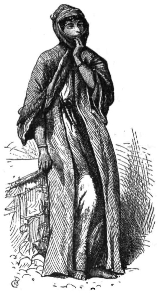
A BEDAWI WOMAN.
THE last two chapters have been devoted to the settled population of the villages in Palestine, the antiquity of the race being evidenced by the language and customs. The peasantry must not be confounded with the Bedawîn or nomadic tribes, living in the uncultivated districts; for the two nations are quite separate branches of the Semitic people, and they themselves acknowledge the distinction. The Bedawi speaks with the greatest contempt of the Fellâh, and rarely, if ever, do intermarriages occur, as both{337} sides would consider themselves degraded by the alliance. The Fellahîn call the nomadic people Arabs, and the nomads call themselves Bedawîn, both names being derived from their place of abode—the wild lands of the broad southern and eastern plateaux.
The narrow peninsula of cultivated hills, in which the settled population lives, is surrounded by the broad sea of desert, over which the Arab delights to roam. Thus from the great Moab plateau and from the mountains of Gilead, from the southern Desert of Wanderings, and from the western plain of Sharon, the wave of nomadic life is constantly lapping against the mountains of the Fellahîn. This wave has its ebb and flow, which even in the last five years has been very marked. In time of peace the Government is strong, and the Arabs are driven back to the deserts; but in time of war the outlying encampments of the great eastern and southern tribes encroach upon the village lands, and the armed horsemen extort blackmail from the border towns and hamlets. On the whole, however, the settled people seem to be gaining ground, and especially in Lower Galilee; in the Sharon Plain the Bedawîn are mere shadows of their forefathers, only a few miserable tents of degraded Arabs, whom the peasants call “cousins of the gipsies,” being left to represent the once powerful tribes which, under Akil Agha, were the terror of Palestine. These small encampments, surrounded as they are in Philistia by the arable land, resemble the pools left by the retreating tide on the shore of the sea, which, unless the wave return, must gradually disappear.
The time-honoured conflict between two races is noticed, as it is almost unnecessary to observe, in the Bible records. The Arabs are mentioned in the Old Testament (Neh. iv. 7), and the hosts of Midian, with their countless camels, were no doubt the ancestors of the modern Bedawîn. The nomadic people are most interesting to the student of the earlier Jewish history, before the consolidation of the nation in Samuel’s time; for if among the peasantry we find a vivid picture of the life and customs of the later period, it is from the Bedawîn that we learn most that can throw light on the Patriarchal times, and on the life of Abraham and of his immediate descendants.
A study of the Arabs is carried on under difficulties west of{338} Jordan. The great tribes are found either east of the river, or in the desert of the Tih, and in order to form a really good estimate of Arab character, it would be necessary to live in these remote districts for many years, following the migrations of one of the great tribes. The Arabs of the Jordan Valley are probably not of pure blood, and seem in some cases to have been mixed up with negroes, flying to the deserts from Damascus and other towns. The tribes are very small and scattered; many are offshoots of the Sugr and ’Anezeh nations, whose countless tents stretch away far into the Eastern desert; others have migrated from the north, and one tribe—the Tâ’amireh—is of Fellâh origin, though now nomadic.
The migrations of the western tribes do not extend over large tracts, but are confined to small districts marked by recognised boundaries. Thus Wâdy Fŭsâil is the border between the Mes’aid and the K’abneh Arabs, and the Plains of Jericho belong to the Abu Nuseir. In the Desert of Judah, the two most powerful tribes are the Tâ’amireh, who wear turbans and sow corn, and the Jâhalîn; south of these are the Dhullâm, and south of Beersheba the ’Azâzimeh. West of this last great tribe are the Tiyâhah round Gaza; and the Terabîn extend towards Egypt. The Arab clans in Philistia and Sharon are too numerous and insignificant to require notice; and in Galilee also there is a large number of very small tribes. The above enumerated are the most important Bedawîn divisions west of Jordan; but the Sugr, from the east, occupy in spring the whole of the Valley of Jezreel, and in times of disturbance they enter the Plain of Esdraelon.
Within the assigned limits, the migrations of a tribe over some 200 to 400 square miles are regulated by the temperature of the seasons, and by the pasturage and water supply. Ranging from one spring to another, and from the sheltered valleys visited in winter to the favourite camps on breezy slopes in summer, the nomads seem to resemble the Hebrews at the period when, for forty years, they lived in the wilderness—not, as we often imagine, travelling steadily in one line, but rather ranging over the small area of the Sinaitic peninsula, till the time for a further migration arrived.
The camps are scarcely ever placed in the immediate neighbourhood of water, but the Arab women go perhaps a mile away from the tents, and bring the needful supply in the black skins (Ghirbeh),{339} carrying them on their backs or on diminutive donkeys. I have often asked the Arabs why they did not pitch close to the water, but never got a satisfactory answer. They have probably learnt from experience that the low ground near water is often malarious, and the great requisites for a camp seem to be shelter and concealment. The situations are not always, however, wisely chosen; for, in more than one instance, a sudden thunderstorm in the hills has brought a flood down the great valleys, in the bottom of which the smaller groups of tents are often found, and the water has carried away and drowned the whole settlement, together with its flocks.
The scantiness of pasture and of water supply, obliges the Arabs to divide themselves into numerous small camps, dotted over their territory. The Sheikh of the tribe, with his family, generally collects the largest encampment round his tent, and this forms the rendezvous of the rest. Among the Arabs of the Judean desert the largest number of tents in one camp is about thirty, and these contain some thirty families, or over a hundred persons. The total numbers of a tribe like the Tâ’amireh are about 1000 persons, or 300 tents, but the average is about 100 families.
The tents are arranged in different ways. Among the Sugr a large encampment was set out in parallel lines some fifty yards apart, the tents in each row being close together, end to end. Among the Tâ’amireh and Jâhalîn the usual form is a rectangle. The average length of the tent is from twenty to twenty-five feet, but the small ones will sometimes be only ten feet long, and the larger forty feet. The distance between two tents in a line is about four feet. Thus a camp of twenty tents occupied a space of two hundred feet by seventy feet. In another case the form was a triangle, the reason of this arrangement being that the flocks are driven into the enclosure at night, and thus protected from the attacks of robbers or prevented from straying by themselves.
The Arab tent is extremely unlike the usual representations, in which it is shown either as a sort of hut, as among the Turkomans, or as a bell-tent, instead of a long black “house of hair,” with a low sloping roof and open front. It has, however, been carefully described by Burckhardt, and there is little to add to his account.{340} The canvas of the roof and side walls is of goat’s hair, black, with occasionally stripes of white running horizontally (Cant. i. 5). The pieces of stuff are about two feet wide, and thirty to fifty feet long. The tent has generally nine poles (’Awamîd), arranged three and three, those in the centre being the longest; thus the tent has a low ridge both ways in order to run the rain off. The cloths at the side can be easily removed as the sun or wind requires, one side being always left open. The tents are supported by cords and by pegs (Autâd), which are driven with a mallet (Judg. iv. 21). The average height of a tent is about seven feet.
Frail and cold as these habitations might be thought to prove in winter, they are really far more comfortable than would be expected. Being so low, the wind does not blow them over, and they are, moreover, most skilfully pitched, generally below a steep bank or low swell. Even in heavy storms I have found the interiors dry, and the heavy canvas does not let the rain through. The Arabs, however, suffer very much from rheumatism in winter. In summer they occasionally inhabit reed huts (’Arîsh), which are cooler than the tents.
The language of the Bedawîn differs from that of the peasantry, being nearer to that of the Arab tribes from the neighbourhood of Mecca, and thus to literary Arabic. Their names for natural objects are not always the same employed by the Fellahîn, and they are seemingly less ancient, though this difference is also partly due to the different character of the ground in the districts which the nomads inhabit. The old names are not preserved among the Arabs as they are among the peasantry, but descriptive titles have, as a rule, replaced the former nomenclature. These facts tend rather to confirm the views already expressed as to the antiquity of the Fellâh race, contrasted with the more modern settlers who have encroached on their territory.
The Bedawîn have, in addition to their ordinary language, a kind of slang, which they use among themselves, and which we were quite unable to understand. The corrupt pronunciation of ordinary words also renders it very difficult for any one accustomed to the peculiarities of the Fellâh dialect to comprehend the Arabs.
The character of the Bedawîn is not so easy to penetrate as at first appears. They are a crafty and reserved people, with strong ideas of policy and prudence. Nothing is more disagreeable to an{341} Arab than to be made to look foolish, and they are careful not to put themselves in a false position. They also conceal under an affectation of carelessness and indifference a very keen perception of what is going on. I have often watched a Bedawi walking by my side, and noticed how carefully he scanned every pebble in the road, and how the slightest sign of life—a bird, a gazelle, or a distant figure—attracted his attention at once, long before I had observed anything. Their sight is generally very clear and good, and their agility and endurance are astonishing.
A traveller visiting a camp might easily imagine his hosts to be too lazy to move; but if he wakes from a doze, he will be astonished to see these grave, solemn figures, skipping like squirrels or creeping like cats, inspecting perhaps his property, or endeavouring to make sure that he is asleep. This sudden change of demeanour is quite in accord with the Arab character, and the skill with which they conceal their intentions and thoughts makes them very dangerous enemies.
The creed of a Bedawi is that a man should be terrible to his enemies, and the assumed sternness of their faces is sometimes rather ludicrous. In making an attack they will be careful to ascertain first that they are really in a safe majority, and if they are outnumbered, they hide in the undulations of the ground, in a manner which would excite the admiration of any military man.
The Bedawîn are very trustworthy; they keep their promises honourably, and their law of hospitality is strictly and chivalrously observed. The murder of a guest who has eaten salt in their camp, is, I believe, almost unknown, and they have a righteous horror of shedding blood, as the blood-feud must go on until some heavy indemnity has been paid. The life of any European is thus probably quite as safe among the Arabs as in London.
Among those tribes which live beyond the corrupting influences of townsmen, the character of the Bedawîn is said to be very noble; their chivalrous and courteous demeanour, and their generosity, are praised alike. Unfortunately, the tribes with which we lived are settled on the border-land, and have been much spoilt by intercourse with greedy peasants. We found them generally very avaricious, though in some cases their ideas concerning money were amusing from their simplicity.
With their friends, the behaviour of the Arabs is kindly and{342} unaffected; and especially among the Abu Nuseir we met several specimens of what we should call “good fellows” in England. The hostility usually shown to strangers is due to the unceremonious way in which travellers will enter their country, without conforming to any of their ideas of courtesy and etiquette.
There is no greater mistake than to regard the Arabs as barbarous or uncivilised. They have a peculiar civilisation of their own, which is suited to their wants, and a system of government with recognised laws, which are strictly enforced. Their life is, in fact, a perfect picture of a patriarchal system, suited to a people who are not numerous, nor engaged in any very complex transactions; they acknowledge certain leaders, generally hereditary, but who are only obeyed because they have obtained for themselves a reputation for wisdom in council, and prowess in the field. These chiefs direct the policy of their tribe in its relations with other Arabs, or with the Turkish nominal Governors, and their tact and ability are often remarkable. The main duties of the elders are the arrangement of marriages, and of treaties with other tribes, and the settlement of disputes, which are submitted to them and regularly tried. The Sheikh has the power of life and death, of peace and war, and unless he disgraces his tribe by a blunder, he is pretty sure of prompt and general obedience.
The costume of the Bedawîn is so simple, that it may probably have remained unchanged since the days of Abraham. They wear the same shirt which has already been described as used by the peasantry, and generally they wear also the ’Abba; but their head-dress is the Kufeiyeh, except among the Tâ’amireh, who, as before stated, are not true Bedawîn. The Kufeiyeh is a shawl made of silk or cotton, with tassels on two opposite edges; it is about a yard square, and is folded diagonally, and placed on the head with the point of the triangle behind. A cord of hair or rope is wound twice round the forehead and head, coming down behind the ears almost to the nape of the neck, and this holds the shawl in place; the cord is called the Aghâl, and is commonly black.
The head-dress thus formed is extremely comfortable, and for four years we scarcely wore any other. The poorer Arabs wear only the shawl and cord; the richer have felt and cotton caps inside it. The Kufeiyeh is the best possible protection from the sun, for the tight cord over the temples is a preventive against{343} sunstroke, and the ends of the shawl can be drawn over the face and tucked into the Aghâl, thus shielding the eyes from the midday glare.
Another distinctive article of Bedawîn dress is the sandal, which also requires special description. It is a skeleton shoe with a light leather sole, which is supported by a string of hide, passing beneath the ankle and above the heel, and then brought round between the great toe and the second toe, where it is attached to the sole; this string is then drawn tight, and fixed with a leather button. The sole is further connected with the string by two straps on either side, and the whole structure fits almost as tight to the foot as a shoe. Such, no doubt, was the sandal mentioned in the Bible, and not the complicated cross-gartering which is commonly represented in pictures of Old Testament incidents.
In the winter the Arabs also wear, under the ’Abba and over the shirt, a sheep-skin jacket, the woolly side in, the outside tanned a sort of brick-red colour. This garment looks very comfortable; but the bare legs and scanty skirts of the Bedawîn give them a most miserable appearance in the cold weather.
The weapons of the Arabs are different from those of their forefathers; and in the adoption of gunpowder and tobacco, we find evidence that they are not incapable of making use, as far as is convenient to themselves, of civilised inventions. Even in the Jordan Valley I have seen French cigarette-papers used; and this more convenient method of smoking has in the sea-side towns quite taken the place of the old-fashioned pipes, and is making rapid progress among the peasantry also.
The Arabs carry the sword, gun, and lance (Rumh), the last being mentioned in Scripture. The sword (Seif) has a short and straight blade, resembling a large knife. The gun (Barûd) is of great length—often five feet from muzzle to stock—and is bound with brass; the stock is very much lighter than with us; the piece is often loaded with stones, and very indifferent powder is employed. The lock is, I believe, invariably a flint one. The powder is carried in a ram’s horn, which is attached to the leather belt.
The bow, javelin, buckler, and shield seem to be now obsolete, though mentioned by travellers of the present century as still in use among the Arabs. The introduction of firearms is no doubt the reason of the disappearance of these weapons.{344}
The helmet and coat of mail are still found among the tribes east of Jordan; the first being a light iron cap (Kub’ah), with a spike on the top, and a thin plate to protect the nose; the latter, a garment, with sleeves, which descends to the knees, or rather lower; these coats are of links closely woven, and are of considerable weight.
The Arabs seclude their women more than is the custom among the peasantry, and they are carefully veiled in presence of a stranger. Each tent has its Harîm, or women’s partition, and this, no doubt, is alluded to in the passage where Isaac is said to have brought Rebekah into his mother Sarah’s tent (Gen. xxiv. 67). The women, however, enjoy greater consideration than among the Fellahîn, and an old woman is sometimes admitted into the council, and becomes a power in the state—a privilege which has as yet only been claimed by a small minority in our own country.
The dress of the Arab women is remarkably becoming, and their appearance is imposing, as they sweep over the grass, in long trailing garments with ample hanging sleeves; their faces are swathed in a shawl head-dress, generally of dark colour, which is bound over the mouth, and leaves the nose and eyes exposed; their black curly locks are also hidden, except in the case of young girls. The under-dress is indigo coloured; the upper, which is very wide, with large sleeves and open in front, is generally of a dull olive-green; thus the general effect of their costume is very dark, and their faces are discoloured by extensive tattooing and by the blue paint on the under lip, which is dyed all over to give greater brilliance to the appearance of the teeth. It is curious to note that the women, as a rule, are ugly, while the men are handsome.
When going to fetch water, the women wear only the under dress, which they tuck and tie up until they present most comical figures. A great part of their lives seems to be spent in going to and fro between the tent and the spring, with their little black donkeys, or in sitting squatted on the edge of the stream, beating the clothes, which require washing (and generally require it very much) with a stone.
The women are all cooks, and their cookery is excellent in its way. They grind the corn in a stone hand-mill; and make thin cakes of unleavened bread; and butter and cheese by shaking the{345} milk in a skin which is hung up on sticks. Even on their raids the Arabs take with them one or two young women to cook for the party.
The occupations of the men in time of peace are mainly pastoral. The wealth of the Arabs consists in their horses, flocks, herds, and camels. Among the Abu Nuseir, a regular trade in beasts goes on, and they act apparently as agents for the sale of animals of other tribes. The immense number of the animals which are pastured in the apparently barren and waterless waste is astonishing. I have seen the plains of Beersheba swarming with camels, and the Plain of Esdraelon has sometimes been quite covered with the flocks and herds of the Sugr.
The eastern Arabs pride themselves on their horses, but west of Jordan there are scarcely any. The mares are hardly ever sold, and often belong to more than one owner. Thus it is possible to buy the “head” of a mare, which means to own it, subject to the rearing of a colt for each of the owners of the “body” and “tail,” who claim the young ones at a certain age. The Arab horses are small and light; the better class walk very slowly, and they can neither jump nor trot, but their powers of endurance and their hardihood are immense, and their speed at a gallop is generally fair; they are rarely vicious, and their paces are pleasant when they are properly trained.
The Arabs scarcely ever attack a neighbouring tribe, but they prefer to journey a distance of several days before committing any outrage, and they retreat as rapidly as they came when once the booty is captured. These marauding excursions are called Ghazû, and are the main events of their lives; the whole of their affected listlessness is then laid aside, and each Ghâzi, or “champion,” vies with the others in his feats of daring and activity. The appearance of a party of the Bedawîn horsemen, charging with long lances trembling in their hands and held horizontally over the head, is extremely picturesque and imposing.
The Arab, in time of peace, does not require much amusement; he is content to sit quiet, smoking and drinking coffee. Among the more degraded, however, the Egyptian dancing-girls are sometimes welcomed, and all the tribes indulge occasionally in what is termed a Fantazîa, a word apparently of Italian origin, and introduced by the Franks.{346}
These Fantazîas we often saw, but perhaps the most effective was that executed in our honour at Engedi. A single Arab faced four others, and held a sword over his head in both hands. The performance began by an extemporary song from the sword-bearer in honour of the Kabtân and his party, the other four Arabs clapping their hands in regular time. Suddenly this ceased, and they advanced towards the swordsman, uttering in a sort of growl, the word “Sŭ-hûbb, Sŭ-hûbb,” repeated many times. The swordsman also advanced, and then recoiled, and the four, closely packed shoulder to shoulder, began to clap their hands, and crouched as if about to spring. The swordsman then crouched down and writhed to and fro, almost kneeling, as if in mortal combat. After a few moments he sprang up as though victorious, and began his song again, while the four, as if enchanted, stood erect, clapping their hands and swaying their bodies backwards and forwards. The growling and struggling were again repeated, and the dance seemed to be intended to represent the combat of a single hero against many foes.
The night was dark, and the wild scene was only dimly visible by the fitful blaze of a fire of thorns, which sometimes flared up and showed the eager excited faces and lank wiry figures, giving them the appearance rather of wizards engaged in some terrible incantation than of ordinary sword-dancers. Finally, the triumphant hero sung the praise of the “Konsul Kabtân,” and alluded delicately to the probable “bucksheesh.” The other four here joined very heartily in the chorus.
It was remarkable that the Sheikh of the tribe could be seen, a few yards off, engaged in prayer during the greater part of the time that this strange dance was going on. His attention appeared to be in no way distracted by the noise, and there was nothing, in Arab estimation, incongruous in the two occupations which were being thus carried on at the same time.
Such is the simple life of the Arab tribes. Except in the use of tobacco and gunpowder, these people seem unchanged since the days of Abraham. It was thus no doubt that that Patriarch travelled to and fro with his flocks, herds, and servants; thus he made war and entered into treaties with the surrounding tribes. The wells which he dug, and which had to be re-opened by Isaac, were perhaps similar to the Hŭfeiyir, or “pits,” which the Arabs{347} now dig in the beds of great valleys, as for instance at Gerar and Beersheba.
The Bedawîn are very religious, and observe the appointed hours of prayer much more devoutly than most of the Fellahîn; if water is obtainable, they wash their hands, arms, legs, and faces before praying, and we were often considerably hindered in our Survey work by the inconvenient piety of the Arab guides. It is said that the Arabs east of Jordan are pagans, and that moon-worship and yet more curious rites exist among them. These practices date from the times of “ignorance,” before the proclamation of El Islâm, but I have never seen anything of the kind among the tribes with whom we lived.
The Arabs have many traditions, chiefly relating to their own origin and to the descent of their clans. As they despise writing, regarding both this and the cultivation of the ground as degrading, and only fit for peasants, these traditions are handed down from mouth to mouth; the stories naturally become more marvellous every time that they are repeated, and in some cases they present historical confusions, as at Jericho, where the Imâm ’Aly, Companion of the Prophet, is said to have fought a battle with Abu ’Obeideh ibn el Jerrâh, who was a well-known Moslem general of the time of Omar, and the conqueror of Jerusalem. The contest between ’Aly and Moawîyeh, which led to the separation of the Shiahs and Sunnis, did not, however, commence until after the death of Othman, successor of Omar.
I have already alluded to the curious fact that Christian legends of the middle ages are current among the Abu Nuseir Arabs round Jericho, the case of the “high mountain” of the Temptation being the chief instance. There is also a legend well known in the Jordan Valley and in Galilee, of a famous chief named Zîr. He is said to be the maker of certain curious pits dug in a line near ’Ain Fusâil, and connected with an old aqueduct. The same legend is connected with pits found east of Jordan, possibly intended for the same use, which was apparently the collection of water. Zîr also found his way to the Nazareth hills, and the acacia-trees near Semûnieh are said to have grown from his tent-pegs.
The Bedawîn reverence the tombs of their own ancestors, and, in some cases, of those of other tribes. The Abu Nuseir are descended{348} from a tribe which had a peculiar reputation for sanctity, and which was free to roam among the rest as a company of Derwishes. Some of these Arabs were, by mistake, killed by the Egyptian Government, and their graves are shown in a valley called the “Holy Valley,” near Mar Sâba. Any Arab entering this valley makes use of the expression, “Your leave, O blessed ones,” and kisses the tombstones on passing. A second place of the kind exists not far north of Engedi, where are the graves of certain of the Rushâideh tribe, who were massacred by Ibrahim Pacha. On passing this spot our guides kissed the rude headstones very reverently.
There are many grave-yards in the desert, generally near sacred places or large trees, or on the top of the larger Tells. In one or two instances a whitewashed tomb is built, in the middle of the cemetery, over the body of some noted Sheikh, and necklaces, or the furniture of a horse, are hung as gifts upon it. The Arabs often bring the dead bodies from a considerable distance in order to inter them in the cemetery of the tribe.
There is one habit of the Bedawîn which has given rise to misconceptions, and is worthy of notice. The camels and other property are marked by a recognised tribe-mark called Wusm. Each tribe, and each division of a tribe, has its mark, and some are curious. The Rushâideh mark is a circle with a cross—resembling the astronomical sign for Mars. The Jâhalîn have a T, a cross, or a C with a dot in the centre. The Tiyâhah have two parallel strokes, the Dhullâm have three, and the K’abneh a double cross. These marks are found on the flanks of the camels, on the grave-stones, and on ruined buildings. Thus at Masada the gateway is covered with the Rushâideh and Jâhalîn marks, the reason being that the Arabs believe that a hidden treasure exists there, and they therefore assert their ownership by putting the tribe-mark on the place.
Two traditions are very commonly repeated among the Bedawîn. The first is that hidden treasure exists in certain places, and can be discovered by the use of incantations. There is some foundation for this expectation of finding treasure, for it seems to have been common to bury money in old times, as indeed it still is; and the hoards are found from time to time. A quantity of gold Alexanders were lately found in the neighbourhood of Tyre, and a{349} number of shekels were discovered near Jericho in the winter of 1873, and were brought to us in Jerusalem; these were subsequently pronounced genuine in Europe. In Haifa also a treasure of Byzantine coins was found under the sill of a doorway in the gardens. The Arabs have exaggerated ideas on this subject, and they suppose treasures to lie hidden in every ruin.
The second common idea is that the desert was formerly cultivated and full of water. All over the plateau west of the Dead Sea ruins are shown which are said to be remains of former vineyards, and even the Roman camps at Masada are so called. This idea is also perhaps founded on fact: “the vineyards of Engedi,” mentioned by Solomon, have entirely disappeared together with its palms, and the palms of Jericho have left only two survivors. The Crusaders cultivated sugar in three places along the Jordan Valley, yet only the ruins of their mills and aqueducts are now left, with the semi-fossilised stalks of the sugar-canes near Beisân. But although the country is thus shown to have been at one time more productive, still no such entire change as the Arabs suppose is likely to have taken place, for the desert is called desert in the Bible, and the Dead Sea plateau is the old Jeshimon or “solitude.”
The preceding pages will, I hope, serve to show how broad is the distinction between the peasantry and the nomadic people, and how interesting is the study of both the races as throwing light on the Bible narrative. We must now pass on to consider briefly the other inhabitants of the Holy Land.{350}
THE Jews in Palestine inhabit only the larger towns, where they are engaged in trade and in money transactions. The greater number live in the four holy cities—Jerusalem, Tiberias, Safed, and Hebron; but many are found also in the coast towns of Gaza, Jaffa, Haifa, Acre, Tyre, and Sidon. The number of Jews in Jerusalem was estimated by the Consular reports in 1872 to be 8000, but it has considerably increased since then, owing to the arrival of a large body of Russian and Polish Jews, who fled, it is said, from the conscription in those countries. Whatever be the cause, the fact is undisputed, that the Jews are steadily gathering in Palestine. In Jerusalem they have been encouraged by the munificence of Sir Moses Montefiore, and have formed a sort of building-club for the purpose of erecting houses to the west of the town.
The following facts relating to the Jews are obtained from the best authority—namely, from Dr. Chaplin, the physician of the Jewish hospital in Jerusalem.
The largest section of the Jews in Jerusalem is that of the Ashkenazim, which comprises the fair-haired sallow German Jews, with the Polish, and the gigantic Russian Jews. The Ashkenazim are subdivided into national communities, and also into religious sects, all of the “high church” order, including the Parushim (or Pharisees), the Chasidim (or Assideans of the Book of Maccabees), the Chabad, and the Varshi. These four sects agree in recognising,{351} in various degrees, the authority of the Talmudic law, and the traditions of the elders.
Next in order come the Sephardim, or Spanish Jews, who still wear the black turban originally imposed on them by the laws of the mad Caliph Hâkem; they include also the Mughrabee Jews, who speak Arabic. In their physique, and the dignity of their appearance, the Sephardim are far superior to their European co-religionists; they also belong to the extreme party of the Chasidim and Varshi, in whose synagogues they will pray when not near to one of their own.
The old Sadducean party is now represented only by the Karaites, or “low church” Jews, who discard the authority of the Mishnic or Oral law, and do not admit the authority of the Talmudic commentators. In Jerusalem they have but one small synagogue, and their number in the city is probably not above a hundred; the greater part of the Karaites are now found in Baghdad, Arabia, and Russia.
Many of the Jews are shopkeepers, others are money-changers, and a few are craftsmen and farmers; but a great number live on the Halûkah, or alms, collected from their brethren in Europe to support the poor in Jerusalem. Many are under the protection of the foreign Consulates, and they have of late years gained considerable immunity from Moslem persecution.
The Jews always live in a distinct quarter. The Jewish quarter in Jerusalem in the middle ages was, however, that now occupied by the Moslems. Their streets are not remarkable for cleanliness; thus at Tiberias the “king of the fleas” is said to hold his court, and if one half the stories which have been related to me by trustworthy witnesses were admitted, the Ashkenazim must be the dirtiest people on the face of the earth.
The good qualities of the Jews are numerous: they are energetic and able, very courteous to strangers, and charitable to one another; but they are fanatical to the last degree, and Palestine under the government of Oriental Jews would probably be closed against outer influence even more effectually than it is under the Turks.
The Jewish costume is more curious than picturesque; their weedy figures are clad in the Kumbaz or striped cotton gown, under which they wear a shirt, and white drawers, with cotton{352} stockings. On their feet they have low leather shoes, on their heads a soft felt hat. On feast-days they appear in a fur cap, just like that commonly represented in Rembrandt’s pictures—no doubt the Jewish dress of his own days; and their gabardines are also edged with fur. The Spanish Jews wear a dress not unlike that of the better class of Moslems, and are indeed often only distinguished by their black turbans. The Jewish women wear sometimes the native dress with the Izâr, sometimes European print gowns, with gaudy Manchester shawls over their heads. The men of the Pharisees and other high-church sects, are also distinguished by the love-lock, a long lank curl which hangs down in front of the ear beside the cheek, and is, to the eyes of an European, one of the ugliest and most unmanly fashions which could be invented.
The position of Jewish women is not enviable; they are divorced on the smallest pretext, even for cooking a dinner badly, and they live in constant anxiety. One Jew, whom I met at intervals, had three wives in the course of as many years, and this is, I believe, no uncommon occurrence. The women are extremely superstitious, and I have been told of their mixing their own nail-parings, or locks of hair, in their husband’s food in order to secure their affections.
The Jews venerate the tombs of many of their ancestors. Thus at Tiberias the tomb of the great Moses ben Maimon, or Rambam, commonly known as Maimonides, is shown together with several other sepulchres of famous Rabbis; at Meirûn in Galilee the sepulchre of Simeon bar Jochai, the builder of twenty-five synagogues, is yearly the scene of a curious festival; at Shechem the Jews visit Joseph’s tomb, and make sacrifices of gold-lace, shawls, and other articles, as they do also at Meirûn; in Jerusalem the sepulchre of Simon the Just is also the scene of an annual feast.
The Jewish attitude in prayer is one of the most extraordinary peculiarities of the nation. The prescribed key, for intonation of the prayers, is high and nasal, and they sway their bodies backwards and forwards with much energy, as they sing. The scene thus presented in a synagogue is almost ludicrous, and no one ignorant of the language, would give the worshippers credit for their beautiful and affecting liturgy, which has influenced our own far more than we are ourselves, as a rule, aware.{353}
And now turning from the native population to the foreign element in the country, a few words may be devoted first to the Russian pilgrims.
The reasons which induce the Russian Government to promote pilgrimages to Palestine are best known to themselves; the fact remains that the pilgrims receive Government help. The great hospice on the west side of Jerusalem, capable of accommodating 1000 persons, was founded in 1860, and includes the Russian cathedral; at Easter this large building is quite full, and the town swarms with Russian men and women. The strength and endurance of these peasants is wonderful: old women of sixty or seventy trudge on foot from Jaffa to Jerusalem, a distance of thirty-five miles by road; they undergo the fatigues of the crowded Easter ceremonies, and then walk down again to the coast. The savings of a whole life are sometimes expended on such a pilgrimage, and the only reward is the bunch of wax candles which, together perhaps with a coarse lithograph of some saint, the pilgrim brings back to his native village, where he enjoys henceforth the reputation for sanctity which the pilgrimage ensures.
The scene in the Russian cathedral at Easter time, is striking and instructive. The building is of modern Byzantine architecture, with a fine peal of bells. The walls are painted salmon-colour, with an intricate arabesque in blue and red; the screen in front of the apses is of light oak, with pictures let in and brightly coloured on gold backgrounds; the central gate in this screen is of brass, with silver lamps and candlesticks placed in front.
The congregation generally consists principally of women, but to the right stand the men, unkempt and uncombed, their furrowed features peering out from shaggy locks and long beards, their clothes of dull colours and thickly padded, their feet and legs cased in huge knee-boots. The women wear the same neutral tints, and knee-boots; they have heavy shawls over their heads. The priests are also bearded, with hair down to their shoulders—truly a barbarous priesthood, with a barbarous congregation. The Saviour is represented in Russian pictures with a similar beard and hair.
The religious ecstasy of the congregation was always intense. They took no part in the service, but continued to cross themselves, and knelt at intervals to kiss the floor, many knocking their heads so hard against it as to be heard at the other end of the{354} church. Small tapers were burnt on the great silver candlesticks, and those who stood near the door passed the taper to those in front, each person bowing to the one who handed it, until those near the screen received it; it was then lighted, and when half burnt was put out, and left for its owner to claim.
The ritual was impressive; six choristers in ordinary dress stood round a great lectern just outside the screen, at the top of the steps leading up to it. The bass voice was fine, and the tenor very sweet; the service is frequently attended by Europeans in Jerusalem for the sake of the music.
A tall priest in a rich robe of cloth-of-gold and dark red velvet, stood before the brass gates, a crown on his head, a censer in his hand. His intoned sentences were answered by the responses of the choir. Presently the gates opened, and three priests came out of the mysterious sanctuary, where the golden candlestick and reliquaries could be seen on the altar. The Archimandrite, in flowing robes of black satin, with a broad stole of cloth-of-gold, his head veiled, and his long grey beard covering his breast, swept down the steps; he was preceded by black-robed acolytes, and followed by two other priests scarcely less magnificently dressed. The Gospel was read at a lectern in the middle of the congregation, the censer was swung, and the great bells boomed out during the lesson.
I have attended many religious services, Christian, Jewish, and Moslem, but none more remarkable for barbaric grandeur and pomp. The songs of Latin monks, the shrill nasal clamour of the Armenians, the Jewish gesticulation, are all far less dignified than the solemn chants of the Russian cathedral. The fanaticism of the pilgrims, drawn from the lowest and most ignorant peasant class, surpasses anything in Christendom, and is only equalled by that of the Moslems.
Another large section of the Easter pilgrims in Jerusalem is formed by the wealthy and powerful Armenian sect, to whom the church of St. James on Zion belongs—a very interesting building, carpeted with rich rugs, and lined with tiles and tortoise-shell. The visitor is here sprinkled with rose-water, and valuable jewelled missals are presented for the congregation to kiss.
The remaining nationalities found in Palestine may be briefly dismissed. On Carmel, and in Upper Galilee, the Druses form a{355} large percentage of the population; but their life and habits have been discussed by well-informed writers, and there is no space to enlarge here on their curious admixture of Aryan and Semitic ideas, or on their belief in the duality of the Divine nature, and in incarnations of the Deity. There are also gipsies in Palestine, who engage in the usual occupations of gipsies, and who are called Naury. They have almost forgotten their own language, and speak Arabic as a rule. At sea-side towns there is a curious mixture of mongrel nationalities—Maltese, Greeks, Slavs, and Levantines, with stray specimens of most European nations—a class as uninteresting as they are degraded.
We may now consider the history of the rise and progress of the two German colonies which have obtained a footing in Palestine; for without some account of these enterprises the sketch of the inhabitants of the Holy Land would be incomplete.
The German colonists belong to a religious society known as the “Temple,” which originated among the Pietists of Wurtemburg, who, without leaving the Lutheran Church, separated themselves from the world, and engaged in Sunday meetings for prayer and edification. The Pietists accept as their standard the explanation given by Dr. J. A. Bengel (in his Gnomon of the New Testament), of the prophecies in the Revelation. Among the friends and disciples of Bengel was a certain Dr. Hoffmann, who obtained from Frederick, the eccentric King of Wurtemburg, a tract of barren land at Kornthal, where his disciples established a Pietist colony, which he intended to transplant later to Palestine. Hoffmann, however, died, and his followers remained contentedly on their lands; but Hoffmann’s son was not forgetful of his father’s designs, and instituted a new colony at Kirschenhardthof, with a special view to its final removal to the Holy Land. Among his earliest disciples was Herr G. D. Hardegg, who became in time a leader among the Temple Pietists.
The younger Hoffmann (Christopher) visited Palestine about 1858, and, in 1867, a small trial expedition of twelve men was sent out. They settled in reed huts near Semûnieh, on the edge of the Plain of Esdraelon, west of Nazareth; and in spite of the warning of friends who knew the unhealthy climate of that place, they remained in the malarious atmosphere of the low ground near the springs, until they all died of fever.{356}
On the 6th of August, 1868, Christopher Hoffmann and G. D. Hardegg left Kirschenhardthof, and in October they reached Palestine; after visiting various places, they resolved on settling at Haifa and Jaffa, and bought land in both places. The Haifa colony was the first founded, that at Jaffa being some six months younger. Hardegg became president of the former, and Hoffmann of the latter.
The religious views of the colonists are not easily understood, and I believe that most of them have rather vague ideas of their own intentions. Their main motive for establishing colonies in Palestine, is the promotion of conditions favourable to the fulfilment (which they expect to occur shortly) of the prophecies of the Revelation and of Zechariah. They suppose it to be a duty to separate themselves from the world, and to set an example of a community living, as closely as possible, on the model of the Apostolic age. The spread of infidelity in Germany appears to be the main cause of this separative tendency among the Pietists.
The tenets of the Temple Society are probably best summarised in the “Profession of Faith of the Temple,” published by Herr Hoffmann, and including five articles as below:
“First. To prepare for the great and terrible day of the second coming of Jesus Christ, which, from the signs of the times, is near. This preparation is made by the building of a spiritual temple in all lands, specially in Jerusalem.
“Secondly. This temple is composed of the gifts of the Spirit (1 Cor. xii. 4), which make the true Church, and every one should strive to possess them.
“Thirdly. The means to obtain these is to seek the Kingdom of God, as described by the prophets (Isaiah ii. 2, xix. 25; Ezek. xl. 48).
“Fourthly. The Temple of Jerusalem is not a building of dead, but of lively stones; of men of every nation (1 Pet ii. 4-10) united in the worship of God in spirit and truth.
“Fifthly. The Temple service consists of sacrifices such as are described in the New Testament” (Rom. xii. 1; Heb. xiii. 15, 16; James i. 27).
The writings of Hardegg are far more diffuse and mystic. The main peculiarity which I have been able to extract from them, is the belief that it is not to the Jews, but to the true Israel (by which{357} he apparently understands the Temple Society to be intended), that prophecies of a return to Palestine are to be supposed to refer.
I have stated as far as possible the apparent religious beliefs of the community, but there seem to be many shades of doctrine among them; all, however, agree in an expectancy of some immediate change in the world’s affairs, in the arrival of Armageddon and the Millennium, and in the fulfilment of all prophecy.
In 1875 I had the opportunity of attending one of the Sunday services, in the colony at Haifa. The congregation was devout and earnest; the service was simple and free from extravagance of any kind. The president offered up a long prayer in German, a hymn was sung with the usual musical good taste of Germans, and a chapter of the prophecy of Zechariah read. The president then delivered an exhortation, announcing the immediate advent of the Saviour, who would “suddenly come to His temple.” Other elders followed, speaking with much earnestness, and another hymn was sung, after which the congregation quietly dispersed from the bare schoolroom in which they had assembled. A discussion of the affairs of the colony often immediately succeeds the religious services.
Of the history of the Jaffa colony we gathered comparatively little. They have two settlements—one called Sarôna, about two and a half miles north of the town, consisting, in 1872, of ten houses; the second, nearer the walls of Jaffa, was bought from the surviving members of an American colony which came to grief, and this settlement included thirteen houses, with a school and an hotel, the latter kept by Hardegg’s son who also represents the German Government in Jaffa.
In 1872 the Jaffa colony numbered one hundred men, seventy women, and thirty-five children: two of the colonists were doctors, and some twenty were mechanics, the rest being farmers. They employed a few natives, and cultivated 400 acres of corn-land, paying the ordinary taxes to the Turks. The children are taught Arabic, and European languages, also Latin and Greek. The houses are clean, airy, and well built, and the colony wears an aspect of industry and enterprise, which contrasts with the squalor and decay of the native villages.
With the Haifa colony we became more intimately acquainted,{358} by living in one of the houses for three months, during the winter of 1872-3, and again in the hotel of the colony, for about two months, during 1875, when we saw a good deal of the working of the community.
In 1872 the colonists numbered 254—forty single and forty-seven married men, thirty-two single and fifty-one married women (four widows), and eighty-four children. There were about fifty mechanics, and the settlement consisted of thirty-one dwelling-houses. The land was 450 acres of arable ground, with 140 olive-trees, and 17 acres of vineyard.
In the first three years of its existence only seven deaths occurred in the colony, but the mortality increased later; in 1872 there were eighteen deaths among the 205 colonists at Jaffa, which were due principally to fever, but such a death-rate has never yet occurred at Haifa.
The little village of well-built stone houses is situate west of the walled town of Haifa, under the shadow of the Carmel range. A broad street runs up from the shore towards the mountain, and the greater number of the buildings stand, in their gardens, on either side. Close to the beach is the Carmel Hotel, kept by a most obliging and moderate landlord, and a little farther up are the school and meeting-house, in one building. Mr. Hardegg’s dwelling, farther east, is the largest house in the colony. The total number is stated at eighty-five, including buildings for agricultural purposes.
In 1875 the colonists numbered 311, having been reinforced principally by new arrivals from Germany; the increase of accommodation since 1872 was thus far greater than that of settlers. The land had also increased, in the same period, to 600 acres, with 100 acres of vineyards and gardens; but the soil of the newly-acquired property near Tîreh, in the plain west of Carmel, is of very poor quality, and the Germans have not yet succeeded in their favourite scheme of obtaining grounds on the top of the mountain, where the climate and soil are both good.
The live stock consisted of 75 head of cattle, 250 sheep, goats, and pigs, and 8 teams of horses. A superior American threshing-machine had been imported. The trades followed are stone-cutting and masons’ work, carpentry and waggon-making. Blacksmiths, coppersmiths, tinsmiths, joiners, shoemakers, tailors, butchers, harness{359}-makers, turners, soap-makers, vintners, and quarrymen, are also found among the colonists. There has been an attempt to trade in soap, olive-oil, and olive-wood articles, but, for these undertakings, more capital is required than the Germans at present possess. A good wind-mill, and an olive-press, have been brought from England. A tannery was also being put up in 1875, and a general shop exists, which the natives, as well as the Germans, frequent.
The colonists were many of them employed on the English orphanage at Nazareth, which Mr. Shumacher designed and built; and all the masons’ and carpenters’ work was executed by the Germans. The colonists also have done much to clear the road from Haifa to Nazareth, though they have not made it, considering that, from a professional point of view, it is not yet a made road at all. Their waggons are now driven between the two places, and the natives employ them for moving grain.
The schools in the colony, for the children and younger men, are two in number. In the upper school, Arabic, English, French and German, arithmetic, drawing, geography, history, mathematics, and music are taught; in the lower, Arabic and German, writing, arithmetic, and singing; in both religious instruction is given; and the girls are taught knitting, sewing, and embroidery.
The colony has thus been sketched in its religious and practical aspects. Though much talk has been expended on the question of colonising the Holy Land, there is no other practical attempt which can compare in importance with that of the Temple Society. It remains to be seen what the success of the undertaking will be.
The colonists belong entirely to the peasant and mechanical classes, and even their leaders are men comparatively uneducated. As a rule they are hard-working, sober, honest, and sturdy; and, however mystic their religious notions may be, they are essentially shrewd and practical in their dealings with the world. They are a pious and God-fearing people, and their natural domesticity renders it highly improbable that they will ever split on the rock which wrecked the former American colony, whose President, it appears, endeavoured to follow the example of Brigham Young by introducing polygamy. The German colonists have also a fine field for enterprise, in the introduction into Palestine of European improvements, which are more or less appreciated by the natives;{360} and, as they have no other community to compete with, they might be able to make capital of their civilised education. The wine which they sell is comparatively excellent, and finds a ready market, as do also many of their manufactured articles.
Such is one side of the picture, but when we turn to the other, we find elements of weakness, which seem to threaten the existence of the colony.
In the first place, there is apparently no man in the community of sufficiently superior talent or education, or with the energy and force of character, which would be required to control and develop the enterprise. The genius of Brigham Young triumphed over the almost insuperable difficulties of his audacious undertaking, despite even the prejudice which the establishment of polygamy naturally raised against his disciples. However superior in piety and purity of motive the leaders of the Haifa colony may be, they cannot compare with the Mormon chief in the qualities to which his success was due.
In the second place, the colonists are divided among themselves. In 1875 we found that Herr Hardegg had been deposed (temporarily, I understood, till he changed his views) from the leadership of the colony, and he had been succeeded by Herr Shumacher, a master-stonemason and architect, who is, moreover, the representative of the American Government at Haifa. This deposition of the original leader had caused dissensions among the Germans, and several of the influential members did not attend the Sunday meetings.
To internal troubles external ones were added. The colonists are not favourites either with natives or with Europeans, with Moslems or with Christians. The Turkish Government is quite incapable of appreciating their real motives in colonisation, and cannot see any reason, beyond a political one, for the settlement of Europeans in the country. The colonists therefore have never obtained title-deeds to the lands they have bought, and there can be little doubt that should the Turks deem it expedient, they would entirely deny the right of the Germans to hold their property. Not only do they extend no favour to the colony, though its presence has been most beneficial to the neighbourhood, but the inferior officials, indignant at the attempts of the Germans to obtain justice, in the courts, without any regard to the “custom of{361} the country” (that is, to bribery), have thrown every obstacle they can devise in the way of the community, both individually and collectively.
The difficulties of the colonists are also increased by the jealousy of the Carmelite monks. The Fathers possess good lands, gradually extending along Carmel round their fortress monastery; they look with disfavour on the encroachments of the Germans, and all the subtlety of Italians is directed against the German interests.
The peculiar views of the colonists, moreover, cause them to be regarded with disfavour by influential Europeans in the country, who might do much to help them. They are avoided as religious visionaries, whose want of worldly wisdom might, at any time, embroil their protectors in difficulties not easily smoothed over.
The community has thus to struggle with a positively hostile government, while it receives no very vigorous support from any one. The difficulties are perfectly well known to the native peasantry, who, with the characteristic meanness of the Syrians, take the opportunity to treat with insolence people whom they believe they can insult with impunity. The property of the colonists is disregarded, the native goatherds drive their beasts into the corn, and several riots have occurred, which resulted in trials from which the colonists got no satisfaction.
The indiscretion of the younger men has brought greater difficulties on the community; they have repaid insolence with summary punishment, and finding no help from the Government, have in many instances taken the law into their own hands. Thus the colony finds itself at feud with the surrounding villages, and the hostile feeling is not unlikely to lead to very serious difficulties on some occasion of popular excitement.
There are other reasons which militate against the idea of the final success of the colony. The Syrian climate is not adapted to Europeans; and year by year it must infallibly tell on the Germans, exposed as they are to sun and miasma. It is true that Haifa is, perhaps, the healthiest place in Palestine, yet even here they suffer from fever and dysentery, and if they should attempt to spread inland, they will find their difficulties from climate increase tenfold.
The children of the present generation will probably, like those of the Crusading settlers in Palestine, be inferior in physique and power of endurance to their fathers. Cases of intermarriage with{362} natives have, I believe, already occurred; the children of such marriages are not unlikely to combine the bad qualities of both nations, and may be compared to the Pullani of Crusading times. It seems to me, that it is only by constant reinforcements from Germany that the original character of the colony can be maintained; and the whole community, in Palestine and in Germany, is said not to number more than 5000 persons.
The expectation of the immediate fulfilment of prophecy has also resulted in the ruin of many of the poorer members of the colony, who, living on their capital, have exhausted it before that fulfilment has occurred. The colony is thus in danger of dissolution, by the gradual absorption of the property into the hands of those who originally possessed the most capital; and in any case it is very likely to lose its original character of Apostolic simplicity, some of the members becoming the servants and hired labourers of others.
The natural desire of those members who find themselves without money, is to make a livelihood by any means in their power. Where every man is thus working separately for himself, the progress of the colony, as a whole, is not unlikely to be forgotten, and the members may very probably be dispersed over Palestine, following their various trades where best they can make money.
Such are the elements of weakness in the society. In ten years it has made comparatively little progress, and ten more may perhaps see the colony decaying. Meantime the settlers might be examples to the natives (if Syrians would condescend to learn) of the advantages of European habits of industry and enterprise under very adverse circumstances. The little village of red-cheeked, flaxen-haired peasants, with cheery salutations, and honest smiling faces, is a pleasant place to visit; the women in their short skirts and brown straw hats, and the men in felt wideawakes and grey cloth, contrast most favourably with the dirty, squalid, lying Fellahîn. On the Sunday moonlight nights the sounds of the fine old German hymn tunes may be heard, softened by distance, along the beach, as the rings of men and boys stand chanting in the cool night air. A fresh sea-breeze blows all day among the acacia trees which flank the dusty street. The long heavy carts come rumbling by, the horses, harnessed with high-peaked yokes, looking rather light in comparison with German cart-horses in Europe. The{363} flags of the Consulates are hoisted on Sundays, and the whole colony is seen soberly marching down to the meeting-house, where they are weekly comforted with the assurance that the end will soon come, and the Temple Colony be acknowledged, by God and man, to be the example of the whole world, and the true heir of the Holy Land and of Jerusalem.
The colonists freely allow the difficulties which beset their path. Meanwhile, should European attention be ever generally turned to Syria, it may be a matter of no little importance, that men acquainted with the language and the people, and, at the same time, trustworthy and honest, are to be found, who could render material assistance to new-comers, even though not attracted to the land by the belief that it is the natural inheritance of a true Israel, composed of any other nationality except the Jews.{364}
![]()

HAIFA.
THERE is, apparently, a general impression that the Holy Land is, at the present day, a barren and desolate country, and that a great change, due not only to decay of cultivation and to disappearance of former forests, but also to a material decrease in the rainfall, has come over the land. These last pages are, therefore, devoted to a brief résumé of the facts collected during the prosecution of the Survey, which bear on the question.
Palestine is described in the Pentateuch as “a good land, a land of brooks of water, of fountains, and depths, which spring out of valleys and hills; a land of wheat, and barley, and vines, and fig-trees, and pomegranates, a land of oil-olive, and honey” (Deut. viii. 7, 8); and these verses epitomise the natural features, and the cultivation of modern, quite as well as of ancient Palestine. Two points, then, should be considered: first, is there any change in the water-supply or climate? secondly, is there any decrease in the amount of woodland and forest?{365}
The question of water-supply lies, indeed, at the bottom of the whole inquiry. We have, unfortunately, no ancient observations which can be compared with those now taken, from which comparison positive information as to the amount of the rainfall, and the volume of the rivers, might be deduced; but we have very important indications that the character of the water-supply is unchanged.
In the first place, we have geological indications. Throughout the country two formations alternate; namely, a hard crystalline limestone of the Neocomian period, and a soft, porous chalk, or marl, of the Cretaceous epoch. Where the hard limestone prevails springs occur, especially at the juncture with the over-lying, porous, and unconformable chalk, but where there is a great thickness of this latter, the water-supply is either from deep wells or from artificial tanks and cisterns. We have no reason for supposing the geological formation to have undergone any change since the days of Moses; and indeed we have every reason for judging that the distribution of the springs was then the same as now; for those parts which are now dry and desert—the Negeb, or “dry land,” the Jeshimon, or “solitude,” the wildernesses of Ziph, Maon, and Bethaven—receive titles in the Bible which are derived from the dry and barren appearance that these districts also presented in earlier times.
Secondly, we find that the Hebrew terms, used for various kinds of natural or artificial sources of water, are still in use, and of these terms no less than eight refer to tanks, pools, or cisterns: the Hebrew words ’Ain (a spring), Nahr (a perennial stream), Bir (a well), Jubb (a ditch), Hufr (a pit), Birkeh (a tank), Bassah (a marsh), are still ordinary words in the language. The springs mentioned individually in Scripture—the fountains of Samaria and of Jezreel, of Engedi and Jericho, for instance, are found to be still plentiful and perennial; and it must not be forgotten that there are twelve considerable streams in the country, which contain water even to the end of the dry season, without counting the Jordan.
Thirdly, the great numbers of ancient tanks and cisterns, occurring in the districts where there are no springs, and in connection with Jewish ruins and Jewish tombs, show the necessity which existed, even at an early period, of storing rain-water for the supply of the towns.{366}
Yet further, we can prove that the character of the seasons is unchanged. In the Mishna, there are minute directions regarding the prayers to be put up for rain. The supplications commenced in October, and continued until the Passover was finished. Three days of fast occurred in the end of October, if no rain had fallen, and three more about the middle of November. “But if these days of fasting be not heard, then shall they leave off selling and buying, the building of houses and the planting of trees, marrying and giving in marriage, and they shall leave off greeting one another ... until the end of the month Nizan (the middle of April). For if no rain be given until then, it is a manifest sign of the curse, since it is said, ‘Is it not wheat harvest to-day?’ ” (Mishna, Taanith I.).
From this extract it is clear that rain was expected in October, at which time the first showers now begin, and was not expected later than the middle of April, when the “latter rain” or spring showers now fall; between these limits the rainy season is continuous, the heaviest storms being in January, and the average annual rainfall about twenty inches. It is also recorded that years of drought have, from the earliest times, occurred at intervals (as mentioned in the history of Abraham, or of Jacob, or in the time of Ahab), just as dry years still afflict the country from time to time.
As regards the seasons, and the character and distribution of the water-supply, natural or artificial, there is thus, apparently, no reason to suppose that any change has occurred; and with respect to the annual rainfall (as observed for the last ten years), it is only necessary to note that, were the old cisterns cleaned and mended, and the beautiful tanks and aqueducts repaired, the ordinary fall would be quite sufficient for the wants of the inhabitants, and for irrigation.
The climate has, however, to all appearance materially changed for the worse. The plains of Jericho are no longer a “region fit for gods,” and the climate of the maritime plains, in autumn, is little less than deadly; but this would indicate, not a decrease, but, if anything, an increase, in the amount of rain, as the miasma is due to the stagnant water collecting in marshes and pools. The main cause of the malarious nature of the climate, seems to be the neglect of proper drainage. The splendid works{367} of the Romans are in ruins; the great rock-cuttings, which let out to the sea the water now soaking in the marshes of Sharon, are filled up with earth; Herod’s aqueducts, which irrigated the plains of Jericho, are destroyed, and no attempt is ever made to enforce sanitary regulations, or to promote public drainage or irrigation works.
Turning next to the question of the decrease of timber, it is important first to obtain a clear idea of the character of the old vegetation described in the Bible. It will then appear that the change is not one of kind, but only of degree.
The ordinary words, used in the Hebrew of the Old Testament, for the wild growth of the country are three—Choresh, Jaar, and Etz, none of which are now employed in the modern nomenclature. Choresh means “tangled,” and would thus apply to copse, rather than to timber-forest; Jaar signifies “luxuriant,” and would also refer to thickets of dwarf trees and of shrubs, quite as well as to forest trees; Etz is a “strong tree,” but this does not imply that the tree forms one of a large number, for the word is often used of single trees.
The wild growth of the country now consists generally of single trees, and of scrub or copse. In Galilee there are good-sized trees, but none in Judea, excepting solitary sacred oaks and terebinths, sycamores, and carob trees. The western slopes of the watershed are thickly clothed with dark lentisk bushes, dwarf oak, spurge laurels, hawthorn, and a variety of other shrubs, which spread over the ridges, and form in parts an impenetrable tangle. There is every reason to suppose that this is the kind of vegetation which, in the earlier times, existed in uncultivated districts, for it seems unlikely that, there was ever much greater thickness of soil on the ridges, such as would be required for forest trees.
It must not, however, be supposed that Palestine is entirely devoid of woods. A thick forest of oak extends between Carmel and Nazareth, with underwood below the trees in parts. An open woodland occurs on the low hills south of Carmel, and in the northern part of the plain of Sharon—remains of the “mighty wood” of Strabo, and the “Forest of Assur” of the twelfth century; from these oaks Sharon takes its Greek name Drumos, and they form some of the prettiest scenery in the Holy Land.
There are indications, throughout the country, of a certain{368} amount of local change in the wild growth, and also of a decrease in the number of trees. The old wine-presses and towers, on Carmel, and in other parts, are now found in the middle of copses, which have evidently spread over ancient cultivated districts; but, on the other hand, there are at present no forest laws, and the peasants hew and even burn down the trees for firewood (Hatab), or cut off the roots (Kormah), which are dug up and also sold for burning; this wanton, and wasteful, annual destruction of the trees, cannot fail to have materially affected the appearance of the land.
The watershed of the country forms the limit of the thickets; the western slopes, exposed to the fresh sea breeze, are covered with shrubs, the eastern are bare and desert; this natural phenomenon is no doubt unchangeable, and a minute examination of the country tends to show that the eastern districts, which are now without wood, were also treeless in Bible times.
The change in productiveness which has really occurred in Palestine is due to decay of cultivation, to decrease of population, and to bad government. It is man, and not Nature, who has ruined the good land in which was “no lack,” and it is therefore within the power of human industry to restore the country to its old condition of agricultural prosperity.
Throughout Palestine the traces of former cultivation are well marked. The ancient vineyards are recognisable by the rock-cut wine-presses, and the old watchtowers are found hidden in the encroaching copse. The great terraces carved out of the soft marl hillsides, or laboriously built up, with stone retaining-walls, as in Italy, are still there, though they are often quite uncultivated, and grow only thistles and thorns, which, by their luxuriance, attest the natural richness of the soil.
The population of the land is insufficient; and it has been calculated that Palestine might support ten times its present total of inhabitants, if fully tilled, even though in the rude and primitive manner of the peasantry only; and that the plains of Sharon and Philistia might, under a proper system of irrigation, become an important corn-growing country. The soil is as good as ever, the crops are, even now, very fine in the cultivated parts: all, therefore, that is wanted is the men and the money to work the land.
The following statements with regard to the present commerce{369} of the country, are taken from an able report by Consul Jago, which was published in 1873, and they include the most reliable details which I have been able to collect.
The Wâly of Syria governs 26,000 square miles, having under him eight Mutaserefliks: namely, Damascus, Jerusalem, Acre Hamah, Tripoli, Beyrout, the Belka and the Hauran.
The population can only be approximately estimated, as no census is taken, and because every village and town endeavours to conceal its numbers so as to escape taxation. The population of Syria is thought to be about 2,250,000, the principal towns being as follows: Damascus, 175,000; Beyrout, 70,000 (of whom two-thirds are Christians); Jerusalem, 21,000; Jaffa, 8000; Nâblus, 13,000; Acre, 8000; Hebron, 9000; Haifa, 4000; Gaza, 18,000; and Sidon, 10,000. The average of a country village is about 500 souls or rather less.
The majority of the population is Moslem, probably in the proportion of two-thirds, even though counting the large Christian district of Lebanon. The Druses number some 110,000, inclusive of those east of Jordan; the Jews are stated at 40,000 in the whole of Syria; the large majority of the Christians belong to the Greek Church.
The exports of the country are silk, cotton, wool, oil, sesame, millet, maize, wheat, barley, tobacco, madder, sponges, and fruit. The silk is made in Lebanon, and mulberries planted near Beyrout yield two crops, one used for the silk-worms, the second for fodder; the wool is purchased from the Bedawîn, especially at Nâblus; the oil is one of the most valuable productions of the country, being of very fine quality, especially that from Nâblus, Nazareth, Sidon, and Safed: 1800 tons were exported in 1871. Half the produce of the oliveyards is made into soap, about a quarter is eaten, and the rest exported. Sesame is another important production, and oil (which is sold for olive oil) is manufactured from it in France. Tobacco comes from the Lebanon district; cotton has never been as yet very successfully grown; a large amount of hemp is annually used up in making rope, and the value of the sponges fished along the coast is said to amount to nearly £1600 every year. The country is fitted for the growth of indigo and of sugar-cane, whilst its fruits, including grapes, figs, melons, bananas, pomegranates, apricots, plums, pears, and apples,{370} oranges, lemons, and dates, are even now plentiful and of good quality.
The imports which find their way into Palestine vary greatly at different times, being chiefly cheap and inferior articles, such as calicoes, cotton, and ironwork, spirits, glass, and hardware, the total amount being about £1,000,000 annually. The want of harbours, and of any encouragement to trade, leaves the country almost without a market. The taxation of raw products is also said to have killed the native industry of Palestine, and only one attempt has of late been made at mining, namely, near Sidon, where coal (though of inferior quality) was discovered, with copper and tin. Coal was also found in Lebanon, but the works were abandoned after 12,000 tons had been obtained.
Such is the present condition of Palestine—a good country running to waste for want of proper cultivation: truly may it be said, “a fruitful land maketh He barren for the wickedness of them that dwell therein.”
There is but one fundamental cause for the ruined condition of the country, namely, the corrupt and inefficient system of government: so long as there is no stability or patriotism in the upper ranks, so long will the subordinates be venal and tyrannical, and every attempt at bettering the condition of Palestine will be foredoomed to failure.
Attention has been especially directed of late years to the question of colonising the Holy Land. In the last chapter the history of the German colonies has been traced, but these are not the only experiments which have been made. One of the most practical suggestions put forward, was the idea that the Mughrabee Jews might succeed in establishing themselves as agriculturists; but the writer was apparently not aware that this has actually been tried, and has failed. In 1850 there were thirty families of these Jews at Shefa ’Amr in Lower Galilee, north-west of Nazareth, cultivating corn and olives on their own ground: but they gradually relinquished the task, and removed to Haifa where they engaged in trade; for, as the Jews themselves say, agriculture is not their vocation, and it must not be forgotten that their forefathers no sooner became possessed of the land, than they made “hewers of wood and drawers of water” of its primary inhabitants.
At Jaffa also many colonies have been started, the place being{371} convenient from its position on the coast. There is art institution still in existence called the Mikveh Israel, or Agricultural Institution of the Universal Jewish Alliance, cultivating 780 acres, with the object of training children as market-gardeners, and of educating them at a school on the property. The native peasantry are employed, but there is a strong opposition to the institution among the surrounding villagers. It is said that 100,000 plants have been reared in the nurseries, and half a million of vines; but the land is close to the ever-encroaching sand-dunes, which are computed to be advancing inland at the rate of a yard, or even two yards, every year.
By far the most successful experiments yet made have been based on the employment of the native peasantry. It must not be forgotten that the present climate is quite unsuited to European constitutions, and for this reason all attempts to till the soil, by the employment of European labourers, are destined to certain failure. The plains in autumn are deadly, and the hill climate is not much better. Unseasoned to the fierce heat of the sun, and to the dryness of the climate, a European peasant will certainly fall a prey, sooner or later, to the fever of the country.
The native peasantry are a hardy and naturally energetic race, capable of enduring the climate, to which they are accustomed from their birth; and if directed by capable men, who understand them, and have authority to deal with them, they may be made to work well. The good mining work performed by the men of Siloam, under Captain Warren, is proof of the capacity of the native peasantry for hard work, under competent direction.
The northern half of the plain of Esdraelon belonged in 1872-5 to the Greek banking firm of Sursuk, who had factors (generally Christians) in their various villages. The productiveness of this part of the country increased, in a most marked manner, under the management of this family.
Probably the most successful undertaking of an agricultural kind in Palestine is the farm at Abu Shûsheh, belonging to the Bergheims, the principal banking firm in Jerusalem.
The lands of Abu Shûsheh belong to this family, and include 5000 acres; a fine spring exists on the east, but in other respects the property is not exceptional. The native inhabitants are employed to till the land according to the native method, under{372} the supervision of Mr. Bergheim’s sons; a farmhouse has been built, a pump erected, and various modern improvements have been gradually introduced.
It is by these means, and not by any invasion of foreign agriculturists, that Palestine might most easily be reclaimed, and might become a rival in fertility even to the most fruitful parts of southern Italy, to which, in the character of its productions and cultivation, it is very similar.
The same hindrance is, however, experienced by the Bergheims which has paralysed all other efforts for the improvement of the land. The difficulties raised by the venal and corrupt under-officials of the Government have been vexatious and incessant, being due to their determination to extort money by some means or other, or else to ruin the enterprise from which they could gain nothing. The Turkish Government recognises the right of foreigners to hold land, subject to the ordinary laws and taxes, but there is a long step between this abstract principle and the practical encouragement of such undertakings, and nothing is easier than to raise groundless difficulties, on the subject of title or of assessment, in a land where the judges are as corrupt as the rest of the governing body.
There must be a radical reform in government, before anything can be done to restore Palestine to its former condition. The undertaking is beyond the power of either private individuals or of semi-religious societies, for it involves the entire opening up of the country, and the creation of public works, which have as yet no existence.
The first requisite would be the construction of roads, for there is not a mile of made road in the land from Dan to Beersheba. This would be a work of comparatively little difficulty; the engineering may be said to have been already done by the Romans, and all that is required is the remaking of the old highways. The streams are narrow, and easily bridged, and the metalling could be accomplished with material ready to hand, namely, the hard limestone and beautiful flint-rock which abounds, throughout the hills. It is extraordinary, however, to observe, that even the Romans do not seem to have drained their roads, and to this defect the final destruction of the ancient causeways is no doubt due. Until roads have been made, transport by wheeled{373} vehicles will remain impossible, and the very rudiments of proper communication are thus wanting.
The next great public works would be for irrigation. The lands now covered with pestilent swamp would be reclaimed, and the water would be carried away through the old rocky tunnels made by the great engineers of former times; the climate would probably be sensibly affected, and drought would be almost unknown as soon as the ancient tanks and cisterns had been cleared and repaired. The old aqueducts might be mended, and the complicated network in the Jordan Valley restored; the cultivation of tropical fruits and vegetables would then become possible, in the Ghôr, at least by the use of negro labour, which would be easily obtained.
The third great undertaking would be the planting of the country. Forest laws must be enacted and rigorously enforced, in order to save the natural growth of the hills; the plantation, first of quickly growing grass and then of Indian fig and pines, is required to check the advance of the sand, and finally to reclaim the good soil buried beneath it. The climate of the plains would also, no doubt, be improved by the growth of trees suited to the situation, and the long tract north of Jaffa, now covered with the stumps of a former forest, is, no doubt, capable of supporting timber, such as exists farther north.
Sanitary laws must also not be forgotten, for the unhealthy character of the towns and villages is due almost entirely to the filthiness of the inhabitants.
Such is a slight sketch of the future which might be possible for Palestine; but the formation of a strong, wise, and benevolent government is the first requisite, and without this all partial attempts will effect nothing towards the restoration of the country.
The native population are quite as well aware of these facts, as any one from more civilised lands can be; they lay the blame of their misery on the shoulders of their rulers, and are only too anxious to pass into other hands. There is a very general belief that the land is destined to become once more the property of the Christians, and the Fellahîn often inquire of visitors when this time is to come. It may be that they flatter the vanity of an Englishman, when they declare a preference for an English occupation of the country; but the expression Kelim Inkleez, “an{374} Englishman’s word” (to which I have formerly referred), shows clearly the high esteem in which our English countrymen stand, and reflects the greatest credit on our Consuls, and on others, who, by their probity and energy, have created this high public opinion of a nation which is represented by so few individuals.
The happiest future which could befall Palestine seems to me to be its occupation by some strong European power, which might recognise the value of the natural resources pointed out above; but until some such change occurs, the good land must remain a desolation.
“And thorns shall come up in her palaces, nettles and brambles in the fortresses thereof, and it shall be an habitation of dragons, and a court for owls” (Isa. xxxiv. 13).{375}
THE peasantry who inhabit the remote villages of the Lebanon and Antilebanon, are said to hold in traditional reverence the tall and glossy silk hat which is the emblem of Western civilisation. They believe that the stranger who may occasionally be seen wearing this unusual covering, belongs to the high caste of the Mîlurds, who are superior even to the Konsul Kebîr himself; and it is possible that they argue to themselves, that unless induced by some ceremonial reason, or conscious of some special distinction conveyed by the costume, no human being would be likely to bear the infliction of so uncomfortable and useless a head-dress.
Yet, though the tall hat excites feelings of such reverence among Syrians, it has never occurred to the native Christian to discard in its favour the dark red tarbush with its long tassel, nor could the Moslem ever be expected to substitute this Western costume for the venerated Mukleh, which is the emblem of the faith of Islam. We can hardly imagine anything more incongruous and absurd in appearance than an Oriental in flowing robes, with red slippers and embroidered shawl, bearing on his head the glossy silk hat which constitutes part of the full costume of the Englishman; and among a grave and dignified people, no person of character or position could be found to disgrace himself in the eyes of his fellow-countrymen by such buffoonery.
Costume in the East is at least as indicative of habit and character as are the garments on which the “clothes philosophy” of Teufelsdroch was based, and all who have travelled in Moslem{376} lands must be aware that the “Prophet’s Turban” is sacred in the eyes of the Moslem as the emblem of his faith.
Nevertheless we have witnessed during the last two years since the present volume first appeared before the public the efforts of European powers directed with much energy towards objects which are in effect indistinguishable from an attempt to deck the figure of Oriental despotism with the garb of Western constitutional government, to impose the ideas, the laws, the customs, and the government of European Christianity on people to whom both the motives and the methods of such a condition of society were naturally repugnant. We have seen men ignorant of the law of the Korân claiming to dictate as to the administration of justice. We have seen officers, unacquainted with the languages of Asia, charged with the delicate business of investigating complicated cases of fraud and oppression. We have witnessed, in short, honest efforts to redress wrong, and to protect the weak, rendered abortive in great measure by reason of an entire misconception of the character and the customs of Oriental peoples.
In England we are well aware that philanthropic and religious motives are among the causes of the interest which is so widely felt and expressed in the future of the Holy Land, and of Asiatic Turkey in general. Yet we must remember that in the East we are never likely to be credited with any such incentives to active interference. That England may covet the dominions of the Sultan, that certain strategic positions in Syria may be of immense military value to ourselves as the rulers of India, may be considered probable by those who discuss our policy in Levantine towns. That the Christians are bent on the reconquest of the land, which—as nearly every ruin in Palestine witnesses—was once under their rule, is devoutly believed by the Fellahîn and the Arabs. But that any unselfish desire to better the lot of the poor and oppressed, or any sentimental wish for the prosperity of the Holy Land, should influence the action of a busy and practical people, is an aspect of the case which the Syrian would find hard, if not impossible, to believe; and which has, moreover, not been rendered more intelligible by the proposals which have been made for the remodelling of a Moslem state on the basis of a Christian and occidental government.
It would seem strange that at a time when the attention of{377} Europe is riveted on the Eastern question, Syria should have so entirely escaped any political notice, were not the reason—namely, the sensitiveness of the French nation regarding any interference with the country—perfectly well understood as accounting for the very marked silence of diplomatists on the subject of the future of the Holy Land.
That Palestine must, in the event of any struggle on the borders of our Indian Empire, become a region of great military importance to England is not only well known and easily demonstrated, but has been practically confessed in the acquisition of Cyprus as a military base for any future action on the Levantine coast. Until, however, such necessity arises, we appear unlikely to see any very active political interference on the part of England in Syria, nor have we indeed any plea for such action so long as the number of British subjects and of Protestant communities continues to be as insignificant as it still is in the country.
But though English political action appears only likely indirectly to affect the fate of the country in the great crisis of the downfall of Turkish supremacy, it cannot be doubted that a very keen interest in the future of the land is felt among all the religious classes of our own country. We have had many schemes presented to us for the amelioration of the condition of Palestine, for colonisation, for railways, for the promotion of agriculture, and for the acceleration of the return of the Jews.
It may, however, be doubted whether, unless by conquest, the destiny of a country can be affected by the philanthropic aspirations of a foreign race. It may be considered more probable that a national impulse or native revival would be the means of restoring prosperity to a rich but neglected region, rather than the benevolent efforts of private societies formed among a people alien in race and in religion, and but little acquainted with the motives, the wishes, and the manners of those whom they desire to aid.
It is proposed then, in conclusion of the present volume, to add a few words on the subject of Jewish and European colonisation, on reformed government, and on the natural future of the Holy Land as it appears to be now developing.
As regards the proposal to give Palestine to the Jews, which has primâ facie an appearance of justice and good sense, two great difficulties are practically found to intervene. The first has already{378} been noticed in the last chapter. The Jews are not an agricultural people, and the main resources of Palestine are, on the other hand, agricultural and pastoral. That the Jews should resume the position which they once held as a dominant race, ruling the Canaanite rural population, whose descendants have never been expelled from the land, but are found, as we have already seen, holding unchanged the customs and superstitions of the aboriginal inhabitants, whom Thothmes and Joshua successively subdued, would be perhaps a possible occurrence; but we find among European Jews no great anxiety to quit their prosperous avocations in a civilised and peaceful country, in order to undertake less congenial and more hazardous employment in a wild country, where the mass of the people and the government are alike prone to hatred and injustice towards the Jew. The second obstacle in the path of those who wish to encourage Jewish colonisation is the suspicion, which is thus not unnaturally excited among Jews, that a desire to proselytise and to convert to Christianity those whose temporal prosperity is the ostensible care of the Christian promoters, lies hidden beneath the surface of such schemes. The Jews are aware that they can find all the energy, the ability, and the wealth necessary for the successful prosecution of such a project among their own people, and they see no true motive for an external attempt to induce their return to Palestine, other than a vague hope that it may conduce to their final conversion to the religion of their philanthropic friends.
The fundamental fallacy in all schemes of European colonisation, which disregard the rights and the power of the native peasantry in Palestine, has already been noticed. The Fellah can outlive, outwork, and undersell the European agriculturist in his native land, and were a settled and prosperous condition of the country ensured, the numbers of the native population would soon rapidly increase, and the sickly colonist, even though backed by European capital and influence, would be inevitably shouldered out of the country.
The question of administration is, however, quite distinct from that of colonisation. It is a question of political, not of philanthropic action—of the influence of a great power, not of a private or semi-religious society. In India we have a living witness of the fact, that to some Western nations, and to England pre-eminently,{379} is given the capability of governing Oriental races with benefit to both the ruler and the subject.
As regards Syria also, we have historical evidence of the possibility of Western rule becoming consolidated and prosperous; and the history of the Crusading kingdom is remarkably suggestive of the true principles on which such government should be framed, and of the causes of failure in the past, which might be avoided in the future.
The kingdom of Jerusalem, according to the constitution of John d’Ibelin, included in the thirteenth century the four baronies of Jaffa (including Ascalon and the seigneury of Ramleh, with Mirabel and Ibelin), of Sidon (with Cæsarea and Bisan), of Hebron, and of Galilee. Jerusalem, Tyre, Acre, and Nâblus, belonged directly to the Crown; and there were two grand fiefs, or tributary states—namely, the principality of Antioch (embracing the greater part of Northern Syria), and the county of Tripoly extending along the shore north of Beirut.
The Assizes of Jerusalem inform us that two great courts were instituted by King Godfrey for the government of the land. The high court had for its president the king himself, and its judges were taken from the liege barons and knights, who tried those of their own rank, and assigned the number of knights and yeomen, who were to be furnished by the fiefs, the church, the military orders, and the burghs, for the king’s army.
The second court, that of the burgesses, was presided over by a viscount appointed by the king, and consisted of a jury of burghers, or citizens of Frank extraction. It exercised authority over all freemen who did not appeal to the high court, but was not capable of judging nobles, while the burghers were in like manner free from the authority of the superior tribunal. Each court had its own code of laws, and these applied not only to Jerusalem, where the great tribunal sat, but also to the principal towns where similar courts existed.
As the kingdom became consolidated, another tribunal arose for the judgment of the native subjects of the realm. It consisted originally of a Reiyis, or head man, with a jury of natives, who administered native laws, and followed native usages, but who had no power in capital or other criminal cases, or in matters connected with the ancient institution of the blood-feud.{380}
Abuses appear to have occurred which rendered necessary the conversion of this native Mejlis into a mixed court, called Cour de la Fonde, presided over by the Baillie de la Fonde, with a jury of four Syrians and two Franks.
Such was the civil constitution of the Frankish kingdom. Accustomed as we are to think of the history of the Crusades as that of a series of marvellous raids gradually decreasing in impetuosity and success, we are apt to forget that for nearly a century the French kings of Jerusalem ruled a dominion embracing some 15,000 square miles, and that the princes of Antioch preserved their power until the fierce Bibars recaptured the city in 1268 A.D., eighty years after the fall of Jerusalem. For more than 150 years the Syrians were ruled by a Latin race, and there is every reason to believe that they were content to be so governed.
The subjects of the Latin kingdom were divided into the three classes of lieges, burgesses, and vilains. The first two—the knights and citizens—were free Franks, owing military service, but the vilains, or native serfs (whether Greeks, Turks, or Syrians, Christian or Moslem), were, as a rule, exempt from military duty, and payed taxes for every Casale or village community.
During the prosperous period of the kingdom, the Bedawîn, and even the wild Ismaileh assassins, were reduced to tribute; and the confidence which the foreign rulers felt in their subjects is evinced by the institution of the Turcopoles, or native irregular cavalry, who were commanded by an officer known as Grand Turcopoler.
The Christian princes remained, moreover, on friendly terms with the Sultans of Aleppo and Damascus. Mutual permission to hunt in each other’s territory was often accorded, and a special coinage was struck for trade between the Frank and the Syrian, having on one side the Latin cross, and on the other an Arab inscription.
It was not through any effort of the native population of the kingdom that this power of a Christian state in a Moslem land was shattered and finally destroyed. The impulse came from without, from the free Arabs who had never been conquered; and we may well inquire the reason for the decay of Frank influence, and for the demoralisation of Frank energy and courage, which are only too evident in reading the history of the Latin kingdom.
We shall perhaps not be far wrong in supposing that the effects of climate were among the most important causes of the final{381} overthrow of the Frank power. In the earlier Crusading times, the forces of the conquerors were constantly recruited with fresh blood from the West. Foucher of Chartres describes the eagerness with which men hurried to colonise the newly-won territory, but he also tells us of the intermarriages with Armenian, Greek, and even Moslem women, and we know that the children of such marriages (the Pullani of the Crusading chroniclers) reproduced, as in our own times, the vices and weaknesses of either race rather than the virtues of their parents, and that the fatal influence of an enervating climate must have even robbed the children of unmixed blood, brought up in Syria, of the vigour and energy of their fathers nourished in a colder climate.
As the attention of Europe became self-centred, and as the annual levies from the West gradually dwindled and the kingdom was left to care for itself, a generation of enervated and dissipated voluptuaries succeeded the hardy conquerors of the country, and the Christian power decayed through want of the constant infusion of fresh blood into its exhausted veins. This again furnishes a lesson of the inevitable failure of foreign colonisation, just as the earlier years of the twelfth century present us an example of the success of the Latin administration of an Oriental state.
So unchanged is the East in our own times, that the revival of a semi-feudal method of government on the lines of the Jerusalem constitution of the thirteenth century, might be more in harmony with the requirements of the native race than would be any reproduction of our own system of constitutional rule. The scheme for reform in Asia Minor which we have seen frustrated by the corruption and suspicion of Turkish Pachas bore indeed, in some respects, a very striking resemblance to the feudal system of the Latin kingdom, and might for this reason have proved well suited to the object in view. The institutions of mixed courts and of a native force officered by Europeans, remind us of the Cour de la Fonde and of the Turcopoles; but in such a scheme the source of failure, which lay in hereditary government, would have been avoided; and as in India, so in the Levant, the strength of the Franks would have been constantly recruited by the arrival of fresh governors, fresh officers, and fresh judges from England, and thus by a constant infusion of new blood among the staff of the government.{382}
It would, however, appear that some fresh crisis must supervene before any such system of English or European administration can be expected in Palestine, and it is to the country itself that we must look for indications of the immediate future in store for the Holy Land.
The power of Turkey is crumbling before our eyes. The region extending southwards, from the Taurus along the Mediterranean coast, contains no indigenous Turkish population. It is inhabited by races mainly of Semitic origin, and it has been held by the right of the sword since the year 1516, when the Turkish Sultan Selim defeated at Aleppo the Mameluke Sultan, whose ancestors had won Syria from the successors of Saladin.
On every side we see the nationalities once conquered by the Turks recovering their freedom and the right of self-government. We hear of Panslavism, Panhellenism, and Albanian independence; but we are apt to forget that the Arab races in Western Asia occupy a territory of 1,000,000 square miles, whereas the dominions of Turkey in Asia-Minor (where a large portion of the native population is Turkish) extend over not quite 300,000 square miles. Thus more than half the Asiatic dominions of the Sultan are inhabited by a race not of common stock with the Turks, and when once the power of the sword is lost, no further claim exists on the allegiance of the Arabs any more than on that of Greeks or Armenians, Bulgarians or Servians.
It may perhaps be argued that as the head of the Moslem faith the Khalif of the Prophet has still a spiritual right to the supremacy of Islam, but Moslems are better acquainted than the majority of Christians with the bearing of this question. How, we may ask, can a Turkish Sultan claim to be the representative of the Arabian Prophet? The history is a repetition of that of the French Maire du Palais Pepin and his liege lord the Faineant.
It was no less than four hundred years after the death of Mohammed that Togrul Bey, of the Turkish race of the Seljuks, defeated the Khalif Mahmud and usurped the position of Emîr el Omara, becoming virtually the protector of the monarch whose religious supremacy he admitted and whose faith he adopted. It is from this origin that the dynasty of the present Turkish Sultan traces its descent; and the right to be considered the “Khalif” or “successor” of the Prophet in the eyes of all the Sunni Moslems was{383} thus derived originally from the sword. We have already had more than one indication of the discredit which has lately overtaken the pretensions of the usurper, whose claims to be regarded as the spiritual head of Islam are founded on no surer basis than that of the Czar, whose religious supremacy is derived from the usurpation of the Russian patriarchal dignity by Peter the Great.
It must not be forgotten, moreover, that in Arabia are still to be found the germs of a revolutionary movement among the Wahabi princes of the Nejed. The desert puritans were indeed discouraged by the persecution of Mohammed Aly, but the anti-Turkish sentiment of the revival is an element of considerable danger to the supremacy of the Sultan; and it needs but slight discernment to feel assured, that when next Turkey finds herself engaged in a struggle for existence in Europe, the opportunity will have arrived which will be eagerly seized by the Arab and the Syrian alike to shake off the hated yoke of their Turanian masters. We may perhaps see more than one Moslem state rising on the ruins of Turkish decadence, and from Persia to the Mediterranean, from Aden to the Taurus, the emancipation of Semitic nationalities must either accompany or immediately follow the self-liberation of Slavs and Greeks in Europe.
To such a future for Syria England might well look forward with satisfaction. Among the sturdy peasantry and warlike nomads of Palestine and the desert, she might find allies of extreme value in the great task of defending the communications with her Indian Empire. Military authorities are not wanting who believe in the further advance of Russia on the Euphrates, and on the Syrian shores of the Mediterranean, an advance to which England could not remain indifferent. It is in the hatred of Greek Christianity and of Russian cruelty among the Moslems of Arab race that our hope of organising an effective resistance must lie. Turkish weakness and corruption lays the present rulers of Syria open to the designs of her worst enemy, but a strong and patriotic Moslem government would no doubt reflect those feelings of friendship and admiration with regard to England which are so commonly expressed among the natives of Syria; and the value of such an ally in defence of our two highways to India, by the Red Sea and the Euphrates, would be beyond calculation.
The policy which has been pursued by the Turks towards the{384} great families of their Asiatic possessions has become the nemesis of their tyranny. Hidden in the country districts among the mountains and in the more remote villages, the great families of Sheikhs and Emîrs still linger in decay. In the preceding chapters we have made acquaintance with some of these native chiefs: the Abu Ghosh near Jerusalem, the Jerrâr north of Nâblus, the Jiyûsi at Kûr, the Zeidanîyin in Galilee. Driven from power, plundered and oppressed, still respected by the peasantry, and still mindful of their past history, these native leaders must constitute a danger to the state in the present decadence of Turkish power, and form the nucleus round which the rebellion of Syria might gather. Had the Sultan been able in time of need to call round him these descendants of a feudal aristocracy, he might have counted on the devotion of his subjects. The mongrel caste of the present Pachas, Greeks, Albanians, Armenians, Jews, Levantines, and renegades of every nationality, can only be trusted to care for their personal interests in the great impending catastrophe.
The history of the Turks has been that of an uncivilised, a cruel, and a rapacious race, whose transitory conquests were due to the decay of a superior civilisation, and whose literature, religion, and law have all been stolen from the conquered Arab. The history of the Arab race has been that of a progressive and intelligent people of peculiar genius, whose civilisation is founded on the most ancient civilisation of Asia; a commercial race, moreover, of hardy traders who, from the earliest times, have explored for the rest of the trading nations of the world the great highways of commerce in unknown lands.
When first the conquering armies of Islam marched forth from the desert to the Euphrates and to Syria, they were no further advanced in civilisation, in art, or in science, than the Bedawi of our own times, but the capacity of the race was evinced by the rapid assimilation of all that was most valuable in the civilisation of the lands they conquered, and of the neighbouring kingdoms of Persia and India. The earliest efforts of Arab architecture under the Ommîyeh Khalifs may be contrasted with the glorious and original style of Saracenic art in Spain as an indication of the genius which so rapidly surpassed the clumsy art of the Byzantine Empire.
As early as the time of Aly, the fourth Khalif, the study of grammar,{385} which the Arabs have raised to the rank of a fine art, had commenced, and historians recorded the victories of the faithful in the days of Othman. Under Walid, coins were struck, and works on astronomy and philosophy translated into Arabic. It was only about 200 years after the death of Mohammed that Baghdad became the centre of the science and literature of the east under the glorious family of Abbas; and thus at a time when Europe was still plunged in barbarism, and England not as yet a nation, the Arabs had become the teachers of mankind, and the guardians of our most precious sciences.
The glories of the great age of Arab literature and civilisation are almost forgotten by those who have most reason to remember their obligation to this gifted race. A just government, a polite and learned society, a tolerant creed and a wide-spread trade, were the distinctive features of the rule of the Abbasside Khalifs of Baghdad in the ninth century of our era, when Harûn-er-Rashid sent an embassy to Charlemagne in France.
The water-clock measured time in the capital of his empire a century before the horn lamps of Alfred were invented, and a golden age of literature had commenced at Baghdad in the time of Mamûn, when grammar, poetry, music, history, archæology, astronomy, and mathematics were studied, more than a century before its influence was extended through the Arab colleges of Spain to the distant shores of Italy, France, and England.
The progress which had been made in the ninth century in the great science of astronomy by the learned men who flourished at Baghdad, “the City of Peace,” is evidenced by the fact that an arc of the meridian was then measured in more than one place; and the Arab power of assimilating the learning of other races is illustrated by the translations of El Fahdl, for Mamûn, of the Persian and Greek works found in conquered cities. Syriac, Sanscrit, and Chaldee manuscripts were in like manner ransacked in the search for knowledge, and a great observatory was built at Baghdad in the same century.
Nor was Europe less indebted for its song to the Arabs. In the love-songs of Omar and of Baghdad is to be found the original inspiration not less than the original diction and rhythm of the Provençal poetry, and rhyme derived from the Arabs has banished the native alliteration of Northern bards.{386}
Not less do we owe to the same great race the discovery of many highways of commerce along which the Arabs still advance in the van of discovery. In Africa the Arab precedes the European explorer; in Asia a trade with China and with Spain had already been opened by the Khalifs in the ninth century. Thus, while our first navies were timidly coasting the shores of the German Ocean, caravans were already pushing from the great centres of Damascus and Mecca over the whole of the Eastern world. From Basrah they journeyed, in the days of the Prophet, to Merv, Herat, Balkh and Samarkand, to India and Ceylon, to China and Spain, to Constantinople and the Euxine, to the Oxus, and to the shores of Africa.
From the dawn of history, indeed, we find Semitic merchants journeying along the same lines of travel which they follow in our own times, and throughout the history of Asiatic commerce we find the Tartar and the Turk to be the great enemies of peaceful intercourse and trade.
The tolerance of the religion of Islam, as set forth in the Koran and as practised by the early Khalifs, was moreover far in advance of the narrow hatreds of the numerous sects of Eastern Christians. After the conquest of Jerusalem by Omar, we find the holy places left freely accessible to the annual influx of pilgrims, and the monks and priests of the Greek Church still allowed to hold possession of their churches and convents. It was the cruelty not of Arab Moslems, but of the fierce Kharezmian invaders who seized Jerusalem—a race of common origin with the Turk—which roused the fanatical zeal of Europe and gave cause for the first Crusade. The Arab of our own days does indeed hate the idolatrous worship of the Greek Church, but his sentiments in regard to the Protestantism of the English are of a tolerant if somewhat confused nature. The Syrian peasant believes that the English Queen, who rules so many millions of Moslems, is herself a believer in some kind of occidental Mohammedism.
Is such a people, we may ask, without any claim to our consideration? Those who have advocated the colonisation of Palestine by Englishmen, Germans, or Jews, seem to forget that a native Moslem population still exists, or to consider them only fit for the fate of the Red Indian and the Australian, as savages who must disappear before the advance of a superior race. Yet the{387} Arabs were a civilised people when our ancestors were painted with wode, while the vitality of the creed of Islam has been in our own days evinced by the great Wahabi revival. In the faith of Islam the connecting bond may be found which may knit the scattered Arab and Syrian peoples into a nation, and it is not among the degraded sects of Eastern Christians of mixed nationality, but in the sturdy stock of the native Moslem race, that the future hope of Syria is to be found.
If, with the destruction of the Constantinople government, Syria should obtain freedom and native self-administration, a prosperous future must lie before her. A people progressive and apt to learn, naturally prone to commerce, tolerant in religion, and willing to avail themselves of the superior knowledge of other nations and of the assistance of friendly Western powers; a native Moslem government, ruling justly and in accordance with the law of the Koran; an aristocracy of ancient lineage, governing in patriarchal simplicity those districts where the names of their families are household words; a sturdy agricultural peasantry and an energetic trading class, would form a state whose alliance might be of the highest value to England and to Europe generally.
It is for such a future in the Holy Land that we should earnestly hope, and it is to such a future that we may perhaps look forward as not far distant. The religious and sentimental claims of France; the strategical requirements of England; the schemes of philanthropists and engineers, may be best reconciled and rendered practicable, not by annexation or colonisation, but by the building up of a strong friendly intelligent native state, and a wise and honest native government in the place of a decrepid tyranny.
THE following books have been consulted in writing the Memoirs to the Survey and in the present work:
LEXICONS.
HEBREW LITERATURE.
SAMARITAN LITERATURE.
EGYPTIAN AND ASSYRIAN LITERATURE.
EARLY CHRISTIAN AND CRUSADING LITERATURE.
JERUSALEM LITERATURE.
MISCELLANEOUS.
A, B, C, D, E, F, G, H, I, J, K, L, M, N, O, P, Q, R, S, T, U, V, W, Y, Z
’Abara, Ford of, 230.
’Abba (Cloak), 318.
’Abd el Melek, 165.
Abel Meholah, 65, 229.
Abel’s Tomb, 127.
Abila (Sûk W. Barada), 127.
Abishuah, Roll of, 26.
Abraham’s Garden, 202.
Abraham’s House, 241.
Abraham’s Oak, 241.
Abu Shûsheh, Farm at, 371.
Acre, 95, 98.
Adam, Admah, 207.
Administration, Frank, 381.
Adullam, Cave of (Khureitûn), 153.
Adullam, Cave of (’Aid el Mâ), 276.
Ænon (’Ainûn), 49, 50, 226, 227.
’Afrît, or Ghost, 313.
Ai (Haiyân), 253.
’Aid el Mâ (Adullam), 276.
’Ain Dhirweh, 236.
’Ain Helweh (Abel Meholah), 229.
’Ain el Jem’ain (Harod), 233.
’Ain Jidy (Engedi), 366.
’Ain Judeideh, 240.
’Ain Kânah, 81.
’Ain el Madôwerah, 294.
’Ain es Sultân, 200.
’Ain Tâbghah, 294.
’Ain Yerdeh, 6.
’Ainûn (Ænon), 50.
Ajalon, 296.
Akra, 191.
Aksa Mosque, 169.
Alexandrium, 224.
’Aly Merwân (Samson’s Tomb), 284.
’Amâd ed Din (Ebal), 36.
Ameh, or Cubit, 187.
Amrain the High Priest, 16.
’Amrîyeh (Gomorrah), 154.
Amusements of Syrians, 325.
Anathoth (Kuriet el ’Anab), 10.
Antipatris (Râs el ’Ain), 118.
Antonia Citadel, 184.
Apples of Sodom, 266.
Arab Civilisation, 384.
Arab Traditions, 264.
Arab Tribes, 338.
Aramaic Dialect, 301.
Arbela (Irbid), 292.
Arkûb District, 139.
Arms of Arabs, 343.
Ascalon, 281.
Ashdod, 282.
Ashkenazim Jews, 350.
’Askar, Sychar, 40.
Asnerie, or Templar’s Hospice, 197.
Assizes of Jerusalem, 379.
Assur (Umm es Sûr), 112.
’Athlit (Castel Pelegrino), 104.
’Awertah (Abearthah), 41.
’Azbât (Spring Pastures), 331.
Baalbek, 130.
Bâb el Wad, 9.
Balâta (Elon Tûbah), 38.
Baldwin’s Tower, 15.
Ballûtet Sebta, 241.
Balsam Tree, 200.
Bâniâs, 214.
Barada (R. Abana), 127.
Basalt in Jordan Valley, 217.
Base Line near Jenîn, 60.
Bay of Acre, 96.
Bazaars at Damascus, 124.
Beacons, Jewish, 224.
Bedawîn, 336.
Bedn (Ibex, Wild Goat), 211, 268.
Beersheba, 246.
Beisân (Bethshean), 215, 233.
Beit ’Atâb (Etam), 140.
Beit Jiyûs, 115.
Beit Jibrîn, 273.
Belmont (Sôba), 11.
Belvoir (Kaukab el Hawa), 233.
Bergheim Family, 372.{392}
Bethabara, Traditional, 208.
Bethabara, ’Abârah, 230.
Bethania, 231.
Bethaven, 253.
Bethel (Gerizim), 19, 33.
Bethel (Beitîn), 251.
Bether (Bittîr), 143.
Bethesda, 185.
Bethlehem, 146, 321.
Bethshean, 233.
Bethshemesh, 287.
Bethulia (Mithilia), 53.
Beth Zachariah, 144.
Bethzur, 237.
Beto Gabra, 274.
Bezek (Ibzîk), 57.
Bezetha, 192.
Birds, 83, 85, 98, 103, 110, 158, 200, 211.
Bittîr (Bether), 143.
Bitzaanaim (Bessûm), 69.
Blanche Garde (Gath), 275.
Blûdan, 128.
Boundary of Gezer, 7.
Bozez Rock, 256.
Brickmaking, 316.
Burial Ceremonies, 326.
Burkîn, Church at, 61.
Buttauf Plain, 291.
Cæsarea, 107-109.
Cain Mons (Keimûn), 68.
Calvary, 170, 172, 173, 190, 195.
Camels, 331.
Camps, Arab, 338.
Cana of Galilee, 79.
Capernaum (Kefr Lâm), 105.
Capernaum (Minieh), 292.
Caphar Cheres, 42.
Caphar Saba, 119.
Carmel, 88.
Carmelite Convent, 92, 94.
Castellum Emmaus, 7.
Castellum Peregrinorum, 104.
Cave of Adullam, 153, 276.
Cave of Machpelah, 238.
Character of Arabs, 341.
Character of Fellahin, 298.
Character of Jews, 351.
Cherith, Brook, 211.
Children, Syrian, 324.
Choresh Ziph (Khoreisa), 243.
Christian Traditions, 307.
Christians, Dress of, 320.
Christmas at Bethlehem, 148.
Church of the Flocks, 151.
Ciccar, or “Plain,” 206.
Cities of the Plain, 206, 220.
City of Brass, 204.
City of Salt, 249.
Climate, Effects of, 378, 381.
Climate, of Jericho, 213.
Climate, of Palestine, 366.
Colonies, German, 360.
Colonisation of Palestine, 370, 377.
Conscription in Palestine, 334.
Constantine’s Basilica, Bethlehem, 146.
Constantine’s Basilica, Jerusalem, 171.
Convent on Carmel, 92-94.
Coracinus (Sheat-fish), 294.
Corea (Kuriût), 224.
Corner of the Field, 329.
Cost of the Survey, 261.
Costumes, 124.
Costumes, of Arabs, 342.
Costumes, of Fellahin, 317.
Costumes, of Jews, 351.
Crocodiles, 111.
Crocodile River, 105.
Crops, 328.
Crusading Kingdom, 379.
Cubit (Ameh), 187.
Cultivation, Ancient, 368.
Cupros (Beit Jubr), 202.
Customs of Fellahin, 332.
Cuthim (Samaritans), 18, 19.
Damascus, 123, 126.
Dan (Ebal), 36.
Dances of Bedawin, 346.
Dances Religious, 306.
Dances of Men, 326.
Daroma District, 287.
Darum (Deir el Belâh), 285.
David and Goliath, 279.
Dead Sea, 154, 210, 214, 222, 267.
Debir (Dhâheriyeh), 245.
Deir Abân (Ebenezer), 141.
Deir el Belâh (Darum), 283.
Deir Serûr (Sosura), 117.
Dervishes, 311.
Desert of Judæa, 262.
Desert of Mar Saba, 154.
Deserts in Palestine, 365.
Dhahr el ’Amr, 101.
Dhaherlyeh (Debir), 245.
District (Dustrey), 104.
Doctoring, 62.
Docus (’Ain Dûk), 224.
Dogs, 5.
Dome of the Chain, 165.
Dome of the Rock, 165.
Dothan (Tell Dôthan), 56.
Dress of Arabs, 342, 344.
Dress of Christians, 320.
Dress of Fellahin, 317.
Dress of Jews, 351.
Drowned Meadow, 53.
Druses, 91, 354.{393}
Dûra, View from, 237.
Dustrey (District), 104.
Easter at Jerusalem, 174.
Ebal, 35.
Ebal and Gerizim, 211.
Ebenezer (D. Abân), 141.
Eben Shatiyeh, 187.
Ed (Altar), 225.
Ekron, 287.
Eleutheropolis, 274.
Elijah’s Sacrifice, 78, 89.
Elijah’s Garden, 92.
Emîr of Howareth Arabs, 112.
Emîr of Mes’aîd Arabs, 223.
Emmaus, 140.
Emmaus, Nicopolis, 8.
Endor (Andûr), 63.
Engannim (Jenîn), 58.
Engedi (’Ain Jidy), 266.
Ephes Dammim, 279.
Eshcol, 237.
Etam (B. ’Atâb), 140.
Ezbûba (Sububa), 67.
Ezekiel’s Mountain, 35, 57.
Families of Sheikhs, 384.
Fantazîas, Arab, 346.
Fâris, Effendi, 86.
Farming in Palestine, 371.
Fasts, Moslem, 313.
Faults (Jordan Valley), 217.
Feast at Jeb’a, 54.
Feast of Maidens, 13.
Fellahîn, 298.
Fenish (Philistines), 11, 274, 308.
Fertility of Palestine, 365.
Feshkhah (Spring), 210.
Field of Damascus, 240.
Fire-tried Manuscript, 27.
Flocks, 248, 331.
Flowers, 95, 110, 225.
Food of Peasantry, 317.
Fords of Jordan, 208, 229.
Foreign Words, 303.
Forests in Palestine, 367.
Fountain of St. Philip, 236.
Frank Mountain, 152.
Funerals (Syrian), 326.
Fusâil (Phasaelis), 222.
Future of Palestine, 375.
Game, 85.
Gardens at Jaffa, 3.
Gardens Irrigation of, 328.
Gates of Temple, 183, 189.
Gath, 276, 286.
Gaza, 284.
Geba of Horsemen, 103.
Gederoth, 287.
Gennath Gate, 194.
Gennesaret, 291.
Geology of Jordan Valley, 217.
Geology of Palestine, 365.
Gerar (Umm el Jerrâr), 286.
Gerizim, 29, 33.
German Colonies, 3, 355.
Gezer (Tell Jezer), 6.
Ghazu (Raids), 345.
Ghouls, 223, 313.
Ghufr (Watchman), 317.
Gibeah of Saul, 255.
Gibeon (el Jib), 259.
Gibilin (Beit Jibrîn), 274.
Gilboa (Mount), 63, 65.
Gilgal, 203.
Gipsies in Palestine, 355.
Goliah’s Spring, 63.
Golgotha, 170.
Gomorrah, 154, 207.
Government of Syria, 332, 369.
Grass on Housetops, 317.
Grotto of the Nativity, 145.
Hachilah (Hill), 244.
Hadad Rimmon, 67.
Haifa, 95.
Haifa, Colony at, 357, 358.
Hallet Pacha, 129.
Haram at Hebron, 238.
Haram at Jerusalem, 164, 183.
Hareth (Kharâs), 243.
Harod Spring, 233.
Harosheth (el Harathîyeh), 69.
Harvest, 329.
Hattin, 291.
Hazor of Benjamin, 259.
Hebron, 237.
Henna, 320.
Hermon, View from, 135.
Herodium, 152.
Herod’s Colonnade (Samaria), 48.
Herod’s Palace at Herodium, 152.
Herod’s Palace at Masada, 270.
Herod’s Temple, 183.
High Places, 304.
Hill of God (Jeb’a), 255.
Holy Fire, 175.
Holy Grail, 110.
Holy of Holies, 187.
Holy House, Nazareth, 75.
Holy Sepulchre, 85, 170, 196.
Horites, 242, 274.
Horses, Arab, 345.
Houses of Fellahîn, 5, 316.
Huldah Gates, 183.
Hŭlhûl, 236.
Ibex (Bedn), 211, 268.{394}
Ignorance of Fellahîn, 311.
Ikzim, 103.
Imâm ’Aly, 9, 204, 308.
Irbid (Arbela), 292.
Irrigation, 328, 373.
Islâm, Religion of, 385.
Jacob Shellaby, 17.
Jacob’s Well, 15, 33.
Jacob’s Vision, 252.
Jael and Sisera, 69.
Jaffa, 1, 2, 3.
Jaffa, Colony at, 357.
Jâhalîn Arabs, 271, 338, 343.
Jâmi’a el Yeteim, 46.
Jamnia (Yebnah), 286.
Jân (Demons), 312.
Jeb’a (near Shechem), 53.
Jeb’a (near Carmel), 103.
Jeb’a (near Jerusalem), 355.
Jebel ed Dŭhy, 62.
Jebel ed Fureidîs, 152.
Jebel ed Tôr’an, 290.
Jenîn, 58.
Jerboas, 209.
Jeremiah’s Grotto, 197.
Jericho, 200.
Jericho, Ancient, 202.
Jerid Sports, 326.
Jerrâr Family, 53.
Jerusalem, 160.
Jeshimon Desert, 244, 260.
Jews in Palestine, 350, 377.
Jews Wailing Place, 163.
Jezreel, 65.
Jezzar Pacha, Mosque of, 99.
Jiljûlieh, 203.
Jirduna, or Jelduna River, 232.
Jokneam (Tell Keimûn), 68.
Jordan Valley, 214, 217.
Joseph’s Tomb, 39.
Josephus’ Account of Masada, 270.
Josephus, Accuracy of, 108.
Joshua’s Tomb (Kefr Hâris), 42.
Joshua’s Tomb (Tibneh), 118.
Justinian’s Fortress on Gerizim, 34.
Justinian’s Basilica at Jerusalem, 169.
Juttah (Yuttah), 242.
Kâ’abneh Arabs, 263.
Kabr Hebrûn, 241.
Kady, or Judge, 333.
Kakôn, 111.
Karaite Jews, 351.
Kaukab el Hawa, 215, 233.
Kefr Hâris (Caphar Cheres), 42.
Kefr Ishw’a (Joshua’s Hamlet), 118.
Kefr Kenna, 79, 81.
Kefr Kûk, 134.
Kefr Sâba, 120.
Kelem Inkleez, 299.
Kelt Valley, 211.
Kerâd (Goblins), 313.
Keratîya, 280.
Khamasa (Emmaus), 140.
Kharûf (fat Sheep), 331.
Khilzon (Murex), 97.
Khŭrbet Kânah, 79.
Khŭreitûn, Cave of, 153.
Kirjath Arba, 240.
Kirjath Jearim, 10.
Kishon, River, 69, 97.
Kissing, Arab, 112.
Kôd (Sacrifices), 306.
Kohel (Paint), 320.
Kokim (Tombs), 85.
Kolônia (Colonia), 13.
Kufeyeh (Headdress), 319, 342.
Kŭlŭnsaweh, 111.
Kurâwa, 117.
Kuriet el ’Anab, 10.
Kuriet el Jît, 52.
Kŭrn Sŭrtŭbeh, 224.
Kŭrŭntŭl, 201, 212.
Kŭsr Hajlah, 212.
Kŭstŭl, 12.
Lachish, 283.
Land Tenure, 326.
Language of Arabs, 340.
Language of Fellahîu, 301.
Latin Kingdom in Syria, 380.
Latrôn (Toron), 7.
Leap of our Lord, 71.
Lebanon, 121.
Legends, Christian, 307.
Legends, Moslem, 204, 310.
Legio (Lejjun), 66.
Lepers, 321.
Leper’s Mosque, 32.
Levels of Temple Courts, 183.
Levels in Jerusalem, 191.
Lily of the Field, 227.
Loculi (Tombs), 85.
Lubben (Lebonah), 44.
Luz (Lôzeh), 33.
Machpelah, Cave of, 238.
el Mahrakah, 89.
Makkedah (el Mughâr), 287.
Malatha, 249.
Manners and Customs, 55, 112.
Mamre, 246.
Mar Saba, 153.
Marnas (Statue of), 285.
Marriage Ceremonies, 323.
Masada (Sebbeh), 268.
Masonry of Haram, 184.{395}
Meadow of the Feast, 46.
Megiddo (Mujedd’a), 67, 332.
Meidân el ’Abd, 219.
Mejdel, 280.
Mejlis (Scene at a), 115.
Memoirs of Survey, xiii.
Mensa (Mountain), 296.
Mes’ald Arabs, 223.
el Meshâsh (Ruin), 248.
Midhat Pacha, 333.
Migdal Eder, 152.
Migrations of Fellahîn, 314.
Military Importance of Syria, 377.
Millo, 192.
Minai (Sect), 293.
el Mineh (Limen), 283.
Minieh, 292.
Mirabel (Castle), 120.
Mizpeh, 257.
Modin (el Medyeh), 12.
Monks, Mediæval, 308.
Moon Pool, Jaffa, 1.
Moon-shaped Tires, 320.
Morality of Fellahîn, 335.
Moreg Sledge, 329.
Mosque el Aksa, 169.
Mosque of ’Amru, 166.
Mosque at Damascus, 125.
Mosque Jezzar Pacha, 99.
Motza (Beit Mizzeh), 13.
Mount Joy (Neby Samwil), 258.
Mountain of the House, 186.
el Mughâr, 287.
Mujedd’a (Megiddo), 232.
Mujeidil, 83.
Mukams, 304.
Mukhâlid, 111.
el Muntâr (Mountain), 155.
Murex (Khilzon), 97.
Naamah, 287.
Nâblus (Shechem), 32.
Naboth’s Vineyard, 65.
Nahr ez Zerka, 105.
Nain, 63.
Native Chiefs, 384.
Nâtûr (Watchman), 54.
Nazareth, 72.
Neby Ahia (St. John), 307.
Neby Duhy, 62.
Neby Jibrin (Gabriel), 274.
Neby S’ain, 77.
Neby Samwil, 14, 258.
Neby Serâkah, 120.
Negeb District, 242.
New Jerusalem, 14.
Nob, 257.
Nomenclature of Palestine, 302.
Nomenclature of Survey, 280.
Oak of Mamre, 241.
Oak of Shechem, 37.
Oak Woods, 367.
Olives, Age of, 330.
Olive Harvest, 148, 330.
Ophel Wall, 183.
Origin of the Fellahîn, 303.
’Osh el Ghŭrâb, 205.
Osheh (Hûsheh), 290.
Osher Tree, 266.
Palm Groves, Jericho, 213.
Passover on Gerizim, 31.
Pelicans, 111.
Phasaelis, 222.
Philistines (el Fenish), 11, 274, 308.
Pietists, German, 355.
Pilgrims’ Bathing-place, 209.
Pilgrimages, Moslem, 306.
Pillar of the Oak, 37.
Pipes, Arab, 265.
Place of Stoning, 197.
Plain of Esdraelon, 58.
Planting in Palestine, 373.
Ploughing, 328.
Poetry of the Arabs, 385.
Population of Villages, 317.
Population of Chief Towns, 369.
Prayers of Jews, 352.
Pronunciation of Fellahîn, 302.
Prophets, 312.
Pullani, 362, 381.
Purple Dye, Tyrian, 97.
Quarantania (Mountain), 201, 212.
Rainfall of Palestine, 366.
Ramadân (Fast), 313.
Ram Allah, 257.
Ramathaim Zophim, 256.
Ramath Lehi, 142.
Ramleh, 3, 4.
Râs el ’Ain (Mirabel), 118, 120.
Râs Jâdir, 228.
Râs Sherifeh, 144.
Rasbaiyeh, 134.
Raven’s Nest (’Osh el Ghŭrâb), 205.
Reaping, 329.
Religion of Arabs, 347.
Religion of Fellahîn, 304.
Religion of Islâm, 386.
Robber’s Fountain, 15.
Rock Etam, 142.
Rock Levels (Jerusalem), 191.
Roebuck (Yahmûr), 91.
Roman Wall (Masada), 269.
Rose of Sharon, 107.
Rujm el Bahr, 210.
Rukhleh, 134.
Russian Cathedral, 353.{396}
Russian Pilgrims, 353.
Sacred Rock (Gerizim), 35.
Sacred Rock (Jerusalem), 165, 187.
Safed, 291, 297.
Saha (Guest-house), 317.
Saint John in the Desert, 307.
Saint John of Choseboth, 211.
Saint John on Jordan, 203.
Saint Saba, 153, 156.
Sakhrah (Rock), 165, 187.
Sâkût (Succoth), 229.
Salem (Sâlim), 50.
Samaria (Sebustieh), 47.
Samaria History of, 49.
Samaritans at Gaza, 284.
Samaritan Descent, 16.
Samaritan Doctrine, 22, 29.
Samaritan High Priest, 16, 27.
Samaritan History, 20, 23, 24.
Samaritan Passover, 30.
Samaritan Pentateuch, 24.
Samaritan Physiognomy, 18.
Samaritan Prophet (et Taheb), 29.
Samaritan Scenery, 51.
Samaritan Sects, 19.
Samaritan Synagogue, 25.
Samaritan Temple, 21.
Samaritan Topography, 48.
Samson, 141, 284.
Sanballat, 21, 22.
Sand grouse, 248.
Sânûr, 53.
Sargon, Conquest of, 19.
Scape Goat, Death of, 155.
Science of Arabs, 385.
School at Mujeidil, 83.
School of Prophets (el Khŭdr), 93.
Scorpions, 113.
Scythopolis (Beisân), 233.
Sea of Galilee, 214.
Sea of Galilee, Level of, 290.
Sebaste (Samaria), 49.
Sebbeh (Masada), 268.
Sebŭstieh (Samaria), 48.
Sechu (Suweikeh), 257.
Second Wall (Jerusalem), 193.
Seilûn (Shiloh), 44.
Sela Ham Mahlekoth, 245.
Semmaka (Synagogue), 105.
Seneh and Bozez, 256.
Sephardim Jews, 351.
Serpent Ascent (Masada), 269.
Sh’afât (Nob), 258.
Shaitân (Satan), 313.
Shalem (Salim), 49, 50.
Sharks, 1.
Sharon, Forest of, 106.
Sharon, Plain, 3.
Sharon, Rose of, 107.
Shechem (Nâblus), 16, 32.
Shefa ’Amr, 290.
Sheikh, Abreik, 84.
Sheikh, Iskander, 66.
Sheikh, Jemil, 212.
Sheikh, Shibleh, 61.
Sheikhs (Cultus of), 305.
Shephelah, 5, 276.
Shepherds’ Plain, 152.
Shiloh (Seilûn), 44.
Shunem (Sulem), 64, 234.
Shûsheh (Top-knot), 313.
Siddim, Vale of, 207, 210.
Sinjil (Casale St. Gilles), 15, 44.
Sirah Well (’Ain Sâra), 242.
Sirocco Wind, 116.
Sisera, Death of, 69.
Sitt Eslamîyeh, 36.
Six Columns (Baalbek), 131.
Slave Market (Damascus), 123.
Sôba (Belmont), 11, 12.
Sodom, 207, 210.
Solomon’s Palace, 169.
Sook (Mountain), 155.
Sowing, 329.
Spelunca Duplex (Hebron), 238.
Starlight, 60.
Stink Stone, 200.
Stone of Foundation, 187.
Stone Piles (Meshâhed), 313.
Storks, 228.
Stratification (Jordan Valley), 217.
Succoth, 229.
Sugar Mills (Jericho), 213.
Sukr Arabs, 234.
Sûk Wâdy Barada, 127.
Sun Temple (Baalbek), 130.
Superstitions of Fellahîn, 312.
Sursuk Family, 87.
Sŭrtŭbeh (Kurn), 223.
Survey History, xi.
Sycaminon (Tell es Semak), 96.
Sychar (’Askar), 40.
Synagogue, Irbid, 292.
Synagogue, Semmaka, 105.
Tabernacle at Shiloh, 45.
Tabor, 69, 290.
Tadi (Gate), 189.
Tahum (Limits), 327.
Tammuz, Worship of, 313.
Tarala (Succoth), 229.
Taricheæ (Kerek), 292.
Tattooing, 320.
Taxation, 333.
et Tell (near Ai), 254.
Tell el Hesy, 283.
Tell Hûm, 292, 295.{397}
Tell el Kassîs, 90.
Tell Keimûn, 68.
Tell el Milh, 249.
Tell es Sâfi, 275.
Tell es Semak, 96.
Tells in Jordan Valley, 220.
Temple at Jerusalem, 182.
Temple of Jupiter (Baalbek), 132.
Templum Domini, 167.
Ten Sons of Jacob, 33.
Ten Stones on Gerizim, 34.
Ten Tribes, 32.
Tents, Arab, 339.
Thickets, 368.
Threshing, 329.
Tibneh (Thamnatha), 118.
Timnatha (Tibneh), 118.
Timnath Heres, 42.
Tirzah Teiasîr, 57.
Tomb of Abishuah, 41.
Tomb of Eleazar, 41.
Tomb of Ithamar, 41.
Tomb of Helena, 195.
Tomb of Jesse, 241.
Tomb of Joseph, 39.
Tomb of Joshua, 42.
Tomb of Maimonides, 292.
Tomb of Nahum, 292.
Tomb of Nicodemus, 190.
Tomb of Phinehas, 41.
Tomb of Samuel, 258.
Tombs, Arab, 348.
Tombs, at Haifa, 96.
Tombs, Jewish, 352.
Tombs, of Patriarchs, 239, 309.
Tombs, at Sheikh Abreik, 85.
Tombs, at Tiberias, 292.
Tombs, at Tibneh, 118.
Toron (Latrôn), 7.
Tower of Flies, 101.
Tower of Forty (Ramleh), 3, 4.
Trade of Arabs, 386.
Trade of Palestine, 369.
Traditions of Arabs, 347.
Traditions, Christian and Jewish, 297.
Traditions at Jericho, 204.
Traditions, Value of, xv.
Transfiguration, Scene of the, 137.
Treasure hid, 349.
Tribe-marks (Wusm), 348.
Tristram’s Grackle, 158, 211.
Turbans, 318, 376.
Turmus Eyya, 44.
Twin Pools (Jerusalem), 185.
Tyre, Ancient (’Athlît), 105.
Tyropœon Valley, 191.
Umm el Fahm, 66.
Umm el Jerrâr, 286.
Usury, 334.
Vale of Eschol, 237.
Vale of Shechem, 32.
Vale of Tears, 240.
Vale of Barley, 32.
Vale of Elah, 277.
Vale of Sorek, 286, 287.
Vale of Thorns, 255.
Vegetation, Wild, 368.
Veils, 319.
Villages Described, 5, 316.
Vineyards, Traditions of, 349.
Virgin’s Well (Nazareth), 76.
Wâdy Beit Hanîna, 12.
Wâdy Fâr’ah, 49, 225.
Wâdy Kelt, 210.
Wâdy Mâleh, 216, 226.
Wâdy el Malak, 83.
Wâdy es Sunt, 277.
Wâdy es Suweinît, 255.
Wailing of Jacob, 33.
Walls of Jerusalem, 193.
Wâly of Syria, 369.
Water Gate, 189.
Water Supply of Palestine, 365.
Wells of Beersheba, 247.
Well of the Plague, 8.
Welys or ‘Favourites,’ 311.
White Promontory, 269.
Wild Goat (Ibex, Bedn), 211, 268.
Women, Bedawîn, 344.
Women, Dress of, 319.
Women, Jewish, 352.
Wusm, or ‘Tribe-mark,’ 269, 348.
Yagur (el Jûrah), 282.
Yahmûr (Roebuck), 91.
Yebnah (Jamnia), 286.
Zeboim, Site of, 208.
Zeffeh (Procession), 323.
Zeidaniyin Family, 101, 102.
Zeno, Church of, 23.
Zer’in (Jezreel), 65.
Zion, 171, 192.
Ziph, 244.
Ziz, Cliff of, 244.
THE END.
BILLING AND SONS, PRINTERS, GUILDFORD.{399}
By the same Author.
JUDAS MACCABÆUS and the Jewish War of Independence. (New Plutarch Series.) Marcus Ward and Co, 1879.
‘The book is a thoroughly good one, and should find many readers.’—Athenæum.
‘Delightfully fresh reading ... a worthy record of a worthy life.’—Examiner.
A HAND-BOOK TO THE BIBLE, being a Guide to the Study of the Holy Scriptures, derived from Ancient Monuments and Modern Exploration, by F. R. Conder, and C. R. Conder, R.E. Longmans, 1879.
‘The Bible student will find here the clearest and fullest statement, compatible with its limits, of the evidence upon which he may rely for the reconstruction in idea of buildings and monuments of deathless interest.’—Saturday Review.
‘This valuable work should be heartily welcomed by Bible students.’—Rock.
‘Invaluable as a work of reference.’—Scotsman.
‘The book deserves the highest praise we can accord it.’—Literary World.
‘This is a large book in a little space.’—Builder.
’A mass of detail, lucidly explained and illustrated, not to be found in any other Bible hand-book.’—English Churchman.{400}
| Typographical errors corrected by the etext transcriber: |
|---|
| the usual genuflectious and prostrations=> the usual genuflections and prostrations {pg 100} |
| they here congregrate to bewail=> they here congregate to bewail {pg 163} |
| the people of that reigion=> the people of that region {pg 203} |
| ploughland, and beautful olive=> ploughland, and beautiful olive {pg 280} |