NATIVE RACES
of the
PACIFIC STATES
showing the location of
ANCIENT MONUMENTS
| Note: | Images of the original pages are available through Internet Archive. See https://archive.org/details/worksofhubertho04banc |
THE WORKS
OF
HUBERT HOWE BANCROFT.
VOLUME IV.
SAN FRANCISCO:
A. L. BANCROFT & COMPANY, PUBLISHERS.
1883.
Entered according to Act of Congress in the Year 1882, by
HUBERT H. BANCROFT.
In the Office of the Librarian of Congress, at Washington.
All Rights Reserved.
| CHAPTER I. ARCHÆOLOGICAL INTRODUCTION. |
|
| PAGE. | |
| Monumental Archæology—Scope of the Volume—Treatment of the Subject—Sources of Information—Tangibility of Material Relics—Vagueness of Traditional and Written Archæology—Value of Monumental Relics, as conveying Positive Information respecting their Builders, as Corroborative or Corrective Witnesses, as Incentives to Research—Counterfeit Antiquities—Egyptian, Assyrian and Persian monuments—Relics proving the Antiquity of Man—Exploration of American Ruins—Key to Central American Hieroglyphics—No more Unwritten History | 1 |
| CHAPTER II. ANTIQUITIES OF THE ISTHMUS, COSTA RICA, MOSQUITO COAST, AND NICARAGUA. |
|
| The Isthmus—Roman Coin and Galley—Huacas of Chiriquí—Incised Stone-carvings—Sculptured Columns—Human Remains—Golden Ornaments—Weapons—Implements—Pottery—Musical Instruments—Costa Rica—Stone Hammers—Ancient Plantations—Images of Gold—Terra-Cottas—Axe of Quartz—Wonderful Hill—Paved Road—Stone Frog—Mosquito Coast—Granite Vases—Remarkable Reports—Animal Group—Rock-Paintings—Golden Figure—Home of the Sukia—Nicaragua—Authorities—Mounds—Sepulchres—Excavations—Weapons—Implements—Ornaments—Statues—Idols—Pottery—Metals | 15 |
| CHAPTER III. ANTIQUITIES OF SALVADOR AND HONDURAS, RUINS OF COPAN. |
|
| Salvador—Opico Remains—Mounds of Jiboa—Relics of Lake Guijar—Honduras—Guanaja—Wall—Stone Chairs—Roatan—Pottery—Olancho Relics—Mounds of Agalta and Abajo—Hacienda of Labranza—Comayagua—Stone Dog-idol—Terraced Mounds of Calamulla—Tumuli on Rio Chiquinquare—Earthen Vases of Yarumela—Fortified Plateau of Tenampua—Pyramids, Enclosures, and Excavations—Stone Walls—Parallel Mounds—Cliff-Carvings at iv Aramacina—Copan—History and Bibliography—Palacio, Fuentes, Galindo, Stephens, Daly, Ellery, Hardcastle, Brasseur de Bourbourg—Plan of Ruins Restored—Quarry and Cave—Outside Monuments—Enclosing Walls—The Temple—Courts—Vaults—Pyramid—Idols—Altars—Miscellaneous Relics—Human Remains—Lime—Colossal Heads—Remarkable Altars—General Remarks | 68 |
| CHAPTER IV. ANTIQUITIES OF GUATEMALA AND BELIZE. |
|
| The State of Guatemala—A Land of Mystery—Wonderful Reports—Discoveries Comparatively Unimportant—Ruins of Quirigua—History and Bibliography—Pyramid, Altars, and Statues—Comparison with Copan—Pyramid of Chapulco—Relics at Chinamita—Temples of Micla—Cinaca-Mecallo—Cave of Peñol—Cyclopean Débris at Carrizal—Copper Medals at Guatemala—Esquimatha—Fortification of Mixco—Pancacoya Columns—Cave of Santa María—Mammoth Bones at Petapa—Rosario Aqueduct—Ruins of Patinamit, or Tecpan Guatemala—Quezaltenango, or Xelahuh—Utatlan, near Santa Cruz del Quiché—Zakuléu, near Huehuetenango—Cakchiquel Ruins in the Region of Rabinal—Cawinal—Marvelous Ruins Reported—Stephens' Inhabited City—Antiquities of Peten—Flores—San José—Casas Grandes—Tower of Yaxhaa—Tikal Palaces and Statues—Dolores—Antiquities of Belize | 106 |
| CHAPTER V. ANTIQUITIES OF YUCATAN. |
|
| Yucatan, the Country and the People—Abundance of Ruined Cities—Antiquarian Exploration of the State—Central Group—Uxmal—History and Bibliography—Waldeck, Stephens, Catherwood, Norman, Friederichsthal, and Charnay—Casa del Gobernador, Las Monjas, El Adivino, Pyramid, and Gymnasium—Kabah, Nohpat, Labná, and nineteen other Ruined Cities—Eastern Group; Chichen Itza and vicinity—Northern Group, Mayapan, Mérida, and Izamal—Southern Group; Labphak, Iturbide, and Macoba—Eastern Coast; Tuloom and Cozumel—Western Coast; Maxcanú, Jaïna, and Campeche—General Features of the Yucatan Relics—Pyramids and Stone Buildings—Limestone, Mortar, Stucco, and Wood—The Triangular Arch—Sculpture, Painting, and Hieroglyphics—Roads and Wells—Comparisons—Antiquity of the Monuments—Conclusions | 140 |
| CHAPTER VI. ANTIQUITIES OF TABASCO AND CHIAPAS, RUINS OF PALENQUE. |
|
| Geographical Limits—Physical Geography—No Relics in Tabasco—Ruins of Palenque—Exploration and Bibliography—Name; Nachan, v Culhuacan, Otolum, Xibalba—Extent, Location, and Plan—The Palace—The Pyramidal Structure—Walls, Corridors, and Courts—Stucco Bas-Reliefs—Tower—Interior Buildings—Sculptured Tablet—Subterranean Galleries—Temple of the Three Tablets—Temple of the Beau Relief—Temple of the Cross—Statue—Temple of the Sun—Miscellaneous Ruins and Relics—Ruins of Ococingo—Winged Globe—Wooden Lintel—Terraced Pyramid—Miscellaneous Ruins of Chiapas—Custepeques, Xiquipilas, Laguna Mora, Copanabastla, and Zitalá—Huehuetan—San Cristóval—Remains on the Usumacinta—Comparison between Palenque and the Cities of Yucatan—Antiquity of Palenque—Conclusion | 286 |
| CHAPTER VII. ANTIQUITIES OF OAJACA AND GUERRERO. |
|
| Nahua Antiquities—Home of the Zapotecs and Miztecs—Remains in Tehuantepec—Fortified Hill of Guiengola—Petapa, Magdalena, and Laollaga—Bridge at Chihuitlan—Cross of Guatulco—Tutepec—City of Oajaca and Vicinity—Tlacolula—Etla—Peñoles—Quilapan—Ruins of Monte Alban—Relics at Zachila—Cuilapa—Palaces of Mitla—Mosaic Work—Stone Columns—Subterranean Galleries—Pyramids—Fortifications—Comparison with Central American Ruins—Northern Monuments—Quiotepec—Cerro de las Juntas—Tuxtepec—Huahuapan—Yanguitlan—Antiquities of Guerrero | 366 |
| CHAPTER VIII. ANTIQUITIES OF VERA CRUZ. |
|
| Physical Features of the State—Exploration and Reports—Caxapa and Tuxtla—Negro Head—Relics from Island of Sacrificios—Eastern Slope Remains—Medelin—Xicalanco—Rio Blanco—Amatlan—Orizava—Cempoala—Puente Nacional—Paso de Ovejas—Huatusco—Fortifications and Pyramids of Centla—El Castillo—Fortress of Tlacotepec—Palmillas—Zacuapan—Inscription at Atliaca—Consoquitla Fort and Tomb—Calcahualco—Ruins of Misantla or Monte Real—District of Jalancingo—Pyramid of Papantla—Mapilca—Pyramid and Fountain at Tusapan—Ruins of Metlaltoyuca—Relics near Pánuco—Calondras, San Nicolas, and Trinidad | 425 |
| CHAPTER IX. ANTIQUITIES OF THE CENTRAL PLATEAUX. |
|
| Anáhuac—Monuments of Puebla—Chila, Teopantepec, Tepexe, Tepeaca, San Antonio, Quauhquelchula, and Santa Catalina—Pyramid of Cholula—Sierra de Malinche—San Pablo—Natividad—Monuments of Tlascala—Los Reyes—Monuments of Mexico—Cuernavaca, Xochicalco, Casasano, Ozumba, Tlachialco, Ahuehuepa, and vi Mecamecan—Xochimilco, Tlahuac, Xico, Misquique, Tlalmanalco, and Culhuacan—Chapultepec, Remedios, Tacuba, and Malinalco—City of Mexico—Tezcuco—Tezcocingo—Teotihuacan—Obsidian Mines—Tula—Monuments of Querétaro—Pueblito, Canoas, and Ranas—Nahua Monuments | 464 |
| CHAPTER X. ANTIQUITIES OF THE NORTHERN MEXICAN STATES. |
|
| The Home of the Chichimecs—Michoacan—Tzintzuntzan, Lake Patzcuaro, Teremendo, Aniche, and Jiquilpan—Colima—Armería and Cuyutlan—Jalisco—Tonala, Guadalajara, Chacala, Sayula, Tepatitlan, Nayarit, Tepic, Santiago Ixcuintla, and Bolaños—Guanajuato—San Gregorio and Santa Catarina—Zacatecas—La Quemada and Teul—Tamaulipas—Encarnacion, Santa Barbara, Carmelote, Topila, Tampico, and Burrita—Nuevo Leon and Texas—Coahuila—Bolson de Mapimi, San Martero, Durango, Zape, San Agustin, and La Breña—Sinaloa and Lower California—Cerro de las Trincheras in Sonora—Casas Grandes in Chihuahua | 568 |
| CHAPTER XI. ANTIQUITIES OF ARIZONA AND NEW MEXICO. |
|
| Area enclosed by the Gila, Rio Grande del Norte, and Colorado—A Land of Mystery—Wonderful Reports and Adventures of Missionaries, Soldiers, Hunters, Miners, and Pioneers—Exploration—Railroad Surveys—Classification of Remains—Monuments of the Gila Valley—Boulder-Inscriptions—The Casa Grande of Arizona—Early Accounts and Modern Exploration—Adobe Buildings—View and Plans—Miscellaneous remains, Acequias, and Pottery—Other Ruins on the Gila—Valley of the Rio Salado—Rio Verde—Pueblo Creek—Upper Gila—Tributaries of the Colorado—Rock-Inscriptions, Bill Williams' Fork—Ruined Cities of the Colorado Chiquito—Rio Puerco—Lithodendron Creek—Navarro Spring—Zuñi Valley—Arch Spring—Zuñi—Ojo del Pescado—Inscription Rock—Rio San Juan—Ruins of the Chelly and Chaco Cañons—Valley of the Rio Grande—Pueblo Towns, Inhabited and in Ruins—The Moqui Towns—The Seven Cities of Cíbola—Résumé, Comparisons, and Conclusions | 615 |
| CHAPTER XII. ANTIQUITIES OF THE NORTHWEST. |
|
| General Character of North-western Remains—No Traces of Extinct or of Civilized Races—Antiquities of California—Stone Implements—Newspaper Reports—Taylor's Work—Colorado Desert—Trail and Rock-Inscriptions—Burial Relics of Southern California—Bones of vii Giants—Mounds in the Saticoy Valley—New Almaden Mine—Pre-Historic Relics in the Mining Shafts—Stone Implements, Human Bones, and Remains of Extinct Animal Species—Voy's Work—San Joaquin Relics—Merced Mounds—Martinez—Shell-Mounds round San Francisco Bay, and their Contents—Relics from a San Francisco Mound—Antiquities of Nevada—Utah—Mounds of Salt Lake Valley—Colorado—Remains at Golden City—Extensive Ruins in Southern Colorado and Utah—Jackson's Expedition—Mancos and McElmo Cañons—Idaho and Montana—Oregon—Washington—Mounds on Bute Prairie, and Yakima Earth-work—British Columbia—Deans' Explorations—Mounds and Earth-works of Vancouver Island—Alaska | 687 |
| CHAPTER XIII. WORKS OF THE MOUND-BUILDERS. |
|
| American Monuments beyond the Limits of the Pacific States—Eastern Atlantic States—Remains in the Mississippi Valley—Three Geographical Divisions—Classification of Monuments—Embankments and Ditches—Fortifications—Sacred Enclosures—Mounds—Temple-Mounds, Animal-Mounds, and Conical Mounds—Altar-Mounds, Burial Mounds, and Anomalous Mounds—Contents of the Mounds—Human Remains—Remains of Aboriginal Art—Implements and Ornaments of Metal, Stone, Bone, and Shell—Ancient Copper Mines—Rock-Inscriptions—Antiquity of the Mississippi Remains—Comparisons—Conclusions | 744 |
| CHAPTER XIV. PERUVIAN ANTIQUITIES. |
|
| Two Epochs of Peruvian Civilization—Aboriginal Government, Religion, and Arts—Contrasts—The Huacas—Human Remains—Articles of Metal—Copper Implements—Gold and Silver Vases and Ornaments—Use of Iron unknown—Aboriginal Engineering—Paved Roads—Peruvian Pottery—Ruins of Pachacamac—Mausoleum of Cuelap—Gran-Chimú—Huaca of Misa—Temple of the Sun—Remains on the Island of Titicaca—Chavin de Huanta—Huanuco el Viejo—Cuzco—Monuments of Tiahuanaco—Island of Coati | 791 |
THE NATIVE RACES
OF THE
PACIFIC STATES.
ANTIQUITIES.
Monumental Archæology—Scope of the Volume—Treatment of the Subject—Sources of Information—Tangibility of Material Relics—Vagueness of Traditional and Written Archæology—Value of Monumental Relics, as conveying Positive Information respecting their Builders, as Corroborative or Corrective Witnesses, as Incentives to Research—Counterfeit Antiquities—Egyptian, Assyrian, and Persian monuments—Relics proving the Antiquity of Man—Exploration of American Ruins—Key to Central American Hieroglyphics—No more Unwritten History.
TREATMENT OF THE SUBJECT.
The present volume of the Native Races of the Pacific States treats of monumental archæology, and is intended to present a detailed description of all material relics of the past discovered within the territory under consideration. Two chapters, however, are devoted to a more general view of remains outside the limits of this territory—those of South America and of the eastern United States—as being illustrative of, and of inseparable interest in connection with, my subject proper. Since monumental remains in the western continent without the broad limits thus included are 2 comparatively few and unimportant, I may without exaggeration, if the execution of the work be in any degree commensurate with its aim, claim for this treatise a place among the most complete ever published on American antiquities as a whole. Indeed, Mr Baldwin's most excellent little book on Ancient America is the only comprehensive work treating of this subject now before the public. As a popular treatise, compressing within a small duodecimo volume the whole subject of archæology, including, besides material relics, tradition, and speculation concerning origin and history as well, this book cannot be too highly praised; I propose, however, by devoting a large octavo volume to one half or less of Mr Baldwin's subject-matter, to add at least encyclopedic value to this division of my work.
There are some departments of the present subject in which I can hardly hope to improve upon or even to equal descriptions already extant. Such are the ruins of Yucatan, Guatemala, and Nicaragua, so ably treated by Messrs Stephens, Catherwood, and Squier. Indeed, not a few relics of great importance are known to the world only through the pen or pencil of one or another of these gentlemen, in which cases I am forced to draw somewhat largely upon the result of their investigations. Yet even within the territory mentioned, concerning Uxmal and Chichen Itza we have most valuable details in the works of M. M. Waldeck and Charnay; at Quirigua, Dr Scherzer's labors are no less satisfactory than those of Mr Catherwood; and Mr Squier's careful observations in Nicaragua are supplemented, to the advantage of the antiquarian public, by the scarcely less extensive investigations of Mr Boyle. In the case of Palenque, in some respects the most remarkable American ruin, we have, besides the exhaustive delineations of Waldeck and Stephens, several others scarcely less satisfactory or interesting from the pens of competent observers; and in a large majority of instances each locality, if not each separate 3 relic, has been described from personal examination by several parties, each noting some particulars by the others neglected. By a careful study and comparison of information drawn from all available sources respecting the several points, the witnesses mutually corroborating or correcting one another's statements, I expect to arrive in each case practically at the truth, and thus to compensate in a measure for that loss of interest inevitably incurred by the necessary omission of that personal experience and adventure by which antiquarian travelers are wont to impart a charm to their otherwise dry details.
Although necessarily to a great extent a compilation, this volume is none the less the result of hard and long-continued study. It embodies the researches of some five hundred travelers, stated not merely en résumé, but reproduced, so far as facts and results are concerned, in full. Very few of the many works studied are devoted exclusively or even chiefly to my subject; indeed most of them have but an occasional reference to antiquarian relics, which are described more or less fully among other objects of interest that come under the traveler's eye; hence the possibility of condensing satisfactorily the contents of so many volumes in one, and of making this one fill on the shelves of the antiquary's library the place of all, excepting, of course, the large plates of the folio works. Full references to, and quotations from, the authorities consulted are given in the notes, which thus become a complete index to all that has been written on the subject. These notes contain also bibliographical notices and historical details of the discovery and successive explorations of each ruin, and other information not without interest and value. That some few books containing archæological information may have escaped my notice, is quite possible, but none I believe of sufficient importance to seriously impair the value of the material here presented. In order to give a clear idea of the great variety of articles preserved from the past for our examination, the 4 use of numerous illustrations becomes absolutely essential. Of the cuts employed many are the originals taken from the published works of explorers, particularly of Messrs Stephens and Squier, with their permission. As I make no claim to personal archæological research, save among the tomes on the shelves of my library, and as the imparting of accurate information is my only aim, the advantage of the original cuts over any copies that could be made, will be manifest to the reader. Where such originals could not be obtained I have made accurate copies of drawings carefully selected from what I have deemed the best authorities, always with a view to give the clearest possible idea of the objects described, and with no attempt at mere pictorial embellishment.
Confining myself strictly to the description of material remains, I have omitted, or reserved for another volume, all traditions and speculations of a general nature respecting their origin and the people whose handiwork they are, giving, however, in some instances, such definite traditions as seem unlikely to come up in connection with ancient history. This is in accordance with the general plan which I adopt in treating of the Native Races of this western half of North America, proceeding from the known to the unknown, from the near to the remote; dealing first with the observed phenomena of aboriginal savagism and civilization when first brought within the knowledge of Europeans, as I have done in the three volumes already before the public; then entering the labyrinthine field of antiquity from its least obstructed side, I devote this volume to material relics exclusively, thus preparing the way for a final volume on traditional and written archæology, to terminate with what most authors have given at the start,—the vaguest and most hopelessly complicated department of the whole subject,—speculations respecting the origin of the American people and of the western civilization.
In the descriptions which follow I proceed geographically 5 from south to north for no reason more cogent than that of convenience. From the same motive, much more weighty however in this case, I follow the same order in my comparisons between remains in different parts of the continent, comparing invariably each ruin with others farther south and consequently familiar to the reader, rather than with more northern structures to be described later. It is claimed by some writers that the term antiquities is properly used only to designate the works of a people extinct or only traditionally known. This restriction of the term would exclude most of the monumental remains of the Pacific States, since a large majority of the objects described in the following pages are known to have been the work of the peoples found by Europeans in possession of the country, or of their immediate ancestors. I employ the term, however, in its more common application, including in it all the works of aboriginal hands presumably executed before native intercourse with Europeans, at dates varying consequently with that of the discovery of different localities.
REALITY OF MATERIAL RELICS.
Monumental archæology, as distinguished from written and traditional archæology, owes its interest largely to its reality and tangibility. The teachings of material relics, so far as they go, are irrefutable. Real in themselves they impart an air of reality to the study of the past. They stand before us as the actual work of human hands, affording no foothold for scepticism; they are the balance-wheels of tradition, resting-places for the mind wearied with the study of aboriginal fable, stepping-stones on which to cross the miry sloughs of mythic history. The ruins of a great city represent and recall vividly its original state and the populace that once thronged its streets; the towering mound or pyramid brings before the observer's mind toiling bands of slaves driven to their unwelcome task by strong progressive masters; temples and idols are but remnants of religious systems, native fear, superstition, 6 and faith; altars imply victims and sacrificial ceremonies; sculpture, the existence of art; kingly palaces are the result of a strong government, wars, and conquest; sepulchral deposits reveal thoughts of another life; and hieroglyphic inscriptions, even if their key be lost, imply events deemed worthy of record, and a degree of progress toward letters.
What the personal souvenir is to the memory of dead friends, what the ancestral mansion with its portraits and other relics is to family memories and pride of descent, what the ancient battle-ground with the monument commemorating early struggles for liberty is to national patriotism, what the familiar hill, valley, stream, and tree to recollection and love of home,—all this and more are material relics to the study of ages gone by. Destroy such relics in the case of the individual, the family, and the nation, and imagine the effect on our interest in a past, which is, however, in nearly every instance clearly recorded. What would be the consequence of blotting from existence the ruins that stand as monuments of a past but vaguely known even in the most favorable circumstances through the medium of traditionary and written annals? Traditional archæology, fascinating as its study is and important in its results, leaves always in the mind a feeling of uncertainty, a fear that any particular tradition may be in its present form, modified willfully or involuntarily in passing through many hands, a distortion of the original, or perhaps a pure invention; or if intact in form its primary signification may be altogether misunderstood. And even in the case of written annals, more definite and reliable of course than oral traditions, we cannot forget that back beyond a certain time impossible to locate in the distant past, history founds its statements of events on no more substantial basis than popular fable.
COUNTERFEIT ANTIQUITIES.
It is true that false reports may be made respecting the discovery or nature of ruined cities and other monuments; and relics may be collected and exhibited 7 which have no claim whatever to antiquity. Indeed it is said that in some parts of Spanish America, Aztec, Chichimec, or Toltec relics, of any desired era since the creation, are manufactured to order by the ingenious natives and sold to the enthusiastic but unwary antiquarian. To similar imposition and like enthusiasm may be referred the long list of Roman, Greek, Scandinavian, Tyrian, and other old-world coins, medals, and inscriptions, whose discovery in the New World from time to time has been reported, and used in support of some pet origin-theory. Yet practically these counterfeit or fabulous antiquities do little harm; their falsity may in most cases be without difficulty detected, as will be apparent from several instances of the kind noted in the following pages. There are, as I have said, few ruins of any importance that have not been described by more than one competent and reliable explorer. The discovery of wonderful cities and palaces, or of movable relics which differ essentially from the well-authenticated antiquities of the same region, is not accepted by archæologists, or by the public generally, without more positive proof of genuineness than the representations of a single traveler whose reliability has not been fully proved.
The study of ancient monuments, in addition to its high degree of interest, is moreover of great practical value in the development of historical science, as a source of positive information, as a corroboration of annals otherwise recorded, and as an incentive to continued research. It contributes to actual knowledge by indicating the various arts that flourished among the peoples of antiquity, the germs of the corresponding arts of modern times. The monuments show not alone the precise degree of excellence in architecture and sculpture attained by the particular people whose work they are, but by an examination of their differences they throw much light on the origin and growth of these and other arts, while by comparison with the 8 works of other peoples better known they serve to establish more or less clearly national affinities. And not only do they illustrate the state of the fine and useful arts, but also to a great extent public institutions and private customs. Temples, idols, and altars reveal much of religious rites and priestly power; weapons, of warfare; implements, of household habits; ornaments, of dress; tombs and sepulchral relics, of burial ceremonies, regard for the dead, and ideas respecting another life. When, in addition to their indirect teachings respecting the arts and institutions of their builders, antique monuments bear also inscriptions in written or legible hieroglyphic characters, their value is of course greatly increased; indeed under such circumstances they become the very highest historic authority.
It is, however, in connection with the other branches of the science, written and traditional, that material relics accomplish their most satisfactory results, their corroborative evidence being even more valuable than the positive information they convey. For instance, tradition relates wondrous tales of the wealth, power, and mighty deeds of a people that long ago occupied what is now a barren desert or a dense forest. These tales are classed with other aboriginal fables, interesting but comparatively valueless; but some wandering explorer, by chance or as the result of an apparently absurd and profitless research, discovers in the shade of the tangled thicket, or lays bare under the drifting desert-sands, the ruins of a great city with magnificent palace and temple; at once the mythic fable is transformed into authentic history, especially if the traditional statements of that people's arts and institutions are confirmed by their relics.
Again, the written record of biblical tradition, unsatisfactory to some, when not supported by corroborative evidence, narrates with minute detail the history of an ancient city, including its conquest at a given date by a foreign king. The discovery in another land of that monarch's statue or triumphal arch, inscribed with his 9 name, title, and a list of his deeds, confirms or invalidates the scriptural account not only of that particular event but indirectly of other details of the city's annals not recorded in stone. In America material relics acquire increased importance as corroborative and corrective witnesses, in comparison with those of the old world, from the absence of contemporary written annals. Beside constituting the only tangible supports of the more ancient triumphs of American civilization, they are the best illustrations of comparatively modern stages of art whose products have disappeared, and by no means superfluous in support of Spanish chroniclers in later times, "very many, or perhaps most of whose statements respecting the wonderful phenomena of the New World culture," as I have remarked in a preceding volume, "without this incontrovertible material proof would find few believers among the sceptical students of the present day."
IMPORTANCE OF MATERIAL RELICS.
The importance of monumental remains as incentives to historical study and research results directly from the interest and curiosity which their examination invariably excites. Gibbon relates that he was first prompted to write the annals of Rome's decline and fall by the contemplation of her ruined structures. Few even of the most prosaic and matter-of-fact travelers can resist the impulse to reason and speculate on the origin of ruins that come under their notice, and the civilization to which they owe their existence; and there are probably few eminent archæologists but may trace the first development of a taste for antiquarian pursuits to the curiosity excited at the sight of some mysterious relic.
This irresistible desire to follow back remains of art to the artist's hand and genius, prompted the oft-repeated and so long fruitless attempts to decipher the Egyptian hieroglyphics and the cuneiform inscriptions of Persia and Assyria. These efforts were at last crowned with success; the key to the mysterious 10 wedges, and the Rosetta-stone were found, by which the tablets of Babylon, Ninevah, and the pyramids—the Palenque, Copan, and Teotihuacan of the old world—may be read. The palaces, monuments, and statues of ancient kings bear legible records of their lives, dominions, and succession. By the aid of these records definite dates are established for events in the history of these countries as early as two thousand years before the Christian era, and thus corroborations and checks are placed on the statements of biblical and profane history. But the art of interpreting these hieroglyphics is yet in its infancy, and the results thus far accomplished are infinitesimal in comparison with what may be reasonably anticipated in the future.
THE ANTIQUITY OF THE HUMAN RACE.
So much for antique monuments and their teachings—alone and in connection with history and tradition—respecting the peoples to whom they owe their existence. Another and not less important value they have, in connection with geology and paleontology, in what they tell us about the age of the human race on the earth. Biblical tradition, as interpreted in former times, asserts the earth and its inhabitants to be about six thousand years old. Geology has enforced a new interpretation, which, so far as the age of the earth is concerned, is accepted by all latter-day scholars; and geology now lends a helping hand to her sister sciences in their effort to prove, what is not yet universally accepted as truth, that man's antiquity far exceeds the limit which scripture is thought to establish.
Throughout the successive geologic strata of earthy matter that overlie the solid rocky foundations below, traces of man's presence are found. It is in deposits of peat and alluvium that these traces are most clearly defined and with greatest facility studied. The extremely slow accumulation of these deposits and the great depth at which human remains appear, impress the mind of the observer with a vivid idea of their antiquity. Calculations based on the known rate of 11 increase for a definite period fix the age of the lowest relics at from six thousand to one hundred thousand years according to the locality. But geology tells yet no definite tale in years, her chronology being on a grander scale, and these calculations are to scientific men the weakest proofs of man's antiquity. As we penetrate, however, this superficial geologic formation, we find in the upper layers weapons and implements of iron; then, at a greater depth, of bronze; and lowest of all stone is the only durable material employed. In all parts of the world, so far as explorations have been made, this order of the ages, stone, bronze, iron, is observed; although they were certainly not contemporaneous in all regions. With the products of human skill, in its varying stages of development, are mingled the fossil trees and plants of different species which flourished and became locally extinct as the centuries passed away. So animal remains, no less abundant than the others, indicate successive changes in the fauna and its relations to human life, the animals pursued at different epochs for food, the introduction of domestic animals, and the transition from the chase to agriculture as a means of subsistence.
From a study of all these various relics of the past—human, animal, and vegetable—in connection with geologic changes, the student seeks to estimate approximately the date at which man first appeared upon the earth. He observes the slow accumulation of surface deposits and speculates on the time requisite to bury the works of man hundreds of feet deep in dilluvium. He studies savagism in its different phases as portrayed in a previous volume; notes how tenaciously the primitive man clings to old customs, how averse he is to change and improvement; and then reflects upon the centuries that would probably suffice for beings only a little above the beast to pass successively from the use of the shapeless stone and club to the polished stone spear and arrow and knife, to the partial displacement 12 of stone by the fragment of crude metal, to the smelting of the less refractory ores and the mixture of metals to form bronze, and to a final triumph in the use of iron. He reflects farther that all this slow process of development precedes in nearly every part of the world the historic period; that its relics are found in the alluvial plains of the Nile, buried far below the monuments of Egyptian civilization, a civilization, moreover, which dates back at least two thousand years before Christ. Searching the peat-beds of Denmark, he brings to light fossil Scotch firs in the lower strata mingled with relics of the stone age; oak-trees above with implements of bronze; and beech-trunks in the upper deposits, corresponding with the iron age and also with the present forest-growth of the country. He tries to fix upon a period of years adequate to effect two complete changes in Danish forest-trees, bringing to his aid the fact that about the Christian era the Romans found that country covered as now with a luxurious growth of beech, and that consequently eighteen hundred years have wrought no change. Having thus established in his mind the epoch to which he must be carried by the relics of the alluvial deposits, he remarks that during all this period climate has not essentially changed, for the animal remains thus far discovered are all of species still existing in the same climatic zone.
But at the same time he finds in southern Europe abundant remains of polar animals which could only have lived when the everlasting snow and ice of a frigid clime covered the surface of those now sunny lands. Still finding rude stone implements, the work of human hands, mingled with these polar skeletons, he adds to the result of previous computations the time deemed necessary for so essential a climatic transformation, and, finally, he is driven to make still another addition, when he learns that in geologic strata much older than any yet considered, the bones and works of man have been discovered in several apparently well-authenticated instances lying side by side 13 with the bones of mastodons and other ancient species which have long since disappeared from the face of the earth. With the innumerable data of which the foregoing is only an outline before him, the student of man's antiquity is left to decide for himself whether or not he can satisfactorily compress within the term of sixty centuries all the successive periods of man's development.
In our examination of relics in the thinly peopled Pacific States we shall find comparatively few works of human hands bearing directly on this branch of archæology; yet in the north-west regions, newest to modern civilization, the Californian miner's deep-sunk shafts have brought to light implements and fossils of great antiquity and interest to the scientific world.
AMERICAN RELICS AND HIEROGLYPHICS.
In America many years must elapse before explorations equaling in extent and thoroughness those already made in the old world can be hoped for. The ruins from whose examination the grandest results are to be anticipated lie in a hot malarious climate within the tropics, enveloped in a dense thicket of exuberant vegetation, presenting an almost impenetrable barrier to an exploration by foreigners of monuments in which the natives as a rule take no interest. It must be admitted, however, that even the most exhaustive examination of our relics cannot be expected to yield results as definite and satisfactory as those reached in the eastern continent. We have practically no written record, and our monuments must tell the tale of the distant past unaided.
Our hieroglyphic inscriptions are comparatively few and brief, and those found on the stones of the more ancient class of ruins as yet convey no meaning. By reason of the absence of a contemporary written language, the difficulties in the way of their interpretation are clearly much greater than those so brilliantly overcome in Assyria and Egypt. Only one systematic attempt has yet been made to decipher their signification, 14 and that has thus far proved a signal failure; it is believed almost universally that future efforts will be equally unsuccessful, and that our annals as written in stone will forever remain wrapped in darkness. Yet not only was the interpretation of the cuneiform inscriptions long deemed an impossibility, but the very theory that any meaning was hidden in that complicated arrangement of wedges was pronounced absurd by many wise antiquaries. Let not therefore our New World task be abandoned in despair till the list of failures shall be swollen from one to seventy times seven.
It is believed that the antiquary's zeal for all coming time will be brought to bear on no other objects than those which now claim our attention and search; that is, although new monuments will be brought to light from their present hiding-places, no additions will be made to their actual number. With the invention of printing and the consequent wide diffusion of national annals, the era of unwritten history ceased, and with it all future necessity of searching tangled forest and desert plain for monumental records of the present civilization. That the key of our written history can ever be lost, our civilization blotted out, ruined structures and vague traditions called anew into requisition for historic use, we believe impossible. Yet who can tell; for so doubtless thought the learned men and high-priests of Palenque, when with imposing pageant and sacrificial invocation to the gods in the presence of the assembled populace, the inscribed tablets had been set up in the niches of the temple; and proudly exclaimed the orator of the day, as the last tablet settled into its place, "Great are our gods, and goodly the inheritance they have bequeathed to their chosen people. Mighty is Votan, world-wide the fame of his empire, the great Xibalba; and the annals and the glory thereof shall endure through all the coming ages; for are they not here imperishably inscribed in characters of everlasting stone that all may read and wonder?" 15
The Isthmus—Roman Coin and Galley—Huacas of Chiriquí—Incised Stone-carvings—Sculptured Columns—Human Remains—Golden Ornaments—Weapons—Implements—Pottery—Musical Instruments—Costa Rica—Stone Hammers—Ancient Plantations—Images of Gold—Terra Cottas—Axe of Quartz—Wonderful Hill—Paved Road—Stone Frog—Mosquito Coast—Granite Vases—Remarkable Reports—Animal Group—Rock-Paintings—Golden Figure—Home of the Sukia—Nicaragua—Authorities—Mounds—Sepulchres—Excavations—Weapons—Implements—Ornaments—Statues—Idols—Pottery—Metals.
The ancient Muiscas of Colombia, or New Granada, have left interesting relics of their antiquity, which, with some points of resemblance, present marked contrasts to the monuments of Peruvian civilization farther south, and of Maya, Quiché, and Aztec civilizations in North America.[II-1] In that part of Colombia, however, which is included within the limits of the Pacific States, extending from the gulf of Darien westward to Costa Rica, no such relics have yet come to light, except in the western provinces of Chiriquí and Veragua, notwithstanding the extensive explorations that have been made in various parts of the Isthmus in the interests of interoceanic communication.[II-2]
CHIRIQUÍ ROCK-SCULPTURES.
The province of Chiriquí lies on the Pacific side of the Isthmus, and it is in its central region about the town of David, that monuments of a past age have been unearthed.[II-3] These monuments are of three classes; the first consisting of rude figures cut on the surface of large boulders. The best known of this class, and in fact the only one definitely described, is the Piedra Pintal at Caldera, a few leagues from David, which is fifteen feet high, about sixteen in diameter, and somewhat flattened at the top. Top and sides are covered with curves, ovals, and concentric rings; while on the eastern side there are also fantastic figures, with others supposed to represent the sun, a series of varying heads, and scorpions. The figures are cut to a depth of about one inch, but on the parts most exposed to the weather are nearly effaced.
Another lava boulder similarly incised found in the parish of San Miguel is pronounced by Mr Squier, from the examination of a drawing, to resemble stones seen by him in other parts of Central America. I copy Seemann's cuts of several of the characters.[II-4] The second class includes a few stone columns, some of them ten or twelve feet high, found at David and in Veragua as well. These seem never to have been seen in situ, but scattered and sometimes used for building purposes by the present inhabitants. Their peculiarity is that the characters engraved on their surface are entirely different from those of the Piedra Pintal, being smaller and cut in low relief. Drawings of these possibly hieroglyphic signs, by which to compare them with those of Copan, Palenque, and Yucatan, are not extant. The third class comprises the huacas, or tombs, a large number of which have been opened, and a variety of deposited articles brought to light. The tombs themselves are of two kinds. Those of the first kind are mere pebble-heaps, or mounds, three or four feet high, and the only articles taken from them are three-legged stones for grinding corn, known in all Spanish America as metates. The other graves have rude boxes or coffins of flat 18 stones, with, in a few instances, rude stone posts several feet in height. Graves of this class are found to contain golden ornaments, with trinkets and implements of stone and burned clay. In most of them no traces of human remains are met; and when human bones do occur, they usually crumble to dust on exposure to the air, one skull, however, described as broad in the middle and flat behind, having been secured, and a plaster cast exhibited to the American Ethnological Society.[II-5]
POTTERY OF CHIRIQUÍ.
The golden ornaments taken from the huacas of Chiriquí amount to many thousands of dollars in value. They are of small size, never exceeding a few inches in either dimension, are all cast and never soldered, and take the shape of men, animals, or birds. One represents a man holding a bird in each hand, with another on his forehead. The gold is described by Dr Davis as being from ten to twenty carats fine, with some copper alloy; but by another party the alloy is pronounced silver.[II-6] Of stone are found ornaments, such as round agates pierced in the middle; weapons, including axes, chisel-heads, and arrow-heads, the latter of peculiar make, being pyramidal in form, with four cutting edges converging to a point, and in some instances apparently intended to fit loosely into a socket on the shaft; images, perhaps idols, in the shape of animals or men, but these are of comparatively rare occurrence;[II-7] and various articles of unknown use. One of the latter dug up at Bugabita is described as a "horizontal tablet, supported on ornamented legs, and terminating in the head of a monster—all neatly carved from a single stone," being twenty inches long, eight inches high, and weighing twenty-five pounds. Another was conjectured to have served for grinding paints.[II-8] Articles 19 of burned clay are more numerous in the huacas than those of other material. Small vases, jars, and tripods, some of the latter having their three legs hollow and containing small earthen balls which rattle when the vessels are moved, with musical instruments, compose this class of relics. The earthen ware has no indication of the use of the potter's wheel; is found both glazed and unglazed; is painted in various colors, which, however, are not burned in, but are easily rubbed off when moist; and many of the articles are wholly uninjured by time. The specimens, or some part of each, are almost invariably molded to imitate some natural object, and the fashioning is often graceful and true to nature. Perhaps the most remarkable of these earthen specimens, and indeed of all the Chiriquí antiquities, are the musical wind-instruments, or whistles. These are of small dimensions, rarely exceeding four inches in length or diameter, with generally two but sometimes three or four finger-holes, producing from two to six notes of the octave. No two are exactly alike in form, but most take the shape of an animal or man, the mouth-hole being in the tail of the tiger and bird, in the foot of the peccary, in the elbow of the human figure. Some have several air-cavities with corresponding holes to produce the different notes, but in most, the holes lead to one cavity. One had a loose ball in its interior, whose motion varied the sounds. Several are blown like fifes, and nearly all have a hole apparently intended for suspending the instrument by a string.[II-9] Other antiquities are reported to exist at various points of the Isthmus, which white men have never seen; instance a rocking stone in the mountains of Veragua.[II-10]
I close my somewhat scanty information concerning the antiquities of Chiriquí with the general remarks which their examination has elicited from different writers. Whiting and Shuman speak of the sculptured 20 columns of Muerto Island as being similar to those in Yucatan described by Stephens;[II-11] but it is hardly probable that this opinion rests on an actual comparison of the hieroglyphics. Dr Merritt deems the axe or chisel heads almost identical in form as well as material with specimens dug up in Suffolk County, England; some of the same implements resemble those seen by Mr Squier in actual use among the natives of other parts of Central America; while the arrow-heads and musical instruments are pronounced different in some respects from any others known, either ancient or modern. The incised characters represented in the cut on page 17, together with many others, if we may believe Mr Seemann, have a striking resemblance to those of Northumberland, England, as shown by Mr Tate.[II-12] In some of the terra cottas, a likeness to vessels of Roman, Grecian, and Etruscan origin has been noted; the golden figures, in the opinion of Messrs Squier and May, being like those found further south in the country of the ancient Muiscas.[II-13]
One point bearing on the antiquity of the Chiriquí relics is the wearing away by the weather of the incised sculptures, which appear to Mr Seemann to belong to a more ancient, less advanced civilization than those in low relief.[II-14] Another is the disappearance as a rule of human remains, which, however, as Dr Torrey remarks,[II-15] cannot in this climate and soil be regarded as an indication of great age; and, moreover, against the theory of a remote origin of these relics, and in favor of the supposition that all may be the work of the not distant ancestors of the people found by the Spaniards in possession of the country, we have the fact that gold figures similar to those found in the huacas were made, worn, and traded by 21 the natives of the Isthmus at the time of its discovery and conquest;[II-16] that the animals so universally imitated in all objects whether of gold, stone, or clay, are all native to the country, with no trace of any effort to copy anything foreign; and that similar clay is still employed in the manufacture of rude pottery.[II-17]
COSTA RICAN RELICS.
Costa Rica, adjoining Chiriquí on the west, is the first or most southern of the states which belong politically to North America, all the Isthmus provinces forming a part of Colombia, a state of the southern continent. Stretching from ocean to ocean with an average width of ninety miles, it extends north-westward in general terms some two hundred miles from the Boca del Drago and Golfo Dulce to the Rio de San Juan and the southern shores of Lake Nicaragua in 11° north latitude. Few as are the aboriginal monuments reported to exist within these limits, still fewer are those actually examined by travelers.
IMPLEMENTS AND ORNAMENTS.
Drs Wagner and Scherzer, who traveled extensively in this region in 1853-4, found in all parts of the state, but more particularly in the Turialba Valley, which is in the vicinity of Cartago, traces of old plantations of bananas, cacao, and palms, indicating a more systematic tillage of the soil, and consequently a higher general type of culture among the former than are found among the modern native Costa Ricans. The only other antiquities seen by these intelligent explorers were a few stone hammers thought to resemble implements which have been brought to light in connection with the ancient mines about Lake Superior; but the locality of these implements is not stated. Cabo Blanco, reported by Molina[II-18] as containing the richest deposit of ancient relics, yielded nothing whatever to the diligent search of the German travelers; nor did 22 their failure here leave them sufficient faith to continue their researches on the island of Chira, where, according to the same authority, there are to be found ruined aboriginal towns and tombs. At San José they were told of figures of gold alloyed with copper which had been melted at the government mint, and they briefly mention hieroglyphics on a few ancient ornaments nowhere described.[II-19] Mr Squier describes five vessels of earthen ware or terra cotta obtained, in localities not mentioned, from Costa Rican graves. Four of these are shown in the accompanying cut. Fig. 1, symmetrically shaped, is entirely without decoration; Fig. 2 is a grotesque image supposed to have done duty originally as a rattle; Fig. 3 has hollow legs, each containing a small earthen ball, which rattles at each 23 motion of the vase; and the top of Fig. 4 is artistically moulded, apparently after the model of a tortoise's back. An axe of green quartz is also described, which to Mr Squier seemed to indicate a higher grade of skill in workmanship than any relic of the kind seen in Central America. The cutting edge is slightly curved, showing the instrument to have been used as an adze; the surface shown in the cut is highly polished, and the whole is penetrated by a small hole drilled from side to side parallel to the face where the notches appear. This implement seems to present a rude representation of a human figure whose arms are folded across its breast. Other implements similar in material but larger and of ruder execution, are said to be of not unusual occurrence in the sepulchres of this state.[II-20]
Mr Boyle makes the general statement that gold ornaments and idols are constantly found, and that the ancient mines which supplied the precious metal are often seen by modern prospectors. Dr Merritt also exhibited specimens of gold, both wrought and unwrought, from the (ancient?) mines of Costa Rica, at a meeting of the American Ethnological Society in February, 1862.[II-21] While voyaging on the Colorado, the southern mouth of the Rio de San Juan, Mr Boyle was told by a German doctor, his traveling companion, of a wonderful artificial hill in that vicinity, but of whose exact locality the doctor's ideas appeared somewhat vague. On this hill, according to his statement, was to be seen a pavement of slate tiles laid in copper; but the interesting specimens which he claimed to have collected in this neighborhood had been generously presented by him to museums in various parts of the world, and therefore he was unable to show any of 24 them.[II-22] Father Acuña, an enthusiastic antiquary of the Rich Coast, living at Paraiso near Cartago, reports an ancient road which he believes to have originally connected Cartago with the port of Matina, and to have formed part of a grand aboriginal system of highways from the Nicaraguan frontier to the Isthmus, with branches to various points along the Atlantic coast. The road is described as thirty-six feet wide, paved with rounded blocks of lava, and guarded at the sides with sloping walls three feet in height. Where the line of the road crossed deep ravines, bridges were not employed, but in their stead the ascent and descent were effected by means of massive steps cut in the rocky sides. Some relics found near this road were given to New York gentlemen. The priest also speaks of tumuli abounding in the products of a past age, which dot the plains of Terraba, once the centre, as he believes, of a populous American empire.[II-23] A channel which connects the Rio Matina with Moin Bay has been sometimes considered artificial, but Mr Reichardt pronounces it probably nothing more than a natural lagoon.[II-24] In the department of Guanacaste, near the gulf of Nicoya, was found the little frog in grey stone shown, full-sized, in the cut. The hole near the fore feet would seem to indicate that it was worn suspended on a string as an ornament.[II-25]
Such is the meagre account I am able to give of Costa Rican monuments. True, neither this nor any others of the Central American states have been thoroughly explored, nor are they likely to be for many years, except at the few points where the world's commerce shall seek new passages from sea to sea. The 25 difficulties are such as would yield only to a denser population of a more energetic race than that now occupying the land. The only monuments of the aboriginal natives likely to be found are those buried in the ancient graves. The probability of bringing to light ruined cities or temples south of Honduras is extremely slight. It is my purpose, however, to confine myself to the most complete account possible of such remains as have been seen or reported, with very little speculation on probable discoveries in the future.
THE MOSQUITO COAST.
Our next move northward carries us to Cape Gracias á Dios on the Atlantic, and to the gulf of Fonseca on the Pacific, the inclosed territory of Nicaragua stretching some two hundred and fifty miles north-westward to the Wanks River and Rio Negro, widening in this distance from one hundred and fifty to about three hundred miles. Dividing this territory by a line along the central mountain ranges, or water-shed, into two nearly equal portions, the western or Pacific slope is the state of Nicaragua proper, while the eastern or Atlantic side is known as the Mosquito Coast. This latter region is almost entirely unexplored except along the low marshy shore, and the natives of the interior have always been independent of any foreign control.
In respect of ancient remains the Mosquito Coast has proved even more barren of results than Costa Rica. A pair of remarkable granite vases preserved in an English museum are said to have come from this region, but as no particulars of their discovery are given, it is of course possible, considering the former unsettled condition of all Central American boundary lines, not altogether remedied in later times, that there may be an error in locality. It is from ten to twelve inches in diameter and height, as nearly as can be ascertained from the drawing, and Humboldt remarks the similarity of its ornamentation to that found on some parts of the ruins of Mitla in Oajaca, 26 described in a future chapter. One of the vases as represented in Humboldt's drawing, is shown in the cut. The second vase is somewhat larger, more nearly uniform in size at top and bottom, with plain legs, only diamond-shaped ornaments on the body of the vessel, and handles which take the form of a head and tail instead of two heads as in the first specimen.[II-26]
Christopher Columbus in a letter speaks of having seen on this coast, which he calls Cariay, a sculptured tomb in the forest as large as a house; and Mr Helps imagines the Spanish conquerors sailing up the coast and beholding amidst the trees white structures "bearing some likeness to truncated pyramids, and, in the setting sun, dark figures would be seen against the horizon on the tops of these pyramids;"[II-27] but as he is describing no particular voyage, some allowance may be made for the play of his imagination. Mr Boyle is enthusiastic over "the vast remains of a civilization long since passed away," but far superior to that of Spain, including rocks cut down to human and 27 animal shapes, artificial hills encased in masonry, streams turned from their courses, and hieroglyphic sculptures on the cliffs,—all in the Mosquito wilds. As a foundation for this, three men who descended the Rio Mico and Blewfields River from Libertad, Nicaragua, to the sea, claim to have beheld extraordinary ancient works. These took the form of a cliff cut away where the river passed through a narrow cañon, leaving a group of stone animals, among which was a colossal bear, standing erect on the brink of the precipice as if to guard the passage. The natives reported also to Mr Pim the existence of grand temples of the antiguos, with an immense image of the aboriginal god Mico (a monkey) on the banks of this river; but when subjected to cross-questioning, their wonderful stories dwindled to certain rude figures painted on the face of a cliff, which Mr Pim was unable to examine, but which seemed from the native description similar to the cliff-paintings at Nijapa Lake in Nicaragua, to be described on a future page.[II-28]
COLOSSAL BEAR AND GOLDEN IMAGE.
From a mound of earth fifteen feet in diameter, and five or six feet high, on an island in Duckwarra Lagoon, south of Cape Gracias á Dios, Mr Squier unearthed a crumbling human skeleton, at whose head was a rude burial vase containing chalcedony beads, two arrow-heads of the same material, and the human figure shown full-sized in the cut, fashioned from a piece of gold plate. Antonio, an intelligent Maya servant, could see no resemblance in this figure to any relics of his race in Yucatan. Two additional vases of coarse earthen ware were discovered, but contained no relics. On another occasion, during a moonlight visit to the 'Mother of Tigers,' a famed native sukia, or sorceress, on the Bocay, which is a branch of the Wanks, about fifty miles south-westward from Cape Gracias, 28 Mr Squier claims to have seen a ruined structure, part of which is shown in the cut. The building was of two stories, but the upper walls had fallen, covering the ground with fragments. It is described as "built of large stones, laid with the greatest regularity, and sculptured all over with strange figures, having a close resemblance, if not an absolute identity" with those drawn by Catherwood. A short distance from the building stood an erect stone rudely sculptured in human form, facing east, as in the cut. There are, however, some reasons for doubting the accuracy of these Bocay discoveries, notwithstanding the author's well-known skill and reliability as an antiquarian, since they were published under a nom de plume, and in a work perhaps intended by the writer as a fictitious narrative of adventures.[II-29]
Across the dividing sierras, the Pacific slope, or Nicaragua proper, has yielded plentiful monuments of her former occupants, chiefly to the researches of two men, Messrs Squier and Boyle. The former confined his explorations chiefly to the region between the lakes and ocean, while the latter has also made known the existence of remains on the north-east of Lake Nicaragua, in the province of Chontales.[II-30]
CLASSIFICATION OF RELICS.
Although nothing like a thorough exploration of the state has ever been made, yet the uniformity of the remains discovered at different points enables us to form a clear idea of the character, if not of the full extent, of her antiquities, which for convenience in description may be classified as follows: I. Mounds, sepulchres, excavations, and other comparatively permanent works; II. Figures painted or cut on rocks or cliffs; III. Statues or idols of stone; IV. Stone weapons, implements, and ornaments; V. Pottery; VI. Articles of metal. Remarking that nowhere in Nicaragua have traces of ruined cities been found, nor even what may be regarded positively as the ruins of temples or other buildings, I proceed to describe the first class, or permanent monuments, beginning in the south-west, following the coast region and lake islands northward, and then returning to the south-eastern province of Chontales.
First on the south are the cemeteries of Ometepec Island, which is by some supposed to have been the general burial place of all the surrounding country. These cemeteries, according to Woeniger, are found in high and dry places, enclosed by a row of rough flat stones placed a few inches apart and projecting only slightly above the surface of the ground. Friederichsthal represents the sepulchres as three feet deep and scattered at irregular intervals over a plain. Boyle 30 found both fixed cemeteries fenced with a line of heavy stones and also separate graves.[II-31] Thus no burial mounds proper seem to exist on the island. The ashes or unburned bones of the dead are found enclosed in large earthen vases, together with what may be considered as the most valued property of the deceased, or the most appropriate gifts of friends, in the shape of weapons, ornaments, vessels, and implements of stone, clay, and perhaps metal, all of which will be described in their turn. When the burial urn is found to contain unburned bones, its mouth is sometimes closed with the skull; in other cases one or more inverted earthen pans are used for that purpose.
EL BAÑO AT MASAYA.
On Zapatero, an island which lies just north of Ometepec, distributed over a level space covered with a dense growth of trees, are eight irregular heaps of loose unhewn stones, showing no signs of system either in the construction of each individual mound or in their arrangement with reference to each other.[II-32] An attempt to open one of the largest of the number led to no results beyond the discovery of an intermixture of broken pottery in the mass of stones. They are surrounded, as we shall see, by statues, and are believed by Mr Squier to be remains of the teocallis known to have served the Nicaraguans as temples at the time of the conquest.[II-33] At the foot of Mt Mombacho, a volcano south of Granada, was found a ruined cairn, or sepulchre, about twenty feet square, not particularly described, but similar to those which will be mentioned as occurring in the department of Chontales; 31 others were said by the inhabitants to have been found in the same vicinity.[II-34] In a steep-banked ravine near Masaya, the rocky sides of which present numerous sculptured figures, or hieroglyphics, a shelf some nine feet wide is cut in the perpendicular cliff which towers one hundred feet in height at its back. On this shelf is a rectangular excavation eight by four feet and eighteen inches deep, with regularly sloping and smoothly cut sides, surrounded by a shallow groove which leads to the edge of the precipice, presumably designed to carry off rain-water. This strange excavation is popularly known as El Baño, although hardly of sufficient size to have served as a bath; a rudely cut flight of steps leads up the cliff to the shelf, and two pentagonal holes penetrate the face of the cliff at its back horizontally to a great depth, but these may be of natural formation. Some kettle-shaped excavations are reported also along the shore of the lake, now and possibly of old used in tanning leather.[II-35] Mr Boyle speaks of the road by which water is brought up from the lake to the city by the women of Masaya, a deep cut in the solid rock, a mile long and descending to a depth of over three hundred feet, as a reputed work of aboriginal engineering, but as he seems himself somewhat doubtful of the fact, and as others do not so mention it, this may not properly be included in our list of ancient monuments.[II-36] In the cliff at Nijapa, an old crater-lake near Managua, is what has been regarded by the natives as a wonderful temple excavated from the solid rock by the labors of the Antiguos, their ancestors. Indeed its entrance bears a strong resemblance, when viewed from the opposite side of the lake, to the arched portals of a heathen temple, but, explored by both Squier and Boyle, it proved to be nothing more than a natural cavern.[II-37]
Across the lake northward from Managua the volcano 32 of Momotombo, projecting into the waters, forms a bay in a locality once occupied traditionally by a rich and populous city. If we may credit the Abbé Brasseur de Bourbourg, its ruins are yet to be seen beneath the waters of the bay.[II-38] Captain Belcher visited the country in 1838, and was told that a causeway formerly extended across from the main to the island of Momotombita, probably for the use of the priests of ancient faith, since the island is rich in idols. He even was able to see the remains of the causeway extending in the dry season some three hundred and sixty yards from the shore; but a closer examination convinced Mr Squier that the supposed ruins were simply a natural formation whose extreme hardness had resisted better than the surrounding strata the action of the waves.[II-39]
On the slope of a small bowl-shaped valley near Leon is what the natives call the Capilla de la Piedra, a natural niche artificially enlarged in the face of a large rock facing the amphitheatre. It is spacious enough to accommodate four or five persons, and a large flat stone like an altar stands just at the entrance. At Subtiava, an Indian pueblo near Leon, is a stone mound, sixty by two hundred feet, and ten feet high, very like those at Zapatero, except that in this case the stones about the edges present some signs of regularity in their arrangement. It is very probably the ruin of some old temple-mound, and even in modern days the natives are known to have secretly assembled to worship round this stone-heap the gods of their antiquity. Several low rectangular mounds were also seen but not examined at the base of the volcano of Orota, north-east of Leon.[II-40]
CHONTAL BURIAL MOUNDS.
Returning to the south-eastern Chontal province, the only well-attested permanent monuments are burial 33 mounds or cairns of stone, although the Chevalier Friederichsthal claims to have found here "remains of ancient towns and temples," which, nevertheless, he does not attempt to describe, and Mr Squier mentions a traditionary ruined city near Juigalpa.[II-41] The cairns are found in the regions about the towns of Juigalpa and Libertad, although exploration would doubtless reveal their existence elsewhere in the province. At both the places named they occur in great numbers over a large area. "At Libertad," says Mr Boyle, "graves were so plentiful we had only the embarrassment of choice. Every hill round was topped with a vine-bound thicket, springing, we knew, from the cairn of rough stone reverently piled above some old-world chieftain." No farther description can be given of them than that they are rectangular embankments of unhewn stone, built, in some cases at least, with regularly sloping sides, and of varying dimensions, the largest reported being one hundred and twenty by one hundred and seventy-five feet, and five feet high. Being opened they disclose earthen burial urns containing, as at Ometepec, human remains, both burned and unburned, and a great variety of stone and earthen relics both within and without the cinerary vase. The burial deposit is oftenest found above, but sometimes also below, the original surface of the ground. These cairns appear to have somewhat more regularity, on the exterior at least, than the stone tumuli of Ometepec. A more thorough examination of both is necessary before it can be determined whether or not the Ometepec mounds are, as Mr Squier believes, the ruins of teocallis and not tombs, and whether some of the Chontal cairns may not be the ruins or foundations of ancient structures. There can be little doubt that the Nicaraguans employed the mound-temple in their worship, and it is somewhat remarkable if modern fanaticism has left no traces of them; 34 yet it is probable that wood entered more largely into their construction than in more northern climes. Mr Boyle found one grave near Juigalpa differing from the usual Chontal method of interment, and agreeing more nearly with that practiced in Mexico and Ometepec; and Mr Pim mentions the occurrence of numerous graves in the province, of much smaller size and of different proportions, the largest being twenty by twelve feet, and eight feet high.[II-42]
Near Juigalpa was seen a hill whose surface was covered with stones arranged in circles, squares, diamonds, and rays about a central stone;[II-43] also a hill of terrace-formation which from a distance seemed to be an aboriginal fortification.[II-44] In the same neighborhood is reported a series of trenches stretching across the country, one of them traced for over a mile, nine to twelve feet wide, widening at intervals into oval spaces from fifty to eighty feet in diameter, and these enlargements containing alternately two and four small mounds arranged in lines perpendicular to the general direction of the trench.[II-45] "Several rectangular parallelograms outlined in loose stone," in the vicinity of Libertad, are supposed by Mr Boyle to be Carib works, not connected with the Chontal burial system.[II-46]
I come secondly to the hieroglyphic figures cut or painted on Nicaraguan cliffs. These appear to belong for the most part to that lowest class of picture-writing 35 common throughout the whole length of the North American continent, even in the territory of the most savage tribes. Doubtless many of these figures were executed in commemoration of events, and thus served temporarily as written records; but it is doubtful if the meaning of any of these inscriptions ever survived the generation which originated them, and certain that they are not understood by native or by antiquarian at the present day. It is not unlikely that some of them in Nicaragua may be rude representations of deities, and thus identified with the same gods preserved in stone, and with characters in the Aztec picture-writings; but the picture-writing of the Nicaraguan Nahuas, unlike that of their brethren of Anáhuac, was not committed to paper during the first years of the conquest, and has consequently been lost.
CLIFF-CARVINGS AT MASAYA.
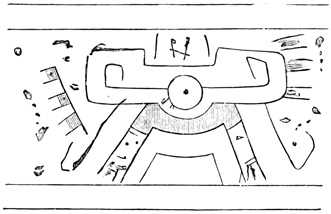
At Guaximala a cave is mentioned having sculptures on the rocks at its entrance. The natives dared not cross the figured portal.[II-47] In the ravine near Masaya, already spoken of as the locality of the excavation known as El Baño, the steep side-cliffs are covered with figures roughly cut in outline, and often nearly obliterated by the ravages of time. They are shown in Squier's drawings on the following page, the order in which the groups occur being preserved.

Mr Squier detects among the objects thus rudely delineated, the sun twice represented, a shield, arrows or spears, the Xiuhatlatli of the Aztec paintings, which is an instrument for hurling spears, and a monkey. Besides the regular groups, isolated single figures are seen, among which the two characters shown in the accompanying cut are most frequently repeated. The same vicinity is reported to contain figures both painted and cut in other localities.[II-48]
CLIFF-PAINTINGS AT NIJAPA.
On the old crater-walls, five hundred feet in height at the lowest point, which inclose Lake Nijapa, a few miles south-west of Managua, are numerous figures painted in red. Portions of the walls have been thrown down by an earthquake, the débris at the water's edge being covered with intricate and curious red lines; and most of those still in place have been so defaced by the action of wind and water that their original appearance or connection cannot be distinguished.
Among the clearest of the paintings is the coiled feathered serpent shown in the cut. It is three feet in diameter, across the coil, and is painted forty feet up the perpendicular side of the precipice. This would seem to be identical with the Aztec Quetzalcoatl, or the Quiché Gucumatz, both of which names signify 'plumed serpent.' Of the remaining figures, shown in the cut on the following page, the red hand is of frequent occurrence here, and we shall meet it again farther north, especially in Yucatan. The central upper figure is thought by Mr Squier to resemble a 38 character in the Aztec paintings; and among those thrown down the sun and moon are said to have been prominent.[II-49]
In the Chontal province none of these pictorial remains are reported, yet Mr Boyle believes that many of the ornamental figures on pottery and stone 39 vessels are hieroglyphic in their nature; founding this opinion on the frequent repetition of complicated groups, as for instance that in the cut, which is repeated four times on the circumference of a bowl.[II-50]
Chontal Hieroglyphic.
STONE STATUES OR IDOLS.
Statues in stone, representing human beings generally, but in some cases animals and monsters also, have been found and described to the number of about sixty, constituting our third and the most interesting class of Nicaraguan relics. Ometepec, rich in pottery and other relics, and reported also to contain idols, has yielded to actual observation only the small animal couchant represented in the cut. It was secretly worshiped by the natives for many years, even in modern times, until this unorthodox practice was discovered and checked by zealous priests. This animal idol was about fourteen inches long and eight inches in height.[II-51]
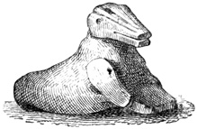
Ometepec Idol.
IDOLS ON ZAPATERO ISLAND.
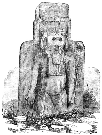
The island of Zapatero has furnished some seventeen idols, which are found in connection with the stone-heaps already described, lying for the most part 40 wholly or partially buried in the sand and enveloped in a dense shrubbery. It is not probable that any one of them has been found in its original position, yet such is their size and weight that they are not likely to have been moved far from their primitive locality. Indeed Mr Squier, with a large force of natives, transformed into zealous antiquarians by a copious dispensation of brandy, had the greatest difficulty in placing 41 them in an upright position. An ancient crater-lake conveniently near at hand accounts satisfactorily for the almost entire absence of smaller idols, and would doubtless have been the receptacle of their larger fellow-deities, had the strength of the priestly iconoclasts been in proportion to their godly spirit, as was the case with Mr Squier's natives. As it was they were obliged to content their religious zeal with overthrowing and defacing as far as possible these stone gods of the natives. There seems to be no regularity or system in the arrangement of the statues with respect to each other, and very little with respect to the stone mounds. It is probable, however, that, if the latter are indeed ruined teocallis, the statues stood originally round their base rather than on their summit. The idols of Zapatero, which is within the limits of the Niquiran or Aztec province, are larger and somewhat more elaborate in workmanship than those found elsewhere; and the genital organs appear on many of their number, indicating perhaps the presence here of the wide-spread phallic worship. The cuts show ten of the most remarkable of these monuments.
Fig. 1 is nine feet high and about three feet in diameter, cut from a solid block of black basalt. The head of the human figure crouching on its immense cylindrical pedestal forms a cross, a symbol not uncommon here or elsewhere in America. All the work, particularly the ornamental bands and the niches of unknown use or import in front, is gracefully and cleanly cut. Fig. 2 is a huge tiger eight feet high seated on a pedestal. The heads and other parts of different animals are often used in the adornment of partially human shapes both in stone work and pottery, but purely animal statues, intended as this apparently is, for idols, are rare. Fig. 3, an idol "of mild and benignant aspect" is shown in the leaning position in which it was found. Fig. 4, standing in the background, was raised from its fallen position to be sketched. 42
Idols of Zapatero.—Fig. 6.
Fig. 5 represents a statue which, with its pedestal, is over twelve feet high. The well-carved head of a monster, two feet eight inches broad, surmounts the head of a seated human form, a common device in the fashioning of Nicaraguan gods. A peculiarity of this monument is that the arms are detached from the sides at the elbows; free-sculptured limbs being of rare occurrence in American aboriginal carvings. Fig. 6 is 44 a slab three by five feet, bearing a human figure cut in high relief, the only sculpture of this kind discovered in Nicaragua. The tongue appears to hang upon the breast, and the eyes are merely two round holes. Fig. 7, on the following page, represents a crouching human form, on whose back is a tiger or other wild beast grasping the head in its jaws, a favorite method among these southern Nahua nations of representing in stone and clay the characteristics of what are presumably intended as beings to be worshiped. The expression of the features in the human face is described by Mr Squier as differing from any of the others found in this group. This idol and the following, 45 with many other curious monuments of antiquity obtained by the same explorer, are now in the museum of the Smithsonian Institution at Washington.
Fig. 8 is carved on a slab five feet long and eighteen inches wide, representing a person who holds to his abdomen what seems to be a mask or a human face.
Fig. 9 is of very rude execution and seemingly represents a human figure wearing an animal mask, which is itself surmounted by another human face. Two small cup-shaped smoothly cut holes are also noted in the head-dress. Fig. 10 is a stone three feet and a half high, but slightly modified by the sculptor's art, which gave some semblance of the human form.
From the cuts given a good general idea of the Zapatero monuments may be obtained; of the others described, one is a man with a calm, mild expression of countenance, seated with knees at chin and hands 47 on feet on a round-topped square pedestal which tapers towards the bottom.
IDOLS AT GRANADA.
Two statues from Zapatero stand at the street-corners of Granada; one, known as the Chiflador, is much broken; the other has the crouching animal on the human head. Another from the same island stands by the roadside at Dirioma, near Granada, where it serves as a boundary mark. According to Mr Boyle this statue is of red granite, and it seemed to Mr Squier more delicately carved than those at Zapatero.[II-52] 48
In the vicinity of the cairn already spoken of at the foot of Mount Mombacho, were found six statues with abundant fragments. One had what seemed a monkey's head, with three female breasts and a phallus among the complicated sculptures below; a rudely cut animal bore some resemblance to a bear; a broken figure is said by the natives to have represented, when whole, a woman with a child on her back. One female figure, of which there is no drawing, is pronounced by Mr Boyle "very far the best-drawn statue we found in Nicaragua." A sleeping figure with large ears, a natural face, absurd arms, and a phallus, with the life-sized corpse or sleeper of the cut complete the list.
Mr Boyle believes the statues of Mombacho, like other relics there found, to unite the styles of art of the Chontales and the Aztec natives of Ometepec; showing, besides the cairns, the simplicity of sculpture peculiar to the former, together with the superior skill in workmanship and the distinction of sex noticeable in the monuments of the latter.[II-53]
IDOLS OF PENSACOLA ISLAND.
Pensacola is one of the group of islands lying at the foot of Mt Mombacho in Lake Nicaragua. On this island the three statues shown in the following cuts 50 have been dug up, having been buried there purposely by order of the catholic authorities in behalf of the supposed spiritual interests of the natives. Fig. 1 is cut from hard red sandstone; the human face is surmounted by a monster head, and by its side the open mouth and the fangs of a serpent appear. The limbs of this statue, unlike those of most Nicaraguan idols, are freely sculptured and detached so far as is consistent with safety.
Fig. 2 is an animal clinging to the back of a human being, concerning which Mr Squier remarks: "I never have seen a statue which conveyed so forcibly the idea of power and strength." The back is ribbed or 51 carved to represent overlapping plates like a rude coat of mail, and the whole is nine feet high and ten feet in circumference. Fig. 3 is the head and bust—the lower portion having been broken off—of a hideous monster, with hanging tongue and large staring eyes, large ears, and distended mouth, "like some gray monster just emerging from the depths of the earth at the bidding of the wizard-priest of an unholy religion," not inappropriately termed 'el diablo' by the natives, when first it met their view.[II-54]
MOMOTOMBITA RELICS.
Momotombita Island formerly contained some fifty statues standing round a square, and facing inward, if, as Mr Squier believes, we may credit the native report. All are of black basalt, and have the sex clearly marked, a large majority representing males.
Fig. 1 is a statue noticeable for its bold and severe cast of features, and for what is conjectured to be a human heart held in the mouth, as is shown in the front view, Fig. 2. Fig. 3 was found at a street-corner at Managua, but had been brought originally 54 from the island. Another, also from Momotombita, was found at Leon and afterwards deposited in the Smithsonian Institution. It evidently served as a support for some other object; the back is square and ribbed like the one at Pensacola, the eyes closed, and "the whole expression grave and serene." The colossal head shown in the cut on the preceding page was among the other fragments found on the island, where two groups of relics are said to exist, only one of which has been explored.[II-55]
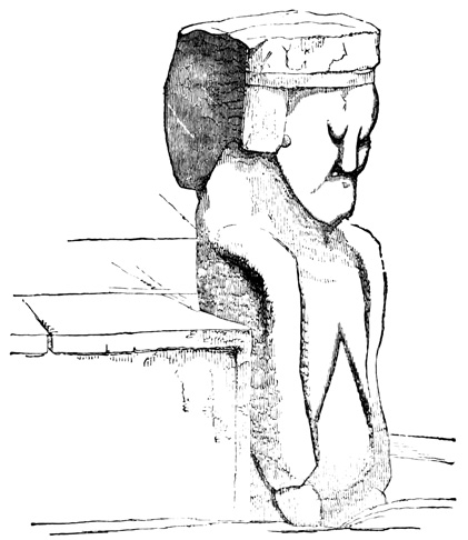
Idols of Momotombita.—Fig. 3.
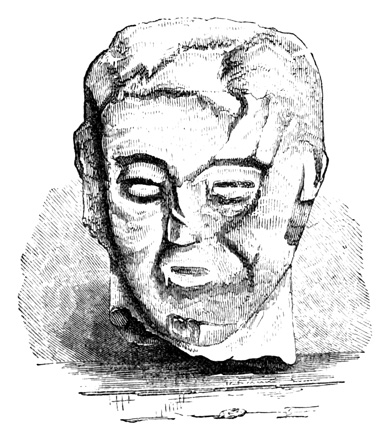
Colossal Head from Momotombita.
The Piedra de la Boca is a small statue, or fragment, with a large mouth, standing at a street-corner in Granada, having been brought from one of the lake islands. The natives still have some feelings of dependence on this idol in times of danger. Several rudely carved, well-worn images stood also at the street-corners of Managua in 1838.[II-56]
IDOLS OF SUBTIAVA.
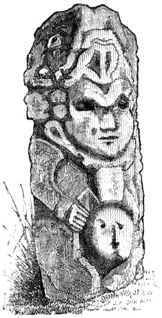
Idols of Subtiava.—Fig. 2.
At the Indian pueblo of Subtiava near Leon many idols were dug up by the natives for Mr Squier, eight of them ranging from five and a half to eight feet in height and from four to five feet in circumference. 55 The natives have always been in the habit of making offerings secretly to these gods of stone, and only a few months before Mr Squier's visit a stone bull had been broken up by the priests. About the large stone mound before described are numerous fragments, but only one statue entire, which is shown in Fig. 1. It projects six feet four inches above ground and is cut from sandstone. At the lower extremity of the flap which hangs from the belt in front is noted a cup-like hole large enough to contain about a quart. Fig. 2, of the same material, is two feet six inches in height, and represents a female either holding a mask over her abdomen, or holding open the abdomen for the 56 face to look out. Fig. 3 and 4 show a front and rear view of another statue, in which the human face, instead of being surmounted by, looks out from the jaws of some animal. The features of the face had been defaced apparently by blows with a hammer; the ornamentation was thought to resemble somewhat that of the Copan statues. Others mentioned and sketched at Subtiava have a general resemblance to these.[II-57]
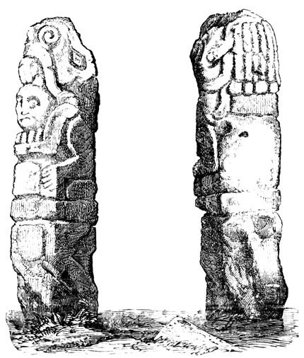
Idols of Subtiava.—Fig. 3 and 4.
IDOLS OF CHONTALES.
The Chontal statues are divided by Mr Boyle into two classes; the first of which includes idols, with fierce and distorted features, never found on the graves, but often near them; while the second is composed of portrait-statues, always distinguished by closed eyes and a calm, "simple, human air about their features, however irregularly modeled." The latter are always found on or in the cairns under which bodies are interred, and are much more numerous than the idols proper. Unfortunately we have but few drawings in support of this theory. It is true that the two classes of features are noticeable elsewhere, as well as here, but the position of the statues does not seem to justify any such division into portraits and idols. Mr Boyle also believes the Chontal sculptures better modeled though less elaborate than those of the south-west.[II-58]
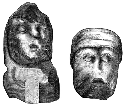
Chontal Statues.—Fig. 1 and 2.
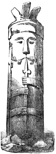
Fig. 3.
Fig. 1 is one of several statues found near Juigalpa; it is of the portrait class, and is remarkable for the wen over the eye and a cross on the breast. Fig. 2 is the head of another taken from a cairn near Libertad, and since used to prop up a modern wall. Fig. 3 is what Mr Pim terms a head-stone of one of the graves in the same locality. Many of the images have holes drilled through them; there is no distinction of sex, and here, as elsewhere, there is no attempt at drapery. Entire statues seem to be rare, but fragments very abundant. Mr Squier notes in all the Nicaraguan statues a general resemblance, but at the same time marked individuality, and deems it possible to identify many of them with the gods of the Mexican Pantheon.[II-59]
NICARAGUAN WEAPONS.
My fourth class includes weapons, implements, ornaments, and other miscellaneous articles of stone. There is a mention without description of arrow-heads and flint flakes dug up from the graves of Ometepec. Celts, much like those extant in European collections, are reported as of frequent occurrence; two of granite and one of basalt at Ometepec, and one of chipped flint at Zapatero, the latter being regular in outline, 59 with a smooth sharp edge, believed by Mr Boyle to be of very rare form, and unique in America. Axes are also said to be numerous, there being specially mentioned one of basalt, broad and thin, from Ometepec; and a similar one, three or four inches wide, six inches long, and of a uniform thickness, not exceeding one third of an inch, from Zapatero.
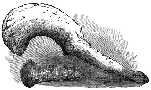
Nicaraguan Weapons.—Fig. 1 and 2.
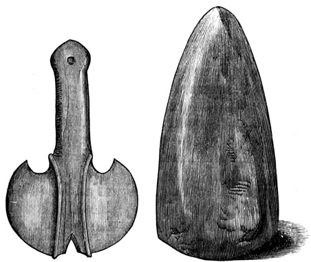
Nicaraguan Weapons.—Fig. 3 and 4.
Fig. 1 is a rude aboriginal weapon from a cairn near Libertad, called by Mr Pim a hatchet. Fig. 2 is an 60 axe of syenite found by Mr Squier at Granada, where he states that similar relics are not uncommon. Fig. 3 is one of two very beautiful double-edged battle-axes from the Chontal cairns. It is of volcanic stone, twelve and a half inches long by seven and three fourths inches wide. Fig. 4 represents a flint axe from Zapatero Island as sketched by Mr Boyle. A knife ten inches long was also found by Pim in a Chontal grave.[II-60]
STONE IMPLEMENTS AND ORNAMENTS.
Stone vessels are rare, though a granite vase, eighteen inches high, as shown in the cut, was dug up at Brita, near Rivas; and two marble vases of very superior workmanship were found in a Libertad mound. One was of the tripod form and badly broken; the other was shaped like a can resting on a stand, with ornamental handles, and having its sides, not thicker than card-board, covered with grecs and arabesques.[II-61]
Metates occur often on both sides the lakes. The cut on the following page shows one dug up at Leon, being very similar to those still in use in the country, 61 but more elaborate in its ornamentation. Those east of the lakes are flat instead of curved, but still superior to any now made, and in connection with them have been found the pestles with which maize was crushed.[II-62]
Broken pedestals and sculptured fragments whose original purpose is unknown occur frequently, and stone rattles were formerly found about Juigalpa. Beads of lava, basalt, and chalcedony, in collections suggestive of small necklaces, are numerous, particularly at Ometepec. Those of lava are often wonderfully wrought, about an inch long, ringed or grooved on the surface, pierced lengthwise with a hole only large enough to admit a fine thread, and yet the whole, of the most brittle material, not thicker than twine. Those of chalcedony are of larger size.[II-63]
The niche near Leon, known as the Capilla de la Piedra, had before its entrance a flat stone resembling an altar. At Zapatero Mr Squier found four stones also apparently intended for sacrificial purposes. One of these, an oval stone imbedded in the earth, and covered 62 on its upper surface with inscribed characters, is shown in the cut. Near the Simon mine in Nueva Segovia, the north-eastern province of the state, was found by Mr Pim a broken font, the only relic of this region, on the exterior of which the following figure is carved, supposed to represent the sun. It has also the peculiarity of what seem intended for long moustaches.[II-64]
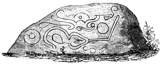
Altar from Zapatero.
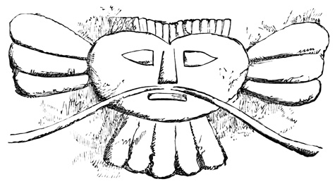
Sun-sculpture in Nueva Segovia.
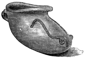
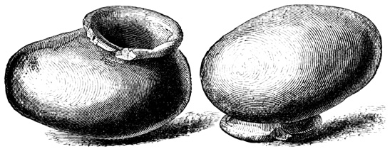
Burial Urns from Ometepec.
NICARAGUAN POTTERY.
The fifth class embraces all articles of pottery, abundant throughout the whole extent of the state, but especially so on the lake islands, where the natives actually dig them from the earth to supply their present needs. None of the localities which have yielded 63 other relics is without its deposit of earthen ware, either whole or in fragments. The fact that vessels unearthed by the natives, when unbroken, are wholly uninjured by their long rest under a damp tropical soil, indicates their excellence in material and construction. It is not indeed probable that in material or methods of manufacture the ancient differed essentially from the modern pottery; but in skill and taste the former was unquestionably far superior. Mr Squier pronounces the work equal to the best specimens of the Mexican and Peruvian potters. He finds no evidence of the use of the wheel; Mr Boyle, however, thinks it was employed, but rarely. The clay varies from brown to black, and the glazing, often sufficiently thick to be chipped off with a knife, is usually of a whitish or yellowish hue. The colors with which most articles are painted are both brilliant and durable, red being a favorite. In some cases the paint seems to have penetrated the substance of the pottery, as if applied before the clay was dry. The figures of the cut illustrate the two most common forms of the cinerary, or burial, urns, both from Ometepec, the former sketched by Mr Boyle and the latter by Mr Squier. The urns contain a black sticky earth supposed to represent traces of burned flesh, and often 64 unburned bones, skull, or teeth, together with a collection of the smaller relics which have been described. The bones of animals, deer-horns, and boar-tusks, and bone implements rarely or never occur. Earthen basins of different material and color from the urns are often—always in the Chontal graves—found inverted one over another to close the mouth. The burial vases are sometimes thirty-six inches long by twenty inches high, painted usually on the outside with alternate streaks of black and scarlet, while serpents or other ornaments are frequently relieved on the surface. One or two handles are in most cases attached to each. Mr Squier believes a human skull to have been the model of the urns. Five of them at Libertad are noticed as lying uniformly east and west. It appears evident that many of the articles found in or about the graves had no connection with burial rites, some of them having undoubtedly been buried to keep them from the hands of the Spaniards. The figures of the cuts, from Mr Boyle, show two forms of vessels which are frequently repeated among an infinite variety of 65 other shapes. The tripod vase with hollow legs is a common form, of which Fig. 1 is a fine specimen from Ometepec, five and three fourths inches high, and six inches in diameter, with a different face on each leg. Fig. 2 is a bowl from Zapatero which occurs in great numbers, of uniform shape and decoration, but of varying size, being ordinarily, however, ten inches in diameter and four and one fourth inches high. Both inside and outside are painted with figures which from their uniformity in different specimens are deemed by Mr Boyle to have some hidden hieroglyphic meaning. It is also remarked that vessels intended to be of the same size are exactly equal in every respect. Another common vessel is a black jar, glazed and polished, about four inches high and five and one fourth inches in diameter, made of light clay, and having a simple wavy ornament round the rim. Animals or parts of animals, particularly alligators, often form a part of the ornamentation of pottery, but complete animals in clay are rare, a rude clay stag being the only relic of the kind reported. The device of a beast springing on the back of a human form, so frequent among the statues or idols, also occurs in terra cotta. The four figures of the cut show additional specimens in terra cotta from Mr Squier, of which Fig. 2 is from Ometepec.[II-65]
RELICS OF THE USE OF METALS.
It only remains to speak of the sixth and last class of Nicaraguan relics; viz., articles of metal, which may be very briefly disposed of. The only gold seen by any of our authorities was "a drop of pure gold, one inch long, precisely like the rattles worn by Malay girls," taken by Mr Boyle from a cinerary vase at Juigalpa. But all others mention small gold idols and ornaments which are reported to have been found, one of them weighing twenty-four ounces; so that there can be but little doubt that the ancient people understood to a limited extent the use of this precious metal, which the territory has never produced in large quantities. 67 Copper, on the contrary, is said to be abundant and of a variety easily worked, and yet the only relic of this metal discovered is the copper mask, which Mr Squier supposes to represent a tiger's face, shown in the cut. It was presented to him by a man who claimed to have obtained it from Ometepec. Mr Boyle believes, with reason as I think, that in a country abounding in the metal, the skill and knowledge requisite to produce the mask would most certainly have left other evidences of its possession. The authenticity of this mask, when considered as a Nicaraguan relic, may be regarded as extremely problematical.[II-66]
Nicaraguan antiquities, concerning which I have now given all the information in my possession, give rise to but little discussion or visionary speculation. Indeed there is little of the mysterious connected with them, as they do not necessarily carry us farther back into the past than the partially civilized people that occupied the country in the sixteenth century. Not one relic has appeared which may not reasonably be deemed their work, or which requires the agency of an unknown nation of antiquity. Yet supposing Nicaragua to have been long inhabited by a people of only slightly varying stages of civilization, any one of the idols described may have been worshiped thousands of years before the Spanish conquest. The relics are over three hundred years old; nothing in themselves proves them to be less than three thousand. Comparison with more northern relics and history may fix their age within narrower limits.
Salvador—Opico Remains—Mounds of Jiboa—Relics of Lake Guijar—Honduras—Guanaja—Wall—Stone Chairs—Roatan—Pottery—Olancho Relics—Mounds of Agalta and Abajo—Hacienda of Labranza—Comayagua—Stone Dog-idol—Terraced Mounds of Calamulla—Tumuli on Rio Chiquinquare—Earthen Vases of Yarumela—Fortified Plateau of Tenampua—Pyramids, Enclosures, and Excavations—Stone Walls—Parallel Mounds—Cliff-Carvings at Aramacina—Copan—History and Bibliography—Palacio, Fuentes, Galindo, Stephens, Daly, Ellery, Hardcastle, Brasseur de Bourbourg—Plan of Ruins Restored—Quarry and Cave—Outside Monuments—Enclosing Walls—The Temple—Courts—Vaults—Pyramid—Idols—Altars—Miscellaneous Relics—Human Remains—Lime—Colossal Heads—Remarkable Altars—General Remarks.
ANTIQUITIES OF SALVADOR.
Following the continent westward from Nicaragua, we have the state of Salvador on the Pacific side, stretching some one hundred and eighty miles from the gulf of Fonseca to the Rio de Paza, the Guatemalan boundary, and extending inland about eighty miles. Here, in the central province of San Vicente, a few miles southward from the capital city of the same name, I find the first well-authenticated instance in our progress northward of the occurrence of ruined edifices. But of these ruins we only know that they are the most imposing monuments in the state, covering 69 nearly two square miles at the foot of the volcano of Opico, and that they consist of "vast terraces, ruins of edifices, and circular and square towers, and subterranean galleries, all built of cut stones. A single carving has been found here, on a block of stone eight feet long by four broad. It is in the true Mexican style, representing probably a prince or great warrior."[III-1] Several mounds, considerable in size and regular in outline, were noted on the plain of Jiboa west of San Vicente; also similar ones near Sonsonato in the south-western portion of the state. In the north-west on the Guatemalan boundary, aboriginal relics are vaguely reported on the islands of Lake Guijar, but of them nothing is known.[III-2] And concerning Salvador monuments nothing further is to be said, although Mr Squier heard of ruins in that state rivaling in extent and interest the famous Copan.[III-3]
On the other side of the continent, reaching also across to the Pacific at the gulf of Fonseca, north of Nicaragua, the Mosquito coast, and Salvador, is the state of Honduras. It extends over three hundred and fifty miles westward along the Atlantic shore, from Cape Gracias á Dios nearly to the narrowest point of the isthmus where America is a second time so nearly cut in twain by the gulfs of Honduras and Dulce. The mountain chains which skirt the valley of the Motagua on the south, known as the sierras of Grita, Espíritu Santo, Merendon, Copan, etc., form the boundary line between Honduras and Guatemala. The northern coast, closely resembling in its general character the Mosquito shore, has preserved along its marshy lagoons, so far as they have been explored, no traces of its early occupants. Yet on the coast islands 70 some relics appear. On that of Guanaja, whence in 1502 Columbus first beheld the continent of North America, is reported a wall of considerable extent, only a few feet high, with three-legged stone chairs fixed at intervals in rude niches or fissures along its sides. Chair-shaped excavations in solid rock occur at several other points on the island, together with rudely molded but fantastically decorated vessels of earthen ware. The Guanaja remains are chiefly found in the vicinity of the Savanna Bight Kay.[III-4] On the neighboring island of Roatan fragments of aboriginal pottery and small stone idols are found scattered through the forest.[III-5]
The eastern interior of Honduras, by reason of its gold mines, has been more extensively explored than the Mosquito region farther south; yet with respect to the departments of Olancho and Tegucigalpa I only find the statement by Mr Wells that "mounds containing specimens of ancient pottery are often met with by the vaqueros while exploring the gloomy depths of the forest, but these seldom survive the destructive curiosity of the natives;" this chiefly in the valleys of Agalta and Abajo, and on the hacienda of Labranza. The pottery takes the form of pans and jars to the number of ten to thirty in each mound; no idols or human remains having been reported.[III-6]
COMAYAGUA RELICS.
Still farther west, in the valley of Comayagua, midway between the oceans, about the head-waters of the rivers, to which the names Ulua, Goascoran, and Choluteca are applied as often as any others on the maps, 71 there are abundant works of the former natives, made known, but unfortunately only described in part, by Mr Squier. These works chiefly occur on the terraces of the small branch valleys which radiate from that of Comayagua as a centre, in localities named as follows: Chapulistagua, Jamalteca, Guasistagua, Chapuluca, Tenampua, Maniani, Tambla, Yarumela, Calamulla, Lajamini, and Cururu. The ruins are spoken of in general terms as consisting of "large pyramidal, terraced structures, often faced with stones, conical mounds of earth, and walls of stone. In these, and in their vicinity, are found carvings in stone, and painted vases of great beauty." Concerning most of the localities mentioned we have no further details, and must form an idea of their nature from the few that are partially described, since a similarity is apparent between all the monuments of the region.
About Comayagua, or Nueva Valladolid, we are informed that "hardly a step can be taken in any direction without encountering evidences of aboriginal occupation," the only relic specified, however, being a stone idol of canine form now occupying a position in the walls of the church of Our Lady of Dolores. At Tambla, some leagues south-east of Comayagua, was found the fossil skeleton of a mastodon, whose tooth is shown in the cut, imbedded in a sandstone formation.[III-7] One of the stratified sandstone terraces of the sierra south-west of Comayagua forms a fertile table over three thousand feet above the level of the sea; and on its surface, in an area of ten or twelve acres inclosed by a spring-fed mountain stream, are the ruins of Calamulla, consisting simply of mounds. Of these, two are large, one about one hundred 72 feet long, with two stages, having a flight of steps on the western slope. It shows clear traces of having been originally faced with flat stones, now for the most part removed. Most of the mounds are of earth in terraces, and some of rectangular outline have a small conical mound raised a few feet above the surface of their upper platform. Stone-heaps of irregular form also occur; perhaps places of sepulture; at least differing in their use from the tumuli of more regular outlines which may readily be imagined once to have supported superimposed structures of more perishable materials. The natives have traditions, probably unfounded, of subterranean chambers and galleries beneath this spot. In the same vicinity, near the banks of the Rio Chiquinguare, and about a league from the pueblo of Yarumela, is another group of mounds, lying partly in the forest and partly in lands now under native cultivation. These remains, although in a more advanced state of ruin, are very similar to those of the Calamulla group. It is noted, however, that the tumuli are carefully oriented, and that some have stone steps in the centre of each side. In one or two cases there even remained standing portions of cut-stone walls. Local tradition, which as a rule amounts to nothing in such cases, seems to indicate that these structures were already in a ruined state before the Spanish conquest. At the town of Yarumela, and presumably taken from the group described, were seen, besides a few curiously carved stones, six earthen vases of superior workmanship and 73 design, one of which is represented in the cut, together with separate and enlarged portions of its ornamentation, which is both carved and painted. The flying deity painted in outline on one of its faces is pronounced by Mr Squier identical with one of the characters of the Dresden Codex.[III-8]
RUINS OF TENAMPUA.
At Tenampua, or Pueblo Viejo, twenty miles south-east of Comayagua, near Flores, is a hill of white stratified sandstone, whose sides rise precipitously to a height of sixteen hundred feet above the level of the surrounding plain. The summit forms a level plateau one half a mile wide and one mile and a half long from east to west. On the eastern half chiefly, but also spreading over the whole surface of this lofty plateau, is the most extensive group of ancient works in the whole region, and in fact the only one of which we have a description at all in detail. As in the other localities of this part of the state, the group is made up for the most part of rectangular oriented mounds, some of stone, but most of earth, with a stone facing. The smaller mounds are apparently arranged in groups according to some system; they vary in size from twenty to thirty feet in height, having from two to four stages. The larger pyramidal tumuli are from sixty to one hundred feet long and of proportionate width and altitude, with in many cases a flight of steps in the centre of the side facing the west.
RUINS OF TENAMPUA.
The structures that have been described are as follows, it being understood that they are but a part of the whole: A mound located on the very edge of the southern precipice commands a broad view over the whole plain of Comayagua, and its position suggests its possible aboriginal use as a station for fire-signals. Just north of this is an excavation, or perhaps a small natural valley, whose sides are faced with stone in steps leading up the slope on all four sides. In the centre of the eastern half of the plain, and consequently 74 in the midst of the principal ruins, is what may be regarded as the chief structure of the group, commanding a view of all the rest. The annexed cut, made up from the description, will aid in giving a clear idea of the work. Two stone walls, an outer and an inner, about ten feet apart, each two feet thick, of which only a few feet in height remain standing, enclose a rectangular area of one hundred and eighty by three hundred feet. Cross-walls at regular intervals divide the space between the two into rectangular apartments now filled with earth to a depth of two feet. The walls terminate on the western side in two oblong terraced mounds between which is the only entrance to the enclosure; while on the opposite side in a corresponding position on the eastern wall is a mound equal in bulk to both the western ones combined. Within the inclosure is a large pyramidal mound in three stages, with a flight of steps on the west, situated just south of a central east and west line. From its south-west corner a line of imbedded stones runs to the southern wall; and between the pyramid and the gateway is a small square of stones. A similar mound, also provided with a stairway, is found in the north-east corner of the enclosure. The stones of which the walls and facings are made, indeed of all 75 the stone work at Tenampua, are not hewn, but very carefully laid, no mention being made of mortar. All the structures are carefully oriented. At the south-east corner of the plateau is a second enclosure which has a gateway in the centre of each of its four equal sides, but whose dimensions are not given. This has in its area two mounds, each with a stairway. Elsewhere, its location on the plateau not being stated, is a raised terrace, or platform, three hundred and sixty feet long, containing one of the most remarkable features of the place, in the form of two parallel mounds one hundred and forty feet long, thirty-six feet wide at the base, ten feet high, and forty feet apart at their inner and lower edges. The outer sides have double walls like those of the chief enclosure, divided into three compartments, and having served apparently as the foundations of three separate buildings. The inner side of each mound slopes in three terraces, the lower ones being faced with large flat stones set upright. In a line with the centre between these parallels and at a distance of one hundred and twenty paces is a mound with a stairway on its southern slope, and at a distance of twenty-four paces on the same line, but in a direction not stated, are two large stones carefully placed with a space of one foot between them. The conjectural use of these parallels, like that of somewhat similar ones which we shall meet elsewhere, is for the accommodation of the ancient nobility or priesthood in their games or processions. On the west end of the plateau are two perpendicular excavations in the rock, twenty feet square and twelve feet deep, with a gallery three feet square leading northward from the bottom of each. The natives have an idea that these passages lead to the ruins of Chapulistagua, but they are probably of natural formation with artificial improvements, and of no great extent. The remains of a pyramid are found in the vicinity of the holes. Near the centre of the plateau, in a spot naturally low and marshy, are two large square excavations 76 which may have been reservoirs. In addition to the works described are over three hundred mounds or truncated pyramids of different sizes, scattered over the surface of the plateau, to the location and arrangement of which, in the absence of a plan, we have no guide. They are covered with a heavy growth of timber, some of them supporting pine-trees two feet in diameter. Only one was opened and its interior found to consist simply of earth, except the upper terrace which was ashes and burned matter, containing fragments of pottery and of obsidian knives. The pottery is chiefly in the form of small flat pans and vases, all decorated with simple painted figures; and one small gourd-shaped vase, nearly entire, was filled with some black indurated matter so hard as not to be removable. As to the original purposes to which the structures of Tenampua were devoted, speculation points with much plausibility to religious ceremonies and temples in the case of the enclosures and larger pyramids; to sepulchral rites in that of the smaller mounds; while the strong natural position of the works on a plateau with high, precipitous, and at nearly every point inaccessible sides, indicates that defense was an important consideration with the builders. The supposed reservoirs favor this theory, which is rendered a certainty by the fortifications which protect the approach to the plateau at the only accessible points, on three narrow ridges connecting this hill with others of the range. These fortifications are walls of rough stone, from six to fifteen feet high and ten to twenty feet thick at the base, according to the weakness or strength of the location. Gullies on the slopes which might afford a cover for approaching foes are carefully filled with stones; and the walls themselves, which also have traces of towers at intervals, while presenting a perpendicular exterior, are terraced on the inside for the convenience of the defenders. Yet the poor thin soil, incapable of supporting a large number of people, indicates that it was not probably a fortified town, but 77 that it must be regarded as a place sacred to the gods, to be defended to the last, and possibly a refuge for the people of the towns below in cases of extreme danger.[III-9]
CLIFF-CARVINGS OF ARAMACINA.
Southward from Comayagua, toward the Pacific shore, we find relics of former times near Aramacina, in the Goascoran region. Here the smooth vertical face of a sandstone ledge forms one side of a natural amphitheatre, and is covered, for a space of one hundred by fifteen feet, with engraved figures cut to a depth of two and a half inches, the incisions serving as convenient steps by which to mount the cliff. Some of the engravings have been destroyed by modern quarry-men; of those remaining some seem to be ornamental and arbitrary, while in others the forms of men and animals may be distinguished. They are pronounced by the observer identical in style with the inscriptions of Nicaragua and Salvador, of whose existence in the latter state we have no other intimation.[III-10]
But one group of antiquities in Honduras remains to be described,—Copan, the most wonderful of all, and one of the most famous of American ruins. The location is in a most fertile tobacco-producing region near the Guatemalan boundary, on the eastern bank of the Rio Copan, which flows northward to join the Motagua some fifty miles below the ruins, at a point something more than one hundred miles above its mouth in the bay of Honduras.[III-11]
Some rapids occur in the Copan River below the ruins, but in the season of high water it is navigable for canoes for a greater part of its course. The name Copan, so far as can be known, was applied to the ruins simply from their vicinity to an adjacent hamlet or Indian pueblo so named, which is located at the mouth of a small stream, called Sesesmil by Col. Galindo, which empties into the Copan a little higher up. This pueblo has greatly deteriorated in later times; formerly both town and province were rich and prosperous. Indeed, in the sixteenth century, in the revolt which broke out soon after the first conquest, the cacique of Copan resisted the Spanish forces long after the neighboring provinces had been subdued. Driven eventually to his chief town, he opposed barricades and ditches to the advancing foe, but was at last forced after a desperate struggle to yield to Hernando de Chaves in 1530. It was formerly supposed that the place where he made his brave stand against Chaves was identical with the ancient city since called Copan, its ruin dating from its fall in 1530. It is now believed, however, that there was no connection whatever between the two, and that, so far as the ruined city of antiquity is concerned, history is absolutely silent. This conclusion is based on the facts that Cortés in his famous march through Honduras in 1524, although passing within a few leagues of this place, heard nothing of so wonderful a city, as he could hardly have failed to do had it been inhabited at the time; that there is not the slightest resemblance 79 between the ruined structures to be described in these pages and the town besieged by Chaves as reported in the chronicles of the period; and above all that the ruins are described by Palacio as being very nearly in their present state, with nothing but the vaguest traditions respecting their origin, only about forty years after the fall of the brave cacique, the latter fact, however, not having been known to those authors who have stated that Copan was inhabited at the conquest.[III-12]
EXPLORATION OF THE RUINS.
This region has never been really explored with a view to the discovery of ancient relics. The few visitors, of whose explorations I give the history and bibliography in full in the annexed note,[III-13] have found 80 enough of the wonderful in the monuments known to exist since the sixteenth century, without pushing their investigations back into the dense and almost impenetrable forest away from the immediate banks of the river. The difficulty attending antiquarian research in a country where the whole surface is covered with so dense a growth that progress in any direction is possible only foot by foot with the aid of the native 81 machete, may be imagined. A hot climate, a moist and malarious atmosphere, venomous serpents and reptiles, myriads of diminutive demons in the form of insects, all do most vigorous battle against the advances of the foreign explorer, while the apathetic natives, whether of American or Spanish blood, feel not the slightest enthusiasm to unveil the mysterious works of the antiguos.
For what is known of Copan the world is indebted almost entirely to the works of the American traveler, Mr John L. Stephens, and of his most skilful artist-companion, 82 Mr F. Catherwood;[III-14] and from the works of these gentlemen, with the slight notes to be gleaned from other sources, I proceed to give all that is known of what is commonly termed the oldest city on the American continent. I will begin by giving Juarros' description in full, since few or none of the objects mentioned by him can be identified with any of those met in the following pages. "In the year 1700, the Great Circus of Copan, still remained entire. This was a circular space, surrounded by stone pyramids about six yards high, and very well constructed; at the bases of these pyramids were figures, both male and female, of very excellent sculpture, which then retained the colours they had been enamelled with; and, what was not less remarkable, the whole of them were habited in the Castilian costume. In the middle of this area, elevated above a flight of steps, was the place of sacrifice. The same author (Fuentes) relates that, at a short distance from the Circus, there was a portal constructed of stone, on the columns of which were the figures of men, likewise represented in Spanish habits, with hose, ruff round the neck, sword, cap, and short cloak. On entering the gateway there are two fine stone pyramids, moderately large and lofty, from which is suspended a hammock that contains two human figures, one of each sex, clothed in the Indian style. Astonishment is forcibly excited on viewing this structure, because, large as it is, there is no appearance of the component parts being joined together; and, although entirely of stone, and of an enormous weight, it may be put in motion by the slightest impulse of the hand. Not far from this hammock is the cave of Tibulca; this appears like a temple of great 83 size, hollowed out of the base of a hill, and adorned with columns having bases, pedestals, capitals and crowns, all accurately adjusted according to architectural principles; at the sides are numerous windows faced with stone exquisitely wrought. All these circumstances lead to a belief that there must have been some intercourse between the inhabitants of the old and new world at very remote periods."[III-15]
EXTENT OF THE RUINS.
The ruins are always spoken of as extending two miles along the bank of the river; yet all the structures described or definitely located by any visitor, are included in the much smaller area shown on Mr Stephens' plan, with, however, the following exceptions: "A stone wall with a circular building and a pit, apparently for a reservoir," is found about a mile up the river; the quarry which supplied material for all the structures and statues,—a soft grit interspersed with hard flinty lumps,—is in a range of hills two miles north of the river, where are scattered many blocks rejected by the ancient workers, one being seen on the very top of the range, and another, the largest noted, half-way between the quarry and its destination at the ruins; Fuentes' wonderful cave of Tibulca is in the same range of hills, and may be identical with the quarry, or, as Col. Galindo thinks, with a natural cave in a mountain two leagues distant; one monument is mentioned at a distance of a mile across the river on the summit of a mountain two thousand feet high, but this does not appear to have been visited; and finally, the natives reported to Mr Hardcastle a causeway in the forest, several leagues in length. Yet although so very little is known of outside monuments, there can be no doubt that such exist, not improbably of great extent and interest; since, although heaps of ruins and fragments are vaguely reported in 84 every direction, no attempt at a thorough examination has ever been made or indeed could be, except by removing the whole forest by a conflagration during the dry season.[III-16]
The plan on the opposite page shows the ruins in their actual state, according to Mr Stephens' survey, together with a restoration to what seems to have been something like their original condition. The union of the two effects in one plate is, I believe, a sufficient reason for indulging to this extent in a fancy for restoration, justly condemned by antiquarians as a rule.[III-17]
Returning then to the limits of the plan, we find portions of a wall, a, a, a, which when entire, as indicated by the dotted lines, seems to have enclosed a nearly rectangular area, measuring in general terms 900 by 1600 feet. Whatever treasures of antiquity may be hid in the depths of the forest, there can be but little doubt that this enclosure embraced the leading structures or sacred edifices of the ancient town. These walls would seem at least twenty-five feet thick at the base, and are built, like all the Copan structures, of large blocks of cut stone, of varying but not expressly stated dimensions. They are built, in parts 86 at least, in terraces or steps, and painted. Only one authority speaks of the use of mortar.[III-18]
THE GREAT TEMPLE.
In the north-west corner of the enclosure, nearly filling its northern half, is the chief structure which has been called the Temple. Its dimensions are 624 feet north and south by 809 feet east and west.[III-19] From the remains the Temple in its original state is seen to have been an immense terrace, with sides sloped toward the land but perpendicular on the river, on the platform of which were both pyramidal elevations and sunken courts of regular rectangular outlines. The river wall, b, c, rises perpendicularly to a 87 height, in its present ruined state, of from sixty to ninety feet, and the annexed cut gives its appearance from the opposite side of the river; but the original elevation of the terrace overlooking the river, judging from portions still intact, was about a hundred feet, some twenty-five or thirty feet of this elevation, at least at the northern end, being, however, the height of the original bank above the water; so that the terrace-platform of the whole Temple, d, d, d, must have been about seventy feet above the surface of the ground. The whole is built of cut stone in blocks a foot and a half wide by three to six feet long, and, without taking into account the excess of superimposed pyramids over sunken courts, must have required in round numbers over twenty-six million cubic feet of stone in its construction.[III-20]
The land sides on the north, east, and south, slope by steps of about eighteen inches each to a height of from thirty to 140 feet according as they are more or less fallen, extending also in some parts to the general level of the terrace-platform, and in others reaching in one incline to the top of the upper pyramids, E, E.[III-21] 88 On the main platform are two sunken rectangular courts, marked on the plan A and B, whose floors or pavements seem to be about forty feet above the surface of the ground, and thirty feet below the level of the terrace. The court A is ninety by 144 feet, and ascends on all sides in regular steps like a Roman amphitheatre. The west side ascends in two flights each of fifteen steps, separated by a terrace twelve feet wide, to the platform overlooking the river, on which, at i, are the ruins of what were apparently two circular towers. From a point half-way up the steps a passage or gallery m, n, just large enough to afford passage to a crawling man, leads horizontally through to the face of the river-wall, the opening in which, visible from the opposite bank, has given to the ruins the name among the natives of Las Ventanas. Just below the entrance to this gallery, at o, is a pit five feet square, and seventeen feet deep, from the bottom of which a passage leads into a vault five feet wide, ten feet long, and four feet high, which, according to Col. Galindo's measurement, is twelve feet below the pavement of the court; the opening into this pit, at o, seems however to have been made by Galindo by excavation. The entrance to the court A is by the passage-way, C, C, from the north, the floor of which is on a level with that of the court. Similar steps lead up to the river-terrace on the west, while the pyramid D on the east rises to a height of 122 feet on the slope in steps or stages each six feet high and nine feet wide. The passage-way is thirty feet wide and over 300 feet long, and it seems probable that a flight of steps originally led up to the level of its entrance at p. The Court B is larger, but its steps are nearly all fallen, and it is now only remarkable for its altar, which will be described elsewhere.[III-22] 89
As I have said, all the steps and sides bear evident traces of having been originally painted. The whole structure is enveloped in a dense growth of shrubs and trees, which have been the chief agents in its ruin, penetrating every crevice with their roots and thus forcing apart the carefully laid superficial stones. Two immense ceiba-trees over six feet in diameter, with roots spreading from fifty to one hundred feet, are found on the summit of the lofty pyramid D.
PYRAMIDS AT COPAN.
Besides the temple, there are three small detached pyramids, I, F, G, the former fifty feet square and thirty feet high, between the last two of which there seems to have been a gateway, or entrance, to the enclosure. There are moreover the terraced walls v, v, of the plan, which require no additional description, but which extend for an unknown distance eastward into the forest. There are also shapeless heaps of fallen ruins scattered in every direction.[III-23]
STATUES OR IDOLS.
SCULPTURED OBELISK.
Next to the ruined Temple in importance, or even before it as an indication of the artistic skill of its builders, are the carved obelisks, statues, or idols, which are 90 peculiar to this region, but remarkably similar to each other. Fourteen of these are more or less fully described, most of them standing and in good preservation, but several of this number, and probably many besides, fallen and broken. Their positions are shown on the plan by the numbers 1 to 14. It will be noticed that only one is actually within the structure known as the Temple, three standing at the foot of its outer terrace within the quadrangle H, and the remainder in a group at the southern part of the enclosure, two of the latter being at the foot of terraced walls. These statues are remarkable for their size and for their complicated and well-executed sculpture. Of the eight whose dimensions are given, the smallest, No. 13, is eleven feet eight inches high, three feet four inches wide and thick; and the largest, Nos. 2 and 3, are thirteen feet high, four feet wide, and three feet thick. The material is the same soft stone taken from the quarry which furnished the blocks for building the walls. As to their position, Nos. 3, 11, and 13 face toward the east; Nos. 1, 5, and 9, toward the west; and No. 10 toward the north; the others are either fallen or their position is not given. No. 1 is smaller at the bottom than at the top, and Col. Galindo mentions two others, on hills east and west of the city, which have a similar form; all the rest are of nearly uniform dimensions throughout their length. Several rest on pedestals from six to seven feet square, and No. 13 has also a circular stone foundation sixteen feet in diameter. In each a human face occupies a central position on the front, having in some instances something that may be intended to represent a beard and moustache. The faces are remarkably uniform in the expression of their features, generally calm and pleasant; but in the case of No. 11 the partially open lips, and eye-balls starting from their sockets, indicate a design on the part of the artist to inspire terror in the beholder of his work. The hands rest in nearly every instance back to back on the breast. The dress 91 and decoration seem to indicate that some were intended for males, others for females; this and the presence or absence of beard are the only indications of sex observable. The feet are mostly dressed in sandals, as shown clearly in the cut from No. 7. Above and round the head is a complicated mass of the most elaborate ornamentation, which utterly defies verbal description. Mr Stephens notes something like an elephant's trunk among the decorations of No. 8. The sides and usually the backs are covered with hieroglyphics arranged in square tablets, which probably contain, as all observers are impelled to believe, the names, titles, and perhaps history of the beings whose images in stone they serve to decorate. The backs of several, however, have other figures in addition to the supposed hieroglyphics, as in No. 8, where is a human form sitting cross-legged; and in No. 10, in which the characters seem to be human in a variety of strange contortions, although arranged in tablets like the rest; and No. 13 has a human face in the centre of the back as well as front. The sculpture is all in high relief, and was originally painted red, traces 94 of the color being well preserved in places protected from the action of the weather. I give cuts of two of these carved obelisks, Nos. 3, and 6, to illustrate as fully as possible the general appearance of these most wonderful creations of American art, the details and full beauties of which can only be appreciated in the large and finely engraved plates of Catherwood.
SACRIFICIAL ALTARS.
Standing from six to twelve feet in front of nine of the fourteen statues, and probably of all in their primitive state, are found blocks of stone which, apparently, can only have been employed for making offerings or sacrifices in honor of the statues, whose use as idols is rendered nearly certain by the uniform proximity of the altars. The altars are six or seven feet square and four feet high, taking a variety of forms, and being covered with sculpture somewhat less elaborate than the statues themselves, often buried and much defaced. Two of them, belonging to Nos. 10 and 7, are shown in the accompanying cuts. The former is five and a half feet in diameter, and three feet high, with two grooves in the top; the latter seven feet square and four feet high, supposed to represent a death's head. The top of the altar accompanying No. 9 is carved to represent the back of a tortoise; that of No. 13 consists of three heads strangely grouped. 95 The grooves cut in the altars' upper surface are strongly suggestive of flowing blood, and of slaughtered victims.[III-24]
I will next mention the miscellaneous relics found in connection with the ruins, beginning with the court A. The vault already spoken of, whose entrance is at o, was undoubtedly intended for burial purposes. Both 96 on the floor of the vault and in two small niches at its sides were found human bones, chiefly in vessels of red pottery, which were over fifty in number. Lime was found spread over the floor and mixed with human remains in the burial vases; also scattered on the floor were oyster and periwinkle shells, cave stalactites, sharp-edged and pointed knives of chaya stone, and three heads, one of them "apparently representing death, its eyes being nearly shut, and the lower features distorted; the back of the head symmetrically perforated by holes; the whole of most exquisite workmanship, and cut out or cast from a fine stone covered with green enamel." Another head, very likely one of the other two found in this vault, its locality, not, however, being specified, is two inches high, cut from green and white jade, hollow behind, and pierced in several places, probably for the introduction of a cord for its suspension. Its individual character and artistic workmanship created in Col. Galindo's mind the impression that it was customary with this people to wear as ornaments the portraits of deceased friends.[III-25]
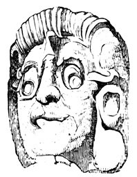
Colossal Head.
Two thirds of the distance up the eastern steps at u, is the colossal head of the cut, which is about six feet high. Two other immense heads are overturned at the foot of the same slope; another is half-way up the southern steps at w; while numerous fragments of sculpture are scattered over the steps and pavement in every direction. There are no idols or altars here, but six circular stones from one foot and a half to three feet in diameter, found at the foot of the western stairway of the passage C, C, may have supported idols or columns originally.[III-26]
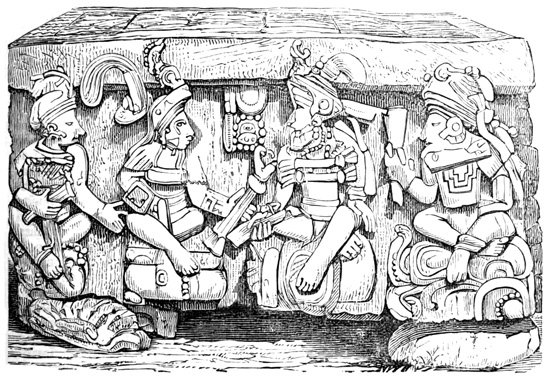
Altar in the Temple of Copan.
ALTAR OF THE TEMPLE.
In the court B, the only relic beside the statue No. 1 is a remarkable stone monument, generally termed an altar, at x. This is a solid block of stone six feet square and four feet high, resting on four globular 98 stones, one under each corner. On the sides are carved sixteen human figures in profile, four on each side. Each figure is seated cross-legged on a kind of cushion which is apparently a hieroglyphic, among whose characters in two or three cases the serpent is observable. Each wears a breastplate, a head-dress like a turban,—no two being, however, exactly alike—and holds in one hand some object of unknown significance. The cut shows the north front of the altar. The two central figures on this side sit facing each other, with a tablet of hieroglyphics between them, and may readily be imagined to represent two kings or chiefs engaged in a consultation on important matters of state. According to Mr Stephens' text the other fourteen figures are divided into two equal parties, each following its 99 leader. But the plates represent all those on the east and west as facing the south, while those on the south look toward the west. The top is covered with hieroglyphics in thirty-six squares, as shown the cut on the preceding page. A peculiarity of this altar is that its sculpture, unlike that of all the other monuments of Copan, is in low relief.[III-27]
MISCELLANEOUS RELICS.
The head shown in the cut is one of the fragments lying on the ground at the foot of the terraces that inclose the quadrangle H. On the slopes of these 100 terraces, particularly of the eastern slope of the pyramid e, half-way from top to bottom, are rows of death's heads in stone. It is suggested that they represent the skulls of apes rather than of human beings, and that this animal, abundant in the country, may have been an object of veneration among the ancient people. One of the skulls is shown in the cut. The next cut pictures the head of an alligator carved in stone, found among the group of idols towards the south. Another is mentioned by Col. Galindo, as holding in its open jaws a figure, half human, half beast. A gigantic toad, standing erect, with human 101 arms and tiger's claws, was another of the relics discovered by the same explorer, together with round plain stones pierced by a hole in the centre. Mr Davis talks of an architrave of black granite finely cut; and M. Waldeck corrects a statement, in a work by Balbi, that marble beds are to be found here. The portrait in the cut is from the fragments found at the north-west corner of the temple near b.[III-28] 102
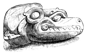
Alligator's Head at Copan.
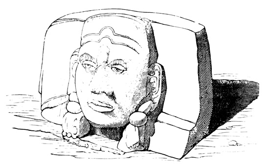
Copan Portrait.
GENERAL CONCLUSIONS.
Most of the general reflections and speculations on Copan indulged in by observers and students refer to other ruined cities in connection with this, and will be noted in a future chapter. It is to be remarked that besides pyramids and terraced walls, no traces whatever of buildings, public or private, remain to guide us in determining the material or style of architecture affected by the former people of this region. The absence of all traces of private dwellings we shall find universal throughout America, such structures having evidently been constructed of perishable materials; but among the more notable ruins of the Pacific States, Copan stands almost alone in its total lack of covered edifices. There would seem to be much reason for the belief that here grand temples of wood once covered these mighty mounds, which, decaying, have left no trace of their former grandeur.
Col. Galindo states that the method of forming a roof here was by means of large inclined stones. If this be a fact, it must have been ascertained from the sepulchral vault in the temple court, concerning the construction of which both he and Stephens are silent. The top of the gallery leading through the river-wall would indicate a method of construction by means of over-lapping blocks, which we shall find employed exclusively in Yucatan and Chiapas. No article of any metal whatever has been found; yet as only one burial deposit has been opened, it is by no means certain that gold or copper ornaments were not employed. That iron and steel were not used for cutting implements, is clearly proved by the fact that hard flinty spots in the soft stone of the statues are left uncut, in some instances where they interfere with the details of the sculpture. Indeed, the chay-stone points found among the ruins are sufficiently hard to work the soft material, and although in some cases they seem to have required the use of metal in their own making, yet when we consider the well-known skill of even the most savage tribes in the manufacture of flint weapons 103 and implements, the difficulty becomes of little weight. How the immense blocks of stone of which the obelisks were formed, were transported from the quarry, several miles distant, without the mechanical aids that would not be likely to exist prior to the use of iron, can only be conjectured.
The absence of all implements of a warlike nature, extending even to the sculptured decorations of idol and altar, would seem to indicate a population quiet and peaceable rather than warlike and aggressive; for though it has been suggested that implements of war are not found here simply because it is a place sacred to religion, yet it does not appear that any ancient people has ever drawn so closely the line between the gods of war and the other divinities of the pantheon.[III-29]
Of the great artistic merit of the sculpture, particularly if executed without tools of metal, there can be no question. Mr Stephens, well qualified by personal observation to make the comparison, pronounces some of the specimens "equal to the finest Egyptian sculpture."[III-30] Mr Foster believes the flattened forehead of the human profile on the altar-sides to indicate a similar cranial conformation in the builders of the city.[III-31]
With respect to the hieroglyphics all that can be said is mere conjecture, since no living person even claims the ability to decipher their meaning. They have nothing in common with the Aztec picture-writing, which, consequently, affords no aid in their study. The characters do, however, appear similar to, 104 if not identical with, some of those found at Palenque, in Yucatan, in the Dresden Codex, and in the Manuscript Troano. When the disciples of Brasseur de Bourbourg shall succeed in realizing his expectations respecting the latter document, by means of the Landa alphabet, we may expect the mystery to be partially lifted from Copan. It is hard to resist the belief that these tablets hold locked up in their mystic characters the history of the ruined city and its people, or the hope that the key to their significance may yet be brought to light; still, in the absence of a contemporary written language, the hope must be allowed to rest on a very unsubstantial basis.[III-32]
ORIGIN OF THE RUINS.
Concerning the age and origin of the Copan monuments, as distinguished from other American antiquities, there are few or no facts on which to base an opinion. The growth of trees on the works, and the accumulation of vegetable material can in this tropical climate yield but very unsatisfactory results in this direction. Copan is, however, generally considered the oldest of American cities; but I leave for the present the matter of comparison with more northern relics. Palacio claims to have found among the people a tradition of a great lord who came from Yucatan, built the city of Copan, and after some years returned and left the newly built town desolate; a tradition which he inclines to believe, because he says the same language is understood in both regions, and he had 105 heard of similar monuments in Yucatan and Tabasco. Among the inhabitants of the region in later times, there is no difference of opinion whatever with respect to the origin of the ruins or their builders; they are unanimous in their adherence to the 'quien sabe' theory. 106
The State of Guatemala—a Land of Mystery—Wonderful Reports—Discoveries Comparatively Unimportant—Ruins of Quirigua—History and Bibliography—Pyramid, Altars, and Statues—Comparison with Copan—Pyramid of Chapulco—Relics at Chinamita—Temples of Micla—Cinaca-Mecallo—Cave of Peñol—Cyclopean Débris at Carrizal—Copper Medals at Guatemala—Esquimatha—Fortification of Mixco—Pancacoya Columns—Cave of Santa María—Mammoth Bones at Petapa—Rosario Aqueduct—Ruins of Patinamit, or Tecpan Guatemala—Quezaltenango, or Xelahuh—Utatlan, near Santa Cruz del Quiché—Zakuléu near Huehuetenango—Cakchiquel Ruins in the Region of Rabinal—Cawinal—Marvelous Ruins Reported—Stephens' Inhabited City—Antiquities of Peten—Flores—San José—Casas Grandes—Tower of Yaxhaa—Tikal Palaces and Statues—Dolores—Antiquities Of Belize.
GUATEMALA.
Above the isthmus of Honduras the continent widens abruptly, forming between the Rio Motagua and Laguna de Terminos on the Atlantic, the Rio Paza and bar of Ayutla on the Pacific, a territory which stretches some five hundred and fifty miles from north to south, with a nearly uniform width of two hundred miles from east to west. Dividing this territory into two nearly equal portions by a line drawn near the eighteenth parallel of latitude, the northern part, between the bay of Chetumal and Laguna de Terminos, is the peninsula of Yucatan; while that 107 portion lying south of the dividing line constitutes the republic of Guatemala and the English province of Belize, which latter occupies a strip along the Atlantic from the gulf of Amatique northward. The Pacific coast of Guatemala for an average width of seventy miles is low and unhealthy, with few inhabitants in modern, as, judging from the absence of material relics, in ancient times. Then comes a highland tract which contains the chief towns and most of the white population of the modern republic; succeeded by the yet wilder and more mountainous regions of Totonicapan and Vera Paz, chiefly inhabited by comparatively savage and unsubdued aboriginal tribes; from which we descend, still going northward towards Yucatan, into the little-explored lake region of Peten. At the time of its conquest by the Spaniards, Guatemala was the seat of several powerful aboriginal kingdoms, chief among which were those of the Quichés and Cakchiquels. They fought long and desperately in defence of their homes and liberty, and when forced to yield before Spanish discipline and arms, the few survivors of the struggle either retired to the inaccessible fastnesses of the northern highlands, or remained in sullen forced submission to their conquerors in the homes of their past greatness—the aboriginal spirit still unbroken, and the native superstitious faith yielding only nominally to Catholic power and persuasion. Here and in the adjoining state of Chiapas the natives probably retain to the present day their original character with fewer modifications than elsewhere in the Pacific States.
By reason of the peculiar nature of the country, the grandeur of its mountain scenery, the existence of large tracts almost unknown to white men, the desperate struggles of its people for independence, their wild and haughty disposition, and their strange and superstitious traditions, Guatemala has always been a land of mystery, particularly to those who delight in antiquarian speculations. A residence at Rabinal in 108 close contact with the native character in its purest state first started in the mind of the Abbé Brasseur de Bourbourg the train of thought that has since developed into his most startling and complicated theories respecting American antiquity; and Guatemala has furnished also many of the documents on which these theories rest. Few visitors have resisted the temptation to indulge in speculative fancies or to frame far-reaching theories respecting ancient ruins or possibly flourishing cities hidden from the explorer's gaze in the depths of Guatemalan forests and mountains.
And yet this mysterious land, promising so much, has yielded to actual exploration only comparatively trifling results in the form of material relics of antiquity. The ruins scattered throughout the country are indeed numerous, but with very few exceptions, besides being in an advanced state of dilapidation, they are manifestly the remains of structures destroyed during the Spanish conquest. Important as proving the accuracy of the reported power and civilization of the Quichés and Cakchiquels, and indirectly of the Aztecs in Anáhuac, where few traces of aboriginal structures remain for our study, they are still unsatisfactory to the student who desires to push his researches back into the more remote American past.
RUINS OF QUIRIGUA.
Beginning with the province of Chiquimula, bordering on Honduras and composed for the most part of the valley of the Motagua and its tributaries, the first ruin of importance, one of the exceptions noted above to the general character of Guatemalan antiquities, is found at Quirigua, fifty miles north-east of Copan, on the north side of the Motagua, about sixty miles above its mouth, and ten miles below Encuentros where the royal road, so called, from Yzabal to Guatemala crosses the river. The stream is navigable for small boats to a point opposite the ruins, which are in a cedar-forest on low moist ground nearly a mile from the bank.[IV-1] Our only knowledge respecting this 109 ancient city comes through Mr Catherwood and Dr Scherzer. The former, traveling with Mr Stephens, visited the locality in 1840 in company with the Señores Payes, proprietors of the estate on which the ruins stand, and by his description Quirigua first was made known to the world. Mr Stephens, on hearing Catherwood's report, entered into negotiations with the owners of the land for its purchase, with a view to shipping the monuments to New York, their location on the banks of a navigable stream being favorable for the execution of such a purpose; but the interference of a European official so raised the market value of ancient real estate that it was found necessary to abandon the scheme. Dr Karl Scherzer's visit was in 1854, and his account, published in the Transactions of the Royal Austrian Academy of Science, and also reprinted in pamphlet form, is the most extensive and complete extant.[IV-2] Nothing like a thorough exploration 110 has been made even in comparison with those of Copan and other Central American ruins; but monuments and fragments thus far brought to light are found scattered over a space of some three thousand square feet, on the banks of a small creek which empties into the Motagua. The site is only very slightly elevated above the level of the river, and is consequently often flooded in times of high water; indeed, during a more than ordinary freshet in 1852, after Mr Catherwood's visit, several idols were undermined and overthrown. No aboriginal name is known for the locality, Quirigua being merely that of a small village at the foot of Mount Mico, not far distant. There being no plan extant by which to locate the different objects to be mentioned in this old centre of civilization, I will give the slight descriptions obtainable, with very slight reference to their arrangement, beginning with the pyramid which seems to occupy a somewhat central position round which the other relics are grouped. Catherwood's description of this structure is limited to the statement that it is "like those at Copan, with the steps in some places perfect," and twenty-five feet high. Scherzer's account only adds that it is constructed of neatly cut sandstone in regular oblong blocks, and is very much ruined, hardly more, in fact, than a confused mass of fragments, among which were found some pieces of fine white marble. But under this structure there is, it seems, a foundation, an artificial hill, or mound, of rough stones without mortar. The base is an irregular square, the dimensions of which are not stated, with a spur extending toward the south. The steps which lead up 111 the sides to the super-imposed structure are only eight or nine inches high and six or seven inches in width, remaining intact only at a few points. In the upper part of the mound are two or three terraces, on the first of which several recesses, or niches, of no great extent are noticed; they are lined with small rough stones, plastered, and in a good state of preservation, details which indicated to the observer that these niches may be of more modern origin than the rest of the ruin. There are no traces of openings to show that the hill contained underground apartments; neither are there any sculptures on the hewn stones of the pyramid itself, nor any idols or carved fragments found on the surface of the mound.
Very near the foot of the mound Mr Catherwood found a moss-covered colossal head six feet in diameter, and a large altar, both relics being within an enclosure.[IV-3] Scherzer also describes several monuments near the pyramid, some of which may be identical with the ones mentioned by Catherwood, although he says nothing of an enclosure. The first is a stone of a long oval form like a human head, six feet high and thirty-five feet in circumference, the surface being covered with carved figures in demi-relief, which for some reason have been better preserved and present clearer outlines than other carvings at Quirigua. One of the most clearly defined of these sculptures represents a sitting female, whose legs and hands are wanting, but whose arms hang down to the ground. A prominent feature is her head-dress, sixteen inches high, the upper part of which is an idol's head crowned with a diadem. The forehead is described as narrow, depressed above and projecting below. The features are indistinct, but the form of the head is of what Scherzer terms the Indian 112 type. On the south side of this block, or altar, is the rude figure of a turtle five feet high. The top is covered with ornamental figures representing plants and fruits, all the varieties there delineated being such as still flourish in this region. The sides bear also faint indications of hieroglyphics. Dr Scherzer believes that the stone used in the construction of this altar must have been found on the spot, since by reason of its great size it could not have been brought from a distance with the aid of any mechanical appliances known to native art.[IV-4] The second of these monuments is like a mill-stone, four feet in diameter and two feet thick, cut from harder material than the other objects. A tiger's head nearly covers one side of the disk, and the rest of the surface, including the rim, is covered with hieroglyphics, several of these mysterious signs appearing on the animal's forehead. The third of the relics found near the pyramid is a fragment eighteen feet long and five feet wide, the upper portion having disappeared. The human face appears at different points among its hieroglyphics and ornaments.
STATUES OF QUIRIGUA.
Three or four hundred yards northward from the mound, and at the foot of a 'pyramidal wall,' concerning which we have no information beyond the mention of its existence, is a group of sculptured idols, pillars, or obelisks, standing in the forest like those in the sacred enclosure at Copan. Indeed, they bear a strong resemblance to the latter, except in their greater height and less elaborate sculpture, which is also in lower relief. Twelve of them are definitely mentioned, the smallest of which is nine feet high, and the largest twenty-six feet above ground, increasing in size toward the top, leaning twelve feet out of the perpendicular, and requiring, of course, some six or eight feet below 113 the surface to sustain its weight in such a position.[IV-5] They are from two to three feet thick and four to six feet wide. In most instances a human face, male or female, appears on the front or back or both; while the sides are covered for the most part with hieroglyphics, which are also seen on various parts of the dress and ornaments. One statue is, however, mentioned, which, although crowded with ornaments, has no character, apparently, of hieroglyphic nature. One of the idols, twenty-three feet high, stands on a stone foundation projecting some fifteen feet; and another, circular instead of rectangular in form, rests on a small mound, within a wall of stones enclosing a small circular area.[IV-6] In one the human figure has a head-dress of which an animal's head forms a prominent part, while in yet another the head is half human and half animal. In both cases the aim of the artist would seem to have been to inspire terror, as in the case of some Nicaraguan idols already noticed. Mr Catherwood made sketches of two of the obelisks, including the leaning one, the largest of all; but as he could not clean them of moss in the limited time at his disposal, he makes no attempt to give the details of sculpture, and a reproduction of the plates is therefore not deemed necessary. The two monuments sketched by him could not be found at all by Dr Scherzer. The Quirigua idols have not, like those at Copan, altars in front of them, but several altars, or apparently such, were found buried in moss and earth, and not carefully examined by either of the explorers. They are usually of round or oval form, with hieroglyphically inscribed sides; and one of them, within the circular wall with steps, already mentioned as enclosing one of the statues,[IV-7] is described as supported 114 by two colossal heads. Many fragments were noticed which are not described; and here as elsewhere monuments superior to any seen were reported to exist by enthusiastic guides and natives; in which latter class of antiquities are eleven square columns higher than those mentioned, and also a female holding a child, and an alligator's head in stone.[IV-8] The material of all the stone work of Quirigua is a soft coarse-grained sandstone, not differing materially, so far as I can judge, from that employed at Copan. It is the prevalent formation at both localities, and may be quarried readily at almost any point in the vicinity.
Absolutely no traditions have been preserved respecting Quirigua in the days when its monuments were yet intact, when a large town, which has left no traces, must have stood in the immediate vicinity.[IV-9] The idols scattered over the surface of the ground, instead of being located on the pyramids, may indicate here as at Copan that the elevations served as seats for spectators during the religious ceremonies, rather than as temples or altars on which sacrifice was made. Both observers agree on the general similarity between the monuments of Quirigua and Copan,[IV-10] and the hieroglyphics are pronounced identical. Indeed, it seems altogether probable that they owe their existence to the same era and the same people. Mr Stephens notes, besides the greater size and lower 115 relief of the Quirigua monuments, that they are "less rich in design, and more faded and worn, probably being of a much older date." Dr Scherzer speaks of the greater plumpness of the sculptured figures, and has no faith in their great antiquity, believing that the low-relief carvings on so soft a material, would, when exposed in an atmosphere so moist, have been utterly obliterated in a thousand years.[IV-11]
CHAPULCO AND CHINAMITA.
At Chapulco, a few leagues below Quirigua, on the opposite side of the Motagua, one traveler speaks of a quadrilateral pyramid with terraced sides, up which steps lead to the summit platform, where débris of hewn stone are enveloped in a dense vegetation. Also at Chinamita, some sixteen miles above Quirigua on the same side of the river, the same authority reports a large area covered with aboriginal relics, in the form of ruined stone structures, vases and idols of burned clay, and monoliths buried for the most part in the earth. Of course, with this meagre information, it is impossible to form any definite idea of what these ruins really are, and whether they should be classed with Quirigua and Copan, or with a more modern class of Guatemalan antiquities. The same remark will apply also to many of the localities of this state, of whose relics we have no description in detail.[IV-12]
At Micla, or Mimilla, some three leagues north of lake Guijar, or Uxaca, which is on the boundary between Guatemala and Salvador, traces of a sacred town with its cues and temples are spoken of as visible in 1576. They are represented as of the class erected by the Pipiles who occupied the region at the time of the conquest.[IV-13]
CINACA-MECALLO.
Still farther south-west towards the coast, a few 116 miles south, of Comapa, are the ruins of Cinaca-Mecallo, a name said to mean 'knotted rope.' The Rio Paza here forms the boundary line between the two states, and from its northern bank rises abruptly a mountain chain. On the summit, at a point commanding a broad view over a large portion of Salvador, is a plain of considerable extent, watered by several small mountain streams, which unite and fall over a precipice on the way to the river below. On the highest portion of this summit plain interesting works of the former inhabitants have been discovered by D. José Antonio Urrutia, padre in charge of the church at Jutiapa.[IV-14] The remains of Cinaca-Mecallo cover an oval area formerly surrounded by a wall, of which fragments yet remain sufficient to mark the line originally followed. Within this space are vestiges of streets, ruined buildings, and subterranean passages. Padre Urrutia makes special mention of four monuments. The first is what he terms a temple of the sun, an excavation in the solid rock opening towards the rising sun, and having at its entrance an archway known to the natives as 'stone of the sun,' formed of stone slabs closely joined. On these slabs are carved in low relief figures of the sun and moon, to which are added hieroglyphics painted on the stone with a very durable kind of red varnish. There are also some sculptured hieroglyphic signs on the interior walls of this artificial cavern. The second monument is a great slab covered with carved inscriptions, among which were noted a tree and a skull, emblematic, according to the padre's views, of life and death. Next is mentioned the representation of a tiger or other wild animal cut on the side of a large rock. This monument is, it appears, some distance from the 117 other ruins, and is conjectured by Urrutia to be a commemoration of some historical event, from the fact that the natives still celebrate past deeds of valor by dances, or scenic representations, in which they dress in imitation of different animals. Mr Squier suggests farther that the event thus commemorated may have been a conflict between the Pipiles and the Cakchiquels, in which the latter were driven permanently from this district. The fourth and last of these monuments is one of the subterranean passages which the explorer penetrated until he reached a kind of chamber where were some sculptured blocks. This underground apartment is celebrated among the natives as having been in modern times the resort of a famous robber chief, who was at last brought to bay and captured here in his stronghold. The material employed in all the Cinaca-Mecallo structures is a slate-like stone in thin blocks, joined by a cement which resembles in color and consistence molten lead. Some of the carved blocks were sent by the discoverer as specimens to the city of Guatemala. Outside the walls are tumuli of earth and small stones, with no sculptured fragments. These are supposed to be burial mounds, and to vary in size according to the rank and importance of the personages whose resting-places they mark.
Proceeding now north-eastward to the region lying within a circle of fifty miles about the city of Guatemala as a centre, we have a reported cave on the hacienda of Peñol, perhaps twenty-five miles east of Guatemala, which is said to have been explored for at least a distance of one mile, and is believed by the credulous natives to extend eleven leagues through the mountain to the Rio de los Esclavos. In this cavern, or at least on the same hacienda, if we may credit Fuentes, human bones of extraordinary size were found, including shin-bones about five feet in length. These human relics crumbled on being touched, but fragments were carefully gathered up and sent to 118 Guatemala, since which time nothing is known of them.[IV-15] On the hacienda of Carrizal, some twenty miles north of Guatemala, we hear of cyclopean débris, or masses of great unhewn stones heaped one on another without cement, and forming gigantic walls, which cover a considerable extent of territory on the lofty heights that guard the approaches to the Motagua Valley.[IV-16]
COPPER MEDALS AND FORTIFICATIONS.
The immediate vicinity of Guatemala seems not to have yielded any antiquarian relics of importance. M. Valois reports the plain to be studded with mounds which the natives regard as the tombs of their ancestors, which others have searched for treasure, but which he believes to be ant-hills.[IV-17] Ordoñez claims to have found here two pure copper medals, fac-similes one of the other, two inches in diameter and three lines thick, a little heavier than a Mexican peso fuerte, engraved on both sides, as shown in the cut, which I give herewith notwithstanding the fact that this must be regarded as a relic of doubtful authenticity. 119 M. Dupaix noticed an indication of the use of the compass in the centre of one of the sides, the figures on the same side representing a kneeling, bearded, turbaned man, between two fierce heads, perhaps of crocodiles, which appear to defend the entrance to a mountainous and wooded country. The reverse presents a serpent coiled round a fruit-tree, and an eagle—quite as much like a dove or crow or other bird—on a hill. There are, besides, some ornamental figures on the rim, said to resemble those of Palenque, and, indeed, Ordoñez refers the origin of these medals to the founders of that city. He kept one of them and sent the other to the king of Spain in 1794.[IV-18]
About 1860, a stone idol forty inches high was dug up in a yard of the city, where it had been buried fifty years before, having been brought by the natives from a point one hundred and fifty miles distant. Its discovery was mentioned at a meeting of the American Ethnological Society in 1861, by Mr Hicks. The same gentleman also spoke of the reported discovery of a great city in ruins in the province of Esquimatha, buried in a dense forest about fifty-six miles from the city.[IV-19]
A few leagues west of the city are the ruins of Mixco, a fortified town of the natives down to the time of the conquest, mentioned by several authorities but described by none. Fuentes, however, as 120 quoted by Juarros, speaks of a cavern on a small ridge by the side of the ruins. The entrance was a Doric portico of clay about three feet wide and high. A flight of thirty-six stone steps leads down to a room one hundred and twenty feet square, followed by another flight still leading downward. This latter stairway no one has had the courage to fully explore, on account of the tremulous and insecure condition of the ground. Eighteen steps down this second flight, however, is an arched entrance on the right side, to a passage which, after a descent of six steps, has been explored for a distance of one hundred and forty feet. Furthermore, the author tells us there are some extravagant (!) accounts not worthy of implicit belief, and consequently not repeated by him. Hassel states that gigantic bones have been found here, and that the cave is natural, without any artificial improvements whatever.[IV-20]
In this same valley, where the Pancacoya River enters the Xilotepec, Juarros speaks of "a range of columns curiously wrought, with capitals, mouldings, etc.; and a little farther on there are several round cisterns formed in the rock." The cisterns are about four feet in diameter and three feet deep, and may have served originally, as the author remarks, for washing auriferous earths in the search for gold.[IV-21] The Santa María River, near its junction with the Motagua, is said to flow for a long distance underground, and at the entrance to its subterranean channel are reported some carvings, the work of human hands, but from superstitious fears the interior of this bewitched cave has never been explored.[IV-22]
PETAPA, ROSARIO, AND PATINAMIT.
Petapa, twelve or fifteen miles southward from Guatemala 121 on Lake Amatitlan is another of the localities where the old authors report the discovery of mammoth human bones, including a tooth as large as a man's two fists. Such reports, where they have any other than an imaginary foundation, may probably result from the finding of animal bones, by which the good padres were deceived into the belief that they had come upon traces of the ancient giants reported in all the native traditions, which did not seem to them unworthy of belief, since they were told elsewhere that "there were giants on the earth in those days."[IV-23]
At Rosario, eight or ten miles south of the same lake, we have a bare mention of a beautiful aqueduct in ruins.[IV-24] Twenty-five or thirty miles west of the lake, at the western foot of the volcano of Fuego, Don José María Asmitia, a Guatemalan official of antiquarian tendencies, reports the discovery on his estate of a well-preserved aqueduct, constructed of hewn stone and mortar, together with nine stone idols each six feet in height. He proposed to make, at an early date, more thorough explorations in that vicinity. Like other explorers he had his theory, although he had not personally seen even the relics on his own estate; deriving the American culture from a Carthaginian source.[IV-25] Farther south on the Pacific lowlands, at a point called Calche, between Escuintla and Suchiltepeques, the Abbé Brasseur speaks of a pyramid cut from solid stone, which had been seen by many Guatemalans.[IV-26]
RUINS OF PATINAMIT.
Passing now north-westward to the region lying about Lake Atitlan, and noting that the town of Sololá on the northern lake-shore is said to be built on the ruins of the aboriginal Tecpan Atitlan,[IV-27] we come to the ruins of the ancient Patinamit, 'the city', the 122 Cakchiquel capital. It is near[IV-28] the modern town of Tecpan Guatemala, fifteen miles south-east of the lake, and forty miles north-west of Guatemala. The aboriginal town, to which Brasseur de Bourbourg would assign a very ancient, pre-Toltec origin, was inhabited down to the time when the conquistadores came, and was by them destroyed. With the state of the city as found and described by them, I have, of course, nothing to do in this volume, having simply to record the condition of the ruins as observed at subsequent periods, although in the descriptions extant the two phases of the city's condition are considerably confounded. The remains are found on a level plateau having an area of several square miles, and surrounded by a ravine from one hundred to four hundred feet in depth, with precipitous sides. The plateau is accessible at one point only by a path artificially cut in the side of the barranca, twenty to thirty feet deep, and only wide enough to permit the passage of a single horseman. At the time of Mr Stephens' visit nothing was visible but confused irregular masses, or mounds, of fallen walls, among which, however, could still be made out the foundations of two buildings, one of them fifty by one hundred feet. Two sculptured figures were pointed out by the natives, lying on the ground, on one of which the nose and eyes of some animal were discernible. Fuentes, who wrote in the century following the conquest, observed, during his examination of the city, more definite traces of its former grandeur. Two gates of chay-stone afforded entrance to the narrow passage which led up to the plateau; a coating, or layer, of clay covered the soil to a depth of two feet; and a trench six or eight feet deep, faced with stone and having also a breastwork of masonry three feet high, running north and south across the table, divided the city's site into two portions, inhabited, as is suggested, respectively by the 123 plebeian and aristocratic classes of its original citizens. The street-lines, crossing each other at right angles, were traceable, indicating that the city was regularly laid out in blocks. One of the structures whose foundations were then to be seen was a hundred yards square, besides which there remained the ruins of what is described as a palace, and of several houses. West of the city, on a mound six feet high, was "a pedestal formed of a shining substance, resembling glass." Brasseur also mentions 'vastes souterrains,' which, as usual, he does not deign farther to describe. The modern town is built to a considerable extent, and its streets are paved, with fragments of the hewn stone from Patinamit, which have been carried piece by piece on the backs of natives up and down the sides of the barranca. The aborigines still look with feelings of superstitious respect on this memorial of their ancestral glory, and at times their faithful ears detect the chimes of bells proceeding from beneath the hill. A famous black stone was, in the days of aboriginal independence, an object of great veneration in the Cakchiquel religious rites connected with the fate of prisoners, its shrine being in the depths of a dark ravine near at hand. In Fuentes' time it had been consecrated by the Catholic bishop and placed on the altar of the church. He describes it as of singular beauty and about eighteen inches square. Stephens found it still on the altar, the object of the people's jealous veneration; and when his Spanish companion had, with sacrilegious hand, to the infinite terror of the parish priest, ripped open the cotton sack in which the relic was enveloped, there appeared only a plain piece of ordinary slate measuring ten by fourteen inches. Brasseur de Bourbourg, however, believes that the former visitors were both in error, and that the original black stone was never permitted to fall into the hands of the Spanish unbelievers.[IV-29] At Patzun, 124 a native pueblo near Tecpan Guatemala, two mounds were noticed, but not opened.[IV-30]
Quezaltenango, the aboriginal Xelahuh, is some twenty-five or thirty miles westward from Lake Atitlan. In the days of Quiché power this city was one of the largest and most powerful in the land. I find no evidence that any remains of the town itself are to be seen, though Wappäus speaks of such remains, even classing them with the most ancient type of Guatemalan antiquities. Two fortresses in this vicinity, however, Olintepec and Parrazquin, supposed to have guarded the approaches to Xelahuh, are said to have left some traces of their former strength.[IV-31]
RUINS OF UTATLAN.
Thirty miles farther back in the mountains north-eastward from Quezaltenango, toward the confines of Vera Paz, was Utatlan, 'road of the waters,' in the native language Gumarcaah, the Quiché capital and stronghold, at the modern town of Santa Cruz del Quiché. This city was the richest and most magnificent found by the Spaniards south of Mexico, and at the time of its destruction by them was, unlike most aboriginal American towns, in its highest state of prosperity. Slight as are the ruins that remain, they are sufficient to show that the Spanish accounts of the city's original splendor were not greatly exaggerated; this, with the contrasts which these ruins present in the absence of statues, sculpture, and hieroglyphics, and in other 125 respects, when compared with those of Quirigua and Copan, constitutes their chief importance in archæological investigations. Like Patinamit, Utatlan stood on a plateau, or mesa, bounded by a deep ravine on every side, a part of which ravine is believed to be of artificial construction. The barranca can only be crossed and the site of the city reached at one point, from the south-east. Guarding this single approach, at the distance of about half a mile from the village of Santa Cruz, are the ruins of a long line of structures of carefully laid hewn stone, evidently intended as fortifications and connected one with another by a ditch. Within this line and more immediately guarding the passage, is an immense fortress, El Resguardo, one hundred and twenty feet high, in the form of a square-based pyramidal structure, with three ranges of terraces, and steps leading up from one to another. A stone wall, plastered with a hard cement, incloses the area of the summit platform, in the centre of which rises a tower furnished with steps, which were also originally covered with cement. Crossing the barranca from the fort Resguardo, we find the table which was the site of the ancient city covered throughout its whole extent with shapeless masses of ruins, among which the foundations of a few structures only can be definitely made out. The chief edifice, known as the grand castle, or palace, of the Quiché kings, and said to have been in round numbers eleven hundred by twenty-two hundred feet, occupied a central position. Its upper portions have been carried away and used in the construction of the modern town, but in 1810, if we may trust the cura of the parish, the building was still entire. The floors remain, covered with a hard and durable cement, and also fragments of the partition walls sufficient to indicate something of the original ground plan. A plaster of finer quality than that employed on the floors and pyramids, covers the inner walls, with evident traces of having been colored or painted. The ruins of a 126 fountain appear in an open court-yard, also paved with cement. Another structure, El Sacrificatorio, still visible, is a pyramid of stone sixty-six feet square at the base and, in its present state, thirty-three feet high, the plan and elevation of which are shown in the cuts. Each side except the western is ascended by a flight of nineteen steps, each step eight inches wide and seventeen inches high. The western side is covered with stucco, laid on, as is ascertained by careful examination, in several successive coatings, each painted with ornamental figures, among which the body of a leopard only could be distinguished. The pyramid is supported by a buttress in each of the four corners, diminishing in size toward the top. The summit is in ruins, but our knowledge of the Quiché religious ceremonies, as set forth in the preceding volume of this work, leaves little doubt that this was a place of sacrifice and supported an altar. No sculpture has been found in connection with the ruins of Utatlan. Its absence is certainly remarkable; but it is to be noted that the natives of this region have always been of a haughty, unsubdued spirit, ardently attached to the memory of their ancestors; and the destruction or concealment of their idols with a view to keep them from the sacrilegious touch and gaze of the white man, would be in accordance with their well-known character. They have the greatest respect for the holy pyramid on the plateau, and at one time when 127 the reported discovery of a golden image prompted the destruction of the palace in search of treasure, the popular indignation on the part of the natives presaged a serious revolt and compelled the abandonment of the scheme, not, however, until the walls had been razed. Flint arrow-heads are mentioned as of frequent occurrence among the débris of fortifications outside the barranca, and a Spanish explorer in 1834 found a sitting figure twelve inches high, and two heads of terra cotta exceedingly hard, smooth, and of good workmanship. One of the heads was solid, the other and the idol were hollow. The annexed cut shows the sitting figure. Under one of the buildings is an opening to what the natives represented as a subterranean passage leading by an hour's journey to Mexico, but which only revealed to Mr Stephens, who entered it, the presence of a roof formed by overlapping stones. This form of arch will be described in 128 detail when I come to speak of more northern ruins, where it is of frequent occurrence. That a long time must have passed between the erection of Copan and Utatlan, the civilization of the builders meantime undergoing great modifications, involving probably the introduction of new elements from foreign sources, is a theory supported by a careful study of the two classes of remains. For an account of Utatlan and other Guatemalan cities as they were in the time of their aboriginal glory, I refer the reader to Volume II. of this work.[IV-32] The cura at Santa Cruz del Quiché said he had seen human skulls of more than natural size, from a cave in a neighboring town.[IV-33]
RUINS OF HUEHUETENANGO OR ZAKULÉU.
North-westward from Utatlan, thirty or forty miles distant, in the province of Totonicapan, is the town of Huehuetenango, and near it, located like Utatlan on a ravine-guarded plain, are the ruins of Zakuléu, the ancient capital of the Mams, now known popularly 129 as Las Cuevas. These remains are in an advanced state of dilapidation, hardly more than confused heaps of rubbish scattered over the plain, and overgrown with grass and shrubs. Two pyramidal structures of rough stones in mortar, formerly covered with stucco, can, however, still be made out. One of them is one hundred and two feet square and twenty-eight high, with steps, each four feet in height and seven feet wide. The top is small and square, and a long rough slab found at the base may, as Mr Stephens suggests, have been the altar thrown down from its former position on the platform. There are also several small mounds, supposed to be sepulchral, one of which was opened, and disclosed within an enclosure of rough stones and lime some fragments of bone and two vases of fine workmanship, whose material is not stated but is probably earthen ware. One of them is shown in the cut, and bears a striking resemblance to some of the burial vases of Nicaragua.[IV-34] Another burial vault, not long enough, however, to contain a human being at full length, at the foot of one of the pyramids, was faced with cut stone, and from it the proprietor of the estate took a quantity of bones and the terra-cotta tripod shown in the cut. It has a polished 130 surface and is one foot in diameter. At a point on the river where the banks had been washed away at the time of high water, some animal skeletons of extraordinary size were brought to light. Mr Stephens saw in the bank the imprint of one of these measuring twenty-five or thirty feet in length, and others were said to be yet larger.[IV-35]
RUINS IN RABINAL VALLEY.
Extending eastward from the region of Huehuetenango to that of Salama in the province of Vera Paz, a distance of nearly one hundred miles, there seems to be a line of ruins, occurring at frequent intervals, particularly in the valley of the Rabinal and about the town of that name. A map of Guatemala now before me locates seventeen of these ruins, and M. Brasseur de Bourbourg incidentally mentions many of them by name, none of them, however, being anywhere described in detail. It is much to be regretted that the last-named author, during a residence at Rabinal, did not more fully improve his opportunities for the examination of these remains, or, at least, that he has never made known to the world the result of his investigations. All the ruins along this line would seem to 131 belong to the class of those occupied by the natives, chiefly Cakchiquels, at the time of the conquest, most of them being the remains of fortresses or fortified towns, built on strong natural positions at the river-mouths, guarding the entrance to fertile valleys.
Opposite the mouth of the River Rabinal, where the Pacalah empties into the Chixoy, or Usumacinta, are the ruins of Cawinal, visited by the Abbé Brasseur in 1856, and by him pronounced the finest in Vera Paz. They are situated on both sides of the stream in a fine mountain-girt valley, the approach to which was guarded by a long line of fortifications, pyramidal mounds, and watch-towers, whose remains may yet be seen. Among these structures is a pyramid of two terraces, forty feet high, ascended by a stairway of three flights, with the ruined walls of three small buildings on its summit. Near many of the old towns, especially in the Rabinal district, tumuli—cakhay, 'red houses'—very like in form and material to those of the Mississippi Valley are said to be numerous.[IV-36]
Besides the ruins actually seen and vaguely described, there are reports of others. The province is large and comparatively unexplored, its people wild and independent, and both have ever been to travelers the object of much mysterious conjecture, increasing in intensity as the northern region of Peten is approached. In 1850 Mr Squier wrote, "there has lately been discovered, in the province of Vera Paz, 132 150 miles north-east of Guatemala, buried in a dense forest, and far from any settlements, a ruined city, surpassing Copan or Palenque in extent and magnificence, and displaying a degree of art to which none of the structures of Yucatan can lay claim."[IV-37] The cura of Santa Cruz had once lived in Coban, some forty miles north of Rabinal, and four leagues from there he claimed to have seen an ancient city as large as Utatlan, its palace being still entire at the time of his visit.[IV-38] One Leon de Pontelli claims to have traveled extensively in these parts in 1859, and to have discovered many ancient and remarkable ruins of great cities, at points impossible to locate, somewhere about the confines of Vera Paz and Peten. Pontelli is not regarded as a trustworthy explorer, and no positive information whatever is to be obtained from his account.[IV-39]
Not only are cities in ruins reported to exist, but also somewhere in this region, four days' journey from Utatlan towards Mexico, an inhabited city in all its aboriginal magnificence is said to be visible, far out on the plain, from the summit of a lofty sierra. The cura of Santa Cruz before mentioned had gazed upon its glittering turrets and had heard from the natives traditions of its splendor, and the failure of all attempts on the part of white men to approach its walls for the purpose of a closer examination. One other man had the courage to climb the sierra, but on the day chosen for the ascent the city was rendered invisible by mists. The intelligence and general reliability of the good cura inclined Mr Stephens to put some faith in the accuracy of his report; others, however, not without reason, are sceptical about the matter.[IV-40] 133
PROVINCE OF PETEN.
Leaving the lofty highlands of Vera Paz, we descend northward to the province of Peten, a comparatively low region whose central portion is occupied by several large lakes. It is in this lake region chiefly that antiquities have been brought to light by the few travelers who have penetrated this far-off country, less known, perhaps, than any other portion of Central America. The Spaniards found the Itzas, a Maya branch from Yucatan, established here, their capital, Tayasal, a city of no small pretensions to magnificence, being on an island now known as Remedios, in Lake Itza, or Peten, where the town of Flores is now situated. Flores is built indeed on the ruins of the aboriginal city, which, however, has left no relics of sculpture or architecture to substantiate the Spanish accounts of its magnificent structures, which included twenty-one adoratorios. Rude earthen figures and vessels are, however, occasionally exhumed; and M. Morelet heard of one vase of some hard transparent material, very beautifully formed and ornamented. This relic had passed into the hands of a Tabascan merchant. Sr Fajardo, commissioner to establish the boundary between Mexico and Guatemala, furnished to Sr I. R. Gondra drawings of some nacas, or small idols, found in the Peten graves. Sr Gondra pronounces them similar to those of Yucatan as represented by Stephens.[IV-41] 134
On the north side of the lake is the small town of San José, and a spot two days' journey south-eastward from here—although this would, according to the maps, carry us back across the lake—is given as the locality of three large edifices buried in the forest, called by the natives Casas Grandes. All we know of them rests on the report of an Indian chief, who was induced by M. Morelet to depart from the characteristic reserve and secrecy of his race respecting the works of the antiguos; consequently the statement that the buildings are covered with sculptures in high relief, closely analogous to those of Palenque, must be accepted with some allowance.[IV-42]
Two days eastward of Lake Peten, on the route to Belize, is the lake of Yaxhaa, Yachá, or Yasja, one of the isles in which is said to be covered with débris of former structures. Col. Galindo, who visited the locality in 1831, is the only one who has written of the ruins from personal observation, and he only describes one structure, which he terms the most remarkable of all. This is a tower of five stories, each nine feet high, each of less length and breadth than the one below it, and the lower one sixty-six feet square. No doors or windows appear in the four lower stories, although Galindo, from the hollow sound emitted under blows, supposed them not to be solid. A stairway seven feet wide, of steps each four inches high, leads up to the base of the fifth story on the west, at 135 which point, as on the opposite eastern side, is an entrance only high enough for a man to crawl through on hands and knees. This upper story is divided into three apartments communicating with each other by means of low doors, and now roofless, but presenting signs of having been originally covered with the overlapping arch. The whole structure is of hewn stone laid in mortar, and no traces of wood remain. It is evident that this building is entirely different from any other monuments which we have thus far met in our progress northward, and further north we shall meet few if any of a similar nature. So far as the data are sufficient to justify conclusions, this may safely be classed with the older remains at Copan and Quirigua, rather than with the more modern Quiché-Cakchiquel structures. There are no means of determining with any degree of accuracy whether these buildings of Yaxhaa were the work of the Itzas or of a more ancient branch of the Maya people.[IV-43]
RUINS OF TIKAL.
About forty miles north-east from the eastern end of Lake Peten, in the foothills of the mountains, but in a locality inaccessible from the direction of the lake except in the dry season, from January to June, are the ruins of Tikal, a name signifying in the Maya language 'destroyed palaces.' So dry is the locality, however, during this dry season, that water must be carried in casks, or thirst quenched with the juice of a peculiar variety of reed that grows in the region. A more thorough search might reveal natural wells, which supplied water to the ancient inhabitants, as was the case further north in Yucatan. The ruined structures of Tikal are reported to extend over a space of at least a league, and they were discovered, although their existence had been previously reported 136 by the natives, in 1848, by Governor Ambrosio Tut and Colonel Modesto Mendez. From the pen of the latter we have a written description accompanied by drawings.[IV-44] Unfortunately I have not been able to examine the drawings made by Sr Mendez, whose text is brief and, in some respects, unsatisfactory.
TIKAL PALACES.
The chief feature at Tikal is the occurrence of many palaces or temples of hewn stone in mortar, on the summit of hills usually of slight elevation. Five of these are specially mentioned, of which three are to some extent described. The first is on a hill about one hundred and forty feet high, natural like all the rest so far as known, but covered in many places with masonry. A stairway about seventy feet wide leads up to the summit, on which stands a lofty stone palace, or tower, seventy-two by twenty-four feet at the base and eighty-six feet high, facing the east. The walls of the lower portion, or what may be regarded as the first story, are plain and coated with a hard cement. There is a niche five or six feet deep in the front, covered on the interior with paintings and hieroglyphics, and furnished with wooden rings at the top, as if for the suspension of curtains. At this point an attempt to penetrate to the interior of the structure showed the lower story to be solid, filled with earth and stones. The upper story has an ornamented and sculptured front, and there are ruins of a fallen balcony, or more probably a staircase which formerly led 137 up to the entrance. Nothing is said of the interior of the upper portion. The second structure is of the same dimensions as the first, and is built on a hill opposite, or eastward, which seems, however, to have no steps upon its sides. It is much damaged and fallen, but several of its rooms are well preserved, having the triangular-arched roof of overlapping stones, walls decorated with paintings and hieroglyphics, and corridors six and a half feet wide and over one hundred feet long, with windows, or air-holes, two and a half by four feet. The walls are nearly seven feet thick, and the top of the doorway at the entrance is of rough zapote beams. The third palace differs in no respect from the others, except that the zapote architrave of the chief entrance is carved in ornamental and hieroglyphic figures. In a kind of a court at the foot of the hill in front of the first palace were found eleven stone idols from five to six feet high. Three of the number stood on large round stone disks, or pedestals. About twenty of these disks, without idols, were also found, seven or eight of which bore indistinct medallion figures sculptured in low relief, and the rest were rough and apparently unfinished. Three oval stone disks were also dug out, as implied by Mendez' text, from the excavation under the first palace, although it is difficult to explain the presence of sculptured relics in such a situation. One of the stones measured five and a half by four by five and a half feet, and bore on one side the figure of a woman with decorated robe. The second bore the outlines of a supposed god, and the third a figure which the explorer profoundly concludes to have represented an eagle or a snake, but which may perhaps be taken for some other insect. On the road, just before reaching the ruins, fragments of pottery were noticed, and Governor Tut had also seen the figure of a bull well cut from stone lying on the bank of a lagoon some eight miles distant. It is evident that at or near Tikal was formerly a large city, and when we consider the 138 extent and importance of the ruins, the preceding description unaccompanied by plates may seem meagre and unsatisfactory. But after a perusal of the following chapter on the ruins of Yucatan, the reader will not fail to form a clear idea of those at Tikal; since all that we know of the latter indicates clearly their identity in style and in hieroglyphics with numerous monuments of the peninsula further north. It is therefore very probable that both groups are the work of the same people, executed at approximately the same epoch.
Colonel Mendez, while on his way to visit Tikal for the second time in 1852, accidentally discovered two other groups of ruins in the neighborhood of Dolores, south-eastward from Lake Peten and at about the same distance from the lake as Tikal. One group is south-east and eight miles distant from Dolores, and the other the same distance north-west. The former is called by the natives Yxtutz, and the latter Yxcum. There seem to have been made a description and some drawings of the Dolores remains, which I have not seen. Traces of walls are mentioned and monoliths sculptured in high relief, with figures resembling those at Copan and Quirigua rather than those at Tikal, although the hieroglyphics are pronounced identical with those of the latter monuments. Other relics are the figure of a woman dressed in a short nagua of feathers about the waist, fitting closely and showing the form of the leg; and a collection of sculptured blocks upon a round disk, on which are carved hieroglyphics and figures of the sun and moon with a prostrate human form before them.
RELICS IN BELIZE.
Near by on the Belize River is a cave in which several idols were discovered, probably brought here by the natives for concealment.[IV-45] There are found in the early Spanish annals of this region some accounts 139 of inhabited towns in this vicinity when the conquerors first came, of which these ruins may be the remains. I close the chapter on Guatemalan antiquities with two short quotations, embodying all I have been able to find respecting the ancient monuments of the English province of Belize, on the Atlantic coast eastward from Peten. "About thirty miles up the Balize River, contiguous to its banks are found, what in this country are denominated the Indian-hills. These are small eminences, which are supposed to have been raised by the aborigines over their dead; human bones, and fragments of a coarse kind of earthen-ware, being frequently dug from them. These Indian-hills are seldom discovered but in the immediate vicinity of rivers or creeks," and were therefore, perhaps, built for refuge in time of floods. "The foot of these hills is regularly planted round with large stones, and the whole may perhaps be thought to bear a very strong resemblance to the ancient barrows, or tumuli, so commonly found in various parts of England."[IV-46] "I learned from a young Frenchman that on this plantation (New Boston) are Indian ruins of the same character as those of Yucatan, and that idols and other antiquities have often been found there."[IV-47]
Yucatan, the Country and the People—Abundance of Ruined Cities—Antiquarian Exploration of the State—Central Group—Uxmal—History and Bibliography—Waldeck, Stephens, Catherwood, Norman, Friederichsthal, and Charnay—Casa del Gobernador, Las Monjas, El Adivino, Pyramid, and Gymnasium—Kabah, Nohpat, Labná, and nineteen other Ruined Cities—Eastern Group; Chichen Itza and vicinity—Northern Group; Mayapan, Mérida, and Izamal—Southern Group; Labphak, Iturbide, and Macoba—Eastern Coast; Tuloom and Cozumel—Western Coast; Maxcanú, Jaïna, and Campeche—General Features of the Yucatan Relics—Pyramids and Stone Buildings—Limestone, Mortar, Stucco, and Wood—The Triangular Arch—Sculpture, Painting, and Hieroglyphics—Roads and Wells—Comparisons—Antiquity of the Monuments—Conclusions.
PHYSICAL FEATURES OF YUCATAN.
North of the bay of Chetumal on the Atlantic, the Laguna de Terminos on the gulf of Mexico, and latitude 17° 50´ in the interior, lies the peninsula of Yucatan, one of the few exceptions to the general direction of the world's peninsulas, projecting north-eastwardly from the continent, its form approximately a parallelogram whose sides measure two hundred and fifty miles from north to south and two hundred from east to west. Its whole surface, so far as known to geographers, may be termed practically a level plain only slightly elevated above the level of the sea. The coast for the most part, and especially in the north, is 141 low, sandy, and barren, with few indentations affording harbors, and correspondingly few towns and cities of any importance. Crossing the narrow coast region, however, we find the interior fertile and heavily wooded. While there are no mountains that deserve the name, yet there are not entirely wanting ranges of hills to break up and diversify by their elevation of from two hundred to five hundred feet the monotony of a dead level. Chief among these is the Sierra de Yucatan, so called, an offshoot of the southern Peten heights, branching out from the great central Cordillera. It stretches north-eastward nearly parallel with the eastern coast to within some twenty-five miles of Cape Catoche. Another line of hills on the opposite gulf coast extends from the mouth of the River Champoton, also north-eastward, toward Mérida, the capital of the state, about thirty miles south-west of which place it deflects abruptly at right angles from its former direction, and with one or two parallel minor ranges extends south-eastward at least half-way across the state. At some period geologically recent the waves of ocean and gulf doubtless beat against this elbow-shaped sierra, then the coast barrier of the peninsula; since the country lying to the north and west presents everywhere in its limestone formation traces of its comparatively late emergence from beneath the sea. The lack of water on the surface is a remarkable feature in the physical geography of Yucatan. There are no rivers, and the few small streams along the coast extend but few miles inland and disappear as a rule in the dry season. One small lake, whose waters are strongly impregnated with salt, is the only body of water in the broad interior, which is absolutely destitute of streams. From June to October of each year rain falls in torrents, and the sandy, calcareous soil seems to possess a wonderful property of retaining the stored-up moisture, since the ardent rays of the tropical sun beating down through the long rainless summer months, rarely succeed in 142 parching any portion of the surface into any approach to the sterility of a desert. The summer temperature, although high, is modified by sea-breezes from the east and west; consequently the heat is less oppressive and the climate on the whole more healthful than in any other state of the American tierra caliente. The inhabitants, something over half a million in number, of whom a very large proportion are full-blooded natives of the Maya race, are a quiet and peaceful though brave people, living simply on the products of the soil and of the forest, and each community taking but little interest in the affairs of the world away from their own immediate neighborhood. They made a brave but vain resistance to the progress of foreign conquerors, and have since lived for the most part in quiet subjection to the power of a dominant race and the priests of a foreign faith, having lost almost completely the ambitious and haughty spirit for which they were once noted, and forgotten practically the greatness of their civilized ancestors. Since throwing off the power of Spain, they have passed through four or five revolutions,—a noteworthy record when compared with that of other Spanish American states—by which Yucatan has passed successively to and fro from the condition of an independent republic to that of a state in the Mexican Republic, to which it now belongs. Except the northern central portion, which contains the capital and principal towns, and which itself, outside of Mérida and the route to the coast, is only comparatively well known through the writings of a few travelers, and except also some of the ports along the coast visited occasionally by trading vessels of various nations, Yucatan is still essentially a terra incognita. It was more thoroughly explored by the Spanish soldiers and priests in the sixteenth and seventeenth centuries than at any subsequent time. The eastern interior and the southern bordering on the Guatemalan province of Peten are especially unexplored, little or nothing being known 143 of the latter district away from the trails that lead southward, one to Bacalar, the other to Lake Peten, trodden by the feet of few but natives during the last two centuries.
A RICH ANTIQUARIAN FIELD.
Yucatan presents a rich field for antiquarian exploration, furnishing perhaps finer, and certainly more numerous, specimens of ancient aboriginal architecture, sculpture, and painting than have been discovered in any other section of America. The state is literally dotted, at least in the northern central, or best known, portions with ruined edifices and cities. I shall have occasion to mention, and describe more or less fully, in this chapter, such ruins in between fifty and sixty different localities.[V-1] While these monuments, however, are the most extensive and among the best preserved within the limits of the Pacific States, they were yet among the last to be brought to the knowledge of the modern world. In the voyages, made early in the sixteenth century, which immediately preceded the conquest of Mexico by the Spaniards, Córdova, Grijalva, and Cortés touched at various points along the Yucatan coast, and were amazed to find there on the borders of a new world which they had supposed to be occupied exclusively by barbarians, a civilized people who served their gods and kept their idols in lofty stone temples. But their stay was brief and they pursued their way northward, bent on 144 the conquest of the richer realms of Montezuma. The excitement of the conquest and the new wonders beheld in Anáhuac blotted practically from the popular mind all memory of the southern tower-temples, although their discovery was recorded in the diaries of the expeditions, from which and from verbal descriptions accounts were inserted in the works of the standard historians of the Indies. Later, in the middle of the century, when the turn came for Yucatan to be overrun with soldiers, stone temples had become too familiar sights to excite much attention; yet the chroniclers of the time included in their annals some brief descriptions of the heathen temples destroyed by the Spanish invaders; and the Yucatan historians of the following century, Landa, Cogolludo, and Villagutierre Soto-Mayor, described and personally visited some of the ruins. These earlier accounts have been utilized in delineating the state of architectural art among the Mayas in a preceding volume, and they will also be used somewhat extensively as illustrative material in the following pages. Since these early times the ruins, shrouded by a dense tropical vegetation, have lain untenanted and unknown, save to the peaceful inhabitants of the northern and more thickly settled portions of the state, who have from time to time become aware of their existence accidentally while in search of water or a favorable locality for a milpa, or cornfield. Only a few of the forty-four ruined towns explored by Mr Stephens were known to exist by the people of Mérida, the state capital.
EXPLORATION OF MAYA RUINS.
STEPHENS AND CATHERWOOD.
Since 1830 the veil has been lifted from the principal ruins of ancient Maya works by the researches of Zavala, Waldeck, Stephens, Catherwood, Norman, Friederichsthal, and Charnay. A general account of the antiquarian explorations and writings of these gentlemen is given in the appended note,[V-2] details and 145 notices of additional visitors to particular localities being reserved until I come to speak of those localities. It will be noticed that all the authors mentioned who write from actual observation, have confined their observations to from one to four of the principal ruins, whose existence was known previous to their visits, excepting Messrs Stephens and Catherwood. These gentlemen boldly left the beaten track and brought to the knowledge of the world about forty ruined cities whose very existence had been previously unknown even to the residents of the larger cities 146 of the very state in whose territory they lie. With a force of natives to aid in clearing away the forest, Mr Stephens spent ten months in surveying, and Mr Catherwood in sketching with the aid of a daguerrean camera, the various groups of ruined structures. The accuracy of both survey and drawings is unquestioned. The visit of these explorers was the first, and has thus far proved in most cases the last. The wrecks of Maya architecture have been left to slumber undisturbed in their forest winding-sheet. "For a brief space the stillness that reigned around them was broken, and 147 they were again left to solitude and silence. Time and the elements are hastening them to utter destruction. It has been the fortune of the author to step between them and the entire destruction to which they are destined; and it is his hope to snatch from oblivion these perishing, but still gigantic memorials of a mysterious people." His hope has been fully realized, and his book may be regarded as a model, both as a journal of travel and personal adventure and as a record of antiquarian research. Mr Stephens is one of the very few travelers who have been able to gaze 148 upon the noble monuments of a past civilization without being drawn into a maze of absurd reasoning and conjecture respecting their builders. His conclusions, if sometimes incorrect in the opinion of other antiquarians entitled to a hearing in the matter, are never groundless or rashly formed.
Notwithstanding the extent of Mr Stephens' explorations, a very large part of Yucatan remains yet untrodden by the antiquary's foot. This is especially true in the east, except on the immediate coast, and in the south toward Guatemala. That extensive ruins yet lie hidden in these unexplored regions, can hardly be doubted; indeed, it is by no means certain that the grandest cities, even in the settled and partially explored part of the peninsula, have yet been described; but the uniformity of such as have been brought to our knowledge does not lead us to expect new developments with respect to the nature, whatever may be proved of the extent, of the Maya antiquities.
By reason of the level surface of the peninsula, uncut by rivers, and unbroken by mountain ranges, the determination of the geographical position of its ruins is reduced to a statement of distances and bearings. The location of the chief cities is moreover indicated on the map which accompanies this volume.[V-3] With respect to the order in which they are to be described there would be little ground for preference in favor of any particular arrangement, were they all equally well known. But this is not the case. Two or three of the principal cities have been carefully examined, described, and sketched, and as for the rest, only their points of contrast with the preceding have been pointed out. All that is known of most of the ruins would be wholly unintelligible at the commencement 149 of my description, but will be found comparatively satisfactory further on. Thus I am not only obliged to describe the best-known ruins first, but fortunately these are also among the grandest and most typical of the whole, being, in fact, the very ones that would be selected for the purpose. To fully describe a few and point out contrasts in the rest is the only method of avoiding a very tiresome monotony in attempting to make known some hundreds of structures very like one to another in most of their details as well as in their general features. The similarity observed among the different monuments is a very great advantage to the antiquarian student, since it will enable me, if I mistake not, to give the reader in this chapter as clear an idea of the antiquities of Yucatan, notwithstanding their great number, as of any portion of the Pacific States.
GROUPS OF RUINS.
For convenience in description, then, I divide the ruins in the interior of the state into four groups; the central group,—placed first that I may begin my account with Uxmal—which, besides the extensive ruins of Uxmal, Kabah, and Labná, embraces relics of the past in at least nineteen other localities; the eastern group, including little besides the famous ruins at Chichen Itza; the northern group, in which I mention Izamal, Aké, Mérida, and Mayapan; and the southern group, comprising five or six ruined towns in the region of Iturbide. I shall finally treat of the antiquities discovered at various points on the eastern and western coasts.
The parallel ranges of hills already spoken of as extending half-way across the peninsula from north-west to south-east contain within their enclosed valleys the ruins of the first group, more numerous than in any other section of the state, and all comprised within a parallelogram whose sides would measure about thirty and forty miles respectively.
RUINS OF UXMAL.
Uxmal is the most north-western of the group, in latitude 20° 27´ 30´´, thirty-five miles south of Mérida, 150 on a hacienda belonging, by a deed running back one hundred and forty years, thirty-five years ago,—and very likely still, as real estate rarely changes hands in Spanish American countries,—to the Peon family, and at one time cultivated by its owners as a cornfield.[V-4] The derivation and meaning of the name Uxmal,[V-5] 151 like that of so many American cities of the past, is unknown; it is even uncertain whether this was the name of the city at all in the days of its original greatness, or only an appellation derived from that of the hacienda on which it stands, in comparatively modern times. Waldeck and some other writers take the latter view, identifying the ruins themselves with the city of Itzalane, ancient capital of the Itzas, although the authorities indicate only very vaguely that a city named Itzalane ever existed. Brasseur de Bourbourg, on the contrary, believes it to have been, under its present name of Uxmal, the capital of the Tutul Xius in the ninth century; Mr Stephens also believes that Uxmal was an inhabited city down to the days of the conquest.[V-6] The ruins are situated in 152 the foothills of one of the ranges mentioned, notwithstanding which fact the locality seems to be one of the most unhealthy in the state. Fever and ague, especially during the rainy season, and ravenous mosquitos have ever been the chief obstacles encountered by travelers. The vegetation, although dense and of the usual rapid growth, has been a lesser hindrance here than in many other localities, by reason of the ruins' proximity to a hacienda and the frequent clearings made.[V-7]
The exact extent of the ruins it is of course impossible to determine, since the whole region abounds with mounds and heaps of débris scattered in every direction through the adjoining forest,[V-8] and belonging originally to Uxmal or to some city in its immediate vicinity. A rectangular space, however, measuring in general terms something over one third of a mile from north to south and one fourth of a mile from east to west would include all the principal structures. The annexed plan will show their arrangement within the rectangle, as well as their ground forms and dimensions more clearly than many pages of descriptive text. Except in a few instances I have not attempted on the plan to represent the grades of the various terraces, which will be made clear in the text, but have indicated the extent of their bases by dotted lines and by the omission of the foliage which covers their sides and platforms as well as the surrounding country.[V-9] It 154 will be seen at a glance by the reader that none of the structures face exactly the cardinal points, and that no two of them face exactly in the same direction. It is customary for writers on American antiquities to speak of all the principal ruined palaces and temples as exactly oriented, and all the visitors to Uxmal, except Stephens, make the same statement respecting its structures, or so represent them on their plans. But in this case we are left in no uncertainty in the matter, for a photographic view of the southern ruins from the courtyard of the building C, agrees exactly with Stephens' plan, and proves beyond question that the structures A and C, at least, cannot lie in the same direction.[V-10] To prove that any of them face the cardinal points will require more careful examination than has yet been made.
UXMAL—CASA DEL GOBERNADOR.
In the southern central portion of the space comprised in the plan is the edifice at A, known as the Casa del Gobernador, or Governor's House. It may be remarked here that the names by which the different structures are known have been given them, generally by the natives, but sometimes by visitors, in accordance with what they have fancied to have been their original use. There is only a very slight probability that in a few cases they may have hit upon a correct designation, although many of the names, like that of this building, are certainly sufficiently appropriate.[V-11] The terraced mound that supports the Governor's 155 house demands our first attention. Its base, with its irregularities in form on the west and south, is shown on the plan by the dotted lines a, b, c, d: and measures on its perfect sides, ab, and bc, about six hundred feet. At a height of three feet from the ground a terrace, or promenade, mostly destroyed at the time of observation and not indicated on the plan, extends round the mound. From this rises the second terrace to a height of twenty feet, supporting a platform whose sides measure five hundred and forty-five feet. Somewhat west of the centre of this platform rises the third terrace, nineteen feet high and supporting the summit platform e, f, g, h, whose dimensions are about one hundred by three hundred and sixty feet, and whose height above the original surface of the ground is something over forty feet.[V-12] The material of the body of this mound is rough fragments of limestone thrown together without any order; the terraces are supported, however, at the sides by solid walls built of regular blocks of hewn limestone carefully laid in mortar nearly as hard as the rock. So far as can be determined from the drawings, these walls are not perpendicular, but incline slightly inward towards the top, and the corners are not square but carefully rounded. It is not improbable that the platforms 156 were also paved originally with square blocks, as M. Charnay believes, although now covered with soil and vegetation. By means of an excavation, solid stone was found in the interior above the surface level, showing that the builders had taken advantage of a natural elevation as a labor-saving expedient in heaping up this massive artificial stone mound. There are no traces of stairways by which access was had to the second platform,[V-13] but a long inclined plane without steps, one hundred feet wide, on the southern side, apparently furnished the only means of ascent. From the second platform, however, a regular stairway of thirty-five steps, one hundred and thirty feet wide, leads up to the summit at i, being in the centre of the eastern side, or front.
The upper platform supports, and forms a promenade thirty feet wide round the Casa del Gobernador, which is a building three hundred and twenty-two feet long, thirty-nine feet wide, and twenty-six feet high,[V-14] built of stone and mortar. A central wall divides the interior longitudinally into two nearly equal corridors, which, divided again by transverse partition walls, form two parallel rows of rooms extending the whole length of the building. The arrangement of these rooms will be best understood by a reference to the accompanying ground plan from Mr Stephens.[V-15] The two central apartments are about 157 sixty feet long and twelve feet wide; the others, except the two in the recesses, are twelve by twenty-five feet. Those of the front corridor are twenty-three feet high, while in the rear they are only twenty-two, authorities differing somewhat, however, on this point. There are two doorways in the rear, one on each end, and thirteen on the front; with nine interior doorways exactly opposite the same number on the exterior. The rear, or western wall, except for a short distance at each end, is nine feet thick and perfectly solid, as was proved by an excavation; the transverse walls corresponding with the two recesses are of about the same thickness; and all the other walls are between two and three feet thick. The stone for the facings of the whole building is cut in smooth blocks nearly cubic in form and of varying but nowhere exactly stated dimensions; but the mass of the structure, as is proven by M. Charnay's photograph, is an agglomeration of rough, irregular fragments of stone in mortar. The construction of the whole will be understood by a glance at the cut, which represents a section 158 of the building at the central doorway in very nearly its true proportions, although the proper size and cubical form of the blocks are not observed.[V-16] At about mid-height of each room the side walls begin to approach each other, one layer of stones overlapping the one below it, until they are only one foot apart, when a number of blocks, longer than usual, are laid across the top, serving by means of the mortar which holds them in place and the weight of the superimposed masonry, as key-stones to this arch of the true American type. The projecting corners of the overlapping blocks are beveled off so that the ceiling presents two plane stone surfaces nearly forming an acute angle at the top. Above and between these arches all is solid masonry to the flat roof, giving to the apartments the air of galleries excavated in the solid mass, rather than enclosed by walls. The top of each doorway is formed by a stout beam of zapote-wood which has to bear the weight of the stone-work above. One of these lintels in the southern apartment, ten feet long, twenty-one inches wide, and ten inches thick, is elaborately carved; the rest, not only in this building, but in all at Uxmal, are plain.[V-17] Many of them are broken and fallen. It is to the breaking of these wooden lintels that is to be attributed nearly all the dilapidation observable about this ruin, especially over the outer doorways. Some special motive must have influenced the builders to use wood in preference to the more durable stone, and this motive may be supposed to have been the rarity and value of the zapote, which is said not to grow in this part of the state. The only traces preserved of the means by which these doorways were originally closed are the remains, on the inside of some of them near the top, of rings, or 159 hooks, which may have served as hinges, or more probably for the support of a bar from which to suspend curtains. The dimensions of the doorways are not stated, but they are about ten feet high and seven feet wide. They are the only openings into or between the apartments, there being absolutely no windows, chimneys, or air-holes. Across the ceilings from side to side at about mid-height stretch small wooden beams, whose ends are built into the stone-work. The only suggestions respecting their use are that they served to support the ceilings while in process of construction, and that they served for the suspension of hammocks.[V-18] The inner surface of the rooms is that of the plain smooth stone blocks, except in one or two of them where a very thin coating of fine white plaster is noticed. There is no trace of painting, sculpture, or other attempt at decoration. The floors and roof are covered with a hard cement. Nothing further worthy of particular notice demands our attention in the interior of the Governor's House, except the small apartments corresponding with the recesses near each end of the building. In these the sides of the ceiling instead of beginning to approach each other by means of overlapping blocks at mid-height of the room, begin at or near the floor, thus leaving no perpendicular walls whatever. The explanation of this seems to be, so far as can be judged from Catherwood's drawing and Charnay's photograph, that originally an open passage about twenty feet wide at the bottom, narrowing to two or three feet at the top, and twenty-four feet high, extended completely through the building from front to rear at each of the recesses, and that afterwards this passage was divided into two small apartments by three partition walls, a small door being left in the front and rear.[V-19]
It now only remains to notice the exterior of the walls. A cornice just above the doorway, at something over one third of the height of the building, surrounds the entire structure, and another cornice is found near the top. Below the lower cornice the walls present the plain surface of the smoothly cut cubes of limestone, no traces of plaster or paint appearing. Above the cornice the walls are covered 161 with elegant and complicated sculpture. The preceding cut[V-20] presents a view of the south end, and gives an idea of the sculptured portion of the wall, although it must be remembered that both the ends and rear are much less elaborately decorated than the front. The whole surface is divided into squares, or 163 panels, filled alternately with frets, or grecques, and diamond lattice-work, with specially elaborate ornaments over each doorway, in connection with some of which are characters presumably hieroglyphic. The three cuts[V-21] show the ornamentation over the central front doorway. The first represents what seems to have been a human figure seated and surmounted by a lofty plumed head-dress. These human statues occurred in several places along the front, probably over each door, but few fragments remained to be seen by Europeans, and most of these have long since entirely disappeared. The second cut represents that part of the decoration extending above that before pictured to the upper cornice along the top of the wall. The central portion of this ornament is a curved projection, supposed, by more than one traveler, to be modeled after the trunk of an elephant, of which a profile view is shown in the third cut. It projects nineteen inches from the surface of the wall. This protruding curve occurs more frequently on this and other buildings at Uxmal than any other decoration, and usually with the same or similar accompaniments, which may be 164 fancied to represent the features of a monster, of which this forms the nose. It occurs especially on the ornamented and rounded corners; being sometimes reversed in its position, and having, with few exceptions, the point broken off, probably by the natives, from superstitious motives, to prevent the long-nosed monster from walking abroad at night.[V-22] The ornaments are cut on square blocks, which are inserted in the wall, one block containing only a part of the ornamental design. Of course, a verbal description fails utterly in conveying any proper idea of this front, whose sculptured decorations, if less elaborate and complicated than some others in Yucatan, are surpassed by none in elegant grandeur. I append however, in a note, some quotations respecting this façade, and take leave of the Casa del Gobernador with a mention of the 'red hand,' whose imprint is found on stones in all parts of the building. Mr Stephens believes that it was made by the pressure of a small human hand, smeared with red paint, upon the surface of the wall.[V-23]
This magnificent palace, whose description I have given, may be regarded as a representative, in its general features and many of its details, of the ancient Maya structures, very few of which, however, are so well preserved as this. Consequently, over this type of ruins—long, low, narrow buildings, with flat roofs, divided into a double line of small rooms, with triangular-arched ceilings, plain interior walls, and cement floors; the whole supported by a stone mound, ascended by a broad stairway—I shall be able in future to pass more briefly, simply noting such points of contrast with the Casa del Gobernador as may occur. Still some of the other buildings of Uxmal have received more attention from visitors, and consequently will afford better illustrations of some of the common features than the one already described.
UXMAL—CASA DE TORTUGAS.
On the north-west corner of the second platform of the same mound that supports the Governor's House, and lying in a direction perpendicular to that building, is the small structure marked B on the plan, and known as the Casa de Tortugas, or Turtle House. It is ninety-four feet long, thirty-four feet wide, and, as nearly as can be estimated by Charnay's photograph, about twenty feet high. The roof, in an insecure condition at the time of Mr Stephens' first visit, had fallen in before the second, filling up the interior, concerning 166 which consequently nothing is known. The central portion of the southern wall, corresponding with the three doorways on that side, had also fallen, and on the northern side was ready to fall, the wooden lintel of the only doorway being broken. At the time of Charnay's visit neither the centre nor western end of the northern wall remained standing. The exterior walls below the lower cornice are plain, as in the Casa del Gobernador, but between the cornices, instead of the complicated sculpture of the former building, there appears a simple and elegant line of round columns standing close together and encircling the whole edifice. Each of these columns is composed of two or three pieces of stone one upon another, and although presenting outwardly a half-round surface, they are undoubtedly square on the side that is built into the wall. Above the upper cornice is a row of turtles, occurring at regular intervals, sculptured each on a square block which projects from the wall; hence the name of the building. It is noted as a remarkable circumstance that no stairway leads up the terrace to this building from the surface below, or from it to the Governor's House above.[V-23]
At different points on the second, or grand, platform of the mound supporting the Casa del Gobernador are traces of structures which once stood there, but insufficient in every case, except in that of the Tortugas, to give any idea of their original nature. Standing at the foot of one of these old foundation walls three hundred feet long, fifteen feet wide, and three feet high, on the south side of the platform, at j, is a range of broken round columns, each five feet high and eighteen inches in diameter.[V-24] 167
On the same platform, about eighty feet eastward of the central stairway, at k, is a round stone standing eight feet above the ground in a leaning position. It is rudely formed, has no sculpture on its surface, and is surrounded by a small square enclosure two stones high. The natives call it picote, 'stone of punishment,' or 'whipping-post.' Its prominent and central position in front of the magnificent palace, indicates its great importance in the eyes of the ancient Mayas, and Mr Stephens thinks it may be a phallus, not without reason, since apparent traces of an ancient phallic worship will be found not unfrequently among the Yucatan ruins.[V-25]
UXMAL—PICOTE AND IDOL.
Sixty feet further eastward, at l, was a circular mound of earth and stones about sixty feet in height, opened by Mr Stephens, who brought to light a double-headed stone animal, three feet long and two feet high, which had been buried there, very probably for the purpose of concealment. Being too heavy for convenient removal, it was left standing in the same position as when buried, and has there been noticed by several subsequent observers. Its sculpture is rude, and but slightly damaged by time. It is shown in the cut on the next page, with the picote, the stairway, and the front of the Governor's House in the distance.[V-26] One hundred and thirty feet from this 168 two-headed idol, in a direction not stated, Mr Stephens found a structure twenty feet square at the base, from which were dug out two sculptured heads, apparently portraits. The only objects of interest which remain to be noticed in connection with this 169 platform, or the mound-structure of which it forms a part, are two excavations, supposed to have been originally cisterns. The entrance, or mouth, to each is a circular opening, eighteen inches in diameter, lined with regular blocks of cut stone, and descending three feet, vertically, from the surface of the platform, before it begins to widen into a dome-shaped chamber. The dimensions of the chambers could not be ascertained because they were nearly filled with rubbish, but similar chambers are of frequent occurrence throughout the city of Uxmal and vicinity, several of which were found unencumbered with débris, and in perfect preservation. They were all dome-shaped, or rather of the shape of a well-formed hay-stack, as Mr Stevens expresses it, the bottoms being somewhat contracted. The walls and floor were carefully plastered. One of these cisterns measured ten and a half feet deep and seventeen and a half feet in diameter.[V-27]
UXMAL—CISTERNS AND PYRAMID.
At the south-west corner of the Casa del Gobernador, and even intrenching on the terraces that support it, is the pyramid E, to which strangely enough no name has been given. It has in fact received but very slight attention; one short visit by Mr Stephens, during which he mounted to the summit with a force of Indians, being the only one recorded, although it is barely mentioned by others. This pyramid measures two hundred by three hundred feet at the base, and its height is sixty-five feet. At the top is a square platform, whose sides are each seventy-five feet. The area of this platform is flat, composed of rough stones, and has no traces whatever of ever having supported any building. Its sides, however, three feet high perpendicularly, are of hewn blocks of stone, and smooth with ornamented corners. Below this summit platform, for a distance of ten or twelve feet, the sides of the pyramid are faced with sculptured stone, 170 the ornaments being chiefly grecques, like those on the Governor's House, having one of the immense faces with projecting teeth at the centre of the western side. At this point Mr Stephens attempted an excavation in the hope of discovering interior apartments, but the only result was to prostrate himself with an attack of fever, which obliged him to quit Uxmal. Just below this sculptured upper border, some fifteen feet below the top, a narrow terrace extends round the four sides of the pyramid. Concerning the surface below this terrace, we only know that it is encased in stone, and would very probably reveal additional ornamentation if subjected to a more minute examination.[V-28] The pyramid F, still farther south-west, is two hundred feet long and one hundred and twenty feet wide at the base, being about fifty feet high. These particulars, together with the fact that a stairway leads up the northern slope, to one of the typical Yucatan buildings, twenty by one hundred feet and divided into three apartments, are absolutely all that has been recorded of this structure, which, like its more imposing companion pyramid, has not been thought worthy of a name. The reader will be able to form a more consistent conjecture respecting its original appearance after reading a description in the following pages of the structure at D, which presents some points of apparent similarity to its more modest southern neighbor.[V-29]
UXMAL—CASA DE PALOMAS.
Northward from the last pyramid, and connected with it by a courtyard one hundred feet long and 171 eighty-five feet wide, with ranges of undescribed ruins on the east and west, are the buildings at G, built round and enclosing a courtyard one hundred and eighty feet long and one hundred and fifty feet wide, entered through an archway in the centre of the northern and southern buildings. This courtyard has a picote in the centre, like that before the Governor's House, but fallen. These buildings are in an advanced state of ruin and no details are given respecting any of them except the northern one, which presents one remarkable feature. Along the centre of the roof from east to west throughout the whole length of two hundred and forty feet, is a peculiar wall rising in peaks like saw-teeth. These are nine in number, each about twenty-seven feet long at the base, between fifteen and twenty feet high, and three feet thick. Each is pierced with many oblong openings arranged in five or six horizontal rows, one above another like the windows in the successive stories of a modern building, or like those of a pigeon house, or Casa de Palomas, by which name it is known. Traces yet remain which show that originally these strange elevations were covered with stucco ornaments, the only instance of stucco decorations in Uxmal. Of this group of structures, including the two courtyards and the pyramid beyond, notwithstanding their ruined condition, Mr Stephens remarks that "they give a stronger impression of departed greatness than anything else in this desolate city."[V-30]
Respecting the remains marked 8, 9, 10, 11, 12, 13, 172 14, and 15, on the plan, north of the Pyramid and Casa de Palomas, and west of the Casa del Gobernador, all that can be said is embodied in the following quotation: "A vast range of high, ruined terraces, facing east and west, nearly eight hundred feet long at the base, and called the Campo Santo. On one of these is a building of two stories, with some remains of sculpture, and in a deep and overgrown valley at the foot, the Indians say, was the burial-place of this ancient city; but, though searching for it ourselves, and offering a reward to them for the discovery, we never found in it a sepulchre."[V-31]
Crossing over now to the eastward of the Governor's House, we find a small group of ruins in the south-eastern corner of the rectangle. The one marked 6 on the plan is known as the Casa de la Vieja, or Old Woman's House, so named from a statue that was found lying near its front. The building stands on the summit of a small pyramid and its walls were just ready to fall at the time of the survey. Of the other structures of the group, 5 and 7, no further information is given than that which may be gathered from the plan. Along the line marked 4, 4, 4, are slight traces of a continuous wall, indicating that Uxmal may have been a walled city, since no careful search has ever been made for such traces in other portions of the city's circumference.[V-32]
UXMAL GYMNASIUM.
To go from the Casa del Gobernador northward to the buildings at C and D, yet to be described, we pass between two parallel walls at H. These two parallel structures are solid masses of rough stones faced on all four sides with smoothly cut blocks, and were, so 173 far as can be determined in their present condition, exactly alike. Each measures thirty by one hundred and twenty-eight feet on the ground, and they are seventy feet apart, their height not being given. The fronts which face each other were covered with sculptured decorations, now mostly fallen, including two entwined serpents; while from the centre of each of these façades projected originally a stone ring about four feet in diameter, fixed in the wall by means of a tenon. Both are broken, and the fragments for the most part lost. A similar building in a better state of preservation will be noticed among the ruins of Chichen Itza, in describing which a cut of one of the stone rings will be given. It is easy to imagine that the grand promenade between the northern and southern palaces, or temples, was along a line that passed between these walls, and that these sculptured fronts and rings were important in connection with religious rites and processions of priests. The chief entrance to the northern buildings is in a line with this passage, and it seems strange that we find no corresponding stairway leading up the southern terrace to the front of the Casa de Tortugas.[V-33]
UXMAL—CASA DE MONJAS.
Between two and three hundred yards north from the Casa del Gobernador, is the Casa de Monjas, or Nunnery, marked C on the plan. This is perhaps the most wonderful edifice, or collection of edifices, in Yucatan, if not the finest specimen of aboriginal architecture and sculpture in America. The supporting mound, whose base is indicated by the dotted lines m, n, o, p is in general terms three hundred and fifty feet square, and nineteen feet high, its sides very nearly facing the cardinal points. The southern, or front, slope of the mound, about seventy feet wide, rises 174 in three grades, or terraces, three, twelve, and four feet high, and twenty, forty-five, and five feet wide, respectively, from the base. There are some traces of a wide central stairway leading up to the second terrace on this side, but none of the steps remain in place.
On this platform stand four of the typical Yucatan edifices built round a courtyard, with unequal intervals between them at the corners. The southern building is two hundred and seventy-nine feet long, twenty-eight feet wide, and eighteen feet high; the northern building, two hundred and sixty-four feet long, twenty-eight feet wide, and twenty-five feet high; the eastern, one hundred and fifty-eight by thirty-five feet, and twenty-two feet high; the western, one hundred and seventy-three by thirty-five feet, and twenty feet high.[V-34] The northern building stands on a 175 terrace of its own, which rises about twenty feet above the general level of the main platform on which the others stand. The court formed by the four edifices measures two hundred and fifty-eight by two hundred and fourteen feet. It is two feet and a half lower than the foundations of the eastern, western, and southern buildings, and traces of low steps may yet be seen running the whole length of the sides. Its area is paved with stone, much worn by long usage. M. Waldeck, by diligent research or by an effort of his imagination, found that each of the forty-three thousand six hundred and sixty blocks composing the pavement was six inches square, and had the figure of a turtle sculptured on its upper surface. Stephens could find no traces of the turtles, and believes that the pavement was originally covered with cement.[V-35] In the centre are the fragments of a rude column, picote, or phallus, like those found in connection with the Casa del Gobernador and Casa de Palomas. M. Charnay also found traces of a straight path with raised borders leading north and south across the centre, and also two of the dome-shaped cisterns already described.[V-36]
The situation of the four structures forming the quadrangle, and the division of each into apartments, are shown in the accompanying ground plan.[V-37] 176
It will be noticed that the northern building of the Nunnery does not stand exactly in the same direction as the sides of the platform or of the other edifices, an arrangement which detracts somewhat from the symmetry of the group. Each of the four buildings is divided longitudinally into two parallel ranges of apartments, arranged very much like those of the Governor's House, with doorways opening on the interior court. The only exterior doorways are on the front of the southern building and on the ends of the northern; these, however, only afford access to the 177 outer range of rooms, which do not communicate with the interior. In only one instance do more than two rooms communicate with each other, and that is in the centre of the eastern building, where are two communicating apartments, the largest in the Nunnery, each thirteen by thirty-three feet, with an ante-room at each end measuring nine by thirteen feet. All the doorways of this suite are decorated with sculpture, the only instance of interior stone-carving in Uxmal. The cut on the next page shows the inside of one of the larger rooms of this suite, and also gives an excellent idea of the interior of all the structures of Yucatan.[V-38] The rooms of the Casa de Monjas, eighty-eight in number, like some in the Casa del Gobernador, are plastered with a thin coat of hard white material like plaster of Paris. Those of the southern building average twenty-four feet long, ten feet wide, and seventeen feet high. They all present the same general features of construction—angular-arched ceilings, wooden lintels, stone rings, or hinges, on the inside of the doorways, holes in the sloping ceilings for hammock-timbers, entire absence of any openings except the doors—that have been previously described.[V-39] The platform on which the buildings stand forms a narrow promenade, only five or six feet in width, round 179 each, both on the exterior and on the court. The entrance to the court is by a gateway, at v on the general plan, in the centre of the southern building. It is ten feet and eight inches wide and about fourteen feet high, the top being formed by the usual triangular arch, and the whole being similar to the passages through the Casa del Gobernador before the latter were walled up. Opposite this gateway, at w, a stairway ninety-five feet wide leads up to the upper terrace which supports the northern building. On each side of this stairway, at x, y, on the slope of the terrace, is a ruin of the usual construction, in which six small apartments may be traced. The dilapidation of these buildings is so great that it is impossible to ascertain whether they were independent structures or formed a part of the terrace itself, a mode of construction of which we shall find some specimens in Yucatan, and even at Uxmal. A noticeable peculiarity in the northern building is that, wherever the outer walls are fallen, the sculptured surface of an inner wall is disclosed, showing that the edifice in its present form was built over an older structure.
Nothing remains to be said respecting the general plan and construction of the Nunnery, or of the interior of the apartments which compose it: and I now come to the exterior walls. The sides and ends of each building are, like those already described, plain and unplastered below the cornice, which extends round the whole circumference just above the doorways. Above this cornice the whole surface, over twenty-four thousand square feet for the four buildings, is covered with elegant and elaborate sculptured decorations. The four interior façades fronting on the court are pronounced by all beholders the chef-d'œuvres of aboriginal decorative art in America, being more chaste and artistic, and at the same time less complicated and grotesque, than any other fronts in Yucatan. All have been carefully studied, sketched, or photographed. No two of them are alike, or 180 even similar. The outer fronts received somewhat less care at the hands of the native builders, and consequently less attention from modern visitors, being moreover much more seriously affected by the ravages of time and the elements.
I begin with the southern building, showing in the accompanying engraving the eastern third of its court façade, the other portions being precisely like that which is represented. Except over the doorways the space between the cornices is occupied by diamond lattice-work and vertical columns, small portions being left, however, entirely plain. Some of the columns have central moldings corresponding nearly in form to the cornices.[V-40] The central gateway is not shown in the engraving, but there is no special ornamentation in connection with it, its border being of lattice-work, according to Waldeck, or of plain blocks, according to Charnay, contrary to what might be expected over the only entrance to so grand a court. The next engraving shows a portion of the same façade 181 on a larger scale, including the ornament which is repeated over each door. This ornament seems to represent a small house with a roof of thatch or tiles, having a human figure seated in a niche in the wall, which corresponds with the doorway of the house. This seated statue had disappeared before the visits of later explorers. That a statue once occupied the niche there can be no doubt. Whether M. Waldeck sketched it from actual observation or from the report of the natives, is not quite so clear. The last-named writer advances two original and somewhat remarkable theories respecting these small houses; first, that they may be taken as a representation of the houses actually occupied by the common people at the time Uxmal was built; and second, that they are identical with the Aztec sign calli, 'house,' from which he derives an argument respecting the probable age of the building, which will be noticed in its place. M. Charnay calls this front the Façade des Abeilles, or Bee 182 front, while M. Waldeck terms the building the Temple of the Asterisms. The exterior, or southern, front of this building is similar to the northern, but somewhat plainer, having, however, the same houses and niches over the doorways.[V-41]
The court façade of the eastern building, which has been called the Sun front, and also the Egyptian front, is perhaps more tasteful in its sculptured ornaments than either of the other three. The southern half of this façade is represented in the engraving. The ornaments over the central doorway and at the corners consist of the immense grotesque masks, with the curved projecting tusks noticed on the Casa del Gobernador; but the remaining surface is covered with regular diamond lattice-work, while in connection with each of the cornices is a line of stone blocks with rounded faces, resembling short columns. Over this lattice-work, but not entirely concealing it, are 183 six peculiar and graceful ornaments, placed at regular intervals, four of them surmounting doorways. One of these, precisely like all the rest, is shown on an enlarged scale in the engraving. It consists of eight parallel horizontal bars, increasing in length as they approach the upper cornice, and each terminating at either end in a serpent's or monster's head with open jaws. A human face with a peculiar head-dress, large ear-pendants, and tongue hanging from the mouth, looks down from the centre of the upper bars. This face is fancied by Waldeck to represent the sun, and something in its surroundings strikes Charnay as partaking of the Egyptian style; hence the names that have been applied to this façade. M. Viollet-le-Duc attempts to prove the development of the architectural 184 ideas embodied in the Maya edifices from an original structure of wood. His use of this claimed peculiarity will be more appropriately spoken of hereafter, but his illustration of the idea in connection with this eastern front, is certainly striking as shown in the annexed cut.[V-42] The southern end of this building 185 is shown in one of Charnay's photographs, and, together with a small portion of the western front, in a drawing by Catherwood. These views show that the ends, and probably all of the rear, are made up of plain wall and lattice-work, with elaborate ornaments at each of the corners.[V-43]
I now pass on to the opposite, or western building, known as the Serpent Temple, whose court façade is shown in the engraving. At the time of the visits of Catherwood and Charnay a large portion of this 186 front had fallen, and the standing portions only were represented in their drawings and photographs, no attempt being made in the former at restoration. In 1835, however, according to the testimony of both M. Waldeck and Sr Peon, proprietor of Uxmal, it was standing nearly intact; I have consequently preferred to reproduce Waldeck's drawing of a portion of this façade, especially as the portions shown by Catherwood and Charnay agree almost exactly with this drawing and prove its accuracy. But slight justice can be done to this, the most magnificent and beautiful front in America, by an engraving on so small a scale as I am obliged to employ. Two serpents, each with a monster's head between the open jaws of which a human face appears, and the tail of a rattlesnake placed near and above the head at either end of the building, almost entirely surround the front above the lower cornice, dividing the surface by the folds and interlacing of their bodies into square panels. That is, it seems to have been the aim of the builders to form these panels by the folds of these two mighty serpents, and the work is so described by all visitors, but it appears from an examination of the folds, as shown in the engraving, that the serpent whose head and tail are shown on the right only encloses really the first panel, and that each other panel is surrounded by the endless body of a serpent without head or tail. The scales or feathers on the serpent's body are somewhat more clearly defined than is indicated in the engraving, as is proved by Charnay's photograph. The surface of this wall is filled with grecques and lattice-work similar to those of the Governor's House, but much more complicated; and each panel has one or more human faces among its decorations, while several of them have full-sized standing human figures. Over each doorway and on the rounded corners of the building, are the usual grotesque decorations, bearing some likeness to three distorted faces or masks placed one above another, and all furnished with the projecting 187 curves, or hooks, previously compared to elephants' trunks.[V-44] Respecting the ends and rear of this building nothing whatever has been recorded.
The northern building, standing on a terrace twenty feet above the platform which supports the other structures, and consequently overlooking them all, was very probably intended by the builders as the crowning feature of the Casa de Monjas. Its court façade was crowded with sculptured designs, grander, perhaps, and more imposing, but at the same time much less elegant and refined than those of the fronts already described. Apparently from no other motive than to obtain more space on which to exercise their talent for decorative art, and thus to render this front more striking, the builders extended the front wall at regular intervals above the upper cornice, forming thirteen turrets seventeen feet high and ten feet wide, 188 placed generally above the doorways. These turrets, towering about eighty feet above the site of the city, and loaded with elaborate sculpture, must have been a prominent feature of the aboriginal Uxmal. Only four of the turrets remained standing at the time of Stephens' visit, and the wall was otherwise much dilapidated. The only view is that given in Charnay's photographs, none of the turrets being complete at the time of his visit. The background of the sculpture is divided into panels filled with grecques and ornamented lattice-work very similar to that of the Serpent front. Half the doorways are surmounted by niches like those in the southern façade; while over the alternate doorways and on all the corners are seen the immense mask ornaments with the elephant-trunk projection.[V-45] A peculiarity of this building not noticed by any authority, but clearly shown in Charnay's photograph, is that not only are the corners rounded as in the other buildings, but the walls at the corners are not perpendicular either above or below the cornice, inclining inward toward the top at an angle of about seven degrees. Several human figures are noted among the decorations, of ruder execution than others at Uxmal, two of which seem to be playing on musical instruments resembling somewhat a guitar and harp; while a third is sitting with his hands crossed on his breast, and bound by cords.[V-46] All that is 189 known of the exterior front of this northern building is that among its decorations, which are comparatively plain and simple, are two naked male figures, the condition of whose genital organs indicates the existence of the same phallic rites of which traces have been already noted. With the additional remark that traces of bright-colored paint are still visible in sheltered portions of the sculptured façades, I conclude my description of the so-called Nunnery.[V-47]
UXMAL ARCH.
Immediately eastward of the Casa de Monjas are several ruined structures shown in the plan, standing on terraces somewhat lower than those last mentioned. Only one of these, and which one of the four or five shown on the plan is not stated, has been more than mentioned by any visitor. This one exception 190 is the House of Birds. A portion of its front is shown in the preceding cut, which sufficiently explains the origin of the appellation. The interior is remarkable for containing two rooms which are larger than any others at Uxmal, measuring fourteen by fifty-two feet, and about twenty feet in height. One of these apartments has well-preserved traces of the paint which formerly covered walls and ceiling; and the other has an arch which differs somewhat from all others in this ancient city. Its peculiarity is that the overlapping blocks of stone, instead of lying horizontally as in other cases, are slightly inclined, as is 191 shown in the cut, forming a nearer approach to the principle of the true arch with a key-stone than has been found elsewhere in Yucatan. It will also be noticed in the cut that the blocks, instead of being all in regular cubical form, are some of them cut elbow-shaped. This is a feature, which, if it exists in other buildings, has not been particularly noticed.[V-48] 192
UXMAL—CASA DEL ADIVINO.
Still further eastward are the pyramid and building at D, on the plan, which have been called the Casa del Adivino, or Prophet's House; the Casa del Enano, or Dwarf's House; Tolokh-eis, or Holy Mountain, and Kingsborough's Pyramid; the first three names originating from traditions among the natives respecting the former occupants of the buildings: the latter having been applied by M. Waldeck in honor of the Irish lord who aided in his explorations. Connecting the Casa del Adivino with the Nunnery are lines of low mounds, or terraces, possibly occupied in former times by buildings, forming a courtyard which measures eighty-five by one hundred and thirty-five feet, and in the centre of which, at z, is the usual rude column, or picote.
The supporting mound, or pyramid, in this case, from a base of one hundred and fifty-five by two hundred and thirty-five feet, rounded at the corners so as to form an oval rather than a rectangular figure,[V-49] rises with very steep sides to a height of eighty-eight feet, forming at the summit a platform twenty-two by eighty-two feet. The surface of this pyramid is faced with blocks of hewn stone laid in mortar. The interior is presumably of rough stones in mortar, although little or nothing is said on this point.[V-50] Excavations prove that the structure is solid without interior 193 galleries. The surface blocks are cubical, about two feet in dimensions at the base, if we may trust M. Waldeck's drawing, but diminishing toward the top. They are not laid so as to break joints, yet so solid is the structure that the powerful leverage of growing roots has caused comparatively little damage. The eastern front is shown on the following page. A stairway one hundred and two feet on the slope, seventy feet wide at the base, but narrowing toward the summit, composed of ninety steps, each step being about a foot high and five or six inches wide, leads up this side. The slope of this stairway is so steep, being inclined at an angle of about eighty degrees, that visitors have found it very difficult to ascend and descend. Padre Cogolludo was the first to complain of the steep grade. He says: 'I once did go up that of Uxumual, and when I would come down, I did repent me; because so narrow are the steps, and so many in number, that the edifice goes up exceeding straight, and being of no small height, the head swims, and there is even some peril in its descent.'[V-51]
In the centre of the western slope of the Prophets Pyramid, toward the Nunnery, are certain structures, which M. Waldeck represents as projecting portions of the pyramid, or piers, the lower one forming a platform fifteen by forty feet, sixty feet up the slope; and the upper rising from this platform and forming a 195 second, twenty by twenty-five feet, continuous with the main summit platform of the pyramid. The upper projection, or pier, has since proved to be a distinct building, with richly sculptured front,[V-52] one central door, and two plain rooms in the interior; the outer one seven by fifteen feet, and nineteen feet high; the inner, four by twelve feet, and eleven feet high. The lower pier may have been a similar structure, but it is completely in ruins below the central platform, except a few slight traces of rooms near the base. Mr Stephens is disposed to believe that a broad staircase of peculiar construction, supported by a triangular arch-like stairways that will be mentioned later in a few instances in connection with other Yucatan ruins—originally led up to the front of the building on the slope; otherwise it is difficult to imagine by what means these apartments could have been reached. The stones of these projecting portions are longer than elsewhere, and laid so as to break joints. On the summit platform stands a small building, twelve feet wide, seventy-two feet long, and about sixteen feet high, leaving a promenade five feet wide at its base. This building presents no feature with which the reader is not already perfectly familiar, except that it contains only one range of rooms, having no dividing interior wall. The interior is divided into three rooms, which do not communicate with each other, and are not plastered. The central room is seven by twenty-four feet, and its door is on the west, just opposite the platform formed by the projecting pier. The end rooms are seven by nineteen feet, and open on the promenade at either side of the eastern stairway.[V-53] 196
Cut on the interior walls of the end rooms, seventy-two circular figures, two or three inches in diameter, have been observed. M. Waldeck, as usual, has a theory respecting these circles, or rather he has two in case one should prove unsatisfactory. He thinks they may have been made by prisoners to kill time, or they may have been a record of sacrifices consummated in this cu. The sculptured decorations of the exterior walls are described as elegant but simple. We have here the back-ground of ornamental lattice-work, and besides this the prominent feature is four full-length human figures standing on the west front, two on each side of the doorway, and overlooking the courtyard of the Casa de Monjas. They are the figures of males, and are naked, except a sort of helmet on the head, a scarf round the shoulders, and a belt round the waist. The arms are crossed high on the breast, and each hand holds something resembling a hammer. The genital organs are represented in their proper proportions, and were evidently intended by the sculptor as the prominent feature of the statues. All four had fallen from their places, even at the time of M. Waldeck's visit, but this explorer by careful search collected sufficient fragments of the four, which are precisely alike, to reconstruct one. He intended to bring these fragments away with him, but his intentions being thwarted by the emissaries of the Mexican government, he buried the statue in a locality only known to himself.[V-54] It remains 197 to be stated that the decorations of this Prophet's House, like that of the Nunnery, were originally painted in bright colors. Blue, red, yellow, and white, were found by M. Waldeck on the least exposed portions. There can be but little doubt that this pyramid was a temple where the sacrifices described in a preceding volume were celebrated. It has been customary with many writers to speak of it, as of all similar structures in America, as a Teocalli, the name of such temples in Anáhuac; but thus to apply an Aztec name to monuments in regions inhabited by people whose relation to the Aztecs or their ancestors is yet far from proved, is at least injudicious, since it tends to cause confusion when we come to consider the subject of aboriginal history.[V-55]
UXMAL—MISCELLANEOUS RELICS.
All the principal structures of Uxmal have now been fully described, and as all conclusions and general remarks respecting this city will be deferred until I can include in such remarks all the ruins of the state, I take leave of Uxmal with a mention of a very few miscellaneous relics spoken of by different travelers.
No water has been found in the immediate vicinity of the city, the dependence having probably been on artificial reservoirs and aguadas, possibly also on subterranean springs, or senotes, whose locality is not known. There are several of these aguadas within a radius of a few miles of Uxmal. They resemble, in their present abandoned condition, small natural ponds, and their stagnant waters are thought to have much to do with the unhealthiness of the locality. They have no appearance of being artificial, but the inhabitants universally believe them to be so, and Mr Stephens, from his observations in other parts of the country, is inclined to agree with the general belief. I have already noticed the dome-shaped underground apartments which occur frequently among the ruins, and were probably used as cisterns, or reservoirs, for the storing up of water for the use of the city. Mr Norman states also that one of the numerous mounds, that occur in all directions, westward of the Nunnery, "is found to be an immense reservoir or cistern, having a double curb; the interior of which was beautifully finished with stucco, and in good preservation." He 199 further states that some of these mounds have been opened and "seemed to have been intended originally for sepulchres," although Mr Stephens could find no traces of sepulchral relics.
M. Waldeck barely mentions the discovery of small fragments of flint artificially shaped, but beyond this there is no record of relics in the shape of implements. Traces of pottery are nearly as rare. Mr Norman says he found fragments of broken vases on the pyramid E of the plan; and Mr Stephens found similar fragments in one of the reservoirs on the platform of the Governor's House, together with a nearly complete tripod vase, one foot in diameter, with enameled surface.
Mr Friederichsthal found on a low mound five stones lying, as he states, from north-west to south-west (?), the middle one of which was over twelve feet long and covered with carved figures.
A native reported to Sr Zavala that he had seen a stone table, painted red, located in a cellar, and indicating a place of sacrifice. This report would not be worth recording were it not for the fact that similar tables are of frequent occurrence in Chiapas, as will be seen in the following chapter.
The Abbé Domenech has something to say of Uxmal antiquities; he says that "carved figures representing Boudha of Java, seated on a Siva's head, were found at Uxmal, in Yucatan."[V-54]
One and a half hour's ride westward from Uxmal a mound surmounted with ruins, called Senuisacal, was seen at a distance; and about the same distance north-westward, not far from Muna, was found one of the typical buildings on a mound. This building was nearly entire, except that the outer walls above the cornice had fallen. Between this place and Uxmal, about five miles from the latter, is a mound with two 200 buildings, to which the same description will apply. These ruins were seen by Mr Stephens during a hasty trip from Uxmal, unaccompanied by his artist companion. Ruins observed still further westward will be included in another group.[V-55]
In describing the ruins outside of Uxmal which compose the central group, and which may for the most part be passed over rapidly from their similarity to each other and to those already described, I shall locate each by bearing and distance as accurately as possible, and all the principal localities are also laid down on the map. This matter of location is not, however, very important. The whole central region is strewn with mounds bearing ruined buildings; some of these have received particular attention from the natives and from travelers, and have consequently been named. I shall describe them by the names that have been so applied, but it must be noted that very few of these names are in any way connected with the aboriginal cities; they were mostly applied at first to particular structures, and later to the ruins in their immediate vicinity; consequently several of the small groups which have been honored with distinct names, may, in many instances, have formed a part of the same city.
At Sacbé,—meaning a 'paved road of white stone,' a name derived from such a paved way in the vicinity, which will be mentioned later,—four or five miles south-east of Uxmal, besides other 'old walls' is a group of three buildings. One of them is twelve and a half by fifty-three feet; none, however, present any peculiar feature, save that in one of the doorways two columns appear.[V-56]
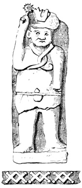
Nohpat Sculpture.
THE PYRAMID OF XCOCH.
SKULLS AND CROSSBONES AT NOHPAT.
Somewhat less than ten miles eastward of Uxmal is the town of Nohcacab, 'the great place of good land,' preserving the name of an aboriginal town which 201 formerly existed somewhere in this vicinity. In this village are several mounds; and a sculptured head, with specimens of pottery, has been dug up in the plaza. The surrounding country within a radius of a few miles abounds in ruins, two of which are particularly mentioned. The first is known as Xcoch, and consists of the pyramid shown in the cut. It is between eighty and ninety feet high, plainly visible from the Prophet's House at Uxmal, but the buildings on its summit, like its sides, are almost completely in ruins, although traces of steps yet remain. Great and marvelous stories were told by the natives concerning a senote, or well, in this vicinity; and it proved indeed to be a most wonderful cavern with branching subterranean galleries, worn by the feet of ancient carriers of water; but it was entirely of natural formation, a single block of sculptured stone, with the worn paths 202 being the only traces of man's presence. The second of the ruins is that of Nohpat, 'great lord,' three miles from Nohcacab toward Uxmal, whose buildings are plainly visible from it, and of which it may, not improbably, have been a continuation or dependency. A mound, or pyramid, two hundred and fifty feet long at the base, and one hundred and fifty feet high on the slope, with a nearly perfect stairway on the southern side, supports a portion of a dilapidated building, which overlooks the numerous ruins scattered over the plain at its foot. A single corridor, or room, is left intact, and is only three feet and five inches wide. At the foot of the stairway is a platform with a picote, as at Uxmal, in its centre. There was also lying at the foot of the steps, the flat stone represented in the cut, measuring eleven and one third feet in length by three feet ten inches in width. The human figure in low relief on its surface is very rudely carved, and was moreover much defaced by the rains to which for many years it had been exposed. Near the pyramid another platform, two hundred feet square, and raised about twenty feet, supports buildings at right angles with each other, one of which has two stories built after a method which will be made clear in describing other ruins. The only others of the many monuments of Nohpat which throw any additional light on Yucatan antiquities, are those found on a level spot, whose shape is that of a right-angled triangle with a mound at each angle. Here are many scattered blocks and fragments, two of which united formed the statue shown in the cut on the next page. It is four and a quarter feet high and a foot and a half in diameter. The face seems to be represented as looking sideways or backward over 203 the shoulder, and is surmounted by a head-dress in which the head of a wild beast may be made out, recalling slightly the idols which we have already seen in Nicaragua. Other statues might doubtless be reconstructed by means of a thorough search, but only the stone blocks shown in the cut are particularly mentioned. They are twenty-seven inches high and from sixteen to twenty-two inches wide, bearing alternately sculptured on their fronts the skull and cross-bones, symbols in later times—perhaps also when these carvings were made—of death. In its original condition Nohpat may not unlikely have been as grand a city as Uxmal, but it is almost completely in ruins.[V-57] 204
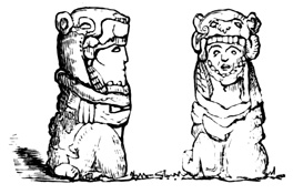
Statues at Nohpat.
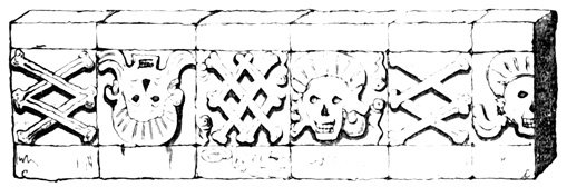
Skull and Crossbones.
RUINS OF KABAH.
In the same region, some five or six miles southward from Nohcacab, and perhaps ten or twelve miles south-eastward from Uxmal, is a most extensive group of ruins, probably the remains of an ancient city, known as Kabah. Sixteen different structures are located in a space about two thousand by three thousand feet, on Mr Stephens' plan, which, however, was not formed by measurements, but by observation from the top of a pyramid. Norman is the only visitor, except Stephens and Catherwood, and his description amounts to nothing. I proceed to describe such of Kabah monuments as differ in construction and sculpture from those we have previously examined, and consequently throw additional light on Maya architecture.
A mound forms a summit platform, raised twenty feet, and measuring one hundred and forty-two by two hundred feet. Ascending the terrace from its south-western side, buildings of the ordinary type appear on the right and left; the former resting on the slope instead of on the summit of the terrace,—that is, the rear wall, of great thickness, rises perpendicularly from the base. In the centre of the platform is an enclosure seven feet high and twenty-seven feet square, formed of hewn stones, the lower tier of which was sculptured with a continuous line of hieroglyphics extending round the circumference. No picote, however, was found within the enclosure. Directly in front, or on the north-east side of the platform, a stairway of twenty steps, forty feet wide, leads up to a higher terrace, the arrangement being much like that of the northern building of the Casa de Monjas at Uxmal. 205 But in this case the upper platform, instead of being long and narrow as usual, is nearly square, and supports a building of the same shape, whose front at the top of the stairway measures one hundred and fifty-one feet. The advanced state of ruin in which the whole structure was found, made it difficult to form an idea of its original plan, and Mr Stephens' description in this case fails to present clearly the idea which he formed on the subject. The front portion of the edifice, however, which is the best preserved of all, has two double ranges of apartments, separated by a very thick wall, and all under the same roof. Two peculiarities were noted in these rooms. The inner rooms of the front range have their floors two feet and eight inches higher than the outer, and are entered from the latter by two stone steps; while in one case at least these steps are cut from a single block of stone, the lower step taking the form of a scroll, and the walls at the sides are covered with carvings, as shown in the cut. Over the rear wall of the front range rises a structure of hewn stone four feet thick and fifteen feet high, which, like the turrets over the northern building of the Nunnery and the Casa de Palomas at Uxmal, could only have been intended as an ornament, but which from the ground beneath presents every appearance of a second story. The exterior sculpture of this front, except a small portion at the northern end, has fallen, but enough remains to indicate that the decorations were most rich and elaborate, 206 though uniform; and, unlike those of any structure yet met with, they covered the whole surface of the front, both above and below the central cornice. The cut shows the general appearance of these decorations.[V-58] This building is called by the natives Xcoↄpoop, or 'straw hat doubled up.'
At a short distance from the ruin just described, in a north-easterly direction, is another group, the details of whose arrangement, in the absence of a carefully prepared plan, it is useless to attempt to describe, but three new features presented by these ruins require notice. First, one of them, from a base of one hundred and six by one hundred and forty-seven feet, is built in three receding stories. That is, the roof of each story, or range, forms a platform, or promenade, before the doors of the one above; or, in other words, the stories are built one above another on the slope of a pyramid. Second, an exterior staircase leads up 207 from story to story. These staircases are supported by half of one of the regular triangular arches resting against the top of the wall of the buildings. The accompanying cut, although not representing this or any other particular building, is intended as a half section to illustrate the construction of the Maya structures in several stories, and that of the stairways which afford access to the upper stories; a being the solid mound, or terrace; bb, the apartments or corridors; d, the staircase; and c, an open passage under the half arch of overlapping stones that supports the stairway. In this Kabah building the stairway leading to the foot of the third story is not immediately over the lower one, but in another part of the edifice. The third peculiarity is a double one, and is noticed in some of the doorways; since here for the first time we find lintels of stone, supported each by a central column, about six feet high, of rude workmanship, with square blocks serving as pedestal and capital.[V-59]
The Casa de Justicia, or Court House, is one hundred and thirteen feet long, divided into five rooms, 208 each nine by twenty feet. The outer wall of this building is plain, except groups of three pillars each between the doorways, and four rows of short pilasters that surround it above the cornice, standing close together like the similar ornaments on the Casa de Tortugas at Uxmal.
The solitary arch shown in the cut stands on a mound by itself. Its span is fourteen feet, and its top fallen. "Darkness rests upon its history, but in that desolation and solitude, among the ruins around, it stood like the proud memorial of a Roman triumph."[V-60] Kabah is not without its pyramid, which is 209 one hundred and eighty feet square at the base, and eighty feet high, with traces of ruined apartments at the foot. In one of the buildings the two principal doorways are under the stairway which leads up to the second story, and over one of them was a wooden lintel ten feet long, composed of two beams and covered with carving that seemed to represent a human figure standing on a serpent. Mr Stephens carried these carved beams, which were in almost a perfect state of preservation, to New York, where they were burned. He considered them the most important relics in the country, although his drawing does not indicate them to be anything very remarkable, except as bearing a clearly cut and complicated carving, executed on exceedingly hard wood without implements of iron or steel. The building with the sculptured lintel, and another, stand on an immense terrace, measuring one hundred by eight hundred feet. One of the apartments has the red hand in bright colors imprinted in many places on its walls. A stucco ornament, painted in bright colors, much dilapidated, but apparently having represented two large birds facing each other, was found in a room of another building. In still another edifice, a room is described as constructed on a new and curious plan, having "a raised platform about four feet high, and in each of the inner corners was a rounded vacant place, about large enough for a man to stand in." Another new feature was a doorway—the only one in the building to which it belonged—with sculptured stone jambs, each five feet eleven inches high, two feet three inches wide, and composed of two blocks one above the other. The sculptured designs are similar one to the other, each consisting of a standing and kneeling figure over a line of hieroglyphics. One of these decorated jambs is shown in the cut given on the following page. The weapon in the hands of the kneeling figure corresponds almost exactly with the flint-edged swords used by the natives of the country at the time of the 210 conquest. This group of ruins, representing an aboriginal city probably larger and more magnificent even than Uxmal, was discovered by the workmen who made the road, or camino real, on which the ruins stand; but so little interest did the discovery excite in the minds of travelers over the road, that the knowledge of it did not reach Mérida.[V-61] 211
In this immediate vicinity, located on the road to Equelchacan, a place not to be found on any map that I have seen, some artificial caverns are reported, probably without any sufficient authority.[V-62]
RUINS OF SANACTÉ.
Southward and south-eastward of Kabah, all included within a radius of eight or ten miles, are ruins at Sanacté, Xampon, Chack, Sabacché, Zayi, and Labná, the last two being extensive and important. At Sanacté are two buildings, which stand in a milpa, or cornfield. One has a high ornamental wall on its top, and the front of another appears as represented in the cut. It will be noticed that in 212 this, as in most of the structures in this region, the doorways have stone jambs, or posts, each of two pieces, instead of being formed simply by the blocks that compose the walls; the lintels are also generally of stone. At Xampon are the remains of a building that was built continuously round a rectangle eighty by one hundred and five feet; it is mostly fallen. In the immediate vicinity ruins of the ordinary type are mentioned under the names of Hiokowitz, Kuepak, and Zekilna. At Chack a two-storied building stands on a terrace, which is itself built on the summit of a natural stony hill. A very remarkable feature at Chack is the natural senote which supplies water to the modern as it did undoubtedly to the ancient inhabitants. It is a narrow passage, or succession of passages and small caverns, penetrating the earth for over fifteen hundred feet, much of the distance the descent being nearly vertical. At Sabacché is a building of a single apartment, whose front presents the peculiarity of four cornices, dividing the surface into four nearly equal portions, the lower cornice being as usual at the height of the top of the doorway. The first space above the doorway is plain, like that below; but the two upper spaces are divided by pilasters into panels, which are filled with diamond lattice-work. Three other buildings were visited, and one of them sketched by Catherwood, but they present no new features except that the red hand, common here as elsewhere, is larger than usual.[V-63]
RUINS OF ZAYI.
At Zayi, situated in the midst of a beautiful landscape of rolling hills, the principal edifice, called the Casa Grande, is built in three receding stories, as already explained, extending round the four sides of the supporting mound, which rests on a slight natural elevation. The lower story is one hundred and twenty by two hundred and sixty-five feet; the second, sixty by two hundred and twenty feet; and the third, standing on the summit of the mound, is eighteen by one 213 hundred and fifty feet. The cut shows the ground plan of the Casa Grande, much of which is fallen. A stairway thirty-two feet wide leads up to the third story on the front, and a narrower stairway to the second platform on the rear. Ten of the northern rooms in the second story are completely filled with stone and mortar, which for some unimaginable reason must have been put in while the structure was being built. This part of the building is known among the natives as the Casa Cerrada, or closed house. It will be noticed from the plan that the front and rear platforms are not exactly of the same width. With respect to the exterior walls, those of the lower range are nearly all fallen. The western portion of the front of the second range is shown in the cut on the following page. Ranges of pillars, or pilasters, compose the bulk of the ornamentation, both above and below the cornice. A strange if not very artistic and delicate decoration found elsewhere on this building, is the figure of a man standing on his hands with his legs spread apart. The lintels are of stone, and many of the doorways are of triple width, in which cases the lintel is supported by two rudely-formed columns, about six and a half-feet high, with square capitals, as shown in the following cut. The front of the third range appears to have been entirely plain. In another building near by "a high projection 214 running along the wall" in the interior of an apartment is mentioned. Some five hundred yards directly south of the Casa Grande is a low, small, flat-roofed building, with a wide archway extending completely through it. It is much dilapidated, and hardly noticeable in itself, but from the centre of its flat roof rises the extraordinary structure shown in the cut, which is a perpendicular wall, two feet thick 215 and thirty feet high, pierced with ranges of openings, or windows, which give it, as the discoverer remarks, the appearance of a New England factory. The stone of which it is constructed is rough, and it was originally covered with ornaments in stucco, a few of which still remain on the rear. The only other Zayi monument mentioned is an immense terrace about fifteen hundred feet square. Most of its surface was not explored, but one building was noticed and sketched in which the floor of the inner range of rooms is raised two feet and a half above that of the front range, being reached by steps, as was the case in the building at Kabah, already described. The interior wall was also decorated with a row of pilasters. The superstitious natives, like those I have spoken of at Utatlan in Guatemala, hear mysterious music every Good Friday, proceeding from among the ruins.[V-64]
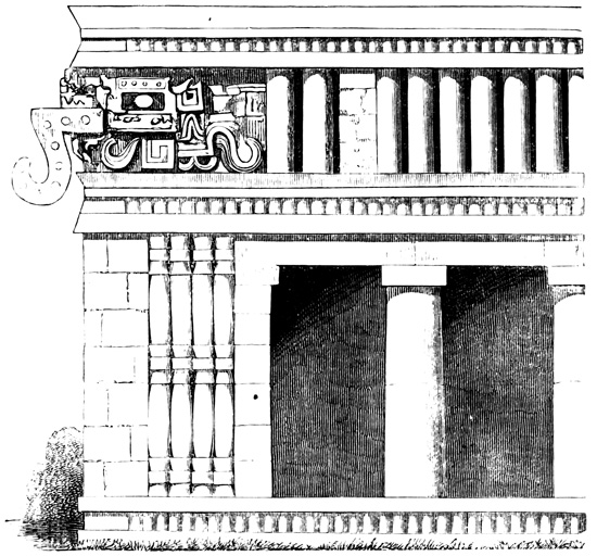
Front of Casa Grande at Zayi.
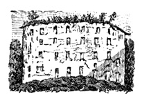
Wall at Zayi.
RUINS OF LABNÁ.
The ruins of Labná comprise some buildings equal in extent and magnificence to any in Yucatan, but all far gone in decay. In one case a mound forty-five feet in height supports a building twenty by forty-three feet, of the ordinary type, except that its southern front is a perpendicular wall, thirty feet high above the cornice over the doorways. This front has no openings like other similar walls already noticed, but was originally covered throughout its whole surface with colossal ornaments in stucco, of which but a few small fragments remained, the whole structure being, when examined, on the point of falling. Among the figures of which sufficient portions remain to identify their original form, are: a row of death's heads, two lines of human figures in high relief, an immense seated human figure, a ball, or globe, supported by a man kneeling on one knee and by another standing 216 at its side. All the figures were painted in bright colors still visible, and the whole structure appeared to its only visitors "the most curious and extraordinary" seen in the country. Another building, surrounding a courtyard, which was entered through a gateway, differed in its plan from those seen elsewhere, but the plan unfortunately is not given. Over each of the interior, or court, doorways, on one side at least, is a niche occupied by a painted stucco ornament supposed to represent the sun. Near by, a terrace four hundred feet long and one hundred and fifty feet wide supports a building of two receding stories with a front of two hundred and eighty-two feet. The upper story consists of a single line of apartments and its walls are perfectly plain. The lower story has a double line of rooms, and its front is elaborately sculptured, the chief peculiarity in this front being that it presents three distinct styles in as many portions of the wall. The opposite cut shows a corner of this wall in which the open mouth of an alligator or monster, from which looks out a human face, is a new and remarkable feature in Maya decoration. On the roof of the lower range is a narrow opening which leads vertically to a chamber like those found so frequently at Uxmal, except that this, instead of being dome-shaped, is like the ordinary rooms, with triangular-arched ceiling, being seven by eleven feet and ten feet high. Both sides and bottom are covered with cement, and there is nothing but its position in the mass of masonry, between the arches and over the interior apartments, to indicate that it was not originally used as a cistern for storing water. There is also in connection with the ruins of Labná an entrance to what may well be supposed to have been a subterranean senote like those noticed at Xcoch and Chack, but it could not be explored. It was noted that the natives about Labná, had much less superstitious fear respecting the spirits of the antiguos haunting the ruins than those of most other localities, although 217 even they had no desire to explore the various apartments.
At Tabi, a few leagues distant, is a heap of ruins, 218 from which material had been taken for the construction of a modern church, and many sculptured fragments had been inserted in the walls of the hacienda buildings. A stream of water was pouring from the open mouth of a stone idol, possibly worshiped by the ancient inhabitants; "to such base uses," etc. A cave near by was the subject of much marvelous report, but its exploration led to nothing in an antiquarian point of view.[V-65]
At Kewick, seven or eight miles southward of Labná, a large space is strewn with the remains of a ruined city, the casa real itself being built on the terrace of an ancient mound. One single stone, however, among these ruins demands the attention of the reader, familiar as he now is with the general features of ancient Maya art. This stone is one of those which compose the top layer, joining the sides of the ceiling in one of the apartments. Singled out for some inexplicable reason from its fellows, it bore a painting in bright colors, chiefly red and green, representing a grotesquely adorned human form surrounded by a line of hieroglyphics. The painting measured eighteen by thirty inches and was taken out from its place by Mr Stephens for the purpose of removal, but proved too heavy for that purpose. Two fronts were sketched by Mr Catherwood at Kewick; one had a line of pillars separated by diamond-shaped ornaments on each side of the doorway; the other was decorated also with a line of pillars, or pilasters, standing close together, as on the Casa de Tortugas at Uxmal.[V-66]
XUL, SACACAL, AND CHACCHOB.
Xul, a modern village near by, stands also on the site of an aboriginal town, and the cura's residence is built of material from an ancient mound, many sculptured stones occupying prominent places in the walls; the church moreover contains sixteen columns from 219 the neighboring ruins of Nohcacab. Two leagues from Xul where some ruins were seen, two apartments had red paintings on the plastered walls and ceilings. A row of legs, suggesting a procession, heads decorated with plumes, and human figures standing on their hands, all well-drawn and natural to the life, were still visible, and interesting even in their mutilated state. The rancho buildings at Nohcacab—a second place of the same name as the one already mentioned towards Uxmal—are also decorated with relics from the 'old walls,' but nothing of interest was seen in connection with the ruins themselves, except one room in which the ceiling formed an acute angle at the top instead of being united by a layer of horizontal stones as in other places.[V-67]
Some leagues further eastward, in the neighborhood of the town of Tekax, ruins are mentioned at Sacacal, Ticum, Santa María, and Chacchob. At Sacacal is a chamber with an opening at the top, as at Labná, only much larger; and this one has also three recesses, about two feet deep, in the sides. An apartment here has a painted stone in the top layer as at Kewick; and one building has its wall rounded instead of straight, although this is only on the exterior, the inner surface being straight as usual. The remains at Ticum were only reported to exist by the Cura of San José. At Santa María a high mound only was seen.[V-68] At Chacchob ruins of the usual type are represented, by a Spanish writer in a Yucatan magazine, to be enclosed within a wall, straight from north to south, the rest of the circumference of over six thousand feet being semi-circular. The only entrance is in the centre of the straight side. A well occupies the centre of the enclosure, the chief pyramid is on the summit of a natural elevation, and in one room a door was noticed which was much wider at the top than at the bottom. On the edge of a wall eight hundred varas 220 distant, grooves worn by the ropes formerly used in drawing water are still to be seen.[V-69]
Further north, in the north-eastern corner of the rectangle which contains our central group of ruins, are Akil and Mani, the relics of the former locality, so far as known, being chiefly built into the walls of modern buildings. Mani was a prominent city at the time of the conquest, and the modern village stands on the remains of the aboriginal town, mounds and other relics not described being yet visible. Mr Stephens here found some documents, dating back to the coming of the Spaniards, which are of great importance in connection with the question of the antiquity of the Yucatan ruins, and will be noticed when I come to speak of that point. The only monuments of the central group remaining to be mentioned are those of Chunhuhu, in the extreme south-western corner of the rectangle. These are very extensive, evidently the remains of a large city, and several of the buildings were sketched by Mr Catherwood, being of one story, and having grotesque human figures as a prominent feature in their exterior decoration. One is plastered on the outside, as Mr Stephens thinks all the Yucatan buildings may have been originally—that is, on the plain portions of their walls. One front has the frequently noticed line of close-standing pilasters, with full-length human figures at intervals, which stand with uplifted hands, as if supporting the weight of the upper cornice.[V-70]
RUINS OF CHICHEN ITZA.
The next, or eastern, group of Yucatan antiquities includes little beside the ruined city of Chichen Itza,[V-71] 221 a city which was famous in the ancient traditionary annals of the Mayas, whose structures served both natives and Spaniards as fortifications at the time of the conquest, and whose ruins have been more or less known to the inhabitants of the country since that epoch. The ruins lie twenty miles west of Valladolid, the chief town of the eastern portion of the state, on a public road in plain view of all travelers by that route. In this case the original Maya name has been retained, Chichen meaning 'mouth of wells,' and Itza being the name of a branch of the Maya people, or of a royal family, which played a most prominent part in Yucatan history. The name Chichen comes probably from two great senotes which supplied the ancient city with water, and which differ from the complicated underground passages noted in other parts of the state, being immense natural pits of great depth, with nearly perpendicular sides, the only traces of artificial improvement being in the winding steps that lead down to the water's surface, and slight remains of a wall about the edge of the precipice. So far as explored, the remains may be included in a rectangle measuring two thousand by three thousand feet, and their arrangement is shown in the plan on the next page, made by Mr Catherwood.[V-72]
CHICHEN—NUNNERY.
Perhaps the most remarkable of the Chichen edifices is that known as the Nunnery, marked H on the plan.[V-73] Of course in this and other buildings I shall confine my description chiefly to points of contrast with ruins already mentioned, and well known to the reader. Supporting the Nunnery, instead of a pyramid, we have for the first time a solid mass of masonry one hundred and twelve by one hundred and sixty feet rising with perpendicular sides to a height of about thirty-two feet. On the summit, with a base one hundred and four feet long, is a building in two receding stories, of which the upper, whose summit was sixty-five feet above the ground, is almost entirely in ruins. The first story is better preserved, and its front was decorated with sculpture of which no drawings have been made. In the centre of the northern side a stairway fifty-six feet wide leads up, with thirty-nine steps, to the top of the solid basement, which forms a broad promenade round the superimposed building, and continues with fifteen additional steps to the roof of the first story. One room in this 224 first story is forty-seven feet long; several contain niches in their walls, extending from floor to ceiling and bearing traces of having been covered with painted figures, some of them human with plumed heads; and some of the apparent doorways are false, or walled up, evidently from the date of their first construction. Attached to the eastern end of the solid structure is a projecting wing, shown in the plan, sixty feet long, thirty-five feet wide, and twenty-five feet high, consisting of only a single story, and divided into nine apartments, several of which are filled up with solid masonry. The lintels throughout the Nunnery are of stone, and the interior walls of the rooms are plastered. The exterior walls of this eastern wing are covered with rich sculpture, both above and below the cornice, but this sculpture presents no contrasts with that of Uxmal, or other cities, sufficiently striking to be verbally described. Only a few feet from the eastern end of the Nunnery, and indeed described by Charnay as wings of that edifice, are the two small buildings a and b of the plan. The former is thirteen by thirty-eight feet, and twenty feet high; the latter, sometimes known as the Iglesia, or Church, is fourteen by twenty-six feet, and thirty-one feet high, containing only one room. These structures present a most imposing appearance by reason of their great height in proportion to their ground dimensions.[V-74]
CHICHEN—AKAB-TZIB.
The building G of the plan, instead of standing on an artificial mound, rests on the level plain, but the usual effect is produced by excavating the surface about it, thus giving it the appearance of resting on a raised foundation. It measures forty-eight by one hundred and forty-nine feet, and its outer walls are perfectly plain. The roof is reached by a stairway forty-five feet wide in the centre of the eastern front, while, corresponding with the stairway, on the western front is a solid projection thirty-four by forty-four feet, of unknown use. The floor of the inner range of rooms is one foot higher than that of the outer, and on the under surface of a lintel in one of the interior doorways is the sculptured design shown in the cut on the following page, surrounded by a row of hieroglyphics, of which only a small portion are included in the cut, but which are of the same type as those we have seen at Copan. The subject seems to be some mysterious incantation or other sacrificial rite, and the hieroglyphics, known as the 'writing in the dark,' in Maya akab-tzib, have given their name to the building.[V-75]
CHICHEN—THE CASTLE.
In the northern part of the city, at B, is the Pyramid, or Castle, of Chichen. Its base is one hundred and ninety-seven by two hundred and two feet; its height about seventy-five feet; and its summit platform sixty-one by sixty-four feet. A stairway thirty-seven feet wide leads up the western slope to the platform, and on the north is another stairway of ninety steps forty-four feet wide, having solid balustrades which terminate at the bottom in two immense serpent's heads ten feet long, with open mouths and protruding tongues as in the opposite cut. On the platform stands a building forty-three by forty-nine feet, and about twenty 227 feet high, having only a single doorway in the centre of each front. These doorways have all wooden lintels elaborately carved, and the jambs,—probably of stone, although Norman says they are of wood—are also covered with sculpture. The upper portion of one of these sculptured jambs is represented in the 228 cut, and the designs on the others are of a similar general character. The northern doorway, which seems to have been the principal entrance, is twenty feet wide and its lintel is supported by two columns, each eight feet and eight inches high, with projecting bases, and having their entire surface decorated, like the jambs at the sides, with sculptured figures. The interior plan of this building differs materially from any we have met; since the doorways on the east, west, and south open into a corridor six feet wide, which extends without partition walls round the three corresponding sides of the edifice; while the northern doorway gives access also to a corridor forty feet long and six and a third feet wide. Through the centre of the rear wall of this corridor a doorway leads into a room twelve feet nine inches by nineteen feet eight inches, and seventeen feet high. This room also differs widely from any before described, for its ceiling, instead of being formed by a single triangular arch running lengthways, has two transverse arches supported 229 by immense carved zapote-beams stretched across the room, and which rest, each at its centre, on two square pillars whose dimensions are twenty-two inches on each side and nine feet in height. The cut shows the ground plan of this remarkable structure, the squares at a representing the feet of the interior pillars, and the circles at b, the pillars that support the lintel of the northern doorway.[V-76]

Stone Ring at Chichen.
Painted Boat in the Gymnasium.
CHICHEN—THE GYMNASIUM.
The building at A of the plan is called by the natives the Iglesia, by Norman the Temple, by Charnay the Cirque, and by Stephens the Gymnasium. The latter names were applied from the supposition that the structure served for a peculiar game of ball to which the Aztec kings, at least, if not the Mayas, were much addicted. Landa seems, however, entitled to the honor of having invented this theory, since he speaks of buildings in this part of Chichen devoted to amusements.[V-77] This structure is very similar to the one marked H on the plan of Uxmal. It consists of two parallel walls, thirty by two hundred and seventy-four feet, twenty-six feet high, and one hundred and twenty feet apart. The inner walls facing each other present a plain undecorated surface, but in the centre of each, about twenty feet from the ground, is fixed by means of a tenon, a stone ring four feet in diameter and thirteen inches thick, with a hole nineteen inches in diameter through the centre, surrounded by two sculptured serpents intertwined as in the following cut. M. Charnay found only one of these rings in place at the time of his visit. The south end of the eastern wall served as a base to superimposed buildings or ranges of apartments erected on it after the manner of all the Yucatan structures of more than one story. The upper range has a part of its exterior wall still standing, covered with sculpture, which includes, among other devices, a procession of tigers or lynxes. In the interior, massive sculptured 231 pillars and door-posts, with carved zapote lintels appear, but what seemed to Mr Stephens "the greatest gem of aboriginal art which on the whole Continent of America now survives," was the series of paintings in bright colors which cover the wall and ceiling of one of the chambers. The paintings are so much damaged and the plaster so scratched and fallen, that the connection of the whole cannot be made out, but detached subjects were copied, one of which is the boat represented in the cut, inserted here because of the rarity of all species of watercraft in our surviving 232 relics of aboriginal decoration. The other paintings represent human figures in various postures and occupations, battles, processions, houses, trees, and other objects. Blue, red, yellow, and green are the colors employed, all the human figures moreover being tinted a reddish brown. It is, however, the supposed resemblance of these figures to some of the Aztec sculpture and picture-writings that gave this room and the one below it in the same building their great importance in Mr. Stephens' eyes. We shall be better qualified to appreciate this resemblance after our study of Mexican antiquities in a future chapter. The lower room referred to has its inner surface exposed to the open air, the outer wall having fallen. It is covered with figures sculptured in bas-relief, also originally painted, of which a specimen is shown in the cut, consisting of human forms, each with plumed head-dress, and bearing in his hand what seems to be a bunch of spears or arrows, marching in a procession, or as the natives say, engaged in a dance. One hundred feet from the northern and southern ends of the parallel walls, and very probably connected with them in the uses to which they were by their builders applied, are the two small buildings at c and d of the plan. The southern building is eighty-one feet long, the northern only thirty-five, containing a single apartment. Both are much ruined, but each 233 presents the remains of two sculptured columns, and one of them has carvings on the walls and ceilings of its chamber besides. A horizontal row of circular holes in the exterior walls are conjectured by M. Viollet-le-Duc to have held timbers which supported a kind of outer balcony or sun-shade.[V-78]
The building at E on the plan is called by the natives Chichanchob, or Red House; Charnay terms it the Prison. It's front is shown in the cut, the whole being in an excellent state of preservation. 234 The three doorways lead into a corridor extending the whole length of the building, forty-three feet, through which three corresponding doorways give access to three small apartments in the rear. Over these doorways, and running the whole length of the corridor, is a narrow stone tablet on which is sculptured a row of hieroglyphics, of which the first and best preserved portion is shown in the cut. Their similarity to, if not identity with, the characters at Copan, will be seen at a glance. There are traces of painting on the walls of the three rear rooms.[V-79] The building D presents nothing of particular interest.
CHICHEN—THE CARACOL.
At F is the Caracol, or winding staircase, called also by Norman the Dome, a building entirely different in form and plan from any we have seen. Of the two supporting rectangular terraces, the lower is one 235 hundred and fifty by two hundred and twenty-three feet, and the upper is fifty-five by eighty feet. A stairway of twenty steps, forty-five feet wide, leads up to the former, and another of sixteen steps, forty-two feet wide, to the latter. The lower stairway had a balustrade formed of two intertwined serpents. On the upper platform is the Caracol, a circular building twenty-two feet in diameter and about twenty-four feet high, its roof being dome-shaped instead of flat. The annexed section and ground plan illustrate its peculiar construction. Two narrow corridors, with plastered and painted walls, extend entirely round the circumference, and the centre is apparently a solid mass of masonry.[V-80]
The only remaining monument at Chichen which demands particular mention is that at C on the plan. Here occur large numbers, three hundred and eighty 236 having been counted, of small square columns from three to six feet high, each composed of several separate pieces, one placed on another, standing in rows of from three to five abreast, round an open space some four hundred feet square, and also extending irregularly in other directions in connection with various mounds. The use of these columns is entirely unknown; but any structure which they may have supported must have been of wood, since absolutely no vestiges remain.[V-81] Besides the monuments described, there are the usual heaps of ruins, mounds, fallen walls, and sculptured blocks, scattered over the plain for miles in every direction. Chichen was evidently a great capital and religious centre, and its ruins present, as the reader has doubtless noticed, very many points of contrast with those of the central or Uxmal group.[V-82]
Ruins are mentioned by Mr Wappäus as existing at Tinum, a short distance north-west of Chichen; and are also indicated, on Malte-Brun's map already referred to, at Espita, still farther north, and at Xocen, a few miles south of Valladolid. At Sitax, near Tinum, a vase, 'something of the Etruscan shape,' from some of the ruined cities, was seen by Mr Norman. At Coba, eastward from Valladolid, the curate of Chemax, in a report of his district prepared for the 237 government, described slightly ranges of buildings in two stories. They are said to be built of stones, each of which measures six square yards; this is very likely an error, and no other peculiarities were spoken of worthy of mention. The same cura discovered on the hacienda of Kantunile far north-eastward toward the coast several mounds, and in one of them three skeletons, at whose head were two earthen vases. One of these was filled with the relics shown in the cuts on the following page, consisting of implements, ornaments, and two carved shells. The shell carvings are in low relief, and the arrow-heads, with which the other vase was nearly filled, were of obsidian, a material not known to exist in Yucatan, and which must consequently be supposed to have been brought from more northern volcanic states of Mexico, where it formed the usual material of knives and many other aboriginal implements and weapons. Besides these different articles, was a horn-handled penknife in the same vase, proving that this burial deposit was made subsequently to the coming of Europeans.[V-83]
NORTHERN GROUP.
RELICS AT TICUL.
I now come to the northern group of Yucatan Antiquities, which is separated from the Uxmal group by the low sierra before mentioned as running from north-west to south-east across this portion of the state. First in this group are the ruins of the ancient Ticul, on the hacienda of San Francisco close to the modern town of Ticul, and just across the sierra from Nohcacab. Here are thirty-six mounds, or pyramids, all visible from one of the highest when the trees are free from foliage. Most of the elevations support buildings, but these are so completely ruined that nothing can be known of the original city, save that it must have been of great extent. These ruined piles have served as quarries to supply building material at Ticul, which is almost entirely built of stone. Many 239 relics are preserved in the town, but the only one particularly noticed is the earthen vase shown in the cut. It is five inches in diameter and four and a half inches high, and the reader will notice a similarity of style between the figures on its front and those carved on the burial relics of Kantunile previously shown. Between two of the mounds of San Francisco, a square stone wall filled with earth and stones was opened, and in it, under a large flat stone, was found a skeleton sitting with knees against the stomach and hands clasping the neck, facing the west. In connection with this skeleton were found a large earthen vase, or water-jar, empty, and a deer's-horn needle, sharp at one end and having an eye at the other. 240 Mr Norman calls this group of mounds Ichmul, supposes them all to be sepulchres, and says that several have been opened and disclosed sitting skeletons, with pots at their feet, and even interior rooms. M. Waldeck briefly mentions in many parts of his work the ruins of Tixualajtun, which may possibly be identical with Ticul, and which bear carved stones, indicating by their number and position in the walls an age of at least three thousand years.[V-84]
RUINS OF MAYAPAN
About ten miles northward of Ticul, and twenty-five miles southward of Mérida is the rancho of San Joaquin, included in the hacienda of Xcanchakan, on which are the remains of Mayapan, the ancient Maya capital. According to the traditional annals of the country Mayapan was destroyed by an enemy, in one of the many civil conflicts that desolated Yucatan, not much more than a century before the Spanish conquest. 241 Numerous mounds, scattered blocks, and a few ruined buildings are all that remain to recall the city's ancient splendor. The best preserved mound is that shown in the preceding cut, one hundred feet square at the base, and sixty feet high, with a stairway twenty-five feet wide in the centre of each side. The top is a plain stone platform, with no signs of its ever having 242 supported any building. Most of the sculptured fragments contain only parts of ornamental designs and are fitted with tenons by which they were probably secured on the front walls, as at Uxmal. One building of the ordinary type was sufficiently entire to show the triangular ceiling. A circular building similar to that described at Chichen was also noticed. It is twenty-five feet in diameter, and twenty-four feet high, with only a single doorway facing the west. A single corridor only three feet wide runs entirely round the edifice, the outer wall being five feet thick, and the inner wall is a solid circular mass of stone and mortar nine feet in thickness. The interior walls of the corridor are plastered with several coats of stucco, and yet retain vestiges of yellow, blue, red, and white paint. The preceding cut shows the exterior of this structure, and also gives a good idea of the similar one at Chichen. On a terrace of the mound which supports this dome, are eight round columns, two and a half feet in diameter, and each composed of five stones placed one upon another. Among the sculptured blocks with which the country for miles around is strewn, are some which differ from those mentioned as parts of façade decorations. They are rudely carved, and each represents a subject complete in itself. Two of these, one four and the other three feet high, together with some of the decorative fragments alluded to, are shown in the cut on the opposite page. An idol was also found in one of the subterranean passages of a senote. The inhabitants of the locality report that the ruins extend over the plain within a circumference of three miles, and that the foundations yet remain of a wall that once surrounded the city.[V-85] 243
RELICS OF TIHOO AT MÉRIDA.
Mérida, the capital of Yucatan, was built by the Spanish conquerors on the ruins of the aboriginal city of Tihoo, the ancient mounds furnishing material to the builders of the modern town. Only very slight vestiges of Tihoo remain; yet in the lower cloisters of the Franciscan convent, which is known to have been erected over an ancient mound and building, the Spanish architects left one of the peculiar aboriginal arches intact, unless we suppose that they imitated such an arch in their own work, which is most unlikely. Bishop Landa describes and illustrates with a ground plan one of the largest and finest of the Tihoo structures, as it was in the sixteenth century. In most respects his description agrees exactly with the ruins of the grander class already mentioned. The supporting mound has two retreating terraces on all sides except the western, which side seems to have been perpendicular to its full height. Stairways running the whole length of the mound lead up to the 244 eastern slopes, and on the summit platform is a courtyard surrounded by four buildings, like the Casa de Monjas at Uxmal. A gateway leads through the centre of both eastern and western buildings, and one of these gateways is represented by Landa as having a round arch, the other being of the ordinary form. The buildings are divided into a single range of small apartments opening on the court, except the southern, which has two large rooms, and in front of which was a gallery supported by a row of square pillars. A round building or room is also mentioned in connection with the western range. Landa also mentions several other structures, including the one over whose ruins the Franciscan convent was built. M. Waldeck mentions an excavation in a garden of the city, which is twenty-three by thirty feet, and fifteen feet deep, with double walls three and six feet thick, where the bones of a tapir and other bones were dug up. He also saw here several idols collected from different parts.[V-86]
PYRAMID AND COLUMNS OF AKÉ.
Some twenty-five miles east of Mérida, at a place called Aké, barely mentioned in the annals of the conquest as the locality where a battle was fought between the Spaniards and Mayas, are the ruins of an aboriginal city; ruins which, according to Mr Stephens, their only visitor, have a ruder, older, and more cyclopean air than any others seen. Some of the stones here employed are seven feet long. One remarkable feature is a pyramid, whose summit platform is fifty by two hundred and twenty-five feet, and supports thirty-six columns, each four feet square, and from fourteen to sixteen feet high. These columns are arranged in three parallel rows, ten feet apart from north to south, and fifteen feet from east to west. Each column is composed of several square stones. A stairway one hundred and thirty-seven feet wide, with steps seventeen inches high, and four feet five inches deep, leads up the southern slope. Of this mound Mr Stephens says: "It was a new and extraordinary feature, entirely different from any we had seen, and at the very end of our journey, when we supposed ourselves familiar with the character of American ruins, threw over them a new air of mystery." Between Mérida and Mayapan is mentioned a stone wall, which crosses the road and extends far on either side into the forest. Near by is also an aguada, said by the inhabitants to be of artificial formation.[V-87]
RUINS OF IZAMAL.
Izamal, something more than twenty miles further eastward, was a city of great importance in aboriginal times, as we shall see in the following volume. Two or three immense pyramids are all the vestiges that remain of its former greatness. The largest mound is between seven and eight hundred feet long, and between fifty and sixty feet high, and Mr Stephens "ascertained beyond all doubt" that it has interior chambers, concerning which he very strangely gives no further information. M. Charnay's photograph shows that this mound was in two receding stages, on the slopes of the upper of which steps are still to be seen. The modern town is built on the site of the ancient city, and the mounds as elsewhere have furnished the material of the later structures. The upper portion of a pyramid facing the one already mentioned was leveled down, and on the lower platform was erected the Franciscan church and convent. Another smaller mound is in the courtyards of two private houses, and on its side near the base is the cara gigantesca, or gigantic face, shown in the cut. 247 It is seven feet wide and seven feet eight inches high. The features were first rudely formed by small rough stones, fixed in the side of the mound by means of mortar, and afterward perfected with a stucco so hard that it has successfully resisted for centuries the action of air and water. There were signs of a row of similar stucco ornaments extending along the side of the mound; and either on this mound or another near by, M. Charnay photographed a similarly formed face, which is twelve feet high. These colossal stucco faces are the distinctive features of the ruins of Izamal, nothing of the kind appearing elsewhere in Yucatan, although a slight resemblance may be traced to the gigantic faces in stone at Copan. Bishop Landa describes one of the Izamal structures as it appeared in his time, and adds a plan to his description. He represents the supporting pyramid as being over one hundred feet high, with a very steep stairway and very high steps, being built in a semi-circular form on one side. According to his statement the edifices were eleven or twelve in number, standing near together. Lizana, another of the early writers on Yucatan, mentions five of the sacred mounds supporting buildings which were already in ruins in his time, and he also gives the Maya name of each temple with its meaning. It should be noted, moreover, that Izamal is, according to the annals of Yucatan, the burial place of Zamná, the great semi-divine founder of the ancient Maya power.[V-88]
SENOTE OF BOLONCHEN.
I now come to the southern group of Maya antiquities, over which I may pass rapidly, beginning with the ruins of Ytsimpte near the village of Bolonchen, some fifteen miles south of Chunhuhu, the most south-western ruin of the central group. By the kindness of the cura and the industry of the natives this ruined city was cleared of all obstacles in the shape of vegetation, and its thorough exploration was thus rendered easy; but unfortunately no corresponding results followed, since no new features whatever were discovered. Here are undoubtedly the remains of a great city, but most of the walls, and all of the sculptured decorations 249 have fallen. Bolonchen means 'nine wells,' so named from a group of natural wells in the plaza. These fail for several months in the dry season, and then the inhabitants resort to a senote in the neighborhood, which, as one of the most wonderful in the peninsula, is shown, or rather one of its several passages is shown, in the cut. By a series of rude ladders water is brought from springs over fifteen hundred feet from the opening at the surface, and at a perpendicular depth of over four hundred feet.
RUINS OF LABPHAK.
Labphak is about twenty miles further south, and is one of the grandest of the Maya ruins, although 250 the single brief exploration by Mr Stephens, its only visitor, is barely sufficient to excite our curiosity respecting its unknown wonders. Only one building was examined with care; this has three receding stories. The western front was carefully cleared, and, sketched by Mr Catherwood, resembling very closely the other three-storied structures before described. But at the last moment it was discovered that this was only the rear wall, and that the eastern front "presented the tottering remains of the grandest structure that now rears its ruined head in the forests of Yucatan." The dimensions and arrangement of rooms of the lower story, differing from any that have been met further north, are shown in the accompanying ground plan, together with the stairways that lead up to the second story. Besides the grand central eastern staircase, there are two interior stairways, each in two flights, leading up to the platform of the second and third stories from the rooms of the western range. This is the first instance of interior stairs, but the method of their construction is not explained. The western wall of the third story has no doorways. On the platform of the second story stand two high buildings like towers, ornamented with stucco, and on 251 the third platform two similar structures at the head of the stairway before the central entrance. These upper rooms have plain walls and ceilings. The lower ones present numerous imprints of the ever-present red hand, and one of them has a painted stone in the tier over the arch, as at Kewick. At the points marked a in the plan, are sculptured tablets of stone fixed in the exterior walls, one of which is shown in the cut. Each tablet is composed of several pieces of stone, and the sculptured figures are naturally much worn by exposure to the air and rain. Two circular 252 openings to chultunes, or cisterns, like those at Uxmal and elsewhere, were found near by. Another Labphak structure formed a parallelogram, surrounding a courtyard, and presenting two peculiarities; the entrance to the court was by stairways leading over the flat roof of one of the ranges of buildings; and the ornamentation of the court façades was in stucco instead of sculptured stone. With this slight description I am obliged to leave this most interesting city, whose solitude, so far as I know, has remained undisturbed for thirty years and more since Messrs Stephens and Catherwood spent two days in the halls of its departed greatness. Now as then, "it remains a rich and almost unbroken field for the future explorer."
At Iturbide, the south-western frontier town of modern Yucatan, there is a mound of ruins in the plaza, and also a well some four feet in diameter, and twenty-five feet deep, stoned with hewn blocks without mortar; its sides polished by long usage, and grooved by the ropes employed in drawing water. This well is considered the work of the antiguos, and another similar one was seen near by. In the outskirts of Iturbide the plain is dotted with the mounds and stone buildings of the ancient town of Zibilnocac. Thirty-three mounds were counted, but the walls of the buildings had all fallen except one, which presented the peculiarity of square elevations, or towers, with sculptured façades, at each end and in the middle. Its rooms also preserved traces of interesting paintings, representing processions of human figures whose flesh was colored red.
AGUADAS OF THE SOUTH.
At the rancho of Noyaxche, a few miles distant, is a seemingly natural pond, which, being explored by the proprietor during a very dry season, proved to have an artificial bottom of flat stones many layers thick, pierced in the centre with four wells, and round the circumference with over four hundred small pits, or cisterns. At Macoba, twelve or fifteen miles eastward 253 is another similar aguada, and ruined buildings are also found, actually occupied by the natives as dwellings. Mankeesh is another locality in this region where extensive ruins are reported to exist. At the rancho of Jalal is an aguada similar to the one mentioned at Noyaxche, the forms of the wells and cisterns, pierced in its paved bottom being illustrated by the cut. Upwards of forty deep wells were discovered by the natives in the immediate neighborhood. Yakatzib is another place near by, where ruined buildings were seen. Becanchen is a town of six thousand inhabitants, and owes its existence to the discovery of a group of ancient wells, partially artificial, and a stream of running water. Fragments of ancient structures are built into the walls of the town.[V-89]
Only the monuments found on or near the coast of the peninsula remain to be noticed, and in describing them I shall begin in the south-east and follow the 254 coast northward, then westward, and again southward to Lake Terminos. For a description of Maya structures, as found by the earliest Spanish voyagers on the eastern coast, I refer the reader to the chapter on Central American buildings in volume II. of this work.[V-90] M. Waldeck, giving no authority for his statement, mentions the existence of ruined buildings at Espíritu Santo Bay, and at Soliman Point, but no description is given.[V-91]
RUINS OF TULOOM.
Tuloom is the most important city of antiquity on the eastern coast, standing in about 20° 10´. It is undoubtedly one of the many aboriginal towns whose 'towers' excited so much wonder in the minds of the first European voyagers along this coast. It presents several marked contrasts with the other monuments that have been described, not only in the construction and arrangement of its edifices, but in its site, since it is built on a high bluff on the very border of the sea, commanding a view of wild and diversified natural scenery, differing widely from the somewhat monotonous plain that constitutes for the most part the surface of the peninsula. Tuloom has only been visited by Mr Stephens, and his exploration was nearly at the end of his long journey, when the keen edge of his antiquarian zeal was naturally somewhat blunted by fatigue, sickness, and a desire to return home. Moreover, countless hordes of mosquitos, with a persistent malignity unsurpassed in the annals of their race, scorning the aid even of their natural allies in the defense of Central American ruins, the garrapatas and fleas, proved victorious over antiquarian heroism, and drove the foreign invaders from their 255 stronghold. The annexed cut is a ground plan of the ruins so far as explored, and we notice at once a novel feature in the wall A, A, that bounds them on three sides—the first well-authenticated instance which we have met of a walled Maya town. A precipitous cliff rising from the waters of the ocean makes a wall unnecessary on the eastern side, but on the other sides the wall is in excellent preservation, stretching six hundred and fifty feet from east to west, and fifteen hundred feet from north to south, from eight to thirteen feet thick, and built of rough flat stones without mortar. The height is not stated. On each of the inland corners at C, C, is a small structure, twelve feet square, with two doors, which may be considered a watch-tower, and which is shown in the cut on the next page. Five gateways, each five feet wide, at B, B, B, give access to the city. Within the walls the largest and most imposing structure is that at D, known as the Castle, which stands on the cliff overlooking the sea. A solid mass of masonry thirty feet square and about thirty feet in height, ascended on the western side by a massive stairway of the same width 256 with solid balustrades, supports on its summit a building of the same size as the foundation, and about fifteen feet high. The doorway at the head of the stairway is wide, and its lintel is supported by two pillars. Over the doorway are niches in the wall, one of which contains fragments of a statue. The interior is divided into two corridors connected by a single doorway, the front one having what are described as 'stone benches' at the ends, and the rear range having a similar bench along one of its sides. The rear, or sea, wall is very thick and has no doorways, but several small openings of oblong shape form the nearest approach to windows found in Yucatan. The corridors have ceilings of the usual type, the doorways are furnished with stone rings for the support of doors, and 257 the imprint of the red hand appears on the interior walls. Against each end of the solid foundation is built a wing in two stories, thirty-five feet long, making the whole length of the Castle one hundred feet. The upper story of each wing consists of two apartments, one of which is twenty by twenty-four feet. Two columns, ornamented with stucco, stand in the centre of the room, of which the ceiling has fallen, although a succession of holes along the top of the walls indicate that it had been flat and supported by timbers. The building north of the Castle, at E, contains a single room seven by twelve feet, with a raised step or bench at each end, and much defaced painted ornaments in stucco on its walls. Over the doorway on the outside is the figure we have met before, standing on the hands with legs spread apart. The building close to the Castle on the south has four columns in the centre of a room nineteen by forty feet, and also in another room are fragments of a sculptured tablet. A senote with artificial steps, which supplied water to the ancient inhabitants, is included within the enclosure at K. At H is a building remarkable for its roof, which differs radically from the usual Maya type. Four timbers fifteen feet long and six inches thick stretch across the room from wall to wall, and crossways on these timbers are placed smaller timbers ten feet long and three inches thick close together, and the whole covered with a thick layer of coarse pebbles in mortar. Several other buildings evidently had similar roofs originally, else it might be suspected that this one had undergone modern improvements, especially as an altar was found in it with traces of use at no very remote period. In this building also sea-shells take the place of stone rings at the sides of the doorways. One of the structures marked G on the plan has two stories. The front is decorated with stucco, and the doorway of the lower story occupies nearly the whole front, its top being supported by four pillars. The interior plan is similar to that of the 258 Castle at Chichen Itza, since a corridor extends round three sides of a central apartment. The interior walls of both room and corridor are painted, and in the latter is an altar on which copal is supposed to have been burned. The second story, which has no stairway or other visible means of approach, differs from all other upper stories in Yucatan, in standing directly over the central lower room, instead of over a solid mass of masonry as elsewhere. Among other ruins near this, two stone tablets with indistinct traces of sculpture were noticed. The cut shows one of several small 259 structures found at Tuloom outside the walls, and probably intended as altars or adoratorios. This building is twelve by fifteen feet and contains a single room where a copal altar appears. Tuloom was undoubtedly one of the cities seen by the early voyagers along this coast, and from the perfect state of preservation of many of the monuments, especially of the stucco ornament resembling a pine-apple shown in the last cut, Mr Stephens believes that the city was occupied long after the conquest of other parts of the peninsula. At Tancar, a few miles north of Tuloom, are many remains of small ancient edifices, much dilapidated and not described.[V-92]
Watch-Tower at Tuloom.
RUINS ON THE EASTERN COAST.
The island of Cozumel has not been explored, by reason of the dense growth which covers its surface, but in a small clearing on the shore two buildings were discovered. One of them is shown in the preceding cut. It is sixteen feet square, with plain exterior walls formerly plastered and painted. A doorway in the centre of each side opens into a corridor only twenty inches wide, extending round a central chamber five by eight and a half feet, with one doorway. The other is similar but larger. One of the dome-shaped cisterns was also found on the island. Here is also a ruined Spanish church, which very probably furnished the cross with a crucified Christ, preserved in Mérida as an aboriginal relic, and much talked of by enthusiasts who formerly believed that Christianity was introduced into America long before the Spaniards came. On the main land opposite the island ruined stone buildings are also visible from the sea, as they were to Grijalva and Córdova in the sixteenth century. Pole, or Popole, is one of the localities somewhat further north where ruins are located on the maps.[V-93]
At Point Nisuc Mr Stephens locates ruins on his map, as does Malte-Brun at the mouth of the River Petampich a little further south, and the former also mentions stone buildings as visible on the barren island of Kancune. On the northern point of Mugeres Island, known to the early voyagers as Point, or Cape, Mugeres, are two small buildings of the usual type. One of them, fifteen by twenty-eight feet, resting on a solid 261 foundation with perpendicular sides in which a narrow stairway was cut, is located on a cliff at the extreme point of the island.[V-94]
At Cayo Ratones is a ruin according to Malte-Brun's map; and Cape Catoche was the location of one of the cities seen by the Spaniards in the sixteenth century, this early discovery being perhaps the only authority for M. Waldeck's statement that a ruined city may there be found.[V-95]
NORTHERN COAST RELICS.
Following the coast westward, an ancient mound is seen at Yalahao, the map shows another at Emal, and Monte Cuyo is a lofty mound, reported to have no traces of buildings, visible from far out at sea. This latter may perhaps be identical with "a small Hill by the Sea, call'd the Mount," mentioned by the old English voyager Dampier, who says: "I was never ashore here, but have met with some well acquainted with the Place, who are all of opinion that this Mount was not natural, but the Work of Men."[V-96] Two pyramids are reported further east, near the Rio Lagartos, but their existence rests on no very reliable authority.[V-97] Two mounds, once covered with buildings, at the port of Silan, are the only other monuments to be mentioned on the northern coast. One of these latter is of great size, being four hundred feet long and fifty feet high. The padre could remember when the building on the other, known as the Castle, was still standing.[V-98]
On or near the western coast are few monuments 262 of antiquity worthy of note. At Maxcanú, some twenty-five miles north-west from Uxmal, a locality visited by Stephens during his trip toward the coast, are several mounds covered with ruins, which present no peculiarities. But in the interior of one of these mounds was found a gallery four feet wide and seven feet high, with triangular-arched ceiling, extending several hundred feet with many branches and angles. Before Mr Stephens' visit this was supposed by the inhabitants of the region to be a subterranean passage, or cave, known as Satun Sat, or the Labyrinth. The presence of this gallery of course suggests the idea that others of the Yucatan pyramids may contain similar ones, and that their exploration might lead to important results. On the hacienda of Sijoh, a few leagues nearer the coast, is a large group of ruined mounds and buildings, presenting nothing new, except that the stones of one of them were much larger than usual, one being noticed that was three by six feet. In a kind of courtyard in the midst of these mounds are standing many huge stones, resembling in their situation and size the monoliths of Copan, but they bear no marks of sculpture, being rough and unhewn as if just taken from the quarry. The largest is fourteen feet high, four feet wide and a foot and a half thick. At Tankuché one apartment of a ruined building has its walls and ceiling decorated with paintings in bright colors, but the room was filled up with rubbish, and nothing definite could be made out respecting the designs, except in the case of one ornament which seemed to resemble a mask found at Palenque. Ruins are reported also at Becal, in the same region.[V-99] At the mouth of the Rio Jaïna a tumulus, with pottery and spear-heads on its surface, is mentioned by Waldeck and Norman, and perhaps at the same place under the name of Chuncana, ruins are indicated on Malte-Brun's map. 263
MONUMENTS OF CAMPECHE.
RELICS AT CAMPECHE.
Further south, in the region extending from Campeche to Laguna de Terminos there is only the vaguest information respecting antiquities. The city of Campeche itself is said to be built over extensive artificial galleries, or catacombs, supposed to have been devoted by the ancient people to sepulchral uses; but I find no satisfactory description of these excavations. On the Rio Champoton, some leagues from the coast, ruins are reported concerning which nothing definite is known. From the tumulus mentioned, "and other places contiguous to ruins of immense cities, in the vicinity of Campeachy," Mr Norman claims to have obtained "some skeletons and bones that have evidently been interred for ages, also a collection of idols, 265 fragments, flint spear-heads, and axes; besides sundry articles of pottery-ware, well wrought, glazed, and burnt." The cuts on the preceding pages show five of these idols, which are hollow and have small balls within to rattle at every movement. Padre Camacho is also said to have collected at Campeche a museum composed of many relics from different localities, many of them interesting but not particularly described.[V-100]
MAYA CALZADAS.
Besides the monuments that have been described, the remains of ancient paved roads, or calzadas, have 266 been found in several different parts of the state. The traditionary history of the country represents the great cities and religious centres as connected, in the time of their original splendor and prosperity, by broad smooth paved ways, constructed for the convenience of the rulers in sending dispatches from place to place. These roads are even reported to have stretched beyond the limits of the peninsula, affording access to the neighboring kingdoms of Guatemala, Chiapas, and Tabasco. Modern discoveries lend some probability to these reports. Cozumel was one of these great religious centres from which roads led in every direction, and Cogolludo says that in his time "were to be seen vestiges of calzadas which cross the whole kingdom, said to end at its eastern border on the sea-shore." The cura of Chemax, speaking of Coba, far eastward of Chichen toward the coast, says "there is a calzada, or paved road, of ten or twelve yards in width, running to the south-east to a limit that has not been discovered with certainty, but some aver that it goes in the direction of Chichen Itza." Bishop Landa mentions "a fine broad calzada extending about two stone's throw to a well" from one of the Chichen structures. Izamal was another much-frequented shrine, from which Lizana tells us "they had constructed four roads, or calzadas, towards the four winds, which reached the ends of the county, and even extended to Tabasco, Guatemala, and Chiapas; and even now are seen in many places portions and traces of these roads." Landa also states that between Izamal and Mérida, "there are to-day signs of there having existed a very beautiful paved way." In the same locality, running parallel to the modern road for several miles, M. Charnay found "a magnificent road, from seven to eight mètres wide, whose foundation is of immense stones surmounted by a concrete perfectly 267 preserved, which is covered with a coating of cement two inches thick. This road is everywhere about a mètre and a half above the surface of the ground. The coating of cement seems as if put on yesterday;" the whole being buried, however, some sixteen inches deep in soil and vegetable accumulations. The Cura Carillo and party found in 1845 one of these paved roads four and a half varas wide, running parallel with the modern road south-eastward from Uxmal, and said by the natives to connect the latter city with Nohpat. It is perhaps the same calzada, in Maya Sacbé, 'a road of white stone,' that has given a name to the Sacbé ruins, and is described by Mr Stephens as "a broken platform or roadway of stone, about eight feet wide and eight or ten inches high, crossing the road, and running off into the woods on both sides," reported to extend from Uxmal to Kabah.[V-101]
GENERAL RÉSUMÉ.
Having now completed my detailed description of Maya antiquities in all parts of the peninsula where aboriginal relics have been seen or reported, I have thought it best to give in conclusion a general view of these antiquities, their peculiarities, the contrasts and similarities which they present among themselves and when compared with more southern monuments, together with such general remarks and conclusions as their examination may seem to warrant.
The comparatively level and uniform surface of the peninsula left the aboriginal builders little choice in the location of their cities and temples, yet a preference for a broken hilly region may be traced in the fact that the central, or Uxmal, group, the most crowded with ancient monuments, corresponds with the principal transverse ranges of the peninsula; likewise the eastern coast cities rest generally on elevated bluffs overlooking the sea. In the selection of sites, 268 however, as in the construction of their cities, security against enemies seems to have been not at all, or at best very slightly, considered. None of the cities on the plains are located with any view to defence, or have any traces of fortifications to guard their approaches. Tuloom, on the eastern coast, was indeed surrounded by a strong wall on which watch-towers were placed; but of all the Yucatan cities this is best guarded by its natural position and would seem to have least need of artificial defences. Some slight remains of walls are seen at Uxmal and Mayapan, but insufficient to prove that these were walled cities. A wall more or less perfect is also reported at Chacchob. No structure has been found which partakes in any way of the nature of a fort, or which appears to have been erected with a view to military defense. It is true the numerous pyramids and their superimposed buildings would serve as a refuge for non-combattants, as well as property, and would afford facilities for defense in a hand-to-hand conflict, or perhaps against any attack by men armed with aboriginal weapons; but would in nowise serve as a protection to the dwellings or fields of the populace which must be supposed to have dotted the plains for a wide extent about the palaces of the nobility and temples of the gods.
In the laying out both of cities and of individual structures, no fixed plan was followed that can now be ascertained, except that a majority of the edifices face in general terms the cardinal points; that is, as nearly as these points would naturally be determined by observation of the rising and setting sun. The oft-repeated statement that all the temples and palaces were exactly oriented is altogether unsupported by facts.
The materials employed by the Maya builders were limestone, mortar, and wood. The limestone used is that which, covered with a few feet of sand or soil, forms the substratum of the whole peninsula. It is soft and easily worked, and may be readily quarried in any part of the state. Somewhat strangely, none 269 of the quarries which supplied the stone for building, or for sculptured decorations and idols, have ever been found;—at least none such have been reported by any explorer.[V-102] With very few exceptions, such as in the case of the city wall at Tuloom, the stone employed, whether rough or hewn, was laid in mortar. Cement was also used on roofs and floors; plaster on interior walls; and stucco in exterior decorations. Mortar, cement, plaster, and stucco were presumably composed of the same materials, lime and sand, mixed in different proportions according to the use for which it was designed. No satisfactory analysis seems to have been made of the mortar, nor is anything definite known respecting the method of its manufacture, or the source from which lime was obtained. That the material was of excellent quality is proved by the resistance it has offered for at least three centuries to tropical rains and the inroads of tropical vegetation. It is nearly as hard as the stone blocks which it holds together, and to its excellence the preservation of the Yucatan monuments is in great measure due.[V-103]
Wood was employed by the Maya builders only for lintels, for timbers of unknown use stretched across the rooms from side to side of the ceilings, in one case at Chichen for beams to support the regular stone arches of the roof, and, at Tuloom only, for the support of a flat cement roof. The only wood mentioned is the zapote, native to some parts of the peninsula, 270 extremely hard and heavy, but not resinous or particularly well fitted to resist decay or the ravages of worms. It seems remarkable that any portion of this woodwork should have survived even their three or four centuries of unquestioned age;—and, indeed, few or none of the lintels of outer doorways exposed to the weather have remained unbroken.
Having fixed upon a site for a proposed edifice, the Maya builder invariably erected an artificial elevation on which it might rest. And this peculiarity is observed, not only in Yucatan, but, as we shall see in many other portions of the Pacific States, no less universally in regions where natural hills abound than on level plains. In several places, however, the artificial structure rests on a natural hill of slight elevation, as at Chack and Zayi; in other cases advantage is taken of a small hill to save labor in the accumulation of material, as at Uxmal; and in one instance at Chichen the appearance of a mound is gained by excavating the surrounding earth. Buildings resting on the natural surface of the earth are unknown, as are also subterranean apartments or galleries of artificial construction, excepting only the reported catacombs under the city of Campeche. The bases of the foundation structures, or pyramids, are usually rectangular, the largest dimensions being fifteen hundred feet square at Zayi, while many have sides of three to eight hundred feet. They diminish in size towards the summit, from twenty to fifty feet high in the case of the larger mounds, and from sixty to ninety feet in some of the smaller ones. Most of the larger mounds have two or more terrace-platforms on their slope. The mass of the mound is composed of rough stones and fragments generally in mortar, making a coarse concrete; the outer surface is faced with hewn stones, not generally laid so as to form steps, as seems to have been the case at Copan, but so as to present a smooth surface on the slope. It is uncertain whether some of the larger terrace-platforms were paved with regular blocks or 271 not. The corners are often rounded. Sculptured decorations occur in a few instances, as on the Pyramid at Uxmal; and at Izamal a row of faces in stucco adorn the base. A stairway always occupies the centre of one side, often of more than one side. Some of these stairways are over a hundred feet wide, and their steps are rarely arranged with any reference to convenience in mounting. Balustrades remain on some stairways, ornamented in a few instances by sculptured monsters' heads. There is nothing to show that the surface of the slopes or the steps were covered with cement. The supporting stone structure of one building at Chichen and also of one at Tuloom has perpendicular instead of sloping sides. All the pyramids are truncated, none forming a point at the top, although there is one or more in every group of ruins whose summit platform presents no traces of ever having supported buildings of any kind. Interior galleries were explored in a mound at Maxcanú, and chambers in the body of that at Izamal were reported; others are solid so far as known, except that a few small chambers have been mentioned with a vertical entrance at the top, which may have been cisterns.
The edifices supported by the mounds are built either on the summit platform, or in receding ranges, one above another, on the slope. In the latter case these receding ranges form the nearest approach on the part of the Mayas to buildings of several stories, except in one instance at Tuloom, where one room is directly over another. In one building at Kabah the outer wall rises from the foot of the mound, and the inner from the summit. One building usually occupies the summit; but in several cases four of them enclose an interior courtyard. The buildings are long, low, and narrow. Thirty-one feet is the greatest height, thirty-nine the greatest width, and three hundred and twenty-two the greatest length. The roofs are flat and, like the floors, covered with cement. The walls are, in proportion to the dimensions of the buildings, 272 very thick, usually from three to six feet, but sometimes nine feet. Like the pyramids, the buildings consist of a mass of concrete, stones and mortar, faced with hewn blocks of nearly cubical form, and of varying dimensions rarely exceeding eighteen inches, but found at Sijoh and Aké as large as three by six and seven feet. Only one building has been noted whose exterior walls are not perpendicular, but the corners are in most cases rounded.
The interior has generally two, often one, and rarely four parallel ranges of rooms, while in a few of the smaller buildings an uninterrupted corridor extends the whole length. Neither rooms nor corridors ever exceed twenty feet in width or height, while the ordinary width is eight to ten feet and the height fifteen to eighteen feet. Sixty feet is the greatest length noted. The walls of each room rise perpendicularly for one half their height, and then approach each other, by the stone blocks overlapping horizontally, to within about one foot, the intervening space being covered with a layer of wide flat stones, and the projecting corners being beveled off to form a straight, or rarely a curved, surface. In a few instances, as at Nohcacab, the sides of the ceiling form an acute angle at the top; and once, at Uxmal, the overlapping stones are inclined instead of lying horizontally, forming a slight, but the nearest, Maya approach to the true arch. This is the only kind of ceiling found in Yucatan, except one at Tuloom which is flat and supported by timbers stretched across from wall to wall. I have followed Stephens and applied the name of 'triangular arch' to this structure of overlapping stones, although the term may by a strict interpretation be liable to some criticism.[V-104]
The tops of the few gateways discovered are constructed by means of the same arch as that employed in the ceilings. One solitary arch unconnected with any other structure has been noted at Kabah; and in the Castle at Chichen two interior arches rest on beams supported by stone columns instead of the usual perpendicular walls. In some of the buildings at Kabah and Chichen the floor of the inner range of rooms is higher than that of the outer, being reached by stone steps. Small round timbers extend from side to side of the ceiling in nearly all rooms, and at Tuloom stone benches are found along the sides and ends.
Rarely do more than two rooms communicate with each other. The doorways are on an average perhaps four feet wide and eight feet high, with square tops formed by zapote beams or stone lintels, which rest on stone jambs composed of two or three pieces, or are built into the regular wall of the building. At Chacchob a doorway is reported wider at the top than at the bottom. Many exterior doorways are wide and divided into two or more entrances by stone pillars supporting the lintels. Stone rings, or hooks, replaced at Tuloom by shells, near the top on the inside, and in a few cases at both top and bottom, are the only traces of the means by which the entrances were originally closed. Wooden lintels are almost exclusively employed at Uxmal, but elsewhere stone is more common; a few both of wood and stone are covered with carved devices, as are also some of the door-posts. Besides the doorways the rooms have no openings whatever, no chimneys, windows, or ventilators being found, if we except the oblong openings in the rear wall of the Castle at Tuloom.[V-105]
Respecting the rooms, aside from their decoration, nothing remains to be noticed except the casas cerradas, or rooms filled with solid masonry, and the interior stairways of unexplained construction at Labphak. Exterior stairways supported by a half arch lead up to the top of such of the buildings as have more than one story, and also to the summit of the few mounds that have perpendicular sides; in one case the entrance to the courtyard is by stairways leading over the roof of one of the enclosing edifices. The only important exceptions to the usual type of Yucatan buildings are the circular structures with conical roofs, at Chichen and Mayapan, and the gigantic walls composing the so-called gymnasiums at Chichen and Uxmal.
It will be noticed that the strength of these structures depended to a great extent on the excellence of the mortar by which the blocks were united, since the latter are not usually laid so as to break joints, although carefully placed so that the plummet line applied to such walls as are uninjured, rarely detects any departure from perfect regularity. A Maya custom of inserting projecting stones, or katunes, in the walls of their buildings as a record of time and in commemoration of great events is spoken of by many authors; and by certain stones which he identifies with the katunes, M. Waldeck computes the age of some of the ruins, but I am unable to tell which are the stones meant, unless they be those already mentioned as elephants' trunks.
Besides the columns mentioned in connection with doorways, many others are found whose use in most cases is not understood. They are both round and square, and usually, if not always, composed of several pieces placed one upon another. Among them may be mentioned the row of round columns on the 275 terrace of the Governor's House at Uxmal, sixteen columns at Xul from the ruins of Nohcacab, thirty-six square columns on the summit platform of the pyramid at Aké, three hundred and eighty short pillars, also square, arranged round a square at Chichen, eight round pillars on the terrace of the round house at Mayapan, the reported line of square columns originally supporting a gallery at Mérida, and finally the monoliths of Sijoh, which latter may have been idols.
I now come to the interior and exterior decorations of the Yucatan buildings. In some apartments, particularly at Uxmal, the walls and ceilings present only the plain surface of the hewn blocks of stone. Most, however, are covered with a coating of fine white plaster, and in many this plastered surface is wholly or partially covered with paintings in bright colors. The paintings are much damaged in every case, but seem to have been executed with much care and skill. They are, apparently, never purely ornamental, but represent some definite objects, oftener than otherwise human beings in various attitudes and employments, battles, processions, and dances. In one or two localities, as at Kewick, a single stone is decorated with painting, while the rest of the surface is left plain. Niches in the walls of a room at Chichen, benches along the sides and ends at Tuloom, and a reported inner cornice at Zayi vary the usual interior monotony of the Maya apartments.
Interior sculptured decorations are of comparatively rare occurrence. A few of the lintels and jambs in each of the cities are covered with carvings; the steps leading up to the raised inner room at Kabah, together with the base of the walls at their sides, are sculptured; small circles are cut on the walls of the Casa del Adivino at Uxmal; a tablet of hieroglyphics stretches over the inner doorways of a corridor at Chichen; and a sculptured procession covers the wall and ceiling of a room on the Gymnasium wall at the same city. Hieroglyphic inscriptions are not very numerous, 276 but are apparently identical in character with those we have seen at Copan. The only instance noted of interior decoration in stucco is that of the stucco birds in a room at Kabah, and a few stuccoed columns.
The exterior walls have almost invariably a cornice extending over the doorways round the whole circumference, and another near the roof. Several buildings have one or two additional cornices. Besides the cornices a very few fronts are plain; most are so below the lower cornice, but are decorated in their upper portions, as several are from top to bottom, with a mass of complicated sculptured designs, of which the reader has formed a clear idea by the drawings that have been presented. These ornaments, or the separate parts of each, are carved on the faces of cubical or rectangular blocks which are built into the face of the wall, each carved piece fitting most accurately into its place as part of a most elaborate whole. Some parts of the decoration are also joined to the walls by means of long tenons. In the human faces represented in profile among the ornamental carvings the flattened forehead, or contracted facial angle, is the most important feature noticed, and this is not as strongly marked as in many other regions of America. Excepting the phallus, which is prominent in many of the decorations, and which was probably a religious symbol, no ornaments of an obscene nature are noticed. Instead of stone, stucco is employed at Labphak in exterior decorations, and to a slight extent at Tuloom also. Over the front wall of some buildings, and from the centre of the roof of others, rises a lofty wall, sometimes in peaks, or turrets, apparently intended only as a basis for ornamentation. At Kabah this supplementary wall is plain and resembles from a distance a second story; on the Nunnery at Uxmal the ornamentation is in stone; but in other cases stucco is employed. Only one exterior wall, at Chunhuhu, is plastered; but all the exterior decorations are supposed 277 to have been originally painted, traces of bright colors still remaining in sheltered positions.[V-106]
MAYA IDOLS.
The scarcity of idols among the Maya antiquities must be regarded as extraordinary. The double-headed animal and the statue of the Old Woman at Uxmal; the nude figure carved on a long flat stone and the small statue in two pieces, at Nohpat; the idol at Zayi reported as in use for a fountain; the rude unsculptured monoliths of Sijoh; the scattered and vaguely mentioned idols on the plains of Mayapan; and the figures in terra cotta collected by Norman at Campeche, complete the list; and many of these may have been originally merely decorations for buildings. That the inhabitants of Yucatan were idolators there is no possible doubt, and in connection with the magnificent shrines and temples erected by them, stone representatives of their deities carved with all their aboriginal art and rivaling or excelling the grand obelisks of Copan, might naturally be sought for. But in view of the facts it must be concluded that the Maya idols were small, and that such as escaped the destructive hands of the Spanish ecclesiastics, were buried by the natives, as the only means of preventing their desecration. Altars are as rare as idols; indeed, only at Tuloom are such relics definitely reported, and then they are of small size and of simple 278 construction, merely hewn blocks on which copal was burned.
The almost complete lack of pottery, implements, and weapons is no less remarkable. Earthen relics, so abundant over nearly the whole surface of the Pacific States, even in the territory of the wildest tribes, where no ruined edifices are to be seen, are rarely met with in Yucatan and Chiapa, where the grandest ruins indicate the highest civilization. No trace of any metal has been found in Yucatan, although there is some historical evidence that copper implements were used by the Mayas to a slight extent in the sixteenth century, the material for which must have been brought from other parts of the country. Besides spear and arrow heads of flint or obsidian which have been found in small numbers in different parts of the state, and the implements included in the Camacho collection at Campeche already mentioned, there remains to be noticed "a collection of stone implements, gathered by Dr. J. W. Veile, in Yucatan," spoken of by Mr Foster as resembling in many respects similar relics from the Mississippi Valley. "The material employed is porphyry. Some of them are less than two inches in length, and the edges are polished as if from use. At the first glance it would be said that many of these implements were too small for practical purposes, but when we reflect that the material out of which the ancient inhabitants of that region cut their basso-relievos, was a soft coralline limestone, I find, by experiment, that such a tool is almost as effective as one of steel. Some of the implements, however, are cylindrical in shape, with the convex surface brought to an edge, and the opposite side ground out like a gouge."[V-107] There can be little doubt that the Maya sculpture was executed with tools of stone, although with such implements the complicated carvings on hard zapote lintels must have presented great difficulties even to aboriginal patience and skill.
THE MAYAS AS ARTISTS.
With respect to the artistic merit of the monuments of Yucatan, and the degree of civilization which they imply on the behalf of their builders, I leave the reader to form his own conclusion from the information which I have collected and presented as clearly as possible in the preceding pages. That they bear, as a whole, no favorable comparison with the works of the ancient Greeks, Romans, Egyptians, Assyrians, and perhaps other old-world peoples must, I believe, be granted. Yet they are most wonderful when considered as the handiwork of a people since lapsed into a condition little above savagism. I append in a note some quotations designed to show the impression these monuments have made on explorers and students.[V-108] 280
ANTIQUITY OF THE MAYA MONUMENTS.
Finally I have to consider the antiquity of the Yucatan monuments. As in the case of all ruined cities and edifices, the questions, when and by whom were they built? are of the most absorbing interest. In Yucatan the latter question presents no difficulties, and the former few, compared with those connected with other American ruins. It was formerly a favorite theory that the great American palaces and temples of ancient times, whose remains have astonished the modern world, were the work of civilized peoples that have become extinct, probably of some old-world people which long centuries ago settled on our coasts and flourished for a long period, but was at last forced to succumb to the native races whose descendants occupied the land at the coming of Europeans in the sixteenth century. The discussion of the origin of the American people and of the American civilization, as well as of the possible agency of old-world elements in the development of the latter, belongs to another part of my work; still it may be appropriately stated here that the theory of extinct civilized races in America, to which our ruined cities may be attributed, rests upon only the very vaguest and most unsubstantial foundation, while so far as the Yucatan cities are concerned it rests on no foundation at all.
The traditional history of the peninsula, which will be given in the following volume, represents Yucatan as constituting the mighty Maya empire, whose rulers, secular and religious, reared magnificent cities, palaces, 281 and temples, and which flourished in great, if not its greatest, power down to within a little more than a century of the Spaniards' coming. Then the empire was more or less broken up by civil wars, an era of dissension and comparative weakness ensued, some of the great cities were abandoned in ruins, but the edifices of most, and especially the temples, were still occupied by the disunited factions of the original empire. In this condition the Spaniards found and conquered the Maya people. They found the immense stone pyramids and buildings of most of the cities still used by the natives for religious services, although not for dwellings, as they had probably never been so used even by their builders. The conquerors established their own towns generally in the immediate vicinity of the aboriginal cities, procuring all the building material they needed from the native structures, destroying so far as possible all the idols, altars, and other paraphernalia of the Maya worship, and forcing the discontinuance of all ceremonies in honor of the heathen gods. A few cities escaped the damning blight of European towns in their vicinity, and kept up their rites in secret for some years later; such were Uxmal, Tuloom, and probably others of the best preserved ruins. All the early voyagers, conquistadores, and writers speak of the wonderful stone edifices found by them in the country, partly abandoned and partly occupied by the natives. To suppose that the buildings they saw and described were not identical with the ruins that have been described in these pages, that every trace of the former has disappeared, and that the latter entirely escaped the notice of the early visitors to Yucatan, is too absurd to deserve a moment's consideration. That the Mayas were found worshiping in the temples of an extinct race is a position almost equally untenable. The Spaniards forced the Mayas to accept a new faith, utterly crushed out their ancient spirit by a long course of oppression, and then together with other Europeans resorted to the 282 theory of an extinct old-world race to account for the wonderful structures which the ancestors of the degraded Mayas could not have reared. The Mayas are not, however, the only illustrations of a deteriorated race to be seen in Yucatan, as will be understood by comparing the present Spanish population of the peninsula with the proud Castilian conquerors of the sixteenth century.
Mr Stephens, to whom many of the Spanish and Maya documents relating to Yucatan history were unknown, sought carefully for proofs in support of his belief that the cities were constructed by "the same races who inhabited the country at the time of the Spanish conquest, or by some not very distant progenitors." He was entirely successful in establishing the truth of his position, which rested on the statements of the historians with whose works he was acquainted, and on the following points, many of them discovered by himself, and whose only weakness is the fact that they were not really needed to justify his conclusions. 1st. The Maya arch in the foundations of the Franciscan convent at Mérida, built in 1547, with the historical statement that Mérida was built on the mounds of ancient Tihoo. 2d. The traditional destruction of Mayapan in 1420. 3d. The custom of the Spaniards to locate their towns near those of the natives, together with the almost uniform location of the ruins, near the modern towns. 4th. The skeletons and skulls dug up at Ticul were pronounced by Dr Morton to belong to the universal American type. 5th. Sr Peon's deed to the Uxmal estate, dated in 1673, states that the natives still worshiped in the stone buildings; that a native then claimed the estate as having belonged to his ancestors; that at that time there were doors in the ruins which were opened and shut; and that water was then drawn from the aguadas. 6th. The sword in the hands of the kneeling sculptured figure at Kabah, which has already been mentioned as almost identical with an aboriginal Maya 283 weapon. 7th. A map dated 1557 was found at Mani, on which Uxmal is designated by a different character from all the other surrounding towns, being the only one that is not surmounted by a cross. 8th. With the map was found a document in the Maya language, also dated 1557, announcing the arrival of certain officials with interpreters at, and their departure from, Uxmal. Now there never was a Spanish town of Uxmal, and the hacienda was not established until one hundred and forty-five years later. 9th. The gymnasiums at Chichen and Uxmal, agreeing with those traditionally described in connection with certain aboriginal games of ball. 10th. Many scattered resemblances to Aztec relics and customs. 11th. The European penknife discovered in a grave with aboriginal relics at Kantunile. 12th. The comparatively fresh appearance of the altars and other relics at Tuloom.[V-109]
It may then be accepted as a fact susceptible of no doubt that the Yucatan structures were built by the Mayas, the direct ancestors of the people found in the peninsula at the conquest and of the present native population. Respecting their age we only know the date of their abandonment—that is the fifteenth and sixteenth centuries. Nothing in the ruins themselves gives any clue to the date of their construction, and this is not the place to discuss the few vague historical traditions bearing on the subject. The data on which different writers have based their speculations, and claimed for these monuments greater or less antiquity are the following. 1st. The immense trees that are found growing on the ruins, and the accumulation of soil and vegetable matter on the roofs and terrace platforms; but to persons acquainted with the rapid growth of trees in tropical countries, these constitute no evidence of antiquity. 2d. The ignorance of the natives respecting the builders of the monuments; the investigations of Indian character in the preceding 284 volumes of this work, however, show conclusively enough that two generations, to say nothing of three centuries, are amply sufficient to blot from the native mind everything definite concerning the past. 3d. Comparisons of the Yucatan ruins with different old-world remains; the argument being that if an American monument is more dilapidated than an Egyptian one, it must be older. 4th. And on the other hand, against a great antiquity, the destructiveness of the tropical vegetation and tropical rains. 5th. The softness of the building material. 6th. The perfect preservation in many places of wood and paint. 7th. The rapid decay of the ruins between the periods of the earliest and latest visits.
It will be at once noted that the preceding points all bear on the date of abandonment and not at all on the date of construction. Explorers may marvel, according to the view they take of the matter, either that the buildings have resisted for three or four hundred years the destructive agencies to which they have been exposed; or, that three or four short centuries have wrought so great ravages in structures so strongly built; still the fact remains that the buildings were abandoned three or four hundred years ago. M. Waldeck's theory, by which he computes the antiquity of some of the ruins by certain stones peculiarly placed in the walls, or by the small houses—calli, or house, being one of the signs of the Aztec calendar—over the doorways of the Nunnery at Uxmal, like Mr Jones' argument that the structures must have been reared before the invention of the arch, is mere idle speculation, utterly unfounded in fact or probability. The history of the Mayas indicates the building of some of the cities at various dates from the third to the tenth centuries. As I have said before, there is nothing in the buildings to indicate the date of their erection,—that they were or were not standing at the commencement of the Christian Era. We may see how, abandoned and uncared for, they have resisted the ravages of the 285 elements for three or four centuries. How many centuries they may have stood guarded and kept in repair by the builders and their descendants we can only conjecture.[V-110]
Geographical Limits—Physical Geography—No Relics in Tabasco—Ruins of Palenque—Exploration and Bibliography—Name; Nachan, Culhuacan, Otolum, Xibalba—Extent, Location, and Plan—The Palace—The Pyramidal Structure—Walls, Corridors, and Courts—Stucco Bas-Reliefs—Tower—Interior Buildings—Sculptured Tablet—Subterranean Galleries—Temple of the Three Tablets—Temple of the Beau Relief—Temple of the Cross—Statue—Temple of the Sun—Miscellaneous Ruins and Relics—Ruins of Ococingo—Winged Globe—Wooden Lintel—Terraced Pyramid—Miscellaneous Ruins of Chiapas—Custepeques, Xiquipilas, Laguna Mora, Copanabastla, and Zitalá—Huehuetan—San Cristóval—Remains on the Usumacinta—Comparison between Palenque and the Cities of Yucatan—Antiquity of Palenque—Conclusion.
NO RELICS IN TABASCO.
The next step, as antiquarian investigation is pushed westward along the continental line, will lead us from the boundaries of Guatemala and Yucatan to the isthmus of Tehuantepec. The included territory, constituting the geographical basis of the present chapter, stretches on the Atlantic shore from the Laguna de Terminos to Laguna de Santa Ana, about one hundred and fifty miles, and on the Pacific a somewhat less distance from the bar of Ayutla to the bar of Tonalá The northern and smaller portion—all in the low and flat tierra caliente—is comprised 287 in the state of Tabasco, with a part of El Carmen, a province belonging politically, I believe, to Yucatan; while in the south—a high and mountainous region, except a very narrow strip along the Pacific border—we have the state of Chiapas, with its south-eastern province of Soconusco, to the political possession of which Guatemala, no less than her neighbor, has always laid claim. Tabasco and Chiapas, like Yucatan, are states of the Mexican Republic, although they are situated in what it is more convenient to term Central America, and in a region treated in a preceding volume of this work as a part of the Maya territory. This chapter will consequently complete the description of southern, or Maya, antiquities, and bring us to the study of Nahua monuments in the north.
Tabasco, a part of the aboriginal Anáhuac Xicalanco, extends inland seventy-five miles on an average throughout its whole length. It is for the most part a low marshy plain—the American tierra caliente par excellence—of the usual tropical fertility, covered with an exuberant growth, but extremely unhealthy to all but natives, except while the winter winds render the navigation of the coast waters dangerous. This tract is traversed by two large rivers, flowing from the hilly country farther inland, the Tabasco and Usumacinta, under several different names, communicating with each other by many branches, and pouring, or rather creeping, into the gulf through many mouths. In the annual season of inundation from June to October, the whole country is involved in a labyrinth of streams and sloughs, and travel by land becomes impossible. The luxuriant tropical vegetation includes a variety of valuable dye-woods, the export of which constitutes the leading industry of the few towns located on the banks of the larger streams. On the immediate coast some large towns and temples were seen by the early voyagers, but I have no information that relics of any kind have been 288 discovered in modern times. It is true that no careful explorations have been made, but the character of the country is not promising, so far as ruined cities and other architectural monuments are concerned. Indeed, it is not improbable that a large part of this region was covered by a body of water similar to the Laguna de Terminos, at a time when the great aboriginal Central American cities, now far inland, were founded. Moreover, as state boundaries are not very accurately laid down in the maps, and as the location of relics by travelers is in many cases vague, it is quite possible that some of the few miscellaneous monuments which I shall describe in this chapter, are really within the limits of Tabasco instead of Chiapas.
As we go southward from the gulf coast, and reach the boundary of Chiapas the face of the country changes rapidly from marshy flat to undulating hills of gradually increasing height toward the Pacific, retaining all the wonderful fertility and density of tropical forest growth without the pestilential malaria and oppressive heat of the plain below. Here is an earthly paradise, the charms of which have been enjoyed with enthusiastic delight by the few lovers of nature who have penetrated its solitudes.[VI-1]
EXPLORATION OF PALENQUE.
BIBLIOGRAPHY OF PALENQUE.
The natural advantages of this region seem to have been fully appreciated by aboriginal Americans, for 289 here they reared the temples and palaces of one of their grandest cities, or religious centres, which as a ruin under the name of Palenque has become famous throughout the world, as it was doubtless throughout America in the days of its pristine glory many centuries ago. Built on the heights just mentioned, which may be appropriately termed foothills of the lofty sierras beyond, its high places afforded a broad view over the forest-covered plain below to the waters of the gulf. A detailed account of the explorations by which the ruins of this city have been brought to light, and of the numerous books and reports resulting from such explorations, is given in the appended note.[VI-2] 290 About the year 1564 a Dominican missionary, with a few Tzendal natives who had been converted to the true faith by his labors in their behalf, chose what he deemed a suitable location for future evangelical efforts, and founded the little town of Santo Domingo del Palenque, some seventy miles north-east of San 291 Cristóval, the state capital, on a tributary of the Usumacinta, not over twenty miles, perhaps less, from the head of navigation for canoes. Nearly two centuries later a group of magnificent ruins, whose existence had been before utterly unknown, at least to any but natives, was accidentally discovered only a few leagues 292 from the town in the midst of a dense forest. Since their discovery in the middle of the eighteenth century the ruins have been several times carefully explored both by public and private enterprise, and all their prominent features have been clearly brought to the knowledge of the world by means of illustrative 293 plates and descriptive text. Waldeck and Stephens are the best and most complete authorities, but the reports of Antonio del Rio, Guillaume Dupaix, Juan Galindo, and Désiré Charnay afford also much valuable information, especially in connection with the two standard authorities mentioned. After a most careful 294 study of all that has been written on the subject, I shall endeavor to give the reader a clear idea of ruined structures which have given rise to more faithful investigation and absurd speculation than any others on the continent.
NAME OF THE ANCIENT CITY.
The aboriginal name of the city represented by this group of ruins is absolutely unknown. Palenque, the name by which it is known, is, as we have seen, simply that of a modern village near by. The word palenque is of Spanish origin and means a stockade or enclosure of palisades. How it came to be applied to the village of Santo Domingo is not explained, but there is not the slightest reason to suppose that it has any connection with the ruins.[VI-3] Sr Ordoñez, already mentioned, applies in his unpublished writings the name Nachan, 'city of the Serpents,' the same as the 295 Aztec Culhuacan, to Palenque, but so far as can be known, without any authority whatever. This name has been adopted without question by several writers, and it is quite common to read of "the ruins of Culhuacan, improperly termed Palenque."[VI-4] The old traditions of the primitive times when Votan's great empire flourished, apply the name Xibalba not only to the empire but to a great city which was its capital. Palenque, as the greatest city of ancient times in this region which has left traces of its existence, may have been identical with Xibalba; the difficulty of disproving the identity is equaled only by that of proving it.[VI-5] The natives, here as elsewhere, have often applied to the city a name which simply indicates its ruined condition, calling it Otolum, 'place of falling stones,' a name also borne by the small stream on which the buildings stand. Waldeck writes it Ototiun, 'stone house,' which he derives from the native words otote and tinnich. Stephens calls the stream Otula. If there were any good reasons for abandoning the designation Palenque, and there certainly are none, Otolum would perhaps be the most appropriate name to take its place.[VI-6] The name Xhembobel-Moyos, from that of another modern village of this region, seems sometimes to have been used by the natives in connection with Palenque; and in a Tzendal manuscript the name Ghocan, 'sculptured serpent,' is said to be used in the same connection; while one author, drawing 296 heavily on his imagination, speaks of the "immense city of Culhuacan or Huehuetlapallan," thus identifying Palenque with the famous city whence the Toltecs started in their traditional migration to Anáhuac.[VI-7] By the Spanish inhabitants and most of the native population of Santo Domingo, the ruins are commonly spoken of as the Casas de Piedra.
LOCATION OF THE RUINS.
The structures that have attracted the attention of and been described by all the successive explorers, are generally the same, and in their descriptions less exaggeration is found in the earlier reports than might naturally be expected. In extent, however, the city has gradually dwindled in the successive reports from two hundred buildings stretching over a space of twenty miles, to less than the area of a modern town of humble pretensions. A few scattered mounds or fragments in the surrounding country, which very probably exist, but which have escaped the attention of modern travelers, eager to investigate the more wonderful central structures, are probably the only basis of the statements by the first explorers. The earlier visitors doubtless counted each isolated fragment of hewn stone, or other trace of the antiguos' work, as representing an aboriginal edifice.[VI-8] Doubtless the condition of Palenque has changed materially for the worse since its discovery. The rapidity with which structures of solid stone are destroyed by the growth of a tropical forest, when once the roots have gained a hold, is noted with surprise by every traveler. In the work of destruction, moreover, nature has not been unaided by man, and few visitors have been content to depart without 297 some relic broken from the walls. Del Rio, if we may credit his own words, seems to have attempted a wholesale destruction of the city; he says: "By dint of perseverance I effected all that was necessary to be done, so that ultimately there remained neither a window nor a doorway blocked up, a partition that was not thrown down, nor a room, corridor, court, tower, nor subterranean passage in which excavations were not effected from two to three varas in depth."[VI-9]
Palenque,—for I shall hereafter apply this name exclusively to the ruins,—is situated about six or seven miles[VI-10] south-west of Santo Domingo, and some sixty-five miles north-east of San Cristóval. The topography of the region is not definitely marked out on the maps, and the nomenclature of the streams and mountains is hopelessly confused; but many parallel streams flow north-westward from the hills, and unite to form a branch of the Usumacinta sometimes called the Tulija. The Otolum on which the ruins stand seems to be a tributary from the north of one of the parallel streams. The location is consequently in a small valley high in the foothills, through which runs a mountain stream of small size during the dry season, but becoming a torrent when swollen by the rains.[VI-11] 298
The present extent of the ruins, their distribution, and their relative size are shown in the accompanying plan, taken with slight changes to be mentioned in their proper place, from Waldeck.[VI-12] The structures that have been described or definitely located by any author are numbered on the plan, the unnumbered ones being heaps of ruins whose existence is mentioned by all, and the exact location of which M. Waldeck in his long stay was able to fix. It will be seen that the buildings all face the cardinal points with a very slight variation. So thick is the forest on the site and over the very buildings that no one of the latter can be seen from its neighbor or from the adjoining hills. M. Morelet, on one occasion, lost his bearings in the immediate vicinity, and although he did not perhaps go a half-mile from the ruins, yet he had the greatest difficulty in returning, and coming from a contrary direction thought at first he had discovered new monuments of antiquity. When the trees are cut down, as they have been several times, only a few years are necessary to restore the forest to its original density, and each explorer has to begin anew the work of clearing.[VI-13]
I begin with the largest of the structures, marked 1 on the plan, and commonly known as the Palace, although of course nothing is known of its original use. From a narrow level on the left bank of the stream rises an artificial elevation of pyramidal form, with quadrangular base measuring about two hundred and sixty by three hundred and ten feet, and something over forty feet in height, with sloping sides 300 and traces of broad central stairways on the east and north.[VI-14] The sides were faced with regular blocks of hewn stone, but this facing has been so broken up and forced out of place by the roots of trees that the original outline is hardly distinguishable. Dupaix, both in text and drawings, divides the pyramid into three sections or stories by two projections of a few feet running horizontally round the sides; he puts a similar projection, or cornice, at the summit, and covers the whole surface of the sides with a polished coating of cement. That this state of things existed at the time of his exploration is possible, although not very probable; yet it is not unlikely that the slopes were originally covered with plaster, or even painted.
ORIGIN OF PYRAMIDAL STRUCTURES.
The material of which the bulk of the mound is composed is not very definitely stated by any visitor. I believe, however, that I have discovered a peculiarity in the construction of this pyramid, which may possibly throw some light on the origin of the pyramidal structure so universal among the civilized nations of the continent. I think that, perhaps with a view to raise this palace or temple above the waters of the stream, four thick walls, possibly more, were built up perpendicularly from the ground to the desired height; then, after the completion of the walls 301 to strengthen them, or during the progress of the work to facilitate the raising of the stones, the interior was filled with earth, and the exterior graded with the same material, the whole being subsequently faced with hewn stone. My reasons for this opinion may be illustrated by the annexed cut. All the authorities by text and plates represent the pyramid with sloping stone-faced sides, much damaged by the trees. Two of them, Stephens and Waldeck, making excavations from the summit at different points, clearly imply that the interior, D, is of earth. The height is given by all the visitors down to Stephens, as from forty to sixty feet. Now Charnay, coming nearly twenty years later, found the eastern side a perpendicular wall, only fifteen feet high, and proves the accuracy of his statement by his photograph, which, as he says, cannot lie. I cannot satisfactorily account for the condition of the structure as found by him, except by supposing that the stone facing, loosened by the trees, had fallen from B to F, and that the earth which filled the sides at EE, had been washed away by the rain, leaving the perpendicular wall at B. We shall see later that it is utterly impossible to fix any definite date for the founding of Palenque; but it is doubtless to be referred to the earliest period of American civilization which has left definite architectural traces; and its claims are perhaps as strong as those of any other to be considered the oldest American city. If this pyramid was the first erected and took its shape as above indicated, its adoption as 302 a type throughout the region penetrated by the religion and civilization of its builders, would be very natural, although the form would afterwards be more readily attained by means of a solid structure. I offer this as a conjectural theory to take its place by the side of many others on the subject, and at the least not more devoid of foundation than several of its companions.[VI-15] It is not improbable that the builders may have taken advantage of a slight natural elevation as a foundation for their work.
EXTERIOR OF THE PALACE.
BAS-RELIEFS OF THE PALACE.
The summit platform of the pyramid supports the Palace, which covers its whole extent save a narrow passage round the edge, and the exterior dimensions of which are about one hundred and eighty by two hundred and twenty-eight feet and thirty feet high.[VI-16] The outer wall, a large portion of which has fallen, was pierced with about forty doorways, which were generally wider than the portions of the wall that separated them, giving the whole the appearance of a portico with wide piers. The doorways are eight and a half feet high and nine feet wide. The tops seem to have been originally flat, but the lintels have in every case fallen and disappeared, having been perhaps of wood; indeed, Charnay claims to have found the marks of one of these wooden lintels composed of two pieces, while Del Rio found a plain rectangular block of stone five by six feet, extending from one of the piers to another. The whole exterior was covered with a coat of hard plaster, and there are some traces of a projecting cornice which surrounded the building above the doorways, pierced at regular intervals with small circular holes, such as I have noticed in Yucatan, conjectured with much reason to have originally 303 held poles which supported a kind of awning. Later visitors have found no part of the roof remaining in place; but Castañeda, who may have found some portion standing, represents it as sloping, plain, and plastered. From the interior construction and from the roofs of other Palenque buildings, it is probable that his drawing gives a correct idea of the Palace in this respect. Dupaix often speaks of the roofs at Palenque as being covered with large stone flags (lajas) carefully joined; other authors are silent respecting the arrangement of the stones in the roofs. Judging from the position of the grand stairway that leads up the side of the pyramid, and from the arrangement of the interior doorways, the chief entrance, or front, of the Palace, was on the east, towards the stream. It is from this side, although not so well preserved as some other portions, that general views have been taken.[VI-17] Of the piers that separated the doorways in this outer wall, only fifteen have been found standing, eight on the east and seven on the west, although their foundations may be readily traced throughout nearly the whole circumference. Each of the remaining piers, and probably of all in their original condition, contained on its external surface a bas-relief in stucco, and these reliefs with their borders occupied the whole space between the doorways. The cuts, fig. 1, 2, and 3, represent three of the best preserved of the reliefs, drawings of six only of them having been published. Most of the designs, like those shown in the cuts, were of human figures in various attitudes, and having a variety of dress, ornaments, and insignia. It 304 will be noticed that the faces are all in profile, and the foreheads invariably flattened. This cranial form was doubtless the highest type of beauty or nobility in the eyes of the ancient artists; and of course the natural inference is that it was artificially produced by methods similar to those employed by the Mayas of more modern times. Yet many have believed that the builders of Palenque or the priests and leaders that directed the work were of a now extinct race, the peculiar natural conformation of whose forehead was artificially imitated by the descendants of their disciples. The many far-fetched explanations of these strange figures, which fertile imaginations have devised, 305 would not, I believe, be instructive to the reader, who will derive more amusement and profit from his own conjectures. The resemblance of the head-dress in fig. 2 to an elephant's trunk is, however, somewhat striking. We may be very sure that these figures placed in so prominent a position on the exterior walls of the grandest edifice in the city, were not merely ornamental and without significance; and it is almost equally certain that the three hieroglyphic signs over the top of each group would, if they could be read, explain their meaning. Some of the piers seem to have been covered entirely with hieroglyphics in stucco, but better preserved specimens of these inscriptions 306 will be shown in connection with other buildings at Palenque. The stucco, or cement, from which the figures are molded, is the same as that with which the whole building was covered, and is nearly as hard as the stone itself. M. Charnay found evidence to convince him that the reliefs were put on after the regular coating of cement had become hardened; Dupaix believes that some of them were molded over a skeleton of small stones, in the same way perhaps as the gigantic faces at Izamal in Yucatan. Traces of color in sheltered portions make it evident that the piers were originally painted.[VI-18]
PLAN OF THE PALACE.
Nothing further remains to be said of the exterior of the Palace; let us therefore enter the doorway at the head of the eastern stairway. The main building is found to consist of two corridors, formed by three parallel walls and covered by one roof, which extend entirely round the circumference of the platform, and enclose a quadrangular court measuring about one hundred and fifty by two hundred feet. This court also contains five or six buildings, some of them connected with the main edifice, others separate, which divide the court into four smaller ones. The whole arrangement of buildings and courts is clearly shown in the preceding ground plan. At b, is the chief entrance at the head of the eastern stairway; a, a, a, etc., are the standing piers with stucco bas-reliefs, which have been noticed already; A, A, B, B, etc., are the main corridors; C, D, E, F, G, the smaller enclosed buildings; 1, 2, 3, 4, the courts.[VI-19]
THE PALACE CORRIDORS.
Entering at b, we find that the corridors extend uninterruptedly on the east and north, but are divided on the other sides, especially on the south, into compartments. In the inner as in the outer wall doorways are frequent, while the central wall has but few. The corridors are each nine feet wide and twenty feet high, the perpendicular walls being ten feet, and the sides of the ceiling inclining inward from that height until they nearly form an acute 309 angle at the top. The cut represents a section of the two corridors in nearly their true proportions. The walls are from two to three feet thick, and so far as can be determined from the authorities, they are built entirely of hewn blocks of stone, without the interior filling of rubble which I have noticed in the Yucatan ruins. Indeed, with a thickness of three feet or less the use of rubble would have been almost impracticable. Floor, walls, and ceiling are covered with a coating of the same hard cement found on the exterior walls. The cut on the following page is a view from a point somewhat southward from b, and looking northward into the corridor; it gives an excellent idea of the present appearance of this portion of the Palace. The construction of the ceiling, both in the Palace and in other Palenque structures, is by means of the triangular arch of overlapping stones, as in Yucatan. A remarkable difference, however, is that the projecting corners of the blocks, instead of being beveled so as to leave a smooth stone surface, are left, and the smooth surface is obtained by filling the notches with cement.
The doorway through the central wall at c, is
eighteen feet high, and its top, instead of being flat
like those in the outer wall, takes the form of a
311
trefoil arch; depressions, or niches, of the same
trefoil form, extend at regular intervals right and
left from the doorway along the inclined face of the
ceiling. The last cut gives a clear idea of the doorway
and trefoil niches, but the artist who copied it
from Catherwood's plate for Morelet's Travels, from
which I take it, has erred in representing the niches
as continuing downward on the perpendicular wall.
Near the top of the perpendicular wall was a line
of what seem to have been circular stucco medallions,
perhaps portraits, at d, d, d, of the plan,
which have for the most part fallen. Small circular
holes, apparently left by the decay of beams that
once stretched across the arch, occur at regular intervals
between the niches of the ceiling. The cut
shows a front elevation of the corridor from e of the
plan looking eastward, and includes all the peculiarities
found in any part of the corridors. The position
of the medallions is shown, though they are
really on the opposite side of the wall, and the
shaded figures on the left of the cut are introduced
from other parts of the Palace, to illustrate the different
forms of niches which occur in the walls. The
niches on the right are in their proper place. The
three which are symmetrically placed at each side of
this and some other doorways, are from eight to ten
inches square, and have a cylinder two inches in
diameter fixed upright within each. They would
seem to have served in some way to support the
312
doors. The ![]() shaped niches are of very frequent
occurrence throughout the ruins, and have caused
much speculation by reason of their resemblance to
the Egyptian tau and to the cross. Some of them
extend quite through the walls, and served probably
for ventilation and the admission of light. Others of
the same shape are of varying depths and of unknown
use; they may have been niches for the reception of
small idols, or possibly designed to hold the torches
which lit up the corridors, since M. Waldeck claims
to have found the marks of lamp-black on the tops of
some of them.[VI-20] Nothing remains to be said of the
corridors of the main building, save that the interior
like the exterior surface of the walls bears traces of
red paint over the coating of plaster in certain sheltered
portions.[VI-21]
shaped niches are of very frequent
occurrence throughout the ruins, and have caused
much speculation by reason of their resemblance to
the Egyptian tau and to the cross. Some of them
extend quite through the walls, and served probably
for ventilation and the admission of light. Others of
the same shape are of varying depths and of unknown
use; they may have been niches for the reception of
small idols, or possibly designed to hold the torches
which lit up the corridors, since M. Waldeck claims
to have found the marks of lamp-black on the tops of
some of them.[VI-20] Nothing remains to be said of the
corridors of the main building, save that the interior
like the exterior surface of the walls bears traces of
red paint over the coating of plaster in certain sheltered
portions.[VI-21]
COURT OF THE PALACE.
Passing through the doorway e we enter the court 1, the dimensions of which are about seventy by eighty feet, its pavement, like that of the other courts, being eight or ten feet below that of the corridors. This pavement is covered to a depth of several feet with débris, which has never been entirely cleared away by any explorer. The court is bounded on the north and east 313 by the walls, or piers, of the inner corridor, and on the south and west by those of the interior buildings C and D. The piers, whose position and number are clearly indicated on the plan, are, except those on the north, yet standing, and each has its stucco bas-relief as on the eastern front. These reliefs are, however, much damaged, and no drawings of them have been made, or, at least, published. Broad stairways of five or six steps lead down to the level of the court pavement, at g, g, g, g, and a narrow stairway, h, affords access through an end door to the building E.[VI-22]
The eastern stairway is thirty feet wide, and on each side of it, at i, i, on a surface about fifteen feet long by eleven feet high, formed by immense stone slabs inclined at about the same angle as the stairway itself, is sculptured in low relief a group of human figures in peculiar attitudes. The northern group is shown in the accompanying cut. Stephens pronounces the attitude of the figures one of pain and trouble. "The design and anatomical proportions of the figures 314 are faulty, but there is a force of expression about them which shows the skill and conceptive power of the artist."[VI-23] Stephens' plate of this side of the court shows remains of stucco ornamentation and also a line of small circular holes over the doorways of the inner corridor. The opposite or western stairway is narrower than the eastern, and at its sides, at j, j, are two colossal human figures sculptured in a hard whitish stone, as shown in the cut, in which, however, the stairway is shown somewhat narrower than its true proportions. Waldeck sees in these figures a male and female whose features are of the Caucasian type. At the sides of the stairway, at k, k, k, stand three figures of smaller dimensions, sculptured on pilasters which occur at regular intervals. On the basement wall between the pilasters are found small squares of hieroglyphics.[VI-24] In the centre of the court Waldeck found some traces of a circular basin.
COURTS OF THE PALACE.
The western court, 2, measuring about thirty by eighty feet, has a narrow stairway of three steps at l, leading up to the central building C. At the ends of this stairway, at o, o, are two large blocks similar in position to those at j, j, but their sloping fronts bear no sculptured figures. As in the other court, however, there are some squares of hieroglyphics on the basement walls. The piers round this court, such as remain standing, bear each a stucco bas-relief.[VI-25]
In the southern court, 3, stands the structure known as the Tower, marked G on the plan. Its base is about thirty feet square, and rests like the other buildings on the platform of the pyramid some eight or ten feet above the pavement of the courts. This base is solid, but has niches, or false doorways, on the sides. Above the base two slightly receding stories are still standing, with portions of a third, each with a doorway—whose lintel has fallen—in the centre of each side, and surrounded by two plain cornices. The walls are plain and plastered. The whole structure is of solid masonry, and the fact that large trees have grown from the top, presenting a broad surface to the winter winds, which have not been able to overturn the Tower, shows the remarkable strength of its construction. The height of the standing portion is about fifty feet above the platform of the pyramid. Respecting the interior arrangement of the Tower, I am unable to form a clear idea from the descriptions and drawings of the different visitors, notwithstanding the fact that Waldeck gives an elevation, section, and ground plan of each story. Stephens describes the structure as consisting of a smaller tower within the larger, and a very narrow staircase leading up from story to story. Waldeck deemed the Tower a chef d'œuvre, while to Stephens' eyes it appeared unsatisfactory and uninteresting. Dupaix, without doubt erroneously, 316 represents the doors as surmounted by regular arches with keystones.[VI-26]
Respecting the other interior buildings of the Palace, the construction of which is precisely the same as that of the main corridors, very little remains to be said, especially since their location and division into apartments are shown clearly in the plan. According to Waldeck, the central room of the building D had traces of rich ornamentation in stucco on its walls; and he also claims to have found here an acoustic tube of terra cotta, the mouth of which was concealed by an ornament of the same material, but of this extraordinary relic he gives no description. Stephens found in one of the holes in the ceiling the worm-eaten remains of a wooden pole, about a foot in length, the only piece of wood found in Palenque, and very likely not a part of the original building at all. Except this chamber, the building is mostly in ruins, although, as we have seen, the northern piers remain standing.[VI-27]
The roofs of some of the interior buildings seem to have been somewhat better preserved than those of the main corridors, so that the sloping roof, double cornice, and remains of stucco ornamentation were 317 observable. In the western apartment of the building C, the walls have several, in one place as many as six, distinct coatings of plaster, each hardened and painted before the next was applied. There was also noticed a line of what appeared to be written characters in black, covered by a thin translucent coating.[VI-28]
SCULPTURED TABLET.
The building E has the interior walls of its two northern apartments decorated with painted and stucco figures in a very mutilated condition. In the wall of one of them, at the point p, is fixed an elliptical stone tablet, three feet wide and four feet high, the surface of which is covered by the sculptured device shown in the cut. With the exception 318 of the figures in the court 1, already mentioned, this is the only instance of stone-carving in the Palace. It is cut in low relief, and is surrounded by an ornamental border of stucco. A table consisting of a plain rectangular stone slab resting on four blocks which served as legs, stood formerly on the pavement immediately under the sculptured tablet. Tables of varying dimensions, but of like construction, were found in several apartments of the Palace and its subterranean galleries, as shown in the plan at v, v, v. They are called tables, beds, or altars, by different writers. Waldeck says that this one was of green jasper; and Del Rio, that its edges and legs were 319 sculptured, one of the latter having been carried away by him and sent to Spain. The first cut which I have given is taken from Waldeck's drawing. The second cut, representing a portion of the same tablet, taken from Catherwood's plate, for Morelet's Travels, differs slightly in some respects—notably in the ornament suspended from the neck, represented by one artist as a face, and by the other as a cross. Of the subject Mr Stephens says: "The principal figure sits cross-legged on a couch ornamented with two leopards' heads; the attitude is easy, the physiognomy the same as that of the other personages, and the expression calm and benevolent. The figure wears around its neck a necklace of pearls, to which is suspended a small medallion containing a face; perhaps intended as an image of the sun. Like every other subject of sculpture we had seen in the country, the personage had earrings, bracelets on the wrists, and a girdle round the loins. The head-dress differs from most of the others at Palenque in that it wants the plumes of feathers.... The other figure, which seems that of a woman, is sitting cross-legged on the ground, richly dressed, and apparently in the act of making an offering. In this supposed offering is seen a plume of feathers, in which the headdress of the principal person is deficient." Waldeck deems the left-hand figure to be black, and recognizes in the profile an Ethiopian type. Del Rio sees in the subject homage paid to a river god; and Galindo believes the object offered to be a human head. Somebody imagines that the two animal heads are those of the seal.[VI-29]
The stucco ornaments on the walls of the building F seem to have been richer and more numerous than elsewhere, but were found in a very dilapidated condition. In the room q, Stephens found traces of a stone tablet in the wall, and he also gives a sketch of a stucco bas-relief from the side of a doorway, representing a standing human figure in a very damaged state. A peculiar stucco ornament sketched by Castañeda is probably from the same room, and is perhaps identical with what Waldeck describes as a sanctuary with two birds perched on an elephant's head, the latter, however, not appearing in the drawing.[VI-30]
SUBTERRANEAN GALLERIES.
Within the pyramid itself, and above the surface of the ground, although frequently spoken of as subterranean, are found apartments, or galleries, with walls of stone plastered but without ornament, of the same form and construction as the corridors above. Such as have been explored are at the south end of the pyramid and for the most part without the line of the Palace walls, with lateral galleries, however, extending under the corridors and affording communication with the upper apartments by means of stairways. The arrangement of the galleries and their entrances is made sufficiently clear by the fine lines at the bottom of the plan, yet perhaps very little is known of their original extent. The southernmost gallery receives a dim light by three holes or windows leading out to the surface of the pyramid; the other galleries are dark and damp, with water running over their pavements in the rainy season. The walls are much fallen and the galleries blocked up at several points. At the south-western corner an opening affords a means of egress near the surface of the ground; but this, as well as the windows mentioned, may be accidental 321 or of modern origin and have formed no part of the original plan. These rooms are variously regarded as sleeping-rooms, dungeons, or sepulchres, according to the temperament of the observer. Whatever their use, they contain several of the low tables mentioned before, one of which is said to have been richly decorated with sculpture. M. Morelet occupied one of these lower rooms during his visit, as being more comfortable than the others, at least in the dry season. The chief entrance to the vaults seems to have been from one of the southern rooms of the building E, at the point r, through an opening in the floor. A narrow stairway by which the descent was made, is divided into two flights by a platform and doorway, surmounting which was the stucco device 322 shown in the cut. Waldeck states that when he found this decoration it was partially covered with stalactites formed by trickling water. His explanation, by which he connects the figures with aboriginal astronomical signs and the division of time, is too long and too extremely conjectural to be repeated here. Stephens noticed this ornament but gives no drawing of it. It was sketched by Castañeda together with another somewhat similar one. Dupaix speaks of two doors in this stairway; Del Rio speaks of several landings, and says that he brought away a fragment of one of the ornamented steps. I suspect the visitors may have confounded this stairway with another at w, concerning which nothing is particularly said. Somewhere in connection with these stairways Dupaix found a tablet of hieroglyphics which he brought away with him, and concerning which he states the remarkable fact that on the reverse side of the tablet, built into the wall, were the same characters painted that were sculptured on the face. Openings through the pavement were found at several points, as in the court 1, and the building C, which led to no regular galleries, but to simple and small excavations in the earth, very likely the work of some early explorer or searcher for hidden treasure.[VI-31]
THE PALACE RESTORED.
Having now given all the information in my possession respecting the Palace, I present in the accompanying cut a restoration of the structure made by a German artist, but which I have taken the liberty to change in several respects. The reader will notice a few points in which the cut does not exactly agree with my description; such as the curved surface of the roofs, the height of the tower and its spire, the width of the western stairway in court 1, etc., yet it may be regarded as giving an excellent idea of what 323 the Palace was in the days when its halls and courts were thronged with the nobility or priesthood of a great people. The view is from the north-east on the bank of the stream, and besides the palace includes the edifice No. 2 of the general plan.[VI-32]
The structure No. 2 shown in the last cut stands a short distance south-west from the Palace, and may be known as the Temple of the Three Tablets. The pyramid supporting it, of the same construction as the former so far as may be judged from outward examination, is said by Stephens to measure one hundred and ten feet on the slope, and seems to have had continuous steps all round its sides, now much displaced by the forest. The cut on the following page presents a view of this temple from the north-east as it appeared at the time of Catherwood's visit, and illustrates very vividly the manner in which the ruins are enveloped in a tropical vegetation.
TEMPLE OF THE THREE TABLETS.
Temple and Pyramid.—Fig. 1.
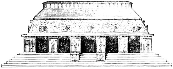
Temple of the Three Tablets.—Fig. 2.
The building, which stands on the summit platform but does not like the Palace cover its whole surface, 325 is seventy-six feet long, twenty-five feet wide, and about thirty-five feet high. The front, or northern, elevation is shown in the cuts. Fig. 1 includes the temple with the supporting pyramid, and fig. 2 presents the building on a larger scale. Each of the four central piers on this front has its bas-relief in stucco, while the two lateral piers have each ninety-six small squares of hieroglyphics, also in stucco. The bas-reliefs represent single human figures, standing, and each bearing in its arms an infant, or in one instance some unknown object. They are all very much mutilated, and although drawings have been published, I do not think it necessary to reproduce them. The roof is divided into two sections, sloping at different angles; the lower slope was covered with painted stucco decorations, and had also five square solid projections, one over each doorway. The dividing line between the two slopes marks the height 326 of the apartments in the interior, the upper portion being solid masonry. Along the ridge of the roof was a line of pillars, of stone and mortar, eighteen inches high and twelve inches apart, probably square, although nothing is said of their shape, and surmounted by a layer of projecting flat stones. Similar constructions may possibly have existed originally on some of the Palace roofs, since they would naturally be among the first to fall. Waldeck's plate represents a small platform in front of the doorways, ascended by four lateral stairways. Respecting the two square projections below the piers at the side of the central doorway there is no information except their representation by Catherwood in the cut, fig. 2.
The arrangement of the interior is shown in the accompanying ground plan. The central wall is four or five feet thick, and is pierced by three doorways, which afford access to three apartments in the rear. The front corridor has a small window at each end; Stephens speaks of two slight openings about three inches wide in each of the lateral apartments of the rear; and the plan indicates two similar openings in the central room, although he speaks of them as dark and gloomy. Castañeda's drawing shows only one window at the end; it also represents the building as having a roof like the Palace, and as standing on a natural rocky hill in which some steps are cut, no bas-reliefs or other decorations appearing on the 327 front. The interior walls are perfectly plain, and it is not even definitely stated that they are plastered. In the walls, however, at a, b, and c, of the ground plan, are fixed stone tablets one foot thick, each composed of several blocks, neatly joined and covered with sculptured hieroglyphics. Those in the central wall, at a and b, measure eight by thirteen feet, and contain each two hundred and forty squares of hieroglyphics in a very good state of preservation, while the one hundred and forty squares of the tablet in the rear apartment, three and a half by four feet, are much damaged by trickling water. Drawings of the hieroglyphics have been made by Waldeck and Catherwood only, although other visitors speak of them. I do not copy the drawings here, because, in the absence of any key to their meaning, the specimen which I shall present from another part of the ruins is as useful to the reader as the whole would be. The cut is a longitudinal section of this temple at the central wall, and shows the position of the tablets. Waldeck's drawing represents the two lateral doorways as having flat tops. Brasseur tells us that, according to the statements of the natives, the tablets were used originally for educational purposes. M. Charnay found them still undisturbed in 1859.[VI-33] 328
THE BEAU RELIEF.
Some four hundred yards south of the Palace is a pyramid, only partly artificial if we may credit Dupaix, and rising with a steep slope of one hundred feet from the bank of the stream according to Stephens, on which is a small building, No. 3 of the plan, which we may call, with Waldeck, the Temple of the Beau Relief. This edifice was found by later visitors in an advanced state of ruin, and Catherwood's drawings of it are much less satisfactory than in the case of other Palenque ruins; but both Dupaix and Waldeck found it in a tolerably good state of preservation, and were enabled to sketch and describe its principal features. This temple measured eighteen by twenty feet, apparently fronting the east, and is twenty-five feet high. It presents the peculiarity of an apartment in the pyramid, immediately under the upper rooms. The cut gives ground plans—No. 1 of the upper, and No. 2 of the lower rooms. The stairway which afforded communication between the 329 two, is also shown. Catherwood's drawing, however, represents the upper and lower apartments as alike in everything but height. On the rear, or western, wall, at a, was the Beau Relief in stucco, which gives a name to the temple, the finest specimen of stucco work in America, shown in the accompanying cut. 330 It was sketched by Castañeda and Waldeck, in whose drawings some differences of detail appear. At the time of Stephens' visit only the lower portions remained for study; yet he pronounced this "superior in execution to any other stucco relief in Palenque." At the time of Charnay's visit the last vestige of this beautiful relic had disappeared. Waldeck speaks of a tomb found in connection with this pyramid, which he had no time to explore, having made the discovery just before leaving the ruins.[VI-34]
TEMPLE OF THE CROSS.
Standing about one hundred and fifty yards a little south of east from the Palace, and on the opposite bank of the stream Otolum, is the building No. 4 of the plan, known as the Temple of the Cross, standing on a pyramid which measures one hundred and thirty-four feet on the slope. Mr Stephens locates this temple several hundred feet further south than I have placed it on the plan. Charnay describes the pyramid as partly natural but faced with stone. The temple is fifty feet long, thirty-one feet wide, and about forty feet high. The cut shows the front, or 331 southern elevation. The construction of the lower portion is precisely like that of the other buildings which have been described. The two lateral piers were covered with hieroglyphics, and the central ones bore human figures, all in stucco. The lower slope of the roof was also covered with stucco decorations, among which were fragments of a head and two bodies, pronounced by Stephens to approach the Greek models in justness of proportion and symmetry. On the top, the roof formed a platform thirty-five feet long and about three feet wide, which supported the peculiar two-storied structure shown in the preceding cut, fifteen feet and ten inches high. This is a kind of frame, or open lattice, of stone blocks covered with a great variety of stucco ornaments. A layer of projecting flat stones caps the whole, and from the summit, one hundred feet perhaps above the ground, a magnificent view is afforded, which stretches over the whole forest-covered plain to Laguna de Terminos and the Mexican gulf. This superstructure, like some that I have described at Uxmal and elsewhere in Yucatan, would seem to have been added to the temple solely to give it a more imposing appearance. It could hardly have served as an observatory, since there are no facilities for mounting to the summit.[VI-35]
The interior arrangement is made clear by the adjoined plan. Within the central apartment of the rear, or northern, corridor, and directly opposite to the main doorway is an enclosure measuring seven by thirteen feet. From its being mentioned as an enclosure rather than a regular room by Stephens, it would seem probable that it does not reach the full height of the chamber, but has a ceiling, or covering, of its own. At any rate, it receives light only by the doorway. Besides a heavy cornice round the enclosure, the doorway was surmounted by massive and graceful stucco decorations, and at its sides on the exterior were originally two stone tablets bearing each a human figure sculptured in low relief, resembling in their general characteristics the more common stucco designs, but somewhat more elaborately draped and decorated. One of them wears a leopard-skin as a cloak. These tablets were sketched by both Waldeck and Catherwood in the village of Santo Domingo, whither they had been carried and set up in a modern house. Stephens understood them to come from another of the ruins yet to be mentioned, but the evidence indicates strongly that he was misinformed. Both Waldeck and Stephens entered into some negotiations with a view to remove these tablets; at the 333 time of the former's visit the condition of obtaining them was to marry one of the proprietresses; in Stephens' time a purchase of the house in which they stood would suffice. Neither removed them.[VI-36]
TABLET OF THE CROSS.
Fixed in the wall at the back of the enclosure, and covering nearly its whole surface, was the tablet of the cross, six feet four inches high, ten feet eight inches wide, and formed of three stones. The central stone, and part of the western, bear the sculptured figures shown in the cut. The rest of the western, and all of the eastern stone, were covered with hieroglyphics. This cut is a photographic reduction of 334 Waldeck's drawing, the accuracy of which is proved by a careful comparison with Charnay's photograph. The subject doubtless possessed a religious signification, and the location of the tablet may be considered a sacred altar, or most holy place, of the ancient Maya or Tzendal priesthood. Two men, probably priests, clad in the robes and insignia of their office, are making an offering to the cross or to a bird perched on its summit. This tablet has been perhaps the most fruitful theme for antiquarian speculation yet discovered in America, but a fictitious importance has doubtless been attached to it by reason of some fancied connection between the sculptured cross and the Christian emblem. All agree respecting the excellence of the sculpture. Of the two priests, Stephens says: "They are well drawn, and in symmetry of proportion are perhaps equal to many that are carved on the walls of the ruined temples in Egypt. Their costume is in a style different from any heretofore given, and the folds would seem to indicate that they were of a soft and pliable texture like cotton." Stephens and other writers discover a possible likeness in the object offered to a new-born child. Of the hieroglyphics which cover the two lateral stones, the cut on the opposite page shows, as a specimen, the upper portion of the western stone, or what may be considered, perhaps, the beginning of the inscription. The large initial character, like an aboriginal capital letter, is a remarkable feature. In Dupaix's time all parts of the tablet were probably in their place, and in good condition, but his artist only sketched, and that somewhat imperfectly, the cross and human figures, omitting the hieroglyphics. Waldeck and Stephens found and sketched the central stone in the forest on the bank of the stream, to which point it had been removed, according to the former, with a view to its removal to the United States, but according to the latter its intended destination had been the village of Santo Domingo. 336 Stephens says he found the eastern stone entirely destroyed, though Charnay speaks of it as still in place nearly twenty years later; why Waldeck made no drawing of it does not appear.[VI-37]
MAYA HIEROGLYPHICS.
THE ONLY STATUE AT PALENQUE.
This temple is paved with large flags, through which is an opening made by Del Rio and noticed by later visitors. From this place Del Rio took a variety of articles which will be mentioned hereafter. On the southern slope of this pyramid Waldeck found two statues, exactly alike, one of which is represented in the cut on the opposite page, from Catherwood's drawings in Stephens' work. They are ten and one half feet high, of which two and a half feet, not shown in the cut, formed the tenon by which they were imbedded in the ground or in a wall. The figure stands on a hieroglyph which perhaps expresses the name of the individual or god represented. These statues are remarkable as being the only ones ever found in connection with the Palenque ruins; and even these are not statues proper, sculptured 'in the round,' since the back is of rough stone and was very likely imbedded originally in a wall. Waldeck believes they were designed to support a platform before the central doorway. One of them was broken in two pieces. After sketching the best preserved of them, Waldeck turned them face downward that they might escape the eye of parties who might have better facilities than he for removing them; but Catherwood afterwards discovered and sketched the one which remained entire. The resemblance of this figure to some Egyptian statues is remarked by all, though Stephens notes in 337 the lower part of the dress "an unfortunate resemblance to modern pantaloons." The space at the western base of the pyramid where various undescribed 338 ruins are indicated on the plan, is described by Stephens as a level esplanade one hundred and ten feet wide and supported by a stone terrace wall which rises sixty feet on the slope from the bank of the stream.[VI-38]
TEMPLE OF THE SUN.
PECULIAR ROOF STRUCTURES
At the south-western base of the pyramid of the Cross, and almost in contact with it, rises another of smaller base, but nearly as high, with a still smaller companion on the north, respecting which latter no information is given. These pyramids, Nos. 5 and 6 of the plan, are located by Stephens directly south from the Temple of the Cross, as indicated by the dotted lines. The building No. 5, sometimes called, without any sufficient reason, the Temple of the Sun, is one of the best preserved and most remarkable for variety of ornamentation of all the Palenque structures, but is very similar in most respects to its neighbor of the cross, having the same stuccoed piers and roof. Its front elevation is shown in the cut, 339 from Catherwood. Waldeck's plate differs chiefly in representing the stucco ornaments in a more perfect state; but both are confessedly restorations to a certain extent. Here again we have stucco reliefs of human figures on the central, and hieroglyphics of the same material on the lateral piers. The roof bears a superstructure similar to that already described, composed of a frame of hewn stone blocks, supporting complicated decorations in cement, several of which are modeled to represent human figures looking from openings in the lattice-work. The stone frame-work entirely freed from its ornamentation, is shown in the cut from Waldeck, which presents both a front and end view. Brasseur believes that these roof structures were erected by some people that succeeded the original builders of the temples. It will be remembered that in Yucatan similar superimposed structures were found by Stephens and others, and are for the most part the only ones on which traces of stucco work are observable.
The dimensions of this temple are twenty-eight by thirty-eight feet, and its ground plan, identical with the exception of an additional doorway with that of 340 the Temple of the Cross, is shown in the cut. The central enclosure in the rear, as is clearly shown by the plates and description in this case, has a roof of its own. Its interior dimensions are, nine feet long, five feet wide, and eight feet high. It has on the exterior a double cornice and graceful ornaments, now mostly fallen, over the doorways, while at the sides stood two sculptured reliefs representing human figures, which although broken in many fragments, were sketched by Waldeck. The tablets in the village of Santo Domingo were understood by Stephens to have come from this apartment.
Fixed in the rear wall, occupying its whole extent, and receiving light only through the doorway, is the Tablet of the Sun, which measures eight by nine feet and is made of three slabs of stone. In 1842 it was still unbroken and in place, and was considered by Stephens to be the most perfect and interesting monument in Palenque. As in the Tablet of the Cross the sides are covered with squares of hieroglyphics; and in the central portion is an object to which two 341 priests are in the act of making human offerings. This central object is a hideous face, or mask, with protruding tongue, standing on a kind of altar which is supported on the backs of two crouching human figures. Two other stooping men support the priests, who stand on their backs. The name Tablet of the Sun comes from the face with protruding tongue, which was sometimes regarded by the Aztecs as a symbol of the sun;—a very far-fetched derivation for the name.[VI-39]
The stream on whose banks the ruins stand flows for a short distance through an artificial covered stone channel, or aqueduct, about six feet wide, and ten feet high, covered like all the corridors by an arch of overlapping blocks. It extends fifty-seven feet from north to south, and one hundred and sixty feet further south-eastward toward the Temple of the Cross, where the fallen roof blocks up the passage and renders further exploration impracticable. Such is the information obtained from the works of Waldeck and Stephens. The position of this structure is indicated on the plan by the dotted lines numbered 7, although Stephens locates it considerably further north. There is great confusion in the accounts of this so-called aqueduct. Bernasconi included in his report a description and drawing of a vault seven feet wide, twelve feet high, and two hundred and twenty-seven feet long, extending in a curved line from the Palace to the stream. Del Rio speaks of a "subterranean stone aqueduct of great solidity and durability, which passes under the largest building." Dupaix states that a rapid stream, 342 a few paces—Kingsborough's edition has it over a league—west of the ruins, runs through a subterranean aqueduct five and one half feet wide, eleven feet high, and one hundred and sixty-seven feet long, built of stone blocks without mortar. The drawings of this structure, however, in Dupaix and Kingsborough's works do not bear the slightest resemblance to each other, one picturing it as a bridge, and the other as a corridor, or possibly aqueduct, built above the surface of the ground. Galindo tells us that a stream rises two hundred paces east of the Palace and is covered for one hundred paces by a gallery, with traces of buildings, probably baths, extending fifty paces further. Waldeck describes the mouth of a subterranean passage as concealed by a small cataract in the stream. There seems to be little reason to doubt that all these conflicting accounts refer to the same structure. Charnay tells us that the conduit is two mètres high and wide, and that it is covered with immense stones.[VI-40]
Not far from the Temple of the Sun a small building eight feet square was found by Waldeck lifted bodily from the ground by the branches of a large tree.[VI-41] On an eminence north of the Palace, at 9 of the plan, are the foundations of several buildings,—eleven in number, according to Dupaix, in whose time some of the arches were still standing. They extend in a line from east to west, and all front the south.[VI-42] On the summit of a high steep hill, or mountain, the slope of which begins immediately to the east of the Temple of the Cross, are the foundation stones of a building twenty-one feet square, at 8 of the plan. So thick is the forest that from this point none of the ruins below are visible, although the site of the village 343 of Santo Domingo may be seen by climbing a lofty tree.[VI-43]
Two bridges are indefinitely located in the vicinity of Palenque. One of them, said by Dupaix to be north of the Palace, is fifty-six feet long, forty-two feet wide, and eleven feet high, built of large hewn blocks without mortar. The conduit is nine feet wide, having a flat top constructed with a layer of wide blocks, and convex sides, as illustrated in the cut. The second bridge was found on the Tulija River some leagues west of the ruins, and only extends, according to Galindo, partly across the river, which is now about five hundred paces wide at that point.[VI-44] The Abbé Brasseur, during his visit to the ruins in 1871, claims to have discovered an additional temple, that of the Mystic Tree, containing hieroglyphic tablets.[VI-45] Three thousand five hundred paces southward from the last house of Santo Domingo, on a stream supposed to be a branch of the Usumacinta, Waldeck found two pyramids. They are described 344 as having been at the time in a perfect state of preservation, square at the base, pointed at the top, and thirty-one feet high, their sides forming equilateral triangles. Pyramids of this type rarely, if ever, occur in America, and it is unfortunate that the existence of these monuments is not confirmed by other explorers, since without such confirmation it must be considered very doubtful.[VI-46] Seven leagues north from the ruins, Galindo found a circular cistern twenty feet in diameter, two feet high on the outside, and eight feet on the inside, occupied at the time of his visit by alligators.[VI-47] According to Ordoñez, one of Del Rio's companions discovered on the Rio Catasahà, two leagues from Palenque, a subterranean stone structure, which contained large quantities of valuable woods, stored as if for export.[VI-48]
MISCELLANEOUS RELICS.
A few miscellaneous relics, found by visitors at different points in connection with the ruins of Palenque, and more or less fully described, remain to be noticed. Del Rio made an excavation under the pavement of the central chamber in the Temple of the Cross, and says: "at about half a yard deep, I found a small round earthen vessel, about one foot in diameter, fitted horizontally with a mixture of lime to another of the same quality and dimensions; these were removed, and the digging being continued, a quarter of a yard beneath, we discovered a circular stone, of rather larger diameter than the first articles, and on removing this from its position, a cylindrical cavity presented itself, about a foot wide and the third of a foot deep, containing a flint lance, two small conical pyramids with the figure of a heart in dark crystallized stone; ... there were also two small earthen jars or ewers with covers containing small stones and a ball of vermilion.... The situation of the subterranean depository coincides with the centre of the oratory, 345 and in each of the inner angles, near the entrance, is a cavity like the one before described," containing two little jars. The same author also speaks of burnt bricks which seem to have been used sparingly.[VI-49] Waldeck, having made a similar excavation in what he calls the temple of the Palace, perhaps the building C, found a gallery containing hewn blocks of stone, and earthen cups and vases with many little earthen balls of different colors. He also speaks of a fine fragment of terra cotta which he found in the court 1 where he also discovered just before leaving Palenque the entrance to other galleries of the pyramid. Waldeck also gives drawings of two images of human form in terra cotta, from Dr Corroy's collection; also a face, or mask, in stucco from the cornice of the Temple of Death, whatever that building may have been.[VI-50] Galindo found stones apparently for grinding maize, similar to the Mexican metate; also artificially shaped pebbles, similar, as he says, to those used by the modern Lacandones but smaller. Both Galindo and Dupaix speak of a circular granite stone, like a mill-stone, six feet in diameter and one foot thick, found on the side or at the foot of the Palace pyramid. Dupaix found at a distance of a league westward from the ruins, a square pillar fourteen feet in circumference, 346 and about the same in height, with two short round pillars standing at its eastern foot. He also speaks of finding many small altars probably used originally for burning copal. One of them, four feet in circumference and sixteen inches high, is represented in the preceding cut.[VI-51] At the sale of a collection of antiquities in London, 1859, two of the objects sold are, erroneously in all probability, mentioned as relics from Palenque; one was "a mask, with open mouth, in hard red stone, the concave surface sculptured with a sitting figure of a Mexican chief, surrounded by various emblems," price thirteen pounds; the other, "a Mexican deity, with grotesque human face sculptured out of a very large and massive piece of greenstone," price twenty-five pounds. Mr Davis talks about "an idol of pure gold about six inches long."[VI-52] The two copper or bronze medals which I have already noticed as probably not authentic relics in my account of Guatemalan antiquities, have been considered by various writers, following Ordoñez without any apparent reason, as belonging to Palenque. The speculations to which they have given rise, and their attempted interpretations are splendid specimens of the trash, pure and simple, which has been written in unlimited quantities about primitive America.[VI-53]
RUINS OF OCOCINGO.
Some thirty-five or forty miles southward from Palenque, on another of the parallel streams which unite to form a branch of the Usumacinta, is another important group of ruins, which may be called Ococingo, from the name of a modern village, five or six miles distant toward the west. The same traditions that tell us of Votan's great Maya empire, and of Xibalba, allude also somewhat vaguely to another great capital called Tulhá. Juarros, perhaps following 347 Ordoñez, applied this name to the ruins of Ococingo, and most authors have followed him in this respect. I need not say, however, that the only authority for this use of the name is the traditional existence in the shadowy past, of a Tulhá in this region. The natives call the ruins Tonila, which in the Tzendal tongue signifies 'stone houses.' Notwithstanding the importance of the ruins, very little is known of them. Stephens and Catherwood spent about half a day here just before their visit to Palenque; and Dupaix and Castañeda also visited this point. The accounts by these explorers are about all there is extant on the subject, but they are necessarily brief, and unfortunately neither in text nor drawings do they agree at all with each other. Both Waldeck and Brasseur visited Ococingo, but neither gives any description of the monuments.[VI-54]
RUINS OF OCOCINGO.
At the village of Ococingo Stephens noticed two sculptured figures brought from the ruins, which he pronounced "somewhat in the same style as those at Copan." Castañeda also saw and sketched here two tablets, which may be the same. One of them measured forty-five by thirty-six by four inches, was of a grayish stone, and contained a single human figure, whose arms were bound behind the back with what resembles a modern rope. The other measuring thirty-six by twenty-seven inches, was of a yellow stone, and contained a standing and a squatting figure, surrounded by a border in which hieroglyphics appear. On the way from the village, Stephens noticed two well-carved figures lying on the 348 ground; while Dupaix found several of them thrown down and broken, two of which were sketched. One of them represents a human bust with arms crossed on the breast, the lower portion of which seems to be a kind of tenon originally fixed in the ground; the other bears a slight resemblance to the only statue found at Palenque. This statue must have been removed by Dupaix, since it was afterwards seen by Waldeck in Vera Cruz. Both statues had lost their heads.[VI-55]
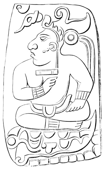
Engraved Chalchiuite from Ococingo.
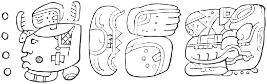
Hieroglyphics from Ococingo.
In the possession of some French citizens of Vera Cruz, Waldeck found a collection of seven or eight terra-cottas of very fine workmanship and very curious form, which had been brought from Ococingo. Two of them are shown in the accompanying cuts.[VI-56] 349 The figure shown in the cut was carved in bas-relief on a hard and polished chalchiuite which was found in this vicinity. The design is represented full-sized, 350 and its resemblance to one of the figures on the stone tablet in the Palace at Palenque will be apparent to the reader. Another similar stone bore the hieroglyphics shown in the preceding cut, which was also given in the second volume of this work as an illustration of the Maya system of writing. M. Warden speaks indefinitely of ancient monuments in this vicinity, in connection with which were stone figures representing warriors of great size.[VI-57]
This brings us to the ruins proper. They are situated a little north of east from the village, at a distance of five or six miles. Dupaix describes them as located on the slope of a hill, on the sides of which are some stone steps, and as consisting of five structures. The central building is nearly square, built of hewn stone, and covered with plaster, without exterior decorations. The drawing represents a double cornice, and a sloping roof, very similar to those of the interior Palace buildings at Palenque. There is only one door, on the west, and two square windows appear on each side. A few rods in front of this building, at the sides of the broad stairway leading up to it, and facing each other, are two other buildings of similar construction, but so small that the roof is pointed, its slopes forming four triangular surfaces. In the rear of the central structure, in positions corresponding to those of the buildings in front but at a greater distance, are two conical mounds of masonry covered with cement. Each is sixty feet high and two hundred feet in diameter, being pointed at the top; indeed, the only specimen of pointed stone pyramids seen by Dupaix in his explorations.[VI-58]
Stephens also describes the ruins, or the principal ones at least, as located "on a high elevation," but the elevation is an immense artificial pyramidal structure, built in five terraces. The surface was originally 351 faced with stone and plastered, but was so broken up in places that Stephens was able to ascend to the third terrace on horseback. On the summit of this terraced hill is a pyramid, high and steep, which supports a stone building measuring thirty-five by fifty feet on the ground, built of hewn stone, and covered with stucco. This is perhaps identical with the central building sketched by Dupaix. The only exterior doorway is in the centre of the front, and is ten feet wide. The ground plan is very similar to those of the temples of the Cross and Sun at Palenque, except that the front corridor is divided by partition walls, while the rear corridor is uninterrupted except by an oblong enclosure, which, as at Palenque, seems to have been a kind of sanctuary. The dimensions of this enclosure are eleven by eighteen feet, and over the doorway on the outside is a stucco ornament which arrested Mr Stephens' attention from its resemblance to the 'winged globe' of the Egyptian temples. A portion which was yet in place was sketched by Catherwood; the rest, which had fallen face downward, was too heavy for four men and a boy to overturn. Waldeck, however, either succeeded in raising the fragments, or, what is more likely, copied the standing part and restored the rest from his imagination, producing the drawing, a part of which is copied in the cut. The lintel of 352 this inner doorway is of zapote-wood, and in perfect preservation. The entrance to this sanctuary was much obstructed by fallen fragments, and the natives, who had never dared to penetrate the mysterious recess, believed the passage to lead by a subterranean course to Palenque. Stephens succeeded in entering the room, and found its walls covered with stucco decorations, including two life-sized human figures and a monkey.
From the top of the first building was seen another of similar plan and construction, but in a more damaged condition. It probably stands on the same terraced foundation, although no definite information is given on this point. Two other buildings supported by pyramids were seen. Stephens also speaks of an open table, probably the former site of the city, protected on all sides by the terraced structures which overlook the country far around. There is also a high narrow causeway, partially artificial, extending from the ruins to a mountain range, and bearing on its summit a mound and the foundations of a building, or tower. Of these ruins Mr Stephens says "there was no place we had seen which gave us such an idea of the vastness of the works erected by the aboriginal inhabitants."[VI-59]
MISCELLANEOUS RUINS.
I have found no very definite information about the antiquities of Chiapas, except the ruins of Palenque and Ococingo. In a statistical work on Chiapas and Soconusco by Emilio Pineda there are the following brief mentions of scattered monuments: In one of the hills near Comitan is a stone table; and a sun, sculptured in stone, serves as a boundary mark on the frontier. 353 Remains are still visible of the cities which formerly stood in the valleys of Custepeques and Xiquipilas, including remains of giants; also of those at Laguna Mora, five leagues from the left bank of the river Chiapas, between the pueblo of Acalá, and the valley of Custepeques, believed to have been the towns of Tizapetlan and Teotilac, where Cortés hung the Aztec king Guatimozin and others; also those of Copanabastla, where columns are mentioned. There are, besides, some sepulchres of the Tzendal nobles, two of which are especially worthy of note. The first is between the pueblo of Zitalá and the hacienda of Boxtic, twenty-two leagues north-west of San Cristóval. "Its base is a parallelogram formed from a hill cut down on three sides, so that at the entrance one seems to be ascending an inclined plain; but further along is seen an elevation with grades, or terraces, chiefly on the sides which are cut away. On the summit plane is found an enormous cone, built of hewn blocks of slate, whose base is about two hundred varas in circumference. In the centre are the sepulchres, and in some of them human bones. The ascent to them is by steps, and the whole seems like a vast winding stairway, for which reason it is called Bololchun, meaning in the Tzendal tongue a 'coiled snake.' Similar to this, is another at the hacienda of San Gregorio, near the pueblo of Huistan, eight leagues east of the city of San Cristóval; but the latter has no supporting mound, but stands on the level of the ground. Here are two Egyptian pyramids, considering their form and purpose." Walls of masonry are mentioned on the hill of Colmena, four leagues from Ocosucoautla; being nine feet thick, seven feet high, and enclosing a circular space forty-five feet in diameter. There is also a wall on the hill of Petapa, south of Ocosucoautla; but the most notable is that of Santoton, near Teopisca, seven leagues south-west of San Cristóval. Two parallel walls extend a long distance, 354 having at one end a ditch, and at the other a high steep mound; within the walls was a town.[VI-60]
Among the relics found at Huehuetan in Soconusco at the end of the seventeenth century, and publicly destroyed, are said to have been some sculptured stones; and we have a statement that the shapeless ruins of the city itself are still visible on a hill near the Pacific, at the modern town of Tlazoaloyan.[VI-61] The ruins of the aboriginal Tonalá, a town captured by Pedro de Alvarado, are said to be still seen on the banks of a laguna communicating with the sea, near the Tehuantepec frontier. The ancient Ghowel, or Huey Zacatlan, is supposed to have stood on the present site of San Cristóval, where some traces are reported. Dupaix mentions a human head, wearing a kind of helmet, cut from green porphyry. This relic was in the possession of Sr Ordoñez.[VI-62]
Brasseur states that the town of Chiapa de Indios, twelve leagues from San Cristóval, is "full of ruins;" and he thinks that obelisks, on one of which there is a tradition of an old king having inscribed his name, and other ruins like those at Copan and Quirigua will some time be brought to light in the forests about Comitan. Hermosa mentions two stones cut in the form of tongues, nine feet long and two feet wide, at Quixté, the location of which I am unable to find. Galindo speaks of some extraordinary and magnificent ruins in a cave somewhere on the left bank of the Usumacinta near the falls; and somewhat lower down, about three miles from Tenosique, a remarkable monumental stone, with inscribed characters. And finally, among the wonderful pretended discoveries of Leon de Pontelli, were the ruined cities of Ostuta and Copanahuaxtla, southward 355 of Palenque, and in the vicinity of San Bartolomé.[VI-63]
COMPARISONS.
I have now presented to the reader all that is known of Palenque, and the few other relics of antiquity that have been found in Chiapas. Since the monuments described are nearly all found in one locality, a general résumé seems less necessary than in the chapter on Yucatan antiquities, where the remains of many cities, with numerous variations in detail, were described. Yet a brief consideration of the leading points of resemblance and contrast between the two groups is important. In Palenque, as in Yucatan, we have low, narrow buildings of stone and mortar, standing on the summit platforms of artificial pyramidal elevations faced with masonry. There are no traces of city walls or other fortifications. Galleries are found within the Palace pyramid, and that of the Beau Relief; they were also found in Yucatan at Maxcanú, reported at Izamal, and may very likely exist in other pyramids. The building-material, stone, mortar, and wood, were apparently the same in both groups of ruins, although at Palenque the wood has disappeared. Respecting the form and dimensions of the hewn blocks, our information is less complete than is desirable, especially in the case of Palenque. I believe, however, that no importance can be attached to Galindo's remark that the blocks at Palenque are only two inches thick, and it is probable that the blocks used in both groups are of varying forms and dimensions, as indeed I am informed by a gentleman residing in San Francisco, who visited the ruins in 1860. Mortar, plaster, or stucco was used in greater profusion at Palenque, but there is no reason to suppose that it differed in composition or excellence; the bright-colored paints also, although 356 better preserved in Yucatan, were, so far as can be known, everywhere the same in the Maya ruins.[VI-64]
Interiors here as before consist for the most part of two narrow parallel corridors, with perpendicular walls for half their height, and covered by triangular arches of overlapping blocks of stone. Both walls and ceilings are covered with plaster, and both painted and stucco decorations occur on their surface. Poles originally stretched across from ceiling to ceiling, the poles themselves remaining in Yucatan, and the holes in which they were placed at Palenque. At the sides of many doorways on the interior are simple contrivances for supporting doors or curtains.[VI-65] The Palace, like those of the Yucatan structures which seem to have been intended partially for the residence of priests or lords, is built about an enclosed courtyard, but at Palenque the building is continuous instead of being composed of four separate structures as at Uxmal; and the court, unlike those in Yucatan, contains other structures. The strongest bond connecting Palenque to Uxmal, Kabah, and their sister cities, together with Copan, is the evident identity of the hieroglyphic characters inscribed on their tablets. 357 Respecting this identity all writers are agreed, but the reader, with the specimens given in the preceding pages, will require no other authority on the subject.[VI-66] Both Palenque and Yucatan are also alike remarkable for the comparative absence of idols, statues, implements, and pottery; and, except in the matter of statues, Copan may be classed with them. The human faces sculptured or molded in profile in Yucatan and Chiapas exhibit the same flattened forehead, although the type is much more strongly marked at Palenque. The absence of all warlike subjects is remarkable in the stucco and sculptured figures at Palenque as in all the more ancient remains of Central America.
Together with the resemblances pointed out and others that will occur to the student of this and the preceding chapters, there are also strongly marked contrasts to be noted. In nearly every city of Yucatan there are one or more pyramids on the summits of which no traces of buildings appear, apparently designed for the performance of religious rites in sight of the assembled people, but possibly having served originally to support wooden structures; while at Palenque each pyramid seems to have borne its edifice of stone. The number of buildings apparently intended as temples, in comparison with those which may have served also as residences for priests or rulers, seems much greater at Palenque. Many of the pyramids in Yucatan had broad terraces on their sides; at Palenque none appear, although a terraced elevation has been noticed at Ococingo. Some of the Yucatan pyramids are built of a concrete of rough stones and mortar; some of those at Palenque are chiefly composed of earth, but our information is not sufficiently 358 full on this point to warrant the conclusion that there is any uniform difference in the structure of the pyramids. The sides of the pyramids have in Chiapas no decorations either in stone or stucco, but such decorations in stucco may have existed and have left no trace. Coming now to the superimposed edifices we note that none are found of more than one story at Palenque, while in Yucatan two or three stories are of common occurrence. The walls at Palenque are much thinner, are built entirely of hewn stone, and lack, so far as the authorities go, the filling of rubble found in Yucatan. While the arch of overlapping stones is constructed in precisely the same manner, yet, as I have said, the projecting corners are beveled in Yucatan, while at Palenque a plain surface is produced by the aid of mortar. Doorways in the ruins of Yucatan have for the most part, except at Uxmal, stone lintels; in those of Palenque there is no very positive evidence of their use. In the former the principal exterior entrances have arched tops; in the latter no such structure appears. In the former the roof seems to have been flat, cemented, and plain; in the latter they were sloping, and decorated with stucco. In Yucatan columns occur occasionally both in doorways and elsewhere, but there are no windows; while in Chiapas small windows appear in most buildings, but no columns. Traces of a phallic worship are apparent in the Yucatan sculptured figures; at Palenque no such traces have been pointed out, and there is not among the many tablets or decorations in stucco, a single figure which would be offensive to the most prudish modesty. It is not necessary to speak of the exterior stairways, the isolated arch, the round buildings, the flat wooden roof, and other peculiar edifices which were found in Yucatan and have no counterpart at Palenque. The most marked contrast is in the use of stone and stucco for exterior ornamentation. No stone sculpture is seen on the outer walls of any Palenque building; while in Yucatan, except in superimposed 359 ornamental roof-structures, stucco very rarely appears.[VI-67]
The resemblances in the different groups of ruins in Chiapas, Yucatan, and Honduras, are more than sufficient to prove intimate connection between the builders and artists. The differences pointed out prove just as conclusively that the edifices were not all erected and decorated by the same people, under the same laws and religious control, at the same epoch.
ANTIQUITY OF PALENQUE.
And this brings me to the question of the age of Palenque, the date of its foundation and abandonment. It has already been shown that the Yucatan structures were built by the direct ancestors of the Mayas who occupied the peninsula at the time of the conquest; that they were not abandoned wholly until the coming of the Spaniards, although partially so during the two centuries preceding that event; 360 that the reasons adduced for and against the great antiquity of the ruins by different authors, bear almost exclusively on the date of their abandonment rather than that of their erection; and that the latter date, so far as anything can be known of it, depends chiefly on traditional history, which indicates that the cities were built at different dates from the third to the tenth century. It is chiefly by comparison with the ruined cities of Yucatan that the age of Palenque must be determined, since there is no traditional history that relates definitely to this city, and it was doubtless abandoned before the Spaniards came; for it is hardly possible that a great inhabited city could have remained utterly unknown during the conquest of this part of the country, especially as Cortés is known to have passed within thirty miles of its site. In favor of great antiquity for Palenque, the growth of large trees on the ruins, the accumulation of vegetable mold in the courtyards, and the disappearance of all traces of wood, have been considered strong arguments; but they all bear on the date of abandonment rather than of building, as do the rapid crumbling of the ruins since their discovery, the remains of bright-colored paint, the destructiveness of tropical climate and vegetation, and the comparison with some European ruins of known age. The size of trees and accumulation of earth are known to be very uncertain tests of age in this region; indeed the clearings and excavations of the earlier explorers seem to have left few signs visible to those who came a few years later. The utter disappearance of wooden lintels is, however, a very strong argument that Palenque was abandoned some centuries earlier than the cities of the peninsula, where the lintels were found often in perfect preservation, although it cannot be conclusively shown that the same kind of wood was employed. When we add to this the more advanced state of ruin of the Palenque structures, and the utter silence of all later traditions 361 respecting any great city or religious centre in this region, it seems safe to conclude that Palenque was abandoned, or left without repairs, as early as the twelfth or thirteenth century, and possibly earlier.
FOUNDATION OF PALENQUE.
Respecting the date when the city was built, we have the resemblances to Yucatan ruins already noticed, which show beyond doubt that it was built—under different conditions, such as religion and government possibly—by a people of the same race and language, and not by an extinct race as has been sometimes imagined. The present deteriorated condition of the natives, and the flattened foreheads of the sculptured figures have been the strongest reasons for believing in an extinct race; but the former has been shown, I believe, in the three preceding volumes of this work to have no weight, and the peculiar cranial conformation may be much more simply and as satisfactorily explained by supposing that in ancient as in modern times the forehead was artificially flattened. Then we have the strong differences noticeable between Uxmal and Palenque, which lead us to conclude that these cities must have been built either at widely different epochs, or by branches of the Maya race which had long been separated, or by branches, which through the influence of foreign tribes lived under greatly modified institutions. It cannot be accurately determined to what extent the last two conditions prevailed, but from what is known of Maya history, and the uniformity of Maya institutions, I am inclined to attribute most of the architectural and sculptural differences noted to the lapse of time, and to allow a difference of a few centuries between the dates of building. I must confess my inability to judge from the degree of art displayed respectively in the peninsular ruins and those of Palenque, which are the older; I will go further, and while in a confessional mood, confess to a shade of skepticism respecting the ability of other writers to form a well-founded judgment in the matter. Authors are, however, unanimous 362 in the opinion that Palenque was founded before any of the cities of Yucatan, an opinion which is supported to a certain extent by traditional history, which represents Votan's empire in Chiapas and Tabasco as preceding chronologically the allied Maya empire in the peninsula. If the Yucatan cities flourished, as I have conjectured, between the third and tenth centuries, Palenque may be conjecturally referred to a period between the first and eighth centuries. I regard the theory that Palenque was built by the Toltecs after their expulsion from Anáhuac in the tenth century as wholly without foundation; and I believe that it would be equally impossible to prove or disprove that the Palace was standing at the birth of Christ. It must be added that Brasseur and some others regard the stucco decorations and especially the peculiar roof-structures as the work of a later people than the original builders, or at least, of a later epoch and grade of culture.[VI-68]
OLD WORLD RESEMBLANCES.
Respecting the vague resemblances in the Palenque monuments to old-world ruins, there is very little to be said. The earlier observers were not permitted by their religious faith to doubt that the builders must be connected with some race of the old world; they were, however, allowed to use their judgment to a certain extent in determining which should have the credit, and most of them discovered the strongest similarities to Egyptian antiquities, although Dupaix could find no likeness in the hieroglyphics. Later authorities are not disposed to admit a marked likeness to the monuments of any particular nation of Europe, Asia, or Africa, although finding vague and perhaps accidental similarities to those of many of the older nations. My acquaintance with old-world antiquities is not sufficiently thorough to give any weight to my individual opinion in the matter, and I have no space for the introduction of descriptive text and illustrative plates. I give in a note the opinions of some writers on the subject.[VI-69]
ART DISPLAYED AT PALENQUE.
I close my account of Maya antiquities with the following brief quotations respecting Palenque, and the degree of art exhibited in her ruined monuments. "These sculptured figures are not caricatures, but display an ability on the part of the artists to represent the human form in every posture, and with anatomical fidelity. Nor are the people in humble life here delineated. The figures are royal or priestly; some are engaged in offering up sacrifices, or are in an attitude of devotion; many hold a scepter, or other baton of authority; their apparel is gorgeous; their head-dresses are elaborately arrayed, and decorated with long feathers."[VI-70] "Many of the reliefs exhibit the finest and most beautiful outlines, and the neatest combinations, which remind one of the best Indian works of art."[VI-71] "The ruins of Palenque have been perhaps overrated; these remains are fine, doubtless, in their antique rudeness; they breathe out in the midst of their solitude a certain imposing grandeur; but it must be affirmed, without disputing their architectural importance, that they do not justify in their details the enthusiasm of archæologists. The lines which make up the ornamentation are faulty in rectitude; the designs in symmetry; the sculpture in 365 finish; I except, however, the symbolic tablets, the sculpture of which seemed to me very correct." "I admire the bas-reliefs of Palenque on the façades of her old palaces; they interest me, move me, and fill my imagination; but let them be taken to the Louvre, and I see nothing but rude sketches which leave me cold and indifferent."[VI-72] "The most remarkable remains of an advanced ancient civilization hitherto discovered on our continent." "Their general characteristics are simplicity, gravity, and solidity."[VI-73] "While superior in the execution of the details, the Palenque artist was far inferior to the Egyptian in the number and variety of the objects displayed by him."[VI-74]
Nahua Antiquities—Home of the Zapotecs and Miztecs—Remains in Tehuantepec—Fortified Hill of Guiengola—Petapa, Magdalena, and Laollaga—Bridge at Chihuitlan—Cross of Guatulco—Tutepec—City of Oajaca and Vicinity—Tlacolula—Etla—Peñoles—Quilapan—Ruins of Monte Alban—Relics at Zachila—Cuilapa—Palaces of Mitla—Mosaic Work—Stone Columns—Subterranean Galleries—Pyramids—Fortifications—Comparison with Central American Ruins—Northern Monuments—Quiotepec—Cerro de las Juntas—Tuxtepec—Huahuapan—Yanguitlan—Antiquities of Guerrero.
NAHUA MONUMENTS.
I now enter what has been classified in a preceding volume of this work as the home of the Nahua nations,—nations, most of which were at the time of the Spanish conquest, and during the preceding century, subjected to the allied powers of Anáhuac, and were more or less closely related to the nations of the central valley, in blood, language, or institutions. It has been seen, in what has been said on the subject,[VII-1] that the dividing line between the Nahuas and Mayas, drawn across the isthmus of Tehuantepec, is not a very sharply defined one. Many analogies, linguistic, institutionary, and mythologic, were found between nations dwelling on different sides of the 367 line; so in monumental relics, and in traditional history, we shall find many points of similarity; but on the whole, the resemblances will be so far outweighed by the differences, as "to indicate either a separate culture from the beginning, or what is more probable, and for us practically the same thing, a progress in different paths for a long time prior to the coming of the Europeans," to repeat the words of a preceding chapter.
The relics to be described in the present chapter are those of the isthmus proper, and of that portion of the Mexican Republic above the isthmus which lies in general terms south of the eighteenth parallel of latitude, including the states of Oajaca and Guerrero, and stretching on the Pacific from Tonalá to the mouth of the Rio Zacatula, a distance of between five and six hundred miles. The province of Tehuantepec, belonging politically to the state of Oajaca, includes the central continental mountain chain, with the plains on the Pacific at its southern base, a region somewhat less fertile and attractive than those in which many of the ruins already described are situated. The two chief mountain ranges of the Mexican Republic, one skirting the Atlantic, the other the Pacific shore, draw near each other as the continent narrows, and meet in Tehuantepec. The southern portions of these two converging ranges, the broad mountain-girt valleys in the angle formed by their junction, and a narrow strip of tierra caliente on the southern coast, constitute the state of Oajaca, the home of the Miztecs, Zapotecs, and other tribes somewhat less civilized, powerful, and celebrated. The interior valleys are for the most part in the tierra templada, and include some of the best agricultural land in the country, with all the larger towns grouped round the capital as a centre. Guerrero is made up of the very narrow lowlands of the coast, the southern mountain range extending through its whole length from north-west to south-east, and the 368 valley of the Zacatula further north. It is a region but little known to travelers, except along the great national highway, or trail, which leads from Acapulco, the most important port of the state, to the city of Mexico.
RUINS OF GUIENGOLA.
Five or six leagues from the city of Tehuantepec, the capital of the province of the same name, and in the south-western corner of the province, have been found the remains of an aboriginal fortification or fortified town, which, according to the traditional annals of the country, was built by the Zapotecs, not very long before the Conquest, to resist the advance of the Aztec forces. The principal remains are on a lofty hill, the cerro of Guiengola, but the fortified territory is said to extend over an area measuring one and a half by over four leagues, the outer walls being visible throughout the entire circumference at every naturally accessible point. Besides the protecting walls there are remains of dwellings, all of stone without mortar, except a cornice on the larger walls. Three fortresses covered with a coating of hard plaster are mentioned. Ditches accompany the walls and add to the strength of the works. From a subterranean sepulchre were taken about two hundred pieces of pottery, including vases and imitations of various animals. The tombs had a coating of compact cement, and the skeletons found in them were lying face down. The preceding information I take from a very vague account written by Sr Arias and published in the Museo Mexicano. Arias visited the locality in 1833; he claims to have sent some very interesting relics, found at Guiengola and other localities in the vicinity of Tehuantepec, to the museum at Oajaca; but the man to whom they were entrusted probably disposed of them in a manner more profitable to himself, if less advantageous to the museum. Several natural caves are spoken of by Arias, and one of them, seventy feet deep, showed traces, according to the German traveler Müller, of having been formerly inhabited. 369 The latter also found vestiges of dwellings scattered throughout the vicinity, and speaks of a well-preserved tumulus standing not long before his visit in a valley close by. It was thirty-three feet high, with a base of ninety by one hundred and five feet, and a summit platform sixty by seventy-five feet, reached by a stairway of twenty-five wide steps. At the side of this tumulus was a quadrilateral elevation covering an area of about two acres, and enclosed by a wall eight feet high and twelve feet thick. Whether these structures are identical with the 'castles' of Arias is uncertain. A correspondent of Hutchings' Magazine in 1858 describes a wall of rough stones four feet thick and thirty feet high, said to extend nine miles. This writer speaks also of buildings with pillars in their centre, and of quarries from which the stone was originally taken. Some plans accompanied Arias' report but were not published. Unsatisfactory as it certainly is, the preceding is all the information extant respecting these remains,[VII-2] or at least referred definitely to Guiengola by name; but some remains were described by Dupaix and sketched by Castañeda, at a point three leagues west of Tehuantepec, which undoubtedly belonged to this group, and were probably the same ruins which the other writers so vaguely mention. On the top of a high hill, surrounded by other grand ruins, are two pyramids of hewn stone and mortar. The first is fifty-five by one hundred and twenty feet at the base, and thirty by sixty-six feet at the summit. The main stairway, thirty feet wide, of forty steps, leads up the centre of the western slope; there are also narrower stairways on the north and south. The pyramid is built in four terraces, the walls of the lower one being perpendicular; 370 and of all the rest sloping. The whole surface was covered with a brilliant cement of lime, sand, and red ochre. No remains whatever were found on the summit. A remarkable feature is noticed on the surface of the second story, from which project throughout the whole circumference, except where interrupted by the stairways, four ranges of flat stones, forming hundreds of small shelves. The only suggestions made respecting the possible use to which these shelves were devoted are that they supported torches or human skulls.
The second pyramid is shown in the accompanying cut. The dimensions of the base and summit platform are about the same as those of the former pyramid, but the height is over fifty feet. The chief stairway, shown in the cut, is on the east, and narrower stairways also afford access to the summit on the north and south. The curved slope of the lower story constitutes a feature not found in American pyramids farther south, and rarely if at all in the north. The upper story has three projections, or cornices, on its perpendicular sides; and between them is set a row of blocks, said to be white marble, bearing sculptured designs in bas-relief. Three of these blocks with 371 their sculptured figures, found by Castañeda at the foot of the pyramid, are shown in the cut. Of the building which appears on the summit nothing is known further than may be gathered from the cut. The sides of the pyramid were covered with cement, which was doubtless in a much more dilapidated condition than is indicated in the drawing.
Near the pyramids, and perhaps used in connection with them as an altar, is a structure comprised of eight circular masses of stone and mortar, like mill-stones in shape, placed one above another, and diminishing in size towards the top. The base is ten feet and a half in diameter, and the summit about four feet and a half, the height being about twelve feet. Kingsborough's translation, without any apparent authority, represents this monument as standing on a base sixty-six feet long and twelve feet high.
About a hundred paces in front of the second pyramid, stands a structure precisely similar to the lower story of that just described, twelve feet in diameter and three feet high. Both of these altar-like pyramids were built of regular blocks of stone, and covered with a hard white plaster. Dupaix suggests that the latter was a gladiatorial stone, or possibly intended for theatrical representations.[VII-3]
MONUMENTS OF TEHUANTEPEC.
In the city of Tehuantepec, or in its immediate 372 vicinity, Dupaix found a flint lance-head of peculiar shape, having three cutting edges, like a bayonet. Its dimensions were one and a half by six inches, and the end was evidently intended to be fixed in a socket on the shaft. Cuts of four terra-cotta idols, sent to the Mexican Museum probably by Arias, already mentioned, are given in a Mexican magazine, and also in a Spanish edition of Prescott's work. Two of them wear horrible masks, the main feature of which is the projection from the mouth of six large tusks, like those of some fierce animal or monster. The same Arias speaks of a statue representing a naked woman, but broken in pieces; also a stone tablet covered with hieroglyphics. A small earthen bowl or censer, with a long handle, was presented to the American Ethnological Society, as coming from some point on the Tehuantepec interoceanic route.[VII-4]
In the region of Petapa, a town forty or fifty miles north of Tehuantepec, a stalactite cave is mentioned by Brasseur, on the walls of which figures painted in black are seen, including the imprint of human hands like those on the Yucatan ruins except in color. A labyrinth of caves, with some artificial improvements, is also reported, where the remains of princes and nobles were formerly deposited, and where an arriero claims to have seen over one hundred burial urns, painted and ranged in order round the sides of the cave.[VII-5] Only four leagues from Tehuantepec, near Magdalena, Burgoa speaks of a statue of Wixepecocha, the white-haired reformer and prophet of the Zapotecs, which Brasseur, without naming his authority, states to have been still visible a few years before he wrote.[VII-6] Lafond briefly mentions three pyramids on the isthmus without definitely 373 locating them;—that of Tehuantepec, seventy-two feet high, that of San Cristóval near the former, and that of Altamia in a broad plain.[VII-7] At Laollaga, seven leagues from Tehuantepec in a direction not stated, Arias—very vaguely, as is the custom of Mexican and Central American explorers of local antiquities—describes a group of mounds, some of which are seventy or eighty varas square, built of stones—or stone adobes, as the author calls them—three feet long and half as thick. In connection with these mounds, flint and copper hatchets have been found, together with many anchor-shaped objects of what is spoken of as brass. A cave containing some relics was reported to exist in the same vicinity; and at another point, some fourteen leagues from the city, is a mound seventy-five feet high, on the side of which was discovered a black rock, covered with hieroglyphic characters.[VII-8] At Chihuitlan, a day's journey from the city, a bridge of aboriginal construction, stretches across a stream. The bridge is twelve feet long, six feet wide, and nine feet high above the water, having low parapets guarding the sides. The conduit is nine feet wide, and is formed by two immense stones, which meet in the centre. According to Castañeda's drawing these two stones have curved surfaces, so that the whole approaches in form a regular arch. The whole structure is of the class known as cyclopean, built of large irregular stones, without mortar.[VII-9]
Respecting Tehuantepec antiquities, I have in addition to what has been said only brief mention by Garay of the following reported relics: On a cliff of the Cerro del Venado, is the sculptured figure of 374 a deer, whence comes the name of the hill. Nine miles east of the same hill the Indians pointed out the location of a valley where they said were the remains of a large town of stone buildings. The Cerro de Coscomate, near Zanatepec, is said to have a sculptured image of the sun, with an inscription in unknown characters. And finally, relics have been found on the islands of Monapostiac, Tilema, and Arrianjianbaj; those on the first being in the form of earthen idols, while in the latter were the foundations of an aboriginal town.[VII-10]
At the port of Guatulco, south-west from Tehuantepec on the Oajacan coast, there may yet be seen, if Brasseur's statement is to be credited, traces of the roads and buildings of the ancient city that stood in this locality, and transmitted its name to the modern town. Guatulco was likewise one of the many localities described by the early Catholic writers as containing a wonderful cross, left here probably by Saint Thomas during his sojourn in America. We are not very clearly informed as to the material of this relic, but we know, from the same authorities, that all the powers of darkness could not destroy it, not even the famous Englishman, Sir Francis Drake, who subjected it for three days to the fiercest flames without affecting its condition. Brasseur also tells us that the remains of Tututepec, a great aboriginal south-coast capital, are still to be seen three or four leagues from the sea, between the Rio Verde and Lake Chicahua.[VII-11]
MISCELLANEOUS REMAINS.
Passing now to the interior valleys about the capital city of Oajaca, where the chief remains of aboriginal works are found, I shall mention first a few miscellaneous relics of minor importance, or 375 at least only slightly known to explorers,[VII-12] beginning with the city of Oajaca, where Dupaix found two ancient ornaments of great beauty. The first was a pentagon of polished transparent agate, about two inches in diameter and an inch and a half thick. The surface bore no marks of the instruments by which it was polished, and a hole was bored through the stone presumably for the insertion of a string. The second was a hexagonal piece of black touch-stone, of about the same dimensions, sprinkled with grains of gold or copper, and like the former brilliantly polished. The hole in this stone was bored in the form of a curve, by an unknown process which must have been accompanied by no little difficulty.[VII-13]
At Tlacolula, some twenty miles south-east of Oajaca, Mr Müller reports the opening of a mound twelve feet high and eight feet in diameter at the base. It was simply a heap of earth, and the only artificially wrought objects found in the excavations were an earthen tube two inches in diameter and nearly two feet long, closed at each end with a stone plug, found in a horizontal position somewhat above the natural surface of the ground, and a bowl-shaped ring of the same material lying in a vertical position over the tube near the centre of the mound, but separated from the first relic by a layer of earth.[VII-14] Remains of the ruined fortress of Quíyechapa are said to have been seen by travelers at a point some twenty-five leagues east of Oajaca.[VII-15] At Etla, two leagues northward from the capital, two subterranean tombs were opened, and found to contain what are supposed 376 to have been earthen torch-bearers, or images in distorted human form, with a socket in the head which indicates their former use. Similar images found at Zachila will be noticed later in this chapter. A wooden fac-simile of the tomb is mentioned by Sr Gondra as preserved in the Mexican Museum.[VII-16] At Peñoles, seven leagues from Oajaca, a skull covered and preserved by a coating of limestone was found.[VII-17] On the western boundary of this state, perhaps across the line in Guerrero, at Quilapan, formerly a great city of the Miztecs, an axe cast from red copper was found, one fourth of an inch thick, four inches long, and three and a half inches wide. From a mound opened in the same vicinity some fragments of statues and of pottery were taken.[VII-18] Fossey tells us that conical mounds in great numbers are scattered over the whole country between Oajaca, Zachila, and Cuilapa. The mounds are from fifteen to fifty feet high, and are formed in some cases of simple earth, in others of clay and stones. Human remains are found often in the centre together with stone and earthen figures. Those figures which are molded in human form agree in features with the Zapotec features of modern times. Copper mirrors and hatchets have also been found, according to this author, as well as golden ornaments and necklaces of gilded beads.[VII-19] M. Charnay saw in the second valley of Oajaca as he came from Mexico the ruins of a temple, the building of which was begun by the Spaniards in the time of Cortés, on the site of an aboriginal temple. The ruined walls of the latter were of adobes, and served for scaffolding in the erection of the former, and both ruins now stand together. The whole valley was covered with tumuli, probably tombs, as the author thinks; 377 but the natives would neither help to make excavations nor permit strangers to make them.[VII-20]
In addition to the relics described in the few and unsatisfactory notes of the preceding pages, three important groups of antiquities in central Oajaca remain to be noticed: Monte Alban, Zachila, and Mitla; our information respecting the two former being also far from satisfactory.
RUINS OF MONTE ALBAN.
Monte Alban is located immediately west of the city of Oajaca, or Antequera, at a distance of from half a mile to five miles according to different authorities. These differences in the statements of the distance perhaps result from the fact that some visitors estimate it in an air line, while others include the windings of the road which must be traveled over a mountainous country in order to reach the ruins, which seem to be located on a high hill or on a range of hills overlooking the town. Dupaix and Castañeda visited this place during their second expedition. Juan B. Carriedo made in 1833 a manuscript atlas of plans and drawings of the remains, which has never been published, but which is said to be preserved in the Mexican Museum. José María García explored Monte Alban in 1855, and his report with some drawings was published in the bulletin of the Mexican Geographical Society. Müller, the German traveler, visited the place in 1857 with one Ortega, and published a plan in his work. Finally we have Charnay's description from an exploration in 1858 or 1859, unaccompanied, however, by photographic views.[VII-21] 378
Notwithstanding this array of authorities, which ought to give a clear idea of a single group of remains, the reader will find the following description very imperfect, since each of the visitors, as a rule, describes a different part of the ruins, and they do not often agree in their remarks on any one structure. The plan in the annexed cut is copied from that in Müller's work, and shows all the remains marked on the original, except four small structures on a northern continuation of the hill, or spur, a, shown in the 379 north-eastern part of the plan. As the plan indicates, the ruins are situated on a plateau of some three hundred by nine hundred yards along the summit of a range of high hills with precipitous ascent, rising from the banks of a stream which Müller calls the Rio Xoxo. The works mentioned as not included in the plan, are described by Müller as the remains of four walls which form a parallelogram. All he tells us of the works at d and f, is that the terraces are covered with walls and embankments parallel or at right angles to each other. The structure at c is described as a pyramidal elevation fifty feet high and two hundred and fifty varas square at the base, from the summit platform of which rise a smaller terrace, or mound, at the north-west corner, and various other embankments and ruined walls not particularly described, but indicated on the plan. The structures in the central portion of the main plateau, at h, are spoken of as parallel embankments about thirty feet high.
To the ruins thus far mentioned no one but Müller refers definitely, although others speak somewhat vaguely of the ruined embankments and walls that cover the whole surface of the plateau. Only the southern remains at e seem to have attracted the attention of all. These Müller briefly represents as an embankment fifty feet high, enclosing a quadrilateral space, on which embankment were two pyramids or mounds. One of the latter was proved by excavating to have no interior apartments or galleries; the other was penetrated at the base by galleries at right angles with each other, and leading to a central dome-shaped room, the top of which had fallen. García represents the square court as enclosed, not by a continuous embankment, but by four long mounds, having a slight space between them at the ends. The southern mound is the largest of the four, being about forty-five feet high, and, according to García's plan, about twelve hundred feet long and three hundred feet wide. It seems, from the drawings, 380 to be nothing but a simple heap of earth and rough stones, although the slopes of the sides and ends were doubtless regular originally, perhaps even faced with masonry, and there are traces of a stairway leading up to the summit platform from the court. On the summit of the mounds, and also in the court, are many conical mounds, four of which were particularly noticed. These mounds were the only remains on the plateau of Monte Alban which attracted the attention of Dupaix and Castañeda, and are represented by them as heaps of rough stones, in some cases with mortar, covered on the exterior with cement, and traversed at the base by galleries, the sides of which are faced with hewn blocks. García says the mounds are about twenty-four feet high; but Dupaix calls one forty feet, another sixty, and a third still higher.
One of the mounds stands at the head of the stairway from the court, and the gallery through it at the base is described by García as having a bend in the centre, being six feet high, wide enough for two persons, and according to the plate, surmounted by large inclined blocks of stone resting against each other and forming an angle at the summit. Dupaix describes one of the mounds as traversed from north to south by a gallery nine feet high and six feet wide, which makes a turn, or elbow, near the centre, thus forming a room about twelve feet square and of the same height. The two mounds may very likely be identical, for although Castañeda's plate represents a regular curved arch, Kingsborough's copy has the pointed arch of large stones. Another of these artificial stone hills, according to Dupaix, has in the centre a room eighteen feet square, and thirty feet high, with a semicircular or dome-like top, the surface being formed of hewn stone. From the centre of each side a gallery thirty feet long, seven and a half feet high, and four feet and a half wide, with a regular arch, leads to the open air. The whole is said to be built on a large rectangular base of masonry, the dimensions of which 381 are not given. García mentions a similar mound, but speaks of the central room as being circular.
Another of these structures, resembling at the time of Dupaix's visit a natural hill covered with trees, is sixty feet high, and has a gallery seven and a half feet high and six feet wide, with arched top, extending seventy-eight feet, or nearly the whole diameter from south to north. The left hand, or western, wall of the gallery is composed of granite blocks, generally about twenty-eight by thirty-six inches and eighteen inches thick, on the surface of which are sculptured naked human figures in profile facing northward toward the interior of the mound. Four of these figures were sketched by Castañeda, and one of them, from whose head hangs something very like a Chinese queue, is shown in the cut. García locates this mound or another very similar one in the court, and he also sketched some of the figures, but very slight if any resemblance can be discovered between his drawings and those of Castañeda. Müller speaks of one of the tablets the sculptured design of which represents a woman giving birth to a ball. García states that human bones and fragments of pottery have been dug from these ruins, Dupaix found some bones, and M. Lenoir suggests that the figures in bas-relief were portraits of persons buried in the tombs. Dupaix mentions 382 a fourth mound similar to the others, having an angular ceiling, and a pavement of lime and sand.
Charnay describes the plateau as being partially artificial, and as covering about one half a square league, covered with masses of stone and mortar, forts, esplanades, narrow subterranean passages, and immense sculptured blocks. The arches of the galleries, contrary to Dupaix's statements, are formed by large inclined blocks. The grandest ruins are at the south end of the plateau; they are mostly square truncated pyramids, about twenty-five feet high, and having steep sides. Enormous masses of masonry represent what once were palaces, temples, and forts.[VII-22]
RELICS AT MONTE ALBAN.
Three smooth cubical stones, seven and a half feet high, four and a half feet wide, and eighteen inches thick, of granite, according to García, but of red porphyry, in the opinion of Müller, were found during the ascent of the hill, perhaps at b, or g, of the plan. Two of the stones were standing close together, while the third had fallen; all are supposed to have formed an altar or pedestal.[VII-23] At the southern brink of the plateau Müller found a crumbling stone covered with hieroglyphics. On the slope of the hill, stones covered with sculptured hieroglyphics were noticed by Dupaix, also at the western base long cubes, some plain and others sculptured. One of the latter six feet long, four feet and a half wide, and eighteen inches thick, was sketched by Castañeda, 383 together with a circular stone three varas and a half in circumference. His plates also include a semi-spherical mirror of copper-covered lava, three and a half inches in diameter, with beautifully polished surface and a hole drilled through the back; a copper chisel, seven inches long and one inch in diameter; and finally, the cast copper implement shown in the preceding cut, one of two hundred and seventy-six of the same form, but of slightly varying dimensions, which were found in an earthen jar dug up in this vicinity. The dimensions of the one shown in the cut are about eight by ten inches. Pieces of copper of this form were used by the Nahua peoples for money, and such was doubtless the purpose of these Oajacan relics. A precisely similar article from one of the Mexican ruins lies before me as I write. Charnay states that the plateau is covered with fragments of very fine pottery, on which a brilliant red glazing is observable. He states further, that an Italian explorer, opening some of the mounds, found necklaces of agate, fragments of worked obsidian, and even golden ornaments of fine workmanship.
Respecting these ruins Charnay says: "Monte Alban, in our opinion, is one of the most precious remains, and very surely the most ancient, of the American civilizations. Nowhere else have we found these strange profiles so strikingly original." He pronounces the arch similar to that employed in Yucatan, but this opinion does not agree with his description on another page, where he represents the ceilings of the galleries as formed of large inclined blocks of stone. Viollet-le-Duc gives a cut indicating the latter form of arch; and I think there can be no doubt that Dupaix and Castañeda are wrong in representing semicircular arches. M. Viollet-le-Duc deems the sculpture different in type from that at Palenque but very similar to the Egyptian. He regards the works as fortifications and speaks of the galleries as penetrating the ramparts. Müller and García also deem 384 the remains those of fortifications, while Ortega seeks to form them into a stately capital full of royal palaces, temples, and fine edifices. García tells us that these works were erected by a Zapotec king, with a view to resist the advance of the Miztecs; while Brasseur believes that here was the fortress of Huaxyacac built by the Aztecs about the year 1486, and garrisoned to keep the country in subjection.[VII-24]
It seems to me that the preceding description, imperfect as it is, is yet more than sufficient to prove that the structures on Monte Alban were never erected by any people as temporary works of defense. The choice of location shows, however, that facility of defense was one of the objects sought by the builders, and renders it very improbable that a city proper ever stood here, where, at least in modern times, there are no springs of water. On the other hand, the conical mounds as represented by Castañeda's drawings seem in no way fitted for defensive works, and were almost certainly erected as tombs of Zapotec nobles or priests. The plateau was probably in aboriginal times a strongly fortified holy place, sacred to the rites of the native worship, but serving perhaps as a place of refuge to the dwellers in the surrounding country when threatened by an advancing foe. It is moreover very likely that in the period of civil strifes and foreign invasions which preceded the Spanish Conquest, these works were strengthened and occupied by the Zapotecs, and possibly by the Aztecs also in their turn, as a fortress.
RELICS AT ZACHILA.
Zachila, ten or twelve miles, according to the maps, southward from Oajaca, was the site of a great Zapotec capital. A writer in a Mexican magazine mentions the base of an ancient pyramid as still visible near the church of the modern town. With the exception of this brief mention all our information respecting the antiquities of Zachila comes from the 385 work of Dupaix; and this writer, so far as permanent monuments are concerned, only speaks generally of an immense group of mounds in conical form, built of earth and a few stones, and of the imprint of a gigantic foot probably marking the meridian somewhat south of the mounds. From excavations in these tumuli, stone and clay statues, or idols, were obtained, together with pottery, burnt bricks, pieces of human bones, and fragments of ruined walls. Of the objects taken from the tumuli or found in the vicinity, over twenty were described and sketched by Dupaix and Castañeda.
1. A seated human figure with arms and legs crossed as shown in the cut. It is carved from a grayish yellow grindstone-like material, and is about a foot in height. It was found in a tomb together with some human bones. The rear view in the original shows the hair falling down the back and cut square across; while the belt about the waist is passed between the legs and is tied in a knot behind. 2. A seated human figure in granite, eighteen inches high. The arms, from elbow to wrist, are free from the body, and the hands rest on the knees. A string of beads or pearls is suspended from the neck, and a mask with fantastic figures in relief covers the face. In the top of the head is a hollow, and the image seems to have 386 been designed, like many others in the same locality, for a vase or, perhaps, a torch-bearer. 3. A seated human figure, twenty-seven inches high, cut from white marble and painted red. The arms and body are concealed by a kind of semicircular cape. The hands appear below the cape, holding some indescribable object. A necklace of beads or pearls surrounds the neck, the face is apparently masked or at least the features are ideally fantastic, and an immense headdress, as large as all the rest of the figure, surmounts the whole in semicircular form. A serpent appears among the emblems of the head-dress.[VII-25] 4. A stone twenty-seven inches long, twelve inches high, and three inches thick, of very hard and heavy material. On one side, within a plain border, are four human figures in low relief, two on each side facing a kind of altar in the middle. All are squatting cross-legged, one has clearly a beard, and another has a bird—called by Dupaix an eagle, as is his custom respecting every bird-like sculpture—forming a part of his head-dress. The stone was badly broken, but seems to have been carried by the finder to Mexico.[VII-26] 5. A bird bearing considerable likeness to an eagle, holding a serpent in its beak and claws. This figure was sculptured in low relief on a block of hard sandstone three feet square, built into a modern wall. 6. A human face, much like what is in modern times drawn to represent the full moon, three feet in diameter, and also built into a wall. The material is a brilliant gray marble. 7. Three fragments with sculptured surfaces, one of which has among other 387 figures several that seem to represent flowers. 8, 9. Two masked images, similar in some respects to No. 2, but of terra-cotta instead of stone. One of them is shown in the cut. They are about a foot and a half high, hollow, and present some indications, in the form of a socket at the back of the head, of having been intended to hold torches.[VII-27] 10. A terra-cotta figure, about nine inches high, apparently representing a female clad in a very peculiar dress, as shown in the cut.[VII-28] 11. An earthen cylinder, five 388 inches in diameter and nine inches high, on the top of which is a head, possibly the caricature of a dog, from whose open jaws looks out a tolerably well-formed human face. 12-17. Six heads of animals or monsters in terra cotta. 18-23. Six earthen dishes of various forms, one of which, in the form of a platter, has within it a representation in clay of a human skull.
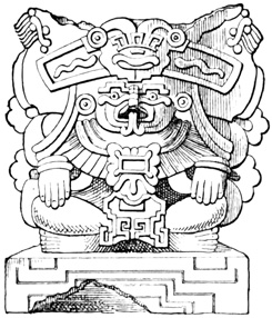
Terra-Cotta Image—Zachila.
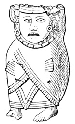
Terra-Cotta Image—Zachila.
A tomb is said to have been opened at Zachila in which were several tiers of earthen platters, each containing a skull. Some of the vessels have hollow legs with small balls, which rattle when they are moved.[VII-29] At Cuilapa, some distance north-east of Zachila, the existence of tumuli is mentioned, but a German explorer, who visited the locality with a view to open some of them, is said to have been stoned and driven away by the infuriated natives, notwithstanding the fact that he was provided with authority from the local authorities.[VII-30]
MITLA—HOME OF THE DEAD.
The finest and most celebrated group of ruins in Oajaca, probably the finest in the whole Nahua territory, is that at Mitla, about thirty miles slightly south of east from the capital, and eight or nine miles 389 north-east of Tlacolula. Here was a great religious centre often mentioned in the traditional annals of the Zapotecs. The original name seems to have been Liobaa, or Yobaa, 'the place of tombs,' called by the Aztecs Miquitlan, Mictlan, or Mitla, 'place of sadness,' 'dwelling of the dead,' often used in the sense of 'hell.'[VII-31] The buildings at Mitla were at least partially in ruins when the Spaniards came, but their dilapidation probably dated only from the fierce contests waged by the Zapotec kings against the Aztec powers in Anáhuac, during one or two centuries preceding the Conquest; and as we shall see later there is no reason whatever to doubt that the place was occupied by the Zapotec priesthood during the long period of that nation's supremacy in Oajaca and the southern Anáhuac.[VII-32]
The gloomy aspect of the locality accords well with the dread signification of its name. The ruins stand in the most desolate portion of central Oajaca, in a high, narrow valley, surrounded by bare and barren hills. The soil is a powdery sand, which supports no vegetation save a few scattered pitahayas, and is borne through the air in clouds of dust by the cold dry wind which is almost continually blowing. A stream with parched and shadeless banks flows through the valley, becoming a torrent in the rainy season, when the adjoining country is often flooded. No birds sing or flowers bloom over the remains of the Zapotec heroes, but venomous spiders and scorpions are abundant. Yet a modern village with few inhabitants stands amid the 390 ruins, and the natives go through forms of worship in honor of a foreign deity in a modern church over the tombs of their ancestors' kings and priests, whose faith they were long since forced to abandon.[VII-33]
EXPLORATION OF MITLA.
Most of the early Spanish chroniclers speak of Mitla and of the traditions connected with the place, but what may be called the modern exploration of the structures, as relics of antiquity, dates from the year 1802, when Don Luis Martin and Col. de la Laguna from Mexico visited and sketched the ruins. It was from Martin and from his drawings in the hands of the Marquis of Branciforte, that Humboldt obtained his information. In August 1806, Dupaix and Castañeda reached Mitla in their second exploring tour. In 1830, the German traveler Mühlenpfordt, during a residence in the country, made plans and drawings of the remains, copies of which were retained by Juan B. Carriedo and afterwards published in a Mexican periodical. Drawings were also made by one Sawkins in 1837, and published by Mr Brantz Mayer in a work on Zapotec antiquities. M. de Fossey was at Mitla in 1838, but his description is made up chiefly from other sources. Sr Carriedo, already mentioned, wrote for the Ilustracion Mejicana, a statement of the condition of the ruins in 1852, with measures which had been, or ought to be, taken by the government for their preservation. Mr Arthur von Tempsky spent part of a day at the ruins in February, 1854, publishing a description with several plates in the account of his Mexican travels which he named Mitla. José María García saw the ruins in October, 1855, as is stated in the bulletin of the Mexican 391 Geographical Society, but no description resulted from his exploration. Finally Charnay came in 1859, and succeeded after many difficulties in obtaining a series of most valuable and interesting photographs.[VII-34]
The number of ruined edifices at Mitla is variously stated by different authors, according to their methods of counting; for instance, one explorer reckons four buildings enclosing a court as one palace, another as 392 four. The only general plan ever published is that made by Mühlenpfordt, and published by Carriedo, from which the annexed cut was prepared.[VII-35] Most of the visitors, however, say something of the bearing of some of the buildings from the others, and there are only very few instances where such remarks seem to differ from the plan I have given. The structures usually spoken of as palaces or temples, are four in 393 number, marked 1, 2, 3, and 4; 5 and 7 are pyramids, mounds, or altars; and 6 shows the position of the houses in the modern village.
GRAND PALACE.
I begin with the best preserved of all, palace No. 1 of the plan.[VII-36] The arrangement of its three buildings is shown in the accompanying ground plan, a reduction from Castañeda's drawing. Three low oblong mounds, probably of rough stones, only five or six feet high, enclose on the east, north, and west, a court, E, whose dimensions are in general terms one hundred and twenty by one hundred and thirty feet, and each of the mounds supports a stone building. The walls of the northern building are still in a tolerable state of preservation; the eastern one has mostly fallen, and of that on the west only 394 slight traces of the foundations remain. It is possible that originally there was a fourth mound, with or without its building, on the south.[VII-37]
The lateral buildings, d, j, are about nineteen by ninety-six feet on the ground. Of the northern building, the southern portion, A, is about thirty-six by a hundred and thirty feet, the northern portion, C, sixty-one feet square, and the whole not far from eighteen feet high, the walls being from four to nine feet in thickness.[VII-38] Other details will be readily learned from the plan. Three doorways open on the court from each building, and a broad stairway of few steps leads up to the doorways, at least on the north.
The southern wing of the northern building, A of the plan, may be first described, being the best known and one of the best preserved of all; and the structure of the walls naturally claims attention first. In Yucatan we have found a filling of rough stones and cement, faced on both exterior and interior with hewn blocks; at Palenque the walls are built entirely of hewn stone; at Mitla the mode of construction somewhat resembles that in Yucatan, but the filling seems to be clay, instead of cement, with an admixture of irregular stones, varying in quantity in different parts of the walls.[VII-39] 395
CONSTRUCTION OF WALLS.
The exterior facing of the wall is shown very clearly by the two following cuts, which represent the southern façade of the building, A, as seen from the court. The first cut I have reduced photographically from Charnay's original photograph; the second, showing the rest of the façade, was taken from the same photograph for Mr Baldwin's work. The facing is of stone blocks cut in different forms and sizes, placed against or in some cases slightly penetrating the inner filling. First, a double tier of very large blocks are placed as a base along the surface of the supporting mound, projecting two or three feet from the line of the wall, the stones of the upper tier sloping inward. On this base is erected a kind of frame-work of large hewn blocks with perfectly plain unsculptured fronts, which divide the surface of the wall into oblong panels of different dimensions. These panels are then filled with a peculiar mosaic work of small brick-shaped blocks of stone of different sizes, set in different positions, so as to form a great variety of regular patterns, usually spoken of as grecques.[VII-40] No mortar seems to have been employed 398 in this facing of stone; at least its use is not mentioned by any author, and Dupaix states expressly that it is not found. Some of the blocks used in the base, frame-work of the panels, and lintels of the doorways, are very large. One of the latter is described by different writers as from sixteen to nineteen feet long, and is said by Dupaix to be of granite. The only sculpture on the façade is found on these lintels, the surface of which is represented as carved into regular figures in low relief, corresponding with the mosaic in the panels. The doorways are about seven feet wide and eight feet high, and in the upper part of the piers that separate them are noticed four round holes, which may be supposed, as in other aboriginal structures, to have served for the support of an awning, although the natives have a tradition that they were originally occupied by stone heads of native deities.[VII-41] The only other peculiarity to be noticed in this front is, that instead of being perpendicular, it inclines slightly outward from the base, as do many of the walls at Mitla.[VII-42]
STONE COLUMNS.
The interior of the building, A, has a pavement of flat stones covered with cement, which latter has mostly disappeared. The inner surface of the walls is of rough stones and earth, probably the same as the interior filling, and covered with a coat of plaster, a greater part of which remained in 1859, and is shown in Charnay's photograph; there were also traces of red paint on these walls in Dupaix's time. There are no windows, or other openings except the 399 doorways; but on the northern wall, at mid-height, there is a niche, perhaps more than one, one or two feet deep, square in form, and enclosed by four blocks of stone. Extending in a line along the centre of this apartment, are six round stone pillars, g, g, of the plan, each about fourteen feet high, three feet in diameter, and cut from a single block of porphyry or granite. The tops are slightly smaller than the bases, and five or six feet of each stone, in addition to the height mentioned, are buried in the ground.[VII-43]
The following cut I take from Baldwin's work, for 400 which it was copied from one of Tempsky's plates. It is very faulty, as is proved by Charnay's photograph taken from the same point of view, in representing the walls as if built of large rough stones without mortar, in putting a doorway in the central part of the northern wall, and in making the columns diminish in size towards the top much more than is actually the case.[VII-44]
MOSAIC GRECQUES AT MITLA.
Passing now to the northern wing of this building, C, the exterior walls are the same in style and construction as those of the southern wing just described, as is proved by the photographic views.[VII-45] The court, C, is about thirty-one feet square, and its pavement was covered with cement, as that of the larger court, E, may have been originally. The ground plan shows the arrangement of the four apartments, b, b, b, b, although it is to be noted that other plans differ slightly from this in the northern and western rooms. The only entrance to the northern court and rooms is from the southern wing through the passage f, f, which is barely wide enough to admit one person. The interior façades, fronting on the court, are precisely like the southern façade of the southern wing, A, being made up of mosaic work in panels.[VII-46] The interior walls of the small apartments, b, b, b, b, unlike those of the southern apartment, A, are formed of mosaic work in regular and graceful patterns, except a space of four or five feet at the bottom, which is covered with plaster and bears traces of a kind of fresco painting in bright colors. The mosaic grecques or arabesques of the upper portions are arranged, not in panels as on the exterior, but in three parallel bands of uniform and nearly equal width, extending round the whole circumference of each room. The 401 cut is a fac-simile from Charnay's photograph of one of these interiors, and gives an excellent idea of the three mosaic bands that extend entirely round each room.[VII-47]
ROOF STRUCTURES.
I now have to speak of the roof which originally covered this building, since in the other buildings and palaces nothing will be found to throw any additional light on the subject. It seems evident that the columns in the southern wing were intended to support the roof, and if there were no contradictory evidence, the natural conclusion would be that the covering was of wooden beams stretching completely across the narrow apartments, and resting on the pillars of the wider ones, as we have seen to be the case at 402 Tuloom, on the eastern coast of Yucatan.[VII-48] Burgoa, in whose time it is not impossible that some of the roofs may have been yet in place, tells us that they were formed of large stone blocks, resting on the columns, and joined without mortar.[VII-49] Humboldt states that the roof was supported by large sabino beams, and that three of these beams still remained in place (1802). According to Dupaix, both the roofs and floors in the northern wing were formed by a row of beams, or rather logs, of the ahuehuete, a kind of pine, a foot and a half in diameter, built into the top of the wall, and stretching from side to side. He does not inform us what traces he found to support his opinion. Mühlenpfordt[VII-50] found traces of a roof in one of the northern rooms sufficient to convince him that the original "consisted of round oak timbers, eight inches in diameter, placed across the room at a distance of eight inches one from another; these were first covered with mats, on which were placed stone flags, and over the latter a coat of lime; forming thus a solid and water-proof covering." Fossey speaks of one worm-eaten beam, but probably obtained his information from Humboldt. Tempsky, notwithstanding the shortness of his exploration, made the remarkable discovery that one of the northern rooms was still covered by a flat roof of stone. He also found windows in some of the buildings. What would he not have found had he been able to remain a few hours longer at Mitla? Viollet-le-Duc judges from the quantity and quality of the débris in the south wing, that the roof could not have been of stone in large blocks, but was formed by large beams extending longitudinally from pillar to pillar, and 403 supporting two transverse ranges of smaller timbers, laid close together from the centre to either wall, the whole being surmounted by a mass of concrete like that which constitutes the bulk of the walls; and finally covered with a coating of cement. I have no doubt that this author has given a correct idea of the original roof structure, although in attempting to explain in detail the exact position which—'il y a tout lieu de croire'—each timber occupied, it is possible that the distinguished architect has gone somewhat beyond his data.[VII-51]
As I have said before, the western building of the palace No. 1—like the southern building, if any ever stood on the south of the court—has entirely fallen. Of the eastern building, d, there remain standing a small portion of the wall fronting on the court, including 404 a doorway and its lintel, and also two of the five columns which occupied the centre of the building. The condition of this side structure seems not to have changed materially between Dupaix's and Charnay's visits, a period of over fifty years. The preceding cut, taken by Baldwin from Tempsky's work, gives a tolerably correct idea of what remains of it, except that the lintel had a sculptured front. It is a view from the south side of the court, and includes an imperfect representation also of the northern façade.[VII-52]
The palaces of Mitla are differently numbered by different writers, and much that has been written of them is so vague or confused that is difficult to determine in many cases what particular structure is referred to; I believe, however, that the preceding pages include all that is known of the palace numbered 1 on my general plan. I close my account of this palace by presenting on the opposite page a cut copied for Baldwin's work from one of Charnay's photographs, a general view of the ruins. The cut is a distant view of the palace No. 1 from the south-west, and cannot be said to add very materially to our knowledge respecting this building.[VII-53] 405
VIEW OF PALACE.
THE SECOND PALACE.
The remaining palaces of Mitla, Nos. 2, 3, and 4, may be more briefly disposed of, since in the construction of their walls they are precisely the same as No. 1, but are not in so good a state of preservation. No. 2 is located south-west of No. 1, and almost in contact with it, so that both groups have been by some visitors described together under the name of First Palace. It consists of four buildings, built on low mounds like those of No. 1, from seven to nine feet high, about a square court. All four are precisely the same in their ground plan, which is identical with that of the western building in palace No. 1. The dimensions of the four buildings are also the same, according to Castañeda's plan, being about eighteen by ninety-two English feet;[VII-54] but Mühlenpfordt's plan, so far as it can be understood, makes the eastern and western buildings about one hundred and forty feet 407 long, the northern and southern being about twenty by one hundred feet, and the former somewhat larger than the latter.
The western building is the best preserved, being, so far as can be judged by human figures in Charnay's photographs, about seventeen feet high. The eastern building has fallen, and only its foundation stones remain by which to trace its plan. Three doorways open on the court from each building, and in the rear wall opposite the doors square niches are seen. There are no traces of columns in any of the apartments; nor was any part of the roofs in place in 1806. The outer walls are composed, as in palace No. 1, of oblong panels of mosaic; whether any mosaic work is found in the interior, is not stated. The court is said by Mühlenpfordt to be covered with a coating of cement five or six inches in thickness, painted red as was also the exterior of the buildings. The same writer, and Müller, noted that the supporting mounds were double, or terraced, on the exterior;[VII-55] and the latter, that one of the central doorways diminishes in width towards the top. If this, latter statement be true, it must be one of the doorways in the southern building, of which no photographic view was taken.[VII-56] Views of the southern façade of the northern building are given by Charnay, Dupaix, Mühlenpfordt, and Tempsky; of the court façade of the western building, by Charnay and Mühlenpfordt; and Charnay also took photographs of the western and southern façades of the latter building.[VII-57]
Under the northern building of this palace there is a subterranean gallery in the form of a cross. The entrance to this gallery is said by several writers to have been originally in the centre of the court, but 408 this seems to rest on no very good authority, and it is not unlikely that the entrance was always where it is now, at the base of the northern mound, as shown in the photograph and in other views. The centre of the cross may be supposed to be nearly under the centre of the apartment above, and the northern, eastern, and western arms are each, according to Castañeda's drawings, about twelve feet long, five and a half feet wide, and six and a half feet high. The southern arm, leading out into the court is something over twenty feet long, and for most of its length only a little over four feet high; its floor is also several feet lower than that of the other arms, to the level of which latter four steps lead up. Nearly the whole depth of this gallery is probably in the body of the supporting mound rather than really subterranean. The top is formed of large blocks of stone, stretching across from side to side, and, according to Mühlenpfordt, plastered and polished. The floor was also covered, if we may credit Müller, with a polished coat of cement. The walls are panels of mosaic work like that found on the exterior walls above. Mühlenpfordt noticed that the mosaic work was less skillfully executed than on the upper walls, and therefore probably much older. The large dall that covers the crossing of the two galleries is supported by a circular pillar resting on a square base. According to Tempsky the natives call this the 'pillar of death,' believing that whoever embraces it must die shortly. The whole interior surface, sides, floor, and ceiling, are painted red. No relics of any kind have been found here. Fossey says that this gallery, or at least a gallery, leads from the palace to the eastern pyramid—meaning probably the western pyramid, No. 5 of the plan—and from that point still further westward, where it may be traced for a league to the farm of Saga, and extends, as the natives believe, some three hundred leagues. Tradition relates that the Zapotecs originally had their temples in natural caverns, 409 which they gradually improved to meet their requirements, and over which they finally built these palaces. There are consequently many absurd rumors afloat respecting the extent of the subterranean passages, but nothing has ever been discovered to indicate the existence of natural caves or extensive artificial excavations at this point. At the time of Charnay's visit the opening to the gallery had been closed up, and the natives would allow no one to remove the obstructions, on the ground that hidden treasure was the object sought.[VII-58]
THIRD PALACE.
Palace No. 3 of the plan is said to have no supporting mound, but to stand on the level of the ground. Its ground plan, according to Castañeda, the only authority, is shown in the cut. The whole 410 structure, divided into three courts, is about two hundred and eighty-four feet long and one hundred and eight feet wide, the thickness of the walls, not shown in the plan, being five or six feet. Nearly all the walls have fallen except those of the buildings about the central court, B, which have been repaired, covered with a roof of tiles, and are occupied by the curate of the parish as a residence. In the western front a doorway has been cut, before which, supporting a balcony, or awning, stand two stone columns which were evidently brought from some other part of the ruins. Both on the exterior and court walls, the regular panels of mosaic work are seen in the upper portions; the lower parts have been repaired with adobes, and newly plastered in many places. The modern church, quite a large and imposing structure, stands either upon or adjacent to a part of this ancient palace.[VII-59]
FOURTH PALACE, AND PYRAMIDS.
The cut is a ground plan of palace No. 4, which is 411 also said to stand on the original level of the ground. The walls are spoken of by all visitors as almost entirely in ruins, and as presenting no peculiarities of construction when compared with the other palaces. From one of the portions still standing, however, Mühlenpfordt copied some fragmentary paintings, representing processions of rudely pictured human figures, as shown in the accompanying cut. The same author speaks of similar paintings, very likely not the work of the original builders of Mitla, on the walls of some of the other buildings.[VII-60]
Two mounds, or groups of mounds, stand west and south of the other ruins at 5 and 7 of the plan. No. 5 was photographed by Charnay, and is described as built of adobes, ascended by a stone stairway, and bearing now a modern chapel. According to Castañeda's drawing probably representing these pyramids, the principal structure had four stories, or terraces, and was about seventy-five feet high, measuring at the base about one hundred and twenty feet on its shortest sides from east to west. The stairway faces westward towards the court formed by the smaller mounds which have only two stories. Group No. 7 is represented by Castañeda as consisting like No. 5 412 of a large mound and three small ones, of two and one stories respectively, surrounding a court in whose centre is a block, or altar, which Dupaix thinks may conceal the entrance to a subterranean passage. Mühlenpfordt represents the arrangement of the mounds as on my plan, and thinks the smaller elevations may have borne originally buildings like the northern palaces. In one of these mounds, according to the last-mentioned author, a tomb was found. Dupaix also describes two tombs found under mounds, the locality of which is not specified. One of these tombs was in the form of a cross, with arms about three by nine feet, six feet high, covered with a roof of flat stones, and in its construction like the gallery under palace No. 2, except that the small brick-shaped blocks of which its sides are formed are not arranged in grecques, but laid so as to present a plain surface. The second tomb was of rectangular form, about four by eight feet in dimensions. In one of them some human remains, with fragments of fine blue stone were discovered.[VII-61]
FORTIFIED HILL.
At a distance of a league and a half eastward of the village, Dupaix described and Castañeda sketched a small plain square stone building, divided into four apartments, standing on the slope of a high rocky hill. On the plate there is also shown the entrance to a subterranean gallery not mentioned in Dupaix's text.[VII-62] Three fourths of a league westward from the village is a hill some six hundred feet in height, with precipitous sides naturally inaccessible save on one side, toward Mitla. The summit platform, probably leveled by artificial means, is enclosed by a wall of 413 stone about six feet thick, eighteen feet high, and over a mile in circumference, forming many angles, as is shown in the annexed plan. On the eastern and accessible side, the wall is double, the inner wall being higher than the outer; and the entrances are not only not opposite each other, but penetrate the walls obliquely. Heaps of loose stones, c, c, c, were found at various points in the enclosure, doubtless for use as weapons in a hand-to-hand conflict. Outside of the walls, moreover, large rocks, some three feet in diameter, were carefully poised where they might be easily started down the sides against the advancing foe. Within the fortress, at several places, d, e, f, g, are slight remains of adobe buildings, probably erected for the accommodation of the aboriginal garrison. All we know of this fortress is derived from the work of Dupaix and Castañeda.[VII-63]
Dupaix claims to have found the quarries which furnished material for the Mitla structures, in a hill three-fourths of a league eastward from the ruins, called by the Zapotecs Aguilosoé, by the Spaniards Mirador. The stone is described as of such a nature that large blocks may be easily split off by means of wedges and levers, and many such blocks were scattered about the place; the removal of the stone to the site of the palaces, here as in the case of many other American ruins, must have been the chief difficulty overcome by the builders. Stone wedges, together with axes and chisels of hard copper, are said to have been found at Mitla, but are not particularly described.[VII-64]
A head in terra cotta, wearing a peculiar helmet, was sketched here by Castañeda, and is shown in the cut. Another terra-cotta image represented a masked human figure, squatting cross-legged with hands on knees. A large semicircular cape reaches from the neck to the ground, showing only the hands and feet in front. The whole is very similar to some of the figures at Zachila, already described, but the tube which may be supposed to have held a torch originally, projects above the head, and is an inch and a half in diameter. The only specimen of stone images 415 or idols found in connection with the ruins, is shown in the cut. It represents a seated figure, carved from a hard red stone, and brilliantly polished. Its height is about four inches. Tempsky tells us that the children at Mitla offered for sale small idols of clay and sandstone, which had been taken from the inner palace walls.[VII-65]
GENERAL REMARKS.
COMPARISONS.
The ruins of Mitla resemble Palenque only in the long low narrow form of the buildings, since the low supporting mounds can hardly be said to resemble the lofty stone-faced pyramids of Chiapas. A stronger likeness may be discovered when they are compared with the structures of Yucatan; since in both cases we find long narrow windowless buildings, raised on low mounds, and enclosing a rectangular courtyard, walls of rubble, and facings of hewn stone. The contrasts are also strong, as seen in the mosaic grecques, the absence of sculpture, and the flat roofs, in some cases supported by columns; although in one city on the east coast of Yucatan flat roofs of wooden beams were found. Whether the mosaic work of Mitla indicates in itself an earlier or later development 416 of aboriginal art than the elaborately sculptured façades of Uxmal, I am unable to decide; but the flat roof supported by pillars would seem to indicate a later architectural development than the overlapping arch. The influence of the builders of Palenque and the cities of Yucatan, was doubtless felt by the builders of Mitla. How the influence was exerted it is very difficult to determine; Viollet-le-Duc attributes these northern structures to a branch of the southern civilization separated from the parent stock after the foundation of the Maya cities in Yucatan. Most antiquarians have concluded that Mitla is less ancient than the southern ruins, and the condition of the remains, so far as it throws any light on the subject, confirms the conclusion. This is the last ruin that will be found in our progress northward, which shows any marked analogy with the Maya monuments, save in the almost universal use of supporting mounds or pyramids, of various forms and dimensions. It has already been shown that the Zapotec language has no likeness whatever to the Aztec, or to the Maya, and that so far as institutions are concerned, this people might almost as properly be classed with the Maya as with the Nahua nations. The Abbé Brasseur in one part of his writings expresses the opinion that Mitla was built by the Toltecs from Cholula, who introduced their religion in Oajaca in the ninth or tenth century. Mitla is also frequently spoken of as a connecting link between the Central American and Mexican remains; this, however, is merely a part of the old favorite theory of one civilized people originating in the far north, moving gradually southward, and leaving at each stopping-place traces of their constantly improving and developing culture. There seems to have been no tradition among the natives at the Conquest, indicating that Mitla was built by a people preceding the Zapotecs. On the contrary, Burgoa and other early Oajacan chroniclers mention the place frequently as a Zapotec 417 holy place, devoted to the burial of kings, the residence of a certain order of the priesthood, who lived here to make expiatory sacrifices for the dead, and a place of royal mourning, whither the king retired on the death of a relative. Subterranean caverns were used for the celebration of religious rites before the upper temples were built. Charnay fancies that the palaces were built by a people that afterwards migrated southward. He noticed that the walls in sheltered places were covered with very rude paintings—a sample of which has been given—and suggests that these were executed by occupants who succeeded the original builders. It will be apparent to the reader that the ruins at Mitla bear no resemblance whatever to other Oajacan monuments, such as those at Guiengola, Monte Alban, and Quiotepec; and that they are either the work of a different nation, or what is much more probable, for a different purpose. I am inclined to believe that Mitla was built by the Zapotecs at a very early period of their civilization, at a time when the builders were strongly influenced by the Maya priesthood, if they were not themselves a branch of the Maya people.[VII-66]
The mosaic work undoubtedly bears a strong resemblance to the ornamentation observed on Grecian vases and other old-world relics; but this analogy is far from indicating any communication between the artists or their ancestors, for, as Humboldt says, "in all zones men have been pleased with a rhythmic repetition of the same forms, a repetition which constitutes the leading characteristic of what we vaguely call grecques, meandres, and Arabesques."[VII-67]
In the northern part of Oajaca, towards the boundary line of Puebla, remains have been found in several localities. Those near Quiotepec are extensive and important, but are only known by the description of one explorer, Juan N. Lovato, who visited the ruins as a commissioner from the government in January, 1844.[VII-68] Lovato's account contains many details, but the drawings which originally accompanied it were, with two exceptions, not published, and from the text only a general idea can be formed respecting the nature of the ruins. The following are such items of information as I have been able to extract from the report in question.
RUINS OF QUIOTEPEC.
A hill about a mile long and a quarter of a mile wide at its base, and over a thousand feet high, known as the Cerro de las Juntas, stands at the junction of the rivers Quiotepec and Salado. At the eastern end, where the streams meet, the ascent is precipitous and inaccessible, but the other sides and the summit are covered with ruins. The slopes are formed into level platforms with perpendicular terrace walls of stone, of height and thickness varying according to the nature of the ground. In ascending the western slope, thirty-five of these terrace walls were encountered; on the southern slope there were fifty-seven, and on the northern eighty-eight, counting only those that were still standing. One of the 419 walls at the summit is about three hundred and twenty feet long, sixty feet high, and five and a half feet thick.
Scattered over the hill on the terrace platforms, the foundations of small buildings, supposed to have been dwellings, were found in at least a hundred and thirty places. In connection with these buildings some tombs were found underground, box-shaped with walls of stone, containing human remains and some fragments of pottery. Tumuli in great numbers are found in all directions, probably burial mounds, although nothing but a few stone beads has been found in them. Other mounds were apparently designed for the support of buildings. At different points towards the summit of the hill are three tanks, or reservoirs, one of which is sixty feet long, twenty-four feet wide, and six feet deep, with traces of steps leading down into it. In the walls traces of beams are seen, supposed by the explorer to have supported the scaffolding used in their construction.
Besides the terrace walls, foundations of dwellings, and the remains that have been mentioned, there are also many ruins of statelier edifices, presumably palaces and temples. Of these, the only ones described are situated at the summit on a small level plateau, of a hundred and twenty-two by two hundred and forty-eight feet. These consist of what are spoken of as a palace and a temple, facing each other, a hundred and sixty-six feet apart. Between the two are the bases of what was formerly a line of circular pillars, leading from one edifice to the other. The bases, or pedestals, are fourteen inches in diameter, five inches high, and about fourteen feet apart. The Temple faces north-east, and its front is shown in the accompanying cut. This is a form of the pyramidal structure very different from any that has been met before. Its dimensions on the ground are fifty by fifty-five feet. The Palace is described as thirty-nine feet high in front and thirty-three feet in the rear, and 420 has a stairway of twenty steps about twenty-eight feet wide, leading up to the summit on the front. Judging by the plate, this so-called palace is a solid elevation with perpendicular sides, ornamented with three plain cornices, one end of which is occupied throughout nearly its whole width by the stairway mentioned. The material of the two structures is the stone of the hill itself cut in thin regular blocks, laid in what is described as mud, and covered, as is shown by traces still left in a few parts, with a coating of plaster. Both the structures, according to the plates, have a rather modern appearance, and differ widely from any other American monuments, but there seems to be no reason to doubt the reliability of Sr Lovato's account, considering its official nature, and I cannot suppose that the Spaniards ever erected such edifices. The foundations and arches of three small apartments are vaguely spoken of as having been discovered by excavation in connection with the Palace, but whether they were on its summit or in the interior of the apparently solid mass, does not clearly appear, although Müller states that the latter was the case. On the summit of the Palace a copal-tree, one foot in diameter, was found. Five sculptured slabs were sketched by Müller at Quiotepec, but he does not state in what part of the ruins they were found. Each slab has a human figure in profile, surrounded by a variety of inexplicable attributes. The foreheads seem to be flattened, and four of the five have an immense curved tongue, possibly the 421 well-known Aztec symbol of speech, protruding from the mouth. Somewhere in this vicinity, on the perpendicular banks of rock that form the channel of the Rio Tecomava, painted figures of a sun, moon, and hand, are reported, at a great height from the water.[VII-69]
TUXTEPEC AND HUAHUAPAN.
Near the town of Tuxtepec, some fifty miles eastward from Quiotepec, near the Vera Cruz boundary, there is said to be an artificial mound eighty-three feet high, known as the Castillo de Montezuma. A passage leads toward the centre, but nothing further is known of it, except that some stone idols are mentioned by another writer as having been dug from a mound in a town of the same name.[VII-70]
At Huahuapan, about fifty miles westward of Quiotepec, Dupaix found the sculptured block shown in the cut. It is four and a half feet long, and a foot and a half high; the material is a hard blue stone, and the sculpture in low relief seems to represent a kind of coat of arms, from which projects a hand 422 grasping an object, a part of which bears a strong resemblance to the Aztec symbol of water. This relic was found in a hill called Tallesto, about a league east of the town.[VII-71]
In another hill, called Sombrerito, only half a league from the town, a laborer in 1831 plowed up an ancient grave, said to have contained human bones, fine pottery, with gold beads and rings. All the relics were buried again by the finder, except four of the rings, which came into the possession of the Bishop of Puebla, and two of which are shown in the cut. With some doubts respecting the authenticity of these relics I give the cuts for what they are worth. There are accounts and drawings of several rudely carved stone images from the same region.[VII-72]
At Yanguitlan, ten or fifteen miles south-east of Huahuapan, several relics were found, including a human head of natural size carved from red stone; two idols of green jasper, slightly carved in human likeness; three cutting implements of hard stone; and the two objects shown in the cuts on the opposite page. The first is a spear-head of gray flint, and the second a very curious relic of unknown use, and whose material and dimensions the finder has neglected to mention. It is of a red color, and is very beautifully wrought in two pieces, one serving as a cover for the 423 other, apparently intended to be joined by a cord as represented in the cut. Among the uses suggested are those of a censer and a lantern.[VII-73]
ANTIQUITIES OF GUERRERO.
Respecting the relics of the state of Guerrero, my only information is derived from a statistical work by Sr Celso Muñoz, contained in the report of Gov. Francisco O. Arce to the legislature of the state in 1872. This author mentions such relics in the district of Hidalgo, north of the Rio Zacatula towards the Mexican boundary, as follows: 1st. "The momoxtles, or tombs of the ancient Indians, which are found in almost all the towns, although they are constantly disappearing, and abound especially in the municipality of Cocula." 2d. "Traces of ancient settlements 424 of the aborigines, who either became extinct or migrated to other localities: such are seen on the hill of Huizteco, in the municipality of Tasco, in that of Tetipac el Viejo and of Coatlan el Viejo, of Tetipac, of Coculatepil, of Piedra Grande or San Gaspar, region of Iglesia Vieja, Cocula, and many others." 3d. At Tepecoacuilco "there are traces very clearly defined of many foundations of houses; and in excavations that have been made there have been found many idols and flint weapons, especially lances, very well preserved, and other curious relics of Aztec times." 4th. At Chontalcuatlan, there are traces of the ancient town on a hill called Coatlan el Viejo, where there is also said to be a block of porphyry one or two mètres in diameter, on the surface of which is sculptured a coiled serpent.[VII-74]
Physical Features of the State—Exploration and Reports—Caxapa and Tuxtla—Negro Head—Relics from Island of Sacrificios—Eastern Slope Remains—Medelin—Xicalanco—Rio Blanco—Amatlan—Orizava—Cempoala—Puente Nacional—Paso de Ovejas—Huatusco—Fortifications and Pyramids of Centla—El Castillo—Fortress of Tlacotepec—Palmillas—Zacuapan—Inscription at Atliaca—Consoquitla Fort and Tomb—Calcahualco—Ruins of Misantla or Monte Real—District of Jalancingo—Pyramid of Papantla—Mapilca—Pyramid and Fountain at Tusapan—Ruins of Metlaltoyuca—Relics near Pánuco—Calondras, San Nicolas, and Trinidad.
Passing now to the eastern or gulf coast, I shall devote the present chapter to the antiquities of Vera Cruz, the ancient home of the Totonacs in the north, and the Xicalancas and Nonohualcos in the south. Vera Cruz, with an average width of seventy miles, extends from the Laguna de Santa Ana, the western boundary of Tabasco, to the mouth of the River Pánuco, a distance of about five hundred miles. Its territory is about equally divided lengthwise between the low malarious tierra caliente on the immediate gulf shore, and the eastern slope of the lofty sierra that bounds the Mexican plateau. Two or three much-traveled routes lead inland from the port of Vera Cruz towards the city of Mexico, and travelers make haste to cross this plague-belt, the lurking-place 426 of the deadly vomito, turning neither to the right nor left to investigate the past or present. A railroad now completed renders the transit still more direct and rapid than before. Away from these routes the territory of this state is less known than almost any other portion of the Mexican Republic, although a portion of the southern Goatzacoalco region has been pretty thoroughly explored by surveyors of the Tehuantepec interoceanic routes, and by an unfortunate French colonization company that settled here early in the present century. The mountain slopes and plateaux twenty-five or thirty miles inland are, however, fertile and not unhealthy, having been crowded in ancient times with a dense aboriginal population, traces of whose former presence are found in every direction. Most of our information respecting the antiquities of this state is derived from the reports of Mexican explorers, only one or two of whom have in most cases visited each of the many groups of ruins. These explorers have as a rule fallen into a very natural, perhaps, but at the same time very unfortunate error in their descriptions; for after having displayed great energy and skill in the discovery and examination of a ruin, doubtless forming a clear idea of all its details, they usually compress these details into the space of a few paragraphs or a few pages, and devote the larger part of their reports to essays on the Toltec, Chichimec, or Olmec history—subjects on which they can throw no light. They neglect a topic of the deepest interest, concerning which their authority would be of the very greatest weight, for another respecting which their conclusions are for the most part valueless.
RELICS AT SACRIFICIOS ISLAND.
The ruins of an aboriginal city are mentioned at Caxapa, between the volcano of Tuxtla and the coast in the southern part of the state.[VIII-1] In the vicinity of Tuxtla, at the south-western base of the volcano, a 427 colossal granite head, six feet high, was found by a laborer in 1862, while making a clearing for a milpa. The head was photographed, and a copy of the plate published by the Mexican Geographical Society, together with an accompanying text prepared by J. M. Melgar. A copy of the plate is given in the cut. The most noticeable peculiarity in this head is the negro cast of the features, and Señor Melgar devotes his article to the negro race, which as he supposes lived in America before the coming of the Spaniards.[VIII-2]
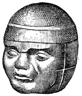
Ethiopian Head of Granite.
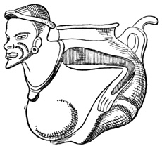
Earthen Vase—Isle of Sacrificios.
On the island of Sacrificios, in the harbor of Vera Cruz, one author[VIII-3] states that remains of the ancient temple are visible. This is probably an error, but numerous small relics have been dug up on the island. Many of the relics were articles of pottery, one of which of very peculiar form is shown in the cut 428 from Waldeck. This, like most of the other articles found here, is preserved in the Museum of Mexico, and was sketched by Mayer and by Waldeck. Mr Tylor pronounces it not the work of the natives before the Conquest, in fact a fraud, "one of the worst cases I ever noticed." There is no doubt of the accuracy of the drawing, and Sr Gondra assured Col. Mayer, as the latter informs me, that the relic is an authentic one.[VIII-4] Workmen engaged in laying the foundations of the modern fort found, at a depth of six feet, vases of hard material, which in the opinion of M. Baradère resembled vases that have been brought from Japan.[VIII-5] Col. Mayer gives cuts of thirteen relics dug from a subterranean chamber or grave in 1828. Two of these were of white marble or alabaster, and one of them is shown in the cut. M. Dumanoir made an excavation also in 1841, finding a sepulchre containing well-preserved human skeletons, earthen vases painted and etched, idols, images, bracelets, teeth of dogs and wild beasts, and marble, or alabaster, urns. Plates of many of the relics have been published.[VIII-6]
REMAINS ON THE EASTERN SLOPE.
From the city of Vera Cruz two main routes of travel lead inland toward the city of Mexico. The first extends north-westward via Jalapa, and the second south-westward via Orizava. After crossing the first lofty mountain barrier which divides the coast from the interior plateaux, the roads approach each other and meet near Puebla. On the eastern slope, the roads with the mountain range, which at this point extends nearly north and south, form a triangle with equal sides of about eighty miles, at the angles of which are the cities of Vera Cruz, Jalapa, and Orizava, or more accurately points ten or fifteen miles above the two latter. This comparatively small triangular area, round which so many travelers have passed in their journey to Anáhuac, is literally covered with traces of its aboriginal population, in the shape of pottery, implements, foundation stones of dwellings, fortifications, pyramids, and graves. I quote the following from an article on the antiquities of Vera Cruz, written in 1869, for the Mexican Geographical Society, by Carlos Sartorius:
"On the eastern slope of the lofty volcanic range, from the Peak of Orizava to the Cofre de Perote, at an average elevation of two to five thousand feet above the level of the gulf, there exist innumerable traces of a very numerous indigenous population before the Conquest. History tells us nothing respecting this part of the country, distinguished for its abundant supply of water, its fertility, and its delightful and healthy climate." "For an extent of fifteen to twenty leagues, from east to west, there was not a span of earth that was not cultivated, as is proved by numberless remains.... The whole country is formed into terraces by stone walls, which follow all the variations of the surface with the evident object of preventing the washing away of the soil. Sometimes the terraces are ten or twelve yards wide, at others hardly one yard. The small ravines called rayas served for innumerable water-tanks, built of 430 rocks and clay, or of stone and mortar, these dams being also covered with a coating of hard cement. It is evident that a numerous population took advantage of every inch of land for cultivation, using the water gathered in the tanks during the rainy season for irrigation, possibly effected by hand by means of earthern vessels. In the more sterile portions of the land, on the top of hills which have no soil are seen the foundations of dwellings, all of stone without mortar, arranged in streets or in groups. They always form an oblong rectangle and face the cardinal points. They are found in clearing heavy forests as well as on open tracts, and the fact that oaks a mètre in diameter are found within the enclosure of the walls, proves that many centuries have passed since the population disappeared. In many parts are found groups of pyramids, of various sizes and degrees of preservation. The largest, of stone, are fifty feet and over in height, while the smallest are not over ten or twelve. The last seem to be tombs; at least several that we opened contained skeletons in a very decomposed state, with earthen utensils like those now made by the natives, arrow-heads of obsidian and bird-bone, doubtless the supplies given to the dead for their journey." One contained an elegant burial urn, bearing ornamental figures in relief, containing ashes and fragments of human bones, and covered first with small pebbles, and then with stone flags. "The region which we subjected to our investigation comprehends the slope of the sierra to the coast between Orizava and Jalapa. At an elevation of four or five thousand feet there are many springs, which at a short distance form ravines in a soil composed of conglomerates or, further south, of lime. In their course the ravines unite and form points sometimes with vertical walls of considerable height. As the water-courses do not follow a straight line, but wind about, the erosion of the current above the meeting of the ravines destroys 431 a great portion of the dividing ridge, so that above there remains only a narrow pass, the ridge afterwards assuming greater width until the end is reached. This play of nature occurs in the region of which we are speaking, at many points and with great uniformity, almost always at the same level of two thousand to twenty-five hundred feet. The natives selected these points, strong by nature, fortifying them by art so ingeniously as to leave no doubt as to their progress in military art.... Some of them are almost inaccessible, and can be reached only by means of ladders and ropes. They all have this peculiarity in common, that, besides serving for defense, they enclose a number of edifices destined for worship,—teocallis and traces of very large structures, such as residences, quarters, or perhaps palaces of the priests and rulers. In some of them there are springs and remains of large artificial tanks; in others, aqueducts of stone and mortar, to bring water from distant springs." Sr Sartorius then proceeds to the description of particular ruins, of which more hereafter.[VIII-7]
TRACES OF ABORIGINAL POPULATION.
Mr Hugo Finck, a resident for twenty-eight years in the region under consideration, in which he traveled extensively to collect botanical specimens, contributed the following general remarks to the Smithsonian Report for 1870: "There is hardly a foot of ground in the whole state of Vera Cruz [the author refers particularly to the region about Córdova, Huatusco, and Mirador] in which, by excavation, either a broken obsidian knife, or a broken piece of pottery is not found. The whole country is intersected with parallel lines of stones, which were intended during the heavy showers of the rainy season to keep the earth from washing away. The number of those lines of stones shows clearly that even the poorest land, which nobody in our days would cultivate, was 432 put under requisition by them.... In this part of the country no trace of iron or copper tools has ever come under my notice. Their implements of husbandry and war were of hard stone, but generally of obsidian and of wood. The small mounds of stones near their habitations have the form of a parallelogram, and are not over twenty-seven inches high. Their length is from five to twelve yards, their width from two to four. On searching into them nothing is found. A second class of mounds is round, in the form of a cone, always standing singly. They are built of loose stones and earth, and of various sizes; some as high as five yards, with a diameter of from five to twenty yards. Excavation made in them brought to light a large pot of burned clay filled with ashes, but in general nothing is found. The third class of mounds, also built of loose stones and earth, have the form of a parallelogram, whose smaller sides look east and west, and are from five to six yards high, terminating at the top in a level space of from three to five yards in width, the base being from eight to twelve yards. They are found from fifteen to two hundred yards long. Sometimes several are united, forming a hollow square, which must have been used as a fortress. Others again have their outer surface made of masonry, but still the inside is filled up with loose stones and earth. Near river-beds, where stones are very abundant, these tumuli are largest. Principally in this latter class, idols, implements of husbandry and war are discovered, sometimes lying quite loose, and at others imbedded in hollow square boxes made of masonry. The last-described mounds form the transition to those constructions which are altogether built of solid masonry.... One peculiarity of the last-mentioned ruins is, that they are all constructed at the junction of two ravines, and used as fortresses, on account of their impregnability. Most of the larger barrancas have precipitous sides from three hundred to one thousand feet deep, which guarded the inhabitants 433 on their flank, so that nothing more was required than to build a wall, leaving a small entrance in the middle, as a passage, which could be barricaded in time of war.... Such constructions can be seen to this day in tolerable good condition. The interior of these fortified inclosures is in general large, sometimes holding from four to five square miles, and could be put under cultivation in case of a siege. The wall is in general from four to five yards high, and has on the inside terraces with steps to lead to the top. At other places there is a series of semicircular walls, the front one lower than the following, and a passage between each to permit one person at a time to pass from one to the other. The innermost wall is sometimes perforated with loopholes through which arrows could be thrown. Quite a number of ruins are found inside the fortification, as mounds, altars, good level roads with a foundation of mortar. Most of these monuments have good preserved steps leading to the top. In some very small pots of burning clay are found filled with ashes."[VIII-8]
The preceding quotations are sufficient to give a clear idea of the ruins in their general features, and leave only such particular remains as have been made known through the labors of different explorers to be described. Some ten or twelve of the peculiar fortified places alluded to above have been more or less fully described, but as there is no even tolerably accurate topographical map of this region, it is utterly impossible to locate them. Each stream, ravine, bluff, hill, and mountain of all the labyrinth, has its local name; indeed, some of them seem to have two or three, but most of them have no place on the maps. It is consequently quite possible that the same ruins have been described under more than one name. I shall present each group as it is described 434 by the explorer, giving when possible the distance and bearing from some point laid down on the map which accompanies this volume.
AMATLAN AND ORIZAVA.
Before treating of these ruins, however, I shall mention some miscellaneous relics, from the region under consideration, found at well-known towns, or in their vicinity. Colonel Albert S. Evans dug two terra-cotta images from a grave at Medellin, about eight miles south-west of Vera Cruz, in 1869. They seem to represent a male and female, and are now in the collection of Mr C. D. Voy, of Oakland, California. Near the same town, on the Rio Jamapa, are to be seen, Brasseur tells us, the ruins of one of the two ancient cities called Xicalanco; and also that the traces of an ancient city may yet be seen under the water between the city of Vera Cruz and the fort of San Juan de Ulloa.[VIII-9] About forty-five miles south-east of Córdova, between that town and the bridge over the Rio Blanco, Dupaix found a hard stone of dark blue color, artificially worked into an irregular spherical form, about six feet in diameter, and so carefully balanced that it could be made to vibrate by a slight touch. A number of small shallow holes were formed on the surface. A similar stone is placed two leagues to the eastward, and they are supposed by Dupaix to have served as boundary marks. Teololinga is the name by which the natives call them.[VIII-10] Also in the neighborhood of Córdova, at Amatlan de los Reyes, certain traces of a temple are 435 vaguely mentioned by the same traveler; and on a wooded hillside near by is a cave, in which have been found fragments of carved stone and pottery, including a squatting trunk and legs, and a head carved from the same kind of stone that constitutes the walls of the cave. The latter relic is shown in the cut. The form of the head seems to have nothing in common with the ordinary aboriginal type.[VIII-11]
At Orizava two relics were seen, one of them a triangular stone five feet thick and ninety feet in circumference, used in modern times as the floor of a native's cabin. On one of the triangular surfaces was incised in rude outline a colossal human figure twenty-seven feet high, standing with legs spread apart and arms outstretched. A girdle appears at the waist, plumes decorate the head, and the mouth is wide open. On one side a fish stands on its tail; on the other is a rabbit with ten small circles, very likely expressing some date after the Aztec manner,—ten tochtli. Some carvings not described were noticed on the edges also. 436 The other relic was a kind of yoke carved from green jasper and supposed to have been used in connection with the Aztec sacrifices. It is shown in the cut according to Castañeda's drawing. The original yoke was carried by Dupaix to Mexico and deposited in one of the antiquarian collections there, where it was afterwards sketched by Mayer and Gondra.[VIII-12] Near Jalapa, Rivera states that a serpent fifteen feet long and nine feet broad, may be seen carved in the rock.[VIII-13] Half a day's journey from Vera Cruz towards Mexico, at a point which he calls Rinconado, Robert Tomson saw "a great pinacle made of lime and stone, fast by a riuer side, where the Indians were wont to doe their sacrifices vnto their gods."[VIII-14] About the location of Cempoala, a famous city in the time of the Conquest, there has been much discussion. Lorenzana says that the place "still retains the same name; it is situated four leagues from Vera Cruz, and the extent of its ruins indicates its former greatness." Rivera 437 tells us, however, that "to-day not even the ruins of this capital of the Totonac power remain," although some human bones have been dug up about its site.[VIII-15]
RUINS AT PUENTE NACIONAL.
Passing now to the labyrinth of ruins within the triangular area extending from the peaks of Orizava and Perote to the coast, I begin with those in the vicinity of the Puente Nacional, where the road from Vera Cruz to Jalapa crosses the Rio de la Antigua. These remains are located on the summit of a forest-covered hill over a hundred feet high, on the bank of the river some two leagues from the bridge. They were discovered in 1819 or 1820 by a priest named Cabeza de Vaca, and in November, 1843, J. M. Esteva, to whom the priest related his discovery, made an exploration, and as a result published a description with two plates in the Museo Mexicano. On the uneven surface of the hill-top stands a pyramid of very peculiar form, shown in the cut, which is an ichnographic 438 plan of the structure. It is built of stone and mortar, the former probably in hewn blocks, although the text is not clear on this point. The height varies from thirty-three to forty-two feet, according to the inequalities of the ground. The circumference is not far from three hundred English feet, while the summit platform measures about fifty-five by forty-four feet. On all sides except the eastern the slope is divided into six stories, or steps, about one foot wide and seven feet high at the base but diminishing towards the top, making the ascent much steeper than that of most aboriginal pyramids that we have met hitherto. The eastern side is all taken up by a stairway about sixty-three feet wide, consisting of thirty-four steps. This stairway, as is more clearly shown in Esteva's view of this side than in my cut, is arranged in the form of a cross.
On the western base is the entrance to a gallery which penetrates the body of the pyramid; it was obstructed by fallen stones, but Esteva succeeded in exploring the passage far enough to convince himself that the interior was divided into several apartments. At some distance from the pyramid were noticed the foundations of a wall.[VIII-16]
Mr Lyon mentions the existence of ruins—which he did not visit—in this vicinity on the edge of a plateau, at the north side of the valley, about a mile and a half to the right of the road, and only a short distance from Paso de Ovejas. "All that remains are the traces of streets and inclosures, and an assemblage 439 of pyramidical elevations of earth and stones of various sizes, some of them forty feet in height." Sr Sartorius reports very extensive ruins on the right bank of the Antigua, some leagues west of Consoquitla, near Tuzamapa, from the material of which the 'puente nacional' was constructed. An old native also reported that a spiral stairway formerly led down to the bottom of the barranca. Whether the two groups of ruins last mentioned are identical with that described by Esteva, it is impossible to determine; quite likely they are distinct remains.[VIII-17]
FORTIFICATIONS OF CENTLA.
Some twenty-five or thirty miles northward from Córdova, in the vicinity of Huatusco, and stretching northward from that town, is a line of fortified places, nearly every junction of two ravines bearing more or less extensive remains. One of the most extensive of these works is that known as Centla, a few leagues north-east of Huatusco. The ruins are said to have been discovered by rancheros in 1821. Ignacio Iberri saw them in 1826, but published no description. An explorer whose name is not given visited the locality in 1832, and furnished information from which Sr Gondra published an account, illustrated with plates, in 1837. Sr Sartorius made an exploration of Centla in 1833, but his description, also accompanied with plates, was not published until 1869.[VIII-18] 440
FORTRESS OF CENTLA.
Two ravines, running from east to west, with precipitous sides from three hundred to a thousand feet high, approach so near to each other as to leave only space for a passage about three feet wide, and this narrow pass is made still stronger by protecting walls not particularly described. The barrancas then diverge and again converge, forming an oval table of about four hundred acres, across which, from east to west is excavated a ditch, or protected road, about seventeen feet wide and from eight to eleven feet deep, leading to the second narrow pass, where the ravines again approach each other.[VIII-19]
This second pass is about twenty-eight feet wide from the brink of the northern to that of the southern precipice.[VIII-20] This pass is fortified by defensive works of the strongest character, the plan of which is shown in the cut on the following page. The only entrance is through the narrow passage only three feet wide, shown by the arrows, beginning at the southern brink, passing between two stone pyramids, A, and E, D, C, and then along the northern brink to the plateau beyond, the issue into the latter being guarded additionally by three smaller pyramids. The chief pyramid on the right of the entrance is built of stone and mortar in three stories, or terraces, C, D and E, respecting the arrangement of which the plan[VIII-21] is not altogether satisfactory; but each story is reached by a stairway on the east, and on the summit are parapets pierced with loopholes for the discharge of weapons. This structure is also flanked on the south, where the descent for a short distance is less precipitous than elsewhere, by a terraced wall at B. The left hand fortification, A, is described by Gondra as a simple wall, but according to Sartorius and the plan it is also a pyramid, with stairway on the east and 441 parapets on the summit. It has apparently only one story, and is lower than its companion, but its front has an additional protection in the form of a ditch eleven feet wide and five and a half feet deep, excavated in the solid rock, the position of which is shown by the dotted line a, a.[VIII-22]
Beyond the narrow fortified pass that has been 442 described, the southern ravine again diverges and forms a semicircle before joining that on the north, forming thus a peninsular plateau a mile and a half long, and somewhat less than three quarters of a mile wide, covered with soil of great fertility, and divided in two parts by the waters of a spring, whose waters flow through the centre. Since its discovery this fertile table has been settled and cultivated by modern farmers, some twenty families of whom—whether native or Spanish is not stated—were living here in 1832. The whole surface was covered with traces of its former inhabitants, but most of the monuments in the cultivated portions have been destroyed by the settlers, who used the stones for buildings and fences. In other parts, covered with a forest at the time of exploration, extensive remains were found in good preservation, besides the fortresses at the entrance. Pyramids of different dimensions, standing singly and in groups, together with foundations of houses and sculptured fragments, were scattered in every direction enveloped in the forest growth.
The pyramids are all built of rough stones, clay, and earth, faced on the outside with hewn blocks from eighteen inches to two feet long, laid in mortar. The stone seems to have been brought from the bottom of the ravines, and it is said that no lime is procurable within a distance of fifteen or twenty miles. Sartorius gives a plate representing one of the pyramids, which he states to be a type of all those at Centla, and indeed of all in this region, and which is copied in the cut. The stairways are generally on 443 the west, and the niches at the sides are represented as having arched tops and as occupied by idols. Some of the smaller mounds have been found to contain human skeletons lying north and south, and from one of them a farmer claimed to have dug a number of green stone beads. Sartorius claims to have found in connection with one of the pyramids an altar having a concavity on the top, and a canal leading to a receptacle at the foot of the mound; he also mentions a very elegant vase, six by four inches, found under a stone flag, near the altar. Gondra speaks of a large square or court, level and covered with a coat of hard polished cement; he also claims that six columns of stone and mortar were seen, twelve feet high, standing at the bottom of a ravine.
RUINS AT HUATUSCO.
Dupaix in his first exploring tour visited Huatusco, and states that at a distance of half a league down the river from the modern town was found a group of ruins known as the Pueblo Viejo. These ruins were on the slope of a hill, and on the summit stood the pyramid shown in the cut, known as El Castillo. The height of this Castle is about sixty-six feet, and according to Dupaix's text the base is two hundred and 444 twenty-one feet square, but, according to Castañeda's drawing, copied above, each side is not over seventy-five feet.[VIII-23] The foundation, or pyramid proper, is built in three stories, being about thirty-seven feet high. A broad stairway, with solid balustrade, leads up the western front. On the summit platform stands a building in three stories, with walls about eight feet thick, which, at least on the exterior, are not perpendicular but slope inward. The lower story has but one doorway, that at the head of the stairway; it forms a single hall, in the centre of which are three pillars, which sustained the beams of the floor above, pieces of the beams being yet visible. The two upper stories seem to have had no doors or windows. Dupaix says that on the summit was a platform three feet thick, yet as the roof was fallen, he probably had little or no authority for the statement. The interior of the whole structure was a rubble of stone and mortar, and the facing of hewn blocks regularly laid. The whole exterior surface, at least of the superimposed structure, was covered with a polished coating of plaster, and a peculiar ornament is seen in each side of the second story, in the form of a large panel, containing regular rows of round stones imbedded in the wall. El Castillo, if we may credit Dupaix's account of it, must be regarded as a very important monument of Nahua antiquity, by reason of the edifice, in a tolerable state of preservation, found on the summit of the pyramid. These upper structures with interior apartments have in most instances entirely disappeared. In connection with these ruins Dupaix found a coiled serpent carved from hard stone; a fragment of terra-cotta with decorations in relief; and a fancifully modeled skull, the material of which is not stated.[VIII-24]
FORTRESS OF TLACOTEPEC.
Sartorius mentions a 'castle,' with towers and teocallis, situated on a frightful cliff between two barrancas, three leagues from Huatusco, distinct from Centla, and some leagues further southward.[VIII-25] Clavigero says that in his time the ancient fortress of Quauhtochco, or Guatusco, was still standing, surrounded with lofty walls of solid stone, which could only be entered by means of many high and narrow steps.[VIII-26] Sr Iberri applies the name El Castillo to the ruins visited by him in 1826, but it is evident from his slight description that he refers to Centla.[VIII-27] It is clear that at least two and probably more groups of remains are indicated by the different authorities cited.
The following are mentioned as the localities of undescribed ruins, several of them belonging to what seems to be a line of ancient fortifications extending northward from the vicinity of Huatusco: Cotastla, Matlaluca, Capulapa, Tlapala, Poxtla, Xicuintla, and Chistla.[VIII-28] The fortress of Tlacotepec is located four leagues east of Jolutla, between the Rio de la Antigua and Paso de Ovejas, six thousand varas west of and a quarter of a league above the houses of the hacienda of Mirador, separated by a deep ravine from San Martin on the south—a location which might possibly be clear enough with the aid of a good map, or to a person perfectly familiar with the topography of the country. The position of the fortified plateau is similar to that of Centla, and a ditch, generally fourteen feet deep and from sixteen to eighteen feet wide, leads over the hills for several leagues to the entrance of the plateau. This 446 ditch, however, seems only to be excavated in the earth, and disappears in several places where the solid rock is encountered.[VIII-29] At the terminus, towards the fortifications, the ditch widens into a rectangular excavation, one hundred and eight by two hundred and seventy-six feet, surrounded with an embankment formed of the earth thrown out. The defensive works which guard the passage between the ravines, and the extensive ruins of temples and dwellings on the plateau beyond, are described only by Sartorius, and his text, plan, and sketch, all fail to convey any clear notion respecting the arrangement and details of these remains. The following, however, are the principal features noted:—A wall twenty-eight feet high across the entrance to the plateau; two small towers in pyramidal form on the narrow pass; a building called the castle, apparently somewhat similar to the fortifications at Centla; a line of pyramids, serving as a second line of defense; a ditch excavated in the solid rock; another group of pyramids protected by a semicircular wall; an excavation apparently intended as a reservoir for water, covering two thousand square yards, the bottom of which is literally covered with fragments of pottery, and on the banks of which are the foundations of many dwellings; a number of temple pyramids, like the type at Centla shown in a preceding cut, one of them having the so-called blood-canal; an earthen receptacle at the foot of the altar, filled with earth, in which were found two human skulls; the foundations of an edifice two hundred yards long, having along its whole length "a corridor of cement with hewn stone at its sides, forming one or two steps;" a small pyramid formed from the living rock of the cliff, at the very edge of the precipice where the ravines meet; and finally, arrow-heads, lance-heads, and knives of obsidian, which are found at every step, 447 and are even dug up from under the roots of large trees.[VIII-30]
REMAINS ABOUT MIRADOR.
A few leagues eastward from Tlacotepec on the same barranca, are two forts known as Palmillas, separated by a deep ravine. One of them was used by the Mexican forces under General Victoria in the war of independence; the other has the remains of an aqueduct which brought water from a point over a league distant.[VIII-31] At Zacuapan, near Mirador, and five leagues from Huatusco, according to Heller, are remains of the ordinary type, including terraced walls, parapets with loopholes, a plaza with plastered pavement in the centre of which stands a pyramid, a cubical structure or altar on the very verge of the precipice, and the usual scattered pottery and implements. Six miles south of Mirador the same traveler mentions some baths, on a rock near which is the inscription shown in the cut.[VIII-32] Also in the vicinity of Mirador, at the junction of two tributaries of the Santa María, is the fortress of Consoquitla, similar to the others. A line of plastered pyramidal structures is mentioned, in one of the smallest of which was a tomb 448 three by six feet lying north and south and covered with large stone flags. Within the tomb was a skeleton, together with earthen boxes filled with arrow-heads and bird-bones. Some large idols are also said to have been found here, and on the summit platform of some of the pyramids were the marks of upright beams, which seem to have supported wooden buildings.[VIII-33] Calcahualco, 'ruined houses,' is also on one of the tributaries of the Santa María. A parapeted wall fifty-five feet long protects the entrance, and could only be crossed by the aid of ropes or ladders. The wall seems to stand in an excavation, so that its top is about on a level with the original surface of the plateau. Within the fortifications is a large pyramid surrounded by smaller ones and by the foundations of houses; and another excavation, a hundred yards long and twenty-five in width, is vaguely mentioned as of unknown use. A mile and a half further south-east are some ruins in the bottom of a ravine. A wall nine feet high rises from the water's edge, and on it stand a row of round monolithic columns, which seem to have supported a stone architrave.[VIII-34] Mr Tylor noticed some remains by the roadside, at the eastern foot of Orizava, as he was traveling towards San Antonio de Abajo.[VIII-35]
RUINS OF MISANTLA.
Northward from the triangular area, the remains of which I have described, ruins seem to be no less abundant, and accounts of them no less unsatisfactory. The remains known by the name of Misantla, from a modern pueblo near by, are located some twenty-five or thirty miles north-eastward of Jalapa, near the headwaters of the Rio Bobos. They are sometimes called Monte Real, from the name of one of the hills in the vicinity. They were discovered accidentally by men searching for lost goats, and visited by Mariano 449 Jaimes in 1836; in October of the same year, I. R. Gondra, from information furnished by the discoverers and Jaimes, and from certain newspaper accounts, wrote and published a very perplexing description, illustrated with a plan and two views. In the same or the following year J. I. Iberri made an official exploration of Misantla, or Monte Real, and his report, also illustrated with many plates, and rivaling that of Gondra in its unsatisfactory nature, was published in 1844. Not only are the two accounts individually to a great extent unintelligible, but neither they nor their accompanying illustrations seem to have any well-defined resemblance to each other.[VIII-36]
The site of the ruins seems to be a ravine-bounded plateau, somewhat similar to those already described, the approach to which is guarded by a wall. This wall extends not only across the pass, but down one of the slopes, which is not so steep as to be naturally inaccessible to an enemy. According to Iberri the wall is a natural vein of porphyry, artificially cut down in some parts, and built up by the addition of blocks of stone in others, measuring three yards high 450 and two in width. The same explorer, after passing the wall and climbing with much difficulty to a point about two hundred and fifty feet higher, found a pyramid standing on a terraced hill, on the terraces of which were various traces of houses and fortifications. The pyramid was built of porphyry and basalt in blocks of different sizes, laid in mortar, was thirty-three feet square at the base and seventeen feet high, and had a narrow stairway on one side at least. On the summit platform were traces of apartments of rough stones and mortar; also a canal nine inches square, leading to the exterior. The first wall mentioned by Gondra in the approach to the ruins, was one of large stones in poor mortar, mostly fallen; it seemed to form a part of walls that bounded a plaza of nearly circular form, in the centre of which stood the pyramid. This edifice was forty-seven by forty-one feet at the base, twenty-eight feet high, and was built in three stories; the lower story had a central stairway on the front, the second had stairways on the sides, while on the third story the steps were in the rear. There are also some traces of a stairway on the front of the second story. The whole surface is covered with trees, one of which is described as being about fourteen feet high, and over eight feet in diameter. The only resemblance in the two views of this pyramid, is the representation of a tree on the summit in each; between the two plans there is not the slightest likeness; and so far as Iberri's third figure is concerned, it seems to resemble nothing in heaven above, the earth beneath, or the waters under the earth. Both authors agree on the existence of many house-foundations of stone without mortar, extending the whole length of the plateau. According to Iberri these houses were eleven by twenty-two feet, some of them divided in several apartments, standing on the terraces of the hill, only a foot and a half apart, along regular streets about six feet wide. The walls are of hewn stone without 451 mortar, and none remained standing over three feet high. Gondra represents the houses as extending in three and four straight and parallel rows for over two miles on the plateau, with a wall of masonry running the whole length on the south. At various points on the summit and slopes of the hill tombs are found, containing seated skeletons and relics of obsidian and pottery. One of these tombs, as represented by Gondra, is shown in the cut, in which the arched doorway has a very suspicious look.
The miscellaneous relics found in connection with the ruins and in the tombs include pottery, metates, slabs with sculptured grecques, hieroglyphics, and human figures in relief, stone images of different sizes up to eighteen inches, representing human figures seated with elbows on the knees, and head raised; and finally an obsidian tube, a foot in diameter and eighteen inches long, very perfectly turned, together with similar earthen tubes with interior compartments. Such is all the information I am able to glean from the published accounts and plates respecting Misantla, in the vicinity of which town other groups of ruins are very vaguely mentioned.
In the same range of mountains, in the district of Jalancingo, walls of hewn stone, with well-preserved subterranean structures containing household idols, are mentioned as existing at Mescalteco; also some remains at Pueblo Viejo and Jorse, those of the latter including a remarkable stone statue of marble. This reported relic is said to have represented a 452 naked woman clasping a bird in her arms. The lower parts of the woman are missing, and the bird much mutilated, but the prefect of Jalancingo says in his report, "it would be easy to complete the figure into Jupiter-swan fondling Leda."[VIII-37]
RUINS OF PAPANTLA.
About a hundred and fifty miles north-westward from Vera Cruz, fifty miles in the same direction from the ruins of Misantla, forty-five miles from the coast, and four or five miles south-west from the pueblo of Papantla, stands the pyramid shown in the cut, known to the world by the name of the pueblo, Papantla, but called by the Totonac natives of the region, El Tajin, the 'thunderbolt.' It was accidentally discovered in March, 1785, by one Diego Ruiz, who was exploring this part of the county in an official capacity, with a view to prevent the illegal raising of tobacco; and from his report a description and copper-plate engraving were prepared and published 453 in the Gaceta de Mexico.[VIII-38] Humboldt described but did not visit the pyramid. He states that Dupaix and Castañeda explored and made drawings of it, but neither description nor plates appear in the work of these travelers.[VIII-39] The German artist Nebel visited Papantla about 1831, and made a fine and doubtless perfectly accurate drawing, from which the cut which I have given has been copied.[VIII-40]
The pyramid stands in a dense forest, apparently not on a naturally or artificially fortified plateau like the remains further south. Its base is square, measuring a little over ninety feet on each side, and the height is about fifty-four feet; the whole structure was built in seven stories, the upper story being partially in ruins.[VIII-41] Except the upper story, which seems 454 to have contained interior compartments, the whole structure was, so far as known, solid. The material of which it was built is sandstone, in regularly cut blocks laid in mortar—although Humboldt, perhaps on the authority of Dupaix, says the material is porphyry in immense blocks covered with hieroglyphic sculpture—the whole covered on the exterior surface with a hard cement three inches thick, which also bears traces of having been painted. According to the account in the Gaceta, the stones that form the tops of the many niches shown in the cut are from five and a half to seven feet long, four to five and a half wide, and four to nine inches thick. Respecting the stairway nothing can be said in addition to what is shown in the cut. It leads up the eastern slope, and is the only means of ascent to the summit. It is divided by solid balustrades into five divisions, only two of which extend uninterruptedly to the upper story, while the central division can hardly have been used at all as a stairway.[VIII-42]
The niches shown in my cut extend entirely round the circumference of each story, except where interrupted on the east by the stairways. Each niche is about three feet square and two feet deep, except those in the centre of the eastern front, which are smaller. Their whole number seems to have been three hundred and twenty-one, according to Nebel's plate, without including those that may have occurred on the seventh story.[VIII-43]
RUINS OF MAPILCA.
Only slight mention is made of any scattered or movable relics at Papantla. It is said that fragments of ruins are scattered over an area of half a league from the pyramid, but no exploration has been made. A small golden idol is reported by Gondra to have been found here, very like a terra-cotta image of Quetzalcoatl, from Culhuacan, of which a cut will be given in the next chapter. Bausa speaks of a stone trough found on the summit of the pyramid, ruins of houses in regular streets in the vicinity, and immense sculptured blocks of stone.
Mr Nebel also visited another locality where remains were discovered, south-eastward from Papantla towards the Tecolutla river, near the rancho of Mapilca. Here in a thick forest were several pyramids in a very advanced stage of dilapidation and not described. There were also seen immense blocks of granite scattered in the forest. The one sketched by Nebel and shown in the cut is twenty-one feet long, and covered with ornamental sculpture in low relief: it rested on a kind of pavement of irregular narrow stones. Another explorer, who saw the ruins in 1828, found the remains of twenty houses, one of them seventy paces long, with walls still standing to the height of ten feet. Most of them were only six feet high, and the small amount of débris indicated that only part of the original height was of stone.[VIII-44]
RUINS OF TUSAPAN.
On a low hill some forty miles west of Papantla, 456 at the foot of the cordillera, enveloped in an almost impenetrable forest, is another group of ruins, called Tusapan, known only from the drawings and slight description of Nebel. The only structure which remains standing is shown in the cut. It consists of a pyramid thirty feet square at the base, and bearing a building in a tolerable state of preservation. Except the doorposts, lintels, and cornices, the whole structure is said to be built of irregular fragments of limestone; but if this be true, it is evident from the drawing that the whole was covered with a smooth coat of plaster. The building on the summit contains a single apartment twelve feet square, with a door at the head of the stairway. The apartment contains a block, or pedestal, which may have served for an altar, or to support an idol; and it has a pointed ceiling similar in form to the exterior. It is unfortunate that we have no further details respecting this ceiling, since it would be interesting to know if it was formed by overlapping stones as in the Maya ruins, particularly as this is one of the very few remaining specimens of the aboriginal arch in Nahua territory. From the large number of stone blocks and other débris found in the vicinity it is supposed that the pyramid 457 represented in the cut was not the grandest at Tusapan. Several filled-up wells, and numerous fragments of stone images of human and animal forms much mutilated were also noticed.
The water which supplied the aboriginal inhabitants of the place, seems to have come from a spring located on the side of a precipitous mountain; and at the base of the cliff, where the water reached the plain, was the very remarkable fountain shown in the cut, artificially shaped from the living rock. The cut is an exact fac-simile of Nebel's plate, except that the surroundings, which add much to its interest, are necessarily omitted. I quote Nebel's brief description 458 in full. "Among the ruins of Tusapan is found the grotesque fountain here represented. The whole monument consists of a statue nineteen feet high, sculptured in the living rock. The clothing indicates clearly a woman, seated, resting her head on the left arm, which is supported by her knee. The head seems to be adorned with feathers and precious stones. Among the plumes behind is a hollow intended to receive the waters of a neighboring spring (which no longer exists). The water ran through the whole figure and out under the petticoats in the most natural manner, whence it was conducted in a canal of hewn stone to the town near by."[VIII-45]
RUINS OF METLALTOYUCA.
The Mesa de Metlaltoyuca is on the Tuxpan River, about twelve leagues south-west from the port of Tuxpan, twenty-two leagues north-east of Tulancingo, and probably in the state of Vera Cruz, although very near the boundary. The table-land is very extensive, and is covered throughout most of its extent by a thick forest. Juan B. Campo, Sub-Prefect of Huauchinango, discovered a group of ruins here, and gave a description of his discoveries in a report dated June 27, 1865.[VIII-46] His account is very general, alluding to the ruins of a great city, whose streets were paved with polished stones, a fine stone palace plastered and painted, all surrounded by a wall fifteen feet thick and ten feet high, with a great gate, covered way, stone bastions, etc., etc. Immediately after the publication of Campo's report, Ramon Almaraz, chief of a Mexican scientific commission, engaged with other engineers in surveying for a road in this region, spent five days in the exploration of the ruined city, preparing plans and other drawings, and 459 also taking some photographic views. His report, very far from being full and satisfactory, illustrated with several plates, was published in the government reports for the year mentioned.[VIII-47]
The name, Metlaltoyuca, according to Galicia Chimalpopoca, signifies 'place fortified with solid stones,' but Sr Linares attributes to the word a different derivation, and makes it mean 'land of the maguey.'[VIII-48] Almaraz says: "A succinct account of the ruins might be given by saying that they consist of pyramids built of hewn blocks of sandstone, partially covered with a good hydraulic cement, as will be seen by the chemical analysis which will be given,[VIII-49] and of some tumuli, and remains of edifices of slight elevation." The arrangement of the remains is shown in the plan; only a few of the structures indicated on the plan are mentioned in the description, and of those few very little is said. The space covered by the ruins is in rectangular form, about two hundred and fifty by five hundred yards, and is located in the south-western portion of the mesa. The chief structure, a of the plan, stands at the north-west 460 corner, and its northern and western walls, four hundred and eighty-five and one hundred and ninety-four feet respectively, meet at an angle of 87° 30´; on the other sides the walls are irregular, forming many angles, and in the interior there are walls which divided the enclosed area into several compartments. There are, according to the text, traces of walls, in some places five or six feet high, extending from the ends of the main structure and inclosing the other works, but not shown in the plan. Some steps and also water-tanks were found in connection with the corner walls. Campo also found two doors blocked up with stone slabs. There are several truncated pyramids, the largest of which, at b, is thirty-six feet high, and one hundred and thirty-one feet square at the base. It is built in six stories, and has traces of the buildings which formerly occupied its summit. All the structures are built of brick-shaped blocks of sandstone, very nicely cut, and laid in mud.[VIII-50] On the surface of the cement, which covers all the buildings to a thickness of over an inch, painted figures are seen.
A remarkable feature at Metlaltoyuca is the existence of the parallel mounds at c, of the plan. As nearly as can be ascertained from the drawings and 461 text, they are about one hundred and forty feet long, twenty feet wide, and ten or twelve feet high. The interior is filled with loose stones and earth, and the surface is covered with somewhat irregular brick-shaped blocks, laid in mud or clay, and apparently covered with cement. The cut shows a transverse section of one of the mounds, and indicates a near approach to the principle of the regular key-stone arch, although as the interior was filled to the top, there is no evidence that the arch was intentionally self-supporting. Some traces of hieroglyphic paintings were found on the mortar which covered a part of these mounds.[VIII-51]
Something over two miles north-west of the ruins described, at the only point where the mesa is accessible on the northern side, is a double stone wall guarding the passage. The outer wall is three or four hundred yards long, thirteen feet high, and fifty feet thick at the base, diminishing towards the top. The inner wall is of smaller dimensions. The same system of defensive works is repeated on the opposite side of the mesa. The only movable relics found were, the figure of a female bearing a sculptured cross, a representation of a mummy closely wrapped as if for burial and having features of a different type from those ordinarily found in Aztec idols, and the form of a man with arms crossed and legs bent, sculptured on a slab, all of the same sandstone of which the buildings were constructed. According to Campo, another smaller group of remains has been seen farther south, towards the Mesa de Amistlan. Two idols of porous basalt and numerous arrow-heads of obsidian are reported at Guautla, twenty-five or thirty miles north-west of Metlaltoyuca.[VIII-52]
RELICS AT PÁNUCO
In the northern extremity of the state, in the region about Pánuco, small relics are said to be very abundant. A list of thirty specimens collected by Mr 462 Francis Vecelli during a survey of the Pánuco River, some of them doubtless belonging to the state of Tamaulipas, across the river, is given by Mr Vetch in the Journal of the London Geographical Society. They are mostly of limestone and represent human figures, for the most part females, rudely sculptured and wearing peculiar head-dresses. The foreheads are represented as high and broad, the lips thick, and the cheek-bones high. The sculpture is rude, and nearly every one of the images has a long unshaped base or tenon, as if intended to be fixed in a wall. A front and rear view of one of these images are shown in the cut.[VIII-53] In the town itself, idols, heads, obsidian arrow-heads, and fragments of ancient pottery, some of it glazed, are often washed out by the heavy rains. Mr Lyon speaks of "several curious ancient toys and whistles, with one small terra cotta vase very beautifully carved with those peculiar flourishes introduced in the Mexican manuscripts," also "an antique flute of a very compact red clay, which had once been polished and painted. It had four holes, and the mouth part was in the form of a grotesque head." Flutes occur both 463 single and double, with two, three, and four holes. Earthen representations of birds, toads, and other animals are frequently found either whole or in fragments. West of the town five or six mounds from thirty to forty feet high are vaguely mentioned.[VIII-54] Buried in the ground in a ravine near the town, and resting on the stone walls of a dilapidated sepulchre, Mr Norman claims to have found a stone slab seven feet long, wider at one end than the other, but two feet and a half in average width, one foot thick, and bearing on one side the sculptured figure of a man. Dressed in a flowing robe, with girdle, sandal-ties on his feet, and a close-fitting cap on his head, he lies with crossed arms. The face is Caucasian in feature, and the work is very perfectly executed. For the authenticity of so remarkable a relic Mr Norman is hardly a sufficient authority. Two small images, probably of terra cotta, were presented by Mr Norman to the New York Historical Society.[VIII-55]
At the Calondras Rancho, some twenty-five miles from Pánuco, a large oven-like chamber is reported on the slope of a hill, which contains large flat stones used for grinding maize. The ruins at Chacuaco, three leagues south of the town, are said to cover about three square leagues. Mr Norman also gives cuts of two clay vases from the same locality, one of them having a negro face, very likely of modern origin. San Nicolas, five leagues, and Trinidad six leagues south-west of Pánuco, are other places where ruins are reported to exist.[VIII-56]
Anáhuac—Monuments of Puebla—Chila, Teopantepec, Tepexe, Tepeaca, San Antonio, Quauhquelchula, and Santa Catalina—Pyramid of Cholula—Sierra de Malinche—San Pablo—Natividad—Monuments of Tlascala—Los Reyes—Monuments of Mexico—Cuernavaca, Xochicalco, Casasano, Ozumba, Tlachialco, Ahuehuepa, and Mecamecan—Xochimilco, Tlahuac, Xico, Misquique, Tlalmanalco, and Culhuacan—Chapultepec, Remedios, Tacuba, and Malinalco—City of Mexico—Tezcuco—Tezcocingo—Teotihuacan—Obsidian Mines—Tula—Monuments of Querétaro—Pueblito, Canoas, and Ranas—Nahua Monuments.
The monuments of the Mexican tierra templada, of Anáhuac and the adjoining plateaux, next claim our attention. The territory in question is bounded on the south and east by that treated in the two preceding chapters—Oajaca and Guerrero on the south toward the Pacific, and Vera Cruz on the east toward the gulf. The present chapter will carry my antiquarian survey to a line drawn across the continent from Tampico to the mouth of the Zacatula river, completing what has been regarded as the home of the Nahua civilized nations, with the exception of the Tarascos in Michoacan, and leaving only a few scattered monuments to be described in the broad extent of the northern states of the republic. On most of the maps extant the territory whose monuments I have now to describe, is divided into the states of 465 Mexico, Puebla, Tlascala, and Querétaro, to which have been added in later years Morelos and Hidalgo, formed chiefly, I believe, from the old state of Mexico. In my description, however, I shall pay but little attention to state lines, locating each group of antiquities by its distance and bearing from some well-known point. Respecting the physical features of this central Nahua region, enough has been said in the preceding volumes; I consequently begin at once the description of antiquarian relics, dealing first with those found in Puebla and Tlascala, starting in the south and proceeding northward.
REMAINS AT CHILA.
At Chila, in the extreme southern part of Puebla, is a hill known as La Tortuga, on which is built an unterraced pyramid eighty-eight feet square at the base, fifty-five feet high, with a summit platform fifty feet square. It is built of hewn stone and covered, as it appears from Castañeda's drawing, with cement. The exterior surface is much broken up by the trees that have taken root there. A stairway leads up the western front. Near the north-eastern corner of the mound is an entrance leading down by seven stone steps to a small tomb about eleven feet below the surface of the ground and not under the mound. At the foot of the steps is an apartment measuring five and a half feet long and high, and four feet wide, with a branch, or gallery, four feet long and a little less than three feet wide and high, in the centre of each of the three sides, thus giving the whole 466 tomb in its ground plan the form of a cross. Its vertical section is shown in the cut. There is certainly a general resemblance to be noted in this tomb-structure to those at Mitla; the interior is lined with hewn blocks laid in lime mortar and covered with a fine white plaster, the plaster on the ceiling being eight or nine inches thick. The discovery of human bones in the lateral galleries leaves no doubt respecting the use to which the subterranean structure was devoted.[IX-1]
At Tehuacan el Viejo, two leagues eastward of the modern town of Tehuacan, in the south-eastern part of the state, were found ruins of stone structures not particularly described.[IX-2] At San Cristóval Teopantepec, a little native settlement north-westward of the remains last mentioned, is another hill which bears a pyramid on its top. A road cut in the rocky sides leads up the hill, and on the summit, beside the pyramid, traces of smooth cement pavements and other undescribed remains were noticed. The pyramid itself from a base fifty feet square rises about sixty-seven feet in four receding stories with sides apparently sloping very slightly inward toward the top, the fourth story being moreover for the most part in ruins. The most remarkable feature of this structure is its stairway, which is different from any yet noticed, and similar to that of the grand teocalli of Mexico-Tenochtitlan as reported by the conquerors. It leads up diagonally from bottom to top of each story on the west, not, however, making it necessary to pass four times round the pyramid in order to reach the summit, as was the case in Mexico, since in this ruin the head of each flight corresponds with the foot of the one above, instead of being on the opposite side of the pyramid. The whole is built of stone and mortar, only the exterior 467 facing being of regular blocks, and no covering of cement is indicated in Castañeda's drawing.[IX-3]
TEPEXE AND TEPEACA.
At Tepexe el Viejo, on the Zacatula River, some sixteen leagues south-east of the city of Puebla, Dupaix discovered, in 1808, a structure which he calls a fortification. It was located on a rocky height, surrounded by deep ravines, and the rough nature of the ground, together with the serpents that infest the rocks, prevented him from making exact measurements. There are traces of exterior enclosing walls, and within the enclosed area stands a pyramid of hewn stone and lime mortar, in eight receding stories. A fragment of a circular stone was also found at Tepexe, bearing sculptured figures in low relief, which indicate that the monument may have borne originally some resemblance to the Aztec calendar-stone, to be mentioned hereafter. Another round stone bore marks of having been used for sharpening weapons.[IX-4]
At Tepeaca and vicinity four relics were found:—1st. A bird's, perhaps an eagle's, head sculptured in low relief within a triple circle, together with other figures, on a slab about a foot square; apparently an aboriginal coat of arms. 2d. A stone head eighteen inches high, of a hard, reddish material; the features are very regular down to the mouth, below which all is deformed. 3d. A sculptured slab, built into a wall, shown only in Kingsborough's plate. 4th. A feathered serpent coiled into a ball-like form, six feet in diameter. It was carved from a red stone, and also painted red, resting on a cubical pedestal of a light-colored stone.[IX-5] 468
At San Antonio, near San Andres Chalchicomula, on the eastern boundary of the state, a pyramid stands on the summit of a rocky hill. The pyramid consists of three stories, with sides sloping at an angle of about forty-five degrees, is about twenty-five feet in height, and has a base fifty-five feet square. A stairway about ten feet wide, with solid balustrades, leads up the centre of the western front; and on the top, parts of the walls of a building still remained in 1805. This summit building was said to have been in a good state of preservation only twelve years before. The material is basalt, in blocks about two by five feet, according to Dupaix's plate, laid in mortar, and all but the lower story covered with cement.[IX-6]
At Quauhquelchula, near Atlixco, in the western part of the state, Dupaix noticed four relics of antiquity. 1st. A rattlesnake eight feet and a half long, and about eight inches in diameter, sculptured in high relief on the flat surface of a hard brown stone. 2d. A hard veined stone of various colors, four feet high and ten feet and a half in circumference, carved into a representation of a monster's head with protruding tusks, a front view of which is given in the cut. 469 The rear is flat and bears a coat of arms, made up of four arrows or spears crossing a circle, with other inexplicable figures. 3d. Another coat of arms, three lances across a barred circle, carved in low relief on the face of a boulder. 4th. A human face, larger than the natural size, on the side of another boulder, and looking towards the town.[IX-7] At the town of Atlixco a very beautifully worked and polished almond-shaped agate was seen.[IX-8]
On the hacienda of Santa Catalina, westward from Atlixco, was found the coiled serpent shown in the cut. The material is a black porous volcanic stone, and the whole seems to form a cup, to which the head of the serpent served as a handle. Another relic from this locality was a masked human figure of the same stone.[IX-9]
PYRAMID OF CHOLULA.
About ten miles west of the city of Puebla de los Angeles, and in the eastern outskirts of the pueblo of Cholula, is the famous pyramid known throughout the world by the name of Cholula. The town at its base 470 was in aboriginal times a large and flourishing city, and a great religious centre. The day of its glory was in the Toltec period, before the tenth century of our era, and tradition points for the building of the pyramid to a yet more remote epoch, when the Olmecs were the masters of the central plateaux. Several times during the religious contests that raged between the devotees of rival deities, the temple of Cholula was destroyed and rebuilt. Its final destruction dates from the coming of the Spaniards, who, under Hernan Cortés, after a fierce hand-to-hand conflict on the slopes of the pyramid, maddened by the desperate resistance of the natives, elated by victory, or incited by fanatical religious zeal and avarice, sacked and burned the magnificent structure on the top of the mound. Since the time of the Conquistador, after the fierce spirit of the Spaniards had expended its fury on this and other monuments reared in honor of heathen gods, the mound was allowed to remain in peace, save the construction of a winding road leading up to a modern chapel on the summit, where services are performed in which the great Quetzalcoatl has no share.[IX-10]
Since 1744, when the historian Clavigero rode up its side on horseback, this pyramid has been visited by hundreds of travelers, few tourists having left Anáhuac without having seen so famous a monument of antiquity, so easily accessible from the cities of Mexico and Puebla. Humboldt's description, made from a personal exploration in 1803, is perhaps the most complete that was ever published, and most succeeding visitors have deemed it best to quote his account as being better than any they could write from their own observations. Dupaix and Castañeda, and in later times Nebel, also examined and made drawings of Cholula. The four or five views 471 of the mound that have been published differ greatly from each other, accordingly as the artist pictured the monument as he saw it or attempted to restore it more or less to its original form. Humboldt's drawing, which has been more extensively copied than any other, contrary to what might be expected from his text, was altogether a restoration, and bore not the slightest resemblance to the original as he saw it, since Clavigero found it in 1744, "so covered with earth and shrubs that it seems rather a natural hill than an edifice," and there is no reason to suppose that at a later date it assumed a more regular form.[IX-11]
For the past two centuries, at least, the condition and appearance of the mound has been that of a natural conical hill, rising from the level of a broad valley, and covering with its circular base an area of over forty acres.[IX-12] On closer examination, however, traces of artificial terraces are noted on the slopes, and excavations have proven that the whole mound, or at least a very large portion of it—for no excavation has ever been made reaching to its centre—is of artificial construction. By the careful surveys of Humboldt and others the original form and dimensions have been clearly made known. From a base about fourteen hundred and forty feet square, whose sides face the cardinal points, it rose in four equal stories to a height of nearly two hundred feet, having a summit platform of about two hundred feet square.[IX-13] Humboldt in 1803 found the four terraces tolerably distinct, especially on the western slope; Evans in 473 1870 found the lower terrace quite perfect, but the others traceable only in a few places without excavation.
The material of which the mound was constructed is adobes, or sun-dried bricks, generally about fifteen inches long, laid very regularly with alternate layers of clay. From its material comes the name Tlalchihualtepec, 'mountain of unburnt bricks,' which has been sometimes applied to Cholula. An old tradition relates that the adobes were manufactured at Tlalmanalco, and brought several leagues to their destination by a long line of men, who handed them along singly from one to another. Humboldt thought some of the bricks might have been slightly burned. Respecting the material which constitutes the alternate layers between the bricks, called clay by Humboldt, there seems to be some difference of opinion between different explorers. Col. Brantz Mayer, a careful investigator, says the adobes are interspersed with small fragments of porphyry and limestone; and Mr Tylor speaks of them as cemented with mortar containing small stones and pottery. Evans tells us that the material is adobe bricks and layers of lava, still perfect in many places. The historian Veytia by a personal examination ascertained the material to be "small stones of the kind called guijarros, and a kind of bricks of clay and straw," in alternate layers.[IX-14] Beaufoy claims to have found the pyramid faced with small thin hewn stones, one of which he carried away as a relic—a very wonderful discovery certainly, when we consider that other very trustworthy explorers, both preceding and following Beaufoy, found nothing of the kind. Mr Heller could not find the stone facing, but, as he says, he did find a coating of mortar as hard as stone, composed of lime, sand, and water.[IX-15] Many visitors have believed that the pyramid is only partially artificial, the adobe-work having been added to 474 a smaller natural hill. This is, however, a mere conjecture, and there are absolutely no arguments to be adduced for or against it. The truth can be ascertained only by the excavation of a tunnel through the mound at its base, or, at least, penetrating to the centre. It is very remarkable that such an excavation has never been made, either in the interests of scientific exploration or of treasure-seeking.
Bernal Diaz, at the time of the Conquest, counted a hundred and twenty steps in a stairway which led up the slope to the temple, but no traces of such a stairway have been visible in more modern times. There are traditions among the natives, as is usually the case in connection with every work of the antiguos, of interior galleries and apartments of great extent within the mound; such rumors are doubtless without foundation. The Puebla road cuts off a corner of the lower terrace, and the excavation made in building the road not only showed clearly the regular interior construction of the pyramid, but also laid bare a tomb, which contained two skeletons with two idols in basalt, a collection of pottery, and other relics not preserved or particularly described, although the remains of the tomb itself were examined by Humboldt. The sepulchre was square, with stone walls supported by cypress beams. The dimensions are not given, but the apartment is said to have had no traces of any outlet. Humboldt claims to have discovered a peculiar arrangement of the adobes about this tomb, by which the pressure on its roof was diminished.
It is very evident that the pyramid of Cholula contains nothing in itself to indicate its age, but from well-defined and doubtless reliable traditions, we may feel very sure that its erection dates back to an epoch preceding the tenth century, and probably preceding the seventh. Humboldt shows that it is larger at the base than any of the old-world pyramids, over twice as large as that of Cheops, but only slightly higher 475 than that of Mycerinus. "The construction of the teocalli recalls the oldest monuments to which the history of the civilization of our race reaches. The temple of Jupiter Bélus, which the mythology of the Hindus seems to designate by the name of Bali, the pyramids of Meïdoùm and Dahchoùr, and several of the group of Sakharah in Egypt, were also immense heaps of bricks, the remains of which have been preserved during a period of thirty centuries down to our day."[IX-16]
The historical annals of aboriginal times, confirmed by the Spanish records of the Conquest, leave no doubt that the chief object of the pyramid was to support a temple; the discovery of the tomb with human remains may indicate that it served also for burial purposes. It is by no means certain, however, that the mound was in any sense a monument reared over the two bodies whose skeletons were found; for besides the position of the skeletons in a corner of the pyramid, indicating in itself the contrary, there is the possibility that the bodies were those of slaves sacrificed during the process of building, and deposited here from some superstitious motive. It will require the discovery of tombs near the centre of this immense mound to prove that it was erected with any view to use as the burial place of kings or priests.[IX-17] Wilson, always a sceptic on matters connected with Mexican aboriginal civilization, pronounces the pyramid of Cholula "the finest Indian mound on this continent; where the Indians buried the bravest of their braves, with bows and arrows, and a drinking cup, that they might not be unprovided for when they should arrive at the hunting-grounds of the great spirit." "It is sufficiently wasted by time to give full scope to the imagination to fill out or restore it to 476 almost any form. One hundred years ago, some rich citizen constructed steps up its side, and protected the sides of his steps from falling earth by walls of adobe, or mud-brick; and on the west side some adobe buttresses have been placed to keep the loose earth out of the village street. This is all of mans labor that is visible, except the work of the Indians in shaving away the hill which constitutes this pyramid. As for the great city of Cholula, it never had an existence."[IX-18] At a short distance from the foot of the large pyramid, two smaller ones are mentioned by several visitors; one of which is doubtless a portion of the chief mound separated by the road that has been already mentioned. One of them is described by Beaufoy as having perpendicular sides, and built of adobes nine inches square and one inch thick; the second was much smaller and had a corn-patch on its summit. Cuts of the two small mounds are given by the same explorer. Bullock claims to have found on the top of one of the detached masses a ditch and wall forming a kind of figure-eight-formed enclosure one hundred feet long, in which were many human bones. Evans has a theory that the small mounds were formed of the material taken from the larger one in shaping its terraces. Latrobe says that many ruined mounds may be seen from the summit; in fact, that the whole surface of the surrounding plain is broken by both natural and artificial elevations. Ampère was led by his native guide, through a misunderstanding, to a flat-topped terraced hill, still bearing traces of a pavement, at a locality called Zapotecas.[IX-19]
The only miscellaneous Cholulan relics of which I find a mention, are three described by Dupaix and 477 sketched by Castañeda. They were, a stone head, said to have originally been the top of a column; a quadrangular block, with incised hieroglyphics on one of its faces; and a mask of green jasper, reported to have been dug from the pyramid.[IX-20]
REMAINS AT NATIVIDAD.
On the summit of the Sierra de Malinche, which forms the boundary between Puebla and Tlascala, the existence of ruined walls and pyramids, with fragments of stone images, is mentioned without description.[IX-21] At San Pablo del Monte two kneeling naked females in stone, modestly covering the breasts with the hands, were sketched by Castañeda.[IX-22] Of an important group of remains in the vicinity of Natividad, between Puebla de los Angeles and Tlascala, a very unintelligible account has been written by Cabrera, for the Mexican Geographical Society. The ruins seem to cover a hill, different localities on the slopes of which are called Mixco, Xochitecatl, Tenexotzin, Hueyxotzin, and Cacaxtlan. The western slope has gigantic terraces, and among other relics five vertical stones called huitzocteme, supposed to have been used for sacrificial purposes. They are two varas high and three fourths of a vara wide. On the northern slope a concavity of stone and mud is mentioned, whose bottom is strewn with pottery and obsidian weapons. At Cacaxtlan, the site of the principal fortress in the wars between Tlascala and Mexico, are ditches and subterranean passages running in all directions. The chief ditch extends from north to south across the hill; it is about twenty-eight feet wide and eleven or twelve feet deep, with embankments formed of the earth thrown out. The subterranean passages are believed to penetrate the 478 heights of Cacaxtlan. One has an opening among the rocks on the north, beginning at the cave of Ostotl; another begins on the east at San Miguel del Milagro, having for an entrance a square hole five or six yards deep, from the bottom of which it extends horizontally in a semicircular course; the third opening is on the south, and its top is supported by columns left in the volcanic stone; and finally, the fourth subterranean passage sends out vapor when it is about to rain. This is all I can glean from Cabrera's account—in fact, rather more than I can fully understand.[IX-23] Dupaix found at Natividad two wooden teponastles, or aboriginal musical instruments, similar to the one found at Tlascala by the same explorer and shown in the accompanying cut. The former were, however, less elaborately carved; the latter was three feet long and five inches in diameter, the cut showing a side and end view. Other relics found by Dupaix in the city of Tlascala and vicinity, are the following:—a lance-head, nine inches long, of green flint; a small stone statue, nine or ten inches in height, representing a seated female, whose head bears a strong resemblance to some of 479 the Palenque profiles; a mask of green agate a little smaller than the natural size of the face, pronounced by Dupaix the finest specimen of sculpture seen in America; an earthen vase called popocaxtli, used in ceremonies in honor of the dead, found in connection with some human bones; two mutilated human heads carved from a gray stone; and a masked, bow-legged idol of stone, twenty-four inches high, standing on a small pedestal, covering the breasts with the hands.[IX-24]
ABORIGINAL BRIDGES.
At Pueblo de los Reyes, northward from Tlascala, on the road to San Francisco, two aboriginal bridges over a mountain stream were sketched by Castañeda. One is eleven feet high and thirty-seven feet wide; the other fifty-five feet high and thirty-three feet wide; each being over a hundred feet in length. They are built of large irregular stones in mortar. The conduits through which the stream passes are from four to six feet wide and high, one of them having a flat top, while in the other two large blocks meet and form an obtuse angle. On the top of the bridges at the sides are parapets of brick four or five feet high, pierced at intervals to allow water to run from the road; and at each of the four corners stands a circular, symmetrical, ornamental obelisk, or pillar, over forty feet high, of stone and mortar, covered with burned bricks. It is quite probable that the brick-work of these bridges, if not the whole structure, is to be referred to Spanish rather than to aboriginal times. Sr Almaraz sketched at Xicotepec, in the north, some fifty miles west of Papantla, a teponastle of iron-wood, gracefully carved and brilliantly polished.[IX-25]
The famous wall that was found by Cortés, extending along the frontier of Tlascala, has been spoken of in another part of this work. Brasseur de Bourbourg tells us that many remains of this wall are still visible, and some other authors vaguely speak to the same effect; but as no modern traveler describes or locates these remains, I think it altogether likely that the statements referred to may be simply echoes of those made by the early writers, who represented the ruins of the wall as visible in the years immediately following the Conquest.[IX-26]
RELICS AT CUERNAVACA.
Passing westward into the state of Mexico, and beginning again in the south, I find a notice in a Mexican government report, of ruins at Tejupilco, in the south-west, about sixty miles westward of Cuernavaca. The remains are noticed especially on the hill of Nanchititla, consisting of buildings standing on regular streets yet traceable, and built of very thin blocks, or slates, of stone without mortar. In the valley of San Martin Luvianos, in the same region, a subterranean apartment with polished sides of cement, discovered in 1841, contained quantities of carbonized maize.[IX-27] At Zacualpan, midway between Cuernavaca and Tejupilco, and some leagues further south, flint spear-heads, stone masks, and other relics not specified are said by the same authority to have been found in a cave.[IX-28] A peculiarity of the aboriginal 481 relics found by Dupaix at Cuernavaca and vicinity was that all consisted of sculptured figures on the surface of large naturally shaped boulders. The first was an immense lizard over eight feet long and a foot and a half thick, carved in high relief on the top of a rough block. Four small circular projections are seen on the side of the rock below the animal. On the southern face of another isolated boulder was sculptured in low relief the coat of arms shown in the cut, which, in its principal features of a circle on parallel arrows or lances, is very similar to others that have been mentioned.[IX-29] On the flag that projects from the upper part of the circle, a Maltese cross is seen, and the bird's head above is pronounced of course by Dupaix to be that of an eagle.[IX-30] On the opposite, or northern, side of the same boulder are sculptured the figures shown in the cut. The left 482 hand figure, thirteen inches high, may in connection with the small circles be a record of a date—thirteen calli. M. Lenoir, however, on account of the column shown within the building, believes the whole may be an emblem of phallic worship, the column being a phallus and the building its shrine or temple. The sculpture on both sides of this rock is described as having been executed with great care and clearness. Somewhat less than a league south of the city is another isolated rock, said to have served as a boundary mark to the ancient Quauhnahuac, 'place of the eagle,' of which the modern name Cuernavaca is a corruption. On the face of this rock is carved in rather high relief the figure represented in the cut, which, in consideration of the aboriginal meaning of the name, and the purpose served by the stone, may be regarded as an eagle. The material is a fine gray stone, the bird is thirty-five inches high, and the boulder, or its locality, is called by the natives Quauhtetl, 'stone eagle.'[IX-31]
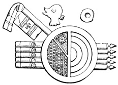
Coat of Arms—Cuernavaca.
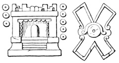
Boulder-Sculptures at Cuernavaca.
RUINS OF XOCHICALCO.
The ruins of Xochicalco, doubtless the finest in Mexico, are about fifteen miles 13° west of south from Cuernavaca, and about seventy-five miles south-west from the city of Mexico. The first published description was written by Alzate y Ramirez, who visited the locality in 1777, and published his account with illustrative plates as a supplement to his Literary Gazette in November, 1791.[IX-32] Humboldt made up his account from that of Alzate; Dupaix and Castañeda included Xochicalco in their first exploration; Nebel visited and sketched the ruins in 1831; and finally an account, perhaps the most complete extant, written from an exploration in 1835 by order of the Mexican government, was published in the Revista Mexicana.[IX-33]
RUINS OF XOCHICALCO.
Xochicalco, the 'hill of flowers,'[IX-34] is a natural elevation 484 of conical form, with an oval base over two miles in circumference, rising from the plain to a height of nearly four hundred feet.[IX-35] Mr Latrobe claims to have found traces of paved roads, of large stones tightly wedged together, one of them eight feet wide, leading in straight lines towards the hill from different directions. The account in the Revista mentions only one such causeway running towards the east. A ditch, more or less filled up and overgrown with shrubbery, is said to extend entirely round the base of the hill, but its depth and width are not stated; perhaps in the absence of more complete information its existence should be considered doubtful.
Very near the foot of the northern slope are the entrances to two tunnels or galleries, one of which terminates at a distance of eighty-two feet; at least, it was obstructed and could not be explored beyond that point. The second gallery, cut in the solid limestone of the hill, about nine feet and a half wide and high, has several branches running in different directions, some of them terminated by fallen débris, others apparently walled up intentionally. The floors are paved to the thickness of a foot and a half with brick-shaped blocks of stone, the walls are also in many places supported by masonry, and both pavement, walls, and ceiling are covered with lime cement, which retains its polish and shows traces in some parts of having had originally a coating of red ochre. The principal gallery, after turning once at a right angle, terminates at a distance of several hundred feet in a large apartment about eighty feet long, in which two circular pillars are left in the living rock to support the roof. The accompanying cut is Castañeda's ground plan of the galleries and subterranean apartment, a being the entrance on the north; b the termination 485 of main gallery; c, k, the branch gallery; e and d, obstructed passages; g, g, the room and f, f, the pillars. The scale of the plan is about fifty feet to the inch, but the dimensions, according to the scale, are doubtless inaccurate. According to the plan the galleries are only a little over four feet wide; and the apartment thirty-three by thirty-nine feet. Alzate's plan agrees with it so far as it goes; the Revista gives no plan, and its description differs in some respects, so far as the arrangement of the galleries is concerned, from the cut.[IX-36] In the top of the room at the south-east corner, at h, is a dome-like structure, a vertical section of which is shown at j of the preceding cut, six feet in diameter and six feet high, lined with stone hewn in curved blocks, with a round hole about ten inches in diameter extending vertically upward from the top. It has been generally believed that this passage leads up to the pyramid on the top of the hill, to be described later; but it will be seen that if the hill be two miles in circumference, or even half that size, the galleries are not nearly long enough to reach 486 the centre under the pyramid. Nebel fancied that the hole in the cupola was so situated that the rays of the sun twice a year would penetrate from above and strike an altar in the subterranean hall. The natives report other passages in the hill besides the one described, and believe that one of them leads to Chapultepec, near the city of Mexico.
THE HILL OF FLOWERS.
Passing now from the interior to the outer surface of the 'hill of flowers,' we find it covered from top to bottom with masonry. Five terraces, paved with stone and mortar, and supported by perpendicular walls of the same material, extend in oval form entirely round the whole circumference of the hill, one above the other. Neither the width of the paved platforms nor the height of the supporting walls has been given by any explorer, but each terrace, with the corresponding intermediate slope, constitutes something over seventy feet of the height of the hill. The terrace platforms have sometimes been described, without any authority, as a paved way leading round and round the hill in a spiral course to the summit. Dupaix speaks of a road about eight feet wide, which leads to the summit, but no other explorer mentions any traces of the original means of ascent. Each terrace wall, while forming in general terms an ellipse, does not present a regular line, but is broken into various angles like the bastions of a fortification. The pavements all slope slightly towards the south-west, thus permitting the water to run off readily. According to the plans of Alzate and Castañeda there are two additional terraces where a spur projects from the hill at the north-eastern base. Latrobe is the only authority on the intermediate slopes between the terraces, which he says are occupied with platforms, bastions, and stages one above another. It is evident from all accounts that the whole surface of the hill, very likely shaped to some extent artificially, was covered with stone work, and that defense was one object aimed at by the builders. 487 The Revista represents the terrace platforms as additionally fortified by the perpendicular supporting walls projecting upward above their level, forming what may perhaps be termed a kind of parapet.
On the summit is a level platform measuring two hundred and eighty-five by three hundred and twenty-eight feet.[IX-37] According to Alzate, Humboldt, Dupaix, and other early authorities—except Nebel, who is silent on the subject—this plaza is surrounded by a wall. Dupaix says the wall is built of stones without mortar, is five feet and a half high, and two feet and nine inches thick. Alzate represents the wall as perpendicular only on the inner side, being in fact a projection of the upper terrace slope, forming a kind of parapet, and making the plaza a sunken area. Latrobe also speaks of the plaza as a hollow square, and Alzate's representation is probably a correct one; for the author of the account in the Revista says that the wall described by previous visitors could not be found; and moreover, that there was no room for it on the north between the central pyramid and "one of the solid stone masses, or caballeros, that surround the platform," the caballeros, which may perhaps in this connection be translated 'parapets,' being doubtless the same structures that the others describe as a wall.
PYRAMID OF XOCHICALCO.
In this plaza, cultivated in later years as a cornfield, there are several mounds and heaps of stones not particularly described; and near the centre is a pyramid, or rather the lower story of one, with rectangular base, the sides of which, exactly or very nearly facing the cardinal points, measure sixty-five feet from east to west, and fifty-eight feet from north to south. The lower story, which in some parts is still standing to its full height, is divided into what may be termed plinth, frieze, and cornice, and is about sixteen feet high.[IX-38]
In the centre of one of the façades is an open space, something over twenty feet wide, bounded by solid balustrades, and probably occupied originally by a stairway, although it is said that no traces of steps have been found among the débris. The cut, from Nebel, shows the front of the pyramid on one side of the opening, being the eastern portion of the northern front, according to Nebel, who locates the stairway on the north, or the northern part of the western front, according to the Revista, which speaks of the opening as being on the west.
The pyramid, or at least its facing, is built of large blocks of granite or porphyry,[IX-39] a kind of stone not 489 found within a distance of many leagues. The blocks are of different sizes, the largest being about eleven feet long and three feet high, and few being less than five feet in length. They are laid without mortar, and so nicely is the work done that the joints are scarcely perceptible. The cut shows one of the façades, probably the northern, from Castañeda's drawing, which corresponds almost exactly to that given by Alzate. So far as the details of the sculpture are concerned it is probably not very trustworthy. The preceding cut, from Nebel, is perhaps the only reliable drawing in this respect that has been published. The whole exterior surface seems to have been covered with sculptured figures in low relief, apparently executed after the stones were put in place, since one figure extends, with the greatest exactitude at the joints, over several blocks of stone.[IX-40]
I translate from the Revista the following remarks about the sculptured figures: "At each angle, and on each side, is seen a colossal dragon's head, from whose great mouth, armed with enormous teeth, projects a forked tongue; but in some the tongue is horizontal, while in others it falls vertically; in the first it points towards a sign which is believed to be 490 that of water, and in the others towards different signs or emblems.... Some have pretended to see in these dragons images of crocodiles; but nothing certain can be known of these fantastic figures which have no model in nature.... On the two sides still standing there are two figures of men larger than the natural size, seated cross-legged in the eastern fashion, wearing necklaces of enormous pearls, rich ornaments, and a head-dress out of all proportion, with long flowing plumes. In one hand they hold a kind of sceptre, and the other is placed on the breast; a hieroglyphic of great size, placed in the middle of each side, separates the two figures, whose heads are turned, on the east side, one north and the other south, while on the north side both face the west. The frieze which surrounds this story presents a series of small human figures, also seated in the eastern manner, with the right hand crossed on the breast, and the left resting on a curved sword, whose hilt reminds us of ancient swords; a thing the more worthy of attention since no people descended from the Toltecs or Aztecs has made use of this kind of arms. The head-dress of these small figures, which closely resemble those mentioned before, is always disproportionately large, and this circumstance, which is found in all the Egyptian mythologic fables, is considered in the latter an emblem of power or divinity. With the human figures are seen various signs, some of which seem allegorical and others chronologic, so far as may be judged from their conformity with those employed in the Aztec paintings.... Another sign, apparently of a different nature, is often repeated among the figures; it is a dragon's mouth, open and armed with teeth, as in the large reliefs, from which projects instead of a tongue a disk divided by a cross.... It has also been thought (Alzate) that dances are represented on the frieze of Xochicalco, but its perfect preservation makes such an error inexcusable, and figures seated with legs 491 crossed and hands on a sword, exclude any idea of sacred or warlike dances, and suggest only mythologic or historical scenes. Over the frieze was a cornice adorned with very delicate designs in the form of oalmetas or meandres in the Greek style." The cut shows one of the bas-reliefs on a larger scale than in the preceding illustrations. There is, as Nebel observes, a certain likeness between these sculptured designs and the stucco reliefs of Palenque, although in the architectural features of the monument, and of the base on which it rests, there seems to be no analogy whatever with any of the southern ruins.
On the summit of this lower structure a few sculptured foundation stones of a second story were found yet in place, the walls being two feet and three inches from the edge of the lower, except on the west, where the space is four feet and a half. According to the report of the inhabitants of the vicinity, the structure had originally five receding stories, similar to the first in outward appearance, which were all standing as late as 1755, making the whole edifice probably about sixty-five feet high. It is said to have terminated in a platform, on the eastern side of which stood a large block, forming a kind of throne, covered with hieroglyphic 492 sculpture. The proprietors of neighboring sugar-works were the authors of the monument's destruction, the stone being of a nature suitable for their furnaces, and none other being obtainable except at a great distance. Alzate puts on record the name of one Estrada as the inaugurator of this disgraceful work of devastation.[IX-41] Several restorations of the pyramid of Xochicalco have been attempted on paper, that by the artist Nebel being probably the only one that bears any likeness to the original; and even his sketch, so far as the sculptured designs are concerned, must be regarded as extremely conjectural, having as a foundation only a few scattered blocks and the reports of the 'oldest inhabitant.' At the Paris international exhibition in 1867 a structure was built and exhibited in the Champs de Mars, purporting to be a fac-simile of this monument; but judging from a cut published in a London paper, it might with equal propriety have been exhibited as a model of any other ruin in the new or old world.[IX-42]
The second story seems to have had interior apartments, with three doorways at the head of the grand stairway. On the summit of the lower story, according to the Revista, is a pit, perhaps a covered apartment originally, measuring twenty-two feet square, and nearly filled with fragments of stone, some of them sculptured, which were not removed. It is of course possible that there exists some means of communication between this apartment and the subterranean galleries of the hill below.
East of the hill of Xochicalco, on the road to Miacatlan, an immense stone was said to have been found serving as a kind of cover to a hole, perhaps the entrance to a subterranean gallery, on the face of which 493 was sculptured an eagle tearing a prostrate native Prometheus. It was broken up and most of the pieces carried away, but Alzate saw one fragment containing a part of the sculptured thigh, from which perhaps with the aid of his imagination and his knowledge of Grecian mythology the good padre prepared a drawing of the whole, which he published. Later visitors have not even seen a fragment of so wonderful a relic. Mr Tylor speaks of a small paved oval space somewhere in connection with the ruin, in which he found fragments of a clay idol. There are no springs of water on or near the hill.
The Revista says, "adjoining this hill is another higher one, also covered with terraces of stone-work in form of steps. A causeway of large marble flags led to the top, where there are still some excavations and among them a mound of large size. Nothing further in the way of monuments is to be seen on the lower (part of the?) hill except a granite block, which may be the great square stone mentioned by Alzate, which served to close the entrance to a subterranean gallery, situated east of the principal monument." There are also some traces of one terrace indicated on Castañeda's view of the larger hill. On the sculptured façades of the pyramid, all have found traces of color in sheltered places, and have concluded that the whole surface was originally painted red, except the author of the account in the Revista, who thinks that the groundwork of the reliefs only was covered with a colored varnish, as was the usage in Egypt. Löwenstern claims to have found in the vicinity of Xochicalco the foundation of many aboriginal dwellings.
A slight resemblance has been noted in some of the sculptured human figures, seated cross-legged, to the Maya sculptures and stucco reliefs of Central America; a few figures, like that of the rabbit, may present some analogies to Aztec sculptures, many specimens of which will be shown in the present chapter; the very fact of its being a pyramid in several stories, 494 gives to Xochicalco a general likeness to all the more important American ruins; the terraces on the hill-slopes have their counterparts at Quiotepec and elsewhere; the absence of mortar between the façade-stones is a feature also of Mitla; still as a whole the monument of Xochicalco stands alone; both in architecture and sculpture it presents strong contrasts with Copan, Uxmal, Palenque, Mitla, Cholula, Teotihuacan, or the many pyramids of Vera Cruz. There is no definite tradition referring the origin of this monument to any particular pre-Aztec period, save the universal modern tradition among the natives referring everything wonderful to the Toltecs. It is not, moreover, improbable that the pyramid was built by a Nahua people during the Aztec period; for it must be remembered first that all the grand temples in Anáhuac—the Aztec territory proper—have disappeared since the Conquest, so that a comparison of such buildings with that of Xochicalco is impossible; and second, that the Aztecs were superior to the nations immediately surrounding them in war rather than art, so that it would be by no means surprising to find a grander temple in Cuernavaca than in the valley of Mexico. The Aztec sculpture on such monuments as have been found in the city of Mexico if different from, is not inferior to that at Xochicalco, and there is no reason whatever to doubt the ability of the Aztecs to build such a pyramid. Still there remains of course the possibility of a pre-Aztec antiquity for the building on the hill of flowers, and of Maya influence exerted upon its builders.[IX-43]
REMAINS IN THE SOUTH-EAST.
In the south-eastern part of the state from Yahualica northward to Mecamecan, relics have been discovered, mostly by Dupaix, in several localities. At Yahualica, near Huautla, there are tombs, with stone images, human remains, pottery, and metates, also some metallic relics not described.[IX-44] At Xonacatepec was seen a mask of about the natural size, carved very neatly from a whitish translucent stone.[IX-45] At the sugar plantation of Casasano, in the same region, a somewhat remarkable relic was a stone chest, of rectangular base, larger at the bottom than at the top, with a cover fitting like that of a modern chest. It was cut from a grayish stone, and when found by laborers engaged in digging a ditch, is said to have been filled with stone ornaments. At the same place 496 was seen a circular stone, three feet in diameter and nine inches thick, sculptured in geometric figures on one side, as shown in the preceding cut.[IX-46]
Another similar stone of the same thickness, and about three feet and a half in diameter, was built into a modern wall at Ozumba. These geometrically carved circular blocks are of not infrequent occurrence on the Mexican plateaux; of their use nothing is known, but they seem to bear a vague resemblance to the Aztec calendar and sacrificial stones to be described later. Another class of circular blocks, from two to three feet in diameter, with curves and various ornamental figures sculptured on one face, are also of frequent occurrence. Several of this class will be mentioned and illustrated in connection with the relics of Xochimilco. Two of them were seen by Dupaix at Chimalhuacan Tlachialco, near Ozumba, together with two small idols of stone. At Ahuehuepa, in the same region, was a statue which had lost the head and the legs below the knees; a hieroglyphic device is seen on the breast, and a small cord passes round the waist, and is tied in a bow-knot in front. Two fragments of head-dresses carved in red stone were found at the same place. A few miles east of the village of Mecamecan is an isolated rock of gray granite, artificially formed into pyramidal shape as shown in the cut. It is about twelve feet high and fifty-five feet in circumference, having rudely cut steps, which lead up the eastern slope. Dupaix conjectures that this monument was intended for some astronomic use, and that the man sculptured on the side is engaged in making astronomical observations, the results of which are expressed by the other figures on the rock. The only possible foundation 497 for the opinion is the resemblance of some of the signs to those by which the Aztecs expressed dates.[IX-47]
REMAINS IN ANÁHUAC.
REMAINS AN XOCHIMILCO.
Entering now the valley of Mexico, we find many localities on the banks, and islands of Lake Chalco where relics of the ancient inhabitants have been brought to light. At Xochimilco on the western shore of the lake, Dupaix mentions the following:—1st. A stone block with regular sides, on one of which about three feet square are sculptured two concentric circles, as large as the space permits, with smaller circles outside of the larger, at each corner of the block. 2d. A crouching monster of stone thirty inches high, which apparently served originally for a fountain or aqueduct, the water flowing through the mouth. 3d. A semi-spherical pedestal of limestone, broken in two pieces, three feet high, and decorated on the curved surface with oval figures radiating from the centre. 4th. A lizard thirty inches long, sculptured on a block which is built into a modern wall. 498 5th. A coat of arms, also on a block in a wall, consisting of a circle on parallel lances like some already described. Within the circle is a very perfect Maltese cross, hanging from the lower part is a fan-like plume, and elsewhere on the smooth faces of the stone are nine very peculiar knots or tassels. 6th. A kind of flat-fish three feet eight inches long, carved from a bluish gray stone. 7th. A coiled serpent in red porphyry, a foot and a half in diameter, and nine feet long if uncoiled. This relic is shown in the cut. 8th. Two death's heads in stone. 9th. A rabbit in low relief on a fragment of stone. 10th. An animal in red stone on a cubic pedestal of the same material. 11th. A stone image of a seated female. 12th. An idol with a man's head and woman's breasts. 13th. Ten sculptured blocks, the faces of which are shown in the following cut, and which would seem to have served only for decorative purposes. Most of them have rough backs, evidently having been taken from ancient walls; and many of these and other similar blocks found in this region had tenons like that shown in fig. 9 of the cut. Fig. 7 shows one of the several death's heads found at Xochimilco.
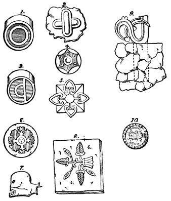
Sculptured Stones—Xochimilco.
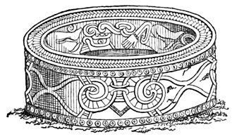
Sculptured Vase—Tlahuac.
At Tlahuac, or Cuitlahuac, were seen two circular stones something over three feet in diameter and half as thick, of black porous volcanic material. Each had a circular hole in the centre, rude incised figures on 499 the faces, and a tenon at one point of the circumference. They strongly remind me of the rings in the walls of the so-called gymnasium at Chichen in Yucatan. Another relic was a cylindrical stone of a hard gray material, of the same dimensions as the preceding, but without a supporting tenon. The circular faces were plain, but the sides, or rim, were decorated with circles, bands, and points symmetrically arranged and sculptured in low relief. And finally there was found at Tlahuac the very beautiful vase of hard iron-gray stone shown in the cut. It is eight feet four 500 inches in circumference on the outside, one foot nine inches in diameter on the inside, and elaborately sculptured in low relief on both the exterior and interior surface. In Kingsborough's edition of Dupaix's work it is stated that the two causeways which led to the town across the waters of Lake Chalco are still in good preservation, five or six yards wide and of varying height, according to the depth of the water. In the report of the Ministro de Fomento in 1854 there is also a mention of a dike built to keep the waters of the lake from Mexico. Another dike, serving also as a causeway at Tulyahualco is mentioned in the same report.
At Xico, on an island in Lake Chalco, there are some traces of an aboriginal city, in the shape of foundation walls of masonry, stone terraces, and what is very important if authentic, well-burned bricks of different forms and dimensions. In the Mexican government report referred to, the foundations of a palace are alluded to.
At Misquique, on another of the lake islands Dupaix found the following objects left by the antiguos:—1st. A sculptured monster's head, with a tenon for insertion in a wall. 2d. A large granite vase, circular in form, four feet and a half in diameter, three feet and a half high, sculptured on the upper rim, painted on the inside, and polished on the outer surface. It rests on a cylindrical base, smaller than the vase itself, and is used in modern times as a baptismal font. 3d. A mill-stone shaped block, with a tenon, very similar to those found at Tlahuac, except that the sculptures on the face are evidently in low relief in this case. 4th. An animal called by Dupaix a coyote, sculptured on the face of a block. 5th. A cylindrical stone twenty-one inches in diameter and twenty-eight in height, round the circumference of which is sculptured, or apparently merely incised, a serpent. 6th. A square block with concentric circles and other figures, similar to those at Xochimilco. 501 7th. Another block with a spiral figure. 8th. A very finely formed head of gray veined stone, furnished with a tenon at the back of the neck. 9th. Three small and rudely formed images, one of green jasper and two of a red stone.

Animal in Stone—Tlalmanalco.
TLALMANALCO AND CULHUACAN.
At Tlalmanalco were four small idols in human form, three of which were built into a modern wall; two heads, one of which is of chalchiuite; three of the ornamental blocks, one bearing clearly defined cross-bones; and the nondescript animal in gray stone shown in the cut. Also at Tlalmanalco, in the official report already several times cited, mention is made of three fallen pyramids, one of which was penetrated by a gallery, supposed to have been intended for burial purposes.
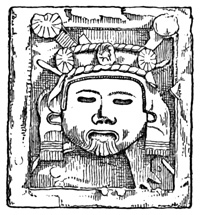
Terra-Cotta Idol—Culhuacan.
Culhuacan, on the north-eastern bank of the same lake, is a small village which retains the name of the city which once occupied the site, famous in the annals of Toltec times. Veytia tells us that in his time some vestiges of the ancient capital were still visible; and Gondra describes a clay idol found at Culhuacan, and shown in the cut, as an image of 502 Quetzalcoatl, giving, however, no very clear reasons for his belief. This relic is fourteen inches high, thirteen inches wide, and is preserved in the Mexican Museum.[IX-48]
The relics discovered in Anáhuac at points westward from the lakes, I shall describe without specifying in my text the exact locality of each place referred to. At Chapultepec there is a tradition that statues representing Montezuma and Axayacatl were carved in the living rock of the cliff; and these rock portraits are said to have remained many years after the Conquest, having been seen by the distinguished Mexican scientist Leon y Gama. Brasseur de Bourbourg even claims to have seen traces of them, but this may perhaps be doubted. One was destroyed at the beginning of the eighteenth century by order of the over-religious authorities; but the other remained in perfect preservation until the year 1753, when it also fell a victim to anti-pagan barbarism. The immense cypresses or ahuehuetes that still stand at the foot of Chapultepec, 'hill of the grasshopper,' are said to have been large and flourishing trees before the coming of the Spaniards.[IX-49]
HILL OF OTONCAPOLCO.
A few miles from the celebrated church of Nuestra Señora de los Remedios, is a terraced stone-faced hill, similar perhaps in its original condition to Xochicalco, except that the terraces are more numerous and only three or four feet high. Although, only a short distance from the capital in an easily accessible locality, only two writers have mentioned its existence—Alzate y Ramirez in 1792 and Löwenstern in 1838. The former calls the hill Otoncapolco, and his article 503 in the Gaceta de Literatura is mainly devoted to proving that this was the point where Cortés fortified himself after the 'noche triste,' instead of the hill on which the church of Remedios stands, as others in Alzate's time believed. The author, who visited the place with an artist, says, "I saw ruins, and hewn stones of great magnitude, all of which proves to the eye that this was a fortification, or as the historians say, a temple, because they thought that everything made by the Indians had some connection with idolatry; it is sure that in the place where the celebrated sanctuary stands, there is not found the slightest vestige of fortress or temple, while on the contrary, all this is observed at Otoncapolco." This with the remark that this monument, although not comparable to Xochicalco, yet merits examination, is all the information Padre Alzate gives us; and Löwenstern adds but little to our knowledge of the monument. He found débris of sculptured stone, obsidian, vases, and pottery; also the ruins of a castle two-thirds up the slope, in connection with which was found a flat stone over six feet long, bearing a sculptured five-branched cross—a kind of coat of arms. The hill is from two hundred and sixty to three hundred and twenty-five feet high, has a square summit platform, and the whole surface of its slopes was covered with stone-work, now much displaced, in the shape of steps, or terraces, between three and four feet high. At one point the explorer found, as he believed, the entrance to a subterranean passage, into which he did not enter but inserted a pole about nine feet.[IX-50]
At Tacuba, the ancient Tlacopan, Bradford mentions the "ruins of an ancient pyramid, constructed with layers of unburnt brick," and Löwenstern speaks of broken pottery and fragments of obsidian. The latter author also claims to have seen near the church 504 of Guadalupe the foundations of many small dwellings which constituted an aboriginal city.[IX-51] At Malinalco, near Toluca, two musical instruments, tlamalhuilili, are mentioned. They were carved from hard wood and had skin stretched across one end, being three feet long and eighteen inches in diameter.[IX-52] Mr Foster gives a cut of a tripod vase in the Chicago Academy of Sciences, which was dug up near San José. "It is very symmetrically moulded, and is ornamented by a series of chevrons or small triangles. This chevron mode of ornamentation appears to have been widely prevalent."[IX-53]
CITY OF MEXICO.
In describing the relics which have been discovered from time to time in the city of Mexico, the ancient Aztec capital, I shall make no mention for the present of such objects, preserved in public and private antiquarian collections in that city, as have been brought from other parts of the state or republic. When the locality is known where any one of this class of relics was found I shall describe it when treating of antiquities in that locality. The many relics whose origin is unknown will be alluded to at the end of this chapter. Since all who have visited Mexico or written books about that country, almost without exception, have had something to say of antiquities and of the collections in the National Museum, as well as of the relics belonging strictly to the city, I shall economize space and avoid a useless repetition by deferring a list of such authorities to my account of the miscellaneous relics of the Mexican Republic at the end of the chapter, referring for my present purpose only to the more important authorities, or such as contain original information or illustrations.
No architectural monuments whatever remain within the city limits. The grand palaces of the Aztec 505 monarchs, the palatial residences of the nobility, the abodes of wealth and fashion, like the humbler dwellings of the masses, have utterly disappeared; monuments reared in honor of the gods have not outlasted the structures devoted to trade; the lofty teocalli of the blood-thirsty Huitzilopochtli, like the shrines of lesser and gentler deities, has left no trace.
Movable relics in the shape of idols and sculptured stones are not numerous, although some of them are very important. No systematic search for such monuments has ever been made, and those that have been brought to light were accidentally discovered. Some sculptured blocks of the greatest antiquarian value have been actually seen in making excavations for modern improvements, and have been allowed to remain undisturbed under the pavements and public squares of a great city! There can be no doubt that thousands of interesting monuments are buried beneath the town. The treasures of the Plaza Mayor will perhaps be some day brought out of their retirement to tell their story of aboriginal times, but hundreds of Aztec divinities in stone will sleep on till doomsday. It is unfortunate that these gods of other days cannot regain for a time the power they used to wield, turn at least once in their graves, and shake the drowsy populace above into a realization of the fact that they live in the nineteenth century.
The three principal monuments of Mexico Tenochtitlan are the Calendar-Stone, the so-called Sacrificial Stone, and the idol called Teoyaomiqui. They were all dug up in the Plaza Mayor where the great teocalli is supposed to have stood, and where they were doubtless thrown down and buried from the sight of the natives at the time of the Conquest. In the years 1790 to 1792 the plaza was leveled and paved by order of the government, and in the excavations for this purpose and for drainage the three monuments were discovered, the Calendar-Stone and the 506 idol very near the surface, and the third relic at a depth of twenty-five or thirty feet.
The Calendar-Stone was a rectangular parallelopipedon of porphyry, thirteen feet one inch and a half square, three feet three inches and a half thick, and weighing in its present mutilated state twenty-four tons. The sculptured portion on one side is enclosed in a circle eleven feet one and four-fifths inches in diameter. These are the dimensions given by Humboldt, who personally examined the stone, and agree almost exactly with those given by Leon y Gama, who examined and made drawings of the monument immediately after its discovery. Gama pronounced the material to be limestone, which provoked a sharp controversy between him and Padre Alzate, the latter calling the material, which he tested by means of acids, a volcanic rock. Humboldt's opinion is of course decisive in such a matter. The centre of the circle does not exactly correspond with that of the square, and Gama concludes from this circumstance that the stone had a companion block which might be found near the place where this was found.[IX-54] 507
THE CALENDAR-STONE.
The stone has been for many years built into the wall of the cathedral at the base, where it is exposed to the view of all passers-by, and to the action of the elements. While lying uncovered in the plaza it was considerably mutilated by the natives, who took the opportunity of manifesting their horror of the ancient gods, by pelting with stones this relic of their paganism. Parts of the stone were also broken off when it was thrown down and buried by the conquistadores. Fortunately the sculptured portions have been but slightly injured, and are shown in the cut. The plates published by Gama, Humboldt, Nebel, Mayer, and others, are all tolerably 508 accurate; except that they were drawn to represent the stone correctly on the plate or block, and of course reversed in printing. The origin of this error is probably to be found in the fact that nearly all have copied Gama's plate. In my cut the error is corrected and the sculptured figures agree exactly with Charnay's photograph.[IX-55] These figures are the symbols of the Aztec calendar, many of which are well understood, while others are of unknown or disputed signification. The calendar has been sufficiently explained in a preceding volume, and I shall not enter upon its elucidation here. The sculpture is in low relief, very accurately worked, and the circle which encloses it projects, according to Mayer, seven inches and a half, according to Gama and Nebel about three inches, and the rim of the circle is also adorned with sculptures not shown in the cut. Respecting the excellence of the sculpture Humboldt says: "the concentric circles, the divisions, and the subdivisions without number are traced with mathematical exactitude; the more we examine the details of this sculpture, the more we discover this taste for repetitions of the same forms, this spirit of order, this sentiment of symmetry, which, among half-civilized peoples, take the place of the sentiment of the beautiful."
No stone like that from which the Calendar-Stone is hewn, is found within a radius of twenty-five or thirty miles of Mexico, and this may be regarded as the largest block which the natives are known to have moved over a long distance. Prescott tells us that the stone was brought from the mountains beyond Lake Chalco, and was dropped into the water while being transported across one of the causeways. There is no reason to attribute this monument to any nation preceding the Aztecs, although the calendar itself was the invention of an older people. Wax models of this and other relics, described by 509 Mr Tylor as very inaccurate, are sold in Mexico; and a plaster cast, taken by Mr Bullock in 1823, was exhibited in London.[IX-56]
THE SACRIFICIAL STONE.
The Sacrificial Stone, so called, is a cylindrical block of porphyry, nine feet and ten inches in diameter, three feet seven and one fourth inches thick. This also was dug from the Plaza Mayor, was carried to the courtyard of the University, where it has lain ever since, much of the time half covered in the ground, and where different visitors have examined it. The cut, which I have copied from Col. Mayer's drawing, shows the sculpture which covers one side of the stone, the other side being plain. The name of Sacrificial Stone, by which it is generally known, probably originated from the canal which leads from the centre to the edge, and which was imagined to have carried off the blood of sacrifices; but the reader will notice at once that this stone bears not the slightest resemblance to the altars on which the priests cut out the hearts of their human victims, as described in a preceding volume. Some authors, among whom is Humboldt, believe this to be the temalacatl, or gladiatorial stone, on which captives were doomed to fight against great odds until overcome and put to death. The bas-relief sculptures, 510 the central concavity, the canal, and the absence of any means of securing the foot of the captive, are very strong arguments against this use of the cylinder. A smooth surface would certainly be desirable for so desperate a conflict, and the sculptured figures on the rim, or circumference, soon to be noticed, show that the plain side of the stone was not in its original position uppermost. Gama, the first to write about the monument, pointed out very clearly the objections to the prevailing ideas of its aboriginal purpose. He claimed that the stone was, like the one already described, a calendar-stone, on which was inscribed the system of feast-days. The strongest objection to this theory was the existence of the central concavity and canal, which, however, Gama considers not to have belonged to the monument at all, but to have been added by the ruder hands of those who wished to blot out the face of the sun which originally occupied the centre. Latrobe also says, "I have but little hesitation in asserting that the groove in the upper surface formed no part of the original design;" but Col. Mayer, who has carefully examined this relic, tells me that the canal presents no signs whatever of being more recent than the other carving, and it must be admitted that the Spaniards would hardly have adopted this method of mutilation. Tylor suggests that this was a sacrificial altar, but used for offerings of animals. Fossey speaks of it as a 'triumphal stone.' But in alluding to these theories I am departing somewhat from my purpose, which is to give all the information extant respecting each relic as it exists.
The whole circumference of the stone is covered with sculptured figures, consisting of fifteen groups. Each group contains two human figures, apparently warriors or kings, victor and vanquished, differing but little in position or insignia in the different groups, but accompanied by hieroglyphic signs, which may express their names or those of their nations. 511 Two groups as sketched by Nebel are shown in the cut. According to Gama these sculptured figures represent by the thirty dancers the festivities celebrated twice each year on the occasion of the sun passing the zenith; and also commemorate, since the festivals were in honor of the Sun and of Huitzilopochtli, the battles and victories of the Aztecs, the hieroglyphics being the names of conquered provinces, and most of them legible.[IX-57]
The idol of which the cut on the opposite page shows the front, was the first to be brought to light in grading the Plaza Mayor in August, 1790. It is an immense block of bluish-gray porphyry, about ten feet high and six feet wide and thick, sculptured on front, rear, top, and bottom, into a most complicated and horrible combination of human, animal, and ideal forms. No verbal description could give the reader any clearer idea of the details of this idol than he can gain from the cuts which I present, following Nebel for the front, and Gama for the other views. Gama first expressed the opinion, in which other authors coincide, that the front shown in the opposite cut represents the Aztec goddess of death, Teoyaomiqui, whose duty it was to bear the souls of dead warriors to the House of the Sun—the Mexican Elysion.[IX-58]
THE GODDESS OF DEATH.
The following cut is a rear view of the idol, and 514 represents, according to Gama, Huitzilopochtli, god of war and husband of the divinity of gentler sex, whose emblems are carved on the front.[IX-59] The bottom of this monument bears the sculptured design shown in the following cut, which is thought to represent Mictlantecutli, god of the infernal regions, the last of this cheerful trinity, goddess of death, god of war, and god of hell, three distinct deities united in one idol, according to the Aztec catechism. The sculptured base, together with the side projections, a, a, of the cut showing the front, prove pretty conclusively that this idol in the days when it received the worship and sacrifices of a mighty people, was raised from the ground or floor, and was supported by two pillars at the sides; or possibly by the walls of some sacred enclosure, the space left under the idol being the entrance. The next cut shows a profile view of the idol, and also a representation of the top. This idol also was removed to the University, and until 1821 was kept buried in the courtyard, that it might not kindle anew the aboriginal superstitions.[IX-60]
THE GODDESS TEOYAOMIQUI.
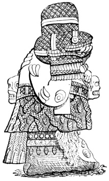
Profile of Teoyaomiqui.
Top of the Idol.
A monument similar in form and dimensions to the Sacrificial Stone, was found in the Plaza Mayor 516 during certain repairs that were being made, and although it was again covered up and allowed to remain, Sr Gondra made a drawing of the upper sculptured surface, which was published by Col. Mayer, and is copied in the cut. The surface presented the peculiarity of being painted in bright colors, yellow, red, green, crimson, and black, still quite vivid at the time of its discovery. Sr Gondra believed this to be the true gladiatorial stone, but the sculptured surface would hardly agree with this theory. Mayer notes as a peculiarity "the open hand which is sculptured on a shield and between the legs of some of the figures of the groups at the sides" not shown in the cut. Gama also speaks of a painted stone found in June, 1792, in the cemetery of the Cathedral, which was left in the ground, and which he says evidently formed the entrance to the temple of Quetzalcoatl.[IX-61]
Another relic found during the excavations in January, 1791, was a kind of tomb, six feet and a half long and three feet and a quarter wide, built of slabs of tetzontli, a porous stone much used for building-purposes 517 in Mexico, filled with sand, which covered the skeleton of some animal like a coyote, together with clay vases and bells of cast bronze. It was perhaps the grave of some sacred animal. Gama also mentions an image of the water god Tlaloc, of a common black stone, three feet long and one foot wide; he also vaguely speaks of several other relics not particularly described, and even found some remains in digging the foundations of his own house.[IX-62]
TLATELULCAN VASE.
The plaza of Tlatelulco is nearly as prolific in ancient monuments as the Plaza Mayor. Here was found the beautiful earthen burial vase shown in the cut. It is twenty-two inches high, fifteen inches and a half in diameter, covered with a circular lid, also shown in the cut, and when found was full of human skulls. The beauty of this vase can only be fully appreciated by a glance at the original, or at the sketch in Col. Mayer's album made by himself from 518 the original in the Museum at Mexico, and showing the brilliant colors, blue, red, and yellow, with which it is adorned. The author says, "in many respects, it struck me as belonging to a higher grade of art than anything in the Museum, except, perhaps, the obsidian carvings, and one or two of the vases." Gondra mentions another burial casket, carved from basalt and of rectangular form.[IX-63]
The head shown in the cut, taken from the Mosaico Mexicano, measures twenty-nine by thirty-six inches, and is carved from a block of serpentine, a stone rarely found in Mexico. It was dug up near the convent of Santa Teresa in 1830, and has been supposed to represent the Aztec Goddess Centeotl. The bottom being covered with sculpture, it seems that the monument is complete in its present state. Another serpentine image of somewhat peculiar form, is shown in an original sketch in the Album of Col. Mayer, who says, "it appears to have been a charm or talisman, and in many respects resembles the bronze figures which were found at Pompeii, and are preserved in the Secret Museum at Naples." It was found at Tlatelulco, and is preserved in the Mexican Museum.[IX-64] 519
MISCELLANEOUS RELICS.
Mr Bullock speaks of several relics not mentioned by any other visitor:—"In the cloisters behind the Dominican convent is a noble specimen of the great serpent-idol, almost perfect, and of fine workmanship. This monstrous divinity is represented in the act of swallowing a human victim, which is seen crushed and struggling in its horrid jaws." The corner-stone of the Lottery Office he described as "the head of the serpent-idol," not less than seventy feet long, when entire. Under the gateway of a house opposite the mint was a fine life-size recumbent statue found in digging a well. A house on a street corner on the south-east side of the plaza rested on an altar of black basalt, ornamented with the tail and claws of a reptile.[IX-64] Mayer dug up in the courtyard of the University two feathered serpents, of which he gives cuts, as well as of several other relics found within the city limits, including the 'perro mudo,' a stone image of one of the dumb dogs bred by the Aztecs, and a seated human figure known as the 'indio triste.'[IX-65]
Mr Christy's London collection of American antiquities contains, as we are told by Mr Tylor, a number 520 of bronze hatchets, dug up in the city of Mexico.[IX-66] Sr Gondra gives plates of nine Mexican musical instruments, one of which of very peculiar construction was found in the city, and is shown in the preceding cut. The top shaped like a coiled serpent is of burned clay, resting on the image of a tortoise carved from wood, and that on a base of tortoise-shell. The whole is about twelve inches high.[IX-67] And finally I give a cut which represents part of a block built into the wall of the Convent of Concepcion, as sketched by Sr Chavero, who joins to his plate some remarks on the meaning of the hieroglyphic sculpture.[IX-68]
RUINS OF TEZCUCO.
Tezcuco, the ancient rival of Mexico, across the lake eastward, formerly on the lake shore, but now by the retirement of the water left some miles inland, has, notwithstanding her ancient rank in all that pertained to art, left no monuments to compare with those taken from the Plaza Mayor of Mexico. But unlike the latter city Tezcuco yet presents traces, and 521 traces only, of her aboriginal architectural structures. Fragments of building-material are found wherever excavations are made, and the material of the old city is said to have been extensively used in the construction of the modern, so that plain or sculptured stone blocks, shaped by the aborigines, are often seen in modern walls in different parts of the town. In the southern part of the city are the foundations of several large pyramids, apparently built of adobes, burnt bricks, and cement, since the materials named all occur among the débris. The foundations show the structures to have been originally about four hundred feet square, but of course supply no further information respecting their form. These pyramids were three in number at the time of Mayer's visit, standing in a line from north to south, and strewn with fragments of pottery, idols, and obsidian knives. Tylor found traces, barely visible, of two large teocallis; he also speaks vaguely of some burial mounds, and states that there is a Mexican calendar-stone built into the wall of one of the churches. In the north-west part of the town Mayer found another shapeless heap of bricks, adobes, and pottery, overgrown with magueys. On the top were several large basaltic slabs, squared and lying north and south. The rectangular stone basin with sculptured sides shown in the cut, was found in connection with this heap and preserved in the Peñasco collection in Mexico. Also in this heap of débris, according to Mayer, Mr Poinsett found in 1825 an arched 522 sewer or aqueduct built of small stone blocks laid in mortar, together with a 'flat arch' of very large blocks over a doorway. I find no mention of these remains in Mr Poinsett's book. Bradford states that, "lying neglected under a gateway, an idol has been observed nearly perfect, and representing a rattlesnake," painted in bright colors. Mr Latrobe found a stone idol, perhaps the same, in 1834, and Nebel gives a sketch of a most interesting relic, said to have come from Tezcuco, and shown in the cut. It was the custom of the Aztec priests at certain times to wear the skin of sacrificed victims.[IX-69] This figure seems to represent a priest thus clad. It is carved from basalt, and was half the natural size, the natural skin being painted a bright red, and the outer one a dirty white. A collection of Tezcucan relics seen by 523 Tylor in 1856, contained, 1st. A nude female figure four or five feet high, well formed from a block of alabaster. 2d. A man in hard stone, wearing a mask which represents a jackals head. 3d. A beautiful alabaster box containing spherical beads of green jade, as large as pigeons' eggs and brilliantly polished.[IX-70]
HILL OF TEZCOCINGO.
About three miles eastward from Tezcuco is the isolated rocky hill known as Tezcocingo, which rises with steep slopes in conical form to the height of perhaps six hundred feet above the plain. A portion of one side of the hill, beginning at a point probably on the south-eastern slope, is graded very much as if intended for a modern railroad, forming a level terrace round a part of the circumference. From the termination of the grading, an embankment with level summit, variously estimated at from sixty to two hundred feet high, connects this hill with another three quarters of a mile distant, the side of which is likewise graded into a terrace thirty feet wide and a 524 mile and a half long, extending two thirds round the circumference; and then another embankment stretches away towards the mountains ten or fifteen miles distant, although no one seems to have recorded any attempt to explore its whole extent. The object of both grading and embankments was to support an aqueduct or pipe ten inches in diameter, which is still in very good preservation at several points. Waddy Thompson brought away a piece of the water-pipe as a relic, and he pronounces the material to be a very hard plaster made of lime and small portions of a soft red stone. "It is about two feet wide, and has a trough in the centre about ten inches wide. This trough is covered with a convex piece of the same plaster, which being placed upon it when the plaster was soft, seems to be all one piece, making together a tube of ten inches in diameter, through which the water flowed from the distant mountains to the basin, which it enters through a round hole about the size of one made with a two-inch auger. No plasterer of the present day can construct a more beautiful piece of work; it is in its whole extent as smooth as the plastering on a well-finished wall, and is as hard as stone." Mayer tells us that the aqueduct was made of baked clay, the pipes being as perfect as when they were first laid. He also seems to imply that along the graded terraces the water was conducted in a ditch, or canal, instead of the regular pipes. But Tylor, on the other hand, says "the channel of the aqueduct was made principally of blocks of the same material [porphyry], on which the smooth stucco that had once covered the whole, inside and out, still remained very perfect."
MONTEZUMA'S BATH.
At the termination of the aqueduct on the eastern slope of Tezcocingo, on the brink of a precipitous descent of two hundred feet to the plain, is the work shown in the cut, from Mayer, hewn from the living rock of reddish porphyry, and popularly known as 525 Montezuma's Bath. There was of course no reason whatever to attach this name to it, for although it is possible, if not probable, that it may have been used for a bath, it is very certain that it never belonged to Montezuma, but rather to Nezahualcoyotl or some other of the Tezcucan kings.[IX-71] The circular basin in the centre is four feet and a half in diameter, and three feet deep, and the circular aperture through which it received water from the aqueduct, is shown in the cut, together with what seem to be seats cut in the rock. Respecting this monument Col. Mayer says: "Its true use, however, is perfectly evident to those who are less fanciful or antiquarian than the generality of visiters. The picturesque view from this spot, over a small plain set in a frame of the surrounding mountains and glens which border the eastern side of Tescocingo, undoubtedly made this recess a favorite resort for the royal personages at whose expense these costly works were made. From the surrounding seats, they enjoyed a delicious prospect over the lovely but secluded scenery, while, in the basin, at their feet, were gathered the waters of a neighboring spring, [implying that the basin and aqueduct were not connected] which, whilst refreshing them after their promenade on the mountain, 526 gurgled out of its stony channel and fell in a mimic cascade over the precipitous cliff that terminated their path. It was to this shady spot that they no doubt retired in the afternoon, when the sun was hot on the west of the mountain, and here the sovereign and his court, in all probability, enjoyed the repose and privacy which were denied them amid the bustle of the city."
Accounts of the other remains at Tezcocingo are somewhat confused. On the northern slope is another recess, bordered by seats cut in the living rock, and leading to a perpendicular cliff on which a calendar is said to have been carved, but destroyed by the natives in later days. Traces of a spiral road winding up to the summit were found by Mayer. Tylor reports a terrace round the hill near the top, some sculptured blocks on the summit, and a second circular bath. Bullock speaks of "ruins of a very large building—the cemented stones remaining in some places covered with stucco, and forming walks and terraces, but much encumbered with earth fallen from above.... As we descended our guide showed us in the rock a large reservoir for supplying with water the palace, whose walls still remained eight feet high; and as we examined farther, we found that the whole mountain had been covered with palaces, temples, baths and hanging gardens." Beaufoy saw a mass of porphyry on the summit, which had been fashioned artificially and furnished with steps. The whole surface, overgrown with nopal-bushes, abounds in fragments of pottery, obsidian, cement, and stone.[IX-72]
BOSQUE DEL CONTADOR.
North-westward from Tezcuco on the level plain is the Bosque del Contador, a grove of ahuehuetes, or cypresses, arranged in a double row and enclosing a square area of about ten acres, whose sides face the cardinal points. The trees are between five and six hundred in number, some of them forty to fifty feet in circumference, and are supposed to date from a time preceding the conquest. The ground on which they stand is firm and somewhat raised above the level of the surrounding plain, which itself is but little above the waters of the lake. The enclosed area, however, is soft, miry, and impassable. It is uncertain whether this area was originally an inland lake surrounded by trees, or an island grove in the waters of the lake. From the north-west corner of the square a double row of similar trees extends some distance westward, and near its termination is a dyke and a walled tank full of water; at the north-east corner, a rectangular mass of porphyry is said to project above the surface and to be surrounded by a ditch; and from this point some traces of a causeway may be seen extending towards the east. Small stone idols, articles of pottery, and various small relics have been dug up in and about this grove, which was not improbably a favorite promenade of the Chichimec, or Acolhuan monarchs.[IX-73]
On the hacienda of Chapingo, about a league south of Tezcuco, an ancient causeway was found in excavating, at a depth of four feet below the surface, the cedar piles of which were in a good state of preservation. Under the causeway was the skeleton of a mastodon, and similar skeletons are said to have been found at other points in the valley of Mexico.[IX-74] 528
At Huejutla, also in the vicinity of Tezcuco, a wall was still standing as late as 1834, which was nearly thirty feet high, between five and six feet thick, and built of stone and mortar. From bottom to top the wall was divided into five distinct divisions distinguished by the arrangement of the stones. The widest of these divisions was built of cylindrical and oval stones, the rounded ends of which projected symmetrically. The wall terminates on the east at a ravine, which is crossed by a bridge of a single span, twenty feet long and forty feet high. The span is an arch of peculiar construction, being formed of stone slabs, set on edge, and the interstices filled with mortar. The irregularities of the stones and the firmness of the mortar support the structure, forming a near approach to the regular arch as shown in the cut from Tylor. Its antiquity has been doubted, but the near approximation to the keystone arch seems to be the only argument against the theory that it was built by the natives, and as we have seen a very similar arch in the mounds of Metlaltoyuca, there seems to be no good reason to attribute it to the Spaniards. This is probably the bridge known as the Puente de los Bergantines, where Cortés is said to have launched his brigantines which rendered so efficient service in the siege of Mexico. The fact that it is set askew instead of 529 crossing the ravine at right angles with the banks adds greatly to the difficulty of its construction. Near this place there are also some heaps of débris, which according to Bullock could be identified in 1823 as small adobe pyramids; and the foundations of a building and two reservoirs, one of the latter in good preservation and covered with rose-colored cement, were mentioned. Beaufoy tells us that in 1826 a serpent's head carved in stone protruded from the ground near the modern church. A stone column, seven feet high, was among the relics seen; it had a well-carved pyramidal piece of hornblende on its top. Two idols of stone were brought away, one of them described by Latrobe as "an ugly monster of an idol in a sitting posture, deftly carved in a hard volcanic substance."[IX-75]
RUINS OF TEOTIHUACAN.
Not quite two miles north-east from the little village of San Juan, and about twenty-five miles in the same direction from Mexico, on the road to Otumba, are the ruins of Teotihuacan, 'city of the gods,' to which, according to Brasseur, the names Veitioacan, 'city of signals,' and Toltecat are sometimes applied in the native traditional annals.[IX-76] These monuments stand on a plain which slopes gently towards the south, and are included in a rectangular space of about a third of a mile from east to west and a mile and a half from north to south, extending from the Tulancingo road on the north to the Otumba road on the south, with, however, some small mounds outside of the limits mentioned. By reason of its nearness to Mexico, Teotihuacan, like Cholula, has naturally had hundreds 530 of visitors in modern times, and is more or less fully described by all the early chroniclers. Humboldt, Bullock, Beaufoy, Ward, Latrobe, Mayer, Thompson, Tylor, and many other actual visitors have written accounts, which still others have quoted; but by far the most complete and reliable account, which is also the latest, is that given in the report of a scientific commission appointed by the Mexican government in 1864, accompanied by plates prepared from careful measurements and photographic views. I have used this report as my chief authority, carefully noting, however, all points respecting which other authorities differ.[IX-77]
The annexed cut, reduced from that of Almaraz, 531 shows clearly, on a scale of about twenty-five hundred and fifty feet to an inch, the plan of the different monuments. I shall describe them in the following order:—1st. The Pyramid of the Moon, A of the plan; 2d. The Pyramid of the Sun, B; 3d. The Road of the Dead, CD; 4th. The Citadel, E; 5th. The scattered mounds and miscellaneous relics.
HOUSE OF THE MOON.
The first pyramid, Metztli Itzacual, 'house of the moon,' [I find no word in Molina's Vocabulary corresponding at all to Itzacual with the meaning of 'house.' It may be a compound of calli incorrectly written] the most northern of the remains, measures four hundred and twenty-six feet north and south, and five hundred and eleven feet east and west at the base, has a summit platform of about thirty-six by sixty feet, and is a hundred and thirty-seven feet high, the sides facing almost exactly the cardinal points.[IX-78] 532 The slope of the sides, according to Beaufoy's observations, is at an angle of about forty-five degrees. The pyramid, as seen from a little distance, bears much resemblance to a natural hill, being overgrown with shrubbery; still the regular original outlines and angles are much more apparent here than in the case of Cholula, already described, as is proven by the photographs taken by the Mexican commission. A terrace, three feet wide, is plainly visible at a height of sixty-nine feet from the base, but a close examination shows there were originally three of these terraces, dividing the pyramid into four stories, except on the east, which has no terrace, and where the commission mentioned claim to have found traces of a zigzag road leading up the slope, as shown in the plan. None but the authority referred to have discovered the zigzag path, and no other explorers note that the terraces were interrupted on one side of the pyramid. Humboldt states that the space between the terraces was divided into smaller grades, or steps, about three feet high, still visible, and also that there still remained parts of a stairway of large blocks of hewn stone. Mr Tylor also says, not referring to this pyramid particularly: "As we climbed up their sides, we could trace the terraces without any difficulty, and even flights of steps." There is hardly any other American monument respecting which the best authorities differ so essentially.[IX-79]
HOUSE OF THE MOON.
The material of the structure has generally been described as a conglomerate of small irregular stones and clay, encased, according to Humboldt and most other writers, in a wall of the porous volcanic rock, tetzontli; or this facing covered with a coating of stucco, which is salmon-colored, light blue, streaked, and red, according to the views of different observers. The Mexican commissioners disagree with all previous explorers by doing away altogether with the facing of hewn stone, and representing the facing to consist of different conglomerates arranged in successive layers, as follows:—1st, small stones from eight to twelve inches in diameter, with mud, forming a layer of about thirty-two inches; 2d, fragments of volcanic tufa as large as a man's fist, also in mud, to the thickness of sixteen inches; 3d, small grains of tetzontli, of the size of peas, with mud, twenty-eight inches thick; 4th, a very thin and smooth coat of pure lime mortar. These layers are repeated in the same order nine times, and are parallel to the slopes of the pyramid, which would make the thickness of the superficial facing about sixty feet. There have been no excavations sufficiently deep to show what may be the material in the centre. Almaraz states that a somewhat different order and thickness of the strata was observed in certain excavations, or galleries, to be described later; but none of these galleries are described as of sufficient depth to penetrate the facing of sixty feet, and the exact meaning of the report in question it is very difficult to determine. I give in a note, however, what others have said of the building-material.[IX-80]
The excavation, or gallery, already referred to, extends about twenty-five feet on an incline into the pyramid from an entrance on the southern slope, between the second and third terraces according to Mayer, about sixty-nine feet above the base according to Almaraz. It is large enough to permit the passage of a man on hands and knees, and at its inner termination are two square wells, walled with blocks of volcanic tufa three inches thick, or, as Mayer says, of adobes,—about five feet square, and one of them fifteen feet deep. No relics whatever have been found in connection with gallery or wells; Almaraz speaks of the former as simply excavations by treasure-hunters, and mentions only one well, without stating its location with respect to the gallery. Mr Löwenstern states that the gallery is a hundred and fifty-seven feet long, increasing in height to over six feet and a half, as it penetrates the pyramid; that the well is over six feet square, extending apparently down to the base and up to the summit; and that other cross galleries are blocked up by débris. Still lower on this slope, at the very base according to the plan, is a small mound like those 535 scattered over the plain to be described later. Mr Bullock claims to have found on the summit, in 1823, walls of rough stones, eight feet high and three feet thick, forming a square enclosure fourteen by forty-seven feet, with a doorway on the south, and three windows on each side. This author's unsupported statements may be taken always with some allowance for the play of his imagination.
HOUSE OF THE SUN.
Some eight hundred and seventy-five yards south of the House of the Moon, between it and the Rio San Juan, at B of the plan, stands the Tonatiuh Itzacual, or 'house of the sun,' also called sometimes in tradition, according to Brasseur and Veytia, Tonacatecuhtli, 'god of subsistence.' In material, form, and construction, it is precisely the same, so far as my authorities go, as its northern companion; indeed, many of the remarks which I have quoted in the preceding description, were applied by the authors to both pyramids alike. Its dimensions are, however, considerably larger, and its sides vary about sixteen degrees from the cardinal points. It measures at the base seven hundred and thirty-five feet from east to west, and is two hundred and three feet high. Beaufoy estimated the size of the summit platform at sixty by ninety feet.[IX-81]
This pyramid is in better condition than the other, and the three terraces are plainly visible, although as before no one but Almaraz has discovered that they do not extend completely round the four sides, and the latter author states that the zigzag path on the eastern slope is much more clearly defined and makes more angles than that on the House of the Moon. Beaufoy found a path leading up the slope at the 536 north-west corner, and Humboldt's remarks about a stairway of stone blocks may apply to this pyramid as well as to the other. Bullock states that the second terrace is thirty-eight feet wide. There are no traces of buildings on the summit or of galleries in the interior, but this, like the other pyramid, has a small mound on one of its sides near the base, and this mound seems to have embankments connecting it with the road on the west. The House of the Sun is also surrounded on the north, south, and east, according to the report of the Mexican commission, by the embankment a, b, c, d, which is a hundred and thirty feet wide on the summit, and twenty feet high, with sloping sides, widening out at the extremities, a and d, into unequal rectangular platforms. It is certainly very remarkable that among the many visitors to Teotihuacan no one had found any traces of this embankment before 1864.
Twelve hundred and fifty yards still further south across the stream is the Texcalpa, 'citadel,' 'palace,' or 'stone house,' as it is called, or defined, by different writers. The Citadel is a quadrangular enclosure, whose sides measure twelve hundred and forty-six and thirteen hundred and thirty-eight feet respectively, or nine hundred and eighty-four feet square according to Linares, and are exactly parallel with those of the Pyramid of the Sun. The enclosing walls, or embankments, are two hundred and sixty-two feet thick and thirty-three feet high, except on the west side, where it is but sixteen feet high; their material not being mentioned, but presumably the same as that of the pyramids. A cross-embankment of smaller dimensions divides the square area into two unequal parts, and on its centre stands a smaller pyramid, said by Linares to be ninety-two feet high, in ruins, having traces of a stairway, or path, on its eastern slope. Two small mounds stand at the western base of the small pyramid, one is found in the western enclosure, and fourteen, averaging twenty feet in height, are symmetrically 537 arranged on the summit of the main embankments, as shown in the plan. The Citadel in some of its features seems to bear a slight resemblance to the works at Tenampua, in Honduras, and at Monte Alban, in Oajaca.[IX-82]
PATH OF THE DEAD.
Just south of the House of the Moon a line of mounds, C D, forms nearly a circular enclosure about six hundred feet in diameter, with a small mound in the centre. From this area two parallel lines of mounds extend south 15° west, parallel also with the sides of the House of the Sun and Citadel, for two hundred and fifty rods to the Rio San Juan, forming an avenue two hundred and fifty feet wide, called by the natives, as in the Toltec traditions, Micaotli, 'path of the dead.'[IX-83] The mounds that form this avenue are of conical or semispherical form, and of different dimensions, the largest being over thirty feet in height. They are built of stone fragments, earth, and clay, and stand close together, so as to resemble in some parts a continuous embankment. Six cross-embankments divide the southern part of the Path of the Dead into compartments, three of which have a mound in their centre. Linares represents the avenue as extending four or five miles beyond the House of the Moon, to the Cerro de Tlaginga; and Mayer in his plan terminates it on the south at a point opposite the House of the Sun, where it is crossed by the modern path.
MOUNDS OF TEOTIHUACAN.
Besides the mounds, or tlalteles that form the Path of the Dead, there are numerous others of the same form and material—being, so far as known, mere heaps of stone and earth—scattered over the plain, some of them in lines or groups, with an approach to regularity, and others with no apparent arrangement. They vary in height from four or five 538 to twenty-five or thirty feet. Respecting these tlalteles I quote from Almaraz as follows: "In them many excavations have been made, causing most of the dilapidation which is noted; some of them executed for scientific purposes in search of archæological objects; others made by ignorant and rapacious persons, impelled by a hope of finding falsely reported treasures: Neither have there been wanting, and this is the cause of most of the destruction, persons of evil intentions who undertake to demolish the ruins in order to obtain the hewn blocks of porphyry which are used in the construction of their barbarous dwellings; and they do not even preserve the blocks, but break and destroy them; in this manner have perished relics truly precious. Almost under my eyes there were taken from one of the tlalteles eight hewn blocks four by three and a half feet; the outer faces were sculptured, representing a strange and grotesque figure, with the head of a serpent and of some other fierce animal, like a tiger or lion; they were curved on the outside, and all must have formed a circular monument seventeen feet in diameter; they were broken up without pity, although I was able to make a drawing of one of them. In the same tlaltel were other sculptured stones.... In the houses of San Juan de Teotihuacan are seen some of these sculptures built into the walls, and in the Ventilla, near the ruins, I have seen stones representing in my opinion a serpent.... Of all the objects of this class the most notable is a monolith found among the débris of a tlaltel, and of which I give a drawing [see next page.] It is a parallelopipedon ten feet and a half high, and five feet and a half wide and thick," weighing, according to the author's calculations, over fifteen tons. "I had an excavation made in one of the smallest, and found four walls meeting at right angles and forming a square; they are inclined, and within are found some steps which are parallel to it [the square]; in the upper part of these, begin four other walls also 539 inclined, containing a little room:—I thought it was a tomb, although I have some doubts about its true object."[IX-84] The people of the vicinity said that in one of the mounds there had been found a stone box containing a skull, beads, and various curious relics of beryl, serpentine, heliotrope, and obsidian. They also claimed to have found quantities of gold-dust and gold vases.
Humboldt speaks of hundreds of these mounds arranged in streets running exactly east and west and north and south from the pyramids. Mayer's plan represents a square area partly enclosed by a line of tlalteles north-east of the House of the Moon. According to Latrobe, the mounds extend for miles towards Tezcuco; and Waddy Thompson is confident that they are the ruins of an ancient city nearly as large as Mexico. The Citadel he calls the public square of twenty acres with a stone building in the centre, and he also finds traces of several other smaller squares. The streets are marked by large piles of rock resembling—except in size—potato-hills, formed by falling buildings. In the opinion of this author it is simply absurd to suppose these heaps to have been formed as separate mounds. Thompson 540 also found a number of circular niches two feet in diameter on the bank of a ravine west of the other remains.[IX-85]
Mayer found, near i of the plan—as nearly as can be determined by his plan, which differs considerably in detail from the one I have given—a globular mass of granite nineteen feet eight inches in circumference; also, near m, the stone block shown in the cut. It is ten feet and a half long, five feet wide, lies exactly east and west, and is found in the centre of a group of small mounds. The cut shows the sculpture on the face turned toward the south, that on the top and north being very indistinct. At b of the cut is a hollow described as three inches deep at the sides, and six at top and bottom. Notwithstanding Col. Mayer's opinion to the contrary, it is most natural to regard this monument as an overturned pillar. The natives 541 believe that whoever sits or reclines on this stone will immediately faint.[IX-86]
MISCELLANEOUS RELICS.
At the time of the Conquest statues of the sun and moon are reported to have been found on the summits of their respective pyramids. The gold plates which are said to have covered or decorated these idols were of course immediately appropriated by the Spanish soldiers, and the idols themselves broken by order of the priests. Gemelli Careri claims to have seen fragments of their arms and legs at the base of the pyramid, and Ramon del Moral assured Veytia that he had found the colossal head of the statue of the moon, and that the pedestal still remained in place; Veytia, however, could find no traces of such relics in 1757, although Ixtlilxochitl and Boturini both claim to have seen them.[IX-87] Mayer claims to have found well-defined traces of an ancient road covered with cement, between the ruins and the village. The whole surfaces of the pyramids, mounds, and much of the surrounding plain, are literally strewn with the fragments of pottery and obsidian; and small terra-cotta heads are offered to the visitor in great quantities for sale, by the natives, who pick them up among the ruins, or perhaps manufacture them when their search is not sufficiently fruitful. Many of these heads have been brought away and sketched, and they are very similar one to another. One of them, sketched by Mr Vetch, is shown in the cut.[IX-88]
The ruins of Teotihuacan, like the pyramid of Cholula, contain no internal evidences of their age. Its building is attributed in different records to the Toltecs, Olmecs, and Totonacs, in the very earliest period of Nahua supremacy. The name Teotihuacan is one of the very earliest preserved in Nahua annals, and there can be but little doubt that the pyramids are older than that of Cholula, or that they were built at least as early as the sixth century, the commencement of what is regarded as the Toltec era in Anáhuac. The pyramids themselves served, according to tradition, as places of sepulture, but not altogether for this purpose, for Teotihuacan is spoken of as a great centre of religious worship and priestly rites, a position it would not have held had it been simply a burial place. It is altogether probable that the houses of the Sun and Moon served the double purpose of tombs and shrines, although there is no proof that any temples proper ever stood on the summit as at Cholula. These structures are said to have served as models for the Aztec teocallis of later times. Don Lucas Alaman, a distinguished Mexican statesman and author, believed that the numerous terra-cotta 543 heads already spoken of were relics distributed by the priests to the crowds of pilgrims that assembled at the shrines.[IX-89]
At Otumba few relics of antiquity seem to have been discovered; Mayer, however, gives a cut of a pillar ornamented with geometric sculptured figures, which is said to have been found by Mr Poinsett. At Tizayuca, a little north of the lake, a low hill is spoken of with a small hole in the top, whence issues continually a current of air; I know not whether there are evidences of anything artificial about this curious phenomenon of more than doubtful authenticity. The same authority also mentions some ruined buildings on the hacienda of San Miguel.[IX-90] Brasseur de Bourbourg tells us that the ruins of Quetzalcoatl's temple at Tulancingo were visible long after the Conquest, and also speaks of a subterranean palace called Mictlancalco, and a stone cross discovered on Mount Meztitlan. Veytia also speaks of the cross of Meztitlan, sculptured together with a moon on a lofty and almost inaccessible cliff; and Chaves barely mentions relics of antiquity not described very definitely.[IX-91]
OBSIDIAN MINES.
At the Cerro de las Navajas, near Monte Jacal, about midway between Real del Monte and Tulancingo, are the mines or quarries from which the natives of Anáhuac are believed to have obtained the large quantities of obsidian used by them in the manufacture of their implements and weapons. The mines are described as openings three or four feet in diameter and one hundred and ten to one hundred 545 and forty feet in extent, probably horizontal, with side drifts wherever the obsidian is of a desirable quality and most abundant. Large quantities of the material are found in fragments of different shapes and sizes, which throw some light on the manner in which the Aztecs manufactured their knives and other implements.[IX-92] In the vicinity of Actopan, at Mixquiahuala, we are told in a Mexican government report already often quoted, that clay relics are frequently discovered.[IX-93] At Atotonilco el Grande, south of Guautla, Mr Burkart found pieces of obsidian of many-sided pyramidal form, from which knives had apparently been split off by the natives in ancient times. The art of working this intractable material has been practically lost in modern times.[IX-94]
At Zacualtipan, in the north-eastern portion of Mexico, a very peculiar monument is described, consisting of a house excavated from a single stone. A doorway on the south, with columns at its sides, leads to an apartment measuring about twelve by seven and a half feet, and ten feet and a half high. The room contains the remains of a kind of altar and a sculptured cross. A stone bench extends round the sides, being two feet high and one foot wide. This main room is connected by a doorway on the west with another very narrow one, in the south end of which is what is described as a kind of stone bed measuring three by six feet, all of the same stone. Another stone near by has a bath, so-called, and still another, known as Caparrosa, has an inscription painted in red. These remains are of so extraordinary a character, that in the absence of confirmation the report must be considered doubtful or erroneous. 546 At Tecomal, north of Lolotla, a stone is mentioned six feet high, which has six steps leading up to the summit, where is an oval hole a yard and a half deep.[IX-95] At Monte Penulco Mr Latrobe speaks of some remains probably of Spanish origin, like many others that are attributed to the antiguos.[IX-96]
Near San Juan de los Llanos, in the extreme north-eastern part of the state, some forty leagues from the city of Mexico, the existence of a ruined city was reported late in the eighteenth century on apparently good authority; but I find no later mention of it. The description bears some resemblance to that of Metlaltoyuca, discovered in 1865, just across the line in Vera Cruz, twenty-five or thirty miles north-east from San Juan. The two groups of remains may be identical, or the earlier report may refer to other monuments, many of which very probably exist yet undiscovered in that densely wooded district. The ruined city near San Juan was described in 1786, by Sr Cañete, as covering an area of one league by three fourths of a league, surrounded by walls of hewn stone laid without mortar, five to eight feet high and very thick. A street running from east to west was paved with volcanic stone, worn smooth, and guarded by battlements, or side walls. Several ruined temples, sculptured blocks of stone, stone metates and other implements, stone statues of men and animals—including a lion—were found here, but all of a rather coarse workmanship. A tall pine was growing on the summit of one of the temples, and there seemed to be some evidence that the town had been abandoned for want of a supply of water.[IX-97]
REMAINS AT TULA.
At Tula, north-west of the city of Mexico, the ancient Tollan, the Toltec capital, we are told that extensive ruins remained at the time of the Conquest,[IX-98] but very few relics have survived to the present time, although some of the few that have been found here are of a somewhat extraordinary character. The cut shows both sides of an earthen vase from Tula, which, as Mayer says, is "of exquisitely grained and tempered material, and ornamented with figures in intaglio, resembling those found on the monuments in Yucatan."[IX-99] Villa-Señor y Sanchez, one of the early Spanish writers, names Tula as one of the many localities where giants' bones had been found.[IX-100] A commission from the Mexican Geographical Society, composed of Drs Manfred and Ord,—the latter an old resident of California, who takes a deep interest in the antiquities and history of the Pacific States—with Mr Porter C. Bliss,—whose large collection of Mexican works, with some curious relics of antiquity, has been lately added to my library—and Sr García y Cubas, made an exploration of Tula and vicinity in 1873, bringing to light some interesting monuments, of which an illustrated account was published in the Boletin of the society. The cut shows a very curious double column of basalt, somewhat over eight feet 548 high. The sculptured knots are interpreted by the commissioners mentioned as the tlalpilli, or periods of thirteen years. None of them occur on the reverse of the column. Other relics discovered by this party included half of what seemed to be a kind of calendar-stone, a large animal in basalt or monster idol, and some hieroglyphic sculptures on the cliff of the Cerro de la Malinche. There were also found the three fragments shown in the cut, which are interesting as showing an aboriginal method of forming columns not elsewhere met with in America, a round tenon on one part fitting closely into a hole in the next. The largest of the three parts shown is four feet long and two and three fourths feet in diameter. The material is basalt and the sculpture is said to be well done. Most of the Tula relics were found at the Cerro del Tesoro, west of the modern village.[IX-101]
Basaltic Column—Tula.
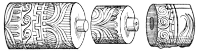
Parts of a Column—Tula.
Gondra speaks of fine pieces of basalt and other 549 stone, about nine feet long, recently discovered on the hacienda of Tlahuililpan near Tula, leaving it to be inferred that the blocks were artificially shaped if not sculptured.[IX-102] Another author says that on the same hacienda an idol six feet high has been found,[IX-103] and mentions some ruins of dwellings about Jacala in the Tula district, especially at Santa María de los Alamos and Cerro Prieto, and also a pillar in the middle of the Rio de Montezuma.[IX-104] Other remains vaguely reported to exist in this part of the state include a subterranean arch at Huehuetoca, between Mexico and Tula, built by the natives to keep the water from the capital; and a group of ruins at Chilcuautla, among which are those of a temple of stone and mortar, and a pyramid fifty-five feet long and seven feet high, with steps in a good state of preservation.[IX-105]
Still further north-west in the state of Querétaro, three groups of antiquities are reported, but very inadequately described. At Pueblito a league and a half south of the city of Querétaro, said to have been a favorite resort for Mexican tourists and invalids in the last century, there stood on a natural elevation, in 1777, the foundations of a large rectangular building. The walls were built of stones laid in clay, and were not, when visited, standing above the level of the ground, one or two feet having been, however, brought to light by excavation. On the east and west of the main building were two smaller ones, from which many idols and other relics, including round polished stones pierced through the centre, are said to have been taken. A pavement of clay is also spoken of in connection with these ruins. On the same elevation stood an artificial sugar-loaf-shaped mound, built of alternate layers of loose stones and mud, having at its summit a level mesa thirty-three 550 feet in diameter. It is said that many idols, sculptured fragments, pedestals, architectural decorations, and flint arrow-heads from Pueblito, were sent to enrich collections in the city of Mexico. The only writer on the subject, Sr Morfi, attempts some descriptions of the sculpture, but as is usual with such accounts unaccompanied by cuts, they convey no idea whatever of the subjects treated. Certain adobe ruins of doubtful antiquity were also shown to the author mentioned.[IX-106]
CANOAS AND RANAS.
In the Sierra de Canoas, between thirty and forty miles north-east of Querétaro, is a steep hill known as Cerro de la Ciudad, the summit of which is very strongly fortified. A lithographic plate showing a general view of the hill is given in a Mexican government report, but I do not copy it because the view is too distant to show anything further than what has already been said; namely, that the hill is steep, and the summit covered with strong stone fortifications. Another plate shows simply the arrangement of the stones, which are brick-shaped blocks, whose dimensions are not given, laid in a mortar of reddish clay and lime. There are in all forty-five defensive works on the hill, including a wall about forty feet in height, and a rectangular platform with an area of five thousand square feet. Some large trees, one of them three hundred years old by its rings, are growing over the ruins. It is very unfortunate that we have no ground plan of these fortifications.[IX-107]
Two or three leagues north-west of the ruins last mentioned is the ranchería of Ranas, situated in a small valley enclosed by hills on every side, on the summits of most of which are still to be seen traces of an ancient population. The fortifications on these hills seem to resemble, so far as may be determined 551 by the slight accounts extant, those of the barranca-girt peninsular plateaux of Vera Cruz. One hill-summit on the north has a pyramid sixty-five feet square at the base, with four stairways leading to the top. Near the pyramid is a burial mound, or cuicillo, in which with a human skeleton were found marine shells, pottery, and beads. The cuicillos are numerous throughout the whole region, and marine shells are of frequent occurrence in them. From a mound in the vicinity of San Juan Del Rio some idols were taken as well.[IX-108]
From an article read before the Mexican Geographical Society by Sr Ballesteros in 1872, I quote the following extracts: "What all down to the present time called cities (Canoas and Ranas), are only the fortified points which guarded the city proper, which was situated between the two at the point called Ranas, where was the residence of the monarch. In a region absolutely broken up and cut in all directions by enormous barrancas, caused by the sinking of whole mountains, the settlement could not be symmetrically laid out, but was scattered, as it is still found, in the bottom of ravines, on the slopes and tops of the hills for many leagues." A small lake, and a perennial spring are supposed to have been the attractions of this locality in the eyes of the ancient people. "On all the hills about are still seen vestiges of their monuments, particularly what are called cuicillos, scattered in every direction from the pueblo of El Doctor to the banks of the streams that drain the valley opposite Zimapan, and even to that of Estorax. Although beforehand I believed that the capital was situated in the central part of Ranas, still this idea was rather vague; but now I think I may be sure of it, since I have found a place surrounded with little elevations, with all the signs of a circular plaza, with many remains of monuments, which have been destroyed through ignorance and greed. In my presence were 552 destroyed the last remains of a cuicillo to found a house, the work not being checked by the presence of the bodies of a man and woman, whose skulls, which I wished to remove, were reduced to dust by the simple touch of the hand. This circumstance may serve to-day as a proof that the cuicillos are nothing but mortuary monuments erected over the sepulchres of persons of rank, more or less grand according to the power of the pueblo, or of the relatives of the deceased." "The idea of a remote antiquity is proved by the presence of the remains of very large oaks which sprang up among the edifices, grew and died, and from the ashes of which others equally large have grown up and cover to-day the majestic remains with their shade." "The summit of the hill on which it [the fortification] was founded is somewhat over a quarter of a league long, and between wall and wall there is room for three thousand men without crowding. The terrible sinking of the mountains cut down the cliffs, which are perpendicular on the north to a height of over eleven hundred feet. On the brow of the cliff was built the superimposed wall of stone, of a very considerable thickness, and terraced on the interior where the warriors were sheltered. On the highest part of the wall there is a kind of tower, the height of which from the bottom of the ravine is not less than sixteen hundred and fifty feet. The hill has only one entrance, but at the same time it has three projecting points which impeded the enemy from approaching in sufficient numbers to make an assault. At this same point is the tower which was perhaps the residence of the chief of the fortress, the view from which commanded the only two roads by which the enemies could approach." "The two fortifications (Canoas and Ranas) are about two leagues distant one from the other, and throughout the whole extent are seen the remains of the settlement, which territory the natives still inhabit. That of Canoas guards the entrance of Zimapan by way of Santo Domingo and Maconí; and 553 that of Ranas protects the approach to Cadereyta and Piñal de Amoles."[IX-109]
MISCELLANEOUS REMAINS.
I have now mentioned all the relics of antiquity that have been found in stated localities within the central Mexican region, which was to constitute the geographical basis of this chapter. Besides these relics, however, there are very many others in antiquarian collections, public or private, in different parts of the world, respecting which all that is known is that they are Mexican, that is, were brought from some part of the Mexican Republic, or even from the northern Central American states. Probably a larger part did actually originate in that part of the Republic which has been treated of in the present and the two preceding chapters. Very few, if any, came from the broad northern regions, whose few scattered remains will form the subject of the following chapter. Neither do the general remarks of different writers on Mexican antiquities refer, except very slightly, to any northern monuments; consequently I may introduce here better than elsewhere such miscellaneous matter as would naturally come at the close of my description of Nahua antiquities.
THE MEXICAN MUSEUM.
The collections in the city of Mexico, embracing relics of aboriginal times gathered at different dates from all parts of the country, are described by travelers as very rich, but little cared for. The public collections were gradually united in the National Museum, where it is to be supposed they are still preserved and cared for under government auspices. M. de Waldeck at one time undertook the work of publishing lithographic plates of the relics in the Museum, but never completed it, and so far as I know no systematic catalogue has ever been given to the public. Every visitor to the city has had something to say of these monuments, but most have 554 given their attention to the calendar-stone, and a few other well-known and famous objects. Many copies have been made by traveling artists, and such is the source whence many of the cuts in the preceding pages have been taken. Respecting the various private collections of Mexico, frequently changing hands, and scattered more or less to foreign lands at every succeeding revolution, I do not deem it important to notice them in this place, especially as I have no information about their present number and condition, or the effects of the French intervention.
M. de Fossey represents the Museum as containing "a hundred masks of obsidian, of serpentine, and of marble; a collection of vases of marble and clay; implements in clay, in wood, and in stone; metallic mirrors; amulets and ornaments in agate, coral, and shell," all in great confusion.[IX-110] Mr Mayer gives perhaps the most complete account of the monuments gathered in this and some other collections in the city of Mexico, illustrated by many cuts besides those which I have had occasion to copy or to mention in describing the monuments of particular localities. I make some quotations from this author respecting miscellaneous objects. "In the city of Mexico I constantly saw serpents, carved in stone, in the various collections of antiquities. One was presented to me by the Conde del Peñasco, and the drawings below represent the figures of two 'feathered serpents,' which, after considerable labor I disinterred (I may say,) from a heap of dirt and rubbish, old boxes, chicken-coops, and decayed fruit, in the court-yard of the University." "The carving with which they are covered is executed with a neatness and gracefulness that would make them, as mere ornaments, worthy of the chisel of an ancient sculptor." "On the benches around the walls, and scattered over the floor, are numberless figures of dogs, monkeys, lizards, birds, serpents, all in seemingly inextricable confusion and 555 utter neglect." A mortar of basalt with a coiled serpent round the rim, and a beautifully cut human head of the same material. "In the adjoining cases [of the Museum] are all the smaller Mexican antiquities, which have been gathered together by the labor of many years, and arranged with some attention to system. In one department you find the hatchets used by the Indians; the ornaments of beads of obsidian and stone worn round their necks; the mirrors of obsidian; the masks of the same material, which they hung at different seasons before the faces of their idols; their bows and arrows, and arrow-heads of obsidian, some of them so small and beautifully cut, that the smallest birds might be killed without injuring their plumage. In another department are the smaller idols of the ancient Indians, in clay and stone, specimens of which, together with the small domestic altars and vases for burning incense, are exhibited in the following [7] drawings. Many of these figures were doubtless worn suspended around the neck, or hung on the walls of houses, as several are pierced with holes, through which cords have evidently passed. In the next place is a collection of Mexican vases and cups, most of which were discovered ... in the Island of Sacrificios," and have consequently been already mentioned. There follow cuts of an axe and two pipes; nine small clay idols; and seven musical instruments. Sixteen cuts of objects from the Peñasco collection are also given.[IX-111]
Mr Tylor tells us that the Uhde collection at Heidelberg
is a far finer one than that in Mexico, except
in the department of picture-writings; it contains a
large number of stone idols and trinkets, pipes, and
calendars. The Christy collection in London is particularly
rich in small sculptured figures, many of
them from Central America. It includes the squatting
female figure carved from hard black basalt,
556
fifteen inches high and seven and a half inches wide,
described by Humboldt as an Aztec priestess;[IX-112] and
also bronze needles and the bronze bells shown in the
cut, which I take from Tylor. The same author also
describes and illustrates various other relics seen by
him in Mexican and European collections. These include
stone and obsidian knives, spear-heads, and
arrow-heads; heads and small idols in terra cotta;
pottery, consisting of vases, altars, censers, rattles,
flageolets, and whistles; and masks of obsidian, stone,
wood, and terra-cotta. Respecting obsidian relics
Mr Tylor says, "Anyone who does not know obsidian
may imagine great masses of bottle-glass, such as our
orthodox ugly wine bottles are made of, very hard,
very brittle, and—if one breaks it with any ordinary
implement—going, as glass does, in every direction
but the right one." "Out of this rather unpromising
stuff the Mexicans made knives, razors, arrow- and
spear-heads, and other things, some of great beauty.
I say nothing of the polished obsidian mirrors and
ornaments, nor even of the curious masks of the human
face that are to be seen in collections, for these
were only laboriously cut and polished with jewelers'
sand, to us a common-place process." "We got several
obsidian maces or lance-heads—one about ten
557
inches long—which were taper from base to point, and
covered with taper flutings; and there are other things
which present great difficulties." "The axes and
chisels of stone are so exactly like those found in Europe
that it is quite impossible to distinguish them.
The bronze hatchet-blades are thin and flat, slightly
thickened at the sides to give them strength, and
mostly of a very peculiar shape, something like a ![]() ,
but still more resembling the section of a mushroom
cut vertically through the middle of the stalk."[IX-113]
These supposed hatchets were, according to some authorities,
coins. They are extremely light to be used
as hatchets. "Many specimens are to be seen of the
red and black ware of Cholula." "The terra-cotta
rattles are very characteristic. They have little balls
in them which shake about, and they puzzled us
much as the apple-dumpling did good King George,
for we could not make out very easily how the balls
got inside. They were probably attached very slightly
to the inside, and so baked and then broken loose."
A cut is given of a brown lava mask from the Christy
collection, which seems to have some sculptured figures
on the inside.[IX-114]
,
but still more resembling the section of a mushroom
cut vertically through the middle of the stalk."[IX-113]
These supposed hatchets were, according to some authorities,
coins. They are extremely light to be used
as hatchets. "Many specimens are to be seen of the
red and black ware of Cholula." "The terra-cotta
rattles are very characteristic. They have little balls
in them which shake about, and they puzzled us
much as the apple-dumpling did good King George,
for we could not make out very easily how the balls
got inside. They were probably attached very slightly
to the inside, and so baked and then broken loose."
A cut is given of a brown lava mask from the Christy
collection, which seems to have some sculptured figures
on the inside.[IX-114]
MOSAIC WORK.
There are three very remarkable mosaic relics in the Christy collection, one of which is the knife represented in the cut, which I take from Waldeck's fine colored plate, although most of the information respecting these relics comes from Tylor. The blade is 558 of a semi-translucent chalcedony found in the volcanic regions of Mexico. The uncolored cut gives but a faint idea of the beauty of the handle, which is covered with a complicated mosaic work of a bright green turquoise, malachite, and both white and red shell. It is certainly most extraordinary to find a people still in the stone age, as is proved by the blade, able to execute so perfect a piece of work as the handle exhibits. Two masks of the same style of workmanship are preserved in the same collection. "The mask of wood is covered with minute pieces of turquoise—cut and polished, accurately fitted, many thousands in number, and set on a dark gum or cement. The eyes, however, are acute-oval patches of mother-of-pearl; and there are two small square patches of the same on the temples, through which a string passed to suspend the mask; and the teeth are of hard white shell. The eyes are perforated, and so are the nostrils, and the upper and lower teeth are separated by a transverse chink.... The face, which is well-proportioned, pleasing, and of great symmetry, is studded also with numerous projecting pieces of turquoise, rounded and polished." The wood is the fragrant cedar or cypress of Mexico. The knife handle is "sculptured in the form of a crouching human figure, covered with the skin of an eagle, and presenting the well-known and distinctive Aztec type of the human head issuing from the mouth of an animal." "The second mask is yet more distinctive. The incrustation of turquoise-mosaic is placed on the forehead, face, and jaws of a human skull.... The mosaic of turquoise is interrupted by three broad transverse bands, on the forehead, face, and chin, of a mosaic of obsidian similarly cut (but in larger pieces) and highly polished,—a very unusual treatment of this difficult and intractable material, the use of which in any artistic way, appears to have been confined to the Aztecs (with the exception, perhaps, of the Egyptians). The eye-balls are nodules of iron-pyrites, cut hemispherically 559 and highly polished, and are surrounded by circles of hard white shell, similar to that forming the teeth of the wooden mask. The Aztecs made their mirrors of iron-pyrites polished, and are the only people who are known to have put this material to ornamental use." These mosaic relics, and two similar but damaged masks at Copenhagen, are probably American, if not Aztec; but this cannot be directly proved; for while something is known of their European history, their origin cannot be definitely ascertained.[IX-115]
THE AZTEC HUITZILOPOCHTLI.
The image shown in the following cut is given by Sr Gondra as representing the Aztec deity Huitzilopochtli, although he gives no reason for the opinion; nor does he name the material, or dimensions of the relic. Sr Chavero also speaks of several images of the same god, in his possession or seen by him. They are of sandstone, granite, marble, quartz, and one of solid gold. Several had a well-defined beard.[IX-116] Gondra gives plates of many weapons, implements of sculpture and sacrifice, funeral urns, and musical instruments. The macana, an Aztec aboriginal weapon, 560 shown in the cut, is copied from one of his plates. The material is probably a basaltic stone.[IX-117]
In 1831 a report was made to the French Geographical Society on a collection of drawings of Mexican antiquities executed by M. Franck. This collection embraced drawings of about six hundred objects, most of them from the National Museum in Mexico; eighty in the museum of the Philosophical Society at Philadelphia; forty in the Peñasco collection in Mexico, and others belonging to Castañeda and other private individuals. They were classified as follows: one hundred and eighty figures of men and women; fifty-five human heads in stone or clay; thirty masks and busts; twenty heads of different animals; seventy-five vases; forty ornaments; six bas-reliefs; six fragments; thirty-three flageolets and whistles; and a miscellaneous collection of weapons, implements, and divers objects.[IX-118]
MUSICAL INSTRUMENTS.
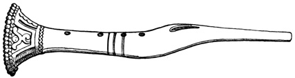
Aztec Flageolet.
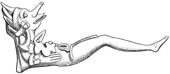
Terra-Cotta Musical Instrument.
Sixteen specimens of Mexican relics, in the possession of M. Latour-Allard in Paris, are represented by Kingsborough unaccompanied by explanations. The objects are mostly sculptured heads, idols, and animals. Bullock also gives plates of six Mexican idols, about which nothing definite is said; Humboldt pictures an idol carried by him from Mexico to Berlin; and Nebel's plates show about thirty miscellaneous relics, in addition to those that have been already mentioned. Humboldt also gives an Aztec hatchet of green feldspath or jade, which has incised figures on its surface. He remarks that he 561 never has found this material 'in place' in Mexico, although axes made of it are common enough.[IX-119] The two musical instruments shown in the cuts are taken from Waldeck's plates. Their material is terra cotta.[IX-120] Other miscellaneous cuts and descriptions are given in the work of the German traveler Müller, and in the appendix to the German translation of Del Rio and Cabrera.[IX-121] José María Bustamante told Mr Lyon of an obsidian ring, carried away by Humboldt, which was perforated round the circumference so that a straw introduced at one side would traverse the circle and come out again at the same 562 opening.[IX-122] The two idols shown in the cut were copied by Kingsborough's artist in the British Museum. The figures of the cut are one sixth of the original size.[IX-123] Prescott tells us that "a great collection of ancient pottery, with various other specimens of Aztec art, the gift of Messrs Poinsett and Keating, is deposited in the cabinet of the American Philosophical Society, at Philadelphia," a list of the relics having been printed in the Transactions of that Society.[IX-124]
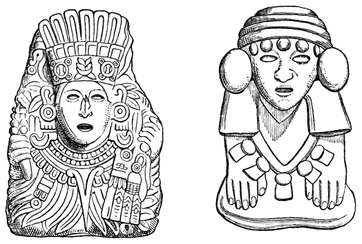
Aztec Idols—British Museum.
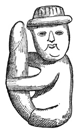
Phallic Relic in National Museum.
HIEROGLYPHIC SCULPTURES.
The preceding cut represents a serpentine relic preserved in the National Museum, and shown to Col. Mayer—from whose album I copy it—by Sr Gondra as a 'cosa muy curiosa.'
Four interesting sculptured stones are represented and their inscriptions interpreted by Sr Ramirez, in a Spanish edition of Prescott's work. The first is a cylinder twenty-six inches long, eleven inches in diameter, representing a bundle of straight sticks bound with a double rope at each end. There are hieroglyphic sculptures on one side and both ends, which are interpreted by Sr Ramirez as a record of the feast which was celebrated at the last 'binding up of the years' in 1507. The second is a block of black lava thirteen and a half by twelve and a half inches, bearing a serpent carved in low relief. The third is a similar block somewhat larger, with a sculptured inscription, supposed to represent the date of November 28, 1456. The fourth monument is that shown in the cut. It is a block of green serpentine, measuring thirty-eight by twenty-six inches. According to the meaning attributed to the sculptures by Ramirez, the lower inscription is the year 8 Acatl, or 564 1487; the upper part shows the day 7 Acatl, or February 19. The left hand figure is supposed to represent Ahuitzotl, and that on the right Tizoc. The event commemorated by the whole sculpture is thought to be the dedication of the great temple of Mexico, begun by Tizoc and completed by Ahuitzotl. The same block is shown in one of Waldeck's plates.[IX-125] I may also notice a small collection of Mexican relics in my possession, obtained by Porter C. Bliss during his travels in the country. This collection includes a grotesque mask of clay; a head of terra-cotta, eight inches high and six inches wide, including head-dress; a small head carved from limestone; a wooden teponaztli; a copper coin or hatchet; five terra-cotta faces, whose dimensions are generally about two inches; six fragments of pottery, mostly ornamented with raised and indented figures—one with raised figures added after the vessel was completed, one with painted figures, one glazed, and one apparently engraved; and seven fragments, some of which seem to have been handles or legs of large vessels.
I close my description of Mexican Antiquities with the two following quotations, somewhat at variance with the matter contained in the preceding pages. "This, like other American countries, is of too recent civilization to exhibit any monuments of antiquity."[IX-126] "I am informed by a person who resided long in New Spain and visited almost every province of it, that there is not, in all the extent of that vast empire, any monument or vestige of any building more ancient than the conquest, nor of any bridge or highway, except some remains of the causeway from Guadaloupe to the gate of Mexico."[IX-127] I give in a note a list of authorities which contain descriptions more or less complete of Mexican relics, but no information in addition to what has been presented.[IX-128]
NAHUA MONUMENTS.
No general view or résumé of Nahua monuments seems necessary here, nor are extensive concluding remarks called for, in addition to what has been said in connection with particular groups of monuments, and to the conclusions which the reader of the preceding pages will naturally form. The most important bearing of the monuments as a whole is as a confirmation of the Nahua civilization as it was found to exist in the sixteenth century, reported in the pages of the conquerors and early chroniclers, and as 566 it has been exhibited in a preceding volume. That there were exaggerations in the reports that have come down to us is doubtless true, as it is very natural; but a people who could execute the works that have been described and pictured in this and the two preceding chapters, were surely far advanced in many of the elements of what is termed civilization. And all this they did, it must be remembered, while practically still in their 'stone age;' for although copper was used by them, it has been seen that implements of that metal but rarely occur in the list of relics described. It is doubtful if any known people ever advanced so far under similar circumstances—that is in their 'stone age,' or in the earlier stages of their 'bronze age'—as did the Nahuas and Mayas of this continent.
Not only do the northern monuments confirm the reported culture existing at the Conquest, but they agree, so far as they go, with the traditional annals of Anáhuac during the centuries preceding the coming of the Spaniards. Teotihuacan and Cholula differ from any works of the later Nahua epochs; while Xochicalco and Mitla are far superior to any known works of the Aztecs proper. All remains sustain the traditions that the Aztecs were superior to their neighbors chiefly in the arts of war, and that the older inhabitants were more devoted to the arts of architecture and sculpture, if not more skillful in the practice of them, than their successors. Still, this must not be understood to indicate anything like a permanent deterioration, or the beginning of a backward march of civilization, whose march is ever onward, although making but little account of centuries or generations.
NAHUA AND MAYA RELICS.
The comparison of Nahua with Maya monuments is a most interesting subject, into the details of which I do not propose to enter. In the use of the pyramidal structure, common to both branches of American civilized nations, and in a few sculptured emblems there is doubtless a resemblance; but this likeness is 567 utterly insufficient to support what has been in the past a favorite theory among writers on the subject;—namely, that of a civilized people migrating slowly southward, and leaving behind them traces of a gradually improving but identical culture. The resemblances in question have in my opinion been greatly exaggerated, and are altogether outnumbered and outweighed by the marked contrasts, which, as they exist between the monuments of Yucatan and Chiapas, and those of Mexico and Vera Cruz, do not need to be pointed out to one who has studied the preceding descriptions. It is true that the best architectural specimens of Nahua art have been entirely destroyed, still there is no reason to doubt that if they could be partially restored they would resemble the structures of Vera Cruz, or at best, Xochicalco, rather than those of Uxmal and Palenque.
The differences between the northern and southern remains, while far more clearly marked than the resemblances, and constituting a much more forcible argument against than in favor of the theory that all American peoples are identical, must yet not be regarded as in any way conclusive in the matter; for it may be noticed that the likeness is very vague between the Nicaraguan idols of stone and those carved by the hands of the northern Aztecs. Yet the peoples were doubtless identical in blood and language, as the divinities which the respective artists attempted to symbolize in stone were the same. The reader will probably agree with me in the conclusion that, while a comparison of northern and southern monuments is far from proving or disproving the original identity of the Civilized Races of the Pacific States, yet it goes far to show, in connection with the evidence of language, tradition, and institutions, a Nahua and a Maya culture, progressing in separate paths,—though not without contact, friction, and intermingling,—during a long course of centuries. 568
The Home of the Chichimecs—Michoacan—Tzintzuntzan, Lake Patzcuaro, Teremendo—Aniche and Jiquilpan—Colima—Armería and Cuyutlan—Jalisco—Tonala, Guadalajara, Chacala, Sayula, Tepatitlan, Zapotlan, Nayarit, Tepic, Santiago Ixcuintla, and Bolaños—Guanajuato—San Gregorio and Santa Catarina—Zacatecas—La Quemada and Teul—Tamaulipas—Encarnacion, Santa Barbara, Carmelote, Topila, Tampico, and Burrita—Nuevo Leon and Texas—Coahuila—Bolson de Mapimi, San Martero—Durango—Zape, San Agustin, and La Breña—Sinaloa and Lower California—Cerro de las Trincheras in Sonora—Casas Grandes in Chihuahua.
A somewhat irregular line extending across the continent from north-east to south-west, terminating at Tampico on the gulf and at the bar of Zacatula on the Pacific, is the limit which the progress northward of our antiquarian exploration has reached, the results having been recorded in the preceding chapters. The region that now remains to be traversed, excepting the single state of Michoacan, the home of the Tarascos, is without the limits that have been assigned to the Civilized Nations, and within the bounds of comparative savagism. The northern states of what is now the Mexican Republic were inhabited at the time of the Conquest by the hundreds of tribes, which, if not all savages, had at least that reputation among their southern brethren. To the proud resident of Anáhuac and the southern plateaux, the northern 569 hordes were Chichimecs, 'dogs,' barbarians. Yet several of these so-called barbarian tribes were probably as far advanced in certain elements of civilization as some of the natives that have been included among the Nahuas. They were tillers of the soil and lived under systematic forms of government, although not apparently much given to the arts of architecture and sculpture. Only one grand pile of stone ruins is known to exist in the whole northern Chichimec region, and the future discovery of others, though possible, is not, I think, very likely to occur. Nor are smaller relics, idols and implements, very numerous, except in a few localities; but this may be attributed perhaps in great degree to the want of thorough exploration. A short chapter will suffice for a description of all the monuments south of United States territory, and in describing them I shall treat of each state separately, proceeding in general terms from south to north. A glance at the map accompanying this volume will show the reader the position of each state, and each group of remains, more clearly than any verbal location could do.
TARASCAN MONUMENTS.
The civilized Tarascos of Michoacan have left but very few traces in the shape of material relics. Their capital and the centre of their civilization was on the shores and islands of Lake Patzcuaro, where the Spaniards at the time of the Conquest found some temples described by them as magnificent.[X-1] Beaumont tells us that the ruins of a 'plaza de armas' belonging traditionally to the Tarascos at Tzintzuntzan, the ancient capital, were still visible in 1776, near the pueblo of Ignatzio, two leagues distant. Five hundred paces west of the pueblo a wall, mostly fallen, encloses a kind of plaza, measuring four hundred and fourteen by nine hundred and thirty feet. The wall was about sixteen feet thick and eighteen in height, with terraces, or steps, on the inside. In 570 the centre were the foundations of what the author supposes to have been a tower, and west of the enclosed area were three heaps of stones, supposed to be burial mounds. Two idols, one in human form, lacking head and feet, the other shaped like an alligator, were found here, carved from a stone called tanamo, much like the tetzontli. The same author says, "respecting the ruins of the palace of the Tarascan kings, according to the examination which I lately made of these curiosities, I may say that eastward of this city of Tzintzuntzan, on the slope of a great hill called Yaguarato, a hundred paces from the settlement, are seen on the surface of the ground some subterranean foundations, which extend from north to south about a hundred and fifty paces, and about fifty from east to west, where there is a tradition that the palace of the ancient kings was situated. In the centre of the foundation-stones are five small mounds, or cuicillos, which are called stone yacatas, and hewn blocks, over which an Indian guardian is never wanting, for even now the natives will not permit these stones to be removed." "On the shores of Lake Siraguen are found ancient monuments of the things which served for the pleasure of the kings and nobles, with other ruined edifices, which occur in various places."[X-2] Tzintzuntzan is on the south-eastern shore of the lake, some leagues northward from the modern Patzcuaro. Lyon in later times was told that the royal palace and other interesting remains were yet to be seen on the lake shores, but he did not visit them.[X-3]
TEREMENDO AND ANICHE.
Another early writer, Villa-Señor y Sanchez, says that in 1712 he, with a companion, entered what seemed a cavern in a deep barranca at Teremendo, eight leagues south-west of Valladolid, or Morelia. "There were discovered prodigious aboriginal vaults, bounded by very strong walls, rendered solid by fire. In the centre of the second was a bench like the foot of an altar, where there were many idols, and fresh offerings of copal, and woolen stuffs, and various figures of men and animals." It was found according to this author that the builders had constructed walls of loose stones of a kind easily melted, and then by fire had joined the blocks into a solid mass without the use of mortar, continuing the process to the roof. The outside of the structure was overgrown with shrubs and trees.[X-4]
At Aniche, an island in Lake Patzcuaro, Mr Beaufoy discovered some hieroglyphic figures cut on a rock; and at Irimbo about fifty miles east of Morelia, he was shown some small mounds which the natives called fortifications, although there was nothing to indicate that such had been their use.[X-5] In the mountains south-east of Lake Chapala, in the region of Jiquilpan, Sr García reports the remains of an ancient town, and says further that opals and other precious stones well worked have been obtained here.[X-6] Humboldt pictures a very beautiful obsidian bracelet or ring, worked very thin and brilliantly polished; and another writer mentions some giants' bones, all found within the limits of Michoacan.[X-7]
At the time when official explorations were undertaken by Dupaix and Castañeda in the southern parts 572 of New Spain, it seems that officials in some northern regions also were requested by the Spanish government to report upon such remains of antiquity as might be known to exist. The antiquarian genius to whom the matter was referred in Colima, then a department of Michoacan, but now an independent state, made a comprehensive report to the effect that he "had not been able to hear of anything except an infinite number of edifices of ruined towns," and some bones and other remains apparently of little importance, which had been taken from excavations on the hacienda of Armería and Cuyutlan, and which seemed to have been destroyed and covered up by volcanic eruptions. If this archæologist had found more than 'an infinite number' of ruins, it might possibly have occurred to him to describe some of them.[X-8] Nothing more is known of Colima antiquities.
PYRAMID OF TEPATITLAN.
At Tonala, probably just across the Colima line northward in the state of Jalisco, the report sent in reply to the inquiry just spoken of, mentioned a hill which seemed to be for the most part artificial, and in which excavations revealed walls, galleries, and rooms. Similar works were said to be of frequent occurrence in that region. In digging for the foundations of the Royal Hospital at Guadalajara, "there was found a cavity, or subterranean vault, well painted, and several statues, especially one which represents an Indian woman in the act of grinding corn." It was hollow, and probably of clay. Near Autlan, in the south-west, there were said to exist some traces of feet sculptured in the rock, one at the ford called Zopilote, and another on the road between Autlan and Tepanola. Near Chacala, still further south, "there is a tank, and near it a cross well carved, and on its foot certain ancient unknown letters, with points in five lines. On it was seen a most devoted crucifix. Under it are other lines of characters 573 with the said points, which seemed Hebrew or Syriac." This information comes from an old author, and is a specimen of the absurd reports of the Christian gospel having been preached at various points in these regions, which are still believed to a considerable extent by a certain class of the people of Mexico.[X-9]
An author who wrote in 1778 states that between Guadalajara and Sayula, and four leagues north-east of the latter town, "there is a causeway of stone and earth, about half a league long, across the narrowest part of a marsh, or lagoon. There is a tradition that the gentiles built it in ancient times. On most parts of its shores this marsh has little heaps of pottery in fragments, very wide and thick, and there can still be found figures of large vessels, and also foundations and traces of small houses of stone. Tradition relates that the antiguos of different nations came here to make salt, and that they had several bloody fights, of which many traces appear in the shape of black transparent flints worked into arrow-points."[X-10]
Mr Löwenstern discovered near Tepatitlan, some fifty miles north-east of Guadalajara, a pyramid described as somewhat similar to those of Teotihuacan, but smaller, its exact dimensions not being given, but the height being estimated at from ninety to a hundred and thirty feet. It was built in three stories of earth, sand, and pebbles, and bore on its summit a dome-shaped mound. The pyramid at the base was encased with large stones; whether or not they were in hewn blocks is not stated, but the stones lying about indicated that the whole surface had originally borne a stone facing. The form of the base was quadrangular, but time and the cultivation of the whole surface as a cornfield, had modified the original form and given the structure an octagonal conformation with not very clearly defined angles. It requires additional evidence to prove that this supposed pyramid 574 was not a natural hill like Xochicalco with some artificial improvement. The hill is called Cerrito de Montezuma, the custom of applying this monarch's name to every relic of antiquity being even more common in the northern regions than in other parts of the country. The author of Cincinnatus' Travels, mentions a 'mound' at Zapotlan, about fifty miles east of Guadalajara, which is five hundred feet high. He does not expressly state that it is artificial, and a gentleman familiar with the locality tells me that it is not generally so regarded, having the appearance of a natural grass-covered hill.[X-11]
In the northern part of the state, in the region of Tepic, the Spaniards seem to have found grander temples, a more elaborate religious system, and a civilization generally somewhat more advanced than in most other parts of the north or north-west. Still no well-defined architectural monuments are reported on good authority in modern times. It is to the earlier writers that we must go for accounts of any extensive remains, and such accounts in all cases probably refer to the buildings which the Spaniards found still in use among the natives; and the old writers were ready to seize upon every scrap of rumor in this direction, that they might successfully trace the favorite southward course of the Aztecs to Anáhuac. Hervas says that "there have been found and still exist in Nayarit ruins of edifices which by their form seem to be Mexican, and the natives say that the Mexicans built them when they were in Nayarit."[X-12] This was another of the regions where some wandering apostle preached the gospel in aboriginal times, and the 'cross of Tepic' was one of the celebrated Christian relics. Some wonderful foot-prints in the stone are also among the reported relics.[X-13] A 575 temple of hewn stone, situated on a rocky hill, ascended by a winding road, was found at Xuchipiltepetl by the Spanish explorers in 1841; and Villa-Señor describes a cave where the natives were wont to worship the skeleton of an ancient king gaily appareled and seated in state upon a throne.[X-14] Finally Prichard informs us that "near Nayarit are seen earthen mounds and trenches."[X-15]
SANTIAGO IXCUINTLA.
A writer in the Boletin of the Mexican Geographical Society describes the temple at Jalisco as it was found by the first Spaniards; and another in the Nouvelles Annales des Voyages states that the village of Jalisco, about a league from Tepic, is built on the ruins of the ancient city, and that "in making excavations there are found utensils of every kind, weapons and idols of the Mexican divinities."[X-16] After all, the only definite account extant of relics found in this part of the state is that by Sr Retes. He says that the northern bank of the Rio Grande, or Tololotlan, contains numerous remains for three or four hundred miles, consisting chiefly of stone and clay images and pottery, and occurring for the most part on the elevated spots out of the reach of inundations. The part of this region that has been most explored, is the vicinity of Santiago Ixcuintla, twenty-five or thirty miles from the mouth of the river. On the slope of a hill four leagues north-west of Santiago, at the foot of Lake San Juan, was found a crocodile of natural size carved from stone, together with several dogs or sphinxes, and some idols, which the author deems similar to those of the Egyptians. Human remains have been found in connection with the other relics, and most of the latter are said to have been sent to enrich European collections by rich 576 foreign residents of Tepic. The objects consist of idols in human and animal forms, axes, and lances, the pottery being in many cases brightly colored. The cut shows six of the thirty-eight relics pictured in the plates given by Retes. Fig. 1, 2, are the heads of small stone idols, the first head being only two inches in height. Fig. 3 is a head of what the 577 author calls a sphinx. Fig. 4 is an earthen-ware mold for stamping designs on cloth or pottery; there are several of these represented in the collection. Fig. 5 is an earthen jar six inches high, of a material nearly as hard as stone. Many of the jars found are very similar to those now made and used in the same region. Fig. 6 is an earthen idol four inches high. Among the other objects is a flint lance-head with notches like saw-teeth on the sides.[X-17] Similar relics, but of somewhat ruder style and coarser material, have been found at a locality called Abrevadero, about eighteen miles south of Santiago towards Tepic.[X-18] At Bolaños, some distance east from Santiago, on a northern branch of the same river, Lyon obtained, by offering rewards to the natives, "three very good stone wedges or axes of basalt." Bones of giants were reported at a distance of a day's journey. At the same distance southward "there is said to be a cave containing several figures or idols in stone."[X-19]
ANTIQUITIES OF GUANAJUATO.
Respecting the antiquities of Guanajuato Sr Bustamante states that the only ones in the state are some natural caves artificially improved, as in the Cerro de San Gregorio, on the hacienda of Tupátaro; and some earthen mounds in the plains of Bajio, proved to be burial mounds. Under the earth and a layer of ashes the skeleton lies with its head covered by a little brazier of baked clay, and accompanied by arrows, fragments of double-edged knives, obsidian fragments, bird-bone necklaces strung on twisted bird-gut, smooth stones, some small semi-spheres of baked clay with a hole in the centre of each, and a few grotesque idols.[X-20]
Castillo describes a small human head, brought from the mines of Guanajuato, the material of which was a "concretion of quartz and chalcedony for the 578 most part, sprinkled with fine grains of gold, and a little pyrites, of a whitish color, but partly stained red by the oxide of iron." This head, it seems, was claimed by some to be a petrifaction, but the author is of a contrary opinion, although he believes there is nothing artificial about it except the mouth.[X-21] Finally Berlandier describes two pyramids near the pueblo of Santa Catarina, in the vicinity of the city of Guanajuato. They are square at the base, face the cardinal points, and are built of pieces of porphyry laid in clayey earth. The eastern pyramid is twenty-three feet high, thirty-seven feet square at the base, with a summit platform fifteen feet square. The corresponding dimensions of the western mound are eighteen, thirty-seven, and fifteen feet. They are only fifteen or twenty feet apart, and are joined by an embankment about five feet high.[X-22]
RUINS OF QUEMADA.
The most important and famous ruins of the whole northern region are those known to the world under the name of Quemada, in southern Zacatecas. The ruins are barely mentioned by the early writers as one of the probable stations of the migrating Aztecs; and the modern explorations which have resulted in published descriptions were made between 1826 and 1831, although Manuel Gutierrez, parish priest of the locality in 1805, wrote a slight account which has been recently published.[X-23] Capt. G. F. Lyon visited Quemada in 1826, and published a full description, illustrated with three small cuts, in his journal.[X-24] Gov. García of Zacatecas ordered Sr Esparza in 1830 to explore the ruins. The latter, however, by reason of other duties and a fear of snakes, was not able to make a personal visit, but obtained a report from Pedro 579 Rivera who had made such a visit. The report was published in the same year.[X-25]
Mr Berghes, a German mining engineer, connected with the famous Veta Grande silver mines, made a survey of the ruins in 1831, for Gov. García, and from the survey prepared a detailed and presumably accurate plan of the works, which was afterwards published by Nebel, and which I shall copy in this chapter. Mr Burkart, another engineer, was the companion of Berghes, and also visited Quemada on several other occasions. His published account is accompanied by a plan agreeing very well with that of Berghes, but containing fewer details.[X-26] Nebel visited Quemada about the same time.[X-27] His plates are two in number, a general view of the ruins from the south-west, and an interior view of one of the structures, besides Berghes' plan. His views, so far as I know, are the only ones ever published.[X-28]
The location is about thirty miles southward of the capital city of Zacatecas, and six miles northward of Villanueva. The stream on which the ruins stand is spoken of by Burkart as Rio de Villanueva, and by Lyon as the Rio del Partido. The name Quemada, 'burnt,' is that of a neighboring hacienda, about a league distant towards the south-west. I do not know the origin of the name as applied to the hacienda, but there is no evidence 580 that it has any connection with the ruins. The local name of the latter is Los Edificios. The only other name which I have found applied to the place is Tuitlan. Fr Tello, in an unpublished history of Nueva Galicia written about 1650, tells us that the Spaniards under Capt. Chirinos "found a great city in ruins and abandoned; but it was known to have had most sumptuous edifices, with grand streets and plazas well arranged, and within a distance of a quarter of a league four towers, with causeways of stone leading from one to another; and this city was the great Tuitlan, where the Mexican Indians remained many years when they were journeying from the north."[X-29] This ruined city was in the region of the modern town of Jerez, and without much doubt was identical with Quemada. Sr Gil applies the same name to the ruins. Others without any known authority attempt to identify Quemada with Chicomoztoc, 'the seven caves' whence the Aztecs set out on their migrations; or with Amaquemecan, the ancient Chichimec capital of the traditions. Gil rather extravagantly says, "these ruins are the grandest which exist among us after those of Palenque; and on examining them, it is seen that they were the fruit of a civilization more advanced than that which was found in Peru at the time of the Incas, or in Mexico at the time of Montezuma."[X-30]
LOS EDIFICIOS OF QUEMADA.
The Cerro de los Edificios is a long narrow isolated hill, the summit of which forms an irregular broken plateau over half a mile in length from north to south, and from one hundred to two hundred yards wide, except at the northern end, where it widens to about five hundred yards. The height of the hill is given by Lyon as from two to three hundred feet, but by Burkart at eight to nine hundred feet above the level 581 of the plain. In the central part is a cliff rising about thirty feet above the rest of the plateau. From the brow the hill descends more or less precipitously on different sides for about a hundred and fifty feet, and then stretches in a gentler slope of from two to four hundred yards to the surrounding plain. On the slope and skirting the whole circumference of the hill, except on the north and north-east, are traces of ancient roads crossing each other at different angles, and connected by cross roads running up the slope with the works on the summit. Berghes' plan of Quemada is given on the following page, on which the roads spoken of are indicated by the dotted lines marked H, H, H, etc. This plan and Burkart's plan and description are the only authorities for the existence of the roads running round the hill, Lyon and other visitors speaking only of those that diverge from it; but it is probable that Berghes' survey was more careful and thorough than that of the others, and his plan should be accepted as good authority, especially as the other accounts agree with it so far as they go.[X-31]
One of the roads, which turns at a right angle round the south-western slope, has traces of having been enclosed or raised by walls whose foundations yet remain; and from it at a point near the angle a raised causeway ninety-three feet wide extends straight up the slope north-eastward to the foot of the bluff. The walls supposed to have raised those south-western roads are not spoken of by Burkart or shown on his plan; Lyon speaks of certain walls here which he considers those of an enclosed area of some six acres. From a point near the junction of the road and 582 causeway three raised roads, paved with rough stones extend, according to Lyon, in perfectly straight lines S.W., S.S.W., and S.W. by S. The first terminates in an artificial mound across the river towards the hacienda of Quemada;[X-32] the second extends four 583 miles to the Coyote Rancho; and the third is said by the natives to terminate at a mountain six miles distant. Two similar roads thirteen or fourteen feet wide extend from the eastern slope of the hill, one of them crossing a stream and terminating at a distance of two miles in a cuicillo, or heap of stones. Burkart found some evidence that the heap constituted the ruins of a regular structure or pyramid; and Rivera locates the cuicillo on the summit of the Sierra de Palomas. He also speaks of a road running west from the north-western part of the hill to the small hills of San Juan, on the Zacatecas road. Of the other roads radiating from the hill I have no farther information than the fact that they are laid down in the plan.[X-33]
At all points in the whole circumference where the natural condition of the slope is not in itself a sufficient barrier to those seeking access to the summit plateau, the brow of the hill is guarded by walls of stone, marked B on the plan for the northern portions, and indicated generally by the black lines in the south. Indeed the northern end of the mesa, where the approach is somewhat less precipitous than elsewhere, is continuously guarded by such a wall, from nine to twelve feet thick and high, enclosing an irregular triangular area with sides of about four hundred and fifty yards: this area being divided by another wall into two unequal portions.
The most numerous and extensive ruins are on the southern portion of the hill, where a larger part of the uneven surface is formed into platforms or terraces by means of walls of solid masonry. One of these supporting walls is double—that is, composed of two walls placed in contact side by side, one having been completed and plastered before the other was begun, the whole structure being twenty-one feet 584 high and of the same thickness.[X-34] On the platforms thus formed are a great number of edifices in different degrees of dilapidation. Any attempt on my part to describe these edifices in detail from the information afforded by the authorities available could not be otherwise than confusing and unsatisfactory. There is probably no ruin in our territory, the verbal description of which would present so great difficulties, even if the accounts of the original explorers were perfectly comprehensive, as they are not; for perhaps more than three fourths of the structures shown on the plan are not definitely spoken of by any author. I will, however, give as clear a description as possible, referring the reader to the plan and to one view which I shall copy, the only satisfactory one ever published.
Near each end of the wide causeway already mentioned are two comparatively small masses of ruins. One of them appears to have been a square stone building thirty-one feet square at the base and of the same height; the others, now completely in ruins, may perhaps have been of similar dimensions, so far as may be judged by the débris. In the centre of the causeway, perhaps at F of the plan, although described as nearer the bluff, is a heap of stone over a star-shaped border or pavement. On the lower part of the mesa, at the extreme southern end and also near the head of the causeway, at A iv of the plan, is a quadrangular space measuring two hundred by two hundred and forty feet,[X-35] and bounded, at least on the north and east, by a stone terrace or embankment four or five feet high and twenty feet wide, the width of which is probably to be included in the dimensions 585 given.[X-36] Mr Burkart states that near the inner edge of this terrace is a canal a foot deep and wide, covered with stone flags. On the outer edge of the terrace, on the eastern side, stands a wall eight feet thick and eighteen feet high. Mr Lyon thinks the other sides were always open, but Burkart speaks of the wall as having originally enclosed the square, and having been torn down on three sides, which seems much more probable. At one point on the eastern terrace stands a round pillar nineteen feet in circumference and of the same height as the wall, or eighteen feet. There are visible traces of nine other similar pillars, seemingly indicating the former presence of a massive column-supported portico.
Adjoining this enclosure on the east, with only a narrow passage intervening, is another, R of the plan, measuring according to Burkart's measurement, which agrees very nearly with that of Berghes, one hundred by one hundred and thirty-eight feet,[X-37] with walls still perfect, eighteen feet high and eight feet thick, in connection with which no terraces are mentioned, although Rivera speaks of steps on the west. Within the walls, twenty-three feet from the sides and nineteen and a half from the ends, is a line of eleven pillars—Lyon says fourteen, and Rivera ten—each seventeen feet in circumference and of the same height as the walls. There can be little doubt that these columns once sustained a roof. Mr Berghes in one of his excavations in 1831 is said, by Nebel, to have found an ancient roof supported by a column, and showing exactly the method followed by the builders. The roof was made of large flat stones, covered with mortar and supported by beams. It is not quite clear how an excavation on the hill could show such a room, but there is little 586 room to doubt that the roof-structure was similar to that described. Near this second enclosure—and west of it, as is said, but that would be hardly possible—Rivera speaks of a circular ruin sixteen and a half feet in diameter, with five steps leading up to the summit, on which some apartments were still traceable.
From the level platform in front of the two main structures described, a causeway, beginning with a stairway and guarded at the sides by walls for much of its length, leads northward up the slope. About three hundred yards in this direction, possibly at the point marked F on this causeway, is a pyramid in perfect preservation, about fifty feet square at the base, also fifty feet high, with a flat summit. Near this is another pyramid, only twelve feet square and eighteen feet high, but standing on a terrace fifty by one hundred feet. Two bowl-shaped circular pits, eight feet in diameter, with fragments of pottery and traces of fire; a square building ten by eight feet on the inside, with walls ten feet high; and a simple mound of stones eight feet high, are the miscellaneous remains noted in this part of the hill.
The most extensive and complicated ruins are found between the steep central height and the western brow of the hill, where there is a perpendicular descent of a hundred and fifty feet. On this central height itself there are no ruins, but passing nearly round its base are terraced roads twenty-five feet wide, with perpendicular walls only partially artificial. Of the extensive group of monuments on the platform of the south-western base of the central height, only the portion about A ii, of the plan, has been definitely described, and the description, although clear enough in itself, does not altogether agree with the plan. Here we have a square enclosure similar to the one already described in the south at A iv. Its sides are one hundred and fifty feet, bounded by a terrace three feet high and twelve feet wide, with 587 steps in the centre of each side. Back of the terrace on the east, west, and south sides stand walls eight or nine feet in thickness and twenty feet high. The north side of the square is bounded by the steep side of the central cliff, in which steps or seats are cut in some parts in the solid rock, and in others built up with rough stones. In the centre of this side, and partially on the terrace, is a truncated pyramid, with a base of thirty-eight by thirty-five feet, and nineteen feet high, divided into several stories—five according to Nebel's drawing, seven according to Lyon's statement.[X-38]
In front of the pyramid, and nearly in the centre of the square, stands a kind of altar or small pyramid seven feet square and five feet high. A very clear idea of this square is given in the following cut from Nebel's drawing. It presents an interior view from a point on the southern terrace. The pyramid in five stories, the central altar, the eastern terrace with its steps, and standing portions of the walls are all clearly portrayed. The view, however, disagrees very essentially with the plan in representing extensive remains northward from the enclosure on the upper slope, where, according to Berghes' plan, no ruins exist. There is an entrance in the centre of the eastern wall, another in the western, and two on the south. These entrances do not seem to be in the form of doorways, but extend, according to the drawing, to the full height of the walls. That on the east is thirty feet wide and leads to an adjoining square with sides of two hundred feet and walls still perfect. The arrangement of these two adjoining squares is much like that of those at A iv in the south, but in the northern structures there are no pillars to be seen.
The opening through the western wall leads to the entrance to a cave, reported to be of great extent, but 588 not explored by any visitor on account of the ruined condition of the passage leading to it—or, as Gutierrez says, because the wind issues constantly from the entrance with such force that no one can enter with lights. The mouth of the subterranean passage is on 589 the brink of the western precipice; the walls were plastered, and the top supported by cedar beams. Strangely enough the structure at A iii, so clearly defined on the plan, is not described at all. It seems to be very similar to the enclosures described.
The ruins on the northern part of the plateau are similar in character to those in the south, but fewer in number. Among them are square terraced enclosures like those already mentioned; a pyramid with sloping sides, and eighteen feet square at the summit; a square building sixteen feet square at the base and sixteen feet high; and two parallel stone mounds thirty feet long.
On the lower southern slopes the foundation-stones of numerous buildings are found, and many parts of the adjoining plain are strewn with stones similar to those employed in the construction of the edifices above. There is now no water on the hill, but there are several tolerably perfect tanks, with a well, and what seem to be the remains of aqueducts.
The material of which all the works described are built is the gray porphyry of this and the neighboring hills, and Burkart states that the building-stone of Los Edificios was not quarried in the hill on which they stand, but brought from another across the valley. The nature of the stone permits it to be very easily fractured into slabs, and those employed in the buildings are of different sizes, but rarely exceeding two or three inches in thickness and not hewn. They are laid in a mortar of reddish clay mixed with straw, in which one visitor found a corn-husk. The mortar, according to Burkart, is of an inferior quality,—although others represent it as very good—and on the outer walls and in all exposed situations is almost entirely washed out. Except this washing-out of the mortar, time and the elements have committed but slight ravages at Quemada, the dilapidation of the buildings being due for the most part to man's agency, since most of the buildings of 590 the neighboring hacienda have been constructed of blocks taken from Los Edificios. Lyon found some evidence that the walls were originally plastered and whitened.
A large circular stone from ten to thirteen feet in diameter and from one to three in thickness, according to different observers, on the surface of which were sculptured representations of a hand and foot, was found at the western base of the hill, or as Burkart says, at the eastern base. The editor of the Museo Mexicano also speaks of a sculptured turtle bearing the figure of a reed, the Aztec acatl. No other miscellaneous relics whatever have been found. Nothing resembling inscriptions, hieroglyphics, or even architectural decorations, is found in any part of the ruins. Obsidian fragments, arrow and spear heads, knives, ornaments, heads and idols of terra cotta and stone, pottery whole or in fragments, human remains and burial deposits, some or all of which are strewn in so great abundance in the vicinity of most other American ruins, are here utterly wanting; or at least the only exceptions are a few bits of porphyry somewhat resembling arrow-heads, and some small bits of pottery found by Lyon in the circular pit on the summit.
The works which have been described naturally imply the existence in this spot at some time in the past of a great city of the plain, of which the Cerro de los Edificios was at once the fortified citadel and temple. The paved causeways may be regarded as the principal streets of the ancient city, on which the habitations of the people were built of perishable material, or as constructed for some purely religious purpose not now understood. Mr Burkart suggests that the land in the vicinity was once swampy, and the causeways were raised to ensure a dry road. An examination of their foundation should settle that point, as a simple pavement of flat stones on the surface of a marsh would not remain permanently in 591 place. As simple roads, such structures were hardly needed by barefooted or sandaled natives, having no carriages or beasts of burden; and it seems most reasonable to believe that they had a connection with religious rites and processions, serving at the same time as main streets of a city.
The ruins of Quemada show but few analogies to any of the southern remains, and none whatever to any that we shall find further north. As a strongly fortified hill, bearing also temples, Quemada bears considerable resemblance to Quiotepec in Oajaca; and possibly the likeness would be still stronger if a plan of the Quiotepec fortifications were extant. The massive character, number, and extent of the monuments show the builders to have been a powerful and in some respects an advanced people, hardly less so, it would seem at first thought, than the peoples of Central America; but the absence of narrow buildings covered by arches of overlapping stones, and of all decorative sculpture and painting, make the contrast very striking. The pyramids, so far as they are described, do not differ very materially from some in other parts of the country, but the location of the pyramids shown in the drawing and plan within the enclosed and terraced squares seems unique. The pillars recall the roof structures of Mitla, but it is quite possible that the pillars at Quemada supported balconies instead of roofs; indeed, it seems improbable that these large squares were ever entirely covered. The walls of Los Edificios are higher as a rule than those of other American ruins, and the absence of windows and regular doorways is noticeable. The total want of idols in structures so evidently built, at least partially, for religious purposes, is also a remarkable feature, as is the absence of the usual pottery, implements, and weapons. The peculiar structure, several times repeated, of two adjoining quadrangular spaces enclosed, or partially so, by high walls, and one of 592 them formed by a low terrace into a kind of square basin, containing something like an altar in its centre, is a feature not elsewhere noted. There can hardly be any doubt that these and other portions of the Edificios were devoted to religious rites.
While Quemada does not compare as a specimen of advanced art with Uxmal and Palenque, and is inferior so far as sculpture and decoration are concerned to most other Nahua architectural monuments, it is yet one of the most remarkable of American ruins, presenting strong contrasts to all the rest, and is well worthy of a more careful examination than it has ever yet received. Such an examination is rendered comparatively easy by the accessibility of the locality, and would, I have no doubt, be far from unprofitable in an antiquarian point of view. Los Edificios, like Copan and Palenque, have, so far as has yet been ascertained, no place in the traditional annals of the country, yet they bear no marks of very great antiquity; that is, there is more reason to class them with Xochicalco, Quiotepec, Monte Alban, and the fortified towns of Vera Cruz, than with the cities of Yucatan and Chiapas, or even the pyramids of Teotihuacan and Cholula.
At San Juan Teul, nearly a hundred miles southward from Quemada, the Spaniards found a grand aboriginal temple when they first came to this part of the country; and Frejes, an early writer, says, "there are ruins of a temple and of dwellings not far from the present pueblo." There is, however, no later information respecting this group of remains. At a place called Tabasco, about fifty miles from Quemada, Esparza mentions the discovery of some stone axes. No other antiquities have been definitely reported in the state of Zacatecas, although Arlegui tells us that the early missionaries were much troubled, and hindered in their work of conversion by the constant 593 discovery of idols and temples concealed in the mountains.[X-39]
AGUASCALIENTES AND SAN LUIS POTOSÍ.
I have no record of any relics of antiquity in the state of Aguascalientes: San Luis Potosí has hardly proved a more fruitful field of archæological research. Mayer gives a cut representing a stone axe from this state; Cabrera reports some ancient tombs, or cuicillos,—which he calls cuiztillos; the word being written differently by different authors, and as applied to different states—in the suburbs of the city of San Luis Potosí; and according to a newspaper report two idols and a sacrificial basin, cut from a concrete sandstone, were found in the sierra near the city and brought to New Orleans. One of the idols was of life size, had two faces and a hole for the insertion of a torch in its right hand; the basin was two feet in diameter, and held by intertwined serpents.[X-40]
In southern Tamaulipas relics are quite abundant and of a nature very much the same as that of those which have already been described south of the Rio Pánuco, the boundary line between Tamaulipas and Vera Cruz. At Encarnacion, in the vicinity of Tampico, Mr Furber reports the stone idol shown in front and profile view in the cut. The sculpture is described as rude, and with the idol, three feet high, were dug up several implements and utensils.[X-41] Near a small 594 salt lake between Tula and Santa Barbara, Mr Lyon found a ruined pyramidal mound of hard earth or clay, faced with flat unhewn stones, with similar stones projecting and forming steps leading up the slope on one side. This pyramid is thirty paces in circumference at the base, and is divided by a terrace into two stories, the lower of which is twenty feet high, and the upper in its present state ten feet. Some stone and terra-cotta images have been taken from this mound, and another much smaller but similar structure is reported to exist somewhere in the same vicinity.[X-42]
On the Tamissee River, which flows into Tampico Bay, traces of ancient towns have been found in two localities near the Carmelote Creek. They consist of scattered hewn blocks of stone, covered with vegetable mold and overgrown with immense trees and rank vegetation. At one of these localities the remains include seventeen large earthen mounds, with traces of a layer of mortar at the bottom. In them have been found broken pottery, rudely carved images of natural size in sandstone, and idols and heads in terra 595 cotta. Mr Norman gives cuts representing two of these heads.[X-43]
TOPILA REMAINS.
In the south-western part of the state, in the Topila hills, near a creek of the same name, is a large group of remains at a locality known as Rancho de las Piedras. Mr Norman, who spent a week in their examination, is the only authority for these remains, and as he was obliged to work alone and unaided, his examination was necessarily superficial. Over an area several miles square the ground is strewn with hewn blocks of stone and fragments of pottery and obsidian. Many of the blocks bear decorative sculptured figures. A female face carved from a block of fine dark reddish sandstone, was brought away by Mr Norman and presented to the New York Historical Society. It is shown in the cut. The face is of life size, very symmetrical in its form, and of a Grecian type. Another monument sketched by the explorer was a stone turtle, six feet long, with a human head. The sculpture, especially of the turtle's shell, is described as very fine; the whole rests on a large block of concrete sandstone, and is called by the finder the American Sphinx. This relic was somewhat damaged, but the features of the human face seemed of a Caucasian rather than a native type.
The Topila ruins include twenty mounds, both circular and square, from six to twenty-five feet in height, built of earth and faced with uniform blocks of sandstone, eighteen inches square and six inches thick. The facings had for the most part fallen, and 596 that invariably inward in the smaller mounds, indicating perhaps their original use as tombs. Many of the blocks are scattered through the forest in places where the mounds had entirely disappeared. Of all the mounds only one has any trace of a terrace, and in that one it is very faint; and there is no evidence that mortar was employed in laying the stones. The largest covered about two acres, and bore on its summit a wild fig-tree one hundred feet high. At its base is a circular wall of stone, the top of which is even with the surface of the ground—perhaps a well—and which is filled with stones and broken pottery. Its top is covered with a circular stone four feet and nine inches in diameter and seven inches thick, with a hole in its centre and some ornamental lines sculptured on its upper surface. Another round stone, twelve feet in diameter and three feet thick, on the front of which is carved a colossal human head, is shown in the cut. The author speaks vaguely of "vast piles of broken and crumbling stones, the ruins of dilapidated buildings, which were strewed over a vast space;" and his cuts of the relics which I have copied show in the background, not included in my copies, regular walls of hewn stone. Mr Norman regards this group as the remains of a great city, the site of which is now covered by a heavy forest. In another locality, seven miles further north-west on the Topila Creek, and a few miles from the Pánuco River, is another group of circular mounds, one of 597 them twenty-five feet high, and the lower portions faced with flat hewn stones. Hewn blocks of various forms and sizes are also scattered about the locality, but none of them are sculptured.[X-44] Lyon tells us that "remains of utensils, statues, weapons, and even skeletons," have been often found in digging for the foundations of new buildings in the vicinity of Tampico, or Tamaulipas. He made drawings, which he did not publish, of two very perfect basalt idols, and mentioned also some bone carvings and terra-cotta idols found in this region.[X-45] In northern Tamaulipas I find only one mention of aboriginal monuments, and that at Burrita, about twenty miles east from Matamoras, respecting which locality Berlandier says, "on a small hill which is seen two or three hundred paces from the rancho of Burrita are found in abundance (as the rancheros say) the bones of ancient peoples."[X-46]
BOLSON DE MAPIMI.
BURIAL CAVES.
Nuevo Leon, adjoining Tamaulipas on the west, is another of the states within whose limits no antiquities have been reported; and in Texas on the north almost the same absence of aboriginal remains is to be remarked, although one group of rock-inscriptions will be noted in a future chapter at Rocky Dell creek, in the north-western part of the state bordering on New Mexico. In the region bordering on the valley known as the Bolson de Mapimi, comprising parts of the states of Coahuila, Durango, and Chihuahua, the natives at some time in the past seem to have deposited their dead in natural caves, and several of these burial deposits of great extent have been discovered and reported. None of them are accurately located by any traveler or writer, nor is it possible to tell in which of the three states any one 598 of them should be described. As antiquities, however, these burial caves do not require a long notice. The one of which most has been written is that discovered by Juan Flores in 1838. The entrance to the cave was at the foot of a hill, and within were seated round the walls over a thousand mummies "dressed in fine blankets, made of the fibres of lechuguilla, with sandals, made of a species of liana, on their feet, and ornamented with colored scarfs, with beads of seeds of fruits, polished bones, &c.," as Wizlizenus says. Mühlenpfordt tells us that Flores to find this cave traveled eastward from the Rancho San Juan de Casta, which is eighty-six leagues northward from Durango. Another traveler heard of several of these caves, and that the remains found were of gigantic size. Mayer gives a report that in latitude 27° 28´ there are a multitude of caverns excavated from solid rock, bearing inscribed figures of animals and men, the latter dressed like the ancient Mexicans. Some of them were described by Fr Rotéa as fifteen by thirty feet, and identical probably with Chicomoztoc, the famous 'seven caves.' A writer in Silliman's Journal, referring perhaps to the same cave, extends the number of mummies from a thousand to millions, and speaks of necklaces of marine shells. Mr Wilson locates one of these mummy-deposits on the western slope of a high mountain overlooking the ancient pueblo of Chiricahui, in Chihuahua probably. Several rows of bodies, dried and shrunken but not decayed, were exposed by an excavation for saltpetre. Each body sewn up in a strong well-woven cloth, and covered again with sewn palm-leaves, lay on its back on two sticks, with knees drawn up to chin, and feet toward the mouth of the cavern. The cave was a hundred feet in circumference and thirty or forty feet high, and the bottom for a depth of twenty feet, at least, was composed of alternate layers of bodies, and of earth and pebbles. The preservation is thought to be attributable to the 599 dryness of the air and the presence of saltpetre. Parts of the mummies, of the wrapping-cloths, bone beads and beads of blue stone, with parts of a belt and tassels, were presented to the California Academy of Natural Sciences in July, 1864. Sr Avila describes two of these caves situated in the vicinity of San Lorenzo, about thirty-five leagues west of Parras, in Coahuila. One had to be entered from the top by means of ropes, and the other had some of its rocks artificially cut and painted. In both of these deposits bones were found instead of mummies, but they were as in the other cases wrapped in cloth and gaily decked with beads, sticks, and tassels. Hair was found on some of the heads, and a white hand was noticed frequently painted on the walls. Padre Alegre speaks of the existence of caves in this region, with human remains, and painted characters on the cliffs. Respecting the latter, Padre Ribas says "the cliffs of that hill and of the caves were marked with characters and a kind of letters, formed with blood, and in some places so high that nobody but the devil could have put them there, and so permanent that neither the rains nor winds had erased or diminished them."[X-47]
Besides the burial caves, the only account I find of any antiquities in the state of Coahuila, is contained in the following quotation, of rather doubtful authenticity, perhaps, respecting some remains on the hacienda of San Martero, about twenty-six miles from Monclova. "The spot bears every appearance of having once been a populous city. Stone foundations are to be seen, covering many acres. Innumerable 600 columns and walls rise up in every direction, composed of both limestone and sandstone. The columns are built in a variety of shapes, some round, others square, and bear every imprint of the work of human hands.... For miles in the vicinity, the basin is covered with broken pottery of burnt clay, fantastically painted and ornamented with a variety of inexplicable designs."[X-48]
REMAINS IN LA BREÑA.
In Durango, besides the sepulchral deposits alluded to, Ribas in his standard and very rare work on the 'triumphs of the faith' in the northern regions, mentions the existence of idols, columns, and the ruins of habitations at Zape, in the central part of the state; and Larios tells us that in the vicinity of the church which was being built in his time, there were found at every step burial vases, containing ashes and human bones, stones of various colors, and, most wonderful of all, statues or images of men and animals, one resembling a priest.[X-49] At San Agustin, between the city of Durango and San Juan del Rio, Arlegui notes the existence of some bones of giants. The good padre did not rely in making his statement on mere reports, but saw with his own eyes a jaw-tooth which measured over eight inches square, and belonged to a jaw which must, according to his calculations, have measured nine feet and a half in the semicircle.[X-50] In the volcanic region extending south-eastward from the city of Durango, known as La Breña, there are large numbers of very curious natural caves, the bottoms of which are covered with a thick layer of fine dust, containing much saltpetre. In this dust, Sr José Fernando Ramirez discovered various antiquarian relics, which he deposited in the National Museum of Mexico. The only one specially mentioned was a 601 very small stone turtle, not over half an inch in diameter, very perfectly carved from a hard material. The region of La Breña has always been a land of mystery popularly supposed to contain immense concealed treasure, the localities of the deposits being marked by small heaps of stones which occurred frequently in out-of-the-way places not covered by the torrent of lava. Most of these stone heaps, perhaps altars or burial places of the ancient inhabitants, have been destroyed by the treasure-seekers, always without yielding the sought-for deposits of gold or silver. The only other relics of aboriginal times in La Breña are certain small cup-shaped excavations in the living rock, supposed to have been used originally for offerings to the deities worshiped by the natives.[X-51]
I find no record of any ancient monuments in Sinaloa, and across the gulf in the state of Lower California, with the exception of some idols, said to have been brought to the priests by the natives they were attempting to convert, and a smooth stone about six feet long, bearing a kind of coat of arms and some inscribed characters,[X-52] the only accounts of antiquities relate to cave and cliff paintings and inscriptions, which have never been copied, and concerning which consequently not much can be said. Clavigero says that the Jesuits found, between latitude 27° and 28°, "several great caves excavated in living rock, and painted with figures of men and women decently clad, and of several kinds of animals. These pictures, though rude, represented distinctly the objects. The colors employed in them were obtained, as may be plainly seen, from the mineral earths which are found about the volcano of Virgenes." The paintings were not the work of the natives found in possession 602 of the country, at least so the Spaniards decided, and it was considered remarkable that they had remained through so many centuries fresh and uninjured by time. The colors were yellow, red, green, and black, and many designs were placed so high on cliffs that it seemed necessary to some of the missionaries to suppose the agency of the giants that were in 'those days.' Indeed, giants' bones were found on the peninsula, as in all other parts of the country, and the natives are said to have had a tradition that the paintings were the work of giants who came from the north. Clavigero mentions one cave whose walls and roof formed an arch resting on the floor. It was about fifteen by eighty feet, and the pictures on its walls represented men and women dressed like Mexicans, but barefooted. The men had their arms raised and spread apart, and one woman wore her hair loose and flowing down her back, and also had a plume. Some animals were noted both native and foreign. One author says they bore no resemblance to Mexican paintings. A series of red hands are reported on a cliff near Santiago mission in the south, and also, towards the sea, some painted fishes, bows, arrows, and obscure characters. A rock-inscription near Purmo, thirty leagues from Santiago, seemed to the Spanish observer to contain Gothic, Hebrew, and Chaldean letters. From all that is known of the Lower California rock-paintings and inscriptions, there is no reason to suppose that they differ much from, or at least are superior to, those in the New Mexican region, of which we shall find so many specimens in the next chapter. It is not improbable that these ruder inscriptions and pictures exist in the southern country already passed over, to a much greater extent than appears in the preceding pages, but have remained comparatively unnoticed by travelers in search of more wonderful or perfect relics of antiquity.[X-53]
CERRO DE LAS TRINCHERAS.
Only one monument is known in Sonora, and that only through newspaper reports. It is known as the Cerro de las Trincheras, and is situated about fifty miles south-east of Altar. An isolated conical hill has a spring of water on its summit, also some heaps of loose stones. The sides of the cerro are encircled by fifty or sixty walls of rough stones; each about nine feet high and from three to six feet thick, occurring at irregular intervals of fifty to a hundred feet. Each wall, except that at the base of the hill, has a gateway, but these entrances occur alternately on opposite sides of the hill, so that to reach the summit an enemy would have to fight his way about twenty-five times round the circumference. One writer tells us that Las Trincheras were first found—probably by the Spaniards—in 1650; according to another, the natives say that the fortifications existed in their present state long before the Spaniards came; and finally Sr C. M. Galan, ex-governor of Sinaloa and Lower California, a gentleman well acquainted with all the north-western region, informs me that there is much doubt among the inhabitants of the locality whether the walls have not been built since the Spanish Conquest. Sonora also furnished its quota of giants' bones.[X-54]
There are three or four localities in the state of Chihuahua where miscellaneous remains are vaguely mentioned in addition to the burial caves already referred to in the extreme south-east. Hardy reports a cave near the presidio of San Buenaventura, from which saltpetre is taken for the manufacture of powder, and in which some arrows have been found, with some curious shoes intended for the hoof of an animal, arranged to be tied on heel in front, with a view of misleading pursuers. The cave is very large, 604 and the natives have a tradition of a subterranean passage leading northward to the Casas Grandes, over twenty miles.[X-55] Lamberg mentions the existence of some remains at Corralitos, and announces his intention to explore them.[X-56] García Conde says that ancient works are found at various points in the state, specifying, however, only one of them, which consists of a spiral parapet wall encircling the sides of a hill from top to bottom, near the cañon of Bachimba.[X-57]
CASAS GRANDES OF CHIHUAHUA.
One celebrated group of ruins remains to be described in this chapter—the Casas Grandes of northern Chihuahua. These ruins are situated on the Casas Grandes River,—which, flowing northward, empties into a lake near the United States boundary,—about midway between the towns of Janos and Galeana, and one hundred and fifty miles north-west of the city of Chihuahua. They are frequently mentioned by the early writers as a probable station of the migrating Aztecs, but these early accounts are more than usually inaccurate in this case. Robertson found in a manuscript work a mention of the Casas Grandes as "the remains of a paltry building of turf and stone, plastered over with white earth or lime."[X-58] Arlegui, in his Chrónica, speaks of them as "grand edifices all of stone well-hewn and polished from time immemorial." So nicely joined were the blocks of stone that they seemed to have been 'born so,' without the slightest trace of mortar; but the author adds that they might have been joined with the juice of some herbs or roots.[X-59] Clavigero, who claims to have derived his information from parties who had visited the ruins,—since the hostile attitude 605 of the Apaches at the time of his own residence in the country made a visit impracticable—was the first to give any definite idea of these monuments, although he also falls into several errors. He says: "This place is known by the name of Casas Grandes on account of a vast edifice still standing, which according to the universal tradition of the people was built by the Mexicans in their pilgrimage. This edifice is constructed according to the plan of those in New Mexico, that is composed of three stories and a terrace above them, without doors in the lower story. The entrance to the edifice is in the second story; so that a ladder is required."[X-60]
Sr Escudero examined the ruins in 1819, and describes them as "a group of rooms built with mud walls, exactly oriented according to the four cardinal points. The blocks of earth are of unequal size, but placed with symmetry, and the perfection with which they have lasted during a period which cannot be less than three hundred years shows great skill in the art of building. It is seen that the edifice had three stories and a roof, with exterior stairways probably of wood. The same class of construction is found still in all the independent Indian towns of Moqui, north-east from the state of Chihuahua. Most of the rooms are very small with doors so small and narrow that they seem like the cells of a prison."[X-61] A writer in the Album Mexicano, who visited the Casas Grandes in 1842, wrote a description which is far superior to anything that preceded it.[X-62] Mr Hardy visited the place, but his account affords very little information;[X-63] and Mr Wizlizenus gives a brief description evidently drawn from some of the earlier authorities and consequently 606 faulty.[X-64] Finally Mr Bartlett explored the locality in 1851, and his description illustrated with cuts is by far the most satisfactory extant. From his account and that in the Album most of the following information is derived.[X-65]
The ruined casas are about half a mile from the modern Mexican town of the same name, located in a finely chosen site, commanding a broad view over the fertile valley of the Casas Grandes or San Miguel river, which valley—or at least the river bottom—is here two miles wide. This bottom is bounded by a plateau about twenty-five feet higher, and the ruins are found partly on the bottom and partly on the more sterile plateau above. They consist of walls, generally fallen and crumbled into heaps of rubbish, but at some points, as at the corners and where supported by partition walls, still standing to a height of from five to thirty feet above the heaps of débris, and some of them as high as fifty feet, if reckoned from the level of the ground. The cuts on this and the opposite pages represent views of the ruins from three different standpoints, as sketched by Mr Bartlett.
CASAS GRANDES.
The material of the walls is sun-dried blocks of mud and gravel, about twenty-two inches thick, and of irregular length, generally about three feet, probably formed and dried in situ. Of this material and method of construction more details will be given in the following chapter on the New Mexican region, where the buildings are of a similar nature. The walls are in some parts five feet thick, but were so much damaged at the time of Mr Bartlett's visit that nothing could be ascertained, at least without excavation, respecting their finish on either surface. The author of the account in the Album states that the plaster which covers the blocks is of powdered stone, but this may be doubted. There is no doubt, however, that they were plastered on both interior and exterior, with a composition much like that 608 of which the blocks were made; Escudero found some portions of the plaster still in place, but does not state what was its composition. The remains of the main structure, which was rectangular in its plan, extend over an area measuring about eight hundred feet from north to south, and two hundred and fifty from east to west.[X-66] Within this area are three great heaps of ruined walls, but low connecting lines of débris indicate that all formed one edifice, or were at least connected by corridors. On the south the wall, or the heaps indicating its existence, is continuous and regular; of the northern side nothing is said; but on the east and west the walls are very irregular, with many angles and projections.
The ground plan of the whole structure could not be made out, at least in the limited time at Mr Bartlett's disposal. He found, however, one row of apartments whose plan is shown in the cut. Each of the six shown is ten by twenty feet, and the small structure in the corner of each is a pen rather than a room, being only three or four feet high. In the Album, the usual dimensions of the rooms are given as about twelve and a half by sixteen and a half feet; one very perfect room, however, being a little over four feet square. Bartlett found many rooms altogether too small for sleeping apartments, some of great size, whose dimensions are not given, and several enclosures too large to have been covered by a roof, doubtless enclosed courtyards. One portion of standing wall in the interior had a doorway narrower at 609 the top than at the bottom, and two circular openings or windows above it. The explorer of 1842 speaks of doorways long, square, and round, some of them being walled up at the bottom so as to form windows.
Not a fragment of wood or stone remained in 1851; nor could any holes in the walls be found which seemed to have held the original floor-timbers; and consequently there was no way of determining the number of stories. In 1842, however, a piece of rotten wood was found, over a window as it seems; and the people in the vicinity said they had found many beams. No traces of any stairway was, however, visible. No doubt the earlier accounts spoke of wooden stairways, or ladders, because such means of entrance were commonly used in similar and more modern buildings in New Mexico; later writers converted the conjectures of the first visitors into actual fact; hence the galleries of wood and exterior stairways spoken of by Wizlizenus and others.
It is difficult to determine where the idea originated that the structure had three stories; for the walls still standing in places to a height of fifty feet, notwithstanding the wear of three centuries at least, would certainly indicate six or seven stories rather than three. These high walls are always in the interior, and the outer walls are in no part of a sufficient height to indicate more than one story. The general idea of the structure in its original condition, formed from the descriptions and views, is that of an immense central pile—similar to some of the Pueblo towns of New Mexico, and particularly that of Taos, of which a cut will be given in the following chapter—rising to a height of six or seven stories, and surrounded by lower houses built about several courtyards, and presenting on the exterior a rectangular form. Notwithstanding the imperfect exploration of this ruin and its advanced state of dilapidation, the reader of the following chapter will not fail to understand 610 clearly what this Casa Grande was like when still inhabited; for there is no doubt that this building was used for a dwelling as well as for other purposes, and this may be regarded as the first instance in the northward progress of our investigation where any remains of authentic aboriginal dwellings have been met.
BROKEN POTTERY.
About one hundred and fifty yards west of the main building and somewhat higher on the plateau, are seen the foundations of another structure of similar nature and material, indicating a line of small apartments built round an interior court, according to the ground plan shown in the cut, the whole forming a square with sides of about one hundred and fifty feet. There are some other heaps in the vicinity which may very likely represent buildings, of whose original forms, however, they convey no idea, besides some remains of what seemed to Mr Bartlett to be very evidently those of modern Spanish buildings. Between the two buildings described there are three mounds or heaps of loose stones each about fifteen feet high, which have not been opened. Escudero, followed by García Conde, states that throughout an extent of twenty leagues in length and ten leagues in width in the valleys of the Casas Grandes and Janos, mounds are found in great numbers—over two thousand, as estimated in the Album—and that such as have been opened have furnished painted pottery, 611 metates, stone axes, and other utensils. One visitor thought that one of the mounds presented great regularity in its form and had a summit platform.
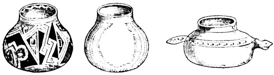
Pottery from Casas Grandes.
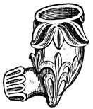
Pipe from Casas Grandes.
Escudero and Hardy report the existence of an aqueduct or canal which formerly brought water from a spring to the town. The following cut shows specimens of broken pottery found in connection with the ruins. The ornamentation is in black, red, or brown, on a white or reddish ground. The material is said to be superior in texture to any manufactured in later times by the natives of this 612 region. The whole valley for miles around is strewn with such fragments. Unbroken specimens of pottery are not abundant, as is naturally the case in a country traversed continually by roving bands of natives to whom it is easier to pick up or dig out earthen utensils than to manufacture or buy them. Three specimens were however found by Mr Bartlett, and are shown in the cut. Mr Hardy also sketched a vase very similar to the first figure of the cut, and he speaks of "good specimens of earthen images in the Egyptian style, which are, to me at least, so perfectly uninteresting, that I was at no pains to procure any of them." According to the Album, some idols had been found by the inhabitants among other relics, and the women claimed to have discovered a monument of antiquity which was of practical utility to themselves, as well as of interest to archæologists—namely, a jar filled with bear's grease! The pipe shown in the cut, has a suspiciously modern look, although included in Bartlett's plate of Chihuahuan antiquities. 613
FORTRESS AT CASAS GRANDES.
The inhabitants pointed out to Bartlett, on the top of a high mountain, some ten miles south-west of the ruins described, what they said was a stone fortress of two or three stories. Escudero describes this monument, which he locates at a distance of only two leagues, as a watch-tower or sentry-station on the top of a high cliff; and says that the southern slope of the hill has many lines of stones at irregular intervals, with heaps of loose stones at their extremities. This is probably, in the absence of more definite information the more credible account. The Album represents this monument as a fortress built of great stones very perfectly joined, though without the aid of mortar. The wall is said to be eighteen or twenty feet thick, and a road cut in the rock leads to the summit. At this time, 1842, the works were being destroyed for the stone they contained. Clavigero speaks of the hill works as "a fortress defended on one side by a high mountain, and on other sides by a wall about seven feet thick, the foundations of which yet remain. There are seen in this fortress stones as large as millstones; the beams of the roofs are of pine, and well worked. In the centre of the vast edifice is a mound, built as it seems, for the purpose of keeping guard and watching the enemy." Clavigero evidently confounds the two groups of ruins, and from his error, and a similar one by others, come the accounts which represent the Casas Grandes as built of stone. He mentions obsidian mirrors among the relics dug up here, probably without any authority. The cut from Bartlett shows a stone metate found among the ruins.
So far as any conclusions or comparisons suggested 614 by this Chihuahuan ruin are concerned, they may best be deferred to the end of the following chapter. The Casas Grandes, and the ruins of the northern or New Mexican group, should be classed together. They were the work of the same people, at about the same epoch. 615
Area enclosed by the Gila, Rio Grande del Norte, and Colorado—A Land of Mystery—Wonderful Reports and Adventures of Missionaries, Soldiers, Hunters, Miners, and Pioneers—Exploration—Railroad Surveys—Classification of Remains—Monuments of the Gila Valley—Boulder-Inscriptions—The Casa Grande of Arizona—Early Accounts and Modern Exploration—Adobe Buildings—View and Plans—Miscellaneous remains, Acequias, and Pottery—Other Ruins on the Gila—Valley of the Rio Salado—Rio Verde—Pueblo Creek—Upper Gila—Tributaries of the Colorado—Rock-Inscriptions, Bill Williams Fork—Ruined Cities of the Colorado Chiquito—Rio Puerco—Lithodendron Creek—Navarro Spring—Zuñi Valley—Arch Spring—Zuñi—Ojo del Pescado—Inscription Rock—Rio San Juan—Ruins of the Chelly and Chaco Cañons—Valley of the Rio Grande—Pueblo Towns, Inhabited and in Ruins—The Moqui Towns—The Seven Cities of Cíbola—Résumé, Comparisons, and Conclusions.
Crossing the boundary line between the northern and southern republics, and entering the territory of the Pacific United States, I shall present in the present chapter all that is known of antiquities in Arizona and New Mexico. An area approximating somewhat the form of a right-angle triangle, with a base of four hundred miles and a perpendicular of three hundred, includes all the remains in this region. The valley of the Rio Gila, with those of its tributary streams, is the southern boundary, or base, 616 stretching along the thirty-third parallel of latitude; the Rio Grande del Norte, flowing southward between the one hundred and sixth and one hundred and seventh meridians, forms with its valley the eastern limit or perpendicular; while on the north and west the region is bounded by the Rio Colorado as a hypothenuse, albeit a very winding one. The latter river might, however, be straightened, thus improving materially the geometrical symmetry of my triangle, without interfering much with ancient remains, as will be seen when the relics of the Colorado section are described.
The face of the country is made up of fertile valleys, precipitous cañons, rugged mountains, and desert table-lands, the latter predominating and constituting a very large portion of the area. Arizona and New Mexico since first they became known to the outside world, have always had, as they still have, more or less of the mysterious connected with them. Here have been located for over three hundred years the wonderful peoples, marvelous cities, extensive ruins, mines of untold wealth, unparalleled natural phenomena, savages of the most bloodthirsty and merciless character, and other marvels, that from the narratives of adventurers and missionaries have found their way into romance and history. This was in a certain sense the last American stronghold of the mysterious as connected with the aborigines, where the native races yet dispute the progress of a foreign civilization.
And the wondrous tales of this border land between civilization and savagism, always exaggerated, had nevertheless much foundation in fact. The Pueblo tribes of New Mexico and the Moquis of Arizona are a wonderful people when we consider the wall of savagism which envelopes them; their towns of many-storied structures are better foundations than usually exist for travelers' tales of magnificent cities; ruins are abundant, showing that the pueblo nations were 617 in the past more numerous, powerful, and cultured, than Europeans have found them; rich mines are now worked, and yet richer ones are awaiting development; few greater natural curiosities have been seen in America than the cañon of the Colorado, with perpendicular sides in some places a mile in height; and the Apaches are yet on the war-path, making a trip through the country much more dangerous now than at the time when the Spaniards first visited it.
Although a large part of these states is still in the possession of the natives, and no official or scientific commission has made explorations which were especially directed to its antiquarian treasures, yet the labors of the priest, hunter, immigrant, Indian fighter, railroad surveyor, and prospector, have left few valleys, hills, or cañons, mountain passes or desert plains unvisited. While it is not probable that all even of the more important ruins have been seen, or described, we may feel very sure, here as in Yucatan, from the uniformity of such monuments as have been brought to light, that no very important developments remain to be made respecting the character, or type, of the New Mexican remains.
EXPLORATION OF NEW MEXICO.
This country was first visited by the Spaniards in the middle of the sixteenth century. The part known to them as New Mexico, and to which their efforts as conquistadores and missionaries were particularly directed, was the valley of the Rio Grande and its tributary streams, but the whole district was frequently crossed and recrossed by the padres down to the latter part of the seventeenth century. Reports of large cities and powerful nations far in the north reached Mexico through the natives as early as 1530; Cabeza de Vaca, ship-wrecked on the coast of the Mexican gulf, wandered through the regions south of and near New Mexico, in 1535-6; roused by the shipwrecked soldier's tale, Fr Marco de Niza penetrated at least into Arizona from Sinaloa in 1539, 618 and was followed by Vasquez de Coronado, who reached the Pueblo towns on the Rio Grande in 1540; Antonio de Espejo followed the course of the great river northward to the Pueblos in 1583, and in 1598 New Mexico was brought altogether under Spanish rule by Juan de Oñate. In 1680 the natives threw off the yoke by revolt, but were again subdued fifteen years later, and the Spaniards retained the power, though not always without difficulty until 1848, when the territory came into the possession of the United States. The archives of the missions are said to have been for the most part destroyed in the revolt of 1680, and consequently their history previous to that date is only known in outline; since 1680 the annals are tolerably clear and complete. The diaries of the Spanish pioneers have been, most of them, preserved in one form or another, and show that the authors visited many of the ruins that have attracted the attention of later explorers, and also that they found many of the towns inhabited that now exist only as ruins. Their accurate accounts of towns still standing and inhabited attest, moreover, their general veracity as explorers.
It is, however, to the explorations undertaken under the authority of the United States government, for the purpose of surveying a practicable route for an interoceanic railroad, and also to establish a boundary line between American and Mexican territory, that we owe nearly all our accurate descriptions of the ancient monuments of this group. These exploring parties, as well as the military expeditions during the war with Mexico, were accompanied by scientific men and artists, whose observations were made public in their official reports, together with illustrative plates. They generally followed the course of the larger rivers, but the ruins discovered by them show a remarkable similarity one to another, and consequently the reports of trappers and guides respecting remains of similar type on the smaller 619 streams, may be generally accepted as worthy of more implicit confidence than can generally be accorded to such reports.
In this division of Pacific States antiquities, which may be spoken of as the New Mexican group, we shall find, 1st, the remains of ancient stone and adobe buildings in all stages of disintegration, from standing walls with roofs and floors to shapeless heaps of débris or simple lines of foundation-stones; 2d, anomalous structures of stone or earth, the purpose of which, either by reason of their advanced state of ruin or of the slight attention given them by travelers, is not apparent; 3d, traces of aboriginal agriculture in the shape of acequias and zanjas, or irrigating canals and ditches; 4th, pottery, always in fragments; 5th, implements and ornaments of stone and shell, not numerous; and 6th, painted or engraved figures on cliffs, boulders, and the sides of natural caverns.
MOUTH OF THE COLORADO.
About the mouth of the Colorado there are no authentic remains of aboriginal work dating back beyond the coming of the Spaniards, although Mr Bartlett found just below the mouth of the Gila traces of cultivation, which seemed to him, judging from the growth of trees that covered them, not to be the work of the present tribes in the vicinity. I find also an absurd newspaper report—and no part of the Pacific States has been more prolific of such reports than that now under consideration—of a wonderful ruined city of hewn stone somewhere about the head of the Gulf of California. This city included numerous dwellings, circular walls of granite, sculptured hieroglyphics, and seven great pyramids, not unlike the famous Central American cities of Palenque and Copan. Some rude figures scratched or painted on the surface of a boulder, seen by a traveler, have been proved by experience to be ample foundation for such a rumor.[XI-1]
ROCK-INSCRIPTIONS OF THE GILA.
Ascending the Rio Gila eastward from its junction 620 with the Colorado, for some two hundred miles we find nothing that can be classed with ancient monuments except natural heaps of large boulders at two points, the flat sides of which are "covered with rude figures of men, animals, and other objects of grotesque forms, all pecked in with a sharp instrument." The accompanying cut shows some of these boulder-sculptures as they were sketched by Bartlett in 1852. Some of them seemed of recent origin, while many were much defaced by exposure, and apparently of great age. The newer carvings in some cases extend over the older ones, and many are found on the under side of the rocks, where they must have been executed before they fell to their present position. The 621 locality of the sculptured rocks is shown on the map; the first is about fifty miles east of Fort Yuma, and the second twenty miles west of the big bend of the Gila, both on the south bank. Two additional incised figures are given in the following cut from Froebel's sketches, since the author thinks that Bartlett may have selected his specimens with a view to strengthen his theory that the figures are not hieroglyphics with a definite meaning.[XI-2]
Between the Pima villages and the junction of the San Pedro with the Gila, stands the most famous ruin of the whole region—the Casa Grande, or Casa de Montezuma, which it is safe to say has been mentioned by every writer on American antiquity. Coronado during his trip from Culiacan to the 'seven cities' in 1540, visited a building called Chichilticale, or 'red house,' which is supposed with much reason to have been the Casa Grande. The only account of Coronado's trip which gives any description of the building is that of Castañeda, who says, "Chichilticale of which so much had been said [probably by the guides or natives] proved to be a house in ruins and without a roof; which seemed, however, to have been fortified. It was clear that 622 this house, built of red earth, was the work of civilized people who had come from far away." "A house which had long been inhabited by a people who came from Cíbola. The earth in this country is red. The house was large; it seemed to have served as a fortress."[XI-3]
Father Kino heard of the ruin while visiting the northern missions of Sonora in the early part of 1694. He was at first incredulous, but the information having been confirmed by other reports of the natives, he visited the Casa Grande later in the same year, and said mass within its walls. Since Kino was not accompanied at the time by Padre Mange, his secretary, who usually kept the diary of his expeditions, no definite account resulted from this first visit.[XI-4]
In 1697, however, Padre Kino revisited the place, in company this time with Mange, who in his diary of the trip wrote what may be regarded as the first definite description.[XI-5]
CASA GRANDE OF THE GILA.
Padre Jacobo Sedelmair visited the Casa Grande in 1744, but in his narrative he copies Mange's account. He went further, however, and discovered other ruins.[XI-6]
AUTHORITIES ON THE CASA GRANDE.
Lieut C. M. Bernal seems to have been military commandant in Kino's expedition, and he also describes the ruin in his report.[XI-7] Padres Garcés and Font made a journey in 1775-6, under Capt. Anza, to the Gila and Colorado valleys, and thence to the missions of Alta California and the Moqui towns. Both mention the ruin in their diaries, the latter giving quite a full account. I know not if Padre Font's diary has ever been printed, but I have in my collection an English manuscript translation from the original in the archives at Guadalajara,—perhaps the same copy from which Mr Bartlett made the extracts which he printed in his work.[XI-8] Font's plan is not 624 given with the translation, but in Beaumont's Crónica de Mechoacan, a very important work never published, of which I have a copy made from the original for the Mexican Imperial Library of Maximilian, I find a description of the Casa Grande, which appears to have been quoted literally from Font's diary, and which also contains the ground plan of the ruined edifice. I shall notice hereafter its variations from the plan which I shall copy.[XI-9] A brief account was 625 given in the Rudo Ensayo, written about 1761, and by Velarde in his notice of the Pimería, written probably toward the close of the eighteenth century; but neither of these descriptions contained any additional information, having been made up probably from the preceding.[XI-10]
Finally the Casa Grande has been visited, sketched, and described by Emory and Johnston, connected with Gen. Kearny's military expedition to California in 1846; by Bartlett with the Mexican Boundary Commission in 1852; and by Ross Browne in 1863.[XI-11]
The descriptions of different writers do not differ very materially one from another, Bartlett's among the later, and Font's of the earlier accounts being the most complete. From all the authorities I make up the following description, although the extracts which I have already given include nearly all that can be said on the subject. The Casa Grande stands about two miles and a half south of the bank of the Gila;—that 626 is all the early writers call the distance about a league; Bartlett and Emory say nothing of the distance, and Ross Browne says it is half an hour's ride. The Gila valley in this region is a level bottom of varying width, with nearly perpendicular banks of earth. Opposite the ruin the bottom is about a mile wide on the southern bank of the river, and the ruin itself stands on the raised plateau beyond, surrounded by a thick growth of mesquite with an occasional pitahaya. The height and nature of the ascent from the bottom to the plateau at this particular point are not stated; but from the fact that acequias are reported leading from the river to the buildings, it would seem that the ascent must be very slight and gradual.
The appearance of the ruins in 1863 is shown in the cut as sketched by Ross Browne. Other sketches by Bartlett, Emory, and Johnston, agree very well with the one given, but none of them indicate the presence of the mesquite forest mentioned in Mr Bartlett's text. The material of the buildings is adobe,[XI-12] that is, the ordinary mud of the locality mixed with gravel. Most writers say nothing of its color, although Bernal in 1697 pronounced it 'white clay,' and Johnston also says it is white, probably with an admixture of lime, which, as he states, is abundant in the vicinity. Mr Hutton, a civil engineer well acquainted with the ruins, assured Mr Simpson that the surrounding earth is of a reddish color, although by reason of the pebbles the Casa has a whitish appearance in certain reflections. This matter of color is of no great importance except to prove the identity of the building with Castañeda's Chichilticale, which he expressly states to have been built of red 628 earth.[XI-13] The material instead of being formed into small rectangular or brick-shaped blocks, as is customary in all Spanish American countries to this day, seems in this aboriginal structure to have been molded—perhaps by means of wooden boxes—and dried where it was to remain in the walls, in blocks of varying size, but generally four feet long by two feet in width and thickness. The outer surface of the walls was plastered with the same material which constituted the blocks, and the inner walls were hard-finished with a finer composition of the same nature, which in many parts has retained its smooth and even polished surface. Adobe is a very durable building-material, so long as a little attention is given to repairs, but it is really wonderful that the walls of the Casa Grande have resisted, uncared for, the ravages of time and the elements for over three hundred years of known age, and of certainly a century—perhaps much more—of pre-Spanish existence.
The buildings that still have upright walls are three in number, and in the largest of these both the exterior and interior walls are so nearly perfect as to show accurately not only the original form and size, but the division of the interior into apartments. Its dimensions on the ground are fifty feet from north to south, by forty feet from east to west. The outer wall is about five feet thick at the base, diminishing slightly towards the top, in a curved line on the exterior, but perpendicular on the inside.[XI-14] The interior is divided by partition walls, slightly thinner than the others, into five apartments, as shown in the accompanying ground plan taken from Bartlett. Font's plan given by Beaumont agrees with this, except that additional doors are represented at the points marked 629 with a dot, and no doorway is indicated at a. The three central rooms are each about eight by fourteen feet, and the others ten by thirty-two feet, as nearly as may be estimated from Bartlett's plan and the statements of other writers.[XI-15] The doors in the centre of each façade are three feet wide and five feet high, and somewhat narrower at the top than at the bottom, except that on the western front, which is two by seven or eight feet. There are some small windows, both square and circular in the outer and inner walls. The following cut shows an elevation of the side and end, also from Bartlett.[XI-16]
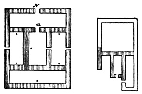
Ground Plan of the Casa Grande.
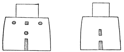
Elevations of the Casa Grande.
Remains of floor timbers show that the main walls were three stories high, or, as the lower rooms are represented by Font as about ten English feet high, about thirty feet in height; while the central portion 630 is eight or ten feet—probably one story—higher. Mr Bartlett judged from the mass of débris within that the main building had originally four stories; but as the earliest visitors speak of three and four stories—some referring to the central, others apparently to the outer portions—there would seem to be no satisfactory evidence that the building was over forty feet high, although it is possible that the outer and inner walls were originally of the same height. Respecting the arrangement of apartments in the upper stories, there is of course no means of judging, all the floors having fallen. There may, however, have been additional partition walls resting on the floors, and these may have helped to make up the débris noticed by Mr Bartlett. The floors were evidently supported by round timbers four or five inches in diameter, inserted in the walls and stretching across the rooms at regular intervals. The holes where the beams were placed, and in many cases the ends of the beams themselves are still visible. At the time of Padre Kino's visit one floor in an adjoining ruin was still perfect, and was formed by cross-sticks placed upon the round floor-timbers and covered with a thick cake of mud, or adobe.[XI-17] No marks of any cutting instrument were noticed by any visitor except Mr Browne, who says "the ends show very plainly marks of the blunt instrument with which they were cut—probably a stone hatchet."[XI-18] The timbers, of cedar, or sabino, show by their charred ends that the interior was ruined by fire; and Johnston found other evidences that the walls had been exposed to great heat.[XI-19] Nothing seems more natural than that the building should have been burned by some band of Apaches. No traces of stairways have been found even by the earliest visitors; so that the original means of communication with the upper 631 stories may be reasonably supposed to have been wooden ladders, still used by the Pueblo natives in buildings not very unlike what this must originally have been. Mr Bartlett and also Johnston found and sketched some rude figures painted in red lines on the smooth wall of one apartment, but which had disappeared at the time of Mr Browne's visit.
The descriptions of successive explorers show clearly the gradually increasing effects of time and the elements on this ruin; from Browne's sketch it would seem that the walls, undermined at the base by the yearly rains, as is always the case with neglected adobe structures, must soon fall; although I learned from a band of Arizona natives who visited San Francisco in 1873 that the Casa was still standing. When the adobe walls have once fallen, they will require but one or two seasons to crumble and become reduced to a shapeless mound of mud and gravel; as has been the case with most of the eleven other buildings reported here by the first comers, and the existence of which there is no reason to doubt.
Of the additional casas seen by Kino and others no particular description was given, save that Font describes one of them as measuring twenty-six by eighteen feet on the ground. Only two of them show any remains of standing walls, one on the south-west and the other on the north-east of the Casa Grande. The standing portions of the former seemed to indicate a structure similar in plan to the chief edifice, although much smaller; the latter is of still smaller dimensions and its remains convey no idea of its original form. "In every direction," says Mr Bartlett, "as far as the eye can reach, are seen heaps of ruined edifices, with no portions of their walls standing," and Mange, Kino, and Font observed also shapeless heaps covering the plain for a distance of two leagues.
Father Font found "ruins indicating a fence or wall which surrounded the house and other buildings," mentioning a ruin in the south-west angle which had 632 divisions and an upper story. This corner structure may be the same that has been mentioned as standing south-west of the Casa Grande, and Font very likely mistook the heaps of fallen houses for the remains of a wall, since no such wall was seen by Kino and Mange. The dimensions of this supposed wall, four hundred and twenty feet from north to south, and two hundred and sixty feet from east to west, were erroneously applied by Arricivita and Humboldt, followed by others, to the Casa Grande itself, an error which has given a very exaggerated idea of the size of that edifice.[XI-20]
Traces of acequias are mentioned by all as occurring frequently in the vicinity, especially in the Gila bottom between the ruins and the Pima villages. No plan or accurate description of these irrigating works has been given. Probably they were simple shallow ditches in the ground, still traceable at some points. Mange describes the main canal as twenty-seven feet wide, ten feet deep, capable of carrying half the water of the Gila, and extending from the river for a circuit of three leagues round the ruins. Considering the general conformation of the bottom and plateau in this part of the Gila valley, it seems impossible that a canal ten, or even twenty, feet deep could have reached the level of the river, or that so grand an acequia should have escaped the notice of later explorers.
MISCELLANEOUS REMAINS.
The miscellaneous remains near the Casa Grande, besides the mounds formed by fallen houses, the irrigating ditches, and the fragments of pottery strewn over the adjacent country in the greatest profusion, are two in number. The first is a circular embankment, three hundred feet in circumference, situated about six hundred feet north-west from the chief ruin. Its height and material are not stated, but it is undoubtedly of the surrounding earth. Johnston considers 633 it a filled-up well; while Bartlett pronounces the circle a simple corral, or enclosure for stock, although of course it could not have been built in aboriginal times for such a purpose. The second monument is only a few yards north of the circle, and is described by Johnston, the only one who mentions its existence, as a terrace measuring about three hundred by two hundred feet and five feet high. Resting on the terrace is a pyramid only eight feet high, but having a summit platform seventy-five feet square, affording from the top a broad view up and down the valley. A more complete survey of this pyramid would be very desirable, not that there is any reason to question Mr Johnston's reliability as an explorer, but because, as will be seen, this mound, if it be not like the rest, formed by fallen adobe walls, together with the circular embankment, present a marked contrast to all other monuments of the New Mexican group.[XI-21]
Sedelmair and Velarde speak rather vaguely of a reservoir, or tank, six leagues southward of the Gila, which was one hundred and ten by one hundred and sixty-five feet, with walls of adobe 'or of masonry.'[XI-22]
A few miles further up the river, westward from the Casa Grande, and on the opposite or northern side Padre Kino's party saw a ruined edifice, and three men were sent across to examine it. They found some walls over three feet thick still standing, and other heaps of ruins in the vicinity showing that a large town had once stood on the site. Emory found there only a "pile of broken pottery and foundation stones of the black basalt, making a mound about 634 ten feet" high.[XI-23] Still farther west, near the Pima villages, Johnston found another circular enclosure, and also what he calls a mound, ninety by a hundred and fifty feet, and six feet high, having a low terrace of sixty by three hundred feet on the eastern side, all covered with loose basaltic rocks, dirt, and pottery. I consider it not impossible that this mound was formed by the walls of a building which assumed a symmetrical shape in falling.[XI-24] Sedelmair speaks of a group of ruins on the southern bank of the river, twelve leagues below the Casa Grande; but no later writer mentions such remains.[XI-25]
REMAINS IN THE SALADO VALLEY.
The principal tributary of the Gila from the north is the Rio Salado, or Salinas, the mouth of which is below the Casa Grande, and into which, near its mouth, flows the Rio Verde, or San Francisco. The Spaniards seem not to have ascended these streams; or at least not to have discovered any ruins in their valleys. The guides, however, reported to the missionaries the existence of ruins on the Rio Verde, in the north, similar to those on the Gila.[XI-26] Sedelmair also discovered in 1744, the ruins of a large edifice and several smaller ones in the space between the Gila and Salado.[XI-27] Velarde speaks of ruined buildings of three stories at the junction of the rivers Salado and Gila, and other remains at the junction of the Salado and Verde.[XI-28] 635
A guide reported to Emory a casa in the Salado valley, complete except the floors and roof, of large dimensions, with glazed walls, and the imprint of a naked foot in the adobe.[XI-29] One of four stone axes shown in a cut to be given later, was found in this valley and sketched by Whipple.[XI-30] The Salado ruins between the Gila and Verde, on the south bank, about thirty-five miles from the mouth, were examined by Mr Bartlett. They are built on the plateau beyond the river bottom, and are exclusively of adobe. They are very numerous, but consist for the most part of shapeless heaps indicating the location of buildings and long lines of walls. In only two instances did portions of standing walls remain; being in one case the ruins of an adobe building over two hundred feet long and from sixty to eighty feet wide, facing the cardinal points, and, so far as could be judged by the débris, three or four stories high; the others were about two hundred yards distant, and represented a smaller structure. There are traces of a wall which appears to have surrounded the larger building. From the top of the principal pile, similar heaps of ruins may be seen in all directions, including a range of them running north and south at a distance of about a mile eastward. The latter were not visited, but were said by the natives to be similar in every respect to the others. A small circular enclosure, whose dimensions are not given, was seen among the ruins, and there were also excavations along the sides of some of the heaps, as if they had furnished the material for the original structures. In the river bottom irrigating canals are of frequent occurrence, one of them from twenty to twenty-five feet wide and four to five feet deep, formed by cutting down the bank of the plateau, along which it 636 extends for many miles. The whole vicinity of the ruins, as in the Gila Valley, is strewn with fragments of earthen ware. These earthen ware fragments are of a very uniform character throughout the New Mexican region, and will be illustrated in another part of this chapter.[XI-31]
Trappers and natives report that these remains continue indefinitely up the valleys of both the Salado and Verde. Mr Leroux, who served as guide to several of the United States military expeditions, passed up the Verde valley in 1854 on his way from the Gila to the Colorado Chiquito, keeping a diary, a part of which has been printed.[XI-32] He claims to have found the river banks covered in many places with ruins of stone buildings and broken pottery. The walls were of solid masonry still standing from ten to twenty feet high in two stories, three feet thick and from fifty to seventy-five feet long. Except in material the structures were not unlike the Casa Grande of the Gila, and were generally situated in the most fertile parts of the valley, surrounded by traces of acequias; although in one instance the ruins of a town were ten miles from the nearest water. A complete change of building material within so short a distance is somewhat extraordinary, but there is no other reason to doubt the accuracy of this report. These ruins are not very far from Prescott in the north, and Fort McDowell in the south, and I regret not having been able to obtain from officers in the Arizona service the information which they must have acquired respecting those remains, if they actually exist, during the past ten or fifteen years.[XI-33] 637
PUEBLO CREEK AND THE UPPER GILA.
Whipple describes some ruins discovered by him in 1854 on Pueblo Creek and other small streams which form the head waters of the Verde. They consist of what seem to have been two fortified settlements, and a third separate fortification. The first was an irregular stone enclosure on the top of a hill three or four hundred feet high. The walls were from eight to ten feet high, and the interior was divided by partition walls five feet thick into different compartments. On the slopes of the hill were traces of adobe walls with the usual abundance of broken pottery. The second was located in a fertile spot on a fork of the Pueblo Creek, and consisted of a mass of stones, six feet thick and several feet high, forming a square enclosure "five paces in the clear." The third work is situated about eight miles further west, and commands what is known as Aztec Pass. It is an enclosure one hundred feet long, twenty-five feet wide at one end and twenty at the other, the walls being four feet thick and five feet in height. In the absence of any definite statement on the subject these northern fortifications are presumed to be of rough, or unhewn, stones without mortar.[XI-34]
Typical Plan of Gila Structures.
Plan of a Gila Structure.
LABYRINTH ON THE GILA.
From the mouth of the San Pedro, which joins the Gila about forty miles eastward of the Casa Grande, up the Gila valley eastward, ruins of ancient edifices are frequently found on both banks of the river. Emory says "wherever the mountains did not impinge too close on the river and shut out the valley, they were seen in great abundance, enough, I should think, to indicate a former population of at least one hundred thousand; and in one place there is a long wide valley, twenty miles in length, much of which is covered with the ruins of buildings and broken pottery." 638 The remains consist uniformly of lines of rough amygdaloid stones rounded by attrition, no one of which remains upon another, apparently the foundations upon which were erected adobe walls that have altogether disappeared. The plan of the buildings as indicated by their foundations was generally rectangular; many of them were very similar to the modern Spanish dwellings, as shown in the accompanying cut; but a few were circular or of irregular form. One of them just below the junction of the Santo Domingo, on an isolated knoll, was shaped as in the following cut, with faces of from ten to thirty feet. Besides the traces of what seem to be dwellings, there were also observed, an enclosure or circular line of stones, four hundred yards in circumference; a similar circle ninety yards in circumference with a house in the centre; an estufa with an entrance at the top; some well-preserved cedar posts; and some inscribed figures on the cliffs of an arroyo, similar to those lower down the river, of which cuts have been given. The native Pimas reported to the Spaniards in early times the existence of a building far up the Gila, the labyrinthine plan of which they traced on the sand, as shown 639 in the cut. Emory and Johnston found these traces of aboriginal towns in at least twelve places on the Gila above the San Pedro, the largest being at the mouth of a stream flowing from the south-east, probably the Santo Domingo. I find no mention of ruins on any of the smaller tributaries of the Gila above the Casa Grande, though it seems very probable that such ruins may exist, similar to those on the main stream. A painted stone, a beaver-tooth, and marine shells were the miscellaneous relics found by Johnston among the ruins, besides the usual large quantities of broken pottery. Emory speaks of a few ornaments, principally immense well-turned beads of the size of hens' eggs, also fragments of agate and obsidian. The latter explorer gives a plate of rock-hieroglyphics of doubtful antiquity, and Froebel also sketched certain inscriptions on an isolated rock. Six or eight perfectly symmetrical and well-turned holes about ten inches deep and six or eight inches wide at the top were noticed, and supposed to have served for grinding corn.[XI-35]
Having presented all that is known of antiquities upon the Gila and its tributaries, I pass to the Colorado, the western and northern boundary of the New Mexican territory. The banks of the Colorado Cañon, for the river forms no valley proper, are for the most part unexplored, and no relics of antiquity are reported by reliable authorities; indeed, from the peculiar nature of this region, it is not likely that any ruins ever, will be found in the immediate vicinity of the river.[XI-36]
On Bill Williams' Fork there is a newspaper report, resting on no known authority, of walls enclosing an area some eight hundred feet in circumference, still perfect to the height of six or eight feet.[XI-37] The only other traces of the former inhabitants found on this stream are painted cave and cliff pictures or hieroglyphics. Two caves have their walls and the surrounding rocks thus decorated; they are about a mile apart, near the junction of the Santa María, and one of them is near a spring. Many of the inscriptions appear very ancient, and some were painted 641 on cliffs very difficult of access. The cut shows a specimen from the sketches made by Möllhausen. The streak which crosses the cut in the centre, extends to the left beyond the other figures, and only half its length is shown. This streak is red with white borders; the other figures are red, purple, and white.[XI-38]
TRIBUTARIES OF THE COLORADO.
Leaving Bill Williams' Fork, and passing the Pueblo Creek ruins already described, which are not far distant, I follow the routes of Sitgreaves, Ives, and Whipple, north-westward to the Colorado Chiquito, a distance of about one hundred miles, striking the river at a point a hundred miles above its supposed junction with the main Colorado. In this region we again find numerous ruined buildings with the usual scattered pottery, respecting which our knowledge is derived from the explorers just named. The ruins occur at all prominent points, both near the river and away from it towards the west, at intervals of eight or nine miles, the exact location not being definitely fixed. The material employed here is stone, and some of the houses were three stories high. A view of one ruin as sketched by Sitgreaves 642 is shown in the cut. On a rocky eminence were found by Whipple stone enclosures, apparently for defense. According to Mr Sitgreaves the houses resembled in every particular, save that no adobe was used, the inhabited Pueblo towns of New Mexico. His description, like that of Möllhausen and Whipple, would doubtless be much more complete and satisfactory, had they not previously seen the Pueblo towns and other ruins further east. Some of the ruins are far from water, and Sitgreaves suggests that the lava sand blown from the neighboring mountains may have filled up the springs which originally furnished a supply.
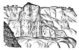
Ruin on the Colorado Chiquito.
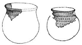
Vases from the Colorado Chiquito.
The cut from Whipple shows two vases found here, restored from fragments. This is one of the rarest kinds of pottery found in the region, and is said by Whipple not to be manufactured by any North American Indians of modern times. It is seldom colored, the ornamentation being raised or indented, 643 somewhat like that on molded glassware, and of excellent workmanship. The material is light-colored and porous, and the vases are not glazed. The ordinary fragments of earthen ware found on this river will be represented in another part of this chapter. Some very rude and simple rock-inscriptions were noticed, and a newspaper writer states that the names of Jesuit priests who visited the place in the sixteenth century are inscribed on the rocks. Some additional and not very well-founded reports of antiquities are given in a note.[XI-39]
REMAINS ON THE COLORADO CHIQUITO.
At a bend in the river, about forty miles above the ruins last mentioned, are the remains of a rectangular stone building, measuring one hundred and twenty by three hundred and sixty feet, and standing on an isolated sandstone hill. The walls are mostly fallen, but some of the standing portions are ten feet thick, and seem to contain small apartments. Many pine timbers are scattered about in 644 good preservation, and two posts twelve feet in height still remain standing.[XI-40]
Some twenty-five miles still farther up the Rio Puerco flows into the Colorado Chiquito from the north-east, and at the junction of the two streams Möllhausen noticed some remains which he does not describe.[XI-41] Twelve miles up the Puerco valley, on the banks of a small tributary, called Lithodendron Creek, were scattered fragments of pottery, and remains of stone houses, one of the walls extending several feet below the present surface of the ground. Still farther up the Puerco and five miles south of the river, at Navajo Spring, scattered pottery and arrow-heads are the only remaining trace of an aboriginal settlement, no walls being visible. On a neighboring hill, however, was noticed a circular depression in the earth forty paces in diameter. The cut from Möllhausen represents some of the aboriginal inscriptions on Puerco River.[XI-42]
REMAINS ON THE RIO ZUÑI.
Forty or fifty miles farther south-east, the Colorado Chiquito receives the waters of the Rio Zuñi, flowing from the north-east in a course nearly parallel to that of the Puerco. Aboriginal inscriptions and pictures are found on the sandstone cliffs which border on the stream wherever a smooth surface is presented, but no buildings occur for a distance of 645 about fifty miles, until we come to within eight miles of the Pueblo town of Zuñi, where the table-lands about Arch Spring are covered with ruins, which were seen, although not described, by Sitgreaves and Whipple. All the ruins of the Zuñi valley seem, however, to be of the same nature—stone walls laid in mud mortar, and in a very dilapidated condition. The cut from Whipple shows also a sample of the rock-inscriptions about Arch Spring.[XI-43] Zuñi is a Pueblo town still inhabited, and I shall have something further to say of it in connection with the Pueblo towns of the Rio Grande and its tributaries, for the purpose of comparing the inhabited with the ruined structures.
Two or three miles south-east of Zuñi, on the south side of the river, is an elevated level mesa, about a mile in width, bounded on every side by a precipitous descent of over a thousand feet to the plain below. The mesa is covered with a growth of cedar, and in one part are two sandstone pillars of natural formation, which from certain points of view seem to assume human forms. Among the cedars on the mesa, "crumbling walls, from two to twelve feet high, were crowded together in confused heaps over several acres of ground." The walls were constructed of small sandstone blocks laid in mud mortar, and were about eighteen inches thick. They seemed, 646 however, to rest on more ancient ruins, the walls of which were six feet in thickness. At various points on the winding path, by which only the top can be reached, there are stone battlements which guard the passage. A supposed altar was found in a secluded nook near the ruins, consisting of an oval excavation seven feet long, with a vertical shaft two feet high at one end, a flat rock, and a complicated arrangement of posts, cords, feathers, marine shells, beads, and sticks, only to be understood from a drawing, which I do not reproduce because the whole altar so-called is so evidently of modern origin and use. These ruins are commonly called Old Zuñi, and were doubtless inhabited when the Spaniards first came to the country.[XI-44] The cut from Whipple shows two vases found at what is called a sacred spring near Zuñi. Of the first the discoverer says: "the material is a light-colored clay, tolerably well burnt, and ornamented with lines and figures of a dark brown or 647 chocolate color. A vast amount of labor has been spent on decorating the unique lip. A fine borderline has been drawn along the edge and on both sides of the deep embattled rim. Horned frogs and tadpoles alternate on the inner surface of the turrets, while one of the latter is represented on the outside of each. Larger frogs or toads are portrayed within the body of the vessel." One of these figures is presented in the cut enlarged. The second vase is five inches deep, ten inches in diameter at the widest part, and eight inches at the lips. Both outer and inner surface bear a white glazing, and there are four projections of unknown use, one on each side. The decorations are in amber color, and the horned or tufted snakes, shown above the vase, are said to be almost unique in America.[XI-45]
OJO DEL PESCADO.
At and near some springs called Ojo del Pescado, on the head-waters of this stream, some twelve miles above Zuñi, there are at least four or five ruined structures, or towns. They are similar in character to the other ruins. Two of them near the spring have an elliptical shape, as shown by the lines of foundation-stones, and are from eight hundred to a thousand feet in circumference. The houses seem to have been built around the periphery, forming a large interior court. These towns are so completely in ruins that nothing can be ascertained of the details of their construction, except their general form, and the fact that they were built of stones and mud. About a thousand yards down the river from the springs are ruins covering a space one hundred and fifty by two hundred yards, and in much better preservation than those mentioned, though of the same nature. The material was flat stones and cement, and the walls are standing in places to the height of two stories. Möllhausen tells us that 648 the roofs and fire-places were still standing at the time of his visit. Simpson describes a ruin as being two miles below the spring, and which may possibly be the same last mentioned. The buildings were originally two stories high and built continuously about a rectangular area three hundred by four hundred feet. In the interior of the enclosed court was seen a square estufa, twelve by eighteen feet, and ten feet high, with the roof still perfect. The cut shows some of the rock-inscriptions at Ojo del Pescado.[XI-46]
EL MORO, OR INSCRIPTION ROCK.
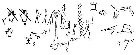
Inscriptions—El Moro.
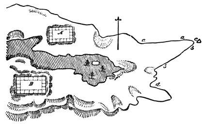
Plan of El Moro.
About eighteen miles south-east of the sources of the Zuñi River, but belonging as properly in this valley as any other, is a sandstone rock known as Inscription Rock, or to the Spaniards as El Moro, from its form. It is between two and three hundred feet high, with steep sides, which on the north and east are perpendicular, smooth, white, and covered near the base with both Spanish and native inscriptions. Specimens of the latter, as copied by Simpson, are 649 shown in the cut. The former were all copied by the same explorer, but of course have no connection with the subject of this volume: they date back to 1606, but make no reference to any town or ruins upon or about the rock. The ascent to the summit is on the south and is a difficult one. The cut shows a plan of El Moro made by Möllhausen, the locality of the inscriptions being at a and b. The summit area is divided by a deep ravine into two parts, on each of which are found ruins of large edifices. Those on the southern—or, according to Simpson, on the eastern—division, B of the plan, form a rectangle measuring two hundred and six by three hundred and seven feet, standing in some places from six to eight feet high. According to Simpson the walls agree with 650 the cardinal points, but Whipple states the contrary. The walls are faced with sandstone blocks six by fourteen inches and from three to eight inches thick, laid in mud-mortar so as to break joints; but the bulk of the wall is a rubble of rough stones and mud. Two ranges of rooms may be traced on the north and west sides, and the rubbish indicates that there were also some apartments in the interior court. Two rooms measured each about seven by eight feet. A circular estufa thirty-one feet in diameter was also noticed, and there were cedar timbers found in connection with the ruined walls; one piece, fifteen inches long and four inches in diameter was found still in place, and bore, according to Whipple, no signs of cutting tools. The remains across the ravine, A of the plan, are of similar nature and material, and the north wall stands directly on the brink of a precipice, being complete to a height of eight feet. There is a spring furnishing but a small amount of water at the foot of the cliff at d. Fragments of pottery are abundant here as elsewhere.[XI-47]
RUINS OF CHELLY CAÑON.
This completes my account of remains on the Colorado Chiquito, and I pass to the next and last tributary of the Colorado within the territory covered by this chapter—the San Juan, which flows in an eastwardly course along the boundary line between Arizona and New Mexico on the south, and Utah and Colorado on the north. The valley of the main San Juan has been but very slightly explored, but probably contains extensive remains, judging from what have been found on some of its tributaries. Padres Dominguez and Escalante went in 1776 from Santa Fé north-westward to Utah Lake, and noticed several 651 ruins which it is impossible to locate, before crossing the Colorado. I shall have occasion in the following chapter to notice some important ruins lately discovered on the northern tributaries of the San Juan, in the southern part of Colorado and Utah.[XI-48]
The two chief tributaries of the San Juan from the south are the Chelly and Chaco, flowing through deep cañons in the heart of the Navajo country. On both of these streams, particularly the latter, very important ruins have been discovered and described by Mr Simpson, who explored this region in 1849.
The Chelly cañon for a distance of about twenty-five miles is from one hundred and fifty to nine hundred feet wide, from three hundred to five hundred feet deep, and its sides are almost perpendicular. Simpson explored the cañon for eight miles from its mouth, which does not correspond with the mouth of the river. In a branch cañon of a character similar to that of the main stream he found several small habitations formed by building walls of stone and mortar in front of overhanging rocks. Some four miles up the main cañon he saw on a shelf fifty feet high and only accessible by means of ladders a small ruin of stone, much like those on the Chaco yet to be described. Seven miles from the mouth another ruin was discovered on the north side as shown in the cut. It was built partly on the bottom of the cañon, and partly like the one last mentioned, on a shelf fifty feet high with perpendicular sides. The walls measure forty-five by a hundred and forty-five feet, are about eighteen feet high in their present state, and are built of sandstone and mortar, having 652 square openings or windows. A circular estufa was also found in connection with these cliff-dwellings. Fragments of pottery were not lacking, and specimens were sketched by Mr Simpson.[XI-49]
Eastward from the Chelly, at a distance of about a hundred miles, is the Chaco, a parallel tributary of the San Juan, on which are found ruins perhaps the most remarkable in the New Mexican group. Lieut. Simpson is the only one who has explored this valley, or at least who has left a record of his exploration. The ruins are eleven in number, situated with one exception on the north bank of the stream, within a distance of twenty-five miles in latitude 36° and longitude 108°.
RUINS OF THE CHACO.
The cut shows a general view of the ruin called by the guide Pueblo Pintado, the first one discovered in coming from the south. The name of this ruin, like those of the others, is doubtless of modern origin, being Spanish, and there is little reason to believe that the native names of some of the others are those originally applied to the inhabited towns. The material of all the buildings is a fine hard gray sandstone, to which in some instances exposure to the air has imparted a reddish hue. The blocks are cut very thin, rarely exceeding three inches in thickness. They are laid without mortar very carefully, so as to break joints, and the chinks between the larger blocks are filled with stone plates, sometimes not over one fourth of an inch thick. In one instance, the Pueblo Peñasco Blanco, stones of different thickness are laid, in alternate layers, producing the appearance of a kind of mosaic work, executed with great care and skill, and forming a very smooth surface. The backing and filling of the walls are of irregular and various sized blocks laid in mud, no trace of lime being discoverable. The wall of the Pueblo Pintado was found by excavation to extend at least two feet below the surface of the ground. The walls are between two and three feet thick at the base, but diminish towards the top by a jog of a few inches on the inside at each successive story. The walls of the Pueblo Pintado are still standing in some parts to the height of twenty-five to thirty feet, and are shown by the marks of floor timbers to have had at least three stories. The flooring was supported by unhewn beams from six to eleven inches in diameter—but 654 uniform in the same room—stretching across from wall to wall as in the Gila ruins. Over these beams were placed smaller transverse sticks, which in the Pueblo Pintado seem to have been placed some little distance apart; but in some other ruins where the flooring remained perfect, the transverse sticks were laid close together, the chinks were filled with small stones, and the whole covered with cedar strips, although there was evidence that a coating of mud or mortar was used in some instances; and there was one room where the floor was of smooth cedar boards seven inches wide and three fourths of an inch thick, squarely cut at the sides and ends, and apparently worn smooth by the friction of flat stones. The beams generally bore marks of having been cut off by the use of some blunt instrument. The cut illustrates the manner in which the walls diminish in thickness from story to story, a, a, a; the position of the beams, b, b, b; the transverse poles, c, c, c; and the flooring above, d, d, d. 655
RUINS OF THE CHACO CAÑON.
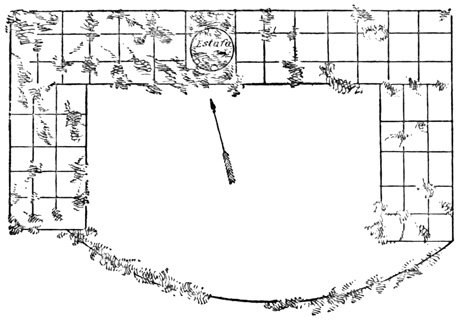
Ground Plan—Pueblo Hungo Pavie.
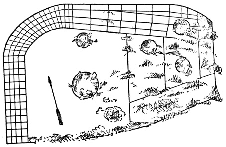
Ground Plan—Pueblo Bonito.
THE PUEBLO BONITO.
The ground plan of the Chaco structures shows three tiers—but in one case at least four tiers—of apartments built round three sides of a courtyard, which is generally rectangular, in some cases has curved corners, and in one building—the Peñasco Blanco—approximates to the form of a circle. The fourth side of the court is in some ruins open, and in others enclosed by a wall extending in a curve from one extremity of the building to the other. The following cuts show the ground plans of two of the 656 ruins, the Pueblo Hungo Pavie, 'crooked nose,' and Pueblo Bonito. The circumference of five of these buildings is respectively eight hundred and seventy-two, seven hundred, seventeen hundred, thirteen hundred, and thirteen hundred feet; the number of rooms still traceable on the ground floor of the same buildings is seventy-two, ninety-nine, one hundred and twelve, one hundred and twenty-four, and one hundred and thirty-nine. These apartments are from five feet square to eight by fourteen feet. A room in the Pueblo Chettro Kettle was seven and a half by fourteen feet, and ten feet high. The walls were plastered with a red mud, and several square or rectangular niches of unknown use were noticed. The supporting beams of the ceiling were two in number, and the transverse poles were tied at their ends with some wooden fibre, and covered with a kind of cedar lathing. Ropes hung from the timbers. A room in the Pueblo Bonito is shown in the cut.
This room is unplastered, and the sides are constructed in the same style as the outer walls. The transverse poles are very small, about an inch in diameter, laid close together, very regular, and resemble barked willow. It was another room in 657 this ruin which had the smooth boards in connection with its ceiling.[XI-50]
The doors by which the rooms communicate with each other and with the courtyard are very small, many of them not exceeding two and a half feet square. There are no doors whatever in the outer walls, and no windows except in the upper stories. The larger size of the windows and of the inner doors indicate that the rooms of the upper stories were larger than below. In some cases the walls corresponding to the second or third stories had no windows. In one case lower story windows were found walled up. The tops, or lintels, of the doors and windows were in some cases stone slabs, in others small timbers bound together with withes, and in a few they are reported to have been formed by overlapping stones very much like the Yucatan arch; a specimen is shown in the cut.
The highest walls still standing at the time of Simpson's visit had floor-timbers, or their marks, for four stories, but it is not impossible that some of the buildings may have had originally five or six stories. The outer walls were in every case perpendicular to their full height, showing that the houses were not built in receding terraces, or stories, on the outside, as is the case with many of the inhabited Pueblo towns, and with the Casa Grande on the Gila. There can be no doubt that they were so terraced on the interior 659 or court; at least in no instance were the inner walls sufficiently high to indicate a different arrangement, and it is hardly possible that all the ranges were of the same height, leaving without light most of the thousand rooms which they would contain if built on such a plan. There were no traces of stairways or chimneys seen. The whole number of apartments in the Pueblo Bonito, supposing it to have been built on the terrace plan, must have been six hundred and forty-one. The cut on the next page shows a restoration of one of the Chaco ruins, taken from Mr Baldwin's work, and modeled after a similar one by Mr Kern, a companion of Simpson, although Mr Kern made an error of one story in the height. I have no doubt of the general accuracy of this restoration, and it may be regarded as nearly certain that access to the upper rooms was gained from the court by means of ladders, each story forming a platform before the doors of the one next above.
Each ruin has from one to seven circular structures, called estufas in the inhabited Pueblo towns, sunk in the ground and walled with stone. Several of these are shown in the two ground plans that have been given. They occur both in the courtyards and underneath the rooms. Some were divided into compartments, and one, in the Pueblo Bonito, was sixty feet in diameter and twelve feet deep, being built in two, and possibly three, stories.
Near some of the larger buildings are smaller detached ruins, of which no particular description is given. In one place there is an excavation in the side of a cliff, enclosed by a front wall of stone and mortar. In another locality there is an isolated elliptical enclosure of stone and mortar, eight by sixteen feet, and divided into two compartments. Near one of the ruins, in the northern wall of the cañon, about twelve feet from the base, are three circular holes two feet in diameter, with smaller ones between them, all in a horizontal line, with a vertical line of still smaller 661 holes leading up the cliff to one of the larger ones. Mr Simpson was unable to explore this singular excavation, and its use is unknown; it may be a room or fortress excavated from the solid rock. There are also some hieroglyphics on the face of the cliff under the holes. The quarries which furnished the stone for some of the buildings were found, but no description of them is given. Hieroglyphics on boulders were found at a few points. The pottery found among the Chaco ruins is illustrated by the cut. Black and red seem to be the only colors employed. The Chaco cañon, although wider than that of the Chelly, is bounded by precipitous sides, and the ruins are generally near the base of the cliff. The Pueblo Pintado is built on a knoll twenty or thirty feet high, about three hundred yards from the river. The buildings do not exactly face the cardinal points.[XI-51] 662
PUEBLO REMAINS ON THE RIO GRANDE.
I now come to the last division of the present group, the perpendicular of our triangle, the Rio Grande del Norte and its tributaries. This valley, the New Mexico proper of the Spaniards, when first visited in the sixteenth century, was thickly inhabited by an agricultural semi-civilized people, dwelling in towns of stone and mud houses several stories in height. Respecting the number, names, and exact locality of these towns the early accounts are somewhat vague, but many of them can be accurately traced by means of an examination of authorities which would be out of place here. From the first discovery by Cabeza de Vaca, Marco de Niza, and Francisco Vasquez de Coronado, the general history of the country is clear; and we still find the same semi-civilized people living in similar towns under similar institutions, although they, like the towns in which they live, are greatly reduced in number. Some of the inhabited Pueblo towns are known by name, location, and history, to be identical with those which so excited the admiration of the Spaniards; 663 and there is every reason to believe that all are so, except a few that may have been built during the Spanish domination. The inhabited Pueblo towns, or those inhabited during the nineteenth century, are about twenty in number, although authors disagree on this point, some calling Pueblos what others say are merely Mexican towns; but the distinction is not important for my present purpose.[XI-52] The important fact is, that the Spaniard found no race of people in New Mexico which has since become extinct, nor any class of towns or buildings that differed from the Pueblo towns still inhabited.
Besides the towns still inhabited there are many of precisely the same materials and architecture, which are in ruins. Such are Pecos, Quivira, Valverde, San Lázaro, San Marcos, San Cristóbal, Socorro, Senacu, Abó, Quarra, Rita, Poblazon, old San Felipe, and old Zuñi. Some of these were abandoned by the natives at a very recent date; some have ruined Spanish buildings among the aboriginal structures; some may be historically identified with the towns conquered by the first European visitors. These facts, together with the absence of any mention of ruins by the first explorers, and the well-known diminution of the Pueblos in numbers and power, make it perfectly safe to affirm that the ruins all belong to the same class, the same people, and about the same epoch as the inhabited towns. This conclusion is of some importance since it renders it useless to examine carefully each ruin, and the documents bearing on its individual history, and enables the reader to form a perfectly clear idea of all the many structures by carefully studying a few.
While the Pueblo towns cannot be regarded as 664 objects of great mystery, as the work of a race that has disappeared, or as a station of the Aztecs while on their way southward, yet they are properly treated as antiquities, since they were doubtless built by the native races before they come in contact with the Spaniards. They occupy the same position with respect to the subject of this volume as the remains in Anáhuac, excepting perhaps Cholula and Teotihuacan; or rather they have the same importance that the city of Tlacopan would have, had the Spaniards permitted that city to stand in possession of its native inhabitants.
PUEBLO TOWNS OF NEW MEXICO.
An account of the Pueblo buildings has been given in another volume of this work,[XI-53] and I cannot do better here than to quote from good authorities a description of the principal towns, both inhabited and in ruins. Of Taos Mr Abert says, "One of the northern forks of the Taos river, on issuing from the mountains, forms a delightful nook, which the Indians early selected as a permanent residence. By gradual improvement, from year to year, it has finally become one of the most formidable of the artificial strongholds of New Mexico. On each side of the little mountain stream is one of those immense 'adobe' structures, which rises by successive steps until an irregular pyramidal building, seven stories high, presents an almost impregnable tower. These, with the church and some few scattering houses, make up the village. The whole is surrounded by an adobe wall, strengthened in some places by rough palisades, the different parts so arranged, for mutual defence, as to have elicited much admiration for the skill of the untaught engineers." Of the same town Davis says, "It is the best sample of the ancient mode of building. Here there are two large houses three hundred or four hundred feet in length, and about one hundred and fifty feet wide at the base. They are situated upon opposite sides of a small creek, and in ancient times 665 are said to have been connected by a bridge. They are five and six stories high, each story receding from the one below it, and thus forming a structure terraced from top to bottom. Each story is divided into numerous little compartments, the outer tiers of rooms being lighted by small windows in the sides, while those in the interior of the building are dark, and are principally used as store-rooms.... The only means of entrance is through a trap-door in the roof, and you ascend, from story to story, by means of ladders upon the outside, which are drawn up at night." The same writer gives the following cut of Taos.[XI-54]
The houses of Laguna are "built of stone, roughly laid in mortar, and, on account of the color of the mortar, with which they are also faced, they present a dirty yellowish clay aspect. They have windows in the basement as well as upper stories; selenite, as usual, answers the purpose of window-lights."[XI-55]
"High on a lofty rock of sandstone ... sits the city of Acoma. On the northern side of the rock, the rude boreas blasts have heaped up the sand, so as to form a practical ascent for some distance; the rest 666 of the way is through solid rock. At one place a singular opening, or narrow way, is formed between a huge square tower of rock and the perpendicular face of the cliff. Then the road winds round like a spiral stair way, and the Indians have, in some way, fixed logs of wood in the rock, radiating from a vertical axis, like steps.... At last we reached the top of the rock, which was nearly level, and contains about sixty acres. Here we saw a large church, and several continuous blocks of buildings, containing sixty or seventy houses in each block, (the wall at the side that faced outwards was unbroken, and had no windows until near the top: the houses were three stories high). In front each story retreated back as it ascended, so as to leave a platform along the whole front of the story: these platforms are guarded by parapet walls about three feet high." Ladders are used for first and second stories but there are steps in the wall to reach the roof.[XI-56] Mr Gregg tells us that San Felipe is on "the very verge of a precipice several hundred feet high," but Simpson states that "neither it nor Sandia is as purely Indian in the style of its buildings as the other pueblos."[XI-57]
Santo Domingo "is laid out in streets running perpendicularly to the Rio Grande. The houses are constructed of adobes, (blocks of mud, of greater or less dimensions, sun-dried;) are two stories in height, the upper one set retreatingly on the lower, so as to make the superior covering of the lower answer for a terrace or platform for the upper; and have roofs which are nearly flat. These roofs are made first of transverse logs which pitch very slightly outward, and are sustained at their ends by the side walls of 667 the building; on these, a layer of slabs or brush is laid; a layer of bark or straw is then laid on these; and covering the whole is a layer of mud of six or more inches in thickness. The height of the stories is about eight or nine feet."[XI-58]
"On my visit to the pueblo of Tesuque we entered a large square, around which the dwellings are erected close together, so as to present outwardly an unbroken line of wall to the height of three stories. Viewed from the inner square it presents the appearance of a succession of terraces with doors and windows opening upon them.... This general description is applicable to all the Pueblo villages, however they may differ in size, position, and nature of the ground—some being on bluffs, some on mesas, and most of those in the valley of the Rio Grande on level ground."[XI-59]
Zuñi, "like Santo Domingo, is built terrace-shaped—each story, of which there are generally three, being smaller, laterally, so that one story answers in part for the platform of the one above it. It, however, is far more compact than Santo Domingo—its streets being narrow, and in places presenting the appearance of tunnels, or covered ways, on account of the houses extending at these places over them. The houses are generally built of stone, plastered with mud,"—has an adobe Catholic church.[XI-60]
THE MOQUI TOWNS.
The seven Moqui towns in Arizona, situated in an 668 isolated mountainous region about midway between the Colorado Chiquito and the Chelly cañon, in latitude 35° 50´, and longitude 110° 30´, are very similar to the Pueblo towns of the Rio Grande. They were probably visited by the earliest Spanish explorers, and have a claim to as great an antiquity as any in the whole region. Lieut. Ives visited the Moquis in 1858, and his description is the best extant; from it I quote as follows: "I discovered with a spy-glass two of the Moqui towns, eight or ten miles distant, upon the summit of a high bluff overhanging the opposite side of the valley. They were built close to the edge of the precipice.... The outlines of the closely-packed structures looked in the distance like the towers and battlements of a castle." "The face of the bluff, upon the summit of which the town was perched, was cut up and irregular. We were led through a passage that wound among some low hillocks of sand and rock that extended half-way to the top.... A small plateau, in the centre of which was a circular reservoir, fifty feet in diameter, lined with masonry, and filled with pure cold water. The basin was fed from a pipe connecting with some source of supply upon the summit of the mesa.... Continuing to ascend we came to another reservoir, smaller, but of more elaborate construction and finish.... Between the two the face of the bluff had been ingeniously converted into terraces. These were faced with neat masonry, and contained gardens, each surrounded with a raised edge so as to retain water upon the surface. Pipes from the reservoirs permitted them at any time to be irrigated. Peach trees were growing upon the terraces and in the hollows below. A long flight of stone steps, with sharp turns that could easily be defended, was built into the face of the precipice, and led from the upper reservoir to the foot of the town." "The town is nearly square, and surrounded by a stone wall fifteen feet high, the top of which forms a landing extending around the whole. 669 Flights of stone steps led from the first to a second landing, upon which the doors of the house open." "The room was fifteen feet by ten; the walls were made of adobes; the partitions of substantial beams; the floor laid with clay. In one corner were a fireplace and chimney. Everything was clean and tidy. Skins, bows and arrows, quivers, antlers, blankets, articles of clothing and ornament, were hanging from the walls or arranged upon shelves. Vases, flat dishes, and gourds filled with meal or water were standing along one side of the room. At the other end was a trough divided into compartments, in each of which was a sloping stone slab two or three feet square for grinding corn upon. In a recess of an inner room was piled a goodly store of corn in the ear."
"We learned that there were seven towns; that the name of that which we were visiting was Mooshahneh. A second smaller town was half a mile distant; two miles westward was a third.... Five or six miles to the north-east a bluff was pointed out as the location of three others, and we were informed that the last of the seven, Oraybe, was still further distant, on the trail towards the great river." "Each pueblo is built around a rectangular court, in which we suppose are the springs that furnish the supply to the reservoirs. The exterior walls, which are of stone, have no openings, and would have to be scaled or battered down before access could be gained to the interior. The successive stories are set back, one behind the other. The lower rooms are reached through trap-doors from the first landing. The houses are three rooms deep, and open upon the interior court." "He led the way to the east of the bluff on which Oraybe stands. Eight or nine miles brought the train to an angle formed by two faces of the precipice. At the foot was a reservoir, and a broad road winding up the steep ascent. On either side the bluffs were cut into terraces, and laid out into gardens similar to those seen at Mooshahneh, 670 and, like them, irrigated from an upper reservoir. The whole reflected great credit upon Moquis ingenuity and skill in the department of engineering. The walls of the terraces and reservoirs were of partially dressed stone, well and strongly built, and the irrigating pipes conveniently arranged. The little gardens were neatly laid out."[XI-61]
Thus we see that a universal peculiarity of the Pueblo towns is that the lower stories are entered by ladders by way of the roof. Their location varies from the low valley to the elevated mesa and precipitous cliff; their height from one to seven stories, two stories and one terrace being a common form. Most of them recede in successive terraces at each story from the outside, but Tesuque, and perhaps a few others, are terraced from the interior court. The building material is sometimes adobe, but generally stone plastered with mud. The exact construction of the walls is nowhere stated, but they are presumably built of roughly squared blocks of the stone most accessible, laid in mud. With each town is connected an estufa, or public council-chamber and place of worship. This is in some cases partly subterranean, and its walls are covered with rude paintings in bright colors.[XI-62]
PUEBLO OF PECOS.
Of the ruined Pueblo towns no extended description is necessary, since they present no contrasts with those still inhabited which have been described. 671 Pecos was formerly one of the most important, and was still inhabited in the early part of the present century. The cut copied from Emory for Mr Baldwin's work, represents a portion of the ruins, which include Spanish and aboriginal structures, both of adobe. Emory noticed large well-hewn timbers. Davis says the ruins of the village cover two or three hundred yards, and include large blocks of stone, square and oblong, weighing over a ton, with marks of having been laid in mortar. Hughes speaks of the traces of a stone wall eight feet high, which once surrounded this Pueblo town. Kit Carson told Mr Meline that he found the town still inhabited in 1826. It was here that in former times was kept burning the everlasting fire which formed part of the religious rites in honor of their deity, or, according to the modern account, of Montezuma. There is no evidence, however, that the aborigines in ancient times had any deity, or monarch of that name; it is quite certain that they did not hear of the Aztec monarch Montezuma many centuries before he began to reign; just possible that they did hear of his fame a few years before the Spaniards 672 came to New Mexico; but altogether probable that they first heard the name of Montezuma, of the Aztec people, and of their former migration southward, from the Spaniards themselves, or their native companions.[XI-63]
With the Quivira located by Thomas Gage and other early writers and map-makers, "on the most Western part of America just over against Tartary," as with the great city of Quivira which Francisco Vasquez de Coronado sought and has been popularly supposed to have found, I have at present nothing to do. It should be noted, however, that the latter Quivira was not one of the Pueblo towns of the Rio Grande, but a town of wigwams on the plains in the far north-east. The ruined town of Quivira or Gran Quivira, east of the Rio Grande, entirely distinct from that of Coronado, includes, like Pecos, a Spanish church among its ruins. The buildings are of hewn stone and of great extent. Gregg speaks of an aqueduct leading to the mountains eight or ten miles distant, the nearest water. This town was very likely, like many others, ruined at the revolt of 1680. Abó, Quarra, Laguna, and the rest, present no new features. There are, moreover, on the Puerco River—a tributary of the Rio Grande, and not that of the Colorado Chiquito already mentioned—many traces of Pueblo buildings which have no definite names.[XI-64]
SEVEN CITIES OF CÍBOLA.
The cut shows some rock-inscriptions copied by Froebel in the valley of the Rio Grande. In the Sierra de los Mimbres, towards the source of the Gila, are some old copper mines, and connected with them an adobe fort with round towers at the corners, but I do not know that these works have ever been considered of aboriginal origin. In a newspaper I find the remarkable statement that "from the volcanic cones of the Cerrillos was furnished, a great part, if not all, the Chalchiuite, so much worn for ornament, and so highly prized by the ancient Mexicans.... The ancient excavations made in search of it are now distinctly visible, and seem to have been carried to the depth of two hundred feet or more."[XI-65]
The ruins of Old Zuñi have already been described, and there is no reason to doubt that both these and the other remains on the Zuñi River, represent towns that were inhabited when the Spaniards first came northward. Indeed it is almost certain that they, together 674 with the Pueblo town of Zuñi, represent Coronado's famous 'seven cities' of Cíbola. Most writers have so decided, as Gallatin, Squier, Whipple, Turner, Kern, and Simpson.[XI-66] The course and distance of Coronado's march from the Gila agrees more exactly with Zuñi than with any other town; the location of the 'seven cities' within four leagues together, in a very narrow valley between steep banks, as also their position with respect to the Rio del Lino, Colorado Chiquito, correspond very well with the Zuñi ruins; Coronado's Granada, on a high bluff, with a "narrow winding way," was quite probably Old Zuñi; Cíbola is said to have been the first town reached in coming across the desert from the south-west, and the last left in returning; the positions of Tusayan, a province of seven villages, five days' journey north-west from Cíbola, and of Acuco, five days eastward, agree very well with the location of the Moqui towns and of Acoma with respect to Zuñi. Finally we have Espejo's statement that he visited the province of Zuñi, twenty-five leagues west of Acoma; that it was called Zuñi by the natives and Cíbola by the Spaniards; that Coronado had been there; and that he found there not only crosses and other emblems of Christianity, but three Christians even. Coronado left three men at Cíbola, and their statements to Espejo respecting the identity of Cíbola and Zuñi, must be regarded as conclusive.[XI-67]
GENERAL RÉSUMÉ.
New Mexican antiquities, divided as at the beginning of the chapter into six classes, may be briefly considered, en résumé, as follows: 1st. "Remains of ancient stone and adobe buildings in all stages of disintegration, from standing walls with roofs and floors, to shapeless heaps of débris, or simple lines of foundation-stones." This first class of remains has received most attention in the preceding pages, and little need be said in addition. It has been noted that adobe is the material used almost exclusively in the Gila and other southern valleys, as in Chihuahua, while further north stone is preferred. The most important fact to be noted is that all the ruins, without exception, are precisely identical in plan, architecture, and material with the Pueblo towns now inhabited or known to have been inhabited since the coming of the Spaniards. Many of them, particularly those of the Chaco cañon, may have been much grander structures and have displayed a higher degree of art than the modern towns, but they all belong to the same class of buildings.
2d. "Anomalous structures of stone or earth, the purpose of which, either by reason of their advanced state of ruin, or of the comparatively slight attention given them by travelers, is not apparent." Such remains, which have been described as far as possible wherever they have appeared, are: I. Fortifications, like the stone enclosures on the Pueblo Creek and head-waters of the Rio Verde; and the battlements guarding the path of ascent to Old Zuñi. Many of the ruined towns were, moreover, effectually fortified by the natural position in which they were built. II. Mound-like structures and elevations. These include the low terraced pyramid reported on the Gila near the Casa Grande, and another of like nature on the north side of the river; the shapeless heaps of earth and stones in the Gila and Salinas valleys, most of which are doubtless the remains of fallen walls, but some of which may possibly have a different origin 676 and design; and some small heaps of loose stones on the Gila at the mouth of the Santo Domingo. It is noticeable that no burial mounds, of so common occurrence in many parts of America, have been found here; and no pyramids or mounds presumably connected in any way with religious rites, indeed, nothing of the nature of temples or altars, save the estufas still in common use. III. Excavations. These are, a reservoir with stone walls measuring forty by sixty yards, reported by the early writers near the Casa Grande on the Gila; a circular depression forty paces in diameter on the north bank of the Gila, and a similar one at Navajo Spring near the Rio Puerco of the West; a triangular depression at the mouth of the Santo Domingo; quarries of sandstone near some of the Chaco ruins, and pits in the Salinas, whence the earth for building is supposed to have been taken; and the circular holes that penetrate the cañon walls of the Chaco. IV. Enclosures for various or unknown purposes. Such is the circular enclosure a hundred yards in circumference near the Casa Grande, and another north of the river; the structure indefinitely reported as a labyrinth up the Gila from the Casa Grande; a small round enclosure on the Salado; an elliptical enclosure of stone and mortar, eight by sixteen feet, and divided into two compartments, in the Chaco cañon; and the large and irregular lines of foundation-stones in the Gila Valley above the San Pedro. It will be observed that there is very little of the mysterious connected with these remains of the second class, and a great part of that little would probably disappear as a result of a more careful exploration.
3d. "Traces of aboriginal agriculture, in the shape of acequias and zanjas, or irrigating canals and ditches." Such remains have been noticed in connection with many of the ruins, particularly in the south, and require no further remarks. So far as described, they are nothing but simple ditches dug in 677 the surface of the ground, of varying depth and length. The earlier reports of canals with walled sides are very probably unfounded.
4th. "Implements and ornaments." These are not numerous, include no articles of any metal whatever, and do not differ materially from articles now in use among the Pueblo Indians. Such relics have been found scattered among the débris of the fallen walls, and not taken from regular excavations; consequently no absolute proof exists that they are the work of the builders, though there can be little room for doubt on that point. The wandering tribes that have occupied the country in modern times are much more likely to have sought for and carried away relics of the original inhabitants, than to have deposited among the ruins articles made by the modern Pueblo Indians. A detailed account of each relic would be useless, but among the articles that have been found are included,—I. Implements of stone. Metates, or corn-grinders, generally broken, were found at various points on the Gila, Salado, and among the ruins near Pecos. Stone axes, are shown in the cut from Whipple, of which No. 4 was found on the Salado, where implements called hoes, and a stone pestle, are also reported. A stone axe was also found on the Colorado Chiquito. Arrow-heads of obsidian 678 were picked up at Old Zuñi, on the Colorado Chiquito, on the Rio Puerco of the west, and at Inscription Rock; of carnelian on the Colorado Chiquito; of agate and jasper on the Rio Puerco; and of quartz near Pecos and on Pueblo Creek. Ross Browne heard of bone awls having been dug up at the Casa Grande. II. Ornaments. Sea-shells were found at the Casa Grande, on the north bank of the Gila, and in the Salado valley; also on the Gila, a bead of blue marble finely turned, an inch and a quarter long; and another bead of the size of a hen's egg; also a painted stone not described, and a beaver's tooth. Several green stones, like amethysts, were found on the Salado; fragments of quartz crystal at the Casa Grande; of agate and obsidian among the Gila mines; and of obsidian on Pueblo Creek. Clay balls from the size of bullets to grape-shot, many of them stuck together, are reported on doubtful authority.[XI-68]
5th. Pottery, the most abundant class of relics, found strewn over the ground in the vicinity of every ruin in this group. It is always in fragments, no whole article of undoubted antiquity having ever been found. This is natural enough, perhaps, since only the surface has been examined, and the roaming tribes of Indians would not be likely to leave anything of use or value; excavation may in the future bring to light whole specimens. But although the absence of whole vessels is not strange, the presence of fragments in so great abundance is very remarkable, since no such tendency to their accumulation is noticed about the inhabited Pueblo towns. It would seem as if the inhabitants, forced to abandon their houses in haste, had deliberately broken all their very large stock of earthen ware, either to prevent its falling into the hands of enemies, or from some superstitious 679 custom. The fragments are very like one to another in all parts of the New Mexican region, and in quality and ornamentation nearly identical with the ware still manufactured and used by the Pueblos. It has been noticed, however, that the older pottery is superior generally in material and workmanship to the modern; and also in the southern valleys it is found painted on the inside as well as outside, contrary as is said to the present usage. Very few fragments show anything like glazing. The painted ornamentation consists in most instances of stripes or angular, more rarely of curved, lines, in black, white, and red. Painted representations of any definite objects, animate or inanimate, are of very rare occurrence. Some specimens are, however, not painted, but decorated with considerable skill by means of raised or indented figures. I have given cuts of many specimens, and the thirty-five figures on the next page from different localities will suffice to explain the nature and uniformity of New Mexican pottery.[XI-69]
6th. "Painted or engraved figures on cliffs, boulders, and the sides of natural caverns." These figures have been mentioned whenever they occurred, and some of them illustrated. There are additional paintings in a rocky pass between Albuquerque and Laguna, mentioned and copied by Möllhausen, and both paintings and sculptures in Texas at Sierra Waco, thirty miles east of El Paso, and at Rocky Dell 680 Creek, in lat. 35°, 30´, long. 102°, 30´.[XI-70] In another volume of this work,[XI-71] something has been said of hieroglyphic development, of the different classes of picture-records, and their respective value. The New Mexican rock-inscriptions and paintings, such of them as are not mere idle sketches executed without purpose by the natives to while away the time, belong to the lower classes of representative and symbolic picture-writing, 681 and are utterly inadequate to preserve any definite record far beyond the generation that executed them. Most of them had a meaning to the artist and his tribe at the time they were made; it is safe to suppose that no living being to-day can interpret their meaning, and that they never will be understood. The similar figures painted on the walls of modern estufas,[XI-72] the natives will not, probably cannot, explain. Mr Froebel, in opposition to Mr Bartlett's theory that the figures are meaningless, very justly says: "Many circumstances tend to disprove that these characters were originally nothing but the results of an early attempt at art. In the first place, the similarity of the style, in localities a thousand miles apart, and its extreme peculiarity, preclude every idea of an accidental similarity. One cannot imagine how the same recurring figures should have been used over and over again, unless they had a conventional character, and were intended to express something."[XI-73]
CONCLUSIONS.
I conclude this division of my work by a few general remarks, embodying such conclusions respecting the New Mexican ruins as may be drawn from the ruins themselves, without reference to the mass of speculation, tradition, and so-called history, that has confused the whole subject since first the missionary padres visited and wrote of this region, and sought diligently, and of course successfully, for traditions respecting the Asiatic origin of the Americans, and the southern migration of the Aztecs from the mysterious regions of the Californias to Anáhuac. These conclusions are not lengthy or numerous, and apply with equal force to the Casas Grandes of Chihuahua, outside of the geographical limits of this chapter.
1. The ruined structures offer but little internal evidence of their age. There is not even the slight 682 aid of forest growth found in nearly all other parts of America. The different buildings show very different degrees of dilapidation it is true, but to what extent in each case the ravages of time have been assisted by the roaming Apaches and other savages, it is impossible to decide. The Casas Grandes of Chihuahua are much more dilapidated than the similar Casa Grande of the Gila; but, although both are built of mud, a slight difference in the quality of the mud employed, with the more abundant rains of Chihuahua, would account for the better condition of the Gila remains, and prevent us from assigning necessarily a greater antiquity to those of Chihuahua. It is known as a historical fact that the southern buildings were not only in ruins at the coming of the Spaniards in the middle of the sixteenth century, but had been so long in that condition that the native knowledge respecting them had passed into the state of a tradition and a superstition. Certainly not less than a century would suffice for this. Of the northern ruins very many are known to have been inhabited and flourishing towns when the Spaniards came. That any were at that time in ruins is not proven, though possible.
2. The material relics of the New Mexican group bear no resemblance whatever to either Nahua or Maya relics in the south. It has been constantly stated and repeated by most writers, that all American aboriginal monuments, the works of the Mound-Builders of the Mississippi, the ruins of New Mexico and Arizona, the Casas Grandes of Chihuahua, the Edificios of Zacatecas, the pyramids of Anáhuac and the central plateaux, Mitla, Palenque, the cities of Yucatan, and finally Copan, all belong evidently to one class and present one type; that all are such as might reasonably be attributed to the same people in different periods of their civilization. It is even customary for travelers and writers to speak without hesitation of Aztec ruins and relics in Arizona, as if 683 there were no longer any doubt on the subject. So far as the New Mexican link in the chain is concerned, I most emphatically deny the resemblance, on grounds which the reader of the preceding pages already fully understands. I can hardly conceive of structures reared by human hands differing more essentially than the two classes in question. In the common use of adobes for building-material; in the plain walls rising to a height of several stories; in the terrace structure, absence of doors in the lower story, and the entrance by ladders; in the absence of arched ceilings of overlapping blocks, of all pyramidal structures, of sculptured blocks, of all architectural decorations, of idols, temples, and every trace of buildings evidently designed for religious rites, of burial mounds and human remains; and in the character of the rock-inscriptions and miscellaneous relics, not to go farther into details, the New Mexican monuments present no analogies to any of the southern remains. I do not mean to express a decided opinion that the Aztecs were not, some hundreds or thousands of centuries ago, or even at a somewhat less remote period, identical with the natives of New Mexico, for I have great faith in the power of time and environment to work unlimited changes in any people; I simply claim that it is a manifest absurdity to suppose that the monuments described were the work of the Aztecs during a migration southward, since the eleventh century, or of any people nearly allied in blood and institutions to the Aztecs as they were found in Anáhuac.
3. Not only do the ruins of this group bear no resemblance to those of the south, but they represent in all respects buildings like those still inhabited by the Pueblo tribes and the Moquis, and do not differ more among themselves than do the dwellings of the peoples mentioned. Every one of them may be most reasonably regarded as the work of the direct ancestors of the present inhabitants of the Pueblo 684 towns, who did not differ to any great extent in civilization or institutions from their descendants, though they may very likely have been vastly superior to them in power and wealth. Consequently there is not a single relic in the whole region that requires the agency of any extinct race of people, or any other nations—using the word in a somewhat wider signification than has sometimes been given to it in the preceding volumes—than those now living in the country. Not only do the remains not point in themselves to any extinct race, but if there were any traditional or other evidence indicating the past agency of such a race, it would be impossible to reconcile the traditional with the monumental evidence except by the supposition that the Pueblos are a foreign people who took possession of the abandoned dwellings of another race, whose institutions they imitated to the best of their ability; but I do not know that such a theory has ever been advanced. I am aware that this conclusion is sadly at variance with the newspaper reports in constant circulation, of marvelous cities, the remnants of an advanced but extinct civilization, discovered by some trapper, miner, or exploring expedition. I am also aware of the probability that many ruins in addition to those I have been able to describe, have been found by military officials, government explorers, and private individuals during the past ten years; and I hope that the appearance of this volume may cause the publication of much additional information on the subject,—but that any of the newly discovered monuments differ in type from those previously known, there is much reason to doubt. Very many of the newspaper accounts referred to relate to discoveries made by Lieut. Wheeler's exploring party during the past two or three years. Lieut. Wheeler informs me that the reports, so far as they refer to the remains of an extinct people, are without foundation, and that his observations have led him to a conclusion practically 685 the same as my own respecting the builders of the ruined Pueblo towns.
THE ANCIENT PUEBLO TOWNS.
4. It follows that New Mexico, Arizona, and northern Chihuahua were once inhabited by agricultural semi-civilized tribes, not differing more among themselves than do the Pueblo tribes of the present time; the most fertile valleys of the region were cultivated by them, and were dotted by fine town-dwellings of stone and adobe, occupied in common by many families, similar but superior to the present Pueblo towns. At least a century, probably much longer, before the Spaniards made their appearance, the decline of this numerous and powerful people began, and it has continued uninterruptedly down to the present time, until only a mere remnant in the Rio Grande and Moqui towns is left. Before the Spaniards came all the southern towns, on the Gila and its tributaries, had been abandoned; since that time the decline of the northern nations, which the Spaniards found in a tolerably flourishing condition, is a matter of history. The reason of the decline this is hardly the place to consider, but it is doubtless to the inroads of outside warlike and predatory tribes like the Apaches that we must look for the chief cause. It is not impossible that natural changes in the surface of the region, such as the drying-up of springs, streams, or lakes, may have also contributed to the same effect. These changes, however, if such took place, were probably gradual in their operation; for the location of the ruins in what are still in most cases among the most fertile valleys, either in the vicinity of water, or at least of a dried-up stream, and their absence in every instance in the absolutely desert tracts, show pretty conclusively that the towns were not destroyed suddenly by any natural convulsion which radically changed the face of the country. It is not difficult to imagine how the agricultural Pueblo communities, weakened perhaps at first by some international strife which forced them to neglect 686 the tillage of their land, and hard pressed by more than usually persistent inroads from bands of Apaches who plundered their crops and destroyed their irrigation-works, visited perchance by pestilence, or by earthquakes sent by some irate deity to dry up their springs, were forced year by year to yield their fair fields to the drifting sands, to abandon their southern homes and unite their forces with kindred northern tribes; till at last came the crowning blow of a foreign invasion, which has well nigh extinguished an aboriginal culture more interesting and admirable, if not in all respects more advanced, than any other in North America. 687
General Character of North-western Remains—No Traces of Extinct or of Civilized Races—Antiquities of California—Stone Implements—Newspaper Reports—Taylor's Work—Colorado Desert—Trail and Rock-Inscriptions—Burial Relics of Southern California—Bones of Giants—Mounds in the Saticoy Valley—New Almaden Mine—Pre-Historic Relics in the Mining Shafts—Stone Implements, Human Bones, and Remains of Extinct Animal Species—Voy's Work—San Joaquin Relics—Merced Mounds—Martinez—Shell Mounds round San Francisco Bay, and their Contents—Relics from a San Francisco Mound—Antiquities of Nevada—Utah—Mounds of Salt Lake Valley—Colorado—Remains at Golden City—Extensive Ruins in Southern Colorado and Utah—Jackson's Expedition—Mancos and St Elmo Cañons—Idaho and Montana—Oregon—Washington—Mounds on Bute Prairie—Yakima Earth-work—British Columbia—Deans' Explorations—Mounds and Earth-works of Vancouver Island—Alaska.
Ruins of the New Mexican Pueblo type, described in the preceding chapter, extend across the boundary lines of New Mexico and Arizona, and have been found by travelers in southern Utah and Colorado; stone and bone implements similar to those used by the natives when the first Europeans came and since that time, are frequently picked up on the surface or taken from aboriginal graves in most parts of the whole northern region; a few scattered rock-inscriptions are reported in several of the states; burial 688 mounds and other small earth-heaps of unknown use are seen in many localities; shell mounds, some of them of great size, occur at various points in the coast region, as about San Francisco Bay and on Vancouver Island, and they probably might be found along nearly the whole coast line; and the mining shafts of California have brought to light human remains, implements wrought by human hands, and bones of extinct animals, at great depths below the surface, evidently of great age. With the preceding paragraph and a short account of the ruins of Colorado, I might consistently dispose of the antiquities of the Northwest.
There has not been found and reported on good authority a single monument or relic which is sufficient to prove that the country was ever inhabited by any people whose claims to be regarded as civilized were superior to those of the tribes found by Europeans within its limits. It is true that some implements may not exactly agree with those of the tribes now occupying the same particular locality, and some graves indicate slight differences in the manner of burial, but this could hardly be otherwise in a country inhabited by so many nations whose boundaries were constantly changing. Yet I have often heard the Aztec relics of California and Oregon very confidently spoken of. It is a remarkable fact that to most men who find a piece of stone bearing marks of having been formed by human hands, the very first idea suggested is that it represents an extinct race, while the last conclusion arrived at is that the relic may be the work of a tribe still living in the vicinity where it was found.
CALIFORNIAN RELICS.
California has within her limits large quantities of native utensils and many burial deposits, some of which doubtless date back to the time when no European had yet set foot in the country. A complete description of such relics, illustrated with cuts of 689 typical specimens from different sections of the state, would be of great value in connection with the account of the Californian tribes given in a preceding volume; but unfortunately the material for such description and cuts are utterly wanting, and will not be supplied for many years. Officers and assistants connected with the U. S. Coast Survey and other government exploring expeditions, are constantly, though slowly, gathering relics for the national collection, and a few individuals acting in an unofficial capacity have examined certain localities and described the aboriginal implements found therein through trustworthy mediums. But most of the discoveries in this direction are recorded only in newspaper accounts, which, in a large majority of cases, offer no guarantee of their authenticity or accuracy. Many are self-evident hoaxes; many others are doubtless as reliable as if published in the narrative of the most trust-worthy explorer or in the transactions of any learned society; but to decide upon the relative merits of the great bulk of these accounts is altogether impossible, to say nothing of the absence of drawings, which, after all, are the only satisfactory description of miscellaneous relics. I therefore deem it not advisable to fill the pages of a long chapter with a compilation of the almost innumerable newspaper items in my possession, useless for the most part to antiquarians, and comparatively without interest to the general reader. Dr Alex. S. Taylor has already made quite a complete compilation of the earlier accounts in Californian newspapers, which he published in the California Farmer in 1860-3. Without, as a rule, going into details, I shall present a brief résumé of what has been written about Californian relics of aboriginal times, giving in full only a few reports of undoubted authenticity.[XII-1] 690
Brasseur de Bourbourg tells us that in the distant north "was found anciently a city named Tula, the ruins of which are thought to have been found in the valley, still so little explored, of Tulares. The Americans have announced in their newspapers the discovery of these Californian ruins, but can one credit the reports?" Brasseur possibly alludes in the paragraph quoted to certain reports circulated about 1853, which announced the discovery, somewhere in the desert of the Colorado on the California side, of a ruined bridge of stone, where no river had run for ages, together with an immense pyramid, and other grand remains. These reports seem to have originated in the correspondence of a Placerville newspaper; but whether they were manufactured in the office of the paper, or were actually sent in by some roaming prospector of an inventive turn of mind, does not appear.[XII-2]
COLORADO DESERT.
Mr Blake found in the Colorado desert "several long, path-like discolorations of the surface, extending for miles in nearly straight lines, which were Indian trails. The only change which was produced appeared to be the removal or dimming of the polish on the pebbles. There was no break in the hard surface, and no dust. That the distinctness of the trail was made by the removing of the polish only, became evident from the fact that figures and Indian hieroglyphics were traced, or imprinted, on the surface adjoining the path, apparently by pounding or bruising the surface layer of the pebbles. These trails seemed very old, and may have endured for many generations."[XII-3] A writer in the Bulletin mentions a road which extends from the mouth of the Coahuila Valley of San Gorgonio Pass, beginning at Noble's 691 ranch, eastwardly across the desert in almost a straight line, to the mouth of the Colorado Cañon. The earth is worn deep, and along its course the surface is strewn with broken pottery. In many of the soft rocks the imprints of the feet of men and animals are still plainly visible. The road is not much over a foot wide, and from it branch off side paths leading to springs or other sources of water.[XII-4] The only other remains in the desert of which I find any record are some rock-inscriptions at Pah Ute Creek, located about thirty miles west from the Mojave villages. Mr Whipple gives a drawing of the inscriptions, which bear a strong resemblance in their general character, as might be expected, to those which have been found in so many localities in the New Mexican region.[XII-5]
The vertical face of a granite cliff at San Francisquito Pass, near a spring, was covered with carved characters, probably similar to those last described. One of the characters resembled a long chain, with a ball at one end, surrounded by rays like those employed in our representations of the sun; another was like in form to an anchor. Well-worn ancient foot-paths, old reservoirs, and other undescribed relics are reported in the vicinity of Owen's lake and river.[XII-6] Painted figures in blue, red, and white, are reported, together with some Spanish inscriptions of a date preceding 1820, in Painted Rock Valley, four days' journey east by south from Tejon Pass, also in the cañada of the San Juan arroyo, which empties into the Salinas River near the mission of San Miguel. In the former case the figures are painted on a blue grayish rock, about twenty feet square and hollowed out in bowl shape.[XII-7] 692
BURIAL RELICS IN THE SOUTH.
Mr Paul Schumacher, engaged in the service of the United States Coast Survey, has taken great interest in Californian aboriginal relics, which he has collected for the Smithsonian Institution at Washington. In the vicinity of San Luis Obispo, between points Sal and San Luis, he examined during the past year four graves or burial deposits, known as nipomo, walckhe, kesmali, temeteti. These graves furnished some three hundred human skeletons, or rather about that number were examined, and also quite a large number of domestic utensils, weapons, and ornaments. Among these relics great uniformity is observed, indicating that all the graves belonged to the same tribe of natives. Nine specimens are shown in the cut on the opposite page, made from Mr Schumacher's drawings. Fig. 1, 2, and 9, represent large cooking-pots, globular or pear-shaped, and hollowed out of magnesian mica. The circular opening of fig. 9, having a small and narrow rim, measures only five inches in diameter, while the greatest diameter of the pot is eighteen inches. Near the edge of the opening this vessel is only a quarter of an inch thick, but the thickness increases regularly towards the bottom, where it is an inch and a quarter. Sandstone mortars of different dimensions, but of similar forms, were found in great abundance with the other utensils, one of the largest of which is shown in fig. 8. This is sixteen inches in diameter and thirteen in height. The smallest are only an 694 inch and a half high, and three inches in diameter. The pestles are of the same material, and their form is shown in fig. 3. There was moreover, quite an assortment of what seem to be cups, measuring from one and a quarter to six inches in diameter, and neatly worked out of serpentine, the surface of which was brightly polished. Specimens are shown in fig. 5 and 7. Another similar one, the smallest found, was enclosed in three shells, in a very curious manner, as shown in fig. 6. In this enclosed cup was a quantity of what is described as paint; and traces of the same material were found in all the cups, indicating that they were not used to contain food. Fig. 4 represents a plate which is presumably of stone, although the cut would seem to indicate a shell. These domestic implements deposited by the aborigines with their dead were rarely broken, and when they were so, the breakage was caused in every instance by the pressure of the soil or other superimposed objects. One peculiar circumstance in connection with these relics was that some broken mortars and pestles were repaired by the use of asphaltum as a cement. All the relics collected by Mr Schumacher, as well as those which I have copied, are preserved in the National Museum at Washington.[XII-8] The same explorer is now engaged in making an examination of the islands of the Santa Barbara Channel, where it is not improbable that many interesting relics may be discovered. Mr Taylor heard from a resident of San Buenaventura that "in a recent stay on Santa Rosa Island, in 1861, he often met with the entire skeletons of Indians in the caves. The signs of their rancherías were very frequent, and the remains of metates, mortars, earthen pots, and other utensils very common. The metates were of a dark stone, and made somewhat after the pattern of the Mexican. Extensive caves were often 695 met with which seemed to serve as burial places of the Indians, as entire skeletons and numerous skulls were plentifully scattered about in their recesses." Some very wonderful skulls are also reported as having been found on the islands, furnished with double teeth all the way round the jaw.[XII-9]
MISCELLANEOUS REMAINS.
Miscellaneous relics reported on authority varying from indifferent to bad at different points in the southern part of the state, are as follows: In 1819 an old lady saw a gigantic skeleton dug up by soldiers at Purísima on the Lompock rancho. The natives deemed it a god, and it was re-buried by direction of the padre. Taheechaypah pass and the mission of San Buenaventura are other localities where skeletons of extraordinary size have been found. The old natives at San Luis Rey have seen in the mountain passes tracks of men and animals in solid rock. These tracks were made, those of the men at least, by their fathers fleeing from some convulsion of nature which occurred not many generations back. Nine miles north of Santa Barbara on the Dos Pueblos rancho, some small mounds only two or three feet high have been seen on the point of the mesa overlooking the sea. Mr Carvalho claims to have dug from a small mound near Los Angeles the bones of a mastodon, including four perfect teeth, one of which weighed six pounds. Miss Saxon speaks of high mounds in the vicinity of rivers, said to have been once the site of villages so located for protection against floods.[XII-10]
In the plain at the mouth of the Saticoy River, twelve miles below San Buenaventura, and five or six miles from the sea, are reported two mounds, regular, rounded, and bare of trees. One of them is over a mile long and two hundred feet high, and the other about half as large. If the report of their existence 696 is correct, there seems to be no evidence that they are of artificial formation, except their isolated position on the plain, and a native tradition that they are burial-places. One writer suggests that they are the graves of a people, or of their kings, whose cities are buried beneath the waters of the Santa Barbara Channel. The site of the cities presents some obstacles to exploration, and the details of their construction are not fully known. Twenty miles farther up the Saticoy is a group of small mounds, ten or twelve in number and five or six feet high. They "seem to have been water-worn or worked out by running water all around the mounds so as to isolate each one." Near these mounds, on the Cayetano rancho, is a field of some five hundred acres, divided by parallel ridges of earth, and having distinct traces of irrigating ditches, supplied by a canal which extends two or three miles up the Sespe arroyo. It is said that the present inhabitants of this region, both native and Spanish, have no knowledge of the origin of these agricultural works.[XII-11]
It is said that the New Almaden quicksilver mines were worked by the natives for the purpose of obtaining vermilion, long before the coming of the Spaniards. The excavation made by the aboriginal miners was long supposed to be a natural cavern, extending about one hundred feet horizontally into the hill, until some skeletons, rude mining tools, and other relics of human presence revealed the secret.[XII-12]
In various localities about Monterey, in addition to the usual mortars and arrow-heads, holes in the living rock, used probably as mortars for pounding acorns and seeds, are reported by Taylor; and the Santa Cruz 'skull cave' is spoken of as 'noted throughout 697 the country' for having furnished bones now preserved in the Smithsonian Institution.[XII-13]
REMAINS FROM THE MINES.
One of the most interesting classes of Californian antiquities is that which includes aboriginal remains discovered in the mining counties, at considerable depths below the surface of the ground. The stone implements thus found are not in themselves particularly interesting, or different from those which have been found under other circumstances; nor do they include any specimens which indicate the former existence of any race more advanced than that found in the country by Europeans. But the chief importance of these antiquities consists in the great depth at which some of them have been found, and in the fact that they have been found in connection with the fossil bones of animals belonging to species now no longer existing in the country. The existence of the work of human hands buried hundreds of feet beneath the many successive layers of different rocks and earths, might not necessarily imply a greater age than one dating a few centuries before the coming of the Spaniards; although few would be willing to admit, probably, that natural convulsions so extensive have taken place at so recent an epoch. But when the work of human hands is shown to have been discovered in connection with the bones of mastodons, elephants, horses, camels, and other animals long since extinct, and that they have been so found there seems to be sufficient proof, it is hardly possible with consistency to deny that these implements date from a remote antiquity. Newspaper items describing relics of this class are almost numberless; a few of the specimens have fallen into the hands of scientific men, who have carefully examined and described them; but a great majority, even of such implements as have not been completely overlooked by the miner who dug or 698 washed them from their deep resting-places, have been lost after exciting a momentary curiosity, and their important testimony lost to science. Mr C. D. Voy of Oakland has shown much energy and interest in the examination of stone implements and fossils from the mines. The relics themselves have of course been found in almost every instance by miners in their search for gold; but Mr Voy has personally visited most of the localities where such discoveries were reported, and seems to have taken all possible pains to verify the authenticity of the discoveries, having in many cases obtained sworn statements from the parties who made them. An unpublished manuscript written by this gentleman is entitled Relics of the Stone Age in California, and is illustrated with many photographs of specimens from his own and other collections. This work, kindly furnished me by Mr Voy, is probably the most complete extant on the subject, and from it I take the following descriptions. The author proceeds by counties, first describing the geology of each county, and then the relics of whose existence he has been able to learn, and the localities where they were found. Except a brief statement in a few cases of the depth at which stone remains were found, and of the strata that covered them, I shall not touch upon the geologic formation of the mining region. Nor does a particular or scientific description of the fossil remains come within the scope of my work. A brief account of the stone implements and the positions in which they have been discovered will suffice.
TUOLUMNE COUNTY.
Of all the counties Tuolumne has apparently proved the richest in antiquarian remains. From the mining tunnels which penetrate Table Mountain there was taken in 1858 a stone mortar holding two quarts, at a depth of three hundred feet from the surface, lying in auriferous gravel under a thick strata of lava. In 1862 another mortar was found at a depth of three hundred and forty feet, one hundred 699 and four of which were composed of lava, and eighteen hundred feet from the mouth of the tunnel. This relic is in Mr Voy's collection, accompanied by a sworn statement of the circumstances of its finding. Dr Snell is said to have had in his possession in 1862 a pendant or shuttle of silicious slate, similar to others of which I shall give a cut; spear-heads six or eight inches long, and broken off at the hole where they were attached to the shaft; and a scoop, or ladle, of steatite. These relics were found under Table Mountain at the same depth as the preceding, together with fossil bones of the mastodon and other animals, and are preserved in the Smithsonian Institute and in the museum of Yale College. The cut 700 represents a stone mortar and pestle, found at Kincaid Flat in clayey auriferous gravel, sixteen or twenty feet below the surface, where many other stone implements, with bones of the mastodon, elephant, horse, and camel, have been found at different times. A bow handle, or shuttle, of micaceous slate found here will be shown in another cut with similar relics from a different locality.[XII-14]
At Shaw's Flat, with bones of the mastodon, a stone bead of calc-spar, two inches long and the same in circumference, was taken from under a strata of lava at a point three hundred feet from the mouth of the tunnel. The granite mortar shown in the cut, holding about a pint, came from the same mining town.
At Blanket Creek, near Sonora, stone relics and bones of the mastodon were found together in 1855.[XII-15] 701 Wood's Creek was another locality where stone relics with fossil bones, including those of the tapir, are reported to have been dug out at a depth of twenty to forty feet. The mortar and pestle shown in the cut is one of many stone implements found, with fossil bones, at Gold Springs Gulch, in 1863, at a depth of sixteen feet in auriferous gravel, like the most of such relics. It is twelve and a half inches in diameter, weighs thirty pounds, and holds about two quarts. The cross-lines pecked in on the sides with some sharp instrument, are of rare occurrence if not unique. Among the other implements found here, are what Mr Voy describes as "discoidal stones, or perhaps spinal whorls. They are from three to four inches in diameter, and about an inch and a half 702 thick, both sides being concave, with centre perforated. It has been suggested that these stones were used in certain hurling games." They are of granite and hard sandstone. The author has heard of similar relics in Ohio, Denmark, and Chili. Another relic, found at the same place in 1862, with the usual bones under twenty to thirty feet of calcareous tufa, is a flat oval dish of granite, eighteen inches and a half in diameter, two or three inches thick, and weighing forty pounds. It is shown in the cut, and, like the preceding, is preserved in Mr Voy's cabinet, now at the University of California. Texas Flat was another locality where fossil bones were found with fresh-water shells.[XII-16]
CALAVERAS COUNTY.
Calaveras County has also yielded many interesting relics of a past age, of the same nature as those described in Tuolumne.[XII-17] The famous 'Calaveras skull' was taken from a mining shaft at Altaville, at a depth of one hundred and thirty feet beneath seven strata of lava and gravel.[XII-18] The evidence was sufficient to convince Prof. Whitney and other scientific men that this skull was actually found as claimed, although on the other hand some doubt and not a little ridicule have been expressed about the subject. Many stone mortars and mastodon-bones have been found about Altaville and Murphy's, but not under lava.[XII-19] 704
At San Andrés, in 1864, according to sworn statements in Mr Voy's possession, large stone mortars were taken from a layer of cemented gravel six feet thick, lying under the following strata:—coarse sedimentary volcanic material, five feet; sand and gravel, one hundred feet; brownish volcanic ash, three feet; cemented sand, four feet; blueish volcanic sand, fifteen feet. At the Chili Gulch, near Mokelumne Hill, the skull of a rhinoceros is reported to have been found in 1863.[XII-20]
STONE HAMMERS.
The mortar shown in the cut was found in gravel 705 at a depth of ten feet, at Shingle Springs in El Dorado County. At Georgetown and vicinity there were found at different dates, large stone dishes very similar to that at Gold Springs Gulch, shown in a preceding cut; grooved stones like those at Spanish Flat, soon to be mentioned; and mortars resembling that at Kincaid Flat. At Spanish Flat were found several oval stones with grooves round their circumference, as shown in the preceding cut, and weighing from a pound and a half to two pounds. They were apparently used as hammers or weapons by fitting a withe handle round them at the groove. Many other mortars and stone implements were taken from the same locality, including two pendants, shuttles, or bow-handles, very well worked from greenstone, five or six inches long, and about one inch thick in the middle. These two relics, together with a similar one from Table Mountain before alluded to, are shown in the cut. At Diamond Spring mortars were found at a depth of a hundred feet, and both fossil bones and stone relics have been taken from time to time from the mines about Placerville.[XII-21] 706
In Placer County, mastodon bones are reported at Rockland, and stone mortars and other implements at Gold Hill and Forest Hill. One dish at the latter place was much like that at Gold Springs Gulch, shown in a preceding cut.[XII-22]
In Nevada County stone implements have been found at different dates, from ten to eighty feet below the surface, at Grass Valley, Buckeye Hill, Myer's Ravine, Brush Creek, and Sweetland.[XII-23]
Fossil bones of extinct animals and stone implements like those that have been described, and which I do not deem it necessary to mention particularly, 707 since such mention would be but a repetition of what has been said, with a list of depths and localities, have been found, according to Mr Voy's explorations, in Butte County at New York Flat, Oroville, Bidwell's Bar, and Cherokee Flat; in Stanislaus about Knights Ferry; in Amador at Volcano, Little Grass Valley, Jackson, Pokerville, Forest Home, and Fiddletown; in Siskiyou at Trench Bar, on Scott River, at Yreka, and Cottonwood; in Trinity about Douglas City; in Humboldt, at Ferndale and Humboldt Point; in Merced at Snelling on Dry Creek; in Mariposa, at Horse Shoe Bend, Hornitos, Princetown,—a mortar thirty-six inches in diameter—Buckeye Ravine, Indian Gulch, and Bear Creek; in Fresno at Buchanan Hollow and Millerton; and at several points not specified in Tulare and Fresno.[XII-24]
MISCELLANEOUS MINE RELICS.
The cut shows a stone relic discovered in digging a 708 well in the San Joaquin Valley, imbedded in the gravel thirty feet below the surface. "The material is sienite and the instrument is ground and polished so as to display in marked contrast the pure white of the feldspar and the dark-green or black of the hornblende. It is in the form of a double-cone, one end terminating in a point, while the other end is blunted, where it is pierced with a hole which instead of being a uniform gauge, is rimmed out, the rimming having been started from the opposite sides. In examining this beautiful relic, one is led almost instinctively to believe that it was used as a plummet for the purpose of determining the perpendicular to the horizon. So highly-wrought a stone would hardly have been used as a sinker for a fishing-net: it may have been suspended from the neck as a personal ornament. When we consider its symmetry of form, the contrast of colors brought out by the process of grinding and polishing, and the delicate drilling of the hole through a material so liable to fracture, we are free to say it affords an exhibition of the lapidary's skill superior to anything yet furnished by the Stone Age of either continent," at least such is Mr Foster's conclusion. Prof. Whitney states that he has two or three similar implements, and that they are generally regarded as sinkers for use in fishing.[XII-25] Mr Taylor tells us that he saw in 1852, on a high mesa, probably a league in circumference, on or near the Merced River, thousands of small mounds, five or six feet high, and apparently of earth only.[XII-26] Capron says that on the plains of San Joaquin "are found immense mounds of earth, which present evidences of their great antiquity. It is supposed that they were thrown up, by the Indians, 709 for observatories, from which to survey the floods, or as places of resort for safety when the plains became suddenly inundated, and the ranging hunters were caught far in the interior."[XII-27] In the banks of a creek near Martinez, resting on yellow clay, under five feet of surface soil, a mortar and pestle were recently found by some boys, according to a local newspaper. The mortar was about sixty inches in circumference, and weighed nearly two hundred pounds. "It has the form of a slightly flattened well-rounded duck egg; and has evidently been artificially shaped in exterior form, as well as in the bowl, and looks as fresh as if it had but yesterday been turned off from the Indian sculptor's hands, while the polish of the pestle is smooth and lustrous, as if it had been in daily use for the hundred or two years, at least, that it must have been lying under the inverted mortar, as shown by the level of five-feet accumulations of the valley-surface stratum of soil above the yellow clay upon which it was found, together with the partially-decomposed remains of a human frame."[XII-28]
SHELL MOUNDS.
SAN FRANCISCO RELICS.
Only one class of Californian antiquities remains to be mentioned—the shell mounds. They are probably very numerous, and a thorough examination of their contents could hardly fail to be here as it has proved in Europe, a source of very important results in connection with ethnological studies. Little or nothing has been done in the way of such an examination, although a few mounds have been opened in excavating for roads or foundations of buildings. These few have yielded numerous stone, bone, and shell implements and ornaments, together with human remains, as is reported, but the relics have been for the most part lost or scattered, and submitted to no scientific examination and comparison. Dr Yates 710 sent to the Smithsonian Institute, in 1869, a collection of relics taken from mounds in Alameda County. It is not expressly stated that these were shell mounds, although I have heard of the existence of several in that county. This collection included, "stone pestles, perforators or awls, sinkers, a phallus, spindles, a soapstone ladle, stone mortar and pestle, pipe bowls, shell and perforated stone ornaments, an ancient awl and serrated implements of bone."[XII-29] A very large shell mound is reported near San Pablo, in Contra Costa County. It is said to be almost a mile long and a half a mile wide, and its surface is covered with shrubbery. The shells composing this mound are those of the oyster, clam, and mussel, all having been exposed to the action of fire, and nearly all broken. Fragments of pottery made of red clay are found on the surface and near the top.[XII-30] Many smaller shell mounds are reported in the vicinity of San Mateo, and one has been opened in making a road at Saucelito during the present year, furnishing many stone relics, of which I have no particular description. Quite a number of mounds are known to exist on the peninsula of San Francisco, several being in the vicinity of the silk factory on the San Bruno road. One of them covered an area of two acres, was at least twenty-five feet deep, and from it were taken arrow-heads, hammers, and many other relics. One of these shell mounds, near the old Bay View race track is being opened by Chinamen engaged in preparation for some building, as I write this chapter. Mr James Deans, of whose explorations I shall have more to say when treating of the antiquities of British Columbia, has brought me a large number of stone and bone relics taken from this deposit, the different classes of which are illustrated in the accompanying cut. Fig. 1 is an awl of deer-bone, and fig. 2 is another implement of the 712 same material, curiously grooved at the end. These bone implements occur by thousands, being from three to eight inches in length. Fig. 3, 4, are perhaps stone sinkers, or as is thought by some, weights used in weaving, symmetrically formed, the former from diorite, the latter from sandstone, and not polished. Fig. 3 is four inches long, and an inch and a half in its greatest diameter. Hundreds of these pear-shaped weights are found in the mounds, but the end is usually broken off, as is the case with fig. 4. Fig. 5 is an implement carved from a black clayey slate, and has a brightly polished surface. It is four inches long, one inch in diameter at the larger end, and three quarters of an inch at the smaller. It is hollow, but the bore diminishes in size regularly from each end, until at a point about an inch and a half from the smaller end it is only a quarter of an inch in diameter. I have no idea what purpose this implement was used for, unless it served as a handle for a small knife or awl, or possibly as a pipe.
Such is the rather fragmentary and unsatisfactory information I am able to present respecting aboriginal relics in California. Doubtless there are many relics, and valuable scraps of information respecting the circumstances of their discovery, in the possession of individuals, of which no mention is made in this chapter—indeed, I expect to hear of a hundred such cases within a month after the appearance of this volume; but many years must necessarily elapse before a satisfactory and comprehensive account of the antiquities of our state can be written, and in the meantime there is a promising field for patient investigation. The difference, after all, between this chapter and many of those that precede it, in respect to thoroughness, is more apparent than real; that is, it results naturally from the nature of north-western remains. For if there were architectural monuments, pyramids, temples, and fortifications, or grand sculptured idols and 713 decorations, in California and her sister states, there is no doubt that such monuments would have been ere this more thoroughly explored than those of Palenque; and on the other hand, respecting the only classes of antiquities found in the Northwest, there yet remains as much or more to learn in Mexico and Central America as in the Pacific United States.
ANTIQUITIES OF NEVADA.
Respecting the antiquities of Nevada, I have only the following account of a ruined city in the south-eastern part of the state, discovered by what is spoken of as the 'Morgan Exploring Expedition,' and described by a correspondent of the New York Tribune. "On October fifteenth, in the centre of a large valley we discovered some Indian salt works, but there were no signs of their having been lately used. In the southern section of the same valley, was a curious collection of rocks, mounds and pillars, covering several acres in extent and resembling the ruins of an ancient city. We saw some remnants of what had once been arches, with keystones still perfect, and a number of small stone pillars constructed with a peculiar kind of red mortar or cement, set upright about twenty feet apart, as if they had been used to support an aqueduct for conveying water from a large stream half a mile distant, into the outskirts of the city. In some places the lines of streets were made distinctly visible by the great regularity of the stones. These streets were now covered with sand many feet deep, and seemed to run at right angles to each other. Some of the stones had evidently been cut into squares with hard tools, although their forms had been nearly destroyed by centuries of time. The impression forced upon our minds was that the place had been once inhabited by human beings somewhat advanced in civilization. Many traders noticed the existence of similar ruins in other sections of the country between the Rocky and Sierra Nevada Mountains. They may probably be the sites of once 714 flourishing fields and habitations of the ancient Aztecs."[XII-31] It is just possible that the New Mexican type of ruins extends across into Nevada as it is known to into Utah and Colorado, and that a group of such remains was the foundation of the report quoted. It is quite as likely, however, that the report is groundless.
SALT LAKE VALLEY.
Mr Rae examined a group of burial mounds in the Salt Lake Valley, Utah, and took from them "flint spear heads, flint arrow-heads, stone implements and fragments of rude pottery." These mounds had the appearance of natural sand-hills, as the people in the vicinity supposed them to be.[XII-32] An article in the Salt Lake Telegraph is the only other authority that I find on these mounds, and this does not specify their locality. "The mounds, as they exist to-day, do not exhibit much uniformity, but this can be accounted for by the disintegrating action of rains and winds, to which they have been so long subject. Immediately north, south and west of the largest barrow, traces can be seen of others now all but obliterated, and the locality bears unmistakable evidences of once being the site of very extensive earthworks. In one mound or barrow only, the largest, were remains found, and they were exposed on or very near the surface of the sandy soil, in one or two large hollows near the centre. The other barrows were destitute, at least on the surface, but what there may be below it is hard to say. Of all the relics, except those of charred bone, which are comparatively plentiful, and some in a state of petrifaction, that of pottery is the most abundant, and to this day some of it retains a very perfect glaze. Much of it, however, is rough, and from the specimens we saw, the art does not appear to have attained to so high a degree of perfection as among the ancient nations that inhabited the Mississippi and Ohio valleys. 715 The largest piece of pottery seen was not above three inches square, and it appeared, as did all the other pieces, to have formed a portion of some rounded vessel, probably a cinerary urn or something of that kind. Other articles were seen, such as a fragment of pearly shell, several other shells, a white cylindrical bead, a small ring probably a bead also, and a stone knife." There were also several nicely shaped arrow-heads, of obsidian, agate, rock-crystal, carnelian, and flint. Granite mills are mentioned in addition to the other relics.[XII-33] The same authority speaks of an extensive fortification or entrenched camp at the head of Coon's Cañon, about twenty miles south-west of Salt Lake City. The works are now from four to eight feet high, and the places of entrance are distinctly marked.
ROCK-INSCRIPTIONS.
Remy and Brenchley note the finding of colored pottery at Cedar City, indicating "that the Mormon city is built on the site of a considerable city belonging to the Aztecs," for there is no state anywhere in the north where the Aztecs did not live at some time or other. Whole specimens of pottery are not found, but the fragments are said to show a high degree of perfection; the same authors claim that furnaces for the manufacture of pottery are still seen, and further say: "At some miles to the north as well as to the south of Cedar,—to the north near Little Salt Lake, to the south near Harmony,—are to be seen great rocks covered over with glyphic inscriptions, some portions of which, sketched at random, are accurately represented in our engraving. These inscriptions or figures are coarsely executed; but they all represent objects easy of recognition, and for the most part copied from nature."[XII-34] From Carvalho I quote that "on Red Creek cañon, six miles north of Parowan there are very massive, abrupt 716 granite rocks, which rise perpendicularly out of the valley to the height of many hundred feet. On the surface of many of them, apparently engraved with some steel instrument, to the depth of an inch, are numerous hieroglyphics, representing the human hand and foot, horses, dogs, rabbits, birds and also a sort of zodiac. These engravings present the same time-worn appearance as the rest of the rocks; the most elaborately engraved figures were thirty feet from the ground. I had to clamber up the rocks to make a drawing of them. These engravings evidently display prolonged and continued labor, and I judge them to have been executed by a different class of persons than the Indians, who now inhabit these valleys and mountains—ages seem to have passed since they were done. When we take into consideration the compact nature of the blue granite and the depth of the engravings, years must have been spent in their execution. For what purpose were they made? and by whom, and at what period of time? It seems physically impossible that those I have mentioned as being thirty feet from the valley, could have been worked in the present position of the rocks. Some great convulsion of nature may have thrown them up as they now are. Some of the 717 figures are as large as life, many of them about one-fourth size." The same author reports the remains of an adobe town a mile further down the cañon, with implements—remains said to have been found there by the first Mormons that came to the valley.[XII-35] Mr Foster quotes from a Denver paper an item recording the discovery of a mound in southern Utah, which yielded relics displaying great artistic skill;[XII-36] and finally I take from Mr Schoolcraft's work cuts showing inscriptions on a cliff in a locality not clearly specified.[XII-37] Some remains in the south-eastern corner of the state I shall mention in connection with those of Colorado.
About half a mile west of Golden City, Jefferson County, Colorado, Mr Berthoud reports to the Smithsonian 718 Institution the existence of some ancient remains, at the junction of two ravines. They consist of a central mound of granitic sand not over twelve inches high, with traces of five or six shallow pits about it; all surrounded by traces of a wall consisting of a circle of moss-covered rough stones partially imbedded in the soil. South of the central mound is also a saucer-shaped pit, measuring twelve feet in width and from fifteen to eighteen inches in depth. At this point buffalo-bones and fragments of antlers are plentiful, and pieces of flint with plates of mica have also been discovered.[XII-38] Mr Farnham speaks of a ruined city covering an area of one mile by three fourths of a mile, with streets crossing at right angles, buildings of rough trap rock in cement, a mound in the centre, and much glazed pottery—all this on the north bank of the Colorado, four hundred miles up the river, and as likely to be in the territory of Colorado as anywhere.[XII-39] Mr Foster quotes from a Denver newspaper a report of large granite blocks, of the nature of 'dolmens' standing in an upright position, on the summit of the Snowy Range;[XII-40] and Taylor had heard through the newspapers of pyramids and bridges in this territory.[XII-41]
There remain to be described in this part of the country only the remains of aboriginal structures in the south-western corner of Colorado and the south-eastern corner of Utah, remains which, although made known to the world only through a three or four days' exploration by a party of three men, are of the greatest interest and importance. They are found in the valleys or cañons of the rivers Mancos and McElmo, northern tributaries of the San Juan, on the southern tributaries of which river 719 are the ruins, already described, of the Chaco and Chelly cañons.
JACKSON'S EXPEDITION.
In September, 1874, Mr W. H. Jackson and Mr Ingersoll, connected with the United States Geological and Geographical Survey party, guided by Capt. John Moss, an old resident perfectly familiar with the country and its natives, descended both the cañons referred to, for the express purpose of examining ancient structures reported to exist there. Notwithstanding the brief duration of their exploration, as they understood their business and had a photographic apparatus along, their accounts are extremely complete and satisfactory. Mr Ingersoll published an account of the trip in the New York Tribune of Nov. 3, 1874; and Mr Jackson in the Bulletin of the Survey, printed by government.[XII-42] The latter account was accompanied by fourteen illustrations, and Prof. J. V. Hayden, Geologist in charge of the Survey, has had the kindness to furnish me also with the original photographs made during the expedition.
The Rio Mancos rises in the Sierra La Plata, and flows south-westward, at first through a park-like valley, then cuts a deep cañon through the Mesa Verde, and finally traverses an open plain to join the San Juan. In the valley between the mountains and the mesa, there are abundant shapeless mounds of débris, which on examination are found to represent blocks of square buildings and circular enclosures all of adobe, very similar apparently to what we have seen in the Salado valley of Arizona. There is another resemblance to the southern remains in the shape of indented and painted pottery, strewn in great abundance about every mound, in fragments rarely larger than a dollar,—not a greenback, but a silver dollar, the former being no standard for archæological comparisons. I shall make no further mention of pottery; the reader may understand that in 720 this whole region, as in Arizona and New Mexico, it is found in great quantities about every ruin that is to be mentioned.
RIO DE LOS MANCOS.
The cañon through the Mesa Verde is on an average two hundred yards wide, and from six hundred to a thousand feet deep, with sides presenting, as Mr Jackson says, "a succession of benches, one above the other, and connected by the steep slopes of the talus. Side-cañons penetrate the mesa, and ramify it in every direction, always presenting a perpendicular face, so that it is only at very rare intervals that the top can be reached." Mr Ingersoll says: "Imagine East River a thousand or twelve hundred feet deep, and drained dry, the piers and slips on both sides made of red sandstone, and extending down to that depth, and yourself at the bottom, gazing up for human habitations far above you. In such a picture you would have a tolerable idea of this Cañon of the Rio Mancos." For four or five miles after entering the cañon, the shapeless heaps of adobe débris were of frequent occurrence on the banks of the stream. The general characteristic was "a central mass considerably higher and more massive than the surrounding lines of subdivided squares. Small buildings, not more than eight feet square, were often found standing alone apparently." The high central portion suggests a terraced structure like the Casa Grande of the Gila. One of the buildings on the bottom, measuring eight by ten feet, was of sandstone blocks, about seven by twelve inches, and four inches thick, laid in what seemed to be adobe mortar. Somewhat further down the adobe ruins were found often on projecting benches, or promontories of the cliff, some fifty feet above the stream. Here they were circular, with a depression in the centre, and generally in pairs. Cave-like crevices along the seams were often walled up in front, so as to enclose a space sometimes twelve feet long, but oftener forming "cupboard-like inclosures of about the 721 size of a bushel-basket." A small square, formed by rough stone slabs, set up endways in the earth, was also noticed.
The first stone building particularly described, and one of the most wonderful found during the trip, is that shown in the cut. The most wonderful thing about it was its position in the face of the cliff several hundred feet above the bottom, on a ledge ten feet wide and twenty feet long, accessible only by hard climbing with fingers and toes inserted in crevices, or during the upper part of the ascent by steps cut in the steep slope by the aborigines. The cliff above overhangs the ledge, leaving a vertical space of fifteen feet. The building occupies only half the length of the ledge, and is now twelve feet high in front, leaving it uncertain whether it originally reached the overhanging cliff, or had an independent roof. The ground plan shows a front 722 room six by nine feet, and two rear rooms each five by seven, projecting on one side so as to form an L. There were two stories, as is shown by the holes in the walls and fragments of floor-timbers. A doorway, twenty by thirty inches and two feet above the floor, led from one side of the front room to the esplanade, and there was also a window about a foot square in the lower story, and a window or doorway in the second story corresponding to that below. Opposite this upper opening was a smaller one opening into a reservoir holding about two hogsheads and a half, and formed by a semicircular wall joining the cliff and the main wall of the house. A line of projecting wooden pegs led from the window down into the cistern. Small doorways afforded communication between the apartments. The front portion was built of square and smoothly faced sandstone blocks of different sizes, up to fifteen inches long and eight inches thick, laid in a hard grayish-white mortar, very compact and hard, but cracked on the surface like adobe mortars. The rear portions were of rough stones in mortar, and the partition walls were like the exterior front ones, and seemed to have been rubbed smooth after they were laid.
The interior of the front rooms was plastered with a coating of a firm cement an eighth of an inch thick, colored red, and having a white band eight inches wide extending round the bottom like a base-board. There were no other signs of decoration. The floor was the natural rock of the ledge, evened up in some places with cement. The lintel of the upper doorway or window was of small straight cedar sticks laid close together, and supporting the masonry above; the other lintels seem to be of stone. A very wonderful feature of this structure was that the front wall rests on the rounded edge of the precipice, sloping at an angle of forty-five degrees, and the esplanade, or platform, at the side of the house was also leveled up by three abutments resting on this slope, where "it would seem that a pound's weight might slide them off." 723
TOWERS ON THE RIO MANCOS.
Ground Plan—Mancos Tower.
Round Tower—Mancos Cañon.
The cut shows the ground plan of a round stone tower of peculiar form. The diameter is twenty-five feet, and that of the inner circle twelve feet,[XII-43] the walls being eighteen and twelve inches thick, standing in places fifteen feet high on the outside and eight feet on the inside. This tower stands in the centre of a group of faintly traced remains extending twenty rods in every direction. The stones of which it was built are irregular in size, laid in mortar, and chinked with small pieces. The cut presents a view of this 724 tower. The next cut illustrates the small cliff-houses very common in the walls of the cañon. This and its companions are from fifty to a hundred feet above the trail; it is five by fifteen feet and six feet high, the blocks composing the walls being very regular and well laid. Some of these houses were mere walls in front of crevices in the cliff. So strong are the structures that in one place a part of the cliff had become detached by some convulsion, and stood inclined at quite an angle, taking with it a part of one of the walls, but without overthrowing it. Small apertures are so placed in all these cliff-structures as to afford a look-out far up and down the valley. Rude inscriptions are scratched on the cliff in many places, bearing a general resemblance to those farther south, of which I have given many illustrations.
One of the most inaccessible of the cliff-buildings is shown in the cut. It is eight hundred feet high, and can only be reached by climbing to the top of the mesa, and creeping on hands and knees down a ledge only twenty inches wide. The masonry was very 725 perfect, the blocks sixteen by three inches, ground perfectly smooth on the inside so as to require no plaster. The dimensions were about five by fifteen feet, and seven feet high. The aperture serving as doorway and window was twenty by thirty inches and had a stone lintel. Near by but higher on the ledge was another ruder building. These raised structures were invariably on the western side of the cañon, but those on the bottom were scattered on both sides of the river.
On the bottom "the majority of the buildings were square, but many round, and one sort of ruin always showed two square buildings with very deep cellars under them and a round tower between them, seemingly for watch and defence. In several cases a large part of this tower was still standing." One of these typical structures is shown in the following cut. It is twelve feet in diameter, twenty feet high, with walls sixteen inches thick. The window facing northward is eighteen by twenty-four inches. The two apartments adjoining the tower, the remains of which are shown in the cut, are about fifteen feet square. They seem to have been originally underground structures, or at least partially so.
At the outlet of the cañon the river turns westward, flowing for a time nearly parallel with the San Juan, which it joins very nearly at the corner of the four territories. Many groups of walls and heaps were visible in the distance down the valley, but the explorers left the river at this point and bore away to 726 the right along the foot of the mesa until they reached Aztec Spring, very near the boundary line. "Immediately adjoining the spring, on the right, as we face it from below, is the ruin of a great massive structure of some kind, about one hundred feet square in exterior dimensions; a portion only of the wall upon the northern face remaining in its original position. The débris of the ruin now forms a great mound of crumbling rock, from twelve to twenty feet in height, overgrown with artimisia, but showing clearly, however, its rectangular structure, adjusted approximately to the four points of the compass. Inside this square was a circle, about sixty feet in diameter, deeply depressed in the centre, and walled. The space between the square and the circle appeared, upon a hasty examination, to have been filled in solidly with a sort of rubble-masonry. Cross-walls were noticed in two places; but whether they were to strengthen the walls or had divided apartments could only be conjectured. That portion of the outer wall remaining standing was some forty feet in length and fifteen in height. The stones were dressed to a uniform size and finish. 727 Upon the same level as this ruin, and extending back, I should think, half a mile, were grouped line after line of foundations and mounds, the great mass of which was of stone, but not one remaining upon another. All the subdivisions were plainly marked, so that one might, with a little care, count every room or building in the settlement. Below the above group, some two hundred yards distant, and communicating by indistinct lines of débris, was another great wall, inclosing a space of about two hundred feet square. Only a small portion was well enough preserved to enable us to judge, with any accuracy, as to its character and dimensions; the greater portion consisting of large ridges flattened down so much as to measure some thirty or more feet across the base, and five or six feet in height. This better preserved portion was some fifty feet in length, seven or eight feet in height, and twenty feet thick, the two exterior surfaces of well-dressed and evenly-laid courses, and the centre packed in solidly with rubble-masonry, looking entirely different from those rooms which had been filled with débris, though it is difficult to assign any reason for its being so massively constructed. It was only a portion of a system extending half a mile out into the plains, of much less importance, however, and now only indistinguishable mounds. The town built about this spring was nearly a square mile in extent, the larger and more enduring buildings in the centre, while all about were scattered and grouped the remnants of smaller structures, comprising the suburbs."
CAÑON OF THE McELMO.
Tower on the McElmo, Colorado.
Round Tower on the McElmo.
Four miles from the spring is the McElmo, a small stream, dry during a greater part of the year. At the point where the party struck this stream, portions of walls, and heaps of débris in rectangular order were scattered in every direction; among which two round towers were noticed, one of them with double walls, like that on the Mancos, but larger, being fifty feet in diameter. Following down the McElmo cañon 728 aboriginal vestiges continue abundant, including cliff-dwellings like those that have been described, but only forty or fifty feet above the valley, and also the square tower shown in first cut. It stands on a square 729 detached block of sandstone forty feet in height. The walls of this building were still fifteen feet high in some places, and there were also traces of walls about the base of the rock. Another double-walled round tower fifty feet in diameter found near the one last named is shown in the second cut.
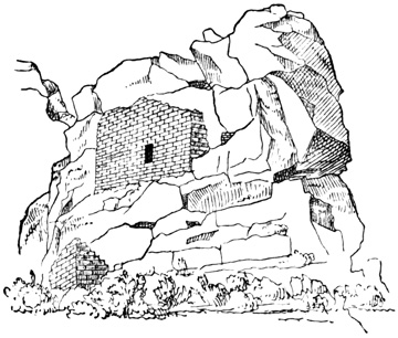
Building on the McElmo—Utah.
RUINS ON THE McELMO.
Still further down the cañon, across the boundary line into Utah, ruins continue abundant. A red sandstone butte standing in the middle of the valley, one hundred feet high and three hundred long, has traces of masonry on its summit, apparently intended to form a level platform, and on one side, at mid-height, the structures shown in the cut. The upper wall is eighteen feet long and twelve feet high, and the blocks composing it are described as more regularly cut than any before seen. The only access to the summit of the butte was by climbing through the window of the building. Other remains, including many circular depressions of considerable depth, and a square tower with one round corner, are scattered about near the base of this butte, or cristone. The next cut shows one of the cave-dwellings near by, formed by walling up the front of a recess in the cliff. 730
ABORIGINAL TRADITION
The tradition relating to the whole, and particularly to this locality, obtained by Capt. Moss from one of the old men among the Moquis, is rendered by Mr Ingersoll as follows:—"Formerly the aborigines inhabited all this country we had been over as far west as the head waters of the San Juan, as far north as the Rio Dolores, west some distance into Utah, and south and south-west throughout Arizona, and on down into Mexico. They had lived there from time immemorial—since the earth was a small island, which augmented as its inhabitants multiplied. They cultivated the valley, fashioned whatever utensils and tools they needed, very neatly and handsomely out of clay and wood and stone, not knowing any of the useful metals, built their homes and kept their flocks and herds in the fertile river bottoms, and worshiped the sun. They were an eminently peaceful and prosperous people, living by agriculture rather than by the chase. About a thousand years ago, however, they were visited by savage strangers from the North, whom they treated hospitably. Soon these visits became more frequent and annoying. Then their troublesome neighbors—ancestors of the present Utes—began to forage upon them, and at last to massacre them and devastate their farms; so, to save their lives at least, they built houses high upon the cliffs, where they could store 731 food and hide away till the raiders left. But one Summer the invaders did not go back to their mountains as the people expected, but brought their families with them and settled down. So driven from their homes and lands, starving in their little niches on the high cliffs, they could only steal away during the night, and wander across the cheerless uplands. To one who has traveled these steppes, such a flight seems terrible, and the mind hesitates to picture the suffering of the sad fugitives.
"At the christone they halted and probably found friends, for the rocks and caves are full of the nests of these human wrens and swallows. Here they collected, erected stone fortifications and watch-towers, dug reservoirs in the rocks to hold a supply of water, which in all cases is precarious in this latitude, and once more stood at bay. Their foes came, and for one long month fought and were beaten back, and returned day after day to the attack as merciless and inevitable as the tide. Meanwhile the families of the defenders were evacuating and moving south, and bravely did their protectors shield them till they were all safely a hundred miles away. The besiegers were beaten back and went away. But the narrative tells us that the hollows of the rocks were filled to the brim with the mingled blood of conquerors and conquered, and red veins of it ran down into the cañon. It was such a victory as they could not afford to gain again, and they were glad when the long fight was over to follow their wives and little ones to the South. There in the deserts of Arizona, on well-nigh unapproachable isolated bluffs, they built new towns, and their few descendants—the Moquis—live in them to this day, preserving more carefully and purely the history and veneration of their forefathers, than their skill or wisdom." One watch-tower in this region was built on a block of sandstone that had rolled down and lodged on the very brink of a precipice overlooking the whole valley. 732
HOVENWEEP RUINS.
From the McElmo Mr Jackson and his party struck off westward to a small stream called the Hovenweep, eight or ten miles distant. Here they found a ruined town, of which a general view is given in the cut. Mr Jackson's description is as follows: "The stream referred to sweeps the foot of a rocky sandstone ledge, some forty or fifty feet in height, upon which is built the highest and better-preserved portions of the settlement. Its semicircular sweep conforms to the ledge; each little house of the outer circle being built close upon its edge. Below the level of these upper houses, some ten or twelve feet, and within the semicircular sweep, were seven distinctly-marked depressions, each separated from the other by rocky débris, the lower or first series probably of a small community-house. Upon either flank, and founded upon rocks, were buildings similar in size and in other respects to the large ones on the line above. As paced off, the upper or convex surface measured one hundred yards in length. Each little apartment was small and narrow, averaging six feet in width and eight feet in length, the walls being eighteen inches in thickness. The stones of which the entire group was built were dressed to nearly uniform size and laid in mortar. A peculiar feature here was in the round corners, one at least appearing upon nearly every little house. They 733 were turned with considerable care and skill; being two curves, all the corners were solidly bound together and resisted the destroying influences the longest." The following cut presents a ground plan of this Hovenweep Pueblo town, and terminates the account of one of the most interesting antiquarian explorations of modern times.
I append a few brief quotations from the diary of Padres Dominguez and Escalante, who penetrated probably as far as Utah Lake in early times, referring to three places where ruins were seen, two of which cannot readily be located. On the Dolores River "on the southern bank of the river, on a height, there was anciently a small settlement of the same plan as those of the Indians of New Mexico, as is shown by the ruins which we examined." A ruin is also located on this river at the southern bend, on the U. S. map of 1868. On the Rio de San Cosme, "we saw near by a ruin of a very ancient town, in which were fragments of metates, and pottery. The form of the town was circular as shown by the ruins now almost entirely leveled to the ground." In the cañon of Santa Delfina "towards the south, there is quite a high cliff, on which we saw rudely painted three shields, and a spear-head. Lower down on the north side we saw another painting which represented in a 734 confused manner two men fighting, for which reason we named it the Cañon Pintado."[XII-44]
In Idaho and Montana I have no record of ancient remains, save a cliff at Pend d'Oreille Lake, on which are painted in bright colors, images of men, beasts, and pictures of unknown import. The natives are said to regard the painted rock with feelings of great superstition and dread, regarding the figures as the work of a race that preceded their own in the country.[XII-45]
In Oregon aboriginal remains, so far as reported, are hardly more abundant. The artist of the U. S. Exploring Expedition sketched three specimens of cliff-inscriptions on the Columbia River, which are shown in the cut. Mr Pickering thinks that the figures present some analogies to the sculptures reported by Humboldt on the Orinoco.[XII-46] Mr Abbot noted "a few rude pictures of men and animals scratched on the rocks" of Mptolyas cañon.[XII-47] Lord speaks of little piles of stones about natural pillars of conglomerate, on Wychus Creek, but these were doubtless the work of modern Snake Indians, who left the heaps in honor of the spirits represented by the pillars.[XII-48] A gigantic human jaw is reported to have been dug up near Jacksonville in 1862;[XII-49] and finally Lewis and 735 Clarke found a village of the Echeloots built "near a mound about thirty feet above the common level, which has some remains of houses on it, and bears every appearance of being artificial."[XII-50]
ANTIQUITIES OF WASHINGTON.
In Washington, besides some shell ornaments and arrow-heads of flint and other hard stone dug by Mr Lord from a gravel bank near the old Fort Walla Walla, and some rude figures mostly representing men carved and afterwards painted on a perpendicular rock between the Yakima and Pisquouse, pointed out by a native to Mr Gibbs,[XII-51] there seem to be remains of antiquity in only two localities. The first are the mounds on Bute Prairie, south of Olympia. They were first found, or mentioned, by Wilkes in the U. S. Exploring Expedition, in 1841, who describes them as thousands in number arranged in fives like the 'five spots' on a playing card, formed by scraping together the surface earth, about thirty feet in diameter and six or seven feet high. Three of them were opened, but proved to contain nothing but a pavement of round stones in the centre and at the bottom, resting on the subsoil of red gravel. The natives said that the medicine men in later times were wont to gather herbs from their surface, as being more potent to work their cures than those growing elsewhere. Since Wilkes' visit the newspapers have reported the discovery of a large mound at the south end of the prairie, twenty-five miles from Olympia, which is three hundred feet high and nine hundred feet in diameter at the base. These later reports state also that all the small mounds opened in recent times have been found to contain remains of pottery and "other curious relics, evidently the work of human hands."[XII-52] 736
The second locality where remains are found is on the lower Yakima River, where Mr Stephens saw an earth-work consisting of two concentric circles of earth about three feet high with a ditch between them. The outer circle is eighty yards in diameter, and within the inner one are about twenty cellars, or excavations, thirty feet across and three feet deep, like the cellars of modern native houses scattered over the country without, however, any enclosing circles. These works are located on a terrace about fifteen feet high, bounded on either side by a gulley.[XII-53]
In British Columbia, some sculptured stones are reported to have been found at Nootka Sound, in which a fancied resemblance to the Aztec Calendar-Stone was noticed; also during the voyage of the 'Sutil y Mexicana,' a wooden plank was found on the coast bearing painted figures, which I have copied in the cut, although I do not know that the plank has any claims to be considered a relic of antiquity.[XII-54]
DEANS' EXPLORATIONS.
Other British Columbian antiquities consist of shell mounds, burial mounds, and earth-works, chiefly 737 confined to Vancouver Island, and known to me through the investigations and writings of Mr James Deans. Mr Deans has lived long in the country, is perfectly familiar with it and its natives, and has given particular attention to the subject of antiquities. He makes no great pretensions as a writer, but has made notes of his discoveries from time to time, and has furnished his manuscripts for my use under the title of Ancient Remains in Vancouver Island and British Columbia. Like other explorers, he has not been able to resist the temptation to theorize without sufficient data on questions of ethnology and the origin of the American aborigines, but his speculations do not diminish the value of his explorations, and are far from being as absurd as those of many authors who are much better known.
VANCOUVER ISLAND.
Burial mounds on Vancouver Island are of two classes, according as they are constructed chiefly of sand and gravel or of stones. One of the first class opened by Mr Deans in 1871, will illustrate the construction of all. It was located on the second terrace from the sea, the terraces having nearly perpendicular banks of fifty and sixty feet respectively. By a carefully cut drift through the centre, it was ascertained to have been made in the following manner. First, a circle sixteen feet in diameter was marked out, and the top soil cleared off within the circle; then a basin-shaped hole, six feet in diameter, smaller at the bottom than at the top, was dug in the centre, in which the skull, face down, and the larger unburned bones were placed and covered with six inches of earth. On the layer of earth rested a large flat stone, on which were heaped up loose stones, the heap extending about a foot beyond the circumference of the central hole. Outside of this heap, on the surface, a space two feet wide extending round the whole circumference was sprinkled with ashes, and contained a few bones also. Outside of 738 this space again, large stones two or three feet long were set up in the ground like pillars, five feet apart, round the circumference; and finally the earth dug from the central hole, or receptacle for the bones, was thrown into the outer circle, and gravel and sand added to the whole until the mound was five feet high, having a rounded form. Four smaller mounds, six and ten feet in diameter, were opened in the same group, showing the same mode of construction, but somewhat less order.
The second class, or stone mounds, which are much more numerous than those of earth, differ but little from the others in their construction, except that the final additions to the mound were of stones instead of earth, and the stones about the circumference were flat and set up close together. A piece of quartz sometimes accompanies the bones, but no other relics are found. When the skeleton is deposited face down, as is usually the case, the skull is placed toward the south, or when in a sitting position, it faces the south, seeming in some cases to have been burned where it sat. In a few instances the skeleton, when it was but little burned, was lying on the left side. The human bones invariably crumbled at a touch, and the author states that this method of burial is altogether unknown to the present inhabitants, who say their ancestors found them as they are.
The mounds are often overgrown with large pine, arbutus, or oak trees; in one case an oak had forced its way up through the stones in its growth, reached its full size, decayed, and the stones had fallen back over the stump. They are often in groups, and in such cases the central one is always most carefully constructed, and a remarkable circumstance is that sometimes the surrounding heaps contain only children's bones. Of course this suggests a sacrifice of children or slaves at a chief's funeral, although there may be some other explanation. Some stones weighing 739 a ton are found over the human remains. Traces of cedar bark or boards are found in some of the cairns, in which the bones were apparently enclosed; and in a few others a small empty chamber was formed over the flat covering stone.
Near Comox, one hundred and thirty miles north-west of Victoria, a group of mounds were examined in 1872-3, and found to be built of sea sand and black mold, mixed with some shells. They were from five to fifty yards in circumference. In one by the side of a very large skull was deposited a piece of coal; and in another with a very peculiar flattened skull was a child's tooth. Both these skulls are said to have been covered with baked clay, and are now in the collection of the Society of Natural History in Montreal. One mound in this vicinity is fifty feet high and of oval shape. In its centre only a few feet below the surface were found burnt skeletons of children not over twelve years old, which seemed to have been enclosed in a box of cedar—of which only a brown dust remains—and covered with two feet of stones and one foot of shells. There is a spring of fine water some fifty yards from this mound, of which, from superstitious motives no Indian will drink. One rectangular cairn, ten by twelve feet, was found, but even in this the central receptacle was circular. The body in this mound showed no signs of burning, the head pointed northward, and a pencil-shaped stone sharp at both ends was deposited with the human remains.
Shell mounds are described as very abundant throughout Vancouver Island, and also on the mainland, and all are composed of species of shells still common in the coast waters. One at Comox covers three acres, and is from two to fourteen feet deep. The relics discovered in mounds of this class include stone hammers; arrow-points of flint, slate, and of a hard green stone; spear-heads, knives, needles, and 740 awls, of stone and bone, one of the knives being sixteen inches long and of whale-bone; bone wedges, sometimes grooved; and finally stone mortars, comparatively few in number, since acorns and seeds were not apparently a favorite article of food. Human skeletons also occur in the shell mounds. At Comox a skeleton is said to have been found with a bone knife broken off in one of the bones. A shell bracelet was taken from a mound at Esquimalt; and from another was dug a stone dish or paint-pot, carved to represent a man holding a mountain sheep. The man was the handle on one side, the sheep's head on the other, and the cup was hollowed out in the sheep's back. Mr Deans believes he can distinguish two distinct types of skulls in Vancouver Island—the 'long-headed' in the older cairns, and the 'broad-headed' in the shell mounds and modern graves: and this distinction is independent of artificial flattening, which it seems was practiced in a majority of cases on skulls of both types.
EARTH-WORKS.
In addition to the mounds, Mr Deans states that earth-works very similar to those found in the eastern states are found at many localities in British Columbia. Indeed, he has sent me several plans, cut from Squier's work on the antiquities of New York, which by a simple change in the names of creeks and in the scale would represent equally well the north-western works. At Beacon Hill, near Victoria, a point one hundred feet high extends three hundred feet into the sea; an embankment with a ditch still six feet deep, stretches across on the land side and protects the approach; there are low mounds on the enclosed area, the remnants of ancient dwellings, and down the steep banks are heaps of shells, with ashes, bones of sea-fowl, deer, elk, and bears, among which are some spear and arrow points, needles, etc. On the summit of Beacon Hill, near by, are burial cairns of the usual type. 741
Another earth-work was examined by Mr Deans at Baines Sound and Deep Bay. This was an oval embankment surrounded at the base by a ditch, close to the water on the bay side, but now seventy yards from high-water mark on the side next the sound, although originally at the water edge. From the bottom of the ditch to the top of the embankment or mound is forty feet, and at the summit a parapet bank now four feet high encloses an area of over an acre. On the sound side is an opening from which a road runs down the slope of the mound and across the ditch by a kind of earthen bridge. Excavation showed a depth of nine feet of shells, ashes, and black loam. Many burial mounds are scattered about which have not been opened.
I am inclined to regard Mr Deans' reports as trustworthy, although of course additional authorities are required before the accuracy of his observations respecting the burial mounds, and the existence of earthworks bearing a strong resemblance, as he claims, to those of the eastern states can be fully accepted. Respecting the mounds I quote in a note from Mr Forbes, the only other authority I have been able to find on the subject.[XII-55] 742
In Alaska I find no record of any antiquities whatever, although many curious specimens of aboriginal art, made by the natives still inhabiting the country since the coming of Europeans, have been brought away by travelers. Cook saw in the country several artificial stone hillocks, which seemed to him of great antiquity, but he also noted that each native added a stone to burial heaps on passing; and Schewyrin and Durnew found on one of the Aleutian Islands three round copper plates bearing letters and leaf-work, said to have been thrown up by the sea; but I suppose there is no evidence that they were of aboriginal origin.[XII-56]
CONCLUSION.
Thus have I gone over the whole extent of the Pacific States from the southern isthmus to Bering Strait, carefully examining, so far as written records could enable me to do so, every foot of this broad territory, in search for the handiwork of its aboriginal inhabitants. Practically I have given in the preceding pages all that has been written on the subject. Before a perfect account of all that the Native Races have left can be written, before material relics can reveal all they have to tell about the peoples whose work they are, a long and patient work of exploration and study must be performed—a work hardly commenced yet even in the thickly populated centres of old world learning, and still less advanced naturally in the broad new fields and forests of the Far West. In this volume the general reader may find an accurate and comprehensive if not a very fascinating picture of all that aboriginal art has produced; the student of ethnological topics may 743 found his theories on all that is known respecting any particular monument here spread before him, rather than on a partial knowledge derived by long study from the accounts in works to which he has access, contradicted very likely in other works not consulted,—and many a writer has subjected himself to ridicule by resting an important part of his favorite theory on a discovery by Smith, which has been proved an error or a hoax by Jones and Brown; the antiquarian student may save himself some years of hard labor in searching between five hundred and a thousand volumes for information to which he is here guided directly, even if he be unwilling to take his information at second hand; and finally, the explorer who proposes to examine a certain section of the country, may acquaint himself by a few hours' reading with all that previous explorers have done or failed to do, and by having his attention specially called to their work will be able to correct their errors and supply what they have neglected.
If the work in this volume shall prove to have been sufficiently well done to serve, in the manner indicated above, as a safe foundation for systematic antiquarian research in the future, the author's aim will be realized and his labor amply repaid. 744
American Monuments beyond the Limits of the Pacific States—Eastern Atlantic States—Remains in the Mississippi Valley—Three Geographical Divisions—Classification of Monuments—Embankments and Ditches—Fortifications—Sacred Enclosures—Mounds—Temple-Mounds, Animal-Mounds, and Conical Mounds—Altar-Mounds, Burial Mounds, and Anomalous Mounds—Contents of the Mounds—Human Remains—Relics of Aboriginal Art—Implements and Ornaments of Metal, Stone, Bone, and Shell—Ancient Copper Mines—Rock-Inscriptions—Antiquity of the Mississippi Remains—Comparisons—Conclusions.
TREATMENT OF FOREIGN REMAINS.
I announced in an introductory chapter my intention to go in this volume beyond the geographical limits of my field of labor proper, the Pacific States, and to include a sketch of eastern and southern antiquities. I am not sure that this departure from my territory is strictly more necessary or appropriate in this than in the other departments of this work;—that is, that the material relics of the Mississippi Valley and South America have a more direct bearing on the institutions and history of the Native Races of the Pacific, than do the manners and customs, mythology, and language of the South American and eastern tribes. Yet there is this difference, that to have included the whole American continent in the preceding volumes would have required a new 745 collection of material, additional time and research, and an increase of bulk in printed pages, each equal at least to what has been done; and I believe that the original scope of my work, and the bulk of that part of it devoted to the Native Races, is already sufficiently extensive. But in the department of antiquities, making the present volume of uniform size with others of the work, I have, I think, sufficient space and material to justify me in extending my researches beyond the Pacific States; and this seems to me especially desirable by reason of the fact that all the important archæological remains outside of what I term the Pacific States, may be included in the two groups to which my closing chapters are devoted, and the present volume may consequently present some claim to be considered a comprehensive work on American Antiquities.
My treatment of the subject in this and the following chapter will, however, differ considerably from that in those preceding. I have hitherto proceeded geographically from south to north, placing before the reader all the information extant, be it more or less complete, respecting every relic in each locality, and giving besides in every case the source whence the information was obtained. In this manner the notes become a complete bibliographical index to the whole subject, not an unimportant feature, I believe, of this work. In the broad eastern region bordering on the Mississippi and its tributaries, a region thickly inhabited, and thoroughly explored by antiquarians, or at least comparatively so, so numerous are the relics and the localities where they have been found, that to take them up one after another for detailed description would require at least a volume; and these relics, although of great importance, present so little variety in the absence of all architectural monuments, that such a detailed account could hardly fail to become monotonous to a degree unparalleled even in the pages 746 of the present volume. Moreover, the books and other material in my possession, while amply sufficient, I think, to furnish a clear idea of the Mississippi and South American monuments, are of course inadequate to a continuation of the bibliographical feature referred to. For these reasons I deem it best to abandon the elaborate note-system hitherto followed, and shall present a general rather than a detailed view of material relics outside the Pacific States, formed from a careful study of what I believe to be the best authorities, and illustrated by the cuts given in Mr Baldwin's work.[XIII-1]
THE MISSISSIPPI VALLEY.
Material relics of the aboriginal tribes are found in greater or less abundance throughout the Eastern United States and the Canadas. But those found in New England and the region east of the Alleghanies, extending southward to the Carolinas, may be dismissed in an account so general as the present with the remark that all are evidently the work of the Indian tribes found in possession of the country, many of them evidently and others probably having originated at a time subsequent to the coming of Europeans. 747 But whatever may be decided respecting their antiquity, it may be regarded as absolutely certain that none of them point to the existence of any people of more advanced culture than the red race that came in contact with Europeans. They consist for the most part of traces of Indian villages or camps, burial grounds, small stone-heaps, scattered arrow-heads, and some other rude stone implements.
CLASSIFICATION OF REMAINS.
The great Mississippi Valley system of ancient works, consisting of mounds and embankments of earth and stone, erected by the race known as the Mound-builders, extends over a territory bounded in general terms as follows: on the north by the great lakes; on the east by western New York, Pennsylvania, and Virginia in the north, but farther south extending to the Atlantic coast and including Florida, Georgia, and part of South Carolina; on the south by the Gulf of Mexico, including Texas according to the general statements of most writers, although I find no definite account of any remains in that state; on the west by an indefinite line extending from the head of Lake Superior through the states of Minnesota, Nebraska, Kansas, and Indian Territory, although there are reported some remains farther west, particularly on the upper Missouri, which have not been thoroughly explored. The map in the accompanying cut is intended only to show the reader at a glance the relative position of the states in the territory of the Mound-builders.
Throughout this broad extent of territory, but chiefly on the fertile river-terraces of the Mississippi and its tributaries, the works of the ancient inhabitants are found in great abundance, and may be classified for convenience in description as follows:—I. Embankments of earth or stone, and ditches, often forming enclosures, which are subdivided by their location into, 1st, fortifications, and 2d, sacred enclosures, or such as are supposed to have been connected with religious rites. 748
II. Mounds of earth or stone, of varying location, size, form, material, and contents; divided by their form into, 1st, 'temple mounds,' of regular outline and large dimensions, having flat summit platforms, and often terraced sides with graded ascents; 2d, 'animal-mounds,' or those resembling in their ground plan the forms of animals, birds, or even human beings; and 3d, conical mounds, which are again subdivided according to their contents into 'altar-mounds' 749 or 'sacrificial mounds,' 'burial mounds,' and 'anomalous mounds,' or such as are of mixed or undetermined character.
III. Minor relics of aboriginal art, for the most part taken from the mounds, including implements and ornaments of metal, stone, shell, and bone.
IV. Ancient mines, and perhaps a few salt-wells which bear marks of having been worked by the aborigines.
V. Rock-inscriptions.
These different classes of remains, although sufficiently uniform in their general character to indicate that the Mound-builders were of one race, living under one grand system of institutions, still show certain variations in the relative predominance of each class in different sections of the territory. The Ohio River and its tributaries would seem to have been in a certain sense the centre of the Mound-builders' power, for here the various forms of enclosures and mounds are most abundant and extensive, and their contents show the highest advancement of aboriginal art. This section, including chiefly the state of Ohio, but also parts of Kentucky, Indiana, Tennessee, Illinois, and Missouri, was the ground embraced in the explorations of Squier and Davis, by far the best authorities on eastern antiquities. In the northern region, on the great lakes, on which Lapham and Pidgeon are the prominent authorities, chiefly in Wisconsin, but also in Michigan, Illinois, Missouri, Iowa, and Minnesota, animal-mounds are the prominent feature, the other classes of mounds, and the enclosures, being of comparatively rare occurrence. The animal-mounds occur in the central Ohio region only in a very few instances, and never, so far as is known, in the south. In the southern or gulf states the temple-mounds are more numerous in proportion to other classes than in the north, and enclosures disappear almost altogether. The southern antiquities have, however, 750 been comparatively little explored, Mr Jones' late work referring for the most part only to the state of Georgia.
Throughout the whole region traces of the tribes found by Europeans in possession of the country are found; and besides the three territorial divisions already indicated, it is noted that in the north-east, in western New York and Pennsylvania, the works of the Mound-builders merge so gradually into those of the later tribes, the only relics farther east, that it becomes well-nigh impossible to fix accurately the dividing line.
REMAINS IN NEW YORK.
In many parts of western New York traces are found of Indian fortified camps, surrounded by rows of holes in the ground, which once supported palisades, and in all respects similar to those in use among the Indians of the state in their wars against the whites. There are also found low embankments of earth, or very rarely of small stones, which form enclosures or cut off the approach to the weaker side of some naturally strong position. Such embankments are always on hills, lake or river terraces, or other high places, and are often protected on one or more sides by morasses or by streams with steep banks. Their strong natural position, with due regard to the water supply, carefully planned means of exit, and in many instances graded roads to the water, leaves no doubt of their original design as fortifications, places of refuge and of protection against enemies. The slight height of the embankments would suggest that they were thrown up to support palisades; indeed, traces of these palisades have been found in some cases. The practice of throwing up an embankment at the foot of palisades, although seemingly a very natural one, does not, however, seem to have been noticed among the Indian tribes of New York. In nearly all the enclosures remains of the typical Indian caches are found, with carbonized maize, and traces of wood and 751 bark; and in and around them the sites of Indian lodges or towns are seen, indicated by the presence of decomposed and carbonaceous matter, together with burned stones, charcoal, ashes, bones, pottery, and Indian implements. These circumstances go far to prove that all the New York works, if not built by the Indians, were at least occupied by them after their abandonment by the Mound-builders, from some of whose works they do not differ much except in dimensions and regularity of form.
The enclosures vary in extent from three to four acres, the largest being sixteen acres. The embankments are from one to four feet high, generally accompanied by an exterior ditch;—the highest is seven or eight feet from bottom of ditch to top of embankment. Many such works in a country so long under cultivation have of course disappeared. Mr Squier ascertained the locality of one hundred of them in New York, and estimates the original number at not less than two hundred and fifty.
The works of the Mound-builders are almost exclusively confined to the fertile valleys still best fitted to support a dense population. The Mississippi and its tributaries have during the progress of the centuries worn down their valleys in three or four successive terraces, which, except the lowest, or latest formed, the ancient peoples chose as the site of their structures, giving the preference in rearing their grandest cities—for cities there must have been—to the terrace plains near the junction of the larger streams. On these plains and their surrounding heights, are found the ancient monuments, generally in groups which include all or many of the classes named above; for it is only for convenience in description that the classification is made; that is, the classification is by no means to any great extent a geographical one. I have already said that Ohio was the centre, apparently, of the Mound-builders' power. 752 Northward, eastward, and perhaps westward from this centre, the works diminish in extent, fortifications become a more prominent feature, and the remaining monuments approximate perceptibly to those of the more barbarous and later peoples. In fact, we find the modifications that might naturally be expected in a frontier country. Southward from the Ohio region down the Mississippi Valley, it is a common remark in the various writings on the subject, that the monuments increase gradually in magnitude and numbers. This statement seems to have originated, partially at least, in the old attempt to trace the path of Aztec migration southward. The only foundation for it is the fact that the class of mounds called temple-mounds are in the south more numerous in proportion to those of the other classes. The largest mound and the most extensive groups are in the north; while the complicated arrangement of sacred enclosures appears but rarely if at all towards the gulf. It is not impossible that more extensive explorations may show that the comparative numbers and size of the large temple-mounds have been somewhat exaggerated. Yet the claims in behalf of Nahua traces in the Mississippi region are much better founded than those that have been urged in other parts of the country; although we have seen that the chain is interrupted in the New Mexican country, and I can find no definite record of temple-mounds in Texas. The total number of mounds in the state of Ohio is estimated by the best authority at ten thousand, while the enclosures were at least fifteen hundred.
FORTIFICATIONS.
I begin with the embankments and enclosures. They are found, almost always in connection with mounds of some class, on the hills overlooking the valleys, and on the ravine-bounded terraces left by the current of rapid streams. The first, or oldest, terraces, with bold banks from fifty to a hundred feet 753 high, furnish the sites of most of the works; on the lower intermediate terraces, whose banks range from ten to thirty feet in height, they are also found, though less frequently than above; while on the last-formed terrace below no monuments whatever have ever been discovered.
The embankments are simply earth, stones, or a mixture of the two, in their natural condition, thrown up from the material which is nearest at hand. There is no instance of walls built of stone that has been hewn or otherwise artificially prepared, of the use of mortar, of even rough stones laid with regularity, of adobes or earth otherwise prepared, or of material brought from any great distance. The material was taken from a ditch that often accompanies the embankment, from excavations or pits in the immediate vicinity, or is scraped up from the surface of the surrounding soil. There is nothing in the present appearance of these works to indicate any difference in their original form from that naturally given to earth-works thrown up from a ditch, with sides as nearly perpendicular as the nature of the material will permit. Of course, any attempt on the part of the builders to give a symmetrical superficial contour to the works would have been long since obliterated by the action of the elements; but nothing now remains to show that they attached any importance whatever to either material or contour. Stone embankments are rarely found, and only in localities where the abundance of the material would naturally suggest its use. In a few instances clay has been obtained at a little distance, or dug from beneath the surface.
FORTIFIED HILLS.
Accordingly as they are found on the level plain, or on hill-tops or other strong positions, enclosures are divided into fortifications and sacred enclosures. Of the design of the first class there can be no doubt, and very little respecting many of the second class, although it is very probable that some of the latter 754 had a different purpose, not now understood. Naturally some works occur which have some of the features of both classes. The fortifications are always of irregular form as determined by the nature of the ground.
A fortification at Butler Hill, near Hamilton, Ohio, is shown in the cut. The summit of the hill is two hundred and fifty feet above the river, the enclosing wall is of earth and stones, five feet high, thirty-five feet thick at the base, and unaccompanied by a ditch, although there are some pits which 755 furnished the material of the wall. Two mounds or heaps of rough stones are seen within the enclosure and one without, the stones of all showing marks of fire.
The next cut shows a work at Fort Hill, Ohio, which seems to unite the characters of the two classes of enclosures. It measures twenty-eight hundred by eighteen hundred feet, and is on the second terrace. The wall along the creek side is of stones and clay, four feet high: the other main walls are six feet high and thirty-five feet thick, with an exterior ditch. The walls of the square enclosure at the side are of clay, present some marks of fire, and have no ditch. Mr Squier concludes that this was a fortified town rather than a fort like many others. The walls of the enclosure shown in the following cut, on Paint Creek, Ohio, are of stone, thirteen hundred 756 feet in circumference, and have no ditch. The heaps of stones connected with this work have been exposed to excessive heat, either perhaps by being used as fire signals, or by the burning of wooden structures which they supported. In the works at Fort Ancient, on a mesa two hundred and thirty feet above the Miami River, the embankment is four miles long in an irregular line round the circumference, and in some parts eighteen or twenty feet high. There are also some signs of artificial terraces on the river side of the hill. A line of these defensive works is found in northern Ohio, with which very 757 few regular mounds or sacred enclosures are connected. Pidgeon states that a single line of embankment may be traced for seventeen miles, and that there are three hundred and six miles of embankment fortifications in the state. It is quite probable that these embankments originally bore palisades. They vary in height from three to thirty feet, reckoning from the bottom of the ditch; but this gives only a very imperfect idea of their original dimensions, since in some localities the height has been much more reduced by time than in others, owing to the nature of the material. In hill fortifications the ditch is usually inside the wall, but when the defences guard the approach to a terrace-point, the ditch is always on the outside. The entrances to this class of enclosures are governed by convenience of exit, accessibility of water, and facilities for defence. They are usually guarded by overlapping walls as shown in the cuts that have been presented. Several of the larger fortifications, however, have a large number of entrances, generally at regular intervals, which it is very difficult to account for.
SACRED ENCLOSURES.
Other enclosures are classed as sacred, or pertaining in some way to religious rites, because no other equally satisfactory explanation of their use can be given. That they were in no sense works of defence is evident from their position, almost invariably on the most level spot that could be selected and often overlooked by neighboring elevations. Unlike the fortifications they are regular in form, the square and circle predominating and generally found in conjunction, but the ellipse, rectangle, crescent, and a great variety of other forms being frequent, and several different forms usually occurring together. A square with one or more circles is a frequent combination. The angles and curves are usually if not always perfectly accurate, and the regular, or sacred, enclosures probably outnumber by many the irregular ones, although 758 they are of lesser extent. Enclosed areas of one to fifty acres are common. The groups are of great extent; one at Newark, Ohio, covers an area of nearly four square miles. A remarkable coincidence was noticed by Mr Squier in the dimensions of the square enclosures, five or six of these having been found at long distances from each other, which measured exactly ten hundred and eighty feet square. Circles are, as a rule, smaller than the squares with which they are connected, two hundred to two hundred and fifty feet being a common size. The largest of the enclosures, with an area of some six hundred acres, are those reported in the far west and north-west by early travelers whose reports are not confirmed.
The embankment itself differs from those already described only in being, as a rule, somewhat lower and narrower, although at Newark one is thirty feet high, and in being constructed with less exceptions without the use of stones. The material as before was taken from the surface, ditches, or from pits, which latter are often described as wells, and may in some instances have served as such.
The following cut represents a group at Liberty, Ohio, typical of a large class in the Scioto Valley. The location is on the third terrace, the embankments of earth are not over four feet high, there is no ditch, and the earth seems to have been taken exclusively from pits, which, contrary to the usual custom, are within the enclosure. The square is one of those already spoken of as agreeing exactly in dimensions with others at a distance. Additional dimensions are shown in the cut. The enclosures, both square and round, usually include several mounds. One at Mound City, square with rounded corners, covering thirteen acres, has twenty-four sacrificial mounds within its walls. At Portsmouth, there are four concentric circles, cut by four broad avenues facing, with slight variation, the cardinal points, and having a 759 large terraced and truncated mound in the centre. The banks of one enclosure near Newark measure thirty feet in height from the bottom of the ditch; the usual height is from three to seven feet.
Enclosure at Bourneville.
Works at Hopeton.
The circles often have an interior ditch; in some cases, as at Circleville and Salem, there are two circular embankments one within the other with a ditch between them; but there is only one instance of an exterior ditch, in the work at Bourneville, Ohio, shown in the first cut. The wall is from eight to ten feet high, and the ditch is shallow. The larger 761 circles have generally a single entrance, which is usually, but not always, on the east. There are numerous small circles from thirty to fifty feet in diameter, found in connection with groups of large enclosures, which have very light embankments and no entrances. These may very likely be the remains of lodges or camps. The larger circles are almost invariably connected with squares or rectangles, which have similar embankments but no ditches. These have very commonly an entrance at each angle and one in the middle of each side, but the larger squares have often many more entrances.
The second cut shows a group of sacred enclosures at Hopeton, Ohio, located on the third terrace. The walls of the rectangle are of a clayey loam, fifty feet thick and twelve feet high, without a ditch. The summit is wide enough for a wagon road. The walls of the circle are somewhat lower and composed of clay differing in color from that found in the vicinity. The two smaller circles have interior ditches. The cut gives a view of the same works as they appear from the east. The parallel embankments in the 762 south are one hundred and fifty feet apart and extend half a mile to the bank of an old river bed. Two hundred paces north of the large circle, and not shown in the cuts, is another circle two hundred and fifty feet in diameter.
The enclosure shown in the next cut is that at Cedar Bank, near Chillicothe, Ohio, and seems to partake somewhat of the nature of a fortification. The west side is naturally protected by the river bank, and the other sides are enclosed by a wall and ditch, each forty feet wide and five to six feet high or deep. The bed of a small stream forms a natural ditch for one half of the eastern side. Within the enclosure in a line with the entrances is a raised platform four feet high, measuring one hundred and fifty by two hundred and fifty feet, with graded ways thirty feet wide, leading to the summit. The parallels outside the enclosure are three or four feet high. The earth-work in Randolph County, Indiana, is 763 sufficiently explained by the cut. This work, like the preceding, would seem to have been constructed partially with a view to defence. The work shown in the next cut is part of a group in Pike County, Ohio. The circle is three hundred feet in diameter. 764
Parallel Embankments—Piketon.
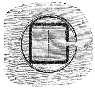
Fortified Square—Indiana.
EARTH-WORKS.
The different enclosures of a group are often connected by parallel embankments. Similar embankments protect the roads leading from fortified works to the river bank or other source of water. Many are not connected with any enclosures, though in their vicinity; and in such cases they are very slight, from seven hundred to eight hundred feet long, and sixty to eighty feet apart. Some of these parallels were very likely raised roads instead of enclosed ones, as on the Little Miami River, where the embankments extend about a quarter of a mile from two mounds, forming a semicircle round a third, being a rod wide and only three feet high. At Madison, Louisiana, there is a raised way three feet high, seventy-five feet wide, and two thousand seven hundred feet long, with broad excavations three feet in depth extending on both sides for about two thirds its length. Two parallel banks at Piketon, Ohio, are shown in the cut. They are ten hundred and eighty feet long, two hundred and three feet apart at one end, and two hundred and fifteen at the other; the 765 height on the outside being from five to eleven feet, but on the inside twenty-two feet at one end. A modern carriage road now runs between the mounds. From the end of one of them a slight embankment extends twenty-five hundred and eighty feet to a group of mounds.
DITCHES AND MOUNDS.
In the north ditches seem never to occur, except with embankments; but in the south, where embankments are rarely if ever found, ditches, or moats, are sometimes employed to enclose other works, especially in Georgia. Such a moat at Carterville communicates with the river, extends to a pond perhaps artificial, and has two reservoirs, each of an acre, connected with it. The mounds and other monuments are located between the river and the moat. I have already spoken of the pits which furnished earth for the various works, sometimes called wells; some wells of another class, found in the bed of streams and supplied with round covers, were found by Mr Squier to be the natural casts of septaria, or imbedded nodules of hard clay.
The mound or heap form is the one most common in American antiquities as in those of nearly the whole world. Mounds are found throughout the Mississippi region as before bounded, and beyond its limits in many directions they merge into the small stone heaps which are known to have been thrown up by the Indians at road-crossings and over graves. They are most numerous in the upper Mississippi and Ohio valleys, in the same region where the embankments also most abound. As I have said, the number in Ohio alone is estimated at more than ten thousand. They are almost always found in connection with embankments and other works of the different classes described, but they are also very numerous in regions where enclosures rarely or never occur, as in Wisconsin and in the gulf states. From the central region about the junction of the Mississippi, Missouri, 766 and Ohio, they gradually diminish in numbers in every direction, and also in size except perhaps towards the south. They are found in valley and plain, on hill-side and hill-top; isolated and in groups; within and without enclosures; and at long distances from other works. By their location alone no satisfactory classification could possibly be made; still, when considered in connection with their contents and other circumstances, their location assumes importance. By their forms the tumuli are classified as temple-mounds, animal-mounds, and conical mounds.
TEMPLE-MOUNDS.
Temple-mounds always have level summit platforms, and are supposed to have once supported wooden structures, although no traces of such temples remain. A graded road straight or winding, of gentler slope than the sides of the mound, often leads to the top; and in many cases the sides have one or more terraces. One in Tennessee, four hundred and fifty feet in diameter and fifty feet high, has ten clearly marked terraces, except on the east. The bases assume a variety of forms, square, rectangular, octagonal, round, oval, etc., but the curves and angles are always extremely regular. In the north they are usually within enclosures, but in the south, where they are most numerous, they have no embankments and are often arranged in groups, the smaller about a larger central mound. In size the temple-mounds vary from a height of five feet and a diameter of forty feet to ninety feet in altitude and a base-area of eight acres. In respect to form, material, structure, contents, and probable use they admit of no subdivision. Like the embankments they are made of earth, or rarely of stones, simply heaped up, with little care in the choice of material and none at all in the order of deposit.
The largest mound of this, or in fact of any, class is that at Cahokia, Illinois. Its base measures seven hundred by five hundred feet. The height is ninety feet. On one end above mid-height is a terrace platform 767 one hundred and sixty by three hundred and fifty feet, and the summit area is two hundred by four hundred and fifty feet, or nearly two acres, the base covering over eight acres. On the top a small conical mound was found, with some human bones, a deposit of doubtful antiquity. A mound is described at Lovedale, Kentucky, as being of octagonal base, five feet high, with sides of a hundred and fifty feet, three graded ascents, and two conical mounds on its summit. Mr Jones states that parapet embankments, round the edge of the summit, sometimes occur on the southern temple-mounds.
At Marietta, Ohio, are four mounds like that shown in the cut, within a square enclosure. The height of this one is ten feet. The mound at Seltzerton, Mississippi, forty feet in height, covers nearly six acres, and has a summit area of four acres, on which are two conical mounds, also forty feet high and thirty feet in diameter. The base is surrounded with a ditch ten feet deep, an unusual feature. There are said to be large adobe blocks in the northern slope of this pyramid, and the same material is reported in other southern structures. These reports require additional confirmation.
The Messier Mound, in Early County, Georgia, 768 differs in its location from most temple-mounds, standing on the summit of a natural hill which overlooks a broad extent of country. The artificial height is fifty-five feet, and the summit area sixty-six by one hundred and fifty-six feet. There are no traces of any means of ascent, and the slopes are very steep. A ditch extends in a semicircle from corner to corner at the southern end, and thence down the slope of the hill. An excavation of two acres, twenty-five feet deep on an average, seems to have furnished the earth for the mound. A round well, sixty feet in diameter and forty feet deep is found at one end of the excavation. A temple-mound in the Nacooche Valley, Georgia, is elliptical in form, and has a summit area of sixty by ninety feet.
An octagonal mound, forty-five feet high and one hundred and eighty feet in diameter at the top, is located on a hill-top opposite the city of Macon; it was formed of earth carried from the valley below. A temple-mound at Mason's Plantation, on the Savannah River, has been partly washed away by the water, which reveals along the natural surface of the ground a stratum a foot thick of charcoal, baked earth, ashes, broken pottery, shells, and bones of animals and birds, with a few human bones. The mound, which is of the surrounding alluvial soil, would seem to have been erected over a spot long occupied as an encampment. This mound, and another near it, were originally enclosed by a moat which communicated with the river, and widened on one side into a broad lagoon.
On Plunkett Creek, Georgia, is a mound of stones which has the appearance of a temple-mound, having a summit area forty feet in diameter. Stone is rarely used in structures of this class; perhaps this was originally a conical mound. There seem to be few large mounds in the south unaccompanied by ditches, which seem here to have been introduced where embankments would have been preferred in the north.
In a late number of the Cincinnati Quarterly 769 Journal of Science I find described, unfortunately only on newspaper authority, a remarkable temple-mound, near Springfield, Missouri, on a hill three hundred feet high. It is of earth and stones, sixty two feet high, five hundred feet in diameter at the base and one hundred and thirty at the summit. A ditch, two hundred feet wide and five feet deep, surrounds the base, and is crossed by a causeway, opposite which a stairway of roughly hewn stones leads up the northern slope. The top is covered by a platform of stone, in the centre of which lies a stone ten by twelve feet, and eleven inches thick, hollowed in the middle. This report without further confirmation must be considered a hoax—at least so far as the stone steps, pavement, and altar are concerned.
The group of temple-mounds shown in the cut is 770 in Washington County, Mississippi. Others similar in many respects to these are found at Madison, Louisiana.
Temple-mounds are homogeneous and never stratified in their construction, and contain no relics; that is, the object in their erection was simply to afford a raised platform, with convenient means of ascent.
Animal-mounds, the second class, are those that assume in their ground plan various irregular forms, sometimes those of living creatures, including quadrupeds, birds, reptiles, fishes, and in a few cases men. Mounds of this class are very numerous in the north-west, particularly in Wisconsin, and rarely occur further south, although there are a few excellent specimens in Ohio. They are most abundant in fertile valleys and rarely occur on the lake shore. Nine tenths of them are simple straight, curved, or crooked embankments of irregular form, slightly raised above the surface, bearing no likeness to any natural object. In many, fancied to be like certain animals, the resemblance is imaginary. Those shaped like a tapering club, with two knobs on one side near the larger end—a very common figure—are called 'lizard-mounds;' add two other protuberances on the opposite side and we have the 'turtle-mounds.' Yet a few bear a clear resemblance to quadrupeds, birds, and serpents, and all evidently belong to the same class and were connected with the religious ideas of the builders. They are not burial mounds, contain no relics, are but a few feet at the most above the ground, and are always composed of whitish clay, or the subsoil of the country. Their dimensions on the ground are considerable; rude effigies of human form are in some cases over one hundred feet long; quadrupeds have bodies and tails each from fifty to two hundred feet long; birds have wings of a hundred feet; 'lizard-mounds' are two and even four hundred feet in length; straight and curved lines of embankment 771 reach over a thousand feet; and serpents are equally extensive. They are grouped without any apparent order together with conical mounds, occasional embankments, and few enclosures. They often form a line extending over a large tract. In some cases the animal form is an excavation instead of a mound, the earth being thrown up on the banks. An embankment in Adams County, Ohio, on the summit of a hill much like those often occupied by fortifications, is thought to resemble a monster serpent with curved body and coiled tail, five feet high, thirty feet wide in the middle, and over one thousand feet long if uncoiled. The jaws are wide open and apparently in the act of swallowing an oval mound measuring one hundred and sixty by eighty feet. On a hill overlooking Granville, Ohio, is a mound six feet high and a hundred and fifty feet long, thought to resemble the form of an alligator. Stones are rarely used with the earth in the construction of animal-mounds, and only in a few cases has the presence of ashes or other traces of fire been reported.
The third class of tumuli includes the conical mounds, mere heaps of earth and stones, so far as outward appearance is concerned, generally round, often oval, sometimes square with rounded corners, or even hexagonal and triangular, in their base-forms, and varying in height from a few inches to seventy feet, in diameter from three or four to three hundred feet. A height of from six to thirty feet and a diameter of forty to one hundred feet would probably include a larger part of them. Of course the height has been reduced and the base increased by the action of rains more or less in different localities according to the material employed. Mounds of this class never have summit platforms or any means of ascent. They are here as elsewhere in America much more numerous than other mounds. Although so like one to another in form, they differ widely in location and contents. 772 They are found on hill-tops and in the level plain. In the former case they are either isolated, grouped round fortifications, or extend in long lines at irregular intervals for many miles, suggesting boundary lines or fire signals. In the valleys they stand alone, in groups, or in connection with sacred enclosures. The groups are sometimes symmetrical, as when a number of mounds are regularly arranged about a larger central one, or are so placed as to form squares, circles, and other regular figures; but often no systematic plan is observable. Also in connection with the enclosures part of them are symmetrically located with respect to entrances, angles, or temple-mounds; while others are scattered apparently without fixed order. There are few enclosures that do not have a mound opposite each entrance on the inside. A complete survey and restoration would probably show many mounds to belong to some regular system, that now appear isolated.
The material of the mounds requires no remark in addition to what has been said of other works. A large majority are simply heaps of the earth nearest at hand. Stone mounds, or those of mixed materials, are rare, and are chiefly confined to the hill-top structures. Most of the earth mounds are homogeneous in structure, but some are regularly and doubtless intentionally stratified. Some of them in the gulf states are composed of shells, in addition to the shell-mounds proper formed by the gradual deposit of refuse shells, the contents of which served as food.
CONTENTS OF THE MOUNDS.
The contents of the mounds should be divided into two great classes; those deposited by the Mound-builders, and those of modern Indian or European origin. The distinction is important, but difficult; and in this difficulty is to be found the origin of many of the extraordinary reports and theories. The Indians have always felt a kind of veneration for the mounds as for something of mysterious origin and 773 purpose, and have used them as burial places. The Indian habit of burying with their dead such articles as were prized by them when living, is well known; as is also the value attached by them to trinkets obtained by purchase or theft from Europeans. Consequently articles of European manufacture, such as must have been obtained long before the country was to any great extent occupied by the whites, are often dug from the mounds and found elsewhere. The discovery of silver crosses, gun-barrels, and French dials, does not, however, as Mr Squier remarks, justify the conclusion that the Mound-builders "were Catholics, used fire-arms, or spoke French." The mounds are usually opened by injudicious explorers or by treasure-seekers, who have paid little attention to the location of the relics found or the condition of the surrounding soil. Museums and private collections are full of spurious relics thus obtained. It is certain in some cases, and probable in many more, that the mounds have been 'salted' with specimens with a view to their early investigation. Yet many mounds have been opened by scientific men, who have brought to light curious relics, surely the work of the Mound-builders. Such relics are found in the centre of the mounds, on or near the original surface of the ground, with the surrounding material undisturbed. In the stratified mounds any disturbance in the soil is easily detected, but with difficulty in the others. Reports of unusual relics should be regarded as not authentic unless accompanied by most positive proof.
Neither the embankments of sacred enclosures, the temple-mounds, nor the animal-mounds, have been proved to contain any relics that may be attributed to the original builders. Many of the conical mounds do contain such relics, and by their contents or the lack of them, are divided into altar-mounds, burial mounds, and anomalous mounds.
Altar-mounds are always found within or near 774 enclosures, and each one is found to contain something like an altar, made of burned clay or stone. The altars are generally of fine clay brought from some distance, burned hard sometimes to a depth of twenty inches. They were not burned before being put in place, but by the action of fires built upon or round them. Such as were very slightly burned had no relics. The stone altars are very rare, and are formed of rough slabs, and not hewn from a single block. They are square, rectangular, round, and oval; vary in size from two feet in diameter to fifteen by fifty feet, but are generally from five to eight feet; are rarely over twenty inches high; rest on or near the surface of the ground, in the centre of the mound; and have a basin-shaped concavity on the top. The basin is almost always filled with ashes, in which are the relics deposited by the Mound-builders. Relics are much more numerous in the altar than in the burial mounds, but as they are of the same class, both may best be spoken of together. These altars are probably the structures spoken of by early explorers and writers as hearths; there are reports that some of them were made of burnt bricks.
A peculiarity of the altar-mounds is that they are formed of regular strata of earth, gravel, sand, clay, etc., which are not horizontal, but follow the curve of the surface. The outer layer is commonly of gravel. This stratification renders it easy to detect any modern disturbance of the mounds, and makes the altar relics especially interesting and valuable for scientific purposes. Over the ashes in one altar-mound, were found plates of mica and some human bones. Skeletons are often found near the surface of these mounds, the strata above them being disturbed; in one case the Indians had penetrated to the centre and deposited a body on the altar itself. Sir John Lubbock inclines to the opinion that these were really sepulchral rather than sacrificial mounds, although he had not personally examined them. Whatever their use, 775 they certainly constitute a clearly defined class distinct from all others, and the name altar-mounds is as appropriate as any other.
BURIAL MOUNDS.
Unstratified mounds, never within enclosures and generally at some little distance from them, containing human remains in their centres and undoubtedly erected as places of sepulture, constitute the second class, and are called burial mounds. The custom of heaping up a mound over the dead was probably imitated for a long time by the tribes that followed the Mound-builders, so that the relics from these mounds are less satisfactory than those found on the altars. In the burial mounds that may be most confidently ascribed to the Mound-builders, the human remains are found in a situation corresponding to that of the altars. They are usually enclosed in a frame-work of logs, a covering of bark or coarse matting, or a combination of these, which have left only faint traces. Of the skeleton only small fragments remain, which crumble on exposure to the air. In some cases there are indications that the body was burned before burial. Each mound contains, as a rule, a single skeleton, generally but not always placed east and west. Where several skeletons are found together, they are sometimes placed in a circle with the heads towards the centre. The mounds never contain large numbers of skeletons, and cannot be regarded as cemeteries, but only as monuments reared over the remains of personages high in rank. Very few skulls or bones are recovered sufficiently entire to give any idea of the Mound-builders' physique, and these few show no clearly defined differences from the modern Indian tribes. Four or five burial mounds are often found in a group, the smaller ones in such cases being grouped round a larger central one, generally in contact with its base. Mr Lapham sketched mounds in Wisconsin where the body is deposited in a central basin-shaped 776 excavation in the ground very much like those in Vancouver Island already described.
Of the eastern burial deposits not connected with the mounds I shall say very little. It has already been stated that the mounds were in no sense cemeteries. Only a favored few of what must have been a dense population were honored by these sepulchral monuments. Obliged to seek elsewhere the general depositories of the dead, we find them of various classes in large numbers; but as yet very little has been done towards identifying any of them as the resting-places of the Mound-builders. There are many bone-pits, or trenches filled with human bones, in the mound region; but some of the modern Indians are well known to have periodically collected and deposited in pits the bones of their dead. Large numbers of bodies have been found in the caves of Kentucky and Tennessee, well preserved by the natural deposits of saltpetre, and wrapped in skins, bark, or feather-cloth; but the fact that such cloths were made and used by the southern tribes, renders the origin of these bodies uncertain. Besides the caves and trenches there are regular cemeteries, some of them very extensive. Seven of these are reported about Nashville, Tennessee, within a radius of ten miles, each being about a mile in extent. The graves are of flat stones, lie in ranges, and contain skeletons much decayed, with some relics. The coffins, or graves, vary from two to six feet in length, and the smallest have sometimes been mentioned as indicating a race of pigmies; it is evident, however, that in such graves bones were not deposited until the flesh had been removed. Sometimes there are traces of wooden coffins, in other cases there are only stones at the head and feet, and often there is no trace of any coffin. A few graves contain relics similar to those in the altar-mounds, and were covered with large forest trees when first seen by Europeans. Yet the comparatively well-preserved skeletons, and the presence in many 777 cases of iron and relics clearly modern, render it well-nigh impossible to decide which, if any, of these cemeteries contain the remains of the Mound-builders.
ANOMALOUS MOUNDS.
Mounds of the third class are called anomalous, and include all that are not evidently either altar or burial mounds, or which have some of the peculiarities of both classes; for instance, in an elliptical mound an altar was found in one centre, and a skeleton in the other. Most prominent among them are the hill-top heaps of earth, or—oftener than in the plains below—of stone. These have as a rule few original burial deposits, and no relics; are often near fortifications; and in many cases bear the marks of fire. Their use cannot be accurately determined, but they are generally regarded as watch-towers and fire signal stations. Of course, comparatively few of the whole number of conical mounds have been explored, but so far as examined they seem to be about equally divided between the three classes. The mound shown in the cut is at Miamisburg, Ohio, and its class 778 is not stated. It is sixty-eight feet high and eight hundred and fifty feet in circumference. Shell-mounds abounding in relics of aboriginal work are very numerous in the gulf states.
I shall pass briefly over the minor relics of aboriginal art since it is impossible in this volume to present illustrative cuts of the thousands of objects that have been found, or even of typical specimens. Such relics as are incontestably the work of the Mound-builders include articles of metal, stone, earthen ware, bone, and shell. They include implements and ornaments, besides which many are of unknown use. Most of the smaller specimens, whose use is unknown, are called by Mr Dickeson and others aboriginal coins; perhaps some of them did serve such a purpose.
The only metals found in the mounds are copper and silver, the latter only in very small quantities. A few gold trinkets have been reported, but the evidence is not conclusive that such were deposited by the Mound-builders. Iron ore and galena occur, but no iron or lead.
Copper is found in native masses, and also hammered into implements and ornaments. There is no evidence that this metal was ever obtained from ore by smelting; it was all doubtless worked cold from native masses by hammering. Concerning the locality where it was procured, there is little or no uncertainty. The abundant deposits of native copper about Lake Superior naturally suggest that region as the source of the copper supply; the discovery of anciently worked mines strengthens the supposition; and the finding among the mounds of copper mixed with silver in a manner only found at Lake Superior, makes the matter a certainty. The modern tribes also obtained some copper from the same localities. The Mound-builders were ignorant of the arts of casting, welding, and alloying. They 779 had no means of hardening their copper tools, being in this respect less advanced than the Nahuas and Mayas. In fact copper implements are much more rare than ornaments of the same metal. The implements include axes, hatchets, adzes, knives, spear-heads, chisels, drills, etc. Ornaments are in the form of rings, gorgets, medals, bracelets, and beads, with a large variety of small articles of unknown use, some of them probably used as money. Very small models of larger implements like axes are often found, and were doubtless worn as ornaments.
Silver is of much rarer occurrence than copper, was obtained probably from the same region, and is almost invariably found in the form of sheets hammered out very thin and closely wrapped about small ornaments of copper or shell. So nicely is the wrapping done that it often resembles plating. The gold whose discovery has been reported has been in the form of beads and so-called coins. Mr Dickeson speaks confidently of gold, silver, copper, and galena money left by the Mound-builders. There is no evidence that the use of iron was known, except the extreme difficulty of clearing forests and carving stone with implements of stone and soft copper.
ABORIGINAL POTTERY.
Specimens of aboriginal pottery are very abundant, although much less so within the mounds than elsewhere near the surface. Mr Squier says, "various though not abundant specimens of their skill have been recorded, which in elegance of model, delicacy, and finish, as also in fineness of material, come fully up to the best Peruvian specimens, to which they bear, in many respects, a close resemblance. They far exceed anything of which the existing tribes of Indians are known to have been capable." The specimens in the mound-deposits are, with very few exceptions, broken. The material is usually a pure clay, sometimes with a slight admixture of pulverized quartz or colored flakes of mica, but such admixtures 780 are much rarer than in modern specimens. Notwithstanding their great regularity of form and beauty of finish, none bear signs that the potter's wheel was used in their construction, and no vessels are glazed by vitrification. They are decorated with various graceful figures, including those of living animals, cut in with sharp instruments. A few crucibles, capable of withstanding intense heat, have been found, also terra-cotta images of animals and men, and ornaments or coins in small quantities. Pottery-kilns are found in the south, but that they were the work of the Mound-builders has not been satisfactorily proven. Specimens of the finer class of vases are shown in the cut. The first is of pure clay with a slight silicious mixture. It is five and a half inches high and six and a half in diameter, not over one sixth of an inch in uniform thickness, pierced with four holes in the line round the rim, dark brown or umber in color, and highly polished. The decorative lines are cut in with a sharp instrument which left no ragged edges. The second vase is of somewhat smaller size and coarser material; but more elaborately ornamented and only one eighth of an inch in thickness. 781
STONE IMPLEMENTS.
Stone implements are more abundant than those of any other material in the altar-mounds and elsewhere. They include arrow and spear heads, knives, axes, hatchets, chisels, and other variously formed cutting instruments, with hammers and pestles. These are made of quartz and other hard varieties of stone, all belonging to the mound region except the obsidian. There is no doubt that obsidian implements were used by the Mound-builders, and as this material is said not to be found nearer than Mexico and California, it is perhaps as likely that the implements were obtained by trade as that they were manufactured in the country. Neither the obsidian knives, nor other stone weapons, show any marked differences from those found in Mexico, Central America, and most other parts of the world. Lance and arrow heads, finished and in the rough, entire or more frequently broken by the action of fire, are taken by hundreds and thousands from the altar-mounds; several bushels of lance-heads of milky quartz were found in one mound. It is a remarkable fact, however, that no weapons whatever are found in burial mounds. Beads, rings, and other ornaments of stone are often found, with a variety of anomalous articles whose use is more or less imperfectly understood. Besides weapons and knives, pipes are the articles most abundant, and on which the Mound-builders expended most lavishly their skill, carving the bowls into a great variety of beautiful forms, at what must have been an immense outlay of labor. A remarkable peculiarity of their pipe-carvings is that accurate representations are given of different natural objects instead of the rude caricatures and monstrosities in which savage art usually delights. Nearly every beast, bird, and reptile indigenous to the country is truthfully represented, together with some creatures now only found in tropical climates, such as the lamantin and toucan. The pipes generally consist of a bowl rising from the 782 centre of the convex side of a curved base, one end of which serves as a handle and the other is pierced for a stem. They are always cut from a single piece, the material being generally a hard porphyry, oftenest red, and strongly resembling in some cases the red pipe-stone of the Coteau des Prairies. The locality where this pipe material was obtained is unknown. Many of the sculptured figures show skillful workmanship and a high polish; I think that many of them are not inferior to the products of Nahua and Maya skill. Some rude stone images of unknown use have been found at various points, but I am not aware that any relics have been authentically reported from the altar-mounds which indicate that the ancient people were worshipers of idols. Mica is the mineral most common in both altar and burial mounds, where it occurs in plates cut into a great variety of forms. Some of them have been conjectured to have served as mirrors. Bushels are sometimes deposited in a single mound. Pieces of coal artificially formed are included by Dickeson among his aboriginal coins.
Bones of indigenous animals are found worked into daggers, awls, and similar implements; or as ornaments in the form of beads. Similar use was made of the teeth and talons of beasts and birds. Teeth of the bear, wolf, panther, alligator, and shark, have been found, some of the latter being fossils, together with large quantities of teeth resembling those of the whale, but not fully identified.
Five varieties of marine shells, all from the gulf shores, have been examined, with pearls whose size and numbers prove that they are not of fresh-water origin. Both are used for ornaments, chiefly in the form of beads. Pearls are also found in a few instances serving as eyes for animal and bird sculptures. Some articles of bone and shell have been mistaken for ivory and accredited with an Asiatic origin, 783 through ignorance that their material is found on the shores of the gulf. Many articles found in the mounds, and not perhaps included in the preceding general description, are interesting, but could only be described in a detailed account, for which I have no space; but most relics not thus included are of doubtful authenticity, and a doubtful monument of antiquity should always be attributed to modern times.
ANCIENT MINES.
The ancient miners have left numerous traces of their work in the region of Lake Superior. At one place a piece of pure copper weighing over five tons was found fifteen feet below the surface, under trees at least four hundred years old. It had been raised on skids, bore marks of fire, and some stone implements were scattered about. There is no evidence that the tribes found in possession of the country by the first French missionaries ever worked these mines, or had any tradition of a people that had worked them, although both they and their ancestors had copper knives hammered from lumps of the metal, which are very commonly found on the surface. All the traditions and Indian stories of 'mines' may most consistently be referred to these natural superficial deposits. The ancient mines were for the most part in the same localities where the best modern mines are worked. Most of them have left as traces only slight depressions in the surface, the finding of which is regarded by prospectors as a tolerably sure indication of a rich vein of copper. The cut represents a section of one of the veins of copper-bearing rock worked by the ancient miners. The mass of copper at a weighed about six tons. At the top a portion of the stone had been left across the vein as a support. Copper implements, including wedges used in mining as 'gads,' are found in and about the old mines; with hammers of stone, mostly grooved for withe handles. Some weigh from thirty to forty pounds and have two 784 grooves; others again are not grooved at all. In one case remains of a handle of twisted cedar-roots were found, and much-worn wooden shovels often occur. There are no enclosures, mounds, or other traces of a permanent settlement of the Mound-builders in the mining region. It is probable that the miners came each summer from the south; in fact, it would have been impossible to work the mines in winter by their methods.
ROCK-INSCRIPTIONS.
Nearly all the coins, medals, stone tablets, etc., that have been discovered within the region occupied by the Mound-builders, bearing inscriptions in regular apparently alphabetic characters, may be proved to be of European origin; and the few specimens that do not admit of such proof should of course be attributed to such an origin in the absence of conclusive evidence to the contrary. Rude delineations of men, animals, and other recognizable objects, together with many arbitrary, perhaps conventional, characters, are of frequent 785 occurrence on the walls of caves, on perpendicular river-cliffs, and on detached stones. They are sometimes incised, but usually painted. Most bear a strong resemblance to the artistic efforts of modern tribes; and those which seem to bear marks of a greater antiquity, have by no means been identified as the work of the Mound-builders. These eastern rock-inscriptions do not call for additional remarks, after what has been said of similar carvings in other regions. Many of the figures have a meaning to those who make them, but that meaning, as in all writings of this class, perishes with the artist and his immediate times. Attempts by zealous antiquaries to penetrate the signification of particular inscriptions—as that on Dighton Rock, Massachusetts, and other well-known examples—have failed to convince any but the determined advocate of such theories as seem to derive support from the so-called translation. My father saw a stone tablet taken from a stone mound near Newark, covered with carved characters, which the clergyman of the town pronounced to be the ten commandments in ancient Hebrew. I have no doubt that the figures did closely resemble the ancient Hebrew in one respect at least—that is, in being equally unfamiliar to the clergyman.
CONCLUSIONS.
Without taking up here the various theories respecting the origin, history, and disappearance of the Mound-builders, it may be well to express in a few brief conclusions what may be learned of this people by an examination of the monuments which they have left.
They were a numerous people, as is sufficiently proved by the magnitude and geographical extent of their works. They were probably one people, that is, composed of tribes living under similar laws, religion, and other institutions. Such variations as are observed in the monuments are only those that would naturally occur between central and frontier regions, 786 although the animals-mounds of the north-west present some difficulties. The Mound-builders were an agricultural people. Tribes that live by hunting never build extensive public works, neither would the chase support a sufficiently large population for the erection of such works. Moreover, the location of the monuments in the most fertile sections goes far to confirm this conclusion. Some of the larger enclosures have been supposed,—only by reason of their size, however,—to have been cultivated fields; and evident traces of an ancient cultivation are found, although not clearly referable to the Mound-builders.
There is nothing to show an advanced civilization in the modern sense of the word, but they were civilized in comparison with the roving hunter-tribes of later times. They knew nothing of the use of metals beyond the mere hammering of native masses of copper and silver; they built no stone structures; they had seemingly made no approach to the higher grades of hieroglyphic writing. Their civilization as recorded by its material relics consisted of a knowledge of agriculture; considerable skill in the art of fortification; much greater skill than that of the Indians in the manufacture of pottery and the carving of stone pipes; the mathematical knowledge displayed in the laying-out of perfect circles and accurate angles, and in the correspondence in size between different works. Their earth-works show more perseverance than skill; no one of them necessarily implies the use of mechanical aids to labor; there is none that a large number of men might not construct by carrying earth in simple baskets.
All traces of their architecture have disappeared. It has been suggested that were the temples yet standing on their pyramidal foundations, they might compare favorably with those of Central America and Mexico. But the construction of wooden edifices with any pretensions to grandeur and symmetry, by means of stone and soft copper tools, seems absolutely 787 impossible; at least such structures would require infinitely greater skill than that displayed by the Nahuas and Mayas, and it is more reasonable to suppose that the temples of the Mound-builders were rude wooden buildings.
The monuments imply a wide-spread religious system under a powerful priesthood; private devotion manifests itself on a scale less magnificent, and one involving less hard work. Of their rites we know nothing. The altar-mounds suggest sacrifice; burned human bones, human sacrifice. Gateways on the east, and the east and west direction of embankments and skeletons may connect worship with the sun; but all is conjecture. No idols, known to be such, have been found; the cemeteries, if any of them belong to the Mound-builders, show no uniform usage in burial. The ancient people lived under a system of government considerably advanced, more than likely in the hands of the priesthood, but of its details we know nothing. A social condition involving some form of slavery would be most favorable for the construction of such works.
The monuments described are not the work of the Indian tribes found in the country, nor of any tribes resembling them in institutions. Those tribes had no definite tradition even of past contact with a superior people, and it is only in the south among the little-known Natchez, that slight traces of a descent from, or imitation of, the Mound-builders appear. Most and the best authorities deem it impossible that the Mound-builders were even the remote ancestors of the Indian tribes; and while inclined to be less positive than most who have written on the subject respecting the possible changes that may have been effected by a long course of centuries, I think that the evidence of a race locally extinct is much stronger here than in any other part of the continent.
The monuments are not sufficient in themselves to absolutely prove or disprove the truth of any one of 788 the following theories: 1st. An indigenous culture springing up among the Mississippi tribes, founded on agriculture, fostered by climate and other unknown circumstances, constantly growing through long ages, driving back the surrounding walls of savagism, but afterwards weakened by unknown causes, yielding gradually to savage hordes, and finally annihilated or driven in remnants from their homes southward. 2d. A colony from the southern peoples already started in the path of civilization, growing as before in power, but at last forced to yield their homes into the possession of savages. 3d. A migrating colony from the north, dwelling long in the land, gradually increasing in power and culture, constantly extending their dominion southward, and finally abandoning voluntarily or against their will, the north for the more favored south, where they modified or originated the southern civilization.
The last theory, long a very popular one, is in itself less consistent and receives less support from the relics than the others. The second, which has some points in common with the first, is most reasonable and best supported by monumental and traditional evidence. The temple-mounds strongly resemble in their principal features the southern pyramids; at least they imply a likeness of religious ideas in the builders. The use of obsidian implements shows a connection, either through origin, war, or commerce, with the Mexican nations, or at least with nations who came in contact with the Nahuas. There are, moreover, several Nahua traditions respecting the arrival on their coasts from the north-east, of civilized strangers. There is very little evidence that the Mound-builders introduced in the south the Nahua civilization, and none whatever that the Aztec migration started from the Mississippi Valley, but I am inclined to believe that there was actually a connection between the two peoples; that the Mound-builders, or those that introduced their culture, were 789 originally a Nahua colony, and that these people may be referred to in some of the traditions mentioned. Without claiming to be able to determine exactly the relation between the Mound-builders and Nahuas, I shall have something further to say on this subject in another volume.
ANTIQUITY OF THE MONUMENTS.
The works were not built by a migrating people, but by a race that lived long in the land. It seems unlikely that the results attained could have been accomplished in less than four or five centuries. Nothing indicates that the time did not extend to thousands of years, but it is only respecting the minimum time that there can be any grounds for reasonable conjecture. If we suppose the civilization indigenous, of course a much longer period must be assigned to its development than if it was introduced by a migration—or rather a colonization, for civilized and semi-civilized peoples do not migrate en masse. Moreover a northern origin would imply a longer duration of time than one from the south, where a degree of civilization is known to have existed.
How long a time has elapsed since the Mound-builders abandoned their works? Here again a minimum estimate only can be sought. No work is more enduring than an embankment of earth. There is no positive internal proof that they were not standing one, five, or ten thousand years ago. The evidences of an ancient abandonment of the works, or serious decline of the builders' power, are as follows:—1st, the fact that none of them stand on the last-formed terrace of the rivers, most on the oldest terrace, and that those on the second bear in some cases marks of having been invaded by water. The rate of terrace-forming varies on different streams, and there are no sufficient data for estimating in years the time required for the formation of any one of the terraces, at least scientific men are careful not to give a definite opinion in the matter; but it is evident that each required a very long period, and the last one a much 790 longer time than any of the others, on account of the gradual longitudinal leveling of the river-beds. 2d. The complete disappearance of all wooden structures, which must have been of great solidity. 3d. The advanced state of decomposition of human bones in a soil well calculated for their preservation. Skeletons are found in Europe well preserved at a known age of eighteen hundred years. 4th. The absence of the Mound-builders from the traditions of modern tribes. Nothing would seem more likely to be preserved in mythic or historic traditions than contact with a superior people, and the mounds would serve to keep the traditions alive. 5th. The fact that the monuments were covered in the seventeenth century with primitive forests, uniform with those which covered the other parts of the country. In this latitude the age of a forest tree may be much more accurately determined than in tropical climates; and trees from four to five hundred years old have been examined in many well-authenticated cases over mounds and embankments. Equally large trees in all stages of decomposition were found at their feet on and under the ground, so that the abandonment of the works must be dated back at least twice the actual age of the standing trees. It is a fact well known to woodsmen that when cultivated land is abandoned the first growth is very unlike the original forest, both in the species and size of the trees, and that several generations would be required to restore the primitive timber. Consequently a thousand years must have passed since some of the works were abandoned. The monuments of the Mississippi present stronger internal evidence of great antiquity than any others in America, although it by no means follows that they are older than Palenque and Copan. The height of the Mound-builders' power should not, without very positive external evidence, be placed at a later date than the fifth or sixth century of our era. 791
Two Epochs of Peruvian Civilization—Aboriginal Government, Religion, and Arts—Contrasts—The Huacas—Human Remains—Articles of Metal—Copper Implements—Gold and Silver Vases and Ornaments—Use of Iron unknown—Aboriginal Engineering—Paved Roads—Peruvian Pottery—Ruins of Pachacamac—Mausoleum of Cuelap—Gran-Chimú—Huaca of Misa—Temple of the Sun—Remains on the Island of Titicaca—Chavin de Huanta—Huanuco el Viejo—Cuzco—Monuments of Tiahuanaco—Island of Coati.
I conclude with a short chapter on Peruvian antiquities, made up for the most part from the work of Rivero and Tschudi, and illustrated with the cuts copied from that work for Mr Baldwin's account.[XIV-1] Ancient Peru included also modern Ecuador, Bolivia, and a large part of Chili; and the most remarkable monuments of antiquity are considered the works of a people preceding that found by Pizarro in possession of the country, and bearing very much the same relation to the subjects of the Incas as the ancient Mayas bore to the Quichés of Guatemala, or perhaps the Toltecs to the Aztecs. The Peruvians that came into contact with the Spaniards were superior in some respects 792 to the Aztecs. At least equally advanced in the various mechanical and fine arts, except sculpture and architectural decoration, they lived under as perfect a system of government, and rendered homage to less bloodthirsty gods. They kept their records by means of quipus, or knotted strings, a method probably as useful practically as the Aztec picture-writing, but not so near an approach to an alphabet; while the more ancient nations have left nothing to compare with the hieroglyphic tablets of Central America, and the evidence is far from satisfactory that they possessed any advanced art in writing. It will be seen from the specimens to be presented that their architecture, though perhaps more massive than that of Mayas or Nahuas, is not on the whole of a superior character. The most marked contrasts are found in the occurrence in Peru of cyclopean structures, the use of larger blocks of stone, the comparative absence of the pyramidal foundations, of architectural and hieroglyphic sculpture, and the more extensive use of adobes as a building-material.
METALLIC RELICS.
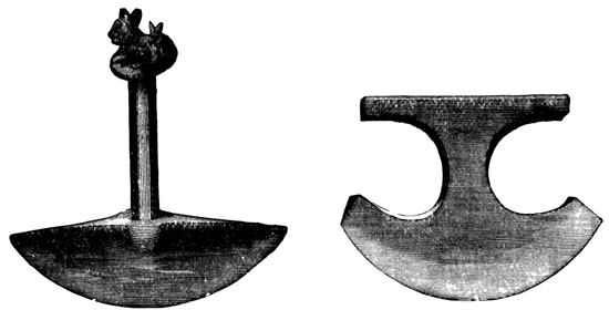
Peruvian Copper Implements.
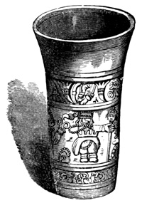
Golden Vase from Peru.
Huaca is the Peruvian name for any venerated or holy structure, but is usually applied to the conical mounds of the country, mostly mounds of sepulture. Thousands of these have been opened and from them have been taken a great variety of relics, together with preserved mummies wrapped in native cloth. The relics include implements and ornaments of metal, stone, bone, shell, and wood. The Peruvians seem to have had a more abundant supply of metals than the civilized nations of North America, and to have been at least equally skillful in working them. The cuts show specimens of copper cutting implements, of which a great variety are found. Besides copper, they had gold and silver in much greater abundance than the northern artisans, and the arts of melting, casting, soldering, beating, inlaying, and carving these metals, were carried to a high degree of perfection. Every one has read the marvelous accounts, 793 naturally exaggerated, but still with much foundation in truth, of the immense quantities of gold obtained by the Spaniards in Peru; of the room filled with golden utensils by the natives as a ransom for the Inca Atahuallpa. A golden vase is shown in the cut. Large quantities of gold have been taken in more modern times from the huacas, where it was doubtless placed in many cases to keep it from the hands of the conquerors. Most of the articles have of course gone to the melting-pot, but sufficient specimens have been preserved or sketched to show the degree of excellence to which the Peruvian smiths 794 had attained. The following cut shows a silver vase. The search for treasure in the huacas still goes on, and is not always unrewarded. Tin, lead, and quicksilver are said to have been worked by the natives. Iron ore is very abundant in Peru, but the only evidence that iron was used is the difficulty of executing the native works of excavation and cutting stone without it, and the fact that the metal had a name in the native language. No traces of it have ever been found. The cut shows two copper tweezers.
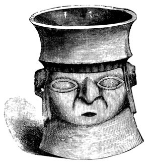
Silver Vase from Peru.
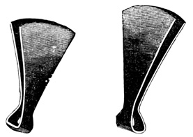
Copper Implements from Peru.
ABORIGINAL ROADS.
Among the most remarkable Peruvian remains are the paved roads which crossed the country in every direction, especially from north to south. Two of the grandest highways extended from the region north of Quito southward to Cuzco, and according to 795 some authors still farther to Chili. One runs over the mountains, the other chiefly through the plains. Their length is at least twelve hundred miles, and the grading of the mountain road presented, as Mr Baldwin believes, far greater difficulties than the Pacific Railroad. These roads are from eighteen to twenty-six feet wide, protected at the sides by a thick wall, and paved generally with stone blocks, but sometimes with a mixture of cement and fine stone—an aboriginal infringement on the 'Macadam' process. The highways followed a straight course, and turned aside for no obstacle. Ravines and marshes were filled up with masonry, and the solid rock of the mountains was cut away for many miles. But when rivers were encountered, light suspension bridges seem to have been resorted to instead of massive stone bridges. It is true that the most glowing accounts of these roads are found in the writings of the Conquistadores, and that only ruined portions now remain; but the reports of Humboldt and others, respecting the remains, leave little doubt of their former imposing character.
Articles of pottery, of which three specimens are shown in the cuts, are at least equal in material and 796 finish to those produced by Nahua and Maya potters. The finest specimens are vases found in sepulchral deposits, and many utensils designed for more common use are preserved by the present inhabitants, and are preferred for their solidity to the work of modern potters. Small images of human and animal forms in terra cotta, as in gold and silver, are of even more frequent occurrence than utensils. There is no evidence that the images were fashioned with a different purpose here and in the north; some were simply ornaments, a few probably portraits, others miniature deities, deposited from superstitious motives with the dead.
CITY OF THE INCAS.
About twenty miles south of Lima, in the valley of Lurin, and overlooking the sea, are the ruins of Pachacamac, shown in the cut. This was a city of the Incas, that is, it belonged to the later period of Peruvian civilization. All the structures were built of adobes, and are much dilapidated. The Temple of the Sun stands on a hill six hundred feet high, the upper portion of which shows traces of having been divided into terraces over thirty feet high and five to eight feet wide. The adobe wall which surrounds the temple is from eight to eleven feet thick, and is only standing to the height of four to five feet. 797 The ruined structures are very numerous, and on one of the inner walls some traces of red and yellow paint are visible.
In the district of Santo Tomas in the north, at Cuelap, a grand and peculiar ruin is described by Sr Nieto in an official government report. A mass—of earth, probably, although not fully examined in the interior—is faced with a solid wall of hewn stone, and is thirty-six hundred feet long, five hundred and seventy feet wide, and one hundred and fifty feet in perpendicular height. On the summit stands another similar structure six hundred by five hundred feet and also one hundred and fifty feet high. The lower wall is pierced with three entrances to an inclined plane leading in a curved line to the summit, with sentry-boxes at intervals and on the summit. These passages are six feet wide at the base but only two at the top, and those of the second story are similar. In both stories there are chambers, in the walls of which and in the outer walls there are small niches containing 798 skeletons. Some of the upper chambers are paved with large flat stones, on each of which lies a skeleton. The report of this immense structure is probably founded on fact but greatly exaggerated.
RUINS OF GRAN-CHIMÚ.
The ruins of Gran-Chimú, in the vicinity of Truxillo, cover an area of three quarters of a league, and beyond these limits are seven or eight great enclosures with adobe walls, in some of which are conical mounds, or huacas, and some traces of buildings. The two principal structures, called palaces, are surrounded by walls one hundred and forty feet high, sixteen feet thick at the base, but tapering to three or four feet at the top. Round one of the palaces the wall is double, as shown by the section in the cut. The English translation of Rivero, instead of surrounding one of the palaces with a double wall like the original, represents one wall as being twice as high and thick as the other. These walls, like all the structures of Gran-Chimú, are of adobes nine by eighteen inches, resting on a foundation of rough stones laid in clay. In connection with the larger palace is a square containing apartments, the walls of which are a conglomerate of gravel and clay, smooth, and whitewashed on the interior. There are also plazas and streets regularly laid out, and a reservoir which by a subterranean aqueduct was supplied with 799 water from the Rio Moche two miles distant. This palace—and by palace, a group of edifices within an enclosure, rather than a single edifice, seems to be meant—has two entrances, one in the middle of each long side. The second palace is one hundred and twenty five yards further east, and is also divided by squares and narrow streets. At one end is the huaca of Misa, surrounded by a low wall, pierced by galleries and rooms in which have been found mummies, cloths, gold and silver, implements, and a wooden idol with pieces of pearl-shell. All the inner walls are built of a mass of clay and gravel or of adobes. The cut shows specimens of the ornamentation, which seem to bear outwardly a slight resemblance to the mosaic work of Mitla, although the method of their construction is not explained. "Outside of these notable edifices, there is an infinite number of squares and small houses, some round and others square, which were certainly dwellings of the lower classes, and whose great extent indicates that the population must have been very large." Among the ruins are 800 many truncated conical mounds, or huacas, of fine gravel, from some of which interesting relics and large quantities of gold have been taken. The so-called Temple of the Sun is three quarters of a league east of the city near Moche, in connection with which are several adobe structures, one of them, perhaps the temple itself, so far as may be determined by Rivero's vague account, made worse than vague in the English translation, is a regular pyramid of adobes. It is four hundred and fourteen by four hundred and thirty feet at the base, three hundred and forty-five feet wide on the summit, and over eighty feet high, built in terraces, pierced with a gallery through the centre, and affording a fine view of the sea and the city of Truxillo.
RUINS OF HUANUCO.
The cut represents a ruin on the Island of Titicaca in the lake of the same name. These island remains are among the oldest of Peruvian antiquities, and all 801 the structures are built of hewn stone. Respecting these ruins we only learn from the explorers that "though not very imposing" they are well preserved, "with windows and doors, with posts and thresholds of hewn stone also, these being wider below than above." Another ruin on the same island is shown in the cut on the following page.
At Chavin de Huanta the structures are built of hewn stone very accurately joined without any mortar in sight on the outside, and a rubble of rough stones and clay on the inside. In a building spoken of as a fortress there is a covered way with rooms at its sides, all covered with sandstone blocks about twelve feet long. The walls are six feet thick, and in the interior is the opening to a subterranean passage which is said to lead under the river to another building. In the gallery human bones and some relics were found. The modern town is built mostly over the ruins of an ancient aqueduct, and a bridge over the stream is built of three immense stones, each over twenty feet long, taken from the fort. The ancient people were especially skillful in the construction of aqueducts, some of which were reported by the early writers as several hundred miles in length, and a few of which of less extent are still in actual use.
RUINS OF HUANUCO.
The cut represents the Mirador, or look-out, at Huanuco el Viejo. This structure measures about one 803 hundred by one hundred and sixty feet at the base, and is about fifteen feet high, in a pyramidal form without terraces and furnished with a parapet wall enclosing the summit platform. The foundation is of rough stones, which form two steps projecting four or five feet, not clearly indicated in the cut. The walls or facings are of hewn blocks of limestone about four feet and a half long by a foot and a half thick. The blocks are very accurately cut and laid in cement. The interior is filled with gravel and clay, with a concavity in the centre popularly supposed to communicate by means of a subterranean gallery with the palace some half a mile distant. From a doorway in the parapet wall on the south an inclined plane—which seems often to have taken the place of a stairway in Peru—leads down to the ground. On the wall at each side of the entrance crouches an animal in stone, so much damaged that its kind cannot be determined.
Another noted ruin at Huanuco is that whose entrance is shown in the cut. The walls are of round stones irregularly laid in mortar, a kind of rubble called by the Peruvians pirca, but the gateway, shown in the cut, is built of hewn blocks three varas—as Rivero says, probably meaning feet—by one and a half. The lintel is one stone block eleven feet long, and the inclined posts are said to be of one piece, although 804 the cut indicates that each is composed of four. The animals sculptured over the gateway at the sides are called monkeys by Rivero. Within the structure there are five similar gateways shown in the preceding cut and in the following ground plan. In the interior are rooms of cut stone, with niches in the walls, an aqueduct, and a reservoir. The quarries that supplied the stone for the Huanuco structures are still seen about half a mile away. Many traces of buildings of round stones in clay are found in the same vicinity.
Near Chupan, a tower is mentioned on the verge of a precipice overhanging the Rio Marañon. In the district of Junin there is a line or system of fortifications on the precipitous cliffs of a ravine, built mostly of micaceous slate. At Cuzco are some remains of the city of the Incas, and there is said to be some evidence that this city was founded on the ruins of another of an earlier epoch; the latter including part of the fortification of Ollantaytambo, built of stones cut in irregular forms, some of them of great size, and very neatly joined. 805
MONUMENTS OF TIAHUANACO.
The ruins at Tiahuanaco, ten or twelve miles from Lake Titicaca, are considered among the most ancient in Peru. They include stones from fifteen to twenty feet high, some cut, others rough, standing in rows. All the structures were in a very dilapidated condition when the Spaniards came, and some very large stone statues in human form were found, with stone columns. One of the most interesting monuments is the monolithic doorway shown in the cut. The opening is seventy-six inches high and thirty-eight wide. Rivero and Tschudi represent the sculptured figures in the small squares as being profiles of the human face instead of those shown in Baldwin's cut. There were several of these doorways. Several idols and some very large blocks of cut stone were dug up in 1846, and the latter used for mill-stones. The blocks are described as thirty feet long, eighteen feet wide, and six feet thick, being shaped so as to form a channel when one was placed upon another.
A building on the Island of Coati, in Lake Titicaca, 806 is shown in the cut. Rivero gives a view and plan of another large palace, consisting for the most part of a single line of low apartments built round three sides of a rectangular court, and bearing some resemblance, as Mr Baldwin remarks, to the Central American structures, except that it does not rest on a pyramidal foundation. Rock-inscriptions of the same rude class so often mentioned in the northern continent, occur also in Peru, although somewhat less frequently, so far as may be judged by the reports of explorers.
CONCLUSION.
The contents of the preceding pages may be sufficient to show the reader that the resemblance between the southern and northern monuments, if any resemblance exists, is very faint. The Maya and Peruvian peoples may have been one in remote antiquity; if so, the separation took place at a period long preceding any to which we are carried by the material relics of the Votanic empire, and of the most ancient epoch of the southern civilization, or even by traditional annals and the vaguest myths. There seems to be a natural tendency even among antiquarians to attribute all American civilizations to a common origin, constantly moving back the date as investigation progresses. This tendency has much 807 in common with that which so persistently traces American civilization to the old world, old-world culture to one centre, the human race to one pair, and the first pair to a special creation, performed at a definite time and point in Asia. Be the results of the tendency referred to true or false, it is evident that superstition has contributed more than science to the zeal that has supported them.
END OF THE FOURTH VOLUME.
[II-1] A general view of South American antiquities is given in another chapter of this volume.
[II-2] I might except a Roman coin of the time of Cæsar Augustus, and a buried ship, or galley, of antique model, said to have been discovered in early times by the Spaniards in the vicinity of Panamá, and which figured somewhat largely in early speculations on the question of American origin. I need not say that the evidence for the authenticity of such a discovery is extremely unsatisfactory. See: García, Orígen de los Ind., p. 174, with quotation from Marineo, Sumario, (Toledo, 1546,) fol. 19—apparently the original authority in the matter—and a reference to other editions and works; Solórzano Pereyra, De Ind. Jure, tom. i., p. 93; Id. Política Ind., tom. i., p. 22; Horn, Orig. Amer., p. 13; Simon, Noticias Historiales, (Cuença, 1626,) lib. i., cap. x.
[II-3] Authorities on the Isthmian antiquities are not numerous. Mr Berthold Seemann claims to have been the first to discover stone sculptures near David in 1848, and he read a paper on them before the Archæological Institute of London in 1851. He also briefly mentions them in his Voy. Herald, vol. i., pp. 312-13, for which work drawings were prepared but not published. Some of the drawings were, however, afterwards printed in Bollaert's Antiq. Researches in N. Granada, (Lond., 1860,) and a few cuts of inscribed figures also inserted with farther description by Seemann in Pim and Seemann's Dottings, pp. 25-32. It is stated in the last-named work that M. Zeltner, French Consul at Panamá, whose private collection contained specimens from Chiriquí, published photographs of some of them with descriptive letter-press. Bollaert also wrote a paper on 'The Ancient Tombs of Chiriquí,' in Amer. Ethno. Soc., Transact., vol. ii., pp. 151, 159. On various occasions from 1859 to 1865, travelers or residents on the Isthmus, chiefly parties connected with the Panamá railway, sent specimens, drawings, and descriptions to New York, where they were presented to the American Ethnological Society, or exhibited before and discussed by that body at its monthly meetings, an account of which may be found in the Hist. Mag., vol. iii., p. 240, vol. iv., pp. 47-8, 113, 144, 176-7, 239-41, 274, 338, vol. v., pp. 50-2, vol. vi., pp. 119, 154, vol. ix., p. 158. A report on the Chiriquí antiquities by Dr Merritt was printed by the same society. The above, with slight mentions in Cullen's Darien, p. 38, from Whiting and Shuman's Report on Coal Formations, April 1, 1851, and in Bidwell's Isthmus, pp. 37-8, from Hay's Report, in Powles' N. Granada, are the only sources of information on the subject with which I am acquainted.
[II-4] Pim and Seemann's Dottings, pp. 25, 28-31; Seemann's Voy. Herald, vol. i., pp. 312-13; Hist. Mag., vol. iv., p. 338.
[II-5] Hist. Mag., vol. ix., p. 158.
[II-6] Id., vol. iii., p. 240, vol. iv., pp. 47-8, 239-40.
[II-7] Three statues presented by Messrs Totten and Center in 1860 were about two feet high, of a dark, hard stone, in human form with features and limbs distorted. Two of them had square tapering pedestals apparently intended to support the figures upright in the ground. Id., vol. iv., p. 144.
[II-8] Id., vol. iv., pp. 239-40, 274.
[II-9] Hist. Mag., vol. iv., pp. 144, 177, 240-1, 274.
[II-10] Seemann's Voy. Herald, vol. i., p. 314.
[II-11] Cullen's Darien, p. 38.
[II-12] Pim and Seemann's Dottings, pp. 25-32; Tate's Ancient British Sculptured Rocks.
[II-13] Bidwell's Isthmus, p. 37; Hist. Mag., vol. iv., p. 176.
[II-14] 'A much higher antiquity must be assigned to these hieroglyphics than to the other monuments of America.' Voy. Herald, vol. i., p. 313.
[II-15] Hist. Mag., vol. v., p. 50.
[II-16] Vol. i., chap. vii. of this work.
[II-17] Merritt and Davis, in Hist. Mag., vol. iv., pp. 176, 274.
[II-18] In a work which I have not seen. That author's Coup d'Œuil sur la République de Costa Rica, and Memoir on the Boundary Question, furnish no information on the subject.
[II-19] Wagner and Scherzer, Costa Rica, pp. 465-6, 471, 522-4, 561.
[II-20] Squier's Nicaragua, (Ed. 1856,) vol. ii., pp. 338-9, and plate.
[II-21] Boyle's Ride, vol. ii., p. 86; Hist. Mag., vol. vi., p. 119.
[II-22] Boyle's Ride, vol. i., pp. 25-6.
[II-23] Meagher, in Harper's Mag., vol. xx., p. 317.
[II-24] Reichardt, Cent. Amer., pp. 121-2.
[II-25] Squier's Nicaragua, p. 511.
[II-26] Pownal, in Archæologia, vol. v., p. 318, pl. xxvi.; Humboldt, Vues, tom. ii., p. 205, pl. xiii.; (Ed. in folio, pl. xxxix.); Id., in Antiq. Mex., tom. i., div. ii., pp. 27-8, tom. ii., suppl. pl. vii., fig. xi.
[II-27] Colon, Carta, in Navarrete, Col. de Viages, tom. i., p. 307; Helps' Span. Conq., vol. ii., p. 138.
[II-28] Boyle's Ride, vol. i., pp. 296-9; Pim and Seemann's Dottings, p. 401.
[II-29] Bard's (E. G. Squier) Waikna, or Adventures on the Mosquito Shore, pp. 216-17, 254, 258-60. The 'King of the Mosquitos' somewhat severely criticised the work, in which, by the way, His Royal Highness is not very reverently spoken of, as 'a pack of lies, especially when it was notorious that the author had never visited the Mosquito Coast.' Pim and Seemann's Dottings, p. 271. 'Le désert qui s'étend le long de la côte de la mer des Antilles, depuis le golfe Dulce jusqu'à l'isthme de Darien, n'a pas offert jusqu'à présent de vestiges indiquant que le peuple auquel on doit les monuments de Palenquè, de Quiragua, de Copan, ait émigré au sud de l'isthme.' Friederichsthal, in Nouvelles Annales des Voy., 1841, tom. xcii., p. 301.
[II-30] Squier's Nicaragua; Boyle's Ride Across a Continent. Mr E. G. Squier resided in Nicaragua as Chargé d'Affaires of the United States during the year 1849-50. On account of his position he was afforded facilities for research not enjoyed by other foreigners, and which his well-known antiquarian tastes and abilities prompted and enabled him to use to the best advantage during the limited time left from official duties. Besides the several editions of the work mentioned, Mr Squier's accounts or fragments thereof have been published in periodicals in different languages; while other authors have made up almost wholly from his writings their brief descriptions of Nicaraguan antiquities. See Wappäus, Geog. u. Stat., p. 341; Sivers, Mittelamerika, pp. 128-35; Tiedemann, in Heidelberger Yahrb., 1851, pp. 81, 91, 170; Müller, Amerikanische Urreligionen, pp. 463, 484, 498, 544; Andree, in Westland, tom. ii., pp. 3, 251; Heine, Wanderbilder, p. 181; Holinski, La Californie, p. 252; Baldwin's Anc. Amer., p. 124. Frederick Boyle, F.R.G.S., visited the country in 1865-6, with the examination of antiquities as his main object. Both works are illustrated with plates and cuts; and both authors brought away interesting specimens which were deposited by the American in the Smithsonian Institution, and by the Englishman in the British Museum. 'J'avoue n'avoir rien rencontré d'important dans mes lectures, en ce qui touche les états de Costa Rica et de Nicaragua.' Dally, Races Indig., p. 12.
[II-31] 'Nicht ... von abgesonderten Steinen umgeben, sondern fanden sich, in einer Tiefe von drei Fuss, unregelmässig über die Ebene zerstreut.' Friederichsthal, in Sivers, Mittelamerika, p. 128; 'Les îles du lac, notamment Ométépé semblent avoir servi de sépultures à la population des villes environnantes, ... car on y rencontre de vastes nécropoles ou villes des morts, ressemblant par leur caractère à celles des anciens Mexicains.' Id. in Nouvelles Annales des Voy., 1841, tom. xcii., p. 297; in Lond. Geog. Soc., Jour., vol. xi., p. 100; Woeniger, in Squier's Nicaragua, pp. 509-10; Boyle's Ride, vol. ii., p. 86.
[II-32] Plan showing their relative position, in Squier's Nicaragua, p. 477.
[II-33] 'On y trouve (sur les îles du lac) encore un grand nombre de débris de constructions antiques.' Brasseur de Bourbourg, in Nouvelles Annales des Voy., 1855, tom. cxlvii., p. 135.
[II-34] Boyle's Ride, vol. ii., p. 42.
[II-35] Squier's Nicaragua, pp. 439-41.
[II-36] Boyle's Ride, vol. ii., pp. 10-11.
[II-37] Id., vol. ii., pp. 161-2; Squier's Nicaragua, p. 396.
[II-38] 'Ils montrent avec effroi les débris de la cité maudite, encore visibles sous la surface des eaux.' Brasseur de Bourbourg, in Nouvelles Annales des Voy., 1855, tom. cxlvii., p. 149.
[II-39] Belcher's Voyage, vol. i., p. 171; Squier's Nicaragua, p. 299.
[II-40] Squier's Nicaragua, pp. 306-8; Id., (Ed. 1856,) vol. ii., p. 335.
[II-41] Lond. Geog. Soc., Jour., vol. xi., p. 100; Nouvelles Annales des Voy., 1811, tom. xcii., p. 297; Squier's Nicaragua, (Ed. 1856,) vol. ii., p. 335.
[II-42] Boyle's Ride, vol. i., pp. 159-61, 195-212, 291; Pim and Seemann's Dottings, p. 126; On the buildings of the ancient Nicaraguans, see vols. ii. and iii. of this work; also Brasseur de Bourbourg, Hist. Nat. Civ., tom. ii., p. 114; Peter Martyr, dec. vi., lib. v.; Squier's Nicaragua, (Ed. 1856,) vol. ii., pp. 335-6.
[II-43] Boyle's Ride, vol. i., pp. 154-5.
[II-44] Froebel, Aus Amer., tom. i., pp. 379-80; Id., Cent. Amer., pp. 119-20.
[II-45] Livingston, in Squier's Nicaragua, (Ed. 1856,) vol. ii., pp. 334-5.
[II-46] Boyle's Ride, vol. i., p. 212.
[II-47] Heine, Wanderbilder, p. 181.
[II-48] Squier's Nicaragua, pp. 435-41; 'Sur les parois du rocher on voit encore des dessins bizarres gravés et peints en rouge, tels que les donne M. Squier.' Brasseur de Bourbourg, in Nouvelles Annales des Voy., 1855, tom. cxlvii., p. 147.
[II-49] Mr Boyle found the cliff-paintings to have suffered much since Mr Squier's visit, thirteen years before; so much so that none could be made out except the winged snake and red hand. He also states that yellow as well as red pictures are here to be seen. Boyle's Ride, vol. ii., pp. 160-1; Squier's Nicaragua, pp. 391-6. In a letter, a fragment of which is published in the Annual of Scientific Discovery, 1850, p. 364, Mr Squier declares the paintings precisely in the style of the Mexican and Guatemalan MSS., closely resembling, some of the figures indeed identical with, those of the Dresden MS. Pim and Seemann, Dottings, p. 401, also noted the 'coiled-up lizard' and other pictures, calling the locality Asososca Lake. Scherzer, Wanderungen, p. 72, and Trav., vol. i., p. 77, mentions also sculptured figures on this crater-wall.
[II-50] Boyle's Ride, vol. ii., pp. 142-3.
[II-51] Squier's Nicaragua, pp. 510-17. There were formerly many idols resembling those of Zapatero, but they have been buried or broken up. A group is reported still to be found near the foot of Mt Madeira, but not seen. Woeniger, in Id., p. 509. Froebel, Aus Amer., tom. i., p. 261.
[II-52] Squier's Nicaragua, pp. 180, 470-90, 496; Id., (ed. 1856,) vol. ii., p. 336; Id., in Annual Scien. Discov., 1851, p. 388. 'L'île de Zapatero a fourni des idoles qui sont comme des imitations grossières du fameux colosse de Memnon, type connu de cette impassibilité réfléchie que les Égyptiens donnaient à leurs dieux.' Holinski, La Californie, p. 252. 'There still exist on its surface some large stone idols.' Scherzer's Trav., vol. i., p. 31. 'Statues d'hommes et d'animaux d'un effet grandiose, mais d'un travail qui annonce une civilisation moins avancée que celle de l'Yucatan ou du Guatémala.' Brasseur de Bourbourg, in Nouvelles Annales des Voy., 1855, tom. cxlvii., p. 135; Boyle's Ride, vol. ii., p. 122.
[II-53] Boyle's Ride, vol. ii., pp. 42-7; Friederichsthal, in Lond. Geog. Soc., Jour., vol. xi., p. 100; Id., in Nouvelles Annales des Voy., 1841, tom. xcii., p. 297.
[II-54] Squier's Nicaragua, pp. 448-57. The head of fig. 1 is the Mexican sign tochtli. The animal in fig. 2 may be intended for an alligator. Id., in Annual Scien. Discov., 1851, p. 387.
[II-55] Squier's Nicaragua, pp. 285-7, 295-301, 402; Id., in Annual Scien. Discov., 1850, p. 363; Wappäus, Geog. u. Stat., p. 341.
[II-56] Belcher's Voyage, vol. i., p. 172; Squier's Nicaragua, pp. 179, 402.
[II-57] Squier's Nicaragua, pp. 264-5, 301-7: 'Some of the statues have the same elaborate head-dresses with others of Copan; one bears a shield upon his arm; another has a girdle, to which is suspended a head.' Id., in Annual Scien. Discov., 1850, p. 363.
[II-58] If idols, to Mr Boyle they indicate a worship of ancestors, of which, however, there seems to be no historical evidence. Mr Pim suggests that the idols of mild expression may be those worshiped before, and those of more ferocious aspect after, the coming of the Aztecs.
[II-59] The other Chontal statues more or less fully described are the following: A huge monolith, of which twelve feet six inches were unearthed, having a cross on the breast with two triangles, and the arms and legs doubled back; a head four feet eight inches in circumference, and one foot ten inches high; an idol four feet eight inches high, wearing on its head an ornamented coronet, resembling a circlet of overlapping oyster-shells, with a cross on the left shoulder and a richly carved belt; a stone woman thirty-seven inches high, having the left corner of the mouth drawn up so as to leave a round hole between the lips, and the arms crossed at right angles from the elbows; a very rude idol with pointed cap, holes for eyes, and a slit for a mouth, whose modern use is to grind corn; and lastly, a statue with beard and whiskers. Boyle's Ride, vol. i., pp. 147-9, 158-64, 210-12, 242, 290-5; Pim and Seemann's Dottings, pp. 126-8.
[II-60] Boyle's Ride, vol. i., pp. 290-1, vol. ii., pp. 97, 144-5; Squier's Nicaragua, (Ed. 1856,) vol. ii., p. 339; Pim and Seemann's Dottings, pp. 126-7.
[II-61] Boyle's Ride, vol. i., pp. 200-2, 209, vol. ii., pp. 45-6; Squier's Nicaragua, pp. 515, 521; cut of the leg of a stone vase, Id., (Ed. 1856,) vol. ii., p. 339.
[II-62] Squier's Nicaragua, pp. 256-7.
[II-63] Boyle's Ride, vol. i., pp. 150-2, 159, vol. ii., pp. 43, 98; Squier's Nicaragua, pp. 521-2; Pim and Seemann's Dottings, pp. 126-7.
[II-64] Squier's Nicaragua, pp. 307-8, 476, 488; Pim and Seemann's Dottings, p. 128.
[II-65] Boyle's Ride, vol. i., pp. 150-1, 201, 209, vol. ii., pp. 45, 86, 90-7; Squier's Nicaragua, pp. 299, 490, 509-10; Id., (Ed. 1856,) vol. ii., pp. 335-8, 362; Pim and Seemann's Dottings, p. 126; Sivers, Mittelamerika, pp. 128-9.
[II-66] Boyle's Ride, vol. i., pp. 150-1, vol. ii., p. 87; Squier's Nicaragua, pp. 509-11.
[III-1] Squier's Cent. Amer., p. 341; Baldwin's Anc. Amer., pp. 123-4.
[III-2] 'Hier sollen sich gleichfalls noch ununtersuchte interessante indianische Monumente finden.' Reichardt, Cent. Amer., p. 83. 'Nothing positive is known concerning them.' Squier's Cent. Amer., p. 341. Hassel says they are the remains of the old Indian town of Zacualpa. Mex. Guat., p. 368.
[III-3] Squier's Nicaragua, (Ed. 1856,) vol. ii., p. 335.
[III-4] Young's Narrative, p. 48. Mr Young also saw, but does not describe, several 'curious things' besides these chairs where once the antiguos seated, perhaps, their gods of stone.
[III-5] Sivers, Mittelamerika, p. 182. 'I understand the adjacent island, Roatan, exhibits yet more proofs of having been inhabited by an uncivilized race.' Young's Narrative, p. 48. 'Jusqu'à ce jour on n'y a découvert aucune ruine importante; mais les débris de poterie et de pierre sculptée qu'on a trouvés ensevelis dans ses forêts, suffisent pour prouver qu'elle n'était pas plus que les autres régions environnantes privée des bienfaits de la civilisation.' Brasseur de Bourbourg, Hist. Nat. Civ., tom. iv., pp. 612-3.
[III-6] Wells' Explor. Hond., p. 553. Sivers, Mittelamerika, pp. 166-7, without reference to any particular locality, mentions pottery as frequently found in graves and among ruins, including pipe-heads, cigar-holders, drinking-cups, sacrificial vessels, and jugs.
[III-7] Squier's Cent. Amer., pp. 132-3; Scherzer's Trav., vol. ii., p. 95; Id., Wanderungen, p. 371; Wappäus, Geog. u. Stat., p. 310; Harper's Mag., vol. xix., p. 610, with a cut of the mastodon's tooth.
[III-8] Visit to the Guajiquero Ind., in Harper's Mag., vol. xix., pp. 608-11. For account of the Dresden MS., see vol. ii. of this work.
[III-9] Squier's Cent. Amer., pp. 134-9; Scherzer's Trav., vol. ii., pp. 95; Id., Wanderungen, p. 371; Wappäus, Geog. u. Stat., p. 310.
[III-10] Atlantic Monthly, vol. vi., p. 49. Las Casas has the following on the province of Honduras at the time of the conquest: 'Tenia Pueblos innumerables, y una vega de treinta leguas y mas, toda muy poblada ... la ciudad de Naco que tenia sobre dos cientas mil animas, y muchos edificios de piedra, en especial los templos en que adoraban.' Hist. Apologética, MS., cap. lii.
[III-11] On the north bank of the Copan, in latitude 14° 45´, longitude 90° 52´, four leagues east of the Guatemalan line, twenty leagues above the junction of the Motagua, which is sixty-five leagues from the bay. Galindo, in Amer. Antiq. Soc., Transact., vol. ii., pp. 547-50. Latitude 14° 39´, longitude 91° 13´ west of Paris; six hundred and forty mètres above the sea level; forty-five leagues from San Salvador, fifty-eight leagues from Guatemala. Id., in Antiq. Mex., tom. i., div. ii., p. 76. 'Thirty miles east of Chiquimula.' Cyclopedia. Three hundred miles from the sea, (perhaps by the windings of the stream). By reason of accidental injury to the instruments the latitude and longitude could not be obtained. Situated on the east bank of the stream according to plan. Stephens' Cent. Amer., vol. i., p. 132. 'Until lately erroneously located in Guatemala, are many miles within the boundaries of Honduras, and but a few days' travel from the original landing-place of the Spanish discoverers.' Wells' Explor. Hond., p. 552. Not to be confounded with Coban, metropolis of Vera Paz, one hundred and fifty miles west of Copan. Gallatin, in Amer. Ethnol. Soc., Transact., vol. i., p. 5.
[III-12] 'Copan was a colony of Tultecos.' 'The Spaniards found Copan inhabited, and in the summit of its perfection.' Galindo, in Amer. Antiq. Soc., Transact., vol. ii., pp. 546, 549. On the expedition of Cortés referred to, see Alaman, Disertaciones, tom. i., pp. 203-25; Cogolludo, Hist. Yucathan, pp. 45-58; Cortés, Cartas, pp. 396-492; Gomara, Conq. Mex., fol. 245-74; Herrera, Hist. Gen., dec. iii., lib. vii., cap. viii., to lib. viii., cap. vii.; Peter Martyr, dec. viii., lib. x.; Prescott's Mex., vol. iii., pp. 278-99; Torquemada, Monarq. Ind., tom. i., p. 588; Villagutierre, Hist. Conq. Itza, pp. 39-50; Helps' Span. Conq., vol. iii., pp. 33-57. Stephens seems to be in some doubt as to the identity of ancient and modern Copan, there being 'circumstances which seem to indicate that the city referred to was inferior in strength and solidity of construction, and of more modern origin.' Cent. Amer., vol. i., pp. 99-101. 'The ruins of the city of that name and their position do not at all agree with the localities of the severe battle which decided the contest.' 'There is every appearance of these places (Copan and Quirigua) having been abandoned long before the Spanish conquest.' Gallatin, in Amer. Ethno. Soc., Transact., vol. i., p. 171. 'Whatever doubts may have existed on the Subject, and as regards the high antiquity of the Ruins of Copan ... they are set at Rest by this Account of Palacio. They were evidently very nearly in their present Condition, at the Time he wrote, three hundred Years ago.' Squier's Pref. to Palacio, Carta, p. 9. 'Certain it is that the latter was a ruin long before the arrival of the Spaniards.' Squier's Cent. Amer., p. 345.
[III-13] The Licenciado Diego García de Palacio, Oidor (Justice, not Auditor) of the Real Audiencia of Guatemala, in accordance with the duties of his office, traveled extensively in Guatemala and adjoining provinces, embodying the results of his observations on countries and peoples visited in a relation to King Felipe II. of Spain, dated March 8, 1576, which document is preserved in the celebrated Muñoz collection of MSS. It contains a description of the ruins of Copan which exists in print as follows; Palacio, Relacion, in Pacheco, Col. Doc. Inéd., tom. vi., pp. 37-9; Palacio, Carta dirijida al Rey, Albany, 1860, pp. 88-96, including an English translation by E. G. Squier; Palacios, Description, in Ternaux-Compans, Recueil de Doc., pp. 42-4, which is a somewhat faulty French translation; Nouvelles Annales des Voy., 1843, tom. xcvii., pp. 38-40; Squier's Cent. Amer., pp. 242-4; and it is mentioned by Señor J. B. Muñoz in a report on American antiquities, written as early as 1785, of which a translation is given in Brasseur de Bourbourg, Palenqué, pp. 7-8; Herrera, Hist. Gen., quotes, or rather takes from, Palacio's relation extensively, but omits the portion touching Copan. This first account of the ruins is by no means the worst that has been written. Although naturally incomplete, it is evidently a bona-fide description by an actual visitor, written at a time when the ruins were very nearly in their present condition, and their origin wrapped in mystery, although the stirring events of 1530 were yet comparatively fresh in the memory of the natives. The next account is that in Fuentes y Guzman, Recopilacion Flórida de la Historia del Reino de Guatemala, MS., 1689. This work was never printed, although said to be in preparation for the press in 1856. Ximenez, Hist. Ind. Guat., p. vii. Fuentes' description of Copan was, however, given to the public in 1808, in Juarros, Compendio de la Hist. de la Ciudad de Guatemala, a work translated into English in 1823, under the title of A Statistical and Commercial Hist. of the Kingdom of Guatemala. From Juarros the account is taken by many writers, none, so far as I know, having quoted Fuentes in the original. Where the latter obtained his information is not known. His account is brief, and justly termed by Brasseur de Bourbourg, Palenqué, p. 14., 'la description menteuse de Fuentes,' since nothing like the relics therein mentioned have been found in later times. Yet it is possible that the original was mutilated in passing through Juarros' hands. This description, given in full in my text, is repeated more or less fully in Stephens' Cent. Amer., vol. i., p. 131; Warden, Recherches, p. 71; Conder's Mex. Guat., vol. ii., pp. 299-300; Malte-Brun, Précis de la Géog., tom. vi., pp. 470-1; Humboldt, in Nouvelles Annales des Voy., 1827, tom. xxxv., p. 329; Hassel, Mex. Guat., pp. 385-6; Cortés, Adventuras, p. 321, and in many other works mentioned in connection with matter from later sources. Next we have the exploration of Colonel Juan Galindo, an officer in the Central American service, sometime governor of the province of Peten, made in April, 1835. An account of his observations was forwarded to the Société de Géographie of Paris, and published in the Bulletin of that Society, and also in the Literary Gazette of London. A communication on the subject was also published in Amer. Antiq. Soc., Transact., vol. ii., pp. 545-50; and the information furnished to the French Geographical Society was published en résumé in Antiq. Mex., tom. i., div. ii., pp. 73, 76. Ten drawings accompanied Galindo's report, but have never been published, although the author announced the intention of the Central American government to publish his report in full with plates. He says, 'je suis le seul qui ait examiné les ruines de Copan, et qui en ait fait la relation,' but he knew nothing of Palacio's visit. 'Not being an artist, his account is necessarily unsatisfactory and imperfect, but it is not exaggerated.' Stephens' Cent. Amer., vol. i., p. 132. 'Had an enquiring mind, but a very superficial Education.' Squier's Pref. to Palacio, Carta, p. 8. Most of Galindo's account is also given with that of Juarros, in Bradford's Amer. Antiq., pp. 96-9; also some information from the same source in Brownell's Ind. Races, p. 52, and in Larenaudière, Mex. et Guat., p. 267. In 1839 Messrs Stephens and Catherwood visited Copan. Mr Stephens, as I find by a careful examination of his book, spent thirteen days in his survey, namely, from November 17 to 30; while Mr Catherwood spent the larger part of another month in completing his drawings. The results of their labors appeared in 1841 and 1844 under the titles:—Stephens' Incidents of Travel in Central America, vol. i., pp. 95-160, with twenty-one plates and seven cuts; Catherwood's Views of Ancient Monuments in Central America, in folio, with large lithographic plates. Slight descriptions of the ruins, made up chiefly from Stephens, may be found as follows:—Helps' Span. Conq., vol. iii., pp. 54-5; Willson's Amer. Hist., pp. 76-9, with plan and cut; Nouvelles Annales des Voy., 1841, tom. xcii., pp. 64-74, 57, with plan and plates; Jones' Hist. Anc. Amer., pp. 57-69, 116; Davis' Antiq. Amer., pp. 4-5; Id., (Ed. 1847,) p. 30; Dally, Races Indig., pp. 12-13; Baldwin's Anc. Amer., pp. 111-14, with cut; Wappäus, Geog. u. Stat., p. 308; Tiedemann, Heidelb. Yahrb., 1851, p. 85; Larenaudière, Mex. et Guat., pl. 9-12, the text being from Galindo and Juarros; Reichardt, Cent. Amer., pp. 91-2; Amérique Centrale, Colonization, pt. ii., p. 68; Müller, Amerikanische Urreligionen, pp. 462-4, 483; Macgregor's Progress of Amer., pp. 877-8; Frost's Great Cities of the World, pp. 279-82, with cut. Dr Scherzer in 1856 started to explore Copan, but, owing to the political state of the country at the time, was unable to get nearer than Santa Rosa, where the padre said moreover that recent land-slides had much injured the effect of the ruins. This author gives, however, a brief account made up from Stephens, Galindo, and Juarros. Scherzer's Trav., vol. ii., pp. 41, 86-7, 94-5. Id., Wanderungen, pp. 332, 366, 371. In September, 1856, the Jesuit Padre Cornette is said to have visited the ruins; M. César Daly, at a date not mentioned, prepared on the spot plans and drawings of the different structures which he intended to publish in the Revue Générale de l'Architecture, but whether or not they have ever appeared, I know not; the Abbé Brasseur de Bourbourg made two visits to Copan in 1863 and 1866; some slight additional information on the subject was communicated by Mr Center, on authority not given, at a meeting of the American Ethnological Society in February, 1860; and Mr Hardcastle, who had spent several weeks in exploring the ruins, furnished some farther notes at a meeting of the same society in April, 1862; and, finally, photographs were made of the ruins by M. Ellerly, director of the Alotepeque silver-mines. But these later explorations have not as yet afforded the public much information, except that the photographs mentioned, when compared by Brasseur de Bourbourg with Catherwood's plates, show the latter as well as Stephens' descriptions to be strictly accurate. Brasseur de Bourbourg, Hist. Nat. Civ., tom. i., p. 96, tom. ii., p. 493; Id., Palenqué, pp. 8, 17; Hist. Mag., vol. v., p. 114, vol. vi., p. 154.
[III-14] The only unfavorable criticism of Mr Stephens' work within my knowledge, is that 'the Soul of History is wanting!' 'The Promethean spark by which the flame of historic truth should illuminate his work, and be viewed as a gleaming beacon from afar, to direct wanderers through the dark night of wonders, has found no spot to rest upon and to vivify!' Jones' Hist. Anc. Amer., p. 55. And we may thank heaven for the fault when we consider the effects of the said 'Promethean spark' in the work of the immortal Jones.
[III-15] Juarros' Hist. Guat., pp. 56-7. That any such structure as the rocking hammock ever existed here is in the highest degree improbable; yet the padre at Gualan told Stephens that he had seen it, and an Indian had heard it spoken of by his grandfather. Stephens' Cent. Amer., vol. i., p. 144.
[III-16] 'The extent along the river, ascertained by monuments still found, is more than two miles.' 'Beyond the wall of enclosure were walls, terraces, and pyramidal elevations running off into the forest.' Stephens' Cent. Amer., vol. i., pp. 133, 139, 146-7. 'Extended along the bank of its river a length of two miles, as evidenced by the remains of its fallen edifices.' 'Mounts of stone, formed by fallen edifices, are found throughout the neighbouring country.' Galindo, in Amer. Antiq. Soc., Transact., vol. ii., pp. 547, 549-50. 'La carrière ... est à 2000 mètres au nord.' 'Là se trouve beaucoup de bois de sapin pétrifié.' Id., in Antiq. Mex., tom. i., div. ii., p. 76. 'The ground, being covered with ruins for many square miles, and much overgrown by a rank vegetation, would require months for a thorough examination.' 'No remains whatever on the opposite side of the river.' Hardcastle, in Hist. Mag., vol. vi., p. 154. 'Les plaines de Chapulco s'étendent entre Copan et le pied des montagnes de Chiquimula. Elles sont couvertes de magnifiques ruines.' Brasseur de Bourbourg, Hist. Nat. Civ., tom. ii., p. 105.
[III-17] Plan in Stephens' Cent. Amer., vol. i., p. 133, reproduced in Nouvelles Annales des Voy., 1841, tom. xcii., p. 57; and in Willson's Amer. Hist., p. 76. Galindo's drawings also included a plan. By reason of the disagreement between Stephens' plan and text in the matter of dimensions, I have omitted the scale as useless. The southern wall of the enclosure, to accommodate the size of my page, I have placed some two hundred feet north of its true position. Those portions of the temple shaded by cross-lines are the portions still standing according to the survey.
[III-18] The southern wall in one place rises 30 or 40 feet in steps. Stephens' Cent. Amer., vol. i., p. 134. 'One wall eighty feet high and fifty feet thick for half its height, or more, and then sloping like a roof, was formed of stones often six feet by three or four, with mortar in the interstices.' Hardcastle, in Hist. Mag., vol. vi., p. 154. Mr Center 'mentioned a Cyclopean wall ... undescribed in any publication, but reported to him by most credible witnesses, about 800 feet long, 40 feet high, —— feet thick, formed of immense hewn stone.' Hist. Mag., vol. v., p. 114. Stones 'cut into blocks.' Galindo, in Amer. Antiq. Soc., Transact., vol. ii., p. 549. Before reaching the ruins 'está señal de paredes gruesas.' Palacio, in Pacheco, Col. Doc. Inéd., tom. vi., p. 37.
[III-19] According to Stephens' text, which states that the river or west side is 624 feet, and the whole line of survey, which cannot in this case mean anything but the circumference, is 2866 feet, thus leaving 809 feet each for the northern and southern sides. His plan, and consequently my own, makes the dimensions about 790 feet north and south by 600 east and west, the circuit being thus 2780 feet. 'Not so large as the base of the great Pyramid of Ghizeh.' Stephens' Cent. Amer., vol. i., pp. 133. Galindo, Amer. Antiq. Soc., Transact., vol. ii., p. 547, makes the dimensions 750 feet east and west (He calls it north and south, but on the supposition that the ruins are on the north bank of the river instead of the east) by 600 feet north and south, a circumference of 2700 feet; or if his measurements be understood to be Spanish, their English equivalent would be about 690 by 552 feet, circuit 2484 feet. The same author, Antiq. Mex., tom. i., div. ii., p. 76, gives 653 by 524, and 2354 feet; or if French measure be understood, its equivalent is 696 by 588, and 2568 feet. As large as Saint Peter's at Rome. Davis' Antiq. of Amer., pp. 4-5.
[III-20] 'Broad terrace one hundred feet high, overlooking the river, and supported by the wall which we had seen from the opposite bank,' cut showing a view of this wall from across the river. Stephens' Cent. Amer., vol. i., pp. 104, 95-6, 139. Same cut in Baldwin's Anc. Amer., p. 112. 'Built perpendicularly from the bank of the river, to a height, as it at present exists, of more than forty yards.' Galindo, in Amer. Antiq. Soc., Transact., vol. ii., p. 547. 'Una torre ó terrapleno alto, que cae sobre el rio que por allé pasa.' 'Hay una escalera que baja hasta el rio por muchas gradas.' Palacio, in Pacheco, Col. Doc. Inéd., tom. vi., p. 38. 'The city-wall on the river-side, with its raised bank, ... must then have ranged from one hundred and thirty to one hundred and fifty feet in height' in imitation of ancient Tyre, the only city of antiquity with so high a wall on a river-bank. Jones' Hist. Anc. Amer., pp. 63, 161-2.
[III-21] At the south-west corner a recess is mentioned which Mr Stephens believes to have been occupied by some large monument now fallen and washed away. Cent. Amer., vol. i., p. 134.
[III-22] This court may have been Fuentes' circus, although the latter is represented as having been circular. The terrace between it and the river is stated by Stephens to be only 20 feet wide; according to the plan it is at least 50 feet. Stephens' Cent. Amer., vol. i., pp. 142-4, 133, 140. The pavement of the court is 20 yards above the river; the gallery through the terrace is 4 feet high and 2½ feet wide; the vault below the court is 5½ by 10 by 6 feet, its length running north and south with 9° variation of the compass. Galindo, in Amer. Antiq. Soc., Transact., vol. ii., p. 547. 'Una plaza muy bien fecha, con sus gradas á la forma que escriben del Coliseo romano, y por algunas partes tiene ochenta gradas, enlosada, y labrada por cierto en partes de muy buena piedra é con harto primor.' The river-wall 'háse caido y derrumbado un gran pedazo, y en lo caido se descubrieron dos cuevas debajo del dicho edificio,' a statement that may possibly refer to the gallery and vault. Palacio, in Pacheco, Col. Doc. Inéd., tom. vi., pp. 37-8.
[III-23] 'There was no entire pyramid, but, at most, two or three pyramidal sides, and these joined on to terraces or other structures of the same kind.' Stephens' Cent. Amer., vol. i., p. 139. The author intends to speak perhaps of the Temple only, but Mr Jones applies the words to Copan in general, and considers them a flat contradiction of the statement respecting the three detached pyramids. Hist. Anc. Amer., p. 63. 'Les édifices sont tous tombés et ne montrent plus que des monceaux de pierres.' Galindo, in Antiq. Mex., tom. i., div. ii., p. 73. 'Several hills, thirty or forty feet in height, and supporting ruins, appeared to have been themselves entirely built of stone.' Hardcastle, in Hist. Mag., vol. vi., p. 154. 'Unas ruinas y vestigios de gran poblazon, y de soberbios edificios.' 'Hay montes que parecen haber sido fechos á manos.' Palacio, in Pacheco, Col. Doc. Inéd., tom. vi., p. 37. The latter sentence is incorrectly translated by M. Ternaux-Compans, 'il y a des arbres que paraissent avoir été plantés de main d'homme.' Recueil de Doc., p. 42. Mr Squier makes the same error: 'Trees which appear to have been planted by the hands of men.' Translation of Palacio, Carta, p. 91.
[III-24] See Stephens' Cent. Amer., vol. i., pp. 140, 138, 136-7, 134, 149, 158, 157, 156, 155, 153, 152, 150, 151, for description of the statues in their order from 1 to 14, with plates of all but 4, 6, and 12, showing the altars of 7, 10, and 13. Plates of 3, 5, 10, and 13 are copied from Stephens in Larenaudière, Mex. et Guat., pl. ix-xi.; and of No. 13, from the same source, in Nouvelles Annales des Voy., 1841, tom. xcii., p. 57. We have already seen the idea of Fuentes respecting these statues, clad in Spanish habits; that of the Licenciado Palacio is as follows: 'Una estátua grande, de más que quatro varas de alto, labrada como un obispo vestido de pontificial, con su mitra bien labrada y anillos en las manos.' In the plaza, which would seem to be the court A, where no statues were found by Stephens, were 'seis estátuas grandísimas, las tres de hombres armados á lo mosáico, con liga gambas, é sembradas muchas labores por las armas; y las otras dos de mujeres con buen ropaje largo y tocaduras á lo romano; la otra, es de obispo, que parece tener en las manos un bulto, como cofrecito; decian ser de idolos, porque delante de cada una dellas habia una piedra grande, que tenia fecha una pileta con su sumidero, donde degollaban los sacrificados y corria la sangre.' Palacio, in Pacheco, Col. Doc. Inéd., tom. vi., pp. 37-8. Galindo says 'there are seven obelisks still standing and entire, in the temple and its immediate vicinity; and there are numerous others, fallen and destroyed, throughout the ruins of the city. These stone columns are ten or eleven feet high, and about three broad, with a less thickness; on one side were worked, in basso-relievo, (Stephens states, on the contrary, that all are cut in alto-relievo) human figures, standing square to the front, with their hands resting on their breast; they are dressed with caps on their heads, and sandals on their feet, and clothed in highly adorned garments, generally reaching half way down the thigh, but sometimes in long pantaloons. Opposite this figure, at a distance of three or four yards, was commonly placed a stone table or altar. The back and sides of the obelisk generally contain phonetic hieroglyphics in squares. Hard and fine stones are inserted (naturally?) in many obelisks, as they, as well as the rest of the works in the ruins, are of a species of soft stone, which is found in a neighbouring and most extensive quarry.' Galindo, in Amer. Antiq. Soc., Transact., vol. ii., p. 548; and in Bradford's Amer. Antiq., p. 97. A bust 1m., 68 high, belonging to a statue fifteen to twenty feet high. Galindo, in Antiq. Mex., tom. i., div. ii., p. 76. Pillars so loaded with attributes that some scrutiny is required to discover from the head in the centre that they represent a human form. An altar not infrequently found beside them would, if necessary, show their use. They are sun-pillars, such as are found everywhere in connection with an ancient sun-religion. Müller, Amerikanische Urreligionen, p. 464.
[III-25] Galindo, in Amer. Antiq. Soc., Transact., vol. ii., pp. 547-8; Id., in Antiq. Mex., tom. i., div. ii., p. 73, supplementary pl. vii., fig. 14. This head bears a remarkable resemblance to one given by Humboldt as coming from New Granada, shown in fig. 13, of the same plate. Stephens, Cent. Amer., vol. i., p. 144, gives the dimensions of the two niches as 1 foot 8 in. by 1 foot 9 in. by 2 feet 5 in.; the relics having been removed before his visit.
[III-26] Stephens' Cent. Amer., vol. i., pp. 103-4, 142-3, with cut. Cut also in Larenaudière, Mex. et Guat., pl. x.
[III-27] Stephens' Cent. Amer., vol. i., pp. 140-2, with plates; Nouvelles Annales des Voy., 1841, tom. xcii., pp. 57, 67-8. Plate. Mention of the altar with a comparison of the cross-legged chiefs to certain ornaments of Xochicalco. Tylor's Anahuac, p. 190. The altar is described by Galindo as a very remarkable stone table in the temple, 'two feet four inches high, and four feet ten inches square; its top contains forty-nine square tablets of hieroglyphics; and its four sides are occupied by sixteen human figures in basso-relievo, sitting cross-legged, on cushions carved in the stone, and bearing each in their hands something like a fan or flapper.' Amer. Antiq. Soc., Transact., vol. ii., p. 548. To Mr Jones, possessed as that gentleman is with the 'Soul of History,' this altar is the 'Rosetta-stone' of American antiquity. The four supporting stones are eggs; serpents occur in the ornaments; the objects held in the hands of the lesser personages of the sides are spiral shells; the figures are seated cross-legged, or in the oriental style; one chief holds a sceptre, the other none. Now these interpretations are important to the author, since he claims that the serpent was the good demon of the Tyrians; a serpent entwining an egg is seen on Tyrian coins; the spiral shell was also put on Tyrian medals in honor of the discovery of the famous purple; the style of sitting is one practiced in Tyre; the chief representing Tyre holds no sceptre, because Tyre had ceased to be a nation at the time of the event designed to commemorate. The conclusion is clear: the altar was built in commemoration of an act of friendship between Tyre and Sidon, by which act the people of the former nation were enabled to migrate to America! Jones' Hist. Anc. Amer., pp. 65-6, 156-62. More of this in a future treatise on origin.
[III-28] Stephens' Cent. Amer., vol. i., pp. 134-9, 156; Galindo, in Amer. Antiq. Soc., Transact., vol. ii., pp. 548-9; Id., in Antiq. Mex., tom. i., div. ii., p. 76; Davis' Antiq. Amer., pp. 4-5; Waldeck, Voy. Pitt., pp. 68-9. Palacio's miscellaneous relics are, a large stone in the form of an eagle with a tablet of hieroglyphics a vara long on its breast; a stone cross three palms high, with a broken arm; and a supposed baptismal font in the plaza. Relacion, in Pacheco, Col. Doc. Inéd., tom. vi., p. 38.
[III-29] Jones' Hist. Anc. Amer., p. 67; Stephens' Cent. Amer., vol. i., p. 142; Foster's Pre-Hist. Races, p. 197.
[III-30] Cent. Amer., vol. i., pp. 102-3, 151. 'La sculpture monumentale des ruines de Copan peut rivaliser avec quelques produits similaires de l'Orient et de l'Occident européens. Mais la conception de ces monuments, l'originalité de leur ornementation suffit à plus d'un esprit pour éloigner toute idée d'origine commune.' Dally, Races Indig., p. 13.
[III-31] 'We have this type of skull delineated by artists who had the skill to portray the features of their race. These artists would not select the most holy of places as the groundwork of their caricatures. This form, then, pertained to the most exalted personages.' Foster's Pre-Hist. Races, pp. 302, 338-9.
[III-32] 'The hieroglyphics displayed upon the walls of Copan, in horizontal or perpendicular rows, would indicate a written language in which the pictorial significance had largely disappeared, and a kind of word-writing had become predominant. Intermingled with the pictorial devices are apparently purely arbitrary characters which may be alphabetic.' Foster's Pre-Hist. Races, p. 322. They are conjectured to recount the adventures of Topiltzin-Acxitl, a Toltec king who came from Anáhuac and founded an empire in Honduras, or Tlapallan, at the end of the eleventh century. Brasseur de Bourbourg, Hist. Nat. Civ., tom. ii., pp. 101-2. Like those of Palenque, and some characters of the Dresden MS. Squier's Pref. to Palacio, Carta, p. 10. 'No he hallado libros de sus antigüedades, ni creo que en todo este distrito hay más que uno, que yo tengo.' Palacio, in Pacheco, Col. Doc. Inéd., tom. vi., p. 39. I have no idea what this one book spoken of may have been. The characters are apparently hieroglyphics, 'but to us they are altogether unintelligible.' Gallatin, in Amer. Ethno. Soc., Transact., vol. i., pp. 55-6, 66.
[IV-1] About five miles down the river from El Pozo de los Amates on the main road from Guatemala to Yzabal, in a forest of cedar and mahogany, about a mile from the left bank of the river, on the estate of the Señores Payes. Stephens' Cent. Amer., vol. ii., pp. 118-23. Stephens' map locates Quirigua, however, on the south bank of the river. 'Quirigua, village guatémalien, situé sur la route et à huit lieues environ du port de l'Isabal; les ruines qui en portent le nom existent à deux lieues de là sur la rive gauche du fleuve Motagua.' Brasseur de Bourbourg, Palenqué, introd., p. 22. 'Sur la rive gauche de la rivière de Motagua, à milles vares environ de cette rivière.' Nouvelles Annales des Voy., 1840, tom. lxxxviii., pp. 376-7. 'Liegen in der Nähe des kleinen Dorfes Los Amates, 2 Stunden unterhalb Encuentros, am linken Ufer des Motagua, ¾ Stunde vom Flusse entfernt, mitten im Walde. Der Weg von Yzabal führt in einer Entfernung von 3 Stunden an dem Orte vorbei.' Reichardt, Cent. Amer., p. 69. 'Eine der unbekanntesten und merkwürdigsten Ruinenstätten Central-Amerika's, nahe dem See von Isabal, in einer schwer zugänglichen Wildniss.' Wagner and Scherzer, Costa Rica, p. x. 'Quirigüa, c'est le nom d'une ville considérable, bâtie par les Aztèques à l'époque où florissait la magnifique Anahuac. Ses ruines mystérieuses sont aujourd'hui ensevelies à environ trois lieues du triste village qui porte son nom.' Sue, Henri le Chancelier, pp. 110-11. Nearly two English miles from the river-bank. Scherzer, Quiriguá, p. 5. Mention in Wappäus, Geog. u. Stat., p. 276; Hesse, in Sivers, Mittelamerika, p. 256.
[IV-2] Stephens' Cent. Amer., vol. ii., pp. 118-24, with two plates. An account made up from Catherwood's notes was, however, inserted in the Guatemalan newspaper El Tiempo by the proprietors of the Quirigua estate, and translated into French in Le Moniteur Parisien, from which it was reprinted in Nouvelles Annales des Voy., 1840, tom. lxxxviii., pp. 376-7; and in Amérique Cent., pt. ii., pp. 68-9, both French and Spanish text is given. The same description is also given in Valois, Mexique, pp. 202-3. Scherzer's pamphlet on the subject bears the title Ein Besuch bei den Ruinen von Quiriguá im Staate Guatemala in Central-Amerika, (Wien, 1855,) and I have not found it quoted elsewhere. Baily's Cent. Amer., pp. 65-6, also contains a brief account from a source not stated, and this is quoted nearly in full in Helps' Span. Conq., vol. ii., pp. 138-9. The ruins are slightly mentioned in Macgregor's Progress of Amer., vol. i., pp. 878-9, and in Baldwin's Anc. Amer., pp. 114-17, where it is incorrectly stated that Mr Stephens personally visited Quirigua. Brasseur de Bourbourg says: 'Nous les avons visitées en 1863, et nous possédons les dessins des plusieurs des monolithes qu'on y voit, faits par M. William Baily, d'Izabal.' Palenqué, introd., p. 22. See also the additional references in Note 1.
[IV-3] The French version of Catherwood's notes has it, 'Au centre du cirque, dans lequel on descend par des degrés très-étroits, il y a une grande pierre arrondie, dont le contour présente beaucoup d'hiéroglyphes et d'inscriptions; deux têtes d'homme, de proportion plus grande que nature, parraissent soutenir cette table, laquelle est couverte de végétation dans la plus grande partie.' Nouvelles Annales des Voy., 1840, tom. lxxxviii., p. 377.
[IV-4] 'Wahrscheinlich benutzten die Erbauer einen hier schon vorhandenen grossen Felsblock zu ihren Zwecken, denn der Transport eines Steines von solcher Grösse und Umfang mit den bewegenden Kräften welche diesen Völkern muthmasslich zu Gebote standen, wäre sonst kaum begreiflich.' Scherzer, Quiriguá, p. 7.
[IV-5] 'Plus inclinée que la tour de Pise.' Nouvelles Annales des Voy., 1840, tom. lxxxviii., p. 376.
[IV-6] Stephens' text, Cent. Amer., vol. ii., p. 122, leaves it uncertain whether it is the statue or the altar afterwards mentioned which rests on the elevation. The French text, however, indicates that it is the former.
[IV-8] Baily, Cent. Amer., pp. 65-6, sums up all the relics at Quirigua as follows: seven quadrilateral columns, twelve to twenty-five feet high, three to five feet at base; four pieces of an irregular oval shape, twelve by ten or eleven feet, not unlike sarcophagi; two large square slabs seven and a half by three feet and over three feet thick; all except the slabs being covered on all sides with elaborately wrought and well-defined sculptured figures of men, women, animals, foliage, and fanciful representations. All the columns are moreover of a single piece of stone.
[IV-9] Yet Scherzer thinks that 'es ist nicht ganz unwahrscheinlich, dass die Monumente von Quiriguá noch zur Zeit der spanischen Invasion ihrer religiösen Bestimmung dienten, und dass auch eine Stadt in der Nähe noch bewohnt war.' Quiriguá, p. 15, although there is no record of such a place in the annals of the conquest.
[IV-10] Although Baily, Cent. Amer., p. 66, says 'they do not resemble in sculpture those of Palenque ... nor are they similar to those of Copan.... They suggest the idea of having been designed for historical records rather than mere ornament.'
[IV-11] The sculpture presents no old-world affinities whatever. A certain coarseness of execution, implying inferior tools, distinguishes them from the coarsest Egyptian carvings. Both grouping and execution indicate a still "barbaric state of art, with no advanced idea of beauty, the patience and industry of the workmen being more remarkable than their ideas or skill." Scherzer, Quiriguá, p. 11-12.
[IV-12] Hesse, in Sivers, Mittelamerika, p. 256.
[IV-13] Palacio, Carta, pp. 62.
[IV-14] Padre Urrutia published an account of his investigations at Cinaca-Mecallo in the Gaceta de Guatemala, according to Brasseur de Bourbourg, Hist. Nat. Civ., tom. ii., p. 81. The most complete description, however, he gave in a letter to E. G. Squier, who published the same in his Cent. Amer., pp. 342-4. The substance of the letter may be found in Baldwin's Anc. Amer., p. 124; and a French version in Nouvelles Annales des Voy., 1857, tom. cliii., pp. 182-6.
[IV-15] Juarros' Hist. Guat., pp. 45, 308-9, taking the information from Fuentes, Recopilacion Florida, MS., tom. ii., lib. iv., cap. ii. Of course no importance is to be attached to these and similar reports.
[IV-16] Brasseur de Bourbourg, Hist. Nat. Civ., tom. i., pp. 43-4.
[IV-17] Valois, Mexique, pp. 430-1.
[IV-18] Dupaix, Rel. 3me Expéd., p. 9, in Antiq. Mex., tom. i., div. i., tom. iii., pl. vii., fig. 12, and in Kingsborough's Mex. Antiq., vol. v., p. 290, vol. vi., p. 470, vol. iv., pl. viii., fig. 12. Kingsborough's translation incorrectly represents this relic as having been found at Palenque, although the original reads 'lo encontró en Guatemala' and the French 'l'a trouvée à Guatemala.' M. Lenoir, Parallèle, p. 72, thinks the engraved device may show some analogy with the astronomical traditions of the ancients, the serpent of the pole, the dragon, the constellation Ophis, the apples of the Hesperides, etc.; and the reverse may be the Mexican tradition of the creation, the Python, or the serpent killed by Cadmus!! Cabrera, Teatro Crítico, pp. 53-5, pl. i., who was the bearer of one of the medals to the king of Spain, speaks of it as made of brass, and pronounces it to be 'a concise history of the primitive population of this part of North America.' The bird, in his opinion, is an eagle with a serpent in its beak and claws. His application of this relic to history will be more appropriate when I come to treat of the origin of the Americans.
[IV-19] Hist. Mag., vol. vi., pp. 57-8.
[IV-20] Juarros' Hist. Guat., pp. 488-9. The ruins are situated on a rock commanding the junction of the rivers Pixcayatl and Motagua. Brasseur de Bourbourg, Hist. Nat. Civ., tom. ii., p. 524. Ruins of the ancient capital of the Cakchiquel kings. Hassel, Mex. Guat., pp. 333, 335. 'Remarquable par les ruines de l'ancienne forteresse du même nom.' Larenaudière, Mex. et Guat., p. 266; Malte-Brun, Précis de la Géog., tom. vi., p. 470.
[IV-21] Juarros' Hist. Guat., pp. 487-8; Hassel, Mex. Guat., p. 333.
[IV-22] Hesse, in Sivers, Mittelamerika, p. 257.
[IV-23] Fuentes, in Juarros' Hist. Guat., p. 492; Hassel, Mex. Guat., p. 327.
[IV-24] Wappäus, Geog. u. Stat., p. 281.
[IV-25] Hesse, in Sivers, Mittelamerika, p. 257.
[IV-26] Brasseur de Bourbourg, Hist. Nat. Civ., tom. ii., p. 507.
[IV-27] Reichardt, Cent. Amer., p. 72.
[IV-28] The distance is stated to be one fourth of a mile, one mile and a half, one league, and one league and a half by different writers.
[IV-29] Juarros' Hist. Guat., pp. 382-4; his authority being Fuentes, Recopilacion, MS., tom. i., lib. iii., cap. i., and lib. xv., cap. v.; Stephens' Cent. Amer., vol. ii., pp. 147, 149-53. Juarros' account is also given in Conder's Mex. Guat., vol. ii., pp. 270-1, in Bradford's Amer. Antiq., p. 90, and in Stephens' Cent. Amer., loc. cit. It is also used with that of Stephens to make up the description in Sivers, Mittelamerika, pp. 199-200. Slight mention also in Wappäus, Geog. u. Stat., p. 284; Brasseur de Bourbourg, Palenqué, p. 33; Id., Hist. Nat. Civ., tom. ii., pp. 152, 493, 526. According to Brasseur's statement, M. Daly made drawings at Patinamit, seen by the Abbé, and to be published.
[IV-30] Stephens' Cent. Amer., vol. ii., p. 146.
[IV-31] 'In the province of Quezaltenango, there are still to be met with the vestiges and foundations of many large fortresses, among which is the celebrated one of Parrazquin, situated on the confines of Totonicapan and Quezaltenango; and the citadel of Olintepeque, formed with all the intricacies of a labyrinth, and which was the chief defence of the important city of Xelahuh.' Juarros' Hist. Guat., pp. 485, 379. Slight mention also, probably resting on no other authority than the paragraph above quoted, in Wappäus, Geog. u. Stat., p. 247; Hassel, Mex. Guat., p. 341.
[IV-32] Stephens' Cent. Amer., vol. ii., pp. 171, 182-8. Mr Stephens gives, besides the engravings I have copied, and one of the other terra-cotta heads mentioned, a view of El Sacrificatorio, a ground plan showing the relative positions of the plateau, the barranca, and the projecting fortress, together with a view of El Resguardo and the other ruins in the distance. I do not reproduce them because they show no details not included in the description, which, moreover, is easily comprehended without the aid of cuts. A thorough exploration of Utatlan was made by Don Miguel Rivera y Maestre, a commissioner sent for the purpose by the Guatemalan government in 1834. His MS. report to the state authorities was seen by Mr Stephens and is described as being very full and accurate, but not containing any details outside of Stephens' account. He does not state that his plans and views were obtained from Rivera y Maestre. Juarros, Hist. Guat., pp. 86-8, 487, follows Fuentes, who described the city chiefly from historical accounts of its original condition, although it seems that he also visited the ruins. Las Casas, Hist. Apologética, MS., cap. lii., speaks of Utatlan's 'maravillosos edificios de cal y canto, de los cuales yo vide muchos.' Brasseur de Bourbourg, Hist. Nat. Civ., tom. ii., pp. 493, 120, tom. i., p. 124, speaks of Rivera y Maestre's plans in Stephens' work as incorrect, but rejoices in the prospect that M. César Daly will publish correct drawings. 'Un des palais des rois de Quiché a 728 pas géométriques de longueur et 376 de largeur.' Humboldt, in Nouvelles Annales des Voy., 1827, tom. xxxv., p. 329. 'En Utlatan habia muchos y muy grandes cues ó templos de sus Idolos, de maravillosos edificios, y yo vi algunos aunque muy arruinados.' Zurita, in Palacio, Carta, pp. 123-4. See also accounts of these ruins made up from Stephens and Juarros, in Wappäus, Geog. u. Stat., p. 286, and Reichardt, Cent. Amer., p. 72; also mention in Malte-Brun, Précis de la Géog., tom. vi., p. 470; Larenaudière, Mex. et Guat., pp. 266, 274; Galindo, in Antiq. Mex., tom. i., div. ii., pp. 73-8; Revue Amér., 1826, tom. i., pp. 353-5; Müller, Amerikanische Urreligionen, p. 462.
[IV-33] Stephens' Cent. Amer., vol. ii., p. 192.
[IV-34] See p. 63 of this volume.
[IV-35] Stephens' Cent. Amer., vol. ii., pp. 228-32, with figures of two vases found at Huehuetenango in addition to those represented above. 'On trouve un plan des plus incorrects dans le MS. de Fuentes.' Brasseur de Bourbourg, Hist. Nat. Civ., tom. ii., pp. 119, 504. Mention of the ruins in Id., Palenqué, p. 34. Huehuetenango, in Lat. 15° 28´ 15´´, Long. 91° 36´ 50´´. Wappäus, Geog. u. Stat., p. 288. Engravings of four vases copied from Stephens, in Larenaudière, Mex. et Guat., p. 379, pl. 14.
[IV-36] 'J'ai moi-même visité les ruines d'un grande nombre de ces villes et châteaux, dont les positions sont admirablement choisies pour la défense; il en existe sur presque toutes les hauteurs qui environnent la plaine de Rabinal. Elles sont, du reste, très-nombreuses dans toutes les provinces guatémaliennes et sont une preuve de l'étendue de leur antique population.' The chief one is one league west of Rabinal. Brasseur de Bourbourg, Hist. Nat. Civ., tom. ii., p. 125. Ruins of Cawinal, Id., p. 149. Mention of tumuli, Id., tom. i., p. 15. Mention of ruins of Tzuruya, Tzutum, Nimpokom, Cakyug, Zamaneb, and Salama. Id., tom. ii., pp. 479, 505-6. Mention of Nebah, Uspantan, Rabinal, Cavinal, Xeocok, and Nimpokom. Wappäus, Geog. u. Stat., pp. 288, 291. The ruins located by Sonnenstern, Mapa de Guat., 1859, proceeding from west to east, are as follows: Xolacul, Nebak, Hatzal, Suizul, Balbitz, Cavinal, Pacalay, Xokoc, Beleh Trak, Pikek, Xozintun, Trak Pocoma, Cakyug, Chocotoy, Chotocoy, Talam, Xubabal.
[IV-37] Annual Scien. Discov., 1850, pp. 363-4.
[IV-38] Stephens' Cent. Amer., vol. ii., p. 193.
[IV-39] Pontelli's account with some plates was published in the Correo de Ultramar, Paris, 1860. I have not seen the original, but what purports to be a translation of it in the California Farmer, Nov. 7, 1862, is the veriest trash, containing nothing definite respecting the location or description of the pretended discoveries.
[IV-40] Stephens' Cent. Amer., vol. ii., pp. 195-7; Id., Yuc., vol. ii., p. 201. 'Quant à l'existence d'une cité mystérieuse, habitué par des indigènes, qui vivraient au centre du Petén dans les mêmes conditions d'autrefois, c'est une croyance qu'il faut reléguer parmi les fantaisies de l'imagination. Ce conte a pris naissance au Yucatan, et les voyageurs en le recueillant, lui ont donné trop d'importance.' Morelet, Voyage, tom. ii., p. 68. Mr Otis, on the authority of a late English explorer, believes the city to be a limestone formation which has misled. Hist. Mag., vol. vi., p. 120. 'We must reject the notion of great cities existing here.' Squier, in Id., vol. iv., p. 67. Its existence not improbable. Mayer's Mex. as it Was, p. 263. Such reports unfounded. Brasseur de Bourbourg, Hist. Nat. Civ., tom. i., p. 37.
[IV-41] Morelet, Voyage, tom. ii., pp. 65-8, 26. M. Morelet, by reason of sickness, was unable to make any personal explorations in Peten beyond the island. He has preserved, however, some native reports respecting the antiquities of the region. 'On trouve dans tout ce pays des ruines d'anciens édifices, comme dans le Yucathan, et des idoles en pierre.' Nouvelles Annales des Voy., 1843, tom. xcvii., p. 51. 'Por aquellos montes ay muchos edificios antiguos grandiosos (como lo que oy se ven en Yucathàn) y en ellos muy grandes Idolos de piedra.' Cogolludo, Hist. Yuc., p. 700. 'It is doubtful if any monuments of note exist in the district, except on the islands, or in the immediate neighborhood of the lakes.' Squier's Cent. Amer., pp. 543-5. Mention in Wappäus, Geog. u. Stat., p. 295; Humboldt, in Nouvelles Annales des Voy., 1827, tom. xxxv., p. 329. 'Il n'existe dans cette île aucuns vestiges d'idoles ni de temples.' Waldeck, Voy. Pitt., pp. 69-70. Many relics and remains of idols still to be found on the island. Hassel, Mex. Guat., p. 359; Malte-Brun, Précis de la Géog., tom. vi., p. 470; Morelet's Trav., pp. 240-2; Gondra, in Prescott, Mex., tom. iii., p. 98.
[IV-42] 'Les Indiens, on le sait, se montrent très réservés sur tout ce qui touche à leur ancienne nationalité: quoique ces ruines fussent connues d'un grand nombre d'entre eux, pas un n'avait trahi le secret de leur existence.' Morelet, Voyage, tom. ii., pp. 66-7; Id., Trav., pp. 241-2; Squier, in Hist. Mag., vol. iv., p. 66; Wappäus, Geog. u. Stat., p. 295.
[IV-43] Galindo, in Antiq. Mex., tom. i., div. ii., p. 68; Squier, in Hist. Mag., vol. iv., p. 66. Mr Squier says the tower is 22 feet square at the base, instead of 22 paces as Galindo gives it. He does not state the authority on which his description rests; it seems, however, in other respects to be simply a reproduction of Galindo's account, which is also repeated in Squier's Cent. Amer., pp. 544-5. Slight mention in Morelet, Voyage, tom. ii., p. 66; Id., Trav., p. 240; Wappäus, Geog. u. Stat., p. 295.
[IV-44] Col. Mendez, whom Gov. Tut preceded at Tikal by a day or two only, visited the ruins as commissioner of the Guatemalan government, to which, after a stay of four days, he made a report. This report, so far as I know, was never published in the original Spanish; but the MS. fell into the hands of Mr Hesse, Prussian envoy to the Central American governments, and was by him translated into German and published with the plates in the Zeitschrift für Allgemeine Erdkunde, 1853, tom. i., pt. iii., pp. 162-8. This translation, without the plates, and with some slight omissions of unimportant details respecting the journey, was also published in Sivers, Mittelamerika, pp. 247-54, 304-8, with notes by Messrs Hesse and Sivers. This is the source of my information. Mendez revisited Tikal in 1852, without obtaining any additional information of value so far as I know. The ruins are mentioned and more or less fully described, always from the same source, in Müller, Amerikanische Urreligionen, pp. 460-2; Buschmann, Ortsnamen, pp. 115-17; Ritter, in Gumprecht, tom. i., p. 3; Wappäus, Geog. u. Stat., pp. 247, 295.
[IV-45] Hesse, in Sivers, Mittelamerika, pp. 254-5, 308-9; Buschmann, Ortsnamen, pp. 115-16; Wappäus, Geog. u. Stat., p. 295; Müller, Amerikanische Urreligionen, p. 460.
[IV-46] Henderson's Honduras, pp. 52-3; repeated in Squier's Cent. Amer., pp. 596-7.
[IV-47] Froebel's Cent. Amer., p. 167.
[V-1] 'Le sol de l'Yucatan est encore, aujourd'hui, parsemé d'innombrables ruines, dont la magnificence et l'étendue frappent d'étonnement les voyageurs; de toutes parts, ce ne sont que collines pyramidales, surmontées d'édifices superbes, des villes dont la grandeur éblouit l'imagination, tant elles sont multipliées et se touchent de près, sur les chemins publics: enfin on ne saurait faire un pas sans rencontrer des débris qui attestent à la fois l'immensité de la population antique du Maya et la longue prospérité dont cette contrée jouit sous ses rois.' 'Nulle terre au monde ne présente aujourd'hui un champ si fécond aux recherches de l'archéologue et du voyageur.' Brasseur de Bourbourg, Hist. Nat. Civ., tom. ii., pp. 20, 24. 'A peine y a-t-il dans l'Yucatan une ville, une bourgade, une maison de campagne qui n'offre dans ses constructions des restes de pierres sculptées qui ont été enlevées d'un ancien édifice. On peut compter plus de douze emplacements couverts de vastes ruines.' Friederichsthal, in Nouvelles Annales des Voy., 1841, tom. xcii., pp. 300-1. 'Elle est, pour ainsi dire, jonchée de ruines. Partout, dans cette partie de l'Amérique, la poésie des souvenirs parle à l'imagination.' Larenaudière, Mex. et Guat., p. 320.
[V-2] The earliest modern account of Yucatan Antiquities with which I am acquainted is that written by Sr Lorenzo de Zavala, Ambassador of the Mexican Government in France, and published in Antiquités Mexicaines, tom. i., div. ii., pp. 33-5. Sr Zavala visited Uxmal several years before 1834. His communication gives a tolerably good general idea of the ruins, but it is brief, unaccompanied by drawings, and relates only to one city. It is, therefore, of little value when compared with later and more extensive works on the subject, and is mentioned in this note only as being the earliest account extant. Yet long before Zavala's visit, Padre Thomas de Soza, a Franciscan friar of the convent of Mérida, had observed the ruins during his frequent trips through the province, and he gave a slight account of them to Antonio del Rio, who mentioned it in his Descrip. of an Ancient City, pp. 6-8.
M. Frédéric de Waldeck, a French artist, visited Uxmal in 1835 during a short tour in the peninsula, and published the result of his labors in his Voyage Pittoresque et Archéologique dans la Province d'Yucatan, Paris, 1838, large folio, with 22 steel plates and lithographic illustrations. M. de Waldeck became in some way obnoxious to the Mexican Government, which threw some obstacles in his way, and finally confiscated his drawings, of which he had fortunately made copies. Waldeck in his turn abuses the government and the people, and has consequently been unfavorably criticised. His drawings and descriptions, however, tested by the work of later visitors under better auspices, are remarkable for their accuracy so far as they relate to antiquities. The few errors discoverable in his work may be attributed to the difficulty of exploring alone and unaided ruins enveloped in a dense tropical forest. 'Supplied with pecuniary aid by a munificent and learned Irish peer.' (Lord Kingsborough.) Foreign Quar. Rev., vol. xviii., p. 251. 'Waldeck, aumentando ó disminuyendo antojadiza y caprichosamente sus obras, las hace participar, en todos sentidos, de las no muy acreditadas cualidades de verídico, imparcial y concienzudo que aquí le conocieron.' M. F. P., in Registro Yucateco, tom. i., p. 362.
Mr. John L. Stephens, accompanied by Fred. Catherwood, artist, at the end of an antiquarian expedition through Central America, arrived at Uxmal in 1840, and began the work of surveying the city, but the sickness of Mr Catherwood compelled them to abandon the survey when but little progress had been made and return abruptly to New York. The results of their incomplete work were published in Stephens' Cent. Amer., N. Y., 1841, vol. ii.
Mr B. M. Norman, a resident of New Orleans, made a flying visit to Yucatan from December to March, 1841-2, and published as a result Rambles in Yucatan, N. Y., 1843, illustrated with cuts and lithographs. According to the Registro Yucateco, tom. i., p. 372, this trip was merely a successful speculation on the part of Norman, who collected his material in haste from all available sources, in order to take advantage of the public interest excited by Stephens' travels. However this may be, the work is not without value in connection with the other authorities. 'The result of a hasty visit.' Mayer's Mex. Aztec, etc., vol. ii., p. 172. The work 'n'est qu'une compilation sans mérite et sans intérêt.' Morelet, Voyage, tom. i., p. 150. 'A valuable work.' Davis' Antiq. Amer., p. 12. 'By which the public were again astonished and delighted.' Frost's Pict. Hist. Mex., p. 77. Norman's work is very highly spoken of and reviewed at length, with numerous quotations and two plates, in the Democratic Review, vol. xi., pp. 529-38.
Mr Stephens arrived in New York on his return from his Central American tour in July, 1840, having left Yucatan in June. 'About a year' after his return he again sailed for Yucatan on October 9th and remained until the following June. This is all the information the author vouchsafes touching the date of his voyage, which was probably in 1841-2, Stephens and Norman being therefore in the country at the same time; the latter states, indeed, that they were only a month apart at Zayi. Stephens' work is called Incidents of Travel in Yucatan, N. Y., 1843. (?) (Ed. quoted in this work, N. Y., 1858.) The drawings of this and of the previous expedition were published, with a descriptive text by Stephens, under the title of Catherwood's Views of Ancient Monuments in Central America, N. Y., 1844, large folio, with 25 colored lithographic plates. Stephens' account was noticed, with quotations, by nearly all the reviews at the time of its appearance, and has been the chief source from which all subsequent writers, including myself, have drawn their information. His collection of movable Yucatan relics was unfortunately destroyed by fire with Mr Catherwood's panorama in New York. Critics are almost unanimous in praise of the work. 'Malgré quelques imperfections, le livre restera toujours un ouvrage de premier ordre pour les voyageurs et les savants.' Brasseur de Bourbourg, Esquisses, p. 7. 'Stephens y Catherwood, por ejemplo, sin separarse de la verdad de los originales, los cópia el uno, y los describe el otro con exactitud, criterio y buena fé,' M. F. P., in Registro Yucateco, tom. i., p. 362. 'Ce que M. Stephens a montré talent, de science et de modestie dans ses narrations est au-dessus de toute appréciation.' Dally, Races Indig., p. 14. Jones, Hist. Anc. Amer., criticises Stephens' conclusions, and his criticisms will be somewhat noticed in their proper place. See also p. 82, note 14, of this volume.
The Baron von Friederichsthal, an attaché of the Austrian Legation, spent several months in an examination of Yucatan ruins, confining his attention to Chichen Itza and Uxmal. He had with him a daguerreotype apparatus, and with its aid prepared many careful drawings. As to the date of his visit it probably preceded those of Norman and Stephens, since a letter by him, written while on his return to Europe, is dated April 21, 1841. This letter is printed in the Registro Yucateco, tom. ii., pp. 437-43, and in the Dicc. Univ., tom. x., pp. 290-3. It contains a very slight general account of the ruins, which are spoken of as 'hasta hoy desconocidas,' with much rambling speculation on their origin. On his arrival in Europe Friederichsthal was introduced by Humboldt to the Académie Royale des Inscriptions et Belles-Lettres, before which society he read a paper on his discoveries on October 1, 1841, which paper was furnished by the author for the Nouvelles Annales des Voy., 1841, tom. xcii., pp. 297-314, where it was published under the title of Les Monuments de l'Yucatan. The author proceeded to Vienna where he intended to publish a large work with his drawings, a work that so far as I know has never seen the light. 'M. de Friederichsthal a souvent été inquiété dans ses recherches; les ignorants, les superstitieux, les niais les regardaient comme dangereuses au pays.' Nouvelles Annales des Voy., 1841, tom. xcii., p. 304.
In 1858 M. Désiré Charnay visited Izamal, Chichen Itza, and Uxmal, taking with him a photographic apparatus. He succeeded in obtaining perfect views of many of the buildings, which were published under the title Cités et Ruines Américaines, Paris, 1863, in large folio. The text of the work is in octavo form and includes a long introduction by M. Viollet-le-Duc, French Government Architect, occupied chiefly with speculation and theories rather than descriptions. Charnay's part of the text, although a most interesting journal of travels, is very brief in its descriptions, the author wisely referring the reader to the photographs, which are invaluable as tests of the correctness of drawings made by other artists both in Yucatan and elsewhere.
See also a general notice of the ruins in Cogolludo, Hist. Yuc., pp. 176-7, and in Gottfriedt, Newe Welt, p. 611; full account in Baldwin's Anc. Amer., pp. 125-50, from Stephens; and brief accounts, made up from the modern explorers, in Mayer's Mex. Aztec, etc., vol. ii., pp. 171-3, with cut of an idol from Catherwood; Prichard's Researches, vol. v., pp. 346-8; Morelet, Voyage, tom. i., pp. 147, 191-5, 269-72; Dally, Races Indig., pp. 14-15; Warden, Recherches, pp. 68-9; Nouvelles Annales des Voy., 1843, tom. xcvii., pp. 36-50, from old Spanish authorities; Müller, Amerikanische Urreligionen, pp. 460, 462; Mühlenpfordt, Mejico, tom. ii., pt. i., p. 12; Hassel, Mex. Guat., p. 267; Wappäus, Geog. u. Stat., pp. 144, 247; Baril, Mexique, pp. 128-30; Brasseur de Bourbourg, Hist. Nat. Civ., tom. ii., pp. 20-31; Davis' Antiq. Amer., pp. 512-30; Id., Ed. 1847, p. 31; Larenaudière, Mex. et Guat., pp. 320-8; Mex. in 1842, p. 75; Sivers, Mittelamerika, pp. 227, 242-7, 303-4.
[V-3] The best map of Yucatan, showing not only the country's geographical features, but the location of all its ruins, is the Carte du Yucatan et des régions voisines, compiled by M. Malte-Brun from the works of Owen, Barnett, Lawrence, Kiepert, García y Cubas, Stephens, and Waldeck, and published in Brasseur de Bourbourg, Palenqué, Paris, 1866, pl. i., ii.
[V-4] Fray Diego Lopez Cogolludo visited Uxmal at some time before the middle of the seventeenth century, and describes the ruins to some extent in his Historia de Yucathan, Mad., 1688, pp. 176-7, 193-4, 197-8. Padre Thomas de Soza, about 1786, reported to Antonio del Rio stone edifices covered with stucco ornaments, known by the natives as Oxmutal, with statues of men beating drums and dancing with palms in their hands, which he had seen in his travels in Yucatan, and which are thought to be perhaps identical with Uxmal, although the monuments are reported as being located twenty leagues south of Mérida and may be quite as reasonably identified with some other group. Rio's Description, pp. 6-7. Zavala's visit to Uxmal at some date previous to 1834 has already been spoken of in note 2. His account is called Notice sur les Monuments d'Ushmal, in Antiq. Mex., tom. i., div. ii., pp. 33-5. M. de Waldeck left Mérida for Uxmal on May 6, 1835, arrived at the ruins on May 12, where he spent some eight days, and was interrupted in his work by the rainy season. Waldeck, Voy. Pitt., pp. 67-74, 93-104, and plates. Mr Stephens had Waldeck's work with him at the time of his second visit. He says, Yucatan, vol. i., p. 297, 'It will be found that our plans and drawings differ materially from his, but Mr Waldeck was not an architectural draughtsman;' yet the difference is only to be noted in a few plates, and is not so material as Mr Stephens' words would imply. Still, where differences exist, I give Mr Stephens the preference, because, having his predecessor's drawings, his attention would naturally be called to all the points of Waldeck's survey. Mr Stephens says further, 'It is proper to say, moreover, that Mr Waldeck had much greater difficulties to encounter than we, ... besides, he is justly entitled to the full credit of being the first stranger who visited these ruins and brought them to the notice of the public.' Mr Stephens' first visit was in June, 1840, during which he visited the ruins from the hacienda three times, on June 20, 21, and 22, while Mr Catherwood spent one day, the 21st, in making sketches. It was unfortunate that he was forced by Mr Catherwood's illness to leave Uxmal, for at this time the ground had been cleared of the forest and was planted with corn; the occasion was therefore most favorable for a thorough examination. Stephens' Cent. Amer., vol. ii., pp. 413-35, with 3 plates. Mr Norman, according to his journal, reached the ruins, where he took up his abode, on February 25, 1842, and remained until March 4, devoting thus seven days or thereabouts to his survey. His account is accompanied by several lithographic illustrations. Norman's Rambles in Yuc., pp. 154-67. Messrs Stephens and Catherwood arrived on their second visit on November 15, 1841, and remained until January 1, 1842, Mr Stephens meanwhile making two short trips away, one in search of ruins, the other to get rid of fever and ague. It is remarkable that they found no traces of Mr Friederichsthal's visit, (Nouvelles Annales des Voy., 1841, tom. xcii., pp. 306-9,) which was probably in the same year. Stephens' Yucatan, vol. i., pp. 163-325, vol. ii., pp. 264-73, with many plates and cuts. Padre Carrillo, cura of Ticul, with D. Vicente García Rejon, and D. José María Fajardo, visited the ruins in March, 1845, and an account of the visit, embodying but little information, was published by L. G., in Registro Yuc., tom. i., pp. 275-9. Another account of a visit in the same year was published by M. F. P., in Id., pp. 361-70. Mr Carl Bartholomaeus Heller spent two or three days at Uxmal, April 6 to 9, 1847. His account is found in Heller, Reisen, pp. 256-65. M. Charnay's visit was in 1858, and his efforts to obtain photographic negatives and to fight the insects which finally drove him away, lasted eight days. Charnay, Ruines Amér., pp. 362-80, pl. xxxv-xlix. M. Brasseur de Bourbourg was at Uxmal in 1865, and made a report, accompanied by a plan, which was published in the Archives de la Com. Scien. du Mex., tom. ii., pp. 234, 254, as the author states in his Palenqué, Introd., p. 24. See further on Uxmal: Description quoted from Stephens with unlimited criticisms, italics, capitals, and exclamation points, in Jones' Hist. Anc. Amer., pp. 86-105, 120; description from Waldeck and Stephens, with remarks on the city's original state, in Brasseur de Bourbourg, Hist. Nat. Civ., tom. ii., pp. 21-3, 585; and also slight accounts made up from one or more of the authorities already cited as follows: Müller, Amerikanische Urreligionen, pp. 462, 483; Bradford's Amer. Antiq., pp. 99-103, from Waldeck; Baril, Mexique, pp. 129-30, from Del Rio; Sivers, Mittelamerika, pp. 237-41; Morelet, Voyage, tom. i., pp. 149-50, 193; Frost's Great Cities, pp. 268-81; Id., Pict. Hist. Mex., p. 80; Album, Mex., tom. i., pp. 203-4, the last three including a moonlight view of the ruins, from Norman; Larenaudière, Mex. et Guat., pp. 321-8, with plates from Waldeck; Baldwin's Anc. Amer., pp. 131-7, with cuts, from Stephens; Foster's Pre-Hist. Races, pp. 208, 212-13, 302, 330, 398-9, from Stephens; Willson's Amer. Hist., pp. 82-6, with cuts, from Stephens; Armin, Das Heutige Mex., pp. 91-6, with cuts, from Stephens; Id., Das Alte Mex., p. 97; Wappäus, Geog. u. Stat., p. 144; Mühlenpfordt, Mejico, tom. ii., pt. i., p. 12; Domenech's Deserts, vol. i., p. 51; Hermosa, Enciclopedia, Paris, 1857, pp. 176-7; Prescott's Mex., vol. iii., pp. 412-13; Nouvelles Annales des Voy., 1843, tom. xcvii., pp. 36-7, 44.
[V-5] Pronounced ooshmahl.
[V-6] Cogolludo sometimes writes the name Uxumual. 'Il nous a été impossible de trouver une étymologie raisonnable à ce nom.' Brasseur de Bourbourg, Hist. Nat. Civ., tom. ii., p. 21. 'Le nom d'Uxmal signifie du temps passé. Il ne s'applique aux ruines que parce que celles-ci sont situées sur le terrain de la hacienda d'Uxmal.' Waldeck, Voy. Pitt., p. 68; Sivers, Mittelamerika, p. 237. Possibly derived from ox and mal, meaning 'three passages' in Maya. Heller, Reisen, p. 255. 'It was an existing inhabited aboriginal town' in 1556. Stephens' Yucatan, vol. ii., p. 272. Called Oxmutal by Soza, in Rio's Description, p. 7.
[V-7] Lat. 30° 22´ 86´´ (!), Long. 4´ 33´´ west of Mérida. 'Une couche très mince d'une terre ferrugineuse recouvre le sol, mais disparaît dans les environs où l'on n'aperçoit que du sable.' Friederichsthal, in Nouvelles Annales des Voy., 1841, tom. xcii., p. 306. 2 miles (German) west of Jalacho, which lies near Maxcanú, on the road from Mérida to Campeche. Wappäus, Geog. u. Stat., p. 144. 20 leagues from Mérida, occupying an extent of several leagues. Mühlenpfordt, Mejico, tom. ii., pt. i., p. 12. 'A huit lieues de Mayapan ... dans une plaine légèrement ondulée.' Brasseur de Bourbourg, Hist. Nat. Civ., tom. ii., p. 21. 'Le terrain d'Uxmal est plat dans toute l'étendue du plateau.' 'Sur le plateau d'une haute montagne.' Waldeck, Voy. Pitt., pp. 68, 70.
[V-8] 'Sur un diamètre d'une lieue, le sol est couvert de débris, dont quelques-uns recouvrent des intérieurs fort bien conservés.' Charnay, Ruines Amér., p. 363.
[V-9] In the plan I have followed Stephens, Yucatan, vol. i., p. 165, who determined the position of all the structures by actual measurement, cutting roads through the undergrowth for this express purpose, and the accuracy of whose survey cannot be called in question. His plan is reproduced on a reduced scale in Willson's Amer. Hist., p. 83. Plans are also given in Waldeck, Voy. Pitt., pl. viii.; Norman's Rambles in Yuc., p. 155; and Charnay, Ruines Amér., introd. by Viollet-le-Duc, p. 62. These all differ very materially both from that of Stephens, and from each other; they are moreover very incomplete, and bear marks of having been carelessly or hastily prepared. 'Disposée en échiquier, où se déployaient, à la suite les uns des autres, les palais et les temples.' Brasseur de Bourbourg, Hist. Nat. Civ., tom. ii., p. 21. Besides the plans, general views of the ruins from nearly the same point (q on the plan looking southward) are given by Stephens, Yucatan, vol. i., p. 305, and by Charnay, Ruines Amér., phot. 49. Norman, Rambles in Yuc., frontispiece, gives a general view of the ruins by moonlight from a point and in a direction impossible to fix, which is copied in the Album Mex., tom. i., p. 203, in Frost's Great Cities, p. 269, and in Id., Pict. Hist. Mex., p. 80. It makes a very pretty frontispiece, which is about all that can be said in its favor, except that it might serve equally well to illustrate any other group of American or old-world antiquities.
[V-10] Charnay, Ruines Amér., phot. 49.
[V-11] 'No habiendo tradicion alguna que testifique los nombres propios, que en un principio tuvieron los diferentes edificios que denuncian estas ruinas, es preciso creer que los que hoy llevan, son enteramente gratuitos.' L. G., in Registro Yuc., tom. i., p. 275. Mr Jones is positive this must have been a temple rather than a palace. 'Mr Stephens appears to be so strict a Spartan Republican, that every large, or magnificent building in the Ruined Cities, he considers to be a Palace,—he seems to have thought less of mind, than of matter.' Hist. Anc. Amer., p. 96; Waldeck, Voy. Pitt., p. 97, calls it the Temple of Fire.
[V-12] In stating the dimensions of this mound, as I shall generally do in describing Uxmal, I have followed Stephens' text. His plan and both plans and text of all the other visitors vary more or less respecting each dimension. I had prepared tables of dimensions for each building from all the authorities, but upon reflection have thought it not worth while to insert them. Such tables would not enable the reader to ascertain the exact measurements, and moreover differences of a few feet cannot be considered practically important in this and similar cases. All the authorities agree on the general form and extent of this pyramidal mound. Most of them, however, refer only to the eastern front, and no one but Stephens notes the western irregularities. In giving the dimensions of the respective terraces some also refer to their bases, and others probably to their summits. Norman, Rambles in Yuc., pp. 156-7, states that the second and third terraces are each thirty feet high, while Charnay, Ruines Amér., pp. 372-3, makes the same fifteen and ten feet respectively. Waldeck's plan makes the summit platform about 240 feet long.
[V-13] Jones, Hist. Anc. Amer., p. 120, says there was a stairway in the centre of each side.
[V-14] Norman's dimensions are 36×272 feet; Heller's, 40×320 feet; Friederichsthal's, 38×407 feet; and Waldeck's, about 65×195 feet.
[V-15] Stephens' Yucatan, vol. i., p. 175, reproduced in Baldwin's Anc. Amer., p. 132, and Willson's Amer. Hist., p. 84. The author speaks of the number of rooms as being 18, although the plan shows 24. He probably does not count the four small rooms corresponding with the recesses on the front and rear, as he also does not include their doors in his count. How he gets rid of the other two does not appear. Norman says 24 rooms, Charnay 21, and Stephens indicates 22 in the plan in Cent. Amer., vol. ii., p. 428.
[V-16] Friederichsthal, in Nouvelles Annales des Voy., 1841, tom. xcii., p. 309, speaking of the Uxmal structures in general, says the blocks are usually 5×12 inches; Zavala, in Antiq. Mex., tom. i., div. ii., p. 34, pronounces them from 25 to 28 centimètres in length, width, and thickness.
[V-17] This beam was taken to N. Y., where it shared the fate of Stephens' other relics.
[V-18] Stephens favors the former theory, Waldeck and Charnay the latter, insisting that the hammock is consequently an American invention. Norman goes so far as to say that the grooves worn by the hammock-ropes are still to be seen on some of these timbers.
[V-19] Waldeck, Voy. Pitt., p. 97, speaks of real or false doors made of a single stone in connection with this building, but his examination of it was very slight. Cogolludo, Hist. Yuc., p. 177, speaks of interior decorations as follows: 'Ay vn lienço en lo interior de la fabrica, que (aunque es muy dilatado) à poco mas de medio estado de vn hombre, corre por todo èl vna cornisa de piedra muy tersa, que haze vna esquina delicadissima, igual, y muy perfecta, donde (me acuerdo) avia sacado de la misma piedra, y quedado en ella vn anillo tan delgado, y vistoso, como puede ser vno de oro obrado con todo primor.'
[V-20] From Stephens' Yucatan, vol. i., p. 174; also in Baldwin's Anc. Amer., p. 132. Charnay's photograph 48 shows the opposite or northern end in connection with another building.
[V-21] From Stephens; one of them also in Baldwin's Anc. Amer.
[V-22] A cut of this hook is also given by Norman, and by Waldeck, who, Voy. Pitt., p. 74, attempts to prove its identity with an elephant's trunk, and that it was not molded from a tapir's snout.
[V-23] Charnay, Ruines Amér., phot. 46, shows the whole eastern façade. Photograph 47 gives a view on a larger scale of the portion over the principal doorway. Stephens, Yucatan, vol. i., frontispiece, represents the same front in a large plate, and in his Cent. Amer., vol. ii., p. 434, is a plate showing a part of the same. Norman gives a lithograph of the front. Rambles in Yuc., p. 158. His enlarged portion of the front from Waldeck does not belong to the Governor's House at all. 'Couvert de bas-reliefs, exécutés avec une rare perfection, formant une suite de méandres et arabesques d'un travail non moins capricieux que bizarre.' Brasseur de Bourbourg, Hist. Nat. Civ., tom. ii., p. 23. Decorated with 'gros serpents entrelacés et d'anneaux en pierre.' Friederichsthal, in Nouvelles Annales des Voy., 1841, tom. xcii., p. 308. 'Chiefly the meander, or the Grecian square border, used in the embroidery of the mantles and robes of Attica.' Jones' Hist. Anc. Amer., p. 98. 'The length of the upper platform (in English feet!!) is seen to correspond nearly with the number of days in the year, and the mysterious emblem of eternity, the serpent, is found extending its portentous length around the building.' Frost's Great Cities, p. 271. 'Du haut de ses trois étages de pyramides, il se dresse comme un roi, dans un isolement plein de majestueuse grandeur.' 'L'ornementation se compose d'une guirlande en forme de trapèzes réguliers, de ces énormes têtes déjà décrites, courant du haut en bas de la façade, et servant de ligne enveloppante à des grecques d'un relief très-saillant, reliées entre elles par une ligne de petites pierres en carré diversement sculptées; le tout sur un fond plat de treillis de pierre. Le dessus des ouvertures était enrichi de pièces importantes, que divers voyageurs ont eu le soin d'enlever. Quatre niches, placées régulièrement, contenaient des statues, absentes aujourd'hui.' Charnay, Ruines Amér., pp. 372-3. 'One solid mass of rich, complicated elaborately sculptured ornaments forming a sort of arabesque.' 'Perhaps it may with propriety be called a species of sculptured mosaic; and I have no doubt that all these ornaments have a symbolical meaning; that each stone is part of a history, allegory, or fable.' Stephens' Yucatan, vol. i., pp. 166, 173. 'The ornaments were composed of small square pieces of stone, shaped with infinite skill, and inserted between the mortar and stone with the greatest care and precision. About two-thirds of the ornaments are still remaining upon the façade.... The ground-work of the ornaments is chiefly composed of raised lines, running diagonally, forming diamond or lattice-work, over which are rosettes and stars; and, in bold relief, the beautiful Chinese border.' Norman's Rambles in Yuc., pp. 158-9. 'A travers ces grands méandres formés par l'appareil se montrent, ici encore, la tradition des constructions de bois par empilages, en encorbellement et le treillis. Cette construction est une des plus soignées parmi celles d'Uxmal.' Viollet-le-Duc, in Charnay, Ruines Amér., p. 70.
[V-23] 'La décoration du parement de cet édifice ne consiste qu'en une imitation de palissade formée de rondins de bois. Sur la frise supérieure, des tortues saillantes rompent seules les lignes horizontales.' Viollet-le-Duc, in Charnay, Ruines Amér., p. 69. Photograph 48 shows the north front of the Casa de Tortugas. Stephens, Yucatan, vol. i., p. 184, gives a plate showing the southern front. Waldeck's plan would make this building's dimensions about 60×185 feet. The column structure will be illustrated by engravings in connection with the ruins of Zayi and others.
[V-24] Stephens' Yucatan, vol. i., p. 181; Norman's Rambles in Yuc., p. 156. From this rather meagre information Mr Jones proves, in a manner entirely satisfactory to himself, that the whole platform was surrounded in its original condition by a double row of columns, 230 in number, placed 10 feet apart, each 18 inches in diameter and 12 feet high, with a grand central column, 6 feet in diameter, and 60 feet high. Hist. Anc. Amer., p. 119.
[V-25] 'A shaft of gray limestone in an inclined position, measuring twelve feet in circumference and eight in height; bearing upon its surface no marks of form or ornament by which it might be distinguished from a natural piece.' Norman's Rambles in Yuc., p. 156. 'Une espèce de colonne dite pierre du châtiment, où les coupables devaient recevoir la punition de leurs fautes.' Charnay, Ruines Amér., p. 372. 'Una enorme columna de piedra, cuya forma semicónica le da el aire de un obelisco, aunque de base circular y sin adornos.' M. F. P., in Registro Yuc., tom. i., p. 364.
[V-26] 'Double-headed cat or lynx,' cut from Stephens' Yucatan, vol. i., p. 183; and Baldwin's Anc. Amer., p. 133. 'Un autel, au centre, soutenait un tigre à deux têtes, dont les corps reliés au ventre figurent une double chimère.' Charnay, Ruines Amér., p. 372. 'Rude carving of a tiger with two heads.' Norman's Rambles in Yuc., p. 156. 'En un mismo cuerpo contiene dos cabezas de tigre de tamaño regular, vueltas hácia fuera: su actitud es la misma que la en que generalmente se representa la esfinge de la fábula; y si su excavacion no fuera tan reciente, probablemente habria corrido la suerte de otras estátuas y objetos preciosos, que à nuestra vista y paciencia han sido sacados del pais para figurar en los museos extranjeros.' M. F. P., in Registro Yuc., tom. i., pp. 364-5. Mr Heller, Reisen, p. 259, confounds this monument with the picote.
[V-27] Stephens' Yucatan, vol. i. pp. 229-32. Sr Peon, proprietor of Uxmal, believed that these excavations were originally used as granaries, not deeming the plaster sufficiently hard to resist water. 'Excavations ... with level curbings and smoothly finished inside.' Norman's Rambles in Yuc., p. 156.
[V-28] Stephens' Yucatan, vol. i., pp. 253-6, with a view in the frontispiece. Although Stephens says the pyramid is only sixty-five feet high, it is noticeable that in Catherwood's drawing it towers high above the roof of the Casa del Gobernador, which is at least sixty-eight feet in height. Norman, Rambles in Yuc., p. 157, calls this a pile of loose stones, about two hundred feet square at the base, and one hundred feet high, and covered on the sides and top with débris of edifices. Friederichsthal, Nouvelles Annales des Voy., 1841, tom. xcii., p. 308, says the summit platform is seventy-seven feet square.
[V-29] Stephens' Yucatan, vol. i., p. 319. A distant view of this pyramid is included in Stephens' general view, p. 305, and in Charnay's photograph 49. Norman, in both plan and text, unites this pyramid at the base with that at E, and makes its height eighty feet. Rambles in Yuc., p. 157.
[V-30] Stephens' Yucatan, vol. i., pp. 318-19, with view of the Casa de Palomas; cut also in Id., Cent. Amer., vol. ii., p. 426. 'Une muraille dentelée de pignons assez élevés, percés d'une multitude de petites ouvertures, qui donnent à chacun la physionomie d'un colombier.' Charnay, Ruines Amér., pp. 371-2, phot. 49. 'A wall of two hundred feet remains standing upon a foundation of ten feet. Its width is twenty-five feet; having ranges of rooms in both sides, only parts of which remain. This wall has an acute-angled arch doorway through the centre.... The top of this wall has numerous square apertures through it, which give it the appearance of pigeon-holes; and its edge is formed like the gable-end of a house, uniformly notched.' Norman's Rambles in Yuc., p. 165, with plate showing one of the peaks of the wall.
[V-31] Stephens' Yucatan, vol. i., p. 320; Norman, Rambles in Yuc., p. 165, speaks of this part of the ruin as 'an immense court or square, enclosed by stone walls, leading to the Nun's House,' C of the plan. He says, also, that some of the scattered mounds in this direction have been excavated and seem to have been intended originally for sepulchres.
[V-32] Mr Stephens, Yucatan, vol. i., p. 320, refers to his appendix for a mention of some of the relics found in this group. The reference is probably to a note on vestiges of the phallic worship on p. 434, which from motives of modesty the author gives in Latin.
[V-33] Mr Norman's statements, Rambles in Yuc., p. 166, differ materially from those of Stephens, Yucatan, vol. i., pp. 298-9. He states that the walls are only twelve feet apart, that the eastern façade only has the entwined serpents, that the western is covered with hieroglyphics, that the structure contains rooms on a level with the ground, and implies that the western ring was still perfect at the time of his visit. This building is called by Charnay the Cárcel, or Prison.
[V-34] In these dimensions I have followed Mr Stephens' text, as usual in Uxmal, as far as possible. Although the Casa de Monjas has received more attention than any of the other structures, yet, strangely enough, no visitor gives all the dimensions of the buildings and terraces; hardly any two authors agree on any one dimension; and no author's text agrees exactly with his plans. Yet the figures of my text may be considered approximately correct. I append, however, in this instance a table of variations as a curiosity.
Respecting the height of the buildings, except the northern, we have no figures from any reliable authority; but we know that both eastern and western are lower than the northern building and higher than the southern, whose rooms are 17 feet high on the inside, and moreover that the eastern is higher than the western.
| South | North | East | West | Court | Terrace | |||||||||||
| Long. | Wide. | High. | Long. | Wide. | High. | Long. | Wide. | High. | Long. | Wide. | High. | Long. | Wide. | High. | Circum. | |
| Stephens, Text | 279 | 264 | 25 | 158 | 173 | 258 | 214 | 19 | ||||||||
| Stephens, 1st Plan | 300 | 30 | 300 | 25 | 162 | 35 | 165 | 35 | 240 | 185 | 1520 | |||||
| Stephens, 2d Plan | 279 | 25 | 260 | 25 | 160 | 35 | 165 | 35 | 220 | 195 | 1430 | |||||
| Waldeck, Text | 227 | 27 | 227 | 27 | 176 | 34 | 176 | 34 | 227 | 172 | 15 | 1116 | ||||
| Waldeck, 1st Plan | 235 | 27 | 235 | 25 | 210 | 40 | 210 | 40 | 222 | 205 | 1360 | |||||
| Waldeck, 2d Plan | 264 | 28 | 225 | 27 | 174 | 34 | 174 | 34 | 234 | 180 | ||||||
| Charnay, Text | 351 | 210 | 262 | 262 | ||||||||||||
| Charnay, Plan | 360 | 33 | 393 | 33 | 262 | 33 | 262 | 33 | 262 | 265 | ||||||
| Norman | 200 | 25 | 16 | 246 | 25 | 26 | 140 | 34 | 25 | 140 | 34 | 25 | 15 | 1100 | ||
| Heller | 260 | 24 | 25 | 150 | 170 | 34 | 25 | 18 | 1000 | |||||||
[V-35] M. Waldeck, Voy. Pitt., pl. xii., presents a drawing of four of these turtles. 'Covered with square blocks of stone.' Norman's Rambles in Yuc., p. 163. 'Each tortoise is in a square, and in the two external angles of each square is an Egg. The tortoise and the egg, are both National emblems.' Jones' Hist. Anc. Amer., p. 94.
[V-36] Charnay, Ruines Amér., pp. 364, 368; Stephens' Yucatan, vol. i., pp. 301, 308.
[V-37] Plan in Stephens' Yucatan, vol. i., p. 301; reproduced in Baldwin's Anc. Amer., p. 136. Waldeck, Voy. Pitt., pl. xii., also gives a ground plan, which, so far as the arrangement of rooms and doorways is concerned, differs very widely from that of Stephens, and must be regarded as very incorrect. M. Waldeck, during his short stay in Yucatan, seems to have devoted his chief attention to sketching the sculptured façades, a work which he accomplished accurately, but to have constructed his plans from memory and imagination after leaving the country. In the preparation of the present plan he had, to aid his fancy, the supposed occupation of these buildings in former times by nuns, and he has arranged the rooms with an eye to the convenience of the priests in keeping a proper watch and guard over the movements of those erratic demoiselles.
[V-38] Cut from Stephens' Yucatan, vol. i., p. 309. For some reason the sculpture is not shown. Waldeck's pl. xii. contains also a section showing the form of the arches and ceilings.
[V-39] 'Les linteux des portes sont en bois, comme partout à Uxmal.' 'Les intérieurs, de dimensions variées suivant la grandeur des édifices ... deux murailles parallèles, puis obliquant, pour se relier par une dalle.' 'Les salles étaient enduites d'une couche de plâtre fin qui existe encore.' 'On remarque de chaque côté de l'ouverture, à égale distance du sol et du linteau de la porte, plantés dans la muraille de chaque côté des supports, quatre crochets en pierre.' Charnay, Ruines Amér., pp. 364-6. M. Waldeck speaks of the door-tops of the western building as being composed of nine pieces of stone, perpendicular on the outside, or visible, portions, but beveled and secured by a keystone within. 'Fait de neuf pierres à coupe perpendiculaire, et point du tout à clef: je parle ici de l'aspect de cette partie du monument à l'extérieur; mais à l'intérieur, ces neuf pierres sont à clef, ce que l'absence d'enduit m'a permis de constater.' Voy. Pitt., p. 100. 'The height of the ceiling is uniform throughout.' Norman's Rambles in Yuc., p. 161. Heller, Reisen, p. 257, gives the botanical name of the zapote-wood used for lintels as cavanilla, achras sapota. Waldeck calls the wood jovillo. Voy. Pitt., p. 97. Norman spells it zuporte.
[V-40] 'J'ai parlé, dans le texte du présent ouvrage, des prétendues colonnes trouvées dans l'Yucatan. Les trois balustres qu'on voit dans cette planche peuvent, déplacés comme ils l'étaient, avoir donné lieu à cette erreur. En effet, en divisant ces ornements en plusieurs morceaux, on y trouvera un fût droit et une espèce de chapiteau que, d'après des idées relatives assurément fort naturelles, on place volontiers à l'extrémité supérieure du fût, au lieu de le mettre au milieu.' Waldeck, Voy. Pitt., p. 103. 'C'est un ensemble de colonnettes nouées dans le milieu trois par trois, séparées par des parties de pierres plates et les treillis qu'on rencontre si souvent; ce bâtiment est d'une simplicité relative, comparé à la richesse des trois autres.' Charnay, Ruines Amér., p. 368.
[V-41] My engravings are taken from Waldeck, Voy. Pitt., pl. xv., xvii. They are reproduced in Larenaudière, Mex. et Guat., p. 323, pl. 3, 6. The perfect accuracy of the engravings—except the seated statues—is proved by Charnay's photographs 42, 49, which show the same front, as does the view in Stephens' Yucatan, vol. i., p. 305. The southern front of this building is only shown in general views in Stephens' Cent. Amer., vol. ii., p. 420; repeated in Armin, Das Heutige Mex., p. 92; and in Norman's Rambles in Yuc., p. 160, which give no details.
[V-42] 'La décoration se compose d'une espèce de trophée en forme d'éventail, qui part du bas de la frise en s'élargissant jusqu'au sommet du bâtiment. Ce trophée est un ensemble de barres parallèles terminées par des têtes de monstres. Au milieu de la partie supérieure, et touchant à la corniche, se trouve une énorme tête humaine, encadrée à l'égyptienne, avec une corne de chaque côté. Ces trophées sont séparés par des treillis de pierre qui donnent à l'édifice une grande richesse d'effet. Les coins ont toujours cette ornementation bizarre, composée de grandes figures d'idoles superposées, avec un nez disproportionné, tordu et relevé, qui fait songer à la manière chinoise.' Charnay, Ruines Amér., pp. 366-7. The first of my engravings I take from Stephens' Yucatan, vol. i., p. 306; the same front being shown also in Charnay's photograph 38, in Waldeck's pl. xv., and in Larenaudière, Mex. et Guat., pl. 3. The second engraving is from Waldeck's pl. xvi., given also in Larenaudière, Mex. et Guat., pl. 5, in Norman's Rambles in Yuc., p. 156—where it is incorrectly stated to represent a portion of the Casa del Gobernador,—and corresponding with Charnay's photograph 39. The third cut is from Viollet-le-Duc, in Charnay, Ruines Amér., p. 65. M. Viollet-le-Duc explains the cut as follows: 'Supposons des piles ou murs de refend A; si l'on pose à la tête des piles les premiers patins B, sur lesquels, à angle droit, on embrévera les traverses C, puis les secondes pièces B', les deuxièmes traverses C' en encorbellement égalemente embérvées, et ainsi de suite, on obtient, au droit des têtes de piles ou murs de refend, des parois verticales, et, dans le sens des ouvertures, des parois inclinées arrivant à porter les filières D avec potelets intercalés. Si, d'une pile à l'autre, on pose les linteaux E en arrière du nu des pièces BB', et que sur ces linteaux on établisse des treillis, on obtiendra une construction de bois primitive, qui est évidemment le principe de la décoration de la façade de pierre du bâtiment.' This façade is 'the most chaste and simple in design and ornament, and it was always refreshing to turn from the gorgeous and elaborate masses on the other façades to this curious and pleasing combination.' Stephens' Yucatan, vol. i., p. 306. 'The eastern façade is filled with elaborate ornaments, differing entirely from the others, and better finished.' Norman's Rambles in Yuc., pp. 161-2. 'Les huit échelons dont la série forme un cône renversé, sont ornés, à chacune de leurs extrémités, d'une tête symbolique de serpent ou de dragon. La tête du Soleil qui touche à la corniche et repose sur le troisième échelon, offre deux rayons ascendants, indépendemment de ceux qui flamboient autour du masque, dont je n'ai pu deviner la signification. Les trois rayons qui se voient au dessus de la tête ont peut-être quelques rapports avec le méridien, celui du milieu indiquant le parfait équilibre.' 'Des sept masques solaires, un seul était intact.' 'L'ensemble de cette façade offre à l'heure de midi un caractère de grandeur dont il serait difficile de donner une idée.' Waldeck, Voy. Pitt., pp. 102-3.
[V-43] Stephens' Yucatan, vol. i., p. 307, with plate; Charnay, Ruines Amér., phot. 43.
[V-44] The illustrations of the Serpent front are in Waldeck, Voy. Pitt., pl. xiii., xviii., which latter shows some of the detached faces, or masks; Charnay, Ruines Amér., phot. 40, 41, 44; and Stephens' Yucatan, vol. i., pp. 302-3. Rattlesnakes are common in this region. The proprietor proposed to build this serpent's head into a house in Mérida as a memorial of Uxmal. 'Toward the south end the head and tail of the serpents corresponded in design and position with the portion still existing at the other.' Id., vol. i., pp. 302-3. 'The remains of two great serpents, however, are still quite perfect; their heads turned back, and entwining each other, they extend the whole length of the façade, through a chaste ground-work of ornamental lines, interspersed with various rosettes. They are put together by small blocks of stone, exquisitely worked, and arranged with the nicest skill and precision. The heads of the serpents are adorned with ppluming feathers and tassels.' Norman's Rambles in Yuc., p. 162. 'Son nom lui vient d'un immense serpent à sonnettes courant sur toute la façade, dont le corps, se roulant en entrelacs, va servir de cadre à des panneaux divers. Il n'existe plus qu'un seul de ces panneaux: c'est une grecque, que surmontent six croisillons, avec rosace à l'intérieur; une statue d'Indien s'avance en relief de la façade, il tient à la main un sceptre; on remarque au-dessus de sa tête un ornement figurant une couronne.' Charnay, Ruines Amér., p. 367. 'Un ornement, imité d'une sorte de pompon en passementerie terminé par une frange, se voit au-dessus de la queue du reptile. On découvre également dans la frise ces rosettes frangées comme celles signalées dans le bâtiment de l'est.' Viollet-le-Duc, in Id., p. 69. 'En voyant pour la première fois ce superbe édifice, je ne pus retenir un cri de surprise et d'admiration, tant les choses originales et nouvelles émeuvent l'imagination et les sens de l'artiste. J'ai cherché à rendre, dans ce qu'on vient de lire, mes premières impressions. Pourquoi n'avouerais-je pas qu'il s'y mêle un peu de vanité? Un pareil sentiment n'est-il pas excusable chez le voyageur qui révèle au monde civilisé des trésors archéologiques si longtemps ignorés, un style nouveau d'architecture, et une source abondante où d'autres, plus savants que lui, iront puiser un jour?' Waldeck, Voy. Pitt., p. 100.
[V-45] Cut of one of these projecting curves in Norman's Rambles in Yuc., p. 162.
[V-46] 'The whole, loaded as it is with ornament, conveys the idea of vastness and magnificence rather than that of taste and refinement.' Stephens' Yucatan, vol. i., p. 304. 'The northern front, no doubt, was the principal one, as I judge from the remains, as well as from the fact, that it is more elevated than the others.' Norman's Rambles in Yuc., p. 161. Norman's general view of the Nunnery includes a view of this northern front, but the decorations are omitted and the turrets also. 'Chaque porte, de deux en deux, est surmontée d'une niche merveilleusement ouvragée que devaient occuper des statues diverses. Quant à la frise elle-même, c'est un ensemble extraordinaire de pavillons, où de curieuses figures d'idoles superposées ressortent comme par hasard de l'arrangement des pierres, et rappellent les têtes énormes sculptées sur les palais de Chichen-Itza. Des méandres de pierres finement travaillées leur servent de cadre et donnent une vague idée de caractères hiéroglyphiques: puis viennent une succession de grecques de grande dimension, alternées, aux angles, de carrés et de petites rosaces d'un fini admirable. Le caprice de l'architecte avait jeté çà et là, comme des démentis à la parfaite régularité du dessin, des statues dans les positions les plus diverses. La plupart ont disparu, et les têtes ont été enlevées à celles qui restent encore.' Charnay, Ruines Amér., pp. 364-5, phot. 36-7. 'Les grosses têtes forment la principale décoration des dessus de portes; les treillis sont historiés, les encorbellements empilés supprimés.' Viollet-le-Duc, in Id., p. 67.
[V-47] I append a few general quotations concerning the Nunnery: The court façades 'ornamented from one end to the other with the richest and most intricate carving known in the art of the builders of Uxmal; presenting a scene of strange magnificence, surpassing any that is now to be seen among its ruins.' Stephens' Yucatan, vol. i., p. 300. 'All these façades were painted; the traces of the colour are still visible, and the reader may imagine what the effect must have been when all this building was entire, and according to its supposed design, in its now desolate doorways stood noble Maya maidens, like the vestal virgins of the Romans, to cherish and keep alive the sacred fire burning in the temples.' Id., p. 307. The bottoms of the caissons of the diamond lattice-work are painted red. The paint is believed to be a mixture in equal parts of carmine and vermilion, probably vegetable colors. Waldeck, Voy. Pitt., pp. 200-1; Zavala, in Antiq. Mex., tom. i., div. ii., pp. 33-4, describes a building supposed to be the Nunnery on account of the serpent ornament, which, however, is stated to be on the exterior front of the building. Cogolludo, Hist. Yuc., p. 177, describes the court and surrounding edifices, stating that the serpent surrounds all four sides. 'Vn gran patio con muchos aposentos separados en forma de claustro donde viuian estas doncellas. Es fabrica digna de admiracion, porque lo exterior de las paredes es todo de piedra labrada, donde estàn sacadas de medio relieue figuras de hombres armados, diuersidad de animales, pajaros, y otras cosas.' 'Todos los quatro lienços de aquel gran patio (que se puede llamar plaça) los ciñe vna culebra labrada en la misma piedra de las paredes, que termina la cola por debaxo de la cabeça, y tiene toda ella en circuito quatrocientos pies.' Jones, Hist. Anc. Amer., p. 93, accounts for the superiority of the sculpture on the court façades by supposing that it was executed at a later date; its protection from the weather would also tend to its better preservation.
[V-48] Although Zavala says, speaking of the Uxmal ruins in general: 'Celles qui forment l'arête à partir de laquelle les plans des murs convergent pour déterminer la voûte prismatique dont j'ai déjà parlé, sont taillées en forme de coude dont l'angle est obtus.' Antiq. Mex., tom. i., div. ii., p. 34. 'In the rear of, and within a few feet of the eastern range, are the remains of a similar range, which is now almost in total ruins. There appear to have been connecting walls, or walks, from this range to the Pyramid near by, as I judged from the rubbish and stones that can be traced from one to the other.' Norman's Rambles in Yuc., p. 162. Cuts from Stephens' Yucatan, vol. i., pp. 311, 430; one of them reproduced in Baldwin's Anc. Amer.
[V-49] So say Stephens' text and plan, Viollet-le-Duc, and Charnay's plan; but Stephens' views, except that in Cent. Amer., Charnay's photographs, and Waldeck's plan and drawings, do not indicate an oval form. I am inclined to believe that the corners are simply rounded somewhat more than in the other Uxmal structures, and that the oval form indicated in the plan is not correct.
[V-50] M. Viollet-le-Duc says it is 'entièrement composé d'un blocage de maçonnerie revêtu de gros moellons parementés,' in Charnay, Ruines Amér., p. 70.
[V-51] Cogolludo, Hist. Yuc., p. 193. 'La subida principal está á la parte del oriente y se practica por medio de una grada, que á la altura referida, guarda, segun mi cálculo, el muy escaso declive de treinta pies á lo mas: esta circunstancia, como se deja entender, la hace en extremo pendiente y peligrosa. Si no me engaño, la grada á que me refiero, tiene de 95 á 100 escaloncitos de piedra labrada, pero tan angostos, que apénas pueden recibir la mitad del pié: la cubren muchos troncos de árboles, espinos, y, lo que es peor, una multitud de yerba, resbaladiza.' The author, however, climbed the stairway barefooted. L. G., in Registro de Yuc., tom. i., p. 278. 'Les côtés de la pyramide sont tellement lisses qu'on ne peut y monter même à l'aide des arbres et des broussailles qui poussent dans les interstices des pierres.' Waldeck, Voy. Pitt., p. 95. The eastern slope 70°, and the western 80°. Heller, Reisen, p. 256. Stairway has 180 steps, each 12 to 15 centimetres wide and high. Zavala, in Antiq. Mex., tom. i., div. ii., p. 33. 100 steps, each 5 inches wide. Waldeck, Voy. Pitt., p. 71. 100 steps, each 6 inches wide. Norman's Rambles in Yuc., p. 163. About 130 steps, 8 or 9 inches high. Stephens' Cent. Amer., vol. ii., p. 421.
[V-52] 'Une espèce de petite chapelle en contre-bas tournée à l'ouest; ce petit morceau est fouillé comme un bijou; une inscription parait avoir été gravée, formant ceinture au-dessus de la porte.' Charnay, Ruines Amér., p. 368. 'Loaded with ornaments more rich, elaborate, and carefully executed, than those of any other edifice in Uxmal.' Stephens' Yucatan, vol. i., p. 313.
[V-53] In the matter of dimensions, the Casa del Adivino presents the same variations as the other structures—Stephens, Yucatan, being the authority followed. Waldeck makes the platform 45 by 91 feet 8 inches, and the building 81 feet 8 inches by 14 feet 8 inches. Zavala calls the building 8 metres square. According to Norman the pyramid measures 500 feet at the base, and is 100 feet high, the platform being 21 by 72 feet, and the building 12 by 60, and 20 feet high. Charnay pronounces the pyramid 75 to 80 feet high. Stephens, Cent. Amer., vol. ii., pp. 421-2, gives the dimensions as follows: Pyramid, 120 by 240 feet at base; platform, 4½ feet wide outside the building; building, 68 feet long; rooms, 9 feet wide, 18, 18, and 34 feet long. Friederichsthal's dimensions: Pyramid, 120 by 192 feet and 25½ feet high; platform, 23⅓ by 89 feet; building, 12 by 73 feet, and 19¼ feet high. Nouvelles Annales des Voy., 1841, tom. xcii., p. 307. Heller's dimensions: Pyramid, 135 by 225 feet, and 105 feet high; platform, 20 by 70 feet; building, 12 by 60 feet, and 20 feet high.
[V-54] 'Il est à remarquer que le pénis des statues était en érection, et que toutes ces figures étaient plus particulièrement mutilées dans cette partie du corps.' Waldeck, Voy. Pitt., pp. 95-6. Plate xi. shows the statue and accompanying portion of the wall. 'The emblems of life and death appear on the wall in close juxtaposition, confirming the belief in the existence of that worship practiced by the Egyptians, and all other eastern nations, and before referred to as prevalent among the people of Uxmal.' Stephens' Yucatan, vol. i., p. 314. 'The western façade is ornamented with human figures similar to caryatides, finely sculptured in stone with great art.' Norman's Rambles in Yuc., p. 164. It is astonishing how easy the meaning of these sculptures may be deciphered when the right person undertakes the task. For instance: 'The translation of the above Sculpture seems as easy as if a Daniel had already read the handwriting on the wall! as thus—The human figure, in full life and maturity, together with the sex, presents mortality; over the figure the cross-bones are placed, portraying the figure's earthly death; while the skull supported by expanding wings (and this Sculpture being placed above those of life and death,) presents the immortal Soul ascending on the wings of Time, above all earthly life, or the corruption of the grave!' Jones' Hist. Anc. Amer., p. 103.
[V-55] Stephens, Yucatan, vol. i., pp. 312, 316, gives views of the east and west fronts, the former of which I have inserted in my description; and in Cent. Amer., vol. ii., p. 420, a view from the south, which is copied in Armin, Das Heutige Mex., p. 92, which last authority also gives what seems to be a restoration of the pyramid from Waldeck. Waldeck's plates, ix., x., xi., relate to this structure; plate ix. is a view from a point above the whole and directly over the centre, including a ground plan of the summit building; plate x. is the western elevation of the pyramid and building with the eastern elevation of the latter; and plate xi. is a view of one of the statues as already mentioned. Charnay's photograph 35 gives a western view of the whole, which is also included in photograph 38; it is to be noted that his plan places the Casa del Adivino considerably south of the Nunnery. Norman, Rambles in Yuc., p. 162, gives an altogether imaginary view of the pyramid and building, perhaps intended for the western front. 'La base de la colline factice est revêtue d'un parement vertical avec une frise dans laquelle on retrouve l'imitation des rondins de bois, surmontés d'une sorte de balustrade presque entièrement détruite.' Viollet-le-Duc, in Charnay, Ruines Amér., p. 70. On the east front of the building are 'deux portes carrées et deux petits pavillons couverts d'une espèce de toit reposant sur des pilastres.' 'Tel est ce monument, chef-d'œuvre d'art et d'élégance. Si j'étais arrivé un an plus tard à Uxmal, je n'aurais pas pu en donner un dessin complet; le centre avait été dégradé par suite de l'extraction de quelques pierres nécessaires à la solidité de cette partie de l'édifice.' Waldeck, Voy. Pitt., p. 96. Yet if the structure was as perfect and his examination as complete as he claims, it is very strange, to say the least, that he did not discover the apartments in the western projections. Zavala, in Antiq. Mex., tom. i., div. ii., p. 33, says that the interior walls of this building are plastered. Stephens, Charnay, and Brasseur, Hist. Nat. Civ., tom. ii., pp. 578-88, give the tradition of the Dwarf, which gives this temple one of its names. 'The construction of these ornaments is not less peculiar and striking than the general effect. There were no tablets or single stones, each representing separately and by itself an entire subject; but every ornament or combination is made up of separate stones, on each of which part of the subject was carved, and which was then set in its place in the wall.' 'Perhaps it may, with propriety, be called a species of sculptured mosaic.' Stephens' Cent. Amer., vol. ii., p. 422.
[V-54] Stephens' Yucatan, vol. i., pp. 248-51, 227-8; Norman's Rambles in Yuc., pp. 166, 157; Waldeck, Voy. Pitt., p. 74; Friederichsthal, in Nouvelles Annales des Voy., 1841, tom. xcii., pp. 307-8; Zavala, in Antiq. Mex., tom. i., div. ii., p. 35; Domenech's Deserts, vol. i., p. 51.
[V-55] Stephens' Yucatan, vol. i., pp. 188, 221-2.
[V-56] Stephens' Yucatan, vol. ii., p. 122, with plate showing front of one building.
[V-57] On Xcoch and Nohpat see Stephens' Yucatan, vol. i., pp. 348-58, 362-8, with cut of the pyramid, beside those given in the text. Cut of former ruin reproduced in Baldwin's Anc. Amer., pp. 144-5. 'Una infinita multitud de edificios enteramente arruinados, esparcidos sobre toda la extension del terreno que puede abrazar la vista. Esta como cadena de ruinas que desde Uxmal se prolonga con direccion al S.E. por mas de 4 millas, induce á creer que es la continuacion de esa inmensa ciudad.' 'Muchos edificios colosales enteramente arruinados, que, aunque compartidos casi del mismo modo que en Uxmal, indican, sin embargo, mayor antigüedad; porque siendo construidos con iguales materias, y con no menor solidez, las injurias del tiempo son mas evidentes sobre cuantos objetos se presentan á la vista. Aún se nota la configuracion y trazo de las rámpas, átrios y plazas, donde andan, como diseminados en grupos, restos de altares, multitud de piedras escuadradas talladas en medios relievos representando calaveras y canillas, trozos de columnas, y cornizas y estátuas caprichosas ó simbólicas.' This visitor describes most of the monuments mentioned by Stephens. The picote, or phallus, together with a sculptured head, he brought away with him. M. F. P., in Registro Yuc., tom. i., pp. 365-7.
[V-58] 'The cornice running over the doorways, tried by the severest rules of art recognised among us, would embellish the architecture of any known era, and amid a mass of barbarism, of rude and uncouth conceptions, it stands as an offering by American builders worthy of the acceptance of a polished people.' Stephens' Yucatan, vol. i., pp. 387-95, with plates of the whole front, an enlarged portion of the same, and the interior of the room mentioned. Norman, Rambles in Yuc., p. 149, devotes a few lines to this building, but furnishes no details.
[V-59] The front is as usual decorated with sculpture, but it is much fallen. Plate showing the front in Stephens' Yucatan, vol. i., p. 397.
[V-60] Stephens' Yucatan, vol. i., pp. 398-400, with cuts of the Casa de Justicia and of the Arch; the latter being also in Baldwin's Anc. Amer., p. 139.
[V-61] Stephens' Yucatan, vol. i., pp. 386-7, 402-14, with cuts and plates. Norman, Rambles in Yuc., pp. 148-9, thus describes these sculptured jambs, which he found where Stephens left them placed against the walls of the room: 'They are about six feet high and two wide; the front facings of which are deeply cut, representing a caçique, or other dignitary, in full dress, (apparently a rich Indian costume,) with a profusion of feathers in his head-dress. He is represented with his arms uplifted, holding a whip; a boy before him in a kneeling position, with his hands extended in supplication; underneath are hieroglyphics. The room is small, with the ceiling slightly curved.'
[V-62] Larenaudière, Mex. et Guat., p. 321; Baril, Mexique, p. 129; Wappäus, Geog. u. Stat., p. 144. 'Autour de cette grande ville (Uxmal), dans un rayon de plusieurs lieues, l'œil admirait les cités puissantes de Nohcacab, de Chetulul, de Kabah, de Tanchi, de Bokal et plus tard de Nohpat, dont les nobles omules se découpaient dans l'azur foncé du ciel, comme autant de fleurons dans la couronne d'Uxmal.' Brasseur de Bourbourg, Hist. Nat. Civ., tom. ii., p. 21.
[V-63] Stephens' Yucatan, vol. ii., pp. 30-8, 41-6, 124-6.
[V-64] Stephens' Yucatan, vol. ii., pp. 16-28, with two plates in addition to the cuts I have given. Armin, Das Heutige Mex., pp. 79-80, with two cuts, from Stephens. 'The summits of the neighboring hills are capped with gray broken walls for many miles around.' Norman's Rambles in Yuc., pp. 150-3, with view of front, copied in Democratic Review, vol. xi., pp. 536-7; Frost's Pict. Hist. Mex., pp. 78-9; and Id., Great Cities, pp. 291-5.
[V-65] Stephens' Yucatan, vol. ii., pp. 40-65, with plates. The cut given in the text is also given by Baldwin, Anc. Amer., as a frontispiece. Willson's Amer. Hist., p. 86.
[V-66] Stephens' Yucatan, vol. ii., pp. 72-8, with two plates, and cut of painting. Willson's Amer. Hist., pp. 86-7.
[V-67] Stephens' Yucatan, vol. ii., pp. 83-4, 87-94.
[V-68] Id., vol. ii., pp. 235-43.
[V-69] Un Curioso, in Registro Yuc., tom. i., pp. 207-8, 351.
[V-70] Stephens' Yucatan, vol. ii., pp. 249, 258-61, 130-5, with four plates illustrating the ruins of Chunhuhu. At Mani 'a pillory of a conical shape, built of stones, and to the southward rises a very ancient palace.' Soza, in Rio's Description, p. 7. 'On voit encore près de Mani les restes d'un édifice construit sur une colline. On appelle cette ruine le temple de las monjas del fuego.' Waldeck, Voy. Pitt., p. 48.
[V-71] Authorities on Chichen Itza. Landa, Relacion, pp. 340-7,—Landa describing the ruins from personal observation, having been bishop of Mérida for several years, and died in the country in 1579; Friederichsthal, in Nouvelles Annales des Voy., 1841, tom. xcii., pp. 300, 302, 304-6,—this author having visited Chichen in 1840, directed thereto by the advice of Mr Stephens, who had heard rumors of the existence of extensive remains; Stephens' Yucatan, vol. ii., pp. 282-324,—whose visit was from March 11 to 29, 1842, and whose description, as usual, is much more complete than that of other explorers; Norman's Rambles in Yuc., pp. 104-28,—the corresponding survey having lasted from February 10 to 14, 1842; Charnay, Ruines Amér., pp. 339-46, phot. 26-34,—from an exploration in 1858. Thomas Lopez Medel is also mentioned in Nouvelles Annales des Voy., 1843, tom. xcvii., pp. 38, 43, as having visited Chichen by authority of the Guatemalan government. Other authors who publish accounts of Chichen, made up from the works of the preceding actual explorers, are as follows: Armin, Das Heutige Mex., pp. 80-3; Baldwin's Anc. Amer., pp. 140-4; Brasseur de Bourbourg, Hist. Nat. Civ., tom. ii., p. 15; Frost's Great Cities, pp. 282-91; Morelet, Voyage, tom. i., pp. 186, 193; Willson's Amer. Hist., pp. 79-82; Davis' Antiq. Amer., p. 6; Wappäus, Geog. u. Stat., p. 144; Mayer's Mex. Aztec, etc., vol. ii., p. 179, cut; Democratic Review, vol. xi., pp. 534-6; Gallatin, in Amer. Ethno. Soc., Transact., vol. i., p. 174; Schott, in Smithsonian Rept., 1871, pp. 423-4.
[V-72] Plan from Stephens. The only other plan is that given by Norman, which, in distances and the arrangement of the buildings with respect to each other, presents not the slightest similarity with the probably accurate drawings of Stephens and Catherwood. 'The ruins of Chichen lie on a hacienda, called by the name of the ancient city.' 'The first stranger who ever visited them was a native of New-York,' Mr John Burke. First brought to the notice of the world by Friederichsthal. 'The plan is made from bearings taken with the compass, and the distances were all measured with a line. The buildings are laid down on the plan according to their exterior form. All now standing are comprehended, and the whole circumference occupied by them is about two miles ... though ruined buildings appear beyond these limits.' 'In all the buildings, from some cause not easily accounted for, while one varies ten degrees one way, that immediately adjoining varies twelve or thirteen degrees in another;' still the plan shows no such arrangement. Stephens' Yucatan, vol. ii., pp. 282-3, 290, 312. The modern church 'entièrement composée de pierres enlevées aux temples et aux palais dont j'allais étudier les ruines.' The proprietor 'me proposa la cession de sa propriété et des ruines pour la somme de deux mille piastres.' Charnay, Ruines Amér., pp. 336, 344-5. 'A city which, I hazard little in saying, must have been one of the largest the world has ever seen. I beheld before me, for a circuit of many miles in diameter, the walls of palaces and temples and pyramids, more or less dilapidated.' 'No marks of human footsteps, no signs of previous visitors, were discernible; nor is there good reason to believe that any person, whose testimony of the fact has been given to the world, had ever before broken the silence which reigns over these sacred tombs of a departed civilization.' Norman's Rambles in Yuc., pp. 108-9. Thirty-three leagues from Valladolid, and twenty-five from Mérida. 'Une grotte offre, à une profondeur de 52 pieds, un petit étang d'eau douce, auquel on descend par des degrés taillés dans le roc, et se prolongeant au-dessous de la surface de l'eau.' Friederichsthal, in Nouvelles Annales des Voy., 1841, tom. xcii., pp. 304-6.
[V-73] 'Le bijou de Chichen pour la richesse des sculptures.' Charnay, Ruines Amér., p. 342. 'The most strange and incomprehensible pile of architecture that my eyes ever beheld—elaborate, elegant, stupendous.' Norman's Rambles in Yuc., p. 119. Norman calls the building House of the Caciques.
[V-74] 'L'édifice appelé la casa de las Monjas (la maison des nonnes) est long de 157 pieds, large de 86, haut de 47. Dans la partie inférieure, il n'y a pas de trace d'ouverture. L'étage supérieur a des chambres nombreuses; les linteaux des portes sont ornés d'hiéroglyphes.' Friederichsthal, in Nouvelles Annales des Voy., 1841, tom. xcii., p. 305. 'La porte (east front), surmontée de l'inscription du palais, possède en outre une ornementation de clochetons de pierre qui rappellent, comme ceux des coins de plusieurs édifices, la manière chinoise ou japonaise. Au-dessus, se trouve un magnifique médaillon représentant un chef la tête ceinte d'un diadème de plumes; quant à la vaste frise qui entoure le palais, elle est composée d'une foule de têtes énormes représentant des idoles, dont le nez est lui-même enrichi d'une figure parfaitement dessinée. Ces têtes sont séparées par des panneaux de mosaïque en croix, assez communs dans le Yucatan.' 'Le développement du palais et de la pyramide est d'environ soixante-quinze mètres.' Charnay, Ruines Amér., pp. 342-3. Photograph 30 shows the eastern front, and 29 the northern, of the wing; 26 the north side of the building a; 27 the eastern, and 28 the southern front of the Iglesia, b. 'La façade (eastern) est même d'un beau caractère, et la composition de la porte avec le bas-relief qui la surmonte est pleine d'une grandeur sauvage, d'un effet saisissant. Mieux traités que dans les exemples précédents, l'appareil des parements est plus régulier, et il présente cette particularité très-remarquable, qu'il s'accorde exactement avec la décoration.' Viollet-le-Duc, in Id., p. 60. East wing 32 by 50 feet, and 20 feet high. 'Over the door-way ... is a heavy lintel of stone, containing two double rows of hieroglyphics, with a sculptured ornament intervening. Above these are the remains of hooks carved in stone, with raised lines of drapery running through them ... over which, surrounded by a variety of chaste and beautifully executed borders, encircled within a wreath, is a female figure in a sitting posture, in basso-relievo, having a head-dress of feathers, cords, and tassels, and the neck ornamented.' Building a, 10×35×20 feet; building b, 13×22×36 feet. Main platform 75×100 feet. 'On the eastern end of these rooms (in 1st story over the solid basement) is a hall running transversely, four feet wide ... one side of which is filled with a variety of sculptured work, principally rosettes and borders, with rows of small pilasters; having three square recesses.' Norman's Rambles in Yuc., pp. 169-73, with view of eastern front of wing, and of north front of the whole structure. 'Over the doorway (eastern front) are twenty small cartouches of hieroglyphics in four rows, five in a row.' Stephens' Yucatan, vol. ii., p. 293, with plates of eastern front, northern front, and the Iglesia.
[V-75] Akab-Tzib and not Akatzeeb, as Stephens spells it. Brasseur de Bourbourg, Hist. Nat. Civ., tom. ii., p. 12; Stephens' Yucatan, vol. ii., pp. 291-2, with plate of front and of the sculptured lintel. 'Those (rooms) fronting the south are the most remarkable, the inner doorways having each a stone lintel of an unusually large size, measuring thirty-two inches wide, forty-eight long, and twelve deep; having on its inner side a sculptured figure of an Indian in full dress, with cap and feathers, sitting upon a cushioned seat, finely worked; having before him a vase containing flowers, with his right hand extended over it, his left resting upon the side of the cushion—the whole bordered with hieroglyphics. The front part of this lintel contains two rows of hieroglyphics. 43×150×20 feet, walls 3 feet thick. Norman's Rambles in Yuc., pp. 123-4. 'Un énorme bâtiment près des Nonnes, mais totalemente dénué de sculptures.' Charnay, Ruines Amér., p. 344.
[V-76] Stephens' Yucatan, vol. ii., pp. 311-17, with plates of north front of the castle and its pyramid, and the interior of the room, besides the cut of the monsters' heads given in my text. Bishop Landa gives a description probably intended for this edifice and even gives a plan of it. His account, except in mentioning four stairways, agrees very well with that of later visitors, and is as follows: 'This edifice has four stairways facing the four parts of the world; they are 33 feet wide, each having 91 steps, very difficult of ascent. The steps have the same height and width as ours. Each stairway has two low balustrades, two feet wide, of good stonework like all the building. The edifice is not sharp-cornered, because from the ground upward between the balustrades the cubic blocks are rounded, ascending by degrees and elegantly narrowing the building. There was, when I saw it, at the foot of each balustrade a fierce serpent's mouth very strangely worked. Above the stairways there is on the summit a small level platform in which is an edifice of four rooms. Three of them extend round without interruption, each having a door in the middle and being covered with an arch. The northern room is of peculiar form, and has a corridor of great pillars. The middle one, which must have been a kind of little court between the rooms, has a door which leads to the northern corridor and is closed with wood at the top, and served for burning perfumes. In the entrance of this door or corridor is a kind of coat of arms sculptured in stone, which I could not well understand.' Landa, Relacion, pp. 342-4. 550 feet in circumference at the base, its sides facing the cardinal points. 'The angles and sides were beautifully laid with stones of an immense size, gradually lessening, as the work approached the summit.' Stairways on north and east 30 feet wide and narrowing toward the top. The south and west slopes also mount in steps, each four feet high. Monsters' heads at foot of eastern stairway. Slope 100 feet; building 42 feet square; stone door-jambs have holes drilled through their inner angles; interior walls are plastered and painted with figures now very dim; roof perfectly flat and covered with soil. This author in his whole description evidently confounds the north with the east front. Norman's Rambles in Yuc., pp. 115-17, with view of pyramid. Charnay's phot. 32 gives a view of the Chateau. 120 feet high, 159 feet square at base; platform 60 feet square; 80 steps in the stairway. Friederichsthal, in Nouvelles Annales des Voy., 1841, tom. xcii., p. 304.
[V-77] 'Tenia delante la escalera del corte (of the castle) algo aparte dos teatros de canteria pequeños de a quatro escaleras, y enlosados por arriba en que dizen representavan las farsas y comedias para solaz del pueblo.' Landa, Relacion, p. 344.
[V-78] Stephens' Yucatan, vol. ii., pp. 303-11. Plates giving a general view of the Gymnasium, the front of the building on the eastern wall, and the painted and sculptured figures. 'Le monument se composait autrefois de deux pyramides perpendiculaires et parallèles, d'un développement de cent dix mètres environ, avec plate-forme disposée pour les spectateurs. Aux extrémités deux petits édifices semblables, sur une esplanade de six mêtres de hauteur, devaient servir aux juges, ou d'habitation aux guardiens du gymnase.' Of the two chambers on the eastern wall, 'la seconde, entière aujourd'hui, est couverte de peintures. Ce sont des guerriers et des prêtres, quelques-uns avec barbe noire et drapés dans de vastes tuniques, la tête ornée de coiffures diverses. Les couleurs employées sont le noir, le jaune, le rouge, et le blanc.... Dans le bas et en dehors du monument se trouve la salle dont nous donnons les bas-reliefs, qui sont certainement ce qu'il y a de plus curieux à Chichen-Itza. Toutes les figures en bas-relief, sculptées sur les murailles de cette salle, ont conservé le type de la race indienne existante.' Charnay, Ruines Amér., pp. 140-1. Phot. 33 and 34 show the sculptured procession of tigers and that of human figures, of which I have given a portion in my text. 'On observera que les joints des pierres ne sont pas coupés conformément à l'habitude des constructeurs d'appareils, mais que les pierres, ne formant pas liaison, présentent plusieurs joints les uns au-dessus des autres, et ne tiennent que par l'adhérence des mortiers, qui les réunit au blocage intérieur. Par le fait, ces parements ne sont autre chose qu'une décoration, un revêtement collé devant un massif.' Viollet-le-Duc, in Id., pp. 48-9. Walls stand on foundations about 16 feet high; columns two feet in diameter; walls 250×16×26 feet and 130 feet apart; building of southern wall (eastern, Norman having completely lost his reckoning at Chichen in the points of the compass) 24 feet high; rings two feet thick; line of rubbish in form of a curve connecting main and end walls (c and d). General view of the Temple and cut of the ring. Norman's Rambles in Yuc., pp. 111-15. Walls 262×18×27 feet. Friederichsthal, in Nouvelles Annales des Voy., 1841, tom. xcii., p. 305.
[V-79] Cuts from Stephens' Yucatan, vol. ii., pp. 300-1. Terrace 55 by 62 feet; stairway 20 feet wide; building 23 by 43. Ib. 'Foundations of about twenty feet in height, which were surrounded and sustained by well-cemented walls of hewn stone with curved angles' 240 feet in circumference. Building 21 by 40 feet. 'Across these halls were beams of wood, creased as if they had been worn by hammock-ropes.' Norman's Rambles in Yuc., pp. 124-5. Foundation only two mètres high, but photograph 31 shows this to be an error. Charnay, Ruines Amér., p. 344. 'Deux petits temples (E and D), ayant leur façade au sud et à l'est; le vestibule du premier est orné d'hiéroglyphes.' Friederichsthal, in Nouvelles Annales des Voy., 1841, tom. xcii., p. 305.
[V-80] Stephens' Yucatan, vol. ii., pp. 298-300, with view of the building. This author is at fault so far as dimensions are concerned, since 4 and 5 feet, the width of the corridors, and 3¾ feet, half the diameter of the solid central mass, exceed 11 feet, half the diameter of the whole building, to say nothing of the two walls. 'Bâti en manière de mur à limaçon.' Charnay, Ruines Amér., p. 344. Top of first terrace, 30 feet high, 125 feet square; second terrace 50 feet square and 12 feet high; on this terrace is a pyramidical square 50 feet high, divided into rooms; on the centre of this square is the Dome—'three conic structures, one within the other, a space of six feet intervening; each cone communicating with the others by doorways, the inner one forming the shaft. At the height of about ten feet, the cones are united by means of transoms of zuporte. Around these cones are evidences of spiral stairs, leading to the summit.' It is clear that either Stephens' description or that of Norman is very incorrect. Norman compares this Dome to a 'Greenan Temple' in Donegal, Ireland. Rambles in Yuc., pp. 118-19, with a cut which agrees with Stephens' cut and text. Tower 50 feet high, 36 feet in diameter; surrounding wall 756 feet in circumference and twenty-five feet high. Friederichsthal, in Nouvelles Annales des Voy., 1841, tom. xcii., p. 305.
[V-81] Four hundred and eighty bases of overthrown columns. 'Des colonnades qui, bien que d'une construction lourde, surprennent par leur étendue.' Friederichsthal, loc. cit., pp. 302, 300; Stephens' Yucatan, vol. ii., pp. 317-18, and view.
[V-82] 'Had the Spaniards selected this for the site of their city of Valladolid, a few leagues distant, it is highly probable that not a vestige of the ancient edifices would now be seen.' Gallatin, in Amer. Ethno. Soc., Transact., vol. i., p. 174. 'Lieu qui offre beaucoup l'apparence d'une ville sainte.' Friederichsthal, loc. cit., p. 300. Dr Arthur Schott discourses, in the Smithsonian Rept., 1871, pp. 423-5, on a face, or mask, of 'semiagatized xyolite, still bearing the marks of silicified coniferous wood, a fossil probably foreign to the soil of the peninsula.' It was found at Chichen, and the Doctor thinks it may have some deep mythologic meaning, which he generously leaves to some other ethnologist to decipher. Norman, Rambles in Yuc., p. 127, states that the hewn blocks of stone at Chichen are uniformly 12 by 6 inches. M. Waldeck, Voy. Pitt., p. 47, speaks of a reported silver collar bearing an inscription in Greek, Hebrew, and Phœnician letters, found in the 'grottes cristallines de Chixhen.' But even this enthusiastic antiquarian looks at this report with much distrust.
[V-83] Wappäus, Geog. u. Stat., p. 144; Norman's Rambles in Yuc., p. 87; Stephens' Yucatan, vol. ii., pp. 340-4.
[V-84] Stephens' Yucatan, vol. i., pp. 272-85; Norman's Rambles in Yuc., pp. 146-7; Waldeck, Voy. Pitt., pp. 22, 70, 73, 102-3, 111; Bradford's Amer. Antiq., p. 103; Wappäus, Geog. u. Stat., p. 144.
[V-85] Stephens' Yucatan, vol. i., pp. 130-9, with cuts; Baldwin's Anc. Amer., pp. 127-9, with cuts. Near the village of Telchaquillo. Wappäus, Geog. u. Stat., p. 144. Surrounded by a ditch that can be traced for three miles. Morelet, Voyage, tom. i., pp. 194-5. 'Se dice que Mayapan ... estaba murada, pero fué demolida hasta sus cimientos, y únicamente los grandes montones de piedras indican que fué una gran poblacion.' Un Curioso, in Registro Yuc., tom. i., p. 206.
[V-86] 'Los españoles poblaron aqui una ciudad, y llamaronla Mérida, por la estrañeza y grandeza de los edificios.' As to the size of the pyramid mentioned it is 'mas de dos carreras de caballo'—that is twice as far as a horse can run without taking breath—in extent. The cement is made with the juice of the bark of a certain tree, 'El primero edificio de los quatro quartos nos dio el adelantado Montejo a nosotros hecho un monte aspero, limpiamosle y emos hecho en el con su propria piedra un razonable monesterio todo de piedra y una buena yglesia que llamamos la Madre de Dios.' Landa, Relacion, pp. 330-8, with cut. 'Entre aquel cerro, y otro como èl hecho à mano, que està à la parte Oriental de la Ciudad; se determinò fuesse fundada, y eran tan grandes, que con la piedra que auia en el que estaban, se obraron quantos edificios ay en la Ciudad, con que quedò todo el sitio llano, que es la Plaça mayor oy, y sus quadras en contorno, y con la del de la parte Oriental, se edifico nuestro Conuento por caerle cercano, despues se han hecho muchas casas, y todo el Conuento, y Iglesia de la Mejorada, que tambien es nuestro, y tiene material para otros muy muchos.' Cogolludo, Hist. Yuc., p. 138. 'Auia junto adonde està aora la Plaça entre otros cerros, vno que llamaban el grande de los Kues, adoratorio que era de Idolos lleno de arboleda.' Id., p. 149. Tihoo was built by the Tutul-Xius, and had a celebrated temple to Baklum-Chaam, the Maya Priapus. Brasseur de Bourbourg, Hist. Nat. Civ., tom. ii., pp. 8-9. 'En el pátio del convento de S. Francisco está una cruz.... En la huerta del mismo convento se ven aun algunas piedras curiosamente labradas con cotas y morreones á la antigua romana, y púnica.' Alegre, Hist. Comp. de Jesus, tom. ii., p. 112. The buildings were 'construits en pierres de taille fort grandes. On ignore qui les a bâtis; il paraît que ce fut avant la naissance de Jésus-Christ, car il y avait au-dessus des arbres aussi gros que ceux qui croissaient au pied. Ces bâtiments ont cinq toises de hauteur, et sont construits en pierres sèches; au sommet de ces édifices sont quatre appartements divisés en cellules comme celles des moines; ils ont vingt pieds de long et dix de large; les jambages des portes sont d'un seul morceau, et le haut est voûté.' Bienvenida, Lettre, in Ternaux-Compans, Voy., série i., tom. x., pp. 310-11. 'In different parts of the city are the remains of Indian buildings.' Stephens' Cent. Amer., vol. ii., p. 398. Montanus, Nieuwe Weereld, p. 259, says that Mérida is built on the ruins of Mayapan. Malte-Brun, Précis de la Géog., tom. vi., p. 465, confounds Mérida with the ruins farther south, mentioned by Padre Soza. See mention in Norman's Rambles in Yuc., pp. 45-8; Waldeck, Voy. Pitt., pp. 23, 55-6; Nouvelles Annales des Voy., 1843, tom. xcvii., p. 37; Gallatin, in Amer. Ethno. Soc., Transact., vol. i., p. 174; Sivers, Mittelamerika, pp. 243-4; Morelet, Voyage, tom. i., p. 269; Stephens' Yucatan, vol. i., pp. 94-8.
[V-87] Stephens' Yucatan, vol. ii., p. 440-4, vol. i., p. 127, with plate; Wappäus, Geog. u. Stat., p. 144. 'Les monuments les plus anciens, dont les restes sont composés d'énormes blocs de pierres brutes, posés quelquefois les uns sur les autres, sans aucun ciment qui les unisse. Tels sont les édifices d'un lieu voisin de l'hacienda d'Aké, située à 27 milles à l'est-sud-est de Mérida.' Friederichsthal, in Nouvelles Annales des Voy., 1841, tom. xcii., p. 300.
[V-88] Stephens speaks of the 'sternness and harshness of expression' of the cara gigantesca. 'A stone one foot six inches long protrudes from the chin, intended, perhaps, for burning copal on, as a sort of altar.' Yucatan, vol. ii., pp. 434-6, with plate. 'Les alentours sont parsemés de pyramides artificielles, et deux, entre autres, sont les plus considérables de la péninsule.' M. Charnay finds fault with Catherwood for representing the colossal head as in a desert with a raging tiger and savages armed with bows and arrows in the foreground. 'A force de vouloir faire de la couleur locale, on fausse l'histoire, et on déroute la science.' He pronounces the face 'd'un genre cyclopéen. Ce sont de vastes entailles, espèces de modelages en ciment.' Ruines Amér., pp. 319-22, phot. 23-5. 'C'est une sorte de gros blocage dont les moellons, posés avec art par le sculpteur au milieu d'un mortier très-dur, ont formé les joues, la bouche, le nez, les yeux. Cette tête colossale est réellement une bâtisse enduite.' 'Les traits sont beaux, la bouche est bien faite, les yeux grands sans être saillants, le front, couvert d'un ornement, ne semble point fuyant. Cette tête était peinte comme toute l'architecture mexicaine.' Viollet-le-Duc, in Id., pp. 46-7. Dr Schott pronounces Mr Stephens' description unsatisfactory, especially his calling the face harsh and stern in expression. The features are feminine in their cast, and of the narrow rather than of the broad type. 'The whole face exhibits a very remarkable regularity and conforms strictly to the universally accepted principles of beauty.' 'The head-dress in the shape of a mitre is encircled just above the forehead by a band, which is fastened in front by a triple locket or tassel.' This author identities the face as that of Itzamatul, the semi-divine founder of Izamal, and explains the signification of each particular feature. His treatise is perhaps as intelligible and rational as most speculation on such topics, but it is to be noted that the Dr founds his conclusions on Clavigero's description of the Toltecs! It would be hard to prove that the cara gigantesca does not represent this particular hero, and that the large ears are not emblems of wisdom. Dr Schott pronounces it 'hazardous' to attempt to connect this face with any other than Itzamatul, and I prefer to run no risks. Smithsonian Rept., 1869, pp. 389-93. Norman, Rambles in Yuc., p. 79, speaks of a well on the platform of one of the pyramids. 'Dans ses flancs, la colline sacrée recélait de vastes appartements, des galeries et un temple souterrain, destinés, dit-on, aux mystères de la religion et à servir de nécropole aux cadavres des prêtres et des princes.' The grave of Zamná was here, and his followers erected the pyramid. Brasseur de Bourbourg, Hist. Nat. Civ., tom. i., p. 79. History of the pyramids, see Id., tom. ii., pp. 47-8. 'On trouva dans un édifice en démolition une grande urne à trois anses, recouverte d'ornements argentés extérieurement, au fond duquel il y avait des cendres provenant d'un corps brûlé, parmi lesquelles nous trouvâmes des objets d'art en pierre.' 'Statues en demi-bosse, modelées en ciment que je dis se trouver dans les contreforts, et qui sont d'hommes de haute taille.' Landa, Relacion, pp. 326-30, with plan. 'Ay en este pueblo de Ytzamal cinco cuyos ó cerros muy altos, todos levantados de piedra seca, con sus fuerças y reparos, que ayudan á levantar la piedra en alto, y no se ven edificios enteros oy, mas los señales y vestigios están patentes en uno dellos de la parte de mediodia.' One altar was in honor of their king or false god Ytzmat-ul, and had on it the figure of a hand, being called Kab-ul, or 'working hand.' Another mound and temple in the northern part of the city, the highest now standing, was called Kinich-Kakmó, or 'sun with fiery rayed face.' Another, on which the convent is founded, is Ppapp-Hol-Chac, 'house of heads and lightnings.' Another in the south called Hunpictok, 'captain with an army of 8000 flints.' Lizana, Devocionario, 1663, in Landa, Relacion, pp. 348-64.
[V-89] Stephens' Yucatan, vol. ii., pp. 137-232, with plates and cuts; Wappäus, Geog. u. Stat., p. 144; Baldwin's Anc. Amer., pp. 101, 146-7; Brasseur de Bourbourg, Hist. Nat. Civ., tom. ii., pp. 20-3.
[V-90] On these east coast buildings seen by Córdova, Grijalva, and Cortés, see Diaz, Itinéraire, in Ternaux-Compans, Voy., série i., tom. x., pp. 5-9; and in Icazbalceta, Col. de Doc., tom. i., pp. 282-6; Cortés, Vida, in Id., p. 339; Oviedo, Hist. Gen., tom. i., pp. 497, 505-7; Torquemada, Monarq. Ind., tom. i., p. 352; Herrera, Hist. Gen., dec. ii., lib. iii., cap. i.; Gomara, Conq. Mex., fol. 22-4; Id., Hist. Ind., fol. 60; Peter Martyr, dec. iv., lib. iii.; Cogolludo, Hist. Yuc., p. 4; Brasseur de Bourbourg, Hist. Nat. Civ., tom. iv., p. 41; Morelet, Voyage, tom. i., p. 181; Sivers, Mittelamerika, pp. 241-4; Folsom, in Cortés, Despatches, p. 20.
[V-91] Voy. Pitt., p. 102.
[V-92] Stephens' Yucatan, vol. ii., pp. 387-409, with plates and cuts.
[V-93] 'They founde auncient towers there, and the ruines of such as hadde beene broken downe and destroyed, seeming very auncient: but one aboue the rest, whereto they ascended by 18 steppes or staires, as they ascende to famous, and renowned temples.' Peter Martyr, dec. iv., lib. iii. Grijalva found a tower 'xviii gradi de altura et tutta massiza al pede et tenia a torno clxxx piedi, et incima de essa era una torre piccola la quale era de statura de homini doi uno sopra laltro.' Diaz, Itinerario, in Icazbalceta, Col. de Doc., tom. i., pp. 284, 287. See also the authorities referred to in note 89. Stephens' Yucatan, vol. ii., pp. 362-80, with cut; Larenaudière, Mex. et Guat., p. 321; Gondra, in Album Mex., tom. i., p. 239; Mayer's Mex., Aztec, etc., vol. ii., p. 169; Baril, Mexique, p. 129; Wappäus, Geog. u. Stat., p. 145.
[V-94] Córdova found here in 1517 'torres de piedra con grados y capillas cubiertas de madera y paja en que por gentil orden estauan puestos muchos idolos, que parecian mugeres.' Gomara, Hist. Ind., fol. 60; Cortés, Vida, in Icazbalceta, Col. de Doc., tom. i., p. 339; Stephens' Yucatan, vol. ii., pp. 415-17, with plate.
[V-95] Waldeck, Voy. Pitt., p. 102. 'Une ville entière offre ses ruines aux investigations des archéologues.' Baril, Mexique, p. 129; Larenaudière, Mex. et Guat., p. 321.
[V-96] Dampier's Voyages, vol. ii., pt. ii., pp. 10-11; Stephens' Yucatan, vol. ii., p. 418.
[V-97] 'Tout près du rio Lagarto se voient deux pyramides, au sommet desquelles croissent maintenant des arbres élevés et touffus.' Baril, Mexique, p. 129; Waldeck, Voy. Pitt., p. 102.
[V-98] Stephens' Yucatan, vol. ii., pp. 427-30, with plate.
[V-99] Stephens' Yucatan, vol. i., pp. 189, 199-220; Wappäus, Geog. u. Stat., p. 144.
[V-100] 'The whole of Campeachy rests upon a subterraneous cavern of the ancient Mayas. It is now difficult to ascertain whether these quarries or galleries, which, according to the traditions of the country, are understood to be immense, served for the abode of the people who executed the work. Nothing reveals the marks of man's sojournings here; not even the traces of smoke upon the vaults were visible. It is more probable that the greater part of this excavation was used as a depository for their dead. This supposition has been strengthened by the discovery of many openings of seven feet deep by twenty inches in breadth, dug horizontally in the walls of the caverns. These excavations, however, are few; and the galleries have been but little investigated and less understood.' Mr Norman sent some of the skeletons discovered here to Dr Morton, who pronounced them to present many of the characteristics of the natives at the present time. Norman's Rambles in Yuc., pp. 211-18, with plates. Sr Gondra, in Prescott, Hist. Conq. Mex. (Mex. 1846) tom. iii., pp. 95-8, pl. xviii., gives engravings of four of these idols in Norman's collection, erroneously stating that they are from Stephens' work. 'I have seen some of his (Norman's) remarkable antiquities, as Penates, hieroglyphics,' etc. Davis' Antiq. Amer., p. 12. The above notice, given by Mr Norman is an almost literal translation of Waldeck, Voy. Pitt., p. 10; as is also the account by I. R. Gondra, in Album Mex., tom. i., p. 162. Mention of the Champoton ruins in Waldeck, Voy. Pitt., p. 102; Larenaudière, Mex. et Guat., p. 321; Baril, Mexique, p. 128. Córdova in 1517 saw at Campeche 'vn torrejoncillo de piedra quadrado y gradado, en lo alto del qual estaua vn ydolo con dos fieros animales alas hijadas, como que lo comian. Y vna sierpe de quarenta y siete pies larga, y gorda quanto vn buey, hecha de piedra como el ydolo.' Gomara, Hist. Ind., fol. 61. 'On ne rencontre ni dans l'île de Carmen ni sur les bords de la Lagune aucun tumulus, aucune ruine, aucun vestige enfin de l'industrie des temps passés.' Description of the Camacho collection in Campeche, consisting of 'figurines et des vases d'argile portant encore des traces de peinture et de vernis, des instruments de musique, de menus objets de parure, des haches, des fers de lance en silex ou en obsidienne.' Morelet, Voyage, tom. i., pp. 226, 167-8. The Camacho Museum contains 'Una numerosa colleccion de ídolos de barro y piedra.... Una urna cineraria que contiene los restos de un hombre.... Una coleccion de vasos, jarros, cántaros y fuentes de piedra y barro, adornados, muchos de ellos, con geroglíficos y con pinturas vivas, frescas y bien conservadas. Una colleccion de lanzas, flechas, dardos y demas instrumentos de guerra.... Casi todos estos instrumentos son de pedernal. Otra coleccion de flautas y otros instrumentos músicos, de barro. Otra id. de zarcillos, cuentas y adornos de piedra.... Otra id. de lozas sepulcrales.... Una multitud de fragmentos arquitectónicos.' Registro Yuc., tom. i., pp. 373-4. 'Le canton qui s'étend de la côte de la lagune de Jerm, vers le nord-est, offre sur-tout une suite presque continue de monticules et de villes, jusqu'au point où il atteint le sanctuaire de l'île de Cozumel.' Friederichsthal, in Nouvelles Annales des Voy., 1841, tom. xcii., pp. 299-300. 'Une foule de ruines d'une grande importance.' Brasseur de Bourbourg, Hist. Nat. Civ., tom. i., p. 67.
[V-101] Cogolludo, Hist. Yuc., p. 193; Stephens' Yucatan, vol. ii., pp. 341, 122, vol. i., p. 415; Landa, Relacion, pp. 344, 330; Lizana, in Id., p. 358; Charnay, Ruines Amér., pp. 321-2; Registro Yuc., tom. i., p. 366.
[V-102] 'La piedra margosa de que están formados tales edificios, es ademas generalmente considerada como un material muy inferior para la construccion.' Friederichsthal, in Dicc. Univ., tom. x., p. 292. The blocks 'ont une transparence troublée comme celle du gypse. Il est probable ... que c'est du véritable carbonate calcaire.' Zavala, in Antiq. Mex., tom. i., div. ii., p. 34. 'A soft coralline limestone of a comparatively recent geological formation, probably of the Tertiary period.' Foster's Pre-Hist. Races, p. 398.
[V-103] 'La poca mezcla que se advierte en ellos, es fina, tersa y tan compacta por su particular beneficio, que tomada entre los dedos una pastilla, cuyo grueso es poco mayor que el de un peso fuerte, da sumo trabajo quebrantarla.' L. G., in Registro Yuc., tom. i., p. 277. 'Ces mortiers sont faits avec une chaux hydraulique presque pure, et ont une si complète adhérence, soit dans les massifs, soit même lorsqu'ils sont appliqués comme enduits, comme à Palenqué, qu'à peine si le marteau peut les entamer.' Viollet-le-Duc, in Charnay, Ruines Amér., pp. 59-60.
[V-104] Jones says 'The term "triangular Arch" cannot be admitted by the language of Architecture; he (Mr Stephens) might as well have written triangular semicircle, terms distinctly opposed to each other.' Hist. Anc. Amer., p. 100. 'Los techos, sin variacion alguna entre sí, representan una figura ojiva, muy conocida de los árabes, y repetidamente citada por el recomendable Victor Hugo en su obra de Nuestra Sra. de Paris.' L. G., in Registro Yuc., tom. i., p. 277. 'On dit en espagnol de boveda, qui n'exprime aucunement cette architecture toute particulière; boveda veut dire voûte, et ces intérieurs n'y ressemblent nullement; ce sont deux murs parallèles jusqu'à une hauteur de trois mètres, obliquant alors l'un vers l'autre, et terminés par une dalle de trente centimètres.' Charnay, Ruines Amér., pp. 342-3.
[V-105] Friederichsthal erroneously says the wooden lintels are always sculptured, and that each room has air-holes above the cornice, both square and round, from 3 to 5 inches in diameter. Nouvelles Annales des Voy., 1841, tom. xcii., p. 311.
[V-106] Mr Jones believes that the ornaments on the Maya façades must have been sculptured after the stones in a rough state had been put in place, and not before, as Mr Stephens thinks. Hist. Anc. Amer., p. 92. The following is Mr Waldeck's not very clear explanation of the mode of decorating these façades. 'Voulaient-ils couvrir une façade d'ornements ou de figures symboliques, ils commençaient par peindre la muraille toute entière de la couleur qu'ils avaient choisie; presque toujours c'était le rouge qui formait le fond.... Cette première opération terminée, on posait sur le mur peint la marqueterie en pierre qui devait servir d'ornement et on la badigeonnait avec plus de soin que le fond. Le bleu était employé dans ce travail.' Voy. Pitt., pp. 72-3. 'In the Mayan delineations of the human countenance the contracted facial angle is as remarkable as in the paintings of the Aztecs.' Prichard's Researches, vol. v., p. 346. See Foster's Pre-Hist. Races, p. 302. 'On retrouve chez quelques-uns de ces Indiens les traits bien accentués de la race au front fuyant et au nez busqué, qui construisit les palais d'Uxmal, de Palenque, et de Chichen-Itza. Je fus frappé de cette analogie, quoique la similitude soit loin d'être parfaite, les artistes nationaux ayant exagéré vraisemblablement certains caractères qui constituaient alors l'idéal de la beauté.' Morelet, Voyage, tom. i., p. 147.
[V-107] Foster's Pre-Hist. Races, pp. 212-13.
[V-108] 'Depuis le cap Catoche jusqu'au pied de la Cordillère centrale, analogie frappante dans le caractère, l'ensemble et les proportions des diverses parties des ouvrages.' 'Quant à l'impression que fait éprouver l'examen de l'architecture de tous ces édifices, je dois ajouter que les idées fines de l'artiste ont évidemment été exécutées d'une manière qui ne les rend nullement.' 'Toutefois on rencontre, notamment à Uxmal, des preuves suffisantes qu'ils étaient parvenus à plus de dextérité dans quelques-unes de leurs sculptures. On reconnaît leur addresse à représenter les formes humaines, dans les idoles et les figures en argile.... Ces ouvrages sont supérieurs, sous tous les rapports de l'art, à tout ce que cette nation a produit.' Friederichsthal, in Nouvelles Annales des Voy., 1841, tom. xcii., pp. 303, 312. 'Esa bella y elegante arquitectura, esos soberbios é imponentes adornos, superiores á todo lo que hasta hoy ha podido verse y concebirse.' 'Ruinas soberbias, que agobian la imaginacion y oprimen el entendimiento.' Id., in Dicc. Univ., tom. x., p. 291. 'The splendid temples and palaces still standing attest the power of the priests and of the nobles; no trace remains of the huts in which dwelt the mass of the nation.' Gallatin, in Amer. Ethno. Soc., Transact., vol. i., p. 174. Uxmal 'the American Palmyra.' Wappäus, Geog. u. Stat., p. 144. 'El primer golpe de vista de su conjunto, es grandioso, es imponente. Examinandolos luego en detall, causa admiracion el distinto órden de arquitectura que se nota en cada edificio, la elegancia caprichosa de sus formas, la abundancia y riqueza del material que interior y exteriormente es todo de piedra de sillería, el lujo prodigioso de los adornos variados hasta lo infinito de un modo raro, original y nunca visto, y la perfeccion y maestría con que todo ha sido ejecutado.' 'Nótase en Uxmal ... la infancia del arte en punto á estatuaria.' M. F. P., in Registro Yuc., tom. i., pp. 363, 365. 'En somme, les ruines d'Uxmal nous paraissent être la dernière expression de la civilisation américaine; nulle part un tel assemblage de ruines, maisons particulières, temples et palais.' Charnay, Ruines Amér., p. 374. 'La arquitectura de Uxmal brillante en su perspectiva, es complicada y simétrica en sus dibujos, robusta en sus cimientos y terraplenes, simbólica en sus geroglíficos y figuras humanas ... y bastante delicada en sus cornizas y molduras.' L. G., in Registro Yuc., tom. i., p. 277. 'The sculpture at Uxmal is not only as fine, but distinctly of a Grecian character.' Jones' Hist. Anc. Amer., p. 107. 'Plusieurs de ces constructions ne laissent rien à désirer au point de vue du bon goût et des règles de l'art.' Morelet, Voyage, tom. i., p. 193. M. Viollet-le-Duc's conclusions and speculations are mostly directed to prove that the builders were of mixed race, white and yellow, Aryan and Turanian. He supports his theory by a study of the faces among the sculptured decorations, and by pointing out in the buildings traditions of structures in wood, and also the use of mortar, the use of wood and mortar being peculiar, as he claims, to different races. Charnay, Ruines Amér., introd. 'These antiquities show that this section of the continent was anciently occupied by a people admirably skilled in the arts of masonry, building, and architectural decoration.' Baldwin's Anc. Amer., p. 101. 'The builders of the ruins of the city of Chi-Chen and Uxmal excelled in the mechanic and fine arts. It is obvious that they were a cultivated, and doubtless a very numerous people.' Norman's Rambles in Yuc., p. 175. 'Ohne Zweifel zu den herrlichsten Amerikas gehören.—Welch riesenhafte Bauten für eine Nation, die alles mit steinernen Instrumenten arbeitete!' Heller, Reisen, p. 260.
[V-109] Stephens' Yucatan, vol. i., pp. 93-9, 140, 274, 322-5, 413, vol. ii., pp. 264-73, 306, 343, 406.
[V-110] 'Dilato la fundacion de Uxmal á 150 ó 200 años ántes del de 1535, en que tuvo efecto la conquista del pais por los españoles.' L. G., in Registro Yuc., tom. i., p. 276. 'Aunque el mar de conjeturas que las cubre sea muy ancho, y de libre navegacion para todo el mundo, creo, sin embargo, que lo ménos ridículo y mas acertado es no engolfarse en él.' M. F. P., in Id., p. 363. Cogolludo found in the Casa del Adivino at Uxmal traces of recent sacrificial offerings. Hist. Yuc., p. 193. 'Fassen wir nun diess alles zusammmen, so haben wir in den Ruinen Uxmals echte Denkmäler tultekischer Kunst von einem Alter von ungefähr 800 Jahren.' Heller, Reisen, p. 264. 'Elles paraissent, en majeure partie, appartenir à l'architecture toltèque et dater d'au moins mille ans.' Baril, Mexique, p. 128,. Friederichsthal, in Registro Yuc., tom. ii., pp. 437-43, and many others regard the Yucatan and other Central American ruins as the work of the Toltecs. See vol. ii., cap. ii., and vol. v. of this work on this point. Uxmal generally regarded as having been founded by Ahcuitok Tutul-Xiu between 870 and 894 A. D. Brasseur de Bourbourg, Hist. Nat. Civ., tom. ii., p. 22. Chichen seems older than the other ruins. The Maya MS. places its discovery between 360 and 432 A. D. Stephens' Yucatan, vol. ii., p. 323. 'Uxmal is placed by us as the last built of all the Ancient Cities as yet discovered on the Western Continent.' Jones' Hist. Anc. Amer., pp. 104, 101. 'Evidently the city of Chi-Chen was an antiquity when the foundations of the Parthenon at Athens, and the Cloaca Maxima at Rome, were being laid.' The ruins of Yucatan 'belong to the remotest antiquity. Their age is not to be measured by hundreds, but by thousands of years.' Norman's Rambles in Yuc., pp. 177-8. See Waldeck, Voy. Pitt., pp. 71, 97-8; Prescott's Mex., vol. iii., pp. 412-13; Foster's Pre-Hist. Races, p. 398.
[VI-1] The physical features and natural beauties of this region are perhaps more vividly and eloquently described by the French traveler Morelet than by any other visitor. Voyage, tom. i., pp. 245-85; Travels, pp. 65-111. M. Morelet visited Palenque from the Laguna de Terminos, passing up the Usumacinta and its branches, while other visitors approached for the most part from the opposite direction. He gives, moreover, much closer attention to nature in its varied aspects than to artificial monuments of the past. 'L'esprit est frappé par le rêve biblique de l'Éden, et l'œil cherche vainement l'Ève et l'Adam de ce jardin des merveilles: nul être humain n'y planta sa tente; sept lieues durant ces perspectives délicieuses se succèdent, sept lieues de ces magnifiques solitudes que bornent de trois côtés les horizons bleus de la Cordillère.' Charnay, Ruines Amér., p. 412. 'La nature toujours prodigue de ses dons, dans ce climat enchanteur, lui assurait en profusion, avec une éternelle fertilité, et une salubrité éprouvée durant une longue suite de siècles, tout ce qu'un sol fécond, sous un ciel admirable, peut fournir spontanément de productions nécessaires à l'entretien et au repos de la vie.' Brasseur de Bourbourg, Hist. Nat. Civ., tom. i., p. 82.
[VI-2] In 1746, while Padre Antonio de Solis was temporarily residing at Santo Domingo, a part of his curacy, the ruins were accidentally found by his nephews; although Stephens, Cent. Amer., vol. ii., p. 294, gives a report without naming his authority—probably Antiq. Mex., tom. i., div. i., p. v., or Juarros, Hist. Guat., p. 18., where the date is given as the middle of the century—which he does not credit, that they were found by a party of Spaniards in 1750. From one of the nephews, Ramon Ordoñez, then a schoolboy at San Cristóval, first heard of the ruins in which he took so deep an interest in later years. In 1773 Ordoñez sent his brother with one Gutierrez de la Torre and others to make explorations, and from their report wrote an account—probably the Memoria relativa à las ruinas de la Ciudad descubierta en las inmediaciones del pueblo de Palenque, a MS. in Brasseur's collection, (Bib. Mex. Guat., p. 113,) from which these facts were gathered—which was forwarded in 1784 to Estacheria, President of the Guatemalan Audiencia Real. President Estacheria, by an order dated Nov. 28, 1784,—Expediente sobre el descubrimiento de una gran ciudad, etc., MS., in the Archives of the Royal Hist. Acad. of Madrid,—instructed José Antonio Calderon, Lieut. Alcalde Mayor of Santo Domingo, to make further explorations. Calderon's report,—Informe de D. J. A. Calderon, etc., translated in substance in Brasseur, Palenqué, Introd., pp. 5-7,—is dated Dec. 15, 1764, so that the survey must have been very actively pushed, to bring to light as was claimed, over 200 ruined edifices in so short a time. Some drawings accompanied this report, but they have never been published. In Jan. 1785 Antonio Bernasconi, royal architect in Guatemala, was ordered to continue the survey, which he did between Feb. 25 and June 13, when he handed in his report, accompanied by drawings never published so far as I know. Bernasconi's report with all those preceding it was sent to Spain, and from the information thus given, J. B. Muñoz, Royal Historiographer, made a report on American antiquities by order of the king.
In accordance with a royal cedula of March 15, 1786, Antonio del Rio was ordered by Estacheria to complete the investigations. With the aid of seventy-nine natives Del Rio proceeded to fall the trees and to clear the site of the ancient city by a general conflagration. His examination lasted from May 18 to June 2, and his report with many drawings was sent to Spain. Copies were, however, retained in Guatemala and Mexico, and one of these copies was in Brasseur's collection under the title of Descripcion del terreno y poblacion antigua, etc. Another copy was found, part in Guatemala and the rest in Mexico, by a Dr M'Quy. It was taken to England, translated, and published by Henry Berthoud, together with a commentary by Paul Felix Cabrera, entitled Teatro Crítico Americano, all under the general title of Description of an Ancient City, etc., London, 1822. The work was illustrated with eighteen lithographic plates, by M. Fréd. Waldeck, ostensibly from Del Rio's drawings; but it is elsewhere stated, Antiq. Mex., tom. i., div. i., p. vi., that Del Rio's drawings did not accompany the work at all. If this be true, the published plates must probably have been taken from the Latour-Allard copies of Castañeda's drawings, of which I shall speak presently, and indeed a comparison with Kingsborough's plates shows almost conclusively that such was in some cases at least their origin. Humboldt speaks of the Latour-Allard plate of the cross as differing entirely from that of Del Rio. This difference does not appear in my copies. It is possible that the plates in my copy of Del Rio's work, the only one I have ever seen, are not the ones which originally appeared with the book. A French translation by M. Warden was published by the Société de Géographie, with a part of the plates; and a German translation by J. H. von Minutoli, with an additional commentary by the translator, appeared in Berlin, 1832, as Beschreibung einer alten Stadt, etc. This contained the plates, together with many additional ones illustrating Mexican antiquities from various sources. The German editor says that the whole English edition, except two copies of proof-sheets, was destroyed; but this would seem an error, since the work is often referred to by different writers, and the price paid for the copy consulted by me does not indicate great rarity. Stephens, Cent. Amer., vol. ii., p. 296, speaks of this as 'the first notice in Europe of the discovery of these ruins,'—incorrectly, unless we understand printed notice, and even then it must be noticed that Juarros, Hist. Guat., 1808-18, pp. 18-19, gave a brief account of Palenque. Del Rio, in Brasseur's opinion, was neither artist nor architect, and his exploration was less complete than those of Calderon and Bernasconi, whose reports he probably saw, notwithstanding the greater force at his disposal. 'Sin embargo de sus distinguidas circunstancias, carecia de noticias historiales para lo que pedia la materia, y de actividad para lograr un perfecto descubrimiento.' Registro Yuc., tom. i., p. 320. The original Spanish of Del Rio's report, dated June 24, 1787 (?),—Informe dado par D. Antonio del Rio al brigadier D. José Estacheria, etc.—was published in 1855, in the Diccionario Univ. de Geog. etc., tom. viii., pp. 528-33. See also an extract from the same in Mosaico Mex., tom. ii., pp. 330-4. In Antiq. Mex., tom. i., div. ii., p. 76, it is stated that Julio Garrido wrote a work on Palenque about 1805, which was not published. That is all I know of it.
From 1805 to 1808 Capt. Guillaume Dupaix, in company with Luciano Castañeda, draughtsman, and a company of Mexican soldiers, by order of Carlos IV., King of Spain, made three expeditions to explore the antiquities of southern Mexico. Dupaix's MS. report, and 145 drawings by Castañeda, were deposited in the Mexican archives to be sent to Spain; but the revolution breaking out soon after, they were for some years forgotten. Copies of most of the drawings were obtained by M. Latour-Allard of Paris, passed through the hands of Humboldt, who did not publish them, and later into English hands. They were engraved in London, 1823, without any accompanying explanation, and M. Warden reproduced a part of them in a memoire to the French Geographical Society. These are certainly the plates in my copy of Del Rio, and I have but little doubt that they are the only ones that ever accompanied his published work. Bullock, Six Months' Residence in Mex., p. 330, says he copied Castañeda's drawings in Mexico, 1823, but he published none of them. In 1831, copies of the Latour-Allard copies, made by the artist Aglio, were published by Lord Kingsborough, in vol. iv. of his Mexican Antiquities, together with the Spanish text of Dupaix's report, obtained from I know not what source, in vol. v., and a carelessly made English translation of the same in vol. vi. of the same work. In 1828, the original text and drawings were delivered by the Mexican authorities to M. Baradère—at least Sr Icaza, curator of the Mexican Museum, certified them to be the originals; but Sr Gondra, afterwards curator of the same institution, assured Brasseur that these also were only copies,—and were published—the text in Spanish and French—in 1843, in Antiquités Mexicaines. The faithfulness with which the descriptions and drawings of Dupaix and Castañeda were made, has never been called in question; but Castañeda was not a very skilful artist, as is admitted by M. Farcy in his introduction to Antiq. Mex., and many of his faults of perspective were corrected in the plates of that work. M. Farcy states that all previous copies of the plates were very faulty, including those of Kingsborough, although Humboldt, in a letter to M. Latour-Allard, testifies to the accuracy of the latter. A comparison of the two sets of plates shows much difference in the details of a few of them, and those of the official edition are doubtless superior. The French editors, while criticising Kingsborough's plates more severely, as it seems, than they deserve, say nothing whatever of his text; yet both in the Spanish and translation it varies widely from the other, showing numerous omissions and not a few evident blunders. Stephens, seconded by Brasseur, objects to the slighting tone with which Dupaix's editors speak of Del Rio's report; also to their claim that only by government aid can such explorations be carried on. M. Waldeck says, Palenqué, p. vii., that he tried to prevent the publication of the plates in Kingsborough's work on account of their inaccuracy, although how he could at that date pretend to be a judge in the matter does not appear. It is true that Castañeda's drawings are not equal to those of Waldeck and Stephens, but they nevertheless give an excellent idea of the general features of all ruins visited. Morelet says of Dupaix's report: 'Ce document est encore aujourd'hui le plus curieux et le plus intéressant que nous possédons sur les ruines de Palenque.' Voyage, tom. i., p. 268; Travels, p. 90. It was during the third expedition, begun in December, 1807, that Dupaix visited Palenque with a force of natives. His survey lasted several months. The results may be found as follows: Dupaix, 3ème expéd., in Antiq. Mex., tom. i., div. i., pp. 13-36, tom. iii., pl. xi.-xlvi., with an explanation by M. Lenoir, tom. ii., div. i., pp. 73-81; Kingsborough's Mex. Antiq., vol. v., pp. 294-339, vol. vi., pp. 473-83, vol. iv., pl. xii.-xlv. To economize space I shall refer to these works by the simple names of Dupaix, and Kingsborough, with the number of page or plate; and I shall, moreover, refer directly to Kingsborough only when differences may appear in text or plates.
Dr F. Corroy, a French physician of Tabasco, lived 20 years in the country and made several visits to Palenque, claiming to know more about the ruins than anyone else. An inscription on one of the entrances of the Palace, shown in Waldeck, pl. ix., reads 'François Corroy de tercer viage en estas ruinas los dias 25 de Agosto. Unico historiador de hellos. Con su Esposa y Ija.' He furnished some information from 1829 to 1832 to the French Geographical Society, and speaks of 14 drawings and a MS. history in his possession. Soc. Géog., Bulletin, tom. ix., No. 60, 1828, p. 198; Antiq. Mex., tom. i., div. ii., p. 76. Col. Juan Galindo, at one time connected with the British Central American service, also Governor of Peten, and corresponding member of the London Geographical Society, sent much information, with maps, plans, and sketches to the French Société de Géographie. His letter dated April 27, 1831, describing the Palenque ruins, is printed in Antiq. Mex., tom. i., div. ii., pp. 67-72, also an English translation in the Literary Gazette, No. 769, London, 1831, which was reprinted in the Lond. Geog. Soc., Jour., vol. iii., pp. 60-2. Lafond, Voyages, tom. i., p. 142, states that Nebel visited Palenque, and Müller, Urreligionen, p. 459-60, also implies that this traveler explored the ruins; but this is probably erroneous.
On April 12, 1832, M. Fréderic de Waldeck, the most indefatigable and successful explorer of Palenque, arrived at the ruined city, illustrative plates of which he had engraved ten years before for Del Rio's work. This veteran artist—64 years of age at that time, according to Brasseur's statement, Palenqué, p. vi., but 67 if we may credit the current report in the newspapers that he celebrated his 109th birthday in Paris on Dec. 7, 1874, being still hale and hearty—built a cabin among the ruins and spent two whole years in their examination,—Brasseur, Palenqué, p. vi., incorrectly says three years. 'Deux ans de séjour sur les lieux,' Waldeck, Voy. Pitt., p. 68, translated 'in a sojourn of twelve years,' Bradford's Amer. Antiq., p. 86,—his expenses being paid by a subscription which was headed by the Mexican Government. More than 200 drawings in water and oil colors were the result of his labors, and these drawings, more fortunate than those made the next year in Yucatan—see p. 145 of this volume—escaped confiscation, although Stephens erroneously states the contrary, and were brought to France. Waldeck, Voy. Pitt., p. vi. For various reasons Waldeck was unable to publish his proposed work, and over 30 years elapsed before the result of his labors was made public, except through communications dated Aug. 28, and Nov. 1, 1832, sent to the Geographical Society at Paris. Lafond, Voyages, tom. i., p. 142. I shall speak again of his work. Mr Friederichsthal visited Palenque in his Central American travels before 1841, but neither his text nor plates, so far as I know, have ever been published. Brasseur de Bourbourg, Palenqué, introd., p. 14. See pp. 146-7 of this vol.
In 1840, Messrs Stephens and Catherwood, after their exploration of the antiquities of Honduras and Guatemala, reached Palenque on May 9, remaining until June 4. Such are the dates given by Brasseur,—the only antiquarian except myself who has ever had the hardihood to explore Stephens' writings for dates,—but the actual examination of the ruins lasted only from May 11 to June 1. The results are found in Stephens' Yuc., vol. ii., pp. 280-365, with 31 plates and cuts from Catherwood's drawings; and in Catherwood's Views of Anc. Mon., N. York, 1844, 25 colored lithographs, with text by Mr Stephens. A French translation of Stephens' description of Palenque is given in Brasseur de Bourbourg, Palenqué, pp. 14-27. Respecting the ability of these explorers, and the faithfulness of their text and drawings, there can be but one opinion. Their work in Chiapas is excelled only by that of the same gentlemen in Yucatan.—See p. 146 of this vol.—Without aid from any government, they accomplished in 20 days, at the height of the rainy season, the most unfavorable for such work, more satisfactory results, as Stephens justly claims, Cent. Amer., vol. ii., p. 299, than any of their predecessors—except Waldeck, whose drawings had not then been published.
An anonymous account of the ruins appeared in 1845 in the Registro Yucateco, tom. i., pp. 318-22. M. Morelet, of whom I have already spoken, spent a fortnight here in 1846. Voyages, tom. i., pp. 264-84; Travels, pp. 64-111, with cuts from other sources. In 1858, M. Désiré Charnay, 'Chargé d'une mission par le ministre d'État, à l'effet d'explorer les ruines américaines,' visited Palenque; but his photographic efforts were less successful here than elsewhere, and of the four views published in his Atlas, only one, that of the tablet of the cross, is of great value in testing the accuracy of preceding artists. His description, however, is interesting and valuable as showing the effects of time on the ruins since Stephens' visit. Charnay, Ruines Amér., Paris, 1863, pp. 411-41, phot. 19-22; Remarks by M. Viollet-le-Duc, pp. 72-3.
In 1860, a commission appointed by the French government examined and reported upon Waldeck's collection, which was found to contain ninety-one drawings relating exclusively to Palenque, and ninety-seven representing objects from other localities. The Palenque drawings were reported to be far superior to any others in existence, a somewhat too decided penchant aux restaurations being the only defect;—a defect, however, which is to a greater or less extent observable in the works of all antiquarians, several of Catherwood's plates being confessedly restorations. In accordance with the report of the commission, the whole collection was purchased, and a sub-commission appointed to select a portion of the plates for publication. It was decided, however, to substitute for M. Waldeck's proposed text some introductory matter to be written by the Abbé Brasseur, a man eminently qualified for the task, although at the time he had never personally visited Palenque. He afterwards, however, passed a part of the month of January, 1871, among the ruins. The work finally appeared in 1866, under the general title Monuments Anciens du Mexique, in large folio, with complicated sub-titles. It is made up as follows:—I. Avant Propos, pp. i.-xxiii., containing a brief notice of some of the writers on American Antiquities, and a complete account of the circumstances which led to the publication of this work; II. Introduction aux Ruines de Palenqué, pp. 1-27, a historical sketch of explorations, with translations of different reports, including that of Stephens nearly in full; III. Recherches sur les Ruines, etc., pp. 29-83, being for the most part speculations on the origin of American civilization, with which I have nothing to do at present; IV. Description des Ruines, etc., by M. Waldeck, pp. i.-viii; V. Fifty-six large lithographic plates, of which Nos. i., v.-xlii., and l., relate to Palenque, including a fine map of Yucatan and Chiapas. I shall refer to the plates simply by the name Waldeck and the number of the plate. By the preceding list of contents it will be seen that this is by far the most important and complete work on the subject ever published. The publishers probably acted wisely in rejecting Waldeck's text as a whole, since his archæological speculations are always more or less absurd; but it would have been better to give his descriptive matter more in full; and fault may be justly found with the confused arrangement of the matter, the constant references to numbers not found in the plates, and with the absence of scales of measurement; the latter, although generally useless in the illustrations of an octavo volume, are always valuable in larger plates. In addition to the preceding standard authorities on Palenque, there are brief accounts, made up from one or more of those mentioned, and which I shall have little or no occasion to refer to in my description, as follows: Baldwin's Anc. Amer., pp. 104-11; Priest's Amer. Antiq., pp. 246-7; Conder's Mex. Guat., vol. ii., pp. 157-69; McCulloh's Researches in Amer., pp. 294-303; Klemm, Cultur-Geschichte, tom. v., pp. 160-3; Armin, Das Heutige Mex., pp. 73, 85-91; Wappäus, Geog. u. Stat., p. 148; Nott and Gliddon's Indig. Races, pp. 184-5; D'Orbigny, Voyage, pp. 354, 356, plate, restoration from Dupaix; Fossey, Mexique, pp. 373, 564-6; same account in Escalera and Llana, Mej. Hist. Descrip., pp. 332-6; Lafond, Voyages, tom. i., pp. 139-44; Bradford's Amer. Antiq., pp. 86-9; Democratic Review, vol. i., p. 38; Brasseur de Bourbourg, Hist. Nat. Civ., tom. i., pp. 82-94; Davis' Anc. Amer., pp. 4-8; Malte-Brun, Précis de la Géog., tom. vi., pp. 464-5; Frost's Pict. Hist., pp. 71-7; Willson's Amer. Hist., pp. 74-6; Jones' Hist. Anc. Amer., pp. 69-86, 127; Müller, Amerikanische Urreligionen, pp. 462, 498; Mosaico Mex., tom. ii., p. 330, cut, restoration from Dupaix; Mühlenpfordt, Mejico, tom. ii., p. 21; Revista Mex., tom. i., p. 498; Buschmann, Ortsnamen, pp. 117-20, 181; Mayer's Mex. Aztec, etc., vol. ii., p. 180, cut, erroneously said to be a Yucatan altar; Littera, Taschenbuch der Deutschen, in Russland, pp. 54-5; Foreign Quar. Review, vol. xviii., pp. 250-51; Larenaudière, Mex. Guat., pp. 308-20, with plates from Stephens; Norman's Rambles in Yuc., pp. 284-92.
[VI-3] 'Une enceinte de bois et de pallisades.' Brasseur de Bourbourg, Palenqué, p. 32; see also the Spanish dictionaries. 'Tal vez es corrupcion de la palabra (aztec) palanqui, cosa podrida,' Orozco y Berra, Geografía, p. 84. 'Means lists for fighting.' Davis' Anc. Amer., p. 5. I remember also to have seen it stated somewhere that palenque is the name applied to the poles by which boatmen propel their boats on the waters of the tierra caliente.
[VI-4] Humboldt, in Nouvelles Annales des Voy., tom. xxxv., p. 327; Fossey, Mexique, p. 373; Malte-Brun, Précis de la Géog., tom. vi., p. 464; Juarros, Hist. Guat., p. 19; D'Orbigny, Voyage, p. 354; Brasseur de Bourbourg, Hist. Nat. Civ., tom. i., p. 69. Brasseur, however, changed his mind about the name in later works. Palenqué, p. 32. Domenech, Deserts, vol. i., p. 18, calls the name Pachan, probably by a typographical error.
[VI-5] Brasseur de Bourbourg, Hist. Nat. Civ., tom. i., p. 111; Id., Popol Vuh, and Ximenez, Hist. Ind. Guat., passim.
[VI-6] 'Je prouve, en effet, dans mon ouvrage sur ces célèbres ruines, que ce sont les débris de la ville d'Ototiun.' Waldeck, Voy. Pitt., p. 111. 'Otolum, c'est à dire Terre des pierres qui s'écroulent. C'est le nom de la petite rivière qui traverse les ruines. M. Waldeck, lisant ce nom de travers, en fait Ototiun, qui ne signifie rien.' Brasseur de Bourbourg, Hist. Nat. Civ., tom. i., p. 69. 'I have restored to them the true name of Otolum, which is yet the name of the stream running through the ruins.' Raffinesque, quoted in Priest's Amer. Antiq., p. 246.
[VI-7] Brasseur de Bourbourg, Palenqué, p. 32; Baril, Mexique, p. 27.
[VI-8] Calderon gives a list of 206 buildings more or less in ruins. Bernasconi gives the city a circumference of 6 leagues and 1000 varas. Del Rio, Descrip., p. 4, gives the ruins an extent of 7 or 8 leagues from east to west, along the foot of a mountain range, but speaks of only 14 buildings in which traces of rooms were yet visible. According to Galindo the city extends 20 miles on the summit of the chain. Lond. Geog. Soc., vol. iii., p. 60. Waldeck, p. iii., says that the area is less than one square league. Mr Stephens, vol. ii., p. 355, pronounces the site not larger than the Park in New York city.
[VI-9] Descrip., p. 3.
[VI-10] Stephens says eight miles, vol. ii., p. 287; Dupaix, a little over two leagues, p. 14; Morelet, Voyage, tom. i., p. 245, two and a half leagues—Travels, p. 64, two leagues; Charnay, p. 416, twelve kilometres. The maps represent the distance as somewhat less than eight miles.
[VI-11] 'Built on the slope of the hills at the entrance of the steep mountains of the chain of Tumbala,' on the Otolum, which flows into the Michol, and that into the Catasahà, or Chacamal, and that into the Usumacinta three or four leagues from Las Playas, which was formerly the shore of the great lake that covered the plain. 'Les rues suivaient irrégulièrement le cours des ruisseaux qui en descendant, fournissaient en abondance de l'eau à toutes les habitations.' Brasseur de Bourbourg, Hist. Nat. Civ., tom. i., pp. 82-84. 'Mide al suroeste del pueblo dos leguas largas de extension.' Dupaix, p. 14, translated in Kingsborough, vol. vi., p. 473, 'occupied a space of ground seven miles and a half in extent.' 'Au nord-ouest du village indien de Santo Domingo de Palenqué, dans la ci-devant province de Tzendales.' Humboldt, in Nouvelles Annales des Voy., tom. xxxv., pp. 327-8. Galindo, Antiq. Mex., tom. i., div. ii., p. 69, describes the location as on the summit of the range, and reached by stairways from the valley below. On a plain eight leagues long, which extends along the foot of the highest mountain chain. Mühlenpfordt, Mejico, tom. ii., p. 21. Petrifactions of marine shells from the ruins preserved in the Mexican Museum. Gondra, in Prescott, Hist. Conq. Mex., tom. iii., p. 6.
[VI-12] Waldeck, pl. vi. Stephens' plan, vol. ii., p. 337, agrees in the main with this but is much less complete. Dupaix, p. 18, found only confused and scattered ruins, and declared it impossible to make a correct plan.
[VI-13] 'Tous les monuments de Palenqué sont orientés aux quatre points cardinaux, avec une variation de 12°.' Waldeck, p. iii. 'Orienté comme toutes les ruines que nous avons visitées.' Charnay, Ruines Amér., p. 424. Others, without having made any accurate observations, speak of them as facing the cardinal points. See Morelet, Voyage, tom. i., p. 276, etc., for the experience of that traveler in getting lost near the ruins.
[VI-14] Dimensions from Stephens, vol. ii., p. 310. It is not likely that they are to be regarded as anything more than approximations to the original extent; the state of the pyramid rendering strictly accurate measurements impracticable. The authorities differ considerably. 273 feet long, 60 feet high. Waldeck, p. ii. 1080 feet in circumference, 60 feet high. Dupaix, p. 14. 20 yards high. Del Rio, Descrip., p. 4. 100×70 mètres and not over 15 feet high. Charnay, Ruines Amér., p. 424. Circumference 1080 feet, height 60 feet, steps one foot high. Brasseur de Bourbourg, Hist. Nat. Civ., tom. i., p. 85. 20 mètres high, area 3840 sq. mètres. Morelet, Voyage, tom. i., p. 267; 20 feet high. Id. Travels, p. 88. Over 340 mètres long. Lafond, Voyages, tom. i., pp. 143-4. Waldeck, p. iii., is the only one who found traces of a northern stairway, and none of the general views show such traces. Charnay, p. 425, thought the eastern stairway was double, being divided by a perpendicular wall. Brasseur, Palenqué, p. 17, in a note to his translation of Stephens, says that author represents a stairway in his plate but does not speak of it in his text—an error, as may be seen on the following page of the translation or on p. 312 of the original. The translation 'qui y montent de la térasse' for 'leading up to it on the terrace' may account for the error.
[VI-15] Stephens, vol. ii., p. 316; Waldeck, p. vi.; Charnay, p. 425, phot. 22. Dupaix's plate xiii., fig. 20, showing a section of the whole, indicates that the interior may be filled with earth and small stones.
[VI-16] Stephens, vol. ii., p. 310, except the height, which he gives at 25 feet. 144×240×36 feet. Dupaix, p. 15. 324 varas in circumference and 30 varas high. Kingsborough, vol. v., p. 296. 145×240×36 feet. Brasseur de Bourbourg, Hist. Nat. Civ., tom. i., p. 86.
[VI-17] Waldeck thinks, on the contrary, that the principal entrance was originally on the north. General views are found in Stephens, vol. ii., p. 309; Dupaix, pl. xii., fig. 19; Kingsborough, pl. xii.; Waldeck, pl. viii.; Charnay, phot. 22. All but the last two are, more or less, restorations, but not—except Castañeda's in a few respects—calculated to mislead. Stephens says that this cut is less accurate than others in his work, and Charnay calls his photograph a failure, although I have already made important use of the latter. Concerning the lintels, see Charnay, p. 427, and Del Rio, Descrip., pp. 9-11. Brasseur, Hist. Nat. Civ., tom. i., p. 86, says the outside doors are 6 feet high. Doorways 4½ to 12 ft high, 1½ to 15 ft wide. Dupaix, p. 15.
[VI-18] Descriptions and drawings of the bas-reliefs. Dupaix, pp. 20, 37, 75-6, pl. xix-xxii. Kingsborough, vol. iv., pl. xxvi., shows one damaged group not given in Antiq. Mex.; Del Rio, Descrip., pp. 9-11, pl. viii., x., xi., xv., xvi. (as they are arranged in my copy—they are not numbered); Stephens, vol. ii., pp. 311, 316-17; Waldeck, p. v., pl. xii., xiii. See Charnay, p. 426, and this vol., p. 246. Morelet, Voyage, tom. i., pp. 274, 282, implies that all the stucco work had disappeared at the time of his visit; and he mentions a shell-fish common in the region which furnishes good lime and was probably used by the ancients. Waldeck concludes that the supposed elephant's head may be that of a tapir, 'quoiqu'il existe parmi ces mêmes ruines des figures de tapir bien plus ressemblantes.' Voy. Pitt., p. 37.
[VI-19] The plan is reduced from Waldeck, pl. vii. Ground plans are also given in Stephens, vol. ii., p. 310, copied in Willson's Amer. Hist., p. 75; Dupaix, pl. xi.; Kingsborough, vol. iv., pl. xiii.; and in Del Rio, Descrip., the latter being only a rough imperfect sketch. It is understood that a large portion of the outer and southern walls have fallen, so that the visitors differ somewhat in their location of doorways and some other unimportant details. Stephens' plan makes the whole number of exterior doorways 50 instead of 40, and many doorways in the fallen walls he does not attempt to locate. I give the preference to Waldeck simply on account of his superior facilities.
[VI-20] Plates illustrating the corridors may be found as follows: Waldeck,
pl. ix., view of doorway c from b, showing two of the medallions, one of
which is filled up with a portrait in stucco, and is probably a restoration;
the view extends through the doorways c and d, across the court to the
building C. The same plate gives also a view of the outer corridor lengthwise
looking northward. Pl. x. gives an elevation of the east side of the
inner corridor, and a section of both corridors. Pl. xi., fig. 1, shows the
details of one of the ![]() shaped niches. Stephens, vol. ii., p. 313—sketch
corresponding to Waldeck's pl. ix., copied in Morelet's Travels, and taken
from the latter for my work. Dupaix, pl. xviii., fig. 25, shows the different
forms of niches and windows found in the Palace, all of which are given
in my cut. 'A double gallery of eighty yards in length, sustained by
massive pillars, opened before us.' Morelet, Voyage, tom. i., pp. 265-6;
Travels, p. 87. The square niches with their cylinders are spoken of by
Waldeck, Voy. Pitt., pp. 71-2, as 'gonds de pierre.' 'Quant aux ouvertures
servant de fenêtres, elles sont petites et généralement d'une forme
capricieuse, environnées, à l'intérieur des édifices, d'arabesques et de dessins
en bas-relief, parfois fort gracieux.' Brasseur de Bourbourg, Hist.
Nat. Civ., tom. i., p. 92. Principal walls 4 feet thick, others less. Dupaix,
p. 15.
shaped niches. Stephens, vol. ii., p. 313—sketch
corresponding to Waldeck's pl. ix., copied in Morelet's Travels, and taken
from the latter for my work. Dupaix, pl. xviii., fig. 25, shows the different
forms of niches and windows found in the Palace, all of which are given
in my cut. 'A double gallery of eighty yards in length, sustained by
massive pillars, opened before us.' Morelet, Voyage, tom. i., pp. 265-6;
Travels, p. 87. The square niches with their cylinders are spoken of by
Waldeck, Voy. Pitt., pp. 71-2, as 'gonds de pierre.' 'Quant aux ouvertures
servant de fenêtres, elles sont petites et généralement d'une forme
capricieuse, environnées, à l'intérieur des édifices, d'arabesques et de dessins
en bas-relief, parfois fort gracieux.' Brasseur de Bourbourg, Hist.
Nat. Civ., tom. i., p. 92. Principal walls 4 feet thick, others less. Dupaix,
p. 15.
[VI-21] Paint the same as at Uxmal. Some was taken for analysis, but lost. Probably a mixture in equal parts of carmine and vermilion. Probably extracted from a fungus found on dead trees in this region, and which gives the same color. Waldeck, Voy. Pitt., pp. 100-1.
[VI-22] Waldeck is the only authority for this narrow stairway, and his plan for the northern broad stairway.
[VI-23] Dupaix, p. 21, says that the stone is granite, the figures 11 feet high, and the sculpture in high relief. 'Peuplée de simulacres gigantesques à demi voilés par la végétation sauvage.' Morelet, Voyage, tom. i., p. 266. These figures, with the eastern side of the court, are represented in Dupaix, pl. xxiii-iv., fig. 29; Waldeck, pl. xiv-xvi. (according to a seated native on the steps, each step is at least 2 feet high); Stephens, pp. 314-15; Charnay, phot. xix., xx. My cut is a reduction from Waldeck.
[VI-24] Waldeck, pl. xiv-v.; Stephens, vol. ii., pp. 314-15. One of the small sculptured pilasters in Dupaix, pl. xxv., fig. 32.
[VI-25] The only plate that shows any portion of the court 2, is Waldeck, pl. xviii., a view from the point n looking south-eastward. Two of the reliefs are shown, representing each a human figure sitting cross-legged on a low stool.
[VI-26] Del Rio, p. 11, calls the height 16 yards in four stories, also plate in frontispiece. Galindo, in Antiq. Mex., tom. i., div. ii., p. 70, says it is somewhat fallen, but still 100 feet high. Id., in Lond. Geog. Soc., Jour., vol. iii., p. 61. Dupaix, p. 16, says 75 feet in four stories, and his pl. xv-vi., fig. 22, make it 93 feet in three stories. Kingsborough's text mentions no height, but his plates xvii-xviii., fig. 24, make it 108 feet in four stories. The other authorities mention no height, but from their plates the height would seem not far from 50 feet. See Waldeck, pl. xviii-xix., and all the general views of the Palace. Waldeck, p. iii., severely criticises Dupaix's drawings. 'Une tour de huit étages, dont l'escalier, en plusieurs endroits est soutenu sur des voûtes cintrées.' Brasseur de Bourbourg, Hist. Nat. Civ., tom. i., pp. 86-7. 'En el pátio occidental está la torre de tres cuerpos y medio: en el primero tiene cuatro puertas cerradas, y una que se abrió cuando el desmonte del capitan Rio, y se halló ser un retrete de poco mas de tres cuartas y lumbreras que se abrieron entónces.' Registro Yucateco, tom. i., pp. 319-20. 'Dominée par une tour quadrangulaire, dont il subsistait trois étages, separés l'un de l'autre par autant de corniches.' Morelet, Voy., tom. i., p. 266. 'It would seem to have been used as a modern oriental minaret, from which the priests summoned the people to prayer.' Jones, p. 83.
[VI-27] Waldeck, p. iii. One of the figures in pl. xi. purports to be a cornice of this room, but may probably belong to the outer walls, since no other author speaks of interior cornices. Stephens, vol. ii., p. 315.
[VI-28] Stephens, vol. ii., p. 316; Waldeck, pl. xv., fig. 2, a cross-section of
this building, showing a ![]() shaped niche in the end wall.
shaped niche in the end wall.
[VI-29] View of the building from the south-west, representing it as a detached
structure, in Dupaix, pl. xiv., fig. 21. This author speaks of a
peculiar method of construction in this building: 'Su construccion varia
algo del primero, pues el miembro que llamaremos arquitrabe es de una
hechura muy particular, se forma de unas lajas grandísimas de un grueso
proporcionado é inclinadas, formando con la muralla un angulo agudo.' The
plate indicates a high steep roof, or rather second story. It also shows a
![]() shaped window and two steps on this side. For plates and descriptions
of the tablet see Stephens, vol. ii., p. 318; Waldeck, pp. iv., vi., pl. xvii.;
Dupaix, pp. 16, 23, pl. xviii., fig. 26, pl. xxvi., fig. 33; Del Rio, p. 13, pl.
xv.-xvii.; Galindo, in Antiq. Mex., tom. i., div. ii., p. 70. Waldeck's pl.
xvi., fig. 3, is a ground plan showing more detail than the general plan;
and pl. xi., fig. 3, is a study of the cornices (?) in the interior. The sculptured
tablet probably represents Cuculkan, or Quetzalcoatl. Morelet's
Travels, p. 97. No doubt the medallion represented a sun, and the table
beneath was an altar to the sun. Jones' Hist. Anc. Amer., p. 83.
shaped window and two steps on this side. For plates and descriptions
of the tablet see Stephens, vol. ii., p. 318; Waldeck, pp. iv., vi., pl. xvii.;
Dupaix, pp. 16, 23, pl. xviii., fig. 26, pl. xxvi., fig. 33; Del Rio, p. 13, pl.
xv.-xvii.; Galindo, in Antiq. Mex., tom. i., div. ii., p. 70. Waldeck's pl.
xvi., fig. 3, is a ground plan showing more detail than the general plan;
and pl. xi., fig. 3, is a study of the cornices (?) in the interior. The sculptured
tablet probably represents Cuculkan, or Quetzalcoatl. Morelet's
Travels, p. 97. No doubt the medallion represented a sun, and the table
beneath was an altar to the sun. Jones' Hist. Anc. Amer., p. 83.
[VI-30] Stephens, vol. ii., p. 319; Dupaix, pl. xxvii., fig. 34; Del Rio, pl. iv.
[VI-31] Stephens, vol. ii., pp. 316, 318-19. Plan of galleries in Dupaix, pl. xvii., fig. 24. Stucco ornaments, pl. xxv., fig. 30, 31. Hieroglyphic tablet, pl. xxxix., fig. 41. Description, p. 28. Niche in the wall of the gallery, Waldeck, p. iv., pl. xi., fig. 2. Decoration over doorway (copied above), Waldeck, Voy. Pitt., p. 105, pl. xxii.; also in Del Rio, pl. xiv.
[VI-32] Cut from Armin, Das Heutige Mex., p. 73.
[VI-33] Stephens, vol. ii., pp. 339-43, with the cuts which I have given, and also plates of the four stucco reliefs, and the hieroglyphic tablets. Waldeck, pl. xxxiii.-xl., illustrating the same subjects as Catherwood's plates, and giving also a transverse section of the building in pl. xxiii., fig. 4. Waldeck's ground plan represents the building as fronting the north. Dupaix, pp. 24-5, pl. xxviii.-xxxii., including view of north front, ground plan, and the stucco reliefs, which latter M. Lenoir, Antiq. Mex., tom. ii., div. i., p. 78, incorrectly states to be sculptured in stone. Castañeda did not attempt to sketch the hieroglyphics, through want of ability and patience, as Stephens suggests. See Charnay, Ruines Amér., p. 424; Brasseur de Bourbourg, Hist. Nat. Civ., tom. i., p. 89; Baldwin, Anc. Amer., p. 107; Del Rio, Descrip., p. 16; Galindo, in Antiq. Mex., tom. i., div. ii., p. 71. It is to be noticed that Stephens' plan locates this temple nearer the Palace than the one I have copied. Dupaix states the distance to be 200 paces.
[VI-34] Stephens, vol. ii., p. 355, giving view, section, ground plan, and what remained of the Beau Relief. Waldeck, p. iii., pl. xli.-ii., with ground plans, sections, and Beau Relief as given above, and which the artist pronounces 'digne d'être comparée aux plus beaux ouvrages du siécle d'Auguste.' Drawings of the relief also in Dupaix, pl. xxxiii., fig. 37; Del Rio, Descrip., pl. ii.; Kingsborough, pl. xxxvi., fig. 37.
[VI-35] Del Rio, Descrip., p. 17, says this pyramid is one of three which form
a triangle, each supporting a square building 11×18 yards. Charnay
locates this temple 300 mètres to the right of the Palace. Ruines Amér., p.
417. Waldeck, pl. xx., is a fine view of this temple and its pyramid as
seen from the main entrance of the Palace. But according to this plate
the structure on the roof is at least 10 feet wide instead of 2 feet 10 inches
as Stephens gives it, and narrows slightly towards the top. This plate also
shows two ![]() shaped windows in the west end. Stephens, vol. ii., pp. 344-8,
elevation and ground plan as given in my text from Baldwin's Anc.
Amer., p. 106, and some rough sketches of parts of the interior. Dupaix,
pl. xxxv., fig. 39, exterior view and ground plan. The view omits altogether
the superstructure and locates the temple on a natural rocky cliff.
Galindo, in Antiq. Mex., tom. i., div. ii., p. 71, speaks of the top walls as
80 feet from the ground and pierced with square openings.
shaped windows in the west end. Stephens, vol. ii., pp. 344-8,
elevation and ground plan as given in my text from Baldwin's Anc.
Amer., p. 106, and some rough sketches of parts of the interior. Dupaix,
pl. xxxv., fig. 39, exterior view and ground plan. The view omits altogether
the superstructure and locates the temple on a natural rocky cliff.
Galindo, in Antiq. Mex., tom. i., div. ii., p. 71, speaks of the top walls as
80 feet from the ground and pierced with square openings.
[VI-36] Waldeck, p. vii., pl. xxiii-iv.; Stephens, vol. ii., p. 352; Dupaix, pp. 24-5, pl. xxxvii-viii.; Galindo, in Antiq. Mex., tom. i., div. ii., p. 71.
[VI-37] Dupaix, pp. 25-6, pl. xxxvi., fig. 40; Waldeck, p. vii., pl. xxi.-ii.; Stephens, vol. ii., pp. 345-7; Charnay, p. 419, phot. xxi., showing only the central stone. 'Upon the top of the cross is seated a sacred bird, which has two strings of beads around its neck, from which is suspended something in the shape of a hand, probably intended to denote the manitas. This curious flower was the production of the tree called by the Mexicans macphalxochitl, or "flower of the hand."' Bradford's Amer. Antiq., p. 89. 'Une grande croix latine, surmontée d'un coq, et portant au milieu une croix plus petite, dont les trois branches supérieures sont ornées d'une fleur de lotus.' Baril, Mex., pp. 28-9. 'Un examen approfondi de cette question m'a conduit à penser avec certitude que la croix n'était, chez les Palenquéens, qu'un signe astronomique.' Waldeck, Voy. Pitt., p. 24.
[VI-38] Stephens, vol. ii., pp. 344, 349; Waldeck, pl. xxv. 'From the engraving, Egypt, or her Tyrian neighbour, would instantly claim it.' Jones' Hist. Anc. Amer., p. 127. Copy of the statue from Stephens, in Squier's Nicaragua, (Ed. 1856,) vol. ii., p. 337.
[VI-39] Waldeck's plate xx. shows the pyramid No. 6 and indicates that his location of it on the plan is correct. Charnay, Ruines Amér., pp. 420-1, places No. 5 'à quelque distance de ce premier (Palace) édifice, presque sur la même ligne.' Waldeck, pl. xxvi., front elevation; pl. xxvii., elevation of central chamber; pl. xxviii., central wall, roof structure (as given above), ground plan, sections; pl. xxix-xxx, Tablet of the Sun; pl. xxxi-ii, lateral stone tablets. Stephens, vol. ii., pp. 351-4, and frontispiece, gives elevation and ground plan as above, and also elevation of central chamber, a view of a corridor, and the Tablet of the Sun. Dupaix, p. 25, pl. xxxiv., fig. 38, describes a two storied building 10 by 19 varas, 12 varas high, standing on a low pyramid, which may probably be identical with this temple.
[VI-40] Stephens, vol. ii., p. 321; Waldeck, p. ii.; Brasseur de Bourbourg, Palenqué, introd., p. 7; Del Rio, Descrip., p. 5; Dupaix, p. 29, pl. xlvi., fig. 48; Kingsborough, vol. v., p. 310, pl. xlv., fig. 45; Galindo, in Antiq. Mex., tom. i., div. ii., p. 71; Charnay, Ruines Amér., p. 429.
[VI-41] Waldeck, p. ii.
[VI-42] Dupaix, p. 18; Charnay, Ruines Amér., p. 424.
[VI-43] Stephens, vol. ii., pp. 320-1; Waldeck, p. iii. Plate xx. also gives a view of the mountain from the Palace. A 'monument qui paraîtrait avoir servi de temple et de citadelle, et dont les constructions altières commandaient au loin la contrée jusqu'aux rivages de l'Atlantique.' Brasseur de Bourbourg, Hist. Nat. Civ., tom. i., p. 84.
[VI-44] Dupaix, p. 28, pl. xliv., fig. 46; Kingsborough, p. 310, pl. xliv., fig. 43. The latter plate does not show any curve in the sides. Galindo, in Antiq. Mex., tom. i., div. ii., p. 68; Id., in Lond. Geog. Soc., Jour., vol. iii., p. 64.
[VI-45] Bibliothèque Mexico-Guatémalienne, p. xxvii.
[VI-46] Waldeck, p. ii.
[VI-47] Galindo, in Antiq. Mex., tom. i., div. ii., p. 68.
[VI-48] Ordoñez, MS., in Brasseur de Bourbourg, Hist. Nat. Civ., tom. i., p. 92.
[VI-49] Del Rio, Descrip., pp. 18-20.
[VI-50] Waldeck, Palenqué, p. iv., pl. l.; Id., Voy. Pitt., p. 104, pl. xviii., fig. 3.
[VI-51] Galindo, in Antiq. Mex., tom. i., div. ii., pp. 70-2; Dupaix, pp. 28-9, pl. xlii-iii., xlv., fig. 44-5, 47.
[VI-52] Hist. Mag., vol. iii., p. 100, quoted from Athenæum; Davis' Anc. Amer., p. 5.
[VI-53] See this vol. p. 118; Melgar, in Soc. Mex. Geog., Boletin, 2da época, tom. iii., pp. 109-18.
[VI-54] Stephens, vol. ii., pp. 255-61; Dupaix, pp. 10-13, pl. viii.-x.; Kingsborough, vol. v., pp. 291-4, vol. vi., pp. 470-2, vol. iv., pl. ix.-x.; Lenoir, in Antiq. Mex., tom. i., div. ii., pp. 23, 72-3; Waldeck, Voy. Pitt., pp. 46-7, 104, pl. xix.-xxi.; Id., Palenqué, p. viii., pl. liv.; Brasseur, Palenqué, introd., pp. 2, 14, 15—he writes the name Toninà. Juarros, Hist. Guat., pp. 18-19, mere mention. Other authorities, containing no original information, are as follows: Mühlenpfordt, Mejico, tom. ii., p. 21; Malte-Brun, Précis de la Géog., tom. vi., p. 465; Baril, Mexique, p. 27; Domenech's Deserts, vol. i., p. 20; Wappäus, Mex. Guat., p. 147; Müller, Amerikanische Urreligionen, p. 461; Larenaudière, Mex. Guat., p. 320; Morelet's Trav., pp. 97-8; Warden, in Antiq. Mex., tom. ii., p. 71.
[VI-55] Stephens, vol. ii., pp. 256, 258; Dupaix, pp. 10-12, pl. viii.-ix., fig. 13-16; Waldeck, Voy. Pitt., pp. 46-7.
[VI-56] Waldeck, Voy. Pitt., pp. 46, 104, pl. xix-xxi. 'Les figures de terre cuite qu'on trouve de temps à autre dans les champs voisins de ces ruines, sont bien modelées, et d'un style qui révèle un sentiment artistique assez élevé.'
[VI-57] Morelet's Travels, pp. 97-8, cuts probably from Catherwood's drawings. Warden, in Antiq. Mex., tom. ii., p. 71.
[VI-58] Dupaix, pp. 12-13, pl. x., fig. 17.
[VI-59] Stephens, vol. ii., pp. 258-62. Elevation, section, and ground plan, with fragment of the stucco ornament. The latter copied in Brasseur, Palenqué, introd., pp. 14-15. Waldeck, Palenqué, p. viii., pl. liv. 'Dans l'intérieur de ses monuments, un caractère d'architecture assez semblable à celui des doubles galeries de Palenqué; seulement, j'ai remarqué que les combles étaient coniques et à angles saillants, comme des assises renversées.' Id., Voy. Pitt., p. 46. Shows higher degree of art than Palenque. Brasseur de Bourbourg, Hist. Nat. Civ., tom. i., p. 88.
[VI-60] Pineda, Descrip. Geog., in Soc. Mex. Geog., Boletin, tom. iii., pp. 346, 406-7.
[VI-61] Pineda, ubi sup.; Brasseur de Bourbourg, Hist. Nat. Civ., tom. i., p. 74; Domenech's Deserts, vol. i., p. 21.
[VI-62] Brasseur de Bourbourg, Hist. Nat. Civ., tom. iv., p. 633, tom. i., p. 75; Wappäus, Mex. Guat., p. 147; Mühlenpfordt, Mejico, tom. ii., p. 20; Dupaix, 3d Exped., p. 8, pl. vii.
[VI-63] Brasseur de Bourbourg, Hist. Nat. Civ., tom. i., p. 96; Id., Palenqué, p. 33; Hermosa, Manual Geog., pp. 88-9; Galindo, in Lond. Geog. Soc., Jour., vol. iii., p. 60; Id., in Antiq. Mex., tom. i., div. ii., p. 68; Nouvelles Annales des Voy., 1857, tom. clv., pp. 221-2.
[VI-64] Galindo, in Amer. Antiq. Soc., Transact., vol. ii., p. 549. The stones that cover the arches in the Palace corridors, are three feet long; those of the court stairways are one and a half feet high and wide. Oxide of iron is mixed with the mortar. 'No es decible la excelencia de este yeso que yo llamo estuco natural, pues no se indaga visiblemente en su composicion ó masa, arena ó mármol molido. A mas de su dureza y finura tiene un blanco hermoso.' Quarries were seen one and a half leagues west of ruins. Dupaix, pp. 15-17, 20. Red, blue, yellow, black, and white, the colors used. Stephens, vol. ii., p. 311.
[VI-65] Brasseur de Bourbourg, Hist. Nat. Civ., tom. i., p. 87, following Castañeda, speaks of regular semi-circular arches at Palenque, and states that he has himself seen several such arches in other American ruins. It is very certain that no such arches exist at Palenque. Indeed, Dupaix himself, notwithstanding Castañeda's drawings, says, p. 17, that semi-circular arches were not used, and Lenoir, Antiq. Mex., tom. i., div. ii., p. 74, repeats the statement; although the latter on the same page speaks of the 'voûtes cintrées' as appearing among the ruins. Brasseur's statement about arches in other ruins would be more satisfactory if he had seen fit to give further particulars. 'This original mode of construction, which discloses the principle of the arch, was not wanting in grandeur or boldness of design, although the architects did not understand the science of curves, and stopped short, so to speak, on the verge of the discovery.' Morelet's Travels, p. 88; Id., Voyage, tom. i., pp. 265-6.
[VI-66] Hieroglyphics at Palenque are the same as those at Copan and Quirigua, although the intermediate country is now occupied by races of many different languages. Stephens, vol. ii., p. 343; but, as Brasseur says, Palenqué, introd., p. 22, 'Toutes les langues qui se parlent dans les régions existant entre Copan et Palenqué ont la même origine; ... à l'aide du maya et du quiché, je crois qu'on les entendrait toutes, avec quelque travail.' Id., Hist. Nat. Civ., tom. i., p. 89; Jones' Hist. Anc. Amer., p. 102. See also this work, vol. ii., chap, xxiv., vol. iii., Languages, chap. xi.
[VI-67] 'Il serait facile de démontrer, par une comparaison raisonnée des ruines du Yucatan et de celles de Palenque, que les monuments dont elles perpétuent le souvenir avaient un même caractère architectonique; qu'ils étaient ordonnés selon les mêmes principes et construits d'après les mêmes règles de l'art.' Morelet, Voyage, tom. i., p. 270. Brasseur, Palenqué, introd., pp. 20, 24, notes a striking similarity between the arrangement of buildings at Palenque and Yucatan. He also speaks of a remarkable inferiority in the ruins of Palenque, compared to Chichen, Zayi, and Uxmal. Hist. Nat. Civ., tom. i., p. 88. Viollet-le-Duc, in Charnay, Ruines Amér., pp. 72-3, says the ruins do not resemble those of Yucatan, either in plan, construction, or decoration; and that the face of the priest in the Temple of the Cross is of a different race from the sculptured heads in Yucatan. 'La sculpture ... indique un art plus savant qu'au Yucatan; si les proportions du corps humain sont observées avec plus de soin et d'exactitude, on s'aperçoit que le faire est mou, rond, et qu'il accuse plutôt une période de décadence que l'âpreté des premiers temps d'un art.' Id., p. 74, 'Le caractère de la sculpture à Palenqué est loin d'avoir l'énergie de celle que nous voyons dans des édifices de l'Yucatan.' Id., p. 97. 'A pesar de tanta desnudez, no hemos reparado una postura, un gesto, ó algunas de aquellas del cuerpo, al descubierto que el pudor procura ocultar,' Dupaix, p. 21. Waldeck, Voy. Pitt., p. 72, thinks the tau-shaped figures may have been symbols of the phallic worship. Friederichsthal, in Nouvelles Annales des Voy., tom. xcii., pp. 300-3, says of the Yucatan ruins that 'elles portent indubitablement des traces d'une identité d'origine avec les ruines de Palenqué,' but remarks a difference in the sculptured and molded heads. Sivers, Mittelamerika, p. 238, says that the stone reliefs of Uxmal belong to a ruder primitive art; and that stucco was used at Palenque for want of suitable stone, and for the same reason greater attention was paid to the stone tablets at the latter ruins. See also Reichardt, Centro-Amerika, pp. 26-9; Prichard's Researches, vol. v., pp. 345-6; Foster's Pre-Hist. Races, p. 197.
[VI-68] M. Viollet-le-Duc, judging from the nature and degree of art displayed in the ruins, concludes that the civilized nations of America were of a mixed race, Turanian or yellow from the north-west, and Aryan or white from the north-east, the former being the larger and the earlier element. Stucco work implies a predominance of Turanian blood in the artists; traces of wooden structures in architecture belong rather to the white races. Therefore he believes that Palenque was built during the continuance of the Empire of Xibalba, probably some centuries before Christ, by a people in which yellow blood predominated, although with some Aryan intermixture; but that the Yucatan cities owe their foundation to the same people at a later epoch and under a much stronger influence of the white races. In Charnay, Ruines Amér., pp. 32, 45, 97, 103, etc. 'Here were the remains of a cultivated, polished, and peculiar people, who had passed through all the stages incident to the rise and fall of nations; reached their golden age, and perished, entirely unknown. The links which connected them with the human family were severed and lost, and these were the only memorials of their footsteps upon earth.' Arguments against an extinct race and Egyptian resemblances. Stephens, vol. ii., pp. 356-7, 436-57. Dupaix believes in a flat-headed race that has become extinct, p. 29. After writing his narrative he made up his mind that Palenque was antediluvian, or at least that a flood had covered it. Lenoir, p. 76. M. Lenoir says that according to all voyagers and students the ruins are not less than 3000 years old. Id., p. 73. 'Catlin, Revue des Deux Mondes, March, 1867, p. 154, asserts that the ruined cities of Palenque and Uxmal have within themselves the evidences that the ocean has been their bed for thousands of years,' but the material is soft limestone and presents no water lines. Foster's Pre-Hist. Races, pp. 398-9. The work of an extinct race. Escalera and Llana, Méj. Hist. Descrip., p. 333; Valois, Mexique, p. 197; Wappäus, Mex. Guat., p. 247. Judging by decay since discovery, bright paint, comparison with German ruins, etc., they cannot date back of the Conquest. Sivers, Mittelamerika, pp. 237-47. 'All of them were the Work of the same People, or of Nations of the same Race, dating from a high antiquity, and in blood and language precisely the same Race, ... that was found in Occupation of the Country by the Spaniards, and who still constitute the great Bulk of the Population.' Squier, in Palacio, Carta, pp. 9-10. Copan and Quirigua preceded Palenque and Ococingo as the latter preceded the cities of Yucatan. Ib. 'The sculptures and temples of Central America are the work of the ancestors of the present Indians,' Tylor's Researches, pp. 189, 184. In age the ruins rank as follows: Copan, Utatlan, Uxmal, Mitla, Palenque. Edinburgh Review, July, 1867. 'Una antiguedad no ménos que antediluviana.' Registro Yuc., tom. i., p. 322, 'Approximative calculations, amounting to all but certainty ... would carry its origin as far back as twenty centuries at least.' Dem. Review, vol. i., p. 38. 'Ces ruines étaient déjà fort anciennes avant même que les Toltèques songeassent à quitter Tula.' Fossey, Mexique, p. 566. Founded by the Toltecs after they left Anahuac in the 11th century. They afterwards went to Yucatan. Morelet, Voyage, tom. i., pp. 269-70. Palenque much older than Yucatan according to the Katunes. Waldeck, Voy. Pitt., pp. 22-3, 103. Waldeck found a tree whose rings indicated an age of nearly 2000 years. Id., Palenqué, p. v. 'Il est probable qu'elles appartiennent à la première période de la civilization américaine.' Brasseur de Bourbourg, Hist. Nat. Civ., tom. i., pp. 85, 87, 89. Copan built first, Palenque second, and Uxmal third. Jones' Hist. Anc. Amer., pp. 80, 72, 76. Humboldt, Vues, tom. ii., p. 284, thinks it improbable that the foundation of Palenque dates back further than the 13th or 14th century; but he never saw the ruins and does not pretend to have any means of accurately determining their age.
[VI-69] 'Palenqué, dans quelques bas-reliefs, a des intentions assyriennes.' Charnay, Ruines Amér., p. iii. 'The writing of the inscriptions ... has no more relatedness to the Phœnician than to the Chinese writing;' nor is there any resemblance in the architecture. Baldwin's Anc. Amer., p. 174. Long arguments against any resemblance of the Central American cities to Egyptian monuments. Stephens, vol. ii., pp. 436-57; which Jones, Hist. Anc. Amer., pp. 106-37, labors to refute. No resemblance to Egyptian pyramids, except in being used as sepulchres. Foster's Pre-Hist. Races, pp. 186-7. 'The Palenque architecture has little to remind us of the Egyptian, or of the Oriental. It is, indeed, more conformable, in the perpendicular elevation of the walls, the moderate size of the stones, and the general arrangement of the parts, to the European. It must be admitted, however, to have a character of originality peculiar to itself.' Prescott's Mex., vol. iii., pp. 407-8. 'Un bas-relief représentant un enfant consacré à une croix, les têtes singulières à grands nez et à fronts rejetés en arrière, les bottines ou caligulæ à la romaine servant de chaussure; la ressemblance frappante des figures avec les divinités indiennes assises, les jambes croisées, et ces figures un peu roides, mais dessinées dans des proportions exactes, doivent inspirer un vif intérêt à quiconque s'occupe de l'histoire primitive du genre humain.' Humboldt, in Nouvelles Annales des Voy., tom. xxxv., p. 328. See also Juarros, Hist. Guat., p. 19; Dupaix, p. 32, and elsewhere; Larenaudière, Mex. Guat., pp. 326-9; Scherzer, Quiriguá, p. 11.
[VI-70] Foster's Pre-Hist. Races, pp. 338-9, 302.
[VI-71] Klemm, Cultur-Geschichte, tom. v., pp. 161-3.
[VI-72] Morelet, Voyage, tom. i., pp. 273, 264.
[VI-73] Mayer's Mex. Aztec, etc., vol. ii., p. 172; Brasseur de Bourbourg, Hist. Nat. Civ., tom. i., p. 85.
[VI-74] Prescott's Mex., vol. iii., pp. 408-9.
[VII-1] See vol. ii., chap. ii., of this work.
[VII-2] Arias, Antigüedades Zapotecas, in Museo Mex., tom. i., pp. 246-8, Müller, Reisen, tom. ii., pp. 356-7; Hutchings' Cal. Mag., vol. ii., pp. 395; 539-41; Brasseur de Bourbourg, Hist. Nat. Civ., tom. iii., p. 359, with reference to Carriedo, Estudios hist. y estad. del Estado Oaxaqueño, tom. ii., append. i.; Garay, Reconocimiento, p. 110; Id., Survey, pp. 112-13; Id., Acct., pp. 79-81.
[VII-3] Dupaix, 3d exped., pp. 6-7, pl. iii.-v., fig. 6-9; Kingsborough, vol. vi., p. 469, vol. iv., pl. iii.-v., fig. 6-9; Larenaudière, Mex. Guat., pl. viii., from Dupaix, showing second pyramid; Mayer's Observations, pp. 25-6, with cut of the first altar representing its successive platforms as forming a spiral ascent.
[VII-4] Dupaix, 3d exped., p. 6, pl. ii., fig. 5; cut of same lance-head in Gondra, in Prescott, Hist. Conq. Mex., tom. iii., p. 85, pl. xiv.; Museo Mexicano, tom. i., pp. 248-9, tom. iii., pp. 135-7; Hist. Mag., vol. iii., p. 240.
[VII-5] Brasseur de Bourbourg, Voy. Tehuan., pp. 122-5.
[VII-6] Burgoa, Geog. Descrip., tom. ii., cap. lxxii.; Brasseur de Bourbourg, Hist. Nat. Civ., tom. iii., pp. 9-10.
[VII-7] Lafond, Voyage, tom. i., p. 139.
[VII-8] Museo Mex., tom. i., p. 248.
[VII-9] Dupaix, 3d exped., p. 8, pl. vi., fig. 10; Kingsborough, vol. v., p. 289, vol. vi., p. 469, vol. iv., pl. vi., fig. 10; Lenoir, pp. 16, 71. Kingsborough calls the name of the locality of these remains Chilmitlan. His plate shows regular quadrilateral openings in the parapets, while in Castañeda's plate they appear of irregular form, as if made by the removal of stones.
[VII-10] Garay, Reconocimiento, pp. 110-12; Id., Survey, pp. 113-15; Id., Acct., pp. 79-81.
[VII-11] Burgoa, Geog. Descrip., tom. ii., p. 298; Florencia, Hist. Comp. Jesus, pp. 233-6, Brasseur de Bourbourg, Hist. Nat. Civ., tom. iii., pp. 39, 286, tom. i., p. 146.
[VII-12] Besides remains attributed to particular localities, see Museo Mex., tom. iii., p. 135, cuts and descriptions of four earthen idols found in this state; Burgoa, Geog. Descrip., tom. i., fol. 160, 166, 170, 197, tom. ii., fol. 275, 298, 319-21, 330, 344-5, 363, mention and slight description of burial places, caves, temples, etc., of the natives, some of them seen by the author; Mühlenpfordt, Mej., tom. ii., pp. 186, 195, 200, 206, 212, 215, slight mention of scattered relics; Mayer's Mex. Aztec, etc., vol. ii., p. 218, cuts of three heads in Peñasco collection, said to have come from Oajaca.
[VII-13] Dupaix, 2d exped., pp. 28-9.
[VII-14] Müller, Reisen, tom. ii., p. 282, with cut of the ring.
[VII-15] Brasseur de Bourbourg, Hist. Nat. Civ., tom. iii., p. 47.
[VII-16] Gondra, in Prescott, Hist. Conq. Mex., tom. iii., p. 91.
[VII-17] Museo Mex., tom. i., p. 249.
[VII-18] Dupaix, 3d exped., p. 6, pl. ii., 2d exped., p. 51.
[VII-19] Fossey, Mexique, pp. 375-6. No authority is given, and M. Fossey was not himself an antiquarian explorer.
[VII-20] Charnay, Ruines Amér., pp. 249-51.
[VII-21] Dupaix, 2d exped., pp. 17-23, pl. xxi-viii., fig. 64-77; Kingsborough, vol. v., pp. 247-51, vol. vi., pp. 444-6, vol. iv., pl. xix-xxv., fig. 64-77; Lenoir, pp. 16, 22, 49-51. Carriedo's Atlas de una Fortaleza Zapoteca, etc., mentioned by Gondra, in Prescott, Hist. Conq. Mex., tom. iii., p. 94, and in Museo Mex., tom. i., p. 246. The editors of the latter magazine announced their intention to publish the drawings as soon as the plates could be engraved, but I have not seen the volume in which their purpose was carried out, if indeed it was ever carried out. García's report in Soc. Mex. Geog., Boletin, tom. vii., pp. 270-1, with plates; Müller, Reisen, tom. ii., pp. 270-1, with plates; Charnay, Ruines Amér., pp. 250-3; Viollet-le-Duc, in Id., pp. 25-6, with cut. Other references to slight notices of Monte Alban, containing no original information are;—Larenaudière, Mex. Guat., pl. i., from Dupaix; Brasseur de Bourbourg, Hist. Nat. Civ., tom. iii., p. 340; Fossey, Mexique, pp. 370-1. This writer locates the ruins ¼ of a league from the city. Escalera and Llana, Mej., p. 332; Baldwin's Anc. Amer., p. 91.
[VII-22] See authorities in preceding note.
[VII-23] Plate showing the stones in Soc. Mex. Geog., Boletin, tom. vii., p. 270.
[VII-24] Brasseur de Bourbourg, Hist. Nat. Civ., tom. iii., pp. 339-40.
[VII-25] 'Elle représente un dieu dont les attributs caractérisent le principe actif de la nature qui produit les grains et les fruits. C'est le dieu qui crée, conserve et est en hostilité permanente avec le Génie destructeur qui gouverne aussi le monde. Son casque ou son diadème, ombragé d'un panache considérable et qui atteste son importance, est orné de la Grande couleuvre, nommée aussi par les astronomes modernes le serpent d'Ève, dont la présence dans le ciel annonce la saison des récoltes.' Lenoir, in Antiq. Mex., tom. ii., div. i., pp. 57-8. Cut also in Mayer's Obs., p. 32, pl. iii., from the original which is preserved in Mexico.
[VII-26] Plate also in Gondra, in Prescott, Hist. Conq. Mex., tom. iii., pp. 64-5, pl. xi.
[VII-27] Copies of plates in Mayer's Obs., p. 32, pl. iii.; Id., Mex. Aztec, etc., vol. ii., pp. 218-19.
[VII-28] Dupaix says of this image: 'Elle participe un peu du style égyptien. Elle est couverte de trois vêtements qui croisent l'un sur l'autre symétriquement, et qui sont bordés de franges. La tête est ornée de tresses qui font deviner le sexe; les oreilles et le cou sont parés de bijoux; enfin toute cette figure est étrange.' 2d exped., p. 49. This image in the opinion of M. Lenoir, Antiq. Mex., tom. ii., div. i., pp. 60-1, represents the Mexican goddess Toci, and the preceding one the god of war, Huitzilopochtli. These images are now in the Mexican Museum, and plates of them were published by Sr Gondra, in Prescott, Hist. Conq. Mex., tom. iii., pp. 90-5, pl. xvii., who by no means agrees with Lenoir's conclusions identifying them with Aztec deities, although he agrees with Dupaix respecting their probable use as chandeliers.
[VII-29] Authorities on antiquities of Zachila. Dupaix, 2d exped., pp. 44-51, pl. xlvii., fig. 95-116; Kingsborough, vol. v., pp. 269-78, vol. vi., pp. 458-63, vol. iv., pl. xlvii.-li., fig. 96-117. Kingsborough also attributes fig. 118-19 to Zachila, but according to the official edition the relics represented by those numbers came from Tizatlan in Tlascala. Lenoir, in Antiq. Mex., tom. ii., div. i., pp. 57-63. The aboriginal name of the place was Zaachillatloo. Dupaix, pp. 44-5. Brasseur, Hist. Nat. Civ., tom. iii., p. 47, speaks of a fortress visited by several travelers, built by Zaachila, the great Zapotec conqueror, on the top of a lofty rock 25 leagues east of Oajaca. Mention of ruins and two cuts of figures in Ilustracion Mej., tom. iii., pp. 367-8, 480; Escalera and Llana, Mej. Hist. Descrip., p. 226.
[VII-30] Escalera and Llana, Mej. Hist. Descrip., p. 226; Fossey, Mex., p. 376.
[VII-31] Liubá, 'Sepultura;' Miquitlan, 'infierno ó lugar de tristeza.' Dupaix, 2d exped., p. 30. Leoba, or Luiva, 'sépulture;' Miguitlan, 'lieu de désolation, lieu de tristesse.' Humboldt, Vues, tom. ii., pp. 278-9. Yopaa, Lyoba, or Yobaa, 'terre des tombes;' Mictlan, 'séjour des Morts.' Brasseur de Bourbourg, Hist. Nat. Civ., tom. i., pp. 304-5, tom. iii., p. 9. Liobáá, 'place of rest.' Soc. Mex. Geog., Boletin, tom. vii., p. 170.
[VII-32] 'Uno, llamado Mictlan, que quiere decir infierno ó lugar de muertos, á do hubo en tiempos pasados, (segun hallaron las muestras) edificios mas notables y de ver que en otra parte de la Nueva España. Hubo un templo del demonio y aposentos de sus ministros, maravillosa cosa á la vista, en especial una sala como de artesones, y la obra era labrada de piedra de muchos lazos y labores.' Mendieta, Hist. Ecles., pp. 395-6; Burgoa, Descrip. Geog., tom. ii., fol. 259, etc.
[VII-33] 'Du haut de la forteresse de Mitla, la vue plonge dans la vallée et se repose avec tristesse sur des roches pelées et des solitudes arides, image de destruction propre à relever l'effet des palais de Liobaa. Un torrent d'eau salée (?), qui se gonfle avec la tempête, coule au milieu des sables poudreux qu'il entraîne avec lui. Les rives sont sèches et sans ombrages; à peine voit-on de distance en distance quelques nopals nains, ou quelques poivriers du Pérou, aussi maigres que le terrain où ils ont pris racine. Seulement, du côté du village, la verdure sombre des magueys et des cactus donne au tableau l'aspect d'un jardin d'hiver planté de buis et de sapins.' Fossey, Mexique, p. 371.
[VII-34] Humboldt, Vues, tom. ii., pp. 278-85, pl. xvii-viii., fol. ed., pl. xlix-l; Id., in Antiq. Mex., tom. i., div. ii., pp. 28-30, supl. pl. viii.; Id., Essai Pol., pp. 263-5. Humboldt speaks of Martin as 'un architecte mexicain très-distingué.' Dupaix, 2d exped., pp. 30-44, pl. xxix-xlvi., fig. 78-93; Kingsborough, vol. v., pp. 255-68, vol. vi., pp. 447-56, vol. iv., pl. xxvii-xli., fig. 81-95; Lenoir, in Antiq. Mex., tom. i., div. ii., pp. 16, 23-4, 52-7. Mühlenpfordt, Mejico, tom. i., pref., p. 5, claims to have been for some time Director of road-construction in the state of Oajaca, and states his intention of publishing at some future time 18 or 20 large copper-plate engravings illustrating the antiquities of Mitla and others. These plates, so far as I know, have never been given to the public. Carriedo accompanied Mühlenpfordt, or Mihelenpforott as he writes the name, and published some of the drawings, perhaps all, in the Ilustracion Mejicana, tom. ii., pp. 493-8. Some of the German artists' descriptive text is also quoted from I know not what source. Tempsky's Mitla, pp. 250-3, with plates which must have been made up for the most part from other sources than the author's own observations. García's visit, Soc. Mex. Geog., Boletin, tom. vii., pp. 271-2. Sawkin's exploration, in Mayer's Observations, p. 28, et seq., with plates. It will be shown later that Mr Sawkins' drawings are without value to the archæological student. Fossey's account, Mexique, pp. 365-70; Charnay, Ruines Amér., pp. 261-9, phot. ii-xviii.; Viollet-le-Duc, in Id., pp. 74-104, with cuts. After Charnay had completed, as he thought, the work of photographing the ruins, all his negatives were spoiled for want of proper varnish. He was therefore compelled to return alone, since he had exhausted the somewhat limited patience of his native assistants, and to work day and night to take a new set of pictures. Müller, Reisen, tom. ii., pp. 279-81, seems also to have made a personal exploration. Other references for Mitla containing no original information are as follows:—Baldwin's Anc. Amer., pp. 117-22, with two cuts from Charnay and two from Tempsky, all given in my text. Gallatin, in Amer. Ethno. Soc., Transact., vol. i., p. 173; Bradford's Amer. Antiq., pp. 85-6; Larenaudière, in Nouvelles Annales des Voy., tom. xxxiv., pp. 121-2; Gondra, in Prescott, Hist. Conq. Mex., tom. iii., pp. 90-5, pl. xvii.; Mayer's Mex. as it Was, pp. 251-3; Id., Mex. Aztec, vol. ii., pp. 213-16; Klemm, Cultur-Geschichte, tom. v., pp. 157-60; Morelet, Voyage, tom. i., pp. 270-1; Id., Travels, p. 92; Müller, Amerikanische Urreligionen, p. 462; Prescott's Mex., vol. i., p. 14, vol. iii., pp. 404-6; Malte-Brun, Précis de la Géog., tom. vi., p. 463; Mexicanische Zustände, tom. i., pp. 403-4; Wappäus, Mex. Guat., p. 162; Lemprière, Mexique, p. 144; Hassel, Mex. Guat., p. 255; Hermosa, Manual Geog., p. 135; Escalera and Llana, Mex., pp. 327-32, 225, same as in Fossey; Lafond, Voyages, tom. i., p. 139; Bonnycastle's Span. Amer., vol. i., p. 154, vol. ii., p. 233; D'Orbigny, Voyage, p. 356; Conder's Mex. Guat., vol. ii., pp. 130-4; Dally, Races Indig., pp. 16-17; Macgillivray's Life Humboldt, pp. 314-15; Mills' Hist. Mex., p. 158; Mexico in 1842, p. 77; Brasseur de Bourbourg, Hist. Nat. Civ., tom. ii., p. 105; Larenaudière, Mex. Guat., pl. ii-vi., from Dupaix; Delafield's Antiq. Amer., pp. 55, 59-60.
[VII-35] Charnay, phot. xvii., gives a general view of the ruins, from which, however, no clear idea can be formed of the arrangement of the structures. The buildings are named or numbered as follows by the different authors; Dupaix numbers them as they are marked on my plan; Carriedo and Mühlenpfordt unite Nos. 1 and 2 under the name of 1st Palace, making No. 3 No. 2, and No. 4 No. 3; Charnay's 1st or grand palace is the northern building of No. 1; his 2d is the eastern building of the same; his 3d and 4th are the northern and western buildings respectively of No. 2. My No. 3 is called by him the House of the Curate, and No. 4 is only mentioned by him without name or number.
[VII-36] At the Conquest the ruins covered an immense area, but they now consist of six palaces and three ruined pyramids. Charnay, Ruines Amér., p. 261.
[VII-37] Dupaix's ground plan, pl. xxix., fig. 78, represents such a southern building and mound, although very slight, if any, traces remained of the former at the time of his visit. Martin's plan, given by Humboldt, shows two shorter mounds without buildings; while Carriedo's plan locates no structure whatever south of the court, and I have omitted it in my plan.
[VII-38] The dimensions are very nearly those of the plans of Martin and Castañeda, who differ only very slightly. The dimensions given by the different authorities are as follows: A. 12½×47½ varas, Castañeda; 13¼×46½ varas, Martin, in Humboldt; 40 mètres long, Charnay; 180 feet long, Tempsky; 132 feet long, Fossey. C. 22×22 varas, Castañeda and Martin; d, 7×35½ varas, Castañeda; 7½×34½ varas, Martin. Walls 1½ to 3½ varas thick, Castañeda; 1½ varas, Martin. Height 5 to 6 mètres, Humboldt; 14 feet, Fossey. The height of the inner columns, to be spoken of later, shows something respecting the original height of the walls.
[VII-39] Charnay, p. 264, describes the material of this filling as 'terre battue, mêlée de gros cailloux.' His photographs of walls where the facing has fallen show in some places a mass of large irregular stones, even laid with some regularity in a few instances; in other parts of the ruins there seem to be very few stones, but only a mass of earth or clay; and in still other parts the wall has every appearance of regular adobes. Dupaix, p. 35, says that sand and lime are mixed with the earth. 'El macizo, ó grueso de las paredes se compone de una tierra mezclada y beneficiada con arena y cal.' 'De tierra preparada, hollada ó beneficiada cuando fresca y pastosa.' Tempsky, p. 251, declares the material to be rough boulders in cement. Humboldt, Vues, tom. ii., p. 283, speaks of 'une masse d'argile qui paroît remplir l'intérieur des murs.'
[VII-40] 'Los compartimientos divididos por unos tableros cuadrilongos, terminados por unas molduras cuadradas que sobresalen á la linea de la muralla, contienen en sus planos unas grecas de alto relieve de una bella invencion, pues sus dibujos presentan unos enlaces complicados arreglados á una exactisima geometría, con una grande union entre las piedras que los componen, las que son de varios gruesos, y configuraciones; ademas se advierte una perfecta nivelacion en toda esta admirable ensambladura.' Dupaix, 2d exped., p. 31. A mosaic of soft sandstone cut in blocks 7×2⅛×1 inches, and all forming a smooth exterior surface. Tempsky's Mitla, pp. 251-2, with a very faulty cut. The statement about the smooth surface is certainly erroneous, as is probably that respecting the size of the blocks. 'Ces arabesques forment une sorte de mosaïque, composée de petites pierres carrées, qui sont placées avec beaucoup d'art, les unes à côté des autres.' Humboldt, Vues, tom. ii., p. 283; with cuts of three styles of this mosaic from Martin. 'Briquettes de différentes grandeurs.' The modern church is built of stone from the ruins. The natives carry away the blocks of mosaic in the belief that they will turn to gold. Charnay, Ruines Amér., p. 252, 263-5. Phot. v-vi., view of southern façade. 22 different styles of grecques on this front. Fossey, Mexique, pp. 367-8. Cuts of 16 different styles in Ilustracion Mej., tom. ii., p. 501.
[VII-41] An Indian woman was reported to have one of the heads from these holes, built into the walls of her house, but it could not be found. Dupaix, 2d exped., p. 31.
[VII-42] Besides the photograph copied above, Charnay's photographs, vii.-viii., present views from the east and west, showing that the same style of construction and ornamentation extends completely round the building. Dupaix's plate xxx. represents this façade, but shows only a small portion of the stone-work. Kingsborough gives in its place a magnificent plate, 1×5 feet, showing the whole front restored in all its details; he gives also the plate from Antiq. Mex., but refers it to the palace No. 2. pl. xxxi., fig. 85. See description of the walls quoted from Burgoa, in Soc. Mex. Geog., Boletin, tom. vii., pp. 170-3.
[VII-43] 5.8 mètres high; one third of the height buried in the ground. Humboldt, Vues, tom. ii., p. 282. 4 varas above surface, 2 varas below, 1 vara diameter. Id., in Antiq. Mex., suppl. pl. viii. Of the material, Humboldt says: 'Quelques personnes, très-instruites en minéralogie, m'ont dit que la pierre est un beau porphyre amphibolique; d'autres m'ont assuré que c'est un granite porphyritique.' 12 feet high, 9½ feet in circumference. Fossey, Mex., pp. 367-8. About 14 feet high, Charnay, Ruines Amér., p. 263; 5½ varas high, 1 vara in diameter, material granite, Dupaix, p. 31. Over 5 varas high. Burgoa, in Soc. Mex. Geog., Boletin, tom. vii., p. 171. 12 feet high, 4 feet diameter. Tempsky's Mitla, p. 253. 10 feet 10½ inches above ground, over 6 feet below, 3⅓ varas in circumference; material porphyry. Ilustracion Mej., tom. ii., pp. 495-6. So large that two men can hardly reach round them, 5 fathoms high. Mendieta, Hist. Ecles., pp. 395-6. Material a porous limestone. Viollet-le-Duc, in Charnay, Ruines Amér., p. 78.
[VII-44] See Charnay, phot. x.
[VII-45] Charnay, phot. vii.-viii.
[VII-46] Charnay, phot. xi. Plate in Tempsky's Mitla, pp. 252-3, very incorrect, as are nearly all of this author's illustrations.
[VII-47] Charnay, phot. ix.
[VII-48] See p. 257 of this volume.
[VII-49] Murguia, in Soc. Mex. Geog., Boletin, tom. vii., pp. 170-3. 'De grandes dalles, de plus de deux pieds d'épaisseur, reposant sur des piliers d'une hauteur de trois mètres, formaient le plafond de ces palais: au-dessus on voyait une corniche saillante ornée de sculptures capricieuses, dont l'ensemble formait comme une sorte de diadème posé sur le sommet de l'édifice.' Brasseur de Bourbourg, Hist. Nat. Civ., tom. iii., p. 26, Burgoa.
[VII-50] As quoted in Ilustracion Mej., tom. ii., p. 496.
[VII-51] Viollet-le-Duc, in Charnay, Ruines Amér., pp. 78-9.
[VII-52] Charnay, phot. xii., p. 264; Dupaix, pp. 31-2, pl. xxxi., fig. 80.
[VII-53] In the preceding pages it will be noticed that I have paid no attention to the plates and description by Mr J. G. Sawkins, from an exploration in 1837, as given by Col. Brantz Mayer in his Observations on Mexican History and Archæology, published among the Smithsonian Contributions to Knowledge. My reasons for disregarding Sawkins' authority are, that the said descriptions and plates are just sufficiently accurate to identify palace No. 1 with the one referred to, but otherwise constitute one of the most bare-faced frauds recorded in the annals of antiquarian exploration in America. The following points are more than sufficient to substantiate what I have said:—1st. Sawkins reverses the cardinal points, respecting which the other authorities agree, placing the principal building on the east of the court instead of the north, etc. To avoid repetition and confusion, I shall in the following remarks, however, correct this error and speak of each building in its proper location. 2d. Sawkins found five standing columns in the eastern building, d, four of which supported parts of a wall, while the other standing apart was taller than the rest; now the columns supporting the wall may have been the piers between the doorways—but only three of these were standing in 1806 (see Dupaix, pl. xxxi.); and the taller column standing apart agrees well enough with the truth, except that there were two of them standing in 1859. (See Charnay, Ruines Amér., phot. xii.) On the west our explorer correctly found everything obliterated, and the 'crumbling and indistinct walls' which he found on the south may have been part of palace No. 2. 3d. Coming now to the northern building, Sawkins found in the front 4 doorways, so narrow and low that only one person at a time could enter, and that only by stooping; during the next 20 years these doorways grew remarkably in size, and decreased in number, since Charnay's photograph shows 3 doorways with standing human figures in two of them, not obliged to stoop or much pressed for elbow room, as may be seen in the copy I have given. 4th. Sawkins found all the adornments removed from this façade; they were perhaps replaced before Charnay's visit. 5th. In the interior, A of the plan, Sawkins found niches in the end walls not seen by any other visitor. 6th. The six columns represented by Martin and Dupaix as standing in the centre of this apartment, had all been removed (!) at the time of Sawkins' visit. It was a strange freak of the camera to picture them all in place 20 years later. 7th. But Charnay's photographic apparatus had yet other repairs to make, for in the northern wing, C, the walls of the interior apartments had all disappeared, and even the interior surface of the outer walls, which enclosed the quadrangle, had no mosaic work, but the panels presented only 9 long recesses in three tiers on each side. Mr Sawkins' plates are two in number; one of them presents a general view of this palace from the west, and although faulty, indicates that the artist may have actually visited Mitla; the other is a rear view of the northern building, gives a tolerably correct idea of the construction of the walls, and may possibly have been made up from the large plate in Kingsborough's work. I have no more space to devote to Sawkins. He may have been already 'shown up' by some critic whose writings have escaped my notice. It is proper to add that as Col. Mayer apparently consulted only Humboldt's description of Mitla, it is not at all strange that this zealous investigator and usually correct writer was deceived by a pretended explorer.
[VII-54] Dupaix, pl. xxxii., fig. 81, where the dimensions are 6½×33½ varas. Carriedo's, or Mühlenpfordt's, plan, pl. ii., makes the court 114×135 feet, and the western building 128.9 feet on the inside; on page 495, and on another plan, it is implied that the eastern mound never bore any building.
[VII-55] Ilustracion Mej., tom. ii., p. 495.
[VII-56] Müller, Reisen, tom. ii., p. 280.
[VII-57] Charnay, Ruines Amér., phot. xiii.-xvi.; Dupaix, p. 33, pl. xxxiii., fig. 82-3; Kingsborough, vol. v., pp. 258-9, vol. vi., pp. 450-1, vol. iv., pl. xxx., fig. 84; Lenoir, in Antiq. Mex., tom. ii., div. i., pp. 53, 16; Mühlenpfordt, in Ilustracion Mej., p. 500, pl. vi.; Tempsky's Mitla, pp. 250-1.
[VII-58] Dupaix, 2d exped., pp. 32-3, pl. xxxiv.-v., fig. 82; Kingsborough, vol. v., p. 259, vol. vi., p. 451, vol. iv., pl. xxxii.-iii., fig. 86-7, ground plan, and section showing mosaic work; Ilustracion Mej., tom. ii., pp. 495-500, pl. iv., v., ix. Humboldt, Vues, tom. ii., pp. 278-82, places the gallery erroneously under the northern wing of palace No. 1, with an entrance in the floor of the column chamber. Murguia, in Soc. Mex. Geog., Boletin, tom. vii., pp. 170-3, from Burgoa, about the caves on which the palaces were built. Müller, Reisen, tom. ii., p. 280; Tempsky's Mitla, pp. 250-1; Fossey, Mex., p. 369; Charnay, Ruines Amér., pp. 264-5; Mayer's Observations, p. 30, with cuts from Dupaix. Lenoir, in Antiq. Mex., tom. ii., div. i., p. 53. 'Un appartement souterrain qui a 27 mètres de long, et 8 de large.' Humboldt, Essai Pol., p. 264.
[VII-59] Charnay, Ruines Amér., p. 263, phot. iii.-iv.; Dupaix, 2d exped., pp. 33, 35-6, pl. xxxvi., fig. 83; Kingsborough, vol. v., p. 259, vol. vi., p. 451, vol. iv., pl. xxxiv., fig. 88, this plan differs from the one given above in making the passage d straight. Ilustracion Mej., tom. ii., p. 496.
[VII-60] Dupaix, pl. xxxvii., fig. 84; Kingsborough, vol. iv., pl. xxxv., fig. 89. The latter plan represents three doorways in each of the buildings fronting on the northern court, C. See also references of preceding note.
[VII-61] Dupaix, pp. 34, 39, pl. xxxlx-xl., xliii-iv., fig. 86-7, 91-2; Kingsborough, vol. v., pp. 260-1, vol. vi., pp. 451-3, vol. iv., pl. xxxvii-ix., fig. 91-4; Lenoir, in Antiq. Mex., tom. ii., div. i., pp. 55-6; Charnay, p. 263, phot. ii.; Mühlenpfordt, in Ilustracion Mej., tom. ii., p. 496; Fossey, Mexique, pp. 368-9, locates these pyramidal groups east and north, instead of south and west of palace No. 1. He also mentions a granite block, or altar, 4½ feet long and one foot thick.
[VII-62] Dupaix, p. 34, pl. xxxviii., fig. 85; Kingsborough, vol. v., p. 259, vol. vi., p. 451, vol. iv., pl. xxxvi., fig. 90. Kingsborough's plate represents the walls as mostly fallen. Lenoir, in Antiq. Mex., tom. ii., div. i., p. 53.
[VII-63] Dupaix, pp. 40-1, pl. xliv.-v., fig. 93-4, view of hill, and plan copied above. Kingsborough, vol. v., p. 265, vol. vi., p. 455, vol. iv., pl. xl.-i., fig. 95; Lenoir, p. 56. Dupaix's plates are copied in Mosaico Mex., tom. ii., pp. 281-4, and Armin, Alte Mex., p. 290; Fossey, Mex., p. 370. Plate from Sawkins' drawing, different from that of Castañeda, but of course unreliable, in Mayer's Observations, p. 32, pl. iv.
[VII-64] Dupaix, 2d exped., pp. 41-3; Tylor's Anahuac, p. 139.
[VII-65] Dupaix, 2d exped., pp. 37-8, pl. xli.-ii., fig. 88-90; Kingsborough, vol. v., p. 254, vol. vi., p. 447, vol. iv., pl. xxvi., fig. 78-80; Lenoir, in Antiq. Mex., pp. 23-4, 55; Tempsky's Mitla, p. 254.
[VII-66] Burgoa, Geog. Descrip., fol. 257-60; Id., in Soc. Mex. Geog., Boletin, tom. vii., p. 170, et seq., pp. 271-2; Id., in Ilustracion Mej., tom. ii., p. 494; Id., in Brasseur de Bourbourg, Hist. Nat. Civ., tom. iii., pp. 21-30. Brasseur says that the temple built over a subterranean labyrinth was called Yohopehelichi Pezelao, 'supreme fortress of Pezelao.' Built under Toltec influence. Id., tom. i., pp. 304-5, tom. iii., p. 9. Sacked by the Aztecs about 1494, and the priests carried as captives to Mexico. Id., tom. iii., p. 358; Tylor's Anahuac, p. 139. Buildings of different age. Dupaix, 2d exped., pp. 34-5; Charnay, Ruines Amér., pp. 252-3, 265; Humboldt, Vues, tom. ii., p. 279.
[VII-67] Humboldt, Vues, tom. ii., pp. 284-5. 'Les palais funéraires de Mitla reproduisent en certains cas l'ordonnance des demeures chinoises.' Charnay, Ruines Amér., p. iii. The ruins of Mitla 'nous paraissent appartenir à la civilisation quichée, quoique postérieurs à ceux de l'Yucatan. La perfection de l'appareil, les parements verticaux des salles avec leurs épines de colonnes portant la charpente du comple, l'absence complète d'imitation de la construction de bois dans la décoration extérieure ou intérieure, l'ornementation obtenue seulement par l'assemblage des pierres sans sculpture, donnent aux édifices de Mitla un caractère particulier qui les distingue nettement de ceux de l'Yucatan et qui indiquerait aussi une date plus récente.' Viollet-le-Duc, in Id., pp. 100-1.
[VII-68] Lovato's report was published with two of the nine plates which originally accompanied it in the Museo Mex., tom. iii., p. 329-35, and, without the plates in Diccionario Univ., tom. ix., pp. 697-700. Müller, Reisen, tom. ii., pp. 251-4, gives an account which seems to have been made up mostly from Lovato's report, although he may have personally visited the ruins. A short description, also from the Museo Mex., may be found in Mayer's Mex. Aztec, vol. ii., p. 217, and Id., Observations, pp. 25-6.
[VII-69] Museo Mex., tom. i., p. 136. Lovato's exploration was made by the order of Gen. Leon, and the account furnished for publication by Sr J. M. Tornel. In describing the Temple, the three flights of stairs are said to have 10, 8, and 6 steps, respectively, which does not agree with the plate as copied above. Müller gives the number of small buildings, or dwellings, whose foundations are visible as 120 instead of 130; he also gives in his dimensions mètres instead of varas, which would increase them in English feet in the proportion of 92 to 109. He further states that the structures face the cardinal points.
[VII-70] Unda, in Soc. Mex. Geog., Boletin, 2da época, tom. i., p. 30; Museo Mex., tom. i., p. 250.
[VII-71] Dupaix, 2d exped., p. 14, pl. xix., fig. 55; Kingsborough, vol. v., p. 244, vol. vi., p. 442, vol. iv., pl. xvii., fig. 55; Lenoir, in Antiq. Mex., tom. ii., div. i., p. 47.
[VII-72] Museo Mex., tom. i., pp. 249, 401, with plates of the rings and 7 stone relics.
[VII-73] Dupaix, 2d exped., pp. 15-16, pl. xix.-xx., fig. 56-63; Kingsborough, vol. v., pp. 244-5, vol. vi., pp. 442-3, vol. iv., pl. xvii.-xviii., fig. 56-63. Respecting the jasper figures M. Dupaix says: 'Le nombre de celles qu'on trouve dans les sépultures de la nation zapotèque est infini. Elles ont deux à trois pouces de haut; elles sont presque toutes de forme triangulaire, quadrangulaire, ou prismatique, et sont sculptées en jaspe vert foncé, ayant invariablement la même attitude semblable à celle d'Iris ou d'Osiris, dont les petites idoles étaient destinées à accompagner les momies égyptiennes.' The hole in the back part of each is drilled in a curved line. Lenoir, in Antiq. Mex., tom. ii., div. i., pp. 47-8.
[VII-74] Muñoz, Estadística del Distrito de Hidalgo, in Guerrero, Memoria presentada á la H. Legislatura, por el Gobernador, Fran. O. Arce, 1872, pp. 45, 150, 272.
[VIII-1] Mühlenpfordt, Mejico, tom. ii., p. 32; Mexikanische Zustände, tom. i., p. 31.
[VIII-2] Soc. Mex. Geog., Boletin, 2da época, tom. i., pp. 292-7, tom. iii., pp. 104-9, with two plates representing the colossal head, and several other relics from some locality not mentioned.
[VIII-3] Ottavio, in Nouvelles Annales des Voy., 1833, tom. lix., p. 64.
[VIII-4] Waldeck, Palenqué, pl. xlix.; Tylor's Anahuac, pp. 230-1.
[VIII-5] Antiq. Mex., tom. i., div. ii., p. 35.
[VIII-6] Mayer's Mex. as it Was, pp. 93-7; Id., Mex. Aztec, etc., vol. ii., p. 272, with 3 cuts; Id., in Schoolcraft's Arch., vol. vi., p. 588, pl. vi., fig. 5, 6, 8, 11, 12; Gondra, in Prescott, Hist. Conq. Mex., tom. iii., pp. 82-4, pl. xv., plate of a vase.
[VIII-7] Sartorius, Fortificaciones Antiguas, in Soc. Mex. Geog., Boletin, 2da época, tom. i., pp. 818-27.
[VIII-8] Finck, in Smithsonian Rept., 1870, pp. 373-5. Mr Tylor, in traveling northward towards Jalapa, speaks of 'numerous remains of ancient Indian mound-forts or temples which we passed on the road.' Anahuac, p. 312.
[VIII-9] Brasseur de Bourbourg, Palenqué, p. 33. 'Chalchiuhcuecan, ou le pays des coquilles vertes. On voit encore des débris de la ville de ce nom, sous les eaux qui s'étendent de la ville de la Véra Cruz au château de San-Juan-de-Ulloa.' Id., Hist. Nat. Civ., tom. i., p. 143. Ruins of the ordinary type are reported outside the triangular area, in the Sierra de Matlaquiahuitl or del Gallego, running south from the Rio Jamapa to San Juan de la Punta. Sartorius, in Soc. Mex. Geog., Boletin, 2da época, tom. i., p. 820.
[VIII-10] Dupaix, 1st exped., pp. 7-8, pl. viii., fig. 8; Kingsborough, vol. v., p. 214, vol. vi., p. 425, vol. iv., pl. iv., fig. 10; Lenoir, in Antiq. Mex., p. 28. Kingsborough's text represents this relic as 16 leagues from Orizava instead of Córdova.
[VIII-11] Dupaix, 1st exped., p. 7, pl. vi., vii., fig. 6, 7; Kingsborough, vol. v., pp. 213-14, vol. vi., pp. 424-5, vol. iv., pl. iv., fig. 8, 9; Lenoir, in Antiq. Mex., tom. ii., div. i., pp. 22, 27-8.
[VIII-12] Dupaix, 1st exped., p. 5, pl. iv-v., fig. 4-5; Kingsborough, vol. v., pp. 212-13, vol. vi., pp. 423-4; vol. iv., pl. iii., fig. 6-7; Lenoir, pp. 18, 22, 26-7.
[VIII-13] Historia de Jalapa, Mex. 1869, tom. i., p. 7.
[VIII-14] Hakluyt's Voy., vol. iii., p. 453.
[VIII-15] Note in Cortés, Despatches, p. 39; Rivera, Hist. Jalapa, Mex., 1869, tom. i., p. 39. Cempoala is located on some maps on the coast a few leagues north of Vera Cruz; there is also a town of the name in Mexico.
[VIII-16] Esteva, in Museo Mex., tom. ii., pp. 465-7, with plan and view. Respecting the circumference of the structure, Esteva's text says: 'la media circunferencia de la base, tomada desde el escalon ó cuerpo A. B. C., (letters which do not appear in his plate) pues mas abajo no se podia tomar con esactitud, es de ciento cincuenta y seis piés castellanos.' I have taken the circumference from the plan. The material Esteva states to be 'cal, arena, y piedras grandes del rio,' but the view indicates that hewn stone is employed, or at least that the whole structure is covered with a smooth coating of cement in perfect preservation. Esteva's account is also published in the Diccionario Univ. de Geog., tom. x., pp. 166-8, and a slight description from the same source in Mayer's Mex. Aztec, etc., vol. ii., pp. 203-4.
[VIII-17] Lyon's Journal, vol. ii., p. 209; Sartorius, in Soc. Mex. Geog., Boletin, 2da época, tom. i., p. 826. Mühlenpfordt, Mej., tom. ii., p. 89, also mentions the Paso de Ovejas remains.
[VIII-18] Iberri, in Museo Mex., tom. iii., p. 23. Gondra's account in Mosaico Mex., tom. ii., pp. 368-72, with two views and a plan. Sartorius' description in Soc. Mex. Geog., Boletin, 2da época, tom. i., pp. 821-2, tom. ii., p. 148, with two views apparently the same as by Gondra, an additional side and front view of a pyramid, and a plan which bears no likeness to Gondra's, representing perhaps a different part of the ruins. According to this author the ruins were first made known in 1829 or 1830. The two accounts are very perplexing to the student, sometimes resembling each other so closely that one is ready to believe that Sartorius was the explorer from whom Gondra obtained his information and drawings, in other parts so different as to indicate that different ruins are referred to. I am inclined to believe that Gondra's information did in part refer to some other ruin in the same region. Gondra's account is also printed in Diccionario Univ. Geog., tom. ix., pp. 565-8. Brief mention in Rivera, Hist. Jalapa, Mex. 1869, tom. i., pp. 389-90.
[VIII-19] Respecting the first narrow pass, the oval table, and the ditch, Sartorius says nothing. He mentions such a ditch, however, in connection with the ruins of Tlacotepec, as we shall see. It is quite possible that the features mentioned do not belong to Centla at all.
[VIII-20] 10 varas according to Sartorius; Gondra says 15.
[VIII-21] Copied from Sartorius, with the addition of the shading only.
[VIII-22] The views given by Gondra and Sartorius are of the pyramid A, from the east, and of the terrace walls at B, from the west. The latter also gives a view of the small pyramid b, from the north. The plan given by Gondra bears no resemblance to the other. It may represent ruins in other parts of the plateau; it may be a faulty representation made up from the explorer's description of the works that have been described; or, what is, I think, more probable, it may refer to some other group of ruins in the vicinity. It represents a collection of pyramids and buildings, bounded on both the east and west by walls, one of which has an entrance close to the brink of the precipice, while the other had no opening till one was made by the modern settlers.
[VIII-23] 'Ochenta varas en cuadro.' Perhaps it should read feet instead of varas. The plate makes the front slightly over 24 varas.
[VIII-24] Dupaix, 1st exped., pp. 8-9, pl. ix-xi., fig. 9-12; Kingsborough, vol. v., pp. 215-16, vol. vi., pp. 425-6, vol. iv., pl. v-vi., fig. 11-15. The skull is mentioned and sketched only in Kingsborough's edition. Lenoir, pp. 23, 29. Slight mention of these ruins from Dupaix, in Mosaico Mex., tom. ii., pp. 373-4; Klemm, Cultur-Geschichte, tom. v., p. 157; Warden, in Antiq. Mex., tom. ii., pp. 67-8.
[VIII-25] Soc. Mex. Geog., Boletin, 2da época, tom. i., p. 821.
[VIII-26] Storia Ant. del Messico, tom. ii., p. 150; Bradford's Amer. Antiq., p. 104.
[VIII-27] Museo Mex., tom. iii., p. 23.
[VIII-28] Soc. Mex. Geog., Boletin, 2da época, tom. i., p. 822; Mosaico Mex., tom. ii., pp. 368, 372; Smithsonian Rept., 1870, p. 374.
[VIII-29] This may possibly be the ditch referred to by Gondra in his account of Centla.
[VIII-30] Sartorius, in Soc. Mex. Geog., Boletin, 2da época, tom. i., pp. 822-4, with plan and view, the latter giving no information.
[VIII-31] Id., p. 824.
[VIII-32] Heller, Reisen, pp. 61, 72-3, 76-7, with cut.
[VIII-33] Sartorius, in Soc. Mex. Geog., Boletin, 2da época, tom. i., pp. 825-6.
[VIII-34] Id., pp. 821, 824-5, with a sketch which amounts to nothing.
[VIII-35] Anahuac, p. 297.
[VIII-36] Mosaico Mex., tom. i., pp. 102-5. Gondra's account of the location is as follows: 'En la serranía al Norte de Jalapa, y distante de aquella ciudad de diez á once leguas, se encuentra en el canton de Misantla el cerro llamado del Estillero, á cuya falda se descubre una montaña terminada por una meseta muy angosta, de cerca de legua y media de largo, y aislada por barrancos profundos y acantilados, y por despeñaderos inaccessibles; rodeada por los cerros del Estillero, Magdalenilla, el Chamuscado, el Camaron y el Conejo por la parte del Oeste; por el Monte Real ácia el Este, y lo restante por la elevada cuesta de Misantla.... La única parte algo accesible para subir á la meseta de la montaña donde se hallan las ruinas, está ácia la falda del Estillero.... Al comenzar la meseta, bajando por la falda del cerro del Estillero, lo primero que se observa es un paredon demolido hecho de gruesas piedras,' etc. Gondra's account was reprinted in the Soc. Mex. Geog., Boletin, tom. ii., p. 220-3. Iberri's account is found in the Museo Mex., tom. iii., pp. 21-4. Respecting the location he says:—'El cerro conocido de la Magdalena, degradando su altura en picos porfiríticos que afectan figuras cónicas ó piramidales, ... forma un grupo de montañas sumamente escabrosas, que se dividen como rádios en ramas estrechadas por barrancas profundas y escarpadas de pórfido.... En una de estas ramas se hallan las referidas ruinas, cuya entrada está cerrada por un muro,' etc. Account made up from Gondra, with cut probably from same source in Mayer's Mex. Aztec, vol. ii., pp. 200-3; Id., Mex. as it Was, pp. 250-1. Slight mention by Mühlenpfordt, Mej., tom. ii., p. 88, who thinks the ruin may be identical with that of Tusapan. Same account in Mexicanische Zustände, tom. i., p. 142.
[VIII-37] Mühlenpfordt, Mej., tom. ii., pp. 88-9; Mexikanische Zustände, tom. i., pp. 142-3.
[VIII-38] Gaceta de Mexico, July 12, 1785, tom. i., pp. 349-51. Location 'por el rumbo del Poniente de este pueblo, á dos leguas de distancia, entre un espeso bosque.' This original account was printed later in Diccionario Univ. Geog., tom. x., pp. 120-1; it was also translated into Italian, and printed in Marquez, Due Antichi Monumenti, Rome, 1804, p. 3, also accompanied by the plate.
[VIII-39] Humboldt, Vues, tom. i., pp. 102-3; Id., Essai Pol., p. 274; Id., in Antiq. Mex., tom. i., div. ii., p. 12. Humboldt's account translated by Gondra, in Prescott, Hist. Conq. Mex., tom. iii., pp. 39-40, says it is the forest that is called Tajin, that the ruin was discovered by hunters, and pronounces the plate in the Gaceta very faulty.
[VIII-40] Nebel, Viage Pintoresco. The drawing is geometric rather than in perspective, and the author's descriptive text in a few details fails to agree exactly with it. José M. Bausa gives a slight description in Soc. Mex. Geog., Boletin, tom. v., p. 411, without stating the source of his information. He locates the ruin 2½ leagues south-west of the pueblo. This author states that Carlos M. Bustamante published a good account of the ruin in 1828, in his Revoltijo de Nopalitos. Other accounts of Papantla made up from the preceding sources, are as follows:—Mayer's Mex. Aztec, vol. ii., pp. 196-7, with cut after Nebel; Id., Mex. as it Was, pp. 248-9; Id., in Schoolcraft's Arch., vol. vi., p. 583, pl. xi.; Baldwin's Anc. Amer., pp. 91-2; Conder's Mex. Guat., tom. i., p. 227; Fossey, Mex., pp. 317-18; Hassel, Mex. Guat., pp. 238-9; Larenaudière, Mex. Guat., p. 45; De Bercy, Travels, tom. ii., p. 237; Bradford's Amer. Antiq., pp. 79-80; Mühlenpfordt, Mejico, tom. ii., p. 88; Mexicanische Zustände, p. 142; Bingley's Trav., pp. 259-60; Amer. Antiq. Soc., Transact., vol. i., p. 256; Armin, Heutige Mex., pp. 96-7, with cut; Malte-Brun, Précis de la Géog., tom. vi., p. 462; Müller, Amerikanische Urreligionen, p. 459; Priest's Amer. Antiq., pp. 276-8; Wappäus, Geog. u. Stat., p. 154; Wilson's Mex. and its Religion, pp. 246-7.
[VIII-41] The dimensions in Nebel's text are, 120 feet square and 85 feet high, which must be an error, since the author says that the stairway in the plate may be used as a scale, each step being a foot; and measuring the structure by that scale it would be something over 90 feet square at the base and about 54 feet high. The Gaceta says that the base is 30 varas (83 English feet) square, and the steps in sight were 57 in number. Humboldt calls the pyramid 25 mètres (82 feet) square and 18 mètres (59 feet) high, or, in Essai Pol., 16 to 20 mètres. Bausa, Soc. Mex. Geog., Boletin, tom. v., p. 411, calls the height 93 feet, with 53 steps.
[VIII-42] Bausa says the pyramid faces the north. The Gaceta account represents the stairway as 10 or 12 varas wide. The plate represents the lateral narrow stairways as single instead of double, and the niches as not extending entirely across the wide central stairway. Only six stories are shown in the plate, terminating in a summit platform on which stand two small altar-like structures at the head of the lateral stairways. Nebel speaks simply of a 'double stairway.' Humboldt agrees with the plate in the Gaceta.
[VIII-43] The Gaceta's text says 342, but its own figures correctly added make the number 378 as is pointed out by Marquez; and the plate accompanying the same account makes the number 309. Fossey says 360 niches. Humboldt made the number 378, which he supposed to relate to the signs of the Toltec civil calendar.
[VIII-44] Nebel, Viage Pintoresco; Cassel, in Nouvelles Annales des Voy., 1830, tom. xlv., pp. 336-7; Mayer's Mex. Aztec, vol. ii., p. 198; Id., Mex. as it Was, pp. 246-7.
[VIII-45] Nebel, Viage Pintoresco; Mayer's Mex. Aztec, vol. ii., pp. 199-200; Id., Mex. as it Was, pp. 247-8; Armin, Alte Mex., p. 43; Bausa, in Soc. Mex. Geog., Boletin, tom. v., pp. 411-12, locates Tusapan 14 leagues south-west of Papantla.
[VIII-46] The original of this report I have not seen; a translation, however, was published in the San Francisco Evening Bulletin, of Feb. 20, 1866.
[VIII-47] Mex., Mem. del Ministro del Fomento, 1865, p. 234, etc. It was also published in a separate pamphlet. Almaraz, Mem. acerca de los Terrenos de Metlaltoyuca, pp. 28-33. Mention by García y Cubas, a companion of Almaraz, in Soc. Mex. Geog., Boletin, 2da época, tom. i., p. 37.
[VIII-48] Chimalpopoca, in Almaraz, Mem., p. 28; Linares, in Soc. Mex. Geog., Boletin, 3ra época, tom. i., p. 103.
[VIII-49] The analysis is as follows:—quartzy sand, 31.00; silex, 13.00; aluminia and iron, 2.60; carbonate of lime, 48.00; magnesia, 2.50; moisture, 2.00; loss, 0.90. Almaraz, Mem., p. 30.
[VIII-50] 'De las dimensiones que usan hoy para hacer los árboles de tierra.' I am unable to say what such dimensions amount to in English measurement.
[VIII-51] A plate showing these paintings is given by Almaraz.
[VIII-52] Burkart, Mexiko, tom. i., p. 51.
[VIII-53] Vetch, in Lond. Geog. Soc., Jour., vol. vii., pp. 1-11, with plate.
[VIII-54] Lyon's Journal, vol. i., pp. 57-61.
[VIII-55] Norman's Rambles by Land and Water, pp. 145-51, 164; Mayer's Mex. Aztec, tom. i., pp. 193-6.
[VIII-56] Lyon's Journal, vol. i., pp. 61-2; Norman's Rambles, pp. 149-50. Slight mention of relics in this region, in Mühlenpfordt, Mejico, tom. ii., p. 72; Bradford's Amer. Antiq., pp. 112-13.
[IX-1] Dupaix, 2d exped., p. 14, pl. xviii., fig. 53-4; Kingsborough, vol. v., p. 243, vol. vi., p. 442, vol. iv., pl. xvi., fig. 53-4; Lenoir, in Antiq. Mex., tom. ii., div. i., p. 47.
[IX-2] 'No subsisten de él sino unas grandes ruinas de templo y caserías de cal y canto, situadas en ladera de unos cerritos.' Dupaix, 1st exped., p. 5; Kingsborough, vol. v., p. 211, vol. vi., p. 423.
[IX-3] Dupaix, 1st exped., p. 4, pl. iii., fig. 3; Kingsborough, vol. v., p. 211, vol. vi., p. 422, vol. iv., pl. ii., fig. 5. 'On y monte, du côté de l'ouest, par une rampe tracée de gauche à droite pour le premier étage, de droite à gauche pour le second, et ainsi de suite jusqu'au dernier.' Lenoir, in Antiq. Mex., tom. ii., div. i., p. 26; Klemm, Cultur-Geschichte, tom. v., p. 157.
[IX-4] Dupaix, 3d exped., p. 5, pl. i., ii., fig. 1-3; Kingsborough, vol. v., pp. 285-6, vol. vi., p. 467, vol. iv., pl. i., ii., fig. 1-3. According to Dupaix's plate the sides and summit platform are covered with plaster. Kingsborough's plate omits the coating of plaster and shows the remains of a ninth story. A scale attached to the latter plate would indicate that the pyramid has a base of 150 feet and is about 75 feet high. Lenoir, p. 69.
[IX-5] Dupaix, 1st exped., pp. 3-4, pl. i.-ii., fig. 1, 2; 2d exped., p. 51, pl. lxi., fig. 117; Kingsborough, vol. v., pp. 209-10, vol. vi., pp. 421-2, vol. iv., pl. i., fig. 1-4; Lenoir, in Antiq. Mex., tom. ii., div. i., pp. 22, 25-6, 63.
[IX-6] Dupaix, 1st exped., p. 10, pl. xii., fig. 13; Kingsborough, vol. v., p. 217, vol. vi., p. 426, vol. iv., pl. vi., fig. 16; Lenoir, p. 30. Kingsborough's plate makes the blocks of stone much smaller than the other, shows no plaster, and represents the walls of the summit building as still standing. Kingsborough also incorrectly translates 'antes de San Andrés,' 'formerly San Andrés.' Klemm, Cultur-Geschichte, tom. v., p. 157.
[IX-7] Dupaix, 1st exped., pp. 12-13, pl. xvii-xxii., fig. 19-24; Kingsborough, vol. v., pp. 219-20, vol. vi., pp. 427-8, vol. iv., pl. ix.-xi., fig. 21-4; Lenoir, pp. 31-3.
[IX-8] Dupaix, p. 11, pl. xvii., fig. 18, not in Kingsborough.
[IX-9] Dupaix, 1st exped., p. 13, pl. xxiii.-iv., fig. 25-6; Kingsborough, vol. v., p. 220, vol. vi., p. 428, vol. iv., pl. xii., fig. 25-6; Lenoir, p. 33.
[IX-10] On the building and history of the pyramid, see, among many others, Veytia, Hist. Ant. Mej., tom. i., pp. 18-19, 155-6, 199-205; Brasseur de Bourbourg, Hist. Nat. Civ., tom. iv., pp. 182-3.
[IX-11] Clavigero, Storia Ant. del Messico, tom. ii., pp. 33-4; Humboldt, Essai Pol., pp. 239-40; Id., Vues, tom. i., pp. 96-124, pl. iii. (fol. ed. pl. vii., viii.); Id., in Antiq. Mex., suppl. pl. ii.; Dupaix, 1st exped., p. ii., pl. xvi., fig. 17; Kingsborough, vol. v., p. 218, vol. iv., pl. viii., fig. 20. It is to be noted that there is not the slightest resemblance between the two editions of Castañeda's drawing. Nebel, Viage Pintoresco, with large colored plate. Other visitors to Cholula, whose accounts contain more or less original information, are:—Poinsett, 1822, Notes, pp. 57-9; Bullock, 1823, Mexico, pp. 111-15—no plate, although the author made a drawing; Ward, 1825, Mexico, vol. ii., p. 269; Beaufoy, 1826, Mexican Illustr., pp. 193-5, with cuts; Latrobe, 1834, Rambler in Mex., p. 275; Mayer, 1841, Mexico as it Was, p. 26; Mex. Aztec, vol. ii., p. 228, with cut; Id., in Schoolcraft's Arch., vol. vi., p. 582; Thompson, 1842, Recollections of Mex., p. 30; Tylor, 1856, Anahuac, pp. 274-7; Evans, 1869, Our Sister Republic, pp. 428-32, with cut. Still other references on the subject, containing for the most part nothing except what is gathered from the preceding works, are:—Robertson's Hist. Amer. (8vo. ed. 1777), vol. i., p. 268; Gondra, in Prescott, Hist. Conq. Mex., tom. iii., pp. 37-45, pl. vi.; Antiq. Mex., tom. i., div. ii., p. 70; Lafond, Voyages, tom. i., pp. 137-8; Armin, Heutige Mex., pp. 63, 68, 72; Wilson's Mex. and her Religion, pp. 95-9; Amer. Antiq. Soc., Transact., vol. i., p. 256, etc., from Humboldt, with cut; Baldwin's Anc. Amer., p. 90; Baril, Mex., p. 193; Beltrami, Mexique, tom. ii., pp. 283-8; DeBercy, L'Europe et L'Amér., tom. ii., p. 235, etc.; Brackett's Brigade in Mex., pp. 154-5; Bradford's Amer. Antiq., pp. 76-7; Brasseur de Bourbourg, Hist. Nat. Civ., tom. i., p. 301, et seq.; Calderon de la Barca's Life in Mex., vol. ii., p. 97; Chevalier, Mex., pp. 55-6; Id., Mex. Ancien et Mod., pp. 174-9; Combier, Voyage, pp. 385-6; Dally, Sur les Races Indig., p. 17; Davis' Anc. Amer., p. 9; Donnavan's Adven., p. 98; D'Orbigny, Voyage, p. 331; Fossey, Mex., p. 111; Hassel, Mex. Guat., p. 246; Heller, Reisen, pp. 131-2; Nouvelles Annales des Voy., 1835, tom. lxv., pp. 363-4; Delafield's Antiq. Amer., p. 57; Jourdanet, Mexique, p. 20; Larenaudière, Mex. Guat., pp. 24, 45-6, plate from Dupaix; Löwenstern, Mexique, pp. 48-9; Malte-Brun, Précis de la Géog., tom. vi., pp. 461-2; Marmier, Voyageurs, tom. iii., pp. 328-9; Mexico, Country, etc., p. 14; Mex. in 1842, pp. 80-1; Mexico, A Trip to, pp. 59-60; Mill's Hist. Mex., p. 140; Mühlenpfordt, Mejico, tom. ii., pp. 232-3, 236; Müller, Amerikanische Urreligionen, pp. 458-9, 581; Pagés, Nouveau Voy., tom. ii., pp. 385-7; Prescott's Mex., vol. i., p. 60, vol. ii., pp. 6-8, 26, vol. iii., p. 380; Shepard's Land of the Aztecs, p. 128; Saturday Mag., vol. v., pp. 175-6; Scherr, Trauerspiel, pp. 29-30; Stapp's Prisoners of Perote, pp. 107-8; Thümmel, Mexiko, pp. 261-2; Tudor's Nar., vol. ii., pp. 208-9; Vigneaux, Souv. Mex., p. 531; Wappäus, Geog. u. Stat., pp. 32, 36, 180, 182; Warden, Recherches, pp. 66-7; Willson's Amer. Hist., pp. 60-1, 73; Yonge's Mod. Hist., p. 38; Frost's Pict. Hist., pp. 37-8; Hermosa, Manual Geog., pp. 140-1; Taylor's Eldorado, vol. ii., p. 181; Wortley's Trav., pp. 230-1, etc.; McCulloh's Researches in Amer., p. 252; Gemelli Careri, in Churchill, Col. Voy., vol. iv., p. 519; Escalera and Llana, Méj. Hist. Descrip., pp. 205-6; Klemm, Cultur-Geschichte, tom. v., p. 156; Alcedo, Diccionario, tom. i., p. 550; Democratic Review, vol. xxvii., p. 425, vol. xxvi., pp. 546-7, vol. xi., p. 612; Mansfield's Mex. War, p. 207; Macgillivray's Life Humboldt, pp. 292, 312-13; Conder's Mex. Guat., vol. i., pp. 258-9, plate from Humboldt; Prichard's Nat. Hist. Man, vol. ii., p. 509.
[IX-12] 'The large mound of earth at Cholula which the Spaniards dignified with the name of temple, still remains, but without any steps by which to ascend, or any facing of stone. It appears now like a natural mount, covered with grass and shrubs, and possibly it was never anything more.' Robertson's Hist. Amer., vol. i., p. 269. 'A le voir de loin, on seroit en effet tenté de le prendre pour une colline naturelle couverte de végétation.' 'Elle est très-bien conservée du côte de l'ouest, et c'est la face occidentale que présente la gravure que nous publions.' Humboldt, Vues, tom. i., pp. 104-5.
[IX-13] The dimensions of base, height, and summit platform respectively, as given by different authorities, are as follows: 439×54×64¾ mètres, Humboldt; 530×66 varas, Nebel; 1069×204×165 feet, Mayer, according to a careful measurement by a U. S. official in 1847; 40 varas square by actual measurement! Dupaix; 1423×177×208 feet, Prescott; 1425×177×175 feet, Latrobe; 1301×162×177 feet, Poinsett; About 200 feet high, Tylor; 1310×205 feet, Wilson; 1335×172 feet, Foster's Pre-Hist. Races, p. 345; 1355×170 feet, Ampère, Promenade, tom. ii., pp. 374-80; 1388×170 feet, summit 13285 sq. feet, Heller, Reisen, pp. 131-2; said to cover an area of over 43 acres and to be 179 feet high, but it seems much smaller and higher. Evans' Our Sister Rep., pp. 428-32.
[IX-14] Veytia, Hist. Ant. Mej., tom. i., pp. 155-6.
[IX-15] Heller, Reisen, pp. 131-2.
[IX-16] Humboldt, Vues, tom. i., pp. 127-8.
[IX-17] Foster, Pre-Hist. Races, p. 345, believes, on the contrary, that the pyramid was erected with the sole object of enshrining in an interior chamber of stone two corpses, showing that 'the industry of the great mass of the population was at the absolute command of the few.'
[IX-18] Wilson's Mex. and its Relig., pp. 95, 99. See a restoration of Cholula, by Mothes, in Armin, Heutige Mex., pp. 63, 68, 72.
[IX-19] Ampère, Promenade, tom. ii., pp. 373, 380. 'On découvre encore, du côté occidental, vis-a-vis du Cerro de Tecaxete et de Zapoteca, deux masses parfaitement prismatiques. L'une de ces masses porte aujourd'hui le nom d'Alcosac ou d'Istenenetl, l'autre celui du Cerro de la Cruz; la dernière, construite en pisé, n'est élevée que de 15 mètres.' Humboldt, Essai Pol., pp. 240-1.
[IX-20] Dupaix, 1st exped., pp. 10-11, pl. xiii.-v., fig. 14-16; Kingsborough, vol. v., p. 218; vol. vi., p. 427, vol. iv., pl. viii., fig. 17-18; Lenoir, in Antiq. Mex., tom. ii., div. i., pp. 23, 30.
[IX-21] Dupaix, 2d exped., p. 52.
[IX-22] Dupaix, 2d exped., pp. 52-3, pl. lx., lxii., fig. 118-19; Kingsborough, vol. v., p. 279, vol. vi., p. 464, vol. iv., pl. lii., fig. 120-1; Lenoir, in Antiq. Mex., p. 63.
[IX-23] Soc. Mex. Geog., Boletin, tom. ii., pp. 265-6.
[IX-24] Dupaix, 2d exped., pp. 53-5, pl. lxii.-vii., fig. 120-8; Kingsborough, vol. v., pp. 279-81, vol. vi., pp. 464-5, vol. iv., pl. lii.-liv., fig. 121-5; Lenoir, in Antiq. Mex., tom. ii., div. i., pp. 64-6.
[IX-25] Dupaix, 2d exped., pp. 55-56, pl. lxviii.-ix., fig. 129-30; Kingsborough, vol. v., p. 282, vol. vi., p. 466, vol. iv., pl. lv., fig. 129-30; Lenoir, in Antiq. Mex., tom. ii., div. i., pp. 66-7; Larenaudière, Mex. Guat., pl. vii., from Dupaix; Almaraz, Mem. Metlaltoyuca, p. 33, lithograph without description.
[IX-26] 'On voit encore beaucoup de restes de cette grande muraille, conservés avec d'autant plus de soin qu'il s'y trouve des quartiers de roc de plus de vingt pieds d'épaisseur.' Brasseur de Bourbourg, Hist. Nat. Civ., tom. iv., p. 135; Lorenzana, in Cortés, Hist. N. España, pp. vi.-vii.; Bradford's Amer. Antiq., pp. 104-5. Additional references to slight notices of ruins and relics in the region about Tlascala, containing no available information, are as follows: Camargo, in Nouvelles Annales des Voy., 1843, tom. xcviii., pp. 135-7; Helps' Span. Conq., vol. ii., p. 423; Mühlenpfordt, Mejico, tom. ii., pp. 238, 240. The Historical Magazine, vol. x., pp. 308-10, has an extract from a Mexican newspaper, in which reference is made to an official report of a prefect of the department, announcing the discovery of two magnificent cities. They were probably identical with some of the ruins already described in Vera Cruz.
[IX-27] Mex., Anales del Ministerio de Fomento, 1854, tom. i., p. 691.
[IX-28] Id., p. 694.
[IX-29] Pp. 467-9 of this volume.
[IX-30] Respecting the figures within the circle, Dupaix, 1st exped., p. 14, says 'la parte derecha dividida en dos cuarteles. En el superior aparece como un plano de ciudad á la orilla de un lago (cual puede ser la de Chalco).' 'Au-dessus est une tête, que Dupaix désigne comme celle d'un aigle, mais que je crois être une pièce d'armure, savoir, un casque ou morion.' Lenoir, Antiq. Mex., tom. ii., div. i., p. 34.
[IX-31] 'Il semble porter, à la partie antérieure de l'aîle, le bâton augural, ce qui lui donnerait un caractère religieux. L'aigle, emblême du Mexique, était affecté à Vitzlipuztli, et cette seule circonstance donne de l'importance à cette représentation, qui a donné son nom au lieu où elle fut trouvée: Quautetl ou aigle de pierre. Dans toute l'Antiquité, l'aigle fut mis au rang des oiseaux sacrés. Il était affecté, en Grèce, à Jupiter, et en Égypte, à Osiris. C'était l'accipiter ou épervier qui, selon Ælien, était l'image, du dieu Horus, ou d'Apollon. A Thèbes, au solstice d'hiver, on plaçait cet oiseau sur l'autel d'Osiris; il était richement paré, mitré ou courronné du pschent, et portant sur l'épaule le bâton pastoral, dans la même position que l'aigle Mexicain que nous avons sous les yeux. Ceci est digne de remarque.' Lenoir, in Antiq. Mex., tom. ii., div. i., p. 35. On the Cuernavaca sculptures see Dupaix, 1st exped., pp. 13-14, pl. xxvii-xxx., fig. 29-32; Kingsborough, vol. v., pp. 221-2., vol. vi., p. 429, vol. iv., pl. xiii-v., fig. 29-31; Mex., Anales del Ministerio de Fomento, 1854, tom. i., p. 549.
[IX-32] Descripcion de las Antigüedades de Xochicalco, supplement to Gaceta de Literatura, Nov. 1791, also reprint of Id., tom. ii.; also preliminary mention in Id., February 8, 1791, tom. ii., p. 127. Dr Gamarra made a compendium of the MS. before its publication, and sent the same to Italy. An Italian translation of Alzate's account was published with the original plates in Marquez, Due Antichi Monumenti, pp. 14-29, and re-translated from Marquez, in Dupaix, 1st exped., pp. 18-20.
[IX-33] Humboldt, Vues, tom. i., pp. 129-37, (fol. ed. pl. ix.); Id., Essai Pol., pp. 189-90; Id., in Antiq. Mex., tom. i., div. ii., pp. 15-17. 'M. Humboldt, ... n'a-t-il pas suivi à la lettre l'inexacte description de la pyramide de Xochicalco par le P. Alzate, et n'a-t-il pas fait dans le dessin qu'il donne de ce monument, une seconde édition des erreurs de son modèle?' Waldeck, Voy. Pitt., p. 69; Nebel, Viage Pintoresco, pl. ix.-x., xix.-xx.; Revista Mexicana, tom. i., pp. 539-50, reprinted in Diccionario Univ. Geog., tom. x., pp. 938-42; Dupaix, 1st exped., pp. 14-18, pl. xxxi.-ii., fig. 33-6; Kingsborough, vol. v., pp. 222-4, vol. iv., pl. xv.-vi.; Lenoir, in Antiq. Mex., tom. ii., div. i., pp. 35-6. Tylor pronounces Castañeda's drawings grossly incorrect. Other accounts by visitors, are found in Latrobe's Rambler, pp. 241-3; Mayer's Mex. as it Was, pp. 180-7; Id., Mex. Aztec, etc., vol. ii., pp. 283-5, with cuts; Id., in Schoolcraft's Arch., vol. vi., pp. 583-4, pl. xi.; Tylor's Anahuac, pp. 183-95; Löwenstern, Mexique, pp. 208-12, 273-81. Other references to compiled accounts are:—Prescott's Mex., vol. iii., pp. 403-4; Carbajal, Hist. Mex., tom. i., pp. 203-4; Armin, Das Heutige Mex., pp. 98-9, cut; Baldwin's Anc. Amer., pp. 89-90; Hartmann, Californien, tom. ii., p. 86; Fossey, Mex., pp. 302-3; Brasseur de Bourbourg, Hist. Nat. Civ., tom. i., p. 329; Larenaudière, Mex. Guat., pp. 46-9, plate; Bradford's Amer. Antiq., pp. 78-9; Malte-Brun, Précis de la Géog., tom. vi., p. 460; Democratic Review, vol. xi., p. 612; Baril, Mexique, p. 70; Cortés' Despatches, p. 244; Priest's Amer. Antiq., pp. 276-7; Macgillivray's Life of Humboldt, p. 308; Delafield's Antiq. Amer., p. 58; Frost's Pict. Hist. Mex., pp. 49-53, cut; Norman's Rambles in Yuc., p. 171; Frost's Great Cities, pp. 295-300, cut; Conder's Mex. Guat., vol. i., pp. 339-40; Illustrated London News, June 1, 1867, cut.
[IX-34] Xochicalco, 'castle of flowers,' according to Diccionario Univ. Geog., tom. x., p. 938.
[IX-35] Alzate's barometrical observations, as reckoned by himself, made the height 289 feet; from the same observations Humboldt makes it 384; 279 feet, Dupaix; 369, Nebel; about 400, Tylor; about 333, Revista Mex.
[IX-36] According to the Revista, the gallery leads south 193 feet (a, b, of plan 83 feet), then west 166 feet (not on plan), and terminates in what seems and is said by the natives to be an intentional obstruction. 83 feet from the entrance (a, c, of plan 16½ feet) a branch leads east 138 feet (c, k, of plan 81 feet) to the room. I have no doubt that these dimensions are more accurate than Dupaix's. The Revista account of the room, so far as it is intelligible, agrees well enough with the plan.
[IX-37] These are the dimensions given in the Revista, 100 by 87 mètres. Dupaix, 1st exped., p. 15, says 89 by 102 varas.
[IX-38] Dimensions in English feet—length east and west, width north and south, and height of 1st story, always in the same order—according to different authorities:—64½ by — by 16 feet, Nebel, plate; 69 by 61 by —, Dupaix; — by 43 by 9½, Id., plate; 58 by 69 by 11, Alzate and Humboldt; 63 by 58 by 19, Revista Mex. The side shown in Dupaix's plate as 43 feet may be the northern or southern, instead of the eastern or western, according as the stairway is on the north or west.
[IX-39] 'Pórfido granítico,' Revista Mex., p. 548. 'Basalto porfírico,' Nebel. Basalt, Löwenstern, Mex., pp. 209-10. 'La calidad de piedra de esta magnífica arquitectura es de piedra vitrificable, y por la mayor parte de aquella piedra con que forman las muelas ó piedras para moler trigo: tambien hay de color blanquecino, siendo de notar, que en muchas leguas à la redonda no se halla semejante calidad de piedra.' Alzate, p. 8.
[IX-40] Kingsborough's edition of Castañeda's drawing bears not the slightest likeness to that in the Antiq. Mex., copied above. It is possible that the latter was made up at Paris from Alzate's plate.
[IX-41] 'El primer destruidor, comparable al zapatero que quemó el templo de Diana Efesina, fué un fulano Estrada; su atrevimiento permanezca en oprobio para con los amantes de la antigüedad.' Alzate, p. 8. Humboldt, Vues, tom. i., p. 132, gives 1750 as the date when the five stories yet remained in place.
[IX-42] London Illustrated News, June 1, 1867. Alzate and Mayer also give restorations.
[IX-43] 'A part ce monument, Mexico ne possède intact et debout aucun vestige de constructions antiques.' Waldeck, Voy. Pitt., p. 72. 'No se puede poner en duda el destino absolutamente militar de estos trabajos, ni rehusarse á creer que tuvieron por objeto especial la defensa del monumento que encerraban, cuya importancia puede apreciarse, atendiendo á los medios empleados para su seguridad.' 'Todos los viageros convienen en la nobleza de la estructura y en la regularidad de proporciones del monumento. La inclinacion de las paredes, la elegancia del friso y la cornisa, son de un efecto notable.' In the sculptures 'se hallan proporciones regulares, y mucha espresion en las cabezas y en el adorno de las figuras; mientras que en las otras (Aztec) no se descubren sino vestígios de barbarie. Las estatuas aztecas, informes y desproporcionadas, en nada manifiestan la imitacion de la naturaleza; y si en ellas se observa frecuentemente una ejecucion algo correcta, con mas frecuencia se ven todavia cabezas desmedidas, narices ecsageradas y frentes deprimidas hasta la estravagancia.' Revista Mex., tom. i., pp. 539, 542, 549. 'Les naturels du village voisin de Tetlama possèdent une carte géographique construite avant l'arrivée des Espagnols, et à laquelle on a ajouté quelques noms depuis la conquête; sur cette carte, à l'endroit où est situé le monument de Xochicalco, on trouve la figure de deux guerriers qui combattent avec des massues, et dont l'un est nommé Xochicatli, et l'autre Xicatetli. Nous ne suivrons pas ici les antiquaires mexicains dans leurs discussions étymologiques, pour apprendre si l'un de ces guerriers a donné le nom à la colline de Xochicalco, ou si l'image des deux combattans désigne simplement une bataille entre deux nations voisines, ou enfin si la dénomination de Maison des fleurs a été donnée au monument pyramidal, parce que les Toltèques, comme les Péruviens, n'offroient à la divinité que des fruits, des fleurs et de l'encens.' Humboldt, Vues, tom. i., pp. 135-6.
[IX-44] Mex., Anales del Ministerio de Fomento, 1854, tom. i., p. 649.
[IX-45] Dupaix, 2d exped., p. 13, pl. xvii., fig. 52; Kingsborough, vol. v., p. 243, vol. vi., p. 442, vol. iv., pl. xv., fig. 52; Lenoir, in Antiq. Mex., tom. ii., div. i., p. 46.
[IX-46] Dupaix, 1st exped., p. 13, pl. xxv.-vi., fig. 27-8; Kingsborough, vol. v., p. 221, vol. vi., pp. 428-9, vol. iv., pl. xii., fig. 27-8; Lenoir, in Antiq. Mex., tom. ii., div. i., pp. 33-4.
[IX-47] Dupaix, 2d exped., pp. 11-13, pl. xv.-vii., fig. 44-51; Kingsborough, vol. v., pp. 241-3, vol. vi., p. 441, vol. iv., pl. xiii.-xv., fig. 44-51; Lenoir, in Antiq. Mex., tom. ii., div. i., pp. 45-6; Baldwin's Anc. Amer., pp. 122-3—with a remark that 'telescopic tubes' have been found in Mississippi mounds and in Peru.
[IX-48] Dupaix, 2d exped., pp. 3-11, pl. i.-xiv., fig. 1-43; Kingsborough's Mex. Antiq., vol. v., pp. 228-40, vol. vi., pp. 432-40, vol. iv., pl. i.-xii., fig. 1-43; Lenoir, Parallèle, pp. 37-45; Mexico, Anales del Ministerio de Fomento, 1854, tom. i., pp. 477, 486, 500, 502, 521; Veytia, Hist. Ant. Mej., tom. i., p. 21; Gondra, in Prescott, Hist. Conq. Mex., tom. iii., pp. 66-9, pl. xii.
[IX-49] Leon y Gama, Dos Piedras, pt. ii., p. 80; Lyon's Journal, vol. ii., p. 113; Brasseur de Bourbourg, Hist. Nat. Civ., tom. iv., p. 11; Montanus, Nieuwe Weereld, p. 268; Prescott's Mex., vol. i., p. 142; Thümmel, Mexiko, pp. 124-5; Ward's Mexico, vol. ii., pp. 230-1; Latrobe's Rambler, p. 176.
[IX-50] Alzate y Ramirez, Gacetas, Oct. 2, 1792, reprint, tom. ii., pp. 457-9; Löwenstern, Mexique, pp. 260-5, and scattered remarks, pp. 273-81; Id., in Lond. Geog. Soc., Jour., vol. xi., p. 107.
[IX-51] Bradford's Amer. Antiq., p. 78, with reference to Latrobe; Löwenstern, Mexique, pp. 258-60; Baril, Mexique, p. 70.
[IX-52] Mexico, Anales del Ministerio de Fomento, 1854, tom. i., pp. 241-2.
[IX-53] Foster's Pre-Hist. Races, p. 244.
[IX-54] 4 by 4 by 1 mètres, circle 3.4 mètres in diameter. Humboldt, Vues, tom. ii., p. 85, (or 3.04 mètres, 9 feet 6½ inches, according to Antiq. Mex.) 'La nature de cette pierre n'est pas calcaire, comme l'affirme M. Gama, mais de porphyre trappén gris-noirâtre, à base de wacke basaltique. En examinant avec soin des fragments détachés, j'y ai reconnu de l'amphibole, beaucoup de cristaux très alongés de feldspath vitreux, et, ce qui est assez remarquable, des paillettes de mica. Cette roche, fendillée et remplie de petites cavités, est dépourvue de quarz, comme presque toutes les roches de la formation de trapp. Comme son poids actuel est encore de plus de quatre cent quatre-vingt-deux quintaux (24,400 kilogrammes).' Id., in Antiq. Mex., tom. i., div. ii., p. 22, supl. pl. v.; Id., Vues, tom. i., p. 332, et seq., tom. ii., pp. 1, et seq., 84, pl. viii. (fol. ed., pl. xxiii.). 4½ by 4½ by 1 varas, diameter of circle a little over 4 varas. 'La figura de esta piedra debió ser en su orígen un paralelepípedo rectángulo, lo que manifiesta bien (aunque la faltan algunos pedazos considerables, y en otros partes está bastante lastimada) por los ángulos que aun mantiene, los que demuestran las extremidades que permanecen menos maltratadas.' Leon y Gama, Dos Piedras, pt. i., pp. 92, 2-3; Id., Saggio Astron., Rome, 1804. p. 130. Reply to Alzate's criticism, Id., pt. ii., pp. 24-5. See Alzate y Ramirez, Gacetas, tom. ii., p. 421. Original weight as it came from the quarry nearly 50 tons. Prescott's Mex., vol. i., p. 142. Dug up on Dec. 17, 1790. Gondra, in Prescott, Hist. Conq. Mex., tom. iii., pp. 47-54, pl. viii. 11 feet 8 inches in diameter. Mayer's Mex. as it Was, pp. 126-8. 12 feet in diameter, of porous basalt. Bullock's Mexico, pp. 333-4. 'Basalto porfírico,' circle 9 feet in diameter. Nebel, Viaje. 11 feet diameter. Fossey, Mexique, p. 217. 27 feet in circumference. Bradford's Amer. Antiq., p. 109.
[IX-55] Charnay, Ruines Amér., phot. i.
[IX-56] Additional references on the Calendar-Stone:—Tylor's Anahuac, pp. 238-9; Mayer's Mex. Aztec, etc., vol. i., p. 117, cuts; Id., in Schoolcraft's Arch., vol. vi., p. 590, with plate; Gallatin, in Amer. Ethno. Soc., Transact., vol. i., pp. 70, 94-103, 114.
[IX-57] Leon y Gama, Dos Piedras, pt. ii., pp. 46-73. Discovered December 17, 1791; 3 varas, 1 pulgada, 4½ lineas in diameter; 1 vara, 1 pulgada high; material a hard, dark-colored, fine grained stone, which admits of a fine polish. Humboldt gives the dimensions 3 mètres diameter, 11 décimètres high; he also says the groups are 20 in number. Vues, tom. i., pp. 315-24, (fol. ed. pl. xxi.); Id., in Antiq. Mex., tom. i., div. ii., pp. 20-1, suppl. pl. iv., showing the rim. Nebel, Viaje, gives plates of upper surface,—showing, however, no groove—all the groups on the rim, and one group on a larger scale. He says the material is 'basalto porfírico,' and the dimensions 9×3 feet. Bullock, Mexico, pp. 335-6, says, 25 feet in circumference. He also took a plaster cast of this stone. A mass of basalt 9 feet in diameter, and 3 feet high, believed by the author to be in reality a sacrificial stone. Mayer's Mex. as it Was, pp. 119-22; Id., Mex. Aztec, etc., vol. i., pp. 114-15; Id., in Schoolcraft's Arch., vol. vi., p. 586, with plates and cuts in each work. According to Fossey, Mexique, p. 214, the sculptured figures represent a warrior as victorious over 14 champions. 'I think that it is the best specimen of sculpture which I have seen amongst the antiquities of Mexico.' Thompson's Mex., p. 122; Latrobe's Rambler, pp. 171-2; Kingsborough's Mex. Antiq., vol. v., p. 340, vol. iv., pl. unnumbered; Tylor's Anahuac, p. 224; Bradford's Amer. Antiq., p. 108; Prescott, Hist. Conq. Mex., tom. i., p. 85, with plate.
[IX-58] See vol. iii., pp. 396-402, of this work, for a résumé of Gama's remarks on this idol.
[IX-59] Respecting the god Huitzilopochtli, see vol. iii., pp. 288-324, of this work.
[IX-60] 3.0625 by 2 by 1.83 varas; of sandstone: '156 de las piedras arenarias que describe en su mineralogía el Señor Valmont de Bomare, dura, compacta, y dificil de extraer fuego de ella con el acero; semejante á la que se emplea en los molinos.' Leon y Gama, Dos Piedras, pt. i., pp. 1-3, 9-10, 34-44, with 5 plates. Reply to Alzate, Gacetas, tom. ii., p. 416, who pronounced the stone a kind of granite. Id., pt. ii., pp. 8-10. 'Plus de trois mètres de hauteur et deux mètres de largeur.' 'La pierre qui a servi à ce monument, est une wakke basaltique gris bleuâtre, fendillée et remplie de feldspath vitreux.' 'En jetant les yeux sur l'idole figurée ... telle qu'elle se présente ... on pourrait d'abord être tenté de croire que ce monument est un teotetl, pierre divine, une espèce de bétyle, orné de sculptures, une roche sur laquelle sont gravés des signes hiéroglyphiques. Mais, lorsqu'on examine de plus près cette masse informe, on distingue, à la partie supérieure, les têtes de deux monstres accolés; et l'on trouve, à chaque face, deux yeux et une large gueule armée de quatre dents. Ces figures monstrueuses n'indiquent peut-être que des masques: car, chez les Mexicains, on étoit dans l'usage de masquer les idoles à l'époque de la maladie d'un roi, et dans toute autre calamité publique. Les bras et les pieds sont cachés sous une draperie entourée d'énormes serpents, et que les Mexicains désignoient sous le nom de cohuatlicuye, vêtement de serpent. Tous ces accessoires, surtout les franges en forme de plumes, sont sculptés avec le plus grand soin.' Humboldt, Vues, tom. ii., pp. 148-61, (fol. ed., pl. xxix.); Id., Antiq. Mex., tom. i., div. ii., pp. 25-7, suppl. pl. vi., fig. 9. 9 feet high. Nebel, Viaje, with large plate. Dug up for Bullock, who made a plaster cast in 1823. Bullock's Mexico, pp. 337-42. Description with plates in Mayer's Mex. Aztec, etc., vol. i., pp. 108-11; Id., Mex. as it Was, pp. 109-14; Id., in Schoolcraft's Arch., vol. vi., pp. 585-6, pl. viii. 5 feet wide and 3 feet thick. 'The most hideous and deformed that the fancy can paint.' Latrobe's Rambler, pp. 171, 175-6; Tylor's Anahuac, pp. 221-3; Fossey, Mexique, p. 214.
[IX-61] Mayer's Mex. as it Was, pp. 123-4; Leon y Gama, Dos Piedras, pt. ii., p. 73-4.
[IX-62] Humboldt, Vues, tom. ii., p. 158; Id., in Antiq. Mex., tom. i., div. ii., p. 27; Leon y Gama, Dos Piedras, pt. i., pp. 11-12, pt. ii., pp. 73-111.
[IX-63] Mayer, in Schoolcraft's Arch., vol. vi., p. 589, pl. vi.; Id., Mex. as it Was, pp. 100-1; Id., Mex. Aztec, etc., vol. ii., p. 274; Gondra, in Prescott, Hist. Conq. Mex., tom. iii., pp. 89-90, pl. xvi.
[IX-64] Mosaico Mex., tom. iii., pp. 402-3, with plates; Calderon de la Barca's Life in Mex., vol. i., p. 203; Mayer's Mex. as it Was, pp. 85-8, 97; Id., in Schoolcraft's Arch., vol. vi., pl. v., fig. 3.
[IX-64] Bullock's Mexico, pp. 326-8. Plates of six other relics, perhaps found in the city.
[IX-65] Mayer's Mex. as it Was, pp. 31-2, 85-8. 'Indio triste' also in Mosaico Mex., tom. iii., pp. 165-8.
[IX-66] Anahuac, p. 138.
[IX-67] Gondra, in Prescott, Hist. Conq. Mex., tom. iii., pp. 103-8, pl. xxi-ii.
[IX-68] Chavero, in Gallo, Hombres Ilustres, Mex. 1873, tom. i., p. 151.
[IX-69] See vol. iii., pp. 355-7, 413-15, of this work.
[IX-70] Brasseur de Bourbourg, Hist. Nat. Civ., tom. iv., pp. 303-5, speaks of 'les murs gigantesques de ses palais, les statues mutilées, à demi enfoncés dans le sol, les blocs énormes de basalte et de porphyre sculptés, épars dans les champs de Tetzcuco.' Bullock, Mexico, pp. 381-7, 399-400, says, 'you pass by the large aqueduct for the supply of the town, still in use, and the ruins of several stone buildings of great strength.... Foundations of ancient buildings of great magnitude.... On entering the gates, to the right are seen those artificial tumuli, the teocalli of unburnt brick so common in most Indian towns.' The site of the palace of the kings of Tezcuco extended 300 feet on sloping terraces with small steps; some terraces are still entire and covered with cement. It must have occupied some acres of ground, and was built of huge blocks of basalt 4 or 5 by 2½ or 3 feet. 'The raised mounds of brick are seen on all sides, mixed with aqueducts, ruins of buildings of enormous strength, and many large square structures nearly entire.... Fragments of sculptured stones constantly occur near the church, the market-place, and palace.' Both Brasseur and Bullock are somewhat given to exaggeration, and they also refer, probably, to other remains in the vicinity yet to be described. 'The ruins of tumuli, and other constructions of unbaked bricks, intermingled with platforms and terraces of considerable extent, are still to be traced; and it is asserted, that many of the Spanish edifices are constructed out of the ruins of the Teocallis.' Latrobe's Rambler, pp. 184-5. Other authorities on Tezcuco: Nebel, Viaje; Mayer's Mex. as it Was, p. 221; Id., Mex. Aztec, etc., vol. ii., pp. 274-6; Id., in Schoolcraft's Arch., vol. vi., pl. v., fig. 7; Tylor's Anahuac, pp. 96, 150, 236, 262-3, with cuts; Bradford's Amer. Antiq., pp. 76, 83, 110; Beaufoy, in Antiq. Mex., tom. ii., div. ii., pp. 70-1; Mexico, Anales del Ministerio de Fomento, 1854, tom. i., pp. 448-9, 719; Willson's Amer. Hist., p. 73; Conder's Mex. Guat., vol. i., p. 332; Hassel, Mex. Guat., p. 132.
[IX-71] On Nezahualcoyotl's country palace at Tezcocingo, see vol. ii., pp. 168-73, of this work.
[IX-72] Bath 12 by 8 feet, with well in centre 5 feet in diameter and 4 feet deep, surrounded by a parapet 2½ feet high, 'with a throne or chair, such as is represented in ancient pictures to have been used by the kings.' Bullock's Mexico, pp. 390-3. 'His majesty used to spend his afternoons here on the shady side of the hill, apparently sitting up to his middle in water like a frog, if one may judge by the height of the little seat in the bath.' Tylor's Anahuac, pp. 152-3; Beaufoy's Mex. Illustr., pp. 194-5; Id., in Antiq. Mex., tom. ii., div. ii., p. 70. The aqueduct 'is a work very nearly or quite equal in the labor required for its construction to the Croton Aqueduct.' Thompson's Mex., pp. 143-6; Mayer's Mex. Aztec, etc., vol. ii., pp. 276-8; Id., Mex. as it Was, pp. 86, 233-4, with the cut copied, another of the aqueduct, and a third representing an idol called the 'god of silence;' Ward's Mexico, vol. ii., pp. 296-7; Prescott's Mex., vol. i., pp. 182-4; Löwenstern, Mexique, pp. 252-3; Vigne's Travels, vol. i., p. 27; Frost's Pict. Hist. Mex., pp. 54-8; Id., Great Cities, pp. 302-4.
[IX-73] Tylor's Anahuac, pp. 155-6; Mayer's Mex. Aztec, etc., vol. ii., pp. 278-9; Latrobe's Rambler, pp. 190-1.
[IX-74] Latrobe's Rambler, p. 192.
[IX-75] Bullock's Mexico, pp. 395-9. This author also speaks of a 'broad covered way between two huge walls which terminate near a river,' on the road to Tezcuco. Beaufoy's Mex. Illustr., pp. 196-7, cut of idol; Latrobe's Rambler, pp. 184-5; Tylor's Anahuac, pp. 153-4, with cut of bridge; Ward's Mexico, vol. ii., p. 296; Mexico, Anales del Ministerio de Fomento, 1854, tom. i., p. 615; Conder's Mex. Guat., vol. i., p. 335; Aubin, in Brasseur de Bourbourg, Hist. Nat. Civ., tom. i., p. 355; Bradford's Amer. Antiq., pp. 78, 85; Beaufoy, in Antiq. Mex., tom. ii., div. ii., pp. 69-70.
[IX-76] Brasseur de Bourbourg, Hist. Nat. Civ., tom. i., pp. 148-51.
[IX-77] Almaraz, Apuntes sobre las Pirámides de San Juan Teotihuacan, in Id., Mem. de los Trabajos ejecutados por la Comision de Pachuca, 1864, pp. 349-58. Linares, Soc. Mex. Geog., Boletin, 3ra época, tom. i., pp. 103-5, wrote an account which seems to be made up from the preceding. See also: Clavigero, Storia Ant. del Messico, tom. ii., pp. 34-5; Humboldt, Essai Pol., tom. i., pp. 187-9; Id., Vues, tom. i., pp. 100-2; Id., in Antiq. Mex., tom. i., div. ii., pp. 11-12; Bullock's Mexico, pp. 411-18, with pl.; Beaufoy's Mex. Illustr., pp. 189-93, with cut; Ward's Mexico, vol. ii., pp. 214-15, 295; Latrobe's Rambler, pp. 194-217; Mayer's Mex. Aztec, etc., vol. ii., p. 279; Id., in Schoolcraft's Arch., vol. vi., p. 583; Thompson's Mex., pp. 139-43; Tylor's Anahuac, pp. 96, 141-4; García, in Soc. Mex. Geog., Boletin, tom. viii., pp. 198-200. The preceding authorities are arranged chronologically: the following are additional references:—Nouvelles Annales des Voy., 1831, tom. li., pp. 238-9; Veytia, Hist. Ant. Mej., tom. i., pp. 239-40, 247-9; Fossey, Mexique, pp. 315-16; Brasseur de Bourbourg, Hist. Nat. Civ., tom. i., pp. 15, 148-51, 197-8; Gemelli Careri, in Churchill's Col. Voyages, vol. iv., p. 514; Bullock's Across Mex., pp. 165-6; Löwenstern, Mexique, pp. 248-50, 272-81; Heller, Reisen, p. 157; Tudor's Nar., vol. ii., pp. 277-9; Gondra, in Prescott, Hist. Conq. Mex., tom. iii., pp. 38-41; Chevalier, Mexique, p. 51; Nebel, Viaje, plates of terra-cotta heads; Amer. Antiq. Soc., Transact., vol. i., pp. 254-5; Bradford's Amer. Antiq., pp. 80-1; Conder's Mex. Guat., vol. i., pp. 336-9; Calderon de la Barca's Life in Mex., vol. i., pp. 236-7; Hassel, Mex. Guat., p. 131; Müller, Amerikanische Urreligionen, p. 459; Prichard's Nat. Hist. Man, vol. ii., p. 509; Delafield's Antiq. Amer., pp. 56-7; Wappäus, Geog. u. Stat., p. 186; McCulloh's Researches in Amer., pp. 252-3; García y Cubas, in Soc. Mex. Geog., Boletin, 2da época, tom. i., p. 37; Klemm, Cultur-Geschichte, tom. v., p. 155; Frost's Pict. Hist. Mex., pp. 53-4; Id., Great Cities, pp. 298-303; Lafond, Voyages, tom. i., pp. 138-9; Larenaudière, Mex. et Guat., pp. 24, 44-5; Malte-Brun, Précis de la Géog., tom. vi., p. 460; Willson's Amer. Hist., p. 598; Mexico, Anales del Ministerio de Fomento, 1854, tom. i., pp. 530-1, 719; Baril, Mexique, p. 70; Mühlenpfordt, Mejico, tom. ii., pt. ii., p. 269; Beaufoy, in Antiq. Mex., tom. ii., div. ii., pp. 69-70; Shepard's Land of the Aztecs, pp. 103-5; Vigne's Travels, vol. i., p. 28; Album Mex., tom. i., pp. 117-18.
[IX-78] These are the dimensions given by Almaraz, except those of the summit platform, which are only an estimate by Beaufoy. The following are the dimensions as given by different authors: 130 by 156 by 42 mètres. Almaraz; 44 mètres high. Humboldt, according to measurements of Sr Oteyza; 360 by 480 by 150 feet. Gemelli Careri; —— by 645 by 170 feet. Heller; 130 by 156 by 44 mètres. Linares. Others take the dimensions generally from Humboldt.
[IX-79] 'On les prendrait pour ces turgescences terrestres qu'on trouve dans les lieux jadis bouleversés par les feux souterrains.' Fossey, Mexique, p. 315. Veytia, Hist. Ant. Mej., tom. i., pp. 247-9, says the pyramid was round instead of rectangular, and that it had three terraces, although in Boturini's time no traces of them remained. 'It required a particular position whence to behold them, united with some little faith, in order to discover the pyramidal form at all.' Tudor's Nar., vol. ii., p. 277. 'To say the truth, it was nothing but a heap of earth made in steps like the pyramids of Egypt; only that these are of stone.' Gemelli Careri, in Churchill's Col. Voyages, vol. iv., p. 514. 'Ils formoient quatre assises, dont on ne reconnoit aujourd'hui que trois.' 'Un escalier construit en grandes pierres de taille, conduisoit jadis à leur cime.' 'Chacune des quatres assises principales étoit subdivisée en petits gradins d'un mètre de haut, dont on distingue encore les arrêtes.' Humboldt, Essai Pol., tom. i., p. 188. Mayer, Mex. as it Was, p. 223, says that three stories are yet distinctly visible. 'The line from base to summit was broken by three terraces, or perhaps four, running completely round them.' Tylor's Anahuac, pp. 142-3.
[IX-80] 'Leur noyau est d'argile mêlée de petites pierres: il est revêtu d'un mur épais de tezontli ou amygdaloïde poreuse.' Humboldt, Vues, tom. i., pp. 101-2. 'On y reconnoît, en outre, des traces d'une couche de chaux qui enduit les pierres par dehors.' Id., Essai Pol., tom. i., p. 157. 'In many places, I discovered the remains of the coating of cement with which they were incrusted in the days of their perfection.' Mayer's Mex. as it Was, p. 223. 'Arcilla y piedras,' covered with a conglomerate of tetzontli and mud, and a coating of polished lime, which has a blue tint. Linares, in Soc. Mex. Geog., Boletin, 3ra época, tom. i., pp. 103-5. 'En argile ... avec révêtement en pierre.' Chevalier, Mexique, p. 50. 'No trace of regular stone work or masonry of any kind.' Bullock's Across Mex., p. 165. Originally covered with a white cement bearing inscriptions. Glennie, according to Nouvelles Annales des Voy., 1831, tom. li., pp. 238-9. Built of clay and stone. Heller, Reisen, p. 157. Salmon-colored Stucco. Latrobe. Unhewn stones of all shapes and sizes. Thompson. Stones and pebbles, faced with porous stone. García. Adobes, stones, clay, and mortar, with a casing of hewn stone and smooth stucco. Tylor. A conglomerate of common volcanic stones and mud mortar with the faces smoothed. Beaufoy. Masses of falling stone and masonry, red cement, 8 or 10 inches thick, of lime and pebbles. Bullock. 'It is true, that on many parts of the ascent masses of stone and other materials, strongly cemented together, announce the devices and workmanship of man; but on penetrating this exterior coating nothing further was perceptible than a natural structure of earth' like any natural hill with many loose stones. An American engineer who had made excavations confirmed the idea that the pyramids were natural, although artificially shaped. Tudor's Nar., vol. ii., p. 278.
[IX-81] Humboldt's dimensions, according to Oteyza's measurements are, 208 mètres (682 feet) long and 55 mètres (180 feet) high. 645 feet square, Bullock; 480 by 600 feet, Beaufoy; 182 feet square, García; 221 feet high, Mayer; 221 feet high, Thompson. Round, 297 varas in diameter, 270 varas (745 feet!) high, Veytia, according to Boturini's measurements; 60 mètres high, Löwenstern; 720 by 480 by 185 feet, Gemelli Careri.
[IX-82] See pp. 74, 380, of this volume.
[IX-83] Linares, Soc. Mex. Geog., Boletin, 3ra época, tom. i., pp. 103-5, calls it Mijcahotle. Brasseur, Hist. Nat. Civ., tom. i., pp. 148-51, applies the name to the whole plain, called by the Spaniards Llano de los Cues.
[IX-84] Almaraz, Apuntes, pp. 354-5, with plate.
[IX-85] 'It is certain, that where they stand, there was formerly a great city, as appears by the vast ruins about it, and by the grots or dens, as well artificial as natural.' Gemelli Careri, in Churchill's Col. Voyages, vol. iv., p. 514. Ruins of streets and plazas. Linares, in Soc. Mex. Geog., Boletin, 3ra época, tom. i., p. 104.
[IX-86] Mayer's Mex. as it Was, pp. 222-5, with cut. Thompson, Mex., p. 140, alluding probably to the same monument, locates it 'a few hundred yards from the pyramids, in a secluded spot, shut closely in by two small hillocks,' pronounces it undoubtedly a sacrificial stone, and estimates the weight at 25 tons. Beaufoy also speaks of an unsculptured sacrificial stone 11 by 4 by 4 feet. 'Une fort grande pierre semblable à une tombe, couverte d'hiéroglyphes.' Fossey, Mexique, p. 316. 'A massive stone column half buried in the ground.' Bullock's Across Mex., p. 166.
[IX-87] Veytia, Hist. Ant. Mej., tom. i., pp. 239-40, 247-9; Gondra, in Prescott, Hist. Conq. Mex., tom. iii., p. 39; Gemelli Careri, p. 514. Bullock, Across Mex., p. 165, says he saw as late as 1864, on the summit of the House of the Moon, an altar of two blocks, covered with white plaster evidently recent, with an aperture in the centre of the upper block, supposed to have carried off the blood of victims.
[IX-88] Lond. Geog. Soc., Jour., vol. vii., p. 10. 'One may shut his eyes and drop a dollar from his hand, and the chances are at least equal that it will fall upon something of the kind.' Thompson's Mex., p. 140. Plates of 12 terra-cotta heads in Nebel, Viaje. Cuts of 8 heads, some the same as Nebel's, in Mayer's Mex. as it Was, p. 227.
[IX-89] Sr Antonio García y Cubas, a member of the commission whose description of Teotihuacan I have used as my chief authority, has since published an Ensayo de un Estudio comparativo entre las Pirámides Egípcias y Mexicanas, Mexico, 1871, which I have received since writing the preceding pages. He gives the same plan and view that I have used, also a plan of the Egyptian pyramids in the plain of Ghizeh, and a plate representing part of a human face in stone from Teotihuacan. The author made some additional observations subsequently to the exploration of the commission, and gives the following dimensions, which vary somewhat from those I have given, especially the height: Sun—232 by 220 by 66 mètres; summit, 18 by 32 mètres; slope, north and south 31° 3´, east and west 36°; direction, E. to W. southern side, 83° N.W.; direction, N. to S. eastern side, 7° N.E. Direction, 'road of the dead' 8° 45´ N.E.; line through centres of the two pyramids, 10° N.W. Moon—156 by 130 by 46 mètres; eastern slope, 31° 30, southern slope, 36°; summit, 6 by 6 mètres; direction, north side, 88° 30´ N.W., east side, 1° 30´ N.E. The author thinks the difference in height may result from the fact that the ground on which the pyramids stand slopes towards the south, and the altitude was taken in one case on the south, in the other on the north.
The following quotation contains the most important opinion advanced in the essay in question:—'The pyramids of Teotihuacan, as they exist to-day, are not in their primitive state. There is now a mass of loose stones, whose interstices covered with vegetable earth, have caused to spring up the multitude of plants and flowers with which the faces of the pyramids are now covered. This mass of stones differs from the plan of construction followed in the body of the monuments, and besides, the falling of these stones, which has taken place chiefly on the eastern face of the Moon, has laid bare an inclined plane perfectly smooth, which seems to be the true face of the pyramid. This isolated observation would not give so much force to my argument if it were not accompanied by the same circumstances in all the monuments.' The slope of these regular smooth surfaces of the Moon is 47°, differing from the slope of the outer surface. The same inner smooth faces the author claims to have found not only in the pyramids, but in the tlalteles, or smaller mounds. Sr García y Cubas thinks that the Toltecs, the descendants of the civilized people that built the pyramids, covered up these tombs and sanctuaries, in fear of the depredations of the savage races that came after them.
Respecting miscellaneous remains at Teotihuacan the author says, 'The river empties into Lake Tezcuco, with great freshets in the rainy season, its current becoming at such times very impetuous. Its waters have laid bare throughout an immense extent of territory, foundations of buildings and horizontal layers of a very fine mortar as hard as rock, all of which indicates the remains of an immense town, perhaps the Memphis of these regions. Throughout a great extent of territory about the pyramids, for a radius of over a league are seen the foundations of a multitude of edifices; at the banks of the river and on both sides of the roads are found the horizontal layers of lime; others of earth and mud, of tetzontli and of volcanic tufa, showing the same method of construction; on the roads between the pyramids and San Juan are distinctly seen traces of walls which cross each other at right angles.' He also found excavations which seem to have furnished the material for all the structures.
As to the chief purpose for which the ensayo was written, the author claims the following analogies between Teotihuacan and the Egyptian pyramids: 1. The site chosen is the same. 2. The structures are oriented with slight variation. 3. The line through the centres of the pyramids is in the 'astronomical meridian.' 4. The construction in grades and steps is the same. 5. In both cases the larger pyramids are dedicated to the sun. 6. The Nile has a 'valley of the dead,' as in Teotihuacan there is a 'street of the dead.' 7. Some monuments of each class have the nature of fortifications. 8. The smaller mounds are of the same nature and for the same purpose. 9. Both pyramids have a small mound joined to one of their faces. 10. The openings discovered in the Moon are also found in some Egyptian pyramids. 11. The interior arrangement of the pyramids is analogous.
[IX-90] Mexico, Anales del Ministerio de Fomento, 1854, tom. i., pp. 382-3; Mayer's Mex. Aztec, etc., vol. ii., p. 282.
[IX-91] Brasseur de Bourbourg, Hist. Nat. Civ., tom. i., p. 258; Veytia, Hist. Ant. Mej., tom. i., pp. 171-5; Chaves, Rapport, in Ternaux-Compans, Voy., série ii., tom. v., p. 300.
[IX-92] Tylor's Anahuac, pp. 96, 100, with cut of a knife or spear-head; Burkart, Mexico, tom. i., pp. 124-5. Löwenstern speaks of the obsidian mines of Guajolote, which he describes as ditches one or two mètres wide, and of varying depth; having only small fragments of the mineral scattered about. Mexique, p. 244.
[IX-93] Mexico, Anales del Ministerio de Fomento, 1854, tom. i., p. 277.
[IX-94] Burkart, Mexico, tom. i., p. 51.
[IX-95] Mexico, Anales del Ministerio de Fomento, 1854, tom. i., pp. 623-4, 719; Huasteca, Noticias, pp. 48-9, 69.
[IX-96] Latrobe's Rambler, p. 75.
[IX-97] J. F. R. Cañete, in Alzate y Ramirez, Gaceta de Literatura, Feb. 20, 1790; also in Id., reprint, tom. i., pp. 282-4. Sr Alzate y Ramirez, editor of the Gaceta, had also heard from other sources of ruins in the same vicinity.
[IX-98] Prescott's Mex., vol. i., p. 13.
[IX-99] Mayer, in Schoolcraft's Arch., vol. vi., p. 588, pl. iii., fig. 1, 2.; Id., Mex. Aztec, etc., vol. ii., p. 268; Id., Mex. as it Was, pp. 107-8.
[IX-100] Theatro, tom. i., pp. 86-7.
[IX-101] Soc. Mex. Geog., Boletin, 3ra época, tom. i., pp. 185-7, with 10 fig.
[IX-102] Gondra, in Prescott, Hist. Conq. Mex., tom. iii., p. 94.
[IX-103] Mexico, Anales del Ministerio de Fomento, 1854, tom. i., p. 263.
[IX-104] Id., p. 334.
[IX-105] Id., pp. 417, 299-300.
[IX-106] Morfi, Viage, in Doc. Hist. Mex., série iii., tom. iv., pp. 312-14. Alegre, Hist. Comp. de Jesus, tom. ii., p. 164, also speaks of some small mounds at Pueblito.
[IX-107] Mexico, Mem. de la Sec. Justicia, 1873, pp. 216-17, two plates.
[IX-108] Id., p. 217.
[IX-109] Ballesteros, in Soc. Mex. Geog., Boletin, 2da época, tom. iv., pp. 774-8.
[IX-110] Fossey, Mexique, pp. 213-14.
[IX-111] Mayer's Mex. as it Was, pp. 31-2, 84-5, 87-106, 272-9; Id., Mex. Aztec, etc., vol. ii., pp. 265-74; Id., in Schoolcraft's Arch., vol. vi., pl. i.-vii.
[IX-112] Humboldt, Vues, tom. i., pp. 51-6, plate of front and rear; Id., in Antiq. Mex., tom. i., div. ii., pp. 9-10, suppl., pl. i. Remarks on the statue by Visconti, in Id., p. 32; Plates in Larenaudière, Mex. et Guat., pl. xxviii., p. 48; Prescott, Hist. Conq. Mex., tom. i., p. 389; and Delafield's Antiq. Amer., p. 61.
[IX-113] See p. 382, for a cut of a similar article.
[IX-114] Tylor's Anahuac, pp. 95-103, 110, 195, 225-6, 235-6.
[IX-115] Waldeck, Palenqué, p. viii., pl. xliv.; Tylor's Anahuac, pp. 110, 337-9. Mr Tylor notes that in an old work, Aldrovandus, Musæum Metallicum, Bologna 1648, there were drawings of a knife and wooden mask with mosaic ornamentation, but of a different design.
[IX-116] Prescott, Hist. Conq. Mex., tom. iii., p. 70, pl. xiii.; Chavero, in Gallo, Hombres Ilustres, tom. i., pp. 146-7; Gilliam's Trav., pp. 44-5.
[IX-117] Prescott, Hist. Conq. Mex., tom. iii., pp. 82, 87, 99, 101, pl. xv.-xx.
[IX-118] Soc. Géog., Bulletin, tom. v., No. 95, p. 116, No. 98, p. 283, et seq.; Warden, in Antiq. Mex., tom. i., div. ii., pp. 36-40.
[IX-119] Kingsborough's Mex. Antiq., vol. iv., unnumbered plates following those of Castañeda; Bullock's Mexico, p. 326; Humboldt, Vues, tom. ii., pp. 207, 146, (fol. ed. pl. xl., xxviii.); Id., in Antiq. Mex., tom. i., div. ii., pp. 25-7, suppl., pl. vii., fig. 10, pl. vi., fig. 8; Nebel, Viaje.
[IX-120] Waldeck, Palenqué, pl. lvi.; other miscellaneous relics, pl. iii.-v., xliii., xlv.-vi., lv.
[IX-121] Müller, Reisen, tom. ii., p. 292, et seq.; Cabrera, Beschreibung einer alten Stadt, appendix.
[IX-122] Lyon's Journal, vol. ii., p. 119.
[IX-123] Kingsborough's Mex. Antiq., vol. iv.
[IX-124] Prescott's Mex., vol. i., p. 143; Amer. Phil. Soc., Transact., vol. iii., p. 510.
[IX-125] Ramirez, Notas, in Prescott, Hist. Conq. Mex., tom. ii., suppl., pp. 106-24; Waldeck, Palenqué, pl. liii.
[IX-126] Bigland's View of the World, vol. v., p. 523.
[IX-127] Robertson's Hist. Amer., vol. i., p. 269.
[IX-128] Ampère, Prom. en Amér., tom. ii., pp. 266-7, 287-92; Armin, Das Alte Mex., pp. 47-50; Andrews' Illust. W. Ind., pp. 73-4; Beaufoy's Mex. Illustr., pp. 198-9; Bonnycastle's Span. Amer., vol. i., p. 52; Bradford's Amer. Antiq., pp. 108-13; Brownell's Ind. Races, pp. 50-4; Calderon de la Barca's Life in Mex., vol. i., p. 93, vol. ii., p. 136; Chambers' Jour., 1834, vol. ii., pp. 374-5, 1838, vol. vi., pp. 43-4; Chevalier, Mexique, p. 10; Id., Mex. Ancien et Mod., pp. 50-3, 453-4; Conder's Mex. Guat., vol. i., p. 272; Cortés' Despatches, pp. 82-3, 265; Democratic Review, vol. xi., pp. 611-13; Davis' Anc. Amer., pp. 6-7; Delafield's Antiq. Amer., pp. 30, 56, 61; Domenech, Jour., pp. 289, 371; D'Orbigny, Voyage, p. 336; Edinburgh Review, July, 1867; Elementos de Geog. Civil, p. 29; Evans' Our Sister Rep., pp. 330-3; Frost's Pict. Hist. Mex., pp. 44-6; Gilliam's Trav., pp. 95-9; Gordon's Hist. and Geog. Mem., pp. 45-6; Id., Ancient Mex., vol. i., pp. 201-8; Gregory's Hist. Mex., p. 17; Grone, Briefe, pp. 91-2, 96-7; Heller, Reisen, pp. 148-50; Helps' Span. Conq., vol. i., pp. 288-90, vol. ii., p. 141; Hazart, Kirchen-Geschichte, tom. ii., p. 499; Hill's Travels, vol. ii., pp. 238-42; Hist. Mag., vol. iv., p. 271; Kendall's Nar., vol. ii., p. 328; Klemm, Cultur-Geschichte, tom. v., pp. 5-6, 8, 17-19, 137-43, 153-63; Larenaudière, Mex. et Guat., pp. 30, 44, 46-50, 53, 264, 326-7; Lang's Polynesian Nat., pp. 218-24; Latrobe's Rambler, pp. 168-76; Lemprière's Notes in Mex., pp. 88-9; Linati, Costumes, pl. 29; Löwenstern, Mexique, p. 106, et seq., Lyon's Journal, vol. ii., pp. 119-21; Malte-Brun, Précis de la Géog., tom. vi., pp. 293, 295, 406, 446, 460; McSherry's El Puchero, pp. 154-5; Mexique, Études Hist., p. 7; Mexico, Mem. de la Sec. Estado, 1835, pp. 42-4; Mexikanische Zustände, pp. 372-6; Mexico, Trip to, p. 66; Mexico, Stories of, pp. 87, 105; Mexico in 1842, pp. 86-7; Monglave, Résumé, pp. 5, 11-13, 57-8; Morton's Crania Amer., p. 149; Moxó, Cartas Mej., pp. 86, 90-3, 132, 349-59; Montanus, Nieuwe Weereld, p. 219; Mühlenpfordt, Mejico, tom. i., p. 229, tom. ii., pt. ii., pp. 295, 318-19, 352; Müller, Amerikanische Urreligionen, pp. 45, 457-9, 463-4, 466-8, 498-9, 543-5, 549-62, 642-6; Norman's Rambles in Yuc., pp. 277-80; Id., Rambles by Land and Water, pp. 199-210; Nott and Gliddon's Indig. Races, pp. 184-7; Pimentel, Mem. sobre la Raza Indígena, pp. 9-10, 54-5; Prescott's Mex., vol. iii., pp. 402-4; Prichard's Researches, vol. v., pp. 345-8; Poinsett's Notes Mex., pp. 73-6, 111; Priest's Amer. Antiq., pp. 255-7; Ranking's Hist. Researches, pp. 353-62, 401-3; Ruxton's Adven. Mex., p. 47; Id., in Nouvelles Annales des Voy., 1850, tom. cxxvi., pp. 45-6; Saturday Magazine, vol. vi., p. 42; Simon's Ten Tribes, pp. 155, 157, 196, 283; Soc. Mex. Geog., Boletin, 2da época, tom. i., p. 37; Shuck's Cal. Scrap-Book, p. 657; Tayac, in Comité d'Arch. Amér., 1866-7, p. 142; Taylor's Eldorado, vol. ii., pp. 159-60; Thompson's Mex., pp. 116-17, 213; Thümmel, Mexiko, pp. 134-5, 182-3, 246-7, 330; Tudor's Nar., vol. ii., pp. 239-40, 253-5; Waldeck, Voy. Pitt., p. 72; Wappäus, Geog. u. Stat., pp. 186, 188, 192, 196; Wise's Los Gringos, pp. 255-6; Willson's Amer. Hist., pp. 73-4, 87-9; Wortley's Trav., pp. 194-8; Young's Hist. Mex., p. 21.
[X-1] Brasseur de Bourbourg, Hist. Nat. Civ., tom. iv., p. 58.
[X-2] Beaumont, Crón. Mechoacan, MS., pp. 45-6. Ihuatzio, probably the true name of the town called by Beaumont Ignatzio, 'recuerda por sus antiguedades (la Pirámide aun no destruida, que les servia de plaza de armas: otras Yácatas, ó sepulcros de sus Reyes: las reliquias de una torre que fabricó su primer fundador antes venir los Españoles, y la via, calle ó camino de Queréndaro, que comunicaba con la Capital) tristes memorias de la grandeza michuacana.' Michuacan, Análisis Estad., por J. J. L., p. 166.
[X-3] Lyon's Journal, vol. ii., pp. 71-2. 'Some relics of the Tarascan architecture are said to be found at this place, but we do not possess any authentic accounts or drawings of them.' Mayer's Mex. Aztec, etc., vol. ii., p. 291. Mention in Mühlenpfordt, Mejico, tom. ii., pt. ii., p. 369; Wappäus, Geog. u. Stat., p. 167.
[X-4] Villa-Señor y Sanchez, Theatro, tom. ii., pp. 70-1; mention in Hassel, Mex. Guat., p. 154.
[X-5] Beaufoy's Mex. Illustr., p. 199.
[X-6] Soc. Mex. Geog., Boletin, 2da época, tom. iv., p. 559.
[X-7] Humboldt, in Antiq. Mex., tom. i., div. ii., p. 30, suppl., pl. vii., fig. 13; Soc. Mex. Geog., Boletin, tom. viii., p. 558.
[X-8] Soc. Mex. Geog., Boletin, 2da época, tom. iii., p. 277.
[X-9] Gutierrez, in Soc. Mex. Geog., Boletin, 2da época, tom. iii., pp. 277-80.
[X-10] Rico, in Soc. Mex. Geog., Boletin, 2da época, tom. iii., p. 183.
[X-11] Löwenstern, Mexique, pp. 265-7, 280, 344; Id., in Nouvelles Annales des Voy., 1840, tom. lxxxvi., pp. 119-20; Id., in Lond. Geog. Soc., Jour., vol. xi., p. 104; Cincinnatus' Travels, p. 259.
[X-12] Hervás, Catálogo, tom. i., p. 311.
[X-13] Florencia, Origen de los Santuarios, p. 8; Padilla, Conq. N. Galicia, MS., pp. 217-19.
[X-14] Acazitli, in Icazbalceta, Col. de Doc., tom. ii., pp. 313-14; Villa-Señor y Sanchez, Theatro, tom. ii., pp. 269-70.
[X-15] Nat. Hist. Man, vol. ii., p. 515.
[X-16] Gil, in Soc. Mex. Geog., Boletin, tom. viii., p. 496; Ternaux-Compans, in Nouvelles Annales des Voy., 1842, tom. xcv., p. 295; same account in Mofras, Explor., tom. i., p. 161.
[X-17] Retes, in Museo Mex., 2da época, tom. i., pp. 3-6.
[X-18] Id., p. 6.
[X-19] Lyon's Journal, vol. i., pp. 322-3.
[X-20] Bustamante, in Soc. Mex. Geog., Boletin, tom. i., pp. 56-7.
[X-21] Castillo, in Id., 2da época, tom. iv., pp. 107-8.
[X-22] Berlandier and Thovel, Diario, p. 25.
[X-23] Soc. Mex. Geog., Boletin, 2da época, tom. iii., pp. 278-9, preceded by an account quoted from Torquemada.
[X-24] Lyon's Journal, vol. i., pp. 225-44.
[X-25] Esparza, Informe, pp. 56-8. The same report also published in 1843, in the Museo Mex., tom. i., p. 185, et seq., with some remarks by the editor, who saw the ruins in 1831. The article also includes a quotation from Frejes, Conquista de Zacatecas, an attempt to clear up the origin and history of the ruined city, and a plate reduced from Nebel.
[X-26] Burkart, Aufenthalt, tom. ii., pp. 97-105.
[X-27] Viaje. His Mexican trip began in 1831, Soc. Géog., Bulletin, tom. xv., No. 95, p. 141, and Burkart met him in Zacatecas some time before 1834.
[X-28] Other accounts containing no additional information, and made up, except one or two, from the authorities already mentioned:—Gil, in Soc. Mex. Geog., Boletin, tom. viii., pp. 441-2; Mayer's Mex. as it Was, pp. 240-6; Id., Mex. Aztec, etc., vol. ii., pp. 317-23, Lyon's description and Nebel's plate; Id., in Schoolcraft's Arch., vol. vi., p. 581; Bradford's Amer. Antiq., pp. 90-5; Mühlenpfordt, Mejico, tom. ii., pt. ii., p. 492; Wappäus, Geog. u. Stat., p. 204; Frost's Pict. Hist. Mex., pp. 58-66; Id., Great Cities, pp. 304-12, cuts; Rio, Beschreib. einer alt. Stadt, appendix, pp. 70-5.
[X-29] Tello, Fragmentos, in Icazbalceta, Col. de Doc., tom. ii., p. 344.
[X-30] Soc. Mex. Geog., Boletin, tom. viii., pp. 441-2, 496; Frejes, in Museo Mex., tom. i., pp. 186-9; Lyon's Journal, vol. i., p. 243.
[X-31] The explanation of the plan by the lettering given in Nebel's work is as follows: A i., A ii., A iii., A iv. Temples and structures connected therewith. B. Enclosing walls. C. Walls supporting terraces. D. Pyramids in the interior of temples. E. Isolated Pyramids. F. Ruins of dwellings. G. Stairways. H. Ancient roads. J. Kind of a 'plaza de armas.' K. Fortifications. L. Small stairways leading to the court of the temple. M. A small altar. N. Ancient foundations. O. Batteries in the form of flat roofs (azotéas). P. Modern cross on the summit of the hill. Q. Well. R. Large hall with 11 columns to support the roof. S. Two columns. T. Rock. U. Stream.
[X-32] Rivera, pp. 56-8, says that the causeway leading toward the hacienda runs S.E.
[X-33] Frejes, in Museo Mex., tom. i., p. 186, speaks of 'tres calzadas de seis varas de ancho que por líneas divergentes corren al mediodía algunas leguas hasta perderse de vista.'
[X-34] Lyon. According to the Museo Mex., tom. i., p. 187, it is 5 or 6 varas high and 10 thick.
[X-35] Burkart gives the dimensions as 194 by 232 Rhenish feet, somewhat larger than English feet; Rivera says 35 or 40 varas square. This author also noticed on the slope of the hill before reaching the steepest part, a pyramid about 20 feet high and 11 feet square, now truncated but apparently pointed in its original condition. This was probably the heap of stones mentioned above.
[X-36] Burkart implies that the terrace extends entirely round the square, forming a sunken basin 4 or 5 feet deep; and this is probably the case, as it agrees with the plan of some other structures on the hill.
[X-37] Lyon says 137 by 154 feet; Rivera, 50 to 60 varas, with walls 8 to 9 varas high.
[X-38] Burkart gives the dimensions of the pyramid as 30 feet square and 30 feet high; and of the altar in front as 6 feet square and 6 feet high.
[X-39] 'Tiene este pueblo [Teul] por cabeza un cerro al principio cuadrado como de peña tajada, y arriba otro cerro redondo, y encima del primero hay tanta capacidad que caben mas de veinte mil indios.... En este monte estaba una sala, en donde estaba su ídolo, que llamaban el Teotl ... tiene más una pila de losas de junturas de cinco varas de largo y tres de ancho, y mas ancha de arriba que de abajo.... Esta pila tiene dos entradas; la una en la esquina que mira al Norte, con cinco gradas, y la otra que mira en esquina al Sur, con otras cinco: no lejos de esta pila, como dos tiros de arcabuz, están dos montecillos que eran los osarios de los indios que sacrificaban.' Tello, in Icazbalceta, Col. de Doc., tom. ii., pp. 362-4; Id., in Beaumont, Crón. Mechoacan, MS., p. 300; description of the temple, Gil, in Soc. Mex. Geog., Boletin, tom. viii., p. 497; mention of ruins, Frejes, in Museo Mex., tom. i., p. 186; stone axes, Esparza, Informe, p. 7; concealed temples and idols, Arlegui, Chrón. Zacatecas, p. 95.
[X-40] Mayer's Mex. as it Was, p. 98; Cabrera, in Soc. Mex. Geog., Boletin, 2da época, tom. iv., p. 24; Annual Scien. Discov., 1850, p. 361.
[X-41] Furber's Twelve Months Volunteer, pp. 387-8.
[X-42] Lyon's Journal, vol. i., pp. 141-2.
[X-43] Norman's Rambles by Land and Water, pp. 169-70.
[X-44] Norman's Rambles by Land and Water, pp. 121-37.
[X-45] Lyon's Journal, vol. i., pp. 21, 28, 114. Mention of Tamaulipas antiquities from Norman and Lyon, in Mayer's Mex. Aztec, etc., vol. ii., pp. 207-9; Id., in Schoolcraft's Arch., vol. vi., p. 581. Newspaper account of some relics of Christianity, in Cronise's California, p. 30.
[X-46] Berlandier and Thovel, Diario, p. 151.
[X-47] Wizlizenus' Tour, pp. 69, 70. This author says the bodies are supposed to belong to the Lipans. Mühlenpfordt, Mejico, tom. ii., pt. ii., p. 518; Severn's Journal, vol. xxx., p. 38; Mayer's Mex. as it Was, pp. 239-40; Id., Mex. Aztec, etc., vol. ii., p. 333; Silliman's Jour., vol. xxxvi., p. 200; Cal. Acad. Nat. Sciences, vol. iii., pp. 160-1; Pac. Monthly, vol. xi., p. 783; Nouvelles Annales des Voy., 1839, tom. lxxxi., pp. 126-7; Lemprière's Notes in Mex., p. 135; Avila, in Album Mex., tom. i., pp. 465-8; Alegre, Hist. Comp. de Jesus, tom. i., p. 418; Ribas, Hist. de los Triumphos, p. 685.
[X-48] Donnavan's Adven., pp. 30-1.
[X-49] Larios, in Alegre, Hist. Comp. de Jesus, tom. ii., pp. 54-5; Ribas, Hist. de los Triumphos, p. 583; Orozco y Berra, Geografía, p. 318.
[X-50] Arlegui, Chrón. Zacatecas, pp. 6, 67.
[X-51] Ramirez, Noticias Hist. de Durango, pp. 6-9; Id., in Soc. Mex. Geog., Boletin, tom. v., pp. 10-11.
[X-52] Doc. Hist. Mex., série iv., tom. v., pp. 213, 254.
[X-53] Clavigero, Storia della Cal., tom. i., pp. 107-9; Doc. Hist. Mex., série iv., tom. v., pp. 213, 254; Taylor, in Cal. Farmer, Dec. 21, 1860, Nov. 22, 1861, Jan. 10, 1862; Hesperian, vol. iii., p. 530.
[X-54] San Francisco Evening Bulletin, July 16, 1864; Cal. Farmer, March 20, 1863, April 4, 1862; Doc. Hist. Mex., série iii., tom. iv., pp. 626-7.
[X-55] Hardy's Trav., p. 467.
[X-56] Lamberg, in Soc. Mex. Geog., Boletin, tom. iii., p. 25.
[X-57] García Conde, Ensayo sobre Chihuahua, p. 74.
[X-58] Robertson's Hist. Amer., vol. i., p. 269.
[X-59] Arlegui, Chrón. Zacatecas, pp. 104-5. Same in Padilla, Conq. N. Galicia, MS., pp. 484-5.
[X-60] Clavigero, Storia Ant. del Messico, tom. i., p. 159; Heredia y Sarmiento, Sermon, pp. 89-90.
[X-61] Escudero, Noticias Estad. del Estado de Chihuahua, pp. 234-5; repeated in García Conde, Ensayo sobre Chihuahua, p. 74; Orozco y Berra, Geografía, pp. 110-11.
[X-62] Album Mex., tom. i., pp. 374-5.
[X-63] Hardy's Trav., pp. 465-6.
[X-64] Wizlizenus' Tour, pp. 59-60.
[X-65] Bartlett's Pers. Nar., vol. ii., pp. 347-64. Other compiled accounts may be found in Mayer's Mex. Aztec, etc., vol. ii., p. 339; Armin, Das Heutige Mex., pp. 269-70; Möllhausen, Tagebuch, pp. 312-13; Mühlenpfordt, Mejico, tom. ii., pt. ii., p. 525; Thümmel, Mexiko, p. 347; Ranking's Hist. Researches, pp. 282-3; Wappäus, Geog. u. Stat., p. 216; Willson's Amer. Hist., p. 561; Gordon's Ancient Mex., vol. i., p. 105; Gregory's Hist. Mex., p. 71.
[X-66] Although the dimensions in the Album are given as 414 by 1380 feet, probably including some structures reckoned by Bartlett as detached.
[XI-1] Cal., Past, Pres. and Future, p. 145.
[XI-2] Bartlett's Pers. Nar., vol. ii., pp. 195, 206; Froebel, Aus Amer., tom. ii., p. 468; Id., Cent. Amer., pp. 519-24; Emory's Reconnoissance, pp. 82, 89-91, with plate.
[XI-3] Castañeda, in Ternaux-Compans, Voy., série i., tom. ix., pp. 40-1, 161-2. Two other accounts of the trip were written—one by Juan Jaramillo, which may be found in the same volume of Ternaux-Compans' work; and the second by Coronado himself, an Italian translation of which appeared in Ramusio, Navigationi, tom. iii., fol. 359, et seq., and an English translation in Hakluyt's Voy., vol. iii., p. 373, et seq. For an abstract of the trip and discussion about the location of the route, see Gallatin, in Amer. Ethno. Soc., Transact., vol. ii.; Squier, in American Review for November, 1848; Whipple, et al., in Pac. R. R. Repts, vol. iii.; and Simpson, in Smithsonian Rept., 1859, p. 309, et seq. The last is the best article on the subject, and is accompanied by a map. All the accounts mention the fact that the expedition passed through Chichilticale, but only the one quoted describes the building.
[XI-4] "Lo apuntó en embrion por no haber ido yo á este descubrimento." Mange, in Doc. Hist. Mex., série iv., tom. i., pp. 259, 253, 362-4.
[XI-5] In Doc. Hist. Mex., série iv., tom. i., pp. 282-3. Mange's description is as follows:—'One of them is a large edifice, the principal room in the centre being four stories high, and those adjoining it on its four sides, three stories; with walls two varas thick, of strong argamasa y barro [that is, the material of which adobes are made] so smooth on the inside that they resemble planed boards, and so polished that they shine like Puebla pottery. The corners of the windows, which are square, are very straight and without supports or crosspieces of wood, as if made with a mold; the doors are the same, though, narrow, and by this it is known to be the work of Indians; it is 36 paces long by 21 wide, and is well built. At the distance of an arquebuse-shot are seen twelve other buildings half fallen, also with thick walls; and all the roofs burned out except one low room, which has round beams apparently of cedar, or sabino, small and smooth, and over them otates (reeds) of equal size, and a layer of hard mud and mortar, forming a very curious roof or floor. In the vicinity are seen many other ruins and stories, and heaps of rubbish which cover the ground for two leagues; with much broken pottery, plates, and ollas of fine clay painted in various colors and resembling the Guadalajara pottery of New Spain; hence it is inferred that the city was very large and the work of a civilized people under a government. This is verified by a canal which runs from the river over the plain, encircling the settlement, which is in the centre, three leagues in circumference, ten varas wide and four deep, carrying perhaps half the river, and thus serving as a defensive ditch as well as to supply water for the houses and to irrigate the surrounding fields.'
[XI-6] Sedelmair, Relacion, in Doc. Hist. Mex., série iii., tom. iv., p. 847. Orozco y Berra, Geografía, pp. 108-10, takes this description from Sedelmair's MS. in the Mexican archives, as being written by one who was 'almost the discoverer,' but it is a literal copy of Mange's diary. Mange's diary, so far as it relates to the Casa Grande, is translated in Schoolcraft's Arch., vol. iii., p. 301; and Bartlett's Pers. Nar., vol. ii., pp. 281-2.
[XI-7] 'Y vimos toda la vivienda del edificio que es muy grande de quatro altos, cuadradas las paredes y muy gruesas como de dos varas de ancho del dicho barro blanco, y aunque estos jentiles lo han quemado distintas veces, se ven los quatro altos, con buenas salas, aposentos y ventanas curiosamente embarradas por dentro y fuera de manera que están las paredes encaladas y lisas con un barro algo colorado, las puertas muy parejas. Tambien hay inmediatas por fuera once casas algo menores fabricadas con la propia curiosidad de la grande y altas ... y en largo distrito se ve mucha losa quebrada y pintada; tambien se vé una sequia maestra de diez varas de ancho y quatro de alto, y un bordo muy grueso hecho de la misma tierra que va á la casa por un llano.' Bernal, in Doc. Hist. Mex., série iii., tom. iv., p. 804.
[XI-8] Padre Garcés says, 'on this river is situated the house which they call Moctezuma's, and many other ruins of other edifices with very many fragments of pottery both painted and plain. From what I afterwards saw of the Moqui, I have formed a very different idea from that which I before entertained respecting these buildings,' referring to Padre Font for more details. Doc. Hist. Mex., série ii., tom. i., p. 242. Font's account is substantially as follows:—'We carefully examined this edifice and its ruins; the echnographical plan of which I here lay down [The plan does not accompany the translation, but I have the same plan in another MS. which I shall presently mention] and the better to understand it I give the following description and explanation. [Here follows an account of the building of the Casa by the Aztecs when the Devil led them through these regions on their way to Anáhuac]. The site on which this house is built is flat on all sides and at the distance of about one league from the river Gila, and the ruins of the houses which composed the town extend more than a league towards the East and the Cardinal points; and all this land is partially covered with pieces of pots, jugs, plates, &c., some common and others painted of different colours, white, blue, red,' &c., very different from the work of the Pimas. A careful measurement made with a lance showed that 'the house forms an oblong square, facing exactly the four Cardinal points ... and round about it there are ruins indicating a fence or wall which surrounded the house and other buildings, particularly in the corners, where it appears that there has been some edifice like an interior castle or watch-tower, for in the angle which faces towards the S.W. there stands a ruin with its divisions and an upper story. The exterior place [plaza] extends from N. to S. 420 feet and from E. to W. 260 feet. The interior of the house consists of five halls, the three middle ones being of one size and the two extreme ones longer.' The three middle ones are 26 by 10 feet, and the others 38 by 12 feet, and all 11 feet high. The inner doors are of equal size, two by five feet, the outer ones being of double width. The inner walls are four feet thick and well plastered, and the outer walls six feet thick. The house is 70 by 50 feet, the walls sloping somewhat on the outside. 'Before the Eastern doorway, separate from the house there is another building,' 26 by 18 feet, 'without counting the thickness of the walls. The timber, it appears, was of pine, and the nearest mountain bearing pine is at the distance of 25 leagues; it likewise bears some mezquite. All the building is of earth, and according to appearances the walls are built in boxes [moldes] of different sizes. A trench leads from the river at a great distance, by which the town was supplied with water; it is now nearly buried up. Finally, it is perceptible that the Edifice had three stories, and if it be true what the Indians say it had 4, the last being a kind of subterranean vault. For the purpose of giving light to the rooms, nothing is seen but the doors and some round holes in the middle of the walls which face to the East and West, and the Indians said that the Prince whom they call the "bitter man" used to salute the sun through these holes (which are pretty large) at its rising and setting. No signs of stairs remain, and we therefore suppose that they must have been of wood, and that they were destroyed when the building was burnt by the Apaches.' Font's Journal, MS., pp. 8-10; also quoted in Bartlett's Pers. Nar., vol. ii., pp. 278-80; also French translation in Ternaux-Compans, Voy., série i., tom. ix., pp. 383-6.
[XI-9] Beaumont, Crón. Mechoacan, MS., pp. 504-8. See an abridged account from the same source in Padilla, Conq. N. Galicia, MS., p. 125; Arricivita, Crónica Seráfica, pp. 462-3.
[XI-10] Sonora, Rudo Ensayo, pp. 18-9; same also in Doc. Hist. Mex., série iii., tom. iv., pp. 503-4; Velarde, Descrip. de la Pimería, in Doc. Hist. Mex., série iv., tom. i., pp. 362-3. This author speaks of 'algunas paredes de un gran estanque, hecho á mano de cal y canto.' Similar account in Alegre, Hist. Comp. de Jesus, tom. ii., pp. 211-12.
[XI-11] Emory's Reconnoissance, pp. 81-3; Johnston's Journal, in Id., pp. 567-600; Browne's Apache Country, pp. 114-24; Bartlett's Pers. Nar., vol. ii., pp. 271-84. Other authorities, containing, I believe, no original information, are as follows: Humboldt, Essai Pol., pp. 297-8; Baldwin's Anc. Amer., p. 82; Mofras, Explor., tom. ii., p. 361; Gondra, in Prescott, Hist. Conq. Mex., tom. iii., p. 19; Mayer's Mex. Aztec, etc., vol. ii., p. 396, with cut; Id., Observations, p. 15; Id., Mex. as it Was, p. 239; Brasseur de Bourbourg, Hist. Nat. Civ., tom. ii., p. 197; Conder's Mex. Guat., vol. ii., pp. 68-9; Buschmann, Spuren der Aztek. Spr., p. 297; Cutts' Conq. of Cal., pp. 186-8; Domenech's Deserts, vol. i., pp. 381-4; Möllhausen, Tagebuch, pp. 309-14; Lafond, Voyages, tom. i., p. 135; Larenaudière, Mex. et Guat., p. 12; Long's Amer. and W. I., pp. 180-1; Malte-Brun, Précis de la Géog., tom. vi., pp. 453; Mill's Hist. Mex., pp. 192-3; Monglave, Résumé, p. 176; Mühlenpfordt, Mejico, tom. ii., pt. ii., pp. 435-6; Müller, Amerikanische Urreligionen, p. 532; Gallatin, in Nouvelles Annales des Voy., 1851, tom. cxxxi., pp. 284-6, 261; Froebel, Aus Amer., tom. ii., pp. 451-2; Gordon's Hist. and Geog. Mem., pp. 86-7; Id., Ancient Mex., vol. i., p. 104; Shuck's Cal. Scrap-Book, p. 669; Robinson's Cal., pp. 93-4; Velasco, in Soc. Mex. Geog., Boletin, tom. xi., p. 96; Thümmel, Mexiko, p. 347; DeBercy, L'Europe et L'Amér., pp. 238-9; Ruxton, in Nouvelles Annales des Voy., 1850, tom. cxxvi., pp. 40, 46, 52; San Francisco Chronicle, Jan. 15, 1875; Schoolcraft's Arch., vol. iii., pp. 299-300; Hughes' Doniphan's Ex., p. 219.
[XI-12] Adobes are properly sun-dried bricks without any particular reference to the exact quality or proportions of the ingredients, many varieties of earth or clay being employed, according to the locality and the nature of the structure, with or without a mixture of straw or pebbles. But adobe is a very convenient word to indicate the material itself without reference to the form and size of its blocks or the exact nature of its ingredients; and such a use of the word seems allowable.
[XI-13] Smithsonian Rept., 1869, p. 326; Castañeda, in Ternaux-Compans, Voy., série i., tom. ix., pp. 41, 161-2.
[XI-14] 36 by 21 paces, Mange, in Doc. Hist. Mex., série iv., tom. i., p. 283; 70 by 50 feet, outer walls 6 feet thick, inner 4 feet, Font's Journal, MS., pp. 8-9; walls between 4 and 5 feet thick, Bartlett's Pers. Nar., vol. ii., p. 272; 60 feet square, Emory's Reconnoissance, p. 81.
[XI-15] Central rooms, 26 by 10 feet; the others 38 by 12 feet. Font's Journal, MS., p. 9.
[XI-16] It will be noticed that although Mr Bartlett speaks of an entrance in the centre of each side, his plan shows none in the south. 'Il n'existe point de portes au rez-de-chaussée.' Mofras, Explor., tom. ii., p. 361.
[XI-17] Mange, Itinerario, in Doc. Hist. Mex., série iv., tom. i., pp. 282-3.
[XI-18] Browne's Apache Country, p. 118.
[XI-19] Johnston, in Emory's Reconnoissance, p. 598.
[XI-20] Arricivita, Crónica Seráfica, pp. 462-3; Humboldt, Essai Pol., tom. i., p. 297.
[XI-21] Johnston, in Emory's Reconnoissance, p. 598.
[XI-22] 'Habia tambien seis leguas distante del rio hácia el Sur, un algive de agua hecho á mano mas que cuadrado ó paralelo, grande de sesenta varas de largo y cuarenta de ancho; sus bordos parecian paredes ó pretil de argamasa ó cal y canto, segun lo fuerte y duro del material, y por sus cuatro ángulos tiene sus puertas por donde se conduce y se recoge el agua llovediza.' Sedelmair, Relacion, in Doc. Hist. Mex., série iii., tom. iv., p. 848. 'Se ven algunas paredes de un gran estanque, hecho á mano de cal y canto, y una acequia de los mismos materiales.' Velarde, in Id., série iv., tom. i., p. 362.
[XI-23] 'Paredes muy altas y anchas de mas de una vara, de un género de barro blanco muy fuerte, cuadrada, y muy grande.' Bernal, in Doc. Hist. Mex., série iii., tom. iv., p. 801. 'Paredes de dos varas de grueso, como un castillo y otras á sus contornos, pero todo de fábrica antigua.' Mange, Itinerario, in Id., série iv., tom. i., p. 282; Sonora, Rudo Ensayo, p. 19; Emory's Reconnoissance, p. 83. Whipple, in Pac. R. R. Rept., vol. iii., p. 73, speaks of a circular depression in the earth at this point.
[XI-24] Johnston, in Emory's Reconnoissance, p. 600.
[XI-25] Sedelmair, Relacion, in Doc. Hist. Mex., série iii., tom. iv., p. 847. There is no foundation whatever for the statement of Mofras that in this region 'en faisant des fouilles on trouve encore des idoles, des poteries, des armes, et des miroirs en pierre poli nommées itzli.' Explor., tom. ii., p. 361.
[XI-26] Velarde, in Doc. Hist. Mex., série iv., tom. i., p. 363.
[XI-27] Sedelmair, Relacion, in Doc. Hist. Mex., série iii., tom. iv. p. 847.
[XI-28] Velarde, in Doc. Hist. Mex., série iv., tom. i., pp. 348, 363. 'De otros edificios de mas extencion, arte y simetria, he oido referir al Padre Ygnacio Xavier Keller, aunque no tengo presente en que paraje de sus Apostolicas carreras.' Sonora, Rudo Ensayo, pp. 19-20.
[XI-29] Emory's Reconnoissance, pp. 87-8, 134; Johnston, in Id., p. 600; Cincinnatus' Travels, p. 356.
[XI-30] Whipple, Ewbank, and Turner, in Pac. R. R. Rept., vol. iii., pp. 45, 47.
[XI-31] Bartlett's Pers. Nar., vol. ii., pp. 242-8, with a cut of one of the heaps of ruins. Möllhausen, Tagebuch, pp. 308-9. Cuts of many specimens of pottery from the Gila Valley, in Johnston, in Emory's Reconnoissance, pp. 596, 600.
[XI-32] Whipple, Ewbank, and Turner, in Pac. R. R. Rept., vol. iii., pp. 14-15.
[XI-33] Mr Leroux also reported to Bartlett the existence in the Verde valley of heaps of débris like those on the Salado. Bartlett's Pers. Nar., vol. ii., p. 247. Mention of Verde remains. Warden, Recherches, p. 79; Möllhausen, Reisen in die Felsengeb., tom. ii., pp. 140-2; Mühlenpfordt, Mejico, tom. ii., pt. ii., p. 538. Pike, Explor. Trav., p. 336, says very absurdly, "Those walls are of a black cement which encreases in stability with age, and bids defiance to the war of time; the secret of its composition is now entirely lost."
[XI-34] Whipple, in Pac. R. R. Rept., vol. iii., pp. 91-4; Möllhausen, Tagebuch, pp. 348-9. Möllhausen was the artist connected with Whipple's expedition.
[XI-35] Emory's Reconnoissance, pp. 63-9, 80, 133-4, with cuts and plates; Johnston, in Id., pp. 581-96; Whipple, Ewbank, and Turner, in Pac. R. R. Rept., vol. iii., p. 23, with cut illustrating the lines of foundation-stones. Froebel, Aus Amer., tom. ii., p. 421; Id., Cent. Amer., p. 488, with cut of hieroglyphics. Two plates of colored fragments of pottery, in Schoolcraft's Arch., vol. iii., pp. 82-5, vol. vi., p. 68. Respecting the builders of the ruined structures, see Garcés, Diario, in Doc. Hist. Mex., série ii., tom. i., pp. 320, 329; Castañeda, in Ternaux-Compans, Voy., série i., tom. ix., pp. 161-2; Sedelmair, Relacion, in Doc. Hist. Mex., série iii., tom. iv., p. 847. Other references on Gila remains are: Sonora, Rudo Ensayo, p. 19, with cut of labyrinth; Villa-Señor y Sanchez, Theatro, tom. ii., pp. 375-6; Fremont, in Cal., Past, Pres. and Future, p. 144; Fremont and Emory's Notes of Trav., p. 46; Prichard's Researches, vol. v., pp. 422-3; Id., Nat. Hist. Man, vol. ii., pp. 514-15, 568; Domenech's Deserts, vol. i., pp. 382-3; Cal. Farmer, Feb. 28, 1862; Cincinnatus' Travels, pp. 355-7; Gallatin, in Nouvelles Annales des Voy., 1851, tom. cxxxi., pp. 293-4. I find an account going the rounds of the newspapers of a wonderful group of ruins 'on the Gila some miles east of Florence,' discovered by Lieut. Ward. They consist of very extensive fortifications, and other structures built of hewn stone, the walls being yet twelve feet high, and two towers standing 26 and 31 feet respectively. Copper and stone implements, golden ornaments and stone vases were found here. Finally, the whole account is doubtless a hoax.
[XI-36] A writer in the N. Y. Tribune,—see Hist. Mag., vol. x., suppl., p. 95—describes a pyramid on the Colorado River, without giving the locality. It is 104 feet square, 20 feet high, and has at present a summit platform. It seems, however, to have been originally pointed, judging from the débris. The material is hewn stone in blocks from 18 to 36 inches thick, those of the outer facing being out at an angle. This report is perhaps founded on some of the ruins on the Colorado Chiquito yet to be mentioned, or quite as probably it has no foundation whatever. 'Upon the lower part of the Rio Colorado no traces of permanent dwellings have been discovered.' Whipple, Ewbank, and Turner, in Pac. R. R. Rept., vol. iii., p. 15. Arizona miners occasionally refer to the ruins of old Indian buildings on the Colorado, 40 miles above La Paz, on the eastern side, similar in character to those of the Gila. On Ehrenberg's Map of Arizona, 1858, they are so located, and that is all that is known of them. San Francisco Evening Bulletin, July 14, 1864.
[XI-37] Cal. Farmer, March 27, 1863.
[XI-38] Möllhausen, Tagebuch, p. 376; Whipple, in Pac. R. R. Rept., vol. iii., pp. 106-7.
[XI-39] Sitgreaves' Report, Zuñi and Colorado Rivers, 1853, pp. 8-9; Whipple, in Pac. R. R. Rept., vol. iii., pp. 81, 46-50; Ives' Colorado Riv., p. 117, no details; Möllhausen, Tagebuch, pp. 306-8; Id., Reisen in die Felsengeb., tom. ii., pp. 148-50, 164-5, 399-401; Schoolcraft's Arch., vol. iv., pp. 253, vol. vi., p. 68, plates of inscriptions; Hay, in Soc. Mex. Geog., Boletin, 2da época, tom. i., p. 29; Foster's Pre-Hist. Races, pp. 146-7. A writer in the San Francisco Evening Bulletin, July 3, 1868, says that the most extensive ruins in Arizona or New Mexico are situated above the high falls of the Little Colorado, 20 miles north of the San Francisco Mountains. They extend for miles along the river, and include well-made walls of hewn stone now standing to the height of six or eight feet. Both streets and irrigating canals may be traced for miles. This writer speaks of the Jesuit inscriptions. According to an article in the San Francisco Herald of 1853, quoted in the Cal. Farmer of June 22, 1860, Capt. Joseph Walker found some remarkable ruins on the Colorado Chiquito in 1850. He speaks of 'a kind of a citadel, around which lay the ruins of a city more than a mile in length.' The streets were still traceable, running at right angles. The buildings were all of stone 'reduced to ruins by the action of some great heat which had evidently passed over the whole country.... All the stones were burnt, some of them almost cindered, others glazed as if melted. This appearance was visible in every ruin he met with. A storm of fire seemed to have swept over the whole country and the inhabitants must have fallen before it.' The central building with walls 15 or 18 feet long and 10 feet high, of hewn stone, stood on a rock 20 or 30 feet high, itself fused by the heat. The ruins seen by Walker were in all probability similar to those described by Sitgreaves, and the Captain, or the writer of this article, drew heavily on his imagination for many of his facts.
[XI-40] Whipple, in Pac. R. R. Rept., vol. iii., p. 76.
[XI-41] Möllhausen's Journey, vol. ii., p. 121.
[XI-42] Whipple, in Pac. R. R. Rept., vol. iii., pp. 73-4; Möllhausen, Tagebuch, p. 255.
[XI-43] Sitgreaves' Zuñi Ex., p. 6; Whipple, Ewbank, and Turner, in Pac. R. R. Repts, vol. pp. 71, 39.
[XI-44] Whipple, et al., in Pac. R. R. Repts, vol. iii., pp. 69, 39-41, 45-6, with view of ruins; Möllhausen's Journey, vol. ii., p. 96, cut of altar; Id., Reisen, tom. ii., pp. 196, 402; Id., Tagebuch, pp. 283-4, 278, with cut of altar; Simpson, in Smithsonian Rept., 1869, pp. 329-32; Davis' El Gringo, p. 128; Domenech's Deserts, vol. i., pp. 211-13; Barber and Howe's Western States, p. 553; Shuck's Cal. Scrap-Book, pp. 310-12.
[XI-45] Whipple, Ewbank, and Turner, in Pac. R. R. Rept., vol. iii., pp. 45-6.
[XI-46] Simpson's Jour. Mil. Recon., pp. 95-7; Möllhausen's Journey, vol. ii., p. 82; Id., Tagebuch, pp. 275-7; Whipple, Ewbank, and Turner, in Pac. R. R. Rept., vol. iii., p. 39. Col. Doniphan found in 1846 on the head-waters of the Piscao (Pescado, Zuñi?) the ruins of an ancient city, which formed a square surrounded by double walls of stone 14 feet apart. The space between the walls was divided into compartments 14 feet square, opening into the interior. The houses were three stories high, the lower story being partially subterranean. Large quantities of red cedar, apparently cut for firewood, were found in connection with the buildings. Hughes' Doniphan's Ex., pp. 197-8. Simpson explored the stream to its source, and found no ruins except three at Ojo del Pescado, which were probably the same on which Doniphan's report was founded, although there is no resemblance in the descriptions.
[XI-47] Simpson's Jour. Mil. Recon., pp. 93-109, pl. 60-1, views of cliff; pl. 65-74, inscriptions; pl. 63, ground plan of building; pl. 64, pottery; cut p. 100, plan of rock. Whipple, et al., in Pac. R. R. Repts, vol. iii., pp. 22, 52, 63-4, with plates; Möllhausen, Tagebuch, pp. 266-72, pl. of plan and pottery; Id., Journey, vol. ii., pp. 68-79, 52, pl.; Domenech's Deserts, vol. i., pp. 208-9, 415-18; Davis' El Gringo, pp. 422-3; Foster's Pre-Hist. Races, p. 147; Barber and Howe's Western States, p. 561.
[XI-48] Dominguez and Escalante, Diario, in Doc. Hist. Mex., série ii., tom. i., pp. 400-2. A correspondent of the San Francisco Evening Bulletin, July 8, 1864, says that the San Juan valley is strewn with ruins for hundreds of miles, some buildings three stories high of solid masonry still standing. Davis, El Gringo, p. 417, had heard of some ruins on the northern bank of the San Juan, but none further north. 'The valleys of the Rio de las Animas and San Juan are strewn with the ruins of cities, many of them of solid masonry. Stone buildings, three stories high, are yet standing, of Aztec architecture.' Baker, in Cal. Farmer, June 19, 1863.
[XI-49] Simpson's Jour. Mil. Recon., pp. 74-5, pl. 53-4. Other slight accounts made up from Simpson: Domenech's Deserts, vol. i., p. 201; Annual Scien. Discov., 1850, p. 362; Barber and Howe's Western States, pp. 559-60, with cut.
[XI-50] Dr Hammond, a companion of Simpson, describes this room as follows: 'It was in the second of three ranges of rooms, on the north side of the ruins. The door opened at the base of the wall, towards the interior of the building; it had never been more than two feet and a half high, and was filled two-thirds with rubbish. The lintels were of natural sticks of wood, one and a half to two and a half inches in diameter, deprived of the bark, and placed at distances of two or three inches apart; yet their ends were attached to each other by withes of oak with its bark well preserved. The room was in the form of a parallelogram, about twelve feet in length, eight feet high, and the walls, as they stood at the time of observation, seven feet high. The floor was of earth, and the surface irregular. The walls were about two feet thick, and plastered within with a layer of red mud one fourth of an inch thick. The latter, having fallen off in places, showed the material of the wall to be sandstone. The stone was ground into pieces the size of our ordinary bricks, the angles not as perfectly formed, though nearly so, and put up in break-joints, having intervals between them, on every side, of about two inches. The intervals were filled with laminæ of a dense sandstone, about three lines in thickness, driven firmly in, and broken off even with the general plane of the wall—the whole resembling mosaic work. Niches, varying in size from two inches to two feet and a half square, and two inches to one and a half feet in horizontal depth, were scattered irregularly over the walls, at various heights above the floor. Near the place of the ceiling, the walls were penetrated, and the surfaces of them perpendicular to the length of the beam. They had the appearance of having been sawed off originally, except that there were no marks of the saw left on them; time had slightly disintegrated the surfaces, rounding the edges somewhat here and there. Supporting the floor above were six cylindrical beams, about seven inches in diameter, passing transversely of the room, and at distances of less than two feet apart—the branches of the trees having been hewn off by means of a blunt-edged instrument. Above, and resting on these, running longitudinally with the room, were poles of various lengths, about two inches in diameter, irregularly straight, placed in contact with each other, covering all the top of the room, bound together at irregular and various distances, generally at their ends, by slips apparently of palm-leaf or marquez, and the same material converted into cords about one-fourth of an inch in diameter, formed of two strands, hung from the poles at several points. Above, and resting upon the poles, closing all above, passing transversely of the room, were planks of about seven inches wide, and three-fourths of an inch in thickness. The width of the plank was uniform, and so was the thickness. They were in contact, or nearly so, admitting but little more than the passage of a knife blade between them, by the edges, through the whole of their lengths. They were not jointed; all their surfaces were level, and as smooth as if planed, excepting the ends; the angles as regular and perfect as could be retained by such vegetable matter—they are probably of pine or cedar—exposed to the atmosphere for as long a time as it is probable these have been. The ends of the plank, several of which were in view, terminated in lines perpendicular to the length of the plank, and the plank appears to have been severed by a blunt instrument. The planks—I examined them minutely by the eye and the touch, for the marks of the saw and other instruments—were smooth, and colored brown by time or by smoke. Beyond the plank nothing was distinguishable from within. The room was redolent with the perfume of cedar. Externally, upon the top, was a heap of stone and mud, ruins that have fallen from above, immovable by the instruments that we had along. The beams were probably severed by contusions from a dull instrument, and their surfaces ground plain and smooth by a slab of rock; and the planks, split or hewn from the trees, were, no doubt, rendered smooth by the same means.' Hammond, in Simpson's Jour. Mil. Recon., pp. 131-3.
[XI-51] Chaco ruins as discovered by Simpson: Pueblo Pintado, 403 feet circumference, 3 stories, 54 rooms on ground floor, pp. 34-6, pl. 20, 22, 41; view, specimens of masonry, and of pottery. Rock-inscriptions at Camp 9, p. 36, pl. 23-5. Pueblo Weje-gi, 13 miles from Pueblo Pintado, 700 feet in circumference, 99 rooms, walls 25 feet high, pp. 36-7, pl. 26-7; view and ground plan. Pueblo Una Vida, 15½ miles from Pueblo Pintado, circumference 994 feet, height 15 feet, 2 stories, 4 estufas, pp. 37-8, pl. 28-9; view and ground plan. Pueblo Hungo Pavie, 872 feet circumference, 30 feet high, 4 stories, 72 rooms, 1 estufa, p. 38, pl. 30-2; plan, pottery, and restoration (all copied above). Pueblo Chettro Kettle, circumference 1300 feet, 4 stories, 124 rooms, 6 estufas, pp. 38-40, pl. 33-5; plan, interior, hieroglyphics. Pueblo Bonito, circumference 1300 feet, 4 stories, 139 rooms traceable, 4 estufas, pp. 40-2, 131-3, pl. 36-38, 40-41; view, plan, interior, pottery, specimen of masonry. Pueblo Arroyo, 100 feet circumference, 2 undescribed ruins near it, p. 42. Pueblo Peñasco Blanco, on south side of river, 1700 feet circumference, 112 rooms, 3 stories, 7 estufas, pp. 42-3, pl. 41, fig. 2; specimen of masonry. Simpson's Jour. Mil. Recon., pp. 34-43, 131-3. Slight account from Simpson, in Domenech's Deserts, vol. i., pp. 199-200, 379-81, 385; Annual Scien. Discov., 1850, pp. 362-3; Baldwin's Anc. Amer., pp. 86-9, cut; Barber and Howe's Western States, pp. 556-9, cuts; Thümmel, Mexiko, pp. 347-8. A newspaper report of a ruin discovered by one Roberts may be as well mentioned here as elsewhere, although the locality given is 90 miles within the Arizona line, while the Chaco remains are in New Mexico. This city was built on a mesa with precipitous sides, and covered an area of 3 square miles, being enclosed by a wall of hewn sandstone, still standing in places 6 or 8 feet high. No remains of timber were found in the city, which must have contained originally 20,000 inhabitants. It was laid out in plazas and streets, and the walls bore sculptured hieroglyphics. San Francisco Chronicle, Dec. 12, 1872. See also Alta California, June 26, 1874. I give but few of these newspaper reports as specimens; a volume might be filled with them, without much profit.
[XI-52] Davis' list of Pueblo towns is as follows:—Taos, Picoris, Nambé, Tezuque, Pojuaque, San Juan, San Yldefonso, Santo Domingo, San Felipe, Santa Ana, Cochiti, Isleta, Silla, Laguna, Acoma, Jemez, Zuñi, Sandia, Santa Clara. El Gringo, p. 115. Barreiro, Ojeada, p. 15, adds Pecos, and omits San Juan. Simpson, Jour. Mil. Recon., p. 114, says that Cebolleta, Covero, and Moquino, are not properly Indian pueblos, but ordinary Mexican towns.
[XI-53] See vol. i., pp. 533-8.
[XI-54] Abert's New Mex., in Emory's Reconnoissance, p. 457; Davis' El Gringo, pp. 141-2. See also Gregg's Com. Prairies, vol. i., pp. 276-7. This author says there is a similar edifice in the pueblo of Picuris. Edwards' Campaign, pp. 43-4; Domenech's Deserts, vol. i., pp. 191-2. On the Arroyo Hondo 10 miles north of Taos, Mr Peters, Life of Carson, p. 437, speaks of the remains of the largest Aztec settlement in New Mexico, consisting of small cobble-stones in mud, pottery, arrow-heads, stone pipes, and rude tools.
[XI-55] Simpson's Jour. Mil. Recon., p. 114.
[XI-56] Abert's New Mex., in Emory's Reconnoissance, p. 470-1, with 3 views. The most ancient and extraordinary of all the Pueblos, on a table of 60 acres, 360 feet above the plain. Identical with Coronado's Acuco. Domenech's Deserts, vol. i., pp. 202-3; Gregg's Com. Prairies, vol. i., pp. 277-8.
[XI-57] Gregg's Com. Prairies, vol. i., p. 277; Simpson's Jour. Mil. Recon., p. 121; view of San Felipe, in Abert's New Mex., in Emory's Reconnoissance, p. 461.
[XI-58] Simpson's Jour. Mil. Recon., pp. 13-4. 'The houses of this town are built in blocks.' 'To enter, you ascend to this platform by the means of ladders;' windows in the upper part of the lower story. Abert's New Mex., in Emory's Reconnoissance, p. 462, with view; Möllhausen's Journey, p. 231, with view; Domenech's Deserts, vol. i., p. 197.
[XI-59] Meline's Two Thousand Miles, pp. 206-7.
[XI-60] Simpson's Jour. Mil. Recon., pp. 90-3. 'It is divided into four solid squares, having but two streets, crossing its centre at right angles. All the buildings are two stories high, composed of sun-dried brick. The first story presents a solid wall to the street, and is so constructed, that each house joins, until one fourth of the city may be said to be one building. The second stories rise from this vast, solid structure, so as to designate each house, leaving room to walk upon the roof of the first story between each building.' Hughes' Doniphan's Ex., p. 195; see also Whipple, in Pac. R. R. Rept., vol. iii., pp. 67-8, with view; Möllhausen's Journey, p. 97.
[XI-61] Ives' Colorado Riv., pp. 119-24, with plates.
[XI-62] 'Each pueblo contains an estufa, which is used both as a council-chamber and a place of worship, where they practice such of their heathen rites as still exist among them. It is built partly under ground, and is considered a consecrated and holy place. Here they hold all their deliberations upon public affairs, and transact the necessary business of the village.' Davis' El Gringo, p. 142. 'In the west end of the town [S. Domingo] is an estuffa, or public building, in which the people hold their religious and political meetings. The structure, which is built of adobes, is circular in plan, about nine feet in elevation, and thirty-five feet in diameter, and, with no doors or windows laterally, has a small trap-door in the terrace or flat roof by which admission is gained.' Simpson's Jour. Mil. Recon., p. 62. Estufa at Jemez, with plates of paintings. Id., pp. 21-2, pl. 7-11.
[XI-63] Emory's Reconnoissance, p. 30, with plate; Abert's New Mex., in Id., pp. 446-7, 483, with plate; Davis' El Gringo, p. 55; Hughes' Doniphan's Ex., pp. 74-5; Meline's Two Thousand Miles, pp. 255-8; Gregg's Com. Prairies, vol. i., pp. 270-3; Möllhausen, Reisen in die Felsengeb., tom. ii., pp. 293-8; Cutt's Conq. of Cal., p. 79; Domenech's Deserts, vol. i., pp. 164-5, Baldwin's Anc. Amer., p. 79, with cut.
[XI-64] Gage's New Survey, p. 162; Gregg's Com. Prairies, vol. i., pp. 164-5; Davis' El Gringo, pp. 70, 123-7; Abert's New Mex., in Emory's Reconnoissance, pp. 488-9; Domenech's Deserts, vol. i., pp. 182-3; Wizlizenus' Tour, p. 25; Carleton's Ruins of Abó, in Smithsonian Rept., 1854, pp. 300-15; Möllhausen, Flüchtling, tom. i., pp. 718-25, 229, 239, 267-72; Id., Reisen, tom. ii., pp. 296, 405-6; Froebel's Cent. Amer., p. 301; Id., Aus Amer., tom. ii., pp. 150-2; Gallatin, in Nouvelles Annales des Voy., 1851, tom. cxxxi., pp. 298-9. Abert, in Emory's Reconnoissance, pp. 466-7, 484, tells us that at Tezique the ruins of the ancient Indian town are partially covered with the buildings of the modern; also that at Poblazon, on the Puerco River, the principal ruins of stone are arranged in a square with sides of 200 yards, but other remains are scattered in the vicinity, including a circular and one elliptical enclosure. According to Gregg, Com. Prairies, vol. ii., p. 71, the inhabitants were driven from Valverde, on the Rio Grande, by the Navajos. Möllhausen, Journey, vol. ii., p. 55, speaks of ruins on rocky heights two miles from Laguna. 'The ruins of what is usually called Old San Felipe are plainly visible, perched on the edge of the mésa, about a mile above the present town, on the west side of the river.' Simpson's Jour. Mil. Recon., p. 121.
[XI-65] Froebel, Aus Amer., tom. ii., pp. 166, 469; Johnston, in Cutts' Conq. of Cal., p. 183; Newberry, in Cal. Farmer, April 10, 1863.
[XI-66] Abert, New Mex., in Emory's Reconnoissance, pp. 489-92, identifies Cíbola with Acoma and the six adjoining Pueblo towns; and Morgan, in N. Amer. Review, April, 1869, with the Chaco ruins.
[XI-67] See Castañeda, in Ternaux-Compans, Voy., série i., tom. ix., pp. 42, 69-71. 'Veynte y quatro leguas de aqui, hazia el Poniente, dieron con vna Prouincia, que se nombra en lengua de los naturales Zuny, y la llaman los Espannoles Cibola, ay en ella gran cantidad de Indios, en la qual estuuo Francisco Vasquez Coronado, y dexo muchas Cruzes puestas, y otras sennales de Christianidad que siempre se estauan en pie. Hallaron ansi mesmo tres Indios Christianos que se auian quedado de aquella jornada, cuyos nombres eran Andres de Cuyoacan, Gaspar de Mexico, y Antonio de Guadalajara, los quales tenian casi oluidada su mesma lengua, y sabian muy bien la delos naturales, aunque a pocas bueltas que les hablaron se entendieron facilmente.' Espejo, Viaje, in Hakluyt's Voy., vol. iii., p. 387. Hakluyt says the narrative is from Mendoza, Hist. China, Madrid, 1586; but nothing of the kind appears in the Spanish edition of that work, 1596, or in the Italian edition of 1586.
[XI-68] Emory's Reconnoissance, pp. 82, 133; Abert's New Mex., in Id., p. 484; Whipple, Ewbank, and Turner, in Pac. R. R. Rept., vol. iii., pp. 45, 47; Whipple, in Id., pp. 64, 69, 73, 76, 91; Bartlett's Pers. Nar., vol. ii., pp. 245-7; Browne's Apache Country, p. 118; Cal. Farmer, June 22, 1860.
[XI-69] Whipple, Ewbank, and Turner, in Pac. R. R. Rept., vol. iii., pp. 48-9; also Whipple, in Id., pp. 64-5, 69, 73, 76, 81. Of the cut given above, fig. 2, 5, 8, 9, 11, 13-4, 17, 21, 24, 28, 31-2, are from the Colorado Chiquito; fig. 22, 27, are from Zuñi, and modern; fig. 34, from the Cosnino caves, the ornaments having been put on after the vessel had hardened; fig. 25, 29, 30, 35, are not painted, but incrusted or indented. 'It is a singular fact, that, although some of the most time-worn carvings upon rocks are of animals and men, ancient pottery contains no such representations. Upon one fragment, indeed, found upon Rio Gila, was pictured a turtle and a piece of pottery picked up near the same place was moulded into the form of a monkey's head. These appeared to be ancient, and afforded exceptions to the rule.' Id., p. 65. Cut of a fragment and comparison with one found in Indiana. Foster's Pre-Hist. Races, pp. 249-50.
[XI-70] Möllhausen's Journey, vol. i., p. 264, vol. ii., p. 52, with pl.; Id., Tagebuch, pp. 168-70; Bartlett's Pers. Nar., vol. i., pp. 170-6; Domenech's Deserts, vol. i., pp. 161-2, 419-20.
[XI-71] See vol. ii., p. 533, et seq.
[XI-72] See Simpson's Jour. Mil. Recon., pp. 20-2, pl. 7-11.
[XI-73] Froebel's Cent. Amer., p. 521.
[XII-1] 'Since the landing of the Pilgrims at Plymouth Rock, down to the present moment, relics of a lost race have been exhumed from beneath the surface of terra firma in various parts of the continent. While every section of the United States has produced more or less of these ancient remnants, California has, perhaps, yielded more in proportion to the extent of territory, than any other part of the Union.' Carpenter, in Hesperian, vol. v., p. 357.
[XII-2] Brasseur de Bourbourg, Hist. Nat. Civ., tom. i., p. 179; San Francisco Evening Bulletin, Feb. 11, 1862; Cal. Farmer, Dec. 14, 1860.
[XII-3] Blake, in Pac. R. R. Rept., vol. v., p. 117.
[XII-4] San Francisco Evening Bulletin, Feb. 11, 1862.
[XII-5] Whipple, Ewbank, and Turner, in Pac. R. R. Rept., vol. iii., p. 42.
[XII-6] Blake, in Pac. R. R. Rept., vol. v., pp. 56-7; Cal. Farmer, March 28, 1862, Dec. 21, 1860. Also pottery, painted and carved cliff-inscriptions, and lines of large stones on the hill-tops. Alta California, July, 1860.
[XII-7] San Francisco Evening Bulletin, Feb. 11, 1862. 'On the South Tule river, twelve miles from the valley, is what is called the Painted Rock—a smooth flat rock horizontally supported by perpendicular walls on either side about seven feet from the ground, with a surface of 200 square feet smooth and level on the walled sides on which is painted in no very artistic style, representations of animals, reptiles, and birds, and rude paintings of men, women, and children. The painting has without doubt been done by the present race of Indians. None of the Indians now living, however, have any knowledge or tradition by whom or when it was done. This rock and the remains of their habitations in many localities on the different streams, are the only indications of their long occupancy of this valley.' Maltby (Indian Agent at Tule River), letter of Aug. 10, 1872, MS. Painted figures in a large cave near the hot springs of Tularcitos hills, east of Monterey; also on headwaters of the San Juan or Estrella creek. Cal. Farmer, April 5, 1860.
[XII-8] Schumacher, Some Articles found in Ancient Graves of California, MSS., presented by the author.
[XII-9] Taylor's Indianology, in Cal. Farmer, Jan. 17, 1862, March 9, 1860.
[XII-10] San Francisco Evening Bulletin, Jan. 22, 1864; Cal. Farmer, May 23, 1862, March 6, 1863; Carvalho's Incid. of Trav., p. 249; Saxon's Golden Gate, p. 126; Wimmel, Californien, p. 13.
[XII-11] San Francisco Evening Bulletin, Feb. 11, 1862; Cal. Farmer, March 28, 1862, March 6, 1863.
[XII-12] Lord's Nat., vol. i., p. 209. 'A quantity of round stones, evidently from the brook, was found in a passage with a number of skeletons; the destruction of life having been caused undoubtedly by the sudden caving in of the earth, burying the unskilled savages in the midst of their labors.' Pioneer, vol. ii., p. 221.
[XII-13] Taylor, in Cal. Farmer, April 20, 1860; Wimmel, Californien, pp. 27-8.
[XII-14] 'In 1857, Dr. C. F. Winslow sent to the Boston Natural History Society, the fragment of a human cranium found in the "pay-dirt" in connection with the bones of the mastodon and elephant, one hundred and eighty feet below the surface of Table Mountain, California. Dr. Winslow has described to me all the particulars in reference to this "find," and there is no doubt in his mind, that the remains of man and the great quadrupeds were deposited contemporaneously.' Foster's Pre-Hist. Races, pp. 52-4.
[XII-15] Elephant's tusk five or six feet long, found in 1860, ten feet below the surface, and fifteen inches above the ledge in auriferous sand; also, five years before, many human skeletons, one of which was twice the usual size, with stone mortars and pestles. Sonora Democrat, Dec. 1860; Cal. Farmer, Dec. 21, 1860; San Francisco Evening Bulletin, Jan. 22, 1864.
[XII-16] Other reported relics in Tuolumne county are as follows:—A tooth of an animal of the elephant specie, twelve feet below surface, under an oak three feet in diameter, at Twist's Ranch, near Mormon Creek, found in 1851. Hutchings' Cal. Mag., vol. ii., p. 248, with cut. 'A tolerably well executed representation of a deer's foot, about six inches long, cut out of slate, and a tube about an inch in diameter, and five inches in length, made of the same material, and a small, flat, rounded piece of some very hard flinty rock, with a square hole in the center. They are all highly polished, and perfectly black with age. What gives a peculiar interest to these relics is the fact that they were found thirty feet below the surface, and over the spot where they were found a huge pine, the growth of centuries, has reared its lofty head.' These relics were found at Don Pedro's Bar in 1861. Cal. Farmer, June 14, 1861, from Columbia Times, May, 1861. 'An Indian arrow-head, made of stone, as at the present day, was lately picked up from the solid cement at Buckeye Hill, at a depth of 80 feet from the surface, and about one foot from the bed-rock.' Taylor, in Cal. Farmer, Nov. 9, 1860; Hist. Mag., vol. v., p. 52; San Francisco Evening Bulletin, Oct. 6, 1864.
[XII-17] 'An immense number of skulls were found by Captain Moraga in the vicinity of a creek, which, from that circumstance, was called Calaveras, or the river of skulls. The story was, that the tribes from the Sierras came down to the valley to fish for Salmon. To this the Valley Indians objected, and, as the conflict was irrepressible, a bloody battle was fought, and three thousand dead bodies were left to whiten the banks with their bones. The county in which the river rises assumed its name.' Tuthill's Hist. Cal., p. 303.
[XII-18] 1, Black lava, 40 feet; 2, gravel, 3 feet; 3, light lava, 30 feet; 4, gravel, 5 feet; 5, light lava, 15 feet; 6, gravel, 25 feet; 7, dark brown lava, 9 feet; 8, (in which the skull was found) gravel, 5 feet; 9, red lava, 4 feet; 10, red gravel, 17 feet. Cal. Acad. Nat. Sciences, vol. iii., pp. 277-8. 'This skull, admitting its authenticity, carries back the advent of man to the Pliocene Epoch, and is therefore older than the stone implements of the drift-gravel of Abbeville and Amiens, or the relics furnished by the cave-dirt of Belgium and France.' Foster's Pre-Hist. Races, pp. 52-4.
[XII-19] 'It was late in the month of August (the 19th), 1849, that the gold diggers at one of the mountain diggings called Murphy's, were surprised, in examining a high barren district of mountain, to find the abandoned site of an antique mine. "It is evidently," says a writer, "the work of ancient times." The shaft discovered is two hundred and ten feet deep. Its mouth is situated on a high mountain. It was several days before preparations could be completed to descend and explore it. The bones of a human skeleton were found at the bottom. There were also found an altar for worship and other evidences of ancient labor.... No evidences have been discovered to denote the era of this ancient work. There has been nothing to determine whether it is to be regarded as the remains of the explorations of the first Spanish adventurers, or of a still earlier period. The occurrence of the remains of an altar, looks like the period of Indian worship.' Schoolcraft's Arch., vol. i., p. 105.
[XII-20] Skulls obtained from a cave in Calaveras County, by Prof. Whitney, and sent to the Smithsonian Institute. They showed no differences from the present Indians, who probably used the cave as a burial place. Smithsonian Rept., 1867, p. 406. Petrified mammoth thigh-bone, three and a half feet long, two and a quarter feet in circumference, weighing fifty-four pounds, found at a depth of thirty-five feet, at Murphy's Flat. Cal. Farmer, May 23, 1862, from San Andrés Independent. An arrastra or mill, such as is now used in grinding quartz, with a quantity of crushed stone five feet below surface near Porterfield. Id., Nov. 30, 1860, May 16, 1862. At Calaveritas large mortars two or three feet in diameter, with pestles, in the ancient bed of the river; at Vallecito human skulls in post-diluvial strata over fifty feet deep; at Mokelumne Hill obsidian spear-heads; at Murphy's mammoth bones forty feet deep. Pioneer, vol. iii., p. 41; San Francisco Herald, Nov. 24, from Calaveras Chronicle.
[XII-21] San Francisco Evening Bulletin, Jan. 22, 1864; Wimmel, Californien, p. 13.
[XII-22] 'An ancient skillet, made of lava, hard as iron, circular, with a spout and three legs, was washed out of a deep claim at Forest Hill, a few days since. It will be sent to the State Fair, as a specimen of crockery used in the mines several thousand years ago.' Grass Valley National, Sept. 1861, in San Francisco Evening Bulletin, Jan. 22, 1864. Same implement apparently found at Coloma in 1851, 15 feet below the surface, under an oak-tree not less than 1000 years old. Carpenter, in Hesperian, vol. v., p. 358.
[XII-23] 'J. E. Squire, informs me that a strange inscription is found on the rocks a short distance below Meadow Lake. The rocks appear to have been covered with a black coating, and the hieroglyphics or characters cut through the layer and into the rock. This inscription was, probably, not made by the present tribe inhabiting the lower part of Nevada County. It may have been done by Indians from the other side of the mountains, who came to the lake region near the summit to fish; or it may have still a stranger origin.' Directory Nevada, 1857. A human fore-arm bone with crystallized marrow, imbedded in a petrified cedar 63 feet deep, at Red Dog. Grass Valley National, in San Francisco Evening Bulletin, Jan. 22, 1864.
[XII-24] Two hand mills (mortars) taken from the bank of the Yuba River at a depth of 16 feet. 'They are all made from a peculiar kind of stone, which has the appearance of a combination of granite and burr-stone.' The pestles are usually of gneiss. Taylor, in Cal. Farmer, Dec. 14, 1860, May 9, 1862. At McGilvary's, Trinity Co., was discovered in 1856, 10 feet below the surface, 'an Indian skull encased in a sea shell, five by eight inches, inside of which were worked figures and representations, both singular and beautiful, inlaid with a material imperishable, resembling gold, which would not, in nice, ingenious workmanship, disgrace the sculptor's art of the present day.' San Francisco Evening Bulletin, Jan. 22, 1864, from Trinity Democrat, 1856. Slate tubes dug up near Oroville. Taylor, in Cal. Farmer, Nov. 2, 1860. A collar-bone taken from the gravel of the 'great blue lead' not less than 1000 feet below the forest-covered surface, in 1857. Hutchings' Cal. Mag., vol. ii., p. 417. Mammoth bones at Columbia, Stanislaus Co., 35 feet deep; and a hyena's tooth at Volcano, Amador Co., at a depth of 60 feet. Pioneer, vol. iii., p. 41. Some 30 different instances of the discovery of fossil remains by miners have been noted in the California papers since 1851. Cal. Farmer, May 23, 1862; also four well-known cases of giant human remains. Id., March 20, 1863. An immense block of porphyry whose sides and top are carved with rude mystic figures, in the Truckee Valley. 'I noticed one cluster of figures in a circle, having in its centre a rude representation of the sun, surrounded by about a dozen other figures, one of which exhibited a quite truthful representation of a crab, another like an anchor with a large ring, and still another representing an arrow passing through a ring.' Marysville Democrat, April, 1861, in Cal. Farmer, June 14, 1861.
[XII-25] Foster's Pre-Hist. Races, pp. 54-6.
[XII-26] In Cal. Farmer, March 6, 1863.
[XII-27] Capron's Hist. Cal., p. 75.
[XII-28] Martinez Contra Costa Gazette.
[XII-29] Smithsonian Rept., 1869, p. 36.
[XII-30] Foster's Pre-Hist. Races, pp. 163-4.
[XII-31] San Francisco Evening Bulletin, Oct. 19, 1869.
[XII-32] Rae's Westward by Rail, pp. 162-4.
[XII-33] Salt Lake Telegraph, quoted in San Francisco Evening Bulletin, Oct. 9, 1868.
[XII-34] Remy and Brenchley's Journey, vol. ii., pp. 364-5.
[XII-35] Carvalho's Incid. of Trav., pp. 206-7.
[XII-36] Foster's Pre-Hist. Races, p. 152.
[XII-37] Schoolcraft's Arch., vol. iii., p. 493.
[XII-38] Smithsonian Rept., 1867, p. 403.
[XII-39] Farnham's Life in Cal., pp. 316-17.
[XII-40] Foster's Pre-Hist. Races, p. 152.
[XII-41] Taylor, in Cal. Farmer, June 22, 1860.
[XII-42] Bulletin of the U. S. Geol. and Geog. Survey of the Territories, 2d series, No. 1., Washington, 1875.
[XII-43] Ingersoll gives these dimensions as 33 and 22 feet respectively, and speaks of three equi-distant doorways, apparently alluding to the same structure.
[XII-44] Doc. Hist. Mex., série ii., tom. i., pp. 391-2, 434-5, 444-5.
[XII-45] Stevens, in Pac. R. R. Rept., vol. xii., p. 150; Id., in Ind. Aff. Rept., 1854, p. 222.
[XII-46] Pickering's Races, in U. S. Ex. Ex., vol. ix., pp. 41-2.
[XII-47] Abbot, in Pac. R. R. Rept., vol. vi., p. 94.
[XII-48] Lord's Nat., vol. i., p. 296.
[XII-49] Taylor, in Cal. Farmer, March 20, 1863; San Francisco Evening Bulletin, Jan. 22, 1864.
[XII-50] Lewis and Clarke's Trav., p. 369.
[XII-51] Lord's Nat., vol. ii., pp. 102-3, 260; Gibbs, in Pac. R. R. Rept., vol. i., p. 411.
[XII-52] U. S. Ex. Ex., vol. iv., pp. 334, 441-2; Foster's Pre-Hist. Races, pp. 151-2; Portland Herald, Sept. 27, 1872; San Francisco Morning Call, Sept. 28, 1872.
[XII-53] Stevens, in Ind. Aff. Rept., 1854, pp. 232-3; Id., in Schoolcraft's Arch., vol. vi., pp. 612-13; Gibbs, in Pac. R. R. Rept., vol. i., pp. 408-9; Taylor, in Cal. Farmer, May 8, 1863.
[XII-54] Buschmann, Spr. N. Mex. u. der Westseite des b. Nordamer., p. 333; Sutil y Mexicana, Viage, p. 73.
[XII-55] 'In such localities, the general feature of the landscape is very similar to many parts of Devonshire, more especially to that on the eastern escarpment of Dartmoor, and the resemblance is rendered the more striking by the numerous stone circles, which lie scattered around.... These stone circles point to a period in ethnological history, which has no longer a place in the memory of man. Scattered in irregular groups of from three or four, to fifty or more, these stone circles are found, crowning the rounded promontories over all the South Eastern end of the Island. Their dimensions vary in diameter from three to eighteen feet; of some, only a simple ring of stones marking the outline now remains. In other instances the circle is not only complete in outline, but is filled in, built up as it were, to a height of three to four feet, with masses of rock and loose stones, collected from amongst the numerous erratic boulders, which cover the surface of the country, and from the gravel of the boulder drift which fills up many of the hollows. These structures are of considerable antiquity, and whatever they may have been intended for, have been long disused, for, through the centre of many, the pine, the oak, and the arbutus have shot up and attained considerable dimensions—a full growth. The Indians when questioned, can give no further account of the matter, than that, "it belonged to the old people," and an examination, by taking some of the largest circles to pieces, and digging beneath, throws no light on the subject. The only explanation to be found, is in the hypothesis, that these were the dwellings of former tribes, who have either entirely disappeared, or whose descendants have changed their mode of living, and this supposition is strengthened by the fact that a certain tribe on the Fraser River, did, till very recently live, in circular beehive shaped houses, built of loose stones, having an aperture in the arched roof for entrance and exit, and that in some localities in upper California the same remains are found, and the same origin assigned to them.' Forbes' Vanc. Isl., p. 3.
[XII-56] Cook's Voy. to Pac., vol. ii., p. 521; Neue Nachrichten, p. 33.
[XIII-1] The chief authorities consulted for this chapter on the remains of the Mississippi Valley, are the following:
Squier and Davis, Ancient Monuments of the Mississippi Valley. Washington, 1848. Squier's Antiquities of the State of New York. Id., Observations on Aboriginal Monuments of the Mississippi Valley. New York, 1847. Id., Serpent Symbol.
Atwater's Antiquities of Ohio, and other accounts in the Amer. Antiq. Soc., Transactions.
Schoolcraft's Archives of Aboriginal Knowledge.
Warden, Recherches sur les Antiquités de l'Amérique du Nord.
Jones' Antiquities of the Southern Indians.
Pidgeon's Traditions of Decoodah.
Lapham's Antiquities of Wisconsin. Washington, 1853.
Whittlesey's Ancient Mining on the Shores of Lake Superior.
Bradford's American Antiquities.
Foster's Pre-Historic Races.
Id., Mississippi Valley.
Smithsonian Institution, Reports.
Tylor's Researches.
American Ethnological Soc., Transactions.
Dickeson's Amer. Numismatic Manual.
Bancroft, A. A., Antiquities of Licking County, Ohio. MS. The writer of this manuscript, my father, was for fifty years a resident of Licking County, where he has examined more or less carefully about forty enclosures and two hundred mounds.
[XIV-1] Rivero and Tschudi, Antigüedades Peruanas, Viena, 1851, with atlas; Rivero, Antigüedades Peruanas, Lima, 1841; Rivero and Tschudi's Peruvian Antiquities, N. Y., 1855; this translation is in many instances very faulty; Baldwin's Ancient America, pp. 226-56.
Transcriber's Note:
Obvious typographical errors have been corrected. Inconsistent spelling and hyphenation in the original document have been preserved.
Italics in the footnote citations were inconsistently applied by the typesetter.
Footnote IV-31: p. 379 is either out of order or a typographical error.
Footnote IV-36 refers to Nebak and Nebah. One of them may be a typographical error.
Footnotes V-23 and IX-64 are repeated in the text.
Footnote V-39: linteux should possibly be linteaux.
Footnote XI-43 is missing a volume number.
Footnote VII-57: pp. 53, 16 is a possible typographical error.
Footnote XII-24: "McGilvary's" is a possible typographical error.
Page 294: to fall the trees should possibly be to fell the trees.
The text refers to both Medellin and Medelin, Vera Cruz.
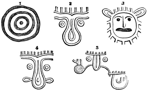
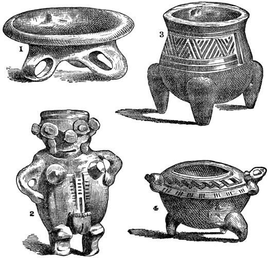
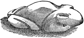
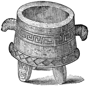
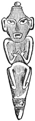
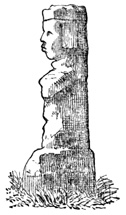
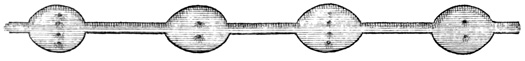
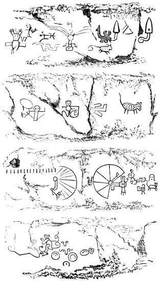
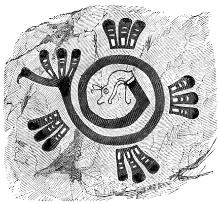
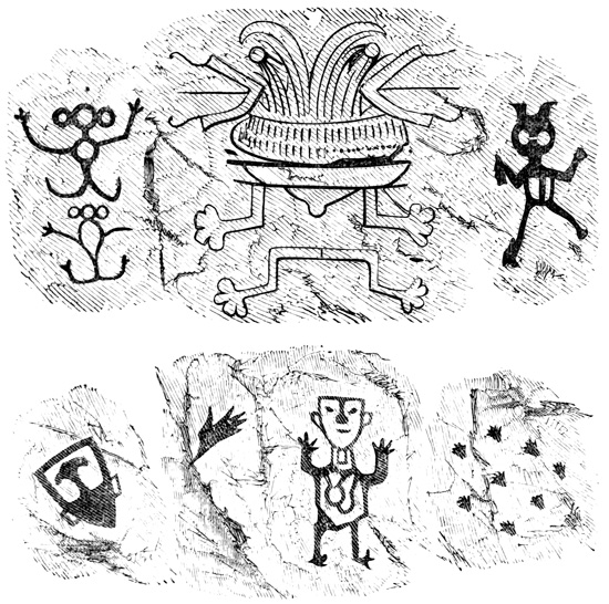
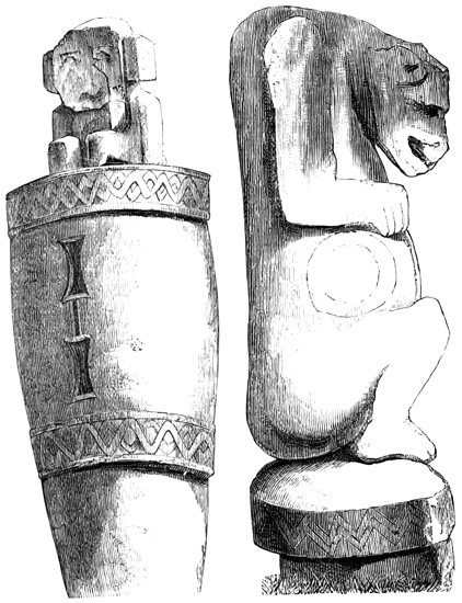
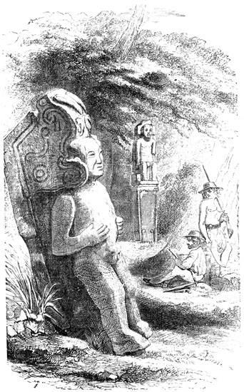
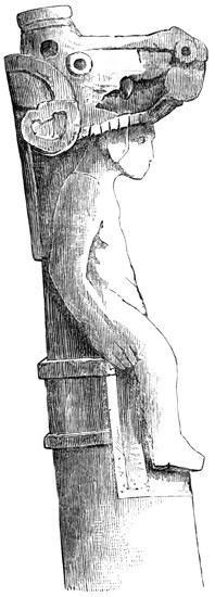
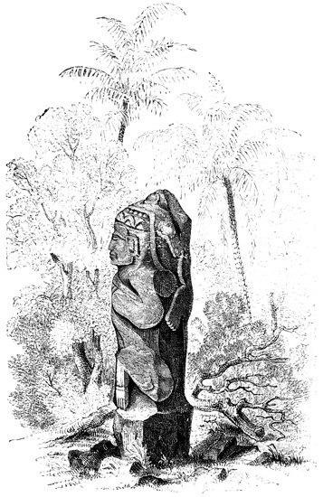
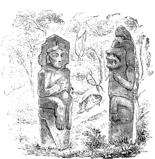
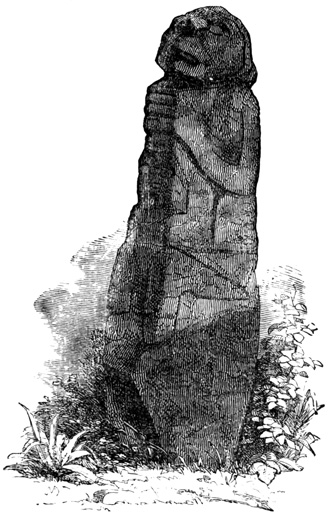
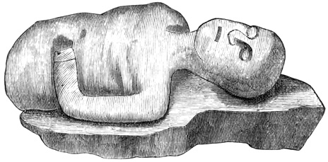
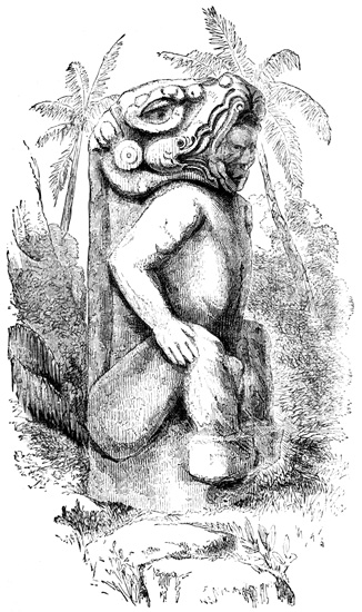
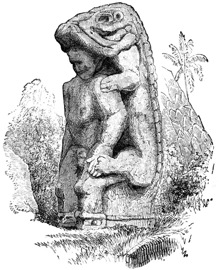
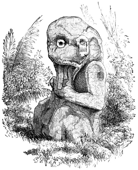
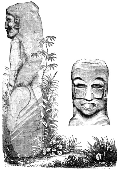
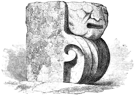
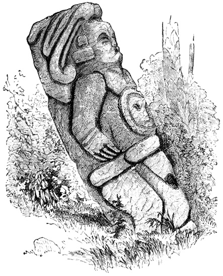
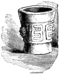
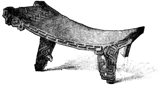
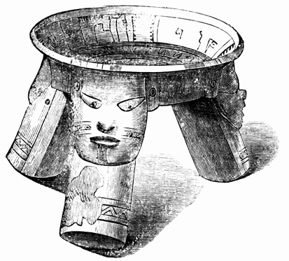
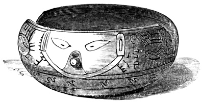
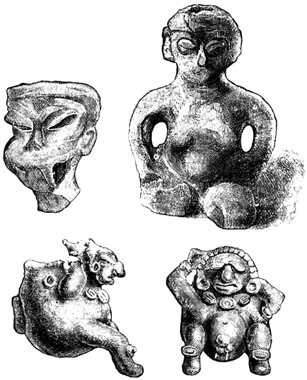
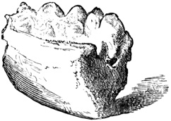
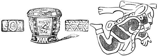
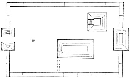
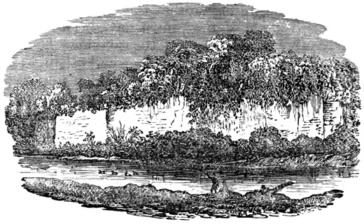
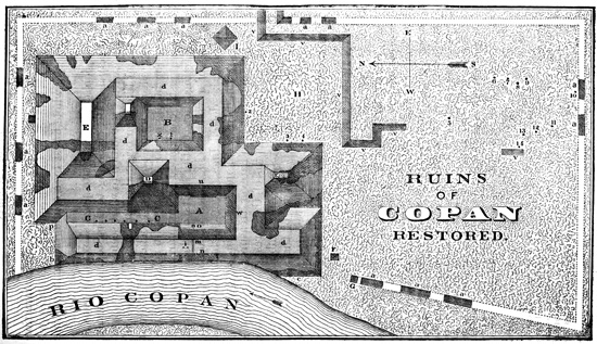
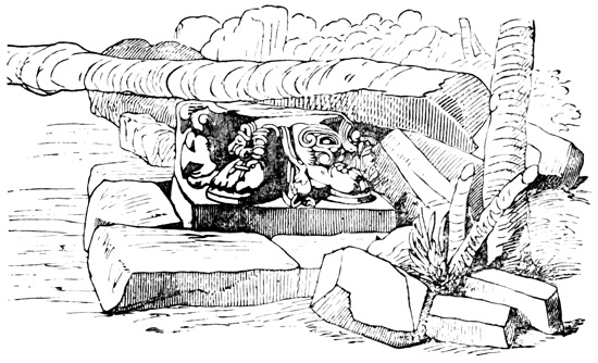
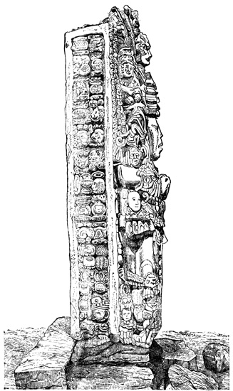
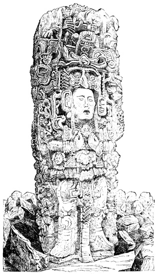
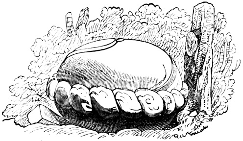
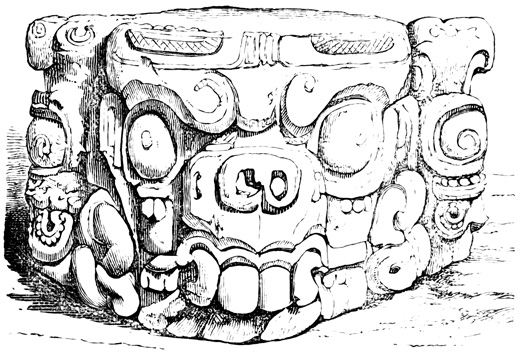
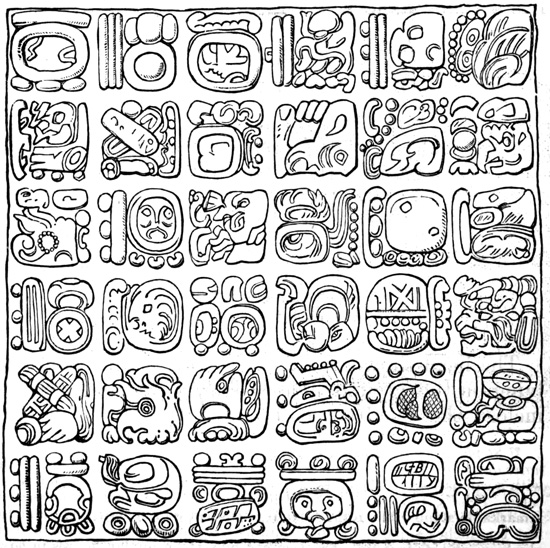
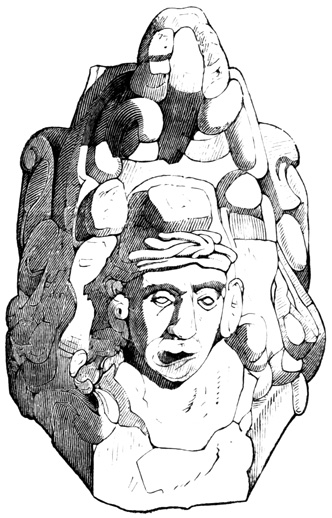
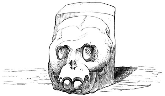
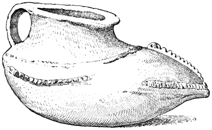
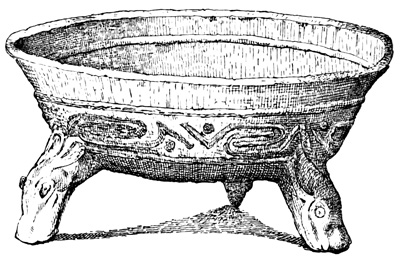
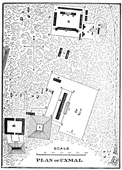

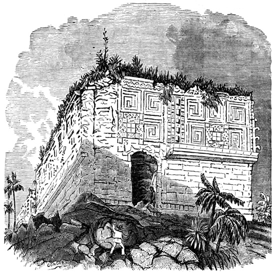
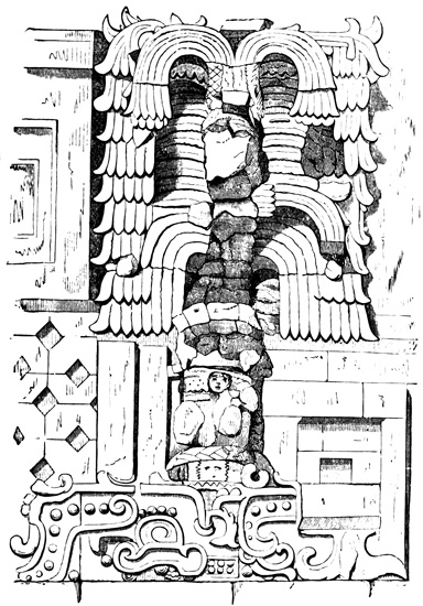
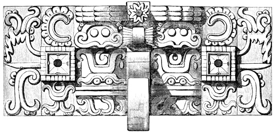
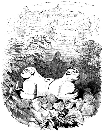
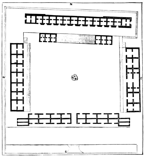
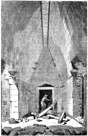
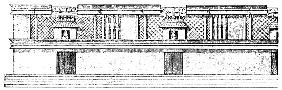
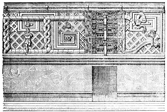

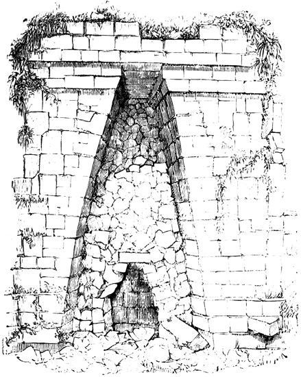
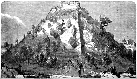
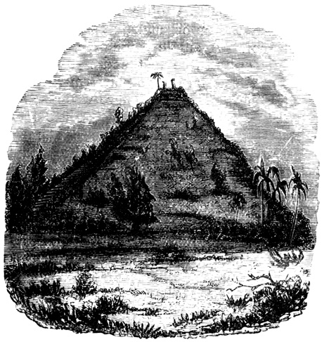
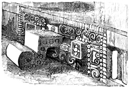
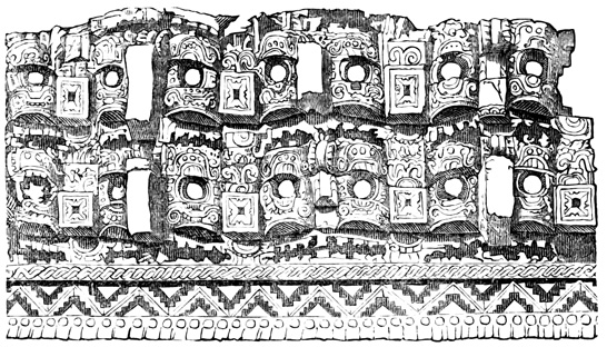
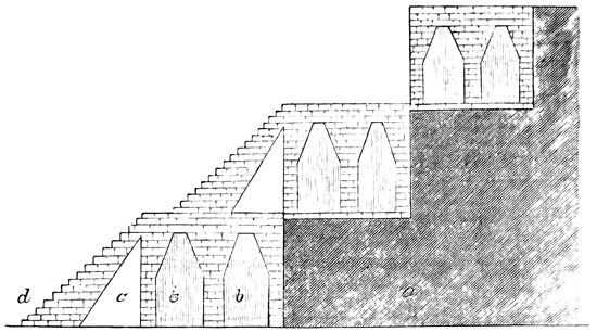
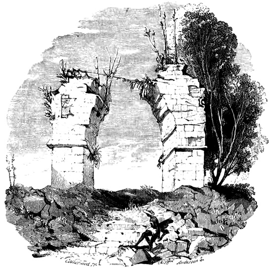
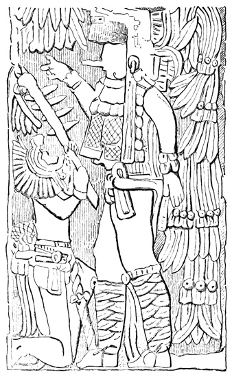
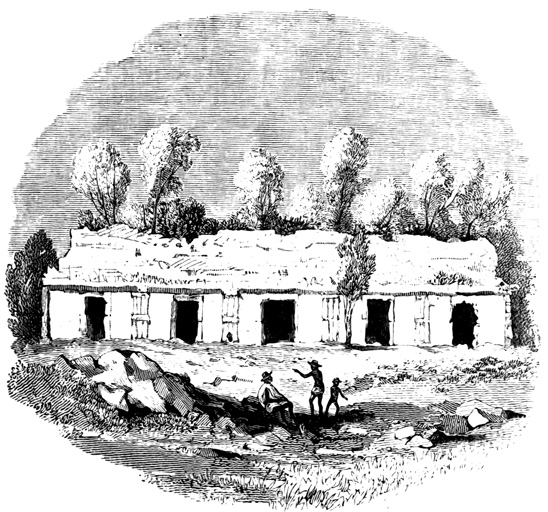
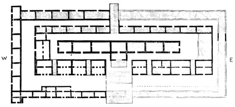
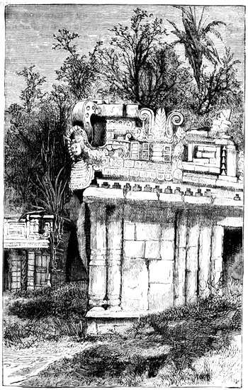
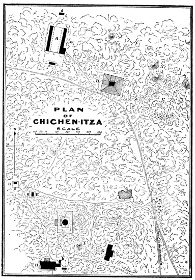
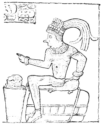
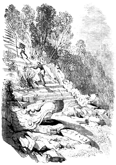
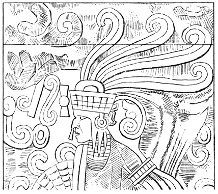
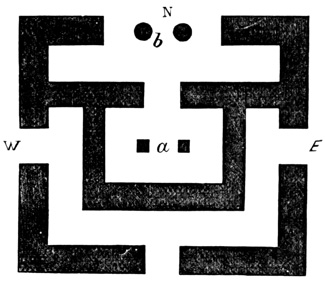
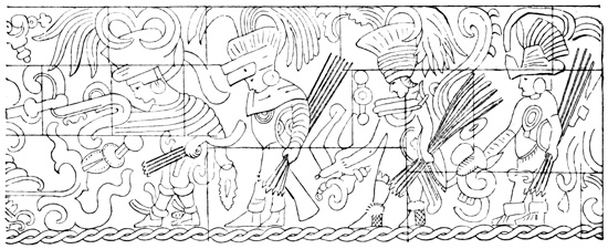
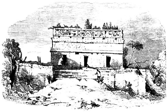
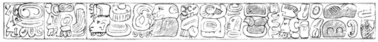
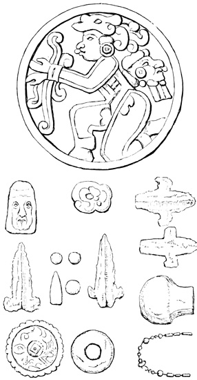
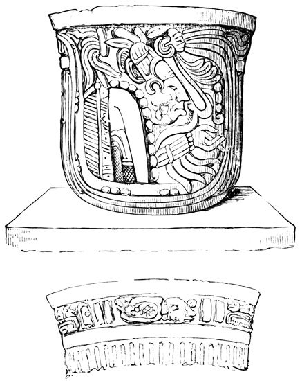
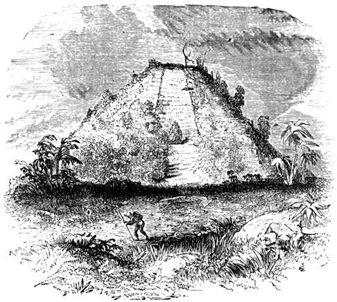
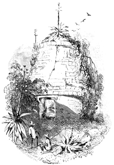
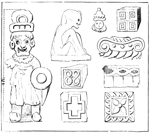
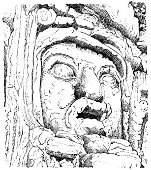
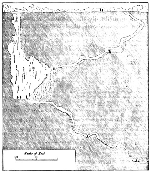
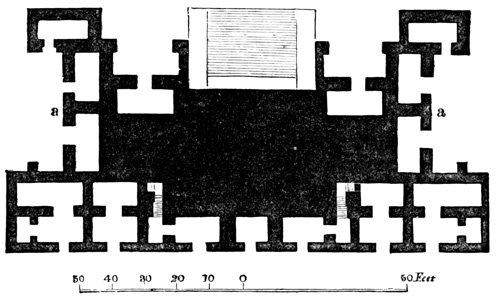
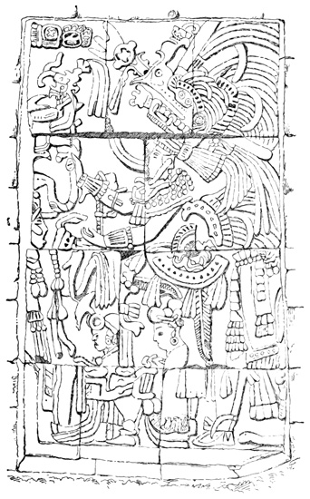
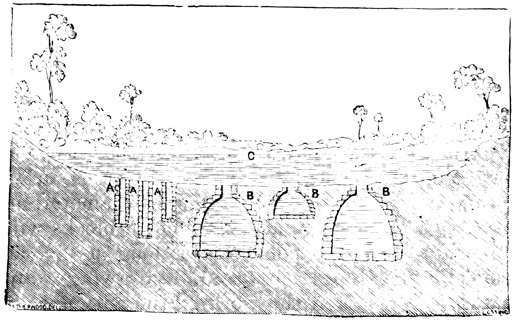
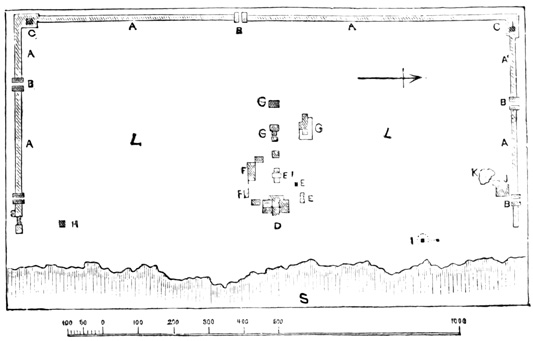
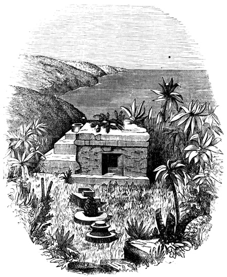
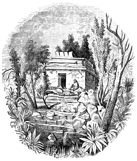
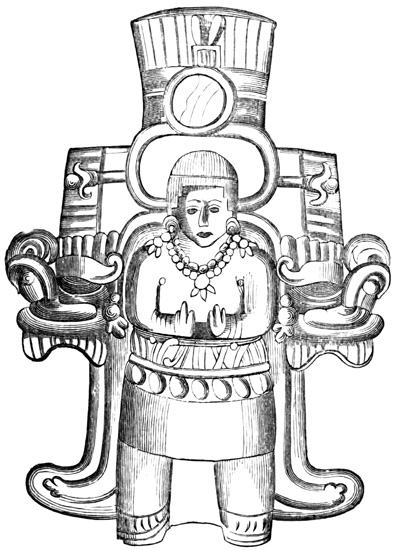
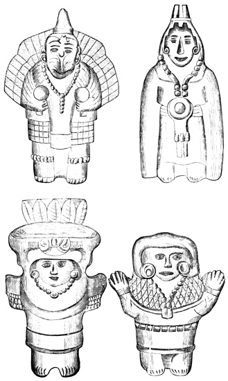
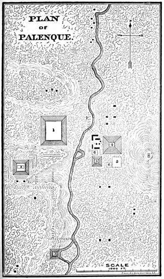
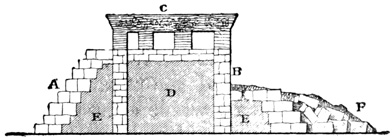
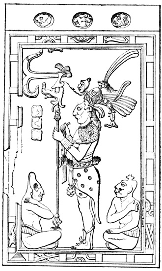
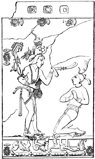
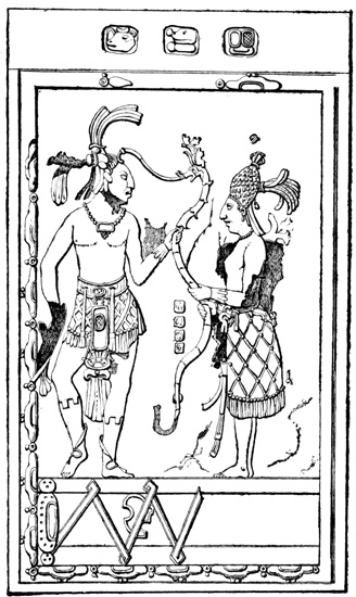
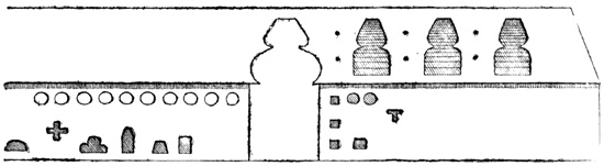
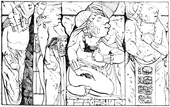
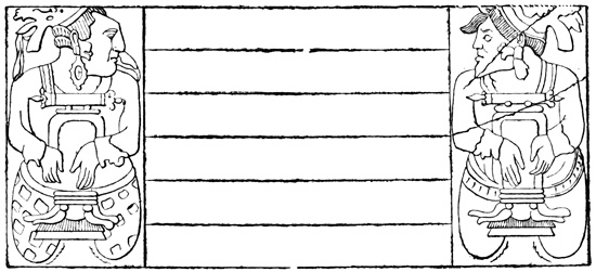
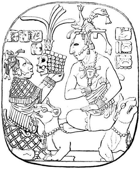
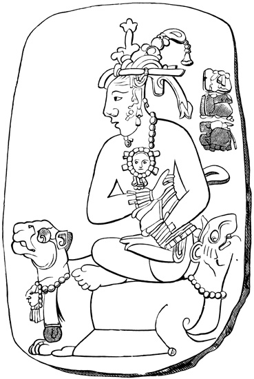
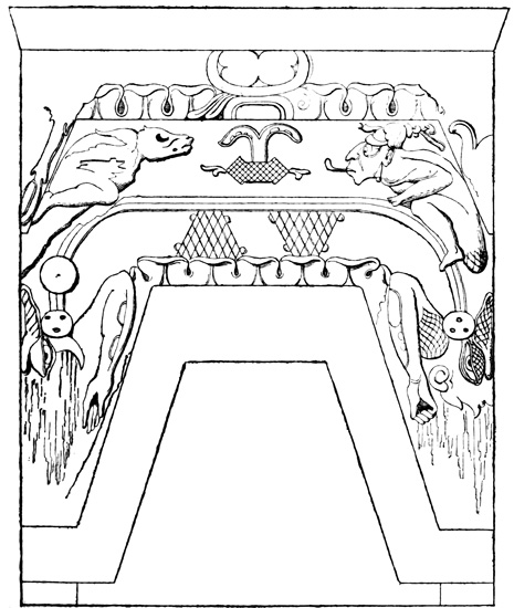
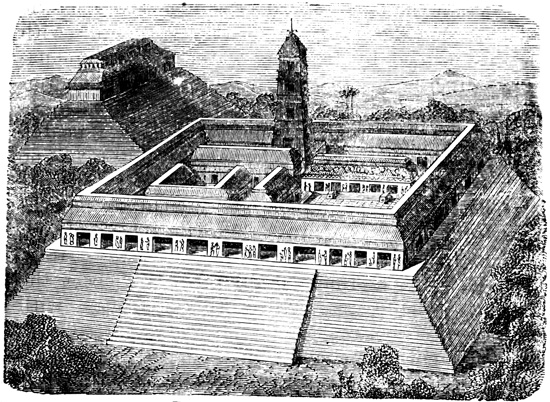
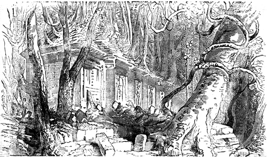
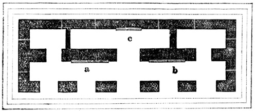

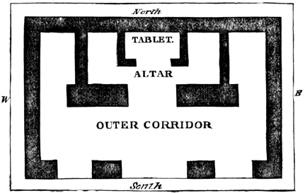
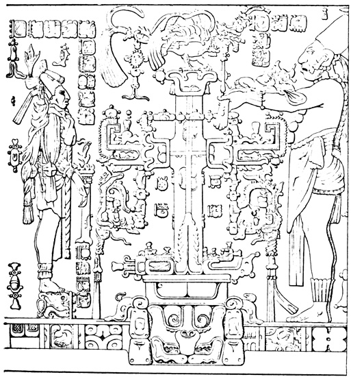
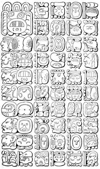
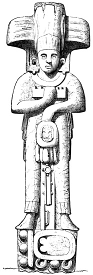
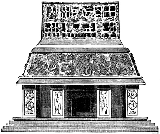
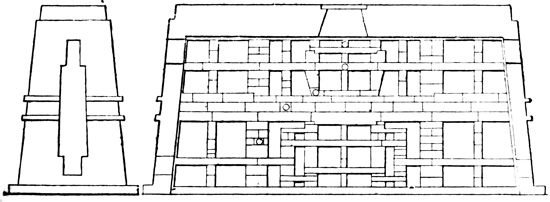
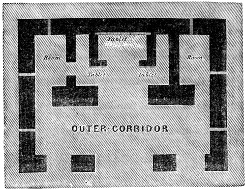
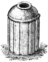
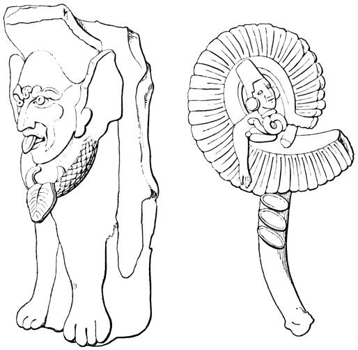
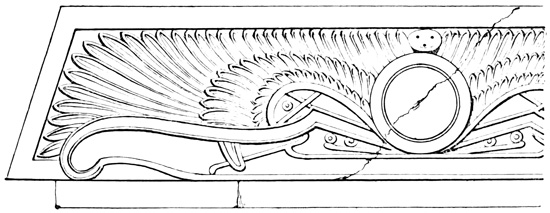
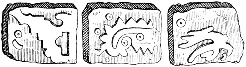
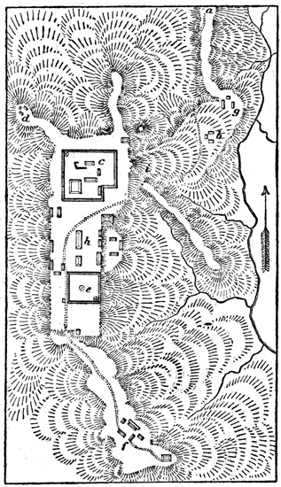
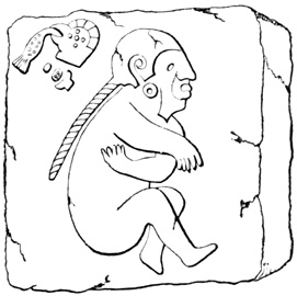
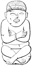
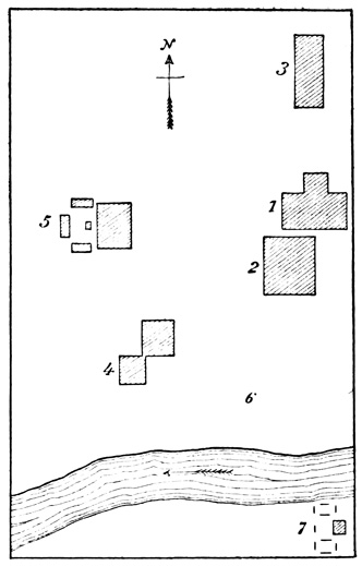
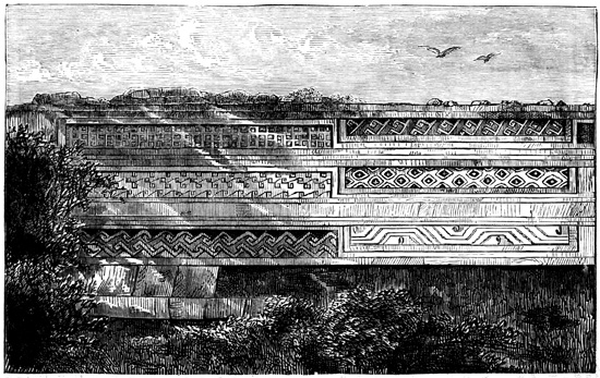
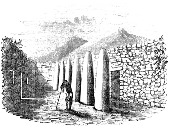
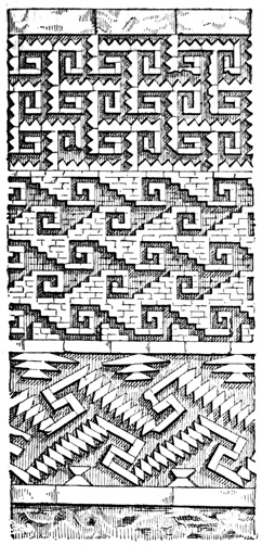
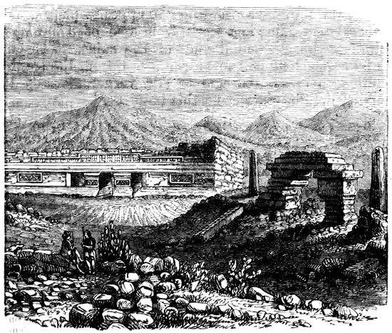
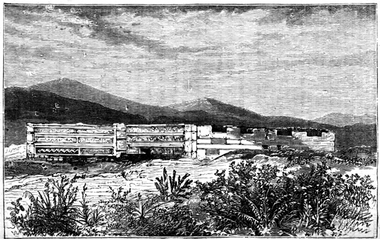
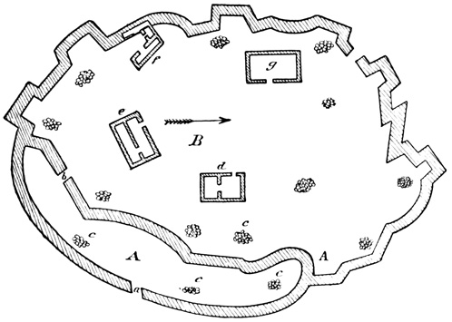
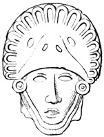
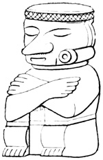
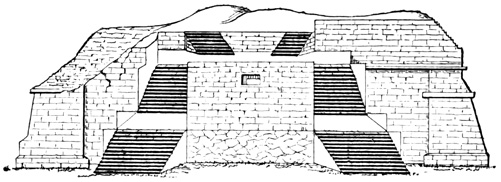
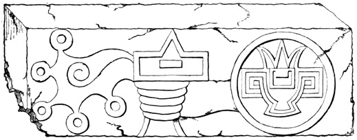
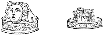
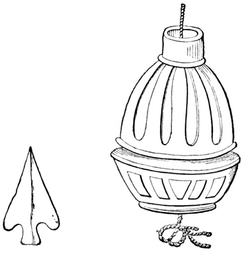
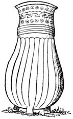
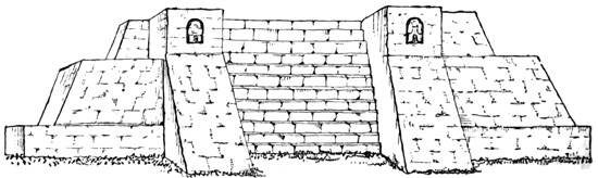
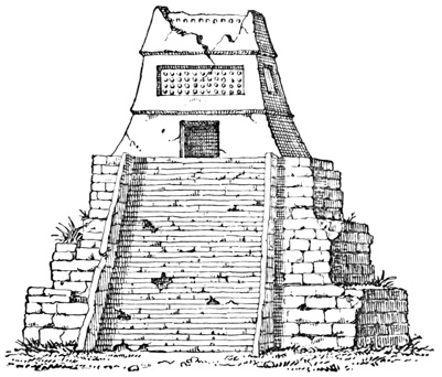
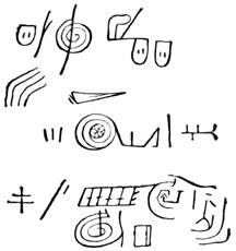
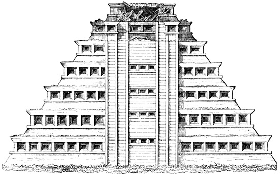
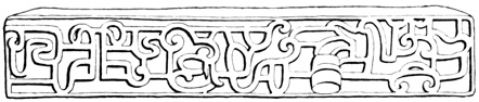
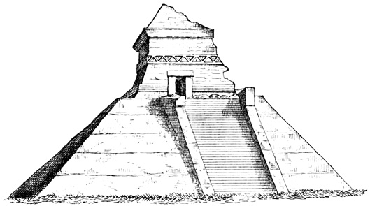
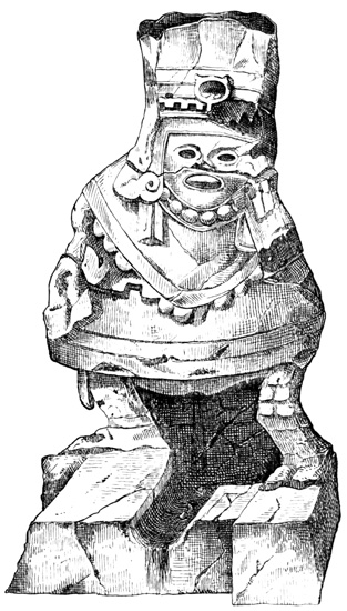
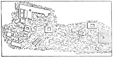
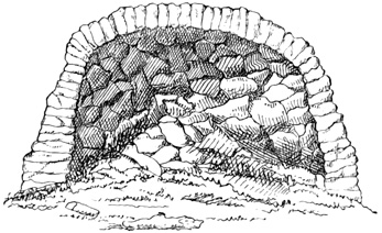
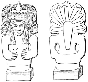
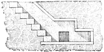
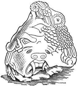
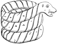
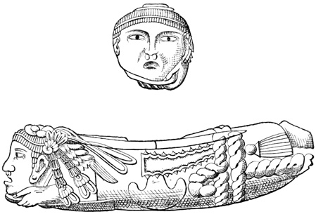
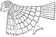

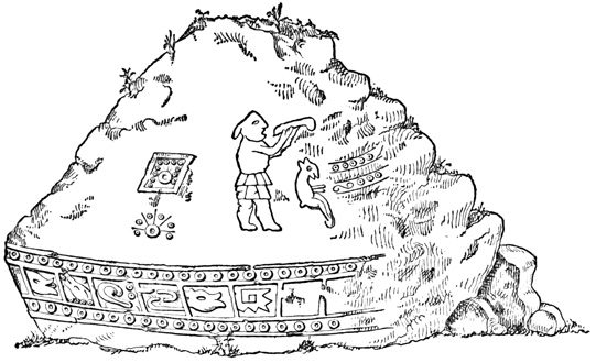
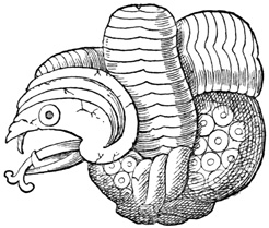
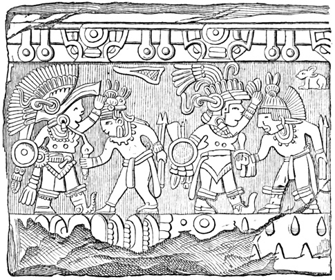
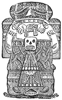
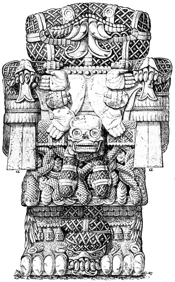
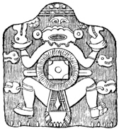
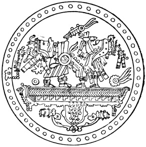
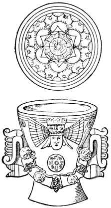
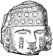
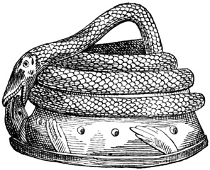
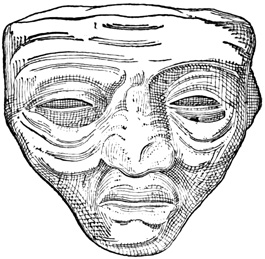
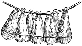
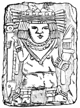

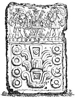
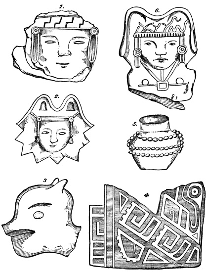
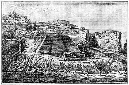
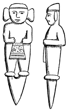
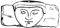
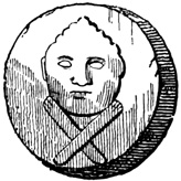
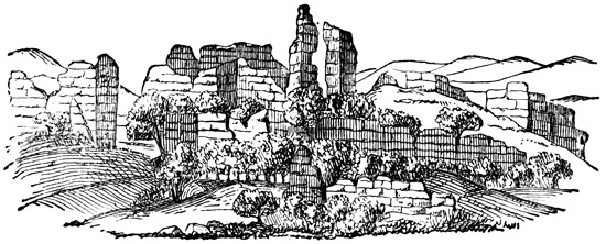
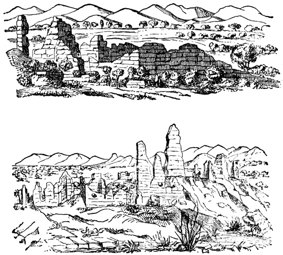

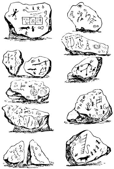
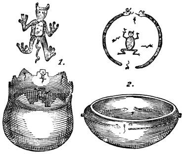
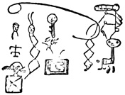
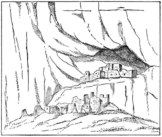
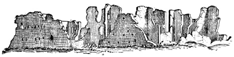
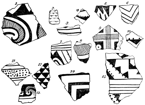
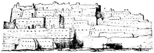
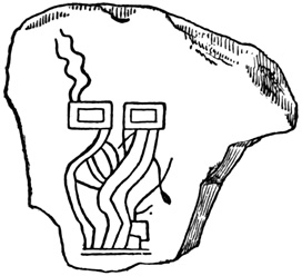
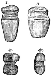
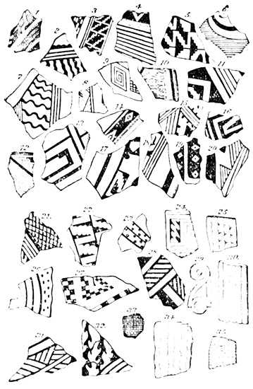
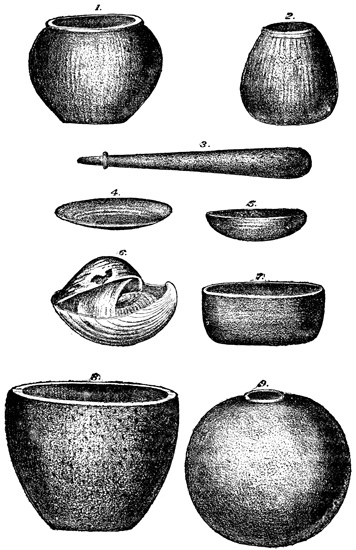
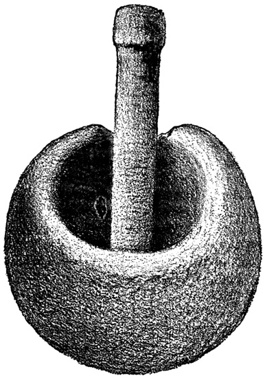
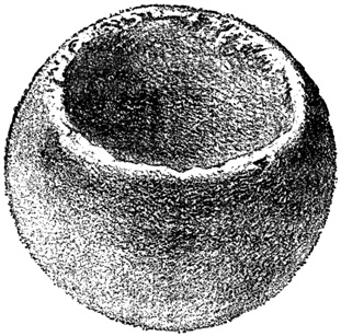
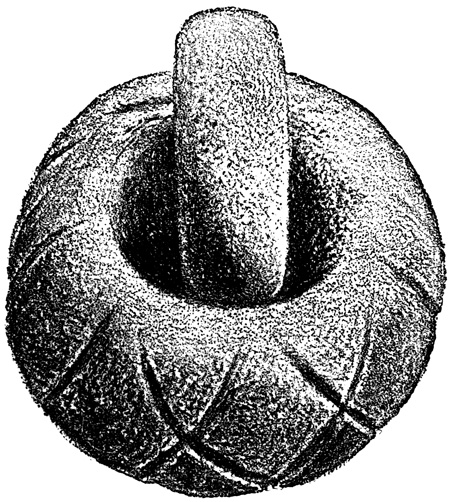
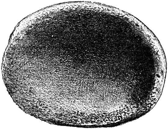
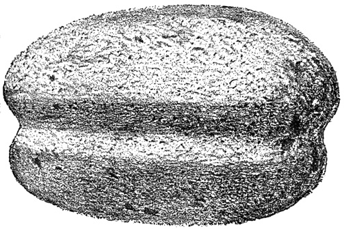
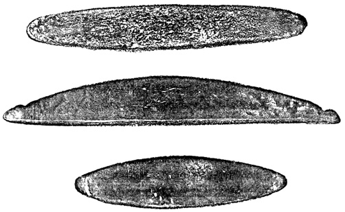
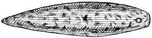
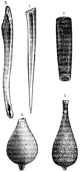
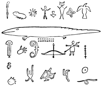
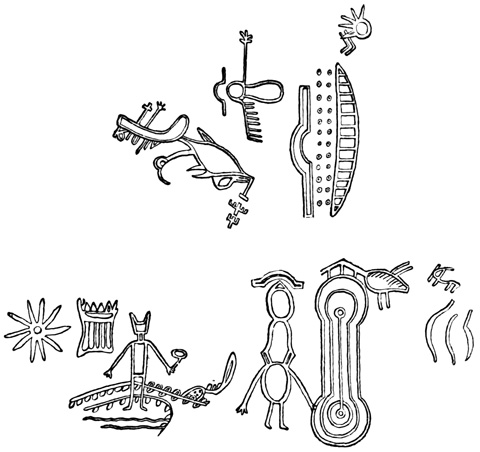
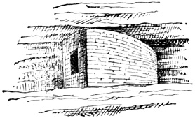
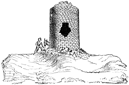
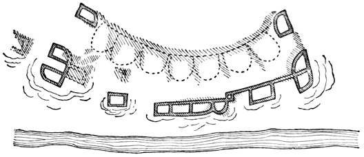

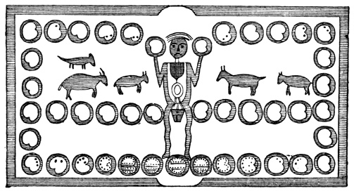
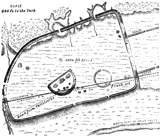
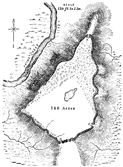
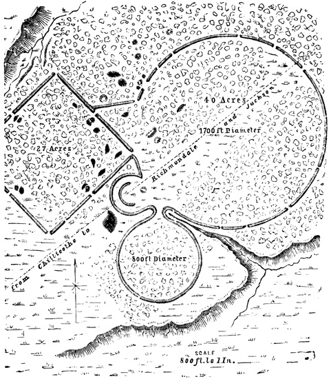
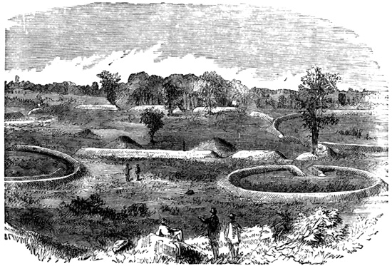
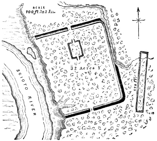

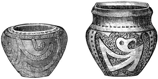
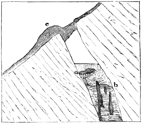
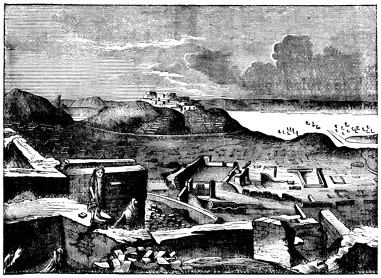

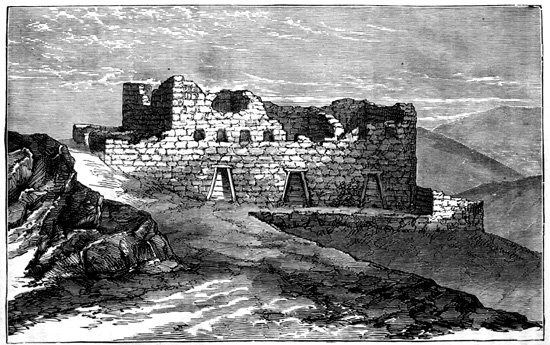
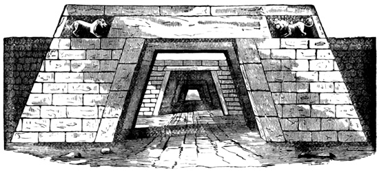
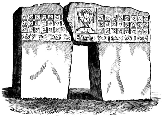
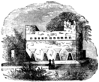
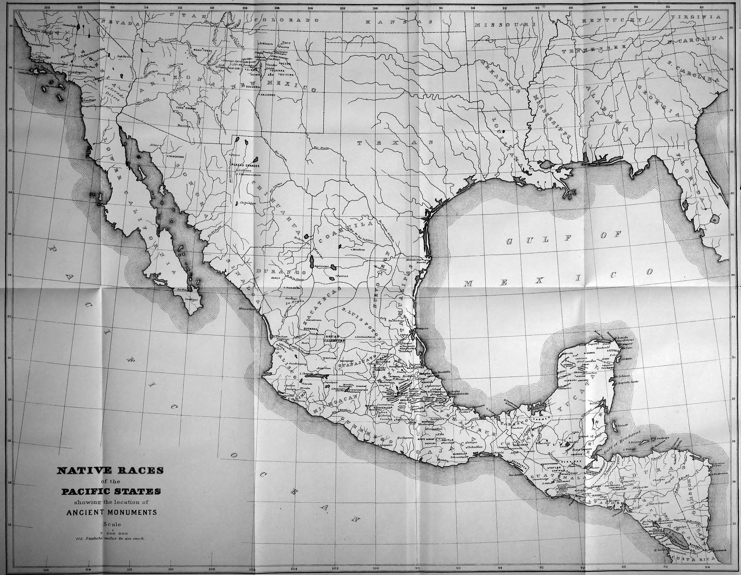
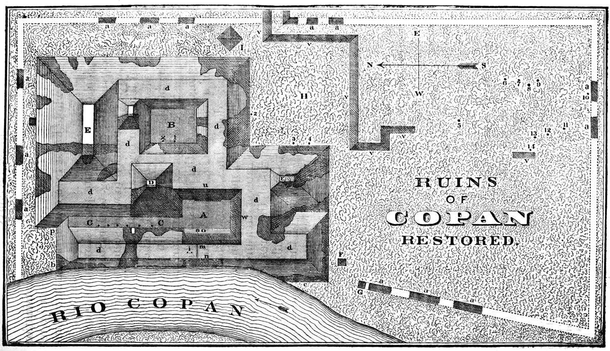
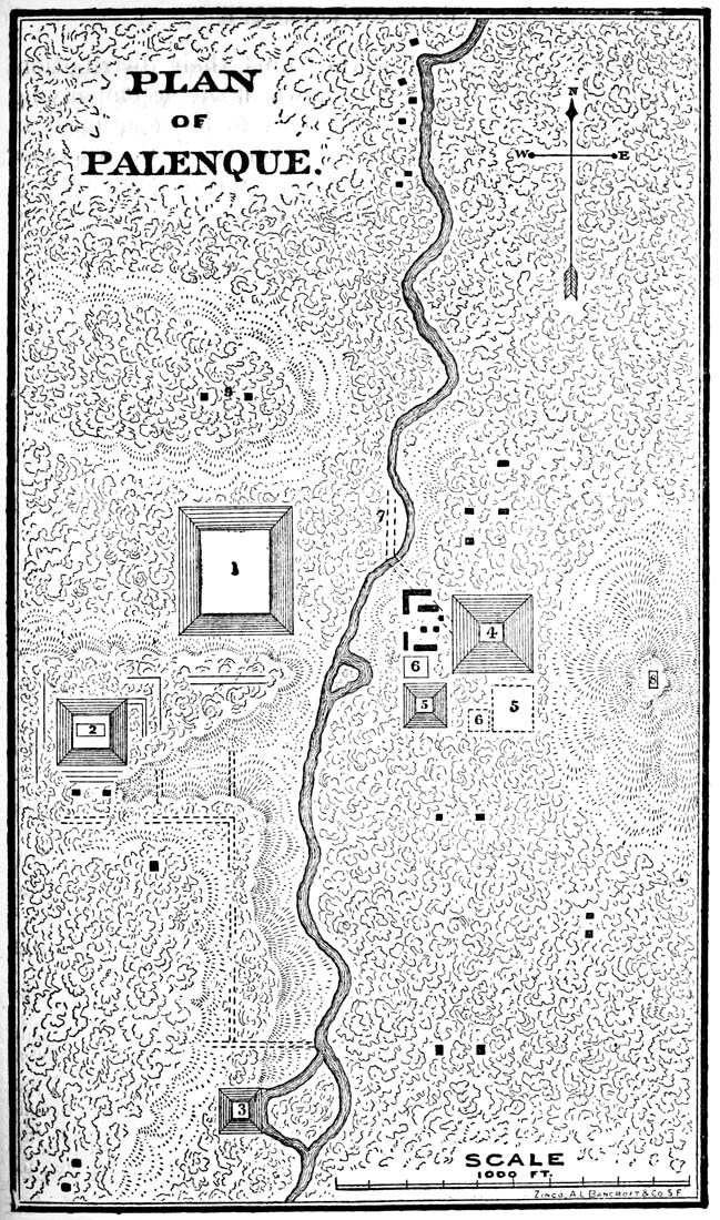
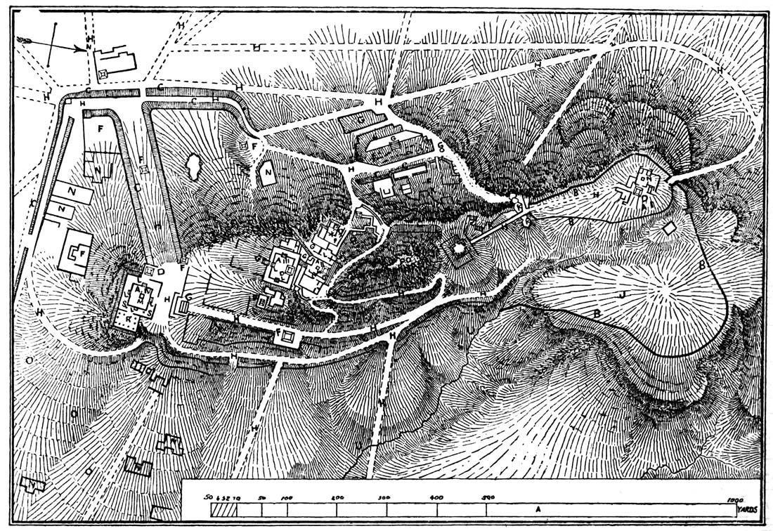